

Download - Coordinates
Download - Coordinates
Download - Coordinates

Create successful ePaper yourself
Turn your PDF publications into a flip-book with our unique Google optimized e-Paper software.
ISSN 0973-2136<br />
RNI: DELENG/2005/15153 No: DL(E)-01/5079/11-13<br />
Publication: 15 th of every month Licensed to post without pre-payment U(E) 28/2011-13<br />
Posting: 19 th /20 th of every month at NDPSO Rs.100<br />
Volume VIII, Issue 12, December 2012 THE MONTHLY MAGAZINE ON POSITIONING, NAVIGATION AND BEYOND<br />
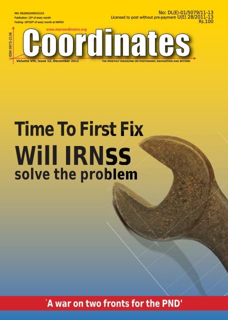
Time To First Fix<br />
Will IRNSS<br />
solve the problem<br />
`A war on two fronts for the PND'
www.trimble.com
COLOPHON AND CONTENTS<br />
In this issue<br />
<strong>Coordinates</strong> Volume 8, Issue 12, December 2012<br />
Articles<br />
Time To First Fix: Will IRNSS solve the problem? VYASARAJ GURU RAO AND GÉRARD LACHAPELLE 8 Responding<br />
to the Great East Japan Earthquake TORU NAGAYAMA, KAZUO INABA, TAMOTSU HAYASHI AND HIROYUKI NAKAI 14 ITU-R<br />
Recommendations on RNSS systems 22 A war on two fronts for the PND ZHONG MING NG 24 Data<br />
integration and sharing for disaster management JOHN SF FABIC 35 Datum transformations using<br />
exclusively geodetic curvilinear coordinates without height information DIMITRIOS AMPATZIDIS 42<br />
Columns<br />
My <strong>Coordinates</strong> EDITORIAL 6 Conference INTERGEO 2012 45 News GNSS 46 INDUSTRY 48 IMAGING 51 GALILEO UPDATE 52 GIS<br />
54 LBS 55 Mark your calendar JANUARY 2013 TO AUGUST 2013 56<br />
This issue has been made possible by the support and good wishes of the following individuals and companies Dimitrios<br />
Ampatzidis, Gérard Lachapelle, Hiroyuki Nakai, John SF Fabic, Kazuo Inaba, Tamotsu Hayashi, Toru Nagayama, Vyasaraj<br />
Guru Rao and Zhong Ming Ng; and Ashtech, CHC, Datem, Effi gis, Foif, Geneq, Hemisphere GPS, HiTarget, Javad,<br />
LabSat, MicroSurvey, Navcom, NovAtel, Pentax, Seafl oor, Sensonor, South, Trimble, Unistrong and many others.<br />
Mailing Address<br />
50 A Pocket A<br />
SFS Mayur Vihar Phase III<br />
Delhi 110 096, India.<br />
Phones +91 11 22632607, 98102 33422, 98107 24567<br />
Fax +91 11 22632607<br />
Email<br />
[information] talktous@mycoordinates.org<br />
[editorial] bal@mycoordinates.org<br />
[advertising] sam@mycoordinates.org<br />
[subscriptions] iwant@mycoordinates.org<br />
Web www.mycoordinates.org<br />
<strong>Coordinates</strong> is an initiative of cGIT that aims to broaden the<br />
scope of positioning, navigation and related technologies.<br />
cGIT does not neccesarily subscribe to the views expressed<br />
by the authors in this magazine and may not be held<br />
liable for any losses caused directly or indirectly due to the<br />
information provided herein. © cGIT, 2012. Reprinting with<br />
permission is encouraged; contact the editor for details.<br />
Annual subscription (12 issues) [India] Rs.1,200<br />
[Overseas] US$80<br />
Printed and published by Sanjay Malaviya on behalf of<br />
Centre for Geoinformation Technologies at A221 Mangal<br />
Apartments, Vasundhara Enclave, Delhi 110096, India.<br />
Editor Bal Krishna<br />
Owner Centre for Geoinformation Technologies<br />
Designed at Spring Design (springdesign@live.com)<br />
Printer Thomson Press India Ltd., B 315, Okhla Phase I,<br />
New Delhi - 110020, India<br />
This issue of <strong>Coordinates</strong> is of 60 pages, including<br />
cover.
MYCOORDINATES<br />
Expressions v Oppression<br />
Recently, the arrests of some unsuspecting citizens<br />
For their alleged ‘offensive comments’ in twitter and facebook,<br />
In the biggest democracy of the world,<br />
Triggered a debate on ‘freedom’ of ‘expression’.<br />
The society and system, both are struggling<br />
To adapt and evolve,<br />
To the tune and tenor of technology,<br />
Which is set to redefi ne,<br />
The mode, medium and language of communication.<br />
If authorities are required to take a more liberal legal interpretation<br />
In their assertions,<br />
The champions of freedom of speech<br />
Also need moderation.<br />
<strong>Coordinates</strong> wishes readers the best for year 2013<br />
Bal Krishna, Editor<br />
bal@mycoordinates.org<br />
ADVISORS Naser El-Sheimy PEng, CRC Professor, Department of Geomatics Engineering, The University of Calgary Canada, George<br />
Cho Professor in GIS and the Law, University of Canberra, Australia, Professor Abbas Rajabifard Director, Centre for SDI and Land<br />
Administration, University of Melbourne, Australia, Luiz Paulo Souto Fortes PhD Associate Director of Geosciences, Brazilian Institute of<br />
Geography and Statistics -IBGE, Brazil, John Hannah Professor, School of Surveying, University of Otago, New Zealand<br />
6 | <strong>Coordinates</strong> December 2012
GNSS<br />
Time To First Fix<br />
Will IRNSS solve the problem?<br />
This article provides a top level description of methods to achieve fast Time To First Fix<br />
(TTFF) and characterizes it using GPS and GLONASS L1 receiver, then generalizes the result<br />
for emerging systems such as the Indian Regional Navigation Satellite System<br />
8 | <strong>Coordinates</strong> December 2012<br />
Vyasaraj Guru Rao<br />
University of Calgary,<br />
Canada & Accord<br />
Software & Systems Pvt<br />
Ltd, Bangalore, India<br />
Gérard Lachapelle<br />
Professor of Geomatics<br />
Engineering, University<br />
of Calgary, Canada<br />
Amongst GNSS receiver design<br />
criteria such as accuracy, sensitivity,<br />
channels etc., the Time To First Fix<br />
(TTFF) is an important criterion, which<br />
defi nes how fast a navigation solution<br />
is available to the user since receiver<br />
power on. TTFF is defi ned as the time<br />
that a receiver takes to acquire and<br />
track a minimum of four satellites<br />
and extract the necessary information<br />
(ephemeris - primary parameter) from<br />
the demodulated navigation data bits.<br />
In the past decade, there has been a<br />
constant demand from the user community<br />
to optimize TTFF specifi cations. For<br />
example, for E911 use, Global Navigation<br />
Satellite System (GNSS) receivers<br />
integrated as a part of mobile handsets<br />
obtain assistance from a base station<br />
(terrestrial link) to enhance the TTFF.<br />
This article provides a top level description<br />
of methods to achieve fast TTFF and<br />
characterizes it using GPS and GLONASS<br />
L1 receiver, then generalizes the result<br />
for emerging systems such as the Indian<br />
Regional Navigation Satellite System<br />
(IRNSS). Using an example, the need<br />
for Fast TTFF in single frequency<br />
mode of operation is illustrated. A brief<br />
overview of receiver operations is fi rst<br />
presented from a TTFF perspective.<br />
Receiver Operations<br />
leading to TTFF<br />
The signal emerging from GPS<br />
satellite and available on the user<br />
antenna can be modelled as [1]<br />
(1)<br />
where<br />
– Carrier power of the transmitted signal<br />
– Ranging code, chipped at 1.023 MHz<br />
– Signal transmission frequency<br />
1575.42 MHz, BPSK signal<br />
– Navigation data transmitted<br />
at 50 Hz rate<br />
At a top level, the receiver needs to solve<br />
three unknowns in position - latitude,<br />
longitude and altitude and receiver time,<br />
based on the measurements performed<br />
on the signal Eq. (1). Typically, the<br />
measurements within a receiver are<br />
generated from a relatively inferior<br />
grade oscillator in comparison with the<br />
onboard atomic clock [2]. To facilitate<br />
position estimation, measurements need<br />
to be synchronous to the satellite clocks,<br />
which necessitate the estimation of the<br />
local clock misalignment [3]. With this<br />
as the fourth unknown, position and<br />
time solution mandates measurements to<br />
four satellites for navigation estimation.<br />
Based on measurements to four satellites,<br />
a user position solution is obtained.<br />
The Radio Frequency (RF) signals from<br />
the satellites incident on the user antenna<br />
are processed in the RF down conversion<br />
of the receiver, which generates suitable<br />
digital Intermediate Frequencies (IF)<br />
for further baseband processing. Signal<br />
detection and measurements are performed<br />
on the baseband signals. Detection involves<br />
estimating the signal in code and Doppler<br />
dimension and measurements, in the<br />
estimatio of pseudorange and range rates.<br />
In addition, the Navigation (NAV) data<br />
obtained from the detection process enables<br />
the receiver to estimate the satellite position.<br />
This along with measurements enables
F igure 1: Functional blocks of a typical GNSS receiver from antenna to navigation output<br />
navigation solution estimation. The TTFF<br />
consists of operations from processing the<br />
signal incident on the user antenna leading<br />
to position computation post power-on.<br />
A GNSS user whose primary objective is<br />
to obtain the navigation solution would<br />
require it immediately from poweron.<br />
The need for fast TTFF is a major<br />
specifi cation of handheld and critical<br />
military applications. The following section<br />
explains in detail the various methods<br />
practised in industry to enhance TTFF.<br />
Fast TTFF methods - Without<br />
external assistance<br />
Based on the inputs (ephemeris, almanac,<br />
user position and time) available at<br />
power-on, a receiver is categorized<br />
into four different modes - Cold,<br />
Warm, Hot and Snap. The following<br />
paragraph explains each mode of receiver<br />
operation and its achievable TTFF.<br />
Cold start<br />
In this mode of operation, a receiver has no<br />
prior inputs available within the receiver.<br />
With power-on, the receiver needs to search<br />
for satellites available from the entire<br />
constellation. Subsequently, the system time<br />
estimation, measurements to four satellites<br />
and NAV data collection are performed.<br />
For GPS L1, this process takes 32 to 36<br />
s assuming the initial search is based on<br />
fast signal acquisition algorithms [2].<br />
Warm start<br />
These receivers have access to satellites’<br />
almanac, approximate user position and<br />
time as shown in Figure 2. They are<br />
either supplied externally or maintained<br />
internally in the receiver. In the internal<br />
confi guration case, the time at the last<br />
power cycle is maintained and estimated<br />
typically in Real Time Clock (RTC).<br />
Similarly, user position and almanac<br />
are maintained in non-volatile memory<br />
of baseband processing section. The<br />
advantages of these parameters are<br />
twofold: First, the receiver will be able to<br />
compute the list of visible satellites and<br />
restrict the signal detection to those fewer<br />
satellites (than complete constellation) that<br />
are actually above the horizon. Second,<br />
with the almanac, the receiver will be able<br />
to compute approximate satellite position;<br />
with such an approximate user position,<br />
the geometric range can be established.<br />
This results in a reduced search range<br />
in the code and Doppler domain, which<br />
enhances acquisition time. Subsequently,<br />
Fi gure 2: Receiver start modes presenting the estimates<br />
available at power-on and achievable TTFF<br />
the remaining operations leading to TTFF<br />
is similar to cold start and takes 32 s.<br />
Hot start<br />
In addition to the warm start estimates,<br />
with a valid ephemeris at power-on,<br />
TTFF reduces to 6-8 s and this mode<br />
of operation is termed as Hot start [1].<br />
With ephemeris, the only parameter that<br />
needs to be established is the system<br />
time. Typically, this mode is adopted<br />
in most automotive grade receivers.<br />
Snap start<br />
The last mode of receiver operation<br />
is the Snap start where, in addition<br />
to Hot start parameters, the receiver<br />
clock is also estimated internally. The<br />
advantage with this approach is further<br />
reduction of system time estimation.<br />
With bit synchronization established<br />
on four satellites, TTFF is achieved<br />
instantaneously. This mode assumes that<br />
the receiver was powered on recently [2].<br />
Fast TTFF - Assisted<br />
GPS (AGPS)<br />
The various start modes assumed receivers<br />
have the necessary information stored as<br />
a part of its internal memory or assisted<br />
from external network, the former<br />
<strong>Coordinates</strong> December 2012 | 9
eing receiver specifi c, the latter being<br />
addressed by AGPS. AGPS works on the<br />
principle of client server architecture,<br />
with the receiver (handset) operated as<br />
client. Based on the levels of service<br />
offered, AGPS can be categorized as:<br />
Ephemeris Assistance and Absolute [2].<br />
Ephemeris assistance is similar to the Hot<br />
start mode of operation. With a link to the<br />
server, the receiver will be able to obtain<br />
approximate position, time and ephemeris.<br />
Subsequently, the receiver operations are<br />
similar to Hot start with an achieved TTFF<br />
of the order of 6-8 s. This mode assumes<br />
the receiver to have a constant link with<br />
the server, synchronize to the network<br />
and thus be able to predict the code and<br />
the Doppler search ranges precisely. The<br />
absolute mode of AGPS is similar to<br />
the Snap start mode of receiver, which<br />
provides the TTFF in 2-3 s. However, the<br />
load on the server is higher in comparison<br />
with the ephemeris assistance mode [2].<br />
TTFF characterisation<br />
With the details of receiver start modes,<br />
the next step is to experimentally<br />
understand the TTFF from power-on and<br />
quantify various parameters underlying<br />
it. Towards this, the experimental setup<br />
shown in Figure 3 is employed [4].<br />
Test apparatus<br />
The apparatus consisted of a GPS-<br />
GLONASS receiver from Accord<br />
Software & Systems Pvt Ltd, which<br />
was used as a platform to profi le various<br />
receiver parameters. The receiver<br />
supports 32 GPS and 14 GLONASS<br />
channels. The receiver does not have<br />
the provision of storing or estimating<br />
any parameters from previous power-on<br />
or hardware to support external data.<br />
Procedure<br />
The receiver was connected to a GPS<br />
GLONASS antenna, placed in a surveyed<br />
location under open sky. A Digital Storage<br />
Oscilloscope (DSO) is connected to the<br />
boot-pin of the Digital Signal Processor<br />
(DSP) to profi le the application boot time<br />
10 | <strong>Coordinates</strong> December 2012<br />
Fig ure 3: TTFF characterization test apparatus highlighting the boot-time captured on DSO.<br />
(time required to load the software to DSP<br />
post power-on). Th e boot-time with this<br />
receiver is around 250 ms, as shown in<br />
Figure 3. Generalizing this component, let,<br />
be the time taken to boot the receiver<br />
application (2)<br />
Subsequent to booting, the receiver<br />
is programmed with 32 GPS and 14<br />
GLONASS satellites to respective<br />
channels for further processing.<br />
The satellites visible at the receiver<br />
antenna take between 2 to 8 s for signal<br />
acquisition. This is due to the large<br />
Doppler search range supported by the<br />
receiver. Generalizing this component, let<br />
be the time taken to acquire the<br />
visible satellites (3)<br />
Subsequent to acquisition, each<br />
channel takes a fi nite time for bitsynchronization.<br />
This is around 800<br />
ms. Generalizing this component, let<br />
be the time required for bitsynchronization<br />
(4)<br />
The next<br />
activity on<br />
each of the bitsynched<br />
channel<br />
is the collection<br />
of NAV data,<br />
specifi cally the<br />
ephemeris. This<br />
takes anywhere<br />
between 18 and<br />
30 s for GPS<br />
and 8 and 30 s<br />
for GLONASS<br />
channels,<br />
respectively. Let,<br />
be the time required to collect<br />
ephemeris. (5)<br />
Finally, from the NAV data extracted<br />
and the measurements formulated, the<br />
user position is computed. Using Eq.(2)<br />
through Eq .(5), the TTFF for any Lone<br />
of Sight (LOS) receiver is given by<br />
Subsequently, for each tracked channel,<br />
the almanac is collected, which takes<br />
12.5 minutes from the instant of the<br />
fi rst tracked channel in case of GPS and<br />
2.5 minutes in the case of GLONASS.<br />
Generalizing this component, let<br />
(6)<br />
be the time taken to collect<br />
almanac (7)<br />
Following the almanac collection, the<br />
receiver applies the ionosphere correction<br />
to the pseudoranges to improve accuracy.<br />
Accounting for this correction, the overall<br />
timing equation of the receiver is given by<br />
Figu re 4: Timing diagram of TTFF characterization capturing all the<br />
components and parallel drawn with AGPS mode of operation<br />
(8)
Tab le 1: Distribution of receiver<br />
components leading to TTFF<br />
Parameter Description<br />
Based on 50 trials, the above timing<br />
components are profi led and tabulated i n<br />
Table 1. Figure 4 summarizes the various<br />
timing components of a generic receiver.<br />
Analysis<br />
Assuming the user receiver has a massive<br />
correlator architecture (((1023 correlator/<br />
C/A code chip)/channel), acquisition of<br />
the signal and bit synchronization occurs<br />
approximately in 2 s for all the channels.<br />
It is evident from Table 1 that the major<br />
component underlying the TTFF for an<br />
open sky user is which needs to be reduced<br />
to achieve fast TTFF [4]. Generalizing,<br />
in order to minimize TTFF, achievable<br />
from satellite should be minimized.<br />
Need for fast TTFF<br />
Subsequent to TTFF analysis, studies<br />
were carried out on the ICD and the data<br />
sheets of selected civilian and military<br />
receivers to establish their TTFF for<br />
single and dual frequency operation.<br />
In addition, there is no documentary<br />
Time<br />
taken (%)<br />
Tb Booting time 1<br />
Ta Acquisition time 18<br />
Tbs Time for Bit-synch 2<br />
Teph<br />
Ephemeris<br />
collection time<br />
Figure 5: Positioning in deep forests<br />
without aid to terrestrial link<br />
12 | <strong>Coordinates</strong> December 2012<br />
79<br />
evidence describing the sequence<br />
of operation or assumptions with<br />
which a military signal receiver<br />
operates from power-on leading to<br />
TTFF. The datasheets of receiver<br />
manufacturers supporting military<br />
signals are the sole means to access<br />
related TTFF performance.<br />
Assuming this number represents<br />
the best achievable TTFF for<br />
All In View (AIV) architecture,<br />
military signal cold starts are at<br />
most comparable to civilian ones.<br />
The following describes an example<br />
highlighting the limitations of the<br />
LOS TTFF achievable in single<br />
frequency. A user with a handheld<br />
unit would expect it to output position<br />
immediately from power-on. In the<br />
scenario shown in Figure 1, it is not<br />
practical to have a terrestrial link. This<br />
requires that the TTFF achievable<br />
from the satellite be minimal.<br />
H owever, from a single frequency<br />
perspective the existing (GPS and<br />
GLONASS L1) or the emerging (GPS<br />
L2C, GPS L5 and GALILEO) systems<br />
are not optimal w.r.t TTFF. With some<br />
improvements in FNAV method of NAV<br />
data transmission in GALILEO, the<br />
TTFF is reduced in dual frequency [5].<br />
The above shows how the TTFF of the<br />
IRNSS might be enhanced in order to lead<br />
to better performance. IRNSS a regional<br />
system, the benefi ts should be derived<br />
in single and dual mode of receiver<br />
operation [4]. In addition, if an additional<br />
frequency to the existing proposed L5<br />
and S1 of IRNSS is added, it can assist<br />
the TTFF of GNSS in AGPS/HOT start<br />
mode of operation [6]. The parameters<br />
to be established are given in Table 2.<br />
Conclusion<br />
This article described the top level<br />
operations of a GNSS receiver leading to<br />
position estimation. The methods employed<br />
within a receiver and using AGPS external<br />
assistance to enhance signal acquisition<br />
and reduce the TTFF were introduced. The<br />
Table 2: TTFF design parameters<br />
to be established for IRNSS<br />
analysis of TTFF w.r.t various receiver<br />
parameters were presented. It was shown<br />
that the TTFF is largely dictated by<br />
. Using a real world scenario, the<br />
need for an effective LOS TTFF from the<br />
satellites was illustrated. TTFF being a<br />
design parameter for any GNSS system,<br />
the article presented requirements under<br />
different mode of operation for civilian and<br />
military cases that will assist in establishing<br />
optimal IRNSS TTFF parameters.<br />
Acknowledgements<br />
The fi rst author would like to thank<br />
the management of Accord Software<br />
& Systems Pvt Ltd India for partially<br />
supporting his doctoral studies.<br />
References<br />
Ka plan, E.D. and C. Hegarty (2006)<br />
Understanding GPS Priciples and<br />
Applications, Artech House<br />
Van Diggelen, F. (2009) A-GPS: Assisted<br />
GPS, GNSS and SBAS, Artech House<br />
Bao, J. and Y. Tsui (2004) Fundamentals of<br />
Global Positioning System Receivers:<br />
A Software Approach, Wiley Series<br />
Rao, V. G., G. Lachapelle, and M.<br />
Sashidharan (2011) “Proposed LOS<br />
Signal Design for IRNSS to Reduce<br />
TTFF in a Single Frequency Receiver,”<br />
in Proceedings of the GNSS Signals<br />
2011 Workshop, Toulouse, 12 pages<br />
Ga lileo (2008) Galileo Open Service Signal<br />
In Space Interface Control Document,<br />
OS SIS ICD, Draft I, European<br />
Space Agency / European GNSS<br />
Supervisory Authority, http://www.<br />
gsa.europa.eu/go/galileo/os-sis-icd<br />
Rao, V. G., G. Lachapelle, and S.B.<br />
Vijaykumar (2011) “Analysis of<br />
IRNSS over Indian Sub-continent,”<br />
in Proceedings of the International<br />
Technical Meeting, , San Diego, The<br />
Institute of Navigation, 13 pages
DISASTER MANAGEMENT<br />
Responding to the Great<br />
East Japan Earthquake<br />
Geospatial Information Authority of Japan (GSI), the national mapping organization<br />
in the Japanese Government, conducted various activities in response to the Great<br />
East Japan Earthquake which occurred on 11 March 2011. This article summarizes<br />
the activities as well as achievements and challenges recognized<br />
14 | <strong>Coordinates</strong> December 2012<br />
Toru Nagayama<br />
Director-General,<br />
Hokkaido Regional Survey<br />
Department, Geospatial<br />
Information Authority of<br />
Japan, Sapporo, Japan<br />
Kazuo Inaba<br />
Deputy Director-General,<br />
Geospatial Information<br />
Authority of Japan,<br />
Tsukuba, Japan<br />
Tamotsu Hayashi<br />
Executive Offi cer for<br />
Disaster Management,<br />
Planning Department,<br />
Geospatial Information<br />
Authority of Japan,<br />
Tsukuba, Japan<br />
Hiroyuki Nakai<br />
Deputy Director of<br />
International Affairs<br />
Division, Planning<br />
Department, Geospatial<br />
Information Authority of<br />
Japan, Tsukuba, Japan<br />
Geospatial Information Authority<br />
of Japan (GSI) conducts national<br />
surveying and mapping administration.<br />
Historically, it dates back to 1869 when<br />
the Cadastral Registration Map Section<br />
was established in the offi ce of Geography<br />
Department, Ministry of Civil Service.<br />
Later in 1888, it was reorganized as<br />
Japanese Imperial Land Survey, and<br />
then it became the Geographical Survey<br />
Institute in former Home Ministry in<br />
1945. Its offi cial English appellation<br />
was changed to ‘Geospatial Information<br />
Authority of Japan’ in April 2010.<br />
Main measures and activities of GSI are:<br />
- Observing and providing positional<br />
information (longitudes and<br />
latitudes) of land and elevations<br />
from the mean sea level, with<br />
ground control point infrastructure<br />
including GNSS Earth Observation<br />
Network System (GEONET);<br />
- Providing and publishing base<br />
maps (1/25,000 topographic map<br />
series etc.), thematic maps (land<br />
use map, etc.), DEM as well as<br />
aerial photographs, by paper, digital<br />
and web-mapping formats; and<br />
- Executing the Survey Act and the<br />
Basic Act on the Advancement of<br />
Utilizing Geospatial Information (i.e.,<br />
Japanese NSDI law), jointly with<br />
relevant government organizations.<br />
The headquarters are located in Tsukuba<br />
city, Ibaraki prefecture, 50 km northeast<br />
from Tokyo, the capital of Japan. GSI<br />
has ten regional survey departments to<br />
implement activities at the regional level.<br />
The number of staff members is 711 in<br />
2012. The delegated budget (including both<br />
human and capital cost) in fi scal year 2012<br />
was 10.2 billion yen (ca. US$ 130 million).<br />
In Japan, the Disaster Measures Basic<br />
Law was established in 1961 as a national<br />
framework for measures against natural<br />
disasters. Being designated as one of the<br />
responsible administrative organs under the<br />
purview of Law in 2001, GSI has developed<br />
its Disaster Management Operation<br />
Plan. The Plan describes the principles<br />
of measures and activities in the disaster<br />
operation cycle. According to the Plan, GSI<br />
has established the Disaster Management<br />
Operation Manual and Business Continuity<br />
Plan (BCP), which prescribes mobilization of<br />
the organization in disaster response phase.<br />
Establishing rules and manuals is not the<br />
only assurance of a good performance<br />
during an actual disaster response. A<br />
number of drills have been regularly<br />
exercised in Japan at all levels to establish<br />
quick responsiveness and resource<br />
mobilization. GSI also conducts similar<br />
drills organized by the national government<br />
and themselves several times a year. Major<br />
GSI’s disaster response experiences prior<br />
to the Great East Japan Earthquake were:<br />
Great Hanshin-Awaji Earthquake (1995),<br />
Mt. Usu volcanic eruption (2000) and<br />
Niigata-ken-Chuetsu earthquake (2004).<br />
Great East Japan Earthquake<br />
The 2011 off the Pacifi c coast of Tohoku<br />
Earthquake, the main shock, occurred at<br />
14:46 (JST: Japanese Standard Time) on<br />
11 March 2011. The epicenter was located
about 130 km ESE from Osika peninsula,<br />
Miyagi prefecture and 24 km in depth<br />
(JMA, 2012). The hypocentral area of<br />
the earthquake in the boundary between<br />
the Pacifi c plate and the continental plate<br />
extended 400 km in N-S and 150 km in<br />
E-W directions. Moment magnitude (Mw)<br />
of the earthquake was estimated at 9.0,<br />
which is the largest in Japanese observation<br />
history and the fourth largest in the world<br />
since 1900 (USGS, 2012). Terrible shakes<br />
were felt in large areas of the country.<br />
It also brought the huge tsunami which<br />
washed victims and properties away. The<br />
total number of dead and missing as of<br />
October 2012, amounted to 18,649 (NPA,<br />
2012). Most victims were in Iwate, Miyagi<br />
and Fukushima prefectures. More than 90%<br />
of casualties were caused by the tsunami.<br />
Buildings and infrastructure were almost<br />
destroyed in the tsunami stricken areas.<br />
The disaster triggered a severe accident<br />
at the Fukushima Daiichi Nuclear Power<br />
Plant. Because the ECCS (Emergency<br />
Core Cooling System) of the Plant got<br />
damaged and didn’t work, nuclear reactors<br />
were affected by the melting nuclear<br />
fuel, causing the emission of radioactive<br />
materials into the environment. Many<br />
residents around the Plant had to evacuate<br />
to avoid radiation exposure and have<br />
been enduring a diffi cult life since then.<br />
Thanks to the completion of the base<br />
isolation (earthquake-free) system in<br />
December 2010, the main building of GSI<br />
headquarters was unharmed. Those in<br />
the organization were safe. Among 1,240<br />
Figure 1: Summary of GSI disaster response activities<br />
16 | <strong>Coordinates</strong> December 2012<br />
GNSS-based control stations throughout<br />
the country, one station was totally washed<br />
away and two stations were damaged<br />
by the tsunami. In addition, GSI’s Soma<br />
tidal station in Fukushima prefecture<br />
was totally devastated by the tsunami.<br />
Response management<br />
GSI entered into emergency status and<br />
set up emergency headquarters (EHQs)<br />
immediately after the main shock. EHQs<br />
served as the decision making body during<br />
the disaster operation. The fi rst EHQs<br />
meeting was held at 15:10, on March 11<br />
(JST), just twenty four minutes after the<br />
main shock. Chaired by the Director-<br />
General of GSI, executives discussed and<br />
decided the necessary actions to be taken<br />
in EHQs meetings. Figure 1 shows the<br />
summary of GSI disaster response activities.<br />
It also dispatched its liaisons on 24-hour<br />
per day basis for two months to relevant<br />
government organizations in order to identify<br />
the needs of geospatial information and<br />
provide GSI’s products. Further, GSI sent its<br />
liaisons to local disaster operation centers to<br />
deliver geospatial products for use in fi eld<br />
operation. Major disaster response activities<br />
are described in the following sections.<br />
Ground surface movements<br />
After the main shock, GSI tried its best<br />
to get initial results of ground surface<br />
movements detected by GEONET,<br />
which consists of 1,240 GNSS-based<br />
control stations and the central analysis<br />
unit. After a week, it revealed that Osika<br />
station, closed to the epicenter of the<br />
main shock, moved 5.3 m eastward and<br />
subsided 1.2 m, the largest movement ever<br />
observed by GEONET (Figure 2 and 3).<br />
It is notable that a large post-seismic<br />
slipping movement occurred after the<br />
main shock. This post-seismic movement<br />
amounted to 101 cm at Yamada GNSSbased<br />
control station in Iwate prefecture<br />
by September 2012. The total energy<br />
released during the movement was<br />
estimated at 8.62 at the scale of moment<br />
magnitude (Mw) (GSI, 2011b). This<br />
movement made decision making diffi cult<br />
in justifying the timing of determination<br />
and announcement of new geodetic results<br />
in affected areas (Yamagiwa et al., 2012).<br />
GSI also detected surface movements<br />
by applying SAR (Synthetic Aperture<br />
Radar) interferometry (InSAR) method.<br />
Original data captured by PALSAR sensor<br />
was loaded on ALOS (Advanced Land<br />
Observation Satellite) by JAXA (Japan<br />
Aerospace Exploration Agency). As shown<br />
in Figure 4, surface movements detected<br />
by InSAR analysis were concordant with<br />
those detected by GEONET (GSI, 2011c).<br />
Aerial photo survey<br />
It is imperative for geospatial organizations<br />
to take quick action in acquiring imagery<br />
Figure 2: Horizontal displacements<br />
by the main shock (GSI, 2011a)
Figure 3: Vertical displacements by<br />
the main shock (GSI, 2011a)<br />
Figure 4: Surface movements distribution<br />
detected by In SAR analysis (GSI, 2011c)<br />
for damage reconnaissance in any<br />
circumstance. Since GSI’s survey aircraft<br />
was in statutory inspection, the fi rst thing<br />
GSI aerial survey team did was to ensure<br />
the availability of survey aircrafts of<br />
private companies, in cooperation with an<br />
association of aerial survey companies. Six<br />
companies responded to the emergency<br />
request by GSI on that day. In parallel,<br />
GSI also asked relevant organizations<br />
for their areas of interest for damage<br />
reconnaissance to make aerial survey<br />
plan. Due to nice weather, the air crew<br />
teams took aerial photos of major damaged<br />
18 | <strong>Coordinates</strong> December 2012<br />
Figure 5: Aerial photo coverage (GSI, 2011d)<br />
Figure 6: An example of orthophoto map,<br />
Rikuzen takada city, Iwate prefecture<br />
(Imagery ID:10NF671) (GSI, 2011e)<br />
areas on March 12 and 13. The remaining<br />
areas were taken in the following survey<br />
missions. The fi nal aerial photo coverage is<br />
depicted as the blue areas in Figure 5. Quick<br />
image processing enabled GSI to deliver the<br />
imagery to major government organizations<br />
and uploaded it to GSI’s website from<br />
March 14, 2011, onwards. Some people<br />
gratefully reported that they were relieved<br />
to make sure that their friends’ house was<br />
not damaged nor broken by the tsunami<br />
only by viewing the photographs on the<br />
website. A series of aerial photo data<br />
included: single frame photos, orthophotos,<br />
orthophotomap (Figure 6) (orthophoto<br />
overlain by line map), as well as pairs of<br />
orthophotos (before and after the tsunami)<br />
Figure 7: An example of inundation area map,<br />
Sendai area, Miyagi prefecture (GSI, 2011f)<br />
and oblique view photo in some areas.<br />
Tsunami inundation mapping<br />
When it became clear that most damages<br />
were caused by the massive tsunami that<br />
took place the day after the main shock,<br />
identifi cation of tsunami inundation areas<br />
became of high priority for rescue activities.<br />
GSI organized a team for inundation<br />
mapping on March12, 2011. The team<br />
started photo interpretation to delineate<br />
inundation areas as soon as the fi rst aerial<br />
photographs became available in the<br />
afternoon of March 13. One thousand nine<br />
hundred aerial photos were used to make<br />
the fi rst version of inundation map which<br />
was available to the public on March 14.<br />
Several updates were made with additional<br />
aerial photographs. Eventually the team<br />
found that 561 sq km was inundated by<br />
the tsunami. An example of the inundation<br />
map is shown in Figure 7. The pink<br />
areas are inundated areas in the fi gure.<br />
Provision of base maps<br />
and thematic maps<br />
Responding to the high needs of base<br />
maps (topographic maps etc.,) for disaster<br />
operation management, GSI also delivered<br />
them to requesting organizations mainly<br />
in paper form. Several kinds of thematic
maps were also produced. One example is<br />
the evacuation zoning map (Figure 8). The<br />
government designated evacuation zoning<br />
areas around Fukushima Daiichi Nuclear<br />
Power Plant on April 22, 2011. Accordingly,<br />
GSI produced the map in collaboration<br />
with Cabinet Secretariat disaster operation<br />
center and made it open to the public.<br />
Provision of geospatial<br />
information and its use<br />
GSI’s disaster related products were<br />
mainly provided through four channels.<br />
The fi rst channel was humanitarian relief<br />
transportation system operated by JSDF<br />
(Japanese Self Defense Force). The<br />
second was providing information through<br />
GSI liaisons attached to local disaster<br />
headquarters. The third was provision<br />
through the Geospatial Information Support<br />
Team. Under EHQs, this team acted as the<br />
one-stop center of provision of products to<br />
meet high demands of geospatial information<br />
from public organizations. The forth<br />
provision was through the website (www.gsi.<br />
go.jp) mainly targeting the general public.<br />
Table 1 shows the numbers of cases of<br />
provision by the second and the third<br />
channels. A total of 1,491 cases were<br />
handled (Nakai et al., 2011). Among<br />
the organizations that would send their<br />
requests, 90% were central and local<br />
government organizations. In addition<br />
to the cases summarized in Table 1,<br />
much more products were browsed and<br />
downloaded through the website.<br />
The following list shows a few examples<br />
of use of geospatial information<br />
by relevant organizations:<br />
- Damage identifi cation, issuance<br />
of building damage certifi cation<br />
to citizens (local governments);<br />
- Operation of searching for dead<br />
bodies (police, Self Defense Force);<br />
- Facility damage identifi cation<br />
(Ministry of Land, Infrastructure,<br />
Transport and Tourism);<br />
- Consideration of exemption from<br />
property tax by local governments in<br />
damaged areas (Ministry of Internal<br />
Affairs and Communications), and<br />
- Enterprise affection evaluation<br />
(corporate analysis consultants).<br />
Figure 8: Evacuation zoning map<br />
(GSI, 2011g) (Note: Zoning scheme<br />
has been revised accordingly)<br />
Reconstruction support activities<br />
Not only disaster response activities, but GSI<br />
also redeveloped geospatial base in support<br />
for reconstruction activities in damaged
Table 1: Numbers of cases of GSI products provision (From 11 March<br />
2011 until 25 November 2011) (Nakai et al., 2011)<br />
Product<br />
areas. The fi rst activity is the revision of<br />
geodetic framework. The large ground<br />
surface movements by the earthquake<br />
required total revision of coordinates of<br />
ground control points in the area. First,<br />
the results of GNSS-based control stations<br />
were revised by the end of May 2011. In<br />
succession resurvey of 1,900 triangulation<br />
points and 1,900 bench marks was<br />
implemented. The results were eventually<br />
integrated into the ‘Japanese Geodetic<br />
Datum 2011 (JGD2011)’ in October 2011.<br />
The detailed aspects of this work are<br />
precisely reported in Yamagiwa et al. (2012).<br />
Secondly, a series of aerial photographs<br />
and 1:2,500 base maps in support of<br />
reconstruction planning were developed<br />
for the damaged areas of 5,320 sq km.<br />
The products have been available since<br />
January 2012. Furthermore, LiDAR survey<br />
GSI intiative<br />
based<br />
Request<br />
based<br />
Total<br />
Geodetic<br />
Geodetic results of reference points<br />
Crustal movement data<br />
0<br />
0<br />
7<br />
6<br />
7<br />
6<br />
Areal Photographs 234 73 307<br />
Aerial Photos<br />
Orthophotos<br />
Bird’s eye view photos<br />
195<br />
0<br />
81<br />
6<br />
276<br />
6<br />
Ortho photo maps 161 59 220<br />
Tsunami<br />
inundation<br />
Tsunami inundation map 167 175 342<br />
Basemap<br />
Thematic<br />
maps and<br />
Others<br />
20 | <strong>Coordinates</strong> December 2012<br />
Small scale maps 38 1 39<br />
1:200,000 scale regional maps 8 0 8<br />
1:50,000 scale topographic maps 33 8 41<br />
1:25,000 scale topographic maps 1 11 12<br />
Print outs of web based basic maps 3 17 20<br />
Historical topographic maps 0 2 2<br />
Wide area base map for<br />
disaster operation<br />
6 28 34<br />
Transport recovery progress map 2 0 2<br />
Base map for recovery<br />
and reconstruction<br />
4 12 16<br />
Digital elevation map 1 7 8<br />
Concentric circle map around<br />
the nuclear power plants<br />
2 15 17<br />
DEM at 5 m resolution 0 30 30<br />
Images captured by mobile<br />
mapping system (MMS)<br />
0 2 2<br />
Homepage serve with<br />
restricted access<br />
26 2 28<br />
Order made map 5 20 25<br />
Others 16 27 43<br />
Total 902 589 1,491<br />
covered 10,876 sq km of coastal areas<br />
affected by the tsunami and mountain areas<br />
vulnerable to landslides to produce DEM at<br />
5 m (partly 2 m) resolution. Furthermore,<br />
coastal LiDAR survey at 5 km swath was<br />
conducted in the areas outside the damaged<br />
areas, to prepare tsunami hazards in future.<br />
Achievements and challenges<br />
The following achievements were<br />
identifi ed as a result of GSI’s<br />
disaster response activities.<br />
- A chain of quick actions of data gathering<br />
and development enabled GSI to release<br />
its products from the early period of<br />
disaster response. This achievement owes<br />
to the experiences accumulated among<br />
the staff, regular drilling and necessary<br />
provision of equipment in advance.<br />
- Devising new arrangements for<br />
effi cient data delivery: Geospatial<br />
Information Support Team performed<br />
well in providing data, interacting with<br />
requesters on their needs. Collaborations<br />
with other government organs for data<br />
delivery to diffi cult areas also worked.<br />
Posting liaison to disaster operation<br />
offi ces was also effective to catchup<br />
with rapidly changing geospatial<br />
needs of organizations according to<br />
post disaster phase development.<br />
- A wide range of usage of GSI<br />
geospatial information products<br />
was recognized, quantitatively and<br />
qualitatively. In fact, this huge disaster<br />
gave GSI an opportunity to demonstrate<br />
its capability of damage reconnaissance<br />
and supporting reconstruction activities.<br />
Meanwhile, the following challenges were<br />
also recognized and urged GSI to further<br />
improve its disaster response capabilities.<br />
- Resiliency and redundancy of energy,<br />
communication and facilities: Some data<br />
from GNSS-based station were lost or<br />
unable to send due to the destruction<br />
of communication and power failures.<br />
Supplementary battery did not allow the<br />
stations to work more than 72 hours after<br />
power outage. By external failures, GSI<br />
headquarters were also struck by power<br />
outage and internet disconnection. These<br />
problems made GSI reinforce its back<br />
up equipment such as auto generator,<br />
water storage and other facilities.<br />
- There are still rooms for more effi cient<br />
information development and rapid<br />
provision. After the disaster, GSI reviewed<br />
its response activities, found problems<br />
and proposed solutions for further<br />
improvement. Some of the solutions were<br />
tested in disaster response drills thereafter.<br />
- Not all the users were satisfi ed with<br />
GSI’s data provision. Particularly, some<br />
volunteers in the mapping community<br />
which emerged in recent years for disaster<br />
response were not satisfi ed with the<br />
technical and policy aspects of GSI’s<br />
data provision. Their point refl ects GSI’s<br />
emphasis on products provision to rescue<br />
and recovery organization (mostly public)<br />
and non-professional general public<br />
through its website. GSI needs to optimize<br />
its performance to satisfy diversifi ed<br />
data needs in emergency through<br />
establishing public relations with various<br />
stakeholders during inter-disaster periods.
© 2012 Effigis. All rights reserved | 005-000023-104<br />
Conclusions<br />
GSI conducted response activities at full<br />
strength against the tragic East Japan Great<br />
Earthquake. GSI’s Geospatial information<br />
was well utilized by various people<br />
and organizations in disaster response<br />
activities. Meanwhile, new challenges<br />
were recognized through the experience,<br />
prompting continuous improvement<br />
of disaster response capabilities. As<br />
occurrence of natural disasters never ends,<br />
national mapping agencies or equivalent<br />
geospatial organizations in each country<br />
need to make their best efforts to provide<br />
stakeholders with necessary geospatial<br />
information products in emergency. In this<br />
context, we hope our experience would<br />
be informative and encouraging for our<br />
colleagues in the fi elds of disaster and<br />
emergency response and management.<br />
References<br />
GSI (2011a): Crustal movements of GNSSbased<br />
control stations by GNSS earth<br />
observation (Japanese), in http://www.<br />
gsi.go.jp/chibankansi/chikakukansi40005.<br />
html (accessed 09/10/2012)<br />
GSI (2011b): Post seismic movement and slip<br />
distribution model by the analysis of GNSSbased<br />
control station data (Japanese), in<br />
http://www.gsi.go.jp/cais/topic110314index.html<br />
(accessed 09/10/2012)<br />
GSI (2011c): Capturing area-wide crustal<br />
movement by the 2011 off the Pacifi c<br />
coast of Tohoku Earthquake, fi nal<br />
version (Japanese), in http://www.gsi.<br />
go.jp/uchusokuchi/uchuusokuchi40010.<br />
html (accessed 09/10/2012)<br />
GSI (2011d): Aerial photographs of affected<br />
areas and around (Japanese), in http://<br />
portal.cyberjapan.jp/denshi/index3_<br />
tohoku.html (accessed 10/10/2012)<br />
GSI (2011e): Orthophoto map of Sanriku<br />
Minami area (2) (Japanese), in http://<br />
saigai.gsi.go.jp/h23taiheiyo-zort/<br />
map/sanrikus/index_sanrikus_N.<br />
html (accessed 10 /10/2012)<br />
GSI (2011f): Inundation area map at<br />
1:100,000 scale (Japanese), in http://<br />
www.gsi.go.jp/kikaku/kikaku60003.<br />
html (accessed 10/10/2012)<br />
GSI (2011g): Maps related to Fukushima<br />
nuclear power plant accident (Japanese),<br />
in http://www.gsi.go.jp/BOUSAI/<br />
h23genpatsu.html (accessed 10/10/2012)<br />
JMA (Japan Meteorological Agency) (2012):<br />
The 2011 off the Pacifi c coast of Tohoku<br />
Earthquake -Portal-, in http://www.jma.<br />
go.jp/jma/en/2011_Earthquake/2011_<br />
Earthquake.html (accessed 09 /10/2012)<br />
Nakai, H., T. Nagayama, T. Hayashi, M. Tsukui,<br />
H. Segawa, K. Akiyama, and S. Matsumoto<br />
(2011): Actions of GSI in response to the<br />
Great East Japan Earthquake (Japanese),<br />
in Kokudochiriin Jiho, 122, 1-10<br />
NPA (National Police Agency) (2012):<br />
Damage Situation and Police<br />
Countermeasures associated with<br />
2011 off the Pacifi c coast of Tohoku<br />
Earthquake (Japanese), in http://<br />
www.npa.go.jp/archive/keibi/biki/<br />
higaijokyo.pdf (accessed 23/10/2012)<br />
USGS (United States Geological Survey)<br />
(2012): Largest Earthquakes in the<br />
World since 1900, in http://earthquake.<br />
usgs.gov/earthquakes/world/10_largest_<br />
world.php (accessed 09/10/2012)<br />
Yamagiwa, A., Y. Hiyama, T. Yahagi, H.<br />
Yarai, T. Imakiire and Y. Kuroishi (2012):<br />
Revision of survey results of control points<br />
after the 2011 off the Pacifi c coast of<br />
Tohoku earthquake. FIG 2012 proceedings,<br />
http://www.fi g.net/pub/fi g2012/papers/<br />
ts03k/TS03K_hiyama_yahagi_et_<br />
al_5910.pdf (accessed 10/10/2012 <br />
When accurate enough is not enough<br />
EZSURV TM<br />
THE MUST-HAVE<br />
POST-PROCESSING SOFTWARE<br />
Plays back RTK surveys for QA control<br />
Makes corrections to non-RTK GNSS field data<br />
Significantly improves GIS data accuracy<br />
Compatible with industry standards<br />
Comprehensive and user-friendly<br />
Packed with 15 years of R&D<br />
http://effigis.com/ezsurv
GNSS<br />
ITU-R Recommendations<br />
on RNSS systems<br />
The International Telecommunication Union (ITU) Membership considered and<br />
approved on 12 January 2012 a package of seven ITU-R Recommendations<br />
on radionavigation-satellite service (RNSS) systems as listed below<br />
Recommendation ITU-R M.1787-1<br />
- Description of systems and networks in<br />
the radionavigation-satellite service (spaceto-Earth<br />
and space-to-space) and technical<br />
characteristics of transmitting space stations<br />
operating in the bands 1 164-1 215 MHz,<br />
1 215-1 300 MHz and 1 559-1 610 MHz<br />
The information on orbital parameters,<br />
navigation signals and technical<br />
characteristics of systems and networks in<br />
the radionavigation-satellite service (RNSS)<br />
(space-to-Earth, space-to-space) operating<br />
in the bands 1 164-1 215 MHz, 1 215-1 300<br />
MHz, and 1 559-1 610 MHz are presented<br />
in this Recommendation. This information<br />
is intended for use in performing analyses<br />
of radio frequency interference impact<br />
between systems and networks in the RNSS<br />
and with other services and systems.<br />
Recommendation ITU-R M.1901 -<br />
Guidance on ITU-R Recommendations<br />
related to systems and networks in the<br />
radionavigation-satellite service operating<br />
in the frequency bands 1 164-1 215 MHz,<br />
1 215-1 300 MHz, 1 559-1 610 MHz, 5<br />
000-5 010 MHz and 5 010-5 030 MHz<br />
This Recommendation is intended to provide<br />
guidance on other ITU-R Recommendations<br />
related to the technical characteristics and<br />
protection criteria of radionavigation-satellite<br />
service (RNSS) receiving earth stations<br />
and characteristics of RNSS transmitting<br />
space stations planned or operating in<br />
the frequency bands 1 164-1 215 MHz,<br />
1 215-1 300 MHz, 1 559-1 610 MHz,<br />
5 000-5 010 MHz and 5 010-5 030 MHz.<br />
In addition, this Recommendation gives a<br />
brief overview of those Recommendations.<br />
Recommendation ITU-R M.1902<br />
- Characteristics and protection<br />
22 | <strong>Coordinates</strong> December 2012<br />
criteria for receiving earth stations<br />
in the radionavigation-satellite<br />
service (space-to-Earth) operating<br />
in the band 1 215-1 300 MHz<br />
Characteristics and protection criteria for<br />
radionavigation-satellite service (RNSS)<br />
receiving earth stations operating in the<br />
band 1 215-1 300 MHz are presented in<br />
this Recommendation. This information<br />
is intended for performing analyses of<br />
radio-frequency interference impact on<br />
RNSS (space-to-Earth) receivers operating<br />
in the band 1 215-1 300 MHz from<br />
radio sources other than in the RNSS.<br />
Recommendation ITU-R M.1903<br />
- Characteristics and protection<br />
criteria for receiving earth stations in<br />
the radionavigation-satellite service<br />
(space-to-Earth) and receivers in the<br />
aeronautical radionavigation service<br />
operating in the band 1 559-1 610 MHz<br />
Characteristics and protection criteria for<br />
radionavigation-satellite service (RNSS)<br />
receiving earth stations and aeronautical<br />
radionavigation service (ARNS)<br />
receiving stations operating in the band<br />
1 559-1 610 MHz are presented in this<br />
Recommendation. This information is<br />
intended for performing analyses of radiofrequency<br />
interference impact on RNSS<br />
(space-to-Earth) and ARNS receivers<br />
operating in the band 1 559-1 610 MHz<br />
from radio sources other than in the RNSS.<br />
Recommendation ITU-R M.1904 -<br />
Characteristics, performance requirements<br />
and protection criteria for receiving<br />
stations of the radionavigation-satellite<br />
service (space-to-space) operating in the<br />
frequency bands 1 164-1 215 MHz, 1<br />
215-1 300 MHz and 1 559-1 610 MHz<br />
The characteristics and protection criteria<br />
for radionavigation-satellite service (RNSS)<br />
spaceborne receivers are presented in<br />
this Recommendation. This information<br />
is intended for performing analyses of<br />
radio-frequency interference impact<br />
on RNSS receivers operating space-tospace<br />
in the bands 1 164-1 215 MHz,<br />
1 215-1 300 MHz and 1 559-1 610 MHz<br />
from emissions of non-RNSS sources.<br />
Recommendation ITU-R M.1905<br />
- Characteristics and protection<br />
criteria for receiving earth stations<br />
in the radionavigation-satellite<br />
service (space-to-Earth) operating<br />
in the band 1 164-1 215 MHz<br />
Characteristics and protection criteria for<br />
radionavigation-satellite service (RNSS)<br />
receiving earth stations operating in the<br />
band 1 164-1 215 MHz are presented in<br />
this Recommendation. This information<br />
is intended for performing analyses of<br />
radio-frequency interference impact on<br />
RNSS (space-to-Earth) receivers operating<br />
in the band 1 164-1 215 MHz from<br />
radio sources other than in the RNSS.<br />
Recommendation ITU-R M.1906<br />
- Characteristics and protection<br />
criteria of receiving space stations and<br />
characteristics of transmitting earth<br />
stations in the radionavigation-satellite<br />
service (Earth-to-space) operating<br />
in the band 5 000-5 010 MHz<br />
Characteristics and protection criteria<br />
for radionavigation-satellite service<br />
(RNSS) receiving space stations, and<br />
characteristics of RNSS transmitting<br />
earth stations, planned or operating in the<br />
band 5 000-5 010 MHz are presented in<br />
this Recommendation. This information
is intended for performing analyses of<br />
radio-frequency interference impact on<br />
systems and networks in the RNSS (Earthto-space)<br />
operating in this band from<br />
radio sources other than in the RNSS.<br />
In addition, a new ITU-R recommendation<br />
on characteristics and protection<br />
criteria of receiving earth stations and<br />
characteristics of transmitting space<br />
stations of the radionavigation-satellite<br />
service (space-to-Earth) operating in<br />
the band 5 010-5 030 MHz has been<br />
fi nalized and is currently under the<br />
procedure for approval by consultation<br />
which will end in December 2012.<br />
As mentioned above, all these ITU-R<br />
recommendations provide characteristics<br />
and protection criteria for generic types of<br />
RNSS receiving earth and space stations as<br />
well as transmission characteristics of all<br />
RNSS systems and networks in the bands<br />
1 164-1 215 MHz, 1 215-1 300 MHz,<br />
1 559-1 610 MHz, 5 000-5 010 MHz and<br />
5 010-5 030 MHz, some with safety of<br />
life service provisions. All these ITU-R<br />
recommendations are freely accessible<br />
online at http://www.itu.int/rec/R-REC-M/en.<br />
The related studies are continuously evolving<br />
based on contributions to and participation<br />
at the meetings of ITU-R Working Party 4C,<br />
the responsible group where all the related<br />
work is currently being conducted, so that<br />
those ITU-R recommendations can always<br />
refl ect the most recent developments related<br />
to systems and networks in the RNSS.<br />
Resolution 609 (Rev.WRC-07)<br />
Resolution 609 (Rev.WRC-07) establishes<br />
that Co nsultation Meetings between<br />
administrations operating or planning<br />
to operate systems in the aeronautical<br />
radionavigation service (ARNS) and<br />
systems in the radionavigation-satellite<br />
service (RNSS) in the 1 164-1 215<br />
MHz frequency band should be held on<br />
a regular basis to achieve the level of<br />
protection for ARNS systems foreseen in<br />
resolves 1 of that Resolution. For more<br />
information see Circular Letter CR/202.<br />
A web site has been established<br />
for participants to the Consultation<br />
Meetings, see Resolution 609 (Rev.<br />
WRC-07) Consultation meeting, for:<br />
- posting of required information<br />
from administrations;<br />
- exchange of information;<br />
- posting the results of the epfd calculation<br />
from the participants of the RES-609<br />
Consultation meeting;<br />
- posting the results of all RES-<br />
609 Consultation meetings.<br />
Outcomes of ITU WRC-12 for the RNSS<br />
WRC-12 Agenda item 1.18<br />
WRC-12 considered under its Agenda<br />
item 1.18 extending the existing primary<br />
and secondary radiodetermination-satellite<br />
service (space-to-Earth) allocations in<br />
the band 2 483.5-2 500 MHz in order<br />
to make a global primary allocation<br />
which would foster the provision of<br />
additional services/applications by RNSS<br />
systems. The results are as follows:<br />
- Unifi ed primary RDSS allocation in the<br />
band 2 483.5 - 2 500 MHz in all regions:<br />
Region 1: new primary<br />
RDSS allocation;<br />
Region 2: no change to existing<br />
primary RDSS allocation;<br />
Region 3: secondary RDSS<br />
allocation upgraded to primary;<br />
- New RDSS power fl ux-density<br />
coordination thresholds to protect inband<br />
terrestrial services (except the<br />
radio location service in some Region<br />
1 countries), with more relaxed (1 dB)<br />
threshold values in many countries;<br />
- No impact on RDSS systems in<br />
operation or fi led before WRC-12;<br />
- Consequential upgrade of the<br />
radiolocation service to primary<br />
status in some Region 1 countries;<br />
- The existing MSS power fl ux-density<br />
coordination thresholds to protect<br />
in-band terrestrial services were<br />
maintained with more relaxed (1.5 dB)<br />
new threshold values in many countries.<br />
It should be noted that there is interest<br />
from RDSS operators to provide global<br />
services in the band 2 483.5-2 500 MHz<br />
with a harmonized regulatory framework.<br />
This band is intended to facilitate<br />
navigation signals for existing RDSS<br />
systems in this band to be used globally<br />
and to support potential signals from<br />
new RDSS systems, which, because of<br />
this band’s proximity to mobile service<br />
allocations above 2.5 GHz, may offer<br />
attractive synergies with terrestrial<br />
mobile systems due to improved antenna<br />
effi ciencies and use of shared hardware<br />
not possible with other RNSS bands<br />
which could enable innovative low-cost<br />
combined navigation/communication<br />
applications for the mass market.<br />
WRC-12 Agenda item 1.3<br />
WRC-12 also considered under its Agenda<br />
item 1.3 spectrum requirements and<br />
possible regulatory actions, including<br />
allocations, in order to support the safe<br />
operation of unmanned aircraft systems<br />
(UAS). The result is as follows:<br />
- New allocation of the band 5 030<br />
– 5 091 MHz to the aeronautical<br />
mobile (R) service (AM(R)S).<br />
Unwanted emissions from the AM(R)<br />
S in the frequency band 5 030-<br />
5 091 MHz shall be limited to protect<br />
RNSS system downlinks in the<br />
adjacent 5 010- 5 030 MHz band.<br />
WRC-12 Agenda item 1.4<br />
WRC-12 further considered under its<br />
Agenda item 1.4 regulatory measures to<br />
facilitate introduction of new aeronautical<br />
mobile (R) service (AM(R)S) systems<br />
in the bands 112 - 117.975 MHz, 960<br />
- 1 164 MHz and 5 000 - 5 030 MHz.<br />
The results are as follows:<br />
- Additional measures to protect<br />
the adjacent RNSS in the band 1<br />
164 -1 215 MHz from the AM(R)<br />
S in the band 960 - 1 164 MHz;<br />
- No change in the band 5<br />
000 - 5 030 MHz.<br />
Administrations intending to operate<br />
AM(R)S systems in the frequency<br />
band 960-1 164 MHz, in order not<br />
to cause harmful interference to the<br />
RNSS in the band 1 164-1 215 MHz,<br />
shall comply with the e.i.r.p. limits for<br />
ground and airborne stations set forth<br />
in Resolution 417 (Rev.WRC-12).<br />
In summary, the outcomes of ITU WRC-<br />
12 were very positive for the RNSS:<br />
- The requested global primary allocation<br />
for the RDSS (space-to-Earth) in the<br />
band 2 483.5-2 500 MHz was obtained;<br />
- The RNSS was duly protected where<br />
there was a risk of harmful interference<br />
from new AM(R)S systems. <br />
<strong>Coordinates</strong> December 2012 | 23
PERSONAL NAVIGATION DEVICE<br />
A war on two fronts for the PND<br />
In the ever-competitive world of technological convergences and<br />
advancements, the PND is not evolving at the same pace<br />
Zhong Ming Ng<br />
Consultant,<br />
Point Consulting,<br />
Singapore<br />
24 | <strong>Coordinates</strong> December 2012<br />
Much has already been written about<br />
how the smartphone is sounding<br />
the death knell for the personal navigation<br />
device (PND), and indeed, traditional<br />
PND manufacturers have struggled to<br />
cope with this new threat – most are<br />
bleeding badly from their PND units.<br />
True enough; the highly competitive<br />
smartphone market has seen signifi cant<br />
development and vibrancy over recent<br />
years, as manufacturers claw tooth and<br />
nail for market share. In contrast, in the<br />
ever-competitive world of technological<br />
convergences and advancements, the<br />
PND is not evolving at the same pace.<br />
As if coping with the rise of smartphones<br />
offering increasingly sophisticated<br />
navigation and location-based services was<br />
not bad enough, PND manufacturers now<br />
face a greater threat to their existence – the<br />
in-car navigation system that will soon be<br />
a factory-installed part of every automobile<br />
sold. The observers who have predicted<br />
the extinction of the PND with the advent<br />
of increasingly ‘smart’ smartphones are<br />
now sounding the death knell for the<br />
PND even louder, and with good reason.<br />
With the smartphone, PNDs can still keep<br />
their heads above the water, albeit barely,<br />
by the simple, yet key advantages of sheer<br />
screen size and functionality in a vehicular<br />
setting. This advantage, however, does not<br />
hold at all against the in-car navigation<br />
system, which indeed promises clearer<br />
guidance, better GPS reception, and even<br />
the integration of live data on traffi c<br />
and weather conditions, amongst other<br />
propositions which range from voicecontrolled<br />
music players to restaurant<br />
recommendations. Most, in a prescient<br />
move, will also have smartphone integration.<br />
Such systems are fast gaining a foothold<br />
in the navigation market, and will most<br />
likely become mainstream in the very<br />
near future. It has been predicted, for<br />
example, that Internet-connected vehicles<br />
will exceed 90 million in four years,<br />
driving a US$14.4 billion market i .<br />
Essentially, the PND is facing a ferocious<br />
market war on two fronts. On these two<br />
fronts, it looks like the in-car navigation<br />
system will most likely be the more direct<br />
threat that fi nally consigns the PND to<br />
the history book of old inventions.<br />
Before we can confi dently call winners<br />
and losers, however badly the tide may<br />
seem to be turning against the venerable<br />
PND, it might still be prudent to have<br />
a look at the current state of the in-car<br />
navigation system, as well as that of<br />
the PND and how it might react to this<br />
very real war on two fronts for a share<br />
of the lucrative navigation market.<br />
In-car navigation system<br />
– the fi nal nail in the<br />
coffi n for the PND?<br />
Most observers have virtually taken it<br />
for granted that the in-car system will<br />
sooner than later eliminate the PND.
Yet, to be realistic, as of now most<br />
manufacturers are struggling to come<br />
out with an integrated system that can<br />
both withstand the extreme temperature<br />
fl uctuations and vibrations in a vehicle,<br />
as well as provide reliable, accurate<br />
navigation with a passable in-built<br />
entertainment system. It is not an easy<br />
task, when all this has to be user-friendly<br />
as well have the mass market appeal<br />
automobile manufacturers are looking at.<br />
For now, a quick Google search for<br />
‘proprietary in-car navigation systems’<br />
has as its top result, ‘Why proprietary incar<br />
navigation systems need to die’, in a<br />
tech review article published in June this<br />
year, which has since been re-circulated<br />
with some fanfare online ii . The review<br />
cites that they are ‘behind technologically’<br />
compared to the smartphone, and are<br />
bundled into an expensive package<br />
which add cost to the vehicle (a recent<br />
analysis puts this at 30-50 times the cost<br />
of a conventional PND iii ). Furthermore,<br />
they are not yet well-integrated with<br />
other functions and are rendered obsolete<br />
quickly compared to the average lifespan<br />
of a vehicle, or else painstaking and<br />
expensive to update. In other words,<br />
there is not yet any clear competitive<br />
advantage over traditional PNDs.<br />
It is, however, as the ever-optimistic<br />
tech advocates say, just a matter<br />
of time. And this is true – for PND<br />
manufacturers, the question that will<br />
no doubt cause them some sleepless<br />
nights is likely to be, how quickly can<br />
the car manufacturers catch up?<br />
In the current world of tech, it is probably<br />
just a short time. In four years (2016),<br />
for instance, it has been predicted that<br />
most cars will be ‘connected cars’ with<br />
smartphone integration, opening up ‘a<br />
whole new market to telematics’ iv .<br />
During this time, however, traditional<br />
PND manufacturers will not be sitting still<br />
– the two giants, Garmin and TomTom,<br />
have effectively taken the battle to their<br />
competitors by offering their navigation<br />
platforms to automotive manufacturers<br />
struggling to master the navigation<br />
function in their complex in-car systems.<br />
This strategy has met with some success<br />
due to the well-honed competitive<br />
edge in navigation platforms that PND<br />
manufacturers still possess vis-à-vis<br />
automobile or smartphone manufacturers.<br />
Jack of all trades, master<br />
of none - is integration<br />
necessarily a good thing?<br />
Smartphone and automobile manufacturers<br />
almost inevitably tout integration as<br />
the new tech buzzword, the ‘next big<br />
thing’, but is integration and building<br />
increasingly connected and complex<br />
systems necessarily a good thing?<br />
A question still worth considering is<br />
that, on the point of navigation while<br />
driving, does the consumer simply want<br />
a simple, reliable device that gets him<br />
from Point A to B, effectively and safely?<br />
A recent US market study conducted by<br />
J.D. Power, which is a good bellwether<br />
for consumer sentiment in a developed<br />
and technologically-advanced market,<br />
indicates that consumers like familiarity,
and prioritise functionality and ease of<br />
use v . Ironically, in-car systems that try to<br />
integrate navigation with audio and other<br />
features were singled out for dislike.<br />
While manufacturers have rushed ahead<br />
in their enthusiasm to create more and<br />
more connected systems, the study<br />
fi nds that the cornerstone of in-car dash<br />
systems, namely navigation and routing<br />
itself, remains problematic and ‘is<br />
obviously an issue and will continue to<br />
be’. Again, ironically, this fundamental<br />
shortcoming was noted to be more serious<br />
when manufacturers tried to integrate<br />
navigation with entertainment features.<br />
Signifi cantly, the 2011 J.D. Power US<br />
Navigation Usage and Satisfaction<br />
Study of in-car systems found that<br />
the Dodge Charger’s factory-installed<br />
Garmin navigation system was best<br />
in owner satisfaction. It’s winning<br />
points? It has a large 8.4 inch screen,<br />
was familiar-looking and easy to use<br />
– essentially it was a Garmin PND<br />
installed in-dash in the factory.<br />
In other words, PND-based systems are<br />
simple, user-friendly and effective –<br />
traditional PND manufacturers in effect<br />
make a strong case for inclusion as the<br />
bedrock of any reliable in-car navigation<br />
system. In a move that foreshadows this<br />
possible future trend, Mazda and Fiat’s sports<br />
car arm Abarth have recently also announced<br />
partnerships with TomTom to capitalize on<br />
its familiarity with consumers and expertise<br />
to provide the in-car navigation platform.<br />
In short, the core propositions of<br />
traditional PND manufacturers – namely,<br />
reliable and functional navigation and<br />
routing are critical areas that form<br />
their key competitive advantage, and<br />
these need constant development and<br />
improvement, especially as the PND<br />
platform could potentially form the<br />
bedrock of any reliable in-car navigation<br />
system, if PND manufacturers play<br />
their cards right. Such a move will<br />
clearly help PND manufacturers not<br />
just survive, but indeed thrive in the<br />
navigation industry, and maybe even<br />
see off the persistent smartphone threat<br />
through a dedicated in-car platform.<br />
26 | <strong>Coordinates</strong> December 2012<br />
Most manufacturers<br />
are struggling to come<br />
out with an integrated<br />
system that can both<br />
withstand the extreme<br />
temperature fluctuations<br />
and vibrations in a vehicle,<br />
as well as provide reliable,<br />
accurate navigation<br />
with a passable in-built<br />
entertainment system<br />
Evolution and competitive<br />
advantage<br />
Another direction that the PND is taking,<br />
other than making a strong proposition<br />
for integration into in-car systems, is<br />
toward the connected PND – a product<br />
area that is experiencing strong growth<br />
while traditional PND sales have fallen vi .<br />
This trend can be seen in both the<br />
dominant PND manufacturers, namely<br />
Garmin and TomTom, which have<br />
invested much in the connected<br />
PND. In particular, Garmin’s recent<br />
Smartphone Link app, linking the<br />
PND with the smartphone, thereby<br />
removing the need for any additional<br />
data subscriptions, presents a compelling<br />
vision of the future of the PND.<br />
Perhaps some lessons can also be picked<br />
up from the All-in-One (AIO) personal<br />
computer (PC), an evolution of the<br />
traditional desktop which has seen its<br />
market growing strongly (by over 35%<br />
per year) even when the desktop faces<br />
market extinction from the combined<br />
threat of laptops, smartphones, and<br />
tablets vii . The all-in-one PC essentially<br />
strikes a comfortable middle ground<br />
between desktops and laptops/tablets.<br />
The connected PND could perhaps take<br />
a leaf from this strategy and position<br />
itself as a functional and very attractive<br />
alternative to both the smartphone<br />
(too small, issues with connectivity,<br />
diffi cult to use in-car) and the in-car<br />
navigation unit (not portable, less userfriendly<br />
and user-oriented, diffi cult to<br />
update and upgrade, too expensive).<br />
The way forward<br />
Going by the direction traditional PND<br />
manufacturers are taking, into both<br />
integration (into in-car systems) and<br />
evolution (into the connected PND)<br />
leveraging on their core competitive<br />
advantages, it is perhaps too early still<br />
to take the demise of the PND as a<br />
given – it may yet evolve or integrate<br />
into a ‘new’ product that could still<br />
prove to be competitive and relevant,<br />
especially given the clear fl aws that<br />
are holding both the smartphone and<br />
the in-car unit back in the navigation<br />
market, where, after all, navigation<br />
and getting right, up-to-date, and<br />
easy-to-use directions is key.<br />
i Juniper Research - http://<br />
juniperresearch.com/<br />
viewpressrelease.php?pr=292<br />
ii ZDNet - http://www.zdnet.com/blog/<br />
perlow/why-proprietary-in-carnavigation-systems-need-to-die/20650<br />
iii MotorTrader.com - http://www.<br />
motortrader.com.my/news/demandfor-in-car-navi-systems-to-grow/<br />
iv Juniper Research - http://<br />
juniperresearch.com/<br />
viewpressrelease.php?pr=311<br />
v USA Today - http://content.usatoday.<br />
com/communities/driveon/<br />
post/2011/11/study-motoristsblast-flaws-of-cars-navigationsystems/1#.UFmZcI3iYaw<br />
vi HIS iSuppli Market Research - http://<br />
www.isuppli.com/Automotive-<br />
Infotainment-and-Telematics/<br />
MarketWatch/Pages/Garmin-Betson-New-Smartphone-App-for-<br />
Connected-PND-Market.aspx<br />
vii ZDNet - http://www.zdnet.com/<br />
blog/computers/the-all-in-onepc-is-alive-and-well/8099
CONFERENCE<br />
Lift Tilt<br />
Lift Tilt
SQ 10L LSQ 10R<br />
LSQ 10H<br />
GALILEO L1<br />
GPS L1<br />
1.53 1.54 1.55 1.56 1.57 1.58 1.59 1.60 1.61 1.62 1.63 1.64 1.65<br />
FREQ GHz<br />
GLONASS L1<br />
J-SHIELD<br />
All G NSS Ban ds<br />
GLONASS L3<br />
GALILEO E5<br />
GPS L5 GPS L2<br />
1.11 1.12 1.13 1.14 1.15 1.16 1.17 1.18 1.19 1.20 1.21 1.22 1.23 1.24 1.25 1.26 1.27 1.28 1.29 1<br />
FDREQ GH<br />
GLONASS L2
your GNSS
The reason for our 8-page advertisements<br />
is that we want to substantiate our claims of<br />
excellence by explaining technical details. We<br />
provide the most accurate, the most features,<br />
and the easiest-to-use GNSS instruments,<br />
period.<br />
We do not have any financial ties to Light-<br />
Squared. Our one technical project with<br />
LightSquared ended last year. We provide<br />
protection for GNSS bands and spectrum<br />
monitoring and reporting because we<br />
believe these are the right things to do.<br />
We do all these and all advertisements<br />
with our own nickel and dime. We have<br />
no relationship, no arrangements, and no<br />
dialogue with LightSquared.<br />
www.javad.com
DISASTER MANAGEMENT<br />
Data integration and sharing<br />
for disaster management<br />
The Philippine Geoportal is an e-government funded project that aims to establish a web portal that provides<br />
a system for sharing of and access to geospatial information using one common multiscale basemaps<br />
John SF Fabic<br />
Director<br />
Information Management<br />
Department<br />
National Mapping and<br />
Resource Information<br />
Authority<br />
Department of Environment and<br />
Natural Resources, The Philippines<br />
The Philippines is an archipelagic country<br />
located in Southeast Asia. It has a total<br />
land area of approximately 300,000 sqkm<br />
and 36,289 km of coastline. Its neighbors<br />
include Taiwan in the North, Indonesia<br />
in the South and Vietnam in the West.<br />
The country sits astride the typhoon<br />
belt and is visited by an average of<br />
20 tropical cyclones annually. It is<br />
situated in a highly seismic area lying<br />
along the Pacifi c Ring of Fire.<br />
The Philippines is considered as a climate<br />
‘hotspot’ and is widely regarded as<br />
one of the world’s most disaster-prone<br />
countries refl ecting both its high incidence<br />
of natural hazard events and signifi cant<br />
vulnerability. The Germanwatch Global<br />
Climate Risk Index (CRI) 2012 Briefi ng<br />
Paper reported that the Philippines is in<br />
the top ten most affected countries in the<br />
last two decades (1991-2010) both in<br />
terms of fatalities and economic losses<br />
as a result of the quantifi ed impacts of<br />
extreme weather events such as tropical<br />
storms, fl oods and landslides. According<br />
to the same report, the Philippines had a<br />
total of 270 events in the period covered<br />
resulting in an annual average of 800<br />
deaths and $660 million economic losses.<br />
Based on the 2010 census of population<br />
and housing, the Philippines has a<br />
household population of 92.1 million<br />
persons recorded as of May 1, 2010 with<br />
11.8 million coming from the National<br />
Capital Region or Metro Manila.<br />
National disaster<br />
management initiatives<br />
Because of its geography and geology,<br />
the Philippines has a high level of<br />
exposure to natural hazards. This being<br />
the case, a Philippine government body<br />
was created to ensure the protection and<br />
welfare of the people during disasters<br />
or emergencies. The National Disaster<br />
Risk Reduction and Management<br />
Council (NDRRMC) developed and led<br />
in the implementation of a framework<br />
that provides for a comprehensive,<br />
multihazard, multisectoral, interagency<br />
and community-based approach to<br />
disaster risk reduction and management.<br />
The National Mapping and Resource<br />
Information Authority (NAMRIA),<br />
<strong>Coordinates</strong> December 2012 | 35
together with four other government<br />
agencies, has been a key partner of<br />
NDRRMC in its undertakings in the area<br />
of hazard mapping and the conduct of<br />
information, education and communication<br />
campaigns (IEC) at the community level.<br />
NAMRIA provides the topographic or<br />
base maps at scale 1:50,000 and 1:10,000<br />
for the hazard mapping projects of<br />
NDRRMC led by the Offi ce of Civil<br />
Defense. One of these projects is the<br />
‘Hazard Mapping and Assessment for<br />
Effective Community-Based Disaster<br />
Risk Management’ or READY project.<br />
The hazard maps produced are fl ood,<br />
rain-induced landslide, earthquakeinduced<br />
landslide, ground rupture,<br />
ground shaking, liquefaction, storm<br />
surge, tsunami and volcanic eruption.<br />
Through the project’s IEC campaigns,<br />
these hazard maps are then shared with<br />
the sub-national government units or<br />
communities for the ultimate purpose<br />
of having these maps integrated into<br />
their local comprehensive development<br />
or land use plans. The READY Project<br />
is supported by UNDP and AusAID.<br />
The role of NAMRIA<br />
in data sharing for<br />
disaster management<br />
NAMRIA, (namria.gov.ph), an<br />
offi ce attached to the Department of<br />
Environment and Natural Resources<br />
(DENR, denr.gov.ph), is the central<br />
mapping agency of the government. It<br />
is mandated to provide the public with<br />
mapmaking services and to act as the<br />
repository of and distribution facility<br />
for base maps, nautical charts and other<br />
resource data. Its core functions are<br />
topographic base mapping, development<br />
of the national geodetic network, land<br />
classifi cation, hydrographic surveys<br />
and nautical charting, delineation of<br />
maritime boundaries, and geographic<br />
information management.<br />
The READY Project is only one of the<br />
collaborative projects undertaken under<br />
NDRRMC’s Collective Strengthening<br />
for Community Awareness to Natural<br />
Disasters (CSCAND) Projects. The<br />
36 | <strong>Coordinates</strong> December 2012<br />
other undertakings which NAMRIA<br />
is a part of are: Building Community<br />
Resilience and Strengthening Local<br />
Government Capacities for Recovery and<br />
Disaster Risk Management (Resilience<br />
Project) funded by UNDP and CIDA;<br />
Enhancing Risk Analysis Capacities<br />
for Flood, Tropical Cyclone, Severe<br />
Wind and Earthquake for Greater Metro<br />
Manila (Risk Analysis Project) funded<br />
by AusAID; and Enhancing Greater<br />
Metro Manila’s Institutional Capacities<br />
for Effective Disaster/Climate Risk<br />
Management towards Sustainable<br />
Development (READY for GMMA<br />
Project) funded by UNDP and AusAID.<br />
Consistent with the shared objectives of<br />
the Philippines’ NSDI and UN-GGIM,<br />
NAMRIA is presently implementing<br />
the Philippine Geoportal: One Nation<br />
One Map Project which aims at<br />
establishing an effective coordination<br />
and infrastructure management that<br />
would realize the full potential of<br />
geospatial information and the underlying<br />
technology in order to make geospatial<br />
information accessible to and effectively<br />
used by a broad range of users. The<br />
Philippine Geoportal currently features,<br />
among other fundamental datasets,<br />
disaster management data showcasing<br />
the hazard maps of the READY<br />
Project. It will soon host products<br />
from the other CSCAND projects.<br />
Conceptual Framework<br />
The philippine geoportal: One<br />
nation one map project<br />
In a wider perspective, an effective and<br />
robust data sharing system is recognizably<br />
vital to any national and local disaster<br />
management planning and implementation.<br />
At the action scene, the use of Internetbased<br />
technology facilitates data sharing<br />
even more, especially in the proverbial<br />
golden hours. The Philippine Geoportal:<br />
One Nation One Map Project (Philippine<br />
Geoportal), a technology-based project,<br />
captures the essence just described. It is<br />
now redefi ning the landscape of geospatial<br />
dissemination in the Philippines.<br />
In 2003, NAMRIA and another<br />
government agency, the National<br />
Statistical Coordination Board co-led the<br />
development of the Philippines’ NSDI<br />
Framework. In late 2011, the Philippine<br />
Geoportal started to concretize the ideas<br />
set forth in the PNSDI Framework.<br />
It envisions - “a spatially enabled<br />
nation with a comprehensive and<br />
consistent geospatial datasets widely<br />
available and shared for sustainable<br />
economic, environment and social<br />
environment and management.”<br />
The Philippine Geoportal is an<br />
e-Government funded project that<br />
aims at establishing a web portal that<br />
provides a system for sharing of and
access to geospatial information using<br />
one common multiscale basemaps.<br />
The system will provide a mechanism<br />
for a clearinghouse network, data<br />
management and exchange standards<br />
and protocols, and institutional<br />
interface that will facilitate the flow<br />
of information across all levels of<br />
government, the private and nonprofit<br />
sectors, the academia and other<br />
stakeholders, with safeguards to<br />
protect misuse and potential risks to<br />
individuals, community and country.<br />
The Philippine Geoportal will hold and<br />
serve to the general public the basemaps<br />
and fundamental datasets that NAMRIA<br />
produces and eventually all the thematic<br />
datasets of the other stakeholder agencies.<br />
It will also promote the participation<br />
of local government units having<br />
mandate to produce subnational level<br />
geospatial data, e.g., land use plans,<br />
which is otherwise not being carried out<br />
by the national government agencies.<br />
The continual build-up of data content,<br />
development of GIS-based applications<br />
and development of agency/sectoral<br />
When size, performance and robustness matter<br />
node portals, will be included in the<br />
succeeding phases of the Project.<br />
The Philippine Geoportal also intends to<br />
provide an ICT platform for collaboration,<br />
data and resource sharing, integration,<br />
transparency and resource optimization.<br />
The goals<br />
In the long-run, the Philippine<br />
Geoportal should have realized the<br />
following outcomes that clearly<br />
revolve around sharing of and<br />
access to geospatial information.<br />
• One multiscale framework map<br />
served and used for government<br />
planning, decision making, and<br />
monitoring of projects;<br />
• Built-up, updated and maintained<br />
databases guided by standards<br />
and established data policies;<br />
• Highly accessible and available<br />
map and geoprocessing services;<br />
• Implemented policies and<br />
procedures on data access, sharing,<br />
standards, security and pricing;<br />
STIM300 is a non-GPS aided Inertial<br />
Measurement Unit suitable for various<br />
commercial and military guidance and<br />
navigation applications<br />
• Small size, low weight and low cost<br />
• ITAR free<br />
• Insensitive to magnetic fi elds<br />
• Low gyro bias instability (0.5°/h)<br />
• Low gyro noise (0.15°/√h)<br />
• Low accelerometer bias instability<br />
(0.05mg)<br />
• 3 inclinometers for accurate leveling<br />
Sensonor sales@sensonor.com www.sensonor.com<br />
• Improved service delivery of<br />
maps and data by government<br />
map/data producers;<br />
• Citizen-centric portal enabling others to<br />
create value-added goods and services;<br />
• Improved capability of government<br />
map/data producers to provide<br />
data in GIS format; and<br />
• Broader private sector participation<br />
in ICT development<br />
The data sharing strategies<br />
In order to relentlessly pursue gathering<br />
of commitment of key stakeholder<br />
agencies and ensure operational<br />
sustainability of the Philippine Geoportal,<br />
NAMRIA has prepared three strategic<br />
instruments that give emphasis to data<br />
contribution and sharing. These are:<br />
• Memorandum of Understanding, which<br />
provides for a manifesto of support<br />
from the Project Steering Committee<br />
whose members are Assistant Secretary<br />
and Undersecretary levels and whose<br />
agencies were identifi ed as potential<br />
sources of fundamental geospatial<br />
STIM210 is a Three Axis Gyro Module<br />
suitable for pointing and stabilization,<br />
fl ight control, and guidance<br />
applications<br />
• Low bias error over temperature<br />
• Low bias instability (0.5°/h)<br />
• Low noise (0.15°/√h)<br />
• Excellent performance under<br />
vibration and shock<br />
• Compensated digital output, RS422<br />
• Calibrated for axis misalignment<br />
• Available in 1, 2 or 3 axes
data. In terms of data, the instrument<br />
aims at allowing NAMRIA to fast<br />
track collection of geospatial datasets<br />
that can be readily showcased in<br />
the Philippine Geoportal. It also<br />
intends to gather full appreciation of<br />
and commitment from the heads of<br />
Departments or agencies through the<br />
members at the very onset of the project.<br />
• Data Sharing Agreement, which is<br />
an instrument that formalizes the<br />
sharing of the geospatial datasets<br />
by the all stakeholder agencies who<br />
want their data published on the<br />
Philippine Geoportal. This document,<br />
which is signed between the heads of<br />
NAMRIA and stakeholder agency,<br />
contains provisions that give assurance<br />
regarding security and protection of<br />
the datasets contributed by the latter.<br />
However, the stakeholder agency is also<br />
given the responsibility to take care<br />
of the quality of its shared datasets.<br />
• Executive Directive, a policy issuance<br />
which can take the form of either<br />
an executive order or administrative<br />
order. This directive provides for<br />
the establishment of the Philippine<br />
Geospatial Data Infrastructure and<br />
addresses issues on data sharing, access<br />
and management in the long-term. It<br />
also includes the further development<br />
and sustainability of the Philippine<br />
Geoportal, the development of the<br />
agency node portals, data custodianship<br />
and funding. The implementing rules and<br />
regulations that would set the detailed<br />
guidelines for this policy are still in<br />
progress. The policy covers the entire<br />
Philippine government bureaucracy.<br />
The operational components<br />
The development of the Philippine<br />
Geoportal is divided into three phases, the<br />
fi rst of which took off towards the latter<br />
part of 2011. The plan for the succeeding<br />
phases of the project is being prepared in<br />
time for the completion of the fi rst phase<br />
in the third quarter of the year and for<br />
presentation to the approving government<br />
authority for funding thereafter.<br />
Seven integral working components<br />
will run until the project’s completion.<br />
38 | <strong>Coordinates</strong> December 2012<br />
These are: applications development,<br />
ICT infrastructure establishment, data<br />
build-up and integration, training<br />
and capability building, policy<br />
framework and institutionalization,<br />
forward and sustainability planning,<br />
and project management.<br />
The status<br />
• To date, the Philippine Geoportal is<br />
undergoing intensive testing prior<br />
to its full commissioning in the last<br />
quarter of 2012. NAMRIA and the key<br />
stakeholder agencies are participating<br />
in the various stages of system trial<br />
runs. The Philippine Geoportal covers<br />
the following web-based portals:<br />
central, system administration, data<br />
maintenance, metadata, and system<br />
application programming interface.<br />
• The GIS software, hardware and network<br />
needed to operationalize the Philippine<br />
Geoportal are already in place.<br />
Competitive bidding was undertaken<br />
for the acquisition of these resources.<br />
The enterprise GIS software license was<br />
provided by ESRI. The main Philippine<br />
Geoportal data center was established<br />
by a government service provider,<br />
Advanced Science and Technology<br />
Institute, to complete the required<br />
servers and network installations. A data<br />
center was set up in NAMRIA to serve<br />
as the hub of the agency and backup of<br />
the Philippine Geoportal databases.<br />
• For the data component, NAMRIA<br />
has uploaded the available topographic<br />
base maps namely, 1:250,000 (whole<br />
Screenshot of the Philippine Geoportal system<br />
country), 1:50K and 1:10K (selected<br />
areas), LiDAR and orthophotos<br />
(Greater Metro Manila, 2011), geodesy<br />
(geodetic control points, gravity stations,<br />
declination; whole country), hydrography<br />
(bathymetry, lighthouses, tide stations),<br />
forest cover, and land classifi cation.<br />
Key government stakeholder agencies<br />
also provided their fundamental<br />
datasets to the Philippine Geoportal<br />
and these include data on agriculture,<br />
environment, health, education, national<br />
roads and infrastructure, tourism,<br />
transportation and communication,<br />
climate and natural hazards.<br />
• To ensure that the Philippine Geoportal<br />
will be sustained in terms of the required<br />
human resource capacity, key personnel<br />
from NAMRIA and stakeholder<br />
agencies underwent technical trainings<br />
in software, hardware and network. The<br />
personnel from stakeholder agencies will<br />
be the focals for the development of the<br />
agency node portals and databases that<br />
will be shared with and published on the<br />
Philippine Geoportal. These government<br />
agencies will develop and continuously<br />
maintain their respective geospatial<br />
databases as the primary source of<br />
geospatial information for the Philippine<br />
Geoportal. They will continue to provide<br />
and allocate funds for the acquisition,<br />
production and dissemination of their<br />
respective mandated geospatial data.<br />
• NAMRIA is in the process of<br />
formulating the policy framework and<br />
its implementing rules and regulations<br />
on the protocols and standards for the<br />
sharing and exchange of geospatial data
in government, with and to the private<br />
sector, academe, general public and<br />
other stakeholders. This policy also<br />
includes data management standards<br />
to ensure quality of geospatial data<br />
and full compatibility with acceptable<br />
standards. A critical element of the<br />
policy framework is the inclusion of a<br />
provision for funding required for the<br />
establishment and initial operation of<br />
the Philippine Geoportal through the<br />
e-Government funds. For fi nancial<br />
sustainability, the policy proposes that<br />
the succeeding operational budget be<br />
incorporated into the NAMRIA’s regular<br />
annual budget. Likewise, agencies will<br />
include in their annual regular budget<br />
the funding for the development and<br />
maintenance of their respective agency<br />
node portals and for the acquisition,<br />
production and dissemination of<br />
their geospatial information.<br />
• The overall success of the Philippine<br />
Geoportal rests heavily on the online<br />
availability and usability of geospatial<br />
data; hence NAMRIA will continue to<br />
hold extensive information campaigns<br />
to ensure participation of data<br />
contributors in the broadest possible<br />
way. The plan for the succeeding<br />
phases of the Philippine Geoportal<br />
includes the full implementation<br />
Screenshot of Philippine Geoportal showing a hazard map and hospital locations<br />
Project governance structure<br />
40 | <strong>Coordinates</strong> December 2012<br />
of data sharing and access policy,<br />
completion of geodatabasing of the<br />
1:50,000 scale topographic maps and<br />
nautical charts of NAMRIA, mobile<br />
application, crowd sourcing, other map<br />
and geospatial processing services,<br />
e-payment and data pricing, upgrade<br />
in network capacity, mainstreaming<br />
of GIS into the government’s<br />
information strategic plans, expansion<br />
of stakeholder agency membership,<br />
and operational sustainability.<br />
• At the helm of project implementation<br />
is a project management group led by<br />
NAMRIA offi cials who provide the<br />
overall direction for and completion of the<br />
project activities. The project management<br />
group reports to the Project Steering<br />
Committee which guides and oversees<br />
the project’s progress and performance,<br />
supervises the technical working groups<br />
which implement the various components<br />
of the Philippine Geoportal, and<br />
coordinates with the consultants, service<br />
providers and stakeholder agencies.<br />
The challenges<br />
In the implementation of the project, it<br />
had been expected that some issues and<br />
concerns could arise especially on data<br />
sharing and coordination. This is because<br />
of perceived notions about data ownership,<br />
privacy and public access, unclear policies<br />
on sharing agreements, and liability, among<br />
others. These issues have been clarifi ed<br />
and addressed in various consultations,<br />
roundtable discussions, and high-level<br />
meetings with the stakeholder agencies.<br />
The other challenges that the project is<br />
facing or will face head on in the immediate<br />
future, which the project management<br />
group is optimistic in addressing, are:<br />
• Quality of data shared and<br />
uploaded to the PGS;<br />
• Low level of GIS development<br />
among agencies which may<br />
result in underdevelopment of<br />
agency/sectoral nodes;<br />
• Low level of appreciation about<br />
the Philippine Geoportal among<br />
stakeholder agencies;<br />
• Urgency of approval of policies<br />
on data acquisition/development,
data sharing, data access, data<br />
ownership/custodianship, data<br />
security and data pricing; and<br />
• Sustainability (cost recovery, revenue<br />
generation) of the Philippine Geoportal.<br />
Alongside the Philippine Geoportal,<br />
another technology-based project that is<br />
also revolutionizing the way weatherrelated<br />
information is disseminated in the<br />
country is Project Nationwide Operational<br />
Assessment of Hazards (Project NOAH).<br />
Project NOAH<br />
Project NOAH is the response of the<br />
Department of Science and Technology<br />
(DOST) to the call of President Benigno S<br />
Aquino III for a more accurate, integrated<br />
and responsive disaster prevention and<br />
mitigation system, especially in highrisk<br />
areas throughout the Philippines.<br />
Since its launch in July 2012, the Noah<br />
website (noah.dost.gov.ph) has been<br />
giving the public the unique chance to<br />
access data taken from the Philippine<br />
weather bureau’s weather satellites and<br />
Doppler radars that give information on<br />
rain-bearing clouds; all-automatic weather<br />
stations, rain gauges and stream gauges<br />
that track the weather, amount of rainfall<br />
and depth of rivers; and manned ground<br />
weather stations that validate the data<br />
culled from these technologies. All of the<br />
automated weather stations, stream gauges<br />
and rain gauges are locally developed, and<br />
they transmit data to DOST every 10 to<br />
15 minutes, allowing forecasters to see the<br />
weather situation in specifi c areas in nearreal<br />
time. Data from the instruments and<br />
observations are published on the Noah<br />
website, which is open to all Internet users.<br />
The project’s grand objective is to<br />
improve rain and fl ood forecasting through<br />
speedier and more accurate reporting and<br />
dissemination of weather information.<br />
By navigating Noah’s rainfall prediction<br />
indicator, which boasts of a 90 per cent<br />
success rate in predicting rainfall in<br />
specifi c areas of the country, Filipinos<br />
can tell if rain will fall over certain towns<br />
or cities in the next hour, and even in<br />
Screenshot of NOAH showing the Doppler radar coverage and probability of rain<br />
Screenshot of NOAH showing the fl ood map of a Metro Manila city<br />
the second, third or fourth hour. Other<br />
tools will show water levels in major<br />
river systems and these can alert riverine<br />
communities to potential fl ash fl oods.<br />
One feature of NOAH is the rainfall<br />
contour option where it shows the<br />
map of the Philippines with color<br />
overlays. The rainfall contour map<br />
shows where in the country rained in<br />
the past hour. The colors correspond<br />
to different amounts of rainfall: light<br />
blue for light-to-no rain; blue for<br />
moderate rain; dark blue for heavy<br />
rain; yellow, intense rain; and red,<br />
torrential rain [newsinfo.inquirer.net].<br />
Conclusion<br />
The Philippine Geoportal has started<br />
laying the groundwork to improve further<br />
the management and dissemination of<br />
geospatial information in the country.<br />
NAMRIA recommends the following<br />
through the Philippine Geoportal:<br />
• Initiate the linking of geospatial<br />
information to statistics in the<br />
succeeding phases of the project;<br />
• Pursue the building of a business<br />
case (geospatial application/map<br />
service) on disaster management<br />
together with other business cases;<br />
• Ensure that the Philippine Geoportal<br />
address issues such as data sharing,<br />
policies and arrangements, data quality,<br />
promotion and awareness, leveraging<br />
on ICT, and private partnership;<br />
• Pursue the development of a<br />
knowledge base for geospatial<br />
information management; and<br />
• Ensure the long-term operational<br />
and economic sustainability of<br />
the Philippine Geoportal. <br />
<strong>Coordinates</strong> December 2012 | 41
GEODESY<br />
Datum transformations using<br />
exclusively geodetic curvilinear<br />
coordinates without height information<br />
An alternative method for navigation purposes<br />
Dr Dimitrios<br />
Ampatzidis<br />
PhD in Geodetic Science<br />
His main interests are:<br />
Geodetic Reference<br />
Frame realization,<br />
Geodynamics,<br />
Deformation monitoring and<br />
coordinate transformations.<br />
42 | <strong>Coordinates</strong> December 2012<br />
WGS84 is a widely used<br />
reference system for navigation<br />
purposes, especially using GNSS<br />
technologies (Hoffman-Wellenchoff<br />
et al. 1997). Furthermore, navigation<br />
tools like Google Earth, uses WGS84<br />
coordinates for point acquisition. A<br />
main problem is the fact that the major<br />
part of national mapping infrastructure<br />
(for each country), usually referred to<br />
a local (old type) geodetic datum.<br />
National Mapping Agencies (NMA’s)<br />
in many cases provide 3 translation<br />
parameters in order to transform in<br />
approximation (e.g with 5-10 meters<br />
accuracy) the WGS84 geocentric<br />
coordinates to a local datum, using<br />
the following formula (pointwise):<br />
where is the 3-D<br />
position vector with respect to the<br />
local datum, is the<br />
3-D position vector with respect to<br />
the WGS84 and<br />
is the translation vector provided<br />
from the NMAs. In the case of using<br />
geodetic coordinates<br />
(latitude, longitude and geodetic<br />
height) of a spheroid, they can be easily<br />
transformed to Cartesian coordinates by<br />
the implementation of the well-known<br />
mathematical formulations (e.g Vanicek<br />
and Krakiwsky 1982), pointwise:<br />
(1)<br />
(2a)<br />
(2b)<br />
(2c)<br />
where is point’s<br />
radius of prime vertical, a, e 2 are the major<br />
semi-axis and the squared eccentricity<br />
of a particular spheroid respectively<br />
The method<br />
Nevertheless, when the geodetic<br />
coordinates are introduced, the height<br />
information could be either neglected<br />
(e.g for vehicle navigation), or even<br />
the introduced height information is<br />
derived from different source. E.g<br />
Google Earth height information uses<br />
global DEM models, which are not<br />
consistent with the geodetic heights.<br />
An efficient way to overcome<br />
this problem is to express the<br />
Cartesian system translations to<br />
curvilinear coordinate differences<br />
respectively. This could be done<br />
using the relation between them,<br />
given by (e.g Okkeke 1998,<br />
Ampatzidis 2006, Kotsakis 2007):<br />
where<br />
is<br />
(3)<br />
(4)
point’s radius of the meridian<br />
curvature. Because and<br />
and taking account that<br />
a ≈ N ≈ M , Q could be re-written<br />
(with out loss of severe accuracy<br />
for navigation applications):<br />
Hence, we can express now the<br />
curvilinear differences between the<br />
WGS84 and the local datum, as follows<br />
(angular units must be in radians):<br />
For example, in the case of Greek<br />
Geodetic Reference System 1987<br />
also known as GGRS87, the<br />
translations are (HCCO 1987):<br />
Taking account (5), the transformation<br />
between WGS84 and GGRS87 is:<br />
It can be implied that in the curvilinear<br />
coordinate transformation is a function<br />
of Cartesian system translations, initial<br />
reference frame latitude, longitude<br />
and spheroid’s associated quantities<br />
(major semi-axis and eccentricity).<br />
The whole procedure is more<br />
complicated than the case of Cartesian<br />
coordinates, refl ecting the fact that<br />
the transformation referred now to a<br />
non-Euclidean surface (spheroid).<br />
44 | <strong>Coordinates</strong> December 2012<br />
(5)<br />
(6a)<br />
(6b)<br />
(7)<br />
(8a)<br />
(8b)<br />
The transformation of<br />
local datum to WGS84<br />
curvilinear coordinates<br />
In the case of the need of<br />
transformation from the local datum<br />
to WGS84 curvilinear coordinates,<br />
the method could also stand for this<br />
purpose. The only modifi cation is<br />
the introduction of the translation<br />
parameters with different sign. Eq.<br />
(6) takes now the following form:<br />
Eq. (9) gives the advantage of the direct<br />
transformation between the local datum<br />
and the WGS84 without introducing<br />
any geodetic height information,<br />
which is quite problematic in old<br />
type of datums. The major semi axis<br />
refers to the local datum spheroid.<br />
Hence, from any map (old or new) the<br />
transformation could be implemented<br />
with a straightforward procedure.<br />
Conclusions<br />
(9a)<br />
(9b)<br />
In the present paper is presented a method<br />
of transforming curvilinear coordinates<br />
from WGS84 to local datum and vice<br />
versa. The basic idea of the method<br />
lies on the connection between the<br />
translations of a Cartesian system and<br />
curvilinear differences on a particular<br />
spheroid. The strategy could be useful in<br />
the cases of either neglecting or having<br />
inconsistencies on height information<br />
for one (or both) geodetic system(s).<br />
References<br />
Ampatzidis, D. (2006), Study and data<br />
processing for the implementation<br />
of differential 3-D transformation<br />
on the Greek area. Diploma Thesis<br />
submitted to the Department of<br />
Geodesy and Surveying, Aristotle<br />
University of Thessaloniki (in Greek).<br />
Okkeke, F. I. (1998), The curvilinear<br />
datum transformation model.<br />
Deutsche Geodatische Kommission,<br />
Reihe C, Heft Nr. 481, Munchen.<br />
Hellenic Cadastral and Cartographic<br />
Organization-HCCO (1987), The Greek<br />
Geodetic Reference System 1987.<br />
Report published from the HCCO.<br />
Hoffman-Wellenhof B., H.<br />
Lichtenegger and J. Collins<br />
(1997), Global Positioning System.<br />
Theory and Practice. Fourth<br />
revised edition. Springer.<br />
Kotsakis C. (2007), Transforming<br />
ellipsoidal heights and geoid<br />
undulations between different<br />
geodetic reference frames, Journal<br />
of Geodesy, vol. 82, pp. 249-260.<br />
Vanicek, P. and E.J. Krakiwsky (1982),<br />
Geodesy: The Concepts, North-Holland<br />
Publishing Company, New York. <br />
• An alternative method<br />
for the transformation<br />
of the curvilinear<br />
coordinated from/<br />
to WGS84 for<br />
navigation purposes.<br />
• The main idea is to<br />
express the Cartesian<br />
translations between<br />
two reference systems<br />
as curvilinear coordinate<br />
differences.<br />
• The method could<br />
be used in numerous<br />
mapping or/and<br />
navigation applications<br />
for fast and reliable<br />
transformations.<br />
• This is a “heightfree”<br />
method, in terms<br />
of not introducing<br />
height information.<br />
• Could be implemented<br />
all over the world.
CONFERENCE<br />
Integrative function in the geo<br />
growth market confirmed<br />
Around 16,000 trade visitors gather at INTERGEO 2012 in Hanover<br />
The essence of INTERGEO can be<br />
summed up in the following statement:<br />
“We need to turn data into intelligent<br />
information and then transform this into<br />
knowledge and actions.” The world’s<br />
most important conference trade fair<br />
for geodesy, geoinformation and land<br />
management draws to a close today<br />
after three amazing days in Hanover.<br />
The annual industry gathering featured<br />
an exhibition area of 28,000 square<br />
metres and more than 140 presentations<br />
focused on the processing, application<br />
and economic value of geodata.<br />
“It was CheeHai Teo, President of the<br />
FIG – the International Federation of<br />
Surveyors – who summed up what our<br />
industry is all about with this statement,”<br />
says Professor Karl-Friedrich Thöne,<br />
President of INTERGEO patron the DVW<br />
(Society for Geodesy, Geoinformation<br />
and Land Management). Geoinformation<br />
really does play an important, indeed a<br />
prominent, role in issues ranging from the<br />
energy revolution to demographic change.<br />
Transforming images into data – a photogrammetric evaluation<br />
station at INTERGEO 2012 in Hanover.<br />
In Hanover, 16,000 trade visitors once<br />
again obtained information about<br />
industry innovations and trends from 520<br />
companies, institutions and associations<br />
located in 31 different countries. And close<br />
to 1,400 conference participants were<br />
involved in intensive interdisciplinary<br />
dialogue in 40 subject areas at the Hanover<br />
Convention Centre. The inclusion of the<br />
fi rst National INSPIRE Conference, the<br />
CLGE (Council of European Geodetic<br />
Surveyors) conference and the Navigation<br />
Conference in the INTERGEO programme<br />
underlined the industry platform’s growing<br />
integrative signifi cance. “The networks<br />
within the geo community and with<br />
political, business and local authority<br />
partners are becoming more closely knit<br />
all the time. Cooperation between key<br />
GIS associations and the newly formed<br />
INTERGEO Advisory Board with ESRI,<br />
Hexagon and Trimble as partners are clear<br />
signs of this development,” says Thöne.<br />
At the European Students Meeting (ESM)<br />
alone, just under 300 students got the<br />
chance to discover innovations and trends<br />
during the second day of INTERGEO,<br />
at the DVW’s invitation. “Even with<br />
the excellent conditions the industry<br />
offers, more attention needs to be paid<br />
to attracting talented young individuals<br />
to the profession,” stresses Thöne.<br />
The participating companies, institutions<br />
and associations encountered well-prepared<br />
trade visitors and enthusiastic potential<br />
new recruits. In an initial survey, exhibitors<br />
were united in their praise for the high<br />
quality of contacts they made. No fewer<br />
than 90 percent of exhibitors indicated<br />
that they had achieved their trade fair<br />
targets, and 92 percent said they intended<br />
to exhibit at INTERGEO 2013 in Essen.<br />
In her keynote speech on the fi rst day<br />
of INTERGEO, Cornelia Rogall-<br />
Grothe, State Secretary at the German<br />
Federal Ministry of the Interior and<br />
the government’s representative for<br />
information technology, highlighted the<br />
industry’s potential in fi gures – an annual<br />
market volume of 40 billion euros and<br />
30,000 new jobs within the next fi ve years.<br />
“The market for geoinformation is one<br />
of the world’s most vibrant growth<br />
markets and INTERGEO will continue<br />
to extend its role as a meeting place for<br />
the industry,” says Olaf Freier, CEO<br />
of Hinte GmbH in Karlsruhe, which<br />
organises the event. www.intergeo.de<br />
Visitor, exhibitor and exhibition<br />
area statistics for this event are<br />
calculated and certifi ed in line with the<br />
standardised defi nitions of the FKM<br />
(Society for the Voluntary Control of<br />
FaiWr and Exhibition Statistics).<br />
- Denise Wenzel, HINTE GmbH <br />
<strong>Coordinates</strong> December 2012 | 45
NEWS - GNSS<br />
Beidou commercial services<br />
can generate high revenues<br />
The municipality of Beijing is encouraging<br />
investment in the navigation and locationbased<br />
services industry, suggesting<br />
there is a market worth at least 50<br />
billion yuan ($8 billion) by 2015 after<br />
China put its own satellite navigation<br />
network into commercial use.<br />
The reaction comes after the latest<br />
satellite in China’s Beidou-2 navigation<br />
system was launched in Xichang in<br />
October. The system is expected to start<br />
providing positioning and navigation<br />
services for China and neighbouring<br />
areas by the end of this year and provide<br />
global coverage by 2020. http://usa.<br />
chinadaily.com.cn/business/2012-11/21/<br />
content_15949299.htm<br />
GLONASS hit by fi ring of<br />
top spacecraft designer<br />
The chief designer or Russia’s scandalhit<br />
GLONASS satellite navigation<br />
system, Yury Urlichich, has been sacked<br />
from his services. The decision was<br />
made by the government’s militaryindustrial<br />
commission, which is<br />
headed Deputy Prime Minister Dmitry<br />
Rogozin. Russia’s rival to GPS was<br />
rocked by fraud allegations earlier<br />
this month, with the Interior Ministry<br />
accusing unnamed GLONASS offi cers<br />
of embezzling 6.5 billion rubles (USD<br />
200 million) of programme’s funds.<br />
Russia’s new GNSS mandate<br />
to require Glonass receivers<br />
Russia plans to soon announce that its<br />
civil aviation fl eet will be required to<br />
carry Glonass, that nation’s GNSS, or<br />
combined Glonass/GPS units, but not<br />
GPS on its own. Foreign-registered<br />
aircraft fl ying in Russian airspace<br />
would be exempt from the rule.<br />
The prohibitive cost stems from the<br />
different technology in Glonass and GPS<br />
receivers. Glonass uses the so-called<br />
frequency division signal technology,<br />
while GPS uses code division methods<br />
and the two simply don’t understand<br />
each other. Inserting some sort of<br />
translator device sounds like a simple<br />
solution and is, loosely speaking, used<br />
in some special types of land survey<br />
satnav receivers. But aviation calls for<br />
demanding certifi cation, and therein<br />
lies the rub, since no such equipment<br />
is available on the aviation market,<br />
and no western avionics manufacturer<br />
has shown interest in developing<br />
combined units for that niche market.<br />
In addition, such a unit would require<br />
modifi cations to the fl ight management<br />
and other onboard systems, including<br />
the need for two separate antennas.<br />
It seems unlikely that Russia will modify<br />
its upcoming mandate proposal, since<br />
it has made massive investments in<br />
Glonass–which, like GPS, is a global<br />
system–to compete in the world GNSS<br />
market, of which aviation is a minuscule<br />
part, compared to vehicles. Millions<br />
of people worldwide own Chevrolets,<br />
Fiats, Toyotas and other brands and can
make just about any changes they wish,<br />
but for an aircraft owner, certifi cation<br />
of new avionics units and their retrofi t<br />
substitution for earlier or different<br />
units is a morass of cost and downtime.<br />
And with a Russian precedent, China<br />
could eventually consider the same<br />
approach with its global Compass<br />
GNSS. www.ainonline.com<br />
GPS to monitor housing schemes,<br />
misuse of funds in Indian state<br />
The government has ordered to<br />
implement GPS technology in an<br />
effort to put a stop to the irregularities<br />
happening under Housing schemes.<br />
Earlier nodal officers of Rajeev Gandhi<br />
Rural Housing Coporation made a visit<br />
to the villages where the houses of the<br />
beneficiaries are under construction and<br />
verify the details and were using the<br />
GPS technology only for monitoring the<br />
sites. If the documents are approved the<br />
funds were remitted to the respective<br />
beneficiaries’ accounts. But with the<br />
rise in allegations that the officials were<br />
hand in glove with the beneficiaries and<br />
were sanctioning funds even when the<br />
construction of the house is in basement<br />
level, the government had directed to<br />
use GPS to monitor the scheme and<br />
then approve further funds. http://www.<br />
deccanherald.com/content/288977/gpsmonitor-housing-schemes-misuse.html<br />
Lockheed Martin completes<br />
critical environmental test<br />
on GPS III pathfi nder<br />
The Lockheed Martin team<br />
developing the U.S. Air Force’s<br />
next generation Global Positioning<br />
System III satellites has completed<br />
thermal vacuum testing for the<br />
Navigation Payload Element (NPE)<br />
of the GPS III Non-Flight Satellite<br />
Testbed (GNST). The milestone is<br />
one of several environmental tests<br />
verifying the navigation payload’s<br />
quality of workmanship and<br />
increased performance compared<br />
to the current generation of<br />
satellites. www.spacedaily.com<br />
World’s smallest multi-GNSS module<br />
UC530M by u-blox is the world’s smallest<br />
parallel GPS/GLONASS module with<br />
built-in antenna. The antenna module is<br />
easily embeddable in space-restricted<br />
environments thanks to its tiny footprint<br />
of only 9.6 x 14.0 x 1.95 mm. The<br />
highly integrated SMT design reduces<br />
the need for external components and<br />
minimizes manufacturing costs.<br />
NIS Glonass to partner<br />
BSNL, MTNL in India<br />
The governmment of India will<br />
shortly clear a three-way partnership<br />
between Russia’s NIS Glonass,<br />
BSNL andMTNL for delivering satellitebased<br />
navigation services in India.<br />
The development comes on the heels<br />
of Russia’s plans to roll out satellitebased<br />
information services akin to ‘GPS’<br />
on the Glonass system in international<br />
markets like India. http://articles.<br />
economictimes.indiatimes.com
NEWS - INDUSTRY<br />
Nikon NivoTM 5M total station<br />
chosen for aircraft leveling<br />
One of the world’s most successful<br />
military training aircraft, the PZL-<br />
130 TC Orlik, manufactured by EADS<br />
PZL “Warszawa-Okecie” S.A., is<br />
now being leveled with the aid of a<br />
Nikon Nivo 5M total station. Aircraft<br />
leveling, both longitudinal (forward<br />
and aft) and lateral (left to right), is<br />
performed in the fi nal stages of assembly.<br />
Accurate leveling of the aircraft on<br />
the ground is required before precise<br />
alignment and symmetry checks can be<br />
performed to confi rm that the geometry<br />
of the aircraft is to specifi cation.<br />
Prior to using the Nikon Nivo total<br />
station, leveling was accomplished<br />
with a theodolite and precision leveling<br />
rod. The theodolite system was very<br />
easy to use, but distances could not be<br />
measured, and it required manually<br />
calculating the height differences<br />
and calculation errors and manually<br />
entering the values into a computer.<br />
Leica Viva GS14 Compact<br />
GNSS Receiver<br />
Leica Geosystems expands its Viva<br />
portfolio with the Leica Viva GS14<br />
GNSS receiver. It has a compact<br />
light-weight design with integrated<br />
communication devices and is fl exible<br />
to be deployed in any situation.<br />
Together with the most reliable GNSS<br />
RTK, the Leica Viva GS14 delivers<br />
complete confi dence and knowledge<br />
in results. This combination makes<br />
the Leica Viva GS14 one of the most<br />
convenient high-performance GNSS<br />
receiver. www.leica-geosystems.com<br />
Trimble and Bentley Create<br />
Strategic Alliance<br />
Bentley Systems and Trimble have<br />
announced a strategic alliance to<br />
further the connection between the<br />
virtual and physical environments for<br />
infrastructure projects. This alliance<br />
will establish a new benchmark for<br />
construction and operations quality,<br />
effi ciency, and safety. www.bentley.com<br />
48 | <strong>Coordinates</strong> December 2012<br />
NovAtel New SPAN ® MEMS Enclosed<br />
Receiver, Pinwheel OEM GNSS antenna<br />
NovAtel has recently released SPAN ® MEMS Enclosed Receiver,<br />
Pinwheel OEM GNSS antenna. Mr Jason Hamilton, Director<br />
of Marketing at NovAtel shares his views on the same<br />
Which receivers can support<br />
NovAtel SPAN ® technology?<br />
Our OEM615, OEM628, FlexPak6,<br />
SPAN-MPPC and SPAN-SE GNSS<br />
receivers all support SPAN.<br />
What are the functions<br />
of NovAtel's IMU<br />
enclosure, slated as the<br />
lightest and smallest?<br />
The SPAN MEMS Enclosed Receiver<br />
targets unmanned airborne and land base<br />
vehicle system integration markets. Its<br />
light weight and small foot print make<br />
it ideal for applications such as these<br />
that have size and weight restrictions.<br />
As with all other SPAN products, the<br />
SPAN MEMS Enclosed Receiver<br />
can provide exceptional position,<br />
velocity and attitude determination<br />
under challenging GNSS conditions.<br />
What are the optional addons<br />
that can be added to the<br />
FlexPak6 that houses the<br />
new OEM6 Receiver Board?<br />
There is an optional HD15 pin<br />
breakout cable that customer can<br />
purchase to add-on to the FlexPak6<br />
receiver. Via this cable customers<br />
can have easy access to Ethernet,<br />
CAN Bus and the traditional I/O<br />
signals (PPS, Event markers, VARF,<br />
PV, Error and Position Valid pins).<br />
What supporting and<br />
alternate products<br />
are required by the<br />
IMU enclosure?<br />
The SPAN MEMS Enclosure Receiver<br />
is a combined GNSS + IMU product<br />
and requires a GNSS antenna only.<br />
It belongs to the same family as our<br />
popular single-enclosure SPAN-CPT<br />
system. If customers are looking for<br />
OEM solutions, they can purchase<br />
standalone receiver boards and the<br />
OEM version of our MEMS IMU.<br />
The MEMS enclosure can also be<br />
paired with an external receiver such<br />
as the FlexPak6 to take advantage<br />
of our NovAtel ALIGN feature<br />
while having continuous position,<br />
velocity and attitude information<br />
from our SPAN MEMS Enclosure.<br />
How easy is the FlexPak6<br />
to integrate?<br />
The translucent design of the FlexPak6<br />
allows users to view internal status<br />
LEDs for easy diagnosis, while a wide<br />
input voltage range and an array of<br />
interface options including Ethernet,<br />
Serial, USB and CAN Bus permit quick<br />
and simple integration. The lightweight<br />
form factor makes it ideal for weight<br />
and power sensitive applications.<br />
What are the core functions<br />
of the new Pinwheel ®<br />
OEM GNSS antenna?<br />
The Pinwheel OEM is a GNSS<br />
antenna module that receives L1 + L2<br />
GLONASS, E1 Galileo and L-band<br />
correction service signals. Our Pinwheel<br />
technology is recognized for its superior<br />
multipath rejection and highly stable<br />
phase center. The Pinwheel OEM<br />
makes this technology available in a<br />
component modular form, providing<br />
choke ring like performance without<br />
the cumbersome size and weight.<br />
The Pinwheel OEM GNSS antenna<br />
module enables quick integration into<br />
OEM manufacturers’ own custom<br />
designed or branded products.
Trimble Dimensions 2012: Transform the way the world works<br />
Trimble 6th international users conference<br />
was held on 5 – 7 November in Las Vegas,<br />
USA. It was attended by more than 3,500<br />
registered attendees from 80 countries<br />
around the world. The Trimble Dimensions<br />
2012 conference theme—Transform the<br />
Way the World Works—provided insight<br />
into how information technologies can<br />
redefi ne the way professionals work to<br />
achieve success. The conference explored<br />
the use of technology in a wide range<br />
of applications including heavy civil<br />
construction, building construction, survey,<br />
cadastral, geospatial, infrastructure,<br />
mapping and GIS, transportation and<br />
logistics, fi eld service management, energy,<br />
utilities, natural resources and government.<br />
Attendees had the opportunity to<br />
network with key industry leaders, build<br />
partnerships, develop new contacts,<br />
discuss opportunities and discover how to<br />
overcome obstacles in today?s competitive<br />
business environment. With more than<br />
480 sessions, the conference focused on<br />
increasing productivity in the fi eld and the<br />
offi ce by revolutionizing work processes.<br />
Integrate GPS Signals with your<br />
Motion Testing and Simulation<br />
The Real-Time Scenario Generation<br />
(RSG) option for Spectracom GPS/<br />
GNS simulators supports high-end<br />
motion simulation systems. It allows<br />
the input of real time trajectory data<br />
from external devices or software<br />
via commands which support setting<br />
position, velocity, acceleration,<br />
orientation, or heading independently.<br />
This allows for external control of all<br />
or some of these parameters depending<br />
on simulation needs or capabilities.<br />
Emapsite int div wins Malawi<br />
schools mapping contract<br />
The international consultancy arm of a top<br />
UK mapping services provider has won<br />
a major government contract in Malawi.<br />
Emapsite’s international division will<br />
deliver a nationwide data capture and<br />
GIS project to help with the planning of<br />
50 | <strong>Coordinates</strong> December 2012<br />
The conference included an off-site<br />
demonstration and training area plus<br />
a Partner Pavilion that showcased the<br />
complete suite of Trimble construction,<br />
survey, engineering, aerial and mobile<br />
mapping, railway, transportation<br />
and logistics, fi eld service, mapping,<br />
GIS, utilities, mobile computing,<br />
agriculture, forestry and infrastructure<br />
solutions. Highlighted solutions and<br />
technologies included GNSS; total<br />
stations; fi eld computing and data<br />
collection; 3D scanning; pre-design<br />
construction planning; machine control:<br />
3D visualization; Building Information<br />
Modeling (BIM); construction project<br />
management; aerial and mobile<br />
mapping; wireless communications;<br />
data transfer; fi eld and offi ce software;<br />
and smart grid applications. In addition,<br />
technology providers who are Trimble<br />
partners participated to extend the<br />
conferences range of products and<br />
applications. The conference also<br />
included sessions that qualify for<br />
Professional Development Hour (PDH)<br />
credits. http://www.trimble.com<br />
schools across the African democracy’s<br />
34 education districts. It involves the<br />
linking of GIS resources with education<br />
data such as catchment areas, enrolments,<br />
learner-teacher ratios and classroom<br />
sizes. www.emapsite.com/saudi/en.<br />
QPS Bundles Esri Technology<br />
for Bathymetric, Charting,<br />
and Survey Solution<br />
Quality Positioning Services (QPS)<br />
has signed an OEM agreement with<br />
Esri. The agreement enables QPS to<br />
bundle its QINSy and Fledermaus<br />
products with Esri software and provide<br />
a complete hydrographic survey, data<br />
management, and charting solution.<br />
Using LabSat in the absence of GPS<br />
In urban environments satellite visibility can<br />
be disrupted. Entering tunnels, or accessing<br />
inner-city ‘canyons’, can lead to a clear<br />
view of the sky being lost, with navigation<br />
devices subsequently providing<br />
inaccurate or distorted readings. To<br />
tackle this, LabSat have developed a<br />
multi-GNSS record and replay system<br />
capable of logging and applying digital<br />
data. By using signals taken from<br />
an inertial measurement device and<br />
wheel speed sensors, LabSat is able to<br />
replicate vehicle movement using an<br />
integrated turntable. www.labsat.co.uk<br />
Intergraph® leverages Leica<br />
Geosystems’ TruView<br />
Intergraph ® has introduced a Leica<br />
TruView Integrator for SmartPlant ®<br />
Enterprise as well as offl ine mobile<br />
device support for SmartPlant ®<br />
Enterprise for Owner Operators (SPO).<br />
It enables end-users to use photorealistic<br />
and intelligent TruView laser scans as<br />
an intuitive portal to access all plant<br />
information and documentation in<br />
SmartPlant Foundation. inspection<br />
and equipment isolation in online<br />
and offl ine mode. http://www.<br />
hexagon.com/en/spo-truview.htm.<br />
UltraMap v3.0 by Microsoft<br />
The Microsoft UltraCam business<br />
unit announces the release of UltraMap<br />
v3.0, the fi rst fully integrated endto-end<br />
photogrammetric workfl ow<br />
system for UltraCam images.<br />
GeoEye and JSI Support Japanese<br />
Government with EyeQ<br />
GeoEye, Inc. has partnered with the<br />
Japan Space Imaging Corporation (JSI), a<br />
Mitsubishi Corporation subsidiary, to provide<br />
a major Japanese ministry with access to<br />
comprehensive high-resolution satellite<br />
imagery of all of Japan through GeoEye’s<br />
EyeQ platform. Under the agreement, JSI<br />
will use EyeQ to provide Japanese ministry<br />
analysts with on-line, on-demand access<br />
to the GeoEye- and JSI-owned satellite<br />
imagery covering Japan. JSI will manage<br />
the fl ow of online product to the ministry<br />
to ensure that ministry analysts receive<br />
imagery on-demand and they are able to<br />
view the data through Open Geospatial<br />
Consortium (OGC) services as part of their<br />
work fl ow process. www.geoeye.com
NEWS - IMAGING<br />
SIRIUS UAV by Position Partners<br />
Position Partners has announced a new<br />
Unmanned Aerial Vehicle (UAV) for the<br />
Australasian civil construction, survey,<br />
mining and agricultural industries –<br />
SIRIUS UAV by MAVinci. Designed for<br />
a wide range of survey applications, the<br />
SIRIUS UAV is a fi xed wing structure<br />
ideal for corridor mapping roads, pipelines<br />
and power lines, calculating stockpile<br />
volumes, monitoring erosion, reconciliation<br />
and progress reporting. www.mavinci.de<br />
Astrium’s GRAIN service shows US<br />
corn yields are lower than expected<br />
Astrium estimates 2012 U.S. corn<br />
yield at 116.0 bushels per acre which<br />
is at the lower end of current industry<br />
expectations. This forecast is based on<br />
Astrium Services’ GRAIN (Global Risk<br />
Agricultural Intelligence), a unique<br />
technology combining satellite imagery<br />
processing, agronomic and meteorological<br />
models developed over several years.<br />
Astrium Services is developing the next<br />
generation tools for decision making<br />
in the agricultural industry to provide<br />
accurate and reliable crop analysis<br />
capabilities consistent worldwide at both<br />
local and regional levels. www.eads.com<br />
US to beef up space<br />
surveillance in Australia<br />
The Defense Department has agreed to<br />
install surveillance radar in Australia<br />
capable of identifying objects in low-<br />
Earth orbit and an advanced space<br />
telescope capable of eyeballing<br />
objects 22,000 miles in space. The<br />
agreement follows high-level talks<br />
between the two countries.<br />
The joint communique agreed to by<br />
Defense Secretary Leon Panetta,<br />
Secretary of State Hillary Clinton,<br />
Australian Foreign Minister Bob Carr<br />
and Defense Minister Stephen Smith<br />
also looked at developing a combined<br />
communications gateway in Western<br />
Australia that the Pentagon’s Wideband<br />
Global Satellite System could access.<br />
Australia invested $740.9 million in<br />
the Wideband Global Satellite System<br />
in 2007, which eventually will consist<br />
of nine satellites in a geosynchronous<br />
orbit. Each satellite has a maximum data<br />
rate of 3.6 gigabits per second of data.<br />
The C-band ground surveillance<br />
radar the Pentagon plans to move to<br />
Australia currently is located in Antigua<br />
and operates as part of a global space<br />
surveillance network to detect, track and<br />
identify objects in space. Moving the<br />
radar to Australia will provide, for the<br />
fi rst time, coverage of space objects in<br />
the Southern and Eastern hemispheres<br />
and track space launches in Asia, the<br />
Pentagon said. www.nextgov.com<br />
Nigeriasat-2 wins Sir<br />
Arthur Clarke Award<br />
NigeriaSat-2, Earth observation satellite<br />
built by SSTL, has won the 2012 Sir<br />
Arthur Clarke award for “Best Space<br />
Activity - Industry / project”. The<br />
prestigious awards, held by the British
Galileo update<br />
Galileo Security Monitoring<br />
Center being built in France<br />
At the site of the future main Galileo<br />
Security Monitoring Center (GSMC)<br />
in Saint Germain en Laye outside<br />
Paris, a ground-breaking ceremony was<br />
organised by the French Space Agency<br />
(CNES), with a large contingent of<br />
French civilian and military authorities<br />
and EU offi cials in attendance.<br />
Carlo des Dorides, Executive Director of<br />
the European GNSS Agency (GSA), the<br />
European Union Agency responsible for<br />
operating the GSMC, attended the event,<br />
“This marks a key step in the development<br />
of the Galileo programme”, said des<br />
Dorides. “The excellent collaboration<br />
with France on the GSMC is a positive<br />
step for Galileo as well as for Europe.”<br />
The GSMC – the future heartbeat of<br />
Galileo programme security - will<br />
be in charge of several major tasks<br />
including: overall management of<br />
the system security, management of<br />
the Galileo Public Regulated Service<br />
(PRS) access, command and control of<br />
European GNSS in accordance with the<br />
Joint Action, and provision of PRS and<br />
GNSS security expertise and analysis.<br />
The centre will ensure the reliability<br />
of the Galileo system that is crucial<br />
for its success. www.gsa.europa.eu<br />
Research cruise testing<br />
EGNOS satnav for ships<br />
A research vessel surveying European<br />
waters is also charting the maritime<br />
performance of Europe’s EGNOS<br />
satnav system. Results gathered by<br />
Belgium’s RV Belgica are investigating<br />
how EGNOS, initially prioritised for<br />
aircraft, can also guide marine traffi c.<br />
52 | <strong>Coordinates</strong> December 2012<br />
The Belgica is an all-purpose<br />
oceanographic research ship that<br />
spends around 200 days per year at<br />
sea, monitoring the quality of the<br />
marine environment, surveying the<br />
seabed and serving as a fl oating<br />
laboratory for Belgian universities<br />
and research institutes. www.esa.int<br />
CEVA and GSN to<br />
offer software-based<br />
GNSS solutions<br />
CEVA, Inc., a licensor of silicon<br />
intellectual property platform<br />
solutions and DSP cores, and Galileo<br />
Satellite Navigation, Ltd., or GSN,<br />
a developer of multi-system global<br />
navigation satellite system, or GNSS,<br />
receiver technology, have announced<br />
a partnership to offer software-based<br />
GNSS solutions for the CEVA-XC and<br />
CEVA-TeakLite-III DSP platforms.<br />
GSN’s software-based approach<br />
to satellite receivers enables SoC<br />
developers to incorporate advanced<br />
GNSS navigation functionality into<br />
their designs, with virtually no effect<br />
on performance, area and cost, and<br />
with no use of hardware acceleration.<br />
Illustrating this, GSN’s GNSS receiver<br />
consumes 5% of the available MIPS<br />
on a CEVA-XC323 DSP, enabling<br />
it to run concurrently with a range<br />
of other air interfaces on the same<br />
processor, including LTE, LTE-<br />
Advanced, Wi-Fi and Bluetooth, as<br />
well as smart grid protocols. The<br />
CEVA-TeakLite-III software-based<br />
implementation reportedly enables<br />
a cost- and power-effi cient GNSS<br />
solution for mobile and automotive<br />
devices. www.equities.com <br />
Interplanetary Society since 2005,<br />
recognise notable contributions to the<br />
UK space sector. www.sstl.co.uk<br />
Saudi Arabia to launch<br />
satellites in 2013 and 2015<br />
Saudi Arabian offi cials have announced<br />
that they are preparing to launch several<br />
satellites in the next few years as part of a<br />
number of different scientifi c experiments.<br />
The satellites will be launched using<br />
remote sensing technology, Al-Arabiya<br />
reported Prince Turki bin Saud bin<br />
Mohammed, vice president of research<br />
institutes at the King Abdulaziz City<br />
for Science and Technology, as saying.<br />
“The most important new satellites are<br />
SAUDISAT4, which will be launched<br />
in September 2013, and SAUDI GEO1,<br />
which will be launched in 2015,” he said.<br />
http://al-shorfa.com/en_GB/articles/meii/<br />
newsbriefs/2012/11/06/newsbrief-09<br />
Taking the ‘pulse’ of volcanoes<br />
using satellite images<br />
A new study by scientists at the University<br />
of Miami (UM) Rosenstiel School of<br />
Marine & Atmospheric Science uses<br />
Interferometric Synthetic Aperture Radar<br />
(InSAR) data to investigate deformation<br />
prior to the eruption of active volcanoes<br />
in Indonesia’s west Sunda arc. Led by<br />
geophysicist Estelle Chaussard and<br />
UM Professor Falk Amelung, the study<br />
uncovered evidence that several volcanoes<br />
did in fact ‘infl ate’ prior to eruptions due<br />
to the rise of magma. The fact that such<br />
deformation could be detected by satellite<br />
is a major step forward in volcanology;<br />
it is the fi rst unambiguous evidence that<br />
remotely detected ground deformation<br />
could help to forecast eruptions at<br />
volcanoes. www.rsmas.miami.edu<br />
NASA maps how nutrients<br />
affect plant productivity<br />
A new analysis led by NASA’s Jet<br />
Propulsion Laboratory, Pasadena,<br />
Calif., has estimated how much the<br />
growth of plants worldwide is limited<br />
by the amount of nutrients available in<br />
their soil. The maps produced from the<br />
research will be particularly useful in
NEWS - INDUSTRY<br />
Now With More Options<br />
LAND-PAK<br />
StarFire + RTK Survey System<br />
<br />
<br />
<br />
<br />
<br />
<br />
Ultra RTK & RTK Extend<br />
StarFire GNSS License Included<br />
Three Year Warranty<br />
Full GNSS Support<br />
Online Training Library<br />
All Accessories Included<br />
Now Offering NavCom FieldGenius & SurvCE Software Choices<br />
We understand that to do the job right, you need all the right tools. No matter your software choice, NavCom’s FieldGenius & SurveyCAD<br />
bundle or NavCom’s SurvCE & Survey software bundle, you’ll still have a complete land survey system that also includes full GNSS support,<br />
an online video training library, GNSS post processing software, all hardware & accessories, a three year warranty, and our 5cm global<br />
accuracy StarFire Network Included.<br />
With StarFire Over IP Reliability<br />
<br />
when RTK corrections are not available. With StarFire Over IP delivery, LAND-PAK users can now have reliable, continued service even<br />
when the receiver loses communication with the StarFire satellite. StarFire Over IP delivery allows users to ride through comunication outages<br />
over extended periods, whether you’re working in an urban canyon or high latitude conditions.<br />
www.navcomtech.com
evaluating how much carbon dioxide<br />
Earth’s ecosystems may be able to soak<br />
up as greenhouse gas levels increase.<br />
A research team led by JPL research<br />
scientist Josh Fisher used 19 years of data<br />
from NASA, NOAA and international<br />
satellites to assess the maximum<br />
possible growth of vegetation all over<br />
the world based upon available water<br />
and light conditions. The scientists<br />
then cross-compared that potential<br />
maximum with observed vegetation<br />
productivity as measured by satellites.<br />
This is the fi rst time such an analysis<br />
has been conducted. www.jpl.nasa.gov<br />
MDA and DG to provide ground<br />
station solution for USAF program<br />
MacDonald, Dettwiler and Associates<br />
Ltd has signed a multi-million dollar<br />
contract with DigitalGlobe, Inc. to<br />
develop a solution to allow two of the<br />
U.S. Air Force’s (USAF) mobile ground<br />
systems, called Eagle Vision, to receive<br />
and process imagery from WorldView-1<br />
and WorldView-2 satellites. MDA’s<br />
solution will enhance the USAF’s ability<br />
to provide near real-time in-theatre<br />
access to essential image data, on a<br />
daily basis. www.mdacorporation.com<br />
GOCE’s second mission<br />
improving gravity map<br />
ESA’s GOCE gravity satellite has already<br />
delivered the most accurate gravity<br />
map of Earth, but its orbit is now being<br />
lowered in order to obtain even better<br />
results. The Gravity fi eld and steady-state<br />
Ocean Circulation Explorer (GOCE) has<br />
been orbiting Earth since March 2009,<br />
reaching its ambitious objective to map our<br />
planet’s gravity with unrivalled precision.<br />
Although the planned mission has been<br />
completed, the fuel consumption was<br />
much lower than anticipated because of the<br />
low solar activity over the last two years.<br />
This has enabled ESA to extend GOCE’s<br />
life, improving the quality of the gravity<br />
model. To be able to measure the strength<br />
of Earth’s gravity, the satellite was fl ying<br />
in an extraordinarily low orbit about 255<br />
km high – about 500 km lower than most<br />
Earth observation satellites. www.esa.int <br />
54 | <strong>Coordinates</strong> December 2012<br />
NEWS - GIS<br />
Ancestral domain maps handed<br />
over to Indonesian government<br />
Indigenous Peoples’ Alliance of the<br />
Archipelago (AMAN) and Network<br />
for Participatory Mapping (JKPP) have<br />
offi cially handed over ancestral domain<br />
map registered in Ancestral Domain<br />
Registration Agency (BRWA) to the<br />
Indonesia’s Geospatial Information Agency<br />
(BIG) and Presidential Delivery Unit for<br />
Supervision and Control of Development<br />
(UKP4). This is the initial handover done<br />
by AMAN and JKPP. As a start, being<br />
submitted are 265 maps of ancestral<br />
domains covering 2,402,222 hectare wide.<br />
http://iccaconsortium.wordpress.com<br />
Survey of Pakistan to be made<br />
national mapping agency<br />
The government has decided to make<br />
the Survey of Pakistan into a national<br />
mapping agency, according to the draft<br />
of a proposed bill. According to the draft<br />
bill, the government will detain for at<br />
least three months elements damaging<br />
the Survey of Pakistan’s markings. The<br />
Survey of Pakistan is a national mapping<br />
organisation is responsible for surveying<br />
and mapping requirements of the Armed<br />
Forces as well as civilian organisations/<br />
departments. Rapid developments in the<br />
fi eld of surveying and mapping, especially<br />
computer-aided cartography, availability<br />
of satellite imagery and satellite-based<br />
GPS have greatly facilitated the art of<br />
map making. www.brecorder.com<br />
FGDC to develop shared<br />
geospatial platform<br />
The Federal Geographic Data Committee<br />
of USA is creating a shared geospatial<br />
information technology infrastructure<br />
for civilian agencies that should reduce<br />
the number of single-agency portals.<br />
Work on the project, which will include<br />
cost-reimbursable cloud services, began<br />
earlier this fi scal year, according to Jerry<br />
Johnston, Interior Department geospatial<br />
information offi cer. The platform will also<br />
give agencies an option to procure cloudbased<br />
services for common geospatial<br />
system-related functions, including identity<br />
management. www.fi ercegovernmentit.com<br />
Updated maps of Mindanao to be<br />
completed soon in Philipines<br />
After a series of validation work that<br />
spanned two years, the updated maps of<br />
Mindanao that will replace those half a<br />
century old versions are set for roll out<br />
this year, according to the Mindanao<br />
Development Authority (MinDA). In<br />
a recent meeting here of the Technical<br />
Coordinating Committee for the<br />
Mindanao Topographic Mapping Project<br />
for Peace and Development, the newly<br />
developed topographic maps of Mindanao<br />
were presented for fi nal validation by<br />
stakeholders. A joint undertaking of<br />
MinDA, National Mapping and Resource<br />
Information Authority (Namria) and<br />
Japan International Cooperation Agency<br />
(Jica), the project is designed to produce<br />
1:50,000-scale Mindanao topographic<br />
maps, replacing the 1:200,000-scale maps<br />
developed in 1960s. www.sunstar.com.ph<br />
EU initiative will map cyber<br />
repression around the World<br />
The European Union is about to launch<br />
“a global monitoring system that will<br />
help chart digital repression by mapping<br />
the Internet’s “cyber geography” in near<br />
real time”. The idea builds on last year’s<br />
EU initiative ‘No Disconnect’, which<br />
offers tools and training to activists using<br />
the Internet in repressive / authoritarian<br />
regimes like Syria. The new initiative<br />
will map cyber repression across the<br />
world. http://techpresident.com<br />
Thailand prevents forest<br />
encroachment with GIS map<br />
Thailand’s Department of Special<br />
Investigation (DSI) has recently<br />
introduced ‘DSI Map’ for wider use<br />
among public agencies and citizens<br />
across the country to fi ght against<br />
forest encroachment and avoid land<br />
confl ict in the country. Developed by<br />
Map and Geo-Informatics Operation<br />
Centre under the DSI’s Bureau of<br />
Consumer Protection and Environment<br />
Crime, it is an online mapping portal<br />
created based on data provided<br />
by Ministry of Natural Resources<br />
and Environment. www.futuregov.asia
Twin Otter to explore<br />
minerals in State<br />
In a fi rst of its kind, Twin Otter - a<br />
Canadian made British Multi Sensor<br />
Aircraft would be used for surveying the<br />
presence of minerals in Manipur, India<br />
particularly in Ukhrul and Chandel district.<br />
The survey in Ukhrul district will cover<br />
an area of 1138 square kms extending to<br />
places like Nampisha, Yenlem, Gamnom<br />
Pushing, Phangrei and Nungpi while<br />
in Chandel district, the survey would<br />
be conducted covering an area of 293<br />
square kms including places like Leibi,<br />
Khudengthabi and Minou, sources<br />
disclosed. There have been reports of<br />
possible presence of various precious<br />
minerals like Platinum, Uranium in Ukhrul<br />
district, sources said. www.e-pao.net<br />
Singapore pushes for greater<br />
GIS collaboration<br />
The Singapore Land Authority (SLA)<br />
and Nanyang Polytechnic (NYP)<br />
signed an agreement that will push<br />
for greater collaboration on geospatial<br />
education, training and research and<br />
development. The partnership will<br />
enable both organisations to tap into<br />
each other’s expertise and resources<br />
in promoting the use of GIS in<br />
Singapore. www.futuregov.asia<br />
Ghana to have open government<br />
data portal by end of 2013<br />
Government is certain to complete an open<br />
Government data portal by December<br />
2013 with the implementation of the<br />
Ghana Open Data Initiative (GODI)<br />
to make Government data available to<br />
citizens for re-use. The initiative will make<br />
government more transparent, improve<br />
effi ciency and spark-off innovation<br />
from the demand side for applications<br />
to be developed to better serve the<br />
citizenry. www.ghanabusinessnews.com<br />
Tasmania to examine its land<br />
management system<br />
The Tasmanian Government has formed<br />
a landmark partnership with the nation’s<br />
GIS specialists for a project expected<br />
to set a new national standard in land<br />
information management. Together<br />
with Esri Australia, the Department<br />
of Primary Industries, Parks, Water<br />
and Environment (DPIPWE) is<br />
overhauling the management of more<br />
than 400,000 of the state’s cadastral<br />
parcels and administrative boundaries<br />
to give Tasmanians improved access to<br />
accurate, high-quality land information.<br />
http://esriaustralia.com.au<br />
China, UN Cooperate in<br />
Geological Information<br />
The Chinese government and the UN<br />
have signed an agreement to jointly<br />
promote geological information<br />
management. The agreement, known as<br />
the cooperation on geospatial information<br />
management capacity development,<br />
means the Chinese government will<br />
invest 4 million U.S. dollars in a UN trust<br />
fund, which will be used in projects to<br />
strengthen China and other developing<br />
countries’ capacities of geospatial<br />
information production, management<br />
and distribution. http://english.cri.cn<br />
New earthquake hazard<br />
map for Australia<br />
A series of maps depicting areas of<br />
Australia which are more or less<br />
susceptible to earthquakes will provide<br />
important information to help planners<br />
mitigate the possible impacts of<br />
future earthquakes. The Earthquake<br />
Hazard map of Australia 2012 has<br />
been developed by seismologists<br />
at Geoscience Australia following<br />
investigations into the continent’s<br />
earthquake history. www.ga.gov.au<br />
Vietnam to build land data system<br />
The Korean International Cooperation<br />
Agency (KOICA) will be collaborating<br />
with the Vietnamese Government<br />
to set up a multi-purpose land data<br />
management system starting next<br />
year. The initiative comes as a<br />
response to an increasing demand<br />
for land information at all levels of<br />
government. www.futuregov.asia <br />
NEWS - LBS<br />
Nokia acquires Earthmine<br />
Nokia has acquired 3D-mapping<br />
company Earthmine. Moving quickly,<br />
the struggling mobile fi rm has launched<br />
a new free location cloud service<br />
called Here, available at the URL Here.<br />
net. Nokia is pushing its mapping<br />
unit hard with the introduction of the<br />
new cloud-based location brand and<br />
platform. http://thenextweb.com<br />
Augmented reality apps may<br />
generate USD 300 mn in 2013<br />
According to a report by ‘Mobile<br />
Augmented Reality: Entertainment,<br />
LBS & Retail Strategies 2012-2017’,<br />
about 2.5bn AR apps are expected<br />
to be downloaded to smartphones<br />
and tablets per year by 2017.Out<br />
of the total AR apps downloaded,<br />
games will account for the largest<br />
share, though the traditional payper-download<br />
payment model would<br />
continue to account for the largest<br />
share of revenues in the medium term.<br />
There will be further growth avenues,<br />
with AR increasingly being deployed<br />
in prototype wearable devices like<br />
Google Glass. Key hurdles in the growth<br />
could be lack of consumer awareness<br />
while technological limitations of<br />
AR-enablers such as the phone<br />
camera, GPS, digital compasses and<br />
markerless tracking leads to AR failing<br />
to live up to consumer expectations.<br />
http://mobility.cbronline.com<br />
Yandex rolls into Europe, U.S.<br />
With Digital Mapping Expansion<br />
Hot on the heels of launching its<br />
own Internet browser and an Android<br />
app store to build out its business<br />
and keep Google at bay in its home<br />
territory, Russian search engine<br />
Yandex has quietly extended the<br />
reach of its digital mapping service<br />
— launching international maps<br />
for Europe and the U.S. The maps<br />
are powered by Navteq mapping<br />
data which Yandex licensed back in<br />
January, and can be accessed at maps.<br />
yandex.com. http://techcrunch.com<br />
<strong>Coordinates</strong> December 2012 | 55
Thomson Reuters launches<br />
interactive map<br />
Thomson Reuters has announced that<br />
it has added an interactive map for<br />
monitoring the impact of weather,<br />
natural disasters and political events<br />
on commodity production and freight<br />
to its fl agship desktop, Thomson<br />
Reuters Eikon. Interactive Map allows<br />
commodity markets professionals<br />
to use innovative visualization tools<br />
to track the global movement and<br />
production of key commodities in<br />
real-time and forecast the infl uence of<br />
important impact factors upon supply<br />
and demand and, ultimately, market<br />
prices. http://thomsonreuters.com<br />
China Mobile LBS Has<br />
over 20mn Users<br />
The location based service (LBS)<br />
of China Mobile Ltd. one of the<br />
company’s nine major SP businesses,<br />
has grasped over 23 million users.<br />
Moreover, the service has also collected<br />
over 8 million pieces of information<br />
about places throughout China which<br />
users may get interested in. China<br />
Mobile has nine major business bases.<br />
The LBS base was founded in Liaoning<br />
in 2006 and is mainly engaged in<br />
the support, R&D and promotion of<br />
specialized LBS service and basic<br />
location abilities. www.sina.com.cn<br />
XcelMobility deploys New<br />
Location Based Product<br />
XcelMobility has signed a contract for<br />
the deployment of its advanced LBS<br />
product through an agreement with the<br />
Hubei GIS Center, China, which offers<br />
services to many of the over 57 million<br />
citizens of the province as well as to<br />
numerous enterprise subscribers located<br />
both regionally and nationally. The<br />
new Mach5 LBS product for advanced<br />
location based applications and services<br />
have been positioned as a signifi cant<br />
all-new revenue stream for the growing<br />
Company. Its location based service<br />
offers developers and businesses a<br />
user friendly method to easily add<br />
advanced location capabilities to their<br />
mobile apps. www.xcelmobility.com <br />
56 | <strong>Coordinates</strong> December 2012<br />
MARK YOUR CALENDAR<br />
January 2013<br />
9th Annual Geospatial Intelligence<br />
Conference and Exhibition<br />
21-23 January<br />
QEII Conference Centre, London<br />
www.geoplace.com<br />
ION International Technical Meeting<br />
27 – 29 January<br />
San Diego, California, United States<br />
http://ion.org/meetings/<br />
February 2013<br />
Second High Level Forum on Global<br />
Geospatial Information Management<br />
4-6 February<br />
Doha, Qatar<br />
http://ggim.un.org/<br />
The International LiDAR Mapping Forum<br />
11-13 February<br />
Colorado, USA<br />
www.lidarmap.org<br />
ACSER<br />
19 February<br />
Sydney,Australia<br />
www.acser.unsw.edu.au/oemf/workshop.html<br />
The Munich Satellite Navigation Summit 2013<br />
26 – 28 February<br />
Munich Germany<br />
www.munich-satellite-navigation-summit.org<br />
March 2013<br />
ASPRS 2013 Annual Conference<br />
24 – 28 March<br />
Baltimore, Maryland USA<br />
www.asprs.org<br />
April 2013<br />
Annual World Bank Conference<br />
on Land and Poverty 2013<br />
8 - 11 April<br />
World Bank Headquarters,<br />
Washington, D.C., USA<br />
www.landandpoverty.com<br />
The Eighth National GIS<br />
Symposium in Saudi Arabia<br />
15-17 April<br />
Dammam, Saudi Arabia<br />
www.saudigis.org/<br />
7th Annual GNSS Vulnerabilities<br />
and Solutions Conference<br />
18 - 20 April<br />
Baska, Krk Island, Croatia<br />
www.rin.org.uk<br />
UN/Croatia Workshop on GNSS Applications<br />
21 - 25 April<br />
Baska, Krk Island, Croatia<br />
www.unoosa.org/oosa/SAP/gnss/index.html<br />
Pacifi c PNT<br />
22-25 April 2013<br />
Honolulu, Hawaii<br />
www.ion.org<br />
35th International Symposium on<br />
Remote Sensing of Environment<br />
22 - 26 April<br />
Beijing, China<br />
http://www.isrse35.org<br />
European Navigation Conference ENC 2013<br />
23 -25 April<br />
Vienna, Austria<br />
www.enc2013.org<br />
The 7th International Satellite<br />
Navigation Forum<br />
24 – 27 April<br />
Moscow, Russia<br />
http://www.expocentr.ru/en/events/glon<br />
May 2013<br />
Intergeo East 2013<br />
2 – 4 May<br />
Istanbul, Turkey<br />
http://www.intergeo-east.com/<br />
The 8th International Symposium<br />
on Mobile Mapping Technology<br />
1-3 May<br />
National Cheng Kung University, Tainan<br />
http://conf.ncku.edu.tw/mmt2013/<br />
FIG Working Week 2013<br />
6–10 May<br />
Abuja, Nigeria<br />
www.fi g.net/fi g2013/<br />
The 4th China Satellite Navigation Conference<br />
15-17 May<br />
Wuhan, China<br />
www.beidou.gov.cn<br />
June 2013<br />
Hexagon 2013<br />
3- 6 June<br />
Las Vegas, USA<br />
http://www.hexagonmetrology.us<br />
12th SEASC - Geospatial Cooperation<br />
towards a sustainable future<br />
18 - 20 June<br />
Manila, Philippines<br />
www.seasc2013.org.ph<br />
TransNav 2013<br />
19 - 21 June<br />
Gdynia, Poland<br />
http://transnav2013.am.gdynia.pl<br />
July 2013<br />
International Geoscience and Remote<br />
Sensing Symposium (IGARSS 2013)<br />
22-26 July<br />
Melbourne, Australia<br />
www.igarss2013.org<br />
August 2013<br />
8th International Symposium on<br />
Digital Earth 2013 (ISDE 2013)<br />
26-29 August<br />
Kuching, Sarawak, Malaysia<br />
http://isde2013.utm.my/
Integrated RTK GNSS<br />
Surveying System
A TRIMBLE COMPANY
NEWS - GIS<br />
PRECISION<br />
IS OUR GOAL<br />
High Accuracy GNSS Receivers<br />
30cm Real-time Accuracy using GAGAN and other SBAS.<br />
Full DGNSS Solution that integrates GLONASS with GAGAN Corrections.<br />
Compatible with PDA’s, Smartphones and Tablets.<br />
Supports EZSurv GNSS Post-processing Software.<br />
Rugged IP67 Construction. All Day Battery. 2 Year Warranty.<br />
sxbluegps.com<br />
info@geneq.com<br />
+1 514 354 2511<br />
by Geneq inc.<br />
GAGAN<br />
COMPATIBLE<br />
Made in Canada
NEWS - IMAGING


