

Download - Coordinates
Download - Coordinates
Download - Coordinates

You also want an ePaper? Increase the reach of your titles
YUMPU automatically turns print PDFs into web optimized ePapers that Google loves.
2 | <strong>Coordinates</strong> November 2011
www.trimble.com/GNSS-Inertial<br />
<strong>Coordinates</strong> November 2011 | 3
COLOPHON AND CONTENTS<br />
In this issue<br />
<strong>Coordinates</strong> Volume 7, Issue 11, November 2011<br />
Articles<br />
Geodesy: Out with the Old, In with the New CHRIS RIZOS 8 Experiences from world bank development<br />
support for land reform KEITH CLIFFORD BELL 14 Improving the administration of marine and coastal spaces<br />
MICHAEL SUTHERLAND 22 Absolute sea level rise estimation using tide records and GPS observations AHMED<br />
SHAKER, DALAL ALNAGGAR, ABDALLAH A SAAD AND H FAISEL 35 LightSquared and GPS JAVAD ASHJAEE AND JOHN POTTLE 42<br />
Columns<br />
My <strong>Coordinates</strong> EDITORIAL 6 His <strong>Coordinates</strong> PHIL GABRIEL 12 Her <strong>Coordinates</strong> LEOCADIA I ZAK 20 Conference<br />
INTERGEO 2011 44 News REMOTE SENSING 46 GIS 48 GALILEO UPDATE 54 GPS 51 LBS 52 INDUSTRY 56 Mark your<br />
calendar NOVEMBER 2011 TO OCTOBER 2012 58<br />
This issue has been made possible by the support and good wishes of the following individuals and companies Ahmed Shaker,<br />
Abdallah A Saad, Chris Rizos, Dalal Alnaggar, H Faisel, Keith Clifford Bell, Javad Ashjaee, John Pottle, Leocadia I Zak, Michael Sutherland,<br />
Phil Gabriel; and CHC, Foif, Geneq, HiTarget, Hemisphere GPS, Javad, Kanq Digital, NRSC, Pentax, MicroSurvey, Navcom, NovAtel, Septentrio,<br />
Spirent, South, Trimble and many others<br />
Mailing Address<br />
50 A Pocket A<br />
SFS Mayur Vihar Phase III<br />
Delhi 110 096, India.<br />
Phones +91 11 22632607, 98102 33422, 98107 24567<br />
Fax +91 11 22632607<br />
Email<br />
[information]talktous@mycoordinates.org<br />
[editorial]bal@mycoordinates.org<br />
[advertising]sam@mycoordinates.org<br />
[subscriptions]iwant@mycoordinates.org<br />
4 | <strong>Coordinates</strong> November 2011<br />
Web www.mycoordinates.org<br />
<strong>Coordinates</strong> is an initiative of cGIT that aims to broaden the<br />
scope of positioning, navigation and related technologies.<br />
cGIT does not neccesarily subscribe to the views expressed<br />
by the authors and advertisers in this magazine and may not<br />
be held liable for any losses caused directly or indirectly due<br />
to the information provided herein. © cGIT, 2011. Reprinting<br />
with permission is encouraged; contact the editor for details.<br />
Annual subscription (12 issues) [India] Rs.1,200<br />
[Overseas] US$80<br />
Printed and published by Sanjay Malaviya on behalf of Centre<br />
for Geoinformation Technologies at A221 Mangal<br />
Apartments, Vasundhara Enclave, Delhi 110096, India.<br />
Editor Bal Krishna<br />
Owner Centre for Geoinformation Technologies<br />
Designed at Thomson Press India Ltd.<br />
Printer Thomson Press India Ltd., B 315, Okhla Phase I,<br />
New Delhi-110020, India<br />
This issue of <strong>Coordinates</strong> is of 60 pages, including<br />
cover
Positioning systems<br />
Single Rugged Lightweight Housing<br />
State of the Art 132-channel AsteRx2<br />
Receiver with GPS/GIONASS/Galileo<br />
Integrated Satellite Antenna for Optimized<br />
Satellite Tracking<br />
Base or Rover Confi guration<br />
Multiple Communication Choices<br />
Hot Swap Batteries with Fuel Gauges<br />
Easy Removable SD Card for Data Logging<br />
Bluetooth Controller<br />
Rugged Field Controller with<br />
Carlson SurvCE for Effi cient Field Survey<br />
TI Asahi Co., Ltd.<br />
International Sales Department<br />
Tel.: +81-48-793-0118<br />
Fax. +81-48-793-0128<br />
e-mail: international@tiasahi.com<br />
GNSS G3100-R1<br />
precision satelite surveying<br />
with wireless communications<br />
<strong>Coordinates</strong> November 2011 | 5
MYCOORDINATES<br />
6 | <strong>Coordinates</strong> November 2011<br />
We have overcome…<br />
It is about Galileo.<br />
It is about successful launch of its two satellites.<br />
It is about rising optimism<br />
It is about conviction<br />
It is about milestones achieved<br />
It is about aiming and achieving.<br />
It is about sustaining and succeeding.<br />
It is about the will and power to fulfill.<br />
It is about determination and delivery.<br />
It is about nations and union of nations.<br />
It is about Europe and its identity.<br />
We have overcome…<br />
Bal Krishna, Editor<br />
bal@mycoordinates.org<br />
ADVISORS Naser El-Sheimy PEng, CRC Professor, Department of Geomatics Engineering, The University of Calgary Canada, George Cho<br />
Professor in GIS and the Law, University of Canberra, Australia, Associate Professor Abbas Rajabifard Director, Centre for SDI and Land<br />
Administration, University of Melbourne, Australia, Luiz Paulo Souto Fortes PhD Associate Director of Geosciences, Brazilian Institute of<br />
Geography and Statistics -IBGE, Brazil, John Hannah Professor, School of Surveying, University of Otago, New Zealand
Exciting times ahead for GNSS<br />
Spirent announce support for Compass Navigation Satellite System (CNSS).<br />
With the successful launch of two Galileo satellites last month, a full GLONASS system in operation, GPS modernization<br />
underway and the recent Compass announcement, this is an exciting time for the industry. To complement our existing<br />
test capabilities on GPS, SBAS, GLONASS, Galileo, QZSS and IRNSS systems, Spirent is pleased to announce our<br />
support for the Compass Navigation Satellite System (CNSS).<br />
Contact us for more information on how Spirent can help or visit our resource portal by scanning the QR code below.<br />
Spirent<br />
+44 1803 546325<br />
globalsales@spirent.com<br />
www.spirent.com/positioning<br />
USA Goverment & Defense<br />
Spirent Federal Systems<br />
+1 714 692 6565<br />
info@spirentfederal.com<br />
www.spirentfederal.com<br />
<strong>Coordinates</strong> November 2011 | 7<br />
VISIT US - on stand 32 at the European Navigation Conference 2011, London, 29th November - 1st December 2011
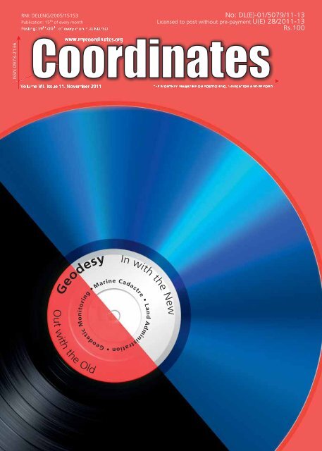
GEODESY<br />
Geodesy: Out with the Old, In<br />
with the New<br />
We should promote a new geodesy that does not instil fear into our students, but instead seeks to<br />
conveys the excitement of Modern Geodesy<br />
8 | <strong>Coordinates</strong> November 2011<br />
Chris Rizos<br />
Professor and Head of<br />
the School of Surveying<br />
& Spatial Information<br />
Systems, UNSW, Australia<br />
President of the<br />
International Association<br />
of Geodesy<br />
Since taking over the position of<br />
president of the International<br />
Association of Geodesy (IAG – http://<br />
www.iag-aig.org) on the 6th July 2011,<br />
I have had on occasion mused on what<br />
geodesy “is” and how to explain this arcane<br />
field to those who are not acquainted<br />
with it. For example, how do I tell the<br />
Dean of the Faculty of Engineering, at<br />
the University of New South Wales,<br />
Sydney (Australia), that I, the head of a<br />
department within his faculty which has<br />
its primary objective the education of<br />
undergraduate students in “surveying” (or<br />
more broadly in “geomatics”), now occupy<br />
an important position in the geoscience<br />
field of “Geodesy and Geophysics”? (This<br />
is not an idle exercise, as the Dean will<br />
be asked to approve my increased travel<br />
commitments over the next four years.<br />
In order to define what geodesy “is”,<br />
it is necessary to articulate what<br />
geodesy is “not”. Furthermore, to<br />
explain why geodesy is important<br />
one could draw attention to its<br />
unique role in the geosciences, and<br />
to its vital services to society.<br />
I can remember I had a disturbing<br />
“eureka” moment last year. I had given<br />
a talk to an audience of surveyors on<br />
the theme “why geodesy has a bad<br />
name”. I noted that the classical topics<br />
of geodesy were no longer taught in<br />
many university surveying/geospatial/<br />
geomatics programs. I rattled off the<br />
topics, which resonated with the audience.<br />
As I listed them, many members of the<br />
audience nodded their heads… geodetic<br />
control networks, atmospheric refraction,<br />
spherical harmonic models, geodetic<br />
boundary value problem, deflections<br />
of the vertical, gravity anomalies and<br />
gravimetry, Least Squares estimation,<br />
ellipsoidal computations, map projections,<br />
reference frame transformations, positional<br />
astronomy, and so on. What I had not<br />
appreciated until that moment was that<br />
all these were “hard” topics, that few<br />
surveyors had fond memories of these<br />
subjects, and fewer would say they were<br />
better off by having studied them. Yet<br />
Modern Geodesy has progressed in the<br />
last decades in leaps and bounds, despite<br />
the shrinking number of students with a<br />
formal education in these classical geodetic<br />
topics. It struck me that we should promote<br />
a new geodesy that does not instil fear into<br />
our students, but instead seeks to conveys<br />
the excitement of Modern Geodesy.<br />
A second revelation came to me as I<br />
participated in the centenary celebrations<br />
of the founding of the International Society<br />
of Photogrammetry & Remote Sensing<br />
(ISPRS) in Vienna by Eduard Dalezal.<br />
The IAG and the ISPRS are two of the<br />
ten “sister” organisations making up the<br />
Joint Board of Geospatial Information<br />
Societies (JBGIS). Other members of the<br />
JBGIS include the International Federation<br />
of Surveyors (FIG), the International<br />
Cartographic Association (ICA), the<br />
IEEE Geoscience & Remote Sensing<br />
Society (IGARSS), the International<br />
Geographic Union (IGU), and the Global<br />
Spatial Data Infrastructure Association<br />
(GSDI). Speakers at the ISPRS 100 year<br />
anniversary conference celebrated the<br />
history of photogrammetry and remote<br />
sensing, but also enthused about the future<br />
of satellite technologies in helping address<br />
society’s environmental challenges.<br />
I sat there and thought, “that is what<br />
Modern Geodesy also seeks to do!”. The<br />
goal of Modern Geodesy is nothing less<br />
than to monitor changes in a range of<br />
physical processes in the solid earth, the<br />
atmosphere, and the oceans in order to<br />
improve our understanding of this fragile,<br />
precious and stressed planet. It was clear
to me that geodesy could be described as<br />
an Earth Observation (EO) discipline, or<br />
science. Certainly the classical definition<br />
of geodesy does not make clear that it is an<br />
EO science which has broader functions<br />
and applications, and potentially more<br />
relevance, than just as a foundation for<br />
mapping and surveying. It struck me<br />
that we must acknowledge that classical<br />
geodesy narrowly defined from this<br />
perspective of surveying and mapping<br />
needs to make way for Modern Geodesy.<br />
So what sets geodesy (and the IAG)<br />
apart from other EO disciplines? The<br />
answer came to me some years ago.<br />
It is the fact that the IAG has fostered<br />
the establishment of “services” to<br />
provide fundamental products for many<br />
geoscientific and geospatial end-users.<br />
As president of the IAG I am especially<br />
proud to acknowledge the important work<br />
of these services. The services include the<br />
International VLBI (Very Long Baseline<br />
Interferometry) Service (IVS – http://<br />
ivscc.gsfc.nasa.gov), the International<br />
Laser Ranging Service (ILRS – http://ilrs.<br />
gsfc.nasa.gov), the International DORIS<br />
(Doppler Orbitography & Radiopositioning<br />
Integrated by Satellite) Service (IDS<br />
– http://ids.cls.fr) and the best known,<br />
the International GNSS Service (IGS<br />
– http://igs.org). Through another IAG<br />
service – the International Earth Rotation<br />
& Reference Systems Service (IERS<br />
– http://www.iers.org) – these space<br />
geodetic techniques play a critical role<br />
in defining the fundamental reference<br />
frame in relation to which changes in<br />
the location of points on (or above) the<br />
earth’s surface (including satellite orbits),<br />
or the shape of the land, or level of the<br />
ocean surface, can be monitored over<br />
many years to sub-centimetre accuracy.<br />
Therefore special mention should be made<br />
of one of the IAG’s “flagship” products<br />
– the International Terrestrial Reference<br />
Frame (ITRF – http://itrf.ensg.ign.fr) –<br />
which also increasingly is the basis for<br />
modern national mapping datums.<br />
The IAG also has established the<br />
International Gravity Field Service (IGFS<br />
– http://www.igfs.net) to measure and<br />
model the earth’s gravity field to high<br />
accuracy using, for example, sophisticated<br />
gravity mapping satellite missions such as<br />
CHAMP, GRACE and GOCE. Gravimetric<br />
geodesy can nowadays measure changes<br />
in gravity acceleration arising from mass<br />
transport (which changes gravity by tiny<br />
amounts) due to the global water cycle,<br />
atmospheric and ocean circulation, and<br />
solid earth processes such as volcanism<br />
and tectonics. Amazing technology!<br />
All the IAG services generate products on<br />
a continuous basis. These products may be<br />
the primary outputs of geodetic analysis,<br />
such as precise coordinates of GNSS<br />
monitor stations, or global meteorological<br />
values of humidity, temperature and<br />
pressure, or maps of ionospheric<br />
disturbances, rate of rotation of the earth,<br />
orientation of its rotation axis, and many<br />
others. Such products can be used directly<br />
by many scientists. In addition, indirect<br />
products such as the reference frame,<br />
precise orbits of EO satellites, precise<br />
timing scales and high-accuracy GNSS-<br />
<strong>Coordinates</strong> November 2011 | 9
enabled navigation capability, support<br />
many other scientific and professional<br />
users. The challenge for the surveying, and<br />
the geomatics disciplines in general, is to<br />
embrace Modern Geodesy, and to cheer<br />
its achievements. My role now is to “sell”<br />
geodesy because it is more accessible<br />
(through the increased use of GPS/GNSS)<br />
and more relevant (through its unique EO<br />
capabilities) than any time in the past.<br />
There are a number of reasons for this<br />
transformation from esoteric geoscience<br />
to an integral part of today’s geospatial<br />
industry. Firstly, Modern Geodesy relies<br />
on space technology, and enormous strides<br />
have been made in accuracy, resolution<br />
and coverage due to advances in satellite<br />
sensors and an expanding portfolio of<br />
satellite missions. Secondly, geodesy can<br />
measure earth parameters that no other<br />
remote sensing technique can, such as<br />
the position and velocity of points on the<br />
surface of the earth, changes of sea level<br />
and the shape of the earth’s ocean, ice<br />
and land surfaces, and map the spatial<br />
and temporal features of the gravity field.<br />
These geodetic parameters are in effect<br />
the “fingerprints” of many dynamic earth<br />
phenomena, including those that we now<br />
associate with global change (due to<br />
anthropogenic or natural causes) as well<br />
as responsible for devastating events such<br />
as earthquakes, tsunamis and volcanoes.<br />
The challenge is to invert the outward<br />
expressions of these dynamic earth<br />
processes in order to measure and monitor<br />
over time the underlying physical causes.<br />
Finally what relentlessly drives geodesy<br />
into the future is the innovative use of<br />
signals transmitted by Global Navigation<br />
Satellite Systems (GNSS) such as the<br />
U.S.’s GPS and Russia’s Glonass, E.U.’s<br />
Galileo, and China’s BeiDou – the latter<br />
two constellations are incomplete, but<br />
will be deployed in the coming decade.<br />
However, GNSS is more than just another<br />
space geodetic technology. GPS in<br />
particular is today used for an enormous<br />
range of applications, from consumer<br />
uses such as for car navigation and in<br />
mobile phones to access location-based<br />
services, to professional applications<br />
such as machine automation (guidance of<br />
farm, mining and construction vehicles),<br />
emergency services, military operations,<br />
10 | <strong>Coordinates</strong> November 2011<br />
rapid mapping, surveying, transport<br />
management, and many more. However<br />
it is the special ultra-high accuracy form<br />
that is of geodetic interest. The IGS<br />
therefore deserves special mention, and is<br />
an organisation close to my heart – having<br />
served on the IGS Governing Board for<br />
the last 7 years. The IGS was established<br />
in 1994 as the first of the IAG’s geometric<br />
services, primarily by computing high<br />
accuracy GPS and Glonass satellite orbit<br />
and clock “products” as well as open (and<br />
free) access to measurements made by a<br />
global ground network of continuously<br />
operating GNSS tracking stations. These<br />
hundreds of GNSS receivers on stable<br />
pillars or solid monuments operate<br />
continuously around the world also<br />
function as precise monitoring systems for<br />
ground movement due to global effects<br />
such as continental drift, local subsidence<br />
In order to define<br />
what geodesy “is”,<br />
it is necessary to<br />
articulate what<br />
geodesy is “not”.<br />
due to fluid extraction or underground<br />
mining, uplift due to volcanism or postglacial<br />
rebound (the land rising since the<br />
last Ice Age released the pressure of many<br />
kilometres of overbearing ice), and more.<br />
The IGS is not resting on its laurels,<br />
and has just launched a “multi-GNSS<br />
experiment” (M-GEX), seeking to augment<br />
its tracking network with next generation<br />
multi-GNSS receivers able to track the<br />
new satellite signals. In 2013 the IGS<br />
is on track to launch a new “real-time”<br />
service. It must be pointed out however,<br />
that the representation of countries<br />
from South America, Asia and Africa,<br />
as hosts of GNSS tracking stations, as<br />
homes to product analysis centres, and<br />
on its governance body is disappointing.<br />
Nevertheless, some progress is being<br />
made with the Asia-Pacific Reference<br />
Frame Project (APREF – http://www.<br />
ga.gov.au/earth-monitoring/geodesy/<br />
asia-pacific-reference-frame.html),<br />
which aims to encourage cross-border<br />
cooperation in GNSS geodesy; and the<br />
demonstration campaigns being promoted<br />
under the auspices of the Multi-GNSS<br />
Asia Organisation (MGA – http://www.<br />
multignss.asia) to encourage regional<br />
experimentation with next generation<br />
GNSSs such as the new Japanese QZSS<br />
and Chinese BeiDou satellite signals.<br />
What about the other services? Geodesy<br />
has set itself an ambitious agenda –<br />
striving to increase the level of accuracy<br />
in the determination of many of the<br />
geodetic parameters by a factor of ten<br />
over the coming decade. The IAG’s<br />
Global Geodetic Observing System<br />
(GGOS – http://www.ggos.org) will<br />
integrate all geodetic measurements<br />
from all services in order to monitor the<br />
phenomena and processes within the<br />
earth system at far higher fidelity than<br />
at present. This integration implies the<br />
inclusion of all relevant information for<br />
parameter estimation, the combination<br />
of geometric and gravimetric data,<br />
and the common estimation of all the<br />
necessary parameters representing the<br />
solid earth, the hydrosphere (including<br />
oceans, ice-caps, continental water),<br />
and the atmosphere. GGOS is geodesy’s<br />
contribution to the Global Earth Observing<br />
System of Systems (GEOSS – http://<br />
www.earthobservations.org) initiative.<br />
Again, South America, Africa and Asia<br />
can, and should play a greater role in the<br />
IAG services, and in GGOS. The geodetic<br />
infrastructure that underpins today’s<br />
IAG services needs to be upgraded and<br />
extended. Nowhere is this need greater<br />
than in the countries outside North<br />
America, Europe and Australia. My IAG<br />
presidency will treat this expansion of IAG<br />
engagement with the highest priority.<br />
In summary, geodesy is facing an<br />
increasing demand from science,<br />
engineering applications, the earth<br />
observation community, and society at<br />
large for improved accuracy, reliability<br />
and access to geodetic services,<br />
measurements and products. All<br />
countries, and all geospatial professionals<br />
can contribute. Our slogan should be<br />
“geodesy matters, now more than ever”,<br />
but it must be Modern Geodesy…<br />
out with the old, in with the new.
<strong>Coordinates</strong> November 2011 | 11
HIS COORDINATES<br />
Our focus has always been<br />
on building products that<br />
can stand up to the most<br />
demanding environmental<br />
conditions<br />
Says Phil Gabriel, Vice President and<br />
General Manager, Precision Products,<br />
Hemisphere GPS<br />
What are the<br />
key applications<br />
Hemisphere GPS precision<br />
products focus on?<br />
Hemisphere GPS is focused<br />
on building rugged GNSS<br />
products for a variety of<br />
industries including surveying,<br />
marine and original equipment<br />
manufacturing (OEM).<br />
In the surveying industry, we<br />
manufacture a wide range of<br />
products from high-accuracy<br />
GNSS receivers to geodetic<br />
grade antennas. In addition,<br />
we offer an exclusive line<br />
of Vector GNSS Compass<br />
products for professionals<br />
heading and positioning. Our<br />
customers use these unique<br />
all-in-one compasses for<br />
everything from hydrographic<br />
surveying to yachting and<br />
dredging to autonomous<br />
machine control. On the OEM<br />
side of our business, we<br />
supply system integrators with<br />
our proprietary Hemisphere<br />
GPS technology for them<br />
to integrate into their own<br />
finished products. In fact,<br />
nearly every Hemisphere<br />
GPS finished product is<br />
broken down to its core board<br />
level and offered to original<br />
equipment manufactures for<br />
12 | | <strong>Coordinates</strong> November Nov Novemb November emb ember er e 201 2011<br />
2011<br />
integration into their<br />
custom applications.<br />
Please highlight a<br />
key feature of Hemisphere<br />
GPS’ S320 GNSS Receiver?<br />
Our S320 GNSS Receiver<br />
offers a lot of very unique<br />
and exclusive features. In<br />
fact, Hemisphere GPS S320<br />
is the only survey receiver<br />
on the market with SMS<br />
communication capabilities.<br />
Meaning you can remotely<br />
command your S320 by<br />
sending text messages from<br />
your cell phone. Surveyors<br />
are using this feature to<br />
power their receivers’ on/<br />
off, monitor the location of their<br />
receivers and get real-time<br />
status updates such as battery<br />
life. The SMS communication<br />
feature can also be used to<br />
automatically setup baserover<br />
pairing, self-synchronize<br />
GPRS data calls and initiate a<br />
built-in-test to help diagnose<br />
customer support issues. Our<br />
SMS Communication feature<br />
has got a great response<br />
from surveyors in the field<br />
and is a unique feature that<br />
no other receiver offers.<br />
What are the advantages<br />
of Hemisphere GPS’<br />
SureTrack intelligence?<br />
SureTrack intelligence in a<br />
series of Hemisphere GPS<br />
algorithms designed to<br />
help deliver superior RTK<br />
performance where others<br />
cannot. SureTrack allows rover<br />
receivers to deliver complete<br />
GNSS performance even when<br />
the broadcasting base station<br />
is only receiving GPS data.<br />
This means the RTK rover<br />
is able to use every satellite<br />
possible – even satellites<br />
not tracked by the base. For
surveyors, this translates<br />
into longer RTK baselines as<br />
well as more reliable RTK in<br />
congested environments. With<br />
Hemisphere GPS’ exclusive<br />
SureTrack intelligence there<br />
is no longer the concern<br />
of mixing GNSS data from<br />
various manufacturers.<br />
There is an emphasis<br />
on the ‘high quality’ of<br />
Hemisphere GPS’ S320 GNSS<br />
receiver. Please explain its<br />
edge over other existing<br />
receivers in the market.<br />
Hemisphere GPS is a<br />
Canadian company that has<br />
been manufacturing rugged<br />
and reliable GNSS products<br />
for more than 20 years. Our<br />
focus is, and always has been,<br />
on building products that can<br />
standup to the most demanding<br />
environmental conditions. S320<br />
is a great example of this.<br />
The extremely tough Lexan<br />
plastic used to build the S320<br />
is the same material used in<br />
the manufacturing of hockey<br />
helmets. We understand that<br />
test environments and reallife<br />
conditions are not always<br />
the same. That’s why we<br />
built it to your specifications<br />
- Surveyor Tough.<br />
How are the issues related<br />
to data storage and battery<br />
backups addressed in S320?<br />
With the SD/SDHC card slot<br />
secured behind the battery<br />
door, users can safely log<br />
large amounts of monitoring<br />
data, static observations data<br />
and extended survey projects<br />
onto the factory included 2GB<br />
memory card. The SD card can<br />
also be used for much more<br />
including upgrading firmware<br />
and loading configuration files<br />
such as NTRIP. If you prefer to<br />
leave the SD card in the unit,<br />
you can wirelessly download<br />
the data by streaming it<br />
through one of the two<br />
Bluetooth ports provided.<br />
As for battery life, Hemisphere<br />
GPS’ S320 comes standard<br />
with two long-life lithium ion<br />
batteries which will give more<br />
than 10 hours of operation. The<br />
batteries are hot swappable<br />
so you can change either<br />
one without powering off<br />
the unit. Also, the batteries<br />
used by S320 are in industry<br />
standard, so you can easily<br />
buy extras at any supply store.<br />
What makes the S320<br />
antenna design unique?<br />
Our proprietary “Cross<br />
Dipole” antenna design used<br />
in the new S320 is a very<br />
efficient, wideband solution<br />
with excellent phase center<br />
stability and polarization. It<br />
is specifically engineered<br />
to receive all current GNSS<br />
signals as well as all planned<br />
GNSS signals around the<br />
world. The advantage of this<br />
tall cross dipole design is<br />
its ability to maximize signal<br />
gain all the way down to the<br />
horizon, which allows it to<br />
receive weak satellite signals<br />
very low in the sky - while<br />
rejecting reflected multipath<br />
signals that can reduce<br />
receiver accuracy. The height<br />
also permits retention of right<br />
hand circular polarization<br />
for additional multipath<br />
rejection when capturing the<br />
desired low angle signals.<br />
This is an important feature<br />
in order for the antenna to<br />
function effectively in very<br />
tough environments.<br />
Customer Speak<br />
"The system was demoed<br />
yesterday to a number of<br />
managers from different<br />
divisions of ARA (Applied<br />
Research Associates, Inc.)<br />
and was very well received.<br />
Neither we or nor anyone else<br />
who has seen this system can<br />
fi nd a single fault with the<br />
S320. It performs fl awlessly,<br />
setup is a breeze and we<br />
have yet to run out of battery<br />
life. The ability to hot-swap<br />
batteries is fantastic. The<br />
accuracy, repeatability and<br />
speed of acquisition is superb.<br />
Nice job!"<br />
Mark Boettcher<br />
Senior Computer Scientist<br />
Applied Research Associates, Inc.<br />
<strong>Coordinates</strong> November Nov November ovemb e er 2011 2011 | 13
LAND ADMINISTRATION<br />
Experiences from world bank<br />
development support for land reform<br />
This paper discusses the World Bank support for sustainable land reform, focusing on the East Asia<br />
Region, with particular emphases on initiatives in land governance, land development investment, tenure<br />
security, NSDI, e-government, land tax, spatial planning, disaster response and mitigation. We have<br />
published the fi rst part of the paper in last issue. We present here the second part of the paper<br />
Keith Clifford Bell<br />
World Bank, East<br />
Asia Pacifi c Region<br />
Washington DC, USA<br />
14 | <strong>Coordinates</strong> November 2011<br />
Land administration and ict<br />
Over the past thirty years, considerable<br />
progress has been made since the initial<br />
work on first registration programs<br />
using largely analogue, methods of<br />
data capture, presentation and records<br />
management. The early adoption of total<br />
stations and electronic data recording by<br />
land surveyors, post processing using<br />
computer-aided drafting (CAD) and<br />
GIS, as well as data storage in relational<br />
database management systems have been<br />
highly successful. The usual experiences<br />
have been through the nurturing of Land<br />
Information System (LIS) pilot programs<br />
to promote the development of national<br />
inventories of land ownership and land<br />
use records in support of robust systems<br />
of land administration. Efforts towards<br />
building multipurpose cadastres (or<br />
LIS) of key national datasets for NSDI<br />
have been focused on maturing the core<br />
building blocks of appropriate institutional<br />
frameworks, technical standards,<br />
identifying fundamental national datasets,<br />
building the enabling technical ICT<br />
infrastructure, and enhancing the available<br />
skills base through training and education<br />
programs. As technology has so rapidly<br />
improved, it has also converged, with<br />
communications, positioning, measuring,<br />
processing, presentation, analysis and<br />
storage technologies now interconnected<br />
or even merged. Technology costs have<br />
markedly reduced in real terms and<br />
computing power and storage are now<br />
such that they not limiting factors.<br />
Ongoing rapid advancements in<br />
ICT, including the construction of<br />
optic fiber networks, and improved<br />
telecommunication infrastructure across<br />
East Asia is connecting rural and urban<br />
populations. The foundations are being<br />
laid for a host of e-government services<br />
and the building of NSDI that will reach<br />
beyond cities and into the rural provinces.<br />
Improving tenure security and access to<br />
land is central to alleviating poverty and<br />
advancing rural livelihoods. A suite of<br />
innovative technologies and solutions<br />
are available to providing East Asia’s<br />
poorest rural and remote communities<br />
access to land and property services.<br />
In the East Asia Region, it is interesting<br />
to reflect on developments in the country<br />
that first received support from the World<br />
Bank some thirty years ago. In 2009,<br />
Thailand, the Cabinet approved that<br />
National ICT Strategic Master Plan 2009-<br />
2012, identifying the NSDI and land<br />
information from land registration as being<br />
one of the key pillars. In April 2011, the<br />
Thai government announced its plans to<br />
launch the country’s NSDI portal by 2012<br />
which will serve as the national gateway<br />
for spatial information and pave the way<br />
towards “Spatially Enabling” Thailand.<br />
The portal will act as a repository of<br />
metadata generated by data producers<br />
which will gradually provide services such<br />
as access to metadata of the Fundamental<br />
Geographic Data Set and well as other<br />
spatial data in Thailand. Thailand has a<br />
well established land registration system,<br />
which is largely still paper-based. But it<br />
works well, and Thailand is now about<br />
to take the next steps towards NSDI and<br />
e-governance. Other countries are also<br />
investing heavily in ICT, building their<br />
respective NSDI and pursuing e-services.<br />
Strengthening land administration systems<br />
through building NSDI may support<br />
improving tenure, promoting social<br />
stability and reducing conflict, stimulating
<strong>Coordinates</strong> November 2011 | 15
agricultural and rural productivity,<br />
encouraging land improvement and more<br />
sustainable resource management. A<br />
better cadastre, underpinning the NSDI<br />
provides a more complete and reliable<br />
basis for taxation collection and better<br />
managing state assets. Through better<br />
access to land information, transparency<br />
may be increased and there may be<br />
enhanced public disclosure of landrelated<br />
matters such as land use plans<br />
and development proposals. However,<br />
the author stresses “may” in all of these<br />
benefits, as it all depends on whether<br />
good governance prevails with laws being<br />
appropriately enforced and civil servants<br />
acting ethically and in the public good.<br />
Duplication of data capture is frequently<br />
encountered in land administration<br />
projects. For example in the management<br />
of land concessions, different agencies<br />
are all too frequently embarking on<br />
maintaining their own individual digital<br />
cadastral databases, perhaps due to<br />
a lack of protocols for data sharing,<br />
unclear institutional mandates or even<br />
organizational rivalry. Data should only<br />
be captured once, and the maintenance<br />
of data should be the responsibility of<br />
the designated custodian agency. NSDI,<br />
which encompasses not only the data,<br />
but the official designation of custodians,<br />
and the official protocols for data sharing<br />
will improve the overall efficiency of<br />
data collection and maintenance and<br />
enable government decision-making<br />
to be more consistent drawing on the<br />
authoritative data sets, with advice from<br />
the designated responsible agency.<br />
Land-related agencies, should be adopting<br />
whole-of-government approaches to NSDI<br />
and not seeking to build silos to enshrine<br />
weak land administration systems and<br />
poor governance. It is very important<br />
that agencies act transparently and<br />
accountably, providing full disclosure of<br />
their priorities, progress and investments<br />
in land administration systems and<br />
NSDI to maintain political and public<br />
confidence and support. Accordingly,<br />
investment in NSDI should promote<br />
better land governance and not promote<br />
strengthening of government silos.<br />
16 | <strong>Coordinates</strong> November 2011<br />
Broader utilization of geospatial<br />
information technologies<br />
Spatial Enablement<br />
There is an ever growing dialogue and<br />
advocacy for investing in the “spatially<br />
enabled society”, the evolving concept<br />
where location, place and geospatial<br />
information provide the primary means<br />
for governments, business, communities,<br />
families and individuals to conduct their<br />
affairs and lead their lives (Rajabifard,<br />
2010). Williamson et al (2010) suggest<br />
that spatial enablement is not just about<br />
developing and using GIS technologies,<br />
but is a concept whereby government and<br />
Land-related agencies,<br />
should be adopting<br />
whole-of-government<br />
approaches to NSDI and<br />
not seeking to build silos<br />
to enshrine weak land<br />
administration systems<br />
and poor governance<br />
society draw upon the land administration<br />
system and spatial data infrastructure.<br />
However, this author would suggest<br />
that this concept may be better extended<br />
to include broader range of geospatial<br />
technologies and other related ICT. Over<br />
the past couple of decades all countries<br />
to a greater or lesser degree have been<br />
investing in their respective NSDI.<br />
Advanced economies have continued to<br />
exploit the convergence of the range of<br />
geospatial and ICT for service delivery,<br />
commerce, transportation (road, rail,<br />
maritime and air) , agriculture, natural<br />
resources, energy, national security,<br />
policing and public safety, climate change<br />
and disaster risk reduction and response.<br />
On the other hand, developing countries,<br />
with international support, have been<br />
necessarily more focused on investing in<br />
the basic systems for land and property<br />
rights and planning, which over time, will<br />
evolve into more sophisticated systems<br />
including spatial data infrstructures.<br />
Over the past decade or so, cloud<br />
computing investments, especially<br />
from major players in the ICT industry<br />
like Microsoft , IBM and Google, have<br />
driven many geospatial developments<br />
and user demand to become more<br />
enabled by geospatial technology. Cloud<br />
computing, the idea of relying on webbased<br />
applications and storing data in<br />
the “cloud” of the Internet, has long<br />
been touted as a way to do business,<br />
and has been fundamental to the growth<br />
of geospatial systems development,<br />
especially with the availability of cloud<br />
geospatial data such as Google Earth.<br />
As access to geospatial technologies<br />
such as GPS enabled cell-phones, webbased<br />
communications and the cloud<br />
grows, increasingly non-traditional<br />
data providers have emerged and are<br />
contributing geospatial data. Crowd<br />
sourced data is increasingly being<br />
seen as a vital part of the geospatial<br />
landscape especially in community-driven<br />
development and disaster response.<br />
Therefore, putting all of the<br />
above into context, perhaps three<br />
significant trends have emerged:<br />
• Emergence of neo-geography and<br />
the geospatial web is leading to<br />
many more bottom- up approaches to<br />
adoption and application of geospatial<br />
technology. Trends in this space<br />
are: user generated maps, editable<br />
public maps, online map versioning,<br />
user feedback (statistics, ratings,<br />
tags, comments), portable content,<br />
geospatial content discoverable by<br />
search engines, a more towards informal<br />
bottom up spatial data infrastructures,<br />
automatic meta-data creation.<br />
• Mobile geospatial applications and<br />
the growth in location based services,<br />
incorporating citizen based data inputs<br />
from mobile phones and social media.<br />
• Move to Operational Earth Observation<br />
services by means of: (i) standard<br />
satellite sensors; (ii) constellations<br />
of satellites for regular delivery<br />
of products; and (iii) creation of<br />
large institutional markets for these<br />
products to drive down costs.
Five Centimeters Globally<br />
Without a Base Station<br />
Get Closer.<br />
5cm<br />
*Actual Size<br />
Introducing<br />
StarFire GNSS<br />
5cm Real-Time Global Accuracy + GLONASS<br />
www.navcomtech.com<br />
<strong>Coordinates</strong> November 2011 | 17
World development report fi ndings<br />
Successive recent annual World Development<br />
Reports have highlighted the ever increasing<br />
importance of geospatial information<br />
technologies in supporting development as<br />
well as disaster response and risk reduction.<br />
One reason that policy makers have found<br />
it so difficult to curb the over-exploitation<br />
of land, water and their related ecosystems<br />
is that neither the managers nor the users of<br />
the resources have had access to reliable and<br />
timely information, especially information<br />
that is spatially referenced. The number<br />
of people affected by climate-related<br />
disasters is on the rise, particularly in<br />
low- and middle-income countries where<br />
rapid urbanization is taking place. Poor<br />
households are severely affected by<br />
climate change impacts as they have<br />
less access to protective assets and face<br />
higher exposure to environmental risks.<br />
With expected shifts in rainfall patterns,<br />
melting snow-packs and glaciers, stronger<br />
tropical cyclones, and a rising sea level,<br />
climate change will be a risk multiplier<br />
for the poor. All of this raises the demand<br />
for reliable geospatial information.<br />
Social development and poverty<br />
Fundamental to the achievement of the<br />
MDG is poverty alleviation. However,<br />
for a long time, especially for developing<br />
countries, there has existed inadequate<br />
and unreliable poverty mapping data for<br />
both rural and urban environments. In<br />
short, basic data about the location of<br />
the poor, has either not been available<br />
or has been unreliable. Geospatial<br />
information technology now provides<br />
new opportunities to answer basic<br />
questions about the spatial distribution<br />
of the poor especially in terms of rural<br />
poverty in relation to agriculture and<br />
markets, urban populations and slums,<br />
distribution and access to basic services,<br />
employment, hazardous marginal<br />
lands prone to disasters and so on.<br />
Natural resources and agriculture<br />
The “World Development Report 2010”<br />
stresses the importance of accurate and<br />
timely data, especially from remote sensing<br />
and other geographic information, and<br />
the application of ICT, advising that:<br />
18 | <strong>Coordinates</strong> November 2011<br />
“One reason that policy makers<br />
have found it so difficult to curb the<br />
overexploitation of land and water<br />
and their related ecosystems is that<br />
neither the managers nor the users<br />
of the resources have accurate and<br />
timely information. ………<br />
….Research and development will be<br />
necessary to take full advantage of<br />
these new information technologies”<br />
and also “More reliable information<br />
can empower communities and change<br />
the governance of natural resources”.<br />
Although the term “NSDI” has not<br />
been used specifically in the Report,<br />
it most certainly makes a strong case<br />
for investment in NSDI. More reliable<br />
information, especially geospatial<br />
information, can empower communities<br />
and change the governance of natural<br />
resources. Natural resource management<br />
often requires governments to set and<br />
enforce laws, limits, or prices. Political<br />
and socioeconomic pressures make this<br />
very difficult, especially where formal<br />
institutions are weak, and governance is<br />
inconsistently enforced. The growing<br />
global concern regarding FDI in land<br />
concessions especially for agri-business,<br />
forestry and mining highlights the weak<br />
governance that exists in many of the<br />
countries under threat and the lack of<br />
reliable spatially-referenced inventories<br />
of land and natural resources, land use<br />
planning and monitoring systems. In 2010,<br />
the World Bank, in collaboration with<br />
partners issued “Principles for Responsible<br />
Agricultural Investment that Respects<br />
Rights, Livelihoods and Resources”.<br />
Disasters<br />
The World Bank has been very active in<br />
responding to major disasters, especially<br />
in the areas of damage assessments and<br />
reconstruction. Both Aceh and Haiti are<br />
two significant examples. Geospatial<br />
information technologies have been<br />
increasingly used, by both the World<br />
Bank and the international community.<br />
In addition to disaster response, disaster<br />
risk reduction has become increasingly<br />
important. Established in 2006, the Global<br />
Facility for Disaster Reduction and<br />
Recovery (GFDRR) is a partnership of 36<br />
countries and 6 international organizations<br />
committed to helping developing countries<br />
reduce their vulnerability to natural hazards<br />
and adapt to climate change. Support<br />
for disaster risk reduction, involves the<br />
GFDRR working with partners to assemble<br />
large collections of geo-referenced data<br />
in order to develop country-specific and<br />
regional catastrophe risk models. Crowdsourced<br />
data and cloud-based data (and<br />
applications) are now a very important<br />
part of the GFDRR’s work as successfully<br />
demonstrated in the Haiti response and<br />
contrast with Aceh which largely relied<br />
on traditional sources of data only.<br />
Environmental monitoring,<br />
climate change, carbon<br />
The Forest Carbon Partnership Facility<br />
(FCPF) is a World Bank program created to<br />
assist developing countries in their efforts<br />
to reduce emissions from deforestation<br />
and land degradation (REDD). It has<br />
the dual objectives of building capacity<br />
for REDD in developing countries,<br />
and testing a program of performancebased<br />
incentive payments in some pilot<br />
countries. Designing and, if possible,<br />
implementing accurate measurements,<br />
monitoring and verification systems to<br />
enable countries to report on emissions<br />
from deforestation and forest degradation.<br />
Satellite imagery and other geospatial<br />
information including Google Earth are<br />
being utilized for monitoring of REDD.<br />
The Global Monitoring for Environment<br />
and Security (GMES) is a joint initiative<br />
of the European Commission and the<br />
European Space Agency, which aims at<br />
achieving an autonomous and operational<br />
Earth observation capacity. The objective<br />
is to rationalize the use of multiple-sources<br />
data to get a timely and quality information,<br />
services and knowledge, and to provide<br />
autonomous and independent access to<br />
information in relation to environment<br />
and security. In other words, it will pull<br />
together all the information obtained by<br />
environmental satellites, air and ground<br />
stations to provide a comprehensive picture<br />
of the “health” of Earth. The World Bank<br />
has a cooperative agreement with the<br />
European Space Agency to pilot services<br />
built around GMES.<br />
To be concluded in December 2011
V7<br />
The Wait is Over<br />
Version 7 is the largest, most significant STAR*NET<br />
release to date. Expect the same great functionality,<br />
but also some amazing workflow enhancement<br />
tools. Along with an easier-to-use interface, a project<br />
manager, color-coded DAT editor, better reporting<br />
and output settings, you really cannot afford to miss<br />
out on this update.<br />
Get the Most Out of Least Squares<br />
New to STAR*NET? MicroSurvey STAR*NET is an<br />
easy-to-use application that adjusts 2D/3D survey<br />
networks using rigorous Least Squares techniques.<br />
Build confidence by ensuring your field data is both<br />
accurate and correct.<br />
Contact Us<br />
To request your free demo, visit us at www.MicroSurvey.com or contact our technical sales staff today. We want you to see<br />
first-hand how MicroSurvey Software can make you more productive in the field and in the office.<br />
® MicroSurvey is registered in the U.S. Patent and Trademark Office by MicroSurvey<br />
Software Inc.<br />
www.MicroSurvey.com<br />
+1 250 707 0000<br />
<strong>Coordinates</strong> November 2011 | 19
HER COORDINATES<br />
The<br />
United States<br />
and India<br />
have been<br />
collaborating<br />
closely in the<br />
civil aviation<br />
space<br />
says Leocadia I Zak, Director, USTDA in an interview<br />
with <strong>Coordinates</strong><br />
Could you briefl y explain the<br />
mandate of USTDA?<br />
USTDA helps countries expand<br />
economic growth by utilizing<br />
U.S. expertise, technology, and<br />
investment. The Agency’s objectives<br />
are to help build the infrastructure<br />
for trade, match U.S. technological<br />
expertise with overseas development<br />
needs, and help create lasting<br />
business partnerships between the<br />
United States and emerging market<br />
economies.<br />
USTDA advances these objectives<br />
through its two key programs,<br />
the Project Development Program<br />
and the International Business<br />
Partnership Program.<br />
Through feasibility studies, technical<br />
assistance and pilot projects,<br />
USTDA’s Project Development<br />
Program helps overseas project<br />
sponsors identify technological<br />
solutions and various sources of<br />
fi nancing for priority infrastructure<br />
projects.<br />
USTDA’s reverse trade missions<br />
(RTM) are the mainstay of its<br />
International Business Partnership<br />
Program (IBPP). Created in<br />
2010 in response to the Obama<br />
Administration’s National Export<br />
20 | <strong>Coordinates</strong> November 2011<br />
Initiative, the IBPP is USTDA’s<br />
signature program for linking the<br />
U.S. private sector to foreign buyers<br />
with upcoming procurement plans.<br />
These visits are carefully planned to<br />
enable foreign decision-makers the<br />
ability to observe the manufacture,<br />
demonstration and operation of U.S.<br />
goods and services that can help<br />
them achieve their development<br />
goals.<br />
Of particular importance to<br />
advancing our bilateral relationship,<br />
USTDA and the Ministry of Civil<br />
Aviation, in cooperation with the<br />
U.S.-India Aviation Cooperation<br />
Program, and the Federal Aviation<br />
Administration, will sponsor the<br />
U.S.-India Aviation Summit from<br />
November 16-18, 2011, at the Taj<br />
Palace Hotel in New Delhi, India.<br />
Recently you were the part of<br />
US India strategic dialogue.<br />
Where does the collaboration<br />
in satellite navigation fi t in US<br />
India strategic alliance?<br />
The United States and India have<br />
been collaborating closely in the civil<br />
aviation space for almost 6 years<br />
with the signing of the landmark<br />
bilateral Open Skies Agreement in<br />
mid-2005. As you may already know,<br />
collaboration in the area of satellite<br />
navigation has been identifi ed as one<br />
of the important tools for enhancing<br />
the US-India bilateral relationship<br />
which in turn is an important<br />
pillar of the Strategic Dialogue.<br />
Since the signing of the Open Skies<br />
Agreement the two countries are<br />
now closely collaborating in the area<br />
of civil aviation and satellite based<br />
navigation. Through collaborative<br />
efforts, our two countries are<br />
promoting compatibility and<br />
inter-operability between the U.S.<br />
Global Positioning System, India’s<br />
navigation systems, and those of<br />
other countries. The goal is obviously<br />
to ensure safer skies and effi cient air<br />
traffi c management which will help<br />
lower costs and increase bilateral<br />
trade between our countries.<br />
The hallmark of USTDA<br />
development assistance has<br />
always involved building<br />
partnerships between U.S.<br />
companies and overseas project<br />
sponsors to bring proven<br />
private sector solutions to<br />
developmental challenges.<br />
Would you like to explain this<br />
in the context of MoU signed<br />
between USTDA and Airports<br />
Authority of India (AAI) on<br />
GAGAN?<br />
In 2008, USTDA sponsored a reverse<br />
trade mission consisting of technical<br />
personnel from the Directorate<br />
General of Civil Aviation (DGCA), the<br />
Airports Authority of India (AAI),<br />
and the Indian Space Research<br />
Organization (ISRO) to travel to the<br />
United States to assist in developing<br />
a plan to certify GNSS technologies<br />
for use in the development of<br />
India’s GPS and Geo-Augmented<br />
Navigation System (GAGAN) project.<br />
The reverse trade mission promoted<br />
increased cooperation between U.S.<br />
and Indian aviation offi cials with<br />
regards to the implementation of a<br />
satellite-based augmentation system<br />
(SBAS) in India and familiarized<br />
Indian offi cials with U.S. aviation<br />
technologies, approaches, and<br />
standards. As a result of this visit,<br />
Raytheon secured a contract for
$60 million in exports of U.S.manufactured<br />
goods and services<br />
that was awarded by ISRO in July<br />
2009. USTDA did not sign a grant<br />
agreement with the Airports<br />
Authority of India for GAGAN,<br />
rather we sponsored a reverse trade<br />
mission to allow offi cials to see the<br />
technologies in action.<br />
According to the agreement<br />
USTDA will provide $407,325<br />
to support the AAI’s efforts to<br />
install and commission a pilot<br />
Ground Based Augmentation<br />
System (GBAS). Would USTDA<br />
also facilitate technical<br />
knowhow to this program?<br />
Recently, USTDA provided a<br />
grant ($407,325) to the Airports<br />
Authority of India (AAI) to assist in<br />
the installation, certifi cation, and<br />
operational commissioning of a<br />
Ground Based Augmentation System<br />
(GBAS) at Chennai airport. At the<br />
request of AAI, the USTDA assistance<br />
will fund the demonstration of a<br />
Honeywell’s GBAS SmartPath system<br />
pilot at the Chennai airport, a<br />
system that is already certifi ed with<br />
the Federal Aviation Administration.<br />
By gaining its operational service<br />
approval in India, the SmartPath<br />
system will help AAI achieve greater<br />
fuel effi ciency and cost savings for<br />
air carriers, as well as safety and<br />
effi ciency/capacity improvements for<br />
its many airports. Under the grant<br />
agreement, the technical assistance<br />
will support training of AAI and<br />
DGCA personnel for the installation,<br />
operational commissioning, and<br />
certifi cation of Honeywell’s GBAS<br />
and associated GPS Landing System<br />
(GLS) procedures at Chennai airport.<br />
Honeywell and FAA personnel, with<br />
the support of USTDA funds, will<br />
facilitate technical training on the<br />
GBAS technology.<br />
Could you highlight few key<br />
initiatives supported by USTDA<br />
pertaining to GPS in the South<br />
and SE Asian region?<br />
In addition to the Indian GAGAN<br />
Through collaborative<br />
efforts, our two<br />
countries are promoting<br />
compatibility and interoperability<br />
between the<br />
U.S. GPS and India’s<br />
navigation systems<br />
and GBAS projects, USTDA has<br />
supported a number of technical<br />
symposia related to GPS technology<br />
innovations for aviation in the<br />
broader South and SE Asia region.<br />
This has included sponsoring<br />
the APEC Aviation Navigation<br />
Technologies Workshops I and II,<br />
in 2005 and 2009, in cooperation<br />
with aviation partners in SE Asia<br />
and the U.S. FAA. The fi rst of these<br />
addressed RNAV/RNP aviation<br />
navigation technologies, and aimed<br />
to familiarize SE Asian aviation<br />
authorities with the technical<br />
capacities needed to implement<br />
and authorize these performanceenhancing<br />
navigational systems.<br />
The symposium focused on topics<br />
ranging from fl ight standards,<br />
aircraft certifi cation, air traffi c<br />
operational approvals, and the<br />
procedural implementation of RNAV/<br />
RNP systems. The second workshop,<br />
held in Bangkok Thailand, addressed<br />
the operational approvals of<br />
technologies such as Performance<br />
Based Navigation (PBN) procedures,<br />
as well as the implementation of<br />
other Global Navigation Satellite<br />
Systems (GNSS) approaches. This<br />
second workshop brought U.S.<br />
representatives together with<br />
aviation offi cials from numerous<br />
APEC economies and India to discuss<br />
the role of institutional, operational,<br />
and regulatory procedures needed<br />
to promote aviation modernization<br />
and a range of technologies related<br />
to the next generation air traffi c<br />
system, also known as NextGen.<br />
Most recently, in August 2010<br />
USTDA sponsored the Asia-Pacifi c<br />
Commercial Aviation Access<br />
workshop and reverse trade mission<br />
for approximately 40 senior<br />
aviation offi cials representing<br />
Shri V.P. Agarwal, Chairman, Airports Authority of India (shaking hands with Lee) Dr. Nasim Ahmad Zaidi, Secretary,<br />
Ministry of Civil Aviation (in the middle) Ms. Leocadia I. Zak, Director, U.S. Trade and Development Agency<br />
civil aviation agencies (CAAs) and<br />
airlines from Bangladesh, India,<br />
Indonesia, Malaysia, Mongolia,<br />
the Philippines, Thailand, and<br />
Vietnam, in the San Francisco,<br />
CA and Seattle, WA areas. This<br />
initiative provided a comprehensive<br />
overview of the safety and security<br />
requirements needed to gain access<br />
to U.S. airspace, and also addressed<br />
opportunities presented to airlines<br />
and CAAs from adoption of growing<br />
GPS-related safety and navigational<br />
technologies.<br />
<strong>Coordinates</strong> November 2011 | 21
MARINE CADASTRE<br />
Improving the administration of<br />
marine and coastal spaces<br />
A marine cadastre, preferably built on the multipurpose cadastre concept, is one such instrument that<br />
ideally can provide thematic and spatial data and information to support effi cient decision making with<br />
regard to coastal and marine spaces<br />
Michael Sutherland<br />
Department of Geomatics<br />
Engineering and Land<br />
Management, University<br />
of the West Indies<br />
St. Augustine, Trinidad<br />
and Tobago<br />
Figure 1 – Multipurpose Cadastre Concept [After<br />
Dale and McLaughlin, 1988]<br />
Figure 2 – Spatial Data Infrastructure<br />
[After McLaughlin and Nichols, 1994]<br />
22 | <strong>Coordinates</strong> November 2011<br />
The concepts proffered in paper<br />
generally are in relation to developed<br />
jurisdictions that have fully embraced<br />
the Information Age and its significant<br />
investments in digital data management.<br />
Since 2001, and as a means of improving<br />
the administration of marine and coastal<br />
spaces through decision support, interested<br />
members of the international geomatics<br />
community have increased research<br />
efforts towards the development of<br />
marine cadastres in various jurisdictions.<br />
Among them are researchers from<br />
Canada, Australia and the United States<br />
of America (USA) (Collier, Leahy and<br />
Williamson, 2001; Ng’ang’a, Sutherland<br />
and Nichols, 2002; Sutherland, Wilkins,<br />
and Nichols, 2002; Barry, Elema and<br />
van der Molen, 2003; Binns et al., 2003;<br />
Ng’ang’a et al., 2004; Sutherland, 2004;<br />
Sutherland and Nichols, 2004; FGDC,<br />
2008). The main focus of this paper is<br />
Canada but developments from the U.S.<br />
and Australia are briefly discussed.<br />
As with upland management, the general<br />
perception is that good governance of<br />
marine and coastal spaces, through the<br />
management of people and their activities in<br />
relation to space over time, can be achieved<br />
through the management of rights/interests,<br />
responsibilities and restrictions. A marine<br />
cadastre, built upon the multipurpose<br />
cadastre principle [Figure 1], is a system<br />
that is envisaged to be able to provide this<br />
kind of decision and management support.<br />
The multipurpose cadastre concept<br />
envisions the linking of juridical and fiscal<br />
cadastral layers with layers of other spatial<br />
information occurring in the same space, to<br />
provide a more complete set of information<br />
about the spatial extent of interest. These<br />
other layers could include, among other<br />
things, data relating to:<br />
• Geological and geophysical dataSoils<br />
• Vegetation<br />
• Wildlife<br />
• Hydrology<br />
• Climate<br />
• Pollution, health and safety<br />
• Industry and employment<br />
• Transport<br />
• Water and sewerage<br />
• Gas, electricity and telephones<br />
• Emergency services<br />
In many jurisdictions these other datasets<br />
are managed by various organizations.<br />
There is an implication of collaborative,<br />
cooperative, or integrative governance<br />
arrangements among the stakeholders,<br />
for the multipurpose cadastre to ideally<br />
be implemented. Jurisdictions vary in<br />
their socioeconomic, environmental and<br />
institutional requirements and value<br />
systems in the management of their<br />
coastal and marine spaces. However,<br />
common among them with regard to<br />
the governance of marine and coastal<br />
spaces, is the need for laws, regulations,
<strong>Coordinates</strong> November 2011 | 23
policies, governance structures and<br />
arrangements, personnel, data and data<br />
management, and organizations. Spatial<br />
Data Infrastructure (SDI), including<br />
national, regional and global concepts,<br />
provides for cohesive combinations of<br />
these components of governance.<br />
Figure 2 shows a conceptualization of a<br />
SDI (McLaughlin and Nichols, 1994).<br />
A perusal of the components strongly<br />
point to collaboration, cooperation or<br />
integration of data management systems<br />
to provide information for decision<br />
support, satisfaction of user requirements,<br />
and the production of value-added<br />
products to meet the objectives of the<br />
various participating stakeholders.<br />
A marine cadastre ought ideally to be<br />
envisioned as part of a SDI. From this<br />
perspective, and taking into consideration<br />
the multitude of overlapping rights/<br />
interests occurring in marine spaces,<br />
the 3-dimensional nature of marine<br />
spaces to be managed, the variety and<br />
number of stakeholders involved, and the<br />
traditional silo approach to governance,<br />
the development of marine cadastres as<br />
part of SDIs offer improved decision<br />
support in the management of these<br />
spaces (Ng’ang’a et al, 2004; Masser,<br />
Rajabifard and Williamson, 2008).<br />
In consideration of the foregoing<br />
discussions, this paper outlines the latest<br />
development relating to the marine<br />
cadastre concept in Canada. Developments<br />
in the USA and Australia in terms of<br />
web applications placed in the public<br />
domain are also reviewed. Comparisons<br />
are made with a conceptualization ideal.<br />
The motivation for the paper is linked to<br />
recent developments in Canada where<br />
interest in the marine cadastre concept<br />
has been renewed outside of academe,<br />
and some support was given to the<br />
development of a prototype system. A<br />
number of interested stakeholders were<br />
contacted and a task force formed to give<br />
input on the direction in which a Canadian<br />
marine cadastre might be developed,<br />
and to seek necessary funding. Although<br />
not all stakeholders participated there<br />
is in this action a tacit recognition that<br />
collaboration, integration or cooperation<br />
among stakeholders is essential in<br />
24 | <strong>Coordinates</strong> November 2011<br />
the marine cadastre’s development.<br />
From the Canadian perspective, these<br />
are considered further steps in the<br />
administration of marine spaces.<br />
The marine cadastre ideal<br />
The marine cadastre ideal, based upon<br />
a multipurpose cadastre principle, will<br />
include 2- and 3-dimensional graphical<br />
representations of all rights and interests<br />
occurring within the spatial extent of<br />
focus. It will include 2- and 3-dimensional<br />
graphical representations of other spatial<br />
data described above. In other words,<br />
visualizations would include volumes<br />
and not just plan views of polygons. The<br />
visualization of spatial extents of interest<br />
would make it easy to determine if rights,<br />
interests, and other spatial phenomena<br />
are related to the water surface, the water<br />
column or pelagic environment, the bed or<br />
benthic environment, or the subsoil of the<br />
bed. Also included will be all related legal,<br />
fiscal, environmental, social etc. textual<br />
information. The textual information<br />
would be complete in terms of being able<br />
determine appropriate laws, regulations,<br />
responsibilities, restrictions, stakeholders<br />
and all other pertinent multipurpose<br />
information about any point in the<br />
3-dimensional spatial extent of interest<br />
(Ng’ang’a et al, 2004; Sutherland, 2005).<br />
The most challenging part of the ideal<br />
marine cadastre to implement is a working<br />
3-dimensional visualization of the rights<br />
and interests, i.e. as volumes. Apart from<br />
the technical hurdles to overcome, the<br />
spatial component of rights and interest<br />
data are not normally collected with<br />
this type of visualization in mind.<br />
Marine cadastre developments<br />
The U.S.A.<br />
In the U.S. the Federal Geographic Data<br />
Committee’s Marine Boundary Working<br />
Group developed a web-based marine<br />
cadastre and placed it in the public<br />
domain [Figures 3 and 4]. One is able to<br />
navigate through the datasets and to seek<br />
information about any point. The design<br />
concept is multipurpose. Background data<br />
simulates the 3-dimensinal form of the<br />
seafloor, but the visualization of rights<br />
are 2-dimensional. There have been<br />
improvements made to the interface in<br />
terms of data content (NOAA 2010).<br />
Australia<br />
Also online is the Australian Marine<br />
Spatial Information System [Figures<br />
5 and 6]. This system also provides<br />
multipurpose cadastral information by<br />
clicking on a point on the displayed map.<br />
Custom queries are possible and more<br />
information may be obtained than<br />
from the U.S. model in terms of, for<br />
instance legal interests. 3-dimensional<br />
visualization of the seafloor provides<br />
a backdrop but the visualization of the<br />
rights and interests are 2-dimensional<br />
(Geoscience Austalia, 2010).<br />
Canada<br />
In Canada, between 2001 and 2008,<br />
major interest in the marine cadastre was<br />
mostly from a few university researchers<br />
and even fewer Federal government<br />
officials. In 2008 the Coastal and Ocean<br />
Information Network for Atlantic<br />
Canada (COINAtlantic) (COINAtlantic<br />
2009a), supported by Geoconnections<br />
Canada, developed a search utility that<br />
locates marine and coastal datasets<br />
and offers the user the option to add<br />
and display found datasets in a graphic<br />
map interface. A sub-component of<br />
the COINAtlantic initiative was a<br />
prototype marine cadastre proof of<br />
concept, using St. Margaret’s Bay, Nova<br />
Scotia, as the case study area [Figures<br />
7 and 8] (COINAtlantic 2009b).<br />
This was the first time in Canada<br />
that any major funding was directed<br />
at this type of research, outside of<br />
academe. The funding was still small<br />
compared to funding received in other<br />
jurisdictions (e.g., Australia). Developed<br />
using ArcGIS Server the datasets are<br />
also 2-dimensional polygons with<br />
3-dimensional characteristics simulated<br />
through database designs that added<br />
fields indicating whether the rights<br />
were related to sea surface, water<br />
column, seafloor, or subsurface.
Fig 3 – U.S. Marine Cadastre Interface<br />
Fig 4 – U.S. Marine Cadastre Interface<br />
Fig 5 – Australian Marine Spatial Information System<br />
Fig 6 – Australian Marine Spatial Information System<br />
The ArcGIS Server map interface used to develop the<br />
prototype allows participating stakeholders, who agree<br />
to supply spatial information for inclusion in this type<br />
of application, to maintain their own spatial data at their<br />
own sites, and in their own data formats, allowing datum<br />
and projection transformations to be done on the fly<br />
while dynamically incorporating all the various datasets<br />
in one interface for presentation and query [Figure 9].<br />
The prototype was developed by storing all collected<br />
datasets on one web server, simulating dynamic data<br />
sharing possible. The level of dynamic collaborative<br />
governance that would allow the sharing of spatial data<br />
among stakeholders, in real time, is not yet in place.<br />
A workshop was held in St. Margaret’s Bay to<br />
demonstrate the prototype’s functionalities to interested<br />
stakeholders. The general consensus, especially from<br />
community members, was that a marine cadastre would<br />
be a useful tool in the management of rights in their<br />
community and they would support their provincial<br />
government’s involvement in further developments.<br />
Natural Resources Canada, the Association of Canada Lands<br />
Surveyors, and the Canadian Hydrographic Association have<br />
shown interest in developing a national Canadian marine<br />
cadastre. A task force comprised some major stakeholder<br />
representatives, indicative of the recognition of the<br />
importance of collaboration, was set up to take the necessary<br />
steps to pursue funding for the effort. That initiative is in<br />
process and represents, in the Canadian perspective, a step<br />
forward in the development of a national marine cadastre.<br />
Acknowledgement<br />
The author acknowledges the support of COINAtlantic and<br />
Geoconnections, Canada. Also acknowledged is Mr. Daniel<br />
Jones, Department of Geomatics Engineering and Land<br />
Management, who was an important part of developing the St.<br />
Margaret’s Bay prototype proof of concept marine cadastre.<br />
Also acknowledged are researchers from the Department of<br />
Geomatics Engineering, including Dr. Sue Nichols and Mr.<br />
Titus Tienaah, M.Sc.E. student in the same department.<br />
References<br />
Barry, Michael, Ina Elema and Paul van der Molen<br />
2003. Ocean Governance and the Marine Cadastre: The<br />
Netherlands North Sea. Geomatica, 57(3)313-324.<br />
Binns, Andrew, Abbas Rajabifard, Phil A. Collier<br />
and Ian Williamson 2003. Issues in Defining the<br />
Concept of a Marine Cadastre for Australia, Paper<br />
presented at the FIG and University of New Brunswick<br />
Meeting on Marine Cadastre Issues September 15-<br />
16, 2003, University of New Brunswick, Canada.<br />
<strong>Coordinates</strong> November 2011 | 25
COINAtlantic 2009a. Welcome to<br />
the Coastal and Ocean Information<br />
Network for Atlantic Canada<br />
(COINAtlantic) Administration Site,<br />
http://www.marinebiodiversity.ca/<br />
COINAtlantic, accessed January 2009.<br />
COINAtlantic 2009b. St. Margaret’s<br />
Bay Marine Cadastre Prototype,<br />
Fig 7 - COINAtlantic Marine Cadastre Prototype (Global View)<br />
26 | <strong>Coordinates</strong> November 2011<br />
http://64.28.139.197/marine-cadastre/<br />
default.aspx, accessed January 2009.<br />
Fig 8 - COINAtlantic Marine Cadastre Prototype (Showing Detail Results)<br />
Fig 9 – Hypothetical Example of Data Sharing via Web Mapping Interface<br />
Collier, P.A., F.J. Leahy, and I.P.<br />
Williamson 2001. Defining a Marine<br />
Cadastre for Australia. Paper presented at<br />
2001 - A Spatial Odyssey : 42nd Australian<br />
Surveyors Congress, Brisbane, Australia.<br />
Dale, P. F. and J. D.<br />
McLaughlin 1988.<br />
Land Information<br />
Management: An<br />
Introduction with<br />
Special Reference<br />
to Cadastral<br />
Problems in Third<br />
World Countries.<br />
Clarendon Press<br />
reprint, 1989.<br />
Federal<br />
Geographic Data<br />
Committee,(FGDC)<br />
2008. Working<br />
Towards a<br />
Multipurpose<br />
Marine Cadastre.<br />
Presented at the<br />
International<br />
Submerged Lands<br />
Management<br />
Conference,<br />
Michigan, USA.<br />
October 27, 2008.<br />
Geoscience<br />
Australia 2010.<br />
https://www.ga.gov.<br />
au/amsis/disclaimer.<br />
jsp, accessed<br />
January 2010.<br />
Masser, I.,<br />
Rajabifard, A. &<br />
Williamson, I.,<br />
2008. Spatially<br />
Enabling<br />
Governments<br />
Through SDI<br />
implementation.<br />
International<br />
Journal of<br />
Geographical<br />
Information<br />
Science, 22(1),<br />
5-20.<br />
McLaughlin, J. and S. Nichols 1994.<br />
Developing a national spatial data<br />
infrastructure. Journal of Surveying<br />
Engineering. 120(2), pp. 62-76.<br />
National Oceanic and Atmospheric<br />
Administration (NOAA) 2010. http://<br />
csc-s-maps-q.csc.noaa.gov/MMC/<br />
viewer.html, accessed January 2010.<br />
Ng’ang’a S., M. Sutherland and<br />
S. Nichols 2002. Determining<br />
user needs in a marine cadastre.<br />
Published in the proceedings of the<br />
Canadian Hydrographic Conference,<br />
Toronto, May 2002, CD-ROM.<br />
Ng’ang’a, S. M., M. Sutherland, and S.<br />
Nichols 2002. Evolving Terminology:<br />
From Managing Property Rights<br />
in Marine Space to the Marine<br />
Cadastre. Hydro International, 2002,<br />
Volume 6, Number 9, pp. 44-47.<br />
Ng’ang’a, S. M., M. Sutherland, S.<br />
Cockburn and S. Nichols 2004. Toward<br />
a 3D marine cadastre in support of<br />
good ocean governance: A review of<br />
the technical framework requirements.<br />
Computer, Environment and Urban<br />
Systems, 28 (2004), pp. 443-470.<br />
Sutherland, M. 2004. Why a marine<br />
cadastre is important. Geomatics<br />
World, Issue No. 3, March/April<br />
2004, Volume 12, pp. 26-28.<br />
Sutherland, M. and S. Nichols<br />
2004. The evolving role of<br />
hydrography in ocean governance<br />
and the concept of the marine<br />
cadastre. The Hydrographic<br />
Journal, No. 111, January 2004.<br />
Sutherland, M. D. 2005. Marine<br />
Boundaries and the Governance of<br />
Marine Spaces. University of New<br />
Brunswick technical paper, 2005.<br />
Sutherland, M., K. Wilkins and S.<br />
Nichols 2002. Web-Geographic<br />
Information Systems and Coastal<br />
and Marine Governance. Optimum<br />
Online, Issue 3, Spring 2002.
<strong>Coordinates</strong> November 2011 | 27
28 | <strong>Coordinates</strong> November 2011
<strong>Coordinates</strong> November 2011 | 29
30 | <strong>Coordinates</strong> November 2011
<strong>Coordinates</strong> November 2011 | 31
32 | <strong>Coordinates</strong> November 2011
<strong>Coordinates</strong> November 2011 | 33
34 | <strong>Coordinates</strong> November 2011
GEODETIC MONITORING<br />
Absolute sea level rise estimation using<br />
tide records and GPS observations<br />
The issue of re-defi ning the Egyptian vertical geodetic datum and the existing problem of sea level rising<br />
has attained a great attention in the geodetic community<br />
Dr Eng Ahmed Shaker<br />
Prof. of Surveying<br />
and Geodesy<br />
Survey Department<br />
,Shoubra Faculty<br />
of Engineering-<br />
Banha University<br />
Cairo - Egypt<br />
Dr Eng Dalal Alnaggar<br />
Prof. of Surveying<br />
and Geodesy<br />
National Water Research<br />
Center - Ministry<br />
of Water Resources<br />
and Irrigation<br />
Delta Barrages – Qalyubia<br />
Governorate- Egypt<br />
Dr Eng Abdallah A Saad<br />
Prof. of Surveying<br />
and Geodesy<br />
Survey Department<br />
,Shoubra Faculty<br />
of Engineering-<br />
Banha University<br />
Cairo - Egypt<br />
Dr Eng H Faisel<br />
Researcher, Survey<br />
Research Institute,<br />
National Water Research<br />
Center, Giza, Egypt<br />
Recent geodetic and oceanographic<br />
MSL studies have shown that neither<br />
the sea levels nor the land are permanent<br />
with respect to time variations. The data<br />
analysis of tide gauges produces ‘relative’<br />
sea level changes. However, using tide<br />
gauge data alone, it is impossible to<br />
distinguish between any true sea level<br />
variation and any changes in ground<br />
level at a tide gauge site. GPS monitoring<br />
can be used to decouple vertical land<br />
movements from change in relative MSL,<br />
so that tide gauge can provide estimates<br />
of changes in absolute MSL. In order to<br />
monitor “absolute” changes in sea level,<br />
the rates of any vertical land movements<br />
at a tide gauge must be determined and<br />
subtracted from the resulting rate of tide<br />
records [e.g. IPCC, 2001 and Bingley<br />
et al, 2000]. Consequently, a sea level<br />
monitoring system has been installed at<br />
Alexandria tide gauge site containing a<br />
GPS receiver as a geodetic monitoring<br />
technique to perform this task.<br />
Methodology<br />
Teferle [2000] and Bingley et al [2001]<br />
provide a processing approach for GPS<br />
data processing and analysis for similar<br />
situations. The computational procedures<br />
consist of the following steps:<br />
• Obtaining GPS raw data of some<br />
stations of the International<br />
Geodynamic Service (IGS) global<br />
high-precision GPS network.<br />
• Processing the dual-frequency GPS<br />
data of the TG GPS station with<br />
the IGS stations on a 24-hour basis<br />
to produce ionospherically-free<br />
double difference observables with<br />
integer ambiguities not fixed.<br />
• The tropospheric delays are mitigated<br />
by using Saastamoinen model.<br />
• Constraining the IGS stations to their<br />
precise coordinates relative to the<br />
most recent International Terrestrial<br />
Reference Frame (ITRF) definition.<br />
• The obtained height time series<br />
of the TG GPS station is firstly<br />
fitted to a linear regression model<br />
in a least squares sense.<br />
• From this regression model, an estimate<br />
of the linear velocity is obtained.<br />
• The daily height estimates are<br />
differenced from the linear<br />
velocity estimates to obtain<br />
a residual time series.<br />
• A de-trended height time series is then<br />
obtained by computing the weighted<br />
root mean square (WRMS) of the height<br />
residuals weighted by the standard<br />
errors of the daily height estimates.<br />
• Then, any height residual found<br />
to be greater than three times the<br />
WRMS is defined as an outlier and<br />
removed from the height time series.<br />
• Another linear regression model is<br />
fitted to the clean height time series in<br />
order to obtain a revised linear velocity<br />
estimate of the TG GPS station height.<br />
This processing approach has been utilized<br />
in the current research study to estimate<br />
a preliminary land movement measure<br />
of the Alexandria Tide Gauge station.<br />
The data used and their<br />
processing and implementation<br />
<strong>Coordinates</strong> November 2011 | 35
A new Sea Level Observing System<br />
(SLOS) installed at the Tide Gauge<br />
station in Alexandria consists of<br />
three devices integrated together in<br />
a unified scheme: a tide gauge, a<br />
meteorological unit, and a satellitebased<br />
GPS geodetic receiver, Figure 1.<br />
Utilized tide gauge instrument<br />
The instrument used is called Wave and<br />
Tide Gauge WTG904 Series 3,it measures<br />
instantaneously the water column pressure,<br />
and converts it to height of water with<br />
respect to a specific user-defined location.<br />
The pressure sensor output is digitized<br />
at a 2 Hz sampling rate via a 14-bit A/D<br />
converter controlled by a 32-bit CMOS<br />
microprocessor. The tide is calculated<br />
continuously and recorded automatically<br />
every 10 minutes. The measuring depth<br />
range of the gauge is from 0 to 35 meters,<br />
with a precision of ± 0.15 % of the<br />
measuring range, and a resolution of 0.006<br />
% of the measuring range. Knowing that<br />
the depth of the water in the steeling well<br />
in Alexandria is approximately 1.5 meter,<br />
it can be expected that the accuracy of the<br />
measurements is 0.2 cm. The apparatus<br />
has a built-in battery-backed 64KB RAM<br />
memory that can record measurements<br />
up to 90 days [InterOcean, 1999]. . A<br />
communication interface (RS485 or<br />
RS232C) is used to download the recorded<br />
data to an attached computer. There are two<br />
ASCII output files, for both tide and wave<br />
recorded data, which could be used for<br />
further analysis and plotting procedures.<br />
The WTG904 Series 3 instrument<br />
measures instantaneously the water<br />
column pressure, and converts it to height<br />
of water with respect to a specific userdefined<br />
location. The instrument has<br />
been installed and calibrated so that its<br />
36 | <strong>Coordinates</strong> November 2011<br />
zero coincides with the zero of the staff<br />
rod fixed inside the tide well. Hence, its<br />
recorded readings represent the water level<br />
above the Egyptian vertical datum of 1906.<br />
Utilized meteorological device<br />
The utilized device, WMS-14 from Omega<br />
Inc., is a state-of-the-art microprocessorbased<br />
weather station. The Model WMS-<br />
14 features a combination wind vane<br />
and three-cup anemometer with 40 feet<br />
of interconnecting cable. The instrument<br />
has five accurate and reliable sensors for<br />
collecting different types of meteorological<br />
data. A wind speed sensor combines a<br />
three-cup anemometer and a wind vane<br />
on a single axis. This sensor measures,<br />
computes, and stores wind speed and<br />
wind direction. Barometric pressure is<br />
sensed using a piezoresistive sensing<br />
element, which responds to changes in<br />
pressure with a corresponding change in<br />
resistance. The resistance is converted to<br />
a voltage form, which the microprocessor<br />
calculates the pressure at the elevation<br />
at which the barometer is located.<br />
Temperature is sensed using a thermistor<br />
element whose resistance changes in<br />
response to temperature fluctuations.<br />
Relative humidity is sensed by changes<br />
in capacitance of a thin polymer film as<br />
it absorbs moisture, or sheds it to, the<br />
surrounding air. The rain gauge used<br />
with the WMS-14 is a traditional tipping<br />
bucket design. The accuracy measures<br />
of the sensors are [Omega, 1999]:<br />
For barometric pressure: ± 5 mb<br />
For Wind Speed: ± 3 mph<br />
For Wind Direction: ± 2o<br />
For Rain precipitation: ± 1 %<br />
For Temperature: ± 2o F<br />
For Relative Humidity: ± 3%<br />
GPS data at the tide gauge station<br />
Lieca GPS system 500 comprises GPS<br />
receiver, terminal and post-processing<br />
software are used. The SR520 dualfrequency<br />
GPS receiver has 12 L1 and 12<br />
L2 continuous data tracking channels that<br />
track both codes and carrier phases of the<br />
transmitted satellite signals. It tracks up to<br />
12 simultaneously satellites. The collected<br />
data is stored on a standard PCMCIA cards<br />
that has storage capacity up to 85MB (i.e.,<br />
up to three months of measurements.<br />
The available 24-hour data sets of the GPS<br />
receiver located at Alexandria, depicted in<br />
Table 1, consist of almost-continuous 477<br />
days of raw data from November 2000 to<br />
July 2002. The existed few gaps in the time<br />
series are due to some minor operating<br />
problems in the installed GPS receiver.<br />
IGS GPS data<br />
24-hour raw data of three IGS stations<br />
have been downloaded in the Rinex format.<br />
Those stations, as depicted in Figure 2,<br />
named DRAG, RAMO, and NICO, have<br />
been selected to be the most nearest IGS<br />
stations to Alexandria in order to minimize<br />
the baseline lengths as possible. It is a<br />
matter of fact that most error sources in<br />
GPS networks, especially the tropospheric<br />
and ionospheric delays, are baseline<br />
dependant errors [e.g. Sorour, 2004].<br />
ITRF and its role<br />
The ITRF is realized through the global<br />
Cartesian coordinates and linear velocities<br />
of a global set of sites equipped with<br />
Figure 1: Modern Sea-Level Observing System Figure 2: Utilized IGS global GPS stations
<strong>Coordinates</strong> November 2011 | 37
Year<br />
2000<br />
2001<br />
2002<br />
Month<br />
1 2 3 4 5 6 7 8 9 10 11 12<br />
Table 1: Available GPS observations at the installed Tide Gauge station<br />
Station X ± σX Y ± σY Z ± σZ<br />
NICO 4359415.849 ±0.004 2874116.974 ±0.003 3650777.712 ±0.003<br />
RAMO 4514722.017 ±0.008 3133507.725 ±0.006 3228024.574 ±0.006<br />
DRAG 4432980.874 ±0.128 3149431.992 ±0.110 3322110.339 ±0.099<br />
Table 2: <strong>Coordinates</strong> of utilized ITRF2000 stations (m)<br />
Station RX ± σRX RY ± σRY RZ ± σRZ<br />
NICO -0.1350 ± 0.0017 0.0139 ± 0.0012 0.0138 ± 0.0014<br />
RAMO -0.0179 ± 0.0032 0.0161 ± 0.0024 0.0148 ± 0.0023<br />
DRAG -0.0369 ± 0.0354 0.0104 ± 0.0305 0.0074 ± 0.0275<br />
Table 3: Rate of velocities of utilized ITRF2000 stations (m)<br />
Minimum Maximum Mean<br />
Height time series 30.556 30.602 30.578<br />
Residuals time series -0.022 0.025 0.000<br />
Table 4: Height and residuals time series (m)<br />
various space geodetic observing systems,<br />
and it is maintained by participating<br />
agencies. Unlike some of the older<br />
terrestrial reference frames, the ITRF<br />
allows for the relative motions of sites on<br />
the Earth’s surface, due to plate tectonics<br />
as well as other local effects. In March<br />
of 2001, ITRF2000 was released and<br />
it is the most extensive and accurate<br />
terrestrial reference frame ever developed<br />
and includes positions and velocities for<br />
about 800 stations located at about 500<br />
sites. Based on the internal consistency<br />
of the independent solutions included<br />
in ITRF2000, the global frame scale<br />
and origin stability over 10 years is<br />
estimated to be accurate in scale to better<br />
than 0.5 parts per billion [Altamimi,<br />
2003, and Boucher et al, 2004].<br />
Therefore, the ITRF2000 coordinates<br />
(X, Y, Z) and velocities (RX, RY, RZ) at<br />
epoch 1997.0 of the three utilized IGS<br />
stations have been obtained [http://large.<br />
ensg.ign.fr/ITRF/ITRF2000]. Those<br />
figures are shown in Table 2 and Table 3.<br />
GPS data processing<br />
It is known that processing GPS long<br />
baselines is affected by three main sources<br />
of errors, namely the orbital, tropospheric ,<br />
and ionospheric errors. Hence, a processing<br />
strategy has been developed to account<br />
for each type of errors in order to come up<br />
with the most reliable coordinates of the<br />
GPS tide gauge station. This methodology<br />
38 | <strong>Coordinates</strong> November 2011<br />
consists of the following criteria:<br />
• The daily final IGS precise orbit (SP3<br />
format) is obtained, e.g. from ftp://<br />
igscb.jpl.nasa.gov/pub/product/,<br />
which is available at 12 days latency.<br />
This orbit is computed based on the<br />
analysis of all available IGS network<br />
stations, hence it estimates and gets<br />
ride of orbital errors of GPS satellites.<br />
• The daily ionospheric estimated<br />
file is obtained from one of the IGS<br />
processing data centers, e.g. the<br />
CODE center of Bern University<br />
(ftp://aiub.unibe.ch). Such a daily<br />
solution estimates the ionospheric<br />
effects covering the area from latitude<br />
-88.32o to latitude 87.46o through<br />
the analysis of data collected from<br />
139 global IGS stations. Thus,<br />
incorporating these ionospheric models<br />
in the processing stage for each GPS<br />
day enables the generating of ionofree<br />
double difference solutions for<br />
almost all processed GPS baselines.<br />
• For the tropospheric errors, apply the<br />
Saastamoinen tropospheric model with<br />
a 1-hour interval for the estimation of<br />
the zenith delay. This global model,<br />
with such computation interval,<br />
produces accurate estimate of the long<br />
baselines components [Rabah, 2004].<br />
• Since the installed GPS at the<br />
tide gauge station at Alexandria is<br />
surrounded with many obstructions<br />
especially the communication radio<br />
towers, it is preferable to increase<br />
the cut-of angle to 25 o. Even though<br />
this criterion reduces the number of<br />
the processed GPS data, it gets ride<br />
of near-ground multipath reflected<br />
signals. In the case in hand, the data<br />
processed for each event contain 24hour<br />
continuous series, which produce<br />
a high degree of freedom even with<br />
such cut-of angle. Saad and Al-Tokhy<br />
[2001] have concluded that up to<br />
30o musk angle is suitable in most<br />
geodetic and surveying works.<br />
• Since the ITRF2000 coordinates<br />
of the utilized IGS stations are<br />
referenced to epoch 1997.0, a<br />
fundamental step was to compute the<br />
corresponding coordinates for each<br />
station at each processed day of the<br />
available time series. That step has<br />
been performed utilizing the next<br />
formulas [Boucher et al, 2004]:<br />
where,<br />
X (t) = Xo + RX * (t -1997)<br />
Y (t) = Y0 + RY * (t -1997)<br />
Z (t) = Z0 + RZ * (t -1997)<br />
t is the date, in years, of the processing day<br />
X o , Y o , Z o are the given ITRF2000<br />
coordinates at epoch 1997.0<br />
The obtained results<br />
The computed coordinates of the IGS<br />
stations are used as fixed values in order<br />
to estimate the corresponding coordinates<br />
of the GPS station at the tide gauge.<br />
This strategy has been applied for each<br />
day of the available 477-day GPS data set.<br />
Therefore, a time series of the Alexandria<br />
tide gauge GPS station has been attained.<br />
The raw height time series range from<br />
30.562 m to 30.613 m with an average<br />
of 30.575 m and a standard deviation<br />
equals 0.010 m. The previously mentioned<br />
analysis scheme proposed by Teferle
<strong>Coordinates</strong> November 2011 | 39
Figure 3: Revised GPS height time series and velocity estimates<br />
Figure 4: Residuals of revised height time series<br />
Figure 5: The horizontal coordinate time series (Northing) and velocity<br />
estimates<br />
Figure 6: The horizontal coordinate time series (Easting) and velocity<br />
estimates<br />
40 | <strong>Coordinates</strong> November 2011<br />
[2000] and Bingley et al [2001] has been obeyed. Fitting a linear<br />
regression to those values produces an estimate of the height<br />
velocity of -0.52 mm/year. The resulted residual values vary<br />
between -0.028 m and 0.030 m, with a mean equals zero Then,<br />
weighted height residuals have been computed and the residuals<br />
that are found to be greater than three times the WRMS are defined<br />
as outliers and removed from the height time series. The clean<br />
set of heights range from 30.556 m to 30.602 m with an average<br />
of 30.578 m and a standard deviation equals 0.008 m. Another<br />
linear regression model is fitted to the clean height time series.<br />
This model produces a revised linear velocity estimate of the TG<br />
GPS station height that is equals -0.47 ± 0.08 mm/year. The results<br />
are tabulated in Table 4 and depicted in Figure 3 and Figure 4.<br />
5- Investigating the horizontal displacement<br />
Even though the geodetic height of the GPS station in hand<br />
is the most important item in the context of this research, the<br />
horizontal coordinates of the station have been also analyzed.<br />
The same analysis strategy has been applied to the horizontal<br />
coordinates of the GPS at the tide gauge station. The Cartesian<br />
coordinates time series and the horizontal coordinates time<br />
series (Northing and Easting) have been obtained ( Figure<br />
5 and Figure 6). The revised trends for the Northing and<br />
Easting components have been estimated as 4.2 ± 0.9 mm/<br />
year and 6.3 ± 1.1 mm/year respectively. Similar results<br />
have been reported by El-Fiky [2000], where the analysis of<br />
GPS observations collected at Helwan revealed that it moves<br />
northward, relative to the Eurasian plate, at a rate of 6 mm/year.<br />
6- Conclusions and recommendations<br />
Having estimating the height trend, the absolute sea level<br />
rise rate may be determined. Refereeing to [Faisel, H., 2005],<br />
the reliable estimate of the relative sea rise rate has been<br />
computed as 1.7 mm/year. Taking out the land deformation<br />
rate at the tide gauge station, which is -0.47 mm/year, the<br />
absolute sea level rise at Alexandria becomes 2.17 mm/year.<br />
However, because of the relatively short time span of the utilized<br />
data sets, it is recommended to continue collecting continuous<br />
GPS measurements at the Alexandria tide gauge station and<br />
performing further analysis in order to be able to estimate<br />
a precise land movement measure and, then, be capable of<br />
determining the absolute sea level rise in Egypt. Tide Gauge<br />
stations should be established at other well distributed places<br />
at the Egyptian shores. Similar investigations should also be<br />
done at those proposed stations to assure the obtained results.<br />
References<br />
Altamimi, Z., 2003, ITRF, GPS Permanent stations and the<br />
AFREF project, Proceedings of the Second FIG Regional
Conference, Morocco, December 2-5.<br />
Bingley, R., Dodson, A., Penna, N., and<br />
Booth, S., 2000, Using a combination<br />
of continuous and episodic GPS data<br />
to separate crustal movements and<br />
sea level changes at tide gauges in the<br />
UK., Proceedings of the tenth general<br />
assembly of the WEGENER project,<br />
San Fernando, Spain, Sept. 18-20.<br />
Bingley, R., Dodson, A., Penna, N.,<br />
Teferle, N., and Baker, T., 2001,<br />
Monitoring the vertical land movement<br />
component of changes in mean sea<br />
level using GPS: Results from tide<br />
gauges in the UK, Journal of Geospatial<br />
Engineering, V. 3, No. 1, pp. 9-20.<br />
Boucher, C., Altaminim, Z., Sillard,<br />
P., and Feissel-Vernier, M., 2004, The<br />
ITRF2000, The International Earth<br />
Rotation and Reference Systems Service<br />
(IERS), Technical Note No. 31, 289 pp.<br />
El-Fiky, G., 2000, Crustal strains<br />
in the eastern Mediterranean and<br />
middle east as derived from GPS<br />
observations, Bull. Eartq. Res. Inst.,<br />
Univ. Tokyo, Volume 75, pp.105-125.<br />
Faisel, H., 2005, Realization<br />
and Redefinition of the Egyptian<br />
Vertical Datum Based on Recent<br />
Heterogeneous Observations., PhD<br />
thesis, Shoubra Faculty of Eng.<br />
InterOcean Systems, Inc., 1999,<br />
User manual of model WTG904<br />
Series 3 wave and tide gauge,<br />
Revision E., California, USA.<br />
IPCC (Intergovernmental Panel on Climate<br />
Change), 2001, Climate change 2001: The<br />
scientific basis, UN Technical report.<br />
Leica Inc., 1999, GPS System 500<br />
User Manual, Heerbrugg, Switzerland.<br />
Omega, Inc., 1999, WMS-<br />
14 Weather station Operator’s<br />
Manual, Stamford, CT, USA.<br />
Rabah, M., 2004, Personal communication.<br />
Saad, A., and Al-Tokhy, M., 2001,<br />
Precision investigation of the GPS<br />
results based on practical observations,<br />
CERM, V. 23, No. 2, pp. 719-754.<br />
Sorour, T., 2004, Accuracy study of<br />
GPS surveying operations involving<br />
long baselines, Ph.D. Dissertation,<br />
Ain Shams university, Cairo.<br />
Teferle, N., 2000, Continuous GPS<br />
measurements at UK tide gauge sites,<br />
1997-2000, Proceedings of the 13th<br />
International Technical Meeting of<br />
the Satellite Division of the Institute<br />
of Navigation ION-GPS 2000,<br />
Utah, USA, September 19-22.<br />
Geoinformatics in Applied Geomorphology<br />
ISBN: ISBN 9781439830482<br />
ISBN 10: 1439830487<br />
Publication Date: June 06, 2011<br />
Number of Pages: 397<br />
Edited by<br />
Siddan Anbazhagan, Periyar University, Salem, India;<br />
S. K. Subramanian, National Remote Sensing Centre,<br />
Balanagar, India;<br />
Xiaojun Yang, Florida State University, Tallahassee, USA<br />
With recent innovations in the arena of remote sensing<br />
and geographic information systems, the use of<br />
geoinformatics in applied geomorphology is receiving<br />
more attention than ever. Geoinformatics in Applied<br />
Geomorphology examines how modern concepts,<br />
technologies, and methods in geoinformatics can be<br />
used to solve a wide variety of applied geomorphologic<br />
problems, such as characterization of arid, coastal,<br />
fl uvial, aeolian, glacial, karst, and tectonic landforms;<br />
natural hazard zoning and mitigations; petroleum<br />
exploration; and groundwater exploration and<br />
management.<br />
Order Online at: www.crcpress.com<br />
<strong>Coordinates</strong> November 2011 | 41
CONFERENCE<br />
Emerging technologies: The driving force<br />
behind new approaches and applications<br />
INTERGEO 2011, September 26 – 29, 2011, Germany<br />
After the three-day INTERGEO event<br />
in Nuremberg, one thing was clear:<br />
“INTERGEO is a platform for dialogue<br />
between technology users from a variety<br />
of sectors – dialogue that gives rise to<br />
new approaches and applications. The<br />
resultant scope of possible new uses<br />
is considerable,” stated Olaf Freier,<br />
Managing Director of HINTE GmbH and<br />
INTERGEO organiser. “There is quite<br />
simply no better specialist platform for<br />
suppliers and users to network than<br />
this leading international trade fair,”<br />
said Professor Karl-Friedrich Thöne,<br />
President of INTERGEO patron DVW e.V.<br />
– the German Society for Geodesy,<br />
Geoinformation and Land Management.<br />
A representative survey of exhibitors<br />
highlighted the optimistic mood at<br />
INTERGEO. Just under 70 percent<br />
of exhibitors felt the innovation rate<br />
in the industry was higher, while<br />
21 percent expected an equally<br />
strong impetus from innovations.<br />
Some 16,000 trade visitors from<br />
80 different countries attended the<br />
17th INTERGEO to find out about<br />
new developments. The event<br />
was more international than ever,<br />
with more than one in four visitors<br />
travelling from abroad. Attracting<br />
1,500 participants, the conference<br />
included 140 lectures and provided an<br />
opportunity for intensive interdisciplinary<br />
discussions on around 40 topics.<br />
Collaboration with the SatNav Forum<br />
proved highly successful. For the first<br />
time, the BMVBS (German Federal<br />
Ministry of Transport, Building and<br />
Urban Development) and BITKOM<br />
(Federal Association for Information,<br />
Technology, Telecommunications<br />
and New Media) held the annual<br />
navigation conference in parallel with<br />
INTERGEO. “Never has there been<br />
such intensive dialogue between<br />
politicians and representatives from<br />
42 | <strong>Coordinates</strong> November 2011<br />
geoinformation technologies as at this<br />
year’s INTERGEO. This provides clear<br />
proof of geoinformation’s current and<br />
future significance in everyday life,” said<br />
DVW President Thöne. Discussions<br />
on further intensifying and continuing<br />
collaboration have already been<br />
agreed. On a tour of the three trade<br />
fair halls with a total exhibition area of<br />
28,000 square metres, BMVBS State<br />
Secretary Rainer Bomba was impressed<br />
by the numerous solutions on offer<br />
from industry and service providers.<br />
Exhibitors provided impressive<br />
confirmation of the event’s success.<br />
Some 92 percent of participating<br />
companies, institutions and<br />
associations indicated that they had<br />
achieved their trade fair targets. Their<br />
top priorities were cultivating new<br />
and existing contacts and presenting<br />
innovations. More than 85 percent of<br />
exhibitors gave one of the top 3 ratings<br />
when evaluating the overall impression<br />
of INTERGEO. A high proportion of just<br />
under 89 percent indicated that they<br />
would be returning to the trade fair.<br />
And 16 percent of these companies<br />
spontaneously indicated that they would<br />
be increasing their level of participation.<br />
Exhibitors were united in their praise for<br />
the high quality of contacts they made.<br />
Trade visitors – 98.7 percent according<br />
to the representative visitor survey<br />
– were happy to travel some way to<br />
the event. Thanks to intensive media<br />
networking worldwide and a high<br />
level of acceptance for INTERGEO’s<br />
mobile concept, more than 53 percent<br />
travelled to Nuremberg from a distance<br />
of more than 300 kilometres. This is 13<br />
percent higher than the figure for the<br />
previous year. The long journey proved<br />
worthwhile for first-time visitors, too.<br />
They accounted for 35 percent of total<br />
visitor numbers. Some 95 percent of<br />
visitors participating in the survey rated<br />
the range of products and services on<br />
offer positively. Their top priority was<br />
to find out about innovations, obtain a<br />
general overview of what was on offer,<br />
establish and cultivate contacts, and<br />
take a closer look at specific products.<br />
“INTERGEO is one of Trimble’s most<br />
important events,” said Chris Gibson,<br />
Vice President of the conference<br />
sponsor. One key factor that made<br />
INTERGEO so important for companies<br />
was the high proportion – a total of<br />
75 percent – of people making or<br />
involved in making decisions among<br />
the trade public. Just under a third<br />
of visitors reported that they had<br />
placed orders at INTERGEO or had<br />
indicated at the fair that they would<br />
be doing so. Nearly 70 percent of<br />
the high proportion of decisionmakers<br />
attending the event wait for<br />
INTERGEO before placing their orders.<br />
The focus in 2011 was on geodata<br />
infrastructure, sensors and 3D<br />
mapping. Olaf Freier expects these<br />
topics to be joined by smartphones<br />
at INTERGEO 2012 in Hanover.
Visit us at www.septentrio.com<br />
AsteRx-m<br />
Twice the might<br />
at half the power<br />
AsteRx-m is unique.<br />
It is the only receiver on the market that can off er<br />
full dual-frequency GPS-only RTK capability while<br />
consuming less than 500 mW and GPS/GLONASS<br />
RTK at less than 600 mW. It is also the only receiver<br />
of comparable size that covers the functionality range<br />
from GPS-L1 only to full GPS-GLONASS L1-L2,<br />
providing the same performance, robustness and<br />
availability as ‘full size’ state-of-the-art dual-frequency<br />
RTK receivers.<br />
Measuring only 70 by 48 mm, AsteRx-m combines<br />
innovative power-saving technology with Septentrio’s<br />
proven GReCo3 GNSS ASIC and GNSS+ suite<br />
of tracking and positioning fi rmware. It makes<br />
high-precision RTK positioning available in a very<br />
compact and low-power package for handheld devices,<br />
unmanned vehicles and other power-sensitive highaccuracy<br />
applications.<br />
<strong>Coordinates</strong> November 2011 | 43
LIGHTSQUARED AND GPS<br />
"Retrofitting the existing receivers can be a winwin<br />
situation"<br />
Javad Ashjaee, President and Chief Executive Officer, Javad GNSS in a<br />
recent statement presents his views on LightSquared and GPS interference<br />
issue. Here are the excerpts<br />
LightSquared is a gem! I am not only<br />
talking about its nationwide high-speed<br />
4G capabilities and that it will be a boost<br />
to our lagging IT industry which has fallen<br />
behind 18 other nations. I am focusing on<br />
how it can beautifully complement high<br />
precision applications of GPS. It is a gem for<br />
GPS high precision users and for RTK.<br />
In our GPS receivers we have 6 different<br />
communication systems to transmit/receiver<br />
RTK messages: 1) UHF, 2)Wi-Fi, 3)LAN, 4)GSM/<br />
GPRS, 5)Spread Spectrum, and 6) L-Band.<br />
None of them can conveniently provide a good,<br />
reliable and cost-effective RTK communication<br />
channel. I say LightSquared is a gem because<br />
of what it can do for GPS RTK applications.<br />
Unfortunately, in the past several months so<br />
much misinformation has been published about<br />
this subject that many have been convinced<br />
that LightSquared and GPS cannot exist<br />
together. Every single GPS-related magazine<br />
is full of editorials and commentaries against<br />
LightSquared without giving substance and<br />
reason for what they write. There were even<br />
attacks on LightSquared executives for their<br />
political contributions and how they made<br />
their initial money! The root of the problem is<br />
us, the GPS manufacturers. We designed our<br />
receivers without paying reasonable attention<br />
to other systems that may come close to the<br />
GPS bands. The problem manifests itself in two<br />
ways: 1) Most GPS receivers do not have proper<br />
protective filters in the antenna section, and 2)<br />
The receivers don’t have a means to indicate if<br />
there is any interference in the area of operation.<br />
The first problem of inadequate filter causes<br />
our GPS receivers to “invite” LightSquared<br />
signals to arrive to our GPS receiver. This can<br />
block and/or damage the GPS signals and<br />
cause the receiver to not function properly.<br />
We solved the first problem by adding a set<br />
of Ceramic and SAW filters in the signal entry<br />
to our GNSS receivers. The filters were all<br />
existing off-the-shelf components. The filter<br />
system works fine and does not impose any<br />
noticeable negative effect on the quality of<br />
GNSS signals and solution results. In particular<br />
44 | <strong>Coordinates</strong> November 2011<br />
in has no noticeable effect on the multipath<br />
mitigation capabilities of receivers that need<br />
intact and undisturbed GNSS signals. The<br />
cost of the additional filters is negligible.<br />
The second problem is inadequate test and<br />
warning features inside GPS receivers. Most<br />
receivers do not give any information regarding<br />
the existence of interferences. It is exactly for<br />
the lack of such test features that caused NTIA<br />
to go through a solid month of hard work to test<br />
receivers using external means. Such external<br />
means include very expensive test equipment<br />
and sophisticated test plans which can only<br />
be carried out by highly experienced people.<br />
Interferences are not only from LightSquared.<br />
Even harmonics of a radio station signal can<br />
cause interference. GNSS receiver should<br />
have a means to alarm the user of the existing<br />
interferences in its area. It is impossible to<br />
assemble NTIA-like test setups in every area<br />
that users need to use their GNSS receivers<br />
and perform such tests ahead of each daily<br />
job. We also have solved the second problem<br />
of “self test” by adding “interference analysis”<br />
feature to our GNSS receivers. This feature<br />
analyzes the effect of interferences in a<br />
much better way than NTIA test procedures<br />
specify and it does it in a much shorter time:<br />
It does it in 30 seconds, rather than 30 days,<br />
and it does it by a click of a button which<br />
any novice user can do easily in the field.<br />
There has been a lot of discussion about<br />
what should be done with existing receivers<br />
in the field. I have the following points:<br />
1. All existing receivers will be obsolete when<br />
new GPS satellites are launched. New GPS<br />
satellites will transmit “modernized signals”<br />
which, unlike P1 and P2 codes that we<br />
currently use, are not encrypted. Currently<br />
two of these modernized GPS satellites are<br />
on orbit and others will follow soon. It may<br />
take until 2020 before the constellation fully<br />
consists of all new satellites, but as soon<br />
as a few more are launched, users who<br />
have GPS receivers that receive the new<br />
signals will be able to benefit and have a<br />
competitive advantage in the marketplace.<br />
2. All receivers that we currently ship are<br />
LightSquared compatible or are eligible for<br />
free retrofit. We have also offered to retrofit our<br />
existing receivers with cost of $300 to $800<br />
depending on the model. Also, if customers<br />
chose to purchase these options, our receivers<br />
can track the new modernized GPS and<br />
GLONASS signals, as well as Galileo.<br />
3. We have offered to retrofit receivers of other<br />
manufacturers to be LightSquared compatible.<br />
4. We also offer a better plan for the qualified<br />
existing units in the field. Instead of retrofitting<br />
the existing units to be LightSquared<br />
compatible and later buy an expensive<br />
new receiver, we offer attractive financial<br />
incentives to upgrade receivers to not only<br />
be LightSquared compatible, but also track<br />
new modernized GPS signals as well.<br />
In summary, retrofitting the existing receivers<br />
can be win-win situations for all sides.<br />
Owners of existing GPS units may need to<br />
pay a little, but they will get a lot more in<br />
return; and they will not be stumbling blocks<br />
on the way of progress and innovations.<br />
There have been rumors that LightSquared<br />
signals affect military receivers. If this is true our<br />
military has a disaster in its hands. If military<br />
units cannot tolerate the LightSquared signals<br />
which 1) are far from the GPS band and, 2)<br />
are not coming from sophisticated jammers,<br />
how can they operate in a hostile theatre<br />
of operation? Were there not any anti-jam<br />
requirements in RFP of military GPS receivers?<br />
Has there been any anti-jam test performed<br />
on military receivers? Is LightSquared the first<br />
test? The irony is that the filters that we have<br />
designed can tolerate LightSquared signals<br />
and track encrypted P-codes, but our military<br />
receivers cannot tolerate LightSquared while<br />
military receivers have access to un-encrypted<br />
P-codes which are up to 1,000 times stronger<br />
than the encrypted versions that we track.
House Small Business Committee<br />
asks the FCC to halt waiver on<br />
LightSquared<br />
House Small Business Committee<br />
Chairman Sam Graves (R-MO) along<br />
with eight members of the Committee<br />
sent a letter to Federal Communications<br />
Commission (FCC) Chairman Julius<br />
Genachowski requesting that the FCC<br />
not proceed with LightSquared’s waiver<br />
until federal testing ascertains that<br />
there will be no interference with all<br />
types GPS devices. The Committee<br />
also requested the FCC to report their<br />
action plan regarding the proposal to the<br />
Committee. LightSquared is proposing to<br />
build a ground-based broadband network<br />
that could interfere with current GPS<br />
technology and impact millions of small<br />
businesses. “While LightSquared’s aim<br />
to increase broadband to rural areas is<br />
a noble goal, we must find a solution<br />
without jeopardizing established GPS<br />
systems and further burdening small<br />
businesses,” said Graves. “Under the<br />
current LightSquared proposal, small<br />
businesses would be left to foot the bill<br />
that will easily cost billions to replace or<br />
retrofit their current GPS devices. “Small<br />
companies should not be required to<br />
spend one dime on account of this plan—<br />
and that is why we are calling on the<br />
FCC to put a hold on the waiver until all<br />
federal tests make clear there will be no<br />
interruptions to current GPS systems.”<br />
LightSquared and PCTEL to resolve<br />
precision GPS applications<br />
PCTEL has developed an antenna that<br />
will allow existing high precision users<br />
to retrofit their GPS devices to make<br />
them compatible with LightSquared’s<br />
network. This antenna provides high<br />
precision GPS users with another in a<br />
series of solutions to make their equipment<br />
LightSquared-compatible. PCTEL’s<br />
antenna solutions address applications<br />
including public safety, agriculture,<br />
construction and aviation. The new<br />
antenna will be independently tested with<br />
a range of receivers at the world-renowned<br />
Alcatel-Lucent Bell Labs in Murray<br />
Hill, NJ.These solutions will undergo<br />
extensive National Telecommunications<br />
“A general GNSS industry view that retro-fitting new<br />
filters on all fielded receivers was impractical”<br />
John Pottle Marketing Director, Spirent, Positioning and Navigation Group on<br />
LightSquared and GPS interference issue<br />
LightSquared has forced to<br />
see GPS device makers<br />
what they could not foresee<br />
earlier. Has it caught GPS<br />
device makers unguarded?<br />
The GNSS community has been<br />
operating on the assumption<br />
that the band that LightSquared<br />
would use, just below the GPS<br />
L1 band, would not be occupied by a high<br />
power terrestrial signal. In other words, the<br />
assumption has been that GPS would not have<br />
“noisy neighbours”. The current debate between<br />
LightSquared and the GNSS community is<br />
whether LightSquared signals in the adjacent<br />
band to GNSS L1 are powerful enough to cause<br />
operational issues for GPS receivers. The results<br />
of the initial testing have been published and<br />
are available online. Further testing based on<br />
a revised LightSquared signal, with less power<br />
directly adjacent to GPS L1, is now underway<br />
and results are due to be published later in 2011.<br />
What is the Spirent’s position on<br />
LightSquared GPS interference issue?<br />
For many years Spirent has provided test<br />
equipment that enables quantification and<br />
analysis of GPS system performance. We also<br />
supply systems that enable GPS performance<br />
to be evaluated in the presence of one or more<br />
interference signals. As such, Spirent’s position<br />
on LightSquared has been that it’s helpful to<br />
assess quantitatively effects of the proposed<br />
LightSquared signals on GNSS receiver<br />
performance. This is what has been done in the<br />
testing conducted under the auspices of the<br />
FCC-mandated Technical Working Group.<br />
and Information Administration<br />
(NTIA) and Federal Communications<br />
Commission (FCC) testing in the<br />
coming weeks. www.lightsquared.com<br />
Javad to discuss GPS receiver fi lter<br />
solutions at PNT meet<br />
The National Aeronautics and Space<br />
Administration have announced a meeting<br />
How can Spirent help in<br />
addressing this issue?<br />
Spirent has helped in three ways:<br />
provision of test equipment to<br />
generate the signals involved<br />
(GNSS and LightSquared<br />
simulated signals); providing<br />
expertise on test methodology;<br />
and providing automation scripts<br />
to run the hundreds of tests that have been<br />
defined by the Technical Working Group.<br />
Do you think that filter in GPS can solve the<br />
problem?<br />
There has been a lot of debate over the “right”<br />
level of filtering on GPS receivers in future.<br />
However, a major consideration is that there<br />
are literally millions of GPS receivers already<br />
in the field and being used by consumers,<br />
businesses and governments for a huge range of<br />
applications. At a recent debate on this topic at<br />
the Institute of Navigation conference in Portland,<br />
Oregon, USA there was a general GNSS industry<br />
view that retro-fitting new filters on all fielded<br />
receivers was impractical.<br />
Can there be a scenario where GPS<br />
and LightSquared network can comfortably<br />
coexist?<br />
This is a difficult question to answer until further<br />
test data is available. The current testing will<br />
report from later this year and this question<br />
will be assessed by LightSquared, the GNSS<br />
community and the FCC.<br />
of the National Space-Based Positioning,<br />
Navigation, and Timing Advisory Board<br />
during November 9-10. These meetings are<br />
generally open to the public, in accordance<br />
with the Government in the Sunshine Act.<br />
The meet is expected to have a panel on<br />
LightSquared with LS2 Executive VP<br />
Martin Harriman and Javad Ashjaee, CEO<br />
of JAVAD GNSS to discuss their proposed<br />
GPS receiver filter solutions as well as the<br />
latest test results. www.pnt.gov/advisory<br />
<strong>Coordinates</strong> November 2011 | 45
NEWS REMOTE SENSING<br />
Japanese spy satellite in orbit after<br />
successful launch<br />
A spy satellite for the Japanese government<br />
rode an H-2A rocket into orbit replenishing<br />
a fleet of secret spacecraft designed to<br />
keep track of missile development in<br />
North Korea. The secret satellite, built by<br />
Mitsubishi Electric Corp., is circling Earth<br />
in a sun-synchronous orbit with an altitude<br />
of more than 300 miles. The spacecraft was<br />
a more than $500 million payload outfitted<br />
with an optical camera and telescope<br />
to supply imagery to the Japanese<br />
government for intelligence, defense and<br />
civilian remote sensing applications. The<br />
spacecraft will become an operational<br />
member of Japan’s optical spy satellite<br />
fleet. http://spaceflightnow.com/h2a/f19/<br />
SSTL plans to build radar satellites<br />
Surrey Satellite Technologies (SSTL) will<br />
soon begin to develop a low-cost Synthetic<br />
Aperture Radar (SAR) satellite system. The<br />
medium resolution (6-30 m ground sample<br />
distance) NovaSar-S satellite system would<br />
be developed in coordination with SSTL’s<br />
parent company Astrium. The satellite<br />
platform will be an adaptation of the<br />
company’s very-high-resolution imaging<br />
NigeriaSat-2 mission, which was launched<br />
earlier this year. The prime advantage of<br />
SAR over its traditional counterpart is<br />
that it can take images regardless of cloud<br />
cover and also during both day and night.<br />
GeoEye receives contracts for imagery<br />
production totaling more than $25 mn<br />
GeoEye has received two new awards<br />
worth more than $25 million. These<br />
awards will increase the backlog for the<br />
Company’s production services line of<br />
business. The first is a Delivery Order for<br />
“Enhanced GEOINT Delivery” for the<br />
National Geospatial-Intelligence Agency<br />
(NGA). This Delivery Order is authorized<br />
under the EnhancedView award that<br />
GeoEye received from the NGA in August<br />
2010. The second award is a subcontract<br />
with The Boeing Co. for Controlled Image<br />
Base production. The Boeing Co. contract<br />
provides products to the NGA. Under<br />
this subcontract, which was expected<br />
46 | <strong>Coordinates</strong> November 2011<br />
earlier in the year, the Company will<br />
provide highly precise imagery products<br />
from multiple satellite imagery sources,<br />
including imagery from GeoEye’s highresolution<br />
satellites. www.geoeye.com<br />
Lockheed Martin Begins GeoEye-2<br />
Satellite Integration<br />
Lockheed Martin will soon begin<br />
integration of GeoEye’s next-generation,<br />
high-resolution Earth-imaging<br />
satellite, known as GeoEye-2, with<br />
the planned delivery of its integrated<br />
propulsion system to Lockheed Martin’s<br />
Sunnyvale, Calif. facilities later this<br />
month. www.lockheedmartin.com<br />
Iran to launch Zafar satellite in 2012<br />
Iran will launch an advanced satellite,<br />
Zafar, in 2012. It aims to take high<br />
resolution wall maps and aerial photos of<br />
locations around the globe as seen from<br />
space, according to Hossein Bolandi,<br />
Head of Satellite Technical Support<br />
Department at Tehran’s University of<br />
Science and Technology. www.presstv.ir<br />
DMCii signs contract to supply UK-<br />
DMC2 imagery to Russia’s ScanEx<br />
Remote sensing solutions provider DMC<br />
International Imaging Ltd (DMCii) has<br />
agreed a 3-year agreement with Russia’s<br />
ScanEx Research and Development<br />
Center to provide rapid 22m data<br />
reception from the UK-DMC2 satellite<br />
to ScanEx ground stations in Russia<br />
and CIS countries. www.scanex.ru<br />
First Turkish satellite begins image<br />
transmission<br />
RASAT, Turkey’s first remote sensing<br />
satellite, begun to transmit its first photos<br />
to a Scientific and Technological Research<br />
Council of Turkey (TÜBİTAK) land<br />
station located in Ankara, Anatolia news<br />
agency reported. The satellite is the first<br />
national product in the field of space<br />
technology in Turkey and was produced<br />
by TÜBİTAK with the sponsorship of<br />
the State Planning Organization (DPT).<br />
itak.gov.tr. www.todayszaman.com<br />
DigitalGlobe wins U.S. Government<br />
Value-Added Services Contract Valued<br />
at up to $38 Million<br />
DigitalGlobe has been awarded a oneyear<br />
contract at a funded level of $37.9<br />
million by the U.S. Government via<br />
the National Geospatial-Intelligence<br />
Agency (NGA) under the NGA’s new<br />
Enhanced GEOINT Delivery (EGD)<br />
program. This award advances the<br />
production capabilities of the company’s<br />
“Rapid Delivery of Online Geospatial<br />
Intelligence” (RDOG), a capability first<br />
pioneered jointly by DigitalGlobe and<br />
NGA in 2009, and which NGA has since<br />
used to develop imagery and map-based<br />
intelligence solutions for U.S. national<br />
defense, homeland security and safety of<br />
navigation in multiple geographic locations<br />
around the world. www.digitalglobe.com<br />
Bhuvan’s data to be available for<br />
common users<br />
Bhuvan, India’s answer to Google Earth,<br />
will now provide satellite data to the<br />
general public, reported Deccan Chronicle.<br />
Registered users will be able to, browse<br />
and download satellite data through the<br />
city-based National Remote Sensing<br />
Centre’s Open Earth Observation Data<br />
Archive. Bhuvan, which has many more<br />
features than the Google Earth, is run<br />
by ISRO which has thrown open some<br />
of the earth observation data obtained<br />
through its satellites. bhuvan.nrsc.gov.in<br />
CMPDI uses geospatial tech for site<br />
selection<br />
Central Mine Planning & Design Institute<br />
(CMPDI) of India used satellite data and<br />
GIS for potential site selection for Thermal<br />
Power Station (TPS). Most of the TPS<br />
sites selected have been allotted to IPP for<br />
setting up the thermal power plants. High<br />
resolution satellite data in conjunction with<br />
collateral data integrated on GIS platform<br />
proved very useful in locating the sites<br />
for power stations. www.cmpdi.co.in
November 2011 | 47<br />
v<br />
Nov<br />
No<br />
Nov<br />
ov<br />
Nov<br />
Nov<br />
ov<br />
Nov<br />
Nov<br />
Nov<br />
Nov<br />
No<br />
No<br />
No<br />
Nov<br />
Nov<br />
Nov<br />
Nov<br />
No<br />
Nov<br />
Nov<br />
ov<br />
ov<br />
Nov<br />
ov<br />
ov<br />
Nov<br />
Nov<br />
Nov<br />
Nov<br />
Nov<br />
ov<br />
ov<br />
Nov<br />
No<br />
Nov<br />
Nov<br />
Nov<br />
Nov<br />
Nov<br />
No<br />
Nov<br />
Nov<br />
ov<br />
Nov<br />
Nov<br />
o<br />
No<br />
Nov<br />
Nov<br />
ov<br />
Nov<br />
Nov<br />
ov<br />
Nov<br />
Nov<br />
Nov<br />
No<br />
Nov<br />
Nov<br />
ov<br />
o<br />
Nov<br />
ov<br />
ov<br />
o<br />
Nov<br />
ov<br />
Nov<br />
ov<br />
Nov<br />
ov<br />
Nov<br />
Nov<br />
ov<br />
ov<br />
No<br />
Nov<br />
No<br />
Nov<br />
ov<br />
ov<br />
ov<br />
Nov<br />
N v<br />
Nov<br />
Nov<br />
No<br />
No<br />
Nov<br />
Nov<br />
Nov<br />
Nov<br />
Nov<br />
ov<br />
Nov<br />
Nov<br />
Nov<br />
No<br />
Nov<br />
No<br />
Nov<br />
ov<br />
o<br />
Nov<br />
Nov<br />
ov<br />
ov<br />
o<br />
No<br />
Nov<br />
Nov<br />
Nov<br />
ov<br />
Nov<br />
Nov<br />
No<br />
Nov<br />
Nov<br />
Nov<br />
No<br />
Nov<br />
ov<br />
ov<br />
No<br />
Nov<br />
Nov<br />
ov<br />
Nov<br />
Nov<br />
o<br />
Nov<br />
ov<br />
Nov<br />
Nov<br />
Nov<br />
No<br />
No<br />
Nov<br />
o<br />
No<br />
Nov<br />
Nov<br />
Nov<br />
Nov<br />
o<br />
Nov<br />
ov<br />
ov<br />
ov<br />
Nov<br />
Nov<br />
Nov<br />
Nov<br />
Nov<br />
ov<br />
ov<br />
No<br />
Nov<br />
Nov<br />
ov<br />
Nov<br />
Nov<br />
No<br />
Nov<br />
Nov<br />
o<br />
No<br />
Nov<br />
ov<br />
Nov<br />
Nov<br />
Nov<br />
Nov<br />
Nov<br />
Nov<br />
No<br />
Nov<br />
Nov<br />
o<br />
Nov<br />
Nov<br />
ov<br />
ov<br />
Nov<br />
Nov<br />
o em<br />
emb<br />
emb<br />
emb<br />
m<br />
emb<br />
em<br />
emb<br />
emb<br />
mb<br />
emb<br />
emb<br />
emb<br />
m<br />
em<br />
emb<br />
emb<br />
emb<br />
emb<br />
em<br />
emb<br />
mb<br />
mb<br />
mb<br />
emb<br />
mb<br />
emb<br />
em<br />
em<br />
em<br />
emb<br />
em<br />
em<br />
emb<br />
emb<br />
emb<br />
emb<br />
mb<br />
mb<br />
emb<br />
em<br />
emb<br />
mb<br />
mb<br />
mb<br />
emb<br />
mb<br />
mb<br />
mb<br />
emb<br />
emb<br />
emb<br />
em<br />
em<br />
em<br />
emb<br />
mb<br />
emb<br />
mb<br />
mb<br />
mb<br />
mb<br />
m<br />
emb<br />
emb<br />
emb<br />
mb<br />
emb<br />
emb<br />
em<br />
em<br />
emb<br />
em<br />
emb<br />
mb<br />
mb<br />
emb<br />
em<br />
em<br />
emb<br />
emb<br />
emb<br />
mb<br />
mb<br />
mb<br />
emb<br />
emb<br />
mb<br />
mb<br />
em<br />
em<br />
emb<br />
emb<br />
emb<br />
emb<br />
mb<br />
emb<br />
mb<br />
m<br />
emb<br />
emb<br />
em<br />
em<br />
em<br />
em<br />
em<br />
emb<br />
mb<br />
emb<br />
emb<br />
mb<br />
em<br />
em<br />
emb<br />
m<br />
emb<br />
mb<br />
em<br />
em<br />
em<br />
emb<br />
em<br />
emb<br />
emb<br />
em<br />
emb<br />
emb<br />
mb<br />
em<br />
emb<br />
m<br />
emb<br />
emb<br />
em<br />
emb<br />
em<br />
emb<br />
em<br />
emb<br />
em<br />
emb<br />
emb<br />
em<br />
em<br />
emb<br />
emb<br />
mb<br />
emb<br />
em<br />
emb<br />
em<br />
e er<br />
er<br />
er<br />
er<br />
er<br />
er<br />
er<br />
er<br />
er<br />
er<br />
er<br />
er<br />
er<br />
er<br />
er<br />
er<br />
er<br />
er<br />
er<br />
er<br />
er<br />
er<br />
er<br />
er<br />
er<br />
er<br />
er<br />
er<br />
er<br />
er<br />
er<br />
er<br />
er<br />
er<br />
er<br />
er<br />
er<br />
er<br />
er<br />
er<br />
er<br />
er<br />
er<br />
er<br />
er<br />
er<br />
er<br />
er<br />
er<br />
er<br />
er<br />
er<br />
er<br />
er<br />
er<br />
er<br />
er<br />
er<br />
er<br />
er<br />
e 20<br />
20<br />
201<br />
201<br />
201<br />
201<br />
20<br />
201<br />
20<br />
201<br />
201<br />
201<br />
201<br />
201<br />
01<br />
201<br />
20<br />
201<br />
201<br />
201<br />
201<br />
20<br />
201<br />
201<br />
201<br />
201<br />
201<br />
201<br />
201<br />
201<br />
201<br />
201<br />
0<br />
20<br />
201<br />
0<br />
201<br />
201<br />
201<br />
01<br />
01<br />
201<br />
01<br />
201<br />
01<br />
201<br />
01<br />
201<br />
201<br />
201<br />
0<br />
201<br />
201<br />
0<br />
201<br />
201<br />
0<br />
201<br />
201<br />
01<br />
201<br />
201<br />
01<br />
01<br />
201<br />
201<br />
201<br />
20<br />
20<br />
20<br />
20<br />
201<br />
201<br />
20<br />
201<br />
0<br />
201<br />
01<br />
20<br />
20<br />
20<br />
20<br />
20<br />
201<br />
201<br />
201<br />
201<br />
201<br />
201<br />
201<br />
20<br />
201<br />
0<br />
201<br />
0<br />
20<br />
201<br />
201<br />
201<br />
20<br />
201<br />
201<br />
01<br />
0<br />
20<br />
201<br />
201<br />
201<br />
01<br />
20<br />
201<br />
201<br />
20<br />
20<br />
20<br />
201<br />
201<br />
20<br />
201<br />
01<br />
201<br />
01<br />
201<br />
01<br />
201<br />
20<br />
201<br />
01<br />
201<br />
20<br />
201<br />
201<br />
20<br />
20<br />
20<br />
201<br />
2 1<br />
201<br />
201<br />
20<br />
20<br />
201<br />
0 1 | 47<br />
47<br />
47<br />
47<br />
47<br />
47<br />
47<br />
47<br />
47<br />
47<br />
47<br />
47<br />
47<br />
47<br />
47<br />
47<br />
47<br />
47<br />
47<br />
47<br />
47<br />
47<br />
47<br />
47<br />
47<br />
47<br />
47<br />
47<br />
47<br />
47<br />
47<br />
47<br />
47<br />
47<br />
47<br />
47<br />
47<br />
47<br />
47<br />
47<br />
47<br />
47<br />
47<br />
47<br />
47<br />
47<br />
47<br />
47<br />
47<br />
47<br />
47<br />
47<br />
47<br />
47<br />
47<br />
47<br />
47<br />
47<br />
47<br />
47<br />
47<br />
47<br />
47<br />
47<br />
47<br />
47<br />
47
GIS<br />
Mapping Quality of Northern Ireland<br />
to improve<br />
Land & Property Services (LPS) has<br />
announced its plan to deliver a programme<br />
of improved mapping for Northern<br />
Ireland. The Positional Improvement<br />
Project, which examines the accuracy<br />
of features of LPS Ordnance Survey<br />
Northern Ireland (OSNI) maps, will deliver<br />
significant improvements to the quality of<br />
current mapping, enabling its customers<br />
to provide more efficient and accurate<br />
service delivery. http://blomasa.com<br />
NAMRIA to make 3D GIS of Philipines<br />
The Office of Civil Defense (OCD) and<br />
the National Mapping and Resource<br />
Information Authority (NAMRIA),<br />
Philippines shall soon make GIS of<br />
3-D satellite image of the country and a<br />
spatial data infrastructure that disaster<br />
simulations can be made for a more<br />
reliable preparedness programme.<br />
www.manilastandardtoday.com<br />
GIS-based tool to measure solar<br />
incidence levels<br />
Researchers at Gothenburg University,<br />
Sweden, developed a GIS-based tool<br />
that can determine solar incidence levels.<br />
The scientists at the university have<br />
worked together with consultancy WSP<br />
to develop a GIS that can calculate the<br />
suitability of a roof to house solar panels.<br />
The system is called SEES — Solar<br />
Energy from Existing Structures — and<br />
will be freely available to companies and<br />
municipalities. www.theengineer.co.uk<br />
India gets Web Map Service and maps<br />
at 1:10,000 scale<br />
Vilasrao Deshmukh, Minister of Science<br />
& Technology and Earth Sciences,<br />
Government of India, released two<br />
innovative products of Survey of India<br />
(SOI), the first map of the country at<br />
1:10,000 scale and Web Map Service<br />
(WMS). The map of Jadcherla Mandal,<br />
Mahabubnagar District in Andhra Pradesh,<br />
has been prepared at 1:10,000 scale. It has<br />
48 | <strong>Coordinates</strong> November 2011<br />
been prepared in association with NRSC<br />
and APSRAC and cleared by the Ministry<br />
of Defence. Another product released<br />
was the launch of Web Map Service<br />
(WMS) which will make accessible map<br />
data of 1:50,000 scale to users. This<br />
service in combination with Bhuvan<br />
WMS of Department of Space fulfils<br />
the long felt need of the user community<br />
in India. www.surveyofindia.gov.in<br />
Delhi to implement geospatial law<br />
from November 15<br />
The Delhi State Government in India<br />
is considering implementing the Delhi<br />
Geographical Spatial Data Infrastructure<br />
Act 2011 from November 15, 2011. Under<br />
the Act, all state departments and civic<br />
agencies have to mandatorily access, use<br />
and share information on all projects and<br />
update Delhi’s spatial database. Geospatial<br />
Delhi Ltd. along with the Chief Secretary<br />
of Delhi as its Chairman will be in<br />
charge of maintaining and updating the<br />
database. timesofindia.indiatimes.com<br />
Esri incorporates OS OpenData into<br />
World Topographic Map<br />
The Ordnance Survey’s (OS) small-<br />
and midscale OS OpenData products<br />
have been included in Esri’s World<br />
Topographic Map, the crowdsourced map<br />
at the foundation of Esri’s Community<br />
Maps program. The map service can be<br />
accessed from the basemap gallery in<br />
ArcGIS Online. esri.com/communitymaps.<br />
Mapping the formation of an<br />
underwater volcano<br />
On Oct. 9 an underwater volcano started<br />
to emerge in waters off El Hierro Island<br />
in the Canaries, Spain. Researchers of the<br />
Spanish Institute of Oceanography (IEO,<br />
Ministry of Science and Innovation) only<br />
needed 15 days to map its formation in<br />
high resolution. As seismic movements<br />
were detected it gave way to the birth of<br />
the underwater volcano. Then, by the 24th<br />
of the same month, scientists on board the<br />
IEO’s ship Ramón Margalef had already<br />
completed the bathymetry (mapping<br />
of the sea bed) with unprecedented<br />
precision. The boat had a cutting-edge<br />
sensor system which means that details<br />
of less than 10 metres could be observed<br />
on the sea bed. The bathymetry was<br />
obtained in two days by tracing parallel<br />
scans. www.fecyt.es/fecyt/home.do<br />
Researchers track Indian nuclear sites<br />
using Google Earth<br />
The Institute for Science and International<br />
Security (ISIS) in Washington, US, used<br />
imagery from Google Earth (GE) to<br />
conclude that India may be constructing<br />
a gas centrifuge plant for uranium<br />
enrichment for military purposes. The ISIS<br />
is a nonprofit organisation, focused on<br />
stopping the spread of nuclear weapons.<br />
The research published by ISIS senior<br />
analyst Paul Brannan had four clear<br />
images, said to be of India’s Rare Materials<br />
Plant, which were credited to GE. This<br />
study reinforced fears that GE can be<br />
misused to compromise national security.<br />
In 2005, India’s former president, A.P.J.<br />
Abdul Kalam , criticised Google Earth<br />
and other online satellite mapping<br />
services for exposing sensitive<br />
installations in developing countries<br />
to terrorists. www.pcworld.com<br />
Bentley’s WaterGEMS for Westernport<br />
Water<br />
Westernport Water, a utility in the<br />
state of Victoria, Australia, is using<br />
Bentley’s WaterGEMS water distribution<br />
modeling software, integrated with<br />
Open Spatial’s GIS and Control<br />
Microsystems’ supervisory control and<br />
data acquisition system (SCADA), to<br />
cost-effectively operate and manage<br />
more than $43 million in water assets.<br />
www.bentley.com/WaterGEMS.<br />
J&K gets INR 1700 crore package for<br />
RAPDRP project<br />
Government of India approved INR<br />
1700 crore package under Restructured-<br />
Accelerated Power Development and<br />
Reforms Program (R-APDRP) to
<strong>Coordinates</strong> November 2011 | 49
50 | <strong>Coordinates</strong> November 2011
Jammu and Kashmir State for reviving<br />
the ailing power sector. The first<br />
phase of the scheme, which is under<br />
execution in different targeted areas<br />
and is scheduled for completion in<br />
18 months, involves setting up Data<br />
Centre, Disaster (Data) Recovery<br />
Center, Centralized Customer Care Call<br />
Center, GIS based customer indexing<br />
and asset mapping and GIS survey<br />
in the identified towns and achieving<br />
e-management in power distribution and<br />
other initiatives. www.greaterkashmir.com<br />
TCS to provide GIS-based MIS to<br />
Karnataka treasury<br />
Tata Consultancy Services (TCS)<br />
signed a contract with the Karnataka<br />
State Government in India to automate<br />
its treasury and finance department<br />
functions. When fully operational,<br />
Khajane-II will provide GIS-based MIS<br />
and dashboards for the decision makers,<br />
wherein implementation of government<br />
schemes and projects, in terms of funds<br />
utilised, could be monitored online on a<br />
real-time basis.business-standard.com<br />
Reliance Infra launches environment<br />
monitoring system<br />
Reliance Infrastructure Ltd. has launched<br />
an environmental monitoring system,<br />
Enterprise Road Management System<br />
(ERMS), at the 140 km stretch of Pune<br />
Satara corridor in India. As part of the<br />
system, GPS equipped mobile vans at the<br />
project corridor will provide information<br />
about every stage of the construction in the<br />
corridor. It will take protective measures to<br />
control toxic pollutants by marking exact<br />
location on the GIS maps. www.rinfra.com<br />
Blue Marble Geographics is now an<br />
approved GSA vendor<br />
Blue Marble Geographics has been<br />
awarded a contract with the General<br />
Services Administration (GSA). It is<br />
excited to now be able to offer their<br />
products to Federal Organizations through<br />
the streamlined process this organization<br />
manages for federal purchasers.<br />
GPS<br />
New satellite brings GLONASS’<br />
accuracy to 5 metres<br />
Russia’s GLONASS has been upgraded<br />
to a precision of up to 5 metres after the<br />
successful launch of the 24th GLONASS<br />
satellite on 3rd October 2011. The<br />
launch marked a turning point bringing<br />
the number of GLONASS satellites to a<br />
complete set, as planned by the designers.<br />
Previous versions of GLONASS had an<br />
accuracy within 50 metres. en.rian.ru/<br />
Indian army could use Russian<br />
satellite navigation system<br />
Moscow - India’s military is considering<br />
using Russia’s Glonass satellite system<br />
for navigation and targeting. Russian<br />
Defence Minister Anatoly Serdyukov<br />
offered Delhi access to the system<br />
during a recent meeting with his Indian<br />
counterpart. Russian army spokesmen<br />
have said that the Glonass system<br />
would allow guided missiles to strike<br />
targets anywhere on Earth with an<br />
error margin of less than one metre.<br />
GPS Navigation and Tracking Market<br />
in India 2011<br />
Netscribes (India) Pvt. Ltd., has recently<br />
released its ‘GPS Navigation and<br />
Tracking Market in India 2011 report. An<br />
analysis of the drivers explains growth<br />
factors, for each segment, such as the<br />
growth in logistics vertical, growth<br />
in radio cabs, increasing penetration<br />
of high end phones, demand from<br />
the BPO sector, entry of mapping<br />
portals, increasing sales of luxury cars<br />
and government initiatives. The key<br />
challenges identified include the lack<br />
of awareness and consumer perception,<br />
fragmented logistics sector and<br />
operational issues. www.netscribes.com<br />
MikroKopter captures precision<br />
photos and videos using u-blox GPS<br />
HiSystems GmbH has introduced<br />
MikroKopter, a small, unmanned<br />
helicopter with autonomous navigation<br />
capabilities based on u-blox GPS<br />
technology. The device is optimized<br />
for capturing and transmitting photos<br />
and videos taken from precise GPS<br />
locations and altitudes. www.u-blox.com<br />
India NSG to have wearable GPS<br />
India’s elite counter-terrorism force,<br />
the National Security Guard (NSG)<br />
has proposed that the ‘Black Cat’<br />
commandos will have GPS attached to<br />
their body wearable computer along<br />
with other accessories like cameras, selfcare<br />
medication etc. The commander<br />
giving directions to a commando on<br />
the task would be able to see him<br />
in action. www.dnaindia.com<br />
MoD halts GPS jamming after safety<br />
complaints<br />
A huge naval exercise has been banned<br />
from using GPS jamming technology<br />
after safety complaints. A major naval<br />
exercise off the coast of Scotland<br />
has been ordered to stop using GPS<br />
jamming technology after complaints it<br />
is endangering the lives of fishermen and<br />
is disrupting mobile phones. The Nato<br />
exercise, dubbed ‘Joint Warrior’, involves<br />
the military forces from 14 countries<br />
and is taking place off the west coast of<br />
Scotland. As part of the operation, GPS<br />
services were jammed in a radius of<br />
20 miles around the various warships.<br />
Apparently, the Royal Navy had issued<br />
warnings last month and in early October<br />
that GPS in parts of Scotland would be<br />
disrupted during the naval exercise.<br />
But according to the BBC, Western Isles<br />
fishermen said the first they knew was<br />
when their equipment went offline. And<br />
it seems that the military’s GPS jamming<br />
also impacted mobile phones, Internet<br />
connectivity as well as satellite TV.<br />
Following the fisherman’s complaints,<br />
the jamming of GPS has been suspended,<br />
and the Royal Navy said the military<br />
would seek to address safety concerns.<br />
Yet it seems that the military could be<br />
right in feeling a tad aggrieved about<br />
the complaints, as the Joint Warrior is<br />
held twice a year, and its jamming of<br />
GPS back in April drew no complaints.<br />
<strong>Coordinates</strong> November 2011 | 51
LBS<br />
Oxford researcher tests pilotless robot<br />
car<br />
Robotic car technology being developed<br />
at Oxford University that interprets<br />
its surroundings and makes decisions<br />
about where to go could eliminate<br />
the agony and cost of traffic jams.<br />
Whilst human drivers might use GPS<br />
to find their way such systems cannot<br />
provide anything like the coverage,<br />
precision, and reliability autonomous cars<br />
need to safely navigate. GPS also fails<br />
to tell a robotic car anything about what<br />
surrounds it; its proximity to obstacles,<br />
other cars, pedestrians, or their intentions.<br />
The new technology, which Oxford<br />
researchers have now installed on a<br />
‘Wildcat’ vehicle built by BAE Systems,<br />
is set to remove the dependence on GPS,<br />
improve navigation precision, lower<br />
emissions, interpret local traffic conditions,<br />
track risks, and above all offer a handsfree<br />
experience to the driver. All this by<br />
interpreting a flood of data from sensors<br />
such as cameras, radars, and lasers<br />
mounted on the car itself. www.ox.ac.uk<br />
Rajasthan: RECL to track its trucks<br />
carrying explosives using GPS<br />
The vehicles carrying explosives at<br />
Rajasthan Explosives and Chemicals<br />
Limited (RECL), henceforth will have<br />
GPS, which will tracked in active<br />
mode. Realtime data will be processed<br />
in the control room at company’s<br />
premise to analyse any deviation<br />
from the predeterminded route. http://<br />
timesofindia.indiatimes.com<br />
Competitive Container Shipping<br />
Market to Boost Tracking Revenues to<br />
$690M by 2016<br />
Container security and tracking revenues<br />
will grow at a compound annual growth<br />
rate (CAGR) of 27 percent from $212<br />
million in 2011 to $690 million in 2016,<br />
according to a report by ABI Research.<br />
At the same time, end-to-end visibility,<br />
monitoring, and tracking are becoming<br />
52 | <strong>Coordinates</strong> November 2011<br />
more important in an increasingly<br />
competitive and security-challenged<br />
container transportation industry where<br />
cheaper and safer container transport<br />
is urgently needed. While this will<br />
represent another strong driver for<br />
the uptake of GPS-based tracking in<br />
the future. www.abiresearch.com<br />
Phone app to ensure safety of women<br />
in India<br />
Whypoll, a nonprofit organisation, will<br />
launch a phone app “Fight Back” soon.<br />
The app will function as an SOS alert<br />
device -- sending out a text message<br />
with a GPS location to up to five people,<br />
including police, and as a post on<br />
Facebook and Twitter. www.csmonitor.com<br />
Public transport ITS market in Europe<br />
expected to reach 1.3 billion by 2015<br />
New market report, ‘ITS in Public<br />
Transport’, from Berg Insight analyses<br />
the latest developments on the<br />
intelligent transport systems market<br />
for public transportation in Europe.<br />
According to the report, European market<br />
for ITS solutions for public transport<br />
is in a growth phase which will last for<br />
several years to come. Individual markets<br />
may however experience temporary<br />
fluctuations, depending on the political<br />
climate and local developments. The total<br />
market value for public transport ITS<br />
solutions for buses and trams is forecasted<br />
to grow at a compound annual growth<br />
rate of 15 percent from € 0.65 billion at<br />
the end of 2010 to € 1.3 billion by 2015.<br />
3D mapping from C3 Tech bought<br />
over by Apple<br />
Swedish startup C3 Technologies, the<br />
company that showcased their 3D maps<br />
on iPad has been bought over by Apple. It<br />
calculates the terrain and buildings directly<br />
from aerial images. The approach takes<br />
into account the positions and angles of the<br />
cameras that took aerial images in order to<br />
give each pixel its geographical position<br />
with high accuracy. www.fastcompany.com<br />
iPhone 4S adds supports for GLONASS<br />
Apple iPhone 4S adds GLONASS<br />
satellite location system, which can<br />
contribute to faster, more accurate results.<br />
In an update to the handset’s published<br />
specifications, Apple added GLONASS<br />
capability to Assisted GPS and cellular<br />
location finding. www.appleinsider.com<br />
Navguard launches GPS app for<br />
BlackBerry<br />
NavGuard has has entered the Middle<br />
East market with the launch of combined<br />
navigation and tracking application,<br />
NavTrack, for BlackBerry smartphones,<br />
which is now available on BlackBerry<br />
App World. It has been optimised<br />
specifically for the BlackBerry platform<br />
and allows users in the Middle East<br />
region to access accurate GPS maps to<br />
ensure they never lose their way, the<br />
company said. www.thehindu.com<br />
Antenova offers complete GPS<br />
receiver module for under $3<br />
Antenova Ltd announced a special sub-$3<br />
price offering of its GPS RADIONOVA<br />
SS3 Receiver Module – a complete<br />
GPS receiver including SiRFstarIII GPS<br />
IC and all front end RF components<br />
in a very small low profile single<br />
package module. It is ideal for device<br />
manufacturers looking for a very low<br />
cost solution. www.antenova.com<br />
Genes and GPS used to map spread of<br />
typhoid<br />
A combination of geographic and<br />
genetic data is showing how typhoid<br />
fever spreads, and could be used<br />
for mapping other disease patterns,<br />
a study has reported. Researchers<br />
used DNA sequencing GPS and<br />
Google Earth technologies to track<br />
typhoid transmission in Kathmandu,<br />
the rapidly growing capital city<br />
of Nepal, where thousands fall ill<br />
with typhoid fever each year.<br />
They found disease clusters around
November 2011 | 53
public water spouts — pipes that tap<br />
into natural water sources — which<br />
suggests that the main transmission<br />
route is environmental, rather than<br />
between people. “This is the first time<br />
that bacterial genotyping techniques<br />
have been associated with patient<br />
location to map the spread of infectious<br />
disease,” said Amit Arjyal, coauthor<br />
and a clinician at the Oxford<br />
University Clinical Research Unit–<br />
Nepal (OUCRU-NP). www.dawn.com<br />
Kerala state transport to go for GPS<br />
As part of the total computerisation<br />
project, the Kerala State Road Transport<br />
Corporation (KSRTC) has embarked<br />
on an ambitious plan to implement IT<br />
enabled systems including GPS based<br />
Fleet Tracking System on its vehicles and<br />
Passenger Information System at depot<br />
premises across Kerala. www.keralartc.com<br />
C-Nav announces 5cm precise<br />
positioning<br />
C-Nav has launched its improved fivecentimeter<br />
C-NavC2 GNSS subscription<br />
service. C-NavC2 supports GPS +<br />
GLONASS corrections and delivers<br />
the most accurate real-time Precise<br />
Point Positioning solutions around<br />
the world. www.cnavgnss.com<br />
Mobile LBS poised for massive<br />
growth in Japan<br />
Mobile LBS market in Japan is poised<br />
for a substantial growth. A report from<br />
market research and consulting firm<br />
Seed Planning estimates a 340 percent<br />
increase between 2010 and 2015.<br />
The LBS market accounted for 43 billion<br />
yen (USD 560 million) in 2010 and is<br />
expected to expand to 147 billion yen<br />
(USD 1.9 billion) by 2015. Increase<br />
in LBS demand is roughly in line<br />
with anticipated smartphone adoption<br />
over the next few years. However, a<br />
closer look shows that the market isn’t<br />
growing simply due to an increase in<br />
smartphone users. www. penn-olson.com<br />
54 | <strong>Coordinates</strong> November 2011<br />
Galileo update<br />
Europe launches fi rst<br />
GALILEO satellites for smart<br />
navigation system<br />
Europe has taken a major step in its history<br />
by launching the first two operational Galileo<br />
satellites with a Soyuz launcher to reach their<br />
orbit at 23.000 kilometres. From 2014, the new<br />
constellation will enable improved services<br />
ranging from more precise in-car navigation,<br />
effective road transport management, search<br />
and rescue services, more secure banking<br />
transactions as well as reliable electricity<br />
provision, which all rely heavily on satellite<br />
navigation technologies to work efficiently.<br />
The overall economic impact is estimated to be<br />
around 90 billion euro over the next 20 years.<br />
Vice President Antonio Tajani, responsible<br />
for industry and entrepreneurship said: “This<br />
is a proud moment for all Europeans; today’s<br />
launch is proof of Europe’s prowess in the field<br />
of space activities. I now call on European<br />
industry and SMEs, to seize without delay the<br />
important economic opportunities offered by<br />
this system – get innovating now! European<br />
citizens can get ready, Galileo is about to be<br />
a part of our daily lives”. http://ec.europa.eu<br />
True3D Head Up Display<br />
& Navigation System wins<br />
European Satellite Navigation<br />
Competition 2011<br />
This year’s best ideas and applications for<br />
the innovative use of satellite navigation<br />
were awarded recently. At the eighth annual<br />
European Satellite Navigation Competition<br />
(ESNC), Bavarian State Minister for Economic<br />
Affairs Martin Zeil honored the overall winner<br />
with a €20,000 cash prize. In addition, the<br />
winners for each of the 23 ESNC partner<br />
regions were selected from a record-setting<br />
401 total submissions from 49 countries.<br />
The 2011 overall winner is the worlds’<br />
first head-up display (HUD) to feature a<br />
remarkably small hardware package and<br />
a fully volumetric and conformal display<br />
engine, which superimposes objects on<br />
landscape imagery at distances from two<br />
meters to infinity with an exceptionally<br />
wide field of view. A digital 3D map, which<br />
is supplemented with augmented reality<br />
functions such as digital road signs or logos<br />
of local businesses, is projected directly<br />
onto the windshield without distracting<br />
the driver. The system already works<br />
well with GPS and can be operated with<br />
any accurate satellite guidance system.<br />
Second place in the overall running was<br />
shared by Baden-Württemberg’s regional<br />
winner, Jens Rieder and his team from the<br />
Universität Heidenheim, for SkyAmps -<br />
a highly efficient, fully automatic wind<br />
power plant based on two kites; and the<br />
regional winner for Switzerland, Philipp<br />
Elbert and his team from the ETH Zürich<br />
and the Swiss company HESS AG, for<br />
AHEAD - a system designed to minimise<br />
the CO2 emissions of hybrid electric buses<br />
through a predictive energy management<br />
strategy based on precise positioning.<br />
Third prize in the competition was also<br />
shared by two regional winners: Hesse’s<br />
Dr. Jörg Pfister of pwp-systems GbmH<br />
with PTbox, a robust positioning unit<br />
for public transport designed to offer<br />
enhanced attractiveness and reduced<br />
CO2 emissions; and Vladimír Vejvoda of<br />
Prague for Mobile Epileptic Fit Detector<br />
(MEFID), a mobile remote unit that<br />
can help save lives by rapidly detecting<br />
signs of an imminent epileptic attack in<br />
child patients.www.galileo-masters.eu
Large easy to use<br />
Color graphical<br />
touch display,<br />
alphanumeric<br />
keyboard<br />
CF-Card slot<br />
Triple axis<br />
compensator on<br />
the W-822NX (2”)<br />
and W-823NX (3”)<br />
models<br />
W-800<br />
LONG RANGE EDM<br />
Measures distances in reflectorless mode over 550 m<br />
and 9000 m(*) to a single prism while maintaining<br />
the same high level of accuracy.<br />
Benefits: Its extended measuring range prevents<br />
you from making additional instrument setups.<br />
TI Asahi Co., Ltd.<br />
International Sales Department<br />
Tel.: +81-48-793-0118<br />
Fax. +81-48-793-0128<br />
e-mail: international@tiasahi.com<br />
www.pentaxsurveying.com/en/<br />
(*) in good conditions (40km visibility)<br />
Pentax Distributor for INDIA<br />
LAWRENCE & MAYO PVT. LTD.<br />
274, Dr. Dadabhai Naoroji Rd.<br />
Mumbai 400 001, INDIA<br />
tel: +91 22 22 07 7440<br />
fax: +91 22 22 07 0048<br />
email: instmum@lawrenceandmayo.co.in<br />
www.lawrenceandmayo.co.in<br />
simple operation<br />
modular software<br />
W-800 SERIES R-400N SERIES R-400VN SERIES<br />
60,000<br />
Microsoft and Windows are a trademark or a registered trademark<br />
of Microsoft Corporation in the United States and other countries.<br />
Auto Focus<br />
Advanced connectiivity<br />
USB, SD-Card slot,<br />
RS-232C Data port<br />
Automatic<br />
Atmospheric Correction<br />
POWER<br />
TOPO<br />
LITE<br />
POWER<br />
TOPO<br />
LITE<br />
45,000<br />
Japan Surveying Instruments Manufacturers’ Association<br />
Member symbol of the Japan Surveying<br />
Instruments Manufacturers’ Association<br />
representing the high quality surveying<br />
products.<br />
<strong>Coordinates</strong> November 2011 | 55
NEWS INDUSTRY<br />
Juniper Systems to manufacture<br />
Topcon Tesla<br />
Juniper Systems has partnered with<br />
Topcon Positioning Systems (TPS) and<br />
will manufacture the Topcon Tesla,<br />
the newest data collector in Topcon’s full<br />
lineup of rugged handheld computers<br />
and solutions for the survey industry.<br />
The Tesla features the advantages<br />
of both a rugged handheld and a<br />
tablet PC, without the disadvantages<br />
of either. www.junipersys.com<br />
Trimble Outdoors launches Backpacker<br />
Map Maker App for iPad<br />
Trimble and Backpacker magazine have<br />
released Backpacker Map Maker, a<br />
mapping and trip planning app for the<br />
Apple iPad. Now, from the touch-screen<br />
of an iPad, hikers and backpackers can<br />
find wild places, plot GPS points and<br />
plan their next adventure over seamless<br />
topographical maps. www.trimble.com<br />
Centrifuge Systems Delivers<br />
RelateMap<br />
Centrifuge Systems, Inc., announced<br />
the first embeddable VNA relationship<br />
mapping web service. Centrifuge<br />
RelateMap, a new web API relationship<br />
mapping service dynamically connects<br />
data about people, behavior and<br />
actions for dramatic visual results. It<br />
can be embedded directly into partner<br />
applications and provides over 50 API<br />
functions to tightly integrate robust,<br />
interactive visual network analytics into<br />
any application. Centrifuge Systems, Inc.<br />
Intel buys Mobile Mapping Company<br />
for $350 Million<br />
Intel’s chips are finally going to start<br />
showing up in phones next year and<br />
Ultrabooks are due soon, but it looks like<br />
the world’s top chip maker’s making a<br />
push in mobile software, too. Intel just<br />
bought Israel-based mapping software<br />
company Telmap for $300 to $350<br />
million to create a “true alternative” to<br />
Google Maps and Nokia’s Ovi. It’s a<br />
56 | <strong>Coordinates</strong> November 2011<br />
huge and telling step for Intel, which has<br />
increasingly been expanding its purview<br />
outside of pure chip-making. Intel’s AppUp<br />
blog notes that Telmap will help supply<br />
AppUp developers with a standard set of<br />
location-based APIs and software to make<br />
location services easier to add to their<br />
apps. http://appdeveloper.intel.com/en-us<br />
Amberg Geotechnics: innovative<br />
surveying solution<br />
Amberg Geotechnics, a new software<br />
application provides a host of benefits for<br />
underground construction practitioners.<br />
This surveying tool permits quick and costeffective<br />
identification of high-risk areas in<br />
underground construction projects. Tunnel<br />
surveyors and geotechnical engineers<br />
must seek to minimise underground<br />
construction risks and hazards, but are also<br />
under immense pressure to keep to tight<br />
budgets and schedules. www.amberg.ch<br />
Topcon announces establishment of<br />
the new sale company<br />
Topcon Corporation announces the<br />
establishment of a new sales company,<br />
Topcon Sokkia Positioning Japan (TPJ),<br />
by integrating the sale functions of<br />
Topcon Sales Corporation and Sokkia<br />
Co., Ltd. TPJ started business operations<br />
Oct. 1, 2011. The marketing of Topcon<br />
and Sokkia brands by TPJ will continue<br />
through the same, established national<br />
sales network. Topcon will maintain<br />
two call centers – one for Topcon<br />
products and one for Sokkia products to<br />
continue fast and smooth response to the<br />
customers. http://global.topcon.com<br />
Hemisphere GPS and CLAAS announce<br />
OEM partnership<br />
Hemisphere GPS and CLAAS<br />
Agrosystems announced a new OEM<br />
development agreement whereby<br />
Hemisphere GPS will develop next<br />
generation precision farming solutions<br />
for integration into CLAAS machinery.<br />
The two companies are combining their<br />
expertise to develop new intelligent<br />
machine control solutions including<br />
Leica News<br />
GR25 GNSS reference server<br />
With integrated internal and external<br />
device management, multi-user<br />
management, high end security, modular<br />
and scalable design, the GR25 GNSS<br />
Reference Server will grow with users’<br />
needs and keep their GNSS applications<br />
and networks fully up to date. It is<br />
designed for numerous permanent<br />
and semi-permanent GNSS network<br />
installations and monitoring applications.<br />
ScanStation C10 & C5 Laser Scanners<br />
Leica Geosystems has announced<br />
advanced, onboard and handheld scanner<br />
control firmware (v2.6) that provides<br />
increased High-Definition Surveying<br />
productivity and versatility benefits for<br />
as-built and topographic surveys. With<br />
new V2.6 firmware, users can now<br />
take advantage of valuable onboard<br />
and handheld workflow options and<br />
professional field QA tools that had<br />
previously only been available when<br />
controlling these scanners using Leica<br />
Cyclone-SCAN software on a laptop.<br />
CGR10 & 15 radio modems<br />
The CGR10 and CGR15 radio modems for<br />
its Leica Viva CS 10 & CS 15 Controllers<br />
are an ideal extension to the Leica Viva<br />
NetRover and Leica Viva GS12 rover.<br />
They can also be used with the Leica Viva<br />
GS10, GS15, and the new GS25 receiver.<br />
They are receive-only UHF radios that<br />
can be mounted directly onto the Leica<br />
Viva CS10 & CS15 field controllers.<br />
Partnership with Locata<br />
Leica Geosystems Mining announced<br />
its partnership with Locata Corporation<br />
Pty Ltd recently. Known as the Leica<br />
Jigsaw Positioning System (Jps), Leica<br />
Geosystems Mining will provide this<br />
new technology as a part of their Jigsaw<br />
product suite. Leica Jps provides an<br />
unprecedented level of reliability for<br />
high precision positioning by deploying<br />
ground-based LocataLite transmitters<br />
which augment conventional GPS<br />
systems. www.leica-geosystems.com
Spirent News<br />
MPLS-TP and Mobile Backhaul<br />
testing through Isocore<br />
Interoperability effort<br />
Spirent Communications continues<br />
to play a key role in public mobile<br />
backhaul testing efforts including its<br />
recent participation in a demonstration<br />
showcasing the use of MPLS-TP in the<br />
transport network. Isocore leveraged<br />
the MPLS-TP capabilities of Spirent<br />
TestCenter to validate interoperability<br />
across a multi-vendor network<br />
environment that included solutions<br />
from Alcatel-Lucent, Cisco, Juniper<br />
Networks and NEC. www.spirent.com<br />
QZSS support to Spirent Multi-<br />
GNSS Simulation Platform<br />
Spirent Communications has added<br />
Japanese Quasi Zenith Satellite System<br />
(QZSS) simulation capabilities to its<br />
GSS6700 Multi GNSS Constellation<br />
Simulator, enhancing the ability to meet<br />
the current and future testing needs<br />
of GNSS devices. www.spirent.com<br />
Spirent Extends Capability of GNSS<br />
Record and Playback Test System<br />
Spirent Communications has launched<br />
new functionality on its GSS6400<br />
GNSS Record and playback test system.<br />
Users can now benefit from record<br />
and playback of two channels of serial<br />
digital data alongside the digitized GPS<br />
L1, GLONASS L1 and even QZSS<br />
signals. This is particularly useful<br />
when designing and testing integrated<br />
GNSS devices. www.spirent.com<br />
Spirent Positioning & Navigation<br />
Test Solution supports Compass<br />
Spirent Communications has announced<br />
support for the Compass Navigation<br />
Satellite System (CNSS) on its<br />
GSS8000 navigation technology test<br />
system, which is already widely used<br />
to test GPS, GLONASS, Galileo,<br />
SBAS and QZSS technology. It<br />
enables easy set-up and control of<br />
simulated Compass constellations.<br />
precise guidance, advanced automated<br />
steering, application controls, and<br />
remote data management. The<br />
multi-year partnership includes codevelopment<br />
funding to Hemisphere<br />
GPS for customized engineering of<br />
Hemisphere GPS technology to CLAAS<br />
specifications. www.hemispheregps.com<br />
Get Improved 3D Visualization with<br />
Carlson Civil 2012<br />
Carlson Civil 2012 gives users enhanced<br />
3D visualization, with added support<br />
for realistic 3D symbols including trees,<br />
people, vehicles and utilities, plus the<br />
ability to produce customized, more<br />
professional reports among its many<br />
additional improvements. Carlson Civil,<br />
the comprehensive, yet easy-to-master civil<br />
engineering software solution, provides<br />
support in its 2012 release for AutoCAD®<br />
2012 and comes with IntelliCAD® 7.0<br />
built-in. This is as well as working on<br />
AutoCAD versions 2000 and up.<br />
New Version of ArcGIS for iOS Now<br />
Available<br />
Esri has released an updated version of<br />
ArcGIS for iOS that includes several<br />
enhancements, as well as support for popup<br />
windows, access to ArcGIS Online<br />
basemaps, and new collaboration features.<br />
The new update lets users view popup<br />
windows in their maps, giving them<br />
the ability to see additional information<br />
by simply tapping on the map. This<br />
intuitive feature makes accessing text,<br />
photos, pie charts, and website links<br />
even easier. http://itunes.apple.com/<br />
us/app/arcgis/id379687930?mt=8<br />
FARO Launches the New CAM2<br />
Measure 10 Software<br />
FARO Technologies, Inc. released<br />
CAM2 Measure 10, its new measuring<br />
software for the FaroArm, ScanArm and<br />
FARO Laser Tracker. It marks FARO’s<br />
return to the successful family of CAM2<br />
Measure software products. This new<br />
release is built on the solid foundation<br />
of the previous CAM2 Q while also<br />
introducing key new features like Live<br />
Color Scan for point cloud inspection,<br />
Shortcuts and the Easy Move Wizard.<br />
These innovative functionalities are<br />
designed to improve measurement<br />
processes, whether tactile or scanning,<br />
and make CAM2 Measure 10 the first<br />
choice in portable measurement software.<br />
Spectracom, easy scenario builder<br />
software enhances powerful simulation<br />
GSG StudioView offers an easy way<br />
to create, edit and back-up complex<br />
scenarios for a Spectracom GSG series<br />
multi-channel GPS/GNSS simulator. GSG<br />
StudioView allows users to build and<br />
manage visual trajectories and supports<br />
the import and conversion of trajectory<br />
files from other software applications<br />
and devices such as Google Earth. Users<br />
can create visual trajectories with Google<br />
Maps. http://www.spectracomcorp.com/<br />
TW3042 and TW3072 GPS Brickwall<br />
Pre-Filtered Antennas<br />
Tallysman Wireless Inc., released<br />
TW3042 and TW3072 GPS Brickwall<br />
Pre-Filtered antennas. Both are<br />
professional grade, high gain, pre-filtered<br />
permanent mount, GPS L1 antenna,<br />
specially designed for precision positioning<br />
and timing applications in environments<br />
characterized by high L-Band RF fields.<br />
They feature a precisely tuned<br />
ceramic patch element, a tight bandpass<br />
SAW pre-filter, a first LNA<br />
gain stage, an in line SAW filter,<br />
followed by a two stage amplifier.<br />
HCE Earthworks Optimization and<br />
Productivity Tools by Trimble<br />
Trimble released version 2.50 of its heavy<br />
and highway construction office software<br />
for data management, data preparation and<br />
materials quantities takeoff—Business<br />
Center – HCE. It features new road takeoff,<br />
data preparation and earthworks planning<br />
functionality including a new Corridor<br />
Mass Haul module. In addition, estimators<br />
<strong>Coordinates</strong> November 2011 | 57
can realize increased efficiencies with<br />
Business Center – HCE automation<br />
tools when importing Adobe® PDF<br />
vector files or CAD cross-section files.<br />
Tenerife Fire Brigade turns to GMV for<br />
guiding its mobile resources<br />
GMV has won the contract for<br />
supplying the System of Geolocation,<br />
Assisted Navigation, Management and<br />
Operational Emergency Coordination<br />
for the Consortium for the Prevention<br />
and Extinguishment of Fires and Rescue<br />
Operations of the Island of Tenerife. It is<br />
going to implement a solution based on<br />
HEGEO®, an inhouse GMV development<br />
for the planning, control and analysis<br />
of emergency and security services<br />
or public services. Under this project<br />
48 firefighting vehicles will be fitted<br />
with tracking, navigation and cellular<br />
technology communications equipment<br />
for receiving notifications of accidents<br />
and travelling under guidance to the<br />
accident site, communicating at all times<br />
by voice and messaging service with<br />
the emergency center. www.gmv.com<br />
ArcGIS Comes to the Android<br />
Platform<br />
Google Android users can now access<br />
data and mapping capabilities on their<br />
smartphones with the ArcGIS for Android<br />
application. ArcGIS for Android lets users<br />
find and share maps as well as deploy<br />
GIS data and functionality on Android<br />
devices. The free app is now available<br />
and can be downloaded directly from the<br />
Android Market. www.esri.com/android<br />
PC House introduces Marbella GPS<br />
Sri Lankan IT products importer and<br />
retailer PC House recently added Marbella<br />
GPS to their local product portfolio.<br />
According to a company statement,<br />
the Marbella GPS, marketed at vehicle<br />
owners, is a “straightforward, easy-to-use<br />
GPS navigation system combined with<br />
extensive street atlases of over 60 countries<br />
in a super slim, sleek design with touch<br />
screen controls.” www.sundaytimes.lk<br />
58 | <strong>Coordinates</strong> November 2011
<strong>Coordinates</strong> November 2011 | 59
60 | <strong>Coordinates</strong> November 2011


