

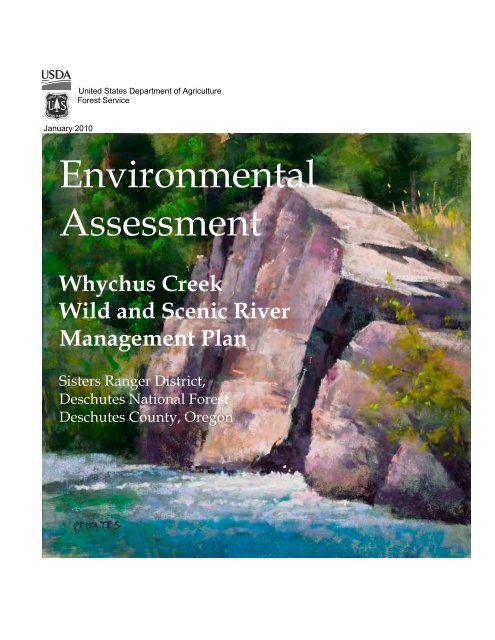
Whychus Creek Wild and Scenic River Management Plan
Whychus Creek Wild and Scenic River Management Plan
Whychus Creek Wild and Scenic River Management Plan

You also want an ePaper? Increase the reach of your titles
YUMPU automatically turns print PDFs into web optimized ePapers that Google loves.
January 2010<br />
United States Department of Agriculture<br />
Forest Service<br />
Environmental<br />
Assessment<br />
<strong>Whychus</strong> <strong>Creek</strong><br />
<strong>Wild</strong> <strong>and</strong> <strong>Scenic</strong> <strong>River</strong><br />
<strong>Management</strong> <strong>Plan</strong><br />
Sisters Ranger District,<br />
Deschutes National Forest<br />
Deschutes County, Oregon
Environmental<br />
Assessment<br />
<strong>Whychus</strong> <strong>Creek</strong><br />
<strong>Wild</strong> <strong>and</strong> <strong>Scenic</strong> <strong>River</strong><br />
<strong>Management</strong> <strong>Plan</strong><br />
Sisters Ranger District,<br />
Deschutes National Forest<br />
Deschutes County, Oregon<br />
For More Information Contact: Maret Pajutee, Project Leader, Sisters Ranger District<br />
541-549-7727, mpajutee@fs.fed.us or view project information at:<br />
http://www.fs.fed.us/r6/centraloregon/projects/units/sisters/index.shtml
Art <strong>and</strong> Photo Credits<br />
Plein Air Art from the “<strong>Whychus</strong> Paint-Out” - Used by permission of: The National Forest<br />
Foundation, The Roundhouse Foundation, <strong>and</strong> the artists.<br />
Cover Artwork- By Phil Bates, One of Best of Show at the 2009 <strong>Whychus</strong> Paint-Out<br />
Janet Guiley, Poster Award at the 2009 <strong>Whychus</strong> Paint-Out<br />
Donna Simpson, One of Best of Show at the 2009 <strong>Whychus</strong> Paint-Out<br />
Kay Baker, One of Best of Show at the 2009 <strong>Whychus</strong> Paint-Out<br />
Jerry Dame, One of Best of Show, purchased by NFF at the 2009 <strong>Whychus</strong> Paint-Out<br />
Photographs- by Bill Anthony, Tay Robertson, Maret Pajutee, Cari Press, Ross Scrocca, Larry<br />
Chitwood, John Schubert, <strong>and</strong> Scott Cotter<br />
Riparian/Fish/<strong>Wild</strong>life Habitat illustrations from “Respect The <strong>River</strong>” materials<br />
The U.S. Department of Agriculture (USDA) prohibits discrimination in all its programs<br />
<strong>and</strong> activities on the basis of race, color, national origin, age, disability, <strong>and</strong> where<br />
applicable, sex, marital status, familial status, parental status, religion, sexual<br />
orientation, genetic information, political beliefs, reprisal, or because all or part of an<br />
individual’s income is derived from any public assistance program. (Not all prohibited<br />
bases apply to all programs.) Persons with disabilities who require alternative means<br />
for communication of program information (Braille, large print, audiotape, etc.) should<br />
contact USDA's TARGET Center at (202) 720-2600 (voice <strong>and</strong> TDD).<br />
To file a complaint of discrimination, write to USDA, Director, Office of Civil Rights,<br />
1400 Independence Avenue, S.W., Washington, D.C. 20250-9410, or call (800) 795-<br />
3272 (voice) or (202) 720-6382 (TDD). USDA is an equal opportunity provider <strong>and</strong><br />
employer.
<strong>Whychus</strong> <strong>Creek</strong> <strong>Wild</strong> <strong>and</strong> <strong>Scenic</strong> <strong>River</strong> Environmental Assessment<br />
Table of Contents<br />
Summary ............................................................................................................................ i<br />
Chapter 1-Introduction ...................................................................................................1<br />
Background .................................................................................................................. 3<br />
Resource Assessment .............................................................................................. 5<br />
Outst<strong>and</strong>ingly Remarkable Values ....................................................................... 6<br />
Name Changes ......................................................................................................... 7<br />
<strong>Management</strong> Direction ........................................................................................... 9<br />
Analysis Incorporated by Reference ................................................................... 17<br />
Purpose <strong>and</strong> Need for Action ............................................................................... 19<br />
Desired Future Condition, Existing Condition, <strong>and</strong> Need ............................... 21<br />
Geology .................................................................................................................... 22<br />
Hydrology ............................................................................................................... 23<br />
Fisheries ................................................................................................................... 25<br />
Scenery ..................................................................................................................... 27<br />
Cultural Prehistory <strong>and</strong> Traditional Use ............................................................ 29<br />
<strong>Wild</strong>life .................................................................................................................... 31<br />
Vegetation <strong>and</strong> Ecology ........................................................................................ 34<br />
Cultural History ..................................................................................................... 36<br />
Recreation ................................................................................................................ 37<br />
Public Involvement .................................................................................................... 42<br />
Consultation with Native American Tribes ........................................................... 43<br />
Issues ............................................................................................................................ 44<br />
Chapter 2 -Alternatives, including the Proposed Action .......................................55<br />
Alternative 1- No Action ........................................................................................... 55<br />
Alternative 2 -The Proposed Action ........................................................................ 57<br />
Alternatives Considered but not Analyzed in Detail ........................................... 59<br />
Comparison of Alternatives ..................................................................................... 60<br />
Comparison of Alternative Effects .......................................................................... 63<br />
Chapter 3 - Environmental Consequences ................................................................67<br />
<strong>River</strong> Boundary .......................................................................................................... 67<br />
Geology ........................................................................................................................ 69<br />
Hydrology ................................................................................................................... 74<br />
Fish <strong>and</strong> their Habitat ................................................................................................ 91<br />
<strong>Scenic</strong> Resources ......................................................................................................... 97<br />
Cultural Prehistory .................................................................................................. 103<br />
Cultural Traditional Use ......................................................................................... 106<br />
<strong>Wild</strong>life ...................................................................................................................... 109<br />
Ecology/Botany ....................................................................................................... 117<br />
Cultural History ....................................................................................................... 124
Recreation .................................................................................................................. 126<br />
Other Disclosures ..................................................................................................... 132<br />
Consultation <strong>and</strong> Coordination ............................................................................. 135<br />
References......................................................................................................................136<br />
Appendix 1- Monitoring <strong>Plan</strong> .....................................................................................140<br />
Tables<br />
Table 1- Place Name Changes………………………………………………………8<br />
Table 2. Riparian Reserve widths…………………………………………………. 15<br />
Table 3. Alternative Comparison…………………………………………………...60<br />
Table 4. Alternative Effects Comparison………………………………………….63<br />
Table 5. Acres within the Proposed Boundary ………………………………….68<br />
Table 6. Acres that Change <strong>Management</strong> Allocation……………………………68<br />
Table 7. Geothermal Leases within the <strong>Wild</strong> <strong>and</strong> <strong>Scenic</strong> <strong>River</strong>…………………71<br />
Table 8. Beneficial Uses Under the Clean Water Act…………………………….81<br />
Table 9. Water Temperature Monitoring Data……………………………………82<br />
Figures<br />
<strong>Whychus</strong> <strong>Wild</strong> <strong>and</strong> <strong>Scenic</strong> <strong>River</strong> Project Area Locator Map………..…………….2<br />
No Action Boundary- Alternative 1…………………………………………………54<br />
Proposed Boundary – Alternative 2…………………………………………………56<br />
Proposed Boundary- <strong>Management</strong> Allocation Changes………………………..…66<br />
vi
SUMMARY<br />
<strong>Whychus</strong> <strong>Creek</strong> <strong>Wild</strong> <strong>and</strong> <strong>Scenic</strong> <strong>River</strong> Environmental Assessment<br />
The Deschutes National Forest proposes to develop a Comprehensive <strong>River</strong> <strong>Management</strong><br />
<strong>Plan</strong> <strong>and</strong> boundary for <strong>Whychus</strong> <strong>Creek</strong> <strong>Wild</strong> <strong>and</strong> <strong>Scenic</strong> <strong>River</strong>. The plan would amend<br />
the Deschutes National Forest L<strong>and</strong> <strong>and</strong> Resource <strong>Management</strong> <strong>Plan</strong> (USFS 1990)<br />
St<strong>and</strong>ards <strong>and</strong> Guidelines to provide specific management direction where needed to<br />
protect or enhance the river <strong>and</strong> its values or address issues related to river management.<br />
The project area is located near Sisters, in Deschutes County <strong>and</strong> is within the Sisters<br />
Ranger District, Deschutes National Forest, Oregon.<br />
This action is needed to fulfill the requirements of Section 3(d)(1) of the <strong>Wild</strong> <strong>and</strong> <strong>Scenic</strong><br />
<strong>River</strong>s Act to prepare a Comprehensive <strong>River</strong> <strong>Management</strong> <strong>Plan</strong> to provide for the<br />
protection of the river <strong>and</strong> its values. The purpose of this Environmental Assessment is<br />
to provide a basis for comparing alternatives <strong>and</strong> selecting a management plan that<br />
protects the resource values of <strong>Whychus</strong> <strong>Creek</strong>. This document describes desired future<br />
conditions, existing conditions, environmental consequences, <strong>and</strong> management <strong>and</strong><br />
monitoring needs. The Comprehensive <strong>River</strong> <strong>Management</strong> <strong>Plan</strong> will be completed after<br />
the public review <strong>and</strong> the final decision.<br />
Two alternatives are analyzed: No action (Alternative 1) <strong>and</strong> one action alternative<br />
(Alternative 2). The Proposed Action is Alternative 2. All elements of the alternatives<br />
are entirely programmatic in nature. Future actions or projects would require appropriate<br />
National Environmental Policy Act (NEPA) documentation.<br />
Alternative 1- No Action<br />
Under the No Action alternative, current management plans would continue to guide<br />
management of the project area. The corridor boundary would be located approximately<br />
¼ mile from the banks of the creek. No additional st<strong>and</strong>ards or guidelines would be<br />
implemented to accomplish the purpose of the <strong>Wild</strong> <strong>and</strong> <strong>Scenic</strong> <strong>River</strong> designation. The<br />
direction from the Deschutes National Forest L<strong>and</strong> <strong>and</strong> Resource <strong>Management</strong> <strong>Plan</strong>, as<br />
amended, including direction for <strong>Management</strong> Area 17 (<strong>Wild</strong> <strong>and</strong> <strong>Scenic</strong> <strong>River</strong>s) <strong>and</strong><br />
other plans would remain unchanged.<br />
Alternative 2- The Proposed Action<br />
The action proposed by the Forest Service to meet the purpose <strong>and</strong> need would establish<br />
a new boundary <strong>and</strong> require a non-significant plan amendment to the Deschutes National<br />
Forest L<strong>and</strong> <strong>and</strong> Resource <strong>Management</strong> <strong>Plan</strong> to incorporate additional st<strong>and</strong>ards <strong>and</strong><br />
guidelines <strong>and</strong> designate the final <strong>Wild</strong> <strong>and</strong> <strong>Scenic</strong> <strong>River</strong> boundary. The elements of this<br />
alternative would serve as the basis for development of a Comprehensive <strong>River</strong><br />
<strong>Management</strong> <strong>Plan</strong> for the <strong>Whychus</strong> <strong>Creek</strong> <strong>Wild</strong> <strong>and</strong> <strong>Scenic</strong> <strong>River</strong>.<br />
The goal of the proposed action is to protect <strong>and</strong> enhance the outst<strong>and</strong>ingly remarkable<br />
values of <strong>Whychus</strong> <strong>Creek</strong>, restore degraded resources, <strong>and</strong> maintain the creek’s wild <strong>and</strong><br />
remote character. Restoration of degraded resources <strong>and</strong> management of recreational use<br />
would be accomplished through future site specific actions or projects. Long term<br />
protection of the outst<strong>and</strong>ingly remarkable <strong>and</strong> significant values of the creek would be<br />
provided by additional management. Monitoring is a prominent part of the <strong>River</strong><br />
i
<strong>Management</strong> <strong>Plan</strong> in Alternative 2 using the Limits of Acceptable Change concept to<br />
focus on the desired future condition, rather than on how much use an area can tolerate.<br />
<strong>Wild</strong> Segment<br />
<strong>Management</strong> of the wild segment of the river corridor from its mountain headwaters on<br />
the glaciers of the Three Sisters to the <strong>Wild</strong>erness Boundary would be focused on<br />
protecting <strong>and</strong> preserving natural processes with minimal human influences. Recreation<br />
management would be designed to provide the most primitive experience, in as remote<br />
<strong>and</strong> natural a setting as possible. Developed access to the area is limited to trails in the<br />
Three Sisters <strong>Wild</strong>erness.<br />
<strong>Scenic</strong> Segment<br />
<strong>Management</strong> of the scenic segment of the river corridor from the <strong>Wild</strong>erness boundary to<br />
the hydrological Gauging Station 4 miles south of the City of Sisters would focus on<br />
maintaining <strong>and</strong> enhancing the near-natural environment. The riverbanks would be<br />
largely undeveloped <strong>and</strong> primitive, but would be accessible in places by roads or trails.<br />
Inaccessible areas which currently have little use <strong>and</strong> which provide high quality wildlife<br />
refugia would be retained.<br />
The area would have a natural-appearing setting with limited improvements. There<br />
would be a gradient of management controls so areas closer to the City of Sisters would<br />
provide more facilities to manage use <strong>and</strong> higher reaches closer to the wilderness would<br />
provide fewer facilities. A few recreational facilities close to the City of Sisters may be<br />
developed to manage use to protect river values <strong>and</strong> provide interpretive <strong>and</strong> stewardship<br />
information. Recreational facilities such as trails or dispersed camping areas would be<br />
designed or managed to protect riparian areas, relocated, or removed. Access points such<br />
as trailheads, parking areas, information kiosks, or viewpoints would be strategically<br />
located in the corridor or adjacent to the corridor to manage recreation use.<br />
New st<strong>and</strong>ards <strong>and</strong> guidelines would address protection of geological features, in stream<br />
wood, wildlife refugia <strong>and</strong> habitats, <strong>and</strong> cultural resources from recreational impacts.<br />
Additional st<strong>and</strong>ards guide vegetation management to protect deer habitat. St<strong>and</strong>ards<br />
would define appropriate trails <strong>and</strong> locations.<br />
All Segments<br />
Opportunities would be provided for primitive <strong>and</strong> semi-primitive recreation experiences<br />
associated with enjoying the water, forests <strong>and</strong> mountain views while hiking, watching<br />
wildlife, camping, hunting, <strong>and</strong> fishing. Motorized use is allowed as specified by the<br />
Deschutes <strong>and</strong> Ochoco Travel <strong>Management</strong> <strong>Plan</strong>.<br />
Primitive recreational experiences are non-motorized, in unmodified natural<br />
environments with very little evidence of human development, with rustic<br />
facilities for site protection but not user comfort, where few people are<br />
encountered.<br />
Semi-primitive recreation experiences are generally within ½ mile from<br />
primitive roads, in a largely undisturbed natural environment with little evidence<br />
of human development, minimal facility development primarily for resource<br />
protection, where low to moderate numbers of people may be encountered (6-15<br />
groups/day).<br />
ii
<strong>Whychus</strong> <strong>Creek</strong> <strong>Wild</strong> <strong>and</strong> <strong>Scenic</strong> <strong>River</strong> Environmental Assessment<br />
Additional clarification for wildfire suppression or management of fire for the benefit of<br />
natural resources would be provided.<br />
Interpretation of the river values of <strong>Whychus</strong> <strong>Creek</strong> would be available in various forms<br />
to the public from low-key off-site interpretive materials to interpretive displays at<br />
appropriate locations.<br />
Appropriate recreational or social events would be those which have no permanent<br />
effects on the creek’s character, accomplish stewardship <strong>and</strong> restoration, provide<br />
education, <strong>and</strong> recreation opportunities or visitor experiences. They would be authorized<br />
through Special Use permits <strong>and</strong> authorizing NEPA.<br />
Development of fixed improvements would be permitted on a case by case basis if they<br />
respond to a demonstrated need for public safety, fulfill a goal of this plan, fulfill an<br />
agency management role or involve research of values unique to <strong>Whychus</strong> <strong>Creek</strong>.<br />
Recreation management would be designed for sustainability: 1) considering<br />
environmental, social, <strong>and</strong> economic factors that will influence the sustainability of the<br />
outst<strong>and</strong>ingly remarkable <strong>and</strong> significant resource values, <strong>and</strong> 2) working with the<br />
community, visitors, <strong>and</strong> partners to provide the mental <strong>and</strong> physical benefits of outdoor<br />
recreation while protecting <strong>and</strong> enhancing the resource values for future generations.<br />
The Forest Service would continue to work closely with state <strong>and</strong> local governments,<br />
partner organizations, <strong>and</strong> the public to encourage stewardship <strong>and</strong> develop community<br />
volunteerism.<br />
Carrying Capacity <strong>and</strong> Use Limits<br />
Recreational capacity would be established by defining desired future resource conditions<br />
<strong>and</strong> recreational experiences <strong>and</strong> by providing information <strong>and</strong> examples of consistent<br />
<strong>and</strong> inconsistent uses. The Recreational Opportunity Spectrum (ROS) characterization<br />
for each river segment helps define appropriate levels of development for settings <strong>and</strong><br />
includes: access, remoteness, naturalness, facilities <strong>and</strong> site management, social<br />
encounters, <strong>and</strong> visitor management. St<strong>and</strong>ards would define appropriate trail locations<br />
<strong>and</strong> allowable authorized uses to help maintain desired social settings over time.<br />
Monitoring would indicate the need for management actions necessary to maintain<br />
desired conditions (See Monitoring <strong>Plan</strong>- Appendix 1).<br />
iii
INTRODUCTION<br />
Document Structure ______________________________<br />
The Forest Service has prepared this Environmental Assessment in compliance with the<br />
National Environmental Policy Act (NEPA) <strong>and</strong> other relevant Federal <strong>and</strong> State laws<br />
<strong>and</strong> regulations. This Environmental Assessment discloses the direct, indirect, <strong>and</strong><br />
cumulative environmental impacts that would result from the proposed action <strong>and</strong><br />
alternatives. The document is organized into four parts:<br />
Introduction: The section includes information on the history of the project proposal,<br />
the purpose <strong>and</strong> need for the project, <strong>and</strong> the agency’s proposal for achieving that<br />
purpose <strong>and</strong> need. This section also details how the Forest Service informed the<br />
public about the proposal <strong>and</strong> how the public responded.<br />
Comparison of Alternatives, including the Proposed Action: This section provides a<br />
more detailed description of the agency’s proposed action as well as alternative<br />
methods for achieving the stated purpose. These alternatives were developed based on<br />
significant issues raised by the public <strong>and</strong> other agencies. This discussion also<br />
includes possible mitigation measures. Finally, this section provides a summary table<br />
of the environmental consequences associated with each alternative.<br />
Environmental Consequences: This section describes the environmental effects of<br />
implementing the proposed action <strong>and</strong> other alternatives. This analysis is organized<br />
by resource area. Within each section, the existing condition is described first,<br />
followed by the effects of the No Action Alternative that provides a baseline for<br />
evaluation <strong>and</strong> comparison of the other alternatives that follow.<br />
Agencies <strong>and</strong> Persons Consulted: This section provides a list of preparers <strong>and</strong><br />
agencies consulted during the development of the environmental assessment.<br />
Appendices: The appendices provide more detailed information to support the<br />
analyses presented in the environmental assessment.<br />
Additional documentation, including more detailed analyses of project-area resources, may<br />
be found in the project planning record located at the Sisters Ranger District Office in<br />
Sisters, Oregon.<br />
1
<strong>Whychus</strong> <strong>Creek</strong> <strong>Wild</strong> <strong>and</strong> <strong>Scenic</strong> <strong>River</strong> <strong>Plan</strong> Environmental Assessment<br />
2
Background _____________________________________<br />
In 1968, Congress passed the <strong>Wild</strong> <strong>and</strong> <strong>Scenic</strong> <strong>River</strong>s Act (P.L. 90-542) <strong>and</strong> established a<br />
nationwide system of outst<strong>and</strong>ing free-flowing rivers. For a river segment to be<br />
considered eligible for <strong>Wild</strong> <strong>and</strong> <strong>Scenic</strong> <strong>River</strong> status it must be “free-flowing” <strong>and</strong><br />
possess “outst<strong>and</strong>ingly remarkable values” within its immediate environment. These<br />
rivers are protected for the benefit <strong>and</strong> enjoyment of present <strong>and</strong> future generations.<br />
<strong>Whychus</strong> <strong>Creek</strong> (formerly Squaw <strong>Creek</strong>) is located in Central Oregon on the eastern<br />
slopes of the Cascade Mountains. It is a perennial stream that is a tributary of the<br />
Deschutes <strong>River</strong>. It is approximately 41 miles long from its headwaters in the Three<br />
Sisters <strong>Wild</strong>erness to it’s confluence with the Deschutes <strong>River</strong>. A portion of <strong>Whychus</strong><br />
<strong>Creek</strong> was designated by Congress as a <strong>Wild</strong> <strong>and</strong> <strong>Scenic</strong> <strong>River</strong> as part of the Omnibus<br />
Oregon <strong>Wild</strong> <strong>and</strong> <strong>Scenic</strong> <strong>River</strong>s Act of 1988 (Public Law 100-557 - Oct.28, 1988) – an<br />
amendment to Section 3(a) of the <strong>Wild</strong> <strong>and</strong> <strong>Scenic</strong> <strong>River</strong>s Act (P.L. 90 - 542); USC<br />
1274(a).<br />
The designated area includes 15.4 miles, beginning at its source on the glaciers of the<br />
Three Sisters mountains <strong>and</strong> ending at the hydrological Gauging Station that is<br />
approximately 4 miles southwest of the City of Sisters in Central Oregon.<br />
The designation reads as follows:<br />
(102) SQUAW CREEK, OREGON. -- The 15.4-mile segment from its source<br />
to the hydrologic Gauging Station 800 feet upstream from the intake of the<br />
McAllister Ditch, including the Soap Fork Squaw <strong>Creek</strong>, the North Fork, the<br />
South Fork, the East <strong>and</strong> West Forks of Park <strong>Creek</strong>, <strong>and</strong> Park <strong>Creek</strong> Fork; to be<br />
administered by the Secretary of Agriculture as follows: (A) The 6.6-mile<br />
segment <strong>and</strong> its tributaries from the source to the Three Sisters <strong>Wild</strong>erness<br />
boundary as a wild river; <strong>and</strong> (B) the 8.8-mile segment from the boundary of the<br />
Three Sisters <strong>Wild</strong>erness Area to the hydrologic Gauging Station 800 feet<br />
upstream from the intake of the McAllister Ditch as a scenic river: Provided, That<br />
nothing in this Act shall prohibit the construction of facilities necessary for<br />
emergency protection for the town of Sisters relative to a rapid discharge of<br />
Carver Lake if no other reasonable flood warning or control alternative exists.<br />
<strong>Wild</strong> Section<br />
The 6.6 mile segment of the creek from its source on the Three Sisters mountains to the<br />
Three Sisters <strong>Wild</strong>erness boundary is classified as “<strong>Wild</strong>”. The source of <strong>Whychus</strong><br />
<strong>Creek</strong> begins on the glaciers of the Three Sisters mountains <strong>and</strong> includes Soap <strong>Creek</strong>, the<br />
South <strong>and</strong> North Forks of <strong>Whychus</strong> <strong>Creek</strong>, <strong>and</strong> Park <strong>Creek</strong>, including the East <strong>and</strong> West<br />
Forks of Park <strong>Creek</strong>. <strong>Wild</strong> rivers are defined in the <strong>Wild</strong> <strong>and</strong> <strong>Scenic</strong> <strong>River</strong>s Act as:<br />
“Those rivers or sections of rivers that are free of impoundments <strong>and</strong> generally<br />
inaccessible except by trail, with watersheds or shorelines essentially primitive <strong>and</strong><br />
waters unpolluted. These represent vestiges of primitive America.”<br />
3
<strong>Scenic</strong> Section<br />
<strong>Whychus</strong> <strong>Creek</strong> <strong>Wild</strong> <strong>and</strong> <strong>Scenic</strong> <strong>River</strong> <strong>Plan</strong> Environmental Assessment<br />
The 8.8 mile segment from the Three Sisters <strong>Wild</strong>erness boundary to the USGS<br />
hydrological gauging station is classified as “<strong>Scenic</strong>.” <strong>Scenic</strong> <strong>River</strong>s are defined in the<br />
<strong>Wild</strong> <strong>and</strong> <strong>Scenic</strong> <strong>River</strong>s Act as: “Those rivers or sections of rivers that are free of<br />
impoundments, with shorelines or watersheds still largely primitive <strong>and</strong> shorelines<br />
largely undeveloped, but accessible in places by roads.”<br />
Carver Lake<br />
Carver Lake September 2008 – by Tay Robertson<br />
Special consideration of Carver Lake, a high-elevation moraine lake on South Sister, is<br />
included in the designation. In the mid-1980’s Carver Lake was identified as a potential<br />
flood risk for Sisters <strong>and</strong> homes along <strong>Whychus</strong> <strong>Creek</strong> by the U.S. Geological Survey.<br />
Risk reports have since been downgraded, but still exist.<br />
The <strong>Wild</strong> <strong>and</strong> <strong>Scenic</strong> <strong>River</strong> designation states: “Nothing in this Act shall prohibit the<br />
construction of facilities necessary for emergency protection for the town of Sisters<br />
relative to a rapid discharge of Carver Lake if no reasonable flood warning or control<br />
alternative exists.”<br />
4
Resource Assessment<br />
<strong>Whychus</strong> <strong>Creek</strong> <strong>and</strong> Rock Penstemon<br />
The values for which <strong>Whychus</strong> <strong>Creek</strong> was designated were not identified through a pre–<br />
designation study. A Resource Assessment was an important first step in the preparation<br />
of a Comprehensive <strong>River</strong> <strong>Management</strong> <strong>Plan</strong> for <strong>Whychus</strong> <strong>Creek</strong> to provide for<br />
protection of its values.<br />
An interdisciplinary team was convened in March 2003 to complete this process. The<br />
assessment took into consideration all features which are directly river-related <strong>and</strong><br />
provided a comprehensive approach to investigating the relationship of river features.<br />
Members of the team included specialists in the following areas: hydrology, geology,<br />
fisheries, scenery management, wildlife biology, archeology, recreation management <strong>and</strong><br />
ecology.<br />
There are three components to the resource assessment process: 1) the identification of<br />
outst<strong>and</strong>ingly remarkable values, 2) the identification <strong>and</strong> determination of significance<br />
levels for river-related values which contribute to its overall character, <strong>and</strong> 3) the<br />
confirmation of outst<strong>and</strong>ingly remarkable values set forth for the river in the legislative<br />
history of its designation. Public outreach was included <strong>and</strong> is discussed below.<br />
Extensive work was accomplished before several years of large wildfires interrupted the<br />
assessment process. The assessment was reinitiated <strong>and</strong> the final draft was completed in<br />
2007 (USFS 2007).<br />
5
<strong>Whychus</strong> <strong>Creek</strong> <strong>Wild</strong> <strong>and</strong> <strong>Scenic</strong> <strong>River</strong> <strong>Plan</strong> Environmental Assessment<br />
Outst<strong>and</strong>ingly Remarkable Values<br />
The term “outst<strong>and</strong>ingly remarkable values” has never been precisely defined. The<br />
assessment of which values are outst<strong>and</strong>ingly remarkable for <strong>Whychus</strong> <strong>Creek</strong> was based<br />
on the professional judgment of the interdisciplinary team <strong>and</strong> documented objective,<br />
scientific analysis based on reviews of available literature, consultation with experts, <strong>and</strong><br />
field work. The region of comparison for <strong>Whychus</strong> <strong>Creek</strong> was generally the Central<br />
Oregon area.<br />
To be considered “river-related” values should:<br />
1. Be located in the river or its immediate environment (generally within ¼ mile on<br />
either side),<br />
2. Contribute substantially to the functioning of the river ecosystem, <strong>and</strong>/or<br />
3. Owe its existence to the presence of the river.<br />
<strong>River</strong>-related value must be rated for level of significance. Levels include:<br />
Outst<strong>and</strong>ingly Remarkable – A unique, rare, or exemplary feature that is<br />
significant at a comparative regional or national scale.<br />
Significant (but not outst<strong>and</strong>ingly remarkable) - Values which still contribute<br />
substantially to the rivers character. These values may still need varying<br />
levels of protection <strong>and</strong> consideration in the development of a <strong>Wild</strong> <strong>and</strong><br />
<strong>Scenic</strong> <strong>River</strong> <strong>Plan</strong>.<br />
Insufficient information - If the level of existing data is insufficient to make a<br />
determination of significance, then it must be identified. The values need to<br />
be protected as “outst<strong>and</strong>ingly remarkable” until more information is<br />
gathered.<br />
The following Outst<strong>and</strong>ingly Remarkable Values <strong>and</strong> Significant Values<br />
were identified for <strong>Whychus</strong> <strong>Creek</strong> <strong>Wild</strong> <strong>and</strong> <strong>Scenic</strong> <strong>River</strong>:<br />
Outst<strong>and</strong>ingly Remarkable Values: Significant Values:<br />
**Geology *<strong>Wild</strong>life<br />
**Hydrology *Ecology/Botany<br />
**Fish *Cultural- History<br />
**<strong>Scenic</strong> Resources *Recreation<br />
**Cultural- Prehistory<br />
**Cultural- Traditional Use<br />
6
Name Changes<br />
“Righteous on the <strong>Whychus</strong>”<br />
by Donna Simpson<br />
7<br />
Historic names for the creek include:<br />
*<strong>Whychus</strong><br />
*Sesequa<br />
*Benton <strong>Creek</strong><br />
*Clark’s <strong>River</strong><br />
*Squaw <strong>Creek</strong><br />
The story of how the creek was called<br />
“Squaw <strong>Creek</strong>” is one indication of its<br />
traditional use by Native American Tribes.<br />
It is recorded in the unpublished memoirs<br />
of a Sister’s homesteader named Newt<br />
Cobb, that one day two men came upon a<br />
camp of Native American women <strong>and</strong> their<br />
dogs next to the creek. Their horses were<br />
scared by the dogs <strong>and</strong> ran off <strong>and</strong> had to<br />
be chased. Cobb recorded “After that it<br />
was generally called Squaw <strong>Creek</strong>”.<br />
After hearing this story, elders of the<br />
Confederated Tribes of Warm Springs said<br />
that people would often camp for 2 to 3<br />
days in one place <strong>and</strong> the men would go<br />
out hunting while leaving the women in<br />
camp.<br />
In 2001, Oregon became the sixth state to ban the term “Squaw” from public place names<br />
under Senate Bill 488. This was because many Native Americans consider the word<br />
“Squaw” to be a derogatory term. Deschutes <strong>and</strong> Ochoco National Forest officials<br />
proposed name changes to comply with the state law <strong>and</strong> federal directives. Forest<br />
Service regulations prohibit derogatory names from being used in documents or on maps.<br />
On December 8, 2005 the U.S. Board on Geographic Names gave final approval to<br />
sixteen name changes <strong>and</strong> one new name for Central Oregon l<strong>and</strong>scape features that use<br />
the word “Squaw”. The changes removed the derogatory word as a place name which<br />
resulted from several years of consultation with the Confederated Tribes of Warm<br />
Springs <strong>and</strong> the Oregon Geographic Names Board. The U.S. Board on Geographic<br />
Names made final judgment on the proposed name changes after the Oregon Geographic<br />
Names Board’s approval of the proposal in October 2005. The state board supervises the<br />
naming of all geographic features within Oregon, however final approval is required by<br />
the U.S. Board on Geographic Names before the changes are final.
<strong>Whychus</strong> <strong>Creek</strong> <strong>Wild</strong> <strong>and</strong> <strong>Scenic</strong> <strong>River</strong> <strong>Plan</strong> Environmental Assessment<br />
The name “<strong>Whychus</strong>” was chosen for the creek because it had the strongest historical <strong>and</strong><br />
legal usage of any alternate name. It was recorded on government maps (1863- Surveyor<br />
Generals Office map). It had been used in government documents <strong>and</strong> was mentioned in<br />
the geographical reference book, Oregon Geographic Names (McArthur 2003) as the<br />
historic name for Squaw <strong>Creek</strong>.<br />
Five names within the designated <strong>Wild</strong> <strong>and</strong> <strong>Scenic</strong> <strong>River</strong> area were included in the name<br />
changes <strong>and</strong> are displayed in the Table below.<br />
Table 1- Place Name Changes in the <strong>Whychus</strong> <strong>Creek</strong> <strong>Wild</strong> <strong>and</strong> <strong>Scenic</strong> <strong>River</strong> Area<br />
Old Name New Name Meaning<br />
1) Squaw <strong>Creek</strong> <strong>Whychus</strong> <strong>Creek</strong><br />
2) North Fork of<br />
Squaw <strong>Creek</strong><br />
3) South Fork of<br />
Squaw <strong>Creek</strong><br />
4) Lower unnamed<br />
waterfall, commonly<br />
called Squaw <strong>Creek</strong><br />
Falls<br />
Pronounced<br />
“Why choose”<br />
North Fork of <strong>Whychus</strong><br />
<strong>Creek</strong><br />
South Fork of <strong>Whychus</strong><br />
<strong>Creek</strong><br />
8<br />
Historic- Earliest recorded<br />
name from 1855 Pacific<br />
Railroad Reports. Derived<br />
from Sahaptin language.<br />
Meaning: “The place we cross<br />
the water”<br />
Historic- see above<br />
Historic- see above<br />
Chush Falls Native American-Sahaptin<br />
word for water<br />
5) Squaw <strong>Creek</strong> Falls Upper Chush Falls Native American-Sahaptin<br />
word for water<br />
Changing these names in the <strong>Wild</strong> <strong>and</strong> <strong>Scenic</strong> <strong>River</strong>s Act requires congressional action.<br />
Legislation is pending to make the change to reflect the new names. Because these<br />
l<strong>and</strong>scape feature names have been legally changed, this document will use them, except<br />
when quoting from the legislative record.
<strong>Management</strong> Direction ____________________________<br />
The Interdisciplinary Team reviewed the<br />
many documents which currently provide<br />
management direction for <strong>Whychus</strong> <strong>Creek</strong><br />
<strong>Wild</strong> <strong>and</strong> <strong>Scenic</strong> <strong>River</strong> to determine whether<br />
changes or more direction were needed to<br />
protect river values or address specific<br />
management issues.<br />
All federal l<strong>and</strong> management activities in<br />
the <strong>Whychus</strong> <strong>Wild</strong> <strong>and</strong> <strong>Scenic</strong> <strong>River</strong> <strong>Plan</strong><br />
Project area must follow st<strong>and</strong>ards <strong>and</strong><br />
guidelines listed in the following plans <strong>and</strong><br />
be guided by analyses such as Watershed<br />
Analysis <strong>and</strong> Late Successional Reserve<br />
Assessments.<br />
The Desired Future Condition for the<br />
project area is derived by the management<br />
goals in these documents, <strong>and</strong> analysis<br />
incorporated by reference <strong>and</strong> is discussed<br />
in more detail below. ”Above <strong>Whychus</strong> <strong>Creek</strong>” by Kay Baker<br />
Deschutes National Forest L<strong>and</strong> <strong>and</strong> Resource <strong>Management</strong> <strong>Plan</strong><br />
The project area encompasses l<strong>and</strong>s managed under the Deschutes National Forest L<strong>and</strong><br />
<strong>and</strong> Resource <strong>Management</strong> <strong>Plan</strong> (USDA 1990) as amended. This plan was analyzed in<br />
the Final Environmental Impact Statement for Deschutes National Forest L<strong>and</strong> <strong>and</strong><br />
Resource <strong>Management</strong> <strong>Plan</strong> (USDA 1990). The plan establishes goals, objectives, <strong>and</strong><br />
st<strong>and</strong>ards <strong>and</strong> guidelines for management areas on the Forest, as well as Forest-wide<br />
st<strong>and</strong>ards <strong>and</strong> guidelines. Two <strong>Management</strong> Areas apply to the river area:<br />
<strong>Wild</strong>erness (MA- 6): The portion of <strong>Whychus</strong> <strong>Wild</strong> <strong>and</strong> <strong>Scenic</strong> <strong>River</strong> designated<br />
as “<strong>Wild</strong>” is within the Three Sisters <strong>Wild</strong>erness. The goal for this management<br />
area is to feature naturalness, opportunities for solitude, challenge, <strong>and</strong><br />
inspiration, <strong>and</strong> within these objectives to provide for recreational, scenic,<br />
scientific, educational, conservation, <strong>and</strong> historical uses. Permitted but<br />
nonconforming uses specified in the <strong>Wild</strong>erness Act of 1964, are carried out<br />
under restrictions designed to minimize their impact to the <strong>Wild</strong>erness. The<br />
decisive criteria in all conflicts preserves <strong>and</strong> protects the <strong>Wild</strong>erness character of<br />
the resource. Specific st<strong>and</strong>ards <strong>and</strong> guidelines define social settings, permitted<br />
uses, capacity, <strong>and</strong> management of vegetation, recreation, natural <strong>and</strong> cultural<br />
resources, <strong>and</strong> other needs.<br />
9
<strong>Whychus</strong> <strong>Creek</strong> <strong>Wild</strong> <strong>and</strong> <strong>Scenic</strong> <strong>River</strong> <strong>Plan</strong> Environmental Assessment<br />
Natural processes are emphasized including the natural role of fire, insects <strong>and</strong><br />
disease, the role of native species, <strong>and</strong> preferred methods for revegetation of<br />
impacted areas.<br />
Visitor management limits group sizes, encourages “no trace” camping, does not<br />
permit contests, races, promotions or fundraisers. Commercial uses such as<br />
summer outfitter guides are assessed to be at adequate <strong>and</strong> maximum levels<br />
although winter outfitter guides may have some potential for expansion.<br />
Allowable use of regulations <strong>and</strong> site restoration actions are outlined <strong>and</strong><br />
allowable trail construction for safety or to prevent resource damage is defined.<br />
Mineral pits <strong>and</strong> geothermal leasing are not permitted.<br />
<strong>Wild</strong> <strong>and</strong> <strong>Scenic</strong> <strong>River</strong>s (MA- 17): Both the “<strong>Wild</strong>” <strong>and</strong> “<strong>Scenic</strong>” sections of<br />
<strong>Whychus</strong> <strong>Creek</strong> are included in this management area although the “<strong>Wild</strong>”<br />
section is within the Three Sisters <strong>Wild</strong>erness <strong>and</strong> <strong>Wild</strong>erness st<strong>and</strong>ards also<br />
apply (see above). The goal for this management area is to protect <strong>and</strong> enhance<br />
those outst<strong>and</strong>ingly remarkable values that qualified segments of <strong>Whychus</strong> (<strong>and</strong><br />
other rivers) for inclusion in the National <strong>Wild</strong> <strong>and</strong> <strong>Scenic</strong> <strong>River</strong>s System. This<br />
direction was meant to serve as interim management direction until a formal river<br />
corridor plan is completed with a Forest <strong>Plan</strong> amendment.<br />
Specific st<strong>and</strong>ards <strong>and</strong> guidelines are described related to vegetation management,<br />
water supply, hydroelectric power, flood control, mining, geothermal, roads,<br />
recreation development, scenic quality, structures, utilities, commercial uses, <strong>and</strong><br />
motorized travel. St<strong>and</strong>ards for the “<strong>Wild</strong>” <strong>River</strong> are generally identical to<br />
<strong>Wild</strong>erness. St<strong>and</strong>ards for the “<strong>Scenic</strong>” section emphasize the natural appearance<br />
of vegetation <strong>and</strong> protection of riparian plant communities, <strong>and</strong> consideration of<br />
the river’s outst<strong>and</strong>ingly remarkable values in determining whether uses such as<br />
geothermal leasing, recreational developments, structures, utilities or motorized<br />
travel are allowed.<br />
Forest Wide St<strong>and</strong>ards <strong>and</strong> Guidelines: Many other Forest-wide st<strong>and</strong>ards <strong>and</strong><br />
guidelines apply to the river area including specific guidelines for recreation,<br />
forest health, wildlife, riparian areas, fisheries, minerals, best management<br />
practices for water <strong>and</strong> soils, fire <strong>and</strong> fuels management, special uses, <strong>and</strong><br />
geothermal.<br />
Cultural Resource <strong>Management</strong> Direction: <strong>Management</strong> direction for cultural<br />
resources is found in the Deschutes National Forest Resource <strong>Management</strong> <strong>Plan</strong>,<br />
in the Forest Service Manual Section 2360, in federal regulations 36CFR64 <strong>and</strong><br />
36CFR800, <strong>and</strong> in various federal laws including the National Historic<br />
Preservation Act of 1966 (as amended), the National Environmental Policy Act,<br />
<strong>and</strong> the National Forest <strong>Management</strong> Act. In general, the existing management<br />
direction asks the Forest to consider the effects on cultural resources when<br />
considering projects that fall within the Forest’s jurisdiction. Further direction<br />
indicates that the Forest would determine what cultural resources are present on<br />
the Forest, evaluate each resource for eligibility to the National Register of<br />
Historic Places (Register) <strong>and</strong> protect or mitigate effects to resources that are<br />
eligible.<br />
10
The Northwest Forest <strong>Plan</strong><br />
The upper 4.6 miles of the <strong>Scenic</strong> river section <strong>and</strong> the entire <strong>Wild</strong> <strong>River</strong> section are<br />
managed under direction commonly called the “Northwest Forest <strong>Plan</strong>” or more<br />
accurately the “Record of Decision for <strong>Management</strong> of Habitat for Late-Successional <strong>and</strong><br />
Old Growth Forest Related Species within the Range of the Northern Spotted<br />
Owl”(USFS <strong>and</strong> BLM 1994).<br />
The plan is a series of federal policies <strong>and</strong> guidelines governing l<strong>and</strong> use on federal l<strong>and</strong>s<br />
in the Pacific Northwest region of the United States. The plan was developed with the<br />
intent of protecting habitat for the northern spotted owl, but came to include much<br />
broader habitat protection goals. It creates a network of Riparian Reserves <strong>and</strong> Late<br />
Successional Reserves to conserve <strong>and</strong> protect habitat <strong>and</strong> amends the the Deschutes<br />
National Forest L<strong>and</strong> <strong>and</strong> Resource <strong>Management</strong> <strong>Plan</strong> (USDA 1990).<br />
The <strong>Scenic</strong> <strong>River</strong> section outside the <strong>Wild</strong>erness (1,589 acres) is managed under the<br />
Northwest Forest <strong>Plan</strong> as a Late Successional Reserve. These l<strong>and</strong>s are meant to<br />
maintain old growth forest ecosystems <strong>and</strong> serve as habitat for species which need older<br />
forests. Riparian Reserves are areas along all permanent <strong>and</strong> intermittent waterbodies<br />
<strong>and</strong> wetl<strong>and</strong>s where the main purpose is to protect the health of the aquatic ecosystem<br />
<strong>and</strong> its dependent species. The <strong>Wild</strong> <strong>River</strong> section is managed as Congressionally<br />
Withdrawn.<br />
Aquatic Conservation Strategy<br />
The Northwest Forest <strong>Plan</strong> relies on an Aquatic Conservation Strategy which was<br />
implemented to protect <strong>and</strong> improve the health of the region’s aquatic ecosystems.<br />
Riparian Reserves are one component of the strategy. Key watersheds are another<br />
component of the strategy <strong>and</strong> are divided into two tiers. Tier 1 key watersheds are those<br />
that contribute directly to the conservation of anadromous salmonids, bull trout, <strong>and</strong> other<br />
resident fish species. Tier 2 Key Watersheds are sources of high quality water, though<br />
they may not contain at-risk fish species. <strong>Whychus</strong> <strong>Creek</strong> (O-442) was identified as a<br />
Tier 2 Key Watershed.<br />
Watershed Analysis, a systematic procedure to characterize the aquatic, riparian <strong>and</strong><br />
terrestrial features within a watershed, is required in all key watersheds to prescribe<br />
management activities <strong>and</strong> develop monitoring programs. An initial Watershed Analysis<br />
for the <strong>Whychus</strong> watershed was completed (USFS 1998) <strong>and</strong> The Sisters/<strong>Whychus</strong><br />
Watershed Analysis refined Riparian Reserve widths under the Northwest Forest <strong>Plan</strong><br />
based on average maximum tree height, 100 year floodplain, extent of riparian<br />
vegetation, <strong>and</strong> unstable <strong>and</strong> potentially unstable l<strong>and</strong>s (See Table 2 in this Chapter).<br />
Northwest Forest <strong>Plan</strong> St<strong>and</strong>ards <strong>and</strong> Guidelines<br />
Northwest Forest <strong>Plan</strong> St<strong>and</strong>ards <strong>and</strong> Guidelines provide substantial protection to Late<br />
Successional Reserves <strong>and</strong> Riparian Reserves.<br />
St<strong>and</strong>ards require silvicultural activities, including prescribed burning in Late<br />
Successional Reserves, be focused on reducing risk in younger st<strong>and</strong>s with the objective<br />
of accelerating development of late successional conditions. The detailed triggers for<br />
11
<strong>Whychus</strong> <strong>Creek</strong> <strong>Wild</strong> <strong>and</strong> <strong>Scenic</strong> <strong>River</strong> <strong>Plan</strong> Environmental Assessment<br />
management in <strong>Whychus</strong> <strong>Wild</strong> <strong>and</strong> <strong>Scenic</strong> <strong>River</strong> Late-Successional Reserves are guided<br />
by <strong>and</strong> discussed below under the <strong>Whychus</strong> Late-Successional Reserve Assessment<br />
(USFS 2001).<br />
St<strong>and</strong>ards prohibit timber harvest, including firewood cutting in Riparian Reserves,<br />
however they allow the application of silvicultural practices to acquire desired vegetation<br />
characteristics where needed to attain Aquatic Conservation Strategy Objectives or to<br />
mitigate damaging effects from catastrophic events such as fire, flooding, volcanic, wind,<br />
or insect damage. Any proposed salvage of trees would have to meet this st<strong>and</strong>ard.<br />
Practices must be applied in a manner that does not retard attainment of Aquatic<br />
Conservation Strategy Objectives. Hazard trees in Riparian Reserves may be felled but<br />
can only be removed if they are not needed to meet woody debris objectives.<br />
Northwest Forest <strong>Plan</strong> st<strong>and</strong>ards for developments state that developments including<br />
recreational sites, powerlines, etc., that may adversely affect Late Successional Reserves<br />
should not be permitted. Where these projects address public needs or provide significant<br />
public benefits they are reviewed on a case by case basis <strong>and</strong> may be approved if adverse<br />
effects can be minimized <strong>and</strong> mitigated. <strong>Management</strong> of dispersed recreation use can be<br />
adjusted if activities are affecting Late Successional Reserve objectives.<br />
Recreation facilities including trails <strong>and</strong> dispersed sites should be operated <strong>and</strong> designed<br />
in a manner that does not retard or prevent attainment of the Aquatic Conservation<br />
Strategy Objectives. Existing recreational facilities must be relocated or closed if they<br />
cause adverse effects. Dispersed recreation practices that have adverse effects must be<br />
adjusted by such measures as education, use limitations, traffic control devices, increased<br />
maintenance, relocation of facilities, specific site closures, or eliminating the practice or<br />
occupancy.<br />
12
Regional Forester Amendment #2–Revised Continuation of Interim<br />
<strong>Management</strong> Direction Establishing Riparian, Ecosystem, <strong>and</strong><br />
<strong>Wild</strong>life St<strong>and</strong>ards for Timber Sales (Eastside Screens)<br />
13<br />
The lower 4.2 miles of the “<strong>Scenic</strong>”<br />
river corridor are managed under<br />
direction commonly called the<br />
“Eastside Screens.” In August 1993,<br />
the Regional Forester issued a letter<br />
providing direction to National<br />
Forests on the eastside of the Cascade<br />
Mountains on retaining old-growth<br />
attributes at the local scale <strong>and</strong><br />
moving toward the historic range of<br />
variability (the range of forest<br />
conditions likely to have occurred<br />
before European settlement) across<br />
the l<strong>and</strong>scape. This direction was<br />
called “Interim <strong>Management</strong><br />
Direction Establishing Riparian,<br />
Ecosystem <strong>and</strong> <strong>Wild</strong>life St<strong>and</strong>ards for<br />
Timber Sales, Regional Forester’s<br />
Forest <strong>Plan</strong> Amendment”, <strong>and</strong> became<br />
known as the “Eastside Screens”.<br />
The Eastside Screens limit certain<br />
types of activities in watersheds<br />
where old growth forests are now less<br />
common than the historic range of<br />
variability <strong>and</strong> are intended to<br />
maintain management options for the<br />
Old growth Ponderosa Pine along <strong>Whychus</strong> <strong>Creek</strong><br />
future. The screens also provided<br />
direction on buffers <strong>and</strong> other protections for streams <strong>and</strong> wetl<strong>and</strong>s. The <strong>Whychus</strong><br />
Watershed Analysis found that old growth forests in the area are limited <strong>and</strong> highly<br />
altered from past logging <strong>and</strong> fire suppression (USFS 1998, 2009).<br />
A decision notice issued in May 1994 amended all eastside Forest <strong>Plan</strong>s to include this<br />
direction. The May 1994 decision notice was revised in 1995 <strong>and</strong> was called “Revised:<br />
Interim <strong>Management</strong> Direction Establishing Riparian, Ecosystem <strong>and</strong> <strong>Wild</strong>life St<strong>and</strong>ards<br />
for Timber Sales, Regional Forester’s Forest <strong>Plan</strong> Amendment #2”, <strong>and</strong> has continued to<br />
be known as the “Eastside Screens”. Since the 1995 revision, there have been several<br />
letters of clarification from the Regional Office regarding the Eastside Screens. In 1995<br />
Inl<strong>and</strong> Native Fish Strategy st<strong>and</strong>ards replaced direction on riparian area management in<br />
the Eastside Screens (see below).
<strong>Whychus</strong> <strong>Creek</strong> <strong>Wild</strong> <strong>and</strong> <strong>Scenic</strong> <strong>River</strong> <strong>Plan</strong> Environmental Assessment<br />
Inl<strong>and</strong> Native Fish Strategy - INFISH (1995)<br />
The lower 4.2 miles of the “<strong>Scenic</strong>” river corridor are also managed under direction from<br />
the Inl<strong>and</strong> Native Fish Strategy or INFISH (USFS 1995).<br />
The Deschutes National Forest <strong>Management</strong> <strong>Plan</strong> was amended in 1995 by the Decision<br />
Notice <strong>and</strong> Finding of No Significant Impact for the Inl<strong>and</strong> Native Fish Strategy<br />
(INFISH). INFISH provides interim direction to protect habitat <strong>and</strong> populations of<br />
resident native fish. These st<strong>and</strong>ards replace the direction on riparian area management<br />
in the Eastside Screens.<br />
Priority watersheds were identified to help prioritize restoration, monitoring <strong>and</strong><br />
watershed analysis for areas managed by INFISH. The <strong>Whychus</strong> <strong>Wild</strong> <strong>and</strong> <strong>Scenic</strong> <strong>River</strong><br />
<strong>Plan</strong> project is within the Headwaters of <strong>Whychus</strong> <strong>Creek</strong> subwatershed <strong>and</strong> the Upper<br />
<strong>Whychus</strong> <strong>Creek</strong> subwatershed. Neither are considered “priority watersheds” under<br />
INFISH.<br />
Another essential piece of INFISH is the delineation of Riparian Habitat Conservation<br />
Areas (RHCAs). These are portions of the watershed where riparian dependent resources<br />
receive primary emphasis <strong>and</strong> management activities in these areas are subject to specific<br />
st<strong>and</strong>ards <strong>and</strong> guidelines. Riparian Habitat Conservation Areas include traditional<br />
riparian corridors, wetl<strong>and</strong>s, intermittent headwater streams, <strong>and</strong> other areas where proper<br />
ecological functioning is crucial to help maintain the integrity of the aquatic ecosystems<br />
by: 1) influencing the delivery of coarse sediment, organic matter, <strong>and</strong> woody debris to<br />
streams, 2) providing root strength for channel stability, 3) shading the stream, <strong>and</strong> 4)<br />
protecting water quality” (USFS 1995).<br />
The Sisters/<strong>Whychus</strong> Watershed Analysis (USFS 1998) refined Riparian Reserve widths<br />
under the Northwest Forest <strong>Plan</strong> based on average maximum tree height, 100 year<br />
floodplain, extent of riparian vegetation, <strong>and</strong> unstable <strong>and</strong> potentially unstable l<strong>and</strong>s.<br />
These same adjustments to Riparian Reserves in the Northwest Forest <strong>Plan</strong> area are<br />
applied to Riparian Habitat Conservation Areas for subwatersheds in the Sisters/<strong>Whychus</strong><br />
analysis area that follow under the guidance of INFISH (See Table 2 below).<br />
INFISH St<strong>and</strong>ards <strong>and</strong> Guidelines<br />
INFISH St<strong>and</strong>ards <strong>and</strong> Guidelines provide substantial protection to Riparian Habitat<br />
Conservation Areas <strong>and</strong> hydrologically connected upl<strong>and</strong>s.<br />
St<strong>and</strong>ards prohibit timber harvest, including firewood cutting in Riparian Habitat<br />
Conservation Areas, however they allow the application of silvicultural practices in<br />
Riparian Habitat Conservation Areas to acquire desired vegetation characteristics where<br />
needed to attain Riparian Habitat <strong>Management</strong> Objectives or to mitigate damaging effects<br />
from catastrophic events such as fire, flooding, volcanic, wind, or insect damage. Any<br />
proposed salvage of trees would have to meet this st<strong>and</strong>ard. Practices must be applied in a<br />
manner that does not retard attainment of Riparian Habitat <strong>Management</strong> Objectives <strong>and</strong><br />
that avoids adverse effects on inl<strong>and</strong> native fish (TM-1).<br />
Hazard trees in Riparian Habitat Conservation Areas may be felled but must be kept on<br />
site when needed to meet woody debris objectives.<br />
14
INFISH st<strong>and</strong>ards also require fuel treatment strategies, practices, <strong>and</strong> actions including<br />
prescribed burning be designed so as to not prevent the attainment of Riparian Habitat<br />
<strong>Management</strong> Objectives, <strong>and</strong> to minimize disturbance of riparian ground cover <strong>and</strong><br />
vegetation. Strategies should recognize the role of fire in ecosystem function <strong>and</strong> identify<br />
those instances where fire suppression or fuel management actions are needed (FM-1 <strong>and</strong><br />
FM-4).<br />
INFISH st<strong>and</strong>ards for recreation management require that recreational facilities including<br />
trails <strong>and</strong> dispersed sites be operated <strong>and</strong> designed in a manner that does not retard or<br />
prevent attainment of the Riparian <strong>Management</strong> Objectives <strong>and</strong> avoids adverse impacts<br />
on inl<strong>and</strong> native fish. Existing recreational facilities must be relocated or closed if they<br />
cause adverse effects. Dispersed recreation practices that have adverse effects must be<br />
adjusted by such measures as education, use limitations, traffic control devices, increased<br />
maintenance, relocation of facilities, specific site closures, or eliminating the practice or<br />
occupancy.<br />
Riparian Reserve <strong>and</strong> Riparian Habitat Conservation Area Widths<br />
For <strong>Whychus</strong> <strong>Wild</strong> <strong>and</strong> <strong>Scenic</strong> <strong>River</strong><br />
The following Riparian Habitat Conservation Area widths (INFISH) <strong>and</strong> Riparian<br />
Reserve widths (Northwest Forest <strong>Plan</strong>) apply to the length of <strong>Whychus</strong> <strong>Wild</strong> <strong>and</strong> <strong>Scenic</strong><br />
<strong>River</strong>. Widths were verified by the <strong>Whychus</strong> Watershed Analysis (2009).<br />
Table 2. Riparian Reserve (RR) <strong>and</strong> Riparian Habitat Conservation Area (RHCA) widths in the<br />
<strong>Whychus</strong> <strong>Wild</strong> <strong>and</strong> <strong>Scenic</strong> <strong>River</strong> <strong>Plan</strong> Project area.<br />
Category Stream<br />
Class<br />
Description RR width (slope<br />
distance (ft)<br />
from edge of<br />
channel)<br />
15<br />
RHCA<br />
width (slope<br />
distance (ft)<br />
from edge<br />
of channel)<br />
1 1 & 2 Fish-bearing streams 300 ft 300 ft<br />
2 3 Permanently flowing non-fishbearing<br />
streams<br />
150 ft 150 ft<br />
3 NA Ponds, lakes, reservoirs, <strong>and</strong><br />
wetl<strong>and</strong>s > 1 ac<br />
150 ft 150 ft<br />
4 4 Seasonally flowing or<br />
intermittent streams, wetl<strong>and</strong>s <<br />
1 ac, unstable or potentially<br />
unstable areas<br />
150 ft<br />
70 ft
<strong>Whychus</strong> <strong>Creek</strong> <strong>Wild</strong> <strong>and</strong> <strong>Scenic</strong> <strong>River</strong> <strong>Plan</strong> Environmental Assessment<br />
Clean Water Act (1977, as amended in 1982)<br />
The State of Oregon, as directed by the Clean Water Act <strong>and</strong> the Environmental<br />
Protection Agency, is responsible for the protection of rivers <strong>and</strong> other bodies of water in<br />
the public interest.<br />
<strong>Whychus</strong> <strong>Creek</strong>, throughout its length, is listed on the Oregon 2004/2006 303(d) list for<br />
water quality exceeding the State st<strong>and</strong>ard established in 2004. This is because lower<br />
portions of <strong>Whychus</strong> <strong>Creek</strong> outside the <strong>Wild</strong> <strong>and</strong> <strong>Scenic</strong> <strong>River</strong> Corridor have exceeded<br />
the 7-day average maximum water temperature st<strong>and</strong>ard for salmon <strong>and</strong> trout rearing <strong>and</strong><br />
migration which is 18° C (ODEQ 2007). Although stream temperatures in the <strong>Wild</strong> <strong>and</strong><br />
<strong>Scenic</strong> <strong>River</strong> area are not above the State st<strong>and</strong>ard, <strong>Whychus</strong> <strong>Creek</strong> is still listed as<br />
impaired its entire length because the listing criteria is based on beneficial uses.<br />
Beneficial uses as defined by the State of Oregon for the <strong>Whychus</strong> <strong>Creek</strong> watershed are<br />
listed in the Hydrology analysis . To show that water quality is being protected, states are<br />
required by the Clean Water Act to adopt water quality st<strong>and</strong>ards which must be<br />
approved by the Environmental Protection Agency. Best <strong>Management</strong> Practices (BMP)<br />
<strong>and</strong> state-wide management plans are a requirement of the Clean Water Act <strong>and</strong> are used<br />
to meet water quality st<strong>and</strong>ards.<br />
Waterbodies within the <strong>Whychus</strong> <strong>Wild</strong> <strong>and</strong> <strong>Scenic</strong> <strong>River</strong> <strong>Plan</strong> Project area that do not<br />
meet the State St<strong>and</strong>ards for water quality are discussed in this report within the Water<br />
Quality – 303(d) Listed Stream section. The project was designed to meet the<br />
requirements of the Clean Water Act.<br />
Pacific Northwest Region Final Environmental Impact Statement<br />
for the Invasive <strong>Plan</strong>t Program (USDA, 2005)<br />
This environmental assessment is tiered to a broader scale analysis, the Pacific Northwest<br />
Region Final Environmental Impact Statement for the Invasive <strong>Plan</strong>t Program. The<br />
associated Record of Decision amended the Deschutes National Forest <strong>Plan</strong> by adding<br />
management direction relative to prevention <strong>and</strong> treatment of invasive plants (formerly<br />
called noxious weeds).<br />
Inventoried Roadless Areas <strong>and</strong> Roads Analysis<br />
There are no Inventoried Roadless Areas within the project area.<br />
There are no proposed closures of existing system roads <strong>and</strong> no planned construction of<br />
new permanent roads associated with this project. Reducing road densities in the area is<br />
recommended by the Deschutes Forest <strong>Plan</strong> (1990) <strong>and</strong> in the <strong>Whychus</strong> Watershed<br />
Analysis (USFS 2009) because of the St<strong>and</strong>ards <strong>and</strong> Guidelines for Key Watersheds in<br />
the Northwest Forest <strong>Plan</strong> discussed above. Any road closures or conversion of roads to<br />
trails would be analyzed by a site specific environmental analysis. Based on the action<br />
alternatives <strong>and</strong> in consultation with the Forest Road Manager <strong>and</strong> District Ranger it was<br />
determined that a Roads Analysis was not required for this project.<br />
16
”<strong>Whychus</strong> Waterfall” by Paul Alan Bennett<br />
Analysis Incorporated by Reference<br />
<strong>Whychus</strong> Watershed Analysis (1998, 2009)<br />
The <strong>Whychus</strong> Watershed is one of seven Key Watersheds identified on the Deschutes<br />
National Forest. Key watersheds are identified as crucial to at-risk fish species <strong>and</strong><br />
provide high water quality. A Watershed Analysis was completed to develop a l<strong>and</strong>scape<br />
level assessment to guide project planning (USFS 1998). The assessment process<br />
examined current <strong>and</strong> historic conditions <strong>and</strong> identified trends of concern in the<br />
watershed, <strong>and</strong> provided recommendations as a basis for future management. The<br />
<strong>Whychus</strong> Watershed Analysis Update (USFS 2009) includes additional information<br />
captured below.<br />
Relevant trends are discussed in more detail under the Existing Condition sections of this<br />
document. The following conditions that may support a need for management action<br />
were identified for the project area in the watershed:<br />
o Changes in forest structure <strong>and</strong> composition due to past logging <strong>and</strong> the exclusion<br />
of fire.<br />
o Decline of old growth forests <strong>and</strong> large trees due to past logging <strong>and</strong> the exclusion<br />
of fire.<br />
o Need for fuels reduction, including preparation for wildfires in high elevation <strong>and</strong><br />
lodgepole pine forests with extensive mountain pine beetle caused mortality.<br />
17
<strong>Whychus</strong> <strong>Creek</strong> <strong>Wild</strong> <strong>and</strong> <strong>Scenic</strong> <strong>River</strong> <strong>Plan</strong> Environmental Assessment<br />
o Degradation of riparian habitats by lack of natural disturbances (fire, beaver,<br />
floods), past logging, damaging recreational use.<br />
o Meadow encroachment by small trees due to lack of fire<br />
o An increase in large rain-on-snow flood events on <strong>Whychus</strong> <strong>Creek</strong> in the last 10<br />
years creating increased flooding risks.<br />
o Continued need for restoration of water flows on <strong>Whychus</strong> <strong>Creek</strong>.<br />
o Population increases in Sisters <strong>and</strong> Central Oregon, <strong>and</strong> faster than average<br />
growth rates.<br />
o Lack of funding for trail maintenance.<br />
o More user roads <strong>and</strong> trails, including illegally built trails of all types.<br />
o Increasing mountain bike <strong>and</strong> horse use.<br />
o Increasing Off Highway Vehicle use with more user trails <strong>and</strong> damage to<br />
resources.<br />
<strong>Management</strong> recommendations for these trends are described <strong>and</strong> prioritized in the<br />
assessment. See <strong>Whychus</strong> Watershed Analysis (USFS 1998, 2009).<br />
<strong>Whychus</strong> Late Successional Reserve Assessment (2001)<br />
Late Successional forest ecosystems along <strong>Whychus</strong> <strong>Creek</strong> support a unique array of<br />
wildlife <strong>and</strong> plant species. Managers are required to prepare an assessment of existing<br />
conditions <strong>and</strong> appropriate activities for Late-Successional Reserves <strong>and</strong> dependent<br />
species. This was completed for <strong>Whychus</strong> <strong>Creek</strong> Late-Successional Reserve in 2001. A<br />
specific <strong>Management</strong> Strategy Area was identified surrounding the <strong>Wild</strong> <strong>and</strong> <strong>Scenic</strong><br />
<strong>River</strong>, called the <strong>Whychus</strong> <strong>Creek</strong> <strong>Management</strong> Strategy Area.<br />
The assessment identified primary risks or limiting factors preventing attainment of Late<br />
Successional goals <strong>and</strong> objectives in the <strong>Whychus</strong> <strong>Creek</strong> <strong>Management</strong> Strategy Area <strong>and</strong><br />
described specific management priorities, options, locations, <strong>and</strong> triggers for action.<br />
The following trends in need of management action were identified for the <strong>Whychus</strong><br />
<strong>Creek</strong> <strong>Management</strong> Strategy Area:<br />
o Risk of loss of forests from catastrophic fire.<br />
o Risk of loss of forests from epidemic levels of mistletoe, <strong>and</strong> other insects <strong>and</strong><br />
diseases.<br />
o Limited large tree structure.<br />
o Inadequate habitat for Northern Spotted Owls <strong>and</strong> other interior forest species.<br />
o Fragmented dispersal habitat for the Northern Spotted Owl.<br />
o Changes in species composition from historic types.<br />
o Limited snags <strong>and</strong> down wood.<br />
o Detrimental impacts in riparian areas from human use.<br />
o Changes in density <strong>and</strong> composition of riparian vegetation, including lack of large<br />
trees, high densities of small trees <strong>and</strong> loss of aspen <strong>and</strong> cottonwood.<br />
o Meadow encroachment.<br />
o Detrimental impacts from high road densities <strong>and</strong> use of vehicles off –roads.<br />
o Noxious weeds (now termed Invasive <strong>Plan</strong>ts)<br />
18
<strong>Management</strong> options for these trends are outlined by area, allowable amounts, timing,<br />
<strong>and</strong> what would trigger the action in the assessment. See <strong>Whychus</strong> Late Successional<br />
Reserve Assessment (USFS 2001).<br />
Greater Sisters Country Community <strong>Wild</strong>fire Protection <strong>Plan</strong> (2009)<br />
The Greater Sisters Country Community <strong>Wild</strong>fire Protection <strong>Plan</strong><br />
(http://www.deschutes.org/go/living-here- Quick Links) provides a framework to protect<br />
human life <strong>and</strong> reduce property loss due to uncharacteristic wildfire in the communities<br />
<strong>and</strong> surrounding areas of Sisters/Camp Sherman, Black Butte Ranch, <strong>and</strong> Cloverdale<br />
Rural Protection Districts.<br />
Portions of the <strong>Scenic</strong> <strong>River</strong> corridor are considered within the <strong>Wild</strong>l<strong>and</strong> Urban Interface<br />
because they are within the ½ mile buffer on each side of a major transportation <strong>and</strong><br />
evacuation route, US Forest Service Road16 (Three <strong>Creek</strong>s Road) as identified in the<br />
Greater Sisters Country Community <strong>Wild</strong>fire Protection <strong>Plan</strong>.<br />
Purpose <strong>and</strong> Need for Action _______________________<br />
The purpose of this assessment is to provide the basis to develop a Comprehensive <strong>River</strong><br />
<strong>Management</strong> <strong>Plan</strong> <strong>and</strong> boundary for <strong>Whychus</strong> <strong>Creek</strong> <strong>Wild</strong> <strong>and</strong> <strong>Scenic</strong> <strong>River</strong>. The plan<br />
would amend Deschutes National Forest L<strong>and</strong> <strong>and</strong> Resource <strong>Management</strong> <strong>Plan</strong> goals,<br />
objectives,<strong>and</strong> St<strong>and</strong>ards <strong>and</strong> Guidelines to provide specific management direction where<br />
needed to protect or enhance river values or address issues related to river management.<br />
The <strong>Whychus</strong> <strong>Creek</strong> <strong>Wild</strong> <strong>and</strong> <strong>Scenic</strong> <strong>River</strong> <strong>Plan</strong> would establish a final river corridor<br />
boundary <strong>and</strong> describe desired future conditions, existing conditions, st<strong>and</strong>ards <strong>and</strong><br />
guidelines, <strong>and</strong> direct future management <strong>and</strong> monitoring.<br />
This action is needed to fulfill the requirements of Section 3(d)(1) of the <strong>Wild</strong> <strong>and</strong> <strong>Scenic</strong><br />
<strong>River</strong>s Act that states that “the Federal agency charged with the administration of each<br />
component of the National <strong>Wild</strong> <strong>and</strong> <strong>Scenic</strong> <strong>River</strong>s System shall prepare a comprehensive<br />
management plan…to provide for the protection of river values. The plan shall address<br />
resource protection, development of l<strong>and</strong>s <strong>and</strong> facilities, user capacities, <strong>and</strong> other<br />
management practices necessary or desirable to achieve the purposes of this Act. The<br />
plan shall be prepared, after consultation with State <strong>and</strong> local governments <strong>and</strong> the<br />
interested public within three full fiscal years after the designation.”<br />
The proposed Forest <strong>Plan</strong> Amendment provides an opportunity to achieve the overall<br />
goals <strong>and</strong> objectives of the Deschutes National Forest L<strong>and</strong> <strong>and</strong> Resource <strong>Management</strong><br />
<strong>Plan</strong> without significantly altering them.<br />
Two alternatives are analyzed in detail: No action (Alternative 1) <strong>and</strong> one action<br />
alternative (Alternative 2). The Proposed Action is Alternative 2.<br />
19
<strong>Whychus</strong> <strong>Creek</strong> <strong>Wild</strong> <strong>and</strong> <strong>Scenic</strong> <strong>River</strong> <strong>Plan</strong> Environmental Assessment<br />
A Vision for <strong>Whychus</strong> <strong>Creek</strong> <strong>Wild</strong> <strong>and</strong> <strong>Scenic</strong> <strong>River</strong><br />
<strong>Whychus</strong> <strong>Creek</strong> will keep its secrets <strong>and</strong> remain a river with a wild feeling.<br />
In the secluded high reaches of melting glaciers on the mountain slopes the<br />
water’s conversation with the l<strong>and</strong> will remain a whisper that few hear.<br />
As the rivulets gather <strong>and</strong> form a creek rushing out of the wilderness the voice<br />
of snowmelt rushing over stream cobble will tell a story to those who stop to<br />
hear it. Volcanoes <strong>and</strong> glaciers, waterfalls, steelhead, endless forests, wildlife,<br />
wildflowers, <strong>and</strong> ancient tribal journeys are this story’s chapters.<br />
As the creek approaches the mountain town that shaped its past <strong>and</strong> is<br />
restoring its future, the story will be easier to hear <strong>and</strong> the creek easier to find.<br />
The story’s happy ending is full of redemption as the length of the <strong>Whychus</strong><br />
Watershed comes back to life <strong>and</strong> reclaims its role between the mountains <strong>and</strong><br />
sea-going fish <strong>and</strong> the community rediscovers a river they had forgotten.<br />
20
“<strong>Whychus</strong> <strong>Creek</strong>” by Jerry Dame<br />
Desired Future Condition, Existing Condition, <strong>and</strong> Need<br />
The goal of the <strong>Whychus</strong> <strong>Creek</strong> <strong>Wild</strong> <strong>and</strong> <strong>Scenic</strong> <strong>River</strong> <strong>Management</strong> <strong>Plan</strong> is to protect<br />
<strong>and</strong> enhance the outst<strong>and</strong>ingly remarkable resource values for which <strong>Whychus</strong> <strong>Creek</strong> was<br />
designated into the <strong>Wild</strong> <strong>and</strong> <strong>Scenic</strong> <strong>River</strong>s System. These outst<strong>and</strong>ingly remarkable<br />
river values were determined by the Resource Assessment (USFS 2007) as: Geology,<br />
Hydrology, Fish, <strong>Scenic</strong> Resources, Cultural- Prehistory, <strong>and</strong> Cultural- Traditional Use.<br />
Significant river- related values include: <strong>Wild</strong>life, Vegetation/Ecology, Cultural History<br />
<strong>and</strong> Recreation <strong>and</strong> are also addressed. The plan focuses on maintaining the creek’s<br />
current character with an emphasis on identifying <strong>and</strong> rehabilitating degraded resources.<br />
The following discussion defines the desired future condition in broad terms, presenting a<br />
vision of the desired state of particular resources in the river corridor, existing conditions,<br />
<strong>and</strong> management needs. New St<strong>and</strong>ards <strong>and</strong> Guidelines would be adopted to provide<br />
additional management direction where needed. This discussion serves as a basis for<br />
determining how to interpret more specific st<strong>and</strong>ards <strong>and</strong> guidelines when conflicts arise<br />
or when clarity is needed. Examples of consistent <strong>and</strong> inconsistent uses are given.<br />
Actions that lead toward the desired conditions over the long term are consistent with this<br />
plan. Actions that lead the corridor away from desired conditions or Limits of<br />
Acceptable Change over the long term are not consistent with this plan. A Monitoring<br />
<strong>Plan</strong> to detect Limits of Acceptable Change is found in Appendix 1.<br />
21
<strong>Whychus</strong> <strong>Creek</strong> <strong>Wild</strong> <strong>and</strong> <strong>Scenic</strong> <strong>River</strong> <strong>Plan</strong> Environmental Assessment<br />
Geology (Outst<strong>and</strong>ingly Remarkable Value)<br />
Desired Future Condition<br />
L<strong>and</strong>scapes within <strong>and</strong> near the channel of<br />
<strong>Whychus</strong> <strong>Creek</strong> possess a concentration of<br />
complex, diverse, <strong>and</strong> highly scenic<br />
geologic features created by glacial <strong>and</strong><br />
volcanic events. Steep <strong>and</strong> narrow<br />
canyons, deep bedrock canyons, numerous<br />
waterfalls, a variety of channel shapes,<br />
broad alluvial valleys, channel-filling<br />
giant boulders, water carved caves, <strong>and</strong><br />
channel beds of polished rock with<br />
potholes, broad channels, beds of platy<br />
<strong>and</strong>esites, <strong>and</strong> rock spires will inspire<br />
Polished rock channel bed with potholes<br />
those that find them. The diverse <strong>and</strong><br />
varied geological features of <strong>Whychus</strong> <strong>Creek</strong> are protected <strong>and</strong> provide opportunities for<br />
learning about the unique volcanic <strong>and</strong> glacial forces which formed this mountain<br />
l<strong>and</strong>scape.<br />
Consistent Uses: The following activities are examples of uses that are consistent<br />
with protection of the Geology Outst<strong>and</strong>ingly Remarkable Resource Value:<br />
Low impact rock climbing <strong>and</strong> recreation that does not damage geological<br />
features.<br />
Installation of scientific monitoring equipment with negligible impacts.<br />
Conflicting Uses: The Geology Outst<strong>and</strong>ingly Remarkable Resource Value could be<br />
adversely affected by:<br />
Future mining claims or mineral material sources.<br />
Rock climbing; if the rock is chiseled, drilled, or hammered.<br />
Climbing chalk; which leaves visible “trails” on the rock.<br />
Existing Condition <strong>and</strong> <strong>Management</strong> Needs<br />
Activities such as mining <strong>and</strong> geothermal development are addressed in existing<br />
direction. However, rock climbing has increased in the corridor <strong>and</strong> it could affect<br />
geologic features by techniques which chisel or drill rock or install permanent climbing<br />
hardware. White chalk trails can affect both integrity <strong>and</strong> appearance of rocks, rock<br />
walls, <strong>and</strong> spires.<br />
Need: Guidelines for “Leave No Trace” Rock climbing.<br />
22
Hydrology (Outst<strong>and</strong>ingly Remarkable Value)<br />
Desired Future Condition<br />
The cold waters of <strong>Whychus</strong><br />
<strong>Creek</strong> originating on glaciers of<br />
the Three Sisters Mountains are<br />
the cornerstone of the area’s<br />
ecology, providing habitat for<br />
thriving populations of plants,<br />
animals, <strong>and</strong> fish.<br />
Water quality throughout the<br />
corridor is managed for the<br />
highest quality possible.<br />
Degradation, such as a reduction<br />
in shade or increase in<br />
Chush Falls<br />
sedimentation from riparian<br />
trails, roads, or campsites, is addressed through management actions. Natural<br />
fluctuations in flow from snow melt <strong>and</strong> rain-on-snow are expected. Complex channel<br />
morphology created by glacial erosion through diverse geological features maintains a<br />
variety of water-carved features <strong>and</strong> waterfalls. Instream wood, which is important for<br />
channel stability <strong>and</strong> function, is recruited <strong>and</strong> maintained. Wetl<strong>and</strong>s within the <strong>Wild</strong> <strong>and</strong><br />
<strong>Scenic</strong> <strong>River</strong> boundary are maintained <strong>and</strong> restored for both their unique habitat <strong>and</strong><br />
contribution to the river’s late-season stream flows.<br />
Pristine high elevation moraine-dam lakes such as Carver Lake are remnants of the Little<br />
Ice Age <strong>and</strong> are part of the headwaters of the creek, providing late-season cool water<br />
flows. The Forest Service, scientists, <strong>and</strong> the community will continue to work together<br />
to better underst<strong>and</strong> the threat posed by a future glacial moraine dam failure at Carver<br />
Lake <strong>and</strong> work to find solutions which best protect the community, the values associated<br />
with the Three Sisters <strong>Wild</strong>erness, <strong>and</strong> the <strong>Whychus</strong> <strong>Wild</strong> <strong>and</strong> <strong>Scenic</strong> <strong>River</strong>.<br />
Consistent Uses: The following activities are examples of uses that are consistent<br />
with protection of the Hydrology Outst<strong>and</strong>ingly Remarkable Resource Value:<br />
Relocating the Hydrological Gauging Station (#14075000).<br />
The Congressional <strong>Wild</strong> <strong>and</strong> <strong>Scenic</strong> <strong>River</strong> designation states: “Nothing in this Act<br />
shall prohibit the construction of facilities necessary for emergency protection for<br />
the town of Sisters relative to a rapid discharge of Carver Lake if no reasonable<br />
flood warning or control alternative exists.”<br />
Continued use of signs to warn visitors that the Carver Lake flood hazard exists.<br />
Consolidation or removal of trails, roads, <strong>and</strong> campsites in the riparian area.<br />
Vegetation management which meets all other direction <strong>and</strong> protects stream<br />
shade, streambanks, <strong>and</strong> provides for long term wood input.<br />
Low impact recreation which protects Outst<strong>and</strong>ingly Remarkable Values.<br />
Installation of scientific monitoring equipment with negligible impacts.<br />
23
<strong>Whychus</strong> <strong>Creek</strong> <strong>Wild</strong> <strong>and</strong> <strong>Scenic</strong> <strong>River</strong> <strong>Plan</strong> Environmental Assessment<br />
Conflicting Uses: The Hydrology Outst<strong>and</strong>ingly Remarkable Resource Value could<br />
be adversely affected by:<br />
Activities which alter channel morphology.<br />
o Removing or cutting instream wood.<br />
o Driving vehicles through the channel.<br />
o Bridge or culvert installations which destabilize streambanks.<br />
o Adding riprap along streambanks.<br />
Vegetation management which removes future instream wood, causes erosion or<br />
removes streamside shade.<br />
<strong>Wild</strong>fire suppression techniques which may cause more damage to the creek’s<br />
water quality <strong>and</strong> riparian areas than direct <strong>and</strong> indirect wildfire effects (i.e.<br />
poorly located safety zones, fire camps that could adversely impact the corridor,<br />
drop points in riparian areas, dozer lines or fire lines in riparian areas or<br />
hydrologically connected areas that lead to excessive erosion.<br />
Activities which could pollute the river.<br />
o Fire retardant or a retardant mixing plant that could contaminate the creek.<br />
o Herbicides or other chemicals which are not safe for aquatic use.<br />
Existing Condition <strong>and</strong> <strong>Management</strong> Needs<br />
St<strong>and</strong>ards <strong>and</strong> guidelines from existing plans adequately protect the area’s hydrology<br />
with protection from the Aquatic Conservation Strategy <strong>and</strong> Riparian <strong>Management</strong><br />
Objectives. Congressional direction regarding the Carver Lake hazard is clear.<br />
Instream wood is integral for channel function <strong>and</strong> stability in <strong>Whychus</strong> <strong>Creek</strong>.<br />
Currently, creek boating occurs on the creek <strong>and</strong> its popularity may increase. <strong>Creek</strong><br />
boating is a subset of whitewater kayaking where paddlers seek narrow streams, fast<br />
currents <strong>and</strong> waterfall drops. See discussion under Fish habitat.<br />
Need: Guidelines to prevent wood manipulation for boating.<br />
Although the existing guidance under the Aquatic Conservation Strategy <strong>and</strong> the Riparian<br />
<strong>Management</strong> Objectives protect the hydrology resource, interpretation <strong>and</strong> clarity on how<br />
to protect the resource is minimal. Due to the undeveloped nature of the <strong>Whychus</strong> <strong>Wild</strong><br />
<strong>and</strong> <strong>Scenic</strong> corridor, users are creating their own roads, trails, <strong>and</strong> campsites. Some of<br />
these areas are eroding streambanks, trampling fragile riparian vegetation, <strong>and</strong>/or causing<br />
sedimentation.<br />
Need: Guidelines to consolidate riparian trails <strong>and</strong> to relocate trails to more<br />
stable areas that do not cause erosion.<br />
Guidelines to emphasize need for reducing impacts to vegetation <strong>and</strong><br />
water quality from dispersed camping.<br />
Guidelines to emphasize need for reducing riparian roads in the <strong>Wild</strong> <strong>and</strong><br />
<strong>Scenic</strong> <strong>River</strong> corridor by closure, decommissioning, <strong>and</strong> rehabilitating<br />
closed roads to restore vegetation <strong>and</strong> infiltration.<br />
24
<strong>Wild</strong> Steelhead<br />
Fisheries (Outst<strong>and</strong>ingly Remarkable Value)<br />
Desired Future Condition<br />
<strong>Wild</strong> steelhead <strong>and</strong> redb<strong>and</strong> trout migrate freely along <strong>Whychus</strong> <strong>Creek</strong>, resuming their<br />
journeys after an interruption of over 40 years. The creek provides high quality fish<br />
habitat for native redb<strong>and</strong> trout, <strong>and</strong> regains its stature as a key area for anadromous<br />
steelhead survival. The genetic integrity of the native strain of Interior Columbia Basin<br />
redb<strong>and</strong> trout remains intact.<br />
Natural processes keep the river well supplied with wood for pool formation, overhead<br />
cover <strong>and</strong> organic matter for invertebrate production. Riparian vegetation of the<br />
floodplain provide streambank stability <strong>and</strong> shade. Natural inputs of groundwater from<br />
springs <strong>and</strong> tributaries are allowed to contribute to the high water quality <strong>and</strong> cool water<br />
temperatures. The naturally high level of fine s<strong>and</strong> supplied by the glacial headwaters is<br />
moderated by floodplains in the middle reaches that allow fine sediments to be deposited<br />
off-channel during floods. Middle elevations of the watershed do not significantly<br />
contribute additional loads of fine sediment to the streambed. Active floodplains in the<br />
middle reaches of <strong>Whychus</strong> <strong>Creek</strong> provide diverse off-channel habitats for rearing<br />
steelhead trout, redb<strong>and</strong> trout <strong>and</strong> potentially chinook salmon <strong>and</strong> bull trout. Fish travel<br />
freely along the length of the creek to the Deschutes <strong>River</strong> <strong>and</strong> the sea.<br />
Consistent Uses: The following activities are examples of uses that are consistent<br />
with protection of the Fisheries Outst<strong>and</strong>ingly Remarkable Resource Value:<br />
Relocating the Hydrological Gauging Station (#14075000)<br />
Stream restoration<br />
Consolidation or removal of trails, roads, <strong>and</strong> campsites in the riparian area.<br />
25
<strong>Whychus</strong> <strong>Creek</strong> <strong>Wild</strong> <strong>and</strong> <strong>Scenic</strong> <strong>River</strong> <strong>Plan</strong> Environmental Assessment<br />
Vegetation management which meets all other direction <strong>and</strong> protects stream<br />
shade, streambanks, <strong>and</strong> provides for long term wood input.<br />
Low impact recreation which does not increase sediment<br />
Installation of scientific monitoring equipment with negligible impacts.<br />
Conflicting Uses: The Fisheries Outst<strong>and</strong>ingly Remarkable Resource Value could be<br />
adversely affected by:<br />
Introduction of fish which affect native population genetics or introduce disease.<br />
Activities which alter channel morphology.<br />
o Removing or cutting instream wood.<br />
o Driving vehicles through the channel.<br />
o Bridge or culvert installations which destabilize streambanks.<br />
o Adding riprap along streambanks.<br />
Activities which consistently contribute sediment beyond natural inputs.<br />
Vegetation management which removes future instream wood, causes erosion, or<br />
reduces streamside shade.<br />
<strong>Wild</strong>fire suppression techniques which may cause more damage to the creek’s<br />
water quality <strong>and</strong> riparian areas than direct <strong>and</strong> indirect wildfire effects (i.e.<br />
poorly located safety zones, fire camps that could adversely impact the corridor,<br />
drop points in riparian areas, dozer lines or fire lines in riparian areas or<br />
hydrologically connected areas that lead to excessive erosion).<br />
Activities which could pollute the river.<br />
o Fire retardant or a retardant mixing plant that could contaminate the creek.<br />
o Herbicides or other chemicals which are not safe for aquatic use.<br />
Existing Condition <strong>and</strong> <strong>Management</strong> Needs<br />
St<strong>and</strong>ards <strong>and</strong> guidelines from existing plans adequately protect the area’s fisheries <strong>and</strong><br />
habitat with the Aquatic Conservation Strategy <strong>and</strong> Riparian <strong>Management</strong> Objectives.<br />
<strong>Creek</strong> boating, a subset of whitewater kayaking where paddlers seek narrow streams, fast<br />
currents <strong>and</strong> waterfall drops has increased in the upper reaches of the creek during high<br />
flows. A small number of people currently enjoy this challenging sport, however<br />
removal of wood to allow boat passage could remove valuable habitat that stabilizes<br />
stream banks <strong>and</strong> creates fish habitat.<br />
Need: Guidelines to prevent wood manipulation for boating.<br />
Guidelines to define appropriate trail locations, <strong>and</strong> monitoring to identify<br />
rehabilitation of areas adversely affected by recreational use.<br />
26
Scenery (Outst<strong>and</strong>ingly Remarkable Value)<br />
Desired Future Condition<br />
The wild, unmodified scenery of the<br />
corridor is recognized as a unique <strong>and</strong><br />
valuable attribute. The creek provides a<br />
rich variety of scenic experiences. The<br />
headwaters of <strong>Whychus</strong> <strong>Creek</strong> <strong>and</strong> the<br />
glaciers on the Three Sisters mountains,<br />
remain an iconic symbol of Central<br />
Oregon. The natural appearing<br />
The Three Sisters are the headwaters of<br />
<strong>Whychus</strong> <strong>Creek</strong><br />
l<strong>and</strong>scape has little evidence of past<br />
human activities. The canyon walls<br />
provide a sense of seclusion.<br />
Close views are dominated by the<br />
interaction of rock, water, vegetation,<br />
including large old growth trees, down<br />
wood, riparian hardwoods <strong>and</strong> other<br />
native vegetation.<br />
The natural fire ecology of the area<br />
forests is a part of the scene. More<br />
distant views are dominated by burned<br />
<strong>and</strong> fire maintained forests <strong>and</strong> mountain<br />
vistas. Facilities for the purpose of<br />
protecting river values are rustic in<br />
character <strong>and</strong> blend with the natural<br />
surroundings.<br />
Consistent Uses: The following activities are examples of uses that are consistent<br />
with protection of the Scenery Outst<strong>and</strong>ingly Remarkable Resource Value:<br />
Vegetation management, as allowed by other plans <strong>and</strong> st<strong>and</strong>ards. This may<br />
include prescribed fire or managed wildfires which move forests, meadows,<br />
riparian areas, <strong>and</strong> streamsides toward conditions within the historic range of<br />
variability (see <strong>Whychus</strong> Late Successional Reserve Assessment, 2001 <strong>and</strong><br />
<strong>Whychus</strong> Watershed Analysis 1998 & 2009). Appropriate mitigations are<br />
required.<br />
Natural appearing parking areas along the road using native material <strong>and</strong><br />
plantings.<br />
Installation of educational or directional signs.<br />
Installation of scientific monitoring equipment with negligible impacts as<br />
allowed.<br />
27
<strong>Whychus</strong> <strong>Creek</strong> <strong>Wild</strong> <strong>and</strong> <strong>Scenic</strong> <strong>River</strong> <strong>Plan</strong> Environmental Assessment<br />
Conflicting Uses: The Scenery Outst<strong>and</strong>ingly Remarkable Resource Value could be<br />
adversely affected by:<br />
Unmanaged recreational use causing devegetation or multiple trails or roads.<br />
Uninformed, unskilled, or careless practices while camping (in camp location,<br />
excessive size <strong>and</strong> number of campfire rings, improper sanitation, illegal firewood<br />
cutting, leaving trash, excessive noise, <strong>and</strong> v<strong>and</strong>alism).<br />
Uninformed, unskilled, or careless practices while hiking or parking (parking in<br />
vegetation, improper sanitation, leaving trash, creating user trails, <strong>and</strong> v<strong>and</strong>alism).<br />
Illegal or undesirable behaviors such as shooting trees, graffiti, leaving trash,<br />
cutting live or dead st<strong>and</strong>ing trees outside firewood cutting areas, or v<strong>and</strong>alism.<br />
Too many signs, which detract from the scenic quality <strong>and</strong> the near natural or<br />
natural setting.<br />
Existing Condition <strong>and</strong> <strong>Management</strong> Needs<br />
<strong>Scenic</strong> quality can be negatively affected by unmanaged use which can create multiple<br />
user roads <strong>and</strong> trails, v<strong>and</strong>alism, erosion, <strong>and</strong> devegetation. Forest management can also<br />
impact scenery with cut trees, stumps, ground disturbance, <strong>and</strong> prescribed fire.<br />
Disturbance events such as insects <strong>and</strong> disease or wildfire have a distinctive character<br />
that will not meet some people’s expectations for scenic quality, however these are<br />
natural processes occurring across the Forest l<strong>and</strong>scape.<br />
St<strong>and</strong>ards <strong>and</strong> guidelines from existing management plans adequately protect the area’s<br />
scenery but as the Forest management direction of the 1974 Visual <strong>Management</strong> System<br />
transitions to the newer 1996 Scenery <strong>Management</strong> System there is a need to provide a<br />
transition between the plans.<br />
Need: Guidelines to transition from the 1974 Visual <strong>Management</strong> System<br />
(VMS) st<strong>and</strong>ards <strong>and</strong> guidelines to the newer <strong>and</strong> improved 1996<br />
Scenery <strong>Management</strong> System (SMS).<br />
Education on low impact practices <strong>and</strong> increased enforcement.<br />
28
Cultural Prehistory <strong>and</strong> Traditional Use (Outst<strong>and</strong>ingly<br />
Remarkable Values)<br />
Desired Future Condition<br />
As an ancient travel route to the<br />
mountains, the area around<br />
<strong>Whychus</strong> <strong>Creek</strong> continues to<br />
protect an important record of<br />
how people in the past used<br />
resources <strong>and</strong> the l<strong>and</strong>scape. The<br />
non-renewable <strong>and</strong> generally<br />
fragile nature of prehistoric<br />
Warm Springs Culture <strong>and</strong> Heritage Committee<br />
members examine cedar trees<br />
resources is recognized <strong>and</strong> they<br />
are managed accordingly for the<br />
greatest scientific <strong>and</strong> public<br />
good in consultation with the<br />
Confederated Tribes of Warm<br />
Springs.<br />
The relationship between the<br />
Confederated Tribes of Warm Springs, the Forest Service, the community, <strong>and</strong> visitors is<br />
recognized <strong>and</strong> nurtured as an opportunity for cross cultural learning, respect, <strong>and</strong><br />
underst<strong>and</strong>ing. The treaty protected resources of the corridor are protected <strong>and</strong> enhanced.<br />
The location <strong>and</strong> extent of cultural resources is known <strong>and</strong> all have been evaluated for<br />
eligibility to the National Register of Historic Places. Outst<strong>and</strong>ing heritage resources<br />
within the <strong>Wild</strong> <strong>and</strong> <strong>Scenic</strong> <strong>River</strong> area are nominated for listing on the National Register.<br />
A management plan for the heritage resources of the area identifies opportunities for<br />
education, research, <strong>and</strong> receation access as well as priority sites for protection measures<br />
<strong>and</strong> monitoring. Locations with tribal interest <strong>and</strong> concern are identified <strong>and</strong> appropriate<br />
access, interpretation, <strong>and</strong> use is determined in consultation with tribal governments <strong>and</strong><br />
groups.<br />
Consistent Uses: The following activities are examples of uses that are consistent<br />
with protection of the Cultural History <strong>and</strong> Traditional Use Outst<strong>and</strong>ingly<br />
Remarkable Resource Values:<br />
Low impact recreation (see Recreation section for more information).<br />
Education <strong>and</strong> interpretation of cultural <strong>and</strong> traditional history guided by the<br />
Confederated Tribes of Warm Springs<br />
Monitoring, surveys, <strong>and</strong> approved research<br />
Installation of scientific monitoring equipment with negligible impacts.<br />
29
<strong>Whychus</strong> <strong>Creek</strong> <strong>Wild</strong> <strong>and</strong> <strong>Scenic</strong> <strong>River</strong> <strong>Plan</strong> Environmental Assessment<br />
Conflicting Uses: The Cultural History <strong>and</strong> Traditional Use Outst<strong>and</strong>ingly<br />
Remarkable Resource Value could be adversely affected by:<br />
Activities which cause damage, looting, or erosion to cultural sites, including<br />
prehistoric sites, culturally significant sites such as <strong>Whychus</strong> House Cave, or<br />
areas important for culturally significant foods such as wet meadows.<br />
Existing Condition <strong>and</strong> <strong>Management</strong> Needs<br />
Heritage resources including prehistoric sites <strong>and</strong> culturally significant areas are being<br />
affected by lack of management as dispersed recreation use creates more user trails, off<br />
road vehicle damage, user roads, <strong>and</strong> devegetation which increases erosion to sites.<br />
Of special concern are damaging activities occurring at <strong>Whychus</strong> House Cave, a<br />
culturally significant site for the Warm Springs Tribes. Campfires in the cave cover it<br />
with soot. Despite road closures, there has been persistent v<strong>and</strong>alism at the cave,<br />
including: illegal road pioneering, graffiti, tree shooting, <strong>and</strong> leaving trash. Graffiti in the<br />
cave was removed in 2009 through agency <strong>and</strong> community efforts. The situation has<br />
required extra monitoring <strong>and</strong> continual clean-up. Rock climbing at the cave introduces<br />
use at the site that has marked the cave with climber chalk <strong>and</strong> devegetates certain areas.<br />
The Confederated Tribes of Warm Springs have a long history of use in the area <strong>and</strong> have<br />
declared their interest in treaty protected resources of the river corridor. The need for<br />
coordination <strong>and</strong> consultation continues <strong>and</strong> may increase as use in the area grows.<br />
Need: Guidelines to emphasize the need for protection of heritage resources<br />
which could be affected by developments, management activities, or lack of<br />
management controls.<br />
Protection of <strong>Whychus</strong> House Cave by the elimination of rock climbing, camping,<br />
<strong>and</strong> campfires.<br />
Guidelines to emphasize the need for communication with the Tribes within <strong>and</strong><br />
outside the NEPA process.<br />
<strong>Whychus</strong> House Cave<br />
30
<strong>Wild</strong>life (Significant Value)<br />
Pygmy Owl <strong>and</strong> pocket gopher<br />
Desired Future Condition<br />
The diversity of wildlife in the <strong>Whychus</strong> corridor is recognized <strong>and</strong> managed as part of a<br />
healthy riverine ecosystem. The need for habitat <strong>and</strong> security for common species is<br />
recognized <strong>and</strong> refugia are maintained <strong>and</strong> protected allowing wildlife to disperse<br />
through the corridor.<br />
The undeveloped characteristics of the area are maintained by managing dispersed<br />
camping <strong>and</strong> user created roads <strong>and</strong> trails to minimize disturbance to wildlife species in<br />
the corridor. The upper reaches of the corridor will provide even more remoteness <strong>and</strong><br />
solitude for those species requiring such an environment. The creek <strong>and</strong> its environs<br />
attract this variety of life because of the clean, abundant water, diversity of vegetation,<br />
<strong>and</strong> relatively low amount of disturbance by roads <strong>and</strong> other human activities.<br />
Designated late successional (old growth) forest habitats <strong>and</strong> remnant old growth trees<br />
are managed for their unique habitat value <strong>and</strong> as part of an important habitat network.<br />
Snags are an important habitat component <strong>and</strong> appear in rich abundance in the corridor<br />
due to natural processes. Hazard tree operations provide opportunities for retention or<br />
creation of fish or wildlife habitat or adding to riparian zone complexity. Aspen,<br />
cottonwood, <strong>and</strong> other hardwoods habitats increase <strong>and</strong> provide important habitat<br />
diversity for wildlife.<br />
Consistent Uses: The following activities are examples of uses that are consistent<br />
with protection of the Significant <strong>Wild</strong>life Resource Value:<br />
Low impact recreation (see Recreation section for more information).<br />
Vegetation management which complies with current direction <strong>and</strong> plans.<br />
Hunting game with appropriate permits <strong>and</strong> licenses.<br />
Road closures, conversions of roads to trails, <strong>and</strong> restoration of unneeded roads.<br />
Installation of scientific monitoring equipment with negligible impacts.<br />
31
<strong>Whychus</strong> <strong>Creek</strong> <strong>Wild</strong> <strong>and</strong> <strong>Scenic</strong> <strong>River</strong> <strong>Plan</strong> Environmental Assessment<br />
Conflicting Uses: The Significant <strong>Wild</strong>life Resource Value could be adversely<br />
affected by:<br />
Actions which fragment forest or riparian habitat.<br />
Development of trails or roads in sensitive areas.<br />
Human disturbance including trails in undeveloped areas which currently function<br />
as wildlife refugia.<br />
Vegetation management which affects current or future habitat for species of<br />
concern or management indicator species.<br />
Illegal shooting of wildlife.<br />
<strong>Wild</strong>fire suppression techniques which may cause more damage to the creek’s<br />
water quality <strong>and</strong> riparian areas than direct <strong>and</strong> indirect wildfire effects (i.e.<br />
poorly located safety zones, fire camps that could adversely impact the corridor,<br />
drop points in riparian areas, dozer lines leading to excessive erosion).<br />
Activities which could pollute the river.<br />
o Fire retardant or a retardant mixing plant that could contaminate the creek.<br />
o Herbicides or other chemicals which are not safe for aquatic use.<br />
Existing Condition <strong>and</strong> <strong>Management</strong> Needs<br />
Refugia for common wildlife species Many wildlife species currently find refuge in the<br />
corridor because of low levels of human use <strong>and</strong> relatively few roads <strong>and</strong> trails.<br />
However, user roads <strong>and</strong> system road densities exceed recommended densities. Roads<br />
can reduce habitat, increase habitat fragmentation, increase disturbance, facilitate<br />
recreational access (motorized <strong>and</strong> non-motorized) into core habitats, <strong>and</strong> reduce<br />
connectivity for dispersal among other effects.<br />
The desire for designated river trails could result in trail development that introduces<br />
many more people into remote areas which now provide security, water, food <strong>and</strong> shelter<br />
for many common wildlife species. Multiple users trails <strong>and</strong> unneeded roads provide<br />
opportunities to consolidate use into one area or convert roads into trails <strong>and</strong> rehabilitate<br />
<strong>and</strong> restore impacted areas.<br />
Currently no motorized boat use is believed to occur however as recreational vehicle<br />
technology advances it may become possible <strong>and</strong> would create disturbance in secluded<br />
wildlife areas.<br />
Need:<br />
Guidelines to emphasize protection of existing refugia in trail <strong>and</strong> other<br />
recreational planning. Also consideration of converting existing unneeded<br />
roads to trails, rehabilitation of user trails <strong>and</strong> unneeded roads to restore<br />
habitat.<br />
Add st<strong>and</strong>ard <strong>and</strong> guideline that prohibits motorized travel on water.<br />
Change MA 17-4: from “Motorized travel on l<strong>and</strong> or water may be<br />
permitted, prohibited, or restricted as necessary to protect river values to<br />
“Motorized water uses are not allowed.”<br />
32
Add st<strong>and</strong>ard to emphasize need for reducing road densities in the <strong>Wild</strong><br />
<strong>and</strong> <strong>Scenic</strong> <strong>River</strong> corridor by closure, decommissioning, <strong>and</strong> rehabilitating<br />
closed roads to restore vegetation <strong>and</strong> wildlife habitat.<br />
Biological Deer Winter Range <strong>and</strong> Transition Range - The lower mile of the <strong>Wild</strong> <strong>and</strong><br />
<strong>Scenic</strong> <strong>River</strong> corridor (the terminus close to the City of Sisters) is adjacent to MA 7 -<br />
Deer Habitat <strong>and</strong> is functionally biological winter <strong>and</strong> transition range for mule deer. It<br />
needs special management for deer forage <strong>and</strong> cover.<br />
Need: Add vegetation management guidelines to manage the corridor in this<br />
area with considerations for deer habitat. This also benefits other wildlife<br />
species. The pertinent guidelines apply to forage conditions, crown cover, <strong>and</strong><br />
thermal cover.<br />
Common wildlife need secure habitats too<br />
33
<strong>Whychus</strong> <strong>Creek</strong> <strong>Wild</strong> <strong>and</strong> <strong>Scenic</strong> <strong>River</strong> <strong>Plan</strong> Environmental Assessment<br />
Vegetation <strong>and</strong> Ecology (Significant Value)<br />
Desired Future Condition<br />
Forest types follow a steep elevation <strong>and</strong> moisture<br />
gradient ranging from sparse high elevation subalpine<br />
st<strong>and</strong>s to dense mixed conifer st<strong>and</strong>s along deep canyons<br />
to open dry ponderosa pines on broad flats. An<br />
accompanying range of natural disturbances continue to<br />
play their role in forest renewal.<br />
Near the mountains, hemlock <strong>and</strong> lodgepole forests<br />
cycle through periodic disturbances from fire, wind,<br />
insects, <strong>and</strong> disease. Fuel loading is at levels where<br />
periodic wildl<strong>and</strong> fires may occur <strong>and</strong> replace st<strong>and</strong>s at<br />
the end of their lifespan. Small to moderate size<br />
wildfires burn at moderate to high intensities to break up<br />
the continuity of fuels <strong>and</strong> create diversity.<br />
Downstream along the slopes of the river canyon, the<br />
vegetation is dominated by wet mixed conifer forests where wildfires may be variable<br />
<strong>and</strong> burn at variable intensities to create a variety of patch sizes. These forests are<br />
healthy <strong>and</strong> resilient to periodic disturbances from fire, insects, or disease. Fuel loading<br />
is at levels where periodic wildl<strong>and</strong> fires may occur, but would burn at moderate to high<br />
intensities <strong>and</strong> create diversity.<br />
Dry mixed conifer <strong>and</strong> ponderosa pine forests are maintained by frequent low intensity<br />
fires to help restore large pine <strong>and</strong> Douglas fir. These forests are healthy <strong>and</strong> resilient to<br />
periodic disturbances from fire, insects, or disease. Fuel loading is at levels where low<br />
intensity periodic wildl<strong>and</strong> fires may occur, but would cause little damage. Large old<br />
growth trees are more prevalent than today. Careful forest management practices help<br />
restore desired conditions but maintain a high level of scenic integrity <strong>and</strong> natural<br />
appearance.<br />
Riparian vegetation along stream edges <strong>and</strong> meadows exhibits high native species<br />
diversity, from grasses, to sedges, to willows, to flowering shrubs <strong>and</strong> has little conifer<br />
encroachment. Abundant dead trees <strong>and</strong> down wood provide habitat in <strong>and</strong> adjacent to<br />
the creek. Riparian areas will be functioning effectively.<br />
Aspen <strong>and</strong> cottonwood st<strong>and</strong>s are recognized as significant habitats <strong>and</strong> managed for<br />
sustainability. Rare plants such as Peck’s penstemon or special habitats such as wet<br />
meadows <strong>and</strong> swamps are managed for sustainability <strong>and</strong> protected from non-native<br />
plants <strong>and</strong> recreational impacts. Noxious weeds <strong>and</strong> other undesired non-native species<br />
are rarely found. If detected, they are removed by approved methods.<br />
34
Consistent Uses: The following activities are examples of uses that are consistent<br />
with protection of the significant Vegetation <strong>and</strong> Ecological values:<br />
Low impact recreation (see Recreation section for more information).<br />
Vegetation management, as allowed by other plans <strong>and</strong> st<strong>and</strong>ards. This may<br />
include thinning, prescribed fire or managed wildfires which move area forests,<br />
meadows, riparian areas, <strong>and</strong> streamsides toward conditions within the historic<br />
range of variability (see <strong>Whychus</strong> Late Successional Reserve Assessment, 2001 <strong>and</strong> <strong>Whychus</strong><br />
Watershed Analysis 1998 & 2009). Appropriate mitigations are required.<br />
Commercial or noncommercial vegetation management <strong>and</strong> utilization activities<br />
where allowed by other plans <strong>and</strong> st<strong>and</strong>ards which accomplish desired<br />
management (i.e. thinning, managed firewood cutting, biomass removal). See<br />
<strong>Whychus</strong> Late Successional Reserve Assessment, 2001 <strong>and</strong> <strong>Whychus</strong> Watershed<br />
Analysis 1998 & 2009. Appropriate mitigations are required.<br />
Control of invasive plants.<br />
Restoration of impacted areas with native plant species.<br />
Installation of scientific monitoring equipment with negligible impacts.<br />
Conflicting Uses: The significant Vegetation <strong>and</strong> Ecological values could be<br />
adversely affected by:<br />
Activities which move forests, meadows, <strong>and</strong> streamsides away from the natural<br />
range of variability (see <strong>Whychus</strong> Late Successional Reserve Assessment <strong>and</strong><br />
<strong>Whychus</strong> Watershed Analysis).<br />
<strong>Wild</strong>fire suppression techniques which may cause more damage to the creek’s<br />
water quality <strong>and</strong> riparian areas than direct <strong>and</strong> indirect wildfire effects (i.e.<br />
poorly located safety zones, fire camps that could adversely impact the corridor,<br />
drop points in riparian areas, dozer lines leading to excessive erosion).<br />
Existing Condition <strong>and</strong> <strong>Management</strong> Needs<br />
St<strong>and</strong>ards <strong>and</strong> guidelines from the many applicable plans generally adequately protect the<br />
area’s vegetation <strong>and</strong> ecology. Two exceptions follow.<br />
1) Refinement of Guidance for <strong>Wild</strong>fire Suppression <strong>and</strong> <strong>Wild</strong>fire for Resource Benefit.<br />
The existing direction for fire management found in the <strong>Whychus</strong> Late-Successional<br />
Reserve Fire <strong>Management</strong> <strong>Plan</strong> for the <strong>Whychus</strong> <strong>Creek</strong> <strong>Management</strong> Strategy Area calls<br />
for “Aggressive control of all high severity wildfires that threaten the survival of large<br />
overstory ponderosa pine or areas managed for climatic climax” (USFS 2001). It allows<br />
for consideration of the use of confine <strong>and</strong> contain strategies for low intensity wildfires.<br />
Although aggressive control may be needed, the <strong>Wild</strong> <strong>and</strong> <strong>Scenic</strong> <strong>River</strong> corridor river<br />
values require special consideration <strong>and</strong> protection during suppression activities. Special<br />
habitats such steep riparian canyons <strong>and</strong> wet meadows need careful consideration during<br />
suppression actions. Forest, meadow, <strong>and</strong> other special habitats may benefit from<br />
wildfire <strong>and</strong> managers should consider managing fires for the benefit of resources where<br />
possible <strong>and</strong> desirable.<br />
Need: 1) Clarify wildfire suppression guidelines to protect river values <strong>and</strong> allow<br />
wildfires to burn where appropriate for ecological benefit. 2) Additional st<strong>and</strong>ards for<br />
management of vegetation for deer habitat. See discussion under <strong>Wild</strong>life.<br />
35
<strong>Whychus</strong> <strong>Creek</strong> <strong>Wild</strong> <strong>and</strong> <strong>Scenic</strong> <strong>River</strong> <strong>Plan</strong> Environmental Assessment<br />
Cultural History (Significant Value)<br />
Historic wood fence<br />
36<br />
Desired Future Condition<br />
The role of <strong>Whychus</strong> <strong>Creek</strong> in the<br />
Sisters area’s history is recognized<br />
<strong>and</strong> studied. From railroad engineers<br />
exploring the area in the 1855 to the<br />
establishment of Sisters in the early<br />
1900’s, the story of settlement <strong>and</strong><br />
resource use along the creek is the<br />
story of the exploration of the west.<br />
It is shared in educational <strong>and</strong><br />
interpretive materials. The nonrenewable<br />
<strong>and</strong> generally fragile<br />
nature of historic resources is<br />
recognized <strong>and</strong> they are managed<br />
accordingly for the greatest scientific<br />
<strong>and</strong> public good.<br />
Consistent Uses: The following activities are examples of uses that are consistent<br />
with protection of the significant Cultural History Resource Value:<br />
Low impact recreation (see Recreation section for more information).<br />
Protection/Restoration of the areas l<strong>and</strong>scape character.<br />
Interpretation of the area’s history.<br />
Installation of scientific monitoring equipment with negligible impacts.<br />
Conflicting Uses: The significant Cultural History Resource Value could be<br />
adversely affected by:<br />
Activities which change the area’s l<strong>and</strong>scape character.<br />
Prescribed or wild fires which burn historic wood fences or other vulnerable<br />
structures.<br />
V<strong>and</strong>alism or careless destruction of fragile historic sites.<br />
Existing Condition <strong>and</strong> <strong>Management</strong> Needs<br />
St<strong>and</strong>ards <strong>and</strong> guidelines from existing plans generally protect the area’s cultural history.<br />
However, wildfire <strong>and</strong> v<strong>and</strong>alism can destroy fragile historic sites. Monitoring is<br />
required. No new st<strong>and</strong>ards are proposed.
Recreation (Significant Value)<br />
Desired Future Condition<br />
<strong>Whychus</strong> <strong>Creek</strong>’s wild <strong>and</strong><br />
remote character is valued,<br />
considered, <strong>and</strong> actively protected<br />
as a theme in future planning. It<br />
will remain a place where people<br />
can explore <strong>and</strong> experience the<br />
excitement of discovery <strong>and</strong> self<br />
reliance. Opportunities for<br />
primitive <strong>and</strong> semi-primitive<br />
recreation experiences associated<br />
with enjoying the water, forests<br />
<strong>and</strong> mountain views emphasize<br />
hiking, wildlife watching,<br />
dispersed camping, hunting, <strong>and</strong><br />
A solitary moment at a waterfalls on <strong>Whychus</strong> <strong>Creek</strong><br />
fishing. Trails for equestrians,<br />
mountain bikers, <strong>and</strong><br />
snowmobiles will enter <strong>and</strong> cross the corridor in certain areas. It will be easier for<br />
responsible users to enjoy the area <strong>and</strong> harder for people who have abused the area in the<br />
past to continue destructive behaviors.<br />
There would be a gradient of management controls so areas closer to the City of Sisters<br />
would provide more facilities to manage use <strong>and</strong> higher reaches closer to the wilderness<br />
would provide fewer facilities. The plan would allow development of limited<br />
improvements (parking areas, system trails, restrooms) close to the City of Sisters to<br />
manage use to protect river values <strong>and</strong> provide interpretive <strong>and</strong> stewardship information.<br />
Recreational Opportunity Spectrum (ROS) The <strong>Wild</strong> section of the river is within the<br />
Three Sisters <strong>Wild</strong>erness <strong>and</strong> is managed as <strong>Wild</strong>erness with the Recreation Opportunity<br />
Spectrum (ROS) characterization of a “Primitive <strong>River</strong>”. The <strong>Scenic</strong> section of the river<br />
is managed within the Recreation Opportunity Spectrum (ROS) characterization of a<br />
“Semi-Primitive Motorized <strong>River</strong>”.<br />
Low Impact Recreation Low impact recreational practices protect Outst<strong>and</strong>ingly<br />
Remarkable Values. Low impact dispersed camping avoids tree damage or vegetation<br />
loss, <strong>and</strong> low impact trail users protect trails from excessive erosion. Low impact<br />
recreation protects recreational experiences <strong>and</strong> environmental quality by respecting<br />
others, limiting group sizes, <strong>and</strong> using proper sanitation <strong>and</strong> litter disposal. Motorized<br />
travel is kept to designated routes. The concepts of low impact recreational practices are<br />
discussed in Cole 1989.<br />
<strong>River</strong> Trails A managed river trail will lay lightly on the l<strong>and</strong>scape to provide a high<br />
quality hiking experience that is protective of riparian values, wildlife refugia, <strong>and</strong><br />
scenery. Networks of braided user trails are rehabilitated. Mountain bikers, equestrians,<br />
<strong>and</strong> snowmobile users will be able to pass through the corridor to connect to trails<br />
systems such as the Metolius Windigo Trail, the Peterson Ridge Mountain Bike Trail, or<br />
37
<strong>Whychus</strong> <strong>Creek</strong> <strong>Wild</strong> <strong>and</strong> <strong>Scenic</strong> <strong>River</strong> <strong>Plan</strong> Environmental Assessment<br />
the Cross District Snowmobile Trail. Trails will consider community connections <strong>and</strong><br />
logical links to other existing trails to make it easier for people to enter or pass through<br />
the corridor from town by foot, bicycle, horse, snowmobile, as well as by car on open<br />
roads. Primitive roads provide access points to the river. The most logical trail corridors<br />
in some places may exist on canyon rims above the creek where views can be enjoyed, or<br />
on existing unneeded roads that could be converted to trails.<br />
Vehicles, including off-highway vehicles will remain on designated routes <strong>and</strong><br />
enforcement of the Travel <strong>Management</strong> Rule is effective. People limit the noise from<br />
vehicles in dispersed camping areas shared by others by traveling at slow speeds.<br />
Boating The use of non-motorized boats by those that enjoy the challenging seasonal<br />
boating available on the creek continues with a focus on low impacts, self-reliance, <strong>and</strong><br />
operating on a wild river where instream wood is not managed for boater passage or<br />
safety.<br />
Dispersed Camping People continue to enjoy dispersed camping <strong>and</strong> camps are clean,<br />
soil erosion <strong>and</strong> runoff to the creek is minimized, <strong>and</strong> proper sanitation practices are<br />
followed. Low impact “Leave No Trace” camping techniques are communicated <strong>and</strong><br />
followed.<br />
Winter Recreation Opportunities for winter use such as cross-country skiing <strong>and</strong> oversnow<br />
machine travel are available but are protective of the outst<strong>and</strong>ing <strong>and</strong> remarkable<br />
river values. The use levels <strong>and</strong> characteristics are consistent with “Primitive” <strong>and</strong><br />
“Semi-Primitive Motorized” Recreation Opportunity Spectrum zones.<br />
Recreational Development<br />
A few strategically placed<br />
recreational developments<br />
such as parking areas,<br />
restrooms, educational<br />
displays, <strong>and</strong> maintained<br />
trails will allow people to<br />
enjoy the <strong>Wild</strong> <strong>and</strong> <strong>Scenic</strong><br />
<strong>River</strong> but will defer to <strong>and</strong><br />
protect or enhance the river’s<br />
Outst<strong>and</strong>ingly Remarkable<br />
Resource Values. Parking<br />
areas may be visible from<br />
Road 16 for security, but<br />
constructed with natural<br />
Tay Robertson <strong>and</strong> Chuck Newport enjoy a<br />
wilderness pack trip<br />
38<br />
rocks <strong>and</strong> native plantings.<br />
A modest, fully accessible<br />
portal area close to the City<br />
of Sisters could provide a place to view the corridor, enjoy the mountain scenery, learn<br />
about river values <strong>and</strong> philosophy, <strong>and</strong> take a walk or connect to a longer hike.<br />
Stewardship <strong>and</strong> Volunteerism People’s experiences on <strong>Whychus</strong> <strong>Creek</strong> will be part of a<br />
sustainable public stewardship program. Volunteerism, stewardship <strong>and</strong> service to public
l<strong>and</strong>s will be a part of the community culture. People of all ages will help take care of the<br />
river <strong>and</strong> value the unique experience <strong>Whychus</strong> <strong>Creek</strong> provides. The community will be<br />
known for its creative approaches to public l<strong>and</strong>s stewardship.<br />
Roads The road system provides access to some portions of <strong>Whychus</strong> <strong>Creek</strong> corridor for<br />
recreation opportunities, driving for pleasure, forest management, <strong>and</strong> effective firefighting<br />
capability; yet most of the corridor remains unroaded or has a very low road<br />
density in order to reduce the risk of water quality degradation occurring from roads,<br />
provide primitive <strong>and</strong> semi-primitive self discovery experiences, <strong>and</strong> provide the highest<br />
possible wildlife habitat effectiveness. The roads that remain open for access in the<br />
corridor are maintained to provide managed public access <strong>and</strong> prevent resource damage.<br />
Trail Bridges Trail bridges which fit the areas primitive character may be built if they<br />
protect river values, can withst<strong>and</strong> <strong>Whychus</strong> <strong>Creek</strong>’s winter flood events, <strong>and</strong> meet<br />
management direction for Riparian Reserves or Riparian Habitat Conservation Areas.<br />
Permitted Recreation <strong>and</strong> Social Events Sustainable river management recognizes the<br />
important economic <strong>and</strong> social aspects of <strong>Whychus</strong> <strong>Creek</strong>. The area’s primitive character<br />
<strong>and</strong> desired social setting is maintained by allowing events or activities which protect<br />
river values, promote stewardship, restoration or education <strong>and</strong> do not lastingly increase<br />
or displace general public use.<br />
Fixed improvements Fixed improvements protect the health <strong>and</strong> safety of public, protect<br />
or enhance river values, fulfill an agency management <strong>and</strong> administrative role, or involve<br />
the study or research of values unique to <strong>Whychus</strong> <strong>Creek</strong>.<br />
Sustainable Recreation Program Proposed new activities or developments consider the<br />
environmental, social, <strong>and</strong> economic factors that influence the creek’s outst<strong>and</strong>ingly<br />
remarkable <strong>and</strong> significant resource values. By working with the community, visitors,<br />
<strong>and</strong> partners the area will be able to continue to provide the mental <strong>and</strong> physical benefits<br />
of outdoor recreation while protecting <strong>and</strong> enhancing the creek’s resource values for<br />
future generations.<br />
<strong>Whychus</strong> <strong>Creek</strong> will provide a much needed sanctuary for people; a place for<br />
rejuvenation, reflection, education, <strong>and</strong> opportunities to give back in the form of public<br />
l<strong>and</strong>s stewardship. Community engagement will help conserve the natural setting. The<br />
fiscal viability of decisions <strong>and</strong> investments consider the economic contribution to the<br />
community <strong>and</strong> tourism as well as capacity <strong>and</strong> sustainability.<br />
Consistent Uses: The following activities are examples of uses that are consistent<br />
with protection of the Significant Recreation Resource Value <strong>and</strong> the Outst<strong>and</strong>ingly<br />
Remarkable Resource Values:<br />
Opportunities for primitive or semi-primitive experiences which involve low<br />
impact recreation as discussed above.<br />
Horseback riding <strong>and</strong> mountain biking on system trails that cross the corridor,<br />
including the Metolius Windigo Trail.<br />
<strong>Management</strong> regulations or modest recreational facilities (such as parking areas or<br />
trails) which protect Outst<strong>and</strong>ingly Remarkable Resource Values <strong>and</strong> wildlife<br />
refugia.<br />
39
<strong>Whychus</strong> <strong>Creek</strong> <strong>Wild</strong> <strong>and</strong> <strong>Scenic</strong> <strong>River</strong> <strong>Plan</strong> Environmental Assessment<br />
Dispersed camping in allowed sites. Campsites are designated, rested, or<br />
decommissioned as needed.<br />
Road closures or obliterations for resource protection or to reduce v<strong>and</strong>alism.<br />
Converting roads to trails.<br />
Motorized access on designated routes.<br />
Non-motorized boating which does not require wood management.<br />
Winter recreation such as cross country skiing or over the snow machine travel.<br />
Bridges which fit the areas primitive character, protect Outst<strong>and</strong>ingly Remarkable<br />
Values <strong>and</strong> are built to withst<strong>and</strong> winter floods, or can be seasonally removed.<br />
Small events or classes (generally under 100 people) with a primary purpose of<br />
restoration, stewardship, or resource education in <strong>Scenic</strong> river section.<br />
Events, including those types not generally allowed inside the river corridor may<br />
cross the <strong>Wild</strong> <strong>and</strong> <strong>Scenic</strong> <strong>River</strong> Corridor on the Rd 1514 bridge.<br />
Special recreational or social events requiring a permit which protect the areas<br />
non-commercial character, accomplish desired management, or benefit river<br />
values.<br />
Special use permits for recreation outfitters, educational groups, <strong>and</strong> others using<br />
the Three Sisters <strong>Wild</strong>erness.<br />
Protection of the river values, recreation experience <strong>and</strong> availability of recreation<br />
space for general public use are primary considerations in managing permitted<br />
uses.<br />
Fixed improvements which respond to a demonstrated need for health <strong>and</strong> safety<br />
of public, protect or enhance river values, fulfill an agency management <strong>and</strong><br />
administrative role, involve the study or research of values unique to <strong>Whychus</strong>.<br />
Low key signing, off site interpretation, on-site interpretation that is consistent<br />
with the area’s desired character.<br />
Conflicting Uses: The following uses could adversely affect the significant<br />
Recreation Resource value <strong>and</strong> the Outst<strong>and</strong>ing Remarkable Resource Values:<br />
Recreational developments which cause use to increase beyond desired social<br />
setting throughout the corridor.<br />
Unmanaged use which causes resource damage to Outst<strong>and</strong>ingly Remarkable<br />
Resource Values.<br />
Installing new trails that adversely impact riparian areas, cultural sites, unstable<br />
areas or erosive soils, or wildlife refugia.<br />
Dispersed camping or campfires that adversely impact sensitive sites or<br />
Outst<strong>and</strong>ingly Remarkable Resource Values.<br />
Developing campgrounds in the corridor until the hazard from seasonal flood<br />
events or a breech of the Carver Lake moraine is better understood.<br />
Uninformed, unskilled, or careless practices while camping (in camp location,<br />
excessive size <strong>and</strong> number of campfire rings, improper sanitation, illegal firewood<br />
cutting, leaving trash, excessive noise, <strong>and</strong> v<strong>and</strong>alism).<br />
Uninformed, unskilled, or careless practices while hiking or parking (parking in<br />
vegetation, improper sanitation, leaving trash, creating user trails, <strong>and</strong> v<strong>and</strong>alism).<br />
Illegal or undesirable behaviors such as building unauthorized roads or trails,<br />
shooting trees, graffiti, leaving trash, cutting live or dead st<strong>and</strong>ing trees outside<br />
firewood cutting areas, or v<strong>and</strong>alism.<br />
40
Commercial or non-commercial events, including sporting or charity events<br />
which are not tied to stewardship, restoration or education or lastingly displace<br />
opportunities or the affect the recreation experience of the general public.<br />
Permits authorizing special events or uses which detract from the areas noncommercial<br />
character, do not accomplish desired management, or do not benefit<br />
river values.<br />
Over promoting or advertising the area causing increasing use beyond desired<br />
social settings.<br />
Too many signs, or lack of consistency <strong>and</strong> quality in signing which detracts from<br />
the visual quality <strong>and</strong> the near natural or natural setting.<br />
Existing Condition <strong>and</strong> <strong>Management</strong> Needs<br />
As recreational use increases in the future, maintaining <strong>Whychus</strong> <strong>Creek</strong>’s unique wild<br />
<strong>and</strong> remote character will require careful planning choices. Managers face challenges in<br />
adequately managing existing trails but there are more requests every year for even more<br />
trails <strong>and</strong> specialized trails for various user groups.<br />
Users have created trails on the streambanks by repeated entries. Some of these trails are<br />
poorly located <strong>and</strong> unstable <strong>and</strong> causing erosion <strong>and</strong> loss of vegetation on streambanks.<br />
Some recreationists are taking matters into their own h<strong>and</strong>s <strong>and</strong> building illegal trails.<br />
The desire for trails could push development <strong>and</strong> people into currently undeveloped areas<br />
which serve as refuges for wildlife, provide important riparian habitats, <strong>and</strong> are wild<br />
places that once lost, cannot be reclaimed.<br />
Illegal activities such as v<strong>and</strong>alism, dumping garbage, graffiti, damaging or cutting trees<br />
outside firewood areas, <strong>and</strong> residing on the creek also occur.<br />
Currently dispersed camping occurs throughout the area <strong>and</strong> in some places causes<br />
damage to streamside areas. St<strong>and</strong>ards <strong>and</strong> guidelines from existing plans adequately<br />
address road access. On <strong>and</strong> Off Road Vehicle access will be governed by the Travel<br />
<strong>Management</strong> Rule <strong>and</strong> EIS.<br />
Several sporting <strong>and</strong> social events authorized by special use permits occur in the corridor,<br />
partly on non-system user created trails, <strong>and</strong> bring hundreds of people at a time through<br />
the area. The effects of these events on the wild character of the creek, to trails, to the<br />
creek, <strong>and</strong> the desired social setting need to be reevaluated.<br />
A sustainable thoughtfully located river trail could protect river values, avoid wildlife<br />
refuges, <strong>and</strong> provide community connections. It can be designed with logical links to<br />
other existing trails <strong>and</strong> make it easier for people to enter or pass through the corridor<br />
from town by foot, bicycle, horse, as well as by car on existing roads.<br />
Need: St<strong>and</strong>ards to guide the design of a signed <strong>and</strong> managed river trail that protects<br />
river values, while providing for public use <strong>and</strong> enjoyment. Establishing Recreation<br />
Opportunity Spectrum guidelines for river segments to help set indicators for Limits of<br />
Acceptable Change. Education on low impact use practices <strong>and</strong> increased enforcement.<br />
Criteria to allow recreational <strong>and</strong> social events which protect river values, have a<br />
purpose of restoration, stewardship, public health <strong>and</strong> safety, or resource education,<br />
protect the areas non-commercial character, or accomplish desired management.<br />
41
<strong>Whychus</strong> <strong>Creek</strong> <strong>Wild</strong> <strong>and</strong> <strong>Scenic</strong> <strong>River</strong> <strong>Plan</strong> Environmental Assessment<br />
Decision Framework ______________________________<br />
Given the purpose <strong>and</strong> need, the Responsible Official (Forest Supervisor) will review the<br />
proposed action <strong>and</strong> the other alternatives in order to make the following decision:<br />
What should be done to protect or enhance the Outst<strong>and</strong>ingly Remarkable<br />
Resource Values of <strong>Whychus</strong> <strong>Creek</strong>?<br />
They may:<br />
Select the no action alternative; or<br />
Select the proposed action alternative; or<br />
Select a modified proposed action alternative.<br />
Should a decision be made to select an action alternative or a modification of an action<br />
alternative, the actions would be documented in the Comprehensive <strong>River</strong> <strong>Management</strong><br />
<strong>Plan</strong> <strong>and</strong> used to amend to the Deschutes National Forests L<strong>and</strong> <strong>and</strong> Resource<br />
<strong>Management</strong> <strong>Plan</strong>.<br />
Public Involvement _______________________________<br />
Gathering public comments<br />
about <strong>Whychus</strong> <strong>Creek</strong>, its<br />
values, <strong>and</strong> future<br />
management began in 2003<br />
during the Resource<br />
Assessment process.<br />
Contacts were made in<br />
2003 through mailings, emails,<br />
presentations to the<br />
local Watershed Council,<br />
<strong>and</strong> through interpretive<br />
events associated with<br />
“<strong>River</strong>fest,” a week long<br />
celebration of river -<br />
related events sponsored by<br />
Public Field Trip- July 2008<br />
the Upper Deschutes<br />
Watershed Council. Events specific to <strong>Whychus</strong> <strong>Creek</strong> included the “Secrets of<br />
<strong>Whychus</strong> <strong>Creek</strong>” <strong>River</strong> walks <strong>and</strong> a “Charrette,” a brainstorming session to capture<br />
information <strong>and</strong> concerns. The advertising for the <strong>River</strong>fest events reached over 10,000<br />
people through newspaper, radio, television, posters <strong>and</strong> mailings. Fifty- five people<br />
provided comments or participated in events in 2003.<br />
Issues pertinent to the <strong>Wild</strong> <strong>and</strong> <strong>Scenic</strong> <strong>River</strong> corridor included: detrimental impacts to<br />
riparian areas from dispersed camping <strong>and</strong> vehicles, maintaining vehicle access,<br />
promoting self discovery, minimizing recreational developments, protection of unroaded<br />
42
areas, the need for better trail locations to protect streambanks, reducing wildfire risk, <strong>and</strong><br />
exploring educational <strong>and</strong> interpretive possibilities.<br />
The <strong>Whychus</strong> <strong>Creek</strong> <strong>Wild</strong> <strong>and</strong> <strong>Scenic</strong> <strong>River</strong> <strong>Management</strong> <strong>Plan</strong> was listed in the<br />
Deschutes National Forest Schedule of Proposed Actions on October 2007. The project<br />
was presented to the public <strong>and</strong> other agencies for comment in a scoping letter on July<br />
11, 2008. Nineteen people sent e-mails, letters or called.<br />
On July 29, 2008 a public field trip to the creek was attended by twenty three people who<br />
provided oral comments. Comments centered around the need to change user groups on<br />
the creek by making low impact recreational use easier <strong>and</strong> reducing damaging use. A<br />
strong interest in volunteer stewardship was heard <strong>and</strong> the need for more education.<br />
Concerns about protecting large trees, commercial logging, post-fire salvage logging, <strong>and</strong><br />
poor forest health in higher elevation forests due to mountain pine beetles were also<br />
discussed.<br />
Consultation with Native American Tribes<br />
The <strong>Whychus</strong> <strong>Wild</strong> <strong>and</strong> <strong>Scenic</strong> <strong>River</strong> corridor <strong>and</strong> the entire Sisters Ranger District are<br />
ceded l<strong>and</strong>s of the Confederated Tribes of Warm Springs <strong>and</strong> are protected by treaty<br />
rights. The Tribes were contacted <strong>and</strong> provided comments by letter (Currim, 2003) <strong>and</strong><br />
in meetings. The river values identified by the Tribes as most important were:<br />
Hydrology: Especially in regard to the headwaters that are glacially fed <strong>and</strong> the wet<br />
meadow systems.<br />
Fisheries: Especially with respect to downstream effects on habitat <strong>and</strong> the<br />
reintroduction of steelhead <strong>and</strong> spring chinook.<br />
<strong>Wild</strong>life: Especially with respect to migratory corridors for mule deer in transition to<br />
summer range <strong>and</strong> spotted frogs within lake sites. (Note: there are no known spotted<br />
frog sites on Sisters Ranger District)<br />
Cultural Resources <strong>and</strong> History: Especially with respect to known cultural sites.<br />
The Culture <strong>and</strong> Heritage Committee of the Confederated Tribes of Warm Springs also<br />
provided information. They are a group of elders with special knowledge of both history<br />
<strong>and</strong> cultural aspects important to the Tribes.<br />
They felt <strong>Whychus</strong> <strong>Creek</strong> needed protection. The elders identified that one historic name<br />
for the creek meant “The Way to the Mountain” because people traveled along the creek<br />
as a route to higher elevations to pick berries, gather herbs, hunt deer, <strong>and</strong> pick pine nuts.<br />
They said <strong>Whychus</strong> <strong>Creek</strong> Meadow, a wet meadow site was important to protect.<br />
They were concerned about development of recreational facilities <strong>and</strong> felt that the creek<br />
should not be promoted because they feared additional people would mean damage to the<br />
creek.<br />
43
<strong>Whychus</strong> <strong>Creek</strong> <strong>Wild</strong> <strong>and</strong> <strong>Scenic</strong> <strong>River</strong> <strong>Plan</strong> Environmental Assessment<br />
Issues __________________________________________<br />
Using the comments from the public, other agencies, partner groups, <strong>and</strong> the Tribes, the<br />
interdisciplinary team developed a list of issues to address. The Forest Service separated<br />
the issues into two groups: significant <strong>and</strong> non-significant issues.<br />
Significant issues were defined as those directly or indirectly caused by implementing the<br />
proposed action. The design of the proposed action addresses these issues.<br />
Non-significant issues were identified as those: 1) outside the scope of the proposed<br />
action; 2) already decided by law, regulation, Forest <strong>Plan</strong>, or other higher level decision;<br />
3) irrelevant to the decision to be made; or 4) conjectural <strong>and</strong> not supported by scientific<br />
or factual evidence. The Council on Environmental Quality (CEQ) NEPA regulations<br />
require this delineation in Sec. 1501.7, “…identify <strong>and</strong> eliminate from detailed study the<br />
issues which are not significant or which have been covered by prior environmental<br />
review (Sec. 1506.3)…”. The design of the proposed action does not address nonsignificant<br />
issues, however the discussion below explains the Team’s rationale.<br />
BOUNDARY: Where should the <strong>Wild</strong> <strong>and</strong> <strong>Scenic</strong> <strong>River</strong> Boundary be located?<br />
The boundary for the <strong>Wild</strong> <strong>and</strong> <strong>Scenic</strong> <strong>River</strong> must be established so it best allows for<br />
protection <strong>and</strong> management of the Outst<strong>and</strong>ingly Remarkable Values of the creek <strong>and</strong> so<br />
that it is surveyable <strong>and</strong> easily administered. Main roads provide the most logical <strong>and</strong><br />
recognizable boundaries for the public <strong>and</strong> resource managers. Section lines are also<br />
easily surveyed. Buffered distances from the river, such as the default ¼ mile interim<br />
boundary are difficult to locate <strong>and</strong> administer. The acreage limit imposed by the <strong>Wild</strong><br />
<strong>and</strong> <strong>Scenic</strong> <strong>River</strong> Act allows 320 acres per river mile to be designated in the boundary.<br />
A detailed proposal for the <strong>Wild</strong> <strong>and</strong> <strong>Scenic</strong> <strong>River</strong> Boundary was submitted to the<br />
Deschutes National Forest in 1988 by Paul Dewey, who was involved with the<br />
designation of <strong>Whychus</strong> <strong>Creek</strong> as a <strong>Wild</strong> <strong>and</strong> <strong>Scenic</strong> <strong>River</strong>. Mr. Dewey commented that<br />
Pole <strong>Creek</strong> Swamp should be included in the river boundary. He also suggested that<br />
because the lower boundary of the “<strong>Wild</strong>” river section is at a protrusion of the<br />
wilderness boundary, that both sides of that point of the river should be managed as <strong>Wild</strong><br />
even though the l<strong>and</strong>s within 1/4 mile are not wilderness. Another person said the<br />
boundary should be as big as possible.<br />
Response in Alternative Design:<br />
Paul Dewey’s boundary proposal was analyzed by the Interdisciplinary Team<br />
along with proposals from the hydrologist <strong>and</strong> by the l<strong>and</strong> surveyor. All three<br />
proposals were remarkably similar. Pole <strong>Creek</strong> Swamp was included in the<br />
boundary because of its hydrological connection to the creek <strong>and</strong> because of its<br />
importance to the Tribes as a culturally significant wet meadow. The size of the<br />
boundary is defined by the <strong>Wild</strong> <strong>and</strong> <strong>Scenic</strong> <strong>River</strong>s Act <strong>and</strong> was designed to be on<br />
identifiable roads or sections lines <strong>and</strong> is just within the allowable acreage (see<br />
Boundary Analysis).<br />
The area adjacent to the protrusion of the <strong>Wild</strong>erness boundary will be managed<br />
on the wild end of the development spectrum as part of the desired gradient of<br />
44
management controls <strong>and</strong> developments which are less intensive in the river’s<br />
higher <strong>and</strong> wilder reaches.<br />
GEOLOGY: What should be done to manage <strong>and</strong> protect the Outst<strong>and</strong>ingly<br />
Remarkable Geology of <strong>Whychus</strong> <strong>Creek</strong>?<br />
Geological features can be damaged by mining, geothermal developments, or on a<br />
smaller scale by recreational rock climbing where hardware is installed.<br />
Response in Alternative Design:<br />
St<strong>and</strong>ards in existing direction address all issues but rock climbing. New<br />
st<strong>and</strong>ards are proposed to require “Leave No Trace Rock Climbing” to protect<br />
geological features.<br />
HYDROLOGY: What should be done to manage <strong>and</strong> protect the<br />
Outst<strong>and</strong>ingly Remarkable Hydrology of <strong>Whychus</strong> <strong>Creek</strong>?<br />
The risk of flooding in the City of Sisters from seasonal flood events or Carver Lake<br />
continues to be questioned <strong>and</strong> discussed. A meeting in January 2009 between scientists,<br />
government officials, <strong>and</strong> Forest Service specialists determined next steps to investigate<br />
the question with further modeling <strong>and</strong> discussions with the Federal Emergency<br />
<strong>Management</strong> Agency (FEMA). Modeling is very expensive <strong>and</strong> will require more<br />
detailed images of the l<strong>and</strong>scape (LIDAR) which is in progress.<br />
The hydrology of <strong>Whychus</strong> <strong>Creek</strong> could be affected by mining, geothermal<br />
developments, logging, unmanaged recreation, vegetation loss, erosion from roads, trails,<br />
or wildfires.<br />
Public comments encouraged dealing with the effects of past management with road<br />
closures <strong>and</strong> decommissioning, <strong>and</strong> improving water quality <strong>and</strong> riparian conditions<br />
through watershed restoration. The importance of the habitat connectivity of the entire<br />
<strong>Whychus</strong> <strong>Creek</strong> system was mentioned because water in the lower reaches of <strong>Whychus</strong><br />
<strong>Creek</strong>, outside the <strong>Wild</strong> <strong>and</strong> <strong>Scenic</strong> <strong>River</strong> corridor is allocated to irrigation, causing low<br />
flows <strong>and</strong> high water temperatures, which exceed state st<strong>and</strong>ards <strong>and</strong> affect the ability of<br />
fish <strong>and</strong> other species to utilize the upper reaches of the <strong>Wild</strong> <strong>and</strong> <strong>Scenic</strong> <strong>River</strong>.<br />
The former USGS Gauging Station, which is<br />
a l<strong>and</strong>mark for the beginning of the <strong>Wild</strong><br />
<strong>and</strong> <strong>Scenic</strong> <strong>River</strong> corridor is now owned <strong>and</strong><br />
managed by the Oregon Water Resources<br />
Department. The gauge is highly valued by<br />
scientists <strong>and</strong> managers for the unique long<br />
term record of stream data it has provided<br />
for the last 103 years. The Oregon Water<br />
Resources Department commented that the<br />
gauge is subject to a high degree of costly<br />
v<strong>and</strong>alism <strong>and</strong> requested reducing traffic to<br />
the area, blocking roads, or limiting foot<br />
access to the gauge site. The gauge also<br />
45<br />
Oregon Water Resources Department<br />
Gauging Station
<strong>Whychus</strong> <strong>Creek</strong> <strong>Wild</strong> <strong>and</strong> <strong>Scenic</strong> <strong>River</strong> <strong>Plan</strong> Environmental Assessment<br />
provides a warning of flood events on <strong>Whychus</strong> <strong>Creek</strong> including seasonal high water or a<br />
Carver Lake dam breech.<br />
There was internal concern about future requests for instream wood manipulation if creek<br />
boating becomes more popular on the creek.<br />
Response in Alternative Design:<br />
Carver Lake- The designation of <strong>Whychus</strong> <strong>Creek</strong> m<strong>and</strong>ates that “Nothing in this<br />
Act shall prohibit the construction of facilities necessary for emergency protection<br />
for the town of Sisters relative to a rapid discharge of Carver Lake if no<br />
reasonable flood warning or control alternative exists.” The Forest Service will<br />
continue to work with City <strong>and</strong> County officials <strong>and</strong> scientists to determine <strong>and</strong><br />
learn more about the risk of flooding. Existing direction in the Deschutes Forest<br />
<strong>Plan</strong>, Northwest Forest <strong>Plan</strong> <strong>and</strong> INFISH provide protections for the creek that<br />
would guide the design <strong>and</strong> installation of monitoring equipment. More drastic<br />
measures such as draining the lake or constructing facilities would require further<br />
analysis <strong>and</strong> approvals. Warning signs will be replaced <strong>and</strong> modified as needed.<br />
No further direction is proposed in this plan.<br />
Impacts on Hydrology from mining, geothermal developments, logging,<br />
unmanaged recreation, erosion from roads, trails, or wildfires. Existing<br />
direction in the Deschutes Forest <strong>Plan</strong>, Northwest Forest <strong>Plan</strong>, <strong>and</strong> INFISH<br />
provide protections for the creek for these activities. The Proposed Action will<br />
provide additional clarification on trail development <strong>and</strong> wildfire management.<br />
Cumulative Effects, Road Closures, <strong>and</strong> Restoration. Both <strong>Whychus</strong><br />
Watershed Analyses (1998, 2009) determined that road densities in the area<br />
exceed guidelines of the Deschutes Forest <strong>Plan</strong> <strong>and</strong> recommended closure <strong>and</strong><br />
rehabilitation of unneeded roads, especially near the creek <strong>and</strong> riparian areas.<br />
Almost half the roads in the proposed corridor are Level 1 Roads which have been<br />
closed to public use by past management decisions (Level 1 Roads make up 8 out<br />
of 18 miles of total roads). Road closures have not been physically implemented<br />
on all these roads. These Level 1 roads are not part of the open designated system<br />
of roads <strong>and</strong> will not be shown on the Motor Vehicle Use Map that will be<br />
published in accordance with the Travel <strong>Management</strong> Rule (36 CFR 212). The<br />
proposed action will provide additional direction on roads closures <strong>and</strong><br />
rehabilitation to benefit streamside areas <strong>and</strong> wildlife habitat.<br />
Many of the restoration projects outlined in the 1998 <strong>Whychus</strong> Watershed<br />
Analysis are underway throughout the watershed. The proposed action will<br />
provide direction to close <strong>and</strong> restore user trails, roads, <strong>and</strong> move, close or<br />
rehabilitate dispersed camping areas where unacceptable impacts occur to riparian<br />
vegetation, streambanks or water quality. Reducing road density is proposed in<br />
this plan.<br />
Connectivity of the <strong>Creek</strong>. The <strong>Whychus</strong> Watershed Analyses (1998, 2009)<br />
address the urgent priority of reestablishing hydrological connectivity in the<br />
<strong>Whychus</strong> <strong>Creek</strong> system <strong>and</strong> the Forest Service <strong>and</strong> many partners <strong>and</strong> private<br />
l<strong>and</strong>owners have been working to increase flows for the past decade. These<br />
activities will continue outside the project area. No flows are diverted in the<br />
46
project area. Restoration of riparian areas inside the <strong>Wild</strong> <strong>and</strong> <strong>Scenic</strong> <strong>River</strong><br />
corridor will reduce sediment <strong>and</strong> improve water quality as user trails are<br />
consolidated or eliminated.<br />
The Hydrological Gauging Station. The Forest Service contacted the Oregon<br />
Water Resources Department (OWRD) to further discuss how to protect the<br />
gauge. The OWRD would like to move the gauge in the near future because of<br />
changes to the channel near the gauge intake that are compromising data<br />
collection. New gauging stations are very small, largely buried or instream, <strong>and</strong><br />
almost undetectable so they will be easier to protect <strong>and</strong> visually less obtrusive.<br />
When the OWRD decides to replace the gauge, an environmental analysis will be<br />
completed for the new installation <strong>and</strong> for the removal <strong>and</strong> restoration of the old<br />
gauging station site. The existing site is <strong>and</strong> will remain a boundary point for the<br />
start of the <strong>Wild</strong> <strong>and</strong> <strong>Scenic</strong> <strong>River</strong> designation.<br />
Instream wood manipulation for boating. There is currently little boating on<br />
<strong>Whychus</strong> <strong>Creek</strong> because it has many log jams, is too shallow much of the year, or<br />
is very dangerous <strong>and</strong> impassable most of the year. Under high water conditions<br />
some people enjoy creek boating or kayaking in the creek. The proposed action<br />
will include a new st<strong>and</strong>ard that wood manipulation for boater passage is not<br />
allowed in order to protect hydrological stability <strong>and</strong> fish habitat.<br />
FISHERIES: What should be done to manage <strong>and</strong> protect the Outst<strong>and</strong>ingly<br />
Remarkable Fisheries of <strong>Whychus</strong> <strong>Creek</strong>?<br />
Fish populations could be affected by activities which reduce instream habitat<br />
complexity, increase erosion <strong>and</strong> produce sediment that harms spawning gravels, or by<br />
increasing stream temperature from loss of stream shade. Fishing on the creek is<br />
currently rare because of the small size of fish <strong>and</strong> lack of accessibility but could increase<br />
in the future. People commented that the lack of water <strong>and</strong> fish barriers (dams) in the<br />
lower reaches of the creek affect the connectivity of the whole river system. One person<br />
was concerned about genetic interactions from brook trout <strong>and</strong> resident <strong>and</strong> anadromous<br />
fish <strong>and</strong> asked that the Oregon Department of Fish <strong>and</strong> <strong>Wild</strong>life (ODFW), stop stocking<br />
high lakes with outlets into the <strong>Whychus</strong> system.<br />
Response in Alternative Design:<br />
Impacts on Fisheries from activities which reduce instream habitat<br />
complexity, increase erosion, produce sediment, or increase stream<br />
temperature. Existing direction in the Deschutes Forest <strong>Plan</strong>, Northwest Forest<br />
<strong>Plan</strong>, <strong>and</strong> INFISH provide protections for the creek from activities with these<br />
effects. The Proposed Action will provide additional clarification on trail<br />
development <strong>and</strong> wildfire management <strong>and</strong> include a new st<strong>and</strong>ard that instream<br />
wood manipulation is not allowed for safe boat passage. Rare situations may<br />
arise where instream wood must be removed to protect infrastructure like bridges<br />
or downstream diversions.<br />
Connectivity for Fish. The <strong>Whychus</strong> Watershed Analysis (1998, 2009)<br />
addresses the urgent priority of reestablishing connectivity <strong>and</strong> fish passage in the<br />
<strong>Whychus</strong> <strong>Creek</strong> system <strong>and</strong> the Forest Service <strong>and</strong> many partners <strong>and</strong> private<br />
47
<strong>Whychus</strong> <strong>Creek</strong> <strong>Wild</strong> <strong>and</strong> <strong>Scenic</strong> <strong>River</strong> <strong>Plan</strong> Environmental Assessment<br />
l<strong>and</strong>owners have been working to increase flows <strong>and</strong> eliminate barriers for the<br />
past decade. These activities will continue outside the project area. No man made<br />
fish barriers or flow issues exist on <strong>Whychus</strong> <strong>Creek</strong> in the <strong>Wild</strong> <strong>and</strong> <strong>Scenic</strong> <strong>River</strong><br />
corridor. Some tributaries to the creek have culverts which can affect fish passage<br />
<strong>and</strong> the natural connection of flow from Pole <strong>Creek</strong> could be improved.<br />
Fish genetics. The Forest Service works cooperatively with the Oregon<br />
Department of Fish <strong>and</strong> <strong>Wild</strong>life (ODFW), advises them of issues, <strong>and</strong> reviews<br />
their stocking schedules. Fish stocking is managed by ODFW’s Fish<br />
<strong>Management</strong> <strong>Plan</strong>. ODFW is aware of genetic concerns <strong>and</strong> works to avoid<br />
conflicts. Recent stocking records indicate that no hatchery fish were stocked in<br />
lakes that drain into <strong>Whychus</strong> <strong>Creek</strong>, however there are self-sustaining<br />
populations of brook trout in these lakes.<br />
Brook trout, largely escaping from wilderness lakes, make up less than 10% of the<br />
fish in the creek <strong>and</strong> do not appear to be successfully competing with Redb<strong>and</strong><br />
Trout or exp<strong>and</strong>ing their distribution <strong>and</strong> numbers.<br />
SCENERY: What should be done to manage <strong>and</strong> protect the Outst<strong>and</strong>ingly<br />
Remarkable <strong>Scenic</strong> Resources of <strong>Whychus</strong> <strong>Creek</strong>?<br />
Scenery could be affected by vegetation management, v<strong>and</strong>alism, trash <strong>and</strong> dumping, <strong>and</strong><br />
unmanaged use creating user trails <strong>and</strong> harming vegetation. Comments were concerned<br />
with the potential negative effects of vegetation management on scenery <strong>and</strong> encouraged<br />
minimal low impact vegetation management.<br />
Response in Alternative Design:<br />
Impacts on Scenery from unmanaged use. New st<strong>and</strong>ards for reducing<br />
multiple user trails, education on low impact methods, <strong>and</strong> better management<br />
<strong>and</strong> monitoring of dispersed camping areas will improve foreground scenery.<br />
Impacts on Scenery from vegetation management. <strong>Scenic</strong> quality st<strong>and</strong>ards<br />
for the corridor are defined in the proposed action <strong>and</strong> require “Preservation” or<br />
“Very High” <strong>Scenic</strong> Integrity in the <strong>Wild</strong> section of the river <strong>and</strong> “Retention” or<br />
“High <strong>Scenic</strong> Integrity in the <strong>Scenic</strong> section of the river. The VQO of Retention<br />
is equal to the SMS) of “High”. “High <strong>Scenic</strong> Integrity” requires that vegetation<br />
treatments appear natural <strong>and</strong> generated slash is rapidly removed.<br />
PREHISTORY <strong>and</strong> TRADITIONAL USE: What should be done to manage <strong>and</strong><br />
protect the outst<strong>and</strong>ingly remarkable cultural prehistory <strong>and</strong> cultural<br />
traditional use of <strong>Whychus</strong> <strong>Creek</strong>?<br />
Elders of the Confederated Tribes of Warm Springs said they feel <strong>Whychus</strong> <strong>Creek</strong> needs<br />
protection. The elders identified the creek corridor as a traditional route to higher<br />
elevations to pick berries, gather herbs, hunt deer, <strong>and</strong> pick pine nuts. They said<br />
<strong>Whychus</strong> <strong>Creek</strong> Meadow, a wet meadow site was important to protect. They were<br />
concerned about development of recreational facilities <strong>and</strong> felt that the creek should not<br />
be promoted because they fear additional people would increase damage to the creek.<br />
Several important sites are threatened by v<strong>and</strong>alism, inappropriate use, <strong>and</strong> rock<br />
climbing. There is interest in the community for more interaction with the Confederated<br />
48
Tribes of Warm Springs to learn about the history of the area. People commented that<br />
graffiti should be removed, climbers should be asked to not use chalk on culturally<br />
significant rock shelters, <strong>and</strong> educational efforts should be increased.<br />
Response in Alternative Design:<br />
Impacts to <strong>Whychus</strong> House Cave. The proposed action will include a new<br />
st<strong>and</strong>ard to eliminate dispersed camping, campfires, <strong>and</strong> rock climbing in<br />
<strong>Whychus</strong> House Cave to protect this important cultural resource.<br />
Impacts on cultural resources from v<strong>and</strong>alism. Increased monitoring of<br />
known sites such as the <strong>Whychus</strong> House Cave would help reduce v<strong>and</strong>alism.<br />
Education may also help reduce some destructive use. Graffiti removal is in<br />
progress.<br />
Impacts on cultural resources from recreation, including rock climbing. A<br />
restriction on climbing at <strong>Whychus</strong> House Cave is proposed (above). “Leave no<br />
trace” rock climbing st<strong>and</strong>ards are proposed for other rock shelters. Educational<br />
efforts would involve rock climbing groups in stewardship.<br />
Impacts on cultural resources from recreational developments <strong>and</strong> increased<br />
popularity. Development of recreational facilities on the creek would be<br />
minimal, close to town, <strong>and</strong> focused on protecting river values by managing use.<br />
Interpretive work would be low-key <strong>and</strong> of consistent design <strong>and</strong> highlight the<br />
importance of maintaining wild places <strong>and</strong> river values. The Forest Service<br />
would not promote commercial activities or events however activities that<br />
promote public education or stewardship of the area may be allowed.<br />
Protection of wet meadows <strong>Whychus</strong> meadow <strong>and</strong> Pole <strong>Creek</strong> swamp are<br />
included in the river boundary <strong>and</strong> are protected by many existing st<strong>and</strong>ards.<br />
Increased education about Tribal history <strong>and</strong> culture Interpretive work would<br />
include tribal culture <strong>and</strong> history as part of the discussion of river values. The<br />
Tribes continue to be a partner <strong>and</strong> are invited to help design how their story is<br />
told.<br />
WILDLIFE: What should be done to manage <strong>and</strong> protect the Significant <strong>Wild</strong>life of<br />
<strong>Whychus</strong> <strong>Creek</strong>?<br />
Recreational developments such as trails can introduce disturbance, degrade habitat, <strong>and</strong><br />
displace wildlife. The importance of undeveloped portions of the creek as a refuge for<br />
wildlife was identified both internally by the ID Team <strong>and</strong> by the public. How to protect<br />
these areas from recreational developments, the effects of any development on species of<br />
concern, <strong>and</strong> cumulative effects of past management were raised as issues. One comment<br />
noted that management plans for the creek need to include long term protective<br />
provisions <strong>and</strong> recovery objectives for native species of concern, cumulative effects, <strong>and</strong><br />
ecosystem <strong>and</strong> habitat connectivity. Other comments noted that hardwoods are important<br />
habitats for wildlife <strong>and</strong> should be restored. The need to manage lower portions of the<br />
corridor for deer habitat was an internal issue <strong>and</strong> also relates to the Tribes concern for<br />
deer migration.<br />
49
Response in Alternative Design:<br />
<strong>Whychus</strong> <strong>Creek</strong> <strong>Wild</strong> <strong>and</strong> <strong>Scenic</strong> <strong>River</strong> <strong>Plan</strong> Environmental Assessment<br />
Impacts on wildlife refugia by recreation The proposed action includes a new<br />
st<strong>and</strong>ard that requires wildlife refugia be protected by avoiding placing trails in<br />
unroaded wild sections of the creek. Road closures or conversion of roads to<br />
trails can also help reduce disturbance <strong>and</strong> are proposed as mitigation. By<br />
reducing unmanaged use on multiple user trails, the area of disturbance would be<br />
reduced. Any ground disturbing action must be analyzed under a separate analysis<br />
<strong>and</strong> must be compliant with all existing direction for species protection <strong>and</strong><br />
recovery <strong>and</strong> must address cumulative effects <strong>and</strong> connectivity.<br />
Restoration of hardwood habitats This is part of the desired future condition<br />
for the creek <strong>and</strong> part of existing direction of the <strong>Whychus</strong> Late Successional<br />
Reserve Assessment <strong>and</strong> Watershed Analysis. It is highlighted with a proposed<br />
new st<strong>and</strong>ard.<br />
Deer habitat New st<strong>and</strong>ards are proposed for the lower corridor to protect deer<br />
habitat.<br />
ECOLOGY/BOTANY: What should be done to manage <strong>and</strong> protect the<br />
significant ecology/botany of <strong>Whychus</strong> <strong>Creek</strong>?<br />
Ecological <strong>and</strong> botanical values of the creek can be affected by changes to disturbance<br />
regimes caused by exclusion of fire, high intensity wildfires, fire suppression activities,<br />
vegetation management, mining, geothermal developments, recreational use <strong>and</strong> the<br />
introduction of invasive species. Existing direction provides direction on vegetation<br />
management to improve <strong>and</strong> sustain riparian areas <strong>and</strong> old growth forests. Existing<br />
direction also provides st<strong>and</strong>ards for other impacts such as geothermal or mining<br />
developments<br />
Comments recommended the development of a comprehensive weed management plan,<br />
restoration of hardwoods, concerns about insect infestations <strong>and</strong> mortality in lodgepole<br />
pine forests, removing large trees <strong>and</strong> salvage logging.<br />
Response in Alternative Design:<br />
Invasive plants Invasive plant management in the area was planned <strong>and</strong><br />
analyzed under a separate analysis in the Deschutes/Ochoco Invasive <strong>Plan</strong>t<br />
Environmental Impact Statement (USFS 2009). Stewardship <strong>and</strong> volunteerism in<br />
the area would include invasive species control. Any ground disturbing activity<br />
would require an invasive plant risk assessment <strong>and</strong> a plan to prevent invasive<br />
plant spread.<br />
Vegetation management, large trees, <strong>and</strong> salvage logging The majority of the<br />
corridor is within Late Successional Reserves to be managed for old growth<br />
habitats or in the Three Sisters <strong>Wild</strong>erness where vegetation management is<br />
minimal (trail clearing, wildfire management). Watershed Analysis <strong>and</strong> Late<br />
Successional Reserve Assessments have identified the lack of large trees <strong>and</strong><br />
snags <strong>and</strong> the need to protect existing large trees <strong>and</strong> grow more. Any vegetation<br />
management in the corridor must protect or enhance river values. Large old trees,<br />
50
eplacement trees, <strong>and</strong> abundant dead trees in riparian areas are part of the desired<br />
future condition.<br />
Existing direction is protective of forest <strong>and</strong> riparian vegetation <strong>and</strong> requires a<br />
natural or near natural appearance. It is also required that dead or dying trees<br />
adjacent to the river be evaluated for their value to hydrology, fisheries, <strong>and</strong><br />
wildlife as well as any safety <strong>and</strong> disease control risks they may pose. No new<br />
st<strong>and</strong>ards <strong>and</strong> guidelines are proposed for vegetation management except for<br />
improving deer habitat <strong>and</strong> restoration of hardwoods, as discussed above.<br />
Lodgepole forest mortality The die-off of lodgepole forests in the area is<br />
distressing to some people, however it is part of the natural cycle of these high<br />
elevation forests <strong>and</strong> needed by many wildlife species which depend on abundant<br />
snags, abundant down wood, <strong>and</strong> the eventual st<strong>and</strong> replacement fires which<br />
restart this type of forest. Allowable activities for lodgepole forest are addressed<br />
in the <strong>Whychus</strong> Late Successional Reserve Assessment (USFS 2001) <strong>and</strong> no new<br />
st<strong>and</strong>ards are proposed.<br />
Suppression of wildfires <strong>and</strong> allowing wildfires to burn for resource benefit<br />
The important role of fire in maintaining forests <strong>and</strong> habitats is recognized <strong>and</strong><br />
discussed in detail in the <strong>Whychus</strong> Watershed Analysis <strong>and</strong> Late Successional<br />
Reserve Assessments. However, wildfire suppression philosophy continues to<br />
change <strong>and</strong> is now more permissive in allowing wildfires to burn for resource<br />
benefit under appropriate conditions. New st<strong>and</strong>ards are included in the proposed<br />
action to guide fire specialists in evaluating benefits of wildfire to resources <strong>and</strong><br />
protecting river values from suppression actions.<br />
Restoration of hardwood habitats Discussed above.<br />
HISTORY: What should be done to manage <strong>and</strong> protect the Significant<br />
Cultural History of <strong>Whychus</strong> <strong>Creek</strong>?<br />
People are interested in the history of the area <strong>and</strong> this can be part of interpretive <strong>and</strong><br />
educational materials.<br />
Response in Alternative Design:<br />
No new st<strong>and</strong>ards are proposed.<br />
RECREATION: What should be done to manage <strong>and</strong> protect the Significant<br />
Recreational Value of <strong>Whychus</strong> <strong>Creek</strong>?<br />
Most of the public comments were about recreation management <strong>and</strong> were remarkably<br />
consistent in their tone in recognizing the value of the wildness of <strong>Whychus</strong> <strong>Creek</strong>. Its is<br />
recognized by both the Forest Service <strong>and</strong> the public that the undeveloped character of<br />
the river corridor <strong>and</strong> the ability for self discovery so close to the city of Sisters is unique<br />
<strong>and</strong> valuable. It needs to be maintained as much as possible in future planning. This<br />
includes everything from low key publicity to low key but consistent <strong>and</strong> attractive<br />
signing to complement the character of the area.<br />
51
<strong>Whychus</strong> <strong>Creek</strong> <strong>Wild</strong> <strong>and</strong> <strong>Scenic</strong> <strong>River</strong> <strong>Plan</strong> Environmental Assessment<br />
People were concerned about areas that are subject to repeated v<strong>and</strong>alism <strong>and</strong> misuse <strong>and</strong><br />
said this abusive behavior needed to be eliminated. Increased enforcement <strong>and</strong> public<br />
education were suggested.<br />
Public comments also recognized that the area needs more recreation management <strong>and</strong><br />
some developed facilities, especially close to the city, because people are building their<br />
own trails <strong>and</strong> creating networks of user trails. Some felt that making the area more<br />
accessible for low impact, responsible users would help monitor <strong>and</strong> displace<br />
irresponsible users.<br />
People asked that off road vehicles <strong>and</strong> recreation such as dispersed camping be managed<br />
to prevent impacts to riparian vegetation <strong>and</strong> instream habitat <strong>and</strong> that degraded areas be<br />
restored as a major part of the Comprehensive <strong>River</strong> <strong>Management</strong> <strong>Plan</strong>. There was an<br />
interest in trails that connect to other trails <strong>and</strong> trails that provide a variety of experiences.<br />
People had suggestions for developing foot trails which could be located a fair distance<br />
from the creek, having secondary trails which access streamside features from a higher<br />
trail, <strong>and</strong> having no new trails in riparian areas. The need for several primitive<br />
footbridges <strong>and</strong> a bridge to replace a recently decommissioned snowmobile bridge for the<br />
Cross District Snowmobile Trail were mentioned. Road closures, limiting motorized<br />
access, making parking more visible for enforcement purposes, <strong>and</strong> the need to regulate<br />
<strong>and</strong> prevent damage by off road vehicles were suggested by several people. One person<br />
advocated for a trail from Sisters to the <strong>Wild</strong>erness boundary for hikers <strong>and</strong> mountain<br />
bikers on one or both sides of the creek.<br />
Many of the impacted riparian areas are associated with dispersed camping <strong>and</strong> people<br />
commented that these areas needed to be restored, defined, or even eliminated.<br />
Response in Alternative Design:<br />
Maintaining the wild character The desired future condition described in the<br />
document reflects the goal of keeping the creek wild <strong>and</strong> as a place for self<br />
discovery. The Recreational Opportunity Spectrum characterization for the<br />
<strong>Scenic</strong> river would be “Semi-Primitive Motorized” which describes a largely<br />
undisturbed environment with little evidence of human development, rustic<br />
facilities primarily for site protection, few contacts with others, subtle on-site<br />
controls, <strong>and</strong> very few trailed access sites <strong>and</strong> primitive roads. The <strong>Wild</strong> section<br />
of the river would continue to be managed as <strong>Wild</strong>erness. Areas which are good<br />
refuges for wildlife would be left wild <strong>and</strong> road closures would help restore<br />
habitats. Motorized boating would not be allowed. Commercial <strong>and</strong> special use<br />
permits for recreational <strong>and</strong> social events or other activities such as special forest<br />
products would be limited to those which protect or enhance river values, have a<br />
purpose of restoration, stewardship, or resource education, protect the areas noncommercial<br />
character, or accomplish desired management.<br />
Detecting damaging use The monitoring plan for the creek would increase<br />
systematic monitoring of trouble spots, habitats, <strong>and</strong> important cultural sites.<br />
Managing recreation use with visible roadside parking would help enforcement<br />
<strong>and</strong> monitoring of use. Defined trails would help bring more responsible users<br />
<strong>and</strong> volunteer river stewards into the area to help detect <strong>and</strong> report problems.<br />
52
Trails <strong>River</strong> trails would be designed to allow access to some areas but be<br />
stable, protect river values, sensitive riparian areas, <strong>and</strong> habitats. <strong>River</strong>side trails<br />
would be limited to foot trails to protect soils <strong>and</strong> reduce erosion. Trail systems<br />
would consider community connections with existing trail systems. Trails may be<br />
located above the creek on canyon rims where needed. One person’s idea of<br />
putting a trail along both sides of the entire creek to the wilderness was<br />
considered but eliminated as an alternative because it would affect the wild<br />
character <strong>and</strong> desired social setting to see people on both sides of the creek as<br />
well as impact wildlife refugia.<br />
Dispersed camping <strong>and</strong> campfires Dispersed camping areas <strong>and</strong> campfires<br />
would be evaluated for unacceptable impacts to riparian vegetation or cultural<br />
sites <strong>and</strong> rehabilitated, rested, relocated or closed or removed if needed. Use<br />
regulations such camping an allowable distance from the creek, camping or no<br />
camping, use or no use of campfires may be needed to protect river resource <strong>and</strong><br />
social values.<br />
The Deschutes Ochoco Travel <strong>Management</strong> Project (in progress) would allow for<br />
motorized access to dispersed camping sites within 300 feet of the open<br />
designated route for the same class of vehicle <strong>and</strong> season of use as the road. For<br />
roads within 300 feet of a stream wetl<strong>and</strong>, or waterbody, motorized access for<br />
dispersed camping would be allowed only to designated defined sites no closer<br />
than 30 feet to the edge of the stream, wetl<strong>and</strong>s, or waterbody.<br />
On <strong>and</strong> Off Road vehicles The Deschutes Ochoco Travel <strong>Management</strong> Project<br />
(in progress) prohibits motorized travel off Designated Routes <strong>and</strong> designates the<br />
types of vehicles allowed <strong>and</strong> season of use for existing routes. Increased<br />
monitoring <strong>and</strong> enforcement would help detect damaging use.<br />
53
<strong>Whychus</strong> <strong>Creek</strong> <strong>Wild</strong> <strong>and</strong> <strong>Scenic</strong> <strong>River</strong> <strong>Plan</strong> Environmental Assessment<br />
Figure 1. Alternative 1 – No Action- Use Existing Direction<br />
54
ALTERNATIVES, INCLUDING THE PROPOSED<br />
ACTION<br />
The <strong>Wild</strong> <strong>and</strong> <strong>Scenic</strong> <strong>River</strong>s Act requires the Forest Service to establish corridor<br />
boundaries <strong>and</strong> develop a Comprehensive <strong>River</strong> <strong>Management</strong> <strong>Plan</strong> for the river’s public<br />
use, development, <strong>and</strong> administration. The 1990 Deschutes National Forest L<strong>and</strong> <strong>and</strong><br />
Resource <strong>Management</strong> <strong>Plan</strong> provided general direction to protect <strong>and</strong> enhance the<br />
Outst<strong>and</strong>ingly Remarkable Values on all <strong>Wild</strong> <strong>and</strong> <strong>Scenic</strong> <strong>River</strong>s on the Forest. The<br />
direction in the Forest <strong>Plan</strong> was intended to be temporary until the river planning process,<br />
<strong>and</strong> appropriate river specific management plans could be completed.<br />
In developing the proposed action, the Interdisciplinary Team reviewed existing direction<br />
(Forest <strong>Plan</strong> <strong>and</strong> amendments), existing conditions (Resource Assessment, Watershed<br />
Analysis, Late Successional Reserve Assessment), <strong>and</strong> Tribal <strong>and</strong> public comments.<br />
New st<strong>and</strong>ards <strong>and</strong> guidelines became part of the Proposed Action where Outst<strong>and</strong>ingly<br />
Remarkable Values or other river values were declining or predicted not to meet the<br />
desired future condition without additional management, (see Chapter 1).<br />
This chapter describes <strong>and</strong> compares the alternatives considered for the <strong>Whychus</strong> <strong>Creek</strong><br />
<strong>Wild</strong> <strong>and</strong> <strong>Scenic</strong> <strong>River</strong> <strong>Plan</strong>. It includes a description <strong>and</strong> map of each alternative<br />
considered. This section also presents the alternatives in comparative form, defining the<br />
differences between the alternatives <strong>and</strong> providing a clear basis for choice among options<br />
by the decision maker <strong>and</strong> the public.<br />
Alternatives _____________________________________<br />
Alternative 1- No Action<br />
Under the No Action alternative, current management plans would continue to guide<br />
management of the project area. The corridor boundary would be located approximately<br />
¼ mile from the banks of the creek. No additional st<strong>and</strong>ards would be implemented to<br />
accomplish project goals. The direction from the Deschutes L<strong>and</strong> <strong>and</strong> Resource<br />
<strong>Management</strong> <strong>Plan</strong>, as amended, including direction for <strong>Management</strong> Area 17 (<strong>Wild</strong> <strong>and</strong><br />
<strong>Scenic</strong> <strong>River</strong>s) would remain unchanged. See discussion under Chapter 1,<br />
<strong>Management</strong> Direction to see other plans that apply to the area <strong>and</strong> analysis<br />
incorporated by reference.<br />
Goal<br />
To protect <strong>and</strong> enhance those Outst<strong>and</strong>ingly Remarkable Values that qualified segments<br />
of ... <strong>Whychus</strong> <strong>Creek</strong> for inclusion in the National <strong>Wild</strong> <strong>and</strong> <strong>Scenic</strong> <strong>River</strong>s System.<br />
General Theme <strong>and</strong> Objectives<br />
The primary objectives would be to protect the outst<strong>and</strong>ingly remarkable values identified for the<br />
river <strong>and</strong> for maintaining the free-flowing nature of the river. The difference between the “<strong>Wild</strong>”<br />
<strong>and</strong> “<strong>Scenic</strong>” sections of the river is measured by the degree of development, appropriate types of<br />
l<strong>and</strong> use <strong>and</strong> ease of accessibility by roads or trails.<br />
55
<strong>Whychus</strong> <strong>Creek</strong> <strong>Wild</strong> <strong>and</strong> <strong>Scenic</strong> <strong>River</strong> <strong>Plan</strong> Environmental Assessment<br />
Figure 2. Alternative 2- Proposed Action.<br />
56
Alternative 2 -The Proposed Action<br />
The action proposed by the Forest Service to meet the purpose <strong>and</strong> need would establish<br />
a new boundary <strong>and</strong> require a non-significant plan amendment to the Deschutes National<br />
Forest L<strong>and</strong> <strong>and</strong> Resource <strong>Management</strong> <strong>Plan</strong> to incorporate additional st<strong>and</strong>ards <strong>and</strong><br />
guidelines. The elements of this alternative would serve as the basis for a<br />
Comprehensive <strong>River</strong> <strong>Management</strong> <strong>Plan</strong> for <strong>Whychus</strong> <strong>Creek</strong> <strong>Wild</strong> <strong>and</strong> <strong>Scenic</strong> <strong>River</strong>. All<br />
elements of the alternatives are entirely programmatic in nature. Future actions would<br />
require appropriate NEPA documentation.<br />
Goal<br />
The goal of the proposed action is to protect <strong>and</strong> enhance the outst<strong>and</strong>ingly remarkable<br />
values of <strong>Whychus</strong> <strong>Creek</strong>, restore degraded resources, <strong>and</strong> maintain the creek’s wild <strong>and</strong><br />
remote character.<br />
General Theme <strong>and</strong> Objectives<br />
The Comprehensive <strong>River</strong> <strong>Management</strong> <strong>Plan</strong> would consist of existing direction in the<br />
Forest <strong>Plan</strong> as amended, as well as additional st<strong>and</strong>ards <strong>and</strong> guidelines needed to protect<br />
Outst<strong>and</strong>ingly Remarkable Values or other river values. Rehabilitation <strong>and</strong> management<br />
of recreational use would be accomplished through future site specific actions or projects.<br />
Long term protection of the creek’s Outst<strong>and</strong>ingly Remarkable <strong>and</strong> Significant Values<br />
would be provided. Monitoring is a prominent part of the <strong>Management</strong> <strong>Plan</strong> in<br />
Alternative 2 using the Limits of Acceptable Change concept to focus on the desired<br />
future condition, rather than on how much use an area can tolerate.<br />
<strong>Wild</strong> Segment<br />
<strong>Management</strong> of the wild segment of the river corridor from it’s mountain headwaters on<br />
the glaciers of the Three Sisters to the <strong>Wild</strong>erness Boundary would be focused on<br />
protecting <strong>and</strong> preserving natural processes with minimal human influences. Recreation<br />
management would be designed to provide the most primitive, natural, <strong>and</strong> remote setting<br />
possible. Access to the area is limited to trails in the Three Sisters <strong>Wild</strong>erness.<br />
<strong>Scenic</strong> Segment<br />
<strong>Management</strong> of the <strong>Scenic</strong> segment of the river corridor from the <strong>Wild</strong>erness boundary to<br />
the hydrological gauging station 4 miles south of the City of Sisters would focus on<br />
maintaining <strong>and</strong> enhancing the near-natural environment. The riverbanks would be<br />
largely undeveloped <strong>and</strong> primitive, but would be accessible in places by roads or trails.<br />
Inaccessible areas which currently have little use <strong>and</strong> which provide high quality wildlife<br />
refugia would be retained.<br />
The area would have a natural-appearing setting with limited improvements. A few<br />
recreational facilities close to the City of Sisters would be developed to manage use to<br />
protect river values <strong>and</strong> provide interpretive <strong>and</strong> stewardship information. Recreational<br />
facilities such as trails or dispersed camping areas would be designed or managed to<br />
protect riparian areas, relocated, or removed. Access points such as trailheads, parking<br />
areas, information kiosks, or viewpoints would be strategically located in the corridor or<br />
adjacent to the corridor to manage recreation use. There would be a gradient of<br />
57
<strong>Whychus</strong> <strong>Creek</strong> <strong>Wild</strong> <strong>and</strong> <strong>Scenic</strong> <strong>River</strong> <strong>Plan</strong> Environmental Assessment<br />
management controls so areas closer to the City of Sisters provided more facilities to<br />
manage use <strong>and</strong> higher reaches closer to the wilderness had less.<br />
New st<strong>and</strong>ards would address protection of geological features, in stream wood, wildlife<br />
refugia <strong>and</strong> habitats, <strong>and</strong> cultural resources from recreational impacts. Additional<br />
st<strong>and</strong>ards guide vegetation management to protect deer habitat. St<strong>and</strong>ards would define<br />
appropriate trails <strong>and</strong> locations.<br />
All Segments<br />
Opportunities would be provided for primitive <strong>and</strong> semi-primitive recreation experiences<br />
associated with enjoying the water, forests <strong>and</strong> mountain views while hiking, watching<br />
wildlife, camping, hunting, <strong>and</strong> fishing.<br />
Primitive recreational experiences are non-motorized, in unmodified natural<br />
environments with very little evidence of human development, with rustic<br />
facilities for site protection but not user comfort, where few people are<br />
encountered.<br />
Semi-primitive recreation experiences are generally within ½ mile from<br />
primitive roads, in a largely undisturbed natural environment with little evidence<br />
of human development, minimal facility development primarily for resource<br />
protection, where low to moderate numbers of people may be encountered (6-15<br />
small groups of people/day).<br />
Additional clarification for wildfire suppression or management of fire for the benefit of<br />
natural resources would be provided.<br />
Interpretation of the river values of <strong>Whychus</strong> <strong>Creek</strong> would be available in various forms<br />
to the public from low-key off-site interpretive materials to interpretive displays at<br />
appropriate locations.<br />
Appropriate recreational or social events would be those which maintain the creeks<br />
character, accomplish stewardship, restoration, or education <strong>and</strong> do not lastingly affect<br />
the recreation opportunities or experience for the general public. They would be<br />
authorized through special use permits.<br />
Development of fixed improvements would be permitted on a case by case basis if they<br />
respond to a demonstrated need for public safety, fulfill a goal of this plan, fulfill an<br />
agency management role or involve research of values unique to <strong>Whychus</strong> <strong>Creek</strong>.<br />
Recreation management would be designed with sustainability in mind by: 1) considering<br />
environmental, social, <strong>and</strong> economic factors that will influence the sustainability of the<br />
creek’s outst<strong>and</strong>ingly remarkable <strong>and</strong> significant resource values, <strong>and</strong> 2) working with<br />
the community, visitors, <strong>and</strong> partners to provide the mental <strong>and</strong> physical benefits of<br />
outdoor recreation while protecting <strong>and</strong> enhancing the creek’s resource values for future<br />
generations. The Forest Service would continue to work closely with state <strong>and</strong> local<br />
governments, partner organizations, <strong>and</strong> the public to encourage stewardship <strong>and</strong> develop<br />
community volunteerism.<br />
58
Carrying Capacity <strong>and</strong> Use Limits<br />
Recreational capacity would be established by defining desired future resource conditions<br />
<strong>and</strong> recreational experiences <strong>and</strong> by providing information on consistent <strong>and</strong> inconsistent<br />
uses. The Recreational Opportunity Spectrum (ROS) characterization for each river<br />
segment helps define appropriate levels of development for settings which include:<br />
access, remoteness, naturalness, facilities <strong>and</strong> site management, social encounters, <strong>and</strong><br />
visitor management. St<strong>and</strong>ards would define appropriate trail locations <strong>and</strong> allowable<br />
authorized uses to help maintain desired social settings over time. Monitoring would<br />
indicate the need for management actions necessary to maintain desired conditions.<br />
Alternatives Considered but not Analyzed in Detail<br />
One person commented that the Forest Service should put a trail along both sides of the<br />
entire creek to the wilderness for hikers <strong>and</strong> mountain bikes. An alternative that would<br />
allow more trail development along the creek was considered but not analyzed in detail<br />
because of its impacts to riparian areas, wildlife refugia, the desired wild <strong>and</strong> remote<br />
character, <strong>and</strong> desired carrying capacity <strong>and</strong> social setting (which would be affected by<br />
more use <strong>and</strong> seeing people on both sides of the creek).<br />
59
<strong>Whychus</strong> <strong>Creek</strong> <strong>Wild</strong> <strong>and</strong> <strong>Scenic</strong> <strong>River</strong> <strong>Plan</strong> Environmental Assessment<br />
Comparison of Alternatives ________________________<br />
This section provides a comparison of the alternative by issue.<br />
Table 3 - <strong>Whychus</strong> <strong>Creek</strong> <strong>Wild</strong> <strong>and</strong> <strong>Scenic</strong> <strong>River</strong> Alternative Comparison<br />
Topic/Issue Alternative 1 Alternative 2<br />
Boundary<br />
Geology<br />
Hydrology<br />
Fisheries<br />
Scenery<br />
Cultural<br />
Prehistory <strong>and</strong><br />
Traditional Use<br />
Approximately ¼ mile from<br />
the banks of the creek.<br />
Use existing direction from:<br />
DLRMP - MA-17 &6 <strong>and</strong> Forest<br />
wide st<strong>and</strong>ards including Minerals<br />
<strong>and</strong> Energy Resources<br />
Use existing direction from:<br />
DLRMP- MA-17 & 6 <strong>and</strong> Forest<br />
wide st<strong>and</strong>ards including Riparian<br />
Areas, Water <strong>and</strong> Soils Best<br />
Practices, Riparian Areas, <strong>and</strong><br />
Northwest Forest <strong>Plan</strong>, INFISH,<br />
Clean Water Act<br />
Use existing direction from:<br />
DLRMP - MA-17 & 6 <strong>and</strong> Forest<br />
wide st<strong>and</strong>ards including Riparian<br />
Areas, Water <strong>and</strong> Soils Best<br />
Practices, Riparian Areas, Fisheries,<br />
<strong>and</strong> Northwest Forest <strong>Plan</strong>,<br />
INFISH, Clean Water Act.<br />
Use existing direction from:<br />
Deschutes L<strong>and</strong> <strong>and</strong> Resource<br />
<strong>Management</strong> <strong>Plan</strong>- MA-17 & 6 <strong>and</strong><br />
Forest wide st<strong>and</strong>ards for scenery<br />
as applicable<br />
Use existing direction from:<br />
DLRMP - MA-17 & 6 <strong>and</strong> Forest<br />
wide st<strong>and</strong>ards including Caves,<br />
Cultural Resources, Law<br />
Enforcement<br />
60<br />
<strong>Scenic</strong>- Modified to include<br />
hydrologically connected areas,<br />
including Pole <strong>Creek</strong> Swamp, <strong>and</strong> be<br />
more easily located <strong>and</strong> enforced by<br />
using roads, <strong>and</strong> section lines.<br />
<strong>Wild</strong>- The boundary is set at a<br />
default ¼ mile because <strong>Wild</strong>erness<br />
st<strong>and</strong>ards are more restrictive.<br />
Use existing direction <strong>and</strong> add<br />
st<strong>and</strong>ards <strong>and</strong> guidelines for<br />
“Leave No Trace Rock Climbing”.<br />
Use existing direction <strong>and</strong> add<br />
st<strong>and</strong>ards <strong>and</strong> guidelines to<br />
manage recreation use <strong>and</strong> prevent<br />
wood manipulation for boating.<br />
Use existing direction <strong>and</strong> add<br />
st<strong>and</strong>ards <strong>and</strong> guidelines to<br />
manage recreation use <strong>and</strong> prevent<br />
wood manipulation for boating.<br />
Use existing direction <strong>and</strong> add<br />
st<strong>and</strong>ards <strong>and</strong> guidelines to<br />
provide a crosswalk from the<br />
Visual <strong>Management</strong> System to the<br />
Scenery <strong>Management</strong> System.<br />
Promote low impact recreation<br />
practices <strong>and</strong> increase<br />
enforcement.<br />
Use existing direction <strong>and</strong> add<br />
st<strong>and</strong>ards <strong>and</strong> guidelines to<br />
emphasize the need for protection<br />
of heritage resources, eliminate<br />
rock climbing, camping, <strong>and</strong><br />
campfires at <strong>Whychus</strong> House<br />
Cave, <strong>and</strong> emphasize increased<br />
communication with the Tribes.
Topic/Issue Alternative 1 Alternative 2<br />
<strong>Wild</strong>life Use existing direction from: Use existing direction <strong>and</strong> add<br />
DLRMP - MA-17 & 6 <strong>and</strong> Forest<br />
wide st<strong>and</strong>ards including <strong>Wild</strong>life,<br />
Riparian Areas, Law Enforcement,<br />
<strong>and</strong> Northwest Forest <strong>Plan</strong>, Eastside<br />
Screens, INFISH.<br />
st<strong>and</strong>ards <strong>and</strong> guidelines<br />
emphasizing protection of refugia<br />
in trail planning, prohibiting<br />
motorized travel on water,<br />
reducing road densities,<br />
rehabilitation of closed roads for<br />
habitat, <strong>and</strong> vegetation<br />
management guidelines to<br />
maintain Deer Habitat <strong>and</strong> enhance<br />
hardwoods.<br />
Vegetation <strong>and</strong> Use existing direction from: Use existing direction <strong>and</strong> add<br />
Ecology<br />
DLRMP - MA-17 & 6 <strong>and</strong> Forest<br />
wide st<strong>and</strong>ards including Forest<br />
Health, Timber <strong>Management</strong>,<br />
Riparian Areas, Fuelwood, Fire <strong>and</strong><br />
Fuels <strong>Management</strong>, Law<br />
Enforcement, <strong>and</strong> Northwest Forest<br />
<strong>Plan</strong>, Eastside Screens, INFISH,<br />
<strong>and</strong> Regional Weed EIS .<br />
st<strong>and</strong>ards <strong>and</strong> guidelines to<br />
clarify how to protect river values<br />
during wildfire suppression or<br />
when allowing fires to burn to<br />
benefit resources <strong>and</strong> enhance<br />
hardwoods.<br />
Cultural History Use existing direction from:<br />
DLRMP - MA-17 & 6 <strong>and</strong> Forest<br />
wide st<strong>and</strong>ards including Cultural<br />
Resources, Law Enforcement<br />
Use existing direction<br />
Recreation Use existing direction from: Use existing direction <strong>and</strong> add<br />
DLRMP - MA-17 & 6 <strong>and</strong> Forest<br />
wide st<strong>and</strong>ards including<br />
Recreation, Transportation System,<br />
Special Uses, Riparian Areas, Law<br />
Enforcement, <strong>and</strong> Northwest Forest<br />
<strong>Plan</strong>, Eastside Screens, <strong>and</strong><br />
INFISH.<br />
st<strong>and</strong>ards <strong>and</strong> guidelines for the<br />
design of a sustainable river trail<br />
that protects river values, while<br />
providing for public use <strong>and</strong><br />
enjoyment, establish Recreational<br />
Opportunity Spectrum (ROS)<br />
guidelines for river segments to<br />
help set indicators for Limits of<br />
Acceptable Change. Promote low<br />
impact recreation practices <strong>and</strong><br />
increase enforcement.<br />
Commercial <strong>and</strong> Use existing direction from: Use existing direction <strong>and</strong> add<br />
Special Uses<br />
DLRMP - MA-17 & 6 <strong>and</strong> Forest<br />
wide st<strong>and</strong>ards including<br />
Recreation, Special Uses, Law<br />
Enforcement, <strong>and</strong> Northwest Forest<br />
<strong>Plan</strong>, Eastside Screens, INFISH.<br />
st<strong>and</strong>ards <strong>and</strong> guidelines which<br />
limit commercial <strong>and</strong> noncommercial<br />
events or special uses<br />
to those which protect river values,<br />
have a purpose of restoration,<br />
stewardship, or resource education,<br />
protect the areas non-commercial<br />
character, or accomplish desired<br />
management.<br />
61
<strong>Whychus</strong> <strong>Creek</strong> <strong>Wild</strong> <strong>and</strong> <strong>Scenic</strong> <strong>River</strong> <strong>Plan</strong> Environmental Assessment<br />
<strong>Management</strong> Direction References:<br />
DLRMP- Deschutes L<strong>and</strong> <strong>and</strong> Resource <strong>Management</strong> <strong>Plan</strong>, as amended (USFS<br />
1990)<br />
Northwest Forest <strong>Plan</strong>- Record of Decision for <strong>Management</strong> of Habitat for Late-<br />
Successional <strong>and</strong> Old Growth Forest Related Species within the Range of the<br />
Northern Spotted Owl”(USFS <strong>and</strong> BLM 1994)<br />
Eastside Screens – “Revised: Interim <strong>Management</strong> Direction Establishing<br />
Riparian, Ecosystem <strong>and</strong> <strong>Wild</strong>life St<strong>and</strong>ards for Timber Sales, Regional<br />
Forester’s Forest <strong>Plan</strong> Amendment #2” (USFS 1995)<br />
INFISH- Inl<strong>and</strong> Native Fish Strategy (USFS 1995)<br />
Clean Water Act (1977, as amended in 1982)<br />
Regional Weed EIS - Pacific Northwest Region Final Environmental Impact<br />
Statement for the Invasive <strong>Plan</strong>t Program (USDA, 2005)<br />
Mitigation _______________________________________<br />
All elements of the alternatives are entirely programmatic in nature. Future actions would<br />
require appropriate NEPA documentation <strong>and</strong> mitigation measures to eliminate, reduce,<br />
or compensate for potential impacts.<br />
No mitigation measures are proposed for this plan.<br />
Three Sisters <strong>Wild</strong>erness<br />
62
Comparison of Alternative Effects __________________<br />
This section provides a summary of the effects of implementing each alternative on the<br />
Outst<strong>and</strong>ingly Remarkable Value (ORV) <strong>and</strong> other river values or issues.<br />
Table 4 - <strong>Whychus</strong> <strong>Creek</strong> <strong>Wild</strong> <strong>and</strong> <strong>Scenic</strong> <strong>River</strong> Alternative Effects Comparison<br />
Topic/Issue Alternative 1 Alternative 2<br />
Boundary<br />
Geology<br />
Hydrology<br />
Fisheries<br />
Boundary does not include<br />
Pole <strong>Creek</strong> swamp, a<br />
significant hydrological <strong>and</strong><br />
cultural feature <strong>and</strong> is<br />
difficult to locate on ground<br />
<strong>and</strong> enforce. Some<br />
hydrologically linked<br />
upl<strong>and</strong>s are excluded.<br />
St<strong>and</strong>ards generally<br />
adequate to protect ORV.<br />
However, there is no<br />
provision that addresses<br />
rock climbing so damage<br />
may occur as use increases<br />
St<strong>and</strong>ards generally<br />
adequate to protect ORV.<br />
However, wood<br />
manipulation by boaters is<br />
not tracked or prohibited<br />
affecting stream structure<br />
St<strong>and</strong>ards generally<br />
adequate to protect ORV.<br />
However, wood<br />
manipulation by boaters is<br />
not tracked or prohibited<br />
affecting fish habitats.<br />
63<br />
Boundary includes Pole <strong>Creek</strong><br />
swamp, a significant<br />
hydrological <strong>and</strong> cultural<br />
feature, is easier to locate <strong>and</strong><br />
enforce because it is tied to<br />
roads <strong>and</strong> section lines, <strong>and</strong><br />
better protects hydrologically<br />
linked upl<strong>and</strong>s.<br />
New st<strong>and</strong>ards <strong>and</strong> guidelines<br />
to require “Leave No Trace”<br />
Rock climbing would protect<br />
rock features, highlight<br />
stewardship, <strong>and</strong> provide<br />
educational opportunities for<br />
low impact behaviors.<br />
Programmed monitoring helps<br />
detect problem areas.<br />
New st<strong>and</strong>ards <strong>and</strong> guidelines to<br />
prohibit instream wood<br />
manipulation by boaters <strong>and</strong> the<br />
new st<strong>and</strong>ard to manage trails <strong>and</strong><br />
recreational use will protect<br />
vegetation <strong>and</strong> would protect<br />
stream structure, highlight<br />
stewardship, <strong>and</strong> provide<br />
educational opportunities for low<br />
impact behaviors. Programmed<br />
monitoring helps detect problem<br />
areas.<br />
New st<strong>and</strong>ards <strong>and</strong> guidelines<br />
to prohibit instream wood<br />
manipulation by boaters would<br />
protect fish habitat, highlight<br />
stewardship, <strong>and</strong> provide<br />
educational opportunities for<br />
low impact behaviors.<br />
Programmed monitoring helps<br />
detect problem areas.
<strong>Whychus</strong> <strong>Creek</strong> <strong>Wild</strong> <strong>and</strong> <strong>Scenic</strong> <strong>River</strong> <strong>Plan</strong> Environmental Assessment<br />
Topic/Issue Alternative 1 Alternative 2<br />
Scenery St<strong>and</strong>ards generally New st<strong>and</strong>ards <strong>and</strong> guidelines<br />
adequate to protect ORV. to manage trails <strong>and</strong><br />
Some impacts to scenic recreational use would protect<br />
quality from unmanaged use vegetation <strong>and</strong> improve <strong>and</strong><br />
<strong>and</strong> illegal behaviors. No protect scenic quality.<br />
cross walk exists between behaviors. Programmed<br />
the Visual <strong>Management</strong> monitoring helps detect<br />
System <strong>and</strong> the new Scenery<br />
<strong>Management</strong> System.<br />
problem areas.<br />
Cultural Prehistory St<strong>and</strong>ards generally New st<strong>and</strong>ards <strong>and</strong> guidelines<br />
<strong>and</strong> Traditional Use adequate to protect ORV.<br />
However, some cultural<br />
to manage trails <strong>and</strong><br />
recreational would reduce<br />
sites are not regularly impacts on cultural sites.<br />
surveyed or monitored in the Elimination of rock climbing,<br />
area because few system camping <strong>and</strong> campfires at<br />
trails or facilities exist. <strong>Whychus</strong> House Cave would<br />
protect this important site from<br />
damage. Guidelines which<br />
emphasize increased<br />
communication with the Tribes<br />
would help determine<br />
appropriate management<br />
actions <strong>and</strong> guide educational<br />
<strong>and</strong> interpretive information.<br />
Programmed monitoring helps<br />
detect problem areas.<br />
<strong>Wild</strong>life St<strong>and</strong>ards generally<br />
adequate to protect ORV.<br />
However, important deer<br />
habitat in lower corridor is<br />
not optimally managed.<br />
Road densities exceed<br />
recommendations for<br />
wildlife habitat security.<br />
Motorized boating could<br />
affect habitat security in the<br />
New st<strong>and</strong>ards <strong>and</strong> guidelines to<br />
manage trails <strong>and</strong> recreational<br />
would reduce impacts on habitat.<br />
Emphasizing protection of<br />
wildlife refugia benefits many<br />
species <strong>and</strong> helps maintain<br />
desired social setting. Managing<br />
additional areas for deer habitat in<br />
the lower corridor <strong>and</strong> hardwood<br />
habitats would benefit other<br />
wildlife species as well.<br />
future.<br />
Reducing road densities <strong>and</strong><br />
restoring vegetation would<br />
increase available habitat.<br />
Prohibition on motorized boating<br />
would reduce disturbance.<br />
Programmed monitoring helps<br />
detect problem areas.<br />
64
Topic/Issue Alternative 1 Alternative 2<br />
Vegetation <strong>and</strong><br />
Ecology<br />
Cultural History<br />
Recreation<br />
Commercial <strong>and</strong><br />
Special Uses<br />
St<strong>and</strong>ards generally<br />
adequate to protect ORV.<br />
However, lack of clarity on<br />
wildfire use <strong>and</strong> suppression<br />
in relation to vegetation may<br />
allow unintended impacts.<br />
Important deer habitat in<br />
lower corridor is not<br />
optimally managed.<br />
St<strong>and</strong>ards generally<br />
adequate to protect cultural<br />
history. Monitoring is<br />
informal.<br />
Self discovery experience<br />
continues with minimal<br />
monitoring or controls.<br />
Unmanaged use may lead to<br />
more user trails, roads <strong>and</strong><br />
devegetation. Illegal<br />
behaviors continue with<br />
occasional monitoring.<br />
Population increases may<br />
lead to more requests for<br />
special uses <strong>and</strong> events that<br />
detract from the areas<br />
character.<br />
65<br />
New st<strong>and</strong>ards <strong>and</strong> guidelines to<br />
manage trails <strong>and</strong> recreational<br />
would reduce impacts on<br />
vegetation <strong>and</strong> habitat.<br />
Clarification of wildfire use <strong>and</strong><br />
suppression st<strong>and</strong>ards helps avoid<br />
unintended impacts on<br />
vegetation. Programmed<br />
monitoring helps detect problem<br />
areas.<br />
New st<strong>and</strong>ards <strong>and</strong> guidelines for<br />
recreation to manage trails <strong>and</strong><br />
recreational would reduce<br />
impacts on historic sites.<br />
Programmed monitoring helps<br />
detect problem areas.<br />
New st<strong>and</strong>ards <strong>and</strong> guidelines<br />
to manage trails <strong>and</strong><br />
recreational would reduce<br />
impacts on ORV’s <strong>and</strong> other<br />
river values while providing<br />
for public use <strong>and</strong> enjoyment.<br />
Increasing user education by<br />
teaching low impact<br />
techniques help reduce effects<br />
of recreation. Promotion of<br />
volunteer stewardship <strong>and</strong><br />
increases recreation program<br />
sustainability. Programmed<br />
monitoring helps detect<br />
problem areas.<br />
New st<strong>and</strong>ards <strong>and</strong> guidelines<br />
to define appropriate special<br />
uses to help maintain desired<br />
resource conditions <strong>and</strong> social<br />
setting while providing<br />
noncommercial <strong>and</strong><br />
commercial opportunities.
<strong>Whychus</strong> <strong>Creek</strong> <strong>Wild</strong> <strong>and</strong> <strong>Scenic</strong> <strong>River</strong> <strong>Plan</strong> Environmental Assessment<br />
Figure 3. Alternative 2 – Proposed Action- <strong>Management</strong> Allocation Changes<br />
66
ENVIRONMENTAL CONSEQUENCES<br />
This section summarizes the physical, biological, <strong>and</strong> social environments of the affected<br />
project area <strong>and</strong> the potential changes to those environments due to implementation of the<br />
alternatives. It also presents the scientific <strong>and</strong> analytical basis for comparison of<br />
alternatives presented in the chart above. Specialist resource reports are located in the<br />
project file.<br />
<strong>River</strong> Boundary _________________________________<br />
Alternative 1 – No Action<br />
“<strong>Whychus</strong> <strong>Creek</strong>” by John O' Brien<br />
This alternative would continue the Forest <strong>Plan</strong> direction as it currently exists. The<br />
default ¼ mile river boundary would be maintained. The allowable 320 acres per mile<br />
would be included in the boundary. There would be no change in Deschutes National<br />
Forest <strong>Management</strong> Allocations or Northwest Forest <strong>Plan</strong> Allocations. In the existing<br />
boundary, there are 2,872 acres, 1,644 of those acres are Late Successional Reserve, the<br />
rest of the acres are in the <strong>Wild</strong>erness <strong>and</strong> managed as “Congressionally Withdrawn”<br />
under the Northwest Forest <strong>Plan</strong>.<br />
67
<strong>Whychus</strong> <strong>Creek</strong> <strong>Wild</strong> <strong>and</strong> <strong>Scenic</strong> <strong>River</strong> <strong>Plan</strong> Environmental Assessment<br />
Alternative 2 - Proposed Action<br />
The proposed action would modify the river boundary to include hydrologically<br />
connected areas, including Pole <strong>Creek</strong> Swamp, <strong>and</strong> be more easily located <strong>and</strong> enforced<br />
by using roads, <strong>and</strong> section lines in the <strong>Scenic</strong> section. The modified river boundary<br />
would include 320 acres per mile in the <strong>Wild</strong> section <strong>and</strong> 315 acres per river mile in the<br />
<strong>Scenic</strong> section, both within allowable limits (see Table 5 <strong>and</strong> Figure 3). Northwest Forest<br />
<strong>Plan</strong> allocations would not change <strong>and</strong> would overlay the <strong>Wild</strong> <strong>and</strong> <strong>Scenic</strong> <strong>River</strong><br />
Boundary. However, in the proposed boundary, there are 1,591 acres of Late<br />
Successional Reserve <strong>and</strong> 99 acres of Matrix.<br />
Table 5 - Acres within the Proposed Action <strong>River</strong> Corridor<br />
<strong>River</strong> segment- <strong>River</strong> Miles<br />
<strong>Wild</strong>erness- 41 miles<br />
(includes all designated tributaries)<br />
<strong>Scenic</strong>- 9 miles<br />
Acres/per mile Total Acres<br />
320 13,264<br />
68<br />
315 2,845<br />
A total of 464 acres would change management allocation to <strong>Wild</strong> <strong>and</strong> <strong>Scenic</strong> <strong>River</strong> (see<br />
Table 6 <strong>and</strong> Figure 3). In the <strong>Wild</strong>erness the <strong>Wild</strong> <strong>River</strong> boundary is set at a default ¼<br />
mile because wilderness st<strong>and</strong>ards are more restrictive <strong>and</strong> the <strong>Wild</strong>erness allocation<br />
would not change.<br />
Table 6 - Acres that will change <strong>Management</strong> Allocation to <strong>Wild</strong> <strong>and</strong> <strong>Scenic</strong> <strong>River</strong> under<br />
Alternative 2 (Proposed Action)<br />
<strong>Management</strong> Area<br />
Deer Habitat<br />
Front Country Seen<br />
Front Country Unseen<br />
General Forest<br />
<strong>Scenic</strong> View Partial Retention<br />
Foreground<br />
<strong>Scenic</strong> View Retention Foreground<br />
Total Change<br />
Acres<br />
1<br />
45<br />
229<br />
93<br />
32<br />
64<br />
464
Geology ________________________________________<br />
Outst<strong>and</strong>ingly Remarkable Value The geology of <strong>Whychus</strong> <strong>Creek</strong> <strong>and</strong> its<br />
wilderness tributaries is an Outst<strong>and</strong>ingly Remarkable Value. No stream of similar size<br />
in Central Oregon possesses such a concentration of diverse <strong>and</strong> varied geologic<br />
features. The volcanic <strong>and</strong> glacial events that created the l<strong>and</strong>scape have national<br />
significance.<br />
Existing Condition<br />
Glacial <strong>and</strong> volcanic events have created complex, diverse, <strong>and</strong> highly scenic l<strong>and</strong>scapes<br />
within <strong>and</strong> near the channel of <strong>Whychus</strong> <strong>Creek</strong>. The Three Sisters region is noted<br />
nationally for its impressively youthful volcanic diversity <strong>and</strong> scenic l<strong>and</strong>scapes.<br />
<strong>Whychus</strong> <strong>Creek</strong> <strong>and</strong> its surrounding l<strong>and</strong>scapes continue to be dynamic <strong>and</strong> active.<br />
<strong>Whychus</strong> <strong>Creek</strong> can be divided into two natural sections - an upper amphitheater section<br />
within the Three Sisters <strong>Wild</strong>erness <strong>and</strong> a lower channeled section below the <strong>Wild</strong>erness.<br />
The confluence of North Fork of <strong>Whychus</strong> <strong>Creek</strong> <strong>and</strong> <strong>Whychus</strong> <strong>Creek</strong> is the natural<br />
boundary between the sections.<br />
Within the Three Sisters <strong>Wild</strong>erness (the upper section) the <strong>Whychus</strong> <strong>Creek</strong> drainage lies<br />
in a 29-square-mile amphitheater rimmed by four major mountains – the Three Sisters<br />
<strong>and</strong> Broken Top – <strong>and</strong> by seven glaciers –Bend, Prouty, Carver, Diller, Hayden, Thayer,<br />
<strong>and</strong> Villard. These glaciers are vestiges of the great glaciers of the last ice age. Indeed,<br />
the entire amphitheater was completely covered with glaciers at the height of the last ice<br />
age 18,000 years ago. The glaciers converged at the present-day confluence of <strong>Whychus</strong><br />
69
<strong>Whychus</strong> <strong>Creek</strong> <strong>Wild</strong> <strong>and</strong> <strong>Scenic</strong> <strong>River</strong> <strong>Plan</strong> Environmental Assessment<br />
<strong>Creek</strong> <strong>and</strong> North Fork <strong>Whychus</strong> <strong>Creek</strong>. From here a single, thick, two-mile-wide glacier<br />
extended four miles to its terminus <strong>and</strong> to within six miles of present-day Sisters. In the<br />
area of the confluence, the glacier eroded away at least 900 vertical feet of volcanic rock.<br />
Below the confluence, glacial erosion <strong>and</strong> water erosion from the melting glacier carved a<br />
series of stream channels <strong>and</strong> ridges. When the glacier receded, the present-day<br />
<strong>Whychus</strong> <strong>Creek</strong> channel emerged as the deepest, longest <strong>and</strong> most complex of them all.<br />
Above the confluence, several streams converged in palmate fashion to drain the large<br />
amphitheater <strong>and</strong> its mountains.<br />
The glaciers <strong>and</strong> streams of <strong>Whychus</strong> <strong>Creek</strong> <strong>and</strong> its tributaries have carved their way into<br />
a complex set of lavas. Each lava flow reacted differently to attack <strong>and</strong> erosion by ice<br />
<strong>and</strong> flowing water. Each lava flow had a different size, shape, <strong>and</strong> range of hardness, <strong>and</strong><br />
each had its own pattern of fractures <strong>and</strong> surrounding rubbly material.<br />
The result of this erosion is a remarkably diverse l<strong>and</strong>scape. A partial list of this<br />
diversity includes steep <strong>and</strong> narrow canyons, deep bedrock canyons, numerous waterfalls,<br />
a variety of channel shapes <strong>and</strong> gradients, broad alluvial valleys, abrupt changes in<br />
stream direction, clusters of channel-filling giant boulders, water-carved caves, channel<br />
beds of polished rock with potholes <strong>and</strong> flute marks, broad channel beds of platy<br />
<strong>and</strong>esite, fens, springs, <strong>and</strong> numerous dry tributaries.<br />
Today, <strong>Whychus</strong> <strong>Creek</strong> <strong>and</strong> its channel are unusually dynamic <strong>and</strong> active. The rugged<br />
environment inherited from the last ice age <strong>and</strong> from the more recent Little Ice Age is<br />
highly susceptible to erosion <strong>and</strong> change by water, wind, ice, frost heave, <strong>and</strong> windthrown<br />
trees. Consequently, during high discharge, <strong>Whychus</strong> <strong>Creek</strong> produces <strong>and</strong><br />
transports substantial quantities of gravel, probably more than any other stream of similar<br />
size in Central Oregon. Much of this gravel <strong>and</strong> sediment is now trapped behind the first<br />
large irrigation diversion downstream from the Gauging Station. During high flows<br />
when the water is not being diverted for irrigation, some of the gravel is transported over<br />
the dam <strong>and</strong> downstream. This gravel production is important because it creates<br />
spawning beds for fish in <strong>Whychus</strong> <strong>Creek</strong> <strong>and</strong> the Deschutes <strong>River</strong>.<br />
70
Energy Resources – Geothermal<br />
All geothermal leases within the <strong>Whychus</strong> <strong>Creek</strong> <strong>Wild</strong> <strong>and</strong> <strong>Scenic</strong> boundary are currently<br />
closed. This information was attained through the BLM website LR2000 website<br />
(http://www.blm.gov/lr2000/) on August 19, 2008 <strong>and</strong> is attached to this report. The<br />
parameters of the search are listed in Table 7. The search contained all of the sections<br />
within the <strong>Whychus</strong> <strong>Wild</strong> <strong>and</strong> <strong>Scenic</strong> boundary <strong>and</strong> revealed 24 cases that are all<br />
currently closed. Of the 24 cases, 23 were casetype 321000 <strong>and</strong> one was casetype<br />
328200. Casetype 321000 is a non-competitive Geothermal Lease. Casetype 328200 is a<br />
Geothermal Unit Agreement.<br />
Table 7 - Geothermal Leases Search in the <strong>Whychus</strong> <strong>Creek</strong> <strong>Wild</strong> <strong>and</strong> <strong>Scenic</strong> <strong>River</strong> area<br />
Area Run on All Areas<br />
Type of<br />
Geo Case<br />
Report Meridian Township Range State Disposition Case Type<br />
33 15S 9E OR void 320070 – KGRA<br />
320901 –<br />
33 16S 9E pending Geophysical Expl.<br />
321000 – Geo LSE<br />
Geographic<br />
Report with<br />
Customer<br />
sorted by<br />
Serial Number<br />
33<br />
33<br />
17S<br />
15S<br />
9E<br />
10E<br />
rejected<br />
withdrawn<br />
authorized<br />
(non competitive)<br />
322000 – Geo LSE<br />
(competitive)<br />
325060 – Geo<br />
Utilization site<br />
328200 – Geo Unit<br />
cancelled<br />
expired<br />
Agreement<br />
relinquished<br />
closed<br />
Geothermal leasing is excluded on the basis of existing laws <strong>and</strong> regulations such as the<br />
<strong>Wild</strong>erness Act of 1984 <strong>and</strong> designated <strong>Wild</strong> <strong>River</strong>s under the <strong>Wild</strong> <strong>and</strong> <strong>Scenic</strong> <strong>River</strong><br />
Act. This would exclude the wild portion of the <strong>Whychus</strong> <strong>Creek</strong> from geothermal<br />
leasing.<br />
The <strong>Scenic</strong> section of <strong>Whychus</strong> <strong>Creek</strong> is protected from impacts of geothermal<br />
development by the 1990 Deschutes National Forest L<strong>and</strong> <strong>and</strong> Resource <strong>Management</strong><br />
<strong>Plan</strong> under <strong>Management</strong> Area 17 <strong>Wild</strong> <strong>and</strong> <strong>Scenic</strong> <strong>River</strong>s because it only allows<br />
geothermal leasing with No Surface Occupancy (NSO). Geothermal Leasing <strong>and</strong><br />
development could be permitted with conditional use restrictions that protect <strong>and</strong> enhance<br />
the rivers Outst<strong>and</strong>ingly Remarkable Values. Geothermal leases are discretional in the<br />
NSO stipulation <strong>and</strong> the authorized Forest Service officer can consent to or deny<br />
geothermal leases to the Bureau of L<strong>and</strong> <strong>Management</strong> on National Forest System L<strong>and</strong>s.<br />
This stipulation can only be modified or eliminated through a separate NEPA review.<br />
71
<strong>Whychus</strong> <strong>Creek</strong> <strong>Wild</strong> <strong>and</strong> <strong>Scenic</strong> <strong>River</strong> <strong>Plan</strong> Environmental Assessment<br />
Locatable Minerals – Mining Claims<br />
There is low potential of locatable minerals on the Deschutes National Forest because of<br />
the young volcanics that comprises most of the forest. However, a mining claim could<br />
affect the Geology resource.<br />
No locatable mining claims were found on a search of the BLM website LR2000. The<br />
search was similar to the geothermal search above but used all other available case types<br />
offered at the time of the search. There are no mining claims on the Sisters Ranger<br />
District <strong>and</strong> only one active mining claim on the Deschutes National Forest.<br />
The Forest is generally open to mineral entry under the 1872 Mining Law. Minerals in a<br />
<strong>Wild</strong>erness are withdrawn from all forms of appropriation under the mining laws <strong>and</strong><br />
from disposition under all laws pertaining to mineral leasing. This includes the wild<br />
section of the <strong>Whychus</strong> <strong>Creek</strong>.<br />
The <strong>Scenic</strong> section of <strong>Whychus</strong> <strong>Creek</strong> is subject to regulations from 36 CFR 228. New<br />
mining claims are allowed. However, mineral activity must be conducted in a manner<br />
that minimizes surface disturbance, sedimentation <strong>and</strong> pollution, <strong>and</strong> visual impairment.<br />
Salable Mineral Materials<br />
There is one mineral material source near the <strong>Wild</strong> <strong>and</strong> <strong>Scenic</strong> boundary <strong>and</strong> it does not<br />
affect the Geology resource. <strong>Whychus</strong> <strong>Creek</strong> Rock Quarry (Pit Number: 5010) (formerly<br />
Squaw <strong>Creek</strong> Rock Quarry) is a very good hard rock basalt source on the Sisters District.<br />
The quarry is located on the south side of Road 1514 (N44° 12.274 W121° 37.552)<br />
outside of the ¼-mile corridor of the <strong>Wild</strong> <strong>and</strong> <strong>Scenic</strong> <strong>River</strong> corridor. This rock source is<br />
outside river boundaries <strong>and</strong> can continue to be used. No new mineral material sources<br />
can be developed within the <strong>Wild</strong> <strong>and</strong> <strong>Scenic</strong> boundary. When <strong>Whychus</strong> <strong>Creek</strong> Rock<br />
Quarry reserves are exhausted, the site would be reclaimed.<br />
Rock Climbing<br />
Rock climbing should be considered dispersed recreation performed on rocks <strong>and</strong> could<br />
affect the Geology resource if rock climbing equipment is installed into rock cliffs along<br />
the creek or use increases. If rock climbers were to “leave no trace”, then the Geology<br />
resource would not be affected. See discussion on Rock Climbing under “Recreation”.<br />
Environmental Consequences<br />
Alternative 1 - No Action<br />
This alternative would continue the Forest <strong>Plan</strong> direction as it currently exists. The<br />
existing river boundary would be maintained. Rock climbing would continue to be lightly<br />
monitored <strong>and</strong> unregulated. The Geology resource would not be protected under this<br />
Alternative from the potential impacts of rock climbing could damage rock features.<br />
72
Alternative 2 - Proposed Action<br />
The proposed changes to the river boundary would include river related geological<br />
features <strong>and</strong> the new boundary would be easier to enforce. The Geological resource<br />
would be better protected <strong>and</strong> enhanced for future visitors with some controls on rock<br />
climbing activities than no action. Increased visual monitoring <strong>and</strong> partnerships with<br />
climbers to educate the climbing community about low impact practices should help<br />
reduce disfigurement of exposed rock.<br />
Cumulative Effects<br />
Past management which has affected geological resources in the cumulative effects<br />
analysis area (the <strong>Whychus</strong> Watershed) over the past 100 years includes: mining<br />
(removing river gravel) <strong>and</strong> unmanaged recreation. These actions have caused damage to<br />
geological resources by removing rock <strong>and</strong> gravel or defacing rock with graffiti, climbing<br />
chalk or hardware.<br />
There are no recent Forest<br />
Service activities within the<br />
cumulative effects analysis area<br />
that have affected geological<br />
resources <strong>and</strong> no foreseeable<br />
future actions in the next 5 years<br />
except this plan. Increased<br />
management controls on rock<br />
climbing would protect rock<br />
faces <strong>and</strong> improve protection as<br />
use in the area grows.<br />
Natural arch in volcanic breccia<br />
73
<strong>Whychus</strong> <strong>Creek</strong> <strong>Wild</strong> <strong>and</strong> <strong>Scenic</strong> <strong>River</strong> <strong>Plan</strong> Environmental Assessment<br />
Hydrology ______________________________________<br />
Outst<strong>and</strong>ingly Remarkable Value <strong>Whychus</strong> <strong>Creek</strong> <strong>and</strong> its <strong>Wild</strong>erness<br />
tributaries possess Outst<strong>and</strong>ingly Remarkable Hydrological Values. The precipitation<br />
gradient is one of the steepest in the region. Complex channel morphology created by<br />
glacial erosion through diverse geological features has created a variety of water-carved<br />
features such as waterfalls, caves <strong>and</strong> potholes. Wetl<strong>and</strong>s within the <strong>Wild</strong> <strong>and</strong> <strong>Scenic</strong><br />
<strong>River</strong> boundary are considered significant <strong>and</strong> contribute to the river’s character. The<br />
high elevation moraine-dam lakes such as Carver Lake are remnants of the Little Ice Age<br />
<strong>and</strong> have national significance. The Carver Lake moriane dam has a risk of failing (less<br />
than 1% chance) <strong>and</strong> which could result in flooding in Sisters. The water quality of<br />
<strong>Whychus</strong> <strong>Creek</strong> is good but not Outst<strong>and</strong>ingly Remarkable.<br />
Existing Condition<br />
The <strong>Whychus</strong> <strong>Wild</strong> <strong>and</strong> <strong>Scenic</strong> <strong>River</strong> <strong>Plan</strong> Project area begins just upstream of the<br />
Oregon Department of Water Resources stream gauge near Sisters (#14075000). The<br />
project area is approximately 1/8 mile wide on each side of <strong>Whychus</strong> <strong>Creek</strong> up to the<br />
<strong>Wild</strong>erness boundary.<br />
The <strong>Whychus</strong> <strong>Wild</strong> <strong>and</strong> <strong>Scenic</strong> <strong>River</strong> <strong>Plan</strong> boundary is located in portions of the<br />
Headwaters of <strong>Whychus</strong> <strong>Creek</strong> <strong>and</strong> the Upper <strong>Whychus</strong> <strong>Creek</strong> subwatersheds. The<br />
hydrology analysis area included these two subwatersheds. However, all the<br />
subwatersheds (6 th fields) that drain directly into <strong>Whychus</strong> <strong>Creek</strong> were analyzed for<br />
cumulative effects, which includes: Headwaters of <strong>Whychus</strong> <strong>Creek</strong>, Upper <strong>Whychus</strong><br />
<strong>Creek</strong>, Middle <strong>Whychus</strong> <strong>Creek</strong>, <strong>and</strong> Lower <strong>Whychus</strong> <strong>Creek</strong>. The existing condition <strong>and</strong><br />
environmental effects for the hydrology analysis area are described in this document. In<br />
74
addition, the <strong>Whychus</strong> <strong>Creek</strong> watershed was analyzed in the Sisters/<strong>Whychus</strong> Watershed<br />
Analysis (U.S. Forest Service 1998b) <strong>and</strong> the <strong>Whychus</strong> Watershed Analysis Update<br />
(Press 2009, Dachtler 2009).<br />
Precipitation<br />
The precipitation gradient in the <strong>Wild</strong> <strong>and</strong> <strong>Scenic</strong> corridor, as well as the surrounding<br />
subwatershed, is dramatic <strong>and</strong> ranges from 110 in/yr in the headwaters (primarily as snow<br />
above 5,000 ft) to approximately 15 in/yr near the Oregon Water Resources Department<br />
gauging station, a straight-line distance of approximately 12 miles. Precipitation<br />
gradients along the east side of the Cascade Mountains are generally steep but usually<br />
only show a difference of less than 80 in/yr over the same distance. The <strong>Whychus</strong><br />
watershed precipitation gradient is the steepest in eastern Oregon <strong>and</strong> one of the two<br />
steepest in the Pacific Northwest Eastern Cascades Region (i.e. eastern Oregon <strong>and</strong><br />
Washington).<br />
Only eleven percent of the precipitation that falls within the <strong>Whychus</strong> <strong>Creek</strong><br />
subwatershed flows as surface water in <strong>Whychus</strong> <strong>Creek</strong> <strong>and</strong> its tributaries. The remaining<br />
precipitation is evaporated or infiltrated <strong>and</strong> flows through highly porous lava flows <strong>and</strong><br />
volcanic ash until it is discharged into the Deschutes <strong>River</strong> as springs.<br />
Streamflow<br />
The headwaters of <strong>Whychus</strong> <strong>Creek</strong> originate in the Three Sisters <strong>Wild</strong>erness below<br />
glaciers on the Three Sisters <strong>and</strong> Broken Top <strong>and</strong> high mountain lakes. <strong>Whychus</strong> <strong>Creek</strong>,<br />
is a perennial stream that enters the Deschutes <strong>River</strong> near river mile 123. The headwaters<br />
of <strong>Whychus</strong> <strong>Creek</strong> consist of numerous perennial streams (Soap <strong>Creek</strong>, North Fork<br />
<strong>Whychus</strong> <strong>Creek</strong>, South Fork <strong>Whychus</strong> <strong>Creek</strong>, Park <strong>Creek</strong>, East Fork Park <strong>Creek</strong>, <strong>and</strong><br />
West Fork Park <strong>Creek</strong>) that mostly converge into <strong>Whychus</strong> <strong>Creek</strong> approximately 3 miles<br />
below the wilderness boundary. Another tributary, Pole <strong>Creek</strong>, converges with <strong>Whychus</strong><br />
<strong>Creek</strong> via Pole <strong>Creek</strong> Swamp approximately 3 miles upstream of the <strong>Whychus</strong> <strong>Creek</strong><br />
stream gauge (#14075000). Very little Pole <strong>Creek</strong> water reaches <strong>Whychus</strong> <strong>Creek</strong> in the<br />
summer due to diversions <strong>and</strong> water storage in the swamp (Press 2009). Also upstream<br />
approximately 3 miles of the <strong>Whychus</strong> <strong>Creek</strong> stream gauge (#14075000) an unnamed<br />
intermittent tributary enters <strong>Whychus</strong> <strong>Creek</strong> on the river right side, opposite of Pole<br />
<strong>Creek</strong> <strong>and</strong> slightly downstream. Only the lower reaches of the intermittent tributary <strong>and</strong><br />
Pole <strong>Creek</strong>, including Pole <strong>Creek</strong> Swamp, would be included the <strong>Whychus</strong> <strong>Wild</strong> <strong>and</strong><br />
<strong>Scenic</strong> <strong>River</strong> boundary.<br />
<strong>Whychus</strong> <strong>Creek</strong> is the largest glacial-fed stream that maintains surface flow in the<br />
Deschutes Basin. Most other stream flow regimes in the <strong>Whychus</strong> watershed are springfed<br />
or a combination of spring-fed <strong>and</strong> snow-melt.<br />
<strong>Whychus</strong> <strong>Creek</strong> is the only stream in the Deschutes Basin with a flashy, snow melt<br />
dominant flow regime that has a long-term (100 years) flow record. The <strong>Whychus</strong> <strong>Creek</strong><br />
gauge near Sisters, Oregon (#14075000), at the lower end of the <strong>Wild</strong> <strong>and</strong> <strong>Scenic</strong> <strong>River</strong><br />
boundary, has been in operation since 1906. This long-term record provides important<br />
long term baseline data used by scientists <strong>and</strong> agencies to better underst<strong>and</strong> <strong>and</strong> manage<br />
75
<strong>Whychus</strong> <strong>Creek</strong> <strong>Wild</strong> <strong>and</strong> <strong>Scenic</strong> <strong>River</strong> <strong>Plan</strong> Environmental Assessment<br />
river systems. Analysis of the stream gauge record shows that large, short duration rainon-snow<br />
events occur during winter months <strong>and</strong> lower magnitude, more sustained<br />
elevated flows resulting from upl<strong>and</strong> snowmelt occur during the spring months. As a<br />
result of these two types of high flow events, the typical hydrograph for <strong>Whychus</strong> <strong>Creek</strong><br />
is bimodal <strong>and</strong> flashy. A large portion of <strong>Whychus</strong> <strong>Creek</strong> above the gauge, except for the<br />
area within the wilderness boundary, is within the rain-on-snow zone (approximately,<br />
3500 to 5000 ft). As a result, most of the big peak flows are attributed to rain-on-snow<br />
events.<br />
Estimated bankfull flow, which is similar to the flow associated with the spring-melt<br />
season peak flows, was calculated using st<strong>and</strong>ard USGS methodologies <strong>and</strong> is estimated<br />
to be 429 cubic/feet/second (cfs) at a 1.5 year recurrence interval above the Three Sisters<br />
Irrigation District diversion <strong>and</strong> 317 cfs below the diversion (Flynn et al. 2006). The<br />
highest flow in the 102 year record is 2000 cfs, which occurred on December 25, 1980,<br />
during a rain-on-snow event. In the last 10 years, 6 of the top 11 peak flows on record<br />
have occurred, two of which occurred in November 2006 <strong>and</strong> 2007 (both approximately<br />
1200 cfs). It appears that rain-on-snow events, resulting in high streamflows, are<br />
becoming more frequent in the <strong>Whychus</strong> <strong>Creek</strong> watershed <strong>and</strong> may be a result of climate<br />
change <strong>and</strong>/or changing weather patterns.<br />
Above the Three Sisters Irrigation District diversion <strong>and</strong> within the <strong>Whychus</strong> <strong>Creek</strong> <strong>Wild</strong><br />
<strong>and</strong> <strong>Scenic</strong> <strong>River</strong> <strong>Plan</strong> boundary, <strong>Whychus</strong> <strong>Creek</strong> is free-flowing. It is mostly higher<br />
gradient <strong>and</strong> confined within a canyon (Rosgen A <strong>and</strong> B stream types; Rosgen 1996). It is<br />
predominately a transport reach with minimal depositional areas. Below the <strong>Whychus</strong><br />
stream gauge (#14075000) <strong>and</strong> the <strong>Wild</strong> <strong>and</strong> <strong>Scenic</strong> <strong>River</strong> boundary <strong>Whychus</strong> <strong>Creek</strong><br />
flows over an alluvial fan, which historically, created large depositional areas <strong>and</strong><br />
multiple channels. Much of the stream downstream of the Three Sisters Irrigation<br />
District diversion dam, located approximately 1.5 miles downstream of the <strong>Whychus</strong><br />
<strong>Creek</strong> stream gauge (#14075000), was straightened <strong>and</strong> bermed prior to 1970 for flood<br />
control, agriculture, <strong>and</strong> development. Now, high flows are mostly contained within a<br />
single-thread channel <strong>and</strong> the former floodplain is now a terrace for most of <strong>Whychus</strong><br />
<strong>Creek</strong> downstream of the Three Sisters Irrigation District dam.<br />
The Three Sisters Irrigation District diversion, has significantly affected the natural<br />
hydrograph resulting in a much decreased summer base flow <strong>and</strong> a reduced spring<br />
snowmelt (bankfull) runoff. On average the Three Sisters Irrigation District diverts<br />
approximately 150 cfs between April <strong>and</strong> September. The diversion has reduced the<br />
longer-duration, spring snowmelt flows, by 37% but has had little influence on the<br />
highest <strong>and</strong> flashiest instantaneous peak flows, which are often associated with rain-onsnow<br />
events. There are eight water right claims on <strong>Whychus</strong> <strong>Creek</strong> between gauge<br />
#14075000 <strong>and</strong> the town of Sisters, <strong>and</strong> six claims with the highest priority (including the<br />
Three Sisters Irrigation District diversion) use to dewater the stream between Sisters <strong>and</strong><br />
Camp Polk during the summer low flow period (U. S. Forest Service 1998b). Since then,<br />
water conservation efforts have been implemented such as improving the efficiency of<br />
diversions, transferring water rights, <strong>and</strong> leasing water rights with the goal of increasing<br />
low flow to at least 20 cfs. In the summer of 2008, stream flow was 16 cfs in Sisters, OR.<br />
76
Downstream of the Three Sisters Irrigation District dam, base flow is generally warm <strong>and</strong><br />
shallow because width-to-depth ratios are high <strong>and</strong> no low flow channel has developed.<br />
Although, the flow regime in <strong>Whychus</strong> <strong>Creek</strong> is dominated by snow/glacial melt, there<br />
are wetl<strong>and</strong>s that contribute to the stream flow. Perennial springs <strong>and</strong> wetl<strong>and</strong>s that<br />
supply a significant portion of the stream flow are not unique to the Deschutes Basin;<br />
however, they are unique at a regional scale. Numerous year-round springs supply cool<br />
water during the summer low flow to <strong>Whychus</strong> <strong>Creek</strong>. Some of these springs contribute<br />
water to <strong>Whychus</strong> <strong>Creek</strong> Meadow, a properly functioning five acre wetl<strong>and</strong> with<br />
abundant rushes <strong>and</strong> sedges <strong>and</strong> small rivulets. This area is important for ground water<br />
recharge <strong>and</strong> for storing water for late summer stream flows. Historically, Pole <strong>Creek</strong><br />
Swamp was another wetl<strong>and</strong> providing important late season stream flows. Presently,<br />
some of the water from Pole <strong>Creek</strong>, which formerly supplied the wetl<strong>and</strong>, is diverted for<br />
irrigation use. This reduces the late-season flow release from Pole <strong>Creek</strong> Swamp.<br />
Carver Lake<br />
Many new lakes appeared in the Three Sisters area during the 1920s to 1940s during the<br />
period of greatest glacial retreat in the Central Oregon Cascade Range. Glaciers formed<br />
during the Little Ice Age advanced into the mid 1800s, then retreated, leaving basins<br />
behind ab<strong>and</strong>oned terminal moraines. The basins filled with water to form morainedammed<br />
lakes. It is reported that the highest concentration of past <strong>and</strong> present Neoglacial<br />
moraine-dammed lakes in the conterminous United States is in the Central Oregon<br />
Cascade Range (O’Connor et al. 2001). Several of these Neo-glacial lakes lie within the<br />
<strong>Whychus</strong> <strong>Creek</strong> drainage amphitheater.<br />
These pristine, high-elevation lakes in the headwaters of <strong>Whychus</strong> <strong>Creek</strong>, including<br />
Carver Lake <strong>and</strong> Chambers Lake, store cool water used for late season stream flow into<br />
the wilderness tributaries of <strong>Whychus</strong> <strong>Creek</strong>. In mid -August of 2009, discharge from the<br />
mouth of Carver Lake into the <strong>Whychus</strong> <strong>Creek</strong> drainage was measured at 11 cfs (Barton<br />
Wills Personal Communication).<br />
Carver Lake, a moraine-dam lake formed after 1930, is at the headwaters of North Fork<br />
Falls <strong>Creek</strong>, a headwater tributary to <strong>Whychus</strong> <strong>Creek</strong>. A 1987 <strong>and</strong> 1992 USGS report<br />
discussed the risk of a moraine dam failure resulting in a breech of Carver Lake which<br />
could result in a debris flow in the headwaters <strong>and</strong> a sediment laden high flow through<br />
Sisters, Oregon. (Laenen et al. 1987, 1992).<br />
A similar type event occurred in 1970 when a moraine dam lake at the base of Diller<br />
Glacier failed <strong>and</strong> sent a surge of debris <strong>and</strong> water 5 miles down the North Fork of<br />
<strong>Whychus</strong> <strong>Creek</strong>. This lake was a 1/3 of the size of Carver Lake <strong>and</strong> resulted in a<br />
sediment-laden flow of 1240 cfs at the upper gauge (#14075000).<br />
77
<strong>Whychus</strong> <strong>Creek</strong> <strong>Wild</strong> <strong>and</strong> <strong>Scenic</strong> <strong>River</strong> <strong>Plan</strong> Environmental Assessment<br />
The risk was further discussed<br />
in a recent meeting with the<br />
USGS <strong>and</strong> the City of Sisters<br />
on January 14, 2009. The<br />
USGS explained that while<br />
examining the assumptions in<br />
the debris flow model used in<br />
the 1987 study in relation to<br />
worldwide examples from the<br />
2001 USGS study, it appears<br />
that the starting conditions of<br />
1987 model are extreme <strong>and</strong><br />
rare. They believe the “least<br />
extreme” scenario in the 1987<br />
study would be the most<br />
realistic flow levels. The “least<br />
extreme” scenario estimated<br />
Carver Lake Warning Sign near Road 1514 Bridge<br />
10,500 cfs would arrive at the<br />
upper gauging station (#14075000) in 2.7 hours <strong>and</strong> 3,700 cfs would arrive in Sisters<br />
shortly there after. The probability of Carver Lake breeching is unknown but is believed<br />
to be less than the 1 – 5% stated in the 1987 USGS report because most breeches occur<br />
within the first two decades after the lake was formed (U.S. Forest Service 2009). Risk<br />
of yearly winter floods from rain-on- snow appears to be increasing <strong>and</strong> is higher risk<br />
than Carver Lake dam failure (see Streamflow).<br />
Channel Morphology- In the <strong>Wild</strong> <strong>and</strong> <strong>Scenic</strong> <strong>River</strong> Corridor<br />
The diverse geology <strong>and</strong> glacial origins of <strong>Whychus</strong> <strong>Creek</strong> <strong>and</strong> its tributaries have<br />
created a complex array of water-created features as ice <strong>and</strong> water flows carved their way<br />
through different lavas. Throughout the steep reach through the <strong>Wild</strong> <strong>and</strong> <strong>Scenic</strong> section<br />
there are numerous waterfalls, cascades, <strong>and</strong> bedrock chutes that show the dynamic <strong>and</strong><br />
powerful nature of <strong>Whychus</strong> <strong>Creek</strong>. The variety of these features is unique in the region.<br />
Chush Falls<br />
78<br />
Two of the most impressive waterfalls<br />
are Chush Falls <strong>and</strong> Upper Chush<br />
Falls. Many of these waterfalls,<br />
cascades, <strong>and</strong> chutes run over smooth<br />
bedrock. Some cascades flow over<br />
speckled <strong>and</strong>esite bedrock, which was<br />
probably exposed during an event<br />
triggered from a moraine lake failure.<br />
In other areas, black basalt is sculpted<br />
by the river in narrow bedrock chutes.<br />
In addition, there is abundant large<br />
woody debris <strong>and</strong> many large debris<br />
jams that are constantly changing the
location <strong>and</strong> size of waterfalls <strong>and</strong> cascades.<br />
Although, <strong>Whychus</strong> <strong>Creek</strong> is very dynamic with flashy stream flows <strong>and</strong> a large bedload,<br />
there is very little bank erosion in the <strong>Wild</strong> <strong>and</strong> <strong>Scenic</strong> corridor. Intact riparian<br />
vegetation, a properly functioning floodplain, <strong>and</strong> uninhibited streamflows attribute to the<br />
stability of the stream banks <strong>and</strong> bed.<br />
<strong>Whychus</strong> <strong>Creek</strong> channel condition is distinctly different above the Three Sisters<br />
Irrigation District diversion than below the diversion. Above the diversion, mostly in the<br />
<strong>Whychus</strong> <strong>Wild</strong> <strong>and</strong> <strong>Scenic</strong> <strong>River</strong> boundary, there have been fewer human impacts to<br />
<strong>Whychus</strong> <strong>Creek</strong> because it is mostly confined by a bedrock canyon <strong>and</strong>/or it flows<br />
through wilderness. Reaches in the <strong>Wild</strong> <strong>and</strong> <strong>Scenic</strong> reach are steeper, mostly Rosgen A<br />
(steep, straight, confined) <strong>and</strong> B reaches (moderate gradient, straight, confined), with<br />
bedrock <strong>and</strong> large cobble or small boulder substrate (Rosgen 1996). Banks are generally<br />
well vegetated; however, there is evidence of high flow deposits <strong>and</strong> high flow channels.<br />
There are a few short Rosgen C (low gradient, sinuous, not entrenched) <strong>and</strong> D (low<br />
gradient, braided, not entrenched) reaches above the diversion <strong>and</strong> all have evidence of<br />
high flow or relic channels in the floodplain.<br />
Channel Morphology- Below the <strong>Wild</strong> <strong>and</strong> <strong>Scenic</strong> <strong>River</strong> Corridor<br />
Downstream of the Three Sisters Irrigation District dam <strong>and</strong> the <strong>Whychus</strong> <strong>Wild</strong> <strong>and</strong><br />
<strong>Scenic</strong> boundary, there is substantial channel instability. Near the dam the topography<br />
changes <strong>and</strong> the valley becomes a wide, low gradient, unconfined, alluvial fan. The fan<br />
extends through the town of Sisters to the canyon just downstream of Camp Polk<br />
Meadow Preserve. Although there is a dam at the Three Sisters Irrigation District<br />
diversion, the sediment supply is not significantly affected by the diversion, as<br />
determined by a study in 2002 (Inter-Fluve 2002). Historically, as depicted from aerial<br />
photos <strong>and</strong> relic flood channels, <strong>Whychus</strong> <strong>Creek</strong> me<strong>and</strong>ered across this entire valley.<br />
This area was a depositional area, with access to a well developed floodplain <strong>and</strong><br />
abundant riparian vegetation.<br />
Due to development, flood control, <strong>and</strong> agriculture, sections of <strong>Whychus</strong> <strong>Creek</strong> below the<br />
<strong>Wild</strong> <strong>and</strong> <strong>Scenic</strong> <strong>River</strong> boundary are now mostly confined to one channel <strong>and</strong> it has been<br />
straightened through much of the alluvial fan reach. Now it functions as a sediment<br />
transport reach with little or no access to its floodplain. As a result, excess sediment is<br />
deposited in the few reaches that still maintain floodplain connectivity, which often<br />
produces lateral migration.<br />
Disconnection from the floodplain has resulted in a narrow riparian area that lines the<br />
streambanks. Due to high bank erosion riparian vegetation is being scoured <strong>and</strong> not<br />
replaced. As a result, future large wood recruitment is reduced. Instream large woody<br />
debris ranges from 11 to 20 pieces per mile between Sisters <strong>and</strong> the upper stream gauge<br />
(#14075000) <strong>and</strong> between 31 <strong>and</strong> 48 pieces per mile above the stream gauge. Although<br />
large woody debris ranges are generally above the INFISH st<strong>and</strong>ard of 20 pieces over 12”<br />
diameter at breast height (dbh) per mile, they are still below historic levels. The loss of<br />
large cottonwood galleries from stream incision <strong>and</strong> low base flows has reduced instream<br />
79
<strong>Whychus</strong> <strong>Creek</strong> <strong>Wild</strong> <strong>and</strong> <strong>Scenic</strong> <strong>River</strong> <strong>Plan</strong> Environmental Assessment<br />
large woody debris near the town of Sisters (USFS 1998b). Likewise, instream wood was<br />
removed for maintenance of irrigation diversion structures after the 1964 flood. Historic<br />
densities of large woody debris were probably closer to the densities found upstream of<br />
the stream gauge. Large woody debris densities upstream of the stream gauge are similar<br />
to the large woody debris average density in the John Day <strong>and</strong> Malheur unaltered C<br />
stream type reaches which are 48 pieces over 12” dbh per mile (Cordova 1995).<br />
Downstream of the Three Sisters Irrigation District Dam, <strong>Whychus</strong> <strong>Creek</strong> is unstable <strong>and</strong><br />
is either incised, braiding or both. As a result, there is a substantial fine sediment<br />
contribution to the stream from eroding banks. Floodplain connectivity is highly lacking<br />
<strong>and</strong> the sediment regime is out of balance mostly due to past berm construction <strong>and</strong><br />
removal of large wood resulting in the channel downcutting. Also, there are numerous<br />
irrigation diversions, two of which poses a fish passage barrier.<br />
Downstream of the <strong>Whychus</strong> <strong>Wild</strong> <strong>and</strong> <strong>Scenic</strong> <strong>River</strong> corridor area there are various<br />
restoration efforts occurring within the watershed to improve fish habitat conditions in<br />
<strong>Whychus</strong> <strong>Creek</strong>. The Upper Deschutes Watershed Council is working with irrigators to<br />
provide fish passage <strong>and</strong> to screen diversions. They are also working with the City of<br />
Sisters to create a Restoration <strong>Management</strong> <strong>Plan</strong> for the creek as it flows through Sisters.<br />
The restoration efforts would use bio-engineering techniques to protect structures <strong>and</strong> it<br />
would include management direction for creating floodplain in areas where structures<br />
have been lost.<br />
Approximately 4 miles downstream of the City of Sisters <strong>Whychus</strong> <strong>Creek</strong> flows through<br />
Camp Polk Meadow Preserve, a property owned by the Deschutes Basin L<strong>and</strong> Trust.<br />
Prior to 1943 <strong>Whychus</strong> <strong>Creek</strong> was pushed to the side of the valley <strong>and</strong> straightened<br />
resulting in an incised, over-widened, channel with very little fish habitat. This property<br />
is currently being restored through a partnership with the Forest Service, Upper<br />
Deschutes Watershed Council, <strong>and</strong> the Deschutes L<strong>and</strong> Trust. Approximately 1.7 miles<br />
of stream channel will be reme<strong>and</strong>ered through the meadow creating abundant fish<br />
habitat, increasing wetl<strong>and</strong>s, <strong>and</strong> reducing stream temperatures. Implementation will<br />
occur in two phases <strong>and</strong> it began in May 2009 with an anticipated completion date of<br />
2011. A similar type project is also being planned for another private meadow property<br />
approximately 9 miles downstream of the City of Sisters at Rimrock Ranch.<br />
Water Quality<br />
The <strong>Whychus</strong> Watershed Analysis (USFS 1998b) <strong>and</strong> the <strong>Whychus</strong> Watershed Analysis<br />
Update (Press 2009) discuss how the State designated beneficial uses of the Deschutes<br />
Basin apply to waterbodies in the <strong>Whychus</strong> analysis area. Water quality parameters<br />
associated with beneficial uses for waterbodies in the <strong>Whychus</strong> <strong>Wild</strong> <strong>and</strong> <strong>Scenic</strong> <strong>River</strong><br />
<strong>Plan</strong> Project analysis area that have been altered from historic conditions are flow,<br />
temperature, dissolved oxygen, <strong>and</strong> sediment.<br />
80
303(d) Listed Streams<br />
The State of Oregon is required by the Clean Water Act, Section 303(d), to identify<br />
waters that do not meet water quality st<strong>and</strong>ards. <strong>Whychus</strong> <strong>Creek</strong>, throughout its length,<br />
is listed on the Oregon 2004/2006 303(d) list for water quality exceeding the State<br />
st<strong>and</strong>ard established in 2004. Lower <strong>Whychus</strong> <strong>Creek</strong> outside the <strong>Wild</strong> <strong>and</strong> <strong>Scenic</strong> <strong>River</strong><br />
Corridor has exceeded the 7-day average maximum water temperature st<strong>and</strong>ard for<br />
salmon <strong>and</strong> trout rearing <strong>and</strong> migration which is 18° C (ODEQ 2007).<br />
Although stream temperatures are not above the State st<strong>and</strong>ard along the entire length,<br />
<strong>Whychus</strong> <strong>Creek</strong> is still listed as impaired its entire length because the listing criteria is<br />
based on beneficial uses.<br />
Table 8. Beneficial uses within the <strong>Whychus</strong> <strong>Wild</strong> <strong>and</strong> <strong>Scenic</strong> <strong>River</strong> area<br />
Beneficial Use Water Quality Parameter<br />
Public <strong>and</strong> Private Domestic<br />
Water Supply<br />
Turbidity, Flow<br />
Irrigation Flow<br />
Livestock Watering Flow<br />
Fish <strong>and</strong> Aquatic Life Dissolved Oxygen, Sedimentation, Temperature, Flow<br />
<strong>Wild</strong>life <strong>and</strong> Hunting Flow<br />
Fishing Temperature<br />
Water Contact Recreation Dissolved Oxygen<br />
Aesthetic Quality Turbidity<br />
Steelhead trout were reintroduced in <strong>Whychus</strong> <strong>Creek</strong> in 2007 <strong>and</strong> efforts are ongoing;<br />
however, a state st<strong>and</strong>ard for steelhead spawning in <strong>Whychus</strong> <strong>Creek</strong> has not yet been set.<br />
Therefore, a potential state st<strong>and</strong>ard was evaluated by the Upper Deschutes Watershed<br />
Council based on the state st<strong>and</strong>ard set for the Lower Deschutes <strong>River</strong> (Hill et al. 2008).<br />
Lower <strong>Whychus</strong> <strong>Creek</strong> water temperatures also do not meet the potential state<br />
temperature st<strong>and</strong>ard for salmon <strong>and</strong> steelhead spawning (January 1 through May 15,<br />
temperatures not to exceed 13 °C) (Hill et al. 2008).<br />
States are required to develop Total Maximum Daily Load allocations, which include<br />
Water Quality <strong>Management</strong> <strong>Plan</strong>s for 303(d) listed waters. The Upper Deschutes <strong>River</strong><br />
Subbasin Total Maximum Daily Load <strong>and</strong> Water Quality <strong>Management</strong> <strong>Plan</strong>s are being<br />
planned <strong>and</strong> cover all the subwatersheds in the <strong>Whychus</strong> <strong>Wild</strong> <strong>and</strong> <strong>Scenic</strong> <strong>River</strong> <strong>Plan</strong><br />
Project boundary. A Memor<strong>and</strong>um of Underst<strong>and</strong>ing signed May 2002, between Oregon<br />
Department of Environmental Quality <strong>and</strong> the U. S. Forest Service, designated the Forest<br />
Service as the management agency for the State on National Forest Service l<strong>and</strong>s. To<br />
meet Clean Water Act responsibilities defined in the Memor<strong>and</strong>um of Underst<strong>and</strong>ing, the<br />
Forest Service is responsible for developing a Water Quality Restoration <strong>Plan</strong>, which is<br />
now in draft form (USFS 2004). Activities proposed in the <strong>Whychus</strong> <strong>Wild</strong> <strong>and</strong> <strong>Scenic</strong><br />
<strong>River</strong> <strong>Plan</strong> Project area are in compliance with the draft Water Quality Restoration <strong>Plan</strong>.<br />
81
Temperature<br />
<strong>Whychus</strong> <strong>Creek</strong> <strong>Wild</strong> <strong>and</strong> <strong>Scenic</strong> <strong>River</strong> <strong>Plan</strong> Environmental Assessment<br />
The <strong>Whychus</strong> Watershed Analysis (USFS 1998b) <strong>and</strong> the <strong>Whychus</strong> Watershed Analysis<br />
Update (Press 2009) analyzed stream temperature data on <strong>Whychus</strong> <strong>Creek</strong>. Temperature<br />
monitoring has continued in <strong>Whychus</strong> <strong>Creek</strong>, but 7-day maximum averages have only<br />
been calculated through 2005.<br />
Water temperature within the <strong>Whychus</strong> <strong>Wild</strong> <strong>and</strong> <strong>Scenic</strong> <strong>River</strong> boundary is consistently<br />
below the State water temperature st<strong>and</strong>ard <strong>and</strong> contributes to the exceptional water<br />
quality in this reach. Stream temperatures in <strong>Whychus</strong> <strong>Creek</strong> get progressively warmer<br />
as water moves downstream from Rd 1514 to the City Park in Sisters (Table 9). Water<br />
temperature in <strong>Whychus</strong> <strong>Creek</strong> below Rd 16, outside the <strong>Wild</strong> <strong>and</strong> <strong>Scenic</strong> <strong>River</strong> corridor<br />
has been consistently above the State Water Quality st<strong>and</strong>ard for salmon <strong>and</strong> trout rearing<br />
<strong>and</strong> migration. Cold water springs 1.6 miles from the mouth of <strong>Whychus</strong> <strong>Creek</strong> lower<br />
water temperature in <strong>Whychus</strong> <strong>Creek</strong> below the 2004 temperature st<strong>and</strong>ard. Temperature<br />
monitoring by the Upper Deschutes Watershed Council from 2005 - 2008 also show that<br />
temperatures outside the <strong>Wild</strong> <strong>and</strong> <strong>Scenic</strong> <strong>River</strong> boundary in <strong>Whychus</strong> <strong>Creek</strong> do not meet<br />
the potential state st<strong>and</strong>ard to protect steelhead spawning for nearly 25 miles from Sisters<br />
to the Deschutes <strong>River</strong> (Hill et al. 2008).<br />
Insufficient in-stream flows are the main reason for high water temperatures in <strong>Whychus</strong><br />
<strong>Creek</strong>. Reduced base flows increase the amount of time water is exposed to solar<br />
radiation <strong>and</strong> reduces the amount of water available for riparian vegetation. The lack of<br />
sufficient riparian vegetation also exacerbates channel erosion <strong>and</strong> widening, leading<br />
warmer stream temperatures from increased surface area. Below the Three Sisters<br />
Irrigation District diversion low flow is significantly reduced as is riparian vegetation.<br />
Average low flow above the diversion in August is 92 cfs <strong>and</strong>, due to water conservation<br />
efforts, low flow below the diversion has been increased from 1 cfs to 15-20 cfs. Target<br />
flows for <strong>Whychus</strong> <strong>Creek</strong>, based on Oregon Department of Fish <strong>and</strong> <strong>Wild</strong>life instream<br />
water rights, is 20 cfs upstream of Indian Ford <strong>Creek</strong> <strong>and</strong> 33 cfs downstream of Indian<br />
Ford <strong>Creek</strong>.<br />
Table 9. Water temperature monitoring in the <strong>Whychus</strong> Watershed Analysis Area (sites on the<br />
same stream listed from upstream to downstream).<br />
Stream Period of Max 7-day ave. 2003 Water<br />
record max. Temperature<br />
temperature st<strong>and</strong>ard<br />
<strong>Whychus</strong> Ck @ Rd 1514 1997-1999,<br />
2002, 2006<br />
14.4º C 18º C<br />
<strong>Whychus</strong> Ck @ Gauging 1991, 1994- 16.3º C 18º C<br />
station #14075000 2000, 2002-<br />
2006<br />
<strong>Whychus</strong> Ck @ Rd 4606<br />
foot bridge<br />
1999 - 2005 20.4º C 18º C<br />
<strong>Whychus</strong> Ck @ City Park<br />
* one time recording<br />
**estimate<br />
1997-2006 24.4º C 18º C<br />
82
Dissolved Oxygen<br />
Dissolved oxygen is directly related to water temperature <strong>and</strong> biological activity <strong>and</strong> was<br />
analyzed in the Sisters/<strong>Whychus</strong> Watershed Analysis (USFS 1998b). <strong>Whychus</strong> <strong>Creek</strong><br />
has reached dissolved oxygen levels as low as 8.8 mg/L <strong>and</strong> 94% saturation in summer<br />
low flow months downstream of the <strong>Whychus</strong> <strong>Wild</strong> <strong>and</strong> <strong>Scenic</strong> <strong>River</strong> boundary.<br />
Although dissolved oxygen in the stream has not been measured according to the State<br />
protocol, it could be below State st<strong>and</strong>ards downstream of the <strong>Wild</strong> <strong>and</strong> <strong>Scenic</strong> <strong>River</strong><br />
boundary (USFS 1998b).<br />
Sedimentation Within <strong>and</strong> Below the <strong>Wild</strong> <strong>and</strong> <strong>Scenic</strong> <strong>River</strong><br />
Corridor<br />
The amount of fine sediment transported to or eroded within a stream channel can affect<br />
the beneficial uses of water, <strong>and</strong> is frequently used as a measure of overall water quality.<br />
Oregon administrative rules addresses sediment through a turbidity st<strong>and</strong>ard that states,<br />
“No more than 10 percent cumulative increases in natural streams turbidities shall be<br />
allowed, as measured relative to a control point immediately upstream of the turbiditycausing<br />
activity” (OAR 340-041-0336; ODEQ 2003). For this report, sedimentation,<br />
including turbidity <strong>and</strong> fine sediment in substrate, will be analyzed because of the effects<br />
on channel morphology <strong>and</strong> aquatic species. The Sisters Ranger District has monitored<br />
<strong>Whychus</strong> <strong>Creek</strong> for turbidity, percent fine sediment in spawning gravels, gravel<br />
embeddness (the degree to which fine sediments surround gravel pieces on the surface of<br />
a streambed), <strong>and</strong> bank stability, all of which are parameters associated with fine<br />
sediment.<br />
The Sisters/<strong>Whychus</strong> Watershed Analysis analyzed sediment in <strong>Whychus</strong> <strong>Creek</strong> (USFS<br />
1998b). Within the <strong>Wild</strong> <strong>and</strong> <strong>Scenic</strong> <strong>River</strong> boundary bank erosion is minimal <strong>and</strong> limited<br />
to areas of natural channel migration <strong>and</strong> to short sections where trail erosion is affecting<br />
the streambanks. As a result, fine sediment in the <strong>Wild</strong> <strong>and</strong> <strong>Scenic</strong> boundary was nearly<br />
half the amounts found near Sisters. Generally, turbidity in this reach is low with short<br />
events of natural high turbidity from glacial runoff in the late summer. Aquatic<br />
macroinvertebrate sampling results for <strong>Whychus</strong> <strong>Creek</strong> collected near the gaging station<br />
during 1989-1999 (Lovtang <strong>and</strong> Riehle 2000) showed the macroinvertebrate community<br />
was not very diverse but had a good representation of water quality sensitive taxa.<br />
Downstream of the <strong>Wild</strong> <strong>and</strong> <strong>Scenic</strong> boundary, the percent of the substrate that is fine<br />
sediment is thought to be high due to extensive bank erosion. In 1997, up to 13% of the<br />
streambanks within the channelized reaches of <strong>Whychus</strong> <strong>Creek</strong> below the <strong>Wild</strong> <strong>and</strong><br />
<strong>Scenic</strong> <strong>River</strong> corridor were unstable. This value may be higher now due to recent high<br />
flow events. At a depositional area on the Camp Polk property, up to 13 feet of erosion<br />
was observed during three flood events in the fall of 2007 (Senkier per. comm. 2009).<br />
These highly eroding banks can lead to spikes in turbidity levels during high flow events;<br />
however, turbidity levels quickly dissipate as flows decrease. Turbidity levels in<br />
<strong>Whychus</strong> <strong>Creek</strong> on public l<strong>and</strong>s are mostly only 1-2 Formazin Turbidity Unit or Jackson<br />
Turbidity Unit.<br />
83
<strong>Whychus</strong> <strong>Creek</strong> <strong>Wild</strong> <strong>and</strong> <strong>Scenic</strong> <strong>River</strong> <strong>Plan</strong> Environmental Assessment<br />
Despite high fine sediment contribution, gravel embeddedness was not found to be high<br />
in <strong>Whychus</strong> <strong>Creek</strong> during the 1990 stream survey. However, streambed substrate was<br />
sampled using pebble count methods during the 1997 stream survey <strong>and</strong> fine sediment<br />
was higher in the reach downstream of the <strong>Wild</strong> <strong>and</strong> <strong>Scenic</strong> <strong>River</strong> boundary between<br />
Sisters <strong>and</strong> the Three Sisters Irrigation District diversion, which could cause some gravel<br />
embeddedness (Dachtler 2009). Aquatic macroinvertebrate sampling results showed that<br />
clean water taxa richness was reduced at the Rd 4606, which is likely a reflection of high<br />
water temperatures <strong>and</strong> fine sediment (Lovtang <strong>and</strong> Riehle 2000).<br />
Sedimentation from Roads, Trails, <strong>and</strong> Dispersed Camping<br />
Roads <strong>and</strong> trails adjacent to or that cross <strong>Whychus</strong> <strong>Creek</strong> contribute some sediment as do<br />
devegetated <strong>and</strong> compacted dispersed camping areas. Within the <strong>Whychus</strong> <strong>Wild</strong> <strong>and</strong><br />
<strong>Scenic</strong> boundary these situations exist but they are less prevalent than downstream near<br />
the City of Sisters because of the steeper terrain in the <strong>Wild</strong> <strong>and</strong> <strong>Scenic</strong> <strong>River</strong> area.<br />
The close proximity of <strong>Whychus</strong> <strong>Creek</strong> to Sisters <strong>and</strong> the lack of developed campgrounds<br />
has contributed to the creation of user created dispersed campsites along with user<br />
created roads, fords <strong>and</strong> trails. Over time the impacts of this focused recreational use has<br />
impaired sensitive streamside riparian habitat function. This concentrated use has<br />
contributed to compacted streamside soils, increased sedimentation <strong>and</strong> runoff to streams,<br />
<strong>and</strong> increased the loss of streamside vegetation. Stream crossing <strong>and</strong> “creek crawling”<br />
with vehicles also occurs <strong>and</strong> can lead directly to stream pollution, bank sloughing,<br />
destruction of trout <strong>and</strong> salmon habitat, <strong>and</strong> the spread of invasive plants to downstream<br />
areas.<br />
In addition, system roads that were closed by past administrative decisions were never<br />
physically closed or made hydrologically stable (i.e. removed culverts, installed drainage)<br />
because they might be used in the future <strong>and</strong> some closures have been breached. The<br />
continued use of these unmaintained Forest Service roads keeps them from revegetating<br />
<strong>and</strong> perpetuates any erosion or sediment runoff problems. User created roads <strong>and</strong> trails<br />
have similar problems because they were not designed with proper drainage features to<br />
withst<strong>and</strong> precipitation <strong>and</strong> runoff.<br />
The Forest Service has recently made efforts to reduce some of the sedimentation <strong>and</strong><br />
riparian plant effects from roads <strong>and</strong> dispersed camping (Press 2009). The <strong>Whychus</strong><br />
<strong>Creek</strong> Riparian Protection Project (2005-2007) reduced user created roads <strong>and</strong> fords that<br />
go through <strong>Whychus</strong> <strong>Creek</strong>, side channels <strong>and</strong> floodplains from the town of Sisters up to<br />
North Fork <strong>Whychus</strong> <strong>Creek</strong> near the Three Sisters <strong>Wild</strong>erness boundary. Boulders were<br />
placed to restrict off road vehicle use <strong>and</strong> prevent vehicles from driving in the stream.<br />
Some dispersed camping areas were closed or pulled back from the edge of <strong>Whychus</strong><br />
<strong>Creek</strong>. The intent was to provide a limited number of quality dispersed camping<br />
opportunities that would protect important fish <strong>and</strong> riparian habitat along <strong>Whychus</strong><br />
<strong>Creek</strong>. A total of 59 sites were protected which resulted in the closure of 1.1 miles of<br />
system roads <strong>and</strong> the closure of an unknown amount of user created roads <strong>and</strong> trails.<br />
84
In July 2009, the 59 protected sites on <strong>Whychus</strong> <strong>Creek</strong> were surveyed to see if they had<br />
been damaged or breached <strong>and</strong> if there were other sites that were overlooked or had<br />
become heavily used recently (Dachtler 2009). The sites were split into lower, middle<br />
<strong>and</strong> upper reaches (<strong>Wild</strong> <strong>and</strong> <strong>Scenic</strong> reach): Mainline footbridge (just above Sisters) to<br />
lower end of private l<strong>and</strong>, upper end of private l<strong>and</strong> to the gaging station, <strong>and</strong> the <strong>Wild</strong><br />
<strong>and</strong> <strong>Scenic</strong> reach from the gaging station to North Fork <strong>Whychus</strong> <strong>Creek</strong>. Nine sites or 15<br />
% of the sites were breached with four of the sites breached in the lowest reach which is<br />
closest to the town of Sisters. Three sites were breached in the middle reach <strong>and</strong> two in<br />
the upper reach (<strong>Wild</strong> <strong>and</strong> <strong>Scenic</strong> reach). Seven of the breached sites were at campsites<br />
<strong>and</strong> a single boulder was moved to create vehicle access to a campsite closer to the<br />
stream. At the two other breached sites vehicles had driven cross country around<br />
boulders to access closed system roads. Sites were restored, however since July, 3, 2009,<br />
more sites have been damaged or breached by vehicles or off road vehicles.<br />
Environmental Consequences<br />
Alternative 1 - No Action<br />
Using the existing Federal <strong>and</strong> State guidelines, such as those in the Northwest Forest<br />
<strong>Plan</strong>, Aquatic Conservation Strategy, INFISH, State water quality st<strong>and</strong>ards, <strong>and</strong> the<br />
Deschutes L<strong>and</strong> <strong>and</strong> Resource <strong>Management</strong> <strong>Plan</strong>, would be adequate to protect the<br />
hydrology resource within the <strong>Whychus</strong> <strong>Wild</strong> <strong>and</strong> <strong>Scenic</strong> <strong>River</strong> boundary. However,<br />
unfocused management <strong>and</strong> minimal monitoring are not moving conditions toward the<br />
desired condition.<br />
Activities associated with dispersed recreation (e.g., user created roads <strong>and</strong> trails, sprawl<br />
of dispersed campsites, etc.) are exp<strong>and</strong>ing along <strong>Whychus</strong> <strong>Creek</strong>, including within the<br />
<strong>Wild</strong> <strong>and</strong> <strong>Scenic</strong> <strong>River</strong> boundary. These activities are either directly or indirectly (e.g.,<br />
trampling banks or removing streamside vegetation thus making the banks more<br />
susceptible to erosion) inputting sediment into these streams. Continued or increased<br />
unregulated use in these areas could result in unacceptable resource damage. In addition,<br />
unregulated boating may lead to unauthorized manipulation of instream wood that creates<br />
channel complexity <strong>and</strong> stability.<br />
The generic 1/4 mile buffer around <strong>Whychus</strong> <strong>Creek</strong> upstream of gauge #14075000 is<br />
arbitrary <strong>and</strong> difficult to identify in the field making project implementation <strong>and</strong><br />
enforcement of the <strong>Wild</strong> <strong>and</strong> <strong>Scenic</strong> <strong>River</strong> st<strong>and</strong>ards <strong>and</strong> guidelines more difficult.<br />
However, there would be no negative effects to stream temperature <strong>and</strong> the 303(d) list<br />
status of <strong>Whychus</strong> <strong>Creek</strong>. Likewise, Aquatic Conservation Strategy Objectives under the<br />
Northwest Forest <strong>Plan</strong> <strong>and</strong> Riparian <strong>Management</strong> Objectives under INFISH would<br />
continue to be implemented under existing Forest <strong>Plan</strong> direction. Even with the direction<br />
in the Forest <strong>Plan</strong>, there is more of a risk to the water resource under Alternative 1<br />
because of the lack of clarity, monitoring, regulation, <strong>and</strong> enforcement.<br />
85
<strong>Whychus</strong> <strong>Creek</strong> <strong>Wild</strong> <strong>and</strong> <strong>Scenic</strong> <strong>River</strong> <strong>Plan</strong> Environmental Assessment<br />
Alternative 2 - Proposed Action<br />
Existing guidelines in Federal <strong>and</strong> State guidelines such as the Northwest Forest <strong>Plan</strong>,<br />
Aquatic Conservation Strategy, INFISH, State water quality st<strong>and</strong>ards, <strong>and</strong> the Deschutes<br />
L<strong>and</strong> <strong>and</strong> Resource <strong>Management</strong> <strong>Plan</strong> are generally adequate to protect the hydrology<br />
resource. However, to improve clarity, management, <strong>and</strong> enforcement several new<br />
st<strong>and</strong>ards <strong>and</strong> guidelines for the <strong>Whychus</strong> <strong>Wild</strong> <strong>and</strong> <strong>Scenic</strong> <strong>River</strong> boundary are proposed<br />
in Alternative 2. New recreation st<strong>and</strong>ards would help meet the goal of reducing erosion<br />
by consolidating user-created trails into a managed trail system, relocating trails, closing<br />
user roads <strong>and</strong> trails, <strong>and</strong> by limiting access to most trails by the river to foot traffic.<br />
Reducing trail erosion near <strong>Whychus</strong> <strong>Creek</strong> <strong>and</strong> other hydrologically connected areas<br />
could reduce bank instability <strong>and</strong> sedimentation to <strong>Whychus</strong> <strong>Creek</strong>. A new st<strong>and</strong>ard to<br />
prevent instream wood manipulation by boaters would help protect stream channel<br />
stability.<br />
Under Alternative 2, dispersed recreation would be monitored under a specific plan <strong>and</strong><br />
regulated where necessary. Limits of Acceptable Change would be developed for<br />
dispersed sites so it is easier to determine if unacceptable resource damage is occurring<br />
<strong>and</strong> what remedial action(s) (including closure <strong>and</strong> rehabilitation) would need to occur.<br />
This alternative would rehabilitate current sites that are contributing sediment <strong>and</strong> better<br />
manage/monitor future sites so as to limit sediment concerns. Likewise, instream wood<br />
would be monitored to determine if additional protective measures are needed.<br />
Under Alternative 2, the <strong>Whychus</strong> <strong>Wild</strong> <strong>and</strong> <strong>Scenic</strong> boundary would be modified to use<br />
topographic features <strong>and</strong> roads to define the boundary while including hydrologically<br />
connected areas. Defining the boundary based on real on-the-ground features would<br />
make project implementation <strong>and</strong> enforcement of the <strong>Wild</strong> <strong>and</strong> <strong>Scenic</strong> <strong>Plan</strong> st<strong>and</strong>ards <strong>and</strong><br />
guidelines easier. Likewise, the inclusion of hydrologically connected areas would<br />
provide greater protection for <strong>Whychus</strong> <strong>Creek</strong>.<br />
There would be no negative effects but potentially a positive long term effect to stream<br />
temperature <strong>and</strong> the 303(d) list status of <strong>Whychus</strong> <strong>Creek</strong> through the adoption of the<br />
<strong>Whychus</strong> <strong>Creek</strong> <strong>Wild</strong> <strong>and</strong> <strong>Scenic</strong> <strong>River</strong> <strong>Management</strong> <strong>Plan</strong>. Added recreational st<strong>and</strong>ards<br />
<strong>and</strong> guidelines under Alternative 2 could help reduce user impacts in the riparian areas,<br />
thereby providing better riparian vegetation for stream shade. Aquatic Conservation<br />
Strategy Objectives under the Northwest Forest <strong>Plan</strong> <strong>and</strong> Riparian <strong>Management</strong><br />
Objectives under INFISH would continue to be managed for under the <strong>Whychus</strong> <strong>Wild</strong><br />
<strong>and</strong> <strong>Scenic</strong> <strong>River</strong> <strong>Management</strong> <strong>Plan</strong> <strong>and</strong> added recreation st<strong>and</strong>ards <strong>and</strong> guidelines would<br />
help towards the attainment of these Objectives; therefore, Alternative 2 would be<br />
consistent with the Aquatic Conservation Strategy objectives.<br />
Cumulative Effects<br />
The hydrology cumulative effects analysis area includes all subwatersheds (6 th fields) that<br />
drain directly into <strong>Whychus</strong> <strong>Creek</strong>: Headwaters of <strong>Whychus</strong> <strong>Creek</strong>, Upper <strong>Whychus</strong><br />
<strong>Creek</strong>, Middle <strong>Whychus</strong> <strong>Creek</strong>, <strong>and</strong> Lower <strong>Whychus</strong> <strong>Creek</strong>. Effects to the hydrology<br />
resource from the action alternative in the <strong>Whychus</strong> <strong>Wild</strong> <strong>and</strong> <strong>Scenic</strong> <strong>River</strong> <strong>Plan</strong> EA<br />
would incrementally add to cumulative effects because of the beneficial effects predicted<br />
86
y the added st<strong>and</strong>ards <strong>and</strong> guidelines <strong>and</strong> the new boundary. The added protection to<br />
water quality <strong>and</strong> instream wood from the <strong>Wild</strong> <strong>and</strong> <strong>Scenic</strong> <strong>River</strong> <strong>Plan</strong> would combine<br />
with the positive effects from the on-going restoration efforts in the <strong>Whychus</strong> watershed.<br />
No negative effects from the action alternative are predicted; therefore, the <strong>Wild</strong> <strong>and</strong><br />
<strong>Scenic</strong> <strong>River</strong> <strong>Plan</strong> would not incrementally add to any negative cumulative effects.<br />
Consistency with Northwest Forest <strong>Plan</strong>/ Riparian Reserve Requirements<br />
The <strong>Whychus</strong> <strong>Creek</strong> <strong>Wild</strong> <strong>and</strong> <strong>Scenic</strong> <strong>River</strong> <strong>Plan</strong> complies with the following four<br />
requirements for projects within Riparian Reserves as directed in the Record of Decision<br />
in the Northwest Forest <strong>Plan</strong> (USFS <strong>and</strong> BLM 1994):<br />
1. “Review projects against the Aquatic Conservation Strategy objectives at the<br />
project or site scale, rather than only at the watershed scale…,<br />
2. Evaluate the immediate (short-term) impacts, as well as long-term impacts of an<br />
action,<br />
3. Provide a description of the existing condition, including the importation physical<br />
<strong>and</strong> biological components of the 5 th field watershed; <strong>and</strong><br />
4. Provide written evidence that the decision maker considered relevant findings of<br />
watershed analysis” (USFS <strong>and</strong> BLM 2007).<br />
The <strong>Whychus</strong> <strong>Creek</strong> <strong>Wild</strong> <strong>and</strong> <strong>Scenic</strong> <strong>River</strong> <strong>Plan</strong> meets the four requirements by:<br />
1. Providing an analysis of the Aquatic Conservation Strategy objectives in the<br />
Environmental Assessment,<br />
2. Discussing the effect of the proposed <strong>Whychus</strong> <strong>Wild</strong> <strong>and</strong> <strong>Scenic</strong> <strong>River</strong><br />
<strong>Management</strong> <strong>Plan</strong> <strong>and</strong> other past, present <strong>and</strong> future foreseeable projects on the<br />
existing condition in the hydrology report,<br />
3. Referencing the Sisters/<strong>Whychus</strong> Watershed Analysis (1998), <strong>and</strong> the <strong>Whychus</strong><br />
Watershed Analysis Update (Press 2009) which describe the existing condition<br />
for the portion of <strong>Whychus</strong> 5 th field watershed on the Sisters Ranger District; <strong>and</strong><br />
4. By providing a Decision Notice written by the District Ranger demonstrating the<br />
use of the Sisters/<strong>Whychus</strong> Watershed Analysis <strong>and</strong> Update for the preferred<br />
alternative.<br />
Both alternatives in the <strong>Whychus</strong> <strong>Creek</strong> <strong>Wild</strong> <strong>and</strong> <strong>Scenic</strong> <strong>River</strong> <strong>Plan</strong> Environmental<br />
Assessment comply with the Riparian Reserve <strong>and</strong> Key Watershed st<strong>and</strong>ards <strong>and</strong><br />
guidelines in the Northwest Forest <strong>Plan</strong> <strong>and</strong> are consistent with the Aquatic Conservation<br />
Strategy.<br />
87
<strong>Whychus</strong> <strong>Creek</strong> <strong>Wild</strong> <strong>and</strong> <strong>Scenic</strong> <strong>River</strong> <strong>Plan</strong> Environmental Assessment<br />
Consistency with Aquatic Conservation Strategy Objectives<br />
Based on the evaluation of the short-term, long-term, <strong>and</strong> cumulative impacts, the<br />
Proposed Action for the <strong>Whychus</strong> <strong>Wild</strong> <strong>and</strong> <strong>Scenic</strong> <strong>River</strong> <strong>Plan</strong> is consistent with Aquatic<br />
Conservation Strategy objectives. Each Aquatic Conservation Strategy Objective is<br />
discussed below (USFS <strong>and</strong> BLM 1994):<br />
1. Maintain <strong>and</strong> restore the distribution, diversity, <strong>and</strong> complexity of watershed<br />
<strong>and</strong> l<strong>and</strong>scape-scale features to ensure protection of the aquatic systems to<br />
which species populations <strong>and</strong> communities are uniquely adapted.<br />
The <strong>Whychus</strong> <strong>Creek</strong> <strong>Wild</strong> <strong>and</strong> <strong>Scenic</strong> <strong>River</strong> <strong>Plan</strong> is a programmatic decision <strong>and</strong><br />
is not associated with ground disturbing activities. Proposed new st<strong>and</strong>ards <strong>and</strong><br />
guidelines in the <strong>Plan</strong> associated with recreation would help restore the<br />
distribution, diversity, <strong>and</strong> complexity of watershed <strong>and</strong> l<strong>and</strong>scape-scale features<br />
by reducing watershed impacts from trails. By consolidating user-created trails<br />
<strong>and</strong> managing a system trail network l<strong>and</strong>scape erosion would be reduced. Under<br />
the proposed action, dispersed recreational use would be better monitored <strong>and</strong><br />
Limits of Acceptable Change would be developed for these sites so that it would<br />
be easier to determine if unacceptable resource damage is occurring <strong>and</strong> what<br />
remedial action(s) (including closure <strong>and</strong> rehabilitation) would need to occur.<br />
2. Maintain <strong>and</strong> restore spatial <strong>and</strong> temporal connectivity within <strong>and</strong> between<br />
watersheds. Lateral, longitudinal, <strong>and</strong> drainage network connections include<br />
floodplains, wetl<strong>and</strong>s, upslope areas, headwater tributaries, <strong>and</strong> intact<br />
refugia. These network connections must provide chemically <strong>and</strong> physically<br />
unobstructed routes to areas critical for fulfilling life history requirements of<br />
aquatic <strong>and</strong> riparian-dependent species.<br />
The <strong>Whychus</strong> <strong>Creek</strong> <strong>Wild</strong> <strong>and</strong> <strong>Scenic</strong> <strong>River</strong> <strong>Plan</strong> is a programmatic decision <strong>and</strong><br />
is not associated with ground disturbing activities. Proposed new st<strong>and</strong>ards <strong>and</strong><br />
guidelines in the <strong>Plan</strong> associated with recreation would help restore the spatial <strong>and</strong><br />
temporal connectivity within watersheds by consolidating dispersed use in the<br />
<strong>Wild</strong> <strong>and</strong> <strong>Scenic</strong> corridor. Under the proposed action, dispersed recreational use<br />
would be better monitored <strong>and</strong> Limits of Acceptable Change would be developed<br />
for these sites so that it would be easier to determine if unacceptable resource<br />
damage is occurring <strong>and</strong> what remedial action(s) (including closure <strong>and</strong><br />
rehabilitation) would need to occur.<br />
3. Maintain <strong>and</strong> restore the physical integrity of the aquatic system, including<br />
shorelines, banks, <strong>and</strong> bottom configurations.<br />
The <strong>Whychus</strong> <strong>Creek</strong> <strong>Wild</strong> <strong>and</strong> <strong>Scenic</strong> <strong>River</strong> <strong>Plan</strong> is a programmatic decision <strong>and</strong><br />
is not associated with ground disturbing activities. Proposed new st<strong>and</strong>ards <strong>and</strong><br />
guidelines in the <strong>Plan</strong> associated with recreation would help restore the physical<br />
integrity of the aquatic system by reducing trails adjacent to <strong>Whychus</strong> <strong>Creek</strong>.<br />
Proposed new st<strong>and</strong>ards <strong>and</strong> guidelines would limit trails to one side of <strong>Whychus</strong><br />
<strong>Creek</strong>, consolidate user-trails into one defined system river trail that could be<br />
88
managed, <strong>and</strong> limit access on most river trails to foot traffic. A new st<strong>and</strong>ard to<br />
prevent instream wood manipulation by boaters would help protect stream<br />
channel stability. Under the proposed action, dispersed recreational use <strong>and</strong><br />
instream wood would be better monitored <strong>and</strong> Limits of Acceptable Change<br />
would be developed for these sites so that it would be easier to determine if<br />
unacceptable resource damage is occurring <strong>and</strong> what remedial action(s) (including<br />
closure <strong>and</strong> rehabilitation) would need to occur.<br />
4. Maintain <strong>and</strong> restore water quality necessary to support healthy riparian,<br />
aquatic, <strong>and</strong> wetl<strong>and</strong> ecosystems. Water quality must remain within the<br />
range that maintains the biological, physical, <strong>and</strong> chemical integrity of the<br />
streams <strong>and</strong> benefits survival, growth, reproduction, <strong>and</strong> migration of<br />
individuals composing aquatic <strong>and</strong> riparian communities.<br />
The <strong>Whychus</strong> <strong>Creek</strong> <strong>Wild</strong> <strong>and</strong> <strong>Scenic</strong> <strong>River</strong> <strong>Plan</strong> is a programmatic decision <strong>and</strong><br />
is not associated with ground disturbing activities. Proposed new st<strong>and</strong>ards <strong>and</strong><br />
guidelines in the <strong>Plan</strong> associated with recreation would help restore water quality<br />
by reducing sedimentation from trails by reducing user-created trails <strong>and</strong><br />
managing a system trail network. A new st<strong>and</strong>ard to prevent instream wood<br />
manipulation by boaters would help protect stream channel stability <strong>and</strong> habitat.<br />
Under the proposed action, dispersed recreational use <strong>and</strong> instream wood would<br />
be better monitored <strong>and</strong> Limits of Acceptable Change would be developed so that<br />
it would be easier to determine if unacceptable resource damage is occurring <strong>and</strong><br />
what remedial action(s) (including closure <strong>and</strong> rehabilitation) would need to occur.<br />
5. Maintain <strong>and</strong> restore the sediment regime under which aquatic ecosystems<br />
evolved. Elements of the sediment regime include the timing, volume, rate,<br />
<strong>and</strong> character of sediment input, storage, <strong>and</strong> transport.<br />
The <strong>Whychus</strong> <strong>Creek</strong> <strong>Wild</strong> <strong>and</strong> <strong>Scenic</strong> <strong>River</strong> <strong>Plan</strong> is a programmatic decision <strong>and</strong><br />
is not associated with ground disturbing activities. Proposed new st<strong>and</strong>ards <strong>and</strong><br />
guidelines in the <strong>Plan</strong> associated with recreation would help restore the sediment<br />
regime by reducing erosion from riverside trails. Consolidating user trails in the<br />
riparian area <strong>and</strong> rehabilitating trails would help reduce the volume of fine<br />
sediment input to <strong>Whychus</strong> <strong>Creek</strong>. Under the proposed action, dispersed<br />
recreational use would be better monitored <strong>and</strong> Limits of Acceptable Change<br />
would be developed for these sites so that it would be easier to determine if<br />
unacceptable resource damage is occurring <strong>and</strong> what remedial action(s) (including<br />
closure <strong>and</strong> rehabilitation) would need to occur.<br />
6. Maintain <strong>and</strong> restore in-stream flows sufficient to create <strong>and</strong> sustain<br />
riparian, aquatic, <strong>and</strong> wetl<strong>and</strong> habitats <strong>and</strong> to retain patterns of sediment,<br />
nutrient, <strong>and</strong> wood routing. The timing <strong>and</strong> magnitude, duration <strong>and</strong> spatial<br />
distribution of peak, high <strong>and</strong> low flows must be protected.<br />
The <strong>Whychus</strong> <strong>Creek</strong> <strong>Wild</strong> <strong>and</strong> <strong>Scenic</strong> <strong>River</strong> <strong>Plan</strong> is a programmatic decision <strong>and</strong><br />
is not associated with ground disturbing activities. The <strong>Plan</strong> would maintain in-<br />
89
<strong>Whychus</strong> <strong>Creek</strong> <strong>Wild</strong> <strong>and</strong> <strong>Scenic</strong> <strong>River</strong> <strong>Plan</strong> Environmental Assessment<br />
stream flows because existing <strong>and</strong> proposed new st<strong>and</strong>ards <strong>and</strong> guidelines would<br />
protect existing in-stream flows.<br />
7. Maintain <strong>and</strong> restore the timing, variability, <strong>and</strong> duration of floodplain<br />
inundation <strong>and</strong> water table elevation in meadows <strong>and</strong> wetl<strong>and</strong>s.<br />
The <strong>Whychus</strong> <strong>Creek</strong> <strong>Wild</strong> <strong>and</strong> <strong>Scenic</strong> <strong>River</strong> <strong>Plan</strong> is a programmatic decision <strong>and</strong><br />
is not associated with ground disturbing activities. The <strong>Plan</strong> would maintain the<br />
groundwater elevation because existing <strong>and</strong> proposed new st<strong>and</strong>ards <strong>and</strong><br />
guidelines would protect existing in-stream flows <strong>and</strong> channel processes.<br />
8. Maintain <strong>and</strong> restore the species composition <strong>and</strong> structural diversity of<br />
plant communities in riparian areas <strong>and</strong> wetl<strong>and</strong>s to provide adequate<br />
summer <strong>and</strong> winter thermal regulation, nutrient filtering, appropriate rates<br />
of surface erosion, bank erosion, <strong>and</strong> channel migration <strong>and</strong> to supply<br />
amounts <strong>and</strong> distributions of coarse woody debris sufficient to sustain<br />
physical complexity <strong>and</strong> stability.<br />
The <strong>Whychus</strong> <strong>Creek</strong> <strong>Wild</strong> <strong>and</strong> <strong>Scenic</strong> <strong>River</strong> <strong>Plan</strong> is a programmatic decision <strong>and</strong><br />
is not associated with ground disturbing activities. Proposed new st<strong>and</strong>ards <strong>and</strong><br />
guidelines in the <strong>Plan</strong> associated with recreation would help restore the species<br />
composition <strong>and</strong> structural diversity of plant communities by reducing riparian<br />
plant mortality from the creation of user-trails. Proposed new st<strong>and</strong>ards <strong>and</strong><br />
guidelines would limit trails to one side of <strong>Whychus</strong> <strong>Creek</strong> <strong>and</strong> consolidate usertrails<br />
into one defined system river trail that could be managed. Under the<br />
proposed action, dispersed recreational use would be better monitored <strong>and</strong> Limits<br />
of Acceptable Change would be developed for these sites so that it would be<br />
easier to determine if unacceptable resource damage is occurring <strong>and</strong> what<br />
remedial action(s) (including closure <strong>and</strong> rehabilitation) would need to occur.<br />
9. Maintain <strong>and</strong> restore habitat to support well-distributed population of native<br />
plant, invertebrate, <strong>and</strong> vertebrate riparian –dependent species.<br />
The <strong>Whychus</strong> <strong>Wild</strong> <strong>and</strong> <strong>Scenic</strong> <strong>River</strong> <strong>Plan</strong> is a programmatic decision <strong>and</strong> is not<br />
associated with ground disturbing activities. Proposed new st<strong>and</strong>ards <strong>and</strong><br />
guidelines in the <strong>Plan</strong> associated with recreation would help restore habitat for<br />
plants <strong>and</strong> riparian dependent species by reducing riparian plant mortality,<br />
l<strong>and</strong>scape erosion, <strong>and</strong> streambank erosion. Proposed new st<strong>and</strong>ards <strong>and</strong><br />
guidelines would limit trails to one side of <strong>Whychus</strong> <strong>Creek</strong>, consolidate user-trails<br />
into one defined system river trail that could be managed, <strong>and</strong> limit access on<br />
most river trails to foot traffic. Under the proposed action, dispersed recreational<br />
use would be better monitored <strong>and</strong> Limits of Acceptable Change would be<br />
developed for these sites so that it would be easier to determine if unacceptable<br />
resource damage is occurring <strong>and</strong> what remedial action(s) (including closure <strong>and</strong><br />
rehabilitation) would need to occur.<br />
90
Fish <strong>and</strong> their Habitat _____________________________<br />
Boulder pocket water fish habitat<br />
Outst<strong>and</strong>ingly Remarkable Value The fish populations of <strong>Whychus</strong> <strong>Creek</strong> are<br />
an Outst<strong>and</strong>ingly Remarkable Value because of the regional significance of the presence<br />
of a native strain of Interior Columbia Basin redb<strong>and</strong> trout with little genetic influence<br />
from hatchery fish <strong>and</strong> the reintroduction of federally listed “Threatened” steelhead.<br />
The fish habitat in the <strong>Wild</strong> <strong>and</strong> <strong>Scenic</strong> reach of <strong>Whychus</strong> <strong>Creek</strong> is also an Outst<strong>and</strong>ingly<br />
Remarkable Value because its largely unaltered habitat is a key area for the survival <strong>and</strong><br />
recovery of steelhead which have been reintroduced. Before runs were interrupted by the<br />
construction of Pelton/Round Butte Dam, <strong>Whychus</strong> <strong>Creek</strong> in its entirety is estimated to<br />
have provided approximately 50% of the available spawning habitat in the Upper<br />
Deschutes basin. It is considered the most significant tributary in the Upper Deschutes<br />
basin for steelhead reintroduction. The <strong>Wild</strong> <strong>and</strong> <strong>Scenic</strong> <strong>River</strong> corridor contains the<br />
mountain headwaters <strong>and</strong> upper reaches of this important habitat.<br />
Existing Condition<br />
Fish Populations<br />
<strong>Whychus</strong> <strong>Creek</strong> contains a native strain of Interior Columbia Basin redb<strong>and</strong> trout with<br />
little genetic influence from hatchery fish. Redb<strong>and</strong> trout are on the Oregon Department<br />
of Fish <strong>and</strong> <strong>Wild</strong>life <strong>and</strong> Regional Foresters Sensitive Species List for Region 6. This<br />
population has never had hatchery rainbow trout planted into it which is unusual in the<br />
Interior Columbia Basin <strong>and</strong> is regionally significant.<br />
91
<strong>Whychus</strong> <strong>Creek</strong> <strong>Wild</strong> <strong>and</strong> <strong>Scenic</strong> <strong>River</strong> <strong>Plan</strong> Environmental Assessment<br />
With the construction of dams downstream <strong>and</strong> the dewatering of lower portions of the<br />
creek through irrigation use for the last 100 years, this population has been essentially cut<br />
off from intermixing with the Deschutes <strong>River</strong> <strong>and</strong> lower <strong>Whychus</strong> <strong>Creek</strong> redb<strong>and</strong>. The<br />
population has been confirmed to be a native population with very little hatchery<br />
influence (Phelps et al. 1996). Redb<strong>and</strong> trout occur throughout the entire scenic segment<br />
from the gauging station to the wilderness boundary <strong>and</strong> extend up into the wild segment<br />
of the creek to just downstream of Chush Falls. In a 1997 survey between the gauging<br />
station <strong>and</strong> Chush Falls, species composition was found to be 93% redb<strong>and</strong> trout <strong>and</strong> 7%<br />
brook trout (Dachtler 1997).<br />
Historically, the <strong>Wild</strong> <strong>and</strong> <strong>Scenic</strong> <strong>River</strong> segment of <strong>Whychus</strong> <strong>Creek</strong> was used by<br />
steelhead (the anadromous form of rainbow trout), redb<strong>and</strong> trout, <strong>and</strong> possibly bull trout<br />
<strong>and</strong> spring chinook salmon. In the early 1900’s the dewatering of <strong>Whychus</strong> <strong>Creek</strong><br />
combined with several irrigation diversion dams made fish migration above the town of<br />
Sisters difficult. Years with early high spring freshets <strong>and</strong> snow melt before the<br />
diversions were opened up allowed steelhead to migrate upstream past the town of Sisters<br />
(Nehlson 1995). Steelhead historically used the stream for spawning <strong>and</strong> rearing up to<br />
Chush Falls, the first natural barrier. <strong>Whychus</strong> <strong>Creek</strong> in its entirety is estimated to have<br />
provided approximately 50% of the available spawning habitat in the Upper Deschutes<br />
Basin.<br />
Even in 1953, fifty years after irrigation withdrawals began to seriously dewater the<br />
stream, the summer steelhead return in <strong>Whychus</strong> <strong>Creek</strong> peaked at 1000 adults. This<br />
ranked <strong>Whychus</strong> <strong>Creek</strong> as the largest run of steelhead in the Upper Deschutes basin that<br />
year. The summer steelhead run ended in 1968 when upstream passage was stopped by<br />
the Pelton Round Butte hydroelectric project.<br />
Spring chinook salmon are also reported to have spawned in the lower reaches of the<br />
creek, however the majority of spawning probably occurred just downstream of the <strong>Wild</strong><br />
<strong>and</strong> <strong>Scenic</strong> <strong>River</strong> segment. Little information exists about the true potential of <strong>Whychus</strong><br />
<strong>Creek</strong> for chinook salmon since inventories were done after major loss of summer flows<br />
<strong>and</strong> irrigation dam construction. <strong>Whychus</strong> <strong>Creek</strong> is considered essential fish habitat for<br />
chinook salmon under the Magnuson-Stevens Act, which protects the spawning <strong>and</strong><br />
rearing habitat for commercially significant ocean fish species.<br />
Bull trout may have once been present in <strong>Whychus</strong> <strong>Creek</strong> <strong>and</strong> it has been speculated that<br />
the diversions on Pole <strong>Creek</strong> <strong>and</strong> Snow <strong>Creek</strong> may have cut off needed spring-fed inflow<br />
for this species (USFS 1998). The irrigation dams <strong>and</strong> dewatering would have also cut<br />
off migration access from the Deschutes <strong>River</strong>. As flows are restored from Snow <strong>Creek</strong><br />
<strong>and</strong> Pole <strong>Creek</strong> <strong>and</strong> migration barriers are removed, there may be increased use by bull<br />
trout of the <strong>Wild</strong> <strong>and</strong> <strong>Scenic</strong> <strong>River</strong> segment.<br />
The new federal license for Pelton/Round Butte dams has begun to change the story of<br />
extirpated fish runs on the creek. The new license provides for reintroduction of<br />
steelhead to their historic habitat on <strong>Whychus</strong> <strong>Creek</strong>. Reintroduction began on May 12,<br />
92
2007 when approximately 175,000 fry summer steelhead fry were released in the creek<br />
from the confluence with the Deschutes <strong>River</strong> upstream to Indian Ford <strong>Creek</strong>. Goals of<br />
the release were to assist with studies associated with the re-introduction plan <strong>and</strong> new<br />
fish passage facility at the Pelton Round Butte Hydroelectric Project. The long-term<br />
goals are to meet conservation objectives for summer steelhead <strong>and</strong> provide the presence<br />
once again of a federally listed species of regional significance.<br />
Introduced brook trout are present throughout the <strong>Wild</strong> <strong>and</strong> <strong>Scenic</strong> <strong>River</strong> segment of the<br />
creek <strong>and</strong> are more common in the headwater streams. Above the first falls on East Fork<br />
Park <strong>Creek</strong> <strong>and</strong> wilderness reaches of upper <strong>Whychus</strong> <strong>Creek</strong> only brook trout are found<br />
which have been introduced to these streams through the stocking of high mountain lakes<br />
by the Oregon Department of Fish <strong>and</strong> <strong>Wild</strong>life. Snow <strong>Creek</strong> contains only redb<strong>and</strong> trout<br />
(USFS 1995 unpublished data) <strong>and</strong> could be used for spawning by fish from <strong>Whychus</strong><br />
<strong>Creek</strong>. There is potential for hatchery rainbow trout from irrigation ponds to move up<br />
into <strong>Whychus</strong> <strong>Creek</strong> through several unscreened diversion canals <strong>and</strong> interbreed with the<br />
native redb<strong>and</strong> trout.<br />
Fishing pressure in <strong>Whychus</strong> <strong>Creek</strong> is very light, with slightly more pressure around the<br />
gauging station. The stream offers opportunities to catch small redb<strong>and</strong> trout on a<br />
beautiful stream with little to no competition from other anglers. The small size of the<br />
fish <strong>and</strong> low accessibility in the river corridor probably keep most anglers from<br />
considering the WSR portion of <strong>Whychus</strong> <strong>Creek</strong> as a fishing destination.<br />
Fish Habitat<br />
The cold glacial fed waters<br />
from the Three Sisters<br />
Mountains mix with waters<br />
from several small springs<br />
to provide consistently cold<br />
water for <strong>Whychus</strong> <strong>Creek</strong><br />
throughout the season. The<br />
average summer<br />
temperature range is 41-52<br />
F.<br />
Large wood is linked to<br />
pool creation, side channel development <strong>and</strong> cover for fish. Frequencies of large wood in<br />
the <strong>Wild</strong> <strong>and</strong> <strong>Scenic</strong> reach of <strong>Whychus</strong> <strong>Creek</strong> were generally between 31 <strong>and</strong> 48 large<br />
<strong>and</strong> medium pieces per mile (over 12 inch diameter, 35 ft long) (Dachtler 1997). The<br />
INFISH Riparian <strong>Management</strong> Objective is a minimum of 20 pieces per mile. The<br />
limiting factor for the retention of large wood in-channel is the frequency of high flow<br />
events that move the wood downstream. Log jams can form large pools with fish cover<br />
in <strong>Whychus</strong> <strong>Creek</strong> in reaches that are not confined by bedrock <strong>and</strong> steep valley walls.<br />
Pools are in low abundance (3-5 pools/mile) in the <strong>Whychus</strong> <strong>Wild</strong> <strong>and</strong> <strong>Scenic</strong> corridor<br />
<strong>and</strong> are highest in the unconfined reach just downstream of the boundary to Rd 4606.<br />
93
<strong>Whychus</strong> <strong>Creek</strong> <strong>Wild</strong> <strong>and</strong> <strong>Scenic</strong> <strong>River</strong> <strong>Plan</strong> Environmental Assessment<br />
Habitat often changes through the season because of the flashy nature of the stream with<br />
periods of high discharge <strong>and</strong> high turbidity caused by rain on snow events during the fall<br />
<strong>and</strong> winter. Turbid conditions are sometimes present during these events <strong>and</strong> in the late<br />
summer <strong>and</strong> fall from glacial melt. Periodic high flows most likely change the locations<br />
<strong>and</strong> amounts of woody debris on a frequent basis. This in turn can change the amount<br />
<strong>and</strong> location of slow water fish habitat.<br />
A reach of river in one of the canyon sections (near the Road 1514/900 access) displays<br />
plunge pool morphology that provides spawning <strong>and</strong> rearing habitat for both resident<br />
redb<strong>and</strong> trout <strong>and</strong> steelhead. Quality spawning gravels exist in pockets <strong>and</strong> in pools<br />
throughout the canyon sections. Large substrate boulders throughout the river provide<br />
important pocket water habitats.<br />
An area of special interest is the lower-gradient fluvial deposition area fed by several<br />
springs that stretches downstream from Road 1514 for 2.1 miles. This area is susceptible<br />
to habitat degradation because it does not have the bedrock <strong>and</strong> boulder substrates that<br />
armor much of the rest of the stream nor does it have the protection of wilderness status.<br />
This reach may also be important as the uppermost steelhead spawning <strong>and</strong> rearing area<br />
as they are reintroduced to the system. The reach has a lower slope <strong>and</strong> broad floodplain<br />
<strong>and</strong> is a depositional reach for sediment. Side channels have developed <strong>and</strong> off channel<br />
rearing areas can offer slow water habitats to fish during flood events.<br />
Aquatic <strong>and</strong> riparian habitat in the <strong>Wild</strong> <strong>and</strong> <strong>Scenic</strong> <strong>River</strong> segment of <strong>Whychus</strong> <strong>Creek</strong> is<br />
generally in excellent condition, except in few localized areas of disturbance due to<br />
recreational activity. Timber harvest <strong>and</strong> road building have occurred in the scenic<br />
section, however, since much of this segment is in steep inaccessible canyons, few roads<br />
have been built near or parallel to the stream. In addition the stream banks are very stable<br />
because of the boulder <strong>and</strong> bedrock substrate in the canyon sections.<br />
Aquatic macroinvertebrate sampling results for <strong>Whychus</strong> <strong>Creek</strong> showed lower densities<br />
than found in the Metolius <strong>River</strong> or any of its sampled tributaries (Riehle 1993). More<br />
recent information collected near the gauging station during 1989-1999 (Lovtang <strong>and</strong><br />
Riehle 2000) showed the macroinvertebrate community was not very diverse but had a<br />
good representation of water quality sensitive taxa. The lower macroinvertebrate<br />
densities combined with cold temperatures <strong>and</strong> habitat fluctuation from flashy flows may<br />
help explain why fish are small <strong>and</strong> grow slowly in the <strong>Wild</strong> <strong>and</strong> <strong>Scenic</strong> <strong>River</strong> segments<br />
of <strong>Whychus</strong> <strong>Creek</strong>.<br />
94
Environmental Consequences<br />
Alternative 1 - No Action<br />
<strong>Management</strong> direction in existing plans (Northwest Forest <strong>Plan</strong>, INFISH, <strong>and</strong> Deschutes<br />
L<strong>and</strong> <strong>and</strong> Resource <strong>Management</strong> <strong>Plan</strong>) would protect the fish <strong>and</strong> fish habitat of<br />
<strong>Whychus</strong> <strong>Creek</strong> to a large extent under the current conditions. The Aquatic Conservation<br />
Strategy <strong>and</strong> Riparian <strong>Management</strong> Objectives under these plans will generally protect<br />
the riparian vegetation <strong>and</strong> large instream wood important to fish habitat in <strong>Whychus</strong><br />
<strong>Creek</strong>.<br />
As recreational use increases in the corridor, priorities in resource management may be<br />
inconsistent with the designation of the Outst<strong>and</strong>ingly Remarkable Values under the <strong>Wild</strong><br />
<strong>and</strong> <strong>Scenic</strong> designation. The boundary of ¼ mile may not fully protect <strong>and</strong> prioritize the<br />
management of wetl<strong>and</strong>s <strong>and</strong> lower tributary reaches for the Fish resource (Pole <strong>Creek</strong><br />
swamp <strong>and</strong> other wetl<strong>and</strong>s are not included). Recreation <strong>and</strong> water uses such as boating<br />
may not be fully managed for the full protection of fish habitat. Little improvement to<br />
runoff from roads <strong>and</strong> trails would be expected because little monitoring <strong>and</strong> corrective<br />
measures would be initiated.<br />
Alternative 2 - Proposed Action<br />
The proposed action would have no effect on fish populations, including: Columbia <strong>River</strong><br />
Bull Trout, Mid-Columbia Steelhead, Interior Redb<strong>and</strong> Trout, or Chinook Salmon or<br />
essential fish habitat under the Magnuson-Stevens Fishery Conservation <strong>and</strong><br />
<strong>Management</strong> Act.<br />
Boundary changes to include Pole <strong>Creek</strong> Swamp, <strong>Whychus</strong> Meadow <strong>and</strong> low reaches of<br />
Snow <strong>Creek</strong> <strong>and</strong> the unnamed tributary would increase protection of these habitats for<br />
fish habitat management. A new st<strong>and</strong>ard to prevent instream wood manipulation by<br />
boaters would help protect stream channel habitat.<br />
Recreational uses would be monitored with a defined plan <strong>and</strong> corrective measures would<br />
be more likely to occur to protect <strong>and</strong> maintain the Fish <strong>and</strong> Fish Habitat Outst<strong>and</strong>ingly<br />
Remarkable Value. Site specific sedimentation sources would be identified <strong>and</strong><br />
addressed in a timely manner to limit the impact to fish spawning habitat <strong>and</strong> invertebrate<br />
habitat into the future. This alternative would also monitor large wood frequencies <strong>and</strong><br />
determine if additional protective measures are needed. As recreational uses increase,<br />
monitoring of roads, trails <strong>and</strong> large wood would be an early warning to better prevent<br />
fish habitat loss before it occurs.<br />
Cumulative Effects<br />
The increased management of riparian areas, roads <strong>and</strong> trails under Alternative 2 would<br />
combine with other efforts of fish habitat restoration in the watershed. Renewed fish<br />
passage at Pelton/ Round Butte dams <strong>and</strong> at other irrigation dams downstream of the<br />
<strong>Wild</strong> <strong>and</strong> <strong>Scenic</strong> Corridor would restore access to upper <strong>Whychus</strong> <strong>Creek</strong>. Steelhead,<br />
Chinook salmon <strong>and</strong> bull trout would again be able to access cold water during the warm<br />
summer months <strong>and</strong> be able to use habitats best suited to them during various life stages.<br />
Increasing instream flow from water leasing, canal piping <strong>and</strong> water rights purchases in<br />
the reaches downstream of the <strong>Wild</strong> <strong>and</strong> <strong>Scenic</strong> <strong>River</strong> corridor would increase rearing<br />
95
<strong>Whychus</strong> <strong>Creek</strong> <strong>Wild</strong> <strong>and</strong> <strong>Scenic</strong> <strong>River</strong> <strong>Plan</strong> Environmental Assessment<br />
capacity of fish in the creek <strong>and</strong> increase the overall production of anadromous fish the<br />
system. Channel restoration projects at Camp Polk <strong>and</strong> Three Sisters Irrigation District<br />
Dam would also increase production in the system <strong>and</strong> provide connectivity between the<br />
<strong>Wild</strong> <strong>and</strong> <strong>Scenic</strong> <strong>River</strong> corridor <strong>and</strong> the lower reaches. The combined effects of these<br />
projects, including the <strong>Whychus</strong> <strong>Wild</strong> <strong>and</strong> <strong>Scenic</strong> <strong>River</strong> <strong>Plan</strong>, would work together to<br />
increase the fish production in <strong>Whychus</strong> <strong>Creek</strong> in the next few decades as steelhead <strong>and</strong><br />
Chinook salmon are reintroduced into the system.<br />
96
<strong>Scenic</strong> Resources ________________________________<br />
Water polished basalt along <strong>Whychus</strong> <strong>Creek</strong><br />
Outst<strong>and</strong>ingly Remarkable Value The scenic resources of <strong>Whychus</strong> <strong>Creek</strong> are<br />
found to be an Outst<strong>and</strong>ingly Remarkable Value. The wild, unmodified scenery of the<br />
corridor is unique in the region <strong>and</strong> will become increasing valuable as it is discovered.<br />
The diversity in l<strong>and</strong>scape <strong>and</strong> scenic elements provided by the change in elevation <strong>and</strong><br />
varied geologic features result in distinctive scenic features. The headwaters of <strong>Whychus</strong><br />
<strong>Creek</strong>, the glaciers on the Three Sisters mountains, are a symbol of Central Oregon <strong>and</strong><br />
widely photographed. Closer aspects of the creek where the viewer’s perspective is<br />
focused on the interaction of water, rock <strong>and</strong> vegetation are diverse <strong>and</strong> show little<br />
evidence of past human activities. Results of this resource assessment validate the<br />
legislative history that scenic resources are an Outst<strong>and</strong>ing Remarkable Value within the<br />
<strong>Whychus</strong> <strong>Creek</strong> corridor.<br />
Existing Condition<br />
Dynamic geological history <strong>and</strong> hydrological processes over millennia have created the<br />
l<strong>and</strong>scape of <strong>Whychus</strong> <strong>Creek</strong>. <strong>Whychus</strong> <strong>Creek</strong> still remains undeveloped, relatively<br />
undisturbed, <strong>and</strong> a local secret, which makes it especially unique. High clearance<br />
vehicles, access by foot or other means, from many small logging roads is the best way to<br />
explore this rough country. Vehicle access by passenger cars to the area is limited to<br />
only a few roads.<br />
The <strong>Whychus</strong> <strong>Creek</strong> <strong>Wild</strong> <strong>and</strong> <strong>Scenic</strong> <strong>River</strong> corridor with its unique geological <strong>and</strong><br />
hydrological features, is generally viewed primarily from the immediate foreground<br />
97
<strong>Whychus</strong> <strong>Creek</strong> <strong>Wild</strong> <strong>and</strong> <strong>Scenic</strong> <strong>River</strong> <strong>Plan</strong> Environmental Assessment<br />
l<strong>and</strong>scape (0-300 feet) <strong>and</strong> foreground l<strong>and</strong>scape (300 feet to ¼ mile). A few extended<br />
vistas to the Three Sisters mountains can also be found.<br />
<strong>Wild</strong> Segment:<br />
Throughout the <strong>Wild</strong> segment of <strong>Whychus</strong><br />
<strong>Creek</strong>, alpine forests of mixed conifers, lush<br />
riparian communities, bright alpine grasses,<br />
mossy banks, <strong>and</strong> colorful wildflower<br />
species provide texture <strong>and</strong> variety. The<br />
predominant trees are mountain hemlock,<br />
spruce, <strong>and</strong> lodgepole pine, with occasional<br />
white fir, Douglas-fir, <strong>and</strong> ponderosa pine<br />
mixed in at lower elevations. These trees<br />
create a canopied corridor <strong>and</strong> create a sense<br />
of going through a tunnel or canyon. The<br />
variety of riparian communities more<br />
prominent at lower elevations, add strong<br />
color <strong>and</strong> textural elements to the l<strong>and</strong>scape<br />
viewshed.<br />
Chush Falls <strong>and</strong> Upper Chush Falls provide<br />
outst<strong>and</strong>ing scenic features in this segment<br />
<strong>and</strong> are the most visited sites on the creek.<br />
These two waterfalls are the most<br />
photographed spots in the river corridor <strong>and</strong><br />
appear regularly in visitor publications. Basalt outcropping<br />
along the corridor wall <strong>and</strong> in the creek offer dramatic<br />
Chush Falls<br />
backdrops to water views. In some areas, these rocks <strong>and</strong> boulders are worn down by the<br />
erosive <strong>and</strong> polishing action of water flows<br />
<strong>and</strong> form smooth, shiny, <strong>and</strong> sculpted forms.<br />
Unmanaged use <strong>and</strong> user trails, especially<br />
around Chush Falls <strong>and</strong> Upper Chush Falls<br />
have increased greatly in recent years,<br />
reducing their scenic integrity.<br />
Changes in scenery from natural disturbance<br />
factors such as, wildfires <strong>and</strong> insects are part<br />
of the areas ecology. They have caused<br />
changes to scenery <strong>and</strong> have a distinctive<br />
character which may not meet people’s sense of<br />
place expectations.<br />
98<br />
Large high impact wilderness camp near<br />
Chush Falls
<strong>Scenic</strong> Segment:<br />
As <strong>Whychus</strong> <strong>Creek</strong> meets Soap <strong>Creek</strong> near the Three Sisters <strong>Wild</strong>erness boundary, the<br />
canyon widens in some areas opening views into the forest <strong>and</strong> distant l<strong>and</strong>scape.<br />
Vegetation patterns at this lower elevation change as well. Ponderosa pine forests are<br />
present with views to older pine with golden reddish bark <strong>and</strong> younger black barked trees<br />
with low green canopies. Remnant old growth ponderosa pine <strong>and</strong> Douglas-fir provide<br />
strong scenic elements along certain sections of the creek. The riparian communities<br />
become much more abundant, adding to the strong seasonal color <strong>and</strong> textural elements<br />
of streamside views.<br />
To enter the river corridor within more<br />
confined stretches requires a descent from a<br />
plateau of dry conifer forests into a canyon or<br />
gorge-like environment. Along with the<br />
gradual change in temperatures <strong>and</strong> moisture,<br />
there are scenic elements such as towering<br />
cliffs <strong>and</strong> boulders, more variable plant<br />
associations including hardwoods with seasonal<br />
variations in color, water cascades, <strong>and</strong> channel<br />
appearance. With only minor changes in<br />
location, the viewer can experience very<br />
diverse <strong>and</strong> contrasting l<strong>and</strong>scapes. Vegetation<br />
patterns are framed by cliffs, outcrops, <strong>and</strong><br />
boulders.<br />
Sculpted basaltic outcroppings are abundant<br />
along this stretch. Pillars, water carved caves,<br />
textured canyon walls, <strong>and</strong> polished potholes,<br />
sculpted from water action can be viewed from Precipitous view of <strong>Whychus</strong> <strong>Creek</strong><br />
the creek’s banks. Gravel of all sizes, shapes<br />
<strong>and</strong> colors can be found within this stretch adding even more variety to the closer views<br />
of the creek.<br />
Past forest management has affected scenic quality in some areas by removing large trees<br />
or clearcutting leaving stumps <strong>and</strong> skid trails. Suppression of fire has left most st<strong>and</strong>s<br />
overly dense <strong>and</strong> slow to develop desirable large old ponderosa pine <strong>and</strong> Douglas fir trees<br />
which are a trademark of the area.<br />
Areas of concentrated use in this segment generally increase closer to the City of Sisters.<br />
Impacts that detract from the areas scenic integrity are concentrated near roads <strong>and</strong><br />
dispersed camping areas. Negative scenic elements include: devegetated dispersed<br />
camping sites, trees injured by chopping or cutting, garbage, human waste, graffiti, <strong>and</strong><br />
multiple or eroding user trails <strong>and</strong> roads.<br />
99
<strong>Whychus</strong> <strong>Creek</strong> <strong>Wild</strong> <strong>and</strong> <strong>Scenic</strong> <strong>River</strong> <strong>Plan</strong> Environmental Assessment<br />
Photos below are examples of how unmanaged <strong>and</strong> illegal use in the <strong>Whychus</strong> <strong>Creek</strong><br />
<strong>Wild</strong> <strong>and</strong> <strong>Scenic</strong> <strong>River</strong> area affects scenic quality: Clockwise from top left: Sisters<br />
City Manager Eileen Stein examines a dumpsite, trash left at a devegetated dispersed site,<br />
graffiti in a significant cultural site, illegal cutting of streamside trees.<br />
Environmental Consequences<br />
Alternative 1 - No action<br />
The scenic quality of the area would remain generally high. However, unregulated<br />
camping, dispersed use, <strong>and</strong> illegal behaviors would continue to impair the scenery <strong>and</strong><br />
may increase with population growth in the future. Damage to the l<strong>and</strong>scape from<br />
unmanaged recreation causing user trails <strong>and</strong> roads is likely to increase. Soil loss <strong>and</strong><br />
trampled vegetation are more likely to be evident in Alternative 1 than in Alternative 2.<br />
As recreational use increases in the corridor, a need for minimal management controls<br />
such as parking areas, signs, <strong>and</strong> relocating or developing trails will also increase. This<br />
may lead to priorities in resource management to control recreation use that may be<br />
inconsistent with the protection of the Scenery resource.<br />
Existing management direction would protect the scenery of <strong>Whychus</strong> <strong>Creek</strong> during<br />
vegetation management activities. The existing Visual Quality Objectives of<br />
100
“Preservation” <strong>and</strong> “Retention” would continue to require a high degree of sensitivity <strong>and</strong><br />
mitigations such as rapid clean-up <strong>and</strong> low stumps in vegetation management activities.<br />
The boundary of ¼ mile may not fully protect scenic meadow areas <strong>and</strong> may be difficult<br />
to locate on the ground during management activities. Little improvement to the visual<br />
effects of unmanaged recreation would be expected because little monitoring <strong>and</strong><br />
corrective measures would be initiated leading to an increased amount of negative direct<br />
impacts to scenic resources.<br />
Alternative 2 - Proposed Action<br />
The scenic quality of the area would remain generally high <strong>and</strong> immediate foreground<br />
(300 feet) of views in high use areas should improve. Monitoring <strong>and</strong> management of<br />
dispersed camping, trails, <strong>and</strong> parking should provide better detection of illegal behaviors<br />
<strong>and</strong> reduce soil loss <strong>and</strong> trampled vegetation. Fewer user trails <strong>and</strong> roads would occur<br />
because of management controls. Volunteers assisting with stewardship <strong>and</strong> cooperative<br />
partnerships would help leverage recreational funding to focus management priorities.<br />
<strong>Management</strong> direction would protect the scenery of <strong>Whychus</strong> <strong>Creek</strong> during vegetation<br />
management activities. The existing Visual Quality Objectives of “Preservation” <strong>and</strong><br />
“Retention” would continue to require a high degree of sensitivity <strong>and</strong> mitigations such<br />
as rapid clean-up <strong>and</strong> low stumps in vegetation management activities. The transition to<br />
the Scenery <strong>Management</strong> System is defined by new st<strong>and</strong>ards <strong>and</strong> includes human<br />
interaction as part of the l<strong>and</strong>scape ecosystem. The proposed boundary fully protects<br />
scenic meadow areas <strong>and</strong> is easier to locate <strong>and</strong> enforce during management activities.<br />
Monitoring would better track visually detracting elements.<br />
Cumulative Effects<br />
Past management which has affected scenery in the cumulative effects analysis area (the<br />
<strong>Whychus</strong> Watershed) over the past 100 years includes: timber harvest, livestock use, big<br />
game grazing, fire suppression, wildfires, unmanaged recreation, stream diversion, stream<br />
restoration, road closures, <strong>and</strong> trail <strong>and</strong> road construction. In general, these actions<br />
caused a decline in scenic quality in some areas due to heavy ground disturbance,<br />
devegetation, or removal of important scenic elements such as large old growth trees.<br />
Fire suppression has allowed forests to become more dense <strong>and</strong> sometimes diseased with<br />
mistletoe or insects outbreaks, obscuring <strong>and</strong> altering immediate foreground <strong>and</strong><br />
foreground l<strong>and</strong>scape views. Large expanses of lodgepole pine trees are dead or dying<br />
along Rd 16 towards Three <strong>Creek</strong>s Lake. A large wildfire in Park Meadow created a<br />
l<strong>and</strong>scape patch of dead trees which is visible from across Central Oregon.<br />
Recent Forest Service streamside restoration activities within the cumulative effects<br />
analysis area have improved scenic quality by reducing riparian trampling <strong>and</strong><br />
devegetation, defining access <strong>and</strong> closing stream fords at 59 sites along <strong>Whychus</strong> <strong>Creek</strong>.<br />
Boulders appear somewhat natural but in some areas where they were not buried due to<br />
cultural site concerns or where numerous, they may not appear natural to some viewers.<br />
101
<strong>Whychus</strong> <strong>Creek</strong> <strong>Wild</strong> <strong>and</strong> <strong>Scenic</strong> <strong>River</strong> <strong>Plan</strong> Environmental Assessment<br />
Little vegetation management has occurred in the cumulative effects analysis area in the<br />
past 15 years. Foreseeable future actions in the next 5 years that may change scenic<br />
quality include: 1) Sisters Area Fuels Reduction Project (SAFR) approved in 2009 <strong>and</strong><br />
the Popper Vegetation <strong>Management</strong> Project, currently being planned which would result<br />
in short-term scenic effects from cut trees, ground disturbance, smoke, blackened trees<br />
<strong>and</strong> ground for 1-3 years after burning. Long term scenic quality would improve as open<br />
park-like st<strong>and</strong>s <strong>and</strong> more natural historic st<strong>and</strong> conditions are restored; 2) Invasive <strong>Plan</strong>t<br />
Control on public l<strong>and</strong>s through the Deschutes/Ochoco Invasive <strong>Plan</strong>t program, which<br />
should benefit scenic quality by reducing large populations of invasive weeds along roads<br />
<strong>and</strong> waterways <strong>and</strong> allowing reestablishment of native wildflowers <strong>and</strong> grasses.<br />
Increased management controls in riparian areas, reducing densities of unneeded <strong>and</strong> user<br />
roads <strong>and</strong> trails, along with revegetation under Alternative 2 would combine with other<br />
efforts of streamside <strong>and</strong> forest restoration in the watershed to cumulatively improve<br />
visual quality by restoring habitat <strong>and</strong> reducing impacts from unmanaged recreation.<br />
S<strong>and</strong>y Melchiori paints a view of <strong>Whychus</strong> <strong>Creek</strong><br />
102
Cultural Prehistory _______________________________<br />
Obsidian flake found near <strong>Whychus</strong> <strong>Creek</strong><br />
Outst<strong>and</strong>ingly Remarkable Value The prehistory of the <strong>Whychus</strong> <strong>Creek</strong> <strong>Wild</strong><br />
<strong>and</strong> <strong>Scenic</strong> corridor is an Outst<strong>and</strong>ingly Remarkable Value. The depth of time for use of<br />
this corridor <strong>and</strong> the relationship with the high Cascade obsidian sources makes this a<br />
unique <strong>and</strong> significant resource on a regional scale for underst<strong>and</strong>ing <strong>and</strong> interpreting<br />
the prehistory of the region. The proposed corridor also contains several sites that have<br />
been determined eligible for inclusion to the National Register of Historic Places.<br />
Results of this resource assessment validate the legislative history that prehistory or<br />
archeological resources are an outst<strong>and</strong>ing remarkable value within the <strong>Whychus</strong> <strong>Creek</strong><br />
corridor.<br />
Existing Condition<br />
The <strong>Whychus</strong> <strong>Creek</strong> corridor has a long history of use by Native Americans. There are<br />
twenty-five known locations of prehistoric resources within the <strong>Wild</strong> <strong>and</strong> <strong>Scenic</strong> <strong>River</strong><br />
corridor. The high density of known prehistoric sites <strong>and</strong> the diversity of projectile point<br />
types indicate a regular recurring use of this creek as a travel corridor to <strong>and</strong> from the<br />
obsidian sources in the High Cascades in the Three Sisters area. As such, this drainage<br />
provides an important piece of the over-all picture of how people in past times utilized<br />
both resources <strong>and</strong> the l<strong>and</strong>scape from year to year.<br />
Very little in depth analysis has occurred on the prehistoric resources from this area. A<br />
few projectile points have been analyzed for obsidian sourcing <strong>and</strong> hydration. Additional<br />
research is possible to gain a better underst<strong>and</strong>ing of when past peoples used the<br />
<strong>Whychus</strong> creek corridor <strong>and</strong> what activities they were engaged in.<br />
103
<strong>Whychus</strong> <strong>Creek</strong> <strong>Wild</strong> <strong>and</strong> <strong>Scenic</strong> <strong>River</strong> <strong>Plan</strong> Environmental Assessment<br />
Heritage resource inventories have surveyed approximately one-third to one-half of the<br />
<strong>Wild</strong> <strong>and</strong> <strong>Scenic</strong> <strong>River</strong> corridor, so undiscovered sites are highly likely to occur. Six<br />
prehistoric sites in the corridor have been determined as eligible for the National Register<br />
of Historic Places, while another nineteen have not been evaluated. There has been no<br />
subsurface data from controlled excavations on any of the sites.<br />
The <strong>Whychus</strong> House Cave site on <strong>Whychus</strong> <strong>Creek</strong> is of cultural significance to the<br />
Confederated Tribes of the Warm Springs Reservation. In the past 10 years the cave has<br />
been repeatedly v<strong>and</strong>alized with graffitti, garbage, <strong>and</strong> by people breeching road closures<br />
to access the cave for parties. Increasing use by hikers, campers, rock climbers, <strong>and</strong><br />
parties is exposing the site to more v<strong>and</strong>alism. Climbers are leaving visible chalk trails<br />
along the cave rim. Access to the site has been reduced by a road closure <strong>and</strong> volunteer<br />
river stewards have been monitoring <strong>and</strong> cleaning up garbage at the cave for the past<br />
year. Graffiti was removed by powerwashing with water in the summer of 2009,<br />
however new graffitti appeared within a month.<br />
Cultural prehistoric resources are being affected by lack of monitoring <strong>and</strong> management<br />
controls. Two sites along the creek are experiencing erosion through the site area. One is<br />
getting runoff from an adjacent road that is creating an erosional channel through the site<br />
to <strong>Whychus</strong> <strong>Creek</strong>. The other site is below a plantation that was planted 20-30 years ago.<br />
Water from the plantation is eroding the site.<br />
Much of the <strong>Whychus</strong> <strong>Wild</strong> <strong>and</strong> <strong>Scenic</strong> <strong>River</strong> corridor has not been inventoried for<br />
heritage resources. Because the creek vicinity has been left undeveloped <strong>and</strong> primitive<br />
there have been few projects requiring inventories. Some additional survey near the<br />
creek would assist in determining the extent <strong>and</strong> location of heritage resources in the<br />
<strong>Wild</strong> <strong>and</strong> <strong>Scenic</strong> corridor <strong>and</strong> help determine best management of the resources before<br />
damage starts to occur. The need for coordination <strong>and</strong> consultation with the<br />
Confederated Tribes of Warm Springs continues <strong>and</strong> may increase as use in the area<br />
grows.<br />
Environmental Consequences<br />
Alternative 1 - No Action<br />
The default boundary does not include Pole <strong>Creek</strong> Swamp, a wet meadow of cultural<br />
significance. Unmanaged use <strong>and</strong> light or occasional monitoring is resulting in damage<br />
to some prehistoric sites <strong>and</strong> culturally significant sites. Rock climbing, camping,<br />
campfires, <strong>and</strong> illegal activities such as graffiti at <strong>Whychus</strong> House Cave is damaging the<br />
site despite access controls <strong>and</strong> increased monitoring <strong>and</strong> cleanup. Communications with<br />
the Confederated Tribes of Warm Springs are generally limited to project planning.<br />
104
Alternative 2 - Proposed Action<br />
Developing boundaries <strong>and</strong> additional management direction for the <strong>Whychus</strong> <strong>Wild</strong> <strong>and</strong><br />
<strong>Scenic</strong> <strong>River</strong> would benefit significant <strong>and</strong> unevaluated cultural prehistoric resources by<br />
reducing impacts of unmanaged use <strong>and</strong> increasing programmed monitoring. By<br />
including Pole <strong>Creek</strong> Swamp in the river corridor this wet meadow, which may have<br />
historically supported cultural plants important to the Tribes, would be better protected.<br />
New st<strong>and</strong>ards <strong>and</strong> guidelines which emphasize protecting heritage resources would<br />
provide guidance for management <strong>and</strong> volunteer stewardship. Eliminating rock climbing,<br />
camping <strong>and</strong> campfires at <strong>Whychus</strong> House Cave would reduce visual <strong>and</strong> physical<br />
impacts of trampling, climber’s chalk, <strong>and</strong> smoke to the site. Guidelines to emphasize<br />
increased communication with the Confederated Tribes of Warm Springs would increase<br />
interactions outside project planning <strong>and</strong> allow more to improve the relationship between<br />
the Tribes, the Forest Service, the community, <strong>and</strong> visitors <strong>and</strong> provide opportunities for<br />
cross cultural learning, respect, <strong>and</strong> underst<strong>and</strong>ing.<br />
Any site specific projects planned to be implemented within the <strong>Wild</strong> <strong>and</strong> <strong>Scenic</strong> <strong>River</strong><br />
corridor requires consideration of effects on heritage resources <strong>and</strong> consultation with the<br />
Oregon State Historic Preservation Office.<br />
Cumulative Effects<br />
Past management which has affected prehistoric resources in the cumulative effects<br />
analysis area (the <strong>Whychus</strong> watershed) over the past 100 years includes: timber harvest,<br />
wildfires, unmanaged recreation, looting of cultural sites, <strong>and</strong> trail <strong>and</strong> road construction.<br />
In general, these actions damaged prehistoric resources by affecting site integrity with<br />
heavy ground disturbance, when artifacts were removed, or when sites were defaced with<br />
graffiti.<br />
Recent Forest Service streamside restoration activities within the cumulative effects<br />
analysis area have protected prehistoric resources by avoidance <strong>and</strong> reducing erosion to<br />
sites by reducing riparian trampling <strong>and</strong> devegetation, defining access, <strong>and</strong> closing<br />
streamfords at 59 sites along <strong>Whychus</strong> <strong>Creek</strong>. Boulders in some areas were not buried<br />
due to cultural site concerns.<br />
Little vegetation management has occurred in the cumulative effects analysis area in the<br />
past 15 years. Foreseeable future actions in the next 5 years require mitigations such as<br />
avoidance to protect prehistoric resources including: 1) Sisters Area Fuels Reduction<br />
Project (SAFR) approved in 2009 <strong>and</strong> the Popper Vegetation <strong>Management</strong> Project,<br />
currently being planned 2) Invasive <strong>Plan</strong>t Control on public l<strong>and</strong>s through the<br />
Deschutes/Ochoco Invasive <strong>Plan</strong>t program. As population growth <strong>and</strong> use increases<br />
prehistoric resources may experience more v<strong>and</strong>alism or inadvertent damage.<br />
Increased management controls in riparian areas, roads <strong>and</strong> trails, <strong>and</strong> increased<br />
monitoring under Alternative 2 would combine with other efforts of streamside <strong>and</strong> forest<br />
restoration in the watershed to cumulatively protect prehistoric resources <strong>and</strong> reducing<br />
impacts from unmanaged recreation.<br />
105
<strong>Whychus</strong> <strong>Creek</strong> <strong>Wild</strong> <strong>and</strong> <strong>Scenic</strong> <strong>River</strong> <strong>Plan</strong> Environmental Assessment<br />
Cultural Traditional Use ___________________________<br />
<strong>Whychus</strong> <strong>Creek</strong> was “The way to the mountain”<br />
Outst<strong>and</strong>ingly Remarkable Value The traditional use of the <strong>Whychus</strong> <strong>Creek</strong><br />
<strong>Wild</strong> <strong>and</strong> <strong>Scenic</strong> corridor is an Outst<strong>and</strong>ingly Remarkable Value. <strong>River</strong>-related<br />
resources of the creek including hydrology, fisheries, <strong>and</strong> prehistoric use relate to tribal<br />
ceded l<strong>and</strong>s, treaty rights, <strong>and</strong> Native American history. Traditional use is well<br />
documented on the creek by the origin of one of its historic names, which documents<br />
Native American women camping along the creek in the 1870’s.<br />
Existing Condition<br />
The <strong>Whychus</strong> <strong>Creek</strong> <strong>Wild</strong> <strong>and</strong> <strong>Scenic</strong> <strong>River</strong> corridor is within the ceded l<strong>and</strong>s of the<br />
Confederated Tribes of Warm Springs. Tribal elders have shared that the creek was a<br />
route to the mountains used by generations to reach hunting grounds <strong>and</strong> other mountain<br />
resources. The area has a known historic association with Paiute tribes. Warm Springs<br />
Tribal elders also report that many tribes used the area on their way to the Klamath area<br />
or the ocean.<br />
The story of how the creek got its original name of “Squaw <strong>Creek</strong>” is one indication of its<br />
traditional use as a camping area for Native American tribes ( see “Name Changes” in<br />
Chapter 1). After hearing the story, Tribal elders said that people would often camp for<br />
2-3 days in one place <strong>and</strong> the men would go out hunting while leaving the women in<br />
camp.<br />
The Confederated Tribes of Warm Springs have declared their interest in treaty protected<br />
resources of the creek including wildlife, reintroduced anadromous fish, hydrology,<br />
prehistoric sites, <strong>and</strong> cultural significance. Tribal elders have also identified the wet<br />
meadows as important sites that may have historically contained cultural use plants.<br />
106
Environmental Consequences<br />
Alternative 1 - No Action<br />
The default boundary does not include Pole <strong>Creek</strong> Swamp, a wet meadow of cultural<br />
significance. Unmanaged use <strong>and</strong> light or occasional monitoring is resulting in damage<br />
to treaty protected resources of the creek. Communications with the Confederated Tribes<br />
of Warm Springs are generally limited to project planning.<br />
Alternative 2 - Proposed Action<br />
Developing boundaries <strong>and</strong> additional management direction for the <strong>Whychus</strong> <strong>Wild</strong> <strong>and</strong><br />
<strong>Scenic</strong> <strong>River</strong> would benefit treaty protected resources of the creek by reducing impacts of<br />
unmanaged use <strong>and</strong> increasing programmed monitoring. By including Pole <strong>Creek</strong><br />
Swamp in the river corridor this wet meadow, which may have historically supported<br />
cultural plants important to the Tribes, would be better protected. Guidelines to<br />
emphasize increased communication with the Confederated Tribes of Warm Springs<br />
would increase interactions outside project planning <strong>and</strong> allow more to improve the<br />
relationship between the Tribes, the Forest Service, the community, <strong>and</strong> visitors <strong>and</strong><br />
provide opportunities for cross cultural learning, respect, <strong>and</strong> underst<strong>and</strong>ing.<br />
Cumulative Effects<br />
Past management which has affected traditional use resources in the cumulative effects<br />
analysis area (the <strong>Whychus</strong> watershed) over the past 100 years includes: timber harvest,<br />
livestock use, big game grazing, fire suppression, wildfires, unmanaged recreation,<br />
looting of sites, the damming <strong>and</strong> diversion of streams, <strong>and</strong> trail <strong>and</strong> road construction.<br />
In general these actions caused a decline in traditional use resources when actions<br />
damaged prehistoric resources were damaged, when artifacts were removed, <strong>and</strong> when<br />
sites were defaced with graffiti. In addition, Treaty protected resources such as<br />
vegetation, wildlife, fish, <strong>and</strong> water were damaged when activities caused heavy ground<br />
disturbance, devegetation, or removed important resources such as large old growth trees<br />
or when fish barriers or water diversions affected fish populations. Fire suppression has<br />
caused forests to become more dense <strong>and</strong> sometimes diseased with mistletoe or insects<br />
outbreaks, affecting forest health <strong>and</strong> wildlife habitats for important game such as deer.<br />
Recent Forest Service streamside restoration activities within the cumulative effects<br />
analysis area have protected traditional use resources by reducing erosion by reducing<br />
riparian trampling <strong>and</strong> devegetation, defining access <strong>and</strong> closing streamfords at 59 sites<br />
along <strong>Whychus</strong> <strong>Creek</strong>. Boulders in some areas were not buried due to cultural site<br />
concerns. Riparian habitats which are important refuges for wildlife are improving under<br />
this management action.<br />
Little vegetation management has occurred in the cumulative effects analysis area in the<br />
past 15 years. Foreseeable future actions in the next 5 years that could affect traditional<br />
use resources include: 1) Sisters Area Fuels Reduction Project (SAFR) approved in 2009<br />
107
<strong>Whychus</strong> <strong>Creek</strong> <strong>Wild</strong> <strong>and</strong> <strong>Scenic</strong> <strong>River</strong> <strong>Plan</strong> Environmental Assessment<br />
<strong>and</strong> the Popper Vegetation <strong>Management</strong> Project, currently being planned which would<br />
result in Long term benefits to forest health <strong>and</strong> wildlife habitats as open park-like st<strong>and</strong>s<br />
<strong>and</strong> more natural historic st<strong>and</strong> conditions are restored; 2) Invasive <strong>Plan</strong>t Control on<br />
public l<strong>and</strong>s through the Deschutes/Ochoco Invasive <strong>Plan</strong>t program, which should benefit<br />
traditional use resources by reducing large populations of invasive weeds along roads <strong>and</strong><br />
waterways <strong>and</strong> allowing reestablishment of native wildflowers, shrubs, <strong>and</strong> grasses, many<br />
of which are plants of cultural significance. As population growth <strong>and</strong> use increases<br />
traditional use resources may experience more v<strong>and</strong>alism or inadvertent damage.<br />
Downstream watershed restoration efforts such as the Three Sisters Irrigation Dam<br />
project which will restore fish passage <strong>and</strong> improve water flows <strong>and</strong> the Camp Polk<br />
Meadow Restoration combined with concerted efforts to improve flows in <strong>Whychus</strong><br />
<strong>Creek</strong> will aid in the recovery of anadromous fish such as salmon <strong>and</strong> steelhead which<br />
are so important to the Tribes.<br />
Increased management controls in riparian areas, roads <strong>and</strong> trails, <strong>and</strong> increased<br />
monitoring under Alternative 2 would combine with other efforts of streamside <strong>and</strong> forest<br />
restoration in the watershed to cumulatively improve the condition of traditional use<br />
resources <strong>and</strong> reduce impacts from unmanaged recreation.<br />
108
<strong>Wild</strong>life _________________________________________<br />
109<br />
Significant Value -<br />
<strong>Wild</strong>life populations <strong>and</strong><br />
habitat along the<br />
<strong>Whychus</strong> <strong>Creek</strong> corridor<br />
are Significant, but not an<br />
Outst<strong>and</strong>ingly<br />
Remarkable Value.<br />
There is a diversity of<br />
wildlife in the corridor.<br />
Most are typical of faunal<br />
species found within other<br />
river systems in Central<br />
Oregon.<br />
The Late Successional<br />
Reserves associated with<br />
Pygmy owl <strong>and</strong> pocket gopher<br />
the river are part of an<br />
important network of old<br />
forests. The Northern<br />
Spotted Owl was identified as the focal species to guide management of these late<br />
successional reserves. Aspen <strong>and</strong> cottonwoods areas are also significant habitats.<br />
Existing Condition<br />
The <strong>Whychus</strong> <strong>Creek</strong> area supports a variety of wildlife populations. Most are typical of<br />
faunal species found within other river systems in Central Oregon. Although the creek<br />
offers a variety of aquatic <strong>and</strong> terrestrial habitats, the area does not contain nationally or<br />
regionally important or unique habitats or populations of wildlife species.<br />
Threatened, Endangered <strong>and</strong> Sensitive <strong>Wild</strong>life<br />
L<strong>and</strong>s managed under the Northwest Forest <strong>Plan</strong> associated with the <strong>Scenic</strong> portion of the<br />
creek have been inventoried for the spotted owl. Approximately 12 acres of spotted owl<br />
nesting, roosting, <strong>and</strong> foraging habitat occurs within the scenic boundary. During the<br />
2009 field season, a response from both a male <strong>and</strong> female spotted owl was detected.<br />
Upon further monitoring, no nesting was confirmed.<br />
No bald eagles nest sites are associated with the <strong>Wild</strong> or <strong>Scenic</strong> segments of the creek.<br />
The creek is fish bearing <strong>and</strong> general observations of bald eagle have been documented in<br />
the lower 1/3 of the <strong>Scenic</strong> portion of the river. Due to the gradient of the creek <strong>and</strong> lack<br />
of large deep pools, foraging habitat is minimal to non-existent.<br />
Wolverine habitat exists within the entire <strong>Wild</strong> section of the creek. Wolverine are very<br />
solitary animals susceptible to human disturbance <strong>and</strong> avoid fragmented habitat; however<br />
will cross clear cuts but avoid dense plantations <strong>and</strong> shrub fields. Carnivore camera
<strong>Whychus</strong> <strong>Creek</strong> <strong>Wild</strong> <strong>and</strong> <strong>Scenic</strong> <strong>River</strong> <strong>Plan</strong> Environmental Assessment<br />
monitoring occurred during the winters of 1997 <strong>and</strong> 1998. The location of the<br />
monitoring occurred within the scenic portion of the river corridor directly adjacent to<br />
<strong>Wild</strong>erness <strong>and</strong> the area of the river designated as <strong>Wild</strong>. No wolverines were detected.<br />
Pacific fisher have not been detected on the Sisters Ranger District. They primarily use<br />
mature, closed canopy coniferous forests with some deciduous component, frequently<br />
along riparian corridors. They are known to use harvested forest areas but this is not their<br />
optimal habitat. (Csuti et al. 1997). The upper 1/3 of the <strong>Scenic</strong> corridor provides<br />
potential habitat for the fisher as well as <strong>Wild</strong> portion of the river corridor.<br />
White-headed woodpeckers select for both live <strong>and</strong> dead ponderosa pine. They will<br />
forage on both, <strong>and</strong> are tied to large diameter pines because they often have more seeds<br />
<strong>and</strong> make more suitable nesting habitat. These woodpeckers are poor excavators <strong>and</strong><br />
generally select for more moderately decayed or softer snags in which to nest (Dixon<br />
1995). This species will utilize smaller trees <strong>and</strong> snags if larger snags are uncommon.<br />
Fire suppression has resulted in increased shrub cover which has led to an increase in<br />
small mammal <strong>and</strong> avian predation on white-headed woodpeckers (Frenzel 1999). This<br />
woodpecker species habitat can also be an indicator of goshawk, flammulated owl,<br />
pygmy owl, <strong>and</strong> white-breasted nuthatch habitat. White-headed woodpeckers are<br />
identified in the Conservation Strategy for L<strong>and</strong>birds of the East-Slope of the Cascades<br />
Mountains in Oregon <strong>and</strong> Washington as a focal species for Ponderosa Pine Forests<br />
(Altman 2000) <strong>and</strong> is a Deschutes National Forest Sensitive Species. The majority of the<br />
lower scenic portion associated with ponderosa pine st<strong>and</strong>s, provides habitat for the<br />
white-headed woodpecker.<br />
Habitat for the Lewis’ woodpecker, a migrant in this part of its range, includes old-forest,<br />
single-storied ponderosa pine. Lewis’ woodpeckers feed on flying insects <strong>and</strong> are not<br />
strong cavity excavators. They require large snags in an advanced state of decay that are<br />
easy to excavate, or they use old cavities created by other woodpeckers. Nest trees<br />
generally average 17 inches to 44 inches (Saab <strong>and</strong> Dudley 1998, Wisdom et al. 2000).<br />
The Lewis’ woodpecker is identified in the Conservation Strategy for L<strong>and</strong>birds of the<br />
East-Slope of the Cascades Mountains in Oregon <strong>and</strong> Washington as a focal species for<br />
ponderosa pine forests with patches of burned old forest (Altman 2000). As a substitute<br />
for burned trees the Lewis’ woodpecker is also known to nest in stream courses that<br />
contain hardwoods, such as aspen <strong>and</strong> cottonwood, nesting in cavities. <strong>Whychus</strong> <strong>Creek</strong><br />
provides ample opportunities to forage due to the hatches of aquatic insects. The lower<br />
scenic portion associated with ponderosa pine st<strong>and</strong>s, as well as are containing overstory<br />
cotton wood <strong>and</strong> aspen provide habitat for the Lewis’ woodpecker.<br />
Big Game<br />
Large mammals inhabiting the area include mule <strong>and</strong> black-tailed deer, Rocky Mountain<br />
elk, cougar, <strong>and</strong> black bear with mule deer populations being the greatest. The lower<br />
segment of the river (east of the <strong>Wild</strong> <strong>and</strong> <strong>Scenic</strong> <strong>River</strong> Boundary) contains the important<br />
Tumalo mule deer winter range; however the <strong>Wild</strong> <strong>and</strong> <strong>Scenic</strong> corridor is transition<br />
range. The entire segment of <strong>Wild</strong> <strong>and</strong> <strong>Scenic</strong> is within the Upper Deschutes<br />
<strong>Management</strong> Unit for mule deer. The management unit objective is 6,200 mule deer. The<br />
110
ole of the river corridor as a migratory corridor for mule deer is limited in areas due<br />
steep cliff walls, however large drainages such as <strong>Whychus</strong> <strong>Creek</strong> provide visual cues for<br />
migrating mule deer to follow seasonally. The importance of the river corridor for deer is<br />
primarily associated with the riparian zone <strong>and</strong> the terrain. Deer with fawns are<br />
dependent on nutritious vegetation while they are lactating, as well as cover to hide their<br />
fawns as they move up the corridor to summer range. Although the riparian zone is<br />
narrow <strong>and</strong> does not provide good cover, deer will utilize the steeps slopes of the<br />
drainage by bedding against the slope, utilizing it to provide protection from the rear <strong>and</strong><br />
to more easily detect predators that are approaching from below. The dense shrubs <strong>and</strong><br />
st<strong>and</strong>s of trees also provide some hiding cover within the drainage.<br />
The lower portion of the river corridor, in the <strong>Scenic</strong> section, starting at the Gauging<br />
Station up to Pole <strong>Creek</strong> Swamp, is biological winter range <strong>and</strong> transition range for mule<br />
deer (T.15 S. R. 9 E. Sections 35, 36 <strong>and</strong> T.15 S., R.10 E., Sections 31, 32). Although the<br />
Deschutes National Forest L<strong>and</strong> <strong>and</strong> Resource <strong>Management</strong> <strong>Plan</strong> provides management<br />
direction under <strong>Management</strong> Area 17 (for <strong>Wild</strong> <strong>and</strong> <strong>Scenic</strong> <strong>River</strong>s) it does not recognize<br />
or provide any special winter range management guidance within the biological mule<br />
deer winter range in this area.<br />
Other Species<br />
Furbearers found in the area include American marten in the upper elevations, raccoon,<br />
mink, bobcat, <strong>and</strong> weasels. Potential exists for beaver presence due to the amount of<br />
hardwoods along the <strong>Whychus</strong> <strong>Creek</strong>. Many species of small mammals can also be<br />
found.<br />
Several raptor species can be found along the corridor including red-tailed hawks,<br />
northern goshawk, bald eagles, great-horned owls, <strong>and</strong> northern saw-whet owls. There is<br />
one known northern goshawk territory overlapping the corridor. There are no known<br />
bald eagle nest sites within the corridor however, incidental foraging by bald eagles<br />
occurs.<br />
Other bird species likely to be located include several species of woodpeckers (pileated<br />
woodpecker, Williamson’s sapsucker, <strong>and</strong> northern flicker). Many other bird species<br />
have been documented or their habitat exists within the corridor.<br />
Bat species are likely to inhabit the area as well. Although no formal surveys have been<br />
conducted, the following species are likely to occur: western big-eared bat, pallid bat,<br />
little brown bat, long-eared bat, California myotis, <strong>and</strong> big brown bat.<br />
Cascades frogs, Pacific tree frogs, <strong>and</strong> western toads have also been documented in the<br />
area.<br />
111
<strong>Wild</strong>life Habitat<br />
<strong>Whychus</strong> <strong>Creek</strong> <strong>Wild</strong> <strong>and</strong> <strong>Scenic</strong> <strong>River</strong> <strong>Plan</strong> Environmental Assessment<br />
<strong>Wild</strong>life habitat varies from the upper reaches of the <strong>Wild</strong>erness to the lower elevations<br />
of <strong>Whychus</strong> <strong>Creek</strong>. The elevation ranges from approximately 8,000 feet to around 3,600<br />
feet near the gauging station. Topography varies from flats to steep incised channels <strong>and</strong><br />
slopes. The corridor receives little human activity along the majority of the creek due to<br />
topography. However, along stretches in the flats, human use increases.<br />
The corridor is mostly forested with scattered meadows <strong>and</strong> special habitats. <strong>Plan</strong>t<br />
associations transition from high-elevation lodgepole pine to mixed conifer communities<br />
to ponderosa pine communities in the lower elevations. Riparian habitat is usually found<br />
in a very narrow b<strong>and</strong> <strong>and</strong> is represented by patches of hardwoods including aspen,<br />
willow, <strong>and</strong> cottonwood species.<br />
Riparian areas in the lower section provide habitat for mule deer fawning. However, due<br />
to the level of human disturbance, this may have decreased. Backwater areas <strong>and</strong> side<br />
channels also provide habitat for amphibians.<br />
Hardwoods (aspen, cottonwood, <strong>and</strong> willow) provide needed forage for big game as they<br />
are leaving winter range grounds <strong>and</strong> provide habitat for bird species like the Red-naped<br />
sapsucker <strong>and</strong> various warblers. This habitat type is decreasing due to conifer<br />
encroachment, herbivory, <strong>and</strong> compaction from past uses <strong>and</strong> is important to restore.<br />
Old growth ponderosa pine occurs primarily within the riparian corridor. Much of the<br />
upl<strong>and</strong>s were previously harvested <strong>and</strong> consist of single-aged st<strong>and</strong>s of ponderosa pine.<br />
Old growth, especially along the creek, provide day roost habitat for bat species. It also<br />
provides habitat for focal species like the white-headed woodpecker <strong>and</strong> flammulated<br />
owl. Old growth ponderosa pine is a limited habitat type within the corridor <strong>and</strong> should<br />
be protected <strong>and</strong> restored. About one third of the corridor is located in Late Successional<br />
Reserves under the Northwest Forest <strong>Plan</strong>, recognized as areas important to maintain<br />
functional old growth <strong>and</strong> late successional forest ecosystems <strong>and</strong> related species.<br />
Mature <strong>and</strong> old growth mixed conifer st<strong>and</strong>s are located in the mid section along both<br />
sides of the <strong>Wild</strong> river boundary. This provides habitat for species like the northern<br />
goshawk <strong>and</strong> pileated woodpecker. One known goshawk territory overlaps with the<br />
corridor. Upper elevations have<br />
experienced higher levels of<br />
mortality due to insects <strong>and</strong> disease.<br />
Increased levels of down woody<br />
material are providing habitat for<br />
species like marten <strong>and</strong> bobcat.<br />
Meadows such as Pole <strong>Creek</strong> Swamp<br />
<strong>and</strong> <strong>Whychus</strong> <strong>Creek</strong> meadow are<br />
found along the corridor. These<br />
special habitats provide habitat for a<br />
variety of species like the great gray<br />
owl <strong>and</strong> some amphibians.<br />
112<br />
<strong>Whychus</strong> <strong>Creek</strong> Meadow
Rock Spires <strong>and</strong> Talus Habitat<br />
Roads <strong>and</strong> <strong>Wild</strong>life Habitat<br />
113<br />
<strong>Whychus</strong> <strong>Creek</strong> has many rocky<br />
features including rimrock, boulders,<br />
rock spires, <strong>and</strong> talus. Rimrock <strong>and</strong><br />
areas consisting of <strong>and</strong>esite shale<br />
provide habitat for western big-eared<br />
bats <strong>and</strong> pallid bats in cracks <strong>and</strong><br />
fissures in the rocks. Rock spires<br />
provide perch sites <strong>and</strong> forage sites for<br />
many raptors while talus <strong>and</strong> boulder<br />
habitat, especially in the upper<br />
elevations of the wilderness, provide<br />
potential foraging <strong>and</strong> denning habitat<br />
for wolverine. However, talus habitat<br />
associated with the project boundary is<br />
very narrow <strong>and</strong> wolverine use would<br />
be incidental.<br />
Road density currently exceeds Deschutes National Forest L<strong>and</strong> <strong>and</strong> Resource<br />
<strong>Management</strong> <strong>Plan</strong> guidelines according to the <strong>Whychus</strong> Watershed Assessment Update<br />
(USFS 2009). The Update recommends evaluating closure <strong>and</strong> decommissioning of<br />
roads including rehabilitation to benefit wildlife habitat <strong>and</strong> security, particularly for<br />
mule deer <strong>and</strong> elk.<br />
Below are issues associated with human influences as they relate to roads <strong>and</strong> trails<br />
identified in the <strong>Whychus</strong> Watershed Assessment Update (2009).<br />
Roads <strong>and</strong> Trails<br />
Reduce habitat<br />
Increase habitat fragmentation<br />
Increase disturbance (noise from motorized traffic, recreational use)<br />
Facilitate recreational access (motorized <strong>and</strong> non-motorized) into wilderness <strong>and</strong><br />
core habitats<br />
Reduce connectivity for dispersal<br />
Increase edge habitat beneficial for a few species<br />
Facilitate competition with non-native species<br />
Result in vehicle-strike injury <strong>and</strong> mortality<br />
Facilitate legal <strong>and</strong> illegal hunting<br />
Increase habitat degradation through soil <strong>and</strong> water contamination<br />
Studies on ungulates <strong>and</strong> carnivores have shown heavily traveled roads are avoided or<br />
used little in comparison to lightly traveled roads (Forman et al. 2003; Rowl<strong>and</strong> et al.<br />
2005). Wisdom et al. (2005) found similar results for elk but not necessarily for deer. In<br />
a study looking at spatial partitioning between elk <strong>and</strong> deer, Wisdom et al. (2005) found<br />
elk were generally farther from roads with traffic rates as low as >1 vehicle/12 hours
<strong>Whychus</strong> <strong>Creek</strong> <strong>Wild</strong> <strong>and</strong> <strong>Scenic</strong> <strong>River</strong> <strong>Plan</strong> Environmental Assessment<br />
during day <strong>and</strong> nighttime hours while deer were found closer to roads. In addition,<br />
another study conducted by Wisdom et al. (2005) on the effects of off-road recreation on<br />
mule deer <strong>and</strong> elk, showed elk had greater flight probabilities <strong>and</strong> movement rates for all<br />
four off-road activities measured (off highway vehicles, mountain biking, horseback<br />
riding, <strong>and</strong> hiking) compared to no human activity. Elk reactions were more pronounced<br />
during the off highway vehicles <strong>and</strong> mountain biking activities than to horseback riding<br />
<strong>and</strong> hiking. Lyon (1979) reported the area of avoidance for elk is generally ¼ to ½ mile<br />
from a road, depending on the amount of traffic, road quality, <strong>and</strong> density of cover near<br />
roads.<br />
Rowl<strong>and</strong> et al. (2005) reported habitat fragmentation was the primary effect of roads on<br />
elk. This is because there are fewer patches of cover large enough to function effectively<br />
(Rowl<strong>and</strong> et al. 2000). Another study (Rowl<strong>and</strong> et al. 2004) documented three main<br />
direct impacts on elk as:<br />
Elk avoid areas near roads.<br />
Elk vulnerability to mortality from hunter harvest, both legal <strong>and</strong> illegal, increases<br />
as open road density increases.<br />
In areas of high road densities, elk exhibit higher stress levels (Rowl<strong>and</strong> et al.<br />
2005) <strong>and</strong> energetic costs of moving away from roads may be substantial (Cole et<br />
al. 1997).<br />
In contrast, Wisdom et al. (2005) found mule deer showed little measurable response to<br />
off-road activities. Movement rates were slightly increased during all off-road activities<br />
except during off highway vehicle use. Stankowich (2008) <strong>and</strong> Krausman et al. (2006)<br />
showed similar responses of mule deer. They found humans on foot have more impact<br />
than other stimuli (vehicles, noise, horseback) studied.<br />
In another study by Yarmoloy (1988 in Ouren et al. 2007), mule deer disturbed by off<br />
highway vehicles altered their patterns of foraging <strong>and</strong> use of habitat while deer in<br />
undisturbed areas did not. Yarmoloy found disturbance of deer resulted in decreased<br />
reproductive success (fewer fawns) while undisturbed deer showed no change in<br />
reproductive success.<br />
Although there are other species of interest within the <strong>Scenic</strong> section of the river that<br />
could be affected by roads <strong>and</strong> trails, the majority of wildlife research on motorized <strong>and</strong><br />
non-motorized recreation has been associated with carnivores <strong>and</strong> ungulate populations.<br />
Species of ungulates <strong>and</strong> carnivores are also identified as <strong>Management</strong> Indicator Species<br />
(MIS) within the Deschutes National Forest L<strong>and</strong> <strong>and</strong> Resource <strong>Management</strong> <strong>Plan</strong>.<br />
These species were selected because they represent other species with similar habitat<br />
requirements. <strong>Management</strong> indicator species can be used to assess the impacts of<br />
management activities for a wide range of wildlife species with similar habitat needs<br />
(FSM 2620.5).<br />
114
Environmental Consequences<br />
Alternative 1 - No Action<br />
The default boundary does not include Pole <strong>Creek</strong> Swamp, a wet meadow important to<br />
wildlife. Currently, the adjacent l<strong>and</strong> allocations within the Northwest Forest <strong>Plan</strong> <strong>and</strong><br />
Deschutes L<strong>and</strong> <strong>and</strong> Resource <strong>Management</strong> <strong>Plan</strong> provide management direction for the<br />
scenic portion of the <strong>Whychus</strong> <strong>Creek</strong> corridor. The entire wild section of <strong>Whychus</strong><br />
<strong>Creek</strong> is within a congressionally withdrawn <strong>Wild</strong>erness area <strong>and</strong> wildlife habitat is<br />
managed by natural processes.<br />
Within the scenic section, the Deschutes L<strong>and</strong> <strong>and</strong> Resource <strong>Management</strong> <strong>Plan</strong> <strong>and</strong><br />
Northwest Forest <strong>Plan</strong> provide existing direction for the management of wildlife <strong>and</strong><br />
wildlife habitat. However, under the no action, the following issues are not addressed by<br />
current direction:<br />
Unmanaged recreation in portions of the river corridor reduce wildlife<br />
habitat by physically reducing/removing vegetation, as well as<br />
displacement of wildlife from disturbance.<br />
Road densities within the current boundary of the scenic section exceed<br />
forest st<strong>and</strong>ards <strong>and</strong> guides, fragmenting habitat, <strong>and</strong> contribute to wildlife<br />
disturbance.<br />
<strong>Management</strong> of the last mile of the scenic section does not address mule<br />
deer winter range.<br />
Alternative 2 - Proposed Action<br />
The modified boundary includes Pole <strong>Creek</strong> Swamp, a wet meadow important for<br />
wildlife. Existing guidelines in the Northwest Forest <strong>Plan</strong>, Aquatic Conservation<br />
Strategy <strong>and</strong> the Deschutes L<strong>and</strong> <strong>and</strong> Resource <strong>Management</strong> <strong>Plan</strong> are adequate to protect<br />
the wildlife resource. However, to improve clarity, management, <strong>and</strong> enforcement several<br />
new st<strong>and</strong>ards <strong>and</strong> guidelines for the <strong>Whychus</strong> <strong>Wild</strong> <strong>and</strong> <strong>Scenic</strong> <strong>River</strong> boundary are<br />
proposed in Alternative 2. These would help clarify which actions would be allowed <strong>and</strong><br />
in what locations of the <strong>Wild</strong> <strong>and</strong> <strong>Scenic</strong> boundary.<br />
Under Alternative 2, the <strong>Whychus</strong> <strong>Wild</strong> <strong>and</strong> <strong>Scenic</strong> boundary would be modified to use<br />
topographic features <strong>and</strong> roads to define the boundary while including wildlife habitat<br />
connected by riparian areas <strong>and</strong> adjacent upl<strong>and</strong>s. Defining the boundary based on real<br />
on-the-ground features would make project implementation <strong>and</strong> enforcement of the <strong>Wild</strong><br />
<strong>and</strong> <strong>Scenic</strong> <strong>Plan</strong> st<strong>and</strong>ards <strong>and</strong> guidelines easier.<br />
Under Alternative 2, current road densities are 4.44 miles per square mile. Where future<br />
opportunities exist to reduce road densities, roads will be prioritized on the basis of<br />
maximizing wildlife refugia, by creating un-roaded areas. Revegetation of reclaimed<br />
roads will also accelerate habitat recovery providing additional useable habitat.<br />
Alternative 2 gives site specific direction on any proposed future recreation development<br />
as well as management guidance for dispersed recreation. Any future recreation<br />
115
<strong>Whychus</strong> <strong>Creek</strong> <strong>Wild</strong> <strong>and</strong> <strong>Scenic</strong> <strong>River</strong> <strong>Plan</strong> Environmental Assessment<br />
development will be planned with the intent to avoid Riparian Habitat Conservation<br />
Areas, riparian reserves, <strong>and</strong> maximize undisturbed areas that provide or enhance wildlife<br />
refugia. Types of recreation include both motorized <strong>and</strong> non-motorized.<br />
Within the lower 1 mile of the <strong>Scenic</strong> river corridor, specific st<strong>and</strong>ard <strong>and</strong> guides from<br />
the Deschutes National Forest L<strong>and</strong> <strong>and</strong> Resource <strong>Management</strong> <strong>Plan</strong> for mule deer winter<br />
range will be applied. These st<strong>and</strong>ards <strong>and</strong> guides will provide future direction for<br />
projects proposing vegetation management activities in this area.<br />
Cumulative Effects<br />
Past management which has affected wildlife <strong>and</strong> their habitats in the cumulative effects<br />
analysis area (the <strong>Whychus</strong> Watershed) over the past 100 years includes: timber harvest,<br />
livestock use, big game grazing, fire suppression, wildfires, unmanaged recreation,<br />
stream diversion, stream restoration, road closures, <strong>and</strong> trail <strong>and</strong> road construction.<br />
Timber harvest has removed the majority of large trees in accessible areas <strong>and</strong> fire<br />
suppression has caused forests to become more dense <strong>and</strong> sometimes diseased with<br />
mistletoe or insect outbreaks affecting habitat quality <strong>and</strong> quantity for species dependent<br />
on certain structural stages of forest such as old growth. Fire suppression has also<br />
reduced habitat quality for forest dwelling species, affected riparian plant species<br />
diversity, <strong>and</strong> reduced the size of meadows. Lack of summer water in riparian habitats<br />
due to stream diversions below the <strong>Wild</strong> <strong>and</strong> <strong>Scenic</strong> <strong>River</strong> boundary have reduced the<br />
quality <strong>and</strong> quantity of this limited habitat which is disproportionately important for<br />
many wildlife species for food, water, <strong>and</strong> shelter.<br />
Few wildfires <strong>and</strong> little vegetation management have occurred in the cumulative effects<br />
analysis area in the past 15 years. Foreseeable future actions in the next 5 years focus on<br />
restoring forest conditions by thinning smaller trees <strong>and</strong> reintroducing fire. These include<br />
the Sisters Area Fuels Reduction Project (SAFR) approved in 2009 <strong>and</strong> the Popper<br />
Vegetation <strong>Management</strong> Project, currently being planned which would result in more<br />
sustainable forest conditions <strong>and</strong> wildlife habitats in the long term.<br />
Invasive plant control on public l<strong>and</strong>s through the Deschutes/Ochoco Invasive <strong>Plan</strong>t<br />
Program is also a foreseeable future action which should benefit wildlife habitats by<br />
reducing populations of invasive weeds along roads <strong>and</strong> waterways in the analysis area<br />
<strong>and</strong> allowing reestablishment of native plants used as food or shelter by wildlife.<br />
Recent Forest Service streamside restoration activities within the cumulative effects<br />
analysis area have begun to improve riparian <strong>and</strong> forest condition by reducing riparian<br />
trampling <strong>and</strong> devegetation, <strong>and</strong> by defining access <strong>and</strong> closing stream fords at 59 sites<br />
along <strong>Whychus</strong> <strong>Creek</strong>. Increased management controls in riparian areas, along roads <strong>and</strong><br />
trails, <strong>and</strong> revegetation of unneeded roads under Alternative 2 would combine with other<br />
efforts of streamside <strong>and</strong> forest restoration in the watershed to cumulatively improve<br />
wildlife habitat conditions <strong>and</strong> habitat quality by restoring habitat <strong>and</strong> reducing impacts<br />
from unmanaged recreation.<br />
116
Ecology/Botany __________________________________<br />
Moist microclimate supporting a Mixed Conifer Forest in <strong>Whychus</strong> <strong>Creek</strong> Canyon<br />
Significant Value The ecological <strong>and</strong> botanical values of <strong>Whychus</strong> <strong>Creek</strong> are<br />
Significant, but not an Outst<strong>and</strong>ingly Remarkable Value. Although the elevation <strong>and</strong><br />
precipitation gradient for the <strong>Whychus</strong> <strong>Creek</strong> corridor are recognized as one of the<br />
steepest in the region, the plant associations <strong>and</strong> diversity of plant species are typical of<br />
many forests within other river systems in Central Oregon. There is one sensitive plant<br />
species known from the river corridor, the local endemic wildflower Peck’s penstemon.<br />
The area provides an important southern edge of habitat for the plant in intermittent<br />
stream channels.<br />
Another significant value is the remnant old growth ponderosa pine <strong>and</strong> Douglas fir trees<br />
which survive in inaccessible streamside areas. Old growth trees have declined across<br />
the region. Two significant wet meadows also occur near the stream, Pole <strong>Creek</strong> Swamp<br />
<strong>and</strong> <strong>Whychus</strong> <strong>Creek</strong> Meadow. Meadows are limited <strong>and</strong> important habitats on the<br />
eastside of the Cascades. <strong>Whychus</strong> <strong>Creek</strong> Meadow appears to have little alteration <strong>and</strong><br />
contains few non-native species, which is unusual. The late successional reserves<br />
associated with the creek are part of an important network of old growth forests. Aspen<br />
<strong>and</strong> cottonwoods areas are also significant habitats.<br />
Existing Condition<br />
The <strong>Whychus</strong> <strong>Creek</strong> <strong>Wild</strong> <strong>and</strong> <strong>Scenic</strong> <strong>River</strong> area contains a variety of plant habitats <strong>and</strong><br />
associations tied to the steep elevation <strong>and</strong> precipitation gradient found between the<br />
glacial headwaters at around 8,000 feet to the lower elevation forests at about 3,600 feet.<br />
The elevation <strong>and</strong> precipitation gradient for the <strong>Whychus</strong> <strong>Creek</strong> corridor are recognized<br />
as one of the steepest in the region, however forest types in the <strong>Whychus</strong> <strong>Creek</strong> <strong>Wild</strong> <strong>and</strong><br />
117
<strong>Whychus</strong> <strong>Creek</strong> <strong>Wild</strong> <strong>and</strong> <strong>Scenic</strong> <strong>River</strong> <strong>Plan</strong> Environmental Assessment<br />
<strong>Scenic</strong> <strong>River</strong> area are typical of many forests areas <strong>and</strong> not particularly diverse in the area<br />
of comparison. About one third of the corridor contains Late Successional Reserves<br />
under the Northwest Forest <strong>Plan</strong>, recognized as areas important to maintain functional old<br />
growth <strong>and</strong> late successional forest ecosystems <strong>and</strong> the related species.<br />
High Elevation Forests<br />
High elevation forests in the <strong>Wild</strong> section of the corridor transition from wet mixed<br />
conifer to lodgepole pine to mountain hemlock dominated forest types. Historic fire<br />
return intervals increase with elevation as do expected fire intensities. Higher elevation<br />
forests close to the wilderness boundary should experience infrequent st<strong>and</strong> replacing<br />
fires at intervals from 100 to 150 years. Fire intervals exceed 200 years at the highest<br />
elevations near timberline.<br />
Approximately 11% of high elevation forests in the area have experienced high mortality<br />
from mountain pine beetles, so that 30-100 trees per acre are dead. Mortality is<br />
moderate (10-30 dead trees per acre) in 34% of these forests. There has been little or no<br />
logging because most high elevation forests are in wilderness or in Inventoried Roadless<br />
areas (USFS 2009).<br />
The exclusion of fire has changed species composition <strong>and</strong> structure. Acres dominated<br />
by trees over 21” diameter at breast height (dbh) have increased by 11%. Acres of high<br />
elevation old growth forests have increased by 24%. Forests are dominated by more<br />
mountain hemlock <strong>and</strong> true firs because of fire suppression. Fire suppression has created<br />
larger patch sizes of late successional forests which may burn in wildfires of<br />
uncharacteristic size in the future, as occurred in the higher elevations of the 2003 B&B<br />
<strong>Wild</strong>fire (USFS 2003).<br />
Lodgepole Pine Forests<br />
In the middle reaches of the <strong>Wild</strong> section of the river corridor <strong>and</strong> lower section of the<br />
<strong>Scenic</strong> river corridor, high elevation forests transition to lodgepole dominated forests.<br />
Approximately 54% of lodgepole pine forests in the watershed have experienced high<br />
mortality from an outbreak of mountain pine beetle mountain pine beetles, so that 30-<br />
100 trees per acre are dead (USFS 2009). Historic fire return intervals were between 100<br />
to 150 years. Lodgepole pine forests are generally within the historic range of variability<br />
<strong>and</strong> are subject to a wide range of conditions from natural boom <strong>and</strong> bust cycles of<br />
insects <strong>and</strong> fire. Exclusion of fire has increased habitat instability <strong>and</strong> vulnerability to<br />
disturbances such as insects, disease <strong>and</strong> fire. Approximately 60% of lodgepole pine<br />
forests are at unstable densities.<br />
There has been a small loss of large old lodgepole pine trees due to logging <strong>and</strong> the<br />
exclusion of fire. There are fewer large trees <strong>and</strong> more small trees. Acres dominated by<br />
lodgepole pine trees over 21” dbh have decreased by 9%. Acres dominated by trees<br />
between 5 - 20.9” dbh have increased by 95%.<br />
118
Mixed Conifer Forests<br />
The upper reaches of the <strong>Scenic</strong> <strong>River</strong> corridor there is a mosaic of wet <strong>and</strong> dry mixed<br />
conifer forests. Diverse types of tree species continue along the entire river in moist<br />
microclimates generated by the creeks influence on humidity in areas such as steep <strong>and</strong><br />
narrow canyons, near waterfalls, <strong>and</strong> adjacent to caves <strong>and</strong> rocky features. These moist<br />
microclimates support a variety of moisture loving mosses, lichens, <strong>and</strong> ferns in the<br />
immediate river corridor, as well as tree species such as Douglas fir, western hemlock,<br />
<strong>and</strong> lodgepole pine.<br />
Historically mixed conifer forests experienced a range of fire frequencies <strong>and</strong> fire<br />
intensities dependant on slope aspect <strong>and</strong> microclimate. Historic fire return intervals<br />
ranged between 30-50 years. As in lower elevation forests, there has been a loss of large<br />
old trees due to logging <strong>and</strong> the exclusion of fire. Acres dominated by trees over 21” dbh<br />
have decreased by 75-80%. Acres of old growth dry <strong>and</strong> wet mixed conifer forests have<br />
decreased by 63-79%. Forests are dominated by smaller average tree sizes than those<br />
that occurred historically. Acres dominated by trees between 5 - 20.9”dbh have increased<br />
by 67-74%. Exclusion of fire has increased habitat instability <strong>and</strong> vulnerability to<br />
disturbances such as insects, disease <strong>and</strong> fire. Approximately 45% of wet mixed conifer<br />
forests <strong>and</strong> 73% of dry mixed conifer forests are at unstable densities with too many<br />
small trees (USFS 2009).<br />
Ponderosa Pine Forests<br />
119<br />
Lower elevation forests in the<br />
<strong>Scenic</strong> portion of the corridor<br />
are dominated by ponderosa<br />
pine with stringers of mixed<br />
conifer in moist microclimates.<br />
Historically these forests were<br />
maintained in a more open<br />
condition by frequent low<br />
intensity fires every 4-25 years.<br />
Fire suppression <strong>and</strong> past<br />
logging practices have greatly<br />
reduced the historic dominance<br />
of large ponderosa pine trees over 21” dbh that once occurred. Analysis in the <strong>Whychus</strong><br />
Watershed Analysis <strong>and</strong> Update (USFS 1998 <strong>and</strong> 2009) indicate that acres dominated by<br />
trees over 21”dbh have decreased by 79%. Forests are dominated by smaller average<br />
tree sizes than those that occurred historically. Acres dominated by trees between 5 -<br />
20.9” dbh have increased by 81%. Exclusion of fire has increased habitat instability <strong>and</strong><br />
vulnerability to disturbances such as insects, disease <strong>and</strong> fire. Approximately 64% of<br />
pine forests are at unstable densities with too many small trees. Fire suppression <strong>and</strong><br />
harvest have also reduced the quantity <strong>and</strong> quality of open ponderosa pine forest habitats
<strong>Whychus</strong> <strong>Creek</strong> <strong>Wild</strong> <strong>and</strong> <strong>Scenic</strong> <strong>River</strong> <strong>Plan</strong> Environmental Assessment<br />
which support plant species like the rare Peck’s penstemon wildflower, <strong>and</strong> wildlife<br />
including white-headed woodpeckers, <strong>and</strong> the northern goshawk (USFS 1998 <strong>and</strong> 2009).<br />
The <strong>Whychus</strong> <strong>Creek</strong> <strong>Wild</strong> <strong>and</strong> <strong>Scenic</strong> <strong>River</strong> corridor is significant because of the remnant<br />
old growth ponderosa pine <strong>and</strong> Douglas fir trees which survive in inaccessible streamside<br />
areas where logging was limited. Historically, periodic fire was an important disturbance<br />
agent in the river corridor <strong>and</strong> surrounding forests. Streamside areas may have burned at<br />
lower intensities or more infrequently, but fire was certainly a frequent event every 1-35<br />
years <strong>and</strong> most large old trees near the stream bear fire scars.<br />
Riparian Habitats <strong>and</strong> Meadows<br />
There are a variety of riparian plant association along the creek including shrubs such as<br />
spirea, red osier dogwood, <strong>and</strong> willow <strong>and</strong> a variety of wildflowers <strong>and</strong> grasses.<br />
Stringers of hardwood trees such as aspen <strong>and</strong> cottonwoods are found near the stream<br />
<strong>and</strong> are significant habitats recognized to be in decline across the region. Natural<br />
disturbances such as fire, flooding <strong>and</strong> beaver activity which rejuvenate riparian habitats<br />
have been reduced by human intervention. This has affected the vigor of streamside<br />
trees <strong>and</strong> shrubs. This has also caused a decline in aspen trees. Riparian habitats have<br />
been also been degraded by fire suppression <strong>and</strong> logging. Less than 1% of the watershed<br />
has riparian areas dominated by large trees. There is less down wood <strong>and</strong> large live <strong>and</strong><br />
dead trees in riparian areas due to past logging <strong>and</strong> this reduces its habitat value for<br />
plants, wildlife <strong>and</strong> fish (USFS 1998 <strong>and</strong> 2009).<br />
Riparian habitats are key habitats for many wildlife species. Approximately 200 species<br />
found or suspected to occur on Sisters Ranger District use riparian for breeding, roosting<br />
or foraging (USFS 1998).<br />
Two significant wet meadows occur in the <strong>Scenic</strong> section of the corridor, Pole <strong>Creek</strong><br />
Swamp <strong>and</strong> <strong>Whychus</strong> <strong>Creek</strong> Meadow. Natural meadows comprise a very small<br />
percentage of the l<strong>and</strong>scape <strong>and</strong> are high probability habitats for rare species <strong>and</strong> cultural<br />
use plants. <strong>Whychus</strong> <strong>Creek</strong> Meadow appears to have little hydrological alterations <strong>and</strong><br />
contains few non-native species, which is unusual since most meadows were drained to<br />
facilitate grazing <strong>and</strong> often seeded. No cultural use plants have been found in these<br />
meadows but could have occurred historically. Pole <strong>Creek</strong> meadow has been affected by<br />
water diversion. Fire suppression has caused meadows to shrink in size as trees grew in<br />
the absence of fire <strong>and</strong> encroached into meadow edges. High probability unsurveyed<br />
habitats for several sensitive or otherwise rare species could occur in the meadow <strong>and</strong><br />
swamp <strong>and</strong> adjacent to small springs. Particularly, bryophytes (mosses <strong>and</strong> liverworts)<br />
are poorly known across the region <strong>and</strong> there is likely additional biodiversity in the area<br />
that is undiscovered (USFS 2009).<br />
High elevation meadows in the <strong>Wild</strong> section of the corridor, such as Park Meadow <strong>and</strong><br />
Red Meadow appear to have generally intact hydrological regimes. The Park Meadow<br />
area burned in 1996. <strong>Wild</strong>erness meadows were kept more open by periodic fires <strong>and</strong> are<br />
now being invaded by trees where fires have been excluded. <strong>Wild</strong>fires can change<br />
120
meadow hydrology, making them wetter as evapotranspiration by trees ends if they die.<br />
Large st<strong>and</strong>s of insect killed trees will also lead to wetter conditions for the same reason.<br />
Cattle, sheep or horse grazing occurred historically in high elevation meadows, but not in<br />
the past 30 or so years. Some horse grazing may occur associated with recreational horse<br />
use near Park Meadow <strong>and</strong> Red Meadow. Grazing can change species composition.<br />
Meadows are favorite recreational areas for camping Excessive recreational use can<br />
cause trampling, devegetation, introduce invasive plant species <strong>and</strong> change species<br />
composition.<br />
Sensitive <strong>Plan</strong>t Species<br />
No threatened or endangered plant species have been found in the corridor. Some high<br />
probability habitats for sensitive plant species is predicted in unsurveyed areas.<br />
Pecks penstemon There is one population of Peck’s<br />
penstemon known from the river corridor. This rare<br />
endemic wildflower is classified as “sensitive” on the<br />
Regional Forester’s Sensitive <strong>Plan</strong>t List. It is only found<br />
on approximately 485 square miles centered around Black<br />
Butte on the Sisters Ranger District. Most known<br />
populations are on National Forest L<strong>and</strong>s. The one<br />
population of Peck’s penstemon in an ephemeral drainage<br />
of <strong>Whychus</strong> <strong>Creek</strong>, is the southernmost population in the<br />
plants global range. Populations on the edge of the plants<br />
range are particularly important to the viability of the<br />
species because they may contain important genetic<br />
variation. This population is managed as “Protected”<br />
which means only management actions known to benefit<br />
the plant would be allowed.<br />
Peck's penstemon is an indicator of fire maintained habitats, including open canopy patch<br />
patterns, meadows, <strong>and</strong> the integrity of seasonally moist habitats or channels. It is<br />
closely associated with pine-dominated, open-canopied forests with early seral<br />
understories. These habitats were historically maintained by a low intensity fire regime.<br />
The plant has wide genetic amplitude <strong>and</strong> can be found persisting in a variety of habitats,<br />
including early seral habitats such as plantations, skid trails, <strong>and</strong> roadsides. It often<br />
occurs in high water table areas or in intermittent <strong>and</strong> ephemeral stream channels.<br />
The Peck's Penstemon Species Conservation Strategy Update (Pajutee 2009) identifies<br />
the five most important abiotic <strong>and</strong> biotic variables involved in the plant's viability as<br />
abundant moisture, light (required for flowering), abundant pollinators, periodic fire, <strong>and</strong><br />
flooding (seed dispersal).<br />
Exclusion of fire from pine <strong>and</strong> dry mixed conifer forests has been the biggest factor in<br />
reducing habitat quality for the plant. Severe ground disturbance can uproot plants <strong>and</strong><br />
121
<strong>Whychus</strong> <strong>Creek</strong> <strong>Wild</strong> <strong>and</strong> <strong>Scenic</strong> <strong>River</strong> <strong>Plan</strong> Environmental Assessment<br />
destroy populations. Timber harvest is a threat to penstemon populations when the type<br />
of the treatment involves heavy soil disturbance, heavy fuels are left behind the<br />
treatment, the timing of the treatment ignores the condition of the population <strong>and</strong> plant<br />
phenology or when a majority of the plants are not preserved during the treatment. The<br />
potential for introduction of invasive plants on logging equipment or support vehicles <strong>and</strong><br />
the spread of existing invasive plants into newly disturbed areas is also a risk.<br />
It is the hypothesis of Peck’s Penstemon Species Conservation Strategy Update (Pajutee<br />
2009) that heavy ground disturbance in penstemon populations that are under closed<br />
canopy conditions before treatment may fragment or permanently destroy the population<br />
because the soil seed bank is low <strong>and</strong> conditions that allow successful germination <strong>and</strong><br />
seedling survival may be rare. The population in the <strong>Whychus</strong> <strong>Wild</strong> <strong>and</strong> <strong>Scenic</strong> <strong>River</strong><br />
area meets these criteria in that it is under a closed canopy <strong>and</strong> has minimal flowering.<br />
Timber harvest activities which occur before yearly seed dispersal may lower the<br />
recovery rate of the population if slash is not cleaned up. This is because there are known<br />
chemical inhibitors for Peck’s penstemon seed germination in pine needle litter slash left<br />
behind timber harvest. This indicates slash from timber harvest activities should be<br />
burned or removed to benefit the plant.<br />
Not all timber harvest has resulted in loss of penstemon plants or populations. When<br />
parent plants are not uprooted, the species has been observed reseeding <strong>and</strong> proliferating<br />
in adjacent bare soil areas <strong>and</strong> skid trails. It is speculated that silvicultural treatments<br />
which open closed canopies, reduce soil litter, reduce vegetative competition, <strong>and</strong> retain<br />
penstemon parent plants will benefit the species in forested habitats. These treatments<br />
have not yet been tested in controlled situations, <strong>and</strong> the effects of new logging<br />
equipment, which causes less soil disturbance, needs to be studied.<br />
The Botanical Report for the <strong>Whychus</strong> Late Successional Reserve Update (Pajutee 2009)<br />
lists the following recommendations for this population of Peck’s penstemon. Additional<br />
guidelines can be found in that report:<br />
Consider allowing fires to burn through the Peck’s penstemon population area <strong>and</strong><br />
potential habitats for resource benefit.<br />
Avoid fireline, safety zones, or equipment in population areas.<br />
Consider h<strong>and</strong> thinning <strong>and</strong> prescribed fire in the population area to increase<br />
flowering.<br />
Do not burn concentrations of slash on top of population.<br />
Invasive <strong>Plan</strong>t Species<br />
The <strong>Whychus</strong> <strong>Creek</strong> <strong>Wild</strong> <strong>and</strong> <strong>Scenic</strong> <strong>River</strong> Corridor is relatively free of invasive<br />
species. Invasive plants such as diffuse knapweed <strong>and</strong> dalmatian toadflax are found in<br />
low levels scattered along roads adjacent to or leading to the creek including Road 16 <strong>and</strong><br />
along the creek edges below the <strong>Wild</strong> <strong>and</strong> <strong>Scenic</strong> <strong>River</strong> boundary. <strong>Management</strong> activities<br />
that open st<strong>and</strong>s, such as thinning <strong>and</strong> prescribed fire, have a risk of creating more<br />
habitats for weed invasion.<br />
122
Environmental Consequences<br />
Alternative 1 -No Action<br />
The default boundary does not include Pole <strong>Creek</strong> Swamp, a wet meadow of ecological<br />
significance. St<strong>and</strong>ards in existing management direction are generally adequate to<br />
protect significant vegetation <strong>and</strong> ecological values. However, lack of clarity on wildfire<br />
use <strong>and</strong> wildfire suppression may allow unintended impacts to vegetation.<br />
Alternative 2 -Proposed Action<br />
The modified boundary includes Pole <strong>Creek</strong> Swamp, a wet meadow of ecological<br />
significance. St<strong>and</strong>ards in existing management direction would continue to protect<br />
significant vegetation <strong>and</strong> ecological values. New st<strong>and</strong>ards to manage trails <strong>and</strong><br />
recreational would detect <strong>and</strong> reduce impacts on vegetation <strong>and</strong> habitat. Clarification of<br />
wildfire use <strong>and</strong> suppression st<strong>and</strong>ards would reduce unintended impacts on vegetation.<br />
Programmed monitoring helps detect problem areas.<br />
Cumulative Effects<br />
Past management which has affected vegetation in the cumulative effects analysis area<br />
(the <strong>Whychus</strong> Watershed) over the past 100 years includes: timber harvest, livestock use,<br />
big game grazing, fire suppression, wildfires, unmanaged recreation, stream restoration,<br />
road closures, <strong>and</strong> trail <strong>and</strong> road construction. Timber harvest has removed the majority<br />
of large trees in accessible areas <strong>and</strong> fire suppression has caused forests to become more<br />
dense <strong>and</strong> sometimes diseased with mistletoe or insects outbreaks. Fire suppression has<br />
also reduced habitat quality for rare species such as Peck’s penstemon, affected riparian<br />
species diversity, <strong>and</strong> reduced the size of meadows.<br />
Few wildfires <strong>and</strong> little vegetation management have occurred in the cumulative effects<br />
analysis area in the past 15 years. Foreseeable future actions in the next 5 years focus on<br />
restoring forest conditions by thinning smaller trees <strong>and</strong> reintroducing fire. These include<br />
the Sisters Area Fuels Reduction Project (SAFR) approved in 2009 <strong>and</strong> the Popper<br />
Vegetation <strong>Management</strong> Project, currently being planned which would result in more<br />
sustainable forest condition in the long term. These activities have the risk of introducing<br />
invasive plants <strong>and</strong> mitigations are required.<br />
Invasive <strong>Plan</strong>t Control on public l<strong>and</strong>s through the Deschutes/Ochoco Invasive <strong>Plan</strong>t<br />
program is also a foreseeable future actions which should benefit vegetation by reducing<br />
large populations of invasive weeds along roads <strong>and</strong> waterways in the analysis area <strong>and</strong><br />
allowing reestablishment of native wildflowers <strong>and</strong> grasses.<br />
Recent Forest Service streamside restoration activities within the cumulative effects<br />
analysis area have begun to improve riparian <strong>and</strong> forest condition by reducing riparian<br />
trampling <strong>and</strong> devegetation, by defining access <strong>and</strong> closing streamfords at 59 sites along<br />
<strong>Whychus</strong> <strong>Creek</strong>. Increased management controls in riparian areas, roads <strong>and</strong> trails, along<br />
123
<strong>Whychus</strong> <strong>Creek</strong> <strong>Wild</strong> <strong>and</strong> <strong>Scenic</strong> <strong>River</strong> <strong>Plan</strong> Environmental Assessment<br />
with revegetation of unneeded roads with native plants under Alternative 2 would<br />
combine with other efforts of streamside <strong>and</strong> forest restoration in the watershed to<br />
cumulatively improve vegetative conditions <strong>and</strong> native plant habitat quality by restoring<br />
habitat <strong>and</strong> reducing impacts from unmanaged recreation.<br />
Cultural History __________________________________<br />
Sisters Rodeo Association 1946- Courtesy of Georgia Gallager<br />
Significant Value -The historical resources in the <strong>Whychus</strong> corridor are Significant<br />
but not an Outst<strong>and</strong>ingly Remarkable Value. The primary historical use of the corridor<br />
area for grazing, hunting, <strong>and</strong> logging, although significant on a local scale, are not of<br />
outst<strong>and</strong>ing regional or national importance or rarity.<br />
Existing Condition<br />
The primary historic use of most of the <strong>Wild</strong> <strong>and</strong> <strong>Scenic</strong> <strong>River</strong> corridor of <strong>Whychus</strong><br />
<strong>Creek</strong> was for summer grazing of sheep <strong>and</strong> sometimes cattle. The historic grazing in<br />
this vicinity was wide spread <strong>and</strong> utilized alpine meadows <strong>and</strong> mid elevation forested<br />
areas. Some logging <strong>and</strong> hunting activities also occurred. Most of the significant historic<br />
uses along the creek were downstream from this section <strong>and</strong> included water diversion for<br />
irrigation <strong>and</strong> municipal use <strong>and</strong> for settlement. A good portion of the length of <strong>Whychus</strong><br />
<strong>Creek</strong> in the <strong>Wild</strong> <strong>and</strong> <strong>Scenic</strong> corridor is very steep <strong>and</strong> rocky so not highly conducive to<br />
grazing access or use.<br />
There are three recorded locations of historic activity. Two of these sites are related to<br />
grazing activities <strong>and</strong> include a corral <strong>and</strong> drive line. The third is an agricultural<br />
implement at a high elevation lake. There have been no evaluations for the National<br />
Register of Historic Places.<br />
124
Environmental Consequences<br />
Alternative 1 - No Action<br />
The existing boundary <strong>and</strong> st<strong>and</strong>ards in existing management direction are generally<br />
adequate to protect cultural history. Monitoring is informal.<br />
Alternative 2 - Proposed Action<br />
A modified boundary would not affect any known historic sites. New st<strong>and</strong>ards to<br />
manage trails <strong>and</strong> recreational would reduce impacts on historic sites. Programmed<br />
monitoring helps detect problem areas<br />
Cumulative Effects<br />
Past management which has affected historic resources in the cumulative effects analysis<br />
area (the <strong>Whychus</strong> Watershed) over the past 100 years includes: timber harvest, wildfires,<br />
prescribed fires, unmanaged recreation, looting of historic sites, <strong>and</strong> trail <strong>and</strong> road<br />
construction. In general, these actions damaged historic resources by affecting site<br />
integrity with heavy ground disturbance, or when artifacts were removed or burned.<br />
Recent Forest Service streamside restoration activities within the cumulative effects<br />
analysis area have protected historic resources by avoidance.<br />
Little vegetation management has occurred in the cumulative effects analysis area in the<br />
past 15 years. Foreseeable future actions in the next 5 years that could affect historic<br />
resources include the Sisters Area Fuels Reduction Project (SAFR) approved in 2009 <strong>and</strong><br />
the Popper Vegetation <strong>Management</strong> Project, currently being planned which would result<br />
in long term benefits by restoring the historic character of the l<strong>and</strong>scape toward open<br />
park-like st<strong>and</strong>s. As use increases historic sites may experience more v<strong>and</strong>alism or<br />
inadvertent damage.<br />
Increased management controls in riparian<br />
areas, roads <strong>and</strong> trails, <strong>and</strong> increased<br />
monitoring under Alternative 2 would<br />
combine with other efforts of streamside <strong>and</strong><br />
forest restoration in the watershed to<br />
cumulatively protect historic resources <strong>and</strong><br />
to reduce impacts from unmanaged<br />
recreation.<br />
Wooden Wheels at the Billy Wilson Mill Site<br />
125
<strong>Whychus</strong> <strong>Creek</strong> <strong>Wild</strong> <strong>and</strong> <strong>Scenic</strong> <strong>River</strong> <strong>Plan</strong> Environmental Assessment<br />
Recreation ___________________________________________<br />
Hikers along <strong>Whychus</strong> <strong>Creek</strong><br />
Significant Value The recreation opportunities in the <strong>Whychus</strong> corridor are<br />
Significant but not an Outst<strong>and</strong>ingly Remarkable Value. <strong>Whychus</strong> <strong>Creek</strong>’s primitive<br />
character, lack of crowds <strong>and</strong> variety of settings are attractive but there is limited access,<br />
no recreation facilities in the area, <strong>and</strong> few trails. People are not attracted from beyond<br />
the region <strong>and</strong> use is light. The area is not frequented by the casual visitor. Although the<br />
area provides important recreational opportunities it is not in a unique niche. This<br />
undeveloped character <strong>and</strong> the ability for self discovery is valued <strong>and</strong> is what attracts<br />
people to the area.<br />
Existing Condition<br />
<strong>Whychus</strong> <strong>Creek</strong>’s primitive character is recognized as unusual on the Sisters Ranger<br />
District <strong>and</strong> the Deschutes National Forest. Recreational developments on the creek such<br />
as trails <strong>and</strong> campgrounds were avoided because of the risk of a flood from a breech of<br />
the Carver Lake glacial moraine dam. This acted to preserve the primitive character of<br />
the creek <strong>and</strong> has made it more difficult to access than many other waterways on the<br />
Forest .<br />
The creek <strong>and</strong> its environment provide an opportunity for quieter, reflective experiences<br />
in a wild setting that provides for self- discovery outdoor activities. The creek’s<br />
recreational values were rated as Significant but not Outst<strong>and</strong>ingly Remarkable because<br />
although the area does provide for a variety of recreation experiences, it does so in a way<br />
that is not as prominent as in other <strong>Wild</strong> <strong>and</strong> <strong>Scenic</strong> <strong>River</strong>s in the Region <strong>and</strong> it generally<br />
does not attract visitors from outside the region, unlike rivers like the Metolius. This may<br />
change as Central Oregon grows <strong>and</strong> the area is discovered.<br />
126
There are no developed recreation facilities in the <strong>Whychus</strong> <strong>Creek</strong> <strong>Wild</strong> <strong>and</strong> <strong>Scenic</strong> <strong>River</strong><br />
corridor. Recreation uses include: dispersed camping, driving for pleasure, photography,<br />
viewing scenery, snowmobiling, picnicking, hiking, riding horses, mountain biking, on<br />
<strong>and</strong> off road motorized use, <strong>and</strong> hunting. A few boaters use the creek during high water<br />
flows <strong>and</strong> rock climbers have several climbing spots on cliffs along the creek.<br />
There is only one trailhead, to Chush Falls, providing access to the Three Sisters<br />
<strong>Wild</strong>erness, <strong>and</strong> one system trail for hikers, equestrians, <strong>and</strong> mountain biking, the<br />
Metolius/Windigo, that crosses the corridor. The area is not frequented by the casual<br />
visitor, but more-so by locals. The farther from the town of Sisters one travels up<br />
<strong>Whychus</strong> <strong>Creek</strong>, the greater the sense of remoteness that comes to the traveler.<br />
The <strong>Wild</strong> Segment of <strong>Whychus</strong> <strong>Creek</strong><br />
The <strong>Wild</strong> segment of the creek is within the Three Sisters <strong>Wild</strong>erness area. A hiking trail<br />
provides access to the <strong>Wild</strong>erness <strong>and</strong> portions of <strong>Whychus</strong> <strong>Creek</strong>. The short day hike to<br />
Chush Falls is the most popular recreation spot on the creek. An overlook along the trail<br />
provides a spectacular view of the falls. Recreation use is low- moderate but can be<br />
steady during the hot summer months. The trail to Chush Falls is in fair shape, however<br />
the end of the trail that accesses the overlook is devegetated <strong>and</strong> eroding. User trails<br />
around Chush Falls <strong>and</strong> Upper Chush Falls have increased greatly in recent years,<br />
affecting the desired setting <strong>and</strong> causing erosion <strong>and</strong> devegetation. The road to the Chush<br />
Falls Trailhead is in poor condition.<br />
Popular wilderness destinations such as Park Meadow, have been identified as having<br />
overused campsites. <strong>Wild</strong>erness users <strong>and</strong> Field Rangers have reported other areas in the<br />
wilderness with eroding user trails <strong>and</strong> large high impact campsites.<br />
The <strong>Scenic</strong> Segment of <strong>Whychus</strong> <strong>Creek</strong><br />
The <strong>Scenic</strong> segment of the creek is primarily accessed by Road 1514 which crosses the<br />
creek below the wilderness boundary. Most recreational users are driving for pleasure<br />
along Road 1514 or using the area for dispersed camping accessed by roads. There is<br />
little trail access into the area. The Metolius/Windigo trail provides the only system trail<br />
access through the <strong>Scenic</strong> segment <strong>and</strong> is popular with horse users <strong>and</strong> mountain bike use<br />
is also allowed.<br />
Roads <strong>and</strong> Motorized Use - There is limited vehicle access into the area <strong>and</strong> the creek<br />
which has helped to maintain its primitive character. Some of the primitive forest roads<br />
along the creek are used by hikers, mountain bikers, snowmobilers, motorcyclists, <strong>and</strong><br />
motorized vehicles. Roads that access the creek are used primarily by dispersed campers.<br />
Though most roads are out of the stream corridor, some user made roads <strong>and</strong> dispersed<br />
campsites are within riparian habitat. Several system roads are usable by passenger cars<br />
in the late spring through fall <strong>and</strong> provide motorists with mountain panoramas <strong>and</strong> large<br />
ponderosa pine for viewing <strong>and</strong> photography.<br />
127
<strong>Whychus</strong> <strong>Creek</strong> <strong>Wild</strong> <strong>and</strong> <strong>Scenic</strong> <strong>River</strong> <strong>Plan</strong> Environmental Assessment<br />
Snowmobilers cross the area on Cross District Snowmobile Trail. A deteriorated<br />
snowmobile bridge which crossed the creek was removed several years ago after it<br />
became unsafe for use. Snowmobile users have expressed interest in replacing the bridge<br />
to provide access across the creek in an area which receives reliable snow pack.<br />
Current road densities exceed recommended densities. Only 7-10% of the roads receive<br />
any type of annual maintenance. Implementation of the 2005 Travel <strong>Management</strong> Rule is<br />
proposed to be implemented 2010. Publication of the associated National Motor Vehicle<br />
Map would close motorized use on all but designated routes <strong>and</strong> aid in enforcement of off<br />
road use. Over the snow winter use would not be affected.<br />
Dispersed Camping – Dispersed camping is concentrated near the gauging station,<br />
Road 900, <strong>and</strong> near the Road 1514 bridge across <strong>Whychus</strong> <strong>Creek</strong>. Some sites are large<br />
with devegetated areas. The Forest Service has recently made efforts to reduce some of<br />
the sedimentation <strong>and</strong> riparian effects from roads <strong>and</strong> dispersed camping (See<br />
Hydrology). The <strong>Whychus</strong> <strong>Creek</strong> Riparian Protection Project (2005-2007) reduced user<br />
created roads <strong>and</strong> fords <strong>and</strong> closed or pulled back dispersed camping areas at the edge of<br />
<strong>Whychus</strong> <strong>Creek</strong>. The intent was to provide a limited number of quality dispersed<br />
camping opportunities <strong>and</strong> a more pleasant non-motorized experience that would protect<br />
important fish <strong>and</strong> riparian habitat along the creek. A total of 59 sites were protected<br />
which resulted in the closure of 1.1 miles of system roads <strong>and</strong> the closure of an unknown<br />
amount of user created roads. Illegal breeching of these road closures in on-going (see<br />
Hydrology). Publication of the National Motor Vehicle Map would establish additional<br />
provisions to limit motorized access to dispersed camping.<br />
Rock Climbing Rock climbing occurs on several rock cliffs along the river corridor <strong>and</strong><br />
has been identified as an activity that could affect the Geology resource which is one of<br />
the Outst<strong>and</strong>ingly Remarkable Values of the creek. Climbing use is light now, but is<br />
likely to increase.<br />
As with all dispersed recreation, if only a few local climbers are climbing on the rocks<br />
then very little damage would be done to the rock. However, if use increases then it<br />
could affect the Geology resource. Generally, climbers use a white chalk to dry their<br />
h<strong>and</strong>s while rock climbing. The chalk leaves a white “trail” on the rock. This “trail” is<br />
not very noticeable with only a few climbers but creates marks on the rocks. Some<br />
popular spots show signs of chalk buildup on rock faces <strong>and</strong> vegetation is trampled. As<br />
use increases this could present an eye sore to others enjoying <strong>Whychus</strong> <strong>Creek</strong>. Most<br />
climbers do not hammer metal hardware into the rocks, however if done, could affect<br />
geological features. Trails exist to <strong>and</strong> around the rock outcrops. As use increases these<br />
trails could lose more vegetation <strong>and</strong> widen as use increases. Some climbers also<br />
“garden” or remove plants <strong>and</strong> moss from their climbing routes. High levels of rock<br />
climbing could create sanitation problems. At some point, it may be necessary to<br />
consider safety measures for the climbers, like placement of litters for emergency<br />
evacuation, if the use increases. The use has not been well monitored. Local climbers<br />
have expressed interest in area stewardship <strong>and</strong> are likely to be future partners.<br />
128
Boating Kayaking <strong>and</strong> creek boating (a subset of whitewater kayaking where paddlers<br />
seek narrow streams, fast currents <strong>and</strong> waterfall drops) occurs in the upper reaches of the<br />
creek during high water flows. Currently a small number of people enjoy this challenging<br />
sport. The dynamic nature of <strong>Whychus</strong> <strong>Creek</strong>’s flows moves instream wood into an<br />
ever-shifting arrangement of structure in the creek. This wood poses hazards to boaters.<br />
However, if wood was removed to allow boat passage it could remove important<br />
structure that stabilizes stream banks <strong>and</strong> creates fish habitat.<br />
Special Uses <strong>and</strong> Events Special uses are defined by the Code of Federal Regulations<br />
(36 CFR, 251.50) as all uses of National Forest l<strong>and</strong>s, improvements, <strong>and</strong> resources,<br />
except those provided for under other regulations for timber, grazing, or minerals. Before<br />
engaging in a “Special Use” people must submit an application <strong>and</strong> receive a permit<br />
unless that requirement is waived by an authorized official. Special uses include permits<br />
for commercial <strong>and</strong> noncommercial users as: outfitter guides, educational groups,<br />
commercial recreational providers, <strong>and</strong> wilderness therapy for teens. The <strong>Whychus</strong> <strong>Wild</strong><br />
<strong>and</strong> <strong>Scenic</strong> <strong>River</strong> area currently has approximately 20 Special Use permittees that utilize<br />
portions of the Three Sisters <strong>Wild</strong>erness that overlap with some portions of the <strong>Wild</strong><br />
Segment of the river boundary. One irrigation diversion exists on Pole <strong>Creek</strong> within the<br />
proposed <strong>Wild</strong> <strong>and</strong> <strong>Scenic</strong> boundary. No changes in the management of the ditch are<br />
expected through this plan.<br />
Two authorized non-motorized recreational events currently occur: 1) The Peterson<br />
Ridge Rumble, a running event with up to 300 people which has occurred for several<br />
years <strong>and</strong> uses portions of non-system user created trails to access the creek, <strong>and</strong> 2) The<br />
Poker Run which uses portions of user created trails as well as the Metolius/Windigo<br />
Trail. No fixed improvement special use permits currently exist however Road 16<br />
adjacent to the corridor is a utility corridor for phone <strong>and</strong> electric lines.<br />
Population Growth <strong>and</strong> Unmanaged Use<br />
In the past decade, unmanaged, careless, <strong>and</strong> illegal uses in the <strong>Whychus</strong> <strong>Creek</strong> <strong>Wild</strong> <strong>and</strong><br />
<strong>Scenic</strong> <strong>River</strong> area have accelerated with population growth. The populations of Sisters<br />
<strong>and</strong> Deschutes County have increased greatly in the past decade <strong>and</strong> continue to grow.<br />
In 1990, 708 people lived in Sisters <strong>and</strong> in 2008 that increased to 1,910. Population<br />
growth rates have varied from a high of 32% increase in 2003 to 4.7% increase in 2008.<br />
In addition 6-10,000 people live in subdivisions near Sisters. There are an additional 900<br />
undeveloped platted lots in Sisters. Deschutes County continues to grow at a faster rate<br />
than other Oregon counties, having the highest percent change from 2007-2008 of any<br />
county in Oregon; <strong>and</strong> having the third largest population change, behind only<br />
Washington <strong>and</strong> Multnomah counties. In 1990 the population was 74,958 <strong>and</strong> in 2008 it<br />
was estimated at 167,051. (Porter, 2009 Growth Data).<br />
Areas near the City of Sisters or with good road access, have been subject to repeated<br />
v<strong>and</strong>alism <strong>and</strong> misuse including dumping, shooting trees <strong>and</strong> wildlife, partying <strong>and</strong><br />
leaving trash, graffiti, driving vehicles through <strong>and</strong> up the creek, <strong>and</strong> illegal road <strong>and</strong> trail<br />
building. Some illegal user-made mountain bike trails have been developed along the<br />
129
<strong>Whychus</strong> <strong>Creek</strong> <strong>Wild</strong> <strong>and</strong> <strong>Scenic</strong> <strong>River</strong> <strong>Plan</strong> Environmental Assessment<br />
creek. Restoration closures have been breeched <strong>and</strong> educational signs removed, defaced<br />
or destroyed. Public comments recognized that the area needs more recreation<br />
management <strong>and</strong> some developed facilities, especially close to the city, because people<br />
are building their own trails <strong>and</strong> creating networks of user trails. Some felt that making<br />
the area more accessible for low impact, responsible users would help monitor <strong>and</strong><br />
displace irresponsible users.<br />
New additions to the Peterson Ridge Mountain Bike Trail system have increased<br />
mountain bike use in the creek area. As previous noted there are some illegal, user-made<br />
mountain bike trails along the creek with steep erosive pitches. With growth in Sisters<br />
there are more horse users in the area <strong>and</strong> some conflicts with mountain bikes. Off<br />
Highway Vehicle use is also increasing, with more user trails, breeching of restoration<br />
closures, <strong>and</strong> damage to resources in the past decade (USFS 2009).<br />
Public <strong>and</strong> Tribal comments expressed concern that recreation use levels could increase<br />
<strong>and</strong> impacts of unmanaged use would grow. People recommended not over promoting or<br />
over developing the area with recreation facilities but providing facilities primarily for<br />
resource protection <strong>and</strong> low impact uses. Increased enforcement, volunteer stewardship,<br />
<strong>and</strong> management will help address the effects of increased population growth <strong>and</strong> use.<br />
Sustainable Recreation <strong>and</strong> Volunteer Stewardship<br />
Interest in stewardship by partners <strong>and</strong> volunteers has greatly increased in the past decade<br />
<strong>and</strong> is essential to long-term Forest Service management of the area. Volunteer <strong>River</strong><br />
Stewards have been monitoring the gauging station <strong>and</strong>/or the <strong>Whychus</strong> <strong>Creek</strong> House<br />
cave area for several years. Volunteers help with wilderness monitoring. Partners such<br />
as Wolftree, the Deschutes L<strong>and</strong> Trust, <strong>and</strong> the Upper Deschutes Watershed Council have<br />
played an active role in education <strong>and</strong> restoration efforts.<br />
In 2008, the <strong>Whychus</strong> <strong>Creek</strong> <strong>and</strong> Metolius <strong>River</strong> areas were chosen by the National<br />
Forest Foundation for a major capitol conservation campaign to fund restoration, manage<br />
use, <strong>and</strong> promote volunteerism (The Tale of Two <strong>River</strong>s Campaign). Over 100 people<br />
attended the National Forest Foundations “<strong>Whychus</strong> Friends of the Forest Day” in<br />
September 2009 to volunteer in clean-up <strong>and</strong> restoration projects on the creek. A<br />
Volunteer Bank of <strong>River</strong> Stewards is a goal of the campaign.<br />
Environmental Consequences<br />
Alternative 1 -No Action<br />
The existing boundary would exclude the interesting wet meadow, Pole <strong>Creek</strong> swamp<br />
<strong>and</strong> would be ¼ mile from the creek. Its unmarked location would make it more difficult<br />
to locate. The self discovery experience continues with minimal monitoring or controls.<br />
Unmanaged use has caused multiple user trails <strong>and</strong> roads in some locations, especially<br />
near the City of Sisters. Future unmanaged use may lead to more user trails, roads <strong>and</strong><br />
devegetation. Illegal behaviors such as dumping garbage, graffiti, firewood cutting along<br />
130
the creek, shooting trees, shooting wildlife outside hunting regulations, are occurring <strong>and</strong><br />
are expected to continue with occasional monitoring. Rock climbing appears to be<br />
increasing slightly <strong>and</strong> chalk trails are visible on some popular routes. One of these is a<br />
cultural resource site which is being damaged by campfires, dumping, <strong>and</strong> graffiti.<br />
Population increases may lead to more requests for special uses <strong>and</strong> events that detract<br />
from the areas desired character.<br />
Alternative 2 -Proposed Action<br />
The modified <strong>Wild</strong> <strong>and</strong> <strong>Scenic</strong> corridor would include the wet meadow Pole <strong>Creek</strong><br />
swamp <strong>and</strong> be easier to locate <strong>and</strong> enforce because it uses roads <strong>and</strong> more easily<br />
identifiable boundaries. New st<strong>and</strong>ards to manage trails <strong>and</strong> recreational would reduce<br />
impacts on the creeks’ Outst<strong>and</strong>ingly Remarkable Values <strong>and</strong> other significant river<br />
values while providing for public use <strong>and</strong> enjoyment.<br />
Users would be impacted by loss of access to some streamside camps, user trails, or<br />
roads. Increased management <strong>and</strong> visitor controls, where needed to protect river<br />
resources such as defined parking areas, stable system trails, restrooms, <strong>and</strong> signing will<br />
change people’s experience in a few areas. However, scenic <strong>and</strong> environmental quality<br />
may also be improved with less dumping, sanitation issues, <strong>and</strong> restoration of trampled<br />
areas <strong>and</strong> unneeded routes. Increasing user education by teaching low impact techniques<br />
would help reduce effects of recreation use.<br />
Climbing, camping or having campfires at <strong>Whychus</strong> House Cave, a cultural site would be<br />
prohibited. Climbers would be required to use low impact climbing techniques on rock<br />
features within the <strong>Whychus</strong> <strong>Creek</strong> <strong>Wild</strong> <strong>and</strong> <strong>Scenic</strong> <strong>River</strong> Corridor <strong>and</strong> remove chalk.<br />
This will affect some climbers methods <strong>and</strong> inconvenience them.<br />
Promotion of volunteer stewardship would increase recreation program sustainability.<br />
Programmed monitoring would help detect problem areas. New st<strong>and</strong>ards to define<br />
appropriate special uses would help maintain desired resource conditions <strong>and</strong> social<br />
setting while providing noncommercial <strong>and</strong> commercial opportunities.<br />
Cumulative Effects<br />
Past management which has affected recreation in the cumulative effects analysis area<br />
(the <strong>Whychus</strong> Watershed) over the past 100 years includes: timber harvest, livestock use,<br />
fire suppression, wildfires, unmanaged recreation, stream diversion, road closures, <strong>and</strong><br />
trail <strong>and</strong> road construction. Timber harvest has removed the majority of large trees in<br />
accessible areas <strong>and</strong> fire suppression has caused forests to become more dense <strong>and</strong><br />
sometimes diseased with mistletoe or insects outbreaks affecting visual quality <strong>and</strong><br />
people’s sense of place. Unmanaged recreation <strong>and</strong> the effects of v<strong>and</strong>alism have<br />
affected people’s experience by creating a less natural l<strong>and</strong>scape with discordant<br />
elements such as multiple trails, garbage, <strong>and</strong> injured trees <strong>and</strong> trampled vegetation.<br />
131
<strong>Whychus</strong> <strong>Creek</strong> <strong>Wild</strong> <strong>and</strong> <strong>Scenic</strong> <strong>River</strong> <strong>Plan</strong> Environmental Assessment<br />
Recent Forest Service streamside restoration activities within the cumulative effects<br />
analysis area have improved visual quality by reducing riparian trampling <strong>and</strong><br />
devegetation, defining access <strong>and</strong> closing stream fords at 59 sites along <strong>Whychus</strong> <strong>Creek</strong>.<br />
Boulders appear somewhat natural but in some areas where they were not buried due to<br />
cultural site concerns or where numerous, they may appear negative to some viewers.<br />
Little vegetation management has occurred in the cumulative effects analysis area in the<br />
past 15 years. Foreseeable future actions in the next 5 years that may change visual<br />
quality <strong>and</strong> affect people’s sense of place include: 1) Sisters Area Fuels Reduction<br />
Project (SAFR) approved in 2009 <strong>and</strong> the Popper Vegetation <strong>Management</strong> Project,<br />
currently being planned which would result in short-term scenicl effects from cut trees,<br />
ground disturbance, smoke, blackened trees <strong>and</strong> ground for 1-3 years after burning.<br />
Long-term scenic quality would improve as open park-like st<strong>and</strong>s <strong>and</strong> more natural<br />
historic st<strong>and</strong> conditions <strong>and</strong> wildlife habitat are restored; 2) Invasive <strong>Plan</strong>t Control on<br />
public l<strong>and</strong>s through the Deschutes/Ochoco Invasive <strong>Plan</strong>t program, which should benefit<br />
scenic quality by reducing large populations of invasive weeds along roads <strong>and</strong><br />
waterways <strong>and</strong> allowing reestablishment of attractive native wildflowers <strong>and</strong> grasses.<br />
Increased management controls in riparian areas, roads <strong>and</strong> trails, along with revegetation<br />
of unneeded roads with native plants under Alternative 2 would combine with other<br />
efforts of streamside <strong>and</strong> forest restoration in the watershed to cumulatively improve<br />
visual quality by creating a more natural appearing l<strong>and</strong>scape <strong>and</strong> reducing impacts from<br />
unmanaged recreation. Continuing community volunteerism <strong>and</strong> stewardship will<br />
improve resource conditions.<br />
Other Disclosures ________________________________<br />
Civil Rights <strong>and</strong> Environmental Justice<br />
See earlier discussion of the consultation <strong>and</strong> the involvement of Native American Tribes<br />
<strong>and</strong> the sections of the project analysis which discusses how a <strong>Wild</strong> <strong>and</strong> <strong>Scenic</strong> <strong>River</strong><br />
<strong>Plan</strong> will better protect prehistoric <strong>and</strong> traditional use resources important to the Tribes.<br />
There have been no issues or concerns raised with adverse effects to Native American<br />
Tribes.<br />
There are no known direct, indirect, or cumulative effects on Native Americans, minority<br />
groups, women, or civil rights beyond effects disclosed in the Deschutes L<strong>and</strong> <strong>and</strong><br />
Resource <strong>Management</strong> <strong>Plan</strong>.<br />
Environmental Justice means that, to the extent practical <strong>and</strong> permitted by law, all<br />
populations are provided the opportunity to comment before decisions are made <strong>and</strong> are<br />
allowed to share in the benefits of government programs <strong>and</strong> activities affecting human<br />
health <strong>and</strong> the environment.<br />
Executive Order 12898 on environmental justice requires federal agencies to identify <strong>and</strong><br />
address any disproportionately high <strong>and</strong> adverse human health or environmental effects<br />
on minority <strong>and</strong> low income populations. The action alternatives would have no<br />
132
disproportionately high or adverse effects to minority or disadvantaged groups qualifying<br />
under the environmental justice order. Scoping <strong>and</strong> widely circulated media articles have<br />
raised no issues or concerns associated with the principles of environmental justice. The<br />
action alternatives do not have a disproportionately high <strong>and</strong> adverse human health<br />
effects, high or adverse environmental effects, substantial environmental hazard or effects<br />
to differential patterns of consumption of natural resources. All interested parties will<br />
continue to be involved with commenting on the project <strong>and</strong> the decision making process.<br />
Congressionally Designated Areas<br />
This analysis discusses why action is needed <strong>and</strong> the effects of the project on<br />
congressionally designated areas such as the <strong>Whychus</strong> <strong>Wild</strong> <strong>and</strong> <strong>Scenic</strong> <strong>River</strong> <strong>and</strong> the<br />
Three Sisters <strong>Wild</strong>erness. Neither would be adversely affected by the proposed activities.<br />
No significant irreversible or irretrievable commitment of resources would occur under<br />
Alternative 2 (Proposed Action) because the purpose of the Proposed Action is to protect<br />
<strong>and</strong> enhance the values of the area.<br />
Prime Farm <strong>and</strong> Forest L<strong>and</strong>s <strong>and</strong> Wetl<strong>and</strong>s<br />
The Secretary of Agriculture issued Memor<strong>and</strong>um 1827 which is intended to protect<br />
prime farm l<strong>and</strong>s <strong>and</strong> range l<strong>and</strong>s. The project area does not contain any prime farml<strong>and</strong>s<br />
or rangel<strong>and</strong>s. Prime forestl<strong>and</strong> is not applicable to l<strong>and</strong>s within the National Forest<br />
System. National Forest System l<strong>and</strong>s would be managed with consideration of the<br />
impacts on private l<strong>and</strong>s. There would be no direct, indirect, or cumulative adverse<br />
effects to these resources <strong>and</strong> thus are in compliance with the Farml<strong>and</strong> Protection Act<br />
<strong>and</strong> Departmental Regulation 9500-3, “L<strong>and</strong> Use Policy.” Potential effects to wetl<strong>and</strong>s<br />
are extensively discussed in the Hydrology Section of this analysis. The analysis<br />
concluded there are no negative impacts of the action alternative to wetl<strong>and</strong>s.<br />
Compliance with Other Polices, <strong>Plan</strong>s Jurisdictions<br />
The alternatives are consistent with the goals, objectives <strong>and</strong> direction contained in the<br />
Deschutes National Forest L<strong>and</strong> <strong>and</strong> Resource <strong>Management</strong> <strong>Plan</strong> <strong>and</strong> accompanying<br />
Final Environmental Impact Statement <strong>and</strong> Record of Decision dated August 27, 1990 as<br />
amended.<br />
Implementation of Alternative 1 (No Action) or Alternative 2 (Proposed Acton) would be<br />
consistent with relevant federal, state <strong>and</strong> local laws, regulations, <strong>and</strong> requirements<br />
designed for the protection of the environment including the Clean Air <strong>and</strong> Clean Water<br />
Act. Effects meet or exceed state water <strong>and</strong> air quality st<strong>and</strong>ards.<br />
Irretrievable <strong>and</strong> Irreversible Commitment of Resources<br />
NEPA requires that environmental analysis include identification of “…any irreversible<br />
<strong>and</strong> irretrievable commitments of resources which would be involved in the proposed<br />
action should it be implemented.” Irreversible <strong>and</strong> irretrievable resource commitments<br />
are related to the use of nonrenewable resources <strong>and</strong> the effects that the use of these<br />
resources have on future generations. No significant irreversible or irretrievable<br />
133
<strong>Whychus</strong> <strong>Creek</strong> <strong>Wild</strong> <strong>and</strong> <strong>Scenic</strong> <strong>River</strong> <strong>Plan</strong> Environmental Assessment<br />
commitment of resources would occur under Alternative 2 (Proposed Action) because<br />
none is proposed in this project.<br />
Irreversible: Those resources that have been lost forever, such as the extinction of<br />
a species or the removal of mined ore.<br />
Irretrievable: Those resources that are lost for a period of time, such as the<br />
temporary loss of timber productivity in forested areas that are kept clear for use<br />
as a power line rights-of way or road.<br />
134
Consultation <strong>and</strong> Coordination<br />
The Forest Service consulted the following individuals, Federal, State, <strong>and</strong> local<br />
agencies, tribes <strong>and</strong> non-Forest Service persons during the development of this<br />
environmental assessment:<br />
Interdisciplinary Team Members<br />
Kevin Foss, Recreation Specialist/Field Ranger<br />
Monty Gregg, <strong>Wild</strong>life Biologist<br />
Cari Press, Hydrologist<br />
Maret Pajutee, Team Leader/Ecologist<br />
Mike Riehle, Fisheries Biologist<br />
Jan Spencer, L<strong>and</strong>scape Architect<br />
Barton Wills, Geologist<br />
Donald Zettel, Archeologist<br />
Consultants:<br />
Larry Chitwood, Geology<br />
Nate Dachtler, Fisheries<br />
Kirk Flannigan, Recreation<br />
Leslie Moscoso, Recreation<br />
John Schubert, Recreation<br />
Jeff Sims, Special Uses<br />
Federal, State <strong>and</strong> Local Agencies<br />
City of Sisters<br />
Oregon Water Resources Department<br />
Sisters/Camp Sherman Fire District<br />
Upper Deschutes Watershed Council<br />
USGS<br />
Tribes<br />
Confederated Tribes of Warm Springs<br />
Others:<br />
National Forest Foundation<br />
135
<strong>Whychus</strong> <strong>Creek</strong> <strong>Wild</strong> <strong>and</strong> <strong>Scenic</strong> <strong>River</strong> <strong>Plan</strong> Environmental Assessment<br />
References<br />
Cole, D. N. 1989. Low-Impact Recreational Practices for <strong>Wild</strong>erness <strong>and</strong> Backcountry.<br />
Intermountain Research Station, General Technical Report INT-265.<br />
Cole, E.K., M.D. Pope, <strong>and</strong> R.G. Anthony. 1997. Effects of road management on<br />
movement <strong>and</strong> survival of Roosevelt elk. Journal of <strong>Wild</strong>life <strong>Management</strong> 61(4):1115-<br />
1126.<br />
Cordova, J. 1995. Stream side forests, channel constraint, large woody debris<br />
characteristics, <strong>and</strong> pool morphology in low order streams, Blue Mountains, Oregon. MS<br />
Thesis. Oregon State University, Corvallis.<br />
Dachtler, N. 1997. Squaw <strong>Creek</strong> level II stream survey summary. USDA Forest Service.<br />
Deschutes National Forest. Sisters Ranger District. Sisters, OR.<br />
Dachtler, N. 2009. <strong>Whychus</strong> Watershed Analysis Update – Fish, aquatic habitat <strong>and</strong><br />
riparian reserves. Deschutes National Forest. Sisters Ranger District, Sisters, OR.<br />
Flynn, K.M., Kirby, W.H., <strong>and</strong> Hummel, P.R., 2006, User’s Manual for Program PeakFQ<br />
Annual Flood-Frequency Analysis Using Bulletin 17B Guidelines: U.S. Geological<br />
Survey, Techniques <strong>and</strong> Methods Book 4, Chapter B4; 42 pgs.<br />
Forman, R.T. <strong>and</strong> D. Sperling, [et al.]. 2003. Road Ecology: Science <strong>and</strong> Solutions.<br />
Isl<strong>and</strong> Press. 481 pp.<br />
Hill, C., M. Logan, <strong>and</strong> L. Jones. 2008. <strong>Whychus</strong> <strong>Creek</strong> Temperature Summary: 2005-<br />
2008. Upper Deschutes Watershed Council Technical Report. Bend, OR.<br />
Inter-Fluve. 2002. Qualitative assessment of sediment transport <strong>and</strong> downstream channel<br />
stability of Squaw <strong>Creek</strong> near Camp Polk Meadows below the Squaw <strong>Creek</strong> Diversion<br />
Canal. Unpublished report prepared for the U. S. Army Corp of Engineers.<br />
Krausman, P.R., J. Avey, C.F. Brown, P.K. Devers, J.C. Tull, B.D. Jansen, <strong>and</strong> J.W. Cain<br />
III. 2006. Distances moved by startled desert mule deer. The Southwest Naturalist<br />
51(3):436-439.<br />
Laenen, A., K.M. Scott, J.E. Costa, <strong>and</strong> L.L. Orzol. 1987. Hydrologic hazards along<br />
Squaw <strong>Creek</strong> from a hypothetical failure of the glacier moraine impounding Carver Lake<br />
near Sisters, Oregon: U.S. Geological Survey Open File Report 87-41, 48p.<br />
Laenen, A., K.M. Scott, J.E. Costa, <strong>and</strong> L.L. Orzol. 1992. Modeling flood flows from a<br />
hypothetical failure of the glacial moraine impounding Carver Lake near Sisters Oregon,<br />
in Subitzky, Seymour, ed., Selected papers in the hydrologic sciences, 1988-92:<br />
U.S.Geological Survey Water Supply Paper 2340, P. 151-164.<br />
136
Lovtang J. <strong>and</strong> M.D. Riehle. 2000. Squaw <strong>Creek</strong> education <strong>and</strong> restoration project 1998-<br />
1999. Deschutes National Forest. Sisters, OR.<br />
Lovtang J. <strong>and</strong> M.D. Riehle. 2000. Squaw <strong>Creek</strong> education <strong>and</strong> restoration project 1998-<br />
1999. Deschutes National Forest. Sisters, OR.<br />
Lyon, L.J. 1979. Habitat effectiveness for elk as influenced by roads <strong>and</strong> cover. Journal<br />
of Forestry 79:658-660.<br />
McArthur, L.A, <strong>and</strong> LL. 2003. Oregon Geographic Names, Portl<strong>and</strong> Oregon<br />
Nehlsen, W. 1995. Historical salmon <strong>and</strong> steelhead runs of the upper Deschutes <strong>River</strong><br />
<strong>and</strong> their environments. Portl<strong>and</strong> General Electric Consultant Document.<br />
O'Connor, J.E., J.H. Hardison III, <strong>and</strong> J.E. Costa. 2001. Debris flows from failures of<br />
Neoglacial- Age moraine dams in the Three Sisters <strong>and</strong> Mount Jefferson wilderness<br />
areas, Oregon. US Geological Survey Professional Paper 1606, 93 p.<br />
ODEQ (Oregon Department of Environmental Quality). 2003. Oregon Administrative<br />
Rules, Chapter 340, Division 41-Department of Environmental Quality, State-Wide<br />
Water Quality <strong>Management</strong> <strong>Plan</strong>; Beneficial Uses, Policies, St<strong>and</strong>ards, <strong>and</strong> Treatment<br />
Criteria for Oregon.<br />
www.deq.state.or.us/rules/OARs_300/OAR_340/340_041.html<br />
ODEQ (Oregon Department of Environmental Quality). 2007. Final 2004 303(d)<br />
database. www.deq.state.or.us/wq/assessment/rpt0406/search.asp<br />
Ouren, D.S., C. Haas, C.P. Melcher, S.C. Stewart, P.D. Ponds, N.R. Sexton, L. Burris, T.<br />
Fancher, <strong>and</strong> Z.H. Bowen. 2007. Environmental effects of off-highway vehicles on<br />
Bureau of L<strong>and</strong> <strong>Management</strong> l<strong>and</strong>s: A literature synthesis, annotated bibliographies,<br />
extensive bibliographies, <strong>and</strong> internet resources: U.S. Geological Survey, Open-File<br />
Report 2007-1353. 225 pp.<br />
Pajutee, M. 2009, Species Conservation Strategy for Peck’s Penstemon Deschutes<br />
National Forest, Sisters Ranger District. Sisters Oregon.<br />
Pajutee, M. 2009, Botanical Report for the <strong>Whychus</strong> Late-Successional Reserve<br />
Assessment, Deschutes National Forest, Sisters Ranger District. Sisters, Oregon.<br />
Phelps, S.R., S. Cierebeij, B. Baker <strong>and</strong> K. Kostow. 1996. Genetic relationships <strong>and</strong><br />
estimation of hatchery introgression 28 collections of redb<strong>and</strong> trout from the Upper<br />
Deschutes <strong>River</strong> <strong>and</strong> Crooked <strong>River</strong>, Malhuer Lake Basin <strong>and</strong> Goose Lake Basin,<br />
Oregon. Washington Department of Fish <strong>and</strong> <strong>Wild</strong>life. Olympia, WA<br />
Porter, E. 2009. Growth Data from the City of Sisters <strong>Plan</strong>ning Department.<br />
Press, C. 2009. <strong>Whychus</strong> Watershed Analysis Update – Hydrology Report - DRAFT.<br />
Sisters Ranger District, Sisters, OR.<br />
137
<strong>Whychus</strong> <strong>Creek</strong> <strong>Wild</strong> <strong>and</strong> <strong>Scenic</strong> <strong>River</strong> <strong>Plan</strong> Environmental Assessment<br />
Riehle, M.D. 1993. Upper Metolius Basin Water Resources Monitoring 1988-1992<br />
Progress Report. Deschutes National Forest, Sisters Ranger District. Sisters Oregon.<br />
Rosgen, D. 1996. Applied <strong>River</strong> Morphology. <strong>Wild</strong>l<strong>and</strong> Hydrology, Pagosa Springs,<br />
Colorado. 380 p.<br />
Rowl<strong>and</strong>, M.M., M.J. Wisdom, B.K. Johnson, <strong>and</strong> M.A. Penninger. 2005. Effects of<br />
roads on elk: Implications for management in forested ecosystems. Pages 42-52 in<br />
Wisdom, M.J., tech. ed., The Starkey Project: a synthesis of long-term studies on elk <strong>and</strong><br />
mule deer. Reprinted from the 2004 Transactions of the North American <strong>Wild</strong>life <strong>and</strong><br />
Natural Resource Conference, Alliance Communications Group, Lawrence, KS.<br />
Senkier, K. 2009. Personal communication. Hydrologist at the Upper Deschutes<br />
Watershed Council. Bend, OR.<br />
Stankowich, T. 2008. Ungulate flight responses to human disturbance: A review <strong>and</strong><br />
meta-analysis. Biological Conservation 141:2159-2173.<br />
USFS. 1990. Deschutes National Forest L<strong>and</strong> <strong>and</strong> Resource <strong>Management</strong> <strong>Plan</strong>.<br />
Deschutes National Forest, Supervisors Office, Bend, OR.<br />
USFS. 1990. Final Environmental Impact Statement, Deschutes National Forest L<strong>and</strong> <strong>and</strong><br />
Resource <strong>Management</strong> <strong>Plan</strong>. Deschutes National Forest, Supervisors Office, Bend, OR.<br />
USFS <strong>and</strong> Bureau of L<strong>and</strong> <strong>Management</strong> (BLM). 1994. Record of decision for<br />
amendments to Forest Service <strong>and</strong> Bureau of L<strong>and</strong> <strong>Management</strong> planning documents<br />
within the range of the northern spotted owl.<br />
USFS. 1995. Decision notice <strong>and</strong> finding of no significant impact for the Inl<strong>and</strong> native<br />
fish strategy - interim strategies for managing fish-producing watersheds in eastern<br />
Oregon <strong>and</strong> Washington, Idaho, western Montana <strong>and</strong> portions of Nevada. Intermountain,<br />
Northern, <strong>and</strong> Pacific Northwest Regions.<br />
USFS. 1996. L<strong>and</strong>scape Aesthetics: A H<strong>and</strong>book of Scenery <strong>Management</strong>.<br />
USFS <strong>and</strong> Bureau of L<strong>and</strong> <strong>Management</strong> (BLM). 1997. An Assessment of ecosystem<br />
components in the Interior Columbia Basin <strong>and</strong> portions of the Klamath <strong>and</strong> Great<br />
Basins. PNW-GTR-405. U. S. Forest Service, Pacific Northwest Research Station.<br />
USFS. 1998a. General Water Quality Best <strong>Management</strong> Practices. Unpublished USFS<br />
Report. Pacific Northwest Regional Office, Portl<strong>and</strong>, OR. 104 p.<br />
USFS 1998b. Sisters-<strong>Whychus</strong> Watershed Analysis. Deschutes National Forest. Sisters<br />
Ranger District, Sisters, OR.<br />
138
USFS. 2003. Metolius Watershed Analysis Update. Deschutes National Forest. Sisters<br />
Ranger District, Sisters, OR.<br />
USFS. 2004. Draft Upper Deschutes <strong>and</strong> Little Deschutes Subbasins Water Quality<br />
Restoration <strong>Plan</strong>. Deschutes National Forest, Bend, Oregon.<br />
USFS <strong>and</strong> Bureau of L<strong>and</strong> <strong>Management</strong> (BLM). 2005. Northwest Forest <strong>Plan</strong><br />
Temperature TMDL Implementation Strategies. Unpublished USFS <strong>and</strong> BLM report.<br />
Portl<strong>and</strong>, OR.<br />
USFS <strong>and</strong> Bureau of L<strong>and</strong> <strong>Management</strong> (BLM). 2007. Compliance with the Aquatic<br />
Conservation Strategy. FS-Memor<strong>and</strong>um, EMS Transmission 05/24/2007, BLM-<br />
Instruction Memor<strong>and</strong>um No. OR-2007-060.<br />
USFS. 2009. Carver Lake Meeting Notes. January 14, 2009. Sisters Fire Hall. Sisters<br />
Ranger District, Sisters, OR.<br />
Wisdom, M.J. technical editor. 2005. The Starkey Project: a synthesis of long-term<br />
studies of elk <strong>and</strong> mule deer. Alliance Communications Group, Lawrence, Kansas.<br />
139
<strong>Whychus</strong> <strong>Creek</strong> <strong>Wild</strong> <strong>and</strong> <strong>Scenic</strong> <strong>River</strong> <strong>Plan</strong> Environmental Assessment<br />
Appendix 1- <strong>Whychus</strong> <strong>Creek</strong> <strong>Wild</strong> <strong>and</strong> <strong>Scenic</strong> <strong>River</strong><br />
MONITORING PLAN<br />
This section identifies activities that will be conducted to assess the progress <strong>and</strong> results<br />
of implementing the <strong>Whychus</strong> <strong>Wild</strong> <strong>and</strong> <strong>Scenic</strong> <strong>River</strong> <strong>Plan</strong>. This monitoring program<br />
ensures that effects of projects <strong>and</strong> activities on river values remain within acceptable<br />
levels. This monitoring plan will be a part of the Comprehensive <strong>River</strong> <strong>Management</strong><br />
<strong>Plan</strong> that will be developed after public review <strong>and</strong> the final decision.<br />
The monitoring <strong>and</strong> evaluation in this plan are based upon the Limits of Acceptable<br />
Change concept (LAC) whenever possible. LAC is based on the premise that change to<br />
the ecological <strong>and</strong> social conditions of an area will occur as a result of natural <strong>and</strong><br />
human factors. The goal of management is to keep the character <strong>and</strong> rate of change due<br />
to human factors within acceptable levels that are consistent with plan objectives. These<br />
limits tie closely with protection <strong>and</strong> enhancement of the each river’s outst<strong>and</strong>ingly<br />
remarkable values.<br />
The LAC system places its primary emphasis on the desired resource condition, rather<br />
than on how much use an area can tolerate (i.e., carrying capacity). The management<br />
challenge with this approach is one of deciding what changes should occur, how much<br />
change will be allowed, what management actions are needed to guide <strong>and</strong> control it,<br />
<strong>and</strong> how managers will know when the established limits are being reached. Therefore<br />
this emphasis does not aim to prevent all human-caused change in the corridors, but<br />
rather it focuses concern on specific indicators that reflect the carrying capacity in more<br />
practical terms.<br />
For each river value to be monitored, one or more key indicators are selected that will<br />
allow managers to keep attuned to changes in the ecosystem or social setting. For each<br />
key indicator, a threshold is set. This is the value that determines the amount of change<br />
that is either desired or that will be accepted before river management objectives are no<br />
longer being met. In this manner, indicators <strong>and</strong> thresholds provide managers with<br />
information to determine if the resource values <strong>and</strong> opportunities they are managing are<br />
actually being provided. The st<strong>and</strong>ards serve as ‘triggers’ that cause predetermined<br />
management actions to be implemented when the limit is being approached.<br />
For each indicator <strong>and</strong> st<strong>and</strong>ard, a “Actions if Not Met” column lists the likely action<br />
that would be triggered if a particular threshold is reached. Sampling methods provide<br />
an example of how the indicator might be measured, but these sample methods can <strong>and</strong><br />
should be changed as better means become available.<br />
Additional monitoring is identified in this section that provides resource inventories or<br />
baseline data that is necessary to establish thresholds. <strong>River</strong> <strong>Plan</strong> implementation must<br />
include the final development of these thresholds where none exist yet.<br />
140
VALUE KEY<br />
INDICATOR<br />
Temperature Temperature levels meet or<br />
Water Quality<br />
exceed state water quality<br />
st<strong>and</strong>ards.<br />
STANDARD TO MEET ACTION IF NOT MET SAMPLE METHODS<br />
Sediment Delivery No net increase in number<br />
of stream crossings.<br />
No increase to riparian area<br />
road densities.<br />
No sediment contribution<br />
from trails, roads, or<br />
campsites.<br />
Correct management<br />
practices that may be<br />
contributing to increase in<br />
water temperature.<br />
Identify source of sediment<br />
delivery <strong>and</strong> add drainage or<br />
change the alignment if<br />
physically <strong>and</strong> economically<br />
feasible. Otherwise, close <strong>and</strong><br />
restore the road, trail, or<br />
campsite to eliminate the<br />
sediment source.<br />
Continue monitoring<br />
stream temperature with<br />
continuous recording<br />
device at multiple<br />
locations in <strong>Whychus</strong><br />
<strong>Creek</strong>.<br />
Annual survey of riparian<br />
trails <strong>and</strong> roads in the<br />
<strong>Whychus</strong> <strong>Wild</strong> <strong>and</strong> <strong>Scenic</strong><br />
<strong>River</strong> corridor.<br />
1
2<br />
VALUE KEY<br />
INDICATOR<br />
<strong>Scenic</strong> Resources<br />
Projects, activities<br />
or modifications<br />
which alter<br />
l<strong>and</strong>form,<br />
vegetation, water,<br />
or character<br />
within the<br />
viewshed as seen<br />
from the river <strong>and</strong><br />
high use areas.<br />
<strong>Whychus</strong> <strong>Creek</strong> <strong>Wild</strong> <strong>and</strong> <strong>Scenic</strong> <strong>River</strong> Environmental Assessment<br />
STANDARD TO MEET ACTION IF NOT MET SAMPLE METHODS<br />
Activities within river<br />
corridor <strong>and</strong> viewshed<br />
would be evaluated on how<br />
well they meet VQOs <strong>and</strong><br />
SMS st<strong>and</strong>ards for river<br />
corridor <strong>and</strong> viewshed.<br />
Contrasts created by new<br />
management activities<br />
would not be allowed if<br />
they attract the attention of<br />
the casual observer within<br />
the characteristic l<strong>and</strong>scape.<br />
Short-term impacts such as<br />
those created by trail<br />
building or prescribed fire<br />
would be allowed.<br />
Outst<strong>and</strong>ingly Remarkable<br />
<strong>Scenic</strong> Values will be<br />
preserved.<br />
<strong>Management</strong> actions or<br />
developments (or proposed<br />
developments) not consistent<br />
with <strong>Wild</strong> <strong>and</strong> <strong>Scenic</strong> <strong>River</strong><br />
classifications or scenic<br />
resource management<br />
objectives will be modified<br />
(i.e. screened) or proposals<br />
rejected.<br />
Individual projects will be<br />
analyzed on a case by case<br />
basis to ensure protection<br />
of outst<strong>and</strong>ingly<br />
remarkable values.
VALUE KEY<br />
INDICATOR<br />
Vegetation/Ecology<br />
Amount of<br />
riparian habitat<br />
<strong>and</strong> wetl<strong>and</strong>s.<br />
Proper<br />
functioning<br />
ecological<br />
condition as<br />
indicated by<br />
vegetative cover<br />
<strong>and</strong> streambank<br />
condition.<br />
Conifer<br />
encroachment.<br />
Species diversity.<br />
Upl<strong>and</strong><br />
Vegetation:<br />
Progression<br />
towards desired<br />
conditions.<br />
STANDARD TO MEET ACTION IF NOT MET SAMPLE METHODS<br />
Riparian vegetation would<br />
be managed to maintain or<br />
enhance vegetative<br />
diversity, biomass, <strong>and</strong><br />
percent cover at desired<br />
level. Specific thresholds<br />
will be determined during<br />
baseline monitoring to<br />
comply with Forest <strong>Plan</strong><br />
direction.<br />
Within <strong>Whychus</strong> LSR,<br />
follow criteria for<br />
developing appropriate<br />
treatments as described in<br />
<strong>Whychus</strong> Late Successional<br />
Reserve Assessment.<br />
See <strong>Whychus</strong> Watershed<br />
Analysis for vegetation<br />
objectives.<br />
Remove or eliminate source<br />
of impacts (i.e. close<br />
campsites, roads, trails, etc.) if<br />
inventory assesses extent of<br />
impact is unacceptable.<br />
Implement activities to<br />
restore natural condition or<br />
biodiversity.<br />
Conduct baseline<br />
riparian/wetl<strong>and</strong> resource<br />
inventory <strong>and</strong> photo<br />
inventory, starting in<br />
2010. Continue to reassess<br />
at 5-year intervals. If<br />
funding is limited, at a<br />
minimum identify areas<br />
of resource damage.<br />
Visually monitor<br />
recreation <strong>and</strong> other sites<br />
annually for resource<br />
damage. If funding<br />
allows, establish formal<br />
monitoring plots in high<br />
use areas.<br />
During project planning,<br />
survey vegetation noting<br />
species present <strong>and</strong><br />
condition <strong>and</strong> soil<br />
conditions at project<br />
locations. St<strong>and</strong> density,<br />
snag counts, size <strong>and</strong><br />
decay classes will be<br />
recorded.<br />
3
4<br />
VALUE KEY<br />
INDICATOR<br />
Populations of<br />
noxious weeds<br />
<strong>and</strong> undesirable<br />
species.<br />
<strong>Whychus</strong> <strong>Creek</strong> <strong>Wild</strong> <strong>and</strong> <strong>Scenic</strong> <strong>River</strong> Environmental Assessment<br />
STANDARD TO MEET ACTION IF NOT MET SAMPLE METHODS<br />
Prevention, reduction, <strong>and</strong><br />
eradication of noxious<br />
weeds.<br />
Control, restrict, or mitigate<br />
human caused activities as<br />
necessary.<br />
Survey likely areas on<br />
regular basis to determine<br />
presence of unwanted<br />
vegetation. Heavily used<br />
recreation sites should be<br />
surveyed yearly. Where<br />
possible, enlist private<br />
l<strong>and</strong>owners to survey<br />
their property for these<br />
conditions.
VALUE KEY INDICATOR STANDARD TO MEET ACTION IF NOT MET SAMPLE METHODS<br />
Fish Habitat<br />
Large wood<br />
frequency<br />
Sediment Delivery<br />
(Same monitoring<br />
st<strong>and</strong>ard as in<br />
Hydrology<br />
section)<br />
Large wood pieces per mile<br />
meet or exceed INFISH or<br />
watershed analysis<br />
st<strong>and</strong>ards.<br />
No net increase in number of<br />
stream crossings.<br />
No increase to riparian area<br />
road densities.<br />
No sediment contribution<br />
from trails, roads, or<br />
campsites.<br />
Correct management practices<br />
that may be limiting<br />
recruitment of large wood.<br />
Identify source of sediment<br />
delivery <strong>and</strong> add drainage or<br />
change the alignment if<br />
physically <strong>and</strong> economically<br />
feasible. Otherwise, close <strong>and</strong><br />
restore the road, trail, or<br />
campsite to eliminate the<br />
sediment source.<br />
Continue monitoring large<br />
wood frequency in<br />
<strong>Whychus</strong> <strong>Creek</strong> though<br />
periodic surveys.<br />
Regular survey of riparian<br />
trails <strong>and</strong> roads in the<br />
<strong>Whychus</strong> <strong>Wild</strong> <strong>and</strong> <strong>Scenic</strong><br />
<strong>River</strong> corridor.<br />
5
6<br />
<strong>Whychus</strong> <strong>Creek</strong> <strong>Wild</strong> <strong>and</strong> <strong>Scenic</strong> <strong>River</strong> Environmental Assessment<br />
VALUE KEY INDICATOR STANDARD TO MEET ACTION IF NOT MET SAMPLE METHODS<br />
<strong>Wild</strong>life<br />
Populations of<br />
major species<br />
Amount <strong>and</strong><br />
combination of<br />
habitat type<br />
Evidence of<br />
intrusions on key<br />
nest sites.<br />
Evidence of loss of<br />
winter habitat<br />
security.<br />
Negative change in river<br />
corridor use by selected<br />
species (i.e. neotropical birds,<br />
big game, listed species)<br />
No substantial human-caused<br />
change in mix of habitat types<br />
within the corridor.<br />
No substantial evidence of<br />
human entry during seasons<br />
of concern.<br />
Identify cause of change. If<br />
human-caused, correct<br />
practices or activities.<br />
Closure of area to eliminate the<br />
conflict.<br />
Conduct wildlife surveys on<br />
five year basis to correspond<br />
with habitat surveys, starting<br />
in 2010. Count <strong>and</strong> record all<br />
nests, raptors, <strong>and</strong> waterfowl<br />
sightings on regularly<br />
scheduled surveys.<br />
GIS mapping of habitat type<br />
<strong>and</strong> extent using aerial<br />
photography interpretation.<br />
Establish baseline year <strong>and</strong><br />
replicate survey every five<br />
years.<br />
Identify key areas of concern<br />
<strong>and</strong> then make at least annual<br />
walk through surveys of these<br />
areas to determine if<br />
encroachment occurred.<br />
Samples in winter use areas<br />
would be expected more<br />
often in order to determine<br />
any changes to habitat use by<br />
specific species, such as<br />
wolverine, American marten,<br />
etc.
VALUE KEY INDICATOR STANDARD TO MEET ACTION IF NOT MET SAMPLE METHODS<br />
Cultural<br />
Resources<br />
Recreation<br />
Experience<br />
Cultural Resource<br />
Site Integrity<br />
Key indicators <strong>and</strong><br />
st<strong>and</strong>ards to be<br />
established with<br />
implementation of<br />
Limits of Acceptable<br />
Change (LAC)<br />
inventory, survey <strong>and</strong><br />
analysis.<br />
Quality of Experience<br />
Potential items most<br />
likely to be included<br />
are conditions of<br />
congestion, use levels,<br />
safety hazards,<br />
reported incidents of<br />
conflict such as site<br />
competition,<br />
v<strong>and</strong>alism, <strong>and</strong><br />
trespass.<br />
No significant cultural resource is<br />
being irreparably damaged by<br />
human use or eroded by natural<br />
forces to the point that it is in<br />
danger of being lost.<br />
Established by Recreational<br />
Opportunity Spectrum (ROS)<br />
st<strong>and</strong>ards for desired experience<br />
Numbers of encounters with other<br />
recreationists (groups) per day.<br />
Numbers of reported conflicts,<br />
trespass/v<strong>and</strong>alism reports or<br />
safety incidents recorded<br />
annually.<br />
Recreation visitor counts, trail<br />
user counts, vehicle counts.<br />
Number of days, campsite <strong>and</strong><br />
parking area capacity exceeded.<br />
Conduct damage assessment <strong>and</strong><br />
develop treatment or mitigation<br />
plan to eliminate sources of loss.<br />
Execute plans made.<br />
A combination of indirect<br />
(information, education,<br />
signing, site design, etc.) <strong>and</strong><br />
direct (enforcement patrols, site<br />
closures, seasonal restrictions,<br />
permits, etc.) management<br />
actions <strong>and</strong> controls would be<br />
utilized emphasizing in-direct<br />
methods first.<br />
If above methods are not<br />
effective, use may need to be<br />
limited through use of permits<br />
or other more direct methods of<br />
visitor control, especially within<br />
Big Marsh, <strong>and</strong> the wilderness.<br />
Visit sensitive sites at<br />
least annually.<br />
Conduct LAC survey<br />
<strong>and</strong> develop<br />
monitoring program,<br />
repeat every ten<br />
years. First survey<br />
should be in 2010/11.<br />
7
8<br />
<strong>Whychus</strong> <strong>Creek</strong> <strong>Wild</strong> <strong>and</strong> <strong>Scenic</strong> <strong>River</strong> Environmental Assessment<br />
VALUE KEY INDICATOR STANDARD TO MEET ACTION IF NOT MET SAMPLE METHODS<br />
Dispersed<br />
Recreation<br />
Sites<br />
Soil Stability<br />
Vegetative loss<br />
Tree damage<br />
Human waste<br />
Litter<br />
New sites<br />
Distance between<br />
sites<br />
Impacts to dispersed use areas<br />
(camping, trailheads, etc.) will be<br />
based on subjective judgment<br />
regarding erosion, vegetative<br />
change, facility damage, <strong>and</strong><br />
accumulation of litter as follows:<br />
Light: Previous ground vegetation intact<br />
allowing natural erosion to occur. Facility<br />
damage <strong>and</strong> litter is not evident. The site has<br />
experienced only minimal physical changes.<br />
Moderate: Vegetative growth is somewhat<br />
retarded allowing minor abnormal erosion to<br />
occur. Traces of litter can be found within <strong>and</strong><br />
adjacent to the site. Minor v<strong>and</strong>alism,<br />
repairable by maintenance, is occurring on<br />
facilities such as tables. Physical changes to the<br />
site could include: minor tree limbing,<br />
movement of rocks <strong>and</strong> semi-stationary<br />
facilities.<br />
Heavy: Use area vegetation is gone but<br />
adjacent vegetation still intact. Abnormal<br />
erosion within the site is correctable through<br />
maintenance. Major littering is evident within<br />
<strong>and</strong> adjacent to the site <strong>and</strong> can be corrected<br />
through maintenance. Major v<strong>and</strong>alism,<br />
repairable by maintenance, is occurring on<br />
facilities <strong>and</strong> physical features such as tables,<br />
rocks, trees <strong>and</strong> other site protection facilities.<br />
Physical changes to the site could include:<br />
moderate tree limbing, beginning tree root<br />
exposure, trails radiate from site, human<br />
caused changes to the layout of the use area.<br />
All impacts to camp <strong>and</strong> dispersed use areas<br />
could be resolved through routine<br />
maintenance.<br />
Use basic site protection measures,<br />
harden sites to maintain important<br />
sites if necessary between<br />
moderate <strong>and</strong> heavy st<strong>and</strong>ards.<br />
Campsites or day use areas which<br />
have received extreme impacts will<br />
be rehabilitated <strong>and</strong> closed until<br />
levels of impacts have been<br />
mitigated to at least moderate<br />
levels. Other actions could include:<br />
increased user education efforts,<br />
seasonal closures, site or access<br />
restrictions, etc.<br />
<strong>Management</strong> actions <strong>and</strong> controls<br />
would be utilized emphasizing indirect<br />
methods first, for example:<br />
1. Increased user education in<br />
“minimum impact” camping<br />
techniques (signs, brochures,<br />
increased management patrol<br />
presence, etc.).<br />
2. Campsite rehabilitation.<br />
3. Use barriers to control traffic.<br />
3. Campfire ban.<br />
4. Designated campsites.<br />
5. Close areas to overnight<br />
camping.<br />
Inventory <strong>and</strong> assess<br />
all existing <strong>and</strong><br />
proposed sites within<br />
the river corridors<br />
upon approval of this<br />
plan.<br />
Remeasure <strong>and</strong> assess<br />
all sites once every<br />
three years, or when<br />
conditions indicate<br />
need.<br />
Utilize feedback from<br />
routine patrols <strong>and</strong><br />
biological/wildlife<br />
monitoring programs.
VALUE KEY INDICATOR STANDARD TO MEET ACTION IF NOT MET SAMPLE METHODS<br />
Roads <strong>and</strong><br />
Trails<br />
Road erosion <strong>and</strong><br />
damage related to<br />
roadside vegetation<br />
<strong>and</strong> facilities.<br />
Occurrence of<br />
accidents on roads<br />
to indicate safety<br />
problems.<br />
Trail erosion <strong>and</strong><br />
damage related to<br />
trailside vegetation<br />
<strong>and</strong> bare ground.<br />
Conflicts between<br />
trail users (i.e.<br />
hikers, horses,<br />
bikes).<br />
Confine motorized use to<br />
designated roads. Maintain roads<br />
to established federal or state<br />
st<strong>and</strong>ards.<br />
Maintain trails to established<br />
federal or Forest st<strong>and</strong>ards.<br />
Prevent multiple trail or trail<br />
networking using indirect<br />
methods. Trail use <strong>and</strong> design<br />
will be in keeping with Recreation<br />
Opportunity Spectrum (ROS<br />
experience level <strong>and</strong> visual<br />
management st<strong>and</strong>ards.<br />
Evaluate user made trails for<br />
damage to resources, especially<br />
for trails potentially being used by<br />
ORVs.<br />
Increase road maintenance<br />
frequency. Reconstruct/relocate<br />
roads, improve bridges, parking<br />
areas, trails, <strong>and</strong> related facilities to<br />
resolve unlawful access, resource<br />
damage, <strong>and</strong> road safety problems.<br />
Closure of unauthorized roads <strong>and</strong><br />
trails where resource damage is<br />
taking place.<br />
Develop, maintain, <strong>and</strong> replace<br />
signing as needed.<br />
Increase trail maintenance<br />
frequency. Reconstruct/relocate<br />
trails to reduce trail networking<br />
<strong>and</strong> encourage appropriate use.<br />
Keep trail maps <strong>and</strong> information<br />
current.<br />
Actively close trails where<br />
unauthorized OHV use is taking<br />
place.<br />
Monitor routine road<br />
maintenance needs<br />
annually. Utilize<br />
feedback from visitor<br />
contact. Monitor any<br />
accident reports on<br />
forest roads to identify<br />
safety problems.<br />
Monitor routine trail<br />
maintenance needs<br />
annually. Establish<br />
monitoring points<br />
along high use trails to<br />
measure trail depth,<br />
width, <strong>and</strong> drainage.<br />
Remeasure points <strong>and</strong><br />
map inventory trails<br />
every five years.<br />
9


