

Decision Notice and Finding of Significant Impact
Decision Notice and Finding of Significant Impact
Decision Notice and Finding of Significant Impact

Create successful ePaper yourself
Turn your PDF publications into a flip-book with our unique Google optimized e-Paper software.
United States<br />
Department <strong>of</strong><br />
Agriculture<br />
Forest<br />
Service<br />
April 2012<br />
<strong>Decision</strong> <strong>Notice</strong> <strong>and</strong><br />
<strong>Finding</strong> <strong>of</strong> <strong>Significant</strong> <strong>Impact</strong><br />
Priest Lake Grazing Allotments<br />
Priest Lake Ranger District, Idaho Panh<strong>and</strong>le National Forest<br />
Bonner County, Idaho
The U.S. Department <strong>of</strong> Agriculture (USDA) prohibits discrimination in all its programs <strong>and</strong> activities on the basis <strong>of</strong><br />
race, color, national origin, age, disability, <strong>and</strong> where applicable, sex, marital status, familial status, parental status,<br />
religion, sexual orientation, genetic information, political beliefs, reprisal, or because all or part <strong>of</strong> an individual's<br />
income is derived from any public assistance program. (Not all prohibited bases apply to all programs.) Persons with<br />
disabilities who require alternative means for communication <strong>of</strong> program information (Braille, large print, audiotape,<br />
etc.) should contact USDA's TARGET Center at (202) 720-2600 (voice <strong>and</strong> TDD). To file a complaint <strong>of</strong><br />
discrimination, write to USDA, Director, Office <strong>of</strong> Civil Rights, 1400 Independence Avenue, S.W., Washington, D.C.<br />
20250-9410, or call (800) 795-3272 (voice) or (202) 720-6382 (TDD). USDA is an equal opportunity provider <strong>and</strong><br />
employer.
<strong>Decision</strong> <strong>Notice</strong> <strong>and</strong> <strong>Finding</strong> <strong>of</strong> No <strong>Significant</strong> <strong>Impact</strong><br />
Contents<br />
I. <strong>Decision</strong> <strong>and</strong> Rationale ................................................................................................................... 2<br />
II. <strong>Finding</strong>s Required by Other Regulations <strong>and</strong> Policies ............................................. 14<br />
III. <strong>Finding</strong> <strong>of</strong> No <strong>Significant</strong> <strong>Impact</strong> ........................................................................... 16<br />
IV. Review <strong>and</strong> Appeal Opportunities .......................................................................... 20<br />
V. Implementation Date ................................................................................................ 21<br />
Appendix A – Response to Public Comments ............................................................ A-1<br />
i
Priest Lake Grazing Allotments<br />
ii<br />
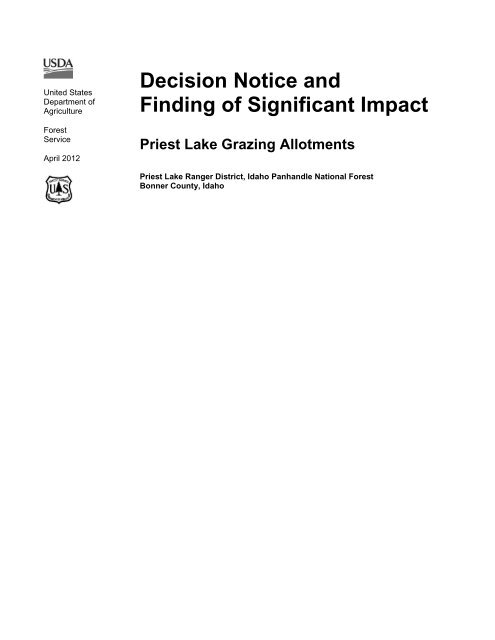
Location <strong>of</strong> the Grazing Allotments
<strong>Decision</strong> <strong>Notice</strong> <strong>and</strong> <strong>Finding</strong> <strong>of</strong> No <strong>Significant</strong> <strong>Impact</strong><br />
<strong>Decision</strong> <strong>Notice</strong><br />
& <strong>Finding</strong> <strong>of</strong> No <strong>Significant</strong> <strong>Impact</strong><br />
Priest Lake Grazing Allotments<br />
United Stated Department <strong>of</strong> Agriculture, Forest Service<br />
Idaho Panh<strong>and</strong>le National Forests, Priest Lake Ranger District<br />
Bonner County, Idaho<br />
Introduction<br />
The Idaho Panh<strong>and</strong>le National Forests prepared an Environmental Assessment (EA) to analyze<br />
the environmental effects <strong>of</strong> various alternatives regarding livestock grazing on the Four Corners,<br />
Lamb Creek, <strong>and</strong> Moores Creek Allotments <strong>of</strong> the Priest Lake Ranger District. The EA was<br />
completed in February 2011 <strong>and</strong> distributed for public comment. This <strong>Decision</strong> <strong>Notice</strong> (DN) is<br />
based on that EA <strong>and</strong> the public comments that were received. It serves to document my decision<br />
on how to proceed with the Priest Lake Grazing Allotments.<br />
Purpose <strong>and</strong> Need<br />
The need to complete environmental analysis for the Priest Lake Grazing Allotments was<br />
triggered by the expiration <strong>of</strong> grazing permits for the allotments <strong>and</strong> the requirements <strong>of</strong> the<br />
Rescission Act. The need for action on the Priest lake Grazing Allotments <strong>and</strong> the passing <strong>of</strong> HR<br />
1944 (The Rescission Act) are closely linked. On June 30, 1995, the U.S. Senate passed HR 1944<br />
requiring each National Forest Unit to establish <strong>and</strong> adhere to a schedule for the completion <strong>of</strong><br />
National Environmental Policy Act (NEPA) analysis <strong>and</strong> decisions on grazing allotments within<br />
the National Forest System unit for which NEPA analysis is lacking. There is also a need to<br />
determine conditions under which term grazing permits will be reissued <strong>and</strong> new allotment<br />
management plans prepared.<br />
The purpose <strong>of</strong> the project is to:<br />
Implement through the Allotment Management Plan (AMP) the direction <strong>and</strong> objectives <strong>of</strong><br />
the Idaho Panh<strong>and</strong>le Forest Plan (1987).<br />
Evaluate the effects <strong>of</strong> livestock grazing on Endangered Species Act (ESA)-listed species,<br />
sensitive plant species <strong>and</strong> Forest species <strong>of</strong> concern. Since the AMPs were originally<br />
approved, several conditions have changed including the presence <strong>of</strong> ESA-listed species i.e.<br />
bull trout, Canada lynx, <strong>and</strong> grizzly bear.<br />
Redefine allotment boundaries to exclude non-National Forest System l<strong>and</strong>s <strong>and</strong> National<br />
Forest System l<strong>and</strong>s which may no longer be suitable for grazing.<br />
Continue to provide a social <strong>and</strong> economical base for appropriate livestock grazing in<br />
compliance with the Forest Plan.<br />
Comply with the Rescission Bill<br />
Background<br />
The grazing allotments are located in Bonner County, Idaho, on the Priest Lake Ranger District <strong>of</strong><br />
the Idaho Panh<strong>and</strong>le National Forests (Figure 1). The following allotments were evaluated:<br />
Four Corners - BM, T. 57 N., R. 5 W., Sections 5, 6, 8, 9, 17, 18, 19; BM, T. 57 N., R. 6 W.,<br />
Sections 1, 12, 13, 24.<br />
1
Priest Lake Grazing Allotments<br />
Lamb Creek - BM, T. 60 N., R. 5 W., Sections 7, 8, 9, 10, 14, 15, 16, 17, 18, 19, 20, 21, 23,<br />
26, 27, 28, 29, 30, 33, 34, 35; WM, T. 35 N., R.46 E., Section 6; WM, T. 36 N., R. 46 N.<br />
Section 31.<br />
Moores Creek - BM, T. 58 N., R. 5 W., Sections 7, 8, 16, 17, 18, 20, 21, 22, 23, 27, 28, 29,<br />
33, 34.<br />
When this project was initially opened for public comment, the Boswell, Lower Squaw Valley<br />
<strong>and</strong> Upper Squaw Valley grazing allotments were included in the analysis. However, after<br />
conducting a suitability analysis, it was determined that these allotments were no longer<br />
providing viable grazing. These three allotments were removed from the project <strong>and</strong> closed to<br />
livestock grazing in an administrative action signed by the Forest Supervisor in July 2008.<br />
Hammond Ranch Pasture, part <strong>of</strong> the Boswell allotment, was to be left open to grazing through<br />
the 2010 grazing season, at which time it would be closed. The Hammond Ranch Pasture was not<br />
included in this analysis since the decision to close it at the end <strong>of</strong> the 2010 grazing season was<br />
made in the administrative action closure letter dated July 2008. The Priest Lake Allotment<br />
Closure letter <strong>and</strong> rationale for this decision are located in the Suitability Analysis for the Priest<br />
Lake Ranger District Livestock Grazing Allotment Closure, included in the project file.<br />
I. <strong>Decision</strong> <strong>and</strong> Rationale<br />
The Selected Alternative<br />
After careful review <strong>of</strong> the environmental assessment (EA) for the Priest Lake Grazing<br />
Allotments, the <strong>Finding</strong> <strong>of</strong> No <strong>Significant</strong> <strong>Impact</strong> (FONSI), comments from the public, resource<br />
reports, <strong>and</strong> the project file, I have decided to implement a combination <strong>of</strong> two alternatives<br />
that were analyzed in the EA. I have selected Alternative 2 (Proposed Action) for the Lamb<br />
Creek <strong>and</strong> Moores Creek allotments <strong>and</strong> Alternative 3 (Grazing Phase-Out) for the Four<br />
Corners allotment. Following is a description <strong>of</strong> the applicable portions <strong>of</strong> these alternatives:<br />
Alternative 2 - Lamb Creek <strong>and</strong> Moores Creek Allotments<br />
Lamb Creek<br />
Reduce size <strong>of</strong> the allotment from 6,181 to 3,911 acres <strong>and</strong> redefine the allotment boundary.<br />
Maintain the permitted head months at 128, which is equivalent to 25 cow/calf pairs from<br />
June 1 through October 31 <strong>and</strong>/or range readiness.<br />
Moores Creek<br />
Reduce size <strong>of</strong> the allotment from 2,984 to 1,925 acres <strong>and</strong> redefine the allotment boundary.<br />
Maintain the permitted head months at 128 which is equivalent to 31 cow/calf pairs from<br />
June 1 through October 2 <strong>and</strong>/or range readiness.<br />
An approximately 16-acre parcel lying west <strong>of</strong> Moores Creek in Sections 21 <strong>and</strong> 28 will be<br />
incorporated into the allotment.<br />
Following discussions with the permittee on the Moores Creek Allotment, I am adjusting the<br />
permitted grazing dates to reflect the period <strong>of</strong> likely livestock utilization. The Moores Creek<br />
allotment is generally not ready to graze until after June 1st, so I have changed the allotment<br />
opening date to June 1st (<strong>and</strong>/or range readiness) from the May 15th date presented under<br />
Alternative 2 in the EA. Most <strong>of</strong> the use on the Moores Creek allotment occurs after August<br />
31st. I have changed the end date <strong>of</strong> the permitted grazing season from September 15th to<br />
October 2 nd in order to more accurately portray <strong>and</strong> accommodate this use. The grazing<br />
season may still be extended or curtailed as warranted by conditions on the ground or<br />
2
<strong>Decision</strong> <strong>Notice</strong> <strong>and</strong> <strong>Finding</strong> <strong>of</strong> No <strong>Significant</strong> <strong>Impact</strong><br />
feedback from the Adaptive Management Implementation Team. The permitted 128 head<br />
months would not be exceeded in any case. I have conferred with the interdisciplinary team,<br />
<strong>and</strong> they are comfortable with these changes to the permitted grazing dates. We have a<br />
monitoring plan <strong>and</strong> adaptive management strategy in place to detect any problems <strong>and</strong><br />
develop solutions as the need arises.<br />
Alternative 2 incorporates management flexibility by providing a range <strong>of</strong> allowable numbers <strong>of</strong><br />
cows <strong>and</strong> seasons. This alternative also provides for adjustments in the timing <strong>and</strong> duration <strong>of</strong><br />
grazing annually to reflect variations in resource conditions <strong>and</strong> management objectives over<br />
time. Annual permitted livestock kind, class, <strong>and</strong> numbers will be specified in annual operating<br />
instructions. Herd movements will be determined by utilization levels specified in the design<br />
criteria for this alternative. Forage conditions <strong>and</strong> water availability will be specified in annual<br />
operating instructions. The changes in management proposed under this alternative are designed<br />
to reduce grazing duration <strong>and</strong> improve livestock distribution.<br />
New allotment management plans (AMPs) will be developed for the Moore Creek <strong>and</strong> Lamb<br />
Creek allotments. The plans will include design criteria for this alternative <strong>and</strong> Best Management<br />
Practices (Appendix A <strong>of</strong> the EA) to avoid or minimize effects to vegetation, heritage resources,<br />
wildlife habitat, soil <strong>and</strong> water quality. Monitoring <strong>of</strong> forage availability <strong>and</strong> utilization, range<br />
readiness, <strong>and</strong> other resource conditions (Appendix B <strong>of</strong> the EA) would be used to determine<br />
whether management is being properly implemented <strong>and</strong> whether the actions are effective at<br />
achieving or moving toward desired conditions.<br />
Alternative 2 is designed to utilize adaptive management. Adaptive management is a type <strong>of</strong><br />
natural resource stewardship that involves making decisions as part <strong>of</strong> an on-going process.<br />
Monitoring the results <strong>of</strong> actions will provide a flow <strong>of</strong> information that may indicate the need to<br />
change a course <strong>of</strong> action. Scientific findings <strong>and</strong> the needs <strong>of</strong> society may also indicate the need<br />
to adapt resource management to new information. If monitoring shows that desired conditions<br />
are not being met, then changes in livestock management may be needed. The intensity <strong>of</strong><br />
livestock grazing could be adjusted up or down in the Annual Operating Plan. The<br />
implementation or tuning <strong>of</strong> herding, salting, water distribution, fencing, season <strong>of</strong> use, duration<br />
<strong>of</strong> grazing, <strong>and</strong> stocking rate could all be potentially utilized to make the necessary adjustments.<br />
Additional monitoring would then take place to see if adaptive management worked as planned.<br />
The monitoring plan <strong>and</strong> adaptive management strategy options associated with this alternative<br />
can be found in Appendix B <strong>of</strong> the EA. See Table 2 <strong>of</strong> the EA for a detailed description <strong>of</strong> the<br />
Moore Creek <strong>and</strong> Lamb Creek allotments, <strong>and</strong> the EA map packet for the changes to the<br />
allotment boundaries.<br />
Design Features for the Moore Creek <strong>and</strong> Lamb Creek allotments under Alternative 2<br />
Livestock Management<br />
Salt <strong>and</strong> supplements would be placed in a container at approved sites at least ¼ mile,<br />
where feasible, from water or as otherwise approved by the Forest Service.<br />
Existing improvements would remain, i.e. fences <strong>and</strong> cattleguards. Improvements <strong>and</strong><br />
salt stations may be relocated or additional ones created as deemed necessary under the<br />
adaptive management approach. Improvements no longer needed would be removed as<br />
time <strong>and</strong> funding permit.<br />
The permittee may be requested to assist in noxious weed treatments within the<br />
allotment. This may involve h<strong>and</strong> pulling, bio-releases, or chemical treatment.<br />
3
Priest Lake Grazing Allotments<br />
4<br />
The permittee would notify the Forest Service permit administrator <strong>of</strong> the location <strong>of</strong><br />
any new populations <strong>of</strong> noxious weeds located on the allotment.<br />
OHV use would be approved by the permit administrator prior to use.<br />
Forage Utilization Levels<br />
Riparian Areas:<br />
Forage utilization within the greenline must retain a minimum 6-inch median residual<br />
stubble height <strong>of</strong> key hydric species. Once reached, livestock would be moved to other<br />
areas or <strong>of</strong>f the allotment.<br />
Mesic residual average stubble heights (3 inches) would apply to key forage species<br />
within riparian areas outside <strong>of</strong> the greenline. Once reached, livestock would be moved<br />
to other areas or <strong>of</strong>f the allotment.<br />
Upl<strong>and</strong>/mesic vegetative cover types:<br />
Forage utilization for upl<strong>and</strong> areas would retain a minimum 3-inch residual median<br />
stubble height for key species. Once reached, livestock would be moved to other areas<br />
or <strong>of</strong>f the allotment.<br />
Alternative 3 – Four Corners Allotment<br />
Under this alternative the Term Grazing Permits currently authorizing use on the Four Corners<br />
Allotment will be cancelled following guidance in 36 CFR 222.4 <strong>and</strong> Forest Service Manual<br />
2231.62. The allotment would be closed to livestock grazing on the fifth year (Table 1). Existing<br />
improvements will be removed as time <strong>and</strong> budget permits. Grazing will be phased out over a<br />
four-year period to give the permittee time to find alternative summer range or make adjustments<br />
in ranching operations. The year the decision is signed would establish the baseline. Stocking<br />
rate adjustments will be made annually through the AOI <strong>and</strong> calculated according to the schedule<br />
below.<br />
Table 1. Alternative 3 grazing phase out schedule<br />
Baseline (2012) Year decision is signed<br />
Year 1 (2012) 0% reduction from permitted livestock numbers<br />
Year 2 (2013) 25% reduction from permitted livestock numbers<br />
Year 3 (2014) 50% reduction from permitted livestock numbers<br />
Year 4 (2015) 75% reduction from permitted livestock numbers<br />
Year 5 (2016) No grazing authorized<br />
As the 10-year term grazing permit expired prior to this decision, a temporary grazing permit, in<br />
accordance with FSH-2209.13, Chapter 30, will be issued each year authorizing the stocking rate<br />
specified in the schedule. As implemented, Alternative 3 will phase out the Four Corners<br />
Allotment based on a starting point <strong>of</strong> 50 cow/calf pairs which was the permitted number <strong>of</strong><br />
livestock for the 2012 grazing season.<br />
Mitigation Measures<br />
Mitigation measures are prescribed to prevent or reduce adverse effects to the environment during<br />
project implementation. The following measures are applicable to both alternatives, unless<br />
otherwise specified. Applied to Alternative 3 (No Grazing) on the Four Corners Allotment these<br />
measures will only apply during the phase-out period only.
Measures Designed to Control Livestock Movement<br />
Lamb Creek<br />
<strong>Decision</strong> <strong>Notice</strong> <strong>and</strong> <strong>Finding</strong> <strong>of</strong> No <strong>Significant</strong> <strong>Impact</strong><br />
A cattleguard will be installed in Section 28 or 29 on Forest road 639 to restrict access to the<br />
southwestern portion <strong>of</strong> the allotment.<br />
Measures Designed to Protect Soils <strong>and</strong> Aquatics<br />
Lamb Creek<br />
One well-used stream crossing on Lamb Creek, located on National Forest System l<strong>and</strong>,<br />
will be improved by hardening approaches with angular rock in order to reduce sediment<br />
production. Rock would be treated or obtained from a weed-free source.<br />
Moores Creek<br />
Two new fences will be constructed along Moores Creek to keep cows out <strong>of</strong> the riparian<br />
area; one would be located in the northern portion <strong>of</strong> the allotment in the requested add<br />
on area <strong>and</strong> another in the south. See Appendix C <strong>of</strong> the EA for photos <strong>of</strong> each fence<br />
location.<br />
Measures Designed to Protect Plants<br />
Four Corners<br />
A qualified botanist will monitor Lycopodium dendroideum <strong>and</strong> Dryopteris cristata<br />
populations along Lower West Branch Priest River, annually. If livestock grazing is<br />
having an unfavorable impact on the population; then action will be taken to eliminate the<br />
conflict (i.e. exclosure).<br />
Lamb Creek<br />
A qualified botanist will monitor wetl<strong>and</strong>s that support Hypericum majus populations,<br />
annually. If livestock grazing is having an unfavorable impact on the population; then<br />
action will be taken to eliminate the conflict (i.e. exclosure).<br />
Measures Designed to Protect Wildlife<br />
Allotment permittees will use non-lethal wolf deterrents in order to proactively decrease<br />
the risk <strong>of</strong> wolf depredations on livestock.<br />
Allotment permittees will be required to notify the Forest Service <strong>and</strong> the responsible<br />
wildlife agency <strong>of</strong> any wolf or grizzly bear depredations on livestock or any conflicts<br />
between wolves or grizzly bears <strong>and</strong> livestock, even if the conflict did not result in the<br />
loss <strong>of</strong> livestock, within 24 hours <strong>of</strong> discovery.<br />
Allotment permittees will be required to report to the Forest Service all livestock losses<br />
regardless <strong>of</strong> the cause, within 24 hours.<br />
All dead livestock will be removed from National Forest system l<strong>and</strong>s, within 24 hours <strong>of</strong><br />
discovery, to reduce the potential for grizzly bear or wolf conflicts with humans <strong>and</strong> to<br />
reduce the risk <strong>of</strong> mortality for these species.<br />
Monitoring <strong>and</strong> Adaptive Management Team<br />
Appendix B <strong>of</strong> the EA contains the Monitoring Plan for Alternative 2. Monitoring is key to<br />
adaptive management; it keeps us informed <strong>of</strong> a projects progress <strong>and</strong> provides the District the<br />
5
Priest Lake Grazing Allotments<br />
information needed to make adjustments in management. Numerous potential monitoring items<br />
were considered <strong>and</strong> Appendix B <strong>of</strong> the EA displays the items the ID Team determined would<br />
provide the best information based on responsiveness to management actions, cost, practicality,<br />
<strong>and</strong> also what sort <strong>of</strong> temporal <strong>and</strong> spatial scale they represent. The intent was to pick monitoring<br />
items that reflect a variety <strong>of</strong> spatial <strong>and</strong> temporal scales.<br />
An Adaptive Management Implementation Team (AMIT) will be formed for this project. Their<br />
role is to oversee the implementation <strong>of</strong> adaptive management <strong>and</strong> help direct the best course <strong>of</strong><br />
action to address specific issues or concerns. The functions <strong>of</strong> the Adaptive Management IDT are:<br />
Provide recommendations to the District Ranger regarding which management actions to<br />
implement <strong>and</strong> when they should be implemented<br />
Provide continuity regarding how monitoring is implemented <strong>and</strong> interpreted<br />
Conduct field reviews <strong>of</strong> specific areas <strong>of</strong> concern or interest on allotments<br />
Document information with a monitoring report<br />
Each year the District Ranger <strong>and</strong> the District Rangel<strong>and</strong> Management Specialist will decide if<br />
there is a need for the team to meet. At a minimum, the team would meet every five years to<br />
review implementation <strong>and</strong> monitoring.<br />
Composition <strong>of</strong> the AMIT may vary depending upon the issues being reviewed that year but<br />
would typically include the following:<br />
Idaho Panh<strong>and</strong>le National Forests Ecosystem Staff representative<br />
Zone Rangel<strong>and</strong> Management Specialist<br />
Zone Wildlife Biologist<br />
Zone Fisheries Biologist<br />
District Hydrologist<br />
District Ranger<br />
Forest Soils Scientist<br />
Zone Botanist<br />
Grazing permittee representation<br />
Rationale for My <strong>Decision</strong><br />
I have made my decision to implement a combination <strong>of</strong> Alternatives 2 <strong>and</strong> 3 based on:<br />
The Priest Lake Grazing Allotments EA <strong>and</strong> associated Specialist Reports (February 2011)<br />
Consideration <strong>of</strong> Forest Plan st<strong>and</strong>ards <strong>and</strong> guidance for the project area as amended by the<br />
Inl<strong>and</strong> Native Fish Strategy (INFS)<br />
Biological Assessments <strong>and</strong> Biological Evaluations<br />
How well the management actions analyzed in the EA address the project's purpose <strong>and</strong> need<br />
Consideration <strong>of</strong> issues that were raised through public involvement<br />
Compliance with Regulations <strong>and</strong> Policies<br />
The influence <strong>of</strong> these factors on my decision is outlined below.<br />
6
<strong>Decision</strong> <strong>Notice</strong> <strong>and</strong> <strong>Finding</strong> <strong>of</strong> No <strong>Significant</strong> <strong>Impact</strong><br />
The Priest Lake Grazing Allotments EA <strong>and</strong> Specialist Reports<br />
The NEPA process included the identification <strong>of</strong> environmental issues specific to the proposed<br />
action, considering alternatives to the proposed action, <strong>and</strong> disclosing the environmental effects<br />
<strong>of</strong> these actions. I reviewed the alternatives that the EA considered in detail to determine if they<br />
were responsive to the key issues <strong>and</strong> the purpose <strong>and</strong> need (EA, pp. 8-13). I also reviewed the<br />
alternatives that were considered but not given detailed study (EA, p. 7) to evaluate whether or<br />
not a reasonable range <strong>of</strong> alternatives was considered. I reviewed the scoping responses <strong>and</strong><br />
comments that we received on the EA. This review lead me to determine that an acceptable range<br />
<strong>of</strong> alternatives was considered <strong>and</strong> analyzed.<br />
Alternative 2 was developed to fully address the project’s purpose <strong>and</strong> need (EA, p. 8). My<br />
review <strong>of</strong> the EA leads me to select alternative 2 for the Lamb Creek <strong>and</strong> Moores Creek<br />
allotments. The Lamb Creek allotment is intermixed with the permittee’s l<strong>and</strong>. Primary livestock<br />
use is centered on the meadows <strong>and</strong> riparian areas in the vicinity <strong>of</strong> the private pastures with<br />
some use occurring in adjacent timber harvest units (EA, p. 6). Grazing on NFS l<strong>and</strong>s would be<br />
authorized on less than 6 % <strong>of</strong> the total stream length <strong>of</strong> Lamb Creek. It is unlikely that grazing<br />
in the proposed allotment would have detrimental effects on Lamb Creek or its tributaries (EA, p.<br />
26). As with the Lamb Creek allotment, primary livestock use in this allotment is centered on the<br />
meadows, riparian areas <strong>and</strong> adjacent timber harvest units in the vicinity <strong>of</strong> the private pastures<br />
(EA, p. 15). It is unlikely that grazing along Moores Creek on NFS l<strong>and</strong>s would lead to degraded<br />
water quality if riparian vegetation remains intact <strong>and</strong> cattle do not access the stream (EA, p. 26).<br />
In recent years within the Moores Creek allotment, the area east <strong>of</strong> Highway 57 has not been<br />
grazed due to a lack <strong>of</strong> forage <strong>and</strong> difficulties with livestock management. The redelineation <strong>of</strong><br />
allotment boundaries in Alternative 2 that will be implemented through my decision makes sense.<br />
The EA shows that alternative 2 is the best balance between resource protection considerations<br />
<strong>and</strong> forage utilization on these two allotments. My conclusion is based on the analysis <strong>of</strong> effects<br />
disclosed in the EA, as well as the implementation <strong>of</strong> a monitoring plan <strong>and</strong> adaptive<br />
management strategy. This approach will be used to adjust allotment management plans to<br />
achieve desired environmental conditions throughout the term <strong>of</strong> the permits (EA, Appendix B).<br />
The implementation <strong>of</strong> Alternative 3 is the right course <strong>of</strong> action for the Four Corners allotment.<br />
This allotment has a long history <strong>of</strong> conflicts with other uses. Issues with intermingled<br />
ownership, decreases in forage <strong>and</strong> access to open range have been issues since the late 1950s.<br />
Due to the decline in forage opportunities on the allotment, lack <strong>of</strong> riders, <strong>and</strong> exterior fencing,<br />
the livestock are not using the allotment. Each year cattle drift <strong>of</strong>f the allotment <strong>and</strong> onto other<br />
National Forest <strong>and</strong> private l<strong>and</strong>s to meet forage needs (EA, p. 15).<br />
Issues with intermingled ownership, decreases in forage <strong>and</strong> access to open range, were cited in<br />
both the 1959 <strong>and</strong> 1981 environment analysis. After the 1981 environmental assessment, there<br />
was a reduction in the number <strong>of</strong> permits issued over the following five years. While the record is<br />
not explicit, one gets the impression that the root <strong>of</strong> the earlier conflicts was multiple permittees<br />
<strong>and</strong> others competing for available resources. This differs from the genesis <strong>of</strong> the current<br />
controversy which revolves around open range grazing in an area that has become predominantly<br />
residential (Range Report p. 5).<br />
As stated in the analysis <strong>of</strong> the environmental assessment, phasing out grazing on the Four<br />
Corners allotment will provide benefits to a variety <strong>of</strong> resources. Discontinuing cattle grazing<br />
would remove the potential for the disruption <strong>of</strong> western toad breeding, deterioration <strong>of</strong> breeding<br />
habitat, or possible direct mortality <strong>of</strong> adult <strong>and</strong> juvenile toads due to trampling by permitted<br />
cattle (EA, p. 43). Phasing out grazing will also lead to improvements in water quality (EA, pp.<br />
7
Priest Lake Grazing Allotments<br />
21-22) <strong>and</strong> fish habitat (EA, pp. 27-28). It would also lead to improvements in the area’s soil<br />
resource (EA, pp. 31-32), <strong>and</strong> would eliminate the potential for permitted cattle to affect rare<br />
plants <strong>and</strong> suitable rare plant habitat (EA, p. 50).<br />
Consideration <strong>of</strong> these benefits in concert with public sentiment <strong>and</strong> safety concerns encapsulated<br />
both in the EA <strong>and</strong> in response to comments we received on the EA (DN/FONSI, Appendix A)<br />
lends credence to my decision to phase out grazing on the Four Corners allotment.<br />
Consideration <strong>of</strong> the Forest Plan st<strong>and</strong>ards <strong>and</strong> guidance for the<br />
project area as amended by the Inl<strong>and</strong> Native Fish Strategy (INFS)<br />
The Idaho Panh<strong>and</strong>le Forest Plan establishes management direction for all resource management<br />
programs <strong>and</strong> resource activities on the Idaho Panh<strong>and</strong>le National Forests. Designing <strong>and</strong><br />
implementing projects consistent with this direction is the means to move the Forest towards the<br />
desired future condition as described in the Forest Plan.<br />
Forest-wide management direction is provided in the form <strong>of</strong> Forest Plan goals. The Forest Plan<br />
goal for range management is to manage forage production for domestic livestock at current<br />
levels (1987) with additional emphasis to protect stream banks, riparian zones, <strong>and</strong> threatened <strong>and</strong><br />
endangered species <strong>of</strong> animals <strong>and</strong> plants. A forest-wide st<strong>and</strong>ard for range management is to<br />
manage opportunities for grazing <strong>and</strong> other uses <strong>of</strong> public range resources to serve the welfare <strong>of</strong><br />
local residents <strong>and</strong> communities. An additional st<strong>and</strong>ard states that the needs <strong>of</strong> threatened <strong>and</strong><br />
endangered <strong>and</strong> sensitive species have priority in managing existing range allotments.<br />
Forest Plan Management Area (MA) direction also influenced my decision. Management Area 15<br />
includes l<strong>and</strong>s considered primary range. These grassl<strong>and</strong> meadows are treated as permanent<br />
forage areas. Management goals for MA 15 include managing for continued grazing use while<br />
protecting other resource values <strong>and</strong> maintaining vegetation conditions <strong>and</strong> livestock forage<br />
productivity. Management st<strong>and</strong>ards for MA 15 include the maintenance <strong>of</strong> natural channels <strong>and</strong><br />
adequate streamside vegetation with allotments managed to obtain more than five percent<br />
streambank trampling. The Forest Plan-designated range areas are surrounded by l<strong>and</strong>s<br />
designated for timber production (MA1) with small inclusions <strong>of</strong> l<strong>and</strong>s unsuitable for timber<br />
production (MA9). The Forest Plan direction for MA1 is to utilize available forage for livestock<br />
consistent with dem<strong>and</strong>, cost efficiency <strong>and</strong> wildlife needs.<br />
The 1995 Inl<strong>and</strong> Native Fish Strategy (INFS) amendments to the Forest Plan provide stringent<br />
requirements to protect riparian areas <strong>and</strong> describe goals to establish “characteristics <strong>of</strong> healthy,<br />
functioning watersheds, riparian areas, <strong>and</strong> associated fisheries habitats”. These goals are to<br />
maintain or restore water quality, stream channel integrity, instream flows, natural timing <strong>and</strong><br />
variability <strong>of</strong> the water table, diversity <strong>and</strong> productivity <strong>of</strong> riparian vegetation, riparian vegetation<br />
that provides large woody debris, thermal regulation, <strong>and</strong> natural rates <strong>of</strong> surface erosion.<br />
Direction from both the Forest Plan <strong>and</strong> INFS were utilized in the development <strong>of</strong> specific<br />
direction for managing grazing on these three allotments through the EA. It was also used to<br />
establish sideboards for the development <strong>of</strong> alternatives to the proposed action <strong>and</strong> considered<br />
when responding to public issues. I then used the analysis <strong>of</strong> effects in the EA to help me decide<br />
the appropriate level <strong>of</strong> grazing <strong>and</strong> identified resource management needed to meet Forest Plan<br />
st<strong>and</strong>ards.<br />
8
<strong>Decision</strong> <strong>Notice</strong> <strong>and</strong> <strong>Finding</strong> <strong>of</strong> No <strong>Significant</strong> <strong>Impact</strong><br />
My decision strives to reconcile this somewhat conflicting direction to manage for forage<br />
resources with requirements for aquatic protection <strong>and</strong> enhancement. I sought to accomplish this<br />
while also giving consideration to the impacts <strong>of</strong> permitted grazing on area residents.<br />
The Four Corners allotment contains less than 200 acres suitable for grazing <strong>and</strong> almost half <strong>of</strong><br />
those acres are located in riparian areas (EA, p. 16). Of the three allotments analyzed, Four<br />
Corners has the largest proportion <strong>of</strong> suitable grazing acres located in riparian areas. The<br />
corresponding potential for the occurrence <strong>of</strong> unacceptable impacts on aquatic systems in the<br />
Four Corners allotment was a key consideration in my decision to phase it out.<br />
Effects on Threatened, Endangered, <strong>and</strong> Sensitive Species<br />
The decision will have no effect on bull trout or their habitat (EA, p. 28).<br />
The decision may impact westslope cutthroat trout individuals or habitat, but will not likely<br />
result in a trend toward federal listing or reduced viability for the population or species (EA, p.<br />
28).<br />
The decision will have insignificant <strong>and</strong> discountable effects on grizzly bears (EA, p. 40).<br />
The decision will not affect critical habitat for Canada lynx (EA, p. 34).<br />
The decision will have insignificant <strong>and</strong> discountable effects on gray wolves (EA, p. 37).<br />
I reviewed the Biological Evaluations for Region 1 Sensitive Species <strong>and</strong> the associated specialist<br />
reports. I determined that the management actions authorized through the implementation <strong>of</strong> this<br />
decision will not lead to the federal listing <strong>of</strong> sensitive species.<br />
The decision may impact individual Townsend’s big-eared bats, western toads or their habitat,<br />
but would not contribute to a trend towards federal listing or cause a reduction <strong>of</strong> viability to<br />
the population or species (EA, pp. 42 <strong>and</strong> 45).<br />
Continued grazing on the allotments may impact individual western toads or habitat, but would<br />
not contribute to a trend towards federal listing or cause a reduction <strong>of</strong> viability to the<br />
population or species. After the Four Corners allotment is fully phased out, there would be no<br />
impact to western toads or their habitat from grazing on this allotment (EA, pp. 42 <strong>and</strong> 45).<br />
The decision is expected to have minor negative effects on some forest l<strong>and</strong>birds, but priority<br />
habitats would be improved <strong>and</strong> it will not likely cause a local or regional change in habitat<br />
quality or population status, <strong>and</strong> viable populations would be maintained (EA, p. 46).<br />
No endangered plant species are suspected to occur in the IPNF, <strong>and</strong> no listed threatened plant<br />
species are suspected to occur in Bonner County, Idaho (EA, p. 51). Occurrences <strong>of</strong> Blechnum<br />
spicant (Lamb Creek), Hypericum majus (Lamb Creek), Lycopodium dendroideum (Four<br />
Corners), <strong>and</strong> Dryopteris cristata (Four Corners) are documented in proposed allotments under<br />
all alternatives. Suitable habitat for these species may be impacted by livestock grazing;<br />
however, with the mitigation measures described in Chapter 2, such impacts would not be<br />
expected to lead to a trend towards federal listing or a reduction in species or population viability<br />
(EA, pp. 51-52).<br />
The original rare plants report was completed for this project in September 2008. Since that time,<br />
a Region 1 review <strong>of</strong> sensitive species has occurred, resulting in a few changes. One change<br />
9
Priest Lake Grazing Allotments<br />
related to nomenclature is shown in the December 2011 plant list for the Kaniksu Zone <strong>of</strong> the<br />
IPNF. In addition, two species, whitebark pine (Pinus albicaulis) <strong>and</strong> yellow lady’s slipper<br />
(Cypripedium parviflorum v. pubescens ) have been added to the sensitive species list. Both <strong>of</strong><br />
these species were previously on the IPNF Forest Species <strong>of</strong> Concern list <strong>and</strong> were actively<br />
sought out during surveys where suitable habitat occurs.<br />
Whitebark pine occurs in subalpine forest habitats, none <strong>of</strong> which is present within the Priest<br />
Lake Allotment Management Plan area. Yellow lady’s slipper occurs in wet forest, peatl<strong>and</strong>, <strong>and</strong><br />
deciduous riparian habitats, <strong>and</strong> although some wet forest <strong>and</strong> peatl<strong>and</strong> habitat occurs in the<br />
project area, no occurrences <strong>of</strong> this plant were observed. <strong>Impact</strong>s to wet forest <strong>and</strong> peatl<strong>and</strong><br />
habitat have been addressed in the rare plant report.<br />
The rationale behind these conclusions is further detailed in the Specialist Reports, Biological<br />
Assessments <strong>and</strong> Biological Evaluations for the corresponding resource area.<br />
Meeting the Purpose <strong>and</strong> Need<br />
How a Combination <strong>of</strong> Alternatives 2 <strong>and</strong> 3 Responds to the Purpose <strong>and</strong> Need<br />
This project was initiated to comply with Rescission Bill (Public Law 104-19, section 504a),<br />
which requires the Forest Service to complete an analysis <strong>and</strong> update allotment management<br />
plans (AMP’s) on all Forest grazing allotments. In compliance with this bill, my decision to<br />
implement a combination <strong>of</strong> Alternatives 2 <strong>and</strong> 3 (DN p. 3) will be implemented by updating the<br />
AMP’s for the Four Corners, Moores Creek <strong>and</strong> Lamb Creek Grazing Allotments.<br />
The overarching desired condition for the allotments is to maintain soil productivity, water<br />
quality, <strong>and</strong> water quantity on all allotments. For upl<strong>and</strong> areas, desired conditions would include<br />
providing conditions conducive to maintaining healthy, vigorous vegetative cover that would<br />
provide forage <strong>and</strong> cover for wildlife habitat, soil stability, as well as livestock forage. For<br />
riparian areas, desired conditions would include improving the vigor <strong>and</strong> production <strong>of</strong> key<br />
wildlife browse species, <strong>and</strong> managing riparian vegetation, including shrub <strong>and</strong> overstory tree<br />
cover along all perennial streams with defined channels, to provide shade, to maintain streambank<br />
stability <strong>and</strong> in-stream cover, <strong>and</strong> to promote filtering <strong>of</strong> overl<strong>and</strong> flows. Ideally, this would be<br />
accomplished while continuing to provide a social <strong>and</strong> economical base for appropriate livestock<br />
grazing in compliance with the Forest Plan.<br />
The project was also undertaken to evaluate the effects <strong>of</strong> livestock grazing on Endangered<br />
Species Act (ESA)-listed species, sensitive plant species <strong>and</strong> Forest species <strong>of</strong> concern. Since the<br />
AMPs were originally approved, there have been several changed conditions, including the<br />
presence <strong>of</strong> ESA-listed species, i.e. bull trout, Canada lynx, <strong>and</strong> grizzly bear.<br />
My decision achieves the purpose <strong>and</strong> need <strong>of</strong> the project by:<br />
10<br />
Reauthorizing grazing for 10 years in the Moores Creek <strong>and</strong> Lamb Creek allotments<br />
Phasing out grazing on the Four Corners Allotment<br />
Redefining allotment boundaries to exclude non-National Forest System l<strong>and</strong>s <strong>and</strong><br />
National Forest System l<strong>and</strong>s which are no longer be suitable for grazing<br />
Increasing the forage utilization st<strong>and</strong>ard to a minimum <strong>of</strong> six inch stubble height in<br />
riparian areas
<strong>Decision</strong> <strong>Notice</strong> <strong>and</strong> <strong>Finding</strong> <strong>of</strong> No <strong>Significant</strong> <strong>Impact</strong><br />
Establishing a monitoring plan <strong>and</strong> Adaptive Management Team<br />
Monitoring <strong>and</strong> an adaptive management plan will be integral to the successful achievement <strong>of</strong><br />
desired environmental conditions throughout the term <strong>of</strong> the permit.<br />
Under Alternative 2 the stocking rate for the Moores Creek allotment is very low compared to the<br />
estimated suitability analysis allowable use (Range Report p. 8). The stocking rate for Lamb<br />
Creek is also well below the estimated allowable use (Range Report p. 7). This analysis supports<br />
my conclusion that grazing on these allotments is sustainable without undesirable impacts.<br />
Why Another Alternative Was Not Selected<br />
Alternative 1<br />
The Grazing Permit Administration H<strong>and</strong>book (FSH 2209.13) directs that current management be<br />
analyzed in detail if it meets the stated purpose <strong>and</strong> need for action. Initially, this alternative was<br />
not to be included as an alternative considered in detail because it clearly does not meet the stated<br />
purpose <strong>and</strong> need. However, it was been carried forward to provide a baseline from which to<br />
compare alternatives.<br />
Alternative 1 would meet the need to provide livestock grazing opportunities for local livestock<br />
producers. However, under Alternative 1, there would be no improvement in channel stability,<br />
erosion, hydrologic function, riparian condition, temperature or Properly Functioning Condition<br />
in either Lamb Creek or the Lower West Branch (EA, p.19). Continued loss <strong>of</strong> large woody<br />
debris recruitment in Lamb Creek would further limit fisheries potential <strong>and</strong> possibly encourage<br />
the persistence <strong>of</strong> brook trout by limiting the development <strong>of</strong> stable <strong>and</strong> diverse habitat features<br />
preferred by native species. Since streambank instability in the Lower West Branch exceeds 18%<br />
<strong>and</strong> there would be no changes in allotment management under this alternative, it is unlikely that<br />
streambanks in the Four Corners Allotment would improve <strong>and</strong> is therefore unlikely INFISH<br />
goals <strong>and</strong> other water quality st<strong>and</strong>ards would be obtained. Stream <strong>and</strong> fisheries conditions within<br />
the Moores Creek allotment would continue to benefit non-native brook trout (EA, p.24).<br />
Further, Alternative 1 would not allow for improvement in soil conditions or productivity <strong>and</strong><br />
may result in additional soil disturbance (compaction <strong>and</strong> displacement) from livestock grazing.<br />
Alternative 1 would increase the risk <strong>of</strong> adversely affecting known <strong>and</strong> potential rare plant<br />
species on the allotments (EA, pp.51-52).<br />
Alternative 2<br />
This alternative was developed to fully address the purpose <strong>and</strong> need. It incorporates<br />
management flexibility by providing a range <strong>of</strong> allowable numbers <strong>of</strong> cows <strong>and</strong> seasons, <strong>and</strong><br />
adjustments in the timing <strong>and</strong> duration <strong>of</strong> grazing annually to reflect variations in resource<br />
conditions <strong>and</strong> management objectives over time.<br />
Alternative 2 was not chosen for the Four Corners allotment because <strong>of</strong> the continued potential<br />
for negative resource impacts. A primary consideration was the cows would continue to<br />
congregate in the wet/moist areas <strong>of</strong> the allotment <strong>and</strong> continue to trample <strong>and</strong> erode stream<br />
banks <strong>and</strong> compact soils in the wetter areas (EA p. 16).<br />
Forage on the Four Corners allotment has been continually declining. Over time, changes in<br />
timber management practices <strong>and</strong> fire suppression have resulted in less open meadows <strong>and</strong> more<br />
timbered st<strong>and</strong>s. This change in available forage has changed livestock use patterns. Due to the<br />
decline in forage opportunities on the allotment, lack <strong>of</strong> riders, <strong>and</strong> exterior fencing, the livestock<br />
11
Priest Lake Grazing Allotments<br />
are not using the allotment. Each year cattle drift <strong>of</strong>f the allotment <strong>and</strong> onto other National Forest<br />
<strong>and</strong> private l<strong>and</strong>s to meet forage needs (Range Report p. 5).<br />
Under Alternative 2, the Lamb Creek allotment stocking rate is well below the estimated<br />
allowable use for this allotment (EA p.15). Boundary realignment within the Lamb Creek<br />
allotment will remove riparian reaches <strong>of</strong> the North Fork Lamb Creek located on NFS l<strong>and</strong>s. In<br />
combination with an increase <strong>of</strong> minimum greenline stubble height these changes will lessen the<br />
potential for resource impacts.<br />
Riparian fencing would reduce cattle access to sensitive stream segments. In unfenced areas, the<br />
Adaptive Management Strategy will be used to <strong>of</strong>fset any potential adverse impacts. Using a<br />
combination <strong>of</strong> fencing <strong>and</strong> adaptive management practices, it is expected that there would be no<br />
adverse impacts to channel stability, erosion, hydrologic function, riparian condition, <strong>and</strong><br />
temperature in the mainstem <strong>of</strong> Moores Creek (EA, p. 23).<br />
Alternative 3<br />
This Alternative was chosen for the Four Corners allotment. The allotments would be closed to<br />
livestock grazing on the fifth year. Under this alternative the Term Grazing Permits currently<br />
authorizing use on the three allotments would be cancelled following guidance in 36 CFR 222.4<br />
<strong>and</strong> Forest Service Manual 2231.62.<br />
On the Moores Creek <strong>and</strong> Lamb Creek allotments, National Forest System l<strong>and</strong>s make up only a<br />
small portion <strong>of</strong> suitable grazing l<strong>and</strong> <strong>and</strong> are intermixed with blocks <strong>of</strong> privately owned l<strong>and</strong>s.<br />
Under the grazing phase out alternative, the other l<strong>and</strong>owners would likely continue grazing on<br />
their l<strong>and</strong>s, making it extremely difficult to keep livestock from crossing <strong>and</strong> using National<br />
Forest System l<strong>and</strong>s. Fencing <strong>and</strong> riding would be necessary to restrict unauthorized cattle<br />
movement. Permitted grazing on National Forest System l<strong>and</strong>s allows coordinated grazing<br />
management with adjacent l<strong>and</strong>owners.<br />
Fence Four Corners Allotment<br />
An option to fence the allotment <strong>and</strong> restrict livestock access to the riparian areas <strong>of</strong> Lower West<br />
Branch <strong>and</strong> Moores Creek was considered but eliminated from detailed analysis in the EA<br />
because it was determined not to be a viable alternative. Fencing would dramatically reduce the<br />
available forage acres, maintaining the fence would be an ongoing problem due to the broken<br />
terrain <strong>and</strong> predominately treed vegetation, <strong>and</strong> the cost was estimated to be in excess <strong>of</strong><br />
$125,000. Therefore, this alternative was eliminated from detailed study.<br />
Consideration <strong>of</strong> Public Comments <strong>and</strong> Issues<br />
Public Involvement Activities<br />
The proposal was first listed in the July – September 2006 Quarterly Schedule <strong>of</strong> Proposed<br />
Actions <strong>and</strong> has remained on the Schedule ever since. A public scoping letter was mailed on<br />
August 14, 2006 to 130 individuals, agencies <strong>and</strong> organizations. A <strong>Notice</strong> <strong>of</strong> Comment was<br />
published in the Spokesman Review on August 17, 2006. The comment period was open for<br />
thirty three days, commencing on August 17, 2006 <strong>and</strong> ending on September 18, 2006. On March<br />
20, 2007 a second letter was mailed to those who submitted comments informing them that the<br />
anticipated decision date had been moved from May 2007 to May 2008. Those that commented<br />
were also made aware that they would have an opportunity to comment on the completed<br />
Environmental Assessment (EA) prior to any decision being made. A third letter was mailed on<br />
July 26, 2010 to those that commented explaining the delays that have been encountered, letting<br />
12
<strong>Decision</strong> <strong>Notice</strong> <strong>and</strong> <strong>Finding</strong> <strong>of</strong> No <strong>Significant</strong> <strong>Impact</strong><br />
them know the EA would be released soon, <strong>and</strong> asking what format they would like to receive the<br />
EA.<br />
As a result <strong>of</strong> public scoping, a total <strong>of</strong> thirty responses were received. All comments were<br />
considered, including the six received after the September 18, 2006 deadline. Comments<br />
included concerns over livestock management, soils, water quality/fisheries, native plants,<br />
noxious weeds, recreational OHV use on trails, <strong>and</strong> public safety. Nineteen responses were<br />
related, specifically to livestock management/open range on the Four Corners Allotment. In<br />
addition, twelve op-ed letters addressing the same topic were published in local newspapers. All<br />
information related to public involvement related to the scoping process can be found in the<br />
project file.<br />
The Priest Lake Grazing Allotments EA was released to the public for comment on February 10,<br />
2011. A legal NOTICE FOR COMMENT was published in the Coeur D’Alene Press on<br />
February 14, 2011. Comments on the EA were accepted for 30 calendar days following the<br />
publication <strong>of</strong> this notice. Fourteen letters containing comments on the EA were received during<br />
the comment period. The specific comments that these letters contained <strong>and</strong> the response to these<br />
comments are appended to this DN/FONSI.<br />
We received comments from many individuals <strong>and</strong> several organizations <strong>and</strong> agencies on our<br />
environmental assessment. Responses to these comments are contained in Appendix A <strong>of</strong> this<br />
DN/FONSI.<br />
Through my interactions with the public <strong>and</strong> reading the letters we received, it became quite<br />
obvious that there are strong feelings associated with permitting cattle to graze on NFS l<strong>and</strong>s on<br />
the Priest Lake Ranger District. Summarized in the following sections are some <strong>of</strong> the<br />
comments we heard more than once <strong>and</strong> discussion <strong>of</strong> the trade-<strong>of</strong>fs I weighed as I evaluated each<br />
comment; all comments <strong>and</strong> our responses to them are located in an Appendix A to this<br />
DN/FONSI.<br />
Consideration <strong>of</strong> Issues Arising From the Public Involvement Process<br />
Elimination <strong>of</strong> Open Range<br />
We received many comments regarding livestock management <strong>and</strong> open range, particularly on the<br />
Four Corners Allotment (Appendix A). The majority <strong>of</strong> the comments were in favor <strong>of</strong><br />
eliminating the open range designation. The Open Range Law (Idaho Code 25-2401) is an Idaho<br />
State Law that does not apply to Federal L<strong>and</strong>s. The State <strong>of</strong> Idaho has given each County the<br />
delegated authority to determine which private l<strong>and</strong>s within the County are “open range” or “herd<br />
districts”. Since this Law does not apply to Federal l<strong>and</strong>s it was not carried forward in this<br />
analysis, however a brief discussion <strong>of</strong> the history <strong>and</strong> the rationale for eliminating it from<br />
detailed study follows.<br />
The project area is designated as Open Range under Idaho Code 25-2401, permitting livestock to<br />
run at large within unenclosed, unincorporated areas <strong>of</strong> the county. Property owners wishing to<br />
deny livestock access to their private l<strong>and</strong> are required to construct adequate fencing. However,<br />
National Forest System l<strong>and</strong>s are exempt from this statute. Under Federal regulations, a livestock<br />
owner is responsible to keep unauthorized livestock <strong>of</strong>f <strong>of</strong> NFS l<strong>and</strong>s. For this reason the<br />
allotments remain mostly unfenced, allowing livestock to move freely between NFS l<strong>and</strong> <strong>and</strong><br />
non-NFS l<strong>and</strong>.<br />
13
Priest Lake Grazing Allotments<br />
The private l<strong>and</strong> adjacent to the National Forest boundary used to be largely unoccupied, being<br />
used for agriculture <strong>and</strong> forest products. Now, a large portion <strong>of</strong> these private l<strong>and</strong>s have been<br />
developed for residential use. This shift from agricultural to residential, most notably in the Four<br />
Corners area has resulted in increasing conflicts both in frequency <strong>and</strong> intensity between<br />
permittees <strong>and</strong> local residents. The degree <strong>of</strong> controversy may best be demonstrated by the fact<br />
that nineteen <strong>of</strong> the thirty responses received during the scoping period, <strong>and</strong> twelve op-ed letters<br />
published in local newspapers, dealt specifically with this issue.<br />
From the permitee’s perspective open range grazing has been part <strong>of</strong> the family-ranch lifestyle for<br />
generations. Meanwhile, neighbors question why they should have to build <strong>and</strong> maintain<br />
expensive fences to keep someone else’s cows <strong>of</strong>f <strong>of</strong> their private property; trampling across their<br />
lawn; <strong>and</strong> destroying their garden.<br />
The letters <strong>and</strong> articles generated by this topic (Appendix A <strong>and</strong> project file) express the stronglyheld<br />
opinions on both sides <strong>of</strong> the issue. It is equally obvious that without resolution the tensions<br />
will continue to escalate. However, the fact remains that any decision resulting from this process<br />
pertains only to grazing on NFS l<strong>and</strong>s <strong>and</strong> will not alter the open range designation under State<br />
statute. A livestock owner can still allow their livestock to run on unenclosed, unincorporated<br />
areas <strong>of</strong> the county. This issue was eliminated from detailed analysis because it is already decided<br />
by law <strong>and</strong> is outside the scope <strong>of</strong> the project.<br />
Public Safety<br />
One <strong>of</strong> several factors influencing my decision to phase out grazing on the Four-Corners<br />
Allotment was our inability to keep cows from the allotment <strong>of</strong>f <strong>of</strong> Highway 57. Closing this<br />
allotment will eliminate this threat to public safety. Fencing the allotment was considered but<br />
found to be economically unfeasible (EA p. 7).<br />
II. <strong>Finding</strong>s Required by Other Regulations <strong>and</strong> Policies<br />
To the best <strong>of</strong> my knowledge, this decision complies with all applicable laws, regulations, <strong>and</strong><br />
policies (DN/FONSI, p. 7; EA pp. 13-52; Hydrology Report pp. 26-29; Fisheries Report pp. 18-<br />
19; Wildlife Report pp. 1, 15, 20, 29, 33 <strong>and</strong> 36; Range Report p.10; Noxious Weeds Report p. 10<br />
<strong>and</strong> Botany Report pp. 9-10).<br />
Clean Water Act<br />
The Clean Water Act requires each state to provide guidance <strong>and</strong> direction to protect <strong>and</strong> restore<br />
water bodies (40 § 131.12), <strong>and</strong> the Forest Service is required to meet or exceed State Best<br />
Management Practices (BMPs) to protect water quality (IPNF Forest Plan, p. II-33).<br />
The selected alternative will be consistent with the requirements <strong>of</strong> the Clean Water Act, 33<br />
U.S.C. §1251 (Hydrology Report pp. 17-19, Fish Report pp.17-19). Key to this compliance will<br />
be the utilization <strong>of</strong> BMP’s <strong>and</strong> the implementation <strong>of</strong> an adaptive management plan<br />
Endangered Species Act<br />
The selected combination <strong>of</strong> alternatives is consistent with the Endangered Species Act<br />
(Wildlife, Fisheries <strong>and</strong> TES Plants Reports). Refer to item 9 in the <strong>Finding</strong> <strong>of</strong> No<br />
<strong>Significant</strong> <strong>Impact</strong> section below. Also refer to Effects on Threatened, Endangered, <strong>and</strong><br />
Sensitive Species under decision rationale above.<br />
14
<strong>Decision</strong> <strong>Notice</strong> <strong>and</strong> <strong>Finding</strong> <strong>of</strong> No <strong>Significant</strong> <strong>Impact</strong><br />
National Historic Preservation Act<br />
The selected alternative complies with the National Historic Preservation Act. Reports are<br />
completed for this project area <strong>and</strong> no cultural sites will be impacted with the selected alternative<br />
(project file). Native American tribal representatives were given the opportunity to comment <strong>and</strong><br />
no concerns were expressed (project file).<br />
Executive Orders 11988 <strong>and</strong> 11990 - Floodplain Management <strong>and</strong> Protection <strong>of</strong> Wetl<strong>and</strong>s<br />
The selected alternative meets the requirements <strong>of</strong> Executive Order 11988, which apply to<br />
protection <strong>of</strong> floodplains. These features are protected through implementation <strong>of</strong> best<br />
management practices <strong>and</strong> Forest Plan st<strong>and</strong>ards <strong>and</strong> guidelines (Hydrology Report pp 5-7, 26-27<br />
<strong>and</strong> 29 <strong>and</strong> EA Appendix A). A monitoring plan <strong>and</strong> adaptive management strategy (EA<br />
Appendix B) will be used to verify that the management activities are implemented as designed<br />
<strong>and</strong> effective in meeting project objectives, achieving Forest Plan st<strong>and</strong>ards <strong>and</strong> meeting the<br />
intent <strong>of</strong> other regulations <strong>and</strong> policies including Executive Orders 11988 <strong>and</strong> 11990 (Hydrology<br />
Report pp 29-30).<br />
Executive Order 12962 – Recreational Fishing<br />
The objective <strong>of</strong> this order is “…to improve the quantity, function, sustainable productivity, <strong>and</strong><br />
distribution <strong>of</strong> U.S. aquatic resources for increased recreational fishing opportunities by: (h)<br />
evaluating the effects <strong>of</strong> federally funded, permitted, or authorized actions on aquatic systems <strong>and</strong><br />
recreational fisheries <strong>and</strong> document those effects relative to the purpose <strong>of</strong> this order.” The<br />
selected alternative is consistent with this executive order regarding aquatic systems <strong>and</strong><br />
recreational fisheries (Fisheries Report pp. 17 <strong>and</strong> 19). Of particular relevance is the Moores<br />
Creek fishery in the Moores Creek allotment. The project as implemented would provide for<br />
protection <strong>and</strong> regular evaluation <strong>of</strong> the fishery resources in Moores Creek, as well as in other<br />
streams within the allotments (Fisheries Report pp. 13 <strong>and</strong> 24).<br />
State <strong>of</strong> Idaho Governor’s Bull Trout Plan<br />
The mission <strong>of</strong> the Governors Bull Trout Plan is to “…maintain <strong>and</strong>/or restore complex<br />
interacting groups <strong>of</strong> bull trout populations throughout their native range in Idaho.” In the Plan,<br />
the Panh<strong>and</strong>le Basin, Upper Priest River <strong>and</strong> the Priest River are a Bull Trout Key Watersheds.<br />
The Bull Trout Plan requires the US Forest Service to follow st<strong>and</strong>ards in its Forest Plan <strong>and</strong><br />
those conservation strategies required by INFS. My decision is consistent with the direction in<br />
the Governor’s Bull Trout Plan because it follows this direction <strong>and</strong> these st<strong>and</strong>ards (Fisheries<br />
Report pp. 1-3, 17 <strong>and</strong> 18) <strong>and</strong> will have no effect on bull trout or their habitat (EA, p. 28).<br />
Executive Order 13112 (February 1999)<br />
Executive Order 13112 directs Federal agencies to: “…prevent the introduction <strong>of</strong> invasive<br />
species <strong>and</strong> provide for their control <strong>and</strong> to minimize the economic, ecological, <strong>and</strong> human health<br />
impacts that invasive species cause…”<br />
The issue <strong>of</strong> cattle grazing creating conditions that could favor noxious weed establishment <strong>and</strong><br />
spread was analyzed in detail (Noxious Weed Report, pp. 1-10). At the project level, noxious<br />
weeds have been identified <strong>and</strong> weed prevention measures have been incorporated into the<br />
proposed action. Monitoring for noxious weeds will help identify areas needing treatment <strong>and</strong><br />
follow-up treatments (EA, pp. 9-10). The potential for weed spread was disclosed for the<br />
alternatives (Noxious Weed Report, p. 10). The risk <strong>of</strong> the cattle increasing weed spread or acting<br />
as mechanisms for new weed introductions, would be low (EA, p. 51). The selected alternative<br />
15
Priest Lake Grazing Allotments<br />
will meet the intent stated in Executive Order 13112 for moderate control, through the<br />
implementation <strong>of</strong> design features <strong>and</strong> an adaptive management strategy.<br />
III. <strong>Finding</strong> <strong>of</strong> No <strong>Significant</strong> <strong>Impact</strong><br />
The following is a summary <strong>of</strong> the project analysis to determine significance, as defined by Forest<br />
Service H<strong>and</strong>book 1909.15_05. “<strong>Significant</strong>” as used in NEPA requires consideration <strong>of</strong> both<br />
context <strong>and</strong> intensity <strong>of</strong> the expected project effects.<br />
Context means that the significance <strong>of</strong> an action must be analyzed in several contexts (i.e. local<br />
regional, worldwide), <strong>and</strong> over short <strong>and</strong> long time frames. For site-specific actions significance<br />
usually depends upon the effects in the local rather than in the world as a whole. This project is<br />
limited in scope <strong>and</strong> duration. The project was designed to minimize environmental effects<br />
through the utilization <strong>of</strong> a monitoring plan <strong>and</strong> adaptive management approach to grazing. The<br />
project will be implemented for five months a year over a period <strong>of</strong> ten years (EA, pp.7-10).<br />
Intensity refers to the severity <strong>of</strong> the expected project impacts. The following factors were<br />
considered to evaluate intensity.<br />
1. <strong>Impact</strong>s that may be both beneficial <strong>and</strong> adverse<br />
Both beneficial <strong>and</strong> adverse impacts have been considered in the evaluation <strong>of</strong> the environmental<br />
consequences <strong>of</strong> the proposed action <strong>and</strong> alternatives actions. Beneficial effects have not been<br />
used to <strong>of</strong>fset or compensate for potential adverse effects. Singularly <strong>and</strong> collectively, the<br />
resources affected by the proposed activities in all alternatives are not expected to cause<br />
significant impacts.<br />
The adverse impacts associated with the decision include the following:<br />
The loss <strong>of</strong> grazing opportunity on the Four Corners allotment will likely result in a reduction<br />
in the number <strong>of</strong> cows that the permittee would be able carry on their l<strong>and</strong>.<br />
Given that the cattle would still have full access to the reduced allotment, channel banks<br />
would continue to be trampled in select areas <strong>of</strong> the Lamb Creek allotment. Trampling <strong>of</strong> the<br />
banks, where it occurs, could result in localized sediment delivery <strong>and</strong> altered channel<br />
morphology (EA, p. 20).<br />
May impact individual sensitive or rare plants or habitat, but would not likely contribute to a<br />
trend toward federal listing or loss <strong>of</strong> viability to the population or species (EA pp.51-52).<br />
There is a possibility that the implementation <strong>of</strong> Alternative 3 (Grazing Phase Out) on the<br />
Four Corners allotment could result in established weeds spreading over larger areas (EA p.<br />
51)<br />
May impact westslope cutthroat trout individuals or habitat, but will not likely result in a trend<br />
toward federal listing or reduced viability for the population or species (EA p. 28).<br />
Grazing may result in the disruption <strong>of</strong> western toad breeding, deterioration <strong>of</strong> breeding<br />
habitat, or possible direct mortality <strong>of</strong> adult <strong>and</strong> juvenile toads due to trampling (EA, pp.43).<br />
Minor negative effects on some forest l<strong>and</strong>birds are expected, but priority habitats would be<br />
improved <strong>and</strong> it will not likely cause a local or regional change in habitat quality or population<br />
status, <strong>and</strong> viable populations would be maintained (EA, p. 46).<br />
16
The beneficial effects <strong>of</strong> the decision include the following:<br />
<strong>Decision</strong> <strong>Notice</strong> <strong>and</strong> <strong>Finding</strong> <strong>of</strong> No <strong>Significant</strong> <strong>Impact</strong><br />
Provision <strong>of</strong> relief to private l<strong>and</strong>owners in the Four Corners area from the depredations <strong>of</strong><br />
open- range cows originating from the NFS allotment. The removal <strong>of</strong> livestock from the<br />
allotment would resolve the open range issues brought up by the public.<br />
Channel bank stability, hydrologic function <strong>and</strong> riparian function <strong>of</strong> Lamb Creek would<br />
improve slightly. Where riparian grazing is eliminated, channel banks would gradually<br />
stabilize resulting in improved shading, more favorable width to depth ratios <strong>and</strong> a minimal<br />
improvement in stream temperature (EA, p. 20).<br />
In the short term, the fencing <strong>and</strong> riparian planting on Moores Creek is expected to improve<br />
riparian vegetation <strong>and</strong> in turn improve channel bank stability, hydrologic function <strong>and</strong><br />
riparian function. A reduction in channel width, with a greater potential to maintain water<br />
temperature is a possibility. Over the long term, it is likely that Moores Creek would show an<br />
improvement in channel stability, erosion, hydrologic function, riparian condition, temperature<br />
<strong>and</strong> properly functioning condition class (EA, p. 20).<br />
The decision will lead to an improving trend in soil resource conditions in all allotments (EA,<br />
p. 30).<br />
Project activities would not adversely affect floodplains or wetl<strong>and</strong>s. Reducing livestock<br />
access to the RHCAs would provide a net improvement to the form <strong>and</strong> function <strong>of</strong> both<br />
floodplains <strong>and</strong> wetl<strong>and</strong>s (EA p. 29).<br />
The implementation <strong>of</strong> Alternative 2 on the Moores Creek <strong>and</strong> Lamb Creek Allotments would<br />
result in a slight decrease in the risk <strong>of</strong> a substantial weed spread <strong>and</strong>/or new introductions in<br />
those areas due to grazing (EA p. 51).<br />
The decision will have no effect on the following:<br />
Phasing out <strong>of</strong> the Four Corners allotment in combination with project design features<br />
developed for Alternative 2 on the Moore’s Creek <strong>and</strong> Lamb Creek allotments effectively<br />
eliminates, or reduces to negligible levels, most <strong>of</strong> the potential environmental impacts;<br />
therefore, implementation <strong>of</strong> the selected alternative would result in no effect to the following<br />
resources: cultural <strong>and</strong> heritage resources (Project File); bull trout or their habitat (EA p. 23);<br />
In addition, the Wildlife, Fisheries <strong>and</strong> Botany reports contain lists <strong>of</strong> species that were not<br />
analyzed in detail because there would be no effects to those species from the alternatives<br />
analyzed.<br />
2. The degree to which the action affects public health or safety<br />
This decision will have no significant or unacceptable effects to public health or safety. Livestock grazing<br />
has been a common practice in the project area for over 100 years. During this time there have been no<br />
unacceptable effects to public health <strong>and</strong> safety on the Moores Creek <strong>and</strong> Lamb Creek allotments. The Four<br />
Corners allotment does have a long history <strong>of</strong> conflicts with other uses. Issues with intermingled<br />
ownership, decreases in forage <strong>and</strong> access to open range have been issues since the late 1950s (EA, p. 15).<br />
Public safety was one <strong>of</strong> the factors influencing my decision to phase out grazing on the Four Corners<br />
allotment. We have been unable to keep cows from the allotment <strong>of</strong>f <strong>of</strong> Highway 57. There have been<br />
interactions between permitted bulls <strong>and</strong> local residents. My decision will eliminate these threats to public<br />
safety.<br />
3. Unique characteristics <strong>of</strong> the geographic area<br />
The selected alternative will not have a significant effect on unique resource characteristics. Surveys to<br />
locate heritage resources within the potentially affected grazing areas have been completed (project file).<br />
17
Priest Lake Grazing Allotments<br />
Several cultural properties are known to be located within the area <strong>of</strong> potential effect. The Forest Cultural<br />
Resource Specialist made a determination that the project would have No Adverse Effect to these<br />
properties. SHPO concurrence with this conclusion was received (project file). No concerns were<br />
expressed by any potentially affected tribes. Project activities would not adversely affect any floodplains<br />
or wetl<strong>and</strong>s (EA p. 29) or prime farml<strong>and</strong>s.<br />
4. The degree to which the effects on the quality <strong>of</strong> the human environment are<br />
likely to be highly controversial<br />
As used in the Council on Environmental Quality’s guidelines for implementing NEPA, the term<br />
“controversial” refers to whether substantial dispute exists as to the size, nature, or effects <strong>of</strong> the<br />
major federal action rather than to the existence <strong>of</strong> opposition to a use. There is wide<br />
pr<strong>of</strong>essional <strong>and</strong> scientific agreement on the scope <strong>and</strong> effects <strong>of</strong> the selected alternative on the<br />
various resources, as cited in the discussion <strong>of</strong> effects to resources <strong>and</strong> in references to specialist<br />
reports (EA pp. 13-52).<br />
Further analysis <strong>and</strong> conclusion about the potential effects are available in reports for each<br />
resource <strong>and</strong> other supporting documentation cited in those reports (EA p. 13).<br />
Based on the findings <strong>of</strong> the analyses, the effects <strong>of</strong> the activities on the Priest Lake Grazing<br />
Allotments on the quality <strong>of</strong> the human environment are not highly controversial.<br />
5. The degree to which the possible effects on the human environment are highly<br />
uncertain or involve unique or known risk<br />
Analysis <strong>of</strong> the selected alternative considered the effects <strong>of</strong> past actions <strong>and</strong> events, as a frame <strong>of</strong><br />
reference in conjunction with scientifically accepted analytical techniques, available information,<br />
<strong>and</strong> best pr<strong>of</strong>essional experience <strong>and</strong> judgment to estimate effects to the human environment.<br />
The mitigation measures <strong>and</strong> design feature detailed in the EA (pp. 8-9 <strong>and</strong> 11-12), the adaption<br />
<strong>of</strong> a monitoring plan <strong>and</strong> adaptive management strategy (EA pp. 12-13 <strong>and</strong> Appendix B) <strong>and</strong> the<br />
utilization <strong>of</strong> Best Management Practices (EA Appendix A ) are intended to eliminate or<br />
minimize any potential adverse effects on the human environment. These protection measures<br />
<strong>and</strong> strategies are based on science <strong>and</strong>/or past monitoring. They have been incorporated into the<br />
design <strong>of</strong> the selected alternative. There are no uncertain or unique effects <strong>of</strong> project activities<br />
that have not been previously encountered or that would constitute an unknown risk to the human<br />
environment.<br />
6. The degree to which the action may establish a precedent for future actions<br />
with significant effects or presents a decision in principle about future<br />
consideration<br />
The selected alternative consists <strong>of</strong> activities that are not new or unique in type, size or intensity<br />
<strong>and</strong> are consistent with all laws, regulations <strong>and</strong> policy including management direction in the<br />
Forest Plan. All future actions, except those analyzed <strong>and</strong> incorporated into the selected<br />
alternative, would be analyzed on their own prior to implementation. Implementation <strong>of</strong> the<br />
selected alternative would not establish a precedent for future actions.<br />
7. Whether the action is related to other actions with individual insignificant but<br />
cumulative significant impacts<br />
According to the Council on Environmental Quality (NEPA) regulations “cumulative impact” is<br />
the impact on the environment which results from the incremental impact <strong>of</strong> the selected<br />
alternative when added to other past, present, <strong>and</strong> reasonably foreseeable future actions regardless<br />
<strong>of</strong> what agency (Federal or non-Federal) or person undertakes such actions (40 CFR 1508.7).<br />
18
<strong>Decision</strong> <strong>Notice</strong> <strong>and</strong> <strong>Finding</strong> <strong>of</strong> No <strong>Significant</strong> <strong>Impact</strong><br />
The relevant boundaries <strong>and</strong> projects assessed for cumulative effects vary by resource. Each<br />
resource cumulative effects analysis area can be different <strong>and</strong> possibly larger or smaller. Relevant<br />
cumulative effects are discussed for each resource area in the EA <strong>and</strong> associated specialist reports<br />
(Hydrology pp. 24-26; Fisheries pp. 11-12, 16, 18; Wildlife pp.19-20, 25-26, 28-29, 32-33, 35-36;<br />
Range p. 10; Threatened <strong>and</strong> Endangered Plants p. 9; Soils pp. 16-18 <strong>and</strong> Weeds pp. 6-8). Each<br />
cumulative effects analysis for each environmental component or resource area is guided by <strong>and</strong><br />
consistent with the Cumulative Effects Considerations <strong>of</strong> Past Actions (40 CFR 1508.7) in<br />
accordance with the Council on Environmental Quality Guidance Memor<strong>and</strong>um on the<br />
“Consideration <strong>of</strong> Past Actions in Cumulative Effects Analysis” dated June 24, 2005. A listing <strong>of</strong><br />
potentially relevant related past, present <strong>and</strong> future management activities is provided in the EA<br />
(p. 14) <strong>and</strong> was considered by all resource specialists.<br />
The effects <strong>of</strong> the selected alternative combined with the effects <strong>of</strong> past, present, <strong>and</strong> reasonably<br />
foreseeable actions will not have any significant cumulative effects. The selected alternative will<br />
have no effect on some resources (see #1 above) <strong>and</strong> no cumulative effects.<br />
8. The degree to which the action may adversely affect districts, sites, highway<br />
structures, or objects listed in or eligible for listing in the National Register <strong>of</strong><br />
Historic Places, or may cause loss or destruction <strong>of</strong> significant scientific, cultural,<br />
or historic resources<br />
An appropriate inventory was conducted for the project <strong>and</strong> cultural properties are known to be<br />
located within the area <strong>of</strong> potential effect. The Forest Cultural Resource Specialist made a<br />
determination that the project would have No Adverse Effect to these properties because the<br />
project was designed to avoid significant effects to components/features associated with Class I<br />
<strong>and</strong> II properties. SHPO concurrence with this conclusion was received (project file).<br />
Consultation with the Kootenai Tribe <strong>of</strong> Idaho, Kalispel Tribe <strong>of</strong> Indians, Coeur d'Alene Tribe,<br />
<strong>and</strong> the Confederated Salish <strong>and</strong> Kootenai Tribes on this project was done by our North Zone<br />
Heritage manager. No concerns were expressed about the proposal (project file).<br />
9. The degree to which the action may adversely affect an endangered or<br />
threatened species or its habitat that has been determined to be critical under the<br />
Endangered Species Act <strong>of</strong> 1973<br />
Bull trout – The implementation <strong>of</strong> a combination <strong>of</strong> Alternatives 2 <strong>and</strong> 3 would have no effect on bull<br />
trout or their habitat (EA p. 28, Fisheries BA p. 12).<br />
Canada lynx – The decision to implement a combination <strong>of</strong> Alternatives 2 <strong>and</strong> 3 effectively excludes all<br />
potential lynx habitat from the allotments (EA p. 33). Approximately 600 acres <strong>of</strong> the western portion <strong>of</strong><br />
the Lamb Creek allotment within the Kalispell LAU would be removed from the allotment (Wildlife<br />
Report, p. 13). Grazing would not occur in any critical habitat for Canada lynx. Consequently, it was<br />
determined that the implementation <strong>of</strong> the decision would have no effect on Canada lynx or their habitat<br />
(Wildlife BA p. 17).<br />
Grizzly bear - The decision would have insignificant <strong>and</strong> discountable effects on grizzly bears (Wildlife<br />
Report p. 26) leading to a may affect, not likely to adversely affect determination (Wildlife BA p. 10).<br />
Wildlife Biological Assessment <strong>and</strong> U.S. Fish <strong>and</strong> Wildlife Service Informal Consultation – A<br />
Biological Assessment was completed for this project <strong>and</strong> is available for review. On October 25, 2011,<br />
the U.S. Fish <strong>and</strong> Wildlife Service issued a letter concurring with our determinations <strong>of</strong> effects to<br />
threatened <strong>and</strong> endangered species in the project area.<br />
19
Priest Lake Grazing Allotments<br />
10. Whether the action threatens a violation <strong>of</strong> Federal, State, or local law or<br />
requirements imposed for the protection <strong>of</strong> the environment<br />
The selected combination <strong>of</strong> alternatives meets Federal, State, <strong>and</strong> local laws for water quality,<br />
fisheries, wildlife, threatened <strong>and</strong> endangered species, noxious weeds as referenced through the<br />
EA (pp. 13-52) <strong>and</strong> associated individual resource reports.<br />
Several cultural properties are known to be located within the area <strong>of</strong> potential effect. The Forest<br />
Cultural Resource Specialist made a determination that the project would have No Adverse Effect<br />
to these properties <strong>and</strong> SHPO concurrence with this conclusion was received (project file). This<br />
project also meets National Environmental Policy Act disclosure requirements (Priest Lake<br />
Grazing Allotments EA).<br />
Conclusion<br />
Based on the information presented in the environmental assessment <strong>and</strong> associated specialist<br />
reports, the Priest Lake Grazing Allotments will not have a significant effect on the human<br />
environment; therefore, an environmental impact statement does not need to be prepared.<br />
IV. Review <strong>and</strong> Appeal Opportunities<br />
The documents cited in this decision notice can be obtained from the Priest Lake Ranger District<br />
<strong>of</strong>fice in Priest Lake, Idaho or from the Idaho Panh<strong>and</strong>le National Forests website:<br />
www.fs.fed.us/ipnf/eco/namage/nepa/index.<br />
This decision is subject to appeal pursuant to 36 CFR 215.11. A written appeal must be submitted<br />
within 45 days following the publication date <strong>of</strong> the legal notice <strong>of</strong> this decision in the Coeur<br />
d’Alene Press, Coeur d’Alene, Idaho. It is the responsibility <strong>of</strong> the appellant to ensure their appeal<br />
is received in a timely manner. The publication date <strong>of</strong> the legal notice <strong>of</strong> the decision in the<br />
newspaper <strong>of</strong> record is the exclusive means for calculating the time to file <strong>and</strong> appeal. Appellants<br />
should not rely on date <strong>of</strong> timeframe information provided by any other source.<br />
Paper appeals must be submitted to one <strong>of</strong> the following:<br />
USDA Forest Service, Northern Region USDA Forest Service, Northern Region<br />
ATTN: Appeal Deciding Officer ATTN: Appeal Deciding Officer<br />
PO Box 7669 200 East Broadway<br />
Missoula, MT 59807 Missoula, MT 59802<br />
Office hours: Monday through Friday, except national holidays, 7:30 a.m. to 4:00 p.m.<br />
Electronic appeals must be submitted to: appeals-northern-regional-<strong>of</strong>fice@fs.fed.us. In<br />
electronic appeals, the subject line should contain the name <strong>of</strong> the project being appealed. An<br />
automated response will confirm your electronic appeal has been received. Electronic appeals<br />
must be submitted in MS Word, Word Perfect, or Rich Text Format (RTF).<br />
It is the appellant’s responsibility to provide sufficient projector activity-specific evidence <strong>and</strong><br />
rationale, focusing on the decision, to show why my decision should be reversed. The appeal<br />
must be filed with the Appeal Deciding Officer in writing. At a minimum, the appeal must meet<br />
the content requirements <strong>of</strong> 36 CFR 215.14, <strong>and</strong> include the following information:<br />
The appellant’s name <strong>and</strong> address, with a telephone number, if available:<br />
A signature, or other verification <strong>of</strong> authorship upon request (a scanned signature for<br />
electronic mail may be filed with the appeal);<br />
20
<strong>Decision</strong> <strong>Notice</strong> <strong>and</strong> <strong>Finding</strong> <strong>of</strong> No <strong>Significant</strong> <strong>Impact</strong><br />
When multiple names are listed on an appeal, identification <strong>of</strong> the lead appellant <strong>and</strong><br />
verification <strong>of</strong> the identity <strong>of</strong> the lead appellant upon request;<br />
The name <strong>of</strong> the project or activity for which the decision was made (Priest Lake Grazing<br />
Allotments) the name <strong>and</strong> title <strong>of</strong> the Responsible Official (Glenn Klingler, District Ranger),<br />
<strong>and</strong> the date <strong>of</strong> the decision;<br />
The regulation under which the appeal is being filed, when there is an option to appeal under<br />
either 36 CFR 215 or 36 CFR 251, subpart C;<br />
Any specific change(s) in the decision that the appellant seeks <strong>and</strong> rationale for those changes;<br />
Any portion(s) <strong>of</strong> the decision with which the appellant disagrees, <strong>and</strong> explanation for the<br />
disagreement;<br />
Why the appellant believes the Responsible Official’s decision failed to consider the<br />
substantive comments; <strong>and</strong><br />
How the appellant believes the decision specifically violates law, regulation, or policy.<br />
If an appeal is received on this project, there may be informal resolution meetings <strong>and</strong>/or<br />
conference calls between the Responsible Official <strong>and</strong> the appellant. These discussions will take<br />
place within 15 days after the closing date for filing an appeal. All such meetings are open to the<br />
public. If you are interested in attending any informal resolution discussions, please contact the<br />
Response Official or monitor the following website for postings about current appeals in the<br />
Northern Region <strong>of</strong> the Forest Service: http://www.fs.fed.us/r1/projects/appeal_index.shtml.<br />
V. Implementation Date<br />
If no appeal is received, implementation <strong>of</strong> this decision may occur five business days from the<br />
close <strong>of</strong> the 45-day appeal filing period. If an appeal is received, implementation may not occur<br />
for 15 days following the date <strong>of</strong> appeal disposition.<br />
I am the responsible <strong>of</strong>ficial for this decision. For more information regarding this project, please<br />
contact Pat Behrens, North Zone Range Staff, (208) 267-5561 at the Bonners Ferry Ranger<br />
District or A.J. Helgenberg, IDT leader, (208) 263-5111 at the S<strong>and</strong>point Ranger District.<br />
/s/ Glenn Klingler April 16, 2012____<br />
GLENN D. KLINGLER Date<br />
District Ranger<br />
21
Appendix A – Response to Public Comments<br />
List <strong>of</strong> Respondents to Letters Received during comment period ending March 17, 2011<br />
Letter # Agency, Organization, Business, or Individual<br />
1. Kathy Anderson<br />
2. Robert Hagman<br />
3. Anne Chamberlain<br />
4. Patricia Andrews, PhD<br />
5. Rosetta Brockway<br />
6. Belinda Melton<br />
7. Carolyn Halkias<br />
8. Roger Gregory<br />
9. Paul Sieracki<br />
10. Idaho Conservation League – Brad Smith<br />
11. The L<strong>and</strong>s Council/Alliance for the Wild Rockies – Jeff Juel<br />
12. Kinnikinnick Native Plant Society – Molly O’Reilly<br />
13. Barbara Egolf<br />
14. William Egolf<br />
<strong>Decision</strong> <strong>Notice</strong> <strong>and</strong> <strong>Finding</strong> <strong>of</strong> No <strong>Significant</strong> <strong>Impact</strong><br />
A-1
Priest Lake Grazing Allotments<br />
Respondent #1: Kathy Anderson– March 8, 2011<br />
Comment<br />
#<br />
Comment Issue Response<br />
1<br />
Supports Alternative 3 for the Four Corners Allotment with one<br />
exception; the permit should be phased out in less than four years.<br />
Preferred Alternative<br />
The phase out schedule follows guidance in 36 CFR<br />
222.4 <strong>and</strong> FSM 2231.62.<br />
Four Corners Allotment does not include T57N R5WSection 7<br />
Federal occupancy trespass laws do not require<br />
although grazing has been allowed there <strong>and</strong> cattle routinely utilize<br />
NFS l<strong>and</strong>s to be fenced for trespass to occur.<br />
2<br />
that NFS timbered area for cover during summer grazing. This is<br />
one <strong>of</strong> several areas within the allotment where I have observed<br />
cattle frequenting during warm summer days or when migrating to<br />
Permit<br />
Compliance/Suitability<br />
Under Federal regulations, the owner <strong>of</strong> the<br />
livestock is responsible to keep livestock <strong>of</strong>f <strong>of</strong> nonpermitted<br />
NFS l<strong>and</strong>s. Corrective action will be taken<br />
or from northern parts <strong>of</strong> the allotment west <strong>of</strong> the LWB. It’s not<br />
if cattle are found to be utilizing T57N R5WSection 7<br />
apparent that any suitable grazing exists in Section 7.<br />
A map <strong>of</strong> alternative allotment boundaries is contained in the<br />
during permit compliance checks.<br />
project documents however there was no discussion <strong>of</strong> the how the<br />
Private l<strong>and</strong>s were not considered in the suitability<br />
boundaries were determined nor private l<strong>and</strong>s considered. For<br />
analysis. Alternative 2 considerably reduces the<br />
3 Alternative 2, how were non-NFS l<strong>and</strong>s considered for suitability in Suitability Analysis size (>30%) <strong>of</strong> all three <strong>of</strong> the allotment boundaries.<br />
developing this alternative <strong>and</strong> analyzing the effects? Did that take<br />
These reductions reflect actual use which is related<br />
into account whether those non-NFS l<strong>and</strong>s were accessible to<br />
cattle or excluded by fences or other barriers?<br />
to grazing suitability.<br />
4<br />
Nowhere in the EA or other documents did I find any analysis <strong>of</strong><br />
social or economic issues other than mention <strong>of</strong> historical conflicts<br />
<strong>and</strong> concern expressed during scoping. Is an analysis <strong>of</strong> social or<br />
economic issues in the project file or is the economic <strong>and</strong> social<br />
base for grazing simply presumed to exist so long as someone is<br />
interested in holding a grazing permit?<br />
Under Alternative 3, nothing would prohibit the permittee from<br />
continuing state-allowed open range grazing on other nearby<br />
Social <strong>and</strong> Economic<br />
Analysis<br />
The decision to phase out the Four Corners<br />
allotment is being driven in part by social issues.<br />
Refer to the Social Assessment for the Idaho<br />
Panh<strong>and</strong>le National Forests Final Report (2002) for<br />
details.<br />
private properties. Herd size would be dependent on available<br />
This decision does not address, nor can it address<br />
graze <strong>and</strong> utilization <strong>of</strong> their own pastures during the summer,<br />
Idaho’s open range law. Corrective action will be<br />
5<br />
much like the rest <strong>of</strong> livestock owners. The permit holder routinely<br />
exercises those state rights by releasing cattle a few days prior to<br />
Permit Compliance<br />
taken if cattle are found to be utilizing NFS l<strong>and</strong>s<br />
prior to the Forest Service permit date. Corrective<br />
the June 1 Forest Service permit date. In 2010, not unlike other<br />
action will be taken if cattle are found to be utilizing<br />
years, the cattle actually were on NFS l<strong>and</strong>s prior to June 1 as a<br />
result <strong>of</strong> that early release with no apparent or effective actions<br />
taken to control movement.<br />
NFS l<strong>and</strong>s prior to the permit opening day.<br />
A-2
<strong>Decision</strong> <strong>Notice</strong> <strong>and</strong> <strong>Finding</strong> <strong>of</strong> No <strong>Significant</strong> <strong>Impact</strong><br />
Respondent #1: Kathy Anderson– March 8, 2011<br />
Comment<br />
#<br />
Comment Issue Response<br />
As it has been decided to phase out the Four<br />
Corners Allotment, it is likely that only minimal<br />
economic investments in improvements are likely to<br />
be warranted. Two new fences would be<br />
6<br />
…Based on this rationale I have to assume that under any<br />
alternative wear grazing is authorized, only isolated short segments<br />
<strong>of</strong> fencing might occur <strong>and</strong> by the same rationale extensive fencing<br />
along Hwy 57 would not occur.<br />
Fencing<br />
constructed along Moores Creek to exclude cattle<br />
from the riparian areas; one would be located in the<br />
northern portion <strong>of</strong> the allotment in the requested<br />
add on area <strong>and</strong> another fence exclusion area in the<br />
south. Additionally, existing improvements would<br />
remain <strong>and</strong> be repaired as needed, i.e. fences <strong>and</strong><br />
cattleguards. Improvements may be relocated or<br />
additional ones created as deemed necessary under<br />
the Adaptive Management approach.<br />
Although the current permitted use <strong>of</strong> 257 head months is higher<br />
Alternative 3 will eliminate grazing on the Four<br />
than the analysis (Table 4) shows as allowed, the Range Report<br />
Corners Allotment over a 4 year period. The 25%<br />
only generalizes regarding actual use. What has been the actual<br />
reduction in the second year <strong>of</strong> the phase out would<br />
use over the past 10 years or during those years when monitoring<br />
be below the analysis-derived allowable permitted<br />
7 occurred. If actual use was lower than permitted use, the<br />
Allotment Baseline use. The model used to determine allowable use<br />
conditions observed during surveys <strong>and</strong> monitoring would be the<br />
only provides an estimate. Monitoring is the primary<br />
effects from fewer cows than permitted <strong>and</strong> could falsely lead to a<br />
guide to determining stocking rate. In recent years<br />
conclusion that a reduction in head months under Alternative 2<br />
the actual use has been lower than the permitted<br />
would result in a reduction <strong>of</strong> impacts.<br />
use (project file).<br />
Salt stations would be located away from lowl<strong>and</strong><br />
meadow areas, stream bottoms <strong>and</strong> at least ¼ mile,<br />
8<br />
Salt blocks I have observed in recent years have been placed<br />
directly on bare ground, such as the salt block last summer on the<br />
side <strong>of</strong> Bear Paw Road at approx. MP 4.5<br />
Permit Compliance<br />
where feasible, from any body <strong>of</strong> water. Salt <strong>and</strong><br />
supplements would be placed in an appropriate<br />
container so as not to contaminate the ground.<br />
Corrective action will be taken if conditions<br />
(including salt block placement) are found to be in<br />
violation <strong>of</strong> the grazing permit.<br />
How would herd movement actually be controlled given the several<br />
Livestock distribution practices will be carried out by<br />
9 comments throughout the range report <strong>and</strong> EA about fewer riders Permit Compliance the permittee under supervision <strong>of</strong> the District<br />
<strong>and</strong> the thick timber in much <strong>of</strong> the area? Would ATV use increase<br />
Ranger or Forest Service representative. This<br />
A-3
Priest Lake Grazing Allotments<br />
Respondent #1: Kathy Anderson– March 8, 2011<br />
Comment<br />
#<br />
Comment Issue Response<br />
in <strong>of</strong>f-road areas? Is the FS staffed <strong>and</strong> funded <strong>of</strong> adequately<br />
direction is incorporated into the allotment<br />
monitor the permittee’s compliance with AMP?<br />
management plan <strong>and</strong> the annual operating plan.<br />
The annual operating plan becomes an integral part<br />
<strong>of</strong> the grazing permit <strong>and</strong> provides current Forest<br />
Service instructions. These instructions will reflect<br />
current allotment conditions <strong>and</strong> vegetative trends.<br />
Given direction in the Annual Operating plan, we do<br />
not anticipate an increase in <strong>of</strong>f road ATV use. We<br />
expect to be sufficiently funded to monitor the permit<br />
holders’ compliance with the AMP.<br />
On Four Corners in Table 4 (Table 2 in the Range Report) the<br />
Estimated allowable use levels were calculated using<br />
Allowable Use was calculated at 0.8 head months per each 1.0<br />
data from two previous forage-production studies<br />
suitable acres for both Alternatives 1 <strong>and</strong> 2. Similarly, the Riparian<br />
conducted on the Idaho Panh<strong>and</strong>le NF’s (Project File).<br />
Suitable acres if looked at alone equates to 1.67 head months per<br />
The studies were conducted in similar areas, which<br />
10<br />
each suitable riparian acre in both alternatives. The lack <strong>of</strong><br />
differences between Alternatives 1 <strong>and</strong> 2 in this Table indicates to<br />
me that the change in stubble height (6” greenline) was not taken<br />
into account when calculating allowable head months for<br />
Alternative 2. That seems like an important consideration given that<br />
Riparian is a significant (48%) portion <strong>of</strong> all Suitable acres under<br />
Alternative 2. It also seems contrary to many <strong>of</strong> the environmental<br />
summaries that conclude stable or improving conditions for<br />
Alternative 2 <strong>and</strong> reduced effects to the riparian areas or resources<br />
through higher stubble height, herd reduction or better dispersion.<br />
Overall for Alternative 2 the improving condition may be the case<br />
for areas removed, but it seems with the modified (6”) forage<br />
utilization criteria that further herd reductions would be needed.<br />
Cattle will still have the same feeding needs <strong>and</strong> habits. And if<br />
further head month reductions were not made then it would seem<br />
Allowable Use<br />
contain comparable riparian acres. In these studies,<br />
the average head month per acre was 1.1 <strong>and</strong> 0.8,<br />
respectively. As a conservative approach, 0.8 head<br />
months per acre was used to represent the three<br />
allotments being analyzed. This figure was used as a<br />
multiplier in the suitability analysis to determine<br />
allowable use. This also results in a conservative<br />
estimate <strong>of</strong> suitability. Regarding the 6” greenline<br />
stubble height – This st<strong>and</strong>ard generally has little<br />
bearing as greenline stubble height typically far<br />
exceeds that st<strong>and</strong>ard on the Priest Lake allotments<br />
<strong>and</strong> utilization <strong>of</strong> the forage adjacent to the greenline is<br />
a far better indicator (Project File). The selected<br />
alternative will eliminate grazing on the Four Corners<br />
Allotment over a 4 year period. The second year <strong>of</strong> the<br />
phase out would be below the analysis-derived<br />
that increased herd management <strong>and</strong> monitoring would be needed,<br />
allowable permitted use. We are confident that the<br />
<strong>and</strong> that more rapid reductions in stubble height could be expected<br />
allotment will move towards desired conditions during<br />
to occur elsewhere. Would Desired Conditions be met?<br />
the phase out process.<br />
A-4
<strong>Decision</strong> <strong>Notice</strong> <strong>and</strong> <strong>Finding</strong> <strong>of</strong> No <strong>Significant</strong> <strong>Impact</strong><br />
Respondent #1: Kathy Anderson– March 8, 2011<br />
Comment<br />
#<br />
Comment Issue Response<br />
In addition to the herd <strong>and</strong> allotment reductions it also seems that<br />
Grazing is being phased out on the Four Corners<br />
many <strong>of</strong> the environmental conclusions are riding on the<br />
Allotment over a 4 year period. On the other<br />
effectiveness <strong>of</strong> adaptive management (e.g. Pg. 41 Townsend Big<br />
allotments, there will be some reduction in acreage.<br />
Eared Bat Alternative 2), despite the fact that the ratio <strong>of</strong> head<br />
Additionally, the allowable forage utilization within<br />
months to suitable <strong>and</strong> riparian suitable acres<br />
the greenline would be decreased, requiring the<br />
11<br />
essentially doesn’t change. Under Alternative 2 the spatial extent <strong>of</strong><br />
grazing would be reduced. The elimination <strong>of</strong> grazing on part <strong>of</strong> the<br />
current allotment is what primarily will improve overall conditions.<br />
Adaptive<br />
Management<br />
retention <strong>of</strong> a minimum 6-inch median residual<br />
stubble height <strong>of</strong> key hydric species. Once a<br />
minimum stubble height is reached, livestock would<br />
Where grazing continues however, the future allotment may be no<br />
be moved to other areas or <strong>of</strong>f the allotment. We are<br />
better <strong>of</strong>f.<br />
confident that with these measures along with the<br />
rest <strong>of</strong> the Adaptive Management Strategies, that<br />
indeed the overall conditions <strong>of</strong> the Allotments will<br />
improve.<br />
12<br />
Regarding authorized dates for grazing, in Four Corners with the<br />
light <strong>and</strong> patchy nature <strong>of</strong> suitable upl<strong>and</strong> graze, cattle seem to<br />
fully utilize an area then move on. I’ve not observed any herd<br />
management to move cattle based on utilization levels (i.e. stubble<br />
height).<br />
While I underst<strong>and</strong> the need to follow regulations <strong>and</strong> policy, I have<br />
concerns about waiting until the 5th year to close the allotment. Of<br />
first concern are the ongoing environmental effects <strong>of</strong> continued<br />
Permit Administration<br />
Forage utilization for upl<strong>and</strong> areas would retain a<br />
minimum 3-inch residual median stubble height for<br />
key species. Once reached, livestock would be<br />
moved to other areas or <strong>of</strong>f the allotment.<br />
cattle use <strong>and</strong> the level <strong>of</strong> herd management <strong>and</strong> monitoring that<br />
As implemented, Alternative 3 will phase out the<br />
13<br />
may occur during this period (i.e. the risk <strong>of</strong> less attention being<br />
paid during declining use). Second is the question <strong>of</strong> whether the<br />
actual use has in recent years been as high as the permitted use. I<br />
Alternative 3 -<br />
Baseline<br />
Four Corners Allotment based on a starting point <strong>of</strong><br />
50 cow/calf pairs. The phase out schedule follows<br />
guidance in 36 CFR 222.4 <strong>and</strong> FSM 2231.62.<br />
think not. It would seem that if the actual use is lower, then the<br />
schedule <strong>of</strong> phase out could be accelerated (e.g. if 25% less than<br />
the allowed head months is already occurring, then 2011 would<br />
equate to Year 2 on the schedule.)<br />
Please see response #11.<br />
A-5
Priest Lake Grazing Allotments<br />
Respondent #1: Kathy Anderson– March 8, 2011<br />
Comment<br />
#<br />
Comment Issue Response<br />
I presume this means only for NFS l<strong>and</strong>s. If so, when the cattle are<br />
The grazing permit will require the permittee to map<br />
moving between private <strong>and</strong> NFS the weed problem would not be<br />
<strong>and</strong> notify the Forest Service permit administrator <strong>of</strong><br />
identified <strong>and</strong> dealt with until after NFS l<strong>and</strong> is affected. This<br />
any new populations <strong>of</strong> noxious weeds located on<br />
doesn’t allow for preventative or cooperative actions on adjoining<br />
the allotment. The permittee may be requested to<br />
14 private l<strong>and</strong>s. Noxious Weeds assist in noxious weed treatments within the<br />
allotment. This may involve h<strong>and</strong> pulling, bioreleases,<br />
or chemical treatment. This does not rule<br />
out preventative or cooperative actions with<br />
adjoining private l<strong>and</strong> owners.<br />
The Range report states that the expected benefit <strong>of</strong> a cattleguard<br />
Last year (2010), in an effort to address issues<br />
in this location <strong>and</strong> a fence along Hwy 57 “should eliminate<br />
associated with permitted cattle accessing Hwy 57<br />
livestock straying onto the highway, a serious public safety<br />
<strong>and</strong> creating public safety concerns, a fence was<br />
concern”. Although it may deter cattle from entering the Hwy at that<br />
installed just west <strong>of</strong> Hwy 57 to the south <strong>of</strong> the<br />
point, my observations are that cattle more <strong>of</strong>ten cross the Hwy<br />
Bonner County solid waste transfer site. This fence<br />
near Torelle Falls which is outside the allotment.<br />
dramatically decreased the number <strong>of</strong> times that<br />
cattle were seen in the vicinity <strong>of</strong> Hwy 57. Further to<br />
the south <strong>of</strong> where the new fence was installed, in<br />
the vicinity <strong>of</strong> Torelle Falls, we have not observed<br />
the permitted cattle accessing the Hwy. However,<br />
we certainly acknowledge the potential <strong>of</strong> this<br />
15<br />
Cattle Guard<br />
occurrence. We recognize that cattle could travel<br />
south <strong>and</strong> east from the allotment, via the Johnson<br />
Cut<strong>of</strong>f <strong>and</strong>/or Bear Paw Roads, <strong>and</strong> access the<br />
Hwy. We will monitor this situation during the<br />
upcoming grazing season <strong>and</strong> if the situation<br />
warrants, we will consider working with Bonner<br />
County to identify solutions. Those roads are under<br />
county jurisdiction <strong>and</strong> cattleguards, fencing or other<br />
improvements along those roads would require<br />
permission from the county.<br />
A-6<br />
The recognition on the commenter’s point was a<br />
consideration leading to the selection <strong>of</strong> Alt 3.
<strong>Decision</strong> <strong>Notice</strong> <strong>and</strong> <strong>Finding</strong> <strong>of</strong> No <strong>Significant</strong> <strong>Impact</strong><br />
Respondent #1: Kathy Anderson– March 8, 2011<br />
Comment<br />
#<br />
Comment Issue Response<br />
16<br />
17<br />
Given the FS has had minimal funds to support grazing<br />
administration, it seem unlikely this level <strong>of</strong> staff involvement could<br />
be effectively done except on the minimum cycle. Although it has<br />
merit for monitoring conditions, it also seems like a waste <strong>of</strong><br />
government funds to invest this level <strong>of</strong> effort in support such small<br />
herd sizes. Why isn’t the permit holder held responsible to hire<br />
qualified persons to conduct several <strong>of</strong> the listed steps <strong>of</strong><br />
monitoring since they are gaining the benefit <strong>of</strong> grazing NFS l<strong>and</strong><br />
at a very low cost <strong>and</strong> the impacts are caused by their activities?<br />
Ole Creek flows through a corner <strong>of</strong> my property in Section 6.<br />
Cattle grazing under the NFS permit over the past decade have<br />
routinely damaged fences along my south property line to access<br />
the waters <strong>of</strong> Ole Creek in an area my livestock have been<br />
excluded for the past 10 years. Some <strong>of</strong> the fence breech has also<br />
occurred by separated cow/calves <strong>and</strong> bulls seeking cows. I’ve<br />
observed cattle congregating <strong>and</strong> defecating in Ole Creek at this<br />
location, trampling existing vegetation <strong>and</strong> causing erosion <strong>and</strong><br />
disturbed soils on the steep bank. The stream bottom sediments<br />
<strong>and</strong> disturbance has eliminated aquatic plants on that stretch <strong>and</strong><br />
introduced a new population <strong>of</strong> knapweed that has required spot<br />
spraying <strong>and</strong> pulling 4-6 times per year to control. In 2009 I<br />
installed a new secondary fence which (at least for now) is<br />
protecting this steep bank <strong>and</strong> creek access. Based on the<br />
enormous effort it has taken to exclude cattle with fences from a<br />
very small riparian area <strong>and</strong> also treat weeds where soils were<br />
constantly disturbed, I think it would be highly impractical <strong>and</strong><br />
unlikely the FS could succeed in reducing impacts to riparian areas<br />
anywhere cattle grazing is allowed.<br />
Adaptive<br />
Management<br />
Riparian<br />
Areas/Fencing<br />
We expect to have the funding/staff to monitor the<br />
allotments <strong>and</strong> implement an adaptive management<br />
strategy. The permit holder is responsible for<br />
monitoring vegetation utilization <strong>and</strong> moving<br />
livestock once utilization is met to ensure end <strong>of</strong><br />
season compliance.<br />
We are aware <strong>of</strong> the conflicts being caused by cattle<br />
permitted to use NFS l<strong>and</strong>s exercising their right to<br />
utilize open range in the area. The Four Corners<br />
Allotment is being phased out following guidance in<br />
36 CFR 222.4 <strong>and</strong> FSM 2231.62. Until this phase<br />
out is complete, property owners wishing to deny<br />
livestock access to their private l<strong>and</strong> are required to<br />
construct adequate fencing under Idaho Code 25-<br />
2401 which permits livestock to run at large within<br />
unenclosed, unincorporated areas <strong>of</strong> the county.<br />
A-7
Priest Lake Grazing Allotments<br />
Respondent #1: Kathy Anderson– March 8, 2011<br />
Comment<br />
#<br />
Comment Issue Response<br />
How will better livestock circulation occur given a reduction <strong>of</strong><br />
Livestock distribution practices will be carried out by<br />
acreage for Alternative 2? In Four corners the cattle already<br />
the permittee under supervision <strong>of</strong> the District<br />
circulate to all NFS l<strong>and</strong>s that contain graze. The cattle will<br />
Ranger or Forest Service representative. This<br />
continue to congregate in riparian <strong>and</strong> other historically heavily<br />
direction is incorporated into the allotment<br />
used areas until either graze is depleted (see<br />
management plan <strong>and</strong> the annual operating plan.<br />
18<br />
Photos 1 <strong>and</strong> 2) or when FS monitoring indicates that cattle need<br />
to be removed <strong>and</strong> that action is taken. I am unaware <strong>of</strong> the permit<br />
Utilization<br />
The annual operating plan becomes an integral part<br />
<strong>of</strong> the grazing permit <strong>and</strong> provides current Forest<br />
holder or FS taking action based on over-utilization within the<br />
Service instructions. These instructions reflect<br />
allotment, despite that condition routinely occurring.<br />
current allotment conditions <strong>and</strong> vegetative trends.<br />
The implementation <strong>of</strong> the Adaptive Management<br />
Strategies will further correct <strong>and</strong>/or eliminate<br />
adverse environmental effects.<br />
Regarding soils specific to Four Corners. The Alternative 2<br />
You are correct; the wrong number was used in the<br />
reduction <strong>of</strong> 722 acres is only a 36% reduction. Regardless, neither<br />
EA. The 722 acre reduction considered in<br />
Alternative 1 or<br />
Alternative 2 represents a 36% reduction in<br />
19<br />
2 would comply with regulatory requirements. How is the 60%<br />
reduction calculated? It doesn’t appear that Table 7 or Table 4<br />
Soils<br />
allotment size <strong>and</strong> overall soil disturbance. That<br />
being said, the implementation <strong>of</strong> Alternative 3 will<br />
could be the source for that conclusion. Most specialists “reduction”<br />
eliminate grazing <strong>and</strong> the potential for associated<br />
numbers vary slightly from Table 4, but the soils report appears to<br />
soil disturbance on the Four Corners Allotment over<br />
be the most significantly differing.<br />
Why the conclusion that “increased distribution practices” would<br />
occur for Alternative 2. On Four Corners according to Table 4 the<br />
allotment size on NFS acres would be reduced by 36% (41% for<br />
total acres) <strong>and</strong> the head months by 40%. This would equate to the<br />
same head months per acre however the ratio <strong>of</strong> riparian to<br />
a 4 year period.<br />
suitable acres would increase <strong>and</strong> no modification to the grazing<br />
Recognition <strong>of</strong> this was a major consideration<br />
20 season is proposed. I don’t see how this is increasing distribution Suitability/Utilization leading to the selection <strong>of</strong> Alternative 3 for the Four<br />
nor reducing effects for any environmental issues where grazing<br />
would still be allowed. Where grazing occurs the affect would be<br />
the same or greater than for Alternative 1 <strong>and</strong> cattle would continue<br />
to congregate in the LWBPR riparian areas. Private l<strong>and</strong>s within<br />
the allotment are increasingly being fenced, further reducing<br />
distribution<br />
Corners Allotment.<br />
A-8
<strong>Decision</strong> <strong>Notice</strong> <strong>and</strong> <strong>Finding</strong> <strong>of</strong> No <strong>Significant</strong> <strong>Impact</strong><br />
Respondent #1: Kathy Anderson– March 8, 2011<br />
Comment<br />
#<br />
Comment Issue Response<br />
The Riparian Grazing acres <strong>of</strong> Table 7 for all allotments are<br />
The design criteria were different as the purpose <strong>of</strong><br />
inconsistent with the Suitable Riparian Acres <strong>of</strong> Table 4 on Pg. 16.<br />
each table was to demonstrate different things.<br />
Although the defining criteria may differ, it seems odd that the<br />
There is also a good deal <strong>of</strong> pr<strong>of</strong>essional judgment<br />
acreage variations are both higher <strong>and</strong> lower <strong>and</strong> in some cases<br />
involved. Table 4 attempted to estimate allowable<br />
substantial.<br />
use. Table 7 was used to derive the data for use in<br />
Table 6 which was used to determine whether or not<br />
21<br />
Suitability<br />
soil st<strong>and</strong>ards could be met. Table 6 is actually<br />
mislabeled as it does not reflect the “existing”<br />
disturbance, but rather assumed that every square<br />
inch <strong>of</strong> riparian was detrimentally impacted (which it<br />
is not). This is a conservative approach in that it is<br />
possible to occur, but highly unlikely. If you<br />
substitute the riparian acres from Table 4 into Table<br />
6, the end result is the same.<br />
In T57N R5E Section 6 significant populations <strong>of</strong> knapweed exists<br />
We underst<strong>and</strong> <strong>and</strong> acknowledge this. The entirety<br />
along the LWBPR. Houndstounge is widely scattered away from<br />
<strong>of</strong> T57N R5E Section 6 is privately owned. This<br />
22<br />
roads in timbered <strong>and</strong> brushy locations that cattle have used for<br />
cover during the warm days <strong>and</strong> evenings.<br />
Although the numbers <strong>of</strong> cattle would be reduced the allotment size<br />
would also (be reduced). The ratio <strong>of</strong> head months to suitable<br />
Noxious Weeds<br />
limits both our responsibility to treat these<br />
populations <strong>and</strong> the potential set <strong>of</strong> solutions<br />
available to us. The District’s noxious weed<br />
manager has been made aware <strong>of</strong> this situation.<br />
23<br />
acres <strong>and</strong> the season <strong>of</strong> use will not change under alternative 2, so<br />
the risk <strong>of</strong> cattle spreading weeds would remain the same on the<br />
reduced allotment area. Weed spread from cattle would only be<br />
reduced where cattle can no longer graze.<br />
Concerned by increasing incidence <strong>of</strong> knapweed <strong>and</strong><br />
Noxious Weeds Acknowledged.<br />
24 houndstongue infestations spread by permitted cattle which are a<br />
significant threat to the welfare <strong>of</strong> her pastures.<br />
Noxious Weeds Acknowledged.<br />
A-9
Priest Lake Grazing Allotments<br />
Respondent #1: Kathy Anderson– March 8, 2011<br />
Comment<br />
#<br />
Comment<br />
Believe the FS has an obligation to conduct follow-up treatments<br />
<strong>and</strong> monitoring for several years after the active use <strong>of</strong> all<br />
allotments particularly where the presence <strong>and</strong> invasion <strong>of</strong> weed<br />
Issue Response<br />
25<br />
populations exists such as in Four Corners. Sees no support in the<br />
EA related to Four Corners for the statement on pg. 52 …with the<br />
exception that noxious weeds would no longer be treated by<br />
permittees…..The only statement related to this activity is in the<br />
wildlife section regarding Lamb Creek.<br />
Noxious Weeds Acknowledged.<br />
Several items related to streambank <strong>and</strong> riparian monitoring<br />
In addition to USFS monitoring, the permittee’ has a<br />
indicate late summer or fall for annual or 2-3 year monitoring visits.<br />
responsibility to insure that st<strong>and</strong>ards are met. The<br />
Visits that late in the grazing season on Four Corners may be<br />
baseline data for this analysis was collected in the<br />
beneficial to observe trends but would not be timely to change<br />
fall <strong>and</strong> in order to compare data, future collections<br />
26 current grazing season practices. Believes grazing impacts on<br />
Monitoring would need to be gathered at the same time as<br />
these areas occurs earlier <strong>and</strong> if monitoring found adjustments<br />
previous years. Having said that, in the Adaptive<br />
were warranted, changes could be implemented for the remainder<br />
Management Strategy, the FS will respond <strong>and</strong><br />
<strong>of</strong> that season.<br />
change grazing practices if grazing thresholds are<br />
exceeded regardless <strong>of</strong> the time <strong>of</strong> year.<br />
27<br />
Did not see discussion in the AMP or Monitoring regarding<br />
monitoring changes to noxious weed populations.<br />
Two weed species <strong>of</strong> particular concern relative to cattle movement<br />
are knapweed <strong>and</strong> houndstounge. Both plants are generally intact<br />
following winter which allows cattle to graze on knapweed seed<br />
heads from the prior year <strong>and</strong> transport houndstounge seed that<br />
becomes attached to their hair. So although I agree with the<br />
Noxious Weeds Acknowledged.<br />
28 comment from the weed report (above )for some species, it doesn’t<br />
dismiss the risk with knapweed or houndstounge. Although the risk<br />
at turnout is relatively small compared to season-long transport <strong>of</strong><br />
weeds in the allotment it could be mitigated by controlling where<br />
cattle graze a few days prior to turnout <strong>and</strong> cleaning hair coats<br />
before release.<br />
Noxious Weeds Acknowledged.<br />
A-10
<strong>Decision</strong> <strong>Notice</strong> <strong>and</strong> <strong>Finding</strong> <strong>of</strong> No <strong>Significant</strong> <strong>Impact</strong><br />
Respondent #1: Kathy Anderson– March 8, 2011<br />
Comment<br />
#<br />
Comment<br />
Although reduced or lost funding may occur under Alternative 3,<br />
Issue Response<br />
29<br />
the FS has the prerogative to determine areas for (noxious weed)<br />
treatment <strong>and</strong> underst<strong>and</strong>ably this area should be prioritized based<br />
on need relative to other areas.<br />
Range Report Pg. 5 - Four Corners Allotment:<br />
Noxious Weeds Acknowledged.<br />
30<br />
“Over the past few years livestock have had access to highway<br />
57 due to a timber sale removing the fence. This<br />
highway access problem is in the process <strong>of</strong> being resolved by<br />
replacing the removed fence line”.<br />
The fence paralleling Hwy 57 that was removed through the<br />
57BearPaws project had for the most part not been maintained in<br />
any recent times <strong>and</strong> was ineffective. Presumably maintenance<br />
had ceased due to the dense nature <strong>of</strong> timber st<strong>and</strong>s that created a<br />
natural barrier <strong>and</strong> shaded out grasses. Although the timber sale<br />
activities have changed conditions slightly, the fence was not<br />
replaced at that time since an analysis <strong>and</strong> decision on the<br />
allotment permit was forthcoming <strong>and</strong> could change the need.<br />
Fencing<br />
Last year (2010), in an effort to address issues<br />
associated with permitted cattle accessing Hwy 57<br />
<strong>and</strong> creating public safety concerns, a fence was<br />
installed just west <strong>of</strong> Hwy 57 to the south <strong>of</strong> the<br />
Bonner County solid waste transfer site. This fence<br />
dramatically decreased the number <strong>of</strong> times that<br />
cattle were seen in the vicinity <strong>of</strong> Hwy 57.<br />
Respondent #2: Robert Hagman – March8, 2011<br />
Comment<br />
#<br />
Comment Issue Response<br />
1<br />
Would support adaptation <strong>of</strong> Alternative 3 if its’ “flaws” were<br />
corrected.<br />
Preferred Alternative<br />
Acknowledged.<br />
A-11
Priest Lake Grazing Allotments<br />
Respondent #2: Robert Hagman – March8, 2011<br />
Comment<br />
#<br />
Comment<br />
Sees a glaring flaw with Alternative 3. The way it is written it<br />
appears that the permittee can start the wind down <strong>of</strong> the herd<br />
based on having 83 cow/calf pairs. Is surprised that the FS is not<br />
Issue Response<br />
aware that less than half that many pairs is the number being<br />
As implemented, Alternative 3 will phase out<br />
2<br />
grazed in recent years. To allow the permittee to start with the<br />
wrong number would let him/her impose on us for four years<br />
about the same number <strong>of</strong> pairs that have been out there for<br />
Alternative 3 -<br />
Baseline<br />
the Four Corners Allotment based on a starting<br />
point <strong>of</strong> 50 cow/calf pairs. The phase out<br />
schedule follows guidance in 36 CFR 222.4<br />
several years. I have been told that there are about 30 pairs that<br />
will be out there this year <strong>and</strong> that number should be the starting<br />
one to be reduced 25% each year. Feels that a 4 years phase out<br />
is way too generous <strong>and</strong> 2 or 3 should be adequate.<br />
<strong>and</strong> FSM 2231.62.<br />
Believes that open range designation <strong>of</strong> the Four Corners Area is<br />
Acknowledged. Private property in the project<br />
way out <strong>of</strong> tune with the way things are today.<br />
area is designated as Open Range under<br />
Idaho Code 25-2401, permitting livestock to run<br />
3<br />
Open Range<br />
at large within unenclosed, unincorporated<br />
areas <strong>of</strong> the county. As the State law currently<br />
st<strong>and</strong>s, property owners wishing to deny<br />
livestock access to their private l<strong>and</strong> are<br />
required to construct adequate fencing.<br />
Concerned about the lack <strong>of</strong> animal husb<strong>and</strong>ry in the permittees<br />
Throughout the grazing season, allotments will<br />
grazing plan <strong>and</strong> the potential for continued environmental<br />
be monitored/reviewed to determine if<br />
damage - particularly to creek beds <strong>and</strong> swimming holes.<br />
livestock are moved on time, total animal<br />
numbers are in compliance, cattle ownership,<br />
4<br />
Aquatics<br />
forage utilization, allotment improvements, <strong>and</strong><br />
BMP effectiveness. Permitees will participate<br />
with permit administrators in these reviews.<br />
<strong>Notice</strong>s <strong>of</strong> noncompliance will be issued for<br />
violations. Immediate action will be taken on<br />
resource threats, trespass, or other violations.<br />
Concerned about damage that happens to private property<br />
Acknowledged.<br />
5 including cut fences, knocked down fences, young tree plantings<br />
ruined salt licks placed on other’s property etc.<br />
Open Range<br />
A-12
<strong>Decision</strong> <strong>Notice</strong> <strong>and</strong> <strong>Finding</strong> <strong>of</strong> No <strong>Significant</strong> <strong>Impact</strong><br />
Respondent #3: Anne Chamberlain- March 5, 2011<br />
Comment<br />
#<br />
Comment Issue Response<br />
Concerned about the effects <strong>of</strong> “free range” cattle on private<br />
Private property in the project area is<br />
property.<br />
designated as Open Range under Idaho Code<br />
25-2401, permitting livestock to run at large<br />
1<br />
Open Range within unenclosed, unincorporated areas <strong>of</strong> the<br />
county. Property owners wishing to deny<br />
livestock access to their private l<strong>and</strong> are<br />
required to construct adequate fencing.<br />
Was advised that the “open range” doesn’t extend as far east as<br />
There is no established herd district west <strong>of</strong><br />
her mother’s home. If this is true, questions what recourse her<br />
Hwy 57 in the Four Corners area. The Forest<br />
mother has as to the continual damage done to her property by<br />
Service jurisdiction does not extend to privately<br />
“free range” cattle.<br />
managed l<strong>and</strong>s. The permittees must adhere<br />
2<br />
Open Range to the allotment permit when utilizing Forest<br />
Service ground. However, private property<br />
owners wishing to deny livestock access to<br />
their private l<strong>and</strong> are required to construct<br />
adequate fencing (Idaho Code 25-2401).<br />
Respondent #4: Patricia Andrews, PhD – March 5, 2011<br />
Comment<br />
#<br />
Comment Issue Response<br />
Questions why the starting cattle count for the Four Corners<br />
As implemented, Alternative 3 will phase out the<br />
Allotment would be 83 cow/calves when the current permittee has<br />
Four Corners Allotment based on a starting point<br />
1 only been running about 30-40 head. Feels that using this starting Alternative 3 - Baseline <strong>of</strong> 50 cow/calf pairs. The phase out schedule<br />
point would effectively double the allotment <strong>and</strong> cause twice the<br />
follows guidance in 36 CFR 222.4 <strong>and</strong> FSM<br />
problems in the area.<br />
2231.62.<br />
A-13
Priest Lake Grazing Allotments<br />
Respondent #4: Patricia Andrews, PhD – March 5, 2011<br />
Comment<br />
#<br />
Comment Issue Response<br />
Her lawn grass, gardens, fishpond, wild orchids, <strong>and</strong> fences have<br />
We are aware <strong>of</strong> the conflicts being caused by<br />
been damaged by the permitted herd.<br />
cattle permitted to use NFS l<strong>and</strong>s exercising their<br />
right to utilize open range in the area. The Four<br />
2<br />
Open Range<br />
Corners Allotment is being phased out following<br />
guidance in 36 CFR 222.4 <strong>and</strong> FSM 2231.62.<br />
Until this phase out is complete, property owners<br />
wishing to deny livestock access to their private<br />
l<strong>and</strong> are required to construct adequate fencing.<br />
Mass die-<strong>of</strong>fs <strong>of</strong> western toads as a result <strong>of</strong><br />
trampling by grazing livestock have been<br />
reported in the literature (see Maxell 2000 for<br />
review). However, this type <strong>of</strong> event is more<br />
typical in areas with heavy grazing use (usually<br />
domestic sheep) near breeding habitats. Given<br />
3<br />
Had toads in the woods until this year’s trampling; now they are all<br />
gone.<br />
Wildlife - Toads<br />
the level <strong>of</strong> grazing in proposed allotments <strong>and</strong><br />
the widespread availability <strong>of</strong> potential breeding<br />
habitat in the Priest River basin, continued<br />
grazing in remaining allotments is unlikely to<br />
result in considerable impacts to this species.<br />
Instead, the presence <strong>of</strong> lethal pathogens, such<br />
as the chytrid fungus, have been implicated as a<br />
more likely causal agent <strong>of</strong> population declines.<br />
A-14<br />
4<br />
5<br />
Concerned that permittee takes cows from others <strong>and</strong> mixes them<br />
with their own.<br />
Doesn’t agree that it should be the driver’s responsibility to replace<br />
cows killed when driving at or below the posted speed limit.<br />
Permit Compliance<br />
Grazing permits will be monitored for<br />
compliance. Corrective action will be taken if<br />
conditions are found to be in violation <strong>of</strong> the<br />
grazing permit.<br />
Open Range Acknowledged.
<strong>Decision</strong> <strong>Notice</strong> <strong>and</strong> <strong>Finding</strong> <strong>of</strong> No <strong>Significant</strong> <strong>Impact</strong><br />
Respondent #4: Patricia Andrews, PhD – March 5, 2011<br />
Comment<br />
#<br />
Comment Issue Response<br />
Commenter must be hopeful that if she leaves during the months <strong>of</strong><br />
Acknowledged. Private property in the project<br />
“free range” that upon return her yard, woods, <strong>and</strong> what would<br />
area is designated as Open Range under Idaho<br />
have been winter food would not be a disaster.<br />
Code 25-2401, permitting livestock to run at<br />
6<br />
Open Range large within unenclosed, unincorporated areas <strong>of</strong><br />
the county. Property owners wishing to deny<br />
livestock access to their private l<strong>and</strong> are required<br />
to construct adequate fencing.<br />
Respondent #5 – Rosetta Brockway – March 7, 2011<br />
Comment<br />
#<br />
Comment Issue Response<br />
1 Supports phasing out the Four Corners Grazing Allotment<br />
Preferred Alternative Acknowledged.<br />
2 Over the last 30 years encounters with the permitted cattle have<br />
increased as their open grazing areas have decreased. There is<br />
not enough open l<strong>and</strong> for the cattle to graze.<br />
3 Breaches in her fences have allowed permitted cattle to destroy<br />
her hay, yard, garden <strong>and</strong> allowed them to degrade the Lower<br />
West Branch where it runs through her property.<br />
Range Suitability Acknowledged.<br />
Open Range<br />
Acknowledged. Private property in the project<br />
area is designated as Open Range under Idaho<br />
Code 25-2401, permitting livestock to run at<br />
large within unenclosed, unincorporated areas <strong>of</strong><br />
the county. Property owners wishing to deny<br />
livestock access to their private l<strong>and</strong> are required<br />
to construct adequate fencing.<br />
Respondent #6 – Belinda Melton – March 8, 2011<br />
Comment<br />
#<br />
Comment Issue Response<br />
1 Supports phasing out the Four Corners Grazing Allotment. Preferred Alternative Acknowledged.<br />
2 Would prefer that bulls not be turned loose as they are dangerous<br />
<strong>and</strong> particularly destructive.<br />
Public Safety Acknowledged.<br />
A-15
Priest Lake Grazing Allotments<br />
Respondent #6 – Belinda Melton – March 8, 2011<br />
Comment<br />
#<br />
Comment Issue Response<br />
3 Feels it would be a waste <strong>of</strong> time <strong>and</strong> money to put up a cattle<br />
guard on Johnson Creek as the cows would just go through the<br />
creek <strong>and</strong> around.<br />
Cattle Guard Acknowledged.<br />
4 Concerned that permittee allows cows belonging to other,<br />
Grazing permits will be monitored for<br />
unpermitted owners to mix with their own to run on the allotment.<br />
Permit Compliance<br />
compliance. Corrective action will be taken if<br />
conditions are found to be in violation <strong>of</strong> the<br />
grazing permit.<br />
5 Concerned that permitted cattle have vectored weeds including<br />
knapweed <strong>and</strong> daisies on to private property including her own.<br />
Noxious Weeds Acknowledged.<br />
6 Commenter was surprised to learn that the allotment was<br />
supposed to be monitored annually as they have never seen a<br />
rangel<strong>and</strong> management specialist in the area.<br />
Monitoring/Permit<br />
Compliance<br />
Grazing permits will be monitored for compliance<br />
throughout the grazing season.<br />
7 Believes that permitted cows are not <strong>of</strong>f the allotment on time.<br />
Grazing permits will be monitored for<br />
Cows <strong>and</strong> the bulls have come <strong>of</strong> NFS l<strong>and</strong>s on to her property up Monitoring/Permit compliance. Corrective action will be taken if<br />
to 2 weeks after they are supposed to be <strong>of</strong>f the allotment.<br />
Compliance conditions are found to be in violation <strong>of</strong> the<br />
grazing permit.<br />
Respondent #7 – Carolyn Halkias – March 10, 2011<br />
Comment<br />
#<br />
Comment Issue Response<br />
1 Supports phasing out the Four Corners Grazing Allotment Preferred Alternative Acknowledged.<br />
A-16
<strong>Decision</strong> <strong>Notice</strong> <strong>and</strong> <strong>Finding</strong> <strong>of</strong> No <strong>Significant</strong> <strong>Impact</strong><br />
Respondent #8 – Roger Gregory –March 3, 2011<br />
Comment<br />
#<br />
Comment Issue Response<br />
1 Opposed to open range in the Four Corners area. He is unable to<br />
Acknowledged. Private property in the project<br />
maintain fences <strong>and</strong> open range cattle are trampling <strong>and</strong> killing<br />
area is designated as Open Range under Idaho<br />
seedlings on his property.<br />
Code 25-2401, permitting livestock to run at<br />
Open Range large within unenclosed, unincorporated areas <strong>of</strong><br />
the county. Property owners wishing to deny<br />
livestock access to their private l<strong>and</strong> are required<br />
to construct adequate fencing.<br />
2 Would prefer an immediate end to open range, but sees Alternative<br />
Acknowledged. As implemented, Alternative 3<br />
3 as a compromise that would work with one year cut out <strong>of</strong> it.<br />
will phase out the Four Corners Allotment based<br />
Preferred Alternative on a starting point <strong>of</strong> 50 cow/calf pairs. The<br />
phase out schedule follows guidance in 36 CFR<br />
222.4 <strong>and</strong> FSM 2231.62.<br />
Respondent #9 – Paul Sieracki – March 16, 2011<br />
Comment<br />
#<br />
Comment Issue Response<br />
1 Favors elimination <strong>of</strong> all three allotments due to impacts on<br />
Acknowledged. The Forest Service is not<br />
wetl<strong>and</strong>s <strong>and</strong> wildlife <strong>and</strong> damage to streams. An enhanced<br />
charged with the management <strong>of</strong> animal<br />
Alternative 3 would be wise if cattle are excluded from all wetl<strong>and</strong>s<br />
populations. For this project area, all animal<br />
during the reduction <strong>of</strong> stock <strong>and</strong> if beavers are actively<br />
populations are managed by the Idaho<br />
encouraged to repopulate areas like West Fork Moores Creek<br />
either naturally or through reintroduction <strong>of</strong> family groups<br />
Preferred Alternative<br />
Department <strong>of</strong> Fish <strong>and</strong> Game. The Forest<br />
Service is charged with enhancing wildlife<br />
populations where appropriate. There is nothing<br />
in the AMP that would prevent beavers from<br />
repopulating any <strong>of</strong> the streams flowing through<br />
NFS l<strong>and</strong>s.<br />
A-17
Priest Lake Grazing Allotments<br />
Respondent #9 – Paul Sieracki – March 16, 2011<br />
Comment<br />
#<br />
Comment Issue Response<br />
2 Any <strong>of</strong>f road use by OHV’s is unacceptable due to the potential <strong>of</strong><br />
impacts to wetl<strong>and</strong>s, displacement <strong>of</strong> wildlife, mechanical<br />
destruction <strong>of</strong> undiscovered rare <strong>and</strong> sensitive plant populations,<br />
<strong>and</strong> the unintentional spread <strong>of</strong> noxious weeds, <strong>and</strong> non native<br />
plant species. In addition ATV use behind gates <strong>and</strong> on usercreated<br />
trails may displace gray wolves <strong>and</strong> grizzly bears from<br />
utilizing the area.<br />
OHV Use Acknowledged.<br />
3 Grazing must be excluded from all wetl<strong>and</strong>s to avoid impacting<br />
Wetl<strong>and</strong>s that support the population <strong>of</strong><br />
Hypericum majus.<br />
Hypericum majus in the Lamb Creek allotment<br />
would be protected by a drift fence to preclude<br />
use by livestock. A qualified botanist would<br />
Rare plants<br />
specify the location <strong>of</strong> the drift fence <strong>and</strong> would<br />
monitor its effectiveness annually (Weeds Report<br />
p. 6). If livestock grazing is having an<br />
unfavorable impact on the population; then<br />
action will be taken to eliminate the conflict (EA<br />
p. 12).<br />
4 Concerned that Table 3. “Past, Present, <strong>and</strong> Reasonably<br />
The word beaver was not “sanitized” from the<br />
Foreseeable Actions” in the EA is incomplete in its’ failure to list<br />
EA. It was only mentioned “briefly” in the wildlife<br />
removal <strong>of</strong> beaver populations through trapping <strong>and</strong> breaching<br />
report in the context <strong>of</strong>: 1) providing prey for<br />
dams which is one <strong>of</strong> the crucial elements to functioning riparian<br />
gray wolves, <strong>and</strong> 2) providing shelter for<br />
ecosystems. Feels the word beaver may have been sanitized from<br />
hibernating toads or habitat for toad breeding.<br />
the EA <strong>and</strong> is concerned that beaver aren’t mentioned in the<br />
The issue <strong>of</strong> beaver presence (or lack there<strong>of</strong>)<br />
hydrology report <strong>and</strong> only mentioned briefly in the wildlife report.<br />
was never raised in scoping or at any point in the<br />
Beaver analysis, <strong>and</strong> the first mention <strong>of</strong> the species by<br />
this (or any) commenter was after the EA was<br />
released. This species was not previously<br />
brought up in comments; is not identified as a<br />
species <strong>of</strong> greatest conservation need in Idaho<br />
or Washington; <strong>and</strong> is not federally listed, Region<br />
1 sensitive or MIS on the IPNF.<br />
A-18
<strong>Decision</strong> <strong>Notice</strong> <strong>and</strong> <strong>Finding</strong> <strong>of</strong> No <strong>Significant</strong> <strong>Impact</strong><br />
Respondent #9 – Paul Sieracki – March 16, 2011<br />
Comment<br />
#<br />
Comment Issue Response<br />
5 The EA Fails to address the effects <strong>of</strong> the lack <strong>of</strong> a keystone<br />
species, the beaver, either present or present in recent history,<br />
which is a native species <strong>and</strong> crucial to proper function <strong>of</strong> these<br />
riparian ecosystems.<br />
Hydrology/Wildlife<br />
Please see comment #1. We acknowledge the<br />
role <strong>of</strong> beaver in the riparian ecosystems.<br />
6 Concerned that the removal <strong>of</strong> beaver populations through trapping<br />
Acknowledged. The management <strong>of</strong> animal<br />
<strong>and</strong> breaching <strong>of</strong> dams was not considered in the cumulative<br />
populations is outside <strong>of</strong> purview <strong>of</strong> the USFS.<br />
effects analysis.<br />
The occasional removal <strong>of</strong> a beaver dam<br />
Hydrology/Wildlife threatening a USFS Road culvert is outside the<br />
limits <strong>of</strong> a reasonable cumulative effects analysis<br />
because it is simply part <strong>of</strong> regular road<br />
maintenance.<br />
7 Should consider re-introduction <strong>of</strong> beavers to the area, or the<br />
cessation <strong>of</strong> beaver trapping in the entire Moore’s Creek watershed<br />
allowing beavers to repopulate naturally.<br />
Hydrology/Wildlife<br />
Acknowledged. The management <strong>of</strong> animal<br />
populations is outside <strong>of</strong> purview <strong>of</strong> the USFS<br />
8 Moores Creek, a fish bearing stream, has been channelized by<br />
dredging in 2006 (est) without permit, causing additional<br />
dewatering <strong>of</strong> the wetl<strong>and</strong>s the creek flows through. This<br />
astonishing lack <strong>of</strong> stewardship by the adjacent l<strong>and</strong>owners would<br />
likely be reflected in the allotment on Federal l<strong>and</strong>s. The effects <strong>of</strong><br />
dewatering the private side <strong>of</strong> dual ownership wetl<strong>and</strong>s must also<br />
be analyzed in detail as the dewatering may affect wetl<strong>and</strong>s on<br />
adjacent Federal L<strong>and</strong>s.<br />
Hydrology<br />
Aware <strong>and</strong> acknowledged. This was addressed<br />
in Table 4 <strong>and</strong> page 24 <strong>of</strong> the Hydrology Report.<br />
9 Both Moore’s Creek <strong>and</strong> Lamb Creek Allotments encompass<br />
There is allocated old growth in the allotments<br />
allocated (special use 9) old growth st<strong>and</strong>s. There is no discussion<br />
noted in this comment, but cattle do not utilize<br />
<strong>of</strong> the impacts <strong>of</strong> biomass removal in these st<strong>and</strong>s in relation to<br />
maintaining ecological integrity, old growth management indicator<br />
Old Growth<br />
these old growth st<strong>and</strong>s due to the lack <strong>of</strong><br />
available quality forage. Therefore, grazing is<br />
species <strong>and</strong> sensitive species.<br />
not expected to have impacts in old growth<br />
st<strong>and</strong>s.<br />
A-19
Priest Lake Grazing Allotments<br />
Respondent #9 – Paul Sieracki – March 16, 2011<br />
Comment<br />
#<br />
Comment Issue Response<br />
10<br />
The potential effects <strong>of</strong> the various alternatives<br />
on western toads are discussed in detail in the<br />
Wildlife Report (p. 31-33). Western toad<br />
presence has been documented throughout<br />
Disagrees that Alternatives 1 <strong>and</strong> 2 will not contribute towards<br />
much <strong>of</strong> the Priest Lake Ranger District (project<br />
federal listing <strong>of</strong> Western Toads because there is no<br />
file). There is no habitat “proxy” for this species,<br />
documentation <strong>of</strong> Western Toads in the area, just an assumption <strong>of</strong><br />
<strong>and</strong> it is not MIS on the IPNF. The analysis<br />
presence based on habitat (proxy on proxy), the cumulative effects<br />
focuses on breeding habitat, since the species<br />
analysis is not quantitative or spatial; cattle are allowed to graze on<br />
uses a variety <strong>of</strong> upl<strong>and</strong> habitats <strong>and</strong> loss <strong>of</strong><br />
wetl<strong>and</strong>s. Grazing reduces plant biomass that contributes to the<br />
breeding habitat is a primary risk factor for the<br />
production <strong>of</strong> insects that are required by Western Toads. Beaver<br />
species (Wildlife Report p. 30). While cattle<br />
are not being encouraged to repopulate the streams so that historic<br />
grazing may affect breeding habitat within the<br />
hydroloc disturbance regimes can be restored, along with<br />
Toads allotments themselves, breeding habitat likely is<br />
increased wetl<strong>and</strong> area. There is an ongoing chronic reduction in<br />
not limiting in the Priest River basin due to an<br />
wetl<strong>and</strong> area in the West Fork Moores Creek drainage, which in<br />
abundance <strong>of</strong> wetl<strong>and</strong> habitat – including several<br />
itself is not properly functioning, <strong>and</strong> therefore any active allotment<br />
large wetl<strong>and</strong> complexes on USFS l<strong>and</strong>s within a<br />
causes a reduction Western Toad breeding habitat that could be<br />
few miles <strong>of</strong> the permit areas (Wildlife Report p.<br />
alleviated. The same is true for Lamb Creek. Repopulation <strong>of</strong><br />
31). Habitat alteration from livestock grazing is<br />
these ecosystems with beavers <strong>and</strong> elimination <strong>of</strong> grazing would<br />
not believed to be a primary cause <strong>of</strong> toad<br />
provide additional breeding <strong>and</strong> wintering habitat for the Western<br />
declines (Loeffler 1998). We do not agree that<br />
Toad.<br />
there is an “ongoing chronic reduction in wetl<strong>and</strong><br />
area” in West Fork Moores Creek or Lamb<br />
Creek. In fact, there is evidence that beavers<br />
recently occupied West Fork Moores Creek.<br />
A-20<br />
11 Without the reintroduction <strong>of</strong> beavers to the riparian habitats, the<br />
existing condition <strong>and</strong> all alternatives are a major negative impact<br />
to riparian <strong>and</strong> wetl<strong>and</strong> dwelling neotropical songbirds <strong>of</strong> interest.<br />
Forest l<strong>and</strong>birds<br />
Beaver populations are managed by the State <strong>of</strong><br />
Idaho, not the US Forest Service. Reintroduction<br />
<strong>of</strong> this species is outside the scope <strong>of</strong> a project<br />
that is focused on livestock grazing. There is no<br />
reason to believe that grazing has led to beaver<br />
population declines, or is inhibiting recolonization<br />
<strong>of</strong> these areas by this species.
<strong>Decision</strong> <strong>Notice</strong> <strong>and</strong> <strong>Finding</strong> <strong>of</strong> No <strong>Significant</strong> <strong>Impact</strong><br />
Respondent #9 – Paul Sieracki – March 16, 2011<br />
Comment<br />
#<br />
Comment Issue Response<br />
12 Fisher are not assessed in detail <strong>and</strong> likely should be due to the<br />
While some old growth exists within the Lamb<br />
presence <strong>of</strong> old growth, <strong>and</strong> riparian areas that have been heavily<br />
Creek <strong>and</strong> Moores Creek allotments, these are<br />
impacted by allotment management <strong>and</strong> cattle themselves.<br />
western redcedar-dominated st<strong>and</strong>s with very<br />
little herbaceous vegetation in the understory.<br />
Consequently, they would have little forage value<br />
for cattle, <strong>and</strong> are unlikely to be utilized by<br />
livestock to any considerable extent. As a result,<br />
potential effects to fisher habitat from cattle use<br />
<strong>of</strong> old growth st<strong>and</strong>s would be virtually non-<br />
Fisher<br />
existent. Similarly, the conifer-dominated<br />
riparian areas preferred by fisher would have<br />
relatively little cattle use, <strong>and</strong> potential changes<br />
to fisher habitat structure would be<br />
inconsequential. It is also important to note that<br />
nearly all <strong>of</strong> the riparian habitat in the vicinity <strong>of</strong><br />
the Lamb Creek allotment, <strong>and</strong> most <strong>of</strong> that<br />
around the Moores Creek allotment, is under<br />
private ownership <strong>and</strong> would not be affected by<br />
this permit.<br />
13 Fishers also feed on snowshoe hares, impacts to snowshoe hares<br />
should also be analyzed in all allotments.<br />
Snowshoe hare<br />
Livestock grazing is expected to have little, if<br />
any, effect on snowshoe hare densities. Cattle<br />
are primarily grazers (eating herbaceous material<br />
such as grasses <strong>and</strong> forbs), while hares are<br />
primarily browsers (subsisting on the woody<br />
vegetation) – so there would be little competition<br />
for available forage. Hares select habitats based<br />
on the presence <strong>of</strong> dense understory cover,<br />
rather than food; <strong>and</strong> the main mortality source<br />
<strong>of</strong> hare populations is predation. Cattle presence<br />
would have very minor effects to vegetation<br />
structure in forested areas where fisher may be<br />
present. Potential reduction <strong>of</strong> vegetative<br />
A-21
Priest Lake Grazing Allotments<br />
Respondent #9 – Paul Sieracki – March 16, 2011<br />
Comment<br />
#<br />
Comment Issue Response<br />
biomass in open (meadow) areas would be <strong>of</strong><br />
minor consequence to hares, <strong>and</strong> would not<br />
affect fisher.<br />
A-22<br />
14 All TES <strong>and</strong> MIS species need to be analyzed in more detail.<br />
Wildlife analysis<br />
When making decisions requiring National<br />
Environmental Policy Act (NEPA) analysis, the<br />
level <strong>of</strong> analysis should be commensurate with<br />
the complexity <strong>of</strong> the proposed action. Given<br />
that the proposed action would have only minor,<br />
if any, effects on most TES <strong>and</strong> MIS species, the<br />
level <strong>of</strong> analysis is appropriate. The commenter<br />
gives no examples where additional analysis <strong>of</strong><br />
these species would be further illuminating, or<br />
result in a more informed decision.<br />
Respondent #10 – Idaho Conservation League – Brad Smith – March 16, 2010<br />
Comment<br />
#<br />
Comment Issue Response<br />
1<br />
Registration <strong>of</strong> support for Alternative 3 in order to help improve<br />
water quality <strong>and</strong> aquatic habitat.<br />
Preferred Alternative Acknowledged.<br />
2 The EA indicated that many <strong>of</strong> the areas where noxious weeds<br />
In 1997, a FEIS <strong>and</strong> ROD were completed that<br />
would be treated are covered in the Priest Lake Ranger District<br />
authorized the treatment <strong>of</strong> noxious weeds on<br />
ROD for Noxious Weed Control. After a review <strong>of</strong> that ROD, it does<br />
the Priest Lake Ranger District <strong>of</strong> the IPNF<br />
not appear that all <strong>of</strong> the locations are included. If “analysis <strong>of</strong> site<br />
(USDA Forest Service, 1997). The treatment<br />
characteristics to ensure treatment would not add significantly to<br />
effects described in the FEIS,” has occurred in any <strong>of</strong> the areas<br />
Noxious Weeds<br />
plans in those documents have guided the weed<br />
management <strong>and</strong> control activities across the<br />
referenced in the EA, details should be included in the Final EA<br />
District, including the project area that<br />
<strong>and</strong> <strong>Decision</strong> <strong>Notice</strong>. Otherwise, we are concerned that ongoing<br />
grazing will violate requirements limiting the spread <strong>of</strong> invasive<br />
weeds <strong>and</strong> the related executive order.<br />
encompasses the grazing allotments.
<strong>Decision</strong> <strong>Notice</strong> <strong>and</strong> <strong>Finding</strong> <strong>of</strong> No <strong>Significant</strong> <strong>Impact</strong><br />
Respondent #11 – The L<strong>and</strong>s Council/Alliance for the Wild Rockies – Jeff Juel – March 16, 2010<br />
Comment<br />
#<br />
Comment Issue Response<br />
1 Appreciation <strong>of</strong> the range <strong>of</strong> alternatives analyzed. Alternatives Acknowledged.<br />
2 We recognize state laws govern open range, however your agency<br />
Acknowledged.<br />
cannot just deny accountability when a decision to continue grazing<br />
would result in continuing conflicts with l<strong>and</strong>owners near national<br />
forest l<strong>and</strong>s.<br />
Social acceptability<br />
3 The EA does not specifically discuss suitability <strong>of</strong> the Four Corners,<br />
The Regional criteria for determining suitability<br />
Lamb Creek, <strong>and</strong> Moores Creek Allotments in terms <strong>of</strong> the criteria<br />
were used. The analysis is in the project record.<br />
the FS uses for determining suitability. Display <strong>of</strong> Table 4 does not<br />
suffice. We believe that a detailed analysis ought to be a<br />
NEPA/public process, a part <strong>of</strong> this EA.<br />
Range suitability<br />
4 The EA does not disclose why the FS originally (in scoping) felt the<br />
The original proposed action for this allotment, as<br />
Four Corners allotment ought to be reduced to 520 acres<br />
described in the August 2006 scoping letter,<br />
redefined the Four Corners allotment boundary to<br />
Public disclosure/NEPA<br />
520 acres. This allotment acreage was<br />
determined to be too small to support the<br />
minimum number <strong>of</strong> cows required for a grazing<br />
permit <strong>and</strong> was eliminated from detailed study (EA<br />
p. 7).<br />
5 Given that so much <strong>of</strong> the forage base is “transitory” <strong>and</strong> relies<br />
No such activities are planned in the allotments.<br />
upon logging <strong>and</strong>/or burning, how that factors into the FS’s<br />
Suitability was based on existing conditions/forage<br />
determination <strong>of</strong> the “suitability” <strong>of</strong> the allotments must be better<br />
disclosed. Does the FS believe that the agency has a responsibility<br />
to create forage on these allotments via logging <strong>and</strong>/or burning?<br />
Range suitability availability.<br />
6 The use <strong>of</strong> other FS management actions to create “suitability”—<br />
Past, present <strong>and</strong> reasonably foreseeable FS<br />
even if they are an unintended side effect, requires full analysis<br />
<strong>and</strong> disclosure.<br />
Cumulative effects<br />
management actions including those potentially<br />
resulting in the creation <strong>of</strong> “suitability” were<br />
considered in the cumulative effects analysis.<br />
7 Alternative 2 relies upon permittees to carry out monitoring <strong>of</strong><br />
noxious weeds, <strong>and</strong> then committing their own resources to assist<br />
Acknowledged.<br />
in treatments. We are concerned that the permittee would lack<br />
motivation for notifying the FS <strong>of</strong> new noxious weed sites if they<br />
then had to take the time to treat them.<br />
Noxious weeds<br />
A-23
Priest Lake Grazing Allotments<br />
Respondent #11 – The L<strong>and</strong>s Council/Alliance for the Wild Rockies – Jeff Juel – March 16, 2010<br />
Comment<br />
#<br />
Comment Issue Response<br />
8 The EA notes the threat to Sensitive plants, but does not propose<br />
A botanist would monitor wetl<strong>and</strong>s that support<br />
to keep livestock away—only monitor <strong>and</strong> create an exclosure if<br />
Hypericum majus populations, annually (EA p. B-<br />
necessary. The EA does not disclose the threshold level <strong>of</strong><br />
2). If livestock grazing is having an unfavorable<br />
damage to these plant populations when action would be taken.<br />
impact on the population; then action will be taken<br />
Since the EA does not disclose the degree <strong>of</strong> already accumulated<br />
to eliminate the conflict (exclosure creation). If<br />
damage to these Sensitive plant populations, we wonder how the<br />
necessary, populations <strong>of</strong> Lycopodium<br />
FS can know if a compelling threshold hasn’t already been<br />
dendroideum <strong>and</strong> Dryopteris cristata along Lower<br />
crossed.<br />
West Branch Priest River in the Four Corners<br />
Sensitive plants<br />
allotment would be protected by a fence to<br />
preclude use by livestock. A botanist would<br />
determine the need for such protection through<br />
annual monitoring <strong>and</strong> specify the location <strong>of</strong> the<br />
fence. (EA p. 12). With this mitigation, grazing<br />
will not result in a trend toward federal listing or a<br />
loss <strong>of</strong> species or population viability for any rare<br />
plants. Drift fences or other exclosures would be<br />
removed following the last season <strong>of</strong> grazing on<br />
the Four Corners allotment.<br />
9 There is no discussion <strong>of</strong> the impacts <strong>of</strong> livestock grazing in old<br />
There is allocated old growth in the allotments as<br />
growth <strong>and</strong> other forest st<strong>and</strong>s in relation to maintaining habitat<br />
noted in this comment, but cattle do not utilize old<br />
components <strong>and</strong> thus viability <strong>of</strong> old growth management indicator<br />
species <strong>and</strong> sensitive species.<br />
Vegetation/MIS<br />
growth st<strong>and</strong>s within this allotments given the lack<br />
<strong>of</strong> available quality forage. Therefore, grazing is<br />
not expected to have impacts in old growth<br />
st<strong>and</strong>s.<br />
A-24
<strong>Decision</strong> <strong>Notice</strong> <strong>and</strong> <strong>Finding</strong> <strong>of</strong> No <strong>Significant</strong> <strong>Impact</strong><br />
Respondent #11 – The L<strong>and</strong>s Council/Alliance for the Wild Rockies – Jeff Juel – March 16, 2010<br />
Comment<br />
#<br />
Comment Issue Response<br />
10 The EA also provides too limited discussion <strong>of</strong> the birds <strong>and</strong> other<br />
The USFS has entered into a Memor<strong>and</strong>um <strong>of</strong><br />
wildlife that depend quite heavily upon intact, fully functioning<br />
Underst<strong>and</strong>ing (MOU) with USDI Fish <strong>and</strong> Wildlife<br />
riparian ecosystems.<br />
Service that defines the responsibility <strong>of</strong> the<br />
Forest Service to protect migratory birds. In the<br />
MOU, the USFS agreed to evaluate the effects <strong>of</strong><br />
agency actions on migratory birds within the<br />
NEPA process, focusing first on species <strong>of</strong><br />
management concern along with their priority<br />
habitat <strong>and</strong> key risk factors. For the IPNF, the bird<br />
species <strong>of</strong> management concern are those<br />
species designated as sensitive <strong>and</strong> MIS.<br />
Consequently, the IPNF is in compliance with the<br />
MOU by analyzing the potential effects to these<br />
bird species <strong>and</strong> their habitat at the project level,<br />
such as in this document.<br />
Riparian-dependent<br />
wildlife<br />
As the EA points out, it is impractical to undertake<br />
a species by species analysis <strong>of</strong> forest l<strong>and</strong>birds<br />
due to the large number <strong>of</strong> species that can occur.<br />
Instead, the analysis addresses priority habitats<br />
identified by Idaho Partners in Flight (2000) – in<br />
this case riparian <strong>and</strong> non-riverine wetl<strong>and</strong><br />
habitats. Grazing allotments would affect a<br />
relatively small proportion <strong>of</strong> these priority habitats<br />
in the Priest River basin, <strong>and</strong> habitat conditions<br />
are expected to improve through reduction <strong>of</strong><br />
allotment sizes <strong>and</strong> elimination <strong>of</strong> grazing in the<br />
Four Corners allotment. Once again, it is not<br />
apparent that additional analysis or discussion<br />
would lead to a more informed decision regarding<br />
this proposal.<br />
A-25
Priest Lake Grazing Allotments<br />
Respondent #11 – The L<strong>and</strong>s Council/Alliance for the Wild Rockies – Jeff Juel – March 16, 2010<br />
Comment<br />
#<br />
Comment Issue Response<br />
11 The EA entirely fails to consider the impacts <strong>of</strong> livestock grazing on<br />
Acknowledged. The Forest Service is not charged<br />
an important keystone wildlife species, the beaver.<br />
with the management <strong>of</strong> animal populations. For<br />
this project area, all animal populations are<br />
managed by the Idaho Department <strong>of</strong> Fish <strong>and</strong><br />
Beaver Game. The Forest Service is charged with<br />
enhancing wildlife populations where appropriate.<br />
There is nothing in our Allotment plan that would<br />
deny beavers from repopulating any <strong>of</strong> the<br />
streams flowing through NFS l<strong>and</strong>s.<br />
12 “Each year the District Ranger <strong>and</strong> the District Rangel<strong>and</strong><br />
Acknowledged. The AMS is a dynamic process.<br />
Management Specialist would decide if there is a need for the<br />
It is highly probable that the team will meet far<br />
(Adaptive Management Implementation Team - AMIT) to meet. At<br />
more <strong>of</strong>ten than once every five years. The<br />
a minimum, the team would meet every five years to review Adaptive Management thresholds established in the AMS allow the<br />
implementation <strong>and</strong> monitoring.” Since Alternative 2 heavily relies Implementation Team permit administrator to correct problems<br />
upon instituting a new management regime here, it would be more<br />
immediately without having to wait to convene the<br />
appropriate to commit to an active AMIT for several years—starting<br />
as soon as a decision is made.<br />
AMS team.<br />
13 Under Alternatives 1 <strong>and</strong> 2, “…cows would continue to congregate<br />
We disagree. In the Hydrologist Report from<br />
in the wet/moist areas <strong>of</strong> the allotment <strong>and</strong> continue to trample <strong>and</strong><br />
pages 26 to 30, there is detailed narrative<br />
erode stream banks <strong>and</strong> compact soils in the wetter areas.” The<br />
EA does not provide enough analysis, including discussion within<br />
Forest plan consistency<br />
regarding how each alternative meets/exceeds<br />
Forest Plan St<strong>and</strong>ards <strong>and</strong> Guidelines <strong>and</strong> all<br />
the context <strong>of</strong> Forest Plan St<strong>and</strong>ards <strong>and</strong> Guidelines, to<br />
demonstrate consistency with the Forest Plan.<br />
other pertinent rules <strong>and</strong> regulations.<br />
14 “Where cattle access was not hampered, the banks were heavily<br />
Grazing is being phased out on the Four Corners<br />
trampled <strong>and</strong> the channel beds had noticeably more silts. …<br />
Allotment over a 4 year period. On the other<br />
Ongoing grazing in the remainder <strong>of</strong> the Four Corners Allotment<br />
allotments, allowable forage utilization within the<br />
would continue to degrade the main stem <strong>of</strong> both Moores Creek<br />
greenline would be decreased, requiring the<br />
<strong>and</strong> Lower West Branch through bank trampling <strong>and</strong> subsequent<br />
delivery <strong>of</strong> sediment to the streams.” How is this consistent with<br />
the Forest Plan/INFISH?<br />
Forest Plan/INFISH<br />
Consistency<br />
retention <strong>of</strong> a minimum 6-inch median residual<br />
stubble height <strong>of</strong> key hydric species. Two new<br />
fences would be constructed along Moores Creek<br />
to keep cattle out <strong>of</strong> the riparian area; one fence<br />
would be located in the northern portion <strong>of</strong> the<br />
allotment (in the requested add on area) <strong>and</strong><br />
A-26
<strong>Decision</strong> <strong>Notice</strong> <strong>and</strong> <strong>Finding</strong> <strong>of</strong> No <strong>Significant</strong> <strong>Impact</strong><br />
Respondent #11 – The L<strong>and</strong>s Council/Alliance for the Wild Rockies – Jeff Juel – March 16, 2010<br />
Comment<br />
#<br />
Comment Issue Response<br />
another fence would be erected in the southern<br />
portion <strong>of</strong> the allotment. See Appendix C <strong>of</strong> the<br />
EA for photos <strong>of</strong> each fence location. The Inl<strong>and</strong><br />
Native Fish Strategy adherence is documented on<br />
page 28 <strong>of</strong> the Hydrology Report. We recognize<br />
that while each <strong>of</strong> the action alternatives would<br />
result in a positive trend for the RMOs, overall the<br />
target RMOs would not be achieved for many<br />
years because <strong>of</strong> the existing level <strong>of</strong> damage to<br />
the channel banks in specific locations.<br />
15 The EA indicates that “continued grazing would not allow for<br />
improvement to already degraded stream segments” in the Lower<br />
West Branch, <strong>and</strong> that “the channel would continue to have point<br />
sources <strong>of</strong> sediment <strong>and</strong> failing banks.” This does not seem<br />
consistent with the Forest Plan or the Clean Water Act. The EA<br />
also does not demonstrate how continued grazing would be<br />
consistent with the TMDL for sediment written for the Lower West<br />
Branch.<br />
Clean Water Act<br />
The phase out <strong>of</strong> the Four Corners grazing<br />
allotment should allow for recovery <strong>of</strong> banks <strong>and</strong><br />
eliminate some sediment sources associated with<br />
grazing on the Lower West Branch. This is<br />
addressed on page 28 <strong>of</strong> the Hydrology Report.<br />
One section <strong>of</strong> the report specifically states: “In<br />
the Four Corners Allotment, there would be some<br />
reduction in sediment delivery through the<br />
removal <strong>of</strong> the western most portions <strong>of</strong> the<br />
allotment. However, in the vicinity <strong>of</strong> the CCC<br />
camp (within the Four Corners Allotment),<br />
sediment delivery would continue because fencing<br />
this portion <strong>of</strong> the riparian zone is not feasible.<br />
When summing up the effect <strong>of</strong> the cattle<br />
allotments within the Lower West Branch<br />
drainage, there will be a net benefit to the stream<br />
from the implementation <strong>of</strong> the proposed<br />
alternatives. Because there is a positive trend<br />
towards reducing the pollutants <strong>of</strong> concern<br />
(sediment) for the Lower West Branch drainage,<br />
the proposed alternatives would adhere to the<br />
A-27
Priest Lake Grazing Allotments<br />
Respondent #11 – The L<strong>and</strong>s Council/Alliance for the Wild Rockies – Jeff Juel – March 16, 2010<br />
Comment<br />
#<br />
Comment Issue Response<br />
Antidegradation Policy to provide water quality<br />
protection <strong>of</strong> existing uses (IDAPA 58.01.02.051).<br />
16 Regarding damage to soils from livestock grazing, the EA states,<br />
In fact, the approach used is far more<br />
“Soil quality st<strong>and</strong>ards are applied to ‘activity areas’ or individual<br />
conservative than existing conditions. Table 6<br />
allotments.” Is this saying that the entire allotment is an “activity<br />
reflects the “potential” disturbance. A detailed<br />
area?” Regardless the EA fails to disclose the existing <strong>and</strong><br />
cumulative amounts (quantity, percent <strong>of</strong> detrimental disturbance)<br />
within any “activity area.” This means that consistency with the<br />
Forest Plan <strong>and</strong> Regional Soil Quality St<strong>and</strong>ards is not shown. In<br />
fact, Table 6 seems to indicate a situation <strong>of</strong> violation already.<br />
Soils<br />
discussion <strong>of</strong> how Table 6 was developed is<br />
contained in the soils specialist report.<br />
17 The EA also does not disclose the extent <strong>of</strong> overall noxious weed<br />
The EA <strong>and</strong> associated noxious weed report<br />
occurrence in the allotments, so that weeds’ effects on l<strong>and</strong><br />
Noxious weeds describe <strong>and</strong> disclose the noxious weed situation<br />
productivity can be estimated.<br />
on the allotments (EA p. 47).<br />
18 The EA contains no economics analysis. The amount <strong>of</strong> federal<br />
The IPNF Forest Plan directs that range forage<br />
resources expended to maintain livestock on these allotments<br />
production be managed at current (1987) levels<br />
under any alternative is not disclosed. Therefore there is no way for<br />
with additional emphasis to protect stream banks,<br />
the public to underst<strong>and</strong> the value <strong>of</strong> continuing livestock grazing<br />
riparian zones, threatened <strong>and</strong> endangered<br />
on these allotments. The EA doesn’t disclose even the monetary<br />
value the allotments have to the permittees. Why is this issue<br />
species <strong>and</strong> wildlife values.<br />
irrelevant to the FS?<br />
It is in this context that the IDT used criteria<br />
developed from Region 1’s Rangel<strong>and</strong> Suitability<br />
for Livestock Grazing Desk Guide (03/06/03) to<br />
Economics<br />
determine rangel<strong>and</strong> capability <strong>and</strong> suitability <strong>of</strong><br />
the allotments.<br />
A-28<br />
The regional desk guide directs that areas should<br />
be subtracted from the allotments where the IDT<br />
determines that livestock grazing is not<br />
economically feasible when considering the costs<br />
<strong>of</strong> complying with applicable laws, regulations <strong>and</strong><br />
Forest Plan st<strong>and</strong>ards.<br />
The guide directs that this should not be
<strong>Decision</strong> <strong>Notice</strong> <strong>and</strong> <strong>Finding</strong> <strong>of</strong> No <strong>Significant</strong> <strong>Impact</strong><br />
Respondent #11 – The L<strong>and</strong>s Council/Alliance for the Wild Rockies – Jeff Juel – March 16, 2010<br />
Comment<br />
#<br />
Comment Issue Response<br />
interpreted as making decisions for a free market,<br />
but rather should evaluate the costs <strong>of</strong> mitigations<br />
<strong>and</strong> constraints <strong>and</strong> management activities that<br />
would be needed to ensure compliance.<br />
19 Regarding Appendix B, the Monitoring Plan’s frequency must be<br />
We disagree. The Adaptive Management<br />
specified. “Throughout the grazing season” doesn’t have a lot <strong>of</strong><br />
Strategy provides clear direction <strong>and</strong> yet gives the<br />
meaning. Also, the “Trigger” for the Adaptive Management is quite<br />
most flexibility to “correct” any problems/concerns.<br />
vague for most Indicators. Given that Appendix B is the turnkey for<br />
The flexibility is important because sometimes it is<br />
Alternative 2’s projected success, it is vital that its components be Monitoring not just one threshold that is <strong>of</strong> concern. For<br />
more detailed <strong>and</strong> the public better underst<strong>and</strong> the FS’s<br />
example, if the threshold <strong>of</strong> one trigger is being<br />
commitments.<br />
approached, we could conceivably take action<br />
before the threshold is exceeded. Taking swift<br />
action would be the key to success.<br />
Respondent #12: Kinnikinnick Native Plant Society – Molly O’Reilly – March 8, 2011<br />
Comment<br />
#<br />
Comment Issue Response<br />
1<br />
Registration <strong>of</strong> general support for the preferred alternative. Preferred<br />
Alternative<br />
Acknowledged.<br />
Concerned that it does not go further in protecting riparian areas.<br />
As part <strong>of</strong> the decision, all <strong>of</strong> the grazing (riparian <strong>and</strong> non-<br />
Disproportionate amount <strong>of</strong> suitable grazing acres located within<br />
riparian) in Ole, Tunnel <strong>and</strong> Big H would be eliminated<br />
riparian areas on the Four Corners Allotment. Potential for grazing<br />
from grazing within the Four Corners Allotment. The Four<br />
to affect Botrycium <strong>and</strong> other species <strong>of</strong> interest. Would like to see<br />
Corners Allotment was reduced by 36% under Alternative<br />
2<br />
more steps to limit the number <strong>of</strong> cattle <strong>and</strong> limit access to<br />
streams.<br />
Sensitive plants.<br />
2. The remaining riparian acres within the Four Corner<br />
Allotment would be monitored to attempt to prevent further<br />
degradation. Fencing was explored <strong>and</strong> determined to not<br />
be reasonable (Hydrology Report, pages 23 <strong>and</strong> 24).<br />
Finally, the Four Corners allotment will be phased out, <strong>and</strong><br />
within five years, there would be no grazing in any <strong>of</strong> the<br />
riparian areas associated with the Four Corners Allotment.<br />
Stocking rates on the Lamb Creek allotment are well<br />
below the estimated allowable use (EA p. 15). A<br />
A-29
Priest Lake Grazing Allotments<br />
Respondent #12: Kinnikinnick Native Plant Society – Molly O’Reilly – March 8, 2011<br />
Comment<br />
#<br />
Comment Issue Response<br />
cattleguard/drift fence on Forest road 639 will restrict<br />
access to the southwest portion <strong>of</strong> the Lamb Creek<br />
allotment (EA, p. 15). Sensitive plant populations <strong>and</strong><br />
habitat (including the Hypericum majus populations in the<br />
Lamb Creek allotment) will be monitored annually <strong>and</strong><br />
changes made under the adaptive management strategy<br />
to reduce impacts <strong>of</strong> grazing as necessary.<br />
Concerned about the presence on non-native canary grasses in<br />
Agree <strong>and</strong> acknowledge. Increasing riparian stubble<br />
the Moores Allotment as well as “a lack <strong>of</strong> trees <strong>and</strong> a spirea shrub<br />
height, fencing within the northern <strong>and</strong> southern<br />
component.<br />
boundaries <strong>of</strong> the allotment, planting as needed <strong>and</strong><br />
utilizing an AMP could result in improvement in growth<br />
<strong>and</strong> viability <strong>of</strong> desired riparian species along Moores<br />
3<br />
Non-native plants. Creek on National Forest l<strong>and</strong> <strong>and</strong> result in improved<br />
streambank <strong>and</strong> riparian conditions. Changing the<br />
forage utilization st<strong>and</strong>ard from a minimum <strong>of</strong> 4 inch<br />
stubble height to a minimum <strong>of</strong> 6 inch stubble height in<br />
riparian areas would reduce the intensity <strong>of</strong> grazing in<br />
<strong>and</strong> near the riparian areas.<br />
Request that a botanic survey be done four or five years after<br />
As part <strong>of</strong> the monitoring <strong>and</strong> adaptive management<br />
4<br />
implementation to determine the effect <strong>of</strong> management actions.<br />
Monitoring<br />
strategy, sensitive plants <strong>and</strong> habitat within the<br />
allotments would be monitored annually by a qualified<br />
botanist (EA, p. B-2).<br />
Respondent #13 – Barbara Egolf – March 14, 2011<br />
Comment<br />
#<br />
Comment<br />
I have intimate knowledge <strong>of</strong> the history <strong>of</strong> the grazing allotments<br />
Issue Response<br />
1 <strong>and</strong> the natural resources in the Four Comers <strong>and</strong> Moore Creek<br />
area as well as the conflicts with a small portion <strong>of</strong> the neighbors.<br />
Background Acknowledged.<br />
A-30
<strong>Decision</strong> <strong>Notice</strong> <strong>and</strong> <strong>Finding</strong> <strong>of</strong> No <strong>Significant</strong> <strong>Impact</strong><br />
Respondent #13 – Barbara Egolf – March 14, 2011<br />
Comment<br />
#<br />
Comment Issue Response<br />
In the Introduction <strong>of</strong> the EA you refer to a Suitability Analysis for<br />
Regarding the vacant Priest Lake allotments that<br />
Priest Lake Ranger District Livestock Grazing Allotment Closure. I<br />
find the word closure quite telling because it is a document to<br />
were closed:<br />
justify eliminating grazing allotments before the EA. This reference<br />
Boswell – Term permits expired in 1989 <strong>and</strong><br />
2<br />
was the first I have heard <strong>of</strong> such a declaration <strong>of</strong> the Flat Creek<br />
<strong>and</strong> Boswell Allotment being unsuitable for grazing. My husb<strong>and</strong><br />
Flat Creek <strong>and</strong> Boswell<br />
Allotments<br />
were not re-issued due to nonuse.<br />
<strong>and</strong> I were not consulted nor made known <strong>of</strong> this decision.<br />
In fact the Hammond Ranch, which we have for many years either<br />
leased privately or had permits to graze was left out <strong>of</strong><br />
consideration <strong>and</strong> is a very large parcel <strong>of</strong> good forage. It was<br />
Flat Creek –A term grazing permit was issued in<br />
2001. This permit was canceled in 2005 for<br />
nonuse. The allotment was never stocked in the<br />
5 years the permit was held.<br />
stated that the Hammond Ranch would be in the EA. From earlier<br />
The Hammond Pasture would not support<br />
3<br />
communications we were led to believe that the fore mentioned<br />
allotments would be in the EA as well. My contention is that the<br />
Hammond Ranch<br />
enough head months to justify issuing a term<br />
grazing permit. Regional guidelines establish a<br />
Flat Creek <strong>and</strong> the Boswell allotment are suitable for grazing <strong>and</strong><br />
should be included in this EA. R<strong>and</strong>om closure <strong>of</strong> allotments does<br />
not exemplify the US Forest Service mission <strong>of</strong> multiple uses nor<br />
does it meet forest plan objectives.<br />
There seems to be a bias in the EA towards reducing or eliminating<br />
allotments. For example newly opened l<strong>and</strong> from a Forest Service<br />
thinning project as transitory grazing areas have increased in the<br />
minimum stocking rate for issuing term permits.<br />
4<br />
Four Comers allotment. The EA wants to exclude these areas. The<br />
opening <strong>of</strong> new ground is an opportunity to improve the forage<br />
resources <strong>and</strong> prevent new weed infestations. The FS should<br />
stress improvement <strong>of</strong> these resources not a status quo<br />
management plan without implementation. There is no doubt that<br />
l<strong>and</strong> in the Lower West Branch drainage grows good grass <strong>and</strong><br />
always has.<br />
Range Improvement<br />
Opportunities<br />
The Four Corners thinning project retained a<br />
crown cover density that resulted minimal<br />
transitory grazing opportunities.<br />
A-31
Priest Lake Grazing Allotments<br />
Respondent #13 – Barbara Egolf – March 14, 2011<br />
Comment<br />
#<br />
Comment<br />
Cattle grazing can improve forage <strong>and</strong> decrease noxious weeds.<br />
You pull the cattle, the grass quality decreases <strong>and</strong> weed<br />
Issue Response<br />
5 infestation increases. The allotments can be a cross utilization with<br />
thinning projects where resources <strong>and</strong> management goals have<br />
more than one purpose.<br />
The small business is the backbone <strong>of</strong> our local economy. The<br />
social benefit <strong>of</strong> responsible livestock producers is great. The<br />
producers provide local products for the farmers markets, protect<br />
large acreage from being developed, provide ranch jobs <strong>and</strong> spend<br />
Noxious Weeds Acknowledged.<br />
6<br />
their hard earned money that supports other local community<br />
business. The EA recognizes the harmful effects <strong>of</strong> other private<br />
developments in the area as having negative impact on streams,<br />
plants <strong>and</strong> wildlife. If local producers are forced give up their right<br />
to graze on Federal l<strong>and</strong> there will be more private development.<br />
Increased development with even more human impact will have a<br />
larger deleterious effect on the flora <strong>and</strong> fauna. Let’s focus on<br />
keeping the large private holdings intact <strong>and</strong> keep grazing as a tool<br />
to improve the forage that benefits the other forest resources…<br />
<strong>Impact</strong>s <strong>of</strong> Allotment<br />
Closures<br />
We acknowledge the important contributions <strong>of</strong><br />
small businesses <strong>and</strong> livestock producers to the<br />
local economy.<br />
…I would like to tell you that last year we had a large number <strong>of</strong><br />
Forage quality <strong>and</strong> quantity do not appear to be<br />
7<br />
deer <strong>and</strong> several bears grazing on our new seeding <strong>of</strong> clover in a<br />
hay field<br />
Wildlife<br />
limiting deer <strong>and</strong> black bear populations in the<br />
Priest River basin.<br />
A-32<br />
8<br />
The EA mentions conflicts in the area with other l<strong>and</strong>holders but<br />
neglects to mention that there are a significant number <strong>of</strong> people<br />
who do not have conflicts. The conflicts are misguided <strong>and</strong> should<br />
be directed towards the open range law. If given a choice the area<br />
residents would prefer to keep open ranch l<strong>and</strong> than have 20 acres<br />
parcels everywhere. I know that our use <strong>of</strong> the Hammond Ranch<br />
for grazing with our physical presence <strong>and</strong> our maintenance <strong>of</strong> a<br />
fence line have kept the big illegal high school party events <strong>and</strong> the<br />
illegal mud boggers to a minimum.<br />
Open Range Acknowledged
<strong>Decision</strong> <strong>Notice</strong> <strong>and</strong> <strong>Finding</strong> <strong>of</strong> No <strong>Significant</strong> <strong>Impact</strong><br />
Respondent #13 – Barbara Egolf – March 14, 2011<br />
Comment<br />
#<br />
Comment Issue Response<br />
Please support the small producers by building a relationship <strong>of</strong><br />
The implementation <strong>of</strong> our monitoring <strong>and</strong><br />
mutual respect <strong>and</strong> a goal: improving the forage to keep cattle<br />
adaptive management strategy will necessitate<br />
grazing. The ranchers fill a beneficial niche to us all.<br />
awareness <strong>of</strong> allotment conditions, opportunities<br />
9<br />
Social Effects<br />
for improvements <strong>and</strong> communication with the<br />
permitees. I am hopeful that this will nurture a<br />
relationship <strong>of</strong> mutual respect.<br />
10<br />
I am not in favor <strong>of</strong> the alternatives presented because the EA is<br />
skewed with a bias towards less or no range. The history <strong>of</strong> range<br />
administrators showed no enthusiasm towards range improvement,<br />
time on range became shorter <strong>and</strong> shorter regardless <strong>of</strong> the<br />
resiliency <strong>of</strong> vegetation from year to year <strong>and</strong> there was an obvious<br />
push to declare closure <strong>of</strong> allotments before this analysis.<br />
Alternatives<br />
Alternative 1 in the EA analyzed the effects <strong>of</strong><br />
current management plans with no reduction in<br />
available range. Initially, this alternative was not<br />
going to be included because it did not meet the<br />
purpose <strong>and</strong> need for the project. However, it<br />
was carried forward to provide a baseline from<br />
which to compare alternatives.<br />
Respondent #14 – William Egolf – March 15, 2011<br />
Comment<br />
#<br />
Comment Issue Response<br />
1 … all the information <strong>and</strong> analysis has been biased or slanted towards<br />
The EA provides sufficient, unbiased information<br />
reduction <strong>and</strong> or elimination <strong>of</strong> grazing. This I believe makes for faulty<br />
on the effects <strong>of</strong> a wide range <strong>of</strong> alternatives on<br />
decision making. This has been done in this EA <strong>and</strong> in this process. I<br />
urge the Forest Service to realize the consequences <strong>of</strong> biased analysis<br />
<strong>and</strong> choose the path <strong>of</strong> honest management <strong>and</strong> fair analysis.<br />
Analysis which to base my decision.<br />
2 Allotment permits are necessary to meet multiple use requirements.<br />
Multiple use management requires a balance to<br />
be struck between resource utilization with many<br />
Forest Plan<br />
Consistency<br />
other requirements. These requirements include<br />
(but are not limited to) management for healthy<br />
aquatic systems <strong>and</strong> their ability to provide clean<br />
water, as well as the provision <strong>of</strong> habitat for TES<br />
plants <strong>and</strong> wildlife.<br />
A-33
Priest Lake Grazing Allotments<br />
Respondent #14 – William Egolf – March 15, 2011<br />
Comment<br />
#<br />
Comment Issue Response<br />
3 Allotments support the local economy (directly through cattle sales <strong>and</strong><br />
We acknowledge this. I think that my decision<br />
the hiring <strong>of</strong> seasonal help <strong>and</strong> indirectly through farm supply<br />
regarding the future management <strong>of</strong> these three<br />
businesses, farm equipment purchases <strong>and</strong> repairs, feed stores,<br />
allotments does a good job balancing the<br />
hardware stores etc.) Economics dem<strong>and</strong> for, <strong>and</strong> the utilization <strong>of</strong> available range<br />
resources <strong>and</strong> associated economic benefits to<br />
the local economy with the need to provide for<br />
other, harder to quantify uses.<br />
4 Public l<strong>and</strong> grazing helps to keep the price <strong>of</strong> beef lower.<br />
Economics<br />
Acknowledged<br />
A-34<br />
5 Grazing helps reduce fire danger (by keeping flash fuels along roads<br />
down).<br />
6 Management direction contained in the IPNF Forest Plan, the<br />
Suitability Analysis <strong>and</strong> the EA have not been followed. All <strong>of</strong> these<br />
documents talk <strong>of</strong> managing forage production at current levels, but<br />
none <strong>of</strong> the steps to do this have been done on the ground.<br />
7 None <strong>of</strong> the alternatives in the EA move grazing toward goals,<br />
objectives <strong>and</strong> st<strong>and</strong>ards put forth in the guiding documents.<br />
Fire/Fuels<br />
Forest Plan<br />
Consistency<br />
Alternatives<br />
Grazing can modify fuels <strong>and</strong> thus fire behavior<br />
by reducing the amount, the height <strong>and</strong> the<br />
arrangement <strong>of</strong> fuels. This type <strong>of</strong> vegetative<br />
modification ultimately could reduce rate <strong>of</strong><br />
spread <strong>and</strong> intensity. The area on Forest<br />
Service l<strong>and</strong> that could be altered through<br />
grazing is limited, <strong>and</strong> therefore overall reduction<br />
in fire risk would be low. In summary, grazing<br />
can reduce fire danger to a degree, but the<br />
scope <strong>of</strong> the project limits the reduction in fire<br />
risk.<br />
Direction in the IPNF Forest Plan, the Suitability<br />
Analysis <strong>and</strong> the EA has been followed. Forage<br />
production <strong>and</strong> utilization must be considered in<br />
the context <strong>of</strong> heightened concern over properly<br />
functioning aquatic systems, dem<strong>and</strong>s for clean<br />
water <strong>and</strong> the provision <strong>of</strong> habitat for TES<br />
species.<br />
The proposed action incorporates National<br />
Forest L<strong>and</strong> <strong>and</strong> Resource Management Plan<br />
st<strong>and</strong>ards <strong>and</strong> guides <strong>and</strong> allows for permitted<br />
livestock grazing that meets or moves toward<br />
desired resource conditions (EA p. 4).
<strong>Decision</strong> <strong>Notice</strong> <strong>and</strong> <strong>Finding</strong> <strong>of</strong> No <strong>Significant</strong> <strong>Impact</strong><br />
Respondent #14 – William Egolf – March 15, 2011<br />
Comment<br />
#<br />
Comment Issue Response<br />
8 All the study <strong>and</strong> information in the EA point at larger problems (than<br />
The hydrology <strong>and</strong> fisheries analyses consider<br />
grazing) for hydrology <strong>and</strong> fisheries but the blame is laid on grazing<br />
the effects <strong>of</strong> grazing within the context <strong>of</strong> the<br />
multitude <strong>of</strong> factors affecting the aquatic systems<br />
in the allotments at a variety <strong>of</strong> scales. It is<br />
obvious that there are many things affecting<br />
Hydrology/Fisheries aquatic health <strong>and</strong> function within the project<br />
area. By focusing on the effects <strong>of</strong> grazing that<br />
would result from the implementation <strong>of</strong> any <strong>of</strong><br />
the three alternatives, the analysis was on target.<br />
This is the information I needed to make an<br />
informed decision.<br />
9 “A considerable portion <strong>of</strong> the l<strong>and</strong> producing livestock forage on the<br />
Improvements were considered. The piles in this<br />
three allotments is considered to be transitory range ... “there are<br />
area have been burned. Reseeding was deemed<br />
portions <strong>of</strong> Section 1, Twp 57N, Range 6 & Section 7, Twp 57 N,<br />
not necessary as native vegetation will<br />
Range 5W that are currently within the Four Corners allotment<br />
boundaries. (according to the maps included in the EA) These areas<br />
repopulate the disturbed areas.<br />
have been recently logged <strong>and</strong><br />
Livestock Regardless, the quality <strong>and</strong> transitory nature <strong>of</strong><br />
brush piled that if burned <strong>and</strong> seeded would produce forage (transitory Management- the range that will result is not expected to<br />
range). The alternatives in the EA exclude this acreage from the<br />
allotment. According to Appendix A, Practice: 17.03, Section e, range<br />
improvements should include prescribed burning <strong>and</strong> seeding.<br />
Practice: 17.04, rangel<strong>and</strong> Improvements says' Reseeding <strong>and</strong>/or<br />
fertilization may be done …"<br />
It does not appear that any <strong>of</strong> these practices have been followed.<br />
Transitory Range greatly improve forage quality or availability.<br />
10 There are also approximately 10 to 15 acres <strong>of</strong> prime, flat, productive<br />
The Johnson Ranch may be within the Four<br />
ground in Section 5, Twp 57 N, Range 5 which before a recent survey<br />
Corners allotment boundary, but the specific<br />
by the Forest Service, were inside the fence on the Johnson Ranch<br />
location referenced in this comment appears to<br />
<strong>and</strong> used for hay production. These acres are included within the Four<br />
be describing private l<strong>and</strong>. The District is not<br />
Corners Allotment boundaries. These prime forage producing acres do Range Suitability aware <strong>of</strong> another foraging area ion NFS l<strong>and</strong>s in<br />
not appear to have been considered in either the EA or the Suitability<br />
Analysis <strong>and</strong> will produce a large amount <strong>of</strong> high quality forage. None<br />
<strong>of</strong> the l<strong>and</strong> I have mentioned is along streams <strong>and</strong> all is flat to gently<br />
sloping.<br />
proximity to the location described.<br />
A-35
Priest Lake Grazing Allotments<br />
Respondent #14 – William Egolf – March 15, 2011<br />
Comment<br />
#<br />
Comment Issue Response<br />
11 The issue with intermingled ownership is raised with the Four Corners<br />
Issues associated with intermingled ownership<br />
Allotment. (p.15 EA) I do not believe the percentage <strong>of</strong> private or<br />
are not a new development on the Four Corners<br />
National Forest ownership, within the allotment boundaries, has<br />
allotment (EA p. 15). At least some <strong>of</strong> the<br />
changed since the allotment was started. I do not underst<strong>and</strong> how this Open Range heightened controversy is rooted in the<br />
intermingled ownership can now become an issue. Ownership <strong>of</strong> the<br />
private l<strong>and</strong> has changed but the acreage <strong>of</strong> l<strong>and</strong> in private ownership<br />
has not.<br />
ownership <strong>of</strong> the private l<strong>and</strong> having changed.<br />
12 It is with this (following) information from the hydrology report that it is not<br />
surprising that according to the EA, no improvement in hydrologic function<br />
Spending time, resources <strong>and</strong> funds on the<br />
(<strong>of</strong> the Lower West Branch) would occur under any <strong>of</strong> the proposed<br />
alternatives because grazing is not the major cause or reason for the<br />
LWBPR not properly functioning or functioning at risk.<br />
largest contributors <strong>of</strong> sediment to the lower<br />
West Branch would be advantageous. The FS<br />
has completed several projects that reduce<br />
sediment delivery to the Lower West Branch.<br />
Still as you mentioned, considerably more work<br />
is needed.<br />
A-36<br />
Page 18 EA; “According to 2001 DEQ reports most <strong>of</strong> the sediment in the<br />
watershed is generated <strong>of</strong>f <strong>of</strong> the existing road network (Hydrology<br />
Report, p.14}.” Alternative 1" Continued grazing in the Lower West<br />
Branch drainage along with the activities described as contributing to the<br />
cumulative effects would cumulatively cause the main stem <strong>of</strong> the Lower<br />
West Branch to not improve beyond its current level <strong>of</strong> Not Properly<br />
Functioning.” P.19 EA. Alternative 2 "Under this alternative there would<br />
be minimal improvement in channel stability, hydrologic function <strong>and</strong><br />
riparian condition in the Lower West Branch where cattle are physically<br />
excluded from streams." p. 20 EA. “Stream conditions in the Lower West<br />
Branch are not expected to improve because <strong>of</strong> increasing development<br />
pressures on privately managed l<strong>and</strong> in the watershed.” P.21 EA. "The<br />
Forest Service manages about 75% <strong>of</strong> the entire Lower West Branch<br />
drainage." P.18 EA. Alternative 3 "Phasing out grazing would result in<br />
some improvement to bank stability, hydrologic function <strong>and</strong> riparian<br />
vegetation. The channel would remain in a degraded state <strong>and</strong> the main<br />
stem <strong>of</strong> the Lower West Branch would not improve beyond its current<br />
condition class <strong>of</strong> Not Properly Functioning." P. 22 EA<br />
It appears from this information that the effect <strong>of</strong> livestock grazing on<br />
National Forest L<strong>and</strong> in the Lower West Branch Drainage is minimal or not<br />
Hydrology<br />
Lower West Branch<br />
It is important to reiterate that grazing in the<br />
LWBPR is limited to a relatively small percentage<br />
<strong>of</strong> the overall drainage (Hydro Report, page 25).<br />
Still, as part <strong>of</strong> the TMDL goal <strong>of</strong> reducing<br />
sediment delivery <strong>and</strong> improving stream<br />
temperatures, the Forest Service must establish<br />
<strong>and</strong> maintain a positive trend towards reducing<br />
the pollutants <strong>of</strong> concern (sediment <strong>and</strong><br />
temperature) for the Lower West Branch<br />
drainage. Maintaining this positive trend is how<br />
we will continue to meet the Antidegradation<br />
Policy in the Clean Water Act.<br />
The cessation <strong>of</strong> grazing on the Four Corners<br />
Allotment is expected to partially eliminate the<br />
contributions made by cattle towards degraded<br />
conditions on the Lower West Branch <strong>of</strong> the
<strong>Decision</strong> <strong>Notice</strong> <strong>and</strong> <strong>Finding</strong> <strong>of</strong> No <strong>Significant</strong> <strong>Impact</strong><br />
Respondent #14 – William Egolf – March 15, 2011<br />
Comment<br />
#<br />
Comment Issue Response<br />
significant enough to effect change in conditions. Yet all <strong>of</strong> the Alternatives<br />
talk about limiting or decreasing grazing. How can this possibly follow?<br />
Priest River.<br />
Remember 75% <strong>of</strong> the l<strong>and</strong> in the Lower West Branch Drainage-is-<br />
National Forest <strong>and</strong> I would estimate the 95% (or more) <strong>of</strong> the many miles<br />
<strong>of</strong> roads are National Forest roads <strong>and</strong> all <strong>of</strong> these roads are either poorly<br />
maintained or not maintained at all, 'Spending time, resources <strong>and</strong> fundson<br />
the "largest contributor <strong>of</strong> sediment to the lower West Branch would be<br />
advantageous.<br />
We look forward to working with all neighboring<br />
property owners to continue to improve aquatic<br />
conditions in the LWBPR.<br />
13 'The Lower West Branch <strong>of</strong> the Priest River (LWBPR) watershed is<br />
over 44,000 acres, 27% <strong>of</strong> which is privately owned," P. 23 EA.<br />
Grazing on the Four Corners allotment is being<br />
phased out. The cessation <strong>of</strong> grazing on this<br />
“The entire drainage is listed by the State <strong>of</strong> Idaho as not meeting<br />
allotment is expected to eliminate any<br />
beneficial uses for coldwater species due to sediment, <strong>and</strong> the<br />
contributions made by cattle towards degraded<br />
drainage has TMDL requirements for sediment," P. 23 EA.<br />
conditions on the Lower West Branch <strong>of</strong> the<br />
Priest River.<br />
Surveys indicated that within the allotments over 18% <strong>of</strong> the stream<br />
banks appeared unstable, with several inferences to cattle use along<br />
the LWBPR, though direct observations <strong>of</strong> instability caused by cattle<br />
were not made." P. 23 EA.<br />
Alternative 1 “The LWBPR status as a 303(d) listed stream by the<br />
State <strong>of</strong> Idaho would also remain unchanged since its listing is likely<br />
the result <strong>of</strong> many historic <strong>and</strong> ongoing actions within the watershed<br />
<strong>and</strong> not entirely the result <strong>of</strong> grazing. Cattle use along the LWBPR is<br />
highly localized though those degraded areas are probably substantial<br />
contributors to the conditions in the LWBPR." P. 25 EA.<br />
Alternative 3 ”Local conditions in each allotment would likely improve<br />
by eliminating authorized grazing by cattle. However, the effects <strong>of</strong><br />
historic <strong>and</strong> ongoing actions on federal <strong>and</strong> private l<strong>and</strong> would<br />
continue to compromise large-scale riparian, water quality, <strong>and</strong> habitat<br />
conditions in those watersheds regardless <strong>of</strong> ending authorized<br />
grazing in the allotments." P. 28 EA<br />
Fisheries<br />
Lower West Branch<br />
Improving the aquatic health <strong>of</strong> the Lower West<br />
Branch is not the only factor driving this decision.<br />
A much-reduced allotment size <strong>and</strong><br />
corresponding potential for allowable head<br />
months resulted from the range suitability<br />
analysis. The recommended level <strong>of</strong> grazing<br />
does not justify the continued issuance <strong>of</strong> a<br />
grazing permit.<br />
Additional factors bearing on my decision to<br />
phase out the Four Corners allotment are social<br />
concerns <strong>and</strong> safety issues.<br />
The number <strong>of</strong> permitted heads is not being<br />
reduced on the Lamb Creek or Moores Creek<br />
allotments. Permitted head months are based<br />
on the completed range suitability analysis.<br />
Increased stubble height requirements, limited<br />
A-37
Priest Lake Grazing Allotments<br />
Respondent #14 – William Egolf – March 15, 2011<br />
Comment<br />
#<br />
Comment Issue Response<br />
Appearances, probabilities, conjecture, <strong>and</strong> inferences rather than<br />
fencing <strong>and</strong> a monitoring program in concert with<br />
direct observations <strong>and</strong> real sediment reductions from the largest<br />
an adaptive management strategy will be used to<br />
causes are used to make the case for grazing reductions. This does<br />
reduce or eliminate the potential effects <strong>of</strong> cattle<br />
not make a defendable position.<br />
on channel processes on these allotments.<br />
A-38


