Shakwak Project Environmental Update - 1999
Shakwak Project Environmental Update - 1999
Shakwak Project Environmental Update - 1999

Create successful ePaper yourself
Turn your PDF publications into a flip-book with our unique Google optimized e-Paper software.
Community and Transportation Services<br />
Transportation Engineering Branch<br />
February, 2000<br />
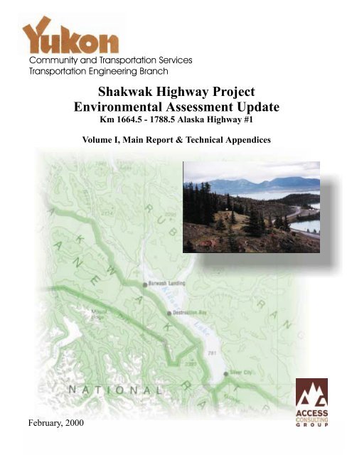
<strong>Shakwak</strong> Highway <strong>Project</strong><br />
<strong>Environmental</strong> Assessment <strong>Update</strong><br />
Km 1664.5 - 1788.5 Alaska Highway #1<br />
Volume I, Main Report & Technical Appendices
Government<br />
Community & Transportation Services<br />
Transportation Engineering Branch<br />
SHAKWAK HIGHWAY PROJECT<br />
ENVIRONMENTAL ASSESSMENT UPDATE<br />
Km 1664.5 - 1788.5 ALASKA HIGHWAY #1<br />
VOLUME I – MAIN REPORT & TECHNICAL APPENDICES<br />
February 2000<br />
Prepared by:<br />
204D Strickland Street<br />
Whitehorse, YT Y1A 2J8<br />
Tel: (867) 668-6463 Fax: (867) 667-6680<br />
www.accessconsulting.yk.ca
SHAKWAK HIGHWAY PROJECT – ENVIRONMENTAL ASSESSMENT UPDATE<br />
Km 1664.5 – 1788.5, Alaska Highway #1<br />
EXECUTIVE SUMMARY<br />
Background<br />
Government<br />
The <strong>Shakwak</strong> Highway <strong>Project</strong> is a long-term phased project to reconstruct and pave the Haines<br />
Road from the Alaska/British Columbia border (km 71) through to Haines Junction (km 246),<br />
and the Alaska Highway to the Yukon/Alaska border (km 1966), a distance of approximately 520<br />
kilometres. The project involves reconstruction of horizontal and vertical alignments, road<br />
widening, and paving to improve highway safety and enhance driving conditions.<br />
The <strong>Shakwak</strong> <strong>Project</strong> is funded by the American Government through the Federal Highways<br />
Administration, and administered by Public Works and Government Services Canada.<br />
Responsibility for the design and construction of the <strong>Shakwak</strong> <strong>Project</strong> rests with the Yukon<br />
Government, Department of Community & Transportation Services, Transportation Engineering<br />
Branch.<br />
An <strong>Environmental</strong> Assessment and Review Process Guidelines Order (EARPGO) Panel in<br />
1977/1978 reviewed the <strong>Shakwak</strong> <strong>Project</strong> and a Panel Report was completed in June 1978. The<br />
original <strong>Environmental</strong> Impact Statement (EIS) identified data gaps and required further areas of<br />
study.<br />
The purpose of this report is to complete an environmental assessment update for the <strong>Shakwak</strong><br />
<strong>Project</strong>, between the Jarvis River (km 1664.5) and Quill Creek (km 1788.5), Alaska Highway #1<br />
Yukon. See Figures 1-1 and 1-2 for the general location map and the study area overview map.<br />
Scope<br />
The study objectives for this environmental assessment update included:<br />
i
SHAKWAK HIGHWAY PROJECT – ENVIRONMENTAL ASSESSMENT UPDATE<br />
Km 1664.5 – 1788.5, Alaska Highway #1<br />
Government<br />
• Identification and description of environment conditions within the proposed highway<br />
reconstruction study area;<br />
• Identification of resources and areas that are particularly sensitive to the reconstruction<br />
process; and<br />
• Identification of potential impacts and mitigation requirements to be addressed prior to<br />
highway reconstruction.<br />
The scope of work for this project included the following discipline specific study components:<br />
• archaeological and traditional use;<br />
• current land use;<br />
• wildlife and waterfowl;<br />
• hydrology;<br />
• vegetation;<br />
• aesthetics; and,<br />
• socio-economic.<br />
Each discipline specific study generally involved literature reviews and compilation of historic<br />
and current data, consultations and interviews with knowledgeable persons regarding the study<br />
area, field surveys as necessary to compliment existing data or to address data gaps, and<br />
report compilation. The results of the discipline specific studies with accompanying technical<br />
appendices are presented in Volume I Main Report & Technical Appendices.<br />
A series of base maps were developed at 1:60,000 scale to describe the 124 kilometer linear<br />
study area, and present the various reconstruction highway alignment options, potential borrow<br />
sources, and construction field camp locations. These base maps were then used to describe<br />
pertinent discipline specific study results. Study maps were prepared for archaeological and<br />
traditional use, current land use, wildlife and waterfowl, hydrology, vegetation and aesthetics<br />
and are presented in Volume II, Study Maps.<br />
ii
SHAKWAK HIGHWAY PROJECT – ENVIRONMENTAL ASSESSMENT UPDATE<br />
Km 1664.5 – 1788.5, Alaska Highway #1<br />
Pertinent results from the various discipline specific studies are discussed below.<br />
Archaeological and Traditional Use<br />
Government<br />
The main objective for the archaeological and traditional use studies was the creation of a<br />
detailed Heritage Inventory and comprehensive archaeological/traditional use impact<br />
assessment on the study region. The impact assessment covered the immediate impact zone<br />
of the proposed new highway alignment (200-300 meters) as well as the locations of potential<br />
borrow pits and potential field camps. It is recognized that most heritage impacts are mitigative,<br />
and an emphasis was placed on site-specific mitigation and sound management practices<br />
during highway construction.<br />
Extensive field investigations were completed along with interviews with Champagne Aishihik<br />
and Kluane First Nations elders. Previously identified archaeological sites were re-visited, and<br />
traditional use and historic sites inspected and documented.<br />
Key findings of the archaeological and traditional use studies included the identification of fiftyseven<br />
heritage resource sites. See Figures 2-1 to 2-6, Volume II for the location of the various<br />
heritage resource sites. All sites were documented, potential impacts identified, and mitigation<br />
measures proposed. A total of twenty-one known archaeological sites were identified in the<br />
study area with most sites revisited. Seven new archaeological sites were documented.<br />
Twenty-nine traditional and historic sites were documented in the study area.<br />
Of the identified heritage resources sites, only sixteen locations required mitigation measures to<br />
address potential impacts resulting from highway reconstruction. Key heritage resources sites<br />
included:<br />
• A new archaeological site (HR 12) located near an unnamed lake near Christmas Creek at<br />
km 1684+200 is located within the highway right-of-way. Archaeological salvage is<br />
recommended for this site.<br />
iii
SHAKWAK HIGHWAY PROJECT – ENVIRONMENTAL ASSESSMENT UPDATE<br />
Km 1664.5 – 1788.5, Alaska Highway #1<br />
Government<br />
• An existing archaeological site HR 27 (JgVp-3) is located within the highway right-of-way<br />
near Goose Bay (km 1723+400). Archaeological salvage is recommended for this site.<br />
• A new archaeological site (HR 12) located near an unnamed lake near Christmas Creek at<br />
km 1684+200 is located within the highway right-of-way. Archaeological salvage is<br />
recommended for this site.<br />
• New archaeological sites were also identified near Sakiw Creek. Site HR 51 (km 1783+500)<br />
is located near a potential borrow and field camp area, and Site HR 56 (km 1783+800) is<br />
located on the margins of the highway right-of-way. If the sites cannot be avoided, then<br />
salvage would be required.<br />
• Within the study area a number of traditional trials were identified crossing the highway at<br />
varying points. No specific mitigation measures where identified to address potential<br />
impacts, except for mapping the trails existence and ensuring that First Nations are<br />
consulted regarding ways to acknowledge the trails in the study area.<br />
• Historic sites of significance within the study area included Silver City (HR 16 at km<br />
1694+600), the Fisher (Fromme) Cabin and Grave (HR19) at km 1704+100 and a Survey<br />
Platform (HR 26) at km 1716+100.<br />
Current Land Use<br />
The main objective for the current land use study was the documentation of all current land<br />
tenure and use activities in the study area. Potential impacts to current and potential land users<br />
were described and mitigation measures identified. All known waste disposal sites and<br />
contaminated sites within the study area were also identified and documented. Current land<br />
tenure and land use highway access points were inspected and documented with information<br />
presented in a series of maps. See Figures 3-1 through to 3-8 in Volume II for the locations of<br />
the current land use highway access points.<br />
Key findings resulting from the current land use study included:<br />
• Mapping and geo-reference of all current land tenure and land uses.<br />
iv
SHAKWAK HIGHWAY PROJECT – ENVIRONMENTAL ASSESSMENT UPDATE<br />
Km 1664.5 – 1788.5, Alaska Highway #1<br />
Government<br />
• Present and historic current land uses in the study area included tourism, mining, forestry,<br />
agriculture, trapping and outfitting, residential/commercial land uses, recreational uses,<br />
traditional and cultural uses, hunting and fishing.<br />
• A total of eleven waste sites were identified within or near the highway right-of-way. Ten of<br />
these site were previously listed on the Department of Indian Affairs and Northern<br />
Development, Arctic <strong>Environmental</strong> Strategy Waste Inventory. One new waste site was<br />
identified as part of the archaeological investigations. This site (HR 50) is located near<br />
Sakiw Creek at highway chainage 1783+300. No waste sites were identified as posing a<br />
significant environmental risk; however, if the waste sites are disturbed as a result of<br />
reconstruction activities then additional investigations may be warranted.<br />
The main impacts associated with current land tenure and use is retention of continued access<br />
to existing business, private residences, local land uses and recreational highway access<br />
points. The current land use maps (Figures 3-1 to 3-6 in Volume II) identify highway access<br />
points and recommends potential highway access standards for each. The Transportation<br />
Association of Canada (TAC) personal residence, or TAC commercial standards, are<br />
recommended for the various highway access points. During the course of the current land use<br />
study, many local residents and First Nations requested that land use highway access points be<br />
designated as a TAC personal residence standard to deter overuse by tourists or unwanted<br />
visitors.<br />
Wildlife and Waterfowl<br />
The major objectives of the wildlife and waterfowl studies included providing a general wildlife<br />
resource description, summarizing species occurrence, habitats, and the relative ecological<br />
importance for the key species in the study area. These species or guilds included: the Kluane<br />
Caribou herd; Dall sheep, Birds of Prey, Sharp tail grouse, and Waterbirds. Other species<br />
including Grizzly bears, moose, ground squirrels and porcupine were given cursory attention.<br />
Current and historic movement corridors, winter ranges, key habitats and frequency of use for<br />
the valued ecosystem components were delineated and mapped. Figures 4-1 through to 4-13<br />
v
SHAKWAK HIGHWAY PROJECT – ENVIRONMENTAL ASSESSMENT UPDATE<br />
Km 1664.5 – 1788.5, Alaska Highway #1<br />
Government<br />
in Volume II present the mapping results of the wildlife and waterfowl studies. Measures to<br />
mitigate or avoid potential adverse impacts resulting from construction, operation, and<br />
maintenance activities were provided. Specific mitigation guidelines were developed for the key<br />
species or guild.<br />
The wildlife and waterfowl studies involved the compilation of historic and current literature as<br />
well as interviews with knowledgeable persons and First Nation elders. Field studies were<br />
specifically conducted for birds of prey, Sharp tail grouse and waterfowl due to identified data<br />
gaps for these species or guilds.<br />
The key findings from the wildlife and waterfowl studies included the following:<br />
• The Kluane Caribou herd is a guild identified as a priority concern for highway<br />
reconstruction. Current and historic information was used to document seasonal movement<br />
patterns and highway crossing area. Mitigation measures are proposed to address potential<br />
concerns with highway reconstruction and operation and maintenance activities. These<br />
mitigation options include highway signage and crossing identification, limiting the highway<br />
as a perceptual barrier for crossing areas, limiting the extent of right-of-way clearing near<br />
identified crossing areas, construction timing windows near crossing areas, limiting camp<br />
and borrow site near crossing areas, revegetation seed mixtures that distract animal forage<br />
and herd monitoring within the study area.<br />
• As previously identified in the original environmental impact statement, Dall sheep are a key<br />
species of concern and a focal point for many visitors to Kluane National Park. No specific<br />
field studies were undertaken as the Dall sheep population, habitats, movement patterns<br />
and mineral licks have been well documented. Mitigation guidelines were developed for<br />
potential impacts resulting from highway reconstruction. The focus of these measures is<br />
directed as precautionary with special attention to indirect impacts. These measures include<br />
construction timing windows, limiting camp and borrow sites within the movement corridors,<br />
avoidance of mineral licks, highway signage and crossing identification, providing escape<br />
vi
SHAKWAK HIGHWAY PROJECT – ENVIRONMENTAL ASSESSMENT UPDATE<br />
Km 1664.5 – 1788.5, Alaska Highway #1<br />
Government<br />
terrain, limiting recreational encounters, and revegetating disturbed areas with poor forage<br />
species.<br />
• As a result of the Birds of Prey corridor study undertaken to confirm area usage, Boreal<br />
owls, Gyrfalcon, Peregrine and Golden Eagle were identified as the main species of<br />
concern. Potential impacts to Birds of Prey species resulting from highway reconstruction<br />
and operation and maintenance activities were identified. General mitigation guidelines are<br />
provided for birds of prey species. Mitigation measures include the provision of construction<br />
buffer zones and construction timing windows, limiting camp and borrow site location away<br />
from active nesting areas, installation of nest cavities outside of the highway right-of-way for<br />
Boreal owls, brush clearing highway right-of-way, and keeping historic and active nests sites<br />
confidential.<br />
• A Sharp tail grouse lekking field survey was conducted to verify previous documentation and<br />
to determine current area usage patterns. Two potential lekking areas were identified, Duke<br />
River Meadows and Copper Joe Creek. General mitigation guidelines were developed for<br />
this species.<br />
• A series of waterbirds surveys were completed for the study area to address data gaps.<br />
The surveys included a spring staging/migration survey, a summer brooding survey, and a<br />
fall staging/migration survey. Key waterbird habitat areas identified as a result of the studies<br />
included Sulphur Lake, and the Kluane lakeshore between Topham Creek and the Slims<br />
River. Potential impacts were identified and mitigation measures proposed to address these<br />
impacts. These measures include the provision of buffer zones and construction timing<br />
windows and the installation of culverts along the Slims River causeways to ensure habitat<br />
is not lost.<br />
vii
SHAKWAK HIGHWAY PROJECT – ENVIRONMENTAL ASSESSMENT UPDATE<br />
Km 1664.5 – 1788.5, Alaska Highway #1<br />
Hydrology<br />
Government<br />
The major objectives of the hydrology study included a review of all available regional<br />
streamflow data and literature to enable an estimate of 50-year and 100-year return period peak<br />
events for watercourse crossing design. Preliminary hydrological and morphological<br />
characteristics for all major watercourses were provided along with an assessment and<br />
description of the potential impacts to the hydrologic regime of these major watercourses. The<br />
major watercourses in the study areas that were assessed include Christmas Creek, Silver<br />
Creek, Slims River, Williscroft Creek, Congdon Creek, Nines Creek, Mines Creek, Bocks Brook,<br />
Lewis Creek, Copper Joe Creek, the Duke River, Burwash Creek, and Sakiw Creek. The<br />
location of these watercourses and their drainage areas are mapped on Figures 5-1 through to<br />
5-7 in Volume II. A field survey was conducted at each major watercourse crossing to describe<br />
hydrological and morphological characteristics. Mitigation measures and options were<br />
presented to address potential impacts.<br />
The key findings from the hydrological studies included the following:<br />
• Revised flood flow prediction and estimates for each major watercourse crossing. The<br />
recommended estimates include a provision for standard error for structural design.<br />
• A historic review of the Silver Creek hydrological processes was undertaken. Based on this<br />
review, a number of mitigation options were developed to address potential downstream<br />
impacts to historic, residential and commercial properties. These options include: continuing<br />
with the existing stream maintenance practices; creation of sediment traps both upstream<br />
and downstream of the existing stream crossing with associated granular removal; removal<br />
of the existing stream diversion and the highway crossing and redirection of the creek<br />
towards Topham Creek, split the creek flow into another separate channel, divide the stream<br />
flow into two channels and create a new channel.<br />
viii
SHAKWAK HIGHWAY PROJECT – ENVIRONMENTAL ASSESSMENT UPDATE<br />
Km 1664.5 – 1788.5, Alaska Highway #1<br />
Government<br />
• Potential hydrological impacts and mitigation measures, complete with various options, were<br />
identified for each major watercourse crossing. Of particular concern are the potential<br />
channel avulsions associated with the glacial fed streams or “Kluane Creeks” and impacts to<br />
the highway. Continued maintenance of existing diversions and stream banks and<br />
installation of emergency overflow culverts are recommended.<br />
• The construction of causeways across the Slims River delta area was also assessed. Many<br />
of the potential impacts on Kluane Lake, such as lake isolation or loss of fish habitat, could<br />
be avoided or minimized if the existing highway alignment is kept. However, other potential<br />
concerns such as improved highway safety and wildlife collisions are not adequately<br />
addressed. Mitigation measures are recommended to address new causeway construction<br />
in the Slims River delta area.<br />
Vegetation<br />
Major objectives of the vegetation study included the description and characterization of<br />
vegetation communities in the study area, and a determination of the communities in terms of<br />
sensitivity to disturbance. All vegetation communities within the study area highway corridor<br />
were identified and mapped. Rare plant species were identified and the locations noted. A<br />
number of field surveys were conducted to ground truth vegetation communities, identify rare<br />
plant species, and confirm vegetation community maps. Vegetation maps for the study area are<br />
presented in Figures 6-1 through to 6-7 in Volume II. Potential impacts resulting from highway<br />
reconstruction activities were identified, and mitigation measures were developed to reduce<br />
impacts. A revegetation plan for various segments of the reconstructed highway was prepared<br />
to assist with reconstruction reclamation.<br />
The key findings of the vegetation study included the following:<br />
ix
SHAKWAK HIGHWAY PROJECT – ENVIRONMENTAL ASSESSMENT UPDATE<br />
Km 1664.5 – 1788.5, Alaska Highway #1<br />
Government<br />
• A total of eighteen major vegetation communities were documented within the study corridor<br />
and presented on the vegetation maps. No potential borrow or field camp areas were<br />
identified as sensitive to reconstruction activities.<br />
• Twelve rare plant species were identified within the study area, with most species occurring<br />
in the Slims River delta, Sheep Mountain and Kluane lakeshore areas.<br />
• The Dryus drummondi plant community located near the Silver Creek floodplain was<br />
considered aesthetically pleasing to many locals and visitors.<br />
• Various revegetation seed and fertilizers mixtures were recommended for various highway<br />
segments. Of particular concern is revegetation with non-indigenous plant species in the<br />
Kluane National Park area. Similar concerns were raised with the use of legume seed<br />
mixtures in areas associated with caribou crossings. Revegetation mixtures were<br />
specifically designed to address these potential concerns.<br />
Mitigation measures to address potential impacts associated with highway reconstruction and<br />
operations and maintenance activities include minimizing off road construction traffic, continued<br />
use of disturbed areas for potential borrow sources and field camp locations, identification,<br />
salvage and transplantation of rare plant species, minimizing disturbance and maintenance of<br />
natural drainage courses, and revegetation seed mixtures tailored to address particular corridor<br />
concerns (e.g. introduction of non- indigenous plant species and use of legumes near wildlife<br />
crossing areas).<br />
Aesthetics<br />
The major objectives for the aesthetics study included documentation of specific or potential<br />
viewpoints or tourist pullouts for preservation and the identification of vulnerable areas<br />
particularly sensitive to highway reconstruction. All potential borrow pit and camp locations<br />
were assessed for potential aesthetics impacts. The study involved meetings and site visits with<br />
x
SHAKWAK HIGHWAY PROJECT – ENVIRONMENTAL ASSESSMENT UPDATE<br />
Km 1664.5 – 1788.5, Alaska Highway #1<br />
Government<br />
various stakeholders to identify candidate viewpoints or tourist sites. The results from the other<br />
discipline specific studies were also integrated into the aesthetics study to determine vulnerable<br />
areas. Potential viewpoints, tourist pullout and vulnerable areas were mapped and appear on<br />
Figures 7-1 through 7-6 in Volume II. Mitigation measures were developed to address potential<br />
aesthetics impacts.<br />
Key findings of the aesthetics study included the following:<br />
• Many of the existing tourist pullouts and viewpoints should be reconstructed and maintained.<br />
Consideration should be given to upgrading public rest stop facilities at key locations along<br />
the highway such as the Kluane Lake overlook.<br />
• As noted in the previous environmental impact statement, the Slims River Delta, Sheep<br />
Mountain area and Duke River Meadows are considered ecologically sensitive areas.<br />
Results from the various discipline specific studies confirm the uniqueness of these areas.<br />
Other vulnerable areas include Sulphur Lake, Silver Creek floodplain, and the Goose Bay<br />
area. Specific mitigation strategies are recommended for these vulnerable areas.<br />
• A review of the potential borrow sources and field camps indicated that some locations may<br />
need to be modified due to potential conflicts with wildlife, archaeological and First Nations<br />
concerns, particularly in the Sakiw Creek area. However, many sites could easily be<br />
developed following current granular resource management practices. Streambed borrow<br />
source development in glacial fed streams may address many aesthetic issues and long<br />
term maintenance, as well as providing sources for highway granular material.<br />
Socio-economics<br />
Major study objectives for the socio-economic component included the preparation of socioeconomic<br />
profiles for the communities of Haines Junction, Destruction Bay, Burwash Landing<br />
and Beaver Creek. Potential positive and negative economic impacts as a result of highway<br />
xi
SHAKWAK HIGHWAY PROJECT – ENVIRONMENTAL ASSESSMENT UPDATE<br />
Km 1664.5 – 1788.5, Alaska Highway #1<br />
Government<br />
reconstruction and maintenance activities were assessed. A comprehensive and accurate<br />
understanding of local residents, businesses, First Nations, recreational users and tourists was<br />
undertaken through extensive interviews and questionnaires. Both potential positive and<br />
negative economic and social impacts were identified and mitigation measures presented.<br />
The key findings of the socio-economic study included the following:<br />
• Interviews conducted with local First Nations, residents and businesses indicated that locals<br />
had concerns with construction camp locations, construction related dust, pilot car<br />
operations, business loss due to piloting and construction camp locations, the length of<br />
construction segments, and the impediments to local businesses as a result of highway<br />
reconstruction. Mitigation measures were recommended to address potential impacts.<br />
• Based on the review of economic conditions, it was determined that highway construction<br />
benefits to the Yukon are considerable. However, local residents and businesses<br />
expressed concerned over the accessibility to construction related contract opportunities.<br />
• Very little impacts to mining, forestry and fishing industries were identified as a result of<br />
highway reconstruction. Generally, highway reconstruction will improve or help these<br />
economic sectors.<br />
• One local trapper is potentially impacted as a result of highway reconstruction. However<br />
reconstruction activities are typically undertaken during spring, summer, and fall months,<br />
which are considered off-season for the trapper.<br />
Mitigation Strategy<br />
On the basis of the individual discipline specific study results, an overall mitigation strategy was<br />
developed that summarized the potential environmental impacts to various study components<br />
with mitigation measures proposed to address those impacts.<br />
A general mitigation plan was developed that provided guidelines applicable to highway<br />
reconstruction and operations. Areas sensitive to reconstruction activities were noted and<br />
xii
SHAKWAK HIGHWAY PROJECT – ENVIRONMENTAL ASSESSMENT UPDATE<br />
Km 1664.5 – 1788.5, Alaska Highway #1<br />
Government<br />
mitigation summarized. Current environmental management practices presently undertaken by<br />
Yukon Government, Community & Transportation Services, will adequately address many of the<br />
identified impacts associated with highway reconstruction. In areas where unique or vulnerable<br />
features or sensitive environmental resources were identified, a prominent features mitigation<br />
strategy was developed. Specific areas where an integrated mitigation strategy was required<br />
included Silver Creek floodplain, Sakiw Creek caribou crossings, Destruction Bay, Duke River<br />
Meadows, and the internationally renowned Slims River Delta and Sheep Mountain area.<br />
Implementation of the various mitigation measures should ensure that environmental sensitive<br />
resources are not impacted as a result of reconstruction of the <strong>Shakwak</strong> Highway <strong>Project</strong>.<br />
xiii
SHAKWAK HIGHWAY PROJECT - ENVIRONMENTAL ASSESSMENT UPDATE<br />
Km 1664.5 - 1788.5, Alaska Highway #1<br />
TABLE OF CONTENTS<br />
1.0 INTRODUCTION.................................................................................................... 1-1<br />
1.1 PROJECT SCOPE............................................................................................................ 1-1<br />
1.2 PROJECT STUDY AREA .................................................................................................. 1-3<br />
1.3 PROJECT COMPONENTS AND MAJOR OBJECTIVES .......................................................... 1-4<br />
1.4 CONSULTATIONS............................................................................................................ 1-9<br />
1.5 DOCUMENT ORGANIZATION ............................................................................................ 1-9<br />
1.6 ACKNOWLEDGEMENTS ................................................................................................. 1-11<br />
2.0 ARCHAEOLOGICAL & TRADITIONAL LAND USE ............................................. 2-1<br />
2.1 BACKGROUND OF THE STUDY AREA............................................................................... 2-2<br />
2.1.1 Study Area Setting ................................................................................................ 2-2<br />
2.1.2 Paleoenvironment ................................................................................................. 2-2<br />
2.1.3 Pre-contact Period................................................................................................. 2-4<br />
2.1.4 Ethnographic Baseline........................................................................................... 2-6<br />
2.1.5 European Settlement............................................................................................. 2-7<br />
2.1.6 Summary............................................................................................................... 2-9<br />
2.2 METHODOLOGY ........................................................................................................... 2-10<br />
2.2.1 Background Research......................................................................................... 2-10<br />
2.2.2 Stakeholder Consultations................................................................................... 2-12<br />
2.2.3 Traditional Interviews .......................................................................................... 2-13<br />
2.2.4 Traditional Land Use and Archaeological Fieldwork ............................................ 2-14<br />
2.3 RESULTS .................................................................................................................. 2-16<br />
2.3.1 Archaeological Sites............................................................................................ 2-17<br />
2.3.2 Traditional Land Use ........................................................................................... 2-27<br />
2.3.3 Historic Heritage Resources................................................................................ 2-36<br />
2.4 SUMMARY AND MITIGATION STRATEGIES ...................................................................... 2-42<br />
2.4.1 Archaeological Sites............................................................................................ 2-42<br />
2.4.2 Traditional Sites................................................................................................... 2-48<br />
2.4.3 Historic Resources .............................................................................................. 2-50<br />
3.0 CURRENT LAND USE........................................................................................... 3-1<br />
Access Consulting Group 1
SHAKWAK HIGHWAY PROJECT - ENVIRONMENTAL ASSESSMENT UPDATE<br />
Km 1664.5 - 1788.5, Alaska Highway #1<br />
3.1 INTRODUCTION............................................................................................................... 3-1<br />
3.2 CURRENT LAND USE IDENTIFICATION.............................................................................. 3-2<br />
3.3 LAND TENURE IDENTIFICATION ....................................................................................... 3-3<br />
3.4 IMPACT ASSESSMENT AND MITIGATION PROPOSALS........................................................ 3-4<br />
3.4.1 General Impact Assessment.................................................................................. 3-4<br />
3.4.2 Physical Works and Operation: Mitigating Potential Impacts to Current Land Uses3-6<br />
3.5 CONTAMINANTS/ WASTE SITE IDENTIFICATION ................................................................ 3-6<br />
4.0 WILDLIFE & WATERFOWL .................................................................................. 4-1<br />
4.1 GENERAL ...................................................................................................................... 4-1<br />
4.1.1 Approach............................................................................................................... 4-1<br />
4.2 CARIBOU ....................................................................................................................... 4-3<br />
4.2.1 Introduction ........................................................................................................... 4-3<br />
4.2.2 Methods ................................................................................................................ 4-4<br />
4.2.3 Discussion............................................................................................................. 4-5<br />
4.2.4 Potential Impacts - Highway Realignments............................................................ 4-5<br />
4.2.5 Mitigation Recommendations ................................................................................ 4-9<br />
4.3 DALL SHEEP................................................................................................................ 4-15<br />
4.3.1 Introduction ......................................................................................................... 4-15<br />
4.3.2 Methods .............................................................................................................. 4-16<br />
4.3.3 Discussion........................................................................................................... 4-16<br />
4.3.4 Potential Impacts of Linear Development ............................................................ 4-19<br />
4.3.5 Mitigation............................................................................................................. 4-22<br />
4.4 OTHER SPECIES........................................................................................................... 4-24<br />
4.4.1 Other Species ..................................................................................................... 4-24<br />
4.4.2 Concerns and Mitigation...................................................................................... 4-27<br />
4.5 BIRDS OF PREY ........................................................................................................... 4-29<br />
4.5.1 Introduction ......................................................................................................... 4-29<br />
4.5.2 Methods .............................................................................................................. 4-29<br />
4.5.3 Discussion........................................................................................................... 4-31<br />
4.5.4 Potential Impacts of Linear Development ............................................................ 4-36<br />
4.5.5 Mitigation Guidelines ........................................................................................... 4-42<br />
4.6 UPLAND GAME BIRDS .................................................................................................. 4-45<br />
4.6.1 General ............................................................................................................... 4-45<br />
Access Consulting Group 2
SHAKWAK HIGHWAY PROJECT - ENVIRONMENTAL ASSESSMENT UPDATE<br />
Km 1664.5 - 1788.5, Alaska Highway #1<br />
4.6.2 Methods .............................................................................................................. 4-45<br />
4.6.3 Results ................................................................................................................ 4-46<br />
4.6.4 Discussion........................................................................................................... 4-48<br />
4.6.5 Potential Impacts of Linear Development ............................................................ 4-48<br />
4.6.6 Mitigation Options................................................................................................ 4-50<br />
4.7 WILDLIFE MONITORING................................................................................................. 4-52<br />
4.8 WATERBIRD SURVEYS.................................................................................................. 4-52<br />
4.8.1 Study Objectives ................................................................................................. 4-52<br />
4.8.2 Methodology........................................................................................................ 4-53<br />
4.8.3 Results ................................................................................................................ 4-54<br />
4.8.4 Discussion........................................................................................................... 4-59<br />
4.8.5 Impact and Mitigation .......................................................................................... 4-61<br />
5.0 HYDROLOGY ........................................................................................................ 5-1<br />
5.1 INTRODUCTION............................................................................................................... 5-1<br />
5.2 DATA SOURCES............................................................................................................. 5-2<br />
5.3 PREVIOUS STUDIES AND FLOW ESTIMATES ..................................................................... 5-3<br />
5.3.1 1978 Reports......................................................................................................... 5-3<br />
5.3.2 USGS 1994 Report ............................................................................................... 5-5<br />
5.3.3 Regional Streamflow Data..................................................................................... 5-6<br />
5.3.4 Conclusions........................................................................................................... 5-7<br />
5.4 REVISED FLOW ESTIMATES ............................................................................................ 5-8<br />
5.4.1 Methodology.......................................................................................................... 5-8<br />
5.4.2 Results .................................................................................................................. 5-9<br />
5.4.3 Site-Specific Comments ...................................................................................... 5-10<br />
5.4.4 Conclusions......................................................................................................... 5-12<br />
5.5 HYDROLOGIC CHARACTERIZATION, MORPHOLOGY ASSESSMENT & HYDROLOGIC IMPACT<br />
ASSESSMENT...................................................................................................................... 5-12<br />
5.5.1 Christmas Creek (km 1686.4).............................................................................. 5-13<br />
5.5.2 Slims River Bridge (km 1705).............................................................................. 5-16<br />
5.5.3 Williscroft Creek (km 1715.9)............................................................................... 5-19<br />
5.5.4 Congdon Creek (km 1724.7) ............................................................................... 5-21<br />
5.5.5 Nines Creek (km 1735.5)..................................................................................... 5-24<br />
5.5.6 Mines Creek (km 1736.15) .................................................................................. 5-27<br />
Access Consulting Group 3
SHAKWAK HIGHWAY PROJECT - ENVIRONMENTAL ASSESSMENT UPDATE<br />
Km 1664.5 - 1788.5, Alaska Highway #1<br />
5.5.7 Bock's Brook (km 1738.8).................................................................................... 5-30<br />
5.5.8 Lewis Creek (km 1749.1)..................................................................................... 5-33<br />
5.5.9 Copper Joe Creek (km 1754.2) ........................................................................... 5-36<br />
5.5.10 Duke River (km 1768.45) ................................................................................. 5-40<br />
5.5.11 Burwash Creek (km 1776.25) .......................................................................... 5-42<br />
5.5.12 Sakiw Creek (km 1783.9)................................................................................. 5-45<br />
5.6 SILVER CREEK (KM 1693.2) ......................................................................................... 5-49<br />
5.6.1 Hydrologic Characterization and Morphology Assessment .................................. 5-49<br />
5.6.2 Hydrologic Impact Assessment ........................................................................... 5-52<br />
5.6.3 Silver Creek - Hydrological Processes and Impact Mitigation Analysis ................ 5-54<br />
5.7 KLUANE LAKE HYDROLOGIC IMPACTS AND MITIGATION MEASURES................................ 5-61<br />
5.7.1 Kluane Lakeshore ............................................................................................... 5-61<br />
5.7.2 Slims River Causeway......................................................................................... 5-63<br />
5.8 SLIMS RIVER HYDROLOGIC IMPACTS AND MITIGATION MEASURES.................................. 5-66<br />
6.0 VEGETATION ........................................................................................................ 6-1<br />
6.1 INTRODUCTION............................................................................................................... 6-1<br />
6.2 ECOLOGICAL SETTING.................................................................................................... 6-1<br />
6.3 PREVIOUS VEGETATION STUDIES.................................................................................... 6-2<br />
6.3.1 Public Works Canada............................................................................................ 6-2<br />
6.3.2 Parks Canada ....................................................................................................... 6-2<br />
6.3.3 Foothills Pipelines ................................................................................................. 6-3<br />
6.3.4 Kluane Land Use Plan........................................................................................... 6-4<br />
6.3.5 Individual Research Papers................................................................................... 6-4<br />
6.4 APPROACH TO THE CURRENT VEGETATION ASSESSMENT ................................................ 6-5<br />
6.4.1 Preliminary Vegetation Mapping............................................................................ 6-5<br />
6.4.2 Ground-truthing ..................................................................................................... 6-5<br />
6.4.3 Plant Community Descriptions and Revised Vegetation Mapping.......................... 6-7<br />
6.4.4 Rare Plant Species Inventory ................................................................................ 6-7<br />
6.5 SURVEY RESULTS.......................................................................................................... 6-7<br />
6.5.1 Vegetation Communities ....................................................................................... 6-7<br />
6.5.2 Slims River Delta................................................................................................... 6-8<br />
6.5.3 Borrow Pits / Field Camps ................................................................................... 6-10<br />
6.5.4 Rare Plant Species.............................................................................................. 6-13<br />
Access Consulting Group 4
SHAKWAK HIGHWAY PROJECT - ENVIRONMENTAL ASSESSMENT UPDATE<br />
Km 1664.5 - 1788.5, Alaska Highway #1<br />
6.6 POTENTIAL CONCERNS AND MITIGATION OPTIONS......................................................... 6-15<br />
6.6.1 Slims River Delta................................................................................................. 6-16<br />
6.6.2 Sheep Mountain .................................................................................................. 6-17<br />
6.6.3 Kluane Lakeshore ............................................................................................... 6-17<br />
6.6.4 Duke River Meadows .......................................................................................... 6-17<br />
6.6.5 Wetlands ............................................................................................................. 6-18<br />
6.6.6 Streambeds......................................................................................................... 6-18<br />
6.7 REVEGETATION............................................................................................................ 6-18<br />
6.7.1 Objectives of Revegetation Program ................................................................... 6-19<br />
6.7.2 Specific Concerns ............................................................................................... 6-19<br />
6.7.3 Revegetation Options.......................................................................................... 6-20<br />
6.7.4 Availability of Native Seed ................................................................................... 6-28<br />
7.0 AESTHETICS......................................................................................................... 7-1<br />
7.1 OVERVIEW..................................................................................................................... 7-1<br />
7.1.1 Study Approach..................................................................................................... 7-2<br />
7.1.2 Viewpoint Identification.......................................................................................... 7-3<br />
7.1.3 Impact Assessment and Mitigation Proposals ....................................................... 7-5<br />
7.1.4 Vulnerable Areas Identification.............................................................................. 7-7<br />
7.1.5 Borrow Sources..................................................................................................... 7-8<br />
8.0 SOCIO-ECONOMIC............................................................................................... 8-1<br />
8.1 COMMUNITY SOCIO-ECONOMIC PROFILES ....................................................................... 8-1<br />
8.1.1 Haines Junction..................................................................................................... 8-1<br />
8.1.2 Destruction Bay..................................................................................................... 8-6<br />
8.1.3 Burwash Landing................................................................................................... 8-7<br />
8.1.4 Beaver Creek ........................................................................................................ 8-8<br />
8.2 LOCAL ECONOMY......................................................................................................... 8-11<br />
8.2.1 Baseline Information............................................................................................ 8-11<br />
8.3 GOVERNMENT.............................................................................................................. 8-11<br />
8.3.1 Baseline Information............................................................................................ 8-11<br />
8.4 TOURISM ..................................................................................................................... 8-12<br />
8.4.1 Baseline Information............................................................................................ 8-12<br />
8.4.2 Construction Phase ............................................................................................. 8-12<br />
Access Consulting Group 5
SHAKWAK HIGHWAY PROJECT - ENVIRONMENTAL ASSESSMENT UPDATE<br />
Km 1664.5 - 1788.5, Alaska Highway #1<br />
8.4.3 Operations Phase................................................................................................ 8-14<br />
8.5 CONSTRUCTION ........................................................................................................... 8-15<br />
8.5.1 Baseline Information............................................................................................ 8-15<br />
8.5.2 Construction Phase ............................................................................................. 8-15<br />
8.5.3 Operations Phase................................................................................................ 8-17<br />
8.6 MINING........................................................................................................................ 8-18<br />
8.6.1 Baseline Information............................................................................................ 8-18<br />
8.6.2 Construction Phase ............................................................................................. 8-19<br />
8.6.3 Operations Phase................................................................................................ 8-19<br />
8.7 FORESTRY................................................................................................................... 8-20<br />
8.7.1 Baseline Information............................................................................................ 8-20<br />
8.7.2 Construction Phase ............................................................................................. 8-20<br />
8.7.3 Operations Phase................................................................................................ 8-21<br />
8.8 FISHING....................................................................................................................... 8-21<br />
8.8.1 Baseline Information............................................................................................ 8-21<br />
8.8.2 Construction Phase ............................................................................................. 8-22<br />
8.8.3 Operations Phase................................................................................................ 8-22<br />
8.9 TRAPPING.................................................................................................................... 8-22<br />
8.9.1 Baseline Information............................................................................................ 8-22<br />
8.9.2 Construction Phase ............................................................................................. 8-23<br />
8.9.3 Operations Phase................................................................................................ 8-24<br />
8.10 OVERALL IMPACT ON YUKON ECONOMY..................................................................... 8-25<br />
8.10.1 Baseline Information ........................................................................................ 8-25<br />
8.10.2 Construction Phase ......................................................................................... 8-26<br />
8.10.3 Operations Phase ............................................................................................ 8-27<br />
8.11 UMBRELLA FINAL AGREEMENT, AND THE CHAMPAGNE AISHIHIK FIRST NATION FINAL<br />
AGREEMENT ....................................................................................................................... 8-28<br />
9.0 MITIGATION STRATEGY...................................................................................... 9-1<br />
9.1 BACKGROUND ............................................................................................................... 9-1<br />
9.2 GENERAL MITIGATION GUIDELINES.................................................................................. 9-2<br />
9.2.1 General Guidelines................................................................................................ 9-2<br />
9.3 PROMINENT FEATURES MITIGATION STRATEGIES ............................................................ 9-8<br />
10.0 REFERENCES..................................................................................................... 10-1<br />
Access Consulting Group 6
LIST OF TABLES<br />
SHAKWAK HIGHWAY PROJECT - ENVIRONMENTAL ASSESSMENT UPDATE<br />
Km 1664.5 - 1788.5, Alaska Highway #1<br />
Table 2-1 Summary of Known Archaeological Sites and Sites Revisited during Investigations ... 2-11<br />
Table 2-2 Summary of Artifacts Recovered from Site 12............................................................. 2-18<br />
Table 2-3 Summary of Artifacts Recovered from JgVp-3............................................................. 2-21<br />
Table 2-4 Heritage Resource Sites and Mitigation Strategy ........................................................ 2-43<br />
Table 2-5 Heritage Resources Geo-Reference Database ........................................................... 2-46<br />
Table 3-1 Study Area Current Land Use Identification................................................................... 3-8<br />
Table 3-2 Study Area Land Tenure Identification ........................................................................ 3-11<br />
Table 3-3 Current Land Use Geo-Reference Database............................................................... 3-14<br />
Table 3-4 Potential Impacts and Mitigation to Current Land Use Activities and Land Tenure ...... 3-16<br />
Table 3-5 Identification of Waste/Contaminants Sites of Concern to Highway Realignment........ 3-17<br />
Table 4-1 Principal Concerns of Road Realignment and Mitigation Options for Dall<br />
sheep, between km 1704 and 1719 ........................................................................... 4-23<br />
Table 4-2 Summary of Other Species Potential Impacts and Mitigation Options ......................... 4-28<br />
Table 4-3 Habitat and Nest Site Characteristics of Birds of Prey in the <strong>Shakwak</strong> Corridor .......... 4-34<br />
Table 4-4 Probable Nesting Phenology of Birds of Prey in the Alaska Highway Corridor<br />
from Jarvis River to Quill Creek ................................................................................. 4-35<br />
Table 4-5 Principal Concerns and General Mitigation Guidelines for Birds of Prey...................... 4-43<br />
Table 4-6 Specific Mitigation Options for Key Raptor Sites ......................................................... 4-44<br />
Table 4-7 Principal Concerns and General Mitigation Guidelines for Sharp Tail Grouse ............. 4-51<br />
Table 4-8 Waterbird Survey Dates and Type .............................................................................. 4-53<br />
Table 4-9 Habitat/Wetland Code, Size and Description............................................................... 4-54<br />
Table 4-10 Waterbird Species Identified within the Study Area ................................................... 4-56<br />
Table 4-11 Incidental Species Observed During Waterbird Surveys ........................................... 4-57<br />
Table 4-12 Additional Waterbird Species Observed in Study Area.............................................. 4-60<br />
Table 5-1 Flood Flow Estimates by NWH (1978)........................................................................... 5-4<br />
Table 5-2 Flood Flow Estimates by IWD 1978 .............................................................................. 5-5<br />
Table 5-3 Regional Streamflow Gauging Stations ......................................................................... 5-6<br />
Table 5-4 Revised Flood Flow Estimates - <strong>Shakwak</strong> Highway km 1664.5 to km 1788.5 ............... 5-9<br />
Table 5-5 Christmas Creek - Summary of Hydrologic Impacts and Mitigation Measures............. 5-15<br />
Table 5-6 Williscroft Creek - Summary of Hydrologic Impacts and Mitigation Measures.............. 5-21<br />
Table 5-7 Congdon Creek – Summary of Hydrologic Impacts and Mitigation Measures.............. 5-24<br />
Table 5-8 Nines Creek – Summary of Hydrologic Impacts and Mitigation Measures................... 5-26<br />
Table 5-9 Mines Creek – Summary of Hydrologic Impacts and Mitigation Measures .................. 5-29<br />
Table 5-10 Bock's Brook – Summary of Hydrologic Impacts and Mitigation Measures................ 5-32<br />
Table 5-11 Lewis Creek – Summary of Hydrologic Impacts and Mitigation Measures................. 5-35<br />
Table 5-12 Copper Joe Creek – Summary of Hydrologic Impacts and Mitigation Measures........ 5-39<br />
Table 5-13 Duke River – Summary of Hydrologic Impacts and Mitigation Measures................... 5-42<br />
Table 5-14 Burwash Creek – Summary of Hydrologic Impacts and Mitigation Measures ............ 5-45<br />
Table 5-15 Sakiw Creek – Summary of Hydrologic Impacts and Mitigation Measures................. 5-48<br />
Table 5-16 Silver Creek Culverts–Summary of Hydrologic Impacts and Mitigation Measures ..... 5-53<br />
Table 5-17 Near-shore Activities on Kluane Lake - Potential Impacts and Mitigation Measures .. 5-62<br />
Table 5-18 Construction of New Causeway(s) across Slims River Delta - Potential Impacts<br />
on Kluane Lake and Mitigation Measures ................................................................ 5-65<br />
Table 6-1 Major Vegetation Types and Associated Site Conditions............................................... 6-9<br />
Table 6-2 Major Vegetation Types at Potential Off-highway Development Sites ......................... 6-11<br />
Table 6-3 Seed and Fertilizer Specifications - Jarvis River to Silver Creek.................................. 6-24<br />
Table 6-4 Seed and fertilizer specifications - Silver Creek to Slims River.................................... 6-25<br />
Access Consulting Group 7
SHAKWAK HIGHWAY PROJECT - ENVIRONMENTAL ASSESSMENT UPDATE<br />
Km 1664.5 - 1788.5, Alaska Highway #1<br />
Table 6-5 Seed and fertilizer specifications - Slims River Delta................................................... 6-26<br />
Table 6-6 Seed and Fertilizer Specifications - Slims River to Horseshoe Bay ............................. 6-26<br />
Table 6-7 Seed and fertilizer specifications - Horseshoe Bay to Duke River ............................... 6-27<br />
Table 6-8 Seed and fertilizer specifications – Duke River to Quill Creek ..................................... 6-27<br />
Table 7-1 Potential Field Camp and Borrow Pit Locations........................................................... 7-12<br />
Table 7-2 Aesthetics Impact Assessment.................................................................................... 7-13<br />
Table 8-1 Haines Junction Economic Profile ................................................................................. 8-2<br />
Table 8-2 Beaver Creek - Economic Make-up............................................................................... 8-9<br />
Table 8-3 Distribution of <strong>Project</strong> Budget...................................................................................... 8-15<br />
Table 8-4 Average Annual Impacts on the Yukon Economy from <strong>Shakwak</strong> <strong>Project</strong> .................... 8-26<br />
Table 9-1 Mitigation Guidelines Various Highway Segments....................................................... 9-10<br />
Table 9-2 Prominent Features - Potential Impacts and Mitigation Measures/Options.................. 9-12<br />
Section 1 Figures<br />
Figure 1-1 General Location Map<br />
Figure 1-2 Study Area Overview<br />
Section 7 Figures<br />
LIST OF FIGURES<br />
(Figures appear at the back of each Section)<br />
Figure 7-1 Typical Arrangement Borrow Pit Development Scheme<br />
LIST OF APPENDICES<br />
Appendix I List of Contacts<br />
Appendix II-1 Yukon Archaeological Site Inventory Forms<br />
Appendix II-2 Selected Archaeological/Traditional Land Use Plates<br />
Appendix II-3 Site Maps<br />
Appendix III Contaminants/Waste Sites<br />
Appendix IV Waterbird Survey Results<br />
Appendix V Historical Streamflow Data<br />
Appendix V-1 Mean Monthly Discharges<br />
Appendix V-2 Mean Monthly Water Levels<br />
Appendix V-3 Extremes of Discharges and Water Levels<br />
Appendix V-4 Selected Hydrology Plates<br />
Appendix VI-1 Major Vegetation Types<br />
Appendix VI-2A Slims River Delta – Plant Species<br />
Appendix VI-2B Rare Plants – Jarvis River and Quill Creek<br />
Appendix VI-3 Vegetation Survey Plot Data<br />
Appendix VII Socio-Economic Interview Questionnaires<br />
Access Consulting Group 8
Introduction<br />
SHAKWAK HIGHWAY PROJECT - ENVIRONMENTAL ASSESSMENT UPDATE<br />
Km 1664.5 - 1788.5, Alaska Highway #1<br />
Section 1 – Base Maps<br />
Figure 1-1 General Location Map<br />
Figure 1-2 Study Area Overview<br />
Figure 1-3 Base Map 1<br />
Figure 1-4 Base Map 2<br />
Figure 1-5 Base Map 3<br />
Figure 1-6 Base Map 4<br />
Figure 1-7 Base Map 5<br />
Figure 1-8 Base Map 6<br />
Figure 1-9 Base Map 7<br />
VOLUME II – STUDY MAPS<br />
TABLE OF CONTENTS<br />
Section 2 – Archaeology/Traditional Land Use Heritage Maps<br />
Figure 2-1 Heritage Resource Map 1<br />
Figure 2-2 Heritage Resource Map 2<br />
Figure 2-3 Heritage Resource Map 3<br />
Figure 2-4 Heritage Resource Map 4<br />
Figure 2-5 Heritage Resource Map 5<br />
Figure 2-6 Heritage Resource Map 6<br />
Section 3 – Current Land Use Maps<br />
Figure 3-1 Current Land Use Map 1<br />
Figure 3-2 Current Land Use Map 2<br />
Figure 3-3 Current Land Use Map 3<br />
Figure 3-4 Current Land Use Map 4<br />
Figure 3-5 Current Land Use Map 5<br />
Figure 3-6 Current Land Use Map 6<br />
Figure 3-7 Silver City Area Property Locations<br />
Figure 3-8 Trapping Concessions, Outfitting Concessions, Settlement Lands, Kluane Park<br />
Boundary<br />
Section 4 – Wildlife & Waterfowl Maps<br />
Figure 4-1 Wildlife Map 1<br />
Figure 4-2 Wildlife Map 2<br />
Figure 4-3 Wildlife Map 3<br />
Figure 4-4 Wildlife Map 4<br />
Figure 4-5 Wildlife Map 5<br />
Figure 4-6 Wildlife Map 6<br />
Figure 4-7 Caribou Range and Movement Map<br />
Figure 4-8 Waterbird Map 1<br />
Figure 4-9 Waterbird Map 2<br />
Figure 4-10 Waterbird Map 3<br />
Figure 4-11 Waterbird Map 4<br />
Access Consulting Group 9
SHAKWAK HIGHWAY PROJECT - ENVIRONMENTAL ASSESSMENT UPDATE<br />
Km 1664.5 - 1788.5, Alaska Highway #1<br />
Figure 4-12 Waterbird Map 5<br />
Figure 4-13 Waterbird Map 6<br />
Section 5 – Hydrology Maps<br />
Figure 5-1 Hydrology Overview<br />
Figure 5-2 Hydrology Map 1<br />
Figure 5-3 Hydrology Map 2<br />
Figure 5-4 Hydrology Map 3<br />
Figure 5-5 Hydrology Map 4<br />
Figure 5-6 Hydrology Map 5<br />
Figure 5-7 Hydrology Map 6<br />
Figure 5-8 Slims River Delta<br />
Section 6 – Vegetation Maps<br />
Figure 6-1 Vegetation Map 1<br />
Figure 6-2 Vegetation Map 2<br />
Figure 6-3 Vegetation Map 3<br />
Figure 6-4 Vegetation Map 4<br />
Figure 6-5 Vegetation Map 5<br />
Figure 6-6 Vegetation Map 6<br />
Figure 6-7 Slims River Delta<br />
Section 7 – Aesthetics Maps<br />
Figure 7-1 Aesthetic Map 1<br />
Figure 7-2 Aesthetic Map 2<br />
Figure 7-3 Aesthetic Map 3<br />
Figure 7-4 Aesthetic Map 4<br />
Figure 7-5 Aesthetic Map 5<br />
Figure 7-6 Aesthetic Map 6<br />
Access Consulting Group 10
SHAKWAK HIGHWAY PROJECT - ENVIRONMENTAL ASSESSMENT UPDATE<br />
Km 1664.5 - 1788.5, Alaska Highway #1<br />
1.0 INTRODUCTION<br />
This document presents the results of an environmental assessment update for the <strong>Shakwak</strong><br />
Highway <strong>Project</strong>, km 1664.5 to km 1788.5, Alaska Highway #1 Yukon. The environmental<br />
assessment update was completed by Access Consulting Group by request from Yukon<br />
Government, Community & Transportation Services, Transportation Engineering Branch.<br />
1.1 PROJECT SCOPE<br />
The <strong>Shakwak</strong> Highway <strong>Project</strong> is a long-term phased project to reconstruct and pave<br />
approximately 520 kilometres of highway starting at the Haines Road - Alaska/British Columbia<br />
border (km 71) to Haines Junction (km 246), and continuing north along the Alaska Highway at<br />
Haines Junction (km 1635) to the Yukon/Alaska border (km 1966). The project involves<br />
reconstruction of horizontal and vertical alignments, road widening, and paving to improve<br />
highway safety and enhance driving conditions.<br />
The <strong>Shakwak</strong> Highway <strong>Project</strong> was reviewed by an <strong>Environmental</strong> Assessment and Review<br />
Process Guidelines Order (EARPGO) Panel in 1977/1978, according to established guidelines<br />
and a Panel Report was completed in June 1978 (FEARO and Environment Canada, 1979).<br />
Studies of baseline environmental conditions were undertaken, and an assessment of impacts<br />
provided in an Environment Impact Statement (EIS) prepared by the Department of Public<br />
Works, Canada and the U.S. Federal Highway Administration for the <strong>Shakwak</strong> Highway<br />
Improvement <strong>Project</strong> in December 1977 (DPW, 1978 and 1979).<br />
The EARPGO Panel provided 35 recommendations to address potential impacts specifically to<br />
project management, physical and engineering, ecological and socio economic, and unique<br />
area issues. The Panel's overall conclusion was "…that it will be possible to carry out the<br />
project without significant adverse environmental or socio impact if appropriate procedures are<br />
followed and certain conditions are met…" Specific commitments were made as part of the EIS<br />
report by the proponent to implement various mitigation measures, and undertake detailed<br />
studies to address data gaps in the original EIS.<br />
Access Consulting Group 1-1
SHAKWAK HIGHWAY PROJECT - ENVIRONMENTAL ASSESSMENT UPDATE<br />
Km 1664.5 - 1788.5, Alaska Highway #1<br />
The discipline specific studies presented within this document represent a follow up study to the<br />
original EIS) and are designed to address data gaps in the EIS and follow up on<br />
recommendations made by the EARPGO Panel respecting the need for further study. The<br />
scope of work for this project includes the following components between Jarvis River (km<br />
1664.5) and Quill Creek (km 1788.5) of the Alaska Highway:<br />
• archaeological and traditional use;<br />
• current land use;<br />
• wildlife and waterfowl;<br />
• hydrology;<br />
• vegetation;<br />
• aesthetics; and,<br />
• socio-economic.<br />
For each study area, the level of knowledge has been updated to reflect present conditions.<br />
Potential environmental impacts related to each study components are described, and a series<br />
of mitigation options are presented to address potential impacts. Detailed mapping is used to<br />
describe study features and locations.<br />
It is expected that the results of this study will be used by Yukon Government, Community &<br />
Transportation Services, to assist with the following:<br />
• updating environmental conditions and information within the study area;<br />
• road reconstruction design and alignment selections;<br />
• borrow pit and field camp site selection;<br />
• identification of environmental components requiring mitigation as a result of road<br />
reconstruction and operation and maintenance activities;<br />
• development and implementation of mitigation options to address potential impacts; and<br />
• providing supporting documentation for various permit applications and environmental<br />
screenings.<br />
Access Consulting Group 1-2
SHAKWAK HIGHWAY PROJECT - ENVIRONMENTAL ASSESSMENT UPDATE<br />
Km 1664.5 - 1788.5, Alaska Highway #1<br />
1.2 PROJECT STUDY AREA<br />
The project study area is located within the <strong>Shakwak</strong> Trench in south western Yukon (Figure 1-<br />
1), and extends from km 1664.4 (Jarvis River) to km 1788.5 (Quill Creek). Figure 1-2 illustrates<br />
the 124 km linear section of the highway that is slated for highway reconstruction.<br />
Of particular interest and concern for the <strong>Shakwak</strong> Highway <strong>Project</strong> development is the<br />
recognition and protection of two unique ecologically important areas within this section of the<br />
highway. The Sheep Mountain/Slims River Delta area, a focal point for Kluane National Park,<br />
and ecological reserve under the International Biological Program, is unique in its importance as<br />
an ecological sensitive area for Dall Sheep, raptors and plant communities. The Duke River<br />
Meadows is similarly important as an ecologically sensitive area, particularly for the Kluane First<br />
Nation community of Burwash Landing.<br />
The study area has been subdivided into a series of seven base maps. The base maps and<br />
their linear coverage are listed below:<br />
• Base Map 1 (Figure 1-3, Volume II) extends from km 1664.5 to km 1684;<br />
• Base Map 2 (Figure 1-4, Volume II) extends from km 1683 to km 1713;<br />
• Base Map 3 (Figure 1-5, Volume II) extends from km 1700 to km 1725;<br />
• Base Map 4 (Figure 1-6, Volume II) extends from km 1727 to km 1747;<br />
• Base Map 5 (Figure 1-7, Volume II) extends from km 1749 to km 1770;<br />
• Base Map 6 (Figure 1-8, Volume II) extends from km 1770 to km 1788.5;<br />
• Base Map 7 (Figure 1-9, Volume II) extends from km 1700 to km 1709 (Slims<br />
River/Sheep Mountain).<br />
Volume II – Study Maps presents a complete set of all the base maps and study maps used for<br />
the report. For ease of presentation of geographical information, Volume I, Main Report &<br />
Technical Appendices should be read in conjunction with Volume II – Study Maps.<br />
The base maps discussed above have been subsequently used for the various discipline<br />
specific studies, and are provided as a complete set in Volume II – Study Maps.<br />
Access Consulting Group 1-3
SHAKWAK HIGHWAY PROJECT - ENVIRONMENTAL ASSESSMENT UPDATE<br />
Km 1664.5 - 1788.5, Alaska Highway #1<br />
All base maps and study maps include potential borrow sites and field camp locations. These<br />
sites are numbered sequentially starting from Jarvis River (km 1664.5). The numerical<br />
designation also indicates whether the site is a potential borrow source (“B”) or potential field<br />
camp (“C”) location. As no detailed field inspection and geotechnical information has been<br />
collected from these sites, they were considered potential areas for investigation for the purpose<br />
of the various discipline specific studies.<br />
Base and study maps provide highway kilometer locations with specific reference to the<br />
reconstructed highway alignment. These highway chainages are based on the reconstructed<br />
highway alignment center line, with the Center Line route option used (see Volume II, Figure 1-<br />
9).<br />
As noted on the base maps, various highway center line alignment options exist, particularly in<br />
the vicinity of the Slims River Delta. Volume II, Figure 1-9 outlines the existing highway<br />
alignment and the four other highway reconstruction center line alignment options (A1, A2, B1,<br />
and Center Line), as identified by Yukon Government, Community & Transportation Services,<br />
Transportation Engineering Branch.<br />
Highway chainage equations for reconstruction survey purposes are shown on Figures 1-6 and<br />
1-8, Volume II.<br />
1.3 PROJECT COMPONENTS AND MAJOR OBJECTIVES<br />
As noted previously, the overall intent of this study was to address data gaps in the original<br />
<strong>Shakwak</strong> Highway EIS, specifically to the Alaska Highway between existing kilometres 1664.5<br />
and 1788.5. The objectives of this report are to:<br />
• Identify and describe environment conditions within the proposed highway reconstruction<br />
study area;<br />
• Identify resources and areas that are particularly sensitive to the reconstruction process;<br />
and,<br />
• Identify potential impacts and mitigation requirements to be addressed prior to highway<br />
reconstruction.<br />
Access Consulting Group 1-4
SHAKWAK HIGHWAY PROJECT - ENVIRONMENTAL ASSESSMENT UPDATE<br />
Km 1664.5 - 1788.5, Alaska Highway #1<br />
Specific studies undertaken to address data gaps and study objectives follow.<br />
ARCHAEOLOGICAL AND TRADITIONAL USE<br />
Major study objectives include:<br />
• Gain a thorough understanding of the archaeological resources and potential of the<br />
study area;<br />
• Conduct a systematic archaeological field survey for prehistoric/traditional/historic sites<br />
(or Heritage Sites) between km 1664.5 (Jarvis River) to 1788.5 (Quill Creek), to relocate<br />
and assess the condition of previously identified heritage sites, and to determine the<br />
location and condition of additional unknown heritage sites within the region;<br />
• Gain a thorough understanding of the ethnographic information on traditional land use<br />
within the study area and Kluane region;<br />
• Precisely locate and describe all traditional use sites, known and unknown, within the<br />
study area, based on interviews with members of Kluane First Nation (KFN) and<br />
Champagne Aishihik First Nation;<br />
• Create a detailed Heritage Inventory of the study area, and to identify measures to avoid<br />
impacts to sites of archaeological and traditional use importance, and to provide<br />
recommendations on mitigative measures where impacts are unavoidable;<br />
• Prepare a comprehensive Archaeological Impact Assessment and Traditional Land Use<br />
Impact Assessment on the study region.<br />
CURRENT LAND USE<br />
Major study objectives include:<br />
• Preparation of accurate documentation of all current land use activities in the study area;<br />
• Compilation of complete land tenure information database;<br />
• Description of impacts to current and potential land uses in the study area resulting from<br />
construction, operation and maintenance, and recommend measures to mitigate those<br />
impacts;<br />
Access Consulting Group 1-5
SHAKWAK HIGHWAY PROJECT - ENVIRONMENTAL ASSESSMENT UPDATE<br />
Km 1664.5 - 1788.5, Alaska Highway #1<br />
• Identify and document all known waste disposal sites and contaminated sites within the<br />
study area.<br />
WILDLIFE AND WATERFOWL<br />
Major study objectives include:<br />
• Provide a general resource description for the study area which will summarize the<br />
occurrence of different species and habitats, and the relative ecological importance of<br />
these ecosystem components to the broader ecosystem, and to the Yukon;<br />
• Delineate known movement corridors, winter ranges, and other key habitats of the<br />
Kluane Caribou Herd; Dall sheep, Birds of Prey, Sharp tail grouse and waterbirds;<br />
• Determine historic range use patterns and delineate key habitats, including late winter,<br />
calving, post-calving, and rutting areas, migration corridors, and mineral licks;<br />
• Determine current range use patterns and delineate key habitats, including late winter,<br />
calving, post-calving, and rutting areas, migration corridors, and mineral licks;<br />
• Determine frequency of use (over successive years) of key habitats within the study<br />
corridor;<br />
• Delineate areas to determine raptor nesting sites, including frequency of use;<br />
• Determine known nesting sites and key winter roosts in the study corridor;<br />
• Determine the significance and extent of waterbird habitat in the study area, and quantify<br />
the use of the habitat by waterbirds during spring and fall staging, breeding and molting;<br />
• Recommend measures to mitigate or avoid adverse impacts resulting from construction,<br />
operation, and maintenance activities;<br />
• Identify potential adverse impacts of linear developments, including (a) the risk and<br />
outcome of temporary and permanent displacement (functional loss of habitat), (b) loss<br />
of habitat, change in habitat use, or fragmentation of habitat, (c) the interruption of<br />
movements (such as barriers or changes in snow conditions), (d) the risk of traffic<br />
accidents involving animals, (e) the change in activity budgets which may influence<br />
energetics and productivity, (f) the consequence of greater stress and increased<br />
vigilance;<br />
• Consider the indirect consequences of road upgrading and re-routing, such as the risk of<br />
greater levels of off-road vehicle and pedestrian traffic, increased hunting pressure, and<br />
Access Consulting Group 1-6
SHAKWAK HIGHWAY PROJECT - ENVIRONMENTAL ASSESSMENT UPDATE<br />
Km 1664.5 - 1788.5, Alaska Highway #1<br />
changes in distribution of other mammals that may influence distribution or activity<br />
pattern;<br />
• Predict the impacts of roadside clearing, seeding, fertilization, and the use of road salts,<br />
as possible factors influencing habitat use, and the risk of traffic kills or hunting losses.<br />
HYDROLOGY<br />
Major study objectives include:<br />
• Assess and review all available regional streamflow data and analyses;<br />
• Site familiarization, preliminary hydrological and morphological characteristics for all<br />
major watercourses in the study area;<br />
• Estimate 50-year and 100-year return period peak flows for all major watercourses;<br />
• Assess and describe potential impacts to the hydrologic regime of all major<br />
watercourses, particularly Silver Creek, Slims River delta and causeway, and Kluane<br />
Lake shoreline;<br />
• Recommend mitigation measures to minimize impacts.<br />
VEGETATION<br />
Major study objectives include:<br />
• Collate existing sources of knowledge regarding vegetation in, and adjacent to, the study<br />
area to use as a guide to focus investigation;<br />
• Finalize and describe vegetation communities in the study area, including the Slims<br />
River delta;<br />
• Characterize communities in terms of sensitivity to disturbance;<br />
• Identify and map known locations of rare plant species;<br />
• Identify mitigation measures to reduce impacts;<br />
• Develop a revegetation plan for the realignment project.<br />
Access Consulting Group 1-7
AESTHETICS<br />
SHAKWAK HIGHWAY PROJECT - ENVIRONMENTAL ASSESSMENT UPDATE<br />
Km 1664.5 - 1788.5, Alaska Highway #1<br />
Major study objectives include:<br />
• Document specific or potential elements or views which should be preserved;<br />
• Identify areas which are most vulnerable to aesthetic damage due to construction<br />
activities;<br />
• Review potential borrow pit and camp locations to determine the most effective method<br />
to minimize aesthetic impacts resulting from construction, operation, and maintenance;<br />
• Develop recommendations on suitable locations for the development of tourist pullouts<br />
and rest stops with input from Kluane First Nation (KFN), Champagne Aishihik First<br />
Nation (CAFN), Kluane National Park staff, YTG Tourism, and YTG Highways<br />
Maintenance Branch.<br />
SOCIO-ECONOMICS<br />
Major study objectives include:<br />
• Prepare a socio-economic profile of the study area, its communities and people;<br />
• Provide an assessment of potential positive and negative, local, regional and Yukon<br />
wide economic impacts;<br />
• Develop a comprehensive and accurate understanding of the concerns of local<br />
residents, businesses, First Nations, recreational users and tourists;<br />
• Describe potential positive and negative economic and social impacts.<br />
On the basis of the individual discipline specific study results, a mitigation plan was developed<br />
that summarized potential environmental impacts and proposed mitigation measures.<br />
Access Consulting Group 1-8
SHAKWAK HIGHWAY PROJECT - ENVIRONMENTAL ASSESSMENT UPDATE<br />
Km 1664.5 - 1788.5, Alaska Highway #1<br />
1.4 CONSULTATIONS<br />
During the course of the various studies, a number of individuals, organizations and agencies<br />
were directly contacted and consulted to ensure that discipline specific study information was<br />
made available for the report. This information was used to address study data gaps, and to<br />
assist with achieving various study objectives.<br />
Generally, consultations involved an explanation of the overall project (environmental<br />
assessment update) and proposed highway reconstruction alignment options. Where possible,<br />
airphotos and maps were used to assist with consultations.<br />
For the discipline specific studies, team members contacted pertinent people or organizations<br />
and agencies for specific study information. Potential study component concerns or impacts<br />
were noted, and possible mitigation measures were discussed. This information was then used<br />
as part of each study component. Appendix I provides a list of contacts and their affiliation for<br />
the project.<br />
1.5 DOCUMENT ORGANIZATION<br />
This report is presented in two volumes. The main report and technical appendices “<strong>Shakwak</strong><br />
Highway <strong>Project</strong> <strong>Environmental</strong> Assessment <strong>Update</strong> km 1664.5 – 1788.5 Alaska Highway #1,”<br />
is presented in Volume I, with the supporting base and discipline specific study maps presented<br />
in Volume II “Study Maps”.<br />
The various sections of the main report are organized by the various discipline specific studies.<br />
Each study section is accompanied by supporting tables and figures. Individual study maps for<br />
the various studies are presented in Volume II.<br />
Section 1 of this document introduces the project scope, setting, objectives, and discusses the<br />
various discipline specific studies undertaken. Information is provided on study consultations,<br />
and key participants are acknowledged.<br />
Access Consulting Group 1-9
SHAKWAK HIGHWAY PROJECT - ENVIRONMENTAL ASSESSMENT UPDATE<br />
Km 1664.5 - 1788.5, Alaska Highway #1<br />
Section 2 presents the archaeological and traditional land use study component. Details of the<br />
field surveys are provided, and potential impacts assessed, and mitigation measures<br />
recommended. This section of the report will also be produced as a separate stand-alone<br />
report, and filed with appropriate agencies.<br />
Section 3 provides a discussion of the current land use in the study area. Potential impacts are<br />
assessed, and mitigation measures recommended. Detailed mapping is used to document the<br />
specific road accesses off the highway that are required.<br />
Section 4 discusses important wildlife or valued ecosystem component species within the study<br />
area. Included are discussions of the Kluane Caribou Herd, Dall sheep, Birds of Prey, Sharp tail<br />
grouse, and waterbirds. Potential impacts on these species are assessed, and mitigation<br />
measures recommended.<br />
Section 5 presents the results of the hydrological study and site investigations. Hydrological<br />
impacts are assessed, and mitigative options presented.<br />
Section 6 presents the results of the vegetation study and resultant vegetation community<br />
mapping. Potential impacts are assessed, and mitigation measure recommended. Discussions<br />
regarding revegetation seed and fertilizers mixtures are provided for various sections of the<br />
highway.<br />
Section 7 discusses the aesthetic study component. Existing viewpoints are examined and<br />
vulnerable areas assessed. All proposed borrow sources and field camp locations were<br />
assessed for potential impacts. Mitigative measures are presented to address potential<br />
aesthetics impacts.<br />
Section 8 provides a description of the socio-economic profiles of communities in the area, and<br />
discusses potential positive and negative socio-economic impacts associated with highway<br />
reconstruction and operations. Mitigation measures are recommended as necessary.<br />
Section 9 integrates the results of the various discipline specific studies to provide an overall<br />
mitigation strategy for the study area. Both general and prominent feature mitigation strategies<br />
are presented.<br />
Access Consulting Group 1-10
SHAKWAK HIGHWAY PROJECT - ENVIRONMENTAL ASSESSMENT UPDATE<br />
Km 1664.5 - 1788.5, Alaska Highway #1<br />
Section 10 provides the various references used for the report. The references have been<br />
organized by general as well as discipline specific studies.<br />
Various technical appendices follow the main report. These appendices provide supporting<br />
documentation for the various discipline specific studies.<br />
Volume II, Study Maps, presents the base and study maps used throughout the main report.<br />
The study maps should be used in conjunction with the main report.<br />
1.6 ACKNOWLEDGEMENTS<br />
For this project, Access Consulting Group assembled a project team of specialists to undertake<br />
and complete the discipline specific studies. Individual project team members included:<br />
• T.J. Hammer – archaeological and traditional land use studies, with assistance from Ty<br />
Heffner, Derek Johnson, and Stephen Reid.<br />
• Norm Barichello, Grant Lortie and Dave Petkovich – Wildlife and Waterfowl, with<br />
assistance from David Mossop and Peter Wright.<br />
• Peter McCreath – hydrological studies.<br />
• Stuart Withers – vegetation studies.<br />
• Rob Harvey- aesthetics studies.<br />
• Nick Poushinsky – socio-economic studies with assistance from Math’ieya Alatini, Luigi<br />
Zanasi, and Malcolm Taggart.<br />
Access Consulting Group’s core team undertook overall project management, administrative,<br />
research, and mapping components, and included Dan Cornett, Rob McIntyre, Colette<br />
MacMillan, Travis Ritchie and Lee Randell. The overall report was compiled by Access<br />
Consulting Group.<br />
<strong>Project</strong> team members benefited from the assistance of James Allan and Ron Chambers and<br />
their local knowledge of the study area.<br />
Access Consulting Group 1-11
SHAKWAK HIGHWAY PROJECT - ENVIRONMENTAL ASSESSMENT UPDATE<br />
Km 1664.5 - 1788.5, Alaska Highway #1<br />
Without the assistance and input from a number of local residents, First Nations and other<br />
government agencies, it would have been impossible to achieve the accuracy and clarity for<br />
which the project team has striven. The team wishes to express its appreciation to those<br />
individuals listed in Appendix I.<br />
We greatly acknowledge the solid support, assistance and advice of Allan Nixon, <strong>Environmental</strong><br />
Coordinator, and Paul Knysh, <strong>Shakwak</strong> Program Manager, of the Transportation Engineering<br />
Branch, Department of Community & Transportation Services, Yukon Government, throughout<br />
the project.<br />
Access Consulting Group 1-12
SHAKWAK HIGHWAY PROJECT - ENVIRONMENTAL ASSESSMENT UPDATE<br />
Km 1664.5 - 1788.5, Alaska Highway #1<br />
2.0 ARCHAEOLOGICAL & TRADITIONAL LAND USE<br />
General<br />
The goal of the archaeological and traditional land use investigations, carried out in the summer<br />
and fall of <strong>1999</strong>, was to address data gaps in the original 1977 <strong>Shakwak</strong> Highway Improvement<br />
<strong>Environmental</strong> Impact Statement (EIS) as it pertained to km 1664.5 (Jarvis River) through to km<br />
1788.5 (Quill Creek) on the Alaska Highway. The study area lies within the Champagne and<br />
Aishihik First Nation (CAFN) and the Kluane First Nation (KFN) traditional territories. The<br />
objectives of the investigations were to carry out a systematic archaeological and traditional<br />
land use impact assessment within the defined study area. The impact assessment covered the<br />
immediate impact zone of the proposed new highway alignment (200-300 meters) as well as the<br />
locations of potential borrow pits and potential field camps. It is recognized that most heritage<br />
impacts are mitigable, and an emphasis is placed on site-specific mitigation and sound<br />
management practices during highway construction.<br />
The archaeological and traditional site identification fieldwork was carried out in May of <strong>1999</strong> by<br />
T.J. Hammer, <strong>Project</strong> Archaeologist, Ty Heffner, Archaeological Field Technician, of the<br />
University of Alberta, and field assistants Derek Johnson of KFN and Steven Reid of CAFN. A<br />
total of 112 localities along the realignment were investigated. This included revisiting known<br />
archaeological and traditional sites. In addition, seven new archaeological sites were<br />
documented (see Appendix II-1).<br />
The traditional land use fieldwork was carried out between May and August <strong>1999</strong>. Six First<br />
Nation elders were interviewed. Two elders, Mrs. Bessie Allen and Mr. Thomas Joe, were<br />
interviewed from CAFN, and four elders, Mrs. Grace Chambers, Mrs. Agnes Johnson, Mr. Peter<br />
Johnson and Mr. Edward Johnson were interviewed from the KFN. T.J. Hammer, who was<br />
assisted by Mrs. Agnes Johnson, Mr. James Allen and Mr. Ron Chambers, carried out elder<br />
interviews.<br />
This section reports on the archaeological and traditional land use investigations carried out<br />
between the Jarvis River and Quill Creek for the proposed Alaska Highway realignment<br />
Access Consulting Group 2-1
SHAKWAK HIGHWAY PROJECT - ENVIRONMENTAL ASSESSMENT UPDATE<br />
Km 1664.5 - 1788.5, Alaska Highway #1<br />
activities. The following sections detail the background of the study area, methodology used<br />
during the investigations, findings as a result of the investigations, and recommended mitigation<br />
measures for heritage resources that will be impacted.<br />
2.1 BACKGROUND OF THE STUDY AREA<br />
2.1.1 Study Area Setting<br />
The study area lies within the <strong>Shakwak</strong> Trench within the Ruby Range Ecoregion, southwestern<br />
Yukon, as defined by Oswalt and Senyk (1977: 40-43). The entire area was glaciated prior to<br />
12,500 before present (BP) (Rampton, 1981). As a result of glaciation, the surficial deposits are<br />
glacial and peri-glacial in origin, consisting of morainal and glaciofluvial materials and loess<br />
deposits. In poorly drained areas, black spruce and bogs dominate; whereas, in better drained<br />
areas, white spruce are predominate. Permafrost is widespread and most common in more<br />
closed forested areas and north facing slopes. The common understory vegetation consists of<br />
willow, shrub birch, alder, various berries, and ericaceous shrubs. In poorly drained areas,<br />
sedge tussocks fields occur while in well drained areas grass meadows are prevalent.<br />
2.1.2 Paleoenvironment<br />
In southwestern Yukon the modern vegetation was established ca. 4,500 years BP when the<br />
temperatures are believed to have stabilized during the mid-Holocene (Cwynar 1988; Cwynar<br />
and Spear 1991; Wang and Geurts 1991). Data recovered from Jenny Lake, Long Last Lake,<br />
Two Horseman Pond and Kettlehole Pond are used for the following reconstruction of Holocene<br />
vegetation history for the southwestern Yukon.<br />
Cwynar (1988) describes the vegetation between 10,000 BP to 8,500 BP in southwestern<br />
Yukon as being Populus (Poplar) woodland with an understory of soapberry in gallery forests<br />
concentrated near streams and rivers, with open areas of grassland and shrub vegetation.<br />
Spruce appears in the palynological record around 8,500 BP. A marginal boreal forest-like<br />
environment dominated by white spruce was present in the area by 8,000 BP, and lasted until<br />
6,000 BP. (Cwynar 1988; Cwynar and Spear 1991). Extensive stands of white spruce,<br />
Access Consulting Group 2-2
SHAKWAK HIGHWAY PROJECT - ENVIRONMENTAL ASSESSMENT UPDATE<br />
Km 1664.5 - 1788.5, Alaska Highway #1<br />
trembling aspen, and balsam popular, with an understory of juniper and soapberry,<br />
characterized well-drained slopes during this period. Between 6,000 BP and 4,500 BP,<br />
frequencies of white spruce and black spruce varied in dominance, but as temperatures<br />
stabilized towards the end of this period, the modern day boreal forest was established (Cwynar<br />
1988).<br />
It is likely that by 8,000 BP the fauna in southwestern Yukon resembled the fauna in the area<br />
during this century. The frequencies of different fauna and their distribution over the landscape<br />
probably varied over the past 8,000 years, more than likely correlating with the changing<br />
vegetational environment. One exception is that bison were native to the region up until the<br />
more recent past. Bison (Bison bison athabascae) was recovered at the Canyon Site and dated<br />
to 7,195 ± 130 BP and in the Carcross Road area Bison bison athabascae was dated to 930 ±<br />
90 BP.<br />
The important species, as related to human occupation, that exist in the area include moose,<br />
caribou, mountain sheep and goat constituting the large game animals. Muskrat, ground<br />
squirrels, and hare are the important small game animals, and foxes, wolverines, lynx, marten,<br />
and beaver are the important fur bearing animals. Both Grizzly and black bears are common in<br />
the area (McClellan 1981). Migratory water fowl such as ducks, geese and swans were<br />
important species occupying the small lakes and ponds within the study area, most notably<br />
being Kluane and Sulphur Lake. Kluane Lake supports a variety of fish with trout, white fish,<br />
grayling and pike being the most important for subsistence (Kluane First Nation n.d.). Pike and<br />
grayling also occur in a number of the streams and small lakes within the study area; the Jarvis<br />
River, Sakiw Creek and the mouth of Quill Creek at the Kluane River being the most important.<br />
Salmon do occur in the area. Small runs of King and Chum salmon are documented in a<br />
number of tributaries of the Kluane River (Ibid.).<br />
Two geological events occurred within the Kluane area that likely had an affect on First Nation<br />
settlement patterns. The hypsithermal, which marks an increased warming event, had a<br />
profound impact on Kluane Lake. At approximately 8,700 BP, a marked warming trend began<br />
and with it the Kaskawulsh Glacier at the head of the Slims River began to retreat. The retreat<br />
of the glacier allowed Kluane Lake to drain via the Slims and Kaskawulsh Rivers, which lowered<br />
the lake level just over 12 m (Bostock 1967; Rampton 1981). This drainage pattern continued<br />
Access Consulting Group 2-3
SHAKWAK HIGHWAY PROJECT - ENVIRONMENTAL ASSESSMENT UPDATE<br />
Km 1664.5 - 1788.5, Alaska Highway #1<br />
until the onset of the neoglaciation ca. 2,800 BP. The lowering of the lake level would have<br />
opened up a great deal more shoreline than is present today, and it is likely that some<br />
archaeological sites dating between 8,700 BP and 2,800 BP are submerged.<br />
The second geological event is evident throughout the southwestern Yukon and central Yukon<br />
and Alaska border. These areas were blanketed by volcanic ash after two violent eruptions<br />
occurred in the White River area between 1,800 to 1,250 BP (Workman 1978). The eruptions<br />
were separated in time by approximately 500 years. Much of the White River ash in the study<br />
area originated in the later eruption, the eastern lobe, dated 1,260 BP (Clague et al. 1995). The<br />
northern limits of the study area appear to have both the eastern lobe and the northern lobe or<br />
earlier ash deposit. Definitive conclusions have yet to be made regarding how severe the ash<br />
falls impacted the resident population; however, these ash falls do provide a time marker aiding<br />
the relative dating of archaeological sites.<br />
2.1.3 Pre-contact Period<br />
The study area is in the southwestern Yukon, Kluane-Aishihik Region. This area of<br />
southwestern Yukon has been subjected to intensive archaeological study. Workman’s (1978)<br />
culture history of the southwestern Yukon is used as a comparison and a general framework for<br />
chronology and cultural affiliations of the archaeological sites within the study area.<br />
Workman’s research focused primarily within the Aishihik-Kluane region and built on the work<br />
carried out by MacNeish (1964). The culture historic framework he developed was based on<br />
excavations at the Chimi Site, JjVi-7, the Otter Falls Site, JgVf-2, the Canyon Creek Site, JfVg-<br />
1, the Little Arm Site, JiVs-1 and the Taye Lake Site, JfVb-4. Because of the study area’s<br />
geographical proximity to these sites, there should be direct chronological and archaeological<br />
similarities with them.<br />
Four archaeological phases covering a span of +8,000 years divide southwestern Yukon<br />
prehistory:<br />
1) the Bennett Lake phase - ca. Protohistoric to 200 BP;<br />
Access Consulting Group 2-4
SHAKWAK HIGHWAY PROJECT - ENVIRONMENTAL ASSESSMENT UPDATE<br />
Km 1664.5 - 1788.5, Alaska Highway #1<br />
2) the Aishihik phase - ca. 200 to 1,260 BP;<br />
3) the Taye Lake Phase - ca. 1,250 to 5,000 BP; and,<br />
4) the Little Arm phase - ca. 5,000 to 8,000 BP.<br />
Gotthardt (1990), Clark (1992) and Hare (1995) add to Workman’s sequence of the northern<br />
Cordilleran tradition, ca. 7,500 to 10,000 BP characterized by large blades and lanceolate points<br />
and the Annie Lake Complex, within the Taye Lake phase, ca. 4,500 to 5,000 BP. Northern<br />
Cordilleran sites in southwestern Yukon include the basal layer of the Annie Lake site and the<br />
Canyon Site, as well as certain localities at Fish Lake near Whitehorse.<br />
The Little Arm phase is the earliest technological phase to be defined by Workman (1978) in<br />
southwestern Yukon. Microblades struck from tabular and wedge-shaped cores, a variety of<br />
burins, and an emphasis on large round-based points characterize this phase. The Little Arm<br />
phase is an early manifestation within southwestern Yukon related to the Paleoarctic tradition of<br />
the Western Subarctic (Clark 1991; Gotthardt 1990; Hare 1995; Workman 1978).<br />
The Northern Archaic tradition is represented in southwestern Yukon by the Taye Lake phase.<br />
Microblade and burin technology are generally absent from this phase and it is at this time that<br />
notched points make their first appearance. Other tools include large bifaces, angular<br />
endscrapers, notched cobble net sinkers, stone wedges and boulder spalls (Workman, 1978). It<br />
is in this phase that camps become larger suggesting an established seasonal round<br />
(Workman, 1978).<br />
The Aishihik phase, or the Late Prehistoric period, is represented by all archaeological material<br />
above the White River ash–dated ca. 1,260 BP–but lacking historic materials (Workman, 1978).<br />
Diminutive stemmed and notched points are abundant during this phase; however, its lack of<br />
abundance in preceding phases may be the result of preservation factors. The use of native<br />
copper for implements is also a hallmark of the Late Prehistoric period.<br />
The last phase is the Bennett Lake phase, or protohistoric period, and is a continuation of the<br />
Aishihik phase accompanied by the introduction of historic trade goods (Workman, 1978).<br />
There is cultural continuation between the Taye Lake phase and the later phases, and some<br />
Access Consulting Group 2-5
SHAKWAK HIGHWAY PROJECT - ENVIRONMENTAL ASSESSMENT UPDATE<br />
Km 1664.5 - 1788.5, Alaska Highway #1<br />
evidence suggests that there was cultural continuity from initial population of the area until<br />
present (Clark, 1978; Workman, 1978).<br />
2.1.4 Ethnographic Baseline<br />
The study area falls within the traditional area of the CAFN and the KFN. Both groups are<br />
Athapaskan and are Southern Tutchone speakers. Today the Slims River marks the transition<br />
zone between the two First Nations. It marks the northern border for the CAFN and the<br />
southern border for the KFN. McClellan (1975: 25-31) identifies four bands in the general area<br />
that would have used the study area at one time or another during the year: the Champagne<br />
Band; the Aishihik Band; the Kloo Lake Band, which constitute the CAFN; and, the Burwash<br />
Band or the KFN.<br />
The names of the bands, as identified by McClellan, are associated with different geographical<br />
locations; however, their seasonal rounds brought them into the study area for trade,<br />
subsistence and social gatherings. For the bands constituting the CAFN Nesketaheen, Klukshu<br />
and Nuquik, located in the southwestern most territory of the CAFN traditional territory were<br />
important salmon fisheries. All bands hunted in the ridges by Kluane Lake for sheep and within<br />
the area in general for caribou (McClellan, 1975). The Aishihik Band used Tincup Lake, the<br />
Duke River and the Kluane River. The Burwash Band, who were only situated at Burwash<br />
Landing after 1904, used the area around Kluane Lake north to the White River Drainage. The<br />
Kluane River and its tributaries, such as Quill Creek at its confluence with the Kluane River, did<br />
provide KFN people with access to salmon from the Yukon River drainages.<br />
The seasonal round for the inhabitants of the study area is typical for Northern Athapaskans.<br />
During the summer families would gather at rivers, streams and lakes to catch either salmon or<br />
fresh water fish. Important fresh water species include grayling, trout and whitefish. Fish were<br />
dried and cached in preparation for the winter months (McClellan, 1975: 97). During late<br />
summer, groups would then usually split into three or four families and move upland to hunt<br />
sheep, caribou, moose and ground squirrels. Surplus meat was dried and stored in caches.<br />
Berries also ripened during this time of the year and were picked and stored as well. During the<br />
winter, families would at first stay together at winter fish camps on principal fish lakes to fish and<br />
use up stored surpluses from the summer and fall caches (Ibid.). When stored food ran out,<br />
Access Consulting Group 2-6
SHAKWAK HIGHWAY PROJECT - ENVIRONMENTAL ASSESSMENT UPDATE<br />
Km 1664.5 - 1788.5, Alaska Highway #1<br />
groups further split to hunt. It was not until late spring that families gathered again at summer<br />
fish camps to replenish the caches for the next long winter.<br />
Each group used similar hunting techniques and technologies (McClellan, 1975, 1981). In the<br />
fall caribou moved between alpine areas and valleys. Fences were sometimes constructed to<br />
guide them for harvesting. Snares were not only used to catch caribou at fence intervals, but<br />
also aided for capturing game such as moose, sheep and goats along well used game trails.<br />
Waterfowl, beaver and other fur bearers were also captured by the use of the snare. Dead falls<br />
captured large game including the occasional bear (McClellan, 1981). In general, spears and<br />
bows and arrows were used for stalking game, and bunting tips were used to acquire smaller<br />
game and birds. The fishing technology used consisted of weirs, gaffs, leisters and nets.<br />
2.1.5 European Settlement<br />
The first significant European incursion into the Kluane area did not occur until 1891. At this<br />
time, American Lieutenant F. Schwatka and Charles Willard Hayes entered the area for a<br />
climbing expedition in the St. Elias Mountains, and journalist E. Glave and J. Dalton entered the<br />
general area over the traditional route used by the coastal Tlingits.<br />
Permanent non-native settlement of the area began ca. 1903 with the onset of the Kluane Gold<br />
Rush and the establishment of a roadhouse at the site of Silver City by R. Lamb at the terminus<br />
of the Whitehorse-Kluane trail. After the fever of the Klondike Gold Rush subsided, independent<br />
prospectors began to seek other areas in the Yukon that were potentially rich in minerals. The<br />
Kluane region was one of these areas. In July of 1903, Skookum Jim and Dawson Charlie were<br />
prospecting in the region and made the first gold discovery at Forth of July Creek (Dobrowolsky,<br />
1983; Stevenson, 1980: 2; Wright, n.d.: 117). Their discovery initiated the Kluane Gold Rush<br />
and shortly after 500-600 prospectors moved into the immediate area.<br />
By March of 1904 there were more than 300 prospectors in the Kluane area, and over 2000<br />
claims were reported. At the end of May of the same year there were over 1200 individuals<br />
reported to be in the region (Stevenson, 1980: 2). Several other gold bearing streams in Kluane<br />
were prospected during this time, and mining camps, such as Bullion, Sheep and Ruby camps,<br />
quickly arose near the Creeks.<br />
Access Consulting Group 2-7
SHAKWAK HIGHWAY PROJECT - ENVIRONMENTAL ASSESSMENT UPDATE<br />
Km 1664.5 - 1788.5, Alaska Highway #1<br />
As a result of the influx of miners and the rise of various mining camps in the Kluane area, the<br />
Territorial Government up-graded the Whitehorse-Kluane trail into a wagon road. The wagon<br />
road began in Whitehorse and terminated at Christmas Bay. Several roadhouses were<br />
established along this road. At the southern end of Kluane Lake, before turning east to<br />
Christmas Bay, the Wagon Road spurred to a rising settlement and transportation hub known as<br />
Kluane or Silver City. Goods to furnish the gold miners in the region were moved along this trail<br />
to Christmas Bay and Silver City, where they would then be off-loaded and taken to points along<br />
the shores of Kluane Lake such as the Jaquot trading post. In 1904, the Jaquot Brothers, Louis<br />
and Eugene, established a trading post at the spot now known as Burwash Landing. From<br />
Burwash Landing to the White River area, the Kluane-White River Trail, which began near Silver<br />
City crossing the Slims River at Sheep Creek, and running on the west side of Kluane Lake,<br />
was used to move goods as well. Mrs. Grace Chambers tells of First Nations using this trail for<br />
travelling, hunting and moving horses prior to the establishment of the Alaska Highway. (G.<br />
Chambers, Pers. Comm., <strong>1999</strong>).<br />
With the trail’s up-grade to a wagon road, Silver City became the distribution point for incoming<br />
goods destined to reach the miners on the creeks. In 1904 the North-West Mounted Police<br />
established a temporary post at the settlement. It became permanent with the construction of a<br />
new barracks and compound in 1905. Also in 1905, the Kluane area was designated a<br />
separate mining district and Lachlin Burwash, the mining inspector, established a Mining<br />
Recorder’s Office at Silver City. The small service settlement also had a post office, which was<br />
likely associated at first with the North-West Mounted Police or Royal North-West Mounted<br />
Police after 1905 since they were the ones who carried the mail into the region.<br />
Despite the enthusiasm of the first year of the rush, the Kluane Gold Rush was short lived,<br />
lasting three years. Only 20,000 dollars worth of gold was taken out of the Kluane District in<br />
1904, but successive finds in new streams kept the enthusiasm for gold high. This enthusiasm,<br />
however, only lasted a couple of years and the population of prospectors in the area had<br />
decreased from 1400 in 1904, to 40 in late 1906 (Stevenson, 1980). The area had a brief<br />
resurgence with the onset of the 1913 Chisana Gold Rush in Alaska that saw the extensive use<br />
of the Whitehorse-Kluane Wagon Road and the Kluane-White River trail.<br />
Access Consulting Group 2-8
SHAKWAK HIGHWAY PROJECT - ENVIRONMENTAL ASSESSMENT UPDATE<br />
Km 1664.5 - 1788.5, Alaska Highway #1<br />
The time between the Kluane Gold Rush and the building of the Alaska highway saw no<br />
significant non-First Nation settlement. Trapping, fur farming and outfitting, in which First<br />
Nations played a major role, were the main economic mainstays of the region.<br />
The building of the Alaska Highway and the CANOL (for Canadian Oil) pipeline project, during<br />
World War II, were the next events that significantly changed the course of settlement and<br />
economic history of the area (EIS, 1977: 3.9-8). The United States Military Eighteenth<br />
Engineers Regiment oversaw the construction of the Alaska Highway from Whitehorse to White<br />
River. Six highway camps were located within the study area located near Kloo Lake, Sulphur<br />
Lake, Silver City, Slims River, near Horseshoe Bay, Destruction Bay, and near the Duke River<br />
(Ibid.). By the end of 1943, the all weather road was completed, with Canada taking over the<br />
road in April of 1946. This permanently opened the Kluane area for non-First Nation<br />
encroachment.<br />
2.1.6 Summary<br />
The above brief chronicle of the natural and human history of the general area provides a<br />
historical and chronological framework in which the material culture remains encountered during<br />
the survey can be placed. The following framework is used for the purposes of this study:<br />
1) Prehistoric Period (+8,000 - 1700s)<br />
a) Paleoarctic or Little Arm Phase (+8,000 to 4,500 BP)<br />
b) Northern Archaic - Taye Lake Phase (4,500 - 1,260 BP)<br />
c) Late Prehistoric Period - Aishihik and Bennett Phases (1,260<br />
BP contact).<br />
2) Traditional Period (contact - present)<br />
3) Historic Period (1890s to WWII)<br />
a) Exploration (1890s)<br />
b) Kluane Gold Rush (1903-1906)<br />
c) Later Historic - Game outfitting, trapping, fur farming (1906 to<br />
present)<br />
d) Building of the Alaska Highway, WWII (1940s-1950s).<br />
Access Consulting Group 2-9
SHAKWAK HIGHWAY PROJECT - ENVIRONMENTAL ASSESSMENT UPDATE<br />
Km 1664.5 - 1788.5, Alaska Highway #1<br />
2.2 METHODOLOGY<br />
The investigations undertaken regarding the heritage resources of the study area consisted of<br />
three primary components. A background literature search was undertaken focussing on<br />
previous archaeological investigations carried out within the study area. Meetings were held<br />
with the CAFN and the KFN to determine their heritage priorities within the study area as well as<br />
their suggestions for potential elders to be interviewed for the traditional land used component.<br />
Consultations also were held with C&TS Transportation Engineering Branch to further refine<br />
realignment activities. YTG Heritage Branch was also consulted. The third component, the<br />
traditional land use and archaeological field investigations, were carried out in late May and<br />
August of <strong>1999</strong>. The following discussion details the methodology carried out to arrive at the<br />
result presented within this section.<br />
2.2.1 Background Research<br />
The objective of the background research was to gain a thorough understanding of the<br />
archaeological resources and potential within the study area. Included in this research was a<br />
search of databases for archaeological sites, a review of the published literature on Kluane<br />
regional prehistory, archaeological resources and physical and natural history, which is<br />
summarized in Section 2.1. A review of the unpublished archaeological/ethnographical reports<br />
on the Kluane region was undertaken including previous <strong>Shakwak</strong> archaeological reports and a<br />
review of the topographical maps and air photos pertaining to the study area. This work was<br />
carried out prior to the field investigations.<br />
A review was conducted of the archaeological site database held by YTG Heritage Branch. The<br />
search was done by Borden Block, and those sites within or in the vicinity of the study area<br />
were marked for potential revisits. Table 2-1 lists the 21 archaeological sites that are in the<br />
vicinity of the highway realignment. All but two of the sites were revisited and both sites not<br />
revisited were out of the new highway realignment.<br />
The search of the archaeological database also pointed the way to the published and<br />
unpublished literature pertaining to investigations carried out within the study area. Johnson<br />
Access Consulting Group 2-10
SHAKWAK HIGHWAY PROJECT - ENVIRONMENTAL ASSESSMENT UPDATE<br />
Km 1664.5 - 1788.5, Alaska Highway #1<br />
and Raup (1964) carried out the earliest archaeological survey within the study area shortly<br />
after the highway was constructed. During their survey they covered the segment that<br />
constitutes the study area relocating a number of prehistoric sites (see Table 2-1).<br />
Table 2-1 Summary of Known Archaeological Sites and Sites Revisited during<br />
Investigations<br />
Site Location Investigator Revisited<br />
JfVl-1 Jarvis River Van Dyke Yes<br />
JfVl-2 Jarvis River Van Dyke Yes<br />
JfVl-3 Sulphur Lake Van Dyke Yes<br />
JfVo-10 Site located on a terrace overlooking an<br />
abandoned segment of the Alaska Highway<br />
leading to the settlement of Silver City.<br />
Van Dyke Yes<br />
JgVp-2/JgVp-1 Horseshoe bay. Van Dyke Yes<br />
JgVp-4 Goose Bay Van Dyke Yes<br />
JgVp-3 Goose Bay Van Dyke Yes<br />
JhVP-1 Dutch Harbour Johnson Yes<br />
JhVq-3 Mouth of Rocks Creek Johnson No<br />
JhVr-1 & 1a On a high bluff edge north of the telephone<br />
right-of-way and also northern of MP 1085 of<br />
the Alaska Highway. Site located on the road<br />
leading to the borrow pit.<br />
Van Dyke/MacNeish Yes<br />
JhVr-3 Copper Joe Creek Van Dyke Yes<br />
JhVr-4 Mouth of Lewis Creek Johnson Yes<br />
JiVr-1 1.5 km east of Burwash Landing, on a terrace<br />
above Kluane Lake, just west of a small cove<br />
formed by a stubby sand spit<br />
Johnson No<br />
JiVs-3 Burwash Landing Johnson/McNiesh Yes<br />
JiVr-3 Burwash Landing Reeves Yes<br />
JiVs-4 Burwash Landing Cairnes Yes<br />
JiVs-6 Burwash Landing Johnson Yes<br />
JiVs-7 On ridge northwest of Burwash, north of the<br />
airstrip.<br />
JiVs-8 West of Burwash on road to airstrip, near<br />
junction of access road and Alaska Highway<br />
JiVs-9 South of Duke Meadows and west of Burwash<br />
Landing Airfield<br />
Johnson Yes<br />
Johnson Yes<br />
Van Dyke Yes<br />
JiVs-0 Duke Meadows Johnson & Raup Yes<br />
Access Consulting Group 2-11
SHAKWAK HIGHWAY PROJECT - ENVIRONMENTAL ASSESSMENT UPDATE<br />
Km 1664.5 - 1788.5, Alaska Highway #1<br />
S. MacNeish (1964) was the next to carry out investigations in the general area. He did do<br />
some archaeological reconnaissance within the study area, but primarily focused on the east<br />
side of Kluane Lake. In 1977 B. Reeves conducted a Traditional and Archaeological survey as<br />
part of the environmental protection measures for the <strong>Shakwak</strong> Highway Improvement <strong>Project</strong><br />
(Reeves, 1978). The section of the study area Reeves investigated started at the Jarvis River<br />
and ended at Burwash Landing. Reeves documented both traditional sites and known<br />
archaeological sites. S. Van Dyke (1979, 1980, 1981, 1982) surveyed the region during his<br />
investigations of sections of the Alaska Highway Pipeline <strong>Project</strong> during 1976 and 1977. Van<br />
Dyke relocated a number of previously unknown archaeological sites within the present study<br />
area where the pipeline right-of-way came close to the highway. Rounding out the studies<br />
directly related to the study area is the “<strong>Environmental</strong> Impact Statement: <strong>Shakwak</strong> Highway<br />
Improvement British Columbia and Yukon, Canada” (1979). This work provided valuable maps<br />
marking heritage sites along the segment of Alaska Highway under this current study.<br />
Other documents relevant to the study include the “Greater Kluane Regional Land Use Plan”<br />
(1991), which provided place name information between Kloo Lake and Kluane Lake. As well,<br />
the Council for Yukon Indians commissioned a survey of extant First Nation structures and<br />
camps all along the Alaska Highway.<br />
2.2.2 Stakeholder Consultations<br />
Prior to entering the field, consultations with stakeholders were carried out. YTG C&TS<br />
Transportation Engineering Branch, the CAFN, the KFN and YTG Heritage Branch, Department<br />
of Archaeology, were met with in order to address their concerns regarding the investigations to<br />
take place.<br />
Meetings with YTG C&TS Transportation Engineering Branch were held in March <strong>1999</strong>. During<br />
these meetings, potential borrow pit and field camp locations were identified on air-photographs<br />
of the study area. Discussion also focused on the immediate impact zone where heritage sites<br />
would be adversely affected. As a result of the conversations held, it was determined that a 200<br />
to 300 m right-of-way, 100-150 m on each side of the centre line, was adequate to ensure the<br />
protection of heritage resources from construction activities.<br />
Access Consulting Group 2-12
SHAKWAK HIGHWAY PROJECT - ENVIRONMENTAL ASSESSMENT UPDATE<br />
Km 1664.5 - 1788.5, Alaska Highway #1<br />
The archaeological field methodology and traditional land use methodology was discussed with<br />
Ms. Sara Gaunt and Ms. Diane Strand of the CAFN Heritage Office. CAFN expressed its<br />
interest in acquiring more documentation about traditional use of Kloo Lake, Silver City and the<br />
Slims River. Overall, the CAFN had no serious concerns regarding the methodology to be used<br />
and the proposed route of the realignment. Discussion by the CAFN field assistant also took<br />
place. A second half day was spent at CAFN Heritage offices conducting summary research of<br />
their files.<br />
Ms. Geraldine Pope and Mr. Gerald Dickson were the principal contacts for the KFN. The same<br />
procedure followed that as with the CAFN. The KFN identified traditional trails as their priority<br />
as well as known traditional sites at Duke River and areas south of Sakiw Creek. Arrangements<br />
were made to hire a KFN field assistant as well as acquiring the services of Mrs. Agnes<br />
Johnson, a KFN elder, to aid with elder interviews.<br />
Several discussions about the project and field methodology were held with YTG Heritage<br />
Branch Archaeologists Dr. Ruth Gotthardt and Greg Hare. They provided access to the<br />
Heritage Branch archaeological data base, archaeological site maps, their knowledge and<br />
experience with the archaeological and traditional resources in and around the study area, the<br />
Heritage legislation and other source materials.<br />
The data gathered through the above sources provided baseline data on which to base the<br />
archaeological and traditional land use fieldwork and traditional interviews within the study area.<br />
Maps were created to use in the field including air-photographs.<br />
2.2.3 Traditional Interviews<br />
Six elders were interviewed during the investigations. The CAFN’s traditional territory makes up<br />
approximately one-third of the study area with the KFN traditional territory the remaining twothirds.<br />
Therefore, of the six interviewed, two were CAFN elders – Mr. Thomas Joe and Mrs.<br />
Bessie Allen–and four were KFN elders–Mrs. Grace Chambers, Mrs. Agnes Johnson, Mr. Peter<br />
Johnson and Mr. Edward Johnson.<br />
Access Consulting Group 2-13
SHAKWAK HIGHWAY PROJECT - ENVIRONMENTAL ASSESSMENT UPDATE<br />
Km 1664.5 - 1788.5, Alaska Highway #1<br />
Mr. Ron Chambers, Mr. James Allen and Mrs. Agnes Johnson assisted with the elder<br />
interviews. Prior to the interviews a list of questions were drawn up by the Access specialist<br />
team that were to act as a guide for acquiring traditional knowledge regarding their area of<br />
specialty. Furthermore, elders were asked to identify known sites of use and locations of old<br />
traditional camps. Three of the interviews were conducted while driving the segment of Alaska<br />
Highway under study, and the other three were carried out in Burwash with maps. Interviews<br />
were informal and ranged in length of time between one to three hours. All interviews were<br />
taped for transcription and summarization.<br />
Three of the interviews were carried out prior to field investigations in May. The remaining three<br />
were carried out in August before three additional field days were carried out in order to<br />
investigate sites identified by the elders.<br />
2.2.4 Traditional Land Use and Archaeological Fieldwork<br />
The traditional land use and archaeological fieldwork was carried out concurrently between May<br />
20 th to May 31 st , <strong>1999</strong>. Three additional days of field investigations were conducted in late<br />
August and early September in order to close any remaining data gaps. The field crew<br />
consisted of the Access <strong>Project</strong> Archaeologist, an archaeological technician and two field<br />
assistants hired from the CAFN and the KFN.<br />
Prior to entering the field, air photographs and topographical maps were studied to divide the<br />
study area into high, moderate and low potential areas. This was done based on the traditional<br />
land use and archaeological data, geomorphology and general geography of the study area.<br />
The results of the above compilation created a research design intended to get the best<br />
coverage of the realignment right-of-way.<br />
The 125 km linear study is separated into four general areas and are as follows:<br />
1. Section 1: Jarvis River to Kluane Lake;<br />
2. Section 2: Kluane Lake shore;<br />
3. Section 3: Burwash Landing to Duke River;<br />
4. Section 4: Duke River to Quill Creek.<br />
Access Consulting Group 2-14
SHAKWAK HIGHWAY PROJECT - ENVIRONMENTAL ASSESSMENT UPDATE<br />
Km 1664.5 - 1788.5, Alaska Highway #1<br />
Areas where known traditional and archaeological sites were documented were automatically<br />
rated as high potential. Based on the previous coverage of the study area and the distribution<br />
of known traditional and archaeological sites, the four sections of the study area were deemed<br />
to have low to moderate archaeological potential except where lakes and streams crossed the<br />
realignment. These points, depending on the geomorphology, such as dry eskers, stream and<br />
lake terraces and ridges, were determined to have moderate to high potential. Stream<br />
crossings and lakes without terraces were considered medium and those with such features<br />
were considered to have high potential.<br />
The field survey consisted of a thorough coverage of the immediate impact zone (100-150 m<br />
right-of-way on each side of the highway) of the realignment. In areas where the realignment<br />
deviated from view of the highway pedestrian survey took place. High potential areas within the<br />
study area were determined during the actual field survey.<br />
Areas determined to have high archaeological potential were subjected to rigorous investigation.<br />
Transects were established at these areas and shovel testing, spaced 10-15m apart, was<br />
carried out with crew members spaced 5-15 m apart. Shovel testing was staggered by transect<br />
in a checker board-like fashion. Medium potential areas were covered by transects spaced 15-<br />
25 m apart with shovel testing occurring 15-25 m apart in a staggered fashion. In areas of low<br />
potential a cursory surface survey of the area was carried out, checking exposures, and shovel<br />
testing, if warranted, was judgmental.<br />
All shovel tested areas were excavated with the aid of shovels and trowels. The resulting divots<br />
and back-dirt were sifted through ¼ in. mesh. Artifacts recovered were bagged according to the<br />
unit and stratum from which they came. Where stratigraphy was not clearly defined 5 cm<br />
vertical arbitrary levels were established. The stratigraphic profile for positive test units was<br />
documented with vertical measurements taken from the surface of the test pit. Once<br />
documentation was complete all shovel tests were back-filled.<br />
New archaeological sites were given a field number (Stop No.) and its location was determined<br />
by a hand held GPS. A shovel testing program was implemented to determine the horizontal<br />
and vertical extent of the site and to recover a sample of material culture as an indicator of the<br />
Access Consulting Group 2-15
SHAKWAK HIGHWAY PROJECT - ENVIRONMENTAL ASSESSMENT UPDATE<br />
Km 1664.5 - 1788.5, Alaska Highway #1<br />
nature of occupation and cultural affiliation. Documentation of the new site was carried out on<br />
pre-made site forms that included the natural and physical setting, access, vegetation, major<br />
body of water or drainage, elevation, soil matrix, number of cultural strata, features present and<br />
other remarks. A pace map was drawn and the site was then photographed. This data was<br />
sent to the Archaeological Survey of Canada for site Bordenization (site inventory logging).<br />
In cases of new and revisited sites the site condition was documented. Sites were determined<br />
to be intact, have low disturbance, high disturbance or destroyed. Sites determined to have<br />
high disturbance were subjected to intensive exposure survey to collect any significant cultural<br />
material. The level of disturbance coupled with the types of artifacts retrieved were heavily<br />
weighted when decisions of whether or not further investigation of the site was considered.<br />
2.3 RESULTS<br />
The traditional land use and archaeological investigations resulted in the documentation of new<br />
sites and an assessment of previously known sites. All of the sites documented were placed<br />
within the three main categories as outlined in Section 2.1.5 as follows:<br />
1) archaeological sites–prehistoric sites;<br />
2) traditional sites; and,<br />
3) historic sites–sites dating up to 1940s.<br />
This section is primarily a description of the sites documented during the survey (see select<br />
photos in Appendix II-2 and select site maps in Appendix II-3). For convenience the sites are<br />
separated based on the categories in which they fall. Each category is discussed separately.<br />
Although the survey was conducted from north to south, Quill Creek to Jarvis River, they are<br />
presented from south to north. Figure 2-1 to 2-6, Volume II document archaeological sites and<br />
traditional use areas. Archaeological and traditional use site designations are denoted with<br />
“HR” (Heritage Resource) on the various heritage resources maps.<br />
Access Consulting Group 2-16
SHAKWAK HIGHWAY PROJECT - ENVIRONMENTAL ASSESSMENT UPDATE<br />
Km 1664.5 - 1788.5, Alaska Highway #1<br />
2.3.1 Archaeological Sites<br />
JfVl-1 (Map 1, HR-5)<br />
JfVl-1 is an archaeological site located on a vehicle trail north of the Alaska Highway and east of<br />
the Jarvis River. It is about 25-30 m west of a barbed wire fence. Van Dyke (1977) collected<br />
one obsidian scraper from a road cut and characterizes the site as an isolated find and that no<br />
further work was required. No artifacts were observed during site revisit. This site falls out of<br />
the realignment right-of-way.<br />
JfVl-2 (Map 1, HR-2)<br />
This archaeological site is situated on a rise west of the Jarvis River south of the Alaska<br />
Highway overlooking the remains of the old Alaska Highway Jarvis River Bridge. It skirts the<br />
north side of a former borrow pit and the old Alaska Highway road cut. Van Dyke (1977)<br />
collected one obsidian flake and characterizes it as an isolated find. At one time it was likely a<br />
larger site, however, extensive borrow pit use and construction of the original Alaska Highway<br />
has obliterated any traces.<br />
No further archaeological remains were observed during the reconnaissance of this site. It is<br />
located in the right-of-way of the new realignment; however, no further investigations of this site<br />
are required.<br />
JfVl-3 (Map 1, HR-10)<br />
Debitage from stone tool manufacturing was collected by Van Dyke (1980) at JfVl-3. The site<br />
over looks a beaver pond at the southwest end of Sulphur Lake. The terrain is undulating with<br />
good exposures and is likely the location of a traditional fish trapping area (Reeves, 1979).<br />
During the site revisit is was clear that the exposure from which Van Dyke recovered cultural<br />
material had slumped into the beaver pond. The area was surface surveyed and five shovel<br />
tests were excavated all proving negative. Therefore, it is determined that the lithic scatter was<br />
indeed an isolated find and no further work is required at this site.<br />
Access Consulting Group 2-17
SHAKWAK HIGHWAY PROJECT - ENVIRONMENTAL ASSESSMENT UPDATE<br />
Km 1664.5 - 1788.5, Alaska Highway #1<br />
Site 12 (Map 2, HR-12)<br />
Site 12, which was designated Stop 51 during the fieldwork, is located 30 m west of the present<br />
day Alaska Highway and is in the realignment right-of-way. It is located on a terrace that skirts<br />
the northern west end of a unnamed lake that drains into Christmas Creek. Aspen, small white<br />
spruce, kinnikinick and grasses characterize the vegetation. The site is partially intact, having<br />
its top layer removed (humus/ash). There are intact cultural deposits within a red brunisol<br />
horizon.<br />
Surface flakes were documented on the initial surface survey of the site. Flakes were confined<br />
to a small flattened rise in the terrace at the northwest end of the lake (lat. 61° 00’ 17.4”; long.<br />
138° 12’ 01.8”; NTS Map 115G/F) and is approximately 20m x 20m. Surface flakes were used<br />
to determine site size in order to leave the site as intact as possible for future investigations. A<br />
total of six tests were carried out in order to demarcate the limits of the site. Cultural material in<br />
the form of lithic debitage and two stone tools were recovered on the surface and in the first 7-<br />
20 cm below the surface in the red brunisol.<br />
Table 2-2 summarizes the collection recovered from the site. The material recovered appears<br />
to come from 7-15 cm below surface (BS). Ash was documented in other areas along the<br />
terrace above the red brunisol. Therefore the occupation of this site occurs below the ash,<br />
which makes the site older that 1,260 BP. A total of 26 lithic fragments were collected all<br />
appearing to originate from the same raw material.<br />
Table 2-2 Summary of Artifacts Recovered from Site 12<br />
Artifact Type Unit Depth<br />
Size Raw Count<br />
No. BS<br />
Material<br />
Complete Biface TP-4 9-15cm 99.9mm Max. Length<br />
60.9mm Max. Width<br />
13.3mm Max. Thickness<br />
Grey Chert 1<br />
Flake TP-4 7cm BS 30mm Grey Chert 1<br />
End Scraper Fragment Surface 0cm 30.8mm Max. Width Grey Chert 1<br />
Utilized Flakes Surface 0cm 20-70mm Grey Chert 5<br />
Biface Thinning flake Surface 0cm 20-30mm Grey Chert 1<br />
Flake fragments Surface 0cm 5mm-50mm Grey Chert 14<br />
Block shatter/core fragments Surface 0cm 30-50mm Grey Chert 3<br />
Total 26<br />
Access Consulting Group 2-18
SHAKWAK HIGHWAY PROJECT - ENVIRONMENTAL ASSESSMENT UPDATE<br />
Km 1664.5 - 1788.5, Alaska Highway #1<br />
Flake attributes and size suggest that primary as well as tertiary lithic reduction activities were<br />
being carried out at the site. One in situ complete biface and one end scraper from the surface<br />
are included within the collection. The biface was likely discarded because of a manufacturing<br />
mistake and the end scraper is a distal fragment likely broken during manufacture. As a result<br />
of the remains collected it appears that the main activity occurring at the site was stone tool<br />
manufacture. The quality and quantity of the material remains so far collected warrant further<br />
investigation of this site. If the site is to be impacted mitigation is necessary.<br />
Site 14 (Map 2, HR-14a)<br />
Site 14 is a new site located on knoll forming part of an esker complex northeast of an active<br />
borrow pit on the Silver City access Road (old Alaska Highway) (lat. 61° 01’ 31.” long. 138° 19’<br />
49.8”; NTS Map 115F). This site is located within the borders of a potential borrow pit. The site<br />
has a southwest exposure and the vegetation is characterized by sage, other grasses,<br />
kinnikinick, white spruce and aspen. The closest drainage is Silver Creek.<br />
One small (
SHAKWAK HIGHWAY PROJECT - ENVIRONMENTAL ASSESSMENT UPDATE<br />
Km 1664.5 - 1788.5, Alaska Highway #1<br />
JgVp-2 (Map 2 & 3, HR-23)<br />
JgVp-2 is located within the realignment zone north of the present day Alaska Highway and on<br />
the north bank of an unnamed ephemeral creek flowing into Horseshoe Bay, Kluane Lake. The<br />
site provides a good view of the lake and was likely also used as a staging area for sheep<br />
hunting. Van Dyke (1977) collected a point fragment, a scraper and a number of flakes to first<br />
document the site. He also documented extensive disturbance of the site by a dirt road cut and<br />
old borrow pit activity.<br />
During the site revisit the dirt road was surface surveyed. Three small (
SHAKWAK HIGHWAY PROJECT - ENVIRONMENTAL ASSESSMENT UPDATE<br />
Km 1664.5 - 1788.5, Alaska Highway #1<br />
observed. This former site is in the southern margins of the right-of-way; however no further<br />
work is required.<br />
JgVp-3 (HR-27) over looks Goose Bay and was considered to have high archaeological<br />
potential. A total of 11 test pits were excavated east of the centre-line stake to a depth of 80-<br />
100 cm. Three of the eleven test pits produced lithic debitage at a depth of 80-100 cm below<br />
the surface. In addition, a possible hearth was identified in Test Pit 5. It appears that the main<br />
concentration of activity encompasses an area of 20x10 m, 30 m east of the staked centre-line.<br />
Furthermore, a number of flakes were collected from exposures on the north side of the Alaska<br />
Highway where it crests the terrace. As well, a scraper and a fragment of chert shatter was<br />
collected at the north end of Goose Bay likely representing the same site.<br />
The general stratigraphy of the site is as follows: 0-6 cm BS humus; 6-14 cm A horizon; 14-16<br />
cm BS White River Ash; 17-73 cm beige aeolian silts; 73-75 cm buried organic; 75-92 cm red B<br />
horizon; 92+ cm yellow silt. It appears that the occupation of the site is associated with the red<br />
B horizon, which is below the White River Ash dated at 1,260 BP. The amount of lithic debitage<br />
(Table 2-3) coupled with the identification of a possible hearth suggests that the occupation may<br />
be significant and relatively rich. Therefore, if the site cannot be avoided mitigation will be<br />
required.<br />
JhVp-3 (Map 4, HR-29)<br />
JhVp-3 is located on the same terrace as JgVp-3 and JgVp-4. Johnson and Raup first identified<br />
the site during their investigations in the 1940s.<br />
Table 2-3 Summary of Artifacts Recovered from JgVp-3<br />
Test Pit No. Artifact Type Raw Material Depth BS Count<br />
4 Flakes Chert 70-80cm 2<br />
5 Flakes Basalt, chert, jasper 80-90cm 23<br />
8 Flakes Chert, jasper 85-95cm 11<br />
North end of Goose Bay Scraper and core fragment Chert Surface exposure 2<br />
North of Alaska Highway Flakes Jasper Surface Exposure 18<br />
Total 56<br />
Access Consulting Group 2-21
SHAKWAK HIGHWAY PROJECT - ENVIRONMENTAL ASSESSMENT UPDATE<br />
Km 1664.5 - 1788.5, Alaska Highway #1<br />
This site has been revisited and tested by several researchers up until 1977 with the<br />
interpretation that this site functioned primarily as a hunting locale.<br />
During the <strong>1999</strong> site revisit no evidence of previous archaeological work was documented.<br />
However, it appears that this area has significantly been altered by recent activities. The<br />
conclusion drawn is that these activities have erased the remaining traces of the site. Further<br />
up the ridge (100m to the northwest) bulldozer trenches through the ridge offered numerous<br />
exposures to observe any eroding cultural material. None was observed. Two shovel tests<br />
were excavated, approximately 120m northwest of JhVp-3 with one flake recovered 20 cm BS<br />
and 13 cm below ash in a red B horizon. This is likely a continuation of JhVp-3 and is not in the<br />
highway realignment right-of-way.<br />
JhVp-1 (Map 4, HR-30)<br />
JhVp-1 is located on the west bluff bordering Dutch Harbour. Van Dyke identified the site in<br />
1977 and collected a projectile point fragment, biface, one scraper, a cleaver and a variety of<br />
flakes. Van Dyke during an Arctic Institute Northern Field School further tested the site. A brief<br />
stop was made and a survey of the dirt road that borders the bluff was conducted. Cultural<br />
material in the form of flakes and fire cracked rock were observed but not collected. This site is<br />
well out of the proposed highway realignment.<br />
Mines Creek Site (Map 4, HR-31)<br />
This is a small sub-surface lithic scatter first identified during the <strong>1999</strong> field investigations. The<br />
site is located on the north side of the highway on the west, north-south running terrace of<br />
Mines Creek (lat. 61° 12’ 51”; long. 138° 42’ 20.4”, NTS Map 115G/2). The vegetation is<br />
characterized by an open white spruce forest with aspen and an understory of grasses,<br />
kinnikinick and wild rose. The site is outside of the proposed realignment; however, Mines<br />
Creek is presently a borrow pit and is a potential borrow pit location for the project.<br />
Initially the bank was determined to be of low to moderate potential. A total of five shovel tests<br />
were conducted along the bank. The first test was carried out at the northern terminus of the<br />
terrace. The remaining four centred around Test pit 2, which produced two small (
SHAKWAK HIGHWAY PROJECT - ENVIRONMENTAL ASSESSMENT UPDATE<br />
Km 1664.5 - 1788.5, Alaska Highway #1<br />
material was collected and it is considered to be an isolated find. No further investigation of this<br />
site is warranted.<br />
JhVr-1 & 1a (Map 4, HR-34)<br />
A brief stop was made at JhVr-1 & 1a, which are the same site, and located on a high bluff north<br />
of the telephone right-of-way near the shores of Kluane Lake at the mouth of Bock’s Brook. The<br />
site was first identified by Johnson and was revisited by Van Dyke. Van Dyke collected two<br />
beveled flakes and two bifaces. This site is disturbed by a former borrow pit and is in the<br />
process of severe erosion by wind. Flakes were observed in several exposures but were not<br />
collected. This site is located well outside of the highway realignment and potential borrow pit<br />
activity.<br />
JhVr-4 (Map 5, HR-35)<br />
This site is located on a northwest terrace at the point were Lewis Creek empties into Kluane<br />
Lake. D. Davidge (ASC Archives MS. 2160) first documented the site in 1982 with a revisit in<br />
1983. Davidge collected a number of flakes and the site was recommended for further<br />
investigation by J. Hunston (Heritage Branch Archaeological Sites Database).<br />
During the stop at this site it was observed that the site is beginning to be heavily eroded by<br />
wind action and could possibly come to the same demise as JhVr-1. A biface preform and 11<br />
large grey chert flakes were collected from the numerous exposures created by the wind. The<br />
site is out of the highway realignment and will not be impacted during construction. The site,<br />
however, does need to be tested immediately before the intact deposits are destroyed.<br />
Heritage Branch officials were notified of the site’s condition.<br />
JhVr-3 (Map 5, HR-37)<br />
JhVr-3 was not relocated but is described as located on the south end of a high bluff between<br />
the edge and the highway road cut overlooking Copper Joe Creek. Its described location places<br />
it within the realignment right-of-way. In 1980 Van Dyke excavated a 1x1 m unit and several<br />
shovel tests. As a result, he recovered 10-12 flakes and a biface fragment.<br />
There are at four channels of Copper Joe Creek that cross the highway and each was inspected<br />
thoroughly for traces of archaeological remains. At each of the channels there has been recent<br />
Access Consulting Group 2-23
SHAKWAK HIGHWAY PROJECT - ENVIRONMENTAL ASSESSMENT UPDATE<br />
Km 1664.5 - 1788.5, Alaska Highway #1<br />
bulldozer activity 30-40m west of the highway. This recent activity has destroyed the last<br />
remains of JhVr-3 thereby making it no longer a heritage concern.<br />
JiVr-2, JiVs-3, JiVr-3, JiVs-5, JiVs-4, JiVs-7 (Map 5, HR-40a, 40b, 40c, 40d, 40e, 40f)<br />
These six archaeological sites fall within the Burwash Landing area and are out of the highway<br />
realignment zone. An attempt was made to relocate the six sites with varying degrees of<br />
success. No surface collecting was carried out at the sites. Their concentration and distribution<br />
suggests that in the distant past the Burwash Landing area was an important First Nation<br />
locality likely seeing reoccupation over the millennia.<br />
JiVs-8 (Map 5, HR-41)<br />
JiVs-8 is located approximately 1.5 km west of Burwash Landing on an old road leading to the<br />
Burwash airstrip and is in the realignment right-of-way. The site was first documented by<br />
Johnson and Raup in the 1940s. A number of hours were spent attempting to relocate this site<br />
to no avail. From the present Alaska Highway north to the old airstrip road, historic bulldozer<br />
trenches and surface scraping are evident and have disturbed much of the original deposits. No<br />
remains of the site were observed.<br />
Site 48 (Map 6, HR-48)<br />
Site 48, which had the field designation of Stop 13, is a newly documented archaeological site.<br />
The site is located on top of an east-west running terrace over looking an old dried creek bed,<br />
on the north side of the Alaska Highway (lat. 61° 28’ 28”, long. 139° 14’ 12”; NTS Map 115G/6).<br />
A small dirt road exits from the highway and ends 100m south of the site. The site’s vegetation<br />
is characterized by open stands of aspen grading northward into white spruce, with various<br />
grasses and kinnikinick. Recent camps are evident on the terrace.<br />
The site is intact with no disturbance. Two test pits were excavated along the terrace edge at its<br />
west end. This spot provides a commanding southwest view of the area. Test pit 1 produced a<br />
small (
SHAKWAK HIGHWAY PROJECT - ENVIRONMENTAL ASSESSMENT UPDATE<br />
Km 1664.5 - 1788.5, Alaska Highway #1<br />
The general stratigraphy of the site is as follows: 0-10 cm BS humus; 10-20 cm BS Ae horizon;<br />
20-25 cm BS ash; 25-60 cm BS red B horizon; and, +60 cm BS sterile grey silts. All of the<br />
material is small (
SHAKWAK HIGHWAY PROJECT - ENVIRONMENTAL ASSESSMENT UPDATE<br />
Km 1664.5 - 1788.5, Alaska Highway #1<br />
Site 51 (Map 6, HR-51)<br />
Derek Johnson, who was the KFN field assistant, identified this site as a camp site that his<br />
mother used to frequent. The site borders the north margins of a potential field camp and old<br />
borrow pit on the north side of the Alaska overlooking an unnamed creek that flows into Sakiw<br />
Creek (lat. 61° 29’ 34.8”, long. 139° 16’ 41.4”, NTS Map 115G/6). A dirt road leads into the site<br />
from the northeast corner of the old borrow pit. White spruce, grasses and moss characterize<br />
site vegetation.<br />
A total of seven test pits were excavated at this site. As a result two black obsidian flakes, one<br />
green obsidian retouched flake fragment and one long bone fragment were recovered. These<br />
remains were collected from Test pit 4 and 3 which are located on the southern margins of the<br />
recent camp.<br />
The deposits consist of a mottled silt matrix with evidence of frost heaving. The general<br />
stratigraphy is as follows: 0-5 cm BS humus; 5-10 cm BS Ae horizon; 10-20 cm BS ash (ash<br />
appears to represent the north and south lobes of the White River Ash fall). 20-20 cm BS<br />
organic layer; 20-28 cm BS mottled silts; and, +63 cm BS sterile silt with pebbles. It appears<br />
that the mottled silt layer is the culture bearing level at this site, except for those recent remains<br />
documented within the humus.<br />
Much of the prehistoric component of the site has been destroyed by the previous borrow pit<br />
activity; however, there is a small area (10x10m) of intact pre-ash deposits. This area will likely<br />
not be affected by field camp activities, but sub surface disturbance should be avoided.<br />
Site 56 (Map 6, HR-56)<br />
Site 56 is located on a prominent southwest facing knoll on the west side of the Alaska Highway<br />
70-80m south of the staked highway realignment centre line. It provides a commanding<br />
southwest view and over looks an unnamed creek that drains into Sakiw Creek. Site 51 is<br />
visible from this site (lat. 61° 29’ 31.8”, long. 139° 17’ 06.6”; NTS Map 115 G/6). The site is<br />
situated in an open white spruce forest with stands of aspen with open areas covered by<br />
kinnikinick, sage and other grasses.<br />
Access Consulting Group 2-26
SHAKWAK HIGHWAY PROJECT - ENVIRONMENTAL ASSESSMENT UPDATE<br />
Km 1664.5 - 1788.5, Alaska Highway #1<br />
A total of five shovel tests were excavated on this knoll within a 15x15m area. A hearth was<br />
documented just under the surface and contained burned bone and fire cracked rock and is<br />
assigned to the late prehistoric period. The hearth was exposed by removal of the surface<br />
humic layer. No lithic or other cultural material was documented in association with the hearth.<br />
Test pits 1, 2, and 3 yielded sub-surface pre-ash lithic material indicating at least one other<br />
occupation of the site. The test pits were spaced 5m apart and bordered the south and west<br />
edges of the knoll. One red jasper flake and one grey chert shatter fragment was collected from<br />
Test pit 1 0-10 cm BS in a red B horizon. One small flake (
SHAKWAK HIGHWAY PROJECT - ENVIRONMENTAL ASSESSMENT UPDATE<br />
Km 1664.5 - 1788.5, Alaska Highway #1<br />
Champagne and Aishihik First Nations Place Names<br />
English Name CAFN Name<br />
Jarvis River Tsigra Chua<br />
Kluane Hills Tthe Shaw A’an<br />
Kluane Lake Lu’an Man<br />
Christmas Bay Aghatth’an<br />
Christmas Creek Aghatth’an Chua<br />
Sulphur Lake Kwat’aw Man<br />
Kloo Lake K’ua Man<br />
Hungry Lake Aghatth’an Man<br />
Silver Creek Man Cheti’aya Chu<br />
Note: Data obtained from: Kluane Land Use Plan<br />
Traditional Trails<br />
Maps of traditional trails were provided by the CAFN and the KFN and were identified as<br />
important heritage resources for the First Nations. The KFN specifically identified trails as<br />
important tangible monuments of their heritage. As with the old highway, the new realignment<br />
does intersect with traditional travel and trade routes, routes that are, at times, still used by the<br />
First Nations. None of the realignment activities will impact the entirety of a trail; rather, small<br />
segments of trails will be impacted during construction activities.<br />
The highway realignment as it pertains to this study begins at the Jarvis River. At the Jarvis<br />
River (Tsigra Chuà–Little ochre mountain) several trails intersect, likely because of the important<br />
traditional village of Kloo Lake (K’ua Män–a place where you set a fish trap). From K’ua Män<br />
trails diverge. Trails continue from this point to Kluane Lake (Lu’àn Män–the fish place lake) to<br />
its eastern and western shores. As well, a trail continues up the Tsigra Chuà. This trail was<br />
used not only to access hunting and gathering locales but also to access a source of obsidian<br />
for stone tool manufacture and trade (Ron Chambers, Pers. Comm., <strong>1999</strong>).<br />
The trail leading to the western shores of Lu’àn Män diverges near the mouth of Silver Creek<br />
(Män Chèti’ aya Chu–where the lake branches off). The trail essentially splits in two, one trail<br />
Access Consulting Group 2-28
SHAKWAK HIGHWAY PROJECT - ENVIRONMENTAL ASSESSMENT UPDATE<br />
Km 1664.5 - 1788.5, Alaska Highway #1<br />
continues on the Slims River and the other moves north to Christmas Bay (Äghàtth’an–shoulder<br />
blade bone) and points northeast. At the Slims River the trail follows the old Alaska Highway<br />
where at Sheep Creek Mrs. Grace Chambers and Mrs. Bessie Allen identify a raft crossing<br />
point. Once across the Slims the trail diverges into several trails leading up the Slims and into<br />
the mountains passes, likely accessing sheep and caribou hunting locales. The major trail<br />
continues northeast along the shores of Lu’àn Män. Just before Horseshoe Bay a tributary trail<br />
runs up an old creek bed to a sheep hunting locale (Gerald Dickson, Pers. Comm., <strong>1999</strong>). The<br />
major trail continues on along the shoreline until the area of Burwash Landing where it diverges<br />
into two trails. One pathway continues along the shoreline to the Kluane River and Brooks Arm.<br />
The second trail continues northeast from Burwash Landing to Duke Meadows, which was and<br />
is an important traditional spot for the KFN. At Duke Meadows a traditional trail runs along the<br />
Duke River from the Kluane Ranges to where Lu’àn Män is drained by the Kluane River. Other<br />
intersecting trails like the Duke River trail occur at Burwash Creek and Quill Creek. The trail<br />
from Burwash Landing to the Duke River continues northwest to the Donjek River, which is out<br />
of the study area.<br />
Although not identified by the maps, it is more than likely the several ephemeral streams<br />
entering into Lu’àn Män were used as trails to access the sheep and caribou hunting grounds in<br />
the highlands of the Kluane Range.<br />
Tsigra Chuà to the Slims River Crossing: Subsistence Areas<br />
This section of the highway falls within the traditional territory of the CAFN. KFN elders,<br />
however, indicated that they used this area as well, although not extensively. Along this stretch<br />
of highway there are numerous small to medium sized lakes, dry and sedge meadow areas. A<br />
number of specific hunting and gathering locales, which are identified on Maps 1 and 2 (Figures<br />
2-1 and 2-2, Volume II), were identified by the elders interviewed.<br />
Between Tsigra Chuà and the Slims River crossing there are a number of general subsistence<br />
locales. Tsigra Chuà is identified as a good grayling fishing spot as was Christmas Creek<br />
(Äghàtth’an Chuà – Shoulderblade bone creek).<br />
Sulphur Lake (Kwät’äw Män–Lilly Pad Lake) was frequented in the spring and fall where<br />
muskrats, swans, ducks as well as pike were harvested. Mr. Thomas Joe stated that there were<br />
Access Consulting Group 2-29
SHAKWAK HIGHWAY PROJECT - ENVIRONMENTAL ASSESSMENT UPDATE<br />
Km 1664.5 - 1788.5, Alaska Highway #1<br />
traditional camps located where the lake drains and where it is fed. From the Kwät’äw Män and<br />
K’ua Män camps, caribou were harvested in the Kluane Hills (Shäw A’an–Big rocks place) and<br />
blue berries picked in the wetter areas between Kwät’äw Män and Hungry Lake (Äghàtth’an<br />
Män–the shoulder blade bone lake).<br />
Äghàtth’an Män and Äghàtth’an Chuà was identified by Mr. Thomas Joe, Mrs. Grace Chambers<br />
and Mrs. Bessie Allen as a good moose hunting area. The terrain is undulating characterized<br />
by willow and black spruce and sedge meadows.<br />
Reeves (1978) identified the esker complex to the east of the mouth of Män Chèti’ aya Chu as a<br />
traditional gopher hunting area. It is more than likely that other game was taken from this area<br />
as well.<br />
Traditional grayling and white fish fishing has been identified where the Slims River empties into<br />
Lu’àn Män. Mrs. Chambers stated that fish were exploited here during the spring and fall at<br />
times of spawning.<br />
Tsigra Chuà to the Slims River Crossing: Traditional Sites<br />
K’ua Män (Kloo Lake) (Map 1)<br />
The remains of a traditional village and graveyard on the western shore of K’ua Män has been<br />
identified as a important location of the CAFN. This spot was the home for the Kloo Lake Band<br />
as identified by McClellan (1975) and six extant cabins remain. Unfortunately, no specific<br />
information was provided by the elders about this important traditional spot. The village falls out<br />
of the highway realignment, however, the CAFN has concerns that the realignment might make<br />
access to this important spot easier for outsiders (see discussion in Section 3.0, Current Land<br />
Use, for proposed treatment of this access road).<br />
Tsigra Chuà (Jarvis River) Traditional Camping Area (Map 1, HR-4)<br />
Mrs. Bessie Allen identified the rise on the south side of the Alaska Highway overlooking Tsigra<br />
Chuà as a brush camp locality. This is in the same location as JfVl-2. None of the researchers<br />
that had previously visited the site, including a revisit during the <strong>1999</strong> investigations,<br />
Access Consulting Group 2-30
SHAKWAK HIGHWAY PROJECT - ENVIRONMENTAL ASSESSMENT UPDATE<br />
Km 1664.5 - 1788.5, Alaska Highway #1<br />
documented remains of brush shelters. It is likely that previous highway construction and<br />
borrow pit activity have erased the remains of this traditional spot.<br />
Tsigra Chuà (Jarvis River) Cabins (Map 1, HR-6)<br />
These cabins will not be disturbed by realignment activities, and are currently occupied.<br />
Mr. Isaac Moose’s Cabin (Map 1, HR-7)<br />
Two extant cabins and a collapsed corral are located north of the present day Alaska Highway<br />
at the beginning of the dirt road access to Kloo Lake. These were once the secondary<br />
residences of Mr. Isaac Moose and Mrs. Kitty Joe. The north margins of the highway<br />
realignment are within 50m of these former residences.<br />
Kwät’äw Män (Sulphur Lake) Hunting and Fish Camp (Map 1, HR-9,8,11)<br />
The south end of Kwät’äw Män has been identified as a traditional hunting and fishing spot.<br />
Reeves (1978) documented historic evidence of Mr. Isaac Moose’s camp (HR-9). Mr. Moose<br />
used this camp during the summer prior to and after construction of the highway for trapping<br />
and to hunt moose and caribou in the Shäw A’an (Kluane Hills). Remains, although scattered<br />
and heavily disturbed, are present in the form of historic debris and wooden tent pole fragments.<br />
This site is located in a brushy area at the west end of the Kwät’äw Män road turn around. This<br />
area is out of the highway realignment right-of-way.<br />
No remains were identified in the location where Reeves (1978) identified the Kwät’äw Män<br />
fishing camp and trap (HR-8,11). This was an important spot for the Kloo Lake people for pike<br />
fishing in the spring (Reeves, 1978: 72).<br />
Jack Allen’s Hunting Camp (Map 1, HR-13)<br />
Mr. Jack Allen primarily used this camp in the summer and fall to hunt moose and caribou in the<br />
Shäw A’an. During the late 1970s this camp consisted of a small trailer, drying racks, tables<br />
and benches. It was used by other CAFN member as well. Recent vandalism has occurred at<br />
the site and very little remains of it. This camp is not in the realignment right-of-way.<br />
Access Consulting Group 2-31
SHAKWAK HIGHWAY PROJECT - ENVIRONMENTAL ASSESSMENT UPDATE<br />
Km 1664.5 - 1788.5, Alaska Highway #1<br />
Män Chèti’ aya (Silver Creek) Chu Fishing Area (Map 2HR-15)<br />
The mouth of Män Chèti’ aya Chu has been identified as a traditional fishing spot. Grayling<br />
were the primary species identified as being caught in this locality (Kluane First Nation, n.d.).<br />
Other species such as whitefish, suckers and some trout were netted there as well. No physical<br />
evidence of the past fishing activities were documented at the mouth of Män Chèti’ aya Chu.<br />
This site falls outside of the borders of the potential borrow pit and realignment activities.<br />
Slims River Crossing (Map 3 HR-17, 18)<br />
The raft crossing and associate brush camp were not revisited during the <strong>1999</strong> investigations<br />
because no development is proposed for this area. Mrs. Bessie Allen identified the general<br />
location of brush camp remains (HR-17), which should be further investigated to identify the<br />
precise location.<br />
All elders interviewed identified the raft crossing (HR-18) which is just south of where Sheep<br />
Creek empties into the Slims River. Like the brush camp locale this area warrants further<br />
investigation to identify traditional and possibly prehistoric cultural remains in the area.<br />
Unfortunately, such investigations are beyond the scope of this study.<br />
Lu’àn Män (Kluane Lake shore): Subsistence Areas<br />
For the purposes of this study, the Lu’àn Män shorelines begins at the Slims River and ends at<br />
Burwash Landing. Elders identified the Kluane Range hillside facing Lu’àn Män and the<br />
highland valleys on the other side (to the west) as sheep and caribou hunting grounds. These<br />
grounds were identified beginning in the Sheep Mountain area continuing along the slopes of<br />
the Kluane Range past Quill Creek.<br />
Along the lakeshore, several good fishing localities were identified. They are as follows:<br />
Horseshoe Bay, Goose Bay, Dutch Harbour, the mouth of Bocks Brook, Destruction Bay, the<br />
mouth of Lewis Creek, the mouth of Copper Joe Creek and Burwash Landing. Elders identified<br />
that the principal technology used to cull fish was with fish nets and that these locales were<br />
used in the spring and summer. Important subsistence species identified include white fish,<br />
trout and grayling. Of note, is that KFN elders identified these locales as secondary to those<br />
camps on the Brooks and Little Arm of Lu’àn Män and camps along the Kluane River.<br />
Access Consulting Group 2-32
SHAKWAK HIGHWAY PROJECT - ENVIRONMENTAL ASSESSMENT UPDATE<br />
Km 1664.5 - 1788.5, Alaska Highway #1<br />
Lu’àn Män (Kluane Lake shore): Traditional Sites<br />
Brush Camp Locality (Map 3, HR-22)<br />
Gerald Dickson identified brush camp locations on a traditional trail running into the Kluane<br />
Ranges south of Horseshoe Bay. During the survey the highway realignment right-of-way in<br />
this area the brush shelters were not relocated. It is likely that they occur higher up from the<br />
realignment out of danger from impact during construction activities.<br />
Congdon Creek Cache (Map 3, HR-24)<br />
Remains of what appear to be a collapsed cache are located on the west side of the Alaska<br />
Highway on the north side of Congdon Creek. It is unknown whether or not the cache<br />
represents traditional or non-First Nation use. The cache could be associated with the<br />
prospector’s shed 60m to the north on the west side of the highway. The area directly around<br />
the collapsed cache, which was constructed by notched poles, is heavily disturbed.<br />
Photographs were taken of the remains and no further investigations are required.<br />
Goose Bay and Dutch Harbour (Map 4, HR-27 & 30)<br />
Both locations were identified by elders as netting areas to capture a variety of fish. No recent<br />
remains relating to traditional activity were documented at Goose Bay. The shoreline of Goose<br />
Bay and the terrace were intensively surface surveyed for evidence of traditional activity.<br />
Dutch Harbour did have evidence of recent human occupation over lying Late prehsitoric period<br />
cultural remains. Dutch Harbour is characterized as an excellent fishing location because it is<br />
well protected from the wind. Lake trout, suckers, pike, grayling and whitefish were and are<br />
netted from this harbour. Dutch Harbour will not be affected by the realignment activities.<br />
Bocks Brook Traditional Fishing Spot (Map 4, HR-32)<br />
The mouth of Bocks Brook was identified as a traditional fishing location. The site was identified<br />
by Mr. Ron Chambers on his traditional site maps. No other form of documentation of this site<br />
exists except that it is in the same location as JhVq-3. The site was not revisited and is well<br />
away from impacts from highway construction and borrow pit activity.<br />
Access Consulting Group 2-33
SHAKWAK HIGHWAY PROJECT - ENVIRONMENTAL ASSESSMENT UPDATE<br />
Km 1664.5 - 1788.5, Alaska Highway #1<br />
Lewis Creek Fish Camp (Map 5, HR-36)<br />
Mrs. Grace Chambers and Mrs. Bessie Allen identified the mouth of Lewis Creek as a traditional<br />
fishing location. Nets are set in this area today (Kluane First Nation n.d.). A brief stop was<br />
made at this location, however, no cultural material was documented on the flats. No impact to<br />
this area will occur as a result of highway realignment and borrow pit activities.<br />
Mouth of Copper Joe Creek Kluane Brotherhood Fish Camp (Map 5, HR-38)<br />
This site was not revisited because in was well away from the highway realignment right-of-way<br />
and the potential borrow pit activities. A CYFN survey (ca. 1980s) documented a fish camp<br />
within the bay area where Copper Joe Creek enters the Kluane Lake. In addition to being a fish<br />
camp KFN people hunted gophers from this location between the Copper Joe and Mines Creek.<br />
Burwash Landing to the Duke River: Subsistence Areas<br />
The principal identified traditional subsistence area between Burwash Landing and the Duke<br />
River is the Duke Meadows area. Duke Meadows has been identified by the KFN as an<br />
important traditional location not only for subsistence activities but also as a gathering spot.<br />
Subsistence activities in Duke Meadows include trapping small mammals and gopher snaring.<br />
The west side of the Duke River (Map 6) is an identified moose hunting location near where it<br />
empties into the Kluane River.<br />
Johnson and Raup (1964) and MacNeish (1964) documented a number of brush shelters at<br />
Duke Meadows and the general area has been given a Borden Number–JiVs-0. The brush<br />
shelters were not relocated during the survey. Other researchers have also attempted to<br />
relocate these shelters but with no success (Greg Hare, Pers. Comm., <strong>1999</strong>). It is possibly that<br />
during a flooding episode of the Duke River the shelters were washed away.<br />
A potential borrow pit was designated for the southwestern portion of the meadows. This area<br />
was surface surveyed and few historic remains were observed. Therefore, there are no<br />
identified specific traditional sites in the area, however, the KFN objects to borrow pit activity in<br />
the Duke Meadows area due to current land use and its historical significance to them.<br />
Access Consulting Group 2-34
SHAKWAK HIGHWAY PROJECT - ENVIRONMENTAL ASSESSMENT UPDATE<br />
Km 1664.5 - 1788.5, Alaska Highway #1<br />
Burwash Landing to the Duke River: Traditional Sites<br />
Sam Johnson’s Hunting and Trapping Cabin (Map 5, HR-42)<br />
One specific traditional site was identified between Burwash Landing and the Duke River. This<br />
camp, which was a permanent residence until recently, is still used by the Johnson family. It is<br />
located 400m east of the present day Alaska Highway on the south side of the Duke River. This<br />
area will not be impact by highway realignment activities.<br />
Duke River to Quill Creek: Subsistence Areas<br />
A number of locations were identified by the elders as traditional hunting and gathering areas,<br />
which are still used today. Elders clearly identified the Kluane River as an important resource<br />
area where hunting occurred as well as some chum salmon fishing. The area identified as<br />
chum salmon fishing spot was the mouth of Quill Creek. A second important fishing creek<br />
identified was Sakiw Creek and it was principally used for grayling.<br />
The primary hunting area identified in this section is the area north of the highway in the<br />
Burwash Flats area. Wet meadows, small ponds and pothole lakes characterize this area. This<br />
is documented as a moose hunting area. Recent camp remains were documented in the<br />
vicinity of Site 48 and Site 49 but no remains that could be confidently be assigned to the period<br />
prior to the highway were observed. The KFN have identified this area as a hunting location<br />
and object to any borrow pit development in the vicinity. This hunting area as identified by the<br />
KFN and elders is well north of the highway realignment right-of-way and will not be impacted<br />
during construction activities.<br />
Further west of the present day Alaska Highway is the Burwash uplands. This area was<br />
identified as a prime sheep, caribou and moose hunting locality. As well, Mrs. Grace Chambers<br />
and Mrs. Agnes Johnson tell of travelling up (west) Quill Creek to hunt gophers and pick berries<br />
(blue berries).<br />
Access Consulting Group 2-35
SHAKWAK HIGHWAY PROJECT - ENVIRONMENTAL ASSESSMENT UPDATE<br />
Km 1664.5 - 1788.5, Alaska Highway #1<br />
Duke River to Quill Creek: Traditional Sites<br />
Sam Johnson’s Cabin (Map 6, HR-44)<br />
This site is located east of the Alaska Highway on Burwash Creek. Access is a dirt road exiting<br />
the highway at an old borrow pit location. This area was cleared by the U.S. army for a<br />
construction camp and once dismantled and abandoned Mr. Sam Johnson established his<br />
residence, with two more recent framed structures added latter. Mrs. Agnes Johnson states<br />
that Sam Johnson moved his small log cabin from a location on Quill Creek to this spot after the<br />
highway was constructed. This site is currently used by the Johnson family and is out of<br />
realignment and potential borrow pit activities. There is silt build up from recent flooding of<br />
Burwash Creek and there is a need to ensure that flooding is not exacerbated by development<br />
activities in the area.<br />
Quill Creek Fish Camp (Map 6, HR-57)<br />
Mrs. Grace Chambers identified a fish camp located at the mouth of Quill Creek. Mrs.<br />
Chambers stated that she fished there in the past for chum (dog) salmon, however, because of<br />
the large beaver dam recently constructed down river, fishing was no longer as good along this<br />
stretch of the Kluane River. She also indicated that moose were culled from this area. The site<br />
was not visited during the investigations and is well away from development activities.<br />
2.3.3 Historic Heritage Resources<br />
The historic or Non-First Nation resources in the area principally relate to the construction of the<br />
Alaska Highway, the Kluane Gold Rush and the period in between. Previous studies especially<br />
the EIS located, on maps, the construction camps related to the Alaska Highway and CANOL<br />
project (Figures 2-1 to 2-6, Volume II). The following discussion pertains to only those sites<br />
within the highway realignment right-of-way for which physical material remains exist. It is likely<br />
that the majority of these camps have been obliterated as a result of highway construction and<br />
maintenance activities since the initial highway was built.<br />
Jarvis River Alaska Highway Bridge (Map 1, HR-1)<br />
A few standing log pillars extend out of the Jarvis River and are all that remain of the original<br />
Alaska Highway Bridge that crossed the river. The pilings are located approximately 250m<br />
Access Consulting Group 2-36
SHAKWAK HIGHWAY PROJECT - ENVIRONMENTAL ASSESSMENT UPDATE<br />
Km 1664.5 - 1788.5, Alaska Highway #1<br />
south of the present day Alaska Highway and border the highway realignment right-of-way. The<br />
remaining pillars have been photographed and no further investigation needs to be carried out.<br />
Kluane Wagon Road (Map 1, HR-3)<br />
A portion of the Kluane Wagon Road, which was constructed in 1904, is evident on the south<br />
side of the Alaska Highway on a rise west of the Jarvis River. This area has been heavily<br />
disturbed by past borrow pit activity and highway construction. In other areas large segments of<br />
the Kluane Wagon road still exist and its route has been documented on a number of maps.<br />
Therefore, although it is in the realignment right-of-way no mitigation is required.<br />
Silver City (Map 2, HR-16)<br />
A number of extant log and balloon frame structures remain at Silver City, which was occupied<br />
more or less continually from 1903 to the end of the 1950s. These buildings are related to the<br />
Kluane Gold Rush and a U.S. Army highway construction camp. The site is out of the<br />
realignment and borrow pit activities; however, construction activities should take care not to<br />
exacerbate Silver Creeks meandering and flooding problems. Presently, Silver Creek is<br />
flooding and blanketing the site with silt in some areas and washing it away in others.<br />
Further west of Silver City at the start of the access road are the scattered remains of U.S. Army<br />
debris as a result of training exercises. These remains are fragmented and widely disbursed<br />
and are not a heritage concern.<br />
The Fisher Cabin (Map 2 & 3, HR-19)<br />
Alexander Fisher, who was a resident of Silver City during the 1930s and 1940s, initially<br />
constructed this cabin. It is located at the base of Sheep Mountain and consists of a log cabin<br />
and out building. Much of the area in the immediate vicinity has been disturbed by highway<br />
activities. On a rise to the back of the cabin is Mr. Fisher’s grave marked by a white cross.<br />
Today the cabin is privately owned; however, it is not clear whether or not it is still occupied.<br />
This area should be avoided and mitigation measures will need to be taken if the site is to be<br />
impacted.<br />
Access Consulting Group 2-37
SHAKWAK HIGHWAY PROJECT - ENVIRONMENTAL ASSESSMENT UPDATE<br />
Km 1664.5 - 1788.5, Alaska Highway #1<br />
Small Shed Dwelling (Map 2 & 3, HR-21)<br />
This small shed falls within the realignment right-of-way and will be impacted during<br />
construction activities. It is located south of Horseshoe Bay 60m west of the Alaska Highway<br />
skirting a former creek bed.<br />
The shed or shack is constructed of logs and built into the side of the old stream bank. It is one<br />
room with a log pole bunk and the doorway faces Kluane Lake. It is approximately 2x2 m with<br />
three vertical posts on the east and west walls with two headers on the north and south walls<br />
supporting a shed log roof with sod. It is likely post 1940s, since part of a telephone post with<br />
chainsaw marks is situated in front of the cabin. Tar paper is tacked on the exterior of the walls<br />
likely to block the wind. Several tin cans surround the cabin and all are sanitary cans. There is<br />
no evidence of there ever being a stove so it is likely this cabin would have been occupied in the<br />
summer months.<br />
The material remains observed suggest that the cabin post-dates the 1940s. The site has been<br />
photograph and except for its quaint construction and surroundings it is of little heritage value<br />
and not a heritage concern.<br />
Prospectors Shed (Map 3 HR-25)<br />
A shed roofed log structure was documented approximately 2.5 km northwest of Congdon<br />
Creek, 20m west of the Alaska Highway and lies 5m west of the staked centre-line. Extensive<br />
ground disturbance in the form of bulldozer push piles is evident in this area and it appears that<br />
the structure is not in its original location.<br />
Mrs. Grace Chambers identified the shed as belonging to a German prospector prior to the<br />
construction of the Alaska Highway. The prospector was called “Soup-mix” by area locals<br />
because his real name, which is unknown, was too difficult to pronounce. Mrs. Chambers<br />
related the story of the prospector’s demise that was told to her by Silver City resident Mr.<br />
Morley Bones. One winter the prospector was quite ill and all alone so he tied a note calling for<br />
aid to his husky and set him loose. The husky arrived at Silver City sometime later, and half<br />
starved. Upon his arrival the residents of Silver City read the note and summoned a constable<br />
to go and check on the sick man. The constable arrived at Soup-mix’s cabin to find that he had<br />
Access Consulting Group 2-38
SHAKWAK HIGHWAY PROJECT - ENVIRONMENTAL ASSESSMENT UPDATE<br />
Km 1664.5 - 1788.5, Alaska Highway #1<br />
succumbed to his disease and perished. Mrs. Chambers also states that the prospector was<br />
buried in the vicinity.<br />
Extensive survey of the area in search of a grave was conducted but with no success. To the<br />
west of the structure there is evidence of extensive logging and scattered historic debris. Metal<br />
containers surrounding the shed are of the hole-in-top lead soldered variety. The tins observed<br />
were fruit and vegetable tins and such tins were most popular prior to 1906 (Rock 1983)<br />
suggesting the occupation of this structure is between 1906 and 1920.<br />
The extant structure itself is small with an outside perimeter of 3x2 m. It has two poles inside<br />
the structure running its width spaced 30 cm apart. These poles are built into the walls of the<br />
structure and one pole is higher than the other. The structure does appear to have had a wood<br />
floor. A plank door leans against the structure and was secured to it with leather hinges. This<br />
structure likely represents an out building used by the prospector. No evidence of a main cabin<br />
was observed.<br />
The site is extensively disturbed by past highway construction activity. Photographs have been<br />
taken of the structure showing the front and side elevations as well as the inside of the building.<br />
This data has been provided to Historic Sites Heritage Branch. The field documentation of this<br />
structure has successfully mitigated potential impacts and it is no longer a heritage concern.<br />
Across the highway and to the east of the structure on the Kluane Lake beach are the remains<br />
of a dilapidated corral and scattered historic debris. Mrs. Chambers identifies the remains of the<br />
corral as belonging to Joe Jaquot. Also in this area are the remains of an old stove and<br />
chimney. The historic material in this area has already been significantly impacted and there<br />
are no heritage concerns in this area.<br />
Survey Platform (Map 3, HR-26)<br />
What has been identified as a highway survey platform is located on the Kluane shoreline<br />
between Williscroft and Congdon Creek. Its history and age is unknown, however, it may be<br />
associated with the Dominion Land Survey carried out in the early forties or with the surveying<br />
of the route for the Alaska Highway.<br />
Access Consulting Group 2-39
SHAKWAK HIGHWAY PROJECT - ENVIRONMENTAL ASSESSMENT UPDATE<br />
Km 1664.5 - 1788.5, Alaska Highway #1<br />
The site has little scientific value, however, it may be associated with the early surveying of the<br />
area and may have value for interpretive purposes. If at all possible it should not be destroyed.<br />
Grave Marker (Map 5, HR-39)<br />
Approximately 10m north of the present day Alaska Highway sits a recently placed grave<br />
marker situated approximately 11 km northwest of Destruction Bay. The marker itself is not<br />
historic, however, local residents state that it was erected in honour of a World War II pilot that<br />
crashed in Kluane Lake. The story has it that the downed pilot crawled out from the wreckage<br />
to this point and then died. There is no burial at this location. No mitigation measures are<br />
needed, however, some sort of recognition of this spot may be important to the persons whom<br />
erected the marker.<br />
Alaska Highway Bridge Remains (Map 6, HR-43)<br />
Log pilings and log bridge timbres of an old Alaska Highway bridge are located on the southern<br />
margins of an old Borrow pit 5 km south of Burwash Creek. The site is located outside of the<br />
southern margins of a potential construction field camp and borrow pit location. The bridge is in<br />
an extreme state of decay and is slowly being reclaimed by the natural surroundings. Since it is<br />
on the margins of this potential activity it will not be directly impacted as a result of the borrow<br />
pit activities. It is, however, in danger of scavenging by field camp occupants.<br />
Collapsed Building Remains (Map 6, HR-43)<br />
Two collapsed wooden structures are located 500m south of the Johnson’s Burwash Creek<br />
cabins on the west side of their access road. The collapsed structures consist of log, split log<br />
and timbered beams and both appear to be of balloon frame construction. The larger structure<br />
is rectangular with the approximate dimensions of 10x4m. A smaller square structure, 2x2m,<br />
lies 5m to the northwest. No other significant historic material is associated with these<br />
structures except for a variety of wire-drawn nails. It appears that the site has been previously<br />
salvaged by passersby.<br />
It is likely that these remains are associated with the Pipeline or Alaska Highway construction<br />
projects. The structures border the north margins of the highway realignment right-of-way.<br />
They are beyond any sort of reconstruction and warrant no further investigation.<br />
Access Consulting Group 2-40
SHAKWAK HIGHWAY PROJECT - ENVIRONMENTAL ASSESSMENT UPDATE<br />
Km 1664.5 - 1788.5, Alaska Highway #1<br />
Jaquot Camp (Map 6, HR-46)<br />
The intact remains of Joe Jaquot’s camp are located on the eastern side of the Alaska Highway<br />
approximately 4 km from where the highway crosses Burwash Creek. The camp is located near<br />
the highway realignment right-of-way and may be impacted as a result of the highway<br />
realignment.<br />
Mrs. Grace Chambers, Mr. Peter Johnson, Mr. Edward Johnson and Mrs. Agnes Johnson all<br />
identified the remains as those of Joe Jaquot’s horse camp, which was built after the<br />
establishment of the Alaska Highway.<br />
The camp encompasses an area of 200m north to south by 50m east to west. Approximately<br />
25m east of the highway sits the main cabin, which is log with dog and saddle notched corners<br />
and fixed floor joists. The logs are numbered indicating that the cabin was dismantled at<br />
another location, likely Burwash Landing, and reconstructed at the site. Approximately 30m<br />
northeast of the cabin and across a small stream running through the camp is a horse stall with<br />
six stalls. A stack of building material is located 100m north of the cabin. Throughout the site is<br />
a variety of historic material some showing signs of reuse such as wooden crates readapted into<br />
horse packing crates. The exact timing of the construction of the camp is unknown at present<br />
except that it was constructed sometime after the highway.<br />
The site is probably not going to be impacted; however, if it is to be impacted, then further<br />
investigation is warranted.<br />
Cement Pad (Map 6, HR-47)<br />
A rectangular cement pad and pilings are located approximately 500m south of the Jaquot<br />
Camp on the west side of the Alaska Highway. The remains may be associated with the<br />
CANOL <strong>Project</strong> or other recent. No other cultural material is associated with this site and it<br />
requires no further investigation.<br />
Refuse Dump (Map 6, HR-50)<br />
A relatively large refuse dump is located on the south side of the Alaska Highway where the<br />
highway crosses Sakiw Creek. Extensive push piles characterize this side (west side) of Sakiw<br />
Creek where the dump sits. It is likely that significant amounts of refuse are located in this<br />
Access Consulting Group 2-41
SHAKWAK HIGHWAY PROJECT - ENVIRONMENTAL ASSESSMENT UPDATE<br />
Km 1664.5 - 1788.5, Alaska Highway #1<br />
vicinity buried in the overburden. Bottle and metal containers suggest that the site is post 1940s<br />
and may be associated with activities related to the Alaska Highway construction. However, this<br />
cannot be confidently determined at this time. The site is intensively disturbed and is not a<br />
heritage concern; however, there is a possibility of the existence of hazardous materials within<br />
the dump.<br />
2.4 SUMMARY AND MITIGATION STRATEGIES<br />
Over the course of the research and fieldwork carried out a wide variety of heritage resources<br />
were documented. Table 2-4 summarizes the sites documented during the research and<br />
fieldwork in the general study area. Table 2-5 provides the geo-reference database for the<br />
Heritage Resources sites.<br />
The work carried out during this study identified 16 archaeological, traditional and historic<br />
locations where mitigation is required as a result of realignment, potential borrow pit and field<br />
camp localities. Mitigation measures are recommended for each of these sites if they cannot be<br />
feasibly avoided. Also included are additional sites that are close to the realignment right-ofway<br />
and must be recognized to ensure they are not accidentally impacted and those sites<br />
where mitigation is not required but would be of benefit.<br />
2.4.1 Archaeological Sites<br />
Site 12, HR-12<br />
Site 12 is a newly documented site within the highway realignment where significant pre-ash<br />
archaeological remains were recorded. As result of its surface being graded down to the<br />
cultural layer it is in danger of erosion. The site is approximately 20x20m with cultural deposits<br />
between 5-20 cm below surface. The following mitigation strategy is recommended.<br />
Light hand clearing of the site can proceed only if the site is not going to be avoided.<br />
The present vegetation does protect the site from heavy erosion.<br />
Access Consulting Group 2-42
SHAKWAK HIGHWAY PROJECT - ENVIRONMENTAL ASSESSMENT UPDATE<br />
Km 1664.5 - 1788.5, Alaska Highway #1<br />
• During clearing care should be taken to leave tree roots intact until the site has been<br />
properly mitigated.<br />
If the site is to be impacted archaeological site salvage is recommended. A<br />
minimum of 15m 2 should be excavated to accepted scientific standards. To<br />
excavate this amount it would take three individuals approximately five days.<br />
Table 2-4 Heritage Resource Sites and Mitigation Strategy<br />
SHAKWAK HIGHWAY PROJECT - JARVIS RIVER TO<br />
QUILL CREEK -- TRADITIONAL LAND USE AND<br />
ARCHAEOLOGICAL SITES<br />
Map<br />
HR-No. DESCRIPTION<br />
HISTORIC<br />
SITE TYPE<br />
SITE<br />
CONDITION<br />
MITIGATION<br />
STRATEGY<br />
1 Jarvis River old Alaska Hwy Bridge b b b<br />
2JfVl-2 b b b<br />
3 Kluane Wagon Road Section b b b<br />
4 Traditional camping area b b b<br />
5JfVl-1 b b<br />
6 Jarvis River Cabins b b b b<br />
7 Mr. Isaac Moose Cabin b b b b b<br />
8 Sulphur Lake Fish Camp b b b<br />
9 Sulphur Hunting/Trapping Camp (Mr. Moose) b b b b<br />
10 JfVl-3 b b b<br />
11 Fishing traps b b b<br />
12 New Archaeological Site b b b b b<br />
13 Jack Allen’s Hunting Camp b b b b<br />
Access Consulting Group 2-43<br />
TRADITIONAL<br />
PREHISTORIC<br />
POST-ASH<br />
PRE-ASH<br />
INTACT<br />
PARTIAL INTACT<br />
DESTROYED<br />
OUT OF IMPACT ZONE<br />
AVOID<br />
MITIGATION REQUIRED<br />
NO MITIGATION<br />
REQUIRED
SHAKWAK HIGHWAY PROJECT - ENVIRONMENTAL ASSESSMENT UPDATE<br />
Km 1664.5 - 1788.5, Alaska Highway #1<br />
SHAKWAK HIGHWAY PROJECT - JARVIS RIVER TO<br />
QUILL CREEK -- TRADITIONAL LAND USE AND<br />
ARCHAEOLOGICAL SITES<br />
Map<br />
HR-No. DESCRIPTION<br />
HISTORIC<br />
SITE TYPE<br />
SITE<br />
CONDITION<br />
MITIGATION<br />
STRATEGY<br />
14a New Archaeological Site (Silver Creek) b b b b<br />
14b JgVo-10 b b b b<br />
15 Traditional fishing area (Silver City) b b b<br />
16 Silver City b b b<br />
17 Brush camp location (Slims River) b b<br />
18 Traditional Crossing of the Slims b b<br />
19 Fisher (Fromme) Cabin and Grave b b b b<br />
21 Small Shed Cabin (Post 1940) (Stop 44) b b b<br />
22 Brush camp locality (Near Horseshoe Bay) b b<br />
23 JgVp-2 b b b<br />
24 Congdon Creek Cache b b? b b<br />
25 Prospector’s shed b b b<br />
26 Highway Survey Platform b b b<br />
27 Goose Bay Site JgVp-3 b b b b<br />
28 JgVp-4 b b b b<br />
29 JhVp-3 b b b b<br />
30 JhVp-1 Dutch Harbour b b b b b b<br />
31 Mines Creek Site b b b b<br />
32 Traditional Fishing spot (Bocks Brook) b b<br />
33 JhVq-3 b b<br />
Access Consulting Group 2-44<br />
TRADITIONAL<br />
PREHISTORIC<br />
POST-ASH<br />
PRE-ASH<br />
INTACT<br />
PARTIAL INTACT<br />
DESTROYED<br />
OUT OF IMPACT ZONE<br />
AVOID<br />
MITIGATION REQUIRED<br />
NO MITIGATION<br />
REQUIRED
SHAKWAK HIGHWAY PROJECT - ENVIRONMENTAL ASSESSMENT UPDATE<br />
Km 1664.5 - 1788.5, Alaska Highway #1<br />
SHAKWAK HIGHWAY PROJECT - JARVIS RIVER TO<br />
QUILL CREEK -- TRADITIONAL LAND USE AND<br />
ARCHAEOLOGICAL SITES<br />
Map<br />
HR-No. DESCRIPTION<br />
HISTORIC<br />
SITE TYPE<br />
SITE<br />
CONDITION<br />
34 JhVr-1 & 1a b b b b<br />
35 JhVr-4 b b b b<br />
36 Traditional Fishing Camp (Lewis Creek) b b b b<br />
MITIGATION<br />
STRATEGY<br />
37 JhVr-3 Copper Joe Creek b b b b<br />
38 “KTB Fish Camp” b b b b<br />
39 Grave Marker b b b<br />
(a)JiVr-2, (b)JiVs-4, (c)JiVs-7, (d)JiVr-3, (e)JiVr-1,<br />
40<br />
(f)JiVs-6, (g)JiVs-3<br />
Access Consulting Group 2-45<br />
TRADITIONAL<br />
PREHISTORIC<br />
POST-ASH<br />
PRE-ASH<br />
INTACT<br />
PARTIAL INTACT<br />
DESTROYED<br />
OUT OF IMPACT ZONE<br />
b b b b<br />
41 JiVs-8 (Stop 18) b b b b<br />
42 Sam Johnson’s Hunting/Residence Cabin b b b b b<br />
43 Alaska Highway Bridge (old) b b b b<br />
44 Johnson’s Cabin Burwash Creek b b b b<br />
45 Collapsed building remains b b b<br />
46 Jaquot Camp (Stop 10) b b b a b<br />
47 Cement Building Pad (Stop 7) b b b<br />
48 New Archaeological Site b b b b b b<br />
49 New Archaeological Site b b b b<br />
50 Refuse Dump Sakiw Creek b b b<br />
51 New Archaeological Site b b b b b b b<br />
56 New Archaeological Site b b b b b<br />
57 Fish camp mouth of Quill Creek b b b<br />
AVOID<br />
MITIGATION REQUIRED<br />
NO MITIGATION<br />
REQUIRED
SHAKWAK HIGHWAY PROJECT - ENVIRONMENTAL ASSESSMENT UPDATE<br />
Km 1664.5 - 1788.5 ALASKA HIGHWAY #1<br />
Table 2-5 Heritage Resources Geo-Reference Database<br />
Basemap<br />
Reference<br />
Number<br />
DESCRIPTION UTM EASTING UTM NORTHING<br />
HIGHWAY<br />
CHAINAGE<br />
HR 1 Jarvis River old Alaska Hwy Bridge X=654935.6239 Y=6765097.6376 1664+500<br />
HR 2 JfVl-2 X=662918.7874 Y=6759959.4671 1665+500<br />
HR 3 Kluane Wagon Road Section X=662761.3083 Y=6760005.5275 1665+000<br />
HR 4 Traditional camping area X=663135.4581 Y=6759754.6972 1665+300<br />
HR 5 JfVl-1 X=667188.3635 Y=6758739.8443 1664+900<br />
HR 6 Jarvis River Cabins X=668086.6841 Y=6758559.5908 1665+100<br />
HR 7 Mr. Isaac Moose Cabin X=668266.8399 Y=6758550.2618 1666+600<br />
HR 8 Sulphur Lake Fish Camp X=667972.8187 Y=6758210.3303 1670+600<br />
HR 9 Sulphur Hunting/Trapping Camp (Mr. Moose) X=667792.0955 Y=6758234.6646 1670+300<br />
HR 10 JfVl-3 X=668066.7181 Y=6758122.8517 1670+800<br />
HR 11 Fishing traps X=668507.8911 Y=6757741.3133 1670+600<br />
HR 13 Jack Allen's Hunting Camp X=667972.8187 Y=6758210.3303 1680+200<br />
HR 12 New Archaeological Site X=651358.0000 Y=6766560.0000 1684+200<br />
HR 14a New Archaeological Site (Silver Creek) X=643853.0271 Y=6768934.7183 1692+000<br />
HR 14b JgVo-10 X=642247.0000 Y=6769422.0000 1693+600<br />
HR 15 Traditional Fishing Area (Silver City) X=640941.6089 Y=6769898.9462 1694+500<br />
HR 16 Silver City X=640830.8826 Y=6770016.1089 1694+600<br />
HR 17 Brush Camp Locations X=634291.6247 Y=6763298.9701 1701+500<br />
HR 19 Fisher (Fromme) Cabin and Grave X=634076.0000 Y=6767183.0000 1704+100<br />
HR 21 Small Shed Cabin (Post 1940) (Stop 44) X=634549.6580 Y=6770410.4290 1707+900<br />
HR 22 Brush Camp locality (Near Horseshoe Bay) X=634174.6580 Y=6770327.4290 1707+900<br />
HR 23 JgVp-2 X=634461.9940 Y=6771795.1850 1709+200<br />
HR 24 Congdon Creek Cache X=631286.3436 Y=6782168.2813 1720+900<br />
HR 25 Prospector's shed X=631157.4058 Y=6782519.3319 1721+300<br />
HR 26 Highway Survey Platform X=631627.4870 Y=6777499.2812 1716+100<br />
HR 27 Goose Bay Site JgVp-3 X=629836.1263 Y=6784137.3665 1723+400<br />
HR 28 JgVp-4 X=629681.9455 Y=6783736.2310 1723+500<br />
HR 29 JhVp-3 X=628321.9930 Y=6783705.4206 1725+000<br />
HR 30 JhVp-1 Dutch Harbour X=628112.1500 Y=6784952.1915 1726+300<br />
HR 31 Mines Creek Site X=623270.5195 Y=6788721.1498 1732+100<br />
HR 32 Traditional Fishing spot (Bock's Brook) X=621038.6062 Y=6791447.6545 1739+800<br />
HR 33 JhVq-3 X=621038.6062 Y=6791447.6545 1739+800<br />
HR 34 JhVr-1 & 1a X=615812.3002 Y=6796584.2940 1747+700<br />
HR 35 JhVr-4 X=614663.8171 Y=6798766.7276 1749+700<br />
HR 36 Traditional Fishing Camp (Lewis Creek) X=614765.2963 Y=6798626.1252 1749+600<br />
HR 37 JhVr-3 Copper Joe Creek X=611570.1016 Y=6800192.8089 1752+800<br />
HR 38 KTB Fish Camp X=611701.0561 Y=6801000.2432 1753+200<br />
HR 39 Grave Marker X=610057.0000 Y=6801315.0000 1754+800<br />
HR 40a JiVr-2 X=608127.9421 Y=6804134.9693 1759+800<br />
HR 40b,c JiVs-4, JiVS-7 X=606987.8203 Y=6804299.6557 1759+800<br />
HR 40d Jivr-3 X=606628.7400 Y=6803698.1897 1759+800<br />
HR 40e JiVr-1 X=606901.9533 Y=6804573.0493 1759+800<br />
HR 40f JiVs-6 X=605924.6303 Y=6805502.5876 1759+800<br />
HR 41 JiVs-8 (Stop 18) X=606088.0000 Y=6804666.0000 1760+700<br />
HR 42 Sam Johnson's Hunting/Residence Cabin X=600085.6724 Y=6806572.7284 1767+800<br />
HR 43 Alaska Highway Bridge (old) X=597666.0000 Y=6809064.0000 1771+600<br />
HR 44 Johnson's Cabin Burwash Creek X=594925.0000 Y=6812944.0000 1776+300<br />
HR 45 Collapsed building remains X=594902.9362 Y=6812385.1450 1775+900<br />
HR 46 Jaquot Camp (Stop 10) X=594239.0000 Y=6814449.0000 1778+200<br />
HR 47 Cement Building Pad (Stop 7) X=594230.7232 Y=6813786.8522 1777+600<br />
HR 48 New Archaeological Site X=593650.1562 Y=6816316.8638 1780+100<br />
HR 49 New Archaeological Site X=593470.5001 Y=6816496.6384 1780+400<br />
HR 50 Refuse Dump Sakiw Creek X=591680.5446 Y=6818546.0000 1783+300<br />
HR 51 New Archaeological Site X=591672.0000 Y=6818912.0000 1783+500<br />
HR 56 New Archaeological Site X=591302.0000 Y=6818809.0000 1783+800<br />
HR 57 Fish Camp mouth of Quill Creek X=589552.5016 Y=6822343.8300 1787+800<br />
Refer to Figures 2-1 through 2-6, Volume II, for Locations<br />
Access Consulting Group 2-46
SHAKWAK HIGHWAY PROJECT - ENVIRONMENTAL ASSESSMENT UPDATE<br />
Km 1664.5 - 1788.5, Alaska Highway #1<br />
JgVp-3–HR-27<br />
This site is located on the terrace edge that borders the Goose Bay to the west and is in the<br />
highway realignment right-of-way. A large amount of debitage was recovered and a possible<br />
hearth identified in deep buried deposits 60-90cm below the surface. Site size is estimated at<br />
20x10m. The following mitigation strategy is recommended if the site is to be impacted.<br />
Site clearing is not a problem due to the depth of the cultural material and the<br />
absence of forest cover over the site.<br />
Archaeological site salvage should consist of a minimum of 15-20m 2 excavated to<br />
professional standards in the vicinity of productive shovel tests. Due to the depth of<br />
the deposits it would likely take a crew of four six days to complete 15 1x1m<br />
excavation units.<br />
Site 48–HR-48<br />
Site 48 is located on the western end of an east-west running terrace on the north side of the<br />
Alaska Highway 5 km west of Burwash Creek. The site is approximately 10x20m with cultural<br />
deposits between 30-50 cm below surface. The site is within the borders of a potential borrow<br />
pit. The following mitigation strategy is recommended.<br />
Ensure that the integrity of the terrace top is maintained during borrow activity.<br />
If impact is unavoidable then archaeological site salvage is required. Salvage would<br />
require that a minimum of 15m 2 excavated to professional standards in the vicinity of<br />
productive shovel tests. This would likely take a crew of three four days to complete.<br />
Site 51–HR-51<br />
This archaeological site is located overlooking an unnamed creek that flows into Sakiw Creek.<br />
The site is close to the border of a potential borrow pit and construction field camp. It is unlikely<br />
that these activities will disturb the archaeological remains of the site; however, its close<br />
proximity to this activity may lead to accidental disturbance.<br />
Access Consulting Group 2-47
SHAKWAK HIGHWAY PROJECT - ENVIRONMENTAL ASSESSMENT UPDATE<br />
Km 1664.5 - 1788.5, Alaska Highway #1<br />
It is recommended that measures are taken during borrow pit activity and field camp<br />
occupation to ensure that there is no impact to Site 51.<br />
Site 56–HR-56<br />
This newly found archaeological site is located on a prominent southwest facing knoll on the<br />
west side of the Alaska Highway overlooking an unnamed creek that flows into Sakiw Creek.<br />
The site is in the southern margins of the new realignment right-of-way.<br />
The site is approximately 15x15m with at least two prehistoric occupations situated between 0-<br />
20cm below surface. The following mitigation strategy is recommended.<br />
The area of the site should be hand cleared with special care taken not to disturb the<br />
ground surface. Tree stumps should be left in place until proper mitigation of the site<br />
has occurred.<br />
If the site cannot be avoided during construction activities then archaeological site<br />
salvage is recommended. A minimum of 12m 2 should be excavated to accepted<br />
scientific standards. This amount of work would likely take a crew of three, three<br />
days to complete.<br />
2.4.2 Traditional Sites<br />
Traditional Trails<br />
A number of traditional trails have been identified within the study area and a number of them<br />
cross the highway at varying points. Although there is no way to mitigate impacts to a trail<br />
except for mapping their existence the following is recommended.<br />
Consultation should be held with the CAFN and the KFN to discuss potential ideas to<br />
acknowledge the importance of the traditional trails in the study area. This could<br />
include interpretive signage at certain points along the highway.<br />
Access Consulting Group 2-48
SHAKWAK HIGHWAY PROJECT - ENVIRONMENTAL ASSESSMENT UPDATE<br />
Km 1664.5 - 1788.5, Alaska Highway #1<br />
Isaac Moose Cabins–HR-7<br />
Two extant cabins and a collapsed corral are located 20-30m outside of the north margin of the<br />
new highway realignment. Construction activities will not impact this site, however the following<br />
is recommended.<br />
Due to the structures proximity to the realignment right-of-way measures should be<br />
taken avoid impact to this site.<br />
Duke Meadows Potential Borrow Pit Location<br />
The Duke Meadows area is identified by the KFN as an active traditional site and of significance<br />
to them. Although no traditional remains (pre-1940s) were observed that would be directly<br />
impacted as a result of borrow pit activity the KFN objects to borrow pit development in this<br />
area.<br />
It is recommended that the KFN be consulted prior to any development of the<br />
potential Duke Meadows Borrow pit.<br />
Sam Johnson’s Cabin–HR-44<br />
The Sam Johnson cabin is located on the west side of Burwash Creek north of the highway<br />
realignment right-of-way. A potential borrow pit in and around Burwash Creek west of the<br />
present day Alaska Highway could have adverse down stream effects to this site.<br />
It is recommended that measures be taken to ensure up stream borrow pit activity<br />
does not adversely affect Site 44.<br />
Potential Borrow Pit Activity near Sites HR-48 and HR-49<br />
Although measures have been proposed to mitigate impacts to Site 48 and no other physical<br />
heritage resources were identified, the KFN objects to any borrow pit development in this area.<br />
This objection is based on the area being a traditional and present day hunting area for First<br />
Nation members.<br />
It is recommended that prior to borrow pit activity consultations be held with the KFN<br />
to come to an acceptable solution to potential impacts.<br />
Access Consulting Group 2-49
SHAKWAK HIGHWAY PROJECT - ENVIRONMENTAL ASSESSMENT UPDATE<br />
Km 1664.5 - 1788.5, Alaska Highway #1<br />
2.4.3 Historic Resources<br />
Silver City–HR-16<br />
Silver City is located at the mouth of Silver Creek. It is associated primarily with the Kluane<br />
Gold Rush but was also occupied by the United States Army during the construction of the<br />
Alaska Highway. The site is well west of the realignment right-of-way, however, measures<br />
should be taken to ensure the protection of the site from possible impacts as a result of a<br />
potential borrow pit in the vicinity of Silver Creek up stream from Silver City. The site is presently<br />
being flooded and washed away by Silver Creek.<br />
It is recommended that an effort be made to stabilize the stream and at a minimum<br />
that the borrow pit activities not exacerbate the down stream flooding.<br />
Fisher Cabin and Fisher Grave–HR-19<br />
The Fisher Cabin is located at the base of Sheep Mountain on the west shore of Kluane Lake.<br />
It lies within the right-of-way of the realignment. Site avoidance is preferred, however, if this is<br />
impossible then the following is recommended.<br />
Consultation with Kluane National Parks, the present owners of the cabins. (Allen<br />
Fromme, contact #YJ3-5877).<br />
Consultation with Historic Sites, Heritage Branch, Yukon Government, to determine a<br />
program of mitigation for the standing structures.<br />
Consultation with the Department of Archaeology, Heritage Branch, Yukon<br />
Government, regarding measures needed pertaining to Alexander Fisher’s grave<br />
site.<br />
Survey Platform–HR-26<br />
The survey platform located on the shore of Kluane Lake does not require documentary<br />
mitigation measures. The value of this feature is its likely association with the early surveys<br />
carried out in the region for the Alaska Highway and Dominion Land Survey.<br />
Access Consulting Group 2-50
SHAKWAK HIGHWAY PROJECT - ENVIRONMENTAL ASSESSMENT UPDATE<br />
Km 1664.5 - 1788.5, Alaska Highway #1<br />
It is recommended that the platform not be destroyed during construction activities<br />
and that it be moved to a place along the Kluane Lake shore in the general vicinity<br />
where it will not be in the way of construction activities.<br />
Historic Sites, Heritage Branch, Yukon Government, should be consulted in order to<br />
move this feature.<br />
Grave Marker, WWII–HR-39<br />
Although erected recently,(person or group not confirmed) the grave marker was presumably<br />
situated at the spot where a WWII pilot died after his plane crashed in Kluane Lake. It is not a<br />
burial site and is not a heritage concern, however, if the story stands true it does have<br />
interpretive value. No mitigation measures are recommended.<br />
Alaska Highway Bridge–HR-43<br />
The remains of an original Alaska Highway bridge are located on the southern margins of an old<br />
Borrow pit 5 km south of Burwash Creek. It is located 20m outside of a potential field camp and<br />
borrow pit location. Although the structure is in an extreme state of decay it does have aesthetic<br />
and interpretive value. Depending on the alignment chosen this site may be visible from the<br />
newly constructed highway. The bridge is in danger of potential scavenging from field camp<br />
occupants.<br />
It is recommended that measures be taken to ensure the feature will not be<br />
adversely affected by accidental or intentional disturbance during field camp<br />
occupation and borrow pit activities.<br />
If the site is viewable from the highway Historic Sites, Yukon Government, should be<br />
consulted for interpretive potential of and possible signage for the collapsed bridge.<br />
Jaquot Camp–HR-46<br />
The relatively intact remains of Joe Jaquot’s camp are located on the eastern side of the Alaska<br />
Highway approximately 4 km from where the highway crosses Burwash Creek. The camp is in<br />
the highway realignment right-of-way and will be impacted by construction activities. The site<br />
offers a look into the way of life for rural Yukoners during the 1940s from an anthropological<br />
perspective and study of the site remains coupled with archival research. Moreover, it does<br />
Access Consulting Group 2-51
SHAKWAK HIGHWAY PROJECT - ENVIRONMENTAL ASSESSMENT UPDATE<br />
Km 1664.5 - 1788.5, Alaska Highway #1<br />
have interpretive value as well. If the site cannot be avoided then the following mitigation<br />
measures are recommended.<br />
Historic Sites, Yukon Government, should be contacted to document the site prior to<br />
impact. If impact is avoided then consultations should focus on the interpretive value<br />
of this camp.<br />
At a minimum, the site should be photographed in detail, features mapped and<br />
shovel tested for identification purposes and surface artifacts recorded to accepted<br />
scientific standards. This would take a crew of two, two to three days to carry out.<br />
Access Consulting Group 2-52
SHAKWAK HIGHWAY PROJECT - ENVIRONMENTAL ASSESSMENT UPDATE<br />
Km 1664.5 - 1788.5, Alaska Highway #1<br />
3.0 CURRENT LAND USE<br />
3.1 INTRODUCTION<br />
The general intent of the current land use section is to identify, locate, and describe current land<br />
use, land ownership status within a 2 km corridor, and identify specific land use impacts as a<br />
result of highway realignment and to highlight mitigation strategies. Figures 3-1 to 3-8, Volume<br />
II are provided to supplement current land use examinations by geographically identifying the<br />
location of existing land tenure and land use activities within the study area.<br />
Please refer to Current Land Use maps (Figures 3-1 to 3-8, Volume II) for an accurate<br />
documentation and description of all current land use activities in the study area. Current<br />
permitted and non-permitted land use activities within the corridor have been identified and have<br />
been presented in the following tables and/or figures. While much of the land use in the study<br />
area corresponds directly to the associated land tenure, other land use activities have<br />
indeterminate land tenure status or are informal or more recreational in nature.<br />
Current land use and tenured properties within the study area have been identified and<br />
described in Tables 3-1, 3-2 and 3-3. In addition, these tables provide the approximate location<br />
and Alaska Highway access points to these areas. A geo-referenced database, complete with<br />
the reconstruction highway chainage has also been compiled from field reconnaissance and is<br />
presented in Table 3-3. This will aid field-users of the environmental assessment update to<br />
travel to and investigate any areas of potential conflict with highway realignment or other parts<br />
of the planning process.<br />
Section 3.2 provides an accurate and complete information database of land tenure within the<br />
study area. Section 3.3 identifies potential impacts to current land use and tenure and offers<br />
mitigative strategies. Section 4.0 offers further land status information by identifying waste<br />
and/or contaminated sites.<br />
Section 2.0, Archaeological and Traditional Land Use Impact Assessment, and Section 8.0,<br />
Socio-Economic Impact Assessment, provide more detailed discussions of historic use patterns<br />
Access Consulting Group 3-1
SHAKWAK HIGHWAY PROJECT - ENVIRONMENTAL ASSESSMENT UPDATE<br />
Km 1664.5 - 1788.5, Alaska Highway #1<br />
and baseline characteristics of the primary economic generators for the Kluane Region. The<br />
discussion below will focus on identifying general land use activities and their location and on<br />
the potential impacts to, and proposed mitigation for, those land use activities currently<br />
undertaken in the study area.<br />
3.2 CURRENT LAND USE IDENTIFICATION<br />
Current and historic land uses within a 2 km corridor of the existing highway have been<br />
identified and displayed in Table 3-1 in ascending order moving south east to north west up the<br />
highway. Table 3-1 provides a brief description and locations of the land uses. Many of the<br />
land uses in the study area are located off highway. Access to these areas is deemed important<br />
and has been identified on the Current Land Use maps. (see Figures 3-1 to 3-6, Volume II).<br />
Table 3-1 provides general locations of the current land uses in the study area. As some of<br />
these locations are “off-highway”, the approximate reconstruction highway chainage that the<br />
land use is adjacent to is given. In addition, the nearest access point from the Alaska Highway<br />
to the point of interest is identified and can be referenced to the current land use maps (Figures<br />
3-1 to 3-7, Volume II). A geo-referenced database is also cross referenced and provided here<br />
for a more precise location of the area of interest in relation to the reconstructed highway (see<br />
Table 3-3).<br />
The communities of Destruction Bay and Burwash Landing are located within the study area<br />
and many local residents use the area for a variety of land uses.<br />
Figure 3-1 through 3-7, Volume II graphically present the current land use within the study area.<br />
These maps have focused on identifying land use access points rather than graphically<br />
depicting each land use. Highway access points, identified by a “CL#”, indicate the type of land<br />
use that the access road is supporting. Unique land use activities within the study area are<br />
included. These include First Nation settlement lands, Arctic Institute trapping grid areas, quartz<br />
and placer mineral claims and recreational trails.<br />
Access Consulting Group 3-2
SHAKWAK HIGHWAY PROJECT - ENVIRONMENTAL ASSESSMENT UPDATE<br />
Km 1664.5 - 1788.5, Alaska Highway #1<br />
Figure 3-8, Volume II outlines the trapping concessions, outfitting concessions, First Nation<br />
Settlement Lands, and Kluane National Park boundary within the study area. Figure 3-8,<br />
Volume II also provides a listing of registered trapline owners and outfitter concession holders.<br />
Much of the current land use in the study area consists of seasonal tourist activity and some<br />
commercial businesses, supporting highway traffic demands, such as fuel, food, and lodging.<br />
Recreational and cultural/social uses of the study area by local residents are varied and may<br />
include various types of resource extraction such a berry picking, fishing, and hunting. Other<br />
recreational land uses include hiking, snowmobiling, boating. Outfitting and trapping<br />
concessions in the area provide employment and outfitting, in particular, also draws numerous<br />
tourists/hunters.<br />
3.3 LAND TENURE IDENTIFICATION<br />
One of the more significant impacts of the road reconstruction will be its affect on those who<br />
have developed usage patterns and, indeed, lifestyles around the old road alignment. The Land<br />
Disposition Register at Yukon Government, Lands Branch, and DIAND Land Resources as well<br />
as the Land Titles office in Whitehorse were consulted to complete a record of permitted land<br />
use, licensed, leased or titled land within the study area. Land reconnaissance was also<br />
conducted to confirm and/or augment this information. These surveys occurred in June and<br />
August, <strong>1999</strong>. Brief descriptions and locations of tenured land are presented in Table 3-2.<br />
Similar to Table 3-1, Table 3-2 describes a general location of the tenured land, and provides<br />
the highway access to these areas. Table 3-3, the geo-referenced database, offers a more<br />
precise location for these areas. Figures 3-1 to 3-6, Volume II identify highway access locations<br />
for various land tenures within the study area.<br />
As the Silver Creek floodplain has been identified as a potential vulnerable area during<br />
reconstruction, a detailed Silver City area property map has been prepared and is provided in<br />
Figure 3-7, Volume II.<br />
Access Consulting Group 3-3
SHAKWAK HIGHWAY PROJECT - ENVIRONMENTAL ASSESSMENT UPDATE<br />
Km 1664.5 - 1788.5, Alaska Highway #1<br />
3.4 IMPACT ASSESSMENT AND MITIGATION PROPOSALS<br />
3.4.1 General Impact Assessment<br />
In addition to potential environmental impacts to such features as soil and water quality and the<br />
disturbance of habitat on lands currently used, the main impact that arises from the proposed<br />
realignment of the existing highway, as it pertains to current land use, is that of highway access.<br />
The issue of highway access can be described in the following two groups:<br />
1. Existing Businesses Access: Highway lodges, private and government campgrounds are<br />
those types of accesses that require continued access; without special treatment. Some<br />
portions of the proposed road alignment may isolate these businesses from the traveling<br />
public for certain alignment options.<br />
2. Local Land Use Access: Business activities, for example mineral claims and forestry<br />
operations, and hunting, fishing, recreation, etc. require continued access. These local<br />
areas and some specific sites have been used by locals for many years, and may be<br />
interfered with due to the raising of the highway centerline and wide or coarse rock<br />
shoulders.<br />
In the first scenario, the businesses located along the Alaska Highway depend on traffic literally<br />
driving by their doorstep to attract customers. These are not necessarily 'destination' sites for<br />
tourism; therefore, the majority of traffic comes from tourists who consider the site useful and<br />
convenient upon discovery. A change in horizontal alignment of as little as one hundred meters<br />
away for the entrance to the business could possibly have a profound negative impact on that<br />
business.<br />
The concept of "Scenic Routes" has been developed as one option to address the local<br />
business concerns, and has been described in this section as well as in Section 7.0, Aesthetics.<br />
Basically, the concept entails the retention of certain portions of the old highway alignment, with<br />
a reduced speed limit, and seasonal summer usage for access to these businesses. The new<br />
highway alignment would be constructed as planned, with appropriate signage and intersections<br />
Access Consulting Group 3-4
SHAKWAK HIGHWAY PROJECT - ENVIRONMENTAL ASSESSMENT UPDATE<br />
Km 1664.5 - 1788.5, Alaska Highway #1<br />
for the businesses and the scenic route. The portions of the highway that are proposed for<br />
‘Scenic Route’ treatment are presented on the 1:60,000 scale corridor maps (see Figures 7-3<br />
and 7-4, Volume II). .<br />
In the second scenario, the local residents are accustomed to being able to use multiple choices<br />
of roads off the highway to access special places for fishing, hunting, berry picking, and many<br />
other forms of recreation.<br />
The construction method to be employed for the <strong>Shakwak</strong> Highway <strong>Project</strong> consists of a widepad<br />
that both broadens and raises the road surface. Additional berm-type shoulder treatment<br />
methods are used only in permafrost areas. Depending on local topographic relief, the new<br />
road surface will be from 1.5 to 2 meters higher than the existing surface, along with an<br />
approximate doubled width of the roadbed footprint. This will have the effect of isolating the<br />
new highway from the current local road access at most locations, requiring a prioritizing of the<br />
access points that will be given special intersection treatments to retain access. These highway<br />
access points are identified on Figures 3-1 through 3-7, Volume II. Depending on the necessary<br />
type of access, the Transportation Association of Canada (TAC) personal residence standard,<br />
or TAC commercial standard, are proposed to address this issue.<br />
Information gathered from interviews with local residents has been used to attempt to facilitate<br />
that prioritization, based on usage patterns and levels.<br />
During interviews with local residents, it became clear that these "local access" intersections<br />
should not be constructed so as to encourage tourist traffic. The local residents consider these<br />
roads as semi-private, and do not wish to open up their ‘special’ places to local tourist traffic. In<br />
these instances, it is recommended that a lower design standard (TAC personal residence<br />
standard - narrower, sharper cornered, steeper) be utilized for road construction. This 'lower<br />
standard' intersection could be accomplished within accepted side road TAC Design Standards,<br />
with appropriate intersection development.<br />
The specific locations proposed for intersection access are depicted on Current Land Use<br />
Maps, Figures 3-1 through 3-6, Volume II.<br />
Access Consulting Group 3-5
SHAKWAK HIGHWAY PROJECT - ENVIRONMENTAL ASSESSMENT UPDATE<br />
Km 1664.5 - 1788.5, Alaska Highway #1<br />
3.4.2 Physical Works and Operation: Mitigating Potential Impacts to Current Land<br />
Uses<br />
To reiterate, many of the potential impacts to current land use as a result of reconstruction of<br />
the highway are those of potential access. Impacts may be felt by business operators or others<br />
with tenured property or conducting activities on lands isolated from the realignment area.<br />
Impacts to each of the land use categories are described in Table 3-4. Table 3-4 summarizes<br />
potential impacts to various current land use activities during construction and<br />
operation/maintenance periods. Mitigation options are presented to address potential impacts.<br />
3.5 CONTAMINANTS/ WASTE SITE IDENTIFICATION<br />
Existing waste disposal facilities are identified and depicted on the Current Land Use maps<br />
(Figure 3-1 to 3-6, Volume II). Information regarding waste and contaminated sites within the<br />
study area was gathered from the Department of Indian and Northern Affairs Northern<br />
Development (DIAND) Contaminants/Waste Program – Arctic <strong>Environmental</strong> Strategy (AES),<br />
specific references, interviews with local residents, and other study results. The AES maintains<br />
a detailed database of information on waste and contaminated sites in the Yukon. In addition to<br />
their own field operations and investigations, identification and examination of waste and/or<br />
contaminated sites has been conducted by various consultants. The results of these<br />
investigations have been documented and consulted in the course of preparing this report. The<br />
report entitled “Use, Disposal and Transportation of Selected Contaminants in the Yukon”<br />
(INAC, 1993), identified various waste sites from oral interviews with knowledgeable Yukoners.<br />
All of the waste and/or contaminated sites identified within the study area are classified, by AES,<br />
as being free from environmental hazards (AES ranking of environmental hazards = 0, No risk<br />
of hazards). The majority of the sites are inactive or abandoned staging areas and/or dumpsites<br />
created during the construction of the highway by the Canadian and American Military. Thirtyfour<br />
waste and/or contaminated sites were identified during examinations of the AES Waste Site<br />
Inventory. However, only ten of these sites are considered to be of direct importance to this<br />
portion of the Alaska Highway realignment, as determined from their proximity to the proposed<br />
highway realignment centerline (see Table 3-5).<br />
Access Consulting Group 3-6
SHAKWAK HIGHWAY PROJECT - ENVIRONMENTAL ASSESSMENT UPDATE<br />
Km 1664.5 - 1788.5, Alaska Highway #1<br />
As previously stated, these sites are mostly abandoned or inactive and pose no significant<br />
environmental hazard or risk. Despite this, there still remain some environmental concerns as it<br />
pertains to construction of the proposed highway realignment. The waste and/or contaminants<br />
sites within the study area are predominantly characterized by the presence of refuse, debris,<br />
and scrap metal. Other sites may include the presence of soils contaminated by hydrocarbons,<br />
pesticides, PCB’s, polycyclic aromatic hydrocarbons (PAH’s), and/or heavy metals. The sites<br />
listed in Table 3-5 contain contaminants in negligible concentrations and may only be of concern<br />
if significant changes or disturbances are contemplated for the substrates in which they reside.<br />
Should these sites be significantly disturbed, additional analytical testwork may be required.<br />
Refuse, debris and scrap metals are of concern only to the degree in which they may hinder<br />
construction, affect unwary pedestrians or other land uses, and to the degree to which they are<br />
aesthetically displeasing.<br />
Only one new abandoned waste site was identified during the course of the<br />
archaeological/tradition use field investigations. This site, identified as HR50 (Table 3-5), is<br />
located near Sakiw Creek and contained buried refuse and debris. The site is disturbed,<br />
considered historic (post 1940’s) and may contain hazardous materials within the dump. If the<br />
site cannot be avoided, additional field investigations and analytical testing for hazardous<br />
material may be warranted.<br />
Appendix III presents the AES Waste and Contaminated Sites that fall within the study area.<br />
This appendix provides a more detailed description of the sites and their evaluation by<br />
regulatory authorities. It is important to recognize that the database will change as a result of<br />
land tenure changes, site remediation, and the discovery of new information about the sites.<br />
Therefore consultation with the appropriate authorities should be engaged once a determination<br />
on the location, timing, and scale of the reconstruction works has been made.<br />
Access Consulting Group 3-7
Table 3-1 Study Area Current Land Use Identification<br />
Specified User<br />
(if any)<br />
Land Use Permit #<br />
(if any)<br />
Land Use Description<br />
SHAKWAK HIGHWAY PROJECT - ENVIRONMENTAL ASSESSMENT UPDATE<br />
Km 1664.5 - 1788.5, Alaska Highway #1<br />
Land Status<br />
(reserve, historic, current,<br />
long-term)<br />
Area (ha)<br />
Access Gained from<br />
Alaska Hwy. (approx.<br />
Km)<br />
If Applicable<br />
Access (at or near) Current<br />
Land Use Number<br />
(from CLU Maps)*<br />
CLU Map #* Map Sheet # Comments<br />
YTG - Bridgehead Long-term 12.5 1665.0 - 1 115 A/13 -<br />
CAFN - Jarvis River Cabins current 1665.7 (RHS) CL2 1 115 A/13 North of Highway (R.H.S.)<br />
YTG - Wildlife Research Preserve Long-term Portion of 210 ha 1669 (RHS) Between CL3 & 4 1 115 A/13<br />
One parcel of several, comprised of over 200 ha in total land<br />
area<br />
YTG - Wildlife Research Preserve Long-term Portion of 210 ha 1670.6 (RHS) After CL5 1 115 A/13<br />
One parcel of several, comprised of over 200 ha in total land<br />
area<br />
Northern Pipeline Agency expired/closed Campsite Long-term/Historic 98.0 1669-1670 (RHS) Between CL3 & 4 1 115 A/13 Inactive<br />
Boutin, Stan - Research Field Camp Long-term/Reserve 2.0 - - 1 115 B/16 Current status unknown, near 1672 (RHS)<br />
Northern Pipeline Agency expired/closed Stockpile Site Long-term/Historic 48.0 1676.2 (RHS) - 1 115 B/16 Inactive<br />
YTG - Wildlife Research Preserve Long-term/Reserve 83.0 1678.9 (LHS) CL 17a 1 115 B/16 -<br />
YTG - Wildlife Research Reserve Long-term/Reserve 142.1 1678.9 (LHS) CL 17a 1 115 G/01 -<br />
Northern Pipeline Agency expired/closed Borrow Pit Long-term 6.1 - - 1 115 G/01<br />
YTG expired/closed Gravel Pit Long-term 9.0 1683.7 (RHS) Before CL 18 1 115 G/01<br />
YTG - Wildlife Research Preserve Long-term Portion of 210 ha 1683.6 (LHS) CL 17a 1 115 G/01<br />
Northern Pipeline Agency expired/closed Borrow Pit Long-term 7.4 - - 1 115 G/01<br />
Northern Pipeline Agency expired/closed Borrow Pit Long-term 22.1 - - 2 115 G/01<br />
YTG - Wildlife Research Preserve Long-term Portion of 210 ha 1685.5 (RHS) - 2 115 G/01<br />
YTG - Wildlife Research Preserve Long-term Portion of 210 ha - - 2 115 G/01<br />
YTG - Wildlife Research Preserve Long-term Portion of 210 ha - - 2 115 G/01<br />
YTG - Wildlife Research Preserve Long-term Portion of 210 ha 1689.6 (RHS) CL 22 2 115 G/01<br />
YTG - Wildlife Research Preserve Long-term Portion of 210 ha 1689.6 (RHS) CL 22 2 115 G/01<br />
Northern Pipeline Agency expired/closed Borrow Pit Long-term 10.6 1691.5 CL 24 2 115 G/01<br />
Northern Pipeline Agency expired/closed Borrow Pit Long-term 16.9 1692.5 CL 25 2 115 G/01<br />
Northern Pipeline Agency expired/closed Borrow Pit Long-term 12.0 1693.5 CL 26 2 115 G/01<br />
ACCESS CONSULTING GROUP Page 1 of 6<br />
Abandoned/inactive or occasional commercial, government,<br />
and or local use; Along pipeline easement. 2km North of km<br />
1683 (RHS). No visible access.<br />
Abandoned/inactive or occasional commercial, government,<br />
and or local use<br />
One parcel of several, comprised of over 200 ha in total land<br />
area<br />
Abandoned/inactive or occasional commercial, government,<br />
and or local use; Along pipeline easement. 1.5 km North of<br />
km 1684 (RHS). No visible access.<br />
Abandoned/inactive or occasional commercial, government,<br />
and or local use; Along pipeline easement. 1 km North of km<br />
1685 (RHS). No visible access.<br />
One parcel of several, comprised of over 200 ha in total land<br />
area<br />
One parcel of several, comprised of over 200 ha in total land<br />
area. Near km 1685 (RHS). No visible access.<br />
One parcel of several, comprised of over 200 ha in total land<br />
area. Near km 1685 (RHS). No visible access.<br />
One parcel of several, comprised of over 200 ha in total land<br />
area. No visible access.<br />
One parcel of several, comprised of over 200 ha in total land<br />
area<br />
Abandoned/inactive or occasional commercial, government,<br />
and or local use; Along pipeline easement. 6.5 km north of<br />
km 1689.5 (northeast of Christmas Bay). No visible access.<br />
Abandoned/inactive or occasional commercial, government,<br />
and or local use; Along pipeline easement. 6.5 km north of<br />
km 1689.5 (northeast of Christmas Bay). No visible access.<br />
Abandoned/inactive or occasional commercial, government,<br />
and or local use; Along pipeline easement. 6.5 km north of<br />
km 1689.5 (northeast of Christmas Bay). No visible access.
Table 3-1 Study Area Current Land Use Identification<br />
Specified User<br />
(if any)<br />
Land Use Permit #<br />
(if any)<br />
Land Use Description<br />
SHAKWAK HIGHWAY PROJECT - ENVIRONMENTAL ASSESSMENT UPDATE<br />
Km 1664.5 - 1788.5, Alaska Highway #1<br />
Land Status<br />
(reserve, historic, current,<br />
long-term)<br />
Area (ha)<br />
Access Gained from<br />
Alaska Hwy. (approx.<br />
Km)<br />
If Applicable<br />
Access (at or near) Current<br />
Land Use Number<br />
(from CLU Maps)*<br />
CLU Map #* Map Sheet # Comments<br />
Northern Pipeline Agency expired/closed Borrow Pit Long-term 22.4 1694.5 CL 27 2 115 G/01<br />
YTG expired/closed Gravel pit Long-term 36.0 - - 2 115 G/1<br />
Public Works Canada expired/closed Gravel Pit Long-term 171.5 1691.5 (RHS) CL 24 2 115 G/01<br />
Northern Pipeline Agency expired/closed Borrow Pit Long-term 11.9 1691.5 CL 24 2 115 G/01<br />
Abandoned/inactive or occasional commercial, government,<br />
and or local use; Along pipeline easement. 6.5 km north of<br />
km 1689.5 (northeast of Christmas Bay). No visible access.<br />
Abandoned/inactive or occasional commercial, government,<br />
and or local use. South of km 1690 (LHS). No visible<br />
access.<br />
Abandoned/inactive or occasional commercial, government,<br />
and or local use; YTG Wildlife Research Preserve contained<br />
within pit area.<br />
Abandoned/inactive or occasional commercial, government,<br />
and or local use. North of km 1695, On Christmas Bay.<br />
YTG - Campground Long-term 64.6 1691.5 CL 24 2 115 G/01 North of km 1695, East end of Christmas Bay<br />
YTG expired/closed Bridgehead Long-term 7.0 1691.5 CL 24 2 115 G/01 Christmas Bay and Cultus Bay Road<br />
Brian Williams (deceased) - Grave Marker Current - 1697.8 (LHS) - 2 115 G/01 -<br />
Government of Canada - I.B.P. Site 16a Long-term/Reserve - - 2 115G/I<br />
International Biological Preserve. 140 square miles in<br />
total area. Including Slims River Delta (Downstream of<br />
Slims River Bridge). See figures 3-2 and 3-3.<br />
YTG expired/closed Gravel Pit Long-term 5.0 1703.8 (LHS) - 2 115 G/02<br />
Abandoned/inactive or occasional commercial, government,<br />
and or local use<br />
Parks Canada YA5X948 Sheep Mountain Interpretive Centre Long-term 3.0 1703.4 (LHS) CL 31 2 115 G/02 Active tourist site<br />
YTG expired/closed Gravel Pit Long-term 2.0 1706.9 (LHS) - 2 115 G/02<br />
Abandoned/inactive or occasional commercial, government,<br />
and or local use<br />
YTG - Television Transmitting Station Current 0.4 - - 2 115 G/02 Kluane Hill<br />
Cottonwood Park Limited - Campground/ picnic site Current 1.4 1713.1 CL 42 3 115 G/02 Active<br />
Northern Pipeline Agency expired/closed Stockpile Site Long-term 58.3 1719.5 (RHS) CL 45 3 115 G/02 Inactive<br />
YTG - Campground Current 258.6 1720.6 (RHS) CL 48 3 115 G/02 -<br />
DIAND - Forest Resources - Sample plot Long-term/Reserve 1.0 - - 4 115 G/02<br />
Approximately 1000m off highway at km 1723 (LHS). No<br />
visible access.<br />
DIAND - Forest Resources - Sample plot Long-term/Reserve 1.0 - - 4 115 G/02<br />
Approximately 500m off highway at km 1723 (LHS). No<br />
visible access.<br />
Northern Pipeline Agency expired/closed Compressor Station Long-term 46.5 1726 (LHS) - 4 115 G/02 Inactive<br />
Northern Pipeline Agency expired/closed Borrow Pit Long-term 128.2 1730.1 (LHS) CL 53 4 115 G/02<br />
Abandoned/inactive or occasional commercial, government,<br />
and or local use<br />
Northern Pipeline Agency expired/closed Construction camp Long-term 304.0 - Near CL 53 4 115 G/02 Inactive; Near km 1730 (LHS)<br />
YTG expired/closed Gravel Pit Long-term 9.0 1732 (RHS) Between CL 53 & 54 4 115 G/02<br />
Abandoned/inactive or occasional commercial, government,<br />
and or local use<br />
DPW - Bridgehead Long-term 10.0 1738.2, Destruction Bay - 4 115 G/02 -<br />
Northern Pipeline Agency expired/closed Borrow Pit Long-term 120.1 1738.2 (LHS) Between CL 54 & 55 4 115 G/02<br />
Abandoned/inactive or occasional commercial, government,<br />
and or local use<br />
Northern Pipeline Agency expired/closed Stockpile Site and Fuel Storage Site Long-term 32.0 1739 (LHS) Near CL 55 4 115 G/02 Inactive<br />
ACCESS CONSULTING GROUP Page 2 of 6
Table 3-1 Study Area Current Land Use Identification<br />
Specified User<br />
(if any)<br />
Land Use Permit #<br />
(if any)<br />
Land Use Description<br />
SHAKWAK HIGHWAY PROJECT - ENVIRONMENTAL ASSESSMENT UPDATE<br />
Km 1664.5 - 1788.5, Alaska Highway #1<br />
Land Status<br />
(reserve, historic, current,<br />
long-term)<br />
Area (ha)<br />
Access Gained from<br />
Alaska Hwy. (approx.<br />
Km)<br />
If Applicable<br />
Access (at or near) Current<br />
Land Use Number<br />
(from CLU Maps)*<br />
CLU Map #* Map Sheet # Comments<br />
YTG - TV transmitter tower Current 0.4 1748.5 (RHS) CL 58 4 115 G/7 -<br />
YTG expired/closed Gravel Pit and dump Long-term 9.0 1748.5 (RHS) CL 58 4 115 G/7<br />
Northern Pipeline Agency expired/closed Borrow site Long-term 63.8<br />
At Lewis Creek, near km<br />
1749 (LHS)<br />
Between CL 58 & 59 5 115 G/7<br />
Abandoned/inactive or occasional commercial, government,<br />
and or local use<br />
Abandoned/inactive or occasional commercial, government,<br />
and or local use; 1 km upstream.<br />
Dept. of Public Works - Bridgehead Long-term 10.0 1749.0 Between CL 58&59 5 115 G/7 -<br />
DIAND expired/closed Gravel Pit Long-term 4.6 1749.8 (RHS/LHS) Between CL 58&59 5 115 G/7<br />
Abandoned/inactive or occasional commercial, government,<br />
and or local use<br />
Allinger, T.E. Lease Grazing Long-term 64.8 - - 5 115 G/7<br />
Inactive; Near km 1751 (RHS), 200 -400 m off highway.<br />
Access point uncertain. Between CL#58&59<br />
Dept. of Public Works - Bridgehead Long-term 10.0 1752.0 Between CL 58&59 5 115 G/7 -<br />
Northern Pipeline Agency expired/closed Borrow site Long-term 46.3 1753.8 (LHS) CL 61 5 115 G/7<br />
Abandoned/inactive or occasional commercial, government,<br />
and or local use<br />
Northern Pipeline Agency expired/closed Borrow site Long-term 13.5 1753.8 (LHS) CL 61 5 115 G/7<br />
Abandoned/inactive or occasional commercial, government,<br />
and or local use<br />
Indian & Inuit Affairs expired/closed Agriculture and Grazing Long-term 22.0 1754.3 (RHS) CL 62 5 115 G/7<br />
Abandoned/inactive or occasional commercial, government,<br />
and or local use<br />
Canadian Broadcasting<br />
Corporation<br />
- Broadcasting site Current 1.0 1754.8 (RHS) CL 63 5 115 G/7 -<br />
YTG expired/closed Gravel Pit Long-term 5.0 1758.8 (RHS) After CL 66 5 115 G/7<br />
Abandoned/inactive or occasional commercial, government,<br />
and or local use<br />
Indian & Inuit Affairs - Cemetery Historic 1.1 Burwash Landing - 5 115 G/7 -<br />
Nav Canada - Airstrip Long-term/Historic 11.0 Burwash Landing - 5 115 G/7 -<br />
YTG - Gravel Pit Long-term/Historic 21.0 1763.2 (LHS) Gravel Pit 27(b) 5 115 G/06 -<br />
YTG - Gravel Pit Long-term/Historic 108.0 1766.5 (LHS) Gravel Pit 28(b) 5 115 G/06 -<br />
YTG - Gravel Pit Long-term/Historic 21.0 1771.8 (RHS) Between CL 73 & 74 5 115 G/06 -<br />
Water Survey of Canada - Hydrometric Station Long-term/Historic 0.7 1768.7 (RHS) CL 73 6 115 G/06 -<br />
DIAND - Stream Gauging Station Long-term/Historic 0.0 1775.8 (LHS) CL 75 6 115 G/06 -<br />
Northern Pipeline Agency - Borrow Site Long-term/Historic 56.0 1775.8 (LHS) CL 75 6 115 G/06 -<br />
Northern Pipeline Agency - Borrow Site Long-term/Historic 19.0 1776.9 (RHS) near CL 78 6 115 G/06 -<br />
Northern Pipeline Agency - Stockpile Site Long-term/Historic 33.5 1782.8 Gravel Pit 33(c) 6 115 G/06 -<br />
* Note: See Figures 3-1 to 3-7, Volume II for locations<br />
ACCESS CONSULTING GROUP Page 3 of 6
Table 3-2 Study Area Land Tenure<br />
Holder<br />
Frank Joe Ruby Range Trail<br />
Rides<br />
Land Tenure Status (lease;<br />
reserve; fee simple;<br />
historic; long term)<br />
Land Tenure<br />
Description<br />
Fee simple -<br />
Prestone, Joel & Roxanne Fee simple -<br />
SHAKWAK HIGHWAY PROJECT - ENVIRONMENTAL ASSESSMENT UPDATE<br />
Km 1664.5 - 1788.5, Alaska Highway #1<br />
Land Use Description Area (ha.)<br />
Commercial/Residential<br />
(Ruby Range Trail Rides)<br />
Commercial/residential<br />
(vehicle recycling yard and garage)<br />
Access Gained from Alaska<br />
Hwy.<br />
(approx. Km)<br />
If Applicable<br />
Access (at or near) Current<br />
Land Use Number<br />
(from CLU Maps)*<br />
CLU Map #* Map Sheet # Comments<br />
- 1664.5 CL1 1 115 A/13 -<br />
8.0 1691.5 CL24 2 & 7 115 G/01 -<br />
Williams, Anne Fee simple - Residential 6.5 1691.5, 1694.7, or 1696.8 CL 24, 25, or 27 2 & 7 115 G/01 See Figure 3-7, Volume II<br />
Northern Pipeline Agency Fee simple Lot 1007 Commercial - 1691.5, 1694.7, or 1696.8 CL 24, 25, or 27 2 & 7 115 G/01 See Figure 3-7, Volume II<br />
Gilbert, Scott Bertram Fee simple Lot 1003 Residential 2.5 1691.5, 1694.7, or 1696.8 CL 24, 25, or 27 2 & 7 115 G/01 See Figure 3-7, Volume II<br />
Upton, Peter Todd Fee simple Lot 1011 Residential 6.0 1691.5, 1694.7, or 1696.8 CL 24, 25, or 27 2 & 7 115 G/01 See Figure 3-7, Volume II<br />
Upton, Carl Donjek Fee simple Lot 289 Residential 6.8 1691.5, 1694.7, or 1696.8 CL 24, 25, or 27 2 & 7 115 G/01 See Figure 3-7, Volume II<br />
Bouvier, Maurice & Louise Lease - Commercial 1.4 1691.5, 1694.7, or 1696.8 CL 24, 25, or 27 2 & 7 115 G/01 See Figure 3-7, Volume II<br />
Bouvier, Maurice & Louise - - Recreational vehicle 1.9 1691.5, 1694.7, or 1696.8 CL 24, 25, or 27 2 & 7 115 G/01 See Figure 3-7, Volume II<br />
Obeissart, E&A Fee simple Lot 1012 Residential - 1691.5, 1694.7, or 1696.8 CL 24, 25, or 27 2 & 7 116 G/01 See Figure 3-7, Volume II<br />
Denise Leone Williams Agreement of Sale<br />
Adj. Easterly boundary<br />
Lot 289<br />
Residential 2.8 1691.5, 1694.7, or 1696.8 CL 24, 25, or 27 2 115 G/01 See Figure 3-7, Volume II<br />
Allen Roy Fromme Fee simple Lot 1002 Fischer's Cabin (Historic Residence) 1.1 1704.1 CL32 2 & 3 115 G/02 -<br />
Dana Naye Ventures Lease (closed)<br />
Adjoining Lot 296,<br />
Group 852, Horseshoe<br />
Bay<br />
water lot leases (3 sites) (dock facilities) 0.1 1708..9 CL41 2 115 G/02 -<br />
Brough, Robert G. Commercial Lease Lot 296, PL 52936 Commercial/Bayshore Motel 94.0 1708.3 CL40 3 115 G/02 -<br />
Cottonwood Park Limited Fee Simple<br />
Lot 1001, Pl 71677,<br />
Group 852<br />
Commercial campsite 1.4 1713.1 CL42 3 115 G/02 -<br />
Cottonwood Park Limited Lease - Mini-golf course 0.9 1713.1 CL42 3 115 G/02 -<br />
Cottonwood Park Limited - - Commercial picnic/campsite 1.4 1713.1 CL42 3 115 G/02 -<br />
Grantham, Thomas and<br />
Denise<br />
Fee simple<br />
Adjoining lot 312, CLSR<br />
58781, LTO 39992,<br />
Residential 2.5 1722 (RHS) Between CL49&50 3 115 G/02 -<br />
Tillinghast, John & Deborah - - Agreement of Sale 3.3 1722 (RHS) Between CL49&50 3 115 G/02 -<br />
Access Consulting Group Page 4 of 6
Table 3-2 Study Area Land Tenure<br />
Holder<br />
Grantham, Thomas and<br />
Denise<br />
Land Tenure Status (lease;<br />
reserve; fee simple;<br />
historic; long term)<br />
Land Tenure<br />
Description<br />
SHAKWAK HIGHWAY PROJECT - ENVIRONMENTAL ASSESSMENT UPDATE<br />
Km 1664.5 - 1788.5, Alaska Highway #1<br />
Land Use Description Area (ha.)<br />
Access Gained from Alaska<br />
Hwy.<br />
(approx. Km)<br />
If Applicable<br />
Access (at or near) Current<br />
Land Use Number<br />
(from CLU Maps)*<br />
CLU Map #* Map Sheet # Comments<br />
- - Agreement of Sale 4.5 1722 (RHS) Between CL49&50 3 115 G/02 -<br />
Dana Naye Ventures Fee simple Lot 296, Group 852, Assigned to commercial 0.8 1708.3 CL40 3 115 G/02 -<br />
Forestry Fee simple Lot 243, Group 852 Patrol Cabin 0.4 Destruction Bay - 4 115 G/07 -<br />
Parks Canada Fee simple Lots 19 and 20 Residential 0.1 Destruction Bay - 4 115 G/07 -<br />
DIAND Fee simple<br />
Parks Canada PC1987-1979 Fee simple<br />
National Health & Welfare Fee simple<br />
Indian & Inuit Affairs Fee simple<br />
Lot 309, Group 852,<br />
CLSR 56929 LTO<br />
34922<br />
Lots 50 & 51, Group<br />
852,<br />
Lots 17 and 18, Group<br />
852,<br />
Lots 22, 23, 24 & 25,<br />
Group 852,<br />
Park Headquarters 0.7 Destruction Bay, - 4 115 G/07 -<br />
Office building 0.1 Destruction Bay - 4 115 G/07 -<br />
Health centre 0.1 Destruction Bay - 4 115 G/07 -<br />
Housing 0.04 each Destruction Bay - 4 115 G/07 -<br />
Health & Welfare Canada Fee simple Lots 16 & 21, Residential 0.1 Destruction Bay - 4 115 G/07 -<br />
MOT - - Repeater stations 4.4 Destruction Bay - 4 115 G/07 -<br />
MOT - - Housing 0.0 Destruction Bay - 4 115 G/07 -<br />
NHW - - Health centre 0.1 Destruction Bay - 4 115 G/07 -<br />
MOT - - Housing 0.0 Destruction Bay - 4 115 G/07 -<br />
MOT - - Housing 0.0 Destruction Bay - 4 115 G/07 -<br />
MOT - - Housing 0.0 Destruction Bay - 4 115 G/07 -<br />
MOT - - Housing 0.0 Destruction Bay - 4 115 G/07 -<br />
MOT - - Housing 0.0 Destruction Bay - 4 115 G/07 -<br />
Indian & Inuit Affairs -<br />
Lot 1011, CLSR-7 2803<br />
LTO-90-46<br />
residential 8.0<br />
Copper Joe Creek, near km<br />
1753 (RHS)<br />
Between CL59&60 5 115 G/07 -<br />
Indian & Inuit Affairs - - Commercial 8.0 1754 (LHS) Between CL61&62 5 115 G/07 -<br />
Access Consulting Group Page 5 of 6
Table 3-2 Study Area Land Tenure<br />
Holder<br />
Land Tenure Status (lease;<br />
reserve; fee simple;<br />
historic; long term)<br />
Land Tenure<br />
Description<br />
SHAKWAK HIGHWAY PROJECT - ENVIRONMENTAL ASSESSMENT UPDATE<br />
Km 1664.5 - 1788.5, Alaska Highway #1<br />
Land Use Description Area (ha.)<br />
Access Gained from Alaska<br />
Hwy.<br />
(approx. Km)<br />
If Applicable<br />
Access (at or near) Current<br />
Land Use Number<br />
(from CLU Maps)*<br />
CLU Map #* Map Sheet # Comments<br />
Indian & Inuit Affairs - - Agriculture and Grazing 22.0 1754.5 (RHS) Between CL62&63 5 115 G/07 -<br />
Indian & Inuit Affairs - - Commercial 10.4 1758.0 Between CL65&66 5 115 G/07 -<br />
Indian & Inuit Affairs Lease Lot 4 Group 852 Reservation Res 1.3 Burwash Landing - 5 115 G/07 -<br />
Indian & Inuit Affairs Lease Lot 1003 Indian Handicraft store 40.2 Burwash Landing - 5 115 G/07 -<br />
Indian & Inuit Affairs Lease Lot 2-1, Group 852C Residential 2.5 Burwash Landing - 5 115 G/07 -<br />
YTG Historic Parcel E, Lot 4, Cemetery 1.2 Burwash Landing - 5 115 G/07 -<br />
Indian & Inuit Affairs Lease - Village housing campsite 40.4 Burwash Landing - 5 115 G/07 -<br />
Indian & Inuit Affairs Lease - Campsite (Duke Meadows, Site A) 25.0 1765.6 near CL72 5 115 G/06 2 km down access road<br />
Indian & Inuit Affairs Lease - Residential 4.0 1765.6 near CL73 5 115 G/06 600m down access road<br />
Indian & Inuit Affairs Lease - Residential 4.0 1775.9 CL79 6 115 G/06 -<br />
Indian & Inuit Affairs Lease - Residential 4.0 1775.9 CL79 6 115 G/06 -<br />
Indian & Inuit Affairs Lease - Agriculture and Grazing 65.0 1775.9 CL79 6 115 G/06 -<br />
All North Resources Ltd. Lease - Industrial 62.9 1786.2 CL86 6 115 G/11 -<br />
* Note: See Figures 3-1 to 3-7, Volume II for locations<br />
Access Consulting Group Page 6 of 6
SHAKWAK HIGHWAY PROJECT - ENVIRONMENTAL ASSESSMENT UPDATE<br />
Km 1664.5 - 1788.5, Alaska Highway #1<br />
______________________________________________________________________________________________________________________________<br />
Table 3-3 Current Land Use Geo-Reference Database<br />
Basemap<br />
Reference<br />
Number<br />
DESCRIPTION UTM EASTING UTM NORTHING HIGHWAY<br />
CHAINAGE<br />
CL 1 Jarvis River pullout X=668655.5387 Y=6758187.0188 1664+500<br />
CL 2 Jarvis River Cabins - access retain TAC #1 X=667534.0064 Y=6758524.8518 1665+700<br />
CL 3 Chamber's Cabin - residential access retain TAC # 1 X=667043.6336 Y=6758717.4567 1666+200<br />
CL 4 Kimberly Creek Access - access retain TAC #2 X=666424.2886 Y=6758511.7390 1666+800<br />
CL 5 Sulphur Lake - access retain northside TAC #1, Southside TAC #2 X=662888.4291 Y=6759791.8882 1670+600<br />
CL 6 Lloyd Trapping Grid - access southside retain TAC #1 X=662430.2535 Y=6759896.4984 1671+000<br />
CL 7 Pipeline ROW X=662196.0000 Y=6760097.0000 1671+300<br />
CL 8 Pipeline ROW access retain TAC #1 X=662104.8251 Y=6760243.1595 1671+500<br />
CL 9 Possible Field Camp X=661436.0000 Y=6761025.0000 1672+500<br />
CL 10 Pipeline ROW trail access retain TAC #1 X=661046.4499 Y=6760904.1713 1672+700<br />
CL 11 Squirrel Camp access X=660829.8416 Y=6761371.5347 1673+100<br />
CL 12 1C Field Camp X=660305.4702 Y=6761709.9651 1673+800<br />
CL 13 2C Field Camp X=659584.0803 Y=6762226.8648 1674+700<br />
CL 14 Old Borrow/Camp access retain TAC #2 X=657127.7387 Y=6763250.0584 1677+500<br />
CL 15 CAFN Lodge/Camp access retain TAC #1 X=657010.1550 Y=6763562.6727 1679+400<br />
CL 16 Fry Lake Ski-Doo access X=655445.1026 Y=6764300.8342 1678+900<br />
CL 17a Hungry lake access retain TAC #1 X=655642.5298 Y=6763864.0349 1683+600<br />
CL17 Hungry Lake access retain TAC #1 X=651867.2876 Y=6766494.0659 1684+000<br />
CL18 Borrow (possible Field Camp) X=651434.4090 Y=6766705.5339 1684+700<br />
CL19 CAFN Jack Allen's Cabin access retain TAC #1 X=650817.2831 Y=6766713.8025 1685+300<br />
CL20 Christmas Creek Hill viewpoint & pullout X=650196.0000 Y=6766606.6012 1688+200<br />
CL21 Christmas Creek X=649398.5302 Y=6766802.6672 1686+900<br />
CL22 NorthwesTel access retain TAC #2 X=646066.0000 Y=6767071.0000 1689+600<br />
CL23 Kluane Lake scenic pullout access retain TAC #2 X=644887.0000 Y=6767699.0000 1690+900<br />
CL24 Silver City access retain TAC #2 X=644358.4637 Y=6768123.8172 1691+500<br />
CL25 Airstrip access retain TAC #2 X=641130.0000 Y=6768124.5074 1694+700<br />
CL26 Old Gulf station, Silver City X=640498.0000 Y=6769405.0000 1694+800<br />
CL27 Glacier Flights Helicopters access retain TAC #2 X=639405.9250 Y=6766971.6605 1696+800<br />
CL28 Potential expansion tourist pullout TAC #2 X=638572.0000 Y=6766280.0000 1697+900<br />
CL29 Local access retain TAC #1 X=636908.7034 Y=6764589.7411 1700+100<br />
CL30 Slims River East trail head access retain TAC #1 X=635687.0000 Y=6764308.6134 1701+200<br />
CL31 Sheep Mtn. Interperative Cntr. access retain TAC #2 X=633631.2155 Y=6766452.9171 1703+400<br />
CL32 Fisher's Cabin X=633981.0000 Y=6767273.0000 1704+100<br />
CL33 Fisher's Cabin lakeside pullout X=634169.0000 Y=6767359.0000 1704+300<br />
CL34 Soldier's Summit pullout access retain TAC #2 X=634749.0000 Y=6768189.0000 1705+300<br />
CL35 Kluane Lake pullout access retain TAC #2 X=635015.2438 Y=6768232.9355 1705+500<br />
CL36 Lake entry access retain TAC #1 X=635198.0000 Y=6769040.0000 1706+300<br />
CL37 Lakeshore Spit X=635205.0000 Y=6769271.0000 1706+500<br />
CL38 Lakeside pullout access retain TAC #2 X=635169.0000 Y=6769451.0000 1706+700<br />
CL39 Lakeshore Berm X=634655.0000 Y=6770341.0000 1707+800<br />
CL40 Bayshore Inn access retain TAC #2 X=634795.5580 Y=6770908.5879 1708+300<br />
CL41 Scenic Area, recreational access retain TAC #2 X=634705.5773 Y=6771604.6016 1708+900<br />
CL42 Scenic Area, Cottonwood park access retain TAC #2 X=633012.6504 Y=6775233.7163 1713+100<br />
CL43 No Name Creek access retain TAC#1 X=631351.1043 Y=6778237.6657 1716+800<br />
CL44 Local lake access retain TAC #1 X=631759.3580 Y=6779726.4301 1718+400<br />
Access Consulting Group Page 1 of 3 3-15
SHAKWAK HIGHWAY PROJECT - ENVIRONMENTAL ASSESSMENT UPDATE<br />
Km 1664.5 - 1788.5, Alaska Highway #1<br />
______________________________________________________________________________________________________________________________<br />
Table 3-3 Current Land Use Geo-Reference Database<br />
Basemap<br />
Reference<br />
Number<br />
DESCRIPTION UTM EASTING UTM NORTHING HIGHWAY<br />
CHAINAGE<br />
CL45 Borrow access (possible field camp) X=631579.2293 Y=6780842.0000 1719+500<br />
CL46 Trail Head access retain TAC #1 X=631288.9152 Y=6781150.6465 1719+800<br />
CL47 Congdon Trail Head access X=631397.1826 Y=6781899.1899 1720+600<br />
CL48 Congdon Creek Campground access retain TAC #2 X=631182.2041 Y=6781919.2214 1720+600<br />
CL49 KFN winter lake access retain TAC #1 X=631270.0000 Y=6782673.0000 1721+400<br />
CL50 Goose Bay viewpoint access retain TAC #1 X=630212.7632 Y=6783984.9342 1723+100<br />
CL51 ETSUA Road, hunter access retain TAC #1 X=628516.7781 Y=6783704.8808 1724+700<br />
CL52 Dutch Harbour boat launch access retain TAC #1 X=627772.7171 Y=6783900.1723 1725+500<br />
CL53<br />
Nines Creek northside private access (KFN), southside local access<br />
retain all TAC #1<br />
X=624594.5877 Y=6787205.3191 1730+100<br />
CL54 Local access (mining) retain TAC #2 X=621014.5566 Y=6789707.5035 1734+500<br />
CL55 Local access retain TAC #1 X=620539.0000 Y=6790312.0000 1739+400<br />
CL56 Destruction Bay pullout access retain TAC #2 X=617266.0000 Y=6793241.0000 1743+800<br />
CL57 Rifle Range and lake access retain TAC #1 X=615070.7386 Y=6796081.1560 1747+500<br />
CL58 Existing scrap metal dump (possible field camp) X=614624.5007 Y=6797034.7450 1748+500<br />
CL59 CBC broadcasting site/trail head access retain TAC#1 X=611628.9658 Y=6800167.1778 1752+800<br />
CL60 Existing Burwash Landing domestic landfill access retain Tac #2 X=611364.3124 Y=6800592.2327 1753+300<br />
CL61 Private access retain TAC #1 X=610891.0000 Y=6800728.0000 1753+800<br />
CL62 Private access retain TAC #1 X=610494.7379 Y=6801092.8524 1754+300<br />
CL63<br />
NorthwesTel access/proposed Burwash Landing sewage treatment<br />
facility<br />
X=609973.3557 Y=6801160.0982 1754+800<br />
CL64 Private access retain TAC #1 X=608888.6443 Y=6801658.5433 1756+000<br />
CL65 Private access S. retain TAC #1, comm. tower N. access retain TAC #2 X=607866.4619 Y=6802097.6377 1757+100<br />
CL66 Private access retain TAC #1 X=607059.0000 Y=6802709.0000 1758+300<br />
CL67 Local access retain TAC #1 X=605869.0000 Y=6804727.0000 1760+900<br />
CL68 Airstrip access retain TAC #2 X=605496.9904 Y=6804870.3043 1761+400<br />
CL69 Local access retain TAC #1 X=601536.0000 Y=6805756.4567 1765+600<br />
CL70 Duke River access via Pipeline ROW retain TAC #1 X=600535.0205 Y=6805744.1585 1766+600<br />
CL71 Squirrel Crk./Duke River access (mining) retain TAC #2 X=600195.0072 Y=6805556.5582 1766+900<br />
CL72 Possible wildlife viewing pullout access retain TAC #2 X=599435.0000 Y=6805871.0000 1767+800<br />
CL73 Mining access retain TAC #2 X=598652.0549 Y=6806453.8730 1768+700<br />
CL74 Borrow/Field Camp access retain TAC #2 X=597293.8994 Y=6809485.2497 1772+100<br />
CL75 Borrow/mining access retain TAC #2 X=594771.1699 Y=6812315.3987 1775+900<br />
CL76 Private Access retain TAC #1 X=594492.7062 Y=6812900.3956 1776+500<br />
CL77 McElhaney 0069 (poss. benchmark) X=594154.0000 Y=6812916.0000 1776+700<br />
CL78 Private access to Foothills pipeline test site retain TAC #1 X=593905.0000 Y=6812983.0000 1776+900<br />
CL79 Private access retain TAC #1 X=594306.7896 Y=6814016.0000 1777+800<br />
CL80 Local access retain TAC #1 X=594168.6136 Y=6815107.7861 1778+900<br />
CL81 Possible trail to Borrow X=593969.5552 Y=6815999.3970 1779+700<br />
CL82 Local access retain TAC #1 X=592515.7062 Y=6817735.9105 1782+100<br />
CL83 No. 1 post HCT + RAD poss. land claim marker X=591627.0000 Y=6818884.0000 1783+500<br />
CL84 Sakiw valley field camp access road X=591351.0000 Y=6818868.0000 1783+500<br />
CL85 Kluane River roadside lookout access retain TAC #2 X=590835.3531 Y=6819505.3972 1784+600<br />
CL86 Wellgreen mine site access retain TAC #2 X=588793.0000 Y=6820297.0000 1786+200<br />
CL87 Quill Creek access @ potential Borrow site retain TAC #2 X=589631.2104 Y=6820535.0597 1786+400<br />
Note: See Figure 3-1 through 3-6, Volume II for current land use number locations.<br />
Access Consulting Group Page 2 of 3 3-15
Table 3-4 Potential Impacts and Mitigation to Current Land Use Activities and Land Tenure<br />
Current Land Use Activity<br />
Tourism<br />
Mining<br />
Forestry<br />
Agricultural<br />
Trapping & Outfitting<br />
Residential/Commercial<br />
(Tenured or Otherwise)<br />
Recreation and Other Uses<br />
Traditional/Cultural Uses<br />
Fishing & Hunting<br />
(Licenced and Subsistence)<br />
SHAKWAK HIGHWAY PROJECT - ENVIRONMENTAL ASSESSMENT UPDATE<br />
Km 1664.5 - 1788.5 Alaska Highway #1<br />
Construction Operation & Maintenance<br />
Potential Impacts Mitigation Potential Impacts Mitigation<br />
Reduced access to current tourism sites<br />
and/or facilities<br />
Delays in Road Travel<br />
Reduction or loss of access to areas of<br />
active mineral exploration and/or mining<br />
Reduction or loss of access to areas of<br />
active domestic firewood and/or<br />
commercial timber harvest<br />
Little or no impact aside from access<br />
concerns<br />
One trapline immediately adjacent to road<br />
right of way may be impacted; little or no<br />
impact aside from access concerns for<br />
remainder.<br />
Reduction or loss of access to residential<br />
land use areas<br />
Reduction or loss of access to<br />
commercial land use areas<br />
Reduction or loss of access to residential<br />
land use areas<br />
Reduction or loss of access to traditional<br />
land use areas<br />
Reduction or loss of access to hunting<br />
and fishing land use areas<br />
Maintain appropriate access to areas of<br />
significant tourist use<br />
Limit reconstruction efforts and/or<br />
facilitate appropriate access during tourist<br />
'high season'<br />
Maintain appropriate access to areas<br />
currently identified as mineral exploration<br />
or mining areas<br />
Maintain appropriate access to areas<br />
currently identified as active domestic<br />
firewood and/or commercial timber<br />
harvest. Ensure salvage of timber in rightof-way.<br />
Agricultural proponents to endeavour to<br />
employ existing highway access to areas<br />
of potential agricultural interest<br />
Maintain appropriate access to areas<br />
currently identified as mineral exploration<br />
or mining land use areas; YTG trapper<br />
compensation<br />
Maintain appropriate access to residential<br />
land use areas<br />
Maintain appropriate access to<br />
commercial land use areas<br />
Maintain appropriate access to areas<br />
currently identified as fishing and/or<br />
hunting land use areas<br />
Maintain appropriate access to traditional<br />
land use areas<br />
Maintain appropriate access to areas<br />
currently identified as fishing and/or<br />
hunting land use areas<br />
Permanent loss and/or Isolation from<br />
customer base (I.e. highway tourist<br />
traffic), as a result of ineffective access to<br />
the area<br />
Reduction in visitation by highway traffic<br />
as a result of ineffective identification of<br />
the area<br />
Reduction or loss of access to areas of<br />
active mineral exploration and/or mining<br />
Reduction or loss of access to areas of<br />
active domestic firewood and/or<br />
commercial timber harvest<br />
Continued access to potential sites of<br />
agricultural development will be limited as<br />
a result of highway maintenance/operation<br />
Continued appropriate access to tourist<br />
areas<br />
Re. Proposed Scenic Route Strategy<br />
Appropriate signage to identify the<br />
associated access points<br />
-<br />
Removal of visual barriers -<br />
Maintain appropriate access to areas<br />
currently identified as mineral exploration<br />
or mining areas<br />
Maintain appropriate access to areas<br />
currently identified as active domestic<br />
firewood and/or commercial timber<br />
harvest<br />
Agricultural proponents to endeavour to<br />
employ existing highway access to areas<br />
of potential agricultural interest<br />
Little or no impact No mitigation necessary<br />
Little or no impact No mitigation necessary<br />
Reduction in visitation by highway traffic<br />
as a result of ineffective identification of<br />
the area<br />
Difficulty if locating areas and hence<br />
reduced usage by visitors (local or<br />
otherwise) as a result of ineffective<br />
identification of the area<br />
Appropriate signage to identify the<br />
associated access points<br />
Removal of visual barriers<br />
Appropriate signage to identify the<br />
associated access points<br />
Removal of visual barriers<br />
Little or no impact No mitigation necessary<br />
Little or no impact No mitigation necessary<br />
Comments<br />
Retention of access for current land use<br />
activities of this nature identified on<br />
Figures 3-1 through 3-8, (identified as<br />
'mining access')<br />
Little or no commercial timber harvesting<br />
in study area. Primarily restricted to<br />
domestic firewood harvest and some<br />
selective logging (including recent<br />
Burwash Landing area burn)<br />
Agriculture in the study area<br />
predominantly restricted to grazing lands<br />
and domestic vegetable growing<br />
All Access to both trapping and outfitting<br />
concessions occurs on the R.H.S. of<br />
centreline<br />
Retention of access for current land use<br />
activities of this nature identified on<br />
Figures 3-1 through 3-8, Volume II,<br />
(identified as local, residential, trail<br />
access)<br />
Retention of access for current land use<br />
activities of this nature identified on<br />
Figures 3-1 through 3-8, Volume II,<br />
(identified as local and/or trail/trailhead<br />
access)<br />
Retention of access for current land use<br />
activities of this nature identified on<br />
Figures 3-1 through 3-8, Volume II,<br />
(identified as local, trail/trailhead, private,<br />
residential and/or first nations access);<br />
(additionally identified on Heritage<br />
Resource maps, Figures 2-1 through 2-6,<br />
Volume II)<br />
Retention of access for current land use<br />
activities of this nature identified on<br />
Figures 3-1 through 3-8, Volume II,<br />
(identified as local, trail/trailhead, and/or<br />
hunting access)<br />
Access Consulting Group 3-16
SHAKWAK HIGHWAY PROJECT - ENVIRONMENTAL ASSESSMENT UPDATE<br />
Km 1664.5 - 1788.5 Alaska Highway #1<br />
________________________________________________________________________________________________________________________________________________<br />
Table 3-5 Identification of Waste Disposal & Contaminated Sites of Concern to Highway Realignment<br />
Current Land<br />
Use Map #<br />
(Volume II)<br />
2<br />
2<br />
4<br />
4<br />
4<br />
5<br />
5<br />
6<br />
6<br />
6<br />
AES Site #<br />
(Highway<br />
Chainage)<br />
HJ026<br />
(1686+900)<br />
HJ045<br />
(1696+700)<br />
HJ032<br />
((1732+400)<br />
HJ031<br />
(1739+300)<br />
HJ038<br />
(1744+000)<br />
HJ040<br />
(1760+200)<br />
HJ039<br />
(1761+900)<br />
BC036<br />
(1771+200)<br />
HJ041<br />
(1772+700)<br />
BC008<br />
(1775+700)<br />
Site Description<br />
Potential/Existing<br />
Contaminants/Wastes<br />
Gravel Pit - KM 1687.4 Alaska Hwy. L.H.S. Holiday Trailer & Scrap Metal<br />
Old landfill from highway construction (military and<br />
commercial use). Located at Kluane lake near service<br />
station.<br />
Haines/Fairbanks Pipeline. Pipeline cut and spill. 500m<br />
southwest of Alaska Highway Access Mile 1082.5 on<br />
overgrownroad, botharms of road cross spill area.<br />
(Within Vicinity of Mines Creek and Borrow site (nearby<br />
area identified as possible field camp))<br />
Destruction Baypump station 4.5 km east of Destruction<br />
Bay on west side of Alaska Highway, 200m on gravel<br />
road. Associated dump located on other side of<br />
Highway. Above ground storage tanks on site. (Within<br />
Vicinity of Brock's Brook and Borrow site (nearby area<br />
identified as possible field camp))<br />
This inactive dump is located in a dry channel<br />
immediately south of Cluett Creek 400m upstream, just<br />
north of Destruction Bay. Located 500m west of the<br />
Alaska Highway on the south side of Cluett Creek.<br />
Active Dump. Old Military dump/staging area. On both<br />
sides of old access road to Burwash Landing just north<br />
of Alaska Highway. WWII location of a pan american<br />
building with a borrow pit acros the road. Access road<br />
now a residential street in Burwash Landing.<br />
Dump for domestic and construction waste (abandoned).<br />
Near mile post 1086 north f Destruction Bay on Alaska<br />
Highway, acces is an army pioneer road from the shore<br />
of Kluane Lake near tower marked AM186W, adjacent<br />
site nerar junction of army pioneer road andtelephone<br />
right of way.<br />
Mile1100 Alaska Hwy (north of Duke River).<br />
Abandoned Gravel pit and staging area.<br />
Mile 1102 Alaska Hwy (North of Duke River) 750-1000<br />
metres northeast of highway.<br />
Concerns for Construction<br />
Removal to approved dumpsite if<br />
necessary to remove<br />
Buried refuse and debris Avoid disturbing buried waste<br />
Hydrocarbons/fuel, PAH's, PCB's,<br />
BTEX<br />
Hydrocarbons, Metals (Cadmium,<br />
Manganese, Nickel), Pesticides,<br />
PCB's, PAH's (Subsurface conditions<br />
not yet defined, groundwater<br />
contamination concerns (i.e..<br />
metals))<br />
Limit soil Disturbance to prevent<br />
hydrocarbon migration<br />
Limit or avoid soil disturbance (observe<br />
groundwater testing wells in vicinity)<br />
Hydrocarbons, debris, refuse Limit or avoid soil disturbance<br />
Hydrocarbons (below CCME<br />
detection limits), debris, refuse<br />
Refuse, debris, Some groundwater<br />
metal concentrations exceed CCME<br />
criteria for freshwater aquatic life<br />
(presumed natural presence except<br />
chromium)<br />
Hydrocarbons/fuel, drums, debris,<br />
refuse<br />
Hydrocarbons, asbestos, debris,<br />
refuse<br />
Avoid disturbing buried waste<br />
Avoid disturbing buried waste<br />
Cover waste and/or removal to approved<br />
dumpsite if necessary to remove<br />
Limit disturbance and/or removal to<br />
approved dumpsite<br />
Burwash Creek (RHS). Military Staging area,<br />
Cover waste and/or removal to approved<br />
abandoned dump. In vicinity of Borrow site (identified as Debris, refuse, scrap metal (culverts)<br />
dumpsite if necessary to remove<br />
a possible field camp)<br />
6*<br />
HR 50<br />
(1783 + 300)<br />
Sakiw Creek (L.H.S.) Old refuse dump Buried refuse and debris Avoid disturbing buried waste<br />
* Refuse dump Identified on Heritage Resource maps (as HR-50) & Described in Section 2.0 Archeological & Traditional Land Use Impact Assessment.<br />
Access Consulting Group 3-17
SHAKWAK HIGHWAY PROJECT - ENVIRONMENTAL ASSESSMENT UPDATE<br />
Km 1664.5 - 1788.5, Alaska Highway #1<br />
4.0 WILDLIFE & WATERFOWL<br />
4.1 GENERAL<br />
This environmental assessment update addresses the potential impacts of the Alaska Highway<br />
realignment from Jarvis River to Quill Creek, on four principal species/guilds, including Dall<br />
sheep, woodland caribou, birds of prey and Sharp tail grouse. These species/guilds were<br />
considered the Valued Ecosystem Components (VEC) in the original <strong>Environmental</strong> Impact<br />
Assessment for the <strong>Shakwak</strong> <strong>Project</strong> (DPW, 1978), and specified in the terms of reference for<br />
this project. This choice reflects their local and national importance, and their inherent<br />
vulnerability.<br />
Other species including moose, grizzly bears, ground squirrels, and porcupines, although not<br />
specified in the terms of reference for this project, are discussed, but did not receive the degree<br />
of attention given to the four principal species/guilds. Canids (dog family), although specified in<br />
an earlier environmental assessment from Quill Creek north to Beaver Creek (Sentar, 1979),<br />
were given minimal attention in this review. Wolves have been subjected to an intensive cull<br />
program north of the corridor. Coyotes as a recent immigrant to the area are abundant,<br />
adaptable, and require no special attention, while foxes are ubiquitous to the north and exhibit<br />
broad habitat tolerance. The highway realignment was deemed of trivial consequence to these<br />
resilient canid species.<br />
4.1.1 Approach<br />
To assess and mitigate impacts on wildlife and their habitat from the proposed realignment<br />
project, the following general approach was used:<br />
• assess what ecosystem components are at risk (Baseline Data);<br />
• predict how these components are at risk (Risk Assessment);<br />
• develop guidelines and options to avoid or minimize the predicted impact (Mitigation);<br />
• consider options which will rehabilitate impacted areas; and<br />
Access Consulting Group 4-1
SHAKWAK HIGHWAY PROJECT - ENVIRONMENTAL ASSESSMENT UPDATE<br />
Km 1664.5 - 1788.5, Alaska Highway #1<br />
• propose a monitoring plan intended to measure the long term residual impacts of the<br />
project.<br />
Risk assessment attempts to predict the degree of risk to different species and habitats imposed<br />
by different land use activities. The effects of the impact will depend on a number of factors:<br />
when the activity will occur; how sensitive habitats and species are to habitat change and<br />
disturbances; and the severity and scale of the activity. Risk assessment can be categorized<br />
as:<br />
(a) impacts to habitat (i.e. direct loss of habitat, habitat fragmentation, or habitat changes<br />
which influences forage species);<br />
(b) impacts which influence an animals distribution pattern (displacement from habitats due<br />
to avoidance or movement barrier);<br />
(c) impacts which influence an animals activity pattern and/or produce physiological stress<br />
(i.e. these changes can result in suboptimal body condition and subsequently<br />
predisposition to disease or loss of productivity, or result in the breaking up of groups<br />
predisposing animals to greater risks of predation and more vigilant behaviour); and<br />
(d) impacts which directly kill or injure an animal (i.e. roadside revegetation or road salting<br />
can attract animals to the road and therefore predispose them to higher risk of traffic<br />
accidents).<br />
Obviously these attributes are interconnected; for example displacement can affect habitat<br />
availability, or predispose animals to higher levels of predation.<br />
Therefore, for each species or guild identified through the study objectives or identified through<br />
previous studies and resource information, the following was generally undertaken:<br />
• assess the relative value of the species;<br />
• assess its vulnerability to disturbance or habitat loss;<br />
• consider the timing of the impact and sensitive periods in the animals annual cycle; and<br />
• assess the severity or degree of the impact, with attention to impacts which disturb<br />
habitats, alter the animals behaviour, and induce mortality.<br />
Results of various wildlife and waterbird studies that could be graphically shown are presented<br />
in Figures 4-1 through 4-13, Volume II.<br />
Access Consulting Group 4-2
4.2 CARIBOU<br />
SHAKWAK HIGHWAY PROJECT - ENVIRONMENTAL ASSESSMENT UPDATE<br />
Km 1664.5 - 1788.5, Alaska Highway #1<br />
4.2.1 Introduction<br />
The Kluane caribou herd is one of four distinct Alpine wintering caribou populations occupying<br />
ranges within the precipitation shadow of the St. Elias Mountains. Seasonal activities of the<br />
herd are concentrated in two areas: the Burwash uplands to the south of the <strong>Shakwak</strong> Trench<br />
(<strong>Project</strong> corridor) and the Alpine plateau west of Brooks Arm north of the trench. There has<br />
been recent range extension into the Tincup Lake and the Serpenthead Lake Uplands between<br />
Brooks and Talbot Arms.<br />
Population estimates of 350 – 450 animals (Gauthier, 1984) and fewer than 200 (1998) (B.<br />
Hayes, per comm.), demonstrate a population decline over the last two decades. Reasons for<br />
this decline are unknown but climate may be a factor (R. Farnell, pers comm.). In this context,<br />
any direct mortality or reduced productivity through range alienation related to the project is<br />
significant to a population already stressed by hunting, high predation rates, and other human<br />
activities in their range south of the <strong>Shakwak</strong> Trench.<br />
4.2.1.1 Area Concerns<br />
<strong>Project</strong> construction and operational phase corridor activity will not directly impact remotely<br />
adjacent uplands supporting seasonal activities such as the rut, calving, post calving and<br />
foraging. Although significant numbers of caribou were observed in the project area south of<br />
the road between Burwash and Glacier Creeks in late winter, 1982 (Gauthier, 1984 and 1993,<br />
R. Farnell, pers. comm.), there is no evidence that the project area is consistently occupied as<br />
seasonal range, (Gauthier, 1983).<br />
Both construction and operational phases however, may directly impact caribou movements in<br />
the approximately 22-km migration corridor between the Duke River and Quill Creek.<br />
Access Consulting Group 4-3
SHAKWAK HIGHWAY PROJECT - ENVIRONMENTAL ASSESSMENT UPDATE<br />
Km 1664.5 - 1788.5, Alaska Highway #1<br />
4.2.1.2 Timing Concerns<br />
Peak caribou movements across the <strong>Shakwak</strong> Trench between the Duke River and Swede<br />
Johnson Creek normally occurs in the spring during the entire months of April, May and during<br />
the fall months of September and October and November. Minor movements in both directions<br />
however are documented during the winter months of January, February and March (Gauthier<br />
1984, Wing, 1982, and Brown, 1981). Significant movements of caribou during September are<br />
documented by Gauthier, et. al (1983) and further supported by analysis of recent telemetry<br />
data and recent anecdotal sightings (D. Makkonen, R. Chambers, pers. comm., <strong>1999</strong>).<br />
Construction phase impediment of these movements is a concern.<br />
4.2.2 Methods<br />
There is an extensive database for the Kluane caribou herd dating back to the late 1970’s. Two<br />
graduates theses have been produced based on studies of this herd. Anecdotal records have<br />
been mapped by Parks Canada, and more recently YTG has accumulated a comprehensive<br />
data set. Key habitat maps have been produced by YTG Renewable Resources. This product<br />
does not take into account more recent and continuing empirical studies within the YTG Fish<br />
and Wildlife Branch.<br />
With the co-operation of the caribou section of the Yukon Fish and Wildlife Branch, a raw data<br />
set has been analyzed which provides geographic locations of radio collared caribou and<br />
caribou observed during systematic searches during key periods of their annual life cycle. A<br />
G.I.S. map has been produced which identifies seasonal ranges (Figure 4-7, Volume II).<br />
A search for relevant material in the technical literature and interviews with personnel from<br />
federal and territorial agencies and interviews with knowledgeable residents of the Kluane area<br />
outline the current picture of Kluane caribou movements and range use patterns.<br />
There are few studies of the impacts of linear developments on woodland caribou (see reviews<br />
by Barichello and Johnson, 1996 and Shideler, et al., 1986).<br />
Access Consulting Group 4-4
SHAKWAK HIGHWAY PROJECT - ENVIRONMENTAL ASSESSMENT UPDATE<br />
Km 1664.5 - 1788.5, Alaska Highway #1<br />
4.2.3 Discussion<br />
Background:<br />
The original <strong>Shakwak</strong> Highway improvement impact statement (DPW, 1977) provided broad<br />
guidelines to mitigate impacts on a variety of terrestrial mammals. Caribou in general and the<br />
Kluane herd in particular were not identified as a priority species of concern. This was due to a<br />
lack of knowledge of caribou demographics in the region.<br />
However, the <strong>Environmental</strong> Assessment Panel Report - <strong>Shakwak</strong> Highway <strong>Project</strong> recognized<br />
the need for developing demographic studies on the Kluane caribou herd, and coordinated with<br />
similar work being undertaken by Foothills Pipelines (Yukon) Ltd. Conclusions and<br />
recommendations (#14) in this Panel Report provide that no new facilities such as camps,<br />
gravel crushers and asphalt plants be located between Burwash airport (km 1765) and Quill<br />
Creek (km 1794).<br />
Between 1978 and 1982, scientific information on the Kluane caribou herd was expanded with<br />
the work of Gauthier (1984) and Brown (1981). Kluane caribou herd demographics, migration<br />
routes and timing and seasonal range use patterns were investigated and described in detail.<br />
Continuing studies by YTG Renewable Resources (1990-<strong>1999</strong>) confirm these earlier findings.<br />
These studies elevated concerns for the Kluane caribou herd.<br />
4.2.4 Potential Impacts - Highway Realignments<br />
4.2.4.1 Construction Phase<br />
Habitat alteration: - Physical barriers to caribou movements.<br />
Highway cross sectional profiles as usually constructed, with low gradient side and backslopes<br />
and a gently contoured right-of-way, should not impede caribou movement. However, deep cut<br />
and fills or a high-grade line relative to the adjacent terrain could impede caribou movement<br />
(Miller, 1983). These construction features at specific crossing locations would be undesirable.<br />
Access Consulting Group 4-5
SHAKWAK HIGHWAY PROJECT - ENVIRONMENTAL ASSESSMENT UPDATE<br />
Km 1664.5 - 1788.5, Alaska Highway #1<br />
Specific crossing areas on the right-of-way (km 1780 – km 1790) and adjacent Kluane River<br />
floodplain should not be compromised by extensive local habitat alteration – i.e. camp facilities,<br />
borrow pits, and new ancillary structures such as rest areas, roadside turnouts, etc. Potential<br />
camp construction and borrow sites 32 (B), 34 (B), 33 (C) and 37 (C) are poorly situated in this<br />
regard (see Figure 4-6, Volume II).<br />
Revegetation of the right-of-way: - Duke River to Quill Creek<br />
Concern has been raised by YTG – Renewable Resources personnel of the potential risk to<br />
caribou of vehicle collision due to their persistence in the corridor because of favorable foraging<br />
conditions (L. Larocque, R. Farnell, pers. comm.). Yukon Government, Community &<br />
Transportation Services, Transportation Engineering Branch, responded by modifying the seed<br />
mix for reclamation within the highway corridor from White River to Beaver Creek. Although<br />
caribou are known to have been involved in vehicle collisions (A. Nixon, pers. comm., D.<br />
Drummond, pers. comm.), the revegetation (modified accordingly) is not necessarily the cause<br />
of these accidents. Nevertheless, the concern should be acknowledged with the continued<br />
application of a seed mix devoid of legumes (as applied along the right-of-way north of White<br />
River), to minimize the attraction of caribou to the roadside.<br />
Right-of-way clearing: - km 1780 to km 1790<br />
Clearing a minimum right-of-way width would likely be less of a barrier to caribou movement (R.<br />
Farnell, pers comm.). Supporting data is not available; however, a minimal right-of-way in<br />
conjunction with the necessity of revegetation with the a seed mixture devoid of legumes should<br />
minimize caribou road encounters..<br />
Because the question of revegetation is an important one to caribou managers, and seed mixes<br />
have not been thoroughly tested as to their attractiveness to caribou, there should be an open<br />
dialogue between Yukon Government, Departments of Renewable Resources and Community<br />
& Transportation Services. It is expected that these discussions will lead to an acceptable seed<br />
mix which can be applied in such a way as to meet reclamation objectives while minimizing use<br />
by caribou.<br />
Access Consulting Group 4-6
SHAKWAK HIGHWAY PROJECT - ENVIRONMENTAL ASSESSMENT UPDATE<br />
Km 1664.5 - 1788.5, Alaska Highway #1<br />
4.2.4.2 Operational Phase<br />
Collision Mortality:<br />
A primary concern is traffic collision mortality. Peak traffic volume during the summer tourist<br />
season occurs when caribou numbers on the road are expected to be an occasional<br />
occurrence. However, regular movements across the road, particularly during the spring and<br />
fall migration periods (April, May, and September through November, respectively), and the<br />
occasional presence of caribou in the corridor during winter months increases the probability of<br />
collisions. Late winter collision mortality is documented between Sakiw Creek and Glacier Creek<br />
(D. Drummond, pers. comm.), however detailed numbers are not available.<br />
Use of Road Salts:<br />
Predisposing caribou to traffic mortality during the winter months through the use of road salts is<br />
a concern. Forest wintering woodland caribou in southern Yukon and Northern B.C. are<br />
commonly observed on the Alaska Highway licking salt from the road surface (Tetsa, Stone<br />
Mountain and Muncho Provincial Parks, and Little Rancheria herd west of Watson Lake Yukon.)<br />
Three caribou were killed west of Watson Lake in mid November <strong>1999</strong>. Road salt was likely a<br />
contributing factor (R. Florkiewcz, pers. comm.) Road salt, when available, is eagerly sought by<br />
caribou, their persistence often impedes traffic. Kluane caribou normally winter away from the<br />
corridor. However, their cross-corridor winter movements and occasional extended presence<br />
near the corridor (1982 and 1993) requires that the use of road salts be minimized. It is noted<br />
that currently little salt is used between Jarvis River and Quill Creek (M. McArthur, pers.<br />
comm.). Salt is typically mixed with sand at a ratio of 25 to 1, applied primarily to hills and<br />
corners. Only when temperatures exceed –5 o C, is 100% salt applied. Continued practice of<br />
minimal application of salt is recommended, in particular in the section of road between Duke<br />
River and Quill Creek.<br />
Access Consulting Group 4-7
SHAKWAK HIGHWAY PROJECT - ENVIRONMENTAL ASSESSMENT UPDATE<br />
Km 1664.5 - 1788.5, Alaska Highway #1<br />
Perceptual Barriers to Caribou Movement:<br />
Pertinent to the <strong>Shakwak</strong> project are the concerns expressed by Gauthier, et. al. (1983).<br />
Specifically, regarding the implications of the Alaska Highway gas pipeline to the cross-trench<br />
movements of the Kluane Caribou herd, they concluded that “disruption of these movements<br />
could ultimately lead to reduction in herd numbers (functional loss of range), therefore, factors<br />
that may affect movement between the two subregions such as the proposed pipeline must be<br />
of major concern”. They also state that the degree of disturbance that Kluane caribou will<br />
tolerate before population level effects of increased mortality or decreased productivity are<br />
evident is not known.<br />
The eighth North American Caribou Workshop Panel Discussion (1998) brought out the<br />
following points in the context of linear development:<br />
• The types of activity that most disturb caribou are ground based moving stimuli<br />
such as vehicles, in comparison to stationary developments like pipelines; and,<br />
• Weaknesses in the environmental review and assessment process fail to quantify<br />
the effects of cumulative impacts.<br />
Caribou tolerance thresholds to various human disturbances are unknown. Increased human<br />
disturbance factors such as traffic noise, volume and speed, increased tourism and recreational<br />
activities are all possible consequences of the <strong>Shakwak</strong> Highway <strong>Project</strong>.<br />
A rationale for mitigation will accommodate this perspective.<br />
Hunting:<br />
Caribou are a highly valued country food and recreational resource for Yukon resident and<br />
aboriginal hunters. These activities commonly occur where roads intersect migration routes or<br />
seasonal ranges. Kluane caribou are hunted on seasonal ranges in the Burwash Uplands and<br />
the Brooks Arm area and until recently along the existing Alaska Highway (R. Chambers and L.<br />
Larocque, pers. comm.)<br />
Access Consulting Group 4-8
SHAKWAK HIGHWAY PROJECT - ENVIRONMENTAL ASSESSMENT UPDATE<br />
Km 1664.5 - 1788.5, Alaska Highway #1<br />
Currently resident or aboriginal hunters do not hunt the Kluane caribou herd by regulation, and a<br />
compliance agreement exists with Yukon First Nations in a 2 km wide corridor along the<br />
highway between Slims River and the Alaska border.<br />
This appears to be a non-issue at the moment, however it is entirely dependent on compliance.<br />
The degree of compliance is not known. The no hunting corridor is not popular with many area<br />
residents and First Nations, and is presently under review. Aside from direct hunting mortalities,<br />
hunting from and near roads add another human caused perceptual barrier to normal migration<br />
movement and should be considered a cumulative impact.<br />
4.2.5 Mitigation Recommendations<br />
The following recommendations generally pertain to the approximately 22-km portion of the<br />
project between Duke River and Quill Creek. Site specific recommendations focus on the 10<br />
km portion of the project between km 1780 and 1790 (Quill Creek).<br />
4.2.5.1 General Recommendations (Duke River to Quill Creek & Glacier Creek)<br />
1. Erect attractive and reflective permanent signs forewarning the public that caribou may be<br />
on the road. Public safety and reduction of collision mortality require common sense and<br />
precautionary warning.<br />
• At identified crossings: km 1780 –1782, km 1783-1786 (Sakiw Creek) and km 1790 – 1793<br />
(Glacier Creek), erect similar signs identifying the area as a crossing. This may require finetuning<br />
based on collision records, additional survey results and post construction monitoring<br />
experience.<br />
• During peak migration periods and during the winter months when caribou are known to be<br />
in or near the corridor, additional warning procedures should be implemented to the extent<br />
of regulating and enforcing traffic speed. Warning signs are not an effective measure in<br />
Access Consulting Group 4-9
SHAKWAK HIGHWAY PROJECT - ENVIRONMENTAL ASSESSMENT UPDATE<br />
Km 1664.5 - 1788.5, Alaska Highway #1<br />
reducing ungulate collision mortalities because drivers typically do no respond by sufficiently<br />
reducing speed (Brown and Ross 1994).<br />
2. Revegetation of the right-of-way:<br />
It is recommended that reclamation seed mixes devoid of legumes continue to be applied to<br />
reclaim the right-of-way. Continued dialogue between Yukon Government, Departments of<br />
Renewable Resources and Community & Transportation Services might yield a more<br />
appropriate source of seed – this dialogue is encouraged. For example, Arctic poppy has<br />
been successfully used in Alaska for bison control on ROW and commercial quantities are<br />
apparently available.<br />
If native grass mixes are available only in limited quantity, they should be applied on the<br />
identified caribou crossing areas (km 1780-km 1790). Native grass seed mixes are<br />
available locally (S.A. Ryan, pers. comm.).<br />
3. Right-of-way Clearing<br />
Clear the minimum right-of-way width. This is especially recommended from km 1780 to km<br />
1790. The right-of-way clearing and revegetation recommendations are intended to help<br />
caribou cross the corridor while discouraging any incentive to remain in the area.<br />
4. Construction timing: Burwash Creek – Quill Creek<br />
The timing of construction activity can significantly reduce disturbance impact. Caribou will<br />
least likely be in or near the corridor during the summer months of June, July and August of<br />
possible construction activities should be scheduled to accommodate this natural window.<br />
5. Construction Phase Habitat Alteration (km 1780 to km 1790) including the adjacent Kluane<br />
River floodplain:<br />
Potential camp construction sites 34 (B), 33 (C) and 37 (C) (Figure 4-6, Volume II) lie dead<br />
centre on the most intensively used caribou crossing at Sakiw Creek. Alternates to these<br />
Access Consulting Group 4-10
SHAKWAK HIGHWAY PROJECT - ENVIRONMENTAL ASSESSMENT UPDATE<br />
Km 1664.5 - 1788.5, Alaska Highway #1<br />
borrow (camp) sites is strongly recommended. Site 32 (B) is similarly situated on an<br />
important caribou crossing. An alternative to this site is also recommended.<br />
An option to those sites for which an alternative cannot be found is related to construction<br />
timing: utilization, preliminary reclamation (site contouring) and abandonment of the area<br />
during the summer construction period.<br />
6. The current practice of minimal use of road salts should be encouraged, particularly for<br />
sodium chloride. Calcium chloride already in common use is less attractive to ungulates (K.<br />
Brown, pers comm.).<br />
Entering experimental trials in Alberta, lithium chloride is being investigated as an alternative<br />
for limited applications in areas of chronic ungulate collision mortality. This compound acts<br />
as a repellent as well as discouraging habitual use (K. Brown, pers comm.)<br />
7. The prevailing Yukon Government, Department of Renewable Resources policy of a hunting<br />
closure as it applies generally to the Kluane caribou herd should remain in place in addition<br />
to the enforcement of the Yukon Wildlife Act.<br />
8. A five year monitoring program should be put in place to address the objectives outlined in<br />
the discussion section. Generally, the program would involve ground truthing and<br />
documentation of seasonal herd movements. Remedial mitigation may be required.<br />
9. Existing local land use access between Burwash Creek and Quill Creek for recreation and<br />
subsistence purposes should be accommodated at the present level of use. However, the<br />
development of new off highway access is discouraged. Currently practiced scarifying and<br />
cross trenching at the points of egress from the new roadway should be continued.<br />
10. Vulnerable area identification: aside from the retention of the Kluane River lookout, it is<br />
recommended that no new roadside structures such as rest areas, pull outs, kiosks, etc., be<br />
built between Burwash Creek and Quill Creek.<br />
Access Consulting Group 4-11
SHAKWAK HIGHWAY PROJECT - ENVIRONMENTAL ASSESSMENT UPDATE<br />
Km 1664.5 - 1788.5, Alaska Highway #1<br />
4.2.5.2 Kluane Caribou Herd - Identified Migration Crossings<br />
Gauthier (1984) found that all caribou crossings of the <strong>Shakwak</strong> Trench occurred within a 37 km<br />
zone-from Burwash landing to Swede Johnson Creek. Within this zone, 97% of all observed<br />
crossings occurred in a 14 km portion between Burwash and Glacier Creeks. Within this main<br />
portion, three major crossings lie within and immediately north of the current project: km 1780 to<br />
km 1782, km 1783 to km 1786 (Sakiw Creek – Quill Creek) km 1791 to km 1792.3 (Glacier<br />
Creek).<br />
That these main crossings are still used is supported by recent sightings reported to the Haines<br />
Junction Yukon Government Regional office and by interviews with Kluane area residents.<br />
Crossings between Duke River and Burwash Creek, while apparently less frequent, are recently<br />
documented.<br />
Caribou activity in the Copper Joe Creek area is in the uplands between Copper Joe Creek and<br />
the Duke River in late summer (L. Larocque pers. comm., R. Chambers, pers. comm.) and in<br />
the spring (based on Yukon Government telemetry data). No evidence of highway crossings<br />
was found.<br />
It appears then that mitigation provisions should focus on the areas between Duke River and<br />
Quill Creek, and particularly the ten kilometres between km 1780 and km 1790 (see Figure 4-7,<br />
Volume II).<br />
4.2.5.3 Species Vulnerability<br />
Habitat sensitivity:<br />
Seasonal movements among various habitat types are crucial to the productivity and survival of<br />
woodland caribou. These movements are learned and traditional. Because of their wide ranging<br />
nature, caribou are particularly susceptible to human development which may impede these<br />
movements and access to preferred habitats. Isolated calving, winter foraging (with project<br />
related exception) and rutting habitats are particularly sensitive, but of no immediate project<br />
Access Consulting Group 4-12
SHAKWAK HIGHWAY PROJECT - ENVIRONMENTAL ASSESSMENT UPDATE<br />
Km 1664.5 - 1788.5, Alaska Highway #1<br />
concern. Migration corridors are sensitive to disturbance and directly concern the <strong>Shakwak</strong><br />
<strong>Project</strong>.<br />
Behavioral sensitivity:<br />
A broad and confusing literature is summarized in the Yukon land use guidelines and analysis of<br />
this material would not lead to any meaningful recommendation for mitigation.<br />
None of the 23 distinct populations of woodland caribou in the Yukon have been examined by<br />
the Committee on the Status of Wildlife in Canada (COSEWIC). Woodland caribou populations<br />
in British Columbia, Alberta, Saskatchewan, and Manitoba were last examined in 1984. Risk<br />
status is considered vulnerable (a species of special concern because of characteristics that<br />
make it particularly sensitive to human activities or natural events.)<br />
Alberta has recently designated several woodland caribou populations as endangered due to<br />
increased exposure to linear developments.<br />
Potential impacts of linear developments:<br />
The existing highway has the potential to form a barrier to the normal movements of the Kluane<br />
caribou herd by physical disruption of key corridor crossing areas (km 1780 – Swede Johnson<br />
Creek) and perceptual disturbances such as traffic noise and movement.<br />
Construction phase impacts (physical barriers and disturbance) are relatively less difficult to<br />
mitigate than the longer term impacts of human activities in the operational phase. Disturbance<br />
can be defined as any activity by, or associated with humans, which increases the physiological<br />
costs of survival or decreases the probability of successful reproduction (Barichello and Taylor,<br />
1997). As noted earlier, caribou tolerance thresholds to these types of disturbances are not<br />
known.<br />
In order to address disturbance impacts and evaluate the success (or failure) of adopted<br />
mitigation recommendations, a proactive rather than a reactive response to these problems<br />
should be adopted.<br />
Access Consulting Group 4-13
SHAKWAK HIGHWAY PROJECT - ENVIRONMENTAL ASSESSMENT UPDATE<br />
Km 1664.5 - 1788.5, Alaska Highway #1<br />
To this end it is strongly recommended that the Department of Community & Transportation<br />
Services assist in coordinating and funding a post construction-monitoring program with the Fish<br />
and Wildlife Branch, Department of Renewable Resources, and the Kluane First Nation. Alberta<br />
has successfully implemented an interdepartmental program to monitor and mitigate similar<br />
problems with two woodland caribou populations near Grand Cache on route 40 (K. Brown,<br />
pers. comm.).<br />
Details of program design, co-ordination, and implementation would rest with the respective<br />
departments and KFN. Basic program design should accommodate the following:<br />
• Ground monitoring of caribou movements and locations September through May;<br />
• Periodic aerial monitoring especially along the corridor, and complementary to the<br />
on going seasonal telemetry based surveys currently being conducted by YTG Fish<br />
and Wildlife Branch; and<br />
• The possibility of using GPS Technology. Even on a small scale this has<br />
contributed substantially to the Alberta program (K. Brown, pers comm.).<br />
Program objectives would include:<br />
• Ground truth adopted mitigation options;<br />
• Fine tune mitigation options;<br />
• Provide timely response to the extended presence of caribou in the corridor;<br />
• Quickly identify contributing causes of collision mortality; and<br />
• Assist in understanding herd demographics.<br />
One of the benefits of a monitoring program beyond evaluating consequences and remedies is<br />
that it introduces a broader based community approach to problem solving. The endorsement<br />
of mitigation provisions by Kluane region residents, with the idea of “being involved ” both in the<br />
planning and implementation of a monitoring program, will go along way in assuring it’s<br />
success.<br />
Access Consulting Group 4-14
SHAKWAK HIGHWAY PROJECT - ENVIRONMENTAL ASSESSMENT UPDATE<br />
Km 1664.5 - 1788.5, Alaska Highway #1<br />
4.3 DALL SHEEP<br />
4.3.1 Introduction<br />
Dall sheep have been identified as a key species along the Alaska Highway (EIA, <strong>Shakwak</strong><br />
Panel Report; Sentar, 1994, terms of reference for this project). The unglaciated portion of the<br />
mountains of Kluane National Park and the Kluane Wildlife Sanctuary adjacent to the Alaska<br />
highway represent the best thinhorn sheep habitat in the Yukon, and at Sheep Mountain Dall<br />
sheep reach their highest densities. To heighten concern, there is general agreement among<br />
ecologists that wild sheep are the most sensitive of all northern big game species to disturbance<br />
and impacts to their habitat (Hoefs and Mychasiw, 1996).<br />
The potential risks within the current project area are concentrated in two areas, both in the<br />
Kluane National Park where sheep are relatively safe from recreational hunting. Sheep occur<br />
immediately adjacent to the Alaska Highway from fall through spring at Sheep Mountain and<br />
occasionally along Williscroft Creek below Mount Wallace. With the exception of a seasonal<br />
movement to a mineral lick below the highway at Sheep Mountain, and a rarely used movement<br />
corridor below Quill Creek (R. Chambers, pers. comm.), there are no known sheep highway<br />
crossings within the project area. Although there are serious concerns here due to the<br />
sensitivity of sheep to disturbances and their periodic contact with the road, it is noted that<br />
sheep will habituate to a considerable amount of human activity if they are not “perceived” to be<br />
in danger (Hoefs and Mychasiw, 1996; MacCallum, 1991). Nevertheless, mitigation should be<br />
precautionary, with attention to indirect dangers associated with the road and it’s traffic.<br />
Access Consulting Group 4-15
SHAKWAK HIGHWAY PROJECT - ENVIRONMENTAL ASSESSMENT UPDATE<br />
Km 1664.5 - 1788.5, Alaska Highway #1<br />
4.3.2 Methods<br />
Existing Data<br />
Sheep have been intensively studied and regularly watched since 1969 at Sheep Mountain<br />
(Hoefs and Cowan 1979; Marsha Flumerfelt, pers. comm.). In fact, probably more is known of<br />
this population than any other across their range. For the current project, observations and<br />
opinions about sheep were drawn from M. Hoefs Ph.D. thesis and discussions with local experts<br />
familiar with this sheep population (see Appendix I). No current field observations were made.<br />
4.3.3 Discussion<br />
4.3.3.1 Sheep Distribution, Abundance and Habitat Use Patterns.<br />
The following synopsis of sheep abundance, range use, and activity patterns are drawn from<br />
Hoefs and Cowan (1979), and fine-tuned by observations from Marsha Flumerfelt, Parks<br />
Canada, Interpretative Centre.<br />
Sheep using Sheep Mountain and Williscroft Creek represent a population generally bounded<br />
by Kluane Lake, Slims River, Congdon Creek and Bullion Creek. From 1969 to 1974 the<br />
population was found to number between 195 and 206 adult sheep; the range is believed to<br />
sustain 150 to 200 adults. Sheep Mountain is the principal winter range, with an additional<br />
wintering area along the north side of Williscroft Creek which supports up to 60 individuals.<br />
Most of the population (90% of nursery bands and 50% of ram bands) summers along the west<br />
flank of Mt. Wallace, the north slope of Sheep Mountain, and the headwaters of Williscroft<br />
Creek. Most of the remaining population extends across Bullion Plateau and north to the Duke<br />
River.<br />
Migration between ranges is a gradual process taking place in the first half of June with a return<br />
in the second half of August (Figure 4-3, Volume II). Sheep are seldom if ever present on<br />
Sheep Mountain in July. A vertical migration also takes place, dictated largely by nutritional<br />
factors, snow, and insects. Rams are confined to lower elevations in the Boreal zone in the<br />
Access Consulting Group 4-16
SHAKWAK HIGHWAY PROJECT - ENVIRONMENTAL ASSESSMENT UPDATE<br />
Km 1664.5 - 1788.5, Alaska Highway #1<br />
winter (December to April), climbing with the retreating snow line, and descending again during<br />
the second half of December. Ewes retreat to higher elevations during the lambing period<br />
(May) but otherwise follow the early plant phenology preceding the rams up the slope, reaching<br />
their alpine summer range by late June and attaining their highest vertical distribution in July.<br />
This general pattern of movement along an elevational gradient is modified in May and early<br />
June by the use of scattered mineral licks. Based on 23 years of observation at Sheep<br />
Mountain, M. Flumerfelt indicated that the latest evacuation of the winter range was on 22 June,<br />
<strong>1999</strong>.<br />
Movement patterns have changed somewhat since Hoefs detailed study in the early 1970’s. In<br />
recent years sheep are found frequently on the bluff above the road at km 1707.5, and<br />
periodically crossing the road between km 1708.5. A shift in the location of lambing has also<br />
been evident, with lambing now relatively common near the bluff adjacent to the road between<br />
km 1707 and 1708 (M. Flumerfelt, pers. comm.). Two plausible explanations may explain this<br />
shift in distribution. The recent reconstruction of the highway at Parks Canada Soldier Summit<br />
may have exposed or deposited mineralized materials thereby creating an attractant near km<br />
1708 (M. Hoefs, pers. comm.). As well, with increased traffic levels, the corridor may provide<br />
more security from Golden eagles during the lambing season (M. Flumerfelt, pers. comm.).<br />
Three mineralized areas have been identified within the project area (Figure 4-3, Volume II).<br />
One area is approximately 20 m from the Alaska Highway just above Alex Fishers cabin and<br />
below the telephone lines at km 1707.5 (M. Flumerfelt, pers. comm.). A second has recently<br />
been identified beside Kluane Lake at km 1708. And a third licking area has been identified as<br />
a possible result of road reconstruction in the vicinity of km 1707–1708 (M. Hoefs, pers. comm.).<br />
Use of these licks begins soon after 15 April and can persist until late June; during this time<br />
sheep periodically move between the lick and spring pastures, crossing the road when utilizing<br />
the lick near the lake’s edge. Disturbance studies on the north side of Kluane Lake observed a<br />
preponderance of lick use after 10 a.m. during the spring and early summer (Frid, 1995).<br />
The synopsis above underlines five points which can be made in relation to Dall sheep and the<br />
current realignment project.<br />
Access Consulting Group 4-17
SHAKWAK HIGHWAY PROJECT - ENVIRONMENTAL ASSESSMENT UPDATE<br />
Km 1664.5 - 1788.5, Alaska Highway #1<br />
1. Sheep are typically prevalent within or immediately adjacent to the project corridor from<br />
October though May at the base of Sheep Mountain, and in some years the north side of<br />
Williscroft Creek. In some years sheep return to the winter range as early as 20 September.<br />
2. April through mid-June are particularly sensitive periods; in April sheep are typically confined<br />
by snow conditions (snow reaches greatest accumulation in April), May is the lambing month<br />
(reaching a peak in the 3rd week of May) and from late April to late June sheep occasionally<br />
compromise their safety by venturing to mineral licks.<br />
3. Key habitats within or immediately adjacent to the road corridor include winter range and<br />
mineral licks.<br />
4. Sheep occasionally cross the road to utilize a lick beside Kluane Lake. An infrequently used<br />
migration route (R. Chambers, pers. comm.) (perhaps repeated once every 10 to 20 years)<br />
along Quill Creek and across the Alaska highway to the mountains north of the Kluane River<br />
is considered too rare an event to stimulate mitigation measures.<br />
5. The recent prevalence of sheep near the road in late March through May could be the result<br />
of lick use in the vicinity of escape terrain at km 1707.5.<br />
4.3.3.2 Species Vulnerability<br />
As mentioned in the introduction, sheep are vulnerable to human activities. Sheep are small<br />
and gregarious, they cannot excavate through deep snow, they eat coarse low-quality forage<br />
throughout the winter and so require mineral supplementation in the spring, and they cannot<br />
sustain fast speeds when pursued. Therefore they have specialized needs for relatively snowfree<br />
open pastures adjacent to cliffs and mineral licks. Access to cliffs, which provide refuge<br />
from predators, is particularly important during the lambing period. Traditional use of these key<br />
habitats, knowledge of which is passed between generations, underlines their importance<br />
(Geist, 1971). Wild sheep are also prone to stress (MacArthur, et al,1982) which may<br />
predispose them to diseases. Disruption of movements, damage to habitats, or persistent<br />
elevated stress levels, may have a severely debilitating impact on populations. Dall sheep are<br />
also very obvious and often accessible to all terrain vehicles and other intrusions, predisposing<br />
their vulnerability.<br />
Negative effects of disturbance have been described by Geist (1971), Hoefs and Mychasiw<br />
(1996) and Frid (1995), and include injury from flight responses, fragmented social structure<br />
Access Consulting Group 4-18
SHAKWAK HIGHWAY PROJECT - ENVIRONMENTAL ASSESSMENT UPDATE<br />
Km 1664.5 - 1788.5, Alaska Highway #1<br />
(including separation of mother and offspring), displacement from key habitats, disruption of<br />
activity patterns, reduced foraging efficiency, and increased heart rates. These behavioural and<br />
physiological adjustments can result in deterioration of body condition, depressed reproduction,<br />
or increased lamb mortality. For details, refer to Geist (1971), Hoefs and Cowan (1979), Hoefs<br />
and Mychasiw (1996), and Frid (1995).<br />
As a testimony to cautious management, thinhorn sheep, despite their fragile nature, number<br />
over 100,000 across their range, and are one of the most common species of sheep in the world<br />
(Hoefs and Mychasiw, 1996). In Canada, and, in particular, the Yukon populations are for the<br />
most part robust and stable, and they are classified “not at risk” by COSEWIC and management<br />
agencies.<br />
4.3.4 Potential Impacts of Linear Development<br />
On the basis of current literature review, it has been shown that linear developments can have a<br />
devastating impact on sheep if poorly planned and associated with hunting (Hoefs and<br />
Mychasiw, 1996). The rationale below is drawn from land use guidelines prepared by Hoefs<br />
and Mychasiw (1996).<br />
4.3.4.1 Displacement due to Perceptual Disturbances<br />
Few studies have been conducted to evaluate the response of sheep to unfamiliar noise,<br />
smells, and movement of machinery. The studies that have been done indicate that sheep are<br />
sensitive to noise (Fudyk, 1983; Fletcher and Busnel, 1978; McCourt, et al, 1972), and will make<br />
increasing use of steep terrain when disturbed (Murie, 1944). Sheep were found to abandon<br />
preferred habitats when disturbed by helicopters flying 100 feet above the ground, particularly in<br />
the spring (Bleich, et al, 1994). Also, sheep have been found to abandon range following new<br />
access roads, although it is unclear whether they were displaced from noise, smell, or hunting<br />
pressure (DeForge, 1972; Geist, 1975; Tracey, 1977). Frid (1997) in a comprehensive review<br />
of the literature, proposed that disturbance might alter antipredator behaviour in Caprinae<br />
(sheep and goats), and result in displacement, greater energetic costs, or reduced foraging<br />
efficiency. However, it has been suggested that sheep adapt to noise if it is not accompanied<br />
Access Consulting Group 4-19
SHAKWAK HIGHWAY PROJECT - ENVIRONMENTAL ASSESSMENT UPDATE<br />
Km 1664.5 - 1788.5, Alaska Highway #1<br />
by danger (Cowan, 1975), or if the disturbance is of low intensity (Reynolds, 1974).<br />
Acknowledging these reports, a precautionary approach is suggested simply by avoiding<br />
construction activities when sheep are close by.<br />
4.3.4.2 Physical Barrier to Movements and Collisions with Automobiles<br />
There has been considerable attention to the problem of roads as a physical barrier to sheep.<br />
Losses through collisions have been found to be common in some areas (Flygave, 1979; Geist,<br />
1971; Hansen, 1971; Harrison, et al, 1982; Holroyd, 1980; VanTighem, 1981). Also, concern<br />
has been raised about the possibility of blocking migration routes and disrupting traditional<br />
range use (Geist, 1971; Graham, 1980; Hansen, 1971; Horejsi, 1976; Packard, 1946), which<br />
could result in a functional loss of habitat or a loss of genetic diversity over time.<br />
Within the project area, the principal concern is the potential for collisions if sheep continue to<br />
use the lick on the northeast side of the highway or on the edge of the road at km 1708. There<br />
is no simple inexpensive solution to mitigate movements across the road. Fences and<br />
underpasses have been erected in Banff National Park to deflect sheep away from high<br />
volumes of traffic or allow them safe passage across the road. However, these mitigation<br />
efforts have largely failed. A fence erected to keep sheep off the road in Banff National Park<br />
denied them access to a road cut that was used as escape terrain, and coyotes quickly learned<br />
to intercept and chase sheep into the fence and kill them (D. West, pers. comm.). Similarly,<br />
predators have adjusted their hunting effort in the vicinity of the underpass, predisposing sheep<br />
and other ungulates to elevated levels of predation pressure (R. Breneman, pers. comm.).<br />
Thus, although providing an option to minimize the risk of traffic accidents, these projects have<br />
facilitated greater levels of predation.<br />
For the <strong>Shakwak</strong> <strong>Project</strong>, a number of options may mitigate the problem of lick use and<br />
movement across the highway, including:<br />
(a) Rehabilitation of the mineralized site north of the alignment, by covering the mineralized<br />
materials with overburden may eliminate or reduce visitation by sheep;<br />
(b) A fence may provide another means to keep sheep off the road and prevent them from<br />
crossing; or<br />
Access Consulting Group 4-20
SHAKWAK HIGHWAY PROJECT - ENVIRONMENTAL ASSESSMENT UPDATE<br />
Km 1664.5 - 1788.5, Alaska Highway #1<br />
(c) the scattering of salt blocks away from the road near this migration corridor may disrupt<br />
traditional movements across the road.<br />
To reduce sheep contact with the road and the risk of accidents and predation over the entire<br />
conflict area, the following may be required: (a) minimal use of road salting and replacing<br />
sodium salts with calcium salts, (b) scattering salt blocks away from the road, and/or (c) fencing<br />
the entire length of highway at this location.<br />
4.3.4.3 Habitat Loss<br />
Habitat loss within the winter range is anticipated, and a mineral lick may be at risk to<br />
excavation within the alignment at km 1707.5. Loss of a small portion of the winter range is<br />
considered a minimal impact. The loss of the mineral lick may be of greater consequence. The<br />
new alignment should avoid disturbing this lick (see Figure 4-3, Volume II). If unavoidable,<br />
consideration should be given to drop mineral supplements away from the edge of the road, if<br />
agreeable to Kluane National Park staff. Reconditioning of sheep behaviour to use alternate<br />
licking sites may take time; in the short term, contact with the road and its traffic may be<br />
unavoidable.<br />
4.3.4.4 Disturbance and Increased Mortality due to Roadside Attractions<br />
Revegetation and the use of salt has been found to bring sheep in contact with traffic, leading to<br />
collisions, disruption of normal range use patterns (McCrory, 1975; Damas and Smith, 1982;<br />
Sanderson, 1983), and increased risk of wolf predation (Murie, 1944; R. Chambers, pers.<br />
comm.). Along the <strong>Shakwak</strong> right-of-way, five principal concerns emerge:<br />
(1) the continued application of road sand with salts enticing sheep to the roadside puts them<br />
at risk for collisions and wolf predation;<br />
(2) the destruction of an existing lick will alter sheep movement patterns and possibly result in<br />
insufficient mineral supplementation, or increase their use of salts along the roadside;<br />
(3) the exposing of new mineralized areas that will draw sheep to the roadside;<br />
(4) revegetation of the right-of-way with forage plants may attract sheep to the roadside; and<br />
Access Consulting Group 4-21
SHAKWAK HIGHWAY PROJECT - ENVIRONMENTAL ASSESSMENT UPDATE<br />
Km 1664.5 - 1788.5, Alaska Highway #1<br />
(5) the creation of road cuts may provide sheep with escape terrain, and therefore increase<br />
contact of sheep with the highway.<br />
To mitigate, consideration should be given to fence, supplement minerals with salt blocks, avoid<br />
creating shear cliffs (escape terrain) on the lake side of the road corridor, which may induce<br />
sheep to cross the road to access such cliffs, reduce application of road salts, and plant<br />
undesirable plants to stabilize the right-of-way.<br />
4.3.4.5 Disturbance and Hunting Mortality from Increased Recreational Opportunities.<br />
There are numerous examples of elimination or redistribution of local sheep populations from<br />
increased hunting pressure (Cowan, 1971; Hoefs and Cowan, 1979; Pendergast and<br />
Bindernagel, 1977; Sanderson, 1983). Here in the Yukon overharvest and population declines<br />
have been observed off the Nahanni Range Road, Long Lake Road, Montana Mountain and<br />
Granite Lake Road. Clearly, hunting, off-road vehicles, and free-ranging dogs must be<br />
prohibited within the highway corridor if there is any hope of maintaining existing sheep<br />
distribution and a relatively stable population. To discourage off-road activities, highway pulloffs<br />
and kiosks should be minimized in this area.<br />
4.3.5 Mitigation<br />
Table 4-1 summarizes the principal impacts, concerns and general mitigation guidelines for Dall<br />
sheep.<br />
Access Consulting Group 4-22
SHAKWAK HIGHWAY PROJECT - ENVIRONMENTAL ASSESSMENT UPDATE<br />
Km 1664.5 - 1788.5, Alaska Highway #1<br />
Table 4-1 Principal Concerns of Road Realignment and Mitigation Options for Dall sheep,<br />
between km 1704 and 1719<br />
Principal Concerns General guidelines<br />
Displacement due to Perceptual disturbances<br />
• Potential displacement of<br />
sheep away from winter<br />
range, lambing cliffs and<br />
mineral licks as a result of<br />
disturbances from heavy<br />
equipment (compacting,<br />
trucks, sirens), and blasting<br />
• Potential displacement as a<br />
result of camps and<br />
pedestrian activity<br />
Physical barrier to movements & collisions<br />
• Traffic accidents as a result<br />
of sheep using the<br />
roadside or crossing the<br />
road.<br />
• Where sheep are in contact<br />
with the roadside there is<br />
an increased risk of<br />
predation by wolves.<br />
Habitat Loss<br />
• Mineral licks<br />
• Escape terrain<br />
• Loss of winter range is<br />
considered a minimal risk<br />
in relation to the extent of<br />
the winter range.<br />
• Construction activities should not take place within this section of<br />
road corridor between 1704 and 1719 from 30 September - 25<br />
June.<br />
• Do not establish camps, gravel quarries, or other staging areas<br />
within this corridor. Where this is unavoidable, place facilities<br />
where terrain features obstruct line of sight with sheep<br />
concentration areas.<br />
• Do not deny sheep access to the bluffs which serve as escape<br />
terrain at km 1707.<br />
• Rehabilitate the lick on the northeast side of the current alignment<br />
by covering with overburden or removing the mineralized<br />
materials; or provide mineral supplements away from the road; or<br />
prevent sheep from using the lick by fencing.<br />
• Use signs to advise drivers of potential presence of sheep within<br />
the corridor.<br />
• Design roadway (road profile, ditching, and width of right-of-way)<br />
to maximize line of sight at sheep contact points to decrease risk<br />
of surprise encounters with sheep.<br />
• Consider erecting fences at sheep contact points (km 1707 to<br />
1712).<br />
• Do not remove mineral licks, unless purpose is to deflect sheep<br />
away from dangers. If unavoidable consider mineral<br />
supplementation.<br />
• If possible, do not destroy, or prevent access to, cliffs which serve<br />
as refuge from predators<br />
• If possible, avoid cutting down trees in the winter range.<br />
Risk of disturbance and accidents due to roadside attractants<br />
• Road salt<br />
• Revegetation<br />
• Cut banks (cliffs) which<br />
provide escape terrain.<br />
• Use hot sand to reduce road icing if possible.<br />
• If salting occurs, use calcium and not sodium salt, and use<br />
modestly.<br />
• Stabilize the right-of-way with coarse, poor quality forage plants.<br />
• Do not enhance roadway with fertilization or mulching.<br />
• Avoid creating escape terrain on downslope side of the highway.<br />
• Consider fencing to keep sheep off the road.<br />
Access Consulting Group 4-23
SHAKWAK HIGHWAY PROJECT - ENVIRONMENTAL ASSESSMENT UPDATE<br />
Km 1664.5 - 1788.5, Alaska Highway #1<br />
Principal Concerns General guidelines<br />
• Consider depositing overburden over the mineralized cut bank<br />
northeast of the current alignment, or remove the mineralized<br />
material, or provide salt blocks away from the roadway, or fence<br />
the point of crossing, to reduce the accessibility of these minerals<br />
to sheep.<br />
• Erect signs to advise drivers of the risk of contact with sheep<br />
along the roadside.<br />
• Consider dropping mineralized salt blocks away from the road<br />
corridor in an effort to discourage sheep from using the highway<br />
corridor.<br />
Hunting and disturbance associated with increased recreational opportunities<br />
• Mortality from Hunting<br />
• Disturbance from<br />
pedestrian traffic, off-road<br />
vehicles, & photographers<br />
4.4 OTHER SPECIES<br />
4.4.1 Other Species<br />
• Encourage Parks Canada & YTG Renewable Resources to enter<br />
into agreement with CAFN to eliminate hunting from km 1704 –<br />
1719.<br />
• Restrict use of off road vehicles.<br />
• Avoid placing highway pull-outs within this corridor. The Soldier<br />
Summit pull-out site is acceptable.<br />
• Do not locate camps, gravel quarries, or other staging areas within<br />
this corridor.<br />
• Erect signs to advise traffic that hunting is prohibited.<br />
Although not targeted as valued ecosystem components in the original environmental<br />
assessment, nor referenced in the terms of this project, attention was drawn from local<br />
consultations to four other species, including Grizzly bears, moose, ground squirrels, and<br />
porcupines.<br />
Grizzly Bears<br />
Grizzly bears are both of significant value in the Kluane region and vulnerable to developments.<br />
In the Kluane area grizzlies reach their highest Yukon densities, and Parks Canada has<br />
identified them as an indicator of biological integrity for the Park. However, grizzlies are not<br />
abundant by nature, reflecting a very low reproductive rate that is the outcome of delayed age at<br />
Access Consulting Group 4-24
SHAKWAK HIGHWAY PROJECT - ENVIRONMENTAL ASSESSMENT UPDATE<br />
Km 1664.5 - 1788.5, Alaska Highway #1<br />
sexual maturity, 3+ year interval between breeding, and small litters (1-3). Adding to a low<br />
reproductive rate, a social hierarchy among males (Bunnell and Tait, 1978) for few breeding<br />
opportunities may put cubs at risk to marauding males who gain some genetic advantage by<br />
killing cubs in order to gain breeding access to the mother.<br />
Grizzlies also have very specific habitat needs. The persecution on cubs by males has led to<br />
dependence among producing females for maternity areas where the chance of encounters with<br />
males is small. Also, due to a relatively inefficient herbivorous digestive system, grizzlies have<br />
evolved denning requirements where they are dormant for a minimum of 7 months in order to<br />
minimize energy expense when food is difficult to acquire. During this denning period, cubs are<br />
born. In order to survive and lactate through the winter in a state of dormancy, grizzlies must<br />
gain substantial weight in the fall; this places a premium on specific fall foraging areas.<br />
Similarly, in the spring after emerging from hibernation, grizzlies must find adequate food of high<br />
quality to make up for winter weight loss. Again there is apparent preference for specific<br />
foraging plants and their habitats.<br />
A generalist omnivorous diet also brings bears in contact with people through habituation to<br />
accessible garbage. With contact, there is increased risk to people of aggressive/defensive<br />
encounters, and a risk to bears of their being shot by hunters or as “nuisance” bears. If garbage<br />
becomes accessible in areas where bears naturally frequent, this poses risks on people and<br />
bears. The currently applied policy of establishing camps in disturbed areas should be<br />
practiced in conjunction with Yukon Government, Department of Renewable Resources<br />
garbage handling standards. Where practical, choose candidate camp sites away from the<br />
areas described below.<br />
Recognizing that grizzlies are demographically fragile, with key habitat demands at specific<br />
times of the year and that they are readily attracted to garbage, this project attempted to identify<br />
maternity areas and concentrated feeding areas within or near the road corridor. Four key<br />
feeding areas were identified: along Silver Creek (M. Flumerfelt, pers. comm.), between<br />
Congdon Creek and Dutch Harbour (K. McLaughlin, pers. comm., D. West, pers. comm., R.<br />
Chambers, pers. comm.), along the east fork of Nines Creek (K. McLaughlin, pers. comm.), and<br />
along the Kluane River at the edge of the project area (R. Hayes, pers. comm., L. LaRoche,<br />
pers. comm.). Camps and staging areas should not be located in these areas if at all possible.<br />
Access Consulting Group 4-25
SHAKWAK HIGHWAY PROJECT - ENVIRONMENTAL ASSESSMENT UPDATE<br />
Km 1664.5 - 1788.5, Alaska Highway #1<br />
Furthermore, if practical, gravel quarries should not be located here in order to minimize the<br />
damage to these habitats.<br />
Moose<br />
Moose are not an obvious victim to changes in land uses. Moose are a successional species<br />
often benefiting from changes in the landscape which produce early succession seral stages<br />
(i.e. wildfires, logging, transmission line right-of-ways, etc.). Moose are also capable of<br />
adjusting distribution patterns to climatic and other environmental changes. However, they<br />
often meet calving needs in special habitats that offer predator avoidance characteristics, such<br />
as islands, wetlands, and peninsulas. Furthermore, in some parts of their range, deep snow<br />
displaces moose to specific “yarding” areas during the winter where they are concentrated and<br />
confined by snow. Also, as the most hunted species in the Yukon, moose are vulnerable to<br />
excessive hunting pressure imposed by improved access.<br />
Two sites were identified as important moose habitats. An island in the Slims River delta has<br />
been a calving area to a moose for the last number of years (M. Flumerfelt, pers. comm.), and<br />
the area between the Jarvis River and Sulphur Lake is known as a seasonal movement corridor<br />
(R. Hayes, pers. comm.). The principal concerns for moose in these areas are: (a) disturbance<br />
from the calving site off Sheep Mountain, and (b) pull-outs or kiosks in the Jarvis River Valley<br />
which will improve hunting access. Mitigation measures include: delay construction activities in<br />
the Slims River area until after calving (mid to late June), and minimize the number of roadside<br />
pull-outs in the Jarvis area, while maintaining the existing pull-out. Yarding areas are not<br />
apparent over most of the southwest Yukon because snow conditions generally do not restrict<br />
movements and distribution.<br />
Ground squirrels<br />
Ground squirrels are a cornerstone species in the Kluane area, supporting a relatively robust<br />
food chain, as well as providing country food to First Nation people. But within the project area<br />
they are not widespread, occurring in two concentrated populations along Silver Creek (J. Allen,<br />
pers. comm.) and in the Duke Meadows (G. Dickson, pers. comm.). Roads often produce<br />
conditions that benefit ground squirrels, first, by producing elevated well-drained berms and<br />
Access Consulting Group 4-26
SHAKWAK HIGHWAY PROJECT - ENVIRONMENTAL ASSESSMENT UPDATE<br />
Km 1664.5 - 1788.5, Alaska Highway #1<br />
debris mounds that facilitate burrowing, and second, by producing forage openings. The<br />
downside is that ground squirrels incur heavy losses from vehicle collisions. Nevertheless,<br />
linear developments are generally not considered debilitating to ground squirrel populations.<br />
With this in mind, and if practical, the establishment of elevated berms in the reclamation of<br />
borrow pits may enhance ground squirrel populations. A concern raised by G. Dickson that the<br />
highway upgrade may increase First Nation hunting opportunities on the Duke Meadows is<br />
beyond the scope of this assessment.<br />
Porcupines<br />
Porcupines are currently uncommon within the corridor, but are known to fluctuate in numbers.<br />
Although benefiting from disturbances which generate willow stands, porcupines are prone to<br />
collision from traffic when they are attracted to the roadside by road salts. Furthermore, there is<br />
some concern that denning sites may be altered or damaged within the corridor (G. Dickson,<br />
pers. comm.). Although this concern is acknowledged, there is little apparent mitigation given<br />
the low numbers and insufficient knowledge about denning sites in the corridor. Minimizing the<br />
use of road salts may reduce the risk of collisions with traffic.<br />
4.4.2 Concerns and Mitigation<br />
Table 4-2 summarizes other species potential impacts and mitigation options.<br />
Access Consulting Group 4-27
SHAKWAK HIGHWAY PROJECT - ENVIRONMENTAL ASSESSMENT UPDATE<br />
Km 1664.5 - 1788.5, Alaska Highway #1<br />
Table 4-2 Summary of Other Species Potential Impacts and Mitigation Options<br />
SPEC LOCATION CONCERN MITIGATION<br />
Grizzly bear Jarvis<br />
Silver Creek<br />
Dutch/Goose<br />
Nines<br />
Kluane River<br />
Movement corridor<br />
Summer feeding area<br />
Early fall feeding<br />
Early fall feeding<br />
Fall salmon feeding<br />
• No camps in these areas<br />
• If possible, do not establish<br />
gravel pits.<br />
• Adopt Yukon Government<br />
garbage handling standards<br />
Moose Jarvis Migration corridor • Minimize the number of<br />
highway pulloffs<br />
Moose Sheep Mountain Calving on the island • No construction activities<br />
between 15 April and 15 June.<br />
• No camps, staging areas, gravel<br />
quarries.<br />
Ground Squirrel Silver Creek none • Create elevated berms in<br />
reclamation of borrow pits to<br />
facilitate new colonies<br />
Ground Squirrel Duke River Meadows Hunting by First Nations • n/a<br />
Porcupine General Road kills • Minimize use of road salts.<br />
Access Consulting Group 4-28
SHAKWAK HIGHWAY PROJECT - ENVIRONMENTAL ASSESSMENT UPDATE<br />
Km 1664.5 - 1788.5, Alaska Highway #1<br />
4.5 BIRDS OF PREY<br />
4.5.1 Introduction<br />
The original environmental impact assessment (EIA) for the Alaska Highway realignment<br />
(<strong>Shakwak</strong> <strong>Project</strong>) identified Birds of Prey (Falconiforme and Strigiforme species) as a guild<br />
worthy of mitigation from impacts arising from the project. This group of birds has received<br />
attention for two principal reasons; as predatory birds at the top of the food chain many species,<br />
are at relatively low densities in the environment, and they are an indicator species of<br />
environmental change. Obviously, this guild is ecologically diverse, some species being much<br />
more vulnerable to impact (see section below).<br />
4.5.2 Methods<br />
4.5.2.1 Existing data<br />
There is a relatively extensive database of nesting birds of prey within this section of the Alaska<br />
Highway. The entire corridor is of management concern to four jurisdictions (Parks Canada<br />
(PC), Yukon Government (YTG), Champagne and Aishihik First Nation (CAFN), and the Kluane<br />
First Nation (KFN)). Furthermore, the southern portion straddles a number of research areas<br />
established by the Arctic Institute of North America (AINA) in the 1960’s. Also the Kluane Land<br />
Use Plan, and a number of development projects (<strong>Shakwak</strong> <strong>Project</strong>, the proposed Alcan<br />
pipeline, Mount Wellgreen mining project) have generated previous EIA’s. Parks Canada has<br />
nesting records from helicopter surveys conducted between 1978-1988. The Arctic Institute<br />
similarly has records of nesting birds of prey logged in 1994 from systematic ground surveys<br />
(Alice Kenney, pers. comm.), primarily in that area of the corridor from Jarvis River to Sheep<br />
Mountain. Incidental observations helped the Yukon Government’s Department of Renewable<br />
Resources to generate key habitat polygons, which were used for the Kluane Land Use Study.<br />
A comprehensive inventory was also completed during the original <strong>Shakwak</strong> EIA in 1978. For<br />
this study the historic nesting records were mapped and the clumping of nest sites were<br />
assumed to reveal important nesting areas.<br />
Access Consulting Group 4-29
SHAKWAK HIGHWAY PROJECT - ENVIRONMENTAL ASSESSMENT UPDATE<br />
Km 1664.5 - 1788.5, Alaska Highway #1<br />
4.5.2.2 <strong>1999</strong> Corridor Survey<br />
To provide a current evaluation of probable nesting sites within the highway corridor, systematic<br />
searches were made for birds of prey along the proposed right-of-way over 7 weekends from 22<br />
May to 01 August, <strong>1999</strong>. Particular attention was paid to potential borrow pits and camp sites,<br />
and to areas where raptors were known to have nested in previous years. The timing of these<br />
surveys coincides with the active nesting period; a time when breeding pairs are loyal to nesting<br />
sites and typically conspicuous when engaged in courtship flights and food deliveries to the<br />
nest. Approximately 25 km of the entire right-of-way was covered on foot, while the entire<br />
length was searched repeatedly while driving the existing Alaska Highway at speeds less than<br />
30 km/hour. The occurrence of pairs of adults was assumed to indicate the location of an active<br />
nesting area. These probable nesting areas and the known nesting areas were recorded and<br />
mapped.<br />
4.5.2.3 Results<br />
Species Occurrences. Of the 12 species of Falconiformes (hawks, eagles, harriers, falcons,<br />
buteos) reported within the <strong>Shakwak</strong> Trench (Hoefs, 1973), 8 were observed during the study<br />
period between the Jarvis River and Quill Creek, including Goshawk (Accipiter gentilis), Sharpshinned<br />
hawk (Accipiter striatus), Gyrfalcon (Falco rusticolus), Kestrel (Falco sparverius), Bald<br />
Eagle (Haliatus leucocephalos), Golden Eagle (Aquila chrysaetus), Harlans Hawk (Buteo<br />
jamaicensis harlani), and the Northern Harrier (Circus cyaneus). Also, an historic Peregrine<br />
Falcon (Falco peregrinus anatum) nest was identified by R. Chambers (pers. comm.), although<br />
this species was not observed during systematic searches. Of the 5 owl species (Strigiformes)<br />
previously reported within the Trench, 3 were observed within the study area, including the<br />
Great Horned owl (Bubo virginianus), the Great Gray owl (Strix nebulosa), and the Northern<br />
Hawk owl (Surnia ulula). Of the 6 Falconiformes and Strigiformes species (raptors) observed by<br />
Hoefs (1973), but not observed in the <strong>1999</strong> survey, the Boreal Owl (Aegolius funereus) was<br />
considered a probable nesting resident within the corridor, based on its known distribution and<br />
historic nesting records from the Arctic Institute.<br />
Access Consulting Group 4-30
SHAKWAK HIGHWAY PROJECT - ENVIRONMENTAL ASSESSMENT UPDATE<br />
Km 1664.5 - 1788.5, Alaska Highway #1<br />
Nesting/Pair distribution, by species. The distribution of current and previously active nest<br />
sites by species is shown in Figures 4-1 through 4-6, Volume II. The occurrence of multiple<br />
sightings at one geographic location indicates successive year’s occupancy of a nest site,<br />
presumably by one pair of birds. The combination of active nest sites (<strong>1999</strong>) and the clustering<br />
of previously active nest sites reveal key nesting habitat within the project area.<br />
Habitat suitability within the corridor. Habitat classifications within the corridor and<br />
knowledge of ecological requirements provide a broad habitat suitability rating for raptors. Key<br />
habitats were defined as those that were essential to a particular species, either because the<br />
habitats were relatively rare in the environment, or because the habitat is of primary ecological<br />
importance to the species (see Table 4-3). This definition deviates from Yukon Government,<br />
Department of Renewable Resources (YDRR) classification which uses broad features (riparian<br />
and upland habitats) to define key habitats. YDRR classification is far too general to provide a<br />
useful determination of key habitats for birds of prey.<br />
4.5.3 Discussion<br />
RARE or VULNERABLE SPECIES<br />
Vulnerability is implied when species are rare in the environment, sensitive to changes, or have<br />
experienced a significant population decline. Rarity is usually an expression of low productivity<br />
(i.e. eagles or gyrfalcons), a dependence on few prey species that are by nature uncommon or<br />
cyclic (Northern Hawk owls), or a dependence on special habitats that are uncommon or widely<br />
distributed in the environment (Boreal owls, Peregrine falcons).<br />
Within the forest a distinction can be made between those species with broad habitat tolerance<br />
(harlans hawk, sharp-shinned hawk, goshawk, kestrel, great-horned owl) and those with specific<br />
habitat needs (peregrine falcon, bald eagle, great-gray owl, boreal owl). Peregrines require<br />
wetlands, river margins, or lake shores, while bald eagles require water with accessible fish<br />
resources. The great gray owl is confined to climax coniferous forests adjacent to or within<br />
wetlands. The boreal owl has been found to require older forest stands where cavities and<br />
available prey are most common (Hayward, 1997), and here in the Yukon may be confined to<br />
“islands” of climax coniferous forests in muskeg environments (D. Mossop, pers. comm.).<br />
Access Consulting Group 4-31
SHAKWAK HIGHWAY PROJECT - ENVIRONMENTAL ASSESSMENT UPDATE<br />
Km 1664.5 - 1788.5, Alaska Highway #1<br />
These specialized habitats occur in patches in the landscape and therefore the species that<br />
depend on these areas are often relatively uncommon, or at best have a scattered distribution.<br />
Rarity of these raptors and the limitation of available habitat make these species relatively<br />
vulnerable to changes in land use.<br />
A further distinction is drawn between species that build their own nests, those that require<br />
existing nest platforms or cavities, and species that nest on cliffs opposed to trees. Cavities, in<br />
particular are often rare in the environment, and their occurrence dictates the distribution and<br />
abundance of species that require them. Such cavity-nesting species include Kestrels, Hawk<br />
owls, and Boreal owls. These cavity nesters may have a further dependence on woodpeckers<br />
which produce cavities (Hakkarainen et al, 1997). Similarly, the number and distribution of cliff<br />
nesters is dictated by the availability of relatively stable cliffs with adequate ledges and<br />
platforms, and as such these species are typically considered sensitive to environmental<br />
change. Within or adjacent to the project area, concern that cavity nest sites may be limited,<br />
although worthy of mention, is possibly diminished by the fact that a recent bark beetle<br />
infestation may have resulted in a preponderance of woodpeckers and cavity trees.<br />
The original <strong>Shakwak</strong> Highway EIA made specific reference to 5 birds of prey species which<br />
they considered vulnerable either due to their rarity, endangered status, or their sensitivity to<br />
construction activities. Their list included Osprey (Pandion pandion), Bald Eagle, Golden Eagle,<br />
Gyrfalcon, and Peregrine falcon. This list omits 2 species that arguably are vulnerable or of<br />
special importance to the area: the Northern Hawk owl, and the Boreal owl.<br />
In the early 1990’s, there was increasing concern for the conservation of Northern Hawk owls<br />
(Walker, 1974; Fyfe, 1976), leading to an evaluation of its status by the Committee on the<br />
Status of Wildlife in Canada (COSEWIC; Duncan, 1993). More recent studies in the Kluane<br />
area have revealed that breeding densities of Northern Hawk owls fluctuate with changes in<br />
cyclic prey populations (Rohner et al, 1995). However, its low breeding density, erratic and<br />
often remote distribution, dependence on few prey species, and requirement for cavity nesting<br />
sites, make this species vulnerable to changing land use practices (Duncan and Harris, 1997).<br />
The Boreal owl, which is the least common of Canadian owls (Catlin, 1972), also displays<br />
fluctuations with cyclic prey. Recent observations of Boreal owls in the Yukon suggest that this<br />
Access Consulting Group 4-32
SHAKWAK HIGHWAY PROJECT - ENVIRONMENTAL ASSESSMENT UPDATE<br />
Km 1664.5 - 1788.5, Alaska Highway #1<br />
species may be dependent on old growth forests in muskeg environments (D. Mossop, pers.<br />
comm.); habitats which are widely scattered in the Yukon.<br />
Although considered a robust species with wide habitat tolerance and diverse food habits, it is<br />
noteworthy that the Harlans hawk, which is a dark colour phase of the Red-tailed hawk, inhabits<br />
an exclusive breeding range extending from the Kluane area into the central and west central<br />
parts of Alaska (Mindell, 1983), and is therefore relatively unique to the north.<br />
Of the raptors identified within the <strong>Shakwak</strong> corridor, only the Peregrine falcon (F. p. anatum) is<br />
currently listed in a category of risk through COSEWIC, although it is recovering and was<br />
recently downlisted from “endangered” to “threatened” (COSEWIC, April <strong>1999</strong>). The remaining<br />
resident raptors in the corridor are not considered at risk nationally, but the status of most have<br />
been reviewed by a COSEWIC panel because of conservation concerns (Gyrfalcon, Bald and<br />
Golden eagle, Northern Harrier, Red-tailed hawk, Northern Hawk owl, Boreal owl, and Great<br />
grey owl).<br />
An arbitrary vulnerability rating of the raptors identified within the project area provides a guide<br />
to differentiate between highly sensitive or rare, and more robust or common raptor species<br />
(Table 4-3). Table 4-4 provides a probably nesting phenology of birds of prey in the study<br />
corridor.<br />
Access Consulting Group 4-33
SHAKWAK HIGHWAY PROJECT - ENVIRONMENTAL ASSESSMENT UPDATE<br />
Km 1664.5 - 1788.5, Alaska Highway #1<br />
Table 4-3 Habitat and Nest Site Characteristics of Birds of Prey in the <strong>Shakwak</strong> Corridor<br />
Species Habitat Characteristics Nest type Vulnerability *<br />
Gyrfalcon Montane upland Cliff, scrape 7<br />
Peregrine Riverine, lakeshore, wetland Cliff, scrape 6<br />
Kestrel Open, mixed forest Cavity 5<br />
Sharp-shinned Coniferous thicket Tree, stick 3<br />
Goshawk Boreal; coniferous Tree, stick 3<br />
Harlans Hawk Open, mixed forest Tree, stick 3<br />
Northern harrier Marsh Ground stick 4<br />
Golden eagle Montane upland Cliff, stick 6<br />
Bald eagle Riverine, lakeshore Tree/Cliff, stick 5<br />
Hawk owl Open, boreal Cavity 6<br />
Boreal owl Climax coniferous muskeg Cavity 8<br />
Horned owl Boreal coniferous Tree/Cliff stick 4<br />
Great-gray owl Wetland coniferous Tree, stick 7<br />
Note: Vulnerability code – the more vulnerable the species, the higher number the relative vulnerability<br />
code* With vulnerability rating based on an arbitrary assessment of the species rarity and sensitivity,<br />
habitat availability, and nest site availability<br />
Access Consulting Group 4-34
SHAKWAK HIGHWAY PROJECT - ENVIRONMENTAL ASSESSMENT UPDATE<br />
Km 1664.5 - 1788.5, Alaska Highway #1<br />
Table 4-4 Probable Nesting Phenology of Birds of Prey in the Alaska Highway Corridor<br />
from Jarvis River to Quill Creek<br />
SPECIES MONTH<br />
Feb Mar Apr May Jun Jul Aug Sep OW<br />
Gyrfalcon yes<br />
Peregrine no<br />
Kestrel no<br />
Sharp-shinned no<br />
Goshawk yes<br />
Harlans hawk no<br />
Golden eagle rare<br />
Bald eagle no<br />
Northern Harrier no<br />
Boreal owl yes<br />
Hawk owl yes<br />
Great-horned owl yes<br />
Great-gray owl yes<br />
Note: OW=overwintering<br />
Access Consulting Group 4-35
SHAKWAK HIGHWAY PROJECT - ENVIRONMENTAL ASSESSMENT UPDATE<br />
Km 1664.5 - 1788.5, Alaska Highway #1<br />
4.5.4 Potential Impacts of Linear Development<br />
For the purpose of this analysis, a disturbance is defined as any activity associated with humans<br />
which increases the physiological cost of survival or decreases the probability of successful<br />
reproduction (Barichello and Taylor, 1997); this definition distinguishes trivial from non-trivial<br />
impacts. Road construction and traffic-related activities can impact birds of prey through habitat<br />
loss, displacement from key habitats (through perceptual disturbances (audio, visual, or smell<br />
detractant) or physical barriers to movements, or attraction to the roadside through salting,<br />
revegetation, or carrion from road kills, which increases their risk to traffic collisions. The<br />
facilitation of recreational opportunities impose additional impacts (DPW, 1978). Below is a<br />
summary of the risks and the empirical evidence for such risks on raptors. This will provide the<br />
rationale for the mitigation recommendations that follow.<br />
4.5.4.1 Construction Noise and Disturbance<br />
Generally disturbance studies seldom differentiate noise impacts from visual deterrents. For<br />
example, when a helicopter flies over a nest it is unclear whether the birds reaction is from the<br />
noise, the sight of the intrusion, or a combination of both. It can be assumed that birds of prey<br />
react to both noise and visual disturbances, including blasting, heavy equipment and traffic<br />
noise, helicopter overflights, etc. Most birds of prey use sound and sight to advertise and<br />
display dominance, detect prey, and detect predators and conspecifics (Strasser and Dixon,<br />
1986). Noise disturbances alone can predispose raptors to elevated stress (Clough, 1982;<br />
Tromberg et al, 1994), mask important biological signals, or result in changes in behaviour<br />
(avoidance reactions). The behavioural responses, which are generally more easy to measure,<br />
may include the disruption of courtship activities, displacement from nest sites or favourable<br />
habitats, or reduced hunting efficiency; these adjustments can have energetic and reproductive<br />
consequences.<br />
However, perceptual disturbances are difficult to measure and evaluate (Larkin, 1996). Species<br />
have different hearing thresholds and tolerances, dependent in part on their need to differentiate<br />
sounds to communicate, hunt or avoid predators. Also, some species may be more apt to<br />
habituate to noises than other species. There are also different types of noises that may elicit<br />
Access Consulting Group 4-36
SHAKWAK HIGHWAY PROJECT - ENVIRONMENTAL ASSESSMENT UPDATE<br />
Km 1664.5 - 1788.5, Alaska Highway #1<br />
different tolerances. Continuous noises, which are seldom encountered by wildlife, may be<br />
more distracting than impulse noises. There may also be a reaction by some species to noise<br />
vibrations. Furthermore, there may be individual variation in noise tolerance or the reaction to<br />
noises. An evaluation of noise and sight disturbance is therefore complicated; the degree of<br />
response varies and may be offset by habituation (see review by Larkin, 1996).<br />
The effects of disturbance can be impossible to measure. Usually conclusions regarding<br />
disturbance are drawn when the animal displays an overt response to the disturbance source by<br />
moving away or flushing, or when changes in productivity or habitat use patterns are correlated<br />
with the disturbance activity.<br />
The empirical evidence of disturbance on birds of prey is few and often inconsistent or variable<br />
(Awbrey and Bowles, 1990). For example, studies have revealed that some medium sized<br />
diurnal raptors flee from helicopters (Anderson et al, 1989; Platt, 1975; Platt and Tull, 1977),<br />
others refused to be flushed from the nest (Poole, 1989), and larger ones sometimes attacked<br />
the intruding helicopter (Mooney, 1986; Watson, 1993). The timing of such disturbance has<br />
also revealed inconsistent conclusions. Platt (1977) found gyrfalcons more apt to flee during<br />
nesting than during the winter, although nest success was reduced where birds were harassed<br />
during the winter. Anderson, et al (1989) found no tendency of adult hawks to flee at later<br />
stages, as opposed to earlier periods in the nesting cycle. Watson et al. (1973), quoted in the<br />
original EIS for the <strong>Shakwak</strong> <strong>Project</strong>, was concerned about disturbance throughout the nesting<br />
period.<br />
The timing of the disturbance relative to the bird’s life cycle is critical. Life stages for birds of<br />
prey are usually categorized as follows: nonbreeding, courtship, prelaying, laying, incubation,<br />
hatching, and fledging. Most raptors are particularly sensitive to disturbance during<br />
reproduction (Fyfe and Olendorff, 1976), in part because they are committed to a nest site and<br />
this resource may be limiting in the environment. Fyfe and Olendorff summarized the risks of<br />
disturbance, as follows: a) the complete desertion of the nest site or the eggs, b) egg breakage,<br />
c) trampling of young broods, d) excessive chilling or heating of eggs or the brood, e) premature<br />
first flights and risk of injury or predation on fledglings, f) agitated parents or young may<br />
inadvertently attract predators to the nest, g) attention to a nest site may result in repeated or<br />
continuous visits by photographers or eco-tourists. Desertion of the nest prior to laying or<br />
Access Consulting Group 4-37
SHAKWAK HIGHWAY PROJECT - ENVIRONMENTAL ASSESSMENT UPDATE<br />
Km 1664.5 - 1788.5, Alaska Highway #1<br />
desertion of the eggs is probably the most common detriment. Grier and Fyfe (1987) concurred<br />
with Newton (1975) that desertions were more apt to occur earlier rather than later in the<br />
breeding season. Fyfe and Olendorff (1976), and Newton (1975), suggested that site tenacity<br />
was weakest early in the nesting period, and therefore adults were most apt to desert<br />
immediately prior to laying, although Sibley (1969) and Durstan (1973) observed desertion<br />
during early incubation. In a study of gyrfalcons in the central Yukon, desertions from natural<br />
causes were evident prior to laying and during the early incubation period, but not later in the<br />
incubation period or during the brood period (Barichello, 1983). Presumably, early desertion<br />
allows time for adults to locate an alternate nest and successfully fledge young in that year.<br />
Displacement later in the nesting period precludes successful production for that year; therefore,<br />
raptors are probably more tenacious to their nests and less apt to desert later in the nesting<br />
period.<br />
The principal concern along the <strong>Shakwak</strong> corridor with respect to disturbance is the<br />
displacement of birds from nests, and in particular the vulnerable species. This is particularly<br />
relevant during the establishment of nesting sites when pairs are particularly sensitive, and<br />
during the incubation period when temperature is critical to the successful hatching of the eggs.<br />
The timing is probably equally as important as the degree of the impact.<br />
To mitigate against the desertion of the nest, buffers should be established around the nest and<br />
construction activities should not take place within sensitive periods. The size of exclusion<br />
buffers and construction windows may vary between species. Suter and Jones (1981)<br />
recommended a protected buffer zone for Golden eagles, Ferruginous hawks (Buteo regalis),<br />
and Prairie falcons (Falco mexicanus), of 1 km, whereas Becker and Ball (1983) suggested only<br />
400m for Prairie falcons, and White et al. (1979) proposed 1.6 km for Ferruginous hawks. Platt<br />
and Tull (1979) concluded that frequent helicopter overflights below 160m impacted all nesting<br />
gyrfalcons, and some pairs up to altitudes of 300m. At this level of disturbance, they found<br />
gyrfalcon sites were not occupied in the following year. Yet Ellis et al. (1991) found frequent<br />
low-level jet overflights and jet flights associated with sonic booms did not limit productivity in a<br />
variety of North American raptors. Grubb and King (1991) observed that Bald eagles reacted to<br />
aircraft flights within 172m but habituated to air traffic. In the original EIS for the <strong>Shakwak</strong><br />
Highway Improvement, Watson et al. (1973) stated that nesting sites “may be influenced” by<br />
construction activity as far away as 5 km; the mitigation recommendation that followed was to<br />
Access Consulting Group 4-38
SHAKWAK HIGHWAY PROJECT - ENVIRONMENTAL ASSESSMENT UPDATE<br />
Km 1664.5 - 1788.5, Alaska Highway #1<br />
prohibit blasting within 5 km and other construction within 3 km of nesting bald eagles, golden<br />
eagles, osprey, gyrfalcons, or peregrine falcons from 15 April to 31 July. Windsor (1979) was<br />
less conservative in his recommendations for the section of the Alaska Highway north of Quill<br />
Creek. He recommended that construction activity be “avoided between March 18 and<br />
September 15” for much of the right-of-way and failing this that overburden “pads” be applied to<br />
detonations, that camps and staging areas be located beyond 3 km of active nests, and<br />
helicopters respect a 450m no-fly zone around active nests. The ambiguous results of these<br />
disturbance studies and previous environmental assessments make it difficult to provide specific<br />
mitigation recommendations. Grubb and King (1991) suggested that exclusion zones (buffers)<br />
should be tailored to fit particular species and habitat types.<br />
On the basis of these results, it is recommended that buffers around active nests within the<br />
<strong>Shakwak</strong> corridor applied differently to different species and times of the year, based on nesting<br />
phenology (Table 4-4) and the species vulnerability (Table 4-3). These buffer zones are smaller<br />
and applied more discriminantly than those originally prescribed in the 1978 EIS, which are<br />
highly precautionary and liberally generated from the empirical evidence. As a general guide,<br />
larger buffers should be applied,<br />
(a) to species that are uncommon in the area or at risk nationally;<br />
(b) to species that have very specific habitat requirements;<br />
(c) to species that are by nature sensitive to ecological changes; and,<br />
(d) during the early part of the nesting period.<br />
4.5.4.2 Physical Barriers to Movements, Including Road Kills<br />
It is unlikely that physical barriers on birds of prey will be imposed as a result of highway<br />
upgrading. The published literature addresses two potential concerns:<br />
(1) there is evidence that raptors are periodically killed in collisions with automobiles<br />
(Williams and Colson 1987), and<br />
(2) there is evidence that increased road width may inhibit movements of small mammals<br />
(Oxley and Fenton 1976) and therefore indirectly impact birds of prey.<br />
Access Consulting Group 4-39
SHAKWAK HIGHWAY PROJECT - ENVIRONMENTAL ASSESSMENT UPDATE<br />
Km 1664.5 - 1788.5, Alaska Highway #1<br />
In the Yukon, raptors killed in vehicle collisions are often turned in to wildlife officials. On the<br />
basis of these returns, it can be argued that three Yukon species are prone to collisions: great<br />
horned owls, hawk owls and kestrels (D. Mossop, pers. comm.). Presumably these species are<br />
attracted to road corridors due to elevated levels of prey along the roadside, including<br />
microtines and birds in migration, and the occurrence of insects and animals killed in traffic<br />
collisions. However, the Alaska Highway is an established corridor and surrounded by relatively<br />
pristine habitats, therefore the risks that an upgraded alignment will produce a physical barrier<br />
to small mammal movements or increase collisions with birds of prey is believed to be minimal.<br />
Stabilizing the right-of-way with coarse and sparse vegetation should lessen the risk of<br />
increased prey and associated raptor mortality from vehicle collisions.<br />
4.5.4.3 Habitat Loss<br />
Habitat loss from roadside clearing is believed minimal when compared with more extensive<br />
habitat changes such as clearcut logging, or wildfires. Nevertheless there is concern for:<br />
(a) the loss of nesting trees, particularly cavity nests;<br />
(b) the alteration of suitable nesting cliffs; and,<br />
(c) the loss of specialized habitats.<br />
The loss of nesting trees is the most obvious detriment. Nesting sites are often a limiting<br />
resource to birds of prey. Kestrels, Boreal owls and Northern hawk owls require large cavities<br />
which are uncommon in the north because of the relatively small size of mature trees and the<br />
relatively low density of woodpeckers (cavity agents). Owls and falcons cannot construct their<br />
own nest platforms so depend on topographic features, or other birds, to create nesting<br />
platforms. Because of this dependency, nest sites are often used repeatedly year after year.<br />
This is particularly true for gyrfalcons and peregrines. Early nesting phenology of gyrfalcons<br />
further constrains nest choice to those platforms protected from snow and cold winds<br />
(Barichello, 1983). Mitigation against habitat loss should be guided by a requirement to protect<br />
key nesting sites, or provide alternative nesting sites to cavity nesters.<br />
Access Consulting Group 4-40
SHAKWAK HIGHWAY PROJECT - ENVIRONMENTAL ASSESSMENT UPDATE<br />
Km 1664.5 - 1788.5, Alaska Highway #1<br />
Habitat change due to roadside clearing is a less obvious impact. There is minimal concern for<br />
forest species that demonstrate wide ecological tolerances and therefore may benefit from<br />
habitat disturbances that create edges or openings (Harlans hawks, Great horned owls,<br />
Goshawks, Sharp-shinned hawks, Kestrels, Hawk owls). Others, such as Boreal owls or Great<br />
Gray owls, have very narrow ecological tolerance and require habitats which are uncommon or<br />
widely distributed. Recent studies suggest that Boreal owls may be restricted to scattered old<br />
growth muskeg communities (D. Mossop, pers. comm.) that may be adversely impacted by<br />
habitat fragmentation imposed by clearing within the road alignment. Northern harriers are<br />
another species with a specific requirement for marsh wetlands; fortunately these low lying<br />
areas will be avoided by highway realignment. Overall, the scale of the disturbance within the<br />
<strong>Shakwak</strong> corridor in relation to extensive pristine habitats adjacent to the corridor trivialize a<br />
concern that habitat change will significantly reduce available habitat for most birds of prey.<br />
Nevertheless, disturbance to old growth muskeg and marsh communities should be minimized,<br />
if possible.<br />
4.5.4.4 Roadside Attractants (Revegetation, Reclamation, and Road Salting)<br />
As mentioned above, concern has been raised that salts or revegetation may attract animals to<br />
the edge of the road, which will increase the risk of vehicle collisions, or harvest. Studies have<br />
implied that the revegetation of the roadside can increase the abundance of small mammals,<br />
insects, or carrion, and therefore increase hunting activities by birds of prey. In the Yukon great<br />
horned owls are frequently involved in vehicle accidents during years of snowshoe hare<br />
abundance, where road corridors support high densities of snowshoe hares. Northern hawk<br />
owls and Kestrels are also prone to vehicle collisions because of the abundance of microtines,<br />
migratory birds, and carrion (small mammals, birds and large insects) along the edge of the<br />
road (D. Mossop, pers. comm.). The original EIA drew attention to the risk that ravens,<br />
attracted to garbage would put young falcons at greater risk from predation; however, there is<br />
no evidence to support this claim. There is also no evidence to indicate that road salting<br />
imposes greater risks to birds of prey, other than attracting species (i.e. porcupines) that<br />
become carrion for birds of prey. The problem of roadside attraction and associated fatalities<br />
with birds of prey is currently believed to be minimal along the Alaska Highway. As a<br />
precautionary guide, a minimal right-of-way, reclaimed with sparse, course forage, would reduce<br />
the risk of attracting birds of prey to the roadside.<br />
Access Consulting Group 4-41
SHAKWAK HIGHWAY PROJECT - ENVIRONMENTAL ASSESSMENT UPDATE<br />
Km 1664.5 - 1788.5, Alaska Highway #1<br />
4.5.4.5 Recreational Activities<br />
Increased recreational activity is not expected to impact birds of prey, unless nest sites are<br />
known and regularly visited by photographers and sight-seers. As a guide, nest sites should<br />
remain as privileged information.<br />
4.5.5 Mitigation Guidelines<br />
The following mitigation guidelines are based on the previous evaluation and observations<br />
made in <strong>1999</strong>, and include principal concerns and general mitigation guidelines, followed by<br />
specific guidelines that refer to a specific location (disturbance nodes).<br />
Table 4-5 provides general mitigation guidelines for birds of prey, while Table 4-6 provides<br />
specific mitigation options for key raptor sites disturbance nodes.<br />
Access Consulting Group 4-42
SHAKWAK HIGHWAY PROJECT - ENVIRONMENTAL ASSESSMENT UPDATE<br />
Km 1664.5 - 1788.5, Alaska Highway #1<br />
Table 4-5 Principal Concerns and General Mitigation Guidelines for Birds of Prey<br />
Concerns General Guidelines<br />
Displacement due to Perceptual disturbances<br />
• Displacement of nesting<br />
pairs due to heavy<br />
equipment (compacting,<br />
trucks, sirens), blasting,<br />
etc.<br />
• Displacement of nesting<br />
pairs from pedestrian<br />
activities & generator<br />
noise at camp sites.<br />
Physical barrier to movements & collisions<br />
• Traffic accidents<br />
• Inhibition of prey<br />
movements<br />
• Establish exclusion buffers around active nest sites and<br />
adhere to operating windows to avoid disturbance at<br />
sensitive periods.<br />
• Do not establish camps, staging areas, or gravel quarries<br />
within buffer zones of active nests.<br />
• Keep nest site locations confidential to avoid visitation by<br />
photographers.<br />
• Avoid constructing pull-offs or kiosks near to key nesting<br />
areas to minimize risk of disturbance from photographers,<br />
dogs, hikers.<br />
• As a pro-active measure, erect boreal owl nest boxes away<br />
from the road in areas where nest sites have been located<br />
near the road (typical nest box dimensions: height 22.5 cm -<br />
45 cm, width 15 cm - 17.5 cm, entrance hole - elliptical with<br />
dimensions 6.25 cm - 12.5 cm. Entrance hole 5 cm - 7.5 cm<br />
below roof.<br />
• Use minimal width cleared right-of-way;<br />
• Revegetate with coarse, sparsely-growing vegetation, to<br />
avoid increasing the density of small mammals and of<br />
attracting migrant birds along the roadside.<br />
Habitat Loss<br />
• Nest site • Avoid cutting down nest tree;<br />
• If nest trees cannot be protected, relocate nests, or erect<br />
bird boxes away from the highway corridor.;<br />
• Avoid blasting suitable nesting cliffs<br />
• Habitat loss • Where possible, circumvent special climax habitats;<br />
• Do not locate camps, staging areas, gravel quarries within<br />
special climax habitats;<br />
• Identify sensitive habitats adjacent to the road corridor and<br />
redirect future developments away from these areas.<br />
Attractants & collisions<br />
• Risk of collisions with<br />
vehicles due to attraction<br />
of birds of prey to the<br />
roadside because of<br />
higher prey densities, and<br />
carrion (road kills)<br />
Disturbance & hunting from recreation activities<br />
• Disturbance from<br />
Pedestrian traffic, Off road<br />
vehicles, Photographers<br />
• Minimize width of the cleared right-of-way.<br />
• Stabilize right-of-way with coarse, sparse vegetation to<br />
maintain low densities of small mammals, and minimize use<br />
of the corridor by migrant birds.<br />
• Periodically cut brush within right-of-way to detract small<br />
mammals.<br />
• Minimize use of salts which may attract mammals that<br />
become carrion.<br />
• Keep nest site information confidential<br />
• Avoid constructing pull-offs within buffer zones<br />
Access Consulting Group 4-43
SHAKWAK HIGHWAY PROJECT - ENVIRONMENTAL ASSESSMENT UPDATE<br />
Km 1664.5 - 1788.5, Alaska Highway #1<br />
Table 4-6 Specific Mitigation Options for Key Raptor Sites<br />
Species Location MITIGATION OPTIONS<br />
Hwy. km. from hwy<br />
ACTIVE NEST SITES (<strong>1999</strong> SURVEY)<br />
Harlans<br />
Red-tail<br />
1668<br />
1717<br />
1723<br />
1736<br />
1773<br />
1758<br />
SHAKWAK HIGHWAY PROJECT - ENVIRONMENTAL ASSESSMENT UPDATE<br />
Km 1664.5 - 1788.5, Alaska Highway #1<br />
4.6 UPLAND GAME BIRDS<br />
4.6.1 General<br />
Although 7 species of upland game birds are known to occur within the Alaska Highway<br />
corridor, only the Sharp tailed grouse (Pediocetes phasianellus caurus) warrants special<br />
consideration. Sharp tails have a fragmented distribution where they occur at low densities and<br />
experience population fluctuations across their Yukon range. In the southwest Yukon Sharp<br />
tails occur in localized areas where populations are precarious and poorly understood (Rand,<br />
1946; Godfrey, 1976; Mossop, et al., 1979).<br />
Sharp tail grouse occupy a variety of habitats across their range, including open grasslands and<br />
sage communities, deciduous parklands, and openings within boreal forests (Aldrich, 1963;<br />
Moyles, 1981). In the Yukon Sharp tails similarly occupy a diversity of habitats as far north as<br />
the Arctic Circle, including open bogs, grassland-forest interface, aspen patches in openings in<br />
coniferous forests, parklands, old burns, and taiga muskegs. A feature of Sharp tail grouse<br />
habitat is a special lekking theatre where males congregate on elevated knolls (leks) where they<br />
drum and dance to attract females.<br />
4.6.2 Methods<br />
4.6.2.1 Existing data<br />
The proposed Alaska Highway gas pipeline (Foothills Pipe Lines Ltd.) prompted an inventory of<br />
Sharp tail grouse and their winter habitat within a 2 km corridor along the Alaska Highway, and<br />
a more intensive study which included individual marking and telemetry to address lek use and<br />
movements in the Donjek River area in the late 1970’s (Mossop, et al, 1979). Inventory results<br />
were based on an analysis of hunter questionnaire data, and systematic searches of potential<br />
grouse habitat in late winter and spring.<br />
Access Consulting Group 4-45
SHAKWAK HIGHWAY PROJECT - ENVIRONMENTAL ASSESSMENT UPDATE<br />
Km 1664.5 - 1788.5, Alaska Highway #1<br />
4.6.2.2 Current Study<br />
As a result of the 1979 study, two subpopulations and lekking areas were identified within the<br />
Alaska Highway corridor between Jarvis River and Quill Creek, one on the Duke River<br />
Meadows and Burwash Airport, the other along the lower reach of Copper Joe Creek. These<br />
areas were resurveyed in April <strong>1999</strong> (see Figure 4-5, Volume II). Systematic searches were<br />
made on the advice of D. Mossop in the areas in, and surrounding, the historic lekking areas<br />
from dawn until noon, and late afternoon until dark. Brief stops were made to listen for calling<br />
grouse, tracks were followed, and sighted birds were watched to determine flock size, according<br />
to methods adopted by Mossop, et al. (1979).<br />
4.6.3 Results<br />
4.6.3.1 Distribution and Abundance<br />
In the southwest Yukon Sharp tail grouse populations are small and very uncommon, appear to<br />
be very localized, and have suffered a decline in numbers since the 1970’s. Declining numbers<br />
and possible disappearance in some areas along the Alaska Highway follows a trend apparent<br />
over their entire range (Campbell, et al, 1990; Berger and Baydack, 1992; Miller and Graul,<br />
1980). The cause of this decline is consistent across their southern range: loss of open areas<br />
due to succession (Berger and Baydack, 1992; Amman, 1963), loss of riparian habitat and<br />
thickets adjacent to open areas due to changing land use practices (Campbell, et al, 1990), and<br />
hunting (Campbell, et al, 1990).<br />
Duke River Meadows and Burwash Airport. Although the historic population was estimated at<br />
between 30 to 50 adults, only two broods were observed during the 1979 survey and no birds<br />
were seen in April, <strong>1999</strong>. Observations by local people confirm the continued existence of a<br />
remnant population, although population size is unknown and the location of the lekking area is<br />
unknown. This subpopulation occurs where aspen regrowth is occurring, where open areas are<br />
grazed by horses, camping and use of ATV’s is common, and where live-release and sport<br />
shoot of pheasants has been, and is currently, practiced. Clearly, the odds are stacked against<br />
this precarious subpopulation.<br />
Access Consulting Group 4-46
SHAKWAK HIGHWAY PROJECT - ENVIRONMENTAL ASSESSMENT UPDATE<br />
Km 1664.5 - 1788.5, Alaska Highway #1<br />
Copper Joe Creek. In 1979 a local hunter identified this area as a possible lekking area,<br />
although no birds were observed in 1979. In the current survey, two Sharp tails were observed<br />
adjacent to the Alaska Highway beside Copper Joe Creek; however, the existence of a<br />
traditional “lek” was not confirmed. Population size remains unknown. The apparent reduction<br />
in the populations is supported by local opinion from persons familiar with the area.<br />
4.6.3.2 Habitat Suitability<br />
Sharp tail grouse habitat varies across its range, and particularly in the Yukon. Generalizing<br />
across its range, this species appears reliant on open uplands, with grass and low shrub<br />
(Gratson, et al, 1990), adjacent to riparian shrub or thickets and patches of aspen (Berger and<br />
Baydack 1992; Campbell, et al, 1991). The breeding grounds are centred around leks, which<br />
are elevated knolls in open grasslands with low or sparse vegetation (Berger and Baydack,<br />
1992). Habitat selection appears to be driven by the need to maintain ties to the traditional lek,<br />
compromised by recurring forest succession (Brown, 1967; Berger and Baydack, 1990). In<br />
Manitoba, Berger and Baydack found that leks were abandoned when aspen forest increased<br />
above 56% and grassland fell below 15% of the total area within 1 km of the lek.<br />
In the <strong>Shakwak</strong> corridor south of the Duke Meadows, a recent wildfire will probably influence the<br />
distribution and demography of Sharp tail grouse. These habitat changes will presumably<br />
facilitate a population recovery (D. Mossop, pers. comm.), but the rate at which this may occur<br />
is difficult to predict. It is unclear whether leks will be completely abandoned in the short term or<br />
whether these habitat changes will create new lekking opportunities. Also, there is no empirical<br />
basis to predict whether leks can be artificially produced through habitat manipulation (i.e.<br />
elevated berms in open habitats). The extent of seasonal movements of Sharp tail grouse in<br />
the Kluane area is also unknown. Against this backdrop of widespread and significant habitat<br />
changes and demographic uncertainty, it will be difficult to forecast the impact of highway<br />
realignment on the Sharp tail grouse population.<br />
Access Consulting Group 4-47
SHAKWAK HIGHWAY PROJECT - ENVIRONMENTAL ASSESSMENT UPDATE<br />
Km 1664.5 - 1788.5, Alaska Highway #1<br />
4.6.4 Discussion<br />
SPECIES VULNERABILITY<br />
Although occupying a diversity of habitats in the Yukon, Sharp tail grouse have very specialized<br />
habitat needs. They require grasslands, thickets and scattered deciduous stands to provide<br />
predator refuge and roosting, and an elevated lekking theatre. These special requirements<br />
result in a fragmented distribution where subpopulations are apparently loyal to a traditional<br />
lekking area, but fluctuate in numbers as an outcome of successional changes.<br />
Although not classified as threatened through COSEWIC, Sharp tail grouse are believed to have<br />
declined across their range. In British Columbia, only two centres of habitation remain<br />
(Campbell, et al, 1991). Here in the Yukon, Sharp tail grouse populations appear erratic,<br />
presumably influenced by many factors.<br />
4.6.5 Potential Impacts of Linear Development<br />
Little is known about the effects of road building, drilling, blasting, heavy equipment operation,<br />
increased frequency of human presence, surface disturbance, and contamination, on behavior,<br />
habitat use patterns, and mortality rates of Sharp tail grouse. Nevertheless, research results<br />
are summarized to provide a rationale for the few mitigation recommendations that follow.<br />
Perceptual disturbance<br />
Little is known about the detrimental effects of noise and visual disturbances on Sharp tail<br />
grouse. Few field studies have been conducted and those controlled laboratory studies have<br />
found that noise on upland game birds has little effect (Barichello and Taylor, 1997b). Little<br />
reaction and habituation was observed when several species were subjected to sonic booms<br />
Cottereau (1977). Similarly no effect was found on productivity and mortality rates of Bobwhite<br />
quail exposed to sonic booms (Teer and Truett, 1973). Where experiments have produced<br />
hearing damage in quail, repair and restoration of hearing has been rapid (Adler, et al, 1995;<br />
Niemec, et al, 1994; Ryals, et al, 1995). On the basis of these studies, perceptual disturbances<br />
associated with the Alaska Highway realignment are presumed to have minimal effect on Sharp<br />
Access Consulting Group 4-48
SHAKWAK HIGHWAY PROJECT - ENVIRONMENTAL ASSESSMENT UPDATE<br />
Km 1664.5 - 1788.5, Alaska Highway #1<br />
tail grouse; little adjustment in movement patterns and distribution, and rapid habituation, is<br />
expected.<br />
Physical barrier to movements, including road kills<br />
As with perceptual disturbance, examples of physical barriers imposed on upland game birds by<br />
development are few. There are two studies that attributed significant mortality of ptarmigan<br />
and black grouse from collisions with ski-lift cables, particularly in woody habitats soon after<br />
they were erected (Watson, 1982; Miquet, 1990). No studies have attributed increased mortality<br />
of upland game birds to traffic collisions, although based on anecdotal reports and the<br />
frequency with which birds are observed by the roadside picking crop gravel, it can be<br />
presumed that many birds are killed in highway collisions.<br />
Habitat Loss<br />
The loss of nest sites, roost sites, and feeding areas has not been explicitly identified as a<br />
significant impact of linear developments. Studies have revealed that predation on black grouse<br />
was higher and breeding success impaired when forests were fragmented, particularly along the<br />
field-forest edge (Kurki and Linden, 1995). However, other studies found relatively low rates of<br />
predation on ruffed grouse nests with increasing forest fragmentation (Yahner, et al, 1993). The<br />
habitat needs of Sharp tail grouse imply that forests fragmented by cleared road right-of-ways<br />
would be of benefit, or at worst have no detrimental effect, so long as lekking areas are not<br />
disturbed.<br />
The distribution of Sharp tail grouse appears inextricably linked to lekking areas. Protection of<br />
these traditional landmarks may be essential to the viability of Sharp tail grouse. It remains<br />
unclear whether the creation of elevated leks or habitat manipulation around known leks is a<br />
management option. Consideration could be given to developing elevated mounds/berms in<br />
suitable habitats off the highway right-of-way as lekking sites.<br />
Access Consulting Group 4-49
SHAKWAK HIGHWAY PROJECT - ENVIRONMENTAL ASSESSMENT UPDATE<br />
Km 1664.5 - 1788.5, Alaska Highway #1<br />
Revegetation/reclamation, and other roadside attractions<br />
There is no evidence to suggest that roadside salting, habitat change, or the revegetation of<br />
stabilizing species along the right-of-way will influence Sharp tail grouse distribution by<br />
attracting them to the roadside where they may be prone to collisions or increased predation.<br />
Recreation<br />
Any concentration of unregulated human activity will undoubtedly contribute to an increase in<br />
the incidental sport/subsistence killing of Sharp tail grouse. Camps or staging areas established<br />
near lekking theatres or other concentration areas will increase the risk of hunting mortality, if<br />
unregulated. The proliferation of pull-outs may increase recreational activities in the corridor. If<br />
hunting or off-road vehicle (ATV, 4-wheelers, snowmobile, etc.) traffic is associated with<br />
increased levels of recreation, this may have a debilitating effect on local, small Sharp tail<br />
grouse populations. This potential impact can be avoided by establishing camps and staging<br />
areas away from lek sites, and limiting the number of pull-outs in proximity to lekking areas.<br />
4.6.6 Mitigation Options<br />
Table 4-7 summarizes the potential impacts associated with the highway realignment and<br />
general mitigation guidelines for Sharp tail grouse.<br />
Access Consulting Group 4-50
SHAKWAK HIGHWAY PROJECT - ENVIRONMENTAL ASSESSMENT UPDATE<br />
Km 1664.5 - 1788.5, Alaska Highway #1<br />
Table 4-7 Principal Concerns and General Mitigation Guidelines for Sharp Tail Grouse<br />
Potential Impact General Guidelines<br />
Displacement due to perceptual disturbances<br />
• Displacement of males from<br />
breeding leks, due to<br />
disturbance from heavy<br />
equipment (compacting, trucks,<br />
sirens), blasting, etc.<br />
• Displacement of males from<br />
breeding leks, due to<br />
disturbance from pedestrian<br />
activities & generator noise at<br />
camp sites.<br />
• Do not establish camps, staging areas, or gravel quarries<br />
within 2 km of lekking areas<br />
• Do not establish camps between km 1766 and km 1769,<br />
and between km 1752 and km 1755.<br />
• Avoid establishing highway pull-offs between km 1766 and<br />
km 1769, and between km 1752 and km 1755. .<br />
Physical barriers to movements & collisions<br />
• Traffic accidents • Minimize the width of the cleared right-of-way;<br />
• Stabilize the right-of-way with sparse vegetation.<br />
Habitat Loss<br />
• Destruction of Lekking theatres • n/a<br />
• Habitat loss • n/a<br />
Create possible lekking theatres • Establish elevated mounds/berms in suitable habitat off<br />
the right-of-way in the vicinity of Copper Joe Creek and<br />
Duke Meadows<br />
Increased mortality due to roadside attractants<br />
• Risk of collisions with vehicles<br />
due to attraction of sharp tails to<br />
the roadside due to<br />
revegetation, or the application<br />
of road salts.<br />
• Stabilize right-of-way with coarse, sparse vegetation<br />
• Periodically cut brush within right-of-way<br />
Disturbance & hunting mortality due to recreation activities<br />
• Disturbance from pedestrian<br />
activities, off-road vehicles, and<br />
photographers.<br />
• Risk of deliberate and incidental<br />
hunting of sharp tails.<br />
• Avoid constructing an excess number of pull-offs<br />
• Restrict hunting of work crews in the vicinity of the Duke<br />
Meadows and Copper Joe Creek areas.<br />
• Do not establish camps between km 1766 and km 1769,<br />
and between km 1752 and km 1755.<br />
Note: General guidelines applicable to Copper Joe Creek (km 1766 and 1769) and Duke River Meadows<br />
(km 1752 – 1755)<br />
Access Consulting Group 4-51
SHAKWAK HIGHWAY PROJECT - ENVIRONMENTAL ASSESSMENT UPDATE<br />
Km 1664.5 - 1788.5, Alaska Highway #1<br />
4.7 WILDLIFE MONITORING<br />
Because environmental impact assessments (EIA) are rarely tested, predictions continue to be<br />
based on theory founded on natural history or indirect studies. This limits the opportunity to<br />
learn, and therefore impedes future predictions. Simple monitoring programs may allow<br />
predictions of this EIA to be tested to benefit future projects. The following wildlife monitoring<br />
programs are suggested.<br />
• Monitor Kluane caribou movements and locations in late fall/winter.<br />
• Monitor Sheep movements in the spring with attention to use of mineral licks.<br />
• Monitor Sharp tail grouse population in the vicinity of Copper Joe Creek.<br />
• Monitor Boreal owl occupancy of nest boxes, in relation to highway realignment.<br />
As well, an ongoing dialogue with, or inspection by, wildlife experts or local First Nations during<br />
construction may be helpful to all concerned.<br />
4.8 WATERBIRD SURVEYS<br />
4.8.1 Study Objectives<br />
The following were the waterbird study objectives:<br />
• Provide a general resource description of the study area in relation to waterbirds and<br />
waterbird habitat and determine its relative ecological importance to the broader<br />
ecosystem and the Yukon.<br />
• Determine the significance and extent of waterbird habitat in the study area and quantify<br />
the use of the habitat by waterbirds during spring and fall migration and staging and<br />
summer breeding and molting.<br />
Access Consulting Group 4-52
SHAKWAK HIGHWAY PROJECT - ENVIRONMENTAL ASSESSMENT UPDATE<br />
Km 1664.5 - 1788.5, Alaska Highway #1<br />
• Recommend measures to mitigate or avoid adverse impacts on critical habitat areas and<br />
disturbance to waterbirds resulting from construction, operation and maintenance of the<br />
highway.<br />
4.8.2 Methodology<br />
Surveys for waterbirds were conducted along the <strong>Shakwak</strong> Highway between km 1664.5 to km<br />
1788.5 from May 30, <strong>1999</strong> to September 30, <strong>1999</strong> (Table 4-8). The surveys were conducted in<br />
order to complement existing data on waterbirds and waterbird habitat in the area. Surveys<br />
were conducted on the ground, using binoculars and spotting scope, on all potential waterbird<br />
habitat within 500 metres of the proposed realignment, borrow pits and camps. Surveys were<br />
done on the following dates:<br />
Table 4-8 Waterbird Survey Dates and Type<br />
Survey # Date Survey Type<br />
1 May 30-31, <strong>1999</strong> Spring staging / migration<br />
2 August 3-4, <strong>1999</strong> Summer Brood<br />
3 September 20-21, <strong>1999</strong> Fall Staging / migration<br />
4* September 30, <strong>1999</strong> * Fall Staging / migration<br />
* Only Sulphur Lake (WB5) and Kluane Shoreline (WB11) were surveyed on this date<br />
Literature pertaining to waterbird and waterfowl studies in or in proximity to the study area was<br />
reviewed in addition to interviews with persons knowledgeable about the waterbird resources in<br />
the Yukon, First Nations’ renewable resource personnel, and persons that work and/or live in<br />
the study area.<br />
Access Consulting Group 4-53
4.8.3 Results<br />
SHAKWAK HIGHWAY PROJECT - ENVIRONMENTAL ASSESSMENT UPDATE<br />
Km 1664.5 - 1788.5, Alaska Highway #1<br />
4.8.3.1 Habitat<br />
Approximately 21 ponds were surveyed (including one complex of 12 ponds) in addition to<br />
Sulphur Lake, Kluane Lake shoreline and wetted areas associated with streams and rivers (i.e.<br />
riparian habitat) in the study area. Each survey area was assigned a habitat/wetland code and<br />
is shown on Figures 4-8 to 4-13, Volume II. Most of the ponds surveyed were shallow,<br />
landlocked thermokarst formations ranging in size from 1.0 to 7.4 ha. in surface area (Table 4-<br />
9). Surface area is based on the high water mark; however, several of the ponds diminished in<br />
size from water losses throughout the summer. Most of the ponds are bordered by shrub birch,<br />
willow and spruce trees, and contained very little emergent vegetation.<br />
Table 4-9 Habitat/Wetland Code, Size and Description<br />
Habitat /<br />
Wetland<br />
Code<br />
Highway<br />
Chainage<br />
Size (surface<br />
area or<br />
shoreline<br />
length)<br />
Description<br />
WB1 1664+300 - Riparian habitat at Jarvis Creek<br />
WB2 1665+000 - Riparian habitat at km 1666.0<br />
WB3 1668+000 1.0 ha. Thermokarst pond<br />
WB4 1669+500 0.7 ha. Thermokarst pond<br />
WB5 1670+000 146 ha. Sulphur Lake<br />
WB6 1680+300 7.4 ha. Thermokarst pond- Near Hungry Lake<br />
WB7 1684+000 1.2 ha. Thermokarst pond<br />
WB8 1684+600 3.5 ha. Thermokarst pond<br />
WB9 1685+000 4.5 ha. Thermokarst pond<br />
WB 10 1685+400 1.3 ha. Thermokarst pond<br />
WB11 1697+200-1701+000 9.0 km Kluane shoreline – Topham Creek to<br />
Slims River<br />
WB12 1701+800 2.1 ha. Thermokarst pond<br />
WB13 1702+000-1704+000 6.4 km Kluane shoreline – WB9 to Sheep<br />
Mountain<br />
WB14 1704+000-1706+400 3.8 km Kluane shoreline – WB10 to km 1709<br />
WB15 1706+500-1723+300 37.4 km Kluane shoreline – WB11 to Goose<br />
Bay<br />
WB 16 1777+300-1781+500 12 ha.<br />
(total area)<br />
12 thermokarst ponds<br />
WB 17 1786+000 7.2 ha. Flooded area with man-made berm<br />
Access Consulting Group 4-54
SHAKWAK HIGHWAY PROJECT - ENVIRONMENTAL ASSESSMENT UPDATE<br />
Km 1664.5 - 1788.5, Alaska Highway #1<br />
Sulphur Lake (WB5) is located on the north side of the <strong>Shakwak</strong> Highway at km 1671.5. The<br />
lake has a surface area of approximately 146 ha. The shoreline is about 200m from the<br />
highway with road access to the water’s edge. The lake is obscured from the highway by a<br />
band of willow vegetation. The lake appears to be relatively shallow and very little emergent<br />
vegetation was observed at the southern portion of the lake, as the lake is over 2 km in length<br />
only the southern half of the lake was surveyed for waterbirds.<br />
The Kluane Lake shoreline from km 1698 to 1707 (WB11) is characterized by sandy beaches,<br />
mudflats, and shallow water zones with some aquatic vegetation.<br />
The shoreline from km 1707 to 1713.4 (WB13) encompasses the Slim’s River delta which is<br />
characterized by mudflats and silt deposited from the Slim’s River. Emergent vegetation is<br />
sparse throughout this zone and there is a high concentration of suspended solids in the Slim’s<br />
River. A backwater zone on the east bank of the river on the south side of the highway contains<br />
relatively clear water but no emergent vegetation.<br />
The shoreline from km 1713.4 to Goose Bay (WB14 and WB15) is characterized by rocky and<br />
gravel shore exposed to a substantial surf when wind is present.<br />
Riparian waterbird habitat (wetlands in association with a river or stream) is found at two<br />
locations within the study area, Jarvis (WB1) and at km 1666 (WB2). Emergent vegetation<br />
occurs in the wetted areas at both locations.<br />
4.8.3.2 Waterbird Observations<br />
4.8.3.2.1 General<br />
A total of 28 different species of waterbirds were identified in the study area during the surveys<br />
(Table 4-10). The greatest number and diversity of birds (Appendix VI) were observed at<br />
Sulphur Lake (WB5) and along the Kluane Lake shoreline (WB11) between Topham Creek and<br />
the Slims River. The spring survey (May 30-31) yielded the most waterbird observations with<br />
the majority occurring at Sulphur Lake. Incidental species are listed in Table 4-11.<br />
Access Consulting Group 4-55
SHAKWAK HIGHWAY PROJECT - ENVIRONMENTAL ASSESSMENT UPDATE<br />
Km 1664.5 - 1788.5, Alaska Highway #1<br />
Nine broods were observed during the summer brood survey (August 3-4). Of these, 3 were<br />
observed on the Kluane Lake shoreline (WB11) and 4 on Sulphur Lake. Sulphur Lake was also<br />
used by a group of molting ducks (i.e. scaup) during the summer.<br />
Table 4-10 Waterbird Species Identified within the Study Area<br />
COMMON NAME SCIENTIFIC NAME SPECIES CODE<br />
Red-Throated Loon Gavia stellata RTLO<br />
Horned Grebe Podicep auritus HOGR<br />
Red-necked Grebe Podiceps grisegena RNGR<br />
Swan Cygnus sp. SWAN<br />
Trumpeter Swan Cygnus buccinator TRSW<br />
American Green-winged Teal Anas crecca AGWT<br />
Mallard Anas platyrhynchos MALL<br />
Northern Pintail Anas acuta NOPI<br />
Northern Shoveler Anas clypeata NOSH<br />
American Wigeon Anas americana AMWI<br />
Canvasback Aythya valisineria CANV<br />
Scaup Aythya sp. SCAU<br />
Scoter Melanitta sp. SCOT<br />
White-winged Scoter Melanitta fusca WWSC<br />
Surf Scoter Melanitta perspicillata SUSC<br />
Goldeneye Bucephala sp. GOLD<br />
Barrow’s Goldeneye Bucephala islandica BAGO<br />
Bufflehead Bucephala albeola BUFF<br />
Merganser Mergus sp. MERG<br />
Red-breasted Merganser Mergus serrator RBME<br />
Northern Harrier Circus cyaneus NOHA<br />
Lesser Yellowlegs Tringa flavipes LEYE<br />
Red-Necked Phalarope Phalaropus lobatus RNPH<br />
Spotted Sandpiper Actitus macularia SPSA<br />
Solitary Sandpiper Tringa solitaria SOSA<br />
Semipalmated Plover Charadrius semipalmatus SEPL<br />
Bonapartes Gull Larus philadelphia BOGU<br />
Mew Gull Larus canus MEGU<br />
Herring Gull Larus argentatus HEGU<br />
Arctic Tern Sterna paradisaea ARTE<br />
Access Consulting Group 4-56
SHAKWAK HIGHWAY PROJECT - ENVIRONMENTAL ASSESSMENT UPDATE<br />
Km 1664.5 - 1788.5, Alaska Highway #1<br />
Table 4-11 Incidental Species Observed During Waterbird Surveys<br />
COMMON NAME SCIENTIFIC NAME SPECIES CODE<br />
Merlin Falco columbarius MERL<br />
Violet Green Swallow Tachycineta thalassina VGSW<br />
Cliff Swallow Hirundo pyrrhonota CLSW<br />
Gray Jay Perisoreus canadensis GRJA<br />
Black-billed Magpie Pica pica BBMA<br />
Common Raven Corvus corax CORA<br />
Boreal Chickadee Parus hudsonicus BOCH<br />
Black-Capped Chickadee Parus atricapillus BLCH<br />
Swainson’s Thrush Catharus ustulatus SWTH<br />
American Robin Turdus migratorius AMRO<br />
Bohemian Waxwing Bombycilla garrulus BOWA<br />
Yellow-rumped Warbler Dendroica coronata YRWA<br />
Yellow Warbler Dendroica petechia YEWA<br />
Wilson’s Warbler Wilsonia pusilla WIWA<br />
Common Yellowthroat Geothlypis trichas COYE<br />
American Tree Sparrow Spizella arborea ATSP<br />
Chipping Sparrow Spizella passerina CHSP<br />
White-crowned Sparrow Zonotrichia leucophrys WCSP<br />
Dark-eyed Junco Junco hyemalis DEJU<br />
Access Consulting Group 4-57
SHAKWAK HIGHWAY PROJECT - ENVIRONMENTAL ASSESSMENT UPDATE<br />
Km 1664.5 - 1788.5, Alaska Highway #1<br />
Sulphur Lake (WB 5)<br />
On all surveys substantial numbers (hundreds) of waterbirds were observed at Sulphur Lake<br />
including a variety of divers, dabblers, grebes and swans (see Figure 4-9, Volume II).<br />
Approximately 400 Buffleheads were observed on the lake during the spring survey in addition<br />
to a variety of ducks and swans. At least one breeding pair of trumpeter swans use the lake<br />
during the summer in addition to large numbers of molting scaup (diving duck). The lake is also<br />
used for fall staging by a variety of waterbirds including swans (Appendix V).<br />
Kluane Lake Shoreline - Km 1698 to 1707 (WB11)<br />
A variety of waterbirds were observed along this section of the shoreline including arctic terns,<br />
gulls, dabbling ducks, diving ducks and shorebirds. The area was used by waterbirds mostly<br />
during the spring and fall. No breeding waterbirds were observed during the summer survey.<br />
Kluane Lake Shoreline - km 1707 to km 1713.4 (WB13)<br />
Few birds were observed in this zone during the surveys (Figure 4-9, Volume II); however, a<br />
consultant (S. Withers, pers. comm.) working in the area during the summer observed mew<br />
gulls and a breeding colony of Arctic terns on 9 July on the west side of the delta (Figure 4-10,<br />
Volume II) near the lake shoreline. The consultant also noted that the breeding area was<br />
submerged in water later in the summer.<br />
Additional waterbirds were observed in this zone during the spring and summer by the Senior<br />
Staff Interpreter (Heritage Communicator) working at the Sheep Mountain Interpretive Centre<br />
(Flumerfelt, pers. comm.). This interpreter observed swans on the Slims River behind the<br />
Interpretive Centre (south side of the highway) during the spring. In addition to the swans,<br />
several duck broods were observed in the same area during June. These broods, however,<br />
moved from the area by July (possibly disturbed by a grizzly bear that was frequenting the area<br />
in June). Other species observed in the area include belted kingfishers and red-throated loons.<br />
A nesting pair of red-throated loons have been observed along the Kluane Lake shoreline in this<br />
zone for several consecutive years (Flumerfelt, pers. comm.).<br />
Access Consulting Group 4-58
SHAKWAK HIGHWAY PROJECT - ENVIRONMENTAL ASSESSMENT UPDATE<br />
Km 1664.5 - 1788.5, Alaska Highway #1<br />
Kluane Lake Shoreline - km 1713.4 to Goose Bay (WB14 and WB15)<br />
Very few waterbirds were observed along this section of the shoreline. Mew gulls were present<br />
in low numbers. During the spring survey, a group of 32 scaup were observed at a distance<br />
(approx. 300 m) offshore.<br />
Riparian Habitat<br />
Riparian habitat at Jarvis Creek (WB1) and at km 1666 (WB2) was mainly used by Dabbling<br />
ducks. During the summer survey, one Bufflehead brood was observed (WB2) and one mallard<br />
brood at Jarvis Creek (WB1).<br />
Other Ponds<br />
Waterbirds in low numbers were observed on the thermokarst ponds dispersed throughout the<br />
study area. Most waterbirds observed on these ponds occurred during the spring survey. The<br />
pond located at the south-east corner of the Slim’s River delta (WB12) had the greatest diversity<br />
of species. During the spring survey, seven species of waterbirds were observed at this<br />
location (Appendix IV). Very few waterbirds were observed on any of these ponds during the<br />
summer and fall surveys. Some of the ponds (WB7, WB8, WB9, WB17) lost much of their water<br />
during the summer.<br />
4.8.4 Discussion<br />
Previous waterbird surveys in the study area include: the Canadian Wildlife Services (CWS)<br />
annual waterfowl breeding population surveys (Hawkings and Hughes, <strong>1999</strong>); the original<br />
<strong>Shakwak</strong> Highway <strong>Environmental</strong> Impact Statement (DPW 1977 and 1978); and Foothills Pipe<br />
Lines (Yukon) Ltd., 1977a and 1977b studies. The CWS surveys only included a few of the<br />
smaller ponds located immediately adjacent to the road. Waterbirds observed in the study area<br />
during the CWS surveys, but not identified during the surveys conducted for this study, are<br />
listed in Table 4-12.<br />
Access Consulting Group 4-59
SHAKWAK HIGHWAY PROJECT - ENVIRONMENTAL ASSESSMENT UPDATE<br />
Km 1664.5 - 1788.5, Alaska Highway #1<br />
Table 4-12 Additional Waterbird Species Observed in Study Area<br />
COMMON NAME SCIENTIFIC NAME CODE<br />
Canada Goose Branta canadensis CAGO<br />
Blue-winged Teal Anas discors BWTE<br />
Ring-necked Duck Aythya collaris RNDU<br />
Redhead Aythya americana REDH<br />
Common Goldeneye Bucephala clangula COGO<br />
Common Merganser Mergus merganser COME<br />
Dowitcher sp. Limnodromus sp. DOWI<br />
Common Snipe Gallinago gallinago COSN<br />
Belted Kingfisher Ceryle alcyon BEKI<br />
Red-winged Blackbird Agelaius phoeniceus RWBL<br />
Rusty Blackbird Euphagus carolinus RUBL<br />
American Dipper Cinclus mexicanus AMDI<br />
Note: Based on Canadian Wildlife Service Spring Breeding Pair Survey, 1991 to <strong>1999</strong> (Hawkings and<br />
Hughes, <strong>1999</strong>).<br />
Waterfowl studies conducted in the <strong>Shakwak</strong>/Kluane region outside of the study area include:<br />
Johnston et al, 1985; Johnston and Eftoda, 1990; and GAIA, 1994. Yukon Government<br />
Biologists (Mossop and Egli, 1993) conducted waterfowl investigations on Kloo Lake, a large<br />
lake drained by Jarvis Creek located near km 1664.5 of the study area (Figure 4-8, Volume II).<br />
These studies identified critical waterbird habitat at Kloo Lake, and at the north end of Kluane<br />
Lake. The 1994 <strong>Shakwak</strong> Highway <strong>Environmental</strong> Assessment (GAIA, 1994) identified the<br />
Pickhandle Lake and Lake Creek Wetland complexes, located north of the study area, as<br />
important waterfowl habitat.<br />
None of the 28 species of waterbirds identified in the study area are considered endangered or<br />
threatened according to Committee on the Status of Endangered Wildlife in Canada<br />
(COSEWIC). Trumpeter swans, which occur in the study area, were on the threatened species<br />
list in the past (Hawkings, pers comm.)<br />
1. Relative to other waterbird habitat in the region and in the Yukon, the study area has low<br />
waterbird habitat value. In general the area under assessment contains minimal habitat for<br />
waterbirds, except for two areas where substantial numbers of waterbirds were observed.<br />
Access Consulting Group 4-60
SHAKWAK HIGHWAY PROJECT - ENVIRONMENTAL ASSESSMENT UPDATE<br />
Km 1664.5 - 1788.5, Alaska Highway #1<br />
These areas include Sulphur Lake (WB5) and the eastern shoreline of Kluane Lake - km<br />
1699 to km 1705 (WB11).<br />
The original <strong>Shakwak</strong> EIS (DPW, 1977) also identified Sulphur Lake and the Slims River delta<br />
as important waterbird habitat. The study noted that the delta is used by migrants only, and for<br />
short periods. Snow geese were observed on the flats during one spring survey.<br />
The thermoskarst ponds located in the study area are not ideal waterbird habitat. The ponds do<br />
not provide much cover (i.e. emergent vegetation) for waterbirds and thus were not used<br />
extensively for breeding. These types of ponds however tend to become ice-free first in the<br />
spring. Thus, they attract waterbirds during this season and can serve as a resting and feeding<br />
place for early arrivals and migrants. The majority of waterbirds observed using these ponds<br />
occurred during the spring survey. Pond WB12, located at the southwest corner of the Slims<br />
River delta, has shown consistent use over a number of years by a variety of species in the<br />
spring (CWS, <strong>1999</strong>). During summer and fall surveys, few waterbirds were observed on any of<br />
the thermokarst ponds.<br />
4.8.5 Impact and Mitigation<br />
Highway construction has the potential to impact waterbirds through habitat loss or degradation<br />
or construction activity and its associated noise and disturbances. The proposed new alignment<br />
has the potential to impact waterbirds and their habitat at several locations. These impacts,<br />
however, can be minimized through timing of construction and/or adjustments to the proposed<br />
new alignment. Provided below is a list of locations where there is potential for impact in the<br />
study area and suggested mitigation. Options are presented when possible.<br />
4.8.5.1 Riparian Habitat at WB1 and WB2<br />
Care should be taken to prevent or minimize any infill of wetted areas at the two stream<br />
crossings located at Jarvis Creek (km 1664.5) and the drainage at km 1666. Disturbed side<br />
slopes should be re-vegetated in order to stabilize the banks and prevent erosion or sediment<br />
Access Consulting Group 4-61
SHAKWAK HIGHWAY PROJECT - ENVIRONMENTAL ASSESSMENT UPDATE<br />
Km 1664.5 - 1788.5, Alaska Highway #1<br />
run-off into the habitat. As these areas are used by breeding waterfowl, impact can be further<br />
minimized by a fall or winter construction window.<br />
4.8.5.2 Ponds WB3 and WB4<br />
These ponds are surveyed on an annual basis by the Canadian Wildlife Service as part of their<br />
Cooperative Roadside Waterfowl Breeding Population Surveys (CWS, <strong>1999</strong>). A variety of<br />
waterbirds were observed on these ponds every year since 1991. Maintaining the existing<br />
alignment should result in minimal disturbance to these ponds. The existing vegetative buffer<br />
between the road and these ponds should not be disturbed if possible. These ponds are used<br />
most heavily during the spring migration period (April 15 to May 30). Therefore, minimizing<br />
construction activities in this immediate area should occur during this time.<br />
4.8.5.3 Sulphur Lake<br />
Sulphur Lake is utilized extensively by a variety of waterbirds through the spring, summer and<br />
fall. Therefore, construction activity should be minimized near this location during these<br />
seasons. The vegetative buffer that currently exists between the lake and the existing highway<br />
should be maintained. Construction camps should not be placed at this location.<br />
Option 1. Construction only occurs within the vicinity (i.e. 1 kilometer) of the lake during late fall<br />
(after freeze-up) or winter, if practical.<br />
Option 2. Construction occurs during the summer but avoided during the spring and fall (April<br />
15 – May 30, September 15 – freeze-up) staging periods. Since the lake is over 2.0 kilometers<br />
in length, it is possible for waterbirds disturbed by construction activities to move to the far end<br />
of the lake.<br />
Access Consulting Group 4-62
SHAKWAK HIGHWAY PROJECT - ENVIRONMENTAL ASSESSMENT UPDATE<br />
Km 1664.5 - 1788.5, Alaska Highway #1<br />
Kluane Lake Shoreline – WB11<br />
After Sulphur Lake this is the most extensively used area by waterbirds in the study area. The<br />
potential for impact from the new proposed alignment is minimal where the road is moved<br />
further from the shoreline. However, one of the realignment options traverses a portion of the<br />
delta where a substantial number of waterbirds were observed during the spring. Construction<br />
activity in this zone should be scheduled for the summer or winter as it is most heavily utilized<br />
by waterbirds during spring and fall migration.<br />
Option 1. Avoid re-alignment option that transects this section of the delta.<br />
Option 2. Construct a causeway with culverts that will allow for water exchange between both<br />
sides of the highway, thereby maintaining habitat on the southeast side of the causeway.<br />
Option 3. Maintain existing alignment.<br />
4.8.5.4 Pond WB12<br />
This pond is used extensively by waterbirds during spring migration. Construction activities in<br />
the vicinity of this pond should occur during the summer, fall, or winter when there is little or no<br />
utilization by waterbirds.<br />
4.8.5.5 Slims River Delta – WB13<br />
In general, this area is relatively poor waterbird habitat; however, a breeding colony of Arctic<br />
terns and Mew gulls were observed in close proximity of the two new proposed alignment<br />
options. Additionally, a pair of Red-Throated loons have used the area for breeding for a<br />
number of years. Swans use Slim’s River wetted areas behind the Interpretive Centre in the<br />
spring. This area is also used by breeding ducks.<br />
Option 1. Maintain existing alignment and avoid construction between April 15 and June 30.<br />
Access Consulting Group 4-63
SHAKWAK HIGHWAY PROJECT - ENVIRONMENTAL ASSESSMENT UPDATE<br />
Km 1664.5 - 1788.5, Alaska Highway #1<br />
Option 2. Re-adjust alignment options (if necessary) to construct the new highway at least<br />
200m from the nesting area. Construction activities should not occur between May 1 and June<br />
30.<br />
4.8.5.6 General Recommendations for Impact Avoidance<br />
Toxic materials and potential habitat pollutants should not be stored in the vicinity of any of the<br />
waterbird habitat identified in this study.<br />
Effort should be made to avoid disturbing vegetative buffers that currently exists between the<br />
highway and waterbird habitat identified in this study.<br />
Highway camps and borrow pits should be located 500m or more away from any significant<br />
waterbird habitat.<br />
Construction activity should be avoided in the vicinity of waterbird habitat during the spring (April<br />
15 – May 30) when birds are migrating through the region.<br />
Construction activity should minimize encroachment on waterbird habitat where possible. If<br />
encroachment is necessary effort should be made to minimize sediment loading into the habitat.<br />
Access Consulting Group 4-64
SHAKWAK HIGHWAY PROJECT - ENVIRONMENTAL ASSESSMENT UPDATE<br />
Km 1664.5 - 1788.5, Alaska Highway #1<br />
5.0 HYDROLOGY<br />
5.1 INTRODUCTION<br />
The objective of the hydrological study was to address data gaps in the original 1977 <strong>Shakwak</strong><br />
Highway Improvement <strong>Environmental</strong> Impact Statement (EIS) for major watercourse crossings<br />
between km 1664.5 (Jarvis River) and 1788.5 (Quill Creek) on the Alaska Highway. Major<br />
watercourses considered in the study included Christmas Creek, Silver Creek, Slims River,<br />
Williscroft Creek, Congdon Creek, Mines Creek, Nines Creek, Bocks Brook, Lewis Creek,<br />
Copper Joe Creek, Burwash Creek, Duke River and Sakiw Creek. Existing hydrological data<br />
sources were reviewed and peak flows calculated for all major watercourses. The hydrological<br />
and morphological characteristics of the watercourses were investigated and assessed to<br />
describe potential impacts resulting from highway reconstruction activities. Mitigation measures<br />
are presented to minimize impacts with specific attention paid to Silver Creek, the Slims River<br />
and the Kluane Lakeshore in the Sheep Mountain area.<br />
A summary of the watercourse crossings in the study area appear below:<br />
DESCRIPTION UTM EASTING UTM NORTHING HIGHWAY CHAINAGE<br />
Jarvis River 669029 6758148 1664+500<br />
Christmas Creek 649355 6766830 1668+300<br />
Silver Creek 643339 6768118 1692+500<br />
Slims River 634644 6765463 1702+300<br />
Williscroft Creek 632923 6774561 1712+400<br />
Congdon Creek 631321 6781661 1720+400<br />
Nines Creek 624593 6787345 1730+200<br />
Mines Creek 623253 6788487 1732+000<br />
Bock's Brook 620988 6789893 1734+600<br />
Lewis Creek 614029 6797740 1749+000<br />
Copper Joe Creek 611601 6800328 1754+000<br />
Duke River 599209 6806067 1768+000<br />
Burwash Creek 595032 6812131 1775+500<br />
Sakiw Creek 591793 6818547 1783+200<br />
Quill Creek 589189 6821828 1787+500<br />
Access Consulting Group 5-1
SHAKWAK HIGHWAY PROJECT - ENVIRONMENTAL ASSESSMENT UPDATE<br />
Km 1664.5 - 1788.5, Alaska Highway #1<br />
5.2 DATA SOURCES<br />
A review of the streamflow data and analyses available from government sources and previous<br />
reports and studies for the <strong>Shakwak</strong> Highway <strong>Environmental</strong> Assessment <strong>Update</strong> <strong>Project</strong> was<br />
carried out. Streamflow data up to 1998 have been collected where available from Environment<br />
Canada and DIAND Water Resources. For the 13 major stream crossings, catchment areas<br />
have been estimated and revised estimates prepared of 50 year and 100 year return period<br />
flood flows.<br />
The following sources of streamflow data and previous reports and analyses were reviewed:<br />
• Inland Waters Directorate (1978) – Design Flows for the <strong>Shakwak</strong> Highway <strong>Project</strong>,<br />
final report, Inland Waters Directorate, <strong>Environmental</strong> Management Service,<br />
Department of Fisheries and Environment, Ottawa, December 1978.<br />
• Northwest Hydraulic Consultants Ltd. (1978) – Assessment of South Yukon Flood<br />
Hydrology, report prepared for Foothills Pipe Lines (South Yukon) Ltd., August 1978.<br />
• U.S. Geological Survey (1994) – Magnitude and Frequency of Floods in Alaska and<br />
Conterminous Basins of Canada, report by S. H. Jones and C. B. Fahl for the U.S.<br />
Geological Survey, Water Resources Investigations Report 93-4179, Anchorage,<br />
Alaska.<br />
• Environment Canada – Surface Water and Sediment Data to 1993, HYDAT CD-ROM,<br />
Water Survey of Canada, Atmospheric Environment Service.<br />
• Environment Canada – data for 1994-1998.<br />
• DIAND Water Resources Division (Whitehorse) – Christmas Creek flow data 1983-<br />
1994.<br />
• University of Ottawa – seasonal flow data for the Slims River, 1993 and 1994.<br />
Access Consulting Group 5-2
SHAKWAK HIGHWAY PROJECT - ENVIRONMENTAL ASSESSMENT UPDATE<br />
Km 1664.5 - 1788.5, Alaska Highway #1<br />
A complete listing of all reference material reviewed during the course of the work is contained<br />
in Section 10.<br />
5.3 PREVIOUS STUDIES AND FLOW ESTIMATES<br />
5.3.1 1978 Reports<br />
Two reports in 1978 presented a wealth of data and analysis applicable to the <strong>Shakwak</strong><br />
Highway. The report by Northwest Hydraulics Consultants Ltd. (NWH, 1978) presented<br />
estimates of design floods for selected river crossings along the South Yukon portion of the<br />
proposed Foothills Pipeline. The study used the available streamflow data up to 1977 reported<br />
by: Water Survey of Canada (WSC) in Yukon and B.C (total of 31 stations); DIAND in Yukon (10<br />
stations, data since 1975 only); and U.S. Geological Survey (USGS) in Alaska (10 stations).<br />
The study focussed primarily on river crossings with larger catchment areas and, for the section<br />
of <strong>Shakwak</strong> Highway between km 1664.5 and km 1788.5, design flow estimates were presented<br />
only for the Slims River and for the Duke River. The report recommended the following:<br />
• a 100 year return period event should be used for the pipeline design flood;<br />
• flood discharges should be developed using a form of regional flood frequency<br />
analysis based on mapping of flood coefficients. More sophisticated methods<br />
including watershed modeling and hydrograph simulation were not felt to be<br />
appropriate given the limited data base and the non-homogeneous nature of the<br />
physiography and runoff patterns in South Yukon.<br />
Design flood flows presented for the Slims and Duke Rivers are presented in Table 5-1:<br />
Access Consulting Group 5-3
SHAKWAK HIGHWAY PROJECT - ENVIRONMENTAL ASSESSMENT UPDATE<br />
Km 1664.5 - 1788.5, Alaska Highway #1<br />
Table 5-1 Flood Flow Estimates by NWH (1978)<br />
River Catchment Area<br />
(km 2 )<br />
Slims<br />
Duke<br />
2400<br />
639<br />
Mean<br />
Annual<br />
Flood m 3 /s<br />
350<br />
100<br />
100-year<br />
Maximum<br />
Daily Flood<br />
Access Consulting Group 5-4<br />
m 3 /s<br />
710<br />
230<br />
Ratio of 100year<br />
(Instant/Daily)<br />
1.2<br />
1.3<br />
100-year Max.<br />
Instantaneous<br />
Flood m 3 /s<br />
The 1978 report by the Inland Waters Directorate (IWD, 1978) estimated design flows for culvert<br />
and bridge crossings of the <strong>Shakwak</strong> Highway <strong>Project</strong> including reconstruction of the Haines<br />
Road from mile 46.6 to mile 157.4, and of the Alaska Highway from mile 1017.1 to mile 1218.2<br />
(approximately km 1637 to km 1953). The report used three different methods to estimate<br />
design flows: the US Soil Conservation Service unitgraph, the Rational Formula, and flood<br />
frequency analysis. Recommended design values were based on the regional flood frequency<br />
analysis method. Flood frequency analyses were carried out using instantaneous peak flow<br />
data up to 1977 from 67 USGS stations in Alaska (18 on the coastal mainland and 49 in the<br />
Tanana and Yukon River basins of the Alaska interior). The method adopted was the indexflood<br />
method that involved:<br />
1) Determining a relation between mean annual flood (MAF) and drainage basin<br />
characteristics. Drainage basin area was considered the only significant<br />
physiographic characteristic; and,<br />
2) Constructing a composite frequency curve giving the ratio of MAF to that of the<br />
selected frequency.<br />
Design floods for 25-year, 50-year and 100-year return period events were presented for all 13<br />
major watercourses included in the <strong>1999</strong> <strong>Environmental</strong> Assessment <strong>Update</strong>. Results from IWD<br />
1978 are presented in Table 5-2.<br />
850<br />
300
SHAKWAK HIGHWAY PROJECT - ENVIRONMENTAL ASSESSMENT UPDATE<br />
Km 1664.5 - 1788.5, Alaska Highway #1<br />
Table 5-2 Flood Flow Estimates by IWD 1978<br />
Creek Name Area km 2 Peak Flows m 3 /s<br />
Q25 Q50 Q100<br />
Christmas Creek 10.6 6.8 7.9 9.0<br />
Silver Creek 114.0 47.6 55.2 62.6<br />
Slims River 1696 294 340 394<br />
Williscroft Creek 17.4 11.2 13.0 14.7<br />
Congdon Creek 63.5 26.9 31.1 35.7<br />
Nines Creek 63.5 26.9 31.1 35.7<br />
Mines Creek 7.8 6.0 7.0 7.9<br />
Bock's Brook 32.6 16.1 18.7 21.4<br />
Lewis Creek 52.8 23.4 27.1 31.0<br />
Copper Joe Creek 75.1 30.6 35.4 40.5<br />
Duke River 639.7 159 185 211<br />
Burwash Creek 176.1 66.5 77.3 87.5<br />
Sakiw Creek 32.4 16.0 18.6 21.2<br />
(Flows above converted from cfs quoted in Tables 12 & 13 in IWD 1978)<br />
5.3.2 USGS 1994 Report<br />
The comprehensive 1994 report by USGS entitled "Magnitude and Frequency of Floods in<br />
Alaska and Conterminous Basins of Canada" developed<br />
equations for estimating the magnitude and frequency of peak flows at ungauged<br />
sites in Alaska and conterminous basins in Canada… using multiple regression<br />
analyses of basin climatic and physical characteristics and peak flow statistics from<br />
260 gauged locations in Alaska and 72 gauged locations in Canada.<br />
Alaska and adjacent areas of northern Canada were divided into five flood-frequency areas.<br />
Areas were defined based on topography, statistical cluster analyses, and regional regression<br />
Access Consulting Group 5-5
SHAKWAK HIGHWAY PROJECT - ENVIRONMENTAL ASSESSMENT UPDATE<br />
Km 1664.5 - 1788.5, Alaska Highway #1<br />
analyses. Streamflow available through 1987 for Alaska and through 1984 for Canada were<br />
used in the study.<br />
Based on Plate 1 in that report, the <strong>Shakwak</strong> Highway from km 1664.5 to km 1788.5 lies along<br />
the boundary between flood frequency Area 4 and flood frequency Area 5. With the exception<br />
of Christmas Creek, which is mostly in Area 5, the catchment areas of all the major<br />
watercourses covered by the present study are located in Area 4 of the USGS report. The<br />
report suggests that the standard errors of prediction using the regression equations at the 100year<br />
return period level may be:<br />
• for Area 4, +36%, -27%, average +/-32%;<br />
• for Area 5, +55%, -35%, average +/-46%<br />
5.3.3 Regional Streamflow Data<br />
There are few active streamflow gauging stations in the immediate region of the 124 km length<br />
of <strong>Shakwak</strong> Highway covered by the present study. Environment Canada and DIAND Water<br />
Resources stations closest to this section of the highway are summarized in Table 5-3. The<br />
University of Ottawa collected seasonal data in 1993 and 1994 for the Slims River.<br />
Table 5-3 Regional Streamflow Gauging Stations<br />
Station Name Number Catchment<br />
Area km 2<br />
Kluane Lake near Burwash Landing<br />
Kluane River at outlet of Kluane Lake<br />
Donjek River below Kluane River<br />
Duke River near the Mouth<br />
Christmas Creek at Km 1687.8 Alaska<br />
Hwy<br />
Dezadeash River at Haines Junction<br />
Giltana Creek near the Mouth<br />
Slims River at Alaska Highway Bridge<br />
09CA001<br />
09CA002<br />
09CA003<br />
09CA004<br />
29CA005<br />
08AA003<br />
08AA009<br />
(C)<br />
(A) – station reports lake levels only<br />
(B) – station operated seasonally by DIAND<br />
(C) – station operated seasonally by University of Ottawa<br />
n/a (A)<br />
4,950<br />
12,400<br />
631<br />
112.5<br />
8,500<br />
194<br />
2456<br />
Type of Data Years of<br />
Record<br />
Lake Levels<br />
Natural Flows<br />
Natural Flows<br />
Natural Flows<br />
Natural Flows(B)<br />
Regulated(1974)<br />
Natural Flows<br />
Natural Flows<br />
1953-1993<br />
1952-1995<br />
1979-1994<br />
1981-1998<br />
1983-1997<br />
1953-1993<br />
1980-1998<br />
1993-1994<br />
Access Consulting Group 5-6
SHAKWAK HIGHWAY PROJECT - ENVIRONMENTAL ASSESSMENT UPDATE<br />
Km 1664.5 - 1788.5, Alaska Highway #1<br />
Flow data were obtained for all the natural flow recording stations for the periods of record.<br />
Data to 1993 were obtained from the HYDAT CD-ROM. Data for the 1994 to 1998 period were<br />
obtained directly from Environment Canada and DIAND. Seasonal data for the Slims River<br />
were provided by the University of Ottawa. Appendix V-1, V-2, and V-3 include tables<br />
summarizing average monthly flows, maximum instantaneous discharges, maximum daily<br />
discharges, and minimum daily discharges for the stations shown in Table 5-3.<br />
Catchment areas for the Kluane River, Donjek River and Dezadeash River are all significantly<br />
larger than the catchment areas of the major watercourses covered under the present study.<br />
Flow in the Dezadeash River has been regulated since 1974. The limited data available for the<br />
Slims River is inadequate for frequency analysis. Peak flow data for all these stations are,<br />
therefore, of limited direct application to the estimation of design flows for culvert and bridge<br />
crossings of the <strong>Shakwak</strong> Highway between km 1646.5 and km 1788.5.<br />
5.3.4 Conclusions<br />
Based on the review of the previous reports, studies and analyses and the available streamflow<br />
database described above, the following conclusions are drawn:<br />
1) The 1978 reports by Northwest Hydraulics and by Inland Waters presented<br />
estimates of flood flows based primarily on regional analyses of streamflow data<br />
available up to the mid-1970's.<br />
2) The 1978 report by Northwest Hydraulics presented design flow estimates only for<br />
the Slims River and the Duke River based on a form of regional flood frequency<br />
analysis.<br />
3) The IWD 1978 report presented detailed estimates of design flood flows for culvert<br />
and bridge crossings of the <strong>Shakwak</strong> Highway between km 1646.5 and km 1788.5<br />
(Table 5-2). Flows were estimated using the index-flood method.<br />
4) Both 1978 reports discuss the limited availability of local climatic and streamflow<br />
data, the extremely non-homogeneous nature of the physiography and local runoff<br />
Access Consulting Group 5-7
SHAKWAK HIGHWAY PROJECT - ENVIRONMENTAL ASSESSMENT UPDATE<br />
Km 1664.5 - 1788.5, Alaska Highway #1<br />
characteristics within this area of southern Yukon, and the resulting uncertainty<br />
associated with design flow estimates.<br />
5) The 1994 USGS report is a comprehensive study of regional flood characteristics<br />
based on all Alaskan and Canadian data available to the mid-1980's.<br />
6) Streamflow gauging data are sparse to non-existent in the immediate study area<br />
as shown on Table 5-3. There are no long-term data available for small<br />
catchments less than 100 km 2 area, typical of most of the streams crossing the<br />
highway in the study area. Peak flow data for stations with large catchment areas<br />
shown in Table 5-3 are also of limited direct application to the estimation of design<br />
flows for culverts and bridges.<br />
5.4 REVISED FLOW ESTIMATES<br />
5.4.1 Methodology<br />
Revised peak flow estimates were prepared by Dr. P. McCreath, <strong>Project</strong> Hydrologist, using:<br />
• The regional flood frequency equations presented in the 1994 USGS report for<br />
Area 4 and for Area 5;<br />
• Site-specific flood frequency analyses for the Duke River and for Christmas Creek.<br />
Catchment areas were determined for all the major watercourses along the study section of the<br />
<strong>Shakwak</strong> Highway using base mapping provided for the project (Figures 5-1 through 5-7,<br />
Volume II) supplemented with information from regional 1:500 000 scale mapping and data from<br />
previous studies. Areas determined for the thirteen major watercourses are summarized in<br />
Table 5-4. Other catchment characteristics necessary to apply the USGS equations were<br />
estimated from the base mapping and from information contained in the USGS report.<br />
Access Consulting Group 5-8
5.4.2 Results<br />
SHAKWAK HIGHWAY PROJECT - ENVIRONMENTAL ASSESSMENT UPDATE<br />
Km 1664.5 - 1788.5, Alaska Highway #1<br />
Table 5-4 presents the results of the revised flood flow analyses. The table includes, for each of<br />
the major watercourses in the study area, estimates of the 50-year and 100-year return period<br />
annual peak instantaneous flows and an estimate of the standard error of estimate associated<br />
with each flow. As shown in the table, the standard error of estimate is equal to about 30% of<br />
the flow magnitude for each return period and provides an indication of the reliability of the given<br />
flow estimates. For critical structures, it may be appropriate to conservatively design for the<br />
100-year peak flow plus the standard error.<br />
Table 5-4 Revised Flood Flow Estimates - <strong>Shakwak</strong> Highway km 1664.5 to km 1788.5<br />
Area Location 50 year flow (m3/s) 100 year flow (m3/s)<br />
Creek Name (km2) (km) Estimate +/- Error Estimate +/- Error<br />
Christmas Creek 112.5 1686.4 8.8 +/- 2.6 9.7 +/- 2.9<br />
Silver Creek 73 1693.2 25.8 +/- 7.6 28.2 +/- 8.5<br />
Slims River 2456 1705.0 770 +/- 230 820 +/- 250<br />
Williscroft Creek 16.7 1715.9 5.0 +/- 1.5 5.6 +/- 1.7<br />
Congdon Creek 63.5 1724.7 16.7 +/- 5.0 18.5 +/- 5.5<br />
Nines Creek (no diversion) 62.5 1735.5 17.0 +/- 5.1 18.9 +/- 5.7<br />
Nines Creek (with diversion) 2.0* 1735.5 1.0 +/- 0.3 1.1 +/- 0.3<br />
Mines Creek (no diversion) 10.4 1736.15 4.5 +/- 1.4 5.2 +/- 1.6<br />
Mines (with Nines Diversion) 70.9* 1736.15 18.8 +/- 5.6 21.0 +/- 6.3<br />
Bock's Brook 41.7 1738.8 12.2 +/- 3.6 13.6 +/- 4.1<br />
Lewis Creek 52.8 1749.1 15.7 +/- 4.7 17.5 +/- 5.3<br />
Copper Joe Creek 75.1 1754.2 21.0 +/- 6.3 23.4 +/- 7.0<br />
Duke River 631 1768.45 240 +/- 72 310 +/- 93<br />
Burwash Creek 176.1 1776.25 49.2 +/- 15 54.6 +/- 16<br />
Sakiw Creek 29.0 1783.9 9.0 +/- 2.7 10.2 +/- 3.0<br />
NOTES for Table 5-4<br />
1) 50 and 100 year flow estimates prepared using methodology described above<br />
2) "+/- Error" is equal to +/-30% of the flow estimate, equal to approximately one standard<br />
error (USGS 1994)<br />
3) "km Location" is approximate and estimated from base maps (Figures 5-1 through 5-7)<br />
4) Catchment area shown for the Slims River assumes no significant area diverted south to<br />
the Kaskawulsh River.<br />
5) *Areas shown for Mines Creek (with Nines Diversion) and for Nines Creek (with<br />
diversion) both assume that the existing Nines-to-Mines Creek diversion will continue to<br />
operate. Areas for "no diversion" are natural drainage areas assuming possible failure<br />
of the existing diversion.<br />
Access Consulting Group 5-9
SHAKWAK HIGHWAY PROJECT - ENVIRONMENTAL ASSESSMENT UPDATE<br />
Km 1664.5 - 1788.5, Alaska Highway #1<br />
5.4.3 Site-Specific Comments<br />
Christmas Creek<br />
Eleven years of seasonal flow data, including maximum daily flows, have been collected by<br />
DIAND for Christmas Creek. Due to the seasonal nature of the data collection, there is<br />
uncertainty each year as to whether the reported maximum daily flow corresponds to the actual<br />
maximum daily flow that occurred in the creek each year. Christmas Creek is the only creek in<br />
the study area located in USGS flood frequency Area 5: all other creeks are located in Area 4.<br />
The nature of Christmas Creek at the highway crossing also differs from all the other major<br />
watercourses, except Sakiw Creek, in that the slope of the creek is low and there is a flat area<br />
of swamp and muskeg upstream of the highway. The low slope and availability of overbank<br />
storage upstream of the highway crossing suggests that peak instantaneous flows may be<br />
similar in magnitude to peak daily flows.<br />
Flood frequency analysis of the reported maximum daily flows for Christmas Creek indicated a<br />
100-year return period maximum daily flow of 5.4 m 3 /s with an estimated peak instantaneous<br />
flow of 7.3 m 3 /s. Application of the regression equation for USGS Area 5 resulted in a 100-year<br />
peak instantaneous flow estimate of 9.7 m 3 /s (Table 5-4) and associated standard error of +/-<br />
2.9m 3 /s. The results from the two methods are comparable, given the general degree of<br />
uncertainty inherent in both methods. It is recommended that the more conservative (higher)<br />
flows estimated using the USGS methodology be adopted for design of a new culvert crossing<br />
at Christmas Creek.<br />
Silver Creek<br />
A range of catchment areas has been reported and estimated for Silver Creek: 114 km 2 (IWD,<br />
1978); 101.7 km 2 (Environment Canada 1987); 98.7 km 2 (estimated from Figure 1 in IWD,<br />
1977); and, 73 km 2 (estimated from Figure 2 Sawada and Johnson, <strong>1999</strong>). The catchment area<br />
estimated from the <strong>1999</strong> paper has been adopted for the present study. It is recommended,<br />
however, that conservatively high estimates of design flows should be used for Silver Creek<br />
corresponding to the 50-year and 100-year flows shown in Table 5-4 increased by the estimated<br />
standard error for each flow. Recommended design flows for Silver Creek are 33.4 m 3 /s and<br />
36.7 m 3 /s for the 50-year and 100-year events, respectively.<br />
Access Consulting Group 5-10
SHAKWAK HIGHWAY PROJECT - ENVIRONMENTAL ASSESSMENT UPDATE<br />
Km 1664.5 - 1788.5, Alaska Highway #1<br />
Slims River<br />
The catchment area of the Slims River at Kluane Lake is dominated by the Kaskawulsh glacier<br />
that forms the upper portion of the catchment. As described in previous studies (NWH, 1978;<br />
Sawada, 1996), sub-glacial meltwater channels from the glacier occasionally shift and divert<br />
significant portions of the Slims River discharge south towards the Kaskawulsh River. The<br />
catchment area below the glacier was estimated by NWH (1978) and by Sawada (1996) to be<br />
about 440 km 2 , or about 25% of the total area including the glacier. The total catchment area<br />
for the Slims River used in the present study was 2456 km 2 , consistent with the most recent<br />
work carried out by the University of Ottawa. Peak flow estimates shown in Table 5-4<br />
conservatively assume that the total catchment area, including the Kaskawulsh glacier, will<br />
continue to drain to the Slims River at the highway crossing.<br />
Mines and Nines Creeks<br />
The diversion of Nines Creek into Mines Creek was reportedly initially constructed by the<br />
Canadian Army during the 1950's. The diversion works have been maintained over the years<br />
by Highways personnel. Table 5-4 shows catchment areas and associated estimates of peak<br />
flows for the existing situation ("with diversion") wherein Mines Creek carries the largest flow<br />
including the diversion of flow from Nines Creek. Also shown on the Table are the areas and<br />
peak flow estimates that would be applicable if the existing diversion works were to fail due to<br />
an avulsion and creek flows were to revert to their natural drainage channels. Flow estimates<br />
were prepared using the USGS methodology for Area 4.<br />
Duke River<br />
Environment Canada have collected 16 years of annual maximum instantaneous discharges for<br />
the Duke River since 1981 as shown in Appendix V-1. The maximum instantaneous discharge<br />
of 573 m 3 /s reported for 1988 was extreme: 2.5 times the next highest reported flow (1992) and<br />
5.3 times the average maximum instantaneous flow reported over the 1981 to 1998 period.<br />
Although the rainfall event in July of 1988 produced very high flows in all the creeks along this<br />
section of the Highway and resulted in the failure of several culverts, the Duke River bridge<br />
successfully passed the peak flow from the event. The actual magnitude of the extremely high<br />
flow reported by Environment Canada for 1988 is questionable. As described by Environment<br />
Canada personnel, the peak flow reported for 1988 was estimated from the top end of an<br />
Access Consulting Group 5-11
SHAKWAK HIGHWAY PROJECT - ENVIRONMENTAL ASSESSMENT UPDATE<br />
Km 1664.5 - 1788.5, Alaska Highway #1<br />
extrapolated stage-discharge curve and, during the event, there was channel "reconstruction"<br />
as a result of high sediment loads and channel bank and bed erosion/deposition. Statistically,<br />
the event is an extreme outlier. 50-year and 100-year flow estimates for the Duke River shown<br />
on Table 5-4 were based, therefore, on frequency analysis of the historical peak flows excluding<br />
the 1988 event.<br />
5.4.4 Conclusions<br />
Estimates have been prepared of 50-year and 100-year return period peak flood flows for the<br />
thirteen major watercourses crossing the <strong>Shakwak</strong> Highway between km 1664.5 and km<br />
1788.5. The estimates have been made based on a review of previous reports and studies, the<br />
limited existing database of local streamflow data in the area, and estimates of catchment areas<br />
and characteristics. The revised flood flow estimates are presented in Table 5-4.<br />
The revised estimates of maximum streamflows suffer from the same limitations and<br />
uncertainties expressed in the previous studies, due primarily to the lack of site-specific<br />
streamflow data. The application of estimated flood flows to the engineering design of culverts<br />
and bridge crossings must include assessment of local site-specific conditions and an<br />
assessment of the past performance of existing culverts and bridges. Adequate factors of<br />
safety must be incorporated in final engineering designs to allow for a significant degree of<br />
uncertainty in the flow estimates.<br />
5.5 HYDROLOGIC CHARACTERIZATION, MORPHOLOGY ASSESSMENT & HYDROLOGIC<br />
IMPACT ASSESSMENT<br />
Between July 21-24, <strong>1999</strong>, a hydrological site investigation was conducted for the major<br />
watercourses within the study area. Existing data was previously reviewed, and field<br />
observations and measurements completed at each site. For each major watercourse the<br />
catchment is described, the flow data is presented, hydrological conditions and existing<br />
crossings are described, and finally, hydrological impacts are discussed and mitigation<br />
measures provided. Selected photographs of the major watercourse crossings are provided in<br />
Appendix V-4. Hydrology study maps for the major watercourses are presented in Figures 5-1<br />
Access Consulting Group 5-12
SHAKWAK HIGHWAY PROJECT - ENVIRONMENTAL ASSESSMENT UPDATE<br />
Km 1664.5 - 1788.5, Alaska Highway #1<br />
through to 5-8, Volume II. These maps outline drainage basins and possible channel avulsions.<br />
Highway kilometers referred to in the remaining hydrology sections are based on the existing<br />
Alaska Highway kilometer posts.<br />
5.5.1 Christmas Creek (km 1686.4)<br />
Catchment - Total Area 112.5 km 2 . Drains from Boutellier Summit at elevation 1003 m to the<br />
west and from south of the highway including Hungry Lake, minor drainage from north of<br />
highway goes alongside the road to enter the creek downstream of the existing crossing.<br />
Maximum elevations may be in excess of 1800 m.<br />
Flow Data – DIAND station 29AA005, seasonal data 1983 to 1997 generally April/May to<br />
early/mid-October. Maximum flows typically in May from snowmelt, generally declining during<br />
summer and fall with occasional rainfall-runoff peaks. Maximum flow reported 5.16 m 3 /s on May<br />
16, 1993, minimum reported 0.02 m 3 /s May 7, 1984, maximum month 2.46 m3/s July 1988,<br />
minimum month 0.09 m3/s August 1987 (partial month data only). Estimated flood flows – 50year<br />
event 8.8 m 3 /s, 100-year event 9.7 m 3 /s.<br />
Description - At the Highway crossing, Christmas Creek on July 21 was very slow moving,<br />
tranquil flow, with completely clear water upstream and downstream. Two distinct channels<br />
parallel to the highway lead to the culverts. The upstream channel bottom is lined with small<br />
gravel with occasional larger cobbles covered with silt and fine sand. Channel banks appear<br />
stable, are predominantly silt in the inlet area, and heavily grassed. The right (looking<br />
downstream) approach channel is approximately 2 m wide and 0.3 m deep (variable) 6 m<br />
upstream of the culverts with a small riffle about 15 m upstream of the inlet with a mixed gravelsand-silt<br />
bar visible. The upstream area is muskeg with thick marsh grass, standing water and<br />
dead standing spruce. Approximately 200 m upstream there are live spruce. High water marks<br />
are consistent with bank full level on the approach channels. Sediment transport at higher<br />
stages is probably minimal and limited to silt and perhaps fine sand sizes.<br />
At the culvert outlets, there was an enlarged stilling pool and scour hole area approximately 10<br />
to 15 m long and 0.5 m deep. Banks contain some cobble-sized material and gravel with sand<br />
and silt. The channel continues downstream through a heavily grassed, marshy area. The<br />
Access Consulting Group 5-13
SHAKWAK HIGHWAY PROJECT - ENVIRONMENTAL ASSESSMENT UPDATE<br />
Km 1664.5 - 1788.5, Alaska Highway #1<br />
channel has a pool and riffle configuration with gravel control sections. The pools are tranquil<br />
and the riffle controls are 1 m to 2.5 m wide. Further downstream the creek bed is<br />
predominantly gravel with a thin covering of silt on the gravel. The right bank is lined with thick<br />
marsh grass and overlies silty material. East of the existing culverts, the highway shoulders<br />
exhibit tension cracks (50 to 75 mm wide at the running surface) and 50 to 100 mm of slumping<br />
and settlement, probably due to a combination of permafrost and the muskeg foundation. The<br />
downstream (north) highway embankment appears over-steep. The road ditch has carried flow<br />
from the road drainage and from the hillside above the curve. The topographic base mapping<br />
(Figure 5-2, Volume II) indicates the creek crosses the highway a second time about 1300 m<br />
east, however, there was no evidence of a second culvert crossing.<br />
Existing Crossing - The twin box culverts are rectangular wood frame construction with the<br />
remnants of a circular wood stave culvert offset 3 m to the left (west) of the box culverts. The<br />
circular pipe serves as an emergency overflow. The box culverts are 48 inches high by 70<br />
inches wide (1.22 m x 1.78 m) with a 30 cm wide central splitter wall. Flow enters the culverts<br />
from both of the approach channels. There is approximately 1.2 m of headroom available<br />
between the crown of the culverts and the crown of the road (maximum H/D = +/- 2). The left<br />
culvert is the only one carrying flow: the invert is slightly lower than the invert of the right culvert.<br />
The flow through the culvert is rapid to the outlet with a free drop at the outlet of about 0.3 m to<br />
the stilling pool. Staff gauge located on the left bank immediately upstream of the inlet reading<br />
0.30 m. The circular pipe is partially collapsed: approximate dimensions at the outlet are<br />
rectangular 18” high by 24” wide (0.46 m x 0.61 m), at the inlet circular 24" (600 mm) diameter.<br />
The overall condition of the wood box culverts appeared good; the wood is sound and carrying<br />
the flow smoothly. The culverts showed no signs of distress except for some minor settlement.<br />
High water marks visible on the staff gauge extended to about 0.7 m, about 0.4 m higher than<br />
the July 21 water level. High water marks in the culvert based on staining of the wood indicate<br />
flow depths at the inlet of about 0.69 m in both culverts.<br />
Potential Hydrologic Impacts - The stakes for the new highway centreline are approximately 25<br />
m downstream of the existing culverts. The new road alignment would pass through the<br />
muskeg area and settlement problems can be anticipated. The new centreline is located near<br />
the first riffle downstream of the culverts, and will require new culverts and construction of a new<br />
road section through muskeg. The curvature starts up the hill to the east, cutting off the existing<br />
Access Consulting Group 5-14
SHAKWAK HIGHWAY PROJECT - ENVIRONMENTAL ASSESSMENT UPDATE<br />
Km 1664.5 - 1788.5, Alaska Highway #1<br />
curve and extending downstream of the existing road embankment. Sediment control measures<br />
must be implemented during construction to minimize impacts on the stream and on the<br />
reported fisheries resource. There is a small pull-off on the north side of the road on the left<br />
bank and the area has been used by campers and day-trippers – this area will be lost with road<br />
realignment. Settlement problems can be anticipated for the new grade across the muskeg and<br />
for the culverts. The culverts must be designed to allow fish passage. Potential hydrologic<br />
impacts and possible mitigation measures are summarized in Table 5-5:<br />
Table 5-5 Christmas Creek - Summary of Hydrologic Impacts and Mitigation Measures<br />
Potential Impact Mitigation<br />
Loss of muskeg and wetlands area Minimize area of construction disturbance,<br />
remove existing road embankment and reclaim<br />
after construction<br />
Flooding of muskeg and wetlands areas Provide adequate culvert capacity to minimize<br />
upstream flooding during high flows<br />
Settlement of new fill and culverts Design requires foundation preparation to<br />
minimize settlements<br />
Sediment generation during construction<br />
and impact on fisheries<br />
Sediment generation during highway<br />
operation<br />
Pollutants entering stream due to highway<br />
plowing and maintenance<br />
Erosion of creek channel downstream of<br />
culverts<br />
Sediment control measures, limit construction<br />
area, careful stream diversion works<br />
Provide vegetation along road shoulders and<br />
creek banks at crossing<br />
Restrict dumping of snow and other road<br />
surface materials in crossing area<br />
Provide stilling pool and erosion protection at<br />
culvert outlet area<br />
Damage to or loss of fish habitat Limit area of construction disturbance, reclaim<br />
old crossing area after construction<br />
Barrier to fish passage Design new culvert(s) for fish passage at<br />
suitable flow conditions<br />
Access Consulting Group 5-15
SHAKWAK HIGHWAY PROJECT - ENVIRONMENTAL ASSESSMENT UPDATE<br />
Km 1664.5 - 1788.5, Alaska Highway #1<br />
5.5.2 Slims River Bridge (km 1705)<br />
Catchment – Total drainage area including the Kaskawulsh Glacier is estimated to be 2456 km 2<br />
of which about 440 km 2 is located downstream of the glacier terminus. About 55% of the<br />
catchment is glacier-covered and more than 90% of the area is higher than elevation 1200 m.<br />
Maximum elevations are in excess of 2400 m.<br />
Flow Data – No continuous flow data exists. Seasonal data were collected in 1993 and 1994<br />
(Sawada and Johnson, <strong>1999</strong>). The flow regime is dominated by glacial melt from the<br />
Kaskawulsh Glacier. Periodically, significant decreases in flow occur due to changing<br />
conditions at the northern extent of the glacier: flow from the glacier area is diverted to the<br />
Kaskawulsh River, a tributary of the Alsek River (Inland Waters, 1977). This diversion impacts<br />
directly on Kluane Lake levels. As described in Environment Canada (1987), maximum annual<br />
flows typically occur in July/August with minima between February and May. Diurnal variations<br />
are pronounced and effected by daily glacial melt rates. Flow at the bridge has been estimated<br />
(Inland Waters, 1977) to range from a winter low of 0.2 m 3 /s to extreme flows in excess of 560<br />
m 3 /s. Inland Waters (1977) reported that there were no records indicating that glacial lake<br />
outburst flooding had had any noticeable effects on the highway. Seasonal flows measured by<br />
the University of Ottawa in 1993 and 1994 ranged from less than 10 m 3 /s in May to more than<br />
300 m 3 /s (and still increasing) in August. Estimated flood flows – 50 year event 770 m 3 /s, 100<br />
year event 820 m 3 /s.<br />
Description – The river channel upstream of the highway occupies a 2 to 3 km wide glacially-<br />
carved valley filled with outwash. The channel is a typical highly turbid braided glacial meltwater<br />
stream. Alluvial fans encroach onto and constrict the floodplain at the confluence with high<br />
gradient tributary streams such as Vulcan Creek and Bullion Creek. Most of the floodplain is<br />
composed of fine gravel, sand and silt (Environment Canada, 1987) with the finer materials<br />
predominating at the highway. The river channel is constricted through the highway bridge and<br />
is actively building a delta into Kluane Lake.<br />
Access Consulting Group 5-16
SHAKWAK HIGHWAY PROJECT - ENVIRONMENTAL ASSESSMENT UPDATE<br />
Km 1664.5 - 1788.5, Alaska Highway #1<br />
Flow on July 23, <strong>1999</strong>, was highly turbid with darker plumes visible in the upstream flow,<br />
probably tributary waters from Bullion Creek and/or Vulcan Creek. Upstream, the channel is<br />
locally eroding laterally between the groyne and the guide bank on the right bank. Minor<br />
channel encroachment and erosion is visible between the left bank groynes, and between the<br />
first groyne and the left bank guide bank. Flow accelerates through the bridge opening from the<br />
upstream extent of the guide banks. Lake levels downstream of the bridge may have been<br />
about 45 cm higher than on July 23. The separate plumes from the two bridge openings do not<br />
join and begin to mix until at least 200 m downstream. Exposed topset bed material is visible in<br />
the central portion of the delta. Plumes of Slims River flows are visible sometimes down the<br />
east shore towards Silver City and sometimes down the west shore to and beyond Goose Bay.<br />
Wind on the lake, lake levels and river flow rates will all effect the location of the plume(s).<br />
There are back-eddies on both banks downstream which are causing some local erosion of the<br />
delta deposits. Erosion could encroach on the causeway fill in time. Fisheries resources<br />
reportedly exist at the mouth of the Slims River at Kluane Lake.<br />
Existing Crossing - The present bridge across the Slims River was constructed in 1956. The<br />
bridge has a steel superstructure, concrete deck, concrete abutments, one mid-channel<br />
concrete pier with rounded noses upstream and downstream. The widths of the waterway<br />
openings were estimated by Sawada and Johnson (<strong>1999</strong>): 20 m for the left channel and 32 m<br />
for the right channel. The concrete running surface exhibits numerous lateral cracks and the<br />
surface is worn. Significant vibration of the steel cross-bracing under the deck was observed<br />
when a large truck went over. Some minor bridge superstructure movement has occurred<br />
towards the right abutment (right abutment downstream bridge support in Photo 23A). The<br />
comparable structures on the upstream side and on the left abutment do not show any<br />
significant signs of movement. There is a GSC survey monument #78Y543 on the downstream<br />
left abutment.<br />
There are river training works at the highway bridge consisting of guide banks and groynes.<br />
Upstream, the right guide bank is considerably shorter than the left guide bank and flow is<br />
beginning to erode behind the right guide bank. Other erosion damage was noted on the right<br />
bank immediately upstream of the abutment. Guide banks have generally small riprap (200 to<br />
300 mm) with occasional larger boulders.<br />
Access Consulting Group 5-17
SHAKWAK HIGHWAY PROJECT - ENVIRONMENTAL ASSESSMENT UPDATE<br />
Km 1664.5 - 1788.5, Alaska Highway #1<br />
Beneath the bridge there is a significant blockage at the left abutment. The tops of old wooden<br />
piles are visible and may be an abutment of an old bridge. The space between the old piles and<br />
the existing concrete abutment is filled with material grading from silt to large boulders (possible<br />
riprap remnants from the old bridge crossing). At the left abutment there is about 1.5 m of<br />
clearance between the fill and the underside of the bridge and less clearance at the downstream<br />
end. The old piles extend about one-third of the way out from the left abutment. Flow<br />
accelerates significantly and is quite rapid through the bridge opening. The central pier and<br />
both abutments have riprap protection - more protection visible on the left side than the on right<br />
side. Riprap downstream of the central pier may be leftovers from the old bridge or the riprap<br />
may have been moved by high flows or ice. Wooden piles for the old crossing are also visible<br />
near the right abutment. High water marks on the guide banks are about 0.45 m higher than the<br />
present water level. High water mark on an old wooden pile is 1.2 m above existing water level.<br />
It appears that a significant portion of the left bridge opening may not be usable because of fill<br />
encroachment from a previous bridge. The right opening is a more efficient, wider and<br />
unobstructed opening. The underside of the bridge was 2.7 m above the July 23 water level.<br />
Downstream, the left bank has a short guide bank with heavy riprap extending some 20 to 25 m<br />
beyond the bridge. Some erosion has occurred recently along the left bank downstream of the<br />
guide bank. The right abutment has no downstream guide bank although some rocks were<br />
noted 10 to 15 m out from the abutment. Downstream on the right bank a strong back-flow<br />
eddy is eroding delta material back towards the toe of the road fill.<br />
Potential Hydrologic Impacts - If the existing bridge structure is kept (regardless of other<br />
highway alignment changes on the east and west sides of the causeway), there are repair and<br />
maintenance tasks that should be carried out to secure the existing bridge and approaches and<br />
to improve the hydraulic capacity of the structure. The following remedial work should be<br />
carried out:<br />
• Consideration should be given to removing or relocating some of the left bank and midchannel<br />
riprap under the bridge to increase the waterway opening area and establish a<br />
greater total flow capacity. This would balance the flow capacity between the two waterway<br />
openings while maintaining or improving pier and abutment protection.<br />
• Old wooden pilings beneath the bridge should be removed or cut off at water level.<br />
Access Consulting Group 5-18
SHAKWAK HIGHWAY PROJECT - ENVIRONMENTAL ASSESSMENT UPDATE<br />
Km 1664.5 - 1788.5, Alaska Highway #1<br />
• The right bank upstream guide bank should be repaired, realigned, and extended 50 to 100<br />
m upstream, possibly curving it away from the bridge to assist guiding flow smoothly through<br />
the bridge opening.<br />
• A riprapped guide bank should be constructed on the right bank downstream.<br />
• Potential erosion encroachment on the causeway fill both upstream and downstream should<br />
be monitored on a regular basis and the road fill reinforced or groynes extended if<br />
necessary.<br />
• The concrete decking should continue to be evaluated by Yukon Government, Community &<br />
Transportation Services inspection staff.<br />
• Bridge deck movements noted at the right abutment should be evaluated by a qualified<br />
professional.<br />
• Aggradation of the delta in the area of the bridge does not seem to have been significant<br />
since construction of the bridge. However, if progressive loss of flow capacity at the Slims<br />
River Bridge is a concern due to on-going delta aggradation, then other options should be<br />
investigated.<br />
5.5.3 Williscroft Creek (km 1715.9)<br />
Catchment - Total area is estimated to be 16.7 km 2 . Drainage comes from the west with<br />
maximum catchment elevations in excess of 1800 m. Steep and flashy mountainous<br />
catchment.<br />
Flow Data – No flow data for Williscroft Creek. Estimated flood flows – 50-year event 5.0 m 3 /s,<br />
100-year event 5.6 m 3 /s.<br />
Description - At the highway the creek channel has a very high gradient with coarse bed<br />
material and cobble sizes up to 250 mm diameter, the largest observed of all the major<br />
watercourses. This is also the steepest creek at the highway. About 300 m upstream of the<br />
highway the channel is diverted to the right (south) through an angle of about 45 o towards the<br />
existing culvert crossing by a training dyke constructed from local channel materials. The dyke<br />
is located near the apex of the aggrading alluvial fan. The total width of the fan at the lakeshore<br />
is more than 1 km and the existing culvert crossing is located at the extreme southern extent of<br />
the fan. There is a high potential for channel avulsions to the north or to the east away from the<br />
Access Consulting Group 5-19
SHAKWAK HIGHWAY PROJECT - ENVIRONMENTAL ASSESSMENT UPDATE<br />
Km 1664.5 - 1788.5, Alaska Highway #1<br />
existing channel. The channel is confined laterally by gravel and cobble push-up dykes on both<br />
banks upstream of the highway with a bankfull channel width of 20 to 30 m. Coarse sediment<br />
that deposits on the fan downstream of the culverts is periodically relocated by Department of<br />
Highways personnel to keep the culvert outlet open.<br />
Flow on July 22, <strong>1999</strong>, was low and completely clear with a typical channel width of about 1 m<br />
and average depth of 50 to 75 mm. The low flow channel exhibits a pool and riffle approach to<br />
the culvert. The creek downstream of the training dyke is forming a coarse-material alluvial fan.<br />
The creek will carry a high sediment load of coarse material during flood flows and the existing<br />
banks will be unstable unless protected with large riprap.<br />
Existing Crossing - The present culvert was installed after the previous small bridge filled with<br />
gravel during the 1988 flood. The culvert is a corrugated steel multi-plate with a diameter of<br />
3050 mm (10 feet). Steel plates have been welded along the culvert invert for abrasion<br />
protection. Four steel plates each 350 mm wide extend the full length of the pipe with two<br />
plates on each side of the centre and angle iron welded along centre. Steel headwalls at the<br />
culvert are at right angles to the creek centreline. Some haphazardly placed riprap provides<br />
some erosion protection and forms nominal guide banks on both sides. Bed level downstream<br />
of the outlet is up to 1.5 m higher in places than the culvert invert, due to downstream deposition<br />
of coarse sediment during flood flows. Water ponds within the culvert at the outlet due to the<br />
high downstream bed level and much of the low flow makes its way out by seepage through the<br />
coarse cobbles in the fan. The proposed highway realignment will use the existing culvert<br />
location.<br />
Potential Hydrologic Impacts - This creek carries very large material during high flows, is very<br />
steep, and will require constant maintenance both upstream and downstream of the highway.<br />
The potential for a channel avulsion at the apex of the fan is high. A channel avulsion could<br />
result in potential failure of the highway at any location up to about 1 km north of the culvert,<br />
near km 1717. Abrasion of the culvert invert will be an on-going concern, although the steel<br />
plates are providing suitable invert protection at present. Blockage of the culvert outlet could<br />
result from sediment deposition after high flows. A summary of hydrological impacts and<br />
mitigation measures appears in Table 5-6.<br />
Access Consulting Group 5-20
SHAKWAK HIGHWAY PROJECT - ENVIRONMENTAL ASSESSMENT UPDATE<br />
Km 1664.5 - 1788.5, Alaska Highway #1<br />
Table 5-6 Williscroft Creek - Summary of Hydrologic Impacts and Mitigation Measures<br />
Potential Impact Mitigation<br />
Channel avulsion and potential failure<br />
of highway between km 1716 and km<br />
1717<br />
Erosion failure of guide banks and<br />
highway fill at culvert<br />
Blockage of culvert at outlet resulting in<br />
loss of flow capacity and overtopping of<br />
highway<br />
Potential culvert invert abrasion and<br />
failure<br />
5.5.4 Congdon Creek (km 1724.7)<br />
Reinforce training dyke and channel banks<br />
upstream of culvert with heavy riprap.<br />
Schedule regular inspections and maintenance<br />
Reinforce upstream riprap and realign to improve<br />
inlet flow conditions.<br />
Excavate outlet channel invert consistent with<br />
culvert invert level.<br />
Ensure outlet channel to Kluane Lake is<br />
maintained and restored after flood events.<br />
Continue to monitor performance of existing steel<br />
invert plates, repair as required.<br />
Catchment - Total area is estimated to be 63.5 km 2 . Drainage comes from the southwest with<br />
headwater elevations in excess of 1800 m at the divide with the Duke River. Air photos and<br />
base mapping indicate that a number of potential channels cross the highway. The most recent<br />
channels on the air photos originate near the pipeline right-of-way about 1 km above the<br />
highway. The apex of the alluvial fan is about 4.5 km above the highway: topographic mapping<br />
shows old channel scars leading to the highway between approximately km 1721 to the south<br />
and km 1730 at Dutch Harbour to the north. A channel at km 1724.7 presently carries all the<br />
flow. A channel near km 1724.3 is aligned with the campground access road at the highway.<br />
Another old channel scar crosses the highway about 1.0 km east of the existing culvert. At the<br />
apex of the fan the creek channel is aligned with, and reportedly had flowed through, Goose<br />
Bay in the past. There is no culvert presently at the Goose Bay crossing.<br />
Flow Data - No flow data for Congdon Creek. Estimated flood flows – 50-year event 16.7 m 3 /s,<br />
100-year event 18.5 m 3 /s.<br />
Access Consulting Group 5-21
SHAKWAK HIGHWAY PROJECT - ENVIRONMENTAL ASSESSMENT UPDATE<br />
Km 1664.5 - 1788.5, Alaska Highway #1<br />
Description – At the highway, Congdon Creek is a steep braided gravel bed stream which has<br />
formed a large aggrading alluvial fan at Kluane Lake. The channel is confined between manmade<br />
dykes upstream of the highway. There was no flow in Congdon Creek on July 22, <strong>1999</strong>.<br />
Gravel has been pushed up from the channel to form the right bank. Two small breaches are<br />
visible in the right bank: just upstream of the culvert, and about 70 m upstream of the culvert.<br />
The left bank is formed by an older push up dyke which has been severely eroded immediately<br />
upstream of the highway. Channel maintenance has been carried out for a significant distance<br />
upstream. The bed material is finer than many of the other creeks: more sand is visible in the<br />
bed material and there is a fine gravel and small cobble armor layer on the bed. There has<br />
been ponding against the highway and silt deposition south of the culvert indicating that<br />
overflow has come from the old channel near km 1724.3.<br />
The downstream channel bed is slightly higher than the bed within the culvert. The outlet<br />
channel is not well defined and flow has been spread over a broad area. Sediment deposition<br />
has occurred around green and healthy trees. The channel curves from right to left and there is<br />
a narrowing of the channel about 100 m downstream of the culvert - flow has spread out<br />
through the trees and gets to the Lake by several different paths. There is a dyke on the right<br />
offset about 20 m from the channel on the other side of the trees. On the other side of the dyke<br />
is an old channel of Congdon Creek that is now a borrow area with a gravel stockpile. The<br />
Congdon Creek campground is downstream of the road. Another abandoned channel (the<br />
middle channel shown on the base mapping) crosses the highway at the access road to the<br />
Congdon Creek Campground beside the Kluane National Park Reserve Parks Canada sign.<br />
Any flow coming down this old channel is diverted by the highway embankment to the present<br />
main channel. This explains the small breach in the right bank dyke at the Congdon culvert and<br />
the evidence of ponding and sediment deposition beside the highway. From the air photos, the<br />
middle channel appears to be diverted to the north by diversion works about 400 m upstream of<br />
the highway. The middle channel does not reportedly carry much in the way of sediment other<br />
than fine material so diversion is primarily a water-handling problem. The Congdon Creek<br />
Campground occupies a lot of the fan area along the lakeshore so there may be a potential<br />
public safety issue involved.<br />
Access Consulting Group 5-22
SHAKWAK HIGHWAY PROJECT - ENVIRONMENTAL ASSESSMENT UPDATE<br />
Km 1664.5 - 1788.5, Alaska Highway #1<br />
Existing Crossing - The present Congdon Creek culvert was installed after the 1988 flood and<br />
replaced a small clear-span bridge. This location will be retained with the new highway. The<br />
culvert is a circular steel multi-plate with a vertical projecting end and upstream and downstream<br />
perpendicular steel wing walls. The outlet headwall configuration is identical to the inlet. There<br />
are no upstream guide banks to train the flow into the culvert. Culvert is nominal 12 ft (3670<br />
mm) diameter with a measured diameter of 12 ft 1 inch (3680 mm) to the inside of the<br />
corrugations. Remaining flow space is 10 ft 6 inches (3200 mm), hence the depth of sediment<br />
deposition in the culvert is about 1 ft 6 inches (460 mm). The high water mark is 450 mm above<br />
the gravel level at the inlet. There is another older high water mark 1.1m above the present<br />
gravel level. Spray marks in the pipe are 1.8m above the gravel.<br />
Potential Hydrologic Impacts - The culvert needs better upstream guide banks on both sides to<br />
improve inlet flow conditions. The left bank has been severely eroded and could fail and should<br />
be repaired and reinforced with riprap. All the upstream diversion works on the alluvial fan<br />
should be inspected and maintained on a regular basis. Potential channel avulsions could<br />
impact the highway between km 1721 and km 1730. Additional culverts could be installed at<br />
some of the old channel crossings to minimize potential overtopping damage to the highway in<br />
case of an avulsion. On-going aggradation could result in loss of culvert capacity. The main<br />
channel upstream of the highway has been identified as a possible source of borrow material.<br />
Sediment control measures must be implemented during borrow development to minimize<br />
sediment generation. Table 5-7 summarizes potential hydrological impacts and mitigation<br />
measures.<br />
Access Consulting Group 5-23
SHAKWAK HIGHWAY PROJECT - ENVIRONMENTAL ASSESSMENT UPDATE<br />
Km 1664.5 - 1788.5, Alaska Highway #1<br />
Table 5-7 Congdon Creek – Summary of Hydrologic Impacts and Mitigation Measures<br />
Potential Impact Mitigation<br />
Channel avulsions impacting highway<br />
between km 1721 and km 1730 (Dutch<br />
Harbour)<br />
Failure of the left bank upstream of the<br />
existing culvert<br />
Channel avulsion and overtopping of<br />
highway at campground access road<br />
Suspended sediment generation during<br />
development of borrow areas<br />
Downstream sediment deposition<br />
blocking existing culvert<br />
5.5.5 Nines Creek (km 1735.5)<br />
Construct and maintain training works at the<br />
apex of the fan.<br />
Install additional culverts at old channel<br />
crossings.<br />
Carry out regular inspections and maintenance<br />
of all channel training works<br />
Reinforce left bank with riprap<br />
Reinforce highway embankment with riprap at<br />
all locations where embankment serves as a<br />
diversion structure. Consider raising highway<br />
grade to provide additional freeboard.<br />
Schedule borrow development for low flow<br />
periods, implement diversion works and<br />
sediment control measures to limit potential<br />
sediment generation, carry out borrow<br />
excavation away from flow channel<br />
Continue to carry out regular downstream<br />
channel excavation to maintain channel flow<br />
capacity to Kluane Lake<br />
Catchment - Total area is estimated to be 2.0 km 2 with the existing Nines-to-Mines Creek<br />
diversion. Total area if the diversion fails would be 62.5 km 2 . Drainage comes from the<br />
southwest. Headwater elevations are in excess of 2400 m at the divide with the Duke River<br />
catchment. The creek gradient decreases dramatically about 4 km upstream of the highway<br />
where the character changes from a steep mountain torrent to an aggrading alluvial fan.<br />
Flow Data - No flow data for Nines Creek. Estimated flood flows in m 3 /s are as follows:<br />
Access Consulting Group 5-24
SHAKWAK HIGHWAY PROJECT - ENVIRONMENTAL ASSESSMENT UPDATE<br />
Km 1664.5 - 1788.5, Alaska Highway #1<br />
50-year 100-year<br />
With existing diversion to Mines<br />
Creek.<br />
1.0 1.1<br />
No diversion to Mines Creek. 17.0 18.9<br />
Description – Creek was completely dry on July 22, <strong>1999</strong> and has not recently carried any<br />
significant flow. Nines Creek used to be a major highway crossing: the Canadian Army<br />
reportedly diverted the flow to Mines Creek in the 1950's. The proposed new road centreline is<br />
about 50 m upstream of the existing road. The clearing line suggests that the new alignment<br />
may cross Nines Creek at an oblique angle (about 45 o ): upstream guide banks will be needed to<br />
align creek flows with a culvert crossing. If Nines Creek is returned to its natural channel, major<br />
excavation and channel training works will be required to allow the channel to carry high flows.<br />
If the existing diversion is maintained, a culvert must be installed at Nines Creek to carry local<br />
drainage.<br />
Existing Crossing - The culvert has carried some low flows in the past. The high water mark is<br />
about 0.3 m depth. The measured culvert diameter was 58 inches (1470 mm) - possibly a<br />
nominal 5 ft (1500 mm) diameter. There has been some minor settlement in the crown of the<br />
pipe at the road centreline. Cover is about 1 m. The culvert is out of round at the outlet end -<br />
60 inches vertical diameter, 58 inches horizontal diameter. The culvert outlet invert is 0.5 m<br />
above the downstream channel invert and a small outlet channel has been excavated in a<br />
straight line away from the road. The outlet channel has not recently carried much flow. No<br />
riprap bed or bank protection is installed either upstream or downstream of the culvert.<br />
Potential Hydrologic Impacts – Failure of the existing Nines-to-Mines Creek diversion could<br />
result in failure of the highway at Nines Creek due to the small existing Nines Creek culvert.<br />
Depending on road grades, costs, and maintenance considerations, it may be worth installing a<br />
large oversized culvert at the new Nines Creek crossing that would serve as an emergency<br />
overflow in case the Nines-to-Mines diversion fails. The new road grade at Nines Creek would<br />
have to be constructed at a higher elevation than at present. The potential exists for a channel<br />
avulsion at the apex of the fan: Nines Creek could flow to the south away from both the existing<br />
diversion and the existing Nines Creek crossing to cross the highway near km 1733.5. Nines<br />
Creek is a potential source of borrow material. Sediment control measures must be<br />
implemented during borrow development to minimize sediment generation (see Table 5-8).<br />
Access Consulting Group 5-25
SHAKWAK HIGHWAY PROJECT - ENVIRONMENTAL ASSESSMENT UPDATE<br />
Km 1664.5 - 1788.5, Alaska Highway #1<br />
Table 5-8 Nines Creek – Summary of Hydrologic Impacts and Mitigation Measures<br />
Potential Impact Mitigation<br />
Failure of Nines-to-Mines diversion Maintain and/or reinforce existing<br />
diversion works.<br />
Suspended sediment generation during<br />
development of borrow areas<br />
Avulsion of channel to the south from<br />
the apex of the fan<br />
Oblique approach angle of Nines<br />
Creek to the new highway alignment<br />
Carry out regular inspections to maintain<br />
diversion<br />
Install oversized culvert at Nines Creek to<br />
protect highway<br />
Schedule borrow development for low<br />
flow periods, implement diversion works<br />
and sediment control measures to limit<br />
potential sediment generation, carry out<br />
borrow excavation away from flow<br />
channel<br />
Reinforce channel banks at fan apex to<br />
prevent avulsion.<br />
Continue to carry out regular inspections<br />
and maintenance to keep flow in existing<br />
channel<br />
Construct upstream guide banks with<br />
riprap protection. Maintain existing<br />
Nines-to-Mines diversion<br />
Access Consulting Group 5-26
SHAKWAK HIGHWAY PROJECT - ENVIRONMENTAL ASSESSMENT UPDATE<br />
Km 1664.5 - 1788.5, Alaska Highway #1<br />
5.5.6 Mines Creek (km 1736.15)<br />
Catchment - Total area is estimated to be 70.9 km 2 with the existing Nines-to-Mines Creek<br />
diversion. Of that total, about 60 km 2 originates from the Nines Creek catchment. Total Mines<br />
Creek area if the diversion fails would be about 10.4 km 2 . The natural (no diversion) Mines<br />
Creek catchment has maximum elevations of about 1800 m with about three-quarters of the<br />
area within 3.5 km of the highway.<br />
Flow Data - No flow data for Mines Creek. Estimated flood flows in m 3 /s are as follows:<br />
With existing diversion from Nines<br />
Creek.<br />
50-year 100year<br />
18.8 21.0<br />
No diversion from Nines Creek. 4.5 5.2<br />
Description - Mines Creek has been a major maintenance area for years. Major gravel-<br />
excavation has been carried out here every year with push-up dykes both sides upstream and<br />
downstream. Between the dykes the braided gravel-bed channel occupies a wide floodplain.<br />
Flow on July 22 was low and slightly turbid and the low flow channel was located along the<br />
right-centre of the floodplain. There is a trash interceptor about 100 m upstream of the road.<br />
There has been more erosion along the right bank than along the left upstream of the culvert,<br />
although there are three eroding sand and gravel vertical faces along the left bank about 400 m<br />
upstream – older vegetation-covered fan deposits. There is a stockpile of screened fine gravel<br />
on the left bank some 200 m downstream of the road. There is more sand visible in the<br />
upstream deposits than in the other creeks to the north. Department of Highways personnel<br />
report that the annual maintenance effort has generally been greater for Mines Creek than for<br />
most of the other creeks. Mines Creek was reportedly excavated in early June <strong>1999</strong> to a depth<br />
of 16 to 18 feet (about 5m) with a 215 backhoe between the gravel stockpile 200 m downstream<br />
of the culvert and the culvert outlet. The deposition that has subsequently happened reportedly<br />
occurred during a single flow event about the third week of June <strong>1999</strong> after a combination of hot<br />
weather bringing down snowmelt plus a rain event. Mines Creek has been identified as a<br />
significant potential source of borrow material.<br />
Access Consulting Group 5-27
SHAKWAK HIGHWAY PROJECT - ENVIRONMENTAL ASSESSMENT UPDATE<br />
Km 1664.5 - 1788.5, Alaska Highway #1<br />
Overall the man-made channel is unstable both laterally and vertically upstream and<br />
downstream: both banks are subject to on-going erosion and the channel bed experiences<br />
episodes of major bed-load deposition both upstream and downstream of the culvert.<br />
Existing Crossing - The Mines Creek culvert was washed out in the 1988 flood. There was<br />
severe sediment deposition observed within the present culvert on July 22. The maximum<br />
measurable width at the inlet was 13 ft (4m). The culvert is either a 14 ft or 15 ft (4300 or 4600<br />
mm) diameter circular culvert, or, a pipe arch (4370 x 2870 mm rise or 4570 x 3070 mm rise).<br />
There was about 1.4m of flow depth available at the inlet and less in the central and<br />
downstream portions of the pipe: from 1.4m to 3m of sediment could be deposited in the pipe<br />
depending on the actual pipe dimensions. Riprap guide-banks upstream on both sides are<br />
approximately 20 m long at an angle of 45 o to 60 o . No riprap bank protection was apparent at<br />
the culvert outlet due to the deposited sediment. Cover over the crown of the pipe at the road is<br />
approximately 1.5 m. High water mark within the pipe was 0.3 m above the July 22 water level,<br />
although the entire inside crown of the pipe was sediment covered. High water mark on a large<br />
boulder beside the inlet was 1.1 m above the July 22 water level. The road grade rises both<br />
ways from the culvert crossing. The realigned road may cross Mines Creek about 50 m<br />
upstream of the existing culvert.<br />
Potential Hydrologic Impacts – The existing culvert is nearly completely blocked. To restore the<br />
culvert capacity could require the excavation of a 2 m to 3 m depth of sediment downstream<br />
over a distance of more than 1 km and width of at least 25 m. The new road alignment and<br />
culvert crossing will experience the same on-going problems as the existing crossing: lateral<br />
erosion and instability and severe bed-load deposition during single high flow events.<br />
Consideration could be given to significantly raising the level of the new road using gravel from<br />
upstream and downstream for borrow material. One or two large new culverts could be installed<br />
at or near the existing creek invert level. This may defer dredging activities for some unknown<br />
period of time but will not eliminate the problem: one major flow/sediment transport event could<br />
still bury the culvert(s). Another suggestion made was to periodically divert the drainage back<br />
into Nines Creek to distribute the sediment deposition over a larger area. This would require<br />
training works, probably 4 or 5 km from the highway near the apex of the fan, as well as<br />
installation of comparable-sized large culverts in both creeks. This alternative would require<br />
Access Consulting Group 5-28
SHAKWAK HIGHWAY PROJECT - ENVIRONMENTAL ASSESSMENT UPDATE<br />
Km 1664.5 - 1788.5, Alaska Highway #1<br />
additional capital expenditures but may result in overall savings in annual maintenance costs.<br />
Mines Creek is a potential source of borrow material. Sediment control measures must be<br />
implemented during borrow development to minimize sediment generation. Table 5-9<br />
summarizes hydrological impacts and mitigation measures.<br />
Table 5-9 Mines Creek – Summary of Hydrologic Impacts and Mitigation Measures<br />
Potential Impact Mitigation<br />
Blockage of existing or new culvert(s)<br />
by on-going sediment deposition<br />
Channel avulsion at Nines-to-Mines<br />
diversion, or, periodic removal of<br />
diversion (restore drainage to Nines<br />
Creek)<br />
Suspended sediment generation during<br />
development of borrow areas<br />
Continue to carry out regular channel<br />
excavation. Extend excavation deeper<br />
and further downstream to provide<br />
greater sediment settling volume.<br />
Maximize use of borrow material from<br />
within the channel (temporary measure<br />
only).<br />
Periodically restore drainage to Nines<br />
Creek to increase total potential area for<br />
sediment deposition.<br />
Less channel excavation required at<br />
Mines Creek.<br />
Larger culvert and more channel<br />
excavation required at Nines Creek.<br />
Maintain existing diversion works.<br />
Schedule borrow development for low<br />
flow periods, implement diversion works<br />
and sediment control measures to limit<br />
potential sediment generation, carry out<br />
borrow excavation away from flow<br />
channel<br />
Access Consulting Group 5-29
SHAKWAK HIGHWAY PROJECT - ENVIRONMENTAL ASSESSMENT UPDATE<br />
Km 1664.5 - 1788.5, Alaska Highway #1<br />
5.5.7 Bock's Brook (km 1738.8)<br />
Catchment - Total area is estimated to be 41.7 km 2 . Drainage comes from the southwest.<br />
Headwater elevations are in excess of 2400 m at the divide with the Duke River catchment.<br />
The channel exits from a narrow gorge and the creek gradient decreases dramatically about 3<br />
km upstream of the highway: the character changes from a steep mountain torrent to an<br />
aggrading alluvial fan. At that point, the creek is located at the apex of the fan, both<br />
longitudinally and laterally: from there to the highway the channel is elevated above the<br />
surrounding fan.<br />
Flow Data - No flow data for Bock's Brook. Estimated flood flows – 50-year event 12.2 m 3 /s,<br />
100-year event 13.6 m 3 /s.<br />
Description - There was no water flowing in Bock's Brook on July 22. Extensive upstream<br />
channeling works and dyke construction upstream and downstream. The channeling work may<br />
extend 2 km to 3 km upstream. The upstream channel is 25 to 30m wide between the push-up<br />
dykes and is significantly higher than the surrounding older fan deposits. The low-flow channel<br />
has a braided pattern. The bed and bank material is typical sand, gravel, cobbles, with some<br />
small woody debris apparent. There is a line of angle iron log-catchers about 60 m upstream of<br />
the culvert. The channel has carried high flows over the full width of the upstream channel and<br />
there has been minor erosion of the toes of the confining dykes. Guidebanks extend upstream<br />
20 m on both sides of the culvert and have heavy 600 to 800 mm diameter riprap. Downstream<br />
of the culvert there has been extensive channel widening and excavation to create push-up<br />
dykes on both sides. The channel width between the eroded toes of the confining dykes was 25<br />
to 30 m. The channel slope is quite flat for perhaps 500 m downstream of the culvert then<br />
increases as the channel turns left leading to Kluane Lake. Station 1738+800 is at the culvert<br />
centreline.<br />
About 1.5 km upstream of the road the right confining dyke is severely eroded. The left bank<br />
dyke has been breached further upstream. Beyond that, the creek turns left and is confined by<br />
an eroding right bank push-up dyke. Avulsions could occur at any location and along either<br />
bank up to about 3 km upstream of the highway. The Bock's Brook channel has been identified<br />
as a potential source of borrow material upstream and downstream of the culvert.<br />
Access Consulting Group 5-30
SHAKWAK HIGHWAY PROJECT - ENVIRONMENTAL ASSESSMENT UPDATE<br />
Km 1664.5 - 1788.5, Alaska Highway #1<br />
Existing Crossing - Significant sediment deposition within the culvert made it difficult to<br />
determine the culvert dimensions. Maximum width at the inlet was nominally 14 feet (4.25m):<br />
the culvert could be a 4370 mm span x 2870 mm rise pipe arch or a 4300 mm diameter circular.<br />
At present there is 2.1m (7 ft) of headroom above the deposited sediment. There may be,<br />
therefore, from 0.8 m to 2.2 m of sediment deposition within the culvert depending on actual<br />
pipe dimensions. The most recent high water mark on the pipe is 0.9m below the crown which<br />
is completely coated with silt. There are some places within the pipe where the pipe is distorted<br />
and the steel galvanizing has been damaged: oversize rocks in the culvert backfill may be the<br />
cause. The inlet has flared steel wing walls on both sides. At the outlet there is part of an end<br />
wall visible on the left bank but no apparent end treatment on the right bank.<br />
Half a kilometer east of the main culvert is a 6 ft by 6 ft (1.8m x 1.8m) wooden box culvert. The<br />
inlet is partially blocked by two large rocks and the outlet has been extended about 3m. The<br />
approach channel has recently carried flow, probably when the right bank was overtopped<br />
immediately upstream of the main culvert or when an avulsion occurred along the right bank<br />
further upstream.<br />
Potential Hydrologic Impacts – The proposed new highway alignment is offset 3 m downstream<br />
from the existing road centreline. If the existing culvert is retained, the outlet would have to be<br />
extended. The channel both upstream and downstream will require ongoing excavation and<br />
maintenance to maintain culvert capacity. Avulsions could develop at any location between the<br />
apex of the fan (the exit from the gorge) and the highway: flow and sediment either could go<br />
west towards Cluett Creek and Destruction Bay or could go east towards Mines Creek.<br />
Avulsions from Bock's Brook could thus threaten the highway between approximately km 1737<br />
and km 1743. It may be worth considering installing a larger culvert to serve as an emergency<br />
overflow at the location of the existing wooden culvert. An additional culvert installed at the<br />
small creek crossing near km 1737.5 would also provide additional protection for the highway.<br />
The channel upstream and downstream of the highway has been identified as a potential<br />
borrow material source. Maximum use should be made of this source in order to temporarily reestablish<br />
channel grades and capacity. Sediment control measures must be implemented<br />
during borrow development to minimize sediment generation. Table 5-10 summarizes<br />
hydrological impacts and mitigation measures.<br />
Access Consulting Group 5-31
SHAKWAK HIGHWAY PROJECT - ENVIRONMENTAL ASSESSMENT UPDATE<br />
Km 1664.5 - 1788.5, Alaska Highway #1<br />
Table 5-10 Bock's Brook – Summary of Hydrologic Impacts and Mitigation Measures<br />
Potential Impact Mitigation<br />
Channel avulsions impacting highway<br />
between km 1737 and km 1743<br />
Erosion of highway fill and failure or<br />
blockage of culvert at outlet<br />
Sediment deposition blocking existing<br />
or new culvert<br />
Suspended sediment generation during<br />
development of borrow areas<br />
Construct and/or maintain training works<br />
between the apex of the fan and the highway.<br />
Install additional culverts at old or potential<br />
channel crossings as emergency overflows.<br />
Construct new highway with designated water<br />
overflow areas. Armour embankment on both<br />
sides to prevent washouts.<br />
Continue to carry out regular inspections and<br />
maintenance of all upstream training works.<br />
Extend existing culvert outlet or install new<br />
longer culvert.<br />
Provide riprap protection for highway fill at<br />
culvert outlet.<br />
Continue to carry out regular downstream<br />
channel excavation to maintain channel flow<br />
capacity to Kluane Lake.<br />
Maximize use of borrow material upstream and<br />
downstream (temporary measure only).<br />
Schedule borrow development for low flow<br />
periods, implement diversion works and<br />
sediment control measures to limit potential<br />
sediment generation, carry out borrow<br />
excavation away from flow channel<br />
Access Consulting Group 5-32
SHAKWAK HIGHWAY PROJECT - ENVIRONMENTAL ASSESSMENT UPDATE<br />
Km 1664.5 - 1788.5, Alaska Highway #1<br />
5.5.8 Lewis Creek (km 1749.1)<br />
Catchment - Total area is estimated to be 52.8 km 2 . Drainage comes from the southwest with<br />
headwater elevations in excess of 2400 m at the divide with the Duke River catchment. The<br />
channel exits from a narrow gorge and the creek gradient decreases dramatically about 4.5 km<br />
upstream of the highway: the character changes from a steep mountain torrent to an aggrading<br />
alluvial fan. From that point, the creek is located towards the western portion of the alluvial fan.<br />
Air photos show a number of old channel scars across the fan.<br />
Flow Data - No flow data for Lewis Creek. Estimated flood flows – 50-year event 15.7 m 3 /s,<br />
100-year event 17.5 m 3 /s.<br />
Description – The western-most channel of Lewis Creek is presently a borrow pit extending 50<br />
to 60 m downstream and perhaps 500 m upstream of the road. From the air photos this<br />
channel is the largest and appears to have been the main creek channel in the past. The<br />
eastern channel now carries all creek flows with diversion works initially constructed more than<br />
20 years ago. Major channel reshaping and dredging has taken place both upstream (300-400<br />
m) and downstream (150 m) of the existing culvert. Low flow in the creek on July 22 with<br />
completely clear water, 1m to 1.5m wide, 50-75 mm deep, with the low flow channel generally<br />
along the right bank. High flows would be confined between gravel push-up dykes on both<br />
banks, however the dykes would be readily eroded. Bed material is similar to the other fans:<br />
sand, gravel and cobbles. Gravel sizes are smaller and there is less large material than<br />
observed in Copper Joe or Burwash Creeks - possibly a lower channel gradient at the culvert.<br />
However, the total quantity of sediment being delivered by Lewis Creek may be comparable to<br />
the larger creeks and sediment aggradation at the highway is a major problem, especially on the<br />
downstream side. Gravel bars on the downstream side are 30 to 60 cm higher than the gravel<br />
deposited within the culvert.<br />
The new road centreline would be about 50 m upstream of the existing road. The channel<br />
upstream goes through a long but gentle bend to the left that continues to the existing culvert.<br />
250 m upstream of the road two channels join. There is a small breach in the confining gravel<br />
dyke and another area with heavy erosion along the left bank. Approximately 2 km upstream of<br />
the highway a diversion directs the west channel into the east or main channel. The gravel<br />
Access Consulting Group 5-33
SHAKWAK HIGHWAY PROJECT - ENVIRONMENTAL ASSESSMENT UPDATE<br />
Km 1664.5 - 1788.5, Alaska Highway #1<br />
diversion dyke has a triangular shape, 3 to 4 m wide at the base and generally less than 2 m<br />
high with seepage coming through in places. There is a small secondary dyke with the same<br />
narrow profile. The dyke was reportedly much larger in the past. The channel bed is higher<br />
than the surrounding ground. This area has experienced avulsions in the past when the<br />
diverted channel would relocate to the old western channel and flow through the gravel pit by<br />
the highway. There has also been a lot of dyke construction and channel excavation activity<br />
around the pipeline alignment 1 km above the highway. Overall, the channel at the highway will<br />
be unstable laterally and vertically during and after high flow events.<br />
Existing Crossing - There was significant sediment deposition observed within the culvert on<br />
July 22. The culvert is a corrugated steel multi-plate with a protruding tapered end and nearly<br />
completely buried steel headwalls. Culvert width measured at bed level (widest part) was 15<br />
feet (4570 mm) – the pipe is possibly a 4720 mm span x 3070 mm rise pipe arch or a 4610 mm<br />
diameter circular culvert. The available flow depth between the sediment and the pipe crown<br />
was 1.9m at the inlet, thus there was possibly 1.1 m to 2.75 m of sediment deposition in the<br />
culvert depending on actual pipe dimensions. High water mark was observed at the inlet<br />
approximately 1.0 m below the silt-covered crown of the culvert. Clearance between the<br />
sediment and the crown of the pipe decreased to 1.83 m near the middle and 1.78 m at the<br />
outlet. High water mark at the outlet of the pipe was 1.2 m below the pipe crown. The outlet<br />
also has a beveled (tapered) end treatment but no visible outlet wing walls.<br />
Potential Hydrologic Impacts – The existing culvert or a new culvert upstream on the new<br />
highway alignment could become completely choked by gravel. Maintenance dredging either<br />
for the existing or for the new alignment must continue to be an annual priority. Avulsions<br />
originating near the apex of the fan could threaten the highway between approximately km 1747<br />
and km 1750. Avulsions could also occur at the existing diversion point upstream of the pipeline<br />
right-of-way and at the bend to the right some 200 m upstream of the highway. Flow would then<br />
be directed to the abandoned western channel which presently terminates in a gravel pit beside<br />
the highway. Dykes along the left (west) bank of the channel have historically required the most<br />
reinforcement and maintenance. Lewis Creek has been identified as a potential borrow area<br />
upstream and downstream of the highway between approximately km 1749 and km 1750.<br />
Lewis Creek has reported fisheries value at the mouth, so any instream highway construction<br />
Access Consulting Group 5-34
SHAKWAK HIGHWAY PROJECT - ENVIRONMENTAL ASSESSMENT UPDATE<br />
Km 1664.5 - 1788.5, Alaska Highway #1<br />
activities would need appropriate sediment control. A summary of hydrological impacts and<br />
mitigation measures for Lewis Creek appears in Table 5-11.<br />
Table 5-11 Lewis Creek – Summary of Hydrologic Impacts and Mitigation Measures<br />
Potential Impact Mitigation<br />
Channel avulsions impacting highway<br />
between km 1747 and km 1750<br />
Sediment deposition blocking existing<br />
or new culvert<br />
Suspended sediment generation during<br />
development of borrow areas<br />
Reinforce the training dyke 250 m upstream<br />
of the highway.<br />
Reinforce & maintain existing diversion<br />
works 2 km upstream of the highway.<br />
Construct or reinforce training works at the<br />
apex of the fan 4 km from the highway.<br />
Install additional culverts at old or potential<br />
channel crossings as emergency overflows.<br />
Continue to carry out regular upstream and<br />
downstream channel excavation.<br />
Maximize use of borrow material from<br />
existing channel (temporary measure only).<br />
Raise the new road grade above the current<br />
elevation to allow more sediment<br />
deposition.<br />
Schedule borrow development for low flow<br />
periods, implement diversion works and<br />
sediment control measures to limit potential<br />
sediment generation, carry out borrow<br />
excavation away from flow channel<br />
Access Consulting Group 5-35
SHAKWAK HIGHWAY PROJECT - ENVIRONMENTAL ASSESSMENT UPDATE<br />
Km 1664.5 - 1788.5, Alaska Highway #1<br />
5.5.9 Copper Joe Creek (km 1754.2)<br />
Catchment - Total area is estimated to be 75.1 km 2 . Drainage comes from the southwest with<br />
headwater elevations in excess of 1800 m at the divide with the Duke River catchment. The<br />
channel exits from a narrow gorge and the creek gradient decreases dramatically about 5.5 km<br />
upstream of the highway: the character changes from a steep mountain torrent to an aggrading<br />
alluvial fan. Two channels are evident starting about 4.5 km from the highway and at least three<br />
more recent channel scars cross the road. The <strong>1999</strong> Burwash fire included significant portions<br />
of the Copper Joe Creek catchment.<br />
Flow Data - No flow data for Copper Joe Creek. Estimated flood flows – 50-year event 21.0<br />
m 3 /s, 100-year event 23.4 m 3 /s.<br />
Description - The present main channel of Copper Joe Creek is the most-westerly channel.<br />
There are two lines of angle iron imbedded in the channel upstream of the culvert. These serve<br />
as log "deflectors" to align logs to pass through the culvert. The left bank is a heavily eroded<br />
near-vertical gravel bank. At the inlet heavy riprap guide banks upstream on both banks extend<br />
some 15 m upstream at a 45 o angle. Upstream channel material is sand-gravel-cobble with a<br />
surface cobble paving layer. An old push-up sand and gravel dyke along the right bank<br />
upstream used to tie in with the existing right bank guide bank but has been eroded away. Total<br />
flood plain width upstream of the culvert is about 30 m. The flow on July 22 was confined to a<br />
small single meandering channel 2 to 3 m wide with a maximum depth of 150 mm and velocity<br />
of about 1.8 m/s. Flow was completely clear, rapid and supercritical, approaches the culvert<br />
along the right bank, and turns at nearly 90 o to enter the culvert. The channel has cut down 45<br />
to 60 cm through the gravel floodplain deposits.<br />
The central channel of Copper Joe Creek shown on the maps is presently abandoned but has<br />
been excavated and shaped upstream as a channel with a 34 inch diameter (850 mm) culvert at<br />
the road. This culvert failed during the 1988 flood.<br />
Woody debris has deposited on the floodplain upstream with trees up to 6 m length and 200 mm<br />
diameter. Downstream of the culvert the creek has a good gradient and the flow remains critical<br />
or supercritical with standing waves. The high gradient continues for some distance<br />
Access Consulting Group 5-36
SHAKWAK HIGHWAY PROJECT - ENVIRONMENTAL ASSESSMENT UPDATE<br />
Km 1664.5 - 1788.5, Alaska Highway #1<br />
downstream. There has been maintenance dredging carried out both upstream and<br />
downstream. Debris is visible on the downstream fan and the culvert has passed large woody<br />
debris up to 3m long and 150 mm diameter. Blockages of the culvert with debris have been<br />
reported in the past.<br />
Copper Joe Creek is diverted into a single channel about 4.5 km from the highway. A gravel<br />
training dyke on the right bank diverts all the flow into the most westerly main channel. The<br />
dyke is approximately 500 m long, 3 to 4 m high with a triangular profile. The dyke terminates in<br />
a forested area that does not appear to be significantly higher ground. Total floodplain width<br />
between the banks at the diversion structure is about 40 m. The toe of the left bank has<br />
partially eroded - a 0.6m high vertical sand and gravel bank overlain by vegetation. The right<br />
bank has minor toe erosion and some vegetation established on the inboard side and appears<br />
to have been functioning reasonably well for some time. Other channels crossing the access<br />
road are presently abandoned. About 1.5 km downstream of the diversion two small streams<br />
have escaped over, through or around the confining dyke but either disappear to local<br />
groundwater or rejoin the main channel further downstream. The eastern-most channel of<br />
Copper Joe Creek does not carry any flow at present.<br />
Existing Crossing – The culvert is a multi-plate corrugated steel pipe, circular with a diameter of<br />
10 feet (3050 mm). There are internal steel reinforcing bands within the culvert (4 sets of two<br />
spaced at 1.0m). Culvert invert is paved with gravel. Inlet is partially constricted by two rocks<br />
that have fallen from the bank protection and debris on the right side of the inlet. The culvert<br />
may have a flat or even slightly adverse grade: deeper ponding at the upstream end than at the<br />
downstream end. High water mark at the inlet is within 40 cm of the crown of the pipe,<br />
consistent with debris on both banks upstream. Gravel is moving through the pipe at relatively<br />
low flows. The downstream end of the culvert has been extended with a half round multi-plate<br />
flume to convey the discharge beyond the toe of the road fill. Near the culvert outlet a 150 mm<br />
x 150 mm x 600 mm long slab of rock was lying in the pipe. The flume outlet is heavily armored<br />
with large rock: individual stones up to 1m x 1m x 2.1m (3 ft x 3 ft x 7 ft). More typical sizes<br />
may be 0.6 m cubes in the plunge pool area. The flume invert is approximately 1.8 m (6 ft)<br />
above the creek level downstream of the plunge pool. Estimated depth of flow at the flume<br />
outlet was 150 mm. The flume is at a steeper grade than the main culvert, possibly in the order<br />
of 10% (0.6m drop in about 7m).<br />
Access Consulting Group 5-37
SHAKWAK HIGHWAY PROJECT - ENVIRONMENTAL ASSESSMENT UPDATE<br />
Km 1664.5 - 1788.5, Alaska Highway #1<br />
Potential Hydrologic Impacts - If the existing culvert location is retained, the riprap on both<br />
upstream guide banks should be extended further upstream to prevent an avulsion, especially<br />
at the right bank 20 to 30 m upstream of the culvert. The new alignment may be about 50 m<br />
upstream of the existing crossing: flow approach conditions will be similar to the present location<br />
and lateral confining guide banks will be required.<br />
The potential for debris blockages at the new (or the existing) culvert will remain and, as a result<br />
of the <strong>1999</strong> Burwash fire, the quantity of debris coming from the catchment may increase for<br />
several years. The existing log deflectors have worked well: equivalent structures will be<br />
required upstream of the new crossing. The inlet of a new culvert should have a tapered or<br />
mitered inlet similar to Lewis Creek: debris would be encouraged to float up rather than jam<br />
against a vertical inlet. Regular inspections during higher flows should be carried out to remove<br />
minor debris blockages when they occur. Channel excavation will be required on an annual<br />
basis, primarily upstream of the highway, downstream excavation may be required periodically.<br />
Avulsions could threaten the highway between approximately km 1752 and km 1754 due to an<br />
erosion failure of the upstream diversion works: regular inspections and ongoing maintenance<br />
will be required. Oversized materials in the channel could be screened and placed to reinforce<br />
the diversion works. The old central channel near km 1753 presently has a small 850 mm<br />
diameter culvert: an avulsion leading to this channel would likely result in highway overtopping<br />
(as occurred in 1988) and possibly major fill erosion or embankment failure. Installation of a<br />
larger culvert in the old channel would provide additional protection for the highway.<br />
Copper Joe Creek has been identified as a potential borrow area: the mouth of Copper Joe<br />
Creek reportedly has fisheries values so any in-stream highway construction activities will need<br />
appropriate sediment control works.<br />
Access Consulting Group 5-38
SHAKWAK HIGHWAY PROJECT - ENVIRONMENTAL ASSESSMENT UPDATE<br />
Km 1664.5 - 1788.5, Alaska Highway #1<br />
Table 5-12 Copper Joe Creek – Summary of Hydrologic Impacts and Mitigation Measures<br />
Potential Impact Mitigation<br />
Channel avulsions impacting highway<br />
between km 1752 and km 1754<br />
Sediment deposition blocking existing<br />
or new culvert<br />
Debris blockage of existing or new<br />
culvert(s)<br />
Suspended sediment generation during<br />
development of borrow areas<br />
Reinforce the diversion works 5 km upstream<br />
of the highway works at the apex of the fan.<br />
Reinforce both banks upstream of the existing<br />
or new crossing.<br />
Install larger culvert(s) at old or potential<br />
channel crossings as emergency overflows.<br />
Continue to carry out regular upstream<br />
channel excavation. For new crossing<br />
excavate channel downstream consistent with<br />
existing downstream channel.<br />
Maximize use of borrow material from existing<br />
channel (temporary measure only).<br />
Raise the new road grade above the current<br />
elevation to allow more sediment deposition.<br />
Install log deflectors upstream of new<br />
culvert(s).<br />
Mitre culvert inlet.<br />
Continue to carry out regular inspections<br />
during higher flows to remove minor<br />
blockages.<br />
Schedule borrow development for low flow<br />
periods, implement diversion works and<br />
sediment control measures to limit potential<br />
sediment generation, carry out borrow<br />
excavation away from flow channel<br />
Access Consulting Group 5-39
SHAKWAK HIGHWAY PROJECT - ENVIRONMENTAL ASSESSMENT UPDATE<br />
Km 1664.5 - 1788.5, Alaska Highway #1<br />
5.5.10 Duke River (km 1768.45)<br />
Catchment - Total area is estimated to be 631 km 2 . The Duke River catchment is a long basin<br />
along the northeast-facing slopes of the Donjek Range. Maximum elevations are in excess of<br />
2400 m. The eastern extent of the catchment forms the divide between all the creeks crossing<br />
the <strong>Shakwak</strong> Highway between Copper Joe Creek (km 1754.2) and Congdon Creek (km<br />
1724.7). The western extent of the catchment forms the divide with the Donjek River. About<br />
6% of the catchment is glacier-covered and 90% of the catchment is above elevation 1200 m<br />
(Northwest Hydraulics 1978).<br />
Flow Data - Flow data for Duke River collected by Environment Canada since 1981. Estimated<br />
flood flows – 50-year event 240 m 3 /s, 100-year event 310 m 3 /s. No potential for glacier outburst<br />
floods has been identified (IWD 1977).<br />
Description – The Duke River in the area of the highway forms a wide alluvial flood plain with<br />
terraces and fan deposits and a highly braided gravel-bed channel. About 1.5 km upstream of<br />
the bridge the river goes through two severe bends where the flow impinges against and is<br />
actively eroding old fan and/or glacial deposits. The banks at this point are near-vertical. The<br />
potential floodplain width increases from about 200 m at that point to about 700 m at the bridge.<br />
The channel bed upstream of the bridge is paved with cobbles with some sand evident in side<br />
channel and mid channel bars. 100 m upstream of the bridge the flow on July 22 was confined<br />
to a single channel 10 to 15 m wide with velocities 1.5 to 2 m/s. Flow was exclusively through<br />
the middle portion of the left (west) span: the bed of the right bank channel was 1.0 to 1.5 m<br />
higher than the left bank channel, although this could change at the next high flow event. Water<br />
was turbid so it was not possible to estimate flow depth. There has been some aggradation at<br />
the bridge crossing: the amount is impossible to determine without detailed surveys and<br />
reference to the original as-built drawings. Aggradation may be episodic or seasonal after each<br />
large flow event: temporary degradation may occur initially during high flows followed by<br />
aggradation during flow recession.<br />
Downstream of the bridge, the active and potential floodplain increases significantly in width and<br />
a highly braided gravel channel pattern forms. Vegetation was visible on both banks<br />
Access Consulting Group 5-40
SHAKWAK HIGHWAY PROJECT - ENVIRONMENTAL ASSESSMENT UPDATE<br />
Km 1664.5 - 1788.5, Alaska Highway #1<br />
downstream through the area referred to as Duke Meadows. Many full sized trees carried by<br />
the river have been deposited on the fan downstream of the bridge. Further downstream the<br />
active floodplain turns to the west and ultimately joins the Kluane River about 4 km downstream<br />
of Kluane Lake. Mapping and air photos indicate that the total Duke River delta may be more<br />
than 6 km wide with numerous old channel scars downstream of the highway.<br />
Existing Crossing – An old bridge site is located 150 to 200 m upstream of the existing bridge.<br />
The existing bridge, a two-span structure with a single concrete pier located mid-channel, was<br />
constructed in 1955. The bridge is a steel through truss with a concrete deck. The deck shows<br />
signs of wear and repair. There are guide dykes on both banks upstream training the flow<br />
through the bridge. The left guide bank extends upstream to the high sand and gravel bluffs,<br />
has a 6 m crest width, and is heavily armored over the entire length with rock sizes up to about<br />
one meter diameter. The size and extent of riprap on the right bank is less. The right bank may<br />
have once extended further but it appeared that the upstream end has been eroded away. Air<br />
photos indicate that on-going erosion along the right bank could eventually threaten the highway<br />
east of the bridge. An old channel scar starts about 0.5 km upstream of the bridge and crosses<br />
the highway about 0.5 km east of the bridge. The central concrete pier has a rounded upstream<br />
nose. Both downstream abutments are heavily riprapped over 20 to 25 m. A faint high water<br />
mark on the central pier and silt deposited under the left abutment indicate possible extreme<br />
high water marks within 60 cm of the underside of the bridge, possibly the 1988 flood. A more<br />
prominent high water mark is about 2 m lower, at or just below the level of the guide banks. The<br />
existing Duke River Bridge may be used for the improved <strong>Shakwak</strong> Highway.<br />
Potential Hydrologic Impacts – The bridge has reportedly performed well without hydraulic<br />
problems since 1955, including successfully passing very high flows during the 1988 flood. The<br />
central pier will be subject to local erosion during high flows: surveys should be carried out to<br />
confirm that suitable erosion protection exists around the pier and that no significant settlement<br />
has occurred over the years. The potential exists for a channel avulsion to the east starting<br />
where the channel presently goes through two forced bends about 1.5 km upstream of the<br />
highway: significant additional erosion would be required at the bends for this to occur.<br />
Avulsions occur occasionally downstream of the bridge and overland flow reaches Kluane Lake<br />
to the east of the inlet of the Kluane River. Continuing natural aggradation of the fan may<br />
increase the frequency of potential downstream avulsions in the future. The Duke River bridge<br />
Access Consulting Group 5-41
SHAKWAK HIGHWAY PROJECT - ENVIRONMENTAL ASSESSMENT UPDATE<br />
Km 1664.5 - 1788.5, Alaska Highway #1<br />
superstructure, pier and abutments appear generally sound, although structural adequacy<br />
should be confirmed by qualified professionals. The upstream right guide bank needs<br />
reconstruction and re-armoring, and possibly should be extended further upstream to provide<br />
additional protection for the highway. The left bank armoring appears sound.<br />
A summary of potential hydrological impacts and mitigation measures appears in Table 5-13.<br />
Table 5-13 Duke River – Summary of Hydrologic Impacts and Mitigation Measures<br />
Potential Impact Mitigation<br />
On-going right (east) bank erosion and<br />
potential channel avulsion impacting<br />
highway up to 0.5 km east of the<br />
existing channel<br />
Local pier erosion threatening bridge<br />
stability<br />
5.5.11 Burwash Creek (km 1776.25)<br />
Provide additional erosion protection on<br />
existing right (east) guide bank.<br />
Extend the right guide bank upstream<br />
about 500m with suitable erosion<br />
protection.<br />
Monitor on-going bank erosion at river<br />
bends 1.5 km upstream of highway.<br />
Inspect erosion protection at central pier<br />
and reinforce if required.<br />
Survey bridge to determine if pier<br />
settlement has occurred.<br />
Catchment - Total area is estimated to be 176 km 2 . Drainage comes from the southwest with<br />
headwater elevations in excess of 1800 m at the divides with the Duke River and Donjek River<br />
catchments. The creek exits a narrow gorge about 4 km upstream of the highway. The channel<br />
gradient remains fairly constant and then begins to decrease about 1 km upstream of the road.<br />
From that point the gradient continues to decrease through the Burwash Flats until the<br />
confluence with the Kluane River 8 km downstream of the highway.<br />
Flow Data - No flow data for Burwash Creek. Estimated flood flows – 50-year event 49 m 3 /s,<br />
100-year event 55 m 3 /s.<br />
Access Consulting Group 5-42
SHAKWAK HIGHWAY PROJECT - ENVIRONMENTAL ASSESSMENT UPDATE<br />
Km 1664.5 - 1788.5, Alaska Highway #1<br />
Description – Upstream of the bridge the gravel bed channel is confined between push-up<br />
dykes constructed from sand and gravel deposited by the creek. The dykes were about 2.5 to 3<br />
m high with a total potential channel width of about 25 m. The channel upstream appeared<br />
higher than the adjacent ground consistent with a heavily aggrading channel on an alluvial fan.<br />
Overbank areas beyond the confining dykes were heavily treed. Air photos show an old<br />
channel starting about 0.5 km upstream of the highway and crossing the road about 300 m west<br />
of the bridge. An avulsion reportedly occurred at this location in 1988: the creek flowed<br />
alongside the highway to the west over a distance of about 4 to 5 km and caused massive<br />
erosion damage to the road embankment.<br />
At the bridge, the low flow channel splits into two channels with the larger channel along the left<br />
bank flowing through the central opening of the bridge beside the left (west) pier. The smaller<br />
channel flowed along the right bank between the abutment and the east pier. Low flow<br />
conditions approaching the bridge were supercritical in the left channel with a pool and riffle<br />
configuration in the smaller right channel. Water was slightly turbid with visibility of about 400<br />
mm. Bed material varied from gravel and cobbles with the occasional boulder down to fine<br />
gravel and sands. Sand deposited in a side channel bar immediately upstream of the right<br />
abutment indicated recent water levels 200 to 250 mm higher than on July 22. Significant<br />
sediment deposition had occurred at the bridge, reportedly during the spring runoff in <strong>1999</strong>.<br />
Downstream of the bridge the flow combined into a single channel about 6 m wide with a depth<br />
of about 150 mm. Flow velocity was 1.2 to 1.5 m/s with an estimated discharge of 1 m 3 /s.<br />
Channel maintenance dredging over about 1 km downstream has pushed the channel to the<br />
right (east) side of the fan with some flow escaping into the forest. There was a large<br />
abandoned man-made channel down the left (west) side.<br />
Existing Crossing - The bridge, constructed in 1960, is concrete deck, steel girder construction<br />
with concrete abutments and two concrete piers in the channel. The bridge deck,<br />
superstructure and visible portions of the abutments appeared sound. Both piers were buried<br />
up to the bottom of the pier caps on July 22, <strong>1999</strong>. The central and right waterway openings<br />
had a maximum of about 1.2 m (4 ft) of clearance left beneath the bridge. The span from the<br />
left abutment to the left pier was completely blocked by upstream gravel push piles. Debris had<br />
Access Consulting Group 5-43
SHAKWAK HIGHWAY PROJECT - ENVIRONMENTAL ASSESSMENT UPDATE<br />
Km 1664.5 - 1788.5, Alaska Highway #1<br />
collected on the right pier about 1 m higher than the July 22 water level. The visible concrete of<br />
the piers showed no obvious signs of distress, however, there was some damage visible on the<br />
corners of the right bank pier, possibly due to bulldozer or backhoe activity excavating the<br />
channel. Large riprap was visible upstream on the right abutment and some riprap was visible<br />
on the left abutment partially buried by gravel pushed up from the channel. The approximate<br />
dimensions of the bridge are: from each abutment to the centreline of the nearest pier, 11 m;<br />
and, from pier to pier (centre span) 17 m. There is a GSC benchmark installed on the left<br />
abutment - number 78Y559 installed in 1978. The plan is to keep the existing bridge structure<br />
and location for the realigned highway.<br />
Potential Hydrologic Impacts - The major problem with the Burwash Creek crossing has been<br />
bed aggradation. The channel was excavated in the fall of 1998 to a depth of 12 to 14 feet<br />
under and downstream of the bridge. The sediment deposition observed on July 22 happened<br />
during the <strong>1999</strong> spring runoff. Maintenance in the past has generally involved pushing sediment<br />
laterally upstream of the bridge and excavating beneath and up to 1 km downstream of the<br />
bridge to encourage scour and removal of sediment from the immediate bridge area by creek<br />
flows. Significant channel excavation is required (based on conditions observed on July 22,<br />
<strong>1999</strong>) to re-establish an adequate waterway opening at the bridge. Maintenance dredging will<br />
continue to be a major ongoing problem at this crossing. Avulsions have occurred upstream in<br />
the past and caused damage to the highway between the bridge and about km 1780 to the<br />
west. The upstream guide banks must be reinforced and maintained to minimize the likelihood<br />
of a reoccurrence. Burwash Creek has been identified as a potential borrow area upstream and<br />
downstream of the highway. The mouth of Burwash Creek at Kluane Lake reportedly has<br />
fisheries values so any in-stream highway construction activities will need appropriate sediment<br />
control works. Table 5-14 summarizes hydrological impacts and mitigation measures.<br />
Access Consulting Group 5-44
SHAKWAK HIGHWAY PROJECT - ENVIRONMENTAL ASSESSMENT UPDATE<br />
Km 1664.5 - 1788.5, Alaska Highway #1<br />
Table 5-14 Burwash Creek – Summary of Hydrologic Impacts and Mitigation Measures<br />
Potential Impact Mitigation<br />
Channel avulsions impacting highway<br />
between km 1776 and km 1780<br />
Sediment deposition blocking bridge<br />
waterway opening<br />
Raise, reinforce and maintain confining<br />
dykes upstream of the bridge.<br />
Extend left guide bank 0.5 km upstream<br />
beyond old channel.<br />
Maintain channel and bridge capacity<br />
with regular channel excavations.<br />
Reinforce upstream side of new highway<br />
embankment between bridge and km<br />
1780. Install emergency culvert at low<br />
point in grade near km 1780.<br />
Continue to carry out regular upstream<br />
and downstream channel excavation.<br />
Maximize use of borrow material from<br />
existing channel (temporary measure<br />
only).<br />
Debris blockages of bridge opening Continue to carry out regular inspections<br />
during higher flows to remove minor<br />
blockages.<br />
Suspended sediment generation during<br />
maintenance and/or development of<br />
borrow areas<br />
5.5.12 Sakiw Creek (km 1783.9)<br />
Schedule work for low flow periods,<br />
implement diversion works and sediment<br />
control measures to limit potential<br />
sediment generation, carry out borrow<br />
excavation away from flow channel<br />
Catchment - Total area is estimated to be 29 km 2 . Drainage comes from the southwest<br />
confined between the catchments of Burwash Creek and of Quill Creek with maximum<br />
elevations in excess of 1800 m. The creek gradient decreases significantly about 4 km<br />
upstream of the highway. The lower portions of the catchment are flat and marshy with heavy<br />
tree cover. Sakiw Creek joins the Kluane River about 1.5 km downstream of the highway.<br />
Access Consulting Group 5-45
SHAKWAK HIGHWAY PROJECT - ENVIRONMENTAL ASSESSMENT UPDATE<br />
Km 1664.5 - 1788.5, Alaska Highway #1<br />
Flow Data - No flow data for Sakiw Creek. Estimated flood flows – 50-year event 9.0 m 3 /s, 100-<br />
year event 10.2 m 3 /s. Flows increased overnight (July 21/22) due to rain the previous evening.<br />
The relatively slow catchment response to rainfall indicates the significant water-retention<br />
characteristics of the catchment upstream. Peak flows for Sakiw Creek will be less on a unit<br />
area basis than for other steeper catchments of a comparable size.<br />
Description - Upstream of the highway Sakiw Creek was tranquil flow through a boggy area with<br />
heavy marsh grass cover, shrubs and small alder, willow, birch and spruce. The water was<br />
nearly clear with very low turbidity. The creek bed is predominantly silty material. There was a<br />
small backflow area into a side channel pond on the right bank upstream. Based on the new<br />
road centreline stakes 15 to 18 m upstream of the existing highway shoulder, the creek<br />
immediately upstream of the new alignment would approach the road at an angle of about 20 o .<br />
The outlet of a new culvert may be near the inlet of the existing culvert. The inlet area has<br />
some small cobbles and the outlet has some larger cobbles and boulders serving as erosion<br />
protection. Tailwater levels are controlled by a boulder and gravel riffle that drops about 0.6 m.<br />
The cobbles and boulders at the outlet do not influence water levels within the culvert at low<br />
flows. The gradient of the creek increases for some distance downstream from the control<br />
section with a pool and riffle configuration. Downstream overbanks are heavily vegetated.<br />
Downstream banks are composed of mixed organic and silty material showing evidence of<br />
minor erosion. Fisheries resources have been reported for Sakiw Creek.<br />
Existing Crossing - Culvert is an old single barrel square wood box culvert 1.8 m wide by 1.8 m<br />
high (6 ft by 6 ft). Two sawed logs embedded in the channel are partially blocking the inlet. The<br />
inlet invert drops 0.3 m over a distance of 2 m. Thereafter, the pipe slope is nearly horizontal.<br />
The culvert appears to be at or very near original grade at both the inlet and outlet ends: there<br />
was settlement of about 0.3 m observed under the highway centreline as indicated by sagging<br />
of the crown. High water marks within the culvert barrel were at half full, approximately 1 m (3<br />
ft) above the inlet. There is a small hydraulic jump at the inlet and marks on the wall indicated<br />
that that jump has been much higher at higher flows. The maximum flow depth at the inlet has<br />
been about 1.2 m above the invert. Flow depth at the outlet was 280 mm. High water marks at<br />
the outlet were 0.7 m above the present water level, 1.0 m above the outlet invert. There was<br />
slumping of the unprotected highway fill noted around the outlet of the culvert on both sides. No<br />
significant problems have been reported by the Department of Highways for Sakiw Creek.<br />
Access Consulting Group 5-46
SHAKWAK HIGHWAY PROJECT - ENVIRONMENTAL ASSESSMENT UPDATE<br />
Km 1664.5 - 1788.5, Alaska Highway #1<br />
The "Sakiw West Crossing" is approximately 0.5 km west of the main channel of Sakiw Creek at<br />
a low point in the road. This crossing is not part of the present study, however the existing<br />
culvert is a wood box culvert the same size as the one at Sakiw Creek. The Sakiw West culvert<br />
inlet is largely blocked by the body of a 1960’s vintage Cadillac lying completely across the<br />
creek immediately at the culvert inlet. From a catchment area perspective, Sakiw West is<br />
smaller than the main Sakiw Creek crossing. The existing culvert size suggests that a<br />
comparable-sized culvert should be installed at Sakiw West for the new alignment which may<br />
cross the creek about 50 m upstream of the existing highway.<br />
Potential Hydrologic Impacts - Settlement in the marsh area will be a concern both for the new<br />
highway alignment and for the new culvert. Upstream channel training works will probably not<br />
be necessary for this creek other than head walls and wing walls for the new culvert(s). Erosion<br />
protection must be provided at the downstream end of the culvert because of the fine grained<br />
nature of the bed and bank materials. Every effort should be made to maintain the existing<br />
marsh character and wherever possible disturbance should be minimized and limited to just the<br />
new roadway footprint if possible. Sakiw Creek has been identified as having potential fisheries<br />
resources, thus the new culvert(s) should be designed to allow fish passage. A summary of<br />
hydrological impacts and mitigation measures is presented in Table 5-15.<br />
Access Consulting Group 5-47
SHAKWAK HIGHWAY PROJECT - ENVIRONMENTAL ASSESSMENT UPDATE<br />
Km 1664.5 - 1788.5, Alaska Highway #1<br />
Table 5-15 Sakiw Creek – Summary of Hydrologic Impacts and Mitigation Measures<br />
Potential Impact Mitigation<br />
Loss of muskeg and wetlands area Minimize area of construction<br />
disturbance, remove existing road<br />
embankment and reclaim after<br />
construction<br />
Flooding of muskeg and wetlands<br />
areas<br />
Provide adequate culvert capacity to<br />
minimize upstream flooding during high<br />
flows<br />
Settlement of new fill and culverts Design requires foundation preparation to<br />
minimize settlements<br />
Sediment generation during<br />
construction and impact on fisheries<br />
Sediment generation during highway<br />
operation<br />
Pollutants entering stream due to<br />
highway plowing and maintenance<br />
Erosion of creek channel downstream<br />
of culverts<br />
Sediment control measures, limit<br />
construction area, careful stream<br />
diversion works<br />
Provide vegetation along road shoulders<br />
and creek banks at crossing<br />
Restrict removal of snow and other road<br />
surface materials in crossing area<br />
Provide stilling pool and erosion<br />
protection at culvert outlet area<br />
Damage to or loss of fish habitat Limit area of construction disturbance,<br />
reclaim old crossing area after<br />
construction<br />
Barrier to fish passage Design new culvert(s) for fish passage at<br />
suitable flow conditions<br />
Access Consulting Group 5-48
SHAKWAK HIGHWAY PROJECT - ENVIRONMENTAL ASSESSMENT UPDATE<br />
Km 1664.5 - 1788.5, Alaska Highway #1<br />
5.6 SILVER CREEK (KM 1693.2)<br />
5.6.1 Hydrologic Characterization and Morphology Assessment<br />
Catchment - Drainage comes from the south starting at the divide with the Kaskawulsh River at<br />
Mt. Cairnes with elevations in excess of 2300 m. Glacial influence on flow is suspected based<br />
on diurnal flow variations observed during the summer months. Observations of the flow regime<br />
suggest a possible local microclimate with higher precipitation and runoff rates than other local<br />
catchments. Figure 3.9 in the 1987 Environment Canada Report indicates that the upper area<br />
of the Silver Creek catchment experiences higher annual precipitation (800 to 1200 mm per<br />
year) than most of the other catchments along this section of highway (typically 400 to 800 mm<br />
per year). A range of catchment areas has been reported and estimated for Silver Creek: 114<br />
km 2 (IWD 1978); 101.7 km 2 (Environment Canada, 1987); 98.7 km 2 (estimated from Figure 1 in<br />
IWD 1977); and, 73 km 2 (estimated from Figure 2 Sawada and Johnson, <strong>1999</strong>). A total<br />
catchment area of 73 km 2 estimated from the <strong>1999</strong> paper has been adopted for the present<br />
study.<br />
Flow Data – No long-term flow data are available. Spot measurements of discharge have been<br />
carried out by Arctic Institute students during summer months. Silver Creek exhibits a distinct<br />
diurnal flow pattern during the summer months with higher flow in the evening and lower flow in<br />
the morning. This behaviour was observed on July 21 and suggested that, either snowmelt was<br />
still on going in July, and/or there was glacial-melt in the upper portion of the catchment.<br />
Although the catchment area of Silver Creek is similar in size to some of the other creeks such<br />
as Mines/Nines and Copper Joe Creeks, flow in Silver Creek was higher than any of the other<br />
creeks observed in July <strong>1999</strong>, with the exception of the Slims River and the Duke River.<br />
It is recommended that conservatively high estimates of design flows should be used for Silver<br />
Creek corresponding to the 50-year and 100-year flows shown in Table 5-4 increased by the<br />
estimated standard error for each flow. Recommended design flows for Silver Creek are 33.4<br />
m 3 /s and 36.7 m 3 /s for the 50-year and 100-year events, respectively.<br />
Access Consulting Group 5-49
SHAKWAK HIGHWAY PROJECT - ENVIRONMENTAL ASSESSMENT UPDATE<br />
Km 1664.5 - 1788.5, Alaska Highway #1<br />
Description - Upstream of the culverts, a wide braided gravel channel and floodplain is confined<br />
along the left (west) bank by a high sand-gravel-silt bluff. Two channels led to the culverts on<br />
July 21, a main channel and a smaller secondary channel on the left side (looking downstream).<br />
Flow was directed into the culverts by a diversion dyke along the left bank with heavy (600 to<br />
750 mm diameter) riprap armour rock on the upstream side. The dyke extends across the<br />
floodplain to the high ground, has a crest width of 6 m, and consists of sand, gravel and cobbles<br />
borrowed from the floodplain. No filter zone was visible under the riprap. The dyke was initially<br />
constructed in the mid-1970's in conjunction with the highway reconstruction. There was an<br />
armoured 1.5 m to 2 m high guide bank along the right bank extending about 200 m upstream of<br />
the culverts. The riprap on both guide banks appeared stable, although in places there has<br />
been some minor undercutting and self-launching of individual rocks. There was evidence of<br />
flow recently impinging at right angles against the main diversion dyke.<br />
The channel slope upstream of the culverts is about 2%. Flow approaching the culverts on July<br />
21, <strong>1999</strong> was rapid with standing waves on the surface and an estimated velocity of 2.5 to 3<br />
m/sec. Water in the creek was highly turbid: very dark gray-brown almost black in colour.<br />
Gravel-sized material was moving through the culverts. Bed material upstream graded from fine<br />
sand to cobbles and boulders up to 250 mm diameter. Gravel and 25-75 mm diameter cobbles<br />
formed the dominant-sizes in the surface armour layer. Based on the gradient the stream has<br />
the power at high flows to move rocks larger than 200 to 300 mm. At the July 21 (lower) flow<br />
rates, the predominant sediment load appeared to be small gravel and sand with sand moving<br />
in suspension.<br />
A temporary staff gauge upstream of the culverts on the left bank (installed by students of the<br />
Arctic Research Institute) read about 0.3 m. Discharge measurements are taken by the<br />
students at this section. The channel bed will be highly mobile during high flows and the local<br />
channel configuration probably changes significantly from day to day.<br />
At the culvert outlets, large diameter riprap protects a 2 m drop from the outlet to the<br />
downstream channel. Tumbling and cascading flow was coming out of the left culvert with<br />
Access Consulting Group 5-50
SHAKWAK HIGHWAY PROJECT - ENVIRONMENTAL ASSESSMENT UPDATE<br />
Km 1664.5 - 1788.5, Alaska Highway #1<br />
hydraulic jumps on the riprap. Riprap forms downstream wing walls as extensions to vertical<br />
corrugated steel walls, possibly standard Armco-style end fittings. The downstream channel<br />
consisted of the same material as upstream: sand, gravel and cobbles, boulders up to 250 mm<br />
diameter. There has been on-going maintenance in this area to encourage the channel to stay<br />
in the same general location: channel banks downstream are man-made "push-up" dykes. The<br />
channel turns left about 500 m downstream of the culverts with an eroding push-up dyke along<br />
the right bank. Flow continues to be rapid and the channel slope downstream appears constant<br />
at least to the bend. Erosion scars were visible along the left bank that extends to natural treedcovered<br />
ground. The channel slope downstream of the culverts remains at about 2% until it<br />
begins to decrease upstream of the airstrip. The channel slope decreases to effectively zero at<br />
the outlet to Kluane Lake.<br />
The road grade crossing the creek appears nearly flat. Approximately 60 m west of the culverts<br />
(towards Kluane Lake), the road starts a steady downhill grade then flattens out before the<br />
corner at the Topham Creek crossing. From the Silver City access road, the highway is straight<br />
all the way past Topham Creek and traffic goes along this section at speeds in excess of 100<br />
km/h.<br />
On the lower Silver Creek fan (July 24) large push-up dykes have been constructed along more<br />
than 1 km of both banks to contain and direct the flow past the north end of the airstrip. The<br />
flow on July 21 was going down the left side of the flood plain outside (west and south of) the<br />
south dyke then turned back between the dykes that terminate just upstream of the airfield. The<br />
excavated channel does not extend all the way to Kluane Lake. Some flow goes into the trees<br />
and bush to the south and to the west and appears to infiltrate into the coarse fan material. The<br />
dykes and channel bed closest to Silver City (north side of the fan) are higher than the general<br />
surrounding level of the alluvial fan.<br />
Existing Crossing - Consists of two large structural plated corrugated steel pipe-arch culverts.<br />
The culverts have flat to semi flat elliptical bases and semi-circular tops. There was sediment<br />
aggradation in the right barrel with most of the flow (rapid and supercritical) going through the<br />
left pipe on July 21. A small hydraulic jump was observed about 2 m into the pipe. The right<br />
Access Consulting Group 5-51
SHAKWAK HIGHWAY PROJECT - ENVIRONMENTAL ASSESSMENT UPDATE<br />
Km 1664.5 - 1788.5, Alaska Highway #1<br />
culvert was the only one accessible for measurements and inspection. Cover over the culverts<br />
is about 1.0 m at the crown of the road. The estimated maximum width (span) of the right barrel<br />
is 4980 mm. The estimated rise near the centre of the pipe making some allowance for<br />
sediment deposition is 2740 mm. Measured dimensions are consistent with a standard pipe<br />
arch with 5050 mm span and 3330 mm rise. The pipes are separated at the inlet by a<br />
semicircular 1.5 m diameter corrugated metal pier. Steel inlet head walls on each side are at 45<br />
degree angles, were partially buried, and extend upstream about 5 m.<br />
Baffles were observed across the invert of the right culvert. The baffles were spaced about 2 m<br />
apart with a drop in the water surface of approximately 150 mm at each. The space between<br />
baffles had infilled with sand, gravel and large cobbles carried by the creek. At the outlet of the<br />
right pipe, there is a vertical corrugated plate/baffle across the invert. The baffles at the bottom<br />
of the culvert (concrete with embedded railway steel) were probably installed to encourage<br />
sediment deposition and protect the culvert inverts from abrasion. There were no apparent<br />
intermediate disturbances of the water surface in the left barrel. This observation suggests that,<br />
either, there are no baffles in that barrel, or, the baffles have failed, or, the flow is so rapid that<br />
the baffles are submerged and the spaces between baffles are filled with large immobile rock.<br />
High water marks were visible in the left culvert with mud stains extending to within about a<br />
meter of the crown of the pipe.<br />
5.6.2 Hydrologic Impact Assessment<br />
No impacts are expected at the highway crossing assuming the existing highway grade and<br />
culvert sizes are retained for the upgraded highway. Continual maintenance will be required to<br />
ensure the diversion dyke and upstream and downstream guide banks remain intact and<br />
functional. The baffles within the pipes should be inspected regularly to ensure adequate<br />
protection is afforded the culvert inverts by deposited sediment. The natural suspended<br />
sediment load is very high, therefore, no additional impacts are expected from highway<br />
sediment and there are no fisheries resources in Silver Creek itself; however, fisheries<br />
resources have been identified at the creek mouth. The Silver Creek floodplain upstream and<br />
downstream of the highway may be used as a source of borrow material for road reconstruction.<br />
Development of in-channel borrow sources could lead to increased suspended sediment<br />
Access Consulting Group 5-52
SHAKWAK HIGHWAY PROJECT - ENVIRONMENTAL ASSESSMENT UPDATE<br />
Km 1664.5 - 1788.5, Alaska Highway #1<br />
generation downstream unless appropriate sediment control measures are implemented during<br />
construction. Table 5-16 summarizes hydrological impacts and mitigation measures for Silver<br />
Creek.<br />
Table 5-16 Silver Creek Culverts–Summary of Hydrologic Impacts and Mitigation<br />
Measures<br />
Potential Impact Mitigation<br />
Failure of upstream diversion dyke and<br />
guide banks<br />
Loss of culvert capacity due to<br />
sediment deposition<br />
Failure of culverts due to excessive<br />
abrasion of the inverts<br />
Failure of downstream guide banks with<br />
consequent channel avulsion(s)<br />
impacting lower fan and Silver City area<br />
Suspended sediment generation during<br />
development of borrow areas<br />
Maintain integrity of erosion protection<br />
measures on upstream river training works<br />
Excavate deposited upstream and<br />
downstream sediment as required.<br />
Develop upstream and/or downstream<br />
borrow areas for highway fill (temporary<br />
measures only)<br />
Inspect culvert inverts each year during low<br />
flows, reinforce inverts and baffles as<br />
required<br />
Maintain integrity of and erosion protection<br />
measures on downstream river training<br />
works.<br />
Excavate downstream channel as required<br />
to maintain flow and sediment deposition<br />
capacity<br />
Schedule borrow development for low flow<br />
periods, implement diversion works and<br />
sediment control measures to limit potential<br />
additional sediment generation, carry out<br />
borrow excavation away from flow channel<br />
Access Consulting Group 5-53
SHAKWAK HIGHWAY PROJECT - ENVIRONMENTAL ASSESSMENT UPDATE<br />
Km 1664.5 - 1788.5, Alaska Highway #1<br />
5.6.3 Silver Creek - Hydrological Processes and Impact Mitigation Analysis<br />
5.6.3.1 Historical Processes<br />
The following summarizes significant events or activities that have occurred in the Silver Creek<br />
fan area of the <strong>Shakwak</strong> Highway. This information is based on a review of historical airphotos,<br />
interviews with YTG Highways personnel, and with the historic Silver City property owners.<br />
Years are estimated based on inspection of the available airphotos for the area taken between<br />
1944 and 1989.<br />
• The original highway was constructed during the early 1940's;<br />
• The pipeline was installed prior to 1944;<br />
• The Silver City airstrip was constructed between 1949 and 1954;<br />
• The access road towards the south end of the airstrip (towards the present Arctic<br />
Institute site) was constructed between 1972 and 1977 (probably 1975);<br />
• The new (existing) highway was constructed in the mid-1970's (1975);<br />
• Channel excavation and maintenance of training works has been regularly carried out<br />
since the early 1950's.<br />
Over the years, the channels of Silver Creek and Topham Creek, have flowed at various times<br />
across the entire area of the fan between the highway and Kluane Lake. Channel outlets to the<br />
lake have been at numerous locations over about a 4 km width south from Silver City. The<br />
entire alluvial fan is progressively aggrading over the long-term. Prior to construction of the<br />
airstrip, the 1944 photos indicate that the primary area of fan aggradation was located in the<br />
central and southern portion of the fan. However, secondary active channel scars were visible<br />
at that time over the entire fan area, including the northern side. After construction of the<br />
airstrip, channel maintenance was carried out to generally encourage Silver Creek to go around<br />
the north end and Topham Creek to go around the south end of the airstrip. Periodically, high<br />
Access Consulting Group 5-54
SHAKWAK HIGHWAY PROJECT - ENVIRONMENTAL ASSESSMENT UPDATE<br />
Km 1664.5 - 1788.5, Alaska Highway #1<br />
flow events reportedly resulted in overflows and erosion damage to the original highway and to<br />
the airstrip. From the early 1950's to the mid-1970's, the northern channel scars of Silver Creek<br />
became more prominent on successive airphotos.<br />
During reconstruction of the highway in the mid-1970's, Silver Creek was diverted at the new<br />
highway and thereafter has flowed primarily along the northern side of the fan. In addition,<br />
Topham Creek was diverted to flow to the south of the new Arctic Institute access road. Since<br />
that time, sediment deposition and fan aggradation has been on-going downstream of the<br />
highway as have channel dredging activities. The size (in plan) of the main Silver Creek<br />
channel along the northern portion of the fan has increased due in part to construction of<br />
containing push-up dykes at various locations: dyke construction has buried some formerlyforested<br />
areas. During extreme flow events, erosion and flooding problems have occurred in<br />
the historic Silver City area. The focus of channel training works has generally been to attempt<br />
to protect the old town, keep the creek off the end of the airstrip, and provide protection for<br />
private property on the fan.<br />
5.6.3.2 Sediment Transport Capacity and Deposition Potential<br />
The sediment-transporting capacity and total volume of sediment potentially deposited on the<br />
fan by Silver Creek each year cannot be estimated with any degree of accuracy due in part to<br />
data limitations. In addition, estimating the location, depth and areal extent of future deposit(s)<br />
would be at best conjecture. Data typically required for sediment transport calculations<br />
includes: a detailed flow-duration curve for the creek showing the percent of time that all flow<br />
magnitudes are equaled or exceeded; detailed grain-size distribution data for channel<br />
sediments, including bed load, suspended load, and wash load; channel geometry (slope, width,<br />
depth) measured or estimated for the full range of expected streamflows at a number of sites<br />
between the apex of the fan and the lake. Even with such data, theoretical sediment transport<br />
calculations would be only, at best, order-of-magnitude estimates of the actual conditions in a<br />
creek such as Silver Creek: stream gradients are hydraulically high (in excess of 2%), flow<br />
magnitudes and channel configurations have been and will be highly variable, and sediment<br />
sizes range from fine sands and silts up to cobbles and boulders.<br />
Access Consulting Group 5-55
SHAKWAK HIGHWAY PROJECT - ENVIRONMENTAL ASSESSMENT UPDATE<br />
Km 1664.5 - 1788.5, Alaska Highway #1<br />
Making crude and simplifying assumptions regarding creek flows and sediment gradations, the<br />
potential sediment transporting capacity of Silver Creek may range from less than 30,000<br />
tonnes to more than 300,000 tonnes per year. Deposited volumes of sediment on the fan could<br />
range from less than 20,000 m 3 /year to more than 200,000 m 3 /year. A single high flow event<br />
such as a 50-year flood could yield from 1,500 m 3 to 15,000 m 3 of deposited sediment in a<br />
single day. All these volumes and tonnages of sediment must be regarded as order-ofmagnitude<br />
estimates only.<br />
5.6.3.3 Potential Mitigation Options<br />
A concern identified for the Silver Creek fan area is the potential for further damage to and/or<br />
loss of private property on the fan downstream of the highway due to continuing sediment<br />
aggradation on the fan. A number of potential mitigation options have been identified. These<br />
are discussed following:<br />
Option 1 - Continue to excavate sediment deposits and maintain existing channel training<br />
works on a regular basis. As part of this option, additional reinforced training and protective<br />
works could be constructed along the northern side of the channel to afford some protection<br />
against flooding and erosion to private property. Channel excavation to maintain or restore<br />
capacity would be required on at least an annual basis: more frequent work may be required as<br />
a result of flood events. Over time, it is likely that annual maintenance costs may increase, as<br />
excavated sediment would have to be moved progressively further away from the existing<br />
channel(s). Efficiencies and cost savings may be realized by using other types of equipment<br />
such as scrapers: at present excavation and dyke construction are accomplished using<br />
bulldozers. Unless excavated material is completely removed from the fan, the total area<br />
covered with relocated channel sediments will increase over time. Additional spoil disposal<br />
areas may have to be developed on areas of the fan that are presently covered with vegetation.<br />
Channel excavation should be extended as far as practical towards the lake to increase as<br />
much as possible the channel outlet slope and potential deposition volumes. Dredging carried<br />
Access Consulting Group 5-56
SHAKWAK HIGHWAY PROJECT - ENVIRONMENTAL ASSESSMENT UPDATE<br />
Km 1664.5 - 1788.5, Alaska Highway #1<br />
out in recent years appears to have stopped at the old highway crossing upstream of the<br />
airstrip.<br />
Option 2 – Create a sediment trap. The purpose of this option would be to decrease the total<br />
potential volume of sediment depositing each year on the fan downstream of the Highway. The<br />
option would involve the excavation of a large sediment trap or traps upstream and/or<br />
downstream of the existing culverts. Excavated material could be used, initially at least, for<br />
construction of the upgraded highway. Conceptually, a volume of between 200,000 m 3 and<br />
1,000,000 m 3 could be excavated from the floodplain upstream of the culverts. Assuming an<br />
excavated length of about 1500 m, width of 150 m and average depth of 1 m, approximately<br />
200,000 m 3 of granular material could be excavated. Extending the length to 2500m and depth<br />
to 2.5m could provide an additional 800,000m 3 of material. Based on the order-of-magnitude<br />
estimates of sediment transport capacity discussed previously, such a sediment trap volume<br />
could be filled over a one to ten year time frame. Regular re-excavation of the sediment trap<br />
and consequent disposal of the spoil somewhere, may be required to maintain the effectiveness<br />
of the trap.<br />
The sediment trap may decrease the rate of sediment aggradation on the downstream fan for<br />
some period of time. However, the impact of a sediment trap in the short-term may be, in fact,<br />
an increased rate and volume of transport of sediment downstream of the trap. The flow regime<br />
would not change; however, flow leaving the trap would not be carrying as much sediment as<br />
under present conditions. Downstream channel erosion and degradation would result due to<br />
mobilization of previously deposited sediment on the fan. This type of behaviour (downstream<br />
channel degradation due to removal of sediment from the flow) has been observed downstream<br />
of many reservoirs around the world. Material from channel degradation would deposit in the<br />
lower areas of the fan near the Lake where the channel slope decreases. Continued<br />
downstream channel excavation (as in Option 1) would still be required.<br />
Option 3 - Remove the diversion dyke and restore the entire flow of Silver Creek to the older<br />
channel parallel to the highway. The purpose of this option would be to relocate the active<br />
deposition area of the fan away from the Silver City area. The new channel would go parallel to<br />
Access Consulting Group 5-57
SHAKWAK HIGHWAY PROJECT - ENVIRONMENTAL ASSESSMENT UPDATE<br />
Km 1664.5 - 1788.5, Alaska Highway #1<br />
the Highway to the bend at or near Topham Creek and then would pass under the highway<br />
through new culverts at that point. Outlet to the lake would be south of the airstrip. Sediment<br />
deposition would occur within the triangle of land south of the Arctic Institute access road, north<br />
of the existing highway, and east of the lake.<br />
This option would require excavating a new and deeper pilot channel along the old channel,<br />
raising the Highway along the long straight section, and providing erosion protection on the<br />
uphill side of the road along a 2 km to 3 km length. A new culvert installation would be required<br />
to cross the Highway. Overall, this option results in a longer and hence lower gradient channel<br />
than the existing channel: it may not be possible to maintain the sediment transporting capacity<br />
of the flow all the way to the new culverts. The new channel will become a braided gravel-bed<br />
channel: on-going and regular channel excavation would likely be required alongside the<br />
Highway. Downstream of the new culverts, the existing fan deposits appear to be much flatter<br />
than the fan near Silver City. The area available for sediment deposition is less than for the<br />
existing situation, and there is private property ownership in the area. Thus, even if sediment<br />
can be conveyed through the culverts, downstream deposition and fan aggradation may be<br />
more rapid and extensive than with the present configuration. Continued downstream channel<br />
excavation between the Highway and the Lake would still be required, and there would be<br />
impacts on private property.<br />
Option 4 - Split the existing channel and spread the discharge of both water and sediment over<br />
several channels between the Highway and the Lake. This option would require the<br />
construction of several kilometres of new channel complete with training works to distribute flow<br />
and sediment between the various channels. Some new channels would have to go through<br />
what is predominantly forested land at present, although some of the old channel scars could<br />
possibly be used to minimize impacts on existing vegetation. The overall concept would be to<br />
spread the annual deposits of sediment over a larger area.<br />
Ongoing maintenance would be required to remove deposited sediment from each channel and<br />
to maintain channel training works to divide and contain the flow. Flood events could result in<br />
channel avulsions at unexpected locations. Splitting or dividing the flow on the fan below the<br />
Access Consulting Group 5-58
SHAKWAK HIGHWAY PROJECT - ENVIRONMENTAL ASSESSMENT UPDATE<br />
Km 1664.5 - 1788.5, Alaska Highway #1<br />
highway on a permanent and reliable basis does not appear to be technically feasible because<br />
of the dynamic nature of Silver Creek. In this vein, any option that would involve construction of<br />
a channel with a lower overall slope (i.e. a longer channel than the existing configuration) would<br />
likely be counterproductive. Lower-slope channels will have less sediment-transporting capacity<br />
and would likely fill more rapidly with sediment.<br />
Option 5 – Divide flow between the existing channel and one new channel. An alternative to<br />
Option 4 may be to periodically "switch" the Silver Creek flow between the existing channel<br />
configuration and a new channel constructed as described in Option 3. Diversion works at the<br />
present culvert crossing would be periodically breached or re-constructed as required to direct<br />
flow to the desired channel. On-going maintenance as described under both Options 1 and 3<br />
would be required. The total area impacted by this option over the long term would be greater<br />
than the area impacted by either Option 1 or by Option 3.<br />
The implementation of any of the options discussed conceptually above must include detailed<br />
evaluation of the following:<br />
• Technical feasibility;<br />
• Degree of protection for the Highway and highway users;<br />
• Performance reliability over the long term;<br />
• <strong>Environmental</strong> impacts, both short-term and long-term;<br />
• Impacts on private property and/or historical resources;<br />
• Capital costs for initial implementation;<br />
• Potential for, and magnitude of, recurring capital expenditures;<br />
• Annual maintenance costs; and,<br />
• Overall benefits compared to existing situation, including financial, environmental and<br />
social<br />
Access Consulting Group 5-59
SHAKWAK HIGHWAY PROJECT - ENVIRONMENTAL ASSESSMENT UPDATE<br />
Km 1664.5 - 1788.5, Alaska Highway #1<br />
None of the options discussed above will provide a permanent structural solution to the ongoing<br />
problem of sediment deposition on the Silver Creek fan. Continued maintenance<br />
involving sediment excavation and disposal and channel training works will be required,<br />
regardless of the option finally selected. This being said, the most attractive alternative may be<br />
Option 2 (create a sediment trap) combined with Option 1 (On-going channel excavation and<br />
maintenance) for the following reasons:<br />
1) Space is available on the Silver Creek floodplain upstream of the existing culverts to<br />
construct a large sediment trap. A minimum settling volume of more than 200,000 m 3<br />
should be feasible, with volumes upwards to 1,000,000 m 3 possible. This volume may fill<br />
with sediment over a one to ten year period;<br />
2) Large quantities of borrow material will be required for the new Highway construction and<br />
material excavated for the sediment trap could be used for this purpose. The maximum<br />
possible volume of material should be removed from Silver Creek upstream for use as<br />
borrow material. Further design detail would be required to determine sediment trap design<br />
configurations, number of traps, grades, and outlet control structures;<br />
3) Monitoring of the performance of the trap (rate of filling) will allow valuable data to be<br />
collected regarding the annual volume of sediment transported by Silver Creek. Streamflow<br />
data should be collected and sediment grain-size distributions determined periodically as<br />
part of the monitoring program;<br />
4) Construction of a sediment trap may decrease the rate of long-term sediment aggradation<br />
on the downstream fan, although short-term behaviour may be erratic due to channel<br />
degradation downstream of the sediment trap;<br />
5) Channel excavation and maintenance of training works will be required in the downstream<br />
fan area regardless of the option implemented. This area could also be developed as a<br />
source of borrow material for Highway construction.<br />
Access Consulting Group 5-60
SHAKWAK HIGHWAY PROJECT - ENVIRONMENTAL ASSESSMENT UPDATE<br />
Km 1664.5 - 1788.5, Alaska Highway #1<br />
5.7 KLUANE LAKE HYDROLOGIC IMPACTS AND MITIGATION MEASURES<br />
This section addresses potential impacts to Kluane Lake that may result from infilling of the<br />
lakeshore, from temporary construction activities near the existing lakeshore, and from possible<br />
construction of new causeways across the Slims River delta. Infilling may be required to<br />
improve the road alignment, eliminate tight curves, increase roadway/shoulder width, and<br />
improve highway safety by moving the alignment away from areas where potential rockfalls or<br />
landslides could threaten the safety of highway users. Infilling may be used in the Sheep<br />
Mountain area (km 1706) and at some locations up to km 1722 north of Williscroft Creek. The<br />
potential new causeway alignments are shown on Figure 5-8, Volume II. South and east of the<br />
existing Slims River bridge, a new causeway could start near km 1700 and extend some 2.5 km<br />
across the delta to rejoin the existing causeway prior to the bridge crossing. North and west of<br />
the existing bridge, two alternative alignments have been proposed, both of which would involve<br />
major causeway construction across the delta and lake. The two alternative alignments would<br />
begin just north of the existing bridge and could rejoin the existing highway between km 1707<br />
and km 1709 below Sheep Mountain. The primary purpose of the new causeway alignments<br />
would be to improve safety by relocating the highway away from areas of potential rockfalls or<br />
landslides. Other environmental resources occur in the vicinity, including a significant<br />
population of Dall sheep. Fisheries resources (lake trout) are known to exist along the<br />
lakeshore.<br />
In the Slims River delta and the Sheep Mountain area, the existing shoreline of Kluane Lake<br />
and the proposed causeway alignments were assessed in the field by the project hydrologist<br />
during July <strong>1999</strong>. Photos of the existing highway and lakeshore are included in Appendix V-4.<br />
5.7.1 Kluane Lakeshore<br />
Hydrologic impacts on Kluane Lake as a result of shoreline infilling and temporary construction<br />
activities near the lakeshore could include: fine sediment generation during or after fill<br />
placement; erosion by wave action of new fill material placed in the lake or along the shoreline;<br />
and, sediment or pollution generated from construction laydown areas or temporary construction<br />
Access Consulting Group 5-61
SHAKWAK HIGHWAY PROJECT - ENVIRONMENTAL ASSESSMENT UPDATE<br />
Km 1664.5 - 1788.5, Alaska Highway #1<br />
access roads or activities near the lake. Impacts could be minimized or eliminated by: adjusting<br />
the proposed new highway alignment where possible to minimize lakeshore encroachments;<br />
using appropriate sediment and erosion control measures during construction; prompt<br />
reclamation and stabilization of temporarily-disturbed areas; and, specification of clean, durable<br />
and erosion-resistant fill materials for all areas where new fill would encroach into the lake.<br />
Table 5-17 summarizes potential impacts and possible mitigation measures.<br />
Table 5-17 Near-shore Activities on Kluane Lake - Potential Impacts and Mitigation<br />
Measures<br />
Potential Impact Mitigation Measures<br />
Sediment generation from fill<br />
material:<br />
- during construction, and/or<br />
- during highway operation.<br />
Erosion of fill material by wave<br />
action on the lake.<br />
- Revise highway alignment to minimize lakeshore<br />
encroachments.<br />
- Use clean select granular fill for infilling and construction of<br />
highway fill at and below lake level. Minimize or eliminate use<br />
of fine (sand, silt, and clay) material for construction below<br />
water level or along the lakeshore.<br />
- Schedule construction activities to minimize impact on fisheries<br />
resources along shoreline.<br />
- Use sediment control measures during construction (silt fences,<br />
straw bails, vegetation barriers, limit lakeshore construction<br />
during wet periods)<br />
- Re-vegetate finer shoreline fill material promptly after<br />
construction to stabilize surface, or,<br />
- Place a stable erosion-resistant surface layer over finer fill<br />
materials. Layer could be clean rock, geofabric, or biomat.<br />
- Maintain low vegetation barriers (grass, shrubs) along lakeside<br />
road shoulder to intercept sediment runoff from highway<br />
surface.<br />
- Use only clean sand and fine gravel for sanding highway during<br />
winter. Eliminate/minimize use of salt or other chemicals along<br />
highway sections close to the lake.<br />
- Place clean, hard, heavy rock riprap for erosion protection of fill<br />
material.<br />
- Extend riprap vertically to provide erosion protection over a<br />
suitable range of lake levels. Filter layer (granular, geofabric)<br />
may be required under riprap.<br />
Access Consulting Group 5-62
SHAKWAK HIGHWAY PROJECT - ENVIRONMENTAL ASSESSMENT UPDATE<br />
Km 1664.5 - 1788.5, Alaska Highway #1<br />
Potential Impact Mitigation Measures<br />
Generation of sediment or<br />
pollution from construction<br />
laydown areas or temporary<br />
access roads near the lake.<br />
5.7.2 Slims River Causeway<br />
- Use sediment control measures around all areas of temporary<br />
disturbance. Measures could include silt fences, straw bails,<br />
vegetation barriers, drainage control measures directing site<br />
drainage to sedimentation ponds, minimize use of fine<br />
materials (sand, silt, clay) for grading temporary roads or<br />
laydown areas.<br />
- Locate laydown areas away from lakeshore.<br />
- Develop contingency plans for hazardous material spills.<br />
The proposed causeway alignment along the east and south side of the Slims River delta is<br />
located up to about 600 m out from the existing lakeshore. About 130 ha of river delta and<br />
about 4 km of existing lakeshore would be isolated behind 2.5 km of new causeway constructed<br />
largely over existing river delta deposits. Along the north and west side, about 30 to 60 ha of<br />
lake and 2 km to 3 km of existing lakeshore could be isolated, depending on the selected<br />
causeway alignment. Most of the new causeway(s) would be constructed on exposed delta<br />
deposits and portions would be constructed through deeper water that likely overlies fine delta<br />
deposits of unknown thickness on the lake bottom. No geotechnical or topographic data are<br />
presently available for the proposed causeway alignments. Foundation conditions, permafrost<br />
extent if any, and volumes of fill required will all be critical in establishing the feasibility of<br />
constructing the new causeway(s). Detailed field investigations should be undertaken to collect<br />
the required data if the causeway(s) remain under serious consideration. Once estimates of<br />
required fill volumes have been prepared, potential sources of borrow material may be identified<br />
and subsequent impact assessments carried out for the development of the borrow areas and<br />
construction of the causeways.<br />
The existing causeway across the Slims River delta is a straight stretch of highway about 3 km<br />
long between the south shore and the entrance to the Visitor's Centre. The proposed<br />
alignments could result in total causeway lengths of 5 km to 7 km with two horizontal curves<br />
(joining the existing highway so as to utilize the existing Slims River bridge) located on the delta<br />
deposits. As with the existing alignment, there will be increased safety concerns for the new<br />
causeway(s), especially on the curves, during conditions when driver visibility is hampered<br />
(winter whiteout from blowing snow, summer dust plumes from exposed delta deposits).<br />
Access Consulting Group 5-63
SHAKWAK HIGHWAY PROJECT - ENVIRONMENTAL ASSESSMENT UPDATE<br />
Km 1664.5 - 1788.5, Alaska Highway #1<br />
Vehicle collisions during such conditions or at any time on the causeway could result in injury or<br />
loss of life and possible direct pollution of Kluane Lake from fuel or other hazardous material<br />
spills. An intersection would be required just north of the bridge to allow continued access to<br />
the Sheep Mountain Visitors Centre.<br />
Culverts or other openings (small bridges, pervious causeway fill) would be required through the<br />
causeway(s) to convey local runoff to the lake from the creeks above the existing road and to<br />
equalize water levels on each side of the causeway.<br />
Construction of the new causeway(s) would require the placement of huge volumes of fill<br />
material directly onto the delta and into the lake. Although this portion of Kluane Lake is highly<br />
turbid due to the high suspended sediment load carried by the Slims River, fill placement would<br />
result in additional sediment inflows to the lake. The magnitude and possible impacts of<br />
increased sediment loads on fisheries resources are not known.<br />
Numerous highway access points along the south and east side would have to be kept and<br />
maintained for recreational and/or First Nations access after causeway construction. Similarly,<br />
existing highway access points along the north and west side would have to be retained and<br />
maintained to allow access to the Parks Canada Visitors Centre and to Soldier's Summit.<br />
Table 5-18 summarizes potential impacts and possible mitigation measures.<br />
Access Consulting Group 5-64
SHAKWAK HIGHWAY PROJECT - ENVIRONMENTAL ASSESSMENT UPDATE<br />
Km 1664.5 - 1788.5, Alaska Highway #1<br />
Table 5-18 Construction of New Causeway(s) across Slims River Delta - Potential Impacts<br />
on Kluane Lake and Mitigation Measures<br />
Potential Impact Mitigation Measures<br />
Isolation of portions of lake - Use existing alignment..<br />
Loss of access to existing<br />
shoreline for recreational use<br />
Loss of fish, wildlife or waterfowl<br />
habitat<br />
- Use new alignment(s) closer to existing shore to minimize<br />
extent of isolated areas.<br />
- Install culverts and/or bridge openings to hydraulically connect<br />
isolated areas with existing lake.<br />
- Provide access to shoreline areas along new or existing<br />
alignment.<br />
- Use existing alignment. to prevent fisheries habitat loss.<br />
- Use new causeway to protect sheep populations.<br />
- Minimize damage to existing shoreline and reclaim after<br />
completion of construction.<br />
- Reclaim new causeway; fill to develop new shorelines with<br />
suitable fisheries/wildlife/waterfowl habitat.<br />
Settlement of new causeway(s) - Carry out geotechnical investigations to define foundation<br />
conditions. Design and construct new causeway to minimize<br />
settlements, or, carry out regular maintenance to maintain road<br />
grades as fill settles.<br />
Erosion of causeway(s) by wave<br />
action<br />
Loss of access to Sheep<br />
Mountain Visitor's Centre,<br />
Soldier's Summit<br />
Sediment generation during<br />
construction<br />
- Locate new causeway closer to shore to minimize depth of<br />
weak delta deposits beneath fill.<br />
- Construct erosion protection measures on causeway fill (riprap,<br />
vegetation etc.).<br />
- Provide for local access. Intersection(s) and local<br />
improvements (i.e. rockfall protection) required.<br />
- Use sediment control measures and local containment around<br />
active construction areas<br />
Most of the potential impacts on Kluane Lake identified in Table 5-18 could be avoided or<br />
minimized if the existing highway alignment was essentially kept, although other potential<br />
impacts are not addressed with the existing alignment option.. The existing alignment would not<br />
satisfy the desire to upgrade overall highway safety by improving the horizontal alignment,<br />
Access Consulting Group 5-65
SHAKWAK HIGHWAY PROJECT - ENVIRONMENTAL ASSESSMENT UPDATE<br />
Km 1664.5 - 1788.5, Alaska Highway #1<br />
visibility, and moving away from potential hazardous rockfall, landslide or debris torrent areas.<br />
Potential concerns with wildlife collisions are also not addressed. Options that could be<br />
considered include:<br />
• Use the existing causeway and Slims River bridge crossing;<br />
• Complete geotechnical investigations on the delta to determine the stability and<br />
constructability of the various new causeway alignment options;<br />
• Investigate potential alignments or alignment modifications close to the existing highway but<br />
further away from debris hazards on Sheep Mountain and along the south and east shore.<br />
In places, relocation of the highway tens of metres away from unstable slopes may provide<br />
the desired level of alignment improvement and enhanced protection.<br />
• Investigate other structural measures to locally protect the highway from rockfalls or<br />
landslides. Such measures could include deflector dykes or landslide "sheds” (equivalent to<br />
snowsheds) similar to structures used in avalanche-prone areas such as the Coquihalla<br />
Highway in British Columbia; however, this option could be cost prohibitive.<br />
• Stabilization of slopes by removal of unstable material, installation of rock-bolts and/or<br />
welded wire mesh reinforcement, construction of rockfall collector benches, and,<br />
• Continuation of regular inspections and maintenance of all structural measures and regular<br />
assessments of the stability of potentially dangerous slopes above the highway, if the<br />
existing alignment is not modified.<br />
5.8 SLIMS RIVER HYDROLOGIC IMPACTS AND MITIGATION MEASURES<br />
This section addresses potential hydrologic impacts to the Slims River drainage that may result<br />
from possible construction of new causeway(s) across the existing river delta. The potential<br />
new causeway alignments are shown on Figure 5-8, Volume II.<br />
The proposed causeway alignments were assessed in the field during July <strong>1999</strong>. Photos of the<br />
existing highway and lake shore in the area are included in Appendix V-4. Details of the<br />
existing bridge crossing of the Slims River are presented in Section 5.5.2, including<br />
recommendations to improve the hydraulic capacity of the bridge openings. Potential impacts of<br />
causeway construction on Kluane Lake were discussed in Section 5.7.2.<br />
Access Consulting Group 5-66
SHAKWAK HIGHWAY PROJECT - ENVIRONMENTAL ASSESSMENT UPDATE<br />
Km 1664.5 - 1788.5, Alaska Highway #1<br />
The existing bridge and causeway largely control the river regime, flow patterns, and sediment<br />
transport/deposition behavior upstream of the bridge. Potential new causeways would be<br />
constructed downstream of the existing bridge. As such, impacts to the river regime upstream<br />
of the bridge due to causeway construction are expected to be minimal to non-existent.<br />
Downstream, causeway construction would impose some degree of lateral restriction on the<br />
potential width of the delta and the total area within which river sediments could be deposited.<br />
Depending on the selected alignment, the maximum lateral restriction could vary from about<br />
900m (30%) 0.5 km downstream of the bridge to 0% about 2 km downstream. Some<br />
modifications to flow and sediment deposition patterns across the delta would result from new<br />
causeway construction. Flow and sediment deposition patterns on the delta are at present<br />
highly variable on a seasonal basis and strongly influenced by the combined effects of lake<br />
levels, wind strength and direction on the lake, and flow conditions in the river. Lateral<br />
restriction of the delta could potentially result, over the long term, in an increase in the rate of<br />
longitudinal growth of the delta deposits out into the lake: some potential sediment deposition<br />
areas would be isolated by causeway construction. However, the seasonal and the long-term<br />
rate of delta growth are determined primarily by the total quantity of sediment delivered by the<br />
river from the upper portions of the Slims River drainage area. An important variable and<br />
unknown is the potential for periodic diversion of flow from the Kaskawulsh Glacier drainage<br />
area away from the Slims River to the Kaskawulsh River. Precipitation patterns in the upper<br />
drainage areas, and runoff and sediment delivery rates from the numerous steep tributary<br />
creeks will also strongly influence the development of the delta deposits in Kluane Lake. Due to<br />
the dominating influence of all these upstream factors, it is unlikely that construction of new<br />
causeways across the Slims River delta downstream of the existing bridge would result in<br />
measurable impacts to the extent of the delta over the long term.<br />
Access Consulting Group 5-67
SHAKWAK HIGHWAY PROJECT - ENVIRONMENTAL ASSESSMENT UPDATE<br />
Km 1664.5 - 1788.5, Alaska Highway #1<br />
6.0 VEGETATION<br />
6.1 INTRODUCTION<br />
The vegetation component of the <strong>Shakwak</strong> <strong>Project</strong> <strong>Environmental</strong> Assessment updates Section<br />
3.4 of the <strong>Environmental</strong> <strong>Shakwak</strong> Highway Improvement <strong>Environmental</strong> Impact Statement by<br />
Public Works Canada, Volume 2, 1977.<br />
Terms of reference for this component of the <strong>Environmental</strong> Assessment <strong>Update</strong> are presented<br />
in Section 1.3.<br />
6.2 ECOLOGICAL SETTING<br />
The km 1664.5 - 1788.5 section of the <strong>Shakwak</strong> <strong>Project</strong> falls within the Ruby Range Ecoregion<br />
(Ecological Stratification Working Group 1995). The climate of this ecoregion is characterized<br />
by short, cool summers and long, cold winters. Winter temperature inversions are common,<br />
resulting in milder temperatures at higher elevations. Maritime air from the Gulf of Alaska<br />
periodically invades this ecoregion during the winter to produce mild spells with near-thawing<br />
temperatures. The mean annual temperature for the area is approximately -3 0 C with a summer<br />
mean of 10 0 C and a winter mean of -17 0 C. The mean annual precipitation throughout the area<br />
ranges from 250 to 300 mm.<br />
The terrain consists of rolling to undulating hills above 900 m asl. The most common soils in the<br />
ecoregion are Eutric Brunisols on sandy loam morainal or colluvial materials. The regosolic<br />
soils of the region are associated with active deposition of gravely fluvioglacial outwash<br />
materials on braided floodplains. Volcanic ash from the 1,300 year old White River eruption is<br />
up to 100 cm thick on lower slopes. In these cases, the soil is classified as either Regosols or<br />
Regosolic Turbic Cryosols, depending on the presence or absence of permafrost. Permafrost is<br />
extensive and discontinuous over most of the ecoregion.<br />
Access Consulting Group 6-1
SHAKWAK HIGHWAY PROJECT - ENVIRONMENTAL ASSESSMENT UPDATE<br />
Km 1664.5 - 1788.5, Alaska Highway #1<br />
Northern boreal forests occupy the lower slopes and valley bottoms of the <strong>Shakwak</strong> Trench.<br />
Extensive forests are formed from open white and black spruce and occasionally lodgepole pine<br />
in a matrix of willow, dwarf birch and ericaceous shrubs. Black spruce, willow, birch and often a<br />
thick carpet of mosses are found on poorly drained sites. Alpine fir, dwarf birch and willow<br />
occur in the subalpine zone. Sparsely vegetated alpine communities are dominated by<br />
ericaeous shrubs, mountain avens, graminoids, mosses and lichens.<br />
6.3 PREVIOUS VEGETATION STUDIES<br />
The vegetation component of the current <strong>Shakwak</strong> <strong>Environmental</strong> Assessment <strong>Update</strong> is based,<br />
in part, on previous vegetation inventories carried out in the area by a number of agencies and<br />
individual researchers.<br />
6.3.1 Public Works Canada<br />
• In 1977, Public Works Canada submitted an <strong>Environmental</strong> Impact Statement with respect<br />
to the <strong>Shakwak</strong> Highway Improvement <strong>Project</strong>. The vegetation component of this twovolume<br />
report (Section 3.4 prepared by Douglas Ecological Consultants Ltd.) describes the<br />
major vegetation zones along the entire <strong>Shakwak</strong> Highway route. Ten vegetation zones<br />
were identified - four of which are found in the current study area.<br />
• The status of several rare plants species along the <strong>Shakwak</strong> route northwest of Haines<br />
Junction are described in a 1980 report prepared for Public Works Canada and the U.S.<br />
Department of Transportation by Douglas Ecological Consultants Ltd.<br />
6.3.2 Parks Canada<br />
• In 1974, George Douglas completed a reconnaissance survey of the vegetation of Kluane<br />
National Park. His report for the Canadian Wildlife Service includes descriptions of the<br />
montane vegetation of the Sheep-Wallace Mountain complex and the unique communities<br />
of the Slims River Delta.<br />
Access Consulting Group 6-2
SHAKWAK HIGHWAY PROJECT - ENVIRONMENTAL ASSESSMENT UPDATE<br />
Km 1664.5 - 1788.5, Alaska Highway #1<br />
• In a 1975 report prepared for Parks Canada, Donald Blood and Associates describes the<br />
vegetation resources of five potential corridors in Kluane National Park, including vegetation<br />
along routes into the park east and west sides of the Slims River Delta.<br />
• The Slims River Valley and its vegetation are further described in a 1978 mode-access<br />
feasibility study of the proposed Slims Kaskawulsh Parkway prepared by Hunter and<br />
Associates for Parks Canada.<br />
• In 1980, Douglas Ecological Consultants included accounts of vegetation in the Slims River<br />
- Sheep Mountain area as part of a two-volume biophysical inventory of Kluane National<br />
Park for Parks Canada.<br />
• A 1980 environmental screening of the Kluane National Park Management Plan by the<br />
Resource Conservation Division of Environment Canada summarizes the potential impacts<br />
of access road construction on the vegetation of Slims River Delta, Vulcan Mountain and<br />
Sheep Mountain.<br />
• The ecosections of the Slims River Valley, including their vegetation, are described in a<br />
1983 area plan summary by Parks Canada.<br />
• An ecological analysis of the Slims River Valley was prepared by the Natural Resources<br />
Division of Parks Canada in 1983.<br />
• Volume Two of the Resource Description and Analysis of Kluane National Park Reserve<br />
(1985) reviews previous inventories of the montane and floodplain vegetation in the Slims<br />
River Delta - Sheep Mountain area.<br />
6.3.3 Foothills Pipelines<br />
• A 1978 report by Vaartinou and Sons Enterprises describes grasses, legumes and shrubs<br />
along the Alaska Highway, including the Alaska Highway portion of the <strong>Shakwak</strong> <strong>Project</strong><br />
route, for Foothills Pipelines (Yukon) Ltd.<br />
Access Consulting Group 6-3
SHAKWAK HIGHWAY PROJECT - ENVIRONMENTAL ASSESSMENT UPDATE<br />
Km 1664.5 - 1788.5, Alaska Highway #1<br />
• Foothills Pipelines (Yukon) Ltd’s two-volume <strong>Environmental</strong> Impact Statement for the Alaska<br />
Highway gas pipeline project (1979) describes the plant communities in seven major<br />
vegetation sections of the Yukon portion of the proposed gas pipeline route. Two of these<br />
vegetation sections are included in the current <strong>Shakwak</strong> <strong>Project</strong> study area.<br />
• Walter Stanek of the Canadian Forestry Service described the vegetation types and<br />
associated environmental factors associated with the proposed Foothills gas pipeline route<br />
in 1978. The 25 vegetation types that were characterized and mapped in his 1980 report<br />
included the current <strong>Shakwak</strong> <strong>Project</strong> study area, except for the section between Boutellier<br />
Summit and Congdon Creek.<br />
6.3.4 Kluane Land Use Plan<br />
• The 1998 update of the Kluane Land Use Plan broadly characterizes the climate, soils and<br />
vegetation of the planning region, which includes some 66,000 square kilometers of the<br />
southwestern Yukon.<br />
6.3.5 Individual Research Papers<br />
• A 1975 Ph.D. thesis by Manfred Hoefs of the Yukon Fish and Wildlife Branch provides a<br />
phytosociological analysis and vegetation map of the Sheep Mountain area, including the<br />
northwestern portion of the Slims River Delta.<br />
• An assessment of the saline soils of the Slims River Delta by Stuart Harris of the University<br />
of Calgary in 1990 includes a characterization of the Delta’s halophytic plant associations.<br />
• A status report on the Yukon Aster (Aster yukonensis), endemic to the Slims River Delta<br />
area, was prepared by Stuart Harris in 1996 for the Committee on the Status of Endangered<br />
Wildlife in Canada.<br />
Access Consulting Group 6-4
SHAKWAK HIGHWAY PROJECT - ENVIRONMENTAL ASSESSMENT UPDATE<br />
Km 1664.5 - 1788.5, Alaska Highway #1<br />
6.4 APPROACH TO THE CURRENT VEGETATION ASSESSMENT<br />
The vegetation resources along the km 1664.5 - 1788.5 section of the <strong>Shakwak</strong> Highway route<br />
were evaluated through the following methods:<br />
6.4.1 Preliminary Vegetation Mapping<br />
A preliminary vegetation map of the study area was prepared from the following documents:<br />
• 1: 50,000 scale vegetation maps covering the proposed Foothills gas pipeline route. These<br />
maps, prepared by Stanek (1980) for the Canadian Forestry Service, cover a six kilometer<br />
wide belt along the Alaska Highway, except for the section between Boutellier Summit and<br />
Congdon Creek (Foothills Pipelines Ltd. had proposed to lay the pipeline under Kluane Lake<br />
from Fox Point to Congdon Creek, and therefore by-pass the Slims River Delta - Sheep<br />
Mountain area).<br />
• 1:6,200 scale vegetation map of Sheep Mountain and the northwest portion of the Slims<br />
River floodplain prepared by Hoefs et al.(1975).<br />
• 1:10,000 scale aerial photographs of the proposed <strong>Shakwak</strong> highway alignment from km<br />
1699 -1738.8. These air photos were taken in 1998.<br />
The resulting preliminary vegetation maps (1:60,000 CAD) depicted the vegetation community<br />
delineations within a two-kilometer wide corridor centred approximately on the proposed<br />
highway alignment. These maps are presented in Figures 6-1 through to Figure 6-7, Volume II.<br />
6.4.2 Ground-truthing<br />
Ground-truthing of the preliminary vegetation map covering the proposed <strong>Shakwak</strong> highway<br />
alignment focused primarily on the following areas:<br />
Access Consulting Group 6-5
SHAKWAK HIGHWAY PROJECT - ENVIRONMENTAL ASSESSMENT UPDATE<br />
Km 1664.5 - 1788.5, Alaska Highway #1<br />
• The section of the Alaska Highway not covered by either Stanek’s 1980 vegetation map of<br />
the proposed gas pipeline route or Hoef’s 1975 Sheep Mountain vegetation map. The area<br />
not covered by these maps is essentially the segment of the highway between Boutellier<br />
Summit and the Slims River Delta.<br />
• Areas of proposed off-highway development: field camps, borrow pits and major<br />
realignments.<br />
• Areas of known sensitivity, such as the Slims River Delta and the lower slopes of Sheep<br />
mountain.<br />
Ground-truthing of vegetation communities between Boutellier Summit and the Slims River<br />
Delta was carried out through a series of walking transects and survey plots. The percent<br />
vegetation cover of the overstorey (trees > 3.0 meters), understorey (trees and shrubs 0.3 - 3.0<br />
meters) and ground cover (shrubs, forbs, graminoids, bryophytes and lichens < 0.3 meters) was<br />
estimated inside ten-meter radius plots randomly positioned within homogeneous stands in<br />
each of the vegetation communities surveyed. Plants that could not be identified in the field<br />
were collected and pressed for later identification. No attempt was made to catalogue all plant<br />
species observed in the study area. This ground-truthing survey was carried out on July 5-6,<br />
<strong>1999</strong>.<br />
The ‘micro-communities’ of the Slims River Delta were monitored through a series of walking<br />
transect surveys carried out at various times between early June and mid October <strong>1999</strong>.<br />
Site visits were made to each of the areas pre-identified for potential off-highway development<br />
(field camps, borrow pits and major realignments) on July 6-8, <strong>1999</strong>. At each site brief floristic<br />
surveys were carried out and the vegetation type was compared with that described by Stanek<br />
(1980).<br />
Access Consulting Group 6-6
SHAKWAK HIGHWAY PROJECT - ENVIRONMENTAL ASSESSMENT UPDATE<br />
Km 1664.5 - 1788.5, Alaska Highway #1<br />
6.4.3 Plant Community Descriptions and Revised Vegetation Mapping<br />
Plant communities within a two-kilometer wide corridor centered approximately on the proposed<br />
highway alignment were delineated and described. Figures 6-1 through 6-7, Volume II show the<br />
vegetation maps for the study area. Where applicable, community names and descriptions<br />
were taken from Stanek (1980).<br />
The revised 1:60,000 scale vegetation maps (Figures 6-1 to 6-7, Volume II) show a mosaic of<br />
polygons, each depicting either one or a group of several vegetation types. These map<br />
delineations are derived primarily from Stanek (1980) or Hoefs, et al, (1975). Elsewhere they<br />
have been modified through air photo interpretation and ground-truthing.<br />
Slims River Delta plant community descriptions were taken from Douglas (1974), Hoefs, et al,<br />
(1975) and Harris (1990). These vegetation types have been mapped at a scale of 1:23,500,<br />
and are found in Figure 6-7, Volume II.<br />
6.4.4 Rare Plant Species Inventory<br />
A preliminary list of rare plant species potentially occurring in the study area was prepared from<br />
an annotated catalogue of Yukon rare plants by Douglas, et al, (1981) and an unpublished<br />
ranking of Yukon rare plant species by Bennett (<strong>1999</strong>). Species peculiar to habitats not found in<br />
the highway corridor (e.g. high alpine species) were deleted from the list.<br />
Floristic surveys were carried out at sites with a known potential for rare plant species such as<br />
wetlands, lakeshores and alluvial streambeds. The Slims River Delta was given particular<br />
attention because of the endemic plant species known to occur there.<br />
6.5 SURVEY RESULTS<br />
6.5.1 Vegetation Communities<br />
Eighteen major vegetation types were identified within the two-kilometer wide Alaska Highway<br />
corridor, most of which were recognized by Stanek (1980). Each vegetation type consists of<br />
one or more homogeneous sub-types or phases; compositional gradients may occur in others.<br />
Access Consulting Group 6-7
SHAKWAK HIGHWAY PROJECT - ENVIRONMENTAL ASSESSMENT UPDATE<br />
Km 1664.5 - 1788.5, Alaska Highway #1<br />
The variations within communities and the transition zones between communities are not<br />
described in this report. The characteristic combination of species found in each vegetation<br />
type is found in Appendix VI-1 (Major Vegetation Types). These descriptions are based on<br />
Stanek (1980) and have been modified through ground-truthing accounts from the current<br />
survey (plot data is found in Appendix VI-3). Vegetation community characteristics are<br />
summarized in Table 6-1. The unique ‘micro-communities’ of the Slims River Delta are<br />
described in Section 6.5.2.<br />
Major vegetation communities have been mapped for the project study area at 1:60,000 scale<br />
(Figures 6-1 to 6-7, Volume II). These maps do not include the Water Sedge wetland<br />
vegetation type. Although the Water Sedge (Carex aquatilis) community is ubiquitous<br />
throughout much of the study area, it occurs in the form of small wetlands, meadows and<br />
lakeshores and is not feasibly mapped at a scale of 1:60,000.<br />
6.5.2 Slims River Delta<br />
The <strong>Shakwak</strong> Highway Improvement <strong>Environmental</strong> Impact Assessment (EIS) (Public Works<br />
Canada, 1977) described the Slims River Floodplain as “undoubtedly the most sensitive section<br />
with respect to vegetation”. The uniqueness of the floodplain’s plant communities results from<br />
their adaptation to the flooding that occurs during periods of high discharge in late summer and<br />
to the adverse saline soil conditions. The vegetation of the 11 km 2 Slims River Delta is<br />
characterized by a sparse cover of vascular plants on fine textured (water and wind deposited)<br />
soils. Although the distribution of vegetation on the delta indicates the approximate area of<br />
saline soils (salt efflorescence dominated by magnesium sulfate), the plant associations appear<br />
to be influenced more by soil moisture than by salinity (Harris, 1990). The salinity of the Slims<br />
River Delta soils are not thought to influence Dall sheep requirements or movements to mineral<br />
licks.<br />
Access Consulting Group 6-8
SHAKWAK HIGHWAY PROJECT - ENVIRONMENTAL ASSESSMENT UPDATE<br />
Km 1664.5 - 1788.5, Alaska Highway #1<br />
Table 6-1 Major Vegetation Types and Associated Site Conditions<br />
Vegetation Type<br />
Related Stanek<br />
Type (1980)<br />
Permafrost Aspect Slope Drainage<br />
White Spruce - Rhododendron 5 complete variable gentle moderate<br />
White Spruce - Bearberry 7 frequent level to SW moderate moderate<br />
White Spruce - Kinnikinick 9 rare variable gentle moderate<br />
White Spruce - Woodland Sedge 8 occasional north gentle moderate<br />
Black Spruce - Labrador Tea 7i complete north moderate moderate<br />
Trembling Aspen - Common Yarrow 9iii rare south to<br />
southwest<br />
moderate high<br />
Balsam Poplar - Broad-leaved Willowherb - none variable low high<br />
Balsam Poplar - Arctic Lupine 9i rare variable low moderate<br />
Bluegreen Willow 6 occasional level to N gentle impeded<br />
Tall Blueberry Willow 6iii * occasional level to N gentle impeded<br />
Alaskan Willow 3 * frequent variable moderate impeded<br />
Mountain Alder 2ii * rare variable moderate moderate<br />
Sagewort - Purple Reed Grass 11 none south steep excessive<br />
Drummond's Mountain Aven 10 none variable gentle impeded<br />
Water Sedge - none neutral level wet<br />
Alluvium (unvegetated) - none variable gentle impeded<br />
Boulder Fields - none variable steep excessive<br />
Notes: major vegetation types (km 1664.5 – 1788.5)<br />
* Stanek (1980) did not map these communities within the current study area<br />
Access Consulting Group 6-9
SHAKWAK HIGHWAY PROJECT - ENVIRONMENTAL ASSESSMENT UPDATE<br />
Km 1664.5 - 1788.5, Alaska Highway #1<br />
The delta’s vegetation has been described by several researchers, including Douglas (1974),<br />
Hoefs (1975) and Harris (1990). Seven of the eight plant communities described by Douglas<br />
(1974) were identified during the current survey. One additional vegetation type was also noted.<br />
The resulting eight Slims River Delta vegetation types that were identified and mapped during<br />
the current survey include:<br />
Carex aquatilis<br />
Salix brachycarpa - Carex parryana<br />
Juncus balticus<br />
Deschampsia caespitosa<br />
Puccinellia nutalliana<br />
Taraxacum ceratophorum<br />
Aster yukonensis<br />
Eurotia lanata<br />
The distribution of these plant communities has been mapped at a scale of 1:23,500 (Figure 6-<br />
7, Volume II).<br />
A total of 31 plant species were identified on the Slims River Delta during the current survey<br />
(Appendix VI-2A). Additional colonizing weedyspecies, such as Crepis elegans and Sonchus<br />
arvensis ssp. uliginosus have invaded the sides of the causeway crossing the delta. Seven<br />
Slims River Delta plant species are considered to be Yukon rarities (see Sections 6.4.4 and<br />
6.5.4).<br />
6.5.3 Borrow Pits / Field Camps<br />
The major vegetation types occurring at potential sites for off-highway development (field camps<br />
and borrow pits) are shown in Table 6-2. Many of these sites are within existing clearings or<br />
pits, and are in early seral stages of natural revegetation. The only concerns regarding the<br />
disturbance of vegetation on these sites are aesthetic in nature, such as the disruption of the<br />
Dryas drummondii community in the Silver Creek alluvium (see Section 6.5).<br />
Access Consulting Group 6-10
SHAKWAK HIGHWAY PROJECT - ENVIRONMENTAL ASSESSMENT UPDATE<br />
Km 1664.5 - 1788.5, Alaska Highway #1<br />
Table 6-2 Major Vegetation Types at Potential Off-highway Development Sites<br />
Site # Location Highway Chainage Potential Use Comments<br />
1 NW of Sulphur Lake 1673+900 field camp old borrow pit<br />
2 NW of Sulphur Lake 1674+600 field camp old borrow pit<br />
3 NW of Sulphur Lake 1675+500 field camp old borrow pit<br />
4 NW of Sulphur Lake 1674+500 borrow pit white spruce with trembling aspen<br />
5 E of Christmas Cr 1684+000 borrow pit, field camp old borrow pit with bluegreen willow<br />
6 Christmas Cr d/s hwy 1686+000 borrow pit white spruce and trembling aspen<br />
7 Silver City pit 1692+100 borrow pit, field camp currently used borrow pit with crush pile; electrified landfill<br />
8 Silver Cr d/s hwy 1693+000 borrow pit active stream channel bed mostly unvegetated<br />
9 Silver Cr u/s hwy 1692+300 borrow pit active stream channel bed mostly unvegetated<br />
10 Williscroft Cr u/s hwy 1712+500 borrow pit old borrow pit; stream bed mostly unvegetated<br />
11 Williscroft cr d/s hwy 1712+500 borrow pit old borrow pit; stream bed mostly unvegetated<br />
12 Congdon Cr d/s hwy 1719+300 borrow pit, field camp old borrow pit; balsam poplar and Bebb's willow<br />
13 Congdon Cr u/s hwy 1720+200 borrow pit alluvium with balsam poplar and soapberry<br />
14 Nines Cr d/s hwy 1731+100 borrow pit stream channel partially willow with balsam poplar<br />
15 Nines Cr u/s hwy 1730+900 borrow pit stream channel partially willow with balsam poplar<br />
16 Mines Cr d/s hwy 1732+000 borrow pit old borrow pit<br />
17 Mines Cr u/s hwy 1732+000 borrow pit stream channel mostly bluegreen willow with some balsam poplar<br />
18 current hwy W of Mines Cr 1732+700 borrow pit current highway alignment<br />
19 Bock's Cr d/s hwy 1734+600 borrow pit stream bed mostly unvegetated<br />
20 Bock's Cr u/s hwy 1734+600 borrow pit stream bed mostly unvegetated<br />
21 E of Lewis Cr 1748+500 field camp old borrow pit; now scrap metal dump<br />
Access Consulting Group 6-11
SHAKWAK HIGHWAY PROJECT - ENVIRONMENTAL ASSESSMENT UPDATE<br />
Km 1664.5 - 1788.5, Alaska Highway #1<br />
Site # Location Highway Chainage Potential Use Comments<br />
22 Lewis Cr d/s hwy 1749+300 borrow pit some balsam poplar on alluvium<br />
23 Lewis Cr u/s hwy 1749+300 borrow pit alluvium is partially white spruce and partially unvegetated<br />
24 Copper Joe Cr d/s hwy 1754+000 borrow pit stream channel unvegetated<br />
25 Copper Joe Cr u/s hwy 1754+000 borrow pit stream channel unvegetated; streambank vegetation recently burned<br />
26 SE of Burwash 1758+700 field camp old borrow pit; surrounding forest recently burned<br />
27 across hwy from Burwash airport 1763+200 borrow pit old borrow pit - has mostly escaped recent burn<br />
28 E of Duke R 1766+500 borrow pit white spruce-kinnikinick has all burned; willow escaped burn<br />
29 NW of Duke R 1772+000 borrow pit, field camp old borrow pit and previous hwy alignment with old bridge<br />
30 Burwash Cr d/s hwy 1775+800 borrow pit old borrow pit and staging area; creek bed has been rechannelled<br />
31 Burwash Cr u/s hwy 1775+800 borrow pit old borrow pit and staging area<br />
32 NW of Burwash Cr 1779+600 borrow pit older growth white spruce<br />
33 SE of Sakiw Cr 1782+800 field camp old borrow pit<br />
34 SE of Sakiw Cr 1783+100 borrow pit older growth white spruce<br />
37C Before Kluane River Overlook 1783+500<br />
35 Quill Cr u/s hwy 1786+100 borrow pit old borrow pit near mine access road<br />
Access Consulting Group 6-12
SHAKWAK HIGHWAY PROJECT - ENVIRONMENTAL ASSESSMENT UPDATE<br />
Km 1664.5 - 1788.5, Alaska Highway #1<br />
6.5.4 Rare Plant Species<br />
Of the rare Yukon plants catalogued by Douglas, et al, (1981) and Bennett (<strong>1999</strong>), 56 species<br />
could be expected to occur within the area potentially affected by the <strong>Shakwak</strong> highway<br />
realignment. See Appendix VI-2B for the habitats and rarity rankings of these species. A rare<br />
plant species is defined as one that occurs in a limited geographical area and/or in low numbers<br />
(Douglas et al. 1981). Rare Yukon plants are Yukon-Alaskan endemics, Amphi-Beringian<br />
species, or species that occur in the Yukon at the northern limit of their range. These species<br />
are not necessarily imperiled. The Committee on the Status of Endangered Wildlife in Canada<br />
(COSEWIC) does not currently consider any of these plant species to be at risk. They are not,<br />
however, demonstrably secure within the territory.<br />
It should be noted that the floristic surveys carried out during the current site assessments did<br />
not result in an exhaustive inventory of the area’s flora. The following rare plant species were<br />
observed:<br />
Artemisia dranunculus is a Eurasian species found uncommonly in North America, including<br />
southwestern Yukon. During the current survey it was found on the lower slopes of Sheep<br />
Mountain near Soldier’s Summit as well as in a disturbed area of the highway right-of-way east<br />
of Christmas Creek.<br />
Aster yukonensis is endemic to the Kluane Lake area (small populations also occur in the<br />
Brooks Range of Alaska and the in Mackenzie Mountains). A salt-tolerant species, it occurs<br />
primarily on the Slims River Delta where it makes up to 30 percent of the plant cover. It is<br />
represented by at least a few isolated plants in most plant associations. It occurs on both sides<br />
of the current highway and has colonized the sides of the causeway (see Section 6.5 for<br />
mitigation options). Aster yukonensis also occurs as scattered plants on outwash fans<br />
northeast to Silver Creek. The status assigned Aster yukonensis by COSEWIC in 1996 was<br />
“not at risk” (Harris 1996).<br />
Access Consulting Group 6-13
SHAKWAK HIGHWAY PROJECT - ENVIRONMENTAL ASSESSMENT UPDATE<br />
Km 1664.5 - 1788.5, Alaska Highway #1<br />
Astragalus nutzotinensis is endemic to Alaska and the Yukon. Locally common, it occurs on<br />
numerous gravel outwashes and scree slopes in the Slims River and Silver Creek areas.<br />
Carex maritima occurs on floodplains in the Kluane Lake area. Normally a coastal species, it is<br />
found on both sides of the highway across the Slims River Delta.<br />
Carex microglochin is a sporadically occurring, low-arctic circumpolar species. During the<br />
current survey, it was found by a spring near the southern limit of the Slims River Delta.<br />
Carex parryana is a western North American species with a disjunct population in the<br />
southwest Yukon. It occurs on both sides of the highway across the Slims River Delta, primarily<br />
on the southeast side of the river.<br />
Comandra umbellata ssp. pallida is a North American native plant that is at the northern limit<br />
of its range in the southern Yukon. It was located in the Cultus Bay area during the current<br />
survey. This is outside the <strong>Shakwak</strong> highway corridor.<br />
Eleocharis uniglumis is a circumpolar species with rare occurrences in the southern Yukon. It<br />
was found during the current survey in wetlands in the Hungry Lake area.<br />
Eurotia lanata is North American species with a small disjunct population on the slopes of<br />
Sheep Mountain. It was found during the current survey on the Slims River Delta west of the<br />
highway.<br />
Plantago maritima is a coastal species known in the Yukon only from the alkaline flats of the<br />
Slims River Delta. It occurs on both sides of the highway crossing the Slims River delta.<br />
Puccinellia nuttalliana is a western North American species rarely found in the Yukon. It is<br />
adapted to alkaline situations and is a common species on the Slims River floodplain.<br />
Rumex maritimus ssp. fueginus is a North American species occurring in low numbers<br />
throughout the south-central Yukon. During the current survey, it was found in a small wetland<br />
east of Christmas Creek.<br />
Access Consulting Group 6-14
SHAKWAK HIGHWAY PROJECT - ENVIRONMENTAL ASSESSMENT UPDATE<br />
Km 1664.5 - 1788.5, Alaska Highway #1<br />
The following plant species have recently been observed by Kluane Lake area residents but<br />
were not found during the field surveys:<br />
Artemisia rupestris ssp. woodii is endemic to the southwestern Yukon. It has recently been<br />
observed on the lower slopes of Sheep Mountain.<br />
Townsendia hookeri is a North American native species that occurs disjunctly in the<br />
southwestern Yukon. It has recently been observed on the lower slopes of Sheep Mountain.<br />
6.6 POTENTIAL CONCERNS AND MITIGATION OPTIONS<br />
The primary concerns with respect to vegetation during the <strong>Shakwak</strong> highway realignment<br />
project are the disturbance of small populations of rare plant species and, in a few cases, the<br />
disruption of areas with aesthetically pleasing vegetation. Silver Creek alluvium, with the Dryus<br />
drummondii plant community, is considered an aesthetically pleasing area by many local<br />
residents (see Section 7 for concerns regarding aesthetics). Potential impacts include the direct<br />
alteration of vegetation during the construction phase of the project and the indirect effects on<br />
vegetation resulting from the modification of drainage patterns.<br />
Mitigation options for these concerns focus on areas of highest sensitivity. General protection<br />
measures include:<br />
• Off-highway traffic should be minimized in the more sensitive areas, such as wetlands,<br />
floodplains, lakeshores and stream crossings (see below).<br />
• Rigorous, site-specific floristic surveys should be carried if sites are to be developed in these<br />
more sensitive areas. If populations of rare plant species are found, their locations should<br />
be noted and reported to the Habitat Management Section of the Yukon Fish and Wildlife<br />
Branch.<br />
• The salvage of rare plants may be an option, after consultation with the Habitat<br />
Management Section of the Yukon Fish and Wildlife Branch. This should be done during<br />
periods of plant dormancy (early spring or late fall).<br />
Access Consulting Group 6-15
SHAKWAK HIGHWAY PROJECT - ENVIRONMENTAL ASSESSMENT UPDATE<br />
Km 1664.5 - 1788.5, Alaska Highway #1<br />
• The natural drainage patterns on floodplains, wetlands and stream crossings should be<br />
maintained where possible in order to preserve existing hydrological conditions.<br />
Recommendations related to revegetation are presented in Section 6.7.<br />
Areas with specific sensitivity are discussed in the following sections.<br />
6.6.1 Slims River Delta<br />
As noted in Section 6.4, seven rare plant species (Aster yukonensis, Carex maritima, Carex<br />
microglochin, Carex parryana, Eurotia lanata, Plantago maritima and Puccinellia nuttalliana) and<br />
several unique plant communities are found on the Slims River Delta. Each of the proposed<br />
highway alignments across the delta will impact at least some of these rare plants.<br />
Line A (existing alignment) southeast of bridge (see Slims River Delta map – Figure 6-7,<br />
Volume II): A population of Carex parryana, occurring very close to the roadway southeast of<br />
the bridge, would probably be disturbed by any upgrading of the existing alignment.<br />
Line A (existing alignment) northwest of bridge: Aster yukonensis, Carex maritima and<br />
Plantago maritima occur very close to the existing roadway, and in some places have colonized<br />
the sides of the causeway. These plants would be directly impacted by any upgrading of the<br />
existing alignment northwest of the bridge.<br />
Line B southeast of bridge: Populations of Aster yukonensis, Carex maritima and Carex<br />
parryana will be disturbed if this route is chosen.<br />
Line B northwest of bridge: If this route is selected, populations of Aster yukonensis, Carex<br />
maritima, Plantago maritima and Puccinellia nuttalliana will be impacted.<br />
The small population of Eurotia lanata which has colonized the Slims River floodplain northwest<br />
of the river (behind the Sheep Mountain Interpretive Centre) should not be impacted by either of<br />
the proposed highway alignments.<br />
Access Consulting Group 6-16
SHAKWAK HIGHWAY PROJECT - ENVIRONMENTAL ASSESSMENT UPDATE<br />
Km 1664.5 - 1788.5, Alaska Highway #1<br />
A population of Carex microglochin occurring to the west of the highway near the southern limit<br />
of the delta should not be affected by the highway upgrading.<br />
Upgrading the existing highway alignment would have the least impact on the rare plant species<br />
of the Slims River floodplain. Other mitigation measures include the salvage of rare plants that<br />
would otherwise be destroyed and revegetating the roadsides with species native to the delta.<br />
6.6.2 Sheep Mountain<br />
Rare Yukon plant species such as Eurotia lanata, Townsendia hookeri, Artemisia dranunculus<br />
and Artemisia rupestris ssp. woodii are known to occur on the lower slopes of Sheep Mountain.<br />
Populations of these and potentially other species would be least impacted if the current<br />
highway alignment is maintained or if highway alignment line B (causeway) is chosen. Any<br />
construction activity that involves excavation of the mountain slope would be the most disruptive<br />
to these plant species. Other mitigation options include the salvage of rare plants that would<br />
otherwise be destroyed and revegetating disturbed areas with species native to the area.<br />
6.6.3 Kluane Lakeshore<br />
The Kluane Lakeshore from Silver Creek to Goose Bay is potentially habitat for a number of<br />
rare Yukon plant species, including Aster yukonensis and Carex maritima. This habitat could be<br />
impacted in a number of locations along the proposed highway realignment, as a result of road<br />
widening and reconstruction. Mitigation options include minimizing construction traffic on the<br />
lakeshore during highway reconstruction.<br />
6.6.4 Duke River Meadows<br />
The Artemisia frigida - Poa glauca plant community of the Duke River Meadows is uncommon in<br />
this region. Although no rare plant species were identified during the current survey, species<br />
such as Helictotrichon hookeri are known to occur in the area. Maintaining the current highway<br />
alignment at the Duke River would minimize the impact on the meadows; however, it is<br />
Access Consulting Group 6-17
SHAKWAK HIGHWAY PROJECT - ENVIRONMENTAL ASSESSMENT UPDATE<br />
Km 1664.5 - 1788.5, Alaska Highway #1<br />
recognized that minor impacts will occur due to road widening and reconstruction. During the<br />
vegetation surveys, the highway alignment in this area was inspected for rare plant species and<br />
none were observed within the proposed reconstruction right-of-way. The critical mitigation<br />
measures in this area include limiting off-highway traffic during highway reconstruction.<br />
6.6.5 Wetlands<br />
Numerous small wetlands, ponds and lakeshores in the <strong>Shakwak</strong> highway corridor support<br />
wetland and aquatic vegetation. These areas are potentially habitat for rare plant species. The<br />
spike-rush Eleocharis uniglumis was noted in a wetland near Hungry Lake, and Rumex<br />
maritimus was found in a wetland east of Christmas Creek. These habitats could be affected by<br />
the proposed highway realignment, particularly between Jarvis River and Christmas Creek.<br />
Mitigation options include minimizing the disturbance of these wetlands and maintaining natural<br />
drainage patterns.<br />
6.6.6 Streambeds<br />
The alluvium of numerous streambeds in the highway corridor are colonized by vegetation such<br />
as the Dryas drummondii plant community and are potentially habitat for rare plant species,<br />
although no rare plants were noted on these streambeds during the current surveys. Some of<br />
these habitats will be affected by highway reconstruction, no matter which routing is selected.<br />
Mitigation options include limiting the use of streambeds as borrow sources and maintaining<br />
existing drainage patterns. However, it is expected that these plant communities will naturally<br />
revegetate with time.<br />
6.7 REVEGETATION<br />
The terms of reference for this component of the <strong>Shakwak</strong> <strong>Project</strong> <strong>Environmental</strong> Assessment<br />
<strong>Update</strong> include the following with respect to revegetation:<br />
Access Consulting Group 6-18
SHAKWAK HIGHWAY PROJECT - ENVIRONMENTAL ASSESSMENT UPDATE<br />
Km 1664.5 - 1788.5, Alaska Highway #1<br />
• The proponent shall develop seed mixes and fertilizer application rates for use in<br />
revegetation programs on disturbed lands within the study area. Mixes and fertilizer<br />
configurations must be developed with consideration given to terrain, soil conditions,<br />
climate, wildlife interactions, desired results, and availability of seed. Mixes must contain<br />
alternative species selections and must address concerns over the introduction of nonnative<br />
species in the vicinity of Kluane National Park.<br />
6.7.1 Objectives of Revegetation Program<br />
The primary objective of the reclamation initiatives for this section of the Alaska Highway is the<br />
mitigation of environmental impacts such as soil erosion, the loss of wildlife habitat and the<br />
invasion of noxious plant species. Secondary objectives include the rehabilitation of off-road<br />
development areas such as exhausted borrow pits and construction camp sites for specific<br />
purposes such as recreation sites, livestock grazing areas, or the enhancement of wildlife<br />
habitat. Only the aforementioned primary objective will be addressed in this report.<br />
6.7.2 Specific Concerns<br />
Two specific issues have been raised with respect to the use of non-native plant species as part<br />
of the <strong>Shakwak</strong> <strong>Project</strong> reclamation initiatives:<br />
• Parks Canada has expressed concerns regarding the introduction of invasive non-native<br />
plant species along the highway alignment in the proximity of Kluane National Park. This<br />
includes the Alaska Highway right-of-way between Slims River and Congdon Creek.<br />
• The Yukon Government, Department of Renewable Resources, is concerned about the use<br />
of high quality forage plant species in roadside revegetation and, in particular, the potential<br />
for attracting the Kluane caribou herd to the roadside during migration seasons in the<br />
Copper Joe and Sakiw Creeks area, and therefore predisposing animals to vehicle<br />
collisions.<br />
Access Consulting Group 6-19
SHAKWAK HIGHWAY PROJECT - ENVIRONMENTAL ASSESSMENT UPDATE<br />
Km 1664.5 - 1788.5, Alaska Highway #1<br />
Both of these issues will be addressed through the development of appropriate seed / fertilizer<br />
mixtures for these specific areas.<br />
6.7.3 Revegetation Options<br />
Prior to any attempt at reclaiming disturbed sites on this section of the Alaska Highway, more<br />
information will be required on the chemical and physical properties of the growth media which<br />
require revegetation. The preferred growth habit of components of recommended seed<br />
mixtures must be consistent with existing properties of the media requiring revegetation. It is<br />
also necessary to be cognizant of the nutrient status of the various growth media along the<br />
route before planning a realistic fertilizer program. The following suggested revegetation seed<br />
and fertilizer specifications are based primarily on recommendations by Kennedy (1993) and<br />
Vaartnou (1993 and 1995).<br />
The revegetation specifications for the portion of the highway from Jarvis River to Silver Creek<br />
were taken directly from those recommended for linear projects from Haines Junction to Kluane<br />
Lake, and from Silver Creek to Slims River for white spruce communities in the southwest<br />
Yukon (Kennedy 1993). An alternative to these specifications is based on results from the five<br />
year (1991-1995) Yukon revegetation demonstration project. Pursuant to this study, Vaartnou<br />
(1995) has revised the seed and fertilizer prescriptions for roadside revegetation for much of the<br />
southern Yukon, including the Alaska Highway east of Haines Junction. Although these<br />
modifications do not apply directly to the <strong>Shakwak</strong> segment of the Alaska Highway, they could<br />
be extrapolated (with caution) for use between Jarvis River to Slims River, since Kennedy’s<br />
(1993) specifications for linear development revegetation from Whitehorse to Haines Junction is<br />
nearly identical to those for linear development from Haines Junction to Kluane Lake.<br />
If this option is chosen, the revised agronomic seed mixture for Jarvis River to Slims River<br />
would be:<br />
Access Consulting Group 6-20
SHAKWAK HIGHWAY PROJECT - ENVIRONMENTAL ASSESSMENT UPDATE<br />
Km 1664.5 - 1788.5, Alaska Highway #1<br />
species cultivar % by weight<br />
Agrostis gigantea Common 5<br />
Agropyron pauciflorum Revenue or Adanac 10<br />
Festuca ovina Durar or Common 5<br />
Festuca rubra Boreal 20<br />
Medicago savita Drylander or Rangelander 30<br />
Phleum pratense Climax, Engmo or Korpa 5<br />
Poa compressa Canon, Reubens or Common5<br />
Trifolium hybridum Dawn, Aurora, Tetra or Common 20<br />
Alternatively, if native seeds become available, the combined native/agronomic seed mixture for<br />
this section of the highway would be:<br />
species cultivar % by weight<br />
Agrostis gigantea Native 5<br />
Agropyron pauciflorum Native<br />
or 10<br />
Agropyron violaceum Native<br />
Festuca saximontana Native 5<br />
Festuca rubra Boreal 15<br />
Medicago savita Drylander or Rangelander 30<br />
Phleum pratense Climax, Engmo or Korpa 5<br />
Poa glauca Native 10<br />
Trifolium hybridum Dawn, Aurora, Tetra or Common 20<br />
It should be emphasized again that these seed mix options are extrapolated from the results of<br />
trial plot located outside the current project area.<br />
Seed and fertilizer specifications for these sections of the highway alignment are presented in<br />
Tables 6-3 to 6-8. Modifications to these specifications will be required as information on sitespecific<br />
soil characteristics is obtained.<br />
Access Consulting Group 6-21
SHAKWAK HIGHWAY PROJECT - ENVIRONMENTAL ASSESSMENT UPDATE<br />
Km 1664.5 - 1788.5, Alaska Highway #1<br />
Jarvis River to Silver Creek (Table 6-3)<br />
The suggested agronomic seed mix, native seed alternatives and fertilizer specifications are<br />
from those recommended for linear development projects from Haines Junction to Kluane Lake<br />
(Kennedy 1993).<br />
Silver Creek to Slims River (Table 6-4)<br />
The suggested agronomic seed mix, native seed alternatives and fertilizer specifications are<br />
from those recommended for white spruce communities in the southwest Yukon (Kennedy<br />
1993).<br />
Slims River Delta (Table 6-5)<br />
In order to address concerns regarding the introduction of invasive non-native plant species to<br />
the unique vegetation of the floodplain, only native seeds are recommended for revegetation on<br />
the Slims River Delta. The selected species are currently found on the delta and are adapted to<br />
the saline soil conditions. Fertilizer specifications are those for saline soils in the southwest<br />
Yukon (Kennedy 1993).<br />
A further option for roadside revegetation on the Slims River Delta would be to allow it to<br />
revegetate naturally. The wind dispersal of native plant seeds should serve to revegetate this<br />
relatively small area of floodplain disturbance and the road shoulders.<br />
Slims River to Horseshoe Bay (Table 6-6)<br />
The suggested native seed mix and fertilizer specifications are from that recommended for<br />
sage-grassland communities in the southwest Yukon (Kennedy 1993). In order to address the<br />
concerns regarding the introduction of invasive non-native plant species to the dry grassland<br />
slopes of Sheep Mountain, only native seeds are recommended for revegetating disturbed sites<br />
on this section of the highway alignment.<br />
Access Consulting Group 6-22
SHAKWAK HIGHWAY PROJECT - ENVIRONMENTAL ASSESSMENT UPDATE<br />
Km 1664.5 - 1788.5, Alaska Highway #1<br />
Horseshoe Bay to Duke River (Table 6-7)<br />
The suggested agronomic seed mix, native seed alternatives and fertilizer specifications are<br />
from those recommended for linear development projects between Kluane Lake and Pickhandle<br />
Lake (Kennedy 1993).<br />
The revegetation specifications for the portion of the highway from Horseshoe Bay to Duke<br />
River were taken from those recommended for linear projects from Kluane Lake to Pickhandle<br />
Lake (Kennedy, 1993). As mentioned above, an analysis of the roadside growth media in this<br />
area following highway reconstruction would be beneficial prior to the final selection of seed and<br />
fertilizer mixes.<br />
Vaartnou (1995) has recommended that if the seed of Hedysarum mackenzii should become<br />
available in sufficient quantities, it should be included in all seed mixes at a rate of ten percent<br />
by weight. Concurrently, Medicago savita and Trifolium hybridum should be decreased by five<br />
percent each in all seed mixtures.<br />
Duke River to Quill Creek (Table 6-8)<br />
The suggested agronomic seed mix and native seed alternatives are those recommended for<br />
linear development projects between Kluane Lake and Pickhandle Lake (Kennedy 1993), but<br />
have been modified to accommodate concerns regarding the attraction of caribou to roadside<br />
forage. As a result legumes have been eliminated and grass species percentages have been<br />
adjusted accordingly. Fertilizer rates have also been altered (nitrogen rates have been<br />
doubled).<br />
Stream Crossings<br />
Native plant species should be allowed to naturally revegetate areas disturbed at the numerous<br />
stream crossings along the highway alignment. In particular, the Dryas drummondii plant<br />
community is an active colonizer of the coarse alluvium of these high gradient streams. In order<br />
to eliminate the eutrophication of streams from fertilizer build-up, it is recommended that<br />
fertilizer not be used in the immediate proximity of stream crossings.<br />
Access Consulting Group 6-23
SHAKWAK HIGHWAY PROJECT - ENVIRONMENTAL ASSESSMENT UPDATE<br />
Km 1664.5 - 1788.5, Alaska Highway #1<br />
Table 6-3 Seed and Fertilizer Specifications - Jarvis River to Silver Creek<br />
agronomic selections native alternatives<br />
species cultivar kg/ha species kg/ha<br />
Agropyron riparium Sodar 4 Agropyron yukonense 2<br />
Agropyron trachycaulum Revenue 8 Agropyron violaceum 8<br />
Festuca rubra Boreal 6 Festuca saximontana 3<br />
Festuca ovina Common 8 Festuca ovina 3<br />
Medicago savita Drylander 6 Oxytropis campestris 2<br />
Oxytropis splendens 1<br />
Lupinus arcticus 1<br />
Poa secunda* Sherman 2 Poa secunda 1<br />
Poa compressa Canon 6 Poa glauca 3<br />
Total 40 24<br />
*family known as Poa ampla<br />
Expected nutrient requirements: Nitrogen (100 kg N / ha)<br />
Phosphate (120 kg P2O5 / ha)<br />
Potash (60 kg K2O / ha)<br />
Access Consulting Group 6-24
SHAKWAK HIGHWAY PROJECT - ENVIRONMENTAL ASSESSMENT UPDATE<br />
Km 1664.5 - 1788.5, Alaska Highway #1<br />
Table 6-4 Seed and fertilizer specifications - Silver Creek to Slims River<br />
agronomic selections native alternatives<br />
species Cultivar kg/ha species kg/ha<br />
Agropyron riparium Sodar 6 Agropyron yukonense 3<br />
Agropyron trachycaulum Revenue 6 Agropyron violaceum 4<br />
Festuca rubra Boreal 8 Festuca saximontana 2<br />
Poa glauca 3<br />
Poa pratensis Nugget 5 Poa pratensis 3<br />
Poa palustris Common 5 Poa palustris 4<br />
Phleum pratense Climax 4 Hedysarum mackenzii 2<br />
Trifolium hybridum Aurora 3<br />
Total 37 21<br />
Expected nutrient requirements: Nitrogen (25 kg N / ha)<br />
Phosphate (250 kg P2O5 / ha)<br />
Access Consulting Group 6-25
SHAKWAK HIGHWAY PROJECT - ENVIRONMENTAL ASSESSMENT UPDATE<br />
Km 1664.5 - 1788.5, Alaska Highway #1<br />
Table 6-5 Seed and fertilizer specifications - Slims River Delta<br />
native species<br />
species kg/ha<br />
Deschampsia caespitosa 5<br />
Puccinellia nuttalliana 7<br />
Hedysarum mackenzii 3<br />
Total 15<br />
Expected nutrient requirements: Nitrogen (150 kg N / ha)<br />
Phosphate (100 kg P2O5 / ha)<br />
Table 6-6 Seed and Fertilizer Specifications - Slims River to Horseshoe Bay<br />
native species<br />
species kg/ha<br />
Agropyron yukonense 2<br />
Agropyron violaceum 4<br />
Festuca saximontana 4<br />
Festuca ovina 2<br />
Poa glauca 4<br />
Oxytropis campestris 2<br />
Hedysarum mackenzii 2<br />
Total: 20<br />
Expected nutrient requirements: Nitrogen (25 kg N / ha)<br />
Phosphate (200 kg P2O5 / ha)<br />
Access Consulting Group 6-26
SHAKWAK HIGHWAY PROJECT - ENVIRONMENTAL ASSESSMENT UPDATE<br />
Km 1664.5 - 1788.5, Alaska Highway #1<br />
Table 6-7 Seed and fertilizer specifications - Horseshoe Bay to Duke River<br />
agronomic selections native alternatives<br />
species Cultivar kg/ha species kg/ha<br />
Agropyron riparium Sodar 8 Agropyron yukonense 3<br />
Festuca saximontana 3<br />
Agropyron trachycaulum Revenue 8 Agropyron violaceum 5<br />
Festuca ovina Common 5 Festuca ovina 3<br />
Festuca rubra Boreal 6 Poa glauca 4<br />
Phleum pratense Engmo 6 Deschampsia caespitosa 2<br />
Poa compressa Canon 3 Poa compressa 2<br />
Trifolium hybridum Tetra 2 Lupinus arcticus 1<br />
Medicago savita Drylander 2 Hedysarum mackenzii 1<br />
Total 40 24<br />
Expected nutrient requirements: Nitrogen (50 kg N / ha)<br />
Phosphate (200 kg P2O5 / ha)<br />
Potash (25 kg K2O / ha)<br />
Table 6-8 Seed and fertilizer specifications – Duke River to Quill Creek<br />
agronomic selections native alternatives<br />
species Cultivar kg/ha species kg/ha<br />
Agropyron riparium Sodar 8 Agropyron yukonense 3<br />
Festuca saximontana 3<br />
Agropyron trachycaulum Revenue 8 Agropyron violaceum 5<br />
Festuca ovina Common 6 Festuca ovina 4<br />
Festuca rubra Boreal 7 Poa glauca 4<br />
Phleum pratense Engmo 7 Deschampsia caespitosa 2<br />
Poa compressa Canon 4 Poa compressa 3<br />
Total 40 24<br />
Expected nutrient requirements: Nitrogen (100 kg N / ha)<br />
Phosphate (200 kg P2O5 / ha)<br />
Potash (25 kg K2O / ha)<br />
Access Consulting Group 6-27
SHAKWAK HIGHWAY PROJECT - ENVIRONMENTAL ASSESSMENT UPDATE<br />
Km 1664.5 - 1788.5, Alaska Highway #1<br />
6.7.4 Availability of Native Seed<br />
Only native plant species have been recommended for reseeding the roadside along the Slims<br />
River Delta and Sheep Mountain area. Following is the current availability of these native seeds<br />
from a local seed supplier:<br />
Deschampsia caespitosa - not available as a native northern seed. Agronomic cultivars of this<br />
grass species are available.<br />
Puccinellia nuttalliana - not currently available.<br />
Agropyron yukonense - not currently available.<br />
Agropyron violaceum - currently available as a native Yukon seed (original seed collected at<br />
Stewart Crossing, Yukon) in commercial quantities.<br />
Festuca saximontana - currently being developed as a northern native seed (original seed<br />
collection at High Level, Alberta).<br />
Festuca ovina - currently being developed as a Yukon native seed (original seed collection<br />
location at Whitehorse, Yukon).<br />
Poa glauca - currently being developed as a Yukon native seed (original seed collection at<br />
Whitehorse, Yukon).<br />
Oxytropis campestris - not currently available.<br />
Hedysarum mackenzii - not currently available.<br />
Access Consulting Group 6-28
SHAKWAK HIGHWAY PROJECT - ENVIRONMENTAL ASSESSMENT UPDATE<br />
Km 1664.5 - 1788.5, Alaska Highway #1<br />
7.0 AESTHETICS<br />
7.1 OVERVIEW<br />
The reconstruction of the <strong>Shakwak</strong> Highway between Jarvis Creek and Quill Creek will upgrade<br />
a portion of the Alaska Highway that passes through some of the most spectacular scenery in<br />
the world, with tremendous vistas and opportunities for scenic enjoyment. The long and<br />
uninterrupted driving periods typically undertaken by the travelling public through this remote<br />
wilderness setting tend to foster an intimacy with the natural surroundings that shapes the<br />
travelling experience. Indeed, in contrast with many other Canadian highways, the travelers’<br />
pursuit of scenic vistas during the drive on this highway is often as important as their pursuit of<br />
the destination at the end of the road. This portion of the Alaska Highway also presents the<br />
best visual appreciation of Kluane National Park and Kluane Game Sanctuary that the vast<br />
majority of the public will ever see. For these reasons, the consideration of, and proposed<br />
mitigation for the potential impacts to, these aesthetic values is of key importance.<br />
It is expected that the improvements to the surfacing and alignment characteristics will enhance<br />
this experience by affording a more safe and relaxed travelling experience, particularly for the<br />
Sheep Mountain/Kluane Lake areas, thereby allowing the driver to appreciate the scenery while<br />
maintaining appropriate attention to the road.<br />
Nevertheless, construction techniques and alignment features can be adopted to enhance the<br />
opportunity to capitalize on the inherent aesthetic values.<br />
The aesthetics impact studies involved the following four critical components:<br />
• viewpoint identifications,<br />
• vulnerable area identification,<br />
• borrow pit and field camp assessment, and<br />
• tourist viewpoint assessment.<br />
Access Consulting Group 7-1
SHAKWAK HIGHWAY PROJECT - ENVIRONMENTAL ASSESSMENT UPDATE<br />
Km 1664.5 - 1788.5, Alaska Highway #1<br />
In addition, through defining the above four components, it was determined that alignment<br />
considerations themselves could eliminate conflicts between different interests and needs.<br />
Examples presented in this section include the retention of tree screens where the foreground<br />
view would be negatively impacted (such as at borrow site locations), and removal of tree<br />
screens where the middle and background vistas can be incorporated (such as views of Kluane<br />
Lake). Also, existing tourist viewpoints are identified and discussed with respect to<br />
recommended modifications to enhance their positive aspects, and new potential viewpoints are<br />
suggested.<br />
Throughout this study, an effort has been made to integrate the considerations of the aesthetic<br />
component with other study components, notably socio-economic impacts and current land use.<br />
In this manner, it is expected that the mitigation measures identified for aesthetic impacts, as<br />
proposed in this report, will incorporate features that are beneficial to these other components.<br />
The map-based identification of the aesthetic component is presented in Figures 7-1 through to<br />
7-6, Volume II.<br />
7.1.1 Study Approach<br />
The approach to the study was threefold. Initial contact was made with a number of<br />
stakeholders including: Yukon Government (YTG) Heritage Branch (Heritage Branch), YTG<br />
Department of Renewable Resources, Parks Canada and Champagne and Aishihik First Nation<br />
(CAFN), and Kluane First Nation (KFN). Discussions were also held with YTG Community &<br />
Transportation Services (C&TS) personnel, and a meeting was held with YTG Heritage Branch.<br />
Highway interpretive plans and signage strategies were reviewed for various other Yukon<br />
highways. A field reconnaissance was organized with YTG Heritage Branch, Parks Canada,<br />
and YTG C&TS, to field document important viewpoints, vulnerable areas, tourist viewpoints<br />
and discuss stakeholder’s concerns and or interests. The existing and proposed highway<br />
alignment was viewed with airphotos and base maps.<br />
A second follow up field survey was conducted to further delineate important areas for<br />
aesthetics considerations and to ground truth borrow pit and field camp locations. Meetings<br />
Access Consulting Group 7-2
SHAKWAK HIGHWAY PROJECT - ENVIRONMENTAL ASSESSMENT UPDATE<br />
Km 1664.5 - 1788.5, Alaska Highway #1<br />
were also held with CAFN and KFN to discuss aesthetic issues. The present roadway and<br />
proposed alignments in key areas was assessed. This field inspection also included a site visit<br />
of a portion of the highway under construction as well as an area previously constructed and<br />
reclaimed to review existing design measures for roadway construction and borrow pit and<br />
waste area reclamation. All sites were geo-referenced, photographed, documented, and are<br />
presented on the Aesthetic maps, Figures 7-1 to 7-6, Volume II.<br />
The third study component was to integrate the results of the various discipline-specific studies,<br />
to acknowledge and recommend specific areas vulnerable to possible aesthetics damage, and<br />
outline mitigation options to address potential impacts. Integration of aesthetic considerations is<br />
discussed in Section 9, Mitigation Strategy, and appears in Tables 9-1 and 9-2.<br />
Existing tourist and viewpoint areas, as well as vulnerable aesthetics areas within the study area<br />
(impact area), were documented and mapped. The following summary, along with Table 7-2,<br />
highlight the important resources that may be potentially impacted as a result of highway<br />
construction realignment activities.<br />
Table 7-2 identifies aesthetic sites of concern as a result of this study. This table identifies the<br />
type of site (scenic or tourist viewpoint, vulnerable area, or potential borrow sources), the<br />
existing site condition and a mitigation strategy to address potential impacts to the site from<br />
highway reconstruction. Aesthetic sites are mapped on Figures 7-1 to 7-6, Volume II.<br />
7.1.2 Viewpoint Identification<br />
Many of the existing tourist viewpoints, and some of the existing informal viewpoints, are<br />
recommended for continued existence or upgrading to better facilitate vehicular traffic (Table 7-<br />
2). YTG Department of Tourism, in conjunction with YTG C&TS, should ensure that the Kluane<br />
Regional Tourism Plan is incorporated into the construction design considerations for the<br />
highway. YTG Heritage Branch, is planning to develop the West Alaska Highway Interpretation<br />
Strategy (S. Robinson, pers. Comm.). The “Interpretative Highway Strategy” prepared for<br />
Heritage Branch should be referred to for detailed development of a signage strategy for the<br />
Alaska West Highway. It is recommended that Heritage Branch develop an Alaska Highway<br />
West Interpretation Plan and discuss the plan with YTG C&TS prior to road reconstruction.<br />
Access Consulting Group 7-3
SHAKWAK HIGHWAY PROJECT - ENVIRONMENTAL ASSESSMENT UPDATE<br />
Km 1664.5 - 1788.5, Alaska Highway #1<br />
For the purposes of this study, from discussions with Heritage Branch, it is recommended that<br />
the existing identified viewpoints and tourist pulloffs be retained. These existing tourist<br />
viewpoints include the Kluane Lake overlook, Sheep Mountain Visitor’s Facilities and viewpoint,<br />
Soldier’s Summit, Destruction Bay Historic Signage Pull-off, Destruction Bay Rest Stop,<br />
Burwash Historic Signage Pull-off, and Kluane River Overlook. Locations of these areas are<br />
shown in Figures 7-1 through to 7-6, Volume II. Some of these viewpoints should also be<br />
upgraded to provide better highway access and rest stop accommodation facilities.<br />
A number of other informal viewpoints with poor site access and/or public rest stop facilities<br />
exist along this section of the road. Formalizing some of these viewpoints should be<br />
considered, however concerns have been raised by stakeholders that expanded viewpoint<br />
pulloffs will decrease local business opportunities. In addition, if the number of formalized view<br />
points increases, it is expected maintenance requirements will also increase. This is also a<br />
potential concern to highway maintenance staff.<br />
Safety too is of utmost importance when considering existing formal and informal viewpoint<br />
locations. Because of the nature of this highway, two user groups are typically in conflict:<br />
• Express through traffic – is made up of a variety of vehicle types and drivers/passengers, all<br />
of whom are mostly concerned with reaching their destination to the north or to the south:<br />
transport truck traffic, commuting Alaskans, local area traffic and commuting Yukoners. This<br />
group typically requires or desires unfettered, safe progress at highway (90 km/hr to 100<br />
km/hr) speeds.<br />
• Tourist and sightseeing/nature traffic – is comprised of travelers who are more inclined: to<br />
slower speeds, to pull over at predictable or unpredictable locations, to cross the road for<br />
photographic or vista opportunities, or to investigate wildlife/plant-life or recreational<br />
encounters.<br />
Because of the curvilinear nature of the existing road, with very limited stopping/passing and<br />
crossing sight distances there are portions of this road that, while affording the greatest scenic<br />
opportunities, also provide the greatest hazards to both user groups. Crossing vehicles and<br />
pedestrians are often unable to anticipate oncoming traffic in order to cross back to their side of<br />
Access Consulting Group 7-4
SHAKWAK HIGHWAY PROJECT - ENVIRONMENTAL ASSESSMENT UPDATE<br />
Km 1664.5 - 1788.5, Alaska Highway #1<br />
the road after leaving a viewpoint. Likewise, express through traffic seldom prepares adequately<br />
for crossing people and vehicles, despite signage in these areas.<br />
7.1.3 Impact Assessment and Mitigation Proposals<br />
The two main issues that arise from Section 3 Current Land Use, that are applicable to<br />
aesthetics impact assessment and mitigation are as follows:<br />
1. Existing Businesses Access: (Highway lodges, private and government campgrounds)<br />
those that require continued access: without special treatment, some portions of the<br />
proposed road alignment may isolate these businesses from the travelling public for certain<br />
alignment options.<br />
2. Local Land Use Access: Private residential access and current land use access (hunting,<br />
fishing, recreation, tourism) to local areas and some specific sites that have been used by<br />
locals for many years, and may be interfered with due to the raising of the highway<br />
centerline and wide, coarse rock shoulders.<br />
In the first scenario, the businesses located along the Alaska Highway depend on traffic literally<br />
driving by their doorstep to attract customers. These are not 'destination' sites for tourism;<br />
therefore, the tourist traffic will stop only if the site is considered useful and convenient upon<br />
discovery. Construction design for the project must take into consideration potential impacts to<br />
these businesses due to “orphaning” the site from the highway due to horizontal/vertical<br />
alignment changes. That is, the newly constructed highway must continue to provide for the<br />
“discovery” of existing businesses.<br />
One concept that has been developed to address the concern is the creation of “scenic routes”.<br />
See Figure 7-3, Volume II for the location of the two potential scenic routes.<br />
Basically, the concept entails the retention of certain portions of the old highway alignment, with<br />
a reduced speed limit, and seasonal summer usage for access to these businesses. The new<br />
highway alignment would be constructed as planned, with appropriate signage and intersections<br />
for the businesses and the scenic route. Identification of these routes could be accommodated<br />
in the highway interpretive strategy and at existing interpretive centres.<br />
Access Consulting Group 7-5
SHAKWAK HIGHWAY PROJECT - ENVIRONMENTAL ASSESSMENT UPDATE<br />
Km 1664.5 - 1788.5, Alaska Highway #1<br />
Some potential benefits from this concept could include:<br />
• Conflicting user groups (“express through traffic” and “tourist and sightseeing nature traffic”)<br />
will be separated in the more hazardous areas, providing additional safety to both groups.<br />
• Enhanced appreciation of Kluane Park through photographic opportunities of the park side<br />
will be afforded from the “old highway”/scenic route than from the new highway in many<br />
locations. People will be less inclined to wander into the Park and interfere with wildlife<br />
resources, as the scenic routes are actually further from the Park in all cases.<br />
It is interesting to note that the 1979 <strong>Environmental</strong> Impact Statement for the <strong>Shakwak</strong> project,<br />
recommended a slower (80 km/hr) design speed for the Kluane Lake Section (Slims River to<br />
Williscroft Creek) of the project, with curve radii of 230m.<br />
These portions of the highway that are proposed for the consideration of the Scenic Route<br />
treatment include the vicinity of the Bayshore Inn (km 1708 to 1713.5), and Cottonwood<br />
Campground (km 1710 to 1717.5). They are arguably among the most scenic parts of the<br />
Kluane Lake experience, and are, at the same time, areas where significant alignment shifts are<br />
proposed by C&TS. They are presented on the 1:60,000 scale corridor maps (Figure 7-3,<br />
Volume II).<br />
In the second scenario, the local residents are accustomed to being able to use multiple choices<br />
of roads off the highway to access special places for fishing, hunting, berry picking, and many<br />
other forms of recreation.<br />
The construction method to be employed for the <strong>Shakwak</strong> Highway <strong>Project</strong> consists of a widepad<br />
that both broaden and raise the road surface. Additional berm-type shoulder treatment<br />
methods are used only in permafrost areas. Depending on local topographic relief, the new<br />
road surface will be from 1.5 to 2 meters higher than the existing surface, along with an<br />
approximate doubled width of the roadbed footprint. This will have the effect of isolating the<br />
new highway from the current local road access at most locations, requiring a prioritizing of the<br />
access points that will be given special intersection treatments to retain access. At these points,<br />
Yukon Government, Community & Transportation Services, will construct access intersections<br />
to Transportation Association of Canada (TAC) personal residence standard.<br />
Access Consulting Group 7-6
SHAKWAK HIGHWAY PROJECT - ENVIRONMENTAL ASSESSMENT UPDATE<br />
Km 1664.5 - 1788.5, Alaska Highway #1<br />
7.1.4 Vulnerable Areas Identification<br />
Several areas have been identified as vulnerable to aesthetic impacts resulting from the<br />
highway reconstruction. A number of these vulnerable areas were previously identified in the<br />
original <strong>Environmental</strong> Impact Statement conducted in 1978, and were also identified as areas<br />
of concern for possible impacts as a result of the other discipline specific studies (Table 7-2).<br />
Critical areas previously identified include the Slims River Delta/Sheep Mountain area and the<br />
Duke River Meadows.<br />
Other areas identified as vulnerable as a result of this study include Sulphur Lake, the Silver<br />
Creek floodplain, downstream to the residences and airstrip location near the Kluane lakeshore,<br />
the Goose Bay area along Kluane Lake and the Kluane Caribou crossing corridors (km 1780-<br />
1790). The recent <strong>1999</strong> fire along the highway near Burwash Landing may also be considered<br />
vulnerable from an aesthetics perspective. For each vulnerable area specific mitigation options<br />
were developed to address potential environmental impacts resulting from highway<br />
reconstruction activities. These mitigation options address potential impacts to other resources<br />
including archaeology, hydrology, current land use, vegetation, wildlife and socio-economics.<br />
Details of these mitigation option strategies appear in Table 9-2.<br />
Areas where the new alignment is immediately adjacent to Kluane Lake may provide<br />
environmental hazards in the event of a roll-over into the lake. Of concern is the possibility of a<br />
tanker of dangerous goods or hazardous waste overturning into the lake, or onto a beach area.<br />
A possible mitigation strategy is to construct a rock berm below the new road bed and the<br />
lakeshore. Three potential berm sites have been identified for possible rollover protection berm<br />
treatment, at km 1707+800, 1715+100 and 1716+700. These three sites represent locations<br />
where the road is immediately adjacent to the Kluane Lake shore, where there is not enough<br />
distance or natural barrier to prevent a vehicle rollover from entering the water. This berm<br />
treatment would protect against environmental hazards, as well as road embankment erosion<br />
protection.<br />
Access Consulting Group 7-7
SHAKWAK HIGHWAY PROJECT - ENVIRONMENTAL ASSESSMENT UPDATE<br />
Km 1664.5 - 1788.5, Alaska Highway #1<br />
New Road Bed<br />
Berm<br />
Road cross section looking north, showing possible berm treatment<br />
Another potential aesthetic impact is the possible obstruction by trees of Kluane Lake vistas that<br />
are currently available from the highway, due to a horizontal alignment shift away from the<br />
lakeshore. For the most part, the increased highway right-of-way clearing, coupled with<br />
relatively steep downhill slopes in the direction of the lake, will ensure that the views of the lake<br />
are not lost between km 1704+900 and km 1723+300. If the right-of-way clearing in any<br />
particular area is not sufficient to maintain lake views, consideration should be given to removal<br />
of the tree screen between the highway and the lake in those areas. This is obviously a sitespecific<br />
treatment that would have to take into consideration local factors such as existing land<br />
use, wildlife habitat values, and other issues on a case by case basis.<br />
7.1.5 Borrow Sources<br />
Thirty-five borrow sources have been identified along the portion of the highway (km 1664.5 to<br />
km 1788.5) corridor as potential sources for granular material. These sites were investigated as<br />
part of the discipline specific studies. Potential borrow pit and field camp locations with potential<br />
aesthetic impacts are listed in Table 7-2.<br />
Streambed Quarries<br />
Kluane Lake<br />
An interesting challenge from an aesthetics standpoint is the development of granular quarries<br />
within and adjacent to many of the glacial fed streams which cross the highway, as these sites<br />
are clearly visible (Mines Creek, Nines Creek, Bock’s Brook, Lewis Creek, Burwash Creek,<br />
Access Consulting Group 7-8
SHAKWAK HIGHWAY PROJECT - ENVIRONMENTAL ASSESSMENT UPDATE<br />
Km 1664.5 - 1788.5, Alaska Highway #1<br />
Copper Joe Creek). A possible mitigation strategy is to develop these potential borrow sources<br />
in a manner to address aesthetics concerns while ensuring long term stream maintenance<br />
requirements.<br />
It is important to note that most of these creeks are subject to serious erosion and stream bed<br />
movement through natural occurrences, with hundreds of thousands of tonnes of granular<br />
material being transported yearly. Annual efforts by YTG, Highway Maintenance Branch, are<br />
ongoing, in order to prevent the washing out of sections of the Alaska Highway in many<br />
locations. Even the trained eye may not be able to determine the streambed movement, which<br />
has occurred naturally or through maintenance/prevention efforts by YTG C&TS.<br />
It is reasonable to suggest that these annual maintenance operations can be reduced<br />
considerably for many years to come, by initiating a well-thought-out and engineered quarrying<br />
design which, while providing the granular materials required for some years, will also introduce<br />
proper channel definition that will better complement human needs in the vicinity.<br />
A similar, and apparently very successful, approach has been undertaken previously by YTG<br />
C&TS at the Edith Creek (km 1843) borrow source, located north of the study area.<br />
7.1.5.1 Conventional Gravel Quarries<br />
Other, more traditional quarry borrow sources have also been identified within the study area.<br />
These are identified on Figures 7-1 through 7-6, Volume II, and can be typified as planned<br />
excavations of alluvial fans and gravel deposits, not as parts of existing streambeds.<br />
Aesthetic considerations for borrow sources of these types have been historically addressed<br />
and developed by YTG C&TS (and Public Works Canada before them) through their many<br />
years of construction and maintenance activity in the area. These observations, together with<br />
years of interaction with regulatory agencies, have been used to guide the development of the<br />
Granular Resource Management Plan (2 nd Edition, August, 1996).<br />
The objectives of that plan are to:<br />
Access Consulting Group 7-9
SHAKWAK HIGHWAY PROJECT - ENVIRONMENTAL ASSESSMENT UPDATE<br />
Km 1664.5 - 1788.5, Alaska Highway #1<br />
1) ”Establish a procedure for consultation and information exchange with affected groups as<br />
part of the pit development process;<br />
2) Identify potential environmental effects at each stage of the pit development and provide<br />
methods to mitigate or reduce these effects;<br />
3) Establish a format for pit development plans to ensure the regulatory requirements are met<br />
and applicable environmental concerns are addressed. Also to ensure that final use and<br />
reclamation of the pit area is considered at the beginning of the development and<br />
throughout the development process;<br />
4) Identify various reclamation methods that can be used and outline procedures to be followed<br />
from initial pit development to enhance the success of the reclamation effort;<br />
5) Outline procedures to monitor pit development activities to ensure the pit development plan<br />
is being adhered to.”<br />
Each potential borrow pit development for granular source is subject to a federal land use<br />
permit. The application for this permit is detailed as to site specific conditions, environmental<br />
and aesthetic issues, and mitigation measures; but generally the practices are guided by the<br />
overall concepts described in the granular resource management plan.<br />
The more important and more current practices, which must be discussed from an aesthetic<br />
perspective, are:<br />
• Maintaining minimum (>30m) tree screens between the highway right-of-way and the quarry;<br />
• Maintaining minimum (>30 m) buffer between watercourses and drainage;<br />
• Incorporation of only one access/haul road into each quarry site;<br />
• Employing curvilinear characteristics in haul road design to provide further screen between<br />
the traveling public and the quarry;<br />
• Developing, where possible, excavations of no greater than 5m in height, with slopes not<br />
steeper than 2H:1V;<br />
• Stockpiling of stripped organic soils and waste for later distribution, contouring and (if<br />
required) seeding operations, as part of a reclamation program;<br />
• Development of quarries in a progressive, as-found basis. Where limits cannot be<br />
absolutely determined prior to initial development, clear and strip in stages, so as to avoid<br />
over-clearing and over-stripping;<br />
• Developing quarry plan(s) that avoid water table, where possible and where desirable;<br />
Access Consulting Group 7-10
SHAKWAK HIGHWAY PROJECT - ENVIRONMENTAL ASSESSMENT UPDATE<br />
Km 1664.5 - 1788.5, Alaska Highway #1<br />
• Where the water table cannot or should not be avoided (such as where wetlands are to be<br />
created), consult with other beneficiaries/parties and interest groups for optimum end use;<br />
• Employing adequate soils testing to properly delineate stripping/quarry horizons and<br />
quantities, and to properly design an efficient and aesthetically pleasing finished quarry;<br />
• Avoid, where reasonable, quarry locations on hillsides that can be seen from the new<br />
highway alignment. Where unavoidable, exercise additional and accelerated reclamation<br />
measures as aesthetic compensation; and,<br />
• Avoid, where possible, quarry locations located near, or conflict with, sensitive<br />
environmental resources (for example – Kluane Caribou corridors and archaeological and<br />
traditional land use areas).<br />
Table 7-1, Potential Borrow Pit and Field Camp Locations, provides a list of thirty-six sites<br />
identified at the time of this study as potential granular resource sites or camp locations. Final<br />
determinations as to which sites are chosen will be made by Yukon Government, Community &<br />
Transportation Services, based primarily on results of field investigations and a geotechnical<br />
testing program to be undertaken prior to development. There are no aesthetic impacts specific<br />
to any one of these sites in relation to the entire list. Figure 7-1 presents a schematic view of<br />
the proposed development scheme at potential borrow/camp location #29, at km 1772. This<br />
site was chosen only because it offered the expression of many of the practices described in the<br />
Granular Resource Management Plan (“GRMP”). In any case, the mitigative measures and<br />
management strategies that are presented in the aforementioned GRMP will be followed on a<br />
case by case basis.<br />
Access Consulting Group 7-11
Table 7-1 Potential Field Camp and Borrow Pit Locations<br />
SHAKWAK HIGHWAY PROJECT – ENVIRONMENTAL ASSESSMENT UPDATE<br />
Km 1664.5 – 1788.5, Alaska Highway #1<br />
Site # General Location Highway Chainage Potential Use Comments<br />
1 NW of Sulphur Lake 1673+900 field camp old borrow pit, area may limit camp size<br />
2 NW of Sulphur Lake 1674+600 field camp old borrow pit, area may limit camp size<br />
3 NW of Sulphur Lake 1675+500 field camp old borrow pit, area may limit camp size<br />
4 NW of Sulphur Lake 1674+500 borrow pit New site, access from field camps, develop according to “GRMP”<br />
5 E of Christmas Cr 1684+000 borrow pit, field camp old borrow pit, good camp siting<br />
6 Christmas Cr d/s hwy 1686+000 borrow pit New site, develop according to “GRMP”<br />
7 Silver City pit 1692+100 borrow pit, field camp currently used borrow pit with crush pile; electrified landfill; Heritage site to the north<br />
8 Silver Cr d/s hwy 1693+000 borrow pit active stream, channel bed mostly unvegetated; consider sediment trap and borrow development<br />
9 Silver Cr u/s hwy 1692+300 borrow pit active stream, channel bed mostly unvegetated; consider sediment trap and borrow development<br />
10 Williscroft Cr u/s hwy 1712+500 borrow pit old borrow pit; stream bed mostly unvegetated; consider sediment trap and borrow development<br />
11 Williscroft Cr d/s hwy 1712+500 borrow pit old borrow pit; stream bed mostly unvegetated; consider sediment trap and borrow development<br />
12 Congdon Cr d/s hwy 1719+300 borrow pit, field camp old borrow pit; maintain adequate buffer between campground and lakeshore<br />
13 Congdon Cr u/s hwy 1720+200 borrow pit old alluvium stream channel; consider sediment trap and borrow development<br />
14 Nines Cr d/s hwy 1731+100 borrow pit old stream channel; develop according to “GRMP”; possible grizzly bear habitat conflicts<br />
15 Nines Cr u/s hwy 1730+900 borrow pit old stream channel; develop according to “GRMP”; possible grizzly bear habitat conflicts<br />
16 Mines Cr d/s hwy 1732+000 borrow pit old borrow pit; develop according to “GRMP” within stream channel confines<br />
17 Mines Cr u/s hwy 1732+000 borrow pit stream channel; develop according to “GRMP” within stream channel confines<br />
18 current hwy W of Mines Cr 1732+700 borrow pit current highway alignment; develop according to “GRMP” within stream channel confines<br />
19 Bock's Cr d/s hwy 1734+600 borrow pit stream bed mostly unvegetated; consider sediment trap and borrow development within channel confines<br />
20 Bock's Cr u/s hwy 1734+600 borrow pit stream bed mostly unvegetated; consider sediment trap and borrow development within channel confines<br />
21 E of Lewis Cr 1748+500 field camp old borrow pit; now scrap metal dump<br />
22 Lewis Cr d/s hwy 1749+300 borrow pit new site; consult Kluane First Nation; develop according to “GRMP” within stream channel confines<br />
23 Lewis Cr u/s hwy 1749+300 borrow pit new site; consult Kluane First Nation; develop according to “GRMP” within stream channel confines<br />
24 Copper Joe Cr d/s hwy 1754+000 borrow pit stream channel unvegetated; possible sharptail grouse lekking area (however, recent fire)<br />
25 Copper Joe Cr u/s hwy 1754+000 borrow pit stream channel unvegetated; streambank vegetation recently burned; possible sharptail grouse lekking area<br />
26 SE of Burwash 1758+700 field camp old borrow pit; surrounding forest recently burned; development concern for Kluane First Nation<br />
27 across hwy from Burwash airport 1763+200 borrow pit old borrow pit - has mostly escaped recent burn; ensure tree screen<br />
28 E of Duke R 1766+500 borrow pit white spruce-kinnikinick has all burned; willow escaped burn; consult Kluane First Nation; limit development north of highway; possible sharptail grouse lekking<br />
29 NW of Duke R 1772+000 borrow pit, field camp old borrow pit and previous hwy alignment with historic site (bridge); see Figure 7-1 for potential development scheme<br />
30 Burwash Cr d/s hwy 1775+800 borrow pit old borrow pit and staging area; creek bed has been rechannelled; Heritage resource concern<br />
31 Burwash Cr u/s hwy 1775+800 borrow pit old borrow pit and staging area; placer mineral claim upstream of potential borrow area<br />
32 NW of Burwash Cr 1779+600 borrow pit new borrow pit; development concern for caribou (see Section 4); Kluane First Nation traditional use concerns<br />
33 SE of Sakiw Cr 1782+800 field camp old borrow pit; development concern for caribou (see Section 4); consider alternative site<br />
34 SE of Sakiw Cr 1783+100 borrow pit new borrow site; Kluane First Nation traditional use concerns<br />
37C Before Kluane River Overlook 1783+500 field camp old borrow pit; development concern for caribou; consider alternative site<br />
35 Quill Cr u/s hwy 1786+100 borrow pit old borrow pit near mine access road; development according to “GRMP”<br />
Note: “GRMP” – Granular Resource Management Plan, Yukon Community & Transportation Services, Transportation Engineering Branch, August 1996<br />
Access Consulting Group 7-12
Table 7-2 Aesthetics Impact Assessment<br />
SHAKWAK HIGHWAY PROJECT – JARVIS<br />
RIVER TO QUILL CREEK – AESTHETICS<br />
IMPACT ASSESSMENT<br />
AESTHETIC SITE<br />
Access Consulting Group<br />
SHAKWAK HIGHWAY PROJECT – ENVIRONMENTAL ASSESSMENT UPDATE<br />
Km 1664.5 – 1788.5, Alaska Highway #1<br />
AESTHETIC SITE<br />
TYPE<br />
VIEWPOINT<br />
VULNERABLE<br />
AREA<br />
TOURIST<br />
VIEWPOINT<br />
BORROW<br />
SOURCE<br />
SITE CONDITION MITIGATION STRATEGY<br />
EXISTING<br />
SITE<br />
POTENTIAL<br />
NEW SITE<br />
IDENTIFIED *<br />
STUDY<br />
IMPACTS<br />
PROTECT<br />
VIEW POINT<br />
OR TOURIST<br />
AREA<br />
DEVELOP<br />
NEW TOURIST<br />
SITE<br />
AVOID<br />
VULNERABLE<br />
AREA **<br />
Jarvis River Alaska Hwy Bridge Pull out (1666 +<br />
400) b b b b<br />
Sulphur Lake Pullout & Viewpoint (1670 + 500) b b b b b b<br />
Christmas Creek Pullout & Viewpoint (1685 + 400) b b b<br />
Boutallier Summit (1687 + 400) b b b<br />
Kluane Lake Pullout (1671 + 000) b b b b<br />
Old Silver Creek Floodplain & Rd ROW (1694 + 500) b b b<br />
Kluane Lake Pullout (1697 + 900) b b b b<br />
Slims River Delta (1702 + 500) b b b b<br />
Sheep Mountain/Solder’s Summit/Kluane Lake<br />
(1703 + 700) (1705 + 000) b b b b b b b b<br />
Kluane Lake (km 1709 – 1714) b b b b<br />
Williscroft Creek/Cottonwood Area (1712 + 400) b b b b b<br />
No Name Creek Area (1716 + 800) b b b b<br />
Goose Bay Area (1723 + 300) b b b b b b b b<br />
MITIGATION<br />
REQUIRED ***
SHAKWAK HIGHWAY PROJECT – JARVIS<br />
RIVER TO QUILL CREEK – AESTHETICS<br />
IMPACT ASSESSMENT<br />
AESTHETIC SITE<br />
Access Consulting Group<br />
SHAKWAK HIGHWAY PROJECT – ENVIRONMENTAL ASSESSMENT UPDATE<br />
Km 1664.5 – 1788.5, Alaska Highway #1<br />
AESTHETIC SITE<br />
TYPE<br />
VIEWPOINT<br />
VULNERABLE<br />
AREA<br />
TOURIST<br />
VIEWPOINT<br />
BORROW<br />
SOURCE<br />
SITE CONDITION MITIGATION STRATEGY<br />
EXISTING<br />
SITE<br />
POTENTIAL<br />
NEW SITE<br />
IDENTIFIED *<br />
STUDY<br />
IMPACTS<br />
PROTECT<br />
VIEW POINT<br />
OR TOURIST<br />
AREA<br />
DEVELOP<br />
NEW TOURIST<br />
SITE<br />
AVOID<br />
VULNERABLE<br />
AREA **<br />
Nines Creek (1730 + 200) b b b<br />
Mines Creek (1732 + 000) b b b<br />
Bock’s Brook (1734 + 600) b b b<br />
Destruction Bay Historic View Stop (1742 + 800) b b b<br />
Destruction Bay Rest Stop (1743 + 100) b b b<br />
Lewis Creek (1749 + 000) b b b<br />
Copper Joe Creek (1752 + 900) b b b<br />
Burwash Area Fire along ROW<br />
(1751 + 000 to 1767 + 600) b b b b<br />
Burwash Historic View Stop (1759 + 500) b b b<br />
Duke River Meadows (1768 + 000) b b b b b b<br />
Burwash Creek (1775 + 600) b b b<br />
Kluane River Overlook (1784 + 600) b b b b<br />
* Identified Study Impacts – indicates other discipline specific studies have also identified potential impacts to this area as a result of highway reconstruction.<br />
** Avoidance is a possible mitigation strategy. See Table 9-1 and 9-2 for mitigation strategies and options for these areas.<br />
***See Table 9-1 and 9-2 for mitigation options<br />
MITIGATION<br />
REQUIRED ***
SHAKWAK HIGHWAY PROJECT - ENVIRONMENTAL ASSESSMENT UPDATE<br />
Km 1664.5 - 1788.5, Alaska Highway #1<br />
8.0 SOCIO-ECONOMIC<br />
8.1 COMMUNITY SOCIO-ECONOMIC PROFILES<br />
The following brief description provides a baseline of social and economic factors for the<br />
communities most directly impacted by this portion of the <strong>Shakwak</strong> Highway <strong>Project</strong> (Haines<br />
Junction, Destruction Bay, Burwash Landing and Beaver Creek).<br />
8.1.1 Haines Junction<br />
The population of Haines Junction increased steadily through most of the nineties, from 621 in<br />
1991, to a high of 854 in 1997. In 1998 the population declined, totaling 797 at the end of the<br />
year. Those of working age (15 to 64 years) made up 70% of the population at the end of 1998,<br />
slightly below the Yukon average of 73%. Approximately 40% of the population is aboriginal.<br />
The population in Haines Junction is slightly older than that of the Yukon average, with almost<br />
15% being 55 years or older, compared with 12% in that age category for the Yukon.<br />
Population estimates are based on Yukon Health Care Statistics.<br />
Table 8-1 provides some insight into the economic make-up of the community of Haines<br />
Junction as of 1996.<br />
Access Consulting Group 8-1
SHAKWAK HIGHWAY PROJECT - ENVIRONMENTAL ASSESSMENT UPDATE<br />
Km 1664.5 - 1788.5, Alaska Highway #1<br />
Table 8-1 Haines Junction Economic Profile<br />
Type of industry Approx.<br />
number<br />
employed<br />
% share of<br />
the local<br />
economy<br />
Agricultural and related service industries 0 -<br />
Fishing and trapping industries 0 -<br />
Logging and forestry industries 10 2.9%<br />
Mining (including milling), quarrying and oil well industries 0 -<br />
Manufacturing industries 15 4.4%<br />
Construction industries 25 7.4%<br />
Transportation and storage industries 25 7.4%<br />
Communication and other utility industries 10 2.9%<br />
Wholesale trade industries 0 -<br />
Retail trade industries 25 7.4%<br />
Finance and insurance industries 0 -<br />
Real estate operator and insurance agent industries 0 -<br />
Business service industries 0 -<br />
Government service industries 115 33.8%<br />
Educational service industries 35 10.3%<br />
Health and social service industries 10 2.9%<br />
Accommodation, food and beverage service industries 45 13.2%<br />
Other service industries 25 7.4%<br />
Total 340 100%<br />
Statistics Canada, 1996. Yukon Census data.<br />
Table 8-1 provides an approximate distribution of employment by industry due in large part to<br />
the technique of random rounding used in compiling census data. Random rounding is used to<br />
protect confidentiality in small communities. No number less than ten is reported and all<br />
numbers are rounded either up or down to a multiple of five (and not necessarily the nearest<br />
multiple). The figure of zero for agriculture shown for Haines Junction therefore, could actually<br />
be any number from zero to nine. Similarly, the figure of 25 for construction might represent any<br />
number from 20 to 30. The smaller the community (and therefore the numbers employed in any<br />
industry) the greater the potential distortion of the numbers this technique introduces.<br />
Access Consulting Group 8-2
SHAKWAK HIGHWAY PROJECT - ENVIRONMENTAL ASSESSMENT UPDATE<br />
Km 1664.5 - 1788.5, Alaska Highway #1<br />
8.1.1.1 Employment and Unemployment<br />
The patterns of employment and unemployment in Haines Junction, like other small towns, is<br />
often difficult to discern accurately from the statistical record, as small changes can appear<br />
large when expressed in percentages. The 1996 census showed the town to have a labour<br />
force participation rate of 82%, slightly higher than the Yukon’s 80%, but an unemployment rate<br />
of 17.6%, far above the Yukon’s 1996 average of 9.6%. Approximately 14% of those working in<br />
Haines Junction were self-employed in 1996, compared to the Yukon average of approximately<br />
13% (Statistics Canada, 1996, Yukon census data).<br />
As in the rest of the Yukon, employment varies considerably on a seasonal basis in Haines<br />
Junction. The town had an average of 62 Employment Insurance (EI) claimants throughout<br />
1998. This represents 2.8% of the EI claimants for the Yukon for the period, which is slightly<br />
greater than the town’s 2.5% share of the Yukon’s total population.<br />
8.1.1.2 Family Income<br />
The source of incomes for families in Haines Junction is generally similar to the sources of<br />
income of families in the Yukon in general. In both cases employment accounts for the bulk of<br />
income (84% in Haines Junction versus 86% in the Yukon). Direct government transfers<br />
account for 11.5% of income in Haines Junction as compared to 9.2% in the Yukon with the<br />
remainder being classified as “other income.” The proportion of the adult population with no<br />
income at all is also similar, 4.7% in the Yukon and 3.6% in Haines Junction (based on 1996<br />
census data).<br />
Family income in Haines Junction however, tracks well behind the Yukon average. Overall<br />
average family income in the Yukon was $61,807 in 1996. In Haines Junction the average was<br />
almost $10,000 less at $51,995. Haines Junction families then, earn 84% of the Yukon average.<br />
Access Consulting Group 8-3
SHAKWAK HIGHWAY PROJECT - ENVIRONMENTAL ASSESSMENT UPDATE<br />
Km 1664.5 - 1788.5, Alaska Highway #1<br />
Lone-parent families earn on average only 70% of the Yukon lone-parent average ($25,283<br />
versus $36,193).<br />
Social assistance rates in the community show that Haines Junction is less dependent on social<br />
assistance than is the average for the Yukon. In Haines Junction social assistance payments<br />
are approximately $192.00 per capita per year as compared with $275.00 per capita per year for<br />
the Yukon.<br />
8.1.1.3 Poverty<br />
Although there is no consensus on where poverty begins, the percentage of families with<br />
incomes below $20,000 has been used for the purposes of this report as a measure of the<br />
poverty line. On this basis, Haines Junction has approximately 20 families (or 13.5% of all<br />
Haines Junction families) with a total income of less than $20,000. This compares to 12% of all<br />
Yukon families being below this "poverty line" (based on 1996 census data).<br />
8.1.1.4 Cost of Living Compared with Whitehorse<br />
The YTG community price survey shows that consumer prices in Haines Junction are<br />
approximately 3% higher than prices in Whitehorse. In October 1998 a “basket” of goods<br />
costing $100.00 in Whitehorse would be $103.20 in Haines Junction. The health and personal<br />
care and household operations portions of the “basket” were particularly expensive when<br />
compared to Whitehorse prices, while meat, bread, and cereals were cheaper in Haines<br />
Junction (Yukon Bureau of Statistics data).<br />
8.1.1.5 Education<br />
Overall, the level of education in Haines Junction is roughly comparable with that of the Yukon.<br />
For example, approximately 73% of townspeople age 25 and over have completed high school<br />
Access Consulting Group 8-4
SHAKWAK HIGHWAY PROJECT - ENVIRONMENTAL ASSESSMENT UPDATE<br />
Km 1664.5 - 1788.5, Alaska Highway #1<br />
compared with the Yukon average of 77%. In Haines Junction, 51% of those over 25 have some<br />
post-secondary education (including trades training) while in the Yukon as a whole that number<br />
stands at 57%. Of those aged 15-24 in Haines Junction, approximately 56% are still attending<br />
school either full or part-time, closely matching the Yukon wide number of 57%. It is notable,<br />
however, that 11.6% of those 25 and over in Haines Junction have less than a grade nine<br />
education, compared with an average of 6.4% territory wide (based on 1996 census data).<br />
8.1.1.6 Crime<br />
The Haines Junction detachment of the Royal Canadian Mounted Police (RCMP) covers both<br />
the community and the Alaska Highway north as far as the Donjek River. The detachment’s<br />
occurrence reports cover the communities of Haines Junction, Destruction Bay and Burwash<br />
Landing. Occurrences in the latter two communities are not reported separately. Although the<br />
numbers shown are not necessarily statistically valid (and do not give number of charges or<br />
convictions), the following table gives an insight into crime in Haines Junction/Destruction<br />
Bay/Burwash Landing and how it compares with the Yukon as a whole (based on RCMP<br />
Occurrence Reports).<br />
Crime Type Yukon Haines Junction,<br />
Destruction Bay,<br />
Burwash Landing<br />
Share of total<br />
(%)<br />
Sexual assault 127 8 6.3<br />
Non-sexual assault 820 13 1.6<br />
All assaults 947 21 2.2<br />
Break & enter 615 12 1.9<br />
Car theft 234 6 2.6<br />
Theft over $5,000 98 2 2.0<br />
Theft under $5,000 1,178 21 1.8<br />
Total property crime 2,313 45 1.9<br />
Note: The three communities combined population is approximately 2.9% of the Yukon’s total population.<br />
Access Consulting Group 8-5
SHAKWAK HIGHWAY PROJECT - ENVIRONMENTAL ASSESSMENT UPDATE<br />
Km 1664.5 - 1788.5, Alaska Highway #1<br />
For most types of crime, the three communities have a lower share of occurrences than their<br />
share of the Yukon’s population.<br />
8.1.2 Destruction Bay<br />
8.1.2.1 Population<br />
The population of Destruction Bay has been dropping slowly but steadily from 52 in 1991 to 37<br />
at the end of 1998. Those of working age (15 to 64) make up 92% of the population, well above<br />
the Yukon average of 73%. Those over 55 years of age make up 22% of the population, but the<br />
health care records show no current residents over the age of 65, based on Yukon Health Care<br />
statistics.<br />
8.1.2.2 Economic Generators<br />
No detailed data is available for economic generators in Destruction Bay, but the community’s<br />
economy centres on the Yukon Government’s road maintenance station and on the tourist<br />
facilities in the community.<br />
8.1.2.3 Other Indicators<br />
Destruction Bay’s very small population means that almost all census data for the community is<br />
suppressed to ensure confidentiality. In addition, separate employment and cost of living data is<br />
not available for the community. Therefore no figures on employment, family income, poverty,<br />
cost of living, or education levels can be presented. Crime statistics (as noted under Haines<br />
Junction above) are rolled in with Haines Junction and Burwash Landing.<br />
Access Consulting Group 8-6
SHAKWAK HIGHWAY PROJECT - ENVIRONMENTAL ASSESSMENT UPDATE<br />
Km 1664.5 - 1788.5, Alaska Highway #1<br />
8.1.3 Burwash Landing<br />
8.1.3.1 Population<br />
The population of Burwash Landing has fluctuated somewhat over the past decade, with the<br />
figure varying between 73 and 89. The estimated population at the end of 1998 is 79.<br />
Approximately 70% of Burwash Landing’s population is aboriginal. The population in Burwash<br />
Landing is considerably older than that of the Yukon average with 30% being 55 years or older<br />
compared with 12% in that age category for the Yukon. Those of working age (15-64) make up<br />
73% of the population, which exactly matches the Yukon average (based on Yukon Health Care<br />
statistics).<br />
8.1.3.2 Economic Sectors<br />
While the 1996 census does give approximate numbers of residents employed by type of<br />
industry, the random rounding technique used to ensure confidentiality in small communities<br />
makes a detailed breakdown largely meaningless for Burwash Landing. The numbers do,<br />
however, indicate a strong bias toward employment in government and other service industries.<br />
Tourism also provides a certain amount of employment for the community, based on 1996<br />
census data.<br />
8.1.3.3 Employment<br />
To an even greater extent than Haines Junction, the very small population of Burwash Landing<br />
makes employment data highly variable. The 1996 census found the community to have a<br />
labour force participation rate of approximately 80% (closely matching the Yukon average) but<br />
gave no employment rate. The number of Employment Insurance claims in Burwash Landing is<br />
often low, low enough to be suppressed to protect confidentiality. No figure is available for 1998,<br />
Access Consulting Group 8-7
SHAKWAK HIGHWAY PROJECT - ENVIRONMENTAL ASSESSMENT UPDATE<br />
Km 1664.5 - 1788.5, Alaska Highway #1<br />
but there were 6 Employment Insurance claims in 1997 and 7 in 1996, based on Statistics<br />
Canada and 1996 census data.<br />
8.1.3.4 Other Indicators<br />
The 1996 census suppressed all income data for Burwash Landing and there is no cost of living<br />
data for the community. There are numbers on education levels in the community from the 1996<br />
census but the random rounding problem for small populations introduces far too much<br />
distortion for them to be useful.<br />
8.1.4 Beaver Creek<br />
8.1.4.1 Population<br />
The population of Beaver Creek has varied somewhat during the 1990s, reaching a high of 140<br />
in 1996 and a low of 115 in 1992. The population at the end of 1998 was 120. Approximately<br />
one quarter of the community is of aboriginal ancestry. Beaver Creek has a higher percentage<br />
of aged persons than most Yukon communities, with 22% of the population being 55 or older<br />
(compared with the Yukon average of 12%). Only two thirds of the population is working age,<br />
less than the Yukon average of 73%, based on Yukon Health Care statistics.<br />
8.1.4.2 Economic Sectors<br />
Table 8-2 provides some insight into the economic profile of the community of Beaver Creek as<br />
of 1996 (based on 1996 census data), and gives only an approximation of the distribution of<br />
employment by industry due in large part to the technique of random rounding used in compiling<br />
census data.<br />
Access Consulting Group 8-8
SHAKWAK HIGHWAY PROJECT - ENVIRONMENTAL ASSESSMENT UPDATE<br />
Km 1664.5 - 1788.5, Alaska Highway #1<br />
Table 8-2 Beaver Creek - Economic Make-up<br />
Type of industry Approx. number<br />
employed<br />
% share of the local economy<br />
Agricultural and related service industries 0 -<br />
Fishing and trapping industries 0 -<br />
Logging and forestry industries 0 -<br />
Mining (including milling), quarrying and oil well industries 0 -<br />
Manufacturing industries 0 -<br />
Construction industries 0 -<br />
Transportation and storage industries 10 11%<br />
Communication and other utility industries 10 11%<br />
Wholesale trade industries 0 -<br />
Retail trade industries 10 11%<br />
Finance and insurance industries 0 -<br />
Real estate operator and insurance agent industries 0 -<br />
Business service industries 0 -<br />
Government service industries 35 39%<br />
Educational service industries 0 -<br />
Health and social service industries 0 -<br />
Accommodation, food and beverage service industries 15 17%<br />
Other service industries 10 11%<br />
Total 90 100%<br />
8.1.4.3 Employment<br />
The 1996 census found a labour force participation rate of 85% in Beaver Creek (versus 80%<br />
for the Yukon) and an unemployment rate of approximately 12% (versus 9.6% for the Yukon).<br />
About 12% of those working in the community are self-employed. Beaver Creek had a total of<br />
13 EI claims in 1998, amounting to 0.6% of the Yukon’s total for the year. This is a slightly larger<br />
share than the community’s 0.4% proportion of the territory’s population, based on Statistics<br />
Canada and 1996 census data.<br />
8.1.4.4 Education<br />
Beaver Creek appears to have a somewhat higher level of education than the rest of the Yukon.<br />
Approximately 82% of Beaver Creek’s population aged 25 and over have completed high<br />
school, compared with the Yukon average of 77%. Approximately 65% of the same age group<br />
Access Consulting Group 8-9
SHAKWAK HIGHWAY PROJECT - ENVIRONMENTAL ASSESSMENT UPDATE<br />
Km 1664.5 - 1788.5, Alaska Highway #1<br />
in Beaver Creek have some post-secondary education, including trades training, compared with<br />
57% in the rest of the Yukon (based on 1996 census data).<br />
8.1.4.5 Crime<br />
Although the numbers shown are not necessarily statistically valid (and do not give number of<br />
charges or convictions), the following table gives an insight into crime in Beaver Creek and how<br />
it compares with the Yukon as a whole (based on RCMP Occurrence Reports).<br />
Crime type Yukon Beaver Creek Share of total (%)<br />
Sexual assault 127 2 1.6<br />
Non-sexual assault 820 2 0.2<br />
All assaults 947 4 0.4<br />
Break & enter 615 3 0.5<br />
Car theft 234 0 0<br />
Theft over $5,000 98 0 0<br />
Theft under $5,000 1,178 5 0.4<br />
Total property crime 2,313 10 0.4<br />
Note: Beaver Creek’s population is approximately 0.4% of the Yukon’s total.<br />
Generally Beaver Creek’s crime statistics seems to match very closely its share of the<br />
population.<br />
8.1.4.6 Other Indicators<br />
As with the other small communities, all income data for Beaver Creek has been suppressed.<br />
Access Consulting Group 8-10
SHAKWAK HIGHWAY PROJECT - ENVIRONMENTAL ASSESSMENT UPDATE<br />
Km 1664.5 - 1788.5, Alaska Highway #1<br />
8.2 LOCAL ECONOMY<br />
8.2.1 Baseline Information<br />
As with other regions in the Yukon, the prime economic generator of the Kluane region’s<br />
economy is government. Tourism is also a major economic generator, while an assortment of<br />
natural resource industries play lesser roles. The level of subsistence activities is not reported in<br />
this overview of the regional economy because of the lack of reliable information. Subsistence<br />
hunting, fishing, and gathering all continue to be important contributors to the economic life in<br />
the region, particularly among First Nations.<br />
8.3 GOVERNMENT<br />
8.3.1 Baseline Information<br />
Four levels of government (federal, territorial, municipal, and First Nation) provide the majority of<br />
jobs in the Kluane region. The jobs tend to be full-time and often year-round, and provide a<br />
stable base for a variety of services in the area. Federal government employees are<br />
concentrated in Haines Junction, the location of Kluane National Park Headquarters, and<br />
Beaver Creek, where the customs station operates. Territorial government employees include<br />
those employed in the schools, health clinics, highway maintenance crews and others. The<br />
municipal government in Haines Junction generates employment in the delivery of municipal<br />
services. The region’s three First Nations, Champagne-Aishihik in Haines Junction, Kluane in<br />
Burwash, and White River in Beaver Creek, also employ people to deliver services to their<br />
members.<br />
From data gathered in the 1996 census, it appears that at least 60% of those working in the<br />
region are employed by government. This compares to a Yukon wide average of approximately<br />
one third. It should be noted that the Yukon wide figure does not include those employed by<br />
First Nations.<br />
Access Consulting Group 8-11
8.4 TOURISM<br />
SHAKWAK HIGHWAY PROJECT - ENVIRONMENTAL ASSESSMENT UPDATE<br />
Km 1664.5 - 1788.5, Alaska Highway #1<br />
8.4.1 Baseline Information<br />
Tourism is the second most important economic generator in the Kluane region. According to<br />
the 1994 Visitor Exit Survey the Yukon had 206,800 visitors between June and September<br />
1994, 136,496 (66%) of whom passed through the Kluane region. Of those passing through the<br />
region, 100,496 (74%) stopped at least once, though not necessarily to stay overnight. These<br />
visitors spent a total of $7.35 million in the region, averaging about $73 each. In 1994,<br />
approximately 3.5% of visitors to the area stayed for 3 nights or longer while 35% did not<br />
overnight at all. Kluane is clearly not seen as a destination for the vast majority of visitors. The<br />
majority of tourism business is focussed on those who are travelling through the region.<br />
In 1998 the Yukon received 240,465 visitors. Assuming the visiting patterns have not changed<br />
since the 1994 survey, and using the percentages developed as a result of the 1994 survey, it is<br />
estimated that the Kluane region likely had approximately 116,000 of these 1998 visitors travel<br />
through the area spending a total of approximately $8.54 million.<br />
8.4.2 Construction Phase<br />
8.4.2.1 Impacts<br />
Many of the local residents, in particular those living along the northern portion of the Highway<br />
study area, have had recent experience with highway reconstruction activities, and therefore<br />
hold firm views about potential impacts and possible mitigative measures. Interviews were<br />
therefore carried out with local residents, business owners, tourism operators, and First Nations,<br />
to gather their concerns about construction and operations impacts, and their suggestions for<br />
mitigation. Appendix VII contains an example of the questionnaire that was used during the<br />
interviews; the comments below represent a synopsis of local residents’ concerns and their<br />
suggested mitigation options.<br />
1) Locals are concerned that the location of construction camps can have a negative impact by<br />
limiting access of construction workers to local businesses.<br />
2) Locals are concerned that dust from the construction will impact on local residents making<br />
their lives uncomfortable. As well, it is anticipated that dusty conditions will make it less likely<br />
that tourists will stop.<br />
Access Consulting Group 8-12
SHAKWAK HIGHWAY PROJECT - ENVIRONMENTAL ASSESSMENT UPDATE<br />
Km 1664.5 - 1788.5, Alaska Highway #1<br />
3) Locals are concerned that pilot cars may move groups past local facilities, thus preventing<br />
local businesses from benefiting from related service business opportunities.<br />
4) Locals are concerned that tourists will inundate local toilet facilities after they have had to<br />
wait to move through construction stretches.<br />
5) Locals are concerned that there will be loss of business as tourist travelers learn of previous<br />
problems associated with road construction and thus avoid coming to the Yukon or avoid the<br />
Alaska Highway by re-routing to the Top of The World Highway.<br />
6) Locals are concerned that there will a continuation of previous construction practice that will<br />
see long construction stretches. It is feared that these long stretches tend to frustrate<br />
travelers and make it less likely that they will stop at local businesses.<br />
7) Locals are concerned that construction activities will generally prevent tourists from having<br />
access to local communities and businesses (can’t get off the highway easily) or will prevent<br />
tourists from enjoying their stop thus shortening the stop (blasting will make a restful stop<br />
difficult).<br />
8.4.2.2 Mitigation<br />
1) Local residents have suggested that wherever possible, locate the construction camps close<br />
to existing communities or visitor facilities. This recommendation is contrary to the<br />
EARPGO Panel report regarding overloading of local communities facilities. Similar<br />
concerns were expressed by Kluane First Nation members regarding the possibility of<br />
locating a construction camp near Burwash Landing. Consultation with local residents and<br />
First Nations about the location of camps prior to location decisions is recommended.<br />
2) Ensure effective dust suppression should be required of all contractors.<br />
3) Wherever feasible and appropriate, construction stretches should be designed so as to<br />
maximize the possibility that pilot cars can pick up and drop groups near local communities<br />
and facilities.<br />
4) Wherever possible toilet facilities should be made available at locations where tourists will<br />
wait for pilot cars.<br />
5) Tourism marketing should anticipate these possibilities and present the construction period<br />
in as favourable light as possible.<br />
6) Wherever possible make the construction stretches as short as feasible thus avoiding the<br />
“frustration potential” associated with long construction stretches.<br />
Access Consulting Group 8-13
SHAKWAK HIGHWAY PROJECT - ENVIRONMENTAL ASSESSMENT UPDATE<br />
Km 1664.5 - 1788.5, Alaska Highway #1<br />
7) Wherever possible inform travelers with effective signage and comfortable turn-offs about<br />
the opportunities to stop and enjoy the surroundings. It is further recommended that there<br />
be early and continuing consultation with business owners about optimal approaches to<br />
construction activities, such as blasting, that will minimize impacts on local businesses as<br />
much as possible.<br />
8.4.3 Operations Phase<br />
8.4.3.1 Impacts<br />
1) Locals were concerned that a new high-speed highway will reduce business. In particular,<br />
locals are concerned that it will be difficult to identify places to stop, it will be difficult to leave<br />
the highway (because of the steepness of the embankment, and because of the difficulty of<br />
leaving a high speed highway) and it will be difficult to see Kluane Lake, thus reducing the<br />
likelihood of stopping.<br />
2) Locals are concerned that there may be a long term loss of traffic because of travelers fears<br />
that there will be more delays and more construction.<br />
8.4.3.2 Mitigation<br />
1) High quality, visible and attractive signage should be placed sufficiently in advance of any<br />
attraction (or group of attractions) in order that travelers can safely leave the highway. Turn<br />
off design should facilitate safe and convenient exit from and access to the highway from<br />
secondary roads and tourism attractions. Pullouts should be designed and made available<br />
so that travelers can safely stop and see Kluane Lake and other attractive vistas, see<br />
information about attractions, and have a safe break from the high speed highway.<br />
2) It is recommended that marketing the new road, both its’ safety and comfort and its’<br />
provision for access to attractions along the route, should be aggressively undertaken.<br />
Access Consulting Group 8-14
SHAKWAK HIGHWAY PROJECT - ENVIRONMENTAL ASSESSMENT UPDATE<br />
Km 1664.5 - 1788.5, Alaska Highway #1<br />
8.5 CONSTRUCTION<br />
8.5.1 Baseline Information<br />
As with other areas of the Yukon, the construction industry is fairly strong in the study area. The<br />
1996 census indicates 25 people were employed in construction in Haines Junction, with<br />
suppressed data in the other three communities on the North Alaska Highway. The local area<br />
also sustains a number of small contractors potentially capable of undertaking small<br />
subcontracts.<br />
The Yukon has a well developed and internationally competitive road and highway construction<br />
industry. In addition to conducting most of the extensive highway construction in the Yukon, the<br />
locally based industry has undertaken contracts in Alaska and British Columbia. Construction of<br />
the highway is well within the capacity of the Yukon industry.<br />
8.5.2 Construction Phase<br />
8.5.2.1 Impacts<br />
The budget of the current project is estimated at $110,753,200, distributed as presented in<br />
Table 8-3.<br />
Table 8-3 Distribution of <strong>Project</strong> Budget<br />
Type of work Estimated budget<br />
Design & supervision $ 12,061,700<br />
Highway construction 83,375,000<br />
Bridges 14,700,000<br />
Rehabilitation 616,500<br />
Total $ 110,753,200<br />
Access Consulting Group 8-15
SHAKWAK HIGHWAY PROJECT - ENVIRONMENTAL ASSESSMENT UPDATE<br />
Km 1664.5 - 1788.5, Alaska Highway #1<br />
Experience with the northern portion of the <strong>Shakwak</strong> <strong>Project</strong> indicates that highway<br />
reconstruction, bridge construction and rehabilitation contracts generated an average of 1.207<br />
person days of employment per $1,000, and that direct labour costs were 23.8% of contract<br />
value. Direct labour costs need to be increased by 12% to account for supplementary labour<br />
income items such as vacation pay and employer contributions to payroll taxes (EI, CPP,<br />
Workers’ Compensation). This means that the percentage of total labour cost in contracts is<br />
about 26.6% of contract value. These numbers are averages and will vary considerably from<br />
contract to contract. Nevertheless, by applying these percentages to the estimated costs, an<br />
estimate of direct employment generated by this project can be made.<br />
Highway construction, bridge construction and rehabilitation contracts associated with the<br />
project are likely to generate about 1,040 direct person years of employment, primarily in the<br />
construction sector. Rehabilitation contracts will result in a small measure of employment in the<br />
agricultural industry. An estimated additional 130 person years of employment will be created in<br />
the construction services industry (engineering, surveying, etc.) through the design contracts.<br />
This amount of jobs, even when spread over a number of years, is fairly substantial in relation to<br />
1,185 people employed in the construction industry in the Yukon in 1996.<br />
The local North Alaska Highway labour market is too small to provide the labour force needed to<br />
build this portion of the highway. Previous experience has shown that most of the labour force<br />
will be recruited in other parts of the Yukon. Depending on the successful contractors, some of<br />
the labour force might come from other parts of Canada. Given much lower Yukon wages and<br />
the low Canadian dollar, it is unlikely that American citizens would work on the project. 1<br />
According to the 1996 census, there were 220 people employed in industrial and heavy<br />
construction in the Yukon. In that same year, there were 80 people working as heavy<br />
equipment operators in construction, and another 280 employed in other industries, mainly<br />
mining. The census showed 85 Civil Engineers and 25 Land Surveyors, as well as 160 heavy<br />
1<br />
Grader, Dozer and Scraper operators earn between $US18.37 -$US28.33 per hour in Alaska with an<br />
average of $US22.50 ($CDN33.23), translating to a range in Canadian dollars $CDN27.13 to $CDN41.84<br />
(Source: Alaska Department of Labor). This compares to the Yukon fair wage schedule rates, which are<br />
a benchmark for contractors and workers, of $CDN22.50 and $CDN20.11 per hour for different types of<br />
equipment operators.<br />
Access Consulting Group 8-16
SHAKWAK HIGHWAY PROJECT - ENVIRONMENTAL ASSESSMENT UPDATE<br />
Km 1664.5 - 1788.5, Alaska Highway #1<br />
equipment operators and mechanics, 20 drillers and blasters, and 35 truck drivers. Although<br />
these statistics have declined because of the closure of the Faro mine, the qualified Yukon<br />
labour force appears to be sufficient to build this project.<br />
8.5.2.2 Mitigation<br />
While the local and regional benefits for the construction industry are likely to be high, the major<br />
concern of locals are likely to be over job opportunities and contract opportunities. The specific<br />
mitigation measures that could be used include:<br />
• Impact Benefits Agreements between successful contractors and Kluane First Nation<br />
and Champagne/Aishihik First Nation on local hiring with First Nations Governments. If<br />
Impact Benefit Agreements are contrary to the <strong>Shakwak</strong> <strong>Project</strong> International<br />
Agreement, then other options should be investigated with contractors and First Nations.<br />
• Creating a hiring list of local construction workers to be provided to bidders.<br />
• Creating a list of local small contractors to be provided to bidders.<br />
• Requiring some level of participation by local contractors as a condition of tendering.<br />
• Increasing the level of contract components to encourage the participation of small local<br />
contractors in the tendering process.<br />
8.5.3 Operations Phase<br />
8.5.3.1 Impacts<br />
The level of highway maintenance may increase in the initial post construction years due to<br />
permafrost settlement patching. Long-term road maintenance costs are expected to stay the<br />
same, with the lower maintenance costs of a better quality highway being offset by increased<br />
snowplowing costs due to the greater road surface.<br />
8.5.3.2 Mitigation<br />
No mitigation measures required.<br />
Access Consulting Group 8-17
8.6 MINING<br />
SHAKWAK HIGHWAY PROJECT - ENVIRONMENTAL ASSESSMENT UPDATE<br />
Km 1664.5 - 1788.5, Alaska Highway #1<br />
8.6.1 Baseline Information<br />
Mining and mineral exploration have historically contributed significantly to the economy of the<br />
study area. The 22,015 km 2 Kluane National Park and Reserve represents the largest parcel of<br />
land removed from mineral exploration and mine development in the region. It is not anticipated<br />
that the <strong>Shakwak</strong> Highway <strong>Project</strong> will represent a further reduction in the land base available<br />
for exploration or mining activities in the region. There are currently a number of placer gold<br />
operations in the area. The discovery of gold in these creeks created a small gold rush in the<br />
early part of this century. Most creeks in the region have been mined to some degree. By<br />
1997, only three creeks were producing placer gold, and only one of those was doing so in<br />
significant quantities. Fourth of July and Burwash Creeks produced a reported 64 and 94<br />
ounces of gold, respectively, in 1997. Gladstone Creek produced 1,454 ounces in 1997. At the<br />
1997 average gold price of $457.84 (CDN), the total output had a gross value of approximately<br />
$738,000.<br />
The region also supports hardrock mineral exploration and development. In 1997 three mineral<br />
properties, Canalask, Wellgreen, and Klu/Burwash, were actively explored. Canalask is a<br />
nickel-copper deposit about 5 km south of Koidern. Wellgreen is a past producer of nickel,<br />
copper, and the platinum group elements approximately 32 km northwest of Burwash. The<br />
Klu/Burwash claims are near the headwaters of Nines Creek approximately 6 to 12 km south of<br />
Destruction Bay.<br />
Most of the exploration activities consisted of geological and geochemical investigations, with a<br />
minor amount of diamond drilling and underground work being carried out at Canalask and<br />
Wellgreen, respectively. In 1998 the Canalask and Klu/Burwash properties were inactive, while<br />
Wellgreen saw some geological and geochemical work. Three other properties, however, did<br />
become active in 1998. They were Az (about 19 km west of Koidern), Arn (11 km southwest of<br />
Koidern), and Wash (approximately 24 km north-west of Burwash). All saw geological and<br />
geochemical work with some trenching at Wash and some diamond drilling at Az.<br />
Access Consulting Group 8-18
SHAKWAK HIGHWAY PROJECT - ENVIRONMENTAL ASSESSMENT UPDATE<br />
Km 1664.5 - 1788.5, Alaska Highway #1<br />
8.6.2 Construction Phase<br />
8.6.2.1 Impacts<br />
The construction phase is unlikely to have any impact on mining or mineral exploration activities<br />
in the region.<br />
8.6.2.2 Mitigation<br />
No mitigation measures are required.<br />
8.6.3 Operations Phase<br />
8.6.3.1 Impacts<br />
The operations phase is unlikely to have any negative impacts on the mining or mineral<br />
exploration industries. There are a few existing mining road access points along the corridor<br />
that will be retained (see Section 3 – Current Land Use for a discussion of the treatment of<br />
access intersections).<br />
Positive impacts will be generated by reducing potential transportation costs through a better<br />
quality highway.<br />
8.6.3.2 Mitigation<br />
No mitigation measures required.<br />
Access Consulting Group 8-19
8.7 FORESTRY<br />
SHAKWAK HIGHWAY PROJECT - ENVIRONMENTAL ASSESSMENT UPDATE<br />
Km 1664.5 - 1788.5, Alaska Highway #1<br />
8.7.1 Baseline Information<br />
There is very little active forestry in the <strong>Shakwak</strong> corridor study area between Haines Junction<br />
and Beaver Creek. Most logging in the region occurs to the south and east of Haines Junction.<br />
In the 1998/<strong>1999</strong> logging season, only about 60% of the total permitted volume of timber allotted<br />
for the region was logged. Approximately 8,000 m 3 of sawlogs were harvested out of a<br />
permitted volume of about 13,000 m 3 . The permitted amount was considerably higher than<br />
usual to allow for the harvest of stands of timber damaged by the spruce beetle infestation.<br />
The harvest of sawlogs in 1998/99 was approximately 8,000 m 3 . At an estimated $85/m 3 of raw<br />
logs, the gross value of the harvest was approximately $680,000. The reported fuelwood<br />
harvest was 974 m 3 , or about 260 cords which, at $110/cord, would have a gross value of<br />
$28,600. The total gross value of the timber harvest in the Haines Junction area is therefore<br />
estimated to be in the $700,000 range. The Champagne/Aishihik First Nation (CAFN) did most<br />
of the harvesting in 1998/99 and has plans to continue to develop forestry as a generator of jobs<br />
and economic activity in the region. The CAFN has a sawmill and is expanding its wood<br />
processing ventures with the addition of a kiln and other related equipment.<br />
8.7.2 Construction Phase<br />
8.7.2.1 Impacts<br />
The construction phase is unlikely to have any negative impact on forestry activities. The<br />
increase in safety, and reduction in transportation costs from highway improvements resulting<br />
from the project, should result in positive impacts. There may be the harvesting of a small<br />
volume of commercial timber resulting from a new corridor and widening of the existing corridor,<br />
which will also provide positive impacts.<br />
Access Consulting Group 8-20
SHAKWAK HIGHWAY PROJECT - ENVIRONMENTAL ASSESSMENT UPDATE<br />
Km 1664.5 - 1788.5, Alaska Highway #1<br />
8.7.2.2 Mitigation<br />
The Yukon Government, Department of Community & Transportation Services (YTG C&TS),<br />
consults with Department of Indian Affairs & Northern Development, Department of Forestry,<br />
regarding timber harvest within the highway right-of-way. If commercial timber is to be cleared,<br />
it should continue to be made available to the local forestry industry, as is presently done by<br />
YTG C&TS.<br />
8.7.3 Operations Phase<br />
8.7.3.1 Impacts<br />
The operations phase is unlikely to have any negative impacts on the forest industry. There is<br />
little evidence of stands of commercial grade timber on the existing or new road alignment.<br />
Positive impacts will be generated by reducing potential transportation costs with a better quality<br />
highway, and an increase in highway safety.<br />
8.7.3.2 Mitigation<br />
No mitigation measures required.<br />
8.8 FISHING<br />
8.8.1 Baseline Information<br />
There is a commercial fishery for lake trout on Kluane Lake, with a total annual allowable catch<br />
of 3,050 kg distributed between 7 licence holders. The full quota is rarely filled, and the landed<br />
catch in the late 1990s has usually been between 1,500 and 2,000 kg. Whitefish are a frequent<br />
by-catch when netting trout, and there is no quota on them. Fishers who fill their trout quota,<br />
however, are not permitted to continue to fish for whitefish. Between 400 and 500 kg of<br />
Access Consulting Group 8-21
SHAKWAK HIGHWAY PROJECT - ENVIRONMENTAL ASSESSMENT UPDATE<br />
Km 1664.5 - 1788.5, Alaska Highway #1<br />
whitefish have been landed annually on average in the past few years. With lake trout valued at<br />
approximately $14/kg, and whitefish at about $9/kg, the gross value of the catch is estimated to<br />
be approximately $28,000 annually. Much of the annual catch is sold locally to lodges catering<br />
to the tourist trade.<br />
8.8.2 Construction Phase<br />
8.8.2.1 Impacts<br />
The construction phase is unlikely to have any impact on fishing activities.<br />
8.8.2.2 Mitigation<br />
No mitigation measures required.<br />
8.8.3 Operations Phase<br />
8.8.3.1 Impacts<br />
The operations phase is unlikely to have any impact on fishing activities.<br />
8.8.3.2 Mitigation<br />
No mitigation measures required.<br />
8.9 TRAPPING<br />
8.9.1 Baseline Information<br />
Although trapping constitutes an important cultural activity in the region, it is currently a small<br />
economic generator in the <strong>Shakwak</strong> corridor. Over the 1996/97 and 1997/98 trapping seasons,<br />
the reported value of fur harvested between Haines Junction and Beaver Creek has averaged<br />
Access Consulting Group 8-22
SHAKWAK HIGHWAY PROJECT - ENVIRONMENTAL ASSESSMENT UPDATE<br />
Km 1664.5 - 1788.5, Alaska Highway #1<br />
$7,750 per year. This is a total figure for the approximately 20 traplines bordering the highway<br />
between the two communities.<br />
While seemingly very low, the value of the fur harvest in the region has actually risen<br />
substantially from a low in 1995/96, when the total value harvested in the region was $762. The<br />
value of the fur harvest and the level of trapping activity in this region follows the 10 year<br />
population cycle of its primary target species, the Canadian lynx.<br />
8.9.2 Construction Phase<br />
8.9.2.1 Impacts<br />
There is currently one trapper utilizing the road for access to the trap line, which runs roughly<br />
along the northern margin of the road corridor. The trap line is small in area but, generally<br />
speaking, is quite productive. The concession holder speculates that the road corridor<br />
“channels” both target animals and prey because of ease of movement along the corridor. The<br />
construction activities may negatively impact trapping activities by interrupting, or otherwise<br />
reducing, the use of the road corridor by animals.<br />
The trapping season is form November 1 to February 28, with December and January<br />
constituting the peak months. Since there will be little construction activity in January and<br />
February, it is anticipated that there will be minimal direct impacts on trapping during the<br />
construction phase.<br />
An increase in highway pullouts may provide a positive impact to trappers, allowing for<br />
additional access points to their concessions.<br />
8.9.2.2 Mitigation<br />
No mitigation measures required.<br />
Access Consulting Group 8-23
SHAKWAK HIGHWAY PROJECT - ENVIRONMENTAL ASSESSMENT UPDATE<br />
Km 1664.5 - 1788.5, Alaska Highway #1<br />
8.9.3 Operations Phase<br />
8.9.3.1 Impacts<br />
1) The concession holder currently accesses the trapping concession by following creek<br />
beds that are comfortable points of entry along the road corridor. It is possible that such<br />
creek beds will be filled to smooth the grade along the road. This could make the use of<br />
these access points more difficult. There are fears that animals will not continue to<br />
follow creek beds because of the awkwardness in negotiating the steep slopes.<br />
2) The majority of the sets currently used by the concession holder are within 100 m of the<br />
existing road corridor, with most of them as close as 50 m. Lynx are a species which are<br />
often caught at traditional spots, such as licks and scenting posts. It is not always<br />
possible to simply move trap sets. It is possible that a reduced catch may result until<br />
new trap set locations are discovered.<br />
8.9.3.2 Mitigation<br />
1) A gentler slope could be constructed at traditional access points along the road corridor<br />
to maintain present access points for the concession holder. In addition, strategically<br />
placed pullouts could be constructed to minimize traffic conflicts with a parked trapper<br />
vehicle.<br />
2) The displacement of traditional trap set locations may result in a decreased catch, until<br />
new trap set locations are determined. As this project is a Yukon Government<br />
sponsored project, it falls under the Yukon Government’s “Trapper Compensation<br />
Program”. Mitigation should be determined through this Program.<br />
Access Consulting Group 8-24
SHAKWAK HIGHWAY PROJECT - ENVIRONMENTAL ASSESSMENT UPDATE<br />
Km 1664.5 - 1788.5, Alaska Highway #1<br />
8.10 OVERALL IMPACT ON YUKON ECONOMY<br />
8.10.1 Baseline Information<br />
Total Gross Domestic Product (GDP) of the Yukon amounts to about $1 billion in 1992 dollars<br />
and total employment was 14,900 in August <strong>1999</strong>. The Yukon is currently in the midst of a<br />
downturn. The primary economic generators for the Yukon are government, mining and,<br />
tourism. The following chart presents the employment and GDP structure of the Yukon<br />
economy in 1996, the last year for which employment by industry data was available. It is<br />
important to note that this style of presentation of economic data ignores the critical dependency<br />
linkage between the service sectors and the primary economic generators, such as government,<br />
mining, and tourism. Note that employment income is presented as wages and salaries and<br />
does not include income from self employment. (Source: Labour Force & Employment Income<br />
Estimate–Statistics Canada, 1996 Census, GDP–Yukon Bureau of Statistics)<br />
1996 Yukon Industry Shares of GDP, Employment and Employment Income<br />
50%<br />
45%<br />
40%<br />
35%<br />
30%<br />
25%<br />
20%<br />
15%<br />
10%<br />
5%<br />
0%<br />
2%<br />
0% 1%<br />
6%<br />
Mining, Quarrying & Oil Wells<br />
Renewable Resource Industries<br />
19%<br />
8%<br />
2% 1% 1%<br />
9%<br />
7% 7%<br />
Manufacturing<br />
Construction<br />
Transp., Communications & Utilities<br />
13% 14%<br />
9%<br />
11%<br />
11%<br />
10%<br />
8% 8% 9%<br />
Wholesale & Retail Trade<br />
Access Consulting Group 8-25<br />
36%<br />
Gov't, Educ., Health & Soc. Serv.<br />
Fin., Insur., Real Estate & Bus. Serv.<br />
30%<br />
44%<br />
Accomm., Food & Beverage Serv.<br />
Labour Force GDP Employment Income (1995)<br />
9%<br />
6% 7%<br />
5%<br />
3%<br />
4%<br />
Other Service Industries
SHAKWAK HIGHWAY PROJECT - ENVIRONMENTAL ASSESSMENT UPDATE<br />
Km 1664.5 - 1788.5, Alaska Highway #1<br />
8.10.2 Construction Phase<br />
8.10.2.1 Impacts<br />
The largest single socio-economic impact of the <strong>Shakwak</strong> Highway <strong>Project</strong> is the positive<br />
economic injection into the region.<br />
The construction of this portion of the <strong>Shakwak</strong> <strong>Project</strong> is likely to have a significant positive<br />
impact on the Yukon economy. The project will directly inject over $110,000,000 in the Yukon<br />
economy. Even when spread over a number of years, this will still have a measurable effect on<br />
GDP, employment, labour income, and will help offset the slow-down in other sectors.<br />
Assuming the dollars for the <strong>Shakwak</strong> <strong>Project</strong> are spent evenly over five years, it will result in a<br />
direct increase of $22,000,000 per year to the Yukon’s GDP. This amounts to more than 2% of<br />
total Yukon GDP and does not take into account indirect impacts.<br />
The average annual impacts on the Yukon economy, resulting from this portion of the <strong>Shakwak</strong><br />
<strong>Project</strong>, are presented in Table 8-4. The impacts are estimated on the assumption that the<br />
construction is spread over 5 years. The multipliers used to arrive at these figures come from<br />
the 1991 Statistics Canada Input-Output model of the Yukon Economy, which produces the<br />
latest available source of information.<br />
It is also anticipated that the project will result in a positive impact to the engineering<br />
construction sector.<br />
Table 8-4 Average Annual Impacts on the Yukon Economy from <strong>Shakwak</strong> <strong>Project</strong><br />
AVERAGE ANNUAL<br />
IMPACTS<br />
Direct impact Total impact<br />
(Direct, indirect and<br />
induced)<br />
Percent increase to<br />
the Yukon economy<br />
created by project<br />
GDP $ 22,150,640 $ 26,795,186 2.4%<br />
Employment (person years)<br />
234 279 n/a<br />
Labour Income 7,466,316 8,843,926 1.3%<br />
Access Consulting Group 8-26
SHAKWAK HIGHWAY PROJECT - ENVIRONMENTAL ASSESSMENT UPDATE<br />
Km 1664.5 - 1788.5, Alaska Highway #1<br />
8.10.2.2 Mitigation<br />
It is anticipated that the overall impacts to the Yukon economy will be positive in nature, and no<br />
additional mitigation is suggested here.<br />
8.10.3 Operations Phase<br />
8.10.3.1 Impacts<br />
The road reconstruction will only have a minimal impact on the Yukon economy in the post<br />
construction phase.<br />
It is anticipated that the costs of maintaining the road will remain the same. An increase in snow<br />
clearing costs resulting from a wider road will be offset by reduced maintenance costs resulting<br />
from a higher quality road.<br />
Higher road quality may lead to increased traffic, as freight from the continental U.S.A. to Alaska<br />
is re-routed from marine to road transportation. This would result in increased road tax and fuel<br />
tax revenues for the Yukon Government.<br />
The project will benefit the highway users by reducing travel time and cost, and by increasing<br />
highway safety. It will also benefit the small number of residents living on the Alaska Highway<br />
north of Haines Junction (Destruction Bay, Burwash Landing, and Beaver Creek). It is projected<br />
that in the long term, residents and communities of the region will experience positive impacts<br />
resulting from highway reconstruction.<br />
8.10.3.2 Mitigation<br />
No mitigation measures required other than those specified in the sections above.<br />
Access Consulting Group 8-27
SHAKWAK HIGHWAY PROJECT - ENVIRONMENTAL ASSESSMENT UPDATE<br />
Km 1664.5 - 1788.5, Alaska Highway #1<br />
8.11 UMBRELLA FINAL AGREEMENT, AND THE CHAMPAGNE AISHIHIK FIRST NATION FINAL<br />
AGREEMENT<br />
The Umbrella Final Agreement (UFA) and the Champagne Aishihik First Nation Final<br />
Agreement (CAFN-FA) were signed on May 29, 1993. The Kluane First Nation (KFN) has not<br />
yet reached a final agreement with the other levels of government; however, interim land<br />
selections have been made.<br />
The UFA and the CAFN-FA provide the framework for the development of direct First Nation<br />
involvement in the management of renewable and non-renewable resources, as well as the<br />
assessment of project impacts including socio-economic impacts. The Yukon Surface Rights<br />
Board, the Yukon Territory Water Board, local Renewable Resource Councils, the Fish and<br />
Wildlife Management Board, and the Development Assessment Process are UFA Boards and<br />
processes designed to ensure First Nation participation in the resource management and<br />
decision making processes.<br />
It is expected that the various provisions of these agreements will enhance the benefits flowing<br />
from the <strong>Shakwak</strong> Highway <strong>Project</strong> to First Nations. Increased employment and contracting<br />
possibilities resulting from construction and operations and maintenance of the highway will be<br />
welcomed in the region.<br />
Some more specific provisions pertinent to the <strong>Shakwak</strong> Highway <strong>Project</strong> are as follows:<br />
• The UFA and the CAFN-FA set out provisions regarding the contract tendering process in<br />
Section 22.5. This section ensures that First Nations are included in Yukon Government<br />
tendering processes through notification (22.5.1), and advisement on the tendering process<br />
(22.5.8).<br />
Subsection 22.5.10 of the UFA and CAFN-FA requires the Yukon Government make best<br />
efforts to structure contracts so that they are of a size manageable by small businesses.<br />
Access Consulting Group 8-28
SHAKWAK HIGHWAY PROJECT - ENVIRONMENTAL ASSESSMENT UPDATE<br />
Km 1664.5 - 1788.5, Alaska Highway #1<br />
• The UFA and the CAFN-FA in section 18.2 lays out the procedures for the development of<br />
quarries on First Nation land after a final agreement has been signed. This section lays out<br />
the requirements for compensation to be determined between the Yukon Government and<br />
the affected First Nation.<br />
• Yukon Surface Rights Board: Chapter 8 of the UFA and CAFN-FA outlines the roles,<br />
responsibilities and composition of the Board. One-half the members of the Board are to be<br />
nominated by the Council for Yukon First Nations (CYFN). Section 8.2.0 outlines the<br />
jurisdiction of the Board.<br />
• Yukon Territory Water Board: Chapter 14 of the UFA and CAFN-FA outlines the roles<br />
responsibilities and composition of the Board. One-third of the members of the Board are<br />
nominated by the CYFN.<br />
• Local Renewable Resource Councils (RRC) and the Fish and Wildlife Management Board<br />
(FWMB) are discussed in Chapter 16 of the UFA and CAFN-FA. Section 16.6 outlines the<br />
composition, and the powers and responsibilities of local RRC's. Section 16.7 outlines the<br />
composition, and the powers and responsibilities of the FWMB.<br />
• Development Assessment Process: Chapter 12 of the UFA and CAFN-FA outlines the<br />
scope (section 12.4) of assessments, and outlines a framework for the creation of the<br />
Development Assessment Process (DAP). The DAP is designed to include the assessment<br />
of socio-economic impacts, and the recommendation of mitigative measures. The DAP has<br />
not been proclaimed at the time of this writing. The assessment and mitigation of socioeconomic<br />
impacts is not directly accommodated by the current project assessment regime.<br />
Mitigative socio-economic impact agreements may be reached outside of the current project<br />
assessment process.<br />
Access Consulting Group 8-29
SHAKWAK HIGHWAY PROJECT - ENVIRONMENTAL ASSESSMENT UPDATE<br />
Km 1664.5 - 1788.5, Alaska Highway #1<br />
9.0 MITIGATION STRATEGY<br />
9.1 BACKGROUND<br />
This section presents an overall mitigation strategy for the environmental assessment update for<br />
reconstruction and operation and maintenance of the <strong>Shakwak</strong> Highway between km 1664.5<br />
and 1788.5. The intent of this section is to recognize the potential environmental impacts<br />
identified by each discipline specific study and integrate the mitigation options into an overall<br />
mitigation strategy for the project study area.<br />
Various potential impacts to environmental resources have been identified within each discipline<br />
specific study and mitigation measures or options have been recommended to address these<br />
impacts. The reader is referred to the following discipline specific study sections for a detailed<br />
description and analysis of potential impacts and mitigation measures:<br />
• Archaeological and Traditional Use Section 2<br />
• Current Land Use Section 3<br />
• Wildlife and Waterfowl Section 4<br />
• Hydrology Section 5<br />
• Vegetation Section 6<br />
• Aesthetics Section 7<br />
• Socio-economic Section 8<br />
The overall study area mitigation strategy has been divided into two major components. These<br />
components include general mitigation guidelines that provide mitigation measures that apply to<br />
all segments of the highway and prominent features mitigation strategies that apply to unique or<br />
vulnerable areas along the highway.<br />
Access Consulting Group 9-1
SHAKWAK HIGHWAY PROJECT - ENVIRONMENTAL ASSESSMENT UPDATE<br />
Km 1664.5 - 1788.5, Alaska Highway #1<br />
9.2 GENERAL MITIGATION GUIDELINES<br />
Table 9-1 summarizes the various environmental resources that require mitigation along the<br />
highway corridor. These highway sections or areas have been specifically identified and<br />
summarized from the discipline specific studies. This table identifies the particular highway<br />
segment, the potential resource concern and mitigation options. Current land use concerns are<br />
not summarized on the table as mitigation is generally related to access maintenance<br />
requirements. Similarly, socio-economic concerns are not addressed directly in the table.<br />
General guidelines that are applicable to all highway construction segments are provided in<br />
Section 9.2.1.<br />
9.2.1 General Guidelines<br />
As noted earlier, there are potential environmental impacts to environmental resources as a<br />
result of the construction, operation and maintenance of the highway realignment. These may<br />
include, but are not limited to, disturbances of heritage resources, and current land use access<br />
points, soil and water contamination, habitat destruction and wildlife disturbance, and/or the<br />
accumulation of refuse and other waste by-products of highway reconstruction.<br />
General guidelines for the mitigation of these impacts are described below. These mitigation<br />
guidelines have been extracted from the discipline specific studies and typical highway/roadway<br />
development contract documents (YTG, <strong>1999</strong>, and City of Whitehorse, 1997).<br />
Many of the general construction and operational & maintenance mitigation measures listed<br />
below have already been undertaken by Yukon Government, Community & Transportation<br />
Services and the contractor as part of their standard reconstruction practices. These standard<br />
practices are now generally contained as regulatory conditions for reconstruction works.<br />
The general guidelines and standard operating procedures listed below are considered to<br />
provide acceptable mitigation measures for many of the potential impacts identified as a result<br />
of reconstruction works. Site-specific mitigation strategies for particular areas of concern are<br />
presented in the prominent features mitigation section.<br />
Access Consulting Group 9-2
SHAKWAK HIGHWAY PROJECT - ENVIRONMENTAL ASSESSMENT UPDATE<br />
Km 1664.5 - 1788.5, Alaska Highway #1<br />
Construction Mitigation Measures<br />
<strong>Environmental</strong> Management<br />
Yukon Government, Community & Transportation Services, has an <strong>Environmental</strong> Coordinator<br />
position for the <strong>Shakwak</strong> Highway Reconstruction <strong>Project</strong>. This initiative is consistent with the<br />
recommendation of the <strong>Shakwak</strong> Panel Report. Many of the environmental management<br />
activities are undertaken by this position, and as such, engineering staff and contractors are<br />
made aware of environmental issues and concerns. The work and programs carried out by<br />
Yukon Government, Community & Transportation Services, in this regard should continue as an<br />
integral component of strategic environmental management for highway reconstruction.<br />
Instream or Watercourse Works<br />
• Material placement to ensure fish habitat, wildlife, and general ecosystem values are<br />
preserved near watercourses;<br />
• Maintain natural drainage course near wetlands, floodplains, and watercourse crossings;<br />
• Minimize off highway traffic in sensitive areas near wetlands, floodplains, and stream<br />
crossings;<br />
• Instream construction activities to occur during least critical fisheries periods;<br />
• Instream fill materials, including culverts or other water bypass structures should be<br />
specified and placement requirements outlined;<br />
• Sedimentation release into any watercourse due to reconstruction activities should be<br />
controlled. Sediment control methods should be specified and undertaken in accordance<br />
with permit and license conditions;<br />
• Implement appropriate erosion control to minimize sediment runoff to watercourses;<br />
• Maintenance and storage of equipment or hazardous wastes to be located 30 meters away<br />
from the water’s edge;<br />
• Refueling locations and activities are located outside the wetted perimeter of watercourses<br />
and preferably 30 m distance;<br />
• Ensure that hazardous or toxic material spill response plan, procedures and equipment are<br />
in place;<br />
• Fish salvage by electro-fishing or netting and removal of fish should be conducted where<br />
fisheries resources are present within an instream construction zone;<br />
Access Consulting Group 9-3
SHAKWAK HIGHWAY PROJECT - ENVIRONMENTAL ASSESSMENT UPDATE<br />
Km 1664.5 - 1788.5, Alaska Highway #1<br />
• The Department of Fisheries and Oceans (DFO) should review watercourse crossing<br />
designs where fisheries resources are identified, and YTG should ensure coordination and<br />
liaison with DFO and other regulatory agencies.<br />
Stream Crossing Designs<br />
• Design watercourse conveyance structures conservatively for 100-year flow event, plus<br />
allowance for standard error;<br />
• Ensure proper foundation preparation in stream beds to minimize settlements.<br />
Areas of Construction, Operation and/or Maintenance<br />
• Work areas should be maintained in a tidy condition and free from the accumulation of<br />
waste material and debris;<br />
• pedestrian and other traffic on any public or private road or waterway should not be unduly<br />
impeded, interrupted or endangered by the performance or existence of the work or plant;<br />
• the location of any services, both above and below the ground, should be confirmed prior to<br />
commencement of the work;<br />
• fire hazards in the work area are eliminated; any fire is promptly extinguished.<br />
Land Use Regulations<br />
• A plan should be developed which details disposal of used oils, and containment and<br />
treatment plan for contaminated soils;<br />
• Routine servicing of equipment should occur in identified service area. Service area should<br />
be lined with impermeable liner and covered with soil to prevent damage to liner. Service<br />
area to be developed so as to prevent runoff from carrying contaminants off the lined area.<br />
All soil contained within liner to be removed and treated as contaminated soil at completion<br />
of work;<br />
• Contaminated soils to be removed in manner to minimize soil to be treated while removing<br />
all contaminated soil.<br />
Access Consulting Group 9-4
Construction Camp<br />
SHAKWAK HIGHWAY PROJECT - ENVIRONMENTAL ASSESSMENT UPDATE<br />
Km 1664.5 - 1788.5, Alaska Highway #1<br />
• Use existing disturbed areas for construction camps to minimize additional site disturbances;<br />
• Locate camps away from environmental sensitive areas;<br />
• Maintain camps in neat and tidy condition;<br />
• A Plan should be developed which details handling of solid wastes and septage;<br />
• Camp and service areas should be cleaned up and reclaimed.<br />
Clearing<br />
• Use existing disturbed areas for waste spoil piles;<br />
• Protect trees, shrubs, plants and other features that will remain after construction;<br />
• Take necessary precautions to prevent fires from spreading;<br />
• Hand clear areas within 10 m of ordinary high water mark of streams;<br />
• Ensure that any rare plants are identified and mitigation employed.<br />
Borrow Sources<br />
• *Maintain minimum (>30m) tree screens between the highway right-of-way and the borrow<br />
source or quarry;<br />
• Incorporation of only one access/haul road into each borrow source and quarry site;<br />
• *Employ curvilinear characteristics in haul road design to provide further screen between the<br />
traveling public and the borrow sources or quarry, and to dissuade curious tourists from<br />
using area;<br />
• Develop, where possible, excavations of no greater than 5m in height, with slopes not<br />
steeper than 2H:1V;<br />
• *Stockpile stripped organic soils and waste for later distribution, contouring and (if required)<br />
seeding operations, as part of a reclamation program;<br />
• Development of borrow sources or quarries in a progressive, as-found basis. Where limits<br />
cannot be absolutely determined prior to initial development, clear and strip in stages, so as<br />
to avoid over-clearing and over-stripping;<br />
Access Consulting Group 9-5
SHAKWAK HIGHWAY PROJECT - ENVIRONMENTAL ASSESSMENT UPDATE<br />
Km 1664.5 - 1788.5, Alaska Highway #1<br />
• *Developing borrow sources or quarry plan(s) that avoid water table, where possible and<br />
where desirable;<br />
• *Where the water table cannot or should not be avoided (such as where wetlands are to be<br />
created), consult with other beneficiaries/parties and interest groups for optimum end use;<br />
• Employ adequate soils testing to properly delineate stripping/quarry horizons and quantities,<br />
and to properly design an efficient and aesthetically pleasing finished quarry;<br />
• Avoid, where reasonable, borrow sources or quarry locations on hillsides that can be seen<br />
from the new highway alignment. Where unavoidable, exercise additional and accelerated<br />
reclamation measures as aesthetic compensation;<br />
• Avoid, where reasonable, borrow sources or quarry locations that conflict with other<br />
identified significant occurrences such as wildlife utilization areas or archaeological or<br />
traditional use sites.<br />
*Guidelines may not apply directly to instream borrow pits<br />
Archaeological and Traditional Use<br />
• Ensure contractors are aware of sensitive sites, use hand clearing in sensitive areas;<br />
• Ensure contractors are informed of legislation protecting heritage sites and resources.<br />
• No disturbance of sites or removal of artifacts/bones from sites permitted. Heritage Branch<br />
should be informed immediately in the event of an accidental discovery of a heritage site;<br />
• Avoid sensitive sites or undertake additional mitigation as necessary including site<br />
excavation or removal.<br />
Wildlife<br />
• Continue use of Yukon Government (YTG) Conservation Officer during contractor education<br />
briefing on bear management and solid waste control;<br />
• Continue YTG Fish and Wildlife management of wildlife hunting restrictions and possible “No<br />
hunting” Corridors;<br />
• Identify sensitive habitats near road corridor and redirect development away from area;<br />
• Identify raptor and waterbird critical sites and ensure construction timing to avoid impacts;<br />
• Maintain raptor nesting sites confidentiality;<br />
Access Consulting Group 9-6
SHAKWAK HIGHWAY PROJECT - ENVIRONMENTAL ASSESSMENT UPDATE<br />
Km 1664.5 - 1788.5, Alaska Highway #1<br />
• Avoid cutting down nesting trees;<br />
• Ensure timing restrictions are known and adhered to in sensitive wildlife habitats;<br />
• Erect attractive and reflective wildlife warning sign near identified wildlife crossing or use<br />
areas;<br />
• Consider speed reductions at wildlife crossing areas during key migration periods.<br />
Socio-economic<br />
• Local hire policies wherever possible, especially with First Nations;<br />
• Continue to use <strong>Environmental</strong> Coordinator as community liaison person;<br />
• Ensure that local manpower requirements are posted with local employment offices;<br />
• Ensure continued access to local businesses along the highway.<br />
Operations and Maintenance Mitigation Measures<br />
Water Course Crossings<br />
• Drainage courses should be routinely inspected for obstructions, especially for fish bearing<br />
streams;<br />
• Watercourses with significant sediment loads should be routinely inspected for material<br />
buildup and/or blockage, especially following peak flood flow events. Channel excavations<br />
may be required upstream and downstream of highway crossings;<br />
• Watercourse crossings with the potential for channel avulsions should be routinely inspected<br />
to ensure diversion and watercourse training structures are functioning and emergency<br />
overflows are not obstructed.<br />
Road Access<br />
• Road accesses are identified and maintained and not obstructed during road maintenance<br />
activity;<br />
• Proper signage indicating major intersections.<br />
Access Consulting Group 9-7
Wildlife<br />
SHAKWAK HIGHWAY PROJECT - ENVIRONMENTAL ASSESSMENT UPDATE<br />
Km 1664.5 - 1788.5, Alaska Highway #1<br />
• Important wildlife crossing areas should be signed to indicate wildlife crossing zone along<br />
the highway, particularly for Kluane caribou crossing areas;<br />
• Continue to minimize the use of road salts or use alternative salts (calcium chloride) in areas<br />
of wildlife movement;<br />
• Clear highway right-of-way of excess vegetation to distract animal forage and use.<br />
9.3 PROMINENT FEATURES MITIGATION STRATEGIES<br />
During the study, a number of important ecological areas were identified as being sensitive or<br />
vulnerable to highway reconstruction activities and operations and maintenance. The approach<br />
taken to addressing these areas was to identify them as prominent features and develop an<br />
overall mitigation strategy that would accommodate the various study issues, while still enabling<br />
highway reconstruction works.<br />
Prominent feature locations include Silver Creek (km 1694), Slims River Delta (km 1702 –<br />
1706), Sheep Mountain area (km 1706 – 1716), Duke Meadows (km 1767), Destruction Bay<br />
(km 1743 – 1745) and the Sakiw Creek area (km 1780 – 1790).<br />
Table 9-2 summarizes the prominent feature locations, the identified discipline specific studies<br />
issues and mitigation measures or options that would address potential impacts. Several<br />
mitigation measures options are presented to address particular environmental concerns,<br />
depending on the highway alignment option or reconstruction method selected. This is<br />
particularly important for the Slims River Delta/Sheep Mountain area where highway alignment<br />
options are significant.<br />
Because of the uniqueness and ecological importance of this area, Yukon Government,<br />
Community & Transportation Services should consider including an <strong>Environmental</strong> Monitor as<br />
part of the on-site inspection staff, in addition to the Engineer’s Resident Inspector for this area.<br />
The <strong>Environmental</strong> Monitor may form part of the Engineer’s staff and work in conjunction with,<br />
and under the direction of, the Engineer’s Resident Inspector but should also act independently<br />
Access Consulting Group 9-8
SHAKWAK HIGHWAY PROJECT - ENVIRONMENTAL ASSESSMENT UPDATE<br />
Km 1664.5 - 1788.5, Alaska Highway #1<br />
with regard to monitoring and inspecting all in-stream and wildlife related work undertaken<br />
during reconstruction. Liaison with Kluane National Park staff, First Nations, and compliance<br />
with regulatory agreements, permits and licenses would be ensured for this important ,<br />
ecologically sensitive area.<br />
The reader is referenced to the individual study sections for a complete discussion of the<br />
potential environmental impacts and the mitigation measures or options.<br />
Access Consulting Group 9-9
Table 9-1 Mitigation Guidelines Various Highway Segments<br />
Access Consulting Group<br />
SHAKWAK HIGHWAY PROJECT - ENVIRONMENTAL ASSESSMENT UPDATE<br />
Km 1664.5 - 1788.5, Alaska Highway #1<br />
Highway Segment Potential Resource Concerns Mitigation<br />
Jarvis River to Silver Creek (km 1664.5 – km 1693.2)<br />
Km 1664.5 Jarvis River • Grizzly bear movement area.<br />
• Waterbird habitat.<br />
• Traditional trail crossing.<br />
• Aesthetic viewpoint.<br />
• Moose movement.<br />
• No camps or staging areas & manage solid waste.<br />
• Minimize riparian disturbance and revegetate.<br />
• Note trail crossing.<br />
• Consider limited expanding of existing pullout area<br />
• No camps or staging areas & manage solid waste.<br />
Km 1666 + 600 HR 7 – Historic site – Isaac Moose cabin. Near ROW, avoid impact to site<br />
Km 1670 Sulphur Lake • Raptor nesting within buffer zone.<br />
• Waterbird habitat in Sulphur Lake.<br />
• Aesthetically vulnerable during construction.<br />
• Avoid construction May 1 – May 31.<br />
• Summer construction. Avoid construction camps or staging in area.<br />
• Avoid construction camps or staging in area. Create viewpoint after construction.<br />
Km 1684 + 200 Site HR12 Archaeological site within ROW. Hand clear area, if impacted, excavate & salvage site.<br />
Km 1686 + 300 Christmas Creek Christmas Creek<br />
• Fish habitat.<br />
• Tradition use access.<br />
• Culvert capacity, erosion protection, foundation conditions.<br />
• Riparian habitat.<br />
• Viewpoint/pullout.<br />
• Provide fisheries passage, adequate culvert and erosion control.<br />
• Stream sediment controls and bank revegetation.<br />
• Provide TAC #1 access to traditional fishing area. To limit use to local access<br />
• Stream foundation treatments and provision for stilling pool.<br />
• Consider aesthetic viewpoint pullout before creek, to limit tourist access near creek.<br />
Km 1688 + 000 Aesthetic point. Interpretative signage<br />
Km 1691 + 000 Kluane Lake viewpoint (existing) aesthetics. Ensure access and pullout development. Upgrade roadside facilities.<br />
Silver Creek (km 1692 + 500) Prominent Feature. Historic/archaeological/traditional use, current land use, wildlife,<br />
hydrology, vegetation, and aesthetics.<br />
Prominent Feature Mitigation. See Table 9-2.<br />
Silver Creek to Williscroft Creek (km 1694 – km 1715.9)<br />
Km 1697 + 200 Aesthetic viewpoint/lake access. Consider aesthetic tourist viewpoint pullout to Sheep Mountain; provide public lake access<br />
Slims River Delta (km 1701 to 1704) Prominent Feature. Land use, wildlife/waterbird, hydrology, fisheries, vegetation,<br />
aesthetics, and socio-economic concerns.<br />
Prominent Feature Mitigation, See Table 9-2.<br />
Sheep Mountain (km 1704 – 1713) Prominent Feature. Historic, current land use, wildlife, hydrology, vegetation and aesthetic<br />
concerns.<br />
Prominent Feature Mitigation, See Table 9-2<br />
Km 1708 + 300 Bayshore Motel, current land use, aesthetic – lake view. Provide business access, scenic route options, maintain lake view<br />
Km 1712 + 500 Williscroft Creek Williscroft Creek – channel avulsions, culvert blockage, and erosion/abrasion. Monitor channel avulsions, culvert blockage, and erosion/abrasion. Reinforce training dykes and inlet alignment. Monitoring<br />
and on-going maintenance.<br />
Willscroft Creek to Duke River (km 1715.9 – 1768.5)<br />
Km 1713 + 100 Cottonwood Campground, aesthetic lake view. Provide business access, ensure scenic view of lake.<br />
Km 1716 + 100 HR 26 – Survey marker. Relocate survey marker<br />
Km 1720 + 400 Congdon Creek • Channel avulsions, bank and highway failure, sediment release and deposition. • Training works upstream, install additional culverts. Highway bank riprap protection, sediment control, and routine<br />
channel maintenance.<br />
• Raptor nesting within corridor buffer, YTG campground areas.<br />
• Avoid construction May 1 to May 31 or begin activities before May 1 for raptors. Maintain Campground access.<br />
• Hiking trail access.<br />
• Maintain hiking trail access.<br />
Km 1723 + 400 Goose Bay HR27 Archaeological site within ROW; aesthetic viewpoint. Site clearing acceptable, if not avoided, excavate and salvage. Consider scenic route option.<br />
Km 1727 Grizzly bear forage area Minimize camp area and avoid granular extraction.<br />
Km 1730 + 200 Nines Creek Nines Creek<br />
• Diversion failure, channel avulsions, sediment release, and approach angle.<br />
• Diversion reinforcement and channel maintenance, upstream guidebank protection.<br />
• Grizzly bear forage area.<br />
• Minimize camp area and avoid granular extraction.<br />
• Raptor nesting area.<br />
• Avoid construction May 1 to May 31 or begin activities before May 1 for raptors. Avoid as borrow source due to<br />
resource conflicts.<br />
Km 1732 + 000 Mines Creek Mines Creek<br />
• Culvert blockage, channel avulsions, diversion failure and sediment release.<br />
• Maintenance of channel diversions. Upstream guidebank protection. On-going channel maintenance. Control sediment<br />
release during low flows.<br />
• Aesthetics of push-up piles.<br />
• Grading of borrow piles. Maximize use of borrow material within stream channel area.<br />
Km 1734 + 600 Bock’s Brook Bock’s Brook – channel avulsions and highway impact, culvert blockage, sediment<br />
Channel training works, additional emergency overflow culverts, highway overflow areas, embankment amour, routine<br />
deposition, sediment release.<br />
channel maintenance. Maximize borrow use, schedule borrow excavation during low flow and provide sediment control.
Access Consulting Group<br />
SHAKWAK HIGHWAY PROJECT - ENVIRONMENTAL ASSESSMENT UPDATE<br />
Km 1664.5 - 1788.5, Alaska Highway #1<br />
Highway Segment Potential Resource Concerns Mitigation<br />
Km 1749 + 500 Lewis Creek Lewis Creek – channel avulsions impacting highway, sediment deposition, culvert<br />
blockage, sediment release.<br />
Km 1754 + 000Copper Joe Creek Copper Joe Creek<br />
• Channel avulsions impacting highway, culvert and debris blockage, sediment release<br />
• Sharp tail grouse lekking.<br />
Reinforce training dyke and diversion. Install additional culverts or highway emergency overflow areas. Maximize use of<br />
borrow upstream, downstream KFN concerns. Confine borrow area to stream channel. Carry out regular channel<br />
maintenance and excavation. Schedule borrow development for low flow and sediment control.<br />
• Reinforce diversion and banks, install larger culverts, emergency overflows at highway, borrow material upstream of<br />
highway, install log deflectors, carry out regular channel maintenance, schedule borrow development low flow, and<br />
sediment control.<br />
• Avoid lekking site if found. Consider constructing lekking mound in old right of way.<br />
Km 1754 + 800 HR39 – Grave Marker – plane crash. Consider interpretive story.<br />
Km 1759 + 500 – Burwash Landing Burwash Landing – aesthetics value. Maintain access to aesthetic features.<br />
Km 1768 + 000 Duke River Duke River – east bank erosion and potential channel avulsions impacting highway, local Erosion protection east guide bank, extend guide bank upstream with protection, monitor on-going erosion upstream, inspect<br />
bridge pier erosion.<br />
central bridge pier, survey bridge for settlement.<br />
Duke River to Quill Creek (km 1768.5 to 1788.5)<br />
Duke River Meadows (km 1768-1770) Prominent Feature. Traditional use, current land use, wildlife, hydrology, vegetation, and<br />
aesthetics.<br />
Prominent Feature Mitigation. See Table 9-2.<br />
Km 1771 + 600 HR43 Historic Alaska Highway bridge remain, near borrow & field camp. Ensure feature not impacted by borrow or camp activities. Consider interpretative potential.<br />
Km 1774 Possible sharp tail grouse lekking area. Advise of possible lekking area. If lekks found, avoid area. Consider constructing lekking mound in old right of way.<br />
Km 1775 + 600 Burwash Creek Burwash Creek<br />
• Channel avulsions, sediment deposition, debris blockage, sediment release.<br />
• HR44 – Traditional site, downstream of proposed stream borrow source.<br />
• Raptor nesting area.<br />
• Traditional trail crossing.<br />
• Reinforce confining dykes upstream, extend guidebank upstream, reinforce highway embankment, carry out regular<br />
channel inspections, borrow source upstream within channel confines.<br />
• Design borrow source and water control measures to not impact site.<br />
• Avoid construction May 1 to May 31 or begin activities before May 1.<br />
• Consider traditional trail crossing signage.<br />
Km 1784 + 500 Kluane River overlook (existing aesthetic). Maintain and upgrade access to aesthetic feature. Improve public facilities.<br />
Km 1778 + 200 HR46 – Traditional site – Jacquot camp. Avoid impact to camp.<br />
Km 1780 + 100 HR48 - Archaeological site near borrow area, traditional use. Site clearing acceptable, if not avoided excavate and salvage. Discuss development with KFN.<br />
Km 1780 + 400 HR49 – Traditional use area – concern with impact to traditional area. Prior to development, discuss with KFN to address impacts.<br />
Km 1783 + 500 HR51 - Archaeological site near borrow area. Do not disturb site.<br />
Km 1783 + 800 HR56 – Archaeological site. Avoid or mitigate.<br />
Kluane Caribou Crossing Areas<br />
Prominent Feature – see Table 9-2. Prominent Feature Mitigation.<br />
(Km 1780 – 1790)<br />
Km 1783 + 500 Sakiw Creek Sakiw Creek<br />
• Wetlands impact, channel foundations.<br />
• Fisheries resources, sediment release.<br />
Km 1786.5 Quill Creek Traditional trail crossing. Note crossing area; discuss with KFN.<br />
• Minimize construction disturbance.<br />
• Provide fish passage, provide erosion control on streambanks, sediment control and revegetation.
Table 9-2 Prominent Features - Potential Impacts and Mitigation Measures/Options<br />
SHAKWAK HIGHWAY PROJECT - ENVIRONMENTAL ASSESSMENT UPDATE<br />
Km 1664.5 - 1788.5, Alaska Highway #1<br />
Prominent Feature Archaeology Traditional Land Use Current Land Use Wildlife & Waterfowl Hydrology Vegetation & Revegetation Aesthetics Socio- Economic<br />
Silver Creek Issues (km 1694)<br />
Silver Creek Mitigation<br />
Slims River Delta Issues (km 1702 -<br />
1706)<br />
downstream Silver City historic site<br />
(Northwest Mounted Police site);<br />
possible old fish camp; graves on<br />
hillside<br />
keep channel in place; long term<br />
maintenance; sediment traps and<br />
stream borrow development not to<br />
impact site<br />
traplines; fishing; creek movement<br />
minimize disturbance<br />
traditional fishing<br />
potential loss of residential areas<br />
(Arctic Institute); road; airstrips;<br />
traplines, Local access.<br />
confine creek channel; annual<br />
maintenance of channel. Provide<br />
local access.<br />
bottleneck at bridge; trails access;<br />
Parks Canada Interpretive Center;<br />
Kluane First Nation new facility<br />
Slims River Delta Mitigation provide access to fisheries resources retain local access to trails facilities<br />
Sheep Mountain Issues (km 1706 -<br />
km 1716)<br />
Fisher cabin<br />
Sheep Mountain Mitigation avoid historic site<br />
Duke Meadows Issues (km 1767 -<br />
1769)<br />
Duke Meadows Mitigation<br />
Destruction Bay Issues (km 1743 -<br />
1745)<br />
Destruction Bay Mitigation<br />
Kluane Caribou Crossing Area Issue<br />
(Sakiw Creek area) (km 1780 - km<br />
1790)<br />
Kluane Caribou Crossing Area<br />
Mitigation (Sakiw Creek area)<br />
historic interpretative signage<br />
maintain access to interpretive<br />
signage<br />
KFN Hunting/ gathering areas;<br />
traditional trail crossing; KFN<br />
concerned with borrow in area<br />
restrict tourist access; avoid borrow<br />
sources in area<br />
traditional hunting, gathering area<br />
avoid borrow field camp and staging<br />
in area; no new access locations<br />
Soldier Summit; Kluane Park use;<br />
Boat Launch; historic road segment<br />
provide proper safe access to<br />
trails/facility; heritage route highway<br />
options; slight upgrade to road<br />
KFN, minimize tourist use<br />
use private residential access TAC;<br />
limit tourist use to foot access<br />
proper business access both during<br />
construction and after; speed traffic<br />
speed riffles entrance into town; trail<br />
access; maintain access during<br />
construction<br />
vehicle wildlife conflicts; access;<br />
hunting<br />
proper signage; limited access;<br />
hunting regulations<br />
raptors nesting; grizzly habitat<br />
no camps; avoid garbage areas;<br />
avoid construction Feb. 15 - April 30<br />
for raptors<br />
ongoing creek movement, diversion<br />
failure; loss of culvert capacity; guide Dryas drummondii plant community<br />
bank failure; erosion & sediment on alluvium is valued by local<br />
deposition; channel & culvert residents; possible borrow impact<br />
maintenance<br />
on-going channel maintenance;<br />
erosion protection; schedule borrow<br />
at low flow; sediment control; use minimize use or disturbance of<br />
borrow up & downstream for road fill, roadside<br />
spread out over wide area; split/shift<br />
channel periodically<br />
delta build-up downstream;<br />
deer; peregrine site within delta; fisheries/waterfowl issues in isolated<br />
waterfowl; falcon nests south of delta; areas of lake; major geotechnical<br />
spring & fall tern colony<br />
issues; channel treatments; erosion<br />
control<br />
retain existing alignment or use<br />
causeway to avoid wildlife; avoid<br />
spring construction; culverts to keep<br />
water in areas isolated by causeway<br />
raptor nest sites; two sheep licks<br />
(one on south side is man-made);<br />
traffic concern; natural lick needs<br />
protection; wildlife/traffic conflicts;<br />
moose calving area<br />
avoid natural licks; excavate &<br />
reclaim site where man-made lick is;<br />
put rocks or fences on side of road to<br />
deter wildlife from standing on<br />
highway; minimize construction<br />
impact; reconstruction limitation<br />
between Sept. 15 - June 15; no<br />
camps or storage areas; consider<br />
causeway option<br />
excessive hunting concerns; raptor<br />
nesting, sharp tailed grouse, lekking<br />
area<br />
Hunting regulations; avoid<br />
reconstruction May 1-31 or begin<br />
before May 1 (raptors); do not<br />
establish camps in area.<br />
no specific issue<br />
avoidance by caribou herd; attraction<br />
to road by vegetation or road salt;<br />
traffic related mortality<br />
minimize disturbance during<br />
construction; avoid borrow and<br />
camps development at crossings<br />
near km 1780 - 1790; proper animal<br />
visual barriers; address salt use;<br />
road signage; YTG wildlife<br />
management; implement monitoring<br />
programs; minimize right-of-way<br />
width; consider speed warning signs<br />
and wildlife signs during winter; no<br />
new access development; use<br />
revegetation seed mix that does not<br />
attract caribou<br />
use causeway (subject to<br />
geotechnical study); build divided<br />
highway & twin bridge, or directional<br />
traffic control<br />
Kluane Lake infill; road stability<br />
(geotechnical and erosion); siltation<br />
during construction; fisheries<br />
resources<br />
minimize lake encroachments; stable<br />
roadbed with rockfill and riprap;<br />
sediment control during construction;<br />
erosion control; competent clean<br />
materials; no camp or staging areas<br />
bridge stability; channel stability<br />
maintain bridge erosion protection<br />
(pier, abutments); channel<br />
maintenance for upsteam guide<br />
banks<br />
Bocks Brook channel stability; impact<br />
to village<br />
maintain channel guide banks and<br />
training works<br />
stream crossing; erosion protection;<br />
fisheries resources<br />
several delta plant species are rare<br />
Yukon endemics<br />
retain current highway alignment;<br />
possible salvage of rare plants;<br />
develop revegetation mix from delta<br />
plant species<br />
rare plant species habitat on lower<br />
slopes of Sheep Mountain<br />
avoid rerouting highway northwest of<br />
current alignment; possible salvage<br />
of rare plants<br />
potential rare plant species habitat on<br />
meadows<br />
stick to current highway alignment;<br />
avoid off-highway traffic during<br />
construction<br />
no specific issue<br />
potential for revegetation to attract<br />
caribou (see wildlife)<br />
develop revegetation mix (native<br />
fish passage; adequate culvert<br />
grasses) that would be unpalatable to<br />
signing; erosion protection; minimize<br />
caribou (Burwash to Quill Creek) (see<br />
riparian disturbances<br />
wildlife/waterfowl)<br />
aesthetic vulnerable area; flowers -<br />
visual aspect; gravel push piles<br />
provide pull-out(s), interpretive<br />
signage explaining berms; improve<br />
berm appearance<br />
aesthetic vulnerable area; public<br />
facility; north bound drivers' eyes<br />
drawn upwards<br />
visual disturbance of delta; ensure<br />
viewpoint /interpretive /widening<br />
opportunity<br />
aesthetic vulnerable area; Soldier<br />
Summit access; Kluane Lake<br />
viewpoint; poor mix of road users;<br />
interpretive opportunity<br />
profile access to viewpoint; separate<br />
user types; ensure safe access;<br />
tourist/traffic areas; minimize road<br />
disturbance 1. Heritage highway 2.<br />
Scenery routes<br />
aesthetic vulnerable area; viewpoint<br />
for wildlife; limited access; unsafe<br />
stopping<br />
no camps/staging; possible<br />
viewpoint/interpretive area, or<br />
possible widening; conflicts with CFN<br />
Usage<br />
Historic milepost signage;lack of<br />
Service Roads; Unsafe access<br />
points; Low profile desirable<br />
channel movement affects airstrip;<br />
Arctic Institute; historical site<br />
annual channel maintenance<br />
safety issues at bridge; access to<br />
interpretive center; recreational<br />
shoreline access loss<br />
provide access to Kluane National<br />
Park Centre and trails; bridge<br />
warning/ causeway signs<br />
lack of facility/trail signage<br />
provide signage<br />
business access; customer loss; pilot<br />
car business aviation; community<br />
impacts<br />
maintain signage; maintain status<br />
quo (service roads, access maintain access during and post<br />
intersections, low profile) due to local construction; community meeting<br />
pressures and economic factors<br />
possible wildlife viewing<br />
wildlife viewing conflicts with Kluane<br />
Caribou herd protection<br />
Access Consulting Group 9-12
SHAKWAK HIGHWAY PROJECT - ENVIRONMENTAL ASSESSMENT UPDATE<br />
km 1664.5 - 1788.5, Alaska Highway #1<br />
10.0 REFERENCES<br />
LITERATURE CITED – GENERAL<br />
Coutts, R.C. 1980. Yukon Places & Names.<br />
Department of Public Works, Canada, and U.S. Department of Transportation Federal Highway<br />
Administration. 1977. <strong>Environmental</strong> Impact Statement, <strong>Shakwak</strong> Highway<br />
Improvement, British Columbia and Yukon, Canada. DPW <strong>Project</strong> Number 010417;<br />
FHWA Report Number FHWA-BC/YT-EIS-77-01-D.<br />
Foothills Pipe Lines (South Yukon) Ltd. 1979. Overview Summary of the <strong>Environmental</strong> Impact<br />
Statement for the Alaska Highway Gas Pipeline <strong>Project</strong>.<br />
Inukshuk Planning & Development. 1995. Interpretive Signage Strategy. Prepared for<br />
Heritage Branch Tourism Yukon.<br />
Inukshuk Planning & Development. <strong>1999</strong>. Alaska Highway East Interpretive Plan. Prepared for<br />
Yukon Department of Tourism, Heritage Branch.<br />
LGL Limited. <strong>1999</strong>. Draft Report, Fisheries Assessment: km 1664.5 to km 1780 Alaska<br />
Highway, Yukon, 1998-99. Submitted to Transportation Engineering, Government of the<br />
Yukon.<br />
Lougheed, Vivian. 1997. The Kluane National Park Hiking Guide, 2 nd Edition.<br />
Sentar Consultants Ltd. 1994. <strong>Shakwak</strong> <strong>Project</strong> <strong>Environmental</strong> Assessment km 1780 to km<br />
1907, Alaska Highway No. 1. Submitted to Yukon Community & Transportation Services<br />
by Lombard North Group (1980) Ltd.<br />
Access Consulting Group 10-1
SHAKWAK HIGHWAY PROJECT - ENVIRONMENTAL ASSESSMENT UPDATE<br />
km 1664.5 - 1788.5, Alaska Highway #1<br />
Yukon Community & Transportation Services. <strong>Shakwak</strong> Highway <strong>Project</strong>, Contract Documents,<br />
<strong>Shakwak</strong> Highway <strong>Project</strong>, Highway Construction, km 1787.5 to km 1797.6, Alaska<br />
Highway #1, Yukon, <strong>1999</strong>-2000.<br />
Yukon Engineering Services. 1997. City of Whitehorse, Contract Documents for 1997 Robert<br />
Service Way Reconstruction. Prepared for City of Whitehorse, March, 1997.<br />
Yukon Renewable Resources. nd. Yukon’s Wildlife Viewing Guide.<br />
Yukon Community & Transportation Services, Transportation Engineering, August, 1996.<br />
Granular Resource Management Plan, 2 nd Edition.<br />
LITERATURE CITED – ARCHAEOLOGY & TRADITIONAL LAND USE<br />
Bostock, H. 1969 Kluane Lake, Yukon Territory, Its Drainage and Allied Problems (115 G,<br />
and 115F E). Geological Survey of Canada Paper 69-28. Department of Energy, Mines<br />
and Resources.<br />
Clark, D. 1991 Western Subarctic Prehistory. Canadian Museum of Civilization, Quebec.1992<br />
The Archaic in the Extreme Northwest of North America. Arqueologia Americana 5: 71-<br />
99.<br />
Clague, J., S. Evans, V. Rampton, and G. Woodsworth, 1995. Improved Age Estimates For<br />
The White River And Bridge River Tephras, Western Canada. Canadian Journal of<br />
Earth Science 32: 1172-1179/<br />
Cwynar, L. 1988. Late Quaternary Vegetation History Of Kettlehole Pond, Southwest Yukon.<br />
Canadian Journal of Forest Research 18: 1270-1279.<br />
Cwynar, L. and R. Spear. 1991. Reversion of Forest to Tundra in the Central Yukon. Ecology<br />
72(1): 202-212.<br />
Access Consulting Group 10-2
SHAKWAK HIGHWAY PROJECT - ENVIRONMENTAL ASSESSMENT UPDATE<br />
km 1664.5 - 1788.5, Alaska Highway #1<br />
Dobrowolsky, H. 1983. Silver City: A Preliminary History. Report in Silver City Research File at<br />
Yukon Heritage Branch, Historic Sites.<br />
Gotthardt, R. 1990. The Archaeological Sequence in the Northern Cordillera: A Consideration<br />
of Typology and Traditions. Occasional Papers in Archaeology No. 1. Hude Hudan<br />
Series, Heritage Branch, Yukon Government.<br />
Hare, P. 1995. Holocene Occupations in the Southern Yukon: New Perspectives from the<br />
Annie Lake Site. Occasional Papers in Archaeology No. 5. Hude Hudan Series,<br />
Heritage Branch, Yukon Government.<br />
Johnson, F. and H. Raup. 1964. Investigations in Southwest Yukon: Geobotanical and<br />
Archaeological Reconnaisance [sic]. In Investigations in Southwest Yukon No. 1 & 2,<br />
Papers of the Robert S. Peabody Foundation for Archaeology Vol. 6, Massachusetts.<br />
Kluane First Nation. n.d. Traditional Knowledge Survey-Results from Salmon Interviews.<br />
Report on file at the Kluane First Nation, Burwash Landing.<br />
McClellan, C. 1975. My Old People Say, Part I & II. National Museum of Man Publications in<br />
Ethnology 6(1).<br />
National Museum of Canada, Ottawa. 1981 Tutchone. In Subarctic, edited by June Helm, pp.<br />
493-505. Handbook of North American Indians, vol. 6, W.C. Sturtevant, general editor.<br />
Smithsonian Instituion, Washington, D.C.<br />
McNeish, R. 1964. Investigations in Southwest Yukon: Archaeological Excavation,<br />
Comparisons and Speculations. In Investigations in Southwest Yukon No. 1 & 2, Papers<br />
of the Robert S. Peabody Foundation for Archaeology Vol. 6, Massachusetts.<br />
Oswalt, E. and J. Senyk. 1977. Ecoregions of the Yukon Territory. Canadian Forestry Service<br />
Pacific Research Centre, Victoria.<br />
Access Consulting Group 10-3
SHAKWAK HIGHWAY PROJECT - ENVIRONMENTAL ASSESSMENT UPDATE<br />
km 1664.5 - 1788.5, Alaska Highway #1<br />
Rampton, V. 1981. Surficial Materials and Landforms of Kluane National Park, Yukon Territory.<br />
Geological Survey of Canada Paper 79-24, Energy Mines and Resources Canada,<br />
Ottawa.<br />
Reeves, B. 1978. Historical Properties Inventory and Assessment <strong>Shakwak</strong> Highway<br />
Improvement <strong>Project</strong> Construction Segments 1, 7, 8, 9 and 10, British Columbia and<br />
Yukon Territory. Public Works Canada, Pacific Region, Whitehorse, Yukon Territory.<br />
Rock, T. 1983. Cans in the Countryside. Historical Archaeology 18: 97-111.<br />
<strong>Shakwak</strong> Highway Improvement <strong>Environmental</strong> Impact Statement.1977. <strong>Environmental</strong> Impact<br />
Statement, <strong>Shakwak</strong> Highway Improvement British Columbia and Yukon, Canada.<br />
Department of Public Works, Canada and U.S. Department of Transportation Federal<br />
Highway Administration. Report Number FHWA-BC/YT-EIS-77-01-D.<br />
Stevenson, M. 1980. Archaeological Investigations of the Kluane Gold Rush. Parks Canada<br />
Research Bulletin No. 146. Parks Canada, Ottawa.<br />
Van Dyke, S. 1979. Archaeological Studies: Alaska Highway Pipeline <strong>Project</strong>, Yukon Territory.<br />
Vol. 1 & 2. Lifeways of Canada Ltd. Report on file with Heritage Branch, Yukon<br />
Government. 1980 Archaeological Inventory: Alaska Highway Pipeline <strong>Project</strong>, Yukon<br />
Territory Alignment Studies. Lifeways of Canada Ltd. Report on file with Heritage<br />
Branch, Yukon Government. 1981. Archaeological Inventory: Alaska Highway Pipeline<br />
<strong>Project</strong>, Yukon Territory Alignment Studies. Lifeways of Canada Ltd. Report on file with<br />
Heritage Branch, Yukon Government. 1982. Final Report Conservation Mitigation:<br />
Alaska Highway Gas Pipeline <strong>Project</strong> Foothills Pipe Lines (South Yukon) Limited.<br />
Lifeways of Canada Ltd. Report on file with Heritage Branch, Yukon Government.<br />
Wright, A. No date. Kluane. Draft manuscript. Yukon Archives Acc. # 83/21.<br />
Wang, X. and M. Geurts. 1991. Late Quaternary Pollen Records and Vegetation History of the<br />
Southwest Yukon Territory: A Review. Geographic physique et Quaternaire 45(2): 175-<br />
193.<br />
Access Consulting Group 10-4
SHAKWAK HIGHWAY PROJECT - ENVIRONMENTAL ASSESSMENT UPDATE<br />
km 1664.5 - 1788.5, Alaska Highway #1<br />
Workman, W. 1978. Prehistory of the Aishihik-Kluane Area, Southwest Yukon Territory.<br />
Archaeological Survey of Canada Mercury Paper No. 74, Ottawa.<br />
LITERATURE CITED – CURRENT LAND USE<br />
Indian and Northern Affairs Canada. 1993. Use, Disposal and Transportation of Selected<br />
Contaminants in Yukon. Prepared for Committee on Contaminants in Northern<br />
Ecosystems and Native Diets.<br />
Yukon Land Use Planning. 1991. Greater Kluane Regional Land Use Plan<br />
LITERATURE CITED - WILDLIFE<br />
Adler, H.J., A.J. Niemiec. 1995. Tectorial Membrane Regeneration In Coustically Damaged<br />
Birds: An Immunocytochemical Technique. Hear. Res. 86:43-46.<br />
Aldrich, J.W. 1963. Geographic Orientation of American Tetraonidae. Journal of Wildlife<br />
Management. 27:529-545.<br />
Ammann, G.A. 1963. Status and Management of Sharp-tailed Grouse in Michigan. Journal of<br />
Wildlife Management. 27:802-809.<br />
Anderson, D.E., O.J. Rongstad, and W.R. Mytton. 1989. Response of Nesting Red-Tailed<br />
Hawks to Helicopter Overflights. Condor 91:296-299.<br />
Barichello, N.L. 1983. Selection of Nest Sites by Gyrfalcons. M.Sc. Thesis. UBC.<br />
Barichello, N.L. and E. Taylor. 1997a. Land Use Guidelines for Birds of Prey in the Yukon. YTG<br />
report.<br />
Barichello, N.L. and E. Taylor. 1997b. Land Use Guidelines for Upland Game Birds in the<br />
Yukon. YTG report.<br />
Access Consulting Group 10-5
SHAKWAK HIGHWAY PROJECT - ENVIRONMENTAL ASSESSMENT UPDATE<br />
km 1664.5 - 1788.5, Alaska Highway #1<br />
Barichello, N.L. and J. Johnson. 1996. Land Use Guidelines for Caribou in the Yukon. YTG<br />
Report.<br />
Becker, D.M. and I.J. Ball. 1983. Prairie Falcon. pages 138-153 in J.S. Armbruster, ed. Impact<br />
of Coal Surface Mining on 25 Bird Speces of High Federal Interest. U.S. Dep. Inter., Fish<br />
and Wildl. Serv., Ft.Collins, Colo.<br />
Berger, R.P., and R.K. Baydack. 1992. Effects Of Aspen Succession on Sharp-Tailed Grouse in<br />
the Interlake Region of Manitoba. Canadian Field-Nat. 106:185-191.<br />
Bleich, V.C., R.T. Bowyer, A.M. Pauli, M.C. Nicholson, and R.W. Anthes. 1994. Mountain Sheep<br />
Helicopter Surveys: Ramifications for Conservation of Large Mammals. Biological<br />
Conservatioin 70:1-7.<br />
Brown, R.L. 1967. Effects Of Land-Use Practices on Sharp-Tailed Grouse. Montana Dept. of<br />
Fish and Game Rep. No. W-91-R-9, 11pp.<br />
Brown, W.K. and Ross. 1994. Caribou Vehicle Collisions. A Review Of Methods To Reduce<br />
Caribou Mortality On Highway 40 West-Central Alberta. Report prepared for Alberta Fish<br />
and Wildlife Service, and Alberta Transportation and Utilities. Edmonton<br />
Brown W.K. 1981. Burwash Uplands Caribou Herd: Distribution and Movement Studies,<br />
December 1980 – June 1981. Prep. for Foothills Pipelines (Yukon) Ltd. & Beak<br />
Consultants Ltd., Calgary Alberta, 84pp.<br />
Bunnell, F.L, and D. Tait. 1981. Population Dynamics of Bears – Implications. Pages 75 – 98 in<br />
G.W. Fowler and T.D.Smith, eds. Dynamics of Large Mammal Populations. John Wiley<br />
and Sons, New York.<br />
Campbell, R.W., N.K. Dawe, I. McTaggart-Cowan, J.M. Cooper, G.W. Kaiser, M.C.E. McNall.<br />
1990. The Birds of British Columbia, Vol. II, Nonpasserines. Royal B.C. Museum,<br />
Environment Canada. 633pp.<br />
Access Consulting Group 10-6
SHAKWAK HIGHWAY PROJECT - ENVIRONMENTAL ASSESSMENT UPDATE<br />
km 1664.5 - 1788.5, Alaska Highway #1<br />
Catling, P.M. 1972. A Study of the Boreal Owl in Southern Ontario with Particular Reference to<br />
the Irruption of 1968-69.<br />
Clough, G. 1982. <strong>Environmental</strong> Effects on Animals Used in Biomedical Research. Biol. Rev.<br />
57:487-523.<br />
COSEWIC. <strong>1999</strong>. Canadian Species at Risk. Committee on the Status of Endangered Wildlife in<br />
Canada, Cosewic Secretariat, CWS, Ottawa, Canada. 26pp.<br />
Cottereau, P. 1977. Effects of Sonic Booms from the Concorde and Supersonic Aircraft on the<br />
Life and Reproduction of Animals. 9th International congress on acoustics. Contributed<br />
papers, Vols I and II, Madrid, Spain.<br />
Damas, M. and M. Smith. 1982. Wildlife Mortalities in Transportation Corridors in Canada’s<br />
National Parks -- Impacts and Mitigations. Parks Canada, Ottawa.<br />
DeForge, J.R. 1972. Man’s Invasion into the Bighorn’s Habitat. Desert Bighorn Council<br />
Transactions 16:112-115.<br />
Department of Public Works, Canada, and U.S. Dept. of Transportation Federal Highway<br />
Administration. 1977. <strong>Shakwak</strong> Highway Improvement <strong>Environmental</strong> Impact<br />
Assessment. DPW <strong>Project</strong> Number 010417. December, 1977.<br />
Department of Public Works, Canada (DPW) Canada and U.S. Dept. of Transportation, 1979.<br />
<strong>Environmental</strong> Impact Statement.- <strong>Shakwak</strong> Highway Improvement British Columbia and<br />
Yukon, Canada.<br />
Duncan, P.A. 1993. Status Report on the Northern Hawk Owl. Unpublished report to the<br />
Committee on the Status of Endangered Wildlife in Canada, Environment Canada,<br />
Ottawa, Canada.<br />
Duncan, P.D. and W.C. Harris. 1997. Northern Hawk Owls and Forest Management in North<br />
America: A Review. J. Raptor Res. 31:187-190.<br />
Dunstan, T.C. 1973. The Biology of Springs in Minnesota. Loon 45:108-113.<br />
Access Consulting Group 10-7
SHAKWAK HIGHWAY PROJECT - ENVIRONMENTAL ASSESSMENT UPDATE<br />
km 1664.5 - 1788.5, Alaska Highway #1<br />
Edmonds, J.E. 1988. Population Status, Distribution and Movements Of Woodland Caribou In<br />
West Central Alberta. Canada JournalZoology. Vol.66, 1988.pp. 817–826<br />
Ellis, D.H., C.H. Ellis. 1991. Raptor Responses to Low Level Jet Aircraft and Sonic Booms.<br />
<strong>Environmental</strong> Pollution 74:53-83.<br />
Farnell, R. 1998. The 8 th North American Caribou Workshop Whitehorse, Yukon, Canada - 20-<br />
24 April 1998. Panel Discussion: Human Developments and their Effects on Caribou.<br />
Federal <strong>Environmental</strong> Review Office. 1978. Report of the <strong>Environmental</strong> Assessment Panel –<br />
<strong>Shakwak</strong> Highway <strong>Project</strong><br />
Fletcher, T.C. and R.G. Busnel (eds) 1978. Effect of Noise on Wildlife. Academic Press, NY. pp<br />
7-22.<br />
Flygare, H. 1979. Ungulate Mortality and Mitigative Measures; Trans-Canada Highway, Banff<br />
National Park. Parks Canada. 168pp.<br />
Frid, A. 1995. Dall Sheep of the Killermun Lake Region: Ecological and Behavioural Data In<br />
Relation To Mineral Exploration. 1995. Report to Yukon Fish and Wildlife Branch, and<br />
Archer Cathro & Associates Ltd., 32pp.<br />
Frid, A. 1997. Human Disturbance of Mountain Goats and Related Ungulates: A Literature-<br />
Based Analysis With Applications To Goatherd Mountain. Report Prepared For Kluane<br />
National Park Reserve, Haines Junction.<br />
Fyfe, R.W. 1976. Status of Canadian Raptor Populations. Can. Field-Nat. 90:370-375.<br />
Fyfe, R.W. and R.R. Olendorff. 1976. Minimizing the Dangers Of Nesting Studies To Raptors<br />
and Other Sensitive Species. CWS Occasional paper. 23. 17pp.<br />
Gauthier, D.A. 1980. Memo to M. Hoefs. Re: Quill Creek Crossing Area. Foothills Test Facility.<br />
Access Consulting Group 10-8
SHAKWAK HIGHWAY PROJECT - ENVIRONMENTAL ASSESSMENT UPDATE<br />
km 1664.5 - 1788.5, Alaska Highway #1<br />
Gauthier, D.A.1984. Population Limitation in the Burwash Caribou Herd, South West Yukon. A<br />
thesis, University of Waterloo, Waterloo, Ont.<br />
Gauthier, D.A., Brown, W.K., and Theberge, J.B. 1983. Movement and Behaviour of the<br />
Burwash Caribou Herd Relative to the Proposed Alaska Highway Gas Pipeline. In<br />
proceedings of the 1 st North American Caribou Workshop, Whitehorse, Yukon. 28-29<br />
September 1983 p.27-34<br />
Geist, V. 1971. A Behavioural Approach to the Management of Wild Ungulates. in Duffy, E., and<br />
A.S. Watt, eds. The Scientific Management of Plant and Animal Communities for<br />
Conservation. 11th Symposium of the British Ecological Society. Blackwell Scientific<br />
Publications, Oxford, England. pp 413-424.<br />
Geist, V. 1975. On The Management of Mountain Sheep: Theoretical Considerations in The<br />
Wild Sheep In Modern North America. Boone and Crocket Club Publication. pp. 77-105.<br />
Godfrey, E. 1976. The Birds of Canada. National Museum of Canada Bull. No. 105.<br />
Graham, H. 1980. The Impact of Modern Man. Pages 288-309 in Monson, E., and L.Sumner,<br />
eds. The Desert Bighorn: Its Life History, Ecology and Management. Univ. of Arizona<br />
Press. 370pp.<br />
Gratson, M.W., J.E. Toepfer, and R.K. Anderson. 1990. Habitat Use and Selection By Male<br />
Sharp-Tailed Grouse. Canadian Field-Nat. 104:561-566.<br />
Grier, J.W. and R.W. Fyfe. 1987. Preventing Research and Management Disturbances. pages<br />
173-182 in B.A. Giron Pendleton, B.A. Milsap, K.W. Kline, and D.W. Bird (eds) Raptor<br />
Management Techniques Manual. National Wildlife Federation, Washington, D.C.<br />
Grubb, J.W. and R.M. King. 1991. Assessing Human Disturbance of Breeding Bald Eagles with<br />
Classification Tree Models. J. of Wildl. Manage. 55:500-511.<br />
Access Consulting Group 10-9
SHAKWAK HIGHWAY PROJECT - ENVIRONMENTAL ASSESSMENT UPDATE<br />
km 1664.5 - 1788.5, Alaska Highway #1<br />
Hakkarainen, H., E. Korpimaki, V. Koivunen and S. Kurki. 1997. Boreal Owl Responses to<br />
Forest Management: A Review. J. Raptor Res. 31:125-128.<br />
Hansen, C.G. 1971. Overpopulation as a Factor in Reducing Desert Bighorn Populations.<br />
Desert Bighorn Council Transactions 15:46-52.<br />
Harrison, G., R. Hooper, and P. Jacobson. 1982. Ungulate Population Statisicas and Habitat<br />
Analyses. Parks Canada, Western Region, Calgary. 114pp.<br />
Hayward, G.D. 1997. Forest Management and Conservation Of Boreal Owls In North America.<br />
J. Raptor Res. 31:114-124.<br />
Hoefs, M. 1973. Birds of the Kluane Game Sanctuary, Yukon Territory and Adjacent Areas.<br />
Can. Field-Nat. 87:<br />
Hoefs, M. and I. McTaggart-Cowan. 1979. Ecological Investigation of a Population of Dall<br />
Sheep. Vol. 12, Suppl. 1, Syesis, B.C. Provincial Museum. 81pp.<br />
Hoefs, M., and L. Mychasiw. 1996. Land Use Guidelines for Thinhorn Sheep. Yukon Fish and<br />
Wildlife Branch Report.<br />
Holroyd, G.L. 1980. The Impact of Highway and Railroad Mortalities on the Ungulate<br />
Populations in the Bow River Valley, Banff National Park. Canadian Wildlife Service,<br />
Edmonton, Alta. 11pp.<br />
Horejsi, B. 1976. Some Thought and Observation on Harassment and Bighorn Sheep. Biennial<br />
Symposium of the Northern Wild Sheep and Goat Council. pp 149-155.<br />
Kurki, S. and H. Linden 1995. Forest Fragmentaion Due to Agriculture Affects the Reproductive<br />
Success of the Ground Nesting Black Grouse. Ecography: 109-113, 1995.<br />
Larkin, R.P. 1996. Effects of Military Noise on Wildlife: A Literature Review. Ronald P. Larkin<br />
Centre for wildlife Ecology Illinois Natural History Survey. Champagne, Illinois, USA.<br />
Access Consulting Group 10-10
SHAKWAK HIGHWAY PROJECT - ENVIRONMENTAL ASSESSMENT UPDATE<br />
km 1664.5 - 1788.5, Alaska Highway #1<br />
MacArthur, R.A., V.Geist, and R.H. Johnston. 1982. Cardiac and Behavioral Responses of<br />
Mountain Sheep To Human Disturbance. J. Wildl. Manage. 46:351-358.<br />
MacCallum, N.B. 1991. Bighorn Sheep Use of an Open Pit Coal Mine in the Foothills of Alberta.<br />
Msc. Thesis, U. of Calgary. 202pp.<br />
Martell, A.M. and D.E. Russell (Eds.). 1983. Proceedings of the 1 st North American Caribou<br />
Workshop, Whitehorse, Yukon, September 28-29, 1983. Caribou and Human activity.<br />
C.W.S.<br />
McArthur, M. pers comm. January 31, 2000 e-mail to P. Knysh.<br />
McCourt, K.H., J.D. Fiest, D.Doll, and J.J. Russell. 1974. Disturbance Studies of Caribou and<br />
Other Mammals in the Yukon and Alaska, 1972. Arctic Gas Biological Report Series,<br />
Vol. 5. 246pp.<br />
McCrory, W.P. 1975. Studies of Ungulates Along The Proposed Gas Pipeline In British<br />
Columbia. pages 1-49, in R.D. Jakimchuk, ed. Arctic Gas Biological Report Series, Vol.<br />
32.<br />
Miller, F.L. 1983. Some Physical Characteristics of Caribou Spring Migration Crossing Sites<br />
On The Dempster Highway, Yukon Territory. In Proceedings of the First North American<br />
Caribou Workshop, Whitehorse Yukon. September. 20-29, 1983. P. 15-21<br />
Miller, G.C. and W.D. Graul. 1980. Status of Sharp-Tailed Grouse in North America. Pages 18-<br />
28 In Proceedings of The Prarier Grouse Symposium. Edited by P.A. Vohs, Jr. and F.L.<br />
Knopf. Okalahojma State University, Stillwater.<br />
Mindell, D.P. 1983. Harlan’s Hawk: A Valid Subspecies. The Auk 100:161-169.<br />
Miquet, A. 1990. Mortality In Black Grouse To Elevated Cables. Biol. Conserv. 54:349-355.<br />
Mooney, N. 1986. Reaction of Raptors to Aircraft. Australian Raptor Association News, 7, 4.<br />
Access Consulting Group 10-11
SHAKWAK HIGHWAY PROJECT - ENVIRONMENTAL ASSESSMENT UPDATE<br />
km 1664.5 - 1788.5, Alaska Highway #1<br />
Mossop, D., R. Gauthier, K. Smyth. 1979. Sharp-Tailed Grouse and the Alaska Highway<br />
Transportation Corridor. Internal report, Yukon Wildlife Branch. 40pp.<br />
Moyles, D.L.J. 1981. Seasonal and Daily Use of Plant Communities by Sharp-Tailed Grouse in<br />
the Parklands Of Alberta. Canadian Field-Nat. 95:287-291.<br />
Murie, A. 1944. The Wolves of Mount McKinley. U.S. Dept. of Interior, National Parks Service<br />
Fauna Series 5.<br />
Nature Services North. 1996. Land Use Guidelines for Caribou (Rangifer Tarandus) and Moose<br />
(Alces) in the Yukon.<br />
Newton, I. 1979. Population Ecology of Raptors. Buteo Books, Vermillion, S.D. 399pp.<br />
Niemec, A.J. and Y. Raphael. 1994. Return of Auditory Function Following Structural<br />
Regeneration after Acoustic Trauma: Behavioral Measures From Quail. Hear. Res.<br />
75:209-224.<br />
Packard, F.M. 1946. An Ecological Study of the Bighorn Sheep in Rocky Mountain National<br />
Park, Colorado. J. of Mamm. 27:3-28.<br />
Pendergast, B. and J. Bindernagel. 1977. The Impact of Exploration for Coal on Mountain Goats<br />
in Northeastern British Columbia. First International Mountain Goat Symposium, Samuel,<br />
W., and W. MacGregor, eds., pages 64-68, BC Government report.<br />
Platt, J.B. 1975. A Study of Diurnal Raptors That Nest On the Yukon North Slope during 1975<br />
With Emphasis on the Behavioiur of Gyrfalcons during Experimental Overflights by<br />
Aircraft. Ornithological Studies Conducted In The Area Of The Proposed Gas Pipeline<br />
Route: Northern Alberta, NWT, Yukon Territory, and Alaska, 1975. W.W.H. Gunn, C.E.<br />
Tull, and T.D. Wright, Calagary, Albeta, Canada, Arctic Gas. 30:1-38.<br />
Platt, J.B. 1977. The Breeding Behavior of Wild and Captive Gyrfalcons in Relation to Their<br />
<strong>Environmental</strong> and Human Disturbance. Unpubl. PhD Dissertation, Cornell Univ., Ithaca,<br />
NY. 173pp.<br />
Access Consulting Group 10-12
SHAKWAK HIGHWAY PROJECT - ENVIRONMENTAL ASSESSMENT UPDATE<br />
km 1664.5 - 1788.5, Alaska Highway #1<br />
Platt, J.B. and C.E. Tull. 1977. A Study of Wintering and Nesting Gyrfalcons on the Yukon North<br />
Slope during 1975 with Emphasis on Their Behavioiur during Experimental Overflights<br />
by Helicopters. Ornithological Studies Conducted In The Area Of The Proposed Gas<br />
Pipeline Route: Northern Alberta, NWT, Yukon Territory, and Alaska, 1975. W.W.H.<br />
Gunn, C.E. Tull, and T.D. Wright, Calagary, Albeta, Canada, Arctic Gas. 35.<br />
Poole, K.G. 1988. A Replacement Clutch In Gyrfalcons In The NWT. Can.Field-Nat. 102:62-64.<br />
Rand, A.L. 1946. List Of Yukon Birds and those of the Canol Road. National Museum of<br />
Canada Bulletin No. 105.<br />
Rohner, C. J.N.M. Smith, and J. Stroman. 1995. Northern Hawk-Owls In The Nearctic Boreal<br />
Forest: Prey Selection and Population Consequences of Multiple Prey Cycles. The<br />
Condor 97:208-220.<br />
Ryals, B.M., and M.D. Stalford. 1995. Recovery of Noise-Induced Changes In The Dark Cells of<br />
The Quail. Hear. Res. 83:51-61.<br />
Sanderson, K. 1983. Wildlife Road Kills and Potential Mitigation In Alberta. Environment Council<br />
of Alberta, Rept. No. ECA83-ST/1.<br />
Sentar Consultants Ltd. 1994. <strong>Shakwak</strong> <strong>Project</strong> <strong>Environmental</strong> Assessment km 1780 to km<br />
1907, Alaska Highway No. 1.<br />
Shideler, R.T., M.H. Robus, V.F. Winters and M. Kuwada. 1986. Impacts Of Human<br />
Developments And Land Use On Caribou, A literature Review Vol. 1. A world-wide<br />
perspective Tech FPT. 86-2 ADF& G Juneau Ak.<br />
Sibley, F.C. 1969. Effects Of The Sespe Creek <strong>Project</strong> On The California Condor. Admin. Rep.<br />
Endangered Wildlife Res. Stn.<br />
Suter, G.W. and J.L Jones. 1981. Criteria For Golden Eagle, Ferruginous Hawk And Prairie<br />
Falcon Nest Site Protection. Raptor Res. 15:12-18.<br />
Access Consulting Group 10-13
SHAKWAK HIGHWAY PROJECT - ENVIRONMENTAL ASSESSMENT UPDATE<br />
km 1664.5 - 1788.5, Alaska Highway #1<br />
Teer, J.G. and J.C. Truett. 1973. Studies Of The Effects Of Sonic Boom On Birds. US Dept. of<br />
Transportation: 90pp.<br />
Tracey, D.M. 1977. Reaction Of Wildlife To Human Activity Along The Mount Mckinley National<br />
Park Road. M.Sc. Thesis, Univ. of Alaska, Fairbanks, Alaska. 260pp.<br />
Valkenburg, P., D.G. Kellyhouse, J.L. Davis and J.M. Verhoef 1994. Case History of the Forty<br />
Mile Caribou Herd, 1920 – 1990 Rangifer (14) 1, 1994 pp 11-47.<br />
VanTighem, K.U. 1981. Mortality of Bighorn Sheep On A Railroad and Highway In Jasper<br />
National Park, Canada. Canadian Wildlife Service, Edmonton, Alta.<br />
Walker, L.W. 1974. The Book of Owls. New York, Alfred A. Knopf.<br />
Watson, J.W. 1993. Responses of Nesting Bald Eagles To Helicopter Surveys. Wildlife Society<br />
bull. 21:171-178.<br />
Williams, R.D. and E.W. Colson. 1987. Raptor Associations with Linear Rights of Way. pages<br />
173-192 in B.A. Giron, C.E. Ruibal, D.L. Krahe, K.Steehnof, M.N. Kocjert, M.N. LeFranc,<br />
Fr. eds. Proc. Western Raptor Management Symposium and Workshop. National<br />
Wildlife Federation, Washington, D.C.<br />
Windsor, J. 1977. The Response of Peregrine Falcons to Aircraft and Human Disturbance,<br />
Mackenzie Valley Pipeline Investigations. Ottawa, Canada, CWS, 87.<br />
Wing, D. 1982. Winter Monitoring Survey (Ground and Air) Summaries (Monthly) October 1981<br />
– To April 1982 Kluane Caribou Monitoring Program, unpublished field notes.<br />
Yahner, R.H., C.G. Mahan, and C.A. Delong. 1993. Dynamics of Depredation On Artificial<br />
Ground Nests In Habitat Managed Ruffed Grouse. Wilson Bull. 105:172-179.<br />
Access Consulting Group 10-14
SHAKWAK HIGHWAY PROJECT - ENVIRONMENTAL ASSESSMENT UPDATE<br />
km 1664.5 - 1788.5, Alaska Highway #1<br />
LITERATURE CITED - WATERFOWL<br />
Department of Public Works. 1977. <strong>Environmental</strong> Impact Statement: <strong>Shakwak</strong> Highway<br />
Improvement, British Columbia and Yukon, Canada. Report prepared by Department of<br />
Public Works, Canada and U.S. Department of Transportation Federal Highway<br />
Administration, Volumes 1 and 2. DPW <strong>Project</strong> Number 010417.<br />
Department of Public Works. 1978. <strong>Environmental</strong> Impact Statement: <strong>Shakwak</strong> Highway<br />
Improvement, British Columbia and Yukon, Canada. Statement Of Social, Economic<br />
And <strong>Environmental</strong> Impacts Incorporating Issues Presented At Public Hearings. Report<br />
prepared by Department of Public works, Canada and U.S. Department of<br />
Transportation Federal Highway Administration, DPW <strong>Project</strong> Number 010417.<br />
Foothills Pipe Lines (Yukon) Ltd. 1977a. Waterfowl Concentrations: Proposed Alaska Highway<br />
Gas Pipeline Route, Southern Yukon - Fall 1977. Report prepared by Beak consultants<br />
Ltd., Calgary Alberta.<br />
Foothills Pipe Lines (Yukon) Ltd. 1977b. Waterfowl Concentrations: Proposed Alaska Highway<br />
Gas Pipeline Route, Southern Yukon - Spring 1977. Report prepared by Beak<br />
consultants Ltd., Calgary Alberta.<br />
Gaia Consultants Inc. 1994. <strong>Shakwak</strong> <strong>Project</strong> <strong>Environmental</strong> Assessment Km 1780 To 1907,<br />
Alaska Highway No. 1. Componet Volume 6 Waterfowl. Prepared for Yukon<br />
Community & Transportation Services. Whitehorse, Yukon 27pp.<br />
Hawkings, J and N. Hughes. <strong>1999</strong>. Cooperative Roadside Waterfowl Breeding Population<br />
Surveys In The Southern Yukon Territory. Canadian Wildlife Service, Whitehorse<br />
Yukon. Unpublished report. 12pp.<br />
Johnston, W.G., D.J. Petkovich, M.J. Majiski and J.L. Valette. 1985. Waterfowl and Invertebrate<br />
Productivity Investigations In Riparian Wetlands Adjacent To The Dezadeash River,<br />
Southern Yukon. Prepared for Northern Biomes Ltd. and Ducks Unlimited, Whitehorse,<br />
Yukon.<br />
Access Consulting Group 10-15
SHAKWAK HIGHWAY PROJECT - ENVIRONMENTAL ASSESSMENT UPDATE<br />
km 1664.5 - 1788.5, Alaska Highway #1<br />
Johnston, P and D. Eftoda. 1990. An Evaluation of Waterfowl Values of Wetlands In The<br />
Kluane Region. Report prepared by Ducks Unlimited Canada. Whitehorse, Yukon.<br />
14pp.<br />
Mossop, D., K. Egli. 1993. Waterfowl Investigations on Kloo Lake, Kluane Region, Southern<br />
Yukon 1991 - 1993. Unpublished data. Yukon Territorial Government.<br />
LITERATURE CITED – HYDROLOGY<br />
Bostock, H.S. 1969. Kluane Lake: Its Drainage and Allied Problems, Geological Survey of<br />
Canada, Department of Energy, Mines and Resources, Paper 69-28.<br />
Department of Public Works (Canada) and U.S. Department of Transportation Federal Highway<br />
Administration. 1977. <strong>Shakwak</strong> Highway Improvement <strong>Environmental</strong> Impact<br />
Statement, excerpts from two Volumes, DPW <strong>Project</strong> No 010417, FHWA Report Number<br />
FHWA-BC/YT-EIS-77-01-D, December 1977.<br />
Environment Canada. 1978. Report of the <strong>Environmental</strong> Assessment Panel <strong>Shakwak</strong> Highway<br />
<strong>Project</strong>, Federal <strong>Environmental</strong> Assessment Review Office, Ottawa, June 1978.<br />
Environment Canada, Parks. 1987. Kluane National Park Resource Description and Analysis,<br />
National Resource Conservation Section, Environment Canada, Parks, Prairie and<br />
Northern Region, Winnipeg (2 Volumes).<br />
Fahnestock, R.K. 1969. Morphology of the Slims River, presented in "Icefield Ranges Research<br />
<strong>Project</strong> Scientific Results Volume 1", published jointly by American Geographical Society<br />
(New York) and Arctic Institute of North America (Montreal), pp161-172.<br />
Foothills Pipe Lines (South Yukon) Ltd. – <strong>Environmental</strong> Impact Statement for the Alaska<br />
Highway Gas Pipeline <strong>Project</strong>.<br />
Harris, S.A. 1990. Dynamics and Origins of Saline Soils on the Slims River Delta, Kluane<br />
National Park, Yukon Territory, Arctic Vol. 43 No. 2 June 1990, pp. 159-175.<br />
Access Consulting Group 10-16
SHAKWAK HIGHWAY PROJECT - ENVIRONMENTAL ASSESSMENT UPDATE<br />
km 1664.5 - 1788.5, Alaska Highway #1<br />
Inland Waters Directorate. 1977. Report on the Influence of Glaciers on the Hydrology of<br />
Streams Affecting the Proposed Alcan Pipeline Route, prepared by Glaciology Division,<br />
Inland Waters Directorate, Fisheries and Environment Canada, Ottawa, June 1977.<br />
Inland Waters Directorate. 1977. Bibliography, Glaciology of the St. Elias Range, part of the<br />
Report on the Influence of Glaciers on the Hydrology of Streams Affecting the Proposed<br />
Alcan Pipeline Route, prepared by Glaciology Division, Inland Waters Directorate,<br />
Fisheries and Environment Canada, Ottawa, June 1977.<br />
Inland Waters Directorate. 1978. Design Flows for the <strong>Shakwak</strong> Highway <strong>Project</strong>, final report,<br />
Inland Waters Directorate, <strong>Environmental</strong> Management Service, Department of Fisheries<br />
and Environment, Ottawa, December 1978.<br />
Jones, S. H. and Fahl C. B. 1994. Magnitude and Frequency of Floods in Alaska and<br />
Conterminous Basins of Canada, U.S. Geological Survey Water Resources<br />
Investigations Report 93-4179, Anchorage, Alaska 1994.<br />
Northwest Hydraulic Consultants Ltd. 1978. Assessment of South Yukon Flood Hydrology,<br />
report prepared for Foothills Pipe Lines (South Yukon) Ltd., August 1978.<br />
Sawada, Michael C. 1996. Seasonal and Short-Term Periodic Suspended Sediment<br />
Concentration and Bulk Hydrochemical Variations, Slims River 1993 and 1994, Yukon<br />
Territory, Canada, Master of Arts (Geography) Thesis, University of Ottawa, 1996.<br />
Sawada M and Johnson P.G. <strong>1999</strong>. Hydrometeorology, Suspended Sediment and Conductivity<br />
in a Large Glacierized Basin, Slims River, Yukon Territory, Canada (1993-1994), preprint<br />
of paper accepted by the journal Arctic, June <strong>1999</strong>.<br />
Access Consulting Group 10-17
SHAKWAK HIGHWAY PROJECT - ENVIRONMENTAL ASSESSMENT UPDATE<br />
km 1664.5 - 1788.5, Alaska Highway #1<br />
LITERATURE CITED – VEGETATION<br />
Blood, D. 1975. The Soil, Vegetation, and Wildlife Resources of Five Potential Transportation<br />
Corridors in Kluane National Park, Yukon. Parks Canada, Winnipeg, Manitoba, Canada.<br />
Cody, W.J. 1994. The flora of the Yukon Territory: additions, range extensions and comments.<br />
Canadian Field-Naturalist 108(4): 428-476.<br />
Cody, W.J. 1996. Flora of the Yukon Territory. NRC Research Press, Ottawa, Ontario, Canada.<br />
Douglas, G.W. 1974. A Reconnaissance Survey of the Vegetation of Kluane National Park.<br />
Canadian Wildlife Service, Environment Canada.<br />
Douglas, G. 1979. Kluane National Park Biophysical Inventory Studies - Soils-Vegetation.<br />
Parks Canada, Winnipeg, Manitoba, Canada.<br />
Douglas, G. 1980. The Status of Some Rare Plants in the Haines Junction Area, Yukon<br />
Territory. Public Works Canada.<br />
Douglas, G.W., G.W. Argus, H.L. Dickson and D.F. Brunton. 1981. The Rare Vascular Plants of<br />
the Yukon. Syllogeus 23: 1-96.<br />
Ecological Stratification Working Group. 1995. A National Ecological Framework for Canada.<br />
Agriculture and Agri-food Canada, Centre for Land and Biological Resources Research,<br />
Ecozone Analysis Branch. Ottawa, Ontario, Canada.<br />
Foothills Pipelines (South Yukon) Ltd. 1979. <strong>Environmental</strong> Impact Statement for the Alaska<br />
Highway Gas Pipeline <strong>Project</strong>. Calgary, Alberta, Canada.<br />
Gray, B. (editor). 1985. Kluane National Park Resource Description and Analysis. Parks<br />
Canada, Winnipeg, Manitoba, Canada.<br />
Greater Kluane Land Use Planning Commission. 1998. Draft Kluane Land Use Plan - 1998<br />
<strong>Update</strong>. Department of Renewable Resources, Yukon Government.<br />
Access Consulting Group 10-18
SHAKWAK HIGHWAY PROJECT - ENVIRONMENTAL ASSESSMENT UPDATE<br />
km 1664.5 - 1788.5, Alaska Highway #1<br />
Harris, S. 1990. Dynamics and origin of saline soils on the Slims River Delta, Kluane National<br />
Park, Yukon Territory. Arctic 43 (2): 159-175.<br />
Harris, S. 1996. Status Report on the Yukon Aster (Aster yukonensis) in Canada. Committee<br />
on the Status of Endangered Wildlife in Canada. Ottawa, Canada.<br />
Hill, T. and B. Sproule. 1998. <strong>Shakwak</strong> Highway Revegetation Km 1841.6 - 1965.8. Progress<br />
Report #1. Department of Renewable Resources, Yukon Government.<br />
Hoefs, M. and I. McTaggart-Cowan and V. Krajina. 1975. Phytosociological analysis and<br />
synthesis of Sheep Mountain, Southwest Yukon Territory, Canada. Syesis 8 (Supp.<br />
1):125-228.<br />
Hoefs, M. 1979. Flowering plant phenology at sheep Mountain, southwest Yukon Territory.<br />
Canadian Field-Naturalist 93(2):183-187.<br />
Hoefs, M., D. Russell and B. Ereaux. 1983. Range extensions of the sage, Artemisia rupestris<br />
ssp. woodii in southwestern Yukon. Canadian Field-Naturalist 97(4):449-450.<br />
Hunter and Associates. 1978. Mode-Access Feasibility Study - Kluane National Park. Parks<br />
Canada, Winnipeg, Manitoba, Canada.<br />
Kennedy, C.E., (editor). 1993. Guidelines for Reclamation / Revegetation in the Yukon.<br />
Department of Renewable Resources, Yukon Government. 180 pages.<br />
Lombard North Group (1980) Ltd. 1994. <strong>Shakwak</strong> <strong>Environmental</strong> Assessment Km 1780-km<br />
1907, Alaska Highway No. 1 - Component Volume 9: Revegetation and Reclamation.<br />
Department of Community & Transportation Services, Yukon Government.<br />
Lopoukhine, N. 1983. A Description and Analysis of the Slims River Valley Area Natural<br />
Resources. Parks Canada, Hull, Quebec, Canada.<br />
Mathers, J. 1980. <strong>Environmental</strong> Screening of the Kluane National Park Management Plan.<br />
Parks Canada, Winnipeg, Manitoba, Canada.<br />
Access Consulting Group 10-19
SHAKWAK HIGHWAY PROJECT - ENVIRONMENTAL ASSESSMENT UPDATE<br />
km 1664.5 - 1788.5, Alaska Highway #1<br />
Murray, D. and T. Hill. 1994. Observations on the Role of Legumes in <strong>Shakwak</strong> Highway<br />
Revegetation South of Haines Junction. Department of Renewable Resources, Yukon<br />
Government.<br />
Parks Canada. 1982. Slims River Area Plan. Parks Canada, Winnipeg, Manitoba, Canada.<br />
Parks Canada. 1983. Slims River Area Plan Summary. Parks Canada, Winnipeg, Manitoba,<br />
Canada.<br />
Public Works Canada and U.S. Dept. of Transportation. 1977. <strong>Shakwak</strong> Highway Improvement<br />
<strong>Environmental</strong> Impact Statement. FHWA Report Number FHWA-BC/YT-EIS-77-01-D.<br />
Sentar Consultants Ltd. 1994. <strong>Shakwak</strong> <strong>Environmental</strong> Assessment Km 1780-km 1907, Alaska<br />
Highway No. 1 - Component Volume 5: Vegetation and Rare Plants. Department of<br />
Community & Transportation Services, Yukon Government.<br />
Stanek, W. 1980. Vegetation Types and <strong>Environmental</strong> Factors Associated with Foothills Gas<br />
Pipeline Route, Yukon Territory. Pacific Forest Research Centre, Environment Canada.<br />
Vaartnou, M. 1978. Grasses, Legumes and Shrubs Adjacent to the Alaska Highway of Yukon<br />
Territory. Foothills Pipelines (Yukon) Ltd. Edmonton, Alberta, Canada.<br />
Vaartnou, M. 1993. Reclamation and Revegetation Study - <strong>Shakwak</strong> <strong>Project</strong> km 1965.8 - 1907<br />
Alaska Highway. Department of Community & Transportation and Community Services,<br />
Yukon Government.<br />
Vaartnou, M. 1995. Yukon Revegetation Demonstration <strong>Project</strong>: 1991-1995. Final Report.<br />
Department of Community & Transportation Services, Yukon Government.<br />
Vitt, D.H., J.E. Marsh, and R.B. Bovey. 1988. Mosses, Lichens and Ferns of Northwest North<br />
America. Lone Pine Publishing, Edmonton, Alberta, Canada.<br />
Access Consulting Group 10-20
Government<br />
Community & Transportation Services<br />
Transportation Engineering Branch<br />
SHAKWAK PROJECT<br />
ENVIRONMENTAL ASSESSMENT UPDATE<br />
Km 1664.5 - 1788.5 ALASKA HIGHWAY #1<br />
VOLUME I – TECHNICAL APPENDICES<br />
February 2000<br />
Prepared by:<br />
204D Strickland Street<br />
Whitehorse, YT Y1A 2J8<br />
Tel: (867) 668-6463 Fax: (867) 667-6680<br />
www.accessconsulting.yk.ca
Government<br />
Community & Transportation Services<br />
Transportation Engineering Branch<br />
SHAKWAK PROJECT<br />
ENVIRONMENTAL ASSESSMENT UPDATE<br />
Km 1664.5 - 1788.5 ALASKA HIGHWAY #1<br />
Appendix I List of Contacts<br />
February 2000<br />
Prepared by:
LIST OF CONTACTS<br />
SHAKWAK PROJECT - ENVIRONMENTAL ASSESSMENT UPDATE<br />
Km 1664.5 - 1788.5, Alaska Highway #1<br />
Matthiey Johnson Alatini Kluane First Nation<br />
James Allan Champagne and Aishihik First Nation<br />
Bessie Allen Elder<br />
Gord Allison Champagne and Aishihik First Nation<br />
Bruce Barrett (briefing) - Historic Sites<br />
Technician<br />
Archaeology, Heritage Branch<br />
Bruce Bennett YTG - Fish and Wildlife Branch<br />
Jack Bilton YTG – Community & Transportation Services<br />
Robin Bradish Kluane First Nation<br />
Carrie Breneman, Naturalist Kluane National Park<br />
Ray Breneman Kluane National Park<br />
K. Brown, Consultant Foothills Pipelines (formerly)<br />
Laurie Butterworth YTG – Community & Transportation Services<br />
Grace Chambers Elder<br />
Ron Chambers Champagne Aishihik First Nation – Kluane First<br />
Nation, Haines Junction<br />
Al Close YTG – Community & Transportation Services<br />
Grace Cohoe Kluane First Nation<br />
Ken Cohoe Bayshore Inn<br />
Bill Cody Centre for Land and Biological Research<br />
Doug Dias Silver Creek area resident<br />
Gerald Dickson – Lands Kluane First Nation<br />
Dan Drummond YTG - Fish and Wildlife Branch<br />
Dale Eftoda Ducks Unlimited Canada<br />
Kathi Egli, Biologist YTG - Fish and Wildlife Branch<br />
Rick Farnell – Caribou Biologist YTG - Fish and Wildlife Branch<br />
R. Florkowicz – Regional Biologist YTG - Fish and Wildlife Branch<br />
Jim Flumerfelt Destruction Bay<br />
Marsha Flumerfelt, Heritage Communicator Kluane National Park<br />
Marjorie Fraser DIAND Lands Branch<br />
G. Friese Kluane National Park<br />
L. Friese Kluane National Park<br />
Eric Gibson YTG – Community & Transportation Services<br />
Access Consulting Group 1
LIST OF CONTACTS<br />
SHAKWAK PROJECT - ENVIRONMENTAL ASSESSMENT UPDATE<br />
Km 1664.5 - 1788.5, Alaska Highway #1<br />
Dr. Ruth Gotthardtt YTG Archaeology, Heritage Branch<br />
Sara Guant - Land Use Planner Champagne Aishihik First Nation<br />
Greg Hare YTG, Archaeology, Heritage Branch<br />
Stewart Harris, former researcher Kluane Research Station<br />
Yvonne Harris YTG - Policy and Planning Branch<br />
Jim Hawkings Canadian Wildlife Service<br />
Beth Hawkings YTG - Fish and Wildlife Branch<br />
Bob Hayes YTG - Fish and Wildlife Branch, Haines Junction<br />
Pippa Hett, researcher Kluane Research Station<br />
Tony Hill YTG - Agriculture Branch<br />
Manfred Hoefs YTG - Fish and Wildlife Branch<br />
Liz Hofer Arctic Institute, and Kluane Wildlife Management<br />
Board<br />
John Hough DIAND Lands Branch<br />
Nancy Hughes Canadian Wildlife Service<br />
Jeff Hunston YTG Archaeology, Heritage Branch<br />
Lawrence Joe Champagne Aishihik First Nation<br />
Thomas Joe Elder<br />
Agnes Johnson Elder<br />
Edward Johnson Elder<br />
Peter Johnson Elder<br />
Dr. Peter Johnson Arctic Institute<br />
Alice Kenney Arctic Institute<br />
Catherine Kennedy YTG - Fish and Wildlife Branch<br />
Lorne Larocque YTG - Fish and Wildlife Branch<br />
Georgina Leslie Parks Canada<br />
Jocylyn McDowell, former researcher Kluane Research Station<br />
Kevin McLaughlin Parks Canada<br />
Doug Macconan Trans North Helicopters, Haines Junction<br />
Dave Mossop Yukon College<br />
David Murray YTG - Agriculture Branch<br />
Al Nixon YTG – Community & Transportation Services<br />
Access Consulting Group 2
LIST OF CONTACTS<br />
SHAKWAK PROJECT - ENVIRONMENTAL ASSESSMENT UPDATE<br />
Km 1664.5 - 1788.5, Alaska Highway #1<br />
Danielle Normandeau, Naturalist Kluane National Park<br />
Gerry Perrier YTG - Renewable Resources<br />
Geraldine Pope - Heritage Officer Kluane First Nation<br />
Sally Robinson YTG Archaeology, Heritage Branch<br />
I. Ross Consultant<br />
Sally Ryan Arctic Alpine Seed (Decora Landscaping)<br />
Josie Sias Silver Creek area resident<br />
Frank Sias Silver Creek area resident<br />
William Sidney YTG Archaeology, Heritage Branch<br />
Terry Sjonsberg Kluane National Park<br />
R. Staley Kluane National Park<br />
Bill Stanley YTG – Community & Transportation Services<br />
Diane Strand - Heritage Officer Champagne Aishihik First Nation<br />
John Trout Kluane Wilderness Village<br />
Denny Victor Silver City Resident<br />
Denis Victor Silver City Resident<br />
Duane West Kluane National Park<br />
Marg White DIAND Lands Branch<br />
Andy Williams Arctic Institute, Kluane Lake<br />
D. Wing, Former Consultant Foothills Pipelines<br />
Linaya Workman Champagne Aishihik First Nation<br />
Access Consulting Group 3
Government<br />
Community & Transportation Services<br />
Transportation Engineering Branch<br />
SHAKWAK PROJECT<br />
ENVIRONMENTAL ASSESSMENT UPDATE<br />
Km 1664.5 - 1788.5 ALASKA HIGHWAY #1<br />
Appendix II-1 Yukon Archaeological Site Inventory Forms<br />
February 2000<br />
Prepared by:
Government<br />
Community & Transportation Services<br />
Transportation Engineering Branch<br />
SHAKWAK PROJECT<br />
ENVIRONMENTAL ASSESSMENT UPDATE<br />
Km 1664.5 - 1788.5 ALASKA HIGHWAY #1<br />
Appendix II-2 Selected Archaeological/Traditional Land Use Plates<br />
February 2000<br />
Prepared by:
Plate 1. HR-1: Old Alaska Highway Jarvis River Bridge pilings.<br />
Plate 2. HR-7: Mr. Isaac Moose’s cabin and outbuilding.
Plate 3. HR-12: View of archaeological site No. 12; Stop 5, site located on knoll in background.<br />
Plate 4. HR-12: In situ biface recovered from test pit in dark red B horizon; Stop 51.
Plate 5. HR-21: East (Front) and side (north) elevation of post-1940 shed near Horseshoe Bay.<br />
Plate 6. HR-23: Crew excavated test pits at destroyed archaeological site JgVp-2.
Plate 7. HR: 26: tentatively identified survey platform between Williscroft and Congdon Creek,<br />
ca. 1940s.<br />
Plate 8. HR-25: Prospector’s (Soup-mix) shed between Congdon Creek and Goose Bay.
Plate 9. HR-25: Side (north) elevation of prospector’s shed.<br />
Plate 10. HR-29: Crew excavating test pits at JgVp-3, Goose Bay.
Plate 11. HR-37: Recent disturbance at Copper Joe Creek where JhVr-3 once existed.<br />
Plate 12. HR-43: Old Alaska Highway Bridge bordering proposed borrow pit and field camp.
Plate 13. HR: 44: Sam Johnson’s cabin by Burwash Creek, likely moved from up Quill Creek ca.<br />
1940s.<br />
Plate 14. HR-46: Jaquot Camp cabin front (west) elevation, ca. 1940s.
Plate 15. HR-46: Jaquot Camp horse stall, ca. 1940s.<br />
Plate 16. HR-48: View of Alaska Highway from terrace of new archaeological site No. 48, Stop<br />
13, view to the southwest.
Plate 17. HR-48: Remains of a brush camp on terrace, wire-drawn nail associated with camp,<br />
Stop 13.<br />
Plate 18. HR-49: West view from archaeological site, HR-49-Stop 12, in forefront is small pond<br />
at foot of knoll.
Plate 19. HR-51: View of recent camp and testing new archaeological site, Stop 3.<br />
Plate 20. HR-56: Steven Reid testing HR-56, Stop 6.
Plate 21. HR-56: Photograph of Late Prehistoric hearth 0-5cm BS at new archaeological site HR-<br />
56, Stop 6.
Government<br />
Community & Transportation Services<br />
Transportation Engineering Branch<br />
SHAKWAK PROJECT<br />
ENVIRONMENTAL ASSESSMENT UPDATE<br />
Km 1664.5 - 1788.5 ALASKA HIGHWAY #1<br />
Appendix II-3 Site Maps<br />
February 2000<br />
Prepared by:
EXTENT OF SITE<br />
BUILDING<br />
FOUNDATION<br />
ROAD<br />
TRAIL<br />
FENCE<br />
Silver City Access Road<br />
Kluane Lake<br />
0 15m<br />
RAILWAY<br />
RIVER/CREEK<br />
STEEP RISE<br />
Other Stop<br />
Test Pits<br />
--X--X--X--X--X--X--X--X--X--X--X<br />
TP-1<br />
TP-2<br />
Site No. _______________<br />
Temp. No. ______________<br />
HR-14a<br />
HR-14a<br />
Borrow Pit<br />
ALASKA HIGHWAY<br />
1:250,000 MAP NO. ______________<br />
NTS115G&F<br />
LATITUDE ____________________<br />
61 01'31.2"<br />
LONGITUDE __________________<br />
138 19'49.8"<br />
NORTH<br />
TRUE MAGNETIC<br />
DATE _____________<br />
05/30/99<br />
SCALE: 1 CM = _______________<br />
5m
JgVp-3<br />
TP-5<br />
TP-4<br />
TP-8<br />
Centre Line<br />
ALAKSA HIGHWAY<br />
JgVp-4<br />
EXTENT OF SITE<br />
BUILDING<br />
FOUNDATION<br />
ROAD<br />
TRAIL<br />
FENCE<br />
RAILWAY<br />
RIVER/CREEK<br />
STEEP RISE<br />
KLUANE LAKE<br />
GOOSE BAY<br />
Beach<br />
Disturbed Areas<br />
--X--X--X--X--X--X--X--X--X--X--X<br />
Site No. _______________<br />
JgVp-3<br />
Temp. No. ______________<br />
HR-27<br />
Old Alaska<br />
Highway<br />
1:250,000 MAP NO. ______________<br />
NTS115G&F<br />
LATITUDE ____________________<br />
61 10'00"<br />
LONGITUDE __________________<br />
138 35'00"<br />
NORTH<br />
TRUE MAGNETIC<br />
DATE _____________<br />
05/27/99<br />
SCALE: 1 CM = _______________<br />
Not to scale
TP-1<br />
DIRT ROAD<br />
TP-3<br />
TP-5<br />
TP-2<br />
TP-4<br />
EXTENT OF SITE<br />
BUILDING<br />
FOUNDATION<br />
ROAD<br />
TRAIL<br />
FENCE<br />
RAILWAY<br />
RIVER/CREEK<br />
STEEP RISE<br />
Borrow<br />
Pit<br />
--X--X--X--X--X--X--X--X--X--X--X<br />
MINES CREEK<br />
BED<br />
Site No. _______________<br />
Temp. No. ______________<br />
HR-31<br />
Borrow Access<br />
Road<br />
ALASKA HIGHWAY<br />
1:250,000 MAP NO. __________________<br />
NTS115G&115F<br />
LATITUDE ____________________<br />
61 12'51"<br />
LONGITUDE __________________<br />
138 42'20.4"<br />
NORTH<br />
TRUE MAGNETIC<br />
DATE _____________<br />
05/21/99<br />
SCALE: 1 CM = _______________<br />
Not to Scale
EXTENT OF SITE<br />
BUILDING<br />
FOUNDATION<br />
ROAD<br />
TRAIL<br />
FENCE<br />
RAILWAY<br />
Building<br />
Materials<br />
Alaska Highway<br />
RIVER/CREEK<br />
STEEP RISE<br />
100m<br />
Foor Joists<br />
Sill Log<br />
Young<br />
Aspen<br />
--X--X--X--X--X--X--X--X--X--X--X<br />
30m<br />
Horse Stall<br />
Main Cabin<br />
Building Dimensions<br />
7x4m<br />
Site No. _______________<br />
JAQUOT CAMP<br />
Temp. No. _____________<br />
HR-46<br />
Meadow<br />
Forested<br />
Area<br />
1:50,000 MAP NO. ______________<br />
NTS 115 G/6<br />
LATITUDE ____________________<br />
61 27'8.4"<br />
LONGITUDE __________________<br />
139 13'51.6"<br />
NORTH<br />
TRUE MAGNETIC<br />
DATE _____________<br />
05/22/99<br />
SCALE: 1 CM = _______________<br />
Not to scale
EXTENT OF SITE<br />
BUILDING<br />
FOUNDATION<br />
ROAD<br />
TRAIL<br />
FENCE<br />
RAILWAY<br />
RIVER/CREEK<br />
STEEP RISE<br />
ALASKA HIGHWAY<br />
--X--X--X--X--X--X--X--X--X--X--X<br />
Recent Camps<br />
TP-2<br />
TP-1<br />
Dirt Access Road<br />
HR-49<br />
Site No. _______________<br />
Temp. No. ______________<br />
HR-48 & HR-59<br />
1:50,000 MAP NO. ______________<br />
NTS 115 G/6<br />
LATITUDE _______________________________<br />
HR-48 61 28'34.8" HR-49 61 28'19.8"<br />
LONGITUDE HR-48 ______________________________<br />
139 14'25.2" HR-49 139 14'28.2"<br />
NORTH<br />
TRUE MAGNETIC<br />
DATE _____________<br />
05/21/99<br />
SCALE: 1 CM = _______________<br />
Not to scale<br />
Brush Camp<br />
TP-1<br />
TP-2<br />
HR-48
Site No. _______________<br />
Temp. No. ______________<br />
HR-51<br />
Gravel Pit<br />
0 15m<br />
EXTENT OF SITE<br />
BUILDING<br />
FOUNDATION<br />
ROAD<br />
TRAIL<br />
FENCE<br />
RAILWAY<br />
RIVER/CREEK<br />
STEEP RISE<br />
Old Stream Bed<br />
Depression<br />
Dirt Access Road<br />
Stone Fire<br />
Ring<br />
--X--X--X--X--X--X--X--X--X--X--X<br />
Rack<br />
TP-2<br />
TP-5<br />
TP-7<br />
TP-3<br />
TP-6<br />
TP-4<br />
TP-1<br />
Recent debris<br />
Spruce Forest and Moss<br />
1:50,000 MAP NO. ______________<br />
NTS 115 G/6<br />
LATITUDE ____________________<br />
61 29'34.8"<br />
LONGITUDE __________________<br />
139 16'41.4"<br />
NORTH<br />
TRUE MAGNETIC<br />
DATE _____________<br />
05/21/99<br />
SCALE: 1 CM = _______________<br />
5m
EXTENT OF SITE<br />
BUILDING<br />
FOUNDATION<br />
ROAD<br />
TRAIL<br />
FENCE<br />
RAILWAY<br />
RIVER/CREEK<br />
STEEP RISE<br />
Hearth<br />
0 5m<br />
TP-5<br />
TP-1 TP-2<br />
--X--X--X--X--X--X--X--X--X--X--X<br />
TP-4<br />
Site No. _______________<br />
Temp. No. ______________<br />
HR-56<br />
TP-3<br />
1:50,000 MAP NO. ______________<br />
NTS 115 G/6<br />
LATITUDE ____________________<br />
61 29'31.8"<br />
LONGITUDE __________________<br />
139 17'06.6"<br />
NORTH<br />
TRUE MAGNETIC<br />
DATE _____________<br />
05/21/99<br />
SCALE: 1 CM = _______________<br />
0.6m
Government<br />
Community & Transportation Services<br />
Transportation Engineering Branch<br />
SHAKWAK PROJECT<br />
ENVIRONMENTAL ASSESSMENT UPDATE<br />
Km 1664.5 - 1788.5 ALASKA HIGHWAY #1<br />
Appendix III Contaminants/Waste Sites<br />
February 2000<br />
Prepared by:
Yukon Waste Sites SITE NUMBER: HJ026<br />
07-Dec-99 Page 1<br />
SITE NUMBER: HJ026 DISTRICT: Haines Junction SITE NAME: KM 1687.4 ALASKA HWY<br />
TRADITIONAL AREA: Champagne & Aishihik COORDINATES:<br />
TRADITIONAL AREA: Champagne & Aishihik deg min sec UTM Zone: 7V<br />
Latitude: 61 0 30 Easting:648666.817928<br />
SETTLEMENT AREA: Longitude: 138 15 0 Northing:6766837.11190<br />
SETTLEMENT AREA: Longitude: 138 15 0 067<br />
406<br />
NTS SHEET: 115 G/01<br />
LAND TENURE: Federal SITE STATUS: Active Date:<br />
SITE OCCUPANT(S):<br />
Unknown Date from: Date to: Activities: VEHICLE DUMP<br />
Inactive Dump<br />
SITE ACCESS: Road Name of access route:<br />
GENERAL ACCESS: KM 1687.4 ALASKA HWY. L.H.S. 100M INTO GRAVEL PIT.; VEHICLE<br />
SITE DESCRIPTION:<br />
HOLIDAY TRAILER + SCRAP METAL PRESENT OCCUPANT: UNKNOWN PREVIOUS OCCUPANT: UNKNOWN.<br />
ABANDONED. AFFECTED IS THE AESTHETICS.<br />
Distance to Residence: Distance to Water: Visual Impact:<br />
CONTAMINANTS HAZARDS STRUCTURES WASTE MATERIAL<br />
Scrap Metal<br />
Vehicle<br />
Inspector: J. TROTTER Inspection date:<br />
Date of last modification to database: 7/28/99
Yukon Waste Sites SITE NUMBER: HJ026<br />
07-Dec-99 Page 2<br />
SITE MONITORING INFORMATION:<br />
SITE RECOMMENDATIONS:<br />
PREVIOUS SITE REPORTS:<br />
AVAILABLE AIRPHOTOS: No<br />
AVAILABLE MAPS: No<br />
AVAILABLE PHOTOS: No<br />
Was an environmental risk assessment completed for this site? No<br />
NERAS score: 0 CEAA screening? No CEAA screening date:<br />
National Contaminated Site Rating: 0<br />
SITE FOLLOW-UP:<br />
Date: Action:
Yukon Waste Sites SITE NUMBER: HJ036<br />
07-Dec-99 Page 1<br />
SITE NUMBER: HJ036 DISTRICT: Haines Junction SITE NAME: Kluane Maint. Station<br />
TRADITIONAL AREA: Champagne & Aishihik COORDINATES:<br />
TRADITIONAL AREA: Champagne & Aishihik deg min sec UTM Zone: 7V<br />
Kluane/White River<br />
Latitude: 61 1 15 Easting:639605.130186<br />
SETTLEMENT AREA: Longitude: 138 25 0 Northing:6767861.74079<br />
SETTLEMENT AREA: Longitude: 138 25 0 479<br />
216<br />
NTS SHEET: 115 G/01<br />
LAND TENURE: Federal DIAND SITE STATUS: No Action Date:<br />
SITE OCCUPANT(S):<br />
Military Date from: Date to: Activities:<br />
SITE ACCESS: Road Name of access route:<br />
GENERAL ACCESS Alaska Hwy near Kluane Lake (East side)<br />
SITE DESCRIPTION:<br />
Old maintenance camp on Kluane Lake which is now a service station/ residence<br />
Distance to Residence: 501 m - 1 km Distance to Water: high water mark - 50 m Visual Impact: Low<br />
CONTAMINANTS HAZARDS STRUCTURES WASTE MATERIAL<br />
Debris/Refuse<br />
Inspector: Rick Seaman Inspection date: 10/1/97<br />
Date of last modification to database: 7/28/99
Yukon Waste Sites SITE NUMBER: HJ036<br />
07-Dec-99 Page 2<br />
SITE MONITORING INFORMATION:<br />
SITE RECOMMENDATIONS:<br />
Leave buried debris as is.<br />
PREVIOUS SITE REPORTS:<br />
Author EBA Date 1997<br />
Title Phase 2 Env. Ass.<br />
Report Location DIAND WASTE MGT Reference No. EBA-023-1998<br />
AVAILABLE AIRPHOTOS: Yes<br />
Title: Sketch of sample locations<br />
Year: 1985 File Name: HJ036c01<br />
AVAILABLE MAPS: No<br />
AVAILABLE PHOTOS: No<br />
Was an environmental risk assessment completed for this site? No<br />
Author EBA Date 1997<br />
Title Phase 1 ENV.Assess. AES-AOW<br />
Report Location Reference No.<br />
NERAS score: 0 CEAA screening? No CEAA screening date:<br />
National Contaminated Site Rating: 0<br />
SITE FOLLOW-UP:<br />
Date: Action: No environmental concerns present.
Yukon Waste Sites SITE NUMBER: HJ045<br />
07-Dec-99 Page 1<br />
SITE NUMBER: HJ045 DISTRICT: Haines Junction SITE NAME: Kluane Maintenance Camp<br />
TRADITIONAL AREA: Champagne & Aishihik COORDINATES:<br />
TRADITIONAL AREA: Champagne & Aishihik deg min sec UTM Zone: 7V<br />
Latitude: 61 0 45 Easting:639416.596772<br />
SETTLEMENT AREA: Longitude: 138 25 15 Northing:6766925.15592<br />
SETTLEMENT AREA: Longitude: 138 25 15 986<br />
088<br />
NTS SHEET: 115 G/01<br />
LAND TENURE: Federal DIAND SITE STATUS: No Action Date:<br />
SITE OCCUPANT(S):<br />
Commercial Date from: Date to: Activities:<br />
Military Date from: Date to: Activities:<br />
SITE ACCESS: Road Name of access route: Alaska Hwy<br />
SITE DESCRIPTION:<br />
Old landfill from highway construction. Located at Kluane lake near service station.<br />
Distance to Residence: 0 - 500 m Distance to Water: high water mark - 50 m Visual Impact: Low<br />
CONTAMINANTS HAZARDS STRUCTURES WASTE MATERIAL<br />
Inspector: Rick Inspection date:<br />
Date of last modification to database: 7/28/99
Yukon Waste Sites SITE NUMBER: HJ045<br />
07-Dec-99 Page 2<br />
SITE MONITORING INFORMATION:<br />
SITE RECOMMENDATIONS:<br />
Leave buried<br />
PREVIOUS SITE REPORTS:<br />
Author EBA Date 1997<br />
Title Phase 1 Env. Ass.<br />
Report Location DIAND WASTE MGT Reference No. EBA -022-1997<br />
Author EBA Date 1998<br />
Title Phase 2 Env. Ass. Site HJ 045 ,Kluane Lk. Main. Camp<br />
Report Location DIAND WASTE MGT Reference No. EBA -024-1998<br />
AVAILABLE AIRPHOTOS: Yes<br />
Title: Site location map<br />
Year: 1956 File Name: HJ045c02<br />
Title: Site location map<br />
Year: 1985 File Name: HJ045c03<br />
Title: GPR profile areas and TP locations<br />
Year: 1988 File Name: HJ045c01<br />
AVAILABLE MAPS: No<br />
AVAILABLE PHOTOS: Yes<br />
Title: site overview<br />
Year: 1998 File Name: HJ045a01<br />
Was an environmental risk assessment completed for this site? No<br />
NERAS score: 25 CEAA screening? No CEAA screening date:<br />
National Contaminated Site Rating: 0<br />
SITE FOLLOW-UP:<br />
Date: 6/14/99 Action: This site does not represent an environmental hazard or health risk, no further action is<br />
required.
Yukon Waste Sites SITE NUMBER: HJ032<br />
07-Dec-99 Page 1<br />
SITE NUMBER: HJ032 DISTRICT: Haines Junction SITE NAME: H/F PIPELINE- 207.6<br />
TRADITIONAL AREA: Kluane/White River COORDINATES:<br />
TRADITIONAL AREA: Kluane/White River deg min sec UTM Zone: 7V<br />
Latitude: 61 12 25 Easting:622450.554560<br />
SETTLEMENT AREA: Longitude: 138 43 15 191<br />
SETTLEMENT AREA: Longitude: 138 43 15 Northing:6787972.89858<br />
NTS SHEET: 115 G/02<br />
LAND TENURE: Federal SITE STATUS: No Action Date:<br />
SITE OCCUPANT(S):<br />
Military Date from: Date to: Activities: H/F PIPELINE<br />
SITE ACCESS: Road Name of access route: Alaska Highway<br />
GENERAL ACCESS: HAINES-FAIRBANKS PIPELINE MILE 207.6- SOUTH OF DESTRUCTION BAY<br />
PUMP STATION; TRAIL BETWEEN NINES AND MINES CREEK ; 500M SOUTH WEST OF<br />
ALASKA HIGHWAY ACCESS MILE 1082.5 ON OVERGROWN ROAD, BOTH ARMS OF ROAD<br />
CROSS SPILL AREA.<br />
SITE DESCRIPTION:<br />
PRESENT OCCUPANT: NONE. PREVIOUS OCCUPANT: US MILITARY. MILE 207.6 IS 7 KM SOUTH OF THE<br />
DESTRUCTION BAY PUMPSTATION, THIS SITE WAS AN OLD PIPELINE SPILL THAT WAS ASSESSED. THE 60M<br />
X 500M SPILL WAS CAUSED BY THE CUTTING OF THE HAINES-FAIRBANKS PIPELINE FOR MAINTENANCE<br />
PURPOSES IN FEBRUARY 1956. UMA AUGUST 1995 FIELD INVESTIGATION INDICATES HYDROCARBON<br />
CONTAMINATION IS EXTENSIVE AND HAS IMPACTED VEGETATION BUT RECOVERY IS EVIDENT. PCB AND<br />
PAH PRESENT AT LEVELS BELOW CCME CRITERIA . ORGANOCHLORINE PESTICIDE AND PHENOXYACID<br />
HERBICIDE LEVELS WERE BELOW DETECTION LIMITS. BTEX ANALYTES XYLENE EXCEEDED CCME CRITERIA<br />
AND ETHYLBENZENE WAS PRESENT IN LOW LEVELS. VEGETATION SURROUNDING AFFECTED AREA IS<br />
MATURE WHITE SPRUCE, BEAR BERRY, CROWBERRY, LABRADOR TEA, LICORICE ROOT, HORSETAIL, SEDGE,<br />
LICHEN AND MOSS.THE VEGETATION IN AFFECTED AREA SPRUCE SEEDLING AND GRASSES, OTHER<br />
VEGETATION ABSENT.<br />
Distance to Residence: >10 km Distance to Water: >100 m Visual Impact: Low<br />
CONTAMINANTS HAZARDS STRUCTURES WASTE MATERIAL<br />
Hydrocarbons Hydrocarbon/Fuel Pipeline Contaminants<br />
PAH'S BTEX<br />
PCB's<br />
BTEX<br />
Inspector: UMA ENGINEERING LTD, Inspection date: 8/1/95<br />
AMBIO RESEARCH INC<br />
Date of last modification to database: 7/28/99<br />
252
Yukon Waste Sites SITE NUMBER: HJ032<br />
07-Dec-99 Page 2
Yukon Waste Sites SITE NUMBER: HJ032<br />
07-Dec-99 Page 3<br />
SITE MONITORING INFORMATION:<br />
SITE RECOMMENDATIONS:<br />
UMA/AMBIO 1995 RECOMMEND MILE 207.6 SPILL SITE AS LOWEST PRIORITY OF THE HAINES-FAIRBANKS PIPELINE SITES<br />
SINCE CLAY SOILS LIMIT MIGRATION OF HYDROCARBON.<br />
PREVIOUS SITE REPORTS:<br />
Author UMA -AMBIO Research Associates Inc Date 1995<br />
Title Preliminary <strong>Environmental</strong> Assessment Haines-Fairbanks Pipeline<br />
Report Location AES, DIAND Reference No.<br />
Author US Army Corps of Engineers Date 1972<br />
Title PEI of Petroleum Spillage H-F Pipeline<br />
Report Location Copy-Waste mgt Reference No. RIC-073-1972<br />
AVAILABLE AIRPHOTOS: No<br />
AVAILABLE MAPS: No<br />
AVAILABLE PHOTOS: Yes<br />
Title: site overview<br />
Year: 1995 File Name: HJ032a01<br />
Was an environmental risk assessment completed for this site? No<br />
NERAS score: 0 CEAA screening? No CEAA screening date:<br />
National Contaminated Site Rating: 0<br />
SITE FOLLOW-UP:<br />
Date: 6/11/99 Action: The <strong>Environmental</strong> Assessment report from 1995 recommends that no further action be<br />
taken since the spill is not spreading due to clay soils. Human health risks and ecosystem<br />
risks are minor and a remediation program might do more harm than good.
Yukon Waste Sites SITE NUMBER: HJ031<br />
07-Dec-99 Page 1<br />
SITE NUMBER: HJ031 DISTRICT: Haines Junction SITE NAME: DESTRUCTION BAY PUMP<br />
STATION<br />
TRADITIONAL AREA: Kluane/White River COORDINATES:<br />
TRADITIONAL AREA: Kluane/White River deg min sec UTM Zone: 7V<br />
Latitude: 61 13 35 Easting:620391.929271<br />
SETTLEMENT AREA: Longitude: 138 45 28 659<br />
SETTLEMENT AREA: Longitude: 138 45 28 Northing:6790069.23906<br />
NTS SHEET: 115 G/02<br />
LAND TENURE: Federal SITE STATUS: No Action Date:<br />
SITE OCCUPANT(S):<br />
Military Date from: 1950 Date to: 1972 Activities: Camp<br />
Pump Station<br />
Active Dump<br />
SITE ACCESS: Road Name of access route: Alaska Highway<br />
GENERAL ACCESS: DESTRUCTION BAY PUMP STATION IS 4.5 KM EAST OF DESTRUCTION<br />
BAY ON WEST SIDE OF ALASKA HWY, 200M ON GRAVEL ROAD.<br />
SITE DESCRIPTION:<br />
THE DESTRUCTION BAY PUMP STATION IS LOCATED AT MILE 209 OF THE HAINES-FAIRBANKS PIPELINE, 4.5<br />
KM SOUTH EAST OF DESTRUCTION BAY ALONG THE ALASKA HIGHWAY. PRESENT OCCUPANT: NONE<br />
LORIMER 1996 FIELD INVESTIGATION INDICATES HOUSING IS REMOVED, 2 ABOVE GROUND STORAGE<br />
TANKS IN SOUTH EAST CORNER OF COMPLEX. ASSOCIATED DUMP IS LOCATED ACROSS THE HIGHWAY.<br />
ON SITE WATER WELLS DEPTH OF WATER >30M BELOW GROUND. SOIL SAMPLING INDICATES LOW<br />
HYUDROCARBON CONTAMINATION AROUND FUEL STORAGE TANKS; TRACE PESTICIDELEVELS, NO BTEX<br />
IN 1 SOIL SAMPLE, TRACE PAH IN SOIL AND WATER, TRACE PCB; GROUND WATER SAMPLE EXCEEDED<br />
CCME DRINKING WATER CRITERIA FOR CADMIUM AND MANGANESE. CURSORY SAMPLING OF SURFACE,<br />
EVIDENCE OF HYDROCARBON SPILLS, SUBSURFACE CONDITIONS NOT DEFINED.<br />
Distance to Residence: Distance to Water: Visual Impact:<br />
CONTAMINANTS HAZARDS STRUCTURES WASTE MATERIAL<br />
Hydrocarbons Metals Above ground storage tank Contaminants<br />
Pesticides Cadmium Building<br />
PCB's Manganese<br />
PAH'S<br />
Nickel<br />
Inspector: LORIMER AND ASSOCIATES Inspection date: 10/1/96<br />
Date of last modification to database: 10/18/99<br />
983
Yukon Waste Sites SITE NUMBER: HJ031<br />
07-Dec-99 Page 2<br />
SITE MONITORING INFORMATION:<br />
SITE RECOMMENDATIONS:<br />
LORIMER AND ASSOCIATES 19 95 RECOMMEND FURTHER EXPLORATORY WORK REQUIRED. GROUND WATER MONITORING<br />
WELLS AROUND DUMP AND ABOVE GROUND STORAGE TANK. TESTPIT TO TO CONFIRM DUMP LOCATION. DATA<br />
REVIEWED BY DIAND WASTE MANAGEMENT AND NO FURTHER WORK REQUIRED.<br />
PREVIOUS SITE REPORTS:<br />
Author Lorimer and Associates, Hemmera Resource Consultan Date 1995<br />
Title Haines-Fairbanks Pipeline- <strong>Environmental</strong> Assessments of Beaver Creek, Donjek and Destruction Bay Pu<br />
Report Location Waste Mgt, DIAND Reference No.<br />
Author Ground Trax E.S. Date 1997<br />
Title Evn. Invs.D-BAY Pump Sta.<br />
Report Location Waste Mgt - DIAND Reference No. GRO-017-1997<br />
Author Arctic <strong>Environmental</strong> Services Ltd. Date 1998<br />
Title Inventory of Equipment, Machinery, Major Fixtures and Hazardous Materials at Destruction Bay PS<br />
Report Location AES, DIAND Reference No.<br />
AVAILABLE AIRPHOTOS: Yes<br />
Title: Site Overview<br />
Year: 1995 File Name: HJ031C01<br />
AVAILABLE MAPS: Yes<br />
Title: site location map<br />
Year: 1997 File Name: HJ031b01<br />
Title: detailed site map<br />
Year: 1998 File Name: HJ031b02<br />
AVAILABLE PHOTOS: Yes<br />
Title: front of main building<br />
Year: 1998 File Name: HJ031a01<br />
Title: main product tank<br />
Year: 1998 File Name: HJ031a02<br />
Title: boiler room<br />
Year: 1998 File Name: HJ031a03<br />
Title: foundation<br />
Year: 1998 File Name: HJ031a04<br />
Was an environmental risk assessment completed for this site?<br />
NERAS score: 0 CEAA screening? No CEAA screening date:<br />
National Contaminated Site Rating: 0<br />
SITE FOLLOW-UP:<br />
Date: Action: No environmental concerns present
Yukon Waste Sites SITE NUMBER: HJ038<br />
07-Dec-99 Page 1<br />
SITE NUMBER: HJ038 DISTRICT: Haines Junction SITE NAME: Cluett Creek<br />
TRADITIONAL AREA: Kluane/White River COORDINATES:<br />
TRADITIONAL AREA: Kluane/White River deg min sec UTM Zone: 7V<br />
Latitude: 61 15 18 Easting:616826.410853<br />
SETTLEMENT AREA: Longitude: 138 49 20 Northing:6793137.93762<br />
SETTLEMENT AREA: Longitude: 138 49 20 525<br />
NTS SHEET: 115 G/07<br />
LAND TENURE: Federal DIAND SITE STATUS: No Action Date:<br />
SITE OCCUPANT(S):<br />
Military Date from: 1943 Date to: 1953 Activities: Active Dump<br />
Military Date from: 1953 Date to: Activities: Inactive Dump<br />
SITE ACCESS: Road Name of access route: Alaska Highway<br />
GENERAL ACCESS: see assess # A-25 -96; THIS SITE IS LOCATED 500M WEST OF THE ALASKA<br />
HIGHWAY ON THE SOUTH SIDE OF CLUETT CREEK.<br />
SITE DESCRIPTION:<br />
THIS INACTIVE DUMP IS LOCATED IN A DRY CHANNEL IMMEDIATELY SOUTH OF CLUETT CREEK 400M<br />
UPSTREAM, JUST NORTH OF DESTRUCTION BAY. THIS DUMP WAS ACTIVELY USED 1943 TO EARLY 1950'S.<br />
TRANSNORTHERN FALL 1996 INNVESTIGATION SAMPLE ANALYSIS INDICATES PCB, PAH AND<br />
ORGANOCHLORINE PESTICIDE LEVELS WERE BELOW DETECTION LIMITS. PRESENCE OF BTEX IN<br />
BACKGROUND EXPECTED TO BE A FALSE SOURCE FROM EQUIPMENT USED NOT FROM SOIL. SEE ASSESS<br />
#A-25-96<br />
Distance to Residence: 501 m - 1 km Distance to Water: 0 m - below high water Visual Impact: High<br />
CONTAMINANTS HAZARDS STRUCTURES WASTE MATERIAL<br />
Hydrocarbons Debris/Refuse<br />
Contaminants<br />
Inspector: TRANSNORTHERN Inspection date: 9/1/96<br />
CONSULTING<br />
Date of last modification to database: 7/28/99
Yukon Waste Sites SITE NUMBER: HJ038<br />
07-Dec-99 Page 2<br />
SITE MONITORING INFORMATION:<br />
SITE RECOMMENDATIONS:<br />
TRANSNORTHERN 1997 RECOMMENDS TTHAT THE SITE IS NOT LIKELY TO BE CONSIDERED CONTAMINATED BY CCME<br />
STANDARDS AND NO FURTHER INVESTIGATION IS REQUIRED. FUTURE CLEANUP FOR AESTHETIC REASONS OR TO<br />
PROTECT THE UNWARRY FROM INJURY DUE TO DEBRIS.<br />
PREVIOUS SITE REPORTS:<br />
Author TransNorthern Consulting, David Loeks,Don Wilson,J Date 1997<br />
Title PEI Destruction Bay Sites 24, 25, & 26<br />
Report Location WASTE MGT, DIAND Reference No. TRA-032-1997<br />
AVAILABLE AIRPHOTOS: No<br />
AVAILABLE MAPS: Yes<br />
Title: Topographic map<br />
Year: 1997 File Name: HJ038b01<br />
Title: Site map and sample location<br />
Year: 1997 File Name: HJ038b02<br />
AVAILABLE PHOTOS: Yes<br />
Title: drainage course towards Kluane lake<br />
Year: 1997 File Name: HJ038a01<br />
Title: wood debris, drums and refuse<br />
Year: 1997 File Name: HJ038a02<br />
Was an environmental risk assessment completed for this site? No<br />
NERAS score: 0 CEAA screening? No CEAA screening date:<br />
National Contaminated Site Rating: 0<br />
SITE FOLLOW-UP:<br />
Date: 6/14/99 Action: In accordance with CCME Assessment Criteria, this site does not represent an<br />
environmental hazard or health risk. Only aesthetics are affected and no action is required.
Waste Sites SITE NUMBER: HJ040<br />
07-Dec-99 Page 1<br />
SITE NUMBER: HJ040 DISTRICT: Haines Junction SITE NAME: Old Dump Site, Burwash, AES#27<br />
TRADITIONAL AREA: Kluane/White River COORDINATES:<br />
TRADITIONAL AREA: Kluane/White River deg min sec UTM Zone: 7V<br />
Latitude: 61 21 30 Easting:606493.779083<br />
SETTLEMENT AREA: Longitude: 139 0 30 187<br />
SETTLEMENT AREA: Longitude: 139 0 30 Northing:6804325.88219<br />
NTS SHEET: 115 G/06<br />
LAND TENURE: Federal DIAND SITE STATUS: No Action Date:<br />
SITE OCCUPANT(S):<br />
Military Date from: 1940 Date to: Activities: Active Dump<br />
SITE ACCESS: Road Name of access route: Alaska Highway<br />
GENERAL ACCESS: SEE ASSESSMENT# A-27-96; ON BOTH SIDES OF OLD ACCESS ROAD TO<br />
BURWASH LANDING JUST NORTH OF ALASKA HIGHWAY.<br />
SITE DESCRIPTION:<br />
WWII LOCATION OF A PAN AMERIACAN CONSTRUCTION BUILDING WITH A BORROW PIT ACROSS THE<br />
ROAD. ACCESS ROAD NOW A RESIDENTIAL STREET IN BURWASH LANDING. LABERGE FALL 1996 NOTE A<br />
SOUTHERN CLEARING WITH NEW CONSTRUCTION WASTE, OLD DUMP WITH SOME METAL WASTE<br />
VISIBLE. SOIL SAMPLES INDICATED PCB AND ORGANOCHLORINE PESTICIDE BELOW DETECTION LIMITS,<br />
HYDROCARBONS PRESENT BUT BELOW CCME CRITERIA. VEGETATION: WILLOW, GRASS AND WHITE<br />
SPRUCE. SEE ASSESSMENT #A-27-96<br />
Distance to Residence: 0 - 500 m Distance to Water: high water mark - 50 m Visual Impact: Low<br />
CONTAMINANTS HAZARDS STRUCTURES WASTE MATERIAL<br />
Hydrocarbons Excavations - Basement Buildings<br />
Scrap Metal<br />
Contaminants<br />
Inspector: LABERGE ENVIRONMENTAL Inspection date: 9/1/97<br />
SERVICES<br />
Date of last modification to database: 7/27/99<br />
851
Yukon Waste Sites SITE NUMBER: HJ040<br />
07-Dec-99 Page 2<br />
SITE MONITORING INFORMATION:<br />
SITE RECOMMENDATIONS:<br />
LABERGE 1997 RECOMMENDS THAT THE HYDROCARBON LEVELS ARE LOW, BELOW CCME CRITERIA. MINOR<br />
LANDSCAPING COULD BE ACCOMPLISHED.<br />
PREVIOUS SITE REPORTS:<br />
Author Laberge Evironmental Services Date 1997<br />
Title P E I at Sites 1(WL066), 2(WL067),27(HJ040) AND 2(HJ042)<br />
Report Location AES, DIAND Reference No.<br />
AVAILABLE AIRPHOTOS: Yes<br />
Title: Old dumps near Burwash Landing II<br />
Year: 1947 File Name: HJ040c02<br />
Title: Old dumps near Burwash Landing I<br />
Year: 1987 File Name: HJ040c01<br />
AVAILABLE MAPS: Yes<br />
Title: Site plan<br />
Year: 1997 File Name: HJ040b01<br />
AVAILABLE PHOTOS: Yes<br />
Title: metal waste<br />
Year: 1997 File Name: HJ040a01<br />
Was an environmental risk assessment completed for this site? No<br />
NERAS score: 0 CEAA screening? No CEAA screening date:<br />
National Contaminated Site Rating: 0<br />
SITE FOLLOW-UP:<br />
Date: 6/14/99 Action: In accordance with CCME Assessment Criteria, this site does not represent an<br />
environmental hazard or health risk. Only aesthetics are affected and no action is required.
Yukon Waste Sites SITE NUMBER: HJ042<br />
07-Dec-99 Page 1<br />
SITE NUMBER: HJ042 DISTRICT: Haines Junction SITE NAME: SWEDE JOHNSON CREEK , AES#29<br />
TRADITIONAL AREA: Kluane/White River COORDINATES:<br />
TRADITIONAL AREA: Kluane/White River deg min sec UTM Zone: 7V<br />
Latitude: 61 20 0 Easting:602566.130466<br />
SETTLEMENT AREA: Longitude: 139 5 0 Northing:6801421.90604<br />
SETTLEMENT AREA: Longitude: 139 5 0 057<br />
96<br />
NTS SHEET: 115 G/06<br />
LAND TENURE: Federal DIAND SITE STATUS: No Action Date:<br />
SITE OCCUPANT(S):<br />
Military Date from: 1942 Date to: 1946 Activities: Active Dump<br />
Highway Maintenance<br />
Government Date from: 1975 Date to: Activities: Inactive Dump<br />
Active Dump<br />
SITE ACCESS: Road Name of access route: Alaska Highway<br />
GENERAL ACCESS: SEE ASSESSMENT # A-29-96; 1.7KM WEST OF SWEDE JOHNSON CREEK AT<br />
MP 1120 ON SOUTH SIDE OF ALASKA HIGHWAY, GRAVEL ACCESS ROAD.<br />
SITE DESCRIPTION:<br />
SWEDE JOHNSON CREEK CROSSING AT MP1120 DUMPSITE ORGINATED WITH HIGHWAY CONSTRUCTION<br />
AND WAS USED BY DONJEK PUMPING STATION ON HAINES-FAIRBANKS PIPELINE FOR UNBURNABLE<br />
WASTE. MAIN DUMPSITE WAS BACKFILLEDIN1970'S AND A PIT DUG FOR HOUSEHOLD WASTE FOR LOCAL<br />
RESIDENTS. LAGERGE FALL 1996 INVESTIGATION INDICATED METAL WASTE AND CANS BARELY VISIBLE<br />
IN GRAVEL QUARRY. NO PCB OR ORGANOCHLORINE PESTICIDES WERE DETECTED. NO HYDROCARBONS IN<br />
GROUND WATER OR SURFACE WATER. LOW SOIL HYDROCARBON PRESENT BUT BELOW CCME CRITERIA.<br />
VEGETATION: WILLOWS AND GRASSES. SEE ASSESS #A-29-96<br />
Distance to Residence: >10 km Distance to Water: high water mark - 50 m Visual Impact: Low<br />
CONTAMINANTS HAZARDS STRUCTURES WASTE MATERIAL<br />
Hydrocarbons Excavations - Basement Scrap Metal<br />
Contaminants<br />
Inspector: LABERGE ENVIRONMENTAL Inspection date: 8/1/96<br />
SERVICES<br />
Date of last modification to database: 7/27/99
Yukon Waste Sites SITE NUMBER: HJ042<br />
07-Dec-99 Page 2<br />
SITE MONITORING INFORMATION:<br />
SITE RECOMMENDATIONS:<br />
LABERGE 1997 RECOMMENDS THAT CONCENTRATIONS OF HYDROCARBON ARE LOW, BELOW CLEAN UP CRITERIA. THE<br />
OLD DUMP IS POORLY LOCATED ON TOP OF SATURATED SANDS VERY NEAR A YEAR ROUND CREEK, BUT NO<br />
DETECTABLE CONTAMINATION.<br />
PREVIOUS SITE REPORTS:<br />
Author Laberge <strong>Environmental</strong> Services Date 1997<br />
Title P E I at Sites 1(WL066),2(WL067,27(HJ040), AND 29(HJ042)<br />
Report Location AES, DIAND Reference No.<br />
AVAILABLE AIRPHOTOS: Yes<br />
Title: Old dumps near Swede Johnson Creek, old Mile Post 1120 II<br />
Year: 1989 File Name: HJ042c02<br />
Title: Old dumps near Swede Johnson Creek, old Mile Post 1120 I<br />
Year: 1947 File Name: HJ042c01<br />
AVAILABLE MAPS: Yes<br />
Title: Site map<br />
Year: 1997 File Name: HJ042b01<br />
AVAILABLE PHOTOS: Yes<br />
Title: looking down on casual garbage<br />
Year: 1997 File Name: HJ042a01<br />
Title: old buried dump site<br />
Year: 1997 File Name: HJ042a02<br />
Title: current garbage dump<br />
Year: 1997 File Name: HJ042a03<br />
Was an environmental risk assessment completed for this site? No<br />
NERAS score: 0 CEAA screening? No CEAA screening date:<br />
National Contaminated Site Rating: 0<br />
SITE FOLLOW-UP:<br />
Date: 6/14/99 Action: In accordance with CCME Assessment Criteria, this site does not represent an<br />
environmental hazard or health risk. Only aesthetics are affected and no action is required.
Yukon Waste Sites SITE NUMBER: HJ039<br />
07-Dec-99 Page 1<br />
SITE NUMBER: HJ039 DISTRICT: Haines Junction SITE NAME: MP1086, N. of Dbay<br />
TRADITIONAL AREA: Kluane/White River COORDINATES:<br />
TRADITIONAL AREA: Kluane/White River deg min sec UTM Zone: 7V<br />
Latitude: 61 22 0 Easting:605129.356086<br />
SETTLEMENT AREA: Longitude: 139 2 0 679<br />
SETTLEMENT AREA: Longitude: 139 2 0 Northing:6805213.30890<br />
NTS SHEET: 115 G/06<br />
LAND TENURE: Federal DIAND SITE STATUS: No Action Date:<br />
SITE OCCUPANT(S):<br />
Military Date from: 1955 Date to: 1975 Activities: Active Dump<br />
Military Date from: 1975 Date to: Activities: Inactive Dump<br />
SITE ACCESS: Road Name of access route: Army Pioneer Road<br />
GENERAL ACCESS: SEE ASSESSMENT # A-26-96; NEAR MILE POST 1086 NORTH OF<br />
DESTRUCTION BAY ON ALASKA HIGHWAY, ACCESS IS AN ARMY PIONEER ROAD FROM THE<br />
SHORE OF KLUANE LAKE NEAR TOWER MARKED AM186W, ADJACENT SITE NEAR<br />
JUNCTION OF ARMY PIONEER ROAD AND TELEPHONE RIGHT OF WAY.<br />
SITE DESCRIPTION:<br />
ACTIVE DUMP FOR DOMESTIC AND CONSTRUCTION WASTE FROM MID 1950'S TO MID 1970'S. WASTE WAS<br />
DISCARDED OVER TOP EDGE OF 70M BENCH. TRANSNORTHERN FALL 1996 INVESTIGATION INDICATES THE<br />
DUMP WAS PARTIALLY COVERED WITH SAND BUT WASTE STILL VISIBLE. A BED FRAME AND DRUM<br />
FOUND NEARBY. SAMPLES ANALYSED FOR PCB, PAH AND ORGANOCHLORINE PESTICIDE WERE BELOW<br />
DETECTION LIMITS. BENZENE WAS FOUND IN TRACE AMOUNTS. METAL CONTENT IN WATER SAMPLE<br />
EXCEEDED CCME CRITERIA FOR FRESHWATER AQUATIC LIFE. ALUMINUM, CHROMIUM, COPPER AND<br />
IRON THOUGHT TO BE OF NATURAL SOURCE THAT EXCEEDS CCME CRITERIA (EXCEPT POSSIBLY<br />
CHROMIUM). SEE ASSESSMENT #A-26-96.<br />
Distance to Residence: 1 - 10 km Distance to Water: high water mark - 50 m Visual Impact: Medium<br />
CONTAMINANTS HAZARDS STRUCTURES WASTE MATERIAL<br />
Hydrocarbons Aluminum Contaminants<br />
Aluminum Chromium Drums<br />
Chromium Copper<br />
Iron Iron<br />
Copper<br />
Inspector: TRANSNORTHERN Inspection date: 9/1/96<br />
Date of last modification to database: 7/28/99<br />
089
Yukon Waste Sites SITE NUMBER: HJ039<br />
07-Dec-99 Page 2<br />
SITE MONITORING INFORMATION:<br />
SITE RECOMMENDATIONS:<br />
TRANSNORTHERN 1997 RECOMMENDS THAT THE SITE IS NOT LIKELY TO BE CONSIDERED CONTAMINATED BY CCME<br />
STANDARDS AND NO FURTHER INVESTIGATION IS REQUIRED. FUTURE CLEANUP MAY BE CONDUCTED FOR AESTHETIC<br />
REASONS OR TO PROTECT THE UNWARRY FROM INJURY DUE TO DEBRIS.<br />
PREVIOUS SITE REPORTS:<br />
Author TransNorthern Consulting, D.Loeks,D.Wilson,J.Gibso Date 1997<br />
Title P E I Destruction Bay Sites 24,25,&26<br />
Report Location waste Mgt, DIAND Reference No. TRA-032-1997<br />
AVAILABLE AIRPHOTOS: No<br />
AVAILABLE MAPS: Yes<br />
Title: Topographic map<br />
Year: 1997 File Name: HJ039b01<br />
Title: Site map and sample location<br />
Year: 1997 File Name: HJ039b02<br />
AVAILABLE PHOTOS: Yes<br />
Title: scrap metal buried in slope<br />
Year: 1997 File Name: HJ039a01<br />
Was an environmental risk assessment completed for this site? No<br />
NERAS score: 0 CEAA screening? No CEAA screening date:<br />
National Contaminated Site Rating: 0<br />
SITE FOLLOW-UP:<br />
Date: 6/14/99 Action: In accordance with CCME Assessment Criteria, this site does not represent an<br />
environmental hazard or health risk. Only aesthetics are affected and no action is required.
Yukon Waste Sites SITE NUMBER: BC035<br />
07-Dec-99 Page 1<br />
SITE NUMBER: BC035 DISTRICT: Beaver Creek SITE NAME: MILE 1100, ALASKA HWY<br />
TRADITIONAL AREA: Kluane/White River COORDINATES:<br />
TRADITIONAL AREA: Kluane/White River deg min sec UTM Zone: 7V<br />
Latitude: 61 24 0 Easting:597899.003184<br />
SETTLEMENT AREA: Longitude: 139 10 0 Northing:6808717.82469<br />
SETTLEMENT AREA: Longitude: 139 10 0 266<br />
519<br />
NTS SHEET: 115 G/06<br />
LAND TENURE: Federal SITE STATUS: Active Date:<br />
SITE OCCUPANT(S):<br />
Government Date from: Date to: Activities: ABANDONED GRAVEL PIT<br />
SITE ACCESS: Road Name of access route:<br />
GENERAL ACCESS: MILE 1100, ALASKA HWY (NORTH OF DUKE RIVER); VEHICLE<br />
SITE DESCRIPTION:<br />
MILE 1100 ALASKA HWY (NORTH OF DUKE RIVER). ABANDONED GRAVEL PIT AND STAGING AREA. WASTE<br />
CONSISTS OF DRUMS, REFUSE AND SCRAP METAL. MINIMAL IMPACT. AESTHETICS AFFECTED.<br />
Distance to Residence: Distance to Water: Visual Impact:<br />
CONTAMINANTS HAZARDS STRUCTURES WASTE MATERIAL<br />
Hydrocarbon/Fuel Drums<br />
Debris/Refuse<br />
Scrap Metal<br />
Inspector: NEALE WORTLEY Inspection date: 2/10/92<br />
Date of last modification to database: 7/27/99<br />
Yukon Waste Sites SITE NUMBER: BC035<br />
07-Dec-99 Page 2<br />
SITE MONITORING INFORMATION:<br />
SITE RECOMMENDATIONS:<br />
CLEANUP AND REMOVE TO APPROVED DUMP SITE<br />
PREVIOUS SITE REPORTS:<br />
AVAILABLE AIRPHOTOS: No
AVAILABLE MAPS: Yes<br />
Title: Site Location<br />
Year: File Name: BC035B01<br />
AVAILABLE PHOTOS: Yes<br />
Title: Site overview<br />
Year: File Name: BC035A01<br />
Was an environmental risk assessment completed for this site?<br />
NERAS score: 0 CEAA screening? No CEAA screening date:<br />
National Contaminated Site Rating: 0<br />
SITE FOLLOW-UP:<br />
Date: Action:
Yukon Waste Sites SITE NUMBER: BC034<br />
07-Dec-99 Page 1<br />
SITE NUMBER: BC034 DISTRICT: Beaver Creek SITE NAME: DUKE RIVER OLD ALASKA HWY<br />
TRADITIONAL AREA: Kluane/White River COORDINATES:<br />
TRADITIONAL AREA: Kluane/White River deg min sec UTM Zone: 7V<br />
Latitude: 61 24 0 Easting:597899.003184<br />
SETTLEMENT AREA: Longitude: 139 10 0 266<br />
SETTLEMENT AREA: Longitude: 139 10 0 Northing:6808717.82469<br />
NTS SHEET: 115 G/06<br />
LAND TENURE: Federal Heritage SITE STATUS: No Action Date:<br />
SITE OCCUPANT(S):<br />
Unknown Date from: Date to: Activities:<br />
SITE ACCESS: Trail (foot) Name of access route:<br />
GENERAL ACCESS: OLD ALASKA HWY (DUKE RIVER); VEHICLE<br />
SITE DESCRIPTION:<br />
OLD ALASKA HWY ( DUKE RIVER). OLD BRIDGE TIMBERS AND DECKING. MINIMAL IMPACT. AFFECTED:<br />
AESTHETICS.<br />
Distance to Residence: Distance to Water: Visual Impact:<br />
CONTAMINANTS HAZARDS STRUCTURES WASTE MATERIAL<br />
Debris/Refuse<br />
Inspector: NEALE WORTLEY Inspection date: 2/10/92<br />
Date of last modification to database: 10/18/99<br />
519
Yukon Waste Sites SITE NUMBER: BC034<br />
07-Dec-99 Page 2<br />
SITE MONITORING INFORMATION:<br />
SITE RECOMMENDATIONS:<br />
PREVIOUS SITE REPORTS:<br />
AVAILABLE AIRPHOTOS: No<br />
AVAILABLE MAPS: Yes<br />
Title: Site location<br />
Year: File Name: BC034B01<br />
AVAILABLE PHOTOS: Yes<br />
Title: Site overview<br />
Year: File Name: BC034A01<br />
Was an environmental risk assessment completed for this site?<br />
NERAS score: 0 CEAA screening? No CEAA screening date:<br />
National Contaminated Site Rating: 0<br />
SITE FOLLOW-UP:<br />
Date: Action:
Yukon Waste Sites SITE NUMBER: BC036<br />
07-Dec-99 Page 1<br />
SITE NUMBER: BC036 DISTRICT: Beaver Creek SITE NAME: MILE 1101 ALASKA HWY<br />
TRADITIONAL AREA: Kluane/White River COORDINATES:<br />
TRADITIONAL AREA: Kluane/White River deg min sec UTM Zone: 7V<br />
Latitude: 61 24 0 Easting:597899.003184<br />
SETTLEMENT AREA: Longitude: 139 10 0 Northing:6808717.82469<br />
SETTLEMENT AREA: Longitude: 139 10 0 266<br />
519<br />
NTS SHEET: 115 G/06<br />
LAND TENURE: Federal SITE STATUS: Active Date:<br />
SITE OCCUPANT(S):<br />
Unknown Date from: Date to: Activities:<br />
SITE ACCESS: Road Name of access route:<br />
GENERAL ACCESS: MILE 1101, ALASKA HWY (NORTH OF DUKE RIVER); VEHICLE<br />
SITE DESCRIPTION:<br />
MILE 1101 ALASKA HWY NORTH OF DUKE RIVER. SITE INVENTORY CONSISTS OF AN OLD WASHING<br />
MACHINE, METAL DOZER BLADE AND SCRAP METAL PLATE. VEGETATION: MOSS, SHRUBS, SMALL BLACK<br />
SPRUCE. IMPACT MINIMAL. AFFECT: AESTHETICS.<br />
Distance to Residence: Distance to Water: Visual Impact:<br />
CONTAMINANTS HAZARDS STRUCTURES WASTE MATERIAL<br />
Debris/Refuse<br />
Scrap Metal<br />
Inspector: NEALE WORTLEY Inspection date: 2/10/92<br />
Date of last modification to database: 7/27/99
Yukon Waste Sites SITE NUMBER: BC036<br />
07-Dec-99 Page 2<br />
SITE MONITORING INFORMATION:<br />
SITE RECOMMENDATIONS:<br />
CLEANUP AND REMOVE TO APPROVED DUMP SITE<br />
PREVIOUS SITE REPORTS:<br />
AVAILABLE AIRPHOTOS: No<br />
AVAILABLE MAPS: No<br />
Title:<br />
Year: File Name:<br />
AVAILABLE PHOTOS: Yes<br />
Title: scattered debris<br />
Year: 1992 File Name: BC036a01<br />
Was an environmental risk assessment completed for this site?<br />
NERAS score: 0 CEAA screening? No CEAA screening date:<br />
National Contaminated Site Rating: 0<br />
SITE FOLLOW-UP:<br />
Date: Action:
Yukon Waste Sites SITE NUMBER: BC042<br />
07-Dec-99 Page 1<br />
SITE NUMBER: BC042 DISTRICT: Beaver Creek SITE NAME: DUKE RIVER<br />
TRADITIONAL AREA: Kluane/White River COORDINATES:<br />
TRADITIONAL AREA: Kluane/White River deg min sec UTM Zone: 7V<br />
Latitude: 61 22 0 Easting:595330.960931<br />
SETTLEMENT AREA: Longitude: 139 13 0 Northing:6804931.77075<br />
SETTLEMENT AREA: Longitude: 139 13 0 828<br />
924<br />
NTS SHEET: 115 G/06<br />
LAND TENURE: Federal SITE STATUS: Active Date:<br />
SITE OCCUPANT(S):<br />
Mining Date from: Date to: Activities: Mine Site<br />
SITE ACCESS: Helicopter Name of access route:<br />
GENERAL ACCESS: DUKE RIVER (BURWASH UPLANDS); VEHICLE<br />
SITE DESCRIPTION:<br />
DUKE RIVER (BURWASH UPLANDS). MINING CAMP WITH TANKER ON SITE. ON SITE WASTE INCLUDES<br />
REFUSE, SCRAP METAL. VEGETATION: BRUSH. ASPECT AFFECTED: AESTHETICS.<br />
Distance to Residence: Distance to Water: Visual Impact:<br />
CONTAMINANTS HAZARDS STRUCTURES WASTE MATERIAL<br />
Debris/Refuse<br />
Scrap Metal<br />
Inspector: NEALE WORTLEY Inspection date: 4/12/92<br />
Date of last modification to database: 7/27/99
Yukon Waste Sites SITE NUMBER: BC042<br />
07-Dec-99 Page 2<br />
SITE MONITORING INFORMATION:<br />
SITE RECOMMENDATIONS:<br />
REMOVE BY ROAD ACCESS<br />
PREVIOUS SITE REPORTS:<br />
AVAILABLE AIRPHOTOS: No<br />
AVAILABLE MAPS: No<br />
AVAILABLE PHOTOS: Yes<br />
Title: tanker<br />
Year: 1992 File Name: BC042a01<br />
Was an environmental risk assessment completed for this site?<br />
NERAS score: 0 CEAA screening? No CEAA screening date:<br />
National Contaminated Site Rating: 0<br />
SITE FOLLOW-UP:<br />
Date: Action:
Yukon Waste Sites SITE NUMBER: BC052<br />
07-Dec-99 Page 1<br />
SITE NUMBER: BC052 DISTRICT: Beaver Creek SITE NAME: BURWASH CREEK<br />
TRADITIONAL AREA: Kluane/White River COORDINATES:<br />
TRADITIONAL AREA: Kluane/White River deg min sec UTM Zone: 7V<br />
Latitude: 61 22 0 Easting:594440.170745<br />
SETTLEMENT AREA: Longitude: 139 14 0 Northing:6804907.54159<br />
SETTLEMENT AREA: Longitude: 139 14 0 076<br />
08<br />
NTS SHEET: 115 G/06<br />
LAND TENURE: Federal Mineral Claims SITE STATUS: Active Date:<br />
SITE OCCUPANT(S):<br />
Mining Date from: Date to: Activities: Mine Site<br />
SITE ACCESS: Name of access route:<br />
GENERAL ACCESS: BURWASH CREEK; VEHICLE<br />
SITE DESCRIPTION:<br />
PLACER CLAIM WITH PIPE AND SLUICE BOX NO VEGETATION AND IMPACT IS MINIMAL TO AESTHETICS<br />
Distance to Residence: Distance to Water: Visual Impact:<br />
CONTAMINANTS HAZARDS STRUCTURES WASTE MATERIAL<br />
Scrap Metal<br />
Inspector: NEALE WORTLEY Inspection date: 7/26/93<br />
Date of last modification to database: 7/27/99
Yukon Waste Sites SITE NUMBER: BC052<br />
07-Dec-99 Page 2<br />
SITE MONITORING INFORMATION:<br />
SITE RECOMMENDATIONS:<br />
PREVIOUS SITE REPORTS:<br />
AVAILABLE AIRPHOTOS: No<br />
AVAILABLE MAPS: Yes<br />
Title: Site Location<br />
Year: File Name: BC052b01<br />
AVAILABLE PHOTOS: Yes<br />
Title: pipe and sluice box<br />
Year: 1993 File Name: BC052a01<br />
Was an environmental risk assessment completed for this site?<br />
NERAS score: 0 CEAA screening? No CEAA screening date:<br />
National Contaminated Site Rating: 0<br />
SITE FOLLOW-UP:<br />
Date: Action:
Yukon Waste Sites SITE NUMBER: BC053<br />
07-Dec-99 Page 1<br />
SITE NUMBER: BC053 DISTRICT: Beaver Creek SITE NAME: BURWASH CREEK<br />
TRADITIONAL AREA: Kluane/White River COORDINATES:<br />
TRADITIONAL AREA: Kluane/White River deg min sec UTM Zone: 7V<br />
Latitude: 61 22 0 Easting:594440.170745<br />
SETTLEMENT AREA: Longitude: 139 14 0 Northing:6804907.54159<br />
SETTLEMENT AREA: Longitude: 139 14 0 076<br />
08<br />
NTS SHEET: 115 G/06<br />
LAND TENURE: Federal Mineral Claims SITE STATUS: Active Date:<br />
SITE OCCUPANT(S):<br />
Mining Date from: Date to: Activities: Mine Site<br />
SITE ACCESS: Road Name of access route:<br />
GENERAL ACCESS: BURWASH CREEK; VEHICLE<br />
SITE DESCRIPTION:<br />
PLACER CLAIM, OLD STEAM SHOVEL AND SLUICE BOX. MINIMAL IMPACT. VEGETATION: BRUSH. ASPECT<br />
AFFECTE: AESTHETICS.<br />
Distance to Residence: Distance to Water: Visual Impact:<br />
CONTAMINANTS HAZARDS STRUCTURES WASTE MATERIAL<br />
Hydrocarbon/Fuel Drums<br />
Scrap Metal<br />
Inspector: NEALE WORTLEY Inspection date: 7/26/93<br />
Date of last modification to database: 7/13/99
Yukon Waste Sites SITE NUMBER: BC053<br />
07-Dec-99 Page 2<br />
SITE MONITORING INFORMATION:<br />
SITE RECOMMENDATIONS:<br />
PREVIOUS SITE REPORTS:<br />
AVAILABLE AIRPHOTOS: No<br />
AVAILABLE MAPS: Yes<br />
Title: Site Location<br />
Year: File Name: BC053b01<br />
AVAILABLE PHOTOS: Yes<br />
Title: steam shovel and sluice box<br />
Year: 1993 File Name: BC053a01<br />
Was an environmental risk assessment completed for this site?<br />
NERAS score: 0 CEAA screening? No CEAA screening date:<br />
National Contaminated Site Rating: 0<br />
SITE FOLLOW-UP:<br />
Date: Action:
Yukon Waste Sites SITE NUMBER: BC054<br />
07-Dec-99 Page 1<br />
SITE NUMBER: BC054 DISTRICT: Beaver Creek SITE NAME: BURWASH CREEK<br />
TRADITIONAL AREA: Kluane/White River COORDINATES:<br />
TRADITIONAL AREA: Kluane/White River deg min sec UTM Zone: 7V<br />
Latitude: 61 22 0 Easting:593549.376236<br />
SETTLEMENT AREA: Longitude: 139 15 0 Northing:6804883.53995<br />
SETTLEMENT AREA: Longitude: 139 15 0 776<br />
358<br />
NTS SHEET: 115 G/06<br />
LAND TENURE: Federal Mineral Claims SITE STATUS: Active Date:<br />
SITE OCCUPANT(S):<br />
Mining Date from: Date to: Activities: Mine Site<br />
SITE ACCESS: Road Name of access route:<br />
GENERAL ACCESS: BURWASH CREEK; VEHICLE<br />
SITE DESCRIPTION:<br />
PLACER CLAIM. SITE INVENTORY CONSISTS OF AN OLD TRUCK BODY, CAT BLADE AND TRACKS.<br />
MINIMAL IMPACT. VEGETATION: BRUSH. ASPECT AFFECTED: AESTHETICS<br />
Distance to Residence: Distance to Water: Visual Impact:<br />
CONTAMINANTS HAZARDS STRUCTURES WASTE MATERIAL<br />
Hydrocarbon/Fuel Drums<br />
Debris/Refuse<br />
Scrap Metal<br />
Inspector: NEALE WORTLEY Inspection date: 7/26/93<br />
Date of last modification to database: 7/27/99
Yukon Waste Sites SITE NUMBER: BC054<br />
07-Dec-99 Page 2<br />
SITE MONITORING INFORMATION:<br />
SITE RECOMMENDATIONS:<br />
PREVIOUS SITE REPORTS:<br />
AVAILABLE AIRPHOTOS: No<br />
AVAILABLE MAPS: Yes<br />
Title: Site Location<br />
Year: File Name: BC054b01<br />
AVAILABLE PHOTOS: Yes<br />
Title: equipment - cat<br />
Year: 1993 File Name: BC054a01<br />
Was an environmental risk assessment completed for this site?<br />
NERAS score: 0 CEAA screening? No CEAA screening date:<br />
National Contaminated Site Rating: 0<br />
SITE FOLLOW-UP:<br />
Date: Action:
Yukon Waste Sites SITE NUMBER: BC055<br />
07-Dec-99 Page 1<br />
SITE NUMBER: BC055 DISTRICT: Beaver Creek SITE NAME: BURWASH CREEK<br />
TRADITIONAL AREA: Kluane/White River COORDINATES:<br />
TRADITIONAL AREA: Kluane/White River deg min sec UTM Zone: 7V<br />
Latitude: 61 22 0 Easting:593549.376236<br />
SETTLEMENT AREA: Longitude: 139 15 0 776<br />
SETTLEMENT AREA: Longitude: 139 15 0 Northing:6804883.53995<br />
NTS SHEET: 115 G/06<br />
LAND TENURE: Federal Mineral Claims SITE STATUS: Active Date:<br />
SITE OCCUPANT(S):<br />
Mining Date from: Date to: Activities: Mine Site<br />
SITE ACCESS: Road Name of access route:<br />
GENERAL ACCESS: BURWASH CREEK; VEHICLE<br />
SITE DESCRIPTION:<br />
PLACER CLAIM. SITE INVENTORY CONSISTS OF OLD SLUICE BOX. IMPACT POTENTIAL IS MINIMAL.<br />
VEGETATION: BRUSH. ASPECT AFFECTED: AESTHETICS.<br />
Distance to Residence: Distance to Water: Visual Impact:<br />
CONTAMINANTS HAZARDS STRUCTURES WASTE MATERIAL<br />
Scrap Metal<br />
Inspector: NEALE WORTLEY Inspection date: 7/26/93<br />
Date of last modification to database: 7/27/99<br />
358
Yukon Waste Sites SITE NUMBER: BC055<br />
07-Dec-99 Page 2<br />
SITE MONITORING INFORMATION:<br />
SITE RECOMMENDATIONS:<br />
PREVIOUS SITE REPORTS:<br />
AVAILABLE AIRPHOTOS: No<br />
AVAILABLE MAPS: Yes<br />
Title: Site Location<br />
Year: File Name: BC055b01<br />
AVAILABLE PHOTOS: Yes<br />
Title: sluice box<br />
Year: 1993 File Name: BC055a01<br />
Was an environmental risk assessment completed for this site?<br />
NERAS score: 0 CEAA screening? No CEAA screening date:<br />
National Contaminated Site Rating: 0<br />
SITE FOLLOW-UP:<br />
Date: Action:
Yukon Waste Sites SITE NUMBER: BC056<br />
07-Dec-99 Page 1<br />
SITE NUMBER: BC056 DISTRICT: Beaver Creek SITE NAME: BURWASH CREEK<br />
TRADITIONAL AREA: Kluane/White River COORDINATES:<br />
TRADITIONAL AREA: Kluane/White River deg min sec UTM Zone: 7V<br />
Latitude: 61 22 0 Easting:592658.577447<br />
SETTLEMENT AREA: Longitude: 139 16 0 756<br />
SETTLEMENT AREA: Longitude: 139 16 0 Northing:6804859.76584<br />
NTS SHEET: 115 G/06<br />
LAND TENURE: Federal Mineral Claims SITE STATUS: Active Date:<br />
SITE OCCUPANT(S):<br />
Mining Date from: Date to: Activities: Mine Site<br />
SITE ACCESS: Road Name of access route:<br />
GENERAL ACCESS: BURWASH CREEK; VEHICLE<br />
SITE DESCRIPTION:<br />
PLACER CLAIM, SITE INVENTORY CONSISTS OF AN OLD PIPE. POTENTIAL IMPACT IS MINIMAL.<br />
VEGETATION: NONE, ASPECT AFFECTED: AESTHETICS.<br />
Distance to Residence: Distance to Water: Visual Impact:<br />
CONTAMINANTS HAZARDS STRUCTURES WASTE MATERIAL<br />
Scrap Metal<br />
Inspector: NEALE WORTLEY Inspection date: 7/26/93<br />
Date of last modification to database: 7/27/99<br />
681
Yukon Waste Sites SITE NUMBER: BC056<br />
07-Dec-99 Page 2<br />
SITE MONITORING INFORMATION:<br />
SITE RECOMMENDATIONS:<br />
PREVIOUS SITE REPORTS:<br />
AVAILABLE AIRPHOTOS: No<br />
AVAILABLE MAPS: Yes<br />
Title: Site Location<br />
Year: File Name: BC056b01<br />
AVAILABLE PHOTOS: Yes<br />
Title: steel pipe<br />
Year: 1993 File Name: BC056a01<br />
Title: steel pipes<br />
Year: 1993 File Name: BC056a02<br />
Was an environmental risk assessment completed for this site?<br />
NERAS score: 0 CEAA screening? No CEAA screening date:<br />
National Contaminated Site Rating: 0<br />
SITE FOLLOW-UP:<br />
Date: Action:
Yukon Waste Sites SITE NUMBER: BC057<br />
07-Dec-99 Page 1<br />
SITE NUMBER: BC057 DISTRICT: Beaver Creek SITE NAME: BURWASH CREEK<br />
TRADITIONAL AREA: Kluane/White River COORDINATES:<br />
TRADITIONAL AREA: Kluane/White River deg min sec UTM Zone: 7V<br />
Latitude: 61 22 0 Easting:592658.577447<br />
SETTLEMENT AREA: Longitude: 139 16 0 756<br />
SETTLEMENT AREA: Longitude: 139 16 0 Northing:6804859.76584<br />
NTS SHEET: 115 G/06<br />
LAND TENURE: Federal Mineral Claims SITE STATUS: Active Date:<br />
SITE OCCUPANT(S):<br />
Mining Date from: Date to: Activities: Mine Site<br />
SITE ACCESS: Road Name of access route:<br />
GENERAL ACCESS: BURWASH CREEK; VEHICLE<br />
SITE DESCRIPTION:<br />
ACTIVE PLACER MINING CLAIM. SITE INVENTORY CONSISTS OF AN OLD SLUICE BOX. IMPACT POTENTIAL<br />
IS MINIMAL. NO VEGETATION. ASPECTED AFFECTED: AESTHETICS.<br />
Distance to Residence: Distance to Water: Visual Impact:<br />
CONTAMINANTS HAZARDS STRUCTURES WASTE MATERIAL<br />
Scrap Metal<br />
Inspector: NEALE WORTLEY Inspection date: 7/26/93<br />
Date of last modification to database: 7/27/99<br />
681
Yukon Waste Sites SITE NUMBER: BC057<br />
07-Dec-99 Page 2<br />
SITE MONITORING INFORMATION:<br />
SITE RECOMMENDATIONS:<br />
PREVIOUS SITE REPORTS:<br />
AVAILABLE AIRPHOTOS: No<br />
AVAILABLE MAPS: Yes<br />
Title: Beaver Creek Regional Site Inventory<br />
Year: File Name: BC057b01<br />
AVAILABLE PHOTOS: Yes<br />
Title: sluice box<br />
Year: 1993 File Name: BC057a01<br />
Was an environmental risk assessment completed for this site?<br />
NERAS score: 0 CEAA screening? No CEAA screening date:<br />
National Contaminated Site Rating: 0<br />
SITE FOLLOW-UP:<br />
Date: Action:
Yukon Waste Sites SITE NUMBER: BC075<br />
07-Dec-99 Page 1<br />
SITE NUMBER: BC075 DISTRICT: Beaver Creek SITE NAME: BURWASH CREEK<br />
TRADITIONAL AREA: Kluane/White River COORDINATES:<br />
TRADITIONAL AREA: Kluane/White River deg min sec UTM Zone: 7V<br />
Latitude: 61 22 0 Easting:594440.170745<br />
SETTLEMENT AREA: Longitude: 139 14 0 076<br />
SETTLEMENT AREA: Longitude: 139 14 0 Northing:6804907.54159<br />
NTS SHEET: 115 G/06<br />
LAND TENURE: Federal SITE STATUS: Active Date:<br />
SITE OCCUPANT(S):<br />
SITE ACCESS: Road Name of access route:<br />
GENERAL ACCESS: BURWASH CREEK;<br />
SITE DESCRIPTION:<br />
OLD TRUCK CAMPER SHELL ON SITE. IMPACT IS MINIMAL. VEGETATION IS BRUSH. ASPECT AFFECTED<br />
AESTHETICS.<br />
Distance to Residence: Distance to Water: Visual Impact:<br />
CONTAMINANTS HAZARDS STRUCTURES WASTE MATERIAL<br />
Equipment<br />
Scrap Metal<br />
Inspector: N. WORTLEY Inspection date: 6/14/92<br />
Date of last modification to database: 7/27/99<br />
08
Yukon Waste Sites SITE NUMBER: BC075<br />
07-Dec-99 Page 2<br />
SITE MONITORING INFORMATION:<br />
SITE RECOMMENDATIONS:<br />
REMOVE TO DESIGNATED WASTE METAL DUMP<br />
PREVIOUS SITE REPORTS:<br />
AVAILABLE AIRPHOTOS: No<br />
AVAILABLE MAPS: No<br />
AVAILABLE PHOTOS: Yes<br />
Title: Old truck camper shell<br />
Year: 1992 File Name: BC075a01<br />
Was an environmental risk assessment completed for this site?<br />
NERAS score: 0 CEAA screening? No CEAA screening date:<br />
National Contaminated Site Rating: 0<br />
SITE FOLLOW-UP:<br />
Date: Action:
Yukon Waste Sites SITE NUMBER: BC078<br />
07-Dec-99 Page 1<br />
SITE NUMBER: BC078 DISTRICT: Beaver Creek SITE NAME: BURWASH CREEK<br />
TRADITIONAL AREA: Kluane/White River COORDINATES:<br />
TRADITIONAL AREA: Kluane/White River deg min sec UTM Zone: 7V<br />
Latitude: 61 22 0 Easting:592658.577447<br />
SETTLEMENT AREA: Longitude: 139 16 0 Northing:6804859.76584<br />
SETTLEMENT AREA: Longitude: 139 16 0 756<br />
681<br />
NTS SHEET: 115 G/06<br />
LAND TENURE: Federal Mineral Claims SITE STATUS: Active Date:<br />
SITE OCCUPANT(S):<br />
Date from: Date to: Activities:<br />
Mining Date from: Date to: Activities: Mine Site<br />
SITE ACCESS: Road Name of access route:<br />
GENERAL ACCESS: BURWASH CREEK; VEHICLE<br />
SITE DESCRIPTION:<br />
ABANDONED PLACER CLAIM. 4 DRUMS AND FUEL TANKS ON SITE. VEGETATION:BRUSH. IMPACT IS<br />
MODERATE. ASPECT AFFECTED: AESTHETICS.<br />
Distance to Residence: Distance to Water: Visual Impact:<br />
CONTAMINANTS HAZARDS STRUCTURES WASTE MATERIAL<br />
Hydrocarbon/Fuel Drums<br />
FUEL TANKS<br />
Inspector: N. WORTLEY Inspection date: 6/14/92<br />
Date of last modification to database: 7/27/99
Yukon Waste Sites SITE NUMBER: BC078<br />
07-Dec-99 Page 2<br />
SITE MONITORING INFORMATION:<br />
SITE RECOMMENDATIONS:<br />
PREVIOUS SITE REPORTS:<br />
AVAILABLE AIRPHOTOS: No<br />
AVAILABLE MAPS: No<br />
AVAILABLE PHOTOS: Yes<br />
Title: Building, above ground storage tanks and drums<br />
Year: 1992 File Name: BC078a01<br />
Was an environmental risk assessment completed for this site?<br />
NERAS score: 0 CEAA screening? No CEAA screening date:<br />
National Contaminated Site Rating: 0<br />
SITE FOLLOW-UP:<br />
Date: Action:
Yukon Waste Sites SITE NUMBER: BC080<br />
07-Dec-99 Page 1<br />
SITE NUMBER: BC080 DISTRICT: Beaver Creek SITE NAME: BURWASH CREEK<br />
TRADITIONAL AREA: Kluane/White River COORDINATES:<br />
TRADITIONAL AREA: Kluane/White River deg min sec UTM Zone: 7V<br />
Latitude: 61 22 0 Easting:592658.577447<br />
SETTLEMENT AREA: Longitude: 139 16 0 Northing:6804859.76584<br />
SETTLEMENT AREA: Longitude: 139 16 0 756<br />
681<br />
NTS SHEET: 115 G/06<br />
LAND TENURE: Federal Mineral Claims SITE STATUS: Active Date:<br />
SITE OCCUPANT(S):<br />
Mining Date from: Date to: Activities: Mine Site<br />
SITE ACCESS: Road Name of access route:<br />
GENERAL ACCESS: BURWASH CREEK; VEHICLE<br />
SITE DESCRIPTION:<br />
ABANDONED PLACER CLAIM. WASTE ON SITE CONSISTS OF SCRAP METAL, TRUCK AND EQUIPMENT<br />
BODIES AND 5 FULL DRUMS. THERE ARE PERMANENT IMPROVEMENTS. VEGETATION: BRUSH. THE<br />
IMPACT IS MODERATE AND AFFECTS THE AESTHETICS.<br />
Distance to Residence: Distance to Water: Visual Impact:<br />
CONTAMINANTS HAZARDS STRUCTURES WASTE MATERIAL<br />
Hydrocarbon/Fuel Drums<br />
Equipment<br />
Scrap Metal<br />
Inspector: NEALE WORTLEY Inspection date: 6/14/92<br />
Date of last modification to database: 7/27/99
Yukon Waste Sites SITE NUMBER: BC080<br />
07-Dec-99 Page 2<br />
SITE MONITORING INFORMATION:<br />
SITE RECOMMENDATIONS:<br />
ASK PLACER CLAIM HOLDER TO CLEAN UP<br />
PREVIOUS SITE REPORTS:<br />
AVAILABLE AIRPHOTOS: No<br />
AVAILABLE MAPS: No<br />
AVAILABLE PHOTOS: Yes<br />
Title: Truck, equipment and scrap metal<br />
Year: 1992 File Name: BC080a01<br />
Was an environmental risk assessment completed for this site?<br />
NERAS score: 0 CEAA screening? No CEAA screening date:<br />
National Contaminated Site Rating: 0<br />
SITE FOLLOW-UP:<br />
Date: Action:
Yukon Waste Sites SITE NUMBER: BC076<br />
07-Dec-99 Page 1<br />
SITE NUMBER: BC076 DISTRICT: Beaver Creek SITE NAME: BURWASH CREEK<br />
TRADITIONAL AREA: Kluane/White River COORDINATES:<br />
TRADITIONAL AREA: Kluane/White River deg min sec UTM Zone: 7V<br />
Latitude: 61 23 0 Easting:593499.600042<br />
SETTLEMENT AREA: Longitude: 139 15 0 878<br />
SETTLEMENT AREA: Longitude: 139 15 0 Northing:6806739.58419<br />
NTS SHEET: 115 G/06<br />
LAND TENURE: Federal Mineral Claims SITE STATUS: Active Date:<br />
SITE OCCUPANT(S):<br />
Mining Date from: Date to: Activities: Mine Site<br />
SITE ACCESS: Name of access route:<br />
GENERAL ACCESS: BURWASH CREEK; VEHICLE<br />
SITE DESCRIPTION:<br />
ABANDONED PLACER CAMP. WASTE CONSISTS OF WASTE METAL, WOOD, PIPE AND OTHER DEBRIS. 2<br />
TENT FRAMES AND 1 FRAME STRUCTURE. 4 DRUMS ON SITE. NO VEGETATION. IMPACT IS MODERATE.<br />
ASPECT AFFECTED: AESTHETICS.<br />
Distance to Residence: Distance to Water: Visual Impact:<br />
CONTAMINANTS HAZARDS STRUCTURES WASTE MATERIAL<br />
Hydrocarbon/Fuel Debris/Refuse<br />
Drums<br />
Equipment<br />
WOOD SCRAPS<br />
TENT FRAMES<br />
Inspector: Inspection date:<br />
Date of last modification to database: 7/27/99<br />
294
Yukon Waste Sites SITE NUMBER: BC076<br />
07-Dec-99 Page 2<br />
SITE MONITORING INFORMATION:<br />
SITE RECOMMENDATIONS:<br />
CONTACT PLACER CLAIM HOLDER TO CLEAN UP.<br />
PREVIOUS SITE REPORTS:<br />
AVAILABLE AIRPHOTOS: No<br />
AVAILABLE MAPS: No<br />
AVAILABLE PHOTOS: Yes<br />
Title: Old structures and equipment<br />
Year: 1992 File Name: BC076a01<br />
Title: Old structures, equipment and srap metal<br />
Year: 1992 File Name: BC076a02<br />
Was an environmental risk assessment completed for this site?<br />
NERAS score: 0 CEAA screening? No CEAA screening date:<br />
National Contaminated Site Rating: 0<br />
SITE FOLLOW-UP:<br />
Date: Action:
Yukon Waste Sites SITE NUMBER: BC048<br />
07-Dec-99 Page 1<br />
SITE NUMBER: BC048 DISTRICT: Beaver Creek SITE NAME: BURWASH CREEK<br />
TRADITIONAL AREA: Kluane/White River COORDINATES:<br />
TRADITIONAL AREA: Kluane/White River deg min sec UTM Zone: 7V<br />
Latitude: 61 25 0 Easting:594289.395556<br />
SETTLEMENT AREA: Longitude: 139 14 0 187<br />
SETTLEMENT AREA: Longitude: 139 14 0 Northing:6810475.65986<br />
NTS SHEET: 115 G/06<br />
LAND TENURE: Federal Mineral Claims SITE STATUS: Active Date:<br />
SITE OCCUPANT(S):<br />
Mining Date from: Date to: Activities: Mine Site<br />
SITE ACCESS: Name of access route:<br />
GENERAL ACCESS: BURWASH CREEK; VEHICLE<br />
SITE DESCRIPTION:<br />
SITE IS A PLACER CLAIM. OLD FUEL TANK VEGETATION: BRUSH, MINIMAL IMPACT, ASPECT AFFECTED;<br />
AESTHETIC.<br />
Distance to Residence: Distance to Water: Visual Impact:<br />
CONTAMINANTS HAZARDS STRUCTURES WASTE MATERIAL<br />
Scrap Metal<br />
Inspector: NEALE WORTLEY Inspection date: 6/7/93<br />
Date of last modification to database: 7/27/99<br />
045
Yukon Waste Sites SITE NUMBER: BC048<br />
07-Dec-99 Page 2<br />
SITE MONITORING INFORMATION:<br />
SITE RECOMMENDATIONS:<br />
PREVIOUS SITE REPORTS:<br />
AVAILABLE AIRPHOTOS: No<br />
AVAILABLE MAPS: Yes<br />
Title: Site Location<br />
Year: File Name: BC048b01<br />
AVAILABLE PHOTOS: Yes<br />
Title: drum<br />
Year: 1993 File Name: BC048a01<br />
Was an environmental risk assessment completed for this site?<br />
NERAS score: 0 CEAA screening? No CEAA screening date:<br />
National Contaminated Site Rating: 0<br />
SITE FOLLOW-UP:<br />
Date: Action:
Yukon Waste Sites SITE NUMBER: BC049<br />
07-Dec-99 Page 1<br />
SITE NUMBER: BC049 DISTRICT: Beaver Creek SITE NAME: BURWASH CREEK<br />
TRADITIONAL AREA: Kluane/White River COORDINATES:<br />
TRADITIONAL AREA: Kluane/White River deg min sec UTM Zone: 7V<br />
Latitude: 61 25 0 Easting:594289.395556<br />
SETTLEMENT AREA: Longitude: 139 14 0 187<br />
SETTLEMENT AREA: Longitude: 139 14 0 Northing:6810475.65986<br />
NTS SHEET: 115 G/06<br />
LAND TENURE: Federal Mineral Claims SITE STATUS: Active Date:<br />
SITE OCCUPANT(S):<br />
Mining Date from: Date to: Activities: Mine Site<br />
SITE ACCESS: Road Name of access route:<br />
GENERAL ACCESS: BURWASH CREEK; VEHICLE<br />
SITE DESCRIPTION:<br />
PLACER CLAIM, OLD PIPE IMPACT POTENTIAL MINIMAL, ASPECT AFFECTED AESTHETICS. WASTE ON SITE<br />
INCLUDES DRUMS, AND METAL SCRAP. THE VEGETATION OF THE AREA IS BRUSH.<br />
Distance to Residence: Distance to Water: Visual Impact:<br />
CONTAMINANTS HAZARDS STRUCTURES WASTE MATERIAL<br />
Scrap Metal<br />
Inspector: NEALE WORTLEY Inspection date: 7/26/93<br />
Date of last modification to database: 7/27/99<br />
045
Yukon Waste Sites SITE NUMBER: BC049<br />
07-Dec-99 Page 2<br />
SITE MONITORING INFORMATION:<br />
SITE RECOMMENDATIONS:<br />
PREVIOUS SITE REPORTS:<br />
AVAILABLE AIRPHOTOS: No<br />
AVAILABLE MAPS: Yes<br />
Title: Site Location<br />
Year: File Name: BC049b01<br />
AVAILABLE PHOTOS: Yes<br />
Title: steel pipe<br />
Year: 1993 File Name: BC049a01<br />
Was an environmental risk assessment completed for this site?<br />
NERAS score: 0 CEAA screening? No CEAA screening date:<br />
National Contaminated Site Rating: 0<br />
SITE FOLLOW-UP:<br />
Date: Action:
Yukon Waste Sites SITE NUMBER: BC050<br />
07-Dec-99 Page 1<br />
SITE NUMBER: BC050 DISTRICT: Beaver Creek SITE NAME: BURWASH CREEK<br />
TRADITIONAL AREA: Kluane/White River COORDINATES:<br />
TRADITIONAL AREA: Kluane/White River deg min sec UTM Zone: 7V<br />
Latitude: 61 24 0 Easting:594339.662037<br />
SETTLEMENT AREA: Longitude: 139 14 0 Northing:6808619.61628<br />
SETTLEMENT AREA: Longitude: 139 14 0 706<br />
808<br />
NTS SHEET: 115 G/06<br />
LAND TENURE: Federal Mineral Claims SITE STATUS: Active Date:<br />
SITE OCCUPANT(S):<br />
Mining Date from: Date to: Activities: Mine Site<br />
SITE ACCESS: Road Name of access route:<br />
GENERAL ACCESS: BURWASH CREEK; VEHICLE<br />
SITE DESCRIPTION:<br />
MINING CAMP, PIPE, OLD SLUICE BOX, OLD CAT. MINIMAL IMPACT POTENTIAL. VEGETATION: BRUSH,<br />
ASPECT AFFECTED: AESTHETICS<br />
Distance to Residence: Distance to Water: Visual Impact:<br />
CONTAMINANTS HAZARDS STRUCTURES WASTE MATERIAL<br />
Hydrocarbon/Fuel Sluice Box Scrap Metal<br />
Drums<br />
Equipment<br />
Inspector: NEALE WORTLEY Inspection date: 7/26/93<br />
Date of last modification to database: 7/27/99
Yukon Waste Sites SITE NUMBER: BC050<br />
07-Dec-99 Page 2<br />
SITE MONITORING INFORMATION:<br />
SITE RECOMMENDATIONS:<br />
PREVIOUS SITE REPORTS:<br />
AVAILABLE AIRPHOTOS: No<br />
AVAILABLE MAPS: Yes<br />
Title: Site Location<br />
Year: File Name: BC050b01<br />
AVAILABLE PHOTOS: Yes<br />
Title: equipment - cat<br />
Year: 1993 File Name: BC050a01<br />
Title: sluice box<br />
Year: 1993 File Name: BC050a02<br />
Was an environmental risk assessment completed for this site?<br />
NERAS score: 0 CEAA screening? No CEAA screening date:<br />
National Contaminated Site Rating: 0<br />
SITE FOLLOW-UP:<br />
Date: Action:
Yukon Waste Sites SITE NUMBER: BC051<br />
07-Dec-99 Page 1<br />
SITE NUMBER: BC051 DISTRICT: Beaver Creek SITE NAME: BURWASH CREEK<br />
TRADITIONAL AREA: Kluane/White River COORDINATES:<br />
TRADITIONAL AREA: Kluane/White River deg min sec UTM Zone: 7V<br />
Latitude: 61 24 0 Easting:594339.662037<br />
SETTLEMENT AREA: Longitude: 139 14 0 Northing:6808619.61628<br />
SETTLEMENT AREA: Longitude: 139 14 0 706<br />
808<br />
NTS SHEET: 115 G/06<br />
LAND TENURE: Federal SITE STATUS: Active Date:<br />
SITE OCCUPANT(S):<br />
Mining Date from: Date to: Activities: Mine Site<br />
SITE ACCESS: Road Name of access route:<br />
GENERAL ACCESS: BURWASH CREEK; VEHICLE<br />
SITE DESCRIPTION:<br />
ABANDONED MINING CAMP. VEGETATION: BRUSH MINIMAL IMPACT, AFFECTED IS AESTHETICS. WASTE<br />
ON SITE INCLUDES DRUMS REFUSE AND METAL SCRAPS.<br />
Distance to Residence: Distance to Water: Visual Impact:<br />
CONTAMINANTS HAZARDS STRUCTURES WASTE MATERIAL<br />
Hydrocarbon/Fuel Scrap Metal<br />
Drums<br />
Inspector: NEALE WORTLEY Inspection date: 7/26/93<br />
Date of last modification to database: 7/27/99
Yukon Waste Sites SITE NUMBER: BC051<br />
07-Dec-99 Page 2<br />
SITE MONITORING INFORMATION:<br />
SITE RECOMMENDATIONS:<br />
PREVIOUS SITE REPORTS:<br />
AVAILABLE AIRPHOTOS: No<br />
AVAILABLE MAPS: Yes<br />
Title: Site Location<br />
Year: File Name: BC051b01<br />
AVAILABLE PHOTOS: Yes<br />
Title: drumms and metal scraps<br />
Year: 1993 File Name: BC051a01<br />
Was an environmental risk assessment completed for this site?<br />
NERAS score: 0 CEAA screening? No CEAA screening date:<br />
National Contaminated Site Rating: 0<br />
SITE FOLLOW-UP:<br />
Date: Action:
Yukon Waste Sites SITE NUMBER: HJ041<br />
07-Dec-99 Page 1<br />
SITE NUMBER: HJ041 DISTRICT: Haines Junction SITE NAME: Duke River<br />
TRADITIONAL AREA: Kluane/White River COORDINATES:<br />
TRADITIONAL AREA: Kluane/White River deg min sec UTM Zone: 7V<br />
Latitude: 61 25 0 Easting:597846.839614<br />
SETTLEMENT AREA: Longitude: 139 10 0 986<br />
SETTLEMENT AREA: Longitude: 139 10 0 Northing:6810573.83148<br />
NTS SHEET: 115 G/06<br />
LAND TENURE: Federal DIAND SITE STATUS: Active Low <strong>Environmental</strong> Risk Date:<br />
SITE OCCUPANT(S):<br />
Military Date from: Date to: Activities:<br />
SITE ACCESS: Name of access route:<br />
GENERAL ACCESS: Road<br />
SITE DESCRIPTION:<br />
SEE ASSESS #A-28-96 EBA Report Phase 2 env. Assess HJ 35,36,41...<br />
Distance to Residence: 1 - 10 km Distance to Water: high water mark - 50 m Visual Impact: Medium<br />
CONTAMINANTS HAZARDS STRUCTURES WASTE MATERIAL<br />
Asbestos Debris/Refuse<br />
Hydrocarbons<br />
Inspector: Inspection date:<br />
Date of last modification to database: 11/30/99<br />
667
Yukon Waste Sites SITE NUMBER: HJ041<br />
07-Dec-99 Page 2<br />
SITE MONITORING INFORMATION:<br />
SITE RECOMMENDATIONS:<br />
Pick up Asbestos and sample wells<br />
PREVIOUS SITE REPORTS:<br />
Author EBA Date 1997<br />
Title Phase 1 Env. Ass.<br />
Report Location DIAND WASTE MGT Reference No. EBA 022 1997<br />
Author EBA Date 1997<br />
Title Phase 2 Env. Ass.<br />
Report Location DIAND WASTE MGT Reference No. EBA -023-1998<br />
AVAILABLE AIRPHOTOS: Yes<br />
Title: Site location<br />
Year: 1975 File Name: HJ041c01<br />
Title: Locations investigated<br />
Year: 1964 File Name: HJ041c02<br />
AVAILABLE MAPS: No<br />
AVAILABLE PHOTOS: Yes<br />
Title: site overview<br />
Year: 1997 File Name: HJ041a01<br />
Title: drums and refuse<br />
Year: 1997 File Name: HJ041a02<br />
Title: scrap metal<br />
Year: 1997 File Name: HJ041a03<br />
Title: metal ana wood debris<br />
Year: File Name: HJ041a04<br />
Was an environmental risk assessment completed for this site? No<br />
NERAS score: 0 CEAA screening? No CEAA screening date:<br />
National Contaminated Site Rating: 0<br />
SITE FOLLOW-UP:<br />
Date: Action:
Yukon Waste Sites SITE NUMBER: BC037<br />
07-Dec-99 Page 1<br />
SITE NUMBER: BC037 DISTRICT: Beaver Creek SITE NAME: MILE 1102 ALASKA HWY<br />
TRADITIONAL AREA: Kluane/White River COORDINATES:<br />
TRADITIONAL AREA: Kluane/White River deg min sec UTM Zone: 7V<br />
Latitude: 61 25 0 Easting:596957.485232<br />
SETTLEMENT AREA: Longitude: 139 11 0 Northing:6810548.94766<br />
SETTLEMENT AREA: Longitude: 139 11 0 887<br />
387<br />
NTS SHEET: 115 G/06<br />
LAND TENURE: Federal SITE STATUS: Active Date:<br />
SITE OCCUPANT(S):<br />
Unknown Date from: Date to: Activities:<br />
SITE ACCESS: Road Name of access route:<br />
GENERAL ACCESS: MILE 1102 ALASKA HWY (NORTH OF DUKE RIVER); VEHICLE<br />
SITE DESCRIPTION:<br />
MILE 1102 ALASKA HWY NORTH OF THE DUKE RIVER. OVERTURNED TRUCK BODY/FRAME. VEGETATION:<br />
MOSS, SHRUBS, SMALL BLACK SPRUCE. MINIMAL IMPACT. THE AFFECT IS AESTHETIC.<br />
Distance to Residence: Distance to Water: Visual Impact:<br />
CONTAMINANTS HAZARDS STRUCTURES WASTE MATERIAL<br />
Debris/Refuse<br />
Scrap Metal<br />
Inspector: NEALE WORTLEY Inspection date: 2/10/92<br />
Date of last modification to database: 7/27/99
Yukon Waste Sites SITE NUMBER: BC037<br />
07-Dec-99 Page 2<br />
SITE MONITORING INFORMATION:<br />
SITE RECOMMENDATIONS:<br />
CLEANUP AND REMOVE TO APPROVED DUMP SITE<br />
PREVIOUS SITE REPORTS:<br />
AVAILABLE AIRPHOTOS: No<br />
AVAILABLE MAPS: No<br />
AVAILABLE PHOTOS: Yes<br />
Title: equipment<br />
Year: 1992 File Name: BC037a01<br />
Title: equipment<br />
Year: 1992 File Name: BC037a02<br />
Was an environmental risk assessment completed for this site?<br />
NERAS score: 0 CEAA screening? No CEAA screening date:<br />
National Contaminated Site Rating: 0<br />
SITE FOLLOW-UP:<br />
Date: Action:
Yukon Waste Sites SITE NUMBER: BC038<br />
07-Dec-99 Page 1<br />
SITE NUMBER: BC038 DISTRICT: Beaver Creek SITE NAME: MILE 1102 ALASKA HWY<br />
TRADITIONAL AREA: Kluane/White River COORDINATES:<br />
TRADITIONAL AREA: Kluane/White River deg min sec UTM Zone: 7V<br />
Latitude: 61 25 0 Easting:597846.839614<br />
SETTLEMENT AREA: Longitude: 139 10 0 986<br />
SETTLEMENT AREA: Longitude: 139 10 0 Northing:6810573.83148<br />
NTS SHEET: 115 G/06<br />
LAND TENURE: Federal SITE STATUS: Active Date:<br />
SITE OCCUPANT(S):<br />
Date from: Date to: Activities: GRAVEL PIT<br />
SITE ACCESS: Road Name of access route:<br />
GENERAL ACCESS: MILE 1102 ALASKA HWY (NORTH OF DUKE RIVER); VEHICLE<br />
SITE DESCRIPTION:<br />
MILE 1102 ALASKA HWY NORTH OF DUKE RIVER. ABANDONED TRUCK. SITE IS AN ABANDONED GRAVEL<br />
PIT WITH METAL SCRAP. THE AFFECT IS AESTHETIC. MINIMAL IMPACT.<br />
Distance to Residence: Distance to Water: Visual Impact:<br />
CONTAMINANTS HAZARDS STRUCTURES WASTE MATERIAL<br />
Scrap Metal<br />
Inspector: NEALE WORTLEY Inspection date: 2/10/92<br />
Date of last modification to database: 7/27/99<br />
667
Yukon Waste Sites SITE NUMBER: BC038<br />
07-Dec-99 Page 2<br />
SITE MONITORING INFORMATION:<br />
SITE RECOMMENDATIONS:<br />
CLEANUP AND REMOVE TO APPROVED DUMP SITE<br />
PREVIOUS SITE REPORTS:<br />
AVAILABLE AIRPHOTOS: No<br />
AVAILABLE MAPS: No<br />
AVAILABLE PHOTOS: Yes<br />
Title: abandoned vehicle<br />
Year: 1992 File Name: BC038a01<br />
Was an environmental risk assessment completed for this site?<br />
NERAS score: 0 CEAA screening? No CEAA screening date:<br />
National Contaminated Site Rating: 0<br />
SITE FOLLOW-UP:<br />
Date: Action:
Yukon Waste Sites SITE NUMBER: BC026<br />
07-Dec-99 Page 1<br />
SITE NUMBER: BC026 DISTRICT: Beaver Creek SITE NAME: BURWASH PIPELINE TEST SITE<br />
TRADITIONAL AREA: Kluane/White River COORDINATES:<br />
TRADITIONAL AREA: Kluane/White River deg min sec UTM Zone: 7V<br />
Latitude: 61 26 0 Easting:593350.223406<br />
SETTLEMENT AREA: Longitude: 139 15 0 Northing:6812307.74185<br />
SETTLEMENT AREA: Longitude: 139 15 0 247<br />
472<br />
NTS SHEET: 115 G/06<br />
LAND TENURE: Federal Land Lease/Land UseSITE STATUS: Active Date:<br />
SITE OCCUPANT(S):<br />
Commercial Date from: Date to: Activities: Pipeline<br />
SITE ACCESS: Road Name of access route:<br />
GENERAL ACCESS: BURWASH PIPELINE TEST SITE; VEHICLE<br />
SITE DESCRIPTION:<br />
ACTIVE CLAIM - LEASE. (INACTIVE) NORTHERN PIPELINE AGENCY (LEASE#). CONCRETE PLATFORM,<br />
BURIED INSULATED PIPE, UNDERGROUND TANKS. AN ABANDONED STAGING AREA. NO VEGETATION,<br />
ASPECT AFFECTS AESTHETICS, IMPACT MINIMAL.<br />
Distance to Residence: Distance to Water: Visual Impact:<br />
CONTAMINANTS HAZARDS STRUCTURES WASTE MATERIAL<br />
Hydrocarbon/Fuel Underground storage tanks Scrap Metal<br />
Inspector: NEALE WORTLEY Inspection date: 1/10/92<br />
Date of last modification to database: 10/25/99
Yukon Waste Sites SITE NUMBER: BC026<br />
07-Dec-99 Page 2<br />
SITE MONITORING INFORMATION:<br />
SITE RECOMMENDATIONS:<br />
REMOVAL AND RECONTOUR SITE<br />
PREVIOUS SITE REPORTS:<br />
AVAILABLE AIRPHOTOS: No<br />
AVAILABLE MAPS: Yes<br />
Title: Site location<br />
Year: File Name: BC026b01<br />
AVAILABLE PHOTOS: Yes<br />
Title: Site overview and close-up on pipeline<br />
Year: File Name: BC026A01<br />
Was an environmental risk assessment completed for this site?<br />
NERAS score: 0 CEAA screening? No CEAA screening date:<br />
National Contaminated Site Rating: 0<br />
SITE FOLLOW-UP:<br />
Date: Action:
Yukon Waste Sites SITE NUMBER: BC027<br />
07-Dec-99 Page 1<br />
SITE NUMBER: BC027 DISTRICT: Beaver Creek SITE NAME: BURWASH PIPELINE TEST SITE<br />
TRADITIONAL AREA: Kluane/White River COORDINATES:<br />
TRADITIONAL AREA: Kluane/White River deg min sec UTM Zone: 7V<br />
Latitude: 61 26 0 Easting:593350.223406<br />
SETTLEMENT AREA: Longitude: 139 15 0 247<br />
SETTLEMENT AREA: Longitude: 139 15 0 Northing:6812307.74185<br />
NTS SHEET: 115 G/06<br />
LAND TENURE: Federal Other SITE STATUS: Active Date:<br />
SITE OCCUPANT(S):<br />
Military Date from: Date to: Activities: STAGING AREA<br />
Fuel Cache<br />
SITE ACCESS: Road Name of access route:<br />
GENERAL ACCESS: BURWASH PIPELINE TEST SITE; VEHICLE<br />
SITE DESCRIPTION:<br />
PRESENT OCCUPANT: NORTHERN PIPELINE AGENCY (LEASE # ). THE SITE IS AN ACTIVE CLAIM NOT<br />
ACTIVE. THE VEGETATION OF THE AREA CONSISTS OF GRASSES AND MOSS. THE SITE IS AN ABANDONED<br />
STAGING SITE. WASTE LEFT ON SITE CONSISTS OF SCRAP METAL AND REFUSE. ASPECT AFFECT:<br />
AESTHETICS AND WILDLIFE HAZARD.<br />
Distance to Residence: Distance to Water: Visual Impact:<br />
CONTAMINANTS HAZARDS STRUCTURES WASTE MATERIAL<br />
Debris/Refuse<br />
Scrap Metal<br />
Inspector: NEALE WORTLEY Inspection date: 1/10/92<br />
Date of last modification to database: 7/27/99<br />
472
Yukon Waste Sites SITE NUMBER: BC027<br />
07-Dec-99 Page 2<br />
SITE MONITORING INFORMATION:<br />
SITE RECOMMENDATIONS:<br />
PREVIOUS SITE REPORTS:<br />
AVAILABLE AIRPHOTOS: No<br />
AVAILABLE MAPS: Yes<br />
Title: Site location<br />
Year: File Name: BC027b01<br />
AVAILABLE PHOTOS: Yes<br />
Title: Site overview<br />
Year: File Name: BC027A01<br />
Was an environmental risk assessment completed for this site?<br />
NERAS score: 0 CEAA screening? No CEAA screening date:<br />
National Contaminated Site Rating: 0<br />
SITE FOLLOW-UP:<br />
Date: Action:
Yukon Waste Sites SITE NUMBER: BC008<br />
07-Dec-99 Page 1<br />
SITE NUMBER: BC008 DISTRICT: Beaver Creek SITE NAME: BURWASH CREEK<br />
TRADITIONAL AREA: Kluane/White River COORDINATES:<br />
TRADITIONAL AREA: Kluane/White River deg min sec UTM Zone: 7V<br />
Latitude: 61 26 0 Easting:595128.014256<br />
SETTLEMENT AREA: Longitude: 139 13 0 042<br />
SETTLEMENT AREA: Longitude: 139 13 0 Northing:6812355.90049<br />
NTS SHEET: 115 G/06<br />
LAND TENURE: Federal Other SITE STATUS: Active Date:<br />
SITE OCCUPANT(S):<br />
Military Date from: 1942 Date to: Activities: Active Dump<br />
Government Date from: Date to: Activities: Inactive Dump<br />
SITE ACCESS: Road Name of access route: ALASKA HIGHWAY<br />
GENERAL ACCESS: BURWASH CREEK; VEHICLE; SITE POSSIBLY ON RESIDENCE MILE 1103.<br />
SITE DESCRIPTION:<br />
LARGE OLD ENGINE BLOCK, CULVERTS, PIPE MACHINERY PARTS. STAGING AREA, ABANDONED DUMP<br />
SITE. REFUSE, SCRAP METAL. PRESENT OCCUPANT: LAND CLAIMS R-1 BLOCK. PREVIOUS OCCUPANT:<br />
SITE POSSIBLY ON RESIDENCE MILE 1103.9 OR FEDERAL. VEGETATION: GRASS. ESTHETICS: AFFECTED.<br />
IMPACT POTENTIAL: MINIMAL.<br />
Distance to Residence: >10 km Distance to Water: N/A Visual Impact: Medium<br />
CONTAMINANTS HAZARDS STRUCTURES WASTE MATERIAL<br />
Culverts Scrap Metal<br />
Equipment<br />
Debris/Refuse<br />
Inspector: NEALE WORTLEY Inspection date: 9/29/92<br />
Date of last modification to database: 7/27/99<br />
546
Yukon Waste Sites SITE NUMBER: BC008<br />
07-Dec-99 Page 2<br />
SITE MONITORING INFORMATION:<br />
SITE RECOMMENDATIONS:<br />
REMOVE TO APPROVED DUMP SITE<br />
PREVIOUS SITE REPORTS:<br />
AVAILABLE AIRPHOTOS: No<br />
AVAILABLE MAPS: Yes<br />
Title: Site location<br />
Year: File Name: BC008b01<br />
AVAILABLE PHOTOS: Yes<br />
Title: Site overview<br />
Year: File Name: BC008A01<br />
Was an environmental risk assessment completed for this site? No<br />
NERAS score: 18 CEAA screening? No CEAA screening date:<br />
National Contaminated Site Rating: 0<br />
SITE FOLLOW-UP:<br />
Date: Action:
Yukon Waste Sites SITE NUMBER: BC028<br />
07-Dec-99 Page 1<br />
SITE NUMBER: BC028 DISTRICT: Beaver Creek SITE NAME: BURWASH PIPELINE TEST SITE<br />
TRADITIONAL AREA: Kluane/White River COORDINATES:<br />
TRADITIONAL AREA: Kluane/White River deg min sec UTM Zone: 7V<br />
Latitude: 61 27 0 Easting:593300.415189<br />
SETTLEMENT AREA: Longitude: 139 15 0 Northing:6814163.80271<br />
SETTLEMENT AREA: Longitude: 139 15 0 788<br />
807<br />
NTS SHEET: 115 G/06<br />
LAND TENURE: Federal Other SITE STATUS: Active Date:<br />
SITE OCCUPANT(S):<br />
Military Date from: Date to: Activities: STAGING AREA<br />
Fuel Cache<br />
SITE ACCESS: Road Name of access route:<br />
GENERAL ACCESS: BURWASH PIPELINE TEST SITE; VEHICLE<br />
SITE DESCRIPTION:<br />
ACTIVE CLAIM - LEASE(INACTIVE). NORTHERN PIPELINE AGENCY (LEASE#). LARGE SYROFOAM ON SITE.<br />
ABANDONED STAGING AREA. VEGETATION: SHRUBS. ASPECT AFFECTS: WATER QUALITY. POTENTIAL<br />
IMPACT: MODERATE<br />
Distance to Residence: Distance to Water: Visual Impact:<br />
CONTAMINANTS HAZARDS STRUCTURES WASTE MATERIAL<br />
Debris/Refuse<br />
Inspector: NEALE WORTLEY Inspection date: 1/10/92<br />
Date of last modification to database: 7/27/99
Yukon Waste Sites SITE NUMBER: BC028<br />
07-Dec-99 Page 2<br />
SITE MONITORING INFORMATION:<br />
SITE RECOMMENDATIONS:<br />
REMOVE TO APPROVED DUMP SITE.<br />
PREVIOUS SITE REPORTS:<br />
AVAILABLE AIRPHOTOS: No<br />
AVAILABLE MAPS: Yes<br />
Title: Site location<br />
Year: File Name: BC028b01<br />
AVAILABLE PHOTOS: Yes<br />
Title: Site overview<br />
Year: File Name: BC028A01<br />
Was an environmental risk assessment completed for this site?<br />
NERAS score: 0 CEAA screening? No CEAA screening date:<br />
National Contaminated Site Rating: 0<br />
SITE FOLLOW-UP:<br />
Date: Action:
Government<br />
Community & Transportation Services<br />
Transportation Engineering Branch<br />
SHAKWAK PROJECT<br />
ENVIRONMENTAL ASSESSMENT UPDATE<br />
Km 1664.5 - 1788.5 ALASKA HIGHWAY #1<br />
Appendix IV Waterbird Survey Results<br />
February 2000<br />
Prepared by:
SHAKWAK PROJECT - ENVIRONMENTAL ASSESSMENT UPDATE<br />
Km 1664.5 - 1788.5, Alaska Highway #1<br />
Table 1 Waterbird Survey Results - May 30-31, <strong>1999</strong><br />
Pond Location<br />
(see Volume II,<br />
Figures 4-8 to 4-13)<br />
Species Number of Birds<br />
Observed<br />
Comments<br />
WB2 MALL 2 PAIR<br />
WB2 NOSH 2 PAIR<br />
WB2 AGWT 2 MALES<br />
WB3 AGWT 1 MALE<br />
WB4 SCAU 8 PAIRS<br />
WB4 AGWT 2 PAIR<br />
WB4 AGWT 1 MALE<br />
WB5 SWAN 8<br />
WB5 AMWI 2 PAIR<br />
WB5 CANV 2 PAIR<br />
WB5 MALL 1 MALE<br />
WB5 CANV 2 PAIR<br />
WB5 MALL 2 MALES<br />
WB5 AMWI 8 4 PAIRS<br />
WB5 MALL 2 PAIR<br />
WB5 AMWI 3 MALES<br />
WB5 BOGU 3<br />
WB5 BAGO 2 PAIR<br />
WB5 SCAU 1 male<br />
WB5 BAGO 1 male<br />
WB5 BUFF 400 mixed group<br />
WB5 SWAL 300<br />
WB5 BAGO 10<br />
WB6 NOPI 1 MALE<br />
WB6 RTLO<br />
WB8 LEYE 6<br />
WB8 NOSH 3 MALES<br />
WB8 NOPI 3<br />
WB8 RNPH 3<br />
WB8 BUFF 2 PAIR<br />
WB9 BUFF 2<br />
WB9 MALL 5 2 males 3 female<br />
WB10 MERL 1 CHRISTMAS CREEK<br />
WB10 NOHA 1<br />
WB10 SCAU 4 3 MALES, 1 FEMALE<br />
WB11 RBME 2 pair<br />
WB11 SPSA 6<br />
WB11 MEGU 2<br />
WB11 ARTE 1<br />
WB11 HEGU 1<br />
WB11 AGWT 1<br />
WB11 CLSW 2<br />
Access Consulting Group 1
SHAKWAK PROJECT - ENVIRONMENTAL ASSESSMENT UPDATE<br />
Km 1664.5 - 1788.5, Alaska Highway #1<br />
Pond Location<br />
(see Volume II,<br />
Figures 4-8 to 4-13)<br />
Species Number of Birds<br />
Observed<br />
Comments<br />
WB11 VGSW 4<br />
WB11 AGWT 8<br />
WB11 VGSW 3<br />
WB11 SEPL 2<br />
WB11 SOSA 1<br />
WB11 SEPL 2<br />
WB12 NOSH 2 pair<br />
WB12 MALL 2 males<br />
WB12 SCAU 2 pair<br />
WB12 SCAU 16 8 pairs<br />
WB12 BAGO 2 pair<br />
WB12 AGWT 6 pairs<br />
WB12 NOPI 1 male<br />
WB12 ARTE 1<br />
WB13 MEGU 2<br />
WB13 ARTE 1<br />
WB14 SCAU 32 18 male / 14 female<br />
WB14 MEGU 6<br />
WB14 MEGU 12<br />
WB14 MEGU 4<br />
WB15 MERG 1<br />
WB15 MEGU 1<br />
WB16 AGWT 6 3 pair<br />
WB16 LEYE 12<br />
WB16 MEGU 4<br />
WB16 BUFF 4 2 pair<br />
WB16 MALL 3 1 male<br />
Note: See Table 5 for Species Codes<br />
Access Consulting Group 2
SHAKWAK PROJECT - ENVIRONMENTAL ASSESSMENT UPDATE<br />
Km 1664.5 - 1788.5, Alaska Highway #1<br />
Table 2 Waterbird Survey Results - August 3-4, <strong>1999</strong><br />
Pond Location<br />
(see Volume II,<br />
Figures 4-8 to 4-13)<br />
Species Number of Birds<br />
Observed<br />
Comments<br />
WB1 MALL 2<br />
WB1 MALL 12<br />
WB1 GULL 2<br />
WB2 BUFF 3 2 YOUNG<br />
WB2 AGWT 1<br />
WB2 LEYE 2<br />
WB5 SCAU 8 1 FEMALE / 7 YOUNG<br />
WB5 SUSC 5 1 FEMALE / 4 YOUNG<br />
WB5 SCAU 28 YOUNG<br />
WB5 SCAU 325 MOLTING<br />
WB5 HOGR 5<br />
WB5 AGWT 21<br />
WB5 LEYE 5<br />
WB6 LEYE 1<br />
WB6 MALL 5<br />
WB6 GOLD 4 3 YOUNG<br />
WB6 LEYE 4<br />
WB8 LEYE 3<br />
WB9 MALL 5<br />
WB9 NOSH 2<br />
WB9 MALL 4<br />
WB9 AGWT 2<br />
WB9 MALL 7<br />
WB10 SWAL 8<br />
WB11 MALL 6 YOY<br />
WB11 AGWT 5 YOY<br />
WB11 SCAU 25 IN OPEN WATER<br />
AREA<br />
WB11 SPSA 5<br />
WB11 GULL 1<br />
WB13 AGWT 3 YOUNG OF YEAR<br />
WB14 HEGU 1<br />
Notes: See Table 5 for Species Codes<br />
Access Consulting Group 3
SHAKWAK PROJECT - ENVIRONMENTAL ASSESSMENT UPDATE<br />
Km 1664.5 - 1788.5, Alaska Highway #1<br />
Table 3 Waterbird Survey Results - September 20-21, <strong>1999</strong><br />
Pond Location<br />
(see Volume II,<br />
Figures 4-8 to 4-13)<br />
Species Number of Birds<br />
Observed<br />
Comments<br />
WB1 GOLD 3<br />
WB5 GOLD 5<br />
WB5 HOGR 3<br />
WB5 SCAU 2<br />
WB5 SCAU 12<br />
WB5 HOGR 2<br />
WB5 SWAN 7<br />
WB5 RNGR 1<br />
WB5 HOGR 9<br />
WB5 BUFF 1<br />
WB5 SUSC 5<br />
WB5 MALL 14<br />
WB7 BUFF 3<br />
WB9 AMWI 14<br />
WB9 BUFF 3<br />
WB11 MALL 15<br />
WB11 AGWT 2<br />
WB11 WWSC 28 APPROX. 400M FROM<br />
SHORE<br />
WB12 AGWT 1 FEMALE<br />
WB16 MALL 7<br />
WB16 NOHA 1 MALE<br />
Notes: See Table 5 for Species Codes<br />
Access Consulting Group 4
SHAKWAK PROJECT - ENVIRONMENTAL ASSESSMENT UPDATE<br />
Km 1664.5 - 1788.5, Alaska Highway #1<br />
Table 4 Waterbird Survey Results - September 30, <strong>1999</strong><br />
Pond Location<br />
(see Volume II,<br />
Figures 4-8 to 4-13)<br />
Species Number of Birds<br />
Observed<br />
Comments<br />
WB5 SWAN 75<br />
WB5 TRSW 4 3 CYGNETS<br />
WB5 MALL 12<br />
WB5 AMWI 3<br />
WB5 AMWI 12<br />
WB5 BUFF 4<br />
WB5 MALL 2<br />
WB5 HOGR 6<br />
WB5 SCAU 35<br />
WB5 SCOT 18<br />
WB5 BUFF 8<br />
WB5 GOLD 9<br />
WB11 SCOT 17<br />
WB11 MALL 18<br />
WB11 MALL 60<br />
WB11 MERG 2<br />
WB11 AGWT 24<br />
WB11 AGWT 12<br />
WB11 MALL 6<br />
WB11 SCAU 8 OPEN WATER<br />
Notes: See Table 5 for Species Codes<br />
Access Consulting Group 5
SHAKWAK PROJECT - ENVIRONMENTAL ASSESSMENT UPDATE<br />
Km 1664.5 - 1788.5, Alaska Highway #1<br />
Table 5 Species Codes<br />
SPECIES CODE COMMON NAME SCIENTIFIC NAME<br />
RTLO Red-Throated Loon Gavia stellata<br />
HOGR Horned Grebe Podicep auritus<br />
RNGR Red-necked Grebe Podiceps grisegena<br />
SWAN Swan Cygnus sp.<br />
TRSW Trumpeter Swan Cygnus buccinator<br />
AGWT American Green-winged Teal Anas crecca<br />
MALL Mallard Anas platyrhynchos<br />
NOPI Northern Pintail Anas acuta<br />
NOSH Northern Shoveler Anas clypeata<br />
AMWI American Wigeon Anas americana<br />
CANV Canvasback Aythya valisineria<br />
SCAU Scaup Aythya sp.<br />
SCOT Scoter Melanitta sp.<br />
WWSC White-winged Scoter Melanitta fusca<br />
SUSC Surf Scoter Melanitta perspicillata<br />
GOLD Goldeneye Bucephala sp.<br />
BAGO Barrow’s Goldeneye Bucephala islandica<br />
BUFF Bufflehead Bucephala albeola<br />
MERG Merganser Mergus sp.<br />
RBME Red-breasted Merganser Mergus serrator<br />
NOHA Northern Harrier Circus cyaneus<br />
LEYE Lesser Yellowlegs Tringa flavipes<br />
RNPH Red-Necked Phalarope Phalaropus lobatus<br />
SPSA Spotted Sandpiper Actitus macularia<br />
SOSA Solitary Sandpiper Tringa solitaria<br />
SEPL Semipalmated Plover Charadrius semipalmatus<br />
BOGU Bonapartes Gull Larus philadelphia<br />
MEGU Mew Gull Larus canus<br />
HEGU Herring Gull Larus argentatus<br />
ARTE Arctic Tern Sterna paradisaea<br />
MERL Merlin Falco columbarius<br />
VGSW Violet Green Swallow Tachycineta thalassina<br />
CLSW Cliff Swallow Hirundo pyrrhonota<br />
GRJA Gray Jay Perisoreus canadensis<br />
BBMA Black-billed Magpie Pica pica<br />
CORA Common Raven Corvus corax<br />
BOCH Boreal Chickadee Parus hudsonicus<br />
BLCH Black-Capped Chickadee Parus atricapillus<br />
SWTH Swainson’s Thrush Catharus ustulatus<br />
AMRO American Robin Turdus migratorius<br />
BOWA Bohemian Waxwing Bombycilla garrulus<br />
YRWA Yellow-rumped Warbler Dendroica coronata<br />
YEWA Yellow Warbler Dendroica petechia<br />
WIWA Wilson’s Warbler Wilsonia pusilla<br />
COYE Common Yellowthroat Geothlypis trichas<br />
ATSP American Tree Sparrow Spizella arborea<br />
CHSP Chipping Sparrow Spizella passerina<br />
WCSP White-crowned Sparrow Zonotrichia leucophrys<br />
DEJU Dark-eyed Junco Junco hyemalis<br />
Access Consulting Group 6
Government<br />
Community & Transportation Services<br />
Transportation Engineering Branch<br />
SHAKWAK PROJECT<br />
ENVIRONMENTAL ASSESSMENT UPDATE<br />
Km 1664.5 - 1788.5 ALASKA HIGHWAY #1<br />
APPENDIX V – HISTORICAL STREAMFLOW DATA<br />
February 2000<br />
Prepared by:
Government<br />
Community & Transportation Services<br />
Transportation Engineering Branch<br />
SHAKWAK PROJECT<br />
ENVIRONMENTAL ASSESSMENT UPDATE<br />
Km 1664.5 - 1788.5 ALASKA HIGHWAY #1<br />
Appendix V-1 Mean Monthly Discharges<br />
February 2000<br />
Prepared by:
KLUANE RIVER AT OUTLET OF KLUANE LAKE Drainage Area = 4950 km2<br />
Station Number 09CA002 Natural Flow<br />
LAT 61:25:37N<br />
Monthly Mean Discharge in Cubic Metres per Second LONG 139:02:56W<br />
YEAR JAN FEB MAR APR MAY JUN JUL AUG SEP OCT NOV DEC MEAN<br />
1952 -- --- --- -- -- - - - - - - 10.9 ---<br />
1953 8.1 5.68 10.7 15.8 24.9 74.1 146 112 80.4 46.0 24.3 7.84 46.7<br />
1954 6.03 5.62 5.35 5.35 12.7 74.8 172 248 214 107 41.8 11.8 75.8<br />
1955 9.79 8.79 8.34 10.8 10.3 33.9 162 228 165 70.7 29.1 11.3 62.8<br />
1956 4.09 1.77 1.04 1.23 12.9 80.9 216 274 191 109 50.8 20.0 80.7<br />
1957 16.7 16.3 15.1 13.4 27.7 135 244 310 234 120 56.6 33.4 102<br />
1958 19.4 13.4 12.8 14.8 22.3 104 214 132 69 32.7 17.7 10.8 55.6<br />
1959 8.34 6.88 6.03 10.9 23.2 96.9 211 220 167 81.0 38.3 14.0 74.2<br />
1960 15.4 17.1 12.0 11.7 26.5 68.7 157 238 178 85.0 35.4 22.7 72.6<br />
1961 19.2 17.6 17.6 15.8 22.4 55.4 137 220 149 63.9 31.1 20.4 64.5<br />
1962 11.6 5.95 5.95 5.95 18.7 102 228 306 223 96.2 - 17.6 ---<br />
1963 17.0 15.9 15.3 15.7 27.7 69.7 - - - - 39.5 18.4 ---<br />
1964 17.3 17.8 17.8 18.7 21.1 120 206 269 188 82.4 35.6 7.96 83.7<br />
1965 6.48 6.55 6.09 5.25 12.5 54.9 131 202 150 68.2 34.1 17.4 58.2<br />
1966 10.2 8.51 7.67 8.44 12.9 80.8 240 291 130 49.9 21.6 13.0 73.6<br />
1967 9.34 8.95 8.69 8.86 23.2 143 192 147 76.0 42.9 25.7 12.4 58.5<br />
1968 5.79 7.07 11.4 13.6 29.4 78.5 191 165 95.7 49.2 19.8 7.22 56.4<br />
1969 6.13 6.68 8.97 19.7 30.8 106 258 257 150 77.4 35.7 6.98 80.9<br />
1970 9.49 18.0 18.2 16.4 20.2 55.9 122 114 62.2 33.5 12.5 5.21 40.9<br />
1971 2.39 0.649 0.637 1.18 6.97 65.9 197 348 214 89.9 33.3 15.6 81.9<br />
1972 10.2 10.1 10.4 12.9 35.7 108 244 302 207 94.6 49.2 26.8 93.1<br />
1973 16.1 12.0 13.4 14.9 23.0 48.5 171 232 160 77.5 34.2 14.5 68.6<br />
1974 6.49 4.32 4.1 5.33 26.2 83.3 186 265 216 109 46.8 24.5 82.1<br />
1975 14.4 13.4 20.4 18.2 20.6 48.1 207 260 184 102 56.1 21.8 81.1<br />
1976 15.4 13.2 14.5 19.9 28.8 78.6 216 244 156 78.7 38.9 14.8 76.9<br />
1977 17.5 23.8 19.0 15.2 17.6 66.6 157 225 179 87.3 46.3 25.1 73.7<br />
1978 18.9 18.8 19.9 19.7 22.0 65.6 170 288 213 92.6 33.0 11.5 81.5<br />
1979 9.44 10.8 16.1 21.5 33.4 82.5 210 308 231 99.8 46.2 18.4 91.2<br />
1980 15.9 15.6 17.8 23.0 25.3 71.6 179 242 170 103 44.4 27.4 78.3<br />
1981 22.0 18.2 15.5 14.9 25.7 68.2 173 272 202 93.4 38.9 21.8 81.0<br />
1982 13.5 12.7 12.3 11.2 17.8 95.6 203 276 187 91.5 42.3 18.9 82.3<br />
1983 13.0 12.2 13.5 18.4 23.4 76.2 206 276 171 76.4 41.7 25.2 80.0<br />
1984 14.7 13.4 17.2 15.7 18.9 49.8 150 218 150 71.2 35.9 22.0 64.9<br />
1985 17.5 16.0 15.1 14.7 18.0 44.3 150 240 190 91.8 36.8 34.0 72.9<br />
1986 29.7 26.2 22.0 17.0 22.5 57.7 209 276 177 84.5 22.2 20.8 81.0<br />
1987 20.8 19.5 16.4 14.0 19.0 57.1 167 272 218 102 45.2 18.0 81.2<br />
1988 9.46 13.4 22.9 21.1 27.5 75 260 252 145 74.8 37.6 20.7 80.4<br />
1989 12.0 10.9 11.8 20.1 35.8 61.9 92.9 78.8 58.6 35.2 11.7 8.62 36.7<br />
1990 7.52 6.83 11.3 14.3 30.7 127 253 274 187 88.6 36.0 16.2 88.4<br />
1991 13.8 11.1 14.0 22.8 36.6 94.1 267 282 200 104 48.8 26.7 94.1<br />
1992 18.2 13.5 16.2 24.5 28.9 81 234 269 159 81.4 40.4 21.9 82.8<br />
1993 16.1 14.8 14.9 19.5 34.5 112 231 354 232 120 44.1 16.8 102<br />
(Station Discontinued in 1995)<br />
MEAN 13.1 12.2 12.9 14.4 23.4 79.3 194.0 244.7 168.2 81.6 36.5 17.7 75.0<br />
MAX 29.7 26.2 22.9 24.5 36.6 143.0 267.0 354.0 234.0 120.0 56.6 34.0 102.0<br />
MIN 2.39 0.649 0.637 1.18 6.97 33.9 92.9 78.8 58.6 32.7 11.7 5.21 36.7
DONJEK RIVER BELOW KLUANE RIVER Drainage Area = 12400 km2<br />
Station Number 09CA003 Natural Flow<br />
LAT 62:04:56N<br />
Monthly Mean Discharge in Cubic Metres per Second LONG 139:51:35W<br />
YEAR JAN FEB MAR APR MAY JUN JUL AUG SEP OCT NOV DEC MEAN<br />
1979 - - - - - - - - - 187 57.4 26.5 ---<br />
1980 20.6 19.8 26.6 44.7 77.2 277 515 438 232 149 69.1 30.3 159<br />
1981 24.4 20.2 18.7 22.2 119 210 460 478 271 142 41.1 17.3 153<br />
1982 14.5 14.6 16.7 19.9 50.0 296 480 470 217 56.7 30.3 21.3 142<br />
1983 19.1 19.8 20.5 28.7 69.7 274 554 519 254 135 63.2 26.7 167<br />
1984 - - - - - - 458 - - - - - ---<br />
1986 - - - - - - - - - 118 36.6 28.5 ---<br />
1987 22.3 18.8 17.2 20.8 78.4 - - - - - - - ---<br />
1988 23.5 19.0 16.5 20.4 97.5 231 689 502 221 97.4 54.3 41.9 169<br />
1989 31.5 24.7 18.9 18.3 94.9 236 504 421 188 72.3 27.5 16.9 139<br />
1990 13.4 11.9 11.2 12.8 72.9 348 481 400 145 56.4 36.8 24.0 135<br />
1991 15.6 11.7 15.4 34.2 112 364 619 518 407 183 56.6 30.0 199<br />
1992 24.5 21.9 32.8 46.6 102 251 673 517 245 114 66.1 40.4 179<br />
1993 24.4 20.2 19.7 45.2 180 362 627 657 401 190 73.7 34.7 221<br />
(Station Discontinued in 1995)<br />
MEAN 21.3 18.4 19.5 28.5 95.8 285 551 492 258 125 51.1 28.2 166.3<br />
MAX 31.5 24.7 32.8 46.6 180.0 364.0 689.0 657.0 407.0 190.0 73.7 41.9 221.0<br />
MIN 13.4 11.7 11.2 12.8 50 210 458 400 145 56.4 27.5 16.9 135<br />
DUKE RIVER NEAR THE MOUTH Drainage Area = 631 km2<br />
Station Number 09CA004 Natural Flow<br />
LAT 61:21:37N<br />
Monthly Mean Discharge in Cubic Metres per Second LONG 139:09:23W<br />
YEAR JAN FEB MAR APR MAY JUN JUL AUG SEP OCT NOV DEC MEAN<br />
1981 0.969 0.882 0.891 1.43 13.8 8.94 18.8 14.4 5.15 3.39 2.13 1.42 6.07<br />
1982 1.13 1.11 1.09 1.20 4.44 16.8 17.3 15.0 6.06 3.68 2.72 2.15 6.09<br />
1983 1.55 1.41 1.26 1.21 3.22 16.1 41.1 21.0 6.45 4.03 2.60 1.95 8.56<br />
1984 1.09 0.692 0.481 0.801 4.19 20.5 - - 7.96 3.98 2.17 1.31 ---<br />
1985 1.19 1.06 1.15 1.23 3.91 7.21 30 13.6 9.45 5.23 1.65 1.40 6.48<br />
1986 1.25 0.897 0.38 0.822 -- -- 23.8 - -- -- 1.93 1.62 ---<br />
1987 1.57 1.53 1.42 1.38 4.77 13.5 24.4 33.1 10.9 3.52 2.35 1.98 8.44<br />
1988 1.41 1.45 1.28 1.20 4.28 14.1 87.7 21.2 6.09 3.61 2.70 2.60 12.4<br />
1989 1.93 1.59 1.40 1.84 6.89 11.6 23.8 20.0 8.44 3.51 1.98 1.92 7.14<br />
1990 1.64 1.19 0.996 1.28 5.90 19.7 19.1 18.4 8.64 3.23 2.16 2.04 7.06<br />
1991 1.33 0.875 0.66 1.27 4.40 19.8 29.7 33.9 45.2 4.64 2.15 1.57 12.2<br />
1992 1.14 1.02 1.06 1.32 7.98 40.7 109 20.7 5.78 3.98 2.57 1.42 16.5<br />
1993 0.643 0.439 0.403 0.756 6.69 11.5 32.2 26.5 9.96 4.15 2.63 0.765 8.14<br />
MEAN 1.30 1.09 0.96 1.21 5.87 16.7 38.1 21.6 10.8 3.91 2.29 1.70 9.01<br />
MAX 1.93 1.59 1.42 1.84 13.8 40.7 109 33.9 45.2 5.23 2.72 2.60 16.5<br />
MIN 0.643 0.439 0.38 0.756 3.22 7.21 17.3 13.6 5.15 3.23 1.65 0.765 6.07
DEZADEASH RIVER AT HAINES JUNCTION Drainage Area = 8500 km2<br />
Station Number 08AA003 Regulated since 1974<br />
LAT 60:44:54N<br />
Monthly Mean Discharge in Cubic Metres per Second LONG 137:30:19W<br />
YEAR JAN FEB MAR APR MAY JUN JUL AUG SEP OCT NOV DEC MEAN<br />
1953 13.2 9.70 8.89 12.6 49.6 87.6 100 71.0 66.7 50.6 35.3 21.1 44.1<br />
1954 14.9 13.6 12.9 12.0 61.2 106 94.4 72.4 53.4 41.9 25.2 18.9 44.1<br />
1955 17.2 15.6 15.0 15.2 40.2 102 142 87.6 59.2 41.6 21.9 14.1 47.8<br />
1956 12.7 11.9 10.9 14.9 48.0 67.9 80.4 55.1 45.7 42.9 32.4 22.9 37.3<br />
1957 18.2 15.4 14.3 16.2 71.1 173 124 78.0 63.5 52.0 30.2 19.7 56.4<br />
1958 16.7 15.7 14.8 19.5 46.0 58.0 37.5 26.8 29.6 24.8 18.1 15.5 27.0<br />
1959 13.3 11.4 10.5 10.7 53.6 125 72.1 70.3 55.5 43.4 27.4 21.3 43.0<br />
1960 17.8 15.2 13.5 12.5 71.4 96.7 92.8 70.8 49.5 33.9 21.0 19.3 43.0<br />
1961 17.0 14.4 12.7 13.0 54.1 117 117 67.0 51.2 38.7 24.4 22.1 45.9<br />
1962 17.0 12.2 9.91 9.91 36.1 171 152 95.1 64.8 51.3 38.7 26.6 57.2<br />
1963 21.5 17.6 16.4 15.9 65.4 101 156 95.5 74.1 58.9 35.5 27.8 57.5<br />
1964 23.6 19.9 17.5 18.5 40.3 189 109 88.1 68.9 42.5 21.9 14.6 54.5<br />
1965 13.8 13.3 12.6 12.6 34.2 71.4 88.8 45.5 32.7 27.8 17.8 15.4 32.3<br />
1966 11.1 9.06 10.3 15.3 26.7 111 79.4 54.5 45.7 33.2 19.5 14.9 36.0<br />
1967 12.1 9.04 7.09 11.9 54.8 130 105 75.9 67.5 45.0 21.1 15.6 46.5<br />
1968 14.6 14.9 14.7 19.0 72.5 77.6 101 74.4 71.5 54.2 27.7 21.3 47.1<br />
1969 16.4 15.8 14.4 22.7 52.5 86.0 60.3 63.5 68.4 69.4 42.1 29.4 45.2<br />
1970 19.3 17.0 16.3 22.7 44.7 70.5 68.2 50.7 42.3 34.7 25.5 17.2 35.9<br />
1971 12.2 11.0 9.93 10.2 31.8 92.8 83.5 62.7 43.6 30.6 18.3 12.5 35.0<br />
1972 10.5 11.3 12.3 12.8 53.9 109 84.2 76.5 50.0 35.9 20.8 15.1 41.1<br />
1973 13.6 12.7 11.3 13.7 33.2 66.3 77.9 66.2 52.6 36.9 17.7 14.8 34.9<br />
1974 11.8 9.16 8.49 9.55 42.5 65.4 61.1 59.1 53.6 32.9 18.6 17.8 32.6<br />
1975 15.1 11.6 8.40 10.3 50.3 - - 99.9 117 77.6 23.8 22.4 ---<br />
1976 19.4 19.7 20.4 18.1 41.4 115 132 67.7 41.0 38.5 29.9 26.2 47.6<br />
1977 22.4 21.6 22.3 28.0 31.2 102 97.6 65.7 44.4 38.2 31.5 28.2 44.5<br />
1978 22.6 19.4 17.9 18.4 42.2 70.6 50.7 47.8 40.3 35.1 28.6 21.1 34.6<br />
1979 18.7 16.1 18.4 22.3 51.1 98.4 97.4 57.6 54.9 42.3 23.3 15.3 43.1<br />
1980 16.7 19.9 17.8 20.9 44.8 85.2 55.2 42.4 37.4 35.6 27.5 16.5 35.0<br />
1981 15.6 15.5 15.3 17.6 55.1 61.5 54.3 44.3 46.6 45.8 30.8 22.3 35.5<br />
1982 20.2 16.6 14.9 17.9 62.1 271 62.5 57.9 40.0 34.1 21.7 17.9 52.9<br />
1983 17.2 17.8 14.2 32.3 44.0 75.9 69.0 45.6 36.9 30.0 21.8 16.1 35.1<br />
1984 13.1 13.4 17.6 31.8 35.0 64 62.6 46.2 43.9 27.3 13.6 16.3 32.1<br />
1985 17.8 21.0 20.1 26.4 61.4 84.9 106 55.6 41.5 30.4 21.0 13.3 41.8<br />
1986 11.7 17.3 15.6 13.8 28.5 107 134 85.4 63.7 43.3 21.8 23.7 47.3<br />
1987 23.2 22.4 22.6 26.2 43.9 74.0 64.1 51.2 51.7 45.5 32.0 27.0 40.4<br />
1988 24.2 21.6 20.6 25.3 71.1 130 179 127 71.6 54.8 41.6 34.8 67.0<br />
1989 29.2 26.3 23.0 29.7 84.5 104 85.8 56.1 46.2 41.5 32.6 31.7 49.3<br />
1990 29.8 24.9 23.2 33.0 64.7 119 85.5 51.8 45.4 35.3 24.8 19.8 46.5<br />
1991 21.1 24.4 22.0 23.8 38.0 77.0 98.0 87.4 102 65.8 31.0 29.9 51.8<br />
1992 26.2 23.2 24.2 30.6 48.8 124 157 94.2 66.7 40.7 34.0 27.3 58.1<br />
1993 27.1 21.4 25.1 32.3 66.4 93.2 71.2 53.2 43.8 46.7 37.6 28.3 45.7<br />
All Data to 1993<br />
MEAN 17.8 16.3 15.6 19.0 50.0 103 93.7 66.9 54.8 42.2 26.6 20.9 43.8<br />
MAX 29.8 26.3 25.1 33.0 84.5 271 179 127 117 77.6 42.1 34.8 67.0<br />
MIN 10.5 9.04 7.09 9.55 26.7 58.0 37.5 26.8 29.6 24.8 13.6 12.5 27.0<br />
1953 to 1973 only (pre-regulation natural flow)<br />
MEAN 15.6 13.7 12.7 14.8 49.6 105 96.5 68.9 55.1 42.4 25.8 19.1 43.4<br />
MAX 23.6 19.9 17.5 22.7 72.5 189 156 95.5 74.1 69.4 42.1 29.4 57.5<br />
MIN 10.5 9.04 7.09 9.91 26.7 58.0 37.5 26.8 29.6 24.8 17.7 12.5 27.0
GILTANA CREEK NEAR THE MOUTH Drainage Area 194 km2<br />
Station Number 08AA009 Natural Flow<br />
LAT 61:11:50N<br />
Monthly Mean Discharge in Cubic Metres per Second LONG 136:58:42W<br />
YEAR JAN FEB MAR APR MAY JUN JUL AUG SEP OCT NOV DEC MEAN<br />
1980 --- --- --- --- --- --- --- --- --- 0.437 0.263 0.106 ---<br />
1981 0.057 0.046 0.045 0.050 1.65 0.561 0.269 0.041 0.257 0.757 0.344 0.091 0.350<br />
1982 0.008 0.0 0.0 0.001 2.26 4.17 0.533 1.34 0.642 0.582 0.377 0.161 0.842<br />
1983 0.094 0.103 0.111 0.130 1.72 1.39 0.535 1.10 0.596 0.376 0.140 0.071 0.533<br />
1984 0.030 0.001 0.0 0.018 0.82 1.05 0.616 0.304 0.766 0.472 0.268 0.171 0.377<br />
1985 0.032 0.001 0.0 0.001 2.43 2.40 0.651 0.439 0.612 0.526 0.235 0.119 0.624<br />
1986 0.113 0.075 0.031 0.053 --- --- --- --- --- --- 0.252 0.125 ---<br />
1987 0.080 0.078 0.083 0.116 1.60 1.98 0.253 0.194 0.472 0.386 0.245 0.164 0.472<br />
1988 0.099 0.124 0.133 0.14 2.75 1.51 3.15 1.29 0.764 0.708 0.402 0.304 0.956<br />
1989 0.202 0.134 0.134 1.15 3.12 0.931 0.37 0.168 0.202 0.299 0.221 0.145 0.593<br />
1990 0.073 0.003 0.005 0.386 1.85 1.72 0.872 0.206 0.520 0.536 0.282 0.146 0.553<br />
1991 0.093 0.082 0.075 0.168 2.75 1.48 1.64 1.51 2.06 0.924 0.462 0.369 0.975<br />
1992 0.261 0.188 0.210 0.250 3.26 4.73 1.22 0.847 0.865 0.658 0.439 0.287 1.10<br />
1993 0.125 0.132 0.144 0.530 2.07 0.798 0.685 0.665 0.711 0.671 0.387 0.203 0.597<br />
MEAN 0.097 0.074 0.075 0.230 2.19 1.89 0.900 0.675 0.706 0.564 0.308 0.176 0.664<br />
MAX 0.261 0.188 0.210 1.15 3.26 4.73 3.15 1.51 2.06 0.924 0.462 0.369 1.10<br />
MIN 0.008 0.0 0.0 0.001 0.82 0.561 0.253 0.041 0.202 0.299 0.14 0.071 0.35<br />
CHRISTMAS CREEK at Km 1687.8 Alaska Highway<br />
Station Number 29CA005 Drainage Area 112.5 km2<br />
Monthly Mean Discharge in Cubic Metres per Second<br />
(Seasonal Data Only)<br />
YEAR JAN FEB MAR APR MAY JUN JUL AUG SEP OCT NOV DEC MEAN<br />
1983 0.16 0.26 0.24 0.23 0.24<br />
1984 0.61 1.00 0.36 0.32 0.43<br />
1985 1.65 0.71 0.42 0.33 0.36 0.31<br />
1986 1.60 0.79 0.41 0.34 0.30<br />
1987 1.16 0.94 0.15 0.09<br />
1988 1.35 2.46 0.69 0.57<br />
1989 1.92 0.59 0.20 0.46<br />
1990 0.42 0.22 0.31 0.28<br />
1991 0.69 0.44 0.27 0.33<br />
1992 0.169 1.20 1.83 0.603 0.393 0.412 0.365<br />
1993 0.329 1.65 0.511 0.432 0.296 0.307 0.290<br />
1994 0.372 0.318 0.311 0.249 0.237 0.276 0.270<br />
1995 0.529 0.663 0.259 0.237 0.243 0.227 0.218<br />
1996 No data for 1996<br />
1997 0.261 0.197 0.186 0.186<br />
1998 No data for 1998<br />
MEAN 0.350 1.15 0.786 0.516 0.302 0.322 0.316<br />
MAX 0.529 1.92 1.83 2.46 0.69 0.46 0.57<br />
MIN 0.169 0.318 0.16 0.15 0.09 0.186 0.218<br />
0.329 Monthly Mean Discharge Estimated from partial or incomplete month of data<br />
Station operated by Indian & Northern Affairs Canada Water Resources<br />
SLIMS RIVER at Alaska Highway Bridge Drainage Area 2456 km2<br />
Monthly Mean Discharge in Cubic Metres per Second<br />
(Seasonal Data Only)<br />
YEAR JAN FEB MAR APR MAY JUN JUL AUG SEP OCT NOV DEC MEAN<br />
1993 20 23 58<br />
1994 34 73 162 265<br />
20 Monthly Mean Discharge Estimated from partial or incomplete month of data<br />
Station operated seasonally by University of Ottawa (Sawada & Johnson <strong>1999</strong>)
Government<br />
Community & Transportation Services<br />
Transportation Engineering Branch<br />
SHAKWAK PROJECT<br />
ENVIRONMENTAL ASSESSMENT UPDATE<br />
Km 1664.5 - 1788.5 ALASKA HIGHWAY #1<br />
Appendix V-2 Mean Monthly Water Levels<br />
February 2000<br />
Prepared by:
KLUANE LAKE NEAR BURWASH LANDING<br />
Station Number 09CA001 Natural Flow<br />
LAT 61:03:18N<br />
Monthly Mean Water Levels in metres LONG 138:30:12W<br />
YEAR JAN FEB MAR APR MAY JUN JUL AUG SEP OCT NOV DEC MEAN<br />
1953 --- --- --- --- --- --- 3.356 3.139 2.932 --- --- --- ---<br />
1954 --- --- --- --- --- --- --- --- 3.777 --- --- --- ---<br />
1961 --- --- --- --- --- 2.703 3.275 3.706 3.300 2.777 --- --- ---<br />
1962 --- --- --- --- --- --- 3.733 --- --- --- --- --- ---<br />
1963 --- --- --- --- --- --- --- --- --- --- --- --- ---<br />
1964 --- --- --- --- --- 3.065 3.589 --- 3.488 2.891 --- 2.464 ---<br />
1965 --- 2.436 2.413 --- --- --- 3.206 3.633 3.333 2.810 2.616 2.547 ---<br />
1966 --- 2.472 2.441 2.395 2.395 2.880 3.807 4.062 3.211 2.670 2.451 2.393 ---<br />
1967 2.384 2.357 2.348 2.332 2.471 3.275 3.558 3.285 2.799 2.521 2.351 2.295 2.667<br />
1968 2.307 2.324 2.326 --- 2.375 2.849 3.559 3.419 2.981 2.603 2.438 2.394 ---<br />
1969 2.394 --- 2.392 2.371 --- 2.989 3.895 3.889 3.308 2.810 2.539 2.443 ---<br />
1970 2.410 2.363 2.276 2.213 2.264 2.633 3.127 3.075 2.689 --- --- --- ---<br />
1971 --- 2.314 2.335 2.366 2.442 2.713 --- 4.334 3.662 2.931 2.587 2.465 ---<br />
1972 2.417 2.395 2.376 2.345 2.458 3.031 3.859 4.176 3.656 2.936 2.582 2.433 2.891<br />
1973 --- --- --- --- --- 2.512 3.411 3.773 3.351 2.783 --- 2.438 ---<br />
1974 2.370 2.341 2.359 2.382 2.422 2.829 3.501 3.970 3.683 3.008 2.590 2.467 2.830<br />
1975 2.403 2.343 2.258 2.172 2.228 2.560 3.620 3.907 3.505 2.985 2.641 2.515 2.765<br />
1976 2.452 2.408 2.363 2.286 2.322 2.772 --- --- 3.322 2.790 2.518 2.452 ---<br />
1977 2.397 2.278 2.202 --- --- 2.676 3.337 3.731 3.464 2.855 2.571 2.485 ---<br />
1978 2.386 2.327 2.260 2.187 2.236 2.699 3.419 4.041 3.659 2.920 2.571 2.487 2.769<br />
1979 2.448 2.393 2.345 2.280 2.419 2.838 3.643 4.142 3.752 2.972 2.572 2.465 2.859<br />
1980 2.421 2.376 2.312 2.204 --- --- --- --- --- 2.838 2.485 --- ---<br />
1981 2.317 2.241 2.153 2.097 2.209 2.680 3.359 3.822 3.478 2.851 2.532 2.361 2.678<br />
1982 2.298 --- --- 2.196 2.205 2.851 3.521 3.881 3.407 2.852 2.505 2.347 ---<br />
1983 2.258 2.193 2.140 2.070 2.159 2.673 3.596 --- --- 2.774 2.481 2.388 ---<br />
1984 2.293 2.233 2.170 2.080 2.104 2.456 3.221 3.636 3.263 2.691 2.389 2.208 2.564<br />
1985 2.170 2.128 2.101 2.044 2.063 2.388 3.065 3.727 3.471 2.861 2.534 2.388 2.582<br />
1986 2.287 2.220 2.203 2.154 2.153 2.504 3.549 3.901 3.386 2.773 2.468 2.343 2.666<br />
1993 2.228 2.210 2.142 2.062 2.228 2.931 --- --- --- 2.901 --- --- ---<br />
MEAN 2.349 2.318 2.282 2.223 2.286 2.761 3.487 3.774 3.370 2.825 2.521 2.418 2.727<br />
MAX 2.452 2.472 2.441 2.395 2.471 3.275 3.895 4.334 3.777 3.008 2.641 2.547 2.891<br />
MIN 2.170 2.128 2.101 2.044 2.063 2.388 3.065 3.075 2.689 2.521 2.351 2.208 2.564<br />
Water levels referred to assumed datum<br />
APPLY 777.304 m adjustment to convert to Geodetic Survey of Canada Datum (Local 1943 adj.)
KLUANE LAKE NEAR BURWASH LANDING<br />
Station Number 09CA001 Natural Flow<br />
Monthly Mean Water Elevations in metres LAT 61:03:18N<br />
( 777.304 m added to measured levels) LONG 138:30:12W<br />
YEAR JAN FEB MAR APR MAY JUN JUL AUG SEP OCT NOV DEC MEAN<br />
1953 780.660 780.443 780.236<br />
1954 781.081<br />
1961 780.007 780.579 781.010 780.604 780.081<br />
1962 781.037<br />
1963<br />
1964 780.369 780.893 780.792 780.195 779.768<br />
1965 779.740 779.717 780.510 780.937 780.637 780.114 779.920 779.851<br />
1966 779.776 779.745 779.699 779.699 780.184 781.111 781.366 780.515 779.974 779.755 779.697<br />
1967 779.688 779.661 779.652 779.636 779.775 780.579 780.862 780.589 780.103 779.825 779.655 779.599 779.971<br />
1968 779.611 779.628 779.630 779.679 780.153 780.863 780.723 780.285 779.907 779.742 779.698<br />
1969 779.698 779.696 779.675 780.293 781.199 781.193 780.612 780.114 779.843 779.747<br />
1970 779.714 779.667 779.580 779.517 779.568 779.937 780.431 780.379 779.993<br />
1971 779.618 779.639 779.670 779.746 780.017 781.638 780.966 780.235 779.891 779.769<br />
1972 779.721 779.699 779.680 779.649 779.762 780.335 781.163 781.480 780.960 780.240 779.886 779.737 780.195<br />
1973 779.816 780.715 781.077 780.655 780.087 779.742<br />
1974 779.674 779.645 779.663 779.686 779.726 780.133 780.805 781.274 780.987 780.312 779.894 779.771 780.134<br />
1975 779.707 779.647 779.562 779.476 779.532 779.864 780.924 781.211 780.809 780.289 779.945 779.819 780.069<br />
1976 779.756 779.712 779.667 779.590 779.626 780.076 780.626 780.094 779.822 779.756<br />
1977 779.701 779.582 779.506 779.980 780.641 781.035 780.768 780.159 779.875 779.789<br />
1978 779.690 779.631 779.564 779.491 779.540 780.003 780.723 781.345 780.963 780.224 779.875 779.791 780.073<br />
1979 779.752 779.697 779.649 779.584 779.723 780.142 780.947 781.446 781.056 780.276 779.876 779.769 780.163<br />
1980 779.725 779.680 779.616 779.508 780.142 779.789<br />
1981 779.621 779.545 779.457 779.401 779.513 779.984 780.663 781.126 780.782 780.155 779.836 779.665 779.982<br />
1982 779.602 779.500 779.509 780.155 780.825 781.185 780.711 780.156 779.809 779.651<br />
1983 779.562 779.497 779.444 779.374 779.463 779.977 780.900 780.078 779.785 779.692<br />
1984 779.597 779.537 779.474 779.384 779.408 779.760 780.525 780.940 780.567 779.995 779.693 779.512 779.868<br />
1985 779.474 779.432 779.405 779.348 779.367 779.692 780.369 781.031 780.775 780.165 779.838 779.692 779.886<br />
1986 779.591 779.524 779.507 779.458 779.457 779.808 780.853 781.205 780.690 780.077 779.772 779.647 779.970<br />
1993 779.532 779.514 779.446 779.366 779.532 780.235 780.205<br />
MEAN 779.653 779.622 779.586 779.527 779.590 780.065 780.791 781.078 780.674 780.129 779.825 779.722 780.031<br />
MAX 779.756 779.776 779.745 779.699 779.775 780.579 781.199 781.638 781.081 780.312 779.945 779.851 780.195<br />
MIN 779.474 779.432 779.405 779.348 779.367 779.692 780.369 780.379 779.993 779.825 779.655 779.512 779.868<br />
Monthly Elevations in feet<br />
MEAN 2557.9 2557.8 2557.7 2557.5 2557.7 2559.3 2561.7 2562.6 2561.3 2559.5 2558.5 2558.1 2559.2<br />
MAX 2558.3 2558.3 2558.2 2558.1 2558.3 2561.0 2563.0 2564.4 2562.6 2560.1 2558.9 2558.6 2559.7<br />
MIN 2557.3 2557.2 2557.1 2556.9 2557.0 2558.0 2560.3 2560.3 2559.0 2558.5 2557.9 2557.5 2558.6
Government<br />
Community & Transportation Services<br />
Transportation Engineering Branch<br />
SHAKWAK PROJECT<br />
ENVIRONMENTAL ASSESSMENT UPDATE<br />
Km 1664.5 - 1788.5 ALASKA HIGHWAY #1<br />
Appendix V-3 Extremes of Discharges and Water Levels<br />
February 2000<br />
Prepared by:
KLUANE LAKE NEAR BURWASH LANDING Station Number 09CA001<br />
Extremes in Water Levels for the Period of Record<br />
YEAR Maximum Instantaneous Water Level Max. Daily Water Level Minimum Daily Water Level<br />
1953 --- 3.456 JUL 7 ---<br />
1957 --- 4.398 AUG 18 ---<br />
1961 3.801 21:00 AUG 5 3.770 AUG 7 ---<br />
1962 4.197 16:00 AUG 18 4.188 AUG 17 ---<br />
1964 4.081 19:00 AUG 7 4.075 AUG 8 ---<br />
1965 3.731 12:00 AUG 24 3.722 AUG 25 ---<br />
1966 4.279 18:15 AUG 10 4.246 AUG 10 2.365 MAY 5<br />
1967 3.688 17:15 JUN 26 3.652 JUN 26 2.271 DEC 12<br />
1968 3.725 19:00 JUL 19 3.719 JUL 15 ---<br />
1969 4.145 20:15 AUG 7 4.121 AUG 8 2.344 MAY 7<br />
1970 3.322 15:54 JUL 30 3.316 JUL 30 2.188 APR 30<br />
1971 4.508 2:30 AUG 15 * 4.502 AUG 15 * 2.280 JAN 4<br />
1972 4.240 15:40 AUG 10 4.240 AUG 10 2.326 APR 18<br />
1973 3.880 2:10 AUG 14 3.850 AUG 14 2.176 APR 29<br />
1974 4.228 19:50 AUG 19 4.170 AUG 19 2.332 FEB 15<br />
1975 3.972 3:55 AUG 11 3.968 AUG 11 2.131 APR 30<br />
1976 3.944 12:00 AUG 10 3.941 AUG 10 2.249 APR 26<br />
1977 3.941 20:00 AUG 24 3.938 AUG 24 ---<br />
1978 4.231 22:00 AUG 17 4.206 AUG 18 2.167 APR 26<br />
1979 4.217 4:50 AUG 28 4.195 AUG 21 2.252 APR 18<br />
1981 3.910 17:51 AUG 12 3.901 AUG 12 2.079 APR 24<br />
1982 3.963 2:40 AUG 12 3.939 AUG 11 2.140 MAY 5<br />
1983 --- --- --- --- 2.039 APR 26<br />
1984 3.784 19:11 AUG 12 3.773 AUG 13 2.057 APR 29<br />
1985 3.844 14:24 AUG 17 3.829 AUG 18 2.009 MAY 7 *<br />
1986 4.068 7:53 AUG 13 4.051 AUG 7 2.107 APR 30<br />
1993 --- --- --- --- 2.041 APR 26<br />
APPLY 777.304 m adjustment to convert to Geodetic Survey of Canada Datum (Local 1943 adj.)<br />
KLUANE LAKE NEAR BURWASH LANDING Station Number 09CA001<br />
Extremes in Water Elevations (m) for the Period of Record<br />
YEAR Maximum Instantaneous Water Level Max. Daily Water Level Minimum Daily Water Level<br />
1953 --- 780.76 JUL 7 ---<br />
1957 --- 781.702 AUG 18 ---<br />
1961 781.105 21:00 AUG 5 781.074 AUG 7 ---<br />
1962 781.501 16:00 AUG 18 781.492 AUG 17 ---<br />
1964 781.385 19:00 AUG 7 781.379 AUG 8 ---<br />
1965 781.035 12:00 AUG 24 781.026 AUG 25 ---<br />
1966 781.583 18:15 AUG 10 781.55 AUG 10 779.669 MAY 5<br />
1967 780.992 17:15 JUN 26 780.956 JUN 26 779.575 DEC 12<br />
1968 781.029 19:00 JUL 19 781.023 JUL 15 ---<br />
1969 781.449 20:15 AUG 7 781.425 AUG 8 779.648 MAY 7<br />
1970 780.626 15:54 JUL 30 780.62 JUL 30 779.492 APR 30<br />
1971 781.812 2:30 AUG 15 781.806 AUG 15 * 779.584 JAN 4<br />
1972 781.544 15:40 AUG 10 781.544 AUG 10 779.63 APR 18<br />
1973 781.184 2:10 AUG 14 781.154 AUG 14 779.48 APR 29<br />
1974 781.532 19:50 AUG 19 781.474 AUG 19 779.636 FEB 15<br />
1975 781.276 3:55 AUG 11 781.272 AUG 11 779.435 APR 30<br />
1976 781.248 12:00 AUG 10 781.245 AUG 10 779.553 APR 26<br />
1977 781.245 20:00 AUG 24 781.242 AUG 24 ---<br />
1978 781.535 22:00 AUG 17 781.51 AUG 18 779.471 APR 26<br />
1979 781.521 4:50 AUG 28 781.499 AUG 21 779.556 APR 18<br />
1981 781.214 17:51 AUG 12 781.205 AUG 12 779.383 APR 24<br />
1982 781.267 2:40 AUG 12 781.243 AUG 11 779.444 MAY 5<br />
1983 --- --- --- --- 779.343 APR 26<br />
1984 781.088 19:11 AUG 12 781.077 AUG 13 779.361 APR 29<br />
1985 781.148 14:24 AUG 17 781.133 AUG 18 779.313 MAY 7 *<br />
1986 781.372 7:53 AUG 13 781.355 AUG 7 779.411 APR 30<br />
1993 --- --- --- --- 779.345 APR 26
KLUANE RIVER AT OUTLET OF KLUANE LAKE Station Number 09CA002<br />
Extremes of Discharge for the Period of Record Drainage Area = 4950 km2<br />
YEAR Maximum Instantaneous Discharge Maximum Daily Discharge Minimum Daily Discharge<br />
1953 --- 162 JUL 6 4.96 FEB 10 B<br />
1954 --- 269 AUG 14 5.24 MAR 29 B<br />
1955 --- 242 AUG 13 6.65 DEC 31 B<br />
1956 --- 283 AUG 16 0.963 MAR 21 B<br />
1957 --- 331 AUG 18 12.2 APR 21 B<br />
1958 --- 244 JUL 15 9.4 DEC 31 B<br />
1959 --- 229 AUG 26 5.72 MAR 13 B<br />
1960 --- 275 AUG 21 10.9 MAR 20 B<br />
1961 237 5:00 AUG 12 235 AUG 12 14.3 APR 29 B<br />
1962 317 16:00 AUG 18 314 AUG 16 5.95 FEB 1 B<br />
1963 --- 311 AUG 23 E 14.4 APR 1 B<br />
1964 294 19:00 AUG 7 294 AUG 8 6.51 DEC 31 B<br />
1965 219 12:00 AUG 24 218 AUG 25 5.04 APR 21 B<br />
1966 337 18:15 AUG 10 328 JUL 30 7.36 MAR 22 B<br />
1967 216 17:15 JUN 26 209 JUN 26 7.79 DEC 31 B<br />
1968 222 19:00 JUL 19 221 JUL 15 4.67 FEB 4 B<br />
1969 309 20:15 AUG 7 303 AUG 8 5.35 JAN 20 B<br />
1970 151 15:54 JUL 30 150 JUL 28 4.19 DEC 31 B<br />
1971 385 2:30 AUG 15 382 AUG 14 0.538 FEB 27 B *<br />
1972 314 15:40 AUG 10 314 AUG 10 9.63 MAR 5 B<br />
1973 251 2:10 AUG 14 246 AUG 14 9.17 DEC 31 B<br />
1974 311 19:50 AUG 19 300 AUG 19 3.99 MAR 11 B<br />
1975 274 3:55 AUG 11 273 AUG 11 11.5 FEB 12 B<br />
1976 277 12:00 AUG 11 262 AUG 9 E 12.6 FEB 14 B<br />
1977 262 20:00 AUG 24 262 AUG 24 14.6 APR 17 E<br />
1978 326 22:00 AUG 17 323 AUG 18 9.0 DEC 28 B<br />
1979 323 4:50 AUG 28 319 AUG 18 8.86 JAN 10 B<br />
1980 267 11:13 AUG 15 259 AUG 15 14.3 JAN 31 B<br />
1981 325 14:34 AUG 15 308 AUG 15 14.4 APR 14 B<br />
1982 323 15:47 AUG 7 310 AUG 7 11.0 APR 9 B<br />
1983 298 12:06 AUG 13 294 AUG 14 11.5 FEB 10 B<br />
1984 257 21:21 AUG 24 246 AUG 19 11.9 JAN 31 B<br />
1985 263 5:41 AUG 21 263 AUG 21 12.8 APR 27<br />
1986 321 1:32 AUG 9 311 AUG 8 16.2 APR 23 B<br />
1987 303 18:50 AUG 16 299 AUG 16 10.1 DEC 31 B<br />
1988 340 17:54 JUL 20 329 JUL 20 8.8 JAN 11 B<br />
1989 112 10:58 JUL 14 105 JUL 14 7.95 DEC 20 B<br />
1990 312 10:06 JUL 28 298 JUL 28 6.36 FEB 11 B<br />
1991 334 21:30 JUL 31 324 AUG 1 10.0 FEB 20 B<br />
1992 315 13:46 AUG 15 306 AUG 12 12.5 FEB 21 B<br />
1993 427 19:42 AUG 14 * 413 AUG 14 * 14.3 MAR 9 B<br />
1994 378 AUG 23 373 AUG 24 13.1 DEC 31 B<br />
1995 340 JUL 27 E 12.4 JAN 27 B<br />
1996 Station Discontinued<br />
1997<br />
1998<br />
MEAN 291 281 9.28<br />
Average (Inst / Daily) = 1.036<br />
MAX 427 413 16.2<br />
MIN 112 105 0.538<br />
A - Manual Gauge B - Ice Conditions E - Estimated R - Revised * - Extreme of period of record
DONJEK RIVER BELOW KLUANE RIVER Station Number 09CA003<br />
Extremes of Discharge for the Period of Record Drainage Area = 12400 km2<br />
YEAR Maximum Instantaneous Discharge Maximum Daily Discharge Minimum Daily Discharge<br />
1980 673 17:51 AUG 13 642 JUL 15 18.7 FEB 18 B<br />
1981 758 16:18 JUL 21 709 JUL 21 15.0 DEC 31 B<br />
1982 828 12:20 JUL 31 746 JUL 31 13.5 JAN 25 B<br />
1983 953 12:17 JUL 6 862 JUL 6 17.9 JAN 22 B<br />
1984 777 15:19 AUG 8 756 AUG 8 ---<br />
1987 --- --- 16.4 MAR 22 B<br />
1988 1700 21:20 JUL 16 * 1430 JUL 16 * 15.6 MAR 26 B<br />
1989 782 13:39 JUL 13 712 JUL 13 14.7 DEC 31 B<br />
1990 --- 701 JUL 22 A 10.9 MAR 25 B *<br />
1991 833 19:00 JUL 2 788 JUL 2 11.1 FEB 21 B<br />
1992 850 10:13 JUL 14 826 JUL 14 20.3 FEB 19 B<br />
1993 937 16:06 AUG 3 887 JUL 31 19.0 MAR 12 B<br />
1994 1040 AUG 13 976 AUG 13 15.0 DEC 28 B<br />
1995 Station Discontinued<br />
1996<br />
1997<br />
1998<br />
MEAN 921 836 15.7<br />
Average (Inst / Daily) = 1.101<br />
MAX 1700 1430 20.3<br />
MIN 673 642 10.9<br />
DUKE RIVER NEAR THE MOUTH Station Number 09CA004<br />
Extremes of Discharge for the Period of Record Drainage Area = 631 km2<br />
YEAR Maximum Instantaneous Discharge Maximum Daily Discharge Minimum Daily Discharge<br />
1981 56.9 5:00 AUG 9 34.6 JUL 17 0.845 FEB 18 B<br />
1982 68.8 1:40 JUN 7 30.8 JUN 7 1.03 FEB 25 B<br />
1983 96.9 13:38 JUL 20 85.2 JUL 19 1.12 APR 13 A<br />
1984 --- --- 0.460 MAR 15 B<br />
1985 72.4 0:18 JUL 12 66.7 JUL 14 1.01 FEB 24 B<br />
1986 --- --- 0.188 MAR 31 B *<br />
1987 77.5 20:03 AUG 17 54.8 AUG 18 1.34 APR 23 B<br />
1988 573 20:41 JUL 15 E * 308 JUL 15 * 1.10 APR 10 B<br />
1989 61.4 23:04 JUL 11 39.0 JUL 12 1.20 OCT 28 B<br />
1990 55.2 1:52 JUN 2 46.7 JUN 1 0.900 MAR 31 B<br />
1991 73.7 13:12 JUN 22 E 69.9 JUN 22 E 0.510 APR 13 B<br />
1992 227 0:44 JUL 5 E 190 JUL 7 E 0.778 DEC 31 B<br />
1993 63.4 18:26 JUL 10 51.2 JUL 10 0.397 MAR 26 B<br />
1994 62.8 AUG 12 39.4 AUG 12 0.312 FEB 15 B<br />
1995 65.8 JUL 23 57.1 JUL 2 0.805 APR 6 B<br />
1996 74.2 JUL 16 64.1 JUL 3 0.458 MAR 18 B<br />
1997 61.6 JUL 8 44.2 JUL 8 0.926 OCT 18 B<br />
1998 36.5 JUL 14 28.7 JUL 14 1.08 MAR 16 B<br />
MEAN 107.9 75.7 0.803<br />
Average (Inst / Daily) = 1.427<br />
MAX 573 308 1.34<br />
MIN 36.5 28.7 0.188<br />
A - Manual Gauge B - Ice Conditions E - Estimated R - Revised * - Extreme of period of record
DEZADEASH RIVER AT HAINES JUNCTION Station Number 08AA003<br />
Extremes of Discharge for the Period of Record Drainage Area 8500 km2<br />
Regulated since 1974<br />
YEAR Maximum Instantaneous Discharge Maximum Daily Discharge Minimum Daily Discharge<br />
1953 --- 133 JUL 16 8.16 MAR 20 B<br />
1954 --- 164 JUN 7 E 11.3 APR 27 B<br />
1955 --- 184 JUN 26 12.7 DEC 31 B<br />
1956 --- 125 JUN 29 10.5 MAR 24 B<br />
1957 --- 210 JUN 13 13.9 MAR 14 B<br />
1958 --- 70.8 JUN 7 14.3 MAR 21 B<br />
1959 --- 157 JUN 24 10.2 MAR 30 B<br />
1960 --- 141 MAY 31 11.3 APR 16 B<br />
1961 --- 286 JUN 28 11.9 APR 1 B<br />
1962 --- 275 JUN 21 9.91 MAR 1 B<br />
1963 --- 180 JUL 7 15.9 APR 1 B<br />
1964 --- 236 JUN 8 14.1 DEC 26 B<br />
1965 --- 111 JUL 8 12.3 MAR 26 B<br />
1966 --- 199 JUN 21 8.92 FEB 21 B<br />
1967 --- 158 JUN 6 6.74 MAR 22 B *<br />
1968 --- 261 MAY 23 10.2 FEB 1 B<br />
1969 --- 123 MAY 25 12.7 MAR 17 B<br />
1970 --- 81.0 JUN 17 14.4 DEC 31 B<br />
1971 151 5:56 JUN 29 148 JUN 29 9.23 MAR 31 B<br />
1972 198 7:30 MAY 31 190 MAY 31 9.77 JAN 18 B<br />
1973 124 8:15 JUN 21 119 JUN 21 10.5 APR 12 B<br />
1974 98.8 20:26 JUN 24 91.7 JUN 24 7.93 MAR 9 B<br />
1975 --- --- 7.50 APR 6 B<br />
1976 184 13:06 JUL 12 183 JUL 12 15.9 APR 6 B<br />
1977 172 12:27 JUN 3 166 JUN 3 20.0 FEB 14 B<br />
1978 96.6 7:00 JUN 6 90.3 JUN 6 16.4 APR 21 B<br />
1979 150 16:25 JUN 23 147 JUN 24 13.2 DEC 22 B<br />
1980 124 1:10 JUN 8 121 JUN 7 12.1 APR 5 B<br />
1981 87.9 9:00 MAY 28 86.2 MAY 28 S 11.4 FEB 16 B<br />
1982 --- 700 JUN 8 E * 10.0 MAR 8 B<br />
1983 131 6:20 JUN 1 121 JUN 1 11.6 MAR 29 B<br />
1984 108 5:46 JUL 1 105 JUL 1 11.0 JAN 13 B<br />
1985 152 11:08 JUN 5 148 JUN 5 11.2 DEC 31 B<br />
1986 165 9:47 JUL 3 160 JUL 3 10.6 JAN 9 B<br />
1987 180 7:33 JUN 1 168 JUN 1 21.0 FEB 27 B<br />
1988 355 13:22 JUL 17 * 337 JUL 17 19.2 APR 7 B<br />
1989 141 6:43 MAY 31 130 MAY 31 21.5 APR 7 B<br />
1990 171 7:55 JUN 2 166 JUN 2 18.9 DEC 14 B<br />
1991 137 5:00 JUL 29 136 JUL 29 20.1 JAN 7 B<br />
1992 197 16:59 JUL 15 192 JUL 15 22.2 FEB 12 B<br />
1993 116 0:34 MAY 19 111 JUN 6 21.1 FEB 14 B<br />
MEAN<br />
All Data 154 173 13.2<br />
Concurrent 154 (1971 - 1993 only) 148 14.7<br />
Average (Inst / Daily) = 1.040<br />
Prior to 1974 Regulation<br />
Mean 169 11.4<br />
Max 286 15.9<br />
Min 71 6.74<br />
Maximums and Minimums for complete period of record<br />
MAX 355 700 22.2<br />
MIN 87.9 70.8 6.74
GILTANA CREEK NEAR THE MOUTH Station Number 08AA009<br />
Extremes of Discharge for the Period of Record Drainage Area 194 km2<br />
YEAR Maximum Instantaneous Discharge Maximum Daily Discharge Minimum Daily Discharge<br />
1981 --- 4.93 MAY 12 A 0.006 AUG 23<br />
1982 9.14 4:27 JUN 2 9.04 JUN 2 0.0 JAN 16 B *<br />
1983 3.05 5:51 JUN 5 3.01 JUN 5 0.06 DEC 30 B<br />
1984 2.33 13:12 JUN 8 2.31 JUN 8 0.0 FEB 5 B *<br />
1985 8.02 1:00 MAY 29 7.99 MAY 29 0.0 FEB 13 B *<br />
1986 --- --- 0.026 MAR 25 B<br />
1987 5.1 14:28 JUN 2 5.02 JUN 2 0.074 MAR 2 B<br />
1988 9.07 15:45 JUL 17 8.94 JUL 17 0.094 JAN 28 B<br />
1989 7.31 14:20 MAY 2 7.26 MAY 2 0.105 DEC 31 B<br />
1990 2.87 3:30 JUN 9 2.75 JUN 4 0.001 FEB 8 B<br />
1991 4.80 11:33 MAY 8 4.76 MAY 8 0.074 MAR 12 B<br />
1992 15.0 8:06 MAY 29 * 14.8 MAY 29 * 0.126 DEC 31 B<br />
1993 4.25 17:01 MAY 3 3.10 MAY 19 0.122 JAN 24 B<br />
1994 1.19 MAY 22 1.19 MAY 22 0.102 AUG 30<br />
1995 2.85 MAY 4 0.06 DEC 31 B<br />
1996 3.18 MAY 27 1.98 MAY 27 0.001 FEB 19 B<br />
1997 3.89 MAY 24 3.84 MAY 24 0.0 JAN 5 B *<br />
1998 2.48 MAY 6 2.45 MAY 6 0.029 JUL 28<br />
MEAN 5.45 5.08 0.049<br />
Average (Inst / Daily) = 1.072<br />
MAX 15.0 14.8 0.126<br />
MIN 1.19 1.19 0.0<br />
CHRISTMAS CREEK at Km 1687.8 Alaska Highway Station Number 29CA005<br />
Extremes of Discharge for the Period of Record Drainage Area 112.5 km2<br />
YEAR Maximum Instantaneous Discharge Maximum Daily Discharge Minimum Daily Discharge<br />
1983 *** 0.05 JUN 29<br />
1984 3.59 June 6 0.02 MAY 7 * ++<br />
1985 4.23 May 25 0.19 MAY 12 (++)<br />
1986 3.12 May 27 (++) 0.25 OCT 20 (++)<br />
1987 4.19 May 31 0.04 AUG 12 ++<br />
1988 5.09 July 16 0.43 OCT 17 ++<br />
1989 4.24 May 1 ++ 0.18 SEPT 13<br />
1990 3.21 June 1 0.18 AUG 17<br />
1991 *** 0.21 AUG 24<br />
1992 4.25 May 26 0.144 APR 19<br />
1993 5.16 May 16 * 0.165 APR 16<br />
1994 0.531 June 19 0.191 JUL 28<br />
1995 1.76 May 8 0.175 APR 21 ++<br />
1996 --- ---<br />
1997 *** 0.15 JUL 21<br />
1998 --- ---<br />
MEAN 3.58 0.18<br />
MAX 5.16 0.43<br />
MIN 0.531 0.02<br />
SLIMS RIVER at Alaska Highway Bridge Drainage Area 2456 km2<br />
YEAR Maximum Instantaneous Discharge Maximum Daily Discharge Minimum Daily Discharge<br />
1993 68 JUN 25 ++ 10 MAY 11<br />
1994 314 AUG 5++ 7MAY 9++<br />
MEAN<br />
MAX<br />
MIN<br />
Flows estimated from Sawada (1996) and do not correspond to annual extremes due to seasonal operation.<br />
* Extreme of period of Record<br />
*** Station operation began after annual snowmelt completed<br />
--- No data available for year<br />
++ Maximum or Minimum recorded on or near first or last day of data collection for year
Government<br />
Community & Transportation Services<br />
Transportation Engineering Branch<br />
SHAKWAK PROJECT<br />
ENVIRONMENTAL ASSESSMENT UPDATE<br />
Km 1664.5 - 1788.5 ALASKA HIGHWAY #1<br />
Appendix V-4 Selected Hydrology Plates<br />
February 2000<br />
Prepared by:
Christmas Creek looking downstream at wooden culvert inlets.<br />
Christmas Creek looking downstream.
Christmas Creek Looking Upstream.<br />
Silver Creek culverts inlet with steel sheeting headwalls, semi-circular central pier. Note<br />
water drop at inlet on left.
Christmas Creek (km 1688) looking east. Flow right to left under Highway.<br />
Slims River bridge upstream from right abutment. Note riprap around central pier and<br />
within left (far) bridge opening.
Sheep Mountain looking west from Slims River bridge. Upstream training groynes on<br />
left. Note debris chute and colluvial fan deposit right of causeway, unstable slope rightcentre,<br />
and landslide deposit far right along existing highway on north shore.<br />
Congdon Creek looking upstream from highway.
Congdon Creek culvert inlet. Note minor bedload deposition, sand with gravel.<br />
Nines Creek culvert inlet. No evidence of significant flow in channel.
Mines Creek culvert inlet with severe sediment aggradation. Culvert could be 4300mm to<br />
4600mm diameter circular or pipe arch with 4370 to 4570mm span and 2870 to 3070mm<br />
rise<br />
Bock’s Brook looking downstream through culvert. Note extensive sediment deposition.
Bock’s Brook looking upstream from highway. Note push-up dykes both sides, logcatcher<br />
angle irons across channel.<br />
Lewis Creek looking upstream from highway.
Lewis Creek looking downstream to multi-plate culvert inlet. Note severe bed<br />
aggradation. Culvert may be 4720mm span x 3070mm rise pipe arch or 4610mm<br />
diameter circular pipe.<br />
Lewis Creek looking upstream from 100m downstream of highway.
Copper Joe Creek looking upstream from highway.<br />
Copper Joe Creek looking upstream. Note angle-iron log deflectors and eroding left bank<br />
on right of photo.
Copper Joe Creek looking downstream from highway.<br />
Copper Joe Creek flume extension at downstream end.
Duke River bridge from left upstream abutment.<br />
Burwash Creek bridge looking downnstream at right abutment and right mid-channel<br />
pier. Note severe bed aggradation around pier.
Burwash Creek bridge looking upstream from left bank.<br />
Burwash Creek bridge from downstream of right abutment.
Sakiw Creek culvert looking upstream at outlet. Note fill slumping and sag in culvert<br />
crown.<br />
Williscroft Creek looking upstream at culvert. Note sharp bend in approach channel at<br />
upper centre/right of photo, bank erosion, large size of channel paving material.
Sakiw Creek looking upstream at approach channel.<br />
Sakiw Creek looking west at existing crossing.
Kluane Lake shoreline looking northeast towards start of Alignment "B1". Note the lack<br />
of vegetation along the shore and potential for rockfalls from above the highway.
Government<br />
Community & Transportation Services<br />
Transportation Engineering Branch<br />
SHAKWAK PROJECT<br />
ENVIRONMENTAL ASSESSMENT UPDATE<br />
Km 1664.5 - 1788.5 ALASKA HIGHWAY #1<br />
Appendix VI-1 Major Vegetation Types<br />
February 2000<br />
Prepared by:
SHAKWAK PROJECT - ENVIRONMENTAL ASSESSMENT UPDATE<br />
Km 1664.5 - 1788.5, Alaska Highway #1<br />
Appendix VI-1 Major Vegetation Types (km 1664.5 - 1788.5)<br />
The characteristic combination of plant species found in each vegetation type is taken from<br />
Stanek (1980) with additional accounts of frequently occurring species from the current field<br />
surveys. Vascular plant species names are from Cody (1996). Non-vascular plant species<br />
names are from MacKinnon et al. (1992). Vegetation community types are found in Volume II,<br />
Figures 6-1 to 6-7.<br />
Access Consulting Group 1
SHAKWAK PROJECT - ENVIRONMENTAL ASSESSMENT UPDATE<br />
Km 1664.5 - 1788.5, Alaska Highway #1<br />
White Spruce - Rhododendron (Picea glauca - Rhododendron lapponicum)<br />
Characteristic species<br />
trees forbs<br />
Picea glauca Amerorchis rotundifolia<br />
Picea mariana Boschniakia rossica<br />
Corallorhiza trifolia<br />
shrubs Cypripedium passerinum<br />
Arctostaphylos rubra Dryas integrifolia<br />
Alnus crispa Equisetum scirpoides<br />
Dryas integrifolia Hedysarum alpinum<br />
Ledum groenlandicum Pedicularis labradorica<br />
Potentilla fruticosa Pyrola grandiflora<br />
Rhododendron lapponicum Tofieldia pusilla<br />
Salix glauca<br />
Vaccinium uliginosum<br />
Vaccinium vitus-idaea<br />
graminoids<br />
Carex concinna<br />
Eriophorum vaginatum<br />
non-vascular plants<br />
Aulocomnium palustre<br />
Hylocomium splendens<br />
Access Consulting Group 2
SHAKWAK PROJECT - ENVIRONMENTAL ASSESSMENT UPDATE<br />
Km 1664.5 - 1788.5, Alaska Highway #1<br />
White Spruce - Bearberry (Picea glauca - Arctostaphylos rubra)<br />
Characteristic species<br />
trees forbs<br />
Picea glauca Amerorchis rotundifolia<br />
Arnica angustifolia ssp. attenuata<br />
shrubs Cypripedium passerinum<br />
Alnus crispa Dryas integrifolia<br />
Arctostaphylos rubra Geocaulon lividum<br />
Empetrum nigrum Hedysarum alpinum<br />
Ledum groenlandicum Lupinus arcticus<br />
Linnaea borealis Mertensia paniculata<br />
Salix glauca Peducularis sudetica<br />
Vaccinium vitus-idaea Platanthera obtusata<br />
Valerian capitata<br />
graminoids<br />
Eriophorum vaginatum<br />
non-vascular plants<br />
Thuidium abietina<br />
Hylocomium splendens<br />
Hypnum procerrimum<br />
Access Consulting Group 3
SHAKWAK PROJECT - ENVIRONMENTAL ASSESSMENT UPDATE<br />
Km 1664.5 - 1788.5, Alaska Highway #1<br />
White Spruce - Kinnikinick (Picea glauca - Arctostaphylos uva-ursi)<br />
Characteristic species<br />
trees forbs<br />
Picea glauca Anemone multifidia<br />
Populus tremuloides Epilobium angustifolium<br />
Geocaulon lividum<br />
shrubs Mertensia paniculata<br />
Arctostaphylos uva-ursi Platanthera obtusata<br />
Linnaea borealis Pyrola grandiflora<br />
Rosa acicularis Zygadenus elegans<br />
Salix arbusculoides<br />
Salix bebbiana<br />
Salix glauca<br />
Shepherdia canadensis<br />
graminoids<br />
Festuca altaica<br />
non-vascular plants<br />
Ceratodon purpureus<br />
Peltigera canina<br />
Thuidium abietnum<br />
Access Consulting Group 4
SHAKWAK PROJECT - ENVIRONMENTAL ASSESSMENT UPDATE<br />
Km 1664.5 - 1788.5, Alaska Highway #1<br />
White Spruce - Woodland Sedge (Picea glauca - Carex concinna)<br />
Characteristic species<br />
trees<br />
Picea glauca<br />
shrubs<br />
Linnaea borealis<br />
Salix glauca<br />
forbs<br />
Epilobium angustifolium<br />
graminoids<br />
Carex concinna<br />
non-vascular plants<br />
Drepanocladus uncinatus<br />
Hylocomium splendens<br />
Peltigera canina<br />
Access Consulting Group 5
SHAKWAK PROJECT - ENVIRONMENTAL ASSESSMENT UPDATE<br />
Km 1664.5 - 1788.5, Alaska Highway #1<br />
Black Spruce - Labrador Tea (Picea glauca - Ledum groenlandicum)<br />
Characteristic species<br />
trees<br />
Picea mariana<br />
shrubs<br />
Empetrum nigrum<br />
Ledum groenlandicum<br />
Vaccinium uliginosum<br />
Vaccinium vitus-idaea<br />
forbs<br />
graminoids<br />
non-vascular plants<br />
Access Consulting Group 6
SHAKWAK PROJECT - ENVIRONMENTAL ASSESSMENT UPDATE<br />
Km 1664.5 - 1788.5, Alaska Highway #1<br />
Trembling Aspen - Common Yarrow (Populus tremuloides - Achillea millefolium)<br />
Characteristic species<br />
trees<br />
Picea glauca<br />
Populus tremuloides<br />
shrubs<br />
Arctostaphylos uva-ursi<br />
Rosa acicularis<br />
Shepherdia canadensis<br />
forbs<br />
Achillea millefolium ssp. borealis<br />
Epilobium angustifolium<br />
graminoids<br />
Festuca altaica<br />
non-vascular plants<br />
Access Consulting Group 7
SHAKWAK PROJECT - ENVIRONMENTAL ASSESSMENT UPDATE<br />
Km 1664.5 - 1788.5, Alaska Highway #1<br />
Balsam Poplar - Broad-leaved Willowherb (Populus balsamifera -<br />
Epilobium latifolium)<br />
Characteristic species<br />
trees<br />
Populus balsamifera<br />
shrubs<br />
Salix alaxensis<br />
Salix planifolia<br />
Shepherdia canadensis<br />
forbs<br />
Achillea millefolium ssp. borealis<br />
Arnica lonchophylla<br />
Artemisia alaskana<br />
Epilobium latifolium<br />
Erysimum inconspicuum<br />
Hedysarum boreale<br />
Potentilla bimundorum<br />
graminoids<br />
Calamagrostis purpurascens<br />
Deschampsia caespitosa<br />
Elymus calderi<br />
Elymus trachycaulus<br />
Festuca richardsonii<br />
Juncus balticus<br />
non-vascular plants<br />
Access Consulting Group 8
SHAKWAK PROJECT - ENVIRONMENTAL ASSESSMENT UPDATE<br />
Km 1664.5 - 1788.5, Alaska Highway #1<br />
Balsam Poplar - Arctic Lupine (Populus balsamifera - Lupinus arcticus)<br />
Characteristic species<br />
trees<br />
Populus balsamifera<br />
shrubs<br />
Arctostaphylos uva-ursi<br />
Salix alaxensis<br />
Shepherdia canadensis<br />
forbs<br />
Achillea millefolium ssp. borealis<br />
Arabis holboellii<br />
Crepis tectorum<br />
Dryas drummondii<br />
Epilobium angustifolium<br />
Epilobium latifolia<br />
Lappula occidentalis<br />
Linum lewisii<br />
Lupinus arcticus<br />
Potentilla hyparctica<br />
graminoids<br />
Calamagrostis purpurascens<br />
Deschampsia caespitosa<br />
Elymus calderi<br />
Festuca altaica<br />
non-vascular plants<br />
Peltigera canina<br />
Access Consulting Group 9
SHAKWAK PROJECT - ENVIRONMENTAL ASSESSMENT UPDATE<br />
Km 1664.5 - 1788.5, Alaska Highway #1<br />
Bluegreen Willow (Salix glauca)<br />
Characteristic species<br />
trees<br />
Picea glauca<br />
Populus balsamifera<br />
shrubs<br />
Arctostaphylos rubra<br />
Betula glandulosa<br />
Salix glauca<br />
Salix alaxensis<br />
Salix nova-angilae<br />
Salix planifolia<br />
forbs<br />
Astragulus alpinus<br />
Hedysarum alpinum<br />
graminoids<br />
Carex aquatilis<br />
non-vascular plants<br />
Aulacomnium palustre<br />
Access Consulting Group 10
SHAKWAK PROJECT - ENVIRONMENTAL ASSESSMENT UPDATE<br />
Km 1664.5 - 1788.5, Alaska Highway #1<br />
Tall Blueberry Willow (Salix nova-angilae)<br />
Characteristic species<br />
trees forbs<br />
Picea glauca Astragulus alpina<br />
Populus balsamifera Castilleja hyperborea<br />
Crepis elegans<br />
shrubs Equisetum palustre<br />
Arctostaphylos rubra Hedysarum alpinum<br />
Salix brachycarpa Parnassia palustris var. neogaea<br />
Salix nova-angilae Pedicularis sudetica<br />
Platanthera obtusata<br />
graminoids Pyrola asarifolia<br />
Carex aquatilis<br />
Eriophorum brachyantherum<br />
non-vascular plants<br />
Aulacomnium palustre<br />
Access Consulting Group 11
SHAKWAK PROJECT - ENVIRONMENTAL ASSESSMENT UPDATE<br />
Km 1664.5 - 1788.5, Alaska Highway #1<br />
Alaskan Willow (Salix alaxensis)<br />
Characteristic species<br />
trees<br />
shrubs<br />
Alnus crispa<br />
Arctostaphylos rubra<br />
Ledum decumbens<br />
Linnaea borealis<br />
Potentilla fruticosa<br />
Salix alaxensis<br />
Salix glauca<br />
forbs<br />
Anemone parviflora<br />
Artemisia tilesii<br />
Cysopteris fragilis<br />
Equisetum palustre<br />
Gentianella propinqua ssp. propinqua<br />
Mertensia paniculata<br />
Platanthera obtusata<br />
Pyrola asarifolia<br />
Senecio lugens<br />
Solidago simplex<br />
Tofieldia pusilla<br />
Zygadeus elegans<br />
graminoids<br />
Calamagrostis purpurascens<br />
Trisetum spicatum<br />
Access Consulting Group 12
SHAKWAK PROJECT - ENVIRONMENTAL ASSESSMENT UPDATE<br />
Km 1664.5 - 1788.5, Alaska Highway #1<br />
Mountain Alder (Alnus crispa)<br />
Characteristic species<br />
trees<br />
Picea glauca<br />
shrubs<br />
Alnus crispa<br />
Salix alaxensis<br />
forbs<br />
Achillea millefolium spp. borealis<br />
Artemisia alaskanum<br />
Boschniakia rossica<br />
Delphinium glaucum<br />
Hedysarum alpinum<br />
Valerian capitata<br />
graminoids<br />
Trisetum spicatum<br />
non-vascular plants<br />
Hylocomium splendens<br />
Access Consulting Group 13
SHAKWAK PROJECT - ENVIRONMENTAL ASSESSMENT UPDATE<br />
Km 1664.5 - 1788.5, Alaska Highway #1<br />
Sagewort - Purple Reed Grass (Artemisia frigida - Calamagrostis purpurascens)<br />
Characteristic species<br />
trees<br />
shrubs<br />
Arctostaphylos uva-ursi<br />
Rosa acicularis<br />
forbs<br />
Achillea millefolium ssp. borealis<br />
Antennaria rosea<br />
Artemisia frigida<br />
Erigeron caespitosus<br />
Linum lewisii<br />
Penstemon gormanii<br />
Penstemon procerus<br />
Pulsatilla ludoviciana<br />
Solidago simplex<br />
graminoids<br />
Calamagrostis purpurascens<br />
Carex filifolia<br />
Elymus calderi<br />
Poa glauca<br />
non-vascular plants<br />
Caloplaca cirrochroa<br />
Lecidea rubiformis<br />
Access Consulting Group 14
SHAKWAK PROJECT - ENVIRONMENTAL ASSESSMENT UPDATE<br />
Km 1664.5 - 1788.5, Alaska Highway #1<br />
Sagewort - Glaucous Bluegrass (Artemisia frigida - Poa glauca)<br />
Characteristic species<br />
trees<br />
shrubs<br />
Arctostaphylos uva-ursi<br />
Shepherdia canadensis<br />
forbs<br />
Antennaria rosea<br />
Artemisia frigida<br />
Conioselinum cnidiifolium<br />
Epilobium angustifolium<br />
Fragaria virginiana ssp. glauca<br />
Potentilla rubricaulis<br />
Pulsatilla ludoviciana<br />
Solidago simplex<br />
graminoids<br />
Poa glauca<br />
non-vascular plants<br />
Access Consulting Group 15
SHAKWAK PROJECT - ENVIRONMENTAL ASSESSMENT UPDATE<br />
Km 1664.5 - 1788.5, Alaska Highway #1<br />
Drummond’s Mountain Aven (Dryas drummondii)<br />
Characteristic species<br />
trees<br />
Populus balsamifera<br />
shrubs<br />
Eleagnus commutata<br />
forbs<br />
Crepis elegans<br />
Chamaerhodos erecta ssp. nuttallii<br />
Dryas drummondii<br />
Epilobium latifolium<br />
Erigeron purpuratus<br />
Erysimum inconspicuum<br />
Oxytropis campestris ssp.varians<br />
Oxytropis viscida<br />
Silene involucrata ssp. involucrata<br />
graminoids<br />
Elymus trachycaulis ssp. subsecundus<br />
Poa glauca<br />
non-vascular plants<br />
Tortula ruralis<br />
Access Consulting Group 16
SHAKWAK PROJECT - ENVIRONMENTAL ASSESSMENT UPDATE<br />
Km 1664.5 - 1788.5, Alaska Highway #1<br />
Water Sedge (Carex aquatilis)<br />
Characteristic species<br />
trees<br />
shrubs<br />
Potentilla fruticosa<br />
Rubus arcticus ssp. acaulis<br />
Salix glauca<br />
forbs<br />
Equisetum fluviatile<br />
Gentiana prostrata<br />
Petasites sagittatus<br />
Potentilla palustris<br />
Rorippa palustris<br />
Rumex occidentalis<br />
Pedicularis sudetica<br />
Potamogeton filiformis var. borealis<br />
Potamogeton vaginatus<br />
Senecio congestus<br />
graminoids<br />
Calamagrostis canadensis<br />
Calamagrostis stricta ssp. inexpansa<br />
Carex aquatilis<br />
Carex atheroides<br />
Deschampsia caespitosa<br />
Eleocharis uniglumis<br />
Juncus balticus<br />
Access Consulting Group 17
Boulder Fields<br />
Characteristic species<br />
SHAKWAK PROJECT - ENVIRONMENTAL ASSESSMENT UPDATE<br />
Km 1664.5 - 1788.5, Alaska Highway #1<br />
trees forbs<br />
Picea glauca Achillea millefolium ssp. borealis<br />
Populus tremuloides Anemone multifida<br />
Artemisia alaskana<br />
shrubs Artemisia frigida<br />
Aster alpinus ssp. vierhapperi<br />
Arctostaphylos uva-ursi Aster alpinus ssp. vierhapperi<br />
Artemisia dranunculus Braya humilis<br />
Juniperus communis Chamaerhodos erecta ssp. nuttalii<br />
Juniperus horizontalis Cysopteris fragilis<br />
Salix glauca Dryas drummondii<br />
Salix myrtillifolia Dryas drummondii<br />
Salix planifolia Erigeron caespitosus<br />
Shepherdia canadensis Lappula occidentalis<br />
Linum lewisii<br />
graminoids Penstemon gormanii<br />
Calamagrostis purpurascens Plantago canescens<br />
Carex filifolia Potentilla pensylvanica<br />
Pulsatilla ludoviciana<br />
non-vascular plants Senecio lugens<br />
Solidago simplex<br />
Access Consulting Group 18
Government<br />
Community & Transportation Services<br />
Transportation Engineering Branch<br />
SHAKWAK PROJECT<br />
ENVIRONMENTAL ASSESSMENT UPDATE<br />
Km 1664.5 - 1788.5 ALASKA HIGHWAY #1<br />
Appendix VI-2A Slims River Delta – Plant Species<br />
February 2000<br />
Prepared by:
SHAKWAK PROJECT - ENVIRONMENTAL ASSESSMENT UPDATE<br />
Km 1664.5 - 1788.5, Alaska Highway #1<br />
Appendix VI-2A: Plant Species Observed on the Slims River Delta<br />
Antennaria pulcherrima<br />
Artemisia alaskana<br />
Artemisia frigida<br />
Aster yukonensis<br />
Carex aquatilis<br />
Carex microglochin<br />
Carex maritima<br />
Carex nardina<br />
Carex parryana<br />
Castilleja unalaschcensis<br />
Deschampsia caespitosa<br />
Elaeagnus commutata<br />
Equisetum palustre<br />
Eriophorum angustifolium<br />
Euotia lanata<br />
Hedysarum boreale<br />
Hordeum jubatum<br />
Juncus balticus var. littoralis<br />
Juncus drummondii<br />
Parnassia palustris var. neogaea<br />
Plantago maritima<br />
Platanthera hyperborea<br />
Populus balsamifera<br />
Puccinellia nutalliana<br />
Pyrola asarifolia<br />
Ranunculus cymbalaria<br />
Salix alaxensis<br />
Salix brachycarpa<br />
Salix nova-angilae<br />
Taraxacum ceratophorum<br />
Triglochin palustre<br />
Access Consulting Group 1
Government<br />
Community & Transportation Services<br />
Transportation Engineering Branch<br />
SHAKWAK PROJECT<br />
ENVIRONMENTAL ASSESSMENT UPDATE<br />
Km 1664.5 - 1788.5 ALASKA HIGHWAY #1<br />
Appendix VI-2B Rare Plants - Jarvis River and Quill Creek<br />
February 2000<br />
Prepared by:
SHAKWAK PROJECT - ENVIRONMENTAL ASSESSMENT UPDATE<br />
Km 1664.5 - 1788.5, Alaska Highway #1<br />
Appendix VI-2B: Rare Plants - Jarvis River and Quill Creek<br />
Species Common Name Family First Nation Habitat * Yukon Rarity<br />
Ranking **<br />
Arnica chamissonis ssp.<br />
incana<br />
Woolly Meadow Arnica Asteraceae CAFN, WRFN &<br />
KFN<br />
roadsides, moist slopes,<br />
meadows<br />
Arnica diversifolia Diverse Leopardbane Asteraceae KFN moist, open woodland S2<br />
Artemisia rupestris ssp.<br />
woodii<br />
Russian Sagewort Asteraceae KFN & CAFN alpine slopes S2<br />
Aster borealis Boreal Aster Asteracea CAFN, WRFN &<br />
KFN<br />
Access Consulting Group 1<br />
S3<br />
bogs, wet meadows S3<br />
Aster yukonensis Yukon Aster Asteraceae KFN Slim’s River delta S2<br />
Astragalus nutzotinensis Nultzotin Milk-vetch Fabaceae CAFN, WRFN &<br />
KFN<br />
Botrychium lanceolatum var.<br />
lanceolatum<br />
gravel outwashes, rocKFN<br />
screes<br />
Lance-leaved Grape Fern Ophioglossaceae CAFN alpine meadows, grassy<br />
places<br />
Carex buxbaumii Brown Bog Sedge Cyperaceae KFN swamps, bogs, borders of<br />
lakes<br />
Carex lasiocarpa ssp.<br />
americana<br />
Wooly Fruit Sedge Cyperaceae KFN wet margins of peat bog<br />
ponds<br />
Carex maritima Seaside Sedge Cyperaceae CAFN, WRFN &<br />
KFN<br />
floodplains adjacent to Kluane<br />
Lake<br />
Carex microglochin False Uncinia Sedge Cyperaceae KFN & CAFN wet, springy places on<br />
calcareous soils ( around<br />
Kluane Lake)<br />
Carex parryana Parry’s Sedge Cyperaceae KFN & CAFN silt and marl flats / birch-willow<br />
thickets on alkaline flats<br />
Carex stylosa Long-style Sedge Cyperaceae KFN muskeg S1<br />
Colpodium vahlianum Vahl’s Colpodium Poaceae CAFN wet seepages on slopes S1<br />
Comandra umbellata ssp. Pale Comandra Santalaceae KFN prairie grassland, dry open S1<br />
S4<br />
S3<br />
S1<br />
S1<br />
S4<br />
S3<br />
S4
SHAKWAK PROJECT - ENVIRONMENTAL ASSESSMENT UPDATE<br />
Km 1664.5 - 1788.5, Alaska Highway #1<br />
Species Common Name Family First Nation Habitat * Yukon Rarity<br />
Ranking **<br />
pallida coniferous woodland near<br />
Kluane Lake<br />
Draba yukonensis Yukon Whitlow Grass Brassicaceae KFN open stony / grassy areas S1<br />
Eleocharis uniglumis One-glumed Spike-rush Cyperaceae KFN & CAFN calcareous or saline seeages<br />
on shores<br />
Elymus glaucus Western Rye Grass Poacea KFN & CAFN meadows and rocky woods S3<br />
Erigeron peregrinus ssp.<br />
peregrinus<br />
Erigeron uniflorus ssp.<br />
ericephalous<br />
Subalpine Fleabane Asteraceae KFN & CAFN glacial moraines / subalpine<br />
slopes<br />
One-flowered Fleabane Asteraceae CAFN, WRFN &<br />
KFN<br />
Access Consulting Group 2<br />
S3<br />
S3<br />
stony, gravely, calcareous soil S3<br />
Eurotia lanata Winterfat Chenopodaceae KFN steep mountain slopes<br />
adjacent Kluane Lake<br />
Geum aleppicum ssp.<br />
strictum<br />
Yellow Aven Roseaceae KFN & CAFN damp thickets, grassy<br />
clearings<br />
Helictotrichon hookeri Hooker’s Helictotrichon Poaceae KFN & CAFN dry, grassy slopes near Duke<br />
River<br />
Koeleria macrantha Prairie Koeler’s Grass Poaceae KFN & CAFN dry grassland, open woods,<br />
roadsides<br />
Lesquerella arctica ssp.<br />
arctica<br />
Mertensia paniculata var.<br />
alaskana<br />
Arctic Bladderwort Brassicaceae KFN & CAFN calcareous cliffs, stony<br />
barrens<br />
Bluebell Boraginaceae KFN & CAFN riverbanks, open woods and<br />
clearings<br />
Minuartia rossii Ross’ Stitchwort Caryophylaceae KFN & CAFN gravelly, sandy calcareous<br />
barrens<br />
Myriophyllum verticillatum Spiked Water-milfoil Haloragaceae CAFN ponds and quiet streams S3<br />
Oxytropis sericea ssp.<br />
spicata<br />
Rocky Mountain Locoweed Fabaceae KFN grasslands / river terraces S3<br />
Phippsia algida Ice Grass Poacea CAFN, WRFN & wet alpine slopes and river S3<br />
S2<br />
S4<br />
S3<br />
S2<br />
S3<br />
S2<br />
S3
SHAKWAK PROJECT - ENVIRONMENTAL ASSESSMENT UPDATE<br />
Km 1664.5 - 1788.5, Alaska Highway #1<br />
Species Common Name Family First Nation Habitat * Yukon Rarity<br />
Ranking **<br />
KFN flats<br />
Phlox hoodii Moss Phlox Polemoniaceae WRFN & KFN dry prairies and foothills S3<br />
Plantago maritima Maritime Plantain Plantaginaceae KFN Slim’s River delta S2<br />
Platanthera dilatata var.<br />
dilatata<br />
White Rein Orchid Orchidaceae KFN & CAFN muskegs and grassy<br />
meadows<br />
Poa arctica ssp. williamsii Arctic Blue Grass Poaceae KFN lakeshores and streambanks S1<br />
Poa cusickii Mutton Grass Poaceae KFN & CAFN open grassy slopes (Bear<br />
CreeKFN area)<br />
Potamogeton praelongus White-stemmed Pondweed Potamogetonaceae KFN deep waters of clear lakes S3<br />
Potentilla bimundorum Two-world Cinquefoil Rosaceae WRFN & KFN gravel lakeshores or outwash<br />
fans<br />
Potentilla bipinnatifida Two-cleft Cinquefoil Rosaceae CAFN open meadows and slopes S3<br />
Puccinellia deschampoides Polar Alkali Grass Poaceae KFN dry alkaline / saline flats S1<br />
Salix brachycarpa ssp.<br />
brachycarpa<br />
Barren-ground Willow Salicaceae KFN & CAFN low thickets near limestone<br />
screes<br />
Salix candida Hoary Willow Salicaceae KFN alkaline fens, birch-willow<br />
thickets bordering ponds, river<br />
terraces<br />
Salix setchelliana Setchell’s Willow Salicaceae CAFN, WRFN &<br />
KFN<br />
Saxifraga nelsoniana ssp.<br />
pacifica<br />
gravely borders of glacial<br />
streams<br />
Heart-leaf Saxifrage Saxifragaceae KFN & CAFN moist open hillsides S2<br />
Scirpus rollandii Dwarf Clubrush Cyperaceae KFN & CAFN moist calcareous ground S2<br />
Senecio hyperborealis Boreal Ragwort Asteraceae KFN alpine calcareuos screes,<br />
slopes and floodplains<br />
Sisyrinchium montanum Blue-eyed Grass Iridaceae KFN & CAFN meadows, open hillsides and<br />
river banks<br />
Access Consulting Group 3<br />
S2<br />
S1<br />
S2<br />
S3<br />
S2<br />
S2<br />
S3<br />
S2
SHAKWAK PROJECT - ENVIRONMENTAL ASSESSMENT UPDATE<br />
Km 1664.5 - 1788.5, Alaska Highway #1<br />
Species Common Name Family First Nation Habitat * Yukon Rarity<br />
Ranking **<br />
Stipa nelsonii ssp. dorei Nelson’s Needle and<br />
Thread<br />
Streptopus amplexifolius<br />
ssp. americanus<br />
Poaceae KFN & CAFN dry, open, grassy slopes S3<br />
Clasping Twistedstalk Liliaceae KFN & CAFN subalpine meadows and moist<br />
woods<br />
Suaeda calceoliformus Sea-blite Chenopodiaceae KFN & CAFN alkaline flats S2<br />
Thalictrum occidentale Western Meadow Rue Ranunculaceae KFN & CAFN meadows and moist woods S3<br />
Thellungiella salsuginea Thellungiella Brassicaceae CAFN saline meadows and<br />
lakeshores<br />
Townsendia hookeri Easter daisy Asteraceae CAFN & KFN dry slopes S3<br />
Woodsia ilvensis Rusty Woodsia Aspidiaceae KFN dry exposed acid rocks and<br />
crevices<br />
CAFN Champagne and Aishihik First Nation<br />
KFN Kluane First Nation<br />
WRFN White River First Nation<br />
Yukon Rarity Rankings:<br />
S1 Critically imperilled in territory because of extreme rarity (1-6 locations)<br />
S2 Imperiled in territory because of rarity (7-20 locations)<br />
S3 Rare or uncommon in territory (21- 100 locations)<br />
S4 Apparently secure in territory (100+ locations)<br />
S5 Demonstrably secure in territory with many occurrences<br />
* from Douglas et al. (1981) and Cody (1996)<br />
** from Bennett (<strong>1999</strong>)<br />
Access Consulting Group 4<br />
S3<br />
S3<br />
S2
Government<br />
Community & Transportation Services<br />
Transportation Engineering Branch<br />
SHAKWAK PROJECT<br />
ENVIRONMENTAL ASSESSMENT UPDATE<br />
Km 1664.5 - 1788.5 ALASKA HIGHWAY #1<br />
Appendix VI-3 Vegetation Survey Plot Data<br />
February 2000<br />
Prepared by:
SHAKWAK PROJECT - ENVIRONMENTAL ASSESSMENT UPDATE<br />
Km 1664.5 - 1788.5, Alaska Highway #1<br />
Plot SV-1 (see Volume II, Figure 6-2)<br />
Date: July 5, <strong>1999</strong><br />
UTM Coordinates: 639,899 E 6,767,532 N<br />
Slope: 3 0<br />
Aspect: NW<br />
Overstorey (trees > 3.0 m)<br />
Genus Species % Cover<br />
______ ______ ______<br />
Understorey (trees / shrubs 0.3 - 3.0 m)<br />
Genus Species % Cover<br />
Picea glauca 1<br />
Populus balsamifera
SHAKWAK PROJECT - ENVIRONMENTAL ASSESSMENT UPDATE<br />
Km 1664.5 - 1788.5, Alaska Highway #1<br />
Plot SV-2 (see Volume II, Figure 6-2)<br />
Date: July 5, <strong>1999</strong><br />
UTM Coordinates: 640,231 E 6,767,307 N<br />
Slope: 3 0<br />
Aspect: NW<br />
Overstorey (trees > 3.0 m)<br />
Genus Species % Cover<br />
______ ______ ______<br />
Understorey (trees / shrubs 0.3 - 3.0 m)<br />
Genus Species % Cover<br />
Salix nova-angilae 45<br />
Ground Cover (trees / shrubs < 0.3 m, forbs, graminoids, bryophytes, lichens, wood &<br />
leaf litter, bare ground, water)<br />
Genus Species % Cover<br />
Astragulus alpinus
SHAKWAK PROJECT - ENVIRONMENTAL ASSESSMENT UPDATE<br />
Km 1664.5 - 1788.5, Alaska Highway #1<br />
Plot SV-3 (see Volume II, Figure 6-2)<br />
Date: July 6, <strong>1999</strong><br />
UTM Coordinates: 642,512 E 6,767,754 N<br />
Slope: 4 0<br />
Aspect: NW<br />
Overstorey (trees > 3.0 m)<br />
Genus Species % Cover<br />
______ ______ ______<br />
Understorey (trees / shrubs 0.3 - 3.0 m)<br />
Genus Species % Cover<br />
Salix glauca 80<br />
Salix planifolia 10<br />
Ground Cover (trees / shrubs < 0.3 m, forbs, graminoids, bryophytes, lichens, wood &<br />
leaf litter, bare ground, water)<br />
Genus Species % Cover<br />
Arctostaphylos rubra
SHAKWAK PROJECT - ENVIRONMENTAL ASSESSMENT UPDATE<br />
Km 1664.5 - 1788.5, Alaska Highway #1<br />
Plot SV-4 (see Volume II, Figure 6-2)<br />
Date: July 6, <strong>1999</strong><br />
UTM Coordinates: 637,427 E 6,764,633 N<br />
Slope: 40 0<br />
Aspect: N<br />
Overstorey (trees > 3.0 m)<br />
Genus Species % Cover<br />
______ ______ ______<br />
Understorey (trees / shrubs 0.3 - 3.0 m)<br />
Genus Species % Cover<br />
Alnus crispa 10<br />
Potentilla fruticosa 2<br />
Salix alaxensis 30<br />
Salix glauca 15<br />
Ground Cover (trees / shrubs < 0.3 m, forbs, graminoids, bryophytes, lichens, wood &<br />
leaf litter, bare ground, water)<br />
Genus Species % Cover<br />
Arctostaphylos rubra 20<br />
Anemone parviflora 5<br />
Artemisia tilesii
SHAKWAK PROJECT - ENVIRONMENTAL ASSESSMENT UPDATE<br />
Km 1664.5 - 1788.5, Alaska Highway #1<br />
Plot SV-5 (see Volume II, Figure 6-2)<br />
Date: July 6, <strong>1999</strong><br />
UTM Coordinates: 636,893 E 6,764,646 N<br />
Slope: 20 0<br />
Aspect: NW<br />
Overstorey (trees > 3.0 m)<br />
Genus Species % Cover<br />
______ ______ ______<br />
Understorey (trees / shrubs 0.3 - 3.0 m)<br />
Genus Species % Cover<br />
Alnus crispa 65<br />
Salix alaxensis 5<br />
Ground Cover (trees / shrubs < 0.3 m, forbs, graminoids, bryophytes, lichens, wood &<br />
leaf litter, bare ground, water)<br />
Genus Species % Cover<br />
Achillea millefolium
SHAKWAK PROJECT - ENVIRONMENTAL ASSESSMENT UPDATE<br />
Km 1664.5 - 1788.5, Alaska Highway #1<br />
Plot SV-6 (see Volume II, Figure 6-2)<br />
Date: July 6, <strong>1999</strong><br />
UTM Coordinates: 634,709 E 6,769,191 N<br />
Slope: 40 0<br />
Aspect: SE<br />
Overstorey (trees > 3.0 m)<br />
Genus Species % Cover<br />
______ ______ ______<br />
Understorey (trees / shrubs 0.3 - 3.0 m)<br />
Genus Species % Cover<br />
Rosa acicularis 3<br />
Ground Cover (trees / shrubs < 0.3 m, forbs, graminoids, bryophytes, lichens, wood &<br />
leaf litter, bare ground, water)<br />
Genus Species % Cover<br />
Achillea millefolium
SHAKWAK PROJECT - ENVIRONMENTAL ASSESSMENT UPDATE<br />
Km 1664.5 - 1788.5, Alaska Highway #1<br />
Plot SV-7 (see Volume II, Figure 6-5)<br />
Date: July 6, <strong>1999</strong><br />
UTM Coordinates: 602,818 E 6,809,168 N<br />
Slope: 0 0<br />
Aspect: neutral<br />
Overstorey (trees > 3.0 m)<br />
Genus Species % Cover<br />
______ ______ ______<br />
Understorey (trees / shrubs 0.3 - 3.0 m)<br />
Genus Species % Cover<br />
Shepherdia canadensis 2<br />
Ground Cover (trees / shrubs < 0.3 m, forbs, graminoids, bryophytes, lichens, wood &<br />
leaf litter, bare ground, water)<br />
Genus Species % Cover<br />
Antennaria rosea 2<br />
Arctosatphylos uva-ursi 25<br />
Artemisia frigida 25<br />
Astragalus williamsii 2<br />
Conioselinium cnidiifolium
SHAKWAK PROJECT - ENVIRONMENTAL ASSESSMENT UPDATE<br />
Km 1664.5 - 1788.5, Alaska Highway #1<br />
Plot SV-8 (see Volume II, Figure 6-5)<br />
Date: July 6, <strong>1999</strong><br />
UTM Coordinates: 602,183 E 6,809,274 N<br />
Slope: 0 0<br />
Aspect: neutral<br />
Overstorey (trees > 3.0 m)<br />
Genus Species % Cover<br />
______ ______ ______<br />
Understorey (trees / shrubs 0.3 - 3.0 m)<br />
Genus Species % Cover<br />
Eleagnus commutata 5<br />
Populus balsamifera 2<br />
Ground Cover (trees / shrubs < 0.3 m, forbs, graminoids, bryophytes, lichens, wood &<br />
leaf litter, bare ground, water)<br />
Genus Species % Cover<br />
Anemone multifidia
Government<br />
Community & Transportation Services<br />
Transportation Engineering Branch<br />
SHAKWAK PROJECT<br />
ENVIRONMENTAL ASSESSMENT UPDATE<br />
Km 1664.5 - 1788.5 ALASKA HIGHWAY #1<br />
Appendix VII Socio-Economic Interview Questionnaires<br />
February 2000<br />
Prepared by:
INTRODUCTION:<br />
SHAKWAK HIGHWAY BUSINESS QUESTIONNAIRE<br />
STUDY ZONE (JARVIS TO QUILL CREEK)<br />
We are evaluating the potential economic impact of the new construction to be completed<br />
between Jarvis Creek and Quill Creek. To do this job properly, we would like to understand the<br />
effect that the previous highway construction has had on your business. We would like you to<br />
answer a few questions regarding your experiences since the construction started. Any<br />
information you give us will be kept strictly confidential and we will not attribute anything to you<br />
or your business unless you explicitly want us to.<br />
NAME:<br />
LOCATION:<br />
BUSINESS NAME:<br />
BUSINESS ACTIVITY<br />
CONSTRUCTION TOURISM RELATED OTHER (PLEASE<br />
SPECIFY)<br />
Heavy equipment<br />
Rental/operation Food Service<br />
Trucking Hotel/Motel Accommodation<br />
Excavation Retail/souvenirs<br />
Gravel & aggregate supply Campground/RV park<br />
Carpentry Service (fuel)<br />
Concrete Mechanic<br />
Welding/Steel fabrication Wilderness Tourism<br />
Mechanical/electrical Travel Services<br />
Welding<br />
C1. How do you expect the actual highway construction to affect your business?<br />
Increased, decreased, (by how much?) no effect<br />
e.g. Dust, increased traffic flow, contracting opportunities.<br />
Construction Zone Questionnaire Page 1 of 2
C2. Do you forsee any opportunities during the highway construction for your business.<br />
C3. How do you expect the new highway to affect your business once it is built?<br />
Increased, decreased, no effect<br />
C4. In your opinion, what things could be done to ensure that your business and other<br />
local businesses will benefit?<br />
C5. In your opinion, how could negative impacts on local businesses be minimized?<br />
Construction Zone Questionnaire Page 2 of 2
INTRODUCTION:<br />
SHAKWAK HIGHWAY BUSINESS QUESTIONNAIRE<br />
NORTH OF STUDY ZONE (QUILL CREEK TO BEAVER CREEK)<br />
We are evaluating the potential economic impact of the new construction to be completed<br />
between Jarvis Creek and Quill Creek. To do this job properly, we would like to understand the<br />
effect that the previous highway construction has had on your business. We would like you to<br />
answer a few questions regarding your experiences since the construction started. Any<br />
information you give us will be kept strictly confidential and we will not attribute anything to you<br />
or your business unless you explicitly want us to.<br />
NAME:<br />
LOCATION:<br />
BUSINESS NAME:<br />
BUSINESS ACTIVITY<br />
CONSTRUCTION TOURISM RELATED OTHER (PLEASE<br />
SPECIFY)<br />
Heavy equipment<br />
Rental/operation Food Service<br />
Trucking Hotel/Motel Accommodation<br />
Excavation Retail/souvenirs<br />
Gravel & aggregate supply Campground/RV park<br />
Carpentry Service (fuel)<br />
Concrete Mechanic<br />
Welding/Steel fabrication Wilderness Tourism<br />
Mechanical/electrical Travel Services<br />
Welding<br />
N1. How did the highway construction affect your business?<br />
Increased, decreased, (by how much?) no effect<br />
North of Construction Zone Page 1 of 3
N2. During the highway construction, were there any opportunities you didn’t get, but<br />
were qualified? Why? E.g. High bid, not invited to bid, etc.<br />
N3. How has the new highway affected your business? (since the work was completed)<br />
Increased, decreased, (by how much?) no effect<br />
N4. It’s been a short time since completion, how do you see your business being<br />
affected over the next five years?<br />
Increased, decreased, (by how much?) no effect<br />
N5. Before the highway was completed, how did you think the new highway would affect<br />
your business? E.g. fewer people stopping, faster traffic, no broken windshields,<br />
decrease in the number of flat tires, etc.<br />
Increased, decreased, no effect<br />
North of Construction Zone Page 2 of 3
N6. Were those expectations realized?<br />
Why, why not?<br />
N7. Before the construction started, how did you think your business would be affected<br />
during the actual construction period?<br />
Increased, decreased, no effect<br />
N8. Were those expectations realized?<br />
Why, why not?<br />
N9. Given your experience, how could things have been done to ensure that your<br />
business and other local businesses would have benefited more?<br />
N10. What suggestions or approaches would you recommend for the next phase in<br />
construction that will maximize local benefits and/or minimize negative impacts on<br />
local businesses.<br />
North of Construction Zone Page 3 of 3