detailed technical comments - NRDC Document Bank - Natural ...
detailed technical comments - NRDC Document Bank - Natural ...
detailed technical comments - NRDC Document Bank - Natural ...

You also want an ePaper? Increase the reach of your titles
YUMPU automatically turns print PDFs into web optimized ePapers that Google loves.
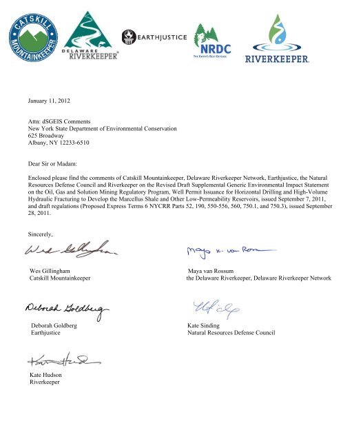
January 11, 2012<br />
Attn: dSGEIS Comments<br />
New York State Department of Environmental Conservation<br />
625 Broadway<br />
Albany, NY 12233-6510<br />
Dear Sir or Madam:<br />
Enclosed please find the <strong>comments</strong> of Catskill Mountainkeeper, Delaware Riverkeeper Network, Earthjustice, the <strong>Natural</strong><br />
Resources Defense Council and Riverkeeper on the Revised Draft Supplemental Generic Environmental Impact Statement<br />
on the Oil, Gas and Solution Mining Regulatory Program, Well Permit Issuance for Horizontal Drilling and High-Volume<br />
Hydraulic Fracturing to Develop the Marcellus Shale and Other Low-Permeability Reservoirs, issued September 7, 2011,<br />
and draft regulations (Proposed Express Terms 6 NYCRR Parts 52, 190, 550-556, 560, 750.1, and 750.3), issued September<br />
28, 2011.<br />
Sincerely,<br />
Wes Gillingham Maya van Rossum<br />
Catskill Mountainkeeper the Delaware Riverkeeper, Delaware Riverkeeper Network<br />
Deborah Goldberg Kate Sinding<br />
Earthjustice <strong>Natural</strong> Resources Defense Council<br />
Kate Hudson<br />
Riverkeeper
THE Louis Berger Group, INC.<br />
48 Wall Street, 16th Floor, New York, NY 10005<br />
Tel 212 612 7900 Fax 212 363 4341<br />
www.louisberger.com<br />
Memorandum<br />
TO: Kate Sinding, <strong>Natural</strong> Resources Defense Council<br />
FROM: Niek Veraart, Louis Berger Group<br />
DATE: January 11, 2012<br />
RE: Technical Comments Summary Report: Expert Team Review of the 2011 Revised Draft<br />
SGEIS on the Oil, Gas and Solution Mining Regulatory Program and Proposed High-Volume<br />
Hydraulic Fracturing Regulations<br />
1.0 Introduction<br />
The Louis Berger Group, Inc. (LBG) is pleased to submit this comment report on the 2011 Revised<br />
Draft Supplemental Generic Environmental Impact Statement (RDSGEIS) on the Oil, Gas and<br />
Solution Mining Regulatory Program and Proposed High Volume Hydraulic Fracturing (HVHF)<br />
Regulations to the <strong>Natural</strong> Resources Defense Council (<strong>NRDC</strong>) and its partner organizations,<br />
Earthjustice, Riverkeeper, Delaware Riverkeeper Network and Catskill Mountainkeeper. This<br />
comment report serves two primary purposes: 1) to provide general <strong>comments</strong> on the RDSGEIS and<br />
proposed regulations that are not limited to specific disciplines, and 2) to summarize the disciplinespecific<br />
<strong>technical</strong> <strong>comments</strong> from <strong>NRDC</strong>’s expert review team. The expert review team consisted of<br />
Harvey Consulting, LLC, Dr. Tom Myers, Dr. Glenn Miller, Dr. Ralph Seiler, Dr. Susan<br />
Christopherson, Meliora Design LLC, LBG, Kevin Heatley, Dr. Kim Knowlton, Dr. Gina Solomon, and<br />
Briana Mordick. The <strong>detailed</strong> <strong>technical</strong> <strong>comments</strong> from each author/organization are provided as<br />
attachments to this summary report and referenced as appropriate throughout. 1 Table 1 provides a<br />
complete list of <strong>technical</strong> comment attachments and summarizes the major topics areas addressed<br />
in each. Resumes for the members of the expert review team are provided in Attachment 12.<br />
2.0 General Comments<br />
2.1 RDSGEIS Fails to Address “Other Low-Permeability Shales”<br />
The final scope and title of the RDSGEIS included other low-permeability shales, in addition to the<br />
Marcellus shale. The RDSGEIS makes it clear that development of other shales (including the Utica<br />
shale) is not only possible in the future, but is considered likely as evidenced by the inclusion of<br />
development of other shales in the Ecology & Environment. Inc. economic impact assessment. 2<br />
1 All references cited and relied upon in the attached reports are hereby incorporated by reference into these<br />
<strong>comments</strong>. Hard and/or electronic copies of all references are available upon request.<br />
2 See the 11/23/2011 email from Steven Russo (NYSDEC) to Deborah Goldberg (Earthjustice) explaining the<br />
assumptions used in developing the scenarios for economic impact assessment include the development of<br />
“other shales.”<br />
1
Table 1<br />
Technical Attachments to the Summary Comment Report<br />
Attachment Number Preparer Topics Addressed<br />
1<br />
Harvey Consulting,<br />
LLC<br />
2 Tom Myers, Ph. D.<br />
3 Glenn Miller, Ph.D.<br />
4 Ralph Seiler, Ph.D.<br />
5<br />
Susan<br />
Christopherson, Ph.D.<br />
6 Meliora Design, LLC<br />
7<br />
The Louis Berger<br />
Group, Inc.<br />
Scope of SGEIS - Marcellus Shale Only<br />
Liquid Hydrocarbon Impacts<br />
Water Protection Threshold<br />
Well Casing Requirements<br />
Permanent Wellbore Plugging &Abandonment Requirements<br />
HVHF Design and Monitoring<br />
Hydraulic Fracture Treatment Additive Limitations<br />
Drilling Mud Composition and Disposal<br />
Reserve Pit Use and Drill Cutting Disposal<br />
HVHF Flowback Surface Impoundments at Drillsite<br />
HVHF Flowback Centralized Surface Impoundments Off-Drillsite<br />
Repeat HVHF Treatment Life Cycle<br />
Air Pollution Control and Monitoring<br />
Surface Setbacks from Sensitive Receptors<br />
<strong>Natural</strong>ly Occurring Radioactive Materials<br />
Hydrogen Sulfide<br />
Chemical Tank, Waste Tank and Fuel Tank Containment<br />
Corrosion and Erosion Mitigation and Integrity Monitoring Programs<br />
Well Control and Emergency Response Capability<br />
Financial Assurance Amount<br />
Seismic Data Collection<br />
Hydrogeology and Contaminant Transport<br />
Surface Water Hydrology<br />
Groundwater Quality Monitoring<br />
Setbacks from aquifers and public water supply wells<br />
Acid Rock Drainage<br />
Toxicology<br />
Hydraulic Fracturing Additives<br />
<strong>Natural</strong>ly Occurring Radioactive Materials<br />
Contaminants in Flowback water and produced brines<br />
Wastewater Treatment issues<br />
Radon in Marcellus Shale <strong>Natural</strong> Gas<br />
<strong>Natural</strong>ly Occurring Radioactive Materials<br />
Socioeconomic Impacts<br />
Pace and timing of natural gas development<br />
Water Quality<br />
Stormwater<br />
Erosion<br />
SPDES General Permit<br />
Noise and Vibration<br />
Visual impacts<br />
Land use<br />
Transportation<br />
Community character<br />
Cultural resources<br />
Aquatic Ecology<br />
8 3<br />
Kevin Heatley,<br />
M.EPC LEED AP<br />
Ecosystems and Wildlife<br />
9 Kim Knowlton, DrPH Climate Change and Public Health<br />
10<br />
Gina Solomon, M.D.,<br />
M.P.H<br />
Health Impact Assessment<br />
11 Briana Mordick Induced Seismicity<br />
3 Report prepared for and provided courtesy of the Delaware Riverkeeper Network.<br />
2
The RDSGEIS adds some additional baseline geologic information on the Utica shale, but the<br />
environmental impacts specific to the Utica shale have not been addressed. For example, the Utica<br />
shale is almost twice as deep as the Marcellus shale, which means wells in the Utica shale will take<br />
longer to drill, would create more noise, would require more water, and would generate more waste<br />
and truck trips than wells in the Marcellus shale.<br />
In addition to the incomplete study of deeper depth low permeability gas reservoirs, gas reservoirs at<br />
shallower depths than the Marcellus shale were not studied at all in the RDSGEIS. These shallower<br />
low-permeability shales pose development risks greater than those associated with the Marcellus<br />
shale because they are closer to protected water resources. Furthermore, the combined and/or<br />
concurrent exploitation of low-permeability shales at multiple depths may result in cumulative<br />
impacts not addressed in the RDSGEIS. The absence of the impact analyses of exploitation of<br />
shales at depths other than the Marcellus shale renders the RDSGEIS incomplete. NYSDEC should<br />
either evaluate additional information and analysis on the impacts of exploring and developing the<br />
Utica Shale and other unnamed low-permeability gas reservoirs, or acknowledge that there is<br />
insufficient information and analysis to study the impacts of this development. In the latter case, the<br />
RDSGEIS should conclude that its examination of impacts and mitigation measures is limited to the<br />
Marcellus Shale Gas Reservoir, and therefore any Utica Shale or other unnamed low-permeability<br />
gas reservoir development will warrant a site-specific supplemental environmental impact statement<br />
review or should be covered under another, future SGEIS process.<br />
For additional <strong>detailed</strong> information supporting this comment, refer to Chapter 2 of the 2011 Harvey<br />
Consulting, LLC report (Attachment 1).<br />
2.2 RDSGEIS and Regulations Fail to Protect the Environment from<br />
Non-HVHF Gas Development<br />
While significant gaps remain as identified throughout these <strong>comments</strong>, the proposed regulatory<br />
framework for HVHF includes a number of improvements to NYSDEC’s existing regulations to<br />
protect the environment from natural gas development. However, most of these improvements apply<br />
only to wells meeting the threshold to be classified as HVHF (defined as hydraulic fracturing using<br />
greater than 300,000 gallons of water). 4 NYSDEC is using a patchwork approach to regulating<br />
HVHF by adding new requirements on top of outdated requirements. A broader reform of the oil and<br />
gas development regulations is needed to address deficiencies in the existing regulations. This will<br />
ensure that best practice approaches are required for all natural gas wells in New York, including<br />
conventional wells and hydraulic fracturing using less than 300,000 gallons of water. Examples of<br />
reforms incorporated into the RDSGEIS and/or proposed regulations for HVHF that should apply to<br />
all wells include updated well casing requirements, emergency response plans and plans addressing<br />
the mitigation of noise, visual, transportation and ecological impacts.<br />
2.3 RDSGEIS Fails to Address Indirect and Cumulative Impacts<br />
The RDSGEIS fails to analyze important indirect and cumulative impacts as required by the State<br />
Environmental Quality Review Act (SEQRA). One of the most glaring examples of this is the<br />
4 The RDSGEIS arbitrarily increased the threshold for HVHF to 300,000 gal from 80,000 gal, as evaluated in<br />
the 1992 GEIS. There is no scientific justification given for the increase, and it effectively leaves all fracturing<br />
in the range 80,000-300,000 regulated by the existing rules without NYSDEC ever having conducted an<br />
environmental review showing that they are adequate for jobs that big.<br />
3
RDSGEIS’s failure to analyze the impacts of the pipelines and compressor stations that would be<br />
required to support the development of HVHF.<br />
The RDSGEIS does not analyze any of the important impacts of pipelines and compressor stations<br />
(such as additional habitat fragmentation, noise and air pollutant emissions) based on flawed<br />
reasoning that such an analysis is not required because the pipelines would be reviewed under the<br />
Public Service Commission’s Article VII process. The regulatory review process for pipelines is<br />
irrelevant—SEQRA requires state and local agencies to consider indirect “growth inducing” impacts.<br />
Pipelines and compressor stations are an indirect effect of the approval of HVHF. Without the<br />
approval of HVHF, there would be no reason to construct additional pipelines. Therefore, the<br />
pipelines/compressor stations and associated impacts cannot be separated from the environmental<br />
impact analysis of the HVHF regulatory program. The separate environmental review of the<br />
pipelines is, moreover, a form of segmentation, which is not permissible under SEQRA. 5 The<br />
additional natural gas pipelines and related infrastructure could also result in cumulative impacts<br />
when their impacts are combined with the impacts of HVHF that were analyzed in the RDSGEIS.<br />
The result of these deficiencies in the RDSGEIS is that the true impacts of the approval of HVHF<br />
have not been disclosed to the public and the requisite “hard look” under SEQRA has not been<br />
taken.<br />
Similar to the treatment of pipeline infrastructure, the RDSGEIS also fails to analyze the cumulative<br />
impacts of numerous actions related to HVHF moving forward in New York, including the following:<br />
• Impacts from wastewater disposal and management. The wastewater produced during<br />
the HVHF process is highly contaminated and could impact water resources if released into<br />
groundwater or surface water. While recognizing the problems with management of this<br />
water, the RDSGEIS fails to clearly state how this water will be either disposed in a manner<br />
that protects human health and the environment, or otherwise treated to remove the<br />
contaminants. While the RDSGEIS provides a range of alternatives, the RDSGEIS does not<br />
analyze the environmental or human health impacts associated with any of these disposal<br />
options. There are four possible treatment options for flowback and produced water<br />
discussed in the RDSGEIS: (1) reuse, (2) deep well injection, or (3) treatment in municipal or<br />
privately owned treatment facilities. None of these options is properly analyzed in the<br />
RDSGEIS, and the potential significant adverse impacts of each are therefore not disclosed<br />
nor possible mitigation identified. Further, effectively none of these options is likely to be<br />
accomplished in state, and the RDSGEIS implies that virtually all of the wastewater<br />
generated in New York will be managed out of state where regulations may be less stringent.<br />
• Impacts from Centralized Flowback Impoundments. The RDSGEIS fails to analyze the<br />
impacts of centralized flowback impoundments based on statements from industry that they<br />
will not be “routinely” proposed. While site-specific SEQRA review would be required for any<br />
centralized flowback impoundment, NYSDEC should have addressed the potential for<br />
significant adverse cumulative impacts (particular air quality and water resources) arising<br />
from centralized flowback impoundments in combination with the other impacts of HVHF<br />
discussed in the RDSGEIS.<br />
• Impacts from seismic data collection. Seismic data collection has the potential to create<br />
5 See 6 § NYCRR (617.2(ag)): “Segmentation means the division of the environmental review of an action<br />
such that various activities or stages are addressed under this Part as though they were independent,<br />
unrelated activities, needing individual determinations of significance.”<br />
4
habitat fragmentation through the clearing of long linear corridors, among other impacts.<br />
Seismic data collection is a reasonably foreseeable part of the development process and<br />
should have been considered as an aspect of the cumulative effects assessment in the<br />
RDSGEIS.<br />
• Impacts from liquid petroleum. The development of the Marcellus shale has the potential<br />
to result in wells the encounter liquid hydrocarbons. If liquid hydrocarbons are found while<br />
drilling a shale gas well, additional wells and drill sites may be proposed to develop those oil<br />
resources. Liquid hydrocarbons found during natural gas exploration have the potential to<br />
contaminate the environment through spills and well blowouts. None of these impacts were<br />
considered in the RDSGEIS.<br />
• Impacts from land use change. The RDSGEIS contains some information about potential<br />
economic benefits, but does not examine how increase population and employment would<br />
change land use. Changes in land use would result in greater demands on the transportation<br />
system as well as ecological impacts from new residential and commercial development<br />
(above and beyond the direct impacts of the well pad sites themselves).<br />
Fundamentally, the RDSGEIS analyzes only certain elements of HVHF and fails to analyze all<br />
elements of the process, both individually and collectively.<br />
2.4 Unenforceable Mitigation under the HVHF Regulatory Framework<br />
As noted throughout the <strong>detailed</strong> <strong>technical</strong> review <strong>comments</strong>, the RDSGEIS includes numerous<br />
mitigation commitments that are not enforceable because they are not included in the proposed<br />
regulations or supplemental permit conditions.<br />
To provide a consistent regulatory framework for industry and to protect the environment, mitigation<br />
measures that would be applied across all HVHF operations should be incorporated into the<br />
proposed regulations. Mitigation measures that are site-specific should be incorporated into the<br />
supplemental permit conditions. Mitigation measures that are suggested in the RDSGEIS itself that<br />
are unenforceable (i.e., not codified through regulatory or other mechanisms) should be<br />
acknowledged as such and reduced efficacy of mitigation due to the lack of enforcement should be<br />
analyzed and disclosed.<br />
2.5 Setbacks<br />
As a general matter, the setback requirements stipulated by proposed HVHF regulations are<br />
inadequate to protect public health and environmental quality. Table 2 provides a summary of the<br />
setbacks proposed in the RDSGEIS and/or regulations and the recommended revisions to the<br />
setbacks based on the expert reviews conducted for <strong>NRDC</strong>.<br />
For example, the minimum setback according to the HVHF regulatory framework for a residence is<br />
100-feet. This is inadequate considering the potential for blowouts to eject drilling mud,<br />
hydrocarbons, and/or formation water from a well onto adjacent waters and lands. Depending on<br />
reservoir pressure, blowout circumstances, and wind speed, these pollutants can be distributed<br />
hundreds to thousands of feet away from a well. Other risks to residences and schools within close<br />
proximity to HVHF operations include noise levels that damage hearing and, exposure to hazardous<br />
gases, chemicals, fuels, and explosive charges.<br />
5
The potential radius of impact for explosions, fire, and other industrial hazards should be considered<br />
in the RDSGEIS and proposed HVHF regulations. For example, Fort Worth Texas uses the<br />
International Fire Code as the basis for its minimum 600’ setback from shale gas drilling operations.<br />
The figure below shows how the HVHF regulations setback distance requirements are significantly<br />
shorter and thus less protective than the requirements in other locations.<br />
Comparison of NYS Setbacks from Homes and Public Buildings to Fort Worth, Texas Setbacks<br />
Approximately 400’<br />
Photo 5.7 from SGEIS<br />
Annotated by HCLLC<br />
Distances shown by arrows drawn to scale<br />
100’<br />
150’<br />
2.6 Insufficient Public Review of HVHF Permit Applications<br />
The RDSGEIS fails to provide a clear and accessible process for public and local government<br />
access to site-specific HVHF activity information, while at the same time placing the burden on local<br />
government (and not the industry) to provide notice to NYSDEC that a HVHF activity may not be in<br />
compliance with local zoning or land use regulations (RDSGEIS pages 8-4 and 8-5). This essentially<br />
puts the regulatory burden on local government and at the same time fails to provide local<br />
government with access to the necessary information. The burden of demonstrating compliance with<br />
local government land use requirements should fall on the industry, not local government and the<br />
public. NYSDEC should require public notice of the availability of HVHF permit applications locally<br />
through publication of a notice in a newspaper of general circulation and statewide through a<br />
centralized website. Permit applicants should be required to provide copies of their application to the<br />
affected municipality. The public should have immediate online access to all supporting<br />
documentation submitted with each permit application and the public review timeframe should be no<br />
less than 30 days. The regulatory framework must incorporate a mechanism for public <strong>comments</strong> on<br />
permit applications to be considered by NYSDEC before the decision to grant or reject a permit<br />
application is made.<br />
6<br />
NYS Home<br />
200’ PA Home<br />
200’<br />
NYS Public<br />
Building<br />
300’<br />
PA Public Building<br />
Texas Public Building<br />
600’<br />
600’<br />
Texas<br />
Home<br />
Texas<br />
School
Residences<br />
Public Buildings<br />
(including<br />
schools)<br />
Primary Aquifers<br />
Principal Aquifers<br />
Public Water<br />
Supplies<br />
Private Drinking<br />
Water Wells<br />
Stream, Storm<br />
Drain, Lake, or<br />
Pond<br />
Filtration<br />
Avoidance<br />
Determination<br />
Watersheds<br />
Floodplains<br />
Minimum Setback under<br />
Existing/Proposed<br />
HVHF Regulatory<br />
Framework<br />
100 feet<br />
6 NYCRR § 553.2<br />
150 feet<br />
6 NYCRR § 553.2<br />
500 feet<br />
6 NYCRR § 560.4<br />
500 feet in RDSGEIS<br />
(page 1-18) but not in the<br />
proposed regulations**<br />
2,000 feet<br />
(6 NYCRR § 560.4)<br />
500 feet*<br />
(6 NYCRR § 560.4)<br />
Table 2<br />
Summary of Setback Recommendations<br />
Recommended<br />
Minimum<br />
Setback<br />
1,320 feet<br />
4,000 feet<br />
4,000 feet<br />
4,000 feet<br />
4,000 feet<br />
150 feet** 660 feet<br />
4,000 feet in RDSGEIS<br />
(page 7-56) but not in the<br />
proposed regulations<br />
Wellpads prohibited in the<br />
100-year floodplain<br />
(6 NYCRR § 560.4)<br />
4,000 feet<br />
Wellpads<br />
prohibited in the<br />
500-year<br />
floodplain<br />
7<br />
Rationale/Notes<br />
Protects from noise, explosions, fire, and other industrial<br />
hazards.<br />
The 500 feet setback for primary aquifers should be<br />
increased to 4,000 feet (the same setback distance<br />
adopted in the RDSGEIS for Filtration Avoidance<br />
Determination watersheds), unless a site specific analysis<br />
demonstrates there are no fractures connecting the<br />
bedrock with the aquifer and there are no obvious surface<br />
water pathways.<br />
The only difference between a primary and principal<br />
aquifer is the number of people potentially using the<br />
aquifer. Principal aquifers are thought to be productive<br />
enough to be an important source and contamination with<br />
fracking fluid or flowback could render them unusable<br />
without substantial remediation. Wells near principal<br />
aquifers should be subject to the same setback as well<br />
near a primary aquifer.<br />
The setback for public water supplies should be the same<br />
as for principal aquifers (4,000 feet) and the operator<br />
should identify the capture zone for flow to the well and<br />
identify the five year transport distance contour.<br />
Private and public wells should be protected to the same<br />
extent. NYSDEC should not allow the owner to waive the<br />
private well setback requirement because health and<br />
safety are at risk. More than just the “owner” may use the<br />
source, and the owner could sell to someone who does<br />
not understand the situation.<br />
The regulations currently contain conflicting and unclear<br />
requirements with respect to surface water resource<br />
setbacks. The regulations should be revised provide<br />
consistent setback requirements that are protective of<br />
water sources, including rivers, streams (perennial and<br />
intermittent), and lakes.<br />
Incorporate RDSGEIS setback commitment into<br />
regulations. In addition, the operator should be required to<br />
analyze the local geology to determine whether the<br />
groundwater divide would allow transport into the FAD<br />
watershed.<br />
For wells that might operate for 30 years, there is a 26%<br />
chance of a 100‐year flood occurring during the period the<br />
well would be operated. Wells should be prohibited within<br />
at least the 500 year return interval floodplain, because the<br />
damages from significant flooding could be very<br />
substantial.<br />
*Setback can be waived by the landowner. The proposed regulations do not address setbacks for domestic<br />
use springs<br />
** Setback could be waived based on site-specific analysis.
2.7 Impacts of Well Refracture Not Addressed<br />
The assessments of environmental impacts in the RDSGEIS are all based on a single hydraulic<br />
fracturing treatment of each well. The RDSGEIS inappropriately relies on informal statements from<br />
industry that refracturing will be rare and does not quantify the number of HVHF treatments possible<br />
per well. The RDSGEIS under-predicts both the peak and cumulative impacts by not examining the<br />
reasonably foreseeable likelihood that Marcellus, Utica, and other low-permeability shale reservoirs<br />
will require more than one HVHF treatment, most likely two or three, over a several-decade long<br />
lifecycle. The RDSGEIS should quantify how many times a well may be fracture treated over its life,<br />
and provide a worst case scenario for water use and waste disposal requirements based on this<br />
scenario. Additionally, the RDSGEIS should examine the peak and cumulative impacts of multiple<br />
HVHF treatments over a well’s life and propose mitigation to offset those reasonably foreseeable<br />
impacts. Refer to Chapter 16 of the Harvey Consulting, LLC report (Attachment 1) for more<br />
information supporting this comment.<br />
3.0 Summary of Technical Comments<br />
3.1 Liquid Petroleum Impacts<br />
The RDSGEIS describes natural gas exploration and production, but does not address the potential<br />
for shale gas wells to also encounter liquid hydrocarbons. <strong>Natural</strong> gas exploration can identify oil<br />
and condensate development opportunities. If liquid hydrocarbons are found while drilling a shale<br />
gas well, additional wells and drill sites may be needed to develop those oil resources. Liquid<br />
hydrocarbons found during natural gas exploration have the potential to contaminate the<br />
environment through spills and well blowouts. The risk of oil spills during shale gas exploration has<br />
not been analyzed in the RDSGEIS. While blowouts are infrequent, they do occur, and are a<br />
reasonably foreseeable consequence of exploratory drilling operations. Blowouts can occur from gas<br />
and/or oil wells. They can last for days, weeks, or months until well control is achieved. On average,<br />
a blowout occurs in 7 out of every 1,000 onshore exploration wells. Two recent gas well blowouts<br />
occurred in Pennsylvania due to Marcellus Shale drilling.<br />
The RDSGEIS should examine the potential for shale gas wells to also encounter liquid<br />
hydrocarbons. The RDSGEIS should also examine the incremental risks of oil well blowouts and oil<br />
spills, as well as the impacts from the additional wells and drill sites that may be required to develop<br />
oil resources identified by shale gas exploration and production activities.<br />
The <strong>comments</strong> summarized in this section are covered in greater detail in Chapter 3 of the Harvey<br />
Consulting, LLC report (Attachment 1).<br />
3.2 Well Casing Requirements<br />
The <strong>comments</strong> summarized in this section are covered in greater detail in Chapters 5 through 8 of<br />
the Harvey Consulting, LLC report (Attachment 1).<br />
3.2.1 Conductor Casing<br />
Conductor casing is the first string of casing in a well and is installed to prevent the top of the well<br />
from caving in. The conductor casing requirements listed in the Proposed Supplementary Permit<br />
Conditions for HVHF and Existing Fresh Water Supplementary Permit Conditions Required for Wells<br />
Drilled in Primary and Principal Aquifers should be codified in the proposed regulations and should<br />
8
apply to all natural gas wells drilled in NYS, not just HVHF wells. Additionally, NYSDEC should set a<br />
conductor casing depth criterion, requiring conductor casing be set to a sufficient depth to provide a<br />
solid structural anchorage. Regulations should specify that conductor casing design be based on<br />
site-specific engineering and geologic factors.<br />
3.2.2 Surface Casing<br />
Surface casing plays a very important role in protecting groundwater aquifers, providing the structure<br />
to support blowout prevention equipment, and providing a conduit for drilling fluids while drilling the<br />
next section of the well. Stray gas may impact groundwater and surface water from poor well<br />
construction practices. Properly constructed and operated gas wells are critical to mitigating stray<br />
gas and thereby protecting water supplies and public safety. If a well is not properly cased and<br />
cemented, natural gas in subsurface formations may migrate from the wellbore through bedrock and<br />
soil. Stray gas may adversely affect water supplies, accumulate in or adjacent to structures such as<br />
residences and water wells, and has the potential to cause a fire or explosion. Instances of<br />
improperly constructed wellbores leading to the contamination of drinking water with natural gas are<br />
well documented in Pennsylvania and other locations.<br />
The RDSGEIS and proposed regulations include important improvements for surface casing that<br />
incorporate many of the <strong>comments</strong> provided by this working group in 2009. Notable improvements<br />
include requirements related to cement quality, casing quality, and installation techniques.<br />
Unfortunately, there are a number of inconsistencies between the permit conditions and the<br />
proposed regulations that create uncertainty about what will be required. The Harvey Consulting,<br />
LLC report provides recommendations for correcting these inconsistencies. Finally, there are a<br />
number of new surface casing requirements proposed for HVHF wells that are standard industry<br />
best practices for all oil and gas wells. These requirements should be included in 6 NYCRR Part 554<br />
(drilling practices for all oil and gas wells), and not just contained in 6 NYCRR Part 560 (drilling<br />
practices for HVHF wells).<br />
3.2.3 Intermediate Casing<br />
Intermediate casing provides a transition from the surface casing to the production casing. This<br />
casing may be required to seal off anomalous pressure zones, lost circulation zones, and other<br />
drilling hazards. The RDSGEIS and proposed regulations include important improvements for<br />
intermediate casing in comparison to the 2009 DSGEIS. Overall, NYSDEC’s intermediate casing<br />
requirements for HVHF wells are robust. However, the remaining area for improvement in the<br />
proposed regulations is to establish intermediate casing and cementing standards for all wells that<br />
will not undergo HVHF treatment, but will require the installation of intermediate casing, on which the<br />
proposed regulations are silent. There are also a number of new intermediate casing requirements<br />
proposed for HVHF wells that are standard industry best practices for all oil and gas wells. Those<br />
requirements should be included in 6 NYCRR Part 554 (drilling practices for all oil and gas wells),<br />
and not just covered in the new 6 NYCRR Part 560 (drilling practices for HVHF wells).<br />
3.2.4 Production Casing<br />
Production casing is the last string of casing set in the well. It is called “production casing” because it<br />
is set across the hydrocarbon-producing zone or, alternatively, it is set just above the hydrocarbon<br />
zone. Production casing is used to isolate hydrocarbon zones and to contain formation pressure.<br />
Production casing pipe and cement integrity is very important, because it is the piping/cement barrier<br />
9
that is exposed to fracture pressure, acid stimulation treatments, and other workover/stimulation<br />
methods used to increase hydrocarbon production.<br />
The RDSGEIS and proposed regulations include substantial improvements for production casing.<br />
NYSDEC’s proposed production casing requirements for HVHF wells are robust. The most notable<br />
improvement to the proposed regulations is that production casing must be set from the well surface<br />
through the production zone. This provides an additional protective layer of casing and cementing in<br />
the well during HVHF treatments. The RDSGEIS and proposed regulations require production<br />
casing to be fully cemented, if intermediate casing is not set. If intermediate casing is set, it requires<br />
production casing be tied into the intermediate casing. The proposed regulations also require the<br />
cement placement and bond be verified by well logging tools. These requirements are best practice.<br />
The Harvey Consulting, LLC report provides minor additional recommendations to improve<br />
consistency of the various requirements for production casing and highlights additional best<br />
practices that should be considered.<br />
3.3 HVHF Design and Monitoring<br />
Computer modeling is routinely used by industry to design hydraulic fracture treatments. During<br />
actual fracture stimulation treatments, data is collected to verify model accuracy, and the model is<br />
continually refined to improve its predictive capability. Data collected during drilling, well logging,<br />
coring, and other geophysical activities and HVHF implementation can be used to continuously<br />
improve the model quality and predictive capability. HVHF modeling is an important way of helping<br />
to ensure fracture treatments do not extend outside the target formation. Fracture treatments that<br />
propagate outside the shale zone (fracturing out-of-zone) reduce gas recovery and risk pollutant<br />
transport.<br />
The RDSGEIS does not require well operators to develop or maintain a hydraulic fracture model.<br />
Instead, the RDSGEIS only requires the operator to abide by a 1000’ vertical offset from protected<br />
aquifers and collect data during the HVHF job to evaluate whether the job was implemented as<br />
planned. Knowing whether a job was implemented as planned is only helpful if the initial design is<br />
protective of human health and environment. If the job is poorly planned, and is implemented as<br />
planned, that only proves that a poor job was actually implemented. Instead, NYSDEC needs to first<br />
verify that the operator has engineered a HVHF treatment that is protective of human health and the<br />
environment, and then, second, verify that the job was implemented to that protective standard. A<br />
rigorous engineering analysis is a critical design step. Proper design and monitoring of HVHF jobs is<br />
not only best practice from an environmental and human health perspective; it is also good business<br />
because it optimizes gas production and reduces hydraulic fracture treatment cost. Best practices<br />
for HVHF design and monitoring should be included as a mitigation measure, and codified in<br />
regulations as a minimum standard. These best practices include utilizing hydraulic fracture<br />
modeling prior to each fracture treatment to ensure that the fracture is contained in zone.<br />
The <strong>comments</strong> summarized in this section are covered in greater detail in Chapter 10 of the Harvey<br />
Consulting, LLC report (Attachment 1).<br />
3.4 Corrosion and Erosion Mitigation and Integrity Monitoring<br />
Programs<br />
Downhole tubing and casing, surface pipelines, pressure vessels, and storage tanks used in gas<br />
exploration and production can be subject to internal and external corrosion. Corrosion can be<br />
caused by water, corrosive soils, oxygen, corrosive fluids used to treat wells, and the carbon dioxide<br />
10
(CO2) and hydrogen sulfide (H2S) present in gas. High velocity gas contaminated with water and<br />
sediment can internally erode pipes, fittings, and valves. HVHF treatments, if improperly designed,<br />
can accelerate well corrosion. Additionally, acids used to stimulate well production and remove scale<br />
can be corrosive. The RDSGEIS includes a discussion on corrosion inhibitors used by industry in<br />
fracture treatments, but does not require them as best practice. Furthermore, the RDSGEIS does<br />
not require that facilities be designed to resist corrosion (e.g., material selection and coatings), nor<br />
does it require corrosion monitoring, or the repair and replacement of corroded equipment. Best<br />
corrosion and erosion mitigation practices and long-term well integrity monitoring should be<br />
evaluated and codified in regulations. Operators should be required to design equipment to prevent<br />
corrosion and erosion. Corrosion and erosion monitoring, repair, and replacement programs should<br />
be instituted.<br />
The <strong>comments</strong> summarized in this section are covered in greater detail in Chapter 23 of the Harvey<br />
Consulting, LLC report (Attachment 1).<br />
3.5 Well Control & Emergency Response Capability<br />
Industrial fires, explosions, blowouts, and spills require specialized emergency response equipment,<br />
which may not be available at local fire and emergency services departments. For example, local fire<br />
and emergency services departments typically do not have well capping and control systems. The<br />
addition of an Emergency Response Plan (ERP) requirement to the RDSGEIS is a substantial<br />
improvement over the 2009 DSGEIS, which failed to address this issue. However, it is<br />
recommended that NYSDEC include a review, approval, and audit processes to ensure that quality<br />
ERPs are developed. Objectives of the ERP should include adequately trained and qualified<br />
personnel, and the availability of adequate equipment. If local emergency response resources are<br />
relied on in the ERP, operators should ensure they are trained, qualified, and equipped to respond to<br />
an industrial accident. Additionally, NYSDEC should have a program to audit ERPs via drills,<br />
exercises, equipment inspections, and personnel training audits.<br />
The <strong>comments</strong> summarized in this section are covered in greater detail in Chapter 24 the Harvey<br />
Consulting, LLC report (Attachment 1).<br />
3.6 Financial Assurance Amount<br />
NYSDEC ignored <strong>comments</strong> submitted by this working group in 2009 requesting that the SGEIS<br />
examine financial assurance requirements to ensure there is funding available to properly plug and<br />
abandon wells; remove equipment and contamination; complete surface restoration; and provide<br />
adequate insurance to compensate nearby public for adverse impacts (e.g., well contamination).<br />
Although changes in financial assurance amounts would require legislative action, the analysis of<br />
this issue is necessary to fully disclose the potential adverse environmental impacts that would result<br />
in the absence of adequate financial assurances. Moreover, such an analysis would be an<br />
appropriate way of bringing this need for legislation to the attention of elected officials as appropriate<br />
mitigation for identified significant adverse impacts.<br />
The importance of reevaluating financial assurance requirements is heightened when the<br />
inadequacy of the existing requirements is considered. For wells between 2,500’ and 6,000’ in<br />
depth, NYSDEC requires only $5,000 financial security per well, with the overall total per operator<br />
not to exceed $150,000. For wells drilled more than 6,000’ deep, NYSDEC is proposing a regulatory<br />
revision that requires the operator to provide financial security in an amount based solely on the<br />
anticipated cost for plugging and abandoning the well (6 NYCRR § 551.6). These requirements are<br />
11
far less than those in other locations. Fort Worth, Texas requires an operator drilling 1-5 wells to<br />
provide a blanket bond or letter of credit of at least $150,000, with incremental increases of $50,000<br />
for each additional well. Therefore, under Fort Worth, Texas requirements, an operator drilling 100<br />
wells would be required to hold a bond of $4,900,000, as compared to $150,000 in NYS. In Ohio, an<br />
operator is required to obtain liability insurance coverage of at least $1,000,000 and up to<br />
$3,000,000 for wells in urban areas.<br />
NYSDEC’s financial assurance requirements should not narrowly focus on the costs of plugging and<br />
abandoning a well. Instead, NYSDEC’s financial assurance requirements should include a<br />
combination of bonding and insurance that addresses the costs and risks of long-term monitoring;<br />
publicly incurred response and cleanup operations; site remediation and well abandonment; and<br />
adequate compensation to the public for adverse impacts (e.g., water well contamination). It is<br />
recommended that each operator provide a bond of at least $100,000 per well, with a cap of<br />
$5,000,000 for each operator. Additionally, NYSDEC should require Commercial General Liability<br />
Insurance, including Excess Insurance, Environmental Pollution Liability Coverage, and a Well<br />
Control Policy, of at least $5,000,000. If NYSDEC deviates from these financial assurance<br />
requirements, it should be justified with a rigorous economic assessment that is provided to the<br />
public for review and comment. Recommendations for financial assurance improvements for<br />
Marcellus Shale gas well drilling should be evaluated and included in the proposed regulations.<br />
The <strong>comments</strong> summarized in this section are covered in greater detail in Chapter 25 of the Harvey<br />
Consulting, LLC report (Attachment 1).<br />
3.7 Hydrogeology and Contaminant Transport<br />
The RDSGEIS dismisses the potential for groundwater contamination due to HVHF on the basis of<br />
faulty science and unsupported assumptions.<br />
1. The characterization of the hydraulic fracturing process and effects in the RDSGEIS is<br />
<strong>technical</strong>ly incorrect, leading to important impacts being overlooked.<br />
2. The RDSGEIS assumes that the geologic layers above the Marcellus shale will stop<br />
contamination of aquifers without providing sufficient information on these layers, and<br />
ignoring the potential for existing faults and fractures to expedite contaminant transport. It<br />
also ignores studies which show that hydraulic fracturing has fractured formations as much<br />
as 1500 feet above the target shale, thereby providing pathways through the rock which the<br />
RDSGEIS relies on for stopping contaminant transport.<br />
3. The RDSGEIS impact analyses are incomplete from a spatial perspective. The analyses<br />
focus on local impacts and fails to address the regional impacts of HVHF on the<br />
characteristics of the shale and the environmental implications of these changes. Such<br />
changes include increased shale permeability to water flow, which increases the risk of<br />
aquifer contamination over time.<br />
4. The RDSGEIS analyses are incomplete from a temporal perspective. The analyses do not<br />
address the potential long-term aquifer contamination impacts by focusing on a time period<br />
of few days, assuming contamination has not occurred in other locations that lack the<br />
monitoring that would be necessary to detect contamination, and not considering evidence of<br />
the potential vertical movement of fracking fluid to near-surface aquifers as discovered under<br />
comparable conditions elsewhere.<br />
12
Detailed <strong>technical</strong> supporting information for the deficiencies noted above is provided in the report<br />
prepared by Dr. Tom Myers (Attachment 2). The Myers report also provides a number of important<br />
recommendations for:<br />
1. Improving and expanding the characterization of the hydraulic fracturing process and impacts<br />
in the RDSGEIS; and<br />
2. Implementing measures as part of the review of specific well site proposals to avoid<br />
significant adverse aquifer contamination impacts.<br />
The measures should include the following:<br />
1. Mapping groundwater gradients above the Marcellus shale using existing data.<br />
2. Requiring seismic surveys to locate faults prior to drilling.<br />
3. Implementation of a long-term monitoring plan with wells established to monitor for long-term<br />
upward contaminant transport.<br />
The groundwater monitoring at domestic wells proposed in the RDSGEIS is a scientifically improper<br />
method of monitoring the location of a contaminant plume because domestic wells are not designed<br />
for monitoring. Dedicated monitoring wells are necessary to prevent contamination of water wells by<br />
detecting contaminants before they reach the water wells.<br />
3.8 Well Plugging and Abandonment<br />
Wells that are not properly plugged can act as a preferential pathway for surface contaminants to<br />
impact groundwater resources. There are 2,114 wells that are at least 47 years old and some more<br />
than 87 years old that still have not been properly abandoned in NYS, and 2,026 wells where the<br />
age and condition is unknown (and must be assumed improperly abandoned). As a result, there is a<br />
risk that improperly planned HVHF wells or fractures could intersect abandoned wells and<br />
contaminate groundwater. Key recommendations from Chapter 9 of the Harvey Consulting, LLC<br />
report (Attachment 1) related to well plugging and abandonment (P&A) include the following:<br />
• The SGEIS should examine: the number of improperly abandoned or orphaned wells in NYS<br />
requiring P&A in close proximity to drinking water sources or in close proximity to areas<br />
under consideration for HVHF treatments; whether a procedure needs to be put in place to<br />
examine the number, type, and condition of wells requiring P&A in close proximity to new<br />
shale gas development; and whether plugging improperly abandoned and orphaned wells<br />
should be required where such wells are in close proximity to new HVHF treatments.<br />
• The SGEIS should include maps showing the location and depths of improperly abandoned,<br />
orphaned wells in NYS. These maps should correlate the locations and depths to potential<br />
foreseeable shale gas development and examine the need to properly P&A these wells<br />
before shale gas development occurs nearby. The SGEIS should assess the risk of a HVHF<br />
well intersecting a well that is not accurately documented in NYSDEC’s Oil & Gas database<br />
and whether this poses and unmitigated significant impact to protected groundwater<br />
resources.<br />
• The SGEIS requirements with respect to the plugging of improperly abandoned wells nearby<br />
proposed HVHF wells should be strengthened and incorporated in the proposed regulations.<br />
13
3.9 Seismic Data Collection<br />
Seismic surveys are used by industry to target hydrocarbon formations for exploration and appraisal<br />
drilling. Typically seismic surveys are conducted using vehicle-mounted vibrator plates that impact<br />
the ground or use explosive to create seismic waves which bounce off of subsurface rock strata and<br />
geologic formations. The reflected seismic waves are measured at various surface receivers. The<br />
rate that seismic energy is transmitted and received through the earth crust provides information on<br />
the subsurface geology, because seismic waves reflect at different speeds and intensity off various<br />
rock strata and geologic structures. Seismic operations are very labor intensive and require large<br />
amounts of equipment, personnel and support systems. Depending on the size of the area under<br />
study, and the type of equipment selected, seismic operations can require dozens to hundreds of<br />
personnel. In addition to seismic exploration equipment, there is a need for housing, catering, waste<br />
management systems, water supplies, medical facilities, equipment maintenance and repair shops,<br />
and other logistical support functions.<br />
Significant surface impacts can be caused by extensive tree and vegetation removal to create<br />
straight “cutlines” to run seismic equipment (up to 20’-50’ wide). Lines need to be cut to run<br />
mechanical vibration equipment or set explosives to generate the seismic waves, and other seismic<br />
lines are cleared to set geophones to measure the seismic reflection.<br />
The RDSGEIS does not include any analysis of the potential impacts or mitigation needed for twodimensional<br />
(2D) or three-dimensional (3D) seismic surveys. If 2D or 3D seismic surveys are<br />
planned, or are possible in the future, the proposed HVHF regulations should codify a permitting<br />
process for these activities and institute mitigating measures in the RDSGEIS to minimize surface<br />
impacts and disruptions, and require rehabilitation of impacted areas. In addition, the increased<br />
industrial activity (e.g., economic impacts, noise, surface disturbance, wildlife impacts, etc.)<br />
associated with 2D and 3D seismic surveys should be examined in the RDSGEIS.<br />
The <strong>comments</strong> summarized in this section are covered in greater detail in Chapter 26 of the Harvey<br />
Consulting, LLC report (Attachment 1).<br />
3.10 Surface Water Hydrology<br />
The RDSGEIS has addressed many of the deficiencies of the 2009 DSGEIS with respect to the<br />
treatment of hydrology issues. As discussed in the Myers report (Attachment 2), NYSDEC proposes<br />
to use the natural flow regime method (NFRM) for all regions by means of permit conditions.<br />
However, NYSDEC should verify the accuracy for the proposed methods for estimating passby flows<br />
at ungauged sites. Since NFRM is proposed to be applied everywhere (and not just in a specific<br />
case which would justify its use as a permit condition), it would be more appropriate for NYSDEC to<br />
include the use of the NFRM as a requirement in the regulations themselves. The following changes<br />
should be accounted for in the regulatory framework regarding the avoidance or reduction of<br />
potential impacts resulting from water withdrawal:<br />
• NYSDEC should coordinate water withdrawals among operators so their withdrawals do not<br />
cumulatively cause flows to drop below the required passby flows at any point along the<br />
stream.<br />
• The operator should establish a temporary flow/stage relationship with at least a staff gage<br />
that should be monitored.<br />
• Passby flows should be maintained with consideration of the measurement error inherent in<br />
the technique. The operator should assume that the measurement method is overestimating<br />
14
flow and therefore maintain a flow greater than the passby flow by as much as the error<br />
estimate.<br />
3.11 Stormwater, Sedimentation and Erosion<br />
All of the <strong>comments</strong> summarized in this section are covered in greater detail in the Meliora Design,<br />
LLC report (Attachment 6).<br />
3.11.1 Cumulative Water Quality Impacts of Land Disturbance Are Not Addressed<br />
The RDSGEIS provides only a very brief generic discussion of the potential land disturbance and<br />
associated stormwater and water quality impacts on surface waters from HVHF (and well drilling in<br />
general). The RDSGEIS makes no attempt to evaluate the cumulative impacts of HVHF activity on<br />
water resources, at either the small (headwater stream) scale, or the larger watershed scale. Even<br />
very general cumulative estimates of land disturbance, and its associated water quality impacts, are<br />
not provided. Since the original draft of the GEIS nearly twenty years ago, the use of improved<br />
geographic information system (GIS) software and modeling tools has expanded the ability of<br />
scientists, engineers, and regulators to quantify the scale and impact of proposed activities on water<br />
resources. Such analysis has become standard industry practice for watershed planning and the<br />
development of TMDL (Total Daily Maximum Load) studies to determine the level of pollutant load<br />
(and required pollutant load reduction) to meet water quality standards. The RDSGEIS fails to<br />
provide any such analysis, and instead only acknowledges stormwater impacts on water quality in<br />
the most general and generic manner, with little industry specific consideration, and no consideration<br />
of total or cumulative impacts. A more <strong>detailed</strong> and comprehensive evaluation of the amount of<br />
anticipated land disturbance and associated water quality impacts is essential to a full environmental<br />
impact analysis, and to any determinations by NYSDEC on the appropriate regulatory permitting<br />
requirements.<br />
3.11.2 Stream Crossing Impacts Are Not Addressed<br />
The RDSGEIS fails to consider the potential surface water impacts of stream crossing activity<br />
associated with HVHF well pads, most notably, stream crossings associated with gathering lines and<br />
access roads (to both well pads and compressor stations). Stream crossings and the associated<br />
water quality impacts are not fully addressed in the RDSGEIS, and are specifically not included in<br />
the Draft State Pollutant Discharge Elimination System (SPDES) General Permit. It is unclear how<br />
many stream crossings may be anticipated, and of these, how many will essentially be unregulated<br />
under current NYSDEC regulations. It is unclear what the anticipated environmental impacts of<br />
these stream crossings will be on water quality and aquatic systems. NYSDEC should provide<br />
some estimate of the extent of anticipated stream crossings, potential water quality impacts, and<br />
proposed requirements to regulate and mitigate these impacts.<br />
3.11.3 Mitigation and SPDES General Permit Do Not Consider Existing Water Quality<br />
With the exception of watersheds that have received Filtration Avoidance Determinations, the<br />
RDSGEIS (and associated Draft SPDES HVHF General Permit) do not provide any specific<br />
consideration of whether different performance requirements or standards are necessary to protect<br />
water quality for higher quality watersheds, impaired streams, or areas of denser well pad<br />
development on a watershed basis. There is no documentation to support the adequacy of the<br />
proposed setbacks to protect water quality in all situations (i.e., higher quality streams, percent of<br />
land disturbance within a watershed, site specific conditions such as steep slopes), and the setbacks<br />
15
discussed in the narrative of Chapter 7 are not clearly coordinated with EAF requirements in<br />
Appendices 4, 5, 6 and 10 and the Draft HVHF General Permit mapping and documentation<br />
requirements (and the Draft SPDES HVHF General Permit is presumably the regulatory mechanism<br />
for compliance). NYSDEC should provide some analysis or justification as to why a single set of<br />
performance requirements is applicable in all watersheds and all situations, regardless of stream<br />
designation or current levels of impairment or high quality.<br />
3.11.4 SPDES General Permit Flawed<br />
The Draft SPDES General Permit for HVHF is essentially a compilation of the NYSDEC’s general<br />
permits for both construction activity and industrial activity. The general permit process is essentially<br />
“self-regulating,” relying on the regulated industry to adhere to certain compliance requirements. It is<br />
not clear from the RDSGEIS’s very limited discussion of land disturbance and surface water impacts<br />
that a general permit process is sufficient to protect water quality. It is also not clear that an industry<br />
that is not subject to local government review and approval, unlike virtually all other land disturbance<br />
activities addressed by general permits, can be adequately regulated through a general permit<br />
process. This is especially important for a heavy industrial activity that will be occurring in areas not<br />
zoned or accustomed to heavy industrial activity at the scale that will occur with HVHF. Finally, the<br />
general permit process does not provide a timeframe (or process) for public review, comment, and<br />
objection to any or all parts of proposed general permit coverage. Essentially, permit coverage is<br />
automatically granted to the industry by providing notice to the NYSDEC and meeting minimum<br />
performance requirements. The SPDES HVHF General permit should provide a process for public<br />
access to all information associated with HVHF land disturbance and water quality impacts, and that<br />
a process and timeline be developed to allow for public comment and appeal of general permit<br />
coverage for a specific site before general permit coverage is granted. The permit coverage timeline<br />
should be adjusted to provide for public comment and appeal.<br />
3.12 Hazardous and Contaminated Materials Management<br />
All of the <strong>comments</strong> summarized in this section are covered in greater detail in the Harvey<br />
Consulting, LLC report (Attachment 1) and the report of Dr. Glenn Miller (Attachment 3).<br />
3.12.1 Disposal of Waste and Equipment Containing NORM<br />
<strong>Natural</strong>ly Occurring Radioactive Materials (NORM) can be brought to the surface in a number of<br />
ways during drilling, completion, and production operations:<br />
• Drilling: Drill cuttings containing NORM are circulated to the surface.<br />
• Completion: Wells stimulated using hydraulic fracture treatments inject water; a portion of<br />
that water flows back to the surface (“flowback”) and can be contaminated by radioactive<br />
materials picked up during subsurface transport.<br />
• Production: Subsurface water located in natural gas reservoirs, produced as a waste<br />
byproduct, may contain radioactive materials picked up by contact with gas or formations<br />
containing NORM (this water is called “produced water’). Equipment used in hydrocarbon<br />
production and processing can concentrate radioactive materials in the form of scale and<br />
sludge.<br />
The RDSGEIS fails to establish clear cradle-to-grave collection, testing, transportation, treatment,<br />
and disposal requirements for all waste containing NORM. The RDSGEIS is improved relative to the<br />
2009 DSGEIS in that it establishes radioactive limitations and testing in some cases, but testing is<br />
16
still not required in all cases (even when data uncertainty exists). Long-term treatment and disposal<br />
requirements are not robust for all waste types. Nor is there a process in place to provide the public<br />
with information on NORM handling over the project life. For example:<br />
• Radioactivity treatment and disposal threshold levels are established (e.g., for produced<br />
water and equipment); however, it is unclear if there is sufficient treatment and disposal<br />
capacity in NYS to handle the volume and amount of radioactive waste that may be<br />
generated;<br />
• NYSDEC assumes that some waste will not contain significant amounts of radioactivity; yet,<br />
this assumption is based on a very limited dataset;<br />
• There is no testing requirement to verify NORM content in drill cuttings before they are sent<br />
directly to a landfill; and<br />
• Road spreading of waste is not prohibited; it is deferred to a yet-to-be determined future<br />
process outside the SGEIS review.<br />
Detailed collection, testing, transportation, treatment, and disposal methods for each type of drilling<br />
and production waste and equipment containing NORM should be included as a mitigation measure<br />
and codified in the NYCRR. Where data uncertainty exists, additional testing should be required.<br />
The radioactive content of waste should be verified to ensure appropriate transportation, treatment,<br />
and disposal methods are selected, and the testing results should be disclosed to the public.<br />
3.12.2 Drilling Mud Composition and Disposal<br />
Drilling muds may contain mercury, metals, <strong>Natural</strong>ly Occurring Radioactive Materials (NORM), oils<br />
and other contaminates. The NYSDEC appropriately removed the statement that “drilling muds are<br />
not considered to be polluting fluids” from the proposed regulations in response to this working<br />
group’s 2009 <strong>comments</strong>. This positive change is commendable, but there are two problems related<br />
to the regulation of drilling muds that remain:<br />
• The RDSGEIS states that the vertical portion of wells would be “typically” drilled using<br />
compressed air or freshwater mud as the drilling fluid. There is no regulatory restriction on<br />
industry using toxic additives in drilling mud, with corresponding increases in the risks of<br />
water resources contamination during drilling, transport and disposal. NYSDEC should<br />
stipulate in the regulations the mandatory use of compressed air or freshwater mud and<br />
prohibit the use oil-based muds, synthetic-based muds and the use of toxic additives.<br />
• The proposed regulations do not provide criteria for acceptable drilling mud disposal plans to<br />
ensure safe handling and disposal. The proposed regulations should require specific best<br />
practices for drilling mud handling and disposal.<br />
3.12.3 Reserve Pit Use and Drill Cuttings Disposal<br />
The RDSGEIS acknowledges the numerous environmental advantages of a closed loop tank system<br />
to manage drilling fluids and cuttings rather than reserve pits, but fails to require a closed loop tank<br />
system in all circumstances. The closed loop tank system is only required for wells without an<br />
acceptable acid rock drainage mitigation plan for onsite disposal and for cuttings that need to be<br />
disposed at a landfill because they contain toxic additives. The proposed regulations should prohibit<br />
reserve pits and require a closed loop tank system. Reserve pits should only be allowed where the<br />
applicant demonstrates that the closed loop tank system would be <strong>technical</strong>ly infeasible. The<br />
proposed regulations also should include testing of the shale to determine the extent of potentially<br />
acid generating material included in the cutting.<br />
17
The RDSGEIS states that onsite disposal of water-based muds is permissible, despite the fact that<br />
these muds may contain mercury, metals and other contaminates. These contaminated muds would<br />
be put in direct contact with soils and groundwater, resulting in the potential for significant adverse<br />
environmental impacts not addressed in the RDSGEIS. Some portions of the RDSGEIS and<br />
proposed regulations vaguely reference a requirement for consultation with the NYSDEC Division of<br />
Materials Management prior to disposal of cuttings from water-based mud drilling, but this<br />
“consultation” improperly circumvents the proper public review that would be provided by reaching a<br />
decision on the disposal requirements for water-based mud and associated cuttings through the<br />
environmental review process.<br />
3.12.4 Hydraulic Fracture Additive Limitations<br />
The RDSGEIS and proposed regulations continue to rely solely on the drilling operators to (1)<br />
regulate themselves, and (2) select the lowest toxicity chemicals for use in fracture treatment<br />
additives.<br />
The proposed regulations require documentation that the additives exhibit “reduced aquatic toxicity”<br />
and “lower risk to water resources” compared to alternate additives or documentation that<br />
alternatives are not equally effective or feasible. There are no specific criteria for determining what is<br />
an acceptable reduction in toxicity or an acceptable reduction in risk. Operators would still be<br />
allowed to use harmful chemicals merely by stating to NYSDEC that these are the only chemicals<br />
that would be “effective” or by showing that the chemicals they propose are slightly less toxic than<br />
the most toxic alternatives.<br />
To address this problem, the RDSGEIS and proposed regulations should identify the type, volume<br />
and concentrations of fracture treatment additives that are protective of human health and the<br />
environment; include a list of prohibited additives; and require the use of non-toxic materials to the<br />
greatest extent possible.<br />
NYSDEC should develop the list of prohibited fracture treatment additives based on the known list of<br />
chemicals currently used in hydraulic fracturing. The list of prohibited fracture treatment additives<br />
should apply to all hydraulic fracture treatments, not just HVHF treatments. NYSDEC should also<br />
develop a process to evaluate newly proposed hydraulic fracturing chemical additives to determine<br />
whether they should be added to the prohibited list. No chemical should be used until NYSDEC<br />
and/or the New York State Department of Health (NYSDOH) has assessed whether it is protective<br />
of human health and the environment, and has determined whether or not it warrants inclusion on<br />
the list of prohibited hydraulic fracturing chemical additives for NYS. The burden of proof should be<br />
on industry to demonstrate, via scientific and <strong>technical</strong> data and analysis, and risk assessment work,<br />
that the chemical is safe. Fracture treatment additive prohibitions should be included in the<br />
RDSGEIS as a mitigation measure and codified in the proposed regulations.<br />
3.12.5 Centralized Surface Impoundments for HVHF Flowback Off-Drillsite<br />
The 2009 DSGEIS disclosed significant adverse air quality impacts associated with centralized<br />
surface impoundments for HVHF flowback, which were found to emit over 32.5 tons of air toxics per<br />
year. However, this important impact information was removed from the RDSGEIS. Instead,<br />
NYSDEC improperly declined to analyze centralized surface impoundments based on statements by<br />
the industry that they would not “routinely propose” to use centralized flowback impoundments. The<br />
proposed regulations do not prohibit centralized surface impoundments, which would be appropriate<br />
18
mitigation for the significant adverse impact identified in the 2009 DSGEIS, and instead a separate<br />
site-specific SEQRA review would be required for them.<br />
3.12.6 Chemical and Waste Tank Secondary Containment<br />
NYSDEC appropriately codified a requirement for secondary containment for chemical and waste<br />
handling tanks in the proposed regulations. However, the proposed regulations do not specifically<br />
address secondary containment for chemical and waste transport, mixing and pumping equipment.<br />
The regulations should be revised to address secondary containment for transport, mixing and<br />
pumping equipment in order to minimize potential soil and water resource impacts from chemical<br />
spills. There are several other minor modifications to the proposed regulations for secondary<br />
containment <strong>detailed</strong> in Chapter 21 of the Harvey Consulting, LLC report (Attachment 1) to eliminate<br />
inconsistencies between various regulatory requirements.<br />
3.12.7 Fuel Tank Containment<br />
NYSDEC appropriately included a requirement for fuel tank secondary containment in the Proposed<br />
Supplementary Permit Conditions. However, this requirement is confused by inconsistent<br />
statements in the RDSGEIS that secondary containment is not required for temporary fuel tanks<br />
(page 7-34). In addition to correcting this inconsistency, the proposed regulatory framework for fuel<br />
tank containment should be substantively improved to be more protective of the environment<br />
through adoption of the following changes:<br />
• Define clear criteria for adequate containment (e.g., using coated or lined materials that are<br />
chemically compatible with the environment and the substances to be contained; providing<br />
adequate freeboard; protecting containment from heavy vehicle or equipment traffic; and<br />
having a volume of at least 110 percent of the largest storage tank within the containment<br />
area).<br />
• Include mandatory minimum setbacks from surface water features, homes and public<br />
buildings. The proposed regulations contain a setback for surface water resources, but only<br />
“to the extent practical.”<br />
• Explain how NYSDEC’s requirements for fuel tank containment interface with federal<br />
requirements (40 CFR Part 112).<br />
• Require tank inspections, spill prevention and spill alarm systems.<br />
• Clarify whether vaulted, self-diking, and double-walled portable tanks will be allowed in cases<br />
where secondary containment is impractical, and codify the requirements for the use of those<br />
tanks, including inspections and spill prevention alarm systems.<br />
3.13 Toxicology<br />
This section addresses the toxicology-related issues associated with <strong>Natural</strong>ly Occurring<br />
Radioactive Materials (NORM), hydraulic fracturing additives and waste disposal. For supporting<br />
<strong>technical</strong> information for these <strong>comments</strong>, refer to the <strong>technical</strong> reports of Dr. Glenn Miller<br />
(Attachment 3) and Dr. Ralph Seiler (Attachment 4).<br />
3.13.1 <strong>Natural</strong>ly Occurring Radioactive Materials<br />
The Marcellus Shale is known to contain NORM concentrations at higher levels than surrounding<br />
rock formations. The primary environmental contamination risk associated with NORM is in<br />
production brines. Appendix 13 of the RDSGEIS presented some information on radioactivity<br />
19
characteristics of vertical wells in the Marcellus Shale in New York. However, the data in Appendix<br />
13 identifies only 14-24% of the gross alpha radiation sources in the water samples. The sources of<br />
the other 75%+ of alpha radiation are not identified. The RDSGEIS explicitly acknowledges that the<br />
scientific understanding of NORM in production brine is incomplete. 6 NYSDEC should have obtained<br />
more information on the radiation sources in production brine as part of the SGEIS process because<br />
it is essential to NYSDEC’s decision-making process and for NYSDEC to ensure that adequate<br />
regulations are in place before widespread HVHF occurs in New York. Even if the information could<br />
not have been reasonably obtained (which is not the case here), the proper approach for SEQRA<br />
compliance would have been to disclose the unavailable information in accordance with NYCRR<br />
§617.9 (b) (6) 7 :<br />
One possible source of the unspecified alpha levels in production brines is polonium. Polonium-210<br />
is 5,000 times more radioactive than radium and is highly toxic. 8 Polonium-210 is difficult and<br />
expensive to remove from drinking water and bioaccumulates in the environment. Before completing<br />
the SEQRA process, NYSDEC should determine if polonium is a significant component of alpha<br />
emission in formation waters and identify appropriate regulations that address poloniumcontaminated<br />
wastewater to prevent water resource impacts. Specific <strong>technical</strong> recommendations<br />
regarding the analyses that should be conducted to determine the presence of polonium are<br />
provided in Attachment 4. Attachment 4 also addresses the potential for Polonium-210 exposure via<br />
build-up in natural gas delivery pipes.<br />
3.13.2 Radon Exposure via <strong>Natural</strong> Gas Combustion<br />
Radon is a cancer-causing, radioactive gas. Radon is known to be present in natural gas and will be<br />
delivered with the natural gas to consumers. The quantity of radon in natural gas is highly variable<br />
and has not been studied by NYSDEC in the Marcellus Shale. While normal natural gas use in<br />
properly ventilated burners are unlikely to contribute to radon concentrations in a closed space,<br />
poorly vented areas may well be a problem, and certain scenarios (e.g., high use of natural gas for<br />
industrial applications, restaurants that use gas burners) need to be subjected to risk assessment.<br />
At the very least, substantially more radon measurements need to be made. The risk is likely to be<br />
greatest in those areas that already have elevated radon in air, and that risk may be enhanced by<br />
the natural gas contribution. Any increase in radon exposure in the Southern Tier is of particular<br />
concern in terms of cumulative impacts given that the NYSDOH estimates the majority of homes in<br />
6 2011 RDSGEIS Page 5‐142: “The data indicate the need to collect additional samples of production brine to assess the<br />
need for mitigation and to require appropriate handling and treatment options….”<br />
7 In addition to the analysis of significant adverse impacts required in subparagraph 617.9(b) (5) (iii) of this section, if<br />
information about reasonably foreseeable catastrophic impacts to the environment is unavailable because the cost to<br />
obtain it is exorbitant, or the means to obtain it are unknown, or there is uncertainty about its validity, and such<br />
information is essential to an agency's SEQR findings, the EIS must:<br />
(i) identify the nature and relevance of unavailable or uncertain information;<br />
(ii) provide a summary of existing credible scientific evidence, if available; and<br />
(iii) assess the likelihood of occurrence, even if the probability of occurrence is low, and the consequences of the<br />
potential impact, using theoretical approaches or research methods generally accepted in the scientific community.<br />
This analysis would likely occur in the review of such actions as an oil supertanker port, a liquid propane gas/liquid<br />
natural gas facility, or the siting of a hazardous waste treatment facility. It does not apply in the review of such actions as<br />
shopping malls, residential subdivisions or office facilities.<br />
8 http://www.who.int/ionizing_radiation/pub_meet/polonium210/en/index.html<br />
20
the region have existing basement radon levels above the EPA “action level” of 4 pCi/L. Between 20<br />
and 40 percent of homes in the several Marcellus Shale counties have long-term exposure to radon<br />
levels above the EPA limit in their living areas. 9 Before completing the SEQRA process, NYSDEC<br />
should analyze the cumulative health risk posed by additional radon exposure from Marcellus Shale<br />
natural gas combustion so that appropriate mitigation measures can be identified to address the<br />
issue.<br />
3.13.3 Hydraulic Fracturing Additives<br />
The RDSGEIS does not present sufficient information to analyze the toxicology risks posed by<br />
hydraulic fracturing additives. It does not address the toxicology risks generically or at the site level.<br />
The proposed regulations do not require permit applicants to provide sufficient information for the<br />
risks of these additives to be considered at the site level. The RDSGEIS provides a long list of<br />
potential additives (Tables 5.4 and 5.5), but does not analyze their potential environmental impacts.<br />
The list of additives is almost certainly incomplete, specific information on the chemicals is lacking,<br />
and the specific rate of usage is not offered. Thus, not knowing the composition of the specific<br />
additives nor the amounts in which they would be used during the HVHF process there is no basis<br />
for estimating the risk of these components with regard to their presence in the produced flowback<br />
or produced water.<br />
The RDSGEIS misrepresents the presence of hydraulic fracturing additives in flowback. Table 6.1 of<br />
the RDSGEIS states that no non-naturally occurring additives were detected. However, most of<br />
these additives cannot be detected through standard methods. Table 6.1 should be revised to<br />
indicate which additives were actually capable of being detected by the analytical methods selected<br />
and the associated detection limits. This is a customary practice and standard. The proposed<br />
regulations should require testing of flowback water for acrylonitrile, a non-naturally occurring<br />
chemical that if detected provides a clear indication of off-site contamination by hydraulic fracturing.<br />
3.13.4 Disposal of Contaminated Wastewater<br />
The water that flows back immediately following hydraulic fracturing is heavily contaminated,<br />
primarily with the Marcellus formation contaminants, and represents the most problematic chemical<br />
contamination potential, due to the large volumes of contaminated water generated. The produced<br />
brines that are released during production generally have higher concentrations of naturally<br />
occurring contaminants than flowback waster (although lower volumes) and similarly represent a<br />
serious chemical contamination potential. Four problematic components of the flowback water and<br />
produced brines are present: the radioactive component (NORM); the inorganic salts, metals and<br />
metalloids; the organic substances (from the hydrocarbon formation) and the hydraulic fracturing<br />
additives. While recognizing the problems with management of this water, the RDSGEIS fails to<br />
clearly state how this water will be either disposed in a manner that protects human health and the<br />
environment, or otherwise treated to remove the contaminants. While the RDSGEIS provides a<br />
range of alternatives, the RDSGEIS does not analyze the environmental or human health impacts<br />
associated with any of these disposal options. Further, effectively none of these options is likely to<br />
be accomplished in state, and the RDSGEIS implies that virtually all of the wastewater generated in<br />
New York will be managed out of state where regulations may be less stringent.<br />
There are four possible treatment options for flowback and produced water discussed in the<br />
RDSGEIS: (1) reuse, (2) deep well injection, or (3) treatment in municipal or privately owned<br />
treatment facilities. None of these options is properly analyzed in the RDSGEIS. Reuse is not a<br />
9 http://www.wadsworth.org/radon/<br />
21
complete disposal option because residual salts and other contaminants must still be managed.<br />
Beyond reuse, the disposal options considered in the RDSGEIS only included injection wells,<br />
municipal sewage treatment facilities (of which there are currently none that are permitted to accept<br />
flowback and produced water) and private treatment plants (of which none currently exist in New<br />
York). The RDSGEIS did not consider whether there are other, less environmentally harmful,<br />
options that exist for flowback and produced water. More importantly, the RDSGEIS fails to evaluate<br />
the potentially significant adverse environmental impacts and human health risks associated with<br />
these disposal options.<br />
3.14 Air Quality and Odors<br />
For supporting <strong>technical</strong> information for the <strong>comments</strong> provided in this section, refer to Chapters 17<br />
and 20 of the Harvey Consulting, LLC report (Attachment 1).<br />
3.14.1 Air Quality Modeling Assumptions<br />
The air quality analysis in the RDSGEIS contains some substantial improvements compared to the<br />
DSGEIS, but the assumptions used still warrant additional review and justification. For example, the<br />
RDSGEIS did not consider the reasonable worst case scenario air impacts resulting from<br />
simultaneous operations of spatially proximate well sites. In addition, the mobile source impact<br />
assessment under-predicts the number of miles that will be driven by heavy equipment to transport<br />
supplies to and haul wastes away from drillsites, especially wastewater that is hauled out of state to<br />
treatment and disposal facilities. Modeling for mobile source air impacts resulting from wastewater<br />
transport must be consistent with reasonable worst case scenario forecasts of wastewater volume<br />
(which impacts the number of truck trips needed per well site) as well as forecasted in and out of<br />
state disposal options (which impacts distance traveled per disposal). Limitations used in the<br />
modeling assumptions must all be translated into SGEIS mitigation measures and codified in the<br />
proposed regulations to ensure that the National Ambient Air Quality Standards will not be<br />
exceeded.<br />
3.14.2 Air Quality Monitoring Program<br />
The RDSGEIS includes a commitment to develop a regional air quality monitoring program to<br />
address the potential for significant adverse air quality impacts. However, more information is<br />
needed to understand the scope and duration of NYSDEC’s proposed air monitoring program. A<br />
more rigorous monitoring program proposal is needed that identifies: the scope of the monitoring<br />
program; the location of the monitoring sites; the amount of equipment and personnel needed to run<br />
each site; the duration of monitoring proposed at each site; along with the cost. It is anticipated that<br />
a program used to assess both regional and local impacts will require long term monitoring stations<br />
placed in key locations, not just infrequent and unrepresentative sampling. The SGEIS should<br />
require the monitoring program to commence prior to Marcellus Shale gas development to verify<br />
background levels and continue until NYSDEC can scientifically justify that data collection is no<br />
longer warranted, in consultation with EPA. The obligation to fund the air monitoring program needs<br />
to be clearly tied to a permit condition requirement.<br />
3.14.3 Greenhouse Gas Emissions Mitigation Plan<br />
The RDSGEIS took a step in the right direction with the inclusion of a requirement for greenhouse<br />
gas emissions (GHG) impact mitigation plans. However, this requirement needs to be further<br />
defined. NYSDEC should require a GHG Mitigation Plan that provides for measureable emissions<br />
22
eductions and includes enforceable requirements. The GHG Impacts Mitigation Plan should list all<br />
<strong>Natural</strong> Gas STAR Program best management technologies and practices that have been<br />
determined by EPA to be <strong>technical</strong>ly and economically feasible, and operators should select and use<br />
the emission control(s) that will achieve the greatest emissions reductions. The GHG Impacts<br />
Mitigation Plan should be submitted and approved prior to drillsite construction, GHG controls should<br />
be installed at the time of well construction, and NYSDEC should conduct periodic reviews to ensure<br />
that GHG Impacts Mitigation Plans include state of the art emission control technologies. Further,<br />
the extent of compliance with adopted emission mitigation control plans should be documented<br />
throughout the well’s potential to emit GHGs. The GHG Impacts Mitigation Plan requirement should<br />
be included in the SGEIS as a mitigation measure and codified in the proposed regulations. This<br />
requirement should apply to all natural gas operations, not just HVHF operations.<br />
3.14.4 Flare and Venting of Gas Emissions<br />
Flares may be used during well drilling, completion, and testing to combust hydrocarbon gases that<br />
cannot be collected because gas processing and pipeline systems have not been installed. During<br />
production operations, high pressure gas buildup may require gas venting via a pressure release<br />
valve, or gas may need to be routed to a flare during an equipment malfunction. Reducing gas<br />
flaring and venting is widely considered best practice for reducing air quality impacts of natural gas<br />
development. The RDSGEIS air quality analyses of flaring assumed it would be limited to three<br />
days based on statements from industry, even though the actual duration should be longer. Planned<br />
flaring should be limited to no more than three days. In all other cases flaring should be limited to<br />
safety purposes only. If NYSDEC finds there is an operational necessity to flare an exploration well<br />
for more than a three-day period, the SGEIS impact analysis should evaluate the air pollutant<br />
impact, particularly the potential for relatively high short-term emission impacts, from longer flaring<br />
events, before approving such operations. The SGEIS should provide justification for allowing a<br />
maximum of 5 MMscf of vented gas and 120 MMscf of flared gas at a drillsite during any<br />
consecutive 12-month period. The RDSGEIS does not contain information to show that these limits<br />
are equivalent to the lowest levels of venting and flaring that can be achieved through used of best<br />
practices, and it is unclear if these rates were used in the modeling assessment. Flaring and venting<br />
restrictions should be included in the SGEIS as a mitigation measure and codified in the proposed<br />
regulations. This requirement should apply to all natural gas operations, not just HVHF operations.<br />
3.14.5 Reduced Emission Completions<br />
Reduced Emission Completions (RECs, also known as “green completions”) control methane and<br />
other GHG emissions following HVHF operations. RECs also reduce nitrogen oxide (NOx) pollution,<br />
which otherwise would be generated by flaring gas wells, and hazardous air pollutants (HAPs) and<br />
volatile organic compounds (VOCs) emissions, which otherwise would be released when gas is<br />
vented directly into the atmosphere. The RDSGEIS requires RECs where an existing gathering line<br />
is located near the well in question, which allows the gas to be collected and routed for sale. While<br />
the addition of this requirement represents a substantial improvement that protects air quality and<br />
increases the efficiency and productivity of wellsites, NYSDEC should consider expanding its REC<br />
requirements to more categories of wells—i.e., wells that are drilled prior to construction of gathering<br />
lines. Under the current proposal, a large number of wells could be exempt from the REC<br />
requirement, resulting in the flaring or venting of a significant amount of gas that could, instead, be<br />
captured for sale. Furthermore, NYSDEC proposes to postpone making a decision on the number of<br />
wells that can be drilled on a pad without the use of RECs until two years after the first HVHF permit<br />
is issued. NYSDEC should not defer the decision to implement RECs for two more years. The<br />
requirement to use RECs in all practicable situations should be included in the SGEIS as a<br />
23
mitigation measure and codified in the proposed regulations. This requirement should apply to all<br />
natural gas operations, not just HVHF operations.<br />
3.14.6 Gas Dehydrators<br />
Dehydrator units remove water moisture from the gas stream. Dehydrator units typically use<br />
triethylene glycol (TEG) to remove the water; the TEG absorbs methane, VOCs, and HAPs. Gas<br />
dehydration units can emit significant amounts of HAPs and VOCs, and it is best practice to use<br />
control devices with gas dehydration units to mitigate HAP and VOC emissions. The 2011 RDSGEIS<br />
requires emissions modeling, using the EPA approved and industry standard model GRI-GlyCalc,<br />
and the installation of emission controls for dehydrator units emitting more than one ton per year of<br />
benzene. This is an important and substantial improvement. In addition to this requirement, natural<br />
gas operators should be required to evaluate the <strong>technical</strong> and economic feasibility of installing<br />
methane emission controls on gas dehydrators; installation should be mandatory unless an<br />
infeasibility determination is made. This requirement should be included in the SGEIS as a mitigation<br />
measure and codified in the proposed regulations. This requirement should apply to all natural gas<br />
operations, not just HVHF operations.<br />
3.14.7 Diesel Engine Emissions Control<br />
<strong>NRDC</strong>’s 2009 <strong>comments</strong> recommended limiting diesel engines to Tier 2 or higher. The RDSGEIS<br />
takes a step in the right direction by prohibiting “Tier 0” engines and requiring Tier 2 engines in most<br />
cases. To further strengthen air quality protection from diesel emissions SGEIS should examine<br />
whether it is possible to eliminate Tier 1 engine use altogether.<br />
3.14.8 Leak Detection and Control<br />
Unmitigated gas leaks pose a risk of fire and explosion, and contribute to GHG, VOC, and HAP<br />
emissions, that could otherwise be avoided by routine detection and repair programs. NYSDEC’s<br />
proposed Leak Detection and Repair Program should be revised to require: a drillsite Leak Detection<br />
and Repair inspection at start-up; quarterly testing with an infrared camera with additional follow-up<br />
testing and repair if a leak is indicated; testing of all equipment located on the drillsite up to and<br />
including the gas meter outlet which is connected to the pipeline inlet. These requirements should be<br />
included in the SGEIS as mitigation measures and codified in the proposed regulations, and be<br />
required for all natural gas operations, not just HVHF operations.<br />
3.14.9 Cleaner Power and Fuel Supply Options<br />
The RDSGEIS did not examine cleaner power and fuel supply options as was requested in <strong>NRDC</strong>’s<br />
2009 <strong>comments</strong>. In suburban and urban areas of NYS, where a connection to the electric power<br />
grid is available, electric engines should be used in lieu of diesel wherever practicable, eliminating<br />
the local diesel exhaust from those engines. In rural areas, where highline power is not readily<br />
available, an operator should be required to evaluate whether there is a natural gas supply that<br />
could be used as fuel; if so, use of the natural gas supply should be mandatory to the extent<br />
practicable. Cleaner power and fuel selection requirements should be included in the SGEIS as a<br />
mitigation measure and codified in the proposed regulations. These requirements should apply to all<br />
natural gas operations, not just HVHF operations.<br />
24
3.14.10 Hydrogen Sulfide (H2S) (“Sour Gas”) Emissions<br />
In addition to air quality risks associated with emissions of criteria pollutants and air toxics resulting<br />
from natural gas development, additional air quality risks can occur as a result of the release of<br />
hydrogen sulfide (H2S) or sour gas. H2S gas produces a malodorous smell of rotten eggs at low<br />
concentrations, can cause very serious health symptoms, and can be deadly at the higher<br />
concentrations found in some oil and gas wells.<br />
Therefore, proper handling of H2S is important from both a quality-of-life and human-safety<br />
standpoint for workers and nearby public. The RDSGEIS does not analyze H2S impacts based on<br />
the argument (supported by limited evidence) that to date H2S has not been detected in high<br />
concentrations in HVHF operations in Pennsylvania. However, the early experience in Pennsylvania<br />
does not mean that there is no potential for H2S issues to develop over time in New York.<br />
A supplemental permit condition proposed in the RDSGEIS appropriately requires monitoring for<br />
H2S during the drilling phase. However, a requirement should be added to the HVHF regulations to<br />
ensure that periodic monitoring occurs throughout production as gas fields age and sour. H2S<br />
monitoring requirements should apply to all wells and therefore should be addressed through<br />
regulations, rather than through permit conditions that can be altered without public review. The<br />
regulations should stipulate that when monitoring detects H2S, nearby neighbors, local authorities<br />
and public facilities should be notified of the risk of H2S gas. They should be provided information on<br />
safety and control measures that the operator will be required to undertake to protect human health<br />
and safety. In cases where elevated H2S levels are present, audible alarms should be installed to<br />
alert the public when immediate evacuation procedures are warranted.<br />
3.15 Socioeconomics<br />
This section addresses the socioeconomic impacts of HVHF. For supporting <strong>technical</strong> information<br />
for these <strong>comments</strong>, refer to the <strong>technical</strong> report from Dr. Susan Christopherson (Attachment 5).<br />
3.15.1 NYSDEC’s Socioeconomic Impact Analysis<br />
Although NYSDEC has included more information on the social and economic impacts of gas<br />
development using HVHF in the RDSGEIS than it did in the 2009 draft, the RDSGEIS still does not<br />
effectively assess those impacts or provide appropriate mitigation strategies. There are a number of<br />
substantive concerns raised by the discussion of socioeconomic impacts presented in the RDSGEIS<br />
and by the Economic Assessment Report (EAR) prepared by NYSDEC’s consultant, Environment<br />
and Ecology, on which that discussion is based.<br />
1. The assessment of economic benefits (jobs and taxes) relies on questionable assumptions about<br />
the amount of gas extractable in the New York portion of the Marcellus Shale. The range of<br />
estimates for extractable gas appears to be skewed to the high end, leading to an overestimation of<br />
economic benefits.<br />
2. The model used in the RDSGEIS to assess social and economic impacts presents natural gas<br />
development as a gradual, predictable process beginning with a “ramp-up” period and then<br />
proceeding through a regular pattern of well development over time. This model is misleading, and<br />
because many of the negative social and economic impacts of HVHF gas extraction (such as<br />
housing shortages followed by excess supply) are a consequence of unpredictable development, the<br />
model cannot appropriately assess those impacts.<br />
25
3. The RDSGEIS does not assess public costs associated with natural gas development. A fiscal<br />
impact analysis of the base costs to the state and localities that will occur with any amount of HVHF<br />
gas development is required, along with an estimate of how costs will increase and accumulate as<br />
development expands.<br />
4. The long-term economic consequences of HVHF gas development for the regions where<br />
production occurs are not addressed despite a widely recognized literature indicating that such<br />
regions have poor economic outcomes when resource extraction ends.<br />
5. Mitigation of enumerated negative social and economic impacts of HVHF gas development is<br />
presumed to occur by means of phased development and regulation of the industry, but no evidence<br />
or information is provided to indicate whether, and if so how, that would occur.<br />
3.15.2 Uncertainty and Volatility of <strong>Natural</strong> Gas Production and its Socioeconomic<br />
Impacts<br />
The EAR’s projections concerning population, jobs, housing, and revenue are predicated on the<br />
assumption of a regular, predictable roll-out of the exploratory, drilling, and production phases of the<br />
natural gas development process, rather than the irregular pattern typically associated with such<br />
development.<br />
<strong>Natural</strong> gas drilling is a speculative venture and the commercially extractable gas from any particular<br />
well is uncertain. This central feature of natural gas development has critical implications for the<br />
economies of natural gas development regions. As production fluctuates, they may experience<br />
short- and medium-term volatility in population, jobs, revenues, and housing vacancies. The model<br />
used in the RDSGEIS to project socioeconomic impacts ignores those issues, however, and<br />
assumes instead that the HVHF natural gas development in New York will have a different pattern<br />
than that historically associated with such development. Rather than occurring in irregularly recurring<br />
waves (or “boom-bust cycles”), development in New York is assumed to be steady and predictable.<br />
Many of the economic benefits that the RDSGEIS and EAR associate with natural gas development<br />
are predicated on this unlikely gradual, regular development scenario, raising doubts about the<br />
projection of economic benefits based on that model.<br />
The spatial distribution of impacts is also uneven. Some wells will have long production phases;<br />
others will have dramatic declines in productivity after a relatively short period. The uncertainties in<br />
the geographic extent of drilling and the potential for intensive development in “hot spots” have<br />
implications for social and economic impacts. If drilling is concentrated in particular locations rather<br />
than rolled out uniformly across sub-regions of the landscape (as was modeled in the RDSGEIS),<br />
wealth effects and tax revenues also will be concentrated in particular localities. The social and<br />
economic costs of spatially concentrated drilling, however, will be experienced across a much wider<br />
geographic area, because public services will be required in areas without HVHF development (and<br />
therefore not receiving tax revenues from drilling), but close enough to serve the transient population<br />
associated with the industry.<br />
Contrary to the RDSGEIS’ contention that the regularized development model “does not significantly<br />
affect the socioeconomic analysis,” smoothing out the unpredictability and unevenness of<br />
development covers up many of the negative cumulative social and economic impacts that arise<br />
from the unpredictability of shale gas development. Finally, the RDSGEIS does not sufficiently<br />
model the resource depletion phase of the exploration, drilling, production, and resource depletion<br />
cycle and its implications for local and regional economies.<br />
26
3.15.3 Economic Impact Study Fails to Address Costs<br />
The 2011 RDSGEIS analyzes potential economic benefits of HVHF, but fails to provide the same<br />
level of analysis of the potential costs of HVHF. A central component of the EAR is use of a<br />
Regional Industrial Multiplier System (RIMS) model. This type of model is useful for comparing<br />
different types of investments and for examining inter-industry linkages, but it has a significant<br />
drawback as the central model for the RDSGEIS analysis of socioeconomic impacts because it can<br />
only project economic benefits. It cannot measure or assess the costs of proposed gas<br />
development using HVHF.<br />
The RDSGEIS assumes, based on the RIMS model, that economic benefits from HVHF gas<br />
development, presumably including benefits to revenue, will be substantial, but there is no fiscal<br />
impact analysis or cost-benefit analysis to substantiate that assumption. A fiscal impact analysis is<br />
required, given that:<br />
(1) Many purchases by drilling companies are tax exempt.<br />
(2) Costs to the state that will reduce or offset tax revenues are not calculated.<br />
(3) Substantial negative fiscal impacts are <strong>detailed</strong> in the EAR that are not quantified or fully<br />
acknowledged in the RDSGEIS, including public costs associated with the increased demand for<br />
community social services, police and fire departments, first responders, schools, etc., as well as<br />
costs associated with monitoring and inspection and infrastructure maintenance. Although<br />
experience in other shale gas plays demonstrates that these costs are likely, the RDSGEIS makes<br />
no attempt to calculate the costs and consider them in the context of a fiscal impact assessment.<br />
(4) There is no analysis of the expected 2-3 year lag between immediate costs and anticipated<br />
revenues, during which communities will be faced with significant public service costs.<br />
Given the inability of the EAR input-output model to address the costs of gas development and the<br />
significance of local and state costs to decisions about shale gas drilling in the state, revised EAR<br />
findings regarding costs must be prepared and an opportunity for public review and comment on the<br />
revised EAR afforded before the SGEIS is finalized.<br />
3.15.4 Impacts on Other Industries<br />
HVHF has the potential to have significant adverse effects on the viability of other industries in New<br />
York, particularly tourism and agriculture. In contrast with the pages of projected benefits from gas<br />
development, the RDSGEIS offers no <strong>detailed</strong> description and no quantitative analysis of the effects<br />
of HVHF development on existing industries and the associated impact on the state of New York’s<br />
economy. This omission is particularly important for the counties defined in the EAR as<br />
“representative” because industries, including agriculture and tourism, are significant employers in<br />
those counties and are important to the overall economy of the State. There is no analysis of how<br />
the “crowding out” of existing industries may impact the regional or statewide economy or of the<br />
implications of the loss of industrial diversity to the long-term prospects for regional economic<br />
sustainability.<br />
The inadequate assessment of the impacts on existing industries in the region that will be affected<br />
by HVHF gas development is problematic not only because the state does not have adequate<br />
information to assess costs and benefits of HVHF gas development, but also because negative<br />
impacts on industries such as tourism and agriculture, including dairies and wineries, will undermine<br />
27
state investments intended to support those industries. Given the importance of these industries in<br />
the state and regional economy, the evidence that they will be negatively affected by HVHF gas<br />
development should have been analyzed in detail and quantified when possible.<br />
3.15.5 Housing and Property Value Impacts<br />
The potential impacts of HVHF on the housing supply, housing costs, and housing financing are<br />
inadequately addressed in the EAR. In addition, the social and economic impacts of unpredictable<br />
shortfalls in housing followed by periods in which there is an excess supply are not addressed.<br />
The report assumes that the current housing stock would be used to house any workers who move<br />
to the production region on a “permanent” (more than one year) basis. However, given the quality<br />
and age of the housing stock in the region, evidence from Pennsylvania indicates that it is likely that<br />
there will be a demand for new single-family housing. This new housing stock will create new and<br />
additional construction jobs, increasing population pressure, accelerating the “boomtown”<br />
phenomenon. This housing may also contribute to sprawl around urban population centers such as<br />
Binghamton. When drilling ceases, either or temporarily or permanently, the value of this new<br />
housing is likely to plummet. The social and economic impacts of unpredictable shortfalls in housing<br />
followed by periods in which there is an excess supply are not addressed. These impacts pose<br />
environmental justice concerns and require mitigation strategies.<br />
With respect to impacts on property value, the EAR authors found that having a well on a property<br />
was associated with a 22% reduction in the value of the property; that having a well within 550 feet<br />
of a property increased its value; and that having a well located between 551 feet and 2,600 feet<br />
from a property had a negative impact on a property’s value. Thus, “…residential properties located<br />
in close proximity to the new gas wells would likely see some downward pressure on price. This<br />
downward pressure would be particularly acute for residential properties that do not own the<br />
subsurface mineral rights.” (EAR, 4-114). The EAR’s assumption of recovering property values after<br />
the completion of HVHF gas development does not take into account the potential for re-fracturing of<br />
wells to increase their productivity or the effects of waves of development in which drilling moves in<br />
and out of an area. The prospect of industrial activity is what drives down investment in regions<br />
open to boom-bust development and also negatively impacts property values. A more definitive<br />
analysis of impacts of on property values, including mortgage availability, in regions affected by<br />
drilling is needed.<br />
3.15.6 Effects on Employment<br />
The oil and gas industry is not likely to be a major source of jobs in New York, because of the<br />
project-based nature of the drilling phase of natural gas production (rigs and crews move from one<br />
place to another and activities are carried out at each well) and because of its capital intensity (labor<br />
is a small portion of total production costs). The emerging information on actual employment created<br />
in Pennsylvania in conjunction with Marcellus drilling shows much smaller numbers than industrysponsored<br />
input-output models projected.<br />
Although the industry points to years of drilling experience in New York, the oil and gas industry<br />
employed only 362 people in New York State in 2009 (0.01% of the state’s total employment). 43%<br />
of those workers (157) were employed in Region C, the region where vertical natural gas drilling is<br />
most significant in New York. Wages for these workers constituted 0.04% of the wages in the twocounty<br />
region with almost 4,000 active gas wells.<br />
In contrast, nearly 674,000 New York jobs were sustained by tourism activity last year, representing<br />
28
7.9% of New York State employment, either directly or indirectly. New York State tourism generated<br />
a total income of $26.5 billion, and $6.5 billion in state and local taxes in 2010. In the Southern Tier<br />
alone, the tourism and travel sector accounted for 3,335 direct jobs and nearly $66 million in labor<br />
income in 2008. When indirect and induced employment is considered, the tourism sector was<br />
responsible for 4,691 jobs and $113.5 million in labor income. In addition, the travel and tourism<br />
sector generated nearly $16 million in state taxes and $15 million in local taxes, for a total of almost<br />
$31 million in tax revenue.<br />
The RDSGEIS assumes that as the industry “matures” in the region, local residents will be trained<br />
and hired for drilling jobs. If, as has been the case with vertical drilling in New York State and in the<br />
Western US shale plays, development follows a more irregular pattern, then the higher paid<br />
<strong>technical</strong> jobs are less likely to evolve into stable local employment. In addition, the jobs in ancillary<br />
industries (retail and services) are likely to disappear and reappear as rigs leave and re-enter the<br />
region at unpredictable intervals.<br />
In addition, many of the highest paid jobs associated with HVHF will not be filled locally.<br />
Occupational employment statistics geographical analysis of petroleum engineers, one of the most<br />
common occupations in the oil and gas industry, indicates that the states with the highest<br />
employment in this occupation are Texas, Oklahoma, and Louisiana. This data suggests that the<br />
rural areas of New York that are likely to experience the most intensive gas development will not see<br />
an increase in highly skilled and highly paid jobs in petroleum engineering.<br />
The creation of high-paying jobs as a result of expenditures in industries outside the extraction<br />
industry is also likely to occur outside the production region. This is important because regions<br />
where natural resource extraction takes place (and especially rural regions with little economic<br />
diversity) have been found to end up with poorer economies at the end of the resource extraction<br />
process. Although the EAR asserts that as the natural gas industry grows, more of the suppliers<br />
would locate to the representative regions and less of the indirect and induced economic impacts<br />
would leave the regions, no evidence is presented to substantiate this assumption. The more likely<br />
outcome is indicated by a study of the impact of gas drilling on Western State economies, which<br />
found that natural gas drilling may have positive fiscal impacts at the state level, but negative fiscal<br />
impacts for the regions in which it occurs.<br />
3.15.7 Regional Plan of Development Approach to Mitigating Socioeconomic Impacts<br />
The mitigation chapter of the RDSGEIS implies that negative impacts will be mitigated through the<br />
permitting process and a secondary level of review triggered by the operator’s identification of<br />
inconsistencies with comprehensive land use plans. The measures are only advisory. The<br />
RDSGEIS proposes no requirements to mitigate adverse socioeconomic impacts in this process.<br />
Mitigation measures should be developed that would require operating companies to submit plans<br />
for exploration and development in a county or counties to county planning offices for review of<br />
cumulative impacts and mitigation (for example truck traffic routing), a model used in Western U.S.<br />
drilling regions. Because the RDSGEIS acknowledges that the pace and scale of development are<br />
difficult to ascertain until exploration and production begin to proceed, it is critical that a permit and<br />
regional Plan of Development (POD) review process be set up that alerts local officials to the need<br />
for long term planning for land use, schools, public safety and public health. The POD, outlining the<br />
pace, scale, and general location in which development will occur enables local government to<br />
anticipate and develop strategies to mitigate cumulative impacts. The near-term projections of<br />
development activity should include all secondary facilities (e.g., water extraction, waste disposal,<br />
29
pipeline construction) in the area to be affected. A POD would allow communities in that region to<br />
prepare for the disruption and negotiate the least disruptive and damaging development plan.<br />
To further assist communities in planning for socioeconomic impacts, a series of reporting<br />
requirements should be incorporated into the RDSGEIS and regulations. As development activities<br />
begin and progress, the information provided in initial projections should be confirmed or revised on<br />
a semiannual basis. This information is critical to forecasting and meeting housing and service<br />
demands.<br />
In addition, mitigation strategies need to be developed and described in the RDSGEIS that address<br />
long term costs to affected regions and the impacts of the resource depletion phase of the<br />
exploration, drilling, and development process, when population and jobs leave the region and tax<br />
revenues may be insufficient to pay for the capital investments made to serve the population influx<br />
during the drilling and production phases of development. Finally, mitigation strategies should<br />
include policies to prevent negative impacts on existing industries, including agriculture, tourism and<br />
manufacturing.<br />
3.16 Traffic and Transportation<br />
While the RDSGEIS improves upon the 2009 DSGEIS regarding estimates truck trip generation, the<br />
impact of HVHF on roadway congestion and safety has not been adequately addressed in the<br />
RDSGEIS.<br />
The impacts of a typical multi-well development on congestion and safety should be analyzed in<br />
detail; such analysis should include a cumulative traffic effects analysis using a reasonable worst<br />
case development scenario. The reasonable worst case development scenario for regional traffic<br />
impacts should include indirect traffic generation associated with increased economic development<br />
and population growth attributable to natural gas extraction and related economic activity.<br />
The LBG <strong>technical</strong> memo (Attachment 7) details the specific analyses that should be undertaken<br />
and describes how the transportation mitigation commitments described in the RDSGEIS should be<br />
incorporated into regulations or permit conditions to ensure they are enforceable. The transportation<br />
plan requirement in the RDSGEIS is a good first step, but additional detail is needed on the<br />
transportation plan including required contents, methodologies and impact criteria to make this<br />
mitigation measure meaningful.<br />
3.17 Noise and Vibration<br />
The construction and operation phase noise impact assessments presented in RDSGEIS are<br />
improved over the 2009 DSGEIS, but still contain important flaws that understate the impacts.<br />
For example, the drilling and fracturing impact assessment presented is for one well, ignoring the<br />
cumulative impact of multiple wells being developed at the same time. Even using the analysis for a<br />
single well, the sound levels associated with the fracturing process are so extreme that hearing<br />
damage could result from exposure for 8-hours at a distance of 500 feet from the well pad.<br />
Transportation-related noise impacts are not quantified in the RDSGEIS. Potential noise effects on<br />
wildlife are not evaluated, even though the noise of a single well and even more so the combination<br />
of noise of multiple wells could affect wildlife (especially sensitive bird species). The cumulative<br />
30
effects of noise on wildlife habitat and fragmentation effects of almost continual disturbance are not<br />
evaluated.<br />
Vibration impacts and low-frequency noise impacts (which are associated with health impacts) are<br />
similarly not addressed in the RDSGEIS. The LBG <strong>technical</strong> memo details the specific analyses that<br />
should be undertaken and describes how the noise mitigation commitments described in the<br />
RDSGEIS should be incorporated into regulations or permit conditions to ensure they are<br />
enforceable.<br />
Similar to the transportation plan requirement mentioned above, the noise mitigation plan<br />
requirement lacks specificity regarding the analyses required and the thresholds that trigger the<br />
need for mitigation. A best practice template for NYSDEC to consider adopting to specify the<br />
requirements for noise impact analysis and mitigation plans is the Alberta Energy Resources<br />
Conservation Board (ERCB) Noise Control Directive (#38).<br />
3.18 Visual Resources<br />
The RDSGEIS describes in very broad terms the potential direct and cumulative impacts of various<br />
phases of natural gas development on NYSDEC-designated visually sensitive resources. This<br />
assessment should incorporate best practices for analyzing visual impacts, such as identifying the<br />
relevant view groups, landscape zones and photo simulations of well development in various<br />
contexts.<br />
The RDSGEIS mitigation section for visual resources suggests that mitigation measures would only<br />
be considered when designated significant visual resources (parks, historic resources, scenic rivers,<br />
etc.) are present and within the viewshed of proposed wells. This approach fails to consider visual<br />
impacts on nearby residences or tourists in areas where a significant visual resource is not present.<br />
In these situations, no mitigation would be required for individual wells to be consistent with the<br />
RDSGEIS. NYSDEC should make basic and low-cost mitigation measures mandatory for all well<br />
development sites (such as keeping lighting levels at the minimum level required and directing lights<br />
downward to minimize light pollution), regardless of whether or not state designated significant<br />
visual resources are present. For more information on the adequacy of the proposed mitigation<br />
measures and suggested changes, refer to the LBG <strong>technical</strong> memorandum (Attachment 7).<br />
3.19 Land Use<br />
The RDSGEIS fails to provide any analysis of the reasonably foreseeable cumulative land use<br />
impacts that would result if HVHF development goes forward in New York. This should be corrected<br />
by providing information on existing land use patterns and analyzing the impact of the level of<br />
development anticipated in the economic impact study on land use change. The RDSGEIS fails to<br />
provide any discussion of mitigation measures for land use impacts. Mitigation measures such as<br />
buffer distances for incompatible land uses should be described and incorporated into enforceable<br />
regulations or supplemental permit conditions, as appropriate. For more information on the<br />
adequacy of the proposed mitigation measures and suggested changes, refer to the LBG <strong>technical</strong><br />
memorandum (Attachment 7).<br />
3.20 Community Character<br />
Community character is an amalgam of various elements that give communities their distinct<br />
"personality.” These elements include a community’s land use, architecture, visual resources,<br />
31
historic resources, socioeconomics, traffic, and noise. 10 The community character impact<br />
assessment portion of the RDSGEIS lists some of the community character impacts that could be<br />
expected (focused on demographic and economic impacts), but does not analyze the significance of<br />
these impacts or draw conclusions on how HVHF would affect community character in the shortterm<br />
and long-term. The impact assessment does not mention the contribution of visual, land use or<br />
historic resource impacts to community character. The discussion of traffic and noise impacts is<br />
superficial (two sentences each). A complete community character impact assessment is needed<br />
(including regional cumulative impacts) to ensure appropriate mitigation measures are included in<br />
the HVHF regulatory framework.<br />
3.21 Cultural Resources<br />
In addition to the ecological effects of the massive ground disturbance and industrial development<br />
that will occur with HVHF in New York, the integrity of historic architectural resources, archaeological<br />
sites and culturally significant areas to Native Americans is also threatened. The RDSGEIS does not<br />
address <strong>comments</strong> provided by New York Archaeological Council during scoping in 2008 on cultural<br />
resource issues and does not adequately address this important resource topic. There is no section<br />
of the RDSGEIS specifically devoted to the direct, indirect and cumulative impacts of HVHF on<br />
cultural resource or any discussion of mitigation measures (except for impacts related to visual<br />
resources). The reliance on the 1992 GEIS for protection of cultural resources is not sufficient given<br />
the significantly different type and scale of impacts that could occur with HVHF and the length of<br />
time that passed since the 1992 GEIS was prepared. The role of the New York State Office of Parks,<br />
Recreation and Historic Preservation (OPRHP) in the review of individual permit applications is not<br />
clear in the RDSGEIS. In addition, the RDSGEIS does not explained how tribal consultation<br />
regarding impacts to cultural resources will be accomplished in a manner consistent with NYSDEC’s<br />
own 2009 policy Contact, Cooperation, and Consultation with Indian Nations. Cultural resource<br />
impacts, mitigation measures and project-level review requirements must be addressed before<br />
HVHF is approved. Refer to the LBG <strong>technical</strong> memorandum for more information supporting these<br />
<strong>comments</strong> (Attachment 7).<br />
3.22 Ecosystems and Wildlife<br />
The ecological effects of HVHF and related infrastructure development include direct losses of<br />
habitat, fragmentation of existing habitats and indirect “edge effects” such as the spread of invasive<br />
species and noise disturbance of wildlife. The RDSGEIS qualitatively acknowledges these impacts<br />
and summarizes the findings of studies conducted in other locations, but does not provide build-out<br />
analyses that could quantify the range of cumulative habitat loss and fragmentation effects in New<br />
York. As evidenced by The Nature Conservancy’s build-out analysis of Tioga County, such an<br />
analysis is readily achievable with existing GIS tools and datasets available to NYSDEC. 11 The<br />
RDSGEIS should include quantitative build-out analysis of habitat fragmentation and edge effects<br />
using estimates of development potential consistent with those developed for the RDSGEIS<br />
economic impact assessment and include the impacts from reasonably foreseeable infrastructure<br />
such as pipelines and compressor stations. Based on the results of the build-out analysis, NYSDEC<br />
should also analyze the potential diminution of critical ecosystem services associated with the<br />
disruption of forest cover and soils (carbon sequestration and storage, air filtration, watershed flow<br />
rates and volume, surface water quality and thermal condition).<br />
10<br />
New York City Mayor’s Office of Environmental Coordination. 2010. City Environmental Review Technical Manual.<br />
11<br />
The Nature Conservancy. 2011 . “An Assessment of the Potential Impacts of High Volume Hydraulic<br />
Fracturing on Forest Resources.”<br />
32
The RDSGEIS characterizes the ecological impacts of HVHF as “unavoidable” and fails to consider<br />
alternative mitigation approaches that could lessen significant adverse environmental impacts. The<br />
site-specific ecological assessments and mitigation measures required by the RDSGEIS for well<br />
pads in grasslands greater than 30 acres and forest patches greater than 150 acres is a fragmented<br />
approach. It does not address the importance of landscape connectivity between habitat patches,<br />
which is essential to the movement and long-term viability of numerous species. A preferable<br />
methodology would be to set limits on deforestation, fragmentation and increases in impervious<br />
surface cover based upon ecological planning units such as the sub watershed. The SGEIS process<br />
should consider an alternative where rather than the current spacing unit requirements (which are<br />
intended to maximize production), land disturbance would be restricted region wide based on<br />
ecological carrying capacity. An ecologically oriented planning framework could significantly lessen<br />
the adverse impacts of HVHF development on terrestrial and aquatic systems.<br />
In addition, consideration should be given to cumulative changes to land use within each watershed<br />
that could lead to detrimental changes in the affected stream to support critical species habitat.<br />
Limiting the percent increase in impervious area to less than five percent (inclusive of existing uses)<br />
in trout supporting watersheds, including upstream tributaries, would reduce the potential for<br />
adverse impacts to sensitive aquatic organisms and the loss of a waters best use designation.<br />
The RDSGEIS fails to provide any meaningful guidance regarding the ultimate restoration of well<br />
pads, pipeline right-of-ways and access roads to full ecosystem functionality upon decommissioning.<br />
Effective restoration requires a comprehensive, site-level assessment of the existing plant<br />
community prior to disturbance and the use of local reference ecosystems as templates for<br />
restoration. Ecological restoration is based upon the concept of rebuilding degraded areas such that<br />
they are structurally and functionally similar to pre-disturbance conditions. Reclamation is not<br />
restoration. Grassy fields neither function in a biologically similar manner as a forest nor supply the<br />
ecosystem benefits of a forest system. The replacement of a decades-old, complex assemblage of<br />
woodland species with a simple mix of grasses is not “restoration”. It may retard erosion but it does<br />
not replace the original functionality and structure of the displaced ecosystem.<br />
For supporting <strong>technical</strong> information for these <strong>comments</strong> and additional <strong>comments</strong> on ecological<br />
impacts and mitigation measures, refer to the <strong>technical</strong> report from Kevin Heatley (Attachment 8)<br />
and LBG (Attachment 7).<br />
3.23 Climate Change<br />
The RDSGEIS ignores the real possibility that climate change impacts will undermine the safety of<br />
HVHF operations, frustrate mitigation efforts proposed by NYSDEC, and therefore exacerbate<br />
adverse impacts to the environment and human health resulting from HVHF operations. Increases<br />
in extreme weather events, such as floods, pose considerable obstacles to the safety of HVHF<br />
operations and infrastructure in and around low-lying coastal areas and floodplains. Precipitation<br />
changes coupled with enormous surface and groundwater withdrawals may result in modified<br />
groundwater flow patterns, which may cause unexpected groundwater contamination that<br />
jeopardizes drinking water supplies. Increased temperatures can volatilize dangerous chemical<br />
compounds at drill sites, exposing workers and nearby residents to airborne carcinogens at a rate<br />
greater than would be expected by modeling baseline temperatures without climate change.<br />
Remarkably, the effect of climate change on the availability of water resources is ignored in the<br />
section on the cumulative impact of water withdrawals, and no provision is made for situations where<br />
HVHF operations and public needs may conflict over water usage. Underscoring these concerns is<br />
the notable failure of NYSDEC to conduct a comprehensive Health Impact Assessment, despite the<br />
real possibility that climate change impacts confluent with HVHF operations can pose serious human<br />
33
health problems. Reliable reports on the effect of climate change on New York abound, including<br />
some produced within the last year by New York governmental bodies. The RDSGEIS fails to<br />
include current information relevant to climate change’s potential effects on New York State, which<br />
may pose potentially significant adverse environmental and public health threats in conjunction with<br />
HVHF operations that should be identified and mitigated to the maximum extent possible.<br />
For supporting <strong>technical</strong> information regarding these <strong>comments</strong>, refer to the <strong>technical</strong> report from Dr.<br />
Kim Knowlton (Attachment 9).<br />
3.24 Health Impact Assessment<br />
Numerous health concerns have been associated with natural gas development using hydraulic<br />
fracturing, and while the RDSGEIS addresses some aspects of a subset of these health issues, it<br />
fails to address other important health risks. The RDSGEIS not only omits several issues, but also it<br />
only addresses only some aspects of other issues such as air, water quality, and heightened traffic<br />
without fully considering health impacts in those areas. Lastly, it doesn’t consider health issues as a<br />
group in a formal Health Impact Assessment (HIA), including interactive effects on the health of local<br />
residents and communities. A full HIA as part of the RDSGEIS is a necessary component, as there<br />
are already numerous reports of health complaints including dizziness, sinus disorders, depression,<br />
anxiety, difficulty concentrating, and many others, among people who live near natural gas drilling<br />
and fracturing operations in other states. Without a full assessment and mitigation of the impacts of<br />
the risks, the health of New York State residents and communities is likely to suffer.<br />
For supporting <strong>technical</strong> information regarding these <strong>comments</strong>, refer to the <strong>technical</strong> report from Dr.<br />
Gina Solomon (Attachment 10).<br />
3.25 Induced Seismicity<br />
The RDSGEIS fails to require operators of HVHF wells to consider the risk of induced seismicity<br />
when siting wells and designing hydraulic fracture treatments. The justification provided is that high<br />
volume hydraulic fracturing is not expected to cause induced seismicity that will result in adverse<br />
impacts. Since the RDSGEIS was written, hydraulic fracturing has been confirmed to have caused<br />
induced seismicity strong enough to be felt at the surface. The RSDGEIS assumes that operators<br />
will manage seismic risks voluntarily and makes statements regarding the frequency of use of<br />
seismic monitoring techniques that are internally contradictory. It also fails to recognize the potential<br />
significance of unmapped faults and relies too heavily on the occurrence of natural seismicity as a<br />
future predictor of the potential for induced seismicity. Finally, it underestimates the potential<br />
adverse consequences of induced seismicity, which include risks to drinking water, well integrity,<br />
private and public property, and New York City drinking water supply infrastructure. The RSDGEIS<br />
provides insufficient analysis and scientific evidence to support its conclusion that regulations to<br />
reduce the risk of induced seismicity from hydraulic fracturing are not necessary. The RSDGEIS<br />
must require operators to evaluate and manage the risk of induced seismicity from hydraulic<br />
fracturing through proper site characterization and hydraulic fracture treatment design.<br />
For supporting <strong>technical</strong> information regarding these <strong>comments</strong>, refer to the <strong>technical</strong> report from<br />
Briana Mordick (Attachment 11).<br />
34
Attachment 1<br />
Harvey Consulting, LLC.
2011 NYS RDSGEIS<br />
Revised Draft Supplemental Generic<br />
Environmental Impact Statement<br />
On the Oil, Gas & Solution Mining Regulatory Program<br />
Well Permit Issuance for Horizontal Drilling<br />
and High-Volume Hydraulic Fracturing to<br />
Develop the Marcellus Shale and Other<br />
Low-Permeability Gas Reservoirs<br />
and<br />
Proposed Revisions to the New York Code of Rules and Regulations<br />
Best Technology and Practice Recommendations<br />
Report to:<br />
<strong>Natural</strong> Resources Defense Council (<strong>NRDC</strong>)<br />
Prepared by:<br />
Harvey<br />
Consulting, LLC.<br />
Oil & Gas, Environmental, Regulatory Compliance, and Training<br />
January 9, 2011
Harvey Consulting, LLC. Report to <strong>NRDC</strong> January 2012<br />
Contents<br />
1. Introduction ............................................................................................................................ 3<br />
2. Scope of SGEIS – Marcellus Only ........................................................................................ 4<br />
3. Liquid Hydrocarbon Impacts (Oil and Condensate) ............................................................ 10<br />
4. Water Protection Threshold ................................................................................................. 12<br />
5. Conductor Casing................................................................................................................. 15<br />
6. Surface Casing ..................................................................................................................... 17<br />
7. Intermediate Casing ............................................................................................................. 31<br />
8. Production Casing ................................................................................................................ 41<br />
9. Permanent Wellbore Plugging & Abandonment Requirements .......................................... 49<br />
10. HVHF Design and Monitoring ............................................................................................ 63<br />
11. Hydraulic Fracture Treatment Additive Limitations ........................................................... 83<br />
12. Drilling Mud Composition and Disposal ............................................................................. 90<br />
13. Reserve Pit Use & Drill Cuttings Disposal .......................................................................... 94<br />
14. HVHF Flowback Surface Impoundments at Drillsite ........................................................ 101<br />
15. HVHF Flowback Centralized Surface Impoundments Off-Drillsite ................................. 102<br />
16. Repeat HVHF Treatment Life Cycle Impacts ................................................................... 105<br />
17. Air Pollution Control and Monitoring ............................................................................... 108<br />
18. Surface Setbacks from Sensitive Receptors ....................................................................... 130<br />
19. Disposal of Drilling & Production Waste and Equipment Containing <strong>Natural</strong>ly Occurring<br />
Radioactive Material (NORM) .......................................................................................... 138<br />
20. Hydrogen Sulfide ............................................................................................................... 149<br />
21. Chemical & Waste Tank Secondary Containment ............................................................ 152<br />
22. Fuel Tank Containment...................................................................................................... 155<br />
23. Corrosion & Erosion Mitigation & Integrity Monitoring Programs .................................. 161<br />
24. Well Control & Emergency Response Capability ............................................................. 167<br />
25. Financial Assurance Amount ............................................................................................. 171<br />
26. Seismic Data Collection ..................................................................................................... 174<br />
Appendix A – Surface Casing Table<br />
Appendix B – Intermediate Casing Table<br />
Appendix C – Production Casing Table<br />
Appendix D – List of Acronyms<br />
Review of NYS 2011 RDSGEIS and Proposed Revisions to NYCRR Page 2 of 183
Harvey Consulting, LLC. Report to <strong>NRDC</strong> January 2012<br />
1. Introduction<br />
This report responds to the <strong>Natural</strong> Resources Defense Council’s (<strong>NRDC</strong>), and its partner organizations<br />
Earthjustice, Inc., Riverkeeper, Inc., Catksill Mountainkeeper and Delaware Riverkeeper Network,<br />
request for a review of the New York State (NYS) 2011 Revised Draft Supplemental Generic<br />
Environmental Impact Statement (RDSGEIS) on the Oil, Gas & Solution Mining Regulatory Program<br />
Well Permit Issuance for Horizontal Drilling and High-Volume Hydraulic Fracturing to Develop the<br />
Marcellus Shale and Other Low-Permeability Gas Reservoirs and proposed revisions to the New York<br />
Code of Rules and Regulations (NYCRR).<br />
<strong>NRDC</strong>, and its partners, requested a <strong>technical</strong> review of the RDSGEIS and the proposed revisions to the<br />
NYCRR to determine if best technology and practices were included. <strong>NRDC</strong> has also commissioned<br />
additional experts; therefore, this list of recommendations is not exhaustive and is complementary to the<br />
work assigned to other experts. A complete list of expert recommendations can be found in the summary<br />
cover letter submitted by The Louis Berger Group, Inc., on behalf of <strong>NRDC</strong>, to the New York State<br />
Department of Environmental Conservation (NYSDEC) during the RDSGEIS public comment period.<br />
This report makes recommendations for improving the SGEIS and the proposed revisions to the NYCRR.<br />
Overall, HCLLC found that NYSDEC made a number of significant improvements in both the RDSGEIS<br />
and the proposed revisions to the NYCRR. HCLLC commends NYSDEC for integrating a number of new<br />
best practices and technology alternatives into its 2011 RDSGEIS and proposed regulations.<br />
This report highlights the RDSGEIS areas of improvement and reinforces the importance of retaining<br />
those improvements in the final SGEIS and the proposed NYCRR revisions. However, there remain<br />
significant areas for improvement. This report provides additional <strong>technical</strong> justification and scientific<br />
support for best practices and technology that warrant further NYSDEC consideration. It also<br />
recommends area of further study. Recommendations are highlighted in blue text boxes throughout the<br />
document.<br />
A systemic problem persists in the 2011 RDSGEIS, where NYSDEC proposes to build on the existing<br />
1992 Generic Environmental Impact Statement (GEIS) for oil and gas drilling in NYS by providing<br />
additional information on the Marcellus Shale reservoir and high-volume hydraulic fracturing without<br />
addressing the fact that the technology and practices required by the 1992 GEIS are over two decades old.<br />
Since 1992, numerous best technology and best management practice improvements have been made in<br />
the oil and gas industry. By relying on 1992-vintage decisions and technology as the foundation for<br />
Marcellus Shale development, NYS’ RDSGEIS starts with an unstable foundation. This problem is<br />
magnified in the proposed revisions to the NYCRR where NYSDEC proposes to retain, with little<br />
revision, antiquated technology and practices for all oil and gas development in NYS, while proposing<br />
that new technology and practices only apply to HVHF operations. This creates a <strong>technical</strong>ly and<br />
scientifically unsupported two-tiered system for oil and gas regulation in NYS.<br />
Accordingly, the first and most logical step in the State Environmental Quality Review Act (SEQRA)<br />
analysis is to examine the 1992 GEIS foundation and identify new best technology and best practice<br />
improvements have been made since 1992 that warrant adoption. Then, and only then, can NYS build a<br />
well-supported incremental analysis that examines the impact of new techniques such as horizontal<br />
drilling and high-volume fracture treatments.<br />
Review of NYS 2011 RDSGEIS and Proposed Revisions to NYCRR Page 3 of 183
Harvey Consulting, LLC. Report to <strong>NRDC</strong> January 2012<br />
2. Scope of SGEIS – Marcellus Only<br />
Background: In 2009, NYSDEC proposed that the SGEIS cover all horizontal drilling and HVHF in<br />
low-permeability gas reservoirs, at all depths. However, only the Marcellus Shale Gas Reservoir was<br />
studied in any detail. The DSGEIS was incomplete for all other low-permeability gas reservoirs.<br />
In 2009, HCLLC recommended that NYSDEC either include additional information and analysis on the<br />
impacts of exploring and developing other low-permeability gas reservoirs or limit the scope of the<br />
SGEIS to the Marcellus Shale Gas Reservoir.<br />
NYSDEC’s consultant, Alpha Geoscience, disagreed with HCLLC’s recommendation to limit the SGEIS<br />
scope to the Marcellus Shale, stating that the time to modify the scope had lapsed. 1 Alpha Geoscience<br />
concluded that it would be best for NYSDEC to determine at a future date, once a specific application<br />
was before them, whether the SGEIS covered High-Volume Hydraulic Fracturing (HVHF) operations in<br />
other low-permeability reservoirs.<br />
HCLLC disagrees with Alpha Geoscience’s recommendation, because it lacks <strong>technical</strong> and scientific<br />
basis and misconstrues HCLLC’s recommendation. HCLLC did not recommend that other lowpermeability<br />
gas reservoirs be excluded from the analysis because they should not be studied at all. On<br />
the contrary, HCCLC recommended that if low-permeability gas reservoirs were included in the SGEIS,<br />
they should be thoroughly studied. The 2009 DSGEIS should have included a complete assessment of the<br />
Marcellus and all other low-permeability gas reservoirs in NYS; however, it did not. Unfortunately, the<br />
2011 RDSGEIS suffers from the same lack of data on other low-permeability gas reservoirs.<br />
Consequently, there is a <strong>technical</strong> and scientific choice that needs to be made in declaring whether the<br />
SGEIS content satisfies its title. Either the SGEIS had to be revised to cover all low-permeability gas<br />
formations in NYS, or the SGEIS had to conclude that NYSDEC has insufficient data and/or resources to<br />
examine anything more than the Marcellus Shale at this time, and limit the scope of the SGEIS.<br />
HCLLC’s 2009 recommendation was made to ensure the SGEIS document title matches its content. The<br />
title of the SGEIS purports to provide an environmental impact analysis on all low-permeability gas<br />
reservoirs, yet, as explained in HCLLC’s 2009 <strong>comments</strong>, the SGEIS did not provide sufficient analysis<br />
of the Utica Shale, and provided no analysis of the other Lower Paleozoic, Devonian (other than<br />
Marcellus), and Middle to Upper Paleozoic low-permeability gas reservoirs. 2,3 If NYSDEC has additional<br />
information to support a complete SGEIS for the Marcellus and all other low-permeability gas reservoirs,<br />
it should certainly include that complete assessment.<br />
Unfortunately, the 2011 RDSGEIS suffers from the same narrow focus on the Marcellus shale. There was<br />
little additional work completed to advance NYSDEC’s understanding of exploration and development<br />
impacts from the Utica Shale and other low-permeability gas reservoirs.<br />
1 Alpha Geoscience, Review of the DSGEIS and Identification Best Technology and Best Practices Recommendations Harvey<br />
Consulting, LLC, December 28, 2009, prepared for NYSERDA on January 20, 2011, Page 3.<br />
2 Ryder, R.T., 2008, Assessment of Appalachian Basin Oil and Gas Resources: Utica-Lower Paleozoic Total Petroleum System:<br />
U.S. Geological Survey Open-File Report 2008–1287.<br />
3 Milici, R.C., and Swezey, C.S., 2006, Assessment of Appalachian Basin Oil and Gas Resources: Devonian Shale-Middle and<br />
Upper Paleozoic Total Petroleum System: U.S. Geological Survey Open-File Report 2006-1237.<br />
Review of NYS 2011 RDSGEIS and Proposed Revisions to NYCRR Page 4 of 183
Harvey Consulting, LLC. Report to <strong>NRDC</strong> January 2012<br />
2011 RDSGEIS: The 2011 RDSGEIS provides some additional information on the Utica Shale Gas<br />
Reservoir, mostly in the form of geologic assessment. However, the RDSGEIS does not examine the peak<br />
or cumulative impacts of Utica Shale development.<br />
No additional information is provided in the 2011 RDSGEIS on other low-permeability gas reservoirs in<br />
the region. The 2011 RDSGEIS states that industry’s main focus in the near term is the Marcellus and<br />
Utica Shales; however, NYSDEC wants to cover all other low-permeability formations in the SGEIS<br />
because it may receive applications in the future for those formations:<br />
The Department of Environmental Conservation (Department) has received applications for<br />
permits to drill horizontal wells to evaluate and develop the Marcellus and Utica Shales for<br />
natural gas production…Other shale and low-permeability formations in New York may<br />
also be targeted for future application of horizontal drilling and high-volume hydraulic<br />
fracturing [emphasis added]. 4<br />
Chapter 4 provides a geologic description of the Marcellus and Utica shale gas reservoirs; however, no<br />
other low-permeability gas reservoirs are studied. Yet, it is well known that most unconventional<br />
reservoirs vary in mineralogy, permeability, rock mechanics, and natural fracture parameters (length,<br />
orthogonal spacing, connectivity, anisotropy) and that there will be differences between formations that<br />
could lead to different drilling, stimulation, and development techniques.<br />
Chapters 5 and 6 provide an analysis of drilling, fracturing, and development approaches in the Marcellus<br />
Shale Gas Reservoir. Chapters 5 and 6 are essentially silent on how the Utica Shale Gas Reservoir would<br />
be developed. No other low-permeability gas reservoirs are examined.<br />
A search of the 1537 page electronic version of the RDSGEIS for the term “low-permeability gas<br />
reservoirs” shows that the term is only used a few times in the entire document. This term is used twice in<br />
the Executive Summary, where NYSDEC concludes that it has effectively studied “low-permeability gas<br />
reservoir” air quality impacts; yet, as further explained in Chapter 17 of this report there is insufficient<br />
information in the RDSGEIS to support that conclusion. The next occurrence of the term “lowpermeability<br />
gas reservoirs” is not found until page 618 in the Air Quality Section, where again,<br />
NYSDEC states that it has included the impacts of “low-permeability gas reservoirs” in the air quality<br />
analysis; yet, there is insufficient information in the RDSGEIS to support that conclusion. The next<br />
occurrence, after the Air Quality Section, is found at page 1008, where NYSDEC defends exclusion of<br />
pipeline and compressor stations. A few minor references to this term are found at page 1071 in Chapter 9<br />
(Alternative Actions). More simply put, the RDSGEIS contents do not match the title, and that there is<br />
insufficient information contained in the RDGSEIS to support development of all unnamed, unanalyzed<br />
low-permeability gas reservoirs in NYS. NYS has not developed a <strong>technical</strong> or scientific case to justify<br />
that the impacts described for the Marcellus Shale are representative of the peak or cumulative impact that<br />
would result from development of all unnamed, unanalyzed low-permeability gas reservoirs in NYS.<br />
The 2011 RDSGEIS does not include a complete list of the formation names that it considers fit under the<br />
umbrella term of “low-permeability” formations. The only place that the term “low-permeability”<br />
formation is defined is in the Glossary at the end of the document:<br />
Gas bearing rocks (which may or may not contain natural fractures) which exhibit in-situ<br />
gas permeability of less than 0.10 milidarcies. 5<br />
4 2011 NYSDEC, RDSGEIS, Page 1-1.<br />
5 2011 NYSDEC, RDSGEIS, Glossary.<br />
Review of NYS 2011 RDSGEIS and Proposed Revisions to NYCRR Page 5 of 183
Harvey Consulting, LLC. Report to <strong>NRDC</strong> January 2012<br />
Using this definition, a low-permeability formation could include a shale, sandstone, limestone or other<br />
formation that is gas bearing with a permeability of less than 0.10 milidarcies. The RDSGEIS does not<br />
address the scope of the formations that could be encompassed by this definition.<br />
Figure 4.2 of the RDSGEIS 6 includes a stratigraphic section showing existing known oil and gas intervals<br />
above the Marcellus and Utica Shales, including numerous shale and other low-permeability formations<br />
that are known to exist, that were not examined in the SGEIS.<br />
Marcellus<br />
Utica<br />
Figure 4.2, RDSGEIS, Annotated by HCLLC<br />
Known oil and gas<br />
reservoirs above the<br />
Marcellus<br />
Known oil and gas<br />
reservoirs above<br />
the Utica<br />
On the next page is a table summarizing historical oil and gas production data from 1967 to 2010 in<br />
NYS. 7 This table shows that there is numerous gas zones present both above and below the Marcellus<br />
Shale that have been producing gas. Some of these reservoirs are low-permeability reservoirs that may be<br />
further developed using horizontal drilling and hydraulic fracturing techniques. Additionally, this table<br />
shows that there has been no Utica Shale production in NYS from 1967 to 2010; therefore, little is known<br />
about its productivity or how it may be developed.<br />
6 2011 NYSDEC, RDSGEIS, Page 4-7.<br />
7 NYS Oil & Gas Data Summary 1967-2010, compiled by Briana Mordick, <strong>NRDC</strong>, December 2011, using NYS data found at<br />
http://www.dec.ny.gov/energy/1601.html. 1967-1999 data came from summary production history files. 2000-2010 data came<br />
from oil and gas production files.<br />
Review of NYS 2011 RDSGEIS and Proposed Revisions to NYCRR Page 6 of 183
Harvey Consulting, LLC. Report to <strong>NRDC</strong> January 2012<br />
NYS Oil & Gas Data Summary 1967-2010<br />
Formation Oil (bbl) Gas (mcf) Oil (bbl) Gas (mcf)<br />
DEVONIAN SHALE 12,274<br />
323,975<br />
UPPER DEVONIAN 364,054<br />
881,848 DEVONIAN SHALE 376,328 1,208,697<br />
UPPER DEVONIAN SHALE -<br />
2,874<br />
VENANGO<br />
Canadaway Undifferentiated<br />
26,116<br />
-<br />
GLADE 1,392,255<br />
449,124<br />
BRADFORD 7,665,427 1,639,511<br />
BRADFORD 1ST & 2ND 21<br />
-<br />
BRADFORD & CHIPMUNK 416,357<br />
676,506<br />
Bradford 1st & Chipmunk 6,609<br />
2,497<br />
CHIPMUNK, BRADFORD 1ST & 2ND 44,943<br />
10,217<br />
CHIPMUNK 7,369,293 1,012,975<br />
CHIPMUNK & BRADFORD 2ND 2,454,948<br />
16,415<br />
BRADFORD SECOND 21,724<br />
2,520<br />
CHIPMUNK, BRADFORD 2ND & 3RD 237,195<br />
162,809 CANADAWAY UNDIFFERENTIATED 23,945,472 7,271,139<br />
Upper<br />
Chipmunk, Bradford 1st,2nd,3rd<br />
BRADFORD 2ND & 3RD<br />
9,719<br />
37,780<br />
8,321<br />
9,353<br />
CHIPMUNK & BRADFORD 3RD 33,186<br />
34,858<br />
Chipmunk & Harrisburg 2,442<br />
1,026<br />
Devonian<br />
Harrisburg<br />
SCIO<br />
1,682<br />
137,258<br />
-<br />
2,520<br />
PENNY 13,232<br />
46,567<br />
PENNY & FULMER VALLEY 42,660<br />
71,003<br />
RICHBURG 4,057,637 3,121,677<br />
RICHBURG-WAUGH & PORTER 1,104<br />
3,240<br />
Canadaway PERRYSBURG -<br />
395<br />
BRADFORD THIRD 228,582<br />
112,002<br />
CLARKSVILLE 39,387<br />
36,864 PERRYSBURG 2,055,287 4,746,392<br />
WAUGH & PORTER 42,100<br />
247,245<br />
FULMER VALLEY 1,745,218 4,349,886<br />
Nunda -<br />
-<br />
RHINESTREET -<br />
3,409<br />
TULLY 1,108<br />
275,643 TULLY 1,108 275,643<br />
HAMILTON -<br />
20,416 HAMILTON -<br />
20,416<br />
Middle<br />
MARCELLUS -<br />
747,399 MARCELLUS -<br />
747,399<br />
ONONDAGA 647,251 25,843,114 ONONDAGA 647,251 25,843,114<br />
ONONDAGA-ORISKANY -<br />
223,157<br />
ORISKANY 10,582 31,738,725 ORISKANY 10,582 31,961,882<br />
Lower HELDERBERG -<br />
10,230,425 HELDERBERG - 10,230,425<br />
ONONDAGA-BASS ISLAND 532,310 3,118,389<br />
BASS ISLAND 1,021,802 5,739,620 BASS ISLAND 1,580,509 9,416,091<br />
BASS ISLAND/MEDINA 26,397<br />
558,082<br />
AKRON 1,577 1,729,358 AKRON 1,577 1,729,358<br />
SALINA 1,278<br />
5,778<br />
CAMILLUS -<br />
60<br />
Upper<br />
SYRACUSE 570<br />
2,338<br />
VERNON -<br />
358,405<br />
CLINTON -<br />
87,231<br />
LOCKPORT -<br />
69,528<br />
Silurian<br />
ROCHESTER SHALE<br />
SAUQUOIT<br />
-<br />
-<br />
70,693<br />
210<br />
SODUS SHALE -<br />
164,071<br />
MEDINA 213,688 514,545,705<br />
GRIMSBY -<br />
1,501,854 MEDINA 213,688 521,205,687<br />
WHIRLPOOL -<br />
893,326<br />
Lower<br />
MEDINA-QUEENSTON -<br />
4,264,802<br />
HERKIMER -<br />
5,849,567<br />
HERKIMER-ONEIDA -<br />
1,178,375<br />
ONEIDA -<br />
1,024,647 HERKIMER-ONEIDA-OSWEGO - 9,169,025<br />
ONEIDA-OSWEGO -<br />
1,094,384<br />
QUEENSTON -<br />
56,439,648 QUEENSTON - 56,439,648<br />
Upper<br />
OSWEGO -<br />
22,052<br />
Ordovician<br />
UTICA -<br />
-<br />
Middle<br />
TRENTON<br />
BLACK RIVER<br />
-<br />
-<br />
485,477<br />
318,316,063<br />
TRENTON<br />
BLACK RIVER<br />
-<br />
-<br />
485,477<br />
318,316,063<br />
LITTLE FALLS -<br />
501,440 LITTLE FALLS -<br />
501,440<br />
Cambrian Upper<br />
THERESA -<br />
3,588,222 THERESA - 3,588,222<br />
POTSDAM -<br />
-<br />
NYS Oil & Gas Data Summary 1967-2010, compiled by Briana Mordick, <strong>NRDC</strong>, December 2011.<br />
Review of NYS 2011 RDSGEIS and Proposed Revisions to NYCRR Page 7 of 183
Harvey Consulting, LLC. Report to <strong>NRDC</strong> January 2012<br />
Using the Marcellus Shale impact assessment and proposed mitigation measures as a surrogate for peak<br />
and cumulative impact assessment in the Utica and all other unnamed low-permeability formations is an<br />
inadequate approach.<br />
For example, the Utica Shale Gas Reservoir is almost twice as deep as the Marcellus Shale Gas Reservoir.<br />
The Utica Shale dips to 9,000’ deep, 8 while the Marcellus Shale is approximately 5,000’ deep. 9 Utica<br />
Shale wells will take longer to drill than Marcellus Shale wells, generating more air pollution and drilling<br />
waste, HVHF waste and resulting in longer duration surface impacts (e.g. noise, light, fuel and chemical<br />
storage periods, etc.). Additionally, waste generated translates into additional transportation and surface<br />
use impacts. Utica Shale development will also require more resources and equipment. Deeper shale gas<br />
formations will have higher reservoir pressure, and will penetrate more known oil and gas zones before<br />
reaching the Utica Shale, meaning increased blowout risk. Higher reservoir pressure will require<br />
additional combustion equipment to meet higher pump pressure and energy demands. Deeper wells can<br />
have more complex well construction designs. Fully cemented casing strings will be more difficult to<br />
complete at deeper depths and higher temperature cement mixtures will be required if subsurface<br />
temperatures exceed 200 0 F. Therefore, the maximum impact assessment for a Marcellus Shale well is not<br />
sufficient to examine the maximum impact of a Utica Shale well.<br />
Additionally, there is little information in Petroleum Engineering <strong>technical</strong> literature on the Utica Shale,<br />
and how it may be effectively developed. The 2011 RDSGEIS assumes that the Utica Shale will be<br />
developed using the same exact techniques as the Marcellus Shale; however, this may not be the case.<br />
For example, a 2007 a paper prepared by Universal Well Services Inc., CESI Chemical A Flotek<br />
Industries Co., in collaboration with the State University of New York noted some significant differences<br />
in the Utica Shale, and the likelihood for a unique stimulation method:<br />
The primary purpose of stimulating fractured shale reservoirs is the extension of the<br />
drainage radius via creation of a long fracture sand pack that interconnects with natural<br />
fractures thereby establishing a flow channel network to the wellbore. However, there is<br />
limited understanding of a successful method capable of stimulating Utica Shale<br />
reservoirs. Indeed most attempts to data have yielded undesirable results. This could be<br />
due to several factors, including formation composition, entry pressure, and premature<br />
pad fluid leak-off. Furthermore, stimulation of Utica shale reservoirs with acid alone has<br />
not been successful. This treatment method leads to a fracture length and drainage radius<br />
less than expected resulting in poor well productivity [emphasis added]. 10<br />
…several recently drilled Utica shale wells have not responded well to the normal shale<br />
fracturing practices. An understanding of Utica shale mineralogy and rock mechanics<br />
is necessary before a stimulation method and fluid are selected [emphasis added]. 11<br />
Additionally, the authors point out that the Utica, unlike the Marcellus, contains a high percentage of acid<br />
soluble carbonate and dolomite that may require chemical treatment (e.g. acids) to treat the carbonates<br />
and dolomite to reduce entry pressures. They suggest that an acid stimulation treatment could potentially<br />
be the main stimulation method instead of a HVHF, or alternatively be added as an additional pre-<br />
8 2009 NYSDEC, DSGEIS, Page 4-5.<br />
9 2009 NYSDEC, DSGEIS, Page 4-14.<br />
10 Paktinat, J., Pinkhouse, J.A., and Fontaine, J., (Universal Well Services Inc.), Lash, G. G., State University of New York<br />
College at Fredonia, Penny, G.S., CESI Chemical A Flotek Industries Co., Investigation of Methods to Improve Utica Shale<br />
Hydraulic Fracturing in the Appalachian Basin, Society of Petroleum Engineers, SPE Paper 111063, 2007, Page 1.<br />
11 Paktinat, J., Pinkhouse, J.A., and Fontaine, J., (Universal Well Services Inc.), Lash, G. G., State University of New York<br />
College at Fredonia, Penny, G.S., CESI Chemical A Flotek Industries Co., Investigation of Methods to Improve Utica Shale<br />
Hydraulic Fracturing in the Appalachian Basin, Society of Petroleum Engineers, SPE Paper 111063, 2007, Page 2.<br />
Review of NYS 2011 RDSGEIS and Proposed Revisions to NYCRR Page 8 of 183
Harvey Consulting, LLC. Report to <strong>NRDC</strong> January 2012<br />
treatment to a HVHF. The Utica also contains a higher percentage of clays than the Marcellus, and has the<br />
potential to generate both siliceous and organic fines that may require additional chemical treatment.<br />
Moreover, there are low-permeability gas reservoirs that are present at depths shallower than the<br />
Marcellus Shale, which were not studied at all. Those unnamed, unanalyzed low-permeability reservoirs<br />
are in closer proximity to protected water resources, and warrant a complete <strong>technical</strong> and scientific<br />
assessment. Most importantly, HVHF modeling and fracture design requirements should be established to<br />
ensure that man-made induced fractures in these shallower reservoirs do not propagate in a manner that<br />
pollutes protected groundwater resources. Man-made induced fractures in shallower formations will tend<br />
to propagate on the horizontal plane; however, the size of that horizontal fracture must be constrained so<br />
that it does not intersect with existing improperly constructed or improperly abandoned wells or<br />
transmissive faults and fractures that can provide a direct pollution pathway to protected groundwater<br />
resources.<br />
Best technology and best practices and cumulative impacts, in many cases, are reservoir specific. Because<br />
the RDSGEIS does not contain information on the depth, type, activity, or equipment requirements for the<br />
general category called “other low-permeability gas reservoirs,” it is not possible to determine if the<br />
maximum impact assessment for a Marcellus Shale well sufficiently covers the maximum impact from<br />
“other low-permeability gas reservoirs.” Nor is it possible to determine whether best technology and best<br />
practices developed for the Marcellus Shale would apply to the Utica Shale since there is very little<br />
information and understanding of the optimal Utica Shale stimulation method at this time.<br />
Recommendation No. 1: The SGEIS should either include additional information and analysis<br />
on the impacts of exploring and developing the Utica Shale and other unnamed low-permeability<br />
gas reservoirs, or acknowledge that there is insufficient information and analysis to study the<br />
impacts of this development. In the latter case, the SGEIS should conclude that its examination of<br />
impacts and mitigation measures is limited to the Marcellus Shale Gas Reservoir, and therefore<br />
any Utica Shale or other unnamed low-permeability gas reservoir development will warrant a<br />
site-specific supplemental environmental impact statement review or should be covered under<br />
another, future SGEIS process.<br />
Review of NYS 2011 RDSGEIS and Proposed Revisions to NYCRR Page 9 of 183
Harvey Consulting, LLC. Report to <strong>NRDC</strong> January 2012<br />
3. Liquid Hydrocarbon Impacts (Oil and Condensate)<br />
Background: NYS 2009 Annual Oil and Gas Report 12 show that NYS produced 323,536 barrels of oil in<br />
2009, primarily from the western counties of:<br />
Cattaraugus 201,688 barrels<br />
Allegany 47,421 barrels<br />
Chautauqua 40,187 barrels<br />
Steuben 9,992 barrels<br />
NYSDEC did not separately report the amount of condensate or natural gas liquids production.<br />
Chapter 2 of this report includes a table summarizing oil and gas production from 1967 to 2010 in NYS,<br />
showing that oil gas been produced from above the Marcellus and Utica Shale formations, verifying the<br />
potential to encounter liquid hydrocarbons while drilling into the Marcellus and Utica formations.<br />
2011 RDSGEIS: The 2011 RDSGEIS describes natural gas exploration and production, but does not<br />
address the potential for shale gas wells to also encounter liquid hydrocarbons. <strong>Natural</strong> gas exploration<br />
can identify oil and condensate development opportunities. If liquid hydrocarbons are found while drilling<br />
a shale gas well, additional wells and drillsites may be needed to develop those oil resources.<br />
Liquid hydrocarbons found during natural gas exploration have the potential to contaminate the<br />
environment through spills and well blowouts. The risk of oil spills during shale gas exploration has not<br />
been analyzed in the RDSGEIS. While blowouts are infrequent, they do occur, and are a reasonably<br />
foreseeable consequence of exploratory drilling operations. Blowouts can occur from gas and/or oil<br />
wells. They can last for days, weeks, or months until well control is achieved. On average, a blowout<br />
occurs in 7 out of every 1,000 onshore exploration wells. 13 Two recent gas well blowouts occurred in<br />
Pennsylvania due to Marcellus Shale drilling. 14,15<br />
The 2011 RDSGEIS provided several useful maps and a stratigraphic section that aid in understanding the<br />
overlap of NYS’ oil and gas production intervals. Figure 4.2 includes a Stratigraphic Section of<br />
Southwestern NYS that shows oil is produced from the Upper Devonian, at shallower depths than the<br />
Marcellus Shale, meaning that wells drilled in this region may encounter oil before penetrating the<br />
Marcellus. An annotated version of Figure 4.2 is also shown in Chapter 2 of this report. Figures 4.8 and<br />
4.9 indicate that there is an overlap of current oil production with possible Marcellus Shale development<br />
in Cattaraugus, Allegany, Chautauqua, and Steuben counties.<br />
Oil is also found below the Marcellus Shale and above the Utica Shale in the Upper Silurian. Therefore<br />
wells drilled into the Utica Shale may encounter oil before penetrating the Utica. Figure 4.6 indicates that<br />
there is an overlap of current oil production with possible Utica Shale development in Steuben County.<br />
12 th<br />
New York State Oil, Gas and Mineral Resources, 26 Annual Report for Year 2009 and Appendices, Prepared by NYSDEC,<br />
2009.<br />
13<br />
Rana, S., Environmental Risks- Oil and Gas Operations Reducing Compliance Cost Using Smarter Technologies, Society of<br />
Petroleum Engineering Paper 121595-MS, Asia Pacific Health, Safety, Security and Environment Conference, 4-6 August 2009,<br />
Jakarta, Indonesia, 2009.<br />
14<br />
Blowout Occurs at Pennsylvania Gas Well, Wall Street Journal, June 4, 2010.<br />
15 Pennsylvania Fracking Spill: <strong>Natural</strong> Gas Well Blowout Spills Thousands of Gallons of Drilling Fluid, The Huffington Post,<br />
April 20, 2011.<br />
Review of NYS 2011 RDSGEIS and Proposed Revisions to NYCRR Page 10 of 183
Harvey Consulting, LLC. Report to <strong>NRDC</strong> January 2012<br />
There are low-permeability gas reservoirs that are present at depths both shallower and deeper than the<br />
Marcellus Shale, which were not studied in detail in the RDSGEIS. Absent geologic maps for these<br />
unnamed, unanalyzed low-permeability reservoirs, it is not clear where oil development and shale gas<br />
development overlap for these reservoirs may occur.<br />
Recommendation No. 2: The SGEIS should examine the potential for shale gas wells to also<br />
encounter liquid hydrocarbons. The SGEIS should also examine the incremental risks of oil well<br />
blowouts and oil spills, as well as the impacts from the additional wells and drillsites that may be<br />
required to develop oil resources identified by shale gas exploration and production activities.<br />
Review of NYS 2011 RDSGEIS and Proposed Revisions to NYCRR Page 11 of 183
Harvey Consulting, LLC. Report to <strong>NRDC</strong> January 2012<br />
4. Water Protection Threshold<br />
Background: The regulations promulgated under the federal Safe Drinking Water Act (SDWA) define an<br />
Underground Source of Drinking Water (USDW) as an aquifer or part of an aquifer, which is not<br />
exempted (per 40 CFR § 146.4), and: (1) which supplies a public water system; or (2) which contains a<br />
sufficient quantity of groundwater to supply a public water system and either supplies drinking water for<br />
human consumption or contains fewer than 10,000 milligrams/liter of Total Dissolved Solids (TDS)<br />
[10,000 ppm TDS]. 40 CFR § 144.3. An EPA diagram depicting a USDW is shown below. 16<br />
The 2011 RDSGEIS: The 2011 RDSGEIS is based on the protection of potable water as defined as water<br />
containing less than 250 ppm of sodium chloride or 1,000 ppm TDS. The RDSGEIS states:<br />
For oil and gas regulatory purposes, potable fresh water is defined as water containing<br />
less than 250 ppm of sodium chloride or 1,000 ppm TDS and salt water is defined as<br />
containing more than 250 ppm sodium chloride or 1,000 ppm TDS [emphasis added]. 17<br />
The RDSGEIS identifies 850’ as the depth where 250 ppm of sodium chloride or 1,000 ppm TDS is<br />
typically reached, however the RDSGEIS notes that in some cases potable water is found deeper than<br />
850’.<br />
16 USEPA, Karen Johnson, Chief Ground Water & Enforcement Branch, 2010 PowerPoint Presentation, EPA’s Underground<br />
Injection Control Program, Regulation of Disposal Wells in Pennsylvania.<br />
17 2011 NYSDEC, RDSGEIS, Page 2-23.<br />
Review of NYS 2011 RDSGEIS and Proposed Revisions to NYCRR Page 12 of 183
Harvey Consulting, LLC. Report to <strong>NRDC</strong> January 2012<br />
Groundwater from sources below approximately 850 feet in New York typically is too<br />
saline for use as a potable water supply; however, there are isolated wells deeper than<br />
850 feet that produce potable water and wells less than 850 feet that produce salt water.<br />
A depth of 850 feet to the base of potable water is commonly used as a practical<br />
generalization for the maximum depth of potable water; however, a variety of conditions<br />
affect water quality, and the maximum depth of potable water in an area should be<br />
determined based on the best available data [emphasis added]. 18<br />
By comparison, USDWs are based on a TDS cutoff of 10,000 ppm. The RDSGEIS has not explained why<br />
it proposes, and NYS regulations rely on, a 1,000 ppm TDS threshold instead of the federally required<br />
USDW threshold of 10,000 ppm TDS.<br />
Ohio issued updated Oil and Gas Well Construction Rules on October 28, 2011, that require surface<br />
casing and intermediate casing to be set to protect the deepest underground source of drinking water<br />
(USDW); Ohio’s rules are based on the 10,000 ppm federal TDS threshold. 19<br />
Recommendation No. 3: The SGEIS and the NYCRR should require wells to be constructed to<br />
protect Underground Sources of Drinking Water (USDWs), as defined by the Safe Drinking<br />
Water Act.<br />
NYS’ use of a 1,000 ppm TDS cut-off instead of the USDW threshold of 10,000 ppm TSD is a two-fold<br />
problem: First, the RDSGEIS states that surface casing (“water protection piping”) setting depths will be<br />
925’ if no other data is available. 20 The 925’ surface casing setting depth is based on an 850’ base plus<br />
75’ 21 , where NYSDEC has assumed that TDS will exceed 1,000 ppm at deeper than 850’. The 925’<br />
casing setting depth does not take into account the fact that drinking water, under the SDWA definition of<br />
a USDW, could exist at depths below 850’. Therefore the RDSGEIS has not provided scientific<br />
justification for the default 925’ casing setting depth, nor has it explained how such a proposal comports<br />
with federal law.<br />
Second, the entire RDSGEIS is premised on the conclusion that a HVHF well initiated at a depth of<br />
2,000’ would be safe, because NYSDEC assumes that NYS does not have any drinking water resources<br />
deeper than 850’ deep. However, the RDSGEIS does not indicate that any examination of the depth of<br />
10,000 ppm TDS water or of the availability of drinking water resources below 850’ has been or will be<br />
conducted and, therefore, cannot support its 850’ assumption.<br />
Additionally, the RDSGEIS states that potable water is found deeper than 850’. Therefore, the 2,000’<br />
threshold depth for initiating a HVHF under this SGEIS requires re-evaluation. And as explained in<br />
Chapter 10 of this report, HCLLC is recommending that initial drilling and completions occur below<br />
4,000’, while site-specific data is gathered in NYS to justify safe drilling at shallower depths.<br />
18 2011 NYSDEC, RDSGEIS, Page 2-23.<br />
19 Proposed Ohio Oil and Gas Well Construction Rules, October 28, 2011, currently under public review and comment.<br />
20 2011 NYSDEC, RDSGEIS, Page 7-50.<br />
21 See Chapter 6 of this report, where a 100’ buffer is recommended, instead of 75’.<br />
Review of NYS 2011 RDSGEIS and Proposed Revisions to NYCRR Page 13 of 183
Harvey Consulting, LLC. Report to <strong>NRDC</strong> January 2012<br />
Recommendation No. 4: The SGEIS should re-examine the 925’ casing default setting and the<br />
2000’ HVHF cut-off, and justify how these proposed thresholds will protect USDW sources.<br />
Protecting to a 10,000 ppm TDS standard will likely increase both depths.<br />
The SGEIS should include data on the location of Underground Sources of Drinking Water<br />
(USDWs), as defined by the Safe Drinking Water Act, across NYS. The SGEIS should include<br />
USDW maps for all areas that will be affected by the proposed scope of the SGEIS. This data will<br />
be an important tool for industry and the public alike to ensure USDWs are protected.<br />
NYCRR Proposed Revisions: Well construction regulations at 6 NYCRR § 550-559 instruct operators to<br />
construct oil and gas wells in a manner that protects potable fresh water, i.e., only water containing less<br />
than 250 ppm of sodium chloride or less than 1,000 ppm of TDS. 6 NYCRR § 550.3 (ai).<br />
The NYCRR does not protect, under its definition of “potable fresh water,” water resources with less than<br />
10,000 ppm TDS but greater than 1,000 ppm TDS, which could qualify as USDWs under the Safe<br />
Drinking Water Act. See 40 CFR §§ 144.3, 146.4.<br />
Regulations at 6 NYCRR § 554.1 require operators to prevent pollution to “surface or ground fresh<br />
water”; however, this term is not defined by the NYCRR, so it is unclear what additional groundwater<br />
beyond “potable fresh water” would be protected or how.<br />
Recommendation No. 5: The NYCRR should be consistent with federal law [Underground<br />
Sources of Drinking Water (USDWs)] or NYSDEC should propose more protective standards for<br />
NYS if needed to protect NYS’ future water supply needs, if the federal threshold is found<br />
insufficient.<br />
Review of NYS 2011 RDSGEIS and Proposed Revisions to NYCRR Page 14 of 183
Harvey Consulting, LLC. Report to <strong>NRDC</strong> January 2012<br />
5. Conductor Casing<br />
Background: In 2009, HCLLC recommended the NYCRR and the SGEIS be revised to include<br />
conductor casing construction standards. While a number of changes were made to improve conduct<br />
casing requirements in the RDSGEIS, the proposed revisions to the NYCRR do not include conductor<br />
casing construction standards. Please refer to HCLLC’s September 16, 2009 Report, New York State<br />
(NYS) Casing Regulation Recommendations for more specific recommendations on conductor casing and<br />
the <strong>technical</strong> basis for HCLCC’s recommendations.<br />
Conductor casing construction standards are only partially addressed in the 2011 RDSGEIS, under<br />
Appendix 10, Proposed Supplementary Permit Conditions for HVHF, and Appendix 9, Existing Fresh<br />
Water Supplementary Permit Conditions Required for Wells Drilled in Primary and Principal Aquifers.<br />
2011 RDSGEIS: The 2011 RDSGEIS Appendix 9, Existing Fresh Water Supplementary Permit<br />
Conditions Required for Wells Drilled in Primary and Principal Aquifers, includes a conductor casing<br />
requirement that limits drilling fluid types. The requirement excludes synthetic muds and oil based muds<br />
from being used while drilling shallow sections of the wellbore.<br />
Any hole drilled for conductor or surface casing (i.e., “water string”) must be drilled on<br />
air, fresh water, or fresh water mud. For any holes drilled with mud, techniques for<br />
removal of filter cake (e.g., spacers, additional cement, appropriate flow regimes) must<br />
be considered when designing any primary cement job on conductor and surface casing.<br />
Excluding synthetic muds and oil based muds from being used while drilling shallow sections of the<br />
wellbore is a best practice.<br />
Appendix 9 also includes procedures for ensuring conductor pipe is cemented from top to bottom, and<br />
firmly affixed in a central location in the wellbore, with a continuous, equally thick layer of cement<br />
around the pipe.<br />
If conductor pipe is used, it must be run in a drilled hole and it must be cemented back to<br />
surface by circulation down the inside of the pipe and up the annulus, or installed by<br />
another procedure approved by this office. Lost circulation materials must be added to<br />
the cement to ensure satisfactory results.<br />
Additionally, at least two centralizers must be run with one each at the shoe and at the<br />
middle of the string. In the event that cement circulation is not achieved, cement must be<br />
grouted (or squeezed) down from the surface to ensure a complete cement bond. In lieu of<br />
or in combination with such grouting or squeezing from the surface, this office may<br />
require perforation of the conductor casing and squeeze cementing of perforations. This<br />
office must be notified _______ hours prior to cementing operations and cementing<br />
cannot commence until a state inspector is present.<br />
The 2011 RDSGEIS Appendix 10, Proposed Supplementary Permit Conditions for HVHF, includes a<br />
conductor casing condition that states:<br />
When drive pipe (conductor casing) is left in the ground, a pad of cement shall be placed<br />
around the well bore to block the downward migration of surface pollutants. The pad<br />
shall be three feet square or, if circular, three feet in diameter and shall be crowned up to<br />
the drive pipe (conductor casing), unless otherwise approved by the Department.<br />
Review of NYS 2011 RDSGEIS and Proposed Revisions to NYCRR Page 15 of 183
Harvey Consulting, LLC. Report to <strong>NRDC</strong> January 2012<br />
NYCRR Proposed Revisions: In summary, NYSDEC has included important conductor casing<br />
construction guidelines in the 2011 RDSGEIS for wells drilled in primary and principal aquifer areas and<br />
HVHF wells, but has not proposed to codify those changes in the NYCRR.<br />
The conductor casing construction guidelines listed in the 2011 RDSGEIS should apply to all wells in<br />
NYS, and should not just be limited to wells drilled in primary and principal aquifer areas and HVHF<br />
wells. These are best practices for construction of all oil and gas wells.<br />
NYSDEC should set a conductor casing depth criterion, requiring conductor casing be set to a sufficient<br />
depth to provide solid structural anchorage. Also, the regulations should specify that conductor casing<br />
design be based on site-specific engineering and geologic factors.<br />
Recommendation No. 6: Conductor casing requirements listed in the Proposed Supplementary<br />
Permit Conditions for HVHF and Existing Fresh Water Supplementary Permit Conditions<br />
Required for Wells Drilled in Primary and Principal Aquifers should be codified in the NYCRR<br />
and should apply to all wells drilled in NYS, not just HVHF wells. Additionally, NYSDEC<br />
should set a conductor casing depth criterion, requiring conductor casing be set to a sufficient<br />
depth to provide a solid structural anchorage. Regulations should specify that conductor casing<br />
design be based on site-specific engineering and geologic factors.<br />
Review of NYS 2011 RDSGEIS and Proposed Revisions to NYCRR Page 16 of 183
Harvey Consulting, LLC. Report to <strong>NRDC</strong> January 2012<br />
6. Surface Casing<br />
Background: In 2009, HCLLC recommended the NYCRR be revised to include additional surface<br />
casing construction standards. Please refer to HCLLC’s September 16, 2009 Report, New York State<br />
(NYS) Casing Regulation Recommendations for more specific recommendations on surface casing the<br />
<strong>technical</strong> basis for HCLCC’s recommendations.<br />
Surface casing plays a very important role in protecting groundwater aquifers, providing the structure to<br />
support blowout prevention equipment, and providing a conduit for drilling fluids while drilling the next<br />
section of the well.<br />
The drilling engineer determines the depth of surface casing installation with these key factors in mind:<br />
surface casing should stop above any significant pressure or hydrocarbon zone, ensuring the blowout<br />
preventer can be installed prior to drilling into a pressure or hydrocarbon zone, and surface casing should<br />
provide a protective barrier to prevent hydrocarbons from contaminating aquifers when the well is drilled<br />
deeper (below the surface casing) into hydrocarbon bearing zones.<br />
Stray gas may impact ground water and surface water from poor well construction practices. Properly<br />
constructed and operated oil and gas wells are critical to mitigating stray gas and thereby protecting water<br />
supplies and public safety. If a well is not properly cased and cemented, natural gas in subsurface<br />
formations may migrate from the wellbore through bedrock and soil. Stray gas may adversely affect<br />
water supplies, accumulate in or adjacent to structures such as residences and water wells, and has the<br />
potential to cause a fire or explosion.<br />
Instances of improperly constructed wellbores leading to the contamination of drinking water with natural<br />
gas are well documented in Pennsylvania. 22 Gas well leaks from improperly constructed gas wells have<br />
resulted in contamination of the Susquehanna River and adjacent private water supply wells. 23 A 2011<br />
Duke University study covering Pennsylvania and New York found methane contamination of drinking<br />
water associated with shale-gas extraction. Duke University found that methane concentrations were 17<br />
times higher, on average, in drinking water wells in active drilling and extraction areas than in wells in<br />
nonactive areas. 24<br />
The 2011 RDSGEIS and the proposed revisions to the NYCRR include important improvements for<br />
surface casing. Overall, NYS’ surface casing requirements are fairly robust when the NYCRR, guidance<br />
documents, and standard stipulations are combined. NYSDEC proposed a number of substantial<br />
improvements in the surface casing requirements, most notably improved cement quality, casing quality,<br />
and installation techniques.<br />
This chapter reviews the proposed changes and supports the improvements that have been made. It also<br />
makes suggestions for improved regulatory clarity and adds a few additional recommendations for<br />
NYSDEC to consider in completing its surface casing regulatory program revision.<br />
22 See, e.g., DEP Reaches Agreement with Cabot to Prevent Gas Migration, Restore Water Supplies in Dimock Township,<br />
Agreement Requires DEP Approval for Well Casing, Cementing, November 4, 2009, available at http://www.portal.<br />
state.pa.us/portal/server.pt/community/newsroom/14287?id=2418& typeid=1.<br />
23 See, e.g., DEP Monitors Stray Gas Remediation in Bradford County Requires Chesapeake to Eliminate Gas Migration,<br />
Chesapeake Commits to Evaluate, Remediate All PA Wells to Conform with Improved Casing Regulations, September 17, 2010,<br />
available at http://www.portal.state.pa.us/portal/server.pt/ community/newsroom/14287?id=14274&typeid=1.<br />
24 Osborn, S.G., A. Vengosh, N.R. Warner, R.B. Jackson, 2011 Methane contamination of drinking water accompanying<br />
gas‐ well drilling and hydraulic fracturing, Proceedings of the National Academy of Sciences, U.S.A.; DOI:<br />
10.1073/pnas.1100682108, Page 2.<br />
Review of NYS 2011 RDSGEIS and Proposed Revisions to NYCRR Page 17 of 183
Harvey Consulting, LLC. Report to <strong>NRDC</strong> January 2012<br />
The main recommendation in this section is to streamline surface casing regulations by amending the<br />
NYCRR to include requirements contained in the 2011 RDSGEIS and standard stipulations. As proposed,<br />
NYSDEC has included a number of surface casing requirements in the 2011 RDSGEIS at Appendices 8,<br />
9, and 10 (Proposed Permit Conditions). NYSDEC also included some, but not all, of these requirements<br />
in the NYCRR. Unfortunately, there are a number of inconsistencies between the permit conditions and<br />
the NYCRR that create uncertainty about what will be required.<br />
Additionally, there are a number of new surface casing requirements proposed for HVHF wells that are<br />
standard industry best practices for all oil and gas wells. These requirements should be included in the<br />
NYCRR Part 554 (drilling practices for all oil and gas wells), and not just contained in NYCRR Part 560<br />
(drilling practices for HVHF wells).<br />
In 2009, HCLLC recommended that improved casing and cementing practices be codified in the NYCRR,<br />
rather than through a combined patchwork of permit conditions and regulations. HCLLC’s concern was<br />
that the proposed requirements, in a number of cases, were inconsistent with existing regulations, and<br />
could be more efficiently consolidated into a single, more concise set of regulations.<br />
NYSDEC’s consultant Alpha Geoscience disagreed. Alpha Geoscience concluded that it would be more<br />
logical to use a patchwork of regulations, add a long list of conditions to each permit, and forgo<br />
regulatory revision.<br />
Harvey Consulting suggests that NYSDEC revise the NYS oil and gas regulations to<br />
specifically address new casing and cementing practices and fresh water aquifer<br />
supplementary permit conditions. The purpose of the SGEIS, however, is not to revise<br />
regulations. The purpose of the Proposed Supplementary Permit Conditions for shale gas<br />
activities is to customize the existing regulations and guideline framework to fit new and<br />
changing industry, relieving the need for frequent regulatory changes. Permit conditions<br />
must be met by the party seeking a permit for a proposed action, so whether or not the<br />
permit conditions are included in the New York State regulations is irrelevant. 25<br />
HCLLC disagrees with Alpha Geoscience’s recommendation. It is relevant whether new requirements are<br />
found in regulation or a permit condition. Foremost, revising the outdated NYCRR provides simplicity<br />
and clarity for industry and the public. It provides a concise set of co-located rules. Conversely, layering a<br />
complex patchwork of permit conditions on outdated NYCRR creates confusion, inconsistency, and<br />
enforcement challenges. Furthermore, permit conditions can be revised and modified by staff, without<br />
public review, and can be applied in a more discretionary manner. Regulations are not discretionary, and<br />
are not subject to modification without a formal public review process. Therefore, HCLLC recommends<br />
that requirements that apply to all wells be codified in the NYCRR, and permit conditions be reserved for<br />
site-specific, project-specific requirements. This will improve clarity and certainty for industry and the<br />
public alike, and will afford NYSDEC the opportunity to apply site-specific, project specific requirements<br />
to address unique project issues.<br />
NYSDEC evidently agreed with HCLLC’s recommendation to revise the NYCRR by proposing revisions<br />
for public review; however, the regulations have only been partially updated to include new surface<br />
casing best practices. Therefore inconsistency remains, and needs resolution.<br />
Recommendation No. 7: The surface casing and cementing requirements should be consistent<br />
throughout the SGEIS text and with the NYCRR.<br />
25 Alpha Geoscience, Review of the DSGEIS and Identification Best Technology and Best Practices Recommendations, Harvey<br />
Consulting, LLC, December 28, 2009, prepared for NYSERDA on January 20, 2011, Page 13.<br />
Review of NYS 2011 RDSGEIS and Proposed Revisions to NYCRR Page 18 of 183
Harvey Consulting, LLC. Report to <strong>NRDC</strong> January 2012<br />
An analysis of the proposed RDSGEIS conditions found in Appendices 8, 9, and 10 is provided below<br />
and compared to the proposed NYCRR revisions. Recommendations are made to improve consistency in<br />
the documents and highlight additional best practices that should be considered.<br />
The 2011 RDSGEIS: It appears that NYSDEC’s intent is to require that all wells meet the minimum<br />
standards found at Appendix 8 (NYSDEC’s Casing and Cementing Practices), and then layer on<br />
additional requirements for wells drilled in primary and principal aquifers (Appendix 9 Existing Fresh<br />
Water Supplementary Permit Conditions Required for Wells Drilled in Primary and Principal Aquifers).<br />
It appears that a third layer of requirements will be applied to wells that undergo HVHF stimulation<br />
treatments (Appendix 10 Proposed Supplementary Permit Conditions for HVHF).<br />
Therefore, it is assumed that a shale gas well that is drilled in a primary and principal aquifer, and will<br />
undergo a HVHF stimulation treatment must meet all the conditions found in Appendices 8, 9, and 10;<br />
however, this would not be possible because the permit conditions are discordant. An evaluation of these<br />
layered conditions reveals inconsistencies, as explained in the text and summary table below.<br />
The 2011 RDSGEIS Appendix 8: Appendix 8 Casing and Cementing Practices requires: surface casing<br />
be set at least 75’ below freshwater or at least 75’ into bedrock, whichever is deeper; surface casing be set<br />
before hydrocarbons are encountered; new pipe be used (or used pipe if tested); and centralizers and<br />
cement baskets be used.<br />
2. Surface casing shall extend at least 75 feet beyond the deepest fresh water zone<br />
encountered or 75 feet into competent rock (bedrock), whichever is deeper,<br />
unless otherwise approved by the Department. However, the surface pipe must be<br />
set deeply enough to allow the BOP [blow-out preventer] stack to contain any<br />
formation pressures that may be encountered before the next casing is run.<br />
3. Surface casing shall not extend into zones known to contain measurable<br />
quantities of shallow gas. In the event that such a zone is encountered before the<br />
fresh water is cased off, the operator shall notify the Department and, with the<br />
Department's approval, take whatever actions are necessary to protect the fresh<br />
water zone(s).<br />
4. All surface casing shall be a string of new pipe with a mill test of at least 1,100<br />
pounds per square inch (psi), unless otherwise approved. Used casing may be<br />
approved for use, but must be pressure tested before drilling out the casing shoe<br />
or, if there is no casing shoe, before drilling out the cement in the bottom joint of<br />
casing. If plain end pipe is welded together for use, it too must be pressure tested.<br />
The minimum pressure for testing used casing or casing joined together by<br />
welding, shall be determined by the Department at the time of permit application.<br />
The appropriate Regional Mineral Resources office staff will be notified six<br />
hours prior to making the test. The results will be entered on the drilling log.<br />
5. Centralizers shall be spaced at least one per every 120 feet; a minimum of two<br />
centralizers shall be run on surface casing. Cement baskets shall be installed<br />
appropriately above major lost circulation zones. 26<br />
Appendix 8 requires the use of: 25% excess cement, spacer fluids between the drilling muds and cement,<br />
and lost circulation additives. Appendix 8 also requires that gas flows or lost circulation be addressed and<br />
26 2011 NYSDEC, RDSGEIS, Appendix 8, Page 1.<br />
Review of NYS 2011 RDSGEIS and Proposed Revisions to NYCRR Page 19 of 183
Harvey Consulting, LLC. Report to <strong>NRDC</strong> January 2012<br />
the hole be conditioned before cementing. NYSDEC reserves the right to require a cement evaluation log<br />
if cement does not return to the surface.<br />
6. Prior to cementing any casing strings, all gas flows shall be killed and the<br />
operator shall attempt to establish circulation by pumping the calculated volume<br />
necessary to circulate. If the hole is dry, the calculated volume would include the<br />
pipe volume and 125% of the annular volume. Circulation is deemed to have<br />
been established once fluid reaches the surface. A flush, spacer or extra cement<br />
shall be used to separate the cement from the bore hole spacer or extra cement<br />
shall be used to separate the cement from the bore hole fluids to prevent dilution.<br />
If cement returns are not present at the surface, the operator may be required to<br />
run a log to determine the top of the cement.<br />
7. The pump and plug method shall be used to cement surface casing, unless<br />
approved otherwise by the Department. The amount of cement will be determined<br />
on a site-specific basis and a minimum of 25% excess cement shall be used, with<br />
appropriate lost circulation materials, unless other amounts of excesses are<br />
approved or specified by the Department. 27<br />
Appendix 8 requires: the water used in the cement be tested for pH and temperature; the cement be<br />
prepared according to manufacturer specifications; and the cement be allowed to harden to a compressive<br />
strength of at least 500 psi before being disturbed.<br />
8. The operator shall test or require the cementing contractor to test the mixing<br />
water for pH and temperature prior to mixing the cement and to record the<br />
results on the cementing ticket.<br />
9. The cement slurry shall be prepared according to the manufacturer's or<br />
contractor's specifications to minimize free water content in the cement.<br />
10. After the cement is placed and the cementing equipment is disconnected, the<br />
operator shall wait until the cement achieves a calculated compressive strength<br />
of 500 psi before the casing is disturbed in any way. The waiting-on-cement<br />
(WOC) time shall be recorded on the drilling log. 28<br />
The 2011 RDSGEIS Appendix 9: Appendix 9, Existing Fresh Water Supplementary Permit Conditions<br />
Required for Wells Drilled in Primary and Principal Aquifers, applies to wells drilled in primary and<br />
principal aquifer zones. Appendix 9 includes conditions that require: surface casing to be set at least 100’<br />
below the deepest freshwater zone and at least 100’ into bedrock; the annulus be at least 1-1/4” wide to<br />
optimize cement placement and cement sheath width: the entire annulus be cemented, using at least 50%<br />
excess cement; the cement design include additives to control lost circulation; centralizers be run at least<br />
every 120’; new pipe be used (or reconditioned tested pipe); and NYSDEC be notified and present for<br />
cementing operations.<br />
27 2011 NYSDEC, RDSGEIS, Appendix 8, Pages 1-2.<br />
28 2011 NYSDEC, RDSGEIS, Appendix 8, Page 2.<br />
Review of NYS 2011 RDSGEIS and Proposed Revisions to NYCRR Page 20 of 183
Harvey Consulting, LLC. Report to <strong>NRDC</strong> January 2012<br />
A surface casing string must be set at least 100' below the deepest fresh water zone and<br />
at least 100' into bedrock. If shallow gas is known to exist or is anticipated in this<br />
bedrock interval, the casing setting depth may be adjusted based on site-specific<br />
conditions provided it is approved by this office. There must be at least a 2½" difference<br />
between the diameters of the hole and the casing (excluding couplings) or the clearance<br />
specified in the Department’s Casing and Cementing Practices, whichever is greater.<br />
Cement must be circulated back to the surface with a minimum calculated 50% excess.<br />
Lost circulation materials must be added to the cement to ensure satisfactory results.<br />
Additionally, cement baskets and centralizers must be run at appropriate intervals with<br />
centralizers run at least every 120'. Pipe must be either new API graded pipe with a<br />
minimum internal yield pressure of 1,800 psi or reconditioned pipe that has been tested<br />
internally to a minimum of 2,700 psi. If reconditioned pipe is used, an affidavit that the<br />
pipe has been tested must be submitted to this office before the pipe is run. This office<br />
must be notified _______ hours prior to cementing operations and cementing cannot<br />
commence until a state inspector is present. 29<br />
Appendix 9 requires the surface hole be drilled using compressed air or Water-Based Muds (WBM),<br />
meaning no Synthetic-Based Muds (SBM) or Oil-Based Muds (OBM) may be used.<br />
Any hole drilled for conductor or surface casing (i.e., “water string”) must be drilled on<br />
air, fresh water, or fresh water mud. For any holes drilled with mud, techniques for<br />
removal of filter cake (e.g., spacers, additional cement, appropriate flow regimes) must<br />
be considered when designing any primary cement job on conductor and surface<br />
casing. 30<br />
As found in Appendix 9, freshwater zone depths and the potential for shallow gas hazards must be<br />
estimated and documented in drilling applications; actual data must be collected during drilling to identify<br />
any freshwater zones and shallow gas hazards that require additional NYSDEC review and approval.<br />
If multiple fresh water zones are known to exist or are found or if shallow gas is present,<br />
this office may require multiple strings of surface casing to prevent gas intrusion and/or<br />
preserve the hydraulic characteristics and water quality of each fresh water zone. The<br />
permittee must immediately inform this office of the occurrence of any fresh water or<br />
shallow gas zones not noted on the permittee’s drilling application and prognosis. This<br />
office may require changes to the casing and cementing plan in response to unexpected<br />
occurrences of fresh water or shallow gas, and may also require the immediate,<br />
temporary cessation of operations while such alterations are developed by the permittee<br />
and evaluated by the Department for approval. 31<br />
Appendix 9 requires cement fill the surface casing annulus, and if cement placement in the annulus is not<br />
initially successful, additional cement must be pumped into the annulus until it is filled with cement.<br />
In the event that cement circulation is not achieved on any surface casing cement job,<br />
cement must be grouted (or squeezed) down from the surface to ensure a complete<br />
cement bond. This office must be notified _______ hours prior to cementing operations<br />
and cementing cannot commence until a state inspector is present. In lieu of or in<br />
29 2011 NYSDEC, RDSGEIS, Appendix 9, Page 1.<br />
30 2011 NYSDEC, RDSGEIS, Appendix 9, Page 1.<br />
31 2011 NYSDEC, RDSGEIS, Appendix 9, Page 2.<br />
Review of NYS 2011 RDSGEIS and Proposed Revisions to NYCRR Page 21 of 183
Harvey Consulting, LLC. Report to <strong>NRDC</strong> January 2012<br />
combination with such grouting or squeezing from the surface, this office may require<br />
perforation of the surface casing and squeeze cementing of perforations. 32<br />
In Appendix 9, NYSDEC reserves the right to require the operator to run a cement bond log; however, it<br />
does not require one to verify the integrity of all surface casing cement jobs.<br />
This office may also require that a cement bond log and/or other logs be run for<br />
evaluation purposes. In addition, drilling out of and below surface casing cannot<br />
commence if there is any evidence or indication of flow behind the surface casing until<br />
remedial action has occurred. Alternative remedial actions from those described above<br />
may be approved by this office on a case-by-case basis provided site-specific conditions<br />
form the basis for such proposals. 33<br />
The 2011 RDSGEIS Appendix 10: Appendix 10 contains Proposed Supplementary Permit Conditions<br />
for HVHF operations, including additional surface casing requirements. The 2011 RDSGEIS does not<br />
explain why these additional pollution prevention and quality control/quality assurance (QC/QA)<br />
requirements do not apply to all oil and gas wells in NYS.<br />
The 2011 RDSGEIS Appendix 10 requires new casing and the use of American Petroleum Institute (API)<br />
standards for: casing thread compounds, centralizer placement, and cement composition (including the<br />
requirement to use gas-blocking additives).<br />
31) With respect to all surface, intermediate and production casing run in the well, and<br />
in addition to the requirements of the Department’s “Casing and Cementing<br />
Practices” and any approved centralizer plan for intermediate casing, the following<br />
shall apply:<br />
a) Casing must be new and conform to American Petroleum Institute (API)<br />
Specification 5CT, Specifications for Casing and Tubing (April 2002), and<br />
welded connections are prohibited;<br />
b) Casing thread compound and its use must conform to API Recommended<br />
Practice (RP) 5A3, RP on Thread Compounds for Casing, Tubing, Line Pipe,<br />
and Drill Stem Elements (November 2009);<br />
c) At least two centralizers (one in the middle and one at the top) must be<br />
installed on the first joint of casing (except production casing) and all bowspring<br />
style centralizers must conform to API Specification 10D for Bow-<br />
Spring Casing Centralizers (March 2002);<br />
d) Cement must conform to API Specification 10A, Specifications for Cement<br />
and Material for Well Cementing (April 2002 and January 2005 Addendum).<br />
Further, the cement slurry must be prepared to minimize its free water<br />
content in accordance with the same API specification and it must contain a<br />
gas-block additive… 34<br />
32 2011 NYSDEC, RDSGEIS, Appendix 9, Page 2.<br />
33 2011 NYSDEC, RDSGEIS, Appendix 9, Page 2.<br />
34 2011 NYSDEC, RDSGEIS, Appendix 10, Pages 5-6.<br />
Review of NYS 2011 RDSGEIS and Proposed Revisions to NYCRR Page 22 of 183
Harvey Consulting, LLC. Report to <strong>NRDC</strong> January 2012<br />
Appendix 10 also requires: drilling mud be circulated and conditioned prior to cementing; spacer fluid be<br />
used to separate the drilling mud from the cement, to avoid drilling mud contamination; and cement be<br />
installed using methods that inhibit voids in the cement.<br />
e) Prior to cementing any casing string, the borehole must be circulated and<br />
conditioned to ensure an adequate cement bond… The surface casing must be run<br />
and cemented immediately after the hole has been adequately circulated and<br />
conditioned.<br />
f) A spacer of adequate volume, makeup and consistency must be pumped ahead of<br />
the cement;<br />
g) The cement must be pumped at a rate and in a flow regime that inhibits<br />
channeling of the cement in the annulus… 35<br />
Appendix 10 establishes a specific period of time for the cement to harden, and a compressive strength<br />
standard that the cement must achieve before drilling continues deeper in the hole. This avoids disturbing<br />
the cement until it has completely set.<br />
h) After the cement is pumped, the operator must wait on cement (WOC):<br />
1. until the cement achieves a calculated (e.g., performance chart) compressive<br />
strength of at least 500 psig, and<br />
2. a minimum WOC time of 8 hours before the casing is disturbed in any way,<br />
including installation of a blow-out preventer (BOP). The operator may request a<br />
waiver from the Department from the required WOC time if the operator has bench<br />
tested the actual cement batch and blend using mix water from the actual source for<br />
the job, and determined that 8 hours is not required to reach a compressive strength<br />
of 500 psig. 36<br />
Appendix 10 requires records be kept for a period of 5 years and be available to NYSDEC upon request.<br />
A copy of the cement job log for any cemented casing in the well must be available to the<br />
Department at the wellsite during drilling operations, and thereafter available to the<br />
Department upon request. The operator must provide such to the Department upon<br />
request at any time during the period up to and including five years after the well is<br />
permanently plugged and abandoned under a Department permit. If the well is located on<br />
a multi-well pad, all cementing records must be maintained and made available during<br />
the period up to and including five years after the last well on the pad is permanently<br />
plugged and abandoned under a Department permit. 37<br />
35 2011 NYSDEC, RDSGEIS, Appendix 10, Page 6.<br />
36 2011 NYSDEC, RDSGEIS, Appendix 10, Page 6.<br />
37 2011 NYSDEC, RDSGEIS, Appendix 10, Page 6.<br />
Review of NYS 2011 RDSGEIS and Proposed Revisions to NYCRR Page 23 of 183
Harvey Consulting, LLC. Report to <strong>NRDC</strong> January 2012<br />
Appendix 10 reserves the right for NYSDEC to require additional casing strings to be set in the well if the<br />
surface casing fails to adequately protect water resources or poses a safety hazard.<br />
38) The installation of an additional cemented casing string or strings in the well as<br />
deemed necessary by the Department for environmental and/or public safety reasons may<br />
be required at any time. 38<br />
Appendix 10 requires NYSDEC’s Casing and Cementing Practices be followed. NYSDEC’s Casing and<br />
Cementing Practices are included in the 2011 RDSGEIS as Appendix 8. Yet, a number of the Casing and<br />
Cementing Practices found in Appendix 8 conflict with the new requirements in Appendix 10 for wells<br />
subject to HVHF.<br />
The RDSGEIS does not provide a rationale or basis for the use of a 75’ surface casing setting depth for<br />
some wells and a 100’ surface casing setting depth for others. NYSDEC determined that a 100’ setting<br />
depth is best practice for groundwater protection in areas of primary and principal aquifers, but does not<br />
explain why a 100’ standard would not be best practice for all wells, or at least wells that undergo HVHF.<br />
An analysis of the surface casing permit condition requirements and inconsistencies is provided in table<br />
format as Appendix A. Recommendations are listed in the table.<br />
NYCRR Proposed Revisions: A number of the requirements listed in the RDSGEIS Appendices 8, 9,<br />
and 10 are not codified in the NYCRR, or conflict with the proposed changes to the NYCRR.<br />
Listed below is an analysis of the proposed NYCRR revisions for surface casing and cementing. Specific<br />
recommendations for improving surface casing design, installation, and quality control/ quality assurance<br />
requirements are also included.<br />
Surface Casing Setting Depth: 6 NYCRR § 554.1(d) requires that:<br />
Surface casing shall be run in all wells to extend below the deepest potable fresh water level.<br />
Neither the 75’ nor the 100’ setting depths below the deepest protected water zone (described in the<br />
RDSGEIS) are specified in regulation. Furthermore, this regulation only protects “potable fresh water.”<br />
As explained in Chapter 4 of this report, NYSDEC should consider its long-term water needs.<br />
Recommendation No. 8: 6 NYCRR § 554.1(d) should be revised to require the surface casing<br />
setting depth to be at least 100’ below protected groundwater for all wells, or NYSDEC should<br />
provide a <strong>technical</strong> justification for reducing the setting depth to 75’ for some wells.<br />
Surface Casing Definition: 6 NYCRR § 550.3(au) reads:<br />
Surface casing shall mean casing extending from the surface through the potable fresh water<br />
zone.<br />
This definition requires surface casing be set through only the protected water zone, and does not require<br />
the casing be set deeper. This definition, as written, does not include the important requirement for the<br />
casing to be set at least 100’ below protected groundwater and be cemented in place.<br />
38 2011 NYSDEC, RDSGEIS, Appendix 10, Page 8.<br />
Review of NYS 2011 RDSGEIS and Proposed Revisions to NYCRR Page 24 of 183
Harvey Consulting, LLC. Report to <strong>NRDC</strong> January 2012<br />
Recommendation No. 9: 6 NYCRR § 550.3(au) should be revised to read: surface casing shall<br />
mean casing installed and cemented from the surface, through protected groundwater, to a point<br />
at least 100’ below the deepest protected groundwater. Protected groundwater should be defined<br />
in a way that meets NYS’ long-term water needs.<br />
Rotary Tool Drilling Practices: 6 NYCRR § 554.4 should be revised to be consistent with the proposed<br />
RDSGEIS surface casing conditions, and remove reference errors. 6 NYCRR § 554.4(a) provides the<br />
operator with a choice of installing surface casing in accordance with 6 NYCRR § 554.1(b) (which does<br />
not provide specific instruction to the operator) or by cementing the production casing from below the<br />
deepest potable fresh water level to the surface (which does not provide specific instruction to the<br />
operator).<br />
§554.4 Rotary tool drilling practices<br />
(a) On all wells where rotary tools are employed, and the subsurface formations and<br />
pressures to be encountered have been reasonably well established by prior drilling<br />
experience, the operator shall have the option of either running surface casing as<br />
provided in section 554.1(b) of this Part or of cementing the production casing from<br />
below the deepest potable fresh water level to the surface. In areas where the<br />
subsurface formations and pressures to be encountered are unknown or uncertain,<br />
surface casing shall be run as provided in section 554.1(b) of this Part.<br />
6 NYCRR § 554.1(b) does not provide any specific direction on the type or amount of surface casing to<br />
be installed; it just says:<br />
Pollution of the land and/or of surface or ground freshwater resulting from exploration<br />
or drilling is prohibited.<br />
Nor does 6 NYCRR § 554.4(a) provide any specific direction on the type or amount of surface casing to<br />
be installed, other than to say that it must be set below the deepest potable fresh water level, but the<br />
minimum depth that the casing must be set below the deepest freshwater located is not specified.<br />
Recommendation No. 10: 6 NYCRR § 554.1(d) and 6 NYCRR § 554.4(a) should be combined<br />
or at least be consistent to require the surface casing setting depth to be at least 100’ below<br />
protected groundwater.<br />
NYCRR does not provide the operator with instructions on how to determine protected groundwater<br />
depth. The RDSGEIS explains that the depth of potable freshwater in NYS is typically 850’ deep, but this<br />
depth will vary across the state. Using the 850’ benchmark may not sufficiently protect all groundwater<br />
covered under the Safe Drinking Water Act. NYCRR should be revised to provide instructions to the<br />
operator on how to estimate protected water depth in drilling applications and well construction designs.<br />
NYCRR should require that depth be confirmed before setting surface casing.<br />
Recommendation No. 11: NYCRR should require the protected groundwater depth be estimated<br />
in the drilling application to aid in well construction design. NYCRR should require the protected<br />
water depth be verified with a resistivity log or other sampling method during drilling. If the<br />
protected water depth is deeper than estimated, an additional string of intermediate casing should<br />
be required. Additionally, the NYCRR needs to be clear on whether its purpose is to protect<br />
potable freshwater only, or a broader definition of protected groundwater, which would result in<br />
surface casing being set deeper.<br />
Review of NYS 2011 RDSGEIS and Proposed Revisions to NYCRR Page 25 of 183
Harvey Consulting, LLC. Report to <strong>NRDC</strong> January 2012<br />
6 NYCRR § 554.4(b) correctly requires: cement be placed by the pump and plug or displacement<br />
methods; cement be placed in the entire annulus; and a wait on cement time before further drilling.<br />
However, 6 NYCRR § 554.4(b) does not include the best practices listed in the permit conditions<br />
(Appendices 8 and 9). Additionally, many of the best practices included in Appendix 10 for HVHF wells<br />
should be included in regulations for all oil and gas wells.<br />
Recommendation No. 12: 6 NYCRR § 554.4(b) should be revised to be consistent with the<br />
proposed Appendices 8 and 9 permit conditions. Also, the best practices listed in Appendix 10 for<br />
HVHF should apply to all oil and gas wells and be included in 6 NYCRR § 554.4(b).<br />
Cable Tool Drilling Practices: 6 NYCRR § 554.3 includes requirements for cable tool drilling.<br />
Recommendation No. 13: NYSDEC should verify whether cable tool drilling is still anticipated<br />
in NYS. If cable tool drilling is still allowed, 6 NYCRR § 554.3 should be revised to require these<br />
wells be constructed to the same quality standards as wells drilled with rotary drilling equipment.<br />
Newly proposed surface casing regulations for HVHF wells at 6 NYCRR § 560.6(c)(10) require casing be<br />
run in accordance with the “department’s casing and cementing requirements.” Presumably this refers to<br />
the requirements set out in the RDSGEIS at Appendix 8, but this needs to be clarified. All surface casing<br />
requirements for HVHF operations should be codified in NYCRR.<br />
A number of new requirements proposed at 6 NYCRR § 560.6(c)(10) should be applied to all wells in<br />
NYS, not just those that will undergo a HVHF treatment. 6 NYCRR § 560.6(c)(10) proposes to add these<br />
requirements only to HVHF wells.<br />
(10) With respect to all surface, intermediate and production casing run in the well, and<br />
in addition to the department's casing and cementing requirements and any approved<br />
centralizer plan for intermediate casing, the following shall apply:<br />
(i) all casings must be new and conform to industry standards specified in the permit to<br />
drill;<br />
(ii) welded connections are prohibited;<br />
(iii) casing thread compound and its use must conform to industry standards specified in<br />
the permit to drill;<br />
( iv) in addition to centralizers otherwise required by the department, at least two<br />
centralizers, one in the middle and one at the top of the first joint of casing, must be<br />
installed (except production casing) and all bow-spring style centralizers must conform<br />
to the industry standards specified in the permit to drill;<br />
(v) cement must conform to industry standards specified in the permit to drill and the<br />
cement slurry must be prepared to minimize its free water content in accordance with the<br />
industry standards and specifications, and contain a gas-block additive;<br />
(vi) prior to cementing any casing string, the borehole must be circulated and<br />
conditioned to ensure an adequate cement bond;<br />
(vii) a spacer of adequate volume, makeup and consistency must be pumped ahead of the<br />
cement;<br />
(viii) the cement must be pumped at a rate and in a flow regime that inhibits channeling<br />
of the cement in the annulus;<br />
Review of NYS 2011 RDSGEIS and Proposed Revisions to NYCRR Page 26 of 183
Harvey Consulting, LLC. Report to <strong>NRDC</strong> January 2012<br />
(ix) after the cement is pumped, the operator must wait on cement (WOC) until the<br />
cement achieves a calculated (e.g., performance chart) compressive strength of at least<br />
500 psig, and a minimum WOC time of 8 hours before the casing is disturbed in any way,<br />
including installation of a blowout preventer. The operator may request a waiver from<br />
the department from the required WOC time if the operator has bench tested the actual<br />
cement batch and blend using mix water from the actual source for the job, and<br />
determined that 8 hours is not required to reach a compressive strength of 500 pounds<br />
per square inch gage; and<br />
(x) a copy of the cement job log for any cemented casing string in the well must be<br />
available to the department at the well site during drilling operations, and thereafter<br />
available to the department upon request. The operator must provide such log to the<br />
department upon request at any time during the period up to and including five years<br />
after the well is permanently plugged and abandoned under a department permit issued<br />
pursuant to Part 550 of this Title. If the well is located on a multi-well pad, all cementing<br />
job logs must be maintained and made available during the period up to and including<br />
five years after the last well on the pad is permanently plugged and abandoned under a<br />
department permit issued pursuant to Part 550 of this Title.<br />
(11) The surface casing must be run and cemented as soon as practicable after the hole<br />
has been adequately circulated and conditioned.<br />
The zone of critical cement (e.g. cement placed at bottom of surface casing, typically bottom 300-500’)<br />
should achieve a 72-hour compressive strength standard of 1,200 psi and the free water separation for the<br />
cement should be no more than 6 ml per 250 ml of cement. For example, this requirement is found in the<br />
Pennsylvania surface casing code (25 PaCode § 78.85 (b))<br />
An analysis of the proposed Appendices 8, 9, and 10 permit condition requirements and inconsistencies,<br />
with comparisons to NYCRR, is provided in table format as Appendix A. Recommendations for<br />
improving requirements and addressing inconsistencies are listed in the table.<br />
Recommendation No. 14: The recommendations listed in the Surface Casing Analysis Table<br />
(Appendix A to this report) should be considered for the SGEIS and the NYCRR, including:<br />
Surface Casing Setting Depth: NYSDEC should consider a 100' protection for all oil and gas<br />
wells. Additionally, NYSDEC needs to clarify whether this setting depth is intended to protect<br />
potable freshwater only, or include a broader definition of protected groundwater, which would<br />
result in deeper surface casing depths. This requirement should apply to all NYS wells.<br />
Protected Water Depth Verification: The freshwater depth should be estimated in the drilling<br />
application to aid in well construction design. The actual protected water depth should be verified<br />
with a resistivity log or other sampling method. If the actual protected water depth extends<br />
beyond the estimated protected water depth, an additional string of intermediate casing should be<br />
required. This requirement should apply to all NYS wells.<br />
Cement Sheath Width: A cement sheath of at least 1-1/4" should be installed on all oil and gas<br />
wells. Thin cement sheaths are easily cracked and damaged. This requirement should apply to all<br />
NYS wells.<br />
Review of NYS 2011 RDSGEIS and Proposed Revisions to NYCRR Page 27 of 183
Harvey Consulting, LLC. Report to <strong>NRDC</strong> January 2012<br />
Amount of Cement in Annulus: The surface casing annulus should be completely filled with<br />
cement; this should be clearly specified. There should be no void space in the annulus. This<br />
requirement should apply to all NYS wells.<br />
Shallow Gas Hazards: If a shallow gas hazard is encountered, surface hole drilling must stop, and<br />
surface casing must be set and cemented, before drilling deeper into hydrocarbon resources. All<br />
oil and gas well designs and applications should plan for shallow gas hazards. Any shallow gas<br />
hazards encountered while drilling should be recorded. This requirement should apply to all NYS<br />
wells.<br />
Excess Cement Requirements: 25% excess cement is standard practice, unless a caliper log is run<br />
to more accurately assess hole shape and required cement volume. This requirement should apply<br />
to all NYS wells.<br />
Cement Type: The cement must conform to API Specification 10A, Specifications for Cement<br />
and Material for Well Cementing (April 2002 and January 2005 Addendum). Further, the cement<br />
slurry must be prepared to minimize its free water content, in accordance with the same API<br />
specification, and it must contain a gas-block additive. HVHF cement quality requirements<br />
(including API specifications and the use of gas-blocking additives) is best practice. These<br />
practices should apply to all wells, not just HVHF wells.<br />
Cement Mix Water Temperature and pH Monitoring: Best practice is for the free water separation<br />
to average no more than six milliliters per 250 milliliters of tested cement, in accordance with the<br />
current API RP 10B. Best practice is to test for pH to evaluate water chemistry and ensure cement<br />
is mixed to manufacturer's recommendations. This requirement should apply to all NYS wells,<br />
not just HVHF wells.<br />
Lost Circulation Control: Lost circulation control is best practice. This requirement should apply<br />
to all NYS wells, not just HVHF wells.<br />
Spacer Fluids: The use of spacer fluids to separate mud and cement, to avoid mud contamination<br />
of the cement, is best practice. This requirement should apply to all NYS wells, not just HVHF<br />
wells.<br />
Hole Conditioning: Hole conditioning before cementing is best practice. This requirement should<br />
apply to all NYS wells, not just HVHF wells.<br />
Cement Installation and Pump Rate: The requirement for cement to be pumped at a rate and in a<br />
flow regime that inhibits channeling of the cement in the annulus is a good practice; this<br />
requirement should apply to all oil and gas wells, not just HVHF wells.<br />
Rotation and Reciprocation: Rotating and reciprocating casing while cementing is a best practice<br />
to improve cement placement. This requirement should apply to all NYS wells.<br />
Centralizers: The proposed conditions reference an outdated API casing centralizer standard. Best<br />
practice is to use at least two centralizers and follow API RP 10D-2 (July 2010). This requirement<br />
should apply to all NYS wells, not just HVHF wells.<br />
Review of NYS 2011 RDSGEIS and Proposed Revisions to NYCRR Page 28 of 183
Harvey Consulting, LLC. Report to <strong>NRDC</strong> January 2012<br />
Casing Quality: New casing should be used in all wells. Once installed, surface casing remains in<br />
the well for the life of the well, and typically remains in place when the well is plugged and<br />
abandoned. It is important that the surface casing piping string (known as "the water protection<br />
piping string") is of high quality to maximize the corrosion allowance and life-cycle of the piping.<br />
The installation of older, used, thinner pipe, with less remaining corrosion allowance, may be a<br />
temporary solution, but not a long-term investment in groundwater protection. Used piping may<br />
pass an initial pressure test; however, it will not last as long as new piping, and will not be as<br />
protective of water resources in the long-term.<br />
Casing Thread Compound: The requirement to use casing thread compound that conforms to API<br />
RP 5A3 (November 2009) is a good practice. This requirement should apply to all oil and gas<br />
wells, not HVHF wells.<br />
Drilling Mud: The use of compressed air or WBM (with no toxic additives) is best practice when<br />
drilling through protected water zones. This should be a requirement for all NYS wells.<br />
Cement Setting Time: Best practice is to have surface casing strings stand under pressure until the<br />
cement has reached a compressive strength of at least 500 psi in the zone of critical cement,<br />
before drilling out the cement plug or initiating a test. Additionally, the cement mixture in the<br />
zone of critical cement should have a 72-hour compressive strength of at least 1,200 psi. This<br />
requirement should apply to all NYS wells.<br />
NYS Inspectors: Best practice is to have a state inspector on site during cementing operations, to<br />
verify surface casing cement is correctly installed, before attaching the blowout preventer and<br />
drilling deeper into the formation. This requirement should apply to all NYS wells.<br />
Cement QA/QC: Circulating cement to the surface is one indication of successfully cemented<br />
surface casing, but it is not the only QA/QC check that should be conducted. Cement circulation<br />
to surface can be achieved even when there are mud or gas channels, or other voids, in the cement<br />
column. Circulating cement to the surface also may not identify poor cement to casing wall<br />
bonding. These integrity problems, among others, can be further examined using a cement<br />
evaluation tool and temperature survey.<br />
Formation Integrity Test: It is best practice to complete a formation integrity test to verify the<br />
integrity of the cement in the surface casing annulus at the surface casing shoe. The test should be<br />
conducted after drilling out of the casing shoe, into at least 20 feet, but not more than 50 feet of<br />
new formation. The test results should demonstrate that the integrity of the casing shoe is<br />
sufficient to contain the anticipated wellbore pressures identified in the application for the Permit<br />
to Drill. This requirement should apply to all NYS wells.<br />
BOP Installation: The Appendix 8 requirement is best practice. Additionally, the surface casing<br />
should be pressure tested to ensure it can hold the required working pressure of the BOP. This<br />
requirement should apply to all NYS wells.<br />
Record Keeping: Best practice is to keep permanent records for each well, even after the well is<br />
plugged and abandoned (P&A'd). This information will be needed by NYSDEC and industry<br />
during the well's operating life, will be critical for designing the P&A, and may be required if the<br />
well leaks post P&A. This requirement should apply to all NYS wells, not just HVHF wells.<br />
P&A'd wells do occasionally leak, and well information is may be needed to develop a re-entry,<br />
repair, re-P&A plan.<br />
Review of NYS 2011 RDSGEIS and Proposed Revisions to NYCRR Page 29 of 183
Harvey Consulting, LLC. Report to <strong>NRDC</strong> January 2012<br />
Additional Casing or Repair: NYSDEC should reserve the right to require industry to install<br />
additional cemented casing strings in wells, and repair defective casing or cementing, as deemed<br />
necessary for environmental and/or public safety reasons. This requirement should apply to all<br />
wells, not just HVHF wells.<br />
Pressure Testing: Casing and piping should be pressure tested. 39<br />
39 Pennsylvania Governor’s Marcellus Shale Advisory Commission Report, July 22, 2011, recommends pressure testing each<br />
casing to ensure initial integrity of casing design and cement, and pressure testing and logging to verify the mechanical integrity<br />
of the casing and cement over the life of the well, p. 109.<br />
Review of NYS 2011 RDSGEIS and Proposed Revisions to NYCRR Page 30 of 183
Harvey Consulting, LLC. Report to <strong>NRDC</strong> January 2012<br />
7. Intermediate Casing<br />
Background: In 2009, HCLLC recommended the NYCRR be revised to include additional intermediate<br />
casing construction standards. Please refer to HCLLC’s September 16, 2009 Report, New York State<br />
(NYS) Casing Regulation Recommendations for more specific recommendations on intermediate casing<br />
and the <strong>technical</strong> basis for HCLCC’s recommendations.<br />
Intermediate casing provides a transition from the surface casing to the production casing. This casing<br />
may be required to seal off anomalous pressure zones, lost circulation zones, and other drilling hazards. A<br />
drilling engineer may set hundreds or thousands of feet of intermediate casing to: isolate unstable hole<br />
sections (to prevent collapse); isolate high or low pressure zones; isolate geologic “thief” zones prone to<br />
robbing mud from the well bore (lost circulation); put gas or saltwater zones behind pipe before drilling<br />
into the production zone; or provide additional wellbore structure.<br />
Intermediate casing is set prior to drilling through the hydrocarbon bearing zone, and may be cemented<br />
behind the entire casing string from the top of the well to the bottom of the casing shoe, depending on<br />
intermediate casing depth. Intermediate casing provides an additional protective barrier across to prevent<br />
contamination of protected groundwater zones.<br />
The 2011 RDSGEIS and the proposed revisions to the NYCRR include important improvements for<br />
intermediate casing. Overall, NYSDEC’s intermediate casing requirements for HVHF wells are robust.<br />
NYSDEC proposed a number of substantial improvements in the intermediate casing requirements. The<br />
most notable improvement to the RDSGEIS mitigation and the NYCRR is that intermediate casing will<br />
be required in wells that undergo HVHF treatments to provide an additional protective layer of casing and<br />
cementing in the well. The RDSGEIS and the NYCRR requires intermediate casing be fully cemented,<br />
and the cement placement and bond be verified by well logging tools.<br />
However, the remaining area for improvement in the NYCRR is to establish intermediate casing and<br />
cementing standards for all wells that will not undergo HVHF treatment, but will require the installation<br />
of intermediate casing. The proposed NYCRR is silent on the intermediate casing and cementing<br />
standards for wells that will not undergo HVHF treatment. NYS should provide instruction on<br />
intermediate casing standards for all wells that require it.<br />
There are a number of new intermediate casing requirements proposed for HVHF wells that are standard<br />
industry best practices for all oil and gas wells. Those requirements should be included in the NYCRR<br />
Part 554 (drilling practices for all oil and gas wells), and not just covered in the new NYCRR Part 560<br />
(drilling practices for HVHF wells).<br />
Recommendation No. 15: The NYCRR should be revised to establish intermediate casing and<br />
cementing standards for all wells at NYCRR Part 554 (drilling practices for all oil and gas wells).<br />
This section reviews the proposed changes to intermediate casing requirements and supports the<br />
improvements that have been made. It also makes suggestions for improved regulatory clarity and offers<br />
recommendations for regulatory program revisions.<br />
An analysis of the proposed RDSGEIS conditions found in Appendices 8, 9, and 10 is provided below,<br />
and compared to the proposed NYCRR. Recommendations are made to improve consistency in the<br />
documents and highlight additional best practices that should be considered.<br />
Review of NYS 2011 RDSGEIS and Proposed Revisions to NYCRR Page 31 of 183
Harvey Consulting, LLC. Report to <strong>NRDC</strong> January 2012<br />
The 2011 RDSGEIS: The 2011 RDSGEIS recommends that intermediate casing be required in wells that<br />
undergo HVHF treatments, to provide an additional protective layer of casing and cementing in the well.<br />
The 2011 RDSGEIS recommends that intermediate casing be fully cemented, and the cement placement<br />
and bond be verified by well logging tools. This is an excellent recommendation. The 2011 RDSGEIS<br />
states:<br />
Current casing and cementing practices attached as conditions to all oil and gas well<br />
drilling permits state that intermediate casing string(s) and cementing requirements will<br />
be reviewed and approved by the Department on an individual well basis. The<br />
Department proposes to require, via permit condition and/or regulation, that for highvolume<br />
hydraulic fracturing the installation of intermediate casing in all wells covered<br />
under the SGEIS would be required. However, the Department may grant an exception<br />
to the intermediate casing requirement when <strong>technical</strong>ly justified [emphasis added]. 40<br />
The current dSGEIS proposes to require in most cases fully cemented intermediate<br />
casing, with the setting depths of both surface and intermediate casing determined by<br />
site-specific conditions 41<br />
Requirement for fully cemented production casing or intermediate casing (if used), with<br />
the cement bond evaluated by use of a cement bond logging tool; and 42<br />
Fully cemented intermediate casing would be required unless supporting site-specific<br />
documentation to waive the requirement is presented. This directly addresses gas<br />
migration concerns by providing additional barriers (i.e., steel casing, cement) between<br />
aquifers and shallow gas-bearing zones. 43<br />
Depending on the depth of the well and local geologic conditions, there may be one or<br />
more intermediate casing string. 44<br />
Use of centralizers to ensure that the cement sheath surrounds the casing strings,<br />
including the first joint of surface and intermediate casings. 45<br />
The 2011 RDSGEIS proposes a waiver process to exclude intermediate casing under some circumstances:<br />
A request to waive the intermediate casing requirement would need to be made in writing<br />
with supporting documentation showing that environmental protection and public safety<br />
would not be compromised by omission of the intermediate string. An example of<br />
circumstances that may warrant consideration of the omission of the intermediate string<br />
and granting of the waiver could include: 1) deep set surface casing, 2) relatively<br />
shallow total depth of well and 3) absence of fluid and gas in the section between the<br />
surface casing and target interval. Such intermediate casing waiver request may also be<br />
supported by the inclusion of information on the subsurface and geologic conditions from<br />
offsetting wells, if available. 46<br />
40 2011 NYSDEC, RDSGEIS, Page 7-52.<br />
41 2011 NYSDEC, RDSGEIS, Executive Summary, Page 25.<br />
42 2011 NYSDEC, RDSGEIS, Page 1-12.<br />
43 2011 NYSDEC, RDSGEIS, Page 1-12.<br />
44 2011 NYSDEC, RDSGEIS, Page 5-92.<br />
45 2011 NYSDEC, RDSGEIS, Page 7-42.<br />
46 2011 NYSDEC, RDSGEIS, Page 7-52.<br />
Review of NYS 2011 RDSGEIS and Proposed Revisions to NYCRR Page 32 of 183
Harvey Consulting, LLC. Report to <strong>NRDC</strong> January 2012<br />
The proposed waiver process conflicts with the stated intent of requiring intermediate casing for HVHF<br />
wells. The RDSGEIS states that the reason intermediate casing is required for a HVHF well is because it:<br />
…directly addresses gas migration concerns by providing additional barriers (i.e., steel<br />
casing, cement) between aquifers and shallow gas-bearing zones. 47<br />
As proposed, NYSDEC would consider a wavier if the surface casing is set “deep” or if the well is<br />
“shallow”; however, these depths are not defined. The RDSGEIS does not explain how the use of deepset<br />
surface casing or shallow surface casing provides the same protection to aquifers as installing a second<br />
string of intermediate casing and cement.<br />
Additionally, as proposed, NYSDEC would consider a wavier if there is an “absence of fluid and gas in<br />
the section between the surface casing and target interval. 48 ” This requirement is incongruous, because<br />
there will always be some type of fluid in the formation between the surface casing and target interval;<br />
therefore, the conditions for this waiver to occur would never be realized.<br />
Recommendation No. 16: The SGEIS and NYCRR should be revised to remove the waiver<br />
provisions for intermediate casing on HVHF wells, or the SGEIS and NYCRR should be revised<br />
to include <strong>technical</strong> justifications, rationale and thresholds for proposed waivers.<br />
The 2011 RDSGEIS requires that intermediate casing be cemented and evaluated for quality as follows:<br />
Intermediate casing would be cemented to the surface and cementing would be by the<br />
pump and plug method with a minimum of 25% excess cement unless caliper logs are<br />
run, in which case 10% excess would suffice. 49<br />
The operator would run a radial cement bond evaluation log or other evaluation<br />
approved by the Department to verify the cement bond on the intermediate casing and the<br />
production casing. The quality and effectiveness of the cement job would be evaluated<br />
using the above required evaluation in conjunction with appropriate supporting data per<br />
Section 6.4 “Other Testing and Information” under the heading of “Well Logging and<br />
Other Testing” of API Guidance <strong>Document</strong> HF1 (First Edition, October 2009). Remedial<br />
cementing would be required if the cement bond is not adequate to drill ahead and<br />
isolate hydraulic fracturing operations, respectively. 50<br />
The requirements for intermediate casing are listed in Appendices 8, 9, and 10 of the RDSGEIS.<br />
The 2011 RDSGEIS Appendix 8: Appendix 8 Casing and Cementing Practices requires intermediate<br />
casing be set only in certain circumstances.<br />
Intermediate casing string(s) and the cementing requirements for that casing string(s)<br />
will be reviewed and approved by Regional Mineral Resources office staff on an<br />
individual well basis. 51<br />
47 2011 NYSDEC, RDSGEIS, Page 1-12.<br />
48 2011 NYSDEC, RDSGEIS, Page 7-52.<br />
49 2011 NYSDEC, RDSGEIS, Page 7-53.<br />
50 2011 NYSDEC, RDSGEIS, Page 7-54.<br />
51 2011 NYSDEC, RDSGEIS, Appendix 8, Page 2.<br />
Review of NYS 2011 RDSGEIS and Proposed Revisions to NYCRR Page 33 of 183
Harvey Consulting, LLC. Report to <strong>NRDC</strong> January 2012<br />
The 2011 RDSGEIS Appendix 9: Appendix 9 Existing Fresh Water Supplementary Permit Conditions<br />
Required for Wells Drilled in Primary and Principal Aquifers requires intermediate casing be set:<br />
If multiple fresh water zones are known to exist or are found or if shallow gas is present,<br />
this office may require multiple strings of surface casing to prevent gas intrusion and/or<br />
preserve the hydraulic characteristics and water quality of each fresh water zone. The<br />
permittee must immediately inform this office of the occurrence of any fresh water or<br />
shallow gas zones not noted on the permittee’s drilling application and prognosis. This<br />
office may require changes to the casing and cementing plan in response to unexpected<br />
occurrences of fresh water or shallow gas, and may also require the immediate,<br />
temporary cessation of operations while such alterations are developed by the permittee<br />
and evaluated by the Department for approval. 52<br />
The main problem with the conditions of Appendices 8 and 9 is that there is no specific guidance for<br />
intermediate casing and cementing, if the intermediate casing string is required as part of the well<br />
construction design.<br />
Recommendation No. 17: The SGEIS (Appendices 8 and 9) and NYCRR should be revised to<br />
provide specific intermediate casing and cementing requirements, as explained further in<br />
Appendix B.<br />
The 2011 RDSGEIS Appendix 10: Appendix 10 contains Proposed Supplementary Permit Conditions<br />
for HVHF operations, including additional intermediate casing requirements.<br />
The 2011 RDSGEIS Appendix 10 requires intermediate casing be set, unless a waiver is granted:<br />
Intermediate casing must be installed in the well. The setting depth and design of the<br />
casing must consider all applicable drilling, geologic and well control factors.<br />
Additionally, the setting depth must consider the cementing requirements for the<br />
intermediate casing and the production casing as noted below. Any request to waive the<br />
intermediate casing requirement must be made in writing with supporting documentation<br />
and is subject to the Department’s approval. Information gathered from operations<br />
conducted on any single well or the first well drilled on a multi-well pad may serve to<br />
form the basis for the Department waiving the intermediate casing requirement on<br />
subsequent wells in the vicinity of the single well or subsequent wells on the same multiwell<br />
pad. 53<br />
The 2011 RDSGEIS Appendix 10 requires intermediate casing be completely cemented and the<br />
department be notified of cementing operations:<br />
This office must be notified ______ hours prior to intermediate casing cementing<br />
operations. Intermediate casing must be fully cemented to surface with excess cement.<br />
Cementing must be by the pump and plug method with a minimum of 25% excess cement<br />
unless caliper logs are run, in which case 10% excess will suffice. (Blank to be filled in<br />
based on well’s location and Regional Minerals Manager’s direction.) 54<br />
The 2011 RDSGEIS Appendix 10 requires a cement bond evaluation log:<br />
52 2011 NYSDEC, RDSGEIS, Appendix 9, Page 2.<br />
53 2011 NYSDEC, RDSGEIS, Appendix 10, Page 7.<br />
54 2011 NYSDEC, RDSGEIS, Appendix 10, Page 7.<br />
Review of NYS 2011 RDSGEIS and Proposed Revisions to NYCRR Page 34 of 183
Harvey Consulting, LLC. Report to <strong>NRDC</strong> January 2012<br />
The operator must run a radial cement bond evaluation log or other evaluation approved<br />
by the Department to verify the cement bond on the intermediate casing. The quality and<br />
effectiveness of the cement job shall be evaluated by the operator using the above<br />
required evaluation in conjunction with appropriate supporting data per Section 6.4<br />
“Other Testing and Information” under the heading of “Well Logging and Other<br />
Testing” of American Petroleum Institute (API) Guidance <strong>Document</strong> HF1 (First Edition,<br />
October 2009). Remedial cementing is required if the cement bond is not adequate for<br />
drilling ahead (i.e., diversion or shut-in for well control). 55<br />
The 2011 RDSGEIS Appendix 10 requires new casing and the use of American Petroleum Institute (API)<br />
standards for: casing thread compounds, centralizer placement, and cement composition (including the<br />
requirement to use gas-blocking additives).<br />
With respect to all surface, intermediate and production casing run in the well, and in<br />
addition to the requirements of the Department’s “Casing and Cementing Practices” and<br />
any approved centralizer plan for intermediate casing, the following shall apply:<br />
a) Casing must be new and conform to American Petroleum Institute (API)<br />
Specification 5CT, Specifications for Casing and Tubing (April 2002), and<br />
welded connections are prohibited;<br />
b) casing thread compound and its use must conform to API Recommended Practice<br />
(RP) 5A3, RP on Thread Compounds for Casing, Tubing, Line Pipe, and Drill<br />
Stem Elements (November 2009);<br />
c) at least two centralizers (one in the middle and one at the top) must be installed<br />
on the first joint of casing (except production casing) and all bow-spring style<br />
centralizers must conform to API Specification 10D for Bow-Spring Casing<br />
Centralizers (March 2002);<br />
d) cement must conform to API Specification 10A, Specifications for Cement and<br />
Material for Well Cementing (April 2002 and January 2005 Addendum). Further,<br />
the cement slurry must be prepared to minimize its free water content in<br />
accordance with the same API specification and it must contain a gas-block<br />
additive… 56<br />
Appendix 10 requires: drilling mud be circulated and conditioned prior to cementing; the use of a spacer<br />
fluid to separate drilling mud from cement, avoiding drilling mud contamination; and cement installation<br />
methods that inhibit voids in the cement.<br />
e) Prior to cementing any casing string, the borehole must be circulated and<br />
conditioned to ensure an adequate cement bond;<br />
f) A spacer of adequate volume, makeup and consistency must be pumped ahead of<br />
the cement; and<br />
g) The cement must be pumped at a rate and in a flow regime that inhibits<br />
channeling of the cement in the annulus... 57<br />
55 2011 NYSDEC, RDSGEIS, Appendix 10, Page 7.<br />
56 2011 NYSDEC, RDSGEIS, Appendix 10, Pages 5-6.<br />
57 2011 NYSDEC, RDSGEIS, Appendix 10, Page 6.<br />
Review of NYS 2011 RDSGEIS and Proposed Revisions to NYCRR Page 35 of 183
Harvey Consulting, LLC. Report to <strong>NRDC</strong> January 2012<br />
Appendix 10 establishes a specific period of time required for the cement to harden and a compressive<br />
strength standard that the cement must achieve before drilling continues deeper in the hole. This avoids<br />
disturbing the cement until it has completely set.<br />
h) After the cement is pumped, the operator must wait on cement (WOC):<br />
1. until the cement achieves a calculated (e.g., performance chart)<br />
compressive strength of at least 500 psig, and<br />
2. a minimum WOC time of 8 hours before the casing is disturbed in any<br />
way, including installation of a blow-out preventer (BOP). The operator<br />
may request a waiver from the Department from the required WOC time if<br />
the operator has bench tested the actual cement batch and blend using mix<br />
water from the actual source for the job, and determined that 8 hours is not<br />
required to reach a compressive strength of 500 psig. 58<br />
Appendix 10 requires records be kept as follows:<br />
i) A copy of the cement job log for any cemented casing in the well must be<br />
available to the Department at the wellsite during drilling operations, and<br />
thereafter available to the Department upon request. The operator must provide<br />
such to the Department upon request at any time during the period up to and<br />
including five years after the well is permanently plugged and abandoned under<br />
a Department permit. If the well is located on a multi-well pad, all cementing<br />
records must be maintained and made available during the period up to and<br />
including five years after the last well on the pad is permanently plugged and<br />
abandoned under a Department permit. 59<br />
An analysis of the Appendices 8, 9, and 10 permit conditions requirements is provided in table format in<br />
Appendix B. Recommendations are listed in the table for improving the requirements and addressing<br />
inconsistencies.<br />
NYCRR Proposed Revisions: The existing regulations at 6 NYCRR § 554 do not include specific<br />
requirements for intermediate casing, when intermediate casing is part of the well construction design.<br />
A new section of regulations at 6 NYCRR § 560.6(c)(13, 14 and 15) proposes to add intermediate casing<br />
requirements for HVHF wells:<br />
(13) Intermediate casing must be installed in the well. The setting depth and design of the<br />
casing must be determined by taking into account all applicable drilling, geologic and<br />
well control factors. Additionally, the setting depth must consider the cementing<br />
requirements for the intermediate casing and the production casing as noted below. Any<br />
request to waive the intermediate casing requirement must be made in writing with<br />
supporting documentation and is subject to the department's approval. Information<br />
gathered from operations conducted on any single well or the first well drilled on a<br />
multi-well pad may be considered by the department upon a request for a waiver of the<br />
intermediate casing requirement on subsequent wells in the vicinity of the single well or<br />
subsequent wells on the same multi-well pad.<br />
58 2011 NYSDEC, RDSGEIS, Appendix 10, Page 6.<br />
59 2011 NYSDEC, RDSGEIS, Appendix 10, Page 6.<br />
Review of NYS 2011 RDSGEIS and Proposed Revisions to NYCRR Page 36 of 183
Harvey Consulting, LLC. Report to <strong>NRDC</strong> January 2012<br />
(14) As specified on a permit to drill, deepen, plug back and convert, the department must<br />
be notified prior to intermediate casing cementing operations. Intermediate casing must<br />
be fully cemented to surface with excess cement. Cementing must be by the pump and<br />
plug method with a minimum of 25 percent excess cement unless caliper logs are run, in<br />
which case 10 percent excess will suffice.<br />
(15) The operator must run a radial cement bond evaluation log or other evaluation<br />
approved by the department to verify the cement bond on the intermediate casing.<br />
Remedial cementing is required if the cement bond is not adequate for drilling ahead<br />
(i.e., diversion or shut-in for well control).<br />
Additional intermediate casing and cementing standards are included at 6 NYCRR § 560.6(c)(10) for<br />
HVHF wells:<br />
(10) With respect to all surface, intermediate and production casing run in the well, and<br />
in addition to the department's casing and cementing requirements and any approved<br />
centralizer plan for intermediate casing, the following shall apply:<br />
(i) all casings must be new and conform to industry standards specified in the permit to<br />
drill;<br />
(ii) welded connections are prohibited;<br />
(iii) casing thread compound and its use must conform to industry standards specified in<br />
the permit to drill;<br />
(iv) in addition to centralizers otherwise required by the department, at least two<br />
centralizers, one in the middle and one at the top of the first joint of casing, must be<br />
installed (except production casing) and all bow-spring style centralizers must conform<br />
to the industry standards specified in the permit to drill;<br />
(v) cement must conform to industry standards specified in the permit to drill and the<br />
cement slurry must be prepared to minimize its free water content in accordance with the<br />
industry standards and specifications, and contain a gas-block additive;<br />
(vi) prior to cementing any casing string, the borehole must be circulated and<br />
conditioned to ensure an adequate cement bond;<br />
(vii) a spacer of adequate volume, makeup and consistency must be pumped ahead of the<br />
cement;<br />
(viii) the cement must be pumped at a rate and in a flow regime that inhibits channeling<br />
of the cement in the annulus;<br />
(ix) after the cement is pumped, the operator must wait on cement (WOC) until the<br />
cement achieves a calculated (e.g., performance chart) compressive strength of at least<br />
500 psig, and a minimum WOC time of 8 hours before the casing is disturbed in any way,<br />
including installation of a blowout preventer. The operator may request a waiver from<br />
the department from the required WOC time if the operator has bench tested the actual<br />
cement batch and blend using mix water from the actual source for the job, and<br />
determined that 8 hours is not required to reach a compressive strength of 500 pounds<br />
per square inch gage; and<br />
(x) a copy of the cement job log for any cemented casing string in the well must be<br />
available to the department at the well site during drilling operations, and thereafter<br />
available to the department upon request. The operator must provide such log to the<br />
department upon request at any time during the period up to and including five years<br />
after the well is permanently plugged and abandoned under a department permit issued<br />
Review of NYS 2011 RDSGEIS and Proposed Revisions to NYCRR Page 37 of 183
Harvey Consulting, LLC. Report to <strong>NRDC</strong> January 2012<br />
pursuant to Part 550 of this Title. If the well is located on a multi-well pad, all cementing<br />
job logs must be maintained and made available during the period up to and including<br />
five years after the last well on the pad is permanently plugged and abandoned under a<br />
department permit issued pursuant to Part 550 of this Title.<br />
An analysis of the proposed Appendices 8, 9, and 10 permit conditions requirements and the proposed<br />
changes to NYCRR is provided in table format in Appendix B. Recommendations for improving<br />
requirements are listed in the table.<br />
Recommendation No. 18: The recommendations listed in the Intermediate Casing Analysis<br />
Table (Appendix B to this report) should be considered for the SGEIS and the NYCRR,<br />
including:<br />
Waiver Provisions: It is best practice to install intermediate casing on a case-by-case basis for<br />
most wells; however, it is best practice to install it on all HVHF wells. The waiver provision<br />
proposed in the RDSGEIS to exclude intermediate casing on HVHF wells is not <strong>technical</strong>ly<br />
justified.<br />
Setting Depth: Best practice is to set intermediate casing at least 100' below the deepest protected<br />
groundwater, to seal off anomalous pressure zones, lost circulation zones, and other drilling<br />
hazards. Although intermediate casing setting depth is site specific, there should be criteria for<br />
determining that depth. This requirement should apply to all NYS wells.<br />
Protected Water Depth Verification: The freshwater depth should be estimated in the drilling<br />
application to aid in well construction design. The actual protected water depth should be verified<br />
with a resistivity log or other sampling method during drilling, ensuring intermediate casing<br />
protects that groundwater. This requirement should apply to all NYS wells where intermediate<br />
casing is set.<br />
Cement Sheath Width: A cement sheath of at least 1-1/4" should be installed. Thin cement<br />
sheaths are easily cracked and damaged. This requirement should apply to all NYS wells where<br />
intermediate casing is set.<br />
Amount of Cement in Annulus: It is best practice to fully cement intermediate casing if<br />
<strong>technical</strong>ly feasible to isolate protected water zones, and to seal off anomalous pressure zones,<br />
lost circulation zones, and other drilling hazards. If the casing cannot be fully cemented, most<br />
states require cement to be placed from the casing shoe to a point at least 500-600' above the<br />
shoe. This requirement should apply to all wells where intermediate casing is set.<br />
Excess Cement: 25% excess cement is standard practice, unless a caliper log is run to assess the<br />
hole shape and required cement volume. This requirement should apply to all wells where<br />
intermediate casing is set.<br />
Cement Type: Cement must conform to API Specification 10A, Specifications for Cement and<br />
Material for Well Cementing (April 2002 and January 2005 Addendum). The cement slurry must<br />
be prepared to minimize its free water content, in accordance with the same API specification,<br />
and it must contain a gas-block additive. HVHF cement quality requirements (including API<br />
specifications and the use of gas-blocking additives) are best practice. However, these practices<br />
should apply to all wells where intermediate casing is installed, not just HVHF wells.<br />
Cement Mix Water Temperature and pH Monitoring: Best practice is for the free water separation<br />
to average no more than six milliliters per 250 milliliters of tested cement, in accordance with the<br />
Review of NYS 2011 RDSGEIS and Proposed Revisions to NYCRR Page 38 of 183
Harvey Consulting, LLC. Report to <strong>NRDC</strong> January 2012<br />
current API RP 10B. Best practice is to test for pH to evaluate water chemistry and ensure cement<br />
is mixed to manufacturer's recommendations. These requirements should apply to all NYS wells<br />
where intermediate casing is required, not just HVHF wells.<br />
Lost Circulation Control: Lost circulation control is best practice. This requirement should apply<br />
to all NYS wells where intermediate casing is required.<br />
Spacer Fluids: The use of spacer fluids to separate mud and cement, to avoid mud contamination<br />
of the cement, is best practice. This requirement should apply to all NYS wells where<br />
intermediate casing is used, not just HVHF wells.<br />
Hole Conditioning: Hole conditioning before cementing is best practice. This requirement should<br />
apply to all NYS wells, not just HVHF wells.<br />
Cement Installation and Pump Rate: The requirement for cement to be pumped at a rate and in a<br />
flow regime that inhibits channeling of the cement in the annulus is a good practice. This<br />
requirement should apply to all oil and gas wells, not just HVHF wells.<br />
Rotation and Reciprocation: Rotating and reciprocating casing while cementing is a best practice<br />
to improve cement placement. This requirement should apply to all NYS wells.<br />
Centralizers: The proposed conditions reference an outdated API casing centralizer standard. Best<br />
practice is to use at least two centralizers and follow API Recommended Practice for Centralizer<br />
Placement, API RP 10D-2 (July 2010). This requirement should apply to all NYS wells where<br />
intermediate casing is installed.<br />
Casing Quality: The use of new pipe conforming to API Specification 5CT is best practice. This<br />
requirement should apply to all NYS wells where intermediate casing is set.<br />
Casing Thread Compound: The requirement to use casing thread compound that conforms to API<br />
RP 5A3 (November 2009) is a good practice. This requirement should apply to all oil and gas<br />
wells, not just HVHF wells.<br />
Drilling Mud: The use of compressed air or WBM (with no toxic additives) is best practice when<br />
drilling through protected water zones. This should be a requirement for all wells during the<br />
period when drilling occurs through protected water zones.<br />
Cement Setting Time: Best practice is to have casing strings stand under pressure until cement<br />
reaches a compressive strength of at least 500 psi in the zone of critical cement, before drilling<br />
out the cement plug or initiating a test. Additionally, the cement mixture in the zone of critical<br />
cement should have a 72-hour compressive strength of at least 1,200 psi. This requirement should<br />
apply to all NYS wells, not just HVHF wells.<br />
NYSDEC Inspector: Best practice is to have a state inspector onsite during cementing operations.<br />
This requirement should apply to all NYS wells where intermediate casing is installed.<br />
Cement QA/QC: The use of a cement evaluation logging tool is best practice. This requirement<br />
should apply to all wells where intermediate casing is set.<br />
Record Keeping: Best practice is to keep permanent records for each well, even after the well is<br />
plugged and abandoned (P&A'd). This information will be needed by NYSDEC and industry<br />
during the well's operating life, will be critical for designing the P&A, and may be required if the<br />
Review of NYS 2011 RDSGEIS and Proposed Revisions to NYCRR Page 39 of 183
Harvey Consulting, LLC. Report to <strong>NRDC</strong> January 2012<br />
well leaks post P&A. This requirement should apply to all NYS wells, not just HVHF wells.<br />
P&A'd wells do occasionally leak, and well information is may be needed to develop a re-entry,<br />
repair, re-P&A plan.<br />
Additional Casing or Repair: NYSDEC should reserve the right to require industry to install<br />
additional cemented casing strings in wells, and repair defective casing or cementing, as deemed<br />
necessary for environmental and/or public safety reasons. This requirement should apply to all<br />
wells.<br />
Pressure Testing: Casing and piping should be pressure tested. 60<br />
60 Pennsylvania Governor’s Marcellus Shale Advisory Commission Report, July 22, 2011, recommends pressure testing each<br />
casing to ensure initial integrity of casing design and cement, and pressure testing and logging to verify the mechanical integrity<br />
of the casing and cement over the life of the well, Page 109.<br />
Review of NYS 2011 RDSGEIS and Proposed Revisions to NYCRR Page 40 of 183
Harvey Consulting, LLC. Report to <strong>NRDC</strong> January 2012<br />
8. Production Casing<br />
Background: In 2009, HCLLC recommended NYCRR be revised to include additional production casing<br />
construction standards. Please refer to HCLLC’s September 16, 2009 Report, New York State (NYS)<br />
Casing Regulation Recommendations for more specific recommendations on production casing the<br />
<strong>technical</strong> basis for HCLCC’s recommendations.<br />
Production casing is the last string of casing set in the well. It is called “production casing” because it is<br />
set across the hydrocarbon-producing zone, or alternatively sets just above the hydrocarbon zone.<br />
Production casing can be run all the way from the surface of the well across the hydrocarbon zone<br />
(production casing string) or can be hung from the surface or intermediate casing at a point deeper in the<br />
well (production liner).<br />
If production casing is set across the hydrocarbon-producing zone, it is called a “cased hole” completion.<br />
In this scenario, production casing is lowered into the hole and cemented in place. Explosives are then<br />
lowered inside the production casing (perforation guns) to perforate holes through the pipe/cement barrier<br />
to allow oil and/or gas to enter the wellbore. In some cases, a drilling engineer may elect not to set<br />
production casing. This is called an “open hole” completion.<br />
NYSDEC recommends a full string of production casing be set across the production zone and be run to<br />
surface, and that the production casing be cemented in place. This is a best practice for HVHF wells.<br />
Production casing is used to isolate hydrocarbon zones and contain formation pressure. Production casing<br />
pipe and cement integrity is very important, because it is the piping/cement barrier that is exposed to<br />
fracture pressure, acid stimulation treatments, and other workover/stimulation methods used to increase<br />
hydrocarbon production.<br />
The 2011 RDSGEIS and proposed revisions to the NYCRR include substantial improvements for<br />
production casing. NYSDEC’s proposed production casing requirements for HVHF wells are robust. The<br />
most notable improvement to the NYCRR is that production casing must be set from the well surface<br />
through the production zone. This provides an additional protective layer of casing and cementing in the<br />
well during HVHF treatments. The RDSGEIS and NYCRR requires production casing be fully cemented,<br />
if intermediate casing is not set. If intermediate casing is set, it requires production casing be tied into the<br />
intermediate casing. NYCRR also requires the cement placement and bond be verified by well logging<br />
tools. These requirements are best practice.<br />
NYSDEC’s proposed HVHF production casing design prevents pollution of protected groundwater by<br />
constraining the HVHF pressurized fluid treatment to the inside of the production casing string as it<br />
passes the protected groundwater zone. Additionally, behind the production casing string there are two<br />
additional layers of casing and cement installed as a barrier across protected waters (e.g. surface and<br />
intermediate casing).<br />
This section reviews the proposed changes to production casing requirements and supports the<br />
improvements that have been made. It also makes suggestions for improved regulatory clarity and offers<br />
recommendations for regulatory program revisions.<br />
An analysis of the proposed RDSGEIS conditions found in Appendices 8, 9, and 10 is provided below,<br />
and compared to the proposed NYCRR. Recommendations are made to improve consistency in the<br />
documents and highlight additional best practices that should be considered.<br />
Review of NYS 2011 RDSGEIS and Proposed Revisions to NYCRR Page 41 of 183
Harvey Consulting, LLC. Report to <strong>NRDC</strong> January 2012<br />
The 2011 RDSGEIS: The 2011 RDSGEIS requires that production casing be installed and fully<br />
cemented across the production zone in wells that undergo HVHF treatments. The 2011 RDSGEIS states:<br />
Requirement for fully cemented production casing or intermediate casing (if used), with<br />
the cement bond evaluated by use of a cement bond logging tool. 61<br />
Anticipated Marcellus Shale fracturing pressures range from 5,000 pounds per square<br />
inch (psi) to 10,000 psi, so production casing with a greater internal yield pressure than<br />
the anticipated fracturing pressure must be installed. 62<br />
The 2011 RDSGEIS Appendix 8: Appendix 8 NYSDEC’s Casing and Cementing Practices includes the<br />
following production casing requirements for all wells.<br />
12. The production casing cement shall extend at least 500 feet above the casing<br />
shoe or tie into the previous casing string, whichever is less. If any oil or gas<br />
shows are encountered or known to be present in the area, as determined by the<br />
Department at the time of permit application, or subsequently encountered<br />
during drilling, the production casing cement shall extend at least 100 feet above<br />
any such shows. The Department may allow the use of a weighted fluid in the<br />
annulus to prevent gas migration in specific instances when the weight of the<br />
cement column could be a problem.<br />
13. Centralizers shall be placed at the base and at the top of the production interval<br />
if casing is run and extends through that interval, with one additional centralizer<br />
every 300 feet of the cemented interval. A minimum of 25% excess cement shall<br />
be used. When caliper logs are run, a 10% excess will suffice. Additional<br />
excesses may be required by the Department in certain areas.<br />
14. The pump and plug method shall be used for all production casing cement jobs<br />
deeper than 1500 feet. If the pump and plug technique is not used (less than 1500<br />
feet), the operator shall not displace the cement closer than 35 feet above the<br />
bottom of the casing. If plugs are used, the plug catcher shall be placed at the top<br />
of the lowest (deepest) full joint of casing.<br />
15. The casing shall be of sufficient strength to contain any expected formation or<br />
stimulation pressures.<br />
16. Following cementing and removal of cementing equipment, the operator shall<br />
wait until a compressive strength of 500 psi is achieved before the casing is<br />
disturbed in any way. The operator shall test or require the cementing contractor<br />
to test the mixing water for pH and temperature prior to mixing the cement and<br />
to record the results on the cementing tickets and/or the drilling log. WOC time<br />
shall be adjusted based on the results of the test. 63<br />
The 2011 RDSGEIS Appendix 9: Appendix 9 Existing Fresh Water Supplementary Permit Conditions<br />
Required for Wells Drilled in Primary and Principal Aquifers does not include any additional<br />
requirements for production casing.<br />
61 2011 NYSDEC, RDSGEIS, Page 1-12.<br />
62 2011 NYSDEC, RDSGEIS, Page 5-92.<br />
63 2011 NYSDEC, RDSGEIS, Appendix 8, Page 2-3.<br />
Review of NYS 2011 RDSGEIS and Proposed Revisions to NYCRR Page 42 of 183
Harvey Consulting, LLC. Report to <strong>NRDC</strong> January 2012<br />
The 2011 RDSGEIS Appendix 10: Appendix 10 contains Proposed Supplementary Permit Conditions<br />
for HVHF operations, including additional production casing requirements.<br />
The 2011 RDSGEIS Appendix 10 requires production casing run the entire length of the wellbore, which<br />
is an excellent recommendation. Appendix 10 also requires production casing be tied into intermediate<br />
casing with at least 500’ of cement:<br />
36) Production casing must be run to the surface. This office must be notified _______<br />
hours prior to production casing cementing operations. If installation of the intermediate<br />
casing is waived by the Department, then production casing must be fully cemented to<br />
surface. If intermediate casing is installed, the production casing cement must be tied<br />
into the intermediate casing string with at least 500 feet of cement measured using True<br />
Vertical Depth (TVD). 64<br />
Appendix 10 requires a cement bond evaluation log, which is another excellent recommendation:<br />
The operator must run a radial cement bond evaluation log or other evaluation approved<br />
by the Department to verify the cement bond on the production casing. The quality and<br />
effectiveness of the cement job shall be evaluated by the operator using the above<br />
required evaluation in conjunction with appropriate supporting data per Section 6.4<br />
“Other Testing and Information” under the heading of “Well Logging and Other<br />
Testing” of American Petroleum Institute (API) Guidance <strong>Document</strong> HF1 (First Edition,<br />
October 2009). Remedial cementing is required if the cement bond is not adequate to<br />
effectively isolate hydraulic fracturing operations. 65<br />
However, Appendix 10 includes a waiver provision that would exempt an operator from installing<br />
production casing cement as described above. This waiver provision is based solely on whether oil and<br />
gas might migrate from one pool or stratum to another. It does not address any of the other reasons why<br />
production casing cementing is important and required by NYSDEC in HVHF wells.<br />
Any request to waive any of the preceding cementing requirements must be made in<br />
writing with supporting documentation and is subject to the Department’s approval.<br />
The Department will only consider a request for a waiver if the open-hole wireline logs<br />
including a narrative analysis of such and all other information collected during drilling<br />
from the same well pad or offsetting wells verify that migration of oil, gas or other fluids<br />
from one pool or stratum to another will be prevented. (Blank to be filled in based on<br />
well’s location and Regional Minerals Manager’s direction.) 66<br />
Recommendation No. 19: The production casing cementing waiver should be removed for<br />
HVHF wells, or NYSDEC should provide more <strong>technical</strong> justification and rationale for the<br />
waiver. NYSDEC should show how environmental protection and safety objectives can be<br />
achieved to the same level with the waiver as without it.<br />
The 2011 RDSGEIS Appendix 10 requires new casing and the use of American Petroleum Institute (API)<br />
standards for: casing thread compounds, centralizer placement, and cement composition (including the<br />
requirement to use gas-blocking additives).<br />
64 2011 NYSDEC, RDSGEIS, Appendix 10, Page 7.<br />
65 2011 NYSDEC, RDSGEIS, Appendix 10, Page 7.<br />
66 2011 NYSDEC, RDSGEIS, Appendix 10, Page 7.<br />
Review of NYS 2011 RDSGEIS and Proposed Revisions to NYCRR Page 43 of 183
Harvey Consulting, LLC. Report to <strong>NRDC</strong> January 2012<br />
31) With respect to all surface, intermediate and production casing run in the well, and<br />
in addition to the requirements of the Department’s “Casing and Cementing<br />
Practices” and any approved centralizer plan for intermediate casing, the following<br />
shall apply:<br />
e) Casing must be new and conform to American Petroleum Institute (API)<br />
Specification 5CT, Specifications for Casing and Tubing (April 2002), and<br />
welded connections are prohibited;<br />
f) Casing thread compound and its use must conform to API Recommended<br />
Practice (RP) 5A3, RP on Thread Compounds for Casing, Tubing, Line Pipe,<br />
and Drill Stem Elements (November 2009);<br />
g) At least two centralizers (one in the middle and one at the top) must be<br />
installed on the first joint of casing (except production casing) and all bowspring<br />
style centralizers must conform to API Specification 10D for Bow-<br />
Spring Casing Centralizers (March 2002);<br />
h) Cement must conform to API Specification 10A, Specifications for Cement<br />
and Material for Well Cementing (April 2002 and January 2005 Addendum).<br />
Further, the cement slurry must be prepared to minimize its free water<br />
content in accordance with the same API specification and it must contain a<br />
gas-block additive… 67<br />
Appendix 10 requires: drilling mud be circulated and conditioned prior to cementing; the use of spacer<br />
fluid to separate drilling mud from cement, avoiding drilling mud contamination; and cement installation<br />
methods that inhibit voids in the cement.<br />
e) Prior to cementing any casing string, the borehole must be circulated and<br />
conditioned to ensure an adequate cement bond;<br />
f) A spacer of adequate volume, makeup and consistency must be pumped ahead of<br />
the cement;<br />
h) The cement must be pumped at a rate and in a flow regime that inhibits<br />
channeling of the cement in the annulus… 68<br />
Appendix 10 establishes a specific period of time required for the cement to harden and a compressive<br />
strength standard that the cement must achieve before drilling continues deeper in the hole. This avoids<br />
disturbing the cement until it has completely set.<br />
h) After the cement is pumped, the operator must wait on cement (WOC):<br />
1. until the cement achieves a calculated (e.g., performance chart) compressive<br />
strength of at least 500 psig, and<br />
2. a minimum WOC time of 8 hours before the casing is disturbed in any way,<br />
including installation of a blow-out preventer (BOP). The operator may request a<br />
waiver from the Department from the required WOC time if the operator has bench<br />
tested the actual cement batch and blend using mix water from the actual source for<br />
the job, and determined that 8 hours is not required to reach a compressive strength<br />
of 500 psig. 69<br />
67 2011 NYSDEC, RDSGEIS, Appendix 10, Pages 5-6.<br />
68 2011 NYSDEC, RDSGEIS, Appendix 10, Page 6.<br />
69 2011 NYSDEC, RDSGEIS, Appendix 10, Page 6.<br />
Review of NYS 2011 RDSGEIS and Proposed Revisions to NYCRR Page 44 of 183
Harvey Consulting, LLC. Report to <strong>NRDC</strong> January 2012<br />
Appendix 10 requires records be kept as follows:<br />
A copy of the cement job log for any cemented casing in the well must be available to the<br />
Department at the wellsite during drilling operations, and thereafter available to the<br />
Department upon request. The operator must provide such to the Department upon<br />
request at any time during the period up to and including five years after the well is<br />
permanently plugged and abandoned under a Department permit. If the well is located on<br />
a multi-well pad, all cementing records must be maintained and made available during<br />
the period up to and including five years after the last well on the pad is permanently<br />
plugged and abandoned under a Department permit. 70<br />
An analysis of the Appendices 8, 9, and 10 permit conditions requirements is provided in table format in<br />
Appendix C. Recommendations are listed in the table for improving the requirements and addressing<br />
inconsistencies.<br />
NYCRR Proposed Revisions: The existing regulations at 6 NYCRR § 554 include requirements for<br />
production casing:<br />
If it is elected to complete a rotary-drilled well and production casing is run, it shall be<br />
cemented by a pump and plug or displacement method with sufficient cement to circulate<br />
above the top of the completion zone to a height sufficient to prevent any movement of oil<br />
or gas or other fluids around the exterior of the production casing. In such instance,<br />
operations shall be suspended until the cement has been permitted to set in accordance<br />
with prudent current industry practices. 71<br />
A new section of regulations at 6 NYCRR § 560.6(c)(16) proposes to add production casing requirements<br />
for HVHF wells.<br />
(16) Production casing must be run to the surface. If installation of the intermediate<br />
casing is waived by the department, then production casing must be fully cemented to<br />
surface. If intermediate casing is installed, the production casing cement must be tied<br />
into the intermediate casing string with at least 300 feet of cement measured using<br />
True Vertical Depth. Any request to waive any of the cementing requirements of this<br />
paragraph must be made in writing with supporting documentation and must be<br />
approved by the department. The department will only consider a request for a waiver if<br />
the open-hole wireline logs including a narrative analysis of such and all other<br />
information collected during drilling from the same well pad or offsetting wells verify<br />
that migration of oil, gas or other fluids from one pool or stratum to another will<br />
otherwise be prevented [emphasis added].<br />
The proposed regulations at 6 NYCRR § 560.6(c)(16) are inconsistent with the Appendix 10 requirement<br />
to cement the production casing with a 500’ overlap into the intermediate casing.<br />
If intermediate casing is installed, the production casing cement must be tied into the<br />
intermediate casing string with at least 500 feet of cement measured using True Vertical<br />
Depth (TVD). 72<br />
70 2011 NYSDEC, RDSGEIS, Appendix 10, Page 6.<br />
71 6 NYCRR V.B. §554.4(d)<br />
72 2011 NYSDEC, RDSGEIS, Appendix 10, Page 7.<br />
Review of NYS 2011 RDSGEIS and Proposed Revisions to NYCRR Page 45 of 183
Harvey Consulting, LLC. Report to <strong>NRDC</strong> January 2012<br />
Recommendation No. 20: A production casing 500’ cement overlap into the intermediate casing<br />
is more protective; 6 NYCRR § 560.6(c)(16) should be revised to match Appendix 10.<br />
A new section of regulations at 6 NYCRR § 560.6(c)(17) requires production casing cement be verified<br />
for HVHF wells:<br />
(17) The operator must run a radial cement bond evaluation log or other evaluation<br />
approved by the department to verify the cement bond on the production casing.<br />
Remedial cementing is required if the cement bond is not adequate to effectively isolate<br />
hydraulic fracturing operations.<br />
Additional production casing and cementing standards are included at 6 NYCRR § 560.6(c)(10) for<br />
HVHF wells.<br />
(10) With respect to all surface, intermediate and production casing run in the well, and<br />
in addition to the department's casing and cementing requirements and any approved<br />
centralizer plan for intermediate casing, the following shall apply:<br />
(i) all casings must be new and conform to industry standards specified in the permit to<br />
drill;<br />
(ii) welded connections are prohibited;<br />
(iii) casing thread compound and its use must conform to industry standards specified in<br />
the permit to drill;<br />
(v) cement must conform to industry standards specified in the permit to drill and the<br />
cement slurry must be prepared to minimize its free water content in accordance with the<br />
industry standards and specifications, and contain a gas-block additive;<br />
(vi) prior to cementing any casing string, the borehole must be circulated and<br />
conditioned to ensure an adequate cement bond;<br />
(vii) a spacer of adequate volume, makeup and consistency must be pumped ahead of the<br />
cement;<br />
(viii) the cement must be pumped at a rate and in a flow regime that inhibits channeling<br />
of the cement in the annulus;<br />
(ix) after the cement is pumped, the operator must wait on cement (WOC) until the<br />
cement achieves a calculated (e.g., performance chart) compressive strength of at least<br />
500 psig, and a minimum WOC time of 8 hours before the casing is disturbed in any way,<br />
including installation of a blowout preventer. The operator may request a waiver from<br />
the department from the required WOC time if the operator has bench tested the actual<br />
cement batch and blend using mix water from the actual source for the job, and<br />
determined that 8 hours is not required to reach a compressive strength of 500 pounds<br />
per square inch gage; and<br />
(x) a copy of the cement job log for any cemented casing string in the well must be<br />
available to the department at the well site during drilling operations, and thereafter<br />
available to the department upon request. The operator must provide such log to the<br />
department upon request at any time during the period up to and including five years<br />
after the well is permanently plugged and abandoned under a department permit issued<br />
pursuant to Part 550 of this Title. If the well is located on a multi-well pad, all cementing<br />
job logs must be maintained and made available during the period up to and including<br />
five years after the last well on the pad is permanently plugged and abandoned under a<br />
department permit issued pursuant to Part 550 of this Title.<br />
Review of NYS 2011 RDSGEIS and Proposed Revisions to NYCRR Page 46 of 183
Harvey Consulting, LLC. Report to <strong>NRDC</strong> January 2012<br />
An analysis of the proposed Appendices 8, 9, and 10 permit conditions requirements and the proposed<br />
changes to the NYCRR is provided in table format in Appendix C. Recommendations for improving<br />
requirements are listed in the table.<br />
Recommendation No. 21: The recommendations listed in the Production Casing Analysis Table<br />
(Appendix C to this report) should be considered for the SGEIS and the NYCRR, including:<br />
Casing Design: For all wells, it is best practice for the productive horizon(s) to be determined by<br />
coring, electric log, mud-logging, and/or testing to aide in optimizing final production string<br />
design and placement. It is best practice to install production casing on a case-by-case basis for<br />
most wells; however, it is best practice to install a full string of production casing on HVHF wells<br />
to provide a conduit for the HVHF job and provide an extra layer of casing and cement.<br />
Cement Sheath Width: A cement sheath of at least 1-1/4" should be installed on all oil and gas<br />
wells. Thin cement sheaths are easily cracked and damaged. This requirement should apply to all<br />
NYS wells.<br />
Amount of Cement in Annulus: Cementing production casing to surface if <strong>technical</strong>ly feasible<br />
(becomes more difficult with increasing depth), or at least 500' into the intermediate casing string<br />
is best practice. This requirement should apply to all NYS wells where production casing is set.<br />
Excess Cement Requirements: 25% excess cement is standard practice, unless a caliper log is run<br />
to assess the hole shape and required cement volume. This requirement should apply to all wells<br />
where production casing is set.<br />
Cement Type: Cement must conform to API Specification 10A, Specifications for Cement and<br />
Material for Well Cementing (April 2002 and January 2005 Addendum). Further, the cement<br />
slurry must be prepared to minimize its free water content in accordance with the same API<br />
specification and it must contain a gas-block additive. HVHF cement quality requirements<br />
(including API specifications and the use of gas-blocking additives) are best practice. However,<br />
these practices should apply to all wells where production casing is installed, not just HVHF<br />
wells.<br />
Cement Mix Water Temperature and pH Monitoring: Best practice is for the free water separation<br />
to average no more than six milliliters per 250 milliliters of tested cement, in accordance with the<br />
current API RP 10B. Best practice is to test for pH to evaluate water chemistry and ensure cement<br />
is mixed to manufacturer's recommendations. These requirements should apply to all NYS wells<br />
where production casing is required, not just HVHF wells.<br />
Lost Circulation Control: Lost circulation control is best practice. This requirement should apply<br />
to all NYS wells where production casing is required.<br />
Spacer Fluids: The use of spacer fluids to separate mud and cement, to avoid mud contamination<br />
of the cement, is best practice. This requirement should apply to all NYS wells where production<br />
casing is used, not just HVHF wells.<br />
Hole Conditioning: Hole conditioning before cementing is best practice. This requirement should<br />
apply to all NYS wells, not just HVHF wells.<br />
Review of NYS 2011 RDSGEIS and Proposed Revisions to NYCRR Page 47 of 183
Harvey Consulting, LLC. Report to <strong>NRDC</strong> January 2012<br />
Cement Installation and Pump Rate: The requirement for cement to be pumped at a rate and in a<br />
flow regime that inhibits channeling of the cement in the annulus is a good practice. This<br />
requirement should apply to all oil and gas wells, not just HVHF wells.<br />
Rotation and Reciprocation: Rotating and reciprocating casing while cementing is a best practice<br />
to improve cement placement. This will become more difficult with a deviated wellbore, but<br />
should be attempted if achievable. This requirement should apply to all NYS oil and gas wells,<br />
not just HVHF wells.<br />
Centralizers: Best practice is to use at least two centralizers and follow API Recommended<br />
Practice for Centralizer Placement, API RP 10D-2 (July 2010). This requirement should apply to<br />
all NYS wells where production casing is installed.<br />
Casing Quality: The use of new pipe conforming to API Specification 5CT is best practice. This<br />
requirement should apply to all NYS wells where production casing is set.<br />
Casing Thread Compound: The requirement to use casing thread compound that conforms to API<br />
RP 5A3 (November 2009) is a good practice. This requirement should apply to all oil and gas<br />
wells, not just HVHF wells.<br />
Cement Setting Time: Best practice is to have casing strings stand under pressure until cement<br />
reaches a compressive strength of at least 500 psi in the zone of critical cement, before drilling<br />
out the cement plug or initiating a test. This requirement should apply to all NYS wells, not just<br />
HVHF wells.<br />
NYSDEC Inspector: Best practice is to have a state inspector onsite during cementing operations.<br />
This is more typical for surface and intermediate casing, but can be considered for production<br />
casing as well.<br />
Cement QA/QC: The use of a cement evaluation logging tool is best practice. This requirement<br />
should apply to all wells where production casing is set.<br />
Record Keeping: Best practice is to keep permanent records for each well, even after the well is<br />
P&A'd. This information will be needed by NYSDEC and industry during the well's operating<br />
life, will be critical for designing the P&A, and may be required if the well leaks post P&A. This<br />
requirement should apply to all NYS wells, not just HVHF wells. P&A'd wells do occasionally<br />
leak, and well information is may be needed to develop a re-entry, repair, re-P&A plan.<br />
Additional Casing or Repair: NYSDEC should reserve the right to require industry to install<br />
additional cemented casing strings in wells, and repair defective casing or cementing, as deemed<br />
necessary for environmental and/or public safety reasons. This requirement should apply to all<br />
wells, not just HVHF wells.<br />
Pressure Testing: Casing and piping should be pressure tested. 73<br />
73 Pennsylvania Governor’s Marcellus Shale Advisory Commission Report, July 22, 2011, recommends pressure testing each<br />
casing to ensure initial integrity of casing design and cement, and pressure testing and logging to verify the mechanical integrity<br />
of the casing and cement over the life of the well, p. 109.<br />
Review of NYS 2011 RDSGEIS and Proposed Revisions to NYCRR Page 48 of 183
Harvey Consulting, LLC. Report to <strong>NRDC</strong> January 2012<br />
9. Permanent Wellbore Plugging & Abandonment Requirements<br />
Background: In 2009, HCLLC recommended that NYSDEC establish specific criteria to determine when<br />
a well must be permanently plugged and abandoned (P&A’d) and recommended improvements in NYS’<br />
well plugging regulations, incorporating best technology and practices.<br />
Several terms are used to describe the condition of oil and gas wells that are not active hydrocarbon<br />
producers.<br />
Temporary Abandonment. This term is used to describe a well that may be temporarily suspended<br />
as a production well. The well may be shut-in awaiting repairs, a stimulation treatment, workover<br />
(e.g. drilling into a new zone) or a decision to finally P&A the well. A reasonable amount time<br />
should be afforded to the operator to complete the well work, or to decide when to P&A the well;<br />
however, a well should not be temporarily abandoned for a long period of time, because it poses a<br />
risk to the environment, especially if the well is known to have a leak or mechanical malfunction.<br />
Leaking or malfunctioning wells should be repaired in a timely manner or the well should be<br />
permanently P&A’d.<br />
In 2003, ICF Consulting produced a report for the New York State Energy Research and<br />
Development Authority (NYSERDA) that concluded NYS had 5,900 shut-in or temporarily<br />
abandoned wells, 39% of the 15,000 known wells. 74 ICF concluded that more than half the 5,900<br />
wells have been “temporarily” abandoned for more than nine years. ICF concluded that:<br />
NYS is one of the few oil and gas producing states that have no specific regulatory<br />
provisions for long-term shut-in wells (more than two years). New York’s current<br />
regulations allow an initial shut in period of one-year and an extension of up to one year,<br />
renewable for additional successive periods… 75<br />
ICF concluded that while operators are required to contact NYS to justify temporary abandonment<br />
extensions beyond one year, NYS’ lack of resources to oversee the program has resulted in many<br />
wells remaining idle and not properly P&A’d for years:<br />
The practical effect is that New York’s idle well regulation cannot be adequately<br />
enforced due to constraints on manpower and other agency resources, and as a result,<br />
New York has a defacto long-term inactive well program. For example New York has<br />
approximately 1,379 gas wells and 1440 oil wells with either inactive or unknown<br />
status that have no reported production since 1992. 76<br />
Permanent Abandonment. A well that is no longer needed to produce hydrocarbons should be<br />
plugged (e.g. cement barriers installed, failed casing removed, mechanical plugs set), surface<br />
equipment removed (e.g. wellhead and piping), and permanently abandoned. Operators typically do<br />
not monitor well condition once a P&A’d job is complete and approved by an agency.<br />
74 ICF Consulting, Well Characterization and Evaluation Program for New York State Oil and Gas Wells, Draft Report, Prepared<br />
for the New York State Energy Research and Development Authority, PSA No. 7012, July 2003, Page 1. A final version of this<br />
report could not be located on the world-wide web.<br />
75 ICF Consulting, Well Characterization and Evaluation Program for New York State Oil and Gas Wells, Draft Report, Prepared<br />
for the New York State Energy Research and Development Authority, PSA No. 7012, July 2003, Page 5.<br />
76 ICF Consulting, Well Characterization and Evaluation Program for New York State Oil and Gas Wells, Draft Report, Prepared<br />
for the New York State Energy Research and Development Authority, PSA No. 7012, July 2003, Page 36.<br />
Review of NYS 2011 RDSGEIS and Proposed Revisions to NYCRR Page 49 of 183
Harvey Consulting, LLC. Report to <strong>NRDC</strong> January 2012<br />
Improperly Abandoned Well. This term describes a well that was P&A’d, but was done so in a<br />
manner where the well still poses a risk to the environment (e.g. insufficient barriers or cement used<br />
to seal the well). Because operators typically do not monitor the condition of P&A’d wells,<br />
improperly abandoned wells often go un-resolved.<br />
The problem of improperly abandoned wells in NYS may be a significant issue, because NYS’<br />
P&A regulations currently only require 15’ cement plugs, which NYSDEC now recognizes as<br />
deficient. Therefore, most wells in the state were not P&A’d using a quality standard that would be<br />
considered best technology and best practice today.<br />
Orphaned Well. This term describes a well that was orphaned by the well operator (e.g. insolvent,<br />
absentee, or non-responsive well owners) and the well was not P&A’d. Because, by definition, an<br />
“orphaned well” does not have an operator to monitor its condition, permanent abandonment of<br />
these wells typically becomes a government or property owner responsibility. Given limited agency<br />
resources, the magnitude of the environmental hazard posed by any particular orphaned well often<br />
is unknown. Unless government or property owners make it a priority to fund well monitoring or<br />
plug the well, the potential environmental impacts of orphaned wells cannot be ascertained.<br />
In 2003, ICF Consulting, further examined 4,140 of the long-term inactive wells in NYS and concluded<br />
that:<br />
546 of the 4,140 wells (13%) were drilled and completed before 1924 (over 87 years old now);<br />
1,568 of the 4,140 wells (38%) were drilled and completed from 1924-1964 (at least 47 years old<br />
now, and possibly up to 87 years old); and<br />
2,026 of the 4,140 wells (49%) had no information on the date of complete or condition. 77<br />
Therefore, there are 2,114 wells that are at least 47 years old and some more than 87 years old that still<br />
have not been properly abandoned in NYS, and 2,026 wells where the age and condition is unknown (and<br />
must be assumed improperly abandoned).<br />
NYS’ 2009 Annual Oil and Gas Report 78 shows improperly abandoned and orphaned wells continue to be<br />
a significant problem in NYS. NYSDEC reports:<br />
Abandoned, unreported and inactive wells continued to be a problem. In 2009 a total of<br />
450 operators reported 3,043 wells with zero production. This is in addition to over<br />
4,100 orphaned and inactive wells in the Department’s records. Enforcement actions<br />
have reduced the number of unreported wells yet some operators refused to file their<br />
annual reports. The operators that remained out of compliance have been referred to the<br />
Office of General Counsel for additional enforcement actions.[emphasis added]<br />
DEC has at least partial records on 40,000 wells, but estimates that over 75,000 oil and<br />
gas wells have been drilled in the State since the 1820s. Most of the wells date from<br />
before New York established a regulatory program. Many of these old wells were never<br />
properly plugged or were plugged using older techniques that were less reliable and<br />
long-lasting than modern methods. [emphasis added]<br />
77 ICF Consulting, Well Characterization and Evaluation Program for New York State Oil and Gas Wells, Draft Report, Prepared<br />
for the New York State Energy Research and Development Authority, PSA No. 7012, July 2003, Page 32.<br />
78 New York State Oil, Gas and Mineral Resources, 26 th Annual Report for Year 2009 and Appendices, Prepared by NYSDEC,<br />
2009, pp. 22-23.<br />
Review of NYS 2011 RDSGEIS and Proposed Revisions to NYCRR Page 50 of 183
Harvey Consulting, LLC. Report to <strong>NRDC</strong> January 2012<br />
Every year while conducting scheduled inspections or investigating complaints, DEC<br />
staff discover more abandoned wells. Extensive courthouse research is often required to<br />
identify a well’s previous owners. Many of these cases take several years to resolve as<br />
DEC pursues legal action against the responsible parties.<br />
New York has an Oil and Gas Account which was created to plug problem abandoned<br />
wells. It is funded by a $100 per well permit fee; at the end of 2009 the balance was<br />
$208,806. DEC has over 500 wells on its priority plugging list. Since the funds are<br />
insufficient to plug all the priority wells, DEC continues to pursue other mechanisms to<br />
plug abandoned wells [emphasis added].<br />
Well construction standards, techniques and technology have improved over time, and it is reasonable to<br />
assume that most of these long-term idle wells were not constructed to today’s standards, have been<br />
subject to mechanical wear and corrosion, and warrant proper abandonment to mitigate risk to protected<br />
groundwater resources.<br />
To compound problems, many wells that have not been properly abandoned do not have financial security<br />
(e.g. bonds) in place to fund P&A work. ICF reported that, in 2003, NYS had more than 3,500 wells that<br />
needed to be P&A’d, but there was no financial security in place (e.g. wells that were grandfathered from<br />
NYS bonding requirements). Additionally, ICF reported that 675 of the existing oil and gas wells in NYS<br />
have operators that do not comply with the current bonding requirements, and numerous operators that<br />
might comply with the existing bonding requirements have plugging liability in amounts that exceed<br />
NYS’ current bonding requirements, which are too low and do not keep pace with the actual costs of<br />
P&A’ing wells today. 79<br />
The number of temporarily abandoned wells, improperly abandoned wells, and orphaned wells in NYS is<br />
a significant issue as shale gas resources are developed, because these old wells could provide a vertical<br />
conduit for pollutants to reach protected aquifers. Shale gas wells drilled and fracture stimulated nearby a<br />
temporarily abandoned, improperly abandoned, or orphaned well pose a risk. For example, a HVHF<br />
treatment can propagate a fracture that, depending on geology, HVHF design, and well depths, could pose<br />
a risk of intersection with a nearby well (active producer, abandoned or orphaned well).<br />
Temporarily abandoned wells, improperly abandoned wells, and orphaned wells all pose a risk to the<br />
environment. Wellbore infrastructure can corrode and erode, failing over time and creating a potential<br />
pollutant pathway for hydrocarbons to move vertically through failed casing or cement to groundwater<br />
resources. These wells can either leak gas on their own or provide a vertical pollutant pathway to<br />
groundwater resources that can be activated by new well activity nearby.<br />
In 2009, HCLLC recommended that temporary abandonment be limited to no longer than a one-year<br />
period, with a wellbore integrity monitoring requirement to ensure that the well is not leaking during<br />
temporary abandonment, and a requirement to permanently abandon the well after it is idle for more than<br />
a year. HCLLC recommended that NYSDEC carefully examine idle wells that have not been properly<br />
P&A’d and that are in close proximity to drinking water sources and in areas under consideration for new<br />
HVHF treatments, and require those wells to be P&A’d as a high priority and before shale gas drilling<br />
operations commence in those areas.<br />
79 ICF Consulting, Well Characterization and Evaluation Program for New York State Oil and Gas Wells, Draft Report, Prepared<br />
for the New York State Energy Research and Development Authority, PSA No. 7012, July 2003, Page 35-36.<br />
Review of NYS 2011 RDSGEIS and Proposed Revisions to NYCRR Page 51 of 183
Harvey Consulting, LLC. Report to <strong>NRDC</strong> January 2012<br />
A report documenting specific cases of well pollution caused by NYS’ improperly abandoned wells or<br />
orphaned wells could not be located; however, neighboring Pennsylvania has completed an analysis of<br />
this problem, and it sheds light on the problems NYS may encounter.<br />
Pollution caused by improperly abandoned wells in Pennsylvania is documented in a 2009 report prepared<br />
by Pennsylvania Department of Environmental Protection (PADEP). The PADEP report lists 27 cases<br />
where improperly abandoned wells have been the source of groundwater contamination. 80 In some of the<br />
27 cases the wells were abandoned according to the standard practices of the time, but now leak and need<br />
to be re-abandoned using improved materials and techniques. Some of the cases cited by PADEP include<br />
very old well construction techniques, for example, surface casing made out of wood that has rotted away,<br />
and wells with no surface casing or cement installed at all. These wells have provided a conduit for gas<br />
and other pollutants to reach groundwater through damaged or worn casing, poorly installed cement, or<br />
more directly where casing or cement was not initially installed.<br />
PADEP also identified wells that need to be P&A’d, but have not yet been addressed due to the lack of a<br />
responsible party and/or on account of PADEP resource limitations. 81<br />
There were three cases cited by PADEP where fracture stimulations in an operating well communicated<br />
with a nearby abandoned well, causing a gas leak in the abandoned well. 82 PADEP’s study highlighted<br />
the importance of locating orphaned and improperly abandoned wells near new oil and gas developments,<br />
and study shows the importance of properly abandoning wells before new development proceeds.<br />
A 2011 Duke University study covering Pennsylvania and New York found methane contamination of<br />
drinking water associated with shale-gas extraction. The study found that methane concentrations were 17<br />
times higher, on average, in drinking water wells in active drilling and extraction areas than in wells in<br />
nonactive areas. 83 Clearly, the higher incidence rate of methane contamination in drinking water wells in<br />
shale gas extraction areas is not a coincidence, but is an indicator of shale gas drilling and completion<br />
operations mobilizing gas from the shale gas reservoir into protected aquifers. One of the most likely<br />
pathways for leaking of gas mobilized by HVHF is a nearby existing well that either was improperly<br />
constructed or improperly plugged. Given their failed cement, corroded casing, or lack of casing or<br />
cement, such improperly abandoned wells present vertical pathways to aquifers and drinking water<br />
resources.<br />
Mechanical failure, human error, and engineering design flaws do occur in the construction and operation<br />
of wells. Indeed, groundwater contamination has been attributed to operational failures at various<br />
Marcellus Shale gas development operations in Pennsylvania, including operations by Cabot Oil & Gas<br />
Corporation, Catalyst Energy, Inc., and Chesapeake Energy Corporation.<br />
80<br />
“Stray <strong>Natural</strong> Gas Migration Associated with Oil and Gas Wells” Draft Report. PADEP, Bureau of Oil and Gas Management.<br />
October 28, 2009.<br />
81<br />
“Stray <strong>Natural</strong> Gas Migration Associated with Oil and Gas Wells” Draft Report. PADEP, Bureau of Oil and Gas Management.<br />
October 28, 2009. Cases include: Independent Valley News Migration, Allegheny County – SWRO – March 2009; Versailles<br />
Migration, Versailles, Allegheny County – SWRO – 2007 through 2008; Childers Migration, Washington County – SWRO –<br />
June 2005; Groshek Migration, Keating Twp., McKean County – NWRO – 2008; and Skinner Migration, Columbus Twp.,<br />
Warren County – NWRO.<br />
82<br />
“Stray <strong>Natural</strong> Gas Migration Associated with Oil and Gas Wells” Draft Report. PADEP, Bureau of Oil and Gas Management.<br />
October 28, 2009.<br />
83<br />
Osborn, S.G., A. Vengosh, N.R. Warner, R.B. Jackson, 2011 Methane Contamination of Drinking Water Accompanying Gas<br />
Well Drilling and Hydraulic Fracturing, Proceedings of the National Academy of Sciences, U.S.A.; DOI:<br />
10.1073/pnas.1100682108, p.2.<br />
Review of NYS 2011 RDSGEIS and Proposed Revisions to NYCRR Page 52 of 183
Harvey Consulting, LLC. Report to <strong>NRDC</strong> January 2012<br />
For example, on February 27, 2009, the Pennsylvania Department of Environmental Protection (PADEP)<br />
issued a Notice of Violation to Cabot Oil & Gas Corporation for unpermitted discharge of polluting<br />
substances and failure to prevent gas from entering fresh groundwater, among other deficiencies, in<br />
connection with its drilling activities in Dimock Township. 84 PADEP inspectors “…discovered that the<br />
well casings on some of Cabot’s natural gas wells were cemented improperly or insufficiently, allowing<br />
natural gas to migrate to groundwater...DEP ordered Cabot to cease hydro fracking natural gas wells<br />
throughout Susquehanna County.” 85 In April 2010, under its consent order and agreement with PADEP,<br />
Cabot was required to plug three leaking wells that contaminated the groundwater and drinking water<br />
supplies of 14 homes in the region. 86<br />
In 2011, PADEP issued a cease and desist order to Catalyst Energy, Inc. that prohibited the company<br />
from conducting drilling and hydraulic fracturing operations, after a PADEP investigation confirmed that<br />
private water supplies serving two homes had been contaminated by natural gas and elevated levels of<br />
iron and manganese from Catalyst’s operations. 87<br />
In May 2011, PADEP determined that improper well casing and cementing in Chesapeake Energy<br />
Corporation’s shallower wells allowed migration into groundwater and caused contaminated 16 families’<br />
drinking water supplies in Bradford County. 88<br />
Pennsylvania has found that significant planning and research is needed to identify orphaned and<br />
improperly abandoned wells before drilling nearby wells. At a 2009 Stray Gas Workshop in<br />
Pennsylvania, Garrett Velosi, from the National Energy Technology Laboratory, pointed out that one of<br />
the main problems with stray gas leaks from abandoned wells is verifying the location of improperly<br />
abandoned wells. Records on older wells are often limited or non-existent. Mr. Velosi presented methods<br />
for locating unmarked abandoned wells. They include the use of historic photos, ground magnetic<br />
surveys, and airborne surveys (equipped with magnetometers and methane detectors). 89<br />
In January 2011, NYS’ consultant Alpha Geoscience agreed that timely well plugging and abandonment<br />
requirements are important; however, it recommended that establishing “a specific timeline for plugging<br />
and abandonment is neither practical nor necessary.” 90 Alpha Geoscience did not examine the large<br />
backlog of improperly abandoned wells in NYS or the risk of groundwater contamination from<br />
improperly abandoned wells located within the radius of influence of new gas wells and HVHF<br />
operations. Alpha Geoscience did not recommend any improved P&A procedures, despite NYCRR’s<br />
outdated requirements. 6 NYCRR § 555.5 requires only 15’ cement plugs, as compared to Texas, Alaska,<br />
and Pennsylvania regulations that require a series of 50’-200’ cement plugs at various locations within the<br />
wellbore.<br />
84 http://www.portal.state.pa.us/portal/server.pt/community/newsroom/14287?id=2418&typeid=1.<br />
85 http://www.portal.state.pa.us/portal/server.pt/community/newsroom/14287?id=2418&typeid=1.<br />
86 http://www.portal.state.pa.us/portal/server.pt/community/newsroom/14287?id=10586&typeid=1.<br />
87 DEP Orders Catalyst Energy to Stop Operations at Gas Wells in Forest County Village, available at<br />
http://www.portal.state.pa.us/portal/server.pt/community/newsroom/14287?id=16894&typeid=1.<br />
88 DEP Fines Chesapeake Energy More Than $1 Million, available at<br />
http://www.portal.state.pa.us/portal/server.pt/community/newsroom/14287?id=17405&typeid=1.<br />
89 Veloski, G., National Energy Technology Laboratory, Methods for Locating Wells in Urban Areas – A Summary of Case<br />
Studies, Pennsylvania Stray Gas Workshop, November 2009.<br />
90 Alpha Geoscience, Review of the dSGEIS and Identification Best Technology and Best Practices Recommendations Harvey<br />
Consulting, LLC, December 28, 2009, prepared for NYSERDA, January 20, 2011<br />
Review of NYS 2011 RDSGEIS and Proposed Revisions to NYCRR Page 53 of 183
Harvey Consulting, LLC. Report to <strong>NRDC</strong> January 2012<br />
HCLLC disagrees with Alpha Geoscience’s recommendation to NYSDEC. Alpha Geoscience’s<br />
recommendation also conflicts with prior advice from ICF to NYSERDA. HCLLC finds that it is<br />
practical and necessary to properly abandon wells on a reasonable timeline, and recommends that<br />
NYCRR be improved to include best practices and techniques for permanent wellbore abandonment.<br />
2011 RDSGEIS: The 2011 RDSGEIS document is inconsistent on its recommendations for P&A’ing<br />
wells. In Chapter 5, NYSDEC concludes that no improvements are needed in the NYCRR regulations,<br />
but proposes changes to improve the regulations at 6 NYCRR § 555.5. In Chapter 6, NYSDEC concludes<br />
that it is not possible for HVHF treatments to intersect improperly abandoned wells; yet, in Chapter 7<br />
NYSDEC proposed mitigation to address this very risk. These inconsistencies are further explained<br />
below, with recommendations for resolving them.<br />
Chapter 5 of the RDSGEIS concludes that well plugging procedures and requirements in the existing<br />
NYCRR (described in the 1992 GEIS) are sufficient to address the risk of improperly abandoned wells.<br />
The 2011 RDSGEIS states:<br />
As described in the 1992 GEIS, any unsuccessful well or well whose productive life is<br />
over must be properly plugged and abandoned, in accordance with Department-issued<br />
plugging permits and under the oversight of Department field inspectors. Proper<br />
plugging is critical for the continue protection of groundwater, surface water bodies<br />
and soil. Financial security to ensure funds for well plugging is required before the<br />
permit to drill is issued, and must be maintained for the life of the well [emphasis<br />
added]. 91<br />
When a well is plugged, downhole equipment is removed from the wellbore, uncemented<br />
casing in critical areas must be either pulled or perforated, and cement must be placed<br />
across or squeezed at these intervals to ensure seals between hydrocarbon and waterbearing<br />
zones. These downhole cement plugs supplement the cement seal that already<br />
exists at least behind the surface (i.e., fresh-water protection) casing and above the<br />
completion zone behind production casing.<br />
Intervals between plugs must be filled with a heavy mud or other approved fluid. For gas<br />
wells, in addition to the downhole cement plugs, a minimum of 50 feet of cement must be<br />
placed in the top of the wellbore to prevent any release or escape of hydrocarbons or<br />
brine from the wellbore. This plug also serves to prevent wellbore access from the<br />
surface, eliminating it as a safety hazard or disposal site. Removal of all surface<br />
equipment and full site restoration are required after the well is plugged.<br />
The plugging requirements summarized above are described in detail in Chapter 11 of<br />
the 1992 GEIS and are enforced as conditions on plugging permits. Issuance of plugging<br />
permits is classified as a Type II action under SEQRA. Proper well plugging is a<br />
beneficial action with the sole purpose of environmental protection, and constitutes a<br />
routine agency action. Horizontal drilling and high-volume hydraulic fracturing do not<br />
necessitate any new or different methods for well plugging that require further SEQRA<br />
review [emphasis added]. 92<br />
91 2011 NYSDEC, RDSGEIS, Page 5-143.<br />
92 2011 NYSDEC, RDSGEIS, Page 5-144.<br />
Review of NYS 2011 RDSGEIS and Proposed Revisions to NYCRR Page 54 of 183
Harvey Consulting, LLC. Report to <strong>NRDC</strong> January 2012<br />
While NYSDEC agrees that proper well P&A is critical to the protection of groundwater, surface water,<br />
and soil, it concludes that horizontal drilling and HVHF shale gas wells do not require any new or<br />
different P&A methods. However, this conclusion is inconsistent with NYSDEC’s proposed revisions to<br />
the P&A procedures at 6 NYCRR § 555.5, this proposal suggests that the existing regulations do not<br />
represent best practices.<br />
Recommendation No. 22: The SGEIS should be revised to state that the existing P&A<br />
procedures at 6 NYCRR § 555.5 were determined to be outdated and not best practice and that<br />
NYSDEC has proposed revisions. The basis for NYSDEC’s proposed revisions should be<br />
justified in the SGEIS, and include a review of other states’ best practices for P&A.<br />
Chapter 5 of the RDSGEIS does not address: (1) whether NYS has a backlog of wells requiring P&A in<br />
close proximity to drinking water sources; (2) whether NYS has a backlog of wells requiring P&A in<br />
close proximity to areas under consideration for HVHF treatments; (3) whether a procedure needs to be<br />
put in place to examine the number, type, and condition of wells requiring P&A in close proximity to new<br />
shale gas development; and (4) whether plugging improperly abandoned and orphaned wells should be<br />
required where such wells are in close proximity to new HVHF treatments.<br />
Recommendation No. 23: The SGEIS should examine: the number of improperly abandoned or<br />
orphaned wells in NYS requiring P&A in close proximity to drinking water sources or in close<br />
proximity to areas under consideration for HVHF treatments; whether a procedure needs to be put<br />
in place to examine the number, type, and condition of wells requiring P&A in close proximity to<br />
new shale gas development; and whether plugging improperly abandoned and orphaned wells<br />
should be required where such wells are in close proximity to new HVHF treatments.<br />
For example, maps showing the location and depth of NYS’ temporarily abandoned, improperly<br />
abandoned, or orphaned wells could not be located; however, this data is needed to ensure safe<br />
development of shale gas resources. The RDSGEIS proposes that operators identify any existing well<br />
listed in NYSDEC’s Oil & Gas database within one mile of the proposed HVHF well 93 ; however, ICF’s<br />
2003 report to NYSERDA points out that there are a large number of old wells in NYS where location or<br />
well condition data is not available in NYSDEC’s Oil & Gas database. If NYSDEC has improved the Oil<br />
& Gas database to accurately document all existing wells this information should be included in the<br />
SGEIS and maps of the wells should be made available.<br />
Recommendation No. 24: The SGEIS should include maps showing the location and depths of<br />
improperly abandoned, orphaned wells in NYS. These maps should correlate the locations and<br />
depths to potential foreseeable shale gas development and examine the need to properly P&A<br />
these wells before shale gas development occurs nearby. The SGEIS should assess the risk of a<br />
HVHF well intersecting a well that is not accurately documented in NYSDEC’s Oil & Gas<br />
database and whether this poses and unmitigated significant impact to protected groundwater<br />
resources.<br />
In Chapter 6 of the RDSGEIS, NYSDEC discounts the risks of new HVHF shale gas wells<br />
communicating with nearby abandoned wells. NYSDEC relies on its consultant’s (ICF) analysis that<br />
concludes it is not possible for HVHF treatments to intersect with improperly abandoned wells. 94 Yet, in<br />
Chapter 7, NYSDEC recommends precautionary measures to be taken by operators to ensure that wells<br />
93 2011 NYSDEC, RDSGEIS, Page 3-10 and Page 7-72.<br />
94 2011 NYSDEC, RDSGEIS, Page 6-52.<br />
Review of NYS 2011 RDSGEIS and Proposed Revisions to NYCRR Page 55 of 183
Harvey Consulting, LLC. Report to <strong>NRDC</strong> January 2012<br />
near HVHF operations are properly P&A’d to prevent freshwater contamination. The RDSGEIS is<br />
internally inconsistent on this point and the two diametrically opposed conclusions need reconciliation.<br />
Recommendation No. 25: Chapter 6 of the SGEIS should be revised to be consistent with and<br />
support the Chapter 7 recommendation for HVHF operators to ensure all nearby wells are<br />
properly P&A’d before HVHF operations are conducted to mitigate the risk of HVHF treatments<br />
intersecting improperly abandoned wells. This requirement should also be codified in NYCRR.<br />
In 2009 HCLLC recommended that preventative measures be taken to identify and properly abandon<br />
existing wells before proceeding with nearby shale gas drilling and HVHF operations. NYSDEC<br />
responded favorably to this recommendation by proposing that the operator identify any existing well<br />
listed in NYSDEC’s Oil & Gas database within one mile of the proposed HVHF well 95 and by proposing<br />
that any improperly abandoned wells be plugged within that one-mile radius. 96 While NYS’<br />
recommendation is a step in the right direction, additional analysis is needed to justify the one-mile radius<br />
selected.<br />
The RDSGEIS does not provide data on the maximum horizontal fracture propagation length that could<br />
occur at NYS’ proposed 2000’ depth cut-off. The RDSGEIS assumes the maximum horizontal well<br />
length will be 4000’. However, as highlighted in other sections of this report, current horizontal drilling<br />
technology allows for wells to be drilled substantially longer than 4000’. Fractures induced along that<br />
horizontal wellbore section can propagate several thousand feet from the well, depending on fracture<br />
treatment design parameters. Therefore, the wellbore length and the maximum fracture length combined<br />
could result in a radius of influence of more than one mile (5,280’).<br />
Recommendation No. 26: The SGEIS should provide <strong>technical</strong> justification for selecting a onemile<br />
wellbore intersection radius and should explain the maximum horizontal drilling length and<br />
horizontal fracture length that corresponds with the proposed one-mile radius. This will be<br />
especially important for shallower wells where fractures tend to propagate on a horizontal plane,<br />
and where there will be a large number of potential shallow well intersection possibilities.<br />
The SGEIS should examine the potential for longer wellbores and large fracture influence zones<br />
to occur now or in the future, and a wellbore intersection radius that corresponds to the largest<br />
areas of influence that are reasonably foreseeable should be included in the SGEIS as a mitigation<br />
measure and be codified in the NYCRR. Alternatively, if NYSDEC selects a one mile radius, the<br />
SGEIS should limit drilling length and horizontal fracture length in the SGEIS as a mitigation<br />
measure and in the NYCRR to ensure that the radius of influence does not extend beyond the<br />
one-mile impact area proposed.<br />
The RDSGEIS proposes, in Table 11.1, that operators identify and plug wells within a one-mile radius,<br />
but this requirement is not translated into a permit condition or codified in NYCRR. Table 11.1 proposes:<br />
Operators must identify and characterize any existing wells within the spacing unit and<br />
within one mile of proposed well and plug and abandon any well which is open to the<br />
target formation or is otherwise and immediate threat to the environment [emphasis<br />
added]. 97<br />
95 2011 NYSDEC, RDSGEIS, Page 3-10 and Page 7-72.<br />
96 2011 NYSDEC, RDSGEIS, Table 11.1, Page 11-5.<br />
97 2011 NYSDEC, RDSGEIS, Table 11.1, Page 11-5.<br />
Review of NYS 2011 RDSGEIS and Proposed Revisions to NYCRR Page 56 of 183
Harvey Consulting, LLC. Report to <strong>NRDC</strong> January 2012<br />
Appendix 6, PROPOSED Environmental Assessment Form Addendum requires the operator to complete<br />
the one-mile radius of investigation, yet, there is no requirement in Appendix 10 or in the NYCRR<br />
requiring the offset wells to be plugged by the HVHF operator if needed.<br />
In direct contrast to the conclusions reached in Chapter 6, Chapter 7 of the RDSGEIS acknowledges the<br />
potential risk of HVHF wells intersecting improperly abandoned wells and proposes a process to address<br />
these risks:<br />
To ensure that abandoned wells do not provide a conduit for contamination of fresh<br />
water aquifers, the Department proposes to require that the operator consult the<br />
Department’s Oil and Gas database as well as property owners and tenants in the<br />
proposed spacing unit to determine whether any abandoned wells are present. If (1) the<br />
operator has property access rights, (2) the well is accessible, and (3) it is reasonable to<br />
believe based on available records and history of drilling in the area that the well’s<br />
total depth may be as deep or deeper than the target formation for high-volume<br />
hydraulic fracturing, then the Department would require the operator to enter and<br />
evaluate the well, and properly plug it prior to high-volume hydraulic fracturing if the<br />
evaluation shows the well is open to the target formation or is otherwise an immediate<br />
threat to the environment. If any abandoned well is under the operator’s control as<br />
owner or lessee of the pertinent mineral rights, then the operator is required to comply<br />
with the Department’s existing regulations regarding shut-in or temporary abandonment<br />
if good cause exists to leave the well unplugged. This would require a demonstration that<br />
the well is in satisfactory condition to not pose a threat to the environment, including<br />
during nearby high-volume hydraulic fracturing, and a demonstrated intent to complete<br />
and/or produce the well within the time frames provided by existing regulations<br />
[emphasis added]. 98<br />
While Chapter 7 correctly acknowledges the need for P&A procedure improvement and review of nearby<br />
abandoned wells before HVHF treatments, NYSDEC incongruously proposes to limit P&A due diligence<br />
to: 1) wells that are within the HVHF well operator’s control and 2) wells that are “accessible.” This<br />
approach discounts the risks posed by improperly abandoned wells that are owned by another operator,<br />
orphaned, or difficult to access.<br />
The inconsistency in P&A improvement recommendations persists in the Appendix 10 HVHF Permit<br />
Conditions where the recommended improvements in Chapter 7 are not included. The Chapter 7<br />
recommendations are not included in the revised NYCRR either.<br />
98 2011 NYSDEC, RDSGEIS, Page 7-58.<br />
Review of NYS 2011 RDSGEIS and Proposed Revisions to NYCRR Page 57 of 183
Harvey Consulting, LLC. Report to <strong>NRDC</strong> January 2012<br />
Recommendation No. 27: If a well was not properly P&A’d to current standards, the operator<br />
should be required to work with the well owner or take the initiative itself to ensure the well is<br />
properly P&A’d before new drilling begins and before a nearby HVHF treatment occurs.<br />
Approval of a HVHF well application should be conditioned on verification that any necessary<br />
P&A work is complete. This requirement should be included in the SGEIS as a mitigation<br />
measure and codified in the NYCRR.<br />
NYSDEC should consider requiring operators to use a variety of proven methods to locate<br />
unmarked, abandoned wells, including: historic photos, ground magnetic surveys, and airborne<br />
surveys (equipped with magnetometers and methane detectors).<br />
The proposed mitigation measure, requiring improperly abandoned or orphaned wells to be<br />
plugged prior to a HVHF treatment, should be included in Appendix 10, of the SGEIS and<br />
codified in the NYCRR.<br />
Additionally, NYSDEC should request ICF to further examine additional <strong>technical</strong> and scientific<br />
questions that were not addressed in its analysis.<br />
Foremost, ICF’s report does not indicate that ICF evaluated the difference in reservoir pressure near a<br />
new shale gas wellbore, drilled into an un-depleted higher pressure gas reservoir, as compared to the<br />
lower reservoir pressure in the drainage radius around a well that previously served or is currently serving<br />
as a production well. The reservoir pressure in the drainage radius around a production well will be<br />
substantially lower creating a pressure sink around that well. By the laws of physics, gas and fluid will<br />
flow from higher pressure regimes to lower pressure regimes. Therefore, if a HVHF treatment intersects<br />
the drainage radius around a nearby pressure-depleted reservoir connected to an improperly abandoned<br />
well, the HVHF fluid and associated mobilized gas will continue to move towards the improperly<br />
abandoned well, not back to the new shale gas well as ICF suggests.<br />
As explained in Chapter 10 of this report, industry data shows that HVHF treatments are propagating well<br />
beyond the shale zone into formations located above and sometimes below the shale, meaning that the<br />
HVHF treatment can potentially intersect the depleted well drainage area of a well that has produced from<br />
a zone above or below the shale.<br />
However, ICF concludes that, once the HVHF treatment pressure ceases, all HVHF fluid will return to the<br />
shale gas well, and there is no possibility that HVHF fluid or associated mobilized gas will travel up an<br />
improperly abandoned well conduit. This conclusion is based on the assumption that the lowest pressure<br />
pathway for HVHF fluids injected into the formation is back to the shale gas well, but such assumption<br />
does not account for the possibility that a lower pressure regime at an abandoned or active well site could<br />
influence the flow of HVHF fluids and newly mobilized gas. It also discounts the possibility that other<br />
lower pressure intervals could be located above or below the shale zone that would preferentially accept<br />
HVHF fluids and gas mobilized during the treatment.<br />
In these cases, HVHF fluids and gas would continue towards the improperly abandoned well and up the<br />
well conduit until pressure equilibrium is reached or into adjacent lower pressured reservoirs. This could<br />
result in HVHF fluids and associated gas that is mobilized during the HVHF treatment contaminating<br />
groundwater if an exposure pathway exists in the improperly abandoned well or from an adjacent lower<br />
pressure reservoir to a shallower protected water zone.<br />
Review of NYS 2011 RDSGEIS and Proposed Revisions to NYCRR Page 58 of 183
Harvey Consulting, LLC. Report to <strong>NRDC</strong> January 2012<br />
While it is true that HVHF fluids will flow back to the new shale gas well if such well presents the lowest<br />
pressure regime for fluid to flow to, this will not always be the case, as evidenced by the fact that not all<br />
the HVHF fluid returns to the well. The RDSGEIS states that:<br />
Flowback water recoveries reported from horizontal Marcellus wells in the northern tier<br />
of Pennsylvania range between 9 and 35 percent of the fracturing fluid pumped.<br />
Flowback water volume, then, could be 216,000 gallons to 2.7 million gallons per well,<br />
based on a pumped fluid estimate of 2.4 million to 7.8 million gallons, as presented in<br />
Section 5.9. 99<br />
Therefore, several million gallons of HVHF treatment fluid remain in the reservoir and will travel to the<br />
lowest pressure formation/regime present, including such lower pressure regimes present around nearby<br />
existing wells that have previously produced hydrocarbons. An out-of-zone HVHF, as described in<br />
Chapter 10 of this report could potentially connect with this lower pressure reservoir, if not properly<br />
designed and implemented.<br />
Secondly, ICF’s analysis did not examine the maximum horizontal distance a HVHF could travel, nor<br />
identify minimum safe separation distances between horizontal fractures and abandoned wells. Thus, ICF<br />
did not attempt, to compare the maximum HVHF length to the closest distance that an abandoned well<br />
may occur.<br />
Instead, ICF’s analysis assumes that the HVHF impact radius would always be less than the distance to a<br />
nearby well (which may not be true in all cases, and will depend on reservoir characteristics and job<br />
design). ICF concludes, without basis, that a fracture created by a HVHF would never intersect a nearby<br />
well, but does not establish the well spacing distance required for this to be true nor does it consider the<br />
fact that Marcellus Shale fractures (as shown in Chapter 10 of this report) do routinely propagate out of<br />
zone.<br />
Additionally, the Chapter 6 conclusion that it is not possible for a HVHF treatment to intersect an<br />
improperly abandoned well is discordant with three cases cited in PADEP’s 2009 Report that document<br />
situations in which fracture stimulations in operating wells communicated with nearby abandoned wells,<br />
causing gas leaks in the abandoned wells. 100 PADEP’s cases confirm that fracture stimulations, if<br />
improperly designed and executed, can intersect improperly abandoned and orphaned wells.<br />
Recommendation No. 28: The SGEIS and NYCRR should require HVHF well operators to<br />
identify previously drilled wells that may be located within the hydraulic radius of the new shale<br />
gas well that may be affected during a HVHF treatment. The operator should be required to<br />
estimate the maximum horizontal and vertical extent of the fracture length that will be propagated<br />
and ensure that there are no abandoned or improperly abandoned wells in that intersection radius.<br />
An additional safety factor should be applied in this analysis to account for uncertainty in fracture<br />
design and implementation, and the potential for the actual fracture length to be longer than<br />
estimated (e.g. a conservative analysis is needed).<br />
The HVHF treatment size should be designed to ensure that it does not intersect with any<br />
abandoned or improperly abandoned wells, with an additional margin of safety.<br />
99 2011 NYSDEC, RDSGEIS, Page 5-99.<br />
100 “Stray <strong>Natural</strong> Gas Migration Associated with Oil and Gas Wells” Draft Report. PADEP, Bureau of Oil and Gas<br />
Management. October 28, 2009.<br />
Review of NYS 2011 RDSGEIS and Proposed Revisions to NYCRR Page 59 of 183
Harvey Consulting, LLC. Report to <strong>NRDC</strong> January 2012<br />
Any improperly abandoned wells nearby, and just outside, the intersection radius should be<br />
properly abandoned to current standards before new drilling begins and before the HVHF<br />
treatment occurs.<br />
NYCRR Proposed Revisions: Despite the 2011 RDSGEIS conclusion that no new P&A requirements<br />
are needed, and NYSDEC’s consultant’s (Alpha Geoscience) recommendation that no improvements are<br />
necessary, NYSDEC proposed revisions to its existing well P&A requirements at 6 NYCRR § 555.5,<br />
Plugging Methods, Procedures and Reports:<br />
(a) The plugging of a well shall be conducted in accordance with the following sequence of operations[:]<br />
. The Division at its discretion may require the tagging of all plugs and require casing and/or cement<br />
evaluation logs to be run to determine proper plugging procedures. The following are minimum<br />
requirements for plugging and the department may impose additional requirements: [emphasis added]<br />
(1) The well bore, whether to remain cased or uncased, shall be filled with cement from<br />
total depth to at least [15] 50 feet above the top of the shallowest formation from which<br />
the production of oil or gas has ever been obtained in the vicinity. Alternatively, a bridge<br />
topped with at least [15] 50 feet of cement shall be placed immediately above each<br />
formation from which the production of oil or gas has ever been obtained in the vicinity.<br />
(2) [ If] For any casing [is to be] left in the ground, a cement plug of at least [15] 100<br />
feet in length shall be placed [at the bottom of such section of casing] 50 feet inside and<br />
50 feet outside of the casing shoe . Uncemented casing must be pulled as deep as<br />
practical with a 50-foot plug placed in and above the stub of the casing. If the<br />
uncemented casing is unable to be pulled the casing must be ripped or perforated 50 feet<br />
below the shoe of the next outer casing and a 100-foot plug placed across that shoe. A<br />
[similar] 50 foot plug shall be placed at [the top of such section of casing unless it shall<br />
extend to]the surface. [In the latter event, the casing shall be capped in any such manner<br />
as will prevent the migration of fluids and not interfere with normal soil cultivation.]<br />
(3) If casing extending below the deepest potable fresh water level shall not remain in the<br />
ground, a cement plug of at least [15] 50 feet in length shall be placed in the open hole at<br />
a position approximately 50 feet below the deepest potable fresh water level.<br />
(4) If the conductor casing or surface casing is drawn, a cement plug of at least [15] 50<br />
feet in length shall be placed immediately below the point where the lower end of the<br />
conductor or surface casing shall previously have rested. The hole thereabove shall be<br />
filled with cement, sand or rock sediment or other suitable material in such a manner as<br />
well prevent erosion of the well bore area and not interfere with normal soil cultivation.<br />
(5) The interval between all plugs mentioned in paragraphs (1) through (4) of this<br />
subdivision shall be filled with [a heavy mud-laden] gelled fluid with a minimum density<br />
equal to 8.65 pounds per gallon with a 10 minute gel-shear strength of 15.3 to 23.5<br />
pounds per hundred square feet or other department approved fluid.<br />
NYSDEC’s proposed revisions are a step in the right direction. Overall, NYSDEC proposes to require<br />
longer cement plugs, weighted mud, and some additional QA/QC procedures, including tagging the<br />
cement plugs and possibly running cement evaluation logs.<br />
NYSDEC’s existing P&A regulations require short cement plugs (15’), which are woefully inadequate,<br />
compared to current best practices of installing a series of 50’-200’ cement plugs within a wellbore, and<br />
removing corroded casings to isolate water resources. Unfortunately, this means that most of NYS’<br />
Review of NYS 2011 RDSGEIS and Proposed Revisions to NYCRR Page 60 of 183
Harvey Consulting, LLC. Report to <strong>NRDC</strong> January 2012<br />
abandoned wells, if plugged to NYCRR’s existing standards, are not likely to provide adequate<br />
groundwater protection. To address this problem, the P&A procedures used in each previously abandoned<br />
well, located near a proposed new HVHF well should be carefully examined for adequacy to determine<br />
whether the well should be re-abandoned to current, more robust P&A standards.<br />
Recommendation No. 29: P&A procedures used in each previously abandoned well, located<br />
near a proposed new HVHF well should be carefully examined for adequacy to determine<br />
whether the well should be re-abandoned to current, more robust P&A standards and this<br />
requirement should be included in the SGEIS as a mitigation measure and codified in the<br />
NYCRR.<br />
NYSDEC’s proposed increase to 50’ cement plug length is an improvement; however, best practices used<br />
in other states such as Texas, Alaska, and Pennsylvania require longer cement plugs. NYSDEC should<br />
consider enhancing the regulations to require longer and additional cement barriers to ensure that<br />
hydrocarbons and freshwater are confined to their respective indigenous strata, and are prevented from<br />
migrating into other strata or to the surface. For example, while NYSDEC has proposed to revise the<br />
NYCRR to require a 50’ cement barrier, Alaska requires double that protection at 100’. 101 Pennsylvania<br />
recently upgraded its P&A requirements from its previous 50’ standard to plugs of 50’-100’. 102 Texas<br />
requires cement plugs ranging from 50’-200’ at numerous locations in the well, and requires cement<br />
QA/QC procedures. 103 For example, Texas requires each cement plug to be a minimum of 200’ in length<br />
and extend at least 100’ below and 100’ above the top of each hydrocarbon stratum and the base of the<br />
deepest protected water stratum, which is a substantial difference from NYS’ current requirement for 15’<br />
plugs.<br />
Recommendation No. 30: The SGEIS mitigation measures and NYCRR should be revised to<br />
clearly specify that:<br />
Plugging a wellbore should be performed in a manner that ensures all hydrocarbons and<br />
freshwater are confined to their respective indigenous strata, and prevented from migrating into<br />
other strata or to the surface.<br />
All hydrocarbon-bearing strata should be permanently sealed off by installing a cement barrier at<br />
least 100 feet below the base to at least 100 feet above the top of all hydrocarbon-bearing strata<br />
(200’ plug).<br />
The plugging of a well should include effective segregation of uncased and cased portions of the<br />
wellbore to prevent the vertical movement of fluid within the wellbore. A continuous cement plug<br />
must be placed from at least 100 feet below to at least 100 feet above the casing shoe (200’ plug).<br />
The operator should be required to submit records to NYSDEC to demonstrate that the well is<br />
P&A’d in compliance with regulations.<br />
NYSDEC should consider specifying the grade of cement required to plug the well. It should also<br />
consider requiring the use of gas blocking agents.<br />
101 20 AAC 25.<br />
102 PA Code, § 78.91.<br />
103 16 TAC Part 1, § 3.14.<br />
Review of NYS 2011 RDSGEIS and Proposed Revisions to NYCRR Page 61 of 183
Harvey Consulting, LLC. Report to <strong>NRDC</strong> January 2012<br />
Revisions to the NYCRR include some improved QA/QC procedures, but these revisions are loosely<br />
written and do not specify when QA/QC procedures will be mandatory. For example, it is best practice to<br />
tag all cement plugs to verify placement depth; this should not be an optional, discretionary procedure.<br />
Also, NYSDEC should specify under what circumstances a cement evaluation tool will be required.<br />
Recommendation No. 31: The SGEIS mitigation measures and NYCRR should be revised to<br />
require cement quality standards, including the use of gas blocking cement. The SGEIS and<br />
NYCRR should require tagging of all cement plugs and provide instructions on when additional<br />
cement evaluation tools must be run.<br />
Review of NYS 2011 RDSGEIS and Proposed Revisions to NYCRR Page 62 of 183
Harvey Consulting, LLC. Report to <strong>NRDC</strong> January 2012<br />
10. HVHF Design and Monitoring<br />
Background: In 2009, HCLLC recommended that NYSDEC revise its regulations to specify and require<br />
best technology and best practices for collecting data, and modeling, designing, implementing, and<br />
monitoring a fracture treatment, including:<br />
(a) Collecting additional geophysical and reservoir data to support a reservoir simulation model;<br />
(b) Developing a high-quality Marcellus Shale 3D reservoir model(s) to safely design HVHF<br />
treatments;<br />
(c) HVHF modeling prior to each fracture treatment to ensure that the fracture is contained to the<br />
Marcellus Shale zone;<br />
(d) Careful monitoring of the fracture treatment, including shutting the treatment down if data<br />
indicates casing leaks or out-of-zone fractures;<br />
(e) Starting with smaller fracture treatments in the deepest, thickest sections of the Marcellus Shale<br />
to gain data and experience (e.g. 4,000’ deep and 150’ thick); 104<br />
(f) Using the experience gained with fracture testing on deeper sections of the Marcellus to design<br />
and implement larger treatment volumes over time (potentially allowing increasingly shallower<br />
and thinner intervals only if <strong>technical</strong> data supports the safety of this technique); and<br />
(g) <strong>Document</strong>ing, reporting, and remediating fracture treatment failures to ensure drinking water<br />
protection.<br />
In 2009, HCLLC recommended that fracture treatments be carefully monitored and shut down if pressure<br />
data indicates casing leaks. HCLLC noted the American Petroleum Institute recommends continuous and<br />
careful monitoring of surface injection pressure, slurry rate, proppant concentration, fluid rate, and sand<br />
or proppant rate, 105 and that fracture treatments should be immediately shutdown if abnormal pressures<br />
indicate a casing leak. The 2011 RDSGEIS now requires the operator to carefully monitor fracture<br />
treatments and shut down the treatment if data indicates casing leaks or out-of-zone fractures. This is an<br />
important improvement to the SGEIS.<br />
Experts agree that Marcellus Shale gas production can be maximized by: 1) drilling long horizontal wells<br />
to increase the drainage area and 2) conducting hydraulic fracture treatments to improve permeability and<br />
access to trapped gas. However, successful, safe development requires hydraulic fracture treatments be<br />
properly designed and sized to remain within the shale zone. Fracture treatments that propagate outside<br />
the shale zone (fracturing out-of-zone) reduce gas recovery and risk pollutant transport. There is extensive<br />
industry literature on the importance of hydraulic fracture design, modeling, and field verification to<br />
optimize fracture stimulation. Therefore, in 2009 HCLLC recommended that the DSGEIS be improved to<br />
provide additional <strong>technical</strong> and scientific data and require specific mitigation, ensuring that operators are<br />
designing jobs that will not fracture out-of-zone.<br />
104 Smaller, deeper fracture treatments could be used initially in NYS, the performance examined, the predictive model improved<br />
based on that data, and then fracture treatment size and proximity to protected waters and other wellbores could be modified, as<br />
confidence increases in the predictive ability of the model to ensure a safe and favorable result.<br />
105 American Petroleum Institute (API) Guidance <strong>Document</strong> HF1, Hydraulic Fracturing Operations—Well Construction and<br />
Integrity Guidelines, October 2009.<br />
Review of NYS 2011 RDSGEIS and Proposed Revisions to NYCRR Page 63 of 183
Harvey Consulting, LLC. Report to <strong>NRDC</strong> January 2012<br />
Pollutant transport and pollutant toxicity issues are addressed in Dr. Tom Myers’ and Dr. Glenn Miller’s<br />
reports to <strong>NRDC</strong> on the 2009 DSGEIS and the 2011 RDSGEIS. HCLLC’s recommendations center on<br />
what type of data, analysis, tools, and methods an engineer/operator should have in place and use to<br />
ensure that a fracture treatment can be contained within the Marcellus Shale zone.<br />
In 2009, HCLLC observed that NYSDEC and/or operators had not provided sufficient data to<br />
demonstrate that a HVHF treatment can be contained to the Marcellus Shale. HCLLC pointed out that the<br />
2009 DSGEIS did not require the operator to demonstrate that it is equipped with sufficient expertise,<br />
training, qualifications, and engineering tools to safely design, implement, and assess the performance of<br />
HVHF treatments. HCLLC recommended that NYSDEC consider operator qualifications.<br />
HCLLC’s recommendations on the 2009 DSGEIS explained that it is best practice in newly developed<br />
formations, such as the NYS Marcellus Shale, to build hydraulic fracture models. Fracture models are<br />
used by engineers to safely design fracture treatments. During actual fracture stimulation treatments, data<br />
are collected to verify model accuracy, and the model is continually refined to improve its predictive<br />
capability.<br />
Because fracture treatments may be executed several thousand feet below the surface of the earth, and can<br />
only be indirectly observed, it is important for engineers to have a 3D model to guide design. While 3D<br />
modeling is not an exact science, the model provides an engineer with an estimating method for<br />
predicting both horizontal and vertical fracture length.<br />
As further explained below, data collected during drilling, well logging, coring, and other geophysical<br />
activities and HVHF implementation can be used to continuously improve the model quality and<br />
predictive capability.<br />
In newly developed areas it is important to conduct initial HVHF treatments in the lowest risk zones, far<br />
below protected aquifers and with large horizontal offsets from existing wells. Until the predictive<br />
capability of site-specific models improves from the input of actual field data, larger buffer zones should<br />
be used. Absent hydraulic fracture modeling in newly developed areas such the NYS Marcellus Shale,<br />
engineers would blindly be making decisions on the size, type, and execution of HVHF treatments.<br />
NYS’ consultant, Alpha Geoscience, agreed with HCLLC’s 2009 recommendations and in January 2011<br />
reported to NYSDEC that:<br />
Harvey Consulting’s [HCLLC] assessment of the dSGEIS’ discussion of hydraulic<br />
fracture design and monitoring is thorough…<br />
Harvey Consulting has thoroughly documented its discussion of hydraulic fracture design<br />
and monitoring, citing professional journal articles, professional conference papers,<br />
<strong>technical</strong> guidance documents, and consultant reports. 106<br />
Alpha Geoscience recommended to NYSDEC that HCLLC’s 2009 recommendations be included in the<br />
SGEIS:<br />
Harvey Consulting’s ideas should be considered for inclusion in the dSGEIS as possible<br />
permit conditions, especially for the first wells drilled in an area. 107<br />
106 Alpha Geoscience, Review of the dSGEIS and Identification Best Technology and Best Practices Recommendations, Harvey<br />
Consulting, LLC, December 28, 2009, prepared for NYSERDA, January 20, 2011, Pages 26-27.<br />
107 Alpha Geoscience, Review of the dSGEIS and Identification Best Technology and Best Practices Recommendations, Harvey<br />
Consulting, LLC, December 28, 2009, prepared for NYSERDA, January 20, 2011, Page 28.<br />
Review of NYS 2011 RDSGEIS and Proposed Revisions to NYCRR Page 64 of 183
Harvey Consulting, LLC. Report to <strong>NRDC</strong> January 2012<br />
While Alpha Geoscience’s report acknowledges the importance of proper HVHF design and monitoring,<br />
it includes several misrepresentations about HCLLC’s 2009 <strong>comments</strong> that require correction.<br />
First, Alpha Geoscience incorrectly contends that HCLLC recommended industry and NYS develop<br />
separate hydraulic fracture models; this is not correct. HCLLC recommended that industry develop<br />
models, or that joint model funding be implemented as a more cost-effective approach. Typically,<br />
companies build their own proprietary models to seek competitive advantage, especially in newly<br />
developed areas where the models are used as part of the competitive bidding process. However, it is<br />
possible for one or more companies to pool resources to develop a joint model as a cost savings.<br />
Second, Alpha Geoscience incorrectly contends that HCLLC recommended that every operator perform<br />
fracture modeling at every location, including locations that have been thoroughly modeled and<br />
assessed. Alpha Geoscience concluded that this would be extremely costly compared to the <strong>technical</strong><br />
value. HCLLC did not recommend HVHF modeling be conducted at locations that have been “thoroughly<br />
modeled and assessed.” Logically, if this work has already been completed, there is no reason to repeat it.<br />
HCLLC did recommend that NYSDEC require operators to complete modeling prior to each fracture<br />
treatment to ensure that the fracture is properly designed and planned to be contained to the Marcellus<br />
Shale zone. This is not a significant amount of work per well for experienced operators, with working<br />
models. HCLLC also recommended that operators collect data during fracture treatments to further refine<br />
hydraulic fracture models. HCLLC pointed out that as NYS shale development is in its infancy, hydraulic<br />
fracture model work has not yet been completed, and therefore is needed.<br />
Once a hydraulic fracture model is built and populated with data specific to the NYS Marcellus Shale,<br />
running a well-specific HVHF treatment scenario is an efficient process, and an important quality control<br />
and quality assurance measure. It does not appear that Alpha Geoscience is familiar with the reservoir<br />
simulators used for oil and gas work, because their recommendation to construct a hydraulic fracture<br />
model for the Marcellus Shale, and then use it only on the initial wells constructed, is inconsistent with<br />
industry practice. Model quality improves over time. As additional data is collected and the model is<br />
refined, it becomes an increasingly valuable tool to the operator. High-quality models are an essential tool<br />
for designing fracture treatments in challenging circumstances and locations.<br />
In 2009, HCLLC explained that industry agrees there is a high level of uncertainty in NYS Marcellus<br />
Shale development; industry recommends engineering and geophysical data work to reduce that<br />
uncertainty. HCLLC’s recommendations in 2009 stated:<br />
Marcellus Experience Very Limited: Marcellus Shale gas development has a high level<br />
of uncertainty. Shales by nature are very heterogeneous. 108 Industry has limited<br />
experience exploiting the Marcellus Shale using horizontal wells and slickwater fracs.<br />
The first Appalachian Basin Marcellus Shale gas well stimulation using high-volume<br />
slickwater fracture treatments was only recently performed in Southwestern<br />
Pennsylvania in 2004. 109 Therefore, industry has less than five years of experience<br />
developing the Marcellus Shale using the techniques proposed in the dSGEIS.<br />
108 Cipolla, C.L., Lolon, E.P., and Mayerhofer, M.J., Reservoir Modeling and Production Evaluation in Shale-Gas Reservoirs,<br />
International Petroleum Technology Conference, Paper 13185, December 2009.<br />
109 Fontaine, J., Johnson, N., and Schoen, D., Design, Execution, and Evaluation of a “Typical” Marcellus Shale Slickwater<br />
Stimulation: A Case History, Society of Petroleum Engineers Paper 117772, October 2008.<br />
Review of NYS 2011 RDSGEIS and Proposed Revisions to NYCRR Page 65 of 183
Harvey Consulting, LLC. Report to <strong>NRDC</strong> January 2012<br />
Even NYSDEC’s consultants acknowledge that industry literature on and experience with<br />
the Marcellus Shale is so limited that most of their analysis was based on development of<br />
other shale gas reservoirs, such as the Barnett and Fayetteville. NYSDEC’s consultant,<br />
ICF, states that:<br />
“Drilling operations, and especially multi-horizontal wells, are relatively new<br />
in Marcellus Shale. While drilling operations are underway in neighboring<br />
states as evidenced by over 450 wells in Pennsylvania for example, <strong>technical</strong><br />
studies have yet to be published that quantify actual drilling operations in<br />
Marcellus Shale. For the most part, we have had to make assumptions, where<br />
<strong>technical</strong>ly appropriate, that drilling operations in other shale formations are<br />
representative of expected Marcellus operations [emphasis added]. 110<br />
Lack of Marcellus Shale experience increases the risk of fracturing out-of-zone, unless a<br />
conservative, step-wise approach is taken to better understand the Marcellus Shale<br />
before large scale development occurs in NYS.<br />
NYS Marcellus Data Set Improvement Needed: Site-specific data, unique to the<br />
Marcellus Shale in NYS, must be collected to: better understand the reservoir<br />
heterogeneities; develop sophisticated three dimensional (3D) reservoir models to more<br />
accurately design fracture treatments; and examine actual fracture performance in the<br />
field. Reservoir simulation models are critical engineering design tools. The dSGEIS<br />
provides no indication that a model exists for the NYS Marcellus Shale.<br />
Engineers use 3D models to predict fracture height, length, and orientation prior to<br />
actually performing the job at the well. The goal is to design a stimulation treatment that<br />
optimizes fracture networking and maximizes gas production, while confining fracture<br />
growth to within the gas shale target formation. 111<br />
Engineers examine various parameters (e.g., volume, pressure, treatment placement) to<br />
optimize a fracture treatment. Without a high-quality 3D reservoir simulation model to<br />
design a fracture treatment, operators cannot demonstrate to NYSDEC that the fracture<br />
is predicted to stay in zone.<br />
Typically an operator would start by collecting core analysis, well logs, and other<br />
subsurface data in the area it is interested in developing, to populate a site-specific 3D<br />
reservoir model. To collect this data, additional exploration and appraisal wells must be<br />
drilled (see recommendation No. 2). The limited amount of special core analysis and core<br />
data on the Marcellus Shale, as well as overlying intervals, is described in Chapter 4 of<br />
the DSGEIS, showing a need for additional data.<br />
Test in Deepest, Thickest Zones First: NYSDEC is proposing to allow high-volume<br />
fracture treatments, without requiring the standard of care a petroleum engineer would<br />
typically use to collect data, and model, design, and monitor fracture treatments.<br />
NYSDEC should require that additional data be collected to support a model, and<br />
initially it should only allow a few, small fracture treatments that are conducted with<br />
intensive monitoring to verify that they are designed and implemented to stay within the<br />
110 2009 NYSDEC, DSGEIS, ICF Task 2 Report, Page 1.<br />
111 ALL Consulting, Hydraulic Fracturing Considerations for <strong>Natural</strong> Gas Wells of the Marcellus Shale, Presented at The Ground<br />
Water Protection Council 2008 Annual Forum, Cincinnati, Ohio, September 21-24, 2008.<br />
Review of NYS 2011 RDSGEIS and Proposed Revisions to NYCRR Page 66 of 183
Harvey Consulting, LLC. Report to <strong>NRDC</strong> January 2012<br />
Marcellus Shale. This data gathering and testing should be conducted in the deepest<br />
portions of the Marcellus Shale (below 4,000’) and in the thickest section of the shale<br />
(over 150’) to ensure there are adequate buffer zones to protect the environment during<br />
the data gathering and testing process. Operators should start with smaller fracture<br />
treatment sizes, collecting field data to better understand fracture performance, and use<br />
field data to calibrate that performance in the 3D model.<br />
Over time, with careful analysis and a conservative, step-wise approach, larger fracture<br />
treatments can be tested and carefully monitored. Over time it may be possible to safely<br />
use the treatments on thinner reservoirs and shallower reservoirs, but certainly not as a<br />
first step. High-volume fracture treatments should not be conducted until there is a<br />
sophisticated data set, model, and monitoring program to verify pre-fracture and postfracture<br />
reservoir properties.<br />
Buffer Zones Needed: Vertical fractures that extend above and below the shale zone will<br />
decrease gas recovery rates by allowing vertical migration into the overlying strata, or<br />
by allowing water influx from aquifers above or below the shale. NYS has a financial<br />
incentive to ensure fracture treatments are conducted correctly, because NYS will want to<br />
maximize its royalty share and tax revenue.<br />
To avoid fracturing out-of-zone, engineers typically design fracture treatments with a<br />
buffer zone (an un-fractured zone at the top of the shale layer and at the base of the<br />
shale). Buffer zone size should increase with geologic and <strong>technical</strong> uncertainty. Buffer<br />
zone size may decrease as industry gains experience and data quality/quantity improves.<br />
The DSGEIS does not contain sufficient information to demonstrate that NYSDEC and/or<br />
operators proposing high-volume fracture treatments have developed engineering tools<br />
capable of computing a safe buffer zone.<br />
Third, Alpha Geoscience incorrectly contends that HCLLC recommended that every operator perform a<br />
minifracture treatment at every location, including locations that have been thoroughly modeled and<br />
assessed. HCLLC did not recommend that a minifracture be conducted at every well. Instead, HCLLC<br />
recommended that minifractures be conducted in a few different areas of NYS to further refine hydraulic<br />
fracture models. HCLLC’s 2009 recommendations stated:<br />
Technology is available to assess actual fracture growth including: minifracs, 112<br />
microseismic fracture mapping, 113 tilt surveys, well logging (e.g., tracer and temperature<br />
surveys 114 ), etc. 115 These technologies can be used to provide more accurate assessments<br />
of the locations, geometry, and dimensions of a hydraulic fracture system. 116 This data<br />
112<br />
Minifracs are small fracture treatments conducted in the well to better understand fracture conductivity and flow geometry<br />
prior to implementing a large fracture treatment. Minifracs are typically used to optimize the fracture design and calibrate the<br />
fracture model. These tests involve periods of intermittent injection followed by intervals of shut-in and/or flowback. Pressure<br />
and rate are measured throughout a minifrac and recorded for subsequent analyses.<br />
113<br />
Microseismic monitoring is a method that measures the seismic wave generated during a fracture treatment to map the fracture<br />
extent, and it can be used to make “real-time” changes in the fracture design and implementation program.<br />
114<br />
After the fracture treatment is completed, an operator can run a temperature log in the well to measure the variation in<br />
reservoir temperature resulting from the treatment. The reservoir temperature is hotter than the fracture fluid and proppant.<br />
Cooler temperatures will be measured where frac fluid and proppant are placed. Temperature logs will provide insight into<br />
fracture location and growth outside the casing.<br />
115<br />
American Petroleum Institute (API) Guidance <strong>Document</strong> HF1, Hydraulic Fracturing Operations—Well Construction and<br />
Integrity Guidelines, October 2009.<br />
116<br />
Schlumberger, Microseismic Hydraulic Fracture Monitoring, http://www.slb.com/content/services/stimulation/stimmap.asp.<br />
Review of NYS 2011 RDSGEIS and Proposed Revisions to NYCRR Page 67 of 183
Harvey Consulting, LLC. Report to <strong>NRDC</strong> January 2012<br />
can be obtained in the Marcellus Shale in a few different areas of NYS to further<br />
refine the hydraulic fracture model. Minifractures are particularly helpful in estimating<br />
fracture dimensions, fracture efficiency, closure pressure, and leakoff prior to<br />
implementing a high-volume, full-scale treatment. NYSDEC should require operators to<br />
conduct minifractures to better understand site-specific reservoir characteristics prior to<br />
conducting a high-volume fracture treatment [emphasis added].<br />
HCLLC’s 2009 recommendations also noted that:<br />
While NYSDEC’s consultant, ICF 117 , documents a number of the engineering<br />
methods that can be used to model, monitor, and improve fracture treatments,<br />
NYSDEC does not require any of these methods in its existing regulations. Absent a<br />
regulatory requirement, there is no assurance these methods will be used [emphasis<br />
added].<br />
Best practice for hydraulic fracture planning includes a <strong>detailed</strong> understanding of the<br />
in-situ conditions present in the reservoir (e.g., shale thickness, reservoir pressure, rock<br />
fracture characteristics, and special core analysis). In highly heterogeneous reservoirs,<br />
reservoir simulation is often coupled with stochastic methods (e.g. Monte Carlo analysis<br />
and geostatistical techniques) to improve the quality of the 3D reservoir model. 118<br />
Data collected on previous fracture treatments in the Marcellus Shale and drilling data<br />
will be useful to refine the fracture modeling. Actual fracture treatments must be<br />
carefully monitored and implemented to ensure fractures stay within zone. Data<br />
collected during each fracture treatment should be used to calibrate the 3D reservoir<br />
model to improve future fracture treatment design.<br />
Peer-reviewed articles and <strong>technical</strong> data on Marcellus Shale vertical fracture growth<br />
characteristics are sparse. While fracture growth models exist at an industry level, and<br />
have been tuned for fracture treatments in the Barnett Shales and other gas reservoirs,<br />
considerable <strong>technical</strong> work is still needed to develop fracture growth models for NYS<br />
Marcellus Shale development.<br />
A literature review was completed by the author [HCLLC] in search of a Marcellus Shale<br />
3D reservoir model for NYS; none was found in the petroleum engineering published<br />
literature. It is not clear if the lack of a Marcellus Shale reservoir model for NYS<br />
indicates that one does not exist, or whether industry is holding models proprietary. Yet<br />
in other shale gas developments (e.g., Barnett and Fayetteville) there is extensive<br />
industry literature on: available reservoir simulation model; completion and fracture<br />
design; and performance assessment to compare predicted fracture growth with that<br />
achieved in the field. Lack of industry literature is usually a strong indication that<br />
additional data gathering and technology development is needed.<br />
The data void for NYS’ Marcellus Shale <strong>technical</strong> literature reinforces the need for<br />
NYSDEC to use a conservative, step-wise approach, rather than launching into a massive<br />
drilling and fracturing campaign without the data or tools in place to do a safe and<br />
effective job.<br />
117 ICF International, Technical Assistance to NYS on DSGEIS, August 2009.<br />
118 Schepers, K.C., Gonzalez, R.J., Koperna, G.J., and Oudinot, A.Y., Reservoir Modeling in Support of Shale Gas Exploration,<br />
Society of Petroleum Engineers, June 2009.<br />
Review of NYS 2011 RDSGEIS and Proposed Revisions to NYCRR Page 68 of 183
Harvey Consulting, LLC. Report to <strong>NRDC</strong> January 2012<br />
NYSDEC should require additional information be collected by industry to better<br />
understand the geological and geophysical properties of the Marcellus Shale zone and<br />
the overlying strata between the Marcellus and drinking water aquifers.<br />
NYSDEC should require 3D reservoir simulation models be developed to accurately<br />
predict hydraulic fracture treatment performance, and to ensure the jobs are well<br />
engineered and designed with adequate safety factors to avoid fracturing out-of-zone.<br />
The DSGEIS must assure the public that fractures can be contained to the Marcellus<br />
Shale zone. The DSGEIS does not provide data sufficient to meet this standard. The<br />
DSGEIS does not document the existence of 3D reservoir simulation models for NYS’<br />
Marcellus Shale, nor does NYSDEC require engineers to design fracture treatments<br />
using 3D models.<br />
While Marcellus Shale development in Pennsylvania precedes development in NYS, data<br />
collected from the Pennsylvania wells is not applicable to the NYS Marcellus Shale<br />
because the depth of burial, thickness, organic content, permeability, and other reservoir<br />
properties in NYS differ. Industry experts warn that site-specific data is critical:<br />
“By their nature, shales are extremely variable and regional differences in structure,<br />
mineralogy and other characteristics should always be considered in treatment<br />
design…The wide geographic range [of the Marcellus Shale] has led to numerous<br />
different completion schemes being utilized as with the geographic variation comes<br />
geologic variability within the formation itself. A primary topic of [industry] discussion<br />
has been determining the optimal size and type of stimulation treatment for a given area”<br />
119 [emphasis added].<br />
Marcellus Shale thickness lessens substantially in western NYS to less than 75’ for roughly one-third of<br />
the total anticipated development area. 120 HVHF treatments in thin shale zones increases the risk of<br />
fracturing out-of-zone, unless a very cautious approach is taken by tailoring the design to the geophysical<br />
properties of the shale, taking into account shale thickness, local stress conditions, compressibility, and<br />
rigidity.<br />
NYSDEC’s consultants point out that a gas operator has no incentive to fracture out of the Marcellus<br />
Shale zone, because doing so could result in a loss of gas reserves or an increase in produced water<br />
volumes. Yet, NYSDEC’s consultant, ICF, also recognizes that fracture design is complicated and it is<br />
possible to inadvertently fracture out-of-zone. ICF examined the potential for fracture fluids to propagate<br />
vertically and contaminate overlying drinking water aquifers. ICF recommended a 1,000’ vertical offset<br />
be used.<br />
HCLLC agrees that the use of vertical and horizontal offsets (buffer zones) is a prudent approach. The<br />
next step is to determine the size of the offsets. Initially, in new areas, offsets should be large, and then<br />
may decrease over time, as field data is obtained and predictive capability is refined.<br />
119 Fontaine, J., Johnson, N., and Schoen, D., Design, Execution, and Evaluation of a “Typical” Marcellus Shale Slickwater<br />
Stimulation: A Case History, Society of Petroleum Engineers Paper 117772, October 2008.<br />
120 2009 NYSDEC, DSGEIS, Figure 4.9.<br />
Review of NYS 2011 RDSGEIS and Proposed Revisions to NYCRR Page 69 of 183
Harvey Consulting, LLC. Report to <strong>NRDC</strong> January 2012<br />
In 2009, HCLLC pointed out that the 1,000’ vertical offset proposed by ICF is not <strong>technical</strong>ly supported,<br />
and a horizontal buffer zone is also needed. HCLLC recommended that vertical and horizontal offsets be<br />
based on actual field data, 3D reservoir simulation modeling, and a peer-reviewed hydrological<br />
assessment. HCLLC recommended these steps be taken to ensure aquifers are protected and nearby<br />
wellbore intersections are avoided.<br />
The 2011 RDSGEIS still does not provide <strong>technical</strong> justification for the proposed minimum 1,000’<br />
vertical offset, nor does it make a recommendation for a horizontal offset from existing wells.<br />
Instead, the 2011 RDSGEIS provides data that shows HVHF treatments in the Marcellus Shale have<br />
propagated vertical fractures up to 1500’ in length, and horizontal fractures can extend hundreds to<br />
thousands of feet, as further explained below. These data do not support the proposed buffers.<br />
The 2011 RDSGEIS: The 2011 RDSGEIS agrees that in new areas hydraulic fracture model<br />
development and design is important, citing recommendations from the Ground Water Protection Council<br />
and its consultant ICF; yet, incongruously the RDSGEIS concludes it is unnecessary for operators to be<br />
required do this work in NYS (as a SGEIS mitigation measure or a NYCRR requirement).<br />
Service companies design hydraulic fracturing procedures based on the rock properties<br />
of the prospective hydrocarbon reservoir. For any given area and formation, hydraulic<br />
fracturing design is an iterative process, i.e., it is continually improved and refined as<br />
development progresses and more data is collected. In a new area, it may begin with<br />
computer modeling to simulate various fracturing designs and their effect on the<br />
height, length and orientation of the induced fractures. After the procedure is actually<br />
performed, the data gathered can be used to optimize future treatments. Data to define<br />
the extent and orientation of fracturing may be gathered during fracturing treatments<br />
by use of microseismic fracture mapping, tilt measurements, tracers, or proppant<br />
tagging. ICF International, under contract to NYSERDA to provide research<br />
assistance for this document, observed that fracture monitoring by these methods is not<br />
regularly used because of cost, but is commonly reserved for evaluating new techniques,<br />
determining the effectiveness of fracturing in newly developed areas, or calibrating<br />
hydraulic fracturing models [emphasis added]. 121<br />
NYSDEC’s consultants (Alpha Geoscience and ICF), the Ground Water Protection Council, HCLLC, and<br />
industry all agree:<br />
There is a need for computer modeling on new gas shale play areas to simulate various fracturing<br />
designs and their effects on the height, length, and orientation of the induced fractures;<br />
After the HVHF treatment is actually performed, gathered data should be used to optimize future<br />
treatments; and<br />
There is technology available to further refine treatment design, including microseismic fracture<br />
mapping, tilt measurements, tracers, and proppant tagging.<br />
However, these points of agreement are not reflected in the RDSGEIS, permit conditions, or NYCRR<br />
revisions. Remarkably, the 2011 RDSGEIS only has a few paragraphs in the entire 1,537 page document<br />
that discuss the importance of HVHF modeling and post-fracture assessment work (Chapter 5.8), and<br />
these recommendations are later disregarded in Chapter 7 proposed mitigation.<br />
121 2011 NYSDEC, RDSGEIS, Page 5-88.<br />
Review of NYS 2011 RDSGEIS and Proposed Revisions to NYCRR Page 70 of 183
Harvey Consulting, LLC. Report to <strong>NRDC</strong> January 2012<br />
The use of 3D reservoir simulation to more accurately predict vertical and horizontal fracture growth is<br />
not new; reservoir simulation models have been used by petroleum engineers for decades. However,<br />
computational efficiency and model design have improved considerably, and more sophisticated<br />
simulation techniques are now available for shale gas reservoirs.<br />
The basic engineering approach for populating a 3D reservoir simulation model is shown in the simplified<br />
flow diagram below, with geophysical data (seismic, well logs, core, samples, etc.) and existing nearby<br />
well data serving as the starting point. Once a model is built, it is used to design and optimize a safe and<br />
effective HVHF job. Data are gathered while the job is implemented, and those data are used to refine the<br />
model and improve future HVHF treatments.<br />
Geophysical and Well Data<br />
3D Model<br />
Design HVHF Job<br />
Implement HVHF Job<br />
Integrate Data, Optimize<br />
Model and Future<br />
Treatments<br />
Monitor HVHF Job<br />
Execution; Collect Data<br />
There is abundant industry literature explaining the need for hydraulic fracture modeling and<br />
microseismic mapping, especially for new shale play developments, such as in NYS.<br />
NYSDEC should recognize that the use of refined, site-specific models to optimize HVHF jobs is<br />
industry best practice. Quality operators with high standards routinely do this work. It should not be<br />
considered a burdensome practice, but rather a necessary requirement to protect groundwater and the<br />
environment.<br />
Furthermore, it is economically attractive for an operator to use HVHF modeling. Models aid industry in<br />
making informed decisions, and prevents fracturing out-of-zone, which maximizes gas recovery rates.<br />
Microseismic mapping has become a key tool for better understanding shale gas heterogeneities,<br />
identifying reservoir faults, and measuring actual fracture propagation orientation and length.<br />
Review of NYS 2011 RDSGEIS and Proposed Revisions to NYCRR Page 71 of 183
Harvey Consulting, LLC. Report to <strong>NRDC</strong> January 2012<br />
A 2010 industry paper 122 written by Rex Energy Corporation and MicroSeismic Inc. explains the<br />
importance of microseismic mapping for shale gas engineering:<br />
By using microseismic source locations and mechanisms in conjunction with other<br />
geological and geophysical knowledge of an area, engineering and completion methods<br />
can be quickly corrected and enhanced. Induced fracture height, length, and placement<br />
influence the location, orientation and spacing of subsequent wells. Microseismic<br />
monitoring allows for identification and characterization of unknown faults which<br />
intersect the wellbore and may significantly affect reservoir production and<br />
stimulations. Formations with limited exploration with limited exploration data, such as<br />
the Marcellus shale, are ideal candidates for microseismic monitoring [emphasis added].<br />
In this case study, we will show how the microseismic monitoring of a hydraulic<br />
fracture treatment in the Marcellus Shale identified a pre-existing natural fault which<br />
intersected the wellbore [emphasis added].<br />
A 2011 industry paper 123 written by Marquette Exploration (a Marcellus Shale operator) and<br />
Schlumberger (an industry contractor), titled “Integrating All Available Data to Improve Production in the<br />
Marcellus Shale,” emphasizes the importance of HVHF design and monitoring:<br />
The operator featured in this paper is a small independent with Marcellus Shale areas of<br />
operation spanning across Belmont and Jefferson counties, eastern Ohio (Fig.2). This<br />
paper describes the methodology used by the operator to systematically gather the<br />
critical data during a pilot program to enhance the knowledge of their reservoir and<br />
develop optimized completion strategies and stimulation designs, thereby maximizing the<br />
true economic value of their asset.<br />
To build realistic property models, input from team members from different disciplines is<br />
required; in this study, team members included a geophysicist, geologist, petrophysicist,<br />
and reservoir engineer. Once the 3D structural model was completed, individual log<br />
measurements and interpreted properties from petrophysical, geomechanical, and image<br />
logs were incorporated in the model.<br />
Marquette Exploration’s paper concludes:<br />
Delineating a reservoir early on in the play and gathering as much data as possible<br />
can improve the drilling and completion design of the initial horizontal wells in the<br />
field to reduce the time and cost for an operator to get up the learning curve.<br />
Using all available data can greatly enhance the understanding in a field which, in<br />
turn, can improve the lateral design. Core data are imperative to calibrate<br />
petrophysical and geomechanical logs to further refine log models in other wells in<br />
an area.<br />
Seismic data in conjunction with strategically placed vertical logs can be used to<br />
construct a <strong>detailed</strong> static 3D geological model.<br />
122 Hulsey, B.J., and Cornette, B. (MicroSeismic Inc.), and Pratt, D. (Rex Energy Corporation), Surface Microseismic Mapping<br />
Reveals Details of the Marcellus Shale, Society of Petroleum Engineers, SPE Paper 138806, 2010, Page 1.<br />
123 Ejofodomi, E., Baihly, J., Malpani, R., Altman, R, (Schlumberger), and Huchton, T., Welch, D., and Zieche, J., (Marquette<br />
Exploration), Integrating All Available Data to Improve Production in the Marcellus Shale, Society of Petroleum Engineers<br />
Paper, SPE 144321, 2011.<br />
Review of NYS 2011 RDSGEIS and Proposed Revisions to NYCRR Page 72 of 183
Harvey Consulting, LLC. Report to <strong>NRDC</strong> January 2012<br />
The thickness, depth, and continuity for shale sub-layers can vary greatly over a<br />
small area, so a pilot hole can be imperative to calibrate the geologic model for<br />
lateral landing point determination.<br />
The geologic model showed that the reservoir properties varied across the area of<br />
interest.<br />
Stochastic modeling can be used to successfully propagate interpreted log properties<br />
from a few wells across a large acreage.<br />
A novel reservoir modeling technique, Microseismic Fracture Network (MFN), was<br />
developed using microseismic data to properly describe the created complex fracture<br />
network.<br />
A 2010 industry paper 124 written by El Paso Exploration and Production and StrataGen Engineering<br />
stresses the importance of HVHF design:<br />
…a primary conclusion is that as reservoir permeability decreases, proper well type<br />
selection and effective hydraulic fracture stimulation design become much more<br />
crucial [emphasis added].<br />
Additional modeling with specifics must be performed to evaluate well type, fracture<br />
design, and spacing requirement for a specific well or formation [emphasis added].<br />
A 2011 industry paper 125 written by Schlumberger also stresses the importance of HVHF design and<br />
monitoring:<br />
The completion strategy and hydraulic fracture stimulation are the keys to economic<br />
success in unconventional reservoirs. Therefore, reservoir engineering workflows in<br />
unconventional reservoirs need to focus on completion and stimulation optimization as<br />
much as they do well placement and spacing. This well-level focus requires the<br />
integration of hydraulic fracture modeling software and the ability to utilize<br />
measurements specific to unconventional reservoirs [emphasis added].<br />
It is very important to properly model hydraulic fracture propagation and hydrocarbon<br />
production mechanisms in unconventional reservoirs, a significant departure from<br />
conventional reservoir simulation workflows. Seismic-to-simulation workflows in<br />
unconventional reservoirs require hydraulic fracture models that properly simulate<br />
complex fracture propagation which is common in many unconventional reservoirs,<br />
algorithms to automatically develop discrete reservoir simulation grids to rigorously<br />
model the hydrocarbon production from complex hydraulic fractures, and the ability to<br />
efficiently integrate microseismic measurements with geological and geophysical data.<br />
The introduction of complex hydraulic fracture propagation models now allows these<br />
workflows to be implemented [emphasis added].<br />
A 2010 industry paper 126 written by StrataGen Engineering and CMG (industry consultants) again<br />
highlights the importance of HVHF design and monitoring:<br />
124 Shelley, R.F., Lolon, E., and Dzubin, B. (StrataGen Engineering ), and Vennes, M. (El Paso Exploration and Production),<br />
Quantifying the Effects of Well Type and Hydraulic Fracture Selection on Recovery for Various Reservoir Permeability Using a<br />
Numerical Reservoir Simulator, Society of Petroleum Engineers Paper, SPE 133985, 2010, Pages 1 and 12.<br />
125 Cipolla, C.L., Fitzpatrick, T., Williams, M.J., and Ganguly, U.K., (Schlumberger), Seismic-to-Simulation for Unconventional<br />
Reservoir Development, Society of Petroleum Engineers Paper, SPE 146876, 2011, Page 1.<br />
Review of NYS 2011 RDSGEIS and Proposed Revisions to NYCRR Page 73 of 183
Harvey Consulting, LLC. Report to <strong>NRDC</strong> January 2012<br />
The widespread application of microseismic mapping has significantly improved our<br />
understanding of hydraulic fracture growth in unconventional gas reservoirs (primarily<br />
shale) and led to better stimulation designs. However, the overall effectiveness of<br />
stimulation treatments is difficult to determine from microseismic mapping, as the<br />
location of proppant and distribution of conductivity in the fracture network cannot be<br />
measured (and are critical parameters that control well performance). Therefore it is<br />
important to develop reservoir modeling approaches that properly characterize fluid<br />
flow in and the properties of a complex fracture network, tight matrix, and primary<br />
hydraulic fracture (if present) to evaluate well performance and understand critical<br />
parameters that affect gas recovery [emphasis added].<br />
Given the complex nature of hydraulic fracture growth and the very low permeability of<br />
the matrix rock in many shale-gas reservoirs combined with the predominance of<br />
horizontal completions, reservoir simulation is commonly the preferred method to<br />
predict and evaluate well performance [emphasis added].<br />
The most rigorous method to model shale-gas reservoirs is to discretely grid the entire<br />
reservoir, including the network fractures, hydraulic fracture, matrix blocks, and unstimulated<br />
areas – but this increases computational time. However, with the continual<br />
advances in computing power, much more complex numerical models can be efficiently<br />
utilized.<br />
In 2010, Atlas Energy Resources published a Society of Petroleum Engineering Paper that explained the<br />
importance of reservoir characterization, modeling, the use of minifracs, and the use of microseismic data.<br />
Atlas Energy Resources explained that the use of advanced technology is good business:<br />
This paper describes a procedure to enhance production in the Marcellus shale while<br />
optimizing economics through integration of minifrac, fracture treatment, microseismic,<br />
and production data technologies.<br />
Application of this integrated technology approach will help prodvide the operator with a<br />
systematic approach for designing, analyzing, and optimizing multi-stage/multi-cluster<br />
transverse hydraulic fractures in horizontal wellbores. 127<br />
An engineering analysis and modeling prior to a HVHF treatment provides industry, regulators, and the<br />
public with confidence that the treatment has been thoroughly evaluated and designed to protect the<br />
environment. It is not sufficient for industry and NYSDEC to say this work is being done, while being<br />
unwilling to require it. If this work is being done, then creating a formal requirement in the SGEIS and<br />
NYCRR does not impose an incremental burden on the operator. Resistance to a formal requirement<br />
should signal to NYSDEC that industry best practice is not always followed.<br />
While industry literature explains the need for hydraulic fracture modeling, this does not guarantee it will<br />
actually be implemented by all shale gas operators in NYS. Shale gas drilling has attracted numerous<br />
small, less experienced operators. Computational modeling requires personnel with expertise in building<br />
models, running them, and refining datasets. If the operator does not have sufficient in-house engineering<br />
and geophysical expertise, it should be required to hire experts to provide the necessary expertise.<br />
126 Cipolla, C.L., Lolon, E.P. (StrataGen Engineering), Erdle, J.C., and Rubin, B. (CMG), Reservoir Modeling in Shale-Gas<br />
Reservoirs, Society of Petroleum Engineers Paper, SPE 125530, 2009, Pages 1,3, and 4.<br />
127 Henry Jacot, R. (Atlas Energy Resources), Bazan, L.W. (Bazan Consulting, Inc.), Meyer, B.R. (Meyer & Associates Inc.),<br />
Technology Integration – A Methodology to Enhance Production and Maximize Economics in Horizontal Marcellus Shale Wells,<br />
Society of Petroleum Engineers Paper, SPE 135262, 2010, Page 1.<br />
Review of NYS 2011 RDSGEIS and Proposed Revisions to NYCRR Page 74 of 183
Harvey Consulting, LLC. Report to <strong>NRDC</strong> January 2012<br />
Recommendation No. 32: Best practices for HVHF design and monitoring should be included in<br />
the SGEIS as a mitigation measure, and codified in NYCRR as a minimum standard.<br />
Additionally, Alpha Geoscience, ICF, Ground Water Protection Council, HCLLC, and industry all agree<br />
that additional <strong>technical</strong> work is needed to develop new shale gas play areas; yet the 2011 RDSGEIS does<br />
not require the operator to develop or maintain a hydraulic fracture model. Instead, the 2011 RDSGEIS<br />
only requires the operator to abide by a 1000’ vertical offset from protected aquifers and collect data<br />
during the HVHF job to evaluate whether the job was implemented as planned. 128<br />
Knowing whether a job was implemented as planned is only helpful if the initial design is protective of<br />
human health and environment. If the job is poorly planned, and is implemented as planned, that only<br />
proves that a poor job was actually implemented. This approach would not be in NYS’ best interest.<br />
Instead, NYS needs to first verify that the operator has engineered a HVHF treatment that is protective of<br />
human health and environment, and then, second, verify that the job was implemented to that protective<br />
standard. A rigorous engineering analysis is a critical design step. Proper design and monitoring of HVHF<br />
jobs is not only best practice from an environmental and human health perspective, it is also good<br />
business because it optimizes gas production and reduces hydraulic fracture treatment costs.<br />
The 2011 RDSGEIS does not require a HVHF design plan. 129 The RDSGEIS does not require the<br />
operator to:<br />
(a) Estimate the vertical and horizontal fracture length;<br />
(b) Verify that the proposed HVHF design will not intersect protected groundwater or nearby wells;<br />
(c) Use a site-specific hydraulic fracture model, based on NYS specific shale characteristics and the<br />
operational design parameters of the planned HVHF job (volume, pressure, rate, etc.).<br />
Recommendation No. 33: The SGEIS and NYCRR should require the operator to:<br />
(a) Estimate the maximum vertical and horizontal fracture propagation length for each well, and<br />
submit <strong>technical</strong> information (e.g. model output) with its application to support its<br />
computations.<br />
(b) Describe in its post-well completion report whether the predicted vertical and horizontal<br />
fracture propagation lengths were accurate, or note discrepancies.<br />
(c) Certify that the actual HVHF job was implemented safely, and fracture propagations did not<br />
intersect protected aquifers or nearby wells.<br />
Additionally, NYS should reserve the right, and provide funding, to periodically review<br />
industry’s models and computations to assess quality and verify this work is being completed.<br />
128 2011 NYSDEC, RDSGEIS, Page 5-88.<br />
129 The operator is only required to verify that the vertical offset of 1000’ is achieved and the shale is at least 2000’ deep.<br />
Review of NYS 2011 RDSGEIS and Proposed Revisions to NYCRR Page 75 of 183
Harvey Consulting, LLC. Report to <strong>NRDC</strong> January 2012<br />
The 2011 RDSGEIS assumes that any HVHF job, no matter the volume, no matter the pressure, and no<br />
matter the shale thickness, will be safe, as long as it is conducted at a depth below 2,000’. The 2011<br />
RDSGEIS recommends that site-specific SEQRA reviews be limited to wells shallower than 2000’ and<br />
within 1000’ of a protected aquifer. 130 The RDSGEIS lacks <strong>technical</strong> and scientific data to support the<br />
hypothesis that all HVHF treatments, regardless of design, at 2000’ or deeper will be safe. Additionally,<br />
the RDSGEIS does not address safe horizontal fracture length.<br />
NYSDEC does not provide data on HVHF treatments conducted between 2000’ and 5000’ deep; yet,<br />
NYS proposed to allow shale gas drilling at these depths. Instead, the RDSGEIS relies on limited data<br />
collected from Marcellus Shale fractures conducted in other states at depths below 5000’. However, even<br />
industry points out that data collected in one part of the Marcellus Shale cannot be applied to the entire<br />
shale.<br />
For example, Guardian Exploration and Universal Well Services reports that optimal Marcellus Shale<br />
HVHF treatments are still being developed, and that a “one-size-fits-all approach should not be expected.<br />
They anticipate that industry will examine the use of higher rates and increased fluid volume and<br />
proppant mass in the future resulting in varied fracture lengths from current HVHF jobs:<br />
Much work remains to be done in determining the optimal stimulation treatment for<br />
the Marcellus shale. Certainly given the extremely large geographic area encompassed<br />
by the Marcellus play, it should not be expected that one size will fit all. While the<br />
treatment discussed here has been considered successful, future projects will examine<br />
the effects of increased rate, increased volumes in terms of both overall fluid volume<br />
and proppant mass, the effects of varying the proppant mesh ratios and concentrations,<br />
and optimization of flowback/cleanup rates. The utilization of evaluation tools such as<br />
microseismic monitoring of fracture growth and horizontal drilling and completions to<br />
enhance reservoir development should also prove to be beneficial [emphasis added]. 131<br />
As HVHF treatment methods continue to evolve, NYSDEC must either set a limit in the SGEIS and<br />
NYCRR for the upper bounds of a safe HVHF job, or it must have a process in place for industry to<br />
provide site-specific engineering to support each well application to ensure that new HVHF designs are<br />
safe.<br />
NYSDEC assumes that 1000’ vertical separation between the bottom of the protected groundwater zone<br />
and the top of the shale zone where HVHF will occur is sufficiently protective, regardless of shale<br />
thickness, HVHF job size, and other subsurface characteristics. However, this approach is not <strong>technical</strong>ly<br />
supported. The 2011 RDSGEIS concludes:<br />
As explained in Section 6.1.5.2, the conclusion that harm from fracturing fluid<br />
migration up from the horizontal wellbore is not reasonably anticipated is contingent<br />
upon the presence of certain natural conditions, including 1,000 feet of vertical<br />
separation between the bottom of a potential aquifer and the top of the target fracture<br />
zone. The presence of 1,000 feet of low-permeability rocks between the fracture zone and<br />
a drinking water source serves as a natural or inherent mitigation measure that protects<br />
against groundwater contamination from hydraulic fracturing [emphasis added]. 132<br />
130 2011 NYSDEC, RDSGEIS, Page 7-59.<br />
131 Fontaine, J., and Johnson, N. (Universal Well Services), and Schoen, D. (Guardian Exploration), Design, Execution, and<br />
Evaluation of a “Typical” Marcellus Shale Slickwater Stimulation: A Case History, Society of Petroleum Engineers Paper, SPE<br />
117772, 2008, Page 11.<br />
132 2011 NYSDEC, RDSGEIS, Page 7-59.<br />
Review of NYS 2011 RDSGEIS and Proposed Revisions to NYCRR Page 76 of 183
Harvey Consulting, LLC. Report to <strong>NRDC</strong> January 2012<br />
Neither the 2009 DSGEIS nor the 2011 RDSGEIS contain site-specific NYS Marcellus Shale hydraulic<br />
fracture model data to support NYSDEC’s conclusion that a 1,000’ vertical separation will be protective<br />
in all cases in NYS, especially where thinner, shallower shales are present. Furthermore, the 2011<br />
RDSGEIS lacks data on vertical and horizontal fracture propagation in the Marcellus Shale at depths<br />
between 2000’ and 5000’ (depths that NYS proposes to permit).<br />
The behavior of HVHF propagation in NYS is not currently well understood. HCLLC was unable to<br />
locate any NYS site-specific hydraulic fracture models for the Marcellus, Utica, or other low-permeability<br />
reservoirs. If these models exist, they should be described in the SGEIS, and NYSDEC should explain<br />
how it used the data from these models to inform its SGEIS.<br />
Instead, the RDSGEIS currently relies on Marcellus Shale HVHF data from other states that may not be<br />
applicable to NYS. For example, NYSDEC points to data collected on 400 Marcellus hydraulic fractures<br />
conducted in Pennsylvania, West Virginia, and Ohio. This data was summarized in a three page article in<br />
the American Oil & Gas Reporter in July 2010:<br />
Four hundred Marcellus hydraulic fracturing stages in Pennsylvania, West Virginia and<br />
Ohio have been mapped with respect to vertical growth and distance to the deepest water<br />
wells in the corresponding areas. Although many of the hydraulic fracturing stages<br />
occurred at depths greater than the depths at which the Marcellus occurs in New York,<br />
the results across all depth ranges showed that induced fractures did not approach the<br />
depth of drinking water aquifers. In addition, as previously discussed, at the shallow end<br />
of the target depth range in New York, fracture growth orientation would change from<br />
vertical to horizontal. 133<br />
NYSDEC’s conclusions rely heavily on the American Oil & Gas Reporter three-page article (Fisher,<br />
2010); yet NYSDEC does not further investigate the origin of the data contained in this article or its<br />
implications for shale development in NYS. Fracture growth is a function of type of formations located<br />
above and below the Marcellus Shale. Subsurface geology will vary across states and the RDSGEIS does<br />
not explain how this data is applicable to NYS. For example, this article:<br />
Does not provide any information on the maximum HVHF job size (volumes, pressures, rates,<br />
etc.) to verify whether the fracture treatments conducted and analyzed are equivalent to the<br />
maximum HVHF job size anticipated in NYS;<br />
Does not provide any information on the Marcellus Shale thickness or geophysical properties<br />
present during the HVHF treatments;<br />
Shows that vertical fractures in excess of 1000’ were observed (the plot, which is copied from the<br />
Fisher 2010 report and provided below, shows a 1500’ vertical fracture propagated at 6300’);<br />
Does not show what the vertical fracture growth height would be in the 2000-5000’ Marcellus<br />
Shale depth interval that NYS proposes to develop; and,<br />
Does not show the horizontal distance that a fracture will propagate at the shallower shale depths<br />
NYS plans to develop.<br />
133 2011 NYSDEC, RDSGEIS, Page 6-56.<br />
Review of NYS 2011 RDSGEIS and Proposed Revisions to NYCRR Page 77 of 183
Harvey Consulting, LLC. Report to <strong>NRDC</strong> January 2012<br />
A more in-depth <strong>technical</strong> paper written by Kevin Fisher (Halliburton) in 2011 appears to be the origin of<br />
the data cited in the American Oil & Gas Reporter article. Fisher’s 2011 paper 134 concludes that:<br />
Fracture lengths can sometimes exceed a thousand feet when contained with a<br />
relatively homogeneous layer [emphasis added].<br />
At depths deeper than about 2,000 ft, the vertical stress or overburden is generally the<br />
largest single stress so the principal fracture orientation is expected to be vertical on<br />
deeper wells [emphasis added].<br />
At some point on shallow wells, the overburden stress will decrease to a point where it<br />
is less than the maximum horizontal stress and, at this point, one would expect the<br />
fracture growth to be horizontal and not vertical. As wells get shallower, and the<br />
overburden stress lessens, mapped fractures are typically observed exhibiting<br />
increasingly larger horizontal components. All of the fractures do not necessarily turn<br />
horizontal; they might have significant vertical and horizontal components with more<br />
of a T-shaped geometry, but the horizontal components can become significant and<br />
could thieve away enough fluid causing a blunting effect, limiting upward fracture-height<br />
growth [emphasis added].<br />
The Marcellus fracture height figure shown in the American Oil & Gas Reporter is provided below;<br />
HCLLC annotated it to identify additional evaluation that is needed for NYS.<br />
Depth (ft)<br />
0<br />
1,000<br />
2,000<br />
3,000<br />
4,000<br />
5,000<br />
6,000<br />
7,000<br />
8,000<br />
Marcellus Shale Mapped Fracture Treatments (TVD)<br />
Should NYS protect groundwater to >1,000 ppm TDS?<br />
If so protected groundwater may be located deeper than 1,000’<br />
Fracture height data is not shown for the 2,000’ to 5,000’<br />
Marcellus Shale interval NYS is proposing to develop<br />
Fracture height ~1,500’ @6,300’<br />
9,000<br />
1 51 101 151 201 251 301 351<br />
Frac Stages (Sorted on Perf Midpoint)<br />
Plot from Fisher 2010 Cited in 2011 rdSGEIS; annotated by HCLLC with additional red, green, and magenta font information.<br />
Deepest aquifer<br />
Depth frac TOP<br />
perfTOP<br />
Perf Midpoint<br />
PerfBTM<br />
fracBTM<br />
The use of vertical offset limits to separate hydrocarbon recovery operations from protected aquifers is a<br />
reasonable approach, but it must be scientifically and <strong>technical</strong> supported. While it is possible that a<br />
1,000’ vertical offset may potentially be sufficiently protective; the 2011 RDSGEIS does not provide<br />
sufficient scientific data or <strong>technical</strong> examination to support this recommended threshold.<br />
134 Fisher, K. and Warpinski, N., Pinnacle- A Halliburton Service, Hydraulic Fracture-Height Growth: Real Data, Society of<br />
Petroleum Engineers Paper, SPE 145949, 2011, Pages 1-2 and 5.<br />
Review of NYS 2011 RDSGEIS and Proposed Revisions to NYCRR Page 78 of 183<br />
OH<br />
PA<br />
WV
Harvey Consulting, LLC. Report to <strong>NRDC</strong> January 2012<br />
In addition to understanding the maximum vertical fracture propagation height, horizontal fracture<br />
propagation distance is an important consideration, especially when developing shallower shale zones.<br />
Fractures in shallower formations will tend to propagate on the horizontal plane. HVHF treatments should<br />
be designed to prevent fractures from intersecting with existing improperly constructed and improperly<br />
abandoned wells, and transmissive faults and fractures, which can provide pollutants a direct pathway to<br />
protected groundwater resources.<br />
For example, in 2010 the BC Oil & Gas Commission issued a safety advisory on the risks of fracture<br />
treatments intersecting adjacent wells. The advisory specifically notified industry that:<br />
A large kick was recently taken on a well being horizontally drilled for unconventional<br />
gas production in the Montney formation. The kick was caused by a fracturing<br />
operation being conducted on an adjacent horizontal well. Fracture sand was<br />
circulated from the drilling wellbore, which was 670m [~2200’] from the wellbore<br />
undergoing the fracturing operation. [emphasis added]. 135<br />
Additionally, the advisory reported 18 known fracture communication incidents in B.C. and one in<br />
Western Alberta: five incidents of fracture stimulation communicating with an adjacent well; three<br />
incidents of drilling into a hydraulic fracture formed during a previous stimulation on an adjacent well<br />
and containing high pressure fluids; 10 incidents of fracture stimulations communicating into adjacent<br />
producing wells, and one incident of fracture stimulations communication into an adjacent leg on the<br />
same well for a multi-lateral well. Therefore fracture stimulations communication with adjacent wells is a<br />
known and reasonably foreseeable risk.<br />
The 2011 RDSGEIS includes a wellbore schematic used in presentations given by the NYSDEC<br />
Commissioner. This wellbore schematic, shown below, depicts an example Marcellus Shale well. In the<br />
example the base of freshwater is at 500’, the well is drilled to a depth of 4,000’, and the horizontal length<br />
of the well is 4,000’.<br />
135 BC Oil & Gas Commission, Safety Advisory 2010-03, Communication During Fracture Stimulation, May 20, 2010.<br />
Review of NYS 2011 RDSGEIS and Proposed Revisions to NYCRR Page 79 of 183
Harvey Consulting, LLC. Report to <strong>NRDC</strong> January 2012<br />
Drawing from: Presentation by Commissioner Joe Martens NYS Department of Environmental Conservation, 2011 Supplemental Generic<br />
Environmental Impact Statement for High-Volume Hydraulic Fracturing showing a 500’ freshwater depth and a 4,000’ HVHF well.<br />
The drawing does not represent the highest risk wells proposed in the 2011 RDSGEIS. The highest risk<br />
wells allowed under the 2011 RDSGEIS would be drilled into a thin section of the Marcellus Shale at a<br />
2,000’ depth, with protected water located above at 1,000’. Below is an annotated version of this wellbore<br />
schematic, prepared by HCLLC, showing the higher risk wells proposed under the RDSGEIS.<br />
Note: Deepest protected aquifer is shown at 500’ not 1,000’ per RDSGEIS<br />
Note: RDSGEIS shows protected water<br />
to 1,000 ppm TDS as deep as 1,000’. If<br />
NYSDEC accepts the recommendation to<br />
protect water to a higher standard, this<br />
depth could increase.<br />
Note: NYS’ drawing shows a 4,000’<br />
well but does not show an example of<br />
the higher risk 2,000’ well<br />
5,000’ Horizontal<br />
Drawing from: Presentation by Commissioner Joe Martens NYS Department of Environmental Conservation, 2011 Supplemental Generic<br />
Environmental Impact Statement for High-Volume Hydraulic Fracturing was annotated by HCLLC to show a HVHF well constructed at 2,000’ depth,<br />
the base of freshwater at least at 1,000’ and a theoretical uncertainty zone associated with vertical and horizontal fracture propagation at 2,000’ depth.<br />
Review of NYS 2011 RDSGEIS and Proposed Revisions to NYCRR Page 80 of 183<br />
0’<br />
1,000’<br />
2,000’<br />
3,000’<br />
4,000’
Harvey Consulting, LLC. Report to <strong>NRDC</strong> January 2012<br />
As explained in Chapter 9 of this report , if a HVHF treatment intersects with a nearby improperly<br />
abandoned well, the potential exists for the improperly abandoned well to become a vertical conduit, and<br />
therefore transfer hydraulic fluid and mobilized gas to protected aquifers. Additionally, the pollution risk<br />
posed by possible HVHF intersections is not limited to improperly abandoned wells; existing wells that<br />
were poorly designed and constructed could also pose a risk.<br />
Physics dictate that fractures form perpendicular to the direction of the least amount of stress. Vertical<br />
fracture height will decrease with depth, and horizontal fracture length will increase.<br />
NYSDEC proposes that operators identify wells within a mile radius around the surface location of a<br />
HVHF well, to identify wells that might be at risk of intersection with HVHF treatments. 136 However,<br />
NYSDEC does not provide <strong>technical</strong> data to support a mile radius. The 2011 RDSGEIS does not specify<br />
a maximum horizontal drilling length. Although NYSDEC’s spacing rules may impose some limitation<br />
on this length, limitations are not clearly explained in the RDSGEIS.<br />
The RDSGEIS should identify the maximum horizontal fracture propagation distance that could occur in<br />
a shallow well to ensure that HVHF treatments do not intersect existing wellbores. This should be<br />
included in the SGEIS. Limits on horizontal drilling section lengths and HVHF job size, including a<br />
safety zone around each HVHF well, should also be established.<br />
Recommendation No. 34: The SGEIS should provide a basis for the maximum horizontal well<br />
drilling limit. The SGEIS should also explain how the operator will verify that the maximum<br />
horizontal well drilling limit, plus the maximum predicted horizontal fracture length, will avoid<br />
nearby well intersection.<br />
The most logical way forward is to begin by limiting development to the deepest Marcellus Shale<br />
intervals, maximizing the vertical separation from drinking water aquifers. Once accurate, field-calibrated<br />
3D reservoir simulation models are available for NYS, development can then move to shallower intervals,<br />
as long as <strong>technical</strong> data shows that treatments will remain in zone.<br />
Recommendation No. 35: The SGEIS should <strong>technical</strong>ly justify vertical and horizontal HVHF<br />
treatment offsets. Proposed offsets should be supported by hydraulic fracture modeling. Modeling<br />
should reflect the maximum HVHF job designs allowed in NYS and shale reservoir<br />
characteristics. NYSDEC should provide public access to the scientific data and hydraulic<br />
fracture models it uses to develop vertical and horizontal offsets for the purposes of the SGEIS.<br />
Drilling into the deepest, thickest Marcellus Shale intervals (e.g., below 4000’) will maximize data<br />
collection, affording access to all overlying intervals. Core samples, well logs, and pressure transient data<br />
can be obtained, verifying whether there are continuous permeability barriers hydraulically separating the<br />
Marcellus Shale and the overlying drinking water aquifers, and geologic barriers that will limit fracture<br />
propagation. Initially, smaller fracture treatments should be used as tests. These treatments can be<br />
increased in size over time, if data support the conclusion that large fracture treatments can remain in<br />
zone. As data are collected, and 3D reservoir models are developed and refined, it may be possible to<br />
safely develop the Marcellus at shallower depths and in thinner intervals.<br />
NYSDEC’s recommendation to move forward with shale gas development, absent additional engineering<br />
data and hydraulic fracture models, is <strong>technical</strong>ly unsupported and in direct conflict with the information<br />
cited in its 2009 DSGEIS and 2011 RDSGEIS, as well as its own consultants’ recommendations.<br />
136 2011 NYSDEC, RDSGEIS, Page 6-56.<br />
Review of NYS 2011 RDSGEIS and Proposed Revisions to NYCRR Page 81 of 183
Harvey Consulting, LLC. Report to <strong>NRDC</strong> January 2012<br />
Recommendation No. 36: The SGEIS should include a more thorough examination of hydraulic<br />
fracture modeling. The SGEIS and NYCRR should require the operator to:<br />
(a) Collect additional geophysical and reservoir data to support a reservoir simulation model;<br />
(b) Develop a high-quality Marcellus Shale 3D reservoir model(s) to safely design fracture<br />
treatments;<br />
(c) Maintain and run hydraulic fracture modeling prior to each fracture treatment to ensure that<br />
the fracture is contained in zone;<br />
(d) Collect and carefully analyze data from HVHF treatments to optimize future HVHF<br />
treatments;<br />
(e) Initially complete HVHF treatments in the deepest, thickest sections of the Marcellus Shale to<br />
gain data and experience before proceeding to shallower zones (e.g. 4000’ deep and 150’<br />
thick, progressively moving shallower as more NYS site-specific information is collected);<br />
and<br />
(f) Conduct post-fracture analysis, and provide that analysis to NYS to demonstrate that the<br />
HVHF treatment was safely implemented.<br />
NYCRR Proposed Revisions: There are no proposed revisions in the NYCRR. As proposed, the<br />
NYCRR do not require operators to:<br />
(a) Submit a HVHF designs to NYS;<br />
(b) Estimate the vertical and horizontal fracture length;<br />
(c) Provide engineering analysis and run HVHF modeling;<br />
(d) Monitor HVHF performance to ensure that HVHF design and actual implementation in the field<br />
match; and<br />
(e) Notify NYSDEC if the actual vertical and/or horizontal fracture length greatly exceeds the job<br />
design, such that risk may be present to the environment.<br />
Review of NYS 2011 RDSGEIS and Proposed Revisions to NYCRR Page 82 of 183
Harvey Consulting, LLC. Report to <strong>NRDC</strong> January 2012<br />
11. Hydraulic Fracture Treatment Additive Limitations<br />
Background: In 2009, HCLLC recommended that NYS regulations identify fracture treatment additives<br />
that are protective of human health and the environment. HCLLC also recommended that the NYCRR<br />
include a list of prohibited chemical additives.<br />
2011 RDSGEIS: The 2011 RDSGEIS includes improvements in the handling and storage of HVHF<br />
chemicals by requiring chemicals to be stored in suitable containers placed in secondary containment.<br />
Additionally, NYSDEC encourages operators to select the lowest toxicity chemicals. However, neither<br />
the 2011 RDSGEIS nor the proposed NYCRR amendments establish a prohibited chemical list, nor do<br />
they require an operator to use the lowest toxicity chemicals. Instead, the 2011 RDSGEIS requires only<br />
that the operator evaluate alternative products. Ultimately, the operator is allowed to select the final<br />
chemicals used with no firm evaluation criteria listed in the NYCRR to rule out harmful chemicals.<br />
NYCRR Proposed Revisions: Proposed regulations at 6 NYCRR § 560.3(c)(1)(v) require only that the<br />
operator provide:<br />
<strong>Document</strong>ation that proposed chemical additives exhibit reduced aquatic toxicity and<br />
pose a lower potential risk to water resources and the environment than available<br />
alternatives; or documentation that available alternative products are not equally<br />
effective or feasible.<br />
The proposed regulation requires the operator to examine chemicals that “exhibit reduced aquatic<br />
toxicity” and a “lower risk to water resources,” but the NYCRR does not provide specific criteria for<br />
determining what is an acceptable reduction in toxicity or an acceptable reduction in risk.<br />
The 2011 RDSGEIS guides the operator to conduct a five-part analysis:<br />
The evaluation criteria should include (1) impact to the environment caused by the<br />
additive product if it remains in the environment, (2) the toxicity and mobility of the<br />
available alternatives, (3) persistence in the environment, (4) effectiveness of the<br />
available alternative to achieve desired results in the engineered fluid system, and (5)<br />
feasibility of implementing the alternative. 137<br />
However the 2011 RDSGEIS does not instruct the operator on what is required if any part of the five-part<br />
analysis has an unacceptable outcome, nor does the NYCRR. For example, if an operator proposes a<br />
chemical additive that is known to impact the environment and be persistent if it remains in the<br />
environment, but the operator proposes no other alternative, or states that this is the only chemical that<br />
will be effective for its planned job, neither the RDSGEIS or the NYCRR prohibit the operator from<br />
using this chemical even if it is harmful.<br />
As proposed, the NYCRR would still allow the use of a highly toxic chemical, as long as it was slightly<br />
less toxic than the most toxic chemical available. This is not best practice. Best practice would be to use<br />
the chemical with the lowest impact and risk, not just a slightly improved risk. Best practice would also<br />
be for NYS to develop a list of prohibited chemicals that pose an unacceptable risk to human health and<br />
the environment.<br />
137 2011 NYSDEC, RDSGEIS, Page 8-30.<br />
Review of NYS 2011 RDSGEIS and Proposed Revisions to NYCRR Page 83 of 183
Harvey Consulting, LLC. Report to <strong>NRDC</strong> January 2012<br />
The 2011 RDSGEIS concludes that it is not possible for hydraulic fracturing to contaminate groundwater,<br />
erroneously assuming that all wells will be flawlessly constructed and operated, and that no human error<br />
is possible that would put hydraulic fracturing additives in contact with groundwater, with the exception<br />
of a potential surface spill. The 2011 RDSGEIS concludes:<br />
The regulatory discussion in Section 8.4 concludes that adequate well design prevents<br />
contact between fracturing fluids and fresh ground water sources, and text in Chapter 6<br />
along with Appendix 11 on subsurface fluid mobility explain why ground water<br />
contamination by migration of fracturing fluid is not a reasonably foreseeable impact. 138<br />
The 2011 RDSGEIS should be revised to clarify that groundwater contamination by hydraulic fracturing<br />
fluids is a reasonably foreseeable impact that requires mitigation. Well construction failures, engineering<br />
design flaws, human error, mechanical malfunctions, and chemical spills all are reasonably foreseeable<br />
events, and have occurred at Marcellus Shale operations in Pennsylvania. 139 Additionally, Dr. Myers<br />
identifies the potential long-term contaminant transport through conductive faults, natural fractures, and<br />
advective transport. 140<br />
Groundwater contamination has been attributed to operational failures at various Marcellus Shale gas<br />
development operations in Pennsylvania, including operations by Cabot Oil & Gas Corporation, Catalyst<br />
Energy, Inc., and Chesapeake Energy Corporation.<br />
For example, on February 27, 2009, the Pennsylvania Department of Environmental Protection (PADEP)<br />
issued a Notice of Violation to Cabot Oil & Gas Corporation for unpermitted discharge of polluting<br />
substances and failure to prevent gas from entering fresh groundwater, among other deficiencies, in<br />
connection with its drilling activities in Dimock Township. 141 PADEP inspectors “…discovered that the<br />
well casings on some of Cabot’s natural gas wells were cemented improperly or insufficiently, allowing<br />
natural gas to migrate to groundwater...DEP ordered Cabot to cease hydro fracking natural gas wells<br />
throughout Susquehanna County.” 142 In April 2010, under its consent order and agreement with PADEP,<br />
Cabot was required to plug three leaking wells that contaminated the groundwater and drinking water<br />
supplies of 14 homes in the region. 143<br />
In 2011, PADEP issued a cease and desist order to Catalyst Energy, Inc. that prohibited the company<br />
from conducting drilling and hydraulic fracturing operations, after a PADEP investigation confirmed that<br />
private water supplies serving two homes had been contaminated by natural gas and elevated levels of<br />
iron and manganese from Catalyst’s operations. 144<br />
In May 2011, PADEP fined Chesapeake Energy Corporation $1,088,000 for violations related to natural<br />
gas drilling activities that contaminated private water supplies in Bradford County. PADEP issued a news<br />
release reporting:<br />
138 2011 NYSDEC, RDSGEIS, Page 8-29.<br />
139 DEP Investigating Lycoming County Fracking Fluid Spill at XTO Energy Marcellus Well, November 22, 2010, available at<br />
http://www.portal. state.pa.us/portal/server.pt/community/newsroom/<br />
14287?id=15315&typeid=1<br />
140 Dr. Tom Myers, Comments Prepared for <strong>NRDC</strong> on 2011 RDSGEIS, 2012.<br />
141 http://www.portal.state.pa.us/portal/server.pt/community/newsroom/14287?id=2418&typeid=1.<br />
142 http://www.portal.state.pa.us/portal/server.pt/community/newsroom/14287?id=2418&typeid=1.<br />
143 http://www.portal.state.pa.us/portal/server.pt/community/newsroom/14287?id=10586&typeid=1.<br />
144 DEP Orders Catalyst Energy to Stop Operations at Gas Wells in Forest County Village, available at<br />
http://www.portal.state.pa.us/portal/server.pt/community/newsroom/14287?id=16894&typeid=1.<br />
Review of NYS 2011 RDSGEIS and Proposed Revisions to NYCRR Page 84 of 183
Harvey Consulting, LLC. Report to <strong>NRDC</strong> January 2012<br />
DEP determined that because of improper well casing and cementing in shallow zones,<br />
natural gas from non-shale shallow gas formations had experienced localized migration<br />
into groundwater and contaminated 16 families’ drinking water supplies. 145<br />
If HVHF treatments are conducted in poorly constructed wells, there exists a potential for groundwater<br />
contamination. Therefore, as NYSDEC recommends, well construction must be robust, and the use of<br />
safe HVHF treatment additives provides any extra layer of protection in the event that human error or<br />
mechanical malfunction create a pathway for such additives to reach groundwater. Reducing the toxicity<br />
of hydraulic fracturing additives by listing prohibited additives mitigates the impact of both surface and<br />
groundwater pollution if it occurs.<br />
Recommendation No. 37: NYSDEC should develop a list of prohibited fracture treatment<br />
additives based on the known list of chemicals currently used in hydraulic fracturing. The list of<br />
prohibited fracture treatment additives should apply to all hydraulic fracture treatments, not just<br />
HVHF treatments. NYSDEC should also develop a process to evaluate newly proposed hydraulic<br />
fracturing chemical additives to determine whether they should be added to the prohibited list. No<br />
chemical should be used until NYSDEC and/or the NYSDOH has assessed whether it is<br />
protective of human health and the environment, and has determined whether or not it warrants<br />
inclusion on the list of prohibited hydraulic fracturing chemical additives for NYS. The burden of<br />
proof should be on industry to demonstrate, via scientific and <strong>technical</strong> data and analysis, and risk<br />
assessment work, that the chemical is safe. Fracture treatment additive prohibitions should be<br />
included in the SGEIS as a mitigation measure and codified in the NYCRR.<br />
The 2009 DSGEIS Section 5.3 146 stated that NYSDEC collected compositional information from<br />
chemical suppliers and service companies on many of the additives proposed for use in shale fracture<br />
treatments. NYSDEC reported partial compositional data on 197 products and complete compositional<br />
data on 152 products. Tables 5.3-5.7 provided lists of chemicals proposed for use in fracture treatments,<br />
and Section 5.4.3.1 described the potential health impacts of categories of chemicals. Yet the 2009<br />
DSGEIS did not arrive at any recommendation or conclusion about which fracture treatment additives are<br />
acceptable for use in NYS and which are not. This problem persists in the 2011 RDSGEIS.<br />
Chapter 5 of the 2011 RDSGEIS explains that NYSDOH reviewed information on 322 unique chemicals<br />
present in 235 products proposed for hydraulic fracturing of shale formations in New York and<br />
categorized them into chemical classes, but did not develop any recommendations for prohibiting specific<br />
HF additives. The 2011 RDSGEIS merely concludes that the 322 unique chemicals studied did not<br />
identify any potential exposure situations that are qualitatively different from those addressed in the 1992<br />
GEIS. 147 This conclusion has little significance, since the 1992 GEIS did not establish any criteria for<br />
limiting or prohibiting HF chemical additives (i.e., for mitigating potential significant adverse impacts<br />
from exposure to these additives). For example, Dr. Miller points out that acrylonitrile and acrylamide are<br />
listed, and known to be carcinogenic and quite toxic, but fairly short lived in an aqueous environment. 148<br />
As proposed, NYSDEC would allow these carcinogenic, toxic chemicals to be used, unless industry<br />
proposes a less-harmful chemical. The appropriate step for NYS would be to add acrylonitrile and<br />
acrylamide, among other chemical that pose a risk to human health or the environment, to the list of<br />
prohibited chemicals in NYS.<br />
145 DEP Fines Chesapeake Energy More Than $1 Million, available at<br />
http://www.portal.state.pa.us/portal/server.pt/community/newsroom/14287?id=17405&typeid=1.<br />
146 2009 NYSDEC, DSGEIS, Page 5-34.<br />
147 2011 NYSDEC, RDSGEIS, Page 8-29.<br />
148 Dr. Glenn Miller, Comments Prepared for <strong>NRDC</strong> on 2011 RDSGEIS, 2012.<br />
Review of NYS 2011 RDSGEIS and Proposed Revisions to NYCRR Page 85 of 183
Harvey Consulting, LLC. Report to <strong>NRDC</strong> January 2012<br />
Although the percentage of hydraulic fracturing fluid that is composed of chemicals may be small—<br />
typically 0.5 to 2 percent of the total volume required for a Marcellus Shale hydraulic fracture<br />
stimulation—the absolute volume of chemicals used is very large. A typical Marcellus Shale well may<br />
require the use of more than five million gallons of freshwater for drilling and hydraulic fracturing. A five<br />
million gallon hydraulic fracture treatment would require approximately 25,000 to 100,000 gallons of<br />
hydraulic fracturing chemicals per well at a chemical additive dosage of 0.5 to 2 percent. Some of these<br />
chemicals are toxic, including known or possible human carcinogens, chemicals regulated under the Safe<br />
Drinking Water Act due to their risks to human health, and chemicals regulated under the Clean Air Act<br />
as hazardous air pollutants. 149<br />
Recommendation No. 38: The SGEIS should do more than just list chemicals proposed by<br />
industry for HVHF operations and describe their toxicity; the SGEIS should identify chemicals<br />
that should be prohibited or used with limitations to protect human health and the environment.<br />
Additionally, the 2011 RDSGEIS includes a process for reviewing chemicals proposed by industry that<br />
appears to have little value or scientific rigor.<br />
For every well permit application the Department would require, as part of the EAF<br />
Addendum, identification of additive products, by product name and purpose/type, and<br />
proposed percent by weight of water, proppants and each additive. This would allow the<br />
Department to determine whether the proposed fracturing fluid is water-based and<br />
generally similar to the fluid represented by Figures 5.3, 5.4, and 5.5. 150<br />
Figures 5.3, 5.4, and 5.5 in the 2011 RDSGEIS are merely pie charts showing example compositions from<br />
previous Fayetteville and Marcellus Shale HVHF jobs. The 2011 RDSGEIS does not include a scientific<br />
analysis of the proposed HVHF compositions to verify if these mixtures are optimal. Therefore, there is<br />
little scientific value in having NYSDEC staff compare an operator’s proposed HVHF composition to<br />
these figures, because NYSDEC has not even completed the fundamental scientific analysis to verify<br />
whether these proposed treatment compositions are protective of human health and the environment and<br />
whether the figures are a suitable yardstick.<br />
The 2011 RDSGEIS proposes to require industry to submit a Material Safety Data Sheet (MSDS) for<br />
every new product that is not currently listed by NYSDEC in Chapter 5 of the 2011 RDSGEIS. NYSDEC<br />
explains that the MSDS will provide it with more information on the proposed chemical, but does not<br />
institute a plan for taking action to limit or prohibit hazardous chemical use based on a review of that<br />
MSDS. Instead, the 2011 RDSGEIS appears to propose that NYSDEC will just collect MSDS<br />
information and take no action, other than to accept the chemicals selected by the operator and add the<br />
MSDS to NYSDEC’s file system.<br />
The Department would also require the submittal of an MSDS for every additive product<br />
proposed for use, unless the MSDS for a particular product is already on file as a result<br />
of the disclosure provided during the preparation process of this SGEIS (as discussed in<br />
Chapter 5) or during the application process for a previous well permit. Submittal of<br />
product MSDSs would provide the Department with the identities, properties and effects<br />
of the hazardous chemical constituents within each additive proposed for use. 151<br />
149 United States House of Representatives, Committee on Energy and Commerce, Minority Staff, Chemicals Used in Hydraulic<br />
Fracturing, April 2011.<br />
150 2011 NYSDEC, RDSGEIS, Page 8-30.<br />
151 2011 NYSDEC, RDSGEIS, Page 8-30.<br />
Review of NYS 2011 RDSGEIS and Proposed Revisions to NYCRR Page 86 of 183
Harvey Consulting, LLC. Report to <strong>NRDC</strong> January 2012<br />
The 2011 RDSGEIS goes on to say that NYSDEC staff will verify, by reviewing the well completion<br />
form, that the chemicals proposed by industry in a permit application (with no limitations or prohibitions<br />
by NYSDEC) were actually the same chemicals used on the HVHF job.<br />
In addition to the above requirements for well permit applications, the Department would<br />
continue its practice of requiring hydraulic fracturing information, including<br />
identification of materials and volumes of materials utilized, on the well completion<br />
report which is required, in accordance with 6 NYCRR §554.7, to be submitted to the<br />
Department within 30 days after the completion of any well. This requirement can be<br />
utilized by Department staff to verify that only those additive products proposed at the<br />
time of application, or subsequently proposed and approved prior to use, were utilized in<br />
a given high-volume hydraulic fracturing operation. 152<br />
The proposed review process holds little scientific or audit value, since NYSDEC is not limiting<br />
chemicals in the initial application. It is insufficient to bind industry to use specific chemicals at the tail<br />
end of the permitting process, when industry can propose any chemical for use on the front-end.<br />
However, the proposed chemical audit review process would have great value if NYSDEC limited or<br />
prohibited chemical use in the initial application. In that case, a post-HVHF review process would be<br />
valuable to verify that prohibited chemicals were not used.<br />
There are several international models in place that NYSDEC could consider using to develop a<br />
prohibited chemical list, or to develop an approved list of chemical, or both. Below is a short summary of<br />
three models that could be considered: (1) the Oslo-Paris Convention (OSPAR) list of environmentally<br />
friendly chemicals (chemicals considered to Pose Little Or No Risk (PLONOR) for the oil and gas<br />
industry); (2) Canada-Newfoundland and Labrador Offshore Petroleum Board (C-NLOPB) Offshore<br />
Chemical Selection Guidelines for Drilling & Production Activities on Frontier Lands; and (3) the<br />
Norwegian Pollution Control Authority chemical coding system for the oil and gas industry. These<br />
governmental entities prohibit use of chemicals that have harmful characteristics, such as: low<br />
biodegradability; high bioaccumulation potential; high acute toxicity; and detrimental mutagenic or<br />
reproductive effects.<br />
OSPAR PLONOR: Certain European governmental entities have developed a list of environmentally<br />
friendly chemicals. Under the Oslo-Paris Convention (OSPAR) 153 a list of chemicals that were considered<br />
to Pose Little Or No Risk (PLONOR) to the marine environment was developed for use in drilling and<br />
stimulation treatments. The PLONOR list was initially developed in early 2000 and has been amended<br />
several times to add and de-list chemicals. The PLONOR list has been very effective in reducing<br />
chemical pollution from offshore operations, and use of the PLONOR list has expanded to onshore oil<br />
and gas operations and to other industrial sectors. HCLCC is not recommending that NYS adopt the<br />
PLONOR list without review; instead, HCLLC is recommending that NYSDEC consider a process<br />
similar to OSPAR’s system to develop a list of hydraulic fracturing treatment additives that would pose<br />
little or no risk to human health or the environment if the chemicals spilled, leaked, or were improperly<br />
disposed, or, in the alternative, consider developing a list of chemicals to be prohibited from use in<br />
hydraulic fracturing operations.<br />
152 2011 NYSDEC, RDSGEIS, Page 8-31.<br />
153 The Convention for the Protection of the Marine Environment of the North-East Atlantic (the “OSPAR Convention”) was<br />
opened for signature at the Ministerial Meeting of the former Oslo and Paris Commissions in Paris on 22 September 1992. The<br />
Convention entered into force on 25 March 1998. It has been ratified by Belgium, Denmark, Finland, France, Germany, Iceland,<br />
Ireland, Luxembourg, Netherlands, Norway, Portugal, Sweden, Switzerland and the United Kingdom and approved by the<br />
European Community and Spain.<br />
Review of NYS 2011 RDSGEIS and Proposed Revisions to NYCRR Page 87 of 183
Harvey Consulting, LLC. Report to <strong>NRDC</strong> January 2012<br />
The OSPAR process is straight forward: the establishment of criteria for inclusion of substances on the<br />
PLONOR list. Industry has the burden of proof to provide scientific and <strong>technical</strong> data to support listing<br />
of a chemical as PLONOR—i.e., industry must prove the chemical poses little or no risk. The OSPAR<br />
Commission reviews the data and makes the final listing determination. The Commission also can remove<br />
chemicals from the PLONOR list if new information comes to light warranting a de-listing. A current list<br />
of PLONOR chemicals can be found at the OSPAR website. 154<br />
C-NLOPB Guidelines: The Canada-Newfoundland and Labrador Offshore Petroleum Board has<br />
developed guidelines that industry must follow to select less harmful chemicals used in their offshore oil<br />
and gas operations. 155 Industry operators must demonstrate that they have incorporated a chemical<br />
selection process in their management system that conforms to the guidelines, and the Board has the<br />
ability to audit industry compliance. The guidelines are reviewed at least once every five years to ensure<br />
that gains in scientific and <strong>technical</strong> knowledge are incorporated, and more frequent reviews may be<br />
initiated if significant risks are identified. The C-NLOPB Guidelines rely in part on the PLONOR list, but<br />
also establish specific requirements for hazard and risk assessment.<br />
The Norwegian Pollution Control Authority has developed a chemical coding system to prohibit use of<br />
harmful and toxic chemicals in the Norwegian petroleum industry. The Norwegian Pollution Control<br />
Authority system categorizes chemicals by color, using the colors: black, red, yellow and green. Black<br />
chemicals are the most hazardous, followed by red, then yellow. Green chemicals are those listed on the<br />
PLONOR list.<br />
Black: chemicals on the OSPAR List of Chemicals for Priority Action, chemicals on the Norwegian<br />
Pollution Control Authority prioritized list (White Paper No. 21 (2004-2005)), and chemicals in the<br />
following categories, characterized by certain ecotoxicological properties:<br />
Substances that have both a low biodegradability (BOD28
Harvey Consulting, LLC. Report to <strong>NRDC</strong> January 2012<br />
Green: chemicals on the OSPAR PLONOR list (chemicals considered to Pose Little Or No Risk to the<br />
marine environment).<br />
Yellow: chemicals that are not categorized as Green, Black or Red.<br />
Recommendation No. 39: The SGEIS and the NYCRR should include a more rigorous <strong>technical</strong><br />
and scientific review process to examine newly proposed fracture treatment additives to ensure<br />
they are protective of human health and the environment. In addition to a list of prohibited<br />
chemicals, NYSDEC should develop a list of recommended/approved fracture treatment additives<br />
that have been scientifically and <strong>technical</strong>ly reviewed by NYSDEC and NYSDOH and confirmed<br />
to pose little or no risk to human health or the environment. This list could be provided to<br />
industry for immediate use and would provide industry with a simplified list of chemicals that<br />
have already been determined to pose the least risk.<br />
Any chemical not found on this list, or on the list of prohibited chemicals, could be proposed by<br />
industry for future use, but would be subject to an in-depth scientific and <strong>technical</strong> justification<br />
and risk assessment review process before being added to the approved chemical list for NYS.<br />
No chemical should be used until NYSDEC and/or the NYSDOH has assessed whether it is<br />
protective of human health and the environment. Industry should bear the burden of proof of<br />
demonstrating to NYSDEC and NYSDOH that the chemical is safe. The <strong>technical</strong> and scientific<br />
review and approval process to examine newly proposed fracture treatment additives should be<br />
included in the SGEIS as a mitigation measure and codified in the NYCRR. This more rigorous<br />
<strong>technical</strong> and scientific review process should apply to all hydraulic fracture treatments, not just<br />
HVHF treatments.<br />
Review of NYS 2011 RDSGEIS and Proposed Revisions to NYCRR Page 89 of 183
Harvey Consulting, LLC. Report to <strong>NRDC</strong> January 2012<br />
12. Drilling Mud Composition and Disposal<br />
Background: In 2009, HCLLC recommended that the NYCRR be revised to: acknowledge and mitigate<br />
drilling mud pollution impacts; minimize drilling waste generation; limit heavy metal and NORM<br />
content; and establish best practices for the collection, treatment and disposal of drilling waste.<br />
NYCRR Proposed Revisions: NYSDEC proactively responded to scientific and <strong>technical</strong> information<br />
provided through the public input process, revising the NYCRR to recognize that drilling muds are<br />
polluting fluids. NYSDEC removed the existing sentence at 6 NYCRR § 554.1(c)(1) that says “drilling<br />
muds are not considered to be polluting fluids.” This is an important and positive change in the<br />
regulations.<br />
However, additional work is still needed in the proposed amendments to the NYCRR to define what types<br />
of drilling muds should be used at various depths in constructing a well. NYCRR should also be amended<br />
to include best practices for how those drilling muds should be properly handled and disposed.<br />
In January 2011, NYS consultant, Alpha Geoscience complimented HCLLC for its recommendations on<br />
drilling mud composition and disposal and agreed that additional mitigation was warranted. Alpha<br />
Geoscience wrote: 157<br />
Harvey Consulting has commented on the need for regulation revisions to specifically<br />
address drilling mud and drilling waste. The report states “New York State regulations<br />
should be revised to acknowledge and mitigate drilling mud pollution impacts, minimize<br />
drilling waste generation, limit heavy metal and NORM (<strong>Natural</strong>ly Occurring<br />
Radioactive Material) content, and establish best practices for collection, treatment and<br />
disposal of drilling waste.<br />
Current NYS regulation 6 NYCRR §554.1(c)(1) states that drilling muds are not<br />
considered polluting fluids. The 1992 GEIS allows drill cuttings to be buried onsite, and<br />
the dSGEIS does not address the potential impact. Drilling muds commonly contain<br />
barite which contains mercury (1-10 ppm) (www.fossil.energy.gov) and may also contain<br />
cadmium. NYSDEC has not set limits on the heavy metal content of drilling mud, and<br />
New York State regulations do not address how to dispose of drill cuttings containing<br />
NORM.<br />
Harvey Consulting’s recommended best management practice for most applications<br />
includes a combination of waste minimization, using low impact additives, collecting<br />
waste in a closed-loop system, pumping waste to a cuttings reinjection unit, and<br />
disposing the waste into a disposal well by deep well injection. Harvey Consulting<br />
suggests NYSDEC should thoroughly analyze each situation and location to develop the<br />
best site-specific best management practices.<br />
Harvey Consulting’s <strong>comments</strong> concerning the composition and handling of drilling mud and<br />
drilling waste appear to have some merit. Per 6 NYCRR §554.1 (C)(1) drilling muds are not<br />
considered polluting fluids, however the presence of mercury and cadmium in barite composed<br />
drilling muds may be cause for concern given the quantity of drilling mud that would be required<br />
to drill each well.<br />
157 Alpha Geoscience, Review of the dSGEIS and Identification Best Technology and Best Practices Recommendations Harvey<br />
Consulting, LLC; December 28, 2009, prepared for NYSERDA, January 20, 2011, Pages 7-9.<br />
Review of NYS 2011 RDSGEIS and Proposed Revisions to NYCRR Page 90 of 183
Harvey Consulting, LLC. Report to <strong>NRDC</strong> January 2012<br />
NYSDEC regulations do not clearly define the treatment or disposal of drilling waste and any<br />
best management practices concerning their handling, and/or recycling are not clearly outlined<br />
in the dSGEIS as documented by Harvey Consulting. Section 5.13 of the dSGEIS covers waste<br />
disposal, however it is general in its scope and does not outline any best management practices<br />
concerning the recycling, treatment, or disposal of drilling waste.<br />
Harvey Consulting’s review recommends that the dSGEIS include best management<br />
practices concerning the type and handling of drilling mud and the subsequent waste<br />
byproducts. It suggests that NYSDEC should determine which drilling fluid composition<br />
and disposal methods are best practices for various scenarios. Alpha agrees that the<br />
proposed measures seem reasonable and would serve to protect the public,<br />
environment, and the drilling applicant [emphasis added].<br />
2011 RDSGEIS: The 2011 RDSGEIS explains that drilling operators propose to drill through protected<br />
groundwater zones using compressed air or Water-Based Muds (WBM).<br />
The vertical portion of each well, including the portion that is drilled through any fresh<br />
water aquifers, will typically be drilled using either compressed air or freshwater mud as<br />
the drilling fluid. 158<br />
The use of compressed air and WBM for drilling though the protected groundwater zones is best practice,<br />
as long as NYCRR also sets limits on the type of additives that can be mixed in the WBM formulation.<br />
WBM additives used when drilling through the protected groundwater zones should be non-toxic.<br />
The 2011 RDSGEIS’ use of the term “typically” indicates that use of compressed air and WBM for<br />
drilling though the protected groundwater zones may only occur a portion of the time. This is a best<br />
practice that should be implemented each time a well is drilled through protected groundwater zones.<br />
While the 2011 RDSGEIS documents industry’s position that it “typically” will use compressed air and<br />
WBM for the protection of groundwater, NYSDEC should require that practice and ensure that the<br />
requirement is codified in NYCRR. The proposed amendments to the NYCRR do not limit the types of<br />
drilling muds that can be used while drilling through protected groundwater zones. NYCRR should be<br />
revised to clearly prohibit the use of Oil-Based Muds (OBM) and Synthetic-Based Muds (SBM) drilling<br />
through protected groundwater zones and to limit additives used in the WBM to those that are non-toxic.<br />
OBM contain diesel fuel or other hydrocarbons. SBM use synthetic oil. SBM are less harmful than OBM,<br />
but still contain materials that are toxic, bio-accumulate when discharged into water, and do not biodegrade.<br />
For example, European nations prohibit the discharge of SBM to offshore waters, and prohibit<br />
their use when drilling through protected waters. 159 SBM are not approved by USEPA or Department of<br />
Energy for discharge offshore because they exceed USEPA’s effluent limit guidelines. 160 The 2011<br />
RDSGEIS incorrectly describes SBM as “food-grade” and “environmentally friendly.” 161<br />
158 2011 NYSDEC, RDSGEIS, Page 5-32.<br />
159 Jonathan Wills, M.A., Ph.D., M.Inst.Pet., for Ekologicheskaya Vahkta Sakhalina, Muddied Waters A Survey of Offshore<br />
Oilfield Drilling Wastes and Disposal Techniques to Reduce the Ecological Impact of Sea Dumping, May 25, 2000.<br />
160 http://web.ead.anl.gov/dwm/techdesc/discharge/index.cfm.<br />
161 2011 NYSDEC, RDSGEIS, Page 5-32.<br />
Review of NYS 2011 RDSGEIS and Proposed Revisions to NYCRR Page 91 of 183
Harvey Consulting, LLC. Report to <strong>NRDC</strong> January 2012<br />
Recommendation No. 40: 6 NYCRR § 554.1(c)(1) should be revised to limit the types of drilling<br />
muds that can be used while drilling through subsurface formations that contain protected<br />
groundwater. Drilling muds should be limited to Water-Based Muds (WBM) or drilling with air.<br />
Any additives required for safe drilling through the protected groundwater interval with WBM<br />
should be limited to additives that are bio-degradable, are non-toxic, and do not bio-accumulate.<br />
The SGEIS should also include this requirement as a mitigating measure.<br />
Neither the 2011 RDSGEIS nor the proposed amendments to the NYCRR instruct the operator on how to<br />
properly dispose of drilling fluids. NYCRR requires a disposal plan and that drilling fluids be removed<br />
from the drillsite within 45 days; however, 6 NYCRR § 554.1(c)(1) does not provide specific instructions<br />
or criteria for acceptable drilling mud disposal plans. This problem was identified by HCLLC in 2009,<br />
and is still unresolved.<br />
This problem is magnified in light of new language in the 2011 RDSGEIS that appears to contemplate<br />
allowing drilling muds to be spread on non-active agricultural fields and other soils. The 2011 RDSGEIS<br />
includes a discussion on proposed Agricultural District requirements. One of the requirements discussed<br />
is for “spent drilling muds to be removed from active agricultural fields.” 162 The RDSGEIS is silent on<br />
provisions for non-active agricultural fields and other soils, and it is unclear what NYSDEC has planned<br />
for drilling mud disposal. NYSDEC should clarify its intentions in regards to spreading drilling muds.<br />
The 2011 RDSGEIS correctly notes that drilling mud can be reconditioned and used at more than one<br />
well, 163 but it must eventually be disposed. Drilling muds may contain mercury, metals, NORM, oils, and<br />
other contaminates. This is especially true for Marcellus Shale operations where naturally occurring<br />
radioactive material is present in the shale drill cuttings and mud mixture. Therefore, drilling muds<br />
require proper handling and disposal. 164<br />
Solid waste management regulations at 6 NYCRR Chapter IV, Subchapter B (Solid Waste) provide the<br />
authority by which the state (through the Division of Solid and Hazardous Materials) establishes<br />
standards and criteria for solid waste management operations, including landfills and land application.<br />
However, the RDSGEIS is unclear on what NYSDEC has deemed to be the best management practices<br />
for handling drilling waste. A recent U.S. Department of Energy review of NYSDEC’s drilling waste<br />
disposal regulations concluded:<br />
“The [NYS] DEC has developed no regulations, policies, or guidelines governing slurry<br />
injection, subsurface injection, or annular disposal of drilling wastes and reserve-pit wastes<br />
[emphasis added].” 165<br />
NYSDEC has not established regulations to minimize the generation of drilling waste (e.g. reuse,<br />
recycle), or established limits on the heavy metal content of drilling mud additives.<br />
Regulations at 6 NYCRR § 554.1(c)(1) should be revised to provide specific instructions on drilling fluid<br />
handling and disposal. Questions that need to be addressed include: Where will drilling waste be taken for<br />
treatment and disposal? What tests will be run to characterize the waste stream for proper handling,<br />
162 2011 NYSDEC, RDSGEIS, Page 7-145.<br />
163 2011 NYSDEC, RDSGEIS, Page 5-32.<br />
164 As explained in HCLLC’s 2009 report, the mercury content in drilling mud for a Marcellus Shale well drilled to a depth of<br />
5,000’ could contain 0.5- 5.0 lbs of mercury per well, depending on barite quality, and drilling muds may also contain the heavy<br />
metal cadmium.<br />
165 U.S. Department of Energy, Drilling Waste Management Information System,<br />
http://web.ead.anl.gov/dwm/regs/state/newyork/index.cfm.<br />
Review of NYS 2011 RDSGEIS and Proposed Revisions to NYCRR Page 92 of 183
Harvey Consulting, LLC. Report to <strong>NRDC</strong> January 2012<br />
treatment, and disposal? Does the treatment capacity exist to handle this incremental waste in NYS? If so,<br />
where are the treatment facilities located? What types of treatments will be completed? What is the<br />
ultimate disposal location for the treatment byproducts?<br />
Recommendation No. 41: 6 NYCRR § 554.1(c)(1) should be revised to provide specific<br />
instructions on the best practices for drilling mud handling and disposal. The SGEIS should also<br />
provide specific instructions on the best practices for drilling mud handling and disposal as a<br />
mitigating measure. See Chapter 13 of this report for additional recommended disposal solutions.<br />
Review of NYS 2011 RDSGEIS and Proposed Revisions to NYCRR Page 93 of 183
Harvey Consulting, LLC. Report to <strong>NRDC</strong> January 2012<br />
13. Reserve Pit Use & Drill Cuttings Disposal<br />
Background: In 2009, HCLLC recommended that NYSDEC adopt regulations requiring closed-loop<br />
tank systems as best practice, instead of the use of temporary reserve pits to handle and store drill muds<br />
and cuttings, unless the operator demonstrates that closed-loop tank systems are not <strong>technical</strong>ly feasible.<br />
Additionally, HCLLC recommended that if temporary reserve pits are used, NYSDEC should adopt<br />
regulations that: require impermeable, chemical resistant liner material; limit the types of chemicals<br />
stored to those compatible with the liner material; require wildlife protection design standards; and<br />
establish firm removal and restoration requirements when drilling was completed. HCLLC recommended<br />
that cuttings not be buried onsite, and that waste be removed from the drilling location and properly<br />
disposed at an approved waste disposal facility capable of handling the quantity and type of waste<br />
generated.<br />
HCLLC recommended that NYS consider the use of grind-and-inject technology to convert drill cuttings<br />
into a slurry that can be injected into a properly designed, approved subsurface disposal well.<br />
Additionally, HCLLC recommended that if reserve pits are determined to be the only <strong>technical</strong>ly feasible<br />
option for temporary waste storage, that storage of drilling waste be limited to un-contaminated drill<br />
cuttings, drilled using compressed air or water based-muds with non-toxic additives.<br />
2011 RDSGEIS: The 2011 RDSGEIS recommends closed-loop tank systems as best practice in some<br />
circumstances, but in other circumstances defaults to the use of reserve pits, without demonstrating that<br />
reserve pits are environmentally preferable.<br />
The RDSGEIS requires a closed-loop tank system for horizontal drilling operations in the Marcellus<br />
Shale that do not have an acceptable acid rock drainage (ARD) mitigation plan 166 for on-site cuttings<br />
burial; and drill cuttings that are coated with Synthetic-Based Muds (SBM) and Oil-Based Muds (OBM).<br />
In all other cases, the RDSGEIS proposes the use of reserve pits.<br />
The revised draft SGEIS proposes to require, pursuant to permit conditions and/or<br />
regulation, that a closed-loop tank system be used instead of a reserve pit to manage<br />
drilling fluids and cuttings for:<br />
Horizontal drilling in the Marcellus Shale without an acceptable acid rock<br />
drainage (ARD) mitigation plan for on-site cuttings burial; and<br />
cuttings that, because of the drilling fluid composition used must be disposed offsite,<br />
including at a landfill. 167<br />
Appendix 10, Proposed Supplementary Permit Conditions for HVHF, Condition No. 56 requires<br />
the operator to provide NYSDEC with an acid rock drainage mitigation plan if NYSDEC requests<br />
the plan. However, there is no specific criteria established to define what constitutes and<br />
acceptable acid rock drainage mitigation plan.<br />
166 2011 NYSDEC, RDSGEIS, Page 7-67.<br />
167 2011 NYSDEC, RDSGEIS, Page 1-13.<br />
Review of NYS 2011 RDSGEIS and Proposed Revisions to NYCRR Page 94 of 183
Harvey Consulting, LLC. Report to <strong>NRDC</strong> January 2012<br />
Yet, the USGS recommends against onsite disposal because of the potential risk posed:<br />
Onsite burial of drill cuttings at shale-gas development sites, which is allowable under<br />
the dSGEIS if oil-based drilling mud is not used, should be carefully considered.<br />
According to Lash and Engelder (2008), pyrite is abundant in the high-TOC basal<br />
intervals of the Marcellus Shale. Oxidation and leaching of pyritic shale produces and<br />
acidic, metals-rich discharge commonly referred to as AMD (Acid Mine Discharge). A<br />
multi-horizontal well site will generate 100 to 500 times the volume of AMD-producing<br />
pyritic shale cutting than that generated at a single-vertical well site. If these pyritic<br />
shale drill cuttings are left onsite, the potential for future surface-water and<br />
groundwater contamination is significant – removal and disposal of all cuttings at an<br />
approved landfill would be the preferred approach [emphasis added]. 168<br />
The RDSGEIS proposal to use reserve pits is internally inconsistent with the RDSGEIS’<br />
conclusion that closed-loop tank systems are environmentally preferable for the following<br />
reasons:<br />
Depending on the configuration and design of a closed-loop tank system use of such a<br />
system can offer the following advantages:<br />
• Eliminates the time and expense associated with reserve pit construction and<br />
reclamation;<br />
• Reduces the surface disturbance associated with the well pad;<br />
• Reduces the amount of water and mud additives required as a result of re-circulation<br />
of drilling mud;<br />
• Lowers mud replacement costs by capturing and re-circulating drilling mud;<br />
• Reduces the wastes associated with drilling by separating additional drilling mud<br />
from the cuttings; and<br />
• Reduces expenses and truck traffic associated with transporting drilling waste due to<br />
the reduced volume of the waste. 169<br />
Additionally, the 2011 RDSGEIS explains the environmental risks of reserve pits:<br />
Pit leakage or failure could also involve well fluids. These issues are discussed in<br />
Chapters 8 and 9 of the 1992 GEIS, but are acknowledged here with respect to unique<br />
aspects of the proposed multi-well development method. The conclusions regarding pit<br />
construction standards and liner specifications presented in the 1992 GEIS were largely<br />
based upon the short duration of a pit’s use. The greater intensity and duration of<br />
surface activities associated with well pads with multiple wells increases the potential<br />
for an accidental spill, pit leak or pit failure if engineering controls and other<br />
mitigation measures are not sufficient. Concerns are heightened if on-site pits for<br />
168 Testimony of John H. Williams, Ground-Water Specialist, U.S. Geological Survey, The Council of the City of New York<br />
Committee on Environmental Protection, Public Hearing, Draft Supplemental Generic Environmental Impact Statement Relating<br />
to Drilling for <strong>Natural</strong> Gas in New York State Using Horizontal Drilling and High-Volume Hydraulic Fracturing, October 23,<br />
2009, Page 2.<br />
169 2011 NYSDEC, RDSGEIS, Page 5-39.<br />
Review of NYS 2011 RDSGEIS and Proposed Revisions to NYCRR Page 95 of 183
Harvey Consulting, LLC. Report to <strong>NRDC</strong> January 2012<br />
handling drilling fluids are located in primary and principal aquifer areas, or are<br />
constructed on the filled portion of a cut-and-filled well pad [emphasis added]. 170<br />
As explained in Chapter 5, the total volume of drill cuttings produced from drilling a<br />
horizontal well may be about 40% greater than that for a conventional, vertical well to<br />
the same target depth. For multi-well pads, cuttings volume would be multiplied by the<br />
number of wells on the pad. The potential water resources impact associated with the<br />
greater volume of drill cuttings from multiple horizontal well drilling operations would<br />
arise from the retention of cuttings during drilling, necessitating a larger reserve pit<br />
that may be present for a longer period of time, unless the cuttings are directed into<br />
tanks as part of a closed-loop tank system[emphasis added]. 171<br />
The use of close-loop drilling waste handling system is a best practice. For example, New Mexico<br />
requires the use of closed-loop drilling systems. 172<br />
Recommendation No. 42: The SGEIS and NYCRR should be revised to prohibit reserve pit use<br />
for Marcellus Shale drilling operations, and instead require closed-loop tank systems to collect<br />
drill cuttings and transport them to waste disposal facilities. NYCRR should make reserve pit use<br />
the exception, allowing it only in cases where closed-loop tank systems are determined to be<br />
<strong>technical</strong>ly infeasible. If reserve pits are determined to be the only <strong>technical</strong>ly feasible option,<br />
storage of drilling waste should be limited to un-contaminated drill cuttings from the section of<br />
the well drilled using compressed air or water based-muds with non-toxic additives. These best<br />
practices for drilling waste management should be included in the SGEIS as a mitigation measure<br />
and codified in the NYCRR.<br />
Of even greater concern is the RDSGEIS’ proposal to allow drill cuttings to be buried onsite in some<br />
cases. Marcellus Shale cuttings contain <strong>Natural</strong>ly Occurring Radioactive Materials (NORM) and are<br />
coated with drilling muds, including Water-Based Mud (WBM). The Marcellus Shale is considered a<br />
“highly radioactive” shale, 173 and its drill cuttings may require special hazardous waste handling and<br />
treatment. While the RDSGEIS proposes to allow on-site burial only of drill cuttings that were created by<br />
air drilling or WBM drilling operations, WBM may contain mercury, metals, and other contaminants. 174<br />
The Department has determined that drill cuttings are solid wastes, specifically<br />
construction and demolition debris, under the State’s regulatory system. Therefore, the<br />
Department would allow disposal of cuttings from drilling processes which utilize only<br />
air and/or water on-site, at construction and demolition (C&D) debris landfills, or at<br />
municipal solid waste (MSW) landfills, while cuttings from processes which utilize any<br />
oil-based or polymer-based products could only be disposed of at MSW landfills<br />
[emphasis added]. 175<br />
170<br />
2011 NYSDEC, RDSGEIS, Page 6-16.<br />
171<br />
2011 NYSDEC, RDSGEIS, Page 6-65.<br />
172<br />
New Mexico, Energy, Minerals and <strong>Natural</strong> Resources Department, Oil Conservation Division, Regulations at Title 19,<br />
Chapter 15, Part 17.<br />
173<br />
Hill, D.G., Lombardi, T.E. and Martin, J.P., Fractured Shale Gas Potential in New York, 2002, p.8.<br />
174 As explained in HCLLC’s 2009 report, the mercury content in drilling mud for a Marcellus Shale well drilled to a depth of<br />
5,000’ could contain 0.5- 5.0 lbs of mercury per well, depending on barite quality, and drilling muds may also contain the heavy<br />
metal cadmium.<br />
175 2011 NYSDEC, RDSGEIS, Page 1-13.<br />
Review of NYS 2011 RDSGEIS and Proposed Revisions to NYCRR Page 96 of 183
Harvey Consulting, LLC. Report to <strong>NRDC</strong> January 2012<br />
The proposed revisions to NYCRR would require the reserve pit liner to be ripped and perforated as part<br />
of the onsite burial process (6 NYCRR § 560.7(c)); therefore, contaminated drill cuttings would be in<br />
direct contact with soils and surface waters.<br />
While the RDSGEIS generally takes the position that WBM-coated cuttings can be stored in reserve pits<br />
and buried onsite, in some cases it waivers. It is not clear what additional limitations may be applied to<br />
WBM-coated drill-cuttings disposal. NYSDEC recognizes that onsite burial of chemical additives<br />
included in WBM may not be prudent. However, the RDSGEIS does not spell out criteria for determining<br />
what types of WBM-coated cuttings may and may not be stored and buried in reserve pits. The RDSGEIS<br />
proposes this decision be left to a later NYSDEC consultation process.<br />
An example of how the RDSGEIS deviates from its general position that WBM-coated cuttings can be<br />
stored in reserve pits and buried onsite is as follows:<br />
Supplementary permit conditions pertaining to the management of drill cuttings from<br />
high-volume hydraulic fracturing require consultation with the Department’s Division<br />
of Materials Management for the disposal of any cuttings associated with water-based<br />
mud-drilling and any pit liner associated with water-based or brine-based mud-drilling<br />
where the water-based or brine-based mud contains chemical additives. Supplemental<br />
permit conditions also dictate that any cuttings required to be disposed of off-site,<br />
including at a landfill, be managed on-site within a closed-loop tank system rather than a<br />
reserve pit [emphasis added]. 176<br />
This uncertain position about what to do with WBM-coated drill cuttings is perpetuated in the proposed<br />
revisions to NYCRR at 6 NYCRR § 560.7(c):<br />
Consultation with the department's Division of Materials Management (DMM) is<br />
required prior to disposal of any cuttings associated with water-based mud-drilling and<br />
pit liner associated with water-based mud-drilling where the water-based mud contains<br />
chemical additives.<br />
All WBM contains chemical additives. NYCRR must be clear on which chemical additives would trigger<br />
the use of closed-loop tanks and prohibit drill cuttings burial onsite.<br />
Recommendation No. 43: The SGEIS and NYCRR should be clear about how WBM-coated<br />
drill cuttings will be handled and should not leave this unresolved. The standards for handling<br />
WBM-coated drill cuttings should be included in the SGEIS as a mitigation measure and codified<br />
in the NYCRR.<br />
Additionally, it is inefficient from a logistics and energy use standpoint to construct a reserve pit for the<br />
temporary storage of drill cuttings, and then remove this pit at a later time. It is substantially more<br />
efficient to use a closed-loop tank system to collect the drill cuttings, because the cuttings can be directly<br />
transported to a waste handling facility. The RDSGEIS agrees with the efficiencies gained through<br />
closed-loop tank systems, but incongruously does not recommend them in all cases.<br />
176 2011 NYSDEC, RDSGEIS, Page 7-67.<br />
Review of NYS 2011 RDSGEIS and Proposed Revisions to NYCRR Page 97 of 183
Harvey Consulting, LLC. Report to <strong>NRDC</strong> January 2012<br />
The 1992 GEIS discusses the use of reserve pits and tanks, either alone or in conjunction<br />
with one another, to contain the cuttings and fluids associated with the drilling process.<br />
Both systems result in complete capture of the fluids and cuttings; however the use of<br />
tanks in closed-loop tank systems facilitates off-site disposal of wastes while more<br />
efficiently utilizing drilling fluid and providing additional insurance against<br />
environmental releases [emphasis added]. 177<br />
The design and configuration of closed-loop tank systems will vary from operator to<br />
operator, but all such systems contain drilling fluids and cuttings in a series of<br />
containers, thereby eliminating the need for a reserve pit….the objective is to fully<br />
contain the cuttings and fluids in such a manner as to prevent direct contact with the<br />
ground surface or the need to construct a lined reserve pit. 178<br />
NYSDEC’s proposal for onsite burial of contaminated drill cuttings becomes even more paradoxical<br />
when the RDSGEIS concludes that operators have not proposed onsite burial of drill cuttings.<br />
Operators have not proposed on-site burial of mud-drilled cuttings, which would be<br />
equivalent to burial or direct ground discharge of the drilling mud itself. Contaminants<br />
in the mud or in contact with the liner if buried on-site could adversely impact soil or<br />
leach into shallow groundwater [emphasis added]. 179<br />
A portion of the well drilled will generate cuttings that do not contain NORM. However, as identified in<br />
the RDSGEIS, the Marcellus contains NORM and cuttings drilled during this section of the well would<br />
require special handling and disposal.<br />
Recommendation No. 44: The SGEIS and NYCRR should prohibit the onsite burial of drill<br />
cuttings. If onsite burial is permitted, it should be limited to cuttings that do not have any NORM<br />
and are not coated with drill muds containing mercury, heavy metals, and other chemical<br />
additives.<br />
Cuttings Reinjection (CRI) Technology, also referred to as “grind-and-inject technology” is commonly<br />
used by industry as a best practice to avoid the need for long-term onsite burial of drill cuttings. CRI<br />
technology converts drill cuttings into a slurry that can be injected into a subsurface disposal well. CRI<br />
also provides a waste disposal method for used drilling mud, because mud can be used in the slurry<br />
formulation to reduce supplemental water needs. Currently, NYS does not have sufficient waste disposal<br />
wells to handle the anticipated Marcellus Shale drilling waste volume. Either NYS would need to rely on<br />
permitted waste handling capacity at wells out of state, or would need to permit and drill wells to meet<br />
that need if there are geologically, hydrologically, and otherwise appropriate locations for such wells in<br />
NYS.<br />
For example, CRI is commonly used in Alaska as a best practice to avoid use of long-term reserve pit use<br />
and surface burial of contaminated drill cuttings. Waste is collected, ground into a slurry, and injected<br />
into a subsurface disposal well. 180 If an injection well is not available at a well location, operators have<br />
177<br />
2011 NYSDEC, RDSGEIS, Page 5-37.<br />
178<br />
2011 NYSDEC, RDSGEIS, Page 5-37.<br />
179<br />
2011 NYSDEC, RDSGEIS, Page 6-66.<br />
180<br />
BP Exploration (Alaska), Inc., ARCO Alaska, Inc. and ConocoPhillips, Inc. have published numerous <strong>technical</strong> papers on<br />
grind and injection technology, and the success of disposal wells as a pollution prevention measure in the SPE trade journals, and<br />
at industry conferences.<br />
Review of NYS 2011 RDSGEIS and Proposed Revisions to NYCRR Page 98 of 183
Harvey Consulting, LLC. Report to <strong>NRDC</strong> January 2012<br />
collected wastes and transported them back to an injection well location. Operators that do not have their<br />
own waste handling facilities or disposal wells typically negotiate an agreement with another operator or<br />
a service provider to use its disposal facilities. As a result of this best practice implementation in Alaska,<br />
DOE reports there are 58 active Class II-D (disposal) wells and six Class I wells in Alaska. 181<br />
NYS would need to permit construction of a sufficient number of Class I and Class II injection wells to<br />
ensure that there was sufficient capacity for the types and amounts of waste generated.<br />
In addition to the environmental mitigation benefit, CRI technology reduces future liability for industry<br />
operators, and has been determined to be an environmentally-appropriate method for handling drilling<br />
waste containing NORM by both Shell and Chevron. 182<br />
Halliburton, an industry service provider, agrees that CRI technology makes business and environmental<br />
sense as compared to long-term drilling waste burial at the surface.<br />
While it is true that new technology comes with a price tag, and much of the technology<br />
used in drilling waste management has been introduced in the last 10 years, many<br />
technologies now available to operators are clearly cost effective when the entire well<br />
construction cost is evaluated.<br />
The cost of making a mistake and having either an expensive remediation project or a<br />
potential liability nearly always significantly outweighs the cost of a good preventative<br />
drilling waste management program. Further, compliance with current environmental<br />
regulations does not always guarantee immunity in the future…<br />
Numerous examples exist of industries having to clean up sites that were fully compliant<br />
with all regulations at the time the waste was generated and disposed of….<br />
The paper demonstrates that the correct application of these technologies combined with<br />
a holistic approach to drilling waste management and drilling fluid operations results in<br />
a net reduction in well construction costs and a reduction in the potential for<br />
environmental liability…<br />
… environmental compliance (whether internally or externally driven) is not the only<br />
reason to utilize these types of technologies and services [emphasis added]. 183<br />
International operators report favorable economics for eliminating exploration and production waste by<br />
deep well injection. For example, a 2001 Advantek International Corp. report concludes:<br />
Downhole disposal of mud and cuttings waste through hydraulic fracturing provides a<br />
zero discharge solution and eliminates future cleanup liabilities…This downhole disposal<br />
technology has shown success in both onshore and offshore drilling operations and is<br />
181 Puder, M.G., Bryson, B., Veil, J.A, Argonne National Laboratory, “Compendium of Regulatory Requirements Governing<br />
Underground Injection of Drilling Wastes,” Prepared for the U.S. Department of Energy, February 2003, Page 17.<br />
182 Okorodudu, A., Akinbodunse, A., Linden, L., Chevron Nigeria Ltd, Anwuri, L., Shell Petroleum Development Co. Nigeria<br />
Ltd., Irrechukwu, D.O., Zagi, M.M., Nigeria Department of Petroleum Resources, Guerrero, H., M-I Swaco, “Feasibility Study of<br />
Cuttings-Injection Operation: A Case Study of the Niger Delta Basin,” SPE Paper 98640, presented at the SPE International<br />
Conference on Health, Safety and Environment in Oil and Gas Exploration and Production in Abu Dhabi, U.A.E., April<br />
2006,Page 2.<br />
183 Browing, K., Seaton, S., Halliburton Fluid Systems, “Drilling Waste Management: Case Histories Demonstrate that<br />
Effective Drilling Waste Management Can Reduce Overall Well-Construction Costs,” SPE Paper 96775, presented at the<br />
2005 SPE Annual Technical Conference and Exhibition in Dallas Texas, October 2005, Pages 1, 3, & 4<br />
Review of NYS 2011 RDSGEIS and Proposed Revisions to NYCRR Page 99 of 183
Harvey Consulting, LLC. Report to <strong>NRDC</strong> January 2012<br />
becoming a routine disposal option…It also offers favorable economics [emphasis<br />
added]. 184<br />
The U.S. Department of Energy (DOE) also advocates CRI technology:<br />
Because wastes are injected deep into the earth below drinking water zones, proper<br />
slurry injection operations should pose lower environmental and health risks than more<br />
conventional surface disposal methods. 185<br />
In 1990, the United States passed the Pollution Prevention Act, establishing a national policy that places<br />
priority on pollution prevention and specifies that disposal into the environment should only be allowed<br />
as a last resort:<br />
The Congress hereby declares it to be the national policy of the United States that pollution<br />
should be prevented or reduced at the source whenever feasible; pollution that cannot be<br />
prevented should be recycled in an environmentally safe manner, whenever feasible; pollution<br />
that cannot be prevented or recycled should be treated in an environmentally safe manner<br />
whenever feasible; and disposal or other release into the environment should be employed only<br />
as a last resort and should be conducted in an environmentally safe manner[emphasis<br />
added].” 186<br />
Additionally, the amount of drill-cutting waste generated can be significant. If CRI technology is not used<br />
to dispose of this waste by deep well injection, than surface waste disposal sites will need to be utilized to<br />
handle this waste. The RDSGEIS estimates the amount of waste generated for each well:<br />
For example, a vertical well with surface, intermediate and production casing drilled to a<br />
total depth of 7,000 feet produces approximately 154 cubic yards of cuttings, while a<br />
horizontally drilled well with the same casing program to the same target depth with an<br />
example 4,000-foot lateral section produces a total volume of approximately 217 cubic<br />
yards of cuttings (i.e., about 40% more). A multi-well site would produce approximately<br />
that volume of cuttings from each well. 187<br />
Recommendation No. 45: NYS should consider the use of grind-and-inject technology to<br />
convert drill cuttings into a slurry that can be injected into a subsurface disposal well, and work<br />
with industry to permit a sufficient number of drilling waste disposal wells to safely meet this<br />
need. The use of Cuttings Reinjection (CRI) technology for drilling waste management should be<br />
included in the SGEIS as a mitigation measure and codified in the NYCRR, as an<br />
environmentally preferable option to onsite-disposal of drilling waste.<br />
184 Abou-Sayed, A., SPE, Advantek International, Guo, Q., SPE, Advantek International, “Design Considerations in Drill<br />
Cuttings Re-Injection Through Downhole Fracturing,” IADC/SPE Paper 72308, Presented at the IADC/SPE Middle East Drilling<br />
Technology Meeting in Bahrain, October 2001, Page 1.<br />
185 Argonne National Laboratory, “An Introduction to Slurry Injection Technology for Disposal of Drilling Wastes,” Publication<br />
prepared for the U.S. Department of Energy, September 2003, Page 2.<br />
186 Pollution Prevention Act of 1990, U.S. Code, Title 42, Public Health and Welfare, Chapter 133, Pollution Prevention.<br />
187 2011 NYSDEC, RDSGEIS, Page 5-34.<br />
Review of NYS 2011 RDSGEIS and Proposed Revisions to NYCRR Page 100 of 183
Harvey Consulting, LLC. Report to <strong>NRDC</strong> January 2012<br />
14. HVHF Flowback Surface Impoundments at Drillsite<br />
Background: In 2009, HCLLC recommended that the NYCRR require fracture fluid flowback be routed<br />
to onsite treatment systems for fracture fluid recycling and/or collected in closed-loop tanks for<br />
transportation to offsite treatment systems. Surface impoundments should not be used for fracture fluid<br />
flowback.<br />
2011 RDSGEIS: The 2011 RDSGEIS made excellent revisions that address public concerns and are<br />
protective of human health and the environment by clearly prohibiting HVHF flowback waste<br />
impoundments at drillsites. The 2011 RDSGEIS recommends the use of closed-loop tank systems at the<br />
drillsites for collecting waste before transporting it to a treatment location, or recycling it for use on<br />
another well:<br />
Flowback water stored on-site must use covered watertight tanks within secondary<br />
containment and the fluid contained in the tanks must be removed from the site within<br />
certain time periods. 188<br />
The Department proposes to require that operators storing flowback water on-site would<br />
be required to use watertight tanks located within secondary containment, and remove<br />
the fluid from the wellpad within specified time frames. 189<br />
NYCRR Proposed Revisions: Proposed regulations at 6 NYCRR § 560.6(c)(27) specifically prohibit<br />
HVHF flowback from being directed to or stored in any on-site pit, and require covered watertight tanks<br />
to handle flowback at the drillsite. Furthermore, 6 NYCRR § 750-3.4(b) prohibits the issuance of a State<br />
Pollutant Discharge Elimination System (SPDES) permit without prior certification that HVHF flowback<br />
fluids will be not be directed to or stored in a pit or impoundment. Proposed regulations at 6 NYCRR §<br />
560.3(a)(10)-(11) also require an operator to provide a description of the closed-loop tank system it will<br />
use and the number of receiving tanks it will employ for flowback water.<br />
No further recommendations. The RDSGEIS includes the use of closed-loop tank systems,<br />
which is best available technology.<br />
188 2011 NYSDEC, RDSGEIS, Executive Summary, Page 25.<br />
189 2011 NYSDEC, RDSGEIS, Page 1-12.<br />
Review of NYS 2011 RDSGEIS and Proposed Revisions to NYCRR Page 101 of 183
Harvey Consulting, LLC. Report to <strong>NRDC</strong> January 2012<br />
15. HVHF Flowback Centralized Surface Impoundments Off-Drillsite<br />
Background: In 2009, HCLLC recommended that the NYCRR prohibit the use of centralized surface<br />
impoundments for HVHF flowback. This recommendation was made because it is best technology to<br />
eliminate the use of surface impoundments altogether, rather than gathering HVHF flowback into tanks at<br />
the drillsite and then moving it by pipeline or truck to be pumped into a larger open impoundment at a<br />
centralized location away from drillsites. If flowback is recycled, it should be trucked or piped from tank–<br />
to–tank to another drillsite or used at the same drillsite in a different well.<br />
Eliminating use of centralized surface impoundments prevents: large scale surface disturbance that<br />
requires multi-year rehabilitation 190 ; the potential for leakage to occur through or around the liner,<br />
impacting ground water; and the potential to generate substantial amounts of hazardous air pollution.<br />
A centralized surface impoundment photograph in Pennsylvania is shown below.<br />
Bednarski Centralized Waste Impoundment, Pennsylvania, Site Permit PADEP, 798407<br />
The most serious concern with the use of centralized surface impoundments for HVHF flowback is the<br />
amount of hazardous air pollution predicted for these centralized surface impoundments. In 2009,<br />
NYSDEC estimated that each centralized impoundment would be a major source of hazardous air<br />
pollution, emitting more than 32.5 tons of air toxics per year, and it was unclear if NYSDEC’s estimate<br />
was even a worst-case estimate:<br />
190 Surface disturbance is less for temporary tanks than impoundments. Impoundments require surface soil excavation and multiyear<br />
rehabilitation. Temporary tanks used at the drillsite use existing gravel space already in place for drilling operations rather<br />
that impacting new and additional surface terrain away from the drillsite.<br />
Review of NYS 2011 RDSGEIS and Proposed Revisions to NYCRR Page 102 of 183
Harvey Consulting, LLC. Report to <strong>NRDC</strong> January 2012<br />
Based on an assumed installation of ten wells per wellsite in a given year, an annual methanol<br />
air emission [estimate] of 32.5 tons (i.e.,“major” quantity of HAP) is theoretically possible at a<br />
central impoundment 191 [emphasis added].<br />
USEPA classifies a major source of hazardous air pollution as a source that emits more than 25 tons<br />
per year. These centralized impoundments have been sited nearby residential homes and community<br />
facilities in other states, increasing the amount of hazardous air pollution exposure to nearby humans,<br />
including increased exposure to benzene, a known human carcinogen.<br />
In January 2011, NYS’ consultant, Alpha Geoscience, complimented HCLLC for its recommendations on<br />
flowback impoundments, and supported improved mitigation:<br />
Harvey Consulting has thoroughly documented their discussion of surface flowback<br />
impoundments and hazardous air pollutants, citing a professional journal article,<br />
<strong>technical</strong> guidance documents, consultant reports, and NYSDEC documents. 192<br />
2011 RDSGEIS: The 2011 RDSGEIS states that centralized flowback impoundments are “not<br />
contemplated” by industry. 193<br />
The Department was informed in September 2010 that operators would not routinely<br />
propose to store flowback water either in reserve pits on the wellpad or in centralized<br />
impoundments. Therefore, these practices are not addressed in this revised draft SGEIS<br />
and such impoundments would not be approved without site-specific environmental<br />
review [emphasis added]. 194<br />
This industry representation is inconsistent with the actual practice of operators in Pennsylvania.<br />
Moreover, neither the RDSGEIS nor the proposed NYCRR amendments prohibit the use of centralized<br />
flowback impoundments. This leaves the door open for centralized flowback impoundments to be<br />
approved if a site-specific environmental review is conducted.<br />
NYSDEC’s requirement to use closed-loop HVHF flowback collection tanks at each drillsite is an<br />
efficient collection method, because fluid can be easily transferred to a treatment and disposal location, or<br />
taken to another well for reuse. It would not be efficient, or environmentally sound, to collect HVHF<br />
waste in a closed-loop flowback tank at the drillsite, and then transfer that waste by temporary piping or<br />
truck to a large centralized surface impoundment off of the drillsite location.<br />
Recommendation No. 46: The SGEIS and NYCRR should prohibit the use of centralized surface<br />
impoundments for HVHF flowback based on the known impacts examined in the SGEIS process.<br />
HVHF flowback waste should be collected at the wellhead and recycled or directly routed to<br />
disposal. This prohibition should be described in the SGEIS as a mitigation measure and codified<br />
in the NYCRR.<br />
191 2009, NYSDEC, DSGEIS, Page 6-56.<br />
192 Alpha Geoscience, Review of the dSGEIS and Identification Best Technology and Best Practices Recommendations, Harvey<br />
Consulting, LLC; December 28, 2009, prepared for NYSERDA, January 20, 2011, Page 31.<br />
193 2011 NYSDEC, RDSGEIS, Executive Summary, Page 15.<br />
194 2011 NYSDEC, RDSEGIS, Page 1-2.<br />
Review of NYS 2011 RDSGEIS and Proposed Revisions to NYCRR Page 103 of 183
Harvey Consulting, LLC. Report to <strong>NRDC</strong> January 2012<br />
If NYSDEC does not prohibit the use of centralized impoundments, the SGEIS should analyze the<br />
impacts and propose mitigation to protect public health and the environment. The decision to allow<br />
centralized flowback impoundments should not be segmented from the SGEIS just because it is<br />
known to create significant impacts. Prohibiting the use of centralized impoundments mitigates that<br />
known risk.<br />
Review of NYS 2011 RDSGEIS and Proposed Revisions to NYCRR Page 104 of 183
Harvey Consulting, LLC. Report to <strong>NRDC</strong> January 2012<br />
16. Repeat HVHF Treatment Life Cycle Impacts<br />
Background: In 2009, HCLLC recommended that the DSGEIS disclose how many times a well may be<br />
fracture treated over its life, and provide a worst case scenario for water use and waste disposal<br />
requirements based on this scenario. HCLLC pointed out that the 2009 DSGEIS estimated water use and<br />
waste volumes based on a single initial fracture treatment and that this approach does not consider the fact<br />
that most shale gas wells require multiple fracture treatments.<br />
2011 RDSGEIS: The 2011 RDSGEIS indicates there may be a potential for repeated HVHF treatments<br />
over the life of the well. 195 However, the 2011 RDSGEIS does not quantify the number of HVHF<br />
treatments possible per well, nor does it estimate the peak or cumulative impact of these HVHF<br />
treatments. Therefore the RDSGEIS under-predicts both the peak and cumulative impacts by not<br />
examining the reasonably foreseeable likelihood that Marcellus, Utica, and other low-permeability shale<br />
reservoirs will require more than one HVHF treatment, most likely two or three, over a several decade<br />
long lifecycle.<br />
NYSDEC does acknowledge that, when Marcellus repeat HVHF treatments are conducted, the impact<br />
will be equivalent to the initial treatment. However, its impact assessment does not examine the peak or<br />
cumulative impacts that may occur:<br />
Regardless of how often it occurs, if the high-volume hydraulic fracturing procedure is<br />
repeated it will entail the same type and duration of surface activity at the well pad as<br />
the initial procedure [emphasis added]. 196<br />
For example, NYSDEC estimates 1,600 or more wells to be drilled and completed per year, 197 estimating<br />
a 30 year development life cycle, 198 for a total of 48,000 wells. NYSDEC estimates each HVHF treatment<br />
to use an average 4,200,000 gallons per well, 199 and that approximately 9-35% of HVHF treatment<br />
returns to the well and is produced as waste that requires handling, treatment and/or disposal. 200 A single<br />
HVHF treatment in each well, over a thirty year period, could yield a total waste load of 18-71 billion<br />
gallons. That waste volume could double or triple if two or three fracture treatments are conducted on<br />
each well over a several decade period. Assuming at least two fracture treatments, and possibly three may<br />
be implemented, the waste volumes would increase substantially, possibly exceeding 200 billion gallons.<br />
NYSDEC acknowledges the fact that repeated HVHF treatments have been required in the Barnett shale,<br />
typically within 5 years from the initial HVHF. 201 However, NYSDEC notes:<br />
Marcellus operators with whom the Department has discussed this question have stated<br />
their expectation that refracturing will be a rare event. 202<br />
195 2011 NYSDEC, RDSGEIS, Page 6-275.<br />
196 2011 NYSDEC, RDSGEIS, Page 5-99.<br />
197 2011 NYSDEC, RDSGEIS, Page 2-1.<br />
198 2011 NYSDEC, RDSGEIS, Page 6-6.<br />
199 2011 NYSDEC, RDSGEIS, Page 6-10.<br />
200 2011 NYSDEC, RDSGEIS, Page 5-99.<br />
201 2011 NYSDEC, RDSGEIS, Page 5-98.<br />
202 2011 NYSDEC, RDSGEIS, Page 5-98.<br />
Review of NYS 2011 RDSGEIS and Proposed Revisions to NYCRR Page 105 of 183
Harvey Consulting, LLC. Report to <strong>NRDC</strong> January 2012<br />
The information NYDEC gathered from a few Marcellus operators, that concludes Marcellus shale refracturing<br />
will be “rare”, is inconsistent with industry literature.<br />
For example, in 2010 Range Resource published a Society of Petroleum Engineering <strong>technical</strong> paper that<br />
describes two successful horizontal shale re-fracture re-stimulations and explains that Marcellus refracture<br />
stimulations will be used:<br />
Based on the success of horizontal re-fracs in other shale plays, re-fracture stimulations<br />
in the Marcellus will be an excellent option to maximize fracture complexity and<br />
increase the total effective fracture network. …These re-fracs can be utilized to soften<br />
overall field decline in future years…” 203<br />
In 2006, Schlumberger, an Oil & Gas Service Company, published a Society of Petroleum Engineering<br />
<strong>technical</strong> paper describing the benefits of re-fracture re-stimulations to increase hydrocarbon production<br />
in wells that were initially fractured and where hydrocarbon production had declined to a point that it was<br />
economically attractive to repeat the fracture stimulation procedure in that same well:<br />
A successful refracturing treatment is one that creates a fracture having higher fracture<br />
conductivity and/or penetrating an area of higher pore pressure than the previous<br />
fracture. 204<br />
Schlumberger explains that re-fracture re-stimulations are likely in wells that have the following<br />
characteristics: low productivity relative to other wells with comparable pay; remaining reserves in place;<br />
need for fracture reorientation to improve hydrocarbon production; poorly placed initial fracture treatment<br />
(e.g. proppant crushing, or proppant flowback, use of incompatible fluids); and reservoir complexity<br />
leading to poor hydrocarbon recovery.<br />
A 2010 Apache Corporation, Society of Petroleum Engineering paper, agrees that re-fracture restimulations<br />
will play an important role in shale stimulation for some time to come. Apache Corporation<br />
explains that re-fracture re-stimulations are being used in shale wells to increase gas production, and to<br />
make good wells even better gas producers:<br />
Refracs of even good wells increased the recovery and re-established near initial<br />
production rate. Increasing stimulated reservoir volume should increase both the IP 205<br />
and EUR 206 . When new areas of the shale are exposed in a refrac, there should also be a<br />
gain in reserves (Warpinski, 2008). Increases in stimulated reservoir volume could be<br />
accomplished by opening many of the micro-cracks and laminations within the<br />
undisturbed matrix blocks in the initial drainage [area] that were left unstimulated by<br />
previous fracturing attempts. Re-opening of natural and hydraulic fractures that had<br />
closed due to overburden and confining stress created by depletion would re-establish<br />
matrix area contact. 207<br />
203 Curry, M., and Maloney, T., Range Resources Corp., Woodroof, R., and Leonard, R. ProTechnics Division of Core<br />
Laboratories, Less Sand May Not Be Enough, Society of Petroleum Engineers Technical Paper, SPE 131783, 2010. Page 12.<br />
204 Moore, L.P., Ramakrishnan, H,, Schlumberger, Restimulation: Candidate Selection Methodologies and Treatment<br />
Optimization, Society of Petroleum Engineers Technical Paper, SPE 102681, 2006. Page 1.<br />
205 IP= Initial Production.<br />
206 EUR= Expected Ultimate Recovery.<br />
207 King, G.E., Apache Corporation, Thirty Years of Gas Shale Fracturing: What Have We Learned?, Society of Petroleum<br />
Engineers Technical Paper, SPE 133456, 2010. Page 24.<br />
Review of NYS 2011 RDSGEIS and Proposed Revisions to NYCRR Page 106 of 183
Harvey Consulting, LLC. Report to <strong>NRDC</strong> January 2012<br />
Re-fracture re-stimulation has been used widely in the Barnett Shale. Many <strong>technical</strong> papers report<br />
successful re-fracture re-stimulations in the Barnett Shale where improved HVHF slickwater fractures<br />
were used as a second treatment after the initial cross-linked gel fracture treatment. While the Marcellus<br />
and Utica Shales in NYS will start with improved HVHF slickwater fracture treatments, these treatment<br />
methods will continue to improve over time, and like the Barnett, repeat fracture treatments will be<br />
required to improve hydrocarbon performance as new and improved fracture treatment design supplants<br />
existing technology. Apache Corporation explains:<br />
Fracturing technology for shales is constantly improving and refracs may slowly fade<br />
from common use as the frac designs for shale wells are optimized. Until optimal fracs<br />
are achieved and production engineering is optimized, however, refracs will have a<br />
place in shale stimulation [emphasis added]. 208<br />
Additionally, NYSDEC acknowledges the benefits of re-fracture treatment:<br />
Several other reasons may develop to repeat the fracturing procedure at a given well.<br />
Fracture conductivity may decline due to proppant embedment into the fracture walls,<br />
proppant crushing, closure of fractures under increased effective stress as the pore<br />
pressure declines, clogging from fines migration, and capillary entrapment of liquid at<br />
the fracture and formation boundary. Refracturing can restore the original fracture<br />
height and length, and can often extend the fracture length beyond the original fracture<br />
dimensions. 209<br />
Recommendation No. 47: The SGEIS should quantify how many times a well may be fracture<br />
treated over its life, and provide a worst case scenario for water use and waste disposal<br />
requirements based on this scenario. Additionally, the SGEIS should examine the peak and<br />
cumulative impacts of multiple HVHF treatments over a well’s life and propose mitigation to<br />
offset those reasonably foreseeable impacts.<br />
208 King, G.E., Apache Corporation, Thirty Years of Gas Shale Fracturing: What Have We Learned?, Society of Petroleum<br />
Engineers Technical Paper, SPE 133456, 2010. Page 24.<br />
209 2011 NYSDEC, RDSGEIS, Page 5-98.<br />
Review of NYS 2011 RDSGEIS and Proposed Revisions to NYCRR Page 107 of 183
Harvey Consulting, LLC. Report to <strong>NRDC</strong> January 2012<br />
17. Air Pollution Control and Monitoring<br />
Air Quality Impact Assessment Modeling Analysis:<br />
In 2009, AKRF’s <strong>comments</strong> on the 2009 DSGEIS (prepared for <strong>NRDC</strong>) identified a number of<br />
shortcomings in the air quality impact assessment modeling analysis. Notably, that emissions from 10<br />
wells per year and simultaneously operating equipment would produce emission impacts that exceed the<br />
NAAQS.<br />
The 2011 RDSGEIS: The 2011 RDSGEIS includes a substantial amount of new modeling work and a<br />
number of operational restrictions and limitations to ensure that NAAQS are not violated. While the<br />
RDSGEIS has been significantly improved in this area, some problems with the analysis persist, and<br />
some new problems have developed.<br />
The following assumptions used in the air quality impact assessment modeling analysis warrant further<br />
review and justification:<br />
The modeling analysis assumes that a maximum of four wells per drillsite will be drilled each<br />
year. 210 However, NYS ECL § 23-0501 requires development of all infill drilling within three<br />
years of the first well drilled, and the RDSGEIS envisions the Marcellus Shale gas reservoir will<br />
be developed from a multi-well pad for a 640-acre spacing unit, with 40-acre spacing. At 40-acre<br />
spacing density, 16 wells would need to be drilled in three years to fill a 640-acre unit, meaning<br />
that a maximum of 5-6 wells could possibly be drilled per year. This conflicts with the 4 wells per<br />
year (12 wells for three years) assumption and would generate more significant air quality<br />
impacts than contemplated by the RDSGEIS.<br />
Gas compositional data used in the modeling analysis was based on Marcellus Shale gas only.<br />
There was no analysis of Utica Shale gas or gas from any other low-permeability gas reservoir. 211<br />
Modeling should be based on a reasonable worst case scenario that includes analysis of all shale<br />
formations with development potential, not just the Marcellus Shale, if the SGEIS proposes to<br />
cover more reservoirs.<br />
The modeling analysis assumed that there will be no emissions of criteria pollutants from venting.<br />
However, the RDSGEIS proposes to allow gas venting of up to 5 MMscf during any consecutive<br />
12-month period, including sour gas, as long as it is vented at least 30 feet in the air. This<br />
allowance undermines the assumption that no criteria pollutants would be emitted during venting.<br />
The modeling analysis assumes only three days of gas flaring per well. However, the RDSGEIS<br />
states that flaring can occur for up to a month in some cases. 212 Therefore, the modeling<br />
understates the potential emissions from flaring.<br />
210 2011 NYSDEC, RDSGEIS, Page 6-104.<br />
211 2011 NYSDEC, RDSGEIS, Page 6-115.<br />
212 2011 NYSDEC, RDSGEIS, Table 5.29 on Page 5-136 shows that well cleanup and testing can take 12 hours to 30 days.<br />
Modeling on Page 6-192 only assumes 3 days of flaring.<br />
Review of NYS 2011 RDSGEIS and Proposed Revisions to NYCRR Page 108 of 183
Harvey Consulting, LLC. Report to <strong>NRDC</strong> January 2012<br />
The supplemental 24-hour PM2.5 model impacts analysis did not evaluate simultaneous operation<br />
of equipment operating on the pad. However, other short-term impact assessment assumed<br />
simultaneous operation of one well drilling, one well completion and one well flaring, along with<br />
operation of the on-site line heater and off-site compressor for the gas production phase for<br />
previously-completed wells. 213 Therefore, the 24-hour PM2.5 impact modeling is based on<br />
inconsistent assumptions.<br />
To account for the possibility of simultaneous well operations at nearby pads, a simplified<br />
sensitivity analysis was performed in the RDSGEIS to determine the potential contribution of an<br />
adjacent pad to the modeled impacts. 214 This modeling assumed a single adjacent pad, located one<br />
kilometer away (0.62 miles), with identical equipment and emissions as the modeling target pad.<br />
The RDSGEIS model only examined the potential for two multi-well drillsites, drilling horizontal<br />
wells to be located near each other at a distance of 0.62 miles apart. The modeling analysis<br />
assumed that only two drillsites would be operating nearby each other, and that drillsite<br />
development in an area would occur in a sequential fashion, 215 which is not always the case<br />
(especially when there are multiple operators developing an area).<br />
The modeling analysis did not evaluate the possibility of more than two multi-well drillsite<br />
drilling and completion operations adjacent to each other, nor did it evaluate the possibility of<br />
multi-well drillsites operating nearby several single well drilling and completion operations<br />
drilled on 40 acre spacing. Nor did the analysis examine the possibility that the surface location<br />
of multi-well drillsites could be positioned closer than 0.62 miles apart.<br />
NYS does not require drillsites to be located over the drilling unit, as long as surface siting<br />
approval is authorized. Therefore there is a possibility for drillsites to be located closer than 0.62<br />
miles, a possibility of simultaneous operation of more than two drillsites at a time, and a<br />
possibility that more significant overlapping ambient air pollution impacts may occur than<br />
modeled. Therefore, the RDSGEIS did not consider the reasonable worst case scenario air<br />
impacts resulting from simultaneous operations of spatially proximate well sites. NYSDEC<br />
wither needs to examine all possible concurrent operation impacts, or prohibit the possibility.<br />
Mobile source impact assessment under-predicts the number of miles that will be driven by heavy<br />
equipment to transport supplies to and haul wastes away from drillsites, especially wastewater<br />
that is hauled out of state to treatment and disposal facilities. Modeling for mobile source air<br />
impacts resulting from wastewater transport must be consistent with reasonable worst case<br />
scenario forecasts of wastewater volume (which impacts the number of truck trips needed per<br />
well site) as well as forecasted in and out of state disposal options (which impacts distance<br />
traveled per disposal).<br />
The RDSGEIS assumes that both light and heavy duty trucks will only travel 20-25 miles 216 one<br />
way, yet out-of-state treatment and disposal facilities may be located several hundred miles away.<br />
For rural operations, it is unlikely that supplies, equipment, specialty contractors, lodging, and<br />
other support equipment and personnel will be located within 20-25 miles of the drillsite.<br />
213 2011 NYSDEC, RDSGEIS, Page 6-124.<br />
214 2011 NYSDEC, RDSGEIS, Page 6-127.<br />
215 2011 NYSDEC, RDSGEIS, Page 6-136.<br />
216 2011 NYSDEC, RDSGEIS, Page 6-176.<br />
Review of NYS 2011 RDSGEIS and Proposed Revisions to NYCRR Page 109 of 183
Harvey Consulting, LLC. Report to <strong>NRDC</strong> January 2012<br />
The modeling analysis assumes that there will be no simultaneous operations of well drilling and<br />
completion equipment on a drillsite. There is a permit requirement prohibiting simultaneous<br />
operations; 217 however, this requirement is not codified in the proposed revisions to NYCRR. 218<br />
Recommendation No. 48: The RDSGEIS air quality impact assessment modeling analysis<br />
assumptions warrant additional review and justification. Limitations used in the modeling<br />
assumption must all be translated into SGEIS as mitigation measures and codified in the NYCRR<br />
to ensure the assumed impacts will not be exceeded. This was done in some cases, but not all. In<br />
the cases where modeling assumptions used cannot be justified, modeling revisions will be<br />
needed to examine impacts and identify required mitigation, or operational limits set.<br />
Air Quality Monitoring Program:<br />
In 2009, AKRF recommended improved air dispersion modeling and a region-wide emissions analysis. In<br />
response, NYSDEC completed a significant amount of additional work on the air quality section of the<br />
RDSGEIS. A major conclusion from this work was that there is insufficient information to understand the<br />
consequences of increased regional NOx and VOC emissions on the resultant levels of ozone and PM2.5.<br />
As a result of this lack of data, these impacts were not fully quantified by modeling alone. Furthermore,<br />
NYSDEC concluded that ambient air quality monitoring program is needed.<br />
While implementation of a ambient air quality monitoring program, is an important improvement in the<br />
RDSGEIS, the proposed program needs further definition, a funding commitment, and a formal industry<br />
compliance obligation.<br />
The 2011 RDSGEIS: The 2011 RDSGEIS includes a commitment to implement local and regional air<br />
quality monitoring: 219<br />
The Department also developed an air monitoring program to fully address potential<br />
for adverse air quality impacts beyond those analyzed in the dSGEIS, which are either<br />
not fully known at this time or not verifiable by the assessments to date. The air<br />
monitoring plan would help determine and distinguish both the background and drilling<br />
related concentrations of pertinent pollutants in the ambient air [emphasis added]. 220<br />
The dSGEIS identifies additional mitigation measures designed to ensure that emissions<br />
associated with high-volume hydraulic fracturing operations do not result in the<br />
exceedance of any NAAQS. In addition, the Department has committed to implement<br />
local and regional level air quality monitoring at well pads and surrounding areas<br />
[emphasis added]. 221<br />
217 2011 NYSDEC, RDSGEIS, Appendix 10, Attachment A, Condition 2.<br />
218 2011 NYSDEC, RDSGEIS, Page 6-115.<br />
219 2011 NYSDEC, RDSGEIS, Executive Summary, Page 23.<br />
220 2011 NYSDEC, RDSGEIS, Executive Summary, Page 16.<br />
221 2011 NYSDEC, RDSGEIS, Executive Summary, Page 23.<br />
Review of NYS 2011 RDSGEIS and Proposed Revisions to NYCRR Page 110 of 183
Harvey Consulting, LLC. Report to <strong>NRDC</strong> January 2012<br />
Although Section 6.5.4 of the RDSGEIS proposes alternative methods for implementing air quality<br />
monitoring, it does not settle on a recommended solution. 222 The RDSGEIS proposes two alternatives: (1)<br />
industry-led monitoring with NYSDEC oversight, or (2) NYSDEC monitoring with industry funding. The<br />
RDSGEIS identifies NYSDEC monitoring with industry funding as the preferred alternative without<br />
making clear how this goal will actually be funded and implemented.<br />
Table 6.24 proposes to: add a single air monitoring trailer and mobile laboratory to monitor ozone,<br />
particulate matter, oxides of nitrogen and air toxics; use infrared cameras to monitor gas leaks; and<br />
conduct summa canister sampling for BTEX and other VOCs. However, the RDSGEIS does not explain<br />
how the addition of a single mobile trailer and lab along with some other intermittent sampling will<br />
provide sufficient information to understand the consequences of increased regional NOx and VOC<br />
emissions on the resultant levels of ozone and PM2.5.<br />
The RDSGEIS did not evaluate the possibility of installing permanent monitoring locations at numerous<br />
locations in NYS, with priority in existing non-attainment areas, and areas that will be heavily impacted<br />
by shale gas development. Instead, the RDSGEIS only proposes to examine “regional level” monitoring<br />
by collecting data at two sites in NYS. 223 This proposal is insufficient because monitoring regional<br />
ambient air quality is not possible with the limited data provided by a two-site program, proposed for an<br />
unspecified time period.<br />
More information is needed to understand the scope and duration of NYSDEC’s proposed air monitoring<br />
program. A more rigorous monitoring program proposal is needed that identifies: the scope of the<br />
monitoring program; the location of the monitoring sites; the amount of equipment and personnel needed<br />
to run each site; the duration of monitoring proposed at each site; along with the cost. It is anticipated that<br />
a program used to assess both regional and local impacts will require long term monitoring stations placed<br />
in key locations, not just infrequent and unrepresentative sampling.<br />
The obligation to fund the air quality monitoring program needs to be clearly tied to a permit condition<br />
requirement—for example, the permit to flare or spud a well should require a contribution to an air<br />
quality monitoring fund; such a requirement is not set forth in either Appendix 6 or Appendix 10.<br />
Recommendation No. 49: The SGEIS should include a more rigorous air monitoring program to<br />
achieve NYSDEC’s goal of regional and local air pollutant impact monitoring. The proposed<br />
program should identify: the scope of the monitoring program; the location of the monitoring<br />
sites; the amount of equipment and personnel needed to run each site; the duration of monitoring<br />
proposed at each site; along with the cost. The SGEIS should require the monitoring program to<br />
commence prior to Marcellus Shale gas development to verify background levels and continue<br />
until NYSDEC can scientifically justify that data collection is no longer warranted, in<br />
consultation with EPA. The obligation to fund the air monitoring program needs to be clearly tied<br />
to a permit condition requirement.<br />
The RDSGEIS acknowledges that air monitoring may identify peak or cumulative air pollution impacts<br />
that warrant additional emission controls. For example, NYSDEC has identified that:<br />
…the consequences of the increased regional NOx and VOC emissions on the resultant<br />
levels of ozone and PM2.5 cannot be fully addressed by only modeling at this stage due<br />
to the lack of detail on the distribution of the wells and compressor stations. In addition,<br />
any potential emissions of certain VOCs at the well sites due to fugitive emissions,<br />
222 2011 NYSDEC, RDSGEIS, Page 6-180 through 6-184.<br />
223 2011 NYSDEC, RDSGEIS, Page 6-181.<br />
Review of NYS 2011 RDSGEIS and Proposed Revisions to NYCRR Page 111 of 183
Harvey Consulting, LLC. Report to <strong>NRDC</strong> January 2012<br />
including possible endogenous level, and from the drilling and gas processing equipment<br />
at the compressor station (e.g. glycol dehydrators) are not fully quantifiable. 224<br />
However, the RDSGEIS does not explain NYSDEC’s plan to collect data, identify the potential for air<br />
pollutants to exceed the federal, state or local air pollution control standards, or require these additional<br />
emission controls in a timely manner before adverse impacts are realized by humans or the surrounding<br />
ecosystem.<br />
Recommendation No. 50: The SGEIS should explain NYSDEC’s plan to collect data, identify<br />
the potential for pollution problems to exceed the federal, state or local air pollution control<br />
standards, and the timely installation of additional emission controls, in order to protect against<br />
exceedances of pollution control standards, should be required as an SGEIS mitigation measure<br />
and codified in the NYCRR.<br />
GHG Impacts Mitigation Plan:<br />
In 2009, HCLLC and AKRF recommended further analysis of Greenhouse Gas (GHG) impacts and<br />
mitigation. In response, NYSDEC acknowledged the potential for GHG emissions impacts and the need<br />
for mitigation. While such acknowledgement represents a substantial improvement from the 2009 draft,<br />
the proposed mitigation needs improvement to ensure the requirements are clear, measureable and<br />
enforceable.<br />
The 2011 RDSGEIS: The 2011 RDSGEIS requires a GHG Impacts Mitigation Plan. 225<br />
The Plan must include: a list of best management practices for GHG emission sources for<br />
implementation at the permitted well site; a leak detection and repair program; use of<br />
EPA’s <strong>Natural</strong> Gas Star best management practices for any pertinent equipment; use of<br />
reduced emission completions that provide for the recovery of methane instead of flaring<br />
whenever a gas sales line and interconnecting gathering line are available; and a<br />
statement that the operator would provide the Department with a copy of the report filed<br />
with EPA to meet the GHG Reporting Rule. 226<br />
The GHG Impacts Mitigation Plan requires the operator to implement a Leak Detection and Repair<br />
Program, 227 use Reduced Emission Completions, 228 use EPA <strong>Natural</strong> Gas STAR program<br />
recommendations, and identify other best management practices.<br />
The requirement that a GHG Impacts Mitigation Plan be prepared and include the use of best<br />
management practices for GHG control is a step in the right direction; however, given the variety of best<br />
management practices under EPA’s voluntary <strong>Natural</strong> Gas STAR program, NYSDEC should require that<br />
well operators select and install the controls that will achieve the greatest emissions reductions possible.<br />
In addition, such emissions reductions should be made enforceable, as permit conditions or in the<br />
NYCRR.<br />
224 2011 NYSDEC, RDSGEIS, Page 6-181.<br />
225 2011 NYSDEC, RDSGEIS, Executive Summary, Page 24.<br />
226 2011 NYSDEC, RDSGEIS, Executive Summary, Page 24.<br />
227 See also HCLLC recommendations on LDAR Program in this section of the report.<br />
228 See also HCLLC recommendations on Reduced Emission Completions in this section of the report.<br />
Review of NYS 2011 RDSGEIS and Proposed Revisions to NYCRR Page 112 of 183
Harvey Consulting, LLC. Report to <strong>NRDC</strong> January 2012<br />
For example, the <strong>Natural</strong> Gas STAR Program data shows that it is both <strong>technical</strong>ly feasible and<br />
economically attractive to use “low-bleed” or “no-bleed pneumatic controllers and plunger lift systems; 229<br />
however, it is not clear whether an operator would be required under the GHG Impacts Mitigation Plan to<br />
use this technology, or how NYSDEC would enforce its use if an operator chose not to select it.<br />
NYSDEC should require operators to use <strong>Natural</strong> Gas STAR Program best management technologies and<br />
practices that will optimize emissions reductions.<br />
The RDSGEIS does not make clear whether or how new technologies or practices would be required (e.g.<br />
technologies or practices identified by the <strong>Natural</strong> Gas STAR Program after drillsite construction has<br />
been completed). It is not clear if an operator will be required to implement GHG emission controls only<br />
at the time of construction, or if there will be an ongoing obligation to implement additional controls as<br />
they are identified by the <strong>Natural</strong> Gas STAR Program and developed.<br />
The plan should include a list of emission controls that will be installed at the time of construction and<br />
best management practices, and a process for periodically reviewing new technologies and installing them<br />
as new control solutions are developed over time.<br />
Recommendation No. 51: NYSDEC should require a GHG Mitigation Plan that provides for<br />
measureable emissions reductions and includes enforceable requirements. The GHG Impacts<br />
Mitigation Plan should list all <strong>Natural</strong> Gas STAR Program best management technologies and<br />
practices that have been determined by EPA to be <strong>technical</strong>ly and economically feasible, and<br />
operators should select and use the emission control(s) that will achieve the greatest emissions<br />
reductions.<br />
The GHG Impacts Mitigation Plan should be submitted and approved prior to drillsite<br />
construction, GHG controls should be installed at the time of well construction, and NYSDEC<br />
should conduct periodic reviews to ensure that GHG Impacts Mitigation Plans include state of the<br />
art emission control technologies. Further, the extent of compliance with adopted emission<br />
mitigation control plans should be documented throughout the well’s potential to emit GHGs.<br />
The GHG Impacts Mitigation Plan requirement should be included in the SGEIS as a mitigation<br />
measure and codified in the NYCRR. This requirement should apply to all natural gas operations,<br />
not just HVHF operations.<br />
Flare and Venting of Gas Emissions:<br />
In 2009, HCLLC recommended that flaring and venting be limited to the lowest level <strong>technical</strong>ly feasible<br />
and safe. Reducing gas flaring and venting is widely considered best practice. Both federal and state<br />
governments have taken steps over the past two decades to enact regulations that limit flaring and venting<br />
of natural gas. 230 Initially the motive was to conserve hydrocarbon resources to maximize federal and<br />
229 Older gas wells stop flowing when liquids (water and condensate) accumulate inside the wellbore creating backpressure on the<br />
hydrocarbon formation. This will be a future problem in NYS, as gas wells age. Methane gas is emitted when companies open<br />
wells to vent gas to the atmosphere to unload wellbore liquids (water and condensate that accumulate in the bottom of the well) in<br />
order to resume gas flow. The industry typically refers to this process as “blowing down the well” or a “well blowdown.”<br />
Eventually, even a well’s own gas pressure becomes insufficient to flow accumulated liquids to the surface and the well is either<br />
shut-in as uneconomic, or some form of artificial lift (e.g. plunger lifts) is installed to transport the liquids to the surface.<br />
230 Global Gas Flaring Reduction Partnership (GGFR), Guidance on Upstream Flaring and Venting Policy and Regulation,<br />
Washington D.C., March 2009.<br />
Review of NYS 2011 RDSGEIS and Proposed Revisions to NYCRR Page 113 of 183
Harvey Consulting, LLC. Report to <strong>NRDC</strong> January 2012<br />
state revenue and gas supply. More recently, focus on GHG, VOC and HAPs emission reduction has<br />
prompted additional innovation to further reduce flaring and venting.<br />
Flares may be used during well drilling, completion, and testing to combust hydrocarbon gases that<br />
cannot be collected because gas processing and pipeline systems have not been installed. If gas processing<br />
equipment and pipeline systems are in place, gas flaring can be avoided in all cases except in the event of<br />
equipment malfunction. During the drilling and completion phase of the first well on a well pad, a gas<br />
pipeline might not be installed. Gas pipelines are typically not installed until it is confirmed that an<br />
economic gas supply has been found. Therefore, gas from the first well is often flared or vented during<br />
drilling and completion activities because there is not a pipeline to which it can be routed. The RDSGEIS<br />
proposes to require Reduced Emission Completions for all wells where a pipeline is installed, which will<br />
reduce the need to flare or vent gas.<br />
During production operations, high pressure gas buildup may require gas venting via a pressure release<br />
valve, or gas may need to be routed to a flare during an equipment malfunction. At natural gas facilities,<br />
continuous flaring or venting may be associated with the disposal of waste streams 231 and gaseous byproduct<br />
streams 232 that are uneconomical to conserve. Venting or flaring may also occur during manual or<br />
instrumented depressurization events, compressor engine starts, equipment maintenance and inspection,<br />
pipeline tie-ins, pigging, sampling activities, and pipeline repair. 233<br />
Best practices for planned 234 flaring and venting during gas production should limit flaring and venting to<br />
the smallest amount possible and only for purposes of for safety. Gas should be collected for sale, and<br />
used as fuel unless it is proven to be <strong>technical</strong>ly and economically unfeasible.<br />
The 2011 RDSGEIS: The 2011 RDSGEIS limits planned gas flaring to flowback operations for wells<br />
where a gas sales line has not been installed which is a significant improvement. 235<br />
However, when flaring or venting does occur, there is the potential for relatively high short-term VOC<br />
and CO emission impacts that need to be considered. 236 The RDSGEIS states that industry only plans to<br />
flare for a maximum of three days, and NYSDEC only modeled a 3-day impact; yet, the RDSGEIS states<br />
that flaring can occur for up to a month (30 days) in some cases. 237<br />
A flaring period of 3 days was considered for this analysis for the vertical and<br />
horizontal wells respectively although the actual period could be either shorter or longer<br />
[emphasis added]. 238<br />
Modeling needs to represent a reasonable worst case scenario. Because only a three day flaring period<br />
was considered in the RDSGEIS modeling, planned flaring should be limited to no more than three days.<br />
231 For example, acid gas from the gas sweetening process and still-column overheads from glycol dehydrators.<br />
232 For example: instrument vent gas; stabilizer overheads and process flash gas.<br />
233<br />
The Global Gas Flaring Reduction partnership (GGFR) and the World <strong>Bank</strong>, Guidelines on Flare and Vent Measurement,<br />
September 2008.<br />
234<br />
There is a difference between planned flaring and emergency flaring. Emergency flaring is conducted to safely route<br />
combustible and potentially toxic (e.g. hydrogen sulfide gas) and in most cases cannot be avoided. Planned flaring can be avoided<br />
in most cases.<br />
235<br />
2011 NYSDEC, RDSGEIS, Page 5-135.<br />
236 2011 NYSDEC, RDSGEIS, Page 6-103.<br />
237 2011 NYSDEC, RDSGEIS, Table 5.29 on Page 5-136 shows that well cleanup and testing can take 12 hours to 30 days.<br />
Modeling on Page 6-192 only assumes 3 days of flaring.<br />
238 2011 NYSDEC, RDSGEIS, Page 6-197.<br />
Review of NYS 2011 RDSGEIS and Proposed Revisions to NYCRR Page 114 of 183
Harvey Consulting, LLC. Report to <strong>NRDC</strong> January 2012<br />
Alternatively, modeling analysis should be based on the maximum time period that flaring would be<br />
allowed.<br />
Recommendation No. 52: Planned flaring should be limited to no more than three days. In all<br />
other cases flaring should be limited to safety purposes only. If NYSDEC finds there is an<br />
operational necessity to flare an exploration well for more than a three-day period, the SGEIS<br />
impact analysis should evaluate the air pollutant impact, particularly the potential for relatively<br />
high short-term emission impacts, from longer flaring events, before approving such operations.<br />
Flaring restrictions should be included in the SGEIS as a mitigation measure and codified in the<br />
NYCRR. This requirement should apply to all natural gas operations, not just HVHF operations.<br />
In 2009, HCLLC recommended that NYSDEC should require operators to flare gas as a preferred method<br />
over venting. Gas flaring is environmentally preferable over venting because flaring reduces HAP, VOC,<br />
and GHG emissions. 239 Proposed revisions to 6 NYCRR § 560.6(c)(28) would require that gas be flared<br />
whenever <strong>technical</strong>ly feasible instead of vented, 240 which is a significant improvement.<br />
The RDSGEIS limits the amount of flaring and venting that is allowed at a drillsite during any<br />
consecutive 12-month period; however, it is unclear how the venting (5 MMscf) or flaring (120 MMscf)<br />
thresholds were developed, and such thresholds are not listed in the proposed revisions to the NYCRR.<br />
● During the flowback phase, the venting of gas from each well pad will be limited to a<br />
maximum of 5 MMscf during any consecutive 12-month period. If “sour” gas is<br />
encountered with detected hydrogen sulfide emissions, the height at which the gas<br />
will be vented will be a minimum of 30 feet (9.1m);<br />
● During the flowback phase, flaring of gas at each well pad will be limited to a<br />
maximum of 120 MMscf during any consecutive 12-month period [emphasis<br />
added]. 241<br />
Recommendation No. 53: The SGEIS should provide justification for allowing a maximum of 5<br />
MMscf of vented gas and 120 MMscf of flared gas at a drillsite during any consecutive 12-month<br />
period. The RDSGEIS does not contain information to show that these limits are equivalent to the<br />
lowest levels of venting and flaring that can be achieved through used of best practices, and it is<br />
unclear if these rates were used in the modeling assessment. Flaring and venting limits, once<br />
justified, should be included in the SGEIS as a mitigation measure, codified in the NYCRR, and<br />
should apply to all natural gas operations, not just HVHF operations.<br />
In 2009, HCLLC recommended that NYSDEC require that well operators follow best practices for<br />
construction and operation of flares used for safety. The RDSGEIS requires self-igniting flares, 242 which<br />
is an improvement; however, the RDSGEIS does not require that:<br />
Flare pilot blowout risk be minimized by installing a reliable flare system;<br />
Low/intermittent velocity flare streams have sufficient exit velocity or wind guards;<br />
A reliable ignition system is used;<br />
239 Fugitive and Vented methane has 21 times the global warming potential as combusted methane gas. Methanetomarkets.org,<br />
epa.gov/gasstar.<br />
240 2011 NYSDEC, RDSGEIS, Page 7-117.<br />
241 2011 NYSDEC, RDSGEIS, Page 7-108.<br />
242 2011 NYSDEC, RDSGEIS, Page 7-117.<br />
Review of NYS 2011 RDSGEIS and Proposed Revisions to NYCRR Page 115 of 183
Harvey Consulting, LLC. Report to <strong>NRDC</strong> January 2012<br />
Liquid carry over and entrainment in the gas flare stream is minimized by ensuring a suitable<br />
liquid separation system is in place; or<br />
Combustion efficiency is maximized by proper control and optimization of flare fuel/air/steam<br />
flow rates.<br />
Recommendation No. 54: The SGEIS should require flare systems to be designed in a manner<br />
that optimizes reliability, safety, and combustion efficiency, including requirements to: minimize<br />
the risk of flare pilot blowout by installing a reliable flare system; ensure sufficient exit velocity<br />
or provide wind guards for low/intermittent velocity flare streams; ensure use of a reliable<br />
ignition system; minimize liquid carry over and entrainment in the gas flare stream by ensuring a<br />
suitable liquid separation system is in place; and maximize combustion efficiency by proper<br />
control and optimization of flare fuel/air/steam flow rates. Flare design requirements should be<br />
included in the SGEIS as a mitigation measure and codified in the NYCRR. These requirements<br />
should apply to all natural gas operations, not just HVHF operations.<br />
Reduced Emission Completions:<br />
In 2009, HCLLC recommended the use of Reduced Emission Completions (RECs, also known as “green<br />
completions”) to control methane and other greenhouse gas (GHG) emissions following HVHF<br />
operations. RECs also reduce nitrogen oxide (NOx) pollution, which otherwise would be generated by<br />
flaring gas wells, and hazardous air pollutants (HAPs) and volatile organic compounds (VOCs)<br />
emissions, which otherwise would be released when gas is vented directly into the atmosphere.<br />
EPA estimates that, on average, an REC can capture 7,700 Mcf/well workover for an unconventional gas<br />
well. If, for example, 2,000 wells are exempted during the first few years of Marcellus Shale gas<br />
development in NYS before pipeline infrastructure is more broadly developed, that could result in 15.3<br />
Bcf (6.2 MMTCO2e) of methane gas vented to the atmosphere.<br />
To put the significance of 15.3 Bcf of methane gas (6.2 MMTCO2e) into perspective, it is equivalent to<br />
the GHG emissions from:<br />
Over 1,100,000 passenger vehicles; or<br />
The electric use of approximately 700,000 homes for one year; or<br />
13,000,000 barrels of oil consumed. 243<br />
The 2011 RDSGEIS requires RECs where an existing gathering line is located near the well in question,<br />
which allows the gas to be collected and routed for sale. While the addition of this requirement represents<br />
a substantial improvement that protects air quality and increases the efficiency and productivity of wellsites,<br />
NYSDEC should consider expanding its REC requirements to more categories of wells—i.e., wells<br />
that are drilled prior to construction of gathering lines. Under the current proposal, a large number of<br />
wells could be exempt from the REC requirement, resulting in the flaring or venting of a significant<br />
amount of gas that could, instead, be captured for sale.<br />
Furthermore, NYSDEC proposes to postpone making a decision on the number of wells that can be<br />
drilled on a pad without the use of RECs until two years after the first HVHF permit is issued.<br />
243 EPA Greenhouse Gas Equivalencies Calculator, http://www.epa.gov/cleanenergy/energy-resources/calculator.html#results<br />
Review of NYS 2011 RDSGEIS and Proposed Revisions to NYCRR Page 116 of 183
Harvey Consulting, LLC. Report to <strong>NRDC</strong> January 2012<br />
Reduced Emissions Completion (REC) would be required whenever a gathering line is<br />
already constructed. In addition, two years after issuance of the first permit for high<br />
volume hydraulic fracturing, the Department would evaluate whether the number of<br />
wells that can be drilled on a pad without REC should be limited [emphasis added]. 244<br />
NYSDEC should not defer the implementation of this known best practice, because it could result in the<br />
exemption of several thousand wells from this control technology requirement, leading to unmitigated air<br />
quality impacts from uncontrolled venting. HCLLC agrees that RECs are not an option for single<br />
exploration wells with no offset wells or pipeline infrastructure nearby. In addition, RECs may not be<br />
possible if well pressure is too low. Regulations should make exceptions only for these situations in<br />
which emission control is truly infeasible. However, RECs should be required in all other circumstances.<br />
Once an exploration well is drilled and hydrocarbons are located, additional drilling and well completion<br />
operations on that same drillsite should be coordinated with gas line installation, enabling RECs for all<br />
subsequent wells. High-volume hydraulic fracturing can be completed at any time after a well is drilled<br />
and gas is found. The well can be temporarily suspended, and the HVHF be conducted once a gas line is<br />
in place. In a newly explored area, it may be reasonable to drill an exploration well, and conduct a HVHF<br />
treatment to test gas productivity before drilling additional production wells. However, once a<br />
commercial source of gas is identified and tested with that initial exploration well, there is no reason to<br />
vent or flare gas using the HVHF flowback process and test wells prior to a gas line installation.<br />
In natural gas fields, gas from the first well is often flared or vented during drilling and completion<br />
activities, because natural gas pipelines are typically not installed until it is confirmed that an economical<br />
gas supply has been found. However, once a pipeline is installed, subsequent wells drilled on that same<br />
pad would be in a position to implement REC techniques.<br />
Operators often point to the lack of pipeline infrastructure as a primary reason REC may not be possible.<br />
However, there are also alternatives to piping methane, such as using it onsite to generate power, reinjecting<br />
it to improve well performance, or providing it to local residents as an affordable power supply.<br />
Therefore, RECs do not need to rely solely on the installation of a nearby pipeline.<br />
RECs are <strong>technical</strong>ly feasible and economically attractive, and are a commercially available emission<br />
control option. Appendix 25 of the RDSGEIS, Reduced Emission Completions Executive Summary,<br />
summarizes the economic benefits, making a clear case for requiring this technology on all NYS wells,<br />
with few exceptions. RECs provide an immediate revenue stream by routing gas (methane and gas<br />
condensates) to a gas sales line that would otherwise be vented into the atmosphere or flared..<br />
Alternatively, captured gas can be used for fuel, offsetting operating costs, or re-injected to improve well<br />
performance. Industry has demonstrated that RECs are both an environmental best practice and profitable.<br />
In addition to being economically attractive for the operator, there are a number of other benefits of<br />
RECs:<br />
The collection of potentially explosive gas vapors, rather than venting them to the atmosphere.<br />
This improves well site safety, reduces worker exposure to harmful vapors, and limits overall<br />
corporate liability.<br />
The reduction in emissions, noises, odors, and citizen complaints associated with venting or<br />
flaring.<br />
The reduction in disposal costs, as a result of gas and condensate capture and sale.<br />
244 2011 NYSDEC, RDSGEIS, Page 1-116.<br />
Review of NYS 2011 RDSGEIS and Proposed Revisions to NYCRR Page 117 of 183
Harvey Consulting, LLC. Report to <strong>NRDC</strong> January 2012<br />
The elimination of the need to secure flare permits and provide flaring notifications. 245<br />
The reduction of VOCs and HAPs. Unprocessed natural gas contains VOCs and HAPs, along<br />
with methane. Flaring, an alternative control device, can reduce VOCs and HAPs. However,<br />
flaring generates NOX and particulate matter (PM), as well as other combustible byproducts.<br />
Many areas with significant oil and gas development have challenges achieving ozone and<br />
regional haze standards. Therefore, REC technology is a preferred alternative.<br />
Wells flow back to portable separation units for longer periods than would be allowed with direct<br />
venting into the atmosphere or flaring, providing improved well cleanup and enhanced well<br />
productivity.<br />
Fewer wells are drilled as more methane is kept in the system and sent to market, thereby<br />
reducing a range of environmental impacts.<br />
While some operators report the voluntary use of RECs, many wells in the United States are still drilled<br />
without REC. And, even for companies that have announced the use of RECs, it is not clear how<br />
extensively RECs are implemented. Thus, many states have put REC requirements into effect.<br />
The commercial availability of REC equipment has become so widespread that it is now required in<br />
several states. For instance, Colorado requires RECs on all oil and gas wells unless they are not<br />
<strong>technical</strong>ly and economically feasible. 246 Fort Worth, Texas requires RECs. 247 Wyoming has required<br />
RECs in the Jonah-Pinedale Anticline Development Area (JPAD) since 2007, and more recently,<br />
Wyoming has expanded this requirement to all Concentrated Development Areas (CDAs) of oil and gas<br />
in the state. 248<br />
In 2005, EPA estimated that an average of 7,000 Mcf of natural gas can be recovered during each REC. 249<br />
In 2011, EPA increased the emission recovery estimate and created two distinct categories of wells that<br />
are major contributors to methane emissions: Unconventional Gas Wells (7,700 Mcf/well workover) and<br />
Low Pressure Gas Well Cleanup (1,400 Mcf/well/year). For each unconventional gas well completion,<br />
there is an opportunity to generate about $31,000 in gross revenue, creating a very short payout period if<br />
the operator invests in its own equipment. 250<br />
Investment in REC equipment is extremely profitable, with a conservative average investment cost of<br />
$10,000 per REC. 251 The payout occurs quickly if a contractor is hired and the operator only pays a per<br />
well REC equipment rental charge. As long as the gas that is captured and sold exceeds the equipment<br />
rental charge, the payout is immediate.<br />
Oil and gas operators that have a sufficient number of wells to amortize the cost of REC equipment are<br />
finding it more economically attractive to invest in their own technology. Most of the companies that<br />
have gone this route report a one- to two-year payout, and substantial profitability thereafter, depending<br />
on the gas and condensate recovery rate. 252 For smaller operators, it is possible, and maybe more<br />
245 Flaring is not always practicable near populated areas or areas of high forest fire risk.<br />
246 Colorado Oil and Gas Conservation Commission, Rule § 805(b)(3)<br />
247 Fort Worth Texas, Ordinance No. 18449-02-2009.<br />
248 Wyoming Oil and Gas Production Facilities, Chapter 6, Section 2, Permitting Guidance, March 2010.<br />
249 United States Environmental Protection Agency, Cost-Effective Methane Emissions Reductions for Small and Midsize<br />
<strong>Natural</strong> Gas Producers, Journal of Petroleum Technology, June 2005.<br />
250 (7,700 Mcf)($4/Mcf)= $30,800<br />
251<br />
EPA’s Green Completion PRO FACT Sheet No.703 estimates the cost between $1K and $10K; a $10K per completion cost<br />
estimate is conservative.<br />
252<br />
EPA <strong>Natural</strong> Gas STAR, Green Completions, PRO Fact Sheet No. 703, September 2004.<br />
Review of NYS 2011 RDSGEIS and Proposed Revisions to NYCRR Page 118 of 183
Harvey Consulting, LLC. Report to <strong>NRDC</strong> January 2012<br />
financially feasible, to rent REC equipment from a contractor. The profitability math is simple. In 2005,<br />
the EPA estimated that, on average, 7,000 Mcf/well of natural gas could be captured, yielding a profit of<br />
$14K per well, with a payback of less than one year. 253 However, it is important to note that EPA’s 2005<br />
profitability calculations were based on lower gas prices ($3/Mcf) than the current market rate ($4+/Mcf).<br />
Using the EPA’s new 2011 estimate of 7,700 Mcf/well and a gas price of $4/Mcf, each well, on average,<br />
has the potential to generate $31,000 in gross revenue. A portion of that revenue stream must be allocated<br />
to purchasing or renting the required REC equipment, but unless that cost is greater than $31,000 per<br />
well, a REC is a profitable endeavor. Profitability will vary based on the market price for gas and the cost<br />
of carrying out the REC.<br />
The EPA has found that RECs are a major contributor to methane reductions on a national scale. In 2008,<br />
50 percent of the EPA’s <strong>Natural</strong> Gas STAR Program’s annual total reductions for the oil and gas<br />
production sector was attributed to REC s. 254 Therefore, requiring this technology will be very important<br />
to NYS’ and EPA’s GHG emission reduction goals.<br />
Recommendation No. 55: Drilling and well completion operations should be coordinated with<br />
gas line installation, enabling RECs for all wells drilled subsequent to the initial exploration well.<br />
Alternatively, methane gas should be used onsite to generate power, re-injected to improve well<br />
performance, or provided to local residents as an affordable fuel supply. NYSDEC should not<br />
defer the decision to implement RECs for two more years. The requirement to use RECs in all<br />
practicable situations should be included in the SGEIS as a mitigation measure and codified in the<br />
NYCRR. This requirement should apply to all natural gas operations, not just HVHF operations.<br />
Wastewater Impoundments:<br />
In 2009, HCLLC pointed out that centralized wastewater impoundments have the potential to be a major<br />
source of HAPs—EPA lists facilities that release 10 tons of a single HAP per year as major sources. The<br />
2009 DSGEIS estimated 32.5 tons of methanol 255 per year—more than three times the HAP major source<br />
threshold—could be emitted from centralized wastewater impoundments. 256 This large amount of<br />
hazardous air pollution was identified as an unmitigated significant impact.<br />
In 2009, HCLLC recommended the use of closed loop collection and tank systems, rather than<br />
wastewater impoundments, as a best practice. The 2011 RDSGEIS prohibits the use of wastewater<br />
impoundments at the drillsite, requiring closed loop collection and tank systems. This is a substantial<br />
improvement. However, the RDSGEIS does not prohibit centralized flowback impoundments at locations<br />
253<br />
EPA <strong>Natural</strong> Gas STAR, Cost-Effective Methane Emission Reductions for Small and Mid-Size <strong>Natural</strong> Gas Producers,<br />
Corpus Christi, Texas, November 1, 2005.<br />
254<br />
2009 EPA <strong>Natural</strong> Gas STAR Program Accomplishments, available online at<br />
http://www.epa.gov/gasstar/documents/ngstar_accomplishments_2009.pdf. Total sector reductions (2008) = 89.3 Bcf of which 50<br />
percent are the result of RECs (50% of 89.3 Bcf = 45 Bcf).<br />
255<br />
EPA lists methanol as a hazardous air pollutant, but has not yet classified it with respect to carcinogenicity. The reproductive<br />
and developmental effect of methanol on humans is not yet understood. http://www.epa.gov/ttn/atw/hlthef/methanol.html.<br />
Testing in rats has yielded skeletal, cardiovascular, urinary system, and central nervous system malformations. American<br />
Conference of Governmental Industrial Hygienists (ACGIH), TLVs and BEIs, Threshold Limit Values for Chemical Substances<br />
and Physical Agents, Biological Exposure Indices, Cincinnati, OH, 1999. In humans, chronic inhalation or oral exposure may<br />
result in headaches, dizziness, giddiness, insomnia, nausea, gastric disturbances, conjunctivitis, blurred vision, and blindness.<br />
Neurological damage, specifically permanent motor dysfunction, may also be a result. The Merck Index. An Encyclopedia of<br />
Chemicals, Drugs, and Biologicals. 11th ed. Ed. S. Budavari. Merck and Co. Inc., Rahway, NJ. 1989.<br />
256<br />
2009 NYSDEC, DSGEIS, Page 6-57.<br />
Review of NYS 2011 RDSGEIS and Proposed Revisions to NYCRR Page 119 of 183
Harvey Consulting, LLC. Report to <strong>NRDC</strong> January 2012<br />
away from the drillsite and fails to analyze the impacts of such centralization. This represents<br />
impermissible segmentation. It is recommended that centralized flowback impoundments be prohibited,<br />
however, if this recommendation is not adopted a new draft should be prepared analyzing the potential<br />
impacts posed by the reliance on centralized impoundments to store and treat HVHF wastewater and<br />
made available for public comment; such a significant analysis cannot be deferred until future sitespecific<br />
review.<br />
Despite the RDSGEIS’s reliance on representations by industry that centralized flowback impoundments<br />
are not contemplated at this time, recent experience in Pennsylvania, and other states, reveals that<br />
industry’s use of centralized flowback impoundments has become common practice. The RDSGEIS<br />
either needs to clearly prohibit the use of centralized flowback impoundments in NYS or analyze the<br />
potential environmental impacts, including human health impacts, posed by such use and develop ways to<br />
avoid or mitigate such impacts.<br />
While industry may not presently intend to build centralized flowback impoundments in NYS, that could<br />
change in the future. Based on the use of centralized flowback impoundments as a common industry<br />
practice, this is a reasonably foreseeable impact, and unless prohibited is an unmitigated significant<br />
impact.<br />
As proposed, there would be no limitations in place for these types of impoundments:<br />
Since September 2009 industry has provided information that: (1) simultaneous drilling<br />
and completion operations at a single pad would not occur; (2) the maximum number of<br />
wells to be drilled at a pad in a year would be four in a 12-month period; and (3)<br />
centralized flowback impoundments, which are large volume, lined ponds that function<br />
as fluid collection points for multiple wells, are not contemplated [emphasis added]. 257<br />
Recommendation No. 56: The use of centralized impoundments to collect waste should be<br />
prohibited because these impoundments are a major source of air pollution. This prohibition<br />
should be included in the SGEIS as a mitigation measure and codified in the NYCRR.<br />
If centralized flowback impoundments are not prohibited, the potential adverse impacts to human<br />
health and the environment must be analyzed fully by NYSDEC. Given that the RDSGEIS<br />
includes no analysis whatsoever of the impacts of centralized flowback impoundments, a new<br />
draft must be prepared and made available for public comment in order to satisfy the<br />
requirements of SEQRA; deferring such analysis for later review would constitute impermissible<br />
segmentation. Moreover, mitigation measures to address the potential significant impacts must be<br />
included in the SGEIS and codified in the NYCRR.<br />
Gas Dehydrators:<br />
In 2009, HCLLC pointed out that gas dehydration units can emit significant amounts of HAPs and VOCs,<br />
and it is best practice to use control devices with gas dehydration units to mitigate HAP and VOC<br />
emissions.<br />
257 2011 NYSDEC, RDSGEIS, Executive Summary, Page 15-16, and Page 6-111.<br />
Review of NYS 2011 RDSGEIS and Proposed Revisions to NYCRR Page 120 of 183
Harvey Consulting, LLC. Report to <strong>NRDC</strong> January 2012<br />
Dehydrator units remove water moisture from the gas stream. Dehydrator units typically use triethylene<br />
glycol (TEG) to remove the water; the TEG absorbs methane, VOCs, and HAPs. These gases are vented<br />
to atmosphere unless pollution controls are installed. Best technology for dehydration units includes the<br />
installation of flash-tank separators to recover gas pollutants. Alternatively, pollutants can be routed to a<br />
vapor collection/destruction unit, or desiccant dehydrators can be used. Desiccant dehydrators have<br />
shown to cost less than flash-tank separators, have lower operating and maintenance costs, and control<br />
99% of HAPs. 258<br />
The 2011 RDSGEIS requires emissions modeling, using the EPA approved and industry standard model<br />
GRI-GlyCalc, and the installation of emission controls for dehydrator units emitting more than one ton<br />
per year of benzene. This is an important and substantial improvement.<br />
Appendix 10, Proposed Supplementary Permit Conditions for HVHF, requires:<br />
The emissions of benzene at any glycol dehydrator to be used at the well pad will be<br />
limited to one ton/year as determined by calculations with the GRI-GlyCalc program. If<br />
wet gas is encountered, the dehydrator will have a minimum stack height of 30 feet<br />
(9.1m) and will be equipped with a control device to limit the benzene emissions to one<br />
ton/year; 259<br />
The 2011 RDSGEIS also requires a GHG impacts mitigation plan 260 that includes an evaluation of EPA<br />
<strong>Natural</strong> Gas STAR Best Practices for methane and other GHG emissions. However, it does not make<br />
GHG emission controls for gas dehydrators mandatory.<br />
NYSDEC’s requirement to control emissions from all dehydrators emitting more than one ton per year of<br />
benzene will result in emission control on a number of NYS dehydration units. However, smaller<br />
dehydration units that do not fall under this requirement may still have economical methane emission<br />
control opportunities.<br />
In 2011, the EPA estimated that approximately 8 Bcf of methane is emitted from gas dehydration<br />
systems annually. Most of this methane is emitted from smaller glycol dehydration units currently fall<br />
below federal regulatory thresholds for emission control. That methane could instead be captured for sale<br />
or use as fuel. 261 While the EPA requires a number of large glycol dehydrators to install emission<br />
controls, under the federal Maximum Achievable Control Technology (MACT) standards at 40 CFR Part<br />
63, Subpart HH, small glycol dehydrators are typically exempt. Many small operating glycol dehydrator<br />
units do not have flash tank separators, condensers, electric pumps, or vapor recovery installed.<br />
There are four straightforward solutions readily available to control methane emissions from TEG<br />
dehydrator units, including: installing a flash tank separator; optimizing the glycol circulation rate;<br />
rerouting the skimmer gas; and installing an electric pump to replace the natural gas driven energy<br />
exchange pump.<br />
A typical glycol dehydration system includes the following components:<br />
Glycol Contactor: Wet gas enters the glycol contactor. Glycol removes moisture from the gas by the<br />
process of physical absorption. Along with removing moisture, the glycol also absorbs methane,<br />
258 Fernandez, R., Petrusak, R., Robinson, D., Zavadil, D., Cost-Effective Methane Emissions Reductions for Small and Midsize<br />
<strong>Natural</strong> Gas Producers, Journal of Petroleum Technology, June 2005.<br />
259 2011 NYSDEC, RDSGEIS, Page 7-108 and 7-109, and Appendix 10, Attachment A.<br />
260 2011 NYSDEC, RDSGEIS, Executive Summary, Page 24.<br />
261 USEPA, Inventory of U.S. Greenhouse Gas Emissions and Sinks; (1990-2009), April 15, 2011.<br />
Review of NYS 2011 RDSGEIS and Proposed Revisions to NYCRR Page 121 of 183
Harvey Consulting, LLC. Report to <strong>NRDC</strong> January 2012<br />
VOCs, and HAPs. Dry gas exits the glycol contactor absorption column and is either routed to a<br />
pipeline or a gas plant.<br />
The glycol contactor unit plays the primary role in dehydrating gas to pipeline specifications; the rest<br />
of the glycol dehydration system is required to convert the now moisture rich glycol back into a lean<br />
product that can be re-used to dehydrate more incoming gas. Therefore, the next step in the process is<br />
to route the moisture rich glycol to “regenerator” and “reboiler” units.<br />
Glycol Regenerator & Reboiler: Glycol loaded with moisture, methane, VOCs, and HAPs (“rich<br />
glycol”) exits the bottom of the glycol contactor unit and is routed to the glycol regenerator and<br />
reboiler units, where the absorbed components are removed and “lean” glycol is created. If emission<br />
controls are not installed, methane, VOCs, HAPs, and water are boiled off and vented to atmosphere<br />
from the regenerator and reboiler units.<br />
One way to limit the amount of methane, VOCs, and HAPs emitted to the atmosphere from the<br />
regenerator and reboiler units is to install a flash tank separator.<br />
Flash Tank Separator: The installation of a flash tank separator between the glycol contactor and<br />
the glycol regenerator/reboiler units creates a pressure drop in the system, allowing methane and<br />
some VOCs and HAPs to flash out of (separate from) the glycol. The amount of pressure drop that<br />
can be created is a function of the fuel gas system pressure or compressor suction pressure, because<br />
methane gas flashed-off at the flash tank separator is then sent to be used as fuel in the TEG reboiler<br />
or compressor engine. Simply put, the pressure can only be dropped to a pressure that still exceeds the<br />
fuel gas pressure, allowing the collected methane gas to flow into the fuel system. Flash tank<br />
separators typically recover 90 percent of the total methane and approximately 10 to 40 percent of the<br />
total VOCs that would otherwise be vented to atmosphere. Methane emissions can also be controlled<br />
by taking the simple step of adjusting the rate that glycol is circulated in the system.<br />
In 2005, the EPA estimated that the installation of a flash tank separator, on average, resulted in 10<br />
Mcfd (3,650 Mcf/yr) of methane gas captured for sale or use as fuel for each TEG dehydrator<br />
(typically a 90 percent reduction in methane emissions). And in 2009, the EPA reported that flash<br />
tank separators are installed on only: 15 percent of the dehydration units processing less than 1<br />
MMcfd; 40 percent of units processing 1 to 5 MMcfd; and between 65 and 70 percent of units<br />
processing more than 5 MMcfd. 262 Therefore, an emission control target still exists, especially for<br />
small dehydration units.<br />
The installation of a flash tank separator also improves the efficiency of downstream components<br />
(e.g. condensers) and reduces fuel costs by providing a fuel source to the TEG reboiler or compressor<br />
engine. 263<br />
Glycol Recirculation Pump: Methane emissions are directly proportional to the glycol circulation<br />
rate. Circulating glycol at a rate that exceeds the operational need for removing water content from<br />
gas unnecessarily increases methane emissions. Glycol circulation rates are typically set at the<br />
maximum to account for peak throughput. Gas pressure and flow rate decline over time, requiring the<br />
glycol circulation rate to be adjusted to meet operational need. Optimizing the glycol circulation<br />
merely requires an engineering assessment and a field operating adjustment. If the glycol dehydration<br />
unit includes a condenser, methane emissions can be collected and used for fuel or destroyed, rather<br />
than being vented to atmosphere.<br />
In 2005, the EPA estimated that optimizing the glycol circulation rate could result in a wide range of<br />
methane capture from 1 to 100Mcfd (18,250 Mcf/yr using a median estimate of 50 Mcfd). 264<br />
262 USEPA <strong>Natural</strong> Gas STAR, Optimize Glycol Circulation and Install Flash Tank Separators in Glycol Dehydrators, 2009.<br />
263 USEPA <strong>Natural</strong> Gas STAR, Optimize Glycol Circulation and Install Flash Tank Separators in Glycol Dehydrators, 2009.<br />
Review of NYS 2011 RDSGEIS and Proposed Revisions to NYCRR Page 122 of 183
Harvey Consulting, LLC. Report to <strong>NRDC</strong> January 2012<br />
Condensers: Some glycol reboilers have condensers to recover natural gas liquids and reduce VOCs<br />
and HAPs. However, condensers do not capture methane (because it is a non-condensable gas);<br />
therefore, the addition of a condenser does not reduce methane emissions. When condensers are<br />
installed, methane gas is typically vented to atmosphere. Alternatively, this methane gas (called<br />
“skimmer gas”) can be routed to the reboiler firebox or other low-pressure fuel gas systems. 265 In<br />
2005, the EPA estimated that rerouting glycol skimmer gas could result in an average methane<br />
capture of 21 Mcfd (7,665 Mcf/yr). 266<br />
Electric Pump vs. Energy-Exchange Pumps: Historically, gas-assisted glycol pumps have been<br />
used. Where there is an electric supply, the gas-assisted glycol pumps can be replaced with an electric<br />
pump. Gas-assisted pumps are driven by the expansion of the high-pressure gas entrained in the rich<br />
glycol that leaves the contactor, supplemented by the addition of untreated high-pressure wet<br />
(methane rich) natural gas. The high-pressure gas drives pneumatic pumps. Much like pneumatically<br />
operated valves, pneumatically operated pumps vent methane.<br />
In 2007, the EPA estimated that between 360 and 36,000 Mcf/yr in methane emission reductions<br />
could be achieved by installing an electric pump to replace the natural gas driven glycol energy<br />
exchange pump; the wide range in methane emission reductions is a function of the large variation in<br />
equipment sizes. 267<br />
In 2007, EPA estimated the total potential emission reductions at any given glycol dehydration unit is a<br />
function of how many emission control solutions are installed. The total may range from 3,700-35,000<br />
Mcf/year ($14.8K-$140K worth of gas leakage). In 2011, EPA estimated 38,000 Mcf/year ($152K). 268<br />
Therefore, controlling methane emissions and other GHG emissions from dehydration units is good<br />
business.<br />
However, despite the clear environmental and financial benefits, not all members of the oil and gas<br />
industry voluntarily invest in methane control options. Therefore, it is recommended that NYSDEC<br />
require operators to evaluate the <strong>technical</strong> and economic feasibility of installing methane emission<br />
controls on gas dehydrators; installation should be mandatory unless an infeasibility determination is<br />
made.<br />
Recommendation No. 57: <strong>Natural</strong> gas operators should be required to evaluate the <strong>technical</strong> and<br />
economic feasibility of installing methane emission controls on gas dehydrators; installation<br />
should be mandatory unless an infeasibility determination is made. This requirement should be<br />
included in the SGEIS as a mitigation measure and codified in the NYCRR. This requirement<br />
should apply to all natural gas operations, not just HVHF operations.<br />
264<br />
The wide range in methane capture opportunity is a function of the dehydrator size, and how efficiently the operator<br />
previously optimized the glycol circulation rate.<br />
265<br />
USEPA <strong>Natural</strong> Gas STAR, Reroute Glycol Skimmer Gas, PRO Fact Sheet No. 201, 2004.<br />
266<br />
EPA <strong>Natural</strong> Gas STAR, Cost-Effective Methane Emission Reductions for Small and Mid-Size <strong>Natural</strong> Gas Producers,<br />
Corpus Christi, Texas, November 1, 2005.<br />
267<br />
EPA <strong>Natural</strong> Gas STAR, <strong>Natural</strong> Gas Dehydration, Producers Technology Transfer Workshop, Durango Colorado, September<br />
13, 2007.<br />
268<br />
USEPA, Inventory of U.S. Greenhouse Gas Emissions and Sinks; (1990-2009), April 15, 2011.<br />
Review of NYS 2011 RDSGEIS and Proposed Revisions to NYCRR Page 123 of 183
Harvey Consulting, LLC. Report to <strong>NRDC</strong> January 2012<br />
Diesel Engine Emission Control:<br />
In 2009 AKRF recommended that diesel engines should be Tier 2 or higher. AKRF pointed out that “Tier<br />
0” engines could be used, unless NYSDEC limited engines by certification type. Uncertified engines have<br />
extremely high emission rates for criteria pollutants such as particulate matter.<br />
Additionally, AKRF recommended that diesel particle filters be installed on diesel engines to reduce<br />
particulate matter that has shown to aggravate respiratory systems and is known to be carcinogenic. More<br />
specifically AKRF recommended that all engines with a power output of 50 horsepower or greater be<br />
equipped with a diesel particle filter, either by the original engine manufacturer or by retrofit.<br />
The 2011 RDSGEIS, Appendix 10 Proposed Supplementary Permit Conditions for HVHF, addressed<br />
most of AKRF’s recommendations, by prohibiting Tier 0 engines, requiring Tier 2 engines in most cases,<br />
and requiring both Tier 1 and Tier 2 engines to install emission controls. NYSDEC proposes that:<br />
No uncertified (i.e., EPA Tier 0) drilling or hydraulic fracturing engines will be used<br />
for any activity at the well sites;<br />
The drilling engines and drilling air compressors will be limited to EPA Tier 2 or<br />
newer equipment. If Tier 1 drilling equipment is to be used, these will be equipped with<br />
both particulate traps (CRDPF [Continuously Regenerating Diesel Particulate Filters])<br />
and SCR [Selective Catalytic Reduction] controls. During operations, this equipment<br />
will be positioned as close to the center of the well pad as practicable. If industry<br />
deviates from the control requirements or proposes alternate mitigation and/or control<br />
measures to demonstrate ambient standard compliance, site specific information will be<br />
provided to the Department for review and concurrence; and<br />
The completion equipment engines will be limited to EPA Tier 2 or newer equipment.<br />
Particulate traps will be required for all Tier 2 engines. SCR control will be required on<br />
all completion equipment engines regardless of the emission Tier. During operations, this<br />
equipment will be positioned as close to the center of the well pad as practicable. If<br />
industry deviates from this requirement or proposes mitigation and/or alternate control<br />
measures to demonstrate ambient standard compliance, site specific information will be<br />
provided to the Department for review and concurrence [emphasis added]. 269<br />
NYSDEC estimates that 25% of the engines may be Tier 1 engines, and to ensure compliance with<br />
National Ambient Air Quality Standards (NAAQS) it requires the engine to be equipped with both<br />
CRDPFs and Selective Catalytic Reduction controls.<br />
While NYSDEC has proposed a number of improvements for diesel engine emission control, the<br />
RDSGEIS did not assess whether Tier 1 engines could be eliminated altogether.<br />
Recommendation No. 58: The SGEIS should examine whether it is possible to eliminate Tier 1<br />
engine use. Further examination of AKRF’s recommendation to prohibit Tier 1 engine use is<br />
warranted.<br />
269 2011 NYSDEC, RDSGEIS, Page 7-108 and 7-109 and Appendix 10, Attachment A, Condition 9-11.<br />
Review of NYS 2011 RDSGEIS and Proposed Revisions to NYCRR Page 124 of 183
Harvey Consulting, LLC. Report to <strong>NRDC</strong> January 2012<br />
Leak Detection & Repair Program:<br />
In 2009 HCLLC recommended that NYSDEC require Leak Detection and Repair (LDAR) programs<br />
including acoustic detectors and infrared technology to detect odorless and colorless leaks. Unmitigated<br />
gas leaks pose a risk of fire and explosion, and contribute to GHG, VOC, and HAP emissions, that could<br />
otherwise be avoided by routine detection and repair programs.<br />
Methane gas leaks can occur from numerous locations at gas facilities—valves, drains, pumps, threaded<br />
and flanged connections, pressure relief devices, open-ended valves and lines, and sample points—as gas<br />
moves through equipment under pressure. These leaks are called “fugitive emissions.”<br />
Fugitive emissions from equipment leaks are unintentional losses of methane gas that may occur due to<br />
normal wear and tear, improper or incomplete assembly of components, inadequate material<br />
specifications, manufacturing defects, damage during installation or use, corrosion, or fouling. 270<br />
Because methane is a colorless, odorless gas, leaks often go unnoticed. Historically, leak checks were<br />
only performed on equipment components when they were first installed, using a soap bubble test or hand<br />
held sensor, to ensure the installation was leak tight. After installation leaks were not typically monitored<br />
or repaired unless they became a significant safety hazard. For example, a significant gas leak would be<br />
repaired if area, building, or employee monitors set off alarms or if olfactory, audible, or visual indicators<br />
observed by facility employees identified the leak. Under these circumstances, the leaks had usually<br />
become an obvious safety concern. As a result, methane leaks at outdoor facilities and unmanned<br />
facilities often went undetected for long periods of time.<br />
Fugitive emission control is a two-part process that includes: (1) a monitoring program to identify leaks<br />
and (2) a repair program to fix the leak. Monitoring program type and frequency is a function of the type<br />
of component, and how the component is put to use. In most cases, monitoring programs can be<br />
intermittently scheduled at a certain frequency (e.g. monthly or quarterly) to identify leaking equipment.<br />
However, permanent leak sensors may be required to detect chronic leakers. 271<br />
There are many different monitoring tools that can be used to identify leaks, including electronic gas<br />
detectors, acoustic detectors, ultrasound detectors, flame ionization detectors, calibrated bagging, high<br />
volume sampler, end-of-pipe flow measurement, and infrared leak detection. Once leaks are identified,<br />
the operator can evaluate what is causing the leak and develop a replacement or repair program to<br />
mitigate the leak.<br />
For example, a hand held infrared camera can be used as a screening tool to detect emissions that are not<br />
visible to the naked eye. An infrared camera produces images of gas leaks in real-time. 272 It is capable of<br />
identifying methane leaks, but cannot quantify the amount of the leak. Infrared cameras produce photos<br />
that show methane gas leaks.<br />
Once a leak is identified, and a more quantitative leak flow rate determination is needed, other<br />
measurement devices such as Hi-Flow Samplers, Vent-Bag Methods, and Anemometers may be used. 273<br />
Hi-Flow Samplers capture the entire leak, measuring the leak rate directly for leaks up to 10 cubic feet per<br />
270 USEPA, Methane’s Role in Promoting Sustainable Development in the Oil and <strong>Natural</strong> Gas Industry, 2009.<br />
271 Squarek, J. (Canadian Association of Petroleum Producers), Layer, M. (Environment Canada) and Picard, D. (Clearstone<br />
Engineering Ltd.), Development of a Best Management Practice in Canada for Controlling Fugitive Emissions at Upstream Oil<br />
and Gas Facilities, 2005.<br />
272 Snider, P., Advanced Well Completion Technology to Reduce Methane Emissions and Use of Infared Cameras for Leak<br />
Detection, Global Forum on Flaring and Venting Reduction and <strong>Natural</strong> Gas Utilisation, 2008.<br />
273 Heath, M.W., Leak Detection and Quantification of Fugitive Methane Emissions at <strong>Natural</strong> Gas Facilities, 2009.<br />
Review of NYS 2011 RDSGEIS and Proposed Revisions to NYCRR Page 125 of 183
Harvey Consulting, LLC. Report to <strong>NRDC</strong> January 2012<br />
minute (cfm), providing leak flow rate and concentration data. 274 Toxic Vapor Analyzers and acoustic<br />
leak detection systems are other methods to identify methane leaks. 275<br />
Fugitive emissions management is an ongoing commitment, not a one-time initiative. The potential for<br />
fugitive equipment leaks will increase as facilities age. Successful fugitive emission control plans require<br />
trained personnel, emissions testing equipment, and performance tracking systems.<br />
In 2009, the EPA examined the profitability of repairing equipment leaks at oil and gas facilities and<br />
found that leak repair is not only an important air pollution control and safety measure, but also is a<br />
profitable investment. 276 EPA reports that fugitive emissions control provides numerous benefits<br />
including: reduced maintenance costs and downtime, improved process efficiency, a safer work<br />
environment, a cleaner environment, and resource conservation.<br />
The 2011 RDSGEIS acknowledges the potential impact of gas leaks, and requires a Leak Detection and<br />
Repair Program to be included in the operator’s GHG Mitigation Plan.<br />
Because the production phase is the greatest contributor of GHGs and in an effort to<br />
mitigate VOC and methane leaks during this phase, the Department proposes to require,<br />
via permit condition and/or regulation, a Leak Detection and Repair Program would<br />
include as part of the operator’s greenhouse gas emissions impacts mitigation plan<br />
which is required for any well subject to permit issuance under the SGEIS [emphasis<br />
added]. 277<br />
The 2011 RDSGEIS specifies the minimum requirements for a Leak Detection and Repair Program.<br />
The Leak Detection and Repair Program within the greenhouse gas emissions impacts<br />
mitigation plan would contain the following minimum requirements.<br />
There would be an ongoing site inspection for readily detected leaks by sight and<br />
sound whenever company personnel or other personnel under the direction of the<br />
company are on site. Anytime a leak is detected by sight or sound, an attempt at<br />
repair should be made. If the leak is associated with mandated worker safety<br />
concerns, it should be so noted in follow-up reports;<br />
Within 30 days of a well being placed into production and at least annually<br />
thereafter, all wellhead and production equipment, surface lines and metering<br />
devices at each well and/or well pad including and from the wellhead leading up to<br />
the onsite separator’s outlet would be inspected for VOC, methane and other gaseous<br />
or liquid leaks. Leak detection would be conducted by visible and audible inspection<br />
and through the use of at least one of the following: 1) electronic instrument such as<br />
a forward looking infrared camera, 2) toxic vapor analyzer, 3) organic vapor<br />
analyzer, or 4) other instrument approved by the department;<br />
All components noted above that are possible sources of leaks would be included in<br />
the inspection and repair program. These components include but are not limited to:<br />
line heaters, separators, dehydrators, meters, instruments, pressure relief valves,<br />
274 http://www.heathus.com/_hc/index.cfm/about-us/vision<br />
275 Methane to Markets, Reducing Methane Emissions through Directed Inspection and Maintenance (DI&M), Oil & Gas<br />
Subcommittee Technology Transfer Workshop, 2009.<br />
276 Methane to Markets, Reducing Methane Emissions Through Directed Inspection and Maintenance (DI&M), Oil & Gas<br />
Subcommittee Technology Transfer Workshop, 2009.<br />
277 2011 NYSDEC, RDSGEIS, Page 7-114 .<br />
Review of NYS 2011 RDSGEIS and Proposed Revisions to NYCRR Page 126 of 183
Harvey Consulting, LLC. Report to <strong>NRDC</strong> January 2012<br />
vents, connectors, flanges, open-ended lines, pumps and valves from and including<br />
the wellhead up to the onsite separator’s outlet;<br />
For each detected leak, if practical and safe an initial attempt at repair would be<br />
made at the time of the inspection, however, any leak that is not able to be repaired<br />
during the inspection may be repaired at any time up to 15 days from the date of<br />
detection provided it does not pose a threat to on-site personnel or public safety. All<br />
leaking components which cannot be repaired at detection would be identified for<br />
such repair by tagging. All repaired components would be re-inspected within 15<br />
days from the date of the initial repair and/or re-repair to confirm, using one of the<br />
approved leak detection instruments, the adequacy of the repair and to check for<br />
leaks. The department may extend the period allowed for the repair(s) based on sitespecific<br />
circumstances or it may require early well or well pad shutdown to make the<br />
repair(s) or other appropriate action based on the number and severity of tagged<br />
leaks awaiting repair; and<br />
Site inspection records would be maintained for a minimum period of 5 years. These<br />
records would include the date and location of the inspection, identification of each<br />
leaking component, the date of the initial attempt at repair, the date(s) and result(s)<br />
of any re-inspection and the date of the successful repair if different from initial<br />
attempt [emphasis added]. 278<br />
The RDSGEIS proposal to require an LDAR Program is a substantial improvement; however, a few<br />
changes to the proposed program are recommended:<br />
An LDAR inspection should be conducted at well/drillsite start-up, not 30 days after. It is best<br />
practice to construct and install equipment and test for leaks prior to operation. Equipment should not<br />
be operated for 30 days without completing this minimum standard of care.<br />
Quarterly testing with an infrared camera (as a screening method) should be required, instead of<br />
annual testing, as a minimum standard. If the infrared camera screening indicates a leak, the leak<br />
location, if clearly pin pointed, should be repaired. Or additional testing should be conducted using<br />
more sophisticated tools (described above) to pin-point the leak location, followed by a repair.<br />
Testing should include all equipment located on the drillsite. As proposed, the RSGEIS suggests the<br />
LDAR Program end at the separator’s outlet. Equipment will be located downstream of the separator<br />
outlet, and prior to the connection the gas transit line that could potentially leak gas. Therefore, it is<br />
recommended that the LDAR Program be implemented for all equipment on the drillsite up to and<br />
including the gas meter outlet which is connected to the pipeline inlet.<br />
Recommendation No. 59: The proposed LDAR Program should be revised to require: a drillsite<br />
LDAR inspection at start-up; quarterly testing with an infrared camera with additional follow-up<br />
testing and repair if a leak is indicated; testing of all equipment located on the drillsite up to and<br />
including the gas meter outlet which is connected to the pipeline inlet. These requirements should<br />
be included in the SGEIS as mitigation measures and codified in the NYCRR, and be required for<br />
all natural gas operations, not just HVHF operations.<br />
278 2011 NYSDEC, RDSGEIS, Page 7-115 and 7-116.<br />
Review of NYS 2011 RDSGEIS and Proposed Revisions to NYCRR Page 127 of 183
Harvey Consulting, LLC. Report to <strong>NRDC</strong> January 2012<br />
Cleaner Power and Fuel Supply Options:<br />
In 2009, HCLLC and AKRF recommended that the SGEIS evaluate the use of cleaner engines and fuels.<br />
In suburban and urban areas of NYS, where a connection to the electric power grid is available, electric<br />
engines should be used in lieu of diesel wherever practicable, thus eliminating local diesel exhaust. This<br />
alternative would be particularly beneficial where operations are planned near sensitive receptors and in<br />
areas that already suffer from high air pollutant loading. Electric engines have the added benefit of quieter<br />
operation and less noise impact in urban and suburban settings.<br />
In rural areas, where high-line power is not readily available, an operator should be required to evaluate<br />
whether there is a natural gas supply that could be used as fuel. <strong>Natural</strong> gas fired engines produce less air<br />
pollution that diesel engines. A natural gas supply should be available for all wells drilled on a multi-well<br />
drillsite, except the first well. Once the first well is drilled using diesel, subsequent wells can be drilled<br />
using the natural gas produced by that well to generate power. Smaller temporary gas processing units are<br />
available to process wellhead gas to the quality required for equipment use. The use of dual fuel engines<br />
would enable switching from diesel to natural gas once it is available.<br />
The use of electric and natural gas engines would result in reduced local pollutant emissions and overall<br />
GHG emissions (both grid power and natural gas have a lower carbon footprint than diesel) and generally<br />
would have associated cost savings given the reduced fuel transportation and storage needs (e.g. doublewall<br />
tanks) and the reduced risk of tank leakage and cleanup associated with the use of fuel gas produced<br />
on-site or electric power.<br />
The 2011 RDSGEIS: The 2011 RDSGEIS did not examine cleaner power and fuel supply options. The<br />
RDSGEIS only briefly mentioned that electric engines and cleaner fuel options were recommended 279 but<br />
disregarded the recommendations as “unlikely to be practically implemented to any extent” due to the<br />
remote nature of the drillsites. This analysis is incomplete and fails to consider viable alternatives for<br />
mitigating air pollution.<br />
Foremost, electric power is available in all suburban and urban areas of NYS, and is currently located in<br />
many rural areas as well to supply power to homes, farms and businesses.<br />
Secondly, the use of natural gas-fired engines on a multi-well drillsite is a commonly used mitigation<br />
measure. While diesel engines are often used as the prime mover of power supply for rotary well drilling,<br />
natural gas or dual fuel (diesel/gas) engines are available to take advantage of cleaner fuel supplies. 280<br />
EnCana, a gas producer, reports that natural gas-fired rigs reduce air pollution by 90% compared to diesel<br />
fired rigs. 281 Power can also be supplied to the drilling rig by a natural gas-powered reciprocating turbine<br />
that can generate electricity on site.<br />
279 2011 NYSDEC, RDSGEIS, Page 6-144.<br />
280 www.naturalgas.org.<br />
281 EnCana 2005 Annual Report.<br />
Review of NYS 2011 RDSGEIS and Proposed Revisions to NYCRR Page 128 of 183
Harvey Consulting, LLC. Report to <strong>NRDC</strong> January 2012<br />
Recommendation No. 60: In suburban and urban areas of NYS, where a connection to the<br />
electric power grid is available, electric engines should be used in lieu of diesel wherever<br />
practicable, eliminating the local diesel exhaust from those engines. In rural areas, where highline<br />
power is not readily available, an operator should be required to evaluate whether there is a<br />
natural gas supply that could be used as fuel; if so, use of the natural gas supply should be<br />
mandatory to the extent practicable. Cleaner power and fuel selection requirements should be<br />
included in the SGEIS as a mitigation measure and codified in the NYCRR. These requirements<br />
should apply to all natural gas operations, not just HVHF operations.<br />
Review of NYS 2011 RDSGEIS and Proposed Revisions to NYCRR Page 129 of 183
Harvey Consulting, LLC. Report to <strong>NRDC</strong> January 2012<br />
18. Surface Setbacks from Sensitive Receptors<br />
Background: The 2009 DSGEIS did not propose sufficient safety or quality-of-life surface setbacks<br />
from sensitive human and environment resource receptors. This problem persists in the 2011 RDSGEIS.<br />
Noise, traffic, odor, air, and water pollution impacts to sensitive receptors will be significant if the small<br />
setbacks proposed in the RDSGEIS are adopted.<br />
Surface setbacks should be increased to mitigate significant impacts and to create a safe environment for<br />
the affected public. For example:<br />
Blowouts can eject drilling mud, hydrocarbons, and/or formation water from a well onto adjacent<br />
waters and lands. Depending on reservoir pressure, blowout circumstances, and wind speed, these<br />
pollutants can be distributed hundreds to thousands of feet away from a well. These pollutants can<br />
then be further transported in the subsurface or on the surface, creating a large area of<br />
contamination in a very short amount of time.<br />
Chemicals, fuels, and explosive charges (e.g. perforating guns) may be located at the drillsite and<br />
may pose hazards to the public, in addition to the flammable, explosive, and hazardous gases (e.g.<br />
hydrogen sulfide gas, benzene) that are produced from the well and associated equipment.<br />
The potential radius of impact for explosions, fire, and other industrial hazards should be<br />
considered. For example, the city of Forth Worth, Texas uses the International Fire Code as the<br />
basis for its minimum 600’ setback from Barnett shale gas drilling operations. 282 Whereas,<br />
NYCRR only provides for a 100’ setback from a home. 6 NYCRR § 553.2.<br />
High pressure hose leaks can spray industrial fluids off the drilling pad and onto surrounding<br />
properties or waters. The radius of contamination will depend on system pressure, shut-down<br />
reaction timing, wind speed, and other factors.<br />
For example, in September 2009, 1,300 gallons of well chemicals were leaked during a hydraulic fracture<br />
treatment at the Cabot Heitsman 4H well located in Susquehanna Country, Pennsylvania, and flowed into<br />
the nearby Steven’s Creek located more than 100 feet away, despite protections in place under the<br />
operator’s required Pennsylvania PPC plan. 283<br />
Recommendation No. 61: The SGEIS should provide scientific and <strong>technical</strong> justification for<br />
each setback distance proposed to demonstrate how that distance is protective of the nearby<br />
sensitive receptor. A hazard identification analysis should be completed to assess the safe<br />
distance from human and sensitive environmental receptors to proposed shale gas drilling and<br />
HVHF operations. The analysis should assess blowout radius, spill trajectory, explosion hazards,<br />
other industrial hazards, fire code compliance, human health, agricultural health, and quality-oflife<br />
factors. Improved setbacks as a result of this analysis should be included in the SGEIS as a<br />
mitigation measure and codified in the NYCRR.<br />
While statewide minimum setbacks to protect human health, provide safe buffers, and protect the<br />
environment should be established, both the RDSGEIS and NYCRR should include a provision to allow<br />
local communities to establish more protective setbacks than statewide regulations to address unique and<br />
site-specific local concerns and community characteristics.<br />
282 Fort Worth Gas Drilling Regulations Presentation, Barnett Shale EXPO, March 11, 2009.<br />
283 Cabot Oil & Gas Corporation, Engineering Study, for submittal to PADEP, In Response to Order dated September 24, 2009,<br />
prepared by URS Corporation for Cabot, October 9, 2009.<br />
Review of NYS 2011 RDSGEIS and Proposed Revisions to NYCRR Page 130 of 183
Harvey Consulting, LLC. Report to <strong>NRDC</strong> January 2012<br />
Recommendation No. 62: The SGEIS and NYCRR should allow local zoning authorities to<br />
establish more protective setbacks than statewide regulations to address unique and site-specific<br />
local concerns and community characteristics. The ability to improve local setbacks should be<br />
included in the SGEIS as a mitigation measure and codified in the NYCRR.<br />
The 2011 RDSGEIS: The 2011 RDSGEIS proposes additional setbacks from aquifers, wells, and water<br />
bodies for HVHF operations, but does not establish additional setbacks from homes or public buildings.<br />
NYSDEC does not provide scientific or <strong>technical</strong> justification in the RDSGEIS for the setback distances<br />
it has selected. Setbacks ranging from 150’ to 2,000’ are included in the RDSGEIS without justification<br />
for how or why those particular distances were selected or determined to be adequate to protect water<br />
resources.<br />
The 2011 RDSGEIS proposes the following setbacks:<br />
500’ setback from primary and principal aquifers. However, for principal aquifers,<br />
drilling and HVHF operations can occur within that 500’ buffer with additional review, and<br />
for both primary and principal aquifers the setback distance will be reconsidered in two years<br />
in a yet to be determined process.<br />
Well pads for high-volume hydraulic fracturing would be prohibited within 500 feet of<br />
primary aquifers (subject to reconsideration 2 years after issuance of the first permit for<br />
high-volume hydraulic fracturing). 284<br />
For at least two years from issuance of the first permit for high-volume hydraulic<br />
fracturing, proposals for high-volume hydraulic fracturing at any well pad within 500<br />
feet of principal aquifers, would require (1) site-specific SEQRA determinations of<br />
significance and (2) individual State Pollutant Discharge Elimination System (SPDES)<br />
permits for stormwater discharges. The Department would re-evaluate the necessity of<br />
this approach after two years of experience issuing permits in areas outside of the 500-<br />
foot boundary. 285<br />
2,000’ setback from a public water supply, unless a shale gas well is located within 1000’<br />
of a subsurface water supply designated by the New York City Department of Environmental<br />
Protection (NYCDEP). However, these setbacks will be reconsidered in three years in a yet to<br />
be determined process.<br />
The Department will not issue well permits for high-volume hydraulic fracturing at the<br />
following locations…any proposed well pad within 2,000 feet of public water supply<br />
wells, river or stream intakes and reservoirs (subject to reconsideration 3 years after<br />
issuance of the first permit for high-volume hydraulic fracturing). 286<br />
The Department proposes that site-specific environmental assessments and SEQRA<br />
determinations of significance be required for … any proposed well location determined<br />
by NYCDEP to be within 1,000 feet of its subsurface water supply infrastructure. 287<br />
284 2011 NYSDEC, RDSGEIS, Page 1-17.<br />
285 2011 NYSDEC, RDSGEIS, Page 1-18.<br />
286 2011 NYSDEC, RDSGEIS, Page 3-15.<br />
286 2011 NYSDEC, RDSGEIS, Page 3-16.<br />
287 2011 NYSDEC, RDSGEIS, Page 3-15.<br />
Review of NYS 2011 RDSGEIS and Proposed Revisions to NYCRR Page 131 of 183
Harvey Consulting, LLC. Report to <strong>NRDC</strong> January 2012<br />
Recommendation No. 63: The process for revising the 500’ setback from primary and principal<br />
aquifers and the 2,000’ setback from a public water supply in two and three years, respectfully, is<br />
unclear. NYSDEC should clarify the review process, including an explanation of its plans for<br />
public review and comment. NYSDEC should revise its regulations at 6 NYCRR § 617.4(b) to<br />
provide that the siting of any oil or gas well within 500’ of a primary aquifer or within 2,000 of a<br />
public water supply is a Type I action.<br />
500’ setback from a private water well.<br />
The Department will not issue well permits for high-volume hydraulic fracturing at the<br />
following locations…any proposed well pad within 500 feet of private drinking water<br />
wells or domestic uses springs, unless waived by the owner. 288<br />
The RDSGEIS provides no rationale as to why a public water supply would be afforded a 2,000’ setback,<br />
while a private water well would only be afforded at 500’ setback.<br />
Recommendation No. 64: The SGEIS should examine whether waivers to the 500’ private water<br />
well setback comport with federal law and the requirement to protect Underground Sources of<br />
Drinking Water (USDWs). The SGEIS should provide <strong>technical</strong> justification for any reduction in<br />
this setback, and should not allow a private well owner to reduce the setback such that it poses a<br />
risk to its water supply, as well as other user in the area. Private land owners should not be<br />
allowed to waive setbacks from private water wells and adversely affect the water quality of<br />
neighboring wells.<br />
150’ setback from a stream, storm drain, lake, or pond.<br />
Based on the above information and mitigating factors, the Department proposes that site<br />
specific SEQRA review be required for projects involving any proposed well pad where<br />
the closest edge is located within 150 feet of a perennial or intermittent stream, storm<br />
drain, lake or pond. 289<br />
The 150’ setback language conflicts with the 2,000’ setback language above, because it allows a closer<br />
setback from lakes, rivers and streams than from a public water supply. It is not clear which lakes, rivers,<br />
and streams would be protected by the 150’ setback, and which would be protected by a 2,000’ setback.<br />
On October 3, 2011 Pennsylvania Governor Corbett announced plans to implement the Marcellus Shale<br />
Advisory Commission recommendation to increase the setback distance for wells near streams, rivers,<br />
ponds and other bodies of water to at least 300’. 290 An increased set back to at least 300’ should also be<br />
considered by NYS.<br />
288 2011 NYSDEC, RDSGEIS, Page 7-76.<br />
289 2011 NYSDEC, RDSGEIS, Page 7-76.<br />
290 Pennsylvania Office of the Governor, News Release, Governor Corbett Announces Plans to Implement Key<br />
Recommendations of Marcellus Shale Advisory Commission, October 3, 2011.<br />
Review of NYS 2011 RDSGEIS and Proposed Revisions to NYCRR Page 132 of 183
Harvey Consulting, LLC. Report to <strong>NRDC</strong> January 2012<br />
Recommendation No. 65: The conflicting language between the 150’ setback requirement and<br />
2,000’ setback requirement for lakes, rivers, and streams needs to be resolved in both the SGEIS<br />
and the NYCRR. As drafted, neither the RDSGEIS nor the NYCRR are clear which lakes, rivers,<br />
and streams would be protected by the 150’ setback, and which would be protected by a 2,000’<br />
setback. NYSDEC should indicate whether it intends to apply the 150’ setback only to surface<br />
water resources that are not actual or potential public drinking water supplies. NYSDEC should<br />
also explain whether the 150’ set back is sufficient to protect those water resources, or whether<br />
this setback should be increased. Improved setbacks as a result of this analysis should be included<br />
in the SGEIS as a mitigation measure and codified in the NYCRR.<br />
4,000’ setback from NYC and Syracuse watersheds.<br />
Accordingly, the Department recommends that regulations be adopted to prohibit highvolume<br />
hydraulic fracturing in both the NYC and Skaneateles Lake watersheds, as well as in<br />
a 4,000 -foot buffer area surrounding these watersheds, to provide an adequate margin of<br />
safety from the full range of operations related to high-volume hydraulic fracturing that<br />
extend away from the well pad. The Department also is presenting this proposal based on its<br />
consistency with the principles of source water protection and the "multi-barrier" approach<br />
to systematically assuring drinking water quality. 291<br />
Recommendation No. 66: The 4,000’ setback from NYC and Syracuse watersheds should be<br />
added to the proposed regulatory revisions for operations associated with HVHF at 6 NYCRR §<br />
560.4. The SGEIS and NYCRR should also clarify if activities associated with HVHF drilling<br />
and completions will be prohibited underneath the watershed as well as on the surface.<br />
NYSDEC has not provided engineering or scientific justification for the setback distances it has selected,<br />
other than a brief assessment of the setbacks that are allowed in other states. NYSDEC ultimately selected<br />
setbacks that are not as protective as those identified by the agency’s consultants. For example, the<br />
RDSGEIS, states:<br />
The required setbacks from surface water supplies in other states reviewed by Alpha vary<br />
between 100 and 350 feet. 292<br />
NYSDEC’s consultants collected information that shows a more protective 350’ setback is in use<br />
in other states; however, NYSDEC concludes that only a 150’ setback will be required. This is<br />
less than half the distance of the most protective standard found by NYSDEC’s consultants, and<br />
the 150’ setback can be further reduced at NYSDEC’s discretion based on a site-specific SEQRA<br />
review:<br />
Based on the above information and mitigating factors, the Department proposes that site<br />
specific SEQRA review be required for projects involving any proposed well pad where<br />
the closest edge is located within 150 feet of a perennial or intermittent stream, storm<br />
drain, lake or pond. 293<br />
291 2011 NYSDEC, RDSGEIS, Page 7-56.<br />
292 2011 NYSDEC, RDSGEIS, Page 7-76.<br />
293 2011 NYSDEC, RDSGEIS, Page 7-76.<br />
Review of NYS 2011 RDSGEIS and Proposed Revisions to NYCRR Page 133 of 183
Harvey Consulting, LLC. Report to <strong>NRDC</strong> January 2012<br />
Of note, the RDSGEIS does not address setbacks from homes or public buildings. The RDSGEIS merely<br />
requires the operator to document the distance from the proposed drilling and HVHF operations to “…any<br />
residences, occupied structures or places of assembly within 1,320 feet.” 294 However, no new setback is<br />
established for homes or public buildings, other than required by current regulations.<br />
NYCRR Proposed Revisions: The new setbacks proposed in the RDSGEIS are codified in regulation at<br />
6 NYCRR §560.4. These setbacks would apply only to wells that undergo HVHF. NYSDEC does not<br />
explain why these setbacks would not apply to all oil and gas well drilling in NYS, despite the fact that 6<br />
NYCRR § 553.2 (Well Surface Restrictions) applies to all NYS oil and gas wells. NYSDEC has not<br />
justified its limiting of new setback increases to HVHF wells only.<br />
Recommendation No. 67: The setback increases proposed in the RDSGEIS should apply to all<br />
oil and gas drilling in NYS and should be codified at 6 NYCRR § 553.2.<br />
The existing NYCRR allows drilling, HVHF operations, and production equipment to be located within<br />
100’ from an inhabited private dwelling and within 150’ from a public building or area that may be used<br />
as a place of “resort, assembly, education, entertainment, lodging, trade, manufacture, repair, storage,<br />
traffic or occupancy by the public.” The existing NYCRR also allows drilling, HVHF operations, and<br />
production equipment to be located within 50’ from a public stream, river, or other body of water. There<br />
is no required setback from buildings or structures used for agriculture. 6 NYCRR § 553.2.<br />
The proposed revisions to the NYCRR include 500’ setbacks from primary aquifers, 2,000’ setbacks from<br />
public water supplies, and 500’ setbacks from private wells. Proposed 6 NYCRR § 560.4. However, these<br />
setbacks apply only to wells that undergo HVHF, and do not apply to all wells that undergo hydraulic<br />
fracturing operations in NYS.<br />
NYSDEC’s setback analysis does not take into account that directional drilling technology enables wells<br />
to be drilled to a bottom-hole location at 3-5 miles 295 away from a wellhead. In directional drilling, it is<br />
now common for the horizontal displacement of the bottom hole location to be several times the total<br />
vertical depth (TVD) of the well. For example, a well with a vertical depth of 5,000’ could have a bottom<br />
hole horizontal displacement of 10,000-15,000’ from the drill site, or more. A well with a vertical depth<br />
of 7,000’ could have a bottom hole horizontal displacement of 14,000-21,000’ from the drill site, or more.<br />
For example, in 1997, BP drilled a well to approximately 5,300’ achieving a 33,182’ horizontal<br />
displacement, meaning the wellhead was located over 6 miles away from the hydrocarbon target. 296 In<br />
1997, a 6-mile horizontal displacement was a great feat; now, extended reach drilling (ERD) is<br />
commonplace in the industry, and wells are routinely drilled to hydrocarbon targets miles away from the<br />
wellhead.<br />
Given the flexibility afforded by the fact that 640-acre spacing units may vary in shape, from square to<br />
rectangular, and that surface drillsites need not be located over the spacing unit, well operators utilizing<br />
directional drilling technology have a greater ability to select surface drillsite locations that optimize<br />
distance from sensitive public and private resources.<br />
As shown in the figure below, the setbacks currently proposed in the RDSGEIS and in the NYCRR are<br />
inadequate. Shale drilling and HVHF operations within 100’-150’ of homes and public buildings pose a<br />
direct safety risk, not to mention the health and quality of life impacts presented. NYSDEC is proposing<br />
294 2011 NYSDEC, RDSGEIS, Page 3-10.<br />
295 Well step-out distance that can be achieved will depend on well depth.<br />
296 BP, Extended-Reach Drilling: Breaking the 10-km Barrier, 1997.<br />
Review of NYS 2011 RDSGEIS and Proposed Revisions to NYCRR Page 134 of 183
Harvey Consulting, LLC. Report to <strong>NRDC</strong> January 2012<br />
to allow shale drilling and HVHF operations to run 24 hours a day, 7 days a week, which will result in<br />
significant impacts to human health and quality of life—disrupting sleep, work, schooling, and<br />
recreational patterns for nearby residents.<br />
Proposed NYSDEC Setbacks from Homes, Public Buildings and Water Resources<br />
Approximately 400’<br />
Photo 5.7 from SGEIS, annotated by HCLLC<br />
Distances shown by arrows drawn to scale; except the 2000’ arrow<br />
Agricultural Structures 6 NYCRR § 553.2 provides no setback at all.<br />
50’<br />
100’<br />
Primary<br />
Aquifers<br />
Review of NYS 2011 RDSGEIS and Proposed Revisions to NYCRR Page 135 of 183<br />
150’<br />
150’<br />
500’<br />
500’<br />
Water<br />
Homes<br />
Public<br />
Buildings<br />
Streams,<br />
Lakes or<br />
Ponds<br />
6 NYCRR § 553.2 is unchanged @100’ setback<br />
from homes for all wells including HVHF<br />
6 NYCRR § 553.2 is unchanged @150’ setback<br />
from public buildings for all wells including<br />
HVHF<br />
6 NYCRR § 553.2 unchanged @50’ setback<br />
from stream, river or other body of water<br />
for all wells and applies to HVHF wells<br />
unless otherwise specified below.<br />
150’ setback proposed in RDSGEIS but<br />
not included in the proposed NYCRR<br />
revision at 6 NYCRR § 560.4;<br />
therefore 50’ default at 6 NYCRR §<br />
553.2 would apply.<br />
Added at 6 NYCRR § 560.4<br />
Added at 6 NYCRR § 560.4<br />
Private<br />
wells<br />
2000’ arrow not to scale Public Water<br />
Added at 6 NYCRR § 560.4 Supplies<br />
By comparison, the local zoning setback requirements for Barnett Shale development implemented in the<br />
urban area of Fort Worth, Texas are substantially larger than those proposed for NYS. 297 As shown in the<br />
figure below, the required setback from a home is six times larger at 600’, as compared to NYS’ 100’<br />
setback. Additionally, Fort Worth, Texas has implemented setbacks of at least 300’ from public buildings<br />
and 600’ from schools, which is more than double what is proposed by NYSDEC. 298<br />
At a state level, Wyoming requires a minimum setback of 350’ from “water supplies, residences, schools,<br />
hospitals, and other structures where people are known to congregate.” 299 The below photograph shows<br />
the proximity of homes to a well pad in Pennsylvania, where a 200’ minimum setback from homes is<br />
required. 300<br />
297<br />
Fort Worth Gas Drilling Regulations Presentation, Barnett Shale EXPO, March 11, 2009; the Code of Ordinances of the City<br />
of Forth Worth § 15-36(A).<br />
298<br />
The Code of Ordinances of the City of Forth Worth § 15-34(N)(7), § 15-36(A).<br />
299 Wyo. Admin. Code OIL GEN Ch. 3 § 22(b).<br />
300 Governor’s Marcellus Shale Advisory Commission Report, Prepared for Governor Corbett of Pennsylvania, July 22, 2011.
Harvey Consulting, LLC. Report to <strong>NRDC</strong> January 2012<br />
The photo above shows homes within close proximity to shale drilling operations in Hopewell Township,<br />
Washington County, PA.<br />
Comparison of NYS Setbacks from Homes and Public Buildings to Fort Worth, Texas Setbacks<br />
Approximately 400’<br />
Photo 5.7 from SGEIS<br />
Annotated by HCLLC<br />
Distances shown by arrows drawn to scale<br />
100’<br />
150’<br />
NYS Home<br />
200’ PA Home<br />
NYS Public<br />
Building<br />
Texas Public Building<br />
Texas<br />
Home<br />
Review of NYS 2011 RDSGEIS and Proposed Revisions to NYCRR Page 136 of 183<br />
200’<br />
300’<br />
PA Public Building<br />
600’<br />
600’<br />
Texas<br />
School<br />
Recommendation No. 68: Improved setbacks should be included in the SGEIS as a mitigation<br />
measure and codified in the NYCRR. Specifically, the SGEIS and NYCRR should be revised at 6<br />
NYCRR § 553.2 to include the following minimum setbacks: homes, public buildings, and<br />
schools (1,320’; ¼ mile); private and public wells, primary aquifers, and other sensitive water<br />
resources (4,000’); and other water resources (660’; 1/8 mile). Additionally, NYSDEC should<br />
clarify the authority of local zoning authorities to establish minimum setbacks that are more<br />
protective than NYS’ minimum standards in order for localities to address unique and sitespecific<br />
local concerns and community characteristics.
Harvey Consulting, LLC. Report to <strong>NRDC</strong> January 2012<br />
In addition to the inadequate minimum setback requirements, the NYCRR allows an operator to move its<br />
surface location by 75’ without obtaining a permit amendment. 6 NYCRR § 552.3(b). Absent NYSDEC<br />
and public review, a 75’ adjustment is very significant, especially when setbacks as low as 50’ to 150’ are<br />
used. The regulations at 6 NYCRR § 552.3 explain that a 75’ surface location adjustment is allowed,<br />
without any permit amendment process, to account for surface obstructions or topography. However, if an<br />
operator’s due diligence and site planning during the original permit process include an examination of<br />
surface obstructions and topography, later adjustments should not be necessary.<br />
Recommendation No. 69: The NYCRR should be revised at 6 NYCRR § 552.3 to allow the well<br />
location to be adjusted by 75’ without a permit amendment only if all the statewide and local<br />
setback requirements are still preserved.<br />
The proposed regulations that govern HVHF SPDES permits also suffer from inadequate minimum<br />
setback requirements. The revisions proposed to 6 NYCRR § 750-3.3 include: a 4,000’ setback from an<br />
unfiltered water supply; a 500’ setback from a primary aquifer; no operations within a 100-year<br />
floodplain; and a 2,000’ setback from a public water supply, including wells, natural lakes, man-made<br />
impoundments, rivers and streams. However, neither the existing regulations nor the proposed revisions<br />
to 6 NYCRR § 750-3.3 include setbacks from streams, rivers, or other bodies of water that are not<br />
specifically designated as public water supplies. Thus, HVHF operations potentially could be as close as<br />
50’ to streams, rivers, or other bodies of water, based on 6 NYCRR § 553.2. Also, the proposed<br />
regulations do not require a minimum setback of HVHF operations from private wells.<br />
Further inconsistency is introduced in the proposed revisions to 6 NYCRR § 750-3.21, which prohibit<br />
HVHF operations within 100’ of a wetland. While this setback requirement is recognized in the<br />
RDSGEIS, 301 the proposed revisions to 6 NYCRR § 553.2 and 6 NYCRR § 560.4 do not include a<br />
parallel requirement. These sections of the regulations should be revised to include a wetland setback.<br />
Recommendation No. 70: The NYCRR should be revised at 6 NYCRR § 553.2 to include a<br />
wetland setback of at least 100’ as described in the RDSGEIS.<br />
The proposed revisions to 6 NYCRR § 750-3.21(f)(3) do not authorize the issuance of a SPDES permit<br />
for HVHF operations within 150’ of storm drains, lakes, ponds, and perennial or intermittent streams,<br />
which conflicts with the 50’ setback established at 6 NYCRR § 553.2. There remains confusion about<br />
which setbacks would be applied to lakes, ponds, and perennial or intermittent streams and rivers.<br />
Recommendation No. 71: The NYCRR should be revised at 6 NYCRR § 750-3.3, 6 NYCRR §<br />
750-3.2, 6 NYCRR § 553.2, and 6 NYCRR § 560.4 to provide consistent setback requirements<br />
that are protective of water sources, including rivers, streams, lakes, and private water supplies.<br />
NYCRR should be clear that the intent, as stated in the RDSGEIS, is to measure setbacks from the edge<br />
of the drillsite, and to attempt to center wells on the drillsite to maximize the distance from the well to the<br />
drillsite edge.<br />
Recommendation No. 72: NYCRR and the SGEIS should clarify that setbacks are measured<br />
from the edge of the drillsite. Wells should be centered on the well pad and should be set back at<br />
least 100’ from the pad edge, to maximize well setbacks from sensitive receptors.<br />
301 2011 NYSDEC, RDSGEIS, Page 2-34.<br />
Review of NYS 2011 RDSGEIS and Proposed Revisions to NYCRR Page 137 of 183
Harvey Consulting, LLC. Report to <strong>NRDC</strong> January 2012<br />
19. Disposal of Drilling & Production Waste and Equipment Containing<br />
<strong>Natural</strong>ly Occurring Radioactive Material (NORM)<br />
Background: In 2009, HCLLC made recommendations to NYSDEC on best practices for disposal of<br />
drilling and production waste and equipment containing <strong>Natural</strong>ly Occurring Radioactive Materials<br />
(NORM). NORM includes uranium, thorium, radium, and lead-210 and their decay products. 302<br />
Additionally, radon, a component of natural gas, decays into radioactive polonium.<br />
NORM can be brought to the surface in a number of ways during drilling, completion, and production<br />
operations:<br />
Drilling: Drill cuttings containing NORM are circulated to the surface.<br />
Completion: Wells stimulated using hydraulic fracture treatments inject water; a portion of that<br />
water flows back to the surface (“flowback”) and can be contaminated by radioactive materials<br />
picked up during subsurface transport.<br />
Production: Subsurface water located in natural gas reservoirs, produced as a waste byproduct,<br />
may contain radioactive materials picked up by contact with gas or formations containing NORM<br />
(this water is called “produced water’). Equipment used in hydrocarbon production and<br />
processing can concentrate radioactive materials in the form of scale and sludge.<br />
In January 2011, NYSDEC’s consultant, Alpha Geoscience, agreed that the disposal of waste containing<br />
NORM is an important issue that should be addressed in the SGEIS. Alpha Geoscience’s review of<br />
HCLLC’s recommendations on NORM concluded that:<br />
Harvey Consulting’s recommendation to analyze practices for NORM testing, NORM<br />
treatment, and NORM disposal appears to be complete and well-researched. The review<br />
presents a concise analysis of practices involving the testing for and the treatment and<br />
disposal of NORM.<br />
Harvey Consulting’s review of the dSGEIS’s content regarding NORM is supported by a<br />
range of reliable sources. References include the EPA’s website, USGS fact sheets, Texas<br />
Railroad Commission regulations, and a publication by Argonne National Laboratory. 303<br />
Alpha Geoscience recommended that the SGEIS include a <strong>detailed</strong> analysis of NORM testing, treatment,<br />
transportation, and disposal methods:<br />
Alpha suggests that it may be useful to operators if the SGEIS includes NYSDEC’s<br />
<strong>detailed</strong> analyses of NORM testing, treatment, transportation, and disposal. This<br />
information may prove useful to the operator for developing handling and disposal plans<br />
[emphasis added]. 304<br />
302 USEPA Oil and Gas Production Wastes, NORM, http://www.epa.gov/radiation/tenorm/oilandgas.html.<br />
303 Alpha Geoscience, Review of the dSGEIS and Identification Best Technology and Best Practices Recommendations, Harvey<br />
Consulting, LLC; December 28, 2009, prepared for NYSERDA, January 20, 2011, Pages 9-11.<br />
304 Alpha Geoscience, Review of the dSGEIS and Identification Best Technology and Best Practices Recommendations, Harvey<br />
Consulting, LLC; December 28, 2009, prepared for NYSERDA, January 20, 2011, Page 12.<br />
Review of NYS 2011 RDSGEIS and Proposed Revisions to NYCRR Page 138 of 183
Harvey Consulting, LLC. Report to <strong>NRDC</strong> January 2012<br />
Yet, Alpha Geoscience recommended against adopting specific regulations to formalize NORM testing,<br />
treatment, transportation, and disposal requirements in NYS; instead, Alpha Geoscience recommended<br />
that NYSDEC “consider” having “temporary guidelines:”<br />
Alpha suggests that NYSDEC consider having temporary guidelines regarding NORM<br />
in place, to clarify expectations and requirements for operators prior to the<br />
commencement of operations. This also would be helpful to operators for the design of<br />
handling and disposal plans [emphasis added]. 305<br />
HCLLC disagrees with Alpha Geoscience’s recommendation for temporary NORM disposal guidelines.<br />
The requirements for testing, treatment, transportation, and disposal of NORM should be formalized in<br />
NYCRR. The rules should be clear to industry and the public, and enforceable by NYSDEC.<br />
The 2009 DSGEIS acknowledged that drilling and production waste and equipment may contain NORM.<br />
NYSDEC reports that the Marcellus Shale contains Uranium-238 and Radium-226, and this NORM may<br />
be present in drill cuttings, produced water, and stimulation treatment waste. 306 NYSDEC identified<br />
Radium-226 as the most significant NORM of concern, because it is water soluble and has a half-life of<br />
1,600 years. 307 Radiation pathways can include external gamma radiation, ingestion, inhalation of<br />
particulates, and radon gas. 308<br />
In 2009, HCLLC recommended that the SGEIS address the potential for equipment scale and sludge to<br />
contain high concentrations of NORM. HCLLC explained that equipment (water lines, flow lines,<br />
injection wellheads, vapor recovery units, water storage tanks, heaters/treaters, and separators) 309 used to<br />
process natural gas and produced water containing NORM can become coated with radium scale and<br />
sludge deposits. 310 Scale precipitates from produced water when it is brought to the surface, cooled to<br />
lower temperatures, and subject to lower pressures. 311 The most common form of scale is barium sulfate,<br />
which readily incorporates radium in its structure. HCLLC noted that, because E&P waste is exempt from<br />
the federal Resource Conservation and Recovery Act (RCRA), 312 it is critical that states establish clear<br />
best practice requirements for handling E&P waste, especially for NORM found in equipment scale and<br />
sludge. HCLLC pointed out that other oil and gas states, such as Texas and Louisiana, have adopted<br />
stringent NORM regulations, including: occupational dose control, surveys; testing and monitoring;<br />
record keeping; signs and labeling; and treatment and disposal methods. 313<br />
305 Alpha Geoscience, Review of the dSGEIS and Identification Best Technology and Best Practices Recommendations, Harvey<br />
Consulting, LLC; December 28, 2009, prepared for NYSERDA, January 20, 2011, Page 11.<br />
306 2009 NYSDEC, DSGEIS, Page 4-36.<br />
307 2009 NYSDEC, DSGEIS, Page 6-129.<br />
308 US Department of Interior, <strong>Natural</strong>ly Occurring Radioactive Materials (NORM) in Produced Water and Oil-Field Equipment-<br />
an Issue for the Energy Industry, USGS Fact Sheet FS-142-99.<br />
309 Argonne National Laboratory, Radiological Dose Assessment Related to Management of <strong>Natural</strong>ly Occurring Radioactive<br />
Materials Generated by the Petroleum Industry, Publication ANL/EAD-2, 1996.<br />
310 US Department of Interior, <strong>Natural</strong>ly Occurring Radioactive Materials (NORM) in Produced Water and Oil-Field Equipment-<br />
an Issue for the Energy Industry, USGS Fact Sheet FS-142-99.<br />
311 US Department of Interior, <strong>Natural</strong>ly Occurring Radioactive Materials (NORM) in Produced Water and Oil-Field Equipment-<br />
an Issue for the Energy Industry, USGS Fact Sheet FS-142-99.<br />
312 Environmental Protection Agency, Exemption of Oil and Gas Exploration and Production Wastes from Federal Hazardous<br />
Waste Regulations, EPA530-K-01-004, October 2002.<br />
313 2009 NYSDEC, DSGEIS, Page 7-101.<br />
Review of NYS 2011 RDSGEIS and Proposed Revisions to NYCRR Page 139 of 183
Harvey Consulting, LLC. Report to <strong>NRDC</strong> January 2012<br />
The 2011 RDSGEIS: The 2011 RDSGEIS provided some improved data and acknowledged the risk of<br />
significant impacts from improperly disposed waste containing NORM. The RDSGEIS concluded that the<br />
NORM dataset is limited and there can be significant variability in NORM content. The 2011 RDSGEIS<br />
based its conclusions on data collected in other states; this data examined Marcellus Shale cuttings,<br />
produced water, and HVHF flowback.<br />
However, the 2011 RDSGEIS still does not establish clear cradle-to-grave collection, testing,<br />
transportation, treatment, and disposal requirements for all waste containing NORM. The RDSGEIS is<br />
improved in that it establishes radioactive limitations and testing in some cases, but testing is still not<br />
required in all cases (even when data uncertainty exists). Long-term treatment and disposal requirements<br />
are not robust for all waste types. Nor is there a process in place to provide the public with information on<br />
NORM handling over the project life. For example:<br />
Radioactivity treatment and disposal threshold levels are established (e.g. for produced water and<br />
equipment); however, it is unclear if there is sufficient treatment and disposal capacity in NYS to<br />
handle the volume and amount of radioactive waste that may be generated;<br />
NYSDEC assumes that some waste will not contain significant amounts of radioactivity; yet, this<br />
assumption is based on a very limited dataset;<br />
There is no testing requirement to verify NORM content in drill cuttings before they are sent<br />
directly to a landfill; and<br />
Road spreading of waste is not prohibited; it is deferred to a yet-to-be determined future process<br />
outside the SGEIS review.<br />
Recommendation No. 73: Detailed collection, testing, transportation, treatment, and disposal<br />
methods for each type of drilling and production waste and equipment containing NORM should<br />
be included in the SGEIS as a mitigation measure and codified in the NYCRR. Where data<br />
uncertainty exists, additional testing should be required. The radioactive content of waste should<br />
be verified to ensure appropriate transportation, treatment, and disposal methods are selected, and<br />
the testing results should be disclosed to the public.<br />
Equipment Containing NORM: The 2011 RDSGEIS contains substantially improved requirements for<br />
equipment containing NORM, including a new radiation testing requirement and a treatment and disposal<br />
threshold limit. The RDSGEIS concludes that pipe scale and sludge (NORM buildup in equipment) can<br />
result in NORM concentrations that may have a significant adverse impact.<br />
The 2011 RDSGEIS clarifies that NYSDOH will require the well operator to obtain a radioactive<br />
materials license for its facility when exposure rate measurements associated with scale accumulation in<br />
or on piping, drilling, and brine storage equipment exceeds 50 microR/hr 314 (μR/hr). 315 The RDSGEIS<br />
does not explain the origin of the 50 μR/hr limit; however, this limit has been used by a number of oil and<br />
gas producing states, including Texas 316 and Louisiana. 317<br />
314 Microroentgens per hour (μR/hr) is a measurement of exposure from x-ray and gamma ray radiation in air.<br />
315<br />
2011 NYSDEC, RDSGEIS, Page 5-142.<br />
316<br />
Texas Administrative Code, Title 16, Part 1, Chapter 4, Subchapter F, Economic Regulation, Railroad Commission of Texas,<br />
Environmental Protection, Oil and Gas NORM.<br />
317<br />
Louisiana Administrative Code, Title 33 LAC Part XV, Radiation Protection.<br />
Review of NYS 2011 RDSGEIS and Proposed Revisions to NYCRR Page 140 of 183
Harvey Consulting, LLC. Report to <strong>NRDC</strong> January 2012<br />
Presumably, equipment containing a radioactive concentration of less than 50 μR/hr would be disposed of<br />
in a NYS landfill; however, it is unclear if NYS’ landfills are designed to accommodate waste containing<br />
radioactivity of up to 50 μR/hr.<br />
Recommendation No. 74: NYSDEC should explain the origin of the 50 μR/hr limit, and explain<br />
how NYS determined that this threshold is sufficiently protective for NYS. The SGEIS should<br />
explain where equipment containing a radioactive concentration of less than 50 μR/hr would be<br />
disposed (e.g. a NYS landfill), and whether this waste disposal method was designed for this<br />
waste handling purpose.<br />
The RDSGEIS Chapter 7 (Section 7.7.2) proposes NORM testing (radiation survey) requirements:<br />
The Department proposes to require, via permit condition and/or regulation, that<br />
radiation surveys be conducted at specified time intervals for Marcellus wells developed<br />
by high-volume hydraulic fracturing completion methods on all accessible well piping,<br />
tanks, or other equipment that could contain NORM scale buildup. The surveys would<br />
be required to be conducted for as long as the facility remains in active use. Once taken<br />
out of use no increases in dose rate are to be expected. Therefore, surveys may stop until<br />
either the site again becomes active or equipment is planned to be removed from the site.<br />
If equipment is to be removed, radiation surveys would be performed to ensure<br />
appropriate disposal of the pipes and equipment. All surveys would be conducted in<br />
accordance with NYSDOH protocols. The NYSDOH’s Radiation Survey Guidelines and a<br />
sample Radioactive Materials Handling License are presented in Appendix 27. The<br />
Department finds that existing regulations, in conjunction with the proposed<br />
requirements for radiation surveys, would fully mitigate any potential significant impacts<br />
from NORM [emphasis added]. 318<br />
NYSDEC’s proposal to require NORM testing (radiation surveys) for HVHF wells and equipment is an<br />
important improvement. This proposed mitigation measure is effectively translated into a permit<br />
condition. Appendix 10, Proposed EAF Addendum Requirements for HVHF, Condition No. 65, requires:<br />
65) Periodic radiation surveys must be conducted at specified time intervals during the<br />
production phase for Marcellus wells developed by high-volume hydraulic fracturing<br />
completion methods. Such surveys must be performed on all accessible well piping, tanks,<br />
or equipment that could contain NORM scale buildup. The surveys must be conducted for<br />
as long as the facility remains in active use. If piping, tanks, or equipment is to be<br />
removed, radiation surveys must be performed to ensure their appropriate disposal. All<br />
surveys must be conducted in accordance with NYSDOH protocols [emphasis added]. 319<br />
However, this permit condition is only applied to HVHF wells and equipment. NORM can accumulate in<br />
all oil and gas equipment; therefore, this requirement is better suited for the NYCRR and should be<br />
applied to all oil and gas operations.<br />
Additionally, it is recommended that the radiation testing frequency and method be specified. As<br />
explained in Dr. Glenn Miller’s and Dr. Ralph Seiler’s <strong>comments</strong> on the 2011 RDSGEIS, the test method<br />
is an important determinant in quantifying total radioactivity. 320 Furthermore, Dr. Glenn Miller and Dr.<br />
318 2011 NYSDEC, RDSGEIS, Page 7-119.<br />
319 2011 NYSDEC, RDSGEIS, Appendix 10, Page 12.<br />
320 Miller, G. and Seiler, R., Comments Prepared for <strong>NRDC</strong> on 2011 NYSDEC, DSGEIS, 2012.<br />
Review of NYS 2011 RDSGEIS and Proposed Revisions to NYCRR Page 141 of 183
Harvey Consulting, LLC. Report to <strong>NRDC</strong> January 2012<br />
Ralph Seiler recommended that radiation testing not be limited to radium. For example, Dr. Ralph Seiler<br />
points out in his <strong>comments</strong> that while NYSDEC has identified Radium (Ra) as a contaminant of concern,<br />
NYSDEC has overlooked the potential significant unmitigated impact of Polonium 210 ( 210 Po)<br />
accumulating in pipe scale as a byproduct of radon decay (natural gas contains radon). 321<br />
Recommendation No. 75: The requirement for radiation surveys should be codified in the<br />
NYCRR and applied to all oil and gas operations, not just HVHF operations. Radiation testing<br />
frequency and method should be specified to ensure that all potential radiation impacts are<br />
assessed and quantified. The proposed HVHF Permit Condition No. 65 could serve as a starting<br />
point for the NYCRR revisions.<br />
Produced Water and Flowback Wastewater NORM: In 2009, HCLLC pointed out that water<br />
produced from wells can be rich in chloride, which enhances the solubility of other elements, including<br />
the radioactive element radium. 322 HCLLC also noted that flowback wastewater can contain NORM.<br />
In 2009, NYSDEC reported that it had insufficient data on NORM in produced water and flowback<br />
wastewater, but acknowledged that NORM is present and is known to be found in elevated levels in<br />
produced water.<br />
The Department of Energy (DOE) explains the presence of NORM in produced water:<br />
Because the water has been in contact with the hydrocarbon-bearing formation for<br />
centuries, it contains some of the chemical characteristics of the formation and the<br />
hydrocarbon itself. It may include water from the reservoir, water injected into the<br />
formation, and any chemicals added during the production and treatment processes.<br />
Produced water is also called “brine” and “formation water.” The major constituents<br />
of concern in produced water are:<br />
Salt content (salinity, total dissolved solids, electrical conductivity)<br />
Oil and grease (this is a measure of the organic chemical compounds 323<br />
Various natural inorganic and organic compounds or chemical additives used in<br />
drilling and operating the well<br />
<strong>Natural</strong>ly occurring radioactive material (NORM).<br />
The physical and chemical properties of produced water vary considerably depending on<br />
the geographic location of the field, the geological host formation, and the type of<br />
hydrocarbon product being produced. Produced water properties and volume can even<br />
vary throughout the lifetime of a reservoir [emphasis added]. 324<br />
321 Seiler, R., Comments Prepared for <strong>NRDC</strong> on 2011 NYSDEC, DSGEIS, 2012.<br />
322 US Department of Interior, <strong>Natural</strong>ly Occurring Radioactive Materials (NORM) in Produced Water and Oil-Field Equipment-<br />
an Issue for the Energy Industry, USGS Fact Sheet FS-142-99.<br />
323 In addition to the major constituents of concern listed by DOE for produced water, Dr. Glenn Miller notes that both the<br />
gasoline and diesel range hydrocarbon fractions should be monitored, since they are more soluble than heavy hydrocarbons.<br />
324 United States Department of Energy, Produced Water Management Information System,<br />
http://www.netl.doe.gov/technologies/pwmis/intropw/index.html.<br />
Review of NYS 2011 RDSGEIS and Proposed Revisions to NYCRR Page 142 of 183
Harvey Consulting, LLC. Report to <strong>NRDC</strong> January 2012<br />
Since 2009, NYSDEC gathered additional information and improved the 2011 RDSGEIS to acknowledge<br />
and quantify the potential adverse impact of produced water radioactivity. Although NYSDEC’s research<br />
shows that flowback waste may not contain significant concentrations of radioactive material, NYSDEC<br />
acknowledges it has a limited dataset, and proposes radiation surveys for both types of wastewater<br />
(flowback and produced water).<br />
NYSDEC’s proposal to require NORM testing (radiation surveys) for flowback and production brine is a<br />
significant improvement to the 2011 RDSGEIS, and this proposed mitigation measure was effectively<br />
translated into a permit condition. Appendix 10, Proposed EAF Addendum Requirements for HVHF,<br />
Condition No. 64, requires:<br />
64) Flowback water recovered after high-volume hydraulic fracturing operations must be<br />
tested for NORM prior to removal from the site. Fluids recovered during the production<br />
phase (i.e., production brine) must be tested for NORM prior to removal. 325<br />
However, this permit condition is only applied to HVHF wells and equipment. NORM can be present in<br />
all flowback wastewater, including hydraulic fracture treatments less than 300,000 gallons, and produced<br />
water from wells that are not subject to HVHF treatments. Therefore, this requirement is better suited for<br />
the NYCRR and should be applied to all oil and gas operations.<br />
Additionally, it is recommended that the NORM testing method and frequency be specified. As explained<br />
in Dr. Glenn Miller’s and Dr. Ralph Seiler’s <strong>comments</strong> on the 2011 RDSGEIS, the test method is an<br />
important determinant in quantifying total radioactivity. 326<br />
Recommendation No. 76: The requirement to test produced water (production brine) and<br />
flowback wastewater (waste from hydraulic fracturing operations) should by codified in the<br />
NYCRR and applied to all oil and gas operations. NORM testing frequency and method should<br />
be specified. Proposed HVHF Permit Condition No. 64 could serve as a starting point for<br />
NYCRR revisions.<br />
The RDSGEIS proposes to allow flowback wastewater and produced water to be disposed of at a<br />
Publically Owned Treatment Works (POTW), as long at the influent concentration of radium-226 (as<br />
measured prior to admixture with POTW influent) is limited to 15 pCi/L, 327 or 25% of the 60 pCi/L<br />
concentration value listed in 6 NYCRR Part 380-11.7.<br />
The Department proposes to require, as a permit condition, that the permittee<br />
demonstrate that it has a source to treat or otherwise legally dispose of wastewater<br />
associated with flowback and production water prior to the issuance of the drilling<br />
permit. Disposal and treatment options include publicly owned treatment works,<br />
privately owned high volume hydraulic fracturing wastewater treatment and/or reuse<br />
facilities, deep-well injection, and out of state disposal.<br />
325 2011 NYSDEC, RDSGEIS, Appendix 10, Page 12.<br />
326 Miller, G. and Seiler, R., Comments Prepared for <strong>NRDC</strong> on 2011 NYSDEC, DSGEIS, 2012.<br />
327 Picocuries per gram (pCi/g) is a measure of the radioactivity in one gram of a material. One picocurie is that quantity of<br />
radionuclide(s) that decays at the rate of 3.7 x 10⁻² disintegrations per second.<br />
Review of NYS 2011 RDSGEIS and Proposed Revisions to NYCRR Page 143 of 183
Harvey Consulting, LLC. Report to <strong>NRDC</strong> January 2012<br />
Flowback water and production water must be fully characterized prior to acceptance<br />
by a POTW for treatment. Note in particular Appendix C. IV of TOGS 1.3.8, Maximum<br />
Allowable Headworks Loading. The POTW must perform a MAHW analysis to assure<br />
that the flowback water and production water will not cause a violation of the POTW‘s<br />
effluent limits or sludge disposal criteria, allow pass through of unpermitted substances<br />
or inhibit the POTW‘s treatment processes. As a result, the SPDES permits for POTWs<br />
that accept this source of wastewater will be modified to include influent and effluent<br />
limits for Radium and TDS, if not already included in the existing SPDES permit, as well<br />
as for other parameters as necessary to ensure that the permit correctly and completely<br />
characterizes the discharge. In the case of NORM, anyone proposing to discharge<br />
flowback or production water to a POTW must first determine the concentration of<br />
NORM present in those waste streams to determine appropriate treatment and disposal<br />
options. POTW operators who accept these waste streams are advised to limit the<br />
concentrations of NORM in the influent to their systems to prevent its inadvertent<br />
concentration in their sludge. For example, due to the potentially large volumes of<br />
these waste waters that could be processed through any given POTW, as well as the<br />
current lack of data on the level of NORM concentration that may take place, it will be<br />
proposed that POTW influent concentrations of radium-226 (as measured prior to<br />
admixture with POTW influent) be limited to 15 pCi/L, or 25% of the 60 pCi/L<br />
concentration value listed in 6 NYCRR Part 380-11.7. As more data become available<br />
on concentrations in influent vs. sludge it is possible that this concentration limit may be<br />
revisited [emphasis added]. 328<br />
EPA data shows that produced water can contain 0.1 to 9,000 pCi/L of radium-226. 329 Therefore, it is<br />
reasonably foreseeable that there will be substantial volumes of wastewater that will exceed the 15 pCi/L<br />
POTW influent limit. NYSDEC has not proposed a waste treatment or disposal solution for wastewater<br />
that exceeds the 15 pCi/L POTW influent limit.<br />
Recommendation No. 77: The SGEIS should examine treatment and disposal options, and<br />
capacity within NYS, for wastewater exceeding 15 pCi/L radiation.<br />
Additionally, it is unclear if NYS’ POTWs are designed to treat incoming wastewater with 15 pCi/L<br />
radiation. The Federal Safe Drinking Water standard is 5 pCi/L 330 (radium-226 and radium -228<br />
combined). 331 The 5 pCi/L threshold was set because of the increased risk of cancer above this level.<br />
Because the RDSGEIS does not examine NYS’ POTW’s ability to treat incoming wastewater with 15<br />
pCi/L radiation, it does not provide an estimate of the expected radiation level at the POTW effluent.<br />
Therefore, it is not clear whether POTW effluent discharge at a level greater than 5 pCi/L could end up in<br />
a drinking water supply, or how NYSDEC plans to monitor and ensure that this does not happen.<br />
328 2011 NYSDEC, RDSGEIS, Page 6-58 and 6-59.<br />
329 USEPA Oil and Gas Production Wastes, Summary Table of Reported Concentrations of Radiation in TENORM,<br />
http://www.epa.gov/radiation/tenorm/sources.html#summary-table<br />
330 Measured as Radium 226 and Radium 228 combined.<br />
331 USEPA Federal Safe Water Drinking Water Standards for Radionuclides at<br />
http://water.epa.gov/drink/contaminants/index.cfm#List.<br />
Review of NYS 2011 RDSGEIS and Proposed Revisions to NYCRR Page 144 of 183
Harvey Consulting, LLC. Report to <strong>NRDC</strong> January 2012<br />
Recommendation No. 78: The SGEIS should examine whether NYS’ POTWs are designed to<br />
treat incoming wastewater with 15 pCi/L radiation, and should predict the maximum effluent<br />
radiation level. The SGEIS should explain how NYSDEC will ensure that drinking water sources<br />
will not exceed 5 pCi/L radiation.<br />
The 2011 RDSGEIS does not prohibit road spreading of waste; it deferred this decision to a yet-to-be<br />
determined future process outside the SGEIS review. Yet, other oil and gas producing states, such as<br />
Texas, specifically prohibit road spreading of waste containing NORM. 332 A study conducted by Argonne<br />
National Lab for the US Department of Interior (DOI) concluded that land spreading of diluted NORM<br />
waste presented the highest potential dose of exposure to the general public of all waste disposal methods<br />
studied. 333<br />
Most states dispose of wastewater using deep well injection or use it to enhance hydrocarbon recovery<br />
operations. Land disposal is not common for onshore operations. The Department of Energy reports that<br />
more than 98% of oil and gas wastewater from onshore operations is injected into underground disposal<br />
wells, which are regulated by EPA, or used for enhanced hydrocarbon recovery. 334 The 2009 DSGEIS<br />
explored produced water treatment and disposal options (e.g. injection wells, treatment plants, and road<br />
spreading), 335 but did not land on a best practice.<br />
The 2011 RDSGEIS concludes there is not enough information available to allow for road spreading<br />
under a Beneficial Use Determination (BUD). 336 However, the RDSGEIS does not explicitly state that<br />
road spreading for any purpose is prohibited until NYSDEC and NYSDOH agree on exposure standards<br />
that will serve as thresholds for BUD determinations, with the proposed exposure standards undergoing a<br />
public review and comment period.<br />
Since the current BUD does not require an operator to test for NORM, 337 it is unclear how NORM testing<br />
at the well site will be integrated into the BUD process. The level of NORM, if any, that will be allowed<br />
in fluids used for road spreading is also unclear. The 2011 RDSGEIS does not examine the cumulative<br />
impact of spreading small amounts of NORM repeatedly over the same area. It is recommended that land<br />
and road spreading of produced water and other waste containing NORM be prohibited. Produced water<br />
containing NORM should be returned to the subsurface formation from which it came, or should be<br />
handled at an approved waste treatment plant.<br />
Recommendation No. 79: The SGEIS should explicitly state that land and road spreading for<br />
any purpose is prohibited until NYSDEC and NYSDOH agree on exposure standards that will<br />
serve as thresholds for BUD determinations, with the proposed exposure standards undergoing a<br />
public review and comment period.<br />
332 Texas Railroad Commission (TXRRC), 16 Texas Administrative Code, Title 16, Part 1, Chapter 4, Subchapter F, §4.601 -<br />
4.632. “Disposal of Oil and Gas NORM Waste”. The TCEQ has jurisdiction over the disposal of other NORM wastes.<br />
333 Argonne National Laboratory, Radiological Dose Assessment Related to Management of <strong>Natural</strong>ly Occurring Radioactive<br />
Materials Generated by the Petroleum Industry, Publication ANL/EAD-2, 1996.<br />
334 Argonne National Laboratory, Produced Water Volumes and Management Practices in the United States, Report Prepared for<br />
United States Department of Energy, Report No. ANL/EVS/R-09/1, 2009.<br />
335 2009 NYSDEC, DSGEIS, Page 5-131.<br />
336 2011 NYSDEC, RDSGEIS, Page 7-60.<br />
337 The example BUD application provided in Appendix 12 requires testing for calcium, sodium, chloride, magnesium, total<br />
dissolved solids, pH, iron, barium, lead, sulfate, oil and grease, benzene, ethylbenzene, toluene and xylene, but not NORM.<br />
Review of NYS 2011 RDSGEIS and Proposed Revisions to NYCRR Page 145 of 183
Harvey Consulting, LLC. Report to <strong>NRDC</strong> January 2012<br />
The Environmental Protection Agency (EPA) identifies produced water pits (brine pits) as an outdated<br />
practice in cases where produced water contains NORM. If wastewater pond sediments pose a potential<br />
radiological health risk, tank sediments from wastewater stored in tanks also would pose a radiological<br />
health risk. EPA reports that:<br />
Lined and/or earthen pits were previously used for storing produced water and other<br />
nonhazardous oil field wastes, hydrocarbon storage brine, or mining wastes. In this case,<br />
TENORM 338 in the water will concentrate in the bottom sludges or residual salts of the ponds.<br />
Thus the pond sediments pose a potential radiological health risk….produced waters are now<br />
generally reinjected into deep wells…No added radiological risks appear to be associated with<br />
this disposal method as long as the radioactive material carried by the produced water is<br />
returned in the same or lower concentration to the formations from which it was derived<br />
[emphasis added]. 339<br />
Recommendation No. 80: The SGEIS should address testing of wastewater sediments, and<br />
explain the collection, transportation, treatment, and disposal methods for this potential<br />
radiological health risk.<br />
Drill Cutting NORM: The 2011 RDSGEIS acknowledges the fact that drill cuttings can contain NORM,<br />
but makes a blanket assumption that the level of radiation from cuttings will be low. The RDSGEIS does<br />
not require site-specific testing to verify this assumption, nor does it preclude cuttings disposal in existing<br />
solid waste landfills. Instead, the RDSGEIS only recommends that the well operator consult with the<br />
landfill operator prior to drill cuttings disposal.<br />
In New York State the NORM in cuttings is not precluded by regulation from disposal in a solid<br />
waste landfill, though well operators should consult with the operators of any landfills they are<br />
considering using for disposal regarding the acceptance of Marcellus Shale drill cuttings by that<br />
facility [emphasis added]. 340<br />
The 2011 RDSGEIS is unclear about the environmental and human health protections that would be<br />
achieved via the landfill consultation process. Appendix 10, Proposed EAF Addendum Requirements for<br />
HVHF, requires the operator to specify where it plans to dispose of cuttings, and requires evidence that<br />
the cuttings will go to a Part 360 solid waste landfill. However, the RDSGEIS does not provide scientific<br />
or engineering data to demonstrate that existing NYS landfills are properly designed and equipped to<br />
safely handle and store drill cuttings containing NORM.<br />
NYSDEC acknowledges significant uncertainty about the NORM content of drill cuttings in Chapter 7,<br />
and raises questions as to whether there are sufficient data to fully assess NORM impacts at this time. The<br />
2011 RDSGEIS states:<br />
Existing data from drilling in the Marcellus Formation in other States, and from within<br />
New York for wells that were not hydraulically fractured, shows significant variability in<br />
NORM content. This variability appears to occur both between wells in different<br />
portions of the formation and at a given well over time. This makes it important that<br />
samples from wells in different locations within New York State are used to assess the<br />
extent of this variability.<br />
338 TENORM is Technologically Enhanced <strong>Natural</strong> Occurring Radioactive Material.<br />
339 http://www.epa.gov/radiation/tenorm/oilandgas.html#disposalpast.<br />
340 2011 NYSDEC, RDSGEIS, Page 5-129 and 5-130.<br />
Review of NYS 2011 RDSGEIS and Proposed Revisions to NYCRR Page 146 of 183
Harvey Consulting, LLC. Report to <strong>NRDC</strong> January 2012<br />
During the initial Marcellus development efforts, sampling and analysis would be<br />
undertaken in order to assess this variability. These data would be used to determine<br />
whether additional mitigation is necessary to adequately protect workers, the general<br />
public, and environment of the State of New York [emphasis added]. 341<br />
Yet, the 2011 RDSGEIS does not propose NORM mitigation measures. It does not require drill cuttings<br />
testing prior to disposal in the landfill, nor does it establish a maximum allowed NORM disposal<br />
threshold for safe long-term cuttings disposal in a landfill.<br />
Recommendation No. 81: Drill cuttings should be tested for NORM prior to disposal in a<br />
landfill. A maximum allowed NORM threshold for drill cuttings disposal in the landfill should be<br />
clearly established and scientifically justified. Testing and threshold requirements should be<br />
included in the SGEIS as a mitigation measure and codified in the NYCRR. Waste exceeding the<br />
established NORM threshold should be handled under NYS’ radioactive waste handling rules.<br />
Chapter 5.2.4.2 of the 2011 RDSGEIS concludes that NORM content in drill cuttings is equivalent to<br />
background levels of radiation occurring naturally in the atmosphere. This conclusion is based on Geiger<br />
counter and gamma ray spectroscopy sampling methods.<br />
Yet, Dr. Glenn Miller points out in his <strong>comments</strong> on the 2011 RDSGEIS 342 that gamma ray spectroscopy<br />
is insufficient to assess all radioactive constituents (e.g. polonium is radioactive and only a weak gamma<br />
ray emitter), and gamma ray measurements do not provide insight into the potential for drill cuttings<br />
containing NORM to later oxidize, leach, and concentrate NORM when disposed. Dr. Miller concludes<br />
that NYS likely has underestimated the amount of NORM in drill cuttings, and recommends NYS require<br />
additional testing methods to verify total radiation levels and better understand the potential for drill<br />
cuttings to later oxidize, leach, and concentrate NORM when disposed. Additional work is needed to<br />
verify whether the disposal of drill cuttings containing NORM in existing NYS landfills is a best practice.<br />
Recommendation No. 82: The SGEIS should provide scientific and engineering data to<br />
demonstrate that existing NYS landfills are properly designed and equipped to safely handle and<br />
store drill cuttings containing NORM, including lower concentrations of NORM that could<br />
cumulatively have a significant impact when stored in large volumes over long periods of time.<br />
The SGEIS should examine the potential for drill cuttings containing NORM to later oxidize,<br />
leach, and concentrate radioactive materials within the landfill. If NYSDEC cannot provide<br />
scientific and engineering data to demonstrate that existing NYS landfills are properly designed<br />
and equipped to safely handle and store drill cuttings containing NORM, it should identify<br />
alternative collection, transportation, treatment, and disposal requirements.<br />
NYCRR Proposed Revisions: Proposed Permit Condition No. 53 requires waste fluids be handled in<br />
accordance with 6 NYCRR § 554.1(c)(1); yet, this regulation does not specify the best practice for<br />
handling hydraulic fracturing fluid and other drilling and completion wastes. Instead, 6 NYCRR §<br />
554.1(c)(1) merely provides a process for the applicant to submit a waste management plan. In 2009,<br />
HCLLC recommended revisions to this regulation; yet, none are proposed. The existing regulation states:<br />
Prior to the issuance of a well-drilling permit for any operation in which the probability exists<br />
that brine, salt water or other polluting fluids will be produced or obtained during drilling<br />
operations in sufficient quantities to be deleterious to the surrounding environment, the operator<br />
341 2011 NYSDEC, RDSGEIS, Page 7-119.<br />
342 Miller, G., Comments Prepared for <strong>NRDC</strong> on 2011 NYSDEC, DSGEIS, 2012.<br />
Review of NYS 2011 RDSGEIS and Proposed Revisions to NYCRR Page 147 of 183
Harvey Consulting, LLC. Report to <strong>NRDC</strong> January 2012<br />
must submit and receive approval for a plan for the environmentally safe and proper ultimate<br />
disposal of such fluids. For purposes of this subdivision, drilling muds are not considered to be<br />
polluting fluids. Before requesting a plan for disposal of such fluids, the department will take into<br />
consideration the known geology of the area, the sensitivity of the surrounding environment to the<br />
polluting fluids and the history of any other drilling operations in the area. Depending on the<br />
method of disposal chosen by the applicant, a permit for discharge and/or disposal may be<br />
required by the department in addition to the well-drilling permit. An applicant may also be<br />
required to submit an acceptable contingency plan, the use of which shall be required if the<br />
primary plan is unsafe or impracticable at the time of disposal [emphasis added].<br />
Terms such as “sufficient quantities” are ambiguous, providing operators and regulators large latitude in<br />
how they interpret the regulation. Regulations should specify <strong>technical</strong>ly and scientifically based<br />
thresholds and management practices.<br />
Under 6 NYCRR § 554.1(c)(1), the waste disposal method is selected by the applicant, with no<br />
instruction on how to determine the best waste management practice. While recycling and the reuse of<br />
fracturing fluid are discussed in the RDSGEIS, there is no requirement in the proposed permit conditions<br />
to use this best practice. Furthermore, NYSDEC does not explain how it will oversee the recycling and<br />
reuse processes.<br />
Recommendation No. 83: Revisions are needed to 6 NYCRR § 554.1(c)(1) to require a more<br />
robust waste management planning and oversight process, including <strong>detailed</strong> instructions on<br />
collection, testing, transportation, treatment, and disposal of waste.<br />
Review of NYS 2011 RDSGEIS and Proposed Revisions to NYCRR Page 148 of 183
Harvey Consulting, LLC. Report to <strong>NRDC</strong> January 2012<br />
20. Hydrogen Sulfide<br />
Background: In 2009, HCLLC recommended that the NYCRR require operators to follow American<br />
Petroleum Institute Recommended Practice 49 (API RP 49) for Drilling and Well Servicing Operations<br />
Involving Hydrogen Sulfide, and API RP 55 for Oil and Gas Producing and Gas Processing Plant<br />
Operations Involving Hydrogen Sulfide, to protect employees and the public.<br />
The 2011 RDSGEIS: The 2011 RDSGEIS reports that Marcellus Shale operations in Pennsylvania have<br />
not produced substantial amounts of H2S. 343 However, this conclusion is based on limited information<br />
from wells drilled only in Pennsylvania. These data do not confirm that H2S will not be present initially or<br />
over time in NYS wells.<br />
H2S gas produces a malodorous smell of rotten eggs at low concentrations, can cause serious health<br />
symptoms at elevated concentrations, and can be deadly at the higher concentrations found in some oil<br />
and gas wells.<br />
The Occupational Safety and Health Administration (OSHA) recommends close monitoring of H2S for<br />
human health and explosion mitigation:<br />
Hydrogen Sulfide or sour gas (H2S) is a flammable, colorless gas that is toxic at<br />
extremely low concentrations. It is heavier than air, and may accumulate in low-lying<br />
areas. It smells like "rotten eggs" at low concentrations and causes you to quickly lose<br />
your sense of smell. Many areas where the gas is found have been identified, but pockets<br />
of the gas can occur anywhere.<br />
Iron sulfide is a byproduct of many production operations and may spontaneously<br />
combust with air.<br />
Flaring operations associated with H2S production will generate Sulfur Dioxide (S02),<br />
another toxic gas.<br />
Active monitoring for hydrogen sulfide gas and good planning and training programs for<br />
workers are the best ways to prevent injury and death. 344<br />
The American Conference of Governmental Industrial Hygienists recommends a Threshold Limit Value<br />
of 10ppm and a short-term exposure (STEL) limit of 15 ppm, averaged over 15 minutes, for the action<br />
level indicating the need for respiratory protection. 345 While workers may be afforded respiratory<br />
protection, nearby members of the public do not have routine access to respiratory protection and<br />
monitoring systems. Routine, standardized testing should also be in place to ensure public health and<br />
safety.<br />
A 300 ppm concentration of H2S is considered by the American Conference of Governmental Industrial<br />
Hygienists as Immediately Dangerous to Life and Health.<br />
343 2011 NYSDEC, RDSGEIS, Page 5-138.<br />
344 OSHA website at http://www.osha.gov/SLTC/etools/oilandgas/general_safety/h2s_monitoring.html.<br />
345 OSHA website at http://www.osha.gov/SLTC/etools/oilandgas/general_safety/appendix_a.html.<br />
Review of NYS 2011 RDSGEIS and Proposed Revisions to NYCRR Page 149 of 183
Harvey Consulting, LLC. Report to <strong>NRDC</strong> January 2012<br />
In low concentrations, H2S sometimes can be detectable by its characteristic odor;<br />
however, the smell cannot be relied upon to forewarn of dangerous concentrations<br />
(greater than 100ppm) of the gas because it rapidly paralyzes the sense of smell due to<br />
paralysis of the olfactory nerve. A longer exposure to the lower concentrations has a<br />
similar desensitizing effect on the sense of smell.<br />
It should be well understood that the sense of smell will be rendered ineffective by<br />
hydrogen sulfide, which can result in an individual failing to recognize the presence of<br />
dangerously high concentrations. Exposure to hydrogen sulfide causes death by<br />
poisoning the respiratory system at the cellular level. 346<br />
Therefore, proper handling of H2S is important from both a quality-of-life and human-safety standpoint<br />
for workers and nearby public.<br />
While H2S may not be initially present at a drillsite, the operator must remain vigilant in monitoring for<br />
H2S over time, because sulfate reducing bacteria and other forms of acid producing bacteria can generate<br />
H2S in the reservoir, such that H2S concentrations elevate over time. Increasing levels of H2S is a<br />
common problem in waterflooding operations in oil and gas fields. Biocides are typically used to mitigate<br />
bacteria growth; however, sometimes biocides are not successful.<br />
Biocide use and close monitoring of H2S early in field development is an important mitigation measure,<br />
because once elevated H2S is present it is difficult to control. Industry anticipates H2S will be a future<br />
concern in operations requiring large volumes of water for HVHF treatments, especially where treatment<br />
fluid is recycled, as planned in NYS. A 2010 Apache Corporation paper summarizes the problem:<br />
One of the most severe threats in recycling waters for fracs is the control of bacteria<br />
(Tischler, 2009), including sulfate reducing bacteria (SRBs) and other forms such as<br />
acid producing bacteria (APB), iron fixing bacteria and slime formers. SRBs have<br />
created souring of some conventional reservoirs from injection of waters, both<br />
produced and semi-fresh, which have established a presence in the reservoirs and<br />
create H2S gas and iron sulfide problems. Local well fouling problems are common<br />
where SRBs are spiked into the formation from drilling or completion fluids. This type of<br />
H2S occurrence may cause local corrosion…in shale, however, the effect of uncontrolled<br />
bacteria is a general unknown, given the extremely large volumes of surface water used<br />
for slick water fracturing. For this reason, recycling of the water may seed all waters<br />
with bacteria and/or concentrate the bacteria; thus bacterial control is a necessity<br />
[emphasis added]. 347<br />
Due to the potential close proximity of Marcellus Shale operations to the public, a robust initial<br />
monitoring program should be instituted to determine H2S concentrations in Marcellus Shale gas<br />
throughout NYS. As described in American Petroleum Institute Recommended Practices 49 and 55,<br />
monitoring frequency can be adjusted over time as site-specific information is obtained. Initial sampling<br />
should be conducted at each drillsite, with at least monthly sampling thereafter.<br />
346 OSHA website at http://www.osha.gov/SLTC/etools/oilandgas/general_safety/appendix_a.html<br />
347 King, G.E., Apache Corporation, Thirty Years of Gas Shale Fracturing: What Have We Learned?, Society of Petroleum<br />
Engineers Technical Paper, SPE 133456, 2010, Page 30.<br />
Review of NYS 2011 RDSGEIS and Proposed Revisions to NYCRR Page 150 of 183
Harvey Consulting, LLC. Report to <strong>NRDC</strong> January 2012<br />
Proposed Supplementary Permit Conditions for High-Volume Hydraulic Fracturing, Permit Condition<br />
No. 25 includes a requirement to conform with API RP 49; however, there is no requirement for operators<br />
to conform with API RP 55, which applies after the well is drilled, during production operations.<br />
NYCRR Proposed Revisions: As a control measure, when H2S is present, the proposed regulations at 6<br />
NYCRR § 560.6(c)(28) require the venting of any gas containing H2S through a flare stack to combust the<br />
dangerous vapors.<br />
Recommendation No. 84: H2S monitoring and reporting requirements should be included in the<br />
RDSGEIS as a mitigation measure and codified in the NYCRR. Operators should be required to<br />
follow H2S detection and handling procedures to protect employees and the public. Initial H2S<br />
testing should be conducted at each drillsite. Subsequent test frequency should be based on the<br />
results of initial testing. H2S levels can increase over time as gas fields age and sour. H2S<br />
requirements should be included in regulation for both drilling and production operations, and<br />
should not just be relegated to a drilling permit condition. Additionally, when H2S is present,<br />
nearby neighbors, local authorities, and public facilities should be notified, and provided<br />
information on the safety and control measures that the operator will undertake to protect human<br />
health and safety. In cases where elevated H2S levels are present, audible alarms should be<br />
installed to alert the public when immediate evacuation procedures are warranted.<br />
Review of NYS 2011 RDSGEIS and Proposed Revisions to NYCRR Page 151 of 183
Harvey Consulting, LLC. Report to <strong>NRDC</strong> January 2012<br />
21. Chemical & Waste Tank Secondary Containment<br />
Background: In 2009, HCLLC recommended that NYCRR be revised to include secondary containment<br />
for chemicals stored on the well pad or, alternatively, require the use of double-wall tanks. Chemicals,<br />
especially corrosive chemicals, can result in storage container leaks and spills to the environment. Best<br />
practice for permanent chemical storage is to install secondary containment under the storage container,<br />
and ensure the containers are not in contact with soil or standing water. 348 Shale gas drilling and HVHF<br />
operations include the use of many chemical tanks and waste handling tanks (e.g. flowback tanks) that<br />
warrant secondary containment.<br />
2011 RDSGEIS: NYSDEC responded to public <strong>comments</strong> and made appropriate revisions to the 2011<br />
RDSGEIS with its requirement for 110% secondary containment for all chemical and waste handling<br />
tanks. It also requires secondary containment for chemical and waste transport, mixing and pumping<br />
equipment. The 2011 RDSGEIS states:<br />
Flowback water stored on-site must use covered watertight tanks within secondary<br />
containment and the fluid contained in the tanks must be removed from the site within<br />
certain time periods. 349<br />
Secondary containment would be required for all fracturing additive containers and<br />
additive staging areas. These requirements would be included in supplementary well<br />
permit conditions for high-volume hydraulic fracturing. 350<br />
Secondary containment measures may include one or a combination of the following;<br />
dikes, liners, pads, curbs, sumps, or other structures or equipment capable of containing<br />
the substance. Any such secondary containment would be required to be sufficient to<br />
contain 110% of the total capacity of the single largest container or tank within a<br />
common containment area. 351<br />
Secondary containment for flowback tanks is required. 352<br />
The Department proposes to require that operators storing flowback water on-site would<br />
be required to use watertight tanks located within secondary containment, and remove<br />
the fluid from the wellpad within specified time frames. 353<br />
Location of additive containers and transport, mixing and pumping equipment…within<br />
secondary containment…[emphasis added] 354<br />
348<br />
Bureau of Land Management, Surface Operating Standards and Guidelines for Oil and Gas Exploration and Development,<br />
The Gold Book, 2007.<br />
349<br />
2011 NYSDEC, RDSGEIS, Executive Summary, Page 25.<br />
350 2011 NYSDEC, RDSGEIS, Page 7-38.<br />
351 2011 NYSDEC, RDSGEIS, Page 7-38.<br />
352 2011 NYSDEC, RDSGEIS, Page 7-40.<br />
353 2011 NYSDEC, RDSGEIS, Page 1-12.<br />
354 2011 NYSDEC, RDSGEIS, Page 7-29.<br />
Review of NYS 2011 RDSGEIS and Proposed Revisions to NYCRR Page 152 of 183
Harvey Consulting, LLC. Report to <strong>NRDC</strong> January 2012<br />
Recommendation No. 85: Secondary containment requirements for well site chemicals should be<br />
applied as a best practice to all oil and gas development and codified in NYCRR, and should not<br />
be limited to shale gas and HVHF operations.<br />
NYCRR Proposed Revisions: Proposed regulations codify the requirement for secondary containment<br />
for chemical and waste handling tanks, but do not specifically address secondary containment for<br />
chemical and waste transport, mixing and pumping equipment.<br />
Recommendation No. 86: Consistent with the proposed RDSGEIS mitigation, 6 NYCRR § 750-<br />
3.11 and 6 NYCRR § 560.6 should be revised to require lined secondary containment for<br />
chemical and waste transport, mixing, and pumping equipment.<br />
Proposed regulations at 6 NYCRR § 750-3.11 provide very specific instructions on how to construct<br />
adequate secondary containment, including the use of coated or lined materials that are chemically<br />
compatible with the environment and the substances they may contain. Regulations also state that the<br />
containment structures must have adequate freeboard, be protected from damage, and be able to contain at<br />
least 110% of the largest tank volume.<br />
750-3.11 Applications of standards, limitations and other requirements<br />
(e) The HVHF SWPPP must, at a minimum, include the HVHF SWPPP General<br />
Requirements listed in subparagraph (1) below, Structural Best Management Practices<br />
(BMPs), Non-structural BMPs, and Activity-Specific SWPPP Requirements.<br />
(v) Secondary Containment - To prevent the discharge of hazardous substances, the<br />
owner or operator shall provide, implement, and operate secondary containment<br />
measures. Such secondary containment shall be: (a) designed and constructed in<br />
accordance with good engineering practices, (b) constructed, coated or lined with<br />
materials that are chemically compatible with the environment and the substances to<br />
be contained, (c) provide adequate freeboard, (d) protected from heavy vehicle or<br />
equipment traffic; and have a volume of at least 110 percent of the largest storage tank<br />
within the containment area [emphasis added].<br />
In contrast, proposed regulations at 6 NYCRR § 560.6 offer substantially less instruction on how to<br />
construct adequate secondary containment. They do not mandate the use of coated or lined materials that<br />
are chemically compatible with the environment and the substances they may contain. They do not<br />
require the containment structure have adequate freeboard. Nor do they require that the containment be<br />
protected from damage.<br />
§560.6 Well Construction and Operation.<br />
(c) Drilling, Hydraulic Fracturing and Flowback.<br />
(26) Hydraulic fracturing operations must be conducted as follows:<br />
(i) secondary containment for fracturing additive containers and additive staging areas,<br />
and flowback tanks is required. Secondary containment measures may include, as<br />
deemed appropriate by the department, one or a combination of the following: dikes,<br />
liners, pads, impoundments, curbs, sumps or other structures or equipment capable of<br />
containing the substance. Any such secondary containment must be sufficient to contain<br />
Review of NYS 2011 RDSGEIS and Proposed Revisions to NYCRR Page 153 of 183
Harvey Consulting, LLC. Report to <strong>NRDC</strong> January 2012<br />
110 percent of the total capacity of the single largest container or tank within a common<br />
containment area. No more than one hour before initiating any hydraulic fracturing<br />
stage, all secondary containment must be visually inspected to ensure all structures and<br />
equipment are in place and in proper working order [emphasis added].<br />
Recommendation No. 87: 6 NYCRR § 560.6 should be revised to include specific secondary<br />
containment construction standards that are consistent with 6 NYCRR § 750-3.11.<br />
Proposed Supplementary Permit Conditions for High-Volume Hydraulic Fracturing: Permit<br />
conditions have been developed to require secondary containment. However, the permit conditions<br />
merely echo proposed regulations at 6 NYCRR § 560.6. They do not provide additional or supplemental<br />
requirements to the NYCRR.<br />
Recommendation No. 88: Streamline the Proposed Supplementary Permit Conditions for High-<br />
Volume Hydraulic Fracturing contained in the RDSGEIS to remove requirements that are<br />
redundant with NYCRR, or if retained, ensure that permit language matches the final codified<br />
version of NYCRR and cite the NYCRR requirements.<br />
Review of NYS 2011 RDSGEIS and Proposed Revisions to NYCRR Page 154 of 183
Harvey Consulting, LLC. Report to <strong>NRDC</strong> January 2012<br />
22. Fuel Tank Containment<br />
Background: In 2009, HCLLC recommended that the NYCRR be revised to require more stringent oil<br />
spill prevention measures for temporary fuel tanks associated with drilling and well stimulation activities,<br />
and that NYS’ regulations be at least as stringent as federal EPA’s Spill Prevention Control and<br />
Countermeasures (SPCC) Plan. HCLLC recommended that NYSDEC incorporate existing EPA oil spill<br />
prevention standards into the NYCRR. EPA standards require secondary containment if a facility stores<br />
1,320 gallons of fuel or more (30 CFR § 112), including portable, temporary fuel tanks.<br />
In 2009, NYSDEC proposed to exempt drilling rig and HVHF fuel tanks (even those as large as 10,000<br />
gallons) from NYS’ petroleum bulk storage regulations and tank registration requirements at 6 NYCRR<br />
§§ 612-614, citing the fact that the storage tanks are temporary (non-stationary) as the reason for the<br />
exemption. This problem persists in the 2011 RDSGEIS.<br />
HCLCC questioned NYSDEC’s rationale for exempting drilling rig and HVHF fuel tanks from NYS’<br />
spill prevention regulations, as all other tanks 1,100 gallons and larger must register in NYS, install<br />
secondary containment, and undergo inspections at 5- and 10-year intervals.<br />
HCLLC pointed out that a temporary fuel tank poses a greater environmental risk than a stationary fuel<br />
tank, because temporary fuel tanks are relocated many times during their operating lives, increasing the<br />
potential for tank damage during transit and the likelihood of tank appurtenance leakage.<br />
Large temporary fuel tanks should be subject to the same secondary containment requirements as large<br />
stationary fuel tanks in NYS, particularly in situations where temporary fuel tanks are installed in one<br />
location for a significant period of time (e.g. a multi-well pad where drilling and completion operations<br />
could span several years). Alternatively, where secondary containment is not <strong>technical</strong>ly feasible, the use<br />
of double-walled or vaulted tanks should be considered for portable fuel tanks.<br />
In January 2011, NYS’ consultant, Alpha Geoscience, reviewed HCLLC’s recommendation and provided<br />
NYSDEC with incorrect guidance on EPA’s secondary containment requirements for onshore oil drilling<br />
workover and mobile equipment and other fuel storage. 355 Alpha Geoscience advised NYSDEC that<br />
EPA’s SPCC regulations only addressed stationary fuel tanks greater than 1,320 gallons.<br />
Alpha Geoscience’s advice was incorrect because EPA’s SPCC rules apply to facilities that have an<br />
aggregate fuel or hydrocarbon storage of 1,320 gallons or more at a facility, and secondary containment<br />
rules are not limited to stationary tanks. 356<br />
2011 RDSGEIS: NYSDEC’s 2011 proposal for fuel tank secondary containment is confusing and<br />
inconsistent. The RDSGEIS both recommends and requires fuel tank secondary containment as a best<br />
practice, yet also exempts large fuel tanks used for drilling and HVHF operations.<br />
For example, the 2011 RDSGEIS states that secondary containment will be required for fuel tanks and<br />
areas where fuel transfers occur:<br />
355 Alpha Geoscience, Review of the dSGEIS and Identification Best Technology and Best Practices Recommendations Harvey<br />
Consulting, LLC; December 28, 2009, prepared for NYSERDA, January 20, 2011, Page 21.<br />
356 USEPA, SPCC Guidance for Regional Inspectors Version 1.0, November 28, 2005, Page 2-16.<br />
Review of NYS 2011 RDSGEIS and Proposed Revisions to NYCRR Page 155 of 183
Harvey Consulting, LLC. Report to <strong>NRDC</strong> January 2012<br />
The Department proposes to require, via permit condition and/or new regulation, that<br />
operators provide secondary containment around all additive staging areas and fueling<br />
tanks, manned fluid/fuel transfers and visible piping and appropriate use of troughs,<br />
drip pads or drip pans [emphasis added]. 357<br />
NYSDEC supports its recommendation for fuel tank secondary containment by pointing out that its<br />
consultant has identified it as a best management practice:<br />
In addition to its regulatory survey, Alpha also reviewed and discussed best management<br />
practices directly observed in the northern tier of Pennsylvania and noted that “[t]he<br />
reclamation approach and regulations being applied in PA may be an effective analogue<br />
going forward in New York.” The best management practices referenced by Alpha<br />
include…Secondary containment structures around petroleum storage tanks and lined<br />
trenches to direct fluids to lined sumps where spills can be recovered without<br />
environmental contamination [emphasis added]. 358<br />
Yet, the 2011 RDSGEIS exempts large fuel tanks from secondary containment by designating drilling rig<br />
and HVHF fuel tanks as “temporary”:<br />
The diesel tank fueling storage associated with the larger rigs described in Chapter 5<br />
may be larger than 10,000 gallons in capacity and may be in one location on a multi-well<br />
pad for the length of time required to drill all of the wells on the pad. However, the tank<br />
would be removed along with the rig during any drilling hiatus between wells or after all<br />
the wells have been drilled. There are no long-term or permanent operations at a drill<br />
pad which require an on-site fueling tank. Therefore, the tank is considered nonstationary<br />
and is exempt from the Department’s petroleum bulk storage regulations<br />
and tank registration requirements [emphasis added]. 359<br />
The 2011 RDSGEIS does not explain why a temporary fuel tank would pose less risk of a spill than a<br />
stationary fuel tank.<br />
The 2011 RDSGEIS further confuses the issue by stating that all fuel tanks would be included in<br />
secondary containment:<br />
The following measures are proposed to be required, via permit condition and/or<br />
regulation, to prevent and mitigate spills. For all wells subject to the SGEIS,<br />
supplementary permit conditions for high-volume hydraulic fracturing would include the<br />
following requirements with respect to fueling tanks and refilling activities:<br />
a. Secondary containment consistent with the objectives of SPOTS 10 for all<br />
fueling tanks.<br />
The secondary containment system could include one or a combination of the<br />
following: dikes, liners, pads, holding ponds, curbs, ditches, sumps, receiving tanks<br />
or other equipment capable of containing spilled fuel. Soil that is used for<br />
secondary containment would be of such character that a spill into the soil will be<br />
readily recoverable and would result in a minimal amount of soil contamination and<br />
357 2011 NYSDEC, RDSGEIS, Page 1-11.<br />
358 2011 NYSDEC, RDSGEIS, Page 8-5.<br />
359 2011 NYSDEC, RDSGEIS, Page 7-343.<br />
Review of NYS 2011 RDSGEIS and Proposed Revisions to NYCRR Page 156 of 183
Harvey Consulting, LLC. Report to <strong>NRDC</strong> January 2012<br />
infiltration. Draft Department Program Policy DER-1730 may be consulted for<br />
permeability criteria for dikes and dike construction standards, including capacity of<br />
at least 110% of the tank’s volume [emphasis added]. 360<br />
Ultimately, the 2011 RDSGEIS, includes secondary containment requirements for all fuel tanks,<br />
in Appendix 10, Proposed Supplementary Permit Conditions for High-Volume Hydraulic<br />
Fracturing.<br />
13) Secondary containment consistent with the Department’s Spill Prevention<br />
Operations Technology Series 10, Secondary Containment Systems for Aboveground<br />
Storage Tanks,(SPOTS 10) is required for all fueling tanks [emphasis added];<br />
14) To the extent practical, fueling tanks must not be placed within 500 feet of a public or<br />
private water well, a domestic-supply spring, a reservoir, a perennial or intermittent<br />
stream, a storm drain, a wetland, a lake or a pond;<br />
15) Fueling tank filling operations must be manned at the fueling truck and at the tank if<br />
the tank is not visible to the fueling operator from the truck, and;<br />
16) Troughs, drip pads or drip pans are required beneath the fill port of a fueling tank<br />
during filling operations if the fill port is not within the secondary containment. 361<br />
While, it is useful that the RDSGEIS finally lands on requiring secondary containment for fuel tanks,<br />
there remains a conflict in the text where NYSDEC has proposed to exempt temporary fuel tanks.<br />
Recommendation No. 89: The SGEIS text should be revised to remove the temporary fuel tank<br />
exemption from secondary containment described on page 7-34.<br />
Additionally, Appendix 10 permit conditions merely echo proposed regulations at 6 NYCRR §<br />
560.6, and do not provide additional or supplemental requirements to the NYCRR. Therefore, if<br />
adopted into regulation, the permit conditions could be streamlined.<br />
Recommendation No. 90: Streamline the Proposed Supplementary Permit Conditions for High-<br />
Volume Hydraulic Fracturing to remove requirements that are redundant with the proposed<br />
revisions to NYCRR, or if retained, ensure that permit language matches the final codified<br />
version of NYCRR and cite the NYCRR requirements.<br />
NYCRR Proposed Revisions: The proposed regulations at 6 NYCRR § 560.6 codify the requirement for<br />
fuel tank secondary containment, and set no limit on the size or duration of fuel tank use. These proposed<br />
regulations are protective of the environment. The RDSGEIS should be revised to be consistent with the<br />
proposed regulations, avoiding future confusion about NYSDEC’s intent.<br />
§560.6 Well Construction and Operation.<br />
(b) Site Maintenance.<br />
(1) For any well:<br />
360 2011 NYSDEC, RDSGEIS, Page 7-34.<br />
361 2011 NYSDEC, RDSGEIS, Appendix 10, Page 3.<br />
Review of NYS 2011 RDSGEIS and Proposed Revisions to NYCRR Page 157 of 183
Harvey Consulting, LLC. Report to <strong>NRDC</strong> January 2012<br />
(i) secondary containment is required for all fueling tanks [emphasis added];<br />
(ii) to the extent practical, fueling tanks must not be placed within 500 feet of a perennial or<br />
intermittent stream, storm drain, wetland, lake or pond;<br />
(iii) fueling tank filling operations must be supervised at the fueling truck and at the tank if the<br />
tank is not visible to the fueling operator from the truck; and<br />
(iv) troughs, drip pads or drip pans are required beneath the fill port of a fueling tank<br />
during filling operations if the fill port is not within the secondary containment required<br />
by subparagraph (i) of this subdivision.<br />
Recommendation No. 91: The SGEIS should be revised to be consistent with the proposed<br />
regulations, which require secondary containment for all fuel tanks (6 NYCRR § 560.6) used for<br />
shale gas drilling and HVHF operations.<br />
While proposed regulations at 6 NYCRR § 560.6 are useful because they make it clear that secondary<br />
containment is required for all fuel tanks, the proposed regulations do not provide specific instruction on<br />
how to construct adequate containment.<br />
Recommendation No. 92: 6 NYCRR § 560.6 should be revised to clearly state that all fuel tank<br />
secondary containment should be designed and constructed in accordance with good engineering<br />
practices, incremental to the minimum federal standards. Good engineering practices include:<br />
using coated or lined materials that are chemically compatible with the environment and the<br />
substances to be contained; providing adequate freeboard; protecting containment from heavy<br />
vehicle or equipment traffic; and having a volume of at least 110 percent of the largest storage<br />
tank within the containment area.<br />
NYCRR Proposed Revisions: The proposed regulations at 6 NYCRR § 560.6 require a 500’ setback for<br />
fuel tanks from perennial or intermittent streams, storm drains, wetlands, lakes, and ponds, but only to the<br />
“extent practical” with no explanation of what that means in real terms, and under what conditions it<br />
would be acceptable to place a fuel tank closer. NYCRR does not include any setbacks from homes or<br />
public facilities.<br />
§560.6 Well Construction and Operation.<br />
(b) Site Maintenance.<br />
(1) For any well:<br />
(i) secondary containment is required for all fueling tanks;<br />
(ii) to the extent practical, fueling tanks must not be placed within 500 feet of a perennial or<br />
intermittent stream, storm drain, wetland, lake or pond[emphasis added];<br />
(iii) fueling tank filling operations must be supervised at the fueling truck and at the tank if the<br />
tank is not visible to the fueling operator from the truck; and<br />
(iv) troughs, drip pads or drip pans are required beneath the fill port of a fueling tank<br />
during filling operations if the fill port is not within the secondary containment required<br />
by subparagraph (i) of this subdivision.<br />
Review of NYS 2011 RDSGEIS and Proposed Revisions to NYCRR Page 158 of 183
Harvey Consulting, LLC. Report to <strong>NRDC</strong> January 2012<br />
Recommendation No. 93: Proposed regulations at 6 NYCRR § 560.6 (b)(1)(ii) should be revised<br />
to delete the term “to the extent practical,” and should include minimum setbacks for fuel tanks<br />
from homes and public buildings.<br />
Additionally, the RDSGEIS is problematic because it still references a draft NYSDEC Program Policy<br />
(DER-17) for construction standards and a September 28, 1994 Spill Prevention Operations Technology<br />
Series (SPOTS) memo for guidance on secondary containment construction.<br />
Recommendation No. 94: The SGEIS should not rely on a draft 362 NYSDEC Program Policy<br />
document (DER-17) for construction standards and an outdated September 28, 1994 Spill<br />
Prevention Operations Technology Series (SPOTS) memo for guidance on secondary<br />
containment construction. Instead, secondary containment requirements for fuel tanks should be<br />
codified in the NYCRR and written in a way that is clear, consistent, and enforceable.<br />
The importance of secondary containment for fuel tanks extends beyond shale gas drilling and HVHF<br />
operations to all hydrocarbon drilling and HVHF operations.<br />
Recommendation No. 95: Secondary containment requirements for fuel tanks should extend to<br />
all hydrocarbon drilling and HVHF operations in NYS. The requirements should not be limited to<br />
shale gas drilling and HVHF operations. Therefore, the recommendations made above should be<br />
captured in both 6 NYCRR § 560 and 6 NYCRR § 554.<br />
The RDSGEIS does not cite existing EPA spill prevention requirements at 40 CFR § 112, which apply to<br />
all fuel tanks, including drilling tanks, at 40 CFR § 112.7(c) and 40 CFR § 112.10(c). EPA’s regulations,<br />
which were revised in 2002, require secondary containment for fuel tanks at facilities storing 1,320<br />
gallons and more. EPA allows an operator the opportunity to demonstrate under 40 CFR § 112.7(d) that it<br />
is impracticable to install secondary containment; however, EPA requires a formal written<br />
“impracticability determination.” Under this determination, EPA requires periodic tank integrity testing,<br />
leak testing of the valves and associated piping, a Part 109 contingency plan, and a written commitment<br />
of manpower, equipment, and materials to respond to a spill.<br />
Recommendation No. 96: The SGEIS should cite federal standards (similar to how NYSDEC<br />
cited relevant USEPA standards for air quality) and notify the operator that the federal standards<br />
must be met. The SGEIS should also clearly explain what additional requirements will be<br />
imposed by NYS.<br />
The RDSGEIS should also include: periodic fuel tank inspections to examine structural conditions and<br />
document corrosion or damage; the installation of high-liquid-level alarms that sound and display in an<br />
immediately recognizable manner; the installation of high-liquid-level automatic pump shutoff devices,<br />
which are designed to stop flow at a predetermined tank content level; and a means of immediately<br />
determining the liquid level of tanks.<br />
Recommendation No. 97: In the NYCRR, NYSDEC should require tank inspections and tank<br />
alarm systems.<br />
362 If NYSDEC decides to refer to policy and guidance documents, those documents at a minimum should be final documents,<br />
and NYSDEC should state within those documents that the contents are enforceable.<br />
Review of NYS 2011 RDSGEIS and Proposed Revisions to NYCRR Page 159 of 183
Harvey Consulting, LLC. Report to <strong>NRDC</strong> January 2012<br />
NYSDEC does not address whether vaulted, double-walled, or self-diking tanks can be used as<br />
alternatives to constructing large temporary containment areas. Other oil and gas producing states allow<br />
the use of vaulted, self-diking, or double-walled portable tanks to meet the secondary containment<br />
requirement in cases where the operator can demonstrate that it is infeasible to install a containment area<br />
meeting EPA’s 110% of the largest tank volume requirement. NYSDEC could consider allowing these<br />
alternative tanks in places where secondary containment is proven to be infeasible.<br />
Vaulted, self-diking, and double-walled portable tanks are equipped with catchments that hold fuel<br />
overflow or divert it into an integral secondary containment area. Industry standards for the construction<br />
of vaulted, self-diking, and double-walled portable tanks include:<br />
Underwriters Laboratories' Steel Aboveground Tanks for Flammable and Combustible Liquids (UL<br />
142);<br />
Appendix J of the American Petroleum Institute's (API) Welded Steel Tanks for Oil Storage (API<br />
650); and<br />
API’s Specification for Shop Welded Tanks for Storage of Production Liquids (API Spec 12F).<br />
Due to the higher potential for damage during relocation and use at multiple sites, it is recommended that<br />
inspections be routinely performed on vaulted, self-diking, and double-walled portable tanks. The<br />
inspections should identify damage and corrosion using one of the following standards:<br />
Steel Tank Institute's (STI) Standard for the Inspection of Aboveground Storage Tanks, Third<br />
Edition (STI SP00l); or<br />
API’s Tank Inspection, Repair, Alteration, and Reconstruction Standard (API 653).<br />
As an oil spill prevention measure, portable tanks can be equipped with high-liquid-level alarms that<br />
sound and display in an immediately recognizable manner; high-liquid-level automatic pump shutoff<br />
devices, which are designed to stop flow at a predetermined tank content level; and a means of<br />
immediately determining the liquid level of tanks.<br />
Recommendation No. 98: NYSDEC should clarify whether vaulted, self-diking, and doublewalled<br />
portable tanks will be allowed, and codify in the NYCRR the requirements for the use of<br />
those tanks, including inspections and spill prevention alarm systems.<br />
Review of NYS 2011 RDSGEIS and Proposed Revisions to NYCRR Page 160 of 183
Harvey Consulting, LLC. Report to <strong>NRDC</strong> January 2012<br />
23. Corrosion & Erosion Mitigation & Integrity Monitoring Programs<br />
Background: In 2009, HCLLC recommended that NYSDEC require corrosion and erosion mitigation<br />
programs. More specifically HCLLC recommended that: equipment be designed to prevent corrosion and<br />
erosion; monitoring programs be put into place to identify corrosion and erosion over the well and<br />
equipment operating lifetime; and repair and replacement of damaged wells and equipment be completed.<br />
Downhole tubing and casing, surface pipelines, pressure vessels, and storage tanks used in oil and gas<br />
exploration and production can be subject to internal and external corrosion. Corrosion can be caused by<br />
water, corrosive soils, oxygen, corrosive fluids used to treat wells, and the carbon dioxide (CO2) and<br />
hydrogen sulfide (H2S) present in gas. High velocity gas contaminated with water and sediment can<br />
internally erode pipes, fittings, and valves.<br />
HVHF treatments, if improperly designed, can accelerate well corrosion. Additionally, acids used to<br />
stimulate well production and remove scale can be corrosive. The 2011 RDSGEIS includes a discussion<br />
on corrosion inhibitors used by industry in fracture treatments, but does not require them as best practice.<br />
Furthermore, the RDSGEIS does not require facilities be designed to resist corrosion (e.g. material<br />
selection and coatings), nor does it require corrosion monitoring, or the repair and replacement of<br />
corroded equipment. 363<br />
As explained in Chapter 20 of this report, the use of recycled HVHF fluid can result in the inoculation of<br />
sulfate reducing bacteria in the reservoir, and increased downhole equipment corrosion. And, while<br />
NYSDEC indicates that H2S levels may be initially low in the Marcellus Shale, this may not be the case<br />
during the full life-cycle of the well. Nor does the RDSGEIS examine the H2S of all other low<br />
permeability gas reservoirs to know what the H2S might be for those formations.<br />
Corroded well casings can provide a pathway for gas and well fluids to leak into protected aquifers.<br />
Therefore, it is important to install a robust casing system, and it’s equally important to ensure that the<br />
casing system’s integrity is maintained during the well’s life.<br />
Corrosion measured on production casing is an important piece of information, because corrosive fluids<br />
are known to also degrade the quality of the cement barrier. Corrosive fluids reduce the cement strength<br />
and make it more permeable, potentially providing a pathway for hydrocarbons to migrate from zones of<br />
higher pressure to lower pressure freshwater zones.<br />
Additionally, the bond between the casing and cement can be compromised over the well’s life, creating a<br />
“micro-annulus” (a space between the outer pipe wall and cement sheath) that allows vertical migration of<br />
hydrocarbons along the outside of the pipe wall. 364,365 Micro-annulus’ can be formed during initial<br />
363 Curran, E., Corrosion Control in Gas Pipelines, Coating Protection Provides a Lifetime of Prevention, Pipeline & Gas Journal,<br />
October 2007.<br />
364 See Ravi, K. (Halliburton), Bosma, M. (Shell) and Gastebled, O. (TNO Building and Construction Research), Safe and<br />
Economic Gas Wells through Cement Design for the Life of the Well, Society of Petroleum Engineering Paper No. 75700, 2002.<br />
Ravi et. al. concludes: “The extreme operating conditions that occur in gas-storage and gas-producing wells could cause the<br />
cement sheath to fail, resulting in fluid migration through the annulus…The sustained casing pressure observed on a number of<br />
wells after they have been put on production emphasizes the need to design a cement sheath that will maintain integrity during<br />
the life of the well…However, recent experience has shown that after well operations such as completing, pressure testing,<br />
injecting, stimulating and producing, the cement sheath could lose its ability to provide zonal isolation. This failure can create a<br />
path for formation fluids to enter the annulus, which pressurizes the well and renders the well unsafe to operate…Failure of the<br />
cement sheath is most often caused by pressure – or temperature-induced stresses inherent in well operations during the well’s<br />
economic life.”<br />
Review of NYS 2011 RDSGEIS and Proposed Revisions to NYCRR Page 161 of 183
Harvey Consulting, LLC. Report to <strong>NRDC</strong> January 2012<br />
cementing, or later in the well’s life, due to: pipe wall thinning; cement deterioration; the shock of<br />
additional well workover activities (perforations, stimulation, drilling); pressure and temperature changes<br />
in the well; or by seismic vibrations.<br />
In January 2011, NYS’ consultant, Alpha Geoscience, recommended that NYSDEC ignore HCLLC’s best<br />
practice recommendations for corrosion and erosion, citing Section 6.1.4.2 and 6.1.5.1 of the 2009<br />
DSGEIS. In these sections, another NYS consultant (ICF) estimated the risk of groundwater<br />
contamination due to casing failure in a Class II injection well is 1 in 50 million wells. 366 Alpha<br />
Geoscience concludes that corrosion and erosion prevention, monitoring, and repair requirements are<br />
unnecessary in the NYCRR.<br />
Neither Alpha Geoscience nor ICF provide <strong>technical</strong> justification for the use of a Class II injection well<br />
corrosion risk analysis as a surrogate for a gas well corrosion risk analysis. A Class II injection well risk<br />
profile is different than a gas well. Gas wells can continuously produce sources of corrosive gas (CO2 and<br />
H2S), water, and sediment, that can corrode and erode well casing and surface piping over time.<br />
Neither Alpha Geoscience nor ICF examined:<br />
The full life cycle of a gas well, and the fact that there is substantial field evidence that well<br />
casings do corrode and erode over time;<br />
The fact that casing inspection logs, caliper logs, temperature surveys, and other wellbore<br />
diagnostics are commonly run to examine the well casing condition due to the known problem of<br />
gas well corrosion;<br />
Information on the amount of money spent annually on corrosion inhibitors, pipe coating, and<br />
other preventive measures to mitigate corrosion impacts;<br />
The fact that well service specialists routinely provide well casing patching, repair, and<br />
replacement services, 367 because gas well casing failure is a known problem; and,<br />
The fact that it is best practice to examine the condition of well casing over the well life to verify<br />
its integrity, especially before major well work (e.g. additional drilling, stimulation) is completed<br />
on an aging well. 368<br />
Additionally, Alpha Geoscience criticizes HCLLC for citing industry literature on corrosion best<br />
practices, stating that HCLLC’s inclusion of this material shows industry bias. HCLLC disagrees with<br />
Alpha Geoscience’s conclusion. Industry has developed most of the technology to address the problem;<br />
therefore, it is logical to cite industry literature on this point.<br />
365 See Stewart, R.B. and Schouten, F.C. (Shell), Gas Invasion and Migration in Cemented Annuli: Causes and Cures, Society of<br />
Petroleum Engineering Paper No. 14779, SPE Drilling Engineering, March 1988. Stewart and Schouten conclude: “Gas<br />
migration resulting from casing contraction is a common field problem… Annular gas-migration problems can develop in an old<br />
well owing to changes in pressure or thermal conditions in the well.”<br />
366 Alpha Geoscience, Review of the dSGEIS and Identification of Best Technology and Best Practices Recommendations,<br />
Harvey Consulting, LLC; December 28, 2009, prepared for NYSERDA, January 20, 2011, Page 18.<br />
367 Storaune, A., Winters, W.J. (BP America Inc.), Versatile Expandables Technology for Casing Repair, Society of Petroleum<br />
Engineers, SPE Paper No. 92330-MS, SPE/IADC Drilling Conference, 23-25 February 2005, Amsterdam, Netherlands, 2005,<br />
p.1.<br />
368 Brondel, D., Edwards, R., Hayman, A., Hill, D., Shreekant, M., Semerad, T., Corrosion in the Oil Industry, Oilfield Review,<br />
April 1994, p. 9-10.<br />
Review of NYS 2011 RDSGEIS and Proposed Revisions to NYCRR Page 162 of 183
Harvey Consulting, LLC. Report to <strong>NRDC</strong> January 2012<br />
Experienced engineers know the importance of assessing and implementing programs to mitigate<br />
corrosion/erosion risk early in the field/well lifecycle. Corrosion of gas production equipment is a<br />
fundamental concern for the oil and gas industry that has been identified for decades.<br />
Failures of equipment handling or producing natural gas occur only in the absence of<br />
an adequate corrosion-control program. A successful program is shown to include (1)<br />
anticipation of corrosion in design factors of all equipment, (2) detection of corrosion<br />
within the system and measurement of its severity for future reference, (3) use of<br />
mitigation measures and (4) continual follow-up and adjustment of control techniques.<br />
Design factors to be considered are tubing couplings, packers, tubing grade and size, and<br />
the number of tubing strings to be set. Future corrosion problems and mitigation work<br />
should be recognized at the time the well completion is made so that the best possible<br />
design factors can be realized. Corrosion can be detected by gas analysis, water<br />
analysis, coupon exposures and caliper surveys. Quantitative data are needed to<br />
determine the severity of the problem and to design a suitable program of alleviation of<br />
the corrosion. Use of inhibitors and plastic coatings are popular methods for mitigation<br />
of corrosion. Both methods have advantages and disadvantages that must be realized and<br />
evaluated. Control limits for a mitigation program should be established so that the<br />
operator can be certain that he is receiving the desired protection. Gas gathering and<br />
process equipment also often suffer from corrosion….<br />
It is suggested that an adequate corrosion-control program must include efforts at<br />
various levels of company operations. All engineers and supervisors must participate<br />
actively in the corrosion-control effort. As a property is being developed, corrosion<br />
control should be considered when the equipment to be used is being selected. When<br />
development is complete, the operating people must determine the seriousness of their<br />
corrosion problems. They must realize that the corrosion attack may change with<br />
changes in production characteristics and that absence of corrosion today does not<br />
guarantee absence of corrosion tomorrow. When corrosion is detected within an<br />
operation, mitigation is in order [emphasis added]. 369<br />
Because of the known problem of casing corrosion, the National Association of Corrosion Engineers<br />
(NACE) developed Recommended Practice RP0186 to mitigate external casing corrosion; this standard<br />
applies to the design of cathodic protection for external surfaces of steel well casings, and would be used<br />
when soil/subsurface reservoir conditions present a corrosive environment warranting installation of<br />
cathodic protection system installation. 370<br />
NACE International writes:<br />
Oil and gas wells represent a large capital investment. It is imperative that corrosion of<br />
well casings be controlled to prevent loss of oil and gas, environmental damage, and<br />
personnel hazards, and in order to ensure economical depletion of oil and gas reserves<br />
necessary [emphasis added]. 371<br />
369 Fincher, D.R. (Tidewater Oil Co.), Corrosion in Gas Wells and Gas Gathering Systems, Journal of Petroleum Technology,<br />
Volume 13, Number 9, September 1961, Abstract.<br />
370 NACE International Standard RP0186-2001, Application of Cathodic Protection for External Surfaces of Steel Well Casings.<br />
371 NACE International, Application of Cathodic Protection for External Surfaces of Steel Well Casings, RP0186-2001, 2001,<br />
p.1.<br />
Review of NYS 2011 RDSGEIS and Proposed Revisions to NYCRR Page 163 of 183
Harvey Consulting, LLC. Report to <strong>NRDC</strong> January 2012<br />
Gas operators stress the importance of corrosion monitoring and control programs. For example, OMV<br />
Exploration and Production writes:<br />
Corrosion remains a key issue in petroleum production. Its continued occurrence has<br />
consequences on the safety of people and environment and the integrity of facilities and<br />
affects the economy of the oil or gas field. Particularly the presence of severe<br />
environments containing corrosive components such as carbon dioxide and hydrogen<br />
sulphide poses serious problems. A central element in the design of facilities and the<br />
corrosion control is therefore the proper choice of materials which are both<br />
economical and provide a satisfactory performance over the entire service life with<br />
respect to the given environment. Prior to the production phase reliable corrosion<br />
monitoring programmes have to be selected, established, and implemented, as<br />
necessary [emphasis added]. 372<br />
The magnitude and complexity of a corrosion/erosion mitigation program will vary depending on sitespecific<br />
conditions. The important step is to complete the initial evaluation, assess the site-specific<br />
circumstances, and develop an adequate corrosion/erosion mitigation plan. Some mitigation programs are<br />
started early, some are applied intermittently, and others are instituted later in the gas production process;<br />
in all cases, an engineering assessment prior to gas drilling and production must be completed to<br />
determine the optimal plan.<br />
The corrosion engineering textbook, Corrosion Control in Oil and Gas Production, explains the<br />
importance of developing a site-specific plan:<br />
The many possible alternatives available today for corrosion management for gas and<br />
oil well environments, dictates the need for a thorough evaluation and development of<br />
long term plans to assure a safe, economical and effective program. History has shown<br />
that both corrosion inhibition and corrosion resistant alloys (CRAs) have been used<br />
successfully in tough environments. The final decision on which method to use is often<br />
made on the basis of available capital versus long term operating costs [emphasis<br />
added]. 373<br />
The 2011 RDSGEIS: The 2011 RDSGEIS includes a substantially improved well casing program,<br />
including a three-casing-string design. However, this casing is typically made of carbon steel, and must be<br />
protected from corrosion and erosion. Chromium steel and corrosion resistant alloys are commonly<br />
installed in corrosive environments; however, these metals are substantially more expensive and are not<br />
currently proposed for NYS.<br />
Well casing, once installed and cemented into place, will remain in the well for its entire lifecycle, and is<br />
often abandoned in place. 374 Therefore, it is in the operator’s best economic interest to ensure that its<br />
casing investment is protected from corrosion and erosion.<br />
372<br />
Oberndorfer, M. (OMV Exploration and Production), Corrosion Control in the Oil and Gas Production-5 Successful Case<br />
Histories, CORROSION Conference 2007, March 11-15, 2007, Nashville Tennessee, NACE International, 2007, p.1.<br />
373<br />
Treseder, R.S., Tuttle, R.N., Corrosion Control in Oil and Gas Production, Chapter 14, Corrosion of Steels in Gas Wells,<br />
1998.<br />
374<br />
In some circumstances corroded casing will be pulled from a well prior to abandonment, although this process can prove<br />
difficult, time consuming, and expensive for fully cemented casing strings.<br />
Review of NYS 2011 RDSGEIS and Proposed Revisions to NYCRR Page 164 of 183
Harvey Consulting, LLC. Report to <strong>NRDC</strong> January 2012<br />
It would be shortsighted for NYS to require a robust well casing program, and not build in a corrosion<br />
and erosion control program. Chemicals, metallurgy, monitoring, and repair techniques are available to<br />
the operator to manage corrosion and erosion downhole (in the well) and at its surface facilities (e.g.<br />
corrosion inhibitors, cathodic protection systems, coatings).<br />
Tools that can be used to monitor well corrosion include caliper tools and casing inspection logs. A<br />
caliper tool is run down the inside of the well casing or tubing to measure the internal diameter and assess<br />
metal wall loss. Casing inspection logs use ultrasonic and magnetic-flux technology to estimate metal<br />
wall loss. Additionally, temperature surveys can be run to look for gas cooling anomalies in the well,<br />
which are an indication of casing holes. 375<br />
NYSDEC has proposed cement evaluation tools to be run when HVHF wells are initially drilled and<br />
completed, which is a best practice. Cement integrity should also be monitored periodically over the<br />
well’s life if casing corrosion occurs. Casing corrosion is an indicator of potential cement deterioration, as<br />
explained above.<br />
Without regulations, the decision to invest in corrosion/erosion mitigation and wellbore integrity<br />
monitoring is left to the operator. In some cases, operators postpone mitigation to improve early<br />
economics. Deferral strategies can produce unfavorable results in the long-term, but may be attractive to<br />
small operators that have limited funds, or to large operators that plan to reap the benefits of early<br />
production and sell assets soon thereafter. Operators may not implement, unless required, long-term<br />
monitoring when faced with declining production, lower profits and when operating cost cuts are sought.<br />
Corrosion and erosion programs that are instituted early can prolong the life of equipment and well<br />
casings, and reduce environmental risk. Delayed attention to corrosion and erosion mitigation can result<br />
in increased safety, environmental, and human health risks.<br />
Gas well corrosion and erosion can occur in many ways:<br />
Oxygen contaminated drilling fluids are injected downhole, and can corrode well casing and<br />
drilling equipment;<br />
Water produced along with gas can corrode well casing, tubing, and downhole equipment;<br />
Acid stimulation treatments, used alone or in conjunction with hydraulic fracturing, readily attack<br />
metal;<br />
Well casing and surface piping can be eroded by high gas production velocities, especially when<br />
laden with sediment, sands, or hydraulic fracturing proppants;<br />
Corrosive soils can cause external corrosion of carbon steel casing;<br />
Hydrogen sulfide and carbon dioxide, often present in gas production, can corrode carbon steel;<br />
and<br />
Higher wellbore temperatures, increased velocity, and increased salinity accelerate corrosion<br />
rates.<br />
NYCRR Proposed Revisions: NYSDEC has not proposed any new requirements for corrosion or erosion<br />
mitigation for the Marcellus, Utica, or other low-permeability reservoirs. There are no requirements for<br />
corrosion or erosion mitigation or long-term well integrity monitoring in the existing NYCRR.<br />
375 Pennsylvania Governor’s Marcellus Shale Advisory Commission Report, July 22, 2011, recommends pressure testing each<br />
casing to ensure initial integrity of casing design and cement, and pressure testing and logging to verify the mechanical integrity<br />
of the casing and cement over the life of the well, p. 109.<br />
Review of NYS 2011 RDSGEIS and Proposed Revisions to NYCRR Page 165 of 183
Harvey Consulting, LLC. Report to <strong>NRDC</strong> January 2012<br />
Recommendation No. 99: Best corrosion and erosion mitigation practices and long-term well<br />
integrity monitoring should be included in the SGEIS and codified in the NYCRR. Operators<br />
should be required to design equipment to prevent corrosion and erosion. Corrosion and erosion<br />
monitoring, repair, and replacement programs should be instituted.<br />
Review of NYS 2011 RDSGEIS and Proposed Revisions to NYCRR Page 166 of 183
Harvey Consulting, LLC. Report to <strong>NRDC</strong> January 2012<br />
24. Well Control & Emergency Response Capability<br />
Background: In 2009, HCLLC recommended that NYSDEC require an operator to have an Emergency<br />
Response Plan (ERP) and a well blowout control plan. HCLLC recommended that operators be required<br />
to demonstrate that they have access to sufficient personnel and resources to respond to a fire, explosion,<br />
blowout, or other industrial accident. Best practices include: developing response and well control plans;<br />
verifying there are a sufficient number of trained and qualified personnel to carry out the plans; ensuring<br />
operators have access to the necessary response equipment; and testing (drills and exercises) the plan<br />
prior to drilling.<br />
In 2009, HCLLC also recommended that NYSDEC examine the capacity of local emergency response<br />
teams. Oil and gas industry accidents often require highly specialized response capability and equipment.<br />
Operators should be required to supplement local emergency response resources to meet this need.<br />
In January 2011, NYS’ consultant, Alpha Geoscience, concluded that NYS well control and emergency<br />
response planning requirements are narrowly focused on the Bass Island Trend wells. Alpha Geoscience<br />
agreed with HCLLC that new regulations are needed for the formations proposed for development under<br />
this SGEIS. 376<br />
The 2011 RDSGEIS: The 2011 RDSGEIS includes a new section (Section 7.13) on Emergency<br />
Response Plans, which is a substantial improvement. Section 7.13 states:<br />
7.13 Emergency Response Plan<br />
There is always a risk that despite all precautions, non-routine incidents may occur<br />
during oil and gas exploration and development activities. An Emergency Response<br />
Plan (ERP) describes how the operator of the site will respond in emergency situations<br />
which may occur at the site. The procedures outlined in the ERP are intended to provide<br />
for the protection of lives, property, and natural resources through appropriate advance<br />
planning and the use of company and community assets. The Department proposes to<br />
require supplementary permit conditions for high-volume hydraulic fracturing that<br />
would include a requirement that the operator provide the Department with an ERP<br />
consistent with the SGEIS at least 3 days prior to well spud. The ERP would also<br />
indicate that the operator or operator’s designated representative will be on site during<br />
drilling and/or completion operations including hydraulic fracturing, and such person or<br />
personnel would have a current well control certification from an accredited training<br />
program that is acceptable to the Department [emphasis added].<br />
The ERP, at a minimum, would also include the following elements:<br />
Identity of a knowledgeable and qualified individual with the authority to<br />
respond to emergency situations and implement the ERP;<br />
Site name, type, location (include copy of 7 ½ minute USGS map), and operator<br />
information;<br />
Emergency notification and reporting (including a list of emergency contact<br />
numbers for the area in which the well site is located; and appropriate Regional<br />
376 Alpha Geoscience, Review of the dSGEIS and Identification Best Technology and Best Practices Recommendations, Harvey<br />
Consulting, LLC; December 28, 2009, prepared for NYSERDA, January 20, 2011, Page 42.<br />
Review of NYS 2011 RDSGEIS and Proposed Revisions to NYCRR Page 167 of 183
Harvey Consulting, LLC. Report to <strong>NRDC</strong> January 2012<br />
Minerals’ Office), equipment, key personnel, first responders, hospitals, and<br />
evacuation plan;<br />
Identification and evaluation of potential release, fire and explosion hazards;<br />
Description of release, fire, and explosion prevention procedures and equipment;<br />
Implementation plans for shut down, containment and disposal;<br />
Site training, exercises, drills, and meeting logs; and<br />
Security measures, including signage, lighting, fencing and supervision. 377<br />
Appendix 6, Proposed Environmental Assessment Form Addendum, requires an Emergency Response<br />
Plan be located at the rig, and that the plan be followed. 378<br />
Appendix 10, Proposed Supplementary Permit Conditions for HVHF, Condition No. 2, requires an ERP<br />
be provided 3 days prior to spud and available at the site. Condition No. 2 requires the ERP be developed<br />
in a manner consistent with the SGEIS, but it does not reference the Chapter 7.13 minimum requirements.<br />
An emergency response plan (ERP) consistent with the SGEIS must be prepared by the<br />
well operator and be available on-site during any operation from well spud (i.e., first<br />
instance of driving pipe or drilling) through well completion. A list of emergency contact<br />
numbers for the area in which the well site is located must be included in the ERP and<br />
the list must be prominently displayed at the well site during operations conducted under<br />
this permit. Further, a copy of the ERP in electronic form must be provided to this office<br />
at least 3 days prior to well spud. 379<br />
The addition of an Emergency Response requirement to the SGEIS is a substantial improvement.<br />
However, it is recommended that NYSDEC include a review, approval, and audit process to ensure that<br />
quality plans are developed. NYSDEC should have a program to audit ERPs via drills, exercises,<br />
equipment inspections, and personnel training audits.<br />
As proposed by NYSDEC, the operator is required to submit an ERP three days prior to commencing<br />
drilling. This leaves no time for regulators to review and approve the ERP. NYSDEC proposes no process<br />
for determining the adequacy of the ERP. There is no assessment of personnel training and qualifications,<br />
equipment resources, or local emergency response services.<br />
Industrial fires, explosions, blowouts, and spills require specialized emergency response equipment,<br />
which may not be available at local fire and emergency services departments. For example, local fire and<br />
emergency services departments typically do not have well capping and control systems.<br />
Larger, paid fire and emergency services departments, located near existing industrial developments, may<br />
have some industrial firefighting capability; however, the level of capability should be assessed by the<br />
operator and supplemented. If local emergency response services are relied upon in the ERP, operators<br />
should ensure emergency response personnel are trained, qualified, and equipped to respond to oil and gas<br />
industrial accidents. Small, local, volunteer fire and emergency services departments will typically not be<br />
equipped or qualified to meet this need.<br />
377 2011 NYSDEC, RDSGEIS, Page 7-146.<br />
378 2011 NYSDEC, RDSGEIS, Appendix 6, Page A6-7.<br />
379 2011 NYSDEC, RDSGEIS, Appendix 10, Page 1 of 17.<br />
Review of NYS 2011 RDSGEIS and Proposed Revisions to NYCRR Page 168 of 183
Harvey Consulting, LLC. Report to <strong>NRDC</strong> January 2012<br />
Recommendation No. 100: NYSDEC should identify an Emergency Response Plan (ERP)<br />
review, approval, and audit process to ensure that quality plans are developed. Objectives of the<br />
ERP should include adequately trained and qualified personnel, and the availability of adequate<br />
equipment. If local emergency response resources are relied on in the ERP, operators should<br />
ensure they are trained, qualified, and equipped to respond to an industrial accident. Additionally,<br />
NYSDEC should have a program to audit ERPs via drills, exercises, equipment inspections, and<br />
personnel training audits.<br />
On average, a blowout occurs in 7 out of every 1,000 onshore exploration wells. 380 This risk statistic is<br />
applicable to Marcellus and other low-permeability gas reservoir drilling that is still in the exploration and<br />
appraisal phase in NYS. Blowout rates are less frequent for production wells where more information is<br />
known about the reservoir, well control is optimized, and personnel are more experienced in site-specific<br />
conditions. For example, a review of production well blowouts in California estimated 1 blowout per<br />
2,500 wells drilled. 381 California’s data showed that: 25% of the blowouts affected more than 25 acres;<br />
the average blowout lasted 18 hours; and the maximum blowout length was 6 months.<br />
Using the California statistic of 1 blowout per 2,500 production wells drilled (which is more conservative<br />
than the exploration well statistic of 7 blowouts per 1,000 exploration wells), and NYS’ estimate of 1600<br />
wells per year over 30 years, an incremental likelihood of 19 blowouts is estimated for NYS. 382 Because<br />
some of the early wells drilled will be exploration wells, the blowout frequency many be higher in the<br />
first few years of shale gas development in NYS and it is plausible that 40 383 or more well blowouts could<br />
occur during the next 30 years. Therefore, blowouts are a reasonably foreseeable significant impact, and<br />
mitigation is warranted.<br />
Hydrocarbon reservoirs can contain large quantities of gas and formation water, which can be released<br />
into the surrounding environment during a well blowout, resulting in significant damage. For example,<br />
the Chesapeake Energy 2011 Marcellus well blowout in Bradford County, Pennsylvania spilled thousands<br />
of gallons of fracture treatment fluid over “containment walls, through fields, personal property and<br />
farms, even where cattle continue[d] to graze.” 384<br />
Methods to control a gas well blowout can require significant water withdrawals – from 500,000 to<br />
6,000,000 gallons per day. Well control experts may also use foam and dry chemicals to respond to a<br />
blowout. Controlling a well blowout can create large volumes of waste. Rig-deluge operations create<br />
large pools of water that can transport oil, chemicals, fuels, and other materials toward lower elevation<br />
drainage areas.<br />
In addition to the Chesapeake Energy 2011 well blowout, another Pennsylvania Marcellus Shale blowout<br />
occurred in 2010. 385,386 Also, in 2010, there was a major industrial fire. The 2010 incidents prompted<br />
380 Rana, S., Environmental Risks- Oil and Gas Operations Reducing Compliance Cost Using Smarter Technologies, Society of<br />
Petroleum Engineering Paper 121595-MS, Asia Pacific Health, Safety, Security and Environment Conference, 4-6 August 2009,<br />
Jakarta, Indonesia, 2009.<br />
381 Jordan, P.D., and Benson, S. M., Well Blowout Rates in California Oil and Gas District 4- Update and Trends, Summary of<br />
Well Blowout Risks for California Oil and Gas District 4, 1991-2005, Table 1<br />
382 19 blowouts= (1,600 wells drilled per year)(30 years)(1 blowout per 2500 wells drilled).<br />
383<br />
40 blowouts= 1,600 wells drilled per year)(2 years)(7 blowout per 1000 wells drilled)+(1,600 wells drilled per year)(28<br />
years)(1 blowout per 2500 wells drilled).<br />
384<br />
Pennsylvania Fracking Spill: <strong>Natural</strong> Gas Well Blowout Spills Thousands of Gallons of Drilling Fluid, The Huffington Post,<br />
April 20, 2011.<br />
385<br />
Blowout Occurs at Pennsylvania Gas Well, Wall Street Journal, June 4, 2010.<br />
Review of NYS 2011 RDSGEIS and Proposed Revisions to NYCRR Page 169 of 183
Harvey Consulting, LLC. Report to <strong>NRDC</strong> January 2012<br />
Pennsylvania to realize the need for its own emergency response services, with trained and qualified<br />
personnel and adequate equipment available 24 hours per day, 7 days per week. The news reported that it<br />
took “16 hours for out-of-state crews to address a June 3 blowout in Clearfield County and 11 hours to<br />
extinguish a July 23 fire in Allegheny County. In both cases, well operators had to wait for response<br />
crews to fly in from Texas.” 387<br />
In 2010, CUDD Well Control located a new facility in Canton Township, Bradford County,<br />
Pennsylvania. Canton Township is located near the southern NYS border. It may be possible for NYS<br />
operators to contract with CUDD to provide emergency response services. However, a better alternative<br />
may be for NYS to collaborate with a well control specialist to provide more centrally located services<br />
dedicated to supporting NYS’ proposed drilling activity.<br />
The 2011 RDSGEIS requires operators to develop and implement a blowout preventer (BOP) testing<br />
program. However, the SGEIS does not unequivocally require a well control expert be on contract. It is<br />
recommended that NYSDEC require operators to have a contract in place for immediate response by a<br />
trained and qualified well control contractor. If a contract with a well control expert is not in place when a<br />
blowout occurs, contract negotiations can cause detrimental delays.<br />
Well capping is a proven, effective, and rapid method to control a blowout. Well control contractors<br />
provide the expertise and equipment for this operation. However, in some limited cases, well capping is<br />
not effective, and a relief well may be required. Therefore, it is important for operators to also have<br />
prearranged access to a relief well rig, either via a contract with a rig provider or via a memorandum of<br />
agreement to provide emergency response assistance with a nearby operator.<br />
Recommendation No. 101: NYSDEC should require a well blowout response plan (either<br />
included in the Emergency Response Plan or as a separate plan), a contract retainer with an<br />
emergency well control expert, and prearranged access to a relief well rig.<br />
NYCRR Proposed Revisions: NYSDEC has proposed a new regulation at 6 NYCRR § 560.5 requiring<br />
an ERP for HVHF wells. This is a substantial improvement; however, this plan should be required for all<br />
wells in NYS, not just HVHF wells. Additionally, the NYCRR should more clearly specify the ERP<br />
content requirements and include the recommendations listed above.<br />
Recommendation No. 102: The requirement for an Emergency Response Plan should be<br />
codified in the NYCRR. It should apply to all wells in NYS, not just HVHF wells. The NYCRR<br />
should specify ERP content requirements. These requirements should be consistent with<br />
NYSDEC’s recommendations listed in Chapter 7.13 of the 2011 RDSGEIS.<br />
386 Pennsylvania Fracking Spill: <strong>Natural</strong> Gas Well Blowout Spills Thousands of Gallons of Drilling Fluid, The Huffington Post,<br />
April 20, 2011.<br />
387 http://pagasdrilling.com/tag/cudd-well-control/<br />
Review of NYS 2011 RDSGEIS and Proposed Revisions to NYCRR Page 170 of 183
Harvey Consulting, LLC. Report to <strong>NRDC</strong> January 2012<br />
25. Financial Assurance Amount<br />
Background: In December 15, 2008, scoping <strong>comments</strong> to NYSDEC, <strong>NRDC</strong>, and its co-signatories<br />
requested the DSGEIS examine whether NYSDEC requires a sufficient financial assurance amount (in<br />
the form of a bond or other financial instrument). In its <strong>comments</strong> on the 2009 DSGEIS, <strong>NRDC</strong> and its<br />
co-signatories, as well as HCLLC, noted that the DSGEIS did not provide an analysis of the current<br />
financial assurance requirements, and requested that work be done.<br />
HCLLC recommended that the SGEIS examine financial assurance amounts to ensure there is funding<br />
available to properly plug and abandon wells; remove equipment and contamination; complete surface<br />
restoration; and provide adequate insurance to compensate nearby public for adverse impacts (e.g., well<br />
contamination).<br />
Long horizontal wells are more costly to plug and abandon than vertical wells. Also, surface impacts are<br />
increased when high-volume fracture stimulation treatments are employed and multiple wells are drilled<br />
from a single well pad. Both of these operations require additional gas treatment and transportation<br />
facilities.<br />
In January 2011, NYS’ consultant, Alpha Geoscience, advised NYSDEC to ignore financial assurance<br />
recommendations, declaring it “out of scope” of the SGEIS, because legislative action would be required<br />
at ECL 23-0305(8)(k). 388 HCLCC disagrees. Regardless of whether a legislative change is required,<br />
financial assurance improvements for Marcellus Shale gas well drilling should not be disregarded in the<br />
RDSGEIS; instead, the SGEIS should recommend to NYS’ Legislature the need for legislative action as a<br />
mitigating measure.<br />
The 2011 RDSGEIS: The 2011 RDSGEIS still does not include recommendations for increasing the<br />
financial assurance amounts for HVHF shale gas operations.<br />
NYCRR Proposed Revisions: There is no proposed revision to the amount of financial security for wells<br />
up to 6,000’ deep. 6 NYCRR § 551.5. For wells between 2,500’ and 6,000’ in depth, NYSDEC requires<br />
only $5,000 financial security per well, with the overall total per operator not to exceed $150,000.<br />
For wells drilled more than 6,000’ deep, NYSDEC is proposing a regulatory revision that requires the<br />
operator to provide financial security in an amount based on the anticipated cost for plugging and<br />
abandoning the well (6 NYCRR § 551.6).<br />
In 2003, ICF completed a report for the New York State Energy Research and Development Authority<br />
(NYSERDA) on NYS oil and gas wells. 389 ICF’s report advised NYS that well plugging and<br />
abandonment can range from $5,000 per well to more than $50,000 per well depending on the well depth,<br />
well condition, site access, and site condition. 390 ICF’s 2003 report recommended that NYS consider<br />
increased financial security requirements. NYSDEC’s current requirement of only $5,000 financial<br />
388 Alpha Geoscience, Review of the dSGEIS and Identification Best Technology and Best Practices Recommendations Harvey<br />
Consulting, LLC; December 28, 2009, prepared for NYSERDA, January 20, 2011, Page 46.<br />
389 ICF Consulting, Well Characterization and Evaluation Program for New York State Oil and Gas Wells, Draft Report for the<br />
New York State Energy Research and Development Authority, PSA No. 7012, July 2003. This report is found at<br />
http://esogis.nysm.nysed.gov/esogisdata/downloads/NYSERDA/7012.pdf. The report is listed as a draft, and a final could not be<br />
located on the world-wide web.<br />
390 ICF Consulting, Well Characterization and Evaluation Program for New York State Oil and Gas Wells, Draft Report for the<br />
New York State Energy Research and Development Authority, PSA No. 7012, July 2003, Page. ES-1.<br />
Review of NYS 2011 RDSGEIS and Proposed Revisions to NYCRR Page 171 of 183
Harvey Consulting, LLC. Report to <strong>NRDC</strong> January 2012<br />
security per well is clearly insufficient, if ICF determined in 2003 that the cost could be as much as<br />
$50,000 per well. Today’s cost would likely be higher, almost a decade later.<br />
In Ohio, an operator is required to obtain liability insurance coverage of at least $1,000,000 and up to<br />
$3,000,000 for wells in urban areas. The Ohio Code at Title 15, Chapter 1509 requires:<br />
1509.07 Liability insurance coverage. An owner of any well, except an exempt<br />
Mississippian well or an exempt domestic well, shall obtain liability insurance coverage<br />
from a company authorized to do business in this state in an amount of not less than one<br />
million dollars bodily injury coverage and property damage coverage to pay damages<br />
for injury to persons or damage to property caused by the drilling, operation, or<br />
plugging of all the owner’s wells in this state. However, if any well is located within an<br />
urbanized area, the owner shall obtain liability insurance coverage in an amount of<br />
not less than three million dollars for bodily injury coverage and property damage<br />
coverage to pay damages for injury to persons or damage to property caused by the<br />
drilling, operation, or plugging of all of the owner’s wells in this state. The owner shall<br />
maintain the coverage until all the owner’s wells are plugged and abandoned or are<br />
transferred to an owner who has obtained insurance as required under this section and<br />
who is not under a notice of material and substantial violation or under a suspension<br />
order. The owner shall provide proof of liability insurance coverage to the chief of the<br />
division of oil and gas resources management upon request. Upon failure of the owner to<br />
provide that proof when requested, the chief may order the suspension of any outstanding<br />
permits and operations of the owner until the owner provides proof of the required<br />
insurance coverage.[emphasis added]<br />
Except as otherwise provided in this section, an owner of any well, before being issued a<br />
permit under section 1509.06 of the Revised Code or before operating or producing from<br />
a well, shall execute and file with the division of oil and gas resources management a<br />
surety bond conditioned on compliance with the restoration requirements of section<br />
1509.072, the plugging requirements of section 1509.12, the permit provisions of section<br />
1509.13 of the Revised Code, and all rules and orders of the chief relating thereto, in an<br />
amount set by rule of the chief.<br />
Recommendation No. 103: NYSDEC’s financial assurance requirements should not narrowly<br />
focus on the cost for plugging and abandoning a well. Instead, NYSDEC’s financial assurance<br />
requirements should include a combination of bonding and insurance that addresses the costs and<br />
risks of long-term monitoring; publicly incurred response and cleanup operations; site<br />
remediation and well abandonment; and adequate compensation to the public for adverse impacts<br />
(e.g., water well contamination). Recommendations for financial assurance improvements for<br />
Marcellus Shale gas well drilling should be included in the SGEIS as a mitigating measure, even<br />
if legislative action is ultimately required. Additionally, improved financial assurance should be<br />
codified in the NYCRR during this revision to the extent possible.<br />
By comparison, Fort Worth, Texas requires an operator drilling 1-5 wells to provide a blanket bond or<br />
letter of credit of at least $150,000, with incremental increases of $50,000 for each additional well. 391<br />
Therefore, under Fort Worth, Texas requirements, an operator drilling 100 wells would be required to<br />
hold a bond of $4,900,000, as compared to $150,000 in NYS.<br />
391 Fort Worth, Texas Ordinance No. 18449-2-2009, An Ordinance Amending the Code of Ordinances for the City of Fort Worth<br />
for Gas Drilling, 2009.<br />
Review of NYS 2011 RDSGEIS and Proposed Revisions to NYCRR Page 172 of 183
Harvey Consulting, LLC. Report to <strong>NRDC</strong> January 2012<br />
In addition to the bond amount, Fort Worth, Texas also requires the operator to carry multiple insurance<br />
policies:<br />
1. Standard Commercial General Liability Policy of at least $1,000,000 per<br />
occurrence. The Standard Commercial General Liability insurance must<br />
include: “premises, operations, blowout or explosion, products, completed<br />
operations, sudden and accidental pollution, blanket contractual liability,<br />
underground resources and equipment hazard damage, broad form property<br />
damage, independent contractors’ protective liability and personal injury.”<br />
2. Excess or Umbrella Liability of $5,000,000;<br />
3. Environmental Pollution Liability Coverage of at least $5,000,000<br />
“applicable to bodily injury, property damage, including the loss of use of<br />
damaged property or of property that has not been physically injured or<br />
destroyed; cleanup costs; and defense, including costs and expenses incurred<br />
in the investigation, defense or settlement of claims…coverage shall apply to<br />
sudden and accidental, as well as gradual pollution conditions resulting from<br />
the escape or release of smoke, vapors, fumes, acids, alkalis, toxic chemicals,<br />
liquids or gases, waste material or other irritants, contaminants or<br />
pollutants.”<br />
4. Control of Well Policy of at least $5,000,000 per occurrence/combined single<br />
limit with a $500,000 sub-limit endorsement for damage to property for which<br />
the Operator has care, custody and control; and<br />
5. Other insurance required by Texas (e.g. Workers Compensation Insurance,<br />
Auto Insurance, and other corporate insurance required to do business in the<br />
state of Texas). 392<br />
Financial assurance requirements should be increased to address worst-case risk exposure. Risk<br />
assessments should include worst-case scenario financial impact models. The risk modeling should be<br />
used to set higher financial assurance requirements.<br />
Recommendation No. 104: The financial assurance requirements at 6 NYCRR §§ 551.5 and<br />
551.6 are insufficient to address the risks to NYS and private parties associated with oil and gas<br />
development. It is recommended that each operator provide a bond of at least $100,000 per well,<br />
with a cap of $5,000,000 for each operator. Additionally, NYSDEC should require Commercial<br />
General Liability Insurance, including Excess Insurance, Environmental Pollution Liability<br />
Coverage, and a Well Control Policy, of at least $5,000,000. If NYSDEC deviates from these<br />
financial assurance requirements, it should be justified with a rigorous economic assessment that<br />
is provided to the public for review and comment.<br />
392 Fort Worth, Texas Ordinance No. 18449-2-2009, An Ordinance Amending the Code of Ordinances for the City of Fort Worth<br />
for Gas Drilling, 2009.<br />
Review of NYS 2011 RDSGEIS and Proposed Revisions to NYCRR Page 173 of 183
Harvey Consulting, LLC. Report to <strong>NRDC</strong> January 2012<br />
26. Seismic Data Collection<br />
Background: In 2009, HCLLC recommended that NYSDEC improve the DSGEIS and establish<br />
regulatory requirements for seismic data collection to reduce impacts to the environment and the public.<br />
The 2009 DSGEIS addressed naturally occurring seismic events in Chapter 4, but was silent on the<br />
impacts from industrial seismic exploration, which is used to locate subsurface gas reservoirs including<br />
shale gas targets.<br />
This problem persists in the 2011 RDSGEIS. The 2011 RDSGEIS discusses naturally occurring seismic<br />
events, and seismically induced fractures from HVHF operations, but does not include any analysis of the<br />
potential impacts or mitigation needed for two-dimensional (2D) or three-dimensional (3D) seismic<br />
surveys used to target hydrocarbon formations for exploration and appraisal drilling. These seismic<br />
surveys are also useful to identify major fault systems to be used in HVHF design and modeling.<br />
Improved understanding of the subsurface stratigraphy and fault systems will improved 3D model<br />
simulation predictions and can aid engineers in designing HVHF treatments that do not link induced<br />
fractures with existing, conductive, natural fault systems that could move HF fluids into protected<br />
groundwater resources or water wells.<br />
In January 2011, NYS’ consultant, Alpha Geoscience provided a misguided recommendation to<br />
NYSDEC to ignore seismic data collection mitigation in the RDSGEIS, as “irrelevant.” 393 Because<br />
seismic data collection is typically the first step in unexplored areas, to locate and optimize exploration<br />
drilling targets, seismic data collection mitigation when used to target Marcellus Shale wells is hardly<br />
“irrelevant.”<br />
Therefore, it is unclear whether NYSDEC is not familiar with the use of seismic data collection to target<br />
hydrocarbon formations for drilling, and the mitigation measures needed because its consultants advised<br />
against study of this important mitigation, or whether shale gas operators have told NYSDEC that they<br />
don’t intend to collect two-dimensional (2D) or three-dimensional (3D) seismic surveys prior to exploring<br />
in the Marcellus Shale.<br />
If operators do not intend to collect additional 2D and 3D data, that representation should be stated in the<br />
RDSGEIS, and the 2D and 3D data collection should be precluded in NYS. Otherwise, the impacts of this<br />
work should be identified and mitigated. This is an important issue to resolve, because seismic surveys<br />
can create significant surface impacts and disruptions.<br />
Recommendation No. 105: If 2D or 3D seismic surveys are planned, or are possible in the<br />
future, the NYCRR should codify a permitting process for these activities and institute mitigating<br />
measures in the SGEIS to minimize surface impacts and disruptions, and require rehabilitation of<br />
impacted areas.<br />
Exploration for oil and natural gas typically begins with a geologic examination of the surface structure of<br />
the earth, to identify areas where petroleum or gas deposits might exist. Once a geologist/geophysicist has<br />
identified an area of potential interest based on surface geologic maps, seismic data collection is typically<br />
obtained to identify possible subsurface hydrocarbon traps and structures.<br />
393 Alpha Geoscience, Review of the dSGEIS and Identification Best Technology and Best Practices Recommendations, Harvey<br />
Consulting, LLC; December 28, 2009, prepared for NYSERDA, January 20, 2011.<br />
Review of NYS 2011 RDSGEIS and Proposed Revisions to NYCRR Page 174 of 183
Harvey Consulting, LLC. Report to <strong>NRDC</strong> January 2012<br />
Seismic exploration equipment is used to<br />
send seismic waves into the earth. Seismic<br />
waves are generated by a surface<br />
positioned source and are measured by a<br />
surface positioned receiver. The rate that<br />
seismic energy is transmitted and received<br />
through the earth crust provides<br />
information on the subsurface geology,<br />
because seismic waves reflect at different<br />
speeds and intensity off various rock strata<br />
and geologic structures. Collecting seismic<br />
data in this manner is called a Reflection<br />
Seismic Survey. 394<br />
A reflection seismic survey involves generating hundreds to tens of<br />
thousands of seismic source events, or shots, at various locations in<br />
the survey area. The seismic energy generated by each shot is<br />
detected and recorded by sensitive receivers (“geophones” on land<br />
and “hydrophones” under water) at a variety of distances from the<br />
source location. Geophones and hydrophones are connected by long<br />
cables to relay the collected information back to a centralized<br />
computer. The photo to the left is a geophone and cable system. 395<br />
For every source event, each geophone generates a seismogram or trace, which is a time series<br />
representing the earth movement at the receiver location. A record of all traces for each shot is transmitted<br />
to a computer for storage and conversion into a seamless cross-sectional representation of the subsurface<br />
for subsequent study and interpretation by a trained geophysicist.<br />
Onland seismic operations involve generation of seismic<br />
vibrations by explosive energy sources or by mechanical<br />
sources. One type of energy source for seismic<br />
exploration is an explosive charge. Small holes (“shotholes”),<br />
typically 4 inches in diameter are drilled into the<br />
earth surface, 10-60’ deep depending on surface terrain. 396<br />
Although, some drill holes have been drilled to 200’. 397<br />
The photo to the right shows an example of a shot-hole<br />
drill unit.<br />
394 U.S. Geologic Survey, Seismic Data Acquisition.<br />
395 Geophone and cable photo from http://www.anr.state.vt.us/dec/geo/newbedu.htm, State of Vermont.<br />
396 Westlund, D., Thurber, M.W., Best Environmental Practices for Seismic Exploration in Tropical Rainforest, Society of<br />
Petroleum Engineers International Conference on Health, Safety and Environment in Oil and Gas Exploration and Production,<br />
SPE 10HSE 126844-PP, April 2010.<br />
397 US Fish and Wildlife Service, 612 FW 2, Oil and Gas, Policy Manual.<br />
Review of NYS 2011 RDSGEIS and Proposed Revisions to NYCRR Page 175 of 183
Harvey Consulting, LLC. Report to <strong>NRDC</strong> January 2012<br />
The hole must be drilled into a hard layer of soil that is sufficiently dense to carry the seismic wave. 398<br />
Explosive charges (typically 5-50 pounds each) 399 are lowered into the hole and detonated to create a<br />
shock wave (vibration). Some states have limits on the size of charges that can be deployed near<br />
environmentally sensitive areas, human inhabitation and near roadways.<br />
Historic use of explosives on the ground surface resulted in large craters and extensive surface damage.<br />
Explosive charges are no longer deployed at the surface. Instead, a shot-hole must be drilled and the<br />
explosive lowered into the shot-hole at a sufficient depth to prevent surface craters. Shot-holes are filled<br />
with cuttings, bentonite and rocks to minimize surface impact.<br />
Mechanical vibrators are an alternative to the use of explosives, and are more commonly used.<br />
Mechanical vibrators provide more consistent source strength and repeatability, and they are more reliable<br />
in the case of repeat data acquisition programs or for time-lapse studies.<br />
Mechanical vibrators can include: a pad that<br />
thumps the surface of the earth (“thumper<br />
trucks”), driven by gravity or compressed air; a<br />
truck that generates vibrations (“Vibroseis<br />
Truck”); and compressed air guns. 400 The photo<br />
to the right shows a Vibroseis Truck. The<br />
Vibroseis method involves a truck equipped<br />
with vibrator pads that are lowered to the<br />
ground and triggered. Depending on the<br />
subsurface target depth and the purpose of the<br />
seismic survey, two or more seismic Vibroseis<br />
Trucks (vibrating in sync) may be needed.<br />
In cold climates, ice road construction and use of Vibroseis Trucks for seismic data acquisition is the<br />
norm. Seismic data is typically secured over the winter months along ice road routes, to reduce footprint<br />
and stress to sensitive areas of the tundra environment.<br />
398 The Pembina Institute, Seismic Exploration, www.pembina.org.<br />
399 US Fish and Wildlife Service, 612 FW 2, Oil and Gas, Policy Manual.<br />
The use of thumper trucks is not considered best<br />
practice because it involves dropping a steel slab<br />
that weighs about three tons to the ground to<br />
create a seismic vibration. Thumper trucks are<br />
large, requiring extensive tree and vegetation<br />
removal, and leave land scars.<br />
In areas where seismic data is collected in water,<br />
the energy source is usually compressed air in an<br />
airgun submerged underwater, because<br />
explosives can cause adverse impacts to aquatic<br />
life.<br />
400 Petroleum Engineering Handbook, Reservoir Engineering and Petrophysics, Volume V(A), Society of Petroleum Engineers,<br />
2007.<br />
Review of NYS 2011 RDSGEIS and Proposed Revisions to NYCRR Page 176 of 183
Harvey Consulting, LLC. Report to <strong>NRDC</strong> January 2012<br />
Significant surface impacts can be caused by extensive tree and vegetation removal to create straight<br />
“cutlines” to run seismic equipment (as shown in the photo to the left). Lines need to be cut to run<br />
mechanical vibration equipment or set explosives to generate the seismic waves, and other seismic lines<br />
are cleared to set geophones to measure the seismic reflection. The width of each cutline depends on the<br />
seismic survey method used, but can be on the order of 20’-50’ wide where large seismic equipment units<br />
are required. Best practice is to decrease the width of the cutlines to as small as possible using hand<br />
carried equipment. More recently companies have been able to reduce cutline width to 6’-10’ in certain<br />
circumstances.<br />
The spacing between each cutline is dependent on the type of seismic equipment used and depth of<br />
examination into the earth. The distance between each cutline is typically 300’ apart (shallow reservoir<br />
targets) to 3,000’ apart (deeper reservoir targets). 401<br />
Depending on existing development, infrastructure and access in the area planned for onshore seismic<br />
exploration, a seismic operator may need to build access roads, set up temporary camps and establish<br />
helicopter landings to bring in personnel and equipment. In areas where there are existing roads, housing<br />
and airports, surface disturbance can be minimized.<br />
A basic set of seismic data can be obtained by setting a two dimensional array of seismic sources and<br />
receivers (2D seismic). Typically 2D seismic requires seismic lines tens of miles apart. Often 2D data is<br />
acquired along existing roads or access routes to minimize surface impacts. Along the 2D seismic cutlines<br />
shot-points and receivers are evenly spaced to send and receive a signal. This process produces a 2D slice<br />
of the subsurface.<br />
If funding is available, operators generally opt to collect<br />
three dimensional seismic (3D seismic) images of the<br />
subsurface. 3D seismic data acquisition involves a much<br />
more intensive data collection effort, using multiple<br />
shot lines arranged perpendicular to multiple receiver<br />
lines of geophones, with seismic lines spaced several<br />
hundred feet apart, rather than miles apart. 402 An<br />
example of a map produced from a 3D seismic survey is<br />
shown to the left.<br />
Seismic operations are very labor intensive and require<br />
large amounts of equipment, personnel and support<br />
systems. Depending on the size of the area under study,<br />
and the type of equipment selected, seismic operations can require dozens to hundreds of personnel. In<br />
addition to seismic exploration equipment, there is a need for housing, catering, waste management<br />
systems, water supplies, medical facilities, equipment maintenance and repair shops, and other logistical<br />
support functions. None of these impacts have been analyzed in the NYS RDSGEIS.<br />
There are typically six different crews deployed: (1) access crews, that clear seismic lines, (2) “shooters”<br />
that drill the shot-holes and set the explosive charges or run the mechanical vibration equipment to<br />
generate seismic waves, (3) “recorders” that set the geophones and measure the seismic reflection, (4) the<br />
“pick-up” crews that move the equipment from one location to the next along the seismic lines,<br />
401 The Pembina Institute, Seismic Exploration, www.pembina.org.<br />
402 Westlund, D., Thurber, M.W., Best Environmental Practices for Seismic Exploration in Tropical Rainforest, Society of<br />
Petroleum Engineers International Conference on Health, Safety and Environment in Oil and Gas Exploration and Production,<br />
SPE 10HSE 126844-PP, April 2010.<br />
Review of NYS 2011 RDSGEIS and Proposed Revisions to NYCRR Page 177 of 183
Harvey Consulting, LLC. Report to <strong>NRDC</strong> January 2012<br />
(5) logistical support crews that provide housing, food, medical, maintenance and repair, and<br />
transportation; and (6) remediation and plugging crews that restore the area and plug shot-holes (if used).<br />
Recommendation No. 106: The increased industrial activity (e.g. economic impacts, noise,<br />
surface disturbance, wildlife impacts, etc.) associated with 2D and 3D seismic surveys should be<br />
examined in the SGEIS.<br />
In 2011, HCLLC developed a report for <strong>NRDC</strong> and Sierra Club describing the types of impacts that occur<br />
from 2D and 3D seismic surveys, and made recommendations for best practices and model permit<br />
requirements. The recommendations in this report could be considered by NYSDEC in crafting seismic<br />
survey requirements for NYCRR. 403<br />
Recommendation No. 107: Consider the best practices and model permit requirements proposed<br />
in Harvey Consulting, LLC., Onshore Seismic Exploration Best Practices & Model Permit<br />
Requirements Report to: Sierra Club and <strong>Natural</strong> Resources Defense Council, January 20, 2011,<br />
for inclusion as mitigation measures in the SGEIS and improvements in the NYCRR to regulate<br />
seismic survey data collection.<br />
403 Harvey Consulting, LLC., Onshore Seismic Exploration Best Practices & Model Permit Requirements Report to: Sierra Club<br />
and <strong>Natural</strong> Resources Defense Council, January 20, 2011.<br />
Review of NYS 2011 RDSGEIS and Proposed Revisions to NYCRR Page 178 of 183
Harvey Consulting, LLC. Report to <strong>NRDC</strong> January 2012<br />
Review of NYS 2011 RDSGEIS<br />
APPENDIX A<br />
Surface Casing Table
Harvey Consulting, LLC. Appendix A ‐ Surface Casing Table Report to <strong>NRDC</strong> January 2012<br />
Surface Casing<br />
Requirement<br />
Setting Depth<br />
Protected water depth<br />
estimate and<br />
verification<br />
2011 RDSGEIS<br />
Appendix 8<br />
Casing and Cementing<br />
Practices<br />
75' beyond the deepest<br />
fresh water zone<br />
encountered or 75' into<br />
competent rock<br />
(bedrock), whichever is<br />
deeper.<br />
No requirement.<br />
2011 RDSGEIS<br />
Appendix 9<br />
Existing Fresh Water<br />
Supplementary Permit<br />
Conditions Required for Wells<br />
Drilled in Primary and Principal<br />
Aquifers<br />
100’ below the deepest freshwater<br />
zone and at least 100’ into<br />
bedrock.<br />
Estimated in drilling application<br />
and verified while drilling.<br />
2011 RDSGEIS<br />
Appendix 10<br />
Proposed Supplementary<br />
Permit Conditions for<br />
HVHF<br />
No requirement listed;<br />
assume it defaults to the<br />
Appendix 8 requirement of<br />
75'.<br />
No requirement.<br />
Cement Sheath Width No requirement. At least 1-1/4". No requirement.<br />
Analysis of Proposed Permit<br />
Conditions and Recommendations<br />
in 2011 RDSGEIS<br />
The Appendix 10 HVHF surface<br />
casing setting depth requirement is<br />
less stringent than the Appendix 9<br />
requirement; both should be 100'.<br />
NYSDEC should consider a 100'<br />
protection for all oil and gas wells.<br />
Additionally, NYSDEC needs to<br />
clarify whether the setting depth is<br />
intended to protect potable<br />
freshwater only, or include a<br />
broader definition of protected<br />
groundwater, which would result in<br />
deeper surface casing depths.<br />
The freshwater depth should be<br />
estimated in the drilling application<br />
to aid in well construction design.<br />
The actual protected water depth<br />
should be verified with a resistivity<br />
log or other sampling method. If the<br />
actual protected water depth extends<br />
beyond the estimated protected<br />
water depth, an additional string of<br />
intermediate casing should be<br />
required.<br />
A cement sheath of at least 1-1/4"<br />
should be installed on all oil and gas<br />
wells. Thin cement sheaths are<br />
easily cracked and damaged.<br />
NYCRR Requirements<br />
for all Wells, NYCRR<br />
Part 554<br />
Surface casing must be run<br />
in all wells to extend<br />
below the deepest potable<br />
fresh water level. Neither<br />
the 75' nor the 100' setting<br />
depth below the deepest<br />
protected water zone is<br />
specified in the NYCRR.<br />
ADDITIONAL NYCRR<br />
Requirements for all HVHF<br />
Wells, NYCRR Part 560<br />
No additional requirement.<br />
No requirement. No requirement.<br />
No requirement. No requirement.<br />
Analysis of Proposed NYCRR<br />
Requirements and<br />
Recommendations<br />
NYSDEC should consider a 100'<br />
protection for all oil and gas wells.<br />
Additionally, NYSDEC needs to<br />
clarify whether this setting depth is<br />
intended to protect potable freshwater<br />
only, or include a broader definition of<br />
protected groundwater, which would<br />
result in deeper surface casing depths.<br />
This requirement should apply to all<br />
NYS wells.<br />
The freshwater depth should be<br />
estimated in the drilling application to<br />
aid in well construction design. The<br />
actual protected water depth should be<br />
verified with a resistivity log or other<br />
sampling method. If the actual<br />
protected water depth extends beyond<br />
the estimated protected water depth, an<br />
additional string of intermediate casing<br />
should be required. This requirement<br />
should apply to all NYS wells.<br />
A cement sheath of at least 1-1/4"<br />
should be installed on all oil and gas<br />
wells. Thin cement sheaths are easily<br />
cracked and damaged. This<br />
requirement should apply to all NYS<br />
wells.<br />
Review of NYS 2011 RDSGEIS and Proposed Revisions to NYCRR Page 1 of 8
Harvey Consulting, LLC. Appendix A ‐ Surface Casing Table Report to <strong>NRDC</strong> January 2012<br />
Surface Casing<br />
Requirement<br />
Amount of Cement in<br />
Annulus<br />
Shallow gas hazards<br />
Excess Cement<br />
Requirement<br />
2011 RDSGEIS<br />
Appendix 8<br />
Casing and Cementing<br />
Practices<br />
Not specified, but it is<br />
presumed that the goal is<br />
to complete annulus<br />
cementing, because the<br />
requirements include<br />
25% excess cement;<br />
however, the conditions<br />
require a reporting of the<br />
cement top location, if<br />
cement is not returned to<br />
the surface, which<br />
indicates that NYSDEC<br />
could accept a partially<br />
cemented annulus.<br />
Surface hole drilling<br />
must stop and surface<br />
casing must be set and<br />
cemented before drilling<br />
deeper into hydrocarbon<br />
resources.<br />
25% 50%<br />
2011 RDSGEIS<br />
Appendix 9<br />
Existing Fresh Water<br />
Supplementary Permit<br />
Conditions Required for Wells<br />
Drilled in Primary and Principal<br />
Aquifers<br />
Entire annulus must be cemented;<br />
cement squeeze may be required.<br />
The likelihood of shallow gas<br />
hazards must be estimated in the<br />
drilling application and verified<br />
while drilling.<br />
2011 RDSGEIS<br />
Appendix 10<br />
Proposed Supplementary<br />
Permit Conditions for<br />
HVHF<br />
No requirement listed;<br />
assume it defaults to<br />
Appendix 8 requirement.<br />
No requirement listed;<br />
assume it defaults to<br />
Appendix 8 requirement.<br />
No requirement listed;<br />
assume it defaults to<br />
Appendix 8 requirement of<br />
25%.<br />
Analysis of Proposed Permit<br />
Conditions and Recommendations<br />
in 2011 RDSGEIS<br />
The surface casing annulus should<br />
be completely filled with cement;<br />
this should be clearly specified.<br />
There should be no void space in<br />
the annulus.<br />
All oil and gas well designs and<br />
applications should plan for shallow<br />
gas hazards. Any shallow gas<br />
hazards encountered while drilling<br />
should be recorded. If a shallow gas<br />
hazard is encountered, surface<br />
casing should be set and cemented<br />
to protect water resources, before<br />
drilling deeper into hydrocarbon<br />
resources.<br />
NYCRR Requirements<br />
for all Wells, NYCRR<br />
Part 554<br />
There is a requirement to<br />
circulate cement to the top<br />
of the hole.<br />
ADDITIONAL NYCRR<br />
Requirements for all HVHF<br />
Wells, NYCRR Part 560<br />
No additional requirement.<br />
No requirement. No requirement.<br />
25% excess cement is standard<br />
practice, unless a caliper log is run<br />
No requirement. No requirement.<br />
to more accurately assess hole shape<br />
and required cement volume.<br />
Analysis of Proposed NYCRR<br />
Requirements and<br />
Recommendations<br />
The surface casing annulus should be<br />
completely filled with cement; this<br />
should be clearly specified. There<br />
should be no void space in the annulus.<br />
This requirement should apply to all<br />
NYS wells.<br />
If a shallow gas hazard is encountered,<br />
surface hole drilling must stop, and<br />
surface casing must be set and<br />
cemented, before drilling deeper into<br />
hydrocarbon resources. All oil and gas<br />
well designs and applications should<br />
plan for shallow gas hazards. Any<br />
shallow gas hazards encountered while<br />
drilling should be recorded. This<br />
requirement should apply to all NYS<br />
wells.<br />
25% excess cement is standard<br />
practice, unless a caliper log is run to<br />
more accurately assess hole shape and<br />
required cement volume. This<br />
requirement should apply to all NYS<br />
wells.<br />
Review of NYS 2011 RDSGEIS and Proposed Revisions to NYCRR Page 2 of 8
Harvey Consulting, LLC. Appendix A ‐ Surface Casing Table Report to <strong>NRDC</strong> January 2012<br />
Surface Casing<br />
Requirement<br />
Cement Type<br />
Cement Mix Water<br />
Temperature and pH<br />
Monitoring<br />
Lost Circulation<br />
Control<br />
2011 RDSGEIS<br />
Appendix 8<br />
Casing and Cementing<br />
Practices<br />
The cement slurry shall<br />
be prepared according to<br />
the manufacturer's or<br />
contractor's<br />
specifications to<br />
minimize free water<br />
content in the cement.<br />
Required.<br />
2011 RDSGEIS<br />
Appendix 9<br />
Existing Fresh Water<br />
Supplementary Permit<br />
Conditions Required for Wells<br />
Drilled in Primary and Principal<br />
Aquifers<br />
No requirement listed; assume it<br />
defaults to Appendix 8<br />
requirement.<br />
No requirement listed; assume it<br />
defaults to Appendix 8<br />
requirement.<br />
Required. Required. Required.<br />
2011 RDSGEIS<br />
Appendix 10<br />
Proposed Supplementary<br />
Permit Conditions for<br />
HVHF<br />
Analysis of Proposed Permit<br />
Conditions and Recommendations<br />
in 2011 RDSGEIS<br />
NYCRR Requirements<br />
for all Wells, NYCRR<br />
Part 554<br />
The cement must conform to<br />
API Specification 10A,<br />
Specifications for Cement<br />
and Material for Well HVHF cement quality requirements<br />
Cementing (April 2002 and (including API specifications and<br />
January 2005 Addendum). the use of gas-blocking additives) is<br />
No requirement.<br />
Further, the cement slurry best practice. These practices should<br />
must be prepared to minimize apply to all wells, not just HVHF<br />
its free water content, in wells.<br />
accordance with the same API<br />
specification, and it must<br />
contain a gas-block additive.<br />
No requirement listed;<br />
assume it defaults to<br />
Appendix 8 requirement.<br />
Best practice is for the free water<br />
separation to average no more than<br />
six milliliters per 250 milliliters of<br />
tested cement, in accordance with<br />
the current API RP 10B. Best<br />
practice is to test for pH to evaluate<br />
water chemistry and ensure cement<br />
is mixed to manufacturer's<br />
recommendations.<br />
Lost circulation control is best<br />
practice.<br />
No requirement.<br />
ADDITIONAL NYCRR<br />
Requirements for all HVHF<br />
Wells, NYCRR Part 560<br />
The cement must conform to the<br />
industry standards specified in<br />
the permit to drill, and the<br />
cement slurry must be prepared<br />
to minimize its free water content<br />
and contain a gas-block additive.<br />
The cement must conform to the<br />
industry standards specified in<br />
the permit to drill, and the<br />
cement slurry must be prepared<br />
to minimize its free water<br />
content.<br />
No requirement. No requirement.<br />
Analysis of Proposed NYCRR<br />
Requirements and<br />
Recommendations<br />
The cement must conform to API<br />
Specification 10A, Specifications for<br />
Cement and Material for Well<br />
Cementing (April 2002 and January<br />
2005 Addendum). Further, the cement<br />
slurry must be prepared to minimize its<br />
free water content, in accordance with<br />
the same API specification, and it must<br />
contain a gas-block additive. HVHF<br />
cement quality requirements (including<br />
API specifications and the use of gasblocking<br />
additives) is best practice.<br />
These practices should apply to all<br />
wells, not just HVHF wells.<br />
Best practice is for the free water<br />
separation to average no more than six<br />
milliliters per 250 milliliters of tested<br />
cement, in accordance with the current<br />
API RP 10B. Best practice is to test for<br />
pH to evaluate water chemistry and<br />
ensure cement is mixed to<br />
manufacturer's recommendations. This<br />
requirement should apply to all NYS<br />
wells, not just HVHF wells.<br />
Lost circulation control is best practice.<br />
This requirement should apply to all<br />
NYS wells, not just HVHF wells.<br />
Review of NYS 2011 RDSGEIS and Proposed Revisions to NYCRR Page 3 of 8
Harvey Consulting, LLC. Appendix A ‐ Surface Casing Table Report to <strong>NRDC</strong> January 2012<br />
Surface Casing<br />
Requirement<br />
Spacer Fluids Required.<br />
Hole conditioning<br />
before cementing<br />
Cement Installation<br />
and Pump Rate<br />
Rotating and<br />
Reciprocating Casing<br />
While Cementing<br />
Centralizers<br />
2011 RDSGEIS<br />
Appendix 8<br />
Casing and Cementing<br />
Practices<br />
Gas flows must be killed<br />
or lost circulation must<br />
be controlled and the<br />
hole be conditioned<br />
before cementing.<br />
2011 RDSGEIS<br />
Appendix 9<br />
Existing Fresh Water<br />
Supplementary Permit<br />
Conditions Required for Wells<br />
Drilled in Primary and Principal<br />
Aquifers<br />
No requirement listed; assume it<br />
defaults to Appendix 8<br />
requirement.<br />
No requirement listed; assume it<br />
defaults to Appendix 8<br />
requirement.<br />
No requirement. No requirement.<br />
2011 RDSGEIS<br />
Appendix 10<br />
Proposed Supplementary<br />
Permit Conditions for<br />
HVHF<br />
Required.<br />
No requirement listed;<br />
assume it defaults to<br />
Appendix 8 requirement.<br />
The cement must be pumped<br />
at a rate and in a flow regime<br />
that inhibits channeling of the<br />
cement in the annulus.<br />
No requirement. No requirement. No requirement.<br />
At least every 120', with<br />
a minimum of two<br />
centralizers. A table of<br />
centralizer-hole size<br />
combinations is<br />
included.<br />
At least every 120'.<br />
At least two centralizers (one<br />
in the middle and one at the<br />
top), and all bow-spring style<br />
centralizers must conform to<br />
API Specification 10D for<br />
Bow-Spring Casing<br />
Centralizers (March 2002).<br />
Analysis of Proposed Permit<br />
Conditions and Recommendations<br />
in 2011 RDSGEIS<br />
The use of spacer fluids to separate<br />
mud and cement, to avoid mud<br />
contamination of the cement, is best<br />
practice.<br />
Hole conditioning before cementing<br />
is best practice.<br />
The requirement for cement to be<br />
pumped at a rate and in a flow<br />
regime that inhibits channeling of<br />
the cement in the annulus is a good<br />
practice; this requirement should<br />
apply to all oil and gas wells, not<br />
just HVHF wells.<br />
Rotating and reciprocating casing<br />
while cementing is a best practice to<br />
improve cement placement.<br />
The proposed conditions reference<br />
an outdated API casing centralizer<br />
standard. Best practice is to use at<br />
least two centralizers and follow<br />
API RP 10D-2 (July 2010).<br />
NYCRR Requirements<br />
for all Wells, NYCRR<br />
Part 554<br />
No requirement.<br />
No requirement.<br />
No requirement.<br />
ADDITIONAL NYCRR<br />
Requirements for all HVHF<br />
Wells, NYCRR Part 560<br />
A spacer of adequate volume,<br />
makeup, and consistency must be<br />
pumped ahead of the cement.<br />
Prior to cementing any casing<br />
string, the borehole must be<br />
circulated and conditioned to<br />
ensure an adequate cement bond.<br />
Cement must be pumped at a rate<br />
and in a flow regime that inhibits<br />
channeling of the cement in the<br />
annulus.<br />
No requirement. No additional requirement.<br />
No requirement.<br />
In addition to centralizers<br />
otherwise required by the<br />
department, at least two<br />
centralizers, one in the middle<br />
and one at the top of the first<br />
joint of casing, must be installed,<br />
and all bow-spring style<br />
centralizers must conform to the<br />
industry standards specified in<br />
the permit to drill.<br />
Analysis of Proposed NYCRR<br />
Requirements and<br />
Recommendations<br />
The use of spacer fluids to separate<br />
mud and cement, to avoid mud<br />
contamination of the cement, is best<br />
practice. This requirement should<br />
apply to all NYS wells, not just HVHF<br />
wells.<br />
Hole conditioning before cementing is<br />
best practice. This requirement should<br />
apply to all NYS wells, not just HVHF<br />
wells.<br />
The requirement for cement to be<br />
pumped at a rate and in a flow regime<br />
that inhibits channeling of the cement<br />
in the annulus is a good practice; this<br />
requirement should apply to all oil and<br />
gas wells, not just HVHF wells.<br />
Rotating and reciprocating casing<br />
while cementing is a best practice to<br />
improve cement placement. This<br />
requirement should apply to all NYS<br />
wells.<br />
The proposed conditions reference an<br />
outdated API casing centralizer<br />
standard. Best practice is to use at least<br />
two centralizers and follow API RP<br />
10D-2 (July 2010). This requirement<br />
should apply to all NYS wells, not just<br />
HVHF wells.<br />
Review of NYS 2011 RDSGEIS and Proposed Revisions to NYCRR Page 4 of 8
Harvey Consulting, LLC. Appendix A ‐ Surface Casing Table Report to <strong>NRDC</strong> January 2012<br />
Surface Casing<br />
Requirement<br />
Casing quality<br />
Casing Thread<br />
Compound<br />
2011 RDSGEIS<br />
Appendix 8<br />
Casing and Cementing<br />
Practices<br />
All surface casing shall<br />
be a string of new pipe<br />
with a mill test of at least<br />
1,100 pounds per square<br />
inch (psi); used casing<br />
may be approved for use,<br />
but must be pressure<br />
tested before drilling out<br />
the casing shoe.<br />
No requirement. No requirement.<br />
2011 RDSGEIS<br />
Appendix 9<br />
Existing Fresh Water<br />
Supplementary Permit<br />
Conditions Required for Wells<br />
Drilled in Primary and Principal<br />
Aquifers<br />
New pipe with minimum internal<br />
yield pressure (MIYP) of 1,800<br />
psi, or reconditioned pipe that has<br />
been tested internally to a<br />
minimum of 2,700 psi, must be<br />
used.<br />
2011 RDSGEIS<br />
Appendix 10<br />
Proposed Supplementary<br />
Permit Conditions for<br />
HVHF<br />
New pipe is required and<br />
must conform to American<br />
Petroleum Institute (API)<br />
Specification 5CT,<br />
Specifications for Casing and<br />
Tubing (April 2002).<br />
Casing thread compound and<br />
its use must conform to API<br />
Recommended Practice (RP)<br />
5A3, RP on Thread<br />
Compounds for Casing,<br />
Tubing, Line Pipe, and Drill<br />
Stem Elements (November<br />
2009).<br />
Analysis of Proposed Permit<br />
Conditions and Recommendations<br />
in 2011 RDSGEIS<br />
New casing should be used in all<br />
wells. Once installed, surface casing<br />
remains in the well for the life of<br />
the well, and typically remains in<br />
place when the well is plugged and<br />
abandoned. It is important that the<br />
surface casing piping string (known<br />
as "the water protection piping<br />
string") is of high quality to<br />
maximize the corrosion allowance<br />
and life-cycle of the piping. The<br />
installation of older, used, thinner<br />
pipe, with less remaining corrosion<br />
allowance, may be a temporary<br />
solution, but not a long-term<br />
investment in groundwater<br />
protection. Used piping may pass an<br />
initial pressure test; however, it will<br />
not last as long as new piping, and<br />
will not be as protective of water<br />
resources in the long-term.<br />
The requirement to use casing<br />
thread compound that conforms to<br />
API RP 5A3 (November 2009) is a<br />
good practice. This requirement<br />
should apply to all oil and gas wells,<br />
not HVHF wells.<br />
NYCRR Requirements<br />
for all Wells, NYCRR<br />
Part 554<br />
No requirement.<br />
No requirement.<br />
ADDITIONAL NYCRR<br />
Requirements for all HVHF<br />
Wells, NYCRR Part 560<br />
All casing must be new and<br />
conform to the industry standards<br />
specified in the permit to drill.<br />
Casing thread compound and its<br />
use must conform to the industry<br />
standards specified in the permit<br />
to drill.<br />
Analysis of Proposed NYCRR<br />
Requirements and<br />
Recommendations<br />
New casing should be used in all wells.<br />
Once installed, surface casing remains<br />
in the well for the life of the well, and<br />
typically remains in place when the<br />
well is plugged and abandoned. It is<br />
important that the surface casing piping<br />
string (known as "the water protection<br />
piping string") is of high quality to<br />
maximize the corrosion allowance and<br />
life-cycle of the piping. The installation<br />
of older, used, thinner pipe, with less<br />
remaining corrosion allowance, may be<br />
a temporary solution, but not a longterm<br />
investment in groundwater<br />
protection. Used piping may pass an<br />
initial pressure test; however, it will<br />
not last as long as new piping, and will<br />
not be as protective of water resources<br />
in the long-term.<br />
The requirement to use casing thread<br />
compound that conforms to API RP<br />
5A3 (November 2009) is a good<br />
practice. This requirement should<br />
apply to all oil and gas wells, not<br />
HVHF wells.<br />
Review of NYS 2011 RDSGEIS and Proposed Revisions to NYCRR Page 5 of 8
Harvey Consulting, LLC. Appendix A ‐ Surface Casing Table Report to <strong>NRDC</strong> January 2012<br />
Surface Casing<br />
Requirement<br />
2011 RDSGEIS<br />
Appendix 8<br />
Casing and Cementing<br />
Practices<br />
Drilling Mud No requirement.<br />
Cement Setting Time<br />
Compressive strength<br />
standard of 500 psi.<br />
NYSDEC Inspector No requirement.<br />
2011 RDSGEIS<br />
Appendix 9<br />
Existing Fresh Water<br />
Supplementary Permit<br />
Conditions Required for Wells<br />
Drilled in Primary and Principal<br />
Aquifers<br />
Compressed air or WBM, no SMB<br />
or OBM.<br />
No requirement listed; assume it<br />
defaults to Appendix 8<br />
requirement.<br />
Required to be onsite for<br />
cementing operations.<br />
2011 RDSGEIS<br />
Appendix 10<br />
Proposed Supplementary<br />
Permit Conditions for<br />
HVHF<br />
Not listed in Appendix 10,<br />
but the RDSGEIS text<br />
includes a section that states<br />
compressed air or WBM<br />
should be used on HVHF<br />
wells.<br />
8 hours Wait on Cement<br />
(WOC) and compressive<br />
strength standard of 500 psi.<br />
No requirement.<br />
Analysis of Proposed Permit<br />
Conditions and Recommendations<br />
in 2011 RDSGEIS<br />
The use of compressed air or WBM<br />
(with no toxic additives) is best<br />
practice when drilling through<br />
protected water zones. This should<br />
be a requirement for all wells, not<br />
just those described in Appendix 9.<br />
Best practice is to have surface<br />
casing strings stand under pressure<br />
until the cement has reached a<br />
compressive strength of at least 500<br />
psi in the zone of critical cement,<br />
before drilling out the cement plug<br />
or initiating a test. Additionally, the<br />
cement mixture in the zone of<br />
critical cement should have a 72hour<br />
compressive strength of at<br />
least 1,200 psi.<br />
Best practice is to have a state<br />
inspector on site during cementing<br />
operations, to verify surface casing<br />
cement is correctly installed, before<br />
attaching the blowout preventer and<br />
drilling deeper into the formation.<br />
NYCRR Requirements<br />
for all Wells, NYCRR<br />
Part 554<br />
No requirement. No requirement.<br />
No requirement.<br />
ADDITIONAL NYCRR<br />
Requirements for all HVHF<br />
Wells, NYCRR Part 560<br />
8 hours Wait on Cement (WOC)<br />
and compressive strength<br />
standard of 500 psi.<br />
No requirement. No additional requirement.<br />
Analysis of Proposed NYCRR<br />
Requirements and<br />
Recommendations<br />
The use of compressed air or WBM<br />
(with no toxic additives) is best<br />
practice when drilling through<br />
protected water zones. This should be a<br />
requirement for all NYS wells.<br />
Best practice is to have surface casing<br />
strings stand under pressure until the<br />
cement has reached a compressive<br />
strength of at least 500 psi in the zone<br />
of critical cement, before drilling out<br />
the cement plug or initiating a test.<br />
Additionally, the cement mixture in the<br />
zone of critical cement should have a<br />
72-hour compressive strength of at<br />
least 1,200 psi. This requirement<br />
should apply to all NYS wells.<br />
Best practice is to have a state<br />
inspector on site during cementing<br />
operations, to verify surface casing<br />
cement is correctly installed, before<br />
attaching the blowout preventer and<br />
drilling deeper into the formation. This<br />
requirement should apply to all NYS<br />
wells.<br />
Review of NYS 2011 RDSGEIS and Proposed Revisions to NYCRR Page 6 of 8
Harvey Consulting, LLC. Appendix A ‐ Surface Casing Table Report to <strong>NRDC</strong> January 2012<br />
Surface Casing<br />
Requirement<br />
Cement QA/QC -<br />
Cement Evaluation<br />
Log<br />
Formation Integrity<br />
Test<br />
2011 RDSGEIS<br />
Appendix 8<br />
Casing and Cementing<br />
Practices<br />
NYSDEC reserves the<br />
right to require the<br />
operator run a cement<br />
bond log, but does not<br />
require one on every<br />
well.<br />
2011 RDSGEIS<br />
Appendix 9<br />
Existing Fresh Water<br />
Supplementary Permit<br />
Conditions Required for Wells<br />
Drilled in Primary and Principal<br />
Aquifers<br />
NYSDEC reserves the right to<br />
require the operator run a cement<br />
bond log, but does not require one<br />
on every well.<br />
2011 RDSGEIS<br />
Appendix 10<br />
Proposed Supplementary<br />
Permit Conditions for<br />
HVHF<br />
No requirement listed;<br />
assume it defaults to<br />
Appendix 8 requirement.<br />
No requirement. No requirement. No requirement.<br />
Analysis of Proposed Permit<br />
Conditions and Recommendations<br />
in 2011 RDSGEIS<br />
Circulating cement to the surface is<br />
one indication of successfully<br />
cemented surface casing, but it is<br />
not the only QA/QC check that<br />
should be conducted. Cement<br />
circulation to surface can be<br />
achieved even when there are mud<br />
or gas channels, or other voids, in<br />
the cement column. Circulating<br />
cement to the surface also may not<br />
identify poor cement to casing wall<br />
bonding. These integrity problems,<br />
among others, can be further<br />
examined using a cement evaluation<br />
tool and temperature survey.<br />
NYCRR Requirements<br />
for all Wells, NYCRR<br />
Part 554<br />
ADDITIONAL NYCRR<br />
Requirements for all HVHF<br />
Wells, NYCRR Part 560<br />
No requirement. No additional requirement.<br />
It is best practice to complete a<br />
formation integrity test to verify the<br />
integrity of the cement in the<br />
surface casing annulus at the surface<br />
casing shoe. The test should be<br />
conducted after drilling out of the<br />
casing shoe, into at least 20 feet, but<br />
No requirement. No requirement.<br />
not more than 50 feet of new<br />
formation. The test results should<br />
demonstrate that the integrity of the<br />
casing shoe is sufficient to contain<br />
the anticipated wellbore pressures<br />
identified in the application for the<br />
Permit to Drill.<br />
Analysis of Proposed NYCRR<br />
Requirements and<br />
Recommendations<br />
Circulating cement to the surface is one<br />
indication of successfully cemented<br />
surface casing, but it is not the only<br />
QA/QC check that should be<br />
conducted. Cement circulation to<br />
surface can be achieved even when<br />
there are mud or gas channels, or other<br />
voids, in the cement column.<br />
Circulating cement to the surface also<br />
may not identify poor cement to casing<br />
wall bonding. These integrity<br />
problems, among others, can be further<br />
examined using a cement evaluation<br />
tool and temperature survey.<br />
It is best practice to complete a<br />
formation integrity test to verify the<br />
integrity of the cement in the surface<br />
casing annulus at the surface casing<br />
shoe. The test should be conducted<br />
after drilling out of the casing shoe,<br />
into at least 20 feet, but not more than<br />
50 feet of new formation. The test<br />
results should demonstrate that the<br />
integrity of the casing shoe is sufficient<br />
to contain the anticipated wellbore<br />
pressures identified in the application<br />
for the Permit to Drill. This<br />
requirement should apply to all NYS<br />
wells.<br />
Review of NYS 2011 RDSGEIS and Proposed Revisions to NYCRR Page 7 of 8
Harvey Consulting, LLC. Appendix A ‐ Surface Casing Table Report to <strong>NRDC</strong> January 2012<br />
Surface Casing<br />
Requirement<br />
BOP Installation<br />
2011 RDSGEIS<br />
Appendix 8<br />
Casing and Cementing<br />
Practices<br />
Confirmation that the<br />
surface casing is set and<br />
cemented into place,<br />
such that the BOP can be<br />
secured and effective<br />
when drilling deeper into<br />
the well.<br />
Record keeping Not specified. Not specified.<br />
Additional Casing or<br />
Repair<br />
Not specified. Not specified.<br />
2011 RDSGEIS<br />
Appendix 9<br />
Existing Fresh Water<br />
Supplementary Permit<br />
Conditions Required for Wells<br />
Drilled in Primary and Principal<br />
Aquifers<br />
No requirement listed; assume it<br />
defaults to Appendix 8<br />
requirement.<br />
2011 RDSGEIS<br />
Appendix 10<br />
Proposed Supplementary<br />
Permit Conditions for<br />
HVHF<br />
No requirement listed;<br />
assume it defaults to<br />
Appendix 8 requirement.<br />
Records must be kept for five<br />
years after the well is P&A'd,<br />
and be available for review<br />
upon NYSDEC's request.<br />
The installation of an<br />
additional cemented casing<br />
string or strings in the well, as<br />
deemed necessary by the<br />
Department for<br />
environmental and/or public<br />
safety reasons, may be<br />
required at any time.<br />
Analysis of Proposed Permit<br />
Conditions and Recommendations<br />
in 2011 RDSGEIS<br />
The Appendix 8 requirement is best<br />
practice. Additionally, the surface<br />
casing should be pressure tested to<br />
ensure it can hold the required<br />
working pressure of the BOP.<br />
NYCRR Requirements<br />
for all Wells, NYCRR<br />
Part 554<br />
Best practice is to keep permanent<br />
records for each well, even after the<br />
well is P&A'd. This information will<br />
be needed by NYSDEC and<br />
industry during the well's operating<br />
life, will be critical for designing<br />
the P&A, and may be required if the<br />
No requirement.<br />
well leaks post P&A. This<br />
requirement should apply to all<br />
NYS wells, not just HVHF wells.<br />
P&A'd wells do occasionally leak,<br />
and well information is may be<br />
needed to develop a re-entry, repair,<br />
re-P&A plan.<br />
NYSDEC should reserve the right to<br />
require industry to install additional<br />
cemented casing strings in wells,<br />
and repair defective casing or<br />
cementing, as deemed necessary for<br />
environmental and/or public safety<br />
reasons. This requirement should<br />
apply to all wells, not just HVHF<br />
wells.<br />
No requirement. No requirement.<br />
No requirement.<br />
ADDITIONAL NYCRR<br />
Requirements for all HVHF<br />
Wells, NYCRR Part 560<br />
Records must be kept for five<br />
years after the well is P&A'd, and<br />
be available for review upon<br />
NYSDEC's request.<br />
The installation of an additional<br />
cemented casing string or strings<br />
in the well, as deemed necessary<br />
by the department for<br />
environmental and/or public<br />
safety reasons, may be required<br />
at any time.<br />
Analysis of Proposed NYCRR<br />
Requirements and<br />
Recommendations<br />
The Appendix 8 requirement is best<br />
practice. Additionally, the surface<br />
casing should be pressure tested to<br />
ensure it can hold the required working<br />
pressure of the BOP. This requirement<br />
should apply to all NYS wells.<br />
Best practice is to keep permanent<br />
records for each well, even after the<br />
well is P&A'd. This information will be<br />
needed by NYSDEC and industry<br />
during the well's operating life, will be<br />
critical for designing the P&A, and<br />
may be required if the well leaks post<br />
P&A. This requirement should apply<br />
to all NYS wells, not just HVHF wells.<br />
P&A'd wells do occasionally leak, and<br />
well information is may be needed to<br />
develop a re-entry, repair, re-P&A<br />
plan.<br />
NYSDEC should reserve the right to<br />
require industry to install additional<br />
cemented casing strings in wells, and<br />
repair defective casing or cementing, as<br />
deemed necessary for environmental<br />
and/or public safety reasons. This<br />
requirement should apply to all wells,<br />
not just HVHF wells.<br />
Review of NYS 2011 RDSGEIS and Proposed Revisions to NYCRR Page 8 of 8
Harvey Consulting, LLC. Report to <strong>NRDC</strong> January 2012<br />
Review of NYS 2011 RDSGEIS<br />
APPENDIX B<br />
Intermediate Casing Table
Harvey Consulting, LLC. Appendix B ‐ Intermediate Casing Table Report to <strong>NRDC</strong> January 2012<br />
Intermediate<br />
Casing<br />
Requirement<br />
NYS RDSGEIS<br />
Appendix 8<br />
Casing and Cementing Practices<br />
Waiver Provision to<br />
Intermediate casing is required on a<br />
Exclude Use of<br />
case-by-case basis.<br />
Intermediate Casing<br />
Setting Depth No requirement. No requirement.<br />
Protected Water<br />
Depth Estimate and<br />
Verification<br />
Cement Sheath<br />
Width<br />
Amount of Cement<br />
in Annulus<br />
Excess Cement<br />
Requirement<br />
NYS RDSGEIS<br />
Appendix 9<br />
Existing Fresh Water<br />
Supplementary Permit Conditions<br />
Required for Wells Drilled in<br />
Primary and Principal Aquifers<br />
Intermediate casing is required on a<br />
case-by-case basis.<br />
No requirement. No requirement. No requirement.<br />
No requirement. No requirement. No requirement.<br />
No requirement. No requirement.<br />
No requirement. No requirement.<br />
Review of NYS 2011 RDSGEIS and Proposed Revisions to NYCRR<br />
NYS RDSGEIS<br />
Appendix 10<br />
Proposed Supplementary Permit<br />
Conditions for HVHF<br />
Intermediate casing is required on all<br />
wells unless a waiver is granted.<br />
The setting depth and design of the<br />
casing must consider all applicable<br />
drilling, geologic, and well control<br />
factors.<br />
Intermediate casing must be fully<br />
cemented to surface with excess<br />
cement.<br />
25% unless a caliper log is run; if a<br />
caliper log is run, the excess cement<br />
requirement is 10%.<br />
Analysis of Proposed NYS RDSGEIS, Permit<br />
Conditions and Recommendations<br />
It is best practice to install intermediate casing on a<br />
case-by-case basis for most wells; however, it is<br />
best practice to install it on all HVHF wells. The<br />
waiver provision proposed in the RDSGEIS to<br />
exclude intermediate casing on HVHF wells is not<br />
<strong>technical</strong>ly justified.<br />
Best practice is to set intermediate casing at least<br />
100' below the deepest protected groundwater, to<br />
seal off anomalous pressure zones, lost circulation<br />
zones, and other drilling hazards. Although<br />
intermediate casing setting depth is site specific,<br />
there should be criteria for determining that depth.<br />
NYCRR Requirement<br />
for all NYS Wells,<br />
NYCRR Part 554<br />
No requirement.<br />
No requirement.<br />
Additional NYCRR<br />
Requirement for HVHF Wells,<br />
NYCRR Part 560<br />
Intermediate casing is required on<br />
all wells unless a waiver is<br />
granted.<br />
The setting depth and design of<br />
the casing must consider all<br />
applicable drilling, geologic, and<br />
well control factors.<br />
The freshwater depth should be estimated in the<br />
drilling application to aid in well construction<br />
design. The actual protected water depth should be<br />
No requirement. No requirement.<br />
verified with a resistivity log or other sampling<br />
method during drilling, ensuring intermediate<br />
casing protects that groundwater.<br />
A cement sheath of at least 1-1/4" should be<br />
installed. Thin cement sheaths are easily cracked<br />
and damaged.<br />
It is best practice to fully cement intermediate<br />
casing if <strong>technical</strong>ly feasible to isolate protected<br />
water zones, and to seal off anomalous pressure<br />
zones, lost circulation zones, and other drilling<br />
hazards. If the casing can not be fully cemented<br />
most states require cement to be placed from the<br />
casing shoe to a point at least 500-600' above the<br />
shoe.<br />
25% excess cement is standard practice, unless a<br />
caliper log is run to assess the hole shape and<br />
required cement volume.<br />
No requirement. No requirement.<br />
No requirement.<br />
No requirement.<br />
Intermediate casing must be fully<br />
cemented to surface with excess<br />
cement.<br />
25% unless a caliper log is run; if<br />
a caliper log is run, the excess<br />
cement requirement is 10%.<br />
Analysis of Proposed NYCRR Requirements and<br />
Recommendations<br />
It is best practice to install intermediate casing on a<br />
case-by-case basis for most wells; however, it is best<br />
practice to install it on all HVHF wells. The waiver<br />
provision proposed in the RDSGEIS to exclude<br />
intermediate casing on HVHF wells is not <strong>technical</strong>ly<br />
justified.<br />
Best practice is to set intermediate casing at least 100'<br />
below the deepest protected groundwater, to seal off<br />
anomalous pressure zones, lost circulation zones, and<br />
other drilling hazards. Although intermediate casing<br />
setting depth is site specific, there should be criteria<br />
for determining that depth. This requirement should<br />
apply to all NYS wells.<br />
The freshwater depth should be estimated in the<br />
drilling application to aid in well construction design.<br />
The actual protected water depth should be verified<br />
with a resistivity log or other sampling method during<br />
drilling, ensuring intermediate casing protects that<br />
groundwater. This requirement should apply to all<br />
NYS wells where intermediate casing is set.<br />
A cement sheath of at least 1-1/4" should be installed.<br />
Thin cement sheaths are easily cracked and damaged.<br />
This requirement should apply to all NYS wells where<br />
intermediate casing is set.<br />
It is best practice to fully cement intermediate casing if<br />
<strong>technical</strong>ly feasible to isolate protected water zones,<br />
and to seal off anomalous pressure zones, lost<br />
circulation zones, and other drilling hazards. If the<br />
casing can not be fully cemented most states require<br />
cement to be placed from the casing shoe to a point at<br />
least 500-600' above the shoe. This requirement should<br />
apply to all wells where intermediate casing is set.<br />
25% excess cement is standard practice, unless a<br />
caliper log is run to assess the hole shape and required<br />
cement volume. This requirement should apply to all<br />
wells where intermediate casing is set.<br />
Page 1 of 4
Harvey Consulting, LLC. Appendix B ‐ Intermediate Casing Table Report to <strong>NRDC</strong> January 2012<br />
Intermediate<br />
Casing<br />
Requirement<br />
NYS RDSGEIS<br />
Appendix 8<br />
Casing and Cementing Practices<br />
Cement Type No requirement. No requirement.<br />
Cement Mix Water<br />
Temperature and<br />
pH Monitoring<br />
Lost Circulation<br />
Control<br />
No requirement. No requirement.<br />
NYS RDSGEIS<br />
Appendix 9<br />
Existing Fresh Water<br />
Supplementary Permit Conditions<br />
Required for Wells Drilled in<br />
Primary and Principal Aquifers<br />
NYS RDSGEIS<br />
Appendix 10<br />
Proposed Supplementary Permit<br />
Conditions for HVHF<br />
Cement must conform to API<br />
Specification 10A, Specifications for<br />
Cement and Material for Well<br />
Cementing (April 2002 and January<br />
2005 Addendum). The cement slurry<br />
must be prepared to minimize its free<br />
water content, in accordance with the<br />
same API specification, and it must<br />
contain a gas-block additive.<br />
Analysis of Proposed NYS RDSGEIS, Permit<br />
Conditions and Recommendations<br />
NYCRR Requirement<br />
for all NYS Wells,<br />
NYCRR Part 554<br />
HVHF cement quality requirements (including API<br />
specifications and the use of gas-blocking<br />
additives) are best practice. However, these<br />
No requirement.<br />
practices should apply to all wells where<br />
intermediate casing is installed, not just HVHF<br />
wells.<br />
Best practice is for the free water separation to<br />
Cement slurry must be prepared to average no more than six milliliters per 250<br />
minimize its free water content, in milliliters of tested cement, in accordance with the<br />
accordance with industry standards and current API RP 10B. Best practice is to test for pH<br />
specifications.<br />
to evaluate water chemistry and ensure cement is<br />
mixed to manufacturer's recommendations.<br />
No requirement.<br />
No requirement. No requirement. No requirement. Lost circulation control is best practice. No requirement. No requirement.<br />
Spacer Fluids No requirement. No requirement.<br />
Hole conditioning<br />
before cementing<br />
Cement Installation<br />
and Pump Rate<br />
No requirement. No requirement.<br />
No requirement. No requirement.<br />
Review of NYS 2011 RDSGEIS and Proposed Revisions to NYCRR<br />
A spacer of adequate volume, makeup, The use of spacer fluids to separate mud and<br />
and consistency must be pumped ahead cement, to avoid mud contamination of the cement, No requirement.<br />
of the cement.<br />
is best practice.<br />
Prior to cementing any casing string,<br />
the borehole must be circulated and<br />
conditioned to ensure an adequate<br />
cement bond.<br />
The cement must be pumped at a rate<br />
and in a flow regime that inhibits<br />
channeling of the cement in the<br />
annulus.<br />
Hole conditioning before cementing is best<br />
practice.<br />
No requirement.<br />
The requirement for cement to be pumped at a rate<br />
and in a flow regime that inhibits channeling of the No requirement.<br />
cement in the annulus is a good practice.<br />
Additional NYCRR<br />
Requirement for HVHF Wells,<br />
NYCRR Part 560<br />
Cement must conform to industry<br />
standards, specified in the permit<br />
to drill, and the cement slurry<br />
must be prepared to minimize its<br />
free water content, in accordance<br />
with the industry standards, and<br />
contain a gas-block additive.<br />
Cement must conform to industry<br />
standards, specified in the permit<br />
to drill, and the cement slurry<br />
must be prepared to minimize its<br />
free water content, in accordance<br />
with the industry standards.<br />
A spacer of adequate volume,<br />
makeup, and consistency must be<br />
pumped ahead of the cement.<br />
Prior to cementing any casing<br />
string, the borehole must be<br />
circulated and conditioned to<br />
ensure an adequate cement bond.<br />
The cement must be pumped at a<br />
rate and in a flow regime that<br />
inhibits channeling of the cement<br />
in the annulus.<br />
Analysis of Proposed NYCRR Requirements and<br />
Recommendations<br />
Cement must conform to API Specification 10A,<br />
Specifications for Cement and Material for Well<br />
Cementing (April 2002 and January 2005 Addendum).<br />
The cement slurry must be prepared to minimize its<br />
free water content, in accordance with the same API<br />
specification, and it must contain a gas-block additive.<br />
HVHF cement quality requirements (including API<br />
specifications and the use of gas-blocking additives)<br />
are best practice. However, these practices should<br />
apply to all wells where intermediate casing is<br />
installed, not just HVHF wells.<br />
Best practice is for the free water separation to average<br />
no more than six milliliters per 250 milliliters of tested<br />
cement, in accordance with the current API RP 10B.<br />
Best practice is to test for pH to evaluate water<br />
chemistry and ensure cement is mixed to<br />
manufacturer's recommendations. These requirements<br />
should apply to all NYS wells where intermediate<br />
casing is required, not just HVHF wells.<br />
Lost circulation control is best practice. This<br />
requirement should apply to all NYS wells where<br />
intermediate casing is required.<br />
The use of spacer fluids to separate mud and cement,<br />
to avoid mud contamination of the cement, is best<br />
practice. This requirement should apply to all NYS<br />
wells where intermediate casing is used , not just<br />
HVHF wells.<br />
Hole conditioning before cementing is best practice.<br />
This requirement should apply to all NYS wells, not<br />
just HVHF wells.<br />
The requirement for cement to be pumped at a rate and<br />
in a flow regime that inhibits channeling of the cement<br />
in the annulus is a good practice. This requirement<br />
should apply to all oil and gas wells, not just HVHF<br />
wells.<br />
Page 2 of 4
Harvey Consulting, LLC. Appendix B ‐ Intermediate Casing Table Report to <strong>NRDC</strong> January 2012<br />
Intermediate<br />
Casing<br />
Requirement<br />
Rotating and<br />
Reciprocating<br />
Casing While<br />
Cementing<br />
NYS RDSGEIS<br />
Appendix 8<br />
Casing and Cementing Practices<br />
NYS RDSGEIS<br />
Appendix 9<br />
Existing Fresh Water<br />
Supplementary Permit Conditions<br />
Required for Wells Drilled in<br />
Primary and Principal Aquifers<br />
No requirement. No requirement. No requirement.<br />
Centralizers No requirement. No requirement.<br />
Casing quality No requirement. No requirement.<br />
Casing Thread<br />
Compound<br />
No requirement. No requirement.<br />
Drilling Mud No requirement. No requirement. No requirement.<br />
Cement Setting<br />
Time<br />
No requirement. No requirement.<br />
Review of NYS 2011 RDSGEIS and Proposed Revisions to NYCRR<br />
NYS RDSGEIS<br />
Appendix 10<br />
Proposed Supplementary Permit<br />
Conditions for HVHF<br />
Analysis of Proposed NYS RDSGEIS, Permit<br />
Conditions and Recommendations<br />
NYCRR Requirement<br />
for all NYS Wells,<br />
NYCRR Part 554<br />
Rotating and reciprocating casing while cementing<br />
No requirement. No requirement.<br />
is a best practice to improve cement placement.<br />
At least two centralizers (one in the<br />
The proposed conditions reference an outdated API<br />
middle and one at the top), and all bow-<br />
casing centralizer standard. Best practice is to use<br />
spring style centralizers, must conform<br />
at least two centralizers and follow API<br />
to API Specification 10D for Bow-<br />
Recommended Practice for Centralizer Placement,<br />
Spring Casing Centralizers (March<br />
API RP 10D-2 (July 2010).<br />
2002).<br />
New pipe is required and must<br />
conform to American Petroleum<br />
Institute (API) Specification 5CT,<br />
Specifications for Casing and Tubing<br />
(April 2002).<br />
Casing thread compound and its use<br />
must conform to API Recommended<br />
Practice (RP) 5A3, RP on Thread<br />
Compounds for Casing, Tubing, Line<br />
Pipe, and Drill Stem Elements<br />
(November 2009).<br />
8 hours Wait on Cement (WOC) and<br />
compressive strength standard of 500<br />
psi.<br />
No requirement.<br />
The use of new pipe conforming to API<br />
Specification 5CT is best practice. No requirement.<br />
The requirement to use casing thread compound<br />
that conforms to API RP 5A3 (November 2009) is<br />
a good practice. This requirement should apply to<br />
all oil and gas wells, not just HVHF wells.<br />
The use of compressed air or WBM (with no toxic<br />
additives) is best practice when drilling through<br />
protected water zones. This should be a<br />
requirement for all wells during the period when<br />
drilling occurs through protected water zones.<br />
Best practice is to have casing strings stand under<br />
pressure until cement reaches a compressive<br />
strength of at least 500 psi in the zone of critical<br />
cement, before drilling out the cement plug or<br />
initiating a test. Additionally, the cement mixture<br />
in the zone of critical cement should have a 72hour<br />
compressive strength of at least 1,200 psi.<br />
No requirement.<br />
Additional NYCRR<br />
Requirement for HVHF Wells,<br />
NYCRR Part 560<br />
Analysis of Proposed NYCRR Requirements and<br />
Recommendations<br />
Rotating and reciprocating casing while cementing is<br />
a best practice to improve cement placement. This<br />
requirement should apply to all NYS wells.<br />
In addition to centralizers<br />
otherwise required by the<br />
The proposed conditions reference an outdated API<br />
Department, at least two<br />
casing centralizer standard. Best practice is to use at<br />
centralizers, one in the middle and<br />
least two centralizers and follow API Recommended<br />
one at the top of the first joint of<br />
Practice for Centralizer Placement, API RP 10D-2<br />
casing, must be installed, and all<br />
(July 2010). This requirement should apply to all NYS<br />
bow-spring style centralizers must<br />
wells where intermediate casing is installed.<br />
conform to the industry standards<br />
specified in the permit to drill.<br />
All casings must be new and<br />
conform to industry standards<br />
specified in the permit to drill.<br />
Casing thread compound and its<br />
use must conform to industry<br />
standards specified in the permit<br />
to drill.<br />
No requirement. No requirement.<br />
No requirement.<br />
The use of new pipe conforming to API Specification<br />
5CT is best practice. This requirement should apply to<br />
all NYS wells where intermediate casing is set.<br />
The requirement to use casing thread compound that<br />
conforms to API RP 5A3 (November 2009) is a good<br />
practice. This requirement should apply to all oil and<br />
gas wells, not just HVHF wells.<br />
The use of compressed air or WBM (with no toxic<br />
additives) is best practice when drilling through<br />
protected water zones. This should be a requirement<br />
for all wells during the period when drilling occurs<br />
through protected water zones.<br />
Best practice is to have casing strings stand under<br />
pressure until cement reaches a compressive strength<br />
of at least 500 psi in the zone of critical cement, before<br />
8 hours Wait on Cement (WOC)<br />
drilling out the cement plug or initiating a test.<br />
and compressive strength standard<br />
Additionally, the cement mixture in the zone of critical<br />
of 500 psi.<br />
cement should have a 72-hour compressive strength of<br />
at least 1,200 psi. This requirement should apply to all<br />
NYS wells, not just HVHF wells.<br />
Page 3 of 4
Harvey Consulting, LLC. Appendix B ‐ Intermediate Casing Table Report to <strong>NRDC</strong> January 2012<br />
Intermediate<br />
Casing<br />
Requirement<br />
NYS RDSGEIS<br />
Appendix 8<br />
Casing and Cementing Practices<br />
NYSDEC Inspector No requirement. No requirement.<br />
Cement QA/QC -<br />
Cement Evaluation<br />
Log<br />
No requirement. No requirement.<br />
Record keeping Not specified. Not specified.<br />
Additional Casing<br />
or Repair<br />
NYS RDSGEIS<br />
Appendix 9<br />
Existing Fresh Water<br />
Supplementary Permit Conditions<br />
Required for Wells Drilled in<br />
Primary and Principal Aquifers<br />
No requirement. No requirement. No requirement.<br />
Review of NYS 2011 RDSGEIS and Proposed Revisions to NYCRR<br />
NYS RDSGEIS<br />
Appendix 10<br />
Proposed Supplementary Permit<br />
Conditions for HVHF<br />
Required to be onsite for cementing<br />
operations.<br />
Analysis of Proposed NYS RDSGEIS, Permit<br />
Conditions and Recommendations<br />
Best practice is to have a state inspector onsite<br />
during cementing operations.<br />
NYCRR Requirement<br />
for all NYS Wells,<br />
NYCRR Part 554<br />
The operator must run a radial cement<br />
bond evaluation log or other evaluation<br />
The use of a cement evaluation logging tool is best<br />
tool approved by the Department to<br />
No requirement.<br />
practice.<br />
verify the cement bond on the<br />
intermediate casing.<br />
Records must be kept for five years<br />
after the well is P&A'd, and be<br />
available for review upon NYSDEC's<br />
request.<br />
Best practice is to keep permanent records for each<br />
well, even after the well is P&A'd. This<br />
information will be needed by NYSDEC and<br />
industry during the well's operating life, will be<br />
critical for designing the P&A, and may be<br />
No requirement.<br />
required if the well leaks post P&A. This<br />
requirement should apply to all NYS wells, not just<br />
HVHF wells. P&A'd wells do occasionally leak,<br />
and well information is may be needed to develop a<br />
re-entry, repair, re-P&A plan.<br />
No requirement. No requirement.<br />
The installation of an<br />
additional cemented<br />
NYSDEC should reserve the right to require casing string or strings<br />
industry to install additional cemented casing in the well, as deemed<br />
strings in wells, and repair defective casing or necessary by the<br />
cementing, as deemed necessary for environmental department for<br />
and/or public safety reasons. This requirement environmental and/or<br />
should apply to all wells.<br />
public safety reasons,<br />
may be required at any<br />
time.<br />
Additional NYCRR<br />
Requirement for HVHF Wells,<br />
NYCRR Part 560<br />
The operator must run a radial<br />
cement bond evaluation log or<br />
other evaluation tool approved by<br />
the Department to verify the<br />
cement bond on the intermediate<br />
casing.<br />
Records must be kept for five<br />
years after the well is P&A'd, and<br />
be available for review upon<br />
NYSDEC's request.<br />
No additional requirement.<br />
Analysis of Proposed NYCRR Requirements and<br />
Recommendations<br />
Best practice is to have a state inspector onsite during<br />
cementing operations. This requirement should apply<br />
to all NYS wells where intermediate casing is<br />
installed.<br />
The use of a cement evaluation logging tool is best<br />
practice. This requirement should apply to all wells<br />
where intermediate casing is set.<br />
Best practice is to keep permanent records for each<br />
well, even after the well is P&A'd. This information<br />
will be needed by NYSDEC and industry during the<br />
well's operating life, will be critical for designing the<br />
P&A, and may be required if the well leaks post P&A.<br />
This requirement should apply to all NYS wells, not<br />
just HVHF wells. P&A'd wells do occasionally leak,<br />
and well information is may be needed to develop a reentry,<br />
repair, re-P&A plan.<br />
NYSDEC should reserve the right to require industry<br />
to install additional cemented casing strings in wells,<br />
and repair defective casing or cementing, as deemed<br />
necessary for environmental and/or public safety<br />
reasons. This requirement should apply to all wells.<br />
Page 4 of 4
Harvey Consulting, LLC. Report to <strong>NRDC</strong> January 2012<br />
Review of NYS 2011 RDSGEIS<br />
APPENDIX C<br />
Production Casing Table
Harvey Consulting, LLC. Appendix C ‐ Production Casing Table Report to <strong>NRDC</strong> January 2012<br />
Production Casing<br />
Requirement<br />
NYS RDSGEIS<br />
Appendix 8<br />
Casing and Cementing Practices<br />
NYS RDSGEIS<br />
Appendix 9<br />
Existing Fresh Water<br />
Supplementary Permit<br />
Conditions Required for<br />
Wells Drilled in Primary<br />
and Principal Aquifers<br />
Casing Design No requirement. No requirement.<br />
Cement Sheath Width No requirement. No requirement. No requirement.<br />
Amount of Cement in<br />
Annulus<br />
The production casing cement shall<br />
extend at least 500 feet above the casing<br />
shoe or tie into the previous casing<br />
string, whichever is less. If any oil or<br />
gas shows are encountered or known to<br />
be present in the area, as determined by<br />
the Department at the time of permit No additional requirement.<br />
application, or subsequently encountered Appendix 8 requirement<br />
during drilling, the production casing would apply.<br />
cement shall extend at least 100 feet<br />
above any such shows. The Department<br />
may allow the use of a weighted fluid in<br />
the annulus to prevent gas migration in<br />
specific instances when the weight of<br />
the cement column could be a problem.<br />
NYS RDSGEIS<br />
Appendix 10<br />
Proposed Supplementary<br />
Permit Conditions for HVHF<br />
Full string of production casing<br />
be set across the production zone<br />
and be run to surface, and that the<br />
production casing be cemented in<br />
place.<br />
If installation of the intermediate<br />
casing is waived by the<br />
Department, then production<br />
casing must be fully cemented to<br />
surface. If intermediate casing is<br />
installed, the production casing<br />
cement must be tied into the<br />
intermediate casing string with at<br />
least 500 feet of cement measured<br />
using True Vertical Depth<br />
(TVD).<br />
Analysis of Proposed NYS RDSGEIS,<br />
Permit Conditions and<br />
Recommendations<br />
NYCRR Requirement for all<br />
NYS Wells, NYCRR Part<br />
554<br />
For all wells, it is best practice for the<br />
productive horizon(s) to be determined by<br />
coring, electric log, mud-logging,and/or<br />
The drilling, casing and<br />
testing to aide in optimizing final<br />
production string design and placement. It<br />
is best practice to install production casing<br />
on a case-by-case basis for most wells;<br />
however, it is best practice to install a full<br />
string of production casing on HVHF wells<br />
to provide a conduit for the HVHF job and<br />
provide an extra layer of casing and cement.<br />
A cement sheath of at least 1-1/4" should be<br />
installed. Thin cement sheaths are easily<br />
cracked and damaged.<br />
Cementing production casing to surface if<br />
<strong>technical</strong>ly feasible (becomes more difficult<br />
with increasing depth), or at least 500' into<br />
the intermediate casing string is best<br />
practice.<br />
completion program adopted<br />
for any well shall be such as to<br />
prevent the migration of oil,<br />
gas or other fluids from one<br />
pool or stratum to another.<br />
Additional NYCRR<br />
Requirement for HVHF<br />
Wells, NYCRR Part 560<br />
Full string of production casing<br />
be set across the production<br />
zone and be run to surface, and<br />
that the production casing be<br />
cemented in place.<br />
No requirement. No additional requirement.<br />
If it is elected to complete a If installation of the<br />
rotary-drilled well and<br />
production casing is run, it<br />
shall be cemented by a pump<br />
and plug or displacement<br />
method with sufficient cement<br />
to circulate above the top of<br />
the completion zone to a height<br />
sufficient to prevent any<br />
movement of oil or gas or<br />
other fluids around the exterior<br />
of the production casing.<br />
intermediate casing is waived<br />
by the Department, then<br />
production casing must be fully<br />
cemented to surface. If<br />
intermediate casing is installed,<br />
the production casing cement<br />
must be tied into the<br />
intermediate casing string with<br />
at least 500 feet of cement<br />
measured using True Vertical<br />
Depth (TVD).<br />
Analysis of Proposed NYCRR Requirements<br />
and Recommendations<br />
For all wells, it is best practice for the<br />
productive horizon(s) to be determined by coring,<br />
electric log, mud-logging,and/or testing to aide<br />
in optimizing final production string design and<br />
placement. It is best practice to install<br />
production casing on a case-by-case basis for<br />
most wells; however, it is best practice to install<br />
a full string of production casing on HVHF wells<br />
to provide a conduit for the HVHF job and<br />
provide an extra layer of casing and cement.<br />
A cement sheath of at least 1-1/4" should be<br />
installed. Thin cement sheaths are easily cracked<br />
and damaged. This requirement should apply to<br />
all NYS wells where production casing is set.<br />
Cementing production casing to surface if<br />
<strong>technical</strong>ly feasible (becomes more difficult with<br />
increasing depth), or at least 500' into the<br />
intermediate casing string is best practice. This<br />
requirement should apply to all NYS wells where<br />
production casing is set.<br />
Review of NYS 2011 RDSGEIS and Proposed Revisions to NYCRR Page 1 of 6
Harvey Consulting, LLC. Appendix C ‐ Production Casing Table Report to <strong>NRDC</strong> January 2012<br />
Production Casing<br />
Requirement<br />
Excess Cement<br />
Requirement<br />
NYS RDSGEIS<br />
Appendix 8<br />
Casing and Cementing Practices<br />
A minimum of 25% excess cement shall<br />
be used. When caliper logs are run, a<br />
10% excess will suffice. Additional<br />
excesses may be required by the<br />
Department in certain areas.<br />
NYS RDSGEIS<br />
Appendix 9<br />
Existing Fresh Water<br />
Supplementary Permit<br />
Conditions Required for<br />
Wells Drilled in Primary<br />
and Principal Aquifers<br />
No additional requirement.<br />
Appendix 8 requirement<br />
would apply.<br />
Cement Type No requirement. No requirement.<br />
Cement Mix Water<br />
Temperature and pH<br />
Monitoring<br />
Lost Circulation<br />
Control<br />
The operator shall test or require the<br />
cementing contractor to test the mixing<br />
water for pH and temperature prior to<br />
mixing the cement and to record the<br />
results on the cementing tickets and/or<br />
the drilling log. WOC time shall be<br />
adjusted based on the results of the test.<br />
No additional requirement.<br />
Appendix 8 requirement<br />
would apply.<br />
NYS RDSGEIS<br />
Appendix 10<br />
Proposed Supplementary<br />
Permit Conditions for HVHF<br />
No additional requirement.<br />
Appendix 8 requirement would<br />
apply.<br />
Cement must conform to API<br />
Specification 10A, Specifications<br />
for Cement and Material for Well<br />
Cementing (April 2002 and<br />
January 2005 Addendum).<br />
Further, the cement slurry must<br />
be prepared to minimize its free<br />
water content in accordance with<br />
the same API specification and it<br />
must contain a gas-block<br />
additive.<br />
No additional requirement.<br />
Appendix 8 requirement would<br />
apply.<br />
Analysis of Proposed NYS RDSGEIS,<br />
Permit Conditions and<br />
Recommendations<br />
25% excess cement is standard practice,<br />
unless a caliper log is run to assess the hole<br />
shape and required cement volume.<br />
NYCRR Requirement for all<br />
NYS Wells, NYCRR Part<br />
554<br />
HVHF cement quality requirements<br />
(including API specifications and the use of<br />
gas-blocking additives) are best practice.<br />
No requirement.<br />
However, these practices should apply to all<br />
wells where production casing is installed,<br />
not just HVHF wells.<br />
Additional NYCRR<br />
Requirement for HVHF<br />
Wells, NYCRR Part 560<br />
No requirement. No additional requirement.<br />
Best practice is for the free water separation<br />
to average no more than six milliliters per<br />
250 milliliters of tested cement, in<br />
accordance with the current API RP 10B.<br />
Best practice is to test for pH to evaluate<br />
water chemistry and ensure cement is mixed<br />
to manufacturer's recommendations.<br />
No requirement. No additional requirement.<br />
No requirement. No requirement. No requirement. Lost circulation control is best practice. No requirement. No additional requirement.<br />
Spacer Fluids No requirement. No requirement.<br />
Hole conditioning<br />
before cementing<br />
No requirement. No requirement.<br />
A spacer of adequate volume,<br />
makeup and consistency must be<br />
pumped ahead of the cement.<br />
Prior to cementing any casing<br />
string, the borehole must be<br />
circulated and conditioned to<br />
ensure an adequate cement bond.<br />
The use of spacer fluids to separate mud<br />
and cement, to avoid mud contamination of<br />
the cement, is best practice.<br />
Hole conditioning before cementing is best<br />
practice.<br />
No requirement.<br />
No requirement.<br />
Analysis of Proposed NYCRR Requirements<br />
and Recommendations<br />
25% excess cement is standard practice, unless a<br />
caliper log is run to assess the hole shape and<br />
required cement volume. This requirement should<br />
apply to all wells where production casing is set.<br />
Cement must conform to API Specification 10A,<br />
Specifications for Cement and Material for Well<br />
Cementing (April 2002 and January 2005<br />
Cement must conform to<br />
Addendum). Further, the cement slurry must be<br />
industry standards, specified in<br />
prepared to minimize its free water content in<br />
the permit to drill, and the<br />
accordance with the same API specification and<br />
cement slurry must be prepared<br />
it must contain a gas-block additive. HVHF<br />
to minimize its free water<br />
cement quality requirements (including API<br />
content, in accordance with the<br />
specifications and the use of gas-blocking<br />
industry standards, and contain<br />
additives) are best practice. However, these<br />
a gas-block additive.<br />
practices should apply to all wells where<br />
production casing is installed, not just HVHF<br />
wells.<br />
A spacer of adequate volume,<br />
makeup, and consistency must<br />
be pumped ahead of the<br />
cement.<br />
Prior to cementing any casing<br />
string, the borehole must be<br />
circulated and conditioned to<br />
ensure an adequate cement<br />
bond.<br />
Best practice is for the free water separation to<br />
average no more than six milliliters per 250<br />
milliliters of tested cement, in accordance with<br />
the current API RP 10B. Best practice is to test<br />
for pH to evaluate water chemistry and ensure<br />
cement is mixed to manufacturer's<br />
recommendations. These requirements should<br />
apply to all NYS wells where production casing<br />
is required, not just HVHF wells.<br />
Lost circulation control is best practice. This<br />
requirement should apply to all NYS wells where<br />
production casing is required.<br />
The use of spacer fluids to separate mud and<br />
cement, to avoid mud contamination of the<br />
cement, is best practice. This requirement should<br />
apply to all NYS wells where production casing<br />
is used, not just HVHF wells.<br />
Hole conditioning before cementing is best<br />
practice. This requirement should apply to all<br />
NYS wells, not just HVHF wells.<br />
Review of NYS 2011 RDSGEIS and Proposed Revisions to NYCRR Page 2 of 6
Harvey Consulting, LLC. Appendix C ‐ Production Casing Table Report to <strong>NRDC</strong> January 2012<br />
Production Casing<br />
Requirement<br />
Cement Installation<br />
and Pump Rate<br />
Rotating and<br />
Reciprocating Casing<br />
While Cementing<br />
Centralizers<br />
Casing quality<br />
NYS RDSGEIS<br />
Appendix 8<br />
Casing and Cementing Practices<br />
The pump and plug method shall be used<br />
for all production casing cement jobs<br />
deeper than 1500 feet. If the pump and<br />
plug technique is not used (less than<br />
1500 feet), the operator shall not<br />
displace the cement closer than 35 feet<br />
above the bottom of the casing. If plugs<br />
are used, the plug catcher shall be<br />
placed at the top of the lowest (deepest)<br />
full joint of casing.<br />
NYS RDSGEIS<br />
Appendix 9<br />
Existing Fresh Water<br />
Supplementary Permit<br />
Conditions Required for<br />
Wells Drilled in Primary<br />
and Principal Aquifers<br />
No additional requirement.<br />
Appendix 8 requirement<br />
would apply.<br />
No requirement. No requirement. No requirement.<br />
Centralizers shall be placed at the base<br />
and at the top of the production interval<br />
if casing is run and extends through that<br />
interval, with one additional centralizer<br />
every 300 feet of the cemented interval.<br />
The casing shall be of sufficient strength<br />
to contain any expected formation or<br />
stimulation pressures.<br />
No additional requirement.<br />
Appendix 8 requirement<br />
would apply.<br />
No additional requirement.<br />
Appendix 8 requirement<br />
would apply.<br />
NYS RDSGEIS<br />
Appendix 10<br />
Proposed Supplementary<br />
Permit Conditions for HVHF<br />
The cement must be pumped at a<br />
rate and in a flow regime that<br />
inhibits channeling of the cement<br />
in the annulus.<br />
At least two centralizers (one in<br />
the middle and one at the top)<br />
must be installed on the first joint<br />
of casing (except production<br />
casing) and all bow-spring style<br />
centralizers must conform to API<br />
Specification 10D for Bow-<br />
Spring Casing Centralizers<br />
(March 2002)<br />
Casing must be new and conform<br />
to American Petroleum Institute<br />
(API) Specification 5CT,<br />
Specifications for Casing and<br />
Tubing (April 2002), and welded<br />
connections are prohibited.<br />
Analysis of Proposed NYS RDSGEIS,<br />
Permit Conditions and<br />
Recommendations<br />
NYCRR Requirement for all<br />
NYS Wells, NYCRR Part<br />
554<br />
The requirement for cement to be pumped<br />
at a rate and in a flow regime that inhibits<br />
channeling of the cement in the annulus is a No requirement.<br />
good practice. The pump and plug<br />
installation method is a best practice.<br />
Rotating and reciprocating casing while<br />
cementing is a best practice to improve<br />
cement placement. This will be come more<br />
difficult with a deviated wellbore, but<br />
should be attempted if achievable.<br />
The proposed conditions reference an<br />
outdated API casing centralizer standard.<br />
Best practice is to use at least two<br />
centralizers and follow API Recommended<br />
Practice for Centralizer Placement, API RP<br />
10D-2 (July 2010).<br />
Additional NYCRR<br />
Requirement for HVHF<br />
Wells, NYCRR Part 560<br />
No requirement. No additional requirement.<br />
No requirement.<br />
The use of new pipe conforming to API<br />
Specification 5CT is best practice. No requirement.<br />
Analysis of Proposed NYCRR Requirements<br />
and Recommendations<br />
The requirement for cement to be pumped at a<br />
The cement must be pumped at<br />
rate and in a flow regime that inhibits channeling<br />
a rate and in a flow regime that<br />
of the cement in the annulus is a good practice.<br />
inhibits channeling of the<br />
This requirement should apply to all oil and gas<br />
cement in the annulus.<br />
wells, not just HVHF wells.<br />
Rotating and reciprocating casing while<br />
cementing is a best practice to improve cement<br />
placement. This will become more difficult with<br />
a deviated wellbore, but should be attempted if<br />
achievable. This requirement should apply to all<br />
NYS oil and gas wells, not just HVHF wells.<br />
In addition to centralizers<br />
otherwise required by the<br />
The proposed conditions reference an outdated<br />
Department, at least two<br />
API casing centralizer standard. Best practice is<br />
centralizers, one in the middle<br />
to use at least two centralizers and follow API<br />
and one at the top of the first<br />
Recommended Practice for Centralizer<br />
joint of casing, must be<br />
Placement, API RP 10D-2 (July 2010). This<br />
installed, and all bow-spring<br />
requirement should apply to all NYS wells where<br />
style centralizers must conform<br />
production casing is installed.<br />
to the industry standards<br />
specified in the permit to drill.<br />
All casings must be new and<br />
conform to industry standards<br />
specified in the permit to drill.<br />
The use of new pipe conforming to API<br />
Specification 5CT is best practice. This<br />
requirement should apply to all NYS wells where<br />
production casing is set.<br />
Review of NYS 2011 RDSGEIS and Proposed Revisions to NYCRR Page 3 of 6
Harvey Consulting, LLC. Appendix C ‐ Production Casing Table Report to <strong>NRDC</strong> January 2012<br />
Production Casing<br />
Requirement<br />
Casing Thread<br />
Compound<br />
Cement Setting Time<br />
NYS RDSGEIS<br />
Appendix 8<br />
Casing and Cementing Practices<br />
NYS RDSGEIS<br />
Appendix 9<br />
Existing Fresh Water<br />
Supplementary Permit<br />
Conditions Required for<br />
Wells Drilled in Primary<br />
and Principal Aquifers<br />
No requirement. No requirement.<br />
Following cementing and removal of<br />
cementing equipment, the operator shall<br />
wait until a compressive strength of 500<br />
psi is achieved before the casing is<br />
disturbed in any way.<br />
No additional requirement.<br />
Appendix 8 requirement<br />
would apply.<br />
NYSDEC Inspector No requirement. No requirement.<br />
NYS RDSGEIS<br />
Appendix 10<br />
Proposed Supplementary<br />
Permit Conditions for HVHF<br />
Casing thread compound and its<br />
use must conform to API<br />
Recommended Practice (RP)<br />
5A3, RP on Thread Compounds<br />
for Casing, Tubing, Line Pipe,<br />
and Drill Stem Elements<br />
(November 2009).<br />
After the cement is pumped, the<br />
operator must wait on cement<br />
(WOC): 1. until the cement<br />
achieves a calculated (e.g.,<br />
performance chart) compressive<br />
strength of at least 500 psi, and 2.<br />
a minimum WOC time of 8 hours<br />
before the casing is disturbed in<br />
any way, including installation of<br />
a blow-out preventer (BOP). The<br />
operator may request a waiver<br />
from the Department from the<br />
required WOC time if the<br />
operator has bench tested the<br />
actual cement batch and blend<br />
using mix water from the actual<br />
source for the job, and<br />
determined that 8 hours is not<br />
required to reach a compressive<br />
strength of 500 psi.<br />
This office must be notified<br />
_______ hours prior to<br />
production casing cementing<br />
operations.<br />
Analysis of Proposed NYS RDSGEIS,<br />
Permit Conditions and<br />
Recommendations<br />
The requirement to use casing thread<br />
compound that conforms to API RP 5A3<br />
(November 2009) is a good practice. This<br />
requirement should apply to all oil and gas<br />
wells, not just HVHF wells.<br />
Best practice is to have casing strings stand<br />
under pressure until cement reaches a<br />
compressive strength of at least 500 psi in<br />
the zone of critical cement, before drilling<br />
out the cement plug or initiating a test.<br />
Best practice is to have a state inspector<br />
onsite during cementing operations. This is<br />
more typical for surface and intermediate<br />
casing, but can be considered for<br />
production casing as well.<br />
NYCRR Requirement for all<br />
NYS Wells, NYCRR Part<br />
554<br />
No requirement.<br />
Operations shall be suspended<br />
until the cement has been<br />
permitted to set in accordance<br />
with prudent current industry<br />
practices.<br />
Additional NYCRR<br />
Requirement for HVHF<br />
Wells, NYCRR Part 560<br />
Casing thread compound and<br />
its use must conform to<br />
industry standards specified in<br />
the permit to drill.<br />
8 hours Wait on Cement<br />
(WOC) and compressive<br />
strength standard of 500 psi.<br />
No requirement. No additional requirement.<br />
Analysis of Proposed NYCRR Requirements<br />
and Recommendations<br />
The requirement to use casing thread compound<br />
that conforms to API RP 5A3 (November 2009)<br />
is a good practice. This requirement should apply<br />
to all oil and gas wells, not just HVHF wells.<br />
Best practice is to have casing strings stand<br />
under pressure until cement reaches a<br />
compressive strength of at least 500 psi in the<br />
zone of critical cement, before drilling out the<br />
cement plug or initiating a test. This requirement<br />
should apply to all NYS wells, not just HVHF<br />
wells.<br />
Best practice is to have a state inspector onsite<br />
during cementing operations. This is more typical<br />
for surface and intermediate casing, but can be<br />
considered for production casing as well.<br />
Review of NYS 2011 RDSGEIS and Proposed Revisions to NYCRR Page 4 of 6
Harvey Consulting, LLC. Appendix C ‐ Production Casing Table Report to <strong>NRDC</strong> January 2012<br />
Production Casing<br />
Requirement<br />
Cement QA/QC -<br />
Cement Evaluation<br />
Log<br />
NYS RDSGEIS<br />
Appendix 8<br />
Casing and Cementing Practices<br />
NYS RDSGEIS<br />
Appendix 9<br />
Existing Fresh Water<br />
Supplementary Permit<br />
Conditions Required for<br />
Wells Drilled in Primary<br />
and Principal Aquifers<br />
No requirement. No requirement.<br />
Record keeping No requirement. No requirement.<br />
NYS RDSGEIS<br />
Appendix 10<br />
Proposed Supplementary<br />
Permit Conditions for HVHF<br />
Analysis of Proposed NYS RDSGEIS,<br />
Permit Conditions and<br />
Recommendations<br />
NYCRR Requirement for all<br />
NYS Wells, NYCRR Part<br />
554<br />
The operator must run a radial<br />
cement bond evaluation log or<br />
other evaluation tool approved by<br />
the Department to verify the<br />
cement bond on the production<br />
casing. The quality and<br />
effectiveness of the cement job<br />
shall be evaluated by the operator<br />
using the above required The use of a cement evaluation logging tool<br />
No requirement.<br />
evaluation in conjunction with is best practice.<br />
appropriate supporting data per<br />
Section 6.4 “Other Testing and<br />
Information” under the heading of<br />
“Well Logging and Other<br />
Testing” of American Petroleum<br />
Institute (API) Guidance<br />
<strong>Document</strong> HF1 (First Edition,<br />
October 2009).<br />
A copy of the cement job log for<br />
any cemented casing in the well<br />
must be available to the<br />
Department at the wellsite during<br />
drilling operations, and thereafter<br />
available to the Department upon<br />
request. The operator must<br />
provide such to the Department<br />
upon request at any time during<br />
the period up to and including<br />
five years after the well is<br />
permanently plugged and<br />
abandoned under a Department<br />
permit. If the well is located on a<br />
multi-well pad, all cementing<br />
records must be maintained and<br />
made available during the period<br />
up to and including five years<br />
after the last well on the pad is<br />
permanently plugged and<br />
abandoned under a Department<br />
permit.<br />
Best practice is to keep permanent records<br />
for each well, even after the well is P&A'd.<br />
This information will be needed by<br />
NYSDEC and industry during the well's<br />
operating life, will be critical for designing<br />
the P&A, and may be required if the well<br />
leaks post P&A. This requirement should<br />
apply to all NYS wells, not just HVHF<br />
wells. P&A'd wells do occasionally leak,<br />
and well information is may be needed to<br />
develop a re-entry, repair, re-P&A plan.<br />
No requirement.<br />
Additional NYCRR<br />
Requirement for HVHF<br />
Wells, NYCRR Part 560<br />
Analysis of Proposed NYCRR Requirements<br />
and Recommendations<br />
The operator must run a radial<br />
cement bond evaluation log or<br />
The use of a cement evaluation logging tool is<br />
other evaluation tool approved<br />
best practice. This requirement should apply to<br />
by the Department to verify the<br />
all wells where production casing is set.<br />
cement bond on the production<br />
casing.<br />
Records must be kept for five<br />
years after the well is P&A'd,<br />
and be available for review<br />
upon NYSDEC's request.<br />
Best practice is to keep permanent records for<br />
each well, even after the well is P&A'd. This<br />
information will be needed by NYSDEC and<br />
industry during the well's operating life, will be<br />
critical for designing the P&A, and may be<br />
required if the well leaks post P&A. This<br />
requirement should apply to all NYS wells, not<br />
just HVHF wells. P&A'd wells do occasionally<br />
leak, and well information is may be needed to<br />
develop a re-entry, repair, re-P&A plan.<br />
Review of NYS 2011 RDSGEIS and Proposed Revisions to NYCRR Page 5 of 6
Harvey Consulting, LLC. Appendix C ‐ Production Casing Table Report to <strong>NRDC</strong> January 2012<br />
Production Casing<br />
Requirement<br />
Additional Casing or<br />
Repair<br />
NYS RDSGEIS<br />
Appendix 8<br />
Casing and Cementing Practices<br />
NYS RDSGEIS<br />
Appendix 9<br />
Existing Fresh Water<br />
Supplementary Permit<br />
Conditions Required for<br />
Wells Drilled in Primary<br />
and Principal Aquifers<br />
No requirement. No requirement.<br />
NYS RDSGEIS<br />
Appendix 10<br />
Proposed Supplementary<br />
Permit Conditions for HVHF<br />
Remedial cementing is required if<br />
the cement bond is not adequate<br />
to effectively isolate hydraulic<br />
fracturing operations.<br />
Analysis of Proposed NYS RDSGEIS,<br />
Permit Conditions and<br />
Recommendations<br />
NYCRR Requirement for all<br />
NYS Wells, NYCRR Part<br />
554<br />
NYSDEC should reserve the right to require<br />
industry to install additional cemented<br />
casing strings in wells, and repair defective<br />
casing or cementing, as deemed necessary No requirement.<br />
for environmental and/or public safety<br />
reasons. This requirement should apply to<br />
all wells.<br />
Additional NYCRR<br />
Requirement for HVHF<br />
Wells, NYCRR Part 560<br />
The installation of an<br />
additional cemented casing<br />
string or strings in the well, as<br />
deemed necessary by the<br />
department for environmental<br />
and/or public safety reasons,<br />
may be required at any time.<br />
Analysis of Proposed NYCRR Requirements<br />
and Recommendations<br />
NYSDEC should reserve the right to require<br />
industry to install additional cemented casing<br />
strings in wells, and repair defective casing or<br />
cementing, as deemed necessary for<br />
environmental and/or public safety reasons. This<br />
requirement should apply to all wells.<br />
Review of NYS 2011 RDSGEIS and Proposed Revisions to NYCRR Page 6 of 6
Harvey Consulting, LLC. Report to <strong>NRDC</strong> January 2012<br />
Appendix D: List of Acronyms<br />
210 Po ................. Polonium 210<br />
2D ..................... two-dimensional<br />
3D ..................... three-dimensional<br />
API ................... American Petroleum Institute<br />
API RP ............. American Petroleum Institute Recommended Practice<br />
AQ .................... Air Quality<br />
AMD ................ Acid mine discharge<br />
ARD ................. Acid Rock Drainage<br />
Bcf .................... billion cubic feet<br />
BOP .................. Blow-out preventer<br />
BTEX ............... benzene, toluene, ethylbenzene, and xylenes<br />
BUD ................. Beneficial Use Determination<br />
C-NLOPB ........ Canada-Newfoundland and Labrador Offshore Petroleum Board<br />
CDA ................. Concentrated Development Area<br />
CRI ................... Cuttings reinjection technology<br />
CRA ................. Corrosion-resistant alloys<br />
CRDPF ............. Continuously Regenerating Diesel Particulate Filters<br />
DOI .................. United States Department of the Interior<br />
DMM ............... Division of Materials Management<br />
EAF .................. Environmental Assessment Form<br />
EPA .................. Environmental Protection Agency<br />
ERP .................. Emergency Response Plan<br />
GHG ................. Greenhouse Gases<br />
H2S .................. Hydrogen Sulfide<br />
HAP ................. Hazardous Air Pollutants<br />
HVHF ............... High Volume Hydraulic Fracturing<br />
JPAD ................ Jonah-Pinedale Anticline Development Area<br />
LDAR ............... Leak Detection and Repair<br />
MACT .............. Maximum Achievable Control Technology<br />
MFN ................. Microseismic Fracture Network<br />
MMscf .............. Million standard cubic feet<br />
MSDS ............... Material Safety Data Sheet<br />
MSW ................ Municipal solid waste<br />
NAAQS ............ National Ambient Air Quality Standards<br />
NACE ............... National Association of Corrosion Engineers<br />
NOX .................. Nitrogen Oxide<br />
NORM ............. <strong>Natural</strong>ly Occurring Radioactive Material<br />
<strong>NRDC</strong> .............. <strong>Natural</strong> Resources Defense Council<br />
NYCRR ............ New York Code of Rules and Regulations<br />
NYS ................. New York State<br />
NYSDEC ......... New York State Department of Environmental Conservation<br />
NYSERDA ....... New York State Energy Research and Development Authority<br />
NYSDOH ......... New York State Department of Health<br />
OBM ................ Oil-Based Mud<br />
OSHA ............... Occupational Safety and Health Administration<br />
OSPAR ............. Oslo-Paris Convention<br />
Review of NYS 2011 RDSGEIS
Harvey Consulting, LLC. Report to <strong>NRDC</strong> January 2012<br />
P&A ................. Plug & Abandonment<br />
PA .................... Pennsylvania<br />
PADEP ............. Pennsylvania Department of Environmental Protection<br />
PLONOR ......... Pose Little Or No Risk<br />
PM2.5................. Particulate Matter, 2.5 microns or smaller in diameter<br />
POTW .............. Publically Owned Treatment Works<br />
ppm .................. parts per million<br />
psi ..................... pounds per square inch<br />
QC/QA ............. Quality Control/Quality Assurance<br />
Ra ..................... Radium<br />
RDSGEIS ......... Revised Draft Supplemental Generic Environmental Impact Statement<br />
REC .................. Reduced Emission Completions<br />
RP ..................... Recommended Practice<br />
RCRA ............... Resource Conservation and Recovery Act<br />
SBM ................. Synthetic-Based Muds<br />
SCR .................. Selective Catalytic Reduction<br />
SDWA .............. Safe Drinking Water Act<br />
SEQRA ............ State Environmental Quality Review Act<br />
SPDES ............. State Pollutant Discharge Elimination System<br />
SO2 ................... Sulfur Dioxide<br />
SPCC ................ Spill Prevention Control and Countermeasures<br />
SPOTS ............. Spill Prevention Operations Technology Series<br />
SRB .................. Sulfate-reducing bacteria<br />
STEL ................ Short-term exposure limit<br />
STI ................... Steel Tank Institute<br />
SWPPP ............. Storm Water Pollution Prevention Plan<br />
TDS .................. Total Dissolved Solids<br />
TEG .................. Triethylene Glycol<br />
TENORM ......... Technologically Enhanced <strong>Natural</strong>ly Occurring Radioactive Material<br />
TVD ................. True Vertical Depth<br />
USDW .............. Underground Sources of Drinking Water<br />
USEPA ............. United States Environmental Protection Agency<br />
USGS ............... United States Geological Survey<br />
VOC ................. Volatile Organic Compound<br />
WBM ............... Water-based muds<br />
WOC ................ Wait on Concrete<br />
Review of NYS 2011 RDSGEIS
Attachment 2<br />
Tom Myers, Ph. D.
Technical Memorandum<br />
Review and Analysis<br />
Revised Draft<br />
Supplemental Generic Environmental Impact Statement on the Oil, Gas and<br />
Solution Mining Regulatory Program<br />
Well Permit Issuance for Horizontal Drilling and High‐Volume Hydraulic<br />
Fracturing to Develop the Marcellus Shale and Other Low‐Permeability Gas<br />
Reservoirs<br />
September 2011<br />
January 5, 2011<br />
Prepared for:<br />
<strong>Natural</strong> Resources Defense Council<br />
New York, New York<br />
Prepared by<br />
Tom Myers, Ph.D.<br />
Hydrologic Consultant<br />
Reno, NV
Contents<br />
INTRODUCTION .......................................................................................................................... 1<br />
SUMMARY OF FINDINGS .......................................................................................................... 2<br />
General Hydrogeology ................................................................................................................ 4<br />
Presence of Fresh and Salt Water ............................................................................................... 4<br />
Hydrogeology of the Shale ......................................................................................................... 6<br />
Description of Hydraulic Fracturing ........................................................................................... 8<br />
Contaminant Transport from the Shale ..................................................................................... 12<br />
Other Pathways for Groundwater Contamination ..................................................................... 14<br />
Groundwater Quality Monitoring ............................................................................................. 16<br />
WATER RESOURCES ................................................................................................................ 19<br />
PROJECT MITIGATION MEASURES ...................................................................................... 22<br />
Acid Rock Drainage .................................................................................................................. 26<br />
COMMENTS ON SPECIFIC PROPOSED REGULATIONS..................................................... 26<br />
REFERENCES ............................................................................................................................. 29
INTRODUCTION<br />
This <strong>technical</strong> memorandum reviews aspects of the Revised Draft Supplemental Generic<br />
Environmental Impact Statement (RDSGEIS) on the Oil, Gas and Solution Mining Regulatory<br />
Program regarding Well Permit Issuance for Horizontal Drilling and High‐Volume Hydraulic<br />
Fracturing to Develop the Marcellus Shale and Other Low‐Permeability Gas Reservoir. The New<br />
York State Department of Environmental Conservation (NYSDEC) is the lead agency.<br />
Throughout this review, I refer to the document as the RDSGEIS. The document was “revised”<br />
since its initial publication in 2009. I had prepared a review of the 2009 DSGEIS as Myers<br />
(2009).<br />
Appendix A to this <strong>technical</strong> memorandum is my specific review of Appendix 11 in the RDSGEIS,<br />
which has been excerpted from the 2009 DSGEIS without change. Appendix B to this <strong>technical</strong><br />
memorandum is a paper I wrote which is currently undergoing peer review for a journal; this<br />
paper concerns vertical transport of contaminants from the shale to freshwater groundwater.<br />
Since the 2009 DSGEIS, the New York State Energy Research and Development Authority<br />
(NYSERDA) contracted with Alpha Geoscience (Alpha) to review the <strong>comments</strong> I prepared on<br />
the 2009 DSGEIS (Myers, 2009). Alpha produced a report titled: Review of dSGEIS and<br />
Identification of Best Technology and Best Practices Recommendations, Tom Myers: December<br />
28, 2009, prepared by Alpha. The RDSGEIS does not reference, or apparently rely, on this Alpha<br />
review in any meaningful way; the bibliography includes a list of 2011 reports by Alpha, but the<br />
apparent reference to this review (Alpha 2011) does not include my name. The consultants<br />
bibliography includes a subheading with Alpha’s report, with “Myers” misspelled, but no<br />
apparent use of this reference either. Alpha’s reviews prepared for NYSERDA were not<br />
available directly on the RDSGEIS web page other than through an obscure link. Appendix C to<br />
this <strong>technical</strong> memorandum is my response to Alpha (2011).<br />
This <strong>technical</strong> memorandum also reviews the water resources/hydrogeology aspects of the<br />
revised regulations, published as Proposed Express Terms 6 NYCRR Parts 550 through 556 and<br />
560, Subchapter B: Mineral Resources, referred to throughout as the proposed regulations.<br />
This <strong>technical</strong> memorandum proposes additional regulations throughout the review, and then<br />
includes a separate section regarding specific proposed regulations.<br />
The report focuses on three main aspects of the RDSGEIS: (1) hydrogeology, including the<br />
hydraulic fracturing (fracking) process, (2) low flow surface water resources, and (3) water‐<br />
resource‐related setbacks. Hydrogeology includes review of the geology, contaminant<br />
transport, shale hydrogeology, groundwater quality, and induced seismicity analyses. Low flow
surface water resources include an assessment of the analysis required to determine passby<br />
flows and the requirements/restrictions on pumping from aquifers. Consideration of the<br />
proposed setbacks includes whether the proposed setback is based on facts or analysis.<br />
Specific setbacks considered include those proposed to protect aquifers, wells, springs, and<br />
other water‐related resources.<br />
The RDSGEIS provides data and analysis almost exclusive to the Marcellus shale, although the<br />
regulations purport to govern all low‐permeability formations, including the Utica shale (which<br />
is mentioned in the RDSGEIS). Developing different low‐permeability formations would have<br />
different effects than would development of the Marcellus shale, which is the focus of the<br />
RDSGEIS. Deeper shale, such as the Utica shale, would generate far more cuttings and use<br />
more drilling mud, which present different disposal issues. The amount of water used for<br />
fracking could be different, as well. Development of shallower shales would increase the<br />
regional hydrogeology impacts and increase the potential vertical contaminant transport and<br />
the prevalence of improperly plugged abandoned wells. Additionally, the RDSGEIS focused its<br />
analysis from the total amount of surface water withdrawals to wastewater disposal on the<br />
wells expected in the Marcellus shale. Additional shale development would vastly increase the<br />
impacts beyond those revealed in this RDSGEIS<br />
• The RDSGEIS and proposed regulations should acknowledge that they apply only to the<br />
Marcellus shale.<br />
• Additional low‐permeability gas plays require additional supplemental GEIS analyses as<br />
suggested in RDSGEIS 3.2.1.<br />
The focus on this review is on development of the Marcellus shale, because except for Chapter<br />
4, the RDSGEIS discussion is limited to the Marcellus shale.<br />
SUMMARY OF FINDINGS<br />
The RDSGEIS only poorly describes the hydrogeology of the Marcellus shale area and of the<br />
shale in particular. It does not provide a description of what fracking does to the shale or how<br />
it affects the regional hydrogeology. There is no description provided of the geologic<br />
formations between the shale and the surface beyond the general stratigraphy and stating that<br />
it would be nonconductive to upward flow, a point not supported with data or by the literature.<br />
The fault mapping is outdated.<br />
Industry should be required to complete geophysical logging, including conductivity, to<br />
determine the lower extent of freshwater (Williams 2010). The definition of freshwater should<br />
2
e as protective as federal standards, meaning that surface casing should extend to TDS at<br />
10,000 ppm.<br />
The description of fracking is incomplete and incorrect from a hydrogeologic perspective. The<br />
contention that out of formation fracking is rare is incorrect based on industry data which has<br />
documented fractures as much as 2000 feet above the top of the shale in other states. Also,<br />
the contention that fracking pressure dissipates immediately upon cessation of injection is also<br />
incorrect, except right at the well. Model simulations show that pressure in the shale remains<br />
elevated for more than three months and that that prevents some of the injected fluid from<br />
flowing back to the gas well. The injected fluid displaces substantial amounts of formation fluid<br />
from the shale into surrounding formations; existing and new fractures allows that fluid to<br />
move much further from the shale than expected due simply to the volume injected.<br />
The RDSGEIS dismisses the concept of contaminant transport from the shale to the near‐surface<br />
aquifers, but there is overwhelming evidence that it is at least possible. Fracking fluids and<br />
methane have been found in water wells from fracking in different areas. Simulations indicate<br />
it could occur much more in the future. Fracking displaces large quantities of brine, and<br />
fractures provide pathways to the surface; fracking may also widen those existing pathways.<br />
Areas of natural artesian pressure would allow advection to move fluids and contaminants<br />
vertically upward. Mapping areas of artesian pressure, improved regional fault mapping, and<br />
site‐specific project by project fault mapping should be employed to avoid areas of enhanced<br />
vertical transport potential. Long‐term multilevel monitoring is also needed to track the future<br />
potential of vertical contaminant movement.<br />
NYSDEC proposes setbacks that are not obviously based on observed data. If the setback from<br />
fracking in a protected watershed is 4000 feet, the setback from primary or principal aquifers or<br />
from public water supply wells should be no less, unless justified by site‐specific analyses.<br />
Wells located in a 100‐year floodplain have a greater than 1 in 4 chance of being flooded in a<br />
30‐year project life, therefore wells should be setback further from streams.<br />
The proposed monitoring plans are paltry and insufficient. Simply monitoring existing water<br />
wells only shows when that user is affected, it does not protect the aquifer. Water wells are<br />
not designed for monitoring. The industry should establish a dedicated groundwater<br />
monitoring system downgradient from every well pad, out to at least the distance that a<br />
contaminant would travel in five years. Monitoring should continue for at least five years after<br />
the cessation of production.<br />
The required passby flows have improved since 2009, as has the method for determining them.<br />
In general requiring the Q60 and Q75 monthly flow avoids diversions at all when flows are in<br />
the bottom 40 or 25 percent of their normal monthly flow regime, depending on area and<br />
3
month. Q75 only applies to larger streams (> 50 square mile watershed) during the winter<br />
months when flow is generally higher. The RDSGEIS should provide some data to show the<br />
estimation methods for ungaged sites is accurate.<br />
HYDROGEOLOGY<br />
This section considers all aspects of the RDSGEIS that concern underground resources, including<br />
aspects of geology, shale hydrogeology, contaminant transport, the descriptions of fracking and<br />
the potential for fracking‐induced seismicity. The toxicity of fracking fluid additives was<br />
considered was considered by Dr. Glenn Miller.<br />
General Hydrogeology<br />
The distinction between primary and principal aquifers and other sources (RDSGEIS, p. 2‐20)<br />
ignores the connections between surface and groundwater. Groundwater from principal<br />
aquifers may seep into streams, especially during periods of low flow. Because those aquifers<br />
are also used by New Yorkers for water supply, the assertion in the RDSGEIS that “one quarter<br />
of New Yorkers … rely on groundwater as a source of potable water” (Id.) understates the<br />
number of people who may be affected by groundwater contamination<br />
RDSGEIS Figure 2.1 shows that the north end of the shale parallels a large principal aquifer<br />
north of Syracuse. This coincidence deserves explanation at some point in the document.<br />
The RDSGEIS mentions that one quarter of New Yorkers rely on groundwater as a source of<br />
potable water (RDSGEIS, p. 2‐20). This downplays the connection of groundwater with surface<br />
water; many aquifers support stream flow, especially during low flow period, therefore aquifer<br />
contamination potentially affects many more people.<br />
Safe yield (RDSGEIS, p. 2‐29) is an outdated and flawed concept which should not be repeated<br />
in the RDSGEIS. It is flawed because all pumping depletes the aquifer, which contradicts the<br />
definition of the phrase (Id.). The preferable concept is sustainable yield which is the amount of<br />
water that can be pumped without having significant negative effects on the aquifer and on<br />
resources connected to that aquifer; what is significant is a societal question related to the<br />
values that depend on the aquifer (Alley et al, 1999).<br />
Presence of Fresh and Salt Water<br />
The federal Safe Drinking Water Act (SDWA) defines an underground source of drinking water<br />
(USDW) as “[a]n aquifer or portion of an aquifer that supplies any public water system or that<br />
4
contains a sufficient quantity of ground water to supply a public water system, and currently<br />
supplies drinking water for human consumption, or that contains fewer than 10,000 mg/l total<br />
dissolved solids and is not an exempted aquifer”<br />
(http://water.epa.gov/type/groundwater/uic/glossary.cfm). However, NYSDEC apparently ignores<br />
this federal requirement where it specifies that surface casings be extended to 75 feet below<br />
the transition from fresh‐ to saltwater but also specifies 850 feet below ground surface (bgs) as<br />
a “practical generalization for the depth to potable water”, the point at which near‐surface<br />
freshwater transitions to saline water, which corresponds to 1000 ppm total dissolved solids<br />
(TDS) and 250 mg/l chlorides (RDSGEIS, p. 2‐23, 6NYCRR §550(at)). The NYSDEC regulations, by<br />
only protecting water to a 1000 ppm cutoff for TDS may not provide protections that for some<br />
waters that could apparently meet the definition under the SDWA.<br />
The hydrogeology of southern New York over the Marcellus gas play does suggest that there may be<br />
very little water with a TDS higher than the threshold that could actually be developed. Williams<br />
(2010) found that freshwater transitions to salt water at about 200 feet bgs in valley areas and about<br />
800 ft bgs in upland areas in three counties in the middle of the Marcellus shale gas play. There was<br />
uncertainty around the depth estimates with some freshwater observations at deeper depths. Also<br />
the distinction between fresh- and saltwater in his survey of both water and gas wells was based on<br />
taste tests rather than any scientific measurement. Williams et al (1998) found similar results in<br />
similar geology just across the border in Pennsylvania. Many electric conductivity logs for bedrock<br />
water wells in the north Catskill Mountains (Heisig and Knutson 1997) showed that EC would jump<br />
from low values representing freshwater to high values representing salt water in a short transition<br />
zone or threshold. This suggests that many of the bedrock areas over the Marcellus shale gas play<br />
have either high-quality, low-TDS water, or very poor-quality high-TDS water; few wells apparently<br />
have water quality near the actual cut-off value. Considering the geology of the area, the zones that<br />
have high TDS are also mostly very low hydraulic conductivity zones, so they would not be<br />
considered an aquifer because they would not produce sufficient water to support a water supply.<br />
However, the presence of salt water welling up under the alluvial aquifers, which often coincides with<br />
fault zones, suggests that salt water does move upward in fractured areas. Water with TDS up to<br />
10,000 ppm may be developable in these higher conductivity fracture zones. In these areas, the<br />
NYSDEC regulations may be violating the SDWA requirements to protect USDWs, although the<br />
regulations regarding development in primary and principal aquifer may limit drilling in the areas<br />
underlain by fractured rock which could have developable high TDS water. Regardless of those<br />
aquifer regulations, the threshold for protection should include all areas that qualify as<br />
underground sources of water as defined under the Safe Drinking Water Act. These would<br />
include waters with TDS up to 10,000 ppm where they exist in an aquifer, and to 1000 ppm or<br />
5
250 mg/l Cl‐ in areas underlain by unconductive bedrock. See the separate <strong>technical</strong> review<br />
submitted by Harvey Consulting LLC, for further discussion of the requirements on the SDWA.<br />
• The operator should extend the surface casing to below the 10,000 ppm TDS threshold,<br />
unless the operator can show that the formation containing groundwater between 1000<br />
and 10,000 ppm could not produce water in usable quantities. In this case, the operator<br />
should extend the surface casing to below the 1000 ppm TDS threshold.<br />
The RDSGEIS does not indicate that the regulations will require the driller to actually locate the<br />
transition depth, which would define the depth below which the surface casing would extend a<br />
minimum of 75 feet (RDSGEIS, p. 7‐50).<br />
• The regulations should require the operator to complete geophysical logging, including<br />
specific conductance logging, prior to casing the well, to determine the actual depth of<br />
protected water to which to apply the casing regulations.<br />
Hydrogeology of the Shale<br />
RDSGEIS Section 4.0 covers Geology, but leaves out most of the important aspects of the<br />
Marcellus shale. There is no discussion of hydrogeology of the formations between the<br />
targeted shales and the surface, including no discussion of the hydrogeology of the shale itself<br />
beyond mention of the permeability. This failure means there is no baseline against which to<br />
compare the hydrogeologic changes caused by fracking. There is no hydrogeologic description<br />
of the sedimentary layers between the shale and the surface other than very cursory mentions<br />
of how it has low permeability. The lack of data on the hydrogeology of formations between<br />
the target shale and ground surface is important because NYSDEC relies on geology to “limit or<br />
avoid the potential for groundwater contamination” (RDSGEIS, p. 6‐2).<br />
Formations that lie between the shale and the surface are generally considered a natural<br />
control on fracture propagation and contaminant transport vertically from the shale (RDSGEIS,<br />
p. 6‐54). RDSGEIS Figure 4‐2 does not support the statement that overlying formations will<br />
prevent vertical movement of contaminants (RDSGEIS, p. 6‐54) because it shows that layers<br />
above the Marcellus are primarily sand, limestone, and shale, with no indication of the<br />
proportion of each, which controls their conductivity and their propensity to propagate<br />
fractures. Most important from the perspective of contaminant transport from the shale to the<br />
surface is the prevalence of fractures, both due to faults and otherwise. Faults could be a<br />
pathway for vertical contaminant transport (Osborn et al 2011; Myers in review) and could also<br />
allow fractures to propagate further from the shale. The RDSGEIS discusses faults only with<br />
regard to present day seismicity and the potential for induced seismicity and presents an<br />
outdated map (Isachsen and McKendree 1977). A more <strong>detailed</strong> an integrated analysis of faults<br />
and fractures revealed there are many more faults in New York’s Appalachian Basin than<br />
6
previously suspected (Jacobi 2002). The RDSGEIS should include up‐to‐date information and<br />
acknowledge that more faults are probably yet to be found.<br />
There is little information provided in the geology or hydrogeology sections about the make‐up<br />
of the shale, beyond the amount of organic carbon. The geology chapter does not even<br />
mention the presence of pyrite in the Marcellus shale, although there is a brief reference to it<br />
for the Utica shale. The sections on “Solids Disposal” mentions pyrite and acid rock drainage of<br />
cuttings derived from the Marcellus shale. “As the basal portion of the Marcellus has been<br />
reported to contain abundant pyrite (an iron sulfide mineral), there exists the potential that<br />
cuttings derived from this interval and placed in reserve pit may oxidize and leach, resulting in<br />
an acidic discharge to groundwater, commonly referred to as acid rock drainage (ARD)”<br />
(RDSGEIS, p 7‐67). ARD will be discussed more below in the Regulations section.<br />
Most industry references state the Marcellus shale is “low‐permeability” (RDSGEIS, p. 2), and<br />
the proposed regulations apparently rely on this categorization, although not all sources agree<br />
with it. Soeder (1988) described Marcellus shale as “surprisingly permeable” and presented<br />
data showing the permeability ranges up to 60 microdarcies, as compared to the Huron shale<br />
with permeability two orders of magnitude lower. Most reported permeability values are<br />
estimated from core samples, but, in a hydrogeologic sense, these estimates do not represent<br />
the formation‐wide conductivity; point estimates due to scaling effects can be several orders of<br />
magnitude less conductive than the formation as a whole due to preferential flow through<br />
fractures (Schulze‐Makuch et al, 1999), which are prevalent in this area. RDSGEIS Figure 4‐2<br />
also does not show the fractures in the overlying formations which prevail throughout New<br />
York including in the Marcellus shale zone (Myers in review).<br />
The assertion that the shale requires fracturing “to produce fluids” (Id.) does not prove that the<br />
shale above the Marcellus is equally poorly transmissive. Shales above the Marcellus have not<br />
apparently trapped gas or fluids for significant time periods, a fact which undercuts the claim<br />
they are not transmissive or there is a lack of vertical flow. Fractures that go out‐of‐formation<br />
above the shale connect the shale with the much more transmissive formations above the<br />
shale.<br />
The Geology section should also discuss general groundwater flow paths in the formations<br />
above the shale; this should include vertical gradients and recharge zones.<br />
• The RDSGEIS should discuss the hydrogeology of the formations between the targeted<br />
shale and ground surface, including data on the hydraulic conductivity of the formations.<br />
7
• The RDSGEIS should also map the groundwater gradients for the formations just above<br />
the targeted shale using water level data obtained from geothermal applications and<br />
previous deep wells.<br />
• The NYSDEC should require the industry to do a seismic survey to locate faults near<br />
proposed drilling, within half a mile of the center of the well pad or 1000 feet beyond the<br />
projected end of the horizontal wells, whichever is further from the well pad.<br />
• The RDSGEIS should include up‐to‐date fault mapping.<br />
• Industry should be required to complete and provide to the NYSDEC geophysical logging<br />
of the formations above the targeted shale showing fractures, lithology, and<br />
groundwater characteristics.<br />
Description of Hydraulic Fracturing<br />
RDSGEIS Chapter 5 describes the fracking process, but it does not describe what actually<br />
happens to the shale – what does it look like after fracking and what are its properties. It is<br />
much more permeable to gas flow, perhaps substantially so, therefore it must also be much<br />
more transmissive to water flow. With up to an expected 40,000 horizontal wells over the next<br />
30 years in New York (RDSGEIS, p. 6‐6), the properties of the shale, which currently is an<br />
aquitard, will change substantially. The RDSGEIS completely fails to address these changes.<br />
Industry designs fracking jobs to keep the fractures in the shale, but data show that the results<br />
of the fracking do not always or even often verify the design. The industry rarely monitors or<br />
measures the actual extent of fractures (RDSGEIS, p. 5‐88), beyond monitoring pressure and<br />
injected fluid during fracking. The RDSGEIS references Fisher (2010) as being proof that<br />
fractures do not extend into the aquifer zone, but his data actually show that fractures<br />
commonly go out of formation (Figure 1). His data show many instances of the top of the<br />
fracture zone being more than 1000 feet above the centerline of the shale. As the depth to the<br />
centerline of the shale decreases from 8000 to 5000 feet, the vertical fracture growth also<br />
appears to decrease from 2000 feet above to 500 feet above the centerline of the shale. The<br />
apparent trend to fracture growth above the formation decreasing with decreasing depth may<br />
relate to the pressure on the rock or its hardness. The data were not sorted according to<br />
formation type and there is no data concerning shale thickness, therefore it is unknown<br />
whether fractures extend further in some types of rock or whether out‐of‐formation fractures<br />
are more common with thinner shales.<br />
• The RDSGEIS should not rely on industry’s alleged intent to avoid out‐of‐formation<br />
fracking as a means of preventing the consequences of out‐of‐formation fracking.<br />
8
• The RDSGEIS and regulations should require geophysical logging and microseismic tests<br />
to map how far fractures extend out of formation, and the density of the fractures in<br />
different formation. This information should be publically available so that all<br />
companies can benefit from experience and so that the public can better understand the<br />
process.<br />
Figure 1: Figure 2 from Fisher (2010) showing the well centerline and a depth to the top of the fracture zone.<br />
It is common practice to compare pressure and flow rate monitoring results from fracking<br />
operations to expected values from pre‐fracking modeling as a method for evaluating the<br />
results of a fracking procedure (RDSGEIS, p. 5‐88). Considering that many things affect the<br />
pumping flow rate, including pores between the well and the leading extent of the fluid moving<br />
away from the well, hydraulically it is difficult to imagine that a significant pressure drop would<br />
accompany the leading edge of the fluid reaching surrounding formations. Fracturing into<br />
surrounding formations would not bring additional water into the shale, as suggested (Id.),<br />
because of the pressures as described elsewhere (Myers in review). The increased porosity in<br />
the shale would release substantial brine bound in the shale.<br />
Fracking injects up to 7.2 million gallons of frack fluid into the shale over a well bore up to 4000<br />
ft long – the RDSGEIS suggests these are general upper limits based on fracking in the Marcellus<br />
shale in other states. Fractures form or widen as the injection pressure exceeds the normal<br />
stress in the shale (RDSGEIS, p. 5‐95). The injection would slowly displace any water and gas<br />
9
that exists in the (extremely small) pore spaces near the well; it would push the natural fluid<br />
away from the well bore. Because less than 35% of the injected fluid returns to the well as<br />
flowback, a significant proportion of the injected fluid remains underground, presumably<br />
occupying pores extending out from the well bore. Assuming a job injects 5 million gallons and<br />
there is 20% flowback, approximate average values, and 10% effective porosity resulting from<br />
the fracking, the fluid could occupy all pore spaces in a 21‐ft diameter cylinder centered on the<br />
well. Assuming a more realistic resulting effective porosity of 1%, the fluid could fully occupy<br />
the pores out to 62 feet in all directions from the well. Fluids that existed there prior to<br />
fracking would be pushed further from the wellbore, likely into surrounding formations. Thus,<br />
simple consideration of the volume of fracking fluid injected shows that fluid would move far<br />
from the well bore and displace formation fluids even further The calculation does not account<br />
for pre‐existing preferential flow paths or heterogeneities in the direction that fractures<br />
develop, so the fluid would likely move further from the well bore in some directions. The fluid<br />
would also follow pathways created by the fractures above the shale, thus fluids could end up<br />
much further from the well bore than simple considerations would indicate. .<br />
Shale NG development will affect a large proportion of the shale in New York with fracking<br />
fluid, as can be shown by comparing expected fracking fluid volumes with shale volume. The<br />
RDSGEIS does not indicate the total area of Marcellus shale within New York. However, Figure<br />
2 in Myers (in review) shows the extent of shale within New York to be 18,680 sq miles.<br />
Assuming an average thickness of 100 ft, the total volume is 5.2x10 13 ft 3 . If the expected 40,000<br />
wells are all developed in the Marcellus shale, the injected water volume will approximate<br />
2.1x10 10 ft 3 , which at porosity of 0.01 means that fracking fluid would occupy all of the pores in<br />
about 4% of the total Marcellus shale volume 1 . This assumes that none of the fluid reaches<br />
surrounding formations, which as shown above is unlikely. It is also unlikely that development<br />
will be evenly spaced over the shale as supposed in this calculation, therefore the effect in<br />
areas of concentrated development could be underestimated.<br />
Fracking efficiency does not improve if the well spacing is significantly less than 300 m, or about<br />
1000 ft (Krissane and Weisset 2011). It is therefore appropriate to assume that fracking<br />
changes the shale over the entire spacing unit, or an area of 660 by 4000 ft. The total area<br />
affected by 40,000 wells would be about 3800 square miles, which is about 20% of the total<br />
shale area in New York. Based on the extent that injected fluid reaches from the well and the<br />
frequency of out‐of‐formation fracturing (Fisher 2010), it is reasonable to conclude that most<br />
fracking affects the shale to its edge. Fracking, based on these assumptions, will significantly<br />
change the hydrogeology over at least 20 % of a shale aquitard that extends over 18,680 square<br />
miles of New York. Because not all of the total area will be developed, it is a good assumption<br />
1 This calculation assumes 5,000,000 gallons injected per well and 20% flowback for each of 40,000 wells.<br />
10
that where development actually occurs, fracking will substantially change the shale<br />
hydrogeology.<br />
The statement, that “the volume of fluid used to fracture a well could only fill a small<br />
percentage of the void space between the shale and the aquifer” (RDSGEIS, p. 6‐53), is also<br />
misleading. The total proportion of pores actually filled by injected fluid may be relatively<br />
small, but combined with displaced existing brines the injection will affect groundwater over a<br />
much larger proportion of the pores. The boundary between salt and freshwater may be<br />
displaced or disrupted by advection and dispersion of and by fluids associated with fracking.<br />
Additionally the changed properties of the shale over a large area will affect the upward<br />
movement of the natural brines. Simple consideration of advection and dispersion shows that<br />
the current balance between fresh and salt water could be substantially upset by fracking.<br />
The RDSGEIS also erroneously claims that the pressure applied for injection will dissipate<br />
immediately upon cessation of pumping; in the well bore that may be correct, but the fact that<br />
pressure exists to push fluid back into the well bore proves that residual pressure remains in<br />
the shale and possibly beyond. The statement that “the amount of time that fluids are pumped<br />
under pressure into the target formation is orders of magnitude less than the time that would<br />
be required for fluids to travel through 1,000 feet of low‐permeability rock” (RDSGEIS, p. 5‐94,<br />
p. 6‐53) is <strong>technical</strong>ly correct but highly misleading because pressures and conditions for<br />
transport from the shale to the near surface will exist long after fracking has finished. Fluids<br />
can move away from the well bore at distances from the well bore after the injection ends until<br />
the pressure has dissipated; the contrary statement (RDSGEIS, p. 5‐94) is wrong in that respect.<br />
Myers (in review) describes the modeling of injection and its effect on the pressure distribution<br />
in detail. The following is a simpler and more accurate description that should be what appears<br />
in the RDSGEIS:<br />
Hydraulic fracturing involves high pressure injection of fracking fluid into the shale from<br />
a horizontal well. This injection fractures the shale and increases the size and<br />
connectivity of existing pores. The high pressure creates a pressure gradient from the<br />
well to a point in the shale just beyond the expanding volume of injecting fluid where<br />
the pressure remains equal to background. If the fluid disperses from the well evenly,<br />
the volume will be a cylinder. As injection continues, the radius of the cylinder increases<br />
and pressure gradient is from the well to the edge of the cylinder. Offsetting the<br />
decreased pressure gradient is an increased effective cross‐sectional area for the fluid to<br />
cross. The flow away from the well fractures the shale, creating new fractures and<br />
increasing the size of the existing fractures. When injection ceases the pressure in the<br />
well drops immediately to atmospheric pressure coincident with the well‐bottom depth.<br />
However, the pressure in the shale begins to drop more slowly, initially equals that<br />
caused by injection. Flow away from the well continues as the pressure in the reservoir<br />
11
created by the HVHF treatment moves fluids towards the well and away from the well<br />
both but since there is no more pressure being applied at the well the pressure in the<br />
shale near the well begins to drop.<br />
Descriptions in the RDSGEIS (p 5‐94) are therefore wrong. Fracking is a transient situation<br />
wherein a pressure divide, where the pressure is higher between the well and the end of the<br />
fluid, sets up with some fluid movement toward the well and some away from the bore<br />
continues. The modeling (Myers in review) shows that this requires about 90 days to effectively<br />
dissipate. This counters several statements in the RDSGEIS implying that all fracturing and flow<br />
from the well bore ceases at the end of fracking, in about five days.<br />
The claim that the flow direction away from the wellbore would be reversed during flowback<br />
(RDSGEIS, p. 6‐54) also cannot be correct if only 10 to 30% of the injected fluid actually returns<br />
to the well. Some must continue to flow away from, or at least not toward, the well.<br />
NYSDEC makes an unreasonable assumption regarding the flow around the shale after fracking,<br />
regarding a discussion of the period between fracking operations if refracking would occur. “It<br />
is important to note, however, that between fracturing operations, while the well is producing,<br />
flow direction is towards the fracture zone and the wellbore” (RDSGEIS, p. 5‐99). Because the<br />
goal is to attract gas from the shale, any such low pressure would likely affect just the fracked<br />
shale, not formations away from the shale in which fluids would flow according to the<br />
background hydraulic gradient. That a small amount of formation water may be produced with<br />
time indicates that water from only a small portion of the shale near the well flows toward the<br />
well. If the natural gradient in formations above the shale has a vertical component, there will<br />
be upward advection of water and contaminants away from the shale.<br />
• Measurements of the water pressure profile should be made in each well prior to<br />
fracking, as it is drilled and before it is cased. This could be a part of the geophysical<br />
logging process.<br />
NYSDEC assumes that it will be rare for a well to be refracked, that is, to repeat the fracking<br />
operation years after initially completing it, inappropriately relying on “Marcellus operators’”<br />
assurances without reference to a source (RDSGEIS, p. 5‐98).<br />
Contaminant Transport from the Shale<br />
The RDSGEIS completely dismisses the concept of vertical contaminant migration from the<br />
shale to fresh‐water aquifers. Statements suggesting that the only way for the public to be<br />
exposed to fracking fluid would be through an accident or spill (RDSGEIS, 5‐74) reflect the<br />
12
dismissal of the potential long‐term transport from the shale. This section reviews the evidence<br />
and potential for contaminant transport from the shale.<br />
Claiming that regulatory officials from 15 states have “testified that groundwater<br />
contamination as a result of the hydraulic fracturing process … has not occurred” (RDSGEIS, p.<br />
6‐41 & 6‐52) is misleading because they have simply never looked for contamination beyond<br />
reports from water well owners. There are no monitoring well networks designed to monitor<br />
contaminant transport upward from the fracked shale. The upward transport could also take<br />
years, decades, or centuries, not just the few days considered in the RDSGEIS. They are wrong<br />
to suggest there is no evidence for such transport.<br />
Two reports have documented or suggested the movement of fracking fluid from the target formation<br />
to water wells (EPA 1987; Thyne 2008) linked to fracking in wells. Thyne (2008) had found bromide in<br />
wells 100s of feet above the fracked zone. The EPA (1987) documented fracking fluid moving into a 416‐<br />
foot deep water well in West Virginia; the gas well was less than 1000 feet horizontally from the water<br />
well, but the report does not indicate the gas‐bearing formation. There is also recent evidence of<br />
fracking fluid reaching several domestic drinking water wells near Pavillon, WY from a deep<br />
source in a sedimentary sandstone and shale formation Diquilio et al 2011). Deep monitoring<br />
wells (depth not specified) have detected synthetic organic compounds including glycols,<br />
alcohols, and 2‐butoxyethanol, BTEX (including benzene at 50 times the MCL), phenols,<br />
trimethylbenzenes, and DRO. Dissolved methane was found at near‐saturation levels with an<br />
isotopic signature similar to production gas. The EPA identified three pathways for fluid<br />
movement. One was nearby wellbores. The second was fluid movement from low<br />
permeability sandstone into more conductive sandstone nearby. Third was out‐of‐formation<br />
fractures forcing fracking fluid into overlying formations. NYSDEC should consider this example<br />
as a cautionary tale of the potential for vertical movement of fracking fluid to near‐surface<br />
aquifers.<br />
Methane contamination has been observed to occur in many areas near fracking operations.<br />
The RDSGEIS acknowledges that gas migration occurs (RDSGEIS, p. 6‐42), but suggests it is<br />
limited to well construction problems. This assumption ignores the studies which link the<br />
source to much deeper formations (Osborn et al 2011, Thyne 2008). Myers (in review) and<br />
Osborn et al (2011) indicate that gas transport could indicate pathways which could also be<br />
longer‐term fluid pathways; if there is a pathway for gas, there is also a pathway for water.<br />
The RDSGEIS dismisses diffusion of chemicals from the shale to the surface because this would<br />
dilute their concentrations; this is correct, but diffusion is only a minor process in the<br />
movement of chemicals to the surface and is the wrong process to analyze for consideration of<br />
13
whether vertical transport could occur. Contaminants move by advection, dispersion, and<br />
diffusion, with the later being a minor component. Advection would be the most likely<br />
transport process (Myers in review). Upward movement of chemicals could occur by advection<br />
wherever there is an upward vertical component to the hydraulic gradient; fractures and faults<br />
would enhance that flow. Myers (in review) simulated transport through the bulk media as<br />
requiring from 100s to 1000s of years, depending on hydraulic properties and gradient;<br />
fractures substantially decreased that simulated time.<br />
The RDSGEIS relies on an analysis by ICF (2009), included in the RDSGEIS as Appendix 11, for its<br />
dismissal of potential vertical contaminant transport. Dismissing the potential for such<br />
transport based on the gradient occurring just for the time of fracking simply illustrates a lack of<br />
understanding of the process and associated groundwater and contaminant flow. ICF (2009)<br />
had been part of the 2009 version of the DSGEIS. Appendix A of this <strong>technical</strong> memorandum<br />
reviews ICF (2009) again in detail and Appendix B presents a copy of a journal article (Myers in<br />
review), which analyzes in detail the potential for transport from the shale to the surface.<br />
The RDSGEIS should reconsider some of its assumptions and implement several regulatory<br />
changes, as specified here:<br />
• ICF (2009) should be removed in its entirety and substituted with an analysis that at least<br />
acknowledges the potential risk for long‐term contaminant transport from the shale to<br />
the surface. All citations to and conclusions based on ICF (2009) should also be removed<br />
from the RDSGEIS.<br />
• The RDSGEIS should include the foregoing recommendations concerning hydrogeology,<br />
and regulations should be promulgated specifically requiring the delineation of<br />
properties of the geologic formations above the shale, the locations of fractures, and<br />
mapping of the hydraulic gradients near the proposed drillsites.<br />
• The RDSGEIS and regulations should require driller to implement a long‐term monitoring<br />
plan with wells established to monitor for long‐term upward contaminant transport, as<br />
described below in the section concerning groundwater monitoring.<br />
Other Pathways for Groundwater Contamination<br />
Section 2.4.5 incorrectly claims that “[i]mproperly constructed water wells can allow for easy<br />
transport of contaminants to the well…” (RDSGEIS, p. 2‐22). Transport “to the well” depends<br />
on flowpaths and gradients near the well which would only marginally be affected by well<br />
construction. Improper water well construction does allow transport of contaminants along the<br />
casing which could allow contaminants to move among aquifers, once the contaminants reach<br />
14
the well. Improperly constructed wells can allow contaminants from aquifer layers which were<br />
not intended to be screened to transport to the producing layers.<br />
Flowback and produced water are important potential contaminants, primarily in the potential<br />
for blowouts or spills just after fracking and in the potential for leaks from the well bore.<br />
Estimates are that from 9 to 35% of the injected fracking fluid, expected to vary from 2.4 to 7.8<br />
million gallons per well, would return as flowback (RDSGEIS, p. 5‐99). This is a total flowback of<br />
216,000 to 2.7 million gallons per well (Id.). Estimates also indicate that up 60 percent of the<br />
flowback would return within the first four days after fracking ceases (RDSGEIS, p. 5‐100). The<br />
upper estimate based on these ranges is that 60 percent of 2.7 million gallons, or 1.62 million<br />
gallons of flowback will occur within four days of the cessation of fracking. Modeling in Myers<br />
(in review) confirms both the relative proportion of injected fluid that becomes flowback and<br />
the rapid rate.<br />
Flowback is a mixture of returning fracking fluid and formation fluid, but the limited chemistry<br />
data presented in the RDSGEIS suffers from being a single sample per well (RDSGEIS, p. 5‐105).<br />
The RDSGEIS states that some of the data was provided by the Marcellus Shale Coalition, an<br />
industry group, but without reference or actually providing the data; it is not possible for the<br />
reader to assess or draw independent conclusions that might differ from the statements in the<br />
RDSGEIS. The available data does not apparently allow an assessment of the proportion of<br />
shale to injected water. For example, samples with very high salt content probably consist<br />
more of shale brine than fracking fluid. RDSGEIS Table 5.10 demonstrates, by its illustration of<br />
poor water quality, that the water must be contained. The minimum, median, and maximum<br />
for TDS, at 1530, 63,800, and 337,000 mg/l, respectively, suggests the proportions vary widely<br />
but that more than half of them are saltier than ocean water. The range in chemicals such as<br />
benzene, at 15.7, 479.5, and 1950 ug/l, shows that some flowback could be extremely toxic; the<br />
NY MCL for benzene is 5 ug/l, thus most of the samples above detect exceed the standard for<br />
this contaminant. Because of the toxic chemistry of flowback water, much more data is<br />
necessary, as specified here:<br />
• The RDSGEIS should present temporal flowback data from specific wells, in tabular or<br />
graphical form.<br />
• The RDSGEIS should present an appendix with raw data provided by the Marcellus Shale<br />
Coalition or link to the data on the internet.<br />
• Table 5.10 could be made more understandable by including the detect and MCL levels.<br />
The RDSGEIS promises that flowback would be contained in “water‐tight tanks” for onsite<br />
handling (Id.), but the document does not discuss the sizing of the tanks. The proposed<br />
regulations address flowback and requirements for capturing it at many points (6 NYCRR §560),<br />
15
ut also fails to specify a size. For example, the operator must include “ the number and total<br />
capacity of receiving tanks for flowback water” (6 NYCRR § 560.3(a)(12)), and must have<br />
secondary containment, “as deemed appropriate by the department”…”sufficient to contain<br />
110 percent of the total capacity of the single largest container or tank within a common<br />
containment area” (6 NYCRR § 560.6(x)(26)(i)). Because there are no specifications for the size<br />
of the “single largest container”, the required secondary containment sizing is not useful.<br />
• The RDSGEIS and proposed regulations must specify the necessary total capacity for<br />
tanks to contain flowback. The required capacity must reasonably exceed the expected<br />
flowback as discussed above. It must be able to capture within four days, 60 percent of<br />
the 35 percent of the maximum amount of fluid to be injected for fracking.<br />
RDSGEIS Chapter 5 lists many chemicals that could be used in fracking fluid, but does not list<br />
any properties of these chemicals which could affect their flow through soils or through<br />
groundwater. The RDSGEIS does not provide data regarding whether and how much they will<br />
be attenuated. However, the RDSGEIS inappropriately relies on attenuation (p. 6‐53) to<br />
mitigate against the potential for long‐distance transport.<br />
• The RDSGEIS should either provide data concerning the transport properties of the<br />
various chemicals or not rely on attenuation as a means of mitigating the transport<br />
which could results from spills and leaks.<br />
Groundwater Quality Monitoring<br />
The previous sections of this report have highlighted the poor water quality of fluids associated<br />
with fracking operations – the fracking fluid itself and the produced shale‐bed water – and the<br />
various pathways for aquifers to be contaminated. Small quantities of either of these fluids can<br />
significantly pollute groundwater and surface water. The RDSGEIS provides some setbacks in an<br />
attempt to protect various receptors – wells, aquifers, or streams – and the adequacy of these<br />
is discussed below. With the potential for spills and leaks from multiple sources associated with<br />
these operations, the requirements for groundwater quality monitoring in the RDSGEIS and the<br />
regulations is paltry and insufficient, as described here.<br />
The proposed monitoring consists only of testing existing private water wells within 1000 ft of<br />
the drill site, or to 2000 ft if none are located within 1000 ft (RDSGEIS, p. 1‐10, 7‐44). While this<br />
is necessary for the protection of the well owner, it is insufficient for the long‐term protection<br />
of the aquifer. Domestic wells have not been designed to function as water quality monitoring<br />
wells which causes many problems in sampling and interpreting the data. Thyne explains<br />
clearly why domestic wells are poor monitoring wells:<br />
16
First, the number of domestic well sample points is far exceeded by the potential point<br />
sources (gas wells). Domestic wells are much less than ideal for sampling purposes.<br />
Domestic wells are not placed to determine sources of contamination in groundwater.<br />
They are not evenly spaced around gas wells or within close enough proximity to<br />
determine the presence of chemicals associated with methane that degrade rapidly.<br />
Domestic wells are generally screened over large intervals making vertical spatial<br />
resolution for samples difficult nor are the wells are not constructed to facilitate<br />
measurement of water table elevation or downhole sampling. This forces sampling to<br />
occur at the surface after pumping raising the possibility of sampling artifacts. In<br />
addition, since domestic wells are the sole source of drinking water for individual<br />
properties, it is difficult to arrange access to take samples due to privacy issues, and the<br />
County may bear potential liability for damage during sampling and interruption of<br />
water supply. (Thyne 2008, p 10‐11)<br />
A monitoring well system should be designed so that a contaminant plume will neither pass<br />
horizontally between the monitoring wells nor above or below the screened interval. The best<br />
way to be certain of intercepting a contaminant passing a point in an aquifer is to span the<br />
entire aquifer with well screen. A long screen may increase the chances of detecting the<br />
presence of a potential contaminant which may indicate the site being monitored has<br />
developed a leak, but will dilute the concentration by mixing contaminated water with cleaner<br />
water. A sample extracted from such a well will be a conglomerate of the chemistry of the<br />
entire screen thickness; if the screen spans multiple lithologies, the water within the well bore<br />
will not be representative of any lithology (Shosky, 1987). It can only be effective only for<br />
substances which do NOT naturally exist in the region of the aquifer. Monitoring with long<br />
screens is good only for presence/absence determinations.<br />
Concentrations vary throughout an aquifer, both vertically and horizontally. The concentration<br />
determined from any well will represent an average over the entire screen length. Therefore,<br />
to monitor trends in concentration, screens should span representative vertical sections<br />
The spatial layout of the monitoring well system should be based on the conceptual flow and<br />
transport model for flow from the gas well through the aquifer, which includes flow pathways<br />
and possible contaminant dispersion. Monitoring wells should be placed as close to the<br />
expected flow path as possible, where the concentration will be highest. However, because of<br />
uncertainty in the prediction of the flow path, monitoring wells should also be spaced laterally<br />
away from the expected flow path. These lateral wells should detect lower concentrations than<br />
the one in the predicted flow path. If the lateral wells actually have higher concentration, the<br />
predicted flow path may be incorrect and monitoring wells should be added further from the<br />
predicted flow path to improve the understanding of the flow and movement of the<br />
contaminant plume.<br />
17
Monitoring wells or piezometers should be placed close to the potential source for early<br />
detection, but also at a distance from the source to increase the chances that they will<br />
intercept the contaminant and to assess the rate of contaminant movement. If many wells<br />
detect the contaminant, the concentration variation would indicate the degree of dispersion.<br />
Denser well networks will have a better chance of detecting the contaminant and providing<br />
accurate description of it dispersal.<br />
Considering the above fundamentals of a monitoring system, the following recommendations,<br />
in addition to sampling the existing private wells, should be added to the RDSGEIS and partly<br />
replace proposed regulations in 6 NYCCR §560.5(d)<br />
• The operator should prepare a conceptual flow path model for groundwater and<br />
contaminant transport from the drill pad to and through nearby aquifers.<br />
• As part of the conceptual model, the operator should estimate the distance that a<br />
contaminant would travel from the well pad in various time periods, including one<br />
month, six months, one year, and five years.<br />
• Dedicated groundwater monitoring wells should be reasonably located along and<br />
perpendicular to the projected flow path out to the five‐year travel distance. At a<br />
minimum, there should be a transect of monitoring wells/piezometers at the one‐month<br />
travel distance from the well and halfway between the well and important receptors,<br />
meaning wells or discharge points such as springs or streams.<br />
• Monitor wells should span the surface aquifer and piezometers should have multiport<br />
sampling capabilities for twenty foot intervals at the top of the saturated zone and every<br />
100 feet to the bottom of the freshwater zone. This will help establish vertical<br />
concentration and hydraulic gradients.<br />
• The monitoring system should be established to establish baseline data including<br />
seasonal variability for at least one year prior to drilling and fracking.<br />
Monitoring transport from the deep shale is more difficult because a substantial flux of<br />
contaminants could be released from most anywhere in the fractured shale as a result of oil<br />
and gas development. Time intervals for transport could be more than 100 years, but fractures<br />
could decrease the time frame to as short a time as a few years. Fracture zones therefore could<br />
be monitored, but if they are known the industry should avoid fracking near them, both to<br />
avoid vertical transport and induced seismicity. It is therefore reasonable to require a<br />
dedicated monitoring well in the middle of each well pad wherever there is an upward flow<br />
gradient.<br />
• Industry should establish a multiport piezometer system from the shale to the bottom of<br />
the freshwater zone in the center of all well pads.<br />
18
• The industry should provide the funding to maintain the piezometers system for at least<br />
100 years beyond the end of gas production, to account for the long potential travel<br />
times.<br />
WATER RESOURCES<br />
This section concerns primarily the controls on making water withdrawals for fracking. The<br />
section focuses on surface water diversions but also considers diversions from aquifers.<br />
The RDSGEIS notes correctly that without proper controls, the withdrawals of water from<br />
streams and aquifers to use in fracking could have significant ecologic and hydrologic impacts<br />
(RDSGEIS, p. 6‐2). The “natural flow paradigm” is a good description of the interdependencies<br />
of the stream ecology with all of the hydrologic regimes (RDSGEIS, p. 6‐4). The description of<br />
the depletion to an aquifer and the interconnection of aquifers with surface water (RDSGEIS, p.<br />
6‐5) is also good. Treating the withdrawals as consumptively lost to the system (RDSGEIS, p. 6‐<br />
9) is appropriate because in essence, with recycling of flowback, the water will not return to the<br />
system. These are acknowledgements which should lead to good regulation of withdrawals, if<br />
properly considered in the rulemaking.<br />
The discussion and comparison of the withdrawals for fracking with statewide water uses<br />
(Withdrawals for High‐Volume Hydraulic Fracturing, RDSGEIS, p 6‐9 thru 6‐13) are scientifically<br />
unsupported and irrelevant;. The potential impacts of withdrawals are a matter of scale and<br />
depend on their size, the size of the stream, and antecedent moisture conditions.<br />
Much of the regulation of withdrawals from streams focuses on passby flows. The RDSGEIS<br />
defines a passby flow as “a prescribed quantity of flow that must be allowed to pass an intake<br />
when withdrawal is occurring” (RDSGEIS, p 2‐30) which also specifies a low flow condition<br />
“during which no water can be withdrawn” (Id.). Specific definitions will be discussed below,<br />
but in reality the lower specified values can allow significant damage to occur to streams,<br />
especially smaller ones. If the required passby flow is small compared to the average, meaning<br />
it has a long return interval, it will only rarely restrict water withdrawals. If flows on the river<br />
can be reduced to a low passby flow, then diversions can reduce the flow to low, long return<br />
interval rates much more frequently; this is tantamount to imposing low‐frequency, high‐<br />
damaging, drought on the streams much more frequently.<br />
The Delaware River Basin Commission (DRBC) does not have a specific passby flow requirement<br />
and usually uses the 7Q10 flow, the seven‐day low flow with a ten‐year return interval, for<br />
water resources evaluation (RDSGEIS, p. 7‐13). The RDSGEIS indicates this is not protective (Id.)<br />
and as described in the previous paragraph, it would allow the 10‐year low flow to manifest<br />
19
much more frequently. The Susquehanna River Basin Commission (SRBC) regulations are more<br />
complicated, but generally use the 7Q10 or from 15 to 25 percent of the average daily flow<br />
(RDSGEIS, p 7‐15, 16). Neither is protective and the NYSDEC proposes to use the natural flow<br />
regime method (NFRM) method for all regions (RDSGEIS, p 7‐16).<br />
The RDSGEIS expresses the intent to use the NFRM only in permit conditions, however, as the<br />
document acknowledges that guidance has not yet been completed (RDSGEIS, p. 7‐3). As<br />
authority, the RDSGEIS cites 6 NYCRR § 703.2, which states that “[n]o alteration that will impair<br />
the waters for their best usages” will be allowed. “For the purpose of this revised draft SGEIS<br />
only, the Department proposes to employ the NFRM via permit conditions as a protection<br />
measure pending completion of guidance.” (Id.). NYSDEC also indicates that the requirement<br />
could be “imposed via permit condition and/or regulation” (RDSGEIS, p. 7‐22).<br />
• NYSDEC must include the requirement for using the NFRM in the regulations if it is to be<br />
consistently enforceable; the proposed regulations do not currently require use of the<br />
NFRM to establish the requisite passby flow in a stream.<br />
The NFRM attempts to protect the distinctive flow patterns for each stream, including the<br />
“variable magnitude, duration, timing, and rate of change of flow rates and water levels”<br />
(RDSGEIS, p 7‐18). The RDSGEIS proposes to use the “Q75 and/or Q60 monthly exceedence<br />
values for establishing passby flows” (Id.). An Qx exceedence value is the flow rate which is<br />
exceeded x percent of the time. Another way of considering the Q75 and Q60 exceedance<br />
values is that the passby flow would be greater than the flow which the stream exceeds 25 or<br />
40 percent of the time. This is much higher than a 7Q10 flow. However, in a small stream,<br />
diversions could change a flow regime from wet (higher than average) to significantly below<br />
average.<br />
NYSDEC appears to intend that if the watershed exceeds 50 square miles, the passby flow will<br />
be Q75 for the winter/spring months of October through June and Q60 for the summer months<br />
of July through September, whereas for smaller watersheds (Area
habitat would be protected; this may simply be incorrect because streams are not created<br />
equal. The NYSDEC should apply a second filter and actually require a determination of the<br />
habitat at Q60 and limit the change in habitat. This is one advantage of the Susquehanna River<br />
Basin Commission method (RDSGEIS, p 7‐15, ‐16).<br />
The flow estimation method assumes a linear relation between baseflow and drainage area<br />
(RDSGEIS, p 7‐19). The assumption is that streamflow increases consistently in a downstream<br />
direction in proportion to the contributing drainage area. Because it is essential to the method,<br />
the RDSGEIS should present data to justify their assumptions. Analyzing streams with two or<br />
more gages, the Qx flow at one would be calculated according to the area proportionality<br />
relationship with the other gage; the RDSGEIS should present this type of verification to prove<br />
the method is suitable.<br />
On streams without gages, the RDSGEIS indicates that NYSDEC will use factors developed from<br />
regression equations based on their location in New York (RDSGEIS, Fig 7.1, Table 7.2). The<br />
table provides coefficients in cfs/sq mi for the passby flow for the different geographic zone by<br />
month. Presumably, they are based on basin areas as discussed above, with different<br />
requirements for greater than and less than 50 sq miles. The RDSGEIS should compare values<br />
determined with Table 7.2 with the actual value determined for gaged streams to verify the<br />
table. Statements such as “[t]he passby flow requirement … would fully mitigate any significant<br />
adverse impact from water withdrawals” (RDSGEIS, p 7‐22) are unsubstantiated and unjustified.<br />
The passby flow requirements effectively ignore the potential cumulative impacts, irrespective<br />
of the following sentence: “The application of the NFRM to all water withdrawals to support<br />
the subject hydraulic fracturing operations would comprehensively address cumulative impacts<br />
on stream flows because it will ensure a specified minimum passby flow, regardless of the<br />
number of water withdrawals taking place at one time” (RDSGEIS, p. 7‐25). The RDSGEIS<br />
continues by indicating that “significant adverse cumulative impacts would be addressed by the<br />
NFRM … because each operator … would be required, via permit condition and/or regulation,<br />
to estimate or report the maximum withdrawal rate and measure the actual passby flow for<br />
any period of withdrawal” (RDSGEIS, p. 7‐25, ‐26). The RDSGEIS analysis of the prevention of<br />
cumulative flow impacts appears limited to these statements. Clearly, several concurrent<br />
withdrawals along a stream reach could cumulatively decrease the flow at the more<br />
downstream sites to less than the passby flow, if the timing of withdrawals is not controlled and<br />
if there are not adequate measurements ongoing at the site which compare the actual flow to<br />
the required passby flow. Short of establishing a gaging station with flow/stage relationship, it<br />
is difficult to measure flows frequently enough to monitor short‐term flow changes, therefore it<br />
is unlikely that an operator would be able to react sufficiently to preserve the passby flow.<br />
21
The following are recommendations for improving the passby flow requirement to be used by<br />
NYSDEC<br />
• The program must be codified into regulations.<br />
• The methods for estimating passby flows at ungaged sites must be verified as to their<br />
accuracy.<br />
• NYSDEC should coordinate operators so their withdrawals do not cumulatively cause<br />
flows to drop below the required passby flows at any point along the stream.<br />
• The operator should establish a temporary flow/stage relationship with at least a staff<br />
gage that should be monitored.<br />
• Passby flows should be maintained with consideration to the measurement error<br />
inherent in the technique. The operator should assume that the measurement method is<br />
overestimating flow and therefore maintain a flow greater than the passby flow by as<br />
much as the error estimate.<br />
NYSDEC recognizes that groundwater pumping could deplete streams and also recognizes that<br />
pumping effects on the aquifers must be limited (RDSGEIS, pp 6‐5, ‐6). Regarding groundwater<br />
pumping, the “Department proposes to impose requirements regarding passby flows as stated<br />
in this document” (RDSGEIS, p 7‐25). The RDSGEIS does not discuss how the potential impacts<br />
to a stream will be estimated or how passby flows will be maintained, especially considering the<br />
lag time between groundwater pumping and the time for effects to manifest in the streams.<br />
• NYSDEC should prohibit groundwater pumping in tributary watersheds when analysis<br />
indicates that the time for a pumping effect to reach the stream is less than 30 days.<br />
• NYSDEC should require a suitable groundwater analysis to estimate the effect on<br />
groundwater discharge to streams.<br />
The RDSGEIS indicates that industry has begun recycling more of its wastewater (RDSGEIS, p. 1‐<br />
2). Recycling flowback water is good for reducing the amount of water to be disposed of, but it<br />
will not significantly decrease the water volume needed for fracking because the amount<br />
recovered as flowback is just 10 to 30 percent of the amount originally injected. Tracking the<br />
flowback to be recycled should be part of the new “Drilling and Production Waste Tracking”<br />
process (RDSGEIS, p. 1‐13).<br />
PROJECT MITIGATION MEASURES<br />
The primary mitigation schemes proposed in the RDSGEIS are setbacks, which the RDSGEIS<br />
treats as additional precautionary measures (RDSGEIS, p. 1‐11). This section considers whether<br />
22
the setbacks are sufficient or arbitrary. A list in section 1.8 introduces additional precautionary<br />
measures; they are repeated in section 3.2.4. The following lists the proposed mitigation<br />
setbacks from the RDSGEIS and provides brief comment:<br />
“Well pads for high‐volume hydraulic fracturing would be prohibited in the NYC and<br />
Syracuse watersheds, and within a 4,000‐foot buffer around those watersheds.”<br />
The primary pathway if wells are prohibited within 4000 feet of the watershed boundary would<br />
be underground, since topography would cause contaminants to flow away from the watershed<br />
boundary, assuming this coincides with a topographic divide. In general, 4000 feet is probably<br />
sufficient, but a site specific consideration of the geology should be included to ascertain that<br />
the groundwater divide would not place the well within the watershed and that geologic<br />
formations are not dipping in the direction of the watershed.<br />
• This setback is not specified in the regulations, but should be.<br />
• The operator should be required to analyze the local geology to determine whether the<br />
groundwater divide would allow transport into the prohibited watershed.<br />
“Well pads for high‐volume hydraulic fracturing would be prohibited within 500 feet of<br />
primary aquifers (6 NYCCR §560.4(a)(2),(subject to reconsideration 2 years after<br />
issuance of the first permit for high‐volume hydraulic fracturing)”<br />
The implication of only a 500 –ft setback is that there is no groundwater connection, but if<br />
groundwater in the bedrock connects with the aquifer, there is a potential for a rapid transport<br />
of contaminants from a spill through fractures to the aquifer. Contamination will easily spread<br />
through the highly conductive aquifer (RDSGEIS, p. 6‐37). The risk to the aquifer would be the<br />
same as to the prohibited watersheds, so there is no reason the distance should be different. If<br />
the ground surface slopes from the well to the primary aquifer, there is a significant risk of a<br />
spill reaching the aquifer through surface channels.<br />
• The prohibition in 6 NYCCR §560.4(a)(2) should be increased to 4000 feet, unless a site<br />
specific analysis demonstrates there are no fractures connecting the bedrock with the<br />
aquifer and there are no obvious surface water pathways.<br />
• Additionally, the RDSGEIS should publish the area the Marcellus shale zone overlapped<br />
by primary aquifers and the area that would be included as buffer; this would help the<br />
public to understand how much land the prohibition affects.<br />
“Well pads for high‐volume hydraulic fracturing would be prohibited within 2,000 feet<br />
of public water supply wells, river or stream intakes and reservoirs (6 NYCCR<br />
23
§560.4(a)(4)) (subject to reconsideration 3 years after issuance of the first permit for<br />
high‐volume hydraulic fracturing)”<br />
Essentially, there is no reason for this offset to be less than the offset from a primary aquifer.<br />
Considering a public water supply well, the operator should be required to perform a capture<br />
zone analysis for the well, and if the well could draw contaminants from a spill to the well, the<br />
gas well should not be permitted in that location.<br />
• The setback for public water supply wells should also be 4000 feet.<br />
• Additionally, the operator should identify the capture zone for flow to the well and<br />
identify the five year transport distance contour.<br />
“The Department would not issue permits for proposed high‐volume hydraulic<br />
fracturing at any well pad in 100‐year floodplains”. (6 NYCCR §560.4(a)(4))<br />
For wells that might operate for 30 years, there is a 26% chance 2 of a 100‐year flood occurring<br />
during the period the well would be operated.<br />
• Wells should be prohibited within at least the 500 year return interval floodplain,<br />
because the damages from significant flooding could be very substantial.<br />
“The Department would not issue permits for proposed high‐volume hydraulic<br />
fracturing at any proposed well pad within 500 feet of a private water well or domestic<br />
use spring, unless waived by the owner.” (6 NYCCR §560.4(a)(4)), emphasis added.)<br />
NYSDEC should not allow the owner to waive this requirement because health and safety are at<br />
risk. More than just the “owner” may use the source, and the owner could sell to someone<br />
who does not understand the situation.<br />
• 6 NYCCR §560.4(a)(1) should be changed to remove the waiver from the water well<br />
owner unless the owner is required to disclose the waiver to a future buyer in perpetuity.<br />
In general, some of the points discussed above mention that NYSDEC will revisit the need for<br />
the setback in the future. These reconsiderations are not part of the regulations. If so, the<br />
NYSDEC should specify in detail the performance standards that must be met in order for the<br />
setback requirement to be relaxed, and should acknowledge that a supplemental EIS would be<br />
completed to consider those changes.<br />
2<br />
The probability that a event with a p probability will occur during n observations (years) may be determined with<br />
a binomial distribution.<br />
24
The RDSGEIS also specified the following factors which would require site‐specific SEQRA<br />
analysis.<br />
1) Any proposed high‐volume hydraulic fracturing where the top of the target fracture zone is<br />
shallower than 2,000 feet along any part of the proposed length of the wellbore.<br />
2) Any proposed high‐volume hydraulic fracturing where the top of the target fracture zone at<br />
any point along any part of the proposed length of the wellbore is less than 1,000 feet below<br />
the base of a known fresh water supply.<br />
These requirements should be considered together – if the top of the shale is less than 2000 feet<br />
bgs or 1000 feet below the bottom of the aquifer, a site‐specific SEQRA review will be required.<br />
The depths seem arbitrary, and must be based on a perceived potential for vertical transport<br />
from the shale to the receptor.<br />
3) Any proposed well pad within 500 feet of a principal aquifer:<br />
The only difference between a primary and principal aquifer is the number of people potentially<br />
using the aquifer. Principal aquifers are thought to be productive enough to be an important<br />
source and contamination with fracking fluid or flowback could render them unusable without<br />
substantial remediation. Wells near principal aquifers should be subject to the same setback as<br />
well near a primary aquifer.<br />
4) Any proposed well pad within 150 feet of a perennial or intermittent stream, storm drain,<br />
lake or pond:<br />
Again, rather than allowing development subject toa site‐specific study, development within 150<br />
feet of these streams should be prohibited. It is difficult to imagine how study will prevent a spill<br />
which is, by its nature, unexpected.<br />
5) A proposed surface water withdrawal that is found not to be consistent with the<br />
Department’s preferred passby flow methodology as described in Chapter 7;<br />
Revised Draft SGEIS 2011, Page 3‐16<br />
6) Any proposed water withdrawal from a pond or lake;<br />
7) Any proposed ground water withdrawal within 500 feet of a private well;<br />
8) Any proposed ground water withdrawal within 500 feet of a wetland that pump test<br />
data shows would have an influence on the wetland:<br />
Requirements 5 through 8 are acceptable limits for requiring site‐specific study.<br />
9) Any proposed well location determined by NYCDEP to be within 1,000 feet of its subsurface<br />
water supply infrastructure<br />
25
This applies to areas outside the NYC watershed that contain NYC infrastructure (RDSGEIS, p 6‐<br />
1). It is unclear whether there is any infrastructure that would actually be affected by fracking<br />
outside of the watershed. Fracking should not be allowed within 1000 feet of any NYC water<br />
supply infrastructure to prevent damage.<br />
Acid Rock Drainage<br />
The RDSGEIS refers in several locations to an acid rock drainage (ARD) mitigation plan which<br />
would be required for the on‐site burial of Marcellus Shale cuttings (RDSGEIS, p 7‐67). In<br />
general, our recommendation is that on‐site burial not be allowed (see the report by Harvey<br />
Consulting, LLC). NYSDEC does not describe an adequate mitigation plan to prevent the<br />
leaching of ARD into groundwater. It does not specify testing which is essential to know how<br />
much neutralizing rock must be supplied.<br />
For each well, prior to disposal of the cuttings, an adequate set of samples should be collected<br />
from the cuttings to test for acid generation. Adequate sampling would be representatively<br />
spaced along the horizontal well bore; initially, many samples would be needed to determine<br />
the variability among samples; samples every 100 feet would be desirable until sufficient data is<br />
collected from New York shales to characterize the variability along the horizontal well bore.<br />
At least three types of testing should be completed:<br />
• Acid base accounting – Modified Sobek procedure<br />
• Net acid/alkaline production<br />
• Meteoric water mobility testing – ASTM E‐2242‐02<br />
These tests should provide adequate information to determine the amount of neutralizing rock<br />
which should be added to the cuttings to prevent ARD from leaching through the waste.<br />
Ideally, if the rock is potentially acid generating (PAG), kinetic tests should be completed to<br />
better assess the PAG potential, but this may not be possible in a timely fashion. The<br />
regulations should reflect these testing requirements. Final disposal must include adequate<br />
encapsulation to assure neutralization in perpetuity. It must also include adequate monitoring<br />
to assure that ARD does not leach into the underlying groundwater. A mitigation plan must be<br />
in place to remediate any disposal sites that do leak ARD.<br />
COMMENTS ON SPECIFIC PROPOSED REGULATIONS<br />
The proposed regulations increase the overlap lengths for cement plugs in abandoned O&G<br />
wells from 15 to 50 feet at several locations (6 NYCRR§ 555.5(a)). This increase in plug length is<br />
an improvement but not sufficient or well planned in all locations. Rather than filling “with<br />
26
cement from total depth to at least 50 feet above the top of the shallowest formation from<br />
which the production of oil or gas has ever been obtained in the vicinity” (6 NYCRR§<br />
555.5(a)(1)), the regulation requiring cementing to 50 feet above the top of the shallowest<br />
formation in which gas has been observed; not all gas pockets have actually produced gas but<br />
could cause methane contamination if they are not already sealed off by casing. The<br />
regulations should specify that the cement plug “below the deepest potable fresh water level”<br />
should overlap the transition than be just below it because even a short section of uncased well<br />
bore open to the salt water could mix into the well and to above the fresh water line (6 NYCRR§<br />
555.5(a)(3)).<br />
The definition of “public water supply” (6NYCRR§ 560.2(19)) appears to include only<br />
groundwater by referring to “a…well system which provides piped water”. However, the<br />
definition of “reservoir” (6NYCRR§ 560.2(20)) includes “waterbody designated for use as a<br />
dedicated public water supply”. The regulations must clear up this inconsistency by making<br />
clear that a “public water supply” includes ground‐ and surface water.<br />
Operators must include in their applications various items (6NYCRR§ 560.3). The following<br />
address some of these requirements by number (the setback requirements were addressed<br />
above in the section concerning setbacks).<br />
(2): The estimated maximum depth and elevation of bottom of potential freshwater: The<br />
operator should also be required to complete geophysical logging including conductivity<br />
measurements to verify the depth, unless it had been based on “previous drilling on the well<br />
pad”.<br />
(3): The “proposed volume of water to be used in hydraulic fracturing”: The operator should<br />
also be required to discuss and specify how the estimated volume was determined.<br />
(5), (6): The two parts specify that the application will provide the distance to various features<br />
but only if they are within a given specific distance. With current geographic information<br />
systems technology, there is no difficulty in obtaining these distances. The application should<br />
provide the distance to the water supply features in (5) and the aquifer and stream features in<br />
(6) if they are within two miles.<br />
Mapping requirements for the application are specified in 6 NYCCR § 560.3(b). The topographic<br />
map requirements (6 NYCCR § 560.3(b)(2) require essentially a site map within 2640 feet of the<br />
proposed surface location (RDSGEIS, p. 3‐9). This should be increased to 1 mile from the site,<br />
so that the map would be two by two miles centered on the proposed well pad. The map<br />
should include locations of all aquifers, water wells, stream channels, and other water features.<br />
The map should also include surface geology including faults. If fractures dominate the surface<br />
bedrock, contaminants can move quickly to wells. Contaminant pathways for transport from<br />
27
the pad should be identified on the map. Contaminants would not move far upgradient, so the<br />
NYSDEC should focus downgradient. The following recommendations should be included in<br />
regulations regarding the requirements of well drillers to take steps to protect nearby wells.<br />
• The operator should complete site specific geology/hydrogeology studies to map the<br />
potential flow paths for contaminants released from the well pad or the well bore.<br />
• All wells within a five‐year transport zone should be located and included in sampling<br />
plans discussed below. Additionally, dedicated monitoring wells should be established<br />
within this zone, also as described below.<br />
The regulations require the operator to record and report the depths and flow rates where<br />
“freshwater, brine, oil and/or gas were encountered or circulation was lost during drilling<br />
operations” (6 NYCCR 560.6(c)(22)). The operator should identify these areas with specific<br />
conductivity logging. The regulations do not specify any limits or actions that the operator<br />
should take if certain flow or losses were recorded; they do not specify what the department<br />
will do with this information.<br />
The required treatment plan “must include a profile showing anticipated pressures and<br />
volumes of fluid for pumping the first stage” (6 NYCCR 560.6(c)(22)). The operator also “must<br />
make and maintain a complete record of it hydraulic fracturing operation including the<br />
flowback phase” (6 NYCCR 560.6(c)(26)viii). The operator should compare the “anticipated<br />
pressures and volumes” with the actual values.<br />
The operator must suspend operations immediately “if any anomalous pressure and/or flow<br />
conditions is indicated or occurring which is a significant deviation from either the treatment<br />
plan” (6 NYCCR 560.6(c)(26)vii). This is good, but the regulations do not define anomalous or<br />
what a significant deviation from the treatment plan would be, or what the follow‐up action<br />
would be to assess and remedy damages.<br />
Also, the required record of the fracking operation, 6 NYCCR 560.6(c)(26)viii, includes rates,<br />
volumes, and pressures of all injected and flowback fluids to the well. The department only<br />
requires a synopsis be provided to the department. There is no description what a synopsis<br />
should include. Instead, the department should require the full record be provided to the<br />
department, and this record should be made publically available online.<br />
The regulations allow a well owner to waive setback requirements (6NYCRR§ 560.4(a)(1)). This<br />
should not be allowed unless there is also a requirement to inform potential purchasers of the<br />
well in the future of the waiver.<br />
28
REFERENCES<br />
Alley, W. M., T. E. Reilly, and. O. E. Franke. (1999). Sustainability of groundwater resources. U.S.<br />
Geological Survey Circular 1186, Denver, Colorado, 79 p.<br />
(EPA) Environmental Protection Agency. 1987. Report to Congress, Management of Wastes from the<br />
Exploration, Development, and Production of Crude Oil, <strong>Natural</strong> Gas, and Geothermal Energy,<br />
Volume 1 of 3, Oil and Gas. Washington, D.C.<br />
Fisher, K., 2010, Data confirm safety of well fracturing: The American Oil and Gas Reporter, July 2010,<br />
http://www.fidelityepco.com/<strong>Document</strong>s/OilGasRept_072010.pdf.<br />
Heisig, P.M., and K.D. Knutson. 1997. Borehold Geophysical Data from Bedrock Wells at Windham, New<br />
York. U.S. Geological Survey Open – File Report 97‐42. Troy, N.Y.<br />
Isachsen, Y.W., McKendree, W., 1977, Preliminary brittle structure map of New York, 1:250,000 and<br />
1:500,000 and generalized map of recorded joint systems in New York, 1: 1,000,000: New York<br />
State Museum and Science Service Map and Chart Series No. 31.<br />
Jacobi, R.D., 2002, Basement faults and seismicity in the Appalachian Basin of New York State:<br />
Tectonophysics, v. 353, Issues 1‐4, 23 August 2002, p. 75‐113.<br />
Krisanne, E.L., and S. Weisset. 2011. Marcellus shale hydraulic fracturing and optimal well spacing to<br />
maximize recovery and control costs. SPE Hydraulic Fracturing Technology Conference, 24‐26<br />
January 2011, The Woodlands, TX.<br />
Myers, T., in review. Potential contaminant pathways from hydraulically fractured shale to aquifers.<br />
Schulze‐Makuch, D., D.A. Carlson, D.S. Cherkauer, and P. Malik. 1999. Scale dependence of hydraulic<br />
conductivity in heterogeneous media. Ground Water 37, no. 6: 904‐919<br />
Soeder, D.J.. 1988. Porosity and permeability of eastern Devonian gas shale. SPE Formation Evaluation<br />
(March) 116‐125.<br />
Thyne, G., 2008. Review of Phase II Hydrogeologic Study. Prepared for Garfield County.<br />
Williams, J.H., 2010, Evaluation of well logs for determining the presence of freshwater, saltwater, and<br />
gas above the Marcellus Shale in Chemung, Tioga, and Broome Counties, New York: U.S.<br />
Geological Survey Scientific Investigations Report 2010–5224, 27 p., at<br />
http://pubs.usgs.gov/sir/2010/5224/.<br />
Williams, J.H., Taylor, L.E., and Low, D.J. 1998, Hydrogeology and groundwater quality of the glaciated<br />
valleys of Bradford, Tioga, and Potter Counties, Pennsylvania: Pennsylvania Topographic and<br />
Geologic Survey Water Resources Report 68, 89 p.<br />
29
Introduction<br />
APPENDIX A<br />
Review of Appendix 11, Excerpt from ICF Report, Task 1, 2009<br />
Analysis of Subsurface Mobility of Fracturing Fluids<br />
Agreement No. 9679<br />
Reviewed by<br />
Tom Myers, Ph.D.<br />
Hydrologic Consultant<br />
Reno, NV<br />
December 7, 2009<br />
Revised: November 14, 2011<br />
The New York State Energy and Development Authority (NYSERDA) contracted with ICF<br />
International to prepare a review of the hydraulic fracturing process as it will likely be applied<br />
to the Marcellus Shale in New York; this review was published as a supporting document for the<br />
2009 RDSGEIS prepared by the New York State Department of Environmental Conservation. For<br />
the 2011 RDSGEIS, Appendix 11 presents excerpts from that report regarding the subsurface<br />
mobility of fracturing fluids. This is a review of Appendix 11, revised from a review completed<br />
by this author of the ICF International report contained in the 2009 RDSGEIS.<br />
In summary, ICF completed an analysis of the potential for contamination to flow from the<br />
shale to freshwater aquifers, but misrepresented the actual situation in many ways. The basic<br />
problem was they conceptualized the flow potential incorrectly. They considered the gradient<br />
incorrectly and assumed that if the transport did not occur within the time period of fracturing,<br />
it would not occur. They assumed that the fluids leaving the shale would completely disperse,<br />
and be diluted, by occupying and being retained in every pore between the shale and the<br />
aquifers. They did not consider preexisting fractures. They ignored any potential pre‐existing<br />
vertical gradient which would drive contaminants leaving the shale to the aquifers. Although<br />
they presented a geochemical analysis which could explain why some attenuation could occur,<br />
they provided no site specific or fluid specific data to indicate that it would occur.<br />
30
Exposure Pathways<br />
ICF analyzes the potential for fracturing fluid to flow from the shale to the freshwater aquifers<br />
anywhere from 1000 to 5000 feet above. The first problem is that the potential contaminants<br />
are both fracturing fluid and connate (formation) water existing in the shale before fracturing,<br />
which could contain extremely high concentrations of TDS, benzene, or radioactive materials.<br />
Therefore, ICF should have considered the potential for flow of both fracturing fluid and<br />
connate water. Ambient water could both be pushed from the shale by the injection of<br />
fracturing fluid and just by the opening of the pore spaces which would increase the<br />
permeability and allow more of a natural connection.<br />
ICF calculates the gradient between the fracture zone and the bottom of the freshwater zone,<br />
which they set at 1000 feet bgs to be conservative in because much of the groundwater below<br />
this level in southern New York is not an underground source of drinking water either because<br />
it is too salty or the formation is not sufficiently productive to be considered an aquifer.<br />
However, their calculation applied only during the period of injection. Myers (in review)<br />
demonstrated through modeling that the fracking pressure would dissipate over a period of<br />
months, not immediately after fracking ended, because of the fluid that has been pushed away<br />
from the well. The effective gradient is from the well to just beyond the migrating fluid where<br />
pressures would not yet have been affected by the current fracking.<br />
ICF also ignores the potential for a natural upward gradient, which could be due to natural<br />
artesian pressure. Myers (in review) also discusses the potential for this in detail.<br />
ICF properly calculated the pressure that would occur in the shale during fracturing based on<br />
the effective stress in the formation and the amount of pressure required to overcome the in‐<br />
situ horizontal stress (ICF, pages 25‐26); accepting the assumptions in the following quote,<br />
equation 12, and equations 7 through 11 used to derive it, is an accurate description of the<br />
head applied to the shale during fracturing.<br />
Since the horizontal stress is typically in the range of 0.5 to 1.0 times the vertical stress,<br />
the fracturing pressure will equal the depth to the fracture zone times, say, 0.75 times<br />
the density of the geologic materials (estimated at 150 pcf average), times the depth.<br />
To allow for some loss of pressure from the wellbore to the fracture tip, the calculations<br />
assume a fracturing pressure 10% higher than the horizontal stress… (ICF, pages 25‐26)<br />
ICF uses that equation with the gradient equation 6 to estimate the gradient between the shale<br />
and freshwater aquifer, “during hydraulic fracturing”, for a variety of depths of the aquifer and<br />
the shale. The numbers are correct, for an aquifer depth of 1000 feet and shale depth of 2000<br />
feet, they show the gradient to be about 3.6, but the concept applied in the derivation is wrong<br />
as described above. During hydraulic fracturing, variously estimated through the RDSGEIS<br />
31
documents as occurring for up to 5 days, there is no hydraulic connection between the shale<br />
and the bottom of the freshwater aquifer and it is therefore inappropriate to consider the<br />
gradient across that thickness. The correct conceptualization is described in the following<br />
paragraph.<br />
Upon applying a pressure in the shale, as occurs during the injection for fracturing, a very high<br />
pressure head is developed at the well and nearby shale. This pressure causes the gradient that<br />
drives the fluid away from the well into the shale, where it causes the shale to fracture. Fluid<br />
may continue to flow into surrounding formations. During the process, the pressure begins to<br />
increase away from the well which establishes a steep gradient near the well. Away from the<br />
well at any given time during injection, the pressure is less than at the well. The pressure drop<br />
from the well to any point in the shale away from the well is a function of the friction incurred<br />
by the fluid flowing away from the well. At some distance from the well, the pressure is only at<br />
background. The distance at which the pressure is only background is the point at which the<br />
injection fluid has not yet reached. Beyond the point to which the injection fluid flows, there is<br />
NO hydraulic connection. For this reason, ICF’s calculation for gradient between the injection<br />
pressure in the shale and the bottom of the freshwater aquifer is hydrogeologically incorrect.<br />
ICF is effectively analyzing a steady state situation that would occur if the injection pressure<br />
continued until the pressure stabilized between the shale and the freshwater aquifer.<br />
ICF acknowledges the reality that transient or non‐steady conditions will prevail and that the<br />
actual pressure gradient will be higher closer to the shale. “In an actual fracturing situation,<br />
non‐steady state conditions will prevail during the limited time of application of the fracturing<br />
pressures, and the gradients will be higher than the average closer to the fracture zone and<br />
lower than the average closer to the aquifer.” (ICF, pages 26‐27)<br />
However, they do not carry the analysis any further and seem to argue that immediately after<br />
injection ceases, all upward gradient will cease: “It is important to note that these gradients<br />
only apply while fracturing pressures are being applied. Once fracturing pressures are<br />
removed, the total head in the reservoir will fall to near its original value, which may be higher<br />
or lower than the total head in the aquifer” (ICF, page 27). The implication from this statement<br />
is that ending injection will cause the pressure in the reservoir to drop back to background,<br />
immediately. This is not possible, any more than it is possible for the drawdown in a pumping<br />
well in an aquifer to return to pre‐pumping conditions immediately upon cessation of pumping.<br />
For example, consider that during a five‐day injection period, the pressure propagated outward<br />
from the well as described in Myers (in review). When injection ends, the pressure within the<br />
well may almost immediately return to background, but the pressure in the surrounding<br />
formation will still be very high. This is the pressure which will drive the flowback to the well,<br />
as described throughout the RDSGEIS. The initial flowback is fluid right next to the well – the<br />
32
fluid that had just been injected. The pressure field created in the formation away from the<br />
well is the pressure that causes a gradient to push the fluid back into the well.<br />
As long as there is flowback, there is a gradient toward the well, and residual pressure in the<br />
shale or surrounding formations. With distance from the well, the pressure increases (as<br />
required for there to be a gradient back to the well). At any given time, there will be a point of<br />
maximum pressure beyond which the pressure becomes lower; in other words, a cross‐section<br />
through the formation away from the well showing the pressure head would show the pressure<br />
rising from the well to the peak and falling from the peak to the point the pressure reaches<br />
background. (This is similar to the concept in hydrogeology that during pumping, the maximum<br />
drawdown caused by a well is at the well; when the well ceases to pump, the water level will<br />
initially rise quickly, but the drawdown away from the well will continue to expand for a period<br />
of time.)<br />
ICF considers that local drawdown caused by production from the well will further prevent flow<br />
away from the well: “During production, the pressure in the shale would decrease as gas is<br />
extracted, further reducing any potential for upward flow” (ICF, page 27). This is probably<br />
correct, but the process described in the preceding paragraph likely causes some of the fluid to<br />
have moved beyond this propagating drawdown. The fact that only 35% of the injected fluid<br />
returns as flowback (RDSGEIS, Gaudlip et al, 2008) would seem to confirm that much of the<br />
injected fluid gets beyond the point where the reversing gradient would pull the fluid back to<br />
the well.<br />
ICF also relies on there being no connection between the shale and surrounding formations, as<br />
indicated by the high TDS content of water in the shale. This may reflect the pre‐fractured<br />
conditions, but the fracturing process could open a connection between formations. As noted<br />
in the main body of this review, out‐of‐zone fracking is not uncommon, therefore it is<br />
reasonable to assume that connections between the shale and surrounding formations do<br />
occasionally occur.<br />
The analysis provided by ICF in section 1.2.4.3, Seepage Velocity, is irrelevant because it<br />
considers the velocity between the shale and the freshwater aquifer, using a gradient<br />
established in the previous section that only applies for as long as the injection. Their<br />
calculation of 10 ft/day (ICF, page 28) relies on that average gradient. They seem to<br />
acknowledge the fallacy of their assumptions by stating: “The actual gradients and seepage<br />
velocities will be influenced by non‐steady state conditions and by variations in the hydraulic<br />
conductivities of the various strata” (ICF, page 28, emphasis added). ICF carries the error into<br />
section 1.2.4.4, Required Travel Time, by calculating how long it would take for flow at the<br />
seepage velocity calculated in the previous section to reach the freshwater aquifers.<br />
33
ICF’s fourth argument is that even if all of the injected fluid moves vertically out of the shale<br />
towards the freshwater aquifer, it would have to disperse among all of the pores between the<br />
shale and the aquifer – a truly nonsensical idea. The calculation requires that 4,000,000 gallons<br />
of fluid would be evenly dispersed throughout a 40‐acre well spacing. In other words, they<br />
assume that about 4,000,000 gallons of injected fluid would evenly disperse through all of the<br />
void, assuming porosity of 0.1, over a 1000‐foot thickness 40 acres in area, or about 1.3 billion<br />
gallons of void space, would cause a dilution factor of 300 (ICF, pages 30‐31). This is wrong for<br />
the following reasons.<br />
o An injected fluid would move as a slug along the gradient. In this case, with a natural<br />
upward gradient, any fluid that escapes the well bore (does not flowback) would<br />
disperse upward. It would not diffuse through every pore space between the shale and<br />
aquifer. Advective forces would move it upward as a slug with dispersion spreading it<br />
out both vertically and horizontally. It will dilute, but far less than postulated by ICF’s<br />
analysis.<br />
o The vertical flow would follow preferential flow paths rather than advecting upwards<br />
uniformly across 40 acres. The image painted by ICF is that the fluid would flow upward<br />
to the aquifer with the leading edge moving at exactly the same rate over the entire<br />
area. Even if there are no fractures, faults, or improperly plugged wells, simple finger<br />
flow, caused by heterogeneities in the material properties, would cause an uneven<br />
distribution of the contaminant.<br />
ICF also rejects the concept of fractures, faults, or unplugged wells by claiming it is “extremely<br />
unlikely that a flow path such as a network of open fractures, an open fault, or an undetected<br />
and unplugged wellbore could exist that directly connects the hydraulically fractured zone to an<br />
aquifer” (ICF, page 31). They provide no data or references to assess the probability that such a<br />
network is “extremely unlikely” or to justify their conclusion. More importantly, for fractures to<br />
facilitate a connection between the shale and the aquifers, it is not necessary for the fracture to<br />
exist over the entire thickness. As ICF (page 5) mentions, the Marcellus Shale has substantial<br />
natural fractures, and therefore it is possible that the surrounding formations, sandstone or<br />
shale, also have fractures. It is not necessary for the flow to follow a fracture all the way to the<br />
aquifers, but it could enhance the velocity of movement. Fractures could also further disperse<br />
the flow vertically, as discussed in Myers (in review).<br />
ICF also mentions geochemistry as a reason that transport of contaminants from the shale to<br />
the aquifers will not occur. While it is possible for attenuation to occur as contaminants move<br />
through a formation, without site specific and chemical specific data, they should not make<br />
such an argument.<br />
34
Reference<br />
Gaudlip, A.W., L.O. Paugh, and T.D. Hayes, 2008. Marcellus shale water management<br />
challenges in Pennsylvania. Society of Petroleum Engineers Paper No. 119898.<br />
35
APPENDIX B<br />
Prepublication Copy<br />
Myers, T., in review. POTENTIAL CONTAMINANT PATHWAYS FROM<br />
HYDRAULICALLY FRACTURED SHALE TO AQUIFERS<br />
36
POTENTIAL CONTAMINANT PATHWAYS FROM HYDRAULICALLY FRACTURED SHALE TO AQUIFERS<br />
Tom Myers<br />
Hydrologic Consultant<br />
Reno NV<br />
Tom_myers@charter.net<br />
ABSTRACT<br />
Hydraulic fracturing (fracking) of deep shale beds to develop natural gas has caused concern regarding<br />
the potential for various forms of water pollution. Two potential pathways – diffuse transport through<br />
bulk media and preferential flow through fractures – could allow the transport of contaminants from the<br />
fractured shale to aquifers. There is substantial geologic evidence that natural vertical flow drives<br />
contaminants, mostly brine, to near the surface from deep evaporite sources. Interpretative numerical<br />
modeling shows that diffuse transport could require up to tens of thousands of years to move<br />
contaminants to the surface, but also that fracking the shale could reduce that transport time to tens or<br />
hundreds of years. Conductive faults or fracture zones, as found throughout the Marcellus shale region,<br />
could reduce the travel time further. Injection of up to 15,000,000 liters of fluid into the shale generates<br />
high pressure at the well which decreases with distance from the well and with time after injection as<br />
the fluid advects through the shale. The advection displaces native fluids, mostly brine, and fractures<br />
the bulk media and widens existing fractures. Simulated pressure returns to pre‐injection levels in about<br />
90 days. The overall system requires from three to six years to reach a new equilibrium reflecting the<br />
significant changes caused by fracking the shale. The rapid expansion of hydraulic fracturing requires<br />
that monitoring systems be employed to track the movement of contaminants and that gas wells have a<br />
reasonable offset from faults.<br />
37
Introduction<br />
The use of natural gas (NG) in the United States has been increasing, with 53 percent of new electricity<br />
generating capacity between 2007 and 2030 projected to be with NG‐fired plants (EIA 2009).<br />
Unconventional sources account for a significant proportion of the new NG available to the plants. A<br />
specific unconventional source has been deep shale‐bed NG, including the Marcellus shale primarily in<br />
New York, Pennsylvania, Ohio, and West Virginia (Soeder 2010), which has seen over 4000 wells<br />
developed between 2009 and 2010 in Pennsylvania (Figure 1).Unconventional shale‐bed NG differs from<br />
conventional sources in that the permeability is so low that gas does not naturally flow in timeframes<br />
suitable for development. Hydraulic fracturing (fracking, the industry term for the operation (Kramer<br />
2011)) loosens the formation to release the gas and provide pathways for it to move to a well.<br />
Fracking injects 13 to 19 million liters of fluid consisting of water and additives, including benzene at<br />
concentrations up to 560 ppm (Jehn 2010), at pressures up to 69,000 kPa (PADEP 2011) into low<br />
permeability shale to force open and connect the fractures. This is often done using horizontal drilling<br />
through the middle of the shale. Horizontal wells may be more than a kilometer (km) long. The amount<br />
of injected fluid that returns to the ground surface after fracking ranges from 9 to 34 percent of the<br />
injected fluid (Alleman 2011; NYSDEC 2009), although some would be formation water.<br />
Many agency violation reports and legal citations (ODNR 2008; PADEP 2009) and peer‐reviewed articles<br />
(DiGuilio et al. 2011; Osborn et al. 2011; Breen et al. 2007; White and Mathes 2006) have found more<br />
gas in water wells near areas being developed for unconventional NG, documenting the source can be<br />
difficult. One reason for the difficulty is the different sources – thermogenic for gas formed by<br />
compression and heat at depth in shale and bacteriogenic for gas formed by bacteria breaking down<br />
organic material (Schoell 1980). The source can be distinguished based on both C and H isotopes and<br />
the ratio of methane to higher chain gases (Osborn and McIntosh 2010; Breen et al 2007). Thermogenic<br />
38
gas can reach aquifers only by leaking from the well bore or by seeping vertically from the source. In<br />
either case, the gas must flow through potentially very thick sequences of sedimentary rock to reach the<br />
aquifers. Many studies which have found thermogenic gas in water wells found there to be more gas<br />
near fracture zones (DiGuilio et al. 2011; Osborn et al. 2011; Thyne 2008; Breen et al. 2007), suggesting<br />
that fractures are pathways for gas to move from shale or other deep formations to aquifers.<br />
A pathway for gas would also be a pathway for fluids and contaminants to advect from the fractured<br />
shale to the surface, although the time for transport would likely be longer. Two reports (DiGuilio et al.<br />
2011; EPA, 1987) have documented the presence of fracking fluid in aquifers and another found<br />
elevated chloride (Thyne 2008), linked to fracking, in wells, although the exact source and pathways had<br />
not been determined.<br />
There is sufficient documented gas movement and circumstantial evidence regarding fluids movement<br />
to suggest that there is a potential for fracking fluid or shale‐bed formation fluid to reach aquifers. With<br />
the vastly increasing development of unconventional NG sources, the risk to aquifers could seemingly be<br />
increasing. However, there is almost no data concerning the movement of contaminants along<br />
pathways from depth, either from wellbores or from deep formations, to aquifers. The only way in the<br />
short term to explore the risk is with conceptual analyses.<br />
To consider the potential transport from depth to aquifers, I have considered first the potential<br />
pathways for contaminant transport through bedrock between deep shale and surface aquifers, and the<br />
necessary conditions for such transport to occur. Second, I have estimated contaminant travel times<br />
through the potential pathways, with a bound on these estimates based on formation hydrologic<br />
parameters, using interpretative MODFLOW‐2000 computations. The modeling does not, and cannot,<br />
account for all of the complexities of the geology, which could either increase or decrease the travel<br />
39
times compared to those considered herein. The intent of this study is to characterize the risk factors,<br />
so the modeling is used, similar to that by Hsieh (2011), to consider the possibilities.<br />
The Marcellus shale area of northern Pennsylvania and southern New York is the study area (Figure 1),<br />
although the concepts should apply anywhere there is a deep unconventional NG source separated from<br />
the surface by sedimentary rock.<br />
40
Figure 2: Location of Marcellus shale in northeastern United States. Location of Marcellus wells (dots) drilled July 2009 to June<br />
2010 and total Marcellus shale wells in New York and West Virginia. There are 4064 wells shown in Pennsylvania, 48 wells in<br />
New York, and 1421 wells in West Virginia. Faulting in the area may be found in PBTGS (2001), Isachsen and McKendree<br />
(1977), and WVGES (2011, 2010a and 2010b).<br />
41
Method of Analysis<br />
I consider several potential scenarios of transport from shale, 1500 m below ground surface to the<br />
surface, beginning with pre‐development steady state conditions to establish a baseline and then<br />
scenarios considering transport after fracking has potentially caused contaminants to reach the<br />
overlying formations. To develop the conceptual models and MODFLOW‐2000 simulations, it is<br />
necessary first to consider the hydrogeology of the shale and the details of hydraulic fracturing,<br />
including details of how fracking changes the shale hydrogeologic properties.<br />
Hydrogeology of Marcellus Shale<br />
Shale is a mudstone, a sedimentary rock consisting primarily of clay‐ and silt‐sized particles, which tend<br />
to break in one direction (Nichols 2009). It forms through the deposition of fine particles in a low energy<br />
environment, such as a lake‐ or seabed. The Marcellus shale formed in very deep offshore conditions<br />
during Devonian time (Harper 1999) where only the finest particles had remained suspended. Because<br />
sufficient organic matter settled with the clay and silt, anaerobic decomposition caused the formation of<br />
methane. The depth to the Marcellus shale varies to as much as 3000 m in parts of Pennsylvania, and<br />
averages about 1500 m in southern New York. Between the shale and the ground surface are layers of<br />
sedimentary rock, including sandstone, siltstone, and shale (NYSDEC 2011).<br />
Marcellus shale has very low natural intrinsic permeability, on the order of 10 ‐16 Darcies (Kwon et al.<br />
2004a and 2004b; Neuzil 1994 and 1986), which makes it an extremely efficient seal, or capstone, for<br />
keeping natural gas in underlying sandstone. At a gradient equal to 1 with an intrinsic permeability<br />
equal to 100x10 ‐9 darcies, water would flow only 0.000025 m in a year.<br />
Schulze‐Makuch et al. (1999) described Devonian Shale of the Appalachian Basin, of which the Marcellus<br />
is a major part, as containing “coaly organic material and appear either gray or black” and being<br />
“composed mainly of tiny quartz grains < 0.005 mm diameter with sheets of thin clay flakes”. Median<br />
42
particle size is 0.0069±0.00141 mm with a grain size distribution of
circumstantial evidence for higher methane concentrations in wells within 1 km of Marcellus shale gas<br />
wells that had been fracked. Gas moves through fractures depending their width (Etiope and Martinelli<br />
2001) and is a primary concern for many projects, including carbon sequestration (Annunziatellis et al.<br />
2008) and natural gas storage projects (Breen et al. 2007).<br />
Pathways for gas suggest pathways for fluids and contaminants, if there is a gradient. Vertical hydraulic<br />
gradients of a up to a few percent, or about 30 m over 1500 m, exist throughout the Marcellus shale<br />
region as may be seen in various geothermal developments in New York (TAL 1981). Brine more than a<br />
thousand meters above their evaporite source (Dresel and Rose 2010) is evidence of upward movement<br />
of contaminants from depth to the surface. The Marcellus shale, with salinity as high as 350,000 mg/l<br />
(Soeder 2010; NYDEC 2009), may be a primary brine source. Relatively uniform brine concentrations<br />
over large areas (Williams et al. 1998) suggest widespread diffuse transport, which would occur if there<br />
is a sufficient concentration gradient. The transition from briny to freshwater suggests a long‐term<br />
equilibrium between the upward movement of brine and downward movement of freshwater.<br />
Faults, which occur throughout the Marcellus shale region (Gold 1999), could provide pathways (Caine<br />
et al. 1996; Konikow 2011) for more concentrated advective and dispersive transport. Brine<br />
concentrating in faults or anticline zones reflects potential preferential pathways (Wunsch 2011; Dresel<br />
and Rose 2010; Williams 2010; Williams et al. 1998).<br />
44
Figure 3: Marcellus shale wells and the Marcellus outcrop in Lycoming County, Pennsylvania. The grey shading is the area of<br />
Marcellus shale, which outcrops along its boundary along an area about 1 km wide (Lloyd and Carswell 1981). Faults from<br />
PBTGS (2001).<br />
Effect of Hydraulic Fracturing on Shale<br />
Fracking increases the permeability of the targeted shale to make extraction of natural gas economically<br />
efficient (Engelder et al. 2009; Arthur et al. 2008). Fracking creates fracture pathways with up to 9.2<br />
million square meters of surface area in the shale accessible to a horizontal well (King 2010; King et al.<br />
2008) and connects natural fractures (Engelder et al. 2009; King et al. 2008). No post‐fracking studies<br />
that documented hydrologic properties such as conductivity were found while researching this article<br />
(there is a lack of information about pre‐ and post‐fracking properties (Schweitzer and Bilgesu 2009)),<br />
but it is reasonable to assume the K increases significantly because of the newly created and widened<br />
fractures.<br />
Fully developed shale typically has wells spaced at about 300‐m intervals (Krissane and Weissert 2011;<br />
Soeder 2010). Up to eight wells may be drilled from a single well pad (NYDEC 2009; Arthur et al. 2008),<br />
although not in a perfect spoke pattern. Reducing by half the effective spacing did not enhance overall<br />
productivity (Krissane and Weissert 2011) which indicates that 300–m spacing creates sufficient overlap<br />
among fractured zones to assure adequate gas drainage. The properties controlling groundwater flow<br />
45
would therefore be affected over a large area, not just at a single horizontal well or set of wells<br />
emanating from a single well pad.<br />
Fracking is not intended to affect surrounding formations, but shale properties vary over short ranges<br />
(King 2010; Boyer et al. 2006) and out of formation fracking is not uncommon. Fluids could reach<br />
surrounding formations just because of the volume injected into the shale, which must displace natural<br />
fluid, such as the existing brine in the shale. For example, if 15 million liters is injected into shale over a<br />
1000 m long horizontal well, the fluid could occupy all of the pore spaces within 7 to 16 m from the well<br />
for effective porosity ranging from 0.1 to 0.02. Even with 20% of the fluid returning to the well, a<br />
significant amount of existing pore space would be occupied by the injected fluid, displacing the existing<br />
brine and gas.<br />
Analysis of Potential Transport along Pathways<br />
Fracking could cause contaminant to reach overlying formations either by fracking out of formation,<br />
connecting fractures in the shale to overlying bedrock, or by simple displacement of fluids from the<br />
shale into the overburden. Advective transport will manifest if there is a significant vertical component<br />
to the regional hydraulic gradient. Advective transport can be considered with the simple particle<br />
velocity determined with Darcy velocity and effective porosity.<br />
Numerical modeling provides flexibility to consider potential conceptual flow scenarios, but should be<br />
considered interpretative (Hill and Tiedeman, 2007). Numerical simulation presented herein was<br />
completed with the MODFLOW‐2000 code (Harbaugh et al. 2000). The simulation considers the rate of<br />
vertical transport of contaminants to near the surface for the different conceptual models, based on an<br />
expected, simplified, realistic range of hydrogeologic aquifer parameters.<br />
46
MODFLOW‐2000 is a versatile numerical modeling code, but it is not perfect for all of the factors<br />
required for this simulation. The native water at depth near the shale is brine, much saltier than<br />
seawater, therefore the injected fluid would be lighter so buoyancy factors may speed the upward flux<br />
beyond the simple consideration of hydraulic gradient. As more data becomes available, it may be<br />
useful to consider the added upward force caused by the brine by using the SEAWAT‐2000 module<br />
(Langevin et al. 2003).<br />
Vertical flow would be perpendicular to the general tendency for sedimentary layers to have higher<br />
horizontal than vertical conductivity. Fractures and improperly abandoned wells would provide<br />
pathways for much quicker vertical transport than general advective transport. This paper considers the<br />
fractures as vertical columns with cells having much higher conductivity than the surrounding bedrock.<br />
The cell discretization is fine, so the simulated width of the fracture zones is realistic. Dual porosity<br />
modeling would not be useful because high velocity vertical flow through the fractures is unlikely.<br />
MODFLOW‐2000 has a module, MNW (Halford and Hansen 2002), that could simulate flow through<br />
open bore holes. Open boreholes would clearly provide rapid transport if the head deep in the borehole<br />
exceeds that near the surface or if fractures containing fracking fluid intersect or come close to the<br />
borehole. Because it is possible to simply plug open boreholes, I have limited consideration here to<br />
fractures; however, models of well fields should include known boreholes.<br />
The thickness of the formations and fault would affect the simulation, but much less than the several‐<br />
order‐of‐magnitude variation possible in the shale properties. The overburden and shale thickness were<br />
set equal to 1500 and 30 m, respectively, similar to that observed in southern New York. The estimated<br />
travel times are proportional for thicker or thinner sections. The overburden could be predominantly<br />
sandstone, sections of shale, mudstone, and limestone could exert local control. The vertical fault is<br />
assumed to be 6 m thick.<br />
47
There are five conceptual models of flow and transport of natural and post‐fracking transport from the<br />
level of the Marcellus shale to the near‐surface to consider with an interpretative numerical model.<br />
1. The natural upward diffuse flow due to a head drop of 30 m from below the Marcellus shale to<br />
the ground surface, considering the variability in both shale and overburden K. This is a steady<br />
state solution for upward advection through a 30‐m thick shale zone and 1500‐m overburden<br />
and is a baseline condition for upward flow through unfractured sedimentary rock.<br />
2. Same as number 1, but with a fracture zone connecting level of the shale with the surface. This<br />
emulates the conceptual model postulated for flow into the alluvial aquifers near stream<br />
channels, the location of which may be controlled by faults (Williams et al 1998). The fault K<br />
varies from 10 to 1000 times the surrounding bulk sandstone K.<br />
3. This scenario tests the effect of extensive fracturing in the Marcellus shale by increasing the<br />
shale K from 10 to 1000 times its native value over an extensive area. This transient solution<br />
starts with initial conditions being a steady state solution from scenario 1. The K in the shale<br />
layers increases from 10 to 1000 times at the beginning of the simulation, to represent the<br />
relatively instantaneous change on the regional shale hydrogeology imposed by the fracking.<br />
This scenario estimates both the changes in flux and the time for the system to come to<br />
equilibrium after fracking.<br />
4. As number 3, considering the effect of the same changes in shale properties but with a fault as<br />
in number 2.<br />
5. This scenario simulates the actual injection of 13 to 17 million liters of fluid in five days into<br />
fractured shale from a horizontal well with and without a fault.<br />
48
Model Setup<br />
The model domain was 150 rows and columns spaced at 3 m to form a 450 m square (Figure 3) with 50<br />
layers bounded with no flow boundaries. The 30‐m thick shale was divided into 10 equal thickness<br />
layers from layer 40 to 49. The overburden layer thickness varied from 3 m just above the shale to layer<br />
34, 6 m layer 29, 9 m to layer 26, 18 m in layer 25, 30 m to layer 17, 60 m to layer 6, 90 m to layer 3, and<br />
100 m in layers 2 and 1<br />
The model simulated vertical flow between constant head boundaries in layers 50 and 1, as a source and<br />
sink, so that the overburden and shale properties control the flow. The head in layers 50 and 1 was<br />
1580 and 1550 m, respectively, to create an upward gradient of 0.019 over the profile. Varying the<br />
gradient would have much less effect on transport than changing K over several orders of magnitude<br />
and was therefore not done.<br />
This simulation considers particle travel times between the top of the shale and the top of the model<br />
domain based on an effective porosity of 0.1. A 6‐m wide fault is added for some scenarios in the center<br />
two rows from just above the shale, layer 39 to the surface. The fault is an attempt at considering<br />
fracture flow, but the simulation treats the six meter wide fault zone as homogeneous, which could<br />
underestimate the real transport rate in fracture‐controlled systems. The simulation also ignores<br />
diffusion between the fracture and the adjacent shale matrix (Konikow, 2011).<br />
Scenario 5 simulates injection using a WELL boundary in layer 44, essentially the middle of the shale,<br />
from columns 25 to 125 (Figure 3). It injects 15 million liters over one 5‐day stress period, or 3030 m 3 /d<br />
into 101 model cells at the WELL. The modeled shale K was changed to its assumed fracked value at the<br />
beginning of the simulation. Simulating high rate injection generates very high heads in the model<br />
domain, similar to that found simulating oil discharging from the well in the Deepwater Horizon crisis<br />
(Hsieh, 2011) and water quality changes caused by underground coal gasification (Contractor and El‐<br />
49
Didy 1989). DRAIN boundaries on both sides of the WELL simulated return flow for sixty days after the<br />
completion of (Figure 3), after which the DRAIN was deactivated. The sixty days were broken into four<br />
stress periods, 1, 3, 6, and 50 days long, to simulate the changing heads and flow rates. DRAIN<br />
conductance was calibrated so that 20% of the injected volume returned within 60 days to emulate<br />
standard industry practice (Alleman 2008; NYSDEC 2009). Recovery, continuing relaxation of the head at<br />
the well and the adjustment of the head distribution around the domain, occurred during the sixth<br />
period which lasted for 36,500 days, a length of time that simulation of scenarios 3 and 4 indicated<br />
would suffice.<br />
Figure 4: Model grid through layer 44 showing the horizontal injection WELL (red) and DRAIN cells (yellow) used to simulate<br />
flowback. The figure also shows the monitoring well.<br />
50
There is no literature guidance to a preferred value for fractured shale storage coefficient, so I estimated<br />
S with a sensitivity analysis using scenario 3. With fractured shale K equal to 0.001m/d, two orders of<br />
magnitude higher than the in‐situ value, the time to equilibrium resulting from simulation tests of three<br />
fractured shale storage coefficients, 10 ‐3 , 10 ‐5 , and 10 ‐7 m ‐1 , varied twofold (Figure 4). The slowest time<br />
to equilibrium was for S=10 ‐3 m ‐1 (Figure 4), which was chosen for the transient simulations because<br />
more water would be stored in the shale and flow above the shale would change the least.<br />
Figure 5: Sensitivity of the modeled head response to the storage coefficient used in the fractured shale for model layer 39 just<br />
above the shale.<br />
Results<br />
Scenario 1<br />
Change in Water Level (m)<br />
0.0<br />
‐2.0<br />
‐4.0<br />
‐6.0<br />
‐8.0<br />
‐10.0<br />
‐12.0<br />
0.0 20.0 40.0 60.0 80.0 100.0<br />
The travel time for a particle to transport through 1500 m of sandstone and shale equilibrates with one<br />
of the formations controlling advection (Figure 5). For example, when the shale K equals 1x10 ‐5 m/d,<br />
transport time does not vary with sandstone K. For sandstone K at 0.1 m/d, transport time for varying<br />
Day<br />
S = 10‐3 S = 10‐5 S = 10‐7<br />
51
shale K ranges from 40,000 years to 160 years. The lower travel time estimate is for shale K similar to<br />
that found by Schulze‐Makuch et al. (1999). The shortest simulated transport time of about 20 years<br />
results from both the sandstone and shale K equaling 1 m/d. Other sensitivity scenarios emphasize the<br />
control exhibited by one of the media (Figure 5). If shale K is low, travel time is very long and not<br />
sensitive to sandstone K.<br />
Figure 6: Sensitivity of particle transport time over 1500 m for varying shale and sandstone vertical K. Effective porosity equals<br />
0.1. (1) – varying Kss, Ksh=10-5 m/d, (2) – varying Ksh, Kss= 0.1 m/d, (3) – varying Kss, Ksh = 0.1 m/d, (4): varying Kss, Ksh<br />
= 0.01 m/d, and (5): varying Ksh, Kss= 1.0 m/d.<br />
Scenario 2<br />
Vertical transport time through a system including a high‐K fault zone was limited primarily by the shale<br />
K, presumably because the fault K was one to two orders of magnitude more conductive than that of the<br />
surrounding sandstone (Figure 6). Including a fault increased the particle travel rate by about 10 times<br />
(compare Figure 8 with Figure 6). The fault K controlled the transport rate for shale K less than 0.01<br />
m/d. A highly conductive fault could transport fluids to the surface in as little as a year for shale K equal<br />
to 0.01 m/d (Figure 6).<br />
Years for Particle Transport over 1500 m<br />
100000<br />
10000<br />
1000<br />
100<br />
10<br />
1<br />
0.00001 0.001 0.1 10<br />
K (m/d) for either shale or sandstone<br />
(1) (2) (3) (4) (5)<br />
52
Figure 7: Variability of transport through various scenarios of changing the K for the fault or shale. Effective porosity equals<br />
0.1. (1): Vary Ksh, Kss=0.01 m/d; (2): Varying Ksh, Kss=0.1 m/d; (3), no fault; (4): Varying K fault, Kss=0.1 m/d, Ksh=0.01<br />
m/d. Unless specified, the vertical fault has K=1 m/d for variable shale K.<br />
Scenarios 3 and 4<br />
Years for Particle Transport over 1500 m<br />
100000<br />
10000<br />
1000<br />
100<br />
10<br />
1<br />
0.000001 0.0001 0.01 1 100<br />
Conductivity (m/d)<br />
‐1 ‐2 ‐3 ‐4<br />
Scenarios 3 and 4 estimate the time to establish a new equilibrium for scenarios 1 and 2. Equilibrium<br />
times would vary by model layer as the changes propagate through the domain, and flux rate for the<br />
simulated changes imposed on natural background conditions. The fracking‐induced changes cause a<br />
significant decrease in the head drop across the shale and the ultimate adjustment of the<br />
potentiometric surface to steady state depends on the new shale properties.<br />
The time to equilibrium for one scenario 3 simulation, shale K changing from 10 ‐5 to 10 ‐2 m/d with<br />
sandstone K equal to 0.1 m/d, varied from 5.5 to 6.5 years, depending on model layer (Figure 7). Near<br />
the shale (layers 39 and 40), the potentiometric surface increased from 23 to 25 m reflecting the<br />
decreased head drop across the shale. One hundred meters higher in layer 20, the head increased<br />
about 20 m. These changes reflect the decrease in K across the shale. Simulation of scenario 4, with a<br />
fault with K=1 m/d, decreased the time to equilibrium to from 3 to 6 years within the fault zone,<br />
53
depending on model layer (Figure 7). Faster transport occurred only in areas near the fault. Highly<br />
fractured sandstone would allow more vertical transport, but diffused advective flow would also<br />
increase so that the base sandstone K would control the overall rate.<br />
The flux across the upper boundary changed within 100 years for scenario 3 from 1.7 to 345 m 3 /d, or<br />
0.000008 m/d to 0.0017 m/d. There is little difference in the equilibrium fluxes between scenario 3 and<br />
4 indicating that the fault primarily affects the time to equilibrium rather than the long‐term flow rate.<br />
Change in Potentiometric Surface (m)<br />
Figure 8: Monitoring well water levels for specified model layers due to fracking of the shale; monitor well in the center of the<br />
domain, including in the fault, K of the shale changes from 0.00001 to 0.01 m/d at the beginning of the simulation.<br />
Scenario 5: Simulation of Injection<br />
0<br />
‐5<br />
‐10<br />
‐15<br />
‐20<br />
‐25<br />
0.0001 0.001 0.01 0.1 1 10 100<br />
Years<br />
2 20 39 40<br />
2 w fault 20 w fault 39 w fault 40 w fault<br />
The injection scenarios simulate 15 million liters entering the domain at the horizontal well and the<br />
subsequent potentiometric surface and flux changes throughout. The highest potentiometric surface<br />
54
increases (highest injection pressure) occurred at the end of injection (Figure 8), with a 2400 m mound<br />
at the horizontal well. The peak pressure simulated both decreased but occurred longer after the<br />
cessation of injection with distance from the well (Figure 8). The pressure at the well returned to within<br />
a meter of pre‐injection levels in about 95 days (Figure 8). After injection ceases, the peak pressure<br />
simulated further from the well occurs longer from the time of cessation, which indicates there is a<br />
pressure divide beyond which fluid continues to flow away from the well bore while within which the<br />
fluid flows toward the well bore. The simulated head returned to near pre‐injection levels slower with<br />
distance from the well (Figure 9), with levels at the edge of the shale (layer 40) and in the near‐shale<br />
sandstone (layer 39) requiring several hundred days to recover. After recovering from injection, the<br />
potentiometric surface above the shale increased in response to flux through the shale adjusting to the<br />
change in shale properties (Figure 9), as simulated in scenario three. The scenario required about 6000<br />
days (16 years) for the potentiometric surface to stabilize at new, higher, levels (Figure 9). Removing the<br />
fault from the simulation had little effect on the time to stabilization, and is not shown.<br />
Change in Potentiometric Surface (m)<br />
1.E+04<br />
1.E+03<br />
1.E+02<br />
1.E+01<br />
1.E+00<br />
1.E‐01<br />
1.E‐02<br />
0 1 10 100 1000 10000<br />
Days from Start of Injection<br />
40 39 41 42 43 44<br />
Figure 9: Simulated potentiometric surface changes by layer for specified injection and media properties; Kss=0.01 m/d, Ksh =<br />
0.001 m/d, Kfault = 1 m/d. S(fractured shale) = 0.001 m -1 , S(ss) = 0.0001 m -1<br />
55
Change in Potentiometric Surface (m)<br />
‐20<br />
‐18<br />
‐16<br />
‐14<br />
‐12<br />
‐10<br />
Figure 10: Simulated potentiometric surface changes for layers within the shale and sandstone. CW is center monitoring well<br />
and EW is east monitoring well, about 120 m from the centerline. Fault is included. The line for Layer 2, CW plots beneath the<br />
line for Layer 2, EW. Kss = 0.01 m/d, Kshale = 0.001 m/d, Kfault=1m/d, S(fractured shale) = 0.001 m -1 , S(ss) = 0.0001 m -1<br />
Prior to injection, the steady flow for in‐situ shale (K=10 ‐5 m/d) was generally less than 2 m 3 /d and varied<br />
little with sandstone K (Figure 5). Once the shale was fractured, the sandstone controlled the flux which<br />
ranges from 38 to 135 m 3 /d as sandstone K ranges from 0.01 to 0.1 m/d (Figure 10), resulting in particle<br />
travel times of 2390 and 616 years, respectively. More conductive shale would allow faster transport<br />
(Figure 8). Adding a fault to the scenario with sandstone K equal to 0.01 m/d increased the flux to about<br />
63 m 3 /d with 36 m 3 /d through the fault (Figure 10) and decreased the particle travel time to 31 from<br />
2390 years. The fault properties control the particle travel time, especially if the fault K is two or more<br />
orders of magnitude higher than the sandstone.<br />
‐8<br />
‐6<br />
‐4<br />
‐2<br />
0<br />
0 1 10 100 1000 10000<br />
40, CW 39, CW Days 2, from CWStart of 39, Injection EW 2, EW<br />
56
Flux (m3/d)<br />
50<br />
0<br />
‐50<br />
‐100<br />
‐150<br />
‐200<br />
1 10 100 1000 10000 100000<br />
Figure 11: Various fluxes for three separate scenarios. Flowback is the same for all scenarios. (1): Kss=0.01 m/d, Kshale =<br />
0.001 m/d, Fault K = 1 m/d; (2): Kss = 0.01 m/d, Kshale = 0.001 m/d, no fault; (3) Kss= 0.1 m/d, Kshale = 0.001 m/d, no fault.<br />
Simulated flowback varied little with shale K because it had been calibrated to be 20 percent of the<br />
injection volume. A lower storage coefficient or higher K would allow the injected fluid to move further<br />
from the well, which would lead to less flowback. Lower K would also lead to higher injection pressure<br />
which in turn would fracture the shale more.<br />
Days from Beginning of Injection<br />
Vertical flux through the overall section with a fault varies significantly with time, due to the<br />
adjustments in potentiometric surface. One day after injection, vertical flux exceeds significantly the<br />
pre‐injection flux about 200 m above the shale (Figure 11). After 600 days, the vertical flux near the<br />
shale is about 68 m 3 /d and in layer 2 about 58 m 3 /d; it approaches steady state through all sections after<br />
100 years with flux equaling about 62.6 m 3 /d. The 100‐year steady flux is about 61.5 m 3 /d higher than<br />
the pre‐injection flux because of the changed shale properties.<br />
Flowback<br />
Fault Flow (1)<br />
Diffuse Upward<br />
Flow (1)<br />
Diffuse Upward<br />
Flow (2)<br />
Diffuse Upward<br />
Flow (3)<br />
57
Figure 12: Upward flux across the domain section as a function of distance above the top of the shale<br />
layer. Cross section is 202,500 m 2 .<br />
Discussion<br />
Flux through 450 m square section<br />
(m3/d)<br />
120<br />
100<br />
80<br />
60<br />
40<br />
20<br />
0<br />
‐100 400 900 1400<br />
Meters above Shale<br />
One Day after Injection 600 Days 100 Years<br />
The interpretative modeling completed herein has revealed several facts about fracking. First,<br />
MODFLOW can be coded to adequately simulate fracking. Simulated pressures are high, but velocities<br />
even near the well do not violate the assumptions for Darcian flow. Second, injection for five days<br />
causes extremely high pressure within the shale that decreases with distance from the well. The time to<br />
maximum pressure away from the well lags the time of maximum pressure at the well. The pressure<br />
drops back to close to its pre‐injection level at the well within 90 days, indicating the injection affects<br />
the flow for significantly longer periods than just during the fracking operation. Although the times may<br />
vary based on media properties, the difference would be at most a month or so, based on the various<br />
combinations of properties simulated. The system transitions within six years due to changes in the<br />
shale properties. The same order of magnitude would apply to changes in shale properties from less to<br />
more conductive. The equilibrium transport rate would transition from a system requiring thousands of<br />
years to one requiring hundreds of years or less within less than ten years.<br />
58
Third, most of the injected water in the simulation flows vertically rather than horizontally through the<br />
shale. This reflects the higher sandstone K 20 m above the well and the no flow boundary within 225 m<br />
laterally from the well, which emulates in‐situ shale properties that would manifest at some distance in<br />
the shale.<br />
Fourth, the interpretative model accurately and realistically simulates long‐term steady state flow<br />
conditions, with an upward flow that would advect whatever conservative constituents exist at depth.<br />
Using low, unfractured K values, the transport simulation may correspond with advective transport over<br />
geologic time although there are conditions for which it would occur much more quickly (Figure 5). If<br />
the shale K is 0.01 m/d, transport could occur on the order of a few hundreds of years. Faults through<br />
the overburden could speed the transport time considerably. Reasonable scenarios presented herein<br />
suggest the travel time could be decreased further by an order of magnitude.<br />
Fifth, fracking increases the shale K by several orders of magnitude. The regional hydrogeology changes<br />
due to the increased K. Vertical flow could change over broad areas if the expected density of wells in<br />
the Marcellus shale region (NYSDEC 2011) actually occurs.<br />
Sixth, fault fracture zones coming close to contacting the newly‐fractured shale could allow<br />
contaminants to reach surface areas in tens of years. Faults can decrease the simulated particle travel<br />
time several orders of magnitude.<br />
Conclusion<br />
Fracking can release fluids and contaminants from the shale either by changing the shale hydrogeology<br />
or simply by the injected fluid forcing other fluids out of the shale. The complexities of contaminant<br />
transport from hydraulically fractured shale to near‐surface aquifers render estimates uncertain, but a<br />
range of interpretative simulations suggest that transport times could be decreased from geologic time<br />
59
scales to as few as tens of years. Preferential flow through fractures could further decrease the travel<br />
times to as little as just a few years.<br />
There is no data to verify either the pre‐ or post‐fracking properties of the shale. The evidence for<br />
potential vertical contaminant flow is strong, but there are also almost no monitoring systems that<br />
would detect contaminant transport as considered herein. Several improvements could be made.<br />
• Prior to hydraulic fracturing operations, the subsurface should be mapped for the presence of<br />
faults and measurement of their properties<br />
• A reasonable setback distance from the fracking to the faults should be established. The<br />
setback distance should be based on a reasonable risk analysis of fracking increasing the<br />
pressures within the fault.<br />
• The properties of the shale should be verified, post‐fracking, to assess how the hydrogeology<br />
will change.<br />
• A system of deep and shallow monitoring wells and piezometers should be established in areas<br />
expecting significant development, before that development begins (Williams 2010).<br />
Acknowledgements<br />
This research was funded by the Park Foundation and Catskill Mountainkeepers. The author thanks<br />
Anthony Ingraffea, Paul Rubin, and Evan Hansen for helpful <strong>comments</strong> on the paper.<br />
60
References<br />
Alleman, D. 2011. Water Used for Hydraulic Fracturing: Amounts, Sources, Reuse, and Disposal, in<br />
Hydraulic Fracturing of the Marcellus Shale. National Groundwater Association, in Baltimore, MD.<br />
Annunziatellis, A., S.E. Beaubien, S. Bigi, G. Ciotoli, M. Coltella, and S. Lombardi. 2008. Gas migration<br />
along fault systems and through the vadose zone in the Latera calder (central Italy): Implications for CO2<br />
geological storage. International Journal of Greenhouse Gas Control 2, 353‐372.<br />
Doi:10.1016/j.ijggc.2008.02.003.<br />
Arthur, J.D., B.Bohm, and M. Layne. 2008. Hydraulic fracturing consideration for natural gas wells of the<br />
Marcellus Shale. Ground Water Protection Council, Cincinnati, September 21‐24, 2008.<br />
Boyer, C., J. Kieschnick, R. Suarez‐Rivera, R.E. Lewis, and G. Waters. 2006. Producing gas from its source.<br />
Oilfields Review, Autumn 2006.<br />
Breen, K.J., K. Revesz, F.J. Baldassare, and S.D. McAuley. 2007. <strong>Natural</strong> Gases in Ground Water near<br />
Tioga Junction, Tioga County, North‐Central Pennsylvania – Occurrence and Use of Isotopes to Determine<br />
Origins, 2005. U.S. Geological Survey, Scientific Investigations Report Series 2007‐5085. Reston, VA.<br />
Caine, J.S., J.P. Evans, C.B. Forster. 1996. Fault zone architecture and permeability structure. Geology<br />
24, n. 11: 1025‐1028.<br />
Contractor, D.N. and S. M.A. El‐Didy. 1989. Field application of a finite‐element water‐quality model to a<br />
coal seam with UCG burns. Journal of Hydrology 109, 57‐64<br />
DiGiulio, D.C., R.T. Wilkin, C. Miller, and G. Oberly. 2011. DRAFT: Investigation of Ground Water<br />
Contamination near Pavillion, Wyoming. U.S. Environmental Protection Agency, Office of Research and<br />
Development, Ada, OK.<br />
61
Dresel, P. E., and Rose, A. W., 2010. Chemistry and origin of oil and gas well brines in western<br />
Pennsylvania: Pennsylvania Geological Survey, 4th ser., Open‐File Report OFOG 10–01.0, 48 p.<br />
Pennsylvania Geological Survey, Harrisburg.<br />
(EIA) Energy Information Administration. 2009. Annual Energy Outlook with Projections to 2030. U.S.<br />
Dept of Energy. http://www.eia.doe.gov/oiaf/aeo/ (accessed May 23, 2011).<br />
Engelder, T. G.G. Lash, and R.S. Uzcategui. 2009. Joint sets that enhance production from Middle and<br />
Upper Devonian gas shales of the Appalachian Basin. AAPG Bulletin 93, no. 7: 857‐889.<br />
(EPA) Environmental Protection Agency. 1987. Report to Congress, Management of Wastes from the<br />
Exploration, Development, and Production of Crude Oil, <strong>Natural</strong> Gas, and Geothermal Energy, Volume 1<br />
of 3, Oil and Gas. Washington, D.C.<br />
Etiope, G., and G. Martinelli. 2002. Migration of carrier and trace gases in the geosphere: an overview.<br />
Physics of the Earth and Planetary Interiors 129, no. 3‐4: 185‐204.<br />
Fisher, K, and N. Warpinski. 2011. Hydraulic fracture‐height growth: real data. Paper SPE 145949<br />
presented at the Annual Technical Conference and Exhibition held in Denver, CO, October 30 –<br />
November 2, 2011. Doi: 10.2118/145949‐MS<br />
Gold, D. 1999. Lineaments and their interregional relationships. Chapter 22 in: Schultz, C.H. (ed.). The<br />
Geology of Pennsylvania. Pennsylvania Department of Conservation and <strong>Natural</strong> Resources, Harrisburg.<br />
Halford, K.J., and R.T. Hanson. 2002. User Guide for the Drawdown‐Limited, Multi‐Node Well (MNW)<br />
Package for the U.S. Geological Survey’s Modular Three‐Dimensional Finite‐Difference Ground‐Water<br />
Flow Model, Versions MODFLOW‐96 and MODFLOW‐2000. U.S. Geological Survey Open‐File Report 02‐<br />
293. Sacramento, CA. 33 p.<br />
62
Harbaugh, A W., E. R. Banta, M.C. Hill, and M.G. McDonald. 2000. Modflow‐2000, The U.S. Geological<br />
Survey Modular Ground‐Water Model—User Guide to Modularization, Concepts and the Ground‐Water<br />
Flow Process. U.S. GEOLOGICAL SURVEY, Open‐File Report 00‐92. Reston, VA.<br />
Harper, J.A. 1999. Devonian. Chapter 7 in: Schultz, C.H. (ed.). The Geology of Pennsylvania.<br />
Pennsylvania Department of Conservation and <strong>Natural</strong> Resources, Harrisburg.<br />
Hill, M.C., and C.R. Tiedeman. 2007. Effective Groundwater Model Calibration: With Analysis of Data,<br />
Sensitivities, Predictions, and Uncertainty. John Wiley and Son, Inc.<br />
Hsieh, P.A. 2011. Application of MODFLOW for oil reservoir simulation during the Deepwater Horizon<br />
crisis. Ground Water 49, no. 3: 319‐323. doi: 10.1111/j.1745‐6584.2011.00813.x<br />
Isachsen, Y.W., and W. McKendree. 1977. Preliminary Brittle Structure Map of New York, Map and Chart<br />
Series No. 31. New York State Museum.<br />
Jehn, P. 2011. Well and Water Testing – What to Look for and When to Look for It. In: Groundwater and<br />
Hydraulic Fracturing of the Marcellus Shale. National Groundwater Association, Baltimore MD, May 5,<br />
2011.<br />
King, G. 2010. Thirty Years of Gas Shale Fracturing: What Have We Learned? SPE Annual Technical<br />
Conference and Exhibition, 19‐22 September 2010, Florence, Italy<br />
King, G.E., L. Haile, J. Shuss, and T.A. Dobkins. 2008. Increasing fracture path complexity and controlling<br />
downward fracture growth in the Barnett shale. SPE Shale Gas Production Conference, 16‐18 November<br />
2008, Fort Worth, Texas, USA<br />
Konikow, L.F. 2011. The secret to successful solute‐transport modeling. Ground Water 49, no. 2:144‐<br />
159.<br />
63
Kramer, D. 2011. Shale‐gas extraction faces growing public and regulatory challenges. Physics Today 64,<br />
no. 7: 23‐25.<br />
Krisanne, E.L., and S. Weisset. 2011. Marcellus shale hydraulic fracturing and optimal well spacing to<br />
maximize recovery and control costs. SPE Hydraulic Fracturing Technology Conference, 24‐26 January<br />
2011, The Woodlands, TX.<br />
Kwon, O., A.K.Kronenberg, A.F. Gangi, B. Johnson, and B.E. Herbert. 2004a. Permeability of illite‐bearing<br />
shale: 1. Anisotropy and effects of clay content and loading. Journal of Geophysical Research<br />
109:B10205, doi:10.1029/2004/JB003052.<br />
Kwon, O., B.E. Herbert, and A.K. Kronenberg. 2004b. Permeability of illite‐bearing shale: 2. Influence of<br />
fluid chemistry on flow and functionally connected pores. Journal of Geophysical Research 109, B10206.<br />
Doi:10.1029/2004JB003055.<br />
Langevin, C.D., W.B. Shoemaker, and W. Guo. 2003. MODFLOW‐2000, the U.S. Geological Survey<br />
Modular Ground‐Water Model – <strong>Document</strong>ation of the SEAWAT‐2000 Version with the Variable‐Density<br />
Flow Process (VDF) and the Integrated MT3DMS Transport Process (IMT). U.S. Geological Survey Open‐<br />
File Report 03‐426. Tallahassee FL. 43 p.<br />
Loyd, O.B., and L.D. Carswell. 1981. Groundwater resources of the Williamsport region, Lycoming County,<br />
Pennsylvania, Water Resources Report 51. Pennsylvania Dept. of Environmental Resources.<br />
Neuzil, C.E. 1994. How permeable are clays and shales? Water Resources Research 30, no. 2: 145‐150.<br />
Neuzil, C.E. 1986. Groundwater flow in low‐permeability environments. Water Resources Research 22,<br />
no. 8: 1163‐1195.<br />
64
Nickelsen, R.P. 1986. Cleavage duplexes in the Marcellus Shale of the Appalachian foreland. Journal of<br />
Structural Geology 8, no. ¾: 361‐371.<br />
Nichols, G. 2009. Sedimentology and Stratigraphy, 2 nd edition. Wiley‐Blackwell.<br />
(NYDEC) New York State Department of Environmental Conservation. 2009. Draft Supplemental Generic<br />
Environmental Impact Statement on the Oil, Gas and Solution Mining Regulatory Program—Well Permit<br />
Issuance for Horizontal Drilling and High‐Volume Hydraulic Fracturing to Develop the Marcellus Shale<br />
and Other Low‐Permeability Gas Reservoirs. Albany, NY, New York State Department of Environmental<br />
Conservation.<br />
(NYDEC) New York State Department of Environmental Conservation. 1992. Final Generic Environmental<br />
Impact Statement on the Oil, Gas and Solution Mining Regulatory Program. Albany, NY, New York State<br />
Department of Environmental Conservation.<br />
(ODNR) Ohio Department of <strong>Natural</strong> Resources. 2008. Report on the Investigation of the <strong>Natural</strong> Gas<br />
Invasion of Aquifers in Bainbridge Township of Geauga County, Ohio. ODNR, Division of Mineral<br />
Resources Management.<br />
Osborn, S.G., A. Vengosh, N.R. Warner, and R.B. Jackson. 2011. Methane contamination of drinking<br />
water accompanying gas‐well drilling and hydraulic fracturing. Proceedings of the National Academy of<br />
Sciences pnas.1100682108.<br />
Osborn, S.G., and J.C. McIntosh. 2010. Chemical and isotopic tracers of the contribution of microbial gas<br />
in Devonian organic‐rich shales and reservoir sandstones, northern Appalachian Basin. Applied<br />
Geochemistry 25(3): 456‐471.<br />
(PADEP) Pennsylvania Department of Environmental Protection. 2011. Marcellus Shale,<br />
http://www.dep.state.pa.us/dep/deputate/minres/oilgas/new_forms/marcellus/marcellus.htm.<br />
65
(PADEP) Pennsylvania Department of Environmental Protection. 2009. Notice of Violation, Re: Gas<br />
Migration Investigation, Dimock Township, Susquehanna County, Letter from S. C. Lobins, Regional<br />
Manager, Oil and Gas Management, to Mr. Thomas Liberatore, Cabot Oil and Gas Corporation. February<br />
27,2009.<br />
(PBTGS) Pennsylvania Bureau of Topographic and Geologic Survey. 2001. Bedrock Geology of<br />
Pennsylvania (digital files). PA Department of Conservation and <strong>Natural</strong> Resources.<br />
Schoell, M. 1980. The hydrogen and carbon isotopic composition of methane from natural gases of<br />
various origins. Geochemica et Cosmochiica Act. 44(5): 649‐661.<br />
Schulze‐Makuch, D., D.A. Carlson, D.S. Cherkauer, and P. Malik. 1999. Scale dependence of hydraulic<br />
conductivity in heterogeneous media. Ground Water 37, no. 6: 904‐919<br />
Schweitzer, R. and H.I. Bilgesu. 2009. The Role of Economics on Well and Fracture Design Completions<br />
of Marcellus Shale Wells. Society of Petroleum Engineers Eastern Regional Meeting, September 23‐25,<br />
2009. Charleston WV.<br />
Soeder, D.J. 2010. The Marcellus Shale: Resources and Reservations. EOS 91, no. 32: 277‐278.<br />
(TAL) T.A.L. Research and Development. 1981. Geology, Drill Holes, and Geothermal Energy<br />
Potential of the Basal Cambrian Rock Units of the Appalachian Basin of New York State.<br />
Prepared for New York State Energy Research and Development Authority. 54 p.<br />
Thyne, G. 2008. Review of Phase II Hydrogeologic Study. Prepared for Garfield County, Colorado. 26 p.<br />
White, J.S., and M.V. Mathes. 2006. Dissolved‐gas concentration in ground water in West Virginia. U.S.<br />
Geological Survey Data Series 156, 8 p.<br />
66
(WVGES) West Virginia Geological and Economic Survey. 2011. Completed Wells – Marcellus Shale,<br />
West Virginia. Morgantown, WV.<br />
(WVGES) West Virginia Geological and Economic Survey. 2010a. Structural Geologic Map (Faults) – Topo<br />
of the Onondaga Limestone or Equivalent, West Virginia. Morgantown, WV.<br />
(WVGES) West Virginia Geological and Economic Survey. 2010b. Structural Geologic Map (Folds) – Topo<br />
of the Onondaga Limestone or Equivalent, West Virginia. Morgantown, WV.<br />
Williams, J.H. 2010. Evaluation of well logs for determining the presence of freshwater, saltwater, and<br />
gas above the Marcellus Shale in Chemung, Tioga, and Broome Counties, New York: U.S. Geological<br />
Survey Scientific Investigations Report 2010–5224, 27 p. Reston, VA.<br />
Williams, J.H., L.E. Taylor, and D.J. Low. 1998. Hydrogeology and Groundwater Quality of the Glaciated<br />
Valleys of Bradford, Tioga, and Potter Counties, Pennsylvania, Water Resource Report 68. Pennsylvania<br />
Dept of Conservation and <strong>Natural</strong> Resources and U.S. Geological Survey.<br />
Wunsch, D. 2011. Hydrogeology and Hydrogeochemistry of Aquifers Overlying the Marcellus Shale. In:<br />
Groundwater and Hydraulic Fracturing of the Marcellus Shale, National Groundwater Association.<br />
Baltimore MD, May 5, 2011.<br />
67
Appendix C<br />
Review of NYSERDA Commissioned Review of Myers Comments on the 2009 DSGEIS<br />
Prepared by: Tom Myers<br />
11/30/11<br />
Introduction<br />
The New York State Energy and Resource Development Agency (NYSERDA) commission Alpha<br />
Geosciences (Alpha) to complete a review of the <strong>comments</strong> I had prepared for the 2009 Draft<br />
Supplemental Generic Environmental Impact State (DSGEIS). This report replies to some of those review<br />
<strong>comments</strong>. Throughout, I refer to the review as “Alpha”.<br />
General Points<br />
Alpha divided my <strong>comments</strong> into various subsets for their response, but they rely very much on several<br />
points throughout their response. One is their perception of there being no hydraulic connection<br />
between groundwater at depth, in the Marcellus shale, and the near‐surface aquifers; they also dismiss<br />
the analysis from ICF (2009) on the same basis, even though they have no data with which to dismiss the<br />
argument. Their second line of reasoning is the results or conclusions from the 2004 EPA study of coal<br />
bed methane fracking.<br />
Alpha rejects the suggestion that a water balance for the project area or subareas “would not serve the<br />
purpose of the SGEIS” (Alpha, at 4). They provide no reason for this conclusion, but also state that a<br />
“water balance clearly is site‐specific” (Id.). A water balance can be useful for any size study area or<br />
portion of the study area. A water balance for the overall study area would help to understand the total<br />
volume of water involved in fracking; a similar argument can be made for a watershed – a water balance<br />
for the groundwater would help to understand whether the water amounts used for fracking is a<br />
substantial portion of the local water balance.<br />
Alpha partially rejects my suggestion that a better description of the area’s hydrogeology is needed by<br />
quoting my statement that “the Marcellus Shale is ‘notoriously heterogeneous’” (Alpha, at 4). The<br />
request for a better description pertains to the overall area, not specifically the Marcellus shale.<br />
Additionally, the statement supports the concept that reported permeability values for the shale may<br />
not be representative and that broader scale description are required.<br />
Hydraulic Connection between Shale and Surface<br />
Alpha argues that the “target shales exist as an isolated system from the overlying fresh water‐bearing<br />
units” (Alpha, at 4). “Isolated” overstates the case even for natural conditions, although the connection<br />
may be limited, as I accepted in 2009. Alpha claims that the “shales … are not part of, and are not<br />
connected to, the regional hydrogeological systems. Their baseline geologic evidence that fluid<br />
68
migration to overlying fresh water aquifers is improbable includes studies that show the Marcellus shale<br />
has remained isolated from overlying formations for millions of years” (Alpha, at 5). Alpha does not<br />
directly provide citations for these “studies”, but in the next sentence references the “facts that these<br />
units are ‘overpressured’ and that natural gas and saline water has remained trapped … for millions of<br />
years” (Id.) to two industry studies and the GEIS. This all ignores the science, cited in Myers (in review)<br />
of the upward movement and artesian pressure, observed during geothermal exploration, in formations<br />
above the shale. The salt in the shale may be the source of the salt in overlying formations, with the<br />
upward movement of salt balanced by the downward movement of freshwater recharge. This balance<br />
could be substantially upset by the changes wrought by fracking on the shale.<br />
The “overpressuring” of the shale does not prove that the shale itself is isolated. Overpressuring is due<br />
to the gas being contained in the low permeability, very small pore spaces of the shale. Once fracked,<br />
the overpressuring may provide an initial source for water to flow into the formations above the shale.<br />
The isolation argument is invoked again, by Alpha, at 11&12, 20, and 33.<br />
My discussion relied and continues to rely for the 2011 rDSGEIS on the fact that fracking will change<br />
those conditions, changing the shale from an almost impervious aquitard into a low‐conductivity<br />
formation; the previously isolated formation water will no longer be “isolated” because fracking fluid<br />
injection will push some into surrounding formations. The “overpressuring” in the shale may suggest<br />
that the shale itself is isolated at least in places. Myers’ (2009 and in review) argument relies on the<br />
connection in the formation above the shale. Once fracked, the shale will have a much higher<br />
permeability so that fluids in the shale can move into surrounding formations within which the general<br />
groundwater flow will control.<br />
Alpha refers to the fact that shallow water wells may be hydrofractured as “additional evidence that<br />
natural fractures and structures are not necessarily transmissive” (Alpha, at 4 and 37). This is a<br />
comparison of “apples and oranges”. Hydrofracturing water wells may be done to increase their yield<br />
when screened in low‐transmissivity formations; fracking water wells is done to increase the well yield<br />
from a few gallons per minute. The transmissivity of unfracked shale is orders of magnitude less than<br />
that in the formations in which a water well may have been screened. The cause for fracking in water<br />
wells differs from the cause for fracking a gas well; the comparison is irrelevant and proves nothing<br />
about the isolated nature of shale.<br />
A further reliance on “overpressuring” is demonstrated (Alpha, at 5) where Alpha notes that eight<br />
research wells in the Marcellus shale had pressure gradients of 0.46 to 0.51 psia/ft when hydrostatic<br />
pressure is 0.433 psia/ft. That waters remain contained in the shale even with this overpressuring<br />
demonstrates their isolation. Once fracking hydraulically connects the shale with the overlying<br />
formations, the overpressuring is a source of pressure that would cause an upward gradient. The<br />
pressure would likely dissipate with time, but it would also cause an upward gradient after fracking.<br />
69
Alpha indicates that my “hypothetical pathway … to ground water is along faults and fractures that<br />
intersect the Marcellus or induced fractures that extend beyond the target formation” (Alpha, at 5).<br />
This mischaracterizes the argument in two ways. First, it ignores the potential flow through the bulk<br />
media, through the primary porosity of the formations; this pathway would be slower, but flow is<br />
possible if there is a connection (Myers, in review) with the newly fractured shale. Myers (in review)<br />
found this flow to require from 100s to 1000s of years for contaminant transport. Second, natural faults<br />
and fractures do not have to “intersect” the shale, just reach its edge. Fluids within the shale would<br />
access the natural fractures above the shale, once fracked; the overpressuring would provide an added<br />
gradient for flow from the shale to surrounding formations, once fracking releases the fluids.<br />
Alpha’s second point is correct; out‐of‐formation fractures would provide an additional pathway.<br />
Although Alpha continues to suggest that out‐of‐formation fracking is rare, in their view, more current<br />
evidence is that it occurs frequently and extends as much as 2000 feet above the target formation<br />
(Fischer 2010); Alpha even references a personal communication from Fisher (Alpha, at 24) to<br />
recommend that the “SGEIS acknowledge that hydrofracturing has been shown to induce fractures<br />
beyond the target formation” (Id.). It appears that Alpha is not familiar with up to date literature or<br />
science.<br />
Alpha rejects the “suggestion of ‘head level maps’” that I had suggested in 2009 based on their rejection<br />
of the concept of saturated conditions from the “top of the target zone to the land surface” (Alpha, at<br />
20). If there is no connection, groundwater levels will show nothing. They also note the isolation<br />
argument (at 20, 21) to reject the need for head level maps. Head level maps as recommended by<br />
Myers (2009) would confirm or deny the presence of upward head gradients in the formations above<br />
the shale. Once released by fracking, contaminants could advect along the flow paths which would be<br />
delineated by the hydraulic gradient. Although the fracking itself will change the gradient and<br />
potentially increase the potential upward flow, mapping the groundwater levels would assist the<br />
NYSDEC in determining where transport is possible. Alpha’s recommendation is to basically ignore<br />
science and ignore the possibility of upward flow. Alpha replied to my comment suggesting that the<br />
rDSGEIS discuss properties resulting from fracking by discussing the direction that fractures would take<br />
in the shale (Alpha, at 15). My <strong>comments</strong> indicated that the rDSGEIS should include hydrogeologic<br />
properties, therefore Alphas reply was not responsive to the comment. Alpha’s response that my<br />
“argument that the fractures will extend to and connect overlying fractures or paleofractures<br />
contradicts rock mechanics principles and field observations” is countered by the recent data in Fisher<br />
(2010) showing out‐of‐formation fracking. Alpha is unclear and provides no references as to how the<br />
<strong>comments</strong> contradict “rock mechanics principles”.<br />
I had also recommended that the NYSDEC require the industry to monitor post fracking shale properties.<br />
Alpha states that “[f]racture monitoring is required by the Proposed Supplementary Permit Conditions …<br />
(#33 and #34)” (Alpha at 16). That is incorrect; those permit conditions require the driller report on<br />
recorded operations during fracking, including pressure and the amount of injected, but that is not the<br />
same thing as doing post‐frack monitoring, which could include microseismic surveys or core sampling.<br />
They also suggest that “[f]racture monitoring also can be evaluated on a well‐specific basis using the<br />
70
same criteria as the requirement to collect core samples and well logs” (Alpha, at 16). Those<br />
requirements are for pre‐fracking conditions, not post‐fracking.<br />
Myers’ Groundwater Modeling and ICF Analytical Modeling<br />
I prepared (Myers 2009) an interpretative numerical groundwater model to consider whether and over<br />
what time frame flow could occur from the shale to freshwater aquifers. The “theory supporting Myers’<br />
model” is NOT from Hill and Tiedeman (2007) (Alpha, at 23). The reference is to the concept of<br />
“interpretative” modeling as opposed to a calibrated, predictive model. “Myers acknowledges that his<br />
model is not calibrated and cannot be used for predictive purposes” (Alpha, at 12). An interpretative<br />
model is not used for prediction, so Alpha’s attack on the model is an attack here is irrelevant. The<br />
model does assume that the interburden between the ground surface and top of the shale is saturated,<br />
but not through the “isolated shale gas formations” (Id.). Again, the modeling is of the interburden and<br />
the shale, once it is fracked to its edge or beyond, is a boundary or a source of both fluids and<br />
contaminants. Or, flow through the shale is estimated based on its extremely low in‐situ conductivity.<br />
The numerical model I used in 2009 was not “to support [my] opinion” (Id.) but to test my<br />
conceptualization as to whether the flow was possible and under what conditions. Alpha criticizes the<br />
fact the model “oversimplifies ground water flow and transport”. All groundwater models simplify flow;<br />
simple applications of Darcy’s law are the most oversimplified analyses. The addition of secondary<br />
permeability, or fracture flow, to a contaminant transport analysis usually increases the rate that<br />
contaminants move, thus my estimated times should be low.<br />
Alpha asserts that my “offered alternate model is not <strong>technical</strong>ly defensible” apparently based on their<br />
perceived lack of a hydraulic connection. They state that an assumption of a hydraulic connection<br />
“contradicts decades of hydrofracturing data and experience in the U.S.” (Alpha, at 11) without<br />
referencing or outlining the data in support of their contention. They also claim that my analysis is based<br />
on “the entire bedrock stratigraphic column [being] highly fractured” (Alpha, at 12). This statement<br />
does not reflect the analysis in Myers (2009), for reasons noted above ‐ the conductivity values used for<br />
the formations between the shale and surface were based on observed primary conductivity values<br />
(Anderson Woessner 1992), not fractured values.<br />
ICF’s flow equations are correct (Alpha at 11), but the problem is how they were parameterized and<br />
time frame they were applied over. As Myers (2009) discussed, the relevant gradient is not from the<br />
well to the aquifers, but from the well to just beyond the influence of the spreading injected fracking<br />
fluid, the point at which the background pressure has not changed. Also, the conductivity parameters<br />
for the formations between the shale and the aquifers do not reflect fractures, unless specifically<br />
parameterized as such. The parameters reflect standard textbook bulk conductivity values for<br />
sandstone.<br />
Vertical Contaminant Transport<br />
I had argued that “natural gradients” would allow vertical contaminant transport of frack fluid through<br />
advection. Alpha claims that “Engelder refutes that injected frac water would migrate vertically upward<br />
71
in his slide‐presentation review of others” (Alpha, at 24). Aside from the confusing phrase, “slide‐<br />
presentation review of others”, this line of reasoning cannot be correct because frack fluid is lighter than<br />
the high‐TDS brine found in the shale; buoyancy due to frack fluid being lighter than brine would<br />
enhance its upward movement. The movement of high‐TDS formation water could be inhibited by its<br />
denser nature, but the point is that upward hydraulic gradients cause the flow. The overpressuring<br />
discussed above is proof of these upward gradients and suggestive that fracking would release some of<br />
this pressure into the formations lying above.<br />
Engelder’s “principle of viscosity” (Id.) may apply “to ground water as well as gases”, but the fact that<br />
low viscosity gases have been contained from vertical migration for millions of years does not mean that<br />
fracking will not release contaminants that could migrate upward much quicker. The relevant<br />
“containment” is provided in the shale and has nothing to do with the properties of overlying<br />
formations. Shale has contained gas for millions of years; fracking will cause that gas to be released in<br />
30 to 50 years (the length of time most wells will produce). This can only occur if the properties that<br />
contain the gas will vastly change.<br />
Leaks from Well Bores<br />
The DSGEIS had implied that leaks do not occur from properly‐constructed wells, but did not specify<br />
how often wells are found to not be properly constructed, and I requested (Myers 2009) that they<br />
provide an estimate of the times the wells are not properly constructed. Alpha responded with a quote<br />
from an industry source that estimated risk from failures to properly constructed wells is less than one<br />
in 50 million (Alpha, at 32). Alpha should have included the entire paragraph from which they<br />
selectively chose their quote, because it indicates the wells considered are class II injection wells and are<br />
properly constructed. Fracking wells experience a much higher, although much shorter, pressure during<br />
operations. They also should realize that the comment had to do with wells that are improperly<br />
constructed, because most failures, those that have allowed gas into groundwater, have resulted from<br />
improperly constructed wells.<br />
Alpha also protests too much when they discuss my examples of gas in water wells (Alpha, at 33, 34).<br />
Incidents not related specifically to fracking are relevant because they show that the gas does move long<br />
distances through the groundwater, regardless of the source. Coal bed methane development relies on<br />
the gas moving through the groundwater, in coal seams, to the production wells; those production wells<br />
commonly pump as much water as do water wells, so, if gas is present to move to the water wells, the<br />
conceptual model for flow to water wells is similar. The point has to do with gas moving through<br />
aquifers due to any source – direct from the shale or a leak from the well bore.<br />
Comparison to CBM Wells<br />
Alpha used the conclusion to the EPA’s 2004 CBM study, that fracking in coal seams poses little or no<br />
threat to underground sources of drinking water (Alpha, at 20) to support their conclusion that I had<br />
ignored relevant data (EPA’s study) and that my arguments were fallacious because CBM wells are a<br />
much higher risk. They also state that “[c]oalbed hydrofracturing events approximate conditions where<br />
shale hydrofracturing is performed closest to ground water resources” (Id.). This is simply not true, and<br />
72
it directly contradicts the conditions that the EPA put on their conclusion. EPA relied on the nature of<br />
CBM wells for their conclusion. “Although potentially hazardous chemicals may be introduced into<br />
USDWs when fracturing fluids are injected into coal seams that lie within USDWs, the risk posed to<br />
USDWs by introduction of these chemicals is reduced significantly by groundwater production and<br />
injected fluid recovery, combined with the mitigating effects of dilution and dispersion, adsorption, and<br />
potentially biodegradation” (EPA, 2004, at 7‐5, emphasis added).<br />
In fracked shale, there is no intentional “injected fluid recovery” brought about by pumping the injection<br />
wells, as in CBM wells. CBM wells pump water toward the gas well; this pumping decreases the<br />
hydrostatic pressure which releases the gas from the coal. Water and contaminants in the coal seam<br />
flows toward the CBM well. If there were contaminants in the coal, they would be drawn toward the<br />
CBM well.<br />
Fracking in a coal seam would require much less pressure as well which would cause less out‐of‐<br />
formation fractures, which would limit the chance for out‐of‐formation fractures to occur. Additionally,<br />
EPA relies on the “high stress contrast between adjacent geologic strata” as a barrier to fracture<br />
propagation. The fact the coal is softer and the seams are much shallower and require much less<br />
fracking pressure helps to limit the fractures to the coal, much in contrast to shale seams (Fisher, 2010).<br />
Finally, although the EPA’s reasoning is reasonable, their methodology for concluding there has been no<br />
contamination is suspect; they only considered reported cases of contamination rather than relying on<br />
monitoring data. Fracking fluids in water wells near coal seams would be reported only if someone<br />
detects a problem. There have been cases of methane reaching water wells in the coal seams, but<br />
methane is obvious as it bubbles coming from the faucet.<br />
Alpha claims that “Myers fails to address the historical data presented by ICF (2009, p. 22)” (Alpha at<br />
19). ICF (2009, p 22) does not actually present data, contrary to Alpha’s allegation. GWPC (1998), the<br />
source of ICF’s “data”, presents the results of a survey to which officials from states with over 10,000<br />
coal‐bed methane wells had responded they had never found groundwater contamination. However,<br />
contrary to Alpha’s allegation, GWPC did not analyze 10,000 wells’ worth of data. GWPC does not<br />
present monitoring data as proof, they present survey data from agency personnel claiming there has<br />
been no reported contamination. There is no indication whether the agencies ever looked for<br />
contamination beyond the claims of well owners. ICF also notes that coal seams may be used as<br />
aquifers, but did not indicate how many of the coal seams being developed by the CBM wells in the<br />
states replied to by the agency personnel were also aquifers.<br />
Alpha truly mixes apples and oranges by using studies of CBM development, including fracking, to<br />
conclude that shale‐gas development poses no threat to groundwater.<br />
General Hydrogeology<br />
Alpha’s response to <strong>comments</strong> regarding aquifer depletion is a stretch to show how they actually<br />
disagree with my <strong>comments</strong>. Specifically, my <strong>comments</strong> about failures to regulate are replied to by<br />
stating the various commissions must permit the withdrawal – the problem is that there are really no<br />
73
specifics provided about how the decision to permit would be granted. The DSGEIS did not specify what<br />
standard had to be met, beyond simple reporting, to be granted a permit.<br />
Mitigating Surface Water Impacts<br />
Alpha goes out of its way to find something to criticize in its review of my general surface water<br />
<strong>comments</strong> (Alpha, at 44, 45). My <strong>comments</strong> were generally qualitative and Alpha’s responses are<br />
generally not substantial enough to require a reply here.<br />
In Alpha section 4.2, regarding the use of the natural flow regime method, Alpha states that I was<br />
incorrect in claiming the NYSDEC would not require its use (Alpha, at 48). The 2011 rDSGEIS states<br />
clearly that it is NYSDEC’s intent to require use of the NFRM, but the 2009 DSGEIS only states that it is<br />
“preferred”, not required (2009 DSGEIS, at 7‐3).<br />
Alpha responds in detail to my <strong>comments</strong> regarding the Delaware and Susquehanna River Basin<br />
Commissions’ methods (Alpha at 46, 47), even though they acknowledge the dSGEIS would require the<br />
NFRM. Because the rDSGEIS states the NFRM will be used throughout the project area, there is little<br />
reason to reply further to Alpha’s <strong>comments</strong> at this point.<br />
Ultimately, Alpha adapts many of my recommendations regarding surface water flow (Alpha, at 50, 51).<br />
They do not specifically endorse the recommendation to minimize the effect on aquatic habitats<br />
(outlined at Alpha, p. 47), the RDSGEIS does adapt a recommendation for using the Q60 or Q75 flow by<br />
month, which by month is better than my original recommendation.<br />
Setbacks<br />
Alpha discusses vertical setbacks along with my <strong>comments</strong> on monitoring and the need for water level<br />
mapping (Alpha, section 3.1). Much of their response relies on their perceived lack of hydraulic<br />
connection among formations, which has been discussed above.<br />
Regarding horizontal setbacks, I had suggested that the recommended values are not based on any data<br />
or analysis of their effectiveness. Alpha simply rejects this without providing any reference, data, or<br />
results. “Myers assumes the setbacks proposed in the dSGEIS are not based on analysis; however, the<br />
setbacks are supported by practical application, experience, and historical analyses” (Alpha, at 43).<br />
Alpha repeats this sentence twice, verbatim, on the same page. When stating something as being based<br />
on analyses, it is customary scientific practice to cite the references to these analyses, something Alpha<br />
has failed to do. Alpha also suggests the “dSGEIS reference SEQRA, NYSDOH, NYC Watershed Rules and<br />
Regulations, the Clean Water Protection Act, and public water protection rules from other states” (Id.).<br />
Alpha does not indicate where in the dSGEIS these references are made, not indicates that the<br />
references include any analysis. Referencing others’ rules without analyzing their effectiveness is not a<br />
scientific justification for specifying a setback. My statements are not that the setbacks are wrong, but<br />
that it is unknown whether they are effective. My recommendations may be larger than those in the<br />
dSGEIS, but they are designed to be protective to encourage a site specific analsis.<br />
74
References<br />
(Alpha) Alpha Geoscience, Inc. 2011. Review of dSGEIS and Identification of Best Technology and Best<br />
Practices Recommendations, Tom Myers; December 28, 2009. Prepared for NYSERDA, Albany NY.<br />
Anderson, M.P., and W.W. Woessner, 1992. Applied Groundwater Modeling: Simulation of Flow and<br />
Advective Transport. Academic Press.<br />
Hill, M.C., and C.R. Tiedeman, 2007. Effective Groundwater Model Calibration: With Analysis of Data,<br />
Sensitivities, Predictions, and Uncertainty. John Wiley and Son, Inc.<br />
ICF International, 2009. Technical Assistance for the Draft Supplemental Generic EIS: Oil, Gas and<br />
Solution Mining Regulatory Program Well Permit issuance for Horizontal Drilling and High‐Volume<br />
Hydraulic Fracturing to Develop the Marcellus Shale and Other Low Permeability Gas Reservoirs.<br />
Agreement No. 9679, NYSERDA, Albany NY. August 7, 2009.<br />
Perry, R., and Henry, B., July 1, 2010. Letter and attachment from Interstate Oil & Gas Compact<br />
Commission to Jeff Bingaman and Henry A. Waxman.<br />
USEPA, 2004. Evaluation of Impacts to Underground Sources of Drinking Water by Hydraulic Fracturing<br />
of Coalbed Methane Reservoirs, EPA 816‐R‐04_003, June 2004.<br />
http://water.epa.gov/type/groundwater/uic/class2/hydraulicfracturing/wells_coalbedmethanestudy.cf<br />
m.<br />
75
Attachment 3<br />
Glenn Miller, Ph.D.
Review of the<br />
Revised Draft<br />
Supplemental Generic Environmental Impact Statement on The Oil,<br />
Gas and Solution Mining Regulatory Program<br />
Well Permit Issuance for Horizontal Drilling and HighVolume<br />
Hydraulic Fracturing to Develop the Marcellus Shale and Other<br />
LowPermeability Gas Reservoirs<br />
Prepared for:<br />
<strong>Natural</strong> Resources Defense Council<br />
New York, New York<br />
Prepared by<br />
Glenn C. Miller, Ph.D.<br />
Reno, NV<br />
January 6, 2012<br />
1
This document represents a review of the Revised Draft Supplemental Generic<br />
Environmental Impact Statement (RDSGEIS) regarding proposals to develop natural<br />
gas wells using high‐volume hydraulic fracturing in New York. I have specifically<br />
examined some of the chemical and toxicological issues, particularly related to the<br />
fracturing additives used, and the management of the severely contaminated<br />
flowback/produced brines. The RDSGEIS, in general, is an improved document<br />
compared to the previous draft of the potential environmental impact of the very<br />
large number of gas wells being proposed in much of New York. However, several<br />
key potentially significant adverse impacts remain inadequately addressed.<br />
The following <strong>comments</strong> should be considered.<br />
A. The water that flows back immediately following hydraulic fracturing is<br />
heavily contaminated (flowback), primarily with the Marcellus formation<br />
contaminants, and represents the most problematic chemical<br />
contamination potential, due to the large volumes of contaminated water<br />
generated. The brines that will be produced during gas production 1 will<br />
have higher concentrations of naturally occurring contaminants than<br />
flowback water (although lower volumes) and similarly represent a<br />
serious chemical contamination potential.<br />
The RDSGEIS recognizes these problems and goes a long way towards evaluation<br />
and management of the contaminants; however, it still does not present a<br />
comprehensive wastewater management and disposal plan that will handle the<br />
anticipated large volumes of heavily contaminated wastewater. Further efforts<br />
are required to properly understand the contaminants in the flowback water,<br />
and develop management and disposal solutions.<br />
Four problematic components of the flowback water and produced brines are<br />
present, including: (1) salts, other inorganic constituents, and metals and<br />
metalloids; (2) the radioactive component (NORM); (3) organic substances<br />
(from the hydrocarbon formation) and (4) hydraulic fracturing chemical<br />
additives.<br />
1. Salts, other inorganic constituents, metals and metalloids in the<br />
formation water that are brought to the surface both as flowback and as<br />
production brines: The largest mass component of the formation water is<br />
salts and other inorganic constituents. The concentration of these<br />
constituents varies widely, as does their toxicity. Because the flowback is<br />
proposed to be collected and temporarily stored in closed systems, disposal<br />
of these large volumes of water is the largest problem with its management.<br />
The RDSGEIS discusses the problems with management of this water, and in<br />
1 The terms produced brine, production brine, produced water, and produced water brine are used<br />
interchangeably throughout these <strong>comments</strong> for formation water that is produced up the well.<br />
2
particular the discharge of high total dissolved solids (TDS) water into<br />
receiving waters (see, for example pages 7‐63), and stipulates that flowback<br />
produced water and brines will need to be regulated as industrial<br />
wastewater.<br />
Table 5‐10 of the RDSGEIS shows that produced waters (from Pennsylvania<br />
and West Virginia) containing the formation water are variable in chemical<br />
composition, but include not only simple salts (e.g., sodium, potassium,<br />
chloride, bromide, sulfate, fluoride, etc.) but also a variety of metals with<br />
varying frequency (cadmium, mercury, cobalt, nickel) and metalloids<br />
(arsenic, selenium, boron). Some of the constituent concentrations are very<br />
high, particularly sodium chloride, which has a mean concentration of over<br />
10% by weight. Some samples had over 30% by weight simple salts plus<br />
other contaminants. The extreme contamination of these wastewaters and<br />
the high variability of contaminant levels make these waters complicated for<br />
treatment and potential reuse, as well as for tracking and disposal. If<br />
improperly managed and released to surface or groundwater, severe<br />
contamination is a reasonably foreseeable outcome. In particular, if this<br />
contaminated water intercepts domestic groundwater sources, the potential<br />
exists to permanently damage aquifers as current and future domestic water<br />
supplies.<br />
While recognizing the problems with management of this water, the RDSGEIS<br />
fails to clearly state how this water will be either disposed in a manner that<br />
protects human health and the environment, or otherwise treated to remove<br />
the contaminants. While the RDSGEIS provides a range of treatment and<br />
disposal alternatives, the RDSGEIS does not sufficiently analyze the<br />
environmental or human health impacts associated with any of these<br />
treatment and disposal options. Further, the RDSGEIS implies that virtually<br />
all of the wastewater generated in New York will be managed out of state,<br />
where regulations may be less stringent, due to the lack of treatment capacity<br />
for these contaminated waters in New York.<br />
2. Radioactive Substances (NORM): The RDSGEIS also recognizes the issues<br />
associated with management of NORM that comes to the surface either in the<br />
flowback or the production brines. However, similar to the salt problem<br />
discussed above, it does not explicitly indicate how wastes contaminated<br />
with NORM will be regulated and disposed.<br />
Examples of NORM concentrations in flowback are presented in Table 5‐24,<br />
and in produced brines in Appendix 13. As expected, the NORM present in<br />
the flowback is somewhat lower than in the brines, due to dilutions when<br />
fresh water is used for the primary fracturing fluids. Less dilution would be<br />
expected if the flowback is reused as a portion of the fracturing fluid for<br />
another well.<br />
3
Only three produced brine samples are shown in Appendix 14, but the level<br />
of radioactivity as gross alpha is very high, from about 18,000 pCi /L to<br />
123,000 pCi/L. The standard for safe drinking water is 15 pCi/L (gross<br />
alpha).<br />
The RDSGEIS does not propose a disposal solution for residual NORM, if it is<br />
separated from the produced water and the flowback water. Dilution of the<br />
brines to a drinking standard of 15 pCi/L (gross alpha) will require 1000x to<br />
10,000x dilutions, and is unlikely to be acceptable in any jurisdiction,<br />
particularly when the components that are causing the radioactivity are not<br />
specified. While some mention of regulatory oversight is made in the<br />
RDSGEIS, there are no explicit indications of how these waters will be<br />
regulated or managed. The RDSGEIS does not propose a <strong>technical</strong>ly sound or<br />
viable solution for disposing of these radioactive materials. The RDSGEIS has<br />
not examined options such as evaporation‐crystallization treatment or<br />
chemical precipitation. These processes will produce a very large tonnage of<br />
salts containing radioactive and metal waste. The lack of a thorough<br />
treatment and disposal analysis presents a serious problem when assessing<br />
the risk and potentially significant adverse impacts of these substances.<br />
There is effectively no analysis of how these materials will be disposed, other<br />
than a general (potential) suggestion that new licensing may be required.<br />
For an adequate environmental analysis, it is also critical to identify the<br />
sources of the gross alpha radiation. Gross alpha radiation is defined by the<br />
U.S. EPA (40 CFR Parts 9, 141, and 142 [National Primary Drinking Water<br />
Regulations; Radionuclides; Final Rule]) as the total amount of alpha<br />
radiation minus the alpha radiation coming from uranium and radon. Table<br />
2.3 of the RDSGEIS, which specifies the primary drinking water standards, is<br />
unclear as to how New York regulates radioactivity, other than to indicate<br />
that it will limit “alpha particles” to 15 pCi/L in drinking water, but does not<br />
indicate if that includes uranium. For the three samples of groundwater<br />
indicated in Appendix 13, only a small fraction of the components of the<br />
gross alpha have been identified, with the largest component being 226 Ra. For<br />
the three samples provided in Appendix 13, the individual gross alpha<br />
contributors can be summed to provide only 14‐24% of the gross alpha in<br />
the water samples. The RDSGEIS does not identify the source of the<br />
remaining 76%+ alpha radiation; this omission constitutes a major flaw in<br />
the radioactive waste treatment and disposal analysis.<br />
While it may be difficult to get an exact mass balance, accounting for less<br />
than 25% of the alpha radioactivity is insufficient.<br />
It is unclear whether the data in Appendix 13 were based on the EPA gross<br />
alpha radiation definition, but the implications are substantial. If the EPA<br />
gross alpha radiation definition is used (which is probably the case), some<br />
other source of the alpha radiation will be present (e.g., polonium) as was<br />
4
observed in the Florida phosphate industry (Burnett, et al., 1988). Verifying<br />
radioactive waste constituents is particularly important when assessing<br />
radioactive waste risk and to develop viable treatment and disposal options.<br />
Radioactive materials will also precipitate as scale in equipment; therefore,<br />
verifying radioactive waste constituents is also important for determining<br />
the radioactive risk as pipes are disassembled when cleaning is needed, or<br />
when the wells are disassembled when gas production ceases. If the source<br />
of the excess alpha radiation is polonium, the residual radioactivity from<br />
water treatment or scale management will potentially be more expensive to<br />
manage safely. The RDSGEIS has not analyzed the polonium risk, or<br />
treatment and disposal options for radioactive waste containing polonium.<br />
While the U.S. does not have a polonium 210 standard, both Canada and the<br />
European Union do (see accompanying <strong>comments</strong> of Dr. Ralph Seiler), and it<br />
is lower or similar to the U.S. radium standard (5 pCi/L). Polonium is<br />
soluble in water under reducing conditions, and should be assumed to<br />
contribute to the alpha emission from the formation water, unless NYSDEC<br />
can rule out the risk. Polonium’s risk contribution, however, is not currently<br />
analyzed in the RDSGEIS, and is a critical data gap in the NORM analysis.<br />
Polonium is a strong alpha emitter, but most importantly,<br />
treatment/management of these waters for disposal should require<br />
knowledge of the composition of the alpha emitting NORM component. Only<br />
then can appropriate methods for treatment and disposal be developed.<br />
An additional component of the naturally occurring radioactivity is radon, a<br />
gaseous odorless radioactive element that is responsible for approximately<br />
21,000 deaths from lung cancer each year (ATSDR, 2012), and is second only<br />
to cigarette smoking for causing this disease. Southern New York is already<br />
recognized as a region where elevated radon (>4 pCi/L) is common. Adding<br />
radon to households either from improperly vented gas utilizing appliances<br />
or through water systems that have been contaminated with natural gas<br />
leaks in groundwater supplies presents an additional risk factor for radon.<br />
Data on radon in natural gas from the Marcellus Shale formation is very<br />
scant, and the RDSGEIS does not contain a sufficient amount of data to verify<br />
the maximum concentrations of radon expected in Marcellus Shale gas, or<br />
any other natural gas that may be developed under the proposed scope of the<br />
SGEIS. The amount of radon in natural gas is a critical measurement that<br />
should be made, to examine the incremental risk of radon exposure in homes<br />
and places of business that use natural gas or well water that could<br />
experience higher radon content as Marcellus and other shale gases are<br />
produced in NYS. While normal natural gas use in properly ventilated<br />
burners is unlikely to contribute to radon concentrations in closed spaces<br />
(see accompanying Seiler report), poorly vented areas may result in<br />
increased radon concentrations, and certain scenarios (e.g., high use of<br />
natural gas for industrial applications, restaurants that use gas burners)<br />
5
should be subject to risk assessment. The risk of radon exposure from<br />
burning natural gas in poorly ventilated areas is likely to be greatest in<br />
indoor areas that already have elevated radon exposure levels.<br />
An additional risk is when natural gas from a well leaks into an aquifer used<br />
as a well water source. Depending on concentrations of radon in the water,<br />
and the use of that water, radon levels can potentially be elevated in homes.<br />
This is a separate risk than from burning natural gas, but it is reasonable to<br />
develop scenarios where highly radon‐contaminated gas moves through the<br />
soil profile and into homes. However, there are only scant radon data that<br />
can provide a basis for estimating those risks.<br />
Recommendation 1. The SGEIS should clearly identify treatment and disposal<br />
options for flowback and wastewater, analyze the range of treatment and disposal<br />
alternatives, and propose the best technology and best practices for handling this<br />
waste. These technologies and practices should be included in the SGEIS as a<br />
mitigation measure, and codified in the NYCRR. The SGEIS treatment and disposal<br />
options for flowback and wastewater analysis should include a <strong>detailed</strong> examination<br />
of the waste constituents including, at a minimum: salts and inorganic constituents;<br />
NORM; metals and metalloids; organic substances (from the hydrocarbon<br />
formation); and fracture treatment additives.<br />
Recommendation 2. The SGEIS should examine the existing wastewater treatment<br />
capacity in NYS, compared to the potential volume and composition of wastewater<br />
that will be generated by the proposed development, and make specific<br />
recommendations to ensure sufficient waste handling capacity exists before<br />
authorizing the proposed development. If waste will be transported to other states,<br />
the SGEIS should examine the impacts of that waste handling option as well.<br />
Recommendation 3. The components of the gross alpha radioactivity should be<br />
identified in the RDSGEIS, and mitigation measures should be proposed to address<br />
radioactivity risk. The RDSGEIS does not identify 76%+ of the gross alpha<br />
radioactivity. The specific definition of gross alpha radioactivity should also be<br />
stated, or the EPA definition should be used.<br />
Recommendation 4. The RDSGEIS should determine whether polonium is a<br />
significant component of alpha emission in formation waters, and polonium‐<br />
contaminated wastewater should be regulated/managed appropriately to limit its<br />
discharge to surface or groundwater, as should all of the individual components of<br />
NORM.<br />
Recommendation 5. Specific treatment methods to remove radioactive<br />
constituents from flowback and produced water need to be identified. If the<br />
radioactive constituents are removed from wastewater, management methods and<br />
disposal sites for the residual radioactive wastes should be identified. (See further<br />
discussion below.)<br />
6
Recommendation 6. Additional radon measurements are needed to determine the<br />
range of concentrations of radon expected in Marcellus Shale gas or any other gas<br />
that may be developed under the proposed scope of the SGEIS. Gas measurement<br />
should be made at the wellhead, where natural gas is being used, including homes,<br />
businesses that use large amounts of natural gas, and in areas where natural gas<br />
leaks have been found. The SGEIS should include radon testing requirements as a<br />
mitigation measure, and this requirement should also be codified in the NYCRR.<br />
3. Hydrocarbons present in the formation water: Hydrocarbons present in<br />
the flowback and produced water are characteristic of fuel hydrocarbons,<br />
and are represented by (a) compounds that, in some cases, are carcinogenic<br />
(e.g., benzene, benzo(a)pyrene); (b) common solvents (e.g., toluene,<br />
ethylbenze); and (c) the primary fuel components of natural gas, particularly<br />
methane. Common solvents and primary gas components, although<br />
generally of lower solubility in water, represent a toxic contribution that can<br />
be a serious risk, if they are released either into surface water or as a vapor<br />
that may subject persons living in the area to exposure.<br />
4. Hydraulic fracturing additives: The range of hydraulic additives is very<br />
large, and difficult to assess from a risk perspective since the list is almost<br />
certainly incomplete, specific information on the chemicals is lacking, and the<br />
specific rate of usage is not offered. Thus, not knowing the composition of<br />
the specific additives and the amounts provides effectively no basis for<br />
estimating the risk of these components of the flowback or produced water,<br />
and the RDSGEIS falls seriously short in this regard. A mere laundry list of<br />
these components does not meet requirements for analysis of their potential<br />
impacts. The list is so long, and the data on each component so incomplete,<br />
that it falls far short of the data that would normally be contained in a<br />
professional scientific risk analysis. Additionally, Tables 5.4 and 5.5 use<br />
trade names, and while the New York regulators may have information on<br />
the constituents in those products, that information was not available for this<br />
review. Additionally, the public does not have access to this information, and<br />
thus the public cannot legitimately understand or evaluate the risk of these<br />
products to their health or the environment that they live in.<br />
Table 6.1 reports the constituents found in flowback, and effectively none of<br />
the additive compounds used in fracturing were reported in the flowback,<br />
except for the hydrocarbons that occur naturally in the hydrocarbon<br />
formations (benzene, toluene, xylene, naphthalene, etc.). In fact, the only<br />
non‐fuel compound found in flowback that is also mentioned as a hydraulic<br />
fracturing additive is propylene glycol. This analysis demonstrates a<br />
significant problem in examining flowback chemical composition. Either<br />
NYSDEC is concluding that chemicals injected into the formation do not<br />
return in the flowback (improbable), or NYSDEC has not employed the<br />
correct analytical methods to evaluate flowback waste constituents.<br />
7
It is not clear from the RDSGEIS how many of the additives were actually<br />
subjected to analysis in the flowback samples. Most of the chemicals listed<br />
in Table 6.1 that are used as additives will not be detected/measured by the<br />
standard methods used to determine hydrocarbons and metals. Therefore,<br />
the absence chemical additives in the flowback samples shown in the<br />
RDSGEIS is likely a function of incomplete laboratory analysis. For example,<br />
it is not clear that any attempt was made to actually measure the following<br />
three compounds in the flowback water: (1) 1‐propanesulfonic acid; (2) 2‐<br />
propenoic acid, homopolymer, ammonium salt; (3) acetic acid, hydroxyl‐,<br />
reaction products with triethanolamine. None of the methods used by the<br />
Marcellus Shale Coalition (see Chapter 5‐109) would, in this reviewer’s<br />
estimation, be suitable for measuring these compounds. In fact, many, if not<br />
most of the additives, require very specialized methods for analysis; some<br />
are multiple chemicals (e.g., polymers), and some are relatively unstable (e.g.,<br />
acrylamide).<br />
There is, however, an implication that since the compounds were not subject<br />
to analysis, and thus not observed in the flowback water, they do not exist in<br />
the flowback water, which is a scientifically unjustified conclusion and<br />
almost certainly not the case.<br />
Table 6.1 should be re‐created with an additional column that indicates<br />
whether the compounds would have been measured with the analytical<br />
scheme utilized (e.g., gc‐ms, icp‐ms, ion chromatography for anions, etc.).<br />
Additionally, the RDSGEIS should list the analytical method required to<br />
detect each compound in the flowback. The detection limit for each method<br />
should be specified.<br />
A full analysis for all of the additives utilized in hydraulic fracturing is indeed<br />
a challenge, but the SGEIS should clearly indicate which compounds could be<br />
measured by the protocol utilized, which could not, and what method would<br />
be required. It is likely that most if not all of the additives used that are not<br />
found in the formation water were not actually measured/determined. Thus,<br />
Table 6.1 has very limited value, and provides a distorted view of what is<br />
actually being measured.<br />
Recommendation 7. The analytical tables for hydraulic fracturing additives should<br />
be revised to clearly show the analytical methods utilized and whether the<br />
analytical methods used, and detection limits provided by those methods, are<br />
sufficient to protect human health and the environment. The tables should verify if<br />
the additives were actually measured in the flowback water.<br />
Recommendation 8. The RDSGEIS should include as a mitigation measure a list of<br />
analytically testing methods required to test flowback prior to disposal; these<br />
testing requirements should also be codified in the NYCRR.<br />
8
A <strong>detailed</strong> risk assessment of each of the potentially toxic additives is a<br />
reasonable request. Leakage of flowback water to domestic water has been<br />
demonstrated recently in Wyoming by the U.S. EPA (2011) and represents a<br />
potential threat to ground water in New York. It is not sufficient to simply<br />
argue that gas wells will not leak, since leaks are now apparent in certain<br />
well fields (e.g., most recently in Wyoming (US EPA, 2011a)), as well as in<br />
Pennsylvania (Pennsylvania DEC, 2011). When leaks occur, it is probable<br />
that the greatest risk will be from the naturally occurring substances, but the<br />
additives also pose a non‐trivial risk.<br />
Practically speaking, it is more efficient and cost‐effective to limit the<br />
additives used, rather than test for every possible additive in the flowback.<br />
Other governments and agencies have developed simplified methods and<br />
lists for prohibiting toxic additives, and assessing their risk<br />
(e.g., OSPAR PLONOR, C‐NLOPB Guidelines, The Norwegian Pollution Control<br />
Authority; see accompanying report of Susan Harvey regarding additives).<br />
NYS could develop a similar list of prohibited additives, and a process for<br />
approving additives for use that will offer a method for reducing risks to both<br />
the public and workers.<br />
Some of the additives being used are serious carcinogens, and may be<br />
difficult to measure. Two examples of these are acrylamide and acrylonitrile.<br />
Both are carcinogenic and, while not long lived in the environment, can<br />
create serious exposure concerns to workers and the public.<br />
Acrylonitrile has been found in Pennsylvania and/or West Virginia in water<br />
samples taken near hydraulic fracturing operations (data received from<br />
individuals who had samples analyzed). It was also observed in flowback<br />
water from the Marcellus Shale Coalition (page 5‐115 of the RDSGEIS).<br />
Acrylonitrile is a carcinogenic (US EPA, 2011b) and exclusively<br />
anthropogenic compound. It can be measured in a standard purge and trap<br />
gc‐ms method, and has been used in Pennsylvania, and is indicated in a<br />
patent issued to Halliburton (Halliburton Energy Services, U.S. Patent<br />
7799744). This compound is one of the more toxic compounds used as<br />
additives, yet is not even mentioned in the RDSGEIS (Table 5.9). Failure to<br />
include a chemical additive that is commonly used and known to be<br />
carcinogenic and toxic to humans is a serious deficiency in the RDSGEIS.<br />
Failure to include Acrylonitrile in Table 5.9 raises uncertainty in what other<br />
harmful chemical were not listed or examined in the RDSGEIS. Additionally,<br />
the RDGSEIS lacks of information on additives use rates. Therefore, the<br />
RDSGEIS analysis of the potential significant adverse impact of additive use<br />
is, at the least, incomplete.<br />
9
Acrylonitrile, butadiene and styrene (ABS polymer) are mixed “on the fly”<br />
with the uncoated propping agent to create a polymer covering on the<br />
propping agent. From the Halliburton patent:<br />
Some suitable polymers include, but are not limited to, acrylic polymers such as<br />
acrylonitrile polymers, acrylonitrile copolymers, and mixtures thereof. Some preferred<br />
polymers include homopolymers and copolymers of polyacrylonitrile (including<br />
copolymers of acrylonitrile and methyl acrylate, methyl methacrylate, vinyl chloride,<br />
styrene and butadiene), polyacylates, polymethacrylates, poly(vinyl alcohol) and its<br />
derivatives, and mixtures thereof. As used herein the term "acrylic" polymers refers to<br />
any synthetic polymer composed of at least 85% by weight of acrylonitrile units (the<br />
Federal Trade Commission definition). Thus, the definition of the term may include<br />
homopolymers of polyacrylonitrile and copolymers containing polyacrylonitrile.<br />
Usually they are copolymers of acrylonitrile and one or more of the following: methyl<br />
acrylate, methyl methacrylate, vinyl chloride, styrene, butadiene. However, polymers<br />
that do not meet the definition of an acrylic polymer (such as those having less than<br />
85% acrylonitrile) may also be suitable. For instance, Example 3 uses poly(acrylonitrile‐<br />
co‐butadiene‐co‐styrene) that contains approximately 25 wt % acrylonitrile.<br />
Further down the patent, the “on‐the‐fly” process is described.<br />
In particular embodiments of the present invention, the particulates may be coated with<br />
the polymer solution and introduced into the treatment fluid, which acts as the aqueous<br />
medium, directly prior to being introduced into a subterranean formation in an on‐the‐<br />
fly treatment.<br />
This process is likely to be inefficient and likely to release substantial<br />
amounts of acrylonitrile and styrene into the water used in the fracturing<br />
process. Acrylonitrile has been found in flowback water (page 5‐115 of the<br />
RDSGEIS), and reports are available that show that it has been detected in<br />
surface and ground water in Pennsylvania, and is perhaps one of the most<br />
unambiguous anthropogenic indicators that off‐site contaminated water has<br />
been in communication with the water used in the fracturing process.<br />
NYSDEC should determine if this polymer and application method is<br />
appropriate for use in New York, and require acrylonitrile and styrene as two<br />
of the suite of compounds to be analyzed in flowback before it leaves the<br />
wellsite.<br />
Recommendation 8. The NYSDEC should re‐examine the additives used in<br />
hydraulic fracturing and conduct a much more <strong>detailed</strong> analysis of the risk of these<br />
compounds. Specifically , acrylamide and acrylonitrile, a carcinogenic and<br />
exclusively anthropogenic compound used in hydraulic fracturing, should be<br />
measured in flowback water, and an assessment made as to whether and/or how<br />
use of this compound should be permitted. The conclusions of such analysis should<br />
be included in the SGEIS as a mitigation measure and codified in the NYCRR.<br />
B. The analytical data presented in Tables 5.10, 5.23, 5.24 and 6.1 all indicate<br />
a lack of <strong>detailed</strong> understanding of the quality of the flowback, and indicate<br />
10
an inadequate understanding of the methods necessary to fully<br />
characterize the wastewater.<br />
The errors in Tables 5.10, 5.23, 5.24 and 6.1 are sufficiently glaring that they<br />
need a much more <strong>detailed</strong> review. For example, in Table 5.10, the dissolved<br />
metal concentrations in some cases are higher than total metals. Iron, for<br />
example, has a median concentration 29.2 mg/L, but the dissolved median<br />
concentration is 63.25 mg/L. Similarly, the mean manganese concentration is<br />
1.89 mg/L, while the dissolved manganese concentration is 2.975 mg/L. There<br />
cannot be higher amounts of dissolved iron and manganese than total iron and<br />
manganese.<br />
The data from the Marcellus Shale Coalition was not displayed, other than as a<br />
table of compound detections. These samples were collected from 19 gas well<br />
sites in Pennsylvania and West Virginia. All samples were collected by a single<br />
contractor and the analyses performed by a single laboratory, which should<br />
reduce the variability. This would appear to be a very valuable data set, but<br />
surprisingly, no data were presented regarding concentrations of the analytes.<br />
Some <strong>comments</strong> were provided on the types of compounds detected, although it<br />
was not clear which types of water contained these constituents. Additionally,<br />
chlorinated hydrocarbon insecticides were detected, which is very surprising,<br />
since these compounds could not have been found in the formation water, and<br />
have not been used in the U.S. since the 1970’s. They are likely false positives,<br />
although it is not possible to make that determination, based on the discussion in<br />
the RDSGEIS. Data obtained from the Marcellus Shale Coalition should be<br />
presented, which compares, for example, flowback water from different wells<br />
under similar conditions (e.g., immediate flowback versus flowback in<br />
subsequent days).<br />
Finally, the data in Table 6.1, which focuses on the additives used in hydraulic<br />
fracturing, is problematic. As discussed above, it is highly unlikely that attempts<br />
to determine the concentrations of the fracturing additives were actually<br />
conducted, since many of these compounds are difficult to determine. The<br />
implication remains, however from Table 6.1, that these compounds were<br />
actually considered in some appropriate analytical scheme. This is almost<br />
certainly not the case, and Table 6.1 should be clarified.<br />
Recommendation 9. Each of the SGEIS tables of analytical data should be reviewed<br />
by an analytical chemist, and the data be presented in a scientifically accurate and<br />
quality controlled manner. The data in Table 6.1 should be clarified and the<br />
compounds which were not subjected to specific analyses should be identified.<br />
C. Permissible treatment of the flowback and the produced water is not well<br />
defined. It is unclear how the posttreatment residual salts and<br />
radioactivity will be managed. There does not appear to be any complete<br />
treatment of these waters that will be permitted in New York.<br />
11
There are four possible treatment options for flowback and produced water<br />
discussed in the RDSGEIS: (1) reuse, (2) deep well injection, (3) treatment in<br />
municipal facilities, or (4) treatment in privately owned facilities. None of these<br />
options is properly analyzed in the RDSGEIS, and the potential significant<br />
adverse impacts of each are therefore not disclosed nor possible mitigation<br />
identified.<br />
“Treatment” of flowback for reuse is discussed in Section 5.12. Reuse of the<br />
flowback conserves fresh water and allows contaminated water to be used<br />
instead during fracturing. However, the RDSGEIS only considered treatments for<br />
removal of salts that would allow for reuse in other hydraulic fracturing<br />
operations, and evaluated how specific requirements for reuse could be met by<br />
various treatment processes (e.g., membrane, ion exchange or evaporative<br />
processes). It did not analyze the residual contaminants removed by evaporative<br />
or membrane processes and thus concentrated, or how those contaminants<br />
would be managed, other than to indicate that the residual salts, or concentrated<br />
brine will require “further treatment or disposal.” The SGEIS must address how<br />
this highly concentrated and toxic residue will be regulated and managed.<br />
Three hundred tons of salt will exist in one million gallons of flowback or<br />
produced water brine, if you assume a 7% (70,000 mg/L) salt solution. The<br />
source of the alpha emitters also must be identified, as is discussed above. If, as<br />
is suspected, polonium is present in the flowback water, it represents an<br />
additional management burden of the flowback and produced water that must<br />
be evaluated.<br />
Beyond reuse, the disposal options considered in the RDSGEIS only included<br />
injection wells (although there are currently no industrial waste injection wells<br />
capable of handling this wastewater in NYS), municipal sewage treatment<br />
facilities (of which there are currently none that are permitted to accept<br />
flowback and produced water), and private treatment plants (of which none<br />
currently exist in New York). Therefore the RDSGEIS examines options that do<br />
not exist, and does an incomplete job of that examination.<br />
The RDSGEIS did not consider whether there are other, less environmentally<br />
harmful, options that exist for treatment and disposal of flowback and produced<br />
water. More importantly, the RDSGEIS fails to evaluate the potentially<br />
significant adverse environmental impacts and human health risks associated<br />
with each treatment and disposal option.<br />
Section 6.1.8.1 indicates that “[f]lowback water may be sent to POTW’s”, but<br />
then describes the limitations that may preclude disposal of these waters in<br />
POTWs. The RDSGEIS requires that a “facility must first evaluate the pollutants<br />
present in that source of wastewater against an analysis of the capabilities of the<br />
individual treatment units and the treatment system as a whole to treat these<br />
12
pollutants” (page 6‐57); however, before such an evaluation can be conducted,<br />
the well operator must obtain a complete analysis of the flowback water (which<br />
as explained above, has not been done).<br />
Additionally, the diversity of the flowback water quality is such that a POTW<br />
would need to conduct an extensive and expensive analysis of each water type<br />
that was delivered to the POTW under those guidelines. Since most of the<br />
additives are clearly not subject to routine analyses, it appears doubtful that a<br />
POTW could ever accept this type of waste. Also, if the limitation of 15 pCi/L of<br />
radium in the influent is enforced, a large portion (as yet not determined) of the<br />
flowback water could not even be accepted. Finally, the requirement of a<br />
complete description of the contaminants in the water is likely to add an<br />
additional burden to using POTW’s for disposal, that this option may be<br />
precluded for most of the flowback water. Therefore, the proposal to use POTWs<br />
as a potential treatment and disposal method is scientifically and <strong>technical</strong>ly<br />
unsupported.<br />
One serious problem with the proposed discharge (dilution) of fracture<br />
treatment wastewater via a municipal or privately owned treatment plant is the<br />
observed increases in trihalomethane (THM) concentrations in drinking water<br />
reported in the public media (Frazier and Murray, 2011), due to the presence of<br />
increased bromide concentrations. Bromide is more reactive than chloride in<br />
formation of trihalomethanes, and even though bromide concentrations are<br />
generally lower than chloride concentrations, the increased reactivity of<br />
bromide generates increased amounts of bromodichloromethane and<br />
dibromochloromethane (Chowdhury, et al., 2010). Continued violations of an<br />
80microgram/L THM standard may ultimately require a drinking water<br />
treatment plant to convert from a standard and cost effective chlorination<br />
disinfection treatment to a more expensive chloramines process for water<br />
treatment. Although there are many factors affecting THM production in<br />
aspecific water, simple (and cheap) dilution of fracture treatment water in a<br />
stream can result in a more expensive treatment for disinfection of drinking<br />
water. This transfer of costs to the public should not be permitted.<br />
NORM, the inorganic substances, and the organic compounds from the formation<br />
also represent serious contamination potential and require an appropriate level<br />
of treatment. The exact method of treatment that NYSDEC expects to require for<br />
any municipal or private treatment facilities that may be permitted is unclear.<br />
The RDSGEIS suggests that there will be some level of wastewater dilution<br />
through discharge into a receiving stream, at least in some cases. The analysis<br />
should be much more explicit about how wastewaters will be treated, both in‐<br />
state and out‐of‐state. New drilling operations should not be permitted until<br />
adequate management/disposal of these waters is evaluated, with public<br />
comment required on the proposed methods, an analysis of the impacts<br />
associated with each, as well as mitigation measures as required by SEQRA.<br />
13
Injection of the waste fluids into fully permitted underground injection control<br />
(UIC) wells is an option also, although this method is problematic due to the lack<br />
of permitted wells in New York, and the distance the contaminated water would<br />
need to be trucked in order to dispose of it in other states where permitted wells<br />
exist (e.g., Ohio). The recent seismic activity in Ohio from disposal of fracturing<br />
fluids also raises serious concerns whether this option is safe. Given the<br />
difficulties of wastewater treatment, UIC is likely the popular choice for<br />
wastewater disposal from the Marcellus region. However, NYS’ increase<br />
wastewater load, along with increased wastewater generated from the increased<br />
drilling in Ohio and surrounding states, will likely pose an injection capacity<br />
problem for Ohio UIC wells. The RDSGEIS has not examined whether it is<br />
possible, or safe to install disposal wells in NYS’ or whether a nearby state has<br />
sufficient capacity to inject NYS’ incremental waste load, or whether this is the<br />
best <strong>technical</strong> solution. These are all potential significant adverse impacts that<br />
should be, but are not, addressed in the RDSGEIS.<br />
Out‐of‐state management of waste is contemplated in Section 5.13.3.3., but is<br />
identified as not being within the regulatory purview of New York. However,<br />
simply stating that wastewater will likely be managed “out‐of‐state” is<br />
insufficient. Wastewater handling is an unmitigated significant impact in the<br />
RDSGEIS as currently proposed. The proposal to export NYS’ wastewater and<br />
not examine this significant impact is not justified.<br />
NYSDEC should instead evaluate the impacts of, clear cradle‐to‐grave oversight<br />
and management, identify the best solutions for waste handling, and include<br />
those requirements as mitigation measures in the RDSGEIS.<br />
Furthermore, even if some export of wastewater is permitted, SEQRA requires<br />
analysis of the impacts of any potential waste management options, even if they<br />
are to occur outside of New York.<br />
Finally, road spreading for dust control and de‐icing would apparently (and<br />
appropriately) not be allowed for flowback water, but could be used under<br />
certain conditions for the produced brines. A rationale for this distinction is not<br />
provided, and permitting road spreading of produced water is not<br />
recommended, since the brines will have higher concentrations of NORM than<br />
the flowback water, and may include polonium. Some rationale should be<br />
provided for this distinction, particularly since it is apparently unknown if any of<br />
the hydraulic fracturing additives are even detected in the flowback water (see<br />
Table 6.1). It is clear, however, that the NYSDEC is concerned about using the<br />
brines for roads and will require a specific permit for this application. Whether<br />
a permit will be granted presumably will depend on the amount of radioactivity<br />
present in the water. Under no circumstances should brine solution that has a<br />
gross alpha concentration of greater than 15 pCi/L be applied to roads.<br />
Ultimately, this practice should not be allowed – there are simply too many<br />
questions about the identity and amount of contaminants in these fluids.<br />
14
Recommendation 10: The RDSGEIS should identify and evaluate the impacts of<br />
the various options that are proposed to be permitted for management of<br />
wastewater, and identify any proposed mitigation for identified significant adverse<br />
impacts, which should be set forth in the proposed regulations.<br />
Recommendation 11. Specific influent contaminant load restrictions need to be<br />
explicitly identified including those for: fracking additives, NORM (including gross<br />
alpha), TDS and other relevant contaminants in this management description.<br />
D. Cuttings disposal: Disposal of cuttings is considered in the RDSGEIS, although<br />
the treatment is incomplete. Cuttings from the shales of marine origin such as<br />
the Marcellus Shale (particularly the horizontal cuttings) will require further<br />
examination to determine if they contain large amounts of salts, similar to the<br />
produced brines, or if they contain excessive alpha emitters. While the<br />
measurements of radioactivity, based on a gamma detector, do not indicate high<br />
levels of radioactivity, further analysis is required to determine the leachability<br />
of these cuttings. Polonium is only a very weak gamma emitter, and thus it<br />
would not be observed by simple gamma counting. The organic (reducing)<br />
components of the shales chemically trap uranium and potentially other<br />
radionuclides, and when they are subject to oxidizing conditions, increases in the<br />
solubility/mobility of some of the radionuclides (particularly uranium) is likely.<br />
The leachability of these cuttings under oxidizing conditions thus requires<br />
further analysis, as discussed at the bottom of page 6‐65. However, these<br />
determinations need to be made, and the risks and potential mitigation<br />
identified, prior to permitting the wells.<br />
Recommendation 12. The RDSGEIS must fully evaluate the potential significant<br />
adverse impacts of cuttings disposal and identify any necessary mitigation to<br />
address such impacts, which should be set forth in the proposed regulations.<br />
E. Odors are a continuing concern from gas wells: A variety of chemicals are<br />
present in hydrocarbon formations that can present a serious odor problem,<br />
which can be both a serious human health problem and affect the quality of life<br />
of persons living near these sites. A very common, but toxic, constituent is<br />
hydrogen sulfide, characterized by a rotten egg smell. Other organic sulfides can<br />
also be present, including a variety of alkyl sulfides. Odors are very difficult to<br />
regulate, due to the vagaries associated with odor detection, acclimation, and<br />
differential effects on different persons. The severity of an odor is in the nose of<br />
the beholder. Thus, each well should be assessed to determine the potential of<br />
migration of volatile substances from the well operation to surrounding<br />
residents. Odor complaints should be taken seriously, and the presumption<br />
should be that an odor complaint is valid, and an investigation of the source<br />
required.<br />
15
Hydrogen sulfide is, however, probably the most acutely toxic component<br />
present in a potential natural gas leak, and it can pose a serious health risk to<br />
surrounding residents, in addition to causing odor complaints. Sulfide monitors<br />
should be required at least two points, corresponding to most probable<br />
downwind locations at the fenceline. When hydrogen sulfide is detected above<br />
the odor thresholds, the source of the odor should be identified and eliminated.<br />
Setbacks from an operating well will help to minimize the impact of odors on the<br />
surrounding residents. (Setbacks are discussed in further detail in the<br />
accompanying reports being submitted under cover of the Louis Berger Group.)<br />
Recommendation 13. The RDSGEIS must fully evaluate the potential significant<br />
adverse impacts associated with odors and hydrogen sulfide emissions, and identify<br />
any necessary mitigation to address such impacts, which should be set forth in the<br />
proposed regulations.<br />
F. Monitoring of nearby domestic wells for contamination from gas drilling<br />
operations should be conducted at regular intervals during and following<br />
hydraulic fracturing. While the drilling company would be required to test<br />
domestic wells for contamination prior to gas development operations, these<br />
same wells should be tested during production, and subsequent to discontinuing<br />
production to determine if hydraulic fracturing has resulted in contamination<br />
(See the accompanying report of Dr. Tom Myers). At present, the documents are<br />
silent on this requirement and effectively transfer this responsibility to the well<br />
owner. The analytes that should be determined should include, at a minimum,<br />
the components of natural gas (methane, ethane, etc.) and also toxic volatiles<br />
from the formation water (benzene, toluene, xylenes), salts and relevant<br />
inorganic contaminants, and the additives used during the hydraulic fracturing.<br />
This list should be developed based on those specific additives used.<br />
Recommendation 14. The RDSGEIS and proposed regulations should require that<br />
monitoring of domestic wells situated in close proximity to gas drilling operations to<br />
be required at regular intervals during and following hydraulic fracturing. Because<br />
of the slow movement of groundwater, routine analysis of those domestic wells<br />
should be continued at least 20 years.<br />
16
References<br />
ATSDR (2012). Agency for Toxic Substances and Disease Registry web site.<br />
Toxicological Profile for Radon<br />
http://www.atsdr.cdc.gov/substances/toxsubstance.asp?toxid<br />
Burnett, W.C., P.Chin, S. Deetae and P. Panik, (1988) “Release of Radium and Other<br />
Decay-Series Isotopes from Florida Phosphate Rock” A Final Report sumbtted to the<br />
Florida Institute of Phosphate Research, Publication No. 05-016-059.<br />
Chowdhury, S., P. Champagne, and J. McLellen, (2010) “Investigating effects of bromide<br />
ions on trihalomethanes and developing model for predicting bromodichlormethane in<br />
drinking water” Water Research, 44:2349-59)<br />
Pennsylvania DEP, 2011. “DEP Gives Cabot Oil & Gas 60 Days to Implement<br />
Permanent Fix to Impacted Water Supplies in Susquehanna County Township” A<br />
press release related to regulatory actions on potential contamination from a<br />
hydraulic fracturing operation. Available on the web at:<br />
http://www.portal.state.pa.us/portal/server.pt/community/newsroom/14287?id=<br />
12985&typeid=1<br />
Frazier, R. and Murray, A. (2011) “Salts From Drilling, a Drinking Water Danger, Still<br />
Showing Up in Rivers” A news report from Essential Public Radio. Available on the<br />
web at: http://www.essentialpublicradio.org/story/2011‐12‐01/salts‐drilling‐<br />
drinking‐water‐danger‐still‐showing‐rivers‐9616.<br />
Halliburton Energy Services, U.S. Patent 7799744, available on the web at<br />
http://www.docstoc.com/docs/58860687/Polymer-Coated-Particulates---Patent-7799744)<br />
U.S. EPA, 2011a, “Draft Report on an Investigation of Ground Water contamination<br />
near Pavillion, Wyoming” Office of Research and Development<br />
National Risk Management Research Laboratory, Ada, Oklahoma 74820<br />
| www.epa.gov/ord /R-00/000 | Deer 2011<br />
|U.S. EPA, 2011b,” Integrated Risk Information Series: Acrylonitrile” available on<br />
the web at http://www.epa.gov/ncea/iris/subst/0206.htm<br />
17
Attachment 4<br />
Ralph Seiler, Ph.D.
Review of the<br />
Revised Draft<br />
Supplemental Generic Environmental Impact Statement On The<br />
Oil, Gas and Solution Mining Regulatory Program<br />
Well Permit Issuance for Horizontal Drilling and HighVolume<br />
Hydraulic Fracturing to Develop the Marcellus Shale and Other<br />
LowPermeability Gas Reservoirs<br />
Prepared for:<br />
<strong>Natural</strong> Resources Defense Council<br />
New York, New York<br />
Prepared by<br />
Ralph Seiler, PhD<br />
(rlseiler@juno.com)<br />
Carson City, NV<br />
1/11/12<br />
1
This document represents a review of the Revised Draft Supplementary Generic<br />
Environmental Impact Statement (RDSGEIS) regarding the hydraulic fracturing<br />
proposals to develop natural gas wells in New York. I have specifically examined<br />
issues related to NORM in the flowback/produced brine, as well as of radon in the<br />
gas itself. My <strong>comments</strong> supplement those of Glenn C. Miller, Ph.D.<br />
Issue 1.<br />
Unidentified sources of gross alpha and beta radioactivity in flowback<br />
water and production brine.<br />
Gross alpha radioactivity in the brines (Appendix 13) and flowback water (Table<br />
5‐24) can be very high. In the brines, gross alpha is usually from 8,000 to 20,000<br />
pCi/L, with a maximum of 120,000 pCi/L (Well Webster T1). In the brine samples<br />
with high gross alpha, the sum of uranium (U) , thorium (Th) , radium‐226 ( 226 Ra)<br />
and radium‐228 ( 228 Ra activities is much less than the measured gross alpha.<br />
Individual analyses of flowback water are not given, but the aggregated data<br />
similarly suggest that the sum of U, Th, and 226 Ra and 228 Ra activities is also much<br />
less than the measured gross alpha. These results indicate one of two things:<br />
1. There are analytical problems with the gross alpha measurements,<br />
probably caused by the high salinity of the water.<br />
2. There is an unidentified alpha emitter present in the water.<br />
High salinity can cause the measured gross alpha to significantly overestimate<br />
the actual alpha activity of a sample (Arndt and West, 2007). The recommended<br />
mass placed on a planchet for gross alpha is only100 mg, so given a brine Total<br />
Dissolved Solids (TDS) of 350,000 mg/L (p. 6‐61), only ~0.4 ml of sample should be<br />
placed on a planchet. The high TDS means it is easy for too much mass to be placed<br />
on the planchet, or the small volume means the mass may be unevenly distributed.<br />
Both of these factors can contribute to reduced precision and accuracy in the gross<br />
alpha analysis.<br />
2
Appendix 13 indicates all of the relatively long‐lived, naturally occurring alpha<br />
emitters in the brines were measured except polonium‐210 ( 210 Po). Radon itself<br />
would not contribute at all to the measured gross alpha because it is a gas. In the<br />
gross alpha measurement, an aliquot of sample water is placed in a planchet and<br />
evaporated to dryness. After drying, the planchet is commonly flamed until it glows<br />
red to drive off hygroscopic water from the salts. Because of this, alpha radioactivity<br />
from radon does not contribute to gross alpha radioactivity.<br />
210 Po normally binds strongly to sediment particles and concentrations in fresh<br />
groundwater are typically 15 pCi/L. 210 Po is known to be present in oil‐field brines (Parfenov, 1974),<br />
however, the reported 210 Po activities in the brines were relatively low, about 100<br />
pCi/L.<br />
On p. 6‐205 the RDSGEIS states radium is the primary radionuclide of concern,<br />
but this may not be the case if the excess alpha radioactivity is caused by the<br />
presence of 210 Po. If 210 Po is present in high levels, it may be much harder and more<br />
expensive to treat the contaminated water and manage the waste. Ra can be<br />
removed from water with relatively simple technology such as water softeners. On<br />
the other hand, Charles County in Maryland found the best way to remove Po from a<br />
contaminated public‐supply well was with reverse osmosis. Treating millions of<br />
gallons of brine with reverse osmosis would be expensive and difficult, and could<br />
increase the cost to the public if treated at a public treatment facility. It could cause<br />
the gas to be more expensive to the consumer if the operator is made to bear the<br />
cost of treatment at an on‐site or privately‐owned treatment facility.<br />
Gross beta radioactivity in many of the wells in some of the wells is several<br />
thousand pCi/L. To evaluate the significance of this, you need to know the<br />
potassium concentrations because 40 K is the source of almost all natural beta. If<br />
gross beta minus a correction factor for K were to exceed 50 pCi/L in a municipal<br />
well, the operator would have to identify the major contributors to gross beta. One<br />
3
potential contributor to gross beta is lead‐210 ( 210 Pb), which was not measured.<br />
This is potentially important because 210 Pb decays to 210 Po and could support it in<br />
the water.<br />
Issue 1 Recommendations<br />
The cause of the excess alpha radioactivity in the brine and flowback samples<br />
needs to be determined. 210 Po may be present at high concentrations and could<br />
pose a significant risk to health and the environment if oil‐field brines are<br />
inadequately disposed of because it bioaccumulates. Samples from some of the<br />
more contaminated wells should be reanalyzed for the same suite of analytes as<br />
before, except this time include 210 Po. Redoing the complete suite will provide an<br />
idea on how adequately the less expensive gross alpha analysis identifies the<br />
presence of 210 Po. All samples analyzed for NORM (e.g. p. 6‐61) as part of the<br />
regulatory process should include 210 Po, at least until it has been demonstrated that<br />
210 Po is not an important source of alpha radioactivity.<br />
NYSDEC should identify what the important contributors to gross alpha are<br />
(probably radium and 210 Po) and identify how, if at all, the brine and flowback water<br />
will be treated, taking economic considerations into account. Failure to do so<br />
constitutes a potentially significant adverse impact that would not have been<br />
disclosed or mitigated.<br />
The principal contributer to the gross beta radioactivity is probably potassium‐<br />
40 ( 40 K), but this should be confirmed because 210 Pb can also contribute to gross<br />
beta, and if present 210 Pb can support aqueous 210 Po. An estimated 40 K activity,<br />
based on the potassium (K) concentrations for the brines, should be added to<br />
Appendix 13 so the gross beta measurements can be evaluated. It is presumed that<br />
K was measured, even though no major ion analyses for the brines were found in the<br />
RDSGEIS. A theoretical activity ratio of 0.818 pCi/mg was reported by Friedlander<br />
et al. (1981) and can be used to convert concentrations to activities.<br />
4
Issue 2.<br />
<strong>Document</strong>ation of analytical methods<br />
It is important that all analytical methods that will be used to analyze pollutant<br />
levels are well documented, but the RDSGEIS does not indicate what they would be.<br />
Issue 2 Recommendations<br />
It is presumed the alpha emitters were analyzed by alpha spectrometry, but the<br />
RDSGEIS should confirm this. The RDSGEIS also needs to provide reporting limits<br />
for the other analytes, not just provide a list of the analytes to be measured. An<br />
analysis for arsenic is useless if the reporting limit is 50 ppb when the drinking<br />
water standard is 10 ppb.<br />
<strong>Document</strong>ation of the method is particularly important for the gross alpha<br />
analysis. EPA Method 900.0 for gross alpha allows samples to be composited<br />
quarterly and allowed to sit for up to a year before analysis. Unfortunately, the EPA<br />
approved analytical method can allow more than 60% of the 210 Po in a sample to be<br />
lost due to decay during that year (Seiler et al., 2011). A simple statement that<br />
Method 900.0 will be followed is inadequate. The RDSGEIS should explicitly state<br />
that samples for gross alpha will not be composited and must be analyzed within 3<br />
days of sample collection. Analysis within 3 days is SOP for many agencies and<br />
finding labs that can meet that requirement should not be a problem.<br />
Issue 3.<br />
Radon in <strong>Natural</strong> Gas<br />
Radon is known to be present in natural gas and will be delivered with the<br />
natural gas to consumers. Burning of natural gas in stoves, water heaters, and<br />
furnaces does not affect the radioactivity of radon and consumers will be potentially<br />
exposed to increased levels of atmospheric radon.<br />
The RDSGEIS does not include measurements of radon concentrations in the<br />
natural gas, nor does it indicate plans to monitor it. Radon concentrations in natural<br />
gas are extremely variable and can be very high. <strong>Natural</strong> gas from Texas and Kansas<br />
had radon concentrations ranging between about 5 and 1500 pCi/L (Dixon 2001,<br />
5
Table 2). This raises the possibility that radon concentrations in gas from the<br />
Marcellus Shale could be much higher values than are in the gas currently being<br />
used. In addition, the hydraulic fracturing process would be designed to maximize<br />
extraction of natural gas from the formation, and as a consequence may also<br />
maximize extraction of radon from the formation.<br />
The pipeline from well heads tapping the Marcellus Shale will be much shorter<br />
than the existing 1500 mile pipeline delivering gas from Texas/Louisiana. Assuming<br />
the gas moves through the pipeline at 10 mph, it would take 6.25 days for gas from<br />
the wellhead to the consumer, and during this time ~68 percent of the radon will<br />
decay. If wellheads in the Marcellus Shale are only 100 miles from the consumer<br />
then only 7 percent of the radon would have decayed. Because of this, even if the<br />
wellhead radon concentrations in gas from the Marcellus Shale were identical to<br />
those of the currently used natural gas, consumers would be exposed to greater<br />
radon concentrations because the wellheads are closer.<br />
Dixon (2001) provided a risk assessment for the radon in natural gas in the UK.<br />
The average radon in natural gas from the UK wells was 5.4 pCi/L, and, as a worst‐<br />
case scenario, Dixon (2001) assumed that there was instantaneous delivery of the<br />
gas so that no radon decay occurred between the wellhead and the consumer.<br />
Dixon (2001) concluded there was negligible risk to the public from release of radon<br />
in combustion gasses, and that the average dose to the public using 100 cubic<br />
meters of gas would be only 4 microSieverts per year (µSv/yr). The greatest risk<br />
was to workers in large commercial kitchens who would receive a dose of 19<br />
µSv/yr.<br />
Issue 3 Recommendations<br />
The risk to the public from radon in the natural gas probably is small. Measure‐<br />
ments of radon in the gas are needed, however, to confirm that radon levels in the<br />
gas are within the expected range. A new risk assessment should be made using<br />
actual measurements of radon in gas from the Marcellus Shale and other factors<br />
specific to New York, such as the background radon concentration for the area. For<br />
6
a worst‐case scenario the assumption should be made that there is instantaneous<br />
delivery of gas from the wellhead to the consumer.<br />
Issue 4.<br />
210 Po Buildup in Delivery Pipes<br />
On page 6‐205 of the RDSGEIS there is a discussion of scale buildup in pipes and<br />
equipment, but the discussion seems to indicate Ra is the principle radionuclide of<br />
concern. If radon, 210 Pb or 210 Po are present at high concentrations in the water or<br />
gas, a more significant health risk for workers could be 210 Po in the scale. Summer‐<br />
lin and Prichard (1985) evaluated this and concluded that workers cleaning<br />
impellers could be exposed to high levels of atmospheric 210 Po.<br />
Consumers and State and Local workers may also be exposed to 210 Po, which will<br />
form in scale on all pipes carrying natural gas with radon in it. The amount of 210 Po<br />
buildup will depend on the amount of radon in the gas. Plumbers and City/State<br />
employees working on the pipes may not know what precautions need to be taken,<br />
and thus could be exposed to 210 Po in the scale.<br />
Another issue is the volatility of 210 Po, which is completely volatile at<br />
temperatures above 500 o C (Radford and Hunt, 1964). Because of this, 210 Po that<br />
accumulates near burners that have been turned off may be vaporized when<br />
burners are turned on. This could potentially expose consumers to health risks<br />
from inhaling 210 Po. In cases of accidents or fires involving gas lines, first<br />
responders and the public near the incident could also be exposed to 210 Po through<br />
inhalation. This risk is not specific to gas from the Marcellus Shale. The health risks,<br />
however, would be related to the amount of radon in the gas and thus the amount of<br />
210 Po that would build up, and this is not known for gas from the Marcellus Shale.<br />
Issue 4 Recommendations<br />
Measurements of radon in natural gas from the Marcellus Shale need to be made. A<br />
risk assessment should be made for inhalation of 210 Po resulting from scale buildup<br />
in delivery pipes.<br />
7
Issue 5.<br />
210 Po drinking‐water standards<br />
Table 2‐3 presents drinking water standards for radionuclides. The US does not<br />
have a standard specifically for 210 Po largely because 210 Po is extraordinarily rare in<br />
drinking water. The US standard for 210 Po is exceeded if the gross alpha minus the U<br />
activity exceeds 15 pCi/L. Canada and the European Union have set drinking‐water<br />
standards specific for 210 Po at 5.4 and 2.7 pCi/L, respectively (Health Canada, 2007;<br />
Commission of the European Communities, 2001). The regulatory use of the gross alpha<br />
standard assumes it will adequately identify samples with 210 Po levels that exceed health<br />
safety standards. For several reasons related to Po chemistry and the gross alpha<br />
analytical method, this may not be the case (e.g. Seiler, 2011).<br />
Item 5 Recommendations<br />
For any analysis where there may be actual human exposure, the RSDGEIS should<br />
analyze 210 Po analyses using alpha spectrometry rather than using gross-alpha analyses as<br />
an inexpensive but inadequate surrogate.<br />
8
REFERENCES<br />
Arndt, Michael F.; West, Lynn E., 2007. An Experimental Analysis Of Some Of The<br />
Factors Affecting Gross Alpha-Particle Activity With An Emphasis On 226 Ra And<br />
Its Progeny. Health Physics 92(2):148-156.<br />
Commission of the European Communities, 2001. Commission recommendation of<br />
20 December 2001 on the protection of the public against exposure to radon in drinking<br />
water supplies. Official Journal of the European Communities (2001/<br />
928/Euratom). (accessed 18.03.09).<br />
Dixon, DW, 2001. Radon exposures from the use of natural gas in buildings. Radiation<br />
Protection Dosimetry 97(3):259-264.<br />
Friedlander, G., Kennedy, H.W., Macias, E.S., and Miller, J.M., 1981. Nuclear and<br />
Radiochemistry. New York: John Wiley & sons.<br />
Health Canada, 2007. Guidelines for Canadian Drinking Water Quality Summary Table.<br />
(accessed 06.04.09).<br />
Parfenov YD. 1974. Polonium-210 in the environment and in the human organism.<br />
Atomic Energy Review 12(1):75-143<br />
Radford, EP and Hunt, VR. 1964. Polonium-210: A volatile radionuclide in cigarettes.<br />
Science143:247-249.<br />
Seiler, RL, 2011. 210Po in Nevada groundwater and its relation to gross alpha<br />
radioactivity. Groundwater 49(2):160-171.<br />
Seiler RL, Stillings LL, Cutler N, Salonen L, and Outola I. 2011. Factors affecting the<br />
presence of polonium-210 in groundwater. Applied Geochemistry 26:526-539.<br />
Summerlin, J., and Prichard, H.M., 1985. Radiological health implications of lead-210<br />
and polonium-210 accumulations in LPG refineries. American Industrial Hygienist<br />
Association Journal 46(4):202-205.<br />
9
Attachment 5<br />
Susan Christopherson, Ph.D.
Memorandum<br />
To: Kate Sinding, <strong>Natural</strong> Resources Defense Council<br />
From: Susan Christopherson, Ph.D.<br />
Date: January 11, 2012<br />
This memorandum <strong>comments</strong> on issues in the sections of the 2011 Revised Draft<br />
Supplemental Generic Environmental Impact Statement (RDSGEIS) and accompanying<br />
documents that address the social and economic impacts of natural gas development<br />
using high volume hydraulic fracturing (HVHF) proposed for New York, and evaluates<br />
the sufficiency of the impact analysis presented and the mitigation measures identified.<br />
HVHF describes a stage in the gas extraction process whereby large amounts of water,<br />
toxic chemicals, and sand are injected at high pressure to create fissures in lowpermeability<br />
formations and thereby allow the release of gas. The process is capital<br />
intensive, and throughout its duration, poses significant environmental risks. The New<br />
York State Department of Environmental Conservation (NYSDEC or the Department) is<br />
charged with identifying and evaluating the impacts of gas development using HVHF,<br />
including both the benefits and the costs that will be borne by the communities and<br />
counties where drilling will occur.<br />
In preparing these <strong>comments</strong>, the key documents reviewed include:<br />
The 2009 scope of work for the SGEIS.<br />
Comments prepared by AKRF and other <strong>technical</strong> experts on the 2009 draft<br />
SGEIS.<br />
A report prepared by Sammons, Dutton and Blankenship (2010) in response to<br />
<strong>comments</strong> on the 2009 draft SGEIS analysis of socio-economic impacts.<br />
The RDSGEIS released in September 2011 and particularly sections addressing<br />
socioeconomic and community impacts (6.8 and 6.12) and mitigation (7.0).<br />
The Economic Assessment Report (EAR) prepared by Environment and Ecology<br />
LLC to accompany the RDSGEIS.<br />
These <strong>comments</strong> also draw on my own research on input/output models and community<br />
impacts and on research that has been conducted on the social and economic impacts<br />
of natural gas drilling in shale gas plays across the United States. Other documents<br />
cited in these <strong>comments</strong> are included in the reference list.<br />
Although NYSDEC has included more information on the social and economic impacts<br />
of gas development using HVHF in the RDSGEIS than it did in the 2009 draft, the<br />
RDSGEIS still does not effectively assess those impacts or provide appropriate<br />
mitigation strategies. These <strong>comments</strong> identify areas of social and economic impact that<br />
require additional or revised research or analysis in the SGEIS. Overall, the discussion<br />
of social and economic impacts in the RDSGEIS is poorly organized. Social and<br />
economic topics are discussed in several sections of the RDSGEIS and statements are<br />
made in some sections that are contradicted by evidence in others. The differences<br />
between the social and economic impacts of vertical and horizontal drilling are not<br />
addressed in a systematic way. Critical assumptions underlying the socioeconomic<br />
1
impact analysis were accepted from industry sources (the Independent Oil and Gas<br />
Association of New York or IOGA NY) without independent verification.<br />
Substantive concerns include the following:<br />
1. The assessment of economic benefits (jobs and taxes) relies on questionable<br />
assumptions about the amount of gas extractable in the New York portion of the<br />
Marcellus Shale. The range of estimates for extractable gas appears to be skewed to<br />
the high end, leading to an overestimation of economic benefits.<br />
2. The model used to assess social and economic impacts presents natural gas<br />
development as a gradual, predictable process beginning with a “ramp-up” period and<br />
then proceeding through a regular pattern of well development over time. Experience<br />
from shale plays in the Western United States demonstrates that volatility and<br />
unpredictability are intrinsic to natural gas extraction, as operating companies assess<br />
their commercial options from one shale play to another or within one shale play and<br />
allocate rigs to respond to those options. The model used in the RDSGEIS is<br />
misleading, giving the impression that communities in the drilling regions will experience<br />
economic disruption only once, during a ramp-up phase, rather than periodically, as<br />
operating companies repeatedly enter and leave the region. The problems with the<br />
model are then compounded, as projected impacts on population, jobs, and housing are<br />
predicated on one-time ramp-up and adjustment phases rather than on a process in<br />
which rigs may move in, move out, and move in again, in an unpredictable sequence.<br />
Because many of the negative social and economic impacts of HVHF gas extraction<br />
(such as housing shortages followed by excess supply) are a consequence of<br />
unpredictable development, the model used in the RDSGEIS cannot appropriately<br />
assess those impacts. The limitations of the model should have been explained with<br />
reference to the literature that describes the irregular, unpredictable course of natural<br />
gas development, including rig movement among shale plays and the frequency of refracturing<br />
wells.<br />
3. The RDSGEIS does not assess public costs associated with natural gas development.<br />
A fiscal impact analysis of the base costs to the state and localities that will occur with<br />
any amount of HVHF gas development is required along with an estimate of how costs<br />
will increase and accumulate as development expands. Although some of the potential<br />
community character and economic costs associated with the projected drilling<br />
scenarios are mentioned in the RDSGEIS, there is no attempt to quantify those costs to<br />
the state or localities either as part of the modeling process or separately.<br />
4. The long-term economic consequences of HVHF gas development for the regions<br />
where production occurs are not addressed despite a widely recognized literature<br />
indicating that such regions have poor economic outcomes when resource extraction<br />
ends.<br />
5. Mitigation of enumerated negative social and economic impacts of HVHF gas<br />
development is presumed to occur by means of phased development and regulation of<br />
the industry, but no evidence or information is provided to indicate whether, and if so<br />
how, that would occur. For example, NYSDEC proposes to ask operators to identify<br />
inconsistencies with local zoning and other comprehensive land use planning, but there<br />
is no explanation of how the inconsistencies will be addressed in the permitting process<br />
or regulatory system. All mechanisms that will be relied on to address adverse social<br />
2
and economic impacts need to be defined and incorporated into enforceable mitigation<br />
measures.<br />
Part I of these <strong>comments</strong> focuses on the socioeconomic impact analysis in section 6.8 of<br />
the RDSGEIS. Section 6.8 adopts the assumptions utilized in the EAR and summarizes<br />
its more <strong>detailed</strong> description of anticipated impacts from HVHF gas development. Part<br />
I.A pays particular attention to the model employed in the EAR and its assumptions<br />
about how the exploratory, drilling, production, and resource depletion phases of<br />
development will occur. These assumptions do not adequately consider the uncertainties<br />
and risks associated with HVHF gas development. Part I.B <strong>comments</strong> on particular<br />
issues and areas of impact addressed in the RDSGEIS. Part II discusses issues<br />
pertaining to the distribution of economic benefits that are raised by the EAR but not<br />
addressed in the RDSGEIS. Part III <strong>comments</strong> on the mitigation proposed for potentially<br />
significant social and economic impacts.<br />
I. NYSDEC’s Socioeconomic Impact Analysis<br />
A. The Unpredictability of <strong>Natural</strong> Gas Production and How It Is Treated<br />
in the RDSGEIS<br />
The EAR’s projections concerning population, jobs, housing, and revenue are predicated<br />
on the assumption of a regular, predictable roll-out of the exploratory, drilling, and<br />
production phases of the natural gas development process, rather than the irregular<br />
pattern typically associated with such development.<br />
<strong>Natural</strong> gas drilling is a speculative venture and the amount of commercially extractable<br />
gas from any particular well is uncertain. Because of the speculative nature of the<br />
industry, there are significant economic risks associated with natural gas production.<br />
These risks are magnified by the costs involved in natural gas development, which uses<br />
capital-intensive technologies such as those engaged in hydraulic fracturing.<br />
The industry is organized in such a way that these risks can be lessened. For example,<br />
a limited number of rigs is available nationally, and they are deployed among and within<br />
natural gas plays based on calculations of well productivity and commercial return. The<br />
drilling labor force is not fixed to a place, but moves with the rigs based on operator<br />
company strategies. Work is carried out by contractors on a project-by-project basis to<br />
maximize flexibility and efficient deployment of the specialized skills needed.<br />
Because of the speculative character of commercial development of natural gas plays,<br />
there are uncertainties in how any shale gas play or portion of a play will be developed.<br />
What this means in practical terms is that the regions where shale gas development<br />
occurs can experience considerable volatility in the timing of well development and in the<br />
scale of well development (in the total number of wells). This central feature of natural<br />
gas development has critical implications for the economies of natural gas development<br />
regions. As production fluctuates, regions may experience short- and medium-term<br />
volatility in population, jobs, revenues, and housing vacancies (Best, 2009; Headwaters<br />
Economics, 2011; Jacquet, 2009; Sammons, Dutton and Blankenship, 2010).<br />
The EAR does recognize both production volatility and price volatility in the gas industry.<br />
In describing national drilling activity, the authors report: “The number of active gas<br />
3
drilling rigs fluctuated substantially over the decade, with the number of rigs in the most<br />
active quarter being 2.35 times the number in the least active quarter.” (EAR, 2-2). In<br />
New York, “the average wellhead price for natural gas remained at relatively low levels<br />
in the 1990s, generally increased thereafter, reaching a peak in 2008, and then fell<br />
sharply in 2009.” (EAR, 3-12).<br />
The EAR also briefly mentions the difficulties that the unpredictability and volatility of<br />
natural gas development presents for predicting social and economic impacts (e.g.,<br />
EAR, 4-59, 4-111). The model used to project socioeconomic impacts ignores those<br />
issues, however, and assumes instead that the HVHF natural gas development in New<br />
York will have a different pattern than that historically associated with such development.<br />
Rather than occurring in irregularly recurring waves (or “boom-bust cycles”),<br />
development in New York is assumed to be steady and predictable.<br />
The RDSGEIS mentions the uncertainty and variation in well productivity in sections not<br />
addressing socioeconomic impacts (RDSGEIS, 2-5, 2-62, 2-74, 4-17). However, the<br />
section of the RDSGEIS that specifically addresses socioeconomic impacts (Section 6.8)<br />
ignores the evidence of unpredictability in the pace and scale (timing and total well<br />
development) of natural gas development from New York counties with vertical well<br />
development and from other shale plays. Instead, it reports results from the model used<br />
in the EAR to project social and economic impacts from HVHF gas development that<br />
assume a regular, incremental, and predictable pattern of well development and<br />
production over a 60-year period, both on a statewide basis in three defined regions and<br />
under two development scenarios (low and average). Like the EAR, the RDSGEIS<br />
neglects the implications of variable well productivity and commercial viability -- critical<br />
considerations that will affect the pace and scale of drilling as well as its geographic<br />
distribution.<br />
A1. Uncertainties Regarding Well Productivity<br />
The RDSGEIS and accompanying EAR do not meaningfully recognize a central<br />
category of uncertainties that will affect the pace and scale of drilling – the uncertainties<br />
surrounding well productivity. Instead, NYSDEC states with respect to the low and<br />
average development scenarios analyzed:<br />
Both development scenarios assume a consistent timeline for<br />
development and production. Development is assumed to occur for a<br />
period of 30 years, starting with a 10-year ramp-up period. The number<br />
of new wells constructed each year is assumed to reach the maximum in<br />
Year 10 and to continue at this level until Year 30, when all new well<br />
construction is assumed to end.<br />
(RDSGEIS, 6-209).<br />
This approach is one of the major weaknesses of the RDSGEIS because the<br />
assumptions of a 30-year well production cycle and a sub-regionally consistent roll-out of<br />
wells that will move through the drilling and production phases over 60 years are not<br />
supported by evidence from other shale plays. In fact, there is sufficient evidence of<br />
precipitous declines in well productivity and the costs of HVHF gas development relative<br />
to ultimate recovery to raise questions about why the 30-year development/60-year<br />
productivity profile was adopted (Berman, 2010; Berman and Pittinger, 2011; Hughes,<br />
4
2011; Urbina, 2011). In an analysis of shale gas wells across shale plays, Berman and<br />
Pittinger (2011) found thousands of wells that dropped below commercially viable<br />
production between 5 and 12 years after initial drilling. The average commercial life of<br />
these wells was 8 years. NYSDEC should not have used data provided only by IOGA to<br />
construct the roll-out model; rather, it should have obtained evidence and data from<br />
independent sources who do not stand to benefit from the projection of long-term,<br />
predictable resource development.<br />
Another example of questionable assumptions that likely over-estimate potential gas<br />
extraction from the New York portion of the Marcellus Shale is the well productivity<br />
projections used in the EAR. These are presented in Tables 4-3, 4-4 and 4-5 of the<br />
EAR. Although ultimate recovery figures are not presented in the EAR, they can be<br />
calculated based on the yearly production projections presented in 4.1.3 and the number<br />
of wells projected in 4.1.2.<br />
These productivity projections are considerably higher than the well productivity results<br />
from existing shale plays found by Berman and Pittinger (2011). In addition, calculations<br />
of well productivity over the 60 year period produce ultimate recovery figures for the New<br />
York portion of the shale play that, in the medium and high scenarios, exceed most<br />
scientific estimates of ultimate recovery (Coleman et al, 2011). Although the 29 Tcf low<br />
scenario (for 60 years) does not exceed geologist Terry Engelder’s estimate for New<br />
York’s portion of the Marcellus shale, the productivity projections seem particularly<br />
questionable considering that, “The Marcellus fairway in New York is expected to have<br />
less formation thickness, and because there has not been horizontal Marcellus drilling to<br />
date in New York the reservoir characteristics and production performance are unknown.<br />
IOGA-NY expects lower average production rates in New York than in Pennsylvania.”<br />
(RDSGEIS, 5-139).<br />
Moreover, as pointed out by a group of economists commenting on the EAR<br />
assumptions and methods (Barth, Kokkelenberg and Mount, 2011), the range of<br />
estimates of productivity is so large as to be meaningless. For example, estimates for<br />
well productivity during the 23rd year of production range from 600 billion to 3.6 trillion<br />
cubic feet, a variation on the order of 600%. Accuracy in these estimates is critical to<br />
derive estimates of tax and employment effects. As it stands, the estimates used in the<br />
EAR are no better than bloated “guesstimates.”<br />
The use of IOGA’s estimates as the sole source of well productivity projections<br />
undermines the credibility and accuracy of the EAR and the RDSGEIS. The estimates<br />
of well productivity must be revised to more accurately reflect expert opinion on<br />
anticipated well productivity in the New York portion of the Marcellus shale. In addition,<br />
the RDSGEIS must be updated to reflect the Energy Information Administration’s revised<br />
estimates of natural gas in the Marcellus shale based on the USGS analysis (Coleman<br />
et al, 2011).<br />
The uncertainties associated with the productivity of extraction from the Utica shale must<br />
also be addressed, if Utica shale wells are to be included in the SGEIS analysis. In the<br />
EAR, the projections for the number of wells to be drilled include those for the Utica<br />
shale. There are significant uncertainties about the productivity of that play, the<br />
geographic variation in liquid content across that play, whether the well spacing and<br />
fracture treatment would resemble those for the Marcellus, and what technologies would<br />
be used in Utica shale development (Yost, 2011). These unknowns are significant and<br />
5
indicate that Utica shale development may proceed differently than Marcellus shale<br />
development and utilize different technologies.<br />
The unspecified inclusion of well numbers and productivity figures from the Utica shale<br />
also raises questions about the extrapolated employment, housing and tax implications<br />
that are attributed to Marcellus shale development.<br />
The issues surrounding productivity are further complicated by the common practice of<br />
re-fracturing wells to increase pressure and productivity. If re-fracturing is practiced in<br />
New York Marcellus wells, communities will be repeatedly subjected to the<br />
environmental disruptions associated with heavy industry.<br />
The uncertainties around and questions raised about long-term well productivity argue<br />
for modeling a shorter-term development and production cycle. At the very least, the<br />
competing evidence concerning well productivity and the cost of recovery should have<br />
been discussed in the RDSGEIS to qualify assumptions concerning the production cycle<br />
and estimated ultimate recovery.<br />
A2. Impacts of the Uncertainties Associated with HVHF Gas<br />
Development<br />
Evidence from Western shale plays indicates that the volatile pace and scale of natural<br />
gas development drives many environmental and social and economic impacts (Best,<br />
2009; Jacquet, 2009; Headwaters Economics, 2010). Impacts directly affected by the<br />
pace and scale of drilling include:<br />
1) Labor force needs and behavior. (How much of the workforce remains transient<br />
rather than becoming local? A local labor supply cannot develop if gas<br />
development is unpredictable.)<br />
2) Demands placed on public services, including health facilities, public safety, and<br />
schools. (Can communities adapt over time or are there unpredictable rises and<br />
falls in demand?)<br />
3) Community character impacts from increases in traffic, noise, construction<br />
disruption, and the transient population. (Do these increases roll out in a regular<br />
fashion with the expectation that disruptive “ramp-up” will end or are they<br />
unpredictable over a long period of time?)<br />
4) Impacts on rural industries, such as tourism. (Can the scale of noise and traffic<br />
be predicted to occur only for a short period or are disruptive activities likely to<br />
recur over a longer period of time, for example, with re-fracturing of wells?)<br />
5) Housing demand and cost. (Will there be periodic housing shortages with<br />
homelessness and lack of affordable housing for people on fixed incomes,<br />
potentially followed by excess housing supply and falling home values?)<br />
To illustrate: As well pad construction begins in an area, jobs increase along with<br />
housing construction and business development. A transient population (in addition to<br />
transient industry workers) migrates to the area because of the prospect of jobs,<br />
increasing the demand for housing and services, including education and health. For a<br />
variety of reasons (price of natural gas, availability of higher value opportunities<br />
elsewhere, rig availability), natural gas development may drop off in the area within fiveten<br />
years of this initial “ramp-up.” Evidence from gas plays in Western states indicates<br />
that this drop-off may be sudden. In the wake of this drop in production and the number<br />
6
of drilling rigs in the area, the transient population leaves and resident communities are<br />
left without jobs and revenue. Local governments may still be paying the public costs of<br />
ramping up to respond to the initial “boom.” If conditions change (rigs become available,<br />
prices rise), the rigs may return to the area, causing another production “boom” with all<br />
of its attendant costs.<br />
This pattern is described by Spelman (2009) and is associated with a reluctance of<br />
business (other than the gas industry) to invest in regions characterized by boom-bust<br />
economies. A contemporary example of such reluctance is contributing to the housing<br />
crisis in the Williston North Dakota Bakken Shale development. According to interviews<br />
conducted there: “Developers have been slow to build more apartments, largely because<br />
they got stung by the region's last oil boom that went bust in the 1980s.” (MacPherson,<br />
2011).<br />
This volatile pattern is dramatically different from the scenario presented in the EAR and<br />
RDSGEIS. In both documents, communities are assumed to be impacted by a boom<br />
only once (during “ramp-up”) and are gradually able to adjust to natural gas drilling.<br />
Many of the economic benefits that the RDSGEIS and EAR associate with natural gas<br />
development are predicated on this gradual, regular development scenario. For<br />
example, the RDSGEIS assumes that as the industry “matures” in the region, local<br />
residents will be trained and hired for drilling jobs. If, as has been the case with vertical<br />
drilling in New York State and in the Western US shale plays, development follows a<br />
more irregular pattern, then the higher paid <strong>technical</strong> jobs are less likely to evolve into<br />
stable local employment. In addition, the jobs in ancillary industries (retail and services)<br />
are likely to disappear and reappear as rigs leave and re-enter the region at<br />
unpredictable intervals. The RDSGEIS’s use of a model built around regular, predictable<br />
development of the shale gas resource raises doubts about the projection of economic<br />
benefits based on that model.<br />
A3. Hot Spots, Socioeconomic Impacts, and Public Costs<br />
Contrary to the contention that the regularized development model “does not significantly<br />
affect the socioeconomic analysis” (RDSGEIS, 6-209), smoothing out the unpredictability<br />
and unevenness of development covers up many of the negative cumulative social and<br />
economic impacts that arise from the unpredictability of shale gas development. The<br />
RDSGEIS admits that steady, constant well construction is “unlikely” (RDSGEIS, 6-209),<br />
but it fails to analyze the implications of this admission and offers no description or<br />
evaluation of the adverse impacts of temporally and spatially uneven development.<br />
In contrast with the model used in the RDSGEIS, natural gas development does not<br />
resemble a “manufacturing” process. Some wells will have long production phases;<br />
others will have dramatic declines in productivity after a relatively short period. Well<br />
productivity may be uniformly low across a region, or there may be long-term well<br />
productivity in particular “hot-spots.” The question of how many wells will exhibit longterm<br />
productivity and where they will be located is unknown before exploratory drilling<br />
takes place and, even then, well productivity will be unpredictable.<br />
The RDSGEIS admits that its socioeconomic analysis is based on average well<br />
productivity (RDSGEIS, 6-210), but the production process in natural gas (pace and<br />
scale) is not effectively captured using averages. The uncertainties in the geographic<br />
extent of drilling and the potential for intensive development in “hot spots” have<br />
7
implications for social and economic impacts. For example, if drilling is concentrated in<br />
particular locations rather than rolled out uniformly across sub-regions of the landscape<br />
for 60 years (as is modeled in the RDSGEIS and EAR), wealth effects and tax revenues<br />
also will be concentrated in particular localities. The social and economic costs of<br />
spatially concentrated drilling, however, will be experienced across a much wider<br />
geographic area, because public services will be required in areas without HVHF<br />
development (and therefore not receiving tax revenues from drilling), but close enough<br />
to serve the transient population associated with the industry. There is no attempt to<br />
address this likely unbalanced distribution of positive and negative impacts in the<br />
RDSGEIS.<br />
Finally, the RDSGEIS does not sufficiently model the resource depletion phase of the<br />
exploration, drilling, production, and resource depletion cycle and its implications for<br />
local and regional economies. Figure 6.13 (RDSGEIS, 6-215) shows the drop in direct<br />
and indirect employment following resource depletion. This depiction needs to be<br />
accompanied by analyses of how the resource depletion phase will be reflected in<br />
royalty payments and tax revenues.<br />
A4. Socioeconomic Impact Analysis Can Accommodate the<br />
Uncertain Pace and Scale of Gas Development<br />
If the impacts of volatility are to be mitigated, their prevalence in natural gas extraction<br />
regions needs to be acknowledged in the SGEIS. It is difficult to model the<br />
unpredictable pace and scale of natural gas production, but that difficulty is no excuse<br />
for ignoring adverse social and economic impacts arising from volatile and unpredictable<br />
development. Those impacts have been documented in relation to the phases of<br />
exploration, construction and drilling, production, and resource depletion, recognizing the<br />
company strategies that produce economic volatility in resource extraction regions<br />
(Jacquet, 2009; Kelsey, 2009; Sammons, Dutton and Blankenship, 2010). 1<br />
In cases where it is not possible to model specific cause-effect relationships (such as the<br />
relationship between well development and public costs), but where there is evidence of<br />
potential adverse impacts, those impacts should be recognized and documented.<br />
Sammons, Dutton and Blankenship (2010) take this approach in their report<br />
1 From Sammons, Dutton and Blankenship (2010):<br />
Several recent studies address (social and economic) aspects of natural gas development<br />
in the western U.S. They include the Northwest Colorado Socioeconomic Analysis and<br />
Forecasts prepared for the Associated Governments of Northwest Colorado and the<br />
Sublette County Socioeconomic Impact Study: Phase I Final Report and Phase II Final<br />
Report, prepared for the Sublette County, Wyoming Board of County Commissioners. A<br />
third report, the ExxonMobil Piceance Development Project Environmental Assessment -<br />
Socioeconomic Technical Report, prepared by the authors for the U.S. Bureau of Land<br />
Management White River Field Office, assesses potential effects of a specific natural gas<br />
project in the context of ongoing large scale natural gas development in northeastern<br />
Colorado. A more recent journal article, Energy Boomtowns & <strong>Natural</strong> Gas: Implications<br />
for Marcellus Shale Local Governments & Rural Communities, published by the Northeast<br />
Regional Center for Rural Development, describes a model for impact assessment,<br />
presents a case study describing Sublette County’s experience with large scale natural<br />
gas development and discusses some possible implications for Marcellus Shale<br />
development.<br />
8
commissioned by the New York State Energy Research and Development Authority<br />
(NYSERDA) to describe socioeconomic impacts that can be anticipated with HVHF gas<br />
development. In addition, NYSDEC needs to quantify known social and economic costs<br />
even if their occurrence cannot be synchronized with their scenario model of<br />
development. This quantification can be accomplished through examination of<br />
comparable cases of impact, a standard method used in fiscal impact analysis (Kotval<br />
and Mullin, 2006).<br />
B. NYSDEC’s Analysis of Specific Socioeconomic Impacts: Model<br />
Assumptions and the Use of Representative Regions<br />
The RDSGEIS presents only a fraction of the material contained in the EAR and<br />
acknowledges: “A more <strong>detailed</strong> discussion of the potential impacts, as well as the<br />
assumptions used to estimate the impacts, is provided in the Economic Assessment<br />
Report, which is available as an addendum to this RDSGEIS.” (RDSGEIS, 6-207). This<br />
section identifies questions and concerns regarding the assumptions underlying the<br />
model used to predict impacts of HVHF development in New York State. These<br />
<strong>comments</strong> focus particularly on the use of representative regions to project impacts<br />
throughout New York State, including those for Utica shale gas drilling.<br />
B1. The Use of Representative Regions<br />
NYSDEC’s use of a set of Southern Tier counties to represent all counties in New York<br />
that may experience HVHF shale gas drilling (EAR, 6-217) raises concerns about the<br />
representativeness of these counties. The EAR and RDSGEIS define three<br />
representative regions for the socioeconomic analysis, with Region A representing<br />
counties accounting for a high percentage of overall well development, Region B<br />
representing counties with about half the development of Region A, and Region C<br />
representing counties not expected to have much production but with a history of drilling.<br />
In the RDSGEIS, characteristics from a representative region are used to make<br />
assumptions about socioeconomic impacts in other New York State regions where<br />
drilling may occur. For example, tourism impacts are assumed to be minimal for all<br />
regions based on the continued presence of a tourism industry in Region C. The EAR<br />
and NYSDEC need to provide evidence (in industrial composition, growth rates, and<br />
population composition) to support the assumption that these counties are<br />
“representative” of all the counties that may experience drilling.<br />
In addition, the EAR indicates that it addresses “local” impacts, but there is no analysis<br />
below the county scale. Analysis of differential economic impacts in urban and rural<br />
areas, for example, is critical to understanding the total economic impact picture. For<br />
example, counties in Region A in the EAR scenario analysis include both urban areas<br />
such as the Binghamton Metropolitan Statistical Area and rural areas where tourism and<br />
agriculture are the primary industries. Urban areas will garner more expenditures from<br />
natural gas drilling in the region, but are also likely to have negative impacts in the form<br />
of increased crime and demand for health services (because of their location in the<br />
urban areas). Rural areas will experience intense impacts on their small rural<br />
communities, including demand for housing and increases in road damage, as well as<br />
potential negative effects on agriculture and tourism. These local impacts, and how the<br />
costs and benefits will be distributed, need to be assessed separately.<br />
9
B2. The Use of a RIMS Input-Output Model to Assess Social and<br />
Economic Impacts<br />
A central component of the EAR is use of a Regional Industrial Multiplier System (RIMS)<br />
model developed by The Bureau of Economic Analysis. This type of model is useful for<br />
comparing different types of investments and for examining inter-industry linkages, but it<br />
has a significant drawback as the central model for the RDSGEIS analysis of<br />
socioeconomic impacts because it can only project economic benefits. It cannot<br />
measure or assess the costs of proposed gas development using HVHF or tell us<br />
anything about fiscal impacts.<br />
The purpose of the model is to deduce direct and indirect economic impacts of new<br />
expenditures in a region. This type of model is very limited in the types of impacts it can<br />
assess. It is typically used to estimate some economic impacts, but is not useful to<br />
assess the wide range of social impacts that have been identified as occurring with<br />
HVHF shale gas drilling. So, for example, the model can be used to derive population<br />
increases and then, to crudely extrapolate potential housing demand. It cannot tell<br />
policy makers anything about the impact of housing demand on different population<br />
segments or on community character.<br />
The results of this kind of model will always be positive because the model begins with<br />
the inflow of expenditures in the region. If the modelers had examined new expenditures<br />
flowing into the region’s tourism or agricultural sectors those, too, would be positive.<br />
The model provided in the RDSGEIS does not allow us to assess opportunity costs, that<br />
is, to compare the economic impacts of shale gas drilling with those that might occur<br />
with increased investments and expenditures in other industries. This is important not<br />
only because shale gas drilling impacts are being considered in “isolation,” but because<br />
investments in industries such as tourism and agriculture might decrease because of<br />
“crowding out” by HVHF activity (Christopherson and Rightor, 2011)<br />
A model of this type is completely dependent on assumptions about the source of<br />
expenditures in the region. For example, in the case of HVHF gas development, the<br />
model is based on assumptions such as those about where the labor force hired in the<br />
drilling phase will spend the money they earn -- in the drilling region or in their home<br />
states? These assumptions are critical to the model results and should have been made<br />
available so that the accuracy of the model could be analyzed.<br />
The presentation of the model results in the EAR is neither useful nor informative. Much<br />
of the text is devoted to tables that present mechanical calculations. These tables<br />
should have been relegated to an appendix and the body of the report used to lay out<br />
and support the assumptions that underlie the calculations.<br />
In December 2011, the consulting firm that developed the EAR was asked to evaluate<br />
costs associated with gas development using HVHF in New York State. Because the<br />
RIMS input-output model and the associated scenario approach cannot address the<br />
costs of such development, the use of this approach rather than one that addresses<br />
costs as well as benefits needs to be justified and re-visited. In addition, because of its<br />
inability to address costs, the model does not provide information on impacts that require<br />
mitigation. Given the inadequacies of the EAR model and the significance of local and<br />
state costs to decisions about shale gas drilling in the state, revised EAR findings<br />
10
egarding costs must be prepared and an opportunity for public review and comment on<br />
the revised EAR afforded before the SGEIS is finalized.<br />
C. NYSDEC Analysis of Selected Social and Economic Impacts<br />
This section <strong>comments</strong> on section 6.8 of the RDSGEIS, which assesses a selective<br />
subset of the many social and economic impacts anticipated with HVHF natural gas<br />
drilling. These include: (1) economy and employment, (2) population, (3) housing, (4)<br />
government revenue and expenditure, and (5) environmental justice. This section<br />
concludes with <strong>comments</strong> on material presented in the EAR that is not discussed in<br />
section 6.8, but which is relevant to the RDSGEIS findings regarding social and<br />
economic impacts.<br />
C1. Economy and Employment<br />
Employment. The oil and gas industry is not likely to be a major source of jobs in New<br />
York, because of the project-based nature of the drilling phase of natural gas production<br />
(rigs and crews move from one place to another and activities are carried out at each<br />
well) and because of its capital intensity (labor is a small portion of total production<br />
costs) (Jacquet, 2009). The emerging information on actual employment created in<br />
Pennsylvania in conjunction with Marcellus drilling shows much smaller numbers than<br />
industry-sponsored input-output models projected.<br />
Although the industry points to years of drilling experience in New York, the oil and gas<br />
industry employed only 362 people in New York State in 2009 (0.01% of the state’s total<br />
employment) (EAR, 3-7). 43% of those workers (157) were employed in Region C, the<br />
region where vertical natural gas drilling is most significant in New York. Wages for<br />
these workers constituted 0.04% of the wages in the two-county region with almost<br />
4,000 active gas wells (EAR, 3-31).<br />
The employment multiplier projected for New York State (2.1766) (derived from the<br />
model used in the EAR) is exceptionally high, especially for investment from a capitalintensive<br />
industry. (A 2.0 multiplier is considered generous by most regional economic<br />
analysts.) This underscores the importance of making the assumptions underlying the<br />
model transparent. For example, is the basis for the multiplier used an assumption that<br />
expenditures on real estate development resulting from the HVHF gas development will<br />
accrue disproportionately to New York state firms? If so, why? Because unrealistic and<br />
overly optimistic assumptions made in constructing the models may overstate economic<br />
benefits, assumptions underlying this RIMS model need to be available for scrutiny.<br />
Finally, the employment figures presented in Table 4-8 are “full–time-equivalent” (FTE)<br />
jobs. These jobs do not correspond with what the ordinary person thinks of as a job – a<br />
person employed full-time to carry out certain tasks. They are a composite of part-time<br />
and full-time jobs that might be developed from the 410 job activities associated with<br />
constructing and drilling a well and from the subsequent production phase. These may<br />
not be new jobs, but existing jobs required to sustain industry activity. Finally, the EAR<br />
does not provide sufficient context for evaluating the employment impact of gas<br />
development using HVHF in the state. Projected employment in HVHF development<br />
should be compared with that in other New York industries, including tourism, to place<br />
the numbers in perspective. Projected increases in employment in these other<br />
11
industries should be provided to enable comparison and to estimate costs and benefits<br />
of permitting HVHF gas development.<br />
Impacts on other regional Industries. Having described in detail the modeled economic<br />
and employment growth from the gas industry, the RDSGEIS then mentions the<br />
potential adverse impacts on existing industries in the regions where natural gas<br />
development will occur. In a bare two paragraphs, the RDSGEIS admits:<br />
Conversely, some industries in the regional economies may contract as a<br />
result of the proposed natural gas development. Negative externalities<br />
associated with the [sic] natural gas drilling and production could have a<br />
negative impact on some industries such as tourism and agriculture.<br />
Negative changes to the amenities and aesthetics in an area could have<br />
some effect on the number of tourists that visit a region, and thereby<br />
impact the tourism industry. However, as shown by the tourism statistics<br />
provided for Region C, Cattaraugus and Chautauqua Counties still have<br />
healthy tourism sectors despite having more than 3,900 active natural gas<br />
wells in the region.<br />
Similarly, agricultural production in the heavily developed regions may<br />
experience some decline as productive agricultural land is taken out of<br />
use and is developed by the natural gas industry.<br />
(RDSGEIS, 6-230).<br />
In contrast with the pages of projected benefits from gas development, the RDSGEIS<br />
offers no <strong>detailed</strong> description and no quantitative analysis of the effects of HVHF<br />
development on existing industries and the associated impact on the state of New York’s<br />
economy. This omission is particularly important for the counties defined in the EAR as<br />
“representative” because industries, including agriculture and tourism, are significant<br />
employers in those counties and are important to the overall economy of the State.<br />
There is no analysis of how the “crowding out” of existing industries may impact the<br />
regional or statewide economy or of the implications of the loss of industrial diversity to<br />
the long-term prospects for regional economic sustainability.<br />
The inadequate assessment of the impacts on existing industries in the region that will<br />
be affected by HVHF gas development is problematic not only because the state does<br />
not have adequate information to assess costs and benefits of HVHF gas development,<br />
but also because negative impacts on industries such as tourism and agriculture,<br />
including dairies and wineries, will undermine state investments intended to support<br />
those industries. As discussed in detail below, given the importance of these industries<br />
in the state and regional economy, the evidence that they will be negatively affected by<br />
HVHF gas development should have been analyzed in detail and quantified when<br />
possible.<br />
Tourism. The RDSGEIS makes no effort to quantify the value of tourist activities that<br />
may be adversely affected by gas development but rather dismisses any impacts as<br />
insignificant.<br />
Nearly 674,000 New York jobs were sustained by tourism activity last year, representing<br />
7.9% of New York State employment, either directly or indirectly. New York State<br />
12
tourism generated a total income of $26.5 billion, and $6.5 billion in state and local taxes<br />
in 2010.<br />
Tourism in the Southern Tier counties includes a wide range of activities, from visits to<br />
the Corning Glass Museum to hiking, hunting, and fishing in the rural areas. The<br />
Southern Tier Central (STC) Planning District, which includes Chemung, one “fairway”<br />
county (where significant natural gas drilling is anticipated because of the geologic<br />
formation) located in Region A in the RDSGEIS analysis, has published a study<br />
indicating that:<br />
In 2008, visitors spent more than $239 million in the STC region across a<br />
diverse range of sectors. The tourism and travel sector accounted for<br />
3,335 direct jobs and nearly $66 million in labor income in the STC region<br />
that year. When indirect and induced employment is considered, the<br />
tourism sector was responsible for 4,691 jobs and $113.5 million in labor<br />
income. In addition, the travel and tourism sector generated nearly $16<br />
million in state taxes and $15 million in local taxes, for a total of almost<br />
$31 million in tax revenue -- a tax benefit of $1,181 per household.<br />
(Rumbach, 2011, page 1).<br />
Tourism is thus a significant contributor to the counties in New York potentially impacted<br />
by HVHF gas development. The tourist opportunities and activities also contribute to the<br />
quality of life of local residents and attract companies in other sectors, such as<br />
manufacturing.<br />
NYSDEC’s use of Chautauqua and Cattaraugus Counties as the basis for contending<br />
that tourism will not be significantly impacted in New York is not persuasive. First, the<br />
evidence offered for the judgment that those counties have “healthy tourism sectors”<br />
(RDSGEIS, 6-231) consists of nothing more than the statement that: “In 2009 wages<br />
earned by persons employed in the travel and tourism sector in Chautauqua and<br />
Cattaraugus counties (Region C) were approximately $77.5 million, or about 3.0% of all<br />
wages earned in Region C” (NYSDOL 2009b) (see Table 3-37)” (EAR, 3-27). Without<br />
comparing Chautauqua and Cattaraugus over time with similar counties where natural<br />
gas development has not taken place, it is impossible to determine whether the tourism<br />
sector of the Region C counties has been negatively impacted by shale gas drilling.<br />
The contention that those counties represent a tourism success story is contradicted by<br />
data presented in the EAR, which shows that from 2007 to 2009, Region C tourism<br />
employment declined 17%, and wages declined 13% (EAR, 3-28). While a portion of<br />
this decline might be attributable to the recession, there is no justification for describing<br />
waning tourism in the region as “healthy.”<br />
In addition, there is growing evidence regarding the negative effects of shale gas drilling<br />
on tourism in the counties where shale gas drilling takes place (Rumbach, 2011).<br />
Evidence from other shale plays in the Western U.S. indicates that natural<br />
habitat tourism (whether hunting, fishing, birding or hiking) may be<br />
disrupted for long periods of time and in some cases where infrastructure,<br />
such as compressor plants and pipelines, disrupts habitats, may be<br />
permanently altered.<br />
13
(Sammons, Dutton and Blankenship, 2010). Negative impacts derive not only from the<br />
loss of habitat for outdoor sports, but also from the “crowding out” of tourism activities<br />
(because of increasing prices in the drilling region and the loss of hotel spaces to gas<br />
industry workers) and from the impact of regional industrialization on the tourism brand.<br />
For example, tourism centers in Upstate New York, such as the Finger Lakes wineries,<br />
may experience losses when tourists looking for a rural retreat find themselves driving<br />
through an industrial region with heavy truck traffic and shift their allegiance to quieter<br />
and more accessible vacation spots. In addition, the RDSGEIS does not assess the<br />
impacts on tourism from degradation of historical and cultural assets.<br />
The EAR also conflates access to private recreational land for purposes of hiking,<br />
hunting, and fishing with the success of commercial tourism businesses. The<br />
relationship between personal recreational opportunities and natural gas development is<br />
presented as one of personal trade-offs in terms of land use. The negative impacts on<br />
the options of non-land owning recreationists are mentioned but not addressed (EAR,<br />
4.58).<br />
Rumbach’s assessment of HVHF gas development on tourism is that:<br />
….individual impacts are unlikely to have serious and long-term<br />
consequences, but without mitigation, cumulatively they could do<br />
substantial damage to the tourism sector. Examples of such impacts<br />
include strains on the available supply and pricing of hotel/motel rooms,<br />
shortfalls in the collection of room (occupancy) taxes, visual impacts<br />
(including wells, drilling pads, compressor stations, equipment depots,<br />
etc.), vastly increased truck and vehicle traffic, potential degradation of<br />
waterways, forests and open space, and strains on the labor supply that<br />
the tourism sector draws from. All told, the region’s ability to attract<br />
tourists could be damaged in the long-term if the perception of the region<br />
as an industrial landscape outlasts the employment and monetary<br />
benefits of gas drilling.<br />
(Rumbach, 2011, page 2).<br />
The RDSGEIS fails to address the long-term costs associated with displacing business<br />
in existing industries, such as tourism, that provide economic diversity in the regional<br />
economy and thus increase its prospects for sustainability.<br />
Agriculture. Potential negative impacts on agricultural production and land use are<br />
noted, but their impact is not assessed nor are any mitigation measures proposed<br />
(RDSGEIS, 6-231). There is no analysis of whether and how HVHF gas development<br />
will affect sub-sectors of agriculture, such as dairy farming, which are of key importance<br />
in the New York economy.<br />
Milk and other dairy products account for more than half the total value of agricultural<br />
products sold in New York State, accounting for $2.2 billion in receipts in 2010.<br />
According to the US Department of Agriculture, New York ranks third in the US in<br />
production and sale of dairy products. Certainly the size and importance of this industry<br />
to the New York economy warrants a full analysis of how production and producers will<br />
be impacted by HVHF gas development. Instead, the RDSGEIS lacks an economic<br />
14
assessment of how temporary and long-term agricultural costs and productivity will be<br />
affected by HVHF development.<br />
Recent evidence from Pennsylvania indicates that agriculture and particularly dairy<br />
farming may be significantly affected by drilling activity. For example: “(Bradford)<br />
county’s dairy herd has decreased over the last decade from 30,000 head in 2002 to just<br />
under 20,000 head today. Another 15 dairies have been sold since the beginning of the<br />
year (2011)” (Tomes, 2011). Although evidence from Pennsylvania is anecdotal, there is<br />
sufficient information to indicate that one of New York’s major industries will be<br />
negatively affected by HVHF gas drilling.<br />
Dairy farms are decreasing in areas with natural gas development both because some<br />
farmers have another source of income and because costs for dairy farmers are going<br />
up as a consequence of the impact of the drilling economy in the county. For example,<br />
competition for truck drivers is raising the cost for dairy farmers to transport their milk to<br />
processors. In addition to the impacts on the dairy farms themselves, the infrastructure<br />
that supports dairy farming in Bradford County is being affected. For example, an<br />
agricultural equipment dealer in the County has gone out of business because of an<br />
inability to hire and retain a workforce (Tomes, 2011).<br />
There are also land use impacts that affect farmers, including impacts not only from the<br />
well pads, but also from the ancillary industrial facilities, such as “laydown yards”<br />
(operations and storage sites), pipelines, and compressor stations (Tomes, 2011).<br />
The American Farmland Trust (2011) has submitted <strong>comments</strong> on the RDSGEIS that<br />
summarize its expert assessment of the impact on agricultural production in New York<br />
State:<br />
…the DEC’s analysis of the impacts of drilling and hydraulic fracturing to<br />
agricultural land is inadequate and encourages specific analysis of the<br />
likely impacts of such activities to agricultural land resources. The SGEIS<br />
analysis should consider the scale of farmland likely to be converted by<br />
both direct drilling activities and the off-site drilling support services and<br />
other types of residential and commercial development that is anticipated<br />
as a result of natural gas drilling. In addition, it should consider the<br />
impacts of such activities to agricultural land values and on the ability of<br />
New York farmers to maintain their competitiveness in a global economy.<br />
Upstate New York is currently experiencing a resurgence in its food processing industry,<br />
and the State Agricultural and Markets Program has a stated policy of encouraging more<br />
dairy production in the state. In July 2011, the State of New York provided $16 million in<br />
incentives to a dairy processing company in Chenango County in Central New York.<br />
According to a statement by Governor Cuomo: "Agro Farma's expansion in Chenango<br />
County will create hundreds of new jobs and increase the demand for milk from New<br />
York dairy farms," (press release available at:<br />
http://www.governor.ny.gov/press/07212011DairyProductsCompany).<br />
The support from New York’s Empire State Development Corporation reflects the<br />
significance of this industry to the regional and state economy. A full economic<br />
assessment of potential impacts to this industry is warranted. This assessment should<br />
include labor costs (from competition for truckers, for example) and impacts on specialty<br />
15
agricultural producers, such as organic farmers. New York State has the fourth largest<br />
number of organic farms in the U.S.<br />
The Finger Lakes wineries, combining agriculture and tourism, are another important<br />
subset of New York industries that may also be affected by HVHF gas development in<br />
Upstate New York. New York State ranks third nationally in grape production. Tourists<br />
visiting the wineries may not want to drive through industrial development and its<br />
associated truck traffic in order the reach the wineries, even if the wineries are not locally<br />
impacted by the drilling process. Given the importance of this and other sectors of New<br />
York’s agricultural industry to the Upstate New York “brand” and the investment of State<br />
resources to build the industry, the SGEIS needs to separately assess the impacts on<br />
this industry and develop mitigation policies to address the negative impacts identified.<br />
Manufacturing. Finally, the RDSGEIS and the EAR focus exclusively on impacts to<br />
agriculture and tourism because the use of land by those industries potentially competes<br />
with use of land for gas development. Focusing on that competition may make sense for<br />
the largely rural representative regions defined in the EAR, but it does not make sense<br />
for representative regions with more diversified economies, including substantial<br />
manufacturing. A report by the New York State Comptroller’s office in 2010 shows that<br />
the Southern Tier has 14% of Upstate manufacturing. Manufacturing should be included<br />
in the assessment of impacts on existing industries, because of its significance in Region<br />
A and because gas development will affect the labor supply and industry wage rates in<br />
counties where manufacturing plays a significant role in the economy.<br />
C2. Population<br />
The RDSGEIS and EAR do not address population impacts on community services,<br />
such as schools and health, but only population as it relates to employment and the<br />
labor market. There was no attempt to look at actual population trends in counties with<br />
significant gas drilling and whether they reflect a decline in economic diversity that<br />
makes population levels less sustainable. An analysis of the long-term population trends<br />
in shale gas drilling counties in the US is necessary to determine the impact of HVHF<br />
gas development on New York counties. A projection based on labor demand is not<br />
sufficient.<br />
The EAR assumes that, for the first 30 years, the population increases in counties that<br />
“host” natural gas drilling will be modest. It notes, for example:<br />
(EAR, 4-59).<br />
[A]ctual population impacts may also be less than what is described in the<br />
following section because currently unemployed or underemployed local<br />
workers could be hired to fill some of the construction and production<br />
positions, thereby, reducing the total in-migration to the region.<br />
By focusing only on population changes directly related to gas industry employment, the<br />
RDSGEIS avoids addressing the potential for long-term population decline beyond the<br />
loss of industry workers. Many areas with significant natural gas drilling lose population<br />
over time. That has been the case with Chautauqua and Cattaraugus counties (Region<br />
C) in New York.<br />
16
In addition, the RDSGEIS assumes a gradual (rather than disruptive) integration of the<br />
unemployed population in the region and of transient workers into the labor force<br />
required by the industry. Experience from other states, however, contradicts the<br />
assumption of easy integration of the resident workforce and of newcomers to the<br />
regional labor force: “In areas of Pennsylvania where Marcellus shale drilling activity is<br />
occurring, it has been difficult at times to accommodate the influx of new workers”<br />
(Kelsey, 2011). The potential for a low-skilled, transient workforce to migrate into the<br />
area is not considered, although there is evidence from Western shale plays that this<br />
occurs, and is particularly likely with high national unemployment rates.<br />
[B]ecause labor markets are imperfect, [and] the availability of a relatively<br />
large number of jobs may result in an influx of job seekers, some of whom<br />
lack necessary skills and qualifications and may be relatively indigent. To<br />
the extent that indigent job seekers are unable to find jobs or do not have<br />
resources to secure housing and transportation to work; they can become<br />
a burden for local human service agencies. This situation can be<br />
exacerbated by weak economic conditions in other parts of the state or<br />
country.<br />
(Sammons, Dutton and Blankenship, 2010, page 13).<br />
The RDSGEIS fails to address this evidence of adverse economic impacts.<br />
C3. Housing and Property Values<br />
The potential impacts on the housing supply, housing costs, and housing financing are<br />
inadequately assessed in the EAR. In addition, the social and economic impacts of<br />
unpredictable shortfalls in housing followed by periods in which there is an excess<br />
supply are not addressed.<br />
The report assumes that the current housing stock would be used to house any workers<br />
who move to the production region on a “permanent” (more than one year) basis (EAR,<br />
4-107 (concluding “the impact on the supply of permanent housing units would be<br />
negligible at the statewide level during the production phase”)). Given the quality and<br />
age of the housing stock in the region, evidence from Pennsylvania indicates that it is<br />
likely that there will be a demand for new single-family housing (Kolb and Williamson,<br />
2011). This new housing stock will create new and additional construction jobs,<br />
increasing population pressure, accelerating the “boomtown” phenomenon. This housing<br />
may also contribute to sprawl around urban population centers such as Binghamton.<br />
When drilling ceases, either temporarily or permanently, the value of this new housing is<br />
likely to plummet (Best, 2009).<br />
With respect to temporary housing, the EAR (EAR, 4-111) admits:<br />
In areas of Pennsylvania where Marcellus shale drilling activity is<br />
occurring, it has been difficult at times to accommodate the influx of new<br />
workers (Kelsey 2011). There have been reports of large increases in<br />
rent in Bradford County, Pennsylvania, as a result of the influx of out-ofarea<br />
workers (Lowenstein 2010). There have also been “frequent<br />
reports” of landlords not renewing leases with existing tenants in<br />
anticipation of leasing at higher rates to incoming workers, and reports of<br />
17
an increased demand for motel and hotel rooms, increased demand at<br />
RV camp sites, and increases in home sales (Kelsey 2011). Such<br />
localized increases in the demand for housing have raised concerns<br />
about the difficulties caused for existing local, low-income residents to<br />
afford housing (Kelsey 2011).<br />
If communities add substantial temporary, short-term housing or single-family housing to<br />
accommodate development-phase workers, surplus capacity may exist in all these types<br />
of units after development is completed. Based on evidence from other shale gas plays,<br />
all of these adverse impacts (initial housing shortage, surplus supply if rigs leave<br />
temporarily and depressed value in some areas) may occur (Best, 2009; Sammons,<br />
Dutton and Blankenship, 2010).<br />
The EAR (EAR, 4-111) also acknowledges the potential impact of the volatility of the<br />
production cycle on the housing market and property values:<br />
The demand for housing, both temporary and permanent, would be<br />
expected to change over time. The demand for housing would be the<br />
greatest in the period during which the wells in an areas are being<br />
developed, and demand would decline thereafter. This would create the<br />
possibility of an excess supply of such housing after the well development<br />
period (Kelsey 2011). If well development in a region occurs in some<br />
areas earlier than in others, then housing shortages and surpluses may<br />
occur at the same time in different areas within the same region.<br />
The natural gas market can be volatile, with large swings in well<br />
development activity. Downswings may cause periods of temporary<br />
housing surplus, while up-swings may exacerbate housing shortages<br />
within the regions.<br />
A recent study of the impact of HVHF gas development in Pennsylvania indicates that<br />
impacts on the housing supply are significant, especially for people at the economic<br />
margins (Williamson and Kolb, 2011). These impacts pose environmental justice<br />
concerns and require mitigation strategies.<br />
With respect to impacts on property value, the EAR authors found that having a well on<br />
a property was associated with a 22% reduction in the value of the property; that having<br />
a well within 550 feet of a property increased its value; and that having a well located<br />
between 551 feet and 2,600 feet from a property had a negative impact on a property’s<br />
value. Thus,<br />
…not all properties in the region would increase in value, as residential<br />
properties located in close proximity to the new gas wells would likely see<br />
some downward pressure on price. This downward pressure would be<br />
particularly acute for residential properties that do not own the subsurface<br />
mineral rights (EAR, 4-114).<br />
The EAR authors attributed the positive impact on property values of having a well<br />
located within 550 feet of a property to the prevention of further gas well development in<br />
that area due to a spacing order and setback conditions that prevented well drilling close<br />
to existing wells.<br />
18
The assertion in the EAR that property owners in the drilling region would see an overall<br />
increase in property values is based on increased demand and economic activity.<br />
Evidence from Pennsylvania and from Western Shale plays indicates that this demand<br />
may not occur in the county or locality where the drilling is occurring (Patton et al, 2010).<br />
The EAR’s assumption of recovering property values after the completion of HVHF gas<br />
development does not take into account the potential for re-fracturing of wells to<br />
increase their productivity or the effects of waves of development in which drilling moves<br />
in and out of an area. The prospect of industrial activity is what drives down investment<br />
in regions open to boom-bust development and also negatively impacts property values<br />
(Spelman, 2009). A more definitive analysis of impacts of on property values, including<br />
mortgage availability, in regions affected by drilling is needed.<br />
C4. Government Revenues and Expenditures<br />
The RDSGEIS assumes, based on the RIMS model, that economic benefits from HVHF<br />
gas development, presumably including benefits to revenue, will be substantial, but there<br />
is no fiscal impact analysis or cost-benefit analysis to substantiate that assumption. A<br />
fiscal impact analysis is required, given that:<br />
(1) Many purchases by drilling companies are tax exempt (EAR, 4-116).<br />
(2) Costs to the state that will reduce or offset tax revenues are not calculated. For an<br />
example of this problem, see the discussion of rail infrastructure in the RDSGEIS section<br />
on transportation impacts. The provision of tax rebates to railroad companies and to<br />
industry facilities represent lost revenue to the State and the locality. The EAR admits<br />
that in addition to tax benefits, “such as expensing, depletion, and depreciation<br />
deductions,” which reduce taxable income, “New York State offers an investment tax<br />
credit (ITC) that could substantially reduce most, if not all, of the net income generated<br />
by these energy development companies” (EAR, 4-115 to 4-116).<br />
(3) Substantial negative fiscal impacts are <strong>detailed</strong> in the EAR that are not quantified or<br />
fully acknowledged in the SGEIS:<br />
High-volume hydraulic fracturing operations would also result in some<br />
significant negative fiscal impacts on the state. The increased truck traffic<br />
required to deliver equipment, supplies, and water and sand to the well<br />
sites would increase the rate of deterioration of the state’s road system.<br />
Additional capital outlays would be required to maintain the same level of<br />
service on these roads for their projected useful life. Depending on the<br />
exact location of well pads, the state may also be required to upgrade<br />
roads and interchanges under its jurisdiction in order to handle the<br />
additional truck traffic. The potential increase in accidents and potential<br />
additional hazardous materials spills resulting from the increased truck<br />
traffic also would require additional expenditures. Finally, approval of<br />
transportation plans/permits would place additional administrative costs<br />
on the New York State Department of Transportation (EAR 4-116).<br />
There are now numerous studies available to calculate road damage, and the counties<br />
in the “fairway” in New York State have undertaken baseline studies that would enable<br />
19
accurate calculation of the costs of road damage (Randall 2011). There is plenty of<br />
expertise available in the state to draw on, including Cornell Local Roads program,<br />
which has completed a thorough analysis of the kind of damage and what it would cost<br />
to repair.<br />
The EAR also recognizes additional public costs associated with Marcellus shale gas<br />
development:<br />
Additional environmental monitoring, oversight, and permitting costs<br />
would also accrue to the state. In order to protect human health and the<br />
environment, New York State would be required to spend substantial<br />
funds to review permit applications; to ensure that permit requirements<br />
were met, safe drilling techniques were used, and the best available<br />
management plans were followed; and to provide enforcement against<br />
violations. In addition, the state would experience administrative costs<br />
associated with the review of well permit applications and leasing<br />
requirements and enforcement of regulations and permit restrictions. All<br />
of these factors could result in significant added costs for the New York<br />
State government.<br />
The New York State Department of Health would also incur additional<br />
costs due to the need to provide additional <strong>technical</strong> support and<br />
oversight services to local governments that would monitor water quality<br />
in local drinking water wells (EAR, 4-116).<br />
In addition to the positive fiscal impacts discussed above, local<br />
governments would also experience some significant negative fiscal<br />
impacts as a result of the development of natural gas reserves in the lowpermeability<br />
shale. As described in previous sections, the use of highvolume<br />
hydraulic-fracturing drilling techniques would increase the<br />
demand for governmental services and thus increase the total<br />
expenditures of local government entities. Additional road construction,<br />
improvement, and repair expenditures would be required as a result of<br />
the increased truck traffic that would occur. Additional expenditures on<br />
emergency services such as fire, police, and first aid would be expected<br />
as a result of the increased traffic and construction and production<br />
activities. Also, additional expenditures on public water supply systems<br />
may be required. Finally, if substantial immigration occurs in the region<br />
as a result of high-volume hydraulic fracturing operations, local<br />
governments would be required to increase expenditures on other<br />
services, such as education, housing, health and welfare, recreation, and<br />
solid waste management to serve the additional population (EAR, 4-138).<br />
The RDSGEIS mentions public costs associated with the increased demand for<br />
community social services, police and fire departments, first responders, schools, etc.,<br />
but makes no attempt to calculate the costs and consider them in the context of a fiscal<br />
impact assessment. Experience in other shale gas plays demonstrates that these costs<br />
are likely:<br />
<strong>Natural</strong> gas development and production-related activities and the<br />
incremental population associated with those activities will generate<br />
20
demand for the full range of local government facilities and services and<br />
for some state government services. For example, during exploration and<br />
moderate stages of development, demand is usually limited to law<br />
enforcement, emergency response, emergency medical and road and<br />
highway maintenance and traffic control. Traffic, vehicle and industrial<br />
accidents and issues associated with a single-status, predominately<br />
working-age male workforce are the primary drivers associated with<br />
emergency response and law enforcement increases. Because many<br />
workers are temporary, and do not have local general purpose health<br />
care providers, they commonly use hospital emergency rooms for what<br />
would be otherwise be routine health care visits.<br />
(Sammons, Dutton and Blankenship, 2010, page 19).<br />
This knowledge regarding public costs and fiscal impacts should have been reflected in<br />
the RDSGEIS. These costs may occur even if the amount of commercially extractable<br />
natural gas does not reach projected levels. They need to be calculated both in terms of<br />
the baseline costs that are likely to occur with any drilling activity and in relation to<br />
varying levels of drilling activity.<br />
Addressing the variability is important because there are distinct community character<br />
impacts attributable to large-scale development that have been identified and<br />
documented in other shale plays. 2 For example:<br />
…some areas that experience large scale development have reported<br />
substantial increases in a variety of crime and social problems including<br />
alcohol and drug-related offenses, traffic offenses, disturbances, assaults<br />
and domestic conflicts. Although some increases in crime and social<br />
problems would be anticipated to accompany any increase in population,<br />
some researchers have also attributed the increased levels of crime and<br />
social problems to the temporary and transient nature of the workforce<br />
and their living conditions. There has been some debate in the social<br />
impact assessment literature about whether or not crime and other<br />
adverse social indicators increase at higher rates in communities<br />
experiencing large-scale development than average rates for all<br />
communities. But the implications are clear that increases in crime and<br />
social problems are likely with large-scale development, even if they are<br />
proportionate to the increase in the numbers of people working and living<br />
in affected communities.<br />
(Sammons, Dutton, and Blankenship, 2010).<br />
Given the scale of development being projected, the thresholds for community costs and<br />
2 See Sublette County Socioeconomic Impact Study Phase I Final Report. Ecosystem Research Group. ,<br />
January 2008. Pages 54 – 58 and Index Crimes, Arrests, and Incidents in Sublette County 1995 to 2004:<br />
Trends and Forecasts, Prepared by J. Jacquet. Sublette County, Wyoming, April 2005, available at:<br />
http://www.sublettewyo.com/<strong>Document</strong>View.aspx?DID=351; Local Social Disruption and Western Energy<br />
Development: A Critical Review, Wilkinson et.al. Pacific Sociological Review Volume 25. July 1982.<br />
available at:<br />
http://www.sublettewyo.com/archives/42/Local_Social_Disruption__Critical_Review_Response_and_Comm<br />
entary [1]. pdf.<br />
21
adaptation to the impacts related to population increase or demand for services<br />
(administrative, school, health, public safety) must be addressed by the SGEIS.<br />
Evidence from Pennsylvania indicates that ability to adapt to these community social and<br />
economic impacts is critical to short-term and long-term community well-being (Kolb and<br />
Williamson, 2011; Kelsey, 2010, 2011).<br />
(4) Costs will vary with the nature of population increases driven by the permitting of<br />
HVHF gas development. For example, indigent job seekers unable to find jobs and<br />
without resources to secure housing or transportation to work can become a burden for<br />
local human service agencies. This situation may be exacerbated by weak economic<br />
conditions in other parts of the state or country.<br />
An example of this phenomenon is documented in a study carried out by Guthrie<br />
Hospital/Troy Community Hospital in Bradford County, Pennsylvania, where impacts<br />
from HVHF gas development in the county have significantly increased demand for<br />
health services (Covey 2010). The hospital is treating a new non-English speaking<br />
clientele and has had to hire translators. They have also had to purchase new<br />
equipment and have experienced a significantly increased demand on their emergency<br />
room services. The new demand affects not only the bottom line of providers, but also<br />
the availability of and access to health care for residents of the region in which drilling is<br />
occurring.<br />
(5) There is no analysis of the expected lag between immediate costs and anticipated<br />
revenues. This lag may be 2-3 years, during which communities will be faced with<br />
significant public service costs.<br />
(6) A tax profile needs to be presented over time, not one for a single year, in order to<br />
understand how natural gas drilling has fiscally impacted Region C, where most wells<br />
are currently located and where wells have increased.<br />
C5. Environmental Justice Impacts<br />
A section on Environmental Justice, included at the end section 6.8 of the RDSGEIS,<br />
notes that well permits are currently exempt from screening under NYSDEC<br />
Commissioner Policy 29, Environmental Justice and Permitting (CP-29) (RDSGEIS, 6-<br />
263). NYSDEC suggests that a drilling permit applicant could, “when necessary,”<br />
conduct a GIS analysis to identify potential environmental justice areas. The RDSGEIS<br />
should set forth criteria to determine when such an analysis would be “necessary” and<br />
should include the requirement in standard permit conditions or regulations. Moreover,<br />
given the known housing impacts of gas development on low-income populations, efforts<br />
to mitigate significant adverse environmental justice impacts must include not only the<br />
“additional community outreach activities” required in the RDSGEIS, but also substantive<br />
measures to prevent dislocation and homelessness.<br />
II. Additional Economic Impacts Identified in the EAR But Not<br />
Addressed in the RDSGEIS<br />
The RDSGEIS presents only a fraction of the material contained in the EAR and<br />
acknowledges: “A more <strong>detailed</strong> discussion of the potential impacts, as well as the<br />
22
assumptions used to estimate the impacts, is provided in the Economic Assessment<br />
Report, which is available as an addendum to this SGEIS” (RDSGEIS, 6-207). This<br />
section <strong>comments</strong> on material presented in the EAR that is not discussed in section 6.8,<br />
but which is relevant to the RDSGEIS findings regarding social and economic impacts.<br />
State<br />
A. The Distribution of Impacts of HVHF Gas Development in New York<br />
The socioeconomic impact analysis should systematically describe the geographic<br />
distribution of impacts. In New York, as is explained below, the creation of high-paying<br />
jobs as a result of expenditures in industries outside the extraction industry is likely to<br />
occur outside the production region. This is important because regions where natural<br />
resource extraction takes place (and especially rural regions with little economic<br />
diversity) have been found to end up with poorer economies at the end of the resource<br />
extraction process (Best, 2009; Sammons, Dutton and Balnkenship, 2010). Mitigation<br />
measures need to be identified to address long-term costs to the rural counties where<br />
extraction will be concentrated.<br />
The EAR calculates the impact of a $1 million increase in the final demand in the output<br />
of the oil and gas extraction industry on the value of the output of other industries in New<br />
York State (EAR, 3-6). The EAR then makes a series of statements concerning where<br />
the economic benefits of HVHF development are expected to occur. For example:<br />
The proposed use of high-volume hydraulic fracturing would have a<br />
significant, positive impact on employment in New York State as a whole<br />
and in the affected communities. However, the distribution of these<br />
positive employment impacts would not be evenly distributed throughout<br />
the state or even throughout the areas where low-permeability shale is<br />
located. Many geological and economic factors would interact to<br />
determine the exact locations where wells would be drilled. The location<br />
of productive wells would determine the distribution of impacts.<br />
(EAR, 4-46; emphasis added).<br />
The location of wells is, however, only one factor affecting the distribution of economic<br />
impacts in New York State. Many wells are drilled in rural areas with no or very limited<br />
commercial services near-by. If that is the case, then the economic impacts (in the form<br />
of expenditures by drillers and companies) will not occur close to the drilling site. Some<br />
will occur in centers – perhaps across a municipal or county line – where there are<br />
stores and restaurants that the drilling company employees use for meals and supplies.<br />
Some economic impacts will occur in far away places, such as New York City, where the<br />
drilling company can buy specialized services, such as tax accounting and legal<br />
services, to meet their business needs.<br />
This potentially broad distribution of economic impacts is reflected in the multipliers<br />
reported in the EAR as follows:<br />
As anticipated, the direct effect employment multiplier for the State of<br />
New York (2.1766) was substantially larger than the multipliers for the<br />
individual regions, which had direct-effect employment multipliers of<br />
1.4977 in Region A, 1.3272 in Region B, and 1.4357 in Region C (USBEA<br />
23
2011a, 2011b, 2011c, 2011d). (EAR, 4-19).<br />
These multipliers are affected by purchases by the gas drillers from other industries in<br />
the economy. In this case, the RIMS model used in the EAR indicates that three largest<br />
industries in which purchases will be made (and additional employment created) are: (1)<br />
real estate and rental; (2) professional, scientific, and <strong>technical</strong> services; and (3)<br />
management of companies). We can anticipate that purchases from these industries<br />
would have a strong effect in New York State as a whole because these industries have<br />
a strong presence in New York State.<br />
What the multipliers also tell us, however, is that the jobs indirectly created by purchases<br />
of goods and services by the natural gas developers are not likely to be located in the<br />
counties where HVHF gas development occurs. Multipliers tell us how strong the<br />
industry is in a region or state. Higher multipliers indicate that those businesses that the<br />
oil and gas industry is likely to purchase goods and services from are present. Lower<br />
multipliers indicate a small industry presence and thus a lower likelihood of purchases in<br />
that geographic area. So, for example, a natural gas development company would<br />
employ professional services as a consequence of expanding drilling in Chautauqua<br />
County, but is likely to go to New York City to purchase those services because they are<br />
more likely to be available in New York City. Companies providing professional services<br />
in New York City are more likely to stay there rather than move to the Southern Tier<br />
because they have more opportunities to attract diverse industries to their specialized<br />
services in New York City than in Elmira or Jamestown.<br />
If the EAR seeks to project the impact of expenditures on the regions in the state likely to<br />
be affected by HVHF gas development, it needs to disaggregate these impacts to show<br />
what proportion of the impacts in the three largest sectors (real estate and rental;<br />
professional, scientific, and <strong>technical</strong> services; and management of companies) is<br />
actually likely to occur in the representative regions. Although the authors assert that as<br />
the natural gas industry grows, more of the suppliers would locate to the representative<br />
regions and less of the indirect and induced economic impacts would leave the regions,<br />
no evidence is presented to substantiate this assumption. This assumption contravenes<br />
economic knowledge about agglomeration economies and company location behavior,<br />
which indicates that specialized services will remain in higher order centers (like New<br />
York City) and not re-locate to counties, especially rural counties, where drilling is<br />
occurring. The more likely outcome is indicated by a study of the impact of gas drilling<br />
on Western State economies, which found that natural gas drilling may have positive<br />
fiscal impacts at the state level, but negative fiscal impacts for the regions in which it<br />
occurs (Headwaters Economics, 2011).<br />
B. The Distribution of Economic Impacts in New York Versus Those in<br />
Other States<br />
Nationally, Texas and Oklahoma are the major beneficiaries of natural gas development,<br />
wherever production takes place in the United States. According to Mine K. Yücel and<br />
Jackson Thies of the Dallas Federal Reserve (2011): “An increase in oil and gas<br />
production anywhere benefits the state (of Texas) and its energy sector, which provides<br />
oilfield machinery and energy services to the rest of the world.” See also subsection C,<br />
below. Nevertheless, because of its capital intensity, natural gas drilling does not have a<br />
large employment impact, even in Texas. Gas development thus plays a minor role in<br />
the economies of even these resource extraction states.<br />
24
C. The Distribution of Highly-Skilled Jobs<br />
Petroleum engineers are listed as one of the most common occupations in the oil and<br />
gas industry (EAR, 3-8, Table 3-10). The geographical analysis of this occupation by<br />
occupational employment statistics indicates that the states with the highest employment<br />
in this occupation are Texas, Oklahoma, and Louisiana. In 2010, the total U.S.<br />
employment of petroleum engineers was 28,210, of which 15,510 were employed in<br />
Texas, and 10,380 of those worked in the Houston metropolitan area. Thus, even in<br />
Texas, the employment in this occupation is concentrated in the Houston metropolitan<br />
area, not in the drilling areas.<br />
The likely distribution of highly paid occupations is demonstrated by the Bureau of Labor<br />
Statistics (BLS) Occupational Employment Statistics Data on one of the most<br />
numerically significant skilled occupations, that of petroleum engineer. According to the<br />
BLS, only a fraction of petroleum engineers (in the hundreds) are employed in nonmetropolitan<br />
areas in the U.S. (BLS, 2010). This data, too, suggests that the rural areas<br />
of New York that are likely to experience the most intensive gas development will not<br />
see an increase in highly skilled and highly paid jobs related to the oil and gas industry.<br />
III. Inadequacy of Proposed Mitigation Measures<br />
A. Mitigation Measures That Address Potential Impacts Related to<br />
Volatility in the Pace and Scale of Drilling Should Be Required<br />
The mitigation chapter of the RDSGEIS implies that negative impacts will be mitigated<br />
through the permitting process and a secondary level of review triggered by the<br />
operator’s identification of inconsistencies with comprehensive land use plans. The<br />
measures identified are only advisory. The RDSGEIS proposes no requirements to<br />
mitigate adverse socioeconomic impacts in this process.<br />
Mitigation measures should be developed that would require operating companies to<br />
submit plans for exploration and development in a county or counties to county planning<br />
offices for review of cumulative impacts and mitigation (for example truck traffic routing),<br />
a model used in Western U.S. drilling regions (Headwaters Economics, 2011). This<br />
assessment is also completed for National Environmental Policy Act compliance when<br />
development proceeds on public lands.<br />
Because the RDSGEIS acknowledges that the pace and scale of development are<br />
difficult to ascertain until exploration and production begin to proceed, it is critical that a<br />
permit and regional Plan of Development (POD) review process be set up that alerts<br />
local officials to the need for long term planning for land use, schools, public safety and<br />
public health. The POD, outlining the pace, scale, and general location in which<br />
development will occur, enables local government to anticipate and develop strategies to<br />
mitigate cumulative impacts (Sammons, Dutton and Blankenship, 2010). The near-term<br />
projections of development activity should include all secondary facilities (e.g., water<br />
extraction, waste disposal, pipeline construction) in the area to be affected.<br />
A POD would allow communities in that region to prepare for the disruption and<br />
negotiate the least disruptive and damaging development plan.<br />
25
Another mechanism for reducing the unpredictability and uncertainty of natural gas<br />
production at the regional scale is being developed by the Nature Conservancy with pilot<br />
projects in the Western States and planned in Pennsylvania (see Kiesecker et al, 2010).<br />
Their objective is a science-based, landscape-scale approach to Marcellus gas<br />
development that will secure measurable conservation outcomes, while enhancing<br />
industry’s ability to operate in an environmentally sensitive and cost-efficient manner. To<br />
be enforceable, this cooperative approach, based on a partnership between the<br />
operating company and local public officials, needs to be codified in a binding<br />
agreement. Partnerships of this sort may be useful, but they cannot serve as mitigation<br />
for significant adverse socioeconomic impacts unless they are mandatory.<br />
B. Mitigation Should Address Housing and Urban Development<br />
Impacts, Including Sprawl and Excess Substandard Housing<br />
Evidence from Pennsylvania and Western shale plays indicates the likelihood of<br />
negative impacts on the quality of the temporary and permanent housing stock, a high<br />
rate of homelessness for extensive periods, and displacement of low income people<br />
from affordable housing. Given the presence of small cities in the region, mitigation<br />
measures should include required assistance to cities in the affected region to<br />
encourage new housing development in already-developed urban areas and the<br />
development of temporary housing that could be transformed to other uses once the<br />
influx of transient workers resides. Mitigation measures should also address the impacts<br />
of the loss of affordable housing units in the region.<br />
C. Mitigation Should Address Long-Term Social and Economic Impacts<br />
The RDSGEIS and the EAR describe significant adverse social and economic impacts,<br />
such as those produced by the volatility of natural gas development on the housing<br />
market of regions where development occurs. No mitigation strategies are<br />
recommended to alleviate long-term costs that are reasonably assumed to be<br />
associated with natural resource development, including HVHF development. Mitigation<br />
strategies directed at these long-term costs to the affected regions need to be developed<br />
and described in the SGEIS. Mitigation strategies also need to be developed to address<br />
the resource depletion phase of the exploration, drilling, development and resource<br />
depletion process. In this phase, population and jobs leave the region and tax revenues<br />
may be insufficient to pay for the capital investments made to serve the population influx<br />
during the drilling and production phases of development. Mitigation strategies should<br />
include policies to prevent negative impacts on existing industries, including agriculture,<br />
tourism and manufacturing.<br />
D. Mitigation Should Require That Monitoring Reports Projecting<br />
Industry Development Plans Be Prepared by the State in<br />
Cooperation with Industry and Filed Semiannually<br />
As development activities begin and progress, the information provided in initial<br />
projections should be required to be confirmed or revised on a semiannual basis.<br />
Information provided in the semiannual assessment and projection should include: (1)<br />
employment for each activity; (2) identification and location of contractors; (3)<br />
demographic characteristics and residence of employees who will be working in the<br />
region. This information is critical to forecasting and meeting housing and service<br />
demands.<br />
26
References<br />
American Farmland Trust. 2011. Comments on the RDSGEIS submitted to NYSDEC.<br />
Barth, J., J. Kokkelenberg, and T. Mount, 2011. Comments on the RDSGEIS submitted<br />
to NYSDEC.<br />
Berman, A. 2010.Shale Gas – Abundance or Mirage? Why the Marcellus Shale Will<br />
Disappoint Expectations.<br />
http://www.theoildrum.com/node/7075<br />
Berman and Lynn F. Pittinger (August 5, 2011), "U.S. Shale Gas: Lower Abundance,<br />
Higher Cost". The Oil Drum. http: / /www.theoildrum.com /node/8212 2<br />
Best, Allen. 2009. “Bad Gas or <strong>Natural</strong> Gas, The Compromises Involved in Energy<br />
Extraction,” Planning Magazine.<br />
Brown, D. and P. Zaepfel. 1996. The “Implications of Scientific Uncertainty for<br />
Environmental Law”, in John Lemons. Scientific Uncertainty and Environmental Problem<br />
Solving Oxford/New York: Blackwell Science.<br />
Bureau of Labor Statistics. 2010. Occupational Employment Statistics Data. Available at:<br />
http://www.bls.gov/oes/current/oes172171.htm#st<br />
Christopherson, S and N. Rightor. 2011. “How Shale Gas Extraction Affects Drilling<br />
Localities: Lessons for Regional and City Policy Makers.” International Journal of Town<br />
and City Management (forthcoming, March 2012).<br />
Coleman, J.L., Milici, R.C., Cook, T.A., Charpentier, R.R., Kirschbaum, Mark, Klett, T.R.,<br />
Pollastro, R.M., and Schenk, C.J., 2011, Assessment of undiscovered oil and gas<br />
resources of the Devonian Marcellus Shale of the Appalachian Basin Province, 2011:<br />
U.S. Geological Survey Fact Sheet 2011–3092, 2 p., available at<br />
http://pubs.usgs.gov/fs/2011/3092/.<br />
Covey, S. 2010. Local Experiences Related to the Marcellus Shale Industry. PPT<br />
presentation. Available from the author at Troy Community Hospital.<br />
Ecology and Environment LLC. 2011. Economic Assessment Report for the<br />
Supplemental Generic Environmental Impact Statement on New York State’s Oil, Gas,<br />
and Solution Mining Regulatory Program. Report prepared for The New York State<br />
Department of Environmental Conservation. Albany New York.<br />
Engelder, T & G. Lash (May 2008) Marcellus Shale Play’s Vast Resource Potential.<br />
Erickcek, G. “Preparing a Local Fiscal Benefit–Cost Analysis,” ICMA IQ Report 37, no. 3<br />
(2005).<br />
Gas Well Drilling Noise Impacts and Mitigation Study. Behiens and Associates, Inc.<br />
(April 2006).<br />
27
Headwaters Economics. 2011. Fossil Fuel Extraction and Western Economies<br />
Bozeman Montana: Headwaters Economics, Available at:<br />
http://headwaterseconomics.org/energy/western/maximizing-benefits<br />
Hughes, J.D. 2011. Will <strong>Natural</strong> Gas Fuel America in the 21st Century? Santa Rosa,<br />
California: Post Carbon Institute.<br />
IHS Global Insight. 2009. The Contributions of the <strong>Natural</strong> Gas Industry to The US<br />
National and State Economies.<br />
Jacquet, J. 2009. Rural Development Paper No. 43 – Energy Boomtowns & <strong>Natural</strong> Gas.<br />
NERCRD<br />
Kay, D. 2011. Comments on 2011 Revised SGEIS posted on:<br />
http://cce.cornell.edu/EnergyClimateChange/<strong>Natural</strong>GasDev/<strong>Document</strong>s/PDFs/Cornell%<br />
20SGEIS%20Comments.pdf<br />
Kiesecker, J.M., H. Copeland, A. Pocewicz, and B. McKenney. 2010. “Development by<br />
Design: Blending Landscape Level Planning with the Mitigation Hierarchy”. Frontiers in<br />
Ecology and the Environment. (.pdf, 891KB)<br />
Kelsey, T. 2010. <strong>Natural</strong> Gas and Local Governments. Pennsylvania State Cooperative<br />
Extension<br />
Kelsey, T. 2011. Potential Economic Impacts of Marcellus Shale in Pennsylvania.<br />
Pennsylvania State University Cooperative Extension.<br />
Kotval, Z and J. Mullin. 2006. “Fiscal Impact Analysis: Methods, Cases, and Intellectual<br />
Debate,” Working Paper. Boston: Lincoln Institute of Land Policy.<br />
MacPherson, J. (2011) “North Dakota Oil Boom Ignites Rise in Rents”, Seattle Times,<br />
November 14, 2011 Available at:<br />
http://seattletimes.nwsource.com/html/nationworld/2016769083_dakotarents15.html<br />
Mine K. Yücel and Jackson Thies Oil and Gas Rises Again in a Diversified Texas-<br />
Southwest Economy, First quarter 2011 The Dallas Federal Reserve <strong>Bank</strong>. Available at:<br />
http://dallasfed.org/research/swe/2011/swe1101g.cfm<br />
Morgan, J. 2010. Available at: http://sogpubs.unc.edu/electronicversions/pdfs/cedb7.pdf<br />
Office of the State Comptroller. New York. 2010. The Changing Manufacturing Sector in<br />
Upstate New York: Opportunities for Growth. Available at:<br />
http://www.osc.state.ny.us/localgov/pubs/research/manufacturingreport.pdf<br />
NTC Consultants. 2009. Impacts On Community Character Of Horizontal Drilling<br />
and High Volume Hydraulic Fracturing in Marcellus Shale and Other Low-Permeability<br />
Gas Reservoirs. Final Report to The New York State Energy Research and<br />
Development Authority. (NYSERDA Contract #: 11170 & 1955) Available from NTC<br />
Consultants, Saratoga, New York<br />
Patton, Z., C. Leigh Lencsak, and S. Lepori. 2010. “The Impacts of <strong>Natural</strong> Gas<br />
28
Development on the Cost, Availability, and Quality of Housing” Working Paper.<br />
Available at: http://cce.cornell.edu/EnergyClimateChange/<strong>Natural</strong>GasDev/<strong>Document</strong>s/<br />
Rumbach, Andrew (2011) <strong>Natural</strong> Gas Drilling in the Marcellus Shale: Potential Impacts<br />
on the Tourism Economy of the Southern Tier. Available online:<br />
http://www.stcplanning.org/usr/Program_Areas/Energy/<strong>Natural</strong>gas_Resources/STC_Ru<br />
mbachMarcellusTourismFinal.pdf<br />
Sammons/Dutton LLC and Blankenship Consulting LLC. 2010. Socioeconomic Effects of<br />
<strong>Natural</strong> Gas Development, A Report Prepared to Support NTC Consultants. Available<br />
from NTC Consultants, Saratoga New York.<br />
Spelman, W.. 2009. “Boom, Bust, and Regional Growth Rates” Urban Affairs Review<br />
March 2009 vol. 44 no. 4 588-604.<br />
Tomes, C. 2011. “Gas Drilling’s Impact on Farming Evolves, To Varying Degrees”<br />
Lancaster Farming (November 26). Available at: http://lancasterfarming.com/news/-Gas-<br />
Drilling-s-Impact-on-Farming-Evolves--To-Varying-Degrees-<br />
Urbina, I. 2011. “Insiders Sound an Alarm Amid a <strong>Natural</strong> Gas Rush” New York Times,<br />
June 25, page 1. Available at<br />
http://www.nytimes.com/2011/06/26/us/26gas.html?pagewanted=all<br />
Yost, A. 2011. Research Plan for Utica Shale Characterization and Development. PPT<br />
presentation. National Energy Technology Laboratory. Washington: US Department of<br />
Energy.<br />
29
Attachment 6<br />
Meliora Design, LLC.
Technical Memorandum<br />
Review and Analysis of the<br />
Revised Draft Supplemental Generic Environmental Impact<br />
Statement on the Oil, Gas, and Solution Mining Regulatory Program<br />
Well Permit Issuance for Horizontal Drilling and HighVolume<br />
Hydraulic Fracturing to Develop the Marcellus Shale and Other<br />
LowPermeability Gas Reservoirs<br />
and the<br />
Draft New York State Department of Environmental Conservation<br />
SPDES General Permit for Stormwater Discharges from High<br />
Volume Hydraulic Fracturing<br />
January 10, 2012<br />
Prepared for:<br />
<strong>Natural</strong> Resources Defense Council<br />
New York, New York<br />
Prepared by:<br />
Michele C. Adams, P.E. Water Resources Engineer<br />
and<br />
Ruth Ayn Sitler, P.E. Water Resources Engineer<br />
Meliora Design, LLC<br />
100 North <strong>Bank</strong> Street<br />
Phoenixville, PA 19460
Table of Contents<br />
Introduction .................................................................................................................. 4<br />
Summary of Key Findings .............................................................................................. 5<br />
Comments on the RDSGEIS ........................................................................................... 9<br />
Comments on the Draft SPDES HVHF GP ..................................................................... 31<br />
Attachment A ............................................................................................................. 60<br />
References .................................................................................................................. 63<br />
3
Introduction<br />
This memorandum reviews both the Revised Draft Supplemental Generic<br />
Environmental Impact Statement (RDSGEIS) on the Oil, Gas and Solution Mining<br />
Regulatory Program Well Permit Issuance for Horizontal Drilling and HighVolume<br />
Hydraulic Fracturing to Develop the Marcellus Shale and Other LowPermeability Gas<br />
Reservoirs and the Draft New York State Department of Environmental Conservation<br />
SPDES General Permit for Stormwater Discharges from HighVolume Hydraulic<br />
Fracturing (SPDES HVHF GP). The focus of this memorandum is the potential<br />
impacts on surface water resources that result from land disturbance and alteration,<br />
including impacts related to increased erosion and sedimentation, as well as<br />
impacts that result from increased and altered stormwater discharges. The review<br />
of both the RDSGEIS and the Draft SPDES HVHF GP are co‐dependent, as the<br />
Department has indicated that general or (substantially similar) individual SPDES<br />
permit coverage will be the primary means of regulatory oversight for HVHF<br />
operations (and presumably for other low‐volume hydraulic fracturing activities,<br />
although this is not explicitly stated).<br />
The land disturbance associated with HVHF construction activity has the potential<br />
to negatively impact surface water quality in the same manner as other land<br />
disturbance activities, as discussed in Attachment A, and the lack of a local<br />
government land development review process increases the potential for greater<br />
water quality impacts through the increased disturbance of steep slopes, sensitive<br />
areas, proximity to unmapped headwater streams, etc. Furthermore, the land<br />
disturbance nature of HVHF operations results in a dispersed industry across a wide<br />
area, with a large (and unknown) number of stream crossings and an increase in<br />
road traffic and gravel road construction. The documented water quality impacts of<br />
roads (including gravel roads) are also discussed in Attachment A.<br />
4
Summary of Key Findings:<br />
The RDSGEIS provides only a very brief generic discussion on the potential land<br />
disturbance and associated stormwater and water quality impacts on surface waters<br />
from HVHF (and well drilling in general). While the RDSGEIS acknowledges that<br />
this land disturbance has potential for water quality impacts, and the Department<br />
has made a positive determination that a SPDES permit is required, the RDSGEIS<br />
provides little specific discussion or consideration of the land disturbance and<br />
surface water quality impacts. Specifically:<br />
• The RDSGEIS makes no attempt to evaluate the cumulative impacts of HVHF<br />
activity on water resources, at either the small (headwater stream) scale, or<br />
the larger watershed scale. Even very general cumulative estimates of land<br />
disturbance, and its associated water quality impacts, are not provided.<br />
Since the 1992 GEIS, the use of improved geographic information system<br />
(GIS) software and modeling tools has expanded the ability of scientists,<br />
engineers, and regulators to quantify the scale and impact of proposed<br />
activities on water resources. Such analysis has become standard industry<br />
practice for watershed planning and the development of TMDL (Total Daily<br />
Maximum Load) studies to determine the level of pollutant load (and<br />
required pollutant load reduction) to meet water quality standards. The<br />
RDSGEIS fails to provide any such analysis, and instead only acknowledges<br />
stormwater impacts with little industry‐specific consideration, and no<br />
consideration of total or cumulative impacts. A more <strong>detailed</strong> and<br />
comprehensive evaluation of the amount of anticipated land<br />
disturbance and associated water quality impacts is essential for a full<br />
environmental impact analysis, and to inform any determinations by<br />
the Department on the appropriate regulatory permitting<br />
requirements.<br />
• The RDSGEIS fails to consider the potential surface water impacts of stream<br />
crossing activity associated with HVHF well pads, most notably, stream<br />
5
crossings associated with gathering lines and access roads (to both well pads<br />
and compressor stations). Stream crossings and the associated water<br />
quality impacts are not fully addressed in the RDSGEIS, and are specifically<br />
not included in the Draft SPDES HVHF GP. It is unclear how many stream<br />
crossings may be anticipated, and of these, how many will essentially be<br />
unregulated under current Department regulations. It is unclear what the<br />
anticipated environmental impacts of these stream crossings will be on<br />
water quality and aquatic systems. The RDSGEIS should provide some<br />
estimate of the extent of anticipated stream crossings, potential water<br />
quality impacts, and proposed Department requirements to regulate<br />
and mitigate these impacts.<br />
• The RDSGEIS does not adequately address private well setbacks, road<br />
spreading of brine, gather lines, fueling areas, on‐site disposal of drill<br />
cuttings, and acid rock drainage. Each of these has the potential to<br />
significantly impact and impair water quality. The RDSGEIS should<br />
provide additional information regarding each of these impacts,<br />
specifically with regard to landowner notification of well setbacks,<br />
cumulative impacts of road spreading of brine, minimizing stream<br />
crossings with gather lines, addressing the nonstationary status of<br />
fueling areas, and consideration of ARD impacts from disposal of drill<br />
cuttings.<br />
• With the exception of watersheds that serve as unfiltered drinking water<br />
supplies and receive Filtration Avoidance Determination (FAD) status, the<br />
RDSGEIS and SPDES HVHF GP do not provide any specific consideration of<br />
whether different performance requirements or standards are necessary to<br />
protect water quality for higher quality watersheds, impaired streams, or<br />
areas of denser well pad development on a watershed basis. There is no<br />
documentation to support that proposed setbacks are adequate to protect<br />
water quality in all situations (i.e., higher quality streams, percent of land<br />
disturbance within a watershed, site specific conditions such as steep<br />
6
slopes). The RDSGEIS should provide some analysis or justification as<br />
to why a single set of performance requirements is applicable in all<br />
watersheds and all situations, regardless of stream designation or<br />
current levels of impairment or high quality.<br />
• Even if the proposed setbacks discussed in Chapter 7 were adequate, they<br />
are not clearly coordinated with the EAF requirements in Appendices 4, 5, 6<br />
and 10 and the Draft SPDES HVHF GP mapping and documentation<br />
requirements (and the SPDES HVHF GP is presumably the regulatory<br />
mechanism for compliance). The Draft SPDES HVHF GP mapping<br />
requirements must be at a scale and level of sitespecific detail to<br />
accurately reflect the required information, and SPDES mapping<br />
requirements must be consistent with those identified in the RDSGEIS.<br />
• The RDSGEIS fails to provide a clear and accessible process for public and<br />
local government access to site specific HVHF activity information. At the<br />
same time, DEC expects local governments to provide notice to the<br />
Department if a proposed HVHF activity is not in compliance with local<br />
zoning or land use regulations. This approach puts the regulatory burden on<br />
a local government that wishes to challenge a proposed permit application<br />
while simultaneously failing to provide local government with access to the<br />
necessary information. The burden of demonstrating compliance with<br />
local government land use requirements should fall on the industry,<br />
not local government and the public, with supporting public access to all<br />
information regarding proposed land disturbance activity, and reasonable<br />
timeframes and processes for <strong>comments</strong> and addressing of concerns.<br />
• The Draft SPDES HVHF GP is essentially a compilation of the Department’s<br />
general permits for both construction activity and industrial activity. The<br />
general permit process is essentially “self‐regulating,” relying on the<br />
regulated industry to adhere to certain compliance requirements. Based on<br />
the very limited discussion of land disturbance and surface water impacts in<br />
the RDSGEIS, it is uncertain whether a general permit process will be<br />
7
sufficient to protect water quality. It is also not clear that an industry that is<br />
NOT subject to local government review and approval, unlike virtually all<br />
other land disturbance activities addressed by general permits, can be<br />
adequately regulated through a general permit process. This is especially<br />
important for a heavy industrial activity that will be occurring in areas not<br />
zoned or accustomed to heavy industrial activity at the scale that will occur<br />
with HVHF operations.<br />
• The general permit process does not provide a timeframe (and process) for<br />
public review, comment, and objection to any or all parts of a general permit<br />
coverage. Essentially, permit coverage is automatically granted to the<br />
industry by providing notice to the Department and meeting minimum<br />
performance requirements. There is no opportunity for public access to<br />
information or appeal of permit coverage. It is essential that the SPDES<br />
HVHF GP provide a process for public access to all information<br />
associated with HVHF land disturbance and water quality impacts, and<br />
that a process and timeline be developed to allow for public comment<br />
and appeal of general permit coverage for a specific site before general<br />
permit coverage is granted. It is essential that the permit coverage<br />
timeline be adjusted to provide for public comment and appeal.<br />
8
Comments on the RDSGEIS<br />
As previously indicated, the discussion in the RDSGEIS on the total land use impacts<br />
and associated water quality impacts as a result of both land disturbance during<br />
construction and post‐construction stormwater management is extremely limited.<br />
Comment 1:<br />
Chapter 5, <strong>Natural</strong> Gas Development & HighVolume Hydraulic Fracturing.<br />
Section 5.1 of the RDSGEIS discusses the impacts of Land Disturbance, including<br />
Access Roads, Well Pads, Utility Corridors, and Well Pad Density. See pages 5‐6<br />
through 5‐31. Estimates of land disturbance associated with each of these well<br />
drilling activities are provided but total or cumulative land disturbance is not<br />
addressed.<br />
Comment 2:<br />
Section 5.1 Land Disturbance identifies a number of types of land disturbance<br />
activities associated with HVHF including utility corridors (including gathering<br />
lines), compressor facilities, and access roads associated with compressor facilities.<br />
The Draft HVHF SPDES permit (Part III.A.3) does NOT address construction of<br />
gathering lines, compressor facilities, or the access roads associated with<br />
compressor facilities.<br />
Recommendation: The RDSGEIS must provide a process for regulation and<br />
mitigation of the land disturbance impacts associated with gathering lines,<br />
compressor facilities, and the access roads associated with compressor facilities.<br />
The RDSGEIS cannot identify the SWPPP as “the principal control mechanism to<br />
mitigate potential significant adverse impacts from stormwater runoff” (Section 7.1.2<br />
SGEIS) without providing for adequate management requirements for all HVHF<br />
activities in the Draft SPDES HVHF GP.<br />
Further discussion in Section 5.1 provides some analysis of disturbance areas<br />
associated with gathering lines, compressor stations, and access roads to<br />
9
compressor stations, but specific consideration of the impacts of these activities is<br />
not discussed in Chapter 6, and specific recommendations to reduce the impacts of<br />
these components (such as co‐locating gathering lines along well pad access roads)<br />
is not provided in Section 7 or the Draft HVHF SPDES permit.<br />
Comment 3:<br />
Section 5.1.1 Access Roads indicates that roads may be placed across ditches, but<br />
does not discuss the construction or widening of access roads that cross streams or<br />
wetlands. The potential impacts of such crossings are not discussed in Section 6.1.2,<br />
Stormwater Runoff or other portions of Section 6, nor are the mitigation measures<br />
for road crossings of streams and wetlands addressed in Section 7.1.2 Stormwater.<br />
Setbacks for roads from streams and wetlands are not specifically addressed in<br />
either Chapter 7 or the Draft HVHF SPDES permit, nor are requirements for stream<br />
and wetland crossings provided. It is not clear as to whether an Article 15 Stream<br />
Disturbance Permit from the DEC will be required for HVHF projects and what<br />
compliance might entail. It is noted that Photos 5.1 and 5.2 of the RDSGEIS portray<br />
access road stream crossings, but the impacts of the stream crossing are not<br />
addressed.<br />
Road crossings of streams and wetlands will be unavoidable during the<br />
development of HVHF sites. Section 5.1.1 acknowledges that the length of road may<br />
be influenced by selecting a route to avoid environmentally sensitive areas, but<br />
mitigation measures recommending such route selection are not specifically<br />
addressed in either Chapter 7 or the Draft HVHF SPDES Permit. Estimates of the<br />
number and extent of anticipated stream and wetland crossings are not provided in<br />
Section 5.1.1.<br />
Recommendation: The proximity of roads to streams and wetlands, and the<br />
unavoidable need to cross streams and wetlands, increases the risk that erosion and<br />
sedimentation will cause measurable impacts on water quality. Poorly constructed<br />
stream crossings can directly impact aquatic communities. 3, 7 Excessive sediment<br />
10
levels are one of the primary threats to US surface waters 10 and have multiple<br />
effects on stream health. The RDSGEIS should provide estimates of the anticipated<br />
extent of road crossings of streams and wetlands, as well as an evaluation of the<br />
potential environmental impacts of these crossings. Furthermore, avoidance and<br />
mitigation measures should be addressed in the RDSGEIS and incorporated into the<br />
regulatory process. Specific requirements and guidelines to mitigate the impacts of<br />
stream and wetland crossings should be provided.<br />
Recommendation: If the SPDES HVHF GP is to be the primary mechanism for<br />
regulation, then the permit should include a defined documentation process to<br />
require the applicant to reduce the number and extent of stream crossings. This<br />
section should be incorporated into Part IV, Contents of the Construction SWPPP, as a<br />
requirement of Section A.1 and include both mapping requirements and narrative<br />
that documents the need for each stream crossing and explanation as to why any<br />
individual stream crossings cannot be reduced or combined. Road crossings on<br />
areas specifically in conflict with local government land use regulations should be<br />
identified, as well as road crossings on steep slopes erodible soils, or intact<br />
woodlands.<br />
Comment 4:<br />
Section 5.1.2 Well Pads notes that well pad size is determined by site topography,<br />
but no estimates are provided regarding the impact of slope on well pad size and<br />
disturbance footprint, and the increased impacts on erosion and sediment<br />
discharge. The area of disturbance can be increased by up to 50% on slopes<br />
exceeding 15 degrees 8 (the Draft HVHF SPDES permit allows disturbance on slopes<br />
up to 25% in AA or AA‐s watersheds. It is not clear that there is a limit on slope<br />
construction in other watersheds). The stormwater and erosive impacts of well<br />
pads on steep slopes continues through the life of the well pad. At a minimum, the<br />
Draft SPDES HVHF GP should preclude well pad construction on slopes over 25%.<br />
11
Recommendation: Section 5.1.2 should provide some evaluation of the anticipated<br />
increase in well pad disturbance as a function of slope (and required cut and fill) as<br />
a result of the impacted terrain conditions specific to New York. Section 7 of the<br />
RDSGEIS should provide discussion of specific mitigation measures to reduce the<br />
impacts of well pad construction on slopes. The HVHF SPDES permit should include<br />
specific requirements to reduce construction of well pads on steep slopes, limits on<br />
steep slope construction in all watersheds, and provide discussion and requirement<br />
of implementation measures to reduce the long‐term water quality impact of well<br />
pads on slopes when such systems are constructed. Additional measures to prevent<br />
sediment discharge from construction on steep slopes should be defined and<br />
required as part of the facility SWPPP. It is not clear that the general requirements<br />
of either the 2005 New York State Standards and Specifications for Erosion Control<br />
or the 2010 New York State Stormwater Management Design Manual provide<br />
sufficient specific guidance to address the additional impacts associated with well<br />
pad construction on slopes. Both erosion control measures and stormwater<br />
measures must be adjusted in their design to account for the greater water quality<br />
impacts of well pad location on slopes.<br />
Comment 5:<br />
Section 5.1.2 Well Pads and Section 5.1.4 Well Pad Density do not provide any<br />
specific information or estimates of well pad or HVHF facility location or density<br />
with regards to watershed drainage areas, or analysis of the anticipated density of<br />
well pads within intermittent or perennial headwater stream drainage areas.<br />
Section 6 does not discuss the impacts on water quality of well pad density within<br />
the drainage area of an intermittent or perennial stream. Headwater and<br />
intermittent perennial streams originate with a drainage area of 5.5‐ to 37‐acres 5 ,<br />
increasing the likelihood of a HVHF well pad being within several hundred feet of an<br />
intermittent or perennial stream, and the likelihood that the disturbance will<br />
represent a sizable portion of the total drainage area to a headwater stream (i.e. 7.4<br />
acres of total disturbance for a multi‐well pad during the drilling phase, and 1.5<br />
12
acres of disturbance during the drilling phase could represent a very large<br />
percentage of the drainage area of a headwater or small stream).<br />
Recommendation: Current research 2 indicates a positive relationship between<br />
stream water turbidity and well density within a drainage area or watershed. The<br />
RDSGEIS does not provide any analysis or consideration of potential levels of<br />
watershed disturbance as a result of HVHF activities, and the resulting potential<br />
impacts on water quality, although such an analysis is well within current mapping<br />
and GIS capabilities and should be included in the RDSGEIS.<br />
Comment 6:<br />
While some mention of gathering lines is included in Section 5.1.3 Utility Corridors,<br />
including an estimate of 1.66 acres per well pad, no discussion is made of the<br />
anticipated extent of stream crossings, or the cumulative levels of land disturbance<br />
associated with gathering lines on a watershed or other basis. No further discussion<br />
is provided in Chapters 6 and 7 specific to gathering lines. It is unclear exactly how<br />
the current DEC permit process for pipeline stream crossing is adequate to protect<br />
water quality from either a land disturbance or stream crossing impact from<br />
gathering lines, or how gathering line construction will be addressed and/or<br />
coordinated with the Draft HVHF SPDES permit process (which does not currently<br />
address gathering lines).<br />
Recommendation: This issue requires additional consideration in the RDSGEIS,<br />
and the specific permitting requirements for gathering line stream crossings should<br />
either be identified in the Draft HVHF SPDES permit or coordinated with this permit<br />
so that impacts are reduced. Specifically, measures to reduce the impact of<br />
gathering line stream crossings (and general construction) by coordination of this<br />
construction with other well site needs should be required.<br />
13
Comment 7:<br />
Chapter 6, Potential Environmental Impacts. Section 6.1.2 Stormwater Runoff,<br />
discusses both stormwater impacts and erosion and sedimentation construction<br />
issues. However, this discussion is very general in nature, comprising only 1‐1/4<br />
pages within Chapter 6 for both of these topics. No discussion is provided regarding<br />
the specific magnitude and issues of concern associated with stormwater and<br />
erosion impacts from the various HVHF activities (i.e. well pad construction, and<br />
variations on well pad construction such as disturbance footprint from construction<br />
on steep slopes). Rather, it is simply noted that the potential for water resource<br />
impacts exists, and that these impacts may cause increased runoff volumes, greater<br />
erosive forces, heightened sediment loads, etc.<br />
Recommendation: Research data and engineering methodologies are available to<br />
quantify the potential adverse water quality impacts, either on a “typical” facility<br />
basis or an anticipated watershed basis (using the estimates of acreage developed in<br />
Section 5). Such analysis would provide at least some basis for determining<br />
whether the requirements of the Draft HVHF SPDES GP are adequate for the<br />
industry. These estimates would also provide information on the cumulative<br />
impacts of HVHF on water quality and stream health and should be included in the<br />
RDSGEIS.<br />
Comment 8:<br />
Chapter 7, Mitigation Measures. Section 7.1.2 Stormwater, discusses stormwater<br />
management in general terms, with a non‐specific discussion of the particular issues<br />
associated with HVHF stormwater and erosion. Much of the generic discussion<br />
focuses on pollution prevention from exposed industrial activities. Less than one<br />
page addresses stormwater management mitigation measures related to land use<br />
changes, and one‐half page addresses mitigation associated with stormwater and<br />
erosion issues from construction activities. Section 7.1.3 discusses spills and<br />
14
containment, which is also addressed in the SPDES HVHF GP. However, much of this<br />
discussion is focused on industrial spill control, not stormwater impacts.<br />
Chapter 7 indicates that the Department intends to issue a single SPDES General<br />
Permit that will encompass all issues of construction stormwater and erosion<br />
control, post‐construction stormwater management, industrial stormwater<br />
management, and pollution prevention/spill control. Specifically, page 7‐26 states:<br />
The Department has determined that natural gas well development using highvolume<br />
hydraulic fracturing would require a SPDES permit to address stormwater runoff,<br />
erosion, and sedimentation. The SPDES permit will address the construction of well<br />
pads and access roads and any associated soil disturbance, as well as provisions to<br />
address surface activities associated with highvolume hydraulic fracturing for natural<br />
gas development. Additionally, during production of the natural gas, the Department<br />
will require coverage under the SPDES permit to remain in effect and/or compliance<br />
with regulations. The Department proposes to require SPDES permit conditions, a<br />
Comprehensive SWPPP (stormwater pollution prevention plan), and both structural<br />
and nonstructural Best Management Practices (BMPs) to minimize or eliminate<br />
pollutants in stormwater. The Department is proposing the use of a SPDES general<br />
permit for highvolume hydraulic fracturing (HVHF GP), but the Department proposes<br />
to use the same requirements in other SPDES permits should the HVHF GP not be<br />
issued.<br />
Recommendation: The HVHF SPDES permit should be specific to this industry and<br />
impose requirements that reflect the lack of local government review and approval<br />
of the land development activities associated with the industry. The RDSGEIS<br />
should specifically identify the areas where additional permit requirements specific<br />
to the industry are necessary to protect water resources.<br />
Comment 9:<br />
Section 5.1.1 Access Roads notes that roads may be constructed by placing crushed<br />
stone or gravel, but Section 6 does not specifically address the water quality issues<br />
15
associated with the long‐term use of gravel roads (after construction), nor does<br />
Section 6 provide any estimate of potential pollutant loadings associated with gravel<br />
roads, specifically estimates of sediment generation. Research data 4 indicates that<br />
gravel roads can be a significant source of sediment pollution, and data to support<br />
sediment pollutant load estimates is available but requires an estimate of the<br />
anticipated extent and area of gravel access roads to be constructed, which is not<br />
provided in Section 5.1.1. Gravel access roads serving HVHF will be subject to<br />
undefined levels of truck traffic, which has a greater impact on road condition and<br />
erosion than regular vehicle traffic. Section 6.1.2 Stormwater Runoff discusses the<br />
impacts of sediment on streams and notes that “steep access roads…pose particular<br />
challenges.” Section 7.1.2 Stormwater indicates that the construction of access<br />
roads will be addressed by the SPDES permit, but neither Section 7.1.2 nor the Draft<br />
HVHF SPDES permit provide specific recommendations to reduce the length and<br />
width of gravel access roads, to reduce construction access roads on steep slopes, or<br />
to reduce the specific impacts of gravel road and sediment generation once the<br />
construction period has ended. General reference to the State stormwater manual is<br />
not sufficient for this issue as it relates to HVHF. There is no requirement in the<br />
Draft HVHF SPDES mapping requirements to indicate or accurately depict the<br />
length, width, or slope of gravel access roads. Since these areas will generate<br />
sediment pollutants through the life of the project, specific guidelines to mitigate<br />
pollution from access roads are warranted.<br />
Recommendation: The RDSGIES should provide more <strong>detailed</strong> information on the<br />
specific impacts of gravel access roads with regards to sediment generation, and the<br />
estimated extent of potential pollutant loads. Section 7 of the RDSGEIS should<br />
provide discussion of specific mitigation measures to reduce the impacts of access<br />
road construction. The HVHF SPDES permit should indicate specific requirements<br />
for the documentation of access road lengths and widths, and requirements to<br />
reduce construction on steep slopes, reduce road width, and implement other<br />
measures to reduce the water quality impact of access roads. Measures to maintain<br />
16
gravel access roads in a manner that prevents sediment discharge (over the life of<br />
the project) should be defined and required as part of the facility SWPPP.<br />
Comment 10:<br />
Section 7.1.11.1 Setback from private well, Section 7.1.11.1 states that “The<br />
Department proposes that it will not issue permits for high‐volume hydraulic<br />
fracturing within 500 feet of a private water well or domestic supply spring unless<br />
waived by the landowner.” However, the Draft SPDES permit does not require the<br />
applicant to map the location of private water wells or springs that may be within<br />
500 feet, or to notify the landowner. Coverage under the GP is granted within 30<br />
calendar days of the Department receiving the NOI (and meeting the requirements<br />
of Part II.B.2). How will the Department or the applicant be aware of the existence<br />
of private water wells within 500 feet? This is also not included in Section 5 of the<br />
Environmental Assessment Form, but IS included in the Proposed EAF Addendum<br />
Requirements for HVHF. It is not clear how 500 feet was determined as sufficient<br />
distance to support a private well from HVHF activities as no supportive reasoning<br />
is provided.<br />
Recommendation: Require that all private water wells and domestic supply<br />
springs within 2,640 feet and 500 feet, respectively, to be located on the Site Map<br />
(prepared under Part IV.C.1.b and as a requirement to the Site Map in the SWPPP).<br />
The NOI form should require that the applicant confirm that there are no such wells<br />
within 500 feet, and provide proof to the Department of landowner waiver receipt<br />
(by certified mail or similar means).<br />
Recommendation: The SWPPP should identify the private water well or spring in<br />
the narrative (Part XI.3) and identify measures undertaken to protect the private<br />
well and to address emergency spill situations.<br />
17
Comment 11:<br />
Section 7.1.11.2 Setbacks from Other Surface Water Resources states “Existing<br />
regulations prohibit the surface location of an oil or gas well within 50 feet of any<br />
‘public stream, river or other body of water.’” The 1992 GEIS proposed that this<br />
distance be increased to 150 feet and apply to the entire well site instead of just the<br />
well itself”. The Draft HVHF SPDES permit (Section I.D.4) requires a setback of 150<br />
feet from the well pad and perennial or intermittent streams, but does not address<br />
setbacks from other HVHF site components.<br />
Recommendation: As discussed later in specific recommendations associated with<br />
the Draft HVHF SPDES permit, required setbacks of any length are meaningless<br />
unless the water features are accurately identified and located. A USGS 7‐1/2<br />
minute topographic map, at a scale of 1” = 2000’ is inadequate for this purpose. It is<br />
essential that the Draft HVHF SPDES permit require mapping at a scale that can<br />
accurately depict both existing natural features (such as steep slopes and headwater<br />
streams) as well as proposed HVHF components.<br />
Comment 12:<br />
There are benefits associated with a single SPDES GP (or a single individual SPDES<br />
permit) that addresses construction, post‐construction stormwater, and industrial<br />
stormwater and spill containment for each project in one permit. These benefits<br />
include a comprehensive evaluation of each project, potential continuity in<br />
responsible facility personnel, and consistency of management practices through<br />
both construction and operation.<br />
However, the Department is largely drawing on the current requirements in the<br />
existing SPDES general permit for construction (New York State Department of<br />
Environmental Conservation SPDES General Permit For Stormwater Discharges<br />
From Construction Activity Permit No. GP‐0‐10‐001) and the existing SPDES general<br />
permit for industry (New York State Department of Environmental Conservation<br />
SPDES Multi‐Sector General Permit For Stormwater Discharges Associated With<br />
18
Industrial Activity Permit No. GP‐0‐06‐002). The Department is combining many<br />
(but not all) requirements of these two GPs into one HVHF GP and, in doing so, does<br />
not include provisions that would otherwise be required of permittees seeking<br />
either of the existing permits alone..<br />
For the issues of site disturbance, stormwater management, setbacks, disturbance of<br />
sensitive features, erosion, and other impacts associated with many non‐HVHF land<br />
development projects and industrial activities, there is an additional level of<br />
professional review and regulation in the form of local laws, regulations, plans or<br />
policies implemented by the local planning board or authorized board. In other<br />
words, for non‐HVHF projects, such as land development projects, there is often a<br />
local project review of proposed plans by a professional reviewer knowledgeable in<br />
local conditions, supported by the review of an authorized board whose members<br />
possess local knowledge. Local regulations are likely to impose more rigorous<br />
mapping requirements, stormwater calculations, and design detail than those<br />
imposed in a Department general permit, and furthermore, project submissions<br />
receive local, professional review. In these circumstances, successful design and<br />
compliance (with the requirements of Department general permit) is more likely<br />
when supported by a secondary level of performance requirements and review at<br />
the local level.<br />
The issuance of a single GP for HVHF (that encompasses many requirements of both<br />
existing Department GPs) will not have the benefit of local review and specific local<br />
performance requirements. The potential impacts of HVHF projects on land<br />
disturbance, stormwater, erosion, sensitive sites, etc. is at least as significant (if not<br />
more significant) than other, locally regulated land disturbance and industrial<br />
activities. HVHF is also a “heavy” industry that will be located in many areas<br />
unaccustomed to heavy industry.<br />
Recommendation: The Department should provide the opportunity for local<br />
review by revising the SPDES HVHF GP to address compliance with applicable local<br />
ordinances. For instance, those activities which would typically require issuance of<br />
19
GP‐0‐10‐001 should be required to comply with all local ordinance requirements as<br />
they apply to HVHF activities. Additionally, the Department should require SPDES<br />
HVHF GP permittees to provide written notification to the Department from the<br />
affected local governments that the conditions of local ordinances are met to the<br />
satisfaction of the local governing authority prior to issuance of the permit.<br />
Comment 14 below discusses this further.<br />
Comment 13:<br />
HVHF compliance with the requirements of the GP are largely self‐reviewing and<br />
self‐monitoring, as facilities are required to develop and implement a SWPPP, but<br />
there is generally no review of the SWPPP unless the Department elects to request<br />
and review the SWPPP for a specific facility. Absent this specific request by DEC, the<br />
SWPPP is simply maintained on‐site. In addition, DEC does not propose any<br />
mechanism that would enable it to effectively evaluate successful implantation of a<br />
SWPPP.<br />
Recommendation: The SPDES HVHF GP should be revised to make public all<br />
documents, specifically including the SWPPP, available for review by the<br />
Department and the public. In all instances, the Department should establish a<br />
mechanism to routinely review whether applicants have successfully implemented<br />
their SWPPPs. Dated digital photos that support inspection and compliance per<br />
permit and SWPP requirements should be a requirement for permit coverage.<br />
Comment 14:<br />
Chapter 8 , Permit Process and Regulatory Coordination; Section 8.1.1.5 Local<br />
Planning <strong>Document</strong>s of the SGEIS states:<br />
However, in order to consider potential significant adverse impacts on land use<br />
and zoning as required by SEQRA, the EAF Addendum would require the<br />
applicant to identify whether the proposed location of the well pad, or any<br />
20
other activity under the jurisdiction of the Department, conflicts with local land<br />
use laws or regulations, plans or policies. The applicant would also be required<br />
to identify whether the well pad is located in an area where the affected<br />
community has adopted a comprehensive plan or other local land use plan and<br />
whether the proposed action is inconsistent with such plan(s). For actions<br />
where the applicant indicates to the Department that the location of the well<br />
pad, or any other activity under the jurisdiction of the Department, is either<br />
consistent with local land use laws, regulations, plans or policies, or is not<br />
covered by such local land use laws, regulations, plans or policies, the<br />
Department would proceed to permit issuance unless it receives notice of an<br />
asserted conflict by the potentially impacted local government.<br />
This approach is problematic. While it is the responsibility of the applicant to<br />
determine whether or not there are any conflicts, it is up to the potentially impacted<br />
local government to provide notice to the Department of an asserted conflict that<br />
has not been identified by the applicant. Although the RDSGEIS states that the<br />
Department would notify local governments of all applications for high‐volume<br />
hydraulic fracturing in the locality, through the use of an electronic notification<br />
system to local government officials (see DSGEIS at 8‐4), DEC offers no guarantee<br />
that this system will be in place prior to the issuance of permits and does not<br />
specifically describe when in the permitting process such notification to local<br />
governments will occur. These are critical issues that should be addressed.<br />
Further, it is unclear how the Department will determine “whether significant<br />
adverse environmental impacts would result from the proposed project that have not<br />
been addressed in the SGEIS and whether additional mitigation or other action should<br />
be taken in light of such significant adverse impacts.” RDSGEIS at 85. It is also not<br />
clear as to whether this determination process applies to all HVHF GP applicants, or<br />
only those subject to SEQRA determination.<br />
Recommendation: In consideration of the Department’s decision to regulate HVHF<br />
under a single SPDES general permit without the important supplemental benefit of<br />
local review and local laws, regulations, plans or policies (that virtually all other<br />
21
land development and industrial construction projects are subject to when<br />
obtaining SPDES permit coverage), obtaining General or Individual Permit coverage<br />
(for all HVHF projects) should also require the applicant to notify the local<br />
government (as well as the Department) that there are no conflicts with local laws,<br />
regulations, plans or policies, and to provide supporting documentation of the<br />
evaluation to the local government and Department. This will allow local<br />
governments to receive the necessary information to “assert” a potential conflict<br />
that may not have been identified by the applicant. Without this critical<br />
information, local governments cannot be expected to “assert” a potential conflict to<br />
the Department.<br />
Comment 15:<br />
As discussed above, Section 5.1 of the RDSGEIS provides estimates of land<br />
disturbance for well pads and associated construction activities (roads, utility<br />
corridors, compressors, etc.), including total estimated disturbance per pad for<br />
multi‐ and single‐well pads. The RDSGEIS notes that most wells will be multi‐pad<br />
wells with a net disturbance of 7.4 acres per pad (reducing to 1.5 acres per pad<br />
during production). A spacing of 640 acres per multi‐well pad is presented in Table<br />
5.1 of the RDSGEIS. However, no consideration is provided of the anticipated<br />
disturbance and well pad density on a watershed basis, or proximity to streams and<br />
anticipated stream crossings, and no consideration is provided on the potential<br />
individual and cumulative effects on stream health.<br />
A recently published study of natural gas development in the Fayetteville and<br />
Marcellus formations in Arkansas and Pennsylvania 2 used current topographic data,<br />
well development data, and readily available land use analysis computer modeling<br />
tools (ArcHydro Version 1.3) to evaluate both the overall well pad density per<br />
drainage area and well proximity to streams in these formations in Arkansas and<br />
Pennsylvania. This desktop analysis was further supported by in‐stream turbidity<br />
measurements in seven different drainage areas with different well densities.<br />
22
This report had several significant findings, most notably it “identified a positive<br />
relationship between stream water turbidity and well density. Turbidity was not<br />
positively correlated to other land use cover variables.” (Entrekin, et al, “Rapid<br />
Expansion of <strong>Natural</strong> Gas Development Poses a Threat to Surface Waters, pg 507).<br />
The report further concluded that “preliminary data suggest that the cumulative<br />
effects from gas well and associated infrastructure development are detectable at<br />
the landscape scale.”<br />
This study also determined that approximately 17% of the active Pennsylvania wells<br />
were within 100 meters (328 feet) of a stream, and all wells were within 300 meters<br />
(984 feet) of a stream. Gas wells “were located, on average, 15 km (9.3 miles) from<br />
public surface‐water drinking supplies and 37 km (23 miles) from public well water<br />
supplies.” The report noted that “although wells are generally constructed far from<br />
public drinking‐water sources, there is potential for wastewater to travel long<br />
distances given that many of the components, such as brines, will not settle out or be<br />
assimilated into biomass.” In other words, due to the nature of material from HVHF<br />
wells, discharges that reach streams (due to inadequate stream setbacks) may travel<br />
to public drinking supplies, even if the surface water supplies are distant to the well.<br />
Chapter 6 of the RDSGEIS broadly identifies potential environmental impacts on<br />
water resources (Section 6.1), including polluted stormwater runoff and spills. The<br />
RDSGEIS does not specifically discuss the cumulative impacts of land disturbance on<br />
surface water quality (i.e. whether turbidity or other measures of stream impact<br />
increase with well density). The RDSGEIS makes no attempt to estimate well<br />
density and land disturbance on a drainage area basis with regards to water quality<br />
impacts or consideration of specific watersheds and designated uses. No specific<br />
consideration is given to the topography and stream density of New York State with<br />
regards to land disturbance and proximity to surface waters.<br />
Such an analysis would provide a far better estimate of potential surface water<br />
impacts and the extent of anticipated land disturbance on a watershed or drainage<br />
area basis. This information would inform the state as to the watershed impacts<br />
23
from HVHF activities, and provide some additional basis for well density in different<br />
watersheds. It would also better inform the decisions regarding setback distances<br />
discussed in Sections 7.1.5 and 7.1.11.2.<br />
As discussed previously, most headwater and small perennial streams are not<br />
indicated on USGS 7‐1/2 minute topographic quadrangles, and hence will not<br />
necessarily be identified under the current mapping requirements in the Draft<br />
HVHF SPDES permit. Headwater streams generally originate with a surface<br />
drainage area of 5 to 37 acres. 5 The study discussed above had a stream threshold<br />
of 12.4 acres. With a disturbance footprint of 7.4 acres per multi‐well pad, drilling<br />
activities could potentially impact as much as 60% of the land area in a headwater<br />
stream drainage area (assuming 12.4 acres per drainage area). The extent and<br />
impact of land disturbance in headwater streams is not addressed in any manner in<br />
the RDSGEIS.<br />
Recommendation: The RDSGEIS should provide some <strong>technical</strong>ly supported<br />
evaluation of the anticipated well density on a drainage area basis, with<br />
consideration of water quality impacts. The analytical land use tools, data, and<br />
models available today are significantly more robust than the environmental tools<br />
available during the development of the 1992 GEIS (and such tools are often used to<br />
support TMDL determinations). In other words, the density of anticipated land<br />
disturbance and proximity to streams and wetlands could easily be mapped and<br />
evaluated using anticipated development rates and relevant information from states<br />
such as Pennsylvania. At a minimum, representative watersheds could be evaluated<br />
in detail to represent anticipated conditions, and using topographic data and<br />
average proximity to streams could be estimated. Relevant well drilling data is also<br />
available from other states such as Pennsylvania. High‐volume hydraulic fracturing<br />
is “distinct from other types of well completion” as noted in the RDSGEIS, and<br />
warrants additional consideration.<br />
This type of land use and density evaluation will allow the Department to better<br />
assess the potential impacts of high‐volume hydraulic fracturing on both watershed<br />
24
land use and proximity to streams, and can provide a <strong>technical</strong> basis for HVHF well<br />
density and setback decisions. It can also inform decisions regarding well density<br />
and setbacks in waters with TMDLs. But at this time there is no watershed impact<br />
consideration of HVHF well location and density. It is unclear whether the various<br />
setbacks discussed in the RDSGEIS are adequate to protect water resources during<br />
HVHF activity, or whether these setbacks merely represent an arbitrarily selected<br />
value.<br />
Recommendation: To facilitate Department identification of wells that may have<br />
an impact on small headwater streams, the Draft SPDES HVHF GP could require that<br />
each well pad application document the total amount of anticipated land<br />
disturbance, and the percent of land disturbance within the drainage area of the<br />
well pad location. This is not a difficult estimate for the permit applicant to develop<br />
using current mapping tools, and will provide some indication that adjacent streams<br />
may be small and especially vulnerable to land use impacts.<br />
Comment 16:<br />
Section 7.1.3.1 indicates that fueling tanks are considered “non‐stationary” at well<br />
pads, and therefore exempt from Department storage and registration<br />
requirements. Section 7.1.3.1 does state that secondary containment is required for<br />
all fueling tanks, and that fueling tanks would not be positioned within 500 feet of<br />
perennial or intermittent stream, storm drain, wetland, lake or pond.<br />
It is unclear how this requirement will be met or maintained, especially in light of<br />
the fueling tanks being “non‐stationary.” Specific requirements are not reflected in<br />
the Draft HVHF SPDES permit, either in the general SWPPP requirements or the<br />
Fueling Area requirements. It is unclear how this setback will be identified and<br />
maintained, and how the Department intends to ensure compliance. The<br />
requirements for fueling areas in the Draft HVHF SPDES permit are the same<br />
general requirements applied to all industrial facilities and do not have any specific<br />
consideration of the nature and conditions of HVHF sites and fueling needs.<br />
25
Recommendation: The RDSGEIS and Draft HVHF SPDES permit must address the<br />
issue of containment for “non‐stationary” fueling tanks, and all other non‐stationary<br />
tanks.<br />
Comment 17:<br />
The RDSGEIS Section 7.1.7.2 Road Spreading indicates that NORM concentration<br />
data in brines is insufficient to allow road spreading under a BUD, and that as more<br />
data becomes available the Department will evaluate the BUD petitions. However,<br />
the RDSGEIS is inadequate in that no consideration has been made of the total<br />
potential increase in chlorides on roads as a result of the HVHF industry disposing<br />
of brines in this manner, and the anticipated levels of chlorides and other<br />
compounds in the brine. Again, the RDSGEIS has not considered the cumulative<br />
impacts of the generation of this material and the potential volume of material<br />
application on roadways. No estimate is made of the volume of production brine<br />
that may be disposed of on roadways. No consideration is provided regarding what<br />
might be “safe” levels of chlorides (or other compounds) in different situations, or<br />
what other additional compounds that may be found in production brine that would<br />
preclude the use of the material for roadway application. The requirements in the<br />
current BUD have no basis as being sufficient for protecting water quality, and are<br />
generally self‐monitored by the industry.<br />
Unless the use of production brine is demonstrated as being a beneficial use for the<br />
public in roadway safety, application to roadways should not be seen as a viable<br />
disposal method. Much more research on the effects of the material on plant and<br />
aquatic systems is required.<br />
Recommendation: The RDSGEIS should provide better information regarding<br />
anticipated brine production levels and disposal needs as a result of HVHF activity.<br />
Future authorization of the application of brines under a BUD should not be allowed<br />
until this information has been developed and provided for public review and<br />
comment.<br />
26
Comment 18:<br />
Section 7.1.9 Solids Disposal indicates that the generation of acid rock drainage<br />
(ARD) may occur as the result of material from certain portions of the Marcellus<br />
shale. The RDSGEIS indicates that an ARD mitigation plan would be required for in‐<br />
site burial, but is not required for off‐site disposal.<br />
No estimate is provided within the RDSGEIS of the potential amount or magnitude<br />
of the generation of this material, and whether or not the amount of ARD material is<br />
of concern, or within which watersheds such material may be anticipated. The<br />
generation of ARD is of significant concern and impact on watershed health, and<br />
warrants more <strong>detailed</strong> analysis of the anticipated locations and extent where ARD<br />
may be an issue. It is not clear if this is expected to be an extensive concern, and no<br />
consideration is made of the amount and extent of the ARD material encountered in<br />
other states such as Pennsylvania, and how much this material has created<br />
additional acid discharge problems in other states. This issue is not addressed in<br />
the HVHF SPDES draft permit.<br />
Recommendation: Estimates of the anticipated extent of such material should be<br />
included in Chapter 6.1.9.2, and coordinated requirements for ARD treatment (as<br />
discussed in Section 7) incorporated into the Draft HVHF SPDES permit. This<br />
material has significant potential impact to water quality.<br />
Comment 19:<br />
The EAF addendum should clearly define the process and timeline for notification of<br />
local government, and for the Department’s process for determination of permit<br />
applicability when notice is received from the applicant or local governments that a<br />
conflict with local laws, regulations, plans or policies exists. Furthermore, the EAF<br />
addendum should address the issue of HVHF GP coverage upon NOI submission<br />
when such local conflicts exist.<br />
27
Recommendation: Coverage should NOT begin until proof of notification to local<br />
governments has been received by the Department, local governments have been<br />
provided sufficient information and time to “assert” any unidentified potential<br />
conflicts, and the Department has made project specific determinations regarding<br />
the impact of identified or asserted conflicts. A timeline and process must be<br />
defined.<br />
Comment 20:<br />
EAF Appendix 12 Beneficial Use Determination (BUD) Notification Regarding<br />
Road Spreading states that “Any person, including any government entity, applying<br />
for a Part 364 permit or permit modification to use production brine from oil or gas<br />
wells or brine from LPG well storage operations for road spreading purposes (i.e.<br />
road deicing, dust suppression, or road stabilization) must submit a petition for a<br />
beneficial use determination (BUD).” This petition must include sampling data<br />
(although the sampling parameters are limited), a map indicating roads where brine<br />
is to be spread, and a general narrative of practices to be implemented, including<br />
avoiding applying brines within 50 feet of a stream or waterbody, avoiding<br />
application during rainfall periods or on slopes greater than 10 percent.<br />
Chlorides are toxic to many plants and freshwater aquatic plants and<br />
invertebrates 14 with levels as low as 30 mg/L toxic to plants, and at 1000 mg/L toxic<br />
to aquatic plants and invertebrates. Chlorides also impact the use of surface water<br />
for potable water sources.<br />
While chlorides are applied to roads during snow and ice conditions for safety<br />
reasons, many state Departments of Transportation have begun programs to<br />
significantly reduce the use of chlorides and implement alternative de‐icing<br />
practices to reduce the impacts of chloride on both vegetation and stream system<br />
health.<br />
28
Recommendation: Additional analysis of potential impacts must be done to<br />
evaluate potential impacts from road spreading, including analysis to support that<br />
the proposed setback criteria are sufficient to protect water quality, as well as to<br />
define required sampling requirements for BUD petitions.<br />
Comment 21:<br />
In addition to defining the processes and timelines for review and notification<br />
requirements, coordinating permit approvals and public participation activities<br />
would ensure compliance with all applicable statutes and eliminate any conflicts<br />
that may arise. Regulatory permit tracking, municipal coordination and public<br />
outreach and participation should be integrated and automated to the fullest extent<br />
possible to ensure satisfactory oversight of gas development operations. This<br />
includes the use of internet and GIS technologies for geovisualization, database<br />
management, and compliance with all regulatory requirements.<br />
One example of internet‐based GIS information sharing is the Pennsylvania<br />
Department of Environmental Protection’s (PA DEP) eMapPA website. PA DEP uses<br />
this online application that is updated on a regular schedule and tied to a multitude<br />
of databases which track publicly available information (air quality, water quality,<br />
mining/reclamation, natural resources, etc.) on a publicly accessible GIS website.<br />
(See http://www.emappa.dep.state.pa.us/emappa/viewer.htm).<br />
Recommendation: With regard to regulatory permit tracking, PA DEP has<br />
developed an additional tool called Environment, Facility, Application, Compliance<br />
Tracking System (eFACTS). PA DEP staff, as necessary, has internal agency access to<br />
this database system, cross‐referenced by regulatory program, in which permits and<br />
permittees may be tracked and updated with regard to permits issued, violations,<br />
etc. This information is also available to the public, in a limited format, via the<br />
internet at http://www.dep.state.pa.us/dep/efacts/efacts.html. If not already<br />
available through the NYS Department Application Review Tracking (DART) system,<br />
the development of such a system would be very beneficial for tracking SPDES<br />
29
HVHF GPs, as well as other state issued permits associated with gas development<br />
projects, including dirt/gravel roads, stream crossings, etc. This information should<br />
be linked to any web‐based GIS application.<br />
Recommendation: Population of a geodatabase may occur through the submission<br />
of GIS data by permittees. Permit application packages could and should be front<br />
loaded for digital information by requiring permittees to submit GIS data (i.e.,<br />
shapefiles in an accepted Metadata format) about their project sites. At a minimum,<br />
a project boundary on georeferenced state plane coordinate system should be<br />
required. This website should also link each project boundary to any online permit<br />
tracking system, including the email address of appropriate personnel to whom<br />
<strong>comments</strong> may be submitted.<br />
Recommendation: In addition to sharing GIS data with local governments, NYSDEC<br />
should, if it has not already, implement a requirement for municipal notification<br />
similar to those commonly referred to in Pennsylvania as Act 14 notices.<br />
Pennsylvania permitting processes include requirements for written notifications to<br />
be sent to each municipality and county government in which the permitted facility<br />
is or will be located under an amendment to the Commonwealth’s Administrative<br />
Code. These notifications allow 30 days for specific municipal and county<br />
<strong>comments</strong>.<br />
Recommendation: Additional public participation may be solicited by the<br />
publication of notices of pending permits in NYSDEC’s Environmental Notice<br />
Bulletin (ENB). Certain SPDES permitting actions are already included in the<br />
monthly ENB; however, it may be beneficial to provide a section specific to those<br />
SPDES permits issued for HVHF gas development on the ENB website and linked to<br />
the DART system.<br />
30
Comments on the Draft SPDES HVHF GP<br />
Impacts to surface water quality from gas exploration and extraction activities can<br />
occur during the construction of the facility, the operation of the facility, and as a<br />
result of inadequate restoration of the facility after operations have ceased.<br />
Applying specific performance standards and consistent regulatory oversight<br />
through a thorough permitting process is essential to ensuring the prevention of<br />
water quality impacts. A comprehensive permitting process should include, but not<br />
be limited to, the following considerations:<br />
• Clearly defined permitting process and timelines;<br />
• Sound <strong>technical</strong> guidelines specific to the activities being permitted;<br />
• Compliance with both State and local regulations prior to final permit<br />
approvals;<br />
• Opportunities for public participation, outreach, and comment.<br />
These considerations, as well as a comprehensive evaluation of all potential<br />
environmental impacts, are essential to the development of permitting procedures<br />
that are adequately protective of environmental resources.<br />
The RDSGEIS notes that certain water resources, such as the New York City and<br />
Syracuse drinking water supplies, have been the subject of extensive comment and<br />
warrant different regulatory requirements (i.e. a prohibition on drilling).<br />
Specifically, the “Department finds that standard stormwater control and other<br />
mitigation measures would not fully mitigate the risk of potential significant<br />
adverse impacts on water resources from high‐volume hydraulic fracturing.”<br />
RDSGEIS at 7‐55.<br />
In a paper prepared by Patrick O’Dell, a professional engineer with the National<br />
Park Service Geologic Resources Division, Mr. O’Dell noted that “If the public<br />
31
depends on operators in general to voluntarily use measures such as ‘best<br />
management practices’ to meet an agency’s standards of resource protection, the<br />
public will be disappointed. This is because operators are sometimes willing to<br />
assume more environmental risk in exchange for a reduction in expense or<br />
acceleration of project completion.” 8<br />
Given these <strong>comments</strong>, and that the Department recognizes that “standard<br />
stormwater control and other mitigation measures would not fully mitigate the risk of<br />
potential significant adverse impacts on water resources from highvolume hydraulic<br />
fracturing,” and the Department’s decision to preclude HVHF in FAD watersheds<br />
(Section 7.1.5), the validity and effectiveness of a self‐monitoring GP process for<br />
other watersheds cannot be assumed to be protective of water resources, and the<br />
SPDES permit and associated regulatory activities must be developed to address<br />
these concerns.<br />
In <strong>comments</strong> provided to the Pennsylvania DEP, Dr. James Schmid 14 PhD made the<br />
following recommendations that are directly applicable to NYSDEC regarding the<br />
HVHF SPDES permitting process in New York:<br />
a. Place all gas‐related permit applications, issued permits, and enforcement<br />
actions online in an electronic database accessible by public.<br />
b. Include stream encroachment for pipelines (in the SPDES permit).<br />
c. Select a significant number of permit applications for file and on‐site audit, to<br />
ascertain trends in adequacy of permitting process.<br />
d. Disallow general permits in Exceptional Value and High Quality waters (or in<br />
New York, require individual permits for AA or A drinking water streams and T<br />
or TS trout streams).<br />
e. Require an inventory for all EV or HQ streams within 500 ft of well pads.<br />
32
f. Make an attained use determination at every stream proposed for impact that<br />
has not been studied.<br />
g. Require disclosure of ALL related facilities in each project application, require<br />
disclosure of all land and water disturbances for each well or well pad so that<br />
projects do not incorrectly fall below thresholds.<br />
h. Require construction of impermeable holding areas sufficient to contain spills<br />
and prevent release outside pad.<br />
i. Require accounting of tree clearing. Provide plans and timetable for<br />
reforestation.<br />
j. Gathering lines and water pipelines should follow existing roads rather than new<br />
ROWs. New ROWs should be demonstrated to reduce stream/wetland<br />
crossings.<br />
k. Distinguish between new stream crossings and those made atop existing<br />
culverts.<br />
With these and other previously discussed recommendations in<br />
consideration, the following <strong>comments</strong> are provided with regards to the<br />
current Draft HVHF SPDES General Permit:<br />
Comment 1: The Draft HVHF SPDES permit is primarily a compilation of the<br />
existing Construction SPDES GP (001) and the Industrial Stormwater GP (002). It<br />
has not been significantly modified to address the issues specific to HVHF.<br />
Additionally, the Draft HVHF SPDES permit should encompass ALL components of a<br />
well project (well pads, access roads, water lines, gathering lines, compressor<br />
stations, water withdrawals, transportation of materials, waste management) with<br />
considerations specific to HVHF, or clearly provided coordination with other<br />
permitting requirements specific to these issues.<br />
Comment2: Given the lack of local land use review, the mapping and data<br />
requirements for the SWPPP should be coordinated with the mapping/data<br />
33
equirements of the Environmental Assessment Form, and all information should be<br />
available digitally for access by local government, property owners, and the general<br />
public. The RDSGEIS Appendix 5 Environmental Assessment Form Attachment to<br />
Drilling Permit Application does NOT reflect all site data requirements described in<br />
Appendix 6 Proposed EAF Addendum Requirements for HighVolume Hydraulic<br />
Fracturing.<br />
Comment3: The SPDES HVHF GP should be modified to include construction and<br />
stormwater discharges related to gathering lines, compressor stations and<br />
compressor station access roads, or to clarify how these activities will be addressed<br />
under another permit.<br />
Comment 4: In the absence of more explicit requirements, such as the submission<br />
of supporting calculations for BMP design, owners/operators are likely to use a<br />
generic narrative for multiple wells, with exception of mapping requirements. It is<br />
important that the SPDES HVHF GP requirements for mapping be site specific,<br />
comprehensive, at a scale that provides info needed. Generic SWPPPs tend to be<br />
ignored.<br />
The following <strong>comments</strong> are in regard to specific sections of the Draft SPDES<br />
HVHF GP as noted.<br />
Part I GENERAL PERMIT COVERAGE AND LIMITATIONS<br />
Comment 5:<br />
Section B.2 Maintaining Water Quality – This section places the burden of<br />
identifying a violation of a water quality standard on the Department, as opposed to<br />
the permittee. In the Industrial Stormwater GP, the burden of identifying such<br />
stormwater discharges is placed on the permittee: “If there is evidence indicating<br />
34
that the stormwater discharges authorized by this permit are causing, have the<br />
reasonable potential to cause, or are contributing to an excursion above an applicable<br />
water quality standard, the permittee must take appropriate corrective action and<br />
notify DEC of corrective actions taken.” Similar responsibility should be placed on<br />
the permittee for HVHF activities.<br />
Comment 6:<br />
Section C.3 NonStormwater Discharges – This section authorizes non‐<br />
stormwater discharges and adds “uncontaminated discharges from well site<br />
dewatering operations” to the list of allowable non‐storm discharges. Is this section<br />
referring to only de‐watering of erosion and sediment control measures in site<br />
development or to well drilling material? This should be clarified.<br />
Comment 7:<br />
Section D.2 Activities Which are Ineligible for Coverage under this General<br />
Permit – This section precludes the construction of HVHF only on locations where<br />
the stream designation is AA or AA‐s, and there is no impervious cover and the<br />
slopes are greater than 25% or E / F slope designation. Does this mean that if there<br />
is some impervious cover on such a site that HVHF is allowed? Does this mean that<br />
all other sites have no limits on slope (unless identified by the applicant as<br />
addressed in local land use regulations and identified as an objection by local<br />
government)? Is disturbance of steep slopes allowed in T streams? Should steep<br />
slope disturbance be precluded in proximity to water bodies and wells and<br />
identified in setbacks? The RDSGEIS notes in Section 6.1.2 that “Steep access roads,<br />
well pads on hill slopes, and well pads constructed by cutandfill operations pose<br />
particular challenges, especially if an onsite drilling pad is proposed.” This section<br />
should be substantially re‐evaluated to preclude or define limits on coverage for<br />
steep slopes, etc. in all watersheds. Additionally, the Department should develop<br />
specific performance parameters/requirements for coverage of such activities on<br />
steep slopes under an Individual Permit for sites not addressed under the GP, rather<br />
35
than issuing an Individual Permit that is substantially similar to the GP.<br />
Additionally, this section should clarify that local land use regulations regarding<br />
steep slopes and other environmental constraints apply unless waived by local<br />
government.<br />
Comment 8:<br />
Section D.4 Setbacks for Well Pad – These setbacks should reflect further<br />
consideration in the RDSGEIS, and include all setbacks discussed and identified in<br />
the RDSGEIS and appendices – such as setbacks from private water supply wells and<br />
springs, public water supply wells, residences, etc. This section should also clarify<br />
where ALL HVHF activities are prohibited (i.e. within 100‐year floodplain, within<br />
4,000 feet of unfiltered water supply watersheds, within 2,000 feet of public water<br />
supply, etc.).<br />
All setback dimensions should be indicated on the GP mapping requirements.<br />
Additionally, this section should clarify that local land use regulation setbacks also<br />
apply unless waived by local government. The permittee should prepare<br />
documentation that such land use regulations have been evaluated, and the local<br />
government notified if local land use requirements have not been met.<br />
Part II Obtaining General Permit Coverage<br />
Comment 9:<br />
A. Notice of Intent (NOI) Submittal – The applicant is required to submit an NOI<br />
form to the Department, and prepare a SWPPP. The SWPPP must be available to the<br />
Department (if requested) and maintained on site. This process does not provide<br />
for public access and notification (other than the publication in a newspaper, which<br />
is easily overlooked by the public).<br />
The public, including immediately adjacent property owners, should have<br />
opportunity for notification when such notification is submitted to the Department.<br />
36
Many local governments have adjacent property owner notification requirements as<br />
part of the local zoning and land development process. Since this process does not<br />
apply to HVHF, a process of notification to adjacent and potentially impacted<br />
property owners should be included in Section II.A. Clarification of the definition of<br />
“potentially impacted property owners” requires further consideration in the<br />
RDSGEIS. Potentially, notice should be provided to water suppliers, etc.<br />
If coverage under the GP is dependent upon development and implementation of the<br />
SWPPP, then the SWPPP must be available for public review upon request. It is<br />
likely that most members of the general public would not necessarily know how to<br />
request or obtain a copy of the SWPPP. As previously suggested, an on‐line<br />
database would allow public and Department access to the SWPPP. It is<br />
unreasonable to allow the industry to obtain GP coverage without an opportunity<br />
for public comment.<br />
Comment 10:<br />
B.2.3.b General Permit Authorization – Given the unique nature of HVHF<br />
construction, and the lack of local government review regarding land use<br />
disturbance and stormwater management, the permit should impose a time period<br />
between preparation and submission of any and all required materials and actual<br />
permit coverage. All material should be digitally submitted and all information<br />
regarding land disturbance activities should be available and accessible for public<br />
review and comment, with a minimum 30‐day period for public comment before<br />
permit coverage. HVHF practices are different from other industrial practices and<br />
coverage under a general permit must provide some process for public review and<br />
comment on permit coverage.<br />
37
Comment 11:<br />
C. Impaired Waters and TMDLs – The RDSGEIS has not provided any<br />
documentation or consideration as to whether a general permit is sufficient to<br />
prevent further water quality impacts in impaired waters and especially watersheds<br />
with TMDLs. A requirement should be imposed for the permit applicant to identify<br />
to the Department when the discharge will occur in impaired waters, and what<br />
specific additional measures are being implemented to provide protection for the<br />
specific pollutants of concern. The Department should maintain specific records<br />
and documentation of HVHF activities in impaired waters. Additional monitoring<br />
and reporting requirements are warranted in impaired waters, and should be<br />
submitted to the Department, not just maintained on site.<br />
Part III – DEVELOPMENT AND ADMINISTRATION OF THE CONSTRUCTION<br />
SWPPP<br />
Comment 12:<br />
A.3. Development of the Construction SWPPP – Section 5.1 of the RDSGEIS<br />
identifies a number of types of land disturbance activities associated with HVHF<br />
including utility corridors (including gathering lines), compressor facilities, and<br />
access roads associated with compressor facilities. However, the construction of<br />
gathering lines, compressor facilities and the access roads associated therewith is<br />
not required to be addressed in the SWPPP. The GP and the required SWPPP<br />
contents should be revised to include construction and stormwater discharges<br />
related to gathering lines, compressor stations and associated access roads, as well<br />
as those facilities currently listed under this section.<br />
Comment 13:<br />
C.1. Disturbance of more than five (5) acres – If phased construction is planned,<br />
38
with a maximum of five acres disturbed in any phase, the permitting of greater<br />
disturbance may be permissible under the SPDES HVHF GP as it is currently written.<br />
Recommendation: The SPDES HVHF GP should be revised to require approval<br />
when the soil disturbance activities will result in more than five acres of disturbance<br />
at any one time, or more than five acres of disturbance over the life of the project.<br />
Recommendation: The SPDES HVHF GP should be revised to effectively cover all<br />
areas not in AA, AA‐Special, or FAD areas.<br />
Part IV CONTENTS OF SWPPP<br />
Comment 14:<br />
A. What the Construction SWPPP Must Achieve –The SPDES HVHF GP requires<br />
well sites to be designed to minimize environmental impacts through the<br />
minimization of clearing and grading; and avoidance of sensitive areas such as<br />
erodible soils, steep areas, and critical habitats. However, the SPDES HVHF GP does<br />
not indicate how the permittee will achieve this.<br />
Recommendation: The SPDES HVHF GP should be revised to clearly indicate how<br />
sensitive areas will be identified in permittee submission packages and require the<br />
identification to be done so at a mapping scale adequate to clearly identify all<br />
potential sensitive areas to ensure clearing and grading will be minimized<br />
accordingly. This requirement also applies to setback requirements around<br />
waterbodies. (See additional <strong>comments</strong> under Part IV.C.1. and Part IV.A.)<br />
Comment 15:<br />
B.1.b. and e. Effluent Limitation Requirements – The SPDES HVHF GP requires<br />
compliance with erosion and sediment controls to minimize the discharge of<br />
pollutants, specifically the control of stormwater and sediment discharges, but does<br />
not require supporting calculations to be submitted.<br />
39
Recommendation: The SPDES HVHF GP should be revised to require permittees to<br />
submit calculations supporting any claim of compliance with mandatory control of<br />
stormwater, sediment, or other pollutant discharges.<br />
Comment 16:<br />
C.1.b. Erosion and sediment control components ‐ The SPDES HVHF GP requires<br />
a site map/construction drawing(s) that include information vital to erosion and<br />
sediment control considerations, including wetlands, potentially affected surface<br />
waters, existing and final slopes, and location(s) of stormwater discharges.<br />
However, there is no maximum scale identified for this requirement. It is possible<br />
that sensitive features may be overlooked and steep slopes unidentified if mapping<br />
is at too large a scale.<br />
Recommendation: The SPDES HVHF GP should be revised to require mapping at a<br />
maximum scale no greater than 1” = 100’ to ensure adequate identification of<br />
features to be avoided or protected during construction.<br />
Comment 17:<br />
C.1.i. Erosion and sediment control components – The inspection schedule, as<br />
well as the corresponding inspection reports should be made available with the<br />
SWPPP for Department access. At a minimum, the inspection schedule should be<br />
made available to the public and include a Department contact where concerns may<br />
be reported.<br />
Comment 18:<br />
D.1.b. Postconstruction stormwater management practice component ‐ The<br />
SPDES HVHF GP requires a well site map/construction drawing(s) that include<br />
information vital to post‐construction stormwater management practice evaluation,<br />
40
including the specific location and size of each post‐construction stormwater<br />
management practice. However, there is no maximum scale identified for this<br />
requirement. It is possible that the regulatory review of post‐construction<br />
stormwater management practices may be inadequate if mapping is at too large a<br />
scale.<br />
Recommendation: The SPDES HVHF GP should be revised to require mapping at a<br />
maximum scale no greater than 1” = 100’ to ensure adequate identification and<br />
evaluation of proposed post‐construction stormwater management practices.<br />
Comment 19:<br />
D.1.e. Postconstruction stormwater management practice component ‐ The<br />
SPDES HVHF GP requires a hydrologic and hydraulic analysis for all structural<br />
components of the stormwater management control system. However, the SPDES<br />
HVHF GP does not require supporting calculations to be submitted in support of<br />
these analyses. Without supporting calculations, regulators will be limited in the<br />
ability to effectively review the appropriateness of the proposed system.<br />
Recommendation: The SPDES HVHF GP should be revised to require permittees to<br />
submit calculations supporting the hydrologic and hydraulic analysis of all<br />
structural components of the proposed stormwater management control system.<br />
All calculations and information should be available to the public upon request.<br />
Comment 20:<br />
D.1.f. Postconstruction stormwater management practice component – The<br />
SPDES HVHF GP requires a <strong>detailed</strong> summary of the sizing criteria that were used to<br />
design all post‐construction stormwater management practices including<br />
calculations to be submitted with the SWPPP. The SPDES HVHF GP requires the<br />
summary to address, at a minimum, the required design criteria from applicable<br />
chapters of the 2010 New York State Stormwater Management Design Manual.<br />
41
However, the SPDES HVHF GP does not indicate that the calculations are site<br />
specific. Given the variability of site conditions throughout any given project, it is<br />
essential that the post‐construction stormwater management practices be designed<br />
to address the unique considerations of both the site conditions and the functional<br />
practicality of any proposed post‐stormwater management practice.<br />
Recommendation: The SPDES HVHF GP should be revised to require permittees to<br />
submit site‐specific calculations supporting the design of all proposed stormwater<br />
management practices to ensure they are appropriate for site‐specific conditions.<br />
Comment 21:<br />
E. Enhanced Phosphorous Removal Standards – The SPDES HVHF GP requires<br />
post‐construction stormwater management practices to be designed in<br />
conformance with the Enhanced Phosphorous Removal Standards included in the<br />
2010 New York State Stormwater Design Manual. However, the SPDES HVHF GP<br />
does not require permittees to submit documented implementation of this<br />
requirement.<br />
Recommendation: The SPDES HVHF GP should be revised to require permittees to<br />
document the implementation of the Enhanced Phosphorous Removal Standards<br />
within the SWPPP as part of their permit application package.<br />
Part VCONSTRUCTION OF WELL SITE – INSPECTION, MAINTENANCE, AND<br />
RECORDKEEPING REQUIREMENTS<br />
Comment 22:<br />
D. Recordkeeping – The SPDES HVHF GP requires all inspection reports to be<br />
maintained on the well site with the Construction SWPPP. Without a requirement to<br />
submit inspection reports or, at a minimum, a list of violations and corrective<br />
actions required, to the Department, the inspection reports may not serve their<br />
42
intended purpose. Regardless of limitations to staff and funding, the Department<br />
should maintain responsibility for ensuring compliance with applicable regulations.<br />
The utilization of qualified inspectors is only one part of ensuring compliance and<br />
should be supplemented with quality control checks by the Department, which may<br />
be done by performing random reviews of documents submitted electronically to a<br />
Department database similar to that mentioned in previous <strong>comments</strong>.<br />
Recommendation: The SPDES HVHF GP should require electronic submission of<br />
inspection reports or, at a minimum, a list of violations and correctives actions<br />
required, to the Department. These submissions should be managed in a<br />
Department database similar to that mentioned in previous <strong>comments</strong>. The<br />
Department database should also be accessible to the public in a manner described<br />
in previous <strong>comments</strong>. Additionally, the Department should conduct quality control<br />
reviews of inspection documents to ensure compliance is being achieved.<br />
Part VI CONSTRUCTION PHASE COMPLETION<br />
Comment 23:<br />
B. Inspections – The SPDES HVHF GP requires from qualified inspectors, by<br />
signature, a statement certifying achievement of final site stabilization. However,<br />
the SPDES HVHF GP does not require any documentation supporting this<br />
certification.<br />
Recommendation: The SPDES HVHF GP should be revised to require<br />
documentation, specifically time/date‐stamped digital photographs, to support<br />
certification of final stabilization.<br />
Part VII HVHF SWPP<br />
Comment 24:<br />
Part VII General comment – Would an applicant be permitted to submit one<br />
43
generic document to be applied at multiple sites? If so, it is unlikely that all relevant<br />
issues will be adequately addressed.<br />
Recommendation: The SPDES HVHF should be revised to require a site‐specific<br />
SWPPP as described in previous <strong>comments</strong> to ensure adequate protection and<br />
mitigation measures are proposed.<br />
Comment 25:<br />
A.5. Development of the HVHF SWPPP – The SPDES HVHF GP requires the HVHF<br />
SWPPP to be developed by someone knowledgeable in the principles and practices<br />
of stormwater management and groundwater protection associated with the HVHF<br />
Phase and the Production Phase. The SPDES HVHF GP specifically mentions a<br />
Professional Engineer. However, the principles and practices of groundwater<br />
protection are often best performed by a Professional Hydrogeologist.<br />
Recommendation: The SPDES HVHF GP should be revised to reference the<br />
appropriate professional disciplines necessary to adequately address both<br />
stormwater management (Professional Engineer) and groundwater protection<br />
(Professional Hydrogeologist).<br />
Comment 26:<br />
A.11 Development of the HVHF SWPPP – The SPDES HVHF GP allows the<br />
Department to issue an immediate stop work order upon a finding of significant<br />
non‐compliance of the HVHF SWPPP or violation of the GP.<br />
Recommendation: The ability to issue a stop‐work order is a great option for the<br />
Department and should be supplemented by random quality control reviews<br />
performed as described in previous <strong>comments</strong>.<br />
44
Part VIII HVHF OPERATION REQUIREMENTS<br />
Comment 27:<br />
A.1. and 2. General Requirements – The SPDES HVHF GP requires owners and<br />
operators to develop and evaluate alternatives for HVHF Phase fluid additives and<br />
to maintain a list of all HVHF Phase fluid additives on‐site. The Department must<br />
make clear that propriety information must not be excluded from this list.<br />
Comment 28:<br />
A.4. General Requirements – The SPDES HVHF GP requires qualified inspectors to<br />
sign a statement certifying achievement of final site stabilization prior to initiating<br />
the HVHF Phase. However, the SPDES HVHF GP does not require any<br />
documentation supporting this certification.<br />
Recommendation: The SPDES HVHF GP should be revised to require<br />
documentation, specifically time/date‐stamped digital photographs, to support<br />
certification of final stabilization.<br />
Comment 29:<br />
A.6. General Requirements – The SPDES HVHF GP requires Department inspector<br />
verification of partial site reclamation. However, the SPDES HVHF GP does not<br />
address the procedures necessary if partial site reclamation is not sufficient.<br />
Recommendation: The SPDES HVHF GP should be revised to detail the process for<br />
addressing sites where the requirements for partial site reclamation are insufficient.<br />
Part IX CONTENTS OF THE HVHF SWPPP<br />
Comment 30:<br />
A.2. HVHF General SWPPP Requirements – The SPDES HVHF GP requires a site<br />
map that includes information critical to adequately review and evaluate the HVHF<br />
45
SWPPP. Specifically, the SPDES HVHF GP cites a USGS quadrangle or other map.<br />
While a USGS quadrangle map may be adequate for showing general site location, it<br />
is not appropriate for showing <strong>detailed</strong> information. It is possible that the<br />
regulatory review of the HVHF SWPPP may be inadequate if mapping is at too large<br />
a scale.<br />
Recommendation: The SPDES HVHF GP should be revised to require mapping at a<br />
maximum scale no greater than 1” = 100’ to ensure adequate identification and<br />
evaluation of proposed post‐construction stormwater management practices.<br />
Specifically, this section of the SPDES HVHF GP should be revised as follows:<br />
b. Directions of stormwater flow should be shown on a contoured map with<br />
contours shown at minimum 5‐ft intervals.<br />
e. The scale for maps showing the locations of items listed in this section<br />
should be mapped at an appropriate defined scale (e.g. 1”=50’ maximum). This<br />
section should also include the location of gathering lines.<br />
g. Drainage area maps and stormwater outfall locations should be submitted<br />
on a separate stormwater map, attached to the site map, to ensure correct<br />
documentation.<br />
i. The procedure for determining areas with significant potential for causing<br />
erosion should be defined or, if already defined in other documents, referenced.<br />
Comment 31:<br />
A.4. HVHF General SWPPP Requirements – This section requires the name,<br />
classification, and distance from the nearest edge of the well pad to the nearest<br />
receiving water(s). Submission of this information in narrative form may be<br />
sufficient, but an appropriately scaled map with labeled features would also provide<br />
an easily‐verifiable document.<br />
Recommendation: The SPDES HVHF GP should be revised to require a map<br />
showing the name, classification, and distance from the nearest edge of a well pad to<br />
the nearest receiving water(s) at a legible scale.<br />
46
Comment 32:<br />
A.7. HVHF General SWPPP Requirements – The inclusion of gravel is important<br />
when considering the total imperviousness of the well site. The compaction of<br />
subsoils and clogging with fine sediment within gravel areas has been shown to<br />
function as an impervious surface with regard to stormwater runoff.<br />
Comment 33:<br />
A.7. HVHF General SWPPP Requirements – This section includes an equation for<br />
estimating the total imperviousness of a well site as:<br />
Area of Roofs + Area of Paved and Other Impervious Surfaces, including<br />
gravel and roads = Total Area of Well site.<br />
This equation should be revised as follows:<br />
Area of Roofs + Area of Paved and Other Impervious Surfaces, including<br />
gravel and roads = Total Impervious Surface Area of Well site.<br />
Comment 34:<br />
A.11. HVHF General SWPPP Requirements – The SPDES HVHF GP requires a<br />
summary of discharge sampling data to be maintained on the well site. Without a<br />
requirement to submit sampling data to the Department, it is possible that<br />
discharges in violation of the SPDES HVHF GP may be overlooked. Regardless of<br />
limitations to staff and funding, the Department should maintain responsibility for<br />
compliance and enforcement through quality control checks.<br />
Recommendation: Quality control checks should be performed by the Department<br />
and facilitated by the submission of sampling data to the Department electronically.<br />
Checks should then be verified through cross‐checking submitted sampling data<br />
47
against Department‐collected sample data. These submissions should be managed<br />
in a Department database similar to that mentioned in previous <strong>comments</strong>. The<br />
Department database should also be accessible to the public in a manner described<br />
in previous <strong>comments</strong>.<br />
Comment 35:<br />
A.13. HVHF General SWPPP Requirements – In addition to identifying the<br />
proposed sources or any water to be used at the well site, an estimate of proposed<br />
volume to be withdrawn from each source will assist in tracking any pollutants<br />
found in that water.<br />
Recommendation: The SPDES HVHF GP should be revised to require permittees to<br />
submit estimated volumes to be withdrawn from each identified water source.<br />
Comment 36:<br />
A.16. HVHF General SWPPP Requirements – The SPDES HVHF GP requires the<br />
HVHF SWPPP to include a description of stormwater management controls<br />
appropriate for the well site. However, the SPDES HVHF GP does not indicate that<br />
this description will include site specific sizing calculations. Given the variability of<br />
site conditions throughout any given project, it is essential that stormwater<br />
management controls be designed to address the unique considerations of both the<br />
site conditions and the functional practicality thereof.<br />
Recommendation: The SPDES HVHF GP should be revised to require permittees to<br />
submit site specific sizing calculations supporting the design of all proposed<br />
stormwater management controls to ensure they are appropriate for site‐specific<br />
conditions. Site‐specific stormwater management controls should be evaluated for<br />
design and performance through inspection reporting and quality control as<br />
described in previous <strong>comments</strong>.<br />
48
Comment 37:<br />
A.18.k. HVHF General SWPPP Requirements – The SPDES HVHF GP requires the<br />
HVHF SWPPP to include information about partial site reclamation, including a<br />
requirement that reclaimed areas be seeded and mulched after topsoil replacement<br />
and reestablishment of vegetative cover. Standards for acceptable seeding,<br />
maintenance of seeded areas, and soil restoration should be defined in order to<br />
ensure reclamation, revegetation, and continued stabilization are achieved.<br />
Recommendation: The SPDES HVHF GP should be revised to include by definition<br />
or reference standards for acceptable seeding, maintenance of seeded areas, and soil<br />
restoration.<br />
Comment 38:<br />
B.1.p. Required NonStructural BMPs ‐ The SPDES HVHF GP requires the owner<br />
or operator to use absorbents for dry cleanup whenever possible. However, the<br />
SPDES HVHF GP does not address the disposal of used absorbents.<br />
Recommendation: The SPDES HVHF GP should be revised to address the disposal<br />
of used absorbents in accordance with NYS and EPA guidelines.<br />
Comment 39:<br />
C. Required Structural BMPs – The SPDES HVHF GP requires the HVHF SWPPP to<br />
“describe the traditional stormwater management practices…that currently exist or<br />
that are planned.” However, the SPDES HVHF GP does not require calculations<br />
supporting the capacity of existing stormwater management practices to manage<br />
additional stormwater from newly constructed well sties, nor does the SPDES HVHF<br />
GP require supporting calculations for design of proposed stormwater management<br />
practices. Without a thorough review prior to issuance of the GP, it is possible that<br />
stormwater management practices will be inadequate to effectively address<br />
stormwater runoff from well sites.<br />
49
Recommendation: ‐ The SPDES HVHF GP should be revised to require the<br />
submission of calculations supporting the capacity of existing stormwater<br />
management practices and the design of proposed stormwater management<br />
practices to effectively manage stormwater runoff resulting from the construction<br />
and operation of a well site.<br />
Part X ACTIVITIYSPECIFIC STRUCTURAL AND NONSTRUCTURAL BMPs AND<br />
BENCHMARK MONITORING REQUIREMENTS<br />
Comment 40:<br />
A.5. General – The SPDES HVHF GP states that “if the [HVHF] activities are<br />
conducted for less than one (1) calendar year, all stormwater monitoring<br />
requirements must be satisfied during the period of activity. If no qualifying storm<br />
event occurs during the period of activity, or no qualifying storm event results in a<br />
discharge, monitoring requirements must be completed during the first qualifying<br />
storm that results in a discharge.” However, the SPDES HVHF GP does not define the<br />
term “qualifying storm event.” To ensure adequate monitoring of stormwater<br />
resulting from HVHF activities, the monitoring and sampling requirements must be<br />
clearly defined in order for permittees to satisfy the conditions of the permit.<br />
Recommendation: The SPDES HVHF GP should be revised to include a clear<br />
definition of the term “qualifying storm event.”<br />
Comment 41:<br />
D. Vehicle and equipment cleaning areas – The SPDES HVHF GP states that<br />
“discharge of vehicle and equipment wash waters … are not authorized by the<br />
SPDES HVHF GP and must be covered under a separate SPDES permit or discharged<br />
to a sanitary sewer in accordance with applicable industrial pretreatment<br />
requirements or transported off‐site for proper disposal.” The intent of the SPDES<br />
HVHF GP was to streamline and condense the permitting process for HVHF<br />
50
activities. Requiring a separate permit for the discharge of vehicle and equipment<br />
wash waters seems redundant in light of the ability of the SPDES HVHF GP to cover<br />
all other HVHF activities.<br />
Recommendation: The SPDES HVHF GP should be revised to incorporate all the<br />
provisions necessary to meet New York State permitting requirements within a<br />
single permit, including the provisions necessary to authorize discharges from<br />
vehicle and equipment wash waters or require off‐site transportation for disposal.<br />
Comment 42:<br />
J. Piping/conveyances – The SPDES HVHF GP requires the HVHF SWPPP to include<br />
and describe measures that prevent or minimize the contamination of surface runoff<br />
from spills and leaks from piping/conveyance systems used for transferring “fresh<br />
water, flowback water, production brine, well stimulation water, sanitary, and other<br />
wastewaters.” However, the SPDES HVHF GP does not address this requirement for<br />
piping/conveyance systems used for transferring the gas produced by each well site.<br />
Failure to address the piping/conveyance systems used for gas transmission may<br />
result in inadequate protection of surface waters in the event of a leak or spill of gas.<br />
Recommendation: The SPDES HVHF GP should be revised to address all<br />
piping/conveyances, including gas transmission systems.<br />
Comment 43:<br />
J.2.p. Piping/conveyances – The SPDES HVHF GP states, “pipelines buried under<br />
stream crossings shall be buried below the scouring depth and may require other<br />
permits.” The SPDES HVHF GP does not require the submission of supporting<br />
calculations for determination of scour depth, nor does it clearly define the<br />
conditions under which “other permits” may be required. Furthermore, it seems<br />
that NYSDEC does not require stream crossing permits for activities other than<br />
silviculture. This lack of oversight may result in significant impacts to surface<br />
51
waters due to the potential thousands of crossings at headwater streams to facilitate<br />
HVHF activities.<br />
Recommendation: The SPDES HVHF GP should be revised to require submission of<br />
calculations supporting the determination of scour depth for the placement of<br />
buried pipeline stream crossings.<br />
Recommendation: The SPDES HVHF GP should be revised to clearly define which<br />
“other permits” may be required and the conditions under which those “other<br />
permits” are applicable.<br />
Recommendation: NYSDEC should examine current stream crossing requirements<br />
and develop more robust regulations to ensure proposed crossings are constructed<br />
and maintained appropriately and do not impact water quality.<br />
Comment 44:<br />
M. Freshwater Surface Impoundments and Reserve Pits – The SPDES HVHF GP<br />
states, “a closed‐loop tank system must be used instead of a reserve pit to manage<br />
drilling fluids and cuttings for any of the following: a) horizontal drilling in the<br />
Marcellus Shale unless an acid rock drainage mitigation plan for onsite burial of<br />
such cuttings is approved by the Department; and; b) any drilling requiring cuttings<br />
to be disposed of off‐site, as provided in Part 360 of this Title, including at a landfill.”<br />
However, the SPDES HVHF GP does not define an “acid rock drainage mitigation<br />
plan.” The SPDES HVHF GP also does not clearly identify the reference to Part 360<br />
in section (b), above.<br />
Recommendation: The SPDES HVHF GP should be revised to include a section<br />
defining an “acid rock drainage mitigation plan” which includes the conditions<br />
under which the plan must be developed, the issues which the plan must address<br />
(including any necessary supporting calculations), and the contents which must be<br />
included in the plan.<br />
52
Recommendation: The SPDES HVHF GP should be revised to clearly identify the<br />
statute included in part (b) of this section which references the off‐site disposal of<br />
cuttings.<br />
Part XII HVHF PHASE MONITORING<br />
Comment 45:<br />
A. Schedule for Monitoring – The SPDES HVHF GP requires a schedule for visual<br />
monitoring and examination of stormwater discharges at each outfall after each<br />
qualifying storm that must document observed color, odor, clarity, floating solids,<br />
settled solids, suspended solids, foam, and oil sheen. However, the SPDES HVHF GP<br />
does not require sampling, even if the visual observations indicate the presence of<br />
pollutants.<br />
Recommendation: The SPDES HVHF GP should be revised to clearly define<br />
sampling requirements. At a minimum, sampling and laboratory testing should be<br />
required if a visual examination indicates the presence of pollutants.<br />
Comment 46:<br />
A. Schedule for Monitoring – The SPDES HVHF GP requires visual examination<br />
documents to be maintained on the well site. Also, the SPDES HVHF GP does not<br />
require photographic documentation to support visual examination reports. The<br />
Department should perform quality control checks, which may be done by<br />
performing random reviews of documents submitted electronically to a Department<br />
database similar to that mentioned in previous <strong>comments</strong>.<br />
Recommendation: The SPDES HVHF GP should require electronic submission of<br />
visual examination reports, including photos, to the Department. These<br />
submissions should be managed in a Department database similar to that<br />
mentioned in previous <strong>comments</strong>. The Department database should also be<br />
53
accessible to the public in a manner described in previous <strong>comments</strong>. Additionally,<br />
the Department should conduct quality control reviews of visual examination<br />
documents to ensure compliance is being achieved.<br />
Comment 47:<br />
A. Schedule for Monitoring – The SPDES HVHF GP states, “all samples (except<br />
snowmelt samples) must be collected from the discharge resulting from a storm<br />
event that is greater than 0.1 inches in magnitude and that occurs at least seventy‐<br />
two (72) hours from the previously measurable (greater than 0.1 inch rainfall)<br />
storm event. The 72‐hour storm interval is waived if the preceding measurable<br />
storm did not result in a stormwater discharge (e.g., a storm event in excess of 0.1<br />
inches may not result in a stormwater discharge at some facilities).” Is this the<br />
intended definition of “qualifying storm event?”<br />
Comment 48:<br />
A. Schedule for Monitoring – The SPDES HVHF GP states, “if a visual examination<br />
was performed and the storm event was later determined not to be a measurable<br />
(greater than 0.1 inch rainfall) storm event, the visual examination should still be<br />
included in the HVHF SWPPP records.” The inclusion of all visual examination<br />
reports in the HVHF SWPPP record should be required.<br />
Recommendation: The SPDES HVHF GP should be revised to state, “if a visual<br />
examination was performed and the storm event was later determined not to be a<br />
measurable (greater than 0.1 inch rainfall) storm event, the visual examination must<br />
still be included in the HVHF SWPPP records.”<br />
Comment 49:<br />
A.3.c. Schedule for Monitoring – This section of the SPDES HVHF GP requires<br />
samples to be analyzed within ten calendar days after they have been collected.<br />
54
This information may be more logically located in section A.10.b. which discusses<br />
collection and analysis of samples.<br />
Recommendation: The SPDES HVHF GP should be revised to move the above<br />
referenced requirement for analysis of samples from Part XII.A.3.c. to Part<br />
XII.A.10.b.<br />
Comment 50:<br />
A.3.d. Schedule for Monitoring – This section of the SPDES HVHF GP states, “the<br />
benchmark concentrations do not constitute direct numeric effluent limitations and,<br />
therefore, an exceedance is not a general permit violation.” What is the purpose of<br />
benchmark monitoring if exceedance of the benchmark concentrations listed in Part<br />
X of the SPDES HVHF GP do not result in a general permit violation?<br />
Recommendation: The SPDES HVHF GP should be revised to omit this sentence<br />
from the document. Exceeding benchmark concentrations should immediately<br />
result in a violation of the GP to ensure proper corrective action is taken to protect<br />
water quality.<br />
Comment 51:<br />
A.3.f. Schedule for Monitoring – The SPDES HVHF GP requires benchmark<br />
monitoring results to be documented and maintained on the well site. The<br />
Department should perform quality control checks, which may be done by<br />
performing random reviews of documents submitted electronically to a Department<br />
database similar to that mentioned in previous <strong>comments</strong>.<br />
Recommendation: The SPDES HVHF GP should require electronic submission of<br />
benchmark monitoring results, including corrective actions needed, to the<br />
Department. These submissions should be managed in a Department database<br />
similar to that mentioned in previous <strong>comments</strong>. The Department database should<br />
55
also be accessible to the public in a manner described in previous <strong>comments</strong>.<br />
Additionally, the Department should conduct quality control reviews of benchmark<br />
monitoring documents to ensure compliance is being achieved.<br />
Comment 52:<br />
A.10.b. Schedule for Monitoring – The SPDES HVHF GP states that “sampling<br />
requirements must be assessed on an outfall‐by‐outfall basis.” However, there are<br />
no criteria upon which sampling requirements are to be assessed. The SPDES HVHF<br />
GP also fails to identify the party responsible for directing sampling requirements at<br />
each outfall. Sampling requirements should be directed by NYSDEC guidance<br />
criteria, to include frequency of collection and analysis requirements.<br />
Recommendation: The SPDES HVHF GP should be revised to clearly identify the<br />
Department as the party responsible for directing sampling requirements at each<br />
outfall.<br />
Recommendation: The NYSDEC should develop guidance criteria for sampling<br />
requirements for HVHF activities. This guidance criteria should address the<br />
conditions under which sample collection is required (i.e., when a visual<br />
examination indicates the presence of pollution), location of sample collection,<br />
frequency of sample collection, and laboratory analysis requirements for collected<br />
samples.<br />
Recommendation: The SPDES HVHF GP should be revised to require sampling in<br />
accordance with NYSDEC guidance criteria, to include frequency of collection and<br />
analysis requirements.<br />
Comment 53:<br />
A.10.b. Schedule for Monitoring – This section of the SPDES HVHF GP does not<br />
reference the ten‐day time limit for analysis of collected samples.<br />
56
Recommendation: This section of the SPDES HVHF GP should be revised to include<br />
reference to the ten‐day time limit for analysis of collected samples included in Part<br />
XII.A.3.c.<br />
Comment 54:<br />
A.10.c. Schedule for Monitoring – This section of the SPDES HVHF GP requires<br />
owners/operators to provide the date and duration of sampled storm events,<br />
rainfall measurements or estimates (in inches) of the storm event that generated the<br />
sampled runoff, time between storm events greater than 0.1 inch, and an estimate of<br />
volume sampled. A rain gauge/weather station should be required to ensure<br />
rainfall greater than 0.1 inch is accurately recorded. This will also ensure visual<br />
examination and sampling is completed for events greater than 0.1 inch.<br />
Recommendation: The SPDES HVHF GP should be revised to require rainfall<br />
measurements and remove references to rainfall estimates to ensure monitoring<br />
and sampling in compliance with the conditions of the permit.<br />
Part XIII HVHF PHASE REPORTING<br />
Comment 55:<br />
A. Discharge Monitoring Reports (DMR) – The SPDES HVHF GP requires the<br />
results of laboratory analysis of samples to be submitted to the Department on<br />
preprinted DMRs within ten days of their receipt. The required formatting of DMRs<br />
lends itself very easily to standardization for electronic submission to the<br />
Department, which would allow for faster submission and reduce the costs incurred<br />
by both the Department and permittees by eliminating unnecessary paper and<br />
paperwork. Furthermore, the Department should perform quality control checks,<br />
which may be done by performing random reviews of documents submitted<br />
electronically to a Department database similar to that mentioned in previous<br />
<strong>comments</strong>.<br />
57
Recommendation: The SPDES HVHF GP should require electronic submission of<br />
DMRs, in approved format via online forms, to the Department. These submissions<br />
should be managed in a Department database similar to that mentioned in previous<br />
<strong>comments</strong>. The Department database should also be accessible to the public in a<br />
manner described in previous <strong>comments</strong>. Additionally, the Department should<br />
conduct quality control reviews of benchmark monitoring documents to ensure<br />
compliance is being achieved.<br />
Part XIV MONITORING FOR THE PRODUCTION PHASE AND TEMPORARY<br />
SUSPENSION OF THE HVHF PHASE<br />
Comment 56:<br />
A. Schedule for Monitoring – Please see <strong>comments</strong> 45, 46, 49, 50, 51, 52, 53, and<br />
54, and the corresponding recommendations as they apply to this section of the<br />
SPDES HVHF GP.<br />
Part XVI PRODUCTION PHASE REPORTING<br />
Comment 57:<br />
A. Discharge Monitoring Reports (DMR) – Please see comment 55 and the<br />
corresponding recommendation as it applies to this section of the SPDES HVHF GP.<br />
Part XXI. STANDARD GENERAL PERMIT CONDITIONS<br />
Comment 58:<br />
F. Duty to Provide Information – The SPDES HVHF GP states, “the NOI, SWPPP and<br />
inspection reports required by this general permit are public documents that the<br />
owner or operator must make available for review and copying by any person within<br />
five (5) business of the owner or operator receiving a written request by any such<br />
58
person to review the NOI, SWPPP or inspection reports. Copying of documents will<br />
be done at the requester’s expense.” Many HVHF well sites prohibit access by the<br />
general public, and all of the public documents indicated are required by the SPDES<br />
HVHF GP to be kept on the well site. In order to expedite requests and eliminate<br />
man‐hours necessary to escort individuals through restricted areas, as well as<br />
provide for the recommendations above, the Department should require the<br />
electronic submission of all public documents. These documents should be<br />
managed in a Department database similar to that mentioned in previous<br />
<strong>comments</strong>. The Department database should also be accessible to the public in a<br />
manner described in previous <strong>comments</strong>.<br />
Recommendation: The SPDES HVHF GP should be revised to allow for the<br />
electronic submission of all public documents. These documents should be<br />
managed in a Department database similar to that mentioned in previous<br />
<strong>comments</strong>. The Department database should also be accessible to the public in a<br />
manner described in previous <strong>comments</strong>.<br />
59
Attachment A<br />
Technical Information in support of <strong>comments</strong>:<br />
1. Sediment Loads from Gravel Roads<br />
The Pennsylvania Center for Dirt and Gravel Road Studies provides information<br />
on measures to maintain gravel roads in a manner to reduce the discharge of<br />
pollutants and protect water quality. Penn State’s Center for Dirt and Gravel<br />
Road Studies (Center) recently completed a research project for the Chesapeake<br />
Bay Commission (Scheetz, Summary Statement) that begins to quantify sediment<br />
production from gravel roads and sediment reductions from several commonly<br />
used practices. This study found that:<br />
Runoff Rates from Existing Roads:<br />
“The five “existing condition” tests done for this study found<br />
sediment production rates ranging from 0.712.2 pounds of<br />
sediment runoff in a single 30 minute, 0.55 inches simulated rainfall.<br />
The 0.7 pound event was generated from a flat narrow farm lane<br />
with grass growing between the wheel tracks. The 12.2 pound event<br />
was generated from a wider, mixed limestone/clay road at a 45%<br />
slope. This highlights the great variability in erosion rates based on<br />
specific site conditions. Using the average sediment runoff rate of 5.6<br />
pounds per event, a single 30 minute 0.55 inch rain event moving<br />
across Pennsylvania can be conservatively expected to generate over<br />
3,000 tons* of sediment form the State’s 20,000+ miles of public<br />
unpaved roads”.<br />
This research supports that gravel roads can be a significant source of<br />
pollutants such as sediment. As discussed in several <strong>comments</strong>, there is a<br />
need for the RDSGEIS to estimate the cumulative impact of gravel road<br />
development as a result of HVHF activity.<br />
2. Water Quality Impacts from Gas Drilling Activities<br />
In 2005, the U.S. Environmental Protection Agency (U.S. EPA) awarded a grant to<br />
the City of Denton, Texas, to monitor and assess the impact of gas well drilling on<br />
stormwater runoff. The results of this effort were published in December 2007<br />
60
in a report titled “Demonstrating the Impacts of Oil and Gas Exploration on<br />
Water Quality and How to Minimize These Impacts Through Targeted<br />
Monitoring Activities and Local Ordinances.” With regards to the discharge of<br />
sediment during construction, this study determined that:<br />
“Gas well sites have the potential to produce sediment loads comparable to<br />
traditional construction sites.<br />
• Total suspended solids (TSS) and turbidity event mean concentrations<br />
(EMC = pollutant mass / runoff volume) at gas sites were significantly<br />
greater than at reference sites (the median TSS EMC at gas sites was<br />
136 times greater than reference sites).<br />
• Compared to the median EMCs of storms sampled by Denton near one of<br />
their outfalls, the gas well site median EMC was 36 times greater.<br />
• Gas site TSS EMCs ranged from 394 to 9898 mg/l and annual sediment<br />
loadings ranged from 21.4 to 40.0 tonnes/hectare/year (tonne = 1000<br />
Kg; hectare = 10,000 square meters), and were comparable to previous<br />
studies of construction site sedimentation”.<br />
This study concludes that “Gas well sites have the potential to negatively impact<br />
surface waters due to increased sedimentation rates.” (US EPA ID No. CP‐<br />
83207101‐1, page 2).<br />
In addition to the well pad site, roads that are constructed, widened, or altered<br />
for vehicle access to and from the well pad site can be a source of sediment and<br />
pollutants during both construction and operation. The U.S. EPA Publication<br />
“Erosion, Sediment and Runoff Control for Roads and Highways” (EPA‐841‐F‐95‐<br />
008d) states that:<br />
Runoff controls are essential to preventing polluted runoff from<br />
roads, highways, and bridges from reaching surface waters.<br />
Erosion during and after construction of roads, highways, and<br />
bridges can contribute large amounts of sediment and silt to<br />
runoff waters, which can deteriorate water quality and lead to fish<br />
kills and other ecological problems.<br />
Heavy metals, oils, other toxic substances, and debris from<br />
construction traffic and spillage can be absorbed by soil at<br />
construction sites and carried with runoff water to lakes, rivers,<br />
61
and bays. Runoff control measures can be installed at the time of<br />
road, highway, and bridge construction to reduce runoff pollution<br />
both during and after construction. Such measures can effectively<br />
limit the entry of pollutants into surface waters and ground waters<br />
and protect their quality, fish habitats, and public health.<br />
This publication (EPA‐841‐F‐95‐008d) identifies a number of pollutant types<br />
and sources related to Roads and Highways, as identified in Table 1.<br />
Table 1. Typical pollutants found in runoff from roads and highways.<br />
Erosion, Sediment and Runoff Control for Roads and Highways | Polluted Runoff | US<br />
EPA<br />
Pollutant Source<br />
Sedimentation Particulates Pavement wear, vehicles, the atmosphere<br />
and maintenance activities<br />
Nutrients Nitrogen & Atmosphere and<br />
Phosphorus fertilizer application<br />
Heavy Metals Lead Leaded gasoline from auto exhausts and<br />
tire wear<br />
Zinc Tire wear, motor oil and grease<br />
Iron Auto body rust, steel highway structures<br />
such as bridges and guardrails, and<br />
moving engine parts<br />
Copper Metal plating, bearing and brushing wear,<br />
moving engine parts, brake lining wear,<br />
fungicides & insecticides<br />
Cadmium Tire wear and insecticide application<br />
Chromium Metal plating, moving engine parts and<br />
brake lining wear<br />
Nickel Diesel fuel and gasoline, lubricating oil,<br />
metal plating, bushing wear, brake lining<br />
wear and asphalt paving<br />
Manganese Moving engine parts<br />
Cyanide Anti‐caking compounds used to keep<br />
deicing salt granular<br />
Sodium, calcium Deicing salts<br />
& chloride<br />
Sulphates Roadway beds, fuel and deicing salts<br />
Hydrocarbons Petroleum Spills, leaks, antifreeze and hydraulic<br />
fluids and asphalt surface leachate<br />
62
References<br />
1. Center for Rural Pennsylvania “the Impact of Marcellus Gas drilling on Rural<br />
Drinking Water Supplies”, October 2011.<br />
2. Entrekin, Sally, et al, “Rapid Expansion of <strong>Natural</strong> Gas Development Poses a<br />
Threat to Surface Waters”, From Frontiers in Ecology 2011; 9(9): 503‐511,<br />
Oct 2011.<br />
3. Etowah Aquatic Habitat Conservation Plan “Utility Stream Crossings Policy”,<br />
July 13, 2006.<br />
4. Handlerof, Stephanie; League of Women Voters of Indiana “Marcellus Shale<br />
<strong>Natural</strong> Gas Extraction Study 2009‐2010 Study Guide V: Regulation and<br />
Permitting of Marcellus Shale Drilling”, League of Women Voters of<br />
Pennsylvania, 2010.<br />
5. Kaplan, Louis, et al “Protecting Headwaters: The Scientific Basis For<br />
Safeguarding Stream And River Ecosystems, A Research Synthesis from the<br />
Stroud Water Research Center “ 2008.<br />
6. Leopold, Luna B.; “A View of the River”, Harvard University Press, Cambridge,<br />
MA, 1994.<br />
7. NYDEC “Stream Crossings Protecting and Restoring Stream Continuity” web<br />
page at http://www.dec.ny.gov/permits/49060.html.<br />
8. O’Dell, Patrick M., Professional Engineer in Petroleum Engineering, National<br />
Park Service Geologic Resources Division, “Potential for Development of<br />
<strong>Natural</strong> Gas Exploratory Wells to Adversely Affect Water Resources of the<br />
Delaware River Basin”, Nov 23, 2010.<br />
9. Reid, Scott M. and Paul G. Anderson “Effects of Sediment released During<br />
Open‐cut Pipeline Water Crossings, Canadian water Resources Journal Vol.<br />
24, No 3, 1999.<br />
10. Scheetz, Dr. Barry E. and Steven M. Bloser; Center for Dirt and Gravel Road<br />
Studies, The Pennsylvania State University, University Park, PA 16802;<br />
“Environmentally Sensitive Maintenance Practices for Unpaved Roads:<br />
Sediment Reduction Study” Prepared for Chesapeake Bay Commission c/o<br />
Senate of Pennsylvania G‐05 North Office Building Harrisburg, PA 1712,<br />
FINAL REPORT June 30, 2008, Revised August 29, 2008 and Summary<br />
Statement<br />
63
11. United States Environmental Protection Agency “Erosion, Sediment and<br />
Runoff Control for Roads and Highways”, Office of Water (4503F) EPA‐841‐F‐<br />
95‐008d, December 1995<br />
12. United States Environmental Protection Agency, Final Report for Catalog of<br />
Federal Domestic Assistance Grant Number 66.463 Water Quality<br />
Cooperative Agreement for Project Entitled “Demonstrating the Impacts of<br />
Oil and Gas Exploration on Water Quality and How to Minimize these Impacts<br />
Through Targeted Monitoring Activities and Local Ordinances” and<br />
“Summary of the Results of the Investigation Regarding Gas Well Site Surface<br />
Water Impacts”, ID No. CP‐83207101‐1, Kenneth E. <strong>Bank</strong>s, Ph.D. Manager,<br />
Division of Environmental Quality and David J. Wachal, M.S. Water Utilities<br />
Coordinator<br />
13. United States Environmental Protection Agency, Wadable stream<br />
assessment: a collaborative survey of the nation’s streams, 2006. EPA 841‐B‐<br />
06‐002.<br />
14. Letter from James A. Schmid, PhD, Schmid & Company Consulting Ecologists<br />
to Scott E. Walters, Chief General Permits Bureau of Waste Management<br />
PaDEP, 8 November 2011.<br />
64
Attachment 7<br />
The Louis Berger Group, Inc.
THE Louis Berger Group, INC.<br />
48 Wall Street, 16th Floor, New York, NY 10005<br />
Tel 212 612 7900 Fax 212 363 4341<br />
www.louisberger.com<br />
Memorandum<br />
TO: Kate Sinding, <strong>Natural</strong> Resources Defense Council<br />
FROM: Niek Veraart, Louis Berger Group<br />
DATE: January 11, 2012<br />
RE: Technical Review Comments on the 2011 Revised Draft SGEIS on the Oil, Gas<br />
and Solution Mining Regulatory Program and Proposed High-Volume Hydraulic<br />
Fracturing Regulations (Proposed Express Terms 6 NYCRR Parts 550 through<br />
556 and 560)<br />
1.0 Introduction<br />
The Louis Berger Group Inc. (LBG) reviewed the 2011 Revised Draft Supplemental<br />
Generic Environmental Impact Statement (RDSGEIS), the proposed Environmental<br />
Assessment Form (EAF) and EAF Addendum (RDSGEIS Appendices 5 and 6), the<br />
proposed Supplemental Permit Conditions (RDSGEIS Appendix 10) and the proposed<br />
High-Volume Hydraulic Fracturing (HVHF) regulations (Proposed Express Terms 6<br />
NYCRR Parts 550 through 556 and 560) for the following topics:<br />
• Noise (RDSGEIS Sections 2.4.13 and 6.10)<br />
• Ground-borne noise and vibration (impacts not addressed in the RDSGEIS)<br />
• Visual impacts (RDSGEIS Sections 2.4.12 and 6.9)<br />
• Land use (impacts not addressed in the RDSGEIS)<br />
• Transportation (RDSGEIS Sections 2.4.14 and 6.11)<br />
• Community character (RDSGEIS Sections 2.4.15 and 6.11)<br />
• Cultural resources (impacts not addressed in the RDSGEIS).<br />
• Aquatic Ecology (RDSGEIS Sections 6.1.1.2, 6.1.1.3 and 6.1.1.4).<br />
For each topic, the following sections address the sufficiency of the RDSGEIS impact<br />
analyses and proposed mitigation measures in meeting State Environmental Quality<br />
Review Act (SEQRA--6 NYCRR Part 617) requirements. The <strong>comments</strong> also identify<br />
specific improvements and best practice approaches that the New York State<br />
Department of Environmental Conservation (NYSDEC) could use to resolve the<br />
deficiencies identified and minimize the environmental impacts of High-Volume Hydraulic<br />
Fracturing (HVHF) and related development in New York.<br />
2.0 Noise<br />
2.1 Construction Impacts<br />
The 2011 RDSGEIS quantitative construction noise assessment uses information from<br />
the Federal Highway Administration’s Road Construction Noise Model to estimate noise<br />
1
levels at various distances from the construction site and represents a substantial<br />
improvement over the qualitative analysis in the 2009 Draft Supplemental Generic<br />
Environmental Impact Statement (DSGEIS). For quiet rural areas, the results show that<br />
construction activities would result in significant adverse impacts under NYSDEC criteria<br />
(increase of 6 dBA (A-weighted decibels) or more over existing conditions) at distances<br />
exceeding 2,000 feet.<br />
The RDSGEIS provides the requisite construction noise analysis, but fails to<br />
appropriately evaluate and discuss the significance of the model results. Instead, a one<br />
sentence conclusion is provided: “Such levels would not generally be considered<br />
acceptable on a permanent basis, but as a temporary, daytime occurrence, construction<br />
noise of this magnitude and duration is not likely to result in many complaints in the<br />
project area.”<br />
Contrary to this statement, there is no regulatory requirement that access road<br />
construction and site preparation be limited to daytime hours. To mitigate this significant<br />
adverse impact, a prohibition on nighttime construction should be included in the HVHF<br />
regulations or supplemental permit conditions to avoid annoyance and sleep disturbance<br />
of nearby residences, along with other construction noise control best practices (See<br />
Section 2.6 infra).<br />
Further, the assertion in the RDSGEIS that construction noise impacts are “temporary”<br />
ignores the likelihood of large number of wells and pads being concentrated in certain<br />
areas, as well as construction noise from related infrastructure development (pipelines,<br />
compressors, etc.). The cumulative construction noise impact has not been addressed.<br />
In addition, noise-related complaints are not the appropriate basis for drawing<br />
conclusions about the significance of noise impacts under SEQRA because people (and<br />
wildlife) can be adversely affected by noise, but choose not to report it. NYSDEC should<br />
evaluate the significance of the construction noise impacts in relation to the duration,<br />
quality (tonal purity), time of day and year, background noise present, distance to the<br />
source, familiarity with the noise and other factors such as the setting. Studies have<br />
shown that each listener’s subjective perception of appropriateness of a noise in a<br />
particular setting can be just as important to annoyance as the objective sound level. 1<br />
Given the rural context of the majority of the areas where natural gas development is<br />
expected to occur, many residents and visitors to these areas would find heavy<br />
construction activity noise to be out of place and annoying. Construction noise adjacent<br />
to parks and other sensitive land areas where natural quiet is expected would be<br />
especially problematic and would contribute to adverse economic impacts not accounted<br />
1 See: Blauert, J. 1986. “Cognitive and Aesthetic Aspects of Noise Engineering.” In Proceedings of<br />
Inter-Noise 86, Cambridge, Massachusetts, July 21–23, volume 1, 5–13.<br />
Kuwano, S., S. Namba, and H. Miura 1989 “Advantages and Disadvantages of A-weighted Sound<br />
Pressure Level in Relation to Subjective Impression of Environmental Noises.”Noise Control<br />
Engineering Journal 33:107–115.<br />
Carles, J.L., I. Lopez Barrio, J.V. de Lucio 1999 “Sound Influence on Landscape<br />
Values.”Landscape and Urban Planning 43:191–200.<br />
Ozawa, K., S. Ohtake, Y. Suzuki, and T. Sone 2003 “Effects of Visual Information on Auditory<br />
Presence,” Acoustical Letter to Acoustical Science and Technology, 24(2), 97-99.<br />
2
for in the 2011 RDSGEIS by making areas where gas development is occurring less<br />
attractive to visitors. 2<br />
2.2 Drilling and Fracturing Impacts<br />
2.2.1 Failure to Analyze Multi-Well Pad Impacts<br />
The general approach used in the RDSGEIS quantitative noise impact assessment is<br />
reasonable and consistent with the methodology recommended in <strong>NRDC</strong>’s <strong>comments</strong><br />
on the 2009 DSGEIS for evaluation of the impacts of drilling and fracturing of one<br />
horizontal well. However, it fails to analyze the impacts of multi-well pads, which is the<br />
primary form of development anticipated. Table 6-59 in the RDSGEIS presents the<br />
duration of various construction and operational phases for one well. Each well is<br />
estimated to take 28-35 days to drill, while fracturing is assumed to take up to five days.<br />
Since drilling or fracking of multiple wells is likely to occur simultaneously, the combined<br />
noise levels would be higher than those reported for a single well in the RDSGEIS.<br />
The failure of the RDSGEIS to provide a noise impact assessment for the simultaneous<br />
drilling and fracturing of multiple wells is especially problematic because it is inconsistent<br />
with the scenario developed for the analysis of transportation impacts (page 6-305). The<br />
result of this inconsistency is that the noise impacts of drilling and fracturing are<br />
underestimated and do not reflect a reasonably foreseeable worst-case development<br />
scenario. The multi-pad horizontal well development scenario in the transportation<br />
section of the RDSGEIS assumed three rigs would be operated simultaneously over a<br />
120 day period and that each rig would drill four wells (for a total of 12 wells at the site).<br />
With three rigs in operation at the same time, the combined noise level at a distance of<br />
50 feet would be approximately 84 dBA, not 79 dBA as reported for one rig in the<br />
RDSGEIS (Table 6.56- Rotary Air Well Drilling). 3<br />
With respect to the fracturing phase, the RDSGEIS wording is unclear, but appears to<br />
suggest sequential fracturing (one well being fractured at a time for a total of 60 days of<br />
fracturing noise impacts). The RDSGEIS states “fracturing and completion of the four<br />
wells occurs sequentially and tanks are brought in once for all four wells” (page 6-305).<br />
This statement is confusing because the scenario being described involves a total of 12<br />
wells, not four wells. If fracturing of multiple wells occurs simultaneously, then the<br />
duration of fracturing impacts would be less, but the combined noise level would be<br />
higher. For example, fracturing two wells at once would create a combined noise level 3<br />
dBA higher than the fracturing of one well. When drilling and fracturing are occurring at<br />
the same time, the total noise level would be entirely driven by the much louder<br />
fracturing process (no increase in the total sound level because the difference between<br />
the two sound levels is greater than 10 dBA).<br />
At a minimum, NYSDEC should analyze the noise impact from the same multi-pad well<br />
development scenario as used in the analysis of transportation impacts. NYSDEC<br />
should address the expected number of wells per multi-well site, the timing of drilling and<br />
fracturing at each well and the reasonable worst case noise levels that could result from<br />
the various combinations of drilling and fracturing at multiple wells on the same site.<br />
2<br />
Refer to Susan Christopherson’s socioeconomics <strong>technical</strong> memorandum for more information<br />
on impacts to the tourism industry.<br />
3<br />
Decibels are expressed on a logarithmic scale and thus cannot be added together directly.<br />
3
2.2.2 Lack of Reasonable Noise Impact Significance Criteria<br />
Similar to the construction impact assessment discussed in Section 2.1, the RDSGEIS<br />
presents the model results for the drilling and fracturing noise impacts without a SEQRAcompliant<br />
assessment of the significance of the results in various contexts where natural<br />
gas development is anticipated. The RDSGEIS does not include noise impact criteria<br />
against which the significance of the impacts can be assessed generically or at the site<br />
specific review level, which is contrary to the purposes of a GEIS. For information on a<br />
recommended framework for developing noise impact criteria, refer to Section 2.8.<br />
The RDSGEIS references NYSDEC’s noise policy (“Assessing and Mitigating Noise<br />
Impacts,”2001) 4 , but this document has a number of significant problems that limit its<br />
usefulness in regulating noise. It discusses a 6 dBA increase as potentially significant,<br />
but does not define what averaging time period should be used in calculating the<br />
increase, does not account for increased sensitivity to noise occurring at night, and does<br />
not take into account the total level at the affected receptor. The policy also does not<br />
provide a standard for specific highly sensitive land uses, such as passive recreation<br />
parks and wilderness areas. The NYSDEC noise policy leaves too much discretion to<br />
individual analysts to ensure consistent application of noise control for an activity<br />
expected to have widespread and significant impacts across New York. Accordingly, an<br />
assessment as to the significance of the potential adverse noise impacts should be<br />
made independent of the 2001 policy.<br />
The RDSGEIS acknowledges that drilling and fracturing would take place 24hours per<br />
day. People are much more sensitive to noise that occurs at night and interferes with<br />
sleep than to noise that occurs only during daytime activities. For this reason, community<br />
noise impact assessment metrics such as day-night sound levels (Ldn) apply a 10 dB<br />
penalty to sounds occurring at night in determining a 24-hour average energy sound<br />
level that better reflects human preferences. Background noise levels are also lower at<br />
night, further emphasizing the significance of the increase in sound levels attributable to<br />
drilling and fracturing. As noted above in the discussion of construction impacts, nonresidential<br />
land uses in rural areas vital to the economic health of upstate New York<br />
such as parks, recreation areas and campgrounds would be especially sensitive to<br />
increases in sound levels.<br />
2.2.3 Fracturing Noise Impacts Exceed Hearing Damage Thresholds<br />
The noise levels associated with the fracturing process are of a relatively short duration<br />
on a per well basis (2-5 days), but are of an extremely large magnitude that could<br />
adversely affect human health:<br />
• At a distance of 2,000 feet, the fracturing pump truck noise level of up to 72 dBA<br />
would be intrusive and interfere with normal conversation.<br />
• At a distance of 500 feet, the fracturing pump truck noise level of up to 84 dBA<br />
approaches the level where hearing damage occurs (85 dBA for eight hours).<br />
4 http://www.dec.ny.gov/docs/permits_ej_operations_pdf/noise2000.pdf<br />
4
• At a distance of 250 feet, the fracturing pump truck noise level of up to 90 dBA is<br />
in the range of noise levels where no more than 15 minutes of unprotected<br />
exposure is recommended to prevent damage to hearing. 5<br />
• At a distance of 50 feet, the fracturing pump truck noise level of up to 104 dBA is<br />
of a similar magnitude to a jet flyover at a distance of 1,000 feet and at a level<br />
where unprotected exposure over one minute poses a risk of permanent hearing<br />
loss.<br />
For context in understanding the sound levels discussed above, Table 1 provides a<br />
summary of the decibel level of common sounds sources and the associated effects.<br />
Sound<br />
Table 1<br />
Decibel Levels of Common Sound Sources<br />
Noise Level<br />
Effect<br />
(dB)<br />
Jet Engines (near) 140<br />
Shotgun Firing<br />
Jet Takeoff (100-200 ft.)<br />
130<br />
Rock Concerts (varies) 110–140 Threshold of pain begins around 125 dB<br />
Oxygen Torch 121<br />
Discotheque/Boom Box<br />
Thunderclap (near)<br />
120 Threshold of sensation begins around 120 dB<br />
Stereos (over 100 watts) 110–125<br />
Symphony Orchestra<br />
Power Saw (chainsaw)<br />
Pneumatic Drill/Jackhammer<br />
110<br />
Regular exposure to sound over 100 dB of more than one minute<br />
risks permanent hearing loss.<br />
Snowmobile 105<br />
Jet Flyover (1000 ft.) 103<br />
Electric Furnace Area<br />
Garbage Truck/Cement Mixer<br />
100<br />
No more than 15 minutes of unprotected exposure recommended for<br />
sounds between 90–100 dB.<br />
Farm Tractor 98<br />
Newspaper Press 97<br />
Subway, Motorcycle (25 ft.) 88 Very annoying<br />
Lawnmower, Food Blender<br />
Recreational Vehicles, TV<br />
85–90<br />
70–90<br />
85 dB is the level at which hearing damage (8 hrs.) begins<br />
Diesel Truck (40 mph, 50 ft.) 84<br />
Average City Traffic<br />
Garbage Disposal<br />
80<br />
Annoying; interferes with conversation; constant exposure may<br />
cause damage<br />
Washing Machine 78<br />
Dishwasher 75<br />
Vacuum Cleaner, Hair Dryer 70 Intrusive; interferes with telephone conversation<br />
Normal Conversation 50–65<br />
Quiet Office 50–60 Comfortable hearing levels are under 60 dB.<br />
Refrigerator Humming 40<br />
Whisper 30 Very quiet<br />
Broadcasting Studio 30<br />
Rustling Leaves 20 Just audible<br />
Normal Breathing 10<br />
Source: http://www.nidcd.nih.gov/health/education/teachers/pages/common_sounds.aspx<br />
The minimum setbacks in the proposed regulations (currently 100 feet from a residence)<br />
must be revised to protect the health and well-being of nearby residents during fracking.<br />
Landowners should not have the power to waive the minimum setback requirement. The<br />
5 http://www.nidcd.nih.gov/health/education/teachers/pages/common_sounds.aspx<br />
5
landowners should not be presented with the temptation to trade their family’s health for<br />
financial gain. An additional problem with granting landowners the ability to waive<br />
setback requirements is that tenants of a landowner’s property would not have any say<br />
in the landowner’s decision to waive setback requirements essential for health.<br />
The drilling phase sound levels are substantially lower than the fracturing noise levels,<br />
but their duration is much longer (approximately one month of 24-hour drilling per well).<br />
Drilling sound levels would drop to below 70 dBA at a distance of 250 feet from the well<br />
pad. However, 70 dBA is still 40 dBA greater than the nighttime background sound level<br />
in rural areas of 30 dBA, further supporting the need for noise impact criteria and<br />
mitigation requirements to protect the soundscapes of rural areas<br />
2.2.4 Other Comments<br />
Tables 6.56, 6.57 and 6.58 are all incorrectly labeled as showing “estimated construction<br />
noise levels.”<br />
The equipment assumed in the analysis and sound levels associated with each piece of<br />
equipment are based on “confidential industry sources.” NYSDEC should disclose the<br />
basis for the equipment assumptions and sound levels so that these important inputs<br />
can be independently validated.<br />
Table 6.57 has footnote “2” for the rig drive motor and generator sound levels, but the<br />
explanation for footnote 2 is missing. In addition, it appears that footnote #1 on Table<br />
6.57 should be associated with the “Distance in Feet/SPL (dBA)” portion of the table and<br />
not the sound levels associated with the top drive, draw works and triple shaker.<br />
2.3 Transportation Noise Impacts<br />
The RDSGEIS discusses the potential for noise impacts related to truck traffic, but fails<br />
to conduct a meaningful analysis of typical transportation noise impacts for various<br />
phases of well pad development. This failure is particularly problematic given that the<br />
<strong>detailed</strong> truck trip generation information necessary for conducting a traffic noise<br />
assessment was developed for the transportation section of the RDSGEIS.<br />
NYSDEC should use the Federal Highway Administration’s (FHWA) Traffic Noise Model<br />
(TNM) version 2.5 and the truck trip generation information to fully consider truck traffic<br />
noise impacts. While site-specific impacts cannot be assessed, NYSDEC could easily<br />
examine a hypothetical, yet realistic development scenario for one well. The analysis<br />
could look at one single public road segment from which the well site would be<br />
accessed. Receptors at various distances (50 feet to 1,000 feet) would help show the<br />
potential extent of the area where impacts could occur. A range of non-natural gas<br />
related background traffic on the modeled road could be considered to show how the<br />
increase in sound levels would be much higher for local roads with low traffic volumes<br />
than for roads with high volumes under existing conditions. Traffic noise impacts for the<br />
various receptor distances could be assessed using well established New York State<br />
Department of Transportation (NYSDOT) and FHWA criteria. 6<br />
6 FHWA’s noise impact assessment and mitigation procedures are defined under 23 CFR 772.<br />
NYSDOT’s latest noise policy (revised April 2011) for implementing the FHWA requirements is<br />
6
For the purposes of the SGEIS level of analysis, a number of simplifying, conservative<br />
assumptions could be employed in the TNM analysis (assuming flat terrain, no existing<br />
barriers, analyze one worst-case peak hour and one worst-case off-peak hour etc.).<br />
These assumptions would allow NYSDEC to complete a meaningful traffic noise<br />
analysis without extensive cost or delay to the review process.<br />
2.4 Effects on Wildlife<br />
Animals rely on sounds for communication, navigation, avoiding danger and finding food.<br />
Industrial and transportation noises associated with natural gas development create<br />
noise levels that can interfere with the sounds used by animals, which in turn can affect<br />
wildlife behavior and populations. The RDSGEIS acknowledges that noise could<br />
contribute to impacts on wildlife (page 6-68), but does not provide any analysis of this<br />
issue. NYSDEC should review the available scientific literature on this topic, qualitatively<br />
assess impacts and ensure appropriate mitigation measures are implemented. Key<br />
references to assist NYSDEC in this aspect of the environmental review are provided<br />
below: 7<br />
FHWA. Synthesis of Noise Effects on Wildlife Populations.<br />
http://www.fhwa.dot.gov/environment/noise/noise_effect_on_wildlife/effects/<br />
Barber, J.R., K.R. Crooks, and K. Fristrup. 2010. The costs of chronic noise exposure for<br />
terrestrial organisms. Trends Ecology and Evolution 25(3): 180–189. Available at:<br />
http://www.sciencedirect.com/<br />
Bayne, E.M., L. Habib and S. Boutin. 2008. Impacts of Chronic Anthropogenic Noise<br />
from Energy-Sector Activity on Abundance of Songbirds in the Boreal Forest.<br />
Conservation Biology 22(5) 1186-1193. Available at:<br />
http://oz.biology.ualberta.ca/faculty/stan_boutin/uploads/pdfs/Bayne%20etal%202008<br />
%20ConBio.pdf<br />
Dooling R. J., and A. N. Popper. 2007. The effects of highway noise on birds. Report to<br />
the California. Department of Transportation, contract 43AO139. California Department<br />
of Transportation, Division of Environmental Analysis, Sacramento, California, USA.<br />
Available at: http://www.dot.ca.gov/hq/env/bio/files/caltrans_birds_10-7-2007b.pdf<br />
Francis, C.D., C.P. Ortega and A. Cruz. 2009. Noise Pollution Changes Avian<br />
Communities and Species Interactions. Current Biology, Aug 25;19(16):1415-9<br />
10.1016/j.cub.2009.06.052. Available<br />
at: http://www.sciencedirect.com/science/article/pii/S0960982209013281<br />
Habib, L, E.M. Bayne and S. Boutin. 2007. Chronic industrial noise affects pairing<br />
success and age structure of ovenbirds Seiurus aurocapilla. Journal of Applied Ecology<br />
44: 176-184. Available at:<br />
http://oz.biology.ualberta.ca/faculty/stan_boutin/ilm/uploads/pdfs/Habib%20etal%202<br />
available at https://www.dot.ny.gov/divisions/engineering/environmental-analysis/manuals-andguidance/epm/repository/4_4_18Noise.pdf<br />
7 The suggested list of references is adapted from the USFWS paper entitled “The Effects of<br />
Noise on Wildlife.” Available at: http://www.fws.gov/windenergy/docs/Noise.pdf<br />
7
007%20JAE.pdf<br />
Schaub, A, J. Ostwald and B.M. Siemers. 2008. Foraging bats avoid noise. The Journal<br />
of Experimental Biology 211: 3174-3180. Available at:<br />
http://jeb.biologists.org/cgi/content/full/211/19/3174<br />
Swaddle, J.P. and L.C. Page. 2007. High levels of environmental noise erode pair<br />
preferences in zebra finches: implications for noise pollution. Animal Behavior 74: 363-<br />
368.<br />
2.5 Cumulative Impacts<br />
The RDSGEIS does not address the cumulative noise impacts of the anticipated natural<br />
gas development. Key considerations in developing a cumulative impact analysis for<br />
noise include the following:<br />
• Analyze the cumulative noise impact of multi-well pads. The RDSGEIS analysis<br />
only addresses a single well.<br />
• Analyze the cumulative noise impact from well site construction, drilling and<br />
fracturing in combination with the construction of pipelines and the operation of<br />
compressor stations. Pipelines and compressor stations are a reasonably<br />
foreseeable form of “induced growth” that needs to be considered.<br />
• Examining the Ldn sound levels that would result at residences that are exposed<br />
to drilling, fracturing and truck traffic noise. The combination of these sources<br />
could result in impacts more significant than any individual source examined<br />
separately.<br />
• Discuss regional-scale traffic noise impacts that would result from wide spread<br />
natural gas development and related economic development and temporary<br />
population growth.<br />
• Discuss regional-scale noise impacts on human beings and wildlife, including the<br />
potential for disturbance of noise-sensitive species, such as the ovenbird<br />
(Seiurus aurocapilla). 8<br />
2.6 Mitigation<br />
2.6.1 Mitigation for Construction Impacts<br />
Construction noise impact mitigation is not addressed in Section 7.10 of the RDSGEIS.<br />
NYSDEC should require the use of construction noise mitigation best practices, such as<br />
those outlined in FHWA’s Construction Noise Handbook. At a minimum, these measures<br />
should include:<br />
• Requiring the use of construction noise control measures in construction contract<br />
documents. Specific noise levels can be established to ensure the protection of<br />
sensitive receptors.<br />
8 http://oz.biology.ualberta.ca/faculty/stan_boutin/ilm/uploads/pdfs/Habib%20etal%202007%20JA<br />
E.pdf<br />
8
• Limitations on the time periods when construction could occur (e.g., prohibiting<br />
nighttime construction).<br />
• Requiring the use of less noisy equipment and mufflers.<br />
• Requiring temporary noise barriers when significant impacts cannot be<br />
addressed through other means.<br />
2.6.2 Mitigation for Drilling, Fracturing and Transportation Impacts<br />
The general types of noise mitigation measures for drilling, fracturing and trucking<br />
suggested in the RDSGEIS are reasonable, but there is no guarantee which measures,<br />
if any, will actually be required in specific circumstances. Therefore, it is likely that<br />
significant impacts will not be mitigated at the site level. In addition, the RDSGEIS states<br />
that <strong>detailed</strong> noise modeling and consideration of mitigation measures will only be<br />
required for receptors within 1,000 feet of the well pad. This requirement is illogical given<br />
the impact analysis results that show impacts extending beyond 2,000 feet. Under<br />
NYSDEC’s proposed 1,000 feet distance for noise modeling, well operators could avoid<br />
assessing site specific impacts and mitigation by locating wells just beyond the 1,000<br />
feet threshold. This could result in unmitigated significant adverse impacts for residences<br />
between 1,000 and 2,000+ feet from the well pad.<br />
Table 2 summarizes the noise mitigation commitments in the RDSGEIS and shows that<br />
many of these commitments were not carried through to the EAF, EAF Addendum or the<br />
proposed regulations. The mitigation measures not included in the EAF or regulations<br />
are not enforceable.<br />
The proposed supplemental permit conditions (Appendix 10) state that NYSDEC can<br />
require noise mitigation “deemed necessary,” but this is meaningless without a clear<br />
basis for determining when noise impacts that warrant mitigation occur. The proposed<br />
supplemental permit conditions do not contain any of the mitigation measures in Table 2<br />
that were not addressed by the EAF or the regulations. The proposed supplemental<br />
permit conditions do contain specific requirements to mitigate air quality impacts<br />
(Appendix 10, Attachment A), therefore it would be reasonable and consistent to also<br />
include many of the site-specific noise mitigation measures in Table 2 as supplemental<br />
permit conditions. A few of the mitigation measures in Table 2 are general enough that<br />
they should be incorporated in the proposed regulations, rather than as supplemental<br />
permit conditions. These are indicated in the “notes” column of Table 2.<br />
Finally, NYSDEC should develop an adaptive management framework for monitoring the<br />
effectiveness of measures implemented to avoid, minimize, or mitigate noise impacts at<br />
HVHF sites, and use this information to refine the noise mitigation requirements for<br />
future permit applications.<br />
9
RDSGEIS Mitigation Commitment<br />
Compliance with regulatory spacing and siting<br />
restrictions. (7-128)<br />
Unless otherwise required by private lease agreement,<br />
the access road must be located as far as practicable<br />
from occupied structures, places of assembly, and<br />
occupied but unleased property. (7-135)<br />
The well operator must operate the site in accordance<br />
with a noise impacts mitigation plan consistent with the<br />
SGEIS. (7-135)<br />
The operator’s noise impacts mitigation plan shall be<br />
provided to the Department along with the permit<br />
application. (7-135)<br />
Additional site-specific noise mitigation measures will be<br />
added to individual permits if a well pad is located within<br />
1,000 feet of occupied structures or places of assembly.<br />
(7-135)<br />
Modifying speed limits or restricting truck traffic on certain<br />
roads. (7-130)<br />
Noise modeling for any site within 1,000 feet of a noise<br />
receptor. (7-130)<br />
Table 2<br />
Noise Mitigation Matrix<br />
Incorporated in<br />
EAF or EAF<br />
Addendum<br />
Incorporated in<br />
Proposed<br />
Regulations<br />
Incorporated into<br />
Supplemental<br />
Permit<br />
Conditions<br />
No Yes (553.1) No<br />
Yes (A6-6) Yes (560.6(a)) No<br />
Yes (A6-6) No No<br />
Yes (A6-5)<br />
No No<br />
Partial(A6-5) No No<br />
No No No<br />
No (noise<br />
mitigation plan is<br />
required, modeling<br />
is not mentioned)<br />
No No<br />
Notes<br />
Regulation adds an additional<br />
qualifier where this provision<br />
potentially does not apply- to avoid<br />
bisecting agricultural land.<br />
Applies to all wells, should be in<br />
regulations<br />
Applies to all wells, should be in<br />
regulations<br />
Permit applicants are required to<br />
identify mitigation measures in the<br />
noise mitigation plan, but there is no<br />
regulatory requirement that mitigation<br />
is included in permit conditions.<br />
Applies to all wells, should be in<br />
regulations<br />
The 1,000 feet distance is arbitrary<br />
and inconsistent with the 2011<br />
RDSGEIS analysis results which<br />
show significant impacts out to<br />
2,000+ feet from the well pad.<br />
Applies to all wells, should be in<br />
regulations<br />
10
RDSGEIS Mitigation Commitment<br />
Potential site-specific permit condition:<br />
Requiring the measurement of ambient noise levels prior<br />
to beginning operations. (7-130)<br />
Potential site-specific permit condition:<br />
Specifying daytime and nighttime noise level limits as a<br />
permit condition and periodic monitoring thereof. (7-130)<br />
Potential site-specific permit condition:<br />
Placing tanks, trailers, topsoil stockpiles, or hay bales<br />
between the noise sources and receptors. (7-131)<br />
Potential site-specific permit condition:<br />
Using noise-reduction equipment such as hospital-grade<br />
mufflers, exhaust manifolds, or other high-grade baffling.<br />
(7-131)<br />
Potential site-specific permit condition:<br />
Limiting drill pipe cleaning (“hammering”) to certain hours<br />
.(7-131)<br />
Potential site-specific permit condition:<br />
Running of casing during certain hours to minimize noise<br />
from elevator operation. (7-131)<br />
Potential site-specific permit condition:<br />
Placing air relief lines and installing baffles or mufflers on<br />
lines. (7-131)<br />
Potential site-specific permit condition:<br />
Limiting cementing operations to certain hours (i.e.,<br />
perform noisier activities, when practicable, after 7 A.M.<br />
and before 7 P.M.). (7-131)<br />
Potential site-specific permit condition:<br />
Using higher or larger-diameter stacks for flare testing<br />
operations. (7-131)<br />
Incorporated in<br />
EAF or EAF<br />
Addendum<br />
Incorporated in<br />
Proposed<br />
Regulations<br />
Incorporated into<br />
Supplemental<br />
Permit<br />
Conditions<br />
No No No<br />
No No No<br />
No No No<br />
No No No<br />
No No No<br />
No No No<br />
No No No<br />
No No No<br />
No No No<br />
Notes<br />
All of the following site specific<br />
measures are required “as<br />
practicable,” but no procedure or<br />
criteria for determining practicability is<br />
specified.<br />
Daytime and nighttime noise limits<br />
should be established as part of the<br />
SGEIS and regulatory process, not on<br />
a permit by permit basis that does not<br />
allow for public review. The noise<br />
limits should be consistent and<br />
included in regulations.<br />
11
RDSGEIS Mitigation Commitment<br />
Potential site-specific permit condition:<br />
Placing redundant permanent ignition devices at the<br />
terminus of the flow line to minimize noise events of flare<br />
re-ignition. (7-131)<br />
Potential site-specific permit condition:<br />
Providing advance notification of the drilling schedule to<br />
nearby receptors. (7-131)<br />
Potential site-specific permit condition:<br />
Placing conditions on air rotary drilling discharge pipe<br />
noise, including:<br />
-orienting high-pressure discharge pipes away from noise<br />
receptors;<br />
- having the air connection blowdown manifolded into the<br />
flow line. This would provide the air with a larger-diameter<br />
aperture at the discharge point;<br />
- having a 2-inch connection air blowdown line connected<br />
to a larger-diameter line near the discharge point or<br />
manifolded into multiple 2-inch discharges;<br />
- shrouding the discharge point by sliding open-ended<br />
pieces of larger-diameter pipe over them; or<br />
-rerouting piping so that unusually large compressed air<br />
releases (such as connection blowdown on air drilling)<br />
would be routed into the larger-diameter pit flow line to<br />
muffle the noise of any release. (7-131)<br />
Potential site-specific permit condition:<br />
using rubber hammer covers on the sledges when<br />
clearing drill pipe. (7-131)<br />
Potential site-specific permit condition:<br />
Laying down pipe during daylight hours. (7-131)<br />
Potential site-specific permit condition:<br />
Scheduling drilling operations to avoid simultaneous<br />
effects of multiple rigs on common receptors. (7-131)<br />
Potential site-specific permit condition:<br />
Limiting hydraulic fracturing operations to a single well at<br />
a time. (7-131)<br />
Potential site-specific permit condition:<br />
Employing electric pumps. (7-131)<br />
Incorporated in<br />
EAF or EAF<br />
Addendum<br />
Incorporated in<br />
Proposed<br />
Regulations<br />
Incorporated into<br />
Supplemental<br />
Permit<br />
Conditions<br />
No No No<br />
No No No<br />
No No No<br />
No No No<br />
No No No<br />
No No No<br />
No No No<br />
No No No<br />
Notes<br />
12
RDSGEIS Mitigation Commitment<br />
Potential site-specific permit condition:<br />
Installing temporary sound barriers (see Photo 7.2, Photo<br />
7.3, and Photo 7.4) of appropriate heights, based on<br />
noise modeling, around the edge of the drilling location<br />
between a noise generating source and any sensitive<br />
surroundings. Sound control barriers should be tested by<br />
a third-party accredited laboratory to rate Sound<br />
Transmission Coefficient (STC) values for comparison to<br />
the lower-frequency drilling noise signature. (7-131)<br />
Incorporated in<br />
EAF or EAF<br />
Addendum<br />
Incorporated in<br />
Proposed<br />
Regulations<br />
Incorporated into<br />
Supplemental<br />
Permit<br />
Conditions<br />
No No No<br />
Notes<br />
13
2.7 EAF and EAF Addendum<br />
The EAF requires land use information for a distance of one-quarter (1/4) mile around<br />
the well pad. This distance is insufficient, as many impacts (including noise and visual)<br />
extend far beyond this distance. The EAF should require the identification and mapping<br />
of land uses within one mile of the well pad, as well as additional land use mapping<br />
along local roads that would be affected by heavy truck traffic (as identified in the<br />
required transportation plan) outside the one mile area. The EAF Addendum should<br />
specifically require the identification of land uses that are especially sensitive to noise,<br />
including protected open space, recreational areas, places of worship, campgrounds,<br />
hotels, schools, and healthcare facilities.<br />
The details of the noise mitigation plan required by the EAF Addendum are not<br />
sufficiently defined to ensure impacts are mitigated. There is a need for a standardized<br />
noise impact assessment procedure and criteria for determining the reasonableness of<br />
various levels of mitigation expenditure (e.g., the cost per benefited receptor approach<br />
used by DOTs). Without standardized requirements for assessing and mitigating noise<br />
impacts, residents in areas affected by gas development will not receive fair or<br />
consistent treatment. The NYSDEC noise guidance document does not provide<br />
sufficient detail and criteria to ensure appropriate noise analyses conducted at the site<br />
level. At a minimum, NYSDEC should provide the <strong>detailed</strong> requirements of the noise<br />
mitigation plan, addressing the following components:<br />
• Scope of study area for the mitigation plan (recommend one-half (1/2) mile<br />
around well pad plus sensitive areas adjacent to the local roads that would<br />
experience the largest percent increase in truck traffic).<br />
• Methodology for establishing existing noise levels (recommend requiring 24-hour<br />
measurements at a few representative receptors).<br />
• Required protocol for assessing noise impacts: what noise metrics should be<br />
used (Ldn, Lmax, peak hour Leq, percent time audible etc.); what sources need<br />
to be considered (transportation, drilling and fracking); acceptable software<br />
modeling packages; and sources of information on appropriate sound emission<br />
levels to assume for various types of the equipment.<br />
• Required criteria for determining which impacts are significant and require<br />
mitigation and which do not.<br />
• Required criteria for determining how much expenditure on mitigation is<br />
reasonable to address significant adverse impacts.<br />
One template for NYSDEC to consider adopting to specify the requirements of noise<br />
impact analysis and mitigation plans is the Alberta Energy Resources Conservation<br />
Board (ERCB) Noise Control Directive (#38), which is described below in Section 2.8.<br />
2.8 Best Practice Recommendation for Noise Standards and<br />
Site-Specific Impact Assessment Protocol<br />
The Alberta ERCB Noise Control Directive was developed through an extensive<br />
scientific review process and is recognized as one of the most stringent in the world. The<br />
Noise Control directive is based on the calculation of a permissible sound level (PSL) at<br />
14
the worst case receptor in terms of equivalent energy sound level (Leq) 9 for the daytime<br />
period and the nighttime period. The PSL calculation takes into account all the important<br />
factors that influence human annoyance due to noise:<br />
• Daytime noise is allowed to be higher than nighttime noise, reflecting the greater<br />
sensitivity to noise occurring at night.<br />
• Existing noise levels are taken into account based on dwelling unit densities and<br />
transportation infrastructure or through ambient monitoring.<br />
• A sliding scale of adjustment factors based on the duration of the noise accounts<br />
for the fact that people are more tolerant of a brief period of noisy activity than a<br />
noise source that continues for months or years.<br />
As a simple example, the PSL in a low density rural area not near a major transportation<br />
corridor would be calculated as follows for the drilling of one well (35 days):<br />
Nighttime Drilling PSL= 40 dBA basic sound level + 5 dBA adjustment due to the<br />
duration<br />
Nighttime Drilling PSL= 45 dBA<br />
The daytime PSL for drilling in this simple example would be 10 dBA higher, or 55 dBA.<br />
For five days of fracking, the PSL in a low density rural area not near a major<br />
transportation corridor would be calculated as follows:<br />
Nighttime Fracking PSL= 40 dBA basic sound level + 10 dBA adjustment due to the<br />
duration<br />
Nighttime Fracking PSL= 50 dBA<br />
The daytime fracking PSL would be 10 dBA higher or 60 dBA. This daytime limit would<br />
be exceeded even at a distance of 2,000 feet from the well pad based on the RDSGEIS<br />
analysis without mitigation, which estimated 72 dBA at this distance, or approximately<br />
twice as loud as the standard.<br />
The Alberta ERCB Noise Control Directive also outlines <strong>detailed</strong> requirements to<br />
standardize the modeling of noise impacts and the preparation and documentation of<br />
noise studies that would be appropriate for NYSDEC to consider in regulating noise from<br />
HVHF in New York.<br />
3.0 Ground-Borne Vibration and Noise<br />
Page 6-251 of the RDSGEIS acknowledges the potential for ground-borne vibration<br />
impacts in the discussion of potential effects on property values: “Gas well development<br />
could impact local environmental resources and cause noise and vibration impacts, and<br />
trucks servicing the well development could also impact the surrounding areas.” Despite<br />
this statement, no vibration impact analysis (or an explanation of why an analysis was<br />
not conducted) is presented in the 2011 RDSGEIS. NYSDEC should analyze vibration<br />
impacts addressing the following issues:<br />
9<br />
Leq refers to the constant sound level that conveys the same energy as the variable sound<br />
levels during the analysis period.<br />
15
• Construction-period vibration impacts for access road and well pad development.<br />
Recommended procedures are provided in Section 12.2 of the Federal Transit<br />
Administration’s Transit Noise and Vibration Impact Assessment guidebook. A<br />
simple qualitative assessment may be appropriate in this case. While<br />
construction activities do not typically create vibration levels capable of damaging<br />
most buildings, fragile historic buildings are more sensitive and should be<br />
avoided in the siting of access roads and well pads. Ground vibration from<br />
construction can also be an annoyance to adjacent land uses.<br />
• Operation vibration impacts associated with drilling and fracking. This<br />
assessment should include information on drilling vibration levels from existing<br />
natural gas development in New York and other locations. While it is difficult to<br />
generalize vibration effects from one area to another due to the effects of local<br />
soils and geologic conditions, this information would provide a rational basis for<br />
identifying a screening distance for determining when a more <strong>detailed</strong> vibration<br />
impact assessment should be required at the site level. If no receptors are within<br />
the screening distance at which perceptible vibration levels could occur, then no<br />
vibration assessment would be required in the site level review.<br />
• Operation low-frequency ground-borne noise impacts. Ground vibration can<br />
create a phenomenon known as ground-borne noise, a rumble associated with<br />
the movement of the interior surfaces of a room. 10 Special considerations apply<br />
when assessing low-frequency noise because of the non-linearity of human<br />
hearing which causes sounds dominated by low-frequency components to seem<br />
louder than broadband sounds that have the same A-weighted level. As a result,<br />
even low levels of low-frequency noise (generally defined as the frequency range<br />
below 200 Hz) can be perceived as highly annoying and contribute to sleep<br />
problems and other health problems caused by sleep disruption. In addition to<br />
sleep disturbance and physiological stress, there is strong evidence that noise<br />
exposure can contribute to cardiovascular diseases. 11 NYSDEC should assess<br />
the potential for the various phases of well development and production to<br />
generate ground-borne noise, including any on-site equipment such as<br />
condensers that have been anecdotally reported generating high vibration levels<br />
in Pennsylvania.<br />
Based on the ground-borne noise and vibration impact assessment conclusions, the<br />
NYSDEC should identify ground-borne noise and vibration impact mitigation measures<br />
and ensure that information necessary to identify and mitigate ground-borne noise and<br />
vibration impacts at the site level is required as part of the EAF Addendum,<br />
supplemental permit conditions and/or regulations.<br />
10<br />
Both ground-borne noise and vibration are issues associated with the inside of buildings and are<br />
generally not annoying outdoors.<br />
11<br />
See Cardiovascular effects of noise. Noise Health. Vol. 15 Issue 52.<br />
http://www.noiseandhealth.org/showBackIssue.asp?issn=1463-<br />
1741;year=2011;volume=13;issue=52;month=May-June<br />
16
4.0 Visual<br />
4.1 Impact Assessment<br />
The RDSGEIS describes in very broad terms the potential direct and cumulative impacts<br />
of various phases of natural gas development on NYSDEC-designated visually sensitive<br />
resources. The RDSGEIS considers and incorporates information from two studies by<br />
others that addressed the visual impact of high-volume hydraulic fracturing. 12 The public<br />
disclosure of significant adverse visual resource impacts should be improved by<br />
providing the following:<br />
• Discussion of the various viewer groups (local residents, through travelers,<br />
tourists, etc.) that would experience changed views as a result of natural gas<br />
development and their relative sensitivity. For example, local residents are<br />
familiar with local views and may be very sensitive to changes in views they<br />
consider important. Tourists visiting an area in part to experience high visual<br />
environment quality would also be much more sensitive than general through<br />
travelers that would have passing views of natural gas development from<br />
roadways while commuting. NYSDEC should describe how natural gas<br />
development at the scale anticipated in the socioeconomic impact study would<br />
affect viewer perceptions.<br />
• To aid in the identification and understanding of impacts, landscape similarity<br />
zones (rural open areas, rural wooded areas, villages, cities, etc.) should be<br />
identified statewide and computer modeling conducted to create three<br />
dimensional photo simulations of various phases of the well development<br />
process at various distances for each zone. NYSDEC would not need to develop<br />
this analysis from scratch—significant consultant costs could be saved by using<br />
the New York State Office For Technology’s “Generic Visual Impact Assessment”<br />
prepared for the 2004 Statewide Wireless Network (SWN) DGEIS as a starting<br />
point. 13 The SWN Generic Visual Impact Assessment is an excellent example for<br />
NYSDEC to follow in comprehensively addressing visual impacts at the GEIS<br />
stage. The landscape similarity zones and representative photos selected for<br />
photo simulations used in the SWN analysis could likely be used with no to little<br />
modification. The main additional work required would be to define the<br />
components of a typical well pad development at various phases in sufficient<br />
detail and re-run the simulation model.<br />
12 Upadhyay and Bu. 2010. Visual Impacts of <strong>Natural</strong> Gas Drilling in the Marcellus Shale Region.<br />
Cornell University, Dept. of City and Regional Planning: CRP 3072 Land Use, Environmental<br />
Planning, and Urban Design Workshop<br />
Rumbach, Andrew. 2011. <strong>Natural</strong> Gas Drilling in the Marcellus Shale: Potential Impacts on the<br />
Tourism Economy of the Southern Tier<br />
13New York State Office for Technology. 2004. Draft Generic Environmental Impact Statement for<br />
the New York State Statewide Wireless Network. Cultural Resources Appendix B. Prepared by<br />
Environmental Design & Research, P.C. (now EDR Companies)<br />
17
• Analysis of light pollution impacts of nighttime lighting and flaring. The RDSGEIS<br />
analysis focuses on daytime visual impacts and downplays nighttime light<br />
impacts as a “temporary impact” that most of the viewing public would not be<br />
exposed to (see page 6-281). Light pollution impacts would not be temporary<br />
when the duration of drilling, fracturing and production activities is considered for<br />
multi-well pads and cumulatively as numerous well pads are added throughout<br />
the region over the 60 year development timeframe contemplated in the<br />
RDSGEIS. The RDSGEIS ignores the visual impact to local residences that<br />
comes with the loss of pristine dark nighttime skies in rural areas. Residences<br />
are not even mentioned in the impact assessment. In many cases the nighttime<br />
impact will be more significant than the daytime visual impact because the<br />
lighting will make the well site a pronounced focal point. In addition to evaluating<br />
the visual impact of light pollution on humans, NYSDEC also needs to evaluate<br />
the impact of nighttime lighting and flaring on migratory birds. 14<br />
The photographs of a PA well site below illustrate the dramatic visual impact of natural<br />
gas development in a rural residential setting during the day and night.<br />
14 Poot, H., B. J. Ens, H. de Vries, M. A. H. Donners, M. R. Wernand, and J. M. Marquenie. 2008.<br />
Green light for nocturnally migrating birds. Ecology and Society 13(2): 47.<br />
http://www.ecologyandsociety.org/vol13/iss2/art47/<br />
For background information on light pollution impacts on wildlife see:<br />
http://www.darksky.org/index.php?option=com_content&view=article&id=719<br />
18
Day and Night Views of Chappel Unit 1H-10H in Hopewell Township, Washington County<br />
PA. Source: http://www.marcellus-shale.us/Chappel-Unit.htm<br />
19
4.2 Mitigation<br />
The RDSGEIS mitigation section for visual resources suggests that mitigation measures<br />
would only be considered when designated significant visual resources (parks, historic<br />
resources, scenic rivers, etc.) are present and within the viewshed of proposed wells.<br />
This approach fails to consider visual impacts on nearby residences or tourists in areas<br />
where a significant visual resource is not present. In these situations, no mitigation<br />
would be required for individual wells to be consistent with the RDSGEIS. NYSDEC<br />
should make basic and low-cost mitigation measures mandatory for all well development<br />
sites (such as keeping lighting levels at the minimum level required and directing lights<br />
downward to minimize light pollution), regardless of whether or not significant visual<br />
resources are present. In addition, a broader menu of more sophisticated and costly<br />
mitigation measures should be provided for those development sites that do have the<br />
potential to impact designated visual resources.<br />
Table 3 summarizes the visual impact mitigation commitments in the RDSGEIS and<br />
shows that many of these commitments were not carried through to the EAF, EAF<br />
Addendum, regulations or supplemental permit conditions. The mitigation measures not<br />
included in the EAF, regulations or permit conditions are not enforceable. The proposed<br />
supplemental permit conditions do contain specific requirements to mitigate air quality<br />
impacts (Appendix 10, Attachment A); therefore it would be reasonable and consistent to<br />
also include many of the visual impact mitigation measures in Table 3 as supplemental<br />
permit conditions. A few of the visual impact mitigation measures that are general<br />
enough and are applicable to all well sites should be incorporated into the proposed<br />
regulations. These mitigation measures are identified in the notes column of Table 3.<br />
20
Table 3<br />
Visual Impacts Mitigation Matrix<br />
Incorporated in Incorporated Incorporated in<br />
RDSGEIS Mitigation Commitment<br />
EAF or EAF in Proposed Supplemental Permit<br />
Prepare visual impacts mitigation plan (A6-6 and Supplemental Permit<br />
Addendum Regulations Conditions<br />
Conditions).<br />
Yes No Yes<br />
Flaring would only occur during initial flowback at some wells, and the<br />
potential for flaring would be limited to the extent practicable by permit<br />
conditions, such that the duration of nighttime impacts from flaring<br />
typically would not occur for longer than three days. (6-281)<br />
The development of measures to reduce impacts on visual resources<br />
or visually sensitive areas would follow the procedures identified in<br />
NYSDEC DEP-00-2, “Assessing and Mitigating Visual Impacts.”<br />
(7-121)<br />
Design and siting measures, as described in NYSDEC DEP-00-2,<br />
would typically consist of screening, relocation, camouflage or<br />
disguise, maintaining low facility profiles, downsizing the scale of a<br />
project, using alternative technologies, using non-reflective materials,<br />
and controlling off-site migration of lighting (NYSDEC 2000). (7-122)<br />
Relocating well sites to avoid ridgelines or other areas where<br />
aboveground equipment and facilities breaks (sic) the skyline;<br />
and minimizing off-site light migration by using night lighting only when<br />
necessary and using the minimum amount of nighttime lighting<br />
necessary, directing lighting downward instead of horizontally, and<br />
using light fixtures that control light to minimize glare, light trespass<br />
(off-site light migration), and light pollution (sky glow). (7-125)<br />
No No No<br />
No No No<br />
No No No<br />
No No No<br />
Notes<br />
Applies to all wells,<br />
should be in regulations<br />
Applies to all wells,<br />
should be in regulations<br />
Applies to all wells,<br />
should be in regulations<br />
Design and siting<br />
mitigation measures<br />
would be primarily site<br />
specific, but some<br />
measures could be<br />
incorporated in<br />
regulations (see the<br />
mitigation measure<br />
below regarding<br />
avoiding ridgelines and<br />
minimizing light<br />
pollution).<br />
Applies to all wells,<br />
should be in regulations<br />
21
RDSGEIS Mitigation Commitment<br />
The study also recommends the development of a best practices<br />
manual for Department staff and the industry, which would provide<br />
information on what is expected by the Department in terms of well<br />
siting and visual mitigation, and the identification of instances where<br />
visual mitigation may be necessary. (7-126)<br />
Develop a feedback mechanism in the project review process to<br />
confirm the success of measures to avoid, minimize, or mitigate visual<br />
impacts, based on the analysis of results for prior projects. (7-126)<br />
The maintenance activities described in NYSDEC DEP-00-2 should be<br />
implemented to prevent project facilities from becoming “eyesores.”<br />
Such measures would typically consist of appropriate mowing or other<br />
measures to control undesirable vegetation growth; erosion control<br />
measures to prevent migration of dust and/or water runoff from a site;<br />
measures to control the off-site migration of refuse; and measures to<br />
maintain facilities in good repair and as organized and clean as<br />
possible according to the type of project. (7-126)<br />
Incorporated in<br />
EAF or EAF<br />
Addendum<br />
No<br />
Incorporated<br />
in Proposed<br />
Regulations<br />
No No<br />
No No No<br />
No<br />
Partial- mostly<br />
related to<br />
stormwater<br />
and erosion<br />
control<br />
Incorporated in<br />
Supplemental Permit<br />
Conditions<br />
Partial- SWPPP<br />
required<br />
Notes<br />
Applies to all wells,<br />
should be in regulations<br />
22
RDSGEIS Mitigation Commitment<br />
The decommissioning activities described in NYSDEC DEP-00-2<br />
should be implemented when the useful life of the project facilities is<br />
over; these activities would typically occur during the reclamation<br />
phase for well sites. Such activities would typically consist of, at a<br />
minimum, the removal of aboveground structures at well sites.<br />
Additional decommissioning activities that may also be required<br />
include: the total removal of all facility components at a well site<br />
(aboveground and underground) and restoration of a well site to an<br />
acceptable condition, usually with attendant vegetation and possibly<br />
including recontouring to reestablish the original topographic contours;<br />
the partial removal of facility components, such as the removal or other<br />
elimination of structures or features that produce visual impacts (such<br />
as the restoration of water impoundment sites to original conditions);<br />
and the implementation of actions to maintain an abandoned facility<br />
and site in acceptable condition to prevent the well site from<br />
developing into an eyesore, or prevent site and structural deterioration.<br />
(7-127)<br />
The offsetting mitigation described in NYSDEC DEP-00-2 should be<br />
implemented when the impacts of well sites on visual resources or<br />
visually sensitive areas are significant and when such impacts cannot<br />
be avoided by locating the well pad in an alternate location. Per<br />
guidance in NYSDEC DEP-00-2, offsetting mitigation would consist of<br />
the correction of an existing aesthetic problem identified within the<br />
viewshed of a proposed well project. (7-128)<br />
Incorporated in<br />
EAF or EAF<br />
Addendum<br />
Partial- site<br />
reclamation<br />
plans required,<br />
but no specific<br />
measures are<br />
required.<br />
Incorporated<br />
in Proposed<br />
Regulations<br />
Partial (560.7<br />
Reclamation)<br />
No No No<br />
Incorporated in<br />
Supplemental Permit<br />
Conditions<br />
Partial (reclamation<br />
plans required)<br />
Notes<br />
23
4.3 EAF and EAF Addendum<br />
There are a number of problems with the EAF and EAF Addendum requirements as<br />
currently drafted that will result in significant unmitigated adverse visual impacts if not<br />
corrected.<br />
The EAF does not require sufficient information to properly identify receptors that would<br />
experience views of proposed wells. The EAF requirement is to identify the distance to<br />
the closest occupied building or outdoor facility. The EAF Addendum requires<br />
identification of “[a]ll residences, occupied structures or places of assembly within 1,320<br />
feet.” This is not a sufficient distance for assessing visual impacts and does not take into<br />
account the fact that the closest structures may not be the most impacted depending on<br />
local vegetation and topography patterns. 15 A more reasonable distance for identifying<br />
sensitive resources and receptors in most instances would be one mile. 16 The EAF<br />
addendum should require a visibility analysis to determine where the well site facilities<br />
would be visible from public roadways, parks, residences and other sensitive receptors.<br />
The number of viewers exposed and the activities viewers would typically be engaged in<br />
during exposure needs to be evaluated to determine the extent of visual impacts and the<br />
need for mitigation at the site level. NYSDEC has developed excellent guidance on this<br />
topic (“Assessing and Mitigating Visual Impacts”) and a useful visual EAF addendum.<br />
These best practice approaches to visual impact assessment and mitigation should be<br />
required as part of the EAF for proposed well development sites.<br />
Unlike the noise and traffic mitigation plans, a visual impacts mitigation plan is not a<br />
required component of the submittals to NYSDEC with the permit application, EAF and<br />
EAF Addendum. The visual impacts mitigation plan does not even have to be prepared<br />
prior to issuance of the well drilling permit and is not subject to prior approval by<br />
NYSDEC. The only apparent requirement is that the visual resource mitigation plan is<br />
prepared by the applicant in conformity with the SGEIS and made available to the<br />
NYSDEC on request. This procedure offers no opportunity for public review or even<br />
notice to affected local residents. A visual resources mitigation plan that is not subject to<br />
public review and that does not require NYSDEC approval is not an adequate mitigation<br />
measure.<br />
15 The RDSGEIS acknowledges that on-site equipment would be a prominent landscape feature at<br />
distances of up to double 1,320 feet used in the EAF Addendum. Page 6-274: “On-site<br />
equipment would be the most visible sign of fracturing activity and, when viewed from relatively<br />
short distances (i.e., from 1,000 feet to 0.5 miles) are relatively prominent landscape features.”<br />
16 Although drilling activity during the daytime would be most prominent within ½ mile, a one mile<br />
distance is reasonable to account for areas with topography that could make well sites prominent<br />
features for more distant views and to address nighttime lighting impacts (which could be<br />
prominent at greater distances than the physical appearance of the well site equipment during the<br />
day.<br />
24
5.0 Land Use<br />
5.1 Impact Assessment<br />
The RDSGEIS fails to provide any analysis of the reasonable foreseeable cumulative<br />
land use impacts that would result if high-volume hydraulic fracturing was permitted in<br />
New York. To comply with SEQRA, NYSDEC should provide the following information:<br />
• An overview of statewide existing land uses patterns and land use planning<br />
framework. Much of this information and mapping could be adopted directly from<br />
Section 3.3.2.2 of the 2004 Statewide Wireless Network DGEIS and associated<br />
appendices. This would provide an appropriate baseline to use in assessing<br />
potential land use impacts.<br />
• A quantitative analysis of potential land cover change at the county level. This<br />
analysis could use readily available GIS land cover data for existing conditions<br />
and assume that well development would impact land cover proportionate to the<br />
existing percentage of land cover types in each county (excluding water and<br />
developed land). Impacts could be assessed using the average 7.4 acres of<br />
disturbance per multi-well pad used in the RDSGEIS (page 5-6) and an estimate<br />
of the number of well pads by county consistent with the economic impact study<br />
county-level estimates. Cumulative impacts associated with existing trends and<br />
known major development proposals should be evaluated, taking into account<br />
the lack of capacity of rigorous land use regulation throughout most rural areas of<br />
the Southern Tier.<br />
• A qualitative assessment of the compatibility of natural gas development with<br />
various adjacent land uses, taking into consideration impacts associated with<br />
truck traffic, noise and visual impacts. Appropriate buffer zones should be<br />
recommended between natural gas development and incompatible land uses<br />
such as residences, parks and schools to minimize impacts.<br />
• A qualitative assessment of the consistency of natural gas development with<br />
local and regional plans. Specific land use plans and zoning regulations could not<br />
be analyzed in detail in a GEIS, but generalized planning areas common to many<br />
areas of the Marcellus shale region could be considered (e.g., rural residential,<br />
agricultural, commercial, etc.). <strong>Natural</strong> gas development should not be permitted<br />
to undermine local land use laws, especially planning in rural areas that<br />
emphasizes resource protection, open space, and scenic quality. Potential<br />
inconsistencies with plans prepared pursuant to New York’s Local Waterfront<br />
Revitalization Program should be specifically considered in this assessment.<br />
The failure of the RDSGEIS to analyze land use impacts is inconsistent with the scope<br />
for the SGEIS, which included a commitment to conduct an “[e]valuation of whether any<br />
aspect of multi-well site development or high-volume hydraulic fracturing of shale wells<br />
could be expected to change the GEIS’s conclusion that major long-term changes to<br />
land use patterns, traffic and the need for public services are not anticipated as the<br />
result of gas well development. This will include review of the compatibility of shale gas<br />
development with other land uses such as agriculture, tourism, and alternative energy<br />
25
development.” 17 The RDSGEIS is deficient because it does not contain a land use<br />
impact assessment addressing compatibility with agriculture, tourism, and alternative<br />
energy development.<br />
5.2 Mitigation<br />
The RDSGEIS fails to provide any discussion of mitigation measures for land use<br />
impacts. Based on the additional analyses of land use impacts recommended above,<br />
mitigation measures such as buffer distances for incompatible land uses should be<br />
described and incorporated into enforceable regulations or supplemental permit<br />
conditions, as appropriate. The RDSGEIS should make it clear that such mitigation<br />
measures are intended to supplement any local zoning or other land use planning<br />
addressing the location of industrial uses, including gas development.<br />
Finally, NYSDEC should develop an adaptive management framework for monitoring the<br />
effectiveness of measures implemented to avoid, minimize, or mitigate land use impacts<br />
at HVHF sites, and use this information to refine the land use mitigation requirements for<br />
future permit applications.<br />
5.3 EAF and EAF Addendum<br />
The topic of consistency with local plans was not addressed in the EAF and EAF<br />
Addendum in the 2009 DSGEIS. The addition of a requirement related to the review of<br />
local plans and assessment of consistency as part of the EAF Addendum in the<br />
RDSGEIS is an improvement. The term “land use plan” should be broadly defined in the<br />
EAF Addendum to ensure it encompasses comprehensive plans, zoning ordinances,<br />
subdivision regulations, site plan review requirements, hazard mitigation plans, open<br />
space plans, agricultural/farmland protection plans, Local Waterfront Revitalization<br />
Program plans, historic districts/historic resource protection plans, economic<br />
revitalization and tourism plans, ecological and water resource protection/restoration<br />
plans etc.<br />
With respect to the avoidance of land use compatibility impacts, the requirements of the<br />
EAF Addendum in the RDSGEIS remain extremely vague. Permit applicants are<br />
required to attest that “[u]nless otherwise required by private lease agreement, the<br />
access road will be located as far as practical from occupied structures, places of<br />
assembly and unleased property.” There are no definitional or other criteria for<br />
determining what is "as far as practical" concerning location of the access road in<br />
relation to occupied structures, places of assembly and unleased property. Nor is there<br />
any required explanation by the applicant to support its affirmation or submission of a<br />
map showing such structures and uses in relation to the access road. Nor is there any<br />
required hierarchy in determining which uses of land require greatest distance from the<br />
access road in the event that movement of the access road away from one use would<br />
bring it closer to another. All that is required of the applicant is a bare affirmation that it<br />
has located the access road.<br />
17 NYSDEC. 2009. Scope for the 2009 Draft Supplemental Generic Environmental Impact<br />
Statement on the Oil, Gas and Solution Mining Regulatory Program. Page 41<br />
26
The EAF Addendum requires the identification of “[a]ll residences, occupied structures or<br />
places of assembly within 1,320 feet.” However, as noted previously, there is evidence<br />
that significant impacts (such as noise) extend beyond 1,320 feet. In order to comply<br />
with SEQRA, NYSDEC must require that the applicant identify all land uses within one<br />
mile of a proposed well. These land uses should include, but not be limited to hospitals,<br />
senior citizen residences, schools, places of worship, and residential uses.<br />
6.0 Transportation<br />
6.1 Impact Assessment<br />
Additional analysis is provided in the RDSGEIS regarding truck trip generation (e.g., the<br />
number of truck trips to and from the well site at varies stages), but the impact on<br />
roadway congestion and safety has not been adequately addressed. The impacts of a<br />
typical multi-well development on congestion and safety should be analyzed in detail, as<br />
well as a cumulative traffic effects analysis using a reasonable worst case development<br />
scenario. The reasonable worst case development scenario for regional traffic impacts<br />
should include indirect traffic generation associated with increased economic<br />
development and population growth attributable to natural gas extraction and related<br />
industries. Finally, the statewide impact on vehicle miles traveled (VMT) should be<br />
reported, taking into account the long distance truck trips that would be required to haul<br />
produced water and brine waste out of state for disposal.<br />
6.1.1 Traffic Congestion and Safety Impacts of a Typical Multi-Well Pad<br />
The <strong>detailed</strong> analysis of the traffic congestion and safety impacts of one typical multi-well<br />
pad development serves an important purpose in terms of disclosing the general types<br />
of impacts that could occur in many similar locations, but also in terms of creating an<br />
analysis template for permit applicants to follow in developing their transportation plans<br />
for specific development proposals. A hypothetical well site could be identified in the<br />
area where the greatest drilling is expected (Region A) or an actual well site in an area<br />
of Pennsylvania representative of similar areas in New York could be analyzed. Once<br />
the hypothetical or actual well site is located, the following tasks should be undertaken:<br />
• Identification of the project area where transportation impacts would be most<br />
likely based on actual or hypothetical information on trip origins and routes for<br />
workers, equipment and water deliveries to the site.<br />
• Characterization of existing conditions in the project area using NYSDOT traffic<br />
counts, local data and additional traffic counts as needed. Topics to be<br />
addressed should include traffic volumes, intersection level of service, crash<br />
rates, etc.<br />
• Analysis of impacts on traffic volumes, intersection congestion and safety<br />
consistent with the 2010 Highway Capacity Manual, NYSDOT procedures for<br />
traffic impact assessment and good transportation engineering practice.<br />
• Development of mitigation measures to address significant impacts, such as<br />
changes in signal timing, temporary traffic signals, limitations on the routes used<br />
by water trucks, etc.<br />
27
6.1.22<br />
Regiona al Traffic Congestion<br />
and Safetty<br />
Impacts<br />
In adddition<br />
to an nalyzing onee<br />
well site inn<br />
detail, it iss<br />
important for NYSDEC<br />
to analyzze<br />
regional<br />
cumulative<br />
impacts because theese<br />
types off<br />
impacts will<br />
not likely bbe<br />
considereed<br />
at thee<br />
site level in<br />
the revieww<br />
of individuaal<br />
permits. TThe<br />
regionall<br />
analysis woould<br />
consideer<br />
changges<br />
in traffic c volumes oon<br />
major roaadways<br />
and the resultinng<br />
potential ffor<br />
increaseed<br />
congeestion<br />
and crashes c fromm<br />
the combined<br />
effects of truck trafffic<br />
to individdual<br />
wells, aas<br />
well aas<br />
traffic rela ated to addittional<br />
emplooyment<br />
and ppopulation<br />
ggrowth.<br />
One methodologgy<br />
for coonducting<br />
a meaningful regional anaalysis<br />
would be to use aan<br />
existing trravel<br />
demannd<br />
modeel<br />
within the e Marcellus and Utica sshale<br />
regionns.<br />
Unfortunnately,<br />
neither<br />
New Yorrk<br />
Statee<br />
nor the Metropolitan<br />
Pllanning<br />
Orgaanizations<br />
(MMPOs)<br />
in Reegion<br />
A havee<br />
a statewidde<br />
or regional<br />
trave el demand mmodel.<br />
Howeever,<br />
there are still sevveral<br />
possiblle<br />
options foor<br />
NYSDDEC<br />
to cond duct a meaningful<br />
regionnal<br />
scale transportation<br />
modeling annalysis.<br />
One option would<br />
be to use an analysiss<br />
of Tompkins<br />
County aas<br />
a surrogaate<br />
for similaar<br />
regional<br />
scale im mpacts that ccould<br />
occur in<br />
other placces.<br />
There are<br />
several aadvantages<br />
tto<br />
this aapproach:<br />
•<br />
•<br />
18 http<br />
The Ithac ca-Tompkinss<br />
County Trransportation<br />
Council ( (ITCTC) hass<br />
an existinng<br />
travel dem mand model that covers all of Tompkins<br />
Countyy.<br />
The Tompkins<br />
Countty<br />
Council oof<br />
Governmeents<br />
Task Foorce<br />
on Gas<br />
identified realistic sceenario<br />
of pottential<br />
well loocations<br />
for Tompkins C<br />
on a GIS S analysis annd<br />
informatiion<br />
from thee<br />
2009 DSGGEIS.<br />
output fro om this analyysis<br />
is providded<br />
in the figgure<br />
below.<br />
18 s Drilling haas<br />
County baseed<br />
An eexample<br />
maap<br />
p://www.tompkins-co.org/tcccog/Gas_Drilling/Focus_GGroups/Mapping.html<br />
228
Example of Well Pad Placement Assessment for the northern portion of the Town of Caroline,<br />
Tompkins County. Source: http://www.tompkinsco.org/tccog/Gas_Drilling/Focus_Groups/Mapping%20Minutes/Section%203%20-<br />
%20TC%20Mapping%20Analysis.pdf<br />
The travel demand model could be run for multiple scenarios but, at a minimum, future<br />
no action and action (peak year of traffic generation) scenarios should be run. Key<br />
considerations in setting up the model should include identifying the traffic analysis<br />
zones that would experience increased population and employment and appropriately<br />
defining the trips attracted to well sites and other important destinations, such as<br />
hypothetical water source areas and waste disposal areas. These parameters could<br />
easily be established by a team composed of a travel demand modeling expert and a<br />
person familiar with hydraulic fracturing well site development stages and trucking needs<br />
(making the assumptions available for public review). A cooperative study in partnership<br />
with the ITCTC could be particularly beneficial to take advantage of their familiarity with<br />
local conditions and the existing model.<br />
Once the model runs are complete, the results should be post-processed and used to<br />
develop an informative impact analysis and mapping (e.g., link volume change maps,<br />
volume/capacity ratio maps, etc.). This type of regional analysis is routinely conducted<br />
by MPOs as part of the long-range transportation planning process. There are numerous<br />
examples and guidance sources available to NYSDEC on how to conduct regional<br />
transportation analyses for planning that are equally applicable to generic regional traffic<br />
impact analysis. 19<br />
6.1.3 Statewide Vehicle Miles Traveled Impact<br />
Vehicle miles traveled (VMT) is a key indicator used in transportation planning to<br />
compare various future scenarios and investment decisions. Increases in heavy truck<br />
VMT provide a basis for drawing general conclusions about the effects of HVHF on the<br />
transportation system, as well as effects on air pollutant emissions from mobile sources.<br />
While information on the number of trips is discussed in the transportation impacts<br />
section of the RDSGEIS, VMT impacts are not addressed. The failure of the<br />
transportation section to address VMT impacts is especially problematic because<br />
statewide VMT estimates were developed for the air quality analyses in the RDSGEIS<br />
(see page 6-176). As discussed in further detail below, the RDSGEIS VMT estimates for<br />
air quality should be revised to take into account out-of-state waste disposal and<br />
incorporated into the transportation impact assessment section, as well as the air quality<br />
section.<br />
As discussed in Glenn Miller’s accompanying <strong>technical</strong> memorandum, the waste<br />
disposal requirements for produced water and brines cannot be met at any existing<br />
disposal facilities in New York. This means that a significant number of long-distance<br />
heavy truck trips would be needed to move wastes out of state for disposal. VMT<br />
information for the RDSGEIS air quality analyses was generated using average truck trip<br />
19 See: NCHRP Report 546: Incorporating Safety into Long-Range Transportation Planning.<br />
FHWA. 2003. “Tools for Assessing Safety Impacts of Long-Range Transportation Plans in Urban<br />
Areas.”<br />
29
length information provided by the industry. 20 The industry data was from Bradford<br />
County, PA. The data collection methodology and the number of well sites upon which<br />
the industry average truck trip length estimates were developed were not disclosed in<br />
the RDSGEIS or the industry memo providing the estimates to NYSDEC. Industry<br />
estimated 100 truck trips for produced water disposal from each horizontal well, with<br />
each waste disposal truck traveling an average distance of 24 miles (one-way). 21 While<br />
supporting calculations are not provided to ascertain how the distance of 24 miles was<br />
computed, it would appear that the industry’s data set was weighted heavily towards well<br />
sites where produced brine was reused at other nearby wells. This does not take into<br />
account the final disposal transportation impacts. A review of Pennsylvania Department<br />
of Environmental Protection (PADEP) waste reports 22 for Bradford County show two<br />
primary final disposal sites for brines from wells in the county:<br />
• Pennsylvania Brine and Treatment, Inc. in Franklin, PA (approximately 200<br />
miles from Bradford County municipalities such as Troy).<br />
• Waste-Treatment Corporation in Warren, PA (approximately 140 miles from<br />
Bradford County municipalities such as Troy).<br />
The 24-mile trip average distance for waste disposal provided by industry does not<br />
reflect the long distance waste hauling that occurs in Bradford County and would be<br />
expected to occur in New York. To correct this deficiency, NYSDEC should<br />
independently reevaluate the average trip length information provided by industry and<br />
develop revised truck trip length estimates that take into account final waste disposal<br />
transportation impacts. The assumptions used in generating the average truck trip length<br />
estimates should be disclosed for public review. This will allow for a more realistic<br />
assessment of the potential transportation and air quality impacts that will result from the<br />
statewide increase in VMT.<br />
6.2 Mitigation<br />
The majority of the transportation mitigation discussion in the RDSGEIS is focused on<br />
damage to roadways and road use agreements. While this remains an important issue,<br />
the RDSGEIS does not give sufficient attention to traffic impact mitigation measures. A<br />
list of generic mitigation measures for traffic impacts is provided (Section 7.11.3), but it is<br />
not clear when specific mitigation measures would be required because no impact<br />
criteria have been defined. For example, at what level of predicted intersection level of<br />
service would mitigation have to be considered? NYSDEC should make clear what<br />
traffic impact criteria would trigger the need for mitigation measures and include a<br />
process for local government and public review of the transportation plans for proposed<br />
well sites before NYSDEC issues a permit.<br />
20 March 16, 2011 Letter from ALL Consulting to IOGA New York, obtained through a FOIL<br />
request. The footnote referencing this letter (footnote #100) was missing from the RDSGEIS.<br />
21<br />
See Exhibit 19A in the March 16, 2011 ALL Consulting letter<br />
.<br />
22<br />
Pennsylvania Oil and Gas Well Statewide Waste Report by Reporting Period. Jan - Jun 2011<br />
(Marcellus Only, 6 months)<br />
https://www.paoilandgasreporting.state.pa.us/publicreports/Modules/DataExports/DataExports.as<br />
px<br />
30
Table 4 summarizes the transportation mitigation commitments in the RDSGEIS and<br />
shows that many of these commitments were not carried through to the EAF, EAF<br />
Addendum, regulations or supplemental permit conditions. The mitigation measures not<br />
included in the EAF, regulations or permit conditions are not enforceable. The proposed<br />
supplemental permit conditions do contain specific requirements to mitigate air quality<br />
impacts (Appendix 10, Attachment A); therefore it would be reasonable and consistent to<br />
also include many of the transportation mitigation measures in Table 4 as supplemental<br />
permit conditions. Other mitigation measures are general enough to apply to all well<br />
sites and should be incorporated into regulations as described in the “notes” column of<br />
Table 4.<br />
Finally, NYSDEC should develop an adaptive management framework for monitoring the<br />
effectiveness of measures implemented to avoid, minimize, or mitigate transportation<br />
impacts of HVHF, and use this information to refine the transportation mitigation<br />
requirements for future permit applications.<br />
31
RDSGEIS Mitigation Commitment<br />
Development of Transportation Plans, Baseline Surveys, and<br />
Traffic Studies. (7-136)<br />
Municipal Control over Local Road Systems. (7-137)<br />
The owner or operator should attempt to obtain a road use<br />
agreement with the appropriate local municipality; if such an<br />
agreement cannot be reached, the reason(s) for not obtaining<br />
one must be documented in the Transportation Plan. The owner<br />
or operator would also have to demonstrate that, despite the<br />
absence of such agreement, the traffic associated with the<br />
activity can be conducted safely and that the owner or operator<br />
would reduce the impacts from truck traffic on local road<br />
systems to the maximum extent feasible. (7-138)<br />
Route selection to maximize efficient driving and public safety,<br />
pursuant to city or town laws or ordinances as may have been<br />
enacted under Vehicle and Traffic Law<br />
§1640(a)(10). (7-138)<br />
Avoidance of peak traffic hours, school bus hours, community<br />
events, and overnight quiet periods, as established by Vehicle<br />
and Traffic Law §1640(a)(20). (7-139)<br />
Table 4<br />
Transportation Impacts Mitigation Matrix<br />
Incorporated in Incorporated Incorporated in<br />
EAF or EAF in Proposed Supplemental<br />
Addendum Regulations Permit Conditions<br />
Yes Yes (560.3)<br />
N/A N/A N/A<br />
Partial- copy of road<br />
use plan must be<br />
submitted if there is<br />
one.<br />
No<br />
No No No<br />
No<br />
No No<br />
Yes- transportation<br />
plan must be<br />
approved by<br />
NYSDEC and is<br />
“incorporated by<br />
reference” into the<br />
permit<br />
Partial- copy of road<br />
use plan must be<br />
submitted if there is<br />
one.<br />
Notes<br />
The details of the transportation plan<br />
related-requirements should be<br />
described in greater detail in the EAF<br />
Addendum, along with an example<br />
transportation plan to provide clear<br />
guidance to industry on the level of<br />
data collection and analysis NYSDEC<br />
and NYSDOT expect.<br />
This is a mitigation measure that<br />
cannot be implemented by NYSDEC- it<br />
relies on municipalities with very<br />
limited planning resources to be<br />
proactive in protecting their roads.<br />
Applies to all wells, should be in<br />
regulations<br />
Applies to all wells, should be in<br />
regulations<br />
Applies to all wells, should be in<br />
regulations<br />
32
RDSGEIS Mitigation Commitment<br />
Coordination with local emergency management agencies and<br />
highway departments. (7-139)<br />
Upgrades and improvements to roads that will be traveled<br />
frequently for water transport to and from many different well<br />
sites, as may be reimbursable pursuant to ECL §23-<br />
0303(3). (7-139)<br />
Advance public notice of any necessary detours or road/lane<br />
closures. (7-139)<br />
Adequate off-road parking and delivery areas at the site to<br />
avoid lane/road blockage.(7-139)<br />
Use of rail or temporary pipelines where feasible to move water<br />
to and from well sites. (7-139)<br />
Prior to site disturbance, the operator shall submit to the<br />
Department and provide a copy to the NYSDOT of any road<br />
use agreement between the operator and local municipality. (7-<br />
139)<br />
The operator shall file a transportation plan, which shall be<br />
incorporated by reference into the permit; the plan will be<br />
developed by a NYS-licensed Professional Engineer in<br />
consultation with the Department and will verify the existing<br />
condition and adequacy of roads, culverts, and bridges to be<br />
used locally. (7-139)<br />
Incorporated in<br />
EAF or EAF<br />
Addendum<br />
Incorporated<br />
in Proposed<br />
Regulations<br />
No No No<br />
No No No<br />
No No No<br />
No No No<br />
No No No<br />
Yes No Yes<br />
Yes Yes Yes<br />
Incorporated in<br />
Supplemental<br />
Permit Conditions<br />
Notes<br />
Applies to all wells, should be in<br />
regulations<br />
Refers to provision of ECL that allows<br />
municipalities to request from<br />
NYSDEC “funds from the oil and gas<br />
fund to reimburse the municipality for<br />
costs incurred in repairing damages to<br />
municipal land or property. Such<br />
requests shall include such<br />
explanatory material and<br />
documentation as the commissioner<br />
may require.”<br />
Applies to all wells, should be in<br />
regulations<br />
Provision of large parking and delivery<br />
areas may increase the footprint of the<br />
well development sites, increasing<br />
ecological and water quality impacts.<br />
Applies to all wells, should be in<br />
regulations<br />
33
RDSGEIS Mitigation Commitment<br />
Mitigating Incremental Damage to the State System of Roads.<br />
(7-141)<br />
Limiting truck weight, axle loading, and weight during seasons<br />
when roads are most sensitive to damage from trucking (e.g.,<br />
during periods of frost heaving and high runoff). (7-141)<br />
Requiring the operator to pay for the addition of traffic control<br />
devices or trained traffic control agents at peak times at<br />
identified problem intersections or road segments. (7-141)<br />
Providing industry-specific training to first responders to prepare<br />
for potential accidents. (7-141)<br />
Road use agreements limiting heavy truck traffic to off-hour<br />
periods, to the extent feasible, to minimize congestion. (7-141)<br />
Providing a safety and operational review of the proposed<br />
routes, which may include commitments to providing changes<br />
to geometry, signage, and signaling to mitigate safety risks or<br />
operational delays. (7-141)<br />
Avoiding hours and routes used by school buses. (7-141)<br />
Incorporated in<br />
EAF or EAF<br />
Addendum<br />
Incorporated<br />
in Proposed<br />
Regulations<br />
N/A N/A N/A<br />
No No No<br />
No No No<br />
No No No<br />
No No No<br />
No No No<br />
No No No<br />
Incorporated in<br />
Supplemental<br />
Permit Conditions<br />
Notes<br />
Damage to the state road system is<br />
identified in the RDSGEIS as an<br />
unmitigated impact. The Final SGEIS<br />
and HVHF regulations should include<br />
a transportation fee on permit<br />
applications to compensate for the<br />
costs of repairing HVHF-related<br />
damage to the state road system.<br />
34
RDSGEIS Mitigation Commitment<br />
1.0 Where appropriate the Department would impose<br />
specific construction windows within well construction<br />
permits in order to ensure that drilling activity and its<br />
cumulative adverse socioeconomic effects are not<br />
unduly concentrated in a specific geographic area.<br />
Those<br />
2.0 measures, designed to mitigate socioeconomic<br />
impacts and impacts on community character, can<br />
also be employed to minimize operational and safety<br />
impacts where such impacts are identified. (7-142)<br />
Reducing trucking through different technology, such as on-site<br />
treatment. (7-142)<br />
The operator will provide specific information on the types and<br />
quantities of hazardous materials expected to be transported<br />
through the jurisdictions that they will be operating in and<br />
brought on site as part of the permitting process. (7-142)<br />
All fracturing fluids and additives are transported in “DOTapproved”<br />
trucks or containers. (7-142)<br />
First responders and emergency personnel would need to be<br />
aware of hazardous materials being transported in their<br />
jurisdiction and also be properly trained in case of an<br />
emergency involving these materials. Permit conditions may<br />
require the operator to provide first responder emergency<br />
response training specific to the hazardous materials to be used<br />
in the drilling process if a review of existing resources indicates<br />
such a need. (7-143)<br />
Incorporated in<br />
EAF or EAF<br />
Addendum<br />
Incorporated<br />
in Proposed<br />
Regulations<br />
No No No<br />
No No No<br />
Yes Yes (560.3) Yes<br />
N/A N/A N/A<br />
No No No<br />
Incorporated in<br />
Supplemental<br />
Permit Conditions<br />
Notes<br />
The effectiveness of this measure is<br />
difficult to assess because the<br />
RDSGEIS does not explain what<br />
criteria would trigger a limitation on<br />
well permits within a specific area.<br />
Applying an adaptive management<br />
approach is logical, but it requires<br />
substantial resources and planning to<br />
monitor well development pressures at<br />
the local level. NYSDEC has not<br />
explained how such a monitoring<br />
system would be implemented, and<br />
thus this mitigation measure is likely to<br />
be ignored or forgotten once NYSDEC<br />
starts issuing permits.<br />
This measure cannot be enforced by<br />
NYSDEC- depending on federal or<br />
NYSDOT oversight of hazardous<br />
material movement.<br />
Applies to all wells, should be in<br />
regulations<br />
35
RDSGEIS Mitigation Commitment<br />
Transportation plans may provide that sensitive locations be<br />
avoided for trucks carrying hazardous materials. (7-143)<br />
Incorporated in<br />
EAF or EAF<br />
Addendum<br />
Incorporated<br />
in Proposed<br />
Regulations<br />
No No No<br />
Incorporated in<br />
Supplemental<br />
Permit Conditions<br />
Notes<br />
To make this mitigation measure<br />
meaningful, it would be helpful for<br />
NYSDEC to identify the specific<br />
categories of sensitive facilities that<br />
permit applicants must identify and<br />
avoid in developing trucking routes<br />
(bridges over drinking water supply<br />
reservoirs for example).<br />
36
6.3 EAF and EAF Addendum<br />
A transportation plan is a required component of the EAF Addendum. The scope of the<br />
transportation plan is discussed in RDSGEIS Section 7.11.1.1 and includes “the number<br />
of anticipated truck trips to be generated by the proposed activity; the times of day when<br />
trucks are proposed to be operating; the proposed routes for such truck trips; the<br />
locations of, and access to and from, appropriate parking/staging areas; and the ability<br />
of the roadways located on such routes to accommodate such truck traffic.” NYSDEC<br />
should provide details on the scope of the specific analyses that should be performed for<br />
the transportation plan to ensure a uniform approach is used.<br />
7.0 Community Character<br />
7.1 Impact Assessment<br />
Community character is an amalgam of various elements that give communities their<br />
distinct "personality.” These elements include a community’s land use, architecture,<br />
visual resources, historic resources, socioeconomics, traffic, and noise (CEQR Tech.<br />
Manual). The community character impact assessment portion of the RDSGEIS lists<br />
some of the community character impacts that could be expected (focused on<br />
demographic and economic impacts), but does not analyze the significance of these<br />
impacts or draw conclusions on how proposed new natural gas development in the<br />
Marcellus and Utica shales would affect community character in the short-term and longterm.<br />
The impact assessment does not mention the contribution of visual, land use or<br />
historic resource impacts to community character. The discussion of traffic and noise<br />
impacts is superficial (two sentences each).<br />
The community character impact assessment in the RDSGEIS appears to be based on<br />
the Impacts on Community Character of Horizontal Drilling and High Volume Hydraulic<br />
Fracturing in Marcellus Shale and Other Low-Permeability Gas Reservoirs report<br />
prepared by NTC Consultants for NYSERDA. To the extent the analysis in the RDSGEIS<br />
derives from or relies upon this report, it is significantly flawed in that for the most part it<br />
considers a few of the elements of community character individually (visual, noise,<br />
traffic), without drawing conclusions on the cumulative impact of all the changes<br />
associated with the expected level of new development. Much of the cumulative impact<br />
discussion in the report focuses on attempting to explain why a regional cumulative<br />
impact assessment based on a reasonable worst case development scenario is not<br />
necessary or helpful. The report also states:<br />
“The approach for addressing regional cumulative impacts is to focus on the<br />
proactive siting of well pads as discussed in previous sections of this report. If the<br />
location and construction of each well pad is based on ‘Best Practices’ (See<br />
Appendix A) then the potential impacts will be lessened and/or eliminated. When<br />
applications are reviewed, it is recommended that DEC examine any<br />
negative issues that have occurred on adjacent well pads to determine if<br />
there is a potential problem in the area that needs further scrutiny.” Page<br />
38. Emphasis added.<br />
37
The suggested approach is to let the impacts occur and then do something about those<br />
impacts if there is a problem. NYSDEC adopted this approach in the form of the vague<br />
mitigation commitment to monitor the pace of well development and respond through<br />
limits on permits in specific areas to minimize cumulative socioeconomic impacts (see<br />
page 7-120). This is contrary to SEQRA, the intent and spirit of which is to consider<br />
impacts before making a decision to approve the proposed action. NYSDEC must<br />
address regional cumulative community character impacts and not defer the issue to the<br />
future after the impacts have occurred. An adaptive management framework to<br />
addressing HVHF impacts is useful (as discussed further below), but this does not<br />
excuse the omission of a complete community character impact assessment in the<br />
RDSGEIS.<br />
7.2 Mitigation<br />
The community character mitigation section of the RDSGEIS focuses on the EAF<br />
Addendum requirement related to consistency with local plans. There is also a mitigation<br />
commitment requiring site-specific review and additional mitigation measures of<br />
disturbance of 2.5 acres or more within an agricultural district. However, the agricultural<br />
district mitigation commitment is not enforceable because it is not included in the EAF<br />
Addendum, regulations or supplemental permit conditions.<br />
The community character mitigation section also references the visual, noise,<br />
transportation and socioeconomic mitigation commitments in Chapter 7. However, as<br />
noted in the other sections of this review, enforceable mitigation has not been provided<br />
for those topics, which means that the unmitigated impacts in those subject areas will<br />
contribute to unmitigated community character impacts.<br />
Finally, NYSDEC should develop an adaptive management framework for monitoring the<br />
effectiveness of measures implemented to avoid, minimize, or mitigate community<br />
impacts of HVHF, and use this information to refine the community impacts mitigation<br />
requirements for future permit applications. NYSDEC contemplates such a similar<br />
approach in the discussion of mitigation for socioeconomic impacts (page 7-120), but the<br />
details of how this monitoring system would work need to be defined and circulated for<br />
public review and comment.<br />
7.3 EAF and EAF Addendum<br />
Community character impacts are not addressed as a distinct topic in the EAF or EAF<br />
Addendum.<br />
8.0 Cultural Resources<br />
8.1 Impact Assessment<br />
Cultural resources, also referred to as historic properties, link a community with its past.<br />
These are finite resources and are provided protections through local, state, and federal<br />
authorities. In the 1992 GEIS, cultural resources were addressed as one of the major<br />
environmental issues. In GEIS Chapter 6, a background of these environmental<br />
resources and a review of the then-existing authorities (in addition to SEQRA) was<br />
38
provided, noting “the revised, shortened and simplified EAF should still remain as an<br />
attachment to the drilling permit application form (FGEIS page 31).” The simplified EAF<br />
includes cultural resources and offers the New York State Office of Parks, Recreation,<br />
and Historic Preservation (OPRHP, the State Historic Preservation Office) as a source<br />
for information along with the DEC Division of Construction Management-Cultural<br />
Resources Section and the DEC Division of Regulatory Affairs-Regional Office. There<br />
was limited discussion of the potential cultural resource issues beyond that identified on<br />
pages 6-16, 7-7, and 16-11 through 16-12. Further, although the 1992 GEIS highlighted<br />
the need for consultation between NYSDEC and the OPRHP, there was no formal<br />
process for consideration of cultural resources outlined.<br />
Despite the length of time since the 1992 GEIS was issued, the 2009 DSGEIS and the<br />
RDSGEIS provide no update or reaffirmation of the authority-driven procedures for<br />
taking potential impacts to cultural resources into account beyond referring back to the<br />
1992 GEIS. For example, how will tribal consultation be addressed given the 2009 DEC<br />
policy, Contact, Cooperation, and Consultation with Indian Nations:<br />
“’Affecting Indian Nation interests’ means a proposed action or activity,<br />
whether undertaken directly by the Department or by a third party<br />
requiring a Department approval or permit, which may have a direct<br />
foreseeable, or ascertainable effect on environmental or cultural<br />
resources of significance to one or more Indian Nations, whether such<br />
resources are located on or outside of Indian Nation Territory.”<br />
In the RDSGEIS there is limited new discussion of cultural resource issues despite<br />
<strong>comments</strong> provided during the scoping process by the New York Archaeological Council<br />
(NYAC) dated December 11, 2008, outlining the potential loss of valuable scientific<br />
information should no consideration be given to these finite resources. NYAC reinforces<br />
the direct impacts to archaeological deposits that can result from any ground disturbing<br />
activity and offers <strong>comments</strong> on potential indirect impacts, such as vibration from drilling<br />
and increased vehicular traffic that could impact fragile archaeological deposits, or the<br />
potential for loss or degradation of the information that could be gleaned from<br />
specialized analyses of archaeological features that may result from changes to the soil<br />
matrix with the introduction of chemical additives as well as the potential for indirect<br />
(visual, vibration) impacts to historic architectural resources. Despite the availability of<br />
these <strong>comments</strong>, the additions to the RDSGEIS focus solely on the potential for visual<br />
impacts but disregard NYAC’s other recommendations, a notable deficiency in the 1992<br />
document.<br />
In \RDSGEIS Chapter 3, there is no mention of cultural resources relative to SEQRA<br />
beyond the reference back to the 1992 findings. In Chapter 6, there is no discussion of<br />
cultural resources; while the 1992 document and its findings are incorporated by<br />
reference and this chapter is intended to address new issues, this is a missed<br />
opportunity to consider potential impact to cultural resources. Consider the potential<br />
situation where a cultural resource, such as the remnants of an old water-powered mill<br />
complex that once was the economic hub for a small community or what remains of an<br />
historic vessel scuttled during a military skirmish, is submerged or partially submerged in<br />
an anaerobic environment. With a reduction in stream flow there is the potential to<br />
degrade the resource, rendering it subject to deterioration and potential loss. Without<br />
consideration of a broadly defined area of potential effect at the outset when the siting<br />
application and all its associated contingencies (e.g., well pads, gathering lines,<br />
39
distributions lines, access roads, resource or water needs, etc.) is reviewed, there is the<br />
potential to impact cultural resources.<br />
The RDSGEIS does note in Chapter 8, Table 8.1, that OPRHP has a role in “well siting”<br />
and in “new in-state industrial treatment plants” but these are shown with an asterisk,<br />
with the caveat “role pertains in certain circumstances.” On page 8-6, it is noted that “[i]n<br />
addition to continued review of well and access road locations in areas of potential<br />
historic and archeological significance, OPRHP will also review locations of related<br />
facilities such as surface impoundments and treatment plants.” On page 8-37, the State<br />
Historic Preservation Act (SHPA) is brought into play with respect to dam safety<br />
permitting criteria and thresholds for resource consideration. And in Appendix 14<br />
(Department of Public Service Environmental Management & Construction Standards<br />
and Practices –Pipelines), cultural resources are listed under the portion of the checklist<br />
for “Procedures for the Identification and Protection of Sensitive Resources.”<br />
Thus, the big issue that has not been adequately outlined and addressed is how cultural<br />
resources will be handled in the overall permitting process; in particular, what is the<br />
procedural means and proposed agency coordination for cultural resources<br />
identification, and impact evaluation, minimization, avoidance, mitigation?<br />
8.2 Mitigation<br />
The RDSGEIS mitigation section for visual resources suggests that mitigation measures<br />
would be considered when designated significant visual resources associated with<br />
historic resources are present and within the view shed of proposed wells. However, in<br />
order to determine whether there is a view shed impact on a historic resource the<br />
resource itself must be identified, and evaluated before a determination of impact can be<br />
made. Because the RDSGEIS does not, as noted, indicate how this will be done, it is<br />
impossible to evaluate whether the process for impact identification and mitigation<br />
pursuant to SEQRA will be adequate.<br />
The same can be said for all potential cultural resource impacts, such as those to<br />
archaeological sites which are rarely visible on the surface – mitigation measures would<br />
be considered once any resources have been identified, evaluated for significance, and<br />
a determination made that the impact cannot be avoided or minimized. It is expected<br />
that this process is to be undertaken during consideration of well siting applications<br />
(which should take into account gathering and distribution lines, access roads, all<br />
potential ground-disturbing impacts as well as potential indirect impacts [i.e., vibration,<br />
chemical, visual, etc.]). Unfortunately, this approach does not allow the public adequate<br />
review of possible mitigation efforts.<br />
Finally, NYSDEC should develop an adaptive management framework for monitoring the<br />
effectiveness of measures implemented to avoid, minimize, or mitigate cultural resource<br />
impacts of HVHF, and use this information to refine the cultural resource mitigation<br />
requirements for future permit applications.<br />
40
8.3 EAF and EAF Addendum<br />
As noted above, the process for addressing potential cultural resource impacts is not<br />
fully developed beyond the EAF checkboxes and DEC review of the application.<br />
9.0 Aquatic Ecology<br />
The assessment of aquatic ecology issues focused on the following items:<br />
• Potential for impairment of the “best use” classifications of the State’s surface<br />
waters due to cumulative impacts.<br />
• Potential for the alteration or degradation of critical aquatic habitat for aquatic<br />
species with limited distributions and sensitivity to water quality, such as trout<br />
and salamanders (e.g., the common mudpuppy (Necturus maculosus).<br />
• Potential for aquatic habitat fragmentation (i.e., the isolation of existing<br />
populations).<br />
LBG’s review of Sections 6.1.1.2, 6.1.1.3 and 6.1.1.4 of the RDSGEIS indicates that the<br />
document does not fully characterize the potential environmental impacts leading to the<br />
potential degradation of a stream’s best use classification, and the alteration of aquatic<br />
habitats and ecosystems due to direct and cumulative impacts. The RDSGEIS<br />
inadequately addresses the potential for the regulated development of high-volume<br />
hydraulic fracturing to alter critical aquatic habitat for sensitive species, specifically trout<br />
and salamanders, and no provisions are made in sections 7.1 and 7.4 to require<br />
standard mitigation measures to ensure degradation is avoided.<br />
Pursuant to NY State Environmental Conservation Law regulations, Chapter X - Division<br />
of Water, Article 2, Part 701, all fresh surface water classes have a general condition<br />
that does not allow the discharge of wastes to impair the best usage of the receiving<br />
water, and all surface water use classifications “shall be suitable for fish, shellfish, and<br />
wildlife propagation and survival.” The regulations provide for further discharge<br />
restrictions to surface waters that occur within the RDSGEIS study area, including:<br />
• Part 701.20: c.2 – waters that contain “critical aquatic habitat for fishes,<br />
amphibians, or aquatic invertebrates listed as endangered, threatened, or of<br />
special concern in Part 182 of this Title”; d.3 “small trout spawning streams;”<br />
• Part 701.25 a. – waters that are labeled with the symbol (T) are “classified<br />
waters in that specific item are trout waters. Any water quality standard,<br />
guidance value, or thermal criterion that specifically refers to trout or trout waters<br />
applies;” and,<br />
• Part 701.25 b. – waters that are labeled with the symbol (TS) are “classified<br />
waters in that specific Item are trout spawning waters. Any water quality<br />
standard, guidance value, or thermal criterion that specifically refers to trout,<br />
trout spawning, trout waters, or trout spawning waters applies.”<br />
The purpose of the discharge designations is to provide further protection to these<br />
waters by defining their best use as the maintenance of aquatic species diversity and<br />
populations of sensitive or diminishing species that are sensitive to the degradation of<br />
water and habitat quality. The combined land use changes caused by well pad<br />
development, roadway network improvements and expansion, and supporting<br />
41
infrastructure should be described within the RDSGEIS at a watershed scale that is<br />
practical to the management of aquatic resources.<br />
To assist in defining a potential scale, LBG prepared maps that depict the frequency,<br />
spatial distribution and arrangement of discharge restricted sensitive aquatic<br />
environments (trout streams) at two watershed scales (See Figures 1 and 2). Figure 1<br />
shows the distribution of streams with NYSDEC discharge designations for trout within<br />
the Unadilla river watershed, a large tributary to the Susquehanna River with a 520<br />
square mile watershed. Figure 1 shows the number of and connectivity between patches<br />
of existing stream habitat and populations of trout, and presumably other sensitive<br />
aquatic species. Figure 2 shows the Lower Butternut Creek watershed at the Hydrologic<br />
Unit Code (HUC) 12 level, with a 52.16 square mile watershed. Lower Butternut Creek is<br />
a tributary of the Unadilla River. At this scale, Figure 2 can be used as a planning level<br />
tool to depict aquatic habitat cores, islands, and corridors for a single or multiple<br />
populations of aquatic species. The scale is also practical for relating well pad and<br />
ancillary features with potential impacts and mitigation considerations. In the RDSGEIS,<br />
NYSDEC should use similar planning tools to evaluate more thoroughly potential<br />
impacts to aquatic habitat.<br />
Table 5 below summarizes the watershed features of size, length of trout supporting (T)<br />
and trout spawning (TS) designated waters, and length of existing roads for both figures.<br />
Table 5<br />
Watershed Statistics<br />
Watershed<br />
Watershed<br />
Size (sq. miles)<br />
Non-Trout<br />
Waters<br />
(miles)<br />
Trout Supporting/<br />
Trout Spawning<br />
Waters (miles)<br />
Existing<br />
Roads (miles)<br />
Unadilla River 520 587.63 461.85 1488<br />
Lower Butternut<br />
Creek<br />
52.16 88.26 49 134<br />
Construction of well pads, access roads and supporting infrastructure may impact two<br />
major watershed processes which could have multiple cumulative effects on surface<br />
waters.<br />
The first process is the increase in concentrated runoff from construction sites due to<br />
precipitation or snow melt through the re-routing and concentrating of diffuse overland<br />
sheet flow into roadside ditch networks, and the reduction in soil infiltration and<br />
permeability due to land development (or changes in water supply distribution) (Rosgen<br />
2006, Forman et al. 2003, Leopold and Langbein 1960).<br />
Second, the increase in sediment from the introduction of miles of new access roads<br />
with a gravel base, unpaved shoulders, and/or unconsolidated drainage<br />
conveyances/ditches, and stream crossings is a process that can lead to changes in<br />
sediment supply. Gravel roads, even when properly constructed and maintained, provide<br />
a source of sediment, especially during high traffic periods (Rosgen 2006, Forman et al.<br />
2003, Reid and Dunne 1984). Each of these items is discussed below.<br />
9.1.1 Land Use<br />
Sections 5.1.1, 5.1.2 and 5.1.3 of the RDSGEIS describe the extent of land disturbance<br />
during the drilling and fracturing stage for a well pad and ancillary features (access<br />
42
oads, utility corridors, compressor stations, etc.). The average total disturbance was<br />
estimated at 7.4 acres for a multi-well pad and 4.6 acres for a single well pad.<br />
Section 5.1.4.2 of the RDSGEIS states that the spacing of disturbances from horizontal<br />
wells with multiple wells drilled from common pads is “up to 640 acres,” which is<br />
approximately one well pad per square mile. An “on average” spacing estimate is not<br />
provided; therefore, a typical disturbance footprint spacing has not been quantified.<br />
Analyses of cumulative impacts at a watershed scale require a practical spacing or<br />
range of spacing to better evaluate the need for regulatory limitations on well pad<br />
densities. If truly representative of the affected acreage, a single 7.4 acre multi-well pad<br />
represents approximately 1.5 percent of the area within a square mile.<br />
A common component of construction is the clearing, grading and compaction of land<br />
within the disturbance footprint. These actions impact the naturally occurring drainage<br />
patterns outside of the disturbance footprint by re-routing and concentrating diffuse<br />
overland sheet flow produced by precipitation or snow melt (Leopold and Langbien,<br />
1960; Leopold, 1994), re-directing this water through surface conveyances such as a<br />
ditch network (Foreman et al. 2003), which can change the timing and path of water<br />
supplied to surface waters within the watershed (Rosgen, 2006) or the hydrologic regime<br />
(Poff et al., 1997). The RDSGEIS does not specifically address these processes or<br />
address potential mitigation measures for inclusion as permit conditions within the<br />
regulatory program.<br />
In reference to partial reclamation of the well pad, Section 5.16.1 states that<br />
“[s]ubsequent to drilling and fracturing operations, associated equipment is removed.<br />
Any pits used for those operations must be reclaimed and the site must be re-graded<br />
and seeded to the extent feasible to match it to the adjacent terrain. Department<br />
inspectors visit the site to confirm full restoration of areas not needed for production.”<br />
The intention of partial reclamation of a pad during the production phase is to further<br />
reduce the footprint of the disturbance. However, this section does not describe details<br />
about how long each phase lasts, does not provide a reclamation time table, or<br />
performance standards. Therefore, it is difficult to classify the disturbance as a<br />
temporary or permanent impact. The section provides insufficient elaboration or methods<br />
and does not define the industry standards or success criteria for reclamation activities<br />
and the environmental benefits they may provide; therefore, the value of reclamation as<br />
mitigation is also unclear.<br />
Land use restrictions using impervious area thresholds are used to maintain brown trout<br />
populations in suburban watersheds in Delaware, Maryland and Pennsylvania<br />
(Kauffman and Brant, 2000) which is based on limiting impervious surfaces to less than<br />
10% coverage of a watershed. Brook trout populations, the very species associated with<br />
T and TS stream designations in NY have become extirpated in watersheds with<br />
impervious land uses above 4% coverage, and stress upon brook trout populations was<br />
inversely related to impervious watershed coverage (Stranko et al., 2008). Brook trout<br />
population presence is shown to have a positive relationship with forested watershed<br />
coverage above 68% (Hudy et al. 2008). Collectively, this information demonstrates that<br />
cumulative watershed land use changes induced by HVHF that impact forested land and<br />
increase impervious cover is likely to cumulatively impact NY State designated trout and<br />
trout spawning waters which could well lead to the loss of the waters’ best use<br />
designations. NYSDEC should address these issues in the RDSGEIS. In addition,<br />
related impacts to tourism are not discussed here but should be as these impacts are an<br />
43
indirect effect of natural habitat degradation and natural habitat is an established State<br />
tourism asset.<br />
9.1.2 Access Roads<br />
Section 5.1.1 of the RDSGEIS states “industry estimates an average access road size of<br />
0.27 acre, which would imply an average length of about 400 feet for a 30-foot wide<br />
road. Permit applications for horizontal Marcellus wells received by the Department prior<br />
to publication of the 2009 DSGEIS indicated road lengths ranging from 130 feet to<br />
approximately 3,000 feet.” The Executive Summary, Chapter 2 summary of the<br />
RDSGEIS states “the Department has determined, based on industry projections, that it<br />
may receive applications to drill approximately 1,700 - 2,500 horizontal and vertical wells<br />
for development of the Marcellus Shale by high-volume hydraulic fracturing during a<br />
‘peak development’ year. An average year may see 1,600 or more applications.<br />
Development of the Marcellus Shale in New York may occur over a 30-year period.<br />
Those peak and average levels of development are the assumptions upon which the<br />
analyses contained in this RDSGEIS are based.” Based only on the averages<br />
considered in the RDSGEIS, an average of 1,600 wells annually, each requiring 400 feet<br />
of new road, according to the RDSGEIS would result in over 121 miles of new, likely<br />
gravel, roads annually. This would be over 3,600 miles of new roads over 30 years. The<br />
RDSGEIS does not address the potential impact of the additional roads on aquatic<br />
resources, especially streams with sensitive species.<br />
Stream drainage density relative to road density across a watershed is indicative of the<br />
interconnectivity of the roadway drainage system with the stream ecosystem (Foreman<br />
et al. 2003). In a regional study of the distribution of brook trout in their native range,<br />
average road densities of 3.2 km/sq. km was shown to be a predictor of watersheds that<br />
are not likely to support intact brook trout habitat (Hudy et al. 2008). Road density within<br />
the lower Butternut Creek watershed is 2.57 miles/sq. mile and the stream density is<br />
2.63 miles/sq. mile. Within the lower Butternut Creek watershed, the stream network is<br />
less likely to be designated as Trout or Trout Spawning in areas where roads cross the<br />
stream more frequently. For instance, the stream network is designated as Trout or<br />
Trout Spawning stream segments are crossed by roads 38 times, and non-trout where<br />
stream segments are crossed by roads 54 times or more (Figure 2). While other land<br />
use factors can be at play here, road density within a watershed is positively correlated<br />
with stream habitat condition. The RDSGEIS should exam available literature on this<br />
topic to aid in the assessment of potential long term impacts to trout populations within<br />
affected watersheds due to watershed level changes. It is likely that some watersheds<br />
currently supporting trout populations are at or near the tipping point of trout<br />
sustainability. The RSDGEIS does not address how future HVHF development may<br />
affect native trout populations and other sensitive aquatic species.<br />
Road crossings have been identified as a source of habitat fragmentation within linear<br />
aquatic systems by forming barriers to fish passage and altering the continuity of fluvial<br />
processes (e.g. sediment transport and disconnecting a stream from its floodplain)<br />
(Foreman, 2003). Road crossing structures can also change the transport of Large<br />
Woody Debris (LWD) (Foreman et al. 2003). LWD is important as an indicator of trout<br />
habitat quality (Flebbe and Dolloff, 1995) and in routing, storing and sorting sediment in<br />
fluvial landforms (Fisher et al. 2010, Lassettre and Harris 2001, Gomi et al. 2001 and<br />
Montgomery et al. 1995).<br />
44
The alteration of fluvial processes caused by watershed development includes increased<br />
peak flows and mobilization of sediment from watershed and stream channel sources<br />
(Leopold 1994). Gravel roads, particularly construction and repair of gravel roads, have<br />
been shown to be a source of sediment in watersheds (Rosgen 2006) and contribute to<br />
habitat degradation (Logan, 2003). Heavy vehicle traffic on gravel roads, up to four<br />
heavy vehicles per day, has been shown to contribute up to 130 times more sediment to<br />
streams than paved roads (Reid and Dunne, 1984). The drilling and fracturing process<br />
can require tens to hundreds of trips by heavy vehicles each time a new well is<br />
constructed, thus increasing the likelihood of new sediment loadings to the local stream.<br />
Currently New York State provides no regulatory guidance for stream crossing design<br />
which maintains Aquatic Organism Passage (AOP). Vermont Department of<br />
Environmental Conservation, Watershed Management Program has developed stream<br />
crossing design guidance and stream crossing assessment tools which support AOP<br />
and natural channel morphology (The Vermont Culvert Geomorphic Compatibility<br />
Screening Tool, 2008 and The Vermont Culvert Aquatic Organism Passage Screening<br />
Tool, 2009). These tools can be used to design habitat sensitive crossings at new roads<br />
and find mitigation through retrofit or replacement of existing non-habitat sensitive<br />
crossings. The Massachusetts Department of Environmental Protection has developed<br />
guidance for maintaining gravel roads, ditch networks and stabilizing cut slopes to<br />
prevent erosions and reduce sediment inputs to the watershed (The Massachusetts<br />
Unpaved Roads BMP Manual, 2001). The adoption or incorporation of these practices<br />
as standard BMP measures within the regulatory program should be addressed within<br />
the RDSGEIS as a means to minimize potential impacts.<br />
Section 6.4.3 of the RDSGEIS provides an incomplete characterization of potential<br />
environmental impacts to endangered and threatened species. While Chapter X, Part<br />
701.20: c.2 states “critical aquatic habitat for fishes, amphibians, or aquatic invertebrates<br />
listed as endangered, threatened, or of special concern in Part 182 of this Title” includes<br />
discharge designations for waters with species of special concern, the RDSGEIS does<br />
not adequately recognize critical habitats for aquatic species of special concern, nor<br />
does it provide a complete list of species of special concern that are dependent on<br />
aquatic habitats as part of their natural life cycle. There is insufficient evaluation of<br />
species of special concern and potential cumulative impacts to threatened, endangered<br />
or special concern species within the RDSGEIS.<br />
9.1.3 Recommendations<br />
Based on the review of the RDSGEIS, LBG has found that the document does not<br />
adequately address the potential direct and cumulative impacts of HVHF on aquatic<br />
resources, New York State designated trout and trout spawning waters, and the potential<br />
for the loss of the waters’ best use designations. Recommendations to address the<br />
deficiencies of the RDSGEIS are provided below.<br />
1. The RDSGEIS should provide a <strong>technical</strong>ly supported evaluation method to<br />
assess the anticipated changes to land use and road networks at a<br />
watershed level and the potential impact to aquatic habitat and sensitive<br />
aquatic species.<br />
2. The RDSGEIS should define the restoration standards and success criteria<br />
for well pads, access roads and other short term and long term disturbances,<br />
45
and timelines so that the temporal impacts of these activities and the<br />
environmental benefits of site reclamation are clearly defined.<br />
3. Currently New York State does not provide regulatory guidance for stream<br />
crossing design which maintains Aquatic Organism Passage (AOP).The<br />
adoption or incorporation of these practices as standard BMP measures<br />
within the regulatory program should be addressed within the RDSGEIS as a<br />
means to minimize potential impacts.<br />
9.1.4 Aquatic Ecology References<br />
P.A. Flebbe and A. Dolloff. 1995. Trout Use of Woody Debris and Habitat in Appalachian<br />
Wilderness Streams of North Carolina. North American Journal of Fisheries<br />
Management. Vol. 15: 579-590.<br />
G.B. Fisher, F.J. Magilligan, J.M. Kaste and K.H. Nislow. 2010. Constraining the<br />
timescales of sediment sequestration associated with large woody debris using<br />
cosmogenic Be. Journal of Geophysical Research, Vol. 115, FO1013, 19 PP.<br />
D.R. Montgomery, J.M. Buffington, R.D. Smith, K.M. Schmidt and G. Pess. 1995. Pool<br />
Spacing in Forest Channels. Water Resources Research, Vol. 31, pg. 1097-1105.<br />
Berkshire Regional Planning Commission. 2001. The Massachusetts Unpaved Roads<br />
BMP Manual. Available On-line at:<br />
http://www.mass.gov/dep/water/resources/dirtroad.pdf<br />
Vermont Agency of <strong>Natural</strong> Resources. 2009. The Vermont Culvert Aquatic Organism<br />
Passage Screening Tool. Available On-line at:<br />
http://www.anr.state.vt.us/dec/waterq/rivers/docs/rv_VTAOPScreeningTool.pdf<br />
Vermont Agency of <strong>Natural</strong> Resources. 2009. The Vermont Culvert Geomorphic<br />
Compatibility Screening Tool. Available On-line at:<br />
http://www.anr.state.vt.us/dec/waterq/rivers/docs/rv_VTCulvertGCScreenTool.pdf<br />
Leopold, Luna B., and Langbein, W.B, 1960, A Primer on Water, U.S. Geological Survey<br />
Miscellaneous Reports, Special Publication, 50p.<br />
L.B. Leopold. 1968. Hydrology for Urban Land Planning – A Guide Book on the Effects<br />
of Urban Land Use. U.S. Geologic Survey Circular 554, 18p.<br />
Leopold, Luna B. 1994. A View of the River. Harvard University Press<br />
M. Hudy, T.M. Thieling, N. Gillespie and E.P. Smith. 2008. Distribution, Status, and Land<br />
Use Characteristics of Subwatersheds within the Native Range of Brook Trout in the<br />
Eastern United States. North American Journal of Fisheries Management. Vol. 28: 1069-<br />
1085.<br />
M.N. Logan. 2003. Brook Trout (Salvelinus fontinalis) Movement and Habitat Use in<br />
Headwater Stream of the Central Appalachian Mountains of West Virginia. University of<br />
West Virginia, Masters Thesis. Available On-line at:<br />
46
http://wvuscholar.wvu.edu:8881/exlibris/dtl/d3_1/apache_media/L2V4bGlicmlzL2R0bC9k<br />
M18xL2FwYWNoZV9tZWRpYS82ODg3.pdf<br />
S.A. Stranko, R.H. Hilderbrand, R.P. Morgan, M.W. Staley, A.J. Becker, A. Roseberry-<br />
Lincoln, E.S. Perry and P.T. Jacobson. 2008. North American Journal of Fisheries<br />
Management. Vol. 28: 1223-1232.<br />
L.M. Ried and T. Dunne. 1984. Sediment Production from Forest Road Surfaces. Water<br />
Resources Research. Vol. 20: 1753-1761.<br />
G.J. Kauffman and T. Brant. 2000. The Role of Impervious Cover as a Watershed-Based<br />
Planning Tool to Protect Water Quality in the Christiana River Basin of Delaware,<br />
Pennsylvania, and Maryland. Conference Proceedings: Watershed Management. Water<br />
Environment Federation.<br />
D. Rosgen. 2006. Watershed Assessment of River Stability and Sediment Supply.<br />
Wildland Hydrology. Fort Collins, CO.<br />
R.T.T. Foreman, D. Sperling, J.A. Bisonette, A.P. Clevenger, C.D. Cutshall, V.H Dale, L.<br />
Farhig, R. France, C.R. Goldman, K. Heanue, J.A. Jones, F. J. Swanson, T. Turrentine<br />
and T. Winter. 2003. Road Ecology Science and Solutions. Island Press.<br />
Lassettre, N.S. and R.R. Harris. 2001. The Geomorphic and Ecological influence of large<br />
woody debris in streams and rivers. University of California, Berkeley.<br />
Gomi, T., Sidle, R.C., Bryant, M.D., Woodsmith, R.D., 2001. The characteristics of<br />
woody debris and sediment distribution in headwater streams, southeastern Alaska.<br />
Canadian Journal of Forest Research 31, 1386–1399.<br />
47
Ü<br />
Legend<br />
Tioga<br />
Onondaga<br />
Cortland<br />
NY County Boundaries<br />
Extent of Marcellus Shale<br />
Extent of Utica Shale<br />
Unadilla River Watershed Boundary<br />
Broome<br />
Streams<br />
Trout Streams<br />
Trout Spawning Streams<br />
Main Roads<br />
Secondary Roads<br />
<strong>Natural</strong> Resources<br />
Defense Council<br />
0 2.5 5 10<br />
Miles<br />
Madison<br />
Chenango<br />
Oneida<br />
UNADILLA RIVER WATERSHED MAP<br />
NEW YORK<br />
Herkimer<br />
Otsego<br />
Lower Butternut Creek<br />
Sub-Watershed<br />
Delaware<br />
The Louis Berger Group, Inc.<br />
412 Mt. Kemble Ave<br />
Morristown, NJ<br />
Fulton<br />
Montgomery<br />
Source:<br />
Roads - NYS Roads - New York State Office of Cyber Security, 2011<br />
Watersheds - 12 Digit Watershed Boundary - U.S. Geological Survey New York Water Science Center and U.S Department of Agriculture, New York State <strong>Natural</strong> Resources Conservation Service, 2009<br />
Streams - Water Quality Classifications - NYS Department of Enviromental Conservation, Division of Water, Bureau of Flood Protection and Dam Safety, 2010.<br />
Schoharie<br />
FIGURE 1
Ü<br />
Legend<br />
NY County Boundaries<br />
Chenango<br />
Lower Butternut Creek Sub-Watershed Boundary<br />
Streams<br />
Trout Streams<br />
Trout Spawning Streams<br />
Roads<br />
0 1 2 4<br />
Miles<br />
<strong>Natural</strong> Resources<br />
Defense Council<br />
LOWER BUTTERNUT CREEK SUB-WATERSHED MAP<br />
NEW YORK<br />
Otsego<br />
Source:<br />
Base Map - US Dept. of Ag. Farm Service Agency, National Agriculture Imagery Program, New York, 2011.<br />
Roads - NYS Roads - New York State Office of Cyber Security, 2011<br />
Watersheds - 12 Digit Watershed Boundary - U.S. Geological Survey New York Water Science Center and U.S Department of Agriculture, New York State <strong>Natural</strong> Resources Conservation Service, 2009<br />
Streams - Water Quality Classifications - NYS Department of Enviromental Conservation, Division of Water, Bureau of Flood Protection and Dam Safety, 2010.<br />
The Louis Berger Group, Inc.<br />
412 Mt. Kemble Ave<br />
Morristown, NJ<br />
FIGURE 2
Attachment 8<br />
Kevin Heatley, M.EPC LEED AP
Professional Review & Comment<br />
on<br />
Revised Draft Supplemental Generic Environmental<br />
Impact Statement on the Oil, Gas and Solution Mining<br />
Regulatory Program (Revised September 7, 2011)<br />
January 5, 2012<br />
Prepared for:<br />
Delaware Riverkeeper Network<br />
Prepared By:<br />
Kevin Heatley, M.EPC LEED AP<br />
Restoration Ecologist<br />
1
EXECUTIVE SUMMARY<br />
This review of the New York State Department of Environmental Conservation (NYDEC)<br />
revised draft Supplemental Generic Environmental Impact Statement (RDSGEIS) on the Oil,<br />
Gas and Solution Mining Regulatory Program (issued September 7, 2011) was prepared in<br />
response to a request by the Delaware Riverkeeper Network to provide expert opinion on<br />
issues of terrestrial and restoration ecology. The ecological health and integrity of the<br />
forested landscapes located within watersheds has a direct bearing on both the water<br />
quality and the biotic composition of the streams and aquatic resources of the Delaware<br />
River and other major drainages of the Marcellus and Utica region. Mitigation of land<br />
disturbance impacts, such as those associated with unconventional fossil fuel extraction, is<br />
critical to ecological sustainability.<br />
The NYDEC recognizes in section 1.2 of the RDSGEIS that it is required by NY state law to<br />
“conserve, improve and protect its natural resources and environment . . .” However, the<br />
agency openly, and correctly, acknowledges that this mandate cannot be achieved for<br />
terrestrial habitats and wildlife resources in the state under the proposed RDSGEIS<br />
mitigation recommendations. According to section 7.4.1, “Significant adverse impacts to<br />
habitats, wildlife, and biodiversity from site disturbance associated with high-volume<br />
hydraulic fracturing in the area underlain by the Marcellus Shale in New York will be<br />
unavoidable.” The agency presents no mitigation option, such as aggressive region-wide<br />
restrictions on the spatial and/or temporal scale of this land disturbance sufficient to<br />
negate the undesirable ecological impacts of shale gas development.<br />
2
The RDSGEIS identified four major areas of concern with respect to ecosystems and<br />
wildlife:<br />
1. Fragmentation of habitat<br />
2. Potential transfer of invasive species<br />
3. Potential impacts on endangered and threatened species<br />
4. Use of certain state-owned lands<br />
While the RDSGEIS correctly emphasizes the importance of habitat fragmentation on<br />
terrestrial vertebrate species (in particular avian organisms) it fails to document the long<br />
term ecological consequences of fragmentation, deforestation, increasing forest edge and<br />
reduced surface permeability on desirable forest regeneration, surface water quality, soil<br />
chemistry, biodiversity, and sustainable ecosystem services.<br />
Unfortunately, the mitigation measures proposed fail to fully address fragmentation and<br />
landscape connectivity issues for the majority of the affected ecosystems. In addition, the<br />
proposed invasive species best management practices lack the following key components:<br />
Quantifiable control metrics<br />
Latent seed bank management<br />
Forest edge management<br />
The RDSGEIS also fails to provide any effective regulatory guidance and/or mandates<br />
regarding the final ecological restoration of ecosystem structure and function to well pads,<br />
pipelines, access road sites, and other related infrastructure upon cessation of natural gas<br />
extraction activities.<br />
3
As written, the revised draft RDSGEIS presented by the NYDEC assures that widespread,<br />
dramatic changes in both the current integrity, and the future successional trajectory, of<br />
the watersheds and forests in the Marcellus and Utica regions will occur should the<br />
anticipated level of landscape industrialization occur. Changes in the successional<br />
trajectory (the type of tree species regenerating in the forest understory and that will<br />
ultimately comprise the forest canopy) will cause cascading ecological consequences.<br />
These changes are likely to result in an undesirable diminution of the ecosystem benefits<br />
and services currently provided by these biotic communities. Cascading ecological effects<br />
and consequences are probable and will require costly management interventions of<br />
significant spatial and temporal scale in order to achieve system restoration.<br />
DISCUSSION<br />
A careful review and analysis of the draft NYDEC RDSGEIS reveals a number of areas of<br />
concern with respect to the maintenance of the ecological integrity of terrestrial<br />
ecosystems and the corresponding impacts upon aquatic resources. In particular the<br />
RDSGEIS does not adequately provide for the protection and sustainable regeneration of<br />
critical headwater forests within the Delaware River drainage. Forested ecosystems are<br />
the dominant land cover type (57%) within the areas of potential shale gas extraction in<br />
the State of New York. This canopy cover is of extreme importance to both the quality and<br />
quantity of water that flows within the Delaware River drainage.<br />
4
Forests filter contaminants, moderate stream temperatures and buffer flow volumes<br />
associated with precipitation events. They are the structural foundation upon which the<br />
ecological integrity and health of the basin’s biological resources are built. The link<br />
between percent forest cover and water quality is clearly established in the scientific<br />
literature. As an example, reductions in forest cover are directly correlated with negative<br />
changes in water chemistry, such as increases in nitrogen, phosphorus, sodium, chlorides,<br />
and sulfates, and with reductions in stream macroinvertebrate diversity (Jackson and<br />
Sweeny 2010).<br />
A healthy, viable forest canopy creates tangible economic value that accrues directly to<br />
local and regional communities. This value comes both from forest-dependent industries<br />
and from the ecosystem services (air filtration, climate regulation, water purification, etc.)<br />
that the forest provides. For instance, a 2002 survey of 27 water suppliers found that for<br />
every 10% increase in forest cover within a municipal watershed, the costs of water<br />
treatment and purification decreased by approximately 20% (Ernst, Caryn, Gullick and<br />
Nixon 2004). In New York State, forest-dependent industries are estimated to generate<br />
nine billion dollars of economic activity on an annual basis (North East State Foresters<br />
Association 2001).<br />
Forest fragmentation as a result of anthropogenic landscape modification is well<br />
recognized within biogeographic theory and conservation biology as a leading cause of<br />
local species extinctions (extirpation). It can also cause dramatic shifts in the floral and<br />
faunal composition of woodland communities. Sub-lethal impacts to floral and faunal<br />
5
populations (population isolation, reduced genetic fitness and diversity) have also been<br />
associated with disruptions to forest connectivity (Clark, et.al. 2010).<br />
Species dependent upon large, intact areas of interior, or “core” forest and those with<br />
limited dispersal abilities are at particular risk from forest fragmentation. A large body of<br />
scientific literature associated with neotropical migratory birds clearly links the survival of<br />
many of these species to the preservation and restoration of core forest habitat. The<br />
Cerulean warbler (Dendroica cerulean), a species of special concern in New York State, is a<br />
prime example. These populations are already in decline due to massive reductions in the<br />
amount of intact core forest. Even if the remaining interior forest habitat is preserved, the<br />
extensive fragmentation of the rest of the forested landscape will effectively preclude these<br />
areas from reconnection and restoration as interior forest habitat.<br />
As pointed out by Semlitsch and Bodie (2003), the long-term persistence of many<br />
amphibian populations depends on the availability of vernal (seasonal) woodland pools<br />
and the surrounding, connective forest habitat. The ability of local populations to safely<br />
disperse is critical for the survival of these species. For instance, while many species of<br />
salamanders return to where they hatched to breed and lay eggs, it has been shown that<br />
they will use other vernal pools for breeding if their vernal pool of origin has been<br />
disturbed (if it is within their migration distance capacity). Linear disturbance corridors<br />
such as roadways and pipeline right-of-ways can create impermeable barriers to<br />
movement and effectively isolate populations of these organisms from alternative breeding<br />
sites. Isolated populations are at greater risk for extirpation (local extinction). The<br />
Jefferson salamander (Ambystoma jeffersonianum), another species of special concern in<br />
6
New York, is an example of an amphibian that will be at risk should significant forest<br />
alterations occur.<br />
The development of shale gas infrastructure in the New York and Pennsylvania region will<br />
have profound forest fragmentation impacts. Recent modeling work performed by the<br />
Pennsylvania Chapter of The Nature Conservancy indicates that approximately 2/3 rds of the<br />
Marcellus well pads to be built in Pennsylvania will be located in what is currently forested<br />
habitat (TNC 2010). Coupled with the associated connective infrastructure of access roads<br />
and pipeline right-of-ways (ROWs), disruption of vital ecological processes is assured.<br />
Fragmentation creates an increase in the amount of forest edge (the interface between<br />
forest and non-forest). This transitional zone or “ecotone” is fundamentally different in<br />
structure and functionality from an interior forest system. Edge habitat is characterized by<br />
increased light levels on the forest floor, reduced soil moisture, and a high degree of<br />
biological invasion from non-native invasive organisms. Dramatic changes can occur in the<br />
soil chemistry and associated micro biota. The top layer of the soil profile, the rich organic<br />
duff, begins to dry out and the primary decomposition community begins to shift from<br />
fungal to bacterial. Changes in the soil micro biota will result in shifts in the macro biotic<br />
community structure. The regeneration of desirable tree species (the successional<br />
trajectory) will be affected, potentially impacting the level of valuable ecosystem benefits<br />
supplied by the forest. These changes have direct economic implications to both<br />
landowners and society. Invasive species, for instance, have been estimated to cost the U.S.<br />
economy approximately $120 billion dollars per year (Pimintel et al. 2004).<br />
7
Invasive organisms within terrestrial forest environments tend to be early successional<br />
species that respond favorably to site disturbance. Disruption of native plant cover and the<br />
exposure of the forest floor to sunlight provide an opportunity for these organisms to<br />
establish satellite populations. These populations eventually radiate out into the adjacent<br />
forest, displacing native species and retarding desirable tree regeneration (Bennet et al.<br />
2011). Dispersal (vectoring) mechanisms and/or corridors are required in order for these<br />
non-native species to colonize new locations and the access roads, pipelines, and vehicular<br />
traffic associated with natural gas extraction are ideally configured to serve this function.<br />
Long beyond the point when wells are decommissioned, the landscape legacy of forest edge<br />
spreading outward from pipeline corridors, access roads, well pads, and related<br />
infrastructure will continue to disrupt ecosystem functioning as non-native organisms<br />
repeatedly colonize exposed areas and impede desirable tree regeneration.<br />
Invasive species suppression and the eventual restoration of these disturbed sites to<br />
forested systems will require resources of a significant financial and temporal scale. While<br />
published information is scarce, it is in the professional experience of restoration<br />
practitioners in this region that the reasonable reconstruction of forest canopy and<br />
understory diversity can cost between $4,000 and $10,000 per acre. The suppression of<br />
invasive plant species is also a major, recurring expense with the initial years’ treatment<br />
often costing between $1,000 and $2,500 per acre. Invasive treatment in subsequent years<br />
typically drops in cost by approximately 50% per year during the first three years of<br />
suppression. Treatment and monitoring will need to continue on an annual basis until<br />
forest canopy closure is re-established and the resulting changes in light penetration and<br />
soil conditions begin to favor native species.<br />
8
As the effects of forest fragmentation may not immediately manifest themselves following<br />
the disturbance, monitoring is often suggested as a methodology to balance and modify the<br />
level of fragmenting activity in accordance with the conservation of forest-related<br />
ecosystem services. Unfortunately, these effects may not be linear in nature and thus are<br />
not always amenable to an adaptive management approach. Biological systems may<br />
possess thresholds that provide little indication of impending adverse impacts until sudden<br />
system collapse.<br />
It is from within this conceptual framework that a review of the NYDEC Revised Draft<br />
RDSGEIS was undertaken and the following concerns identified:<br />
Infrastructure Density-related Ecological Impacts -<br />
While mandatory unitization of production areas is in effect in New York¸ this<br />
spacing regime is geared toward maximization of gas extraction and not natural<br />
resource protection. Preliminary research results already point towards pad<br />
density as a significant indicator of potential landscape level impacts to water<br />
quality (Academy of <strong>Natural</strong> Sciences 2011). The RDSGEIS makes no mention of<br />
utilizing ecological planning units (such as the sub watershed) or ecological carrying<br />
capacity models. This is necessary to assure the industrial development pattern is<br />
consistent with the maintenance of ecological integrity.<br />
Density of infrastructure is also directly correlated to percent impermeable surface<br />
within subwatersheds. Increased impermeable surface area will disrupt both<br />
surface and subsurface hydrologic regimes within currently forested systems<br />
9
esulting in shifts in species composition and functional benefits. For instance, it is<br />
widely accepted among watershed managers that negative changes in water quality<br />
and quantity become clearly evident when impermeable surface begins to exceed<br />
10% of a given watershed area. The RDSGEIS-proposed mitigation strategies do not<br />
address allowable levels of impermeable surface within ecological planning units<br />
such as the subwatershed.<br />
Forest Fragmentation<br />
While the requirement for ecological assessments and site-specific mitigation<br />
measures on well pads placed in grasslands of greater than 30 acres (in grassland<br />
focus areas) and for forest patches of greater than 150 acres (in forest focus areas),<br />
is helpful this approach is, in essence, ironically fragmented. It completely fails to<br />
address the importance of landscape connectivity between patches. As such, it will<br />
not protect the landscape-level ecological processes that maintain regional forest<br />
integrity. It will also fail to protect connective corridors vital to the movement of<br />
plant and animal populations in response to climate change. A preferable<br />
methodology would be to set maximum allowable levels of deforestation and<br />
fragmentation based upon ecological planning units such as the subwatershed.<br />
It is strongly recommended that a comprehensive, ecosystem-based plan guide the<br />
decision-making and permitting process in place of the piecemeal approach to land<br />
use planning and the protection of watershed resources set forth in the RDSGEIS.<br />
Setting maximum thresholds and spatial parameters for percent forest cover loss<br />
10
and forest connectivity would assure that density levels and cumulative impacts of<br />
natural gas extraction do not exceed the ability of the regional ecosystem to absorb<br />
these activities.<br />
The RDSGEIS correctly emphasizes the importance of minimum patch sizes and<br />
landscape connectivity in protecting terrestrial wildlife habitat and/or the human<br />
recreation associated with such wildlife. However, no discussion or analysis is<br />
present regarding the impact that fragmentation and increasing edge habitat will<br />
have upon long term forest successional trajectory and associated biodiversity.<br />
No analysis has been presented in the RDSGEIS regarding the potential diminution<br />
of critical ecosystem services associated with the disruption of forest cover and soils<br />
(carbon sequestration and storage, air filtration, watershed flow rates and volume,<br />
surface water quality and thermal condition).<br />
Section 6.4.1.2 estimates that a mere 7% of the forest cover underlain by the<br />
Marcellus Shale in NY occurs on State-owned land. However, section 7.4.4 proposes<br />
a ban on surface disturbance within state forests and state wildlife management<br />
areas only. It is important to understand that this prohibition is not based upon any<br />
substantive ecological differences between forests under different ownership.<br />
Section 7.4.4 gives several reasons for prohibiting surface disturbance on State-<br />
owned land including: “Increased light and noise levels would be likely to have<br />
significant impacts on local wildlife populations, including impacts on breeding,<br />
feeding and migration” and “The local wildlife populations could take years or even<br />
11
decades to recover.” These concerns are equally applicable to privately-owned<br />
forests, yet full mitigation of these identified impacts to wildlife is not addressed for<br />
the remaining 93% of the forest cover in the state. In particular, noise reduction<br />
strategies are entirely omitted from section 7.4.1.1 (BMPs for Reducing Direct<br />
Impacts at Individual Well Sites).<br />
Section 7.4.1.1 requires full cutoff (downward) lighting only during bird migration<br />
periods. As the ecological impacts of artificial night lighting across a range of<br />
species are well documented in the scientific literature, this requirement should be<br />
extended year-round.<br />
Section 7.4.1.1 fails to address BMPs for placement and maintenance of gathering<br />
pipelines. As this infrastructure is fundamental to well pad development, and has<br />
the potential to disrupt a greater net acreage than the actual pad, BMP<br />
recommendations should be developed.<br />
Section 7.4.1.1 fails to address BMPs for placement and mitigation of compressor<br />
station impacts.<br />
Section 7.4.1.2 indicates that for forest patches of 150 acres or more (within Forest<br />
Focus Areas) where the DEC issues a disturbance permit after reviewing the<br />
required Ecological Assessment, “enhanced monitoring of forest interior birds<br />
during the construction phase of the project and for a minimum period of two years<br />
12
following the end of high-volume hydraulic fracturing activities (i.e., following date<br />
of well completion) would be required.” While this is an important<br />
recommendation, such enhanced monitoring should be extended to less mobile<br />
species sensitive to the radical changes in forest floor light and moisture levels that<br />
forest fragmentation will cause. Forest-dwelling amphibian species are at a<br />
particular risk of extirpation (local extinction) following the loss of interior forest<br />
conditions given their limited ability to traverse across linear landscape barriers<br />
such as roadways and pipeline ROWs.<br />
As connectivity between forest patches is critical to allowing for species migration,<br />
dispersal, and the continued genetic fitness of terrestrial species, mitigation<br />
strategies protective of this landscape level feature should be required. The<br />
RDSGEIS does not presently address protection of landscape connectivity and<br />
mitigation of disruptions to connective corridors.<br />
Definition of a disturbed area – clarification should be made as to the minimum size<br />
that defines a disturbed area.<br />
Section 7.4.1.3, Monitoring Changes in Habitat recommends, on parcels meeting the<br />
threshold criteria in grassland and forest focus areas, that monitoring of disturbance<br />
effects should occur during the drilling process and for a minimum of two years<br />
following well completion. While monitoring is indeed a valuable tool, effective<br />
implementation of operational changes (adaptive management) following and in<br />
13
esponse to ecosystem disruption is not always possible. Ecosystem response to<br />
disturbance may not follow a linear pattern as previously unknown tolerance<br />
thresholds may be crossed. Sudden system collapse and the loss of valuable<br />
structural and functional features of an ecosystem may occur even in the absence of<br />
discernible advance indicators of stress. A more appropriate response would be to<br />
apply the precautionary principle and study the likely impacts prior to widespread,<br />
and potentially irreversible, landscape modification.<br />
Invasive Species Introduction & Management<br />
It is recommended that section 6.4 be expanded to include an analysis of the threat<br />
potential to forest health from the inadvertent introduction and facilitation of the<br />
spread of invasive terrestrial invertebrates and pathogens. The current analysis<br />
only considers invasive plants and aquatic organisms.<br />
The construction of infrastructure necessary to develop the Marcellus and Utica<br />
shales will entail the movement of large fleets of vehicles and equipment from<br />
various sections of North America. It will also entail the movement of large<br />
numbers of transient laborers and <strong>technical</strong> personnel from across the United<br />
States. This activity carries an inherent risk of acting as a vectoring mechanism for a<br />
number of threats to forest health. The RDSGEIS should review this potential<br />
mechanism of invasive threat and propose mitigation strategies.<br />
14
Section 6.4 should also be expanded to include an analysis of the impact that<br />
massive increases in forest edge habitat will have upon the incursion and<br />
establishment of invasive plant species. Edge habitat is inherently attractive to the<br />
type of plant species that display invasive characteristics. Invasive plants tend to be<br />
early successional species adapted to disturbed sites. The ecotone between forest<br />
and grassland is an area generated by recent disturbance and thus presents ideal<br />
conditions for these opportunistic, rapidly-reproducing species. Periodic re-<br />
infestation of edge habitat by invasive plant species is also highly probable given the<br />
high light levels and frequent deposition of wind-borne and bird-deposited seeds in<br />
such areas. The creation of edge habitat on the scale anticipated by natural gas<br />
infrastructure is likely to result in chronic, regional infestations of undesirable<br />
species that will require regular, and expensive, control interventions. The creation<br />
of forest edge is, in and of itself, an important precursor to biological invasion.<br />
Section 7.4.2.1 fails to include compressor stations and pipeline ROWs in the<br />
requirements for invasive species best management practices.<br />
Section 7.4.2.1 indicates that an invasive species survey “should be conducted by an<br />
environmental consultant familiar with the invasive species in New York.” It is<br />
recommended that the word “should” be replaced by “must”.<br />
It is recommended that the invasive species survey required under section 7.4.2.1<br />
stipulate that percent aerial cover be classified for each identified invasive plant<br />
15
species on the site. Identification of baseline infestation levels is critical to<br />
determining target levels of cover reduction and control.<br />
Section 7.4.2.1 fails to provide any measurable metric, such as percent cover<br />
reduction from pre-disturbance levels, for quantifying levels of invasive control.<br />
The recommendation strategy that, “Any new invasive species occurrences found at<br />
the project location should be removed and disposed of appropriately” should be<br />
qualified to include the latent seed bank in the soil.<br />
Section 7.4.2.1 fails to define the temporal timeframe of responsibility for invasive<br />
suppression. The seeds of many invasive plant species can lie dormant in the soil<br />
for years. This latent seed bank creates a reservoir for future outbreaks following<br />
soil disturbance. It is critical that a long term monitoring and treatment program be<br />
implemented for all sites and associated infrastructure. Monitoring and<br />
suppression treatments should continue until final site reforestation and effective<br />
closure of the tree canopy.<br />
Section 7.4.2.1 fails to provide a spatial framework for the area of invasive species<br />
control responsibility. Invasive species are highly mobile and akin to a wildfire in<br />
their dispersal from initial point of infestation. At a minimum, site developers<br />
should be required to manage invasive infestations within all forest edge<br />
environments surrounding new pads, pipeline ROWs, and newly constructed access<br />
roads. Failure to do so will result in migration of these species off-site and the<br />
transfer of the financial burden of control onto adjacent property owners.<br />
16
As prevention is more cost effective than control, requirements should be adopted<br />
mandating independent site inspections by a qualified ecologist on no less than a<br />
semiannual basis until final reforestation and canopy closure occurs. Failing to<br />
provide for frequent site inspections assures compliance will be minimal.<br />
Site Restoration<br />
The RDSGEIS fails to provide any meaningful guidance regarding the ultimate<br />
restoration of well pads, pipeline ROWs and access roads to full ecosystem<br />
functionality upon decommissioning. Effective restoration requires a<br />
comprehensive, site-level assessment of the existing plant community prior to<br />
disturbance and the use of local reference ecosystems as templates for restoration.<br />
Ecological restoration is based upon the concept of rebuilding degraded areas such<br />
that they are structurally and functionally similar to pre-disturbance conditions.<br />
Reclamation is NOT restoration. Grassy fields neither function in a biologically<br />
similar manner as a forest nor supply the ecosystem benefits of a forest system. The<br />
replacement of a decades-old, complex assemblage of woodland species with a<br />
simple mix of grasses is not “restoration”. It may retard erosion but it does not<br />
replace the original functionality and structure of the displaced ecosystem.<br />
Restoration objectives and planning should be integrated into best management<br />
practices and developed based upon a landscape-level analysis. Re-establishing<br />
forest connectivity should be a primary goal.<br />
17
As the service life of gas extraction infrastructure such as transmission pipelines<br />
may extend for decades, mitigation banks and sites where restoration of previously<br />
degraded systems might off-set the disturbance for the interim period should be<br />
utilized. This will help assure that no net loss of ecosystem benefits occurs within<br />
the region.<br />
Requirements for an independent, qualified restoration ecologist to oversee and<br />
Summary<br />
inspect site restoration should be developed in order to assure effective compliance.<br />
As currently proposed, the NYDEC RDSGEIS does not provide an adequate assessment<br />
of likely impacts associated with the rapid conversion of forested and rural ecosystems<br />
to industrial sites. It also fails to recommend potential mitigation strategies and options<br />
that would offset and reduce the “significant” impacts anticipated for native terrestrial<br />
ecosystems. Protection of these terrestrial ecosystems is critical to the continued<br />
health of the regions’ aquatic resources. Inadequate attention has been given to the<br />
following vital considerations: density related impacts of infrastructure, forest<br />
fragmentation, invasive species, and site restoration. Should the RDSGEIS be adopted in<br />
its current form, widespread disruption to forest ecosystems within the upper<br />
Delaware River Basin and other watersheds underlain by the Marcellus and Utica<br />
formations will occur. Restoration of these systems following the eventual cessation of<br />
natural gas extraction will be a monumental cost incurred by both the taxpaying public<br />
and adjacent private property owners. It is strongly recommended that the NYDEC<br />
18
consider a more comprehensive approach to protecting the integrity of the forested<br />
landscapes in New York. Setting maximum thresholds and spatial parameters for<br />
percent forest cover loss, forest connectivity, and core forest integrity within ecological<br />
planning units, such as the subwatershed, would assure that density levels and<br />
cumulative impacts of natural gas extraction do not exceed the ability of the regional<br />
ecosystem to absorb these activities.<br />
References<br />
1. Bennet, A.E., Thomsen, M., Strauss, S. Y. Multiple mechanisms enable invasive species to<br />
suppress native species. American Journal of Botany, 98:1086-1094. 2011.<br />
2. Clark,R.W., Brown, W.S., Stechert R.S., Zamudio, K.R. Roads, Interrupted Dispersal, and<br />
Genetic Diversity in Timber Rattlesnakes. Conservation Biology, 24:1059-1069. 2010<br />
3. Ernst, Caryn, Richard Gullick and Kirk Nixon. Protecting the Source: Conserving Forests to<br />
Protect Water. Opflow 30.5 (May 2004).<br />
4. Jackson, J.K., Sweeney, B.W. Expert Report on the Relationship Between Land Use and Stream<br />
Condition (as Measured by Water Chemistry and Aquatic Macroinvertebrates) in the Delaware<br />
River Basin. DRBC Contribution Number 2010011. Stroud Water Research Center, Avondale,<br />
PA. 2010.<br />
5. Northeast State Foresters Association. 2001. The Economic Importance of New York’s Forests.<br />
www.nefainfo.org/publications/nefany.pdf<br />
6. Pimentel, D., Zuniga, R. & Morrison, D. Update on the environmental and economic costs<br />
associated with alien-invasive species in the United States. Ecological Economics 52, 273 - 288<br />
(2004).<br />
19
7. Semlitsch, Raymond D. and Russell Bodie. Biological Criteria for Buffer Zones around Wetlands<br />
and Riparian Habitats for Amphibians and Reptiles. Conservation Biology, 17:5, pp. 1219–1228<br />
(2003)<br />
8. The Academy of <strong>Natural</strong> Sciences. 2011. A Preliminary Study on the Impact of Marcellus Shale<br />
Drilling on Headwater Streams. http://www.ansp.org/research/pcer/projects/marcellus-shaleprelim/index.php<br />
9. The Nature Conservancy. 2010. Pennsylvania Energy Impacts Assessment<br />
http://www.nature.org/media/pa/pa_energy_assessment_report.pdf<br />
20
Attachment 9<br />
Kim Knowlton, DrPH
Kate Sinding<br />
Senior Attorney<br />
<strong>Natural</strong> Resources Defense Council<br />
40 West 20 th Street, 11 th floor<br />
New York, NY 10011<br />
1<br />
January 8, 2012<br />
Re: Comments on the RDSGEIS on NY Marcellus Shale <strong>Natural</strong> Gas Hydraulic<br />
Fracturing<br />
These <strong>comments</strong> are submitted regarding the Revised Draft Supplemental Generic<br />
Environmental Impact Statement (RDSGEIS) governing high-volume, hydraulic fracturing as a<br />
method of natural gas drilling in the Marcellus Shale and similar formations in New York State.<br />
I am Senior Scientist in the Health and Environment Program at the <strong>Natural</strong> Resources Defense<br />
Council in New York City, and Assistant Clinical Professor in the Department of Environmental<br />
Health Sciences at the Mailman School of Public Health of Columbia University. I received my<br />
doctorate in Public Health from Columbia University, and much of my research considers the<br />
effects of climate change on human health (my CV is attached). These <strong>comments</strong> relate to<br />
climate change and public health concerns raised by the information described in the RDSGEIS.<br />
Although the RDSGEIS describes greenhouse gas emissions that would be generated by <strong>Natural</strong><br />
Gas Hydraulic Fracturing operations in the Marcellus and other shale formations in NY State<br />
(sec. 6.6), and the means to reduce those health-harming emissions (sec. 7.6), the RDSGEIS<br />
lacks critical information about the exacerbating effect climatic changes will have on the<br />
uncertainties of drilling operations. Further, climate change is likely to increase the risk to<br />
public health from HVHF operations if these operations are conducted without regard to the<br />
effects of climate change on the environmental context of drilling operations.<br />
Climate change is likely to increase several key uncertainties in shale gas natural gas hydraulic<br />
fracturing operations which are not addressed in the RDSGEIS, yet should be. Several of these<br />
climate change and public health-relevant omissions are described below:<br />
1. More frequent extreme rainfall events. The public health risks of drill pad operations<br />
and waste fluid disposal are likely to be affected by more frequent extreme rainfall events<br />
in New York State, as climate change continues. These events and the flooding they can<br />
cause need to be factored into the RDSGEIS. Measured changes in the heaviest<br />
precipitation events in the Northeastern US increased 67% over the period 1958-2007;<br />
and the trend toward heavier precipitation is projected to increase into the 2090s. 1 In New<br />
York State in the last 60 years from 1948 to 2006, there has been a statistically significant<br />
56% increase in the most extreme rainfall events, according to the a 2007 study by<br />
Environment America. 2 As climate change continues, these extreme rainfall events are<br />
projected to continue to occur more frequently. 3 The New York Panel on Climate Change<br />
(or NPCC), an expert group of university researchers and climate modelers, investigated<br />
climate change’s effects on New York City and the surrounding region, and projected<br />
that annual precipitation in the New York region will “more likely than not” increase,<br />
with mean annual precipitation increasing up to 5% by the 2020s, 10% by the 2050s, and
5-10% by the 2080s. 4 The New York State Climate Action Council’s Nov. 2010 Climate<br />
Action Plan Interim Report noted in its Executive Summary (ES) that, “Summertime rain<br />
is expected to fall more often as heavy downpours, leading to more flooding; at the same<br />
time, the periods between these rainstorms are likely to be drier, leading to droughts. …<br />
Public and private entities will need to assess whether new investments in infrastructure,<br />
particularly long-lived infrastructure like power plants and transportation, will be<br />
consistent with a low-carbon future, both in terms of GHG emissions and in terms of<br />
vulnerability to a changing climate. We should avoid investments that are not highly<br />
adapted to a modified climate, such as infrastructure sited in low-lying floodplains.” 5<br />
DEC should act consistently with the recommendations of the New York Climate<br />
Action Plan Interim Report by prohibiting HVHF operations and infrastructure in<br />
low-lying areas.<br />
2. Changes in floodplain location. The locations of 50-, 100- and 500-year floodplains are<br />
likely to change in New York State, owing to the effects of climate change. Extreme<br />
rainfall events are becoming more frequent in the US. 6 This trend was also noted in the<br />
recently-released NY State ClimAID report: “Intense precipitation events (heavy<br />
downpours) have increased in recent decades, and are likely to increase in future.” 7 These<br />
extreme precipitation events are occurring in tandem with a long-term increase in annual<br />
average precipitation of 0.37 inches per decade since 1900. 8 The advent of extreme<br />
precipitation events taken together with a general increase in average precipitation is<br />
likely to alter the location and size of floodplains. Altered floodplain locations could<br />
dramatically compromise the siting and safety of drilling operations, as well as waste<br />
disposal and transport. With the trend to heavy downpours over the past 50 years<br />
projected to continue, an increase in localized flash flooding in hilly regions across the<br />
state is expected. “Flooding has the potential to increase pollutants in the water supply<br />
and inundate wastewater treatment plants and other vulnerable development within<br />
floodplains.” 9 The most recent state of the science on the effects of climate change on the<br />
extent of local floodplains should be applied in the RDSGEIS’s consideration of the<br />
potential impacts of proposed new drilling in NY State.<br />
Because increasingly frequent and extreme rainfall events could threaten drilling<br />
infrastructure, operations and disposal, such investments should be avoided without a<br />
full, <strong>detailed</strong> mapping of areas at greatest risk from storm and flood damage. This is in<br />
line with the Nov. 2010 recommendations of the NY State Climate Action Council in<br />
their Climate Action Interim Report. 10 Floodplain maps must be fully updated to include<br />
the latest information on how climate change will affect local flood plain locations, taken<br />
from downscaled climate model projections. 11<br />
Although DEC proposes prohibiting surface disturbances in 100-year floodplains 12 , this<br />
approach is problematic for several reasons. First, DEC should also prohibit subsurface<br />
activity in these areas. Second, the prohibition should apply to additional matters<br />
involved in HVHF, such as the siting of pipelines and other potentially sensitive<br />
infrastructure, the construction of impoundment ponds, the location of temporary waste<br />
storage tanks, etc. Third, not only does DEC acknowledge that FEMA is currently<br />
updating Flood Insurance Rate Maps (FIRMs) in several high-flood areas in the state, 13<br />
2
ut the Department also admits that the increased frequency and magnitude of flooding<br />
has raised a concerns regarding the reliability of the existing FIRMs in the Susquehanna<br />
and Delaware River basins. 14 Given this acknowledgment, DEC should extend this<br />
prohibition to 500-year floodplains. In general, no permits should be issued anywhere<br />
in the state before updated floodplain maps are in place for the entire region and these<br />
maps are reflected in DEC’s environmental review and regulations. These maps should<br />
be reflective of anticipated changes that may result from climate change, namely the<br />
increase in frequency and severity of storm events. To permit any activities before<br />
properly mapping prohibited areas is inconsistent with SEQRA.<br />
3. Potential changes in groundwater flow patterns. Hydrological assumptions about<br />
groundwater flow patterns through the Marcellus and other shale formations could be<br />
altered by water demands from drilling activities, if coupled with increasingly frequent<br />
seasonal drought and/or flood periods in NY State, as climatic instability increases. More<br />
frequent alternation between periods of extreme wet and dry periods could, over time,<br />
result in changes in groundwater flow patterns 15 and unanticipated movement of<br />
production fluids and other groundwater in subsurface fractures and fissures. While<br />
challenging to predict, such migration could threaten drinking water supplies. Subsurface<br />
hydrological modeling studies have been undertaken to account for some of these climate<br />
change effects, 16 yet such studies were ignored by the RDSGEIS. No permits to drill<br />
near groundwater resources should be issued until climate change-based subsurface<br />
hydrological modeling studies have been incorporated into the DEC’s review and<br />
regulations.<br />
4. Changing seasonal precipitation patterns. Increasing temperatures have already caused<br />
spring snowmelt to occur earlier in the year, and climate change will continue to bring<br />
changing patterns of seasonal precipitation across the state, with more annual<br />
precipitation falling as rain rather than snowfall. 17 This could affect the frequency,<br />
intensity and timing of overland flooding events at drill pad sites. In 2011, Hurricane<br />
Irene caused extensive flooding across the Catskills and upstate NY, in part because the<br />
soils were already so saturated from record-breaking heavy precipitation during the<br />
summer. As the USGCRP 2009 report attests, “…water-saturated soils can generate<br />
floods with only moderate additional precipitation.” 18 In addition to prohibiting water<br />
withdrawals during low stream flow, the RDSGEIS should explicitly address shifting<br />
precipitation patterns resulting from climate change, increased flooding risks, and the<br />
public health issues they may create.<br />
5. Increasing temperatures could exacerbate chemical volatilization and fugitive<br />
emissions from drill sites. Ambient temperatures are projected to increase across NY<br />
State, due to the warming climate. 19 Volatilization of fracking chemicals and fugitive<br />
emissions may increase due to higher evaporation rates from higher temperatures.<br />
Exposures to workers and the community could increase, exacerbating associated health<br />
risks. Adverse human health impacts resulting from increased volatilization of fracking<br />
chemicals and fugitive emissions should be explicitly addressed in the RDSGEIS.<br />
3
6. Conflicting demands on water use during drought periods are likely to be<br />
exacerbated by climate change. Hydrofracking operations will require enormous<br />
quantities of water in drilling, in operations, and as wastewaters are disposed of.<br />
Marcellus development is projected over a thirty-year life cycle. 20 The average year<br />
would see 1,600 or more wells. 21 The amount of water consumed in each well is<br />
projected between 2.4 and 7.8 million gallons, 22 and the average well consumes 4.2<br />
million gallons of water. 23 Based on these numbers, approximately 201,600,000,000<br />
gallons of freshwater will be permanently removed from New York State surface and<br />
groundwater sources for the purpose of HVHF operations. The effect of these freshwater<br />
diversions in light of predicted climate change impacts to water supplies was not<br />
analyzed in the RDSGEIS. Because climate change is likely to disrupt the timing of<br />
precipitation’s seasonality, the enormous water demands from hydrofracking operations<br />
could periodically conflict, during periods of local drought, with those of populations<br />
who rely on local surface and groundwater sources for drinking, domestic, municipal,<br />
business and agricultural uses. The potential for conflicts between HVHF operators and<br />
the public over dwindling water supplies resulting from climate change, including the<br />
adverse environmental and human health impacts associated with unprecedented<br />
freshwater diversions, should be examined in the RDSGEIS, and operators should be<br />
prohibited from consuming water from underground, surface, and municipal sources<br />
if doing so would exacerbate local drought conditions.<br />
7. Nitrous oxide is an extremely potent GHG that the RDSGEIS fails to properly<br />
analyze. Even in its current discussion of greenhouse gases (GHG) generated during<br />
drilling operations, the RDSGEIS lacks sufficient information in Sec. 6.6.2 about nitrous<br />
oxide (N2O) as a greenhouse gas (GHG) of concern. The RDSGEIS states that because<br />
N2O is produced in small quantities it need not be explicitly discussed in terms of its<br />
treatment or disposal. 24 However, N2O has a global warming potential 289 times greater<br />
than carbon dioxide (CO2), and an atmospheric lifetime 114 times longer than CO2. 25 It<br />
is injudicious to entirely negate N2O’s effect on climate change in the RDGEIS without<br />
fuller discussion of the volumes that would be generated, from what sources, and<br />
potential treatment methods. The RDSGEIS should identify the impacts associated with<br />
N2O emissions and proposed mitigation measures to curb these emissions.<br />
8. Public health impacts.. Climate change impacts can jeopardize the safety of drilling<br />
operations and exacerbate the consequences of HVHF operations on New York State,<br />
leading to adverse environmental human health impacts. DEC should conduct a<br />
comprehensive Health Impact Assessment (HIA) as part of the state’s environmental<br />
review in order to evaluate potential risks to human health from gas development in New<br />
York, including the dynamic between HVHF operations (impacts on water quantity and<br />
quality, waste runoff, air pollution, etc.) and climate change (water shortages, floods,<br />
temperature rise, etc.). To assist in the review of <strong>comments</strong> received, at least one Public<br />
Health professional should sit on the team who evaluates the <strong>comments</strong> received by<br />
DEC on the RDGEIS. Their expertise would be helpful in assessing other potential areas<br />
of significant health concern, ranging from air quality, water quality, worker exposure,<br />
waste management, etc...<br />
4
Based on the foregoing, the RDSGEIS is incomplete in its current form. The RDSGEIS is<br />
deficient because it does not ever come to grips with the challenges to safe HVHF operations<br />
posed by climate change: it does not consider changes in the frequency of extreme rainfall<br />
events, changes in floodplain location, changes in groundwater flow patterns, changes in<br />
seasonal precipitation patterns, changes in average temperature, potential water use conflicts, the<br />
effects of nitrous oxide on climate change, or the public health impacts of climate change in<br />
association with HVHF operations. The RDSGEIS fails to include current information relevant<br />
to climate change’s potential effects on New York State, which will pose potentially significant<br />
adverse environmental and public health threats in conjunction with HVHF operations that<br />
should be identified and mitigated to the maximum extent possible.<br />
Thank you for consideration of these <strong>comments</strong>.<br />
Respectfully,<br />
Kim Knowlton, DrPH<br />
Senior Scientist, Health and Environment Program<br />
<strong>Natural</strong> Resources Defense Council<br />
40 West 20 th Street, 11 th floor<br />
New York, NY 10011-4231<br />
(212) 727-2700 x4579 (telephone); (212) 727-1773 (fax)<br />
1 Global Climate Change Impacts in the United States, Thomas R. Karl, Jerry M. Melillo, and Thomas C.<br />
Peterson (eds.). US Global Change Research Program (USGCRP), Cambridge University Press, 2009, p.32.<br />
2 Madsen T, Figdor E. 2007. When It Rains, It Pours: Global Warming and the Rising Frequency of Extreme<br />
Precipitation in the United States. Environment America’s Research & Policy Center (December 2007).<br />
3 IPCC Summary for Policymakers of the Special Report on Managing the Risks of Extreme Events and<br />
Disasters to Advance Climate Change Adaptation (SREX), Nov. 18, 2011. Available at: www.srex.org and<br />
www.ipcc.ch.<br />
4 New York City Panel on Climate Change (NPCC). 2009. Climate Risk Information. Available at:<br />
http://www.nyc.gov/html/om/pdf/2009/NPCC_CRI.pdf.<br />
5 New York State Climate Action Council’s Nov. 2010 Climate Action Plan Interim Report, Executive Summary,<br />
pp.4-5.<br />
6 USGCRP (2009).<br />
7 Rosenzweig C, Solecki W, DeGaetano A, O'Grady M, Hassol S, Grabhorn P (Eds.). 2011. Responding to Climate<br />
Change in New York State: The ClimAID Integrated Assessment for Effective Climate Change Adaptation.<br />
Technical Report. (Ch.1, p.16). New York State Energy Research and Development Authority (NYSERDA),<br />
Albany, New York. Available at: www.nyserda.ny.gov.<br />
8 ClimAID Report (2011), p.81 sec. 4.2.2.<br />
5
9 Nov. 2010 Climate Action Plan Interim Nov. 2010 Report, Overview, p.10.<br />
10 NY State Climate Action Council, 2010. Climate Action Interim Report, Overview, pp.10, 43, and 48.<br />
11 Cooney CM 2012. Downscaling Climate Models: Sharpening the Focus on Local‐Level Changes. Environ<br />
Health Perspect 120:a22‐a28. http://dx.doi.org/10.1289/ehp.120‐a22.<br />
12 2011 RDSGEIS, Additional Precautionary Measures, Section 1.8, p. 1‐18.<br />
13 2011 RDSGEIS, Flood Zone Mapping, Section 2.4.9.2, p. 2‐33.<br />
14 Id.<br />
15 USGRCP (2009), Water sector report, pp. 46‐47.<br />
16 Goderniaux P, Brouyere S, Fowler HJ, et al. 2009. Large scale surface‐subsurface hydrological model to<br />
assess climate change impacts on groundwater reserves. Journal of Hydrology 373:122‐138.<br />
17 ClimAID (2011), Sec. 4.2.1, p.81.<br />
18 USGCRP (2009), Water Sector report, p.45.<br />
19 ClimAID (2011), Ch.1, pp.30‐36.<br />
20 2011 RDSGEIS, Cumulative Water Withdrawal Impacts, 6.1.1.7, p. 6-6.<br />
21 2011 RDSGEIS, Description of Proposed Action, Chapter 2, p. 2-1.<br />
22 2011 RDSGEIS, Hydraulic Fracturing Procedure, 5.9, p. 5-93.<br />
23 2011 RDSGEIS, Cumulative Water Withdrawal Impacts, 6.1.1.7, p. 6-10.<br />
24 2011 RDSGEIS, Emissions from Oil and Gas Operations, 6.6.2, p. 6‐188.<br />
25 2007 Intergovernmental Panel on Climate Change (IPCC), Fourth Assessment Report (AR4), Working<br />
Group 1 Technical Summary, Chapter 2, p.212, “Changes in Atmospheric Constituents and Radiative<br />
Forcings.”<br />
6
Attachment 10<br />
Gina Solomon, M.D., M.P.H
MEMORANDUM<br />
TO: Kate Sinding<br />
FROM: Gina Solomon, M.D., M.P.H., Senior Scientist, <strong>NRDC</strong>; Clinical Professor of Health Sciences, UCSF<br />
DATE: January 9, 2011<br />
RE: <strong>NRDC</strong> Comments on RDSGEIS, NY Marcellus Shale <strong>Natural</strong> Gas Hydraulic Fracturing<br />
relative to Public Health concerns and Health Impact Assessments<br />
Numerous health concerns have been associated with natural gas development using hydraulic fracturing,<br />
including air pollution, potential contamination of groundwater or surface water that may be used for drinking<br />
or recreation, toxicity of chemicals used in fracturing fluids, safety concerns such as fire or explosion, increased<br />
vehicle traffic, altered social conditions, and the health effects of noise, vibration, and light at night. The<br />
RDSGEIS addresses some aspects of a subset of these health issues, but fails by (1) omitting several important<br />
health issues entirely, (2) addressing only some aspects of other issues such as air, water quality and traffic<br />
without fully considering the health impacts in those areas (Note: this issue is addressed more fully in <strong>comments</strong><br />
on those sections of the RDSGEIS submitted as part of this package), and (3) failing to consider health issues as a<br />
group in a formal Health Impact Assessment (HIA), including the interactive effects on the health of local<br />
residents and communities.<br />
The failure to conduct a full HIA as part of the RDSGEIS is an important omission because the health effects of<br />
numerous chemicals used and emitted in the course of natural gas development have been well‐described. 1 In<br />
addition, there are already numerous reports of health complaints among people who live near natural gas<br />
drilling and fracturing operations in other states. These health complaints have received coverage in the media, 2<br />
and some cases have been investigated by researchers or government agencies. 3 Reported health issues in<br />
residents near natural gas drilling operations include: eye irritation, dizziness, nasal and throat irritation, sinus<br />
disorders, bronchitis and other respiratory symptoms, depression, nausea, fatigue, headaches, anxiety, difficulty<br />
concentrating, and a range of other symptoms. 4 Just last week, the nation’s top environmental health expert<br />
1 Colborn, T.; Kwiatkowski, C.; Schultz, K., and Bachran, M. <strong>Natural</strong> gas operations from a public health perspective. Human<br />
& Ecological Risk Assessment. 2011; 17(5):1039‐1056. http://www.endocrinedisruption.com/chemicals.journalarticle.php.<br />
Accessed January 9, 2011; Witter R, Stinson K, Sackett H, et al. Potential Exposure‐Related Human Health Effects of Oil and<br />
Gas Development: A White Paper. University of Colorado Denver, Colorado School of Public Health, Denver, Colorado,<br />
September 15, 2008. Witter R, Stinson K, Sackett H, et al. Potential Exposure‐Related Human Health Effects of Oil and Gas<br />
Development: A Literature Review (2003‐2008) University of Colorado Denver, Colorado School of Public Health, Denver,<br />
Colorado, August 1, 2008. http://docs.nrdc.org/health/hea_08091702.asp. Accessed January 9, 2011.<br />
2 See eg. ProPublica. Science Lags as Health Problems Emerge Near Gas Fields. http://www.propublica.org/article/science‐<br />
lags‐as‐health‐problems‐emerge‐near‐gas‐fields/single. Accessed January 3, 2012.<br />
3 See eg. ATSDR Health Consultation. Garfield County. http://www.atsdr.cdc.gov/hac/pha/Garfield_County_HC_3‐13‐<br />
08/Garfield_County_HC_3‐13‐08.pdf. Accessed January 3, 2012; Subra W. Health Survey Results of Current and Former<br />
DISH/Clark, Texas Residents. Earthworks, Dec 17, 2009.<br />
http://www.earthworksaction.org/library/detail/health_survey_results_of_current_and_former_dish_clark_texas_resident<br />
s/. Accessed January 3, 2012.<br />
4 Ibid.
Comments by Gina Solomon, M.D., M.P.H. on RDSGEIS for NY Marcellus Shale natural gas hydraulic fracturing<br />
affirmed his view that more research is necessary regarding<br />
the impacts of natural gas drilling on human health. 5 Although<br />
much research needs to be done to investigate specific<br />
associations between the reported symptoms and nearby gas<br />
extraction operations, there is sufficient information on health<br />
issues associated with the chemicals and other environmental<br />
stressors at these sites to demand performance of a full HIA.<br />
Rationale for a Health Impact Assessment in New York State<br />
In September 2011, the National Research Council of the<br />
National Academies of Science (NAS) issued a report entitled:<br />
Improving Health in the United States: The Role of Health<br />
Impact Assessment. The report recommended the greater use<br />
of HIA in decision making in the United States, saying that:<br />
“systematic assessment of the health consequences of<br />
policies, programs, plans, and projects is critically important<br />
for protecting and promoting public health; as indicated, lack<br />
of assessment can have many unexpected adverse health (and<br />
economic) consequences.” 6<br />
According to the Centers for Disease Control and Prevention (CDC), the HIA framework is used to bring potential<br />
public health impacts and considerations to the decision‐making process for plans, projects, and policies that fall<br />
outside of traditional public health arenas, such as transportation and land use. 7 The National Environmental<br />
Policy Act (NEPA) requires federal agencies to consider the environmental impact of their proposed actions on<br />
social, cultural, economic, and natural resources prior to implementation. In New York, the State Environmental<br />
Quality Review Act (SEQRA) regulations [see 617.2(l)] define Environment as: “…the physical conditions that will<br />
be affected by a proposed action, including land, air, water, minerals, flora, fauna, noise, resources of<br />
agricultural, archeological, historic or aesthetic significance, existing patterns of population concentration,<br />
distribution or growth, existing community or neighborhood character, and human health” (emphasis added). 8<br />
In the United States, HIA is a rapidly emerging practice. HIA is also regularly performed in Europe and Canada.<br />
Some countries have mandated HIA as part of a regulatory process. In the U.S., some version of an HIA is<br />
arguably required by NEPA and by many state “mini‐NEPAs,” 9 including most explicitly, the New York SEQRA,<br />
5<br />
CDC scientist: tests needed on gas drilling impact. Associated Press. January 4, 2012.<br />
http://online.wsj.com/article/AP8338b702930849f49d22a5d96b7d1b2d.html. Accessed January 5, 2012.<br />
6<br />
National Research Council. Improving Health in the United States: The Role of Health Impact Assessment. Washington, DC:<br />
The National Academies Press, 2011, pp. 4‐5.<br />
7<br />
Centers for Disease Control and Prevention. http://www.cdc.gov/healthyplaces/hia.htm. Accessed January 3, 2012.<br />
8<br />
See also Environmental Conservation Law § 8‐0103(5) (“…it is the intent of the legislature that the government of the state<br />
take immediate steps to identify any critical thresholds for the health and safety of the people of the state and take all<br />
coordinated actions necessary to prevent such thresholds from being reached).<br />
9<br />
Bhatia, R and Wernham, A. Integrating Human Health into Environmental Impact Assessment: An Unrealized Opportunity<br />
for Environmental Health and Justice. Environmental Health Perspectives. 2008;116(8): 991‐1000.<br />
2<br />
Health impact assessment is a<br />
systematic process that uses an<br />
array of data sources and analytic<br />
methods and considers input from<br />
stakeholders to determine the<br />
potential effects of a proposed<br />
policy, plan, program, or project<br />
on the health of a population and<br />
the distribution of those effects<br />
within the population. Health<br />
impact assessment provides<br />
recommendations on monitoring<br />
and managing those effects.<br />
National Research Council, 2011
Comments by Gina Solomon, M.D., M.P.H. on RDSGEIS for NY Marcellus Shale natural gas hydraulic fracturing<br />
which clearly specifies the mandate for a full characterization of the effects on human health. The National<br />
Academies of Science committee on HIA recommended: “improving the integration of health into EIA under<br />
NEPA and related state laws…[to] serve the mission of public health and the goals of HIA….[In order t]o ensure<br />
reasonable priority of health issues under NEPA, public‐health agencies should be afforded a substantive role in<br />
the scoping and oversight of health‐effects analysis in EIA, and health‐effects analysis must be afforded<br />
resources commensurate with the task. 10<br />
There is precedent for performing formal HIAs for drilling activities. In 2007, an HIA of proposed oil and gas<br />
development projects in Alaska’s North Slope was performed by the local government. 11 The HIA evaluated<br />
predicted impacts on fish and wildlife and the consequences for diet and health in the local population. It also<br />
identified potential social changes such as drug and alcohol use. The HIA led to new requirements for air quality<br />
analysis and monitoring of any oil‐related contaminants in subsistence foods, and to a new requirement for<br />
worker education on drugs, alcohol and sexually transmitted diseases.<br />
A draft HIA was done in Colorado for a proposed gas drilling development in Battlement Mesa. This draft HIA<br />
identified eight major areas of health concern (stressors) associated with natural gas development and<br />
production: air emissions, water and soil contaminants, truck traffic, noise/light/vibration, health infrastructure,<br />
accidents and malfunctions, community wellness, and economics/employment. 12 Several physical health<br />
outcomes linked to potential exposures were considered, including respiratory, cardiovascular, cancer,<br />
psychiatric, and injury/motor vehicle‐related impacts on vulnerable and general populations in the community.<br />
The study concluded: “The key findings of our study are that [the] health of the Battlement Mesa residents will<br />
most likely be affected by chemical exposures, accidents or emergencies resulting from industry operations and<br />
stress‐related community changes.” 13 The researchers went on to recommend a set of mitigation measures to<br />
reduce the health threats to local residents. Although the Battlement Mesa HIA was halted by the local Board of<br />
County Commissioners, apparently for political reasons, 14 it demonstrated the feasibility and utility of HIA for<br />
evaluating risks to the health of local residents from hydraulic fracturing and natural gas drilling operations.<br />
In October of 2011, hundreds of health professionals signed a letter to Governor Cuomo specifically requesting<br />
that the draft SGEIS be “supplemented to include a full assessment of the public health impacts of gas<br />
10<br />
National Research Council. Improving Health in the United States: The Role of Health Impact Assessment. Washington,<br />
DC: The National Academies Press, 2011, p. 111‐113.<br />
11<br />
Wernham A. Building a Statewide Health Impact Assessment Program: A Case Study from Alaska. Northwest Public<br />
Health. Fall/Winter 2009; Health Impact Project. Case Study: Oil Development of Alaska’s North Slope.<br />
http://www.healthimpactproject.org/resources/case‐study‐oil‐development‐of‐alaskas‐north‐slope. Accessed January 5,<br />
2011.<br />
12<br />
Witter R, McKenzie L, Towle M, et al. Health Impact Assessment for Battlement Mesa, Garfield County Colorado.<br />
Colorado School of Public Health, University of Colorado, Denver, September 2010. http://www.garfield‐<br />
county.com/public‐health/documents/1%20%20%20Complete%20HIA%20without%20Appendix%20D.pdf. Accessed<br />
January 4, 2012.<br />
13<br />
Battlement Mesa Health Impact Assessment (2nd Draft). March 1, 2011. http://www.garfield‐county.com/public‐<br />
health/battlement‐mesa‐health‐impact‐assessment‐draft2.aspx. Accessed January 4, 2012.<br />
14<br />
Vote Ends work on Battlement Mesa HIA. May 4, 2011. http://www.healthimpactproject.org/news/in/vote‐ends‐work‐<br />
on‐battlement‐mesa‐hia. Accessed January 4, 2012.<br />
3
Comments by Gina Solomon, M.D., M.P.H. on RDSGEIS for NY Marcellus Shale natural gas hydraulic fracturing<br />
exploration and production.” 15 The letter pointed out that, “there is a growing body of evidence on health<br />
impacts from industrial gas development,” and specifically stated that: “A comprehensive Health Impact<br />
Assessment (HIA) would be the most appropriate mechanism for this work.” The Director of the Agency for Toxic<br />
Substances and Disease Registry (ATSDR), Dr. Christopher Portier, also supports more thorough assessment of<br />
the health impacts of gas drilling, stating: “Studies should include all the ways people can be exposed, such as<br />
through air, water, soil, plants and animals.” 16<br />
In summary, the requirements of SEQRA and recommendations of the National Academies of Science argue<br />
strongly for the need for a New York HIA of the health impacts of gas drilling and hydraulic fracturing. A similar<br />
investigation in Colorado revealed a set of potentially significant human health impacts associated with chemical<br />
exposures, accidents, and stress‐related community changes, all of which were insufficiently considered in the<br />
New York RDSGEIS. Without a full assessment and mitigation of the impacts of the risks, the health of New York<br />
State residents and communities is likely to suffer.<br />
15 Abramson A, Abrams J, Alexander M, et al. Letter to The Honorable Andrew M. Cuomo. October 5, 2011.<br />
http://www.psehealthyenergy.org/resources/view/198813. Accessed January 5, 2012.<br />
16 CDC scientist: tests needed on gas drilling impact. Associated Press. January 4, 2012.<br />
http://online.wsj.com/article/AP8338b702930849f49d22a5d96b7d1b2d.html. Accessed January 5, 2012.<br />
4
Attachment 11<br />
Briana Mordick
January 10, 2012<br />
To: Kate Sinding<br />
From: Briana Mordick<br />
Subject: Technical analysis of hydraulic fracturing-induced seismicity provisions in the New York State<br />
Revised Draft Supplemental Generic Environmental Impact Statement On the Oil, Gas & Solution<br />
Mining Regulatory Program<br />
Introduction<br />
The following report is a <strong>technical</strong> review and analysis of the hydraulic fracturing-induced seismicity<br />
provisions of the New York State (NYS) 2011 Revised Draft Supplemental Generic Environmental Impact<br />
Statement (RDSGEIS) on the Oil, Gas & Solution Mining Regulatory Program Well Permit Issuance for<br />
Horizontal Drilling and High-Volume Hydraulic Fracturing to Develop the Marcellus Shale and Other Low-<br />
Permeability Gas Reservoirs. This report includes recommendations for properly managing the risks<br />
associated with induced seismicity.<br />
Analysis<br />
The RDSGEIS fails to require operators of HVHF wells to consider the risk of induced seismicity when<br />
siting wells and designing hydraulic fracture treatments, concluding that,<br />
“There is a reasonable base of knowledge and experience related to seismicity induced by hydraulic<br />
fracturing. Information reviewed indicates that there is essentially no increased risk to the public,<br />
infrastructure, or natural resources from induced seismicity related to hydraulic fracturing. The<br />
microseisms created by hydraulic fracturing are too small to be felt, or to cause damage at the ground<br />
surface or to nearby wells. Accordingly, no significant adverse impacts from induced seismicity are<br />
expected to result from high-volume hydraulic fracturing operations.” 1<br />
Since the RDSGEIS was written, hydraulic fracturing has been confirmed to have caused induced<br />
seismicity strong enough to be felt at the surface. In a report commissioned by United Kingdom-based<br />
Cuadrilla Resources, researchers concluded that a series of earthquakes in Lancashire, UK were likely<br />
caused by hydraulic fracturing. Two relatively large earthquakes, with magnitudes 2.3 and 1.5, and 48<br />
smaller events occurred in the hours after several stages of the Preese Hall 1 well were fracked. 2 A<br />
separate report written by a seismologist at the Oklahoma Geological Survey concluded that a swarm of<br />
about 50 earthquakes in Garvin County, Oklahoma, ranging in magnitude from 1.0 to 2.8, could also<br />
have been induced by hydraulic fracturing. 3<br />
1 Revised Draft SGEIS 2011, Executive Summary, Page 19<br />
2 de Pater, C.J., and Baisch, S., 2011, Geomechanical Study of Bowland Shale Seismicity: Synthesis Report, prepared<br />
for Cuadrilla Resources Ltd, 71p., available at: http://www.cuadrillaresources.com/cms/wpcontent/uploads/2011/12/Final_Report_Bowland_Seismicity_02-11-11.pdf<br />
3 Holland, A., 2011, Examination of Possibly Induced Seismicity from Hydraulic Fracturing in the Eola Field, Garvin<br />
County, Oklahoma, Oklahoma Geological Survey, Open-File Report OF1-2011, 31p., available at:<br />
http://www.ogs.ou.edu/pubsscanned/openfile/OF1_2011.pdf<br />
1
The RDSGEIS concedes that, “There are no seismic monitoring protocols or criteria established by<br />
regulatory agencies that are specific to high volume hydraulic fracturing,” 4 and recognizes that, “It is<br />
important to avoid injecting fluids into known, significant, mapped faults when hydraulic fracturing.” 5<br />
However, instead of developing such protocols and requiring operators to demonstrate that they have<br />
accounted for seismic risks in the siting of wells and design of hydraulic fracture treatments, the<br />
RSDGEIS assumes that, “Generally, operators would avoid faults because they disrupt the pressure and<br />
stress field and the hydraulic fracturing process,” 6 and, “It is in the operator‘s best interest to closely<br />
control the hydraulic fracturing process to ensure that fractures are propagated in the desired direction<br />
and distance and to minimize the materials and costs associated with the process.” 7<br />
To justify why no additional analysis or monitoring is required to prevent induced seismicity, the<br />
RDSGEIS states, “The routine microseismic monitoring that is performed during hydraulic fracturing<br />
serves to evaluate, guide, and control the process and is important in optimizing well treatments,” 8 and,<br />
“Monitoring beyond that which is typical for hydraulic fracturing does not appear to be warranted,<br />
based on the negligible risk posed by the process and very low seismic magnitude.” 9 However, earlier in<br />
the document, NYSERDA’s consultant ICF International concludes that, “…fracture monitoring by<br />
[microseismic fracture mapping] is not regularly used because of cost…” 10 So in fact, seismic monitoring<br />
would rarely be employed during a routine hydraulic fracture treatment.<br />
The RDSGEIS further assumes that no additional analysis of seismic risk is needed due to the fact that,<br />
“The locations of major faults in New York have been mapped (Figure 4.13) and few major or seismically<br />
active faults exist within the fairways for the Marcellus and Utica Shales.” 11 There are two fatal flaws<br />
with this assumption. First, in both the UK and Oklahoma incidents, the earthquakes likely occurred due<br />
to slippage on minor, sub-seismic faults. Therefore, knowing the locations of only “major faults” is not<br />
sufficient to assess the potential risk of induced seismicity from hydraulic fracturing. Second, it is<br />
precisely the injection of fluids which induces previously inactive faults to become active. Therefore,<br />
whether a fault is currently or even recently seismically active is not sufficient to predict whether it<br />
could become active due to human activity – the definition of induced seismicity. A paper on earthquake<br />
hazards from deep well injection prepared by the U.S. Geological Survey for the U.S. Environmental<br />
Protection Agency concludes that predicting and mitigating seismic hazard risks in the Eastern United<br />
States is particularly problematic, as the causes of natural earthquakes and location of faults are not well<br />
understood. 12<br />
4<br />
Revised Draft SGEIS 2011, Page 6-322<br />
5<br />
Id.<br />
6<br />
Id.<br />
7<br />
Revised Draft SGEIS 2011, Page 6-323<br />
8<br />
Revised Draft SGEIS 2011, Page 6-323<br />
9<br />
Revised Draft SGEIS 2011, Page 6-328<br />
10<br />
Revised Draft SGEIS 2011, Page 5-88, emphasis added<br />
11<br />
Revised Draft SGEIS 2011, Page 6-327<br />
12<br />
Nicholson, C., and Wesson, R., 1990, Earthquake Hazard Associated With Deep Well Injection – A Report to the<br />
U.S. Environmental Protection Agency, U.S. Geological Survey Bulletin 1951, 86p., available at:<br />
http://pubs.usgs.gov/bul/1951/report.pdf<br />
2
Induced seismicity could result in unwanted and dangerous consequences, depending on the size and<br />
location of the earthquake. Fault movement may potentially endanger groundwater by creating or<br />
enhancing migration pathways between the zone being hydraulically fractured and underground<br />
sources of drinking water. Seismicity can also compromise wellbore integrity. The induced seismicity<br />
event in the UK caused ovalization of the production casing over hundreds of feet, with more than a<br />
half-inch of ovalization occurring over an approximately 250 foot length. 13 Such damage could<br />
compromise the cement bond, allowing methane or fluids to migrate up the back side of the casing to<br />
groundwater.<br />
Even a relatively small earthquake could cause damage over a large area. The USGS report cited above<br />
states that, “Earthquakes in the Central and the Eastern United States typically cause damage over much<br />
larger areas as compared to earthquakes of the same size in the Western United States. This is primarily<br />
the result of the lower attenuation of seismic waves in the East versus the West, but other factors also<br />
may be involved.” 14 Earthquakes could cause property damage including to private homes and public<br />
buildings and could also put at risk the aqueducts, tunnels, and infrastructure that deliver the New York<br />
City drinking water supply. In a report prepared for the New York City Department of Environmental<br />
Protection, environmental engineering firm Hazen and Sawyer concluded that, “…liner cracks can be<br />
anticipated to develop as the tunnels age, due to normal geologic activity (e.g., seismic activity), and to<br />
changes in subsurface conditions associated with widespread hydrofracturing, gas reservoir<br />
depletion/withdrawal and injection well operation,” and, “Detrimental effects [to tunnel liners] could<br />
include liner cracks, which would facilitate infiltration of pressurized fluids.” 15 In addition to natural<br />
seismic activity, induced seismicity could also be expected to create additional liner cracks. The authors<br />
also concluded that, “Hydraulic fracturing operations in proximity to the naturally occurring fracture<br />
systems that intersect DEP tunnels will increase the risk of (a) contaminating drinking water with drilling<br />
and fracturing chemicals and poor quality formation water; (b) methane accumulation around and<br />
within DEP subsurface infrastructure; and (c) tunnel liner structural failure. Mitigation of risks to<br />
drinking water quality and infrastructure integrity will require revision of current setback provisions to<br />
reflect the occurrence of laterally extensive subsurface faults, fractures, and brittle structures.” 16 If<br />
earthquakes are induced along faults that intersect the DEP tunnels, these risks could be further<br />
exacerbated.<br />
Even in the absence of actual damage, induced seismic events will have financial and manpower costs<br />
associated with the investigation of the causes and effects of the earthquake and from the suspension<br />
of operations until such studies are completed.<br />
13 Id. at 2<br />
14 Id. at 13<br />
15 Hazen and Sawyer, 2009, Impact Assessment of <strong>Natural</strong> Gas Production in the New York City Water Supply<br />
Watershed: Final Impact Assessment Report, prepared for New York City Department of Environmental Protection,<br />
100p., available at:<br />
http://www.nyc.gov/html/dep/pdf/natural_gas_drilling/12_23_2009_final_assessment_report.pdf<br />
16 Id., Appendix D<br />
3
The RDSGEIS provides insufficient analysis and scientific evidence to support its conclusion that<br />
regulations to reduce the risk of induced seismicity from hydraulic fracturing are not necessary.<br />
Recommendation<br />
The RDSGEIS should require operators to provide a site-specific analysis of the risk of induced seismicity<br />
due to hydraulic fracturing. This should include a <strong>detailed</strong> analysis of the geology, including the locations<br />
of known faults and an assessment of the seismic history of the region. Operators should be required to<br />
provide an analysis detailing the maximum magnitude of an earthquake that could be triggered based<br />
on anticipated injection volume and the probability that such an earthquake may occur based on sitespecific<br />
geologic and geophysical parameters such as fault and fracture density, lithology, minimum<br />
horizontal stress, and anticipated pore pressure as a result of fluid injection. 17 Operators should then be<br />
required to use this data to properly design their hydraulic fracture treatment to reduce the risk of<br />
triggering induced seismicity. Operators should be required to perform seismic monitoring during<br />
hydraulic fracturing to ensure that any seismicity that occurs is within design parameters.<br />
17 See, e.g., Shapiro,S. A., C. Dinske, and J. Kummerow (2007), Probability of a given magnitude earthquake induced<br />
by a fluid injection, Geophys. Res. Lett., 34, L22314, doi:10.1029/2007GL031615.<br />
4
Harvey Consulting, LLC.<br />
• Susan Harvey<br />
Tom Myers, Ph.D.<br />
Glenn Miller, Ph.D.<br />
Ralph Seiler, Ph.D.<br />
Meliora Design, LLC.<br />
• Michele Adams, P.E.<br />
• Ruth Sitler, P.E.<br />
The Louis Berger Group, Inc.<br />
• Niek Veraart, AICP, ASLA<br />
• Raed EL-Farhan, Ph.D.<br />
• Hope Luhman, Ph.D., RPA<br />
• Edward Samanns, PWS, CE<br />
• Leo Tidd<br />
• Dane Ismart<br />
Kevin Heatley<br />
Kim Knowlton, DrPH<br />
Gina Solomon, M.D.<br />
Briana Mordick<br />
Attachment 12<br />
Expert Resumes
Harvey<br />
Consulting, LLC.<br />
Oil & Gas, Environmental, Regulatory Compliance, and Training<br />
Susan L. Harvey, Owner<br />
Susan Harvey has 25 years of experience as a Petroleum and Environmental Engineer, working on oil and gas<br />
exploration and development projects. Ms. Harvey is the owner of Harvey Consulting, LLC, a consulting firm<br />
providing oil and gas, environmental, regulatory compliance advice and training to clients. Ms. Harvey held<br />
engineering and supervisory positions at both Arco and BP including Prudhoe Bay Engineering Manager and<br />
Exploration Manager. Ms. Harvey has planned, engineered, executed and managed both on and offshore<br />
exploration and production operations, and has been involved in the drilling, completion, stimulation, testing and<br />
oversight of hundreds of wells in her career. Ms. Harvey’s experience also includes air and water pollution<br />
abatement design and execution, best management practices, environmental assessment of oil and gas project<br />
impacts, and oil spill prevention and response planning. During Governor Knowles Administration, Ms. Harvey<br />
headed the Industry Preparedness Program for the Alaska Department of Environmental Conservation, Division of<br />
Spill Prevention and Response; she was responsible for oil spill prevention and response oversight of all Alaska<br />
industry operations that produce, store or transport hydrocarbons. Ms. Harvey taught air pollution control<br />
engineering courses at the University of Alaska in the Graduate Engineering Program.<br />
Education Summary:<br />
Environmental Engineering Petroleum Engineering<br />
Masters of Science Bachelor of Science<br />
University of Alaska Anchorage University of Alaska Fairbanks<br />
Consulting Services:<br />
Oil and gas, environmental, regulatory compliance advice and training<br />
Oil spill prevention and response planning<br />
Air pollution assessment and control<br />
Employment Summary:<br />
2002-Current Harvey Consulting, LLC., Owner<br />
2005-Current Harvey Fishing, LLC., Co-owner<br />
2002-2007 University of Alaska at Anchorage<br />
Environmental Engineering Graduate Level, Adjunct Professor<br />
1999-2002 State of Alaska, Department of Environmental Conservation<br />
Environmental Supervisory Position<br />
1996-1999 Arco Alaska Inc.<br />
Engineering and Supervisory Positions held<br />
1989-1996 BP Exploration (Alaska), Inc.<br />
Environmental, Engineering, and Supervisory Positions held<br />
1987-1989 Standard Oil Production Company<br />
(purchased by BP in 1989), Engineering Position<br />
1985-1986 Conoco, Production Engineer and New Mexico Institute of Mining and Technology Petroleum Research &<br />
Recovery Center, Laboratory Research Assistant<br />
Harvey Consulting, LLC<br />
PO Box 771026 Eagle River, Alaska 99577<br />
Email:sharvey@mtaonline.net; Phone: (907) 694-7994; Fax: (907) 694-7995
Employment Detail:<br />
Harvey Consulting, LLC<br />
Resume of Susan Harvey, Owner<br />
2002-Current Harvey Consulting, LLC.<br />
Owner of consulting business providing oil and gas, environmental, regulatory compliance and<br />
training to clients.<br />
2005-Current Harvey Fishing, LLC.<br />
Co-owner and operator of a commercial salmon fishing business in Prince William Sound Alaska.<br />
2002-2007 University of Alaska at Anchorage<br />
Environmental Engineering Graduate Level Program, Adjunct Professor Air Pollution Control.<br />
1999-2002 State of Alaska, Department of Environmental Conservation<br />
Environmental Supervisory Position<br />
Industry Preparedness and Pipeline Program Manager, Alaska Department of Environmental<br />
Conservation, Division of Spill Prevention and Response. Managed 30 staff in four remote offices.<br />
Main responsibility was to ensure all regulated facilities and vessels across Alaska submitted high<br />
quality Oil Discharge Prevention and Contingency Plans to prevent and respond to oil spills. Staff<br />
included field and drill inspectors, engineers, and scientists. Managed all required compliance and<br />
enforcement actions.<br />
1996-1999 Arco Alaska Inc.<br />
Engineering and Supervisory Positions held<br />
Prudhoe Bay Waterflood and Enhanced Oil Recovery Engineering Supervisor. Main responsibility<br />
was to set the direction for a team of engineers to design, optimize and manage the production over<br />
120,000 barrels of oil per day from approximately 400 wells and nine drill sites, from the largest oil<br />
field in North America. Responsible for six concurrently operating drilling and workover rigs.<br />
Prudhoe Bay Satellite Exploration Engineering Supervisor for development of six new Satellites Oil<br />
Fields. Main responsibility was to set the direction for a multidisciplinary team of Engineers,<br />
Environmental Scientists, Facility Engineers, Business Analysts, Geoscientists, Land, Tax, Legal,<br />
and Accounting. Responsible for two appraisal drilling rigs.<br />
Lead Engineer for Arco Western Operating Area Development Coordination Team. Lead a multidisciplinary<br />
team of engineers and geoscientists, working on the Prudhoe Bay oil field.<br />
1989-1996 BP Exploration (Alaska), Inc.<br />
Environmental, Engineering, and Supervisory Positions held<br />
Senior Engineer Environmental & Regulatory Affairs Department. Main responsibilities included:<br />
air quality engineering, <strong>technical</strong> and permitting support for Northstar, Badami, Milne Point<br />
Facilities and Exploration Projects.<br />
Senior Engineer/Litigation Support Manager. Duties included managing a multidisciplinary<br />
litigation staff to support the ANS Gas Royalty Litigation, Quality <strong>Bank</strong> Litigation and Tax<br />
Litigation. Main function was to coordinate, plan and organize the flow of work amongst five<br />
contract attorneys, seven in-house attorneys, two <strong>technical</strong> consultants, eight expert witnesses, four<br />
in-house consultants and twenty-two staff members.<br />
Harvey Consulting, LLC<br />
PO Box 771026 Eagle River, Alaska 99577<br />
Email:sharvey@mtaonline.net; Phone: (907) 694-7994; Fax: (907) 694-7995<br />
2
Harvey Consulting, LLC<br />
Resume of Susan Harvey, Owner<br />
Senior Planning Engineer. Provided <strong>technical</strong>, economic, and negotiations support on Facility,<br />
Power, Water and Communication Sharing Agreements. Responsibilities also included providing<br />
<strong>technical</strong> assistance on recycled oil issues, ballast water disposal issues, chemical treatment options,<br />
and contamination issues.<br />
Production Planning Engineer. Coordinated State approval of the Sag Delta North Participating<br />
Area and Oil Field. Resolved <strong>technical</strong>, legal, tax, owner and facility sharing issues. Developed an<br />
LPG feasibility study for the Endicott facility.<br />
Reservoir Engineer. Developed, analyzed and recommended options to maximize recoverable oil<br />
reserves for the Endicott Oil Field through 3D subsurface reservoir models, which predicted fluid<br />
movements and optimal well placement for the drilling program. Other duties included on-site<br />
wellbore fluid sampling and subsequent lab analysis.<br />
Production Engineer. North Slope field engineering. Duties included design and implementation of<br />
wireline, electric line, drilling and rig completions, well stimulation, workovers and well testing<br />
programs.<br />
1987-1989 Standard Oil Production Company, Production Engineer<br />
Production Engineer. North Slope field engineering. Duties included design and implementation of<br />
wireline, electric line, drilling and rig completions, well stimulation, workovers and well testing<br />
programs.<br />
Engineering Internship, Barry Waterflood Oklahoma City OK.<br />
1986 Conoco, Production Engineer<br />
Production Engineer. Engineering Internship, Hobbs New Mexico.<br />
1985-1986 New Mexico Institute of Mining and Technology<br />
Petroleum Research & Recovery Center<br />
Laboratory Research Assistant, Enhanced Oil Recovery, Surfactant Research.<br />
Harvey Consulting, LLC<br />
PO Box 771026 Eagle River, Alaska 99577<br />
Email:sharvey@mtaonline.net; Phone: (907) 694-7994; Fax: (907) 694-7995<br />
3
Harvey Consulting, LLC, Major Projects and Publications<br />
Harvey Consulting, LLC<br />
Resume of Susan Harvey, Owner<br />
Northeast <strong>Natural</strong> Energy, LLC. and Enrout Properties, LLC vs. The City of Morgantown, West Virginia, <strong>technical</strong><br />
support to The City of Morgantown, 2011.<br />
Arctic Oil and Gas Project, <strong>technical</strong> support to Pew Charitable Trust, 2010-2011.<br />
Stockport Mountain Corporation, LLC vs. Norcross Wildlife Foundation, Inc., <strong>technical</strong> support to Norcross<br />
Wildlife Foundation, Inc., 2011.<br />
Nikaitchuq Oil and Gas Development Project, <strong>technical</strong> review and advice to North Slope Borough, 2011.<br />
Valdez Marine Terminal, Oil Spill Prevention Audit, report prepared for Prince William Sound Regional Citizens<br />
Advisory Council, 2011.<br />
Great Bear Petroleum Exploration Oil Spill Prevention and Response Plan, <strong>technical</strong> review and <strong>comments</strong> prepared<br />
for North Slope Borough, 2011.<br />
Recommendations to Improve the December 9, 2010 Delaware River Basin Commission (DRBC) Proposed <strong>Natural</strong><br />
Gas Development Regulations, report prepared for Delaware Riverkeeper Network, 2011.<br />
Oooguruk Oil and Gas Development Project, <strong>technical</strong> review and advice to North Slope Borough, 2011.<br />
Trans-Alaska Pipeline Oil Discharge Prevention and Contingency Plan, <strong>technical</strong> review and <strong>comments</strong> prepared for<br />
North Slope Borough, 2011<br />
Shell Beaufort Sea Exploration Plan, <strong>technical</strong> support to North Slope Borough, 2007-2011.<br />
Canadian National Energy Board, Offshore Drilling Review, <strong>technical</strong> support to WWF-Canada, 2011.<br />
Shell Chukchi Sea Exploration Plan, <strong>technical</strong> support to North Slope Borough, 2010-2011.<br />
SINTEF Behavior of Oil and Other Hazardous and Noxious Substances (HNS) spilled in Arctic Waters (BoHaSA)<br />
Report, <strong>technical</strong> review and advice to WWF, 2011.<br />
Milne Point Oil & Gas Project, <strong>technical</strong> review and advice to North Slope Borough, 2011<br />
National Commission Report on the BP Deepwater Horizon Oil Spill and Offshore Drilling, the Challenges of Oil<br />
Spill Response in the Arctic, <strong>technical</strong> analysis and recommendations prepared for Pew Charitable Trust, 2010.<br />
Appeal of U.S. Forest Service Plan of Operations Denial for Wolcott Gold Mining Operation, <strong>technical</strong> report and<br />
appeal filing for Wolcott Gold Mining, 2010.<br />
Valdez Marine Terminal Oil Spill Prevention and Response, <strong>technical</strong> support Prince William Sound Regional<br />
Citizens Advisory Council, 2002-2011.<br />
Environmental Impacts and Regulation of <strong>Natural</strong> Gas Production, E2 Environmental Entrepreneurs, Presentation,<br />
2011.<br />
Harvey Consulting, LLC<br />
PO Box 771026 Eagle River, Alaska 99577<br />
Email:sharvey@mtaonline.net; Phone: (907) 694-7994; Fax: (907) 694-7995<br />
4
Harvey Consulting, LLC<br />
Resume of Susan Harvey, Owner<br />
Petroleum and <strong>Natural</strong> Gas Systems, Subpart W, Mandatory Reporting of Greenhouse Gases, <strong>technical</strong> support to<br />
<strong>Natural</strong> Resources Defense Council and Sierra Club, 2010-2011.<br />
Delaware River Basin Commission (DRBC) Consolidated Administrative Hearing on Grandfathered Exploration<br />
Wells, report prepared for Delaware Riverkeeper Network, 2010.<br />
Recommendations for Australian Government Commission of Inquiry Montara Well Head Platform Uncontrolled<br />
Hydrocarbon Release, - Final Findings <strong>Document</strong> Post Commission of Inquiry Proceedings, report prepared for<br />
World Wide Fund for Nature Australia, 2010.<br />
Gas Well Risk Management Controls, Protection of Groundwater Resources and Safe Well Construction, Operation<br />
and Abandonment, analysis prepared for Environmental Defense Fund and Sierra Club, 2010.<br />
Recommendations for Pennsylvania’s Proposed Changes to Oil and Gas Well Construction Regulations, report<br />
prepared for Earthjustice and Sierra Club, 2010<br />
Ohio Senate Bill 165 Implementation Workgroup, revised Oil and Gas Standards for Ohio, Engineering Support to<br />
Environmental Defense Fund and Sierra Club, 2010.<br />
New York State (NYS) Casing Regulation Recommendations, report prepared for <strong>Natural</strong> Resources Defense<br />
Council, 2009.<br />
2011 Arctic Oil & Gas General NPDES Permit (Arctic GP) Heavy Metal Discharges (Mercury and Cadmium) in<br />
Drilling Muds and Cuttings, report to North Slope Borough, 2010.<br />
Onshore Seismic Exploration Best Practices & Model Permit Requirements, report prepared for <strong>Natural</strong> Resources<br />
Defense Council, 2010.<br />
Comparison of 2009 Timor Sea Well blowout to Gulf of Mexico Well blowout, report prepared for World Wide<br />
Fund for Nature Australia, 2010.<br />
Recommendations for Profitable Greenhouse Gas Reductions from Oil and Gas Facilities in New Mexico, report to<br />
<strong>Natural</strong> Resources Defense Council, 2010.<br />
EPA’s Proposed Reissuance of Arctic Offshore NPDES Permit for Facilities Related to Oil and Gas Extraction,<br />
<strong>technical</strong> advice to the North Slope Borough, 2009-2010.<br />
Oil & Gas Exploration and Production Operations Inspector Training and Manual, prepared for North Slope<br />
Borough, 2010.<br />
Crude Oil Storage Tank 14, American Petroleum Institute Tank Inspection Record Review, Audit and Corrosion<br />
Calculations, report prepared for Prince William Sound Regional Citizens Advisory Council, 2010.<br />
Minerals Management Service Outer Continental Shelf Five Year Oil and Gas Leasing Program 2012-2017,<br />
<strong>comments</strong> prepared for Aleutians East Borough, 2010.<br />
Alaska Regional Response Team Dispersant Use Guideline Revision Workgroup, <strong>technical</strong> support for the North<br />
Slope Borough, 2009-2010.<br />
Harvey Consulting, LLC<br />
PO Box 771026 Eagle River, Alaska 99577<br />
Email:sharvey@mtaonline.net; Phone: (907) 694-7994; Fax: (907) 694-7995<br />
5
Harvey Consulting, LLC<br />
Resume of Susan Harvey, Owner<br />
Alaska Oil and Gas Conservation Commission Proposed Regulation Changes, Title 20, Chapter 25, Alaska<br />
Administrative Code Annular Disposal of Drilling Waste, <strong>technical</strong> review and <strong>comments</strong> prepared for North Slope<br />
Borough, 2010.<br />
Outer Continental Shelf, Oil & Gas Lease Sale, North Aleutian Basin, Cooperating Agency, <strong>technical</strong> support to<br />
Aleutians East Borough, 2009.<br />
Review of Shell Exploration and Production Company’s August 2008 Analysis of the Pros and Cons of Zero<br />
Discharge of Muds and Cuttings During Exploration Drilling in the Alaska Beaufort Sea Outer Continental Shelf,<br />
and Shell’s May 2009 Supplemental Information on Annular Injection and Barents Sea Exploration Permits, report<br />
to North Slope Borough, 2009.<br />
Best Management Practices for Cementing and Casing, analysis prepared for Earthjustice, 2010.<br />
Recommendations for Australian Government Commission of Inquiry Montara Well Head Platform Uncontrolled<br />
Hydrocarbon Release- Initial Findings <strong>Document</strong> Prior to Commission of Inquiry Proceedings, report prepared for<br />
World Wide Fund for Nature Australia, 2010.<br />
Alaska Oil and Gas Conservation Commission Proposed Regulation Changes, Title 20, Chapter 25, Alaska<br />
Administrative Code Well Safety Valve System Requirements, <strong>technical</strong> review and <strong>comments</strong> prepared for North<br />
Slope Borough, 2010.<br />
Analysis and Recommendations on Shell Oil’s Beaufort Sea Exploration Program, analysis prepared for Pew<br />
Charitable Trusts, 2010.<br />
Comments to EPA on Proposed Mandatory Reporting of Greenhouse Gas: Petroleum and <strong>Natural</strong> Gas Systems -<br />
Docket EPA-HQ-OAR-2009-0923, prepared for Clean Air Task Force, Environmental Defense Fund, <strong>Natural</strong><br />
Resources Defense Council, Sierra Club, 2010<br />
Draft Supplemental Generic Environmental Impact Statement On the Oil, Gas & Solution Mining Regulatory<br />
Program Well Permit Issuance for Horizontal Drilling and High-Volume Hydraulic Fracturing to Develop the<br />
Marcellus Shale and Other Low-Permeability Gas Reservoirs, Review of DSGEIS and Identification of Best<br />
Technology and Best Practice Recommendations, report prepared for <strong>Natural</strong> Resources Defense Council, 2009.<br />
Commercial Recreation Operations, permit applications, standards, and model stipulations prepared for North Slope<br />
Borough, 2008-2010.<br />
North Slope Village Residential and Commercial Operations, permit applications, standards, and model stipulations<br />
prepared for North Slope Borough, 2008-2010.<br />
Alaska Coastal Impact Assistance Program Grant Applications for Seismic, LNG, and Resource Development<br />
Projects, prepared for the Aleutians East Borough, 2009-2010.<br />
Oil & Gas Exploration and Production Operations, permit applications, standards, and model stipulations prepared<br />
for North Slope Borough, 2008-2010.<br />
Outer Continental Shelf, Oil & Gas Lease Sale, North Aleutian Basin, Mitigation Measure Recommendations, report<br />
prepared for the Aleutians East Borough, 2009.<br />
ExxonMobil Point Thomson Exploration Drilling Operations, reports and <strong>technical</strong> advice to North Slope Borough,<br />
2008-2010.<br />
Harvey Consulting, LLC<br />
PO Box 771026 Eagle River, Alaska 99577<br />
Email:sharvey@mtaonline.net; Phone: (907) 694-7994; Fax: (907) 694-7995<br />
6
Oil & Gas Assembly Workshop, conducted for Aleutians East Borough, 2009.<br />
Harvey Consulting, LLC<br />
Resume of Susan Harvey, Owner<br />
IHLC Historical Site Protection During Oil & Gas Exploration and Production Operations, permit applications,<br />
standards, and model stipulations prepared for North Slope Borough, 2008-2010.<br />
Western Climate Initiative (WCI) Working Group on Oil and Gas, <strong>technical</strong> support to <strong>Natural</strong> Resources Defense<br />
Council, 2009-2010.<br />
Alyeska Pipeline Service Company, Ship Escort Response Vessel System, Audit of Fishing Vessel Readiness to<br />
Support a Catastrophic Tanker Spill, report prepared for Prince William Sound Regional Citizens Advisory Council,<br />
2009<br />
Western Regional Air Partnership (WRAP) Working Group on Oil and Gas Exploration & Production (E&P)<br />
Greenhouse Gas (GHG) Accounting Protocol, <strong>technical</strong> support to <strong>Natural</strong> Resources Defense Council, 2009-2010.<br />
Oil Spill Prevention and Response Improvements for Oil and Gas Exploration and Production in Alaska’s North<br />
Slope, and Chukchi and Beaufort Seas, recommendations prepared for the North Slope Borough, 2010.<br />
Beechey Point Unit Oil and Gas Master Plan and Proposed Amendment to the Official Zoning Map to Rezone all<br />
Lands Needed for Development of the Beechey Point Unit to Resource Development, recommendation prepared for<br />
the North Slope Borough, 2010.<br />
Audit of July 2010 Valdez Marine Terminal Surprise Drill, Personnel Availability, Training and Qualifications,<br />
report prepared for Prince William Sound Regional Citizens Advisory Council, 2010.<br />
CGGVeritas, Inc. Onshore and Offshore 3D Seismic Data Plan, <strong>technical</strong> review completed for the North Slope<br />
Borough, 2010.<br />
Crude Oil Storage Tank 10, American Petroleum Institute Tank Inspection Record Review, Audit and Corrosion<br />
Calculations, report prepared for Prince William Sound Regional Citizens Advisory Council, 2010.<br />
Brooks Range Petroleum Company Northshore Oil Development Project, <strong>technical</strong> review completed for the North<br />
Slope Borough, 2009.<br />
Oil & Gas Comprehensive Plan, <strong>technical</strong> advice to the North Slope Borough, 2009-2011.<br />
ConocoPhillips Chukchi Sea Exploration Plan, <strong>technical</strong> review completed for the North Slope Borough, 2008.<br />
Brooks Range Petroleum Company Northshore Development Project, <strong>technical</strong> review completed for the North<br />
Slope Borough, 2009.<br />
Industrial Waste Water System and Manhole Repairs in Secondary Containment System, Valdez Marine Terminal,<br />
<strong>technical</strong> advice to Prince William Sound Regional Citizens Advisory Council, 2009.<br />
North Slope Oil Spills, <strong>technical</strong> support and advice to the North Slope Borough on a variety of actual oil spills,<br />
2002-2011.<br />
Tract 75 Contaminated Site, <strong>technical</strong> advice to the North Slope Borough, 2009-2010.<br />
Harvey Consulting, LLC<br />
PO Box 771026 Eagle River, Alaska 99577<br />
Email:sharvey@mtaonline.net; Phone: (907) 694-7994; Fax: (907) 694-7995<br />
7
Harvey Consulting, LLC<br />
Resume of Susan Harvey, Owner<br />
Strategic Plan for Retaining Crude Oil Tanker Tug Escorts for Prince William Sound, plan prepared for Prince<br />
William Sound Regional Citizens Advisory Council, 2009.<br />
Arctic Technologies Workshop - Key Learnings, report prepared for the Aleutians East Borough, 2009.<br />
Not So Fast: Some Progress in Spill Response, but US Still Ill-Prepared for Arctic Offshore Development, A review<br />
of US Department of the Interior, Minerals Management Service’s (MMS) Arctic Oil Spill Response Research and<br />
Development Program – A Decade of Achievement, report prepared for World Wildlife Fund, 2009.<br />
Environmental Liability Baseline Assessment for Crazy Horse Oilfield Pad, <strong>technical</strong> review and recommendation<br />
prepared for the North Slope Borough, 2009.<br />
Valdez Marine Terminal Oil Spill Prevention Audit, report prepared for Prince William Sound Regional Citizens<br />
Advisory Council, 2009.<br />
EPA’s Proposed Reissuance of General NPDES Permit for Facilities Related to Oil and Gas Extraction, <strong>comments</strong><br />
prepared for the North Slope Borough, 2009.<br />
Cape Simpson Oil Spill and Contaminated Site: Cleanup Action Requested, <strong>technical</strong> advice to the North Slope<br />
Borough, 2009-2010<br />
Particulate Matter Emissions from In Situ Burning of Oil Spills, Alaska’s In Situ Burning Guidelines, <strong>technical</strong><br />
advice and <strong>comments</strong> prepared for Prince William Sound Regional Citizens Advisory Council, 2009<br />
Arctic Multiple Oil and Gas Lease Sale for the Beaufort and Chukchi Seas, <strong>technical</strong> review and <strong>comments</strong> prepared<br />
for the North Slope Borough, 2008.<br />
Current Offshore Waste Disposal Regulations, Permitting Process and Practices in Alaska Waters from Exploration<br />
and Production Operations, report prepared for the North Slope Borough, 2008.<br />
Liberty Offshore Oil Production Plan, <strong>technical</strong> review for the North Slope Borough, 2008.<br />
Northeast National Petroleum Reserve Alaska, Lease Sale Environmental Impact Statement and Lease Sale,<br />
<strong>technical</strong> support for Cooperating Agency participation in EIS preparation for the North Slope Borough, 2007-2008.<br />
Oliktok Point Dredging Permit, <strong>technical</strong> review for the North Slope Borough, 2008.<br />
Kuparuk Seawater Treatment Plant, Waterflood Operations, <strong>technical</strong> review for the North Slope Borough, 2008.<br />
Lisburne Oil Production Facility Secondary Containment for Hydrocarbon Storage, <strong>technical</strong> review for the North<br />
Slope Borough, 2008.<br />
Alpine Oil Development Oil Discharge Prevention and Contingency plan, <strong>technical</strong> review completed for support<br />
for the North Slope Borough, 2008.<br />
UltraStar Exploration Drilling Program, <strong>technical</strong> review completed for the North Slope Borough, 2008.<br />
EPA Vessel Discharge General Permit AK0808-13AA, <strong>comments</strong> prepared for Prince William Sound Regional<br />
Citizens Advisory Council related to crude oil tankers, 2008.<br />
Oooguruk Oil Production Facility Development Plan, <strong>technical</strong> review for the North Slope Borough, 2008.<br />
Harvey Consulting, LLC<br />
PO Box 771026 Eagle River, Alaska 99577<br />
Email:sharvey@mtaonline.net; Phone: (907) 694-7994; Fax: (907) 694-7995<br />
8
Harvey Consulting, LLC<br />
Resume of Susan Harvey, Owner<br />
MMS Pipeline Regulations, Proposed Revisions to 30 CFR Part 250, 253, 254, 256, Oil and Gas and Sulfur<br />
Operations in the OCS – Pipelines and Pipeline Rights-of-Way, recommendations and <strong>comments</strong> prepared for North<br />
Slope Borough, 2008.<br />
Valdez Marine Terminal Oil Spill Prevention and Contingency Plan, <strong>comments</strong> prepared for Prince William Sound<br />
Regional Citizens Advisory Council, 2008.<br />
Alpine Oil Development Master Plan Rezone Application, <strong>technical</strong> advice and reports to the North Slope Borough,<br />
2006-2008.<br />
Prudhoe Bay Oil Production Facility Reserve Pit Closures and Pad Abandonment, <strong>technical</strong> advice and reports to the<br />
North Slope Borough, 2008.<br />
Strategic Plan for the NSB Wildlife Department, plan prepared for North Slope Borough, 2008.<br />
Revision to Title 19, Oil and Gas Land Use Ordinance, recommendations prepared for the North Slope Borough,<br />
2008-2010.<br />
Shell Offshore Exploration Plan, Air Permit Appeal to Environmental Appeals Board and 9 th Circuit Court,<br />
<strong>technical</strong> advice and reports to the North Slope Borough, 2008-2009.<br />
Oil and Gas Infrastructure Risk Assessment for Alaska, <strong>comments</strong> prepared for the North Slope Borough, 2008.<br />
Crude Oil Storage Tanks 9 & 10, Notice of Violation, Breach in Secondary Containment, Valdez Marine Terminal,<br />
<strong>technical</strong> advice to the Prince William Sound Regional Citizens Advisory Council, 2008.<br />
Oil and Gas Facilities Operating on North Slope of Alaska, Air Pollution Inventory, prepared for the North Slope<br />
Borough, 2008.<br />
Oil Spill Prevention and Response Training, conducted for the North Slope Borough, 2006-2010.<br />
Coville Tank Farm Oil Discharge Prevention and Contingency Plan, <strong>technical</strong> review and <strong>comments</strong> prepared for<br />
the North Slope Borough, 2008.<br />
Northstar Oil Facility Inspection and Audit, completed for the North Slope Borough, 2008.<br />
XTO Energy Oil Discharge Prevention and Response Plan, prepared for XTO Energy’s Cook Inlet Oil and Gas<br />
Production Operations, 2007.<br />
Prudhoe Bay Oil Production Facility Flare Upgrade, <strong>technical</strong> review for the North Slope Borough, 2008.<br />
Alpine Oil Facility Air Permit, <strong>comments</strong> prepared for the North Slope Borough, 2008.<br />
BHP Billiton Tundra Damage and Spill Notices of Violation, <strong>technical</strong> advice to the North Slope Borough, 2008.<br />
Kuparuk Oil Discharge Prevention and Contingency Plan, <strong>technical</strong> review and <strong>comments</strong> prepared for the North<br />
Slope Borough, 2007.<br />
Meltwater Oil Production Operations, inspection and audit completed for support for the North Slope Borough,<br />
2007.<br />
Harvey Consulting, LLC<br />
PO Box 771026 Eagle River, Alaska 99577<br />
Email:sharvey@mtaonline.net; Phone: (907) 694-7994; Fax: (907) 694-7995<br />
9
Harvey Consulting, LLC<br />
Resume of Susan Harvey, Owner<br />
Renaissance Umiat, LLC., Northeast National Petroleum Reserve- Alaska Exploration Program, <strong>technical</strong> review<br />
prepared for the North Slope Borough, 2007.<br />
Ballast Water Treatment Facility Abatement of Hazardous Air Pollution, at Valdez Marine Terminal, <strong>technical</strong><br />
advice and reports for Prince William Sound Regional Citizens Advisory Council, 2005-2009.<br />
U.S. States Court of Appeals for the Ninth Circuit, Northwest Environmental Advocates, et al., Plaintiffs-Appellees;<br />
Petitioners, and the States of New York, et al. Plaintiff-Intervenors Appellees.-v.- US EPA Defendant-Appellant;<br />
Respondent and the Shipping Industry Ballast Water Coalition, Defendant-Intervenor Appellant, on Appeal from the<br />
US District Court for the Northern District of California, Brief of Amicus Curiae, for the Aleutians East Borough,<br />
<strong>technical</strong> support for Aleutians East Borough filing prepared by Walker and Levesque, LLC., 2006-2007.<br />
Chevron North America Exploration and Production, North Slope Exploration Program “White Hills”, <strong>technical</strong><br />
advice and reports to the North Slope Borough, 2007.<br />
City of Valdez Oil & Gas Tax Appeal, <strong>technical</strong> support to Walker & Levesque, LLC., 2006-2007.<br />
Conoco Phillips Proposed Ultra Low Sulfur Diesel Facility, at Kuparuk River Unit CPF-3, <strong>technical</strong> analysis and<br />
recommendation prepared for North Slope Borough, 2006.<br />
Application of Norway’s Best Practices for Oil & Gas Operations to US Arctic Operations, report prepared for the<br />
North Slope Borough, 2008.<br />
Air Strippers and Regenerative Thermal Oxidizers, proposal to install at Valdez Marine Terminal, <strong>technical</strong> review<br />
for Prince William Sound Regional Citizens Advisory Council, 2008.<br />
Northstar Air Permit, <strong>technical</strong> review and <strong>comments</strong> prepared for the North Slope Borough, 2007.<br />
Nikaitchuq Oil Development Plan, <strong>technical</strong> review completed for support for the North Slope Borough, 2006-2009.<br />
Aleutians East Borough Title 40, Planning, Platting and Land Use Code Revision for Oil and Gas Exploration and<br />
Production Operations, <strong>technical</strong> advice to Aleutians East Borough, 2006-2007.<br />
<strong>Natural</strong> Gas LNG North Slope Facility Proposal, <strong>technical</strong> review completed for support for the North Slope<br />
Borough, 2006.<br />
Milne Point Unit Oil Discharge Prevention and Contingency Plan, <strong>technical</strong> review and <strong>comments</strong> prepared for the<br />
North Slope Borough, 2006.<br />
Oooguruk Oil Production Facility Air Permit and Oil Spill Plan, <strong>technical</strong> review for the North Slope Borough,<br />
2006.<br />
Crude Oil Storage Tank 5, Alleged Integrity Concerns Preliminary Investigation, Valdez Marine Terminal, reports<br />
prepared for the Prince William Sound Regional Citizens Advisory Council, 2006 and 2007.<br />
Proposed Changes to 11 AAC 83 Bonds and Plans for Dismantlement, Removal and Restoration of Oil and Gas<br />
Facilities, <strong>technical</strong> review and <strong>comments</strong> prepared for the North Slope Borough, 2006.<br />
Harvey Consulting, LLC<br />
PO Box 771026 Eagle River, Alaska 99577<br />
Email:sharvey@mtaonline.net; Phone: (907) 694-7994; Fax: (907) 694-7995<br />
10
Harvey Consulting, LLC<br />
Resume of Susan Harvey, Owner<br />
Non-indigenous Species Control Options and Risks Associated with Crude Oil Tanker Traffic, database of all<br />
<strong>technical</strong> and regulatory publications and research available, prepared for Prince William Sound Regional Citizens<br />
Advisory Council, 2006<br />
Prudhoe Bay Oil Discharge Prevention and Contingency Plan, <strong>technical</strong> review and <strong>comments</strong> prepared for the<br />
North Slope Borough, 2006.<br />
Petro-Canada (Alaska) Inc., Western NPR-A Exploration Drilling Program, <strong>technical</strong> review prepared for the North<br />
Slope Borough, 2006.<br />
Crude Oil Storage Tank 16, Alleged Integrity Concerns Preliminary Investigation, Valdez Marine Terminal, report<br />
prepared for the Prince William Sound Regional Citizens Advisory Council, 2006.<br />
DOT Pipeline Safety: Protecting Unusually Sensitive Areas from Rural Onshore Hazardous Liquid Gathering lines<br />
and Low-Stress Lines, <strong>comments</strong> prepared for the North Slope Borough, 2006.<br />
Nikaitchuq Air Permit, <strong>technical</strong> review and <strong>comments</strong> prepared for the North Slope Borough, 2006.<br />
Prince William Sound Oil Tanker Spill Prevention and Contingency Plan, <strong>comments</strong> prepared for Prince William<br />
Sound Regional Citizens Advisory Council, 2007.<br />
EPA’s Proposed Regulations for Development of Clean Water Act National Pollutant Discharge Elimination System<br />
Permits for Discharges Incidental to the Normal Operation of Vessels, <strong>comments</strong> prepared for the North Slope<br />
Borough, 2007.<br />
Fuel Storage Tank 55, Alleged Integrity Concerns Preliminary Investigation, Valdez Marine Terminal, report<br />
prepared for the Prince William Sound Regional Citizens Advisory Council, 2006.<br />
Oil & Gas Exploration and Production Economic Opportunities and Capacity Building, report to the Aleutians East<br />
Borough, 2005.<br />
Kuparuk Oil Facility Inspection and Audit, completed for the North Slope Borough, 2007.<br />
Balboa Bay Regional Port Study Concept, LNG Tanker Terminal, prepared for Aleutians East Borough, 2007.<br />
Alpine Oil Facility Inspection and Audit, completed for the North Slope Borough, 2007.<br />
Surface Coal Mining Control and Reclamation Act Proposed Draft Regulations Title 11, Alaska Administrative<br />
Code, Chapter 90 (11 AAC 90), <strong>technical</strong> review and <strong>comments</strong> prepared for the North Slope Borough, 2007.<br />
Crude Oil Storage Tank 93, Alleged Integrity Concerns Preliminary Investigation, Valdez Marine Terminal, reports<br />
prepared for the Prince William Sound Regional Citizens Advisory Council, 2006.<br />
DeCola, E., T. Robertson, S. Fletcher, and S. Harvey, Offshore Oil Spill Response in Dynamic Ice Conditions: A<br />
Report to WWF on Considerations for the Sakhalin II Project, report to the World Wildlife Fund, 2006.<br />
Savant Alaska, LLC Kupcake Prospect 2007 Exploration Well East of Endicott, <strong>technical</strong> advice to the North Slope<br />
Borough, 2005.<br />
Prince William Sound Oil Tanker Tug Fleet Workshop and report, prepared for Prince William Sound Regional<br />
Citizens Advisory Council, 2006.<br />
Harvey Consulting, LLC<br />
PO Box 771026 Eagle River, Alaska 99577<br />
Email:sharvey@mtaonline.net; Phone: (907) 694-7994; Fax: (907) 694-7995<br />
11
Harvey Consulting, LLC<br />
Resume of Susan Harvey, Owner<br />
Crude Oil Storage Tank 1, American Petroleum Institute Tank Inspection Record Review, Audit and Corrosion<br />
Calculations, report prepared for Nuka Research and Planning Group, LLC., 2006.<br />
Analysis of 1995-2005 Oil and Gas Facility Oil Spills on the North Slope of Alaska, report prepared for North Slope<br />
Borough, 2005.<br />
Endicott and Badami Oil Discharge Prevention and Contingency Plan, <strong>technical</strong> review and <strong>comments</strong> prepared for<br />
the North Slope Borough, 2004.<br />
Alpine Satellite Oil Development at CD-5, Bridge Construction and Pad Development, <strong>technical</strong> advice to the North<br />
Slope Borough, 2006-2008.<br />
Valdez Marine Terminal, 203,000 Barrel Oil Spill Drill Evaluation, report prepared for Prince William Sound<br />
Regional Citizens Advisory Council, 2006.<br />
Oil and Gas Bond Regulations, Proposed Changes to 11 AAC 83, <strong>comments</strong> prepared for the Aleutians East<br />
Borough, 2006.<br />
Oil & Gas Lease Sales Brochure, prepared for the Aleutians East Borough, 2005.<br />
Wastewater General Disposal Permit for Class I UIC Injection Wells, <strong>technical</strong> review and <strong>comments</strong> prepared for<br />
the North Slope Borough, 2005.<br />
Oil & Gas Potential in the Aleutians East Borough, prepared for the Aleutians East Borough, 2005.<br />
United States Air Force Oil Spill Response Training Manual and Training Program Implementation, prepared for<br />
and delivered to UASF under subcontract with Olgoonik Environmental Services, 2005-2007.<br />
Oil and Gas Workshop, Cold Bay Alaska, conducted for the Aleutians East Borough, 2005.<br />
Ballast Water Treatment Technology Options for Crude Oil Tankers, 15 Fact Sheets, prepared for Prince William<br />
Sound Regional Citizens Advisory Council, 2005<br />
Alaska Peninsula Areawide Oil & Gas Lease Sale, Preliminary Best Interest Finding and Coastal Management<br />
Program Consistency Analysis, report prepared for the Aleutians East Borough, 2005.<br />
Non-indigenous Species carried by Crude Oil Tankers into Prince William Sound, 17 Fact Sheets, prepared for<br />
Prince William Sound Regional Citizens Advisory Council, 2005<br />
Armstrong Alaska, Inc. Oil Discharge Prevention and Contingency Plan for Rock Flour Prospect Drilling Program,<br />
<strong>technical</strong> review prepared for the North Slope Borough, 2005.<br />
Proposed Changes to 18 AAC 75 Alaska’s Oil and Hazardous Substances Pollution Control Regulations: Phase II<br />
Oil Spill Prevention, <strong>comments</strong> prepared for North Slope Borough, 2005-2006.<br />
Preparing for Oil and Gas Development in the Aleutians East Borough: Potential benefits and impacts, prepared<br />
jointly under subcontract with Glenn Gray and Associates, for the Aleutians East Borough, 2005.<br />
Minerals Management Service Outer Continential Shelf Five Year Oil and Gas Leasing Program 2007-2012,<br />
<strong>comments</strong> prepared for Aleutians East Borough, 2005.<br />
Harvey Consulting, LLC<br />
PO Box 771026 Eagle River, Alaska 99577<br />
Email:sharvey@mtaonline.net; Phone: (907) 694-7994; Fax: (907) 694-7995<br />
12
Harvey Consulting, LLC<br />
Resume of Susan Harvey, Owner<br />
Oil and Gas Economic Development, presentation to the Aleutian Pribilof Island Association, prepared for the<br />
Aleutians East Borough, 2005.<br />
Valdez Marine Terminal Title V Air Quality Control Operating Permit No. 082TVP01, <strong>comments</strong> prepared for<br />
Prince William Sound Regional Citizens Advisory Council, 2005.<br />
Proposed Changes to 18 AAC 75 Alaska’s Oil and Hazardous Substances Pollution Control Regulations: Phase II<br />
Oil Spill Prevention, <strong>comments</strong> prepared for Prince William Sound Regional Citizens Advisory Council, 2005<br />
Minerals Management Service Outer Continental Shelf Five Year Oil and Gas Leasing Program 2007-2012,<br />
<strong>comments</strong> prepared for North Slope Borough, 2005.<br />
Oil and Gas Workshop, Nelson Lagoon Alaska, conducted for the Aleutians East Borough, 2005.<br />
Alyeska Pipeline Service Company’s Proposed Strategic Reconfiguration Project, Technical Review of Oil Terminal<br />
Crude Oil System, Internal Floating Roofs, Power Generation, Vapor Combustion, Ballast Water Treatment,<br />
Operation and Maintenance and Other Ancillary Systems, report prepared for Prince William Sound Regional<br />
Citizens Advisory Council, 2004<br />
Harvey, S. L., MACT Standards Issued to Reduce Mercury Emissions from Mercury Cell Chlor-Alkali Plants, Air<br />
Pollution Consultant, Vol. 14, Issue 1, ISSN 1058-6628, 2004.<br />
U.S. Department of Transportation on Docket No. RSPA-98-4868 (gas), Notice 3; and RSPA-03-15864 (liquid),<br />
Notice 1, Federal Oil and Gas Pipeline Regulations, <strong>comments</strong> prepared for the North Slope Borough, 2004.<br />
Alaska Peninsula Areawide Oil & Gas Lease Sale, Mitigation Measure Recommendations, report prepared for the<br />
Aleutians East Borough, 2004.<br />
Regulatory Commission of Alaska, Docket R-04-01 Dismantlement, Removal, and Restoration of Oil and Gas<br />
Facilities, <strong>technical</strong> support for the North Slope Borough, 2004.<br />
Oil and Gas Website for Upcoming Onshore and Offshore Oil and Gas Exploration, prepared for the Aleutians East<br />
Borough, 2004.<br />
National Emission Standard for Hazardous Air Pollutants for Organic Liquid Distribution Facilities (NESHAP<br />
OLD) Petition for Reconsideration to EPA, for the Valdez Marine Terminal, Ballast Water Treatment Facility, Oil<br />
Loading Tanker Terminal in Valdez Alaska, prepared jointly with the Law Firm of Walker and Levesque, LLC. for<br />
Prince William Sound Regional Citizens Advisory Council, 2003-2007<br />
Harvey, S. L., Final MACT Standards Issued for Iron and Steel Foundries, Air Pollution Consultant, Vol. 14, Issue<br />
2, ISSN 1058-6628, 2004.<br />
National Emission Standard for Hazardous Air Pollutants for Organic Liquid Distribution Facilities Petition for<br />
Review to EPA, prepared jointly with the Law Firm of Walker and Levesque, LLC. for Stan Stephens, 2004.<br />
Harvey, S. L., Chevron to Spend $275 Million on Emission Controls in Settling Alleged CAA Violations, Air<br />
Pollution Consultant, Vol. 14, Issue 2, ISSN 1058-6628, 2004.<br />
Harvey, S. L., Supreme Court Backs EPA’s Authority to Overrule State BACT Determinations, Air Pollution<br />
Consultant, Vol. 14, Issue 3, ISSN 1058-6628, 2004.<br />
Harvey Consulting, LLC<br />
PO Box 771026 Eagle River, Alaska 99577<br />
Email:sharvey@mtaonline.net; Phone: (907) 694-7994; Fax: (907) 694-7995<br />
13
Harvey Consulting, LLC<br />
Resume of Susan Harvey, Owner<br />
Harvey, S. L., Final MACT Standards Issued for Boilers and Process Heaters, Air Pollution Consultant, Vol. 14,<br />
Issue 4, ISSN 1058-6628, 2004.<br />
Harvey, S. L., MACT Standards Finalized for Plywood and Composite Wood Products Manufacturers, Air Pollution<br />
Consultant, ISSN 1058-6628, 2004.<br />
Harvey, S. L., Santee Cooper to Spend $400 Million on Emission Controls to Settle Alleged Clean Air Act<br />
Violations, Air Pollution Consultant, ISSN 1058-6628, 2004.<br />
Zubeck, H., Aleshire, L., Harvey, S.L. and Porhola, S., Socio-Economic Effects of Studded Tire Use in Alaska,<br />
University of Alaska School of Engineering Publication, jointly prepared with the University of Alaska, Institute of<br />
Socio-Economic Research, 2004<br />
Harvey, S. L., EPA’s Hazardous Air Pollutant Emission Limits for Copper Smelters Upheld by Federal Appeals<br />
Court, Air Pollution Consultant, ISN 1058-6628, 2004.<br />
United States Air Force Oil Spill Response Training Manual and Training Program Implementation, prepared for<br />
and delivered to UASF under subcontract with Hoeffler Consulting Group, 2003-2004.<br />
Cook Inlet Oil and Gas Lease Sale, Report and Lease Sale <strong>Document</strong>s, prepared under subcontract to Petro<strong>technical</strong><br />
Resource Associates, for the Alaska Trust Land Office for Public Lease Sale Offering of Lands for Oil and Gas<br />
Exploration on the West Side of Cook Inlet, 2003<br />
Analysis of Oil Spill Response Equipment Required by the State of Alaska for the Valdez Marine Terminal and the<br />
Prince William Sound Tanker Vessel Fleet, Tax Case and Appeal, report prepared for Walker & Levesque, LLC.,<br />
2003.<br />
Harvey, S. L., Interim Final Rule Addresses “Sufficiency” of Monitoring Requirements in Operating Permits, Air<br />
Pollution Consultant, Vol. 13, Issue 1, ISSN 1058-6628, 2003.<br />
Harvey, S.L., EAB Denies Review of PSD Permit for Michigan Power Company, Air Pollution Consultant, Vol. 13,<br />
Issue 1, ISSN 1058-6628, 2003.<br />
Harvey, S.L., New Source Review Reform, Air Pollution Consultant, Vol. 13, Issue 2, ISSN 1058-6628, 2003.<br />
Environmental Sensitivity Ranking Systems for the Cook Inlet Oil and Gas Lease Sale, Report, prepared under<br />
subcontract to Petro<strong>technical</strong> Resource Associates, for the Alaska Trust Land Office for Public Lease Sale Offering<br />
of Lands for Oil and Gas Exploration on the West Side of Cook Inlet, 2003<br />
Harvey, S. L., Court Rules Notifications at Ohio Power Plant Should Have Undergone NSR, Air Pollution<br />
Consultant, Vol. 13, Issue 6, ISSN 1058-6628, 2003.<br />
Valdez Marine Terminal Oil Spill Prevention and Contingency Plan, <strong>comments</strong> prepared for Prince William Sound<br />
Regional Citizens Advisory Council, 2003.<br />
Proposed Amendments to 18 AAC 75 Alaska’s Oil and Hazardous Substances Pollution Control Regulations<br />
Phase 1: Oil Exploration and Production Facility Regulations, <strong>comments</strong> prepared for Prince William Sound<br />
Regional Citizens Advisory Council, 2003.<br />
Harvey Consulting, LLC<br />
PO Box 771026 Eagle River, Alaska 99577<br />
Email:sharvey@mtaonline.net; Phone: (907) 694-7994; Fax: (907) 694-7995<br />
14
Harvey Consulting, LLC<br />
Resume of Susan Harvey, Owner<br />
Harvey, S. L., Final MACT Standards Issued for Refractory Products Manufacturing, Air Pollution Consultant,<br />
ISSN 1058-6628, 2003.<br />
Hazardous Air Pollution Emission Estimate for the Valdez Marine Terminal, Ballast Water Treatment Facility, Oil<br />
Loading Tanker Terminal in Valdez Alaska, Appeal of EPA Rulemaking on the National Emission Standard for<br />
Hazardous Air Pollutants for Organic Liquid Distribution Facilities, prepared for Prince William Sound Regional<br />
Citizens Advisory Council, 2003<br />
Trans-Alaska Pipeline System Pipeline Oil Discharge Prevention and Contingency Plan, <strong>comments</strong> prepared for<br />
Prince William Sound Regional Citizens Advisory Council, 2003<br />
Valdez Marine Terminal Oil Spill Prevention and Response Coordination Workgroup, <strong>technical</strong> support to Prince<br />
William Sound Regional Citizens Advisory Council, 2003-2010.<br />
Proposed Amendments to 18 AAC 75 Alaska’s Oil and Hazardous Substances Pollution Control Regulations<br />
Phase 1: Oil Exploration and Production Facility Regulations, <strong>comments</strong> prepared North Slope Borough, 2003<br />
Harvey, S.L., Federal Facility to Be Assessed “Economic Benefit” and “Size of Business” Penalty for CAA<br />
Violations, Air Pollution Consultant, Vol. 12, Issue 7, ISSN 1058-6628, 2002.<br />
Prince William Sound Oil Tanker Spill Prevention and Contingency Plan, <strong>comments</strong> prepared for Prince William<br />
Sound Regional Citizens Advisory Council, 2002.<br />
Valdez Marine Terminal Air Quality Oversight Project, report prepared for Prince William Sound Regional Citizens<br />
Advisory Council, 2002.<br />
Harvey Consulting, LLC<br />
PO Box 771026 Eagle River, Alaska 99577<br />
Email:sharvey@mtaonline.net; Phone: (907) 694-7994; Fax: (907) 694-7995<br />
15
Curriculum Vitae<br />
Tom Myers, Ph.D.<br />
Consultant, Hydrology and Water Resources<br />
6320 Walnut Creek Road<br />
Reno, NV 89523<br />
(775) 530-1483<br />
Tom_myers@charter.net<br />
Objective: To provide diverse research and consulting services to nonprofit, government, legal and<br />
industry clients focusing on groundwater modeling, hydrogeology, environmental forensics and<br />
compliance, NEPA analysis, federal and state regulatory review, fluvial morphology and<br />
environmental and water policy.<br />
Education<br />
Years Degree University<br />
1992-96 Ph.D.<br />
University of Nevada, Reno<br />
Hydrology/Hydrogeology Dissertation: Stochastic Structure of Rangeland Streams<br />
1990-92 University of Arizona, Tucson AZ<br />
Classes in pursuit of Ph.D. in Hydrology.<br />
1988-90 M.S.<br />
University of Nevada, Reno<br />
Hydrology/Hydrogeology Thesis: Stream Morphology, Stability and Habitat in<br />
Northern Nevada<br />
1981-83 University of Colorado, Denver, CO<br />
Graduate level water resources engineering classes.<br />
1977-81 B.S., Civil Engineering University of Colorado, Boulder, CO<br />
Special Coursework<br />
Years Course Sponsor<br />
2011 Hydraulic Fracturing of the<br />
Marcellus Shale<br />
National Groundwater Association<br />
2008 Fractured Rock Analysis MidWest Geoscience<br />
2005 Groundwater Sampling<br />
Field Course<br />
Nielson Environmental Field School<br />
2004 Environmental Forensics National Groundwater Association<br />
2004 Groundwater and National Groundwater Association<br />
and -5 Environmental Law
Professional Experience<br />
Years Position Duties<br />
1993-<br />
Pr.<br />
1999-<br />
2004<br />
1992-<br />
1997<br />
1990-<br />
1992<br />
1988-<br />
1990<br />
1983-<br />
1988<br />
1981-<br />
1983<br />
Hydrologic<br />
Consultant<br />
Great Basin Mine<br />
Watch<br />
Executive Director<br />
University of<br />
Nevada, Reno<br />
Research Associate<br />
University of<br />
Arizona, Tucson<br />
Research and<br />
Teaching Assistant<br />
University of<br />
Nevada, Reno<br />
Research Assistant<br />
US Bureau of<br />
Reclamation,<br />
Boulder City, NV<br />
Hydraulic Engineer<br />
Faulkner-Kellogg<br />
and Assoc.,<br />
Lakewood Co<br />
Design Engineer<br />
Surface, groundwater and systems modeling, hydrogeology studies,<br />
stream restoration design, watershed modeling studies and expert<br />
testimony for industry, nonprofit groups, and government agencies.<br />
Responsible for reviewing and commenting on mining projects with<br />
a focus on groundwater and surface water resources, preparing<br />
appeals and litigation, writing reports about mining, fundraising,<br />
organizational development, supervision and personnel<br />
management.<br />
Research on riparian area and watershed management including<br />
stream morphology, aquatic habitat, cattle grazing and low-flow and<br />
flood hydrology.<br />
Research on rainfall/runoff processes and climate models. Taught<br />
lab sections for sophomore level “Principles of Hydrology”.<br />
Received 1992 Outstanding Graduate Teaching Assistant Award in<br />
the College of Engineering<br />
Research on aquatic habitat, stream morphology and livestock<br />
management.<br />
Performed hydrology planning studies on topics including<br />
floodplains, water supply, flood control, salt balance, irrigation<br />
efficiencies, sediment transport, stream morphology, flood<br />
frequency, rainfall-runoff modeling and groundwater balances.<br />
Basic drainage, grading and subdivision design. Flood control<br />
studies.<br />
Representative Reports, Presentations and Projects<br />
Myers, T., 2011. Hydrogeology of Cave, Dry Lake and Delamar Valleys, Impacts of pumping underground<br />
water right applications #53987 through 53092. Presented to the Office of the Nevada State<br />
Engineer On behalf of Great Basin Water Network.<br />
Myers, T., 2011. Hydrogeology of Spring Valley and Surrounding Areas, Part A: Conceptual Flow Model.<br />
Presented to the Nevada State Engineer on behalf of Great Basin Water Network and the<br />
Confederated Tribes of the Goshute Reservation.<br />
Myers, T., 2011. Hydrogeology of Spring Valley and Surrounding Areas, Part B: Groundwater Model of<br />
Snake Valley and Surrounding Area. Presented to the Nevada State Engineer on behalf of Great<br />
Basin Water Network and the Confederated Tribes of the Goshute Reservation.<br />
Myers, T., 2011. Hydrogeology of Spring Valley and Surrounding Areas, PART C: IMPACTS OF<br />
PUMPING UNDERGROUND WATER RIGHT APPLICATIONS #54003 THROUGH 54021.<br />
Presented to the Nevada State Engineer on behalf of Great Basin Water Network and the<br />
Confederated Tribes of the Goshute Reservation.<br />
2
Myers, T., 2011. Rebuttal Report: Part 2, Review of Groundwater Model Submitted by Southern Nevada<br />
Authority and Comparison with the Myers Model. Presented to the Nevada State Engineer on behalf<br />
of Great Basin Water Network and the Confederated Tribes of the Goshute Reservation.<br />
Myers, T. 2011. Rebuttal Report: Part 3, Prediction of Impacts Caused by Southern Nevada Water Authority<br />
Pumping Groundwater From Distributed Pumping Options for Spring Valley, Cave Valley, Dry Lake<br />
Valley, and Delamar Valley. Presented to the Nevada State Engineer on behalf of Great Basin Water<br />
Network and the Confederated Tribes of the Goshute Reservation.<br />
Myers, T., 2011. Baseflow Selenium Transport from Phosphate Mines in the Blackfoot River Watershed<br />
Through the Wells Formation to the Blackfoot River, Prepared for the Greater Yellowstone<br />
Coalition.<br />
Myers, T., 2011. Blackfoot River Watershed, Groundwater Selenium Loading and Remediation. Prepared for<br />
the Greater Yellowstone Coalition.<br />
Myers, T., 2010. Planning the Colorado River in a Changing Climate, Colorado River Simulation System<br />
(CRSS) Reservoir Loss Rates in Lakes Powell and Mead and their Use in CRSS. Prepared for Glen<br />
Canyon Institute.<br />
Myers, T., 2010. Technical Memorandum, Updated Groundwater Modeling Report, Proposed Rosemont<br />
Open Pit Mining Project. Prepared for Pima County and Pima County Regional Flood Control<br />
District<br />
Myers, T., 2009. Monitoring Groundwater Quality Near Unconventional Methane Gas Development<br />
Projects, A Primer for Residents Concerned about Their Water. Prepared for <strong>Natural</strong> Resources<br />
Defense Council. New York, New York.<br />
Myers, T., 2009. Technical Memorandum, Review and Analysis of the Hydrology and Groundwater and<br />
Contaminant Transport Modeling of the Draft Environmental Impact Statement Blackfoot Bridge<br />
Mine, July 2009. Prepared for Greater Yellowstone Coalition, Idaho Falls, Idaho.<br />
Myers, T., 2008. Hydrogeology of the Carbonate Aquifer System, Nevada and Utah With Emphasize on<br />
Regional Springs and Impacts of Water Rights Development. Prepared for: Defenders of Wildlife,<br />
Washington, D.C.. June 1, 2008.<br />
Myers, T., 2008. Hydrogeology of the Muddy River Springs Area, Impacts of Water Rights Development.<br />
Prepared for: Defenders of Wildlife, Washington, D.C. May 1, 2008<br />
Myers, T., 2008. Hydrogeology of the Santa Rita Rosemont Project Site, Numerical Groundwater Modeling<br />
of the Conceptual Flow Model and Effects of the Construction of the Proposed Open Pit, April<br />
2008. Prepared for: Pima County Regional Flood Control District, Tucson AZ.<br />
Myers, T., 2008. Technical Memorandum, Review, Record of Decision, Environmental Impact Statement<br />
Smoky Canyon Mine, Panels F&G, U.S. Department of the Interior, Bureau of Land Management.<br />
Prepared for <strong>Natural</strong> Resources Defense Council, San Francisco, CA and Greater Yellowstone<br />
Coalition, Idaho Falls, ID. Reno NV.<br />
Myers, T., 2007. Groundwater Flow and Contaminant Transport at the Smoky Canyon Mine, Proposed<br />
Panels F and G. Prepared for <strong>Natural</strong> Resources Defense Council, San Francisco, CA and Greater<br />
Yellowstone Coalition, Idaho Falls, ID. Reno NV. December 11, 2007.<br />
3
Myers, T., 2007. Hydrogeology, Groundwater Flow and Contaminant Transport at the Smoky Canyon Mine,<br />
<strong>Document</strong>ation of a Groundwater Flow and Contaminant Transport Model. Prepared for <strong>Natural</strong><br />
Resources Defense Council, San Francisco, CA and Greater Yellowstone Coalition, Idaho Falls, ID.<br />
Reno NV, December 7, 2007.<br />
Myers, T., 2007. Review of Hydrogeology and Water Resources for the Final Environmental Impact<br />
Statement, Smoky Canyon Mine, Panels F and G and Supporting <strong>Document</strong>s. Prepared for <strong>Natural</strong><br />
Resources Defense Council, San Francisco, CA and Greater Yellowstone Coalition, Idaho Falls, ID.<br />
Reno, NV. December 12, 2007.<br />
Myers, T., 2007. Hydrogeology of the Powder River Basin of Southeast Montana Development of a Three-<br />
Dimensional Groundwater Flow Model. Prepared for Northern Plains Resource Council. February 12<br />
2007.<br />
Myers, T., 2007. Hydrogeology of the Santa Rita Rosemont Project Site, Conceptual Flow Model and Water<br />
Balance, Prepared for: Pima County Flood Control District, Tucson AZ<br />
Myers, T., 2006. Review of Mine Dewatering on the Carlin Trend, Predictions and Reality. Prepared for<br />
Great Basin Mine Watch, Reno, NV<br />
Myers, T., 2006. Hydrogeology of Spring Valley and Effects of Groundwater Development Proposed by the<br />
Southern Nevada Water Authority, White Pine and Lincoln County, Nevada. Prepared for Western<br />
Environmental Law Center for Water Rights Protest Hearing.<br />
Myers, T., 2006. Potential Effects of Coal Bed Methane Development on Water Levels, Wells and Springs of<br />
the Pinnacle Gas Resource, Dietz Project In the Powder River Basin of Southeast Montana.<br />
Affidavit prepared for Northern Plains Resource Council, April 4 2006.<br />
Myers, T., 2006. Review of Hydrogeology and Water Resources for the Draft Environmental Impact<br />
Statement, Smoky Canyon Mine, Panels F and G, Technical Report 2006-01-Smoky Canyon.<br />
Prepared for <strong>Natural</strong> Resources Defense Council.<br />
Myers, T., 2006. Review of Nestle Waters North America Inc. Water Bottling Project Draft Environmental<br />
Impact Report / Environmental Assessment. Prepared for McCloud Watershed Council, McCloud<br />
CA.<br />
Myers, T., 2005. Hydrology Report Regarding Potential Effects of Southern Nevada Water Authority’s<br />
Proposed Change in the Point of Diversion of Water Rights from Tikapoo Valley South and Three<br />
Lakes Valley North to Three Lakes Valley South. Prepared for Western Environmental Law Center<br />
for Water Rights Protest Hearing<br />
Myers, T., 2005. Review of Draft Supplemental Environmental Impact Statement, Ruby Hill Mine<br />
Expansion: East Archimedes Project NV063-EIS04-34, Technical Report 2005-05-GBMW.<br />
Prepared for Great Basin Mine Watch.<br />
Myers, T., 2005. Hydrogeology of the Powder River Basin of Southeast Montana, Development of a Three-<br />
Dimensional Groundwater Flow Model. Prepared for Northern Plains Resource Council, Billings,<br />
MT in support of pending litigation.<br />
Myers, T., 2005. Nevada State Environmental Commission Appeal Hearing, Water Pollution Control Permit<br />
4
Renewal NEV0087001, Big Springs Mine. Expert Report. Prepared for Great Basin Mine Watch,<br />
Reno NV.<br />
Myers, T., 2005. Potential Effects of Coal Bed Methane Development on Water Levels, Wells and Springs In<br />
the Powder River Basin of Southeast Montana. Prepared for Northern Plains Resource Council,<br />
Billings, MT.<br />
Myers, T., 2004. An Assessment of Contaminant Transport, Sunset Hills Subdivision and the Anaconda<br />
Yerington Copper Mine, Technical Report 2004-01-GBMW. Prepared for Great Basin Mine Watch.<br />
Myers, T., 2004. Technical Memorandum: Pipeline Infiltration Project Groundwater Contamination.<br />
Prepared for Great Basin Mine Watch.<br />
Myers, T., 2004. Technical Report Seepage From Waste Rock Dump to Surface Water The Jerritt Canyon<br />
Mine, Technical Report 2004-03-GBMW. Prepared for Great Basin Mine Watch.<br />
Myers, T., 2001. An Assessment of Diversions and Water Rights: Smith and Mason Valleys, NV. Prepared<br />
for the Bureau of Land Management, Carson City, NV.<br />
Myers, T., 2001. Hydrogeology of the Basin Fill Aquifer in Mason Valley, Nevada: Effects of Water Rights<br />
Transfers. Prepared for the Bureau of Land Management, Carson City, NV.<br />
Myers, T., 2001. Hydrology and Water Balance, Smith Valley, NV: Impacts of Water Rights Transfers.<br />
Prepared for the Bureau of Land Management, Carson City, NV<br />
Myers, T., 2000. Alternative Modeling of the Gold Quarry Mine, <strong>Document</strong>ation of the Model, Comparison<br />
of Mitigation Scenarios, and Analysis of Assumptions. Prepared for Great Basin Mine Watch.<br />
Center for Science in Public Participation, Bozeman MT.<br />
Myers, T., 2000. Environmental and Economic Impacts of Mining in Eureka County. Prepared for the Dept.<br />
Of Applied Statistics and Economics, University of Nevada, Reno.<br />
Myers, T., 1999. Water Balance of Lake Powell, An Assessment of Groundwater Seepage and Evaporation.<br />
Prepared for the Glen Canyon Institute, Salt Lake City, UT.<br />
Myers, T., 1998. Hydrogeology of the Humboldt River: Impacts of Open-pit Mine Dewatering and Pit Lake<br />
Formation. Prepared for Great Basin Mine Watch, Reno, NV.<br />
Peer-Reviewed Publications<br />
Myers, T., in review. Potential contaminant pathways from hydraulically fractured shale to aquifers.<br />
Ground Water.<br />
Myers, T., 2009. Groundwater management and coal-bed methane development in the Powder River<br />
Basin of Montana. J Hydrology 368:178-193.<br />
Myers, T.J. and S. Swanson, 1997. Variation of pool properties with stream type and ungulate damage in<br />
central Nevada, USA. Journal of Hydrology 201-62-81<br />
Myers, T.J. and S. Swanson, 1997. Precision of channel width and pool area measurements. Journal of the<br />
5
American Water Resources Association 33:647-659.<br />
Myers, T.J. and S. Swanson, 1997. Stochastic modeling of pool-to-pool structure in small Nevada rangeland<br />
streams. Water Resources Research 33(4):877-889.<br />
Myers, T.J. and S. Swanson, 1997. Stochastic modeling of transect-to-transect properties of Great Basin<br />
rangeland streams. Water Resources Research 33(4):853-864.<br />
Myers, T.J. and S. Swanson, 1996. Long-term aquatic habitat restoration: Mahogany Creek, NV as a case<br />
study. Water Resources Bulletin 32:241-252<br />
Myers, T.J. and S. Swanson, 1996. Temporal and geomorphic variations of stream stability and morphology:<br />
Mahogany Creek, NV. Water Resources Bulletin 32:253-265.<br />
Myers, T.J. and S. Swanson, 1996. Stream morphologic impact of and recovery from major flooding in northcentral<br />
Nevada. Physical Geography 17:431-445.<br />
Myers, T.J. and S. Swanson, 1995. Impact of deferred rotation grazing on stream characteristics in Central<br />
Nevada: A case study. North American Journal of Fisheries Management 15:428-439.<br />
Myers, T.J. and S. Swanson, 1992. Variation of stream stability with stream type and livestock bank damage in<br />
northern Nevada. Water Resources Bulletin 28:743-754.<br />
Myers, T.J. and S. Swanson, 1992. Aquatic habitat condition index, stream type, and livestock bank damage in<br />
northern Nevada. Water Resources Bulletin 27:667-677.<br />
Zonge, K.L., S. Swanson, and T. Myers, 1996. Drought year changes in streambank profiles on incised<br />
streams in the Sierra Nevada Mountains. Geomorphology 15:47-56.<br />
Selected Abstracts, Magazine and Proceedings Articles<br />
Myers, T., 2006. Modeling Coal Bed Methane Well Pumpage with a MODFLOW DRAIN Boundary. In<br />
MODFLOW and More 2006 Managing Ground Water Systems, Proceedings. International<br />
Groundwater Modeling Center, Golden CO. May 21-24, 2006.<br />
Myers, T., 2006. Proceed Carefully: Much Remains Unknown, Southwest Hydrology 5(3), May/June 2006, pages<br />
14-16.<br />
Myers, T., 2004. Monitoring Well Screening and the Determination of Groundwater Degradation, Annual<br />
Meeting of the Nevada Water Resources Association, Mesquite, NV. February 27-28, 2004.<br />
Myers, T., 2001. Impacts of the conceptual model of mine dewatering pumpage on predicted fluxes and<br />
drawdown. In MODFLOW 2001 and Other Modeling Odysseys, Proceedings, Volume 1.<br />
September 11-14, 2001. International Ground Water Modeling Center, Golden, Colorado.<br />
Myers, T., 1997. Groundwater management implications of open-pit mine dewatering in northern Nevada.<br />
In Kendall, D.R. (ed.), Conjunctive Use of Water Resources: Aquifer Storage and Recovery. AWRA<br />
Symposium, Long Beach California. October 19-23, 1997<br />
6
Myers, T., 1997. Groundwater management implications of open-pit mine dewatering in northern Nevada. In<br />
Life in a Closed Basin, Nevada Water Resources Association, October 8-10, 1997, Elko, NV.<br />
Myers, T., 1997. Uncertainties in the hydrologic modeling of pit lake refill. American Chemical Society<br />
Annual Meeting, Las Vegas, NV, Sept. 8-12, 1997.<br />
Myers, T., 1997. Use of Groundwater modeling and geographic information systems in water marketing. In<br />
Warwick, J.J. (ed.), Water Resources Education, Training, and Practice: Opportunities for the Next<br />
Century. AWRA Symposium, Keystone, Colo. June 29-July 3, 1997.<br />
Myers, T., 1995. Decreased surface water flows due to alluvial pumping in the Walker River valley. Annual<br />
Meeting of the Nevada Water Resources Association, Reno, NV, March 14-15, 1995.*<br />
Select Testimony in Litigation and Administrative Hearings<br />
Northeast <strong>Natural</strong> Energy LLC v. City of Morgantown, Monongalia Circuit Court, Civil Action No. 11-C-<br />
411. 2011. Submitted to Deposition. Case dismissed on constitutional grounds.<br />
Nevada State Engineer, Protest Hearing for Southern Nevada Water Rights Application, #s 53987-53992,<br />
54003-54021. September 26 through November 14, 2011, Spring Valley, Cave Valley, Dry Lake and<br />
Delamar Valley. Testimony on behalf of protestants Great Basin Water Network, Confederated<br />
Tribes of the Goshute Reservation.<br />
Nevada State Engineer, Protest Hearing for Southern Nevada Water Rights Application, #s 53987-53992,<br />
Cave Valley, Dry Lake, and Delamar Valley, NV. February 4 through February 14, 2008. Testimony<br />
on behalf of protestant Great Basin Water Network.<br />
Cole et al v. J.M.Huber Corp. and William DeLapp. U.S. District Court for the District of Wyoming. Case<br />
No. 06-CV-01421. Written evidence reports and deposition. Case settled.<br />
Nevada State Engineer, Protest Hearing for Southern Nevada Water Rights Application, #s, 54003-54021,<br />
Spring Valley, NV. Testimony on behalf of protestant Great Basin Water Network. September 11-<br />
26, 2006.<br />
Nevada State Engineer, Protest Hearing for Southern Nevada Water Rights Application, #s, 54003-54021,<br />
Spring Valley, NV. Testimony on behalf of protestant Great Basin Water Network. September 11-<br />
26, 2006.<br />
Montana 22 nd Judicial District Court, Big Horn County. Diamond Cross Properties, LLC, and Northern<br />
Plains Resource Council, and Tongue River Water Users Association v. State of Montana, Pinnacle<br />
Gas Resources. Civil Cause No. DV 05-70. Affidavit provided.<br />
Nevada State Engineer, Protest Hearing for Southern Nevada Water Rights Application, #s 72787 – 72797,<br />
Tickaboo/Three Lakes Basin. Testimony on behalf of Sierra Club, Indian Springs. November 28 –<br />
30, 2005.<br />
Earlier, several cases before the Nevada State Environmental Commission, on behalf of Great Basin Mine<br />
Watch.<br />
7
MILLER, GLENN C.<br />
CURRICULUM VITAE<br />
Address (Work) Department of <strong>Natural</strong> Resources and Environmental Sciences<br />
Mail Stop 199<br />
University of Nevada<br />
Reno, NV 89557<br />
(775) 784-4108 FAX 775-784-4553 775-846-4516 (cell)<br />
email: gcmiller@unr.edu<br />
Born November 17, 1950<br />
Education: University of California, Santa Barbara, CA B.S. Chemistry 1972<br />
University of California, Davis, CA Ph.D. Agricultural Chemistry 1977<br />
Employment:<br />
Univ. of Nevada, Reno Aug-2009-present Professor, and Director of the<br />
Graduate Program in Environmental<br />
Sciences<br />
2008-2009 On leave for 11 months serving as<br />
Manager, Environmental Exposure<br />
Assessment, Valent USA Corporation,<br />
Walnut Creek CA<br />
2007-2008, 2010-present President UNR Nevada<br />
Faculty Alliance<br />
1995-2006 Director, Graduate Program in<br />
Environmental Sciences<br />
and Health<br />
1998-2004 Director, Center for Environmental<br />
Science and Engineering<br />
1989- Professor<br />
1983-89 Associate Professor<br />
1979-83 Assistant Professor<br />
1978-79 Lecturer<br />
Environmental Protection Agency 1977-78 Research Chemist<br />
Professional Societies:<br />
American Chemical Society, Agrochemicals Division and Environmental Division<br />
American Association for the Advancement of Science<br />
Society of Environmental Toxicology and Chemistry<br />
Sigma Xi<br />
Awards:<br />
Thornton Peace Prize (1982)<br />
Junior Faculty Research Award (1982)<br />
UNR Foundation Professor (1991)<br />
Conservationist of the Year, Nevada Wildlife Federation (1995)<br />
College of Agriculture Researcher of the Year (1998)<br />
Friend of the Lake Award, League to Save Lake Tahoe (2001)<br />
1
Other Professional Activities<br />
Environmental Protection Agency: Competitive Grants Review Panel 1985-1995<br />
Environmental Protection Agency: Advisory Committee on Mining Waste 1991-1993<br />
Environmental Protection Agency: Stakeholder Advisory Committee on Commodity Mercury 2007<br />
Nevada Division of Environmental Protection: Technical Advisory Committee on the Carson<br />
River Superfund Site 1991-1994<br />
American Chemical Society, Division of Environmental Chemistry: Chair of the Student<br />
Awards Committee 1988-1992<br />
American Chemical Society, Division of Environmental Chemistry: Chair of the Awards<br />
Committee 1997-2002<br />
UNR Environmental Studies Board: Chairman 1987-1991<br />
UNR Environmental Science and Health Graduate Program: Director 1995-2006<br />
Consultant to various public interest organizations, companies and law firms<br />
Hydrology/Hydrogeology Graduate Faculty: Member 1989-present<br />
Reviewer for numerous environmental chemistry journals<br />
Co-owner and vice-president: Nevada Environmental Laboratories (Las Vegas and Reno)<br />
1990-1999<br />
Manager, Environmental Exposure Assessment, Valent USA Corporation 8/2008- 8/2009<br />
Courses Taught<br />
Humans and the Environment: Environment 100<br />
Environmental Toxicology: NRES 432/632<br />
Environmental Chemicals: Exposure, Transport and Fate: NRES 433/633<br />
Analysis of Environmental Contaminants: NRES 430/630<br />
Risk Assessment, NRES 793C<br />
Global and Regional Issues in Environmental Science: NRES 467/667<br />
Community and Conservation Service Activities<br />
City of Reno, Charter Review Commission: Chairman 1990-93<br />
Peavine Grade School PTA: Co-President 1990-1992<br />
Sierra Club Mining Committee (national): Co-Chair 1989-1992<br />
League to Save Lake Tahoe Board of Directors: 1986-1999<br />
Mountain and Desert Research Fund: 1987-present<br />
Dupont-Conoco Environmental Leadership Award in Mining Committee: 1989-1994<br />
Nevada Interagency Reclamation Award Committee: 1990-1992<br />
Washoe County School District Science Advisory Board: 1992-2000<br />
Chairman, 1993-94<br />
Earthwords: Board Member 1999-present<br />
Tahoe Baikal Institute: Board Member 1998-present, Chair 2002-2003<br />
Environmental Law Alliance Worldwide Board Member: 2000-present, Chair:2009<br />
Great Basin Mine Watch: Board Member 1994-present, Chair 2001-2006<br />
Center for Science in Public Participation: Board Member 1998-present<br />
Great Basin Institute, Board Member 2000-present, Chair 2001-present<br />
United Nations Environmental Program Committee for Development of<br />
a Code for Use of Cyanide in Mining: 2000-2002<br />
Mining, Minerals and Sustainable Development, Assurance Group Committee<br />
Member, 2000-2002<br />
National Research Council committee on Methyl Bromide: 1999-2001<br />
National Research Council committee on Mining Technology: 2000-2002<br />
2
National Research Council committee on USGS Mineral Resources Program, 2000-2003<br />
US Environmental Protection Agency Committee on Management of Mercury Stores in the U.S.<br />
2007<br />
Research Interests: Remediation of mine waste contamination. Mining pit lake water quality. Fate and<br />
transport of organic compounds in soils and the atmosphere. Methods of remediation of gasoline<br />
contaminated soils; Photochemical transformation of organic contaminants on soil surfaces. Instrumental<br />
development of chromatographic systems.<br />
Grants Received: (1982-present)<br />
$ 14,550 "Atmospheric Photolysis of Pesticides," A Junior Faculty Research Award from the UNR<br />
Research Advisory Board, 1982.<br />
$ 3,000 "Photolysis of CGA-41065," CIBA GEIGY Corporation, 1982.<br />
$ 4,000 "Chemotaxonomy of Sagebrush Using High Performance Liquid Chromatography,"<br />
Intermountain Research Station USDA, 1984.<br />
$ 83,000 "Analysis of Bovine Tissue for Chlorinated Hydrocarbons," Environmental Protection Agency,<br />
1984-85.<br />
$ 18,300 "Photooxidation of Sulfide Containing Pesticides on Soil Surfaces," Western Regional Pesticide<br />
Impact Assessment Program, 1984.<br />
$ 2,500 "Identification of Sagebrush Taxa Based on Liquid Chromatographic Analyses of Phenolics"<br />
Research Advisory Board, 1986.<br />
$235,500 "Factors Affecting the Photolysis of Dioxins on Soil Surfaces," U.S. Environmental Protection<br />
Agency, 1986-89.<br />
$ 15,160 "Vapor Phase Photolysis of Phorate," American Cyanamid Corporation, 1987.<br />
$ 2,500 "Identification of Sagebrush Taxa Based on Liquid Chromatographic Analyses of Phenolics,"<br />
UNR Research Advisory Board, 1987.<br />
$ 48,792 "Upgrading Municipal Wastewater Effluents for Urban Water Reuse through Phytochemical<br />
Oxidations: System Development and Operational Criteria," U.S. Geological Survey, State Water<br />
Research Institute Program (Co-P.I. with Richard Watts), 1986-88.<br />
$ 17,200 "Vapor Phase Photolysis of Malathion," American Cyanamid, 1988.<br />
$ 16,460 "Aging Groundwater: A comparison of the Fluorocarbon Method to the Tritium Method," U.S.<br />
Geological Survey, State Water Research Institute Program (Co-P.I. with K. Sertic), 1988-89.<br />
(Competitive Grant, State of Nevada) Terminated 6-89.<br />
$206,000 "In Situ Treatment of Organic Hazardous Wastes in Surface Soils Using Fenton's Reagent."<br />
U.S. Environmental Protection Agency (Co-P.I. with Richard Watts), 1988-89. (Competitive Grant,<br />
national)<br />
$ 23,200 "Evaporation of Gasoline from Soils," Nevada Division of Environmental Protection Co-P.I. with<br />
Susan Donaldson), (Contract).<br />
3
$ 50,000 "Photolysis of Pesticides on Soils," American Cyanamid Corporation (Unrestricted Grant,<br />
noncompetitive)<br />
$ 15,600 "Vapor Phase Photolysis of Diazinon and Methyl Parathion" Western Region Pesticide Impact<br />
Assessment Program (USDA) (competitive) 1989-90<br />
$ 30,000 "Interface for a Capillary electrophoresis Effluent and a Mass Spectrometer" Linear Corporation<br />
1989-90. (Co P.I. with Murray Hackett) (contract)<br />
$ 15,000 "UV-Gas Chromatographic Dectector" Linear Corporation 1990. (Co P.I. with Murray Hackett)<br />
(Noncompetitive grant)<br />
$153,000 "Enhancement of Photodegradation of Pesticides in Soil by Transport Upward in Evaporating<br />
Water" (USGS Competitive) 1991-94<br />
$ 50,000 "Pit Water from Precious Metal Mines" U.S. Environmental Protection Agency, 1992-94<br />
$ 91,000 "Remediation of Acid Mine Drainage at Leviathon Mine" Lahontan Water Quality Control Board.<br />
(Contract, Co P.I. with Tom Wildman, Colorado School of Mines) 1992-94.<br />
$159,000 " Ecological Toxicology of Metam Sodium and it Derivatives in the Terrestrial and Riparian<br />
Environments of the Sacramento River" California Fish and Game, 1992-1995 (G.C. Miller project, part<br />
of a larger project with George Taylor at the Desert Research Institute)<br />
$43,092 “Atmospheric Transport and Deposition of Organophosphates and Other Pesticides as Input to<br />
Sierra Nevada Surface Waters” USDA-NRI. 1995-98. Co-P.I. with P.I. James N. Seiber. Task 2.<br />
$80,427 “Linked Techniques for Contaminant Removal from Soil in Arid/Semiarid Environments” Dept. of<br />
Energy. 1993-96. Co.P.I with James N. Seiber.<br />
$107,000 “Chemical Environmental Problems Associated with Mining” NIEHS 1993-96. Core B portion.<br />
This was a project of a larger Superfund Grant to UNR. James N. Seiber, P.I.<br />
$36,900 “Protocol for Evaluation of Pesticide Photodegradation” Dow-Elanco. 1995-97. (Contract)<br />
$45,000 “Photolysis of Pesticides” Dupont Chemical Company. 1995-98. Unrestricted gift to support<br />
ongoing research.<br />
$275,000 “Remediation of Acid Mine Drainage at the Leviathan Mine”. Nevada Division of Environmental<br />
Protection. 1996-99<br />
$5000 “Evaluation of Limnology and Water Quality of a Porphyry-Copper Pit Mine Lake” Public Resource<br />
Associates 1996.<br />
$767,000 Geochemical, Biological and Economic Impacts of Arsenic and Related Oxyanions on a Mining-<br />
Impacted Watershed” NSF-EPA, 1997-01<br />
$46,000 “Remediation of Acid Mine Drainage at the Leviathan Mine”. Lahontan Regional Water Quality<br />
Control Board, 2000-2001<br />
$30,000 "Use of Sulfate-Reducing Bioreactors to Remove Zinc in Mine Drainage" Placer Dome<br />
Corporation. 2000-2001<br />
4
$50,000 “Release of Gasoline Constituents from Marine Engines to Lake Tahoe” Lahontan Regional<br />
Water Quality Control Board, 1998-1999<br />
$70,000 "Impact of Marine Engine Exhaust on Pyramid Lake" U.S. Environmental Protection Agency, in<br />
cooperation with the Pyramid Lake Paiute Tribe. 2000-2001.<br />
$570,000 "An Environmental Assessment of the Impacts of Polycyclic Aromatic Hydrocarbons in Lake<br />
Tahoe and Donner Lake" California Regional Water Quality Control Board, Lahontan Region. 2001-<br />
2003.<br />
$126,000 "Operation of a Bioreactor at the Leviathan Mine" Contract with ARCO, 2001-2002<br />
$75,000 Trifluroacetic Acid in Antarctic Ice, National Science Foundation 2001-2004<br />
$190,500 “Mercury Deposition Associated with Mining, U.S. Environmental Protection Agency, 2002-2004<br />
$53,000 Passivation of Acid Generating Rock at the Golden Sunlight Mine, Placer Dome Corporation<br />
2002-2003<br />
$520,000 “Operation of a Bioreactor at the Leviathan Mine" Contract with ARCO, 2003-2007<br />
$250,000 “Risk Assessment and Fate of Polyacrylamide and Acrylamide in Irrigation Canals and<br />
Receiving Water” A subcontract from the Desert Research Institute on a project from the U.S. Bureau of<br />
Reclamation. 2004-2008<br />
$55,000 Passivation of Acid Generating Rock, Freeport McMoran, 2009-2010<br />
$75,000 Biofuel crops on arid lands, Co-P.I. U.S. Department of Energy, 2010-2011<br />
Publications:<br />
G.C. Miller and D.G. Crosby, "Photodecomposition of Sustar R in Water." J. Agric. Food Chem. 26:1316<br />
(1978).<br />
G.C. Miller and R.G. Zepp, "Effects of Suspended Sediments on Photolysis Rates of Dissolved<br />
Pollutants." Water Research 13:453 (1979).<br />
G.C., Miller, M.J. Miille, D.G. Crosby, S. Sontum and R.G. Zepp, "Photosolvolysis of 3,4-Dichloroaniline in<br />
Water: Evidence for an Aryl Cation Intermediate." Tetrahedron 35:1797 (1979).<br />
G.C. Miller and R.G. Zepp, "Photoreactivity of Pollutants Sorbed on Suspended Sediment." Environ. Sci.<br />
Technol. 13:860 (1979).<br />
G.C. Miller, R. Zisook and R.G. Zepp, "Photolysis of 3,4-Dichloroaniline in <strong>Natural</strong> Waters." J. Agric.<br />
Food Chem. 28:1053 (1980).<br />
G.C. Miller, R.G. Warren, K. Gohre and L. Hanks, "A Gas Chromatographic Method for Determining<br />
Strychnine Residues in Alfalfa." J. Assoc. Off. Anal. Chem. 65:901 (1982).<br />
G.C. Miller and W.W. Miller, Eds. "Effect of Sewage on the Truckee River." A symposium published by<br />
the University of Nevada, College of Agriculture (1982).<br />
5
G.C. Miller and R.G. Zepp, "Extrapolating Photolysis Rates from the Laboratory to the Environment."<br />
Residue Reviews 85:89 (1983).<br />
G.C. Miller and D.G. Crosby, "Pesticide Photoproducts: Generation and Significance." J. Clin. Toxicol.<br />
19:707 (1983).<br />
G.C. Miller, W.W. Miller, J.W. Warren and L. Hanks, "Soil Sorption and Alfalfa Uptake of Strychnine<br />
Applied as an Agricultural Rodenticide." J. Environ. Quality 12:526 (1983).<br />
G.C. Miller and D.G. Crosby, "Photooxidation of 4-Chloroaniline and N-(4-Chlorophenyl)-Benzenesulfonamide<br />
to Nitroso- and Nitro-Products." Chemosphere 12:1217-1227 (1983).<br />
K. Gohre and G.C. Miller, "Singlet Oxygen Generation on Soil Surfaces." J. Agri. and Food Chem.<br />
31:1104-1108 (1983).<br />
R.G. Zepp, P.F. Schlotzhauer, M.S. Simmons, G.C. Miller, G.L. Baughman and N.L. Wolfe, "Dynamics of<br />
Pollutant Photoreactions in the Hydrosphere." J. of Fresenius Z. Anal. Chem. 319:119-125 (1984).<br />
K. Gohre and G.C. Miller, "Photochemical Generation of Singlet Oxygen on Non-transition Metal<br />
Surfaces." J. Chem. Soc. Faraday Trans. I 81:793-800 (1985).<br />
R.V. Tamma, G.C. Miller and R. Everett, "High-Performance Liquid Chromatographic Analysis of<br />
Coumarins and Flavonoids from Section Tridentatae of Artemisia." J. Chromatography 322:236-239<br />
(1985).<br />
K. Gohre, R. Scholl and G.C. Miller, "Singlet Oxygen Reactions on Soil Surfaces." Environ. Sci. Technol.<br />
20:934-938 (1986).<br />
K. Gohre and G.C. Miller, "Photooxidation of Thioether Pesticides on Soil Surfaces." J. Agric. Food<br />
Chem. 34:709-713 (1986).<br />
B.R. Smith, G.C. Miller, R.W. Mead and R.E.L. Taylor, "Biosynthesis of Asparagine and Taurine in the<br />
Freshwater Prawn, Macrobrachium rosenbergii (De Man)." Comp. Biochem. Physiol. 87B(4):827-831<br />
(1987).<br />
B.R. Smith, G.C. Miller and R.W. Mead, "Taurine Tissue Concentrations and Salinity Effect on Taurine in<br />
the Freshwater Prawn Macrobrachium rosenbergii (De Man)." Comp. Biochem. Physiol.<br />
87A(4):907-909 (1987).<br />
G.C. Miller and V. Hebert, "Environmental Photodecomposition of Pesticides." In: University of California<br />
publication - Fate of Pesticides in the Environment (J.W. Biggar and J.N. Seiber, eds.) Chapt. 8, p. 75-86<br />
(1987).<br />
G.C. Miller and R.G. Zepp, "2,3,7,8-Tetrachlorodibenzo-p-dioxin: Environmental Chemistry." In: Solving<br />
Hazardous Wastes Problems: Learning from Dioxins (J.H. Exner, ed.) American Chemical Society<br />
Symposium Series 338, Chapter 6, pp. 82-93 (1987).<br />
C.R. Blincoe, V.R. Bohman, G.C. Miller, R.L. Scholl, W.W. Sutton and L.R. Williams, "Excretion and<br />
Tissue Concentration of Pentachlorophenol Following Controlled Administration to Cattle." J. Animal Sci.<br />
65 Supplement #1 (1987).<br />
G.C. Miller, V.R. Hebert and R.G. Zepp, "Chemistry and Photochemistry of Low-Volatility Organic<br />
Chemicals on Environmental Surfaces." Env. Sci. Tech. 21:1164-1167 (1987).<br />
6
V.R. Bohman, C.R. Blincoe, G.C. Miller, R.L. Scholl, W.W. Sutton and L.R. Williams, "Biological<br />
Monitoring Systems for Hazardous Waste Sites." EPA Final Report #CR 809 787 (1988).<br />
F.M. Wilt, G.C. Miller and R.L. Everett, "Monoterpene Concentrations of Litter and Soil of Singleleaf<br />
Pinyon Woodlands of the Western Great Basin." Great Basin <strong>Natural</strong>ist 48:228-231 (1988).<br />
K. Mongar and G.C. Miller, "Vapor Phase Photolysis of Trifluralin in an Outdoor Chamber." Chemosphere<br />
17(11):2183-2188 (1988).<br />
G.C. Miller, V.R. Hebert and W.W. Miller, "Effects of Sunlight on Organic Contaminants at the<br />
Atmosphere - Soil Interface." In: Reactions and Movement of Organic Chemicals in Soils (B. Sawhney,<br />
ed.) SSSA Special Publication No. 22, pp. 99-110 (1989).<br />
G.C. Miller, V.R. Hebert, M.J. Miille, R. Mitzel and R.G. Zepp, "Photolysis of Octachlorodibenzo-p-Dioxin<br />
on Soils: Production of 2,3,7,8-TCDD." Chemosphere 18(1-6):1265-1274 (1989).<br />
G.C. Miller, "Choosing an Analytical Lab" Nevada Waste Reporter Spring, 1989. (Publication of the<br />
Nevada Small Business Development Center).<br />
N.L. Wolfe, U. Mingelgrin and G.C. Miller, "Abiotic Transformation Processes in Water, Sediments and<br />
Soils." In: B. Spencer and H.H. Cheng, eds., Pesticides and Other Toxic Organics in Soils, Soil Science<br />
Society of America, pp. 103-168 (1990).<br />
S. Donaldson, G.C. Miller and W.W. Miller, "Extraction of Gasoline Constituents from Soil." J. Assn. Off.<br />
Anal. Chem. 73:306-311 (1990)<br />
V.R. Hebert and G.C. Miller, "Depth Dependence of Direct and Indirect Photolysis on Soil Surfaces." J.<br />
Agric. Food Chem. 38:913-918, (1990)<br />
J.M. Basey, S.H. Jenkins and G.C. Miller, "Food Selection by Beavers in Relation to Inducible Defenses<br />
of Quaking Aspens" Oikos 59:57-62 (1990).<br />
S. Donaldson, G. C. Miller, and W.W. Miller, "Volatilization of Gasoline Constituents from Soil. In:<br />
Proceedings of the Fourth National Outdoor Action Conference on Aquifer Restoration, Ground Water<br />
Monitoring and Geophysical Methods, Las Vegas NV May, 1990.<br />
G.C. Miller, "Nevada's Environmental Commission: Changes Needed for the 1990's" in F. Ballister, Ed.<br />
The Nevada Environmental Commission, Published by Claremont College 1991.<br />
S. Kieatiwong, L.V. Nguyen, V.R. Hebert, M. Hackett, G.C. Miller, M.J. Miille and R. Mitzel, "Photolysis of<br />
Chlorinated Dioxins in Organic Solvents and on Soils." Env. Sci. Techol. 24:1575-1580, (1990).<br />
M. O. Theisen, G.C. Miller, C. Cripps, M. de Renobales and G.J. Blomquist, "Correlation of Carbaryl<br />
Uptake with Hydrocarbon Transport to the Cuticular Surface in the Cabbage Looper, Trichlplusia Ni.<br />
Pesticide Biochemistry and Physiology 40:111-116 (1991).<br />
C. Thomas, R.S. MacGill, G.C. Miller, R.S. Pardini, "Photoactivation of Hypericin Generates Singlet<br />
Oxygen in Mitochondria and Inhibits Succinoxidase" Photochemistry and Photobiology, 55:47-53, (1991).<br />
G.C. Miller, “Bringing Back the Land: Reclaiming Mining Disturbances” International Mine Waste<br />
Management, 1:1-5 (1991)<br />
7
F. M. Wilt and G.C. Miller, "Seasonal variation of coumarin and flavonoid concentrations in persistent<br />
leaves of wyoming big sagebrush (Artemisia tridentata ssp. wyomingensis: Asteraceae) Biochemical<br />
Systematics and Ecology, 20:53-67 (1992)<br />
F.M. Wilt, J.D. Geddes, R.V. Tamma, G.C. Miller and R.L. Everett, "Interspecific variation of phenolic<br />
concentrations in persistent leaves among six taxa from subgenus Tridentatae (McArthur) of Artemisia L.<br />
(Asteraceae)", Biochemical Systematics and Ecology,20:41-52 (1992)<br />
S.G. Donaldson, G.C. Miller and W.W. Miller, "Remediation of Gasoline-Contaminated Soil by Passive<br />
volatilization" Journal of Environmental Quality, 21:94-102, (1992)<br />
R.J Watts, B.R. Smith and G.C. Miller, "Catalyzed Hydrogen Peroxide Treatment of Octachlorodibenzo-pdioxin<br />
(OCDD) in Surface Soils", Chemosphere, 23:949-955 (1992)<br />
D. J. Bornhop, L. Hlousek, M. Hackett, H. Wang and G.C. Miller, "Remote Scanning Ultraviolet Detection<br />
for Capillary Gas Chromatography" Review of Scientific Instruments, 63:191-201 1992)<br />
B.W. Tyre, R.J. Watts and G.C. Miller, "Effect of Soil Organic Carbon on the Fenton's Reagent Treatment<br />
of Four Refractory Compounds" J. Environ. Qual. 20:832-838 (1992)<br />
S. Kieatiwong, G.C. Miller, "Photolysis of Aryl Ketones on Soil: The Effect of Vapor Transport"<br />
Environmental Chemistry and Toxicology, 11:173-179, (1992)<br />
S. W. Leung, R.J. Watts and G.C. Miller, "Degradation of Perchloroethylene by Fenton's<br />
Reagent:Speciation and Pathway" J. Environ. Quality. 21:377-381 (1992)<br />
Tysklind, M., A.E. Carey, C. Rappe, G.C. Miller, "Photolysis of OCDF and OCDD", in Aitio, A., Ed.;<br />
Organohalogen Compounds, Vol. 8; Institute of Occupational Health: Helsinki, Finland, 1992; pp 293-296<br />
(1992).<br />
Wilt, F. M. and G.C. Miller, "Monoterpene Concentrations in Fresh, Senescent and Decaying Foliage of<br />
Single Leaf pinyon (Pinus monophylla) from the Western Great Basin" Journal of Chemical cology,<br />
19:185-194 (1993).<br />
Wilt, F. M., G.C. Miller and R.L. Everett, "Measurement of Monoterpene Hydrocarbon Levels in Vapor<br />
Phase Surrounding Single Leaf pinyon (Pinus monophylla) Understory Litter" Journal of Chemical<br />
Ecology, 19:1417-1428 (1993).<br />
Miller, G.C. and S.G. Donaldson, "Factors Affecting Photolysis of Organic Compounds on Soils", in<br />
G.Helz, D.G. Crosby and R.G. Zepp, eds. Surface and Aquatic Photochemistry, Lewis Publishers (1993).<br />
Bird, D.A., W.B. Lyons, G.C. Miller, "An Assessment of Hydrogeochemical Computer Codes Applied to<br />
modeling Post-Mining Pit Water Geochemistry", in Tailings and Mine Waste '94, Proceedings of the first<br />
International Conference on Tailings and Mine Waste, '94. Fort Collins Colo. January 1994. p. 31-40.<br />
R.J. Watts, S. Kong, M.P. Orr and G.C. Miller, “Titanium Dioxide Mediated Photocatalysis of a<br />
Biorefractory Chloroether in Secondary Wastewater Effluent” Env. Technology. 15:469-475 (1994)<br />
R.J. Watts, S. Kong, M.P. Orr, G.C. Miller and B.J Henry, “Photocatalytic Inactivation of Coliform Bacteria<br />
and Viruses in Secondary Wastewater Effluent” Water Research 29:95-100. (1995)<br />
8
Hackett, M., H. Wang, G.C. Miller and D.J. Bornhop, "Ultraviolet-Visible Detection for Capillary Gas<br />
Chromatography and Combined Ultraviolet-Mass Spectrometry Using a Remote Flow Cell" Journal of<br />
Chromatography A. 695:243-257 (1995)<br />
Geddes, J.D., G.C. Miller and G.E. Taylor, “Gas Phase Photolysis of Methyl Isothiocyanate”<br />
Environmental Science and Technology, 29:2590-2594 (1995).<br />
J. P. Maney, G.C. Miller, J.K. Comeau, N.L. Van Wyck and M.K. Fencl, “Qualitative Inaccuracies During<br />
GC and GC/MS Analysis of Organophosphates” Environmental Science and Technology 29:2147-2149<br />
(1995).<br />
G. A. Doyle, W. B. Lyons, G.C. Miller and S.G. Donaldson, “Oxyanion Concentrations in Eastern Sierra<br />
Nevada Rivers: 1. Selenium” Rivers: 1. Selenium” Applied Geochemistry, 10: 553-564 (1995).<br />
G.C. Miller, W.B. Lyons and A. Davis, “Understanding the Water Quality of Pit Lakes” Environmental<br />
Science and Technology. 30:118A-123A (1996).<br />
S. Donaldson, and G.C. Miller, “Photolysis of Napropamid on Soils and the Effect of Evaporating Water”,<br />
Enviornmental Science and Technolgy 30:924-930 (1996).<br />
Y. Chen, J.C. Bonzongo and G.C. Miller, “Levels of Methylmercury and Controlling Factors Factors in<br />
Surface Sediments of the Carson River System, Nevada” Environmental Pollution, 92:282-287 (1996).<br />
J.C. Bonzongo, K.J. Heim, J.J. Warwick, W.B. Lyons, P.J. Lechler, Y. Chen and G.C. Miller “Mercury<br />
Pathways in the Carson River-Lahontan Reservoir System, Nevada, USA.” Environmental Toxicology<br />
and Chemistry, 15:677-683 (1996).<br />
G.E. Taylor, K.B. Schaller, J.D. Geddes, M.S. Gustin, G.B. Larson and G. C. Miller, “Ecological<br />
Toxicology and Chemical Fate of Methyl Isothiocyanate in Riparian Soils from the Upper Sacramento<br />
River” Environmental Toxicology and Chemistry, 15:1694-1701 (1996)<br />
S.G. Donaldson and G.C. Miller, “Transport and Photolysis of Pentachlorophenol in Soils Subject to<br />
Evaporating Water”, J. Environ. Qual., 26:402-409 (1997)<br />
Y. Chen, Jean-Claude Bonzongo, W. Berry Lyons, G.C. Miller, “Inhibition of Mercury Methylation in<br />
Anoxic Freshwater Sediment by Group VI Anions” Environ. Toxicol and Chem. 16:1568-1574 (1997)<br />
V. R. Hebert and G.C. Miller, “Gas Phase Photolysis of Phorate”, Chemosphere 36:2057-2066 (1998)<br />
J. Geddes and G. C. Miller, “Photolysis of Organics in the Environment”, in D.L Macalady, ed. –<br />
Perspectives in Environmental Chemistry, Oxford University Press (1998) p 195-209.<br />
Tsukamoto, T.K., and G.C. Miller, “Methanol as a Carbon Source for Bioremediation of Acid Mine<br />
Drainage”, Water Research, 33:1365-1370 (1999)<br />
Miller, G.C., C. Hoonhout, W.W. Miller, M.M. Miller, "Geochemistry of Closed Heaps: A Rationale for<br />
Drainage Water Quality" in D. Kosich and G.C. Miller, eds, "Closure, Remediation and Management of<br />
Precious Metals Heap Leach Facilities", University of Nevada, (1999)<br />
Tsukamoto, T.K. and G.C. Miller, "Nutrient Enhance Passive Bioreactor for Treatment of Acid Mine<br />
Drainage" in D. Kosich and G.C. Miller, eds, "Closure, Remediation and Management of Precious Metals<br />
Heap Leach Facilities", University of Nevada, (1999)<br />
9
Hebert, V.R, C. Hoonhout and G.C. Miller, "Reactivity of Certain Organophosphorus Insecticides Toward<br />
Hydroxyl Radicals at Elevated Air Temperatures" Journal of Agricultural and Food Chemistry 48:1922-<br />
1928 (2000)<br />
Hebert, V.R, C. Hoonhout and G.C. Miller, "Use of Stable Tracer Studies to Evaluate Pesticide Photolysis<br />
at Elevated Temperatures" Journal of Agricultural and Food Chemistry, 48:1916-1921 (2000)<br />
Miller, G.C. and C. A. Pritsos, "Unresolved Problems with the Use of Cyanide in Open Pit Precious<br />
Metals Mining", in C.A. Young, L.G. Tidwell and C.G. Anderson, eds. Cyanide: Social, Industrial and<br />
Econmic Aspects, The Mineral Metals and Materials Society, Warrendale, Penn. (2001)<br />
Chen, H., R.G. Qualls and G. C. Miller, “Adaptive responses of Lepidium latifolium to soil flooding<br />
biomass allocation, adventitious rooting, aerenchyma formation and ethylene production”, Environmental<br />
and Experimental Botany 48:119-128 (2002).<br />
Miller, G.C., “Precious Metals Pit Lakes: Controls on Eventual Water Quality” Southwest Hydrology 1:16-<br />
17 (2002)<br />
Tsukamoto, T., H. Killian,and G. C. Miller, “Column Experiments for Microbiological Treatment of Acid<br />
Mine Drainage; Low Temperature, Low pH, and Matrix Investigations”, Water Research 38:1405-1418<br />
(2004)<br />
Hebert, V.R.and G.C. Miller, “Understanding the Tropospheric Transport and Fate of Agricultural<br />
Pesticides”, Reviews of Environmental Contamination and Toxicology, 181:1-36 (2004)<br />
G. Jones and G. C. Miller, “Mercury and Modern Gold Mining in Nevada”, a final project report submitted<br />
to the US.EPA. (2005)<br />
Cartinella, J.L., Cath, T.Y., Flynn, M.T., Miller, G.C., Hunter, K.W., and Childress, A.E., “Removal of<br />
<strong>Natural</strong> Steroid Hormones from Wastewater Using Membrane Contactor Processes”, Environmental<br />
Science and Technology, 40 (23):7381-7386, (2006)<br />
Miller, G.C.,H. Kempton, L.Figueroa and J.Pantano “Management and Treatment of Water from Hard-<br />
Rock Mines”, EPA/625/R-06/014, (2006). Available on the EPA web site:<br />
http://www.epa.gov/ORD/NRMRL/pubs/625r06014/625r06014.pdf<br />
Zamzow, K.L., T.K. Tsukamoto, and G.C. Miller, “Waste from Biodiesel Manufacturing as an Inexpensive<br />
Carbon Source for Bioreactors Treating Acid Mine Drainage”, Mine Water and the Environment, 25:163-<br />
170 (2006)<br />
C.E. Werkmeister, D.D. Malo, T.E. Schumacher, J.J. Doolittle, and G.C. Miller, “Testing Durability of Acid<br />
Rock Passivation to Root System Activity within Greenhouse Columns 11 R.I. Barnhisel (Ed.) Published by<br />
American Society of Mining and Reclamation, 3134 Montavesta Rd., Lexington, KY 40502. 2007.<br />
Luo, Q, T.K. Tsukamoto, K.L. Zamzow, and G.C. Miller, “Arsenic, Selenium, and Sulfate Removal using<br />
an Ethanol-enhanced Sulfate-Reducing Bioreactor”, Mine Water and the Environment, 26:1-12 (2008)<br />
Woodrow, James, J. N. Seiber, G. C. Miller, "Acrylamide release resulting from sunlight irradiation of<br />
aqueous polyacrylamide/iron mixtures" Journal of Agricultural and Food Chemistry, 56:2773-2779 (2008)<br />
Woodrow, J., J. N. Seiber, and G.C. Miller, “A Correlation to Estimate Emission Rates for Soil-Applied<br />
Fumigants" Journal of Agricultural and Food Chemistry, 51:939-943 (2011)<br />
10
PROFESSIONAL EXPERIENCE<br />
PUBLICATIONS<br />
EDUCATION<br />
P.O BOX 1025, CARSON CITY, NV 89701<br />
PHONE (775) 720-7674 • EMAIL RLSEILER@JUNO.COM<br />
Ralph L. Seiler<br />
Hydrologist<br />
1979-2010 (retired) U.S. Geological Survey Carson City, NV<br />
• Principal investigator for numerous water-quality investigations of surface<br />
water and groundwater, including identifying sources of phosphorus in the<br />
Carson River, sources of nitrate and bacteria in groundwater, and sources and<br />
distribution of TCE in groundwater near a landfill on an Air Force Base in<br />
Utah.<br />
• Principal investigator for USGS Fallon leukemia investigation of groundwater<br />
quality which involved working closely with CDC, ATSDR, and the<br />
State of Nevada. Participated in many public meetings with State and<br />
Federal Agencies to explain results of findings related to the presence of<br />
arsenic, tungsten, uranium, and polonium-210 in Fallon area groundwater.<br />
• Author of journal articles describing geochemical processes that result in<br />
exposure of the public to toxic trace elements and radionuclides.<br />
Seiler and Wiemels, in review at Environmental Health Perspectives. Occurrence of<br />
210<br />
Po and biological effects of low-level exposure: The need for research.<br />
Seiler, 2011a, Physical setting and natural sources of exposure to carcinogenic trace<br />
elements and radionuclides in Lahontan Valley, Nevada. Chemical-Biological<br />
Interactions [Epub ahead of print DOI:10.1016/j.cbi.2011.04.004]<br />
Seiler, 2011b, 210 Po in Nevada groundwater and its relation tor gross alpha radioactivity.<br />
Groundwater 49(2):160-171<br />
Seiler et al., 2011. Factors affecting the presence of polonium-210 in groundwater.<br />
Applied Geochemistry 26:526–539<br />
Seiler, 2006, Mobilization of lead and other trace elements following shock chlorination<br />
of wells. Science of the Total Environment 367:757-768.<br />
Seiler et al., 2005, Factors controlling tungsten concentrations in groundwater. Applied<br />
Geochemistry 20:423-441.<br />
Seiler, 2005, Combined use of 15 N and 18 O of nitrate and 11 B to evaluate nitrate<br />
contamination in groundwater. Applied Geochemistry 20(9):1626-163.<br />
Seiler, 2004, Temporal changes in water quality at a childhood leukemia cluster.<br />
Groundwater 42(3):446-455.<br />
Seiler et al., 1999, Caffeine and pharmaceuticals as indicators of waste water contamination<br />
in wells. Groundwater 37(3):505-510.<br />
Seiler, R.L., (1998) Prediction of lands susceptible to irrigation-induced selenium<br />
contamination of water (chapter), in Frankenberger, W.T., and Engberg, R.A. (eds.),<br />
Environmental Chemistry of Selenium, New York, Marcel Dekker, Inc., p. 397-418.<br />
Ph.D. Environmental Chemistry<br />
1996-1999 University of Nevada, Reno Reno, NV<br />
B.S./M.S. Biology<br />
1969-1975 University of Utah Salt Lake City, UT
Michele C. Adams, P.E.<br />
LEED AP<br />
Principal Water Resources Engineer<br />
Relevant Experience<br />
Ms. Adams is a Principal Engineer and founder of Meliora Environmental Design. For<br />
more than 25 years, her work has encompassed environmentally sensitive site<br />
design and sustainable water resources engineering. Building on a multi-disciplinary<br />
approach, her work includes both master planning and design for campuses, urban<br />
restoration projects, commercial, industrial and residential installations, public<br />
facilities, and environmental education centers. In all her work, Ms. Adams seeks to<br />
combine sound engineering science with an understanding of natural systems. She<br />
is a frequent lecturer and educator on the topics of water and sustainability, and<br />
has provided <strong>technical</strong> expertise to clients ranging from watershed advocacy<br />
organizations to corporations. Ms. Adams was one of the principle authors of the<br />
Pennsylvania Stormwater Manual, and serves on the U.S. Green Building Council’s<br />
Technical Advisory Group for Sustainable Sites. She frequently serves as an expert<br />
witness with regards to stormwater and water quality issues. Current design projects<br />
in which Ms. Adams is engaged include the following:<br />
Stormwater Management for Green and Public Properties, City of Philadelphia: Led<br />
a team of engineers, landscape architects, and planners in developing stormwater<br />
designs for the City of Philadelphia public properties. The stormwater and<br />
landscape designs are intended to reduce impacts to the City’s combined sewer<br />
system, provide economic cost savings, and promote green infrastructure. Projects<br />
have included parks, schools, recreation facilities, and “green streets”. A number of<br />
projects have been documented through construction and are being (or have<br />
been) built.<br />
Purdue University Stormwater Plan: Development of a Stormwater Plan for<br />
retrofitting an urban campus to implement an LID approach and incorporate green<br />
infrastructure to improve water quality and reduce stormwater runoff volumes.<br />
Protection and recharge of drinking water source (groundwater) and water quality<br />
protection is a key component of recommendations.<br />
Purdue University Site and Stormwater Improvements at the Mackey Football Fields<br />
and Ross-Ade Stadium Parking Lot, West Lafayette, IN: Design of nearly 3 acres of<br />
infiltration beds located beneath the Purdue Boilmaker’s football practice fields to<br />
manage stormwater for the upper campus athletic complex. At the Ross-Ade<br />
Stadium, design of bioretention systems to pre-treat runoff from the parking lot and<br />
bordering roadways, a drainage area of nearly 6 acres, before the system connects<br />
to the infiltration beds under the adjacent football practice fields.<br />
Stroud Water Research Center Environmental Education Center, Academy of<br />
<strong>Natural</strong> Sciences, Avondale, PA: For one of the nation’s premier water research<br />
and education facilities, provided sustainable site design engineering related to<br />
stormwater management including rain gardens, water reuse, and green roof.<br />
U.S. Botanic Garden Bartholdi Park, Washington, D.C.: Designing stormwater<br />
management measures in the landscape to serve as demonstration sites as well as<br />
to demonstrate compliance with the new Federal Regulations for stormwater<br />
management as part of Section 438 of the Energy Independence and Security Act.<br />
The project is also seeking certification from the Sustainable Sites Initiative.<br />
High Performance Landscapes, New York City Parks and Recreation: Ms. Adams<br />
served as one of four authors in development of the New York City’s High<br />
Performance Landscapes document, specifically addressing water issues. This<br />
publication will be the third in the series that began with High Performance Buildings.<br />
Special Qualifications<br />
Twenty-five years of<br />
experience in civil and<br />
water resources<br />
engineering.<br />
Sustainable site design<br />
engineering, including<br />
Stormwater Best<br />
Management Practices,<br />
Low Impact<br />
Development, (porous<br />
pavement, bioretention,<br />
tree trenches, vegetated<br />
roofs, etc) and alternative<br />
wastewater treatment<br />
systems (wetlands, drip<br />
irrigation, recirculating<br />
filters). Design for projects<br />
seeking LEED certification.<br />
Watershed studies,<br />
computer modeling,<br />
stormwater sampling,<br />
stream flow monitoring,<br />
NPDES permit<br />
applications, mixing zone<br />
analyses, pollution<br />
prevention plans.<br />
Professional Credentials<br />
Bachelor of Science Civil<br />
Engineering<br />
Pennsylvania State<br />
University, State College,<br />
PA, 1984<br />
Graduate Coursework<br />
Water Resource<br />
Engineering<br />
Villanova University, PA<br />
1997-2001<br />
Registered Professional<br />
Engineer in Delaware,<br />
Pennsylvania, Virginia,<br />
Maryland<br />
LEED Accredited<br />
Professional<br />
Meliora Environmental Design, LLC<br />
2114 Kimberton Road • P.O. Box 942 • Kimberton, PA 19442 • T: 610.933.0123 • F: 610.933.0188 • www.melioradesign.net
Waterview Recreation Center, City of Philadelphia and Pennsylvania Horticultural<br />
Society: For an existing urban recreation center, design of “green infrastructure”<br />
stormwater elements to improve community amenities and reduce combined<br />
sewer overflows. Elements include stormwater tree trenches, stormwater planter<br />
boxes, and a cistern for the community garden. This project has recently been<br />
the subject of a GreenTreks video on stormwater.<br />
Greenstreets Design, East Falls: Led a team of design professionals (traffic<br />
engineers, landscape architects, pedestrian designers, stormwater engineers) in<br />
the design of a “complete” street for an urban neighborhood, including two<br />
design charettes with regulatory and design professionals from various city and<br />
state agencies. The goal was to develop a complete street that addressed<br />
stormwater, various transportation modes, and neighborhood greening and<br />
revitalization.<br />
University of Pennsylvania Shoemaker Green, Philadelphia: Design of a passive<br />
open space on Penn’s Campus that captures runoff generated by new and<br />
existing impervious surfaces into site and landscape features throughout the site.<br />
The project is also seeking certification from the Sustainable Sites Initiative.<br />
Three Groves Ecovillage: Evaluating the Zoning Overlay for the proposed<br />
Ecovillage as well as designing the Water system, Wastewater Collection system,<br />
and stormwater measures for the site. Consisting of small residential buildings,<br />
community greenhouses, community buildings, natural pools, a constructed<br />
wetland treatment system, and bioswales, the proposed Ecovillage development<br />
is a model sustainable “green” neighborhood.<br />
Philadelphia Zoo Master Plan: Development of water and environmental<br />
recommendations for the Zoo Master Plan, with focus on stormwater measures<br />
integrated into the Zoo’s landscape to address flooding problems while<br />
promoting sustainability.<br />
Greening and Stormwater Retrofits for Urban Schoolyards, Philadelphia: For two<br />
existing urbanized school yards (Greenfield School and Independence Charter<br />
School) that previously consisted only of asphalt, designed elements intended to<br />
both capture the first inch of runoff and provide greening, environmental<br />
education, and reduce heat island effects. Components include rain gardens,<br />
porous asphalt, porous pavers, and vegetated swales. Greenfield School has<br />
recently been the subject of a GreenTreks video on stormwater.<br />
Stormwater Plans and Environmental Site Design Analysis for Maryland Projects:<br />
For the Chesapeake Bay Foundation and Audubon Society, Ms. Adams led an<br />
effort to evaluate various project sites in Maryland and provide recommendations<br />
and cost estimates for implementing landscape and stormwater measures to<br />
achieve the goals of Maryland’s ESD process.<br />
Okehocking Nature Center, Willistown Township, PA: Sustainable site design<br />
engineering for new Environmental Education Center, including stormwater<br />
management and wastewater treatment systems that are integrated with the<br />
natural landscape restoration.<br />
Levin Tract Wooded Wetland Park, Radnor, PA: For the urbanized Radnor, PA<br />
area, developed a restoration concept design to convert an abandoned vacant<br />
parcel into a wooded wetland park area that will improve water quality from a<br />
40-acre urban drainage area by creating a series of low, wooded wetland<br />
depressions and planting areas.<br />
Professional Employment<br />
History<br />
2007- Present<br />
Principal Engineer and<br />
Founder<br />
Meliora Environmental<br />
Design<br />
Kimberton, PA<br />
1997- 2007<br />
Principal Engineer<br />
Cahill Associates, West<br />
Chester, PA<br />
1991-1997<br />
Project Manager<br />
Roy F. Weston, Inc., West<br />
Chester, PA<br />
1984-1991<br />
Project Engineer<br />
Cahill Associates, West<br />
Chester, PA<br />
Professional Memberships<br />
U.S. Green Building<br />
Council – Sustainable Sites<br />
Technical Advisory<br />
Committee (SS TAG)<br />
Member, American<br />
Society of Civil Engineers,<br />
Environmental Water<br />
Resources Institute<br />
Member, Pennsylvania<br />
Association of<br />
Environmental<br />
Professionals<br />
Member, American Water<br />
Resources Association<br />
Visiting Guest Lecturer;<br />
University of Pennsylvania<br />
Schools of Architecture<br />
and Landscape<br />
Architecture;<br />
Philadelphia University,<br />
and Temple University<br />
East Vincent Planning<br />
Commission Chairman<br />
Michele Adams, Meliora Environmental Design 2 of 7
Ralston House, University of Pennsylvania: Design of stormwater elements to support an urban<br />
landscape restoration at an existing healthcare facility for the elderly.<br />
Tyler Arboretum Path System: Designed a system of porous asphalt paths through an existing<br />
arboretum to improve access and address localized erosion problems.<br />
Hershey Gardens Stormwater Plan: Developed program of rain gardens, wetlands, and restoration<br />
measures to address existing erosion and flooding problems.<br />
North 3 rd Street Corridor Sustainable Affordable Housing Plan, Philadelphia: With SMP Architects,<br />
designing guidelines for sustainable affordable housing, including stormwater measures to reduce<br />
combined sewer overflows and meet new City of Philadelphia ordinances.<br />
Hamilton Children’s Zoo at the Philadelphia Zoo: Design of site elements, including stormwater<br />
elements that provide educational opportunities, such as wetlands, green roofs, porous paths, and<br />
cisterns.<br />
Oxford Library: Sustainable site design and engineering for a library addition to an urban library that<br />
includes porous pavers, rain gardens, and public outdoor gathering spaces to promote<br />
environmental education.<br />
Mount Saint Joseph Academy Stormwater Improvements: With the Pennsylvania Horticultural Society,<br />
design of landscape-based restoration measures to improve stormwater management and<br />
educational opportunities at an existing school.<br />
Chanticleer Garden: Stream daylighting of buried tributary and floodplain restoration.<br />
Fire Engine 38: Site design of a new Fire Station in Philadelphia to include green roof, bioretention,<br />
and landscape restoration. Project will be LEED certified.<br />
John Hopkins Sustainability House: Site design of a building at John Hopkins to create a Sustainability<br />
House and define sustainability criteria for University.<br />
Stroud Model My Watershed: Providing <strong>technical</strong> expertise in the development of an educational<br />
watershed modeling tool being developed through funding from the National Science Foundation.<br />
Tool will allow interactive evaluation of development impacts on water balance and water quality,<br />
and allow alternative designs to be evaluated for benefits of groundwater restoration, stream health,<br />
and water quality.<br />
Panther Hollow Watershed Restoration: Developing a watershed restoration plan which includes<br />
hydrologic modeling of the natural and existing conditions, using WinSLAMM, and design of two pilot<br />
projects to include elements such as an infiltration trench to capture adjacent street runoff, and<br />
retentive grading/infiltration berms to manage compacted lawn on a golf course.<br />
Michele Adams, Meliora Environmental Design 3 of 7
For ten years prior to forming Meliora (1997 – 2007), Ms. Adams was a Principal Engineer with Cahill<br />
Associates, where she successfully directed and participated in all aspects of a number of projects.<br />
Pennsylvania Stormwater Best Management Practices Manual, Pennsylvania DEP, co-author of State<br />
Manual describing structural and non-structural BMPs, Control Guidelines, calculation methodologies, and<br />
specifications, including a volume-based approach to stormwater.<br />
Environmental and Stormwater Master Plan, UNC Chapel Hill, NC, Environmental master planning for<br />
sustainable stormwater approach to address large university expansion plan. Detailed hydrologic<br />
computer modeling performed in US EPA SWMM to evaluate existing infrastructure and recommend<br />
stormwater measures. Represented new LID approach in stormwater for UNC and was recognized by<br />
Sierra Club as a “Top Ten Building Better II” project.<br />
Grey Towers National Monument, National Forest Service, Sustainable site design, including various<br />
stormwater measures for historic gardens, porous pavement, water and wastewater systems.<br />
Washington National Cathedral, D.C., Restorative stormwater measures for Cathedral site and woods,<br />
including various infiltration measures (at source of runoff), infiltration for road system, channel stabilization,<br />
etc. Second phase included infiltration trenches integrated in to new outdoor amphitheater.<br />
Mill Creek Community Garden and Clark Park Urban Stormwater Projects, Philadelphia, PA, Design of urban<br />
stormwater systems that collect runoff from City streets and infiltrate/manage water in urban green spaces<br />
such as community gardens and new basketball courts.<br />
Cusano Center at John Heinz National Wildlife Refuge, Tinicum, PA, Sustainable site design for educational<br />
center, including various stormwater elements.<br />
Springbrook Low Impact Development, Lebonon County, PA, Design of full LID stormwater system for 247<br />
residential units in karst area, including over 120 individual stormwater systems (vegetated infiltration beds,<br />
infiltration trenches, rain gardens, porous pavements, etc.).<br />
Bartrams Garden Master Plan, Philadelphia, PA, Restorative stormwater management recommendations for<br />
Master Plan of historic garden.<br />
Regent Square Gateway, Nine Mile Run, Pittsburgh, PA, Concept and schematic design for urban stream<br />
and park “gateway”.<br />
Ford Rouge Stormwater Management, Dearborn, MI, Stormwater planning and design for major industrial<br />
facility re-development (Porous pavement, bioretention swales, vegetated systems).<br />
Woodlawn Library, Wilmington, DE, Design of urban stormwater measures at new public library to reduce<br />
stormwater in combined sewers. Porous parking, bioretention, cisterns with re-use, stormwater planter boxes.<br />
From 1991 through 1997, Ms. Adams was a Project Engineer and Project Manager at Weston.<br />
Stormwater Management Programs and NPDES permitting Between 1992 and 1996, Ms. Adams developed<br />
and implemented stormwater management and sampling programs at over fifty industrial, commercial,<br />
and military facilities throughout the United States, including the Bureau of Engraving and Printing,<br />
Philadelphia International Airport, and various industrial facilities. These programs focused on reducing<br />
stormwater and water quality impacts from existing facilities.<br />
Hydrologic, Hydraulic, and Mixing-Zone Modeling For a variety of watershed studies including Act 167<br />
Plans, Ms. Adams conducted hydrologic and hydraulic modeling using various mathematical computer<br />
models, including USDA TR-20, EPA SWMM, and COE HEC models. Ms. Adams also performed floodway<br />
l i t di b f i d t Additi ll M Ad d t d i i t di<br />
Michele Adams, Meliora Environmental Design 4 of 7
Expert Testimony within Past Three Years<br />
2010 Blue Mountain Preservation Association vs Alpine Development Rose Resorts;<br />
Pennsylvania Environmental Hearing Board. Expert witness on behalf of BMPA on<br />
issues related to stormwater management and water quality.<br />
2010 Koziell and Perrini vs Madison Township; Lackawanna Court of Common Pleas;<br />
Expert witness on adverse stormwater impacts of road improvements.<br />
June 2010 West Vincent Zoning Hearing Board; Flather Property; Testimony on behalf of Green<br />
Valleys Association and PennFuture related to impacts of water quality on variance<br />
request for stream buffer and wetland setback requirements.<br />
Jan 2010 West Pikeland Zoning Hearing Board; Testimony on behalf of Green Valley<br />
Association related to impacts of water quality and stream health on variance<br />
requests to environmental ordinances.<br />
2009/2010 Tim and Jamie Lake vs The Hankin Group; Court of Common Pleas Chester County;<br />
Expert witness on stormwater design and flooding.<br />
2008-2009 Crum Creek Neighbors vs DEP, et al; Pennsylvania Environmental hearing Board;<br />
Expert witness on stormwater design review and impacts on flooding and water<br />
quality.<br />
2007-2008 Glenhardie Condominium vs. Realen Associates; Appeal of NPDES Post-construction<br />
Stormwater Management Permit; Expert witness on behalf of Glenhardie related to<br />
stormwater design and flooding. Permit was withdrawn.<br />
Expert Analysis and Comment within Past Three Years<br />
2009/2010 Pennsylvania Turnpike Expansion Project; on behalf on National Park Service Valley<br />
Forge National Park and Valley Creek Coalition. Expert services related to review<br />
and comment of stormwater design and impacts on water quality and stream<br />
conditions.<br />
2009/2010 City of Philadelphia Longterm Control Plan; on behalf of <strong>Natural</strong> Resources Defense<br />
Council and PennFuture; review of <strong>technical</strong> reports, policy documents, and draft<br />
permit conditions on issues related to stormwater management, water quality,<br />
stream health, and compliance with Clean Water Act and EPA Longtern Control<br />
Policy.<br />
2010 City of Chattanooga MS4 Permit: For City of Chattanooga, providing <strong>technical</strong><br />
guidance for incorporation of stormwater measures to address and restore impaired<br />
streams and meet TMDL requirements. Training sessions for municipal officials and<br />
program development.<br />
Michele Adams, Meliora Environmental Design 5 of 7
Publications<br />
Design for Flooding: Architecture, Landscape, and Urban Design for Resilience to Climate Change; By Donald<br />
Watson and Michele Adams; Wiley Publishing, Hardcover Nov 2010.<br />
Park Design for the 21 st Century: High Performance Landscape Guidelines; New York City Parks Department<br />
and NYC Design Trust; Nov 2010.<br />
Porous Asphalt Pavement: 20 Years and Still Working, Michele Adams, Published in Stormwater Magazine<br />
May/Jun 2003<br />
Presentations and Conference Proceedings<br />
2010<br />
Nov Greenbuild USGBC National Conference; New Directions in Stormwater Management and LEED<br />
Nov AWRA National Conference; New Direction in Water Management<br />
Oct Delaware Valley Green Building Council; New Directions in Stormwater Management in Philadelphia<br />
Sep Pittsburgh Parks Conservancy; Michele Adams; “What’s Going on in Panther Hollow” and examples of<br />
innovative engineering solutions to stormwater impacts on the watershed; Pittsburgh, PA<br />
May “Sustainable Stormwater Management for Municipal Officials”; Lecture series for municipal officials<br />
sponsored by Brandywine Valley Association<br />
Apr “Stormwater Management in Pennsylvania”, Environmental Law Forum, Harrisburg, PA<br />
Apr “Rainwater Management”, Institute for Conservation Leadership<br />
Mar “How to Challenge a Stormwater Permit and Win: A Look at the Crum Creek Neighbors Decision”<br />
Michele Adams, James Schmid, and John Wilmer; Schuylkill Watershed Congress; Pottstown, PA<br />
2009<br />
Dec “Bio-retention, Vegetative roofs, rain gardens, stormwater management” sponsored by East<br />
Nantmeal Township Environmental Council<br />
Oct “Regenerative Urban Stormwater: Example Projects in the Philadelphia Region” Michele Adams and<br />
Susan McDaniels Pennsylvania Stormwater Conference; Villanova, PA<br />
Oct Housing and Water: Syncing Neighborhood Development, Stormwater Management, and Water; AIA<br />
Design on the Delaware<br />
Oct “Sustainability and Stormwater Management: Green Infrastructure” American Planning Association<br />
National Conference<br />
Sept LID and Stormwater; 16 th Annual Erosion Control Conference<br />
May “Green Infrastructure and Urban Revitalization” Greening the Heartland Conference, Detroit, MI<br />
May “Protecting Our <strong>Natural</strong> Resources: Design Leadership for the Next 100 Years” AIA National<br />
Conference, San Francisco.<br />
May “Putting It Into Practice: Low Impact Development And Stormwater Management Training”<br />
Pennsylvania Land Conservation Conference<br />
May “Reconnecting Water, Soils, and Vegetation: Stormwater Management in the Built Environment” ASLA<br />
PA/DE Annual Meeting.<br />
Mar “Water, Soils, and Vegetation: Sustainable Site Design” Purdue University Sustainability Conference<br />
Mar “Promoting LID Redevelopment in the Anacostia Watershed” Washington, DC<br />
2008<br />
Jan AIA/DVGBC, Philadelphia; Porous Pavement: How, Why, and When<br />
Mar DVGBC Best of GreenBuild<br />
2007<br />
Nov USGBC GreenBuild, Chicago; Michele Adams; UNC Chapel Hill: A Campus-wide approach for Growth<br />
and Sustainability<br />
Michele Adams, Meliora Environmental Design 6 of 7
Aug “Urban Stormwater and LEED”; Michele Adams, Energy Coordinating Agency of Phila; Demystifying<br />
LEED for Homes Event.<br />
May “Low Impact Development: What’s Important and What Should be Monitored”; Michele Adams and<br />
Wesley Horner; Tampa; 9 th Conference on Stormwater Research & Watershed Management; Fla DEP<br />
May “Low Impact Development”; Wesley Horner and Michele Adams; ASCE EWRI World Environmental<br />
&Water Resources Congress; Conference; Orlando, Fla<br />
April “Integrating Sustainable Stormwater into the Campus”; Michele Adams and Thomas Cahill; Baltimore,<br />
MD; Smart and Sustainable Campuses Conference, EPA/Society for College and University Planning.<br />
April; “Stormwater Management at UNC Chapel Hill: A Plan for Growth and Sustainability”; Jill Coleman,<br />
UNC, and Michele Adams; Wilmington, NC, 2 nd National Low Impact Development Conference<br />
April “Using the BMP Manual to Meet NPDES Requirements”; Michele Adams; State College, PA;<br />
Chesapeake Bay Foundation Confluence 2007, Connecting Communities to Creeks.<br />
March “Porous Pavements”; Michele Adams, Public information session hosted by the City of Wichita<br />
2006<br />
Nov “Urban Stormwater BMPs: Finding Space for Stormwater in the Urban Environment”, Michele Adams;<br />
Baltimore, MD; AWRA 2006 Annual Water Resources Conference<br />
Nov “Sustainable Site Design”; Michele Adams; Philadelphia, PA; Design on The Delaware AIA Regional<br />
Conference<br />
Sept “Stormwater Site Design: porous Asphalt and Other Innovative Stormwater Techniques”; Michele<br />
Adams; Kansas City, MI; American Public Works International Congress and Exposition<br />
Sept “Sustainable Stormwater Management”; Michele Adams; Pittsburgh, PA; 3 Rivers Wet Weather 8 th<br />
Annual Sewer Conference<br />
Sept “Regent Square Gateway Vision for Nine Mile Run”; Marijke Hecht and Michele Adams; University of<br />
Pittsburgh, PA<br />
Sept “The Etowah Habitat Conservation Plan and Runoff Limits”; Michele Adams; Atlanta, GA; Public<br />
workshops sponsored by Etowah Watershed Organization and the River Basin Center Institute of<br />
Ecology University of Georgia.<br />
June Blair County LID Workshop; Michele Adams; Hollidaysburg, PA;<br />
June Penn State Visitor Center LID Design; Michele Adams; State Colege, PA; Penn State Computational<br />
Methods in Stormwater Management<br />
May “Rams Head Extensive Green Roof Design at UNC Chapel Hill”; Andrew Potts and Michele Adams;<br />
Boston, MA; Green Roofs for Healthy Cities Conference<br />
May Penn State Visitor Center LID Demonstration Tour; Michele Adams; Pennsylvania Association of<br />
Environmental Professionals.<br />
Mar “Porous Asphalt Pavement: The Right Choice”; Michele Adams; Orlando, FLA; NAPA World of Asphalt<br />
Jan “Sustainable Stormwater Management”; Michele Adams; Atlantic City, NJ; NJ ASLA Annual Meeting<br />
Various Dates and Locations in PA: Stormwater Management Workshops for Municipal Officials and<br />
Engineers; Sponsored by the Pennsylvania Environmental Council<br />
2005<br />
Dec “Sustainable Design in Our Communities”; Michele Adams and Tavis Dockwiller; Sturbridge, MA;<br />
presented by Green Valleys Institute<br />
Nov “Designing Bio/Infiltration Best Management Practices for Stormwater Quality Improvement”; Michele<br />
Adams; Madison, WI; University of Wisconsin Professional Development Course<br />
Oct “Springbrook: Residential LID in a Limestone Area; Andrew Potts and Michele Adams; Villanova, PA;<br />
2005 Pennsylvania Stormwater Management Symposium<br />
July “Sustainable Site Design”; Michele Adams; Trenton, NJ; AIA NJ Tectonics of Sustainable Design<br />
June Penn State Visitor Center LID Design; Michele Adams; State Colege, PA; Penn State Computational<br />
Methods in Stormwater Management<br />
April “Urban Stormwater BMPs: Finding Space for Stormwater in the Urban Environment”; Wesley Horner<br />
and Michele Adams; Tampa, FLA; 8 th Biennial Conf on Stormwater Research & Management.<br />
Mar “Sustainable Site Design”; Michele Adams and Tavis Dockwiller; sponsored by Fulton County, PA<br />
Michele Adams, Meliora Environmental Design 7 of 7
Ruth Ayn Sitler, P.E.<br />
Water Resources Engineer<br />
Relevant Experience<br />
Ms. Sitler is a Water Resources Engineer at Meliora Environmental Design<br />
with over seven years of civil engineering experience that includes low<br />
impact development and sustainable stormwater management design.<br />
To date, her experience has provided her with a vast multi-disciplinary<br />
background from which to draw for innovative design projects of all<br />
scopes and sizes, and includes commercial and residential construction,<br />
educational facility construction, stream restoration projects, abandoned<br />
mine reclamation, and pavement management and design. Ms. Sitler also<br />
has experience in environmental permitting as well as local government<br />
operations.<br />
Current designs in which Ms. Sitler has been engaged include the following:<br />
Greenstreets Design, East Falls: Part of a team of design professionals<br />
(traffic engineers, landscape architects, pedestrian designers, stormwater<br />
engineers) in the design of a “complete” street for an urban neighborhood,<br />
including two design charettes with regulatory and design professionals<br />
from various city and state agencies. The goal was to develop a complete<br />
street that addressed stormwater, various transportation modes, and<br />
neighborhood greening and revitalization.<br />
Three Groves Ecovillage: Evaluating the Zoning Overlay for the proposed<br />
Ecovillage as well as designing the Water system, Wastewater Collection<br />
system, and stormwater measures for the site. Consisting of small residential<br />
buildings, community greenhouses, community buildings, natural pools, a<br />
constructed wetland treatment system, and bioswales, the proposed<br />
Ecovillage development is a model sustainable “green” neighborhood.<br />
Panther Hollow Watershed Restoration: Developing a watershed restoration<br />
plan which includes hydrologic modeling of the natural and existing<br />
conditions, using WinSLAMM, and design of two pilot projects to include<br />
elements such as an infiltration trench to capture adjacent street runoff,<br />
and retentive grading/infiltration berms to manage compacted lawn on a<br />
golf course.<br />
Philadelphia Zoo Master Plan: Development of water and environmental<br />
recommendations for the Zoo Master Plan, with focus on stormwater<br />
measures integrated into the Zoo’s landscape to address flooding<br />
problems while promoting sustainability.<br />
Special Qualifications<br />
Seven years of experience in<br />
civil and water resources<br />
engineering.<br />
Sustainable civil/site design<br />
engineering, including<br />
Stormwater Best<br />
Management Practices, Low<br />
Impact Development, (porous<br />
pavement, bioretention, etc).<br />
Integrated water resource<br />
planning; regional watershed<br />
planning; computer<br />
modeling; environmental ,<br />
transportation, and<br />
construction permitting; local<br />
ordinance development and<br />
implementation.<br />
Professional Credentials<br />
Post-Graduate Coursework<br />
Coastal Engineering<br />
Old Dominion University, VA<br />
2012-present<br />
Master of Engineering<br />
Environmental Engineering<br />
Pennsylvania State<br />
University, PA, 2007<br />
Bachelor of Science<br />
Civil Engineering Technology<br />
Pennsylvania College of<br />
Technology, PA 2004<br />
Registered Professional<br />
Engineer in Pennsylvania<br />
Certified Surveyor-in-Training<br />
in Pennsylvania<br />
Professional Employment<br />
History<br />
2011- Present<br />
Water Resources Engineer<br />
Meliora Environmental Design<br />
Phoenixville, PA<br />
Meliora Environmental Design, LLC<br />
2114 Kimberton Road • P.O. Box 942 • Kimberton, PA 19442 • T: 610.933.0123 • F: 610.933.0188 • www.melioradesign.net
Expert Testimony within Past Three Years<br />
Jan 2012 London Grove Zoning Hearing Board; Testimony on behalf<br />
of Three Groves Ecovillage Development, L.P., related to<br />
site design engineering components and conformance to<br />
local ordinance standards for conditional use approval.<br />
2010 Butler County Act 167 Stormwater Management Plan<br />
Public Hearing; Testimony on behalf of the Pennsylvania<br />
Department of Environmental Protection related to the<br />
adoption and implementation of the Butler County Act<br />
167 Stormwater Management Plan.<br />
2010 Crawford County Act 167 Stormwater Management Plan<br />
Public Hearing; Expert witness on behalf of the<br />
Pennsylvania Department of Environmental Protection<br />
related to the adoption and implementation of the<br />
Crawford County Act 167 Stormwater Management Plan.<br />
2010 Mifflin County Act 167 Stormwater Management Plan<br />
Public Hearing; Testimony on behalf of the Pennsylvania<br />
Department of Environmental Protection related to the<br />
adoption and implementation of the Mifflin County Act<br />
167 Stormwater Management Plan.<br />
2010 Montour County Act 167 Stormwater Management Plan<br />
Public Hearing; Testimony on behalf of the Pennsylvania<br />
Department of Environmental Protection related to the<br />
adoption and implementation of the Montour County Act<br />
167 Stormwater Management Plan.<br />
2010 Potter County Act 167 Stormwater Management Plan<br />
Public Hearing; Expert witness on behalf of the<br />
Pennsylvania Department of Environmental Protection<br />
related to the adoption and implementation of the Potter<br />
County Act 167 Stormwater Management Plan.<br />
2010 Venango County Act 167 Stormwater Management Plan<br />
Public Hearing; Expert witness on behalf of the<br />
Pennsylvania Department of Environmental Protection<br />
related to the adoption and implementation of the<br />
Venango County Act 167 Stormwater Management Plan.<br />
2010 Warren County Act 167 Stormwater Management Plan<br />
Public Hearing; Testimony on behalf of the Pennsylvania<br />
Department of Environmental Protection related to the<br />
adoption and implementation of the Warren County Act<br />
167 Stormwater Management Plan.<br />
2008-2011<br />
Civil Engineer Manager and<br />
Sr. Civil Engineer<br />
Comm. of Pennsylvania:<br />
PA Dept. of Env. Prot.<br />
(Bur. of Aban. Mine Rec.)<br />
(Bur. of Watershed Mgmt.)<br />
PA Dept. of Transportation<br />
(Bur. of Maint. And Oper.)<br />
Harrisburg, PA<br />
2006-2007<br />
Project Manager<br />
Navarro & Wright Consulting<br />
Engineers, Inc.<br />
New Cumberland, PA<br />
2006-2006<br />
Project Designer<br />
Raudenbush Engineer, Inc.<br />
Middletown, PA<br />
2005-2005<br />
Project Designer<br />
Morris & Ritchie Associates<br />
York, PA<br />
2004-2005<br />
Transportation Engineer I<br />
Buchart-Horn, Inc.<br />
York, PA<br />
Professional Memberships<br />
Member, American Society<br />
of Civil Engineers,<br />
Environmental Water<br />
Resources Institute<br />
Ruth Ayn Sitler, Meliora Environmental Design 2 of 4
Expert Analysis and Comment within Past Three Years<br />
2011 AML-1: The Abandoned Mine Land Inventory Manual; on behalf of the Pennsylvania<br />
Department of Environmental Protection, Bureau of Abandoned Mine Reclamation;<br />
Technical review and comment of revisions to the Department of interior, Office of<br />
Surface Mining’s regulatory standards for addressing abandoned mine lands.<br />
2011 Alternate Pavement Type Bidding: on behalf of the Pennsylvania Department of<br />
Transportation, Bureau of Maintenance and Operations; Expert analysis of alternate<br />
pavement type bidding policies as implemented on highway design projects in<br />
Pennsylvania.<br />
Publications<br />
Streambank Stability: Modeling Channel Evolution and Pollutant Transport in an Urban Stream;<br />
Ruth A. SItler; Pennsylvania State University, Masters Paper; Dec 2010.<br />
Geographic Variability of Rainfall Erosivity Estimation and Impact on Construction Site Erosion<br />
Control Design; Shirley E. Clark, Aigul Allison, and Ruth A. Sitler; Journal of Irrigation and Drainage<br />
Engineering; American Society of Civil Engineers; July 2009.<br />
Special Experimental Project No. 14 (SEP-14) Alternate Pavement Type Bidding Initial Report;<br />
Pennsylvania Department of Transportation and the Federal Highway Administration; Feb 2011.<br />
Porous Asphalt Pavement: 20 Years and Still Working, Michele Adams, Published in Stormwater<br />
Magazine May/Jun 2003<br />
Presentations and Conference Proceedings<br />
2011<br />
Sep Low impact Development Symposium; Ruth A. Sitler; “Impact of the Rainfall Event Method<br />
on the Water Capture Quantity Efficieny of Bioretention Devices”<br />
May 2011 World Environment & Water Resources Congress; Ruth A. Sitler and Shirley E. Clark;<br />
“Impact of Bioretention Design of the Calculation Method for the 95 th Percentile Rain Event”<br />
2009<br />
Mar “Act 167 Stormwater Management;” Harrison City, PA<br />
May 2009 World Environment & Water Resources Congress; Christine Y. Siu, Shirley E. Clark, Ruth A.<br />
Sitler and Katherine Baker; “Looking Upstream and Into the Watershed for the Big Picture of<br />
Stream Health”<br />
June “Act 167 Stormwater Management – Municipal Implementation Models;” Mercer, PA<br />
July “Introduction to Hydrologic Modeling with HEC-HMS;” Harrisburg, PA<br />
“Building a Project and Running a Simulation with HEC-RAS;” Harrisburg, PA<br />
Oct 2009 Pennsylvania Stormwater Management Symposium; Ruth A. Sitler, Aigul Allison, and<br />
Shirley E. Clark; “Geographic Variability of Rainfall Erosivity Estimation and Impact on<br />
Construction Site Erosion Control Design”<br />
2008<br />
Ruth Ayn Sitler, Meliora Environmental Design 3 of 4
Feb “Small Watershed Hydrology Modeling with WinTR-55;” Middletown, PA<br />
“AutoCAD;” Middletown, PA<br />
Mar “Erosion Control and NPDES Permitting;” Middletown, PA<br />
Apr “Introduction to HEC-RAS;” Middletown, PA<br />
“HEC-HMS: The Hydrologic Engineering Center’s Hydrologic Modeling System;” Middletown,<br />
PA<br />
May “Planning to Protect Water Resources: Stormwater Management;” Hershey, PA<br />
Sep “Understanding the Regulatory Environment: DEP Headwaters Initiatives and Stormwater<br />
BMPs;” Monroeville, PA<br />
Oct “Integrated Water Resource Planning through Act 167;” Harrisburg, PA<br />
Nov “Stormwater Management: Act 167 and Its Implementation;” Harrisburg, PA<br />
2007<br />
Mar “Engineering Overview of Erosion Control and NPDES Permitting in Central Pennsylvania;”<br />
New Cumberland, PA<br />
Oct 2007 Pennsylvania Stormwater Management Symposium; Ruth A. Sitler and Shirley E. Clark;<br />
“Streambank Stability: Modeling Channel Evolution and Pollutant Transport in an Urban<br />
Stream”<br />
Ruth Ayn Sitler, Meliora Environmental Design 4 of 4
NIEK VERAART, AICP, ASLA Project Manager<br />
Mr. Veraart is vice president with LBG with more than 20 years of diverse experience in environmental planning, including EIS in<br />
accordance with NEPA, SEQRA and CEQR and other environmental statutes. His environmental planning assignments have encompassed<br />
a wide range of projects, including transportation infrastructure (airports, highways, ports, rail/transit) industrial facilities (solid waste<br />
management, energy, water and wastewater facilities), large-scale development projects (residential, commercial, mixed use,<br />
recreational and transit-oriented development), ecological and sustainable development (watershed management, LEED compliance,<br />
waterfront restoration, wetland banking) and cultural resources (memorials, tourist attractions, national parks). He is familiar with<br />
regulatory requirements at federal, state, and local levels and has integrated such requirements on multilevel environmental documents,<br />
including such high-profile assignments as the World Trade Center Memorial and Redevelopment GEIS. Mr. Veraart is especially familiar<br />
with construction impacts and assisted federal and state agencies with the development of Environmental performance Commitments<br />
(EPCs) for the rebuilding of Lower Manhattan. Mr. Veraart is familiar with upstate watershed issues through his completion of several<br />
SEQRA assignments, including an EIS for the Hackensack River in Clarkstown, New York; infrastructure improvements for the Bear<br />
Mountain Bridge (for NYSDOS); and the EIS for Kensico Watershed Water Pollution Control Program (for NYCDEP). Mr. Veraart’s<br />
experience with third-party EIS review is extensive and includes multiple EISs for US Army Corps of Engineers, EIS review for local public<br />
interest environmental organizations and for the New York State Public Service Commission.<br />
Several of the projects led by Mr. Veraart have received prestigious state and national awards. Mr. Veraart has presented at national<br />
conferences on subjects of environmental planning and his research contributions in the transportation and environmental planning<br />
fields have been published by the National Academy of Sciences, Transportation Research Board.<br />
FIRM Louis Berger Group<br />
EDUCATION<br />
• MS, Regional Planning and<br />
Land Planning<br />
• BS, Land Planning and<br />
Landscape Architecture<br />
REGISTRATIONS /<br />
CERTIFICATIONS<br />
• American Institute of<br />
Certified Planners<br />
• American Society of<br />
Landscape Architects<br />
• American Society of Civil<br />
Engineers, Affil.<br />
• International Association<br />
for Impact Assessment<br />
YEARS EXPERIENCE 24<br />
YEARS WITH FIRM 16<br />
RELEVANT PROJECT EXPERIENCE<br />
Lower Manhattan Development Corporation (LDMC), GEIS for World Trade Center<br />
Memorial and Redevelopment Plan (SEQRA, NEPA EIS), New York, New York. Project<br />
director. Mr. Veraart directed LBG’s work for the WTC GEIS, which was co-prepared by LBG<br />
with another consulting firm. Under Mr. Veraart’s direction, transportation analyses were<br />
conducted for the redevelopment of the World Trade Center site and construction scenarios<br />
were developed for input into the Traffic, Air Quality and Noise analyses. The GEIS process for<br />
this high-profile; complex project was completed within a record time of 12 months from the<br />
start of environmental review. Mr. Veraart also directed noise, infrastructure, utilities as well as<br />
issues of cumulative impacts.<br />
US Army Corps of Engineers New York District, Third-Party EIS, Meadowlands Mills<br />
Regional Mall, Bergen County, New Jersey. Project director. Mr. Veraart was Task manager<br />
for the independent third-party review of the developer’s EIS and preparation of a federal FEIS<br />
and Section 404(b) Permit Alternatives Analysis for the development of a 600-acre site for the<br />
construction of a mixed use regional mall, office and recreation complex, located three miles<br />
from New York City. The project would involve the filling of approximately 200-acres of<br />
wetlands and extensive wetland creation and enhancement.<br />
US Army Corps of Engineers New York District, Meadowlands Comprehensive<br />
Restoration Implementation Plan Programmatic Environmental Impact Statement, New<br />
Jersey. Provided QA/OC review of the Programmatic Environmental Impact Statement (PEIS)<br />
for the Meadowlands Comprehensive Restoration Implementation Plan (MCRIP). The PEIS<br />
provides an evaluation of environmental, social and economic issues and alternatives to<br />
achieve project goals and objectives, while avoiding/minimizing adverse impacts, providing<br />
the USACE with the necessary NEPA compliance documentation for MCRIP implementation.<br />
The PEIS is a comprehensive document that considers a number of related actions proposed<br />
in the MCRIP, including cumulative, direct, and indirect impacts.<br />
New York City Department of Environmental Protection, Kensico Watershed Water<br />
Quality Sustainable Management Plan EIS, Westchester County, New York. Project<br />
manager. The EIS evaluated the beneficial effects on water quality resulting from several<br />
alternative measures, including the development of stormwater Best Management Practices<br />
(BMPs), such as wetland basins, streambank stabilization and waterfowl management.<br />
Pollutant reductions were subsequently modeled for each of the streams and subwatershed<br />
discharging into the Kensico Reservoir. Transport of contributing pollutants within the<br />
reservoir and to the water intakes was then modeled. In addition to the evaluation of the<br />
effectiveness of various program alternatives, their impact on the environment was assessed,
including socioeconomic and ecological impacts.<br />
Metropolitan Transportation Authority New York City Transit, Fulton Street Transit<br />
Center NEPA EIS, New York, New York. Project director. Directed the preparation of the FEIS<br />
and Section 4(f) for the $1.4B federally funded Fulton Street Transit Center (FSTC) in Lower<br />
Manhattan. Mr. Veraart supervised the approach to alternatives analysis and cumulative<br />
effects analysis and supervised preparation of <strong>technical</strong> assessment of environmental impacts,<br />
including traffic and transportation, air, noise, socio-economic analyses and the analysis of<br />
adaptive reuse of the historic Corbin Building in Lower Manhattan. A key aspect of the analysis<br />
was the assessment of cumulative impacts of the FSTC and other Lower Manhattan Recovery<br />
Projects. Mr. Veraart presented the analysis of cumulative construction in Lower Manhattan to<br />
a National Panel of government agencies under auspices of the FTA.<br />
US Department of Agriculture, Final Environmental Impact Statement (FEIS - SEQRA,<br />
NEPA) Gull Hazard Reduction Program, JFK International Airport, Jamaica, New York.<br />
Project manager. Managed the preparation of the SEQRA/NEPA EIS for the implementation of<br />
the Gull Hazard Reduction Program at JFK International Airport in New York City.<br />
Parcel B EIS Third-Party Review and Environmental Support Services, Purchase<br />
Environmental Protection Association, Purchase, New York. Project manager. Analyzed<br />
SEQRA documentation submitted for an office development in Purchase, New York. The<br />
expert review team lead by Mr. Veraart reviewed all relevant aspects of the analyzed by the<br />
developer and identified numerous deficiencies and inaccuracies in the environmental<br />
documentation, including historic resources (impacts on Olmstead landscapes and resources<br />
listed on the State/National Register of Historic Places), flooding and stormwater<br />
management, incompatibility with zoning regulations, density inconsistencies, traffic safety<br />
and congestion issues, ecological impacts and direct and indirect wetland impacts.<br />
Dormitory Authority of the State of New York (DASNY), Chenango Countywide 911<br />
Communications Upgrade EIS, Chenango County, New York. Project Director. Led the<br />
preparation of the SEQRA EIS. The project included a GIS-based viewshed analysis of tower<br />
visibility. The viewshed analysis included the identification of sensitive resources (e.g. parks<br />
and historic areas) within five miles of each tower. The project objective was to improve<br />
emergency services communication capabilities through the construction of six radio<br />
communication antenna towers and ancillary infrastructure, and upgrades to facilities at an<br />
additional three sites<br />
US Army Corps of Engineers New England District, South Coast Rail Project Third-party<br />
NEPA EIS (in progress), Massachusetts. Project manager. Mr. Veraart is managing the<br />
preparation of an Alternatives Analysis and NEPA EIS for new 60-mile transit service between<br />
Boston and the south coast of Massachusetts, including New Bedford and Fall River.<br />
Alternatives being evaluated include Bus Rapid Transit and rail. Key impact areas addressed<br />
included wetlands, water resources, threatened and endangered species, noise and vibration<br />
and coordination with Native American tribes.<br />
Township of Randolph, Third-Party Environmental Review and Site Suitability Analysis<br />
Services, Randolph, New Jersey. Project manager. Conducted an independent third-party<br />
review of the environmental documentation for the 154-acre Nitti Mountain development<br />
project in the Township of Randolph, New Jersey. The review assessed all applicable resources<br />
including soils, geology, wetlands, hydrology, slopes/engineering, ecology; land use and<br />
zoning, landscape and visual, traffic/circulation and access, cultural resources and<br />
socioeconomic impacts. The report provided <strong>comments</strong> and recommendations regarding<br />
<strong>technical</strong> methodologies, data gaps and data quality, compliance with applicable regulations<br />
and appropriateness, projected cost and feasibility of proposed mitigation measures.<br />
City of New City, New York, FEIS, Hackensack River <strong>Natural</strong> Area Improvement and<br />
Flood Management Project, Clarkstown, New York. Project director. Mr. Veraart directed<br />
the preparation of the FEIS for flood control measures in the Hackensack River. Flood control<br />
measures include the construction of backwater prevention berms, dredging of river<br />
sediment and widening of the river in order to improve flow.<br />
NYS Bridge Authority, EA (SEQR) Bear Mountain Bridge Rehabilitation, Bear Mountain,
New York. Project director. Directed environmental permitting and regulatory issues for<br />
rehabilitation of the Bear Mountain Bridge across the Hudson River.<br />
Port Authority of New York and New Jersey, Newark Liberty International Airport,<br />
Terminal A NEPA Draft Environmental Assessment. Newark. New Jersey. Project<br />
manager. Preliminary Environmental Assessment for construction of a new Terminal A facility,<br />
including a 1.3 million sf. airport terminal building, surrounding site conditions, including<br />
streams and wetlands, roadways and airside facilities. The EA was prepared in close<br />
coordination with sustainable planning and design efforts ongoing concurrently towards a<br />
LEED certified facility.<br />
LMDC and the National September 11 Memorial & Museum, Pedestrian Simulation<br />
Modeling - World Trade Center (WTC) Memorial, New York, New York. Project director.<br />
Oversaw the development of origin/destination projections for pedestrian travel patterns on<br />
the World Trade Center (WTC) Memorial including the plaza, visitor’s center, and museum and<br />
the entire WTC Site for the opening year and stabilized year of the WTC Memorial on both a<br />
weekday and Saturday. Also developed assumptions for the development program,<br />
pedestrian profiles, pedestrian itineraries, and site demand projections. The projected<br />
pedestrian movements were modeled to determine if adequate space would be provided for<br />
pedestrians based upon the site design and site plan<br />
State University of New York at Binghamton. New Student Housing, State. Town of<br />
Vestal, Broome County, New York. Project Director. Directed the preparation of a SEQRA<br />
EAF and Supplemental Studies for replacing the 40 years old Newing and Dickinson residence<br />
buildings with new buildings to accommodate approximately 3,000 students on the East<br />
Campus of Binghamton University. The impact assessments focused on a matrix of potentially<br />
affected environmental resources, including storm water/wastewater infrastructure,<br />
threatened and endangered species, air quality, and noise.<br />
American Marine Rail, LLP, Dredge Permitting, SEQR Environmental Assessment<br />
Statement. And Facility Plan Development. American Marine Rail Intermodal Transfer<br />
Terminal, Bronx, New York. Project director. Managed the development of facility layout<br />
and directed preparation of permits and state and city environmental regulatory review for a<br />
5,200 tons-per-day intermodal barge-to-rail facility solid waste transfer station. Mr. Veraart<br />
supervised the preparation of a Title 6 NYCRR Part 360 Solid Waste permit application to the<br />
New York State Department of Environmental Conservation (NYSDEC), a Joint Tidal Wetland<br />
Permit from the NYSDEC and the USACE and air quality compliance, as well as compliance<br />
with other regulatory requirements.<br />
South Jersey Transportation Authority (SJTA) Alternative Energy Vehicle Deployment<br />
Plan. Project Director. Directed the preparation of an AEV deployment plan for SJTA, pursuant<br />
to the SJTA Alternative Energy Management Plan, prepared by The Louis Berger Group for<br />
SJTA. Specific four areas included evaluation of Alternative Energy sources for the SJTA fleet<br />
and operations, as well as users of SJTA facilities. Alternative energy sources evaluated include<br />
electric, Compressed <strong>Natural</strong> Gas (CNG), biodiesel and hydrogen.<br />
National September 11 Memorial, Economic Impact of National September 11 Memorial.<br />
Project director. Directed the study to analyze impact of the National September 11 Memorial<br />
operations on the economy of New York City, New York State and the U.S. Impacts are driven<br />
by Memorial operational expenditures, employee household spending and visitor spending.<br />
Assessed the effect of the Memorial on Lower Manhattan in terms property tax revenues and<br />
business revenues.<br />
NYCDOS, Draft Environmental Impact Statement (DEIS - SEQR, CEQR), Fresh Kills<br />
Landfill, Staten Island, New York. Project director. Executive responsibility for the<br />
preparation of the DEIS for the Fresh Kills Landfill on Staten Island. For the continued<br />
operation of the 2,200-acre landfill, NYCDOS applied for a NYCRR Part 360 Permit for a solid<br />
waste management facility from the New York State Department of Environmental<br />
Conservation (NYSDEC). For this purpose, the NYCDOS submitted an EIS pursuant to both<br />
State Environmental Quality Review (SEQRA) and City Environmental Quality Review. The DEIS<br />
was deemed complete by NYSDEC prior to the City's decision to close the Fresh Kills Landfill.
RAED EL-FARHAN, PHD Principal-in-Charge<br />
Dr. EL-Farhan, vice president of LBGs science and water resources division, has more than 20 years of experience as a consultant,<br />
professor, and university researcher. His areas of expertise include water resources, ecosystem restoration, stormwater management,<br />
water and wastewater treatment systems, water quality permitting and compliance, aquatic chemistry, and the fate and transport of<br />
contaminants in the environment. Dr. EL-Farhan has used this diverse expertise in support of EPA headquarters and its regional offices in<br />
their BEACH, EMPACT, and TMDL programs, where he has characterized, assessed, and modeled water quality; wrote and reviewed<br />
<strong>technical</strong> reports; and prepared training materials and workshops. He has worked extensively with various states to provide water<br />
resources planning services throughout the Mid-Atlantic region, and continues to support the EPA’s Assessment and Watershed<br />
Protection Division through the Technical Support for the National Watershed Protection Program. Dr. EL-Farhan is working on multiple<br />
assignments with U.S. Army Corps of Engineers, Institute for Water Resources (USACE IWR), Engineer Research and Development Center<br />
(ERDC), Districts, Headquarters, and Assistant Secretary of the Army (CE) to provide <strong>technical</strong> review of feasibility studies, conduct<br />
facilitations at USACE strategic sessions, assist the USACE with development of quality of life metrics, evaluate the USACE model<br />
certification process, and evaluate and certify models. Dr. EL-Farhan is a member of the American Water Resources Association and<br />
participates in national dialogues related to water resources issues. He also serves on the planning committee of the National<br />
Conference on Ecosystem Restoration (NCER) where he has worked alongside many of the USACE restoration experts.<br />
FIRM Louis Berger Group<br />
EDUCATION<br />
• PhD, Environmental<br />
Engineering<br />
• MS, Environmental<br />
Engineering<br />
• BS, Civil Engineering<br />
YEARS EXPERIENCE 21<br />
YEARS WITH FIRM 10<br />
RELEVANT PROJECT EXPERIENCE<br />
USACE Kansas City, Project Initiation and Planning for Programmatic EIS for the<br />
Missouri River Recovery/Restoration Plan and the Public Relations Strategy and Internal<br />
Communication Plan Needs Assessment for the Missouri River Recovery Program.<br />
Director. Dr. EL-Farhan worked closely with the project manager to coordinate the <strong>technical</strong><br />
leads, experts, academics, and subconsultants. He not only provides management, but also<br />
<strong>technical</strong> support. He is providing <strong>technical</strong> support and is responsible for the development of<br />
the Research Compendium that will serve as the scientific guideline and basis during the<br />
alternatives development phase of the project. Also, Dr. EL-Farhan is assisting with the<br />
development of the public outreach and communications strategy and plan for<br />
implementation for the Missouri River Recovery Program. This includes both an external<br />
public relations strategy and an internal communications plan.<br />
USACE Baltimore, Anacostia River Watershed Restoration Plan. Program manager.<br />
Managed a comprehensive watershed restoration plan for the Anacostia River Watershed; its<br />
objective is to produce a systematic 10-year restoration plan for environmental and ecological<br />
restoration within the entire watershed to mitigate the impact of stormwater runoff to the<br />
Anacostia River watershed. The plan was conducted under the USACE General Investigations<br />
Program. The study was authorized in a resolution of the Committee on Public Works and<br />
Transportation, U.S. House of Representatives.<br />
USACE IWR, Analytical and Professional Support Services. Program manager for this $25<br />
million, five-year contract that provides <strong>technical</strong> and analytical support services that are<br />
generally not available within USACE, including the following principal areas: program<br />
management, water resources, environmental protection and restoration, navigation,<br />
information systems, and homeland security. Under this contract and Dr. EL-Farhan’s<br />
leadership, LBG is providing <strong>technical</strong> review of feasibility studies, conducting facilitations at<br />
USACE HQ strategic sessions, assisting USACE with development of quality of life metrics,<br />
evaluate the USACE model certification process and certifying models.<br />
USACE Mobile District IDIQ for Environmental Studies for BRAC Actions. Program<br />
manager. Under $6 million IDIQ contract, Dr. EL-Farhan oversees overall project management,<br />
subcontractor management, project scheduling, quality assurance and control, deliverable<br />
production, project accountability to USACE Mobile, and maintains the administrative record.<br />
Currently working on environmental, engineering, and planning services in preparation of<br />
Phase II of the feasibility study and EIS for the ecosystem restoration and flood damage<br />
reduction for the 23 square-mile Upper Turkey Creek Basin in Kansas. Scope includes<br />
engineering analysis for the plan formulation to accomplish flood protection, environmental<br />
restoration, and improve water quality and recreational facilities.<br />
USACE Baltimore, IDIQ for Planning Projects, Various Locations. Program manager. Under<br />
$5 million IDIQ contract, LBG is managing multiple task orders, preparing siting and facility<br />
studies and other planning documents. Specifically, Dr. EL-Farhan has worked on Potomac
Park Levee–EA and Section 106 project, for design and construction of an improved flood<br />
control project within the National Mall and Constitution Gardens in Washington, DC, to<br />
address the potential impacts to cultural and environmental resources. Also includes St.<br />
Martin Ecosystem Restoration–assisted in the evaluation of the feasibility study for aquatic<br />
ecosystem restoration in the St. Martin River Watershed in Maryland, under the authority of<br />
Section 206 of WRDA.<br />
EPA Assessment and Watershed Protection Division, Technical Support for the National<br />
Watershed Protection Program. As program and project manager, developed dozens of<br />
watershed TMDL studies nationwide and has prepared training materials and conducted<br />
workshops. For these projects, conducted source assessment and watershed characterization<br />
to support watershed simulation and development of allocations. Presented TMDL results at a<br />
series public meetings. The Bayou Lafourche TMDLs, Louisiana included a comprehensive<br />
water quality monitoring plan, developing and submitting a QAPP for EPA’s approval, setting<br />
up and calibrating Louisiana’s QUAL2E model, and calculating the TMDL for the bayou.<br />
Review of the Upper Mississippi River Illinois Waterway Feasibility Report. To help<br />
ensure the adequacy of this recommendation to Congress, Dr. EL-Farhan and the LBG team<br />
provided a review of the UMRS Chief’s Report, the Rock Island District Commander’s<br />
Feasibility Report, the NRC Reports on the UMRS, and related documents. The purpose of the<br />
review was to evaluate the actions proposed by the Chief of Engineers and District<br />
Commander in relation to external reports by the NRC and other parties, as well as prior<br />
Assistant Secretary of the Army (CW) correspondence to OMB to determine potential courses<br />
of action for the Assistant Secretary of the Army (CW) in transmitting his report to OMB and<br />
the Congress. The LBG report highlighted known and unknown information relevant to the<br />
ability to recommend an action to Congress, noted any deficiencies in needed information<br />
and recommended an appropriate course of action.<br />
Transportation Research Board (TRB) of the National Academies. Senior <strong>technical</strong><br />
reviewer. Dr. El-Farhan serves as a senior <strong>technical</strong> reviewer for the Transportation Research<br />
Board of the National Academies. He is responsible for reviewing documents and providing<br />
recommendations. Dr. El-Farhan will be reviewing papers for consideration as part of the<br />
program for the TRB 87th Annual Meeting in January 2008 and publication in the<br />
Transportation Research Record.<br />
EPA Region 3, pH TMDL for Buckhannon River, West Virginia. Served as <strong>technical</strong> support<br />
for TMDL development for Acid Mine Drainage. Screened the available water quality data for<br />
the Buckhannon River to determine the frequency of water quality standards violation of pH<br />
and heavy metals. Reviewed models and methods applicable for predicting instream pH in<br />
streams. Developed a mass balance model based on inflow of alkalinity and acidity to predict<br />
the instream pH of the Buckhannon River.
HOPE LUHMAN, PHD, RPA Cultural Resources<br />
Dr. Luhman manages LBG’s New England and Northeast cultural resource operations from the Albany, New York, office. She is<br />
responsible for all archaeological, architectural, and historic preservation planning projects involving historic and precontact resources,<br />
as well as general business development. Dr. Luhman coordinates interdisciplinary and multitask studies; interfaces with clients and<br />
subconsultants; participates in public outreach and education programs; maintains project schedules; evaluates budgets; prepares<br />
<strong>technical</strong> reports, agreement documents, and special exhibits; and provides expert witness testimony.<br />
FIRM Louis Berger Group<br />
EDUCATION<br />
• PhD, Anthropology<br />
• MA, Anthropology<br />
• MA, Social Relations<br />
• BA, Anthropology<br />
REGISTRATIONS/<br />
CERTIFICATIONS<br />
• Accredited by the Register<br />
of Professional<br />
Archaeologists<br />
YEARS EXPERIENCE 28<br />
YEARS WITH FIRM 16<br />
RELEVANT PROJECT EXPERIENCE<br />
Immigration and <strong>Natural</strong>ization Service (INS), Phase I and II Archaeological Survey, INS<br />
Border Patrol Station, St. Lawrence County, New York. Principal investigator.<br />
GSA Northeast and Caribbean Region, Photographic <strong>Document</strong>ation, Phase IB<br />
Archaeological Survey, and Data Recovery Investigations, Proposed U.S. Courthouse,<br />
Buffalo, Erie County, New York. Project manager/principal investigator.<br />
New York Army National Guard, Cultural Resource Surveys: New York Army National<br />
Guard (NYARNG). Project manager/principal investigator. Projects have included Phase IA<br />
archaeological surveys for the Rome, Lockport, Jamestown, Dunkirk, Cortland, and Dryden<br />
armories; Phase IA and IB surveys for the Walton, Kingston, Leeds, Latham, Orangeburg,<br />
Geneseo and proposed Queensbury armories; Phase IB survey for the Auburn Armory; and<br />
Phase II and III archaeological investigations for the Kingston Armory.<br />
PARS Environmental for 77th Regional Readiness Command, Phase IB Archaeological<br />
Survey, Kerry P. Hein United States Army Reserve Center, Town of Shoreham, Suffolk<br />
County, New York. Project manager/principal investigator.<br />
PARS Environmental for 77th Regional Readiness Command, Section 106 Compliance,<br />
Rocky Point/Brookhaven Nike Missile Launch Facility, Shoreham, Suffolk County, New<br />
York. Project manager/principal investigator.<br />
77th Regional Readiness Command, Phase IA Archaeological Surveys, New York and<br />
New Jersey. Project manager/principal investigator.<br />
U.S. Army Corps of Engineers (USACE) Mobile, Phase I Archaeological Survey, Fort<br />
Totten BRAC, Queens County, New York. Project manager/principal investigator.<br />
Engineering Field Activity Northeast, Naval Facilities Engineering Command (NAVFAC),<br />
Archaeological Monitoring, Palmer Hall Geothermal Loop Field, U.S. Merchant Marine<br />
Academy, King’s Point, New York. Project manager/principal investigator.<br />
U.S. Military Academy, Cultural Resources Support, Family Housing, USMA, West Point,<br />
New York. Project manager/principal investigator.<br />
Engineering Field Activity Northeast, NAVFAC, Archaeological Monitoring, Barry Hall<br />
Geothermal Loop Field, U.S. Merchant Marine Academy, King’s Point, New York.<br />
Principal investigator.<br />
Denver Service Center (DSC), Direct Labeling of Artifacts Recovered from the<br />
Archeological Excavations Conducted at Fort Stanwix National Monument for Willett<br />
Center Construction, Oneida County, New York. Project manager.<br />
Phase I Archeological Survey, Proposed Mongaup Interpretive Center, Upper Delaware<br />
Scenic and Recreational River, Lumberland, Sullivan County, New York. Project<br />
manager/co-principal investigator and cultural resource task leader.
Archeological Survey for Roosevelt Farm Lane Rehabilitation Project, Home of Franklin<br />
Roosevelt National Historic Site, Hyde Park, Dutchess County, New York. Project<br />
manager.<br />
Archeological Survey for the Construction Staging, Sediment Dewatering, and Sediment<br />
Dispersal Areas, Val-Kill Pond Restoration Project, Eleanor Roosevelt National Historic<br />
Site, Hyde Park, Dutchess County, New York. Project manager.<br />
DASNY, Report on the Phase II and III Archaeological Investigations, The DASNY Site,<br />
515 Broadway, Albany, Albany County, New York. Project manager.<br />
DASNY, Phase IA Newing College Dormitory, State University at Binghamton, Broome<br />
County, New York. Project manager.<br />
DASNY, Phase IA Archaeological Survey, Chenango Countywide 911 Communications<br />
System Upgrade, Chenango County, New York. Project manager.<br />
Ammann & Whitney, and New York State Bridge Authority, Cultural Resource Services,<br />
Bear Mountain Bridge Cable Strengthening Study, Rockland and Westchester Counties,<br />
New York. Project manager.<br />
Ammann & Whitney, Phase IA Cultural Resource Sensitivity Assessment, Proposed<br />
Amsterdam Pedestrian Bridge, City of Amsterdam, Montgomery County, New York.<br />
Project manager.<br />
EBI Consulting, Cultural Resource Services for Wireless Carriers, New England. Contract<br />
and project management/principal investigator. On-call contract for performance of cultural<br />
resource surveys in New York, Massachusetts, New Hampshire, Vermont, Connecticut, Rhode<br />
Island, and Maine. Archaeological desk reviews, archaeological resource assessment reports,<br />
and reconnaissance/intensive surveys have been conducted throughout New York,<br />
Massachusetts, New Hampshire, Vermont, Connecticut, and Rhode Island.<br />
USACE New England, Review of Cultural Resource Investigations, South Coast Rail<br />
Project, Southeast Massachusetts. Project manager/principal investigator.<br />
New York State Education Department (NYSED)/New York State Department of<br />
Transportation (NYS DOT), Cultural Resource Services. Contract manager. Five-year<br />
contract (beginning 2007) to provide cultural resource services primarily associated with NYS<br />
DOT Regions 8-11, but may also include other state agency undertakings. Project-specific<br />
studies for all phases of archaeological investigations and architectural resource surveys. To<br />
date, 28 task orders received; four examples of completed projects are listed below.<br />
• Cultural Resource Reconnaissance Survey, Site Examination and Data Recovery Plan,<br />
Shaker/Powell Hotel Site, Route 155 and Old Niskayuna Road Intersection<br />
Improvements, PIN 1132.15.101, Town of Colonie, Albany County, New York. Project<br />
manager and principal investigator.<br />
• Archaeological and Architectural Reconnaissance Survey, Gorham Street Bridge and<br />
Approach Removal, PIN 3805.50.101, Village of Waterloo, Seneca County, New York.<br />
Project manager and principal investigator.<br />
• Reconnaissance (Phase I) Survey, Republic Airport Development Aircraft Hangar, PIN<br />
0903.55.101, Town of Babylon, Suffolk County, New York. Project manager and<br />
principal investigator.<br />
• Cultural Resource Reconnaissance Survey, Jericho Turnpike, PIN 0042.27.121, Towns<br />
of Huntington and Smithtown, Suffolk County, New York. Project manager and<br />
principal investigator.
EDWARD SAMANNS, PWS, CE Aquatic Ecology<br />
Mr. Samanns is the director of environmental sciences at LBG with more than 20 years of experience managing environmental<br />
investigations for a variety of projects and clients. Mr. Samanns specializes in ecological restoration/mitigation and related topics<br />
including stream and wetland ecology, permitting, threatened and endangered species studies, invasive species management, and<br />
NEPA compliance. Mr. Samanns serves as the project manager/director for several environmental and restoration contracts for public<br />
sector clients and was responsible for preparing data collection and analysis protocols, developing and implementing vegetative and<br />
hydrology monitoring methodologies, and developing habitat restoration designs. Mr. Samanns is a key member of LBG’s ecological<br />
restoration unit, a unique assemblage of key scientists and engineers that have been combined to conduct restoration projects including<br />
wetland mitigation banks, endangered species habitat enhancement, coral reef creation, and tidal marsh restoration. He was the<br />
principal investigator and author of NCHRP Synthesis 302 Mitigation of Ecological Impacts (2002), is currently conducting research for<br />
NCHRP on Habitat Fragmentation, and has published/presented several papers on wetland mitigation and wildlife crossings. Mr.<br />
Samanns is also a co-author of the USACE, Waterways Experiment Station, Engineering Specification Guidelines for Wetland Plant<br />
Establishment and Subgrade Preparation (1998). Mr. Samanns also performs QA reviews of <strong>technical</strong> reports and restoration designs and<br />
provides independent research on environmental topics for clients.<br />
FIRM Louis Berger Group<br />
EDUCATION<br />
• MS, Geography<br />
• BS, Biology<br />
REGISTRATIONS/<br />
CERTIFICATIONS<br />
• Professional Wetland<br />
Scientist<br />
• Certified Geologist<br />
YEARS EXPERIENCE 25<br />
YEARS WITH FIRM 23<br />
RELEVANT PROJECT EXPERIENCE<br />
County of Rockland, Minisceongo Creek Nor’easter Repair Project, Rockland County,<br />
New York. Project manager. Responsible for overseeing the wetland and stream delineation<br />
for the project area and preparation of the Environmental Investigation Report. Also<br />
evaluated project for compliance with NEPA CATX requirements of FEMA and coordinated<br />
with project engineers to assess project alternatives to stabilize an area of mass wasting and<br />
slope failure, protect existing infrastructure from river erosion, re-establish fish passage, and<br />
establish self mitigating construction approach. Responsible for ongoing coordination of<br />
NYSDEC and ACOE permits for construction.<br />
Marsh Resources, Meadowlands Mitigation <strong>Bank</strong> Phase 3, Carlstadt, New Jersey. Project<br />
director of the permitting, design and upcoming construction of a 60-acre tidal and<br />
freshwater wetland mitigation bank in the Hackensack Meadowlands. Responsibilities include<br />
federal and state permit application preparation and acquisition, banking instrument<br />
preparation, negotiation and approval by the interagency MIMAC, and site concept designs.<br />
Analysis has included assessment of on-site resources, functional value assessment, credit<br />
determination, innovative designs to minimize wetland fill and control invasive species, tidal<br />
data analysis and tide gate assessment. Planting plan also addressed potential treatments for<br />
acid soil conditions. Responsible for developing construction and planting plans as a<br />
design/build project employing marsh excavation and dredge methods to create enhanced<br />
tidal habitat of mud flat and low and high marsh interspersed by tidal channels and upland<br />
islands and freshwater forested wetlands.<br />
New York Thruway Authority and NYSDOT, Stewart Airport Access Improvement,<br />
Wetland and Vernal Pool Mitigation Site Selection and Design. Project manager.<br />
Responsible for conducting a site selection and design study for the creation of 1.5 acres of<br />
vernal pool habitats within forested uplands to compensate for wetland habitat losses as<br />
requested by the NYSDEC. Evaluated physical features within project area leading to the<br />
identification of potential sites. Developed concept plans for each vernal pool site. Also<br />
responsible for the design of 15 acres of forested, scrub shrub and emergent wetlands at an<br />
off-site location. Prepared full plans and specifications to support bid documents. Additional<br />
task included preparation of a Biological Assessment for the Federal and State endangered<br />
Indiana bat along the project corridor, and coordination with the USFWS and NYSDEC.<br />
PANYNJ, Goethals Bridge Replacement Project, Staten Island. Project supervisor.<br />
Responsible for overseeing the tasks related to the preparation of the natural resource<br />
components of a NEPA EIS and the preparation of environmental permits required for<br />
issuance of the Record of Decision by the US Coast Guard. Also supervising the wetland<br />
mitigation site selection and wetland mitigation design tasks that are necessary to support<br />
the preparation of a Mitigation Plan for the Corps permit application. Permit applications<br />
include addressing purpose and need, alternatives analysis, coastal zone consistency reviews,<br />
EFH assessments, and other topics.
USACE Baltimore District, Integrated <strong>Natural</strong> Resource Management Plan<br />
Environmental Support Services, 99th Regional Readiness Command. Project supervisor.<br />
Responsible for overseeing the preparation of an Invasive Species Management Plan and<br />
Endangered Species Management Plan as part of an INRMP for use on 184 properties in five<br />
states under the command of the 99th Regional Readiness Command. The invasive species<br />
management plan was developed to maintain compliance with EO 13112 Invasive Species<br />
and the Army Policy Guidance for Management and Control of Invasive Species. The<br />
endangered species management plan was updated to maintain compliance with the<br />
Endangered Species Act, Bald and Golden Eagle Protection Act, DoD Instruction 4715.3, and<br />
AR 200-3. The management plans address existing conditions and habitats, target species and<br />
appropriate management actions and estimated costs.<br />
Molly Ann Brook Watershed Management Plan, Passaic County, New Jersey. Project<br />
director. Responsible for the coordination and completion of all field studies, meetings,<br />
workshops, report preparation, staffing, schedule and budget for this project. The project<br />
involves development of a Geodatabase as part of a watershed characterization effort that<br />
includes Rosgen stream reach classification, USGS Visual Assessments, and point source<br />
locations. Baseline analysis also included collection of hydrologic data and development of<br />
stream rating curves, incorporation of fecal coliform and other water quality data, benthic<br />
macroinvertebrate data, and assessments of potential nonpoint pollution sources within<br />
watershed. Prepared and conducted two public workshops to educate and gather<br />
information from interested citizens and public officials. Developed a prioritized list of<br />
effective BMP’s and prepared a concept design and constructability assessment of the six best<br />
candidates for installation.<br />
PANYNJ, Environmental Assessment, Newark Airport, Newark and Elizabeth, New<br />
Jersey. Environmental scientist. Responsible for overseeing the preparation of natural<br />
resource sections of an FAA Environmental Assessment (EA) for the expansion and<br />
modernization of Terminal A at Newark Liberty International Airport. Provided oversight of<br />
field investigations and baseline conditions analysis. In addition, provided <strong>technical</strong> input on<br />
options to minimize and mitigation wetland and open water impacts on-site through the use<br />
of innovative design options.<br />
Brookhaven Science Associates and US Department of Energy, Peconic River<br />
Restoration Project, Brookhaven National Laboratory, Suffolk County, New York. Project<br />
manager. Responsible for the development and implementation of a Wetland Restoration<br />
Design as part of a three phase remediation of 14,700 linear feet of contaminated stream and<br />
freshwater wetlands. Also prepared and obtained NYSDEC wetlands equivalency permits, and<br />
long term monitoring plan. Project included developing a habitat assessment for the state<br />
threatened Banded Sunfish, developing and implementing protocols for the collection and<br />
transplanting of wetland plant material into restored wetlands, and collection and<br />
transplanting dormant trees using tree spades.<br />
NYSDOT, Term Agreement for Ecological and Water Resource Studies, and Training.<br />
Project manager. Responsible for managing three consecutive four-year on-call services term<br />
agreement to provide wetland and water services to NYSDOT Regions 8, 10 and 11, and other<br />
upstate regions. Services performed include the delineation of state and federal regulated<br />
wetlands, wetland functional assessments, wetland permitting support under the New York<br />
State Freshwater Wetlands Act and Section 404 of the Clean Water Act, stream assessments<br />
and restoration design, and water quality assessments modeling. Additional services include<br />
providing training to NYSDOT staff, evaluating alternative alignments to avoid, minimize and<br />
reduce wetland impacts, evaluate wetland mitigation sites, and conducting and preparing<br />
wetland mitigation monitoring reports for submission to USACE/NYSDEC. Over one hundred<br />
task orders have been completed.<br />
Federal Bureau of Prisons, NEPA EA/EIS Preparation for Proposed Federal Correctional<br />
Facilities Nationwide. Team leader. Conducting wetland delineations, wetland assessments,<br />
biological inventories, and impact assessments for multiple EAs and EISs for proposed federal<br />
prison facilities. Also performed Section 404/State 401 permitting and mitigation site selection<br />
and design for several of the projects. Managed staff, subconsultants, and report preparation<br />
to complete tasks on time and on budget. Projects are located in over fifteen states and have<br />
required interaction with state regulatory agencies and USFWS.
LEO TIDD Noise, Land Use, Indirect and Cumulative Impacts<br />
Mr. Tidd’s work at LBG has been focused on conducting environmental analyses for proposed projects and preparing documents to<br />
demonstrate compliance with state and federal environmental laws and regulations. He has been lead author and editor of complex EISs<br />
required as a result of prior environmental litigation. On these projects Mr. Tidd serves as the primary author, synthesizing the work of<br />
various <strong>technical</strong> specialists into a logical and concise narrative that addresses regulatory compliance and ensures that the lead agency<br />
took the requisite “hard look” at environmental issues. In addition, he is responsible for <strong>technical</strong> environmental analyses on topics that<br />
include, noise, indirect and cumulative impacts, air quality, habitat fragmentation/edge effects, wetlands and water resources. Mr. Tidd<br />
has completed noise impact modeling for a new connector roadway to the Atlantic City International Airport in New Jersey, as well as<br />
comprehensive noise evaluations for off-road vehicle use at the National Park Service (NPS) at Yellowstone National Park and the Lake<br />
Meredith National Recreation Area. Mr. Tidd has prepared or contributed to the indirect and cumulative impact assessments for several<br />
projects where litigation on indirect and cumulative impact issues occurred in the past or is anticipated, including the Circ-Williston<br />
Transportation Project in Vermont, the I-93 Improvements Project in New Hampshire, the Gaston East- West Connector in North Carolina,<br />
and the Birmingham Northern Beltline in Alabama. Mr. Tidd is a contributing author of the Legal Sufficiency Criteria for Adequate<br />
Indirect Effects and Cumulative Impacts Analysis as Related to NEPA <strong>Document</strong>s report prepared for AASHTO Standing Committee on<br />
the Environment as part of NCHRP Project 25-25.<br />
FIRM Louis Berger Group<br />
EDUCATION<br />
• MPA, Environmental<br />
Science and Policy<br />
• BS, Environmental Studies<br />
TRAINING<br />
• Transit Noise and Vibration<br />
Impact Assessment,<br />
National Transit Institute,<br />
2011<br />
• Highway Traffic Noise:<br />
Basic Acoustics, National<br />
Highway Institute, 2011<br />
• EPA and FHWA Particulate<br />
Matter Quantitative Hot<br />
Spot Analysis Training,<br />
2011<br />
• AERMOD Dispersion<br />
Modeling Training, Lakes<br />
Environmental, 2011<br />
• EPA and FHWA<br />
MOVES2010 Training, 2010<br />
• EPA and FHWA Draft<br />
MOVES2009 Training, 2009<br />
• Introduction to<br />
Transportation<br />
Conformity, National<br />
Transit Institute, 2008<br />
YEARS EXPERIENCE 6<br />
YEARS WITH FIRM 6<br />
RELEVANT PROJECT EXPERIENCE<br />
Peninsula Corridor Joint Powers Board, Dumbarton Rail Corridor Noise and Vibration<br />
Study, California. Task manager. The Dumbarton Rail Corridor Project EIS is being prepared<br />
for a proposed new rail service on a corridor spanning San Francisco Bay connecting the<br />
existing Caltrain San Jose-San Francisco line alignment in Redwood City, San Mateo County to<br />
Newark, Union City and other cities in Alameda County. The noise and vibration study being<br />
prepared by Mr. Tidd includes short-term noise monitoring at sensitive receptor locations,<br />
train and grade-crossing bell noise impact assessment using Federal Transit Administration<br />
procedures, train horn noise impact assessment using Federal Railroad Administration’s horn<br />
noise spreadsheet program, and a screening analysis of bus noise impacts using FHWA’s<br />
Traffic Noise Model.<br />
NPS, Yellowstone National Park Winter Use Plan EIS, Wyoming, Montana and Idaho.<br />
Planner. Mr. Tidd was the lead author of the EIS chapters addressing the impacts of various<br />
levels of snowmobile and snowcoach use on air quality and natural soundscapes as part of the<br />
Yellowstone Winter Use Plan Draft EIS. Mr. Tidd summarized the available monitoring data to<br />
describe existing conditions in the park, and coordinated extensively with the NPS <strong>Natural</strong><br />
Sounds program that was responsible for developing the impact thresholds and <strong>detailed</strong><br />
soundscapes modeling effort. One key challenge addressed by Mr. Tidd was identifying the<br />
potential for cumulative impacts to natural soundscapes from actions by others, including oil<br />
and gas development in the region, aircraft overflights, and population growth/land<br />
development.<br />
NPS, Lake Meredith National Recreation Area Off-Road Vehicle Management Plan EIS,<br />
Texas. Planner. Mr. Tidd wrote the EIS chapter describing the existing condition of natural<br />
soundscapes within two ORV areas based on monitoring data of percent time audible and<br />
sound levels. Mr. Tidd also assisted NPS with the development of soundscapes impact<br />
thresholds for the various action alternatives under consideration in the management plan<br />
and prepared the soundscapes impact assessment. The purpose of the Lake Meredith<br />
National Recreation Area Off-Road Vehicle plan/EIS is to manage ORV use in the national<br />
recreation area for visitor enjoyment and recreation opportunities, while minimizing and<br />
correcting damage to resources.
South Jersey Transportation Authority, Atlantic City Expressway/Atlantic City<br />
International Airport Direct Connector Road Noise and Air Quality Studies, Egg Harbor<br />
Township, New Jersey. Task manager. Mr. Tidd prepared air quality screening analyses based<br />
on changes in level of service and traffic volumes to address Federal Aviation Administration<br />
and conformity requirements for a new roadway and interchange in Egg Harbor Township,<br />
New Jersey. Mr. Tidd also conducted traffic noise modeling for the project using TNM2.5 and<br />
prepared the traffic noise study <strong>technical</strong> memorandum. Mr. Tidd developed the noise impact<br />
criteria for this project based on FHWA and FAA regulations. The noise modeling effort<br />
involved 41 receptor locations. In addition, Mr. Tidd prepared GIS mapping illustrating the<br />
location of environmental justice communities in the project area using 2010 U.S. Census<br />
data.<br />
Vermont Agency of Transportation (VTrans), Circ-Williston Transportation Project EIS,<br />
Chittenden County, Vermont. Deputy project manager. The Circ-Williston EIS is a “fresh<br />
look” at a transportation project that was stopped as a result of environmental litigation just<br />
prior to construction. Mr. Tidd was responsible for editing the EIS and <strong>technical</strong> reports,<br />
creation of a comment database tracking system and was the lead author of the responses to<br />
<strong>comments</strong> on the Draft EIS and Final EIS. Mr. Tidd coordinated extensively with the various<br />
<strong>technical</strong> discipline specialists and subconsultants involved with the project to ensure a<br />
comprehensive and legally sufficient environmental documentation. Mr. Tidd’s <strong>technical</strong><br />
accomplishments on this project have included a <strong>detailed</strong> analysis of wildlife habitat edge<br />
effects and fragmentation, a GIS-based wetland mitigation site search analysis, a project-level<br />
greenhouse gas emissions analysis, and a deicing salt loading analysis.<br />
New Hampshire DOT, I-93 Improvements (Salem to Manchester) Supplemental EIS<br />
(SEIS), New Hampshire. Deputy project manager. Mr. Tidd was the lead author of the I-93<br />
supplemental environmental impact statement (SEIS), which was prepared in response to a<br />
court order requiring analysis of the effects of induced population and employment growth<br />
on secondary road traffic and air quality. In addition to editing all components of the SEIS, Mr.<br />
Tidd was also responsible for several <strong>technical</strong> analysis tasks, including a regional emissions<br />
sensitivity analysis for ozone precursors, and a cumulative impact analysis assessing the<br />
aggregate consequences of the project combined with other reasonably foreseeable projects<br />
and forecasted levels of population and employment growth in Southern New Hampshire.<br />
The project involves widening I-93 from two-lanes to four-lanes in each direction for a<br />
distance of 20 miles between the Massachusetts state line and Manchester, New Hampshire.<br />
USACE, South Coast Rail EIS, Massachusetts. Planner. As part of the third-party review<br />
conducted by LBG, Mr. Tidd was responsible for the preparation of <strong>technical</strong> memorandums<br />
reviewing proposed methodologies for assessing indirect and cumulative impacts, and<br />
greenhouse gas emissions for the South Coast Rail project. Mr. Tidd was also responsible for<br />
editing portions of the DEIS/DEIR, assisting with quality assurance reviews and addressing<br />
<strong>comments</strong> on draft documents.<br />
North Carolina Turnpike Authority, Gaston East-West Connector Indirect and<br />
Cumulative Effects Study, North Carolina. Task manager. Mr. Tidd prepared a quantitative<br />
indirect and cumulative impact assessment for a proposed toll road extending from I-85 west<br />
of Gastonia in Gaston County to I-485 near the Charlotte-Douglas International Airport in<br />
Mecklenburg County. As part of this study, Mr. Tidd defined watershed-based study area<br />
boundaries and developed metrics to translate household and employment growth into<br />
indicators for environmental impacts, such as increases in impervious surface cover and loss<br />
of forest cover. Mr. Tidd was responsible for developing and implementing the GIS-based<br />
analysis methodology for this project, as well as preparing the final <strong>technical</strong> report.<br />
DASNY, Chenango Countywide 911 Communications Upgrade EIS, Chenango County,<br />
New York. Planner. Assisted in preparation of the SEQRA EAF, scoping document and EIS.<br />
Responsible for a GIS viewshed analysis of tower visibility using the ESRI 3D Analyst extension.<br />
The viewshed analysis included the identification of sensitive resources (e.g. parks and historic<br />
areas) within five miles of each tower. The project objective is to improve emergency services<br />
communication capabilities through the construction of six radio communication antenna<br />
towers and ancillary infrastructure, and upgrades to facilities at an additional three sites.
DANE ISMART Transportation<br />
Mr. Ismart has 28 years experience with FHWA and 11 years with LBG. While with the FHWA, he served in many capacities including area<br />
engineer, research engineer, urban planner, and intermodal team leader. As part of the Office of Environment and Planning, Mr. Ismart<br />
specialized in systems transportation planning, intermodal planning, traffic engineering, and policy. He is a nationally recognized expert<br />
in transportation planning and models, highway capacity analysis, access management, and site impact analysis. During Mr. Ismart’s<br />
tenure with FHWA, he conducted and authored the materials for more than 400 short courses on quick response urban planning models,<br />
traffic operations, freight planning and models, highway capacity, innovative highway and transit finance, transportation and<br />
environmental planning, land use planning, access management, and site impact analysis.<br />
FIRM Louis Berger Group<br />
EDUCATION<br />
• MS, Civil Engineering<br />
• BS, Civil Engineering<br />
YEARS EXPERIENCE 28<br />
YEARS WITH FIRM 17<br />
RELEVANT PROJECT EXPERIENCE<br />
Walmart versus Historic Preservation Society of Civil War Battlefields, Orange County,<br />
Virginia. Expert witness. Served as an expert witness for the Historic Preservation Society on<br />
the traffic impacts of a proposed Walmart development in Orange County, Virginia on the<br />
Wilderness Civil War Battlefield.<br />
I-93 SEIS. Technical analyst. Developed traffic forecasts by using the New Hampshire<br />
Statewide Traffic Forecasting Model. Various scenarios are being analyzed and the results are<br />
being used for determining how well the projects purpose and scope are being met. As part<br />
of this project, an estimate of the potential changes in land use and indirect impacts due to<br />
adding capacity to the I-93 corridor are being developed.<br />
Intermodal Terminal Innovative Finance Study. Technical writer. Developed a case study<br />
for the NCHRP study evaluating innovative funding techniques for improving access to<br />
intermodal facilities. The case study was for the Port of Palm Beach’s Sky Bridge over Route 1.<br />
Virginia Research Council. Author and instructor. Developed a financial management of<br />
federal aid course for Virginia Research Council.<br />
Highways for Life Leap Not Creep Innovation of Technology Course. Subject matter<br />
expert <strong>technical</strong> advisor and senior instructor. Developed <strong>technical</strong> material on the<br />
application of new innovative techniques for long lasting construction and construction<br />
techniques to reduce maintenance of traffic delays and construction impacts.<br />
FHWA, Predictive Performance of Traffic Simulation Models. Project manager. Developed<br />
a series of case studies for FHWA to assist transportation planners and traffic engineers in<br />
applying traffic simulation models. The case studies included several applications of<br />
simulation models forecasting traffic during construction as well as after completion of the<br />
projects. A brochure and how-to manual for troubleshooting the application of the simulation<br />
models to better replicate actual travel conditions was developed.<br />
FHWA, Access Management Primer and Video. Project manager. Developed the FHWA<br />
Primer and Videotape entitled, “Safe Access is Good for Business.” The primer discusses in<br />
detail methods for improving access to business during construction of corridor access<br />
improvement projects.<br />
National Highway Institute. Instructor. Certified NHI instructor for the Federal-Aid 101<br />
Course, Access Management Course, Innovation of Technology Course, and the Highway<br />
Capacity Course.<br />
Update of Federal-aid 101. Author. Revised the FHWA Federal-aid 101 Course Material. The<br />
material was updated to include the latest planning, finance, construction, and environmental<br />
requirements required by SAFTEA-LU. The material and curriculum are used to train FHWA<br />
personnel.<br />
FHWA Bottleneck Initiative Workshops. Lecturer/ <strong>technical</strong> advisor. Conducted Regional<br />
workshops and created <strong>technical</strong> material for the FHWA Bottleneck Initiative. The<br />
presentation included techniques for identifying potential corridor bottlenecks due to<br />
recurring and non-recurring events and applying innovative solutions for maintaining traffic
and reducing delay.<br />
FHWA, Operations CBU Task Order. Key <strong>technical</strong> task leader. Directed <strong>technical</strong> teams for a<br />
series of FHWA tasks orders involving intermodal planning and policy analysis, freight<br />
movements, ITS, and traffic operations.<br />
University of Tennessee, Planning Courses. Instructor. Developed and conducted travel<br />
demand forecasting, site impact, access impact, and highway capacity courses for the<br />
University of Tennessee and the Tennessee Department of Transportation.<br />
University of Maryland. Instructor and course developer. Developed and conducted site<br />
impact, access management, and highway capacity courses for the University of Maryland and<br />
the Maryland State Highway Administration.<br />
Central Arkansas Regional Transportation Study. Project manager. Conducted an analysis<br />
of the 200-mile freeway system in central Arkansas. The study developed a series of<br />
recommendations for improving the freeway system. The study also includes a feasibility<br />
study of a fourth bridge crossing over the Arkansas River in Little Rock, Arkansas and a<br />
financial plan for funding.<br />
Florida Department of Transportation. Project manager. Conducted a study to evaluate<br />
and develop recommendations for improvements to the NHS intermodal connectors of<br />
FDOT’s District Six.<br />
Klingle Road EIS, Washington, D.C. Traffic <strong>technical</strong> lead. Conducted the traffic analysis and<br />
forecast for the Klingle Road EIS. Using the MWCOG model the project estimated the traffic<br />
and traffic patterns if Klingle Road was repaired and open to traffic.<br />
NPS Potomac Boathouse EIS, Arlington County, Virginia. Traffic <strong>technical</strong> lead. Conducting<br />
the traffic analysis to determine the traffic and parking impact for the construction of a new<br />
Boathouse facility on the Potomac in Arlington County.<br />
Wisconsin Avenue and Military Road Phase 1 and 2 Corridor Studies, Washington, D.C.<br />
Technical director. Conducted a corridor study for the Wisconsin Ave. Corridor and the Military<br />
Road Corridor in Washington, D.C. The study developed a series of transportation<br />
improvement recommendations for improving the flow of traffic. The study included public<br />
meetings and an analysis of future land use development in the corridor.<br />
Washington, D.C., Evacuation Planning Study. Technical model leader. Developed a<br />
system-wide traffic forecasting tool to be used in rerouting traffic during man-made and<br />
natural disasters that cause corridor or system-wide disruption of traffic.<br />
DC Office of Planning, Washington, D.C. Comprehensive Plan. Model director. Applied the<br />
Washington DC COG model as part of the development and evaluation of the Comprehensive<br />
Transportation Plan Element.<br />
SHRP 2 R11: Strategic Approaches at the Corridor and Network Levels to Minimize<br />
Disruption from the Renewal Process. Principal investigator. Leading the team to create the<br />
Work Zone Impact Strategy Estimation (WISE) tool and <strong>technical</strong> primer. Planning and<br />
Operations modules will assist in assessing strategies including economic impact across<br />
networks and corridors with user-defined or default value performance measures.<br />
BRAC Bethesda Medical Traffic Study. Traffic engineer. Directing an effort to analyze the<br />
impact that the transfer of the Walter Reed staff and patients to the Bethesda Naval Center<br />
will have on the access points and internal traffic of the Bethesda Naval Center. A mitigation<br />
program to relieve future congestion on the Center is being proposed and developed.<br />
Route 29 Corridor Study, Fauquier County, Virginia. Principal investigator. Analyzing and<br />
recommending a series of innovative corridor improvements for Fauquier County, Virginia. A<br />
report is being written and improvements such as roundabouts, directional left turns, and<br />
restricted access movements are being analyzed.
Employment<br />
Kevin Heatley, LEED AP<br />
2010 – current Biohabitats, Inc., Baltimore, MD, Senior Scientist<br />
2006 - 2010 Biohabitats Invasive Species Management, Inc., ISM Vice President<br />
2005 - 2006 Penn State College of Technology, Williamsport, PA, Substitute Instructor, <strong>Natural</strong><br />
Resource Management Department<br />
2005 - 2006 Invasive Plant Control, Inc., Nashville, TN, Director of Development Northeast Region<br />
1997 – 2005 ACRT Inc., Akron, OH, Senior Forester/Regional Manager<br />
1984 – 1994 Bartlett Tree Experts, Lancaster, PA, Area Manager/Arboricultural Consultant<br />
Education<br />
Masters Environmental Pollution Control, Penn State University, Harrisburg, PA, 2006<br />
B.S., <strong>Natural</strong> Resource Management, Cook College, Rutgers University, New Brunswick, New Jersey<br />
1982<br />
Professional Registration<br />
Certified Arborist #PD-0029, 2000<br />
LEED Accredited Professional for New Construction (USGBC), 2009<br />
Experience<br />
Mr. Heatley has over 20 years of experience in the environmental sector with an extensive background in<br />
ecosystem characterization, integrated vegetation management, invasive species suppression and<br />
community-based forestry. As a senior ecologist at Biohabitats, Mr. Heatley is responsible for <strong>technical</strong><br />
and logistical oversight of restoration projects across the continental United States. His work has primarily<br />
focused upon the urban/rural interface and on incorporating green infrastructure into sustainable land use<br />
planning and management. An expert in the field of invasive species suppression, Mr. Heatley designed<br />
the first fully integrated invasive treatment prioritization model in the United States for Fairfax County, Va.<br />
He has successfully integrated resource valuation modeling into strategic and budgetary management<br />
plans for a variety of land management entities. He has also been instrumental in providing the<br />
conceptual design for a leading GIS-based vegetation management software system.<br />
In addition to his <strong>technical</strong> expertise, Mr. Heatley is skilled at conducting entertaining and informative<br />
public speaking engagements and professional workshops. He has lectured on a variety of natural<br />
resource topics throughout the United States and the Caribbean.<br />
Representative Project Experience<br />
NPS Revegetation Eastern States IDIQ, Eastern US. Mr. Heatley successfully served as the<br />
Biohabitats project manager on a 2.5 million dollar National Park Service Revegetation IDIQ contract. He<br />
coordinated and lead project planning and <strong>technical</strong> assistance services on a wide variety of ecological<br />
restoration task orders including revegetation, invasive species control, plant procurement, seeding, plant<br />
protection efforts, marsh restoration, and site characterization. Biohabitats has subsequently been<br />
awarded a $20 million dollar follow-up contract for National Park Service revegetation services across the<br />
Eastern United States and the Caribbean. Mr. Heatley is currently the project manager and <strong>technical</strong> lead<br />
on this contract.<br />
Burgundy Farm Country Day School Ecological Site Assessment, Alexandria, VA. Biohabitats Inc.<br />
performed an ecological assessment of the campus and developed recommendations for the sustainable<br />
use and conservation of the school’s asset. Proactive identification of both ecological assets and<br />
landscape challenges enabled the School to cost-effectively integrate site ecology into the master<br />
planning process.
Fairfax County Parks Invasive Plant Site Prioritization Model, Fairfax County, VA. Biohabitats ISM<br />
developed a comprehensive response strategy and site treatment prioritization model as a decisionmaking<br />
tool to be used by the Park Authority to rank the relative value of different sites within their<br />
approximately 24,000-acre park system. Based on the principle of “protect the best first” the model shifted<br />
the focus in the parks system away from “acres treated” towards “acres restored,” allowing the County to<br />
maximize the return on its investment in invasive plant control by assuring that treatment sites reflect both<br />
the core ecological and cultural values that exist.<br />
Lehigh University, Bethlehem PA. Desiring to more fully understand potential atmospheric carbon<br />
mitigation opportunities on the college campus, Lehigh University contracted with Biohabitats to<br />
undertake an analysis of the direct sequestration and avoided emissions associated with the schools<br />
landscape tree cover. Utilizing US Forest Service models, Mr. Heatley performed a comprehensive<br />
inventory of 600 acres of naturalized forest and over 220 landscape trees. Information gathered was<br />
integrated into strategic recommendations for enhancing this forest benefit and achieving a sustainable<br />
level of forest canopy.<br />
Duke University, Durham NC. Concerned about the need to understand the ecological processes<br />
occurring in a high-visibility, centrally-located stand of campus woodland, Duke University contracted with<br />
Biohabitats to undertake an ecological analysis and natural capitol valuation of the campus area known<br />
as “Chapel Woods”. Mr. Heatley inventoried the vegetation, performed an assessment of the functional<br />
benefits, and developed a management plan focused upon forest sustainability. As a function of this<br />
effort, Mr. Heatley also performed invasive species suppression within the forest understory.<br />
Valley Road Stream Restoration and Riparian Wetland Creation, Hagerstown, MD. Mr. Heatley<br />
provided <strong>technical</strong> recommendations and coordinated invasive plant species suppression in support of<br />
the Valley Road Stream Restoration project in Hagerstown, MD. Project involved restoration of an<br />
urbanized stream corridor and significant modification of a highly disturbed riparian plant community.<br />
Reforestation Consulting & Invasive Species Suppression, Rockville, MD. In order to assure the<br />
success of a reforestation effort on a 220 acre tract in Rockville, MD., Fallsgrove Associates, a private<br />
development firm, contracted with Biohabitats ISM to oversee tree planting and invasive species<br />
suppression. Biohabitats ISM developed and implemented a sampling protocol assessing tree stocking<br />
levels and produced biannual reports on supplemental planting levels needed to assure adequate canopy<br />
cover. As a component of this effort Biohabitats ISM performed planting contractor coordination and<br />
oversight. Biohabitats ISM also created a phased, multi-year, invasive plant suppression strategy. After<br />
conducting a comprehensive evaluation of the percent cover for each of the invasive species present on<br />
the site, Biohabitats ISM created a target metric for measuring the effectiveness of invasive control<br />
efforts. Seasonally selective treatments are currently being undertaken by Biohabitats ISM.<br />
Woodland Restoration of Episcopal High School Alexandria, Alexandria, VA. Driven by a desire to<br />
integrate a 35 acre woodland resource into the fabric of campus life, the Episcopal High School of<br />
Alexandria, Va. contracted with Biohabitats ISM to develop a sustainable campus forest management<br />
plan and implement invasive species suppression. This effort involved campus ecosystem<br />
characterization, functional benefits modeling, and stakeholder vision sessions. Botanical communities on<br />
campus were defined and their respective ecosystem services, in the form of air pollutant interception and<br />
carbon sequestration, quantified. Several action items identified during the plan development have<br />
subsequently been implemented by Biohabitats including; trail design and construction, ecotone<br />
modification, and invasive species suppression. Ecotone modification involved the development of a<br />
forest edge planting plan addressing issues of wind vectoring and regeneration. Invasive species<br />
interventions have been conducted during 2007 and 2008 in a phased approach designed to enhance<br />
native regeneration and minimize opportunities for additional invasive colonization of the woodland.<br />
Episcopal High School, Baton Rouge, LA. Recognizing the need to integrate sustainable design<br />
principles into future development on their 40 acre campus, the Episcopal High School contracted with<br />
Biohabitats (in conjunction with NK Architects) to develop a new Master Plan for the school. Mr. Heatley<br />
coordinated Biohabitats participation and involvement in this interactive process. He was directly
esponsible for developing recommendations and strategies addressing stormwater retrofitting, green<br />
infrastructure expansion, and natural capital valuation.<br />
Missionary Ridge Noxious Weed Inventory and Treatment, Durango, CO. During the final year of a<br />
three year project, Mr. Heatley provided <strong>technical</strong> oversight and coordinated the GPS/GIS component of<br />
the Missionary Ridge invasive species mapping and suppression effort. As part of an adaptive<br />
management approach, data collection protocols were modified and additional field staff were hired and<br />
trained by Mr. Heatley.<br />
Woodland Management Plan for Episcopal High School, Alexandria, VA. Located in the Washington<br />
DC metropolitan area, the 150 years of stable land ownership at Episcopal High School has resulted in a<br />
significant legacy woodland on the campus. Recognizing the inherent educational, recreational, and<br />
inspirational value of their forest, the school contracted with Biohabitats to develop an integrated<br />
woodland management plan. The development of this plan involved a GIS-based forest stand delineation,<br />
ecological characterization, invasive plant mapping, ecosystem benefits modeling, and stakeholder vision<br />
session. As the project manager, Kevin Heatley developed the final document which provides a<br />
framework for sustainable management of this green component of the school infrastructure.<br />
Fort Detrick, Frederick MD. The US Army operates Fort Detrick on over 1,200 acres of property in<br />
Frederick MD. The mixed land use pattern and competing mission objectives create special challenges<br />
regarding natural resource management. To aid in understanding field conditions and assist in budgetary<br />
justification, Fort Detrick contracted with Mr. Kevin Heatley (in conjunction with Heartwood Consulting<br />
LLC.) to undertake a resource analysis and characterization. The primary components of this project<br />
included: a GPS Landscape Tree Inventory (with tagging), GIS Database Integration, UFORE Modeling of<br />
the Environmental Impact of Forest Stands, and a Five Year Management Plan (with economic tree<br />
valuation). Mr. Heatley in addition was contracted with Fort Detrick to undertake a carbon mitigation<br />
feasibility analysis. This project examined the potential to use green infrastructure in the mitigation of<br />
vehicular greenhouse gas emissions on the base.<br />
Representative Project Experience Prior to Biohabitats<br />
Atkins Arboretum, Ridgely MD. Encompassing 400 acres on the Eastern Shore of Maryland, Atkins<br />
Arboretum is a unique facility that highlights native plant communities. With strong educational and<br />
research objectives as the primary focus of its efforts, the Arboretum enlisted the aid of Kevin Heatley<br />
(ACRT Inc.) to develop and implement a GIS-based vegetation database. Mr. Heatley supervised all<br />
aspects of the project including; high resolution aerial photogrammetry, GPS mapping of plant<br />
communities, the establishment of a thematic research plot layer, and the construction of a multi-thematic,<br />
GIS-based, vegetation database.<br />
Tree Preservation Specifications Manual for Association for Zoological Horticulture, Allison Park,<br />
PA. The Association for Zoological Horticulture, an organization representing the interests of botanists,<br />
horticulturalists, and landscape professionals involved with the management of vegetation in zoological<br />
parks, contracted with Mr. Heatley for the creation of a set of standard tree preservation specifications.<br />
This document was initiated in response to excessive canopy loss during infrastructure construction and<br />
renovation projects. It was designed to promote an integrated, comprehensive approach to tree<br />
conservation appropriate for vegetation management within the challenging environment of a zoological<br />
park. It also contains an extensive specifications section suitable for use as an attachment on<br />
construction contracts.<br />
Villanova University Five-Year Canopy Management Plan, Villanova, PA. Mr. Heatley as the project<br />
manager provided high resolution aerial photogrammetry, GPS/GIS vegetation and infrastructure<br />
mapping, and database design, of approximately 250 acres of this historic campus located in Villanova,<br />
Pennsylvania.<br />
Swan Point Cemetery Five-Year Canopy Management Plan, Providence, RI. Mr. Heatley as the project<br />
manager provided GPS/GIS vegetation and infrastructure mapping, “seamless” GIS providing a work<br />
tracking database, and budget information of over 300 acres of this historic cemetery located in<br />
downtown Providence, Rhode Island.
Professional Associations<br />
Society of American Foresters<br />
International Society of Arboriculture<br />
Society of College & University Planners<br />
Selected Publications, Technical Reports & Presentations<br />
Greater Everglades Ecosystem Restoration Conference, Naples, Fl, July 2010<br />
Land Trust Alliance Annual Rally, Portland , OR, November 2009<br />
Professional Grounds Management Society, Louisville, KY, October 2009<br />
Mid-Atlantic Exotic Pest & Plant Council, Johnstown, PA. July 2009<br />
Society of American Foresters, Western New York Chapter, April 2008<br />
11 th Caribbean Urban Forestry Conference, St. Croix, Virgin Islands, June 2006<br />
St. Croix Environmental Association Tree Conservation Workshop, St. Croix, Virgin Islands, June 2006<br />
Southeast Exotic Pest & Plant Council Annual Meeting, Raleigh, NC, May 2006<br />
Association for Zoological Horticulture, Tree Preservation Specifications Manual (Industry Standard),<br />
2005<br />
Penn State Invasive Pest, Plants & Weeds Workshop, Luzerne County, PA, October 2005.
CURRENT POSITIONS<br />
KIM KNOWLTON<br />
kknowlton@nrdc.org<br />
865 West End Avenue #6B<br />
New York, NY 10025<br />
(212) 628-8642 / cell (917) 648-5311<br />
fax (212) 988-7742<br />
http://switchboard.nrdc.org/blogs/kknowlton/<br />
2007-present <strong>Natural</strong> Resources Defense Council, New York, NY<br />
Senior Scientist, Global Warming and Health Project<br />
Conduct research and offer educational outreach to the public and policymakers on the<br />
impacts of climate change on health. Leads <strong>NRDC</strong>’s Global Warming and Health Project.<br />
Among the scientists participating in the Intergovernmental Panel on Climate Change 2007<br />
Fourth Assessment Report; published research has looked at heat- and smog-related<br />
health problems, climate change’s effects on pollen, allergies and asthma, flooding and<br />
infectious diseases, especially among vulnerable communities.<br />
(see www.nrdc.org/climatemaps)<br />
2005- present Mailman School of Public Health, Environmental Health Sciences Department<br />
Columbia University’s Climate and Health Program<br />
Assistant Clinical Professor<br />
Teaching and research on the health impacts of climate change, and devising strategies to<br />
increase societal preparedness to cope with global warming.<br />
2011-present: Co-Convening Lead Author for the Human Health chapter of the 2013 Synthesis of the<br />
National Climate Assessment (NCA)<br />
2011-present: Field Editor, Epidemiology, International Journal of Biometeorology<br />
2009-present: Chair, Committee on Global Climate Change & Health, American Public Health<br />
Association’s Environment Section<br />
EMPLOYMENT HISTORY<br />
2001-2005 Mailman School of Public Health, Columbia University<br />
Post-Doctoral/Doctoral Research Associate<br />
Analyzed health impacts of climate change for the New York Climate and Health Project,<br />
multi-disciplinary program linking climate, air quality, and land use change modeling<br />
projections.<br />
1998-2001 Queens College/CUNY, Center for the Biology of <strong>Natural</strong> Systems (CBNS)<br />
Medical Screening Coordinator<br />
Designed/coordinated clinical studies, administration, reporting, and recruitment for the<br />
Worker Health Protection Program, medical screening offered to thousands of nuclear<br />
weapons workers.<br />
1996-1998 Beth Israel Medical Center, New York, NY<br />
Project Manager<br />
Coordinated CDC study of occupational injuries and illnesses among health care workers.<br />
1
1996-1997 Office of the New York City Public Advocate, New York, NY<br />
Researcher and co-author (with S Mattei), Unhealthy Closure: The Need for a Full<br />
Environmental Impact Statement on the Department of Sanitation’s Long-Term Plan to Control<br />
Pollution from Fresh Kills.<br />
Sept.1994- Radioactive Waste Management Associates, Inc., New York, NY<br />
Sept. 1996 Research Associate<br />
Provided expertise as geologist and health scientist on reviews of environmental impact<br />
statements for radioactive waste disposal and decommissioning projects across the US &<br />
Canada.<br />
June 1992- <strong>Natural</strong> Resources Defense Council, New York, NY<br />
Sept.1994 Environmental Consultant<br />
Researched and wrote a critique of EPA’s methods for assessing risks from chemical<br />
exposures.<br />
June 1992- Los Alamos National Laboratory, Los Alamos, NM<br />
Aug. 1992 Research Assistant<br />
Provided support on environmental and regulatory reviews of hazardous/radioactive<br />
waste issues.<br />
Mar. 1978- Colorado State Geological Survey, Denver, CO<br />
May 1979 Field Geologist<br />
Collected and analyzed samples & conducted field surveys of uranium deposits at former<br />
mine sites.<br />
TEACHING EXPERIENCE<br />
2008- Mentor to Columbia University Earth Institute students on Research Projects on climate<br />
present change impacts and adaptation in the New York City region, as part of an innovative<br />
Climate Change Adaptation Initiative.<br />
2005- Lecturer on Global Warming and Health, Environmental Health Sciences Core<br />
present Course, Mailman SPH, Columbia University, New York, NY; as well as at Yale University,<br />
New York University, The New School for Social Research, Rutgers University, and the<br />
University of California at San Francisco Medical School.<br />
Fall 2006 Mellon Teaching Fellow, Barnard College, New York NY: Co-Instructor, “Ecotoxicology;”<br />
Doctoral Seminar Instructor, The Earth Institute, Columbia University, New York, NY: Public<br />
Health Seminar Leader, “Environmental Science for Sustainable Development;”<br />
Mentor to Barnard undergraduates on their Senior Thesis research projects<br />
Spring 2006- Instructor, Mailman SPH, Columbia University, “Public Health Impacts of Climate Change;”<br />
2007 Designed and co-taught with Dr. Patrick L. Kinney a new course offering in the Department<br />
of Environmental Health Sciences, which received a Dean’s Commendation for Excellence in<br />
Teaching; and became the foundation of what has developed into Mailman’s new groundbreaking<br />
Master’s Program in Climate Change & Public Health, lead by Dr. Kinney.<br />
2004- Mentor to undergraduate research interns who assist on NOAA-funded research.<br />
present<br />
2
Fall 2003 Teaching Assistant, Mailman SPH, Columbia University, “Topics in Environmental Health<br />
Science;” Co-designed and conducted masters seminars in conjunction with Prof. Kinney on<br />
climate change and health (piloted ideas that are now being applied in Spring 2006 course)<br />
Fall 2002 Teaching Assistant, Mailman SPH, Columbia University, “Air Pollution;” helped introduce<br />
masters students to concepts of atmospheric structure, air pollution sources, regulation, and<br />
health effects<br />
ACADEMIC RESEARCH AND TRAINING<br />
2006-2007 “Profiling Carbon Dioxide, Pollen Concentrations and Asthma in the New York City<br />
Region,” as a 2006-2007 APERG Scholar in the Mid-Atlantic States Section of the Air<br />
and Waste Management Association (MASS-A&WMA) Air Pollution Educational Research<br />
Grant Program (APERG); Objectives: to investigate relationships between the timing and<br />
length of spring tree pollen seasons and hospital admissions for respiratory illnesses, and<br />
to survey spatial and temporal variations in carbon dioxide across the NY metropolitan<br />
region<br />
2006-2007 Research investigating differences in greenhouse gas emissions from four different<br />
household types, defined by income and urban versus non-urban location<br />
2004- “Climate Variability, Air Quality and Human Health: Measuring Regional<br />
2007 Vulnerability for Improved Decision-Making,” funded by National Oceanic and<br />
Atmospheric Administration (NOAA); Objectives: Assess the degree to which weather and<br />
air pollution act independently and/or jointly in contributing to health effects, and to<br />
develop and analyze highly resolved exposure and health maps over the state of New<br />
York for 1988-2002<br />
2001- “The New York Climate and Health Project: Modeling Heat and Air Quality Impacts of<br />
2005 Changing Land Uses and Climate,” funded by US Environmental Protection Agency (EPA);<br />
Objectives: Develop an integrated modeling framework to assess regional climate and air<br />
quality under alternative scenarios of global climate change and regional land use<br />
change, and corresponding human health risks.<br />
March 26- DISsertations Initiative for advancement of Climate-Change ReSearch (DISCCRS)<br />
April 2 2006 Pacific Asilomar, CA<br />
Funded by the National Science Foundation (NSF) to meet challenges in building<br />
Successful interdisciplinary careers among recent PhD graduates in climate change<br />
impacts. One of 36 fellows selected from doctoral programs throughout the world.<br />
July 2004 NCAR Summer Colloquium on Climate and Health, Boulder, CO (July 2004). Participated<br />
in the first summer colloquium on climate and health, held by the Advanced Study Program<br />
and Environmental and Societal Impacts Group, National Center for Atmospheric<br />
Research.<br />
EDUCATION<br />
October Doctor of Public Health, Environmental Health Science<br />
2005 Mailman School of Public Health, Columbia University, New York, NY<br />
Dissertation: “Mortality in Metropolitan New York Under a Changing Climate”<br />
3
Projections of future climate changes have often been made at the continental scale, yet more finely<br />
resolved projections are needed at regional scales in order for local health impacts and adaptive planning<br />
options to be evaluated. To meet these needs, a regional health risk assessment was applied to a<br />
dynamically downscaled global-to-regional model system for the tri-state New York metropolitan region.<br />
The objective was to project climate-related changes in summer heat stress and ground-level ozone<br />
concentrations and their impacts on acute mortality from all internal causes, including respiratory and<br />
cardiovascular illnesses.<br />
The health risk assessment used model simulations of future temperature conditions and ozone<br />
concentrations developed by the New York Climate and Health Project (NYCHP). In the NYCHP model<br />
system, the NASA-Goddard Institute for Space Studies (GISS) general circulation model at 4x5° resolution<br />
was linked to the Penn State/NCAR Mesoscale Model 5 (MM5) at 36 kilometer (km) resolution to simulate<br />
future daily temperatures. The Community Multiscale Air Quality (CMAQ) atmospheric chemistry model at<br />
36 km horizontal grid resolution was linked to the GISS/MM5 model system to simulate future daily ozone<br />
concentrations, in five summers of selected future decades across the 31-county New York metro study<br />
area. Concentration-response functions from the epidemiological literature were applied to project<br />
relative risk of heat- and ozone-related mortality in New York City in each decade. To isolate the effects<br />
of climate change on mortality, population was held constant at Census 2000 levels.<br />
Results under the Intergovernmental Panel on Climate Change (IPCC) A2 (relatively fast-growth) scenario<br />
assumptions show that summer heat-related mortality could increase 36% by the 2020s, nearly double<br />
(95% increase) by the 2050s, and more than triple (250% increase) by the 2080s as compared to the<br />
1990s. There is a median 4.5% increase in ozone-related acute mortality projected across the 31 counties<br />
by the 2050s. Synthesizing the heat and ozone results, for a typical summer in the 2050s, projections of<br />
additional overall mortality attributable to climate changes are 96% heat- and 4% ozone-related. The<br />
downscaled regional projections revealed heterogeneities in the temperature and ozone simulations:<br />
relatively dense population areas tend to coincide with relatively high temperatures, and relatively lower<br />
population density with relatively high ozone.<br />
A time series analysis of daily summer mortality from 1990-1999 investigated the independent and joint<br />
effects of heat and ozone, and whether the relative risk of heat- and ozone-related mortality among<br />
urban populations exceeded that of non-urban. Poisson regression modeled daily death counts as a<br />
function of same-daily mean temperature and 1-hour daily maximum ozone concentrations averaged over<br />
the same and previous day, adjusting for day of week effects and periodic cycles. Results suggest that the<br />
heat effect (RR 1.037 per 10ºF; 95% C.I. 1.028, 1.047) is less robust than ozone (RR 1.058 per 100 ppb;<br />
95% CI 1.032, 1.085). There is a significant difference in heat-related mortality risk in urban (RR 1.062;<br />
95% CI 1.048, 1.075) vs. non-urban (RR 1.017; 95% CI 1.006, 1.029) counties, but this is not the case for<br />
ozone. This type of health risk assessment modeling could be a useful tool for application in other<br />
metropolitan areas to evaluate the relative effects of direct (heat) and indirect (ozone) climate-health<br />
impacts that are possible under a changing climate.<br />
June Master of Science, Environmental & Occupational Health Science<br />
1993 Hunter College, City University of New York, New York, NY<br />
January Bachelor of Arts, Geological Sciences<br />
1978 Cornell University, Ithaca, NY<br />
AWARDS<br />
2006-2007 Air Pollution Educational and Research Grant (APERG) Scholarship Program Award<br />
recipient, to support research on the relationships between the timing and length of spring<br />
tree pollen seasons and hospital admissions for respiratory illnesses, and to survey spatial<br />
and temporal variations in carbon dioxide across the NY metropolitan region<br />
4
2006 Awarded Doctoral Degree with Distinction; I.B.Weinstein Award for Academic Excellence<br />
1993 George H. Kupchik Award, Outstanding Environmental Health Graduate; NIOSH<br />
Scholarship Recipient<br />
1973 High School Class Valedictorian; Bausch and Lomb Science Award; NY State Regents<br />
Scholarship Recipient<br />
JOURNAL PUBLICATIONS<br />
As lead author:<br />
Knowlton K, Rotkin-Ellman M, Geballe L, Max W, Solomon GM. 2011. Six Climate Change–Related Events<br />
In The United States Accounted For About $14 Billion In Lost Lives And Health Costs. Health Affairs<br />
30(11):2167-2176 (Nov. 2011).<br />
Knowlton K, Rotkin-Ellman M, King G, Margolis HG, Smith D, Solomon G, Trent R, English P. 2009. The<br />
2006 California heat wave: impacts on hospitalizations and emergency department visits.<br />
Environmental Health Perspectives 117:61-67 (January 2009).<br />
Knowlton K, Rotkin-Ellman M, King G, et al. 2009. The 2006 California heat wave: impacts on<br />
hospitalizations and emergency department visits. Epidemiology 19(6):S323(Nov. 2008).<br />
Knowlton K, Lynn BH, Goldberg R, Rosenzweig C, Hogrefe C, Rosenthal J, Kinney PL. 2007. Projecting<br />
heat-related mortality impacts under a changing climate in the New York City region. American<br />
Journal of Public Health 97:2028-2034.<br />
Knowlton K, Rosenthal JE, Hogrefe C, Lynn B, Gaffin S, Goldberg R, Rosenzweig C, Civerolo K, Ku J-Y,<br />
Kinney PL. 2004a. Assessing ozone-related health impacts under a changing climate. Environmental<br />
Health Perspectives 112: 1557-1563.<br />
Knowlton K, Rosenzweig C, Goldberg R, Lynn B, Gaffin S, Hogrefe C, Civerolo K, Ku J-Y, Solecki W, Small<br />
C, Oliveri C, Cox J, Rosenthal J, Kinney PL. 2004b. Evaluating global climate change impacts on<br />
local health across a diverse urban region. Epidemiology 15 (4): S100-S100 (July 2004).<br />
Knowlton K. 2001. Urban history, urban health. American Journal of Public Health 91(12):1944-1946.<br />
*****<br />
As co-author:<br />
Bell, M.L., Goldberg R., Hogrefe, C., Kinney, P.L., Knowlton K., Lynn B., Rosenthal J., Rosenzweig C., and<br />
Patz J. 2007. Climate change, ambient ozone, and health in 50 U.S. cities. Climatic Change<br />
82:61-76.<br />
Chavarria G, Knowlton K, Atchley D. 2010. The human-climate-wildlife nexus. Bulletin of the Atomic<br />
Scientists (January/February 2010):48-56 (DOI: 10.2968/066001007).<br />
Civerolo KL, Hogrefe C, Lynn B, Rosenzweig C, Goldberg R, Rosenthal J, Knowlton K, and Kinney PL. 2008.<br />
Simulated effects of climate change on summertime nitrogen deposition in the eastern<br />
US. Atmospheric Environment 42(9):2074-2082.<br />
Civerolo KL, Hogrefe C, Lynn B, Rosenzweig C, Goldberg R, Rosenthal J, Knowlton K, and Kinney PL. 2007.<br />
Estimating the effects of increased urbanization on surface meteorology and ozone concentrations<br />
in the New York City metropolitan region. Atmospheric Environment 41(9):1803-1818 (Mar 2007).<br />
5
Hogrefe C. S., B. Lynn, K. Civerolo, J.-Y. Ku, J. Rosenthal, C. Rosenzweig, R. Goldberg, S. Gaffin, K.<br />
Knowlton, and P.L. Kinney. 2004. Simulating changes in regional air pollution over the eastern<br />
United States due to changes in global and regional climate and emissions. J Geophysical Res -<br />
Atmospheres 109:D22301 (Nov 17 2004).<br />
Hogrefe C, Rosenzweig C, Kinney P, Rosenthal J, Knowlton K, Lynn B, Patz J, Bell ML. 2004. Health impacts<br />
from climate-change induced changes in ozone levels in 85 United States cities. Epidemiology<br />
15(4): S94-S95 (July 2004).<br />
Kinney PL, K Knowlton, C Hogrefe, et al. 2007. Melding measurements and models to enrich the study of<br />
climate, air quality, and health. Epidemiology 18(5):S131(Sept 2007).<br />
Kinney PL, Bell M, Hogrefe C, K Knowlton, et al. 2007. Climate change, air quality, and health: Assessing<br />
potential impacts over the eastern US. Epidemiology 18(5):S133(Sept 2007).<br />
Patz JA, Kinney PL, Bell M, Ellis H, Goldberg R, Hogrefe C, Khoury S, Knowlton K, Rosenthal J, Rosenzweig<br />
C, Ziska L. 2004. Heat Advisory: How Global Warming Causes More Bad Air Days. NY: <strong>Natural</strong><br />
Resources Defense Council.<br />
Rosenthal JK, Sclar ED, Kinney PL, Knowlton K, Craudereef R, Brandt-Rauf PW. 2007. The links between<br />
the built environment, climate and population health: interdisciplinary environmental change<br />
research in New York City. Ann Acad Med Singapore 97(11):2028-2034.<br />
Sheffield PE, Knowlton K, Kinney PL. 2011. Modeling of regional climate change effects on ground-level<br />
ozone and childhood asthma. American Journal of Preventive Medicine 41(3):251-257.<br />
Ziska LH, Knowlton K, Rogers CA, Dalan D, Tierney N, Elder MA, et al. 2011. Recent warming by latitude<br />
associated with increased length of ragweed pollen season in central North America. PNAS<br />
108(10):4248-4251 (March 8, 2011).<br />
BOOK CHAPTERS<br />
As lead author:<br />
Knowlton K. February 10 2011. Globalization and Environmental Health. In: Nriagu JO (ed.) Encyclopedia<br />
of Environmental Health, vol.2, pp.995-1001. Burlington: Elseveier.<br />
Knowlton K. April 2010 webinar presentation on “Climate Change, Vulnerable Populations and<br />
Adaptation” - Chapter 5 on Public Health Adaptation Strategy in CDC/APHA printed guidebook,<br />
Climate Change: Mastering the Public Health Role (in print April 2011).<br />
Knowlton K, Hogrefe C, Lynn B, Rosenzweig C, Rosenthal J, Kinney PL. 2008. Impacts of heat and ozone on<br />
mortality risk in the New York City Metropolitan Region under a changing climate. In: Climate<br />
Information for the Health Sector. Advances in Global Change Research (Thomson M, Garcia<br />
Herrera R, eds.).<br />
Hogrefe C, Ku J-Y, Civerolo K, Lynn B, Werth D, Avissar R, Rosenzweig C, Goldberg R, Small C, Solecki<br />
WD, Gaffin S, Holloway T, Rosenthal J, Knowlton K, and Kinney PL. 2004. Modeling the impact of<br />
global climate and regional land use change on regional climate and air quality over the<br />
northeastern United States. In: Air Pollution Modeling and Its Application XVI (Borrego C, Incecik S,<br />
eds.). New York: Kluwer Academic/Plenum, pp.135-144.<br />
6
As co-author:<br />
Kinney PL, Rosenthal JE, Rosenzweig C, Hogrefe C, Solecki W, Knowlton K, Small C, Lynn B, Civerolo K, Ku<br />
J-Y, Goldberg R, Oliveri C. 2006. “Assessing Potential Public Health Impacts of Changing Climate<br />
and Land Use: The New York Climate and Health Project.” In: Regional Climate Change and<br />
Variability: Impacts and Responses (Ruth M, Donaghy K, Kirshen P, eds.). Cheltenham, UK and<br />
Northampton, MA: Edward Elgar, pp.161-189.<br />
Rotkin-Ellman M, Knowlton K, Apatira L, Solomon G. 2011. “Lessons from the Past and Needs for the<br />
Future: Place-Based Case Studies of Vulnerability to Climate Change” (book chapter; in press).<br />
Lead author of <strong>NRDC</strong> Briefing Papers & Fact Sheets on a variety of climate-health topics, including climate<br />
change’s effects on ground-level ozone smog; pollen, allergies and asthma; heat waves; infectious<br />
diseases; harmful algal blooms; and strategies to help prepare to meet these health challenges;<br />
available online at: www.nrdc.org/health/globalwarming (2007-present).<br />
PRESENTATIONS<br />
Organizer & Moderator of Sessions on Climate Change and Health, Adaptation in Vulnerable Communities,<br />
and Indicators of Vulnerability and Resilience; for the 2011 and 2010 American Public Health Association<br />
Annual Meetings.<br />
Organizer & Moderator of Symposia on Climate Change and Health at the 2009 and 2008 American<br />
Association for the Advancement of Sciences (AAAS) Annual Meetings.<br />
As presenter:<br />
Session on Climate Change, Air Pollution, and Adaptation in Vulnerable Communities; for the 2010<br />
American Public Health Association Annual Meeting, Denver, Colorado, USA (November 2010).<br />
Capitol Hill Oceans Week, Invited Speaker at Panel on the “Health Impacts of Today’s Energy Choices,”<br />
June 9, 2010, Washington, D.C.<br />
Workshop on Modeling and Mitigation of the Impacts of Extreme Weather Events to Human Health Risks,<br />
Rutgers University, June 3, 2010 (Invited Speaker on Heat Wave morbidity, response, adaptation)<br />
International Research Institute for Climate and Society, May 2010 and 2009, Columbia University, New<br />
York, NY, Invited Lecturer at Summer Symposium on Climate and Health.<br />
National Environmental Public Health Conference, “Vulnerable Communities & Climate Change: Air<br />
Pollution in Metro NY” Centers for Disease Control & Prevention, Atlanta GA, October 26, 2009<br />
National Center for Atmospheric Research Summer Symposium on Climate and Health, Invited Lecturer, July<br />
2009.<br />
American Museum of <strong>Natural</strong> History, New York, NY, April 2, 2009, “Exploring the Dynamic Relationship<br />
Between Health and the Environment” (poster presentation on dengue fever and climate change)<br />
Knowlton K, Rotkin-Ellman M, King G, Margolis HG, Smith D, Solomon G, Trent R, English P. 2008. The<br />
2006 California heat wave: impacts on hospitalizations and emergency department visits. Oral<br />
presentation at ISEE/ISEA Joint Meeting, Pasadena, CA, October 15, 2008.<br />
Knowlton K, Kinney PL, Bell ML, Hogrefe C, Rosenzweig C. 2005. Assessing potential health impacts of<br />
ozone and PM2.5 under a changing climate. Poster P-AQ1.8, US Climate Change Science Program<br />
(CCSP) Workshop: Climate Science in Support of Decision Making, November 14-16, 2005,<br />
Arlington VA.<br />
7
Knowlton K, Rosenthal J, Rosenzweig C, Goldberg R, Lynn BH, Gaffin S, Solecki WD, Oliveri C, Cox J,<br />
Small C, Hogrefe C, CIverolo K, Ku J-Y, Kinney PL. 2004. Projecting the local impacts of global<br />
climate change on public health in New York City. American Public Health Association Annual<br />
Meeting, November 6-10, Washington, DC.<br />
Knowlton K, Rosenzweig C, Goldberg R, et al. 2004. Evaluating global climate change impacts on local<br />
health across a diverse urban region (poster). ISEE/ISEA Mtg, 1-4 August, New York.<br />
Knowlton K and Rosenthal J. 2004. The New York Climate & Health Project: Global and local<br />
environmental change and public health. The New York Academy of Sciences, Environment Section<br />
(10 May 2004).<br />
Knowlton K (invited speaker). 6 Mar 2004. “Projecting Local Impacts of Global Climate Change.” Long<br />
Island Univ Annual Biology Conference: The Scientific, Biological, Social, and Economic Impacts of<br />
Fossil Fuels. Brooklyn, NY.<br />
Knowlton K, Rosenthal J, Lynn B, Gaffin S, Kinney P, Hogrefe C, Biswas J, Civerolo K, Ku J-Y, Rosenzweig<br />
C, Goldberg R. 2003. Assessing Public Health Impacts of Heat and Air Quality Under a Changing<br />
Climate in the NYC Metropolitan Area. Amer Geophysical Union Fall Mtg, 8-12 December, San<br />
Francisco. Eos Trans. AGU, 84(46), Fall Meet. Suppl., Abstract U32A-0028.<br />
Knowlton K, Rosenthal JE, Gaffin S, Rosenzweig C, Goldberg R, Lynn B, Kinney PL. Modeling Public Health<br />
Impacts of Climate Change in the New York Metropolitan Region. Fifth International Conference on<br />
Urban Climate (ICUC-5), 1-5 September 2003, Lodz, Poland.<br />
As co-author:<br />
Civerolo K, Biswas J, Hogrefe C, Rosenthal J, Knowlton K, Lynn B, Ku J-Y, Goldberg R, Rosenzweig C,<br />
Kinney PL. 2004. Modeling Future Climate and Air Quality in the New York City Metropolitan<br />
Area, Presented at the Symposium on Planning, Nowcasting, and Forecasting in the Urban Zone,<br />
84th AMS Annual Meeting, Jan. 11-15, Seattle, WA.<br />
Hogrefe C, Lynn B, Rosenzweig C, Goldberg R, Civerolo K, Ku J-Y, Rosenthal R, Knowlton K, Kinney PL.<br />
2005. Utilizing CMAQ Process Analysis to Understand the Impacts of Climate Change on Ozone<br />
and Particulate Matter. Models-3 Users’ Workshop, September 26-28, Chapel Hill, NC. Online:<br />
http://www.cmascenter.org/html/2005_conference/abstracts/3_2.pdf.<br />
Hogrefe C, Knowlton K, Goldberg R, Rosenthal J, Rosenzweig C, Lynn BH, Kinney PL. 2005. Integrating<br />
observations and MM5/CMAQ predictions to study the link between climate variability, air quality<br />
and health in New York State: Project description and initial results. Presented at the NOAA/EPA<br />
Golden Jubilee Symposium on Air Quality Modeling and Its Applications, September 20-21,<br />
Research Triangle Park, NC.<br />
Hogrefe C, Civerolo K, Ku J-Y, Lynn B, Rosenthal J, Solecki WD, Small C, Gaffin S, Knowlton K, Goldberg<br />
R, Rosenzweig C, Kinney PL. 2004. Air quality in future decades – determining the relative impacts<br />
of changes in climate, anthropogenic and biogenic emissions, global atmospheric composition, and<br />
regional land use. Preprints of the 27th NATO/CCMS International Technical Meeting on Air<br />
Pollution Modeling and Its Applications, October 25 - 29, Banff, Canada, pp. 158-165.<br />
Hogrefe C, Civerolo K, Ku J-Y, Lynn B, Rosenthal J, Knowlton K, Solecki WD, Small C, Gaffin S, Goldberg<br />
R, Rosenzweig C, Kinney PL. 2004. Modeling the Air Quality Impacts of Climate and Land Use<br />
Change in the New York City Metropolitan Area. Models-3 Users’ Workshop, October 18-20,<br />
Research Triangle Park, NC. Online:<br />
8
http://www.cmascenter.org/html/2004_workshop/abstracts/Climate%20Multiscale/Hogrefe_abs<br />
tract.pdf.<br />
Hogrefe C, Biswas J, Civerolo K, Ku J-Y, Lynn B, Rosenthal J, Knowlton K, Goldberg R, Rosenzweig C,<br />
Kinney PL. 2003. Climate change and ozone air quality over the eastern United States: A<br />
modeling study. Fall Meeting 2003, San Francisco, CA, December 8-12. Eos Trans. AGU, 84(46),<br />
Fall Meet. Suppl., Abstract U32A-0027.<br />
Hogrefe C, Biswas J, Civerolo K, Ku J-Y, Lynn B, Rosenthal J, Knowlton K, Goldberg R, Rosenzweig C,<br />
Kinney PL. 2003. Climate change and ozone air quality: applications of a coupled<br />
GCM/MM5/CMAQ modeling system. Proceedings of the 2nd Models-3 Users' Workshop,<br />
October 27-29, Research Triangle Park, NC. Online at:<br />
http://www.cmascenter.org/2003_workshop/presentations/session2/hogrefe_abstract.pdf.<br />
Kinney PL, Hogrefe C, Lynn BH, Rosenzweig C, Rosenthal J, Knowlton K. 2005. Independent and joint<br />
impacts of heat and ozone mortality risk under a changing climate. Wengen Tenth Annual<br />
Workshop on Global Change Research, September 12-14, Wengen, Switzerland.<br />
Kinney P, Knowlton K, Rosenthal J, Rosenzweig C, Solecki WD, Hogrefe C, Lynn B, Avissar R. 2003. Heat<br />
Stress Modeling in the NYC Metropolitan Area: Estimates for the 2050s Using a Linked Global-<br />
Regional Climate Modeling System. 2003 Open Mtg: Human Dimensions of Global Environmental<br />
Change, Montreal, Canada, October 16-18.<br />
Rosenthal JR, Kinney PL, Knowlton K. 2004. Reshaping the built environment to reduce public health impacts<br />
of the urban heat island effect. American Public Health Association Annual Meeting, November 6-<br />
10, Washington, DC.<br />
OTHER OUTREACH, ADVOCACY, MEDIA COVERAGE<br />
Developed <strong>NRDC</strong> webpages on Climate-Health Vulnerability (www.nrdc.org/climatemaps) and<br />
2011 Extreme Weather (www.nrdc.org/extremeweather)<br />
December 2011 invited presentation on Climate Change, Aeroallergens and Health to the Northern<br />
Central Weed Science Society, Milwaukee, WI<br />
2011: Webinars on Climate Change and Health for National Nurses groups for continuing medical<br />
education credits; for Faith Community Leadership groups<br />
Nov 2011 presentation at NJ Climate Change Adaptation Workshop at Rutgers University<br />
Oct.29-Nov.3, 2011: presentations at the American Public Health Association Annual Mtg, Washington, DC<br />
on communicating climate-health vulnerability; and organizer of two panels, including a Special Session on<br />
“Climate Change & Health: The Global Challenge”<br />
Sept 24-25, 2011: invited presentation at workshop on health, economics, and climate change, Boston, MA<br />
May 26-27, 2011: International Research Institute for Climate Change, Columbia University, NY, NY –<br />
Climate Change & Health presentations and trainings for international experts and researchers<br />
March 28-20, 2011: Indo-US Heat Vulnerability Workshop, Ahmedabad, India<br />
Invited speaker, April 2010, Barnard College panel with Dr. Mary Robinson on climate change, NYC.<br />
January 2010 Lecture on the health impacts of global warming as part of the Cambridge Forum lecture<br />
series - one of public radio’s longest running public affairs programs heard on NPR stations across the US -<br />
titled, “After Copenhagen,” online at: http://forum-network.org/lecture/health-impacts-global-warming.<br />
Speaking about the impacts of changing climate conditions on infectious diseases like dengue fever in a<br />
segment titled, “Outbreak” on Planet Green television, October 2009.<br />
9
Testimony to NYC Council on climate change, infrastructure adaptation and health, May 2008.<br />
CARE International Executive Committee Meeting, New York, NY: Developing Responses to the Climate Crisis<br />
(7 June 2007).<br />
Testimony to New York City Council (Environment Committee) on climate research findings in support of<br />
proposed Local Law No.661 to limit greenhouse gas emissions in NYC (June 2006, June 2005).<br />
The New York Times. Worked with journalists to clarify research issues: “Forecast for New York this century:<br />
Hotter and wetter” (New York Times, Metro Section, 27 June 2004); “Climate scientists zoom in on changes”<br />
(New York Times, Metro Section, 9 December 2003).<br />
National Public Radio. “Degrees of Concern: Climate Change and New York City,” K Knowlton on West<br />
Nile virus and climate variability, broadcast interview on Living on Earth, nationally syndicated NPR show,<br />
11 October 2003.<br />
The American Museum of <strong>Natural</strong> History, Dartmouth College, The 92nd Street Y (NYC), Science News,<br />
Greenwire, New York Daily News, The Poughkeepsie Journal and Downtown Express.<br />
OTHER PROFESSIONAL ORGANIZATIONAL AFFILIATIONS<br />
American Association for the Advancement of Science; American Academy of Allergy, Asthma and<br />
Immunology; American Geophysical Union; American Meteorological Society; New York Academy of<br />
Sciences; International Society for Environmental Epidemiology.<br />
10
1/11/2012<br />
GINA M. SOLOMON M.D., M.P.H.<br />
111 Sutter Street, 20 th Floor, San Francisco, CA 94104 (415) 875-6100 gsolomon@nrdc.org<br />
EMPLOYMENT<br />
Senior Scientist, <strong>Natural</strong> Resources Defense Council, 1996 - present<br />
Conduct research and investigation into priority environmental hazards with a focus on threats to<br />
children’s health. Advocate for policy changes to improve laws and regulations to protect health.<br />
Represent <strong>NRDC</strong> in the press, legislative and agency hearings, and public fora. Supervise 7 full-time<br />
staff and numerous interns and students. Raise and manage an annual budget of over $800,000.<br />
Director, UCSF Occupational and Environmental Medicine Residency Program, 2008-present<br />
Manage all aspects of the physician training program in occupational and environmental medicine at<br />
UCSF, including directing the interview and selection process, shaping the educational requirements,<br />
managing the budget, and maintaining funding and accreditation. Supervise an associate director,<br />
program coordinator, and 4-7 residents and fellows.<br />
Health Sciences Clinical Professor, University of California San Francisco, 2011 – present<br />
Precept occupational and environmental medicine (OEM) residents and fellows in clinic. Teach at<br />
journal club, case conference, grand rounds, and summer didactics. Teach Epi 170.16 Environment<br />
and Health course for medical and nursing students. Supervise residents from four medical centers for<br />
month-long rotations at <strong>NRDC</strong>.<br />
Associate Director, Pediatric Environmental Health Specialty Unit, University of California San<br />
Francisco, 2003 - Present<br />
Associate Clinical Professor of Medicine, University of California San Francisco, 2006 –2011<br />
Assistant Clinical Professor of Medicine, University of California San Francisco, 1998 - 2006<br />
Clinical Instructor in Medicine, University of California San Francisco, 1996 - 1998<br />
Consultant, Ergonomics Evaluation Project, Massachusetts Division of Industrial Accidents, 1996<br />
- 1997<br />
Fellow, Occupational and Environmental Medicine, Harvard School of Public Health, 1996<br />
Clinical Instructor in Medicine, Harvard University School of Medicine, 1991 - 1995<br />
Resident, Primary Care Internal Medicine, Mount Auburn Hospital, 1991 - 1995<br />
Research Assistant in Environmental Medicine, Institute of Medicine, Washington DC, 1994
Gina M. Solomon, M.D., M.P.H. 1/11/2012<br />
2<br />
PROFESSIONAL ACTIVITIES<br />
Science Advisory Board, U.S. Environmental Protection Agency, 2011-2014<br />
Editorial Board, Environmental Health Perspectives, 2010 – present<br />
Scientific Guidance Panel, California Environmental Contaminant Biomonitoring Program, 2007-<br />
present<br />
Tracking Implementation Advisory Group, California Department of Public Health, 2006 - present<br />
Board of Directors, San Francisco Bay Area Physicians for Social Responsibility, 2000 – present<br />
Committee on Human and Environmental Exposure Science in the 21 st Century, National Research<br />
Council, 2010 – 2012<br />
Board of Scientific Counselors, National Toxicology Program, 2008 – 2011<br />
California Adaptation Advisory Panel, Governor of California, 2010<br />
Science Advisory Board Drinking Water Committee, U.S. Environmental Protection Agency, 2004-<br />
2010<br />
Science Advisory Board Acrylamide Panel, U.S. Environmental Protection Agency, 2007 – 2008<br />
Reviewer, American Academy for the Advancement of Sciences LSDF 09-01: Innovative research<br />
programs to improve health and health care, 2009<br />
Committee on Toxicity Testing and Assessment of Environmental Agents, National Research Council,<br />
2004 -2007<br />
Childhood Lead Poisoning Prevention Expert Advisory Committee, California Department of Health<br />
Services, 2004 - 2006<br />
Scientific Advisory Group, Environmental Epidemiology and Biomonitoring, CA Dept of Health Services<br />
Environmental Health Investigations Branch, 2000-2004<br />
SB702 Expert Working Group on Public Health Tracking, California Department of Health Services,<br />
2002 - 2004<br />
Science Advisory Board Trichloroethylene Panel, U.S. Environmental Protection Agency, 2002<br />
Strategic Advisory Committee, National Center for Environmental Health, CDC, 2001 - 2002<br />
Endocrine Disruptor Screening and Testing Advisory Committee, U.S. Environmental Protection<br />
Agency, 1996 - 1998<br />
2
Gina M. Solomon, M.D., M.P.H. 1/11/2012<br />
3<br />
Board of Directors, Consortium for Environmental Education in Medicine, 1998 - 2000<br />
Pesticides and Environmental Education for Health Providers Committee, National Environmental Education<br />
& Training Foundation, 1998 - 2000<br />
Peer Reviewer: Journal of the American Medical Association (JAMA); American Journal of Public<br />
Health; Climatic Change; Environmental Health Perspectives; Canadian Medical Association<br />
Journal; Environmental Science and Technology; Journal of Occupational and Environmental<br />
Medicine; Environmental Research; Environmental Geochemistry and Health; Indoor Air;<br />
International Journal of Occupational and Environmental Health; Tobacco Control; European<br />
Journal of Clinical Nutrition; American Journal of Preventive Medicine; Environmental Pollution;<br />
Chemosphere; Journal of Epidemiology and Community Health.<br />
EDUCATION<br />
Masters in Public Health, Harvard School of Public Health, 1994<br />
Doctorate of Medicine, Yale School of Medicine, 1991<br />
Bachelor of Arts, Comparative Literature, Magna cum Laude, Brown University, 1986<br />
CERTIFICATION AND LICENSING<br />
National Board of Medical Examiners, 7/92<br />
American Board of Internal Medicine, 8/95, Recertified 5/05<br />
American Board of Preventive Medicine, 2/98, Recertified 12/08<br />
California Medical License number: G 083110<br />
AWARDS AND RECOGNITION<br />
CAAT Recognition Award, Johns Hopkins University Center for Alternatives to Animal Testing, 2009<br />
Certificate of Appreciation, Center for Community Action and Environmental Justice, 2007<br />
Certificate of Appreciation, California Safe Schools, 2004<br />
Clean Air Award for Research, American Lung Association of the Bay Area, 2004<br />
Ten Women’s Health Pioneers, The Green Guide, 2004<br />
Environmental Heroes Award, The Breast Cancer Fund, 2002<br />
Will Solimene Award for Excellence in Medical Writing, American Medical Writers Association,<br />
2000<br />
Occupational Physicians Scholarship Fund Award, 1993, 1995<br />
Farr Scholarship Award, Yale Medical School, 1988, 1989<br />
Phi Beta Kappa, Rhode Island Chapter, 1986<br />
3
Gina M. Solomon, M.D., M.P.H. 1/11/2012<br />
4<br />
SCIENTIFIC PUBLICATIONS<br />
Knowlton K, Rotkin-Ellman M, Geballe L, Max W, Solomon G. Six Climate Change–Related<br />
Events in the United States Accounted For About $14 Billion in Lost Lives and Health Costs. Health<br />
Affairs. 30(11): 1-10. 2011.<br />
Rotkin-Ellman M, Wong KK, Solomon GM. Seafood Contamination after the BP Gulf Oil Spill and Risks<br />
to Vulnerable Populations: A Critique of the FDA Risk Assessment. Environ Health Perspect, 2011.<br />
http://dx.doi.org/10.1289/ehp.1103695.<br />
Solomon G, Huddle A, Silbergeld EK, Herman J. Chapter 8. Manganese in Gasoline: Are We Repeating<br />
History? In: Clapp R (Ed.). From Critical Science to Solutions: The Best of Scientific Solutions.<br />
Baywood Publishing Inc., 2011. ISBN: 978-0-89503-404-5.<br />
Rotkin-Ellman M, Navarro KM, Solomon GM. Gulf oil spill air quality monitoring: lessons learned to<br />
improve emergency response. Environ Sci Technol. 44(22):8365-6, 2010.<br />
Solomon G, Janssen SJ. Health Effects of the Gulf Oil Spill. JAMA, 304(10):1118-9, 2010.<br />
Solomon G, Janssen SJ. Communicating with Patients and the Public About Environmental Exposures and<br />
Reproductive Risk. In: Woodruff TJ, Janssen SJ, Guillette LJ, Giudice LC (eds), Environmental Impacts<br />
on Reproductive Health and Fertility. Cambridge Press, Cambridge, UK, 2010.<br />
Rotkin-Ellman M, Solomon G, Gonzales CR, Agwaramgbo L, Mielke HW. Arsenic Contamination in<br />
New Orleans Soil: Temporal Changes Associated with Flooding. Environmental Research, 110(1):19-25,<br />
2010.<br />
Krewski D, Acosta D Jr, Andersen M, Anderson H, Bailar JC 3rd, Boekelheide K, Brent R, Charnley G,<br />
Cheung VG, Green S Jr, Kelsey KT, Kerkvliet NI, Li AA, McCray L, Meyer O, Patterson RD, Pennie W,<br />
Scala RA, Solomon GM, Stephens M, Yager J, Zeise L. Toxicity testing in the 21st century: a vision and a<br />
strategy. Toxicol Environ Health B Crit Rev. 13(2-4):51-138, 2010.<br />
Solomon G, Huang A, Godsel R. Contaminants in the Air and Soil in New Orleans After the Flood:<br />
Opportunities and Limitations for Community Empowerment, In: Bullard R, Wright B (eds). Race, Place,<br />
and Environmental Justice After Hurricane Katrina. Westview Press, Boulder, CO, 2009.<br />
Solomon G. Physicians’ Duty to Be Aware of and Report Environmental Toxins. Virtual Mentor,<br />
11(6):434-442, 2009. http://virtualmentor.ama-assn.org/2009/06/ccas2-0906.html.<br />
Knowlton K, Rotkin-Ellman M, King G, Margolis HG, Smith D, Solomon G, Trent R, English P. The<br />
2006 California Heat Wave: Impacts on Hospitalizations and Emergency Department Visits Environ<br />
Health Perspect, 117: 61-67, 2009. http://www.ehponline.org/members/2008/11594/11594.pdf.<br />
Woodruff T, Zeise L, Axelrad D, Guyton KZ, Janssen S, Miller, M, Miller G, Schwartz J, Alexeef G,<br />
Anderson H, Birnbaum L, Bois F, Cogliano J, Crofton K, Euling SY, Foster P, Germolec D, Ginsberg<br />
G, Gray E, Hattis D, Kyle A, Leubke R, Luster M, Portier C, Rice D, Solomon G, Steinmaus C,<br />
4
Gina M. Solomon, M.D., M.P.H. 1/11/2012<br />
5<br />
Vandenberg J, Zoeller T. Meeting Report: Moving Upstream: Evaluating Adverse Upstream<br />
Endpoints for Improved Risk Assessment and Decision Making. Environ Health Perspect, 116:1568–<br />
1575 (2008). http://www.ehponline.org/members/2008/11516/11516.pdf.<br />
Humphreys EH, Janssen S, Heil A, Hiatt P, Solomon G, Miller MD. Outcomes of the California Ban<br />
on Pharmaceutical Lindane: Clinical and Ecologic Impacts. Environ Health Perspect, 116:297-302<br />
(2008). doi:10.1289/ehp.10668.<br />
Humphries E, Solomon G. Helping Your Patients Manage Asthma: Focus on the Source. Medscape,<br />
http://www.medscape.com/viewarticle/572573.<br />
Solomon GM, Janssen S. Talking with patients and the public about endocrine disrupting chemicals.<br />
In: Endocrine-disrupting Chemicals: From Basic Research to Clinical Practice. Ed. Andrea C. Gore.<br />
Part of “Contemporary Endocrinology,” series editor P. Michael Conn, Humana Press, Totowa, NJ,<br />
2007.<br />
Karr C, Solomon GM, Brock-Utne A. Health effects of common home, lawn and garden pesticides.<br />
Ped Clin N Am 54(1):63-80, 2007.<br />
Thundiyil J, Solomon GM, Miller MD. Transgenerational exposures: Persistent chemical pollutants in<br />
the environment and breast milk. Ped Clin N Am 54(1):81-101, 2007.<br />
Solomon GM, Hjelmroos-Koski M, Rotkin-Ellman M, Hammond K. Air quality in New Orleans,<br />
Louisiana after flooding: Mold, endotoxin, and particulate matter, October - November 2005. Environ<br />
Health Perspect 114(9):1381-1386, 2006.<br />
Solomon GM, LaDou J, Wesseling C. Environmental Exposures and Controls, in LaDou (Ed.)<br />
Occupational and Environmental Medicine. Fourth Ed. Appleton and Lange, Stamford CT, 2006.<br />
McDaniel P., Solomon G, Malone RE. The ethics of industry experimentation using employees: The<br />
case of taste-testing pesticide-treated tobacco. Am J Public Health 96(1):37-46, 2006.<br />
McDaniel PA, Solomon G, Malone RE. The Tobacco Industry and Pesticide Regulations: Case<br />
Studies from Tobacco Industry Archives. Environ Health Perspect 113(12):1659-1665, 2005.<br />
Bailey D, Solomon G. Pollution Prevention at Ports: Clearing the Air. Environ Impact Assess Review<br />
24:749-774, 2004.<br />
Solomon G, Humphreys E, Miller M. Asthma and the Environment: Connecting the Dots: what role<br />
do environmental exposures play in the rising prevalence and severity of asthma? Contemp Pediatrics<br />
21(8), 2004.<br />
Solomon GM, Hawes A, Quintero A, Widess E. Approaches to Occupational and Environmental Law<br />
in: Rosenstock L and Cullen M. (Eds.) Textbook of Clinical Occupational and Environmental<br />
Medicine, Second Edition. WB Saunders/Mosby/Churchill Livingstone, Philadelphia, 2004.<br />
5
Gina M. Solomon, M.D., M.P.H. 1/11/2012<br />
6<br />
Solomon GM, LaDou J, Jackson RJ. Environmental Exposures and Controls, in LaDou (Ed.)<br />
Occupational and Environmental Medicine. Third Ed. Appleton and Lange, Stamford CT, 2003.<br />
Solomon GM, Balmes J. Health Effects of Diesel Exhaust. Clinics in Occup & Environ Med 3:61-80,<br />
2003.<br />
Miller M, Solomon G. Environmental Risk Communication for the Pediatrician. Pediatrics 112:211-<br />
221, 2003.<br />
Miller M, Solomon G. Pesticides, in: Etzel RA and Balk SJ (Eds). Handbook of Pediatric<br />
Environmental Health, Second Ed. American Academy of Pediatrics, Elk Grove Village, IL, 2003.<br />
Solomon GM. Rare and Common Diseases in Environmental Health. San Francisco Medicine<br />
75(9):14-16, 2002.<br />
Solomon GM, Huddle AM. Low levels of persistent organic pollutants raise concerns for future<br />
generations. J of Epi and Commun Health. 56(11):826-827, 2002.<br />
Solomon GM and Schettler T. Endocrine Disruption. In McCally M. (Ed.) Life Support: The<br />
Environment and Human Health. MIT Press, Cambridge MA, 2002.<br />
Solomon GM, Weiss P. Chemical Contaminants in Breast Milk: Time Trends and Regional<br />
Variability. Environ Health Perspect 110(6): A339-A347, 2002.<br />
Pandya RJ, Solomon GM, Kinner A, Balmes JR. Diesel Exhaust and Asthma: Potential Hypotheses<br />
and Molecular Mechanisms of Action, Environ Health Perspect 110(suppl 1):103-112, 2002.<br />
Chaisson C, Solomon G. Children’s Exposure to Toxic Chemicals – Modeling their World to Quantify<br />
the Risks. Neurotoxicology 22:563-565, 2001.<br />
Solomon GM, Schettler T. Emerging Issues in Environmental Health: Endocrine Disruption.<br />
Canadian Med Assn Journal 163(11): 1471-1476, 2000.<br />
Solomon GM. Hormones, Chemicals, and Public Policy. Chem and Engineering News, 78(32): 66-67,<br />
2000.<br />
Schettler T, Solomon GM, Valenti M, and Huddle AM. Generations at Risk: Reproductive Health and<br />
the Environment. Massachusetts Institute of Technology Press, Boston, June 1999.<br />
Milton DK, Solomon GM, Rossiello RA, Herrick RF. Risk and Incidence of Asthma Attributable to<br />
Occupational Exposure among HMO Members. Am J Ind Med 33(1):1-10, 1998.<br />
Solomon GM. Reproductive Toxins: A Growing Concern at Work and in the Community. J Occ Env<br />
Med 39:105-107, 1997.<br />
6
Gina M. Solomon, M.D., M.P.H. 1/11/2012<br />
7<br />
Solomon GM, Huddle AM, Silbergeld EK, Herman D. Manganese in Gasoline: Are We Repeating<br />
History? New Solutions 7(2):17-25, 1997.<br />
Frumkin H, Solomon GM. Manganese in the U.S. Gasoline Supply. Am J Ind Med 31:107-115, 1997.<br />
Solomon GM, Morse E, Garbo M, Milton DK. Stillbirth after Occupational Exposure to N-Methyl-2-<br />
Pyrrolidone: A case report and review of the literature. J Occ Env Med 38:705-713, 1996.<br />
Esswein E, Trout D, Hales T, Brown R, Solomon GM. Exposures and Health Effects: An Evaluation<br />
of Workers at a Sodium Azide Production Facility. Am J Ind Med 30:343-350, 1996.<br />
Parker J, Solomon GM. Decades of Deceit: The History of Bay State Smelting. New Solutions 5:80-<br />
89, 1995.<br />
REPORTS<br />
Knowlton K, Solomon G, Rotkin-Ellman M. Fever Pitch: Mosquito-Borne Dengue Fever Threat<br />
Spreading in the Americas. <strong>Natural</strong> Resources Defense Council, New York, NY, 2009.<br />
http://www.nrdc.org/health/dengue/files/dengue.pdf.<br />
Rotkin-Ellman M, Solomon G. Poisons on Pets II: Toxic Chemicals in Flea and Tick Collars. <strong>Natural</strong><br />
Resources Defense Council, New York, NY, 2009.<br />
http://www.nrdc.org/health/poisonsonpets/files/poisonsonpets.pdf.<br />
Rotkin-Ellman M, Quirindongo M, Sass J, Solomon G. Deepest Cuts: Repairing Health Monitoring<br />
Programs Slashed Under the Bush Administration. <strong>Natural</strong> Resources Defense Council, New York,<br />
NY, 2008. http://www.nrdc.org/health/deepestcuts/deepestcuts.pdf.<br />
Wall M, Rotkin-Ellman M, Solomon G. An Uneven Shield: The Record of Enforcement and<br />
Violations Under California's Environmental, Health and Workplace Safety Laws. <strong>Natural</strong> Resources<br />
Defense Council, New York, NY, 2008. http://www.nrdc.org/legislation/shield/shield.pdf.<br />
Knowlton K, Rotkin-Ellman M, Solomon GM. Sneezing and Wheezing: How global warming could<br />
increase ragweed allergies, air pollution, and asthma. <strong>Natural</strong> Resources Defense Council, New York,<br />
NY, 2007. http://www.nrdc.org/globalWarming/sneezing/sneezing.pdf.<br />
Cohen A, Janssen S, Solomon GM. Clearing the Air: Hidden Hazards in Air Fresheners. <strong>Natural</strong><br />
Resources Defense Council, New York, NY, 2007.<br />
http://www.nrdc.org/health/home/airfresheners/airfresheners.pdf<br />
Solomon GM, Nance E, Janssen S, White WB, Olson E. Drinking water quality in New Orleans: June-<br />
October 2006. <strong>Natural</strong> Resources Defense Council, New York, NY, January 2007.<br />
http://www.nrdc.org/health/effects/katrinadata/water.pdf.<br />
7
Gina M. Solomon, M.D., M.P.H. 1/11/2012<br />
8<br />
Solomon GM, Rotkin-Ellman M. Contaminants in New Orleans Sediment: An Analysis of EPA Data.<br />
<strong>Natural</strong> Resources Defense Council, New York, NY, February 2006.<br />
http://www.nrdc.org/health/effects/katrinadata/sedimentepa.pdf.<br />
Solomon GM, Campbell TR, Feuer GR, Masters J, Samkian A, Paul KA. No Breathing in the Aisles:<br />
Diesel Exhaust Inside School Buses. <strong>Natural</strong> Resources Defense Council, New York, NY, 2001.<br />
http://www.nrdc.org/air/transportation/schoolbus/schoolbus.pdf.<br />
Solomon G, Ogunseitan OA, Kirsch J. Pesticides and Human Health: A Resource for Health Care<br />
Professionals. Physicians for Social Responsibility, San Francisco, CA, 2000.<br />
http://www.psrla.org/pahk.pdf<br />
Solomon GM, Mott L. Trouble on the Farm: Growing up with Pesticides in Agricultural Communities.<br />
<strong>Natural</strong> Resources Defense Council, New York, NY, 1998.<br />
http://www.nrdc.org/health/kids/farm/farminx.asp.<br />
PUBLISHED ABSTRACTS<br />
Knowlton K, Solomon G, Chavarria G. Preparing for the Health Impacts of Climate Change: Science<br />
and Societal Strategies. AAAS Annual Meeting Abstract, 2008.<br />
Janssen S, Solomon G, Chavarria G. Measuring Human Exposures to Hormone-Disruptors: Scientific<br />
Tools for Global Health. AAAS Annual Meeting Abstract # 090-096, 2008.<br />
Rotkin-Ellman M, Solomon G. Soil Contamination in New Orleans: Arsenic and Lead Before and<br />
After Katrina. APHA Annual Meeting Abstract #163091, 2007.<br />
McDaniel P, Malone R, Solomon GM. The Tobacco Industry and Pesticide Regulations. Society for<br />
Research on Nicotine and Tobacco, 10th Annual Scientific Sessions, 2004.<br />
Solomon GM. Mercury and other Persistent Fish Pollutants: Risks to the Fetus and Child. APHA<br />
Annual Meeting Abstracts, 2003<br />
Solomon GM. Endocrine Disruptors and Current Science Policy Developments. APHA Annual<br />
Meeting Abstracts, 4185, 2000.<br />
Solomon GM. Special Risks to Children in Agricultural Settings. Neurotoxicology, 2000.<br />
Solomon GM, Mott L. Disproportionate Exposures and Susceptibility: Pesticide risks to farm<br />
children. Neurotoxicology 20:1, 1999.<br />
Solomon GM, Schettler T, Huddle A, Valenti M. Endocrine Disruptors: A lens on low dose health<br />
effects. Epidemiology 9(4): S54, 1998.<br />
8
Gina M. Solomon, M.D., M.P.H. 1/11/2012<br />
9<br />
Solomon GM, Huddle AM, Schettler T, Valenti M. The Tradition of Statistical Significance: An<br />
impediment to prudent public health? Epidemiology 9(4): S75, 1998.<br />
Solomon GM. Protecting Human Health From Endocrine Disruptors: Are toxicology and risk<br />
assessment up to the challenge? APHA Annual Meeting Abstracts, 2024, 1998.<br />
Solomon GM. The Reproductive and Developmental Effects of Organic Solvents: The dilemma of<br />
identifying a culprit. APHA Annual Meeting Abstracts, 10, 1996.<br />
Solomon GM, Milton DK. The Occupational Asthma Incidence Study: A pilot project. APHA<br />
Annual Meeting Abstracts, 177, 1996.<br />
Garbo M, Milton D, Morse EP, Solomon G. From DBCP to NMP: Have we progressed? APHA<br />
Annual Meeting Abstracts, 408, 1996.<br />
SELECTED PRESENTATIONS<br />
Congressional Testimony and Briefings:<br />
Cancer and the Environment<br />
Safer Chemicals Healthy Families Congressional Briefing, 4/7/11<br />
Cancer Clusters and the Environment<br />
Hearing of the Senate Committee on Environment and Public Works, Washington, DC, 3/29/11<br />
Reproductive Health and the Environment<br />
Pew Charitable Trusts Congressional Briefing, 6/11/10<br />
Health Effects of the Gulf Oil Spill<br />
Hearing of the House Committee on Energy and Commerce, Subcommittee on Energy and the<br />
Environment, Washington DC, 6/10/10<br />
Protecting Children from Environmental Threats<br />
Hearing of the Senate Committee on Environment and Public Works, Washington, DC, 3/17/10<br />
Endocrine Disrupting Chemicals in Drinking Water<br />
Hearing of the House Committee on Energy and Commerce, Subcommittee on Energy and the<br />
Environment, Washington DC, 2/25/10<br />
Biomonitoring: A Tool for Public Health Policy<br />
American Chemistry Society Congressional Briefing, 3/09<br />
Health Risks to Children and Communities from Recent EPA Decisions on Air and Water Quality<br />
Hearing of the Senate Committee on Environment and Public Works, Washington, DC, 2/07<br />
9
Gina M. Solomon, M.D., M.P.H. 1/11/2012<br />
10<br />
Selected TV and Radio Appearances:<br />
Gulf Oil Spill Health Effects<br />
PBS Need to Know, National TV, 6/10<br />
CBS Evening News, National TV, 6/10<br />
CNN Evening News, National TV, 5/10<br />
CBS The Early Show, National TV, 5/10<br />
Cancer Cluster in Fort Chipewyan, Alberta<br />
Canadian Broadcasting Company National Radio, 5/10<br />
Protecting Children from Toxins in the Home<br />
Childhood Matters, KISS-FM Radio, San Francisco, CA, 7/05; 9/07<br />
EPA’s Chemical Testing Program<br />
NPR’s Living on Earth, 6/07<br />
Protecting the Body from Heat<br />
MarketWatch Special Report: An Investors Guide to Global Warming (Web Video), 5/07<br />
Mold Testing in New Orleans Post-Katrina<br />
National Public Radio, Living on Earth, 11/05<br />
CNN News, 11/05<br />
Diesel Exhaust Inside School Buses<br />
National Public Radio, Science Friday, 2/01<br />
Selected Scientific and Educational Presentations:<br />
Children’s Health and the Gulf Oil Spill<br />
Pediatric Academic Societies Annual Meeting, 5/11<br />
Toxicity Testing in the 21 st Century<br />
National Academy of Sciences Conference, 5/09<br />
Biomonitoring: A Tool for Public Health Policy<br />
UC Berkeley School of Public Health, 3/09<br />
UCSF School of Medicine, 1/09<br />
Preparing for Climate Change in California<br />
UCSF Continuing Medical Education Course, 11/09<br />
UCSF School of Medicine, 1/08, 3/09<br />
Public Policy Institute of California, 12/08<br />
UCLA School of Public Health, 10/07<br />
Health Effects of Global Warming<br />
10
Gina M. Solomon, M.D., M.P.H. 1/11/2012<br />
11<br />
Governor’s Global Climate Summit, 9/09<br />
Grantmakers in Health Annual Conference, 3/09<br />
UCSF Advances in Internal Medicine Course, 5/08<br />
California Joint Legislative Briefing, Sacramento, CA, 8/06<br />
Health Hazards to Day Laborers<br />
UCSF School of Medicine FCM 184, 12/08, 11/09<br />
Clinica Martin Baro, 3/10<br />
Taking an Environmental History<br />
Kaiser San Francisco Internal Medicine Residents, 10/09<br />
SFGH Internal Medicine Residents, 7/09<br />
UCSF School of Medicine, 1/09<br />
N245 UCSF Nursing School, 2/09<br />
UCSF Family and Community Medicine Residents, 12/08<br />
UCSF Integrative Medicine Course, 5/08<br />
Pediatric Environmental Health “Toolkit” for Pediatricians<br />
San Francisco General Hospital Pediatric Grand Rounds, 10/07<br />
Stanford Lucile Packard Children’s Hospital Grand Rounds, Palo Alto, Ca, 4/07<br />
Oakland Children’s Hospital, Oakland, CA, 5/07<br />
O’Connor Hospital Combined Grand Rounds, San Jose, CA, 4/07<br />
Kaiser Santa Teresa Hospital, San Jose, CA, 6/07<br />
Kaiser Oakland, Oakland, CA, 10/06<br />
Cancer and the Environment<br />
Institute for Functional Medicine Annual Meeting Plenary Address, 5/10<br />
Northern California Cancer Center, 3/08, 10/08<br />
UCLA Ted Mann Family Resource Center Insights Into Cancer Lecture, Los Angeles, CA, 3/07<br />
Mold Contamination in New Orleans Post-Katrina<br />
UC Irvine Medicine Grand Rounds, 12/07<br />
Stanford Law School, 10/07<br />
CDC National Environmental Public Health Conference, Atlanta, GA, 12/06<br />
Healthy Food in Healthcare<br />
Stanford Medical School, Palo Alto, CA, 10/05, 10/06, 11/09<br />
UCSF Medical Center, San Francisco, CA, 3/06 & 5/06<br />
CleanMed National Conference, Seattle, WA, 4/06<br />
John Muir Medical Center Combined Grand Rounds, Walnut Creek, CA, 3/06<br />
Endocrine Disruptors in the Home and Community<br />
Heinz Conference on Women and the Environment, Boston, MA, 10/06<br />
Controlling Environmental Hazards in Communities of Color<br />
National Legal Aid and Defenders Association Conference, Snowbird, UT, 6/06<br />
11
Gina M. Solomon, M.D., M.P.H. 1/11/2012<br />
12<br />
Breastfeeding in a Contaminated World<br />
March of Dimes Perinatal Conference, Chicago, IL, 3/06<br />
Mercury and Current Fish Consumption Guidelines for Children<br />
American Academy of Pediatrics Annual Conference, San Francisco, CA, 9/05<br />
Why Should an Internist Care About Environmental Disease?<br />
U.C. Davis Internal Medicine Grand Rounds, Sacramento, CA 7/10<br />
Kaiser Permanente Medical Grand Rounds, San Francisco, CA, 4/04<br />
UCSF Alice Hamilton Memorial Lecture Grand Rounds, San Francisco, CA, 3/04<br />
12
BRIANA E. MORDICK<br />
PROFESSIONAL EXPERIENCE<br />
NATURAL RESOURCES DEFENSE COUNCIL Washington, DC<br />
OIL & GAS SCIENCE FELLOW September 2010 – Present<br />
Technical advisor on oil and gas related issues. Provides scientific expertise and analysis in support of advocacy<br />
efforts. Engages with and serves as a liaison to the scientific community.<br />
ANADARKO PETROLEUM CORPORATION January 2005 – September 2010<br />
Greater <strong>Natural</strong> Buttes <strong>Natural</strong> Gas Field, Uinta Basin, UT (June 2009 – September 2010)<br />
Senior Geologist & Team Lead<br />
Geologist responsible for drilling 50+ wells and selecting 500+ new drilling locations<br />
Worked to develop new criteria and methods for selecting optimal well locations<br />
Lead a team of four co-workers who were responsible for two drilling rigs and hundreds of<br />
wells; organized and lead meetings; provided weekly updates to management; served as point<br />
of contact for extended team members<br />
Salt Creek Field CO2 Enhanced Oil Recovery Project, Natrona County, WY (Nov 2006 – June<br />
2009)<br />
Geologist II<br />
Described and analyzed core data to develop full field depositional model<br />
Analyzed well logs, core, and production data to determine flow pathways of oil and CO2<br />
Assisted in construction of digital 3D geologic reservoir model used for oil and CO2 flow<br />
simulation modeling<br />
Ozona <strong>Natural</strong> Gas Field, Crockett County, Texas (Jan 2005 – Nov 2006)<br />
Geologist I<br />
Geologist responsible for drilling 100+ natural gas wells, analyzing logs, and recommending<br />
zones to be completed for production<br />
Remapped subsurface geology, resulting in greater predictability of productive zones in wells<br />
Successfully presented underdeveloped natural gas prospect at the North American Prospect<br />
Expo (NAPE) and engaged a partner to develop these prospects<br />
ANADARKO PETROLEUM CORPORATION The Woodlands, Texas<br />
GEOSCIENCE INTERN September 2004 - November 2004<br />
Evaluated the Baxter shale in active Wyoming oil and gas fields for shale-gas production potential.<br />
EDUCATION<br />
UNIVERSITY OF NORTH CAROLINA AT CHAPEL HILL Chapel Hill, North Carolina<br />
MASTER OF SCIENCE, GEOLOGICAL SCIENCES September 2002 – May 2005<br />
Thesis: Pyroxene thermobarometry of basalts from the Coso and Big Pine volcanic fields, California<br />
BOSTON UNIVERSITY Boston, Massachusetts<br />
BACHELOR OF ARTS, EARTH SCIENCE September 1998 – May 2002<br />
Senior Thesis: Provenance of discrete ash layers from the Izu-Bonin Arc system using Laser Ablation-<br />
Inductively Coupled Plasma-Mass Spectrometry
BRIANA E. MORDICK<br />
PUBLICATIONS<br />
Mordick, B.E., Glazner, A.F., 2006, Clinopyroxene thermobarometry of basalts from the Coso and Big Pine<br />
volcanic fields, California: Contributions to Mineralogy and Petrology, v. 152, no. 1, p. 111-124.<br />
SELECTED PRESENTATIONS<br />
October 19, 2010:<br />
o Forum: National Research Council of the National Academies, Board on Earth Sciences and<br />
Resources, Committee on Earth Resources<br />
Meeting Title: “Meeting Our Nation’s <strong>Natural</strong> Resource Needs: Balancing Risks<br />
and Rewards”<br />
Presentation Title: “Environmental Impacts of Oil and Gas Production”<br />
March 11, 2011:<br />
o Forum: EPA Hydraulic Fracturing Study Technical Workshop<br />
Meeting Title: Well Construction and Operations<br />
Presentation & Abstract Title: “Risks to Drinking Water from Oil and Gas<br />
Wellbore Construction and Integrity: Case Studies and Lessons Learned”<br />
June 1, 2011:<br />
o Forum: Environmental Entrepreneurs Monthly TeleSalon<br />
Meeting Title: “<strong>Natural</strong> Gas in the Mix: Finding the Balance”<br />
Presentation Title: “Environmental Impacts of <strong>Natural</strong> Gas Production”<br />
September 27, 2011:<br />
o Forum: University of Wyoming Hydraulic Fracturing Forum<br />
Meeting Title: Hydraulic Fracturing, A Wyoming Energy Forum<br />
Presentation Title: Hydraulic Fracturing Best Practices: Mitigating Environmental<br />
Concerns