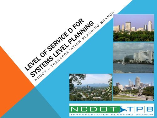
LOS Training Presentation - Connect NCDOT
LOS Training Presentation - Connect NCDOT
LOS Training Presentation - Connect NCDOT

You also want an ePaper? Increase the reach of your titles
YUMPU automatically turns print PDFs into web optimized ePapers that Google loves.
INTRODUCTION<br />
• 2000 HIGHWAY CAPACITY MANUAL<br />
• 2005 ITRE NC<strong>LOS</strong> SOFTWARE<br />
VERSION 2.1<br />
• LEVEL OF SERVICE COMMITTEE
TRAINING OUTLINE<br />
• LEVEL OF SERVICE/HCM 101<br />
• BASIC TERMINOLOGY<br />
• GEOGRAPHIC AREAS (TPB REGIONS V/S GEOGRAPHIES)<br />
• NC<strong>LOS</strong> D STANDARDS INPUT HANDOUT<br />
• BREAK<br />
• <strong>LOS</strong> BASELINE INFORMATION<br />
• NC<strong>LOS</strong> D STANDARDS FOR SYSTEMS LEVEL PLANNING LAYOUT<br />
• AREA TYPE, FACILITY TYPES<br />
• LEVEL OF SERVICE D STANDARDS<br />
• INFORMATION YOU NEED TO KNOW<br />
• CTP EXAMPLES AND EXERCISES<br />
• BASIC AND COMPLEX EXAMPLES<br />
• IDENTIFY FACILITY/<strong>LOS</strong>/AREA TYPES ON A COUNTY CTP NETWORK<br />
• IDENTIFY <strong>LOS</strong> D VALUES ON A COUNTY CTP NETWORK<br />
• WRAP-UP, MOVING AHEAD<br />
• MODEL APPLICATION<br />
• HCM 2010 and ITRE NC<strong>LOS</strong> PROGRAM UPGRADE<br />
• NC<strong>LOS</strong> TPB COMMITTEE MEMBERS
Q & A: BASIC <strong>LOS</strong>/HCM DEFINITIONS<br />
• Capacity – definition<br />
• “The capacity of a facility is the maximum hourly rate at which persons or vehicles<br />
reasonably can be expected to traverse a point or a uniform section of a lane or roadway<br />
during a given time period under prevailing roadway, traffic, and control conditions.” (HCM<br />
2000)<br />
• Roadway conditions, e.g….<br />
• number of lanes, lane width, shoulder width, development.<br />
• Traffic Conditions, e.g….<br />
• vehicle mix, directional and lane distribution.<br />
• Control Conditions, e.g….<br />
• signal phasing, cycle length, green time, coordination.<br />
•Level of Service – definition<br />
• “Level of service (<strong>LOS</strong>) is a quality measure describing operational conditions within a<br />
traffic stream, generally in terms of such service measures as speed and travel time, freedom<br />
to maneuver, traffic interruptions, and comfort and convenience.” (HCM 2000)<br />
• Six levels of service, A through __<br />
• Each <strong>LOS</strong> represents a range of conditions.<br />
• One or more service measures determines <strong>LOS</strong>. (What are service measures for freeway,expressway, etc?)<br />
• Safety (does/does not) determine service levels.
Q & A: BASIC <strong>LOS</strong>/HCM DEFINITIONS<br />
• Free Flow Speed (FFS)<br />
• Base Free Flow Speed<br />
(BFFS)<br />
• Average Travel Speed<br />
(ATS)<br />
• Traffic Signals Per Mile<br />
• Interchanges Per Mile<br />
• Access Points Per Mile<br />
• Density<br />
• Lane/Shoulder Width<br />
• Lateral Clearance<br />
•g/C Ratio<br />
• Arrival Type<br />
• % Time Spent Following<br />
• % No Passing<br />
• Truck Percentage<br />
• Automatic Traffic Recorder (ATR)<br />
Sites<br />
• K Factor<br />
• D Factor<br />
• Peak Hour Factor<br />
• Driver Population Factor<br />
• Terrain Type<br />
(Level/Rolling/Mountainous)
FACILITY TYPES<br />
CTP HCM CTP DEFINING<br />
CHARACTERISTICS<br />
Service Measure<br />
(<strong>LOS</strong> CRITERIA)<br />
FREEWAY Freeway Full control of access Density<br />
EXPRESSWAY Multilane<br />
Highway<br />
Limited access, divided,<br />
no traffic signals<br />
BOULEVARD Arterial Partial access, traffic<br />
signals, divided<br />
OTHER MAJOR<br />
THOROUGHFARES<br />
MINOR<br />
THOROUGHFARES<br />
Arterial or<br />
2-Lane Highway<br />
Arterial or<br />
2-Lane Highway<br />
Undivided,<br />
US or NC route<br />
Undivided,<br />
SR route<br />
Density<br />
ATS<br />
ATS or<br />
ATS and PTSF<br />
ATS or<br />
ATS and PTSF
TPB GEOGRAPHIC AREAS<br />
NOT NECESSARILY TRUE<br />
GEOGRAPHIC AREAS!!<br />
Examples? Hickory (Piedmont) Fayetteville (Piedmont)
!!! BREAK !!!
NC<strong>LOS</strong> D LAYOUT<br />
• Disclaimer/Basic definitions for NC<strong>LOS</strong> D Standards<br />
• NC<strong>LOS</strong> D Standards for Systems Level Planning<br />
• APPENDIX A – Freeways: HCM 2000 Freeway Equations and Inputs<br />
• APPENDIX B – Expressways: HCM 2000 Multi-lame Highway Equations and<br />
Inputs<br />
• APPENDIX C – Boulevards: HCM 2000 Urban Streets – Arterial &<br />
Collectors/Locals Equations and Inputs<br />
• APPENDIX D – Other Major Thoroughfares: HCM 2000 Urban Streets –<br />
Arterial & Collectors/Locals Equations and Inputs<br />
• APPENDIX E – Minor Thoroughfares: HCM 2000 Urban Streets – Arterial &<br />
Collectors/Locals Equations and Inputs<br />
• APPENDIX F – Two-Lane Highways: HCM 2000 Two-Lane Highway<br />
Equations and Inputs
AREA TYPE<br />
• RURAL<br />
• Areas typically outside a municipality or<br />
Extraterritorial Jurisdiction (ETJ)<br />
• SUBURBAN<br />
• Areas typically within a municipality or ETJ,<br />
but not within an Urban area<br />
• URBAN<br />
• Areas that are within a CBD or immediately<br />
surrounding a CBD
LEVEL OF SERVICE D VALUES<br />
• STANDARD CAPACITY VALUES<br />
• Represents an average <strong>LOS</strong> D capacity for a<br />
given facility. A default value for a given region.<br />
• MINIMUM CAPACITY VALUES<br />
• Represents conditions/inputs that result in a<br />
worst-case <strong>LOS</strong> D capacity for a given region.<br />
• MAXIMUM CAPACITY VALUES<br />
• Represents conditions/inputs that result in a bestcase<br />
<strong>LOS</strong> D capacity for a given region.
CTP FACILITY TYPES<br />
• FREEWAYS<br />
• EXPRESSWAYS<br />
• BOULEVARDS<br />
• Divided 2-6+ lane facilities<br />
• OTHER MAJOR THOROUGHFARES<br />
• Undivided facilities (US/NC routes = 2-5 lanes, SR/Local routes = 4-5<br />
lanes) typically within a municipality or ETJ<br />
• MINOR THOROUGHFARES<br />
• Undivided facilities (SR/Local routes = 2-3 lanes) within a typically<br />
municipality or ETJ<br />
• RURAL TWO-LANE HIGHWAYS<br />
• 2-lane undivided facility outside a municipality or ETJ. These facilities are<br />
classified as other major thoroughfares if they are a US or NC route and<br />
minor thoroughfares if they are a secondary/local route.<br />
FINALLY, Volumes shown represent the point at which traffic<br />
transitions from a <strong>LOS</strong> D to <strong>LOS</strong> E.
Q & A: DATA YOU NEED TO KNOW AND RESOURCES<br />
• Lanes Per Direction<br />
• Location of Facility (Urban, Suburban, Rural)<br />
• Type of Facility *<br />
• Divided/Undivided Facility<br />
• K Factor<br />
• D Factor<br />
• Truck Percentage **<br />
• Lane Width<br />
* Applicable for Other Major Thoroughfares versus Minor Thoroughfares<br />
** Applicable for Freeways, Expressways, and Rural 2-Lane Highways
USING NC<strong>LOS</strong> D STANDARDS<br />
• Basic Example<br />
• Complex Example<br />
• Your Turn!<br />
• Identify CTP Facility Type<br />
• Identify NC<strong>LOS</strong> Facility Type<br />
• Identify Area Type (Urban, Suburban,<br />
Rural)<br />
• Find Capacity
EXAMPLE 1<br />
•Facility: I-40<br />
•Section: From NC 210<br />
(Exit 319) to NC 242 (Exit<br />
325)<br />
•4-lane divided crosssection<br />
•Full control of access<br />
•19% Trucks<br />
CTP Facility Type? Why?<br />
Freeway – Multi-lane<br />
divided facility, full control<br />
of access<br />
NC<strong>LOS</strong> Type? Why?<br />
Freeway – Multi-lane<br />
divided, full control of<br />
access<br />
Area Type? Why?<br />
Rural, outside a<br />
municipality or ETJ<br />
Capacity? Why?<br />
58,000 – 19% Trucks, Rural
EXAMPLE 2<br />
•Facility: Cleveland Rd (SR<br />
Route)<br />
•Section: Barber Mill Rd to<br />
NC 210<br />
•3-lane undivided crosssection<br />
•45 MPH<br />
•Includes driveways and<br />
traffic signals<br />
•Lower than average K<br />
Factor/Directional<br />
CTP Facility Type? Why?<br />
Minor Thoroughfare – 3-lane<br />
facility, undivided, low access<br />
control<br />
NC<strong>LOS</strong> Type? Why?<br />
Minor Thoroughfare– 3-lane<br />
undivided, not a US/NC route<br />
Area Type? Why?<br />
Rural, outside a municipality<br />
or ETJ<br />
Capacity? Why?<br />
17,300, 3-lane, Lower than<br />
average K Factor/Directional<br />
(Maximum <strong>LOS</strong>)
YOUR TURN!
EXERCISE 1<br />
•Facility: I-95<br />
•Section: Brogden Rd<br />
(Exit 93) to East<br />
Anderson St (Exit 98)<br />
•In Smithfield/Selma ETJ<br />
•6-lane divided crosssection<br />
•Full control of access<br />
•24% Trucks<br />
CTP Facility Type? Why?<br />
Freeway – Multi-lane<br />
divided facility, full control<br />
of access<br />
NC<strong>LOS</strong> Type? Why?<br />
Freeway – Multi-lane<br />
divided facility, full control<br />
of access<br />
Area Type? Why?<br />
Suburban – inside the ETJ,<br />
but not in or around the<br />
CBD<br />
Capacity? Why?<br />
84,600 – 24% Trucks
EXERCISE 2<br />
•Facility: US 70<br />
•Section: US 70<br />
Business to US 70<br />
Alternate<br />
•4-lane divided crosssection<br />
•Only interchanges and<br />
right-in/right-out access<br />
•Rural Area<br />
•No traffic signals<br />
•12% Trucks<br />
CTP Facility Type? Why?<br />
Expressway – Multi-lane<br />
divided facility, high access<br />
control, no traffic signals<br />
NC<strong>LOS</strong> Type? Why?<br />
Expressway – Multi-lane<br />
divided facility, high access<br />
control, no traffic signals<br />
Area Type? Why?<br />
Rural – outside<br />
municipality/ETJ<br />
Capacity? Why?<br />
56,100 – 12% Trucks
EXERCISE 3<br />
•Facility: US 70<br />
Business<br />
•In Clayton, leading into<br />
CBD<br />
•4-lane divided crosssection<br />
•Includes traffic signals<br />
and driveways<br />
•45 MPH<br />
CTP Facility Type? Why?<br />
Boulevard – Divided facility<br />
with traffic signals<br />
NC<strong>LOS</strong> Type? Why?<br />
Boulevard – Divided facility<br />
with traffic signals<br />
Area Type? Why?<br />
Urban – leading into CBD<br />
Capacity?<br />
35,100
EXERCISE 4<br />
•Facility: Princeton-<br />
Kenly Road (SR Route)<br />
•Section: Truckstop<br />
Road to NC 222<br />
•In Kenly ETJ<br />
•2-lane cross-section<br />
with driveways<br />
•10-foot lanes<br />
•35 MPH<br />
CTP Facility Type? Why?<br />
Minor Thoroughfare– 2lane<br />
undivided, low access<br />
control<br />
NC<strong>LOS</strong> Type? Why?<br />
Minor Thoroughfare – 2lane<br />
undivided facility, not<br />
a US/NC route, low access<br />
control<br />
Area Type? Why?<br />
Suburban – Within an ETJ<br />
Capacity? Why?<br />
9,500 – 10-foot lanes
EXERCISE 5<br />
•Facility: US 701<br />
•Section: Sticklands<br />
Crossroad to county<br />
line, outside any ETJ<br />
•2-lane cross-section<br />
with driveways<br />
•12-foot lanes<br />
•55 MPH<br />
•Average conditions<br />
CTP Facility Type? Why?<br />
Major Thoroughfare – US<br />
route, undivided<br />
NC<strong>LOS</strong> Type? Why?<br />
Rural 2-lane Highway – 2lane<br />
undivided facility,<br />
outside a municipality or<br />
ETJ<br />
Area Type? Why?<br />
N/A – Uses Rural 2-lane<br />
Highway Methodology<br />
Capacity? Why?<br />
12,400 – 12-foot lanes
EXERCISE 6<br />
•Facility: Devils<br />
Racetrack Road (SR<br />
Route)<br />
•Section: US 701 to<br />
county line, outside ETJ<br />
•2-lane cross-section<br />
with driveways<br />
•10-foot lanes<br />
•55 MPH<br />
•Extremely tight curves<br />
with less than average<br />
travel conditions<br />
CTP Facility Type? Why?<br />
Minor Thoroughfare – SR route,<br />
2-lanes, undivided<br />
NC<strong>LOS</strong> Type? Why?<br />
Rural 2-lane Highway – 2-lane<br />
undivided facility, outside a<br />
municipality or ETJ<br />
Area Type? Why?<br />
N/A – Uses Rural 2-lane Highway<br />
Methodology<br />
Capacity? Why?<br />
9,000 – 10-foot lanes/less than<br />
average travel conditions<br />
(Minimum <strong>LOS</strong>)
EXERCISE 7<br />
•Facility: NC 39<br />
•Section: US 301 to<br />
CAMPO boundary<br />
•2-lane cross-section<br />
•In Selma ETJ<br />
•12-foot lanes<br />
•45 MPH<br />
•Higher than average K<br />
factor and directional<br />
flow/lower than average<br />
Peak Hour Factor<br />
CTP Facility Type? Why?<br />
Major Thoroughfare – NC<br />
route, 2-lanes, undivided<br />
NC<strong>LOS</strong> Type? Why?<br />
Major Thoroughfare – NC<br />
route, inside an ETJ<br />
Area Type? Why?<br />
Suburban – Inside an ETJ,<br />
not near or in a CBD<br />
Capacity? Why?<br />
11,800 – 2-lanes, higher<br />
than average K factor and<br />
directional flow (Minimum<br />
<strong>LOS</strong>)
EXERCISE 8<br />
•Facility: NC 42<br />
•Section: US 70<br />
Business to Buffalo Rd<br />
•2-lane divided crosssection<br />
•In Clayton ETJ<br />
•Includes traffic signals<br />
and driveways<br />
•45 MPH<br />
CTP Facility Type? Why?<br />
Boulevard– Divided facility<br />
with traffic signals<br />
NC<strong>LOS</strong> Type? Why?<br />
Boulevard– Divided facility<br />
with traffic signals<br />
Area Type? Why?<br />
Suburban – Inside an ETJ,<br />
not near or in a CBD<br />
Capacity? Why?<br />
18,300 – 2-lanes divided
THAT’S A WRAP/MOVING AHEAD<br />
• NC<strong>LOS</strong> D Standards in Small Urban Model Development<br />
• One-Way Pairs (They still exist!)<br />
• Current NC<strong>LOS</strong> D Standards for Systems Level Planning<br />
Based on HCM 2000 and the 2005 ITRE NC<strong>LOS</strong> Version 2.1.<br />
ITRE and <strong>NCDOT</strong> to update NC<strong>LOS</strong> based on HCM 2010,<br />
which is slated to be complete by the end of 2012. Some of<br />
the <strong>LOS</strong> Committee Members are members of this Steering<br />
Committee and Implementation Team.<br />
• When the new ITRE NC<strong>LOS</strong> Program is released, the<br />
NC<strong>LOS</strong> D Standards for Systems Level Planning will be<br />
updated and expanded.
THANK YOU FOR YOUR PARTICIPATION!<br />
NC<strong>LOS</strong> Committee Members:<br />
• Jamal Alavi, PE<br />
• Pam Cook, PE<br />
• Scott Walston, PE<br />
• David Keilson, PE, Presenter<br />
• Sarah Lee, EI, Presenter<br />
• Mark Eatman, EI<br />
• Hong Qi Lu<br />
• J. Andy Bailey