Guide to Significant Wildlife Habitat - Door County Web Map
Guide to Significant Wildlife Habitat - Door County Web Map
Guide to Significant Wildlife Habitat - Door County Web Map
You also want an ePaper? Increase the reach of your titles
YUMPU automatically turns print PDFs into web optimized ePapers that Google loves.
BAY TO LAKE WILDLIFE CORRIDOR<br />
LOCATION:<br />
The Bay <strong>to</strong> Lake <strong>Wildlife</strong> Corridor covers approximately 15,200 acres in north central <strong>Door</strong><br />
<strong>County</strong>. The corridor extends in two branches south of Peninsula State Park <strong>to</strong> the shore of Lake<br />
Michigan in eastern <strong>Door</strong> <strong>County</strong> (T29-30N, R28E). This area is in the Towns of Gibraltar, Egg Harbor,<br />
Jacksonport and Bailey’s Harbor. As this report represents general areas of concern, exact locations of<br />
boundary lines have not been designated.<br />
GENERAL SITE DESCRIPTION:<br />
The Bay <strong>to</strong> Lake <strong>Wildlife</strong> Corridor is adjacent <strong>to</strong> and contiguous with Peninsula State Park. The<br />
Fish Creek Watershed begins on the western shore of <strong>Door</strong> <strong>County</strong> along the Niagara Escarpment, a<br />
prominent ridge of dolos<strong>to</strong>ne bedrock. Thorp Pond and its associated wetlands are connected <strong>to</strong> the Fish<br />
Creek Watershed. Both upland forest and lowland hardwood and conifer swamps are ecological features<br />
of this portion of the corridor. Hibbards Creek originates southeast of Thorp Pond and flows through wet<br />
and dry mesic woodlands, a conifer swamp, shrub-carr, and ridge and swale complex before draining in<strong>to</strong><br />
Lake Michigan. As a continuous corridor, Hibbards Creek, Fish Creek and Thorp Pond connect the bay<br />
side of the county with the lakeside.<br />
The second branch of the Bay <strong>to</strong> Lake <strong>Wildlife</strong> Corridor encompasses the shoreline of the north<br />
end of Kangaroo Lake, the Piel Creek Corridor, adjoining lowland and lowland forests, and several tracts<br />
of old fields that buffer the site. Piel Creek is the major surface water source for Kangaroo Lake.<br />
Connecting the southern portion of Kangaroo Lake and the Lake Michigan Shore is Meridian Park, an<br />
area with intact lakeshore ridge and swale communities.<br />
ECOLOGICAL SIGNIFICANCE:<br />
The site encompasses a major natural corridor between Green Bay and Lake Michigan. This<br />
corridor not only holds many rare species and significant natural areas it also provides a major ecological<br />
connection across the Peninsula, despite the fragmentation by roads, agricultural land and residential<br />
development. Places like Thorp Pond, Hibbards Creek, Piel Creek, the north basin of Kangaroo Lake,<br />
and Meridian Park which lie within this site contain numerous state listed species and high quality natural<br />
communities. Three designated State Natural Areas are contiguous with this corridor: Peninsula Park<br />
Beech Forest; Peninsula Park White Cedar Forest; and Kangaroo Lake.<br />
The corridor is rich in diverse habitat types including a fen with boreal elements, alkaline sedge<br />
marshes, open water wetlands and small lakes, perennial and intermittent streams (both warm and cold<br />
water), lowland conifer forests, swamp hardwood forests, stands of northern conifer/hardwoods on clay<br />
loams and sand. There are several exposures of dolos<strong>to</strong>ne especially in the Fish Creek / Peninsula Park<br />
landscape and in Meridian Park. Ridge and swale formations exist in Meridian Park and near the outlet<br />
of Hibbards Creek.<br />
The highest quality forest communities in this corridor hold mature <strong>to</strong> near old growth conditions<br />
with large diameter shade <strong>to</strong>lerant trees, an uneven age forest structure, and large fallen trees. These<br />
conditions are most common in the wet-mesic forests south of Kangaroo Lake and in the hardwood /<br />
conifer swamps near Thorp Pond and the upper Fish Creek watershed. These old-growth patches lie in a<br />
matrix of younger aged forests of varying species composition and often-simpler structure.<br />
Local areas of high species diversity and rarity include Thorp Pond, Meridian Park, the north end<br />
of Kangaroo Lake, and the upper Fish Creek forest and escarpment landscape. The presence of nonnative<br />
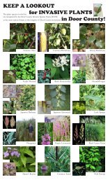
aggressive species is currently minimal, however troublesome species like Japanese knotweed,<br />
barberry, exotic honeysuckle, and Scotch pine are present in scattered locations.<br />
Bay <strong>to</strong> Lake <strong>Wildlife</strong> Corridor 97


![A Guide to the Control and Management of Invasive Phragmites [PDF]](https://img.yumpu.com/19126786/1/190x190/a-guide-to-the-control-and-management-of-invasive-phragmites-pdf.jpg?quality=85)
![Homeowner's Guide to Japanese Knotweed Control [PDF]](https://img.yumpu.com/19126766/1/190x245/homeowners-guide-to-japanese-knotweed-control-pdf.jpg?quality=85)
