Caring for archaeological sites: practical guidelines for protecting ...
Caring for archaeological sites: practical guidelines for protecting ...
Caring for archaeological sites: practical guidelines for protecting ...

You also want an ePaper? Increase the reach of your titles
YUMPU automatically turns print PDFs into web optimized ePapers that Google loves.
<strong>Caring</strong> <strong>for</strong><br />
<strong>archaeological</strong> <strong>sites</strong><br />
Practical <strong>guidelines</strong> <strong>for</strong> <strong>protecting</strong><br />
and managing <strong>archaeological</strong> <strong>sites</strong><br />
in New Zealand<br />
Kevin L. Jones
<strong>Caring</strong> <strong>for</strong> <strong>archaeological</strong> <strong>sites</strong><br />
Practical <strong>guidelines</strong> <strong>for</strong> <strong>protecting</strong><br />
and managing <strong>archaeological</strong> <strong>sites</strong><br />
in New Zealand<br />
Kevin L. Jones<br />
Produced in conjunction with the<br />
New Zealand Historic Places Trust<br />
Pouhere Taonga<br />
Published by<br />
Science & Technical Publishing<br />
Department of Conservation<br />
PO Box 10420, The Terrace<br />
Wellington 6143, New Zealand
The use of macrons in this document has been confined to the <strong>for</strong>eword and quoted material, and<br />
complies with the Department of Conservation’s current publications policy.<br />
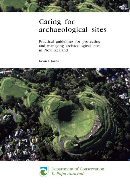
Cover: Mount Eden, Auckland. Photo: Kevin L. Jones<br />
These <strong>guidelines</strong> were published in draft <strong>for</strong>m in March 2002 under the authorship of Kevin L. Jones,<br />
Dianne Harlow, and Derek Gosling. Public or marae consultations were held at Waitangi, Auckland,<br />
Hamilton, Tauranga, Napier, and Wellington in 2002–2003. Submissions were also received by letter.<br />
There was also an interactive 2-day training session based on the draft <strong>guidelines</strong> on Urupukapuka Island,<br />
Bay of Islands. Summaries of the key issues raised in the course of the consultation were presented to the<br />
New Zealand Conservation Authority and the Maori Heritage Council (New Zealand Historic Places Trust)<br />
in 2003–2004. Their agreement was obtained to carry out the revision of the <strong>guidelines</strong> based on the<br />
analysis and individual comments where they could be incorporated. The draft <strong>guidelines</strong> were revised<br />
by Kevin Jones and Dr Rick McGovern-Wilson in 2005–2006.<br />
Individual copies of this book are printed, and it is also available from the departmental website in pdf<br />
<strong>for</strong>m. Titles are listed in our catalogue on the website, refer www.doc.govt.nz under Publications, then<br />
Science & technical.<br />
© Copyright September 2007, New Zealand Department of Conservation<br />
ISBN 978–0–478–14259–4 (hardcopy)<br />
ISBN 978–0–478–14260–0 (web PDF)<br />
This text was prepared <strong>for</strong> publication by Science & Technical Publishing; editing and layout by Ian<br />
Mackenzie. Publication was approved by the Chief Scientist (Research, Development & Improvement<br />
Division), Department of Conservation, Wellington, New Zealand.<br />
In the interest of <strong>for</strong>est conservation, we support paperless electronic publishing. When printing,<br />
recycled paper is used wherever possible.
He kupu whakataki<br />
Tënä rä tätou katoa. Kua tuhia tënei pukapuka mahi e ngä kaimätai<br />
whaipara tangata e ü tonu nei ki te kaupapa, arä, kia penapenatia ngä<br />
wähi mau taonga o neherä hei mahi whai tikanga mä te iwi Mäori, mä<br />
te iwi whänui o Aotearoa, ä, mä ngä kaitohutohu penapena taiao i roto i<br />
ngä mahinga pükenga o te motu. I rünangatia tëtahi tuhinga tauira tömua<br />
i Waitangi, i Tämaki-makau-rau, i Kirikiriroa, i Tauranga, i Ahuriri, i Te<br />
Whanganui-a-Tara. Ko tëtahi o ngä ture tuatahi hei whai mä rätou i roto<br />
i te whakatakoto mahere penapena, ko te tätari i ngä uara rerekë ka pä<br />
ki tënä, ki tënä wähi o nehe. He whenua whai tikanga ki a wai ränei, ä,<br />
he aha rätou i pënä ai? Pënä i ëtahi Mäori maha noa, e whakapono ana<br />
ngä kaimätai whaipara tangata he rawa whakahirahira ënei wähi, ahakoa<br />
wähi tapu ränei, ahakoa wähi noa mö te iwi whänui ränei, arä, he rawa<br />
e tika ana kia äta tiakina, kia äta pupuritia mö ngä whakatipuranga kei<br />
te heke mai. Whaipänga ai tënä, tënä o tätou ki ënei wähi. He mea nui<br />
tonu hei ata, hei tohu, hei mätäpuna mö te tuakiri Mäori, tuakiri Päkehä<br />
hoki o Aotearoa. He wähi mätauranga aua wähi, he wähi rangahau hoki<br />
e tika ana kia tino pai rawa atu te whakamarumaru mä ngä whakahaere<br />
mahi huakanga hou e körerotia ake nei i roto i tënei pänui. Heoi anö,<br />
kia maumahara tonu tätou tërä pea ngä whakatupuranga o äpöpö e tau<br />
te hë ki a tätou ki te hohoro rawa tä tätou kuhunga ki te wähi käore i<br />
tika, ki te whakarite whakamarumaru ränei i nui atu ai ngä kino i ngä<br />
pai. Me whai wähi hoki koutou ki aua mahi huakanga hei mahara mä<br />
koutou, hei patapatai mä koutou, hei tautoko hoki mä koutou.<br />
3
Foreword<br />
This manual has been written by archaeologists who believe that<br />
conservation of <strong>archaeological</strong> <strong>sites</strong> is an important task, <strong>for</strong> iwi Mäori,<br />
<strong>for</strong> the public, and <strong>for</strong> all those people in professional employment<br />
who are privileged to advise on conservation. One of the first rules to<br />
be followed in planning conservation is to analyse the different values<br />
that relate to a site. To whom does the place matter, and why? Like<br />
many Mäori, archaeologists believe that the <strong>sites</strong>, whether they are<br />
tapu or open to the public, are a valuable resource that deserves to be<br />
protected and conserved <strong>for</strong> future generations. Everyone has an interest<br />
in their protection. They are important as icons, symbols and resources<br />
<strong>for</strong> the identity of Mäori and Päkeha New Zealanders. They are also<br />
places of education and research that deserve the best protection that<br />
our new techniques presented here can provide. However, we must<br />
always remember that future generations may judge us harshly if we<br />
have rushed to intervene where it was not necessary, or carried out<br />
protective measures that have done more harm than good. This work<br />
deserves your attention, your questions, and your support.<br />
5
CONTENTS<br />
He kupu whakataki 3<br />
Foreword 5<br />
Abstract 9<br />
Introduction 10<br />
1. Conservation policy and planning 15<br />
1.1 Desired outcomes <strong>for</strong> <strong>archaeological</strong> <strong>sites</strong> 15<br />
1.2 Conservation and land management objectives 16<br />
1.3 Principles of conservation 17<br />
1.4 Values of <strong>archaeological</strong> <strong>sites</strong> 18<br />
1.4.1 Potential <strong>for</strong> <strong>archaeological</strong> research 18<br />
1.4.2 Wider community values 19<br />
1.4.3 Educational values 19<br />
1.4.4 Landscape values 19<br />
1.4.5 Other values 19<br />
1.5 Threats to <strong>archaeological</strong> <strong>sites</strong> 19<br />
1.5.1 Major classes of threat 20<br />
1.5.2 Past disturbance and soil <strong>for</strong>mation 22<br />
1.6 Conservation planning 23<br />
1.6.1 Minimum management requirements <strong>for</strong><br />
<strong>archaeological</strong> <strong>sites</strong> 24<br />
1.7 Intervention 24<br />
1.8 Monitoring 27<br />
2. Management issues and conservation techniques 29<br />
2.1 Erosion control—general considerations 29<br />
2.1.1 Wind 30<br />
2.1.2 Rivers and streams 30<br />
2.1.3 Coastal erosion 31<br />
2.1.4 Erosion along the shores of lakes and reservoirs 32<br />
2.1.5 Slope failure 32<br />
2.1.6 Freeze-thaw 33<br />
2.2 Vegetation management <strong>for</strong> site protection 33<br />
2.2.1 General principles 34<br />
2.2.2 Low vegetation (less than 120 cm tall) 36<br />
2.2.3 Grass and sedge maintenance and establishment 38<br />
2.2.4 Establishment of grass or sedge cover 42<br />
2.2.5 Establishment of grasses on ground cleared of scrub<br />
or fern 43<br />
2.2.6 Grazing 44<br />
2.2.7 Native shrublands 48<br />
2.2.8 Native <strong>for</strong>ests and treelands—issues and guidance 49<br />
2.2.9 Gallery <strong>for</strong>est and canopy maintenance 51<br />
2.2.10 Weeds 54<br />
7
8<br />
2.3 Non-vegetative methods <strong>for</strong> site protection 57<br />
2.3.1 Bunds and underground cut-off walls 57<br />
2.3.2 Geotextiles and geogrids 57<br />
2.3.3 Deliberate site burial 60<br />
2.3.4 Building plat<strong>for</strong>ms/engineering applications on <strong>sites</strong> 62<br />
2.4 Fire 62<br />
2.4.1 Preventing fire 62<br />
2.4.2 Fire <strong>for</strong> site conservation 63<br />
2.4.3 Fire control management plans 64<br />
2.5 Specific site management techniques 64<br />
2.5.1 Problem trees 64<br />
2.5.2 Control of burrowing animals, pigs, petrels 68<br />
2.6 Earthworks restoration or reconstruction 69<br />
2.6.1 Restoration 69<br />
2.6.2 Reconstruction of <strong>archaeological</strong> features 71<br />
3. Management of <strong>sites</strong> under reserve, farming, and <strong>for</strong>estry land 73<br />
3.1 Amenity areas or reserve lands with public visiting 73<br />
3.1.1 Public access and use 74<br />
3.1.2 Vegetation management 77<br />
3.1.3 Case study 1—Historic landscape 81<br />
3.1.4 Case study 2—Pa in mown grassland 84<br />
3.2 Sites managed within farmland 86<br />
3.2.1 Grazing and pasture care 87<br />
3.2.2 Case study 3—Pa in warm temperate pasture 94<br />
3.2.3 Case study 4—Midden in eroding <strong>for</strong>edunes 97<br />
3.3 Sites managed in plantation <strong>for</strong>est 100<br />
3.3.1 Planting around protected <strong>sites</strong> 102<br />
3.3.2 Harvesting precautions 102<br />
3.3.3 Ongoing <strong>for</strong>est management <strong>for</strong> protected <strong>sites</strong> 105<br />
3.3.4 Case study 4—Sub-surface site (midden) in coastal<br />
plantation <strong>for</strong>est 107<br />
4. Acknowledgements 109<br />
5. References 110<br />
6. Additional reading 112<br />
Appendix 1<br />
Appendix 2<br />
Appendix 3<br />
Appendix 4<br />
Appendix 5<br />
Types of <strong>archaeological</strong> site in New Zealand 113<br />
Specimen work plans 116<br />
Native covers <strong>for</strong> <strong>archaeological</strong> <strong>sites</strong> 120<br />
Native grasses and other ground-hugging covers 122<br />
Glossary 125
<strong>Caring</strong> <strong>for</strong> <strong>archaeological</strong> <strong>sites</strong><br />
Practical <strong>guidelines</strong> <strong>for</strong> <strong>protecting</strong><br />
and managing <strong>archaeological</strong> <strong>sites</strong><br />
in New Zealand<br />
Kevin L. Jones<br />
Research Development & Improvement Division, Department of<br />
Conservation, PO Box 10420, The Terrace,Wellington 6143, New<br />
Zealand. Email: kjones@doc.govt.nz<br />
ABSTRACT<br />
It is important <strong>for</strong> our sense of history and national identity that<br />
<strong>archaeological</strong> <strong>sites</strong> be protected. However, only a small proportion of<br />
<strong>archaeological</strong> <strong>sites</strong> in New Zealand are in reserved areas. This guide<br />
is intended to help improve on-site protection of <strong>archaeological</strong> <strong>sites</strong>,<br />
features and areas through <strong>practical</strong> land management. Archaeological<br />
<strong>sites</strong> can be visible at or above the ground surface or lie buried beneath<br />
it. For all <strong>sites</strong>, minimising deterioration is a key management objective.<br />
Earthwork <strong>for</strong>tifications are a common <strong>for</strong>m of surface-visible site in<br />
New Zealand. Surface erosion by visitors and farm animals, and planting<br />
in pine <strong>for</strong>ests both cause significant problems. Sub-surface <strong>sites</strong> also<br />
need specific attention. The management of <strong>archaeological</strong> <strong>sites</strong> requires<br />
close consideration of plant ecology, because plants will generally be<br />
the most cost-effective cover. Techniques and management philosophies<br />
are recommended <strong>for</strong> five broad ecological settings: native grassland,<br />
exotic (pasture) grassland, native shrubland, indigenous <strong>for</strong>est, and<br />
exotic (plantation) <strong>for</strong>est. Techniques include encouragement of native<br />
grass covers, site-adapted mowing regimes, stock management, fencing<br />
patterns and methods, manipulation of native <strong>for</strong>est succession, felling<br />
and removal of problem trees, artificial covers such as geosynthetic<br />
cloths, and deliberate site burial. Mowing and line-trimming should be<br />
preferred to grazing <strong>for</strong> all significant <strong>sites</strong>, especially those which are<br />
open to the public. Wider cultural or historic landscape design needs<br />
to be considered, particularly <strong>for</strong> large reserves. The general principles<br />
outlined in these <strong>guidelines</strong> will be useful when preparing management<br />
or conservation plans <strong>for</strong> <strong>archaeological</strong> <strong>sites</strong>.<br />
Keywords: resource management, reserves, local government, restoration,<br />
reconstruction, conservation plan, ICOMOS, <strong>archaeological</strong> <strong>sites</strong>, Maori,<br />
wahi tapu, landscape, monument, historic places, weed control, <strong>for</strong>est<br />
succession, <strong>for</strong>estry, farming, fire management<br />
© Copyright September 2007, Department of Conservation. This paper may be cited as:<br />
Jones, K.L. 2007: <strong>Caring</strong> <strong>for</strong> <strong>archaeological</strong> <strong>sites</strong>: <strong>practical</strong> <strong>guidelines</strong> <strong>for</strong> <strong>protecting</strong> and managing<br />
<strong>archaeological</strong> <strong>sites</strong> in New Zealand. Department of Conservation, Wellington. 126 p.<br />
9
10<br />
Introduction<br />
It is important that <strong>archaeological</strong> <strong>sites</strong> are reserved, accessible, protected,<br />
and authentic. Of all the <strong>sites</strong> in New Zealand, only a small portion is in<br />
a reserved area. The largest portion is on freehold land, particularly in<br />
the northern regions of New Zealand. Thus site protection requires good<br />
will on the part of the landowner. Once a particular type of protection<br />
is decided on—<strong>for</strong> example, a <strong>for</strong>m of vegetation cover—it will always<br />
be wise to seek competent local advice on how to achieve that cover.<br />
Landowners are a key source of this kind of advice.<br />
These <strong>guidelines</strong> do not give highly prescriptive advice, because the<br />
natural setting, and the conservation and heritage significance of places<br />
vary so much; and because techniques and proprietary products may<br />
change. The general principles and the techniques explained in these<br />
<strong>guidelines</strong> should be able to be incorporated into, or referred to in,<br />
management or conservation plans. Such plans should have resolved issues<br />
in detailed site management, including the role of tangata whenua. The<br />
principles stated here may help define the issues and resolve problems<br />
in conservation planning, but they are not the final word.<br />
The Historic Places Act 1993 (s. 2) defines an <strong>archaeological</strong> site as any<br />
place in New Zealand associated with human activity (including shipwrecks)<br />
which is, or may be, able, through investigation by <strong>archaeological</strong><br />
methods, to provide evidence relating to the history of New Zealand,<br />
and which date to the period be<strong>for</strong>e 1900. Such <strong>sites</strong> include middens<br />
(deposits of what was once waste from food preparation), storage pits,<br />
<strong>for</strong>tifications, and quarries. Some may be visible on the surface, some<br />
not. Appendix 1 identifies the different types of physical places that are<br />
found in New Zealand.<br />
In New Zealand, ‘historic places’ can be buildings or other standing<br />
structures, wahi tapu (<strong>sites</strong> of historical significance to Maori), or<br />
<strong>archaeological</strong> <strong>sites</strong>. The vast majority of the recorded <strong>archaeological</strong> <strong>sites</strong><br />
are pre-European Maori in age, while all of the registered wahi tapu are<br />
Maori in origin. As time goes on, the potential inventory of post-European<br />
<strong>archaeological</strong> <strong>sites</strong> continues to increase, but the pre-European Maori<br />
<strong>archaeological</strong> <strong>sites</strong> are a finite resource that needs special conservation<br />
and protection. Most of the historically significant buildings in New<br />
Zealand are post-European in age and many have significance to both<br />
Pakeha and Maori. There are a number of different marae building<br />
structures that, in some cases, are nationally significant, but most tend<br />
to be significant to particular hapu and iwi.<br />
This guide is not about buildings, or primarily about wahi tapu, although<br />
some <strong>archaeological</strong> <strong>sites</strong> may incorporate elements of both and the<br />
general conservation principles and techniques described here can also<br />
be applied to wahi tapu, if required. Nor is the guide about the legal<br />
protection process. Instead, it is aimed at <strong>practical</strong> land management to<br />
give improved on-site protection to <strong>archaeological</strong> <strong>sites</strong>, features, and
Figure 1. One Tree Hill,<br />
Auckland, viewed from<br />
the southeast. Relatively<br />
light grazing by sheep<br />
has maintained features<br />
well. Having staff and<br />
concessionaires on site<br />
(to right) enables close<br />
supervision of visitors. The<br />
pattern of treeland reveals<br />
the upper features of the<br />
site well to visitors on the<br />
ground.<br />
areas. It is important to our sense of history and national identity that<br />
<strong>archaeological</strong> <strong>sites</strong> are reserved, accessible, protected, and authentic.<br />
An <strong>archaeological</strong> site/wahi taonga is part of a cultural pattern of<br />
occupation which may be evident in the landscape. It may be the<br />
product of a succession of activities and occupation. There are 56 000<br />
<strong>sites</strong> recorded in New Zealand. A high proportion is of Maori origin. Most<br />
<strong>sites</strong> are quite small—maybe just a few pits on a ridge. A small number<br />
cover up to 1 ha or occupy as much as 500 m of a ridgeline. A typical<br />
farm in coastal regions or on major rivers of the North Island might<br />
have one or two medium-sized <strong>sites</strong> and a scatter of <strong>sites</strong> of small area.<br />
The largest <strong>sites</strong> are the large pa, such as Otatara in Hawke’s Bay, or<br />
the pa on the Auckland volcanic cones (Fig. 1). There are also extensive<br />
areas of pre-European gardens in the coastal Bay of Plenty, or on the<br />
flanks and surrounding stonefields of the volcanic cones of Auckland or<br />
Northland.<br />
A whakatauki (Maori proverb), ‘He whakatipu ngä otaota’ (Let weeds<br />
flourish), implies that all man-made productions are in a cycle of decay<br />
and being resumed by the earth. Consultation, planning, and working—<br />
with appropriate Maori authorities and hapu in particular—is an essential<br />
early stage in any planned work on <strong>archaeological</strong> <strong>sites</strong>. As it is sometimes<br />
difficult to ascertain who the appropriate Maori groups are that should<br />
be consulted and worked with over any planned work on <strong>sites</strong>, the<br />
New Zealand Historic Places Trust Pouhere Taonga maintains a list of<br />
iwi authorities and Maori heritage groups that can be accessed. As an<br />
organisation, the trust has developed good working relationships with iwi<br />
across the country on a range of heritage issues and can be consulted <strong>for</strong><br />
advice about how and who to contact <strong>for</strong> consultation and partnership<br />
purposes.<br />
Section 4 of the Conservation Act 1987 requires the Department of<br />
Conservation (DOC) to actively protect resources of interest to tangata<br />
11
12<br />
whenua, and to consult. Similar duties are imposed on other departments<br />
and the wider community under the Resource Management Act 1991 and<br />
the related Historic Places Act 1993. In the future, district plans are the<br />
medium which will impose restrictions and duties on land managers,<br />
but <strong>practical</strong> advice and good will are needed to make regulation work.<br />
Early in any consultation phase, good examples of positive management<br />
of <strong>sites</strong> to conserve their <strong>archaeological</strong>, visitor-appreciation, and other<br />
commemorative values should be part of the approach of the land manager<br />
to Maori communities.<br />
Any kind of disturbance of the ground surface sets an <strong>archaeological</strong> site<br />
at risk. This raises questions about the best way to manage <strong>archaeological</strong><br />
<strong>sites</strong> on farms or <strong>for</strong>estry land, or in urban areas, in a manner that<br />
is complementary to productive use. Sites with surviving surface<br />
earthworks—such as pa or storage pits—are often on high points or<br />
on ridge lines. Their protection and management in the course of farm<br />
or <strong>for</strong>estry operations is of particular concern. Many subsurface <strong>sites</strong><br />
are in areas of intensive rural and urban use (under houses, under flat<br />
land used <strong>for</strong> yards), so that impacts on the <strong>sites</strong> are always possible.<br />
Archaeologists, in turn, have to recognise that rational protection of site<br />
values requires good methods of protection, balanced with the recognition<br />
that landowners should enjoy usage and commercial return. The Historic<br />
Places Act 1993 is the principal regulatory tool which enables the Crown<br />
to balance these factors.<br />
Although only a small proportion of <strong>sites</strong> are actively managed, other <strong>sites</strong><br />
should be kept in stable vegetative cover that protects the <strong>archaeological</strong><br />
values and requires the least long-term management ef<strong>for</strong>t and cost. Sites<br />
<strong>for</strong> public appreciation should have the vegetation managed so that the<br />
stratigraphy, earthworks, and other structures are not only visible, but<br />
also protected. Opening up rare or unique types of <strong>sites</strong> (this includes<br />
the display of excavated areas) should be done with great caution. The<br />
same applies to the exploration and documentation of delicate <strong>sites</strong> such<br />
as cave floors and places with rock art.<br />
The alternative to active management is to accept that there will be<br />
a steady loss of <strong>archaeological</strong> <strong>sites</strong> and values, or that there should<br />
be a cost to record and to recover in<strong>for</strong>mation from the <strong>archaeological</strong><br />
<strong>sites</strong>. The Historic Places Act 1993 is based on the premise that the<br />
destruction of <strong>sites</strong> should be controlled. Under the act, where destruction<br />
is inevitable there may be a requirement <strong>for</strong> an excavation, which can be<br />
expensive. For many years, archaeologists have seen excavation as an early<br />
resort where site protection could not be guaranteed. However, in the<br />
last decade, all international <strong>guidelines</strong>, such as the International Charter<br />
<strong>for</strong> Archaeological Heritage Management (ICAHM), have moved away from<br />
the assumption that <strong>sites</strong> should be excavated where they come under<br />
threat. Instead the stress is on in situ (in the ground) management and<br />
protection of <strong>sites</strong> <strong>for</strong> the in<strong>for</strong>mation they contain and <strong>for</strong> their broader<br />
cultural interest.<br />
A managed site is a recognised asset, and is less likely to be inadvertently<br />
destroyed by careless land development. Even if they are damaged in
some way, <strong>sites</strong> will still have significance to tangata whenua (Maori<br />
people) and local communities, and will also still have <strong>archaeological</strong><br />
value. Evaluation of the protection possibilities <strong>for</strong> damaged <strong>sites</strong> should<br />
be the subject of discussion between landowners, archaeologists, and<br />
tangata whenua.<br />
Examples of the damage that can happen on farms are roading or fencing,<br />
which may cut through a site. Yet farmland grazed by sheep provides<br />
the most obvious way to reveal the <strong>for</strong>m of ancient surface earthworks<br />
<strong>for</strong> visitors or <strong>for</strong> passers-by. Forest or shrubland cover will obscure<br />
these reminders of a more ancient landscape. Tree root growth and tree<br />
harvesting destroy <strong>sites</strong>, but there are also opportunities to protect <strong>sites</strong><br />
in small patches of grass or native shrubs within the <strong>for</strong>est. Where a<br />
site is to be open to the public and interpreted <strong>for</strong> public presentation,<br />
visitors may come from any part of New Zealand or the world. The<br />
preservation of <strong>archaeological</strong> <strong>sites</strong> in the long term depends on the good<br />
will of local people. These <strong>guidelines</strong> will assist in defining these issues,<br />
and will provide logical steps in planning <strong>for</strong> protection and describing<br />
techniques that can protect <strong>sites</strong> in a variety of situations.<br />
The <strong>guidelines</strong> presented here cover methods <strong>for</strong> the conservation and<br />
restoration of <strong>archaeological</strong> <strong>sites</strong>. They revise and replace ‘A manual of<br />
vegetation management on <strong>archaeological</strong> <strong>sites</strong>’ (Hamel & Jones 1982).<br />
In 1994, the <strong>sites</strong> in that manual were re-visited and re-surveyed (and<br />
additional <strong>sites</strong> were surveyed) by Jones & Simpson (1995a, b). They noted<br />
that few <strong>sites</strong> had been managed positively following the recommendations<br />
of the 1982 manual. Some of the <strong>sites</strong> were in far worse condition than<br />
in 1982. In more recent years, positive investigations have been carried<br />
out on ground covers at Ruapekapeka (Woods 1993, 1999) and insights<br />
have been drawn from that work. Such documentation is particularly<br />
needed because without it experience of stabilisation initiatives cannot be<br />
consolidated and more widely disseminated to professional land managers.<br />
In addition, published <strong>guidelines</strong> <strong>for</strong> international practice (Jones 1993,<br />
1998; Andropogon Associates n.d., 1988; Thorne 1988, 1989, 1990; Berry<br />
& Brown 1994, 1995) have influenced this study.<br />
These <strong>guidelines</strong> are intended <strong>for</strong> people professionally involved in<br />
the management of land where there are <strong>archaeological</strong> <strong>sites</strong>, which<br />
includes:<br />
Land owners and managers<br />
•<br />
•<br />
•<br />
•<br />
DOC conservation officers and technical services officers<br />
Farm and <strong>for</strong>est owners and managers<br />
Local and regional government reserve managers and operations staff<br />
Private landowners administering covenanted areas or areas where<br />
there are <strong>archaeological</strong> <strong>sites</strong><br />
Waitangi Tribunal and Office of Treaty Settlements<br />
Maori Land Court<br />
13
14<br />
Tangata whenua<br />
•<br />
•<br />
Iwi authorities and iwi heritage management groups<br />
Trustees and lessees of Maori Reserves<br />
Professional groups<br />
•<br />
•<br />
•<br />
•<br />
Landscape architects<br />
Queen Elizabeth II National Trust<br />
New Zealand Historic Places Trust<br />
Archaeological and resource management consultants<br />
The work is arranged as follows:<br />
Part 1—Discussion of heritage policy issues that will assist an understanding<br />
of <strong>archaeological</strong> values and management objectives <strong>for</strong> <strong>archaeological</strong><br />
<strong>sites</strong>.<br />
Part 2—Techniques <strong>for</strong> maintaining condition of <strong>sites</strong>.<br />
Part 3—Guidance on <strong>archaeological</strong> site management under particular<br />
land uses (amenity, <strong>for</strong>estry, farming), with several case studies.
1. Conservation policy and<br />
planning<br />
This part deals with the policy background to the <strong>practical</strong> care of<br />
<strong>archaeological</strong> <strong>sites</strong>—the values, conservation threats, and interventions<br />
involved. All land managers will need to consider a broad range of values:<br />
cultural, policy, local community relations, resource management and<br />
logistical matters. Any conflict in values will need to be resolved by<br />
good conservation planning.<br />
The statement of outcomes—the long-term results and benefits—was<br />
developed in discussion with staff of the New Zealand Historic Places<br />
Trust.<br />
1 . 1 D E S I R E D O U T C O M E S F O R A R C H A E O L O G I C A L<br />
SITES<br />
If these recommendations outlining the care of <strong>archaeological</strong> <strong>sites</strong> are<br />
followed, outcomes <strong>for</strong> <strong>archaeological</strong> site management will be different<br />
from those at the moment. Most <strong>sites</strong> will continue to be managed as<br />
part of farming or <strong>for</strong>estry operations. At the least, continued heavy<br />
stocking with animals or <strong>for</strong>est reversion on <strong>sites</strong> will become a matter<br />
<strong>for</strong> decision by land managers. At best, <strong>archaeological</strong> <strong>sites</strong> and the<br />
landscape areas in which they can be appreciated will have distinctive<br />
management that conserves them properly, and guarantees that in the<br />
long term they will be available as landscapes or places of tribal identity,<br />
mana, commemoration, education, and research.<br />
Distinctive management <strong>for</strong> <strong>archaeological</strong> <strong>sites</strong> will lead to the following<br />
outcomes:<br />
• All <strong>archaeological</strong> <strong>sites</strong> are managed with care and in a professional<br />
way to maintain authenticity of the original fabric and stratigraphy.<br />
• Reserve land with <strong>archaeological</strong> values have distinctive management<br />
in sympathy with the values protected and different from that of other<br />
classes of land.<br />
• Wahi tapu are treated and valued as heritage resources in the same<br />
way as <strong>archaeological</strong> <strong>sites</strong>.<br />
• The <strong>archaeological</strong> landscape is distinguished within the natural<br />
landscape by appropriate use of vegetation contrasts and links.<br />
• A large number of <strong>sites</strong> remain under shrubland or other appropriate<br />
cover and are protected, so that in the future a decision could be<br />
made to allow <strong>for</strong> a range of management purposes—including public<br />
visitation or to conduct research.<br />
• Damaging or potentially damaging land uses on areas that have<br />
<strong>archaeological</strong> <strong>sites</strong> are avoided.<br />
15
16<br />
•<br />
•<br />
•<br />
•<br />
Some <strong>archaeological</strong> <strong>sites</strong> are actively managed to preserve them <strong>for</strong><br />
the longest time frames (thousands of years).<br />
Land owners and managers have a good relationship with the public,<br />
tangata whenua, and other descendant groups such as New Zealand<br />
Chinese:<br />
—At appropriate <strong>sites</strong>, members of the public take an interest in and<br />
appreciate the place and the lives of the people who lived or worked<br />
there.<br />
—Kaitiaki and other descendant group(s) are involved in conservation<br />
planning and active management.<br />
—Sites of Maori origin are conserved and managed in partnership<br />
arrangements between landowners and relevant iwi.<br />
Accessibility and appropriate use is provided <strong>for</strong>:<br />
—Where access is part of an approved conservation or management<br />
plan, <strong>sites</strong> are maintained to allow the public to visit and appreciate<br />
them, without risk to the site.<br />
—Sites with high <strong>archaeological</strong>, historic, landscape, and educational<br />
values are a valued part of the visitor/tourist infrastructure.<br />
—Archaeological <strong>sites</strong>, and the historic landscapes of which they are a<br />
part, are maintained so that the cultural features are visible and able<br />
to be appreciated from within the reserve and from the surrounding<br />
area.<br />
Site management techniques are understood and supported by the<br />
wider public:<br />
—Appropriate resources are available <strong>for</strong> the management of<br />
<strong>archaeological</strong> <strong>sites</strong>.<br />
—Sound techniques are in widespread use by land managers and are<br />
taught in training programmes.<br />
—Conservation planning can rely on a growing body of experience<br />
and proven practices.<br />
1 . 2 C O N S E R V A T I O N A N D L A N D M A N A G E M E N T<br />
OBJECTIVES<br />
In addition to these outcomes, a number of objectives relating to good<br />
land management need to be achieved. These are as follows:<br />
• Public access to a range of <strong>archaeological</strong> <strong>sites</strong> in reserves is maintained<br />
and enhanced.<br />
• Site management is cost-effective and efficient.<br />
• Vegetation covers used are stable and ecologically appropriate.<br />
• Maori values are fundamentally integrated into land and conservation<br />
management planning.<br />
• Archaeological site management takes into account the need <strong>for</strong><br />
biodiversity conservation, recreation, farming and commercial uses.<br />
• Sites managed under these <strong>guidelines</strong> are seen to be examples of good<br />
management.
Figure 2. A model of the<br />
conservation process. SWOT:<br />
Strengths, weaknesses,<br />
opportunities, threats. After<br />
Thorne (1988).<br />
1.3 PRINCIPLES OF CONSERVATION<br />
In the 1990s, the process and principles <strong>for</strong> conserving historic places,<br />
buildings and <strong>sites</strong> alike were systematised. Figure 2 (based on Thorne<br />
1988) shows the process of site conservation.<br />
The Australian ICOMOS Charter (The Burra Charter) of 1981 (Australia<br />
ICOMOS 1999; Kerr 1996), the Aotearoa Charter (ICOMOS New Zealand<br />
1992), the International Charter on Archaeological Heritage Management,<br />
and the Cultural Tourism Charter all have relevance to the task of site<br />
<br />
<br />
<br />
<br />
<br />
<br />
<br />
<br />
<br />
<br />
<br />
<br />
<br />
<br />
<br />
<br />
<br />
<br />
<br />
<br />
<br />
<br />
<br />
<br />
<br />
<br />
<br />
<br />
<br />
<br />
<br />
<br />
<br />
<br />
<br />
<br />
<br />
<br />
<br />
<br />
<br />
<br />
<br />
<br />
<br />
<br />
<br />
<br />
<br />
<br />
<br />
<br />
<br />
<br />
17
18<br />
preservation. (ICOMOS is the International Council on Monuments and<br />
Sites, a UNESCO agency.)<br />
These charters adopt a conservative approach to the preservation of<br />
historic places. Although recognising that a range of values need to<br />
be considered and respected, they stress the principle of the need to<br />
maintain the integrity of surviving fabric. The existing materials of a<br />
site or place should have their condition stabilised, and not restored or<br />
reconstructed. Key concepts of the charters as they apply to <strong>archaeological</strong><br />
<strong>sites</strong>, particularly earthworks, follow.<br />
Some conservation concepts<br />
Authenticity—The physical constituents of a site and its associations<br />
<strong>for</strong> people reflect continuity with and respect <strong>for</strong> the past. Authenticity<br />
depends on maintaining the overall <strong>for</strong>m of the site and standing<br />
earthworks and the stratigraphy.<br />
Conservation—All the processes involved in caring <strong>for</strong> a place so as to<br />
retain its significance.<br />
Preservation/Stabilisation—Maintaining a place with as little change<br />
as possible.<br />
Restoration—Returning a place to a known earlier state by the reassembly<br />
and reinstatement of surviving but dislodged fabric or by the<br />
removal of additions.<br />
Reconstruction—Returning a place to a known earlier <strong>for</strong>m by the<br />
introduction of new or similar materials … usually where a place has<br />
been damaged.<br />
Monitoring—Measuring or other recording of condition at time intervals<br />
so as to determine whether change is occurring, and in particular whether<br />
it is accelerating.<br />
Intervention—Actions taken to improve the condition, or reduce the<br />
deterioration of an <strong>archaeological</strong> site. Intervention may include ceasing<br />
an activity which is damaging a site.<br />
(For further comment on Reconstruction and Restoration see section 2.6.)<br />
1.4 VALUES OF ARCHAEOLOGICAL SITES<br />
1.4.1 Potential <strong>for</strong> <strong>archaeological</strong> research<br />
Archaeology is an essential part of identifying and evaluating the evidence<br />
of past human activities. Sites are not just pieces of dirt with artefacts in<br />
them. They are a product of human activities, which have been altered<br />
over the succeeding years by physical, biological, and chemical processes<br />
and human activity. These processes eventually reduce a place to a fairly<br />
stable state, but one in which soil layers and surface features can still<br />
be detected and investigated. For successful investigation, the condition<br />
of a site at this stage should be maintained as far as possible. Further
disruption by alteration or destruction needs to be inhibited or prevented<br />
if the <strong>archaeological</strong> evidence is to be preserved. The authenticity of the<br />
site requires protection of its scientific and in<strong>for</strong>mation potential as well<br />
as the <strong>for</strong>m of surface earthworks.<br />
1.4.2 Wider community values<br />
Sites should be not only places of potential <strong>archaeological</strong> research, but<br />
also places that commemorate the past. Some <strong>sites</strong> may be important<br />
simply because an important event happened there and may have no<br />
surface expression of that event. All these <strong>sites</strong> hold different meanings<br />
<strong>for</strong> different groups within New Zealand society. There may be some<br />
places the nation does not wish to commemorate, or some particular<br />
local community does not wish to see commemorated, interpreted, or<br />
investigated—<strong>for</strong> whatever reason. However, these places may need<br />
protection through control of the vegetation or other means. Authenticity<br />
is still relevant.<br />
1.4.3 Educational values<br />
Education about the past is an important function of historic <strong>sites</strong>. The<br />
knowledge on which education depends may require research into the<br />
site, including its archaeology. Commemoration is also a part of education.<br />
Learning may be regarded as a <strong>for</strong>m of recreation.<br />
1.4.4 Landscape values<br />
These include the need to view the site as part of the historical values<br />
which have accrued in a wider area. Maintaining <strong>sites</strong> in a visible<br />
condition in the landscape is important <strong>for</strong> understanding and ‘reading’<br />
a place, <strong>for</strong> educational purposes and to encourage an interest in and<br />
appreciation of the past and <strong>archaeological</strong> <strong>sites</strong> in particular. This may<br />
require appropriate management to maintain views to and from the place,<br />
use of appropriate vegetation cover, etc.<br />
1.4.5 Other values<br />
Other values will include amenity and recreation values, vegetation<br />
values, and landscape value. Vegetation can itself have historical and<br />
commemorative value. Many historical <strong>sites</strong> will have amenity values <strong>for</strong><br />
low-impact activities such as walking, relaxation, and visiting <strong>for</strong> the<br />
view.<br />
1.5 THREATS TO ARCHAEOLOGICAL SITES<br />
The authenticity of a site depends on maintaining two characteristics. The<br />
first is the surface <strong>for</strong>m of standing earthworks and their relationship to<br />
standing structures. The second is stratigraphy (the layers of the site)<br />
which will, in many instances, be related to the surface-visible earthworks.<br />
Stratigraphy is not only structures in the ground—such as the cut marks<br />
and fill of terraces, pits, postholes and drains—but also deposits such<br />
19
Figure 3. General diagram of<br />
threats to surface earthworks<br />
and sub-surface layers of an<br />
<strong>archaeological</strong> site.<br />
20<br />
as oven rake-out and midden, and layers of soil that may have <strong>for</strong>med<br />
when people left the site.<br />
A threat is any factor which will destroy the commemorative associations<br />
of the place or disturb, disrupt, or remove any earthworks or stratigraphic<br />
evidence.<br />
1.5.1 Major classes of threat<br />
English experience shows that the risk to <strong>archaeological</strong> <strong>sites</strong> is highest on<br />
<strong>for</strong>estry and arable land. There are moderate risks in urban areas and on<br />
pasture land (Darvill & Fulton 1998: 225–226). New Zealand experience<br />
would also suggest that farming and <strong>for</strong>estry are major sources of risk<br />
(Prickett 1985). Figure 3 gives a shorthand summary of these classes of<br />
threat. There are further threats that need to be managed. These include<br />
public visits to land within the protected area network, and any intensive<br />
management to cater <strong>for</strong> this visitation. The final threat is to <strong>sites</strong> with<br />
unstable and rapidly changing vegetative cover such as weeds or specimen<br />
trees (Fig. 4). There are other broad classes of land use change which<br />
can threaten <strong>sites</strong> such as pasture to viticulture or urban subdivision, but<br />
these are generally governed by wider regulatory arrangements and are not<br />
within the scope of these <strong>guidelines</strong>. Some particular techniques covered<br />
in these <strong>guidelines</strong>, such as deliberate site burial, will be relevant.<br />
Some threats to <strong>archaeological</strong> site condition<br />
Natural causes<br />
• Root growth from the site’s vegetation cover<br />
• Weed growth and inappropriate weed removal practices
Figure 4. Root plate of a<br />
thrown tree at Whangapoua,<br />
Great Barrier Island (Aotea<br />
Island), showing midden and<br />
oven-stones in the dislodged<br />
earth. Photograph:<br />
Dianne Harlow.<br />
•<br />
•<br />
•<br />
•<br />
Tree throw, generally caused by wind pushing over the tree and lifting<br />
the tree’s root plate (Fig. 4)<br />
Soil processes—physical, chemical, and bioturbation (disturbance<br />
caused by plant roots or animals), including freeze-thaw<br />
Erosion and gross movement—gullies, sheet erosion, wave and stream<br />
erosion at site margins and in landslides or subsidence, deposition of<br />
erosion products<br />
Burrowing animals—principally rabbits and pigs; ground-nesting birds<br />
such as petrels may burrow in areas such as coastal headlands<br />
Human activities<br />
• Roads and tracks, fencing<br />
• Inappropriate mowing practices<br />
• Damage caused by excavation of all kinds<br />
• Wear from walking, 4WD vehicles, and mountain biking (Fig. 5)<br />
• Damage from camping, tent <strong>sites</strong>, fireplaces<br />
• Wear from machinery used in park management, including linetrimmers<br />
and mowers<br />
• Compression of layers, especially where fill is placed or vehicles run<br />
over the site<br />
Farming and <strong>for</strong>estry<br />
•<br />
•<br />
•<br />
•<br />
•<br />
Damage caused by farm animals including soil compaction, pugging,<br />
tracking (especially near fences and gates), pawing and dust bowls<br />
(especially by bulls), scrapes and ‘camping’ areas <strong>for</strong> shade or shelter<br />
from wind, downhill soil creep, terracette <strong>for</strong>mation, and slumping<br />
Inappropriate fencing practices<br />
Ploughing/disking<br />
Tree planting and root growth disturbing stratigraphy<br />
The impact of tree felling and hauling<br />
21
22<br />
•<br />
Figure 5. Typical branching tracks in summer (left) and winter (above) on One<br />
Tree Hill. The multiple tracks are <strong>for</strong>med because people prefer to walk on a<br />
grassed surface rather than a muddy or dusty one. The solution is to limit visiting,<br />
or to re-route and re-design the track so that people are com<strong>for</strong>table walking on<br />
it. Photographs: Dianne Harlow.<br />
Damage caused by any kind of machinery use including bulldozing,<br />
ploughing, stump pulling and posthole diggers<br />
1.5.2 Past disturbance and soil <strong>for</strong>mation<br />
The modification of a land surface did not end when its first occupiers<br />
departed. In hill country, pre-European <strong>sites</strong> commonly had a grass,<br />
bracken (Pteridium esculentum), shrubland and <strong>for</strong>est succession from<br />
the 1820s to the 1840s—a period of rapid population decline and radical<br />
changes in settlement pattern <strong>for</strong> Maori. This <strong>for</strong>est probably lasted <strong>for</strong><br />
up to a century until the ‘breaking-in’ of hill country <strong>for</strong> farming from<br />
the late nineteenth century through to the 1940s. Most <strong>sites</strong> will have<br />
experienced some soil development under these vegetative covers, even<br />
without major disturbance such as tree throw.<br />
There are many soil-<strong>for</strong>ming <strong>for</strong>ces at work on <strong>archaeological</strong> <strong>sites</strong>.<br />
The chemical and physical constituents of the soil break down through<br />
weathering and some are leached out of the soil. Trees are felled by the<br />
wind. Soil animals live within confined surface horizons, and in some<br />
areas of the country wild pigs root <strong>for</strong> their preferred foods. All the<br />
above processes are accompanied by soil development. However, it must<br />
be remembered that most of the biological activity is in the topsoil and is<br />
inevitable. Topsoils will have <strong>for</strong>med beneath the bush that covered many<br />
<strong>archaeological</strong> <strong>sites</strong> be<strong>for</strong>e farm development or plantation establishment.<br />
Such soils will vary in depth and may contain <strong>archaeological</strong> evidence.<br />
Generally, the topsoil provides a protective blanket <strong>for</strong> all but the<br />
most fertile and deeply buried of the old soils or fill preserved in the<br />
<strong>archaeological</strong> site. The surface of the topsoil may show depressions or<br />
humps that indicate the presence of a pit or a mound or other subsurface<br />
features beneath it.<br />
An understanding of modern disturbances of the soils on <strong>archaeological</strong><br />
<strong>sites</strong> is important when deciding on appropriate management. If a site has
een deeply cultivated, pig-rooted, or if large trees have grown on it in<br />
the past, it may reasonably be argued that further root growth can do no<br />
further harm and trees may be allowed to grow. The interiors of pa have<br />
warm, fertile and often sheltered soils. Since abandonment, the surface<br />
layers may have been cultivated—initially through Maori horticulture in<br />
the early to middle nineteenth century, and then by European arable<br />
farming.<br />
Erosion products have buried all or part of some <strong>sites</strong>, <strong>protecting</strong><br />
them beneath a robust mantle. Elsewhere, erosion may be removing or<br />
destroying some <strong>sites</strong>, leaving little of <strong>archaeological</strong> value. Any sort of<br />
disturbance of the soil degrades the surface profile of a site.<br />
The following is a generalised history of rural <strong>sites</strong> from about<br />
A.D. 1820:<br />
• Repeated fires sweep through site, destroying wooden structures<br />
• Short-lived fire weeds and grasses establish<br />
• Pits, trenches, depressions, holes fill in and <strong>for</strong>m a stable profile<br />
• Bracken/manuka cover develops<br />
• Banks, first rapidly, then gradually, attain a more stable profile and<br />
angle of repose<br />
• Forest becomes established<br />
• Long-term slow <strong>for</strong>est processes are established<br />
• By 1890–1910, land containing <strong>sites</strong> is either reserved or subject to<br />
<strong>for</strong>est/shrubland clearance and farm development<br />
• The latter causes rapid changes to soil surfaces and greatly increases<br />
erosion<br />
Later, remnant patches of <strong>for</strong>est, unsustainable farmland that has reverted<br />
to shrubland, and farmland itself, can be subjected to more intensive<br />
uses. Plantation <strong>for</strong>estry introduces roads, farmland may be more closely<br />
fenced, and fertiliser and stocking density increases. For a number of<br />
reasons, the decades since 1945 have seen great increases in the intensity<br />
of land management which have been destructive and continue to have<br />
potential to cause more destruction. These influences include farm resettlement<br />
of soldiers after WWII, land development grants, lifestyle<br />
blocks, bulldozing and ploughing technology improvement, and changes<br />
in product demand (e.g. from sheep to cattle, from grazing to arable).<br />
Greater efficiency and profitability is unavoidable, but it does not need<br />
to be accompanied by destruction of <strong>archaeological</strong> values.<br />
1.6 CONSERVATION PLANNING<br />
The ICOMOS New Zealand Charter stresses the need <strong>for</strong> close consideration<br />
and documentation of the values and management intent behind<br />
stabilisation or restoration, and the need to document any changes made.<br />
When the values and physical features of a place have been documented,<br />
it is possible to develop a conservation plan (Kerr 1996). Examples are<br />
the Pukerangiora Pa and Te Koru Pa conservation plans (Department of<br />
23
24<br />
Conservation 1998, 2000). At this stage also, the management agency<br />
or landowner should have given an indication of the resources that are<br />
available <strong>for</strong> the proper conservation of the place. Some interventions<br />
may have technical merit and be feasible, but they may not be possible<br />
because of cost.<br />
Under the Reserves Act 1977 (s. 41), all reserves should have a<br />
management plan which specifies conservation practices at the reserve.<br />
The Department of Conservation, Queen Elizabeth II National Trust, the<br />
New Zealand Historic Places Trust and most local government agencies<br />
will also have some <strong>for</strong>m of over-arching management strategy and<br />
specific plans <strong>for</strong> land and <strong>sites</strong> under their management or covenanted<br />
with them. International models such as those of English Heritage (1999)<br />
also have potential application.<br />
There is no statutory requirement <strong>for</strong> plans—<strong>for</strong>mal or in<strong>for</strong>mal—<strong>for</strong><br />
freehold land where there are <strong>archaeological</strong> <strong>sites</strong>. However, the Historic<br />
Places Act 1993 gives protection to all <strong>sites</strong>. District plans will also often<br />
have provisions requiring protective measures <strong>for</strong> <strong>sites</strong>. A minimum plan<br />
<strong>for</strong> good freehold land management which accommodates <strong>archaeological</strong><br />
site protection is given next.<br />
1.6.1 Minimum management requirements <strong>for</strong> <strong>archaeological</strong> <strong>sites</strong><br />
•<br />
•<br />
•<br />
•<br />
•<br />
•<br />
•<br />
•<br />
•<br />
Are there any <strong>sites</strong> on the land?<br />
What are they?<br />
Where are they and what is their extent?<br />
How important are they?<br />
What risks are there to site condition?<br />
Can they be effectively managed within the general farm or <strong>for</strong>est<br />
operation?<br />
What operational measures or expenditure (e.g. on fences) is needed<br />
to protect the site?<br />
Where can advice be sought on the above matters?<br />
Is there financial or other assistance available?<br />
1.7 INTERVENTION<br />
Intervention is any action taken to improve the condition or reduce<br />
deterioration of an <strong>archaeological</strong> site. Intervention may include ceasing<br />
any activity which is causing damage to a site. Intervention is one of<br />
the key deliberations framed in conservation plans. Planning philosophy<br />
stresses the importance of the decision as to whether or not to intervene<br />
(e.g. ICOMOS New Zealand 1992). For <strong>archaeological</strong> <strong>sites</strong>, relevant<br />
matters to be taken into account are:<br />
• Review of the values and a cultural or scientific assessment of the<br />
site<br />
• Management intent—what is being sought by intervention and site<br />
management?
•<br />
•<br />
•<br />
•<br />
•<br />
•<br />
•<br />
•<br />
Consultation with tangata whenua<br />
Are there any requirements <strong>for</strong> authorities/consents under the Historic<br />
Places or Resource Management Acts?<br />
The likelihood and rate of change to site condition with no<br />
intervention<br />
The impact of intervention on the values of the site<br />
The proven long-term reliability, cost, and cost-effectiveness of the<br />
technique used<br />
The need to monitor and record the effectiveness of the<br />
intervention<br />
The impact of intervention on non-<strong>archaeological</strong> values of the site<br />
and its environs (e.g. the flora or broader ecological processes)<br />
Public attitudes toward intervention—public education or in<strong>for</strong>mation<br />
may be needed to explain the intervention<br />
When is intervention warranted?<br />
Intervention is warranted to achieve these outcomes:<br />
•<br />
•<br />
•<br />
•<br />
•<br />
•<br />
•<br />
•<br />
Prevent degradation of <strong>archaeological</strong> layers<br />
Manage vegetation cover that is, or will become, unstable<br />
Maintain clear definition and surface visibility of earthworks <strong>for</strong> public<br />
appreciation<br />
Close off features from public access or viewing<br />
Encourage greater public visitation<br />
Maintain views of the site, and views from one site to another<br />
Stabilise backfilled <strong>archaeological</strong> excavations<br />
When monitoring shows that damage to a site is occurring, particularly<br />
when the condition is accelerating or worsening rapidly<br />
• When minor damage can be easily and effectively arrested<br />
Intervention may be warranted to protect one or a combination of the<br />
following: surface features, stratigraphy, ruins and excavated <strong>sites</strong> which<br />
have been left open to the elements, or backfilled <strong>archaeological</strong> <strong>sites</strong>.<br />
Restoration and repair are also justified <strong>for</strong> earthwork <strong>sites</strong> damaged by<br />
machine work, animal or human tracking, or natural processes such as<br />
tree throw.<br />
Some modification and even deterioration of <strong>sites</strong> visited by the public is<br />
inevitable. The benefits <strong>for</strong> conservation to be gained by greater public<br />
awareness will outweigh the disadvantages. The deterioration, however,<br />
should be made good at regular intervals so that the public gains an<br />
impression of care and concern <strong>for</strong> the <strong>archaeological</strong> values. An obviously<br />
damaged site will suggest to the public that the site and others like it<br />
are unimportant. Also, destruction left by vandals leaves an impression<br />
of lack of care and the site is more likely to suffer further deliberate<br />
damage—vandalism breeds vandalism.<br />
The <strong>archaeological</strong> ideal is to establish relatively permanent vegetation<br />
which will preserve the site indefinitely by preventing erosion, but which<br />
will not cause damage by invasive large roots. As a general rule, stable<br />
25
26<br />
cover means a stable site underneath (Jones 1998). An existing native<br />
<strong>for</strong>est has probably taken 100–200 years to establish on a site and is<br />
generally stable. There are few grounds <strong>for</strong> removal of such <strong>for</strong>est—<br />
equally there are limited grounds <strong>for</strong> attempting to establish new native<br />
<strong>for</strong>est on <strong>sites</strong>. On some <strong>sites</strong> which are not to be interpreted <strong>for</strong> public<br />
visiting, it may not matter if the views of the site are obscured by<br />
dense bracken or manuka. However, in many cases it is desirable to<br />
maintain earthwork <strong>sites</strong> in a condition where they remain visible from a<br />
distance, even if not accessible to visitors. Particular <strong>for</strong>ms of vegetation<br />
can be established on <strong>sites</strong> where the public are to be kept out. Thick<br />
shrubland or gorse (Ulex europaeus) are examples: these are usually<br />
successional species in most parts of the country and will inevitably be<br />
invaded by larger shrubs and trees with potentially damaging roots. In<br />
the course of a vegetation succession, management should generally be<br />
aimed at retarding the development of larger trees within areas of intact<br />
<strong>archaeological</strong> <strong>sites</strong>. The growth of trees may be more acceptable in<br />
damaged areas or on immediate site boundaries if root spread problems<br />
have been considered (Crow & Moffat 2005).<br />
For <strong>sites</strong> which are to be presented to the public, a different kind of<br />
vegetation and management will be needed. Grass cover, with or without<br />
patches of treeland, or an open, managed treeland are vegetation types<br />
most suited to the needs of visitors.<br />
Small incremental changes, reversibility of method (or reversibility by<br />
relaxing of vegetation management), and improved monitoring ef<strong>for</strong>t are<br />
the key steps <strong>for</strong>ward.<br />
When is intervention not warranted?<br />
Intervention is not warranted when:<br />
• Following a period of monitoring, the site is judged to be in stable<br />
condition<br />
• There is a high risk of intervention causing damage or catastrophe<br />
owing to lack of knowledge of the site or ecological setting<br />
• There are no patches of active erosion<br />
• There is no risk of earthmoving equipment gaining access (e.g. during<br />
fighting fires or to remove gorse)<br />
• There is stable native vegetative cover—climax <strong>for</strong>est or advanced<br />
succession<br />
• There are no damaging weeds present and the site is not a source of<br />
weeds of concern to adjacent landowners<br />
• There is an expression of wishes by tangata whenua, or from other<br />
culturally appropriate practices, against intervention<br />
• Ease and simplicity of management are required (i.e. no-care<br />
management)
Figure 6. Monitoring wattle<br />
blown over on Matekerepu<br />
Historic Reserve, Bay of<br />
Plenty. The wattle has grown<br />
from seeds fallen into cattlepugged<br />
areas of a <strong>for</strong>mer<br />
grazed grassland. Although<br />
part of a process of natural<br />
soil <strong>for</strong>mation and plant<br />
succession (in this instance,<br />
to coastal hardwood <strong>for</strong>est),<br />
this type of damage is<br />
unnecessary and can<br />
be controlled on<br />
<strong>archaeological</strong> <strong>sites</strong>.<br />
1.8 MONITORING<br />
Monitoring is essential in most site management. Monitoring is of<br />
particular importance because almost all of the technologies in use <strong>for</strong><br />
<strong>archaeological</strong> conservation do not have proven long-term effectiveness.<br />
It is needed to judge the stability of the site. It allows reflection on the<br />
values of the site and the complexity of the <strong>for</strong>ces which may be at<br />
work and causing damage. Detailed regular monitoring should be carried<br />
out on <strong>sites</strong> of high significance. Sites of lesser significance should be<br />
monitored at longer intervals, or when there is reason to believe that<br />
deterioration is accelerating.<br />
For <strong>sites</strong> under active management, the functions of monitoring are to:<br />
• Assess how effective management techniques have been, and whether<br />
further inputs are required<br />
• Detect whether further action is needed and take steps to see that it<br />
is carried out<br />
• Assist in determining whether a particular management technique has<br />
wider applicability<br />
Every site that is under a regime of managed care needs to have a <strong>for</strong>mal<br />
review (preferably annual) of earthworks or site condition, evaluating<br />
the existing conditions. Special attention should be paid to conflicts<br />
between access and condition, the appropriateness of infrastructure,<br />
current maintenance operations (e.g. mowing or line-trimming), and the<br />
causes of any damage. The goal is to clarify and amend future work<br />
programmes, conservation plan annotations, mowing plans, etc.<br />
Any acceleration in the rate of movement, or cracking of the soil or soil<br />
surface, should be examined <strong>for</strong> possible causes. The rate of acceleration<br />
may give a clue as to whether catastrophic failure is possible. However,<br />
most of the damage done to <strong>sites</strong> is creeping and accumulative. Fretting<br />
(patches of surface erosion) are cause <strong>for</strong> concern because<br />
they are the clearest indicator of a process that in<br />
the long term will accumulate severe damage. On many<br />
earthwork <strong>sites</strong> it is possible to observe small areas under<br />
active erosion (e.g. where a foot track goes over a bank<br />
or where the bank is undermined by sheep camping). In<br />
some instances, the erosion will heal by natural processes.<br />
In others, some intervention is needed. In yet other<br />
instances, the eroded profile may be more stable and<br />
intervention in the erosion process will interfere with<br />
the original fabric, introducing the need <strong>for</strong> costly longterm<br />
maintenance. Another frequent cause of disturbance<br />
is the growth of tree weeds (Fig. 6). In time these will<br />
become unstable and will be toppled by high winds.<br />
The choice of monitoring technique is not as important<br />
as the specification of points on a site at which<br />
observations are taken. All monitoring requires accurate<br />
site plans on which photo points, written notes, sketches,<br />
other measurements, or installations can be located. For<br />
27
28<br />
monitoring to have long-term meaning it is important the points used each<br />
time are the same, so that comparison over time is possible. In relatively<br />
featureless ground, accurate central points and perimeter boundaries<br />
need to be determined by GPS so that the site can be re-located. The<br />
Pukerangiora Pä Historic Reserve Conservation Plan (Department of<br />
Conservation 2000) contains a detailed plan of the site with extensive<br />
notes on condition, based on low-level aerial photographs and ground<br />
inspections, with archived photographs.<br />
Monitoring reports should be kept so that they can be referenced to see<br />
changes. For institutions, this can be in files that will be archived. Reports<br />
on the condition of <strong>sites</strong> are welcome in the New Zealand Archaeological<br />
Association site recording scheme, filed under the site number (see<br />
www.nzarchaeology.org/recording.htm).<br />
Monitoring methods are the subject of ongoing research and development<br />
of operating procedures by DOC and by the Auckland Regional Council<br />
(Walton 2003).
Figure 7. Ill-advised planting<br />
of trees is failing to protect<br />
this deep, rapidly eroding<br />
midden at the mouth of the<br />
Waiotahi River, Bay of Plenty.<br />
2. Management issues and<br />
conservation techniques<br />
This part of the guide concentrates on techniques to manage <strong>archaeological</strong><br />
<strong>sites</strong> that will be applicable to a wide range of different ecological<br />
settings. It deals first with erosion control, followed by vegetation and<br />
ecologically appropriate methods. Then a range of broader environmental<br />
influences that raise management issues (such as burrowing animals) are<br />
covered. Physical methods of site protection and issues which arise in<br />
restoration and reconstruction are also covered briefly.<br />
The primary focus of most of the techniques is on erosion control. There<br />
will generally be no single solution <strong>for</strong> any particular problem. Land<br />
managers must assess the factors affecting the site and determine their<br />
own course of action. It must be remembered that these are <strong>guidelines</strong>,<br />
not certain solutions. One advantage with <strong>archaeological</strong> <strong>sites</strong> is that<br />
usually the area to be dealt with will be small, and labour-intensive<br />
methods which could not be used on large areas may be quite <strong>practical</strong><br />
<strong>for</strong> conserving the <strong>archaeological</strong> values of a site.<br />
2.1 EROSION CONTROL—GENERAL CONSIDERATIONS<br />
Erosion of <strong>archaeological</strong> <strong>sites</strong> by wind, water, and slope movement is<br />
a frequent cause of their degradation or loss (Fig. 7). This section is an<br />
introduction to the protection of <strong>sites</strong> from erosion, with some advice<br />
on where assistance might be obtained.<br />
29
30<br />
2.1.1 Wind<br />
Wind erosion in New Zealand often affects <strong>sites</strong> in dune areas which were<br />
occupied when the dunes were stable, but are threatened when the dunes<br />
re-mobilise. Sites can be damaged by sand removal from the surface,<br />
or by being undermined from the margins. Active dunes bury existing<br />
vegetation and then move on, leaving the site exposed and putting even<br />
apparently stable <strong>sites</strong> at risk. Midden <strong>sites</strong> which become pedestals with<br />
a cap of shell or stone <strong>protecting</strong> a small area of sand beneath them (but<br />
generally being undermined all around) are usually beyond protection.<br />
The causes of sand erosion can be remote from the site and connected<br />
with sea erosion of <strong>for</strong>edunes, vegetation loss some distance from the<br />
site, and overall changes in sediment supply to beaches. Large-scale<br />
movements covering tens of hectares or more require major ef<strong>for</strong>ts to<br />
manage, and are the province of local or national governments rather<br />
than individual landowners. Localised ef<strong>for</strong>ts to control erosion within<br />
large sand dune areas may succeed <strong>for</strong> a period, but in the long term are<br />
usually to no effect. Sometimes, however, the problem may be of a smaller<br />
scale and interventions, such as local planting and fabric-covered fences<br />
transverse to the prevailing wind direction, can be effective in aiding<br />
restoration, provided the fundamental initiating cause is also addressed.<br />
Soil conservation officers in regional councils may be a source of advice<br />
<strong>for</strong> good practice appropriate to a local area. Vegetative methods, such as<br />
a succession of marram grass (Ammophila arenaria) followed by lupins<br />
(Lupinus luteus), have been successful over much of New Zealand. Such<br />
interventions usually require monitoring and maintenance beyond their<br />
initial construction, and can be undone by one extreme storm. The New<br />
Zealand Forest Service stabilised dunes by planting a sequence of marram,<br />
lupin, and then Pinus radiata in a number of large-area programmes.<br />
Marram grass can create high unstable dunes and, being an exotic, is<br />
no longer encouraged as a method of stabilisation. Recommendations on<br />
native sand-binding plants (Bergin & Herbert 1998; Bergin & Kimberley<br />
1999; Bergin 2000) should be read in the light of the severe long-term<br />
processes that are at work on the coast.<br />
2.1.2 Rivers and streams<br />
Erosion of banks by rivers and streams is a natural phenomenon and any<br />
control measure needs to be based on a knowledge of the whole of the<br />
catchment and the floodplain, not just parts of the bank. Most waterways<br />
move course by meandering across a plain. Any intervention to limit that<br />
has to be of a scale commensurate with the size of the plain over which<br />
the stream or river is moving. Sometimes bank erosion is human-induced<br />
because of a failure of understanding of the wider system. Measures taken<br />
upstream to confine a stream or river within banks can have downstream<br />
consequences of more erosion. Discharges of stormwater drains can cause<br />
local erosion. Changes in land use, such as urbanisation, can increase<br />
flood peak flow rates and increase the energy the stream has available<br />
to apply to bank erosion.
Figure 8. Rip-rap sea wall<br />
<strong>protecting</strong> areas of the site of<br />
Tokitoki, Ohiwa Harbour.<br />
Effective local interventions can be made through river training and bank<br />
protection. Interventions within waterways are subject to the Resource<br />
Management Act 1991 controlled through regional councils. Councils will<br />
also give advice on what waterway erosion control methods are effective<br />
and permitted. Willow plantings, which can be effective in stabilising<br />
banks, are not permitted in some areas because of the consequences of<br />
their spread.<br />
2.1.3 Coastal erosion<br />
Erosion of <strong>archaeological</strong> <strong>sites</strong>—which may be part of beach deposits or<br />
on top of slopes and cliffs—is a common experience in New Zealand.<br />
It is one which is likely to increase, if and when global warming causes<br />
sea level to rise. As with wind erosion, the underlying systems of coastal<br />
currents, sediment supply and removal are complex and cover a large<br />
area. Small local interventions may not work. Severe erosion events<br />
usually result from a set of conditions: high tide, currents, particular<br />
wind direction and strength, and large waves and storm surge, especially<br />
when low atmospheric pressure causes a rise in sea level. Waves are<br />
never all the same size. Protection is needed against the largest and most<br />
infrequent, not the average wave.<br />
On ‘high-energy’ coasts—where breaking waves are continuous or<br />
common—the design criteria <strong>for</strong> sea defences must give permanent<br />
protection against substantial waves combined with storm surges. Such<br />
structures are very expensive and are usually only af<strong>for</strong>dable when<br />
very valuable real estate lies behind them. It is common to see underengineered<br />
structures (built in an attempt to protect property) which fail<br />
in the next large storm. The cost of failure is multiplied by the loss of<br />
what has been assumed to be protected; often new structures that have<br />
been built behind the under-engineered structure.<br />
Interventions can include groynes to trap sediment moving along a<br />
beach, off-shore artificial reefs to break waves be<strong>for</strong>e they reach the<br />
shore, addition of sediment to beaches, and sea walls (Fig. 8). The last<br />
31
32<br />
of these poses particular problems. Sea walls reflect waves and cause<br />
greater turbulence and erosion immediately in front of them; they often<br />
fail through being undermined by such erosion; and they often fail to<br />
retain the beach material behind them and the erosion continues despite<br />
their presence. Specialist engineering advice is needed <strong>for</strong> any of these<br />
structures.<br />
Erosion of soft-rock cliffs can often be stopped by quite modest<br />
interventions of sea walls, particularly in more sheltered waters. Toe<br />
protection <strong>for</strong> the wall is important. It must be remembered that the<br />
slope behind such a wall will not usually be stable in the long term.<br />
While erosion may have been slowed, it will not stop as the slope evolves<br />
to a flatter, more stable profile.<br />
Interventions in the coastal zone are subject to Resource Management Act<br />
1991 controls through regional councils. Councils are a source of advice<br />
on coastal erosion problems and are also responsible <strong>for</strong> permits.<br />
2.1.4 Erosion along the shores of lakes and reservoirs<br />
Wave erosion on the shores of artificial reservoirs built <strong>for</strong> water supply<br />
or hydropower can expose and damage <strong>archaeological</strong> <strong>sites</strong>. Because<br />
<strong>sites</strong> tend to be near rivers, they may be submerged near the dam, but<br />
exposed to erosion in the strand line further upstream at the other end<br />
of the lake. The interventions needed in these circumstances can be<br />
quite modest compared with sea defences, but the same methods apply.<br />
Some ruins (such as foundations) may be strong enough to be left in the<br />
strand line—<strong>for</strong> example, the structures of old Cromwell on the shoreline<br />
of Lake Dunstan, Central Otago.<br />
2.1.5 Slope failure<br />
Slope movement is common in New Zealand’s broken topography, and<br />
can take many <strong>for</strong>ms: some may be shallow, some deep-seated. The<br />
mechanical properties of the slope will vary depending on the type of<br />
soil or rock involved.<br />
A common cause of damage to New Zealand <strong>archaeological</strong> <strong>sites</strong> is slope<br />
movement where tracks or roads have been cut into the sides of <strong>sites</strong>,<br />
leaving over-steepened slopes which are slumping or fretting back to a flatter<br />
profile. Maintenance of the road or track by removing any accumulating<br />
sediment will keep the process active. One possible intervention is to<br />
decide whether the road is necessary and to either backfill the cut, or<br />
stop the removal of debris to allow natural re-stabilisation.<br />
Anther intervention is to stabilise the slope. Where slumping is happening,<br />
possible interventions include re-shaping, re-filling using appropriate<br />
methods (where small areas are concerned), drainage (if water is a<br />
factor), toe-weighting, and gravity retaining walls. Engineering advice is<br />
needed to assess the problems and <strong>for</strong> the design and construction of<br />
these interventions.<br />
Where surface fretting is taking place, vegetative control methods can<br />
be effective. Retaining vegetation at the top of the slope, and providing
a more sheltered environment on the slope are important measures.<br />
Hydro-seeded grass can be helpful in starting the process of revegetation<br />
on areas of bare ground, but in the generally infertile soil exposed in<br />
cuttings, grass may only survive as long as the fertiliser applied with it<br />
lasts. A succession to vegetation tolerant of the soil conditions is needed.<br />
Studying the methods applied on local public roads—particularly where<br />
these have been in place <strong>for</strong> several years—will give ideas on what is<br />
effective with the local soils and geology. Roadsides are especially useful<br />
because they receive little or no grazing and are cut infrequently (Jones<br />
1988). In this respect, they match the general recommendations of these<br />
<strong>guidelines</strong> <strong>for</strong> <strong>archaeological</strong> site management.<br />
2.1.6 Freeze-thaw<br />
In Central Otago and on the North Island’s volcanic plateau, frost may<br />
cause damage to stone and earthwork structures, earthen mortars, and<br />
bricks. The moist, lower parts of a structure may freeze. The water in the<br />
structure expands as it freezes, expanding the soil volume and displacing<br />
it. On thawing, small amounts of surface soil fall away. In the course<br />
of many cycles of freeze-thaw, large volumes of soil may be removed,<br />
giving rise to a characteristic hollowing and undercutting of the base of<br />
walls. It may be mistaken <strong>for</strong> pig-rooting. If similar damage can be seen<br />
in road batters in the district, then it is likely to be freeze-thaw. The<br />
solutions are literally ‘stop-gap’ ones:<br />
• Maintain a convex surface on the top surface of the bank or wall<br />
by adding limited amounts of topsoil and plant some water-shedding<br />
vegetation such as grass or flax (Phormium cookianum).<br />
• Avoid placing too much topsoil mass on the top of the bank, except<br />
the limited amounts needed to maintain the convex surface.<br />
• Keep the grass long on the tops of banks and line-trim annually after<br />
the main visitor season.<br />
• Place a mulch (e.g. from line-trimmer debris) in and at the base of<br />
the hollowed-out area and do not line-trim in these cavities.<br />
• Discourage people from walking on the bank by keeping grass long,<br />
by not providing easy access to problem parts of the site, and by<br />
signs asking people to stay off.<br />
• Reconstruct or restore only if the bank does slump completely.<br />
• Pack the overhang at the base of the bank with vegetative matter to<br />
reduce the effect of frost.<br />
2 . 2 V E G E T A T I O N M A N A G E M E N T F O R S I T E<br />
PROTECTION<br />
For any particular site, a land manager has to predict what the future<br />
development of the vegetation is likely to be if it is either left to its own<br />
devices, or subjected to some <strong>for</strong>m of management. Such assessments<br />
may require input from a botanist or an ecologist with an understanding<br />
of the development of the local vegetation. Whatever <strong>for</strong>m of vegetation<br />
33
34<br />
management is used, it should be ecologically appropriate <strong>for</strong> the district<br />
and <strong>for</strong> the site, and meet with the approval of adjacent landowners and<br />
managers. It should also be cost-effective. The most labour-free method<br />
is usually the most cost-effective. Systems of management should be<br />
as self-perpetuating as possible. The amount of tending and degree of<br />
grooming will need to be related to the <strong>archaeological</strong> value of the site.<br />
For example, if a site has been so badly disturbed that the stratigraphy<br />
is ruined and only major earthworks remain, it would be inappropriate to<br />
keep it in a high-maintenance ground cover such as a mown grass sward.<br />
Low bracken or a shrubland would be more appropriate. If a site is in<br />
a native shrubland cover, there would have to be compelling reasons to<br />
attempt to place the site in grass.<br />
2.2.1 General principles<br />
The techniques described here are based on field experience of<br />
<strong>archaeological</strong> <strong>sites</strong>, plant ecological and physical processes, and site<br />
management from throughout New Zealand (Hamel & Jones 1982; Jones<br />
& Simpson 1995a, b). Some key species in site management (both good<br />
and bad) are restricted to certain climate zones. The concept of ‘warm<br />
temperate’ is used to cover districts from coastal Marlborough northwards,<br />
and ‘cool temperate’ is used <strong>for</strong> the balance of the South Island and the<br />
North Island’s volcanic plateau. Of course, many species, such as manuka<br />
and gorse, occur throughout New Zealand, and the principles associated<br />
with their management are widely applicable.<br />
The other major distinction that is relevant is the physical consistency<br />
of soil. The main concern is with friable soils, such as many of the soils<br />
derived from volcanic ash or from dune sands. Where this distinction is<br />
needed, it is satisfactory to refer to ‘friable’ soils and ‘firm’ soils.<br />
The next section gives a broad outline of the types of stabilising<br />
vegetative cover that are appropriate to different settings and management<br />
objectives. At most <strong>sites</strong>, the basic vegetation cover will be in place<br />
be<strong>for</strong>e any management actions are contemplated. It can be manipulated,<br />
but it is unlikely to be possible to effect a complete and rapid change<br />
of the vegetative <strong>for</strong>m without risk to the site. Most <strong>sites</strong> will have<br />
some weed problem or weed risk, and site surface visibility may not<br />
always be maintained over time as tall or woody vegetation develops.<br />
The management objective of site visibility, where it pertains, may not<br />
be achievable in the longer term. Perhaps the most rapid change on<br />
grassland that can be effected is to cease animal stocking, but this is<br />
not always recommended. Likewise, it is seldom desirable to remove<br />
shrubland or <strong>for</strong>est, or to initiate grazing or mowing.<br />
There is no justification <strong>for</strong> plantation <strong>for</strong>estry on <strong>archaeological</strong> <strong>sites</strong>.<br />
Within af<strong>for</strong>estation programmes, careful management is needed to keep<br />
<strong>sites</strong> unplanted, and free of risk at harvest time.
Desired or established vegetation type, and regime <strong>for</strong><br />
site conservation<br />
Grass or grass-legume-herb swards—the most desirable cover <strong>for</strong> views<br />
of a site in its landscape context and <strong>for</strong> visitor appreciation. May require<br />
management of the soil fertility. Will require cutting, mowing, or grazing<br />
to prevent scrub invasion. In rare circumstances, periodic drought or<br />
fire may maintain the grassland. Timing of cutting is important to allow<br />
desired species to flower and set seed. Requires removal of noxious or<br />
undesirable weeds. Without clear conservation objectives, grazing and<br />
farm management routines will override the need <strong>for</strong> site protection.<br />
Young native trees, early several stages—a good protective cover, but<br />
will not normally allow <strong>for</strong> public appreciation of the site. Management<br />
intervention depends on whether succession to trees is desired. If not,<br />
then occasional cutting or selective removal of potentially large trees is<br />
required.<br />
Low-growing or ground-cover shrubs—a stable and easily managed<br />
cover <strong>for</strong> <strong>sites</strong> where protection of subsurface remains is desired. Needs<br />
infrequent removal of seedlings of potentially large trees to prevent<br />
<strong>for</strong>est growth. This is recommended as the optimum long-term cover<br />
<strong>for</strong> <strong>sites</strong>.<br />
Mature native <strong>for</strong>est—the most stable of vegetation <strong>for</strong>ms with least<br />
potential to disturb surface earthworks. Attractive cover <strong>for</strong> <strong>sites</strong> open<br />
to the public. Thinning of trees can be undertaken to provide a ‘gallery<br />
<strong>for</strong>est’ and canopy to prevent erosion. Planting in (or encouragement of)<br />
ground covers and replacement canopy trees can be undertaken. Where<br />
species are being chosen <strong>for</strong> establishment or renewal they should be<br />
growing locally or sourced from local provenances.<br />
A number of species, with an indication of their <strong>for</strong>m and the habitats<br />
in which they flourish, are contained in ‘Native covers <strong>for</strong> <strong>archaeological</strong><br />
<strong>sites</strong>—what plant, where?’ (Appendix 3) and ‘Native grasses and other<br />
ground-hugging covers’ (Appendix 4). Notes on the establishment or<br />
encouragement of some of these plants, with particular emphasis on<br />
conditions and needs as they apply to conservation of <strong>archaeological</strong> <strong>sites</strong>,<br />
are set out below. Guidelines on aspects of native plants which have some<br />
applications in <strong>archaeological</strong> site conservation include National Water<br />
and Soil Conservation Authority (1986), Porteous (1995) and Waitakere<br />
City Council (1997); specifically <strong>for</strong> coastal dunes are Bergin & Herbert<br />
(1998), Bergin & Kimberley (1999), and Bergin (2000).<br />
Ecological restoration and <strong>archaeological</strong> site conservation are not the<br />
same process. On the one hand, care should be taken in evaluating<br />
<strong>archaeological</strong> and historic values in all <strong>for</strong>est restoration projects. On the<br />
other hand, significant native trees such as well-established pohutukawa<br />
or historic trees growing on a site of less than outstanding importance<br />
should not be removed to preserve surface <strong>archaeological</strong> features. It<br />
should also be remembered that local people, especially tangata whenua,<br />
may have views on vegetation management that should be discussed with<br />
them. They may wish to retain certain species, such as pohutukawa,<br />
35
36<br />
totara, and ti (cabbage trees). In historic reserves or other areas where<br />
there are <strong>archaeological</strong> <strong>sites</strong>, any planning <strong>for</strong> vegetation restoration<br />
should follow conservation planning <strong>for</strong> the historic site.<br />
2.2.2 Low vegetation (less than 120 cm tall)<br />
Pohuehue (Muehlenbeckia spp.)<br />
This is an adaptable genus of native ground covers which can be readily<br />
maintained so long as trees do not overshadow them. The two common<br />
species are Muehlenbeckia australis and M. complexa. The <strong>for</strong>mer will<br />
smother small trees and is considered by some to be a weed in some<br />
native vegetation associations (such as treelands or shrublands with an<br />
open canopy). Creeping pohuehue (M. complexa) is a smaller plant,<br />
suited to open areas and the best cover <strong>for</strong> <strong>archaeological</strong> <strong>sites</strong>. It could<br />
be used instead of bracken to cover steep slopes and banks of earthworks<br />
which should remain visible, but covered (Fig. 9A). The adult plant is<br />
intolerant of water-logging, but will grow well on a wide variety of<br />
soils from clay to sand with some humus (Brock 1996). In good soils, it<br />
does not compete well with production grasses. It is common on stony<br />
or harsh ground (e.g. on banks or gravel beds or tumbling over holes).<br />
Although grazed by cattle, older plants are rarely browsed by sheep. In<br />
fenced-off areas, old stems running along the ground may reach 1–2 cm<br />
diameter, <strong>for</strong>ming a tough network. On Station Bay pa, Motutapu, where<br />
animals have been fenced out and grazing prevented <strong>for</strong> three decades,<br />
the predominant ground cover is a naturally adventive, open-textured<br />
mat of Muehlenbeckia complexa overlying stems of cocksfoot (Jones &<br />
Simpson 1995b: 23, and fig. 14B).<br />
Flax, harakeke (Phormium spp.)<br />
Phormium cookianum, the smaller and hardier of the two Phormium<br />
species, is the only flax tentatively recommended <strong>for</strong> <strong>archaeological</strong><br />
site conservation because of its smaller root system. On grassed coastal<br />
A B<br />
Figure 9. Longer-term changes in vegetation cover. A. Thirty years after the cessation of grazing, there is a cover of cocksfoot (on the<br />
flat) and Muehlenbeckia on the bank of this pa at Station Bay, Motutapu. The site is stable, but the pohutukawa, which would have been<br />
acceptable in this coastal setting, has died from possum browsing. B. Bracken covers the terraces and plat<strong>for</strong>m of this pa near Waikirikiri,<br />
Whakatane district, Bay of Plenty. Fires have periodically burned up the ridge line, but have been halted by the ditch and bank at top.
<strong>sites</strong>, it is a common seral plant taking root in rotting tussock bases.<br />
On <strong>archaeological</strong> <strong>sites</strong>, suitable (and sometimes naturally adventive)<br />
locations <strong>for</strong> flax are banks and the tops of banks where the leaves<br />
drape the earthworks. Planting of P. cookianum <strong>for</strong> <strong>archaeological</strong> site<br />
conservation should be regarded as experimental. Massed planting of<br />
known small varieties or ecotypes of P. cookianum could be from root<br />
trainers or from divisions, whichever is the less intrusive on the soils<br />
of the earthwork. Care should be taken to plant in mass. If individual<br />
plants are isolated, on windy days the leaves will sweep the surface of<br />
the ground, kill grass and initiate localised erosion. Cutting of flax down<br />
to just above the ground level will reduce its vigour and a two-yearly<br />
cut of flax on <strong>sites</strong> or banks to be preserved may be satisfactory. Any<br />
cutting of flax should be aimed at reducing vigour, not extermination,<br />
and should be accompanied by sowing of grasses.<br />
Bracken, aruhe (Pteridium esculentum)<br />
Bracken can be a useful plant on many <strong>sites</strong> in New Zealand. It <strong>for</strong>ms a<br />
dense mat on the ground surface and a woven mass of relatively smalldiameter<br />
rhizomes underground. It is a common element in the early<br />
plant succession in most areas and can maintain itself on a site <strong>for</strong> a<br />
long time (Fig. 9B). Bracken responds to fertiliser and good drainage, and<br />
could probably be used effectively on large <strong>sites</strong> open to public viewing<br />
to cover eroding banks of earthworks without destroying their contours.<br />
It is likely to be of greatest value on steep slopes and narrow ridges<br />
on friable soils.<br />
In most areas of New Zealand, bracken will be succeeded by a shrubland<br />
and then <strong>for</strong>est. However, in areas with rainfall less than 800 mm p.a.,<br />
such as throughout Central Otago, old stands can defend themselves<br />
against invasion by trees. Otherwise, spraying or tree removal will<br />
maintain the bracken stand, as will occasional burning. Bracken can be<br />
difficult to establish. If it is to be introduced on to a site, large clods<br />
should be lifted in winter from areas with known rhizomes and the whole<br />
mass of soil and rhizome planted.<br />
One disadvantage with bracken is that wild pigs will dig <strong>for</strong> the rhizomes.<br />
For this reason, on unfenced <strong>sites</strong> in localities with wild pig populations,<br />
bracken should be discouraged. It should be replaced with a grass or<br />
shrubland, instead. If it is decided to remove bracken, shading is the<br />
most effective technique in the long term. Appropriate spray applications<br />
may be able to suppress the bracken and allow manuka regeneration.<br />
Grubbing of the rhizomes would be destructive of the stratigraphy and<br />
earthworks and is not recommended. Muehlenbeckia complexa and flax<br />
may be effective substitutes <strong>for</strong> bracken.<br />
In the United Kingdom, the Historic Scotland organisation has, with<br />
qualifications, recommended the removal of bracken from <strong>sites</strong> (Rees &<br />
Mills 1999). The UK bracken is a different species from New Zealand<br />
bracken; the latter remains a suitable protective cover <strong>for</strong> many <strong>sites</strong>.<br />
37
Figure 10. Likely options<br />
to take in deciding on the<br />
management of grasslands on<br />
<strong>archaeological</strong> <strong>sites</strong>.<br />
38<br />
Small ground ferns<br />
Some ferns make good ground covers. A wide range of species will<br />
establish naturally in damp and shaded conditions. The smaller ferns<br />
Paesia scaberula, Blechnum nigra, and Blechnum penna-marina can<br />
all be grown from cuttings. They are adaptable and can survive in drier<br />
conditions. The methods of establishment are similar to those <strong>for</strong> clinging<br />
rata (described below). Crown fern (Blechnum discolor) is particularly<br />
strong on sour wet soils, and hard or ring fern (Paesia scaberula) naturally<br />
establishes itself on poor pasture in higher and wetter country.<br />
Ground creepers<br />
Clinging rata (Metrosideros per<strong>for</strong>ata) can be grown from cuttings. It is<br />
especially suited to steep or overhanging banks in moderate shade. This<br />
plant has been established on banks on Ruapekapeka, Bay of Islands, <strong>for</strong><br />
the last 20 years. Vegetative material from cuttings should be planted during<br />
late autumn and winter (late May–July). They should be slotted into<br />
the soil using a single knife or trowel cut to approximately 6 cm depth.<br />
Application of rooting hormone is not essential, but may improve cutting<br />
strike rate. The native bindweed (Calystegia soldanella) dies back in<br />
winter but would otherwise be a good ground cover <strong>for</strong> coastal <strong>sites</strong>.<br />
2.2.3 Grass and sedge maintenance and establishment<br />
Grass cover on an <strong>archaeological</strong> site has several advantages over all<br />
other <strong>for</strong>ms of cover and should be the preferred <strong>for</strong>m of cover <strong>for</strong><br />
most <strong>sites</strong>. However, in warm temperate New Zealand it is seldom the<br />
long-term natural cover. Figure 10 shows a management decision-making
Figure 11. Partly mowed<br />
grass cover on the ditch and<br />
bank of a redoubt at Pirongia,<br />
Waipa district, Waikato. The<br />
banks are stable and the grass<br />
is probably weed-eaten once<br />
or twice a year. The base of<br />
the ditch is mown by a small<br />
ride-on mower. The pattern<br />
of varying grass heights in the<br />
ditch tends to obscure the<br />
profile of the ditch and bank,<br />
but is satisfactory.<br />
Figure 12. Beyond the fence<br />
on Oruaka, beside Lake<br />
Forsythe, Canterbury, the<br />
natural silver tussock cover<br />
(prominent in <strong>for</strong>eground)<br />
has at some time been killed<br />
by overstocking. Silver<br />
tussock would provide good<br />
low-intensity grazing cover<br />
<strong>for</strong> this reserve. Oruaka now<br />
needs low grazing intensity<br />
and some shelter <strong>for</strong> the<br />
stock, which otherwise will<br />
continue to burrow into the<br />
banks.<br />
process with respect to grassland cover <strong>for</strong> <strong>archaeological</strong> <strong>sites</strong>. Mowing<br />
(Fig. 11), grazing (Fig. 12), low natural fertility, drought, severe winters,<br />
hot summers, sandy soils, and plain and ridge line topography (as opposed<br />
to gullies and valleys) are the main reasons why grass cover persists<br />
rather than any other <strong>for</strong>m of vegetation.<br />
The objectives of grass cover management are to:<br />
• Ensure that surface features are visible<br />
• Allow easy access <strong>for</strong> people<br />
• Provide the best protection <strong>for</strong> sub-surface layers<br />
• Reduce surface erosion<br />
• Provide a stable, relatively low maintenance, cover<br />
• Establish native grasses if practicable<br />
• Provide economy of management, particularly if grazed<br />
39
40<br />
When decisions are made about the use of grass as the cover of choice<br />
on an <strong>archaeological</strong> site, there is potential <strong>for</strong> conflicting objectives to<br />
arise in deciding to graze rather than to mow. It is possible to offset<br />
the cost of management by using the income from the sale of grazing<br />
animals or products from those animals. This can lead to a desire <strong>for</strong><br />
higher stocking rates and heavier animals, both of which are inimical<br />
to <strong>archaeological</strong> preservation. Sustaining these goals requires fertilisers<br />
and high-producing varieties of grass species. Improved access <strong>for</strong><br />
feeding-out, the need to move animals along new roads, and more fence<br />
construction to better manage stock rotation are all consequences which<br />
may affect <strong>archaeological</strong> <strong>sites</strong>. Sometimes the <strong>archaeological</strong> site may be<br />
the warmest or most sheltered part of a paddock or grazed area and the<br />
animals will camp there in high numbers.<br />
In general, more <strong>sites</strong> should be mowed than are at present. Grazing<br />
can be a very cost-effective way of maintaining large areas, but one<br />
must never lose sight of the primary purpose of conserving such lands.<br />
It is possible to apply a growth-limiting (‘topping’) spray, such as very<br />
dilute Roundup (glyphosate) which will kill some weeds and reduce the<br />
potential damage from both mowing and grazing. Later sections give more<br />
guidance on mowing and grazing.<br />
Many <strong>sites</strong> will have an existing grass cover and will merely need semiregular<br />
maintenance aimed at conserving the <strong>archaeological</strong> surface<br />
features. Some <strong>sites</strong> will have unsatisfactory grass cover (e.g. kikuyu,<br />
which <strong>for</strong>ms deep tumbling mounds unless grazed). Weedy grasses<br />
such as kikuyu will obscure surface features, and out-compete native<br />
grasses that would otherwise be useful (Fig. 12). In many parts of the<br />
northern North Island, kikuyu is the only grass that will take sustained<br />
grazing. There may be a combination of grass and woody weeds onsite.<br />
An assessment should be made by a botanist/ecologist <strong>for</strong> the land<br />
manager, and a revegetation plan (including the grass species/varieties<br />
to be encouraged or established) should be prepared. A wide range of<br />
introduced and indigenous grasses are available (Table 1), and selection<br />
will depend on management objectives, along with climate and soil<br />
conditions (including fertility and application of fertiliser). Some species<br />
will be more desirable than others <strong>for</strong> grazing management and the<br />
distinction between warm temperate (northern North Island) and other<br />
regions needs to be remembered.<br />
Introduced species are available commercially from stock and station<br />
agents, and farm seed suppliers. Among those recommended are chewings<br />
fescue (Festuca rubra) and, <strong>for</strong> immediate cover in non-grassed areas, the<br />
legume lotus (Lotus pedunculatus) ‘Maku’. For dry banks (slopes steeper<br />
than 30 degrees) needing tread resistance, the following mix of seed is<br />
recommended by S. Clunie (a garden expert, of Kerikeri, New Zealand,<br />
pers. comm. 1998): dwarf tall fescue 45%, dwarf perennial ryegrass 45%,<br />
New Zealand browntop 10% at 30 g per square metre. These mixes do<br />
not need frequent mowing.<br />
Other possible grasses are shown in Table 1. Seed <strong>for</strong> non-weed species<br />
should be obtained from commercial sources after the most recent
TABLE 1. GRASS AND LEGUME SPECIES SUITABLE FOR ARCHAEOLOGICAL SITE COVER.<br />
SPECIES SUITED TO HIGH-FERTILITY SOILS<br />
TEMPERATE PERENNIALS SUBTROPICAL PERENNIALS<br />
Perennial ryegrass (Lolium perenne)* Paspalum (Paspalum dilatatum) †<br />
Cocksfoot (Dactylis glomerata)* Kikuyu (Pennisetum clandestinum)<br />
Tall fescue (Festuca arundinacea)* Mercer grass (Paspalum paspaloides)<br />
Prairie grass (Bromus willdenowii)<br />
White clover (legume) (Trifolium repens)<br />
Red clover (legume) (Trifolium pratense)<br />
Limpo grass<br />
TEMPERATE ANNUALS SUBTROPICAL ANNUALS<br />
Italian ryegrass (Lolium multiflorum) Summer grass (Digitaria spp.)<br />
Annual poa (Poa annua) Barnyard grass (Echinochloa spp.)<br />
Barley grass (Hordeum spp.) (not suitable in grazed areas) Crowfoot (Eleusine indica)<br />
SPECIES SUITED TO LOW-FERTILITY SOILS (e.g. tops of banks)<br />
TEMPERATE PERENNIALS SUBTROPICAL PERENNIALS<br />
Browntop or creeping bent (Agrostis spp.) Kikuyu (Pennisetum clandestinum) †<br />
Chewings fescue, creeping red fescue (Festuca rubra) Ratstail (Sporobolus africanus)<br />
Meadow rice grass (Microlaena stipoides) Buffalo grass (Stenotaphrum secundatum)<br />
Danthonia (Rytidosperma spp.) Indian doab (Cynodon dactylon)<br />
Canary grass (Phalaris spp.)<br />
Lotus (legume) (Lotus pedunculatus) (not <strong>for</strong> grazed areas)<br />
Poa spp., Festuca spp.<br />
Bay grass (Eragrostis brownii)<br />
TEMPERATE ANNUALS<br />
Goose grass (Gallium aparine)<br />
Crested dogstail (Cynosurus cristatus)<br />
Suckling clover (legume) (Trifolium dubium)<br />
Subterranean clover (legume) (Trifolium subterraneum)*<br />
Annual lotus (legume) (Lotus pedunculatus)<br />
* Species common in tall grasslands after 5–10 years cessation of grazing.<br />
†<br />
Needs mowing or grazing.<br />
harvest (usually December–February). Germination test in<strong>for</strong>mation can be<br />
requested from suppliers, or a simple test conducted. Specify to suppliers<br />
the need to obtain amenity and turf (as opposed to production or grazing)<br />
types of grass.<br />
Indigenous grass seed is not generally available commercially and will<br />
need to be collected and established from either seed or root division.<br />
Suitable species include: Oplismenus imbecilis (<strong>for</strong> shady damp spots);<br />
Microlaena stipoides, meadow rice grass (very widespread in open shade<br />
and/or on poor-fertility <strong>sites</strong>); Rytidosperma spp., danthonia (<strong>for</strong> dry<br />
banks); and Poa anceps, broadleaf poa (<strong>for</strong> dry banks, will compete<br />
with cocksfoot and Bromus spp. in ungrazed grassland). Native tussocks<br />
such as silver tussock (Poa cita, Poa laevis) or hard tussock (Festuca<br />
novae-zelandia) (a species well adapted to poorer ground) can be used<br />
in cool temperate areas. Native grasses are common on land retired<br />
41
Figure 13. Stripping mature seed from broad-leaved<br />
poa, Poa anceps.<br />
TABLE 2. USE OF NATIVE GRASSES ON LOW-FERTILITY SITES.<br />
42<br />
ADVANTAGES DISADVANTAGES<br />
from grazing <strong>for</strong> a reason—they cannot withstand hard<br />
or continuous grazing. This should be remembered when<br />
deciding what to plant, and their virtues compared with<br />
the many varieties of ryegrass that are available.<br />
The native species are quite common and suitable sources<br />
should be easily located around most <strong>sites</strong>. Liaison with<br />
land owners may be necessary to ensure that seeds and<br />
appropriate vegetative material is available <strong>for</strong> hand<br />
harvesting (Fig. 13). To ensure that material is fresh,<br />
cuttings <strong>for</strong> vegetative establishment should be obtained<br />
on an as-required basis, immediately be<strong>for</strong>e planting (May–<br />
July). Appendix 2 (section A2.1) provides a specimen work<br />
plan <strong>for</strong> sowing or over-sowing a grassed site. Table 2<br />
indicates some of the advantages and disadvantages of<br />
using native grasses on low-fertility <strong>sites</strong>.<br />
Lowers and reduces stocking rates Poor tillering of grasses<br />
Opportunity <strong>for</strong> native grass restoration Poor competition with exotic grasses in full sun and if soils are fertile<br />
Some native grasses have competitive edge over pasture Liable to have erosion patches, risk of failure of sward<br />
grasses in shade Grasses bolt to seed<br />
Can be left alone with little or no mowing Seed and flower heads shade legumes<br />
Opportunity <strong>for</strong> native shrubland to succeed the grass cover Tussock <strong>for</strong>ms poor <strong>for</strong> soil stability<br />
May be combined with native shrub canopies Risk of weed and shrubland invasion; weeds may suppress grass<br />
No fertiliser required; grasses tolerate acid soil conditions Fire risks of dry tall grass<br />
(nutrients less available) Tall grass obscures <strong>archaeological</strong> features<br />
Local adventives (not commercial varieties) will arrive Stock camping/erosion without intensive fencing and grazing<br />
Varieties/species will adapt to highly localised conditions management<br />
Low palatability to stock and may slowly become Not resistant to treading<br />
dominant in the sward if no fertiliser is applied Cattle stocking needed to reduce tall poor grass<br />
Self-perpetuating and stable cover if flowering and seed Tall-grass tag suppresses establishment of warm-season grasses which<br />
set is allowed to occur are needed in peak production seasons<br />
2.2.4 Establishment of grass or sedge cover<br />
In warm temperate regions, particularly north of the North Island central<br />
volcanic plateau, seed can be sown in winter. In southern regions, late<br />
summer or spring sowing is normal. Seed should be sown by handbroadcasting<br />
since drilling would disturb the <strong>archaeological</strong> material.<br />
Hand-broadcasting is essential <strong>for</strong> slopes. More seed will be required<br />
than would be recommended <strong>for</strong> drilling the same area, and better results<br />
will be obtained if the seed is pelleted, at which time it is given its<br />
coating of fertiliser and inoculum. The seed should be sown in two<br />
passes from opposite directions and thrown down vigorously so that it<br />
goes into cracks and small depressions in the soil and into any slopes. A
Figure 14. The tall native<br />
sedge Gahnia sp. with its<br />
drooping habit provides a<br />
good protective cover on<br />
the banks of this pa in the<br />
northern Urewera.<br />
light raking will dislodge any seed held in the surface<br />
vegetation. Covering the seed with up to 5 cm thickness<br />
of straw (or hay, if potential weeds are not a problem),<br />
a germination cloth or hessian will provide protection<br />
<strong>for</strong> the seeds and seedlings and help the absorption<br />
and retention of moisture by the soil (it will eventually<br />
rot down).<br />
Where there is a well-<strong>for</strong>med topsoil, or if the site is<br />
known to have been ploughed or cultivated, scarifying<br />
the surface of the soil is acceptable. In firm soil or<br />
clay—on or towards the top of banks, <strong>for</strong> example—<br />
scarification by swinging a hoe may be acceptable, but<br />
care should be taken not to dislodge too much of the<br />
soil down-slope.<br />
Where there is easy vehicular access to a site, it may<br />
be worth considering hydroseeding—the procedure used<br />
to grass road cuttings. This is a very fast and effective<br />
method of re-grassing bare ground. Private companies<br />
dealing in erosion control and management may offer<br />
useful advice, as well as the hydroseeding service.<br />
As with any <strong>for</strong>m of vegetation establishment, considerable <strong>for</strong>ethought<br />
needs to be given to organisational budgeting, planning, and approval<br />
cycles. The biological cycle involved with seed collection and sowing<br />
does not fit well with normal financial year cycles, and planning may<br />
need to allow <strong>for</strong> a suitable lead-in period.<br />
The specimen work plan in Appendix 2 (section A2.1) gives further details<br />
on seeding.<br />
Sedges<br />
Several native sedges such as Gahnia spp. or ‘hookgrass’ (Uncinia spp.)<br />
can <strong>for</strong>m good protection against erosion and some, such as the tall<br />
species of native sedges, may also prevent or discourage access away<br />
from approved tracks (e.g. Fig. 14). Some sedges may do well in drier<br />
areas. Sedges can be propagated by stripping seed in the appropriate<br />
season and planting the seed, or by planting stem and root divisions of<br />
existing plants. Local advice should be sought on the appropriateness of,<br />
and methods <strong>for</strong>, planting sedges.<br />
2.2.5 Establishment of grasses on ground cleared of scrub or fern<br />
Scrub- or fern-covered ground can present a major problem in establishing<br />
a suitable seedbed, especially where there is a heavy growth of native<br />
shrubland. Burning provides an ashy seedbed and the remaining semiburnt<br />
woody material will provide shelter <strong>for</strong> the young seedlings. Burning<br />
will stimulate the germination of legume seeds such as gorse or wattle.<br />
Where burning is not feasible, herbicide spraying followed by removal<br />
of most of the woody material may be the only solution. Immediately<br />
after the death of most of the vegetation, the site may be vulnerable to<br />
43
44<br />
erosion, and as much broken-down, dead vegetation as possible should be<br />
left on the site. A temporary mulch or geosynethetic cover (see below)<br />
may be needed on some areas.<br />
The timing of ground preparation and seed sowing is critical. In the<br />
South Island, late winter or early spring is the best time to oversow<br />
with grass seed, but in the North Island, over-sowing in autumn can<br />
be successful. It is usually advisable to sow a mixture of two to four<br />
species of grass and clover. White clover and a rank ryegrass such as<br />
Grasslands Nui will be useful where gorse seedlings must be suppressed,<br />
but browntop and the finer ryegrasses may be more durable on paths<br />
which will have to cope with treading. In drier areas where there is<br />
not much control on the grazing, cocksfoot and subterranean clover may<br />
be considered. On steep slopes with low fertility, browntop, crested<br />
dogstail, and danthonia can be used to get a quickly established sward, in<br />
conjunction with a legume (e.g. white clover). Most <strong>sites</strong> will profit from<br />
a dressing of fertiliser, particularly of lime and superphosphate. On small<br />
areas of steeper slopes (greater than 30 degrees), it will be desirable to<br />
broadcast fertiliser by hand ensuring that it is thrown into the slope and<br />
on to the soil surface—or use hydroseeding. Although costly, irrigation<br />
should be considered <strong>for</strong> the first summer, or in dry periods within the<br />
first year of growth.<br />
2.2.6 Grazing<br />
Grazing is a potentially useful tool <strong>for</strong> <strong>archaeological</strong> site management. It<br />
ensures, among other possible objectives, that a site remains visible and<br />
accessible at little net cost. However, cattle and high densities of smaller<br />
animals can cause rapid changes to ground surfaces (Trimble & Mendel<br />
1995). It is noticeable that grazing heavy animals on <strong>archaeological</strong> <strong>sites</strong>,<br />
especially in winter, is destructive of surface features. Stock camping<br />
can also be a problem. Much erosion occurs on micro<strong>sites</strong> (patches<br />
of banks less than 10 m long) and, cumulatively, these small individual<br />
areas of erosion will do much damage. Stock damage over decades can<br />
completely wear away a site (Fig. 15A). This long-term trend to almost<br />
complete destruction can be observed when comparing old and current<br />
aerial photographs. It is not uncommon to find the lateral roots of trees<br />
perched up to 60 cm above the ground surface and other evidence of<br />
heavy wear, on grazed banks.<br />
In hard hill country, hares can be important in maintaining grass cover.<br />
Rabbits will burrow and should not be tolerated on <strong>archaeological</strong><br />
<strong>sites</strong>.<br />
Grazing licences or concessions on reserves have not always protected<br />
<strong>archaeological</strong> conservation values and have destroyed other historically<br />
associated elements of a site or landscape such as trees. Grazing should<br />
be carried out <strong>for</strong> particular site management objectives, and strictly<br />
controlled. The objectives are:<br />
• General vegetation control<br />
• Keeping height of grass down <strong>for</strong> site visibility and lessening fire risk<br />
•<br />
Preventing shrubland succession
Figure 15. Grazing. A. Sheep<br />
are tracking through and<br />
camping below these karaka<br />
on Pukerangiora Historic<br />
Reserve. An early attempt<br />
to move the sheep off using<br />
prickly branches has worked<br />
at one spot, but has displaced<br />
the site of erosion down to<br />
below the trees. B. Light set<br />
grazing by sheep (probably<br />
less than 10 s.u. per ha) with<br />
ample shelter, has protected<br />
the banks of Tapui, a pa near<br />
Manutuke, Gisborne district.<br />
Grazing may often be the least-cost means of maintaining and perpetuating<br />
grasslands, but cost-saving should never be the overriding consideration.<br />
Earthwork <strong>sites</strong> should not be grazed as high-producing grasslands.<br />
Managers of <strong>archaeological</strong> <strong>sites</strong> should monitor grazing licences or<br />
in<strong>for</strong>mal arrangements with neighbours, to ensure that:<br />
• The <strong>archaeological</strong> site is not used <strong>for</strong> winter run-off pasture<br />
• Inappropriate or unapproved fencing, gateways, or water lines or<br />
troughs are not installed<br />
• The land is grazed only lightly<br />
• Treeland or artificial shelter <strong>for</strong> the animals, consistent with the<br />
reserve setting, is in place<br />
The <strong>archaeological</strong> conservation values of the land should be assessed,<br />
and stock numbers, animal type, and grazing levels set so as to ensure<br />
protection of those values. For a grazing licence, these calculations will<br />
also give an indication of the price to be charged <strong>for</strong> the licence.<br />
A suggested guideline is to maintain a grass height of 6–10 cm. On firm<br />
soils in the north, this will mean an average stocking of no more than 10<br />
stock units (s.u.) per ha. (Stock units are further defined in the Glossary,<br />
see Appendix 5.) A fertiliser maintenance rate of 15–25 kg per s.u. is an<br />
accepted rule of thumb to achieve these grass heights and grazing levels.<br />
The Auckland Regional Council recommends a base rate of 375 kg per<br />
ha which <strong>for</strong> 6–10 s.u. per ha is a somewhat higher rate of application.<br />
These rates may be contrasted with rates <strong>for</strong> a high-producing dairy farm<br />
of about 1000 kg per ha.<br />
Any reserve that is being grazed and which shows satisfactory conservation<br />
condition can be checked to re-affirm this guidance. Stock and pasture<br />
consultant Ross Duder notes that Mount Eden (Auckland) is stocked at<br />
4.5–7 s.u. per ha in spring and summer. Problem micro<strong>sites</strong> and the<br />
overall <strong>archaeological</strong> values of the area will still need to be monitored<br />
closely. Ross Duder also recommends that young cattle used on large<br />
A<br />
B<br />
45
46<br />
<strong>sites</strong> such as the Auckland cones need to be conditioned (trained) to<br />
the presence of people, so that they do not rush about.<br />
Figure 15B illustrates the maintenance of very steep banks by using<br />
set stocking of a few sheep <strong>for</strong> a long time with few fertiliser inputs.<br />
Although set stocking is recommended, it should be possible to manage<br />
several larger <strong>sites</strong> or reserve areas by rotating the same stock from one<br />
area to another. One area can have no stock <strong>for</strong> a period, while the<br />
animals are put to use elsewhere. Seasonal fire risks and roading and<br />
fencing practices to allow <strong>for</strong> grazing are further factors to be taken<br />
into account. These technical points are covered in more detail later in<br />
these <strong>guidelines</strong>.<br />
Relevant factors in stock management on <strong>archaeological</strong> <strong>sites</strong><br />
• Stock numbers—up to 10 stock units (s.u.) per ha<br />
• Stock-type—sheep (preferably not rams) or goats, yearling cattle<br />
(equivalent of 5 s.u.) only<br />
• Permissible grazing seasons—not in winter or very wet weather<br />
• Set stocking is preferable to intensive rotational grazing<br />
• Keep plenty of feed available; grass should be 6–10 cm in height (in<br />
the north this means average stocking of 10 s.u. per ha)<br />
• Fencing should not slice across a site<br />
• Top-dressing—soils should not be fertilised to maximise production<br />
but to maintain even grass cover and prevent erosion<br />
• No gates or yards on a site<br />
• Stock water and shelter should not be supplied on the features of the<br />
<strong>archaeological</strong> site<br />
Specific comments on stock type and grazing intensity are given below<br />
in section 3.2 on farming practice. Another <strong>for</strong>m of intensive grassland<br />
management is in areas used <strong>for</strong> haymaking or <strong>for</strong> amenity areas, such<br />
as city parks. Their management shares some similarities with grazing.<br />
The advantages and disadvantages of intensive management are summed<br />
up in Table 3. They may be compared with a similar range of advantages<br />
and disadvantages <strong>for</strong> native or low-intensive grassland management in<br />
Table 2.<br />
Sheep tracking and camping, cattle wallows—some solutions<br />
All grazing should be monitored to identify erosion hotspots. For an<br />
example, see Fig. 15A, where sheep are burrowing <strong>for</strong> shelter in the<br />
banks of a pa: trees on the bank appear to exacerbate the problem, as<br />
animals are attracted to the shelter that banks and trees provide, and<br />
create destructive ‘camping’ grounds (Prickett 1985: 63–70). The question<br />
to ask is: Why are the sheep camping at this spot? The answer is probably<br />
because it is level or can be made level by trampling and provides shelter<br />
from wind and sun (e.g. under a tree, on the north side of a bank, or<br />
beside a ruined wall, or where sheep can rub against a post).<br />
Be<strong>for</strong>e a solution is attempted, the area of the paddock enclosing the<br />
<strong>archaeological</strong> site and adjacent paddocks should be surveyed to see if
Figure 16. Shelters and<br />
barriers. A. Wooden hurdles<br />
with slats to provide<br />
shelter <strong>for</strong> sheep. B. and C.<br />
‘Uncom<strong>for</strong>table’ temporary<br />
barriers to stop sheep<br />
camping.<br />
alternative shelter is available in a less damaging<br />
position. There is no point in diverting sheep away<br />
from their camping spots unless there has been<br />
adequate provision <strong>for</strong> shelter elsewhere within<br />
the paddock. The paddock configuration could be<br />
designed or re-arranged to allow stock access to<br />
this shelter (e.g. by including an existing patch of<br />
trees or part of a windbreak). If there simply is<br />
none, a means of providing it should be sought.<br />
Small patches of trees and undershrubs could be<br />
planted inside a temporary fenced-out corner of a<br />
paddock. Within 5 years, the temporary protective<br />
fence could be removed to allow the sheep<br />
back in. Otherwise, movable <strong>for</strong>ms of shelter<br />
(e.g. wooden hurdles, constructed up to 2 m long,<br />
with slats) could be provided (Fig. 16A).<br />
Where patches of erosion have <strong>for</strong>med, it is best<br />
to deter sheep by piling branches with plenty<br />
of twigs on to the erosion scars (Fig. 16B). It is<br />
difficult to get complete coverage, and ingenuity<br />
of sheep in displacing brush or slightly relocating<br />
their camping should not be underestimated. An<br />
advantage of the branches is that grass will readily<br />
grow underneath and the branches will eventually<br />
rot away. Another method is to use short lengths<br />
of recycled chain-link mesh fence (say about 2 m<br />
long, stapled on to two or three battens) placed<br />
in a slightly elevated position over the erosion<br />
area and its margins (Fig. 16C). Grass will grow underneath. The fence<br />
portions can be made in a workshop and easily transported to the field.<br />
This also works well where sheep are burrowing or working their way<br />
into banks. The wire can be pulled up every 18 months, so that it does<br />
not become fixed beneath tall grass, and can be re-located to problem<br />
areas elsewhere.<br />
TABLE 3. ARCHAEOLOGICAL SITES AND INTENSIVELY MANAGED GRASSLANDS.<br />
ADVANTAGES DISADVANTAGES<br />
Legumes supply nitrogen Cost of fertilisers and lime<br />
Amenity grass varieties have good cover, low growth and Winter is period of peak need <strong>for</strong> grass which may lead to<br />
drought resistance undesirably high stocking in that season<br />
Fencing and gateways may be designed to assist conservation Stock camping, tracking around ill-designed fence lines<br />
Varieties tiller, there<strong>for</strong>e good ground cover Pugging and erosion around water troughs<br />
Stock numbers may be kept low; grazing rotated Risk of erosion, severe erosion if overstocked<br />
Varieties palatable Severe erosion if stocked with cattle<br />
Reduced scope <strong>for</strong> weed and shrub erosion Water must be supplied <strong>for</strong> cattle<br />
On flat land or easy slopes, can be combined with mowing,<br />
and hay-making<br />
Little net cost when farming returns considered<br />
Tread-resistant, may be used in pathways<br />
47
48<br />
Figure 17. Management<br />
issues and likely ecological<br />
processes in native<br />
shrubland.<br />
2.2.7 Native shrublands<br />
Where an <strong>archaeological</strong> site is not meant <strong>for</strong> public visitation, and where<br />
it is not in stable native treeland cover, the objective should be to create<br />
and maintain a thin-stemmed, densely canopied cover, such as a manuka<br />
shrubland. Figure 17 shows a decision-making process <strong>for</strong> maintaining<br />
<strong>sites</strong> in a thin-stemmed native shrubland.<br />
<br />
<br />
<br />
<br />
<br />
<br />
<br />
<br />
<br />
<br />
<br />
<br />
<br />
<br />
<br />
<br />
<br />
<br />
<br />
<br />
<br />
<br />
<br />
<br />
<br />
<br />
<br />
<br />
Many native shrublands are nurseries <strong>for</strong> large tree species. However,<br />
large trees are not a desirable cover on a site where the stratigraphy is<br />
to be preserved. (They may be acceptable on <strong>sites</strong> which are open to the<br />
public and where the main point of interest is in the surface earthworks.)<br />
On <strong>archaeological</strong> <strong>sites</strong>, all potentially large trees will require regular<br />
inspection. Specimens with the potential to grow to more than 10 cm<br />
diameter at breast height (d.b.h.) will need to be removed. This includes<br />
older-growth manuka, although an even-aged old stand should not be<br />
felled. The interval between inspections will depend on growth rates of<br />
the trees, and can be determined by the local land manager.<br />
Kanuka and manuka brush<br />
On bare soils, especially subsoils exposed in old roadways or on heavily<br />
eroded banks or ridges, manuka mats may be of use. The objective is<br />
to get the seeds of the manuka to settle on the soil surface. Branches<br />
of manuka or kanuka are scattered and pegged down, or laid in loosely<br />
woven mats. This can be done at any time of year <strong>for</strong> manuka, but only<br />
in March or April <strong>for</strong> kanuka. Be<strong>for</strong>e the branches are gathered, they<br />
should be checked to ensure that seed capsules are present and that they<br />
have not released seed. The brush layer should be thin to allow plenty<br />
of light to reach the seedlings.
Applying brush will be most useful on any areas of bare subsoil—<strong>for</strong><br />
example, in mitigating the effect of a road or track scar or in holding<br />
slips on the steep ground below <strong>archaeological</strong> <strong>sites</strong> in hill country.<br />
Brushwood held by short stakes driven in rows across a slip has the<br />
advantage of applying an instant poultice to a bare surface to reduce rain<br />
wash. Brush is also useful in preventing or healing ‘desire lines’ created<br />
by people walking outside of designated tracks.<br />
2.2.8 Native <strong>for</strong>ests and treelands—issues and guidance<br />
Many <strong>sites</strong> which were maintained in bracken and shrubland by<br />
nineteenth-century burning, and subsequently farmed, will have had little<br />
tree growth. These <strong>sites</strong> will include most ridges in populated areas in<br />
the North Island. Regeneration of native <strong>for</strong>est on these <strong>sites</strong> will be<br />
destructive in the long term and should be controlled.<br />
On <strong>sites</strong> where <strong>for</strong>est is regenerating (provided significant stratigraphy has<br />
not already been destroyed), it is recommended that any young tree with<br />
the potential to grow larger than 10 cm d.b.h. be felled. Destruction of<br />
stratigraphy may be supposed to have occurred in any areas where trees<br />
have grown to a large size (over 30 cm d.b.h.). Inspection of parts of the<br />
stratigraphy of the site by excavation may be desirable. In any event, the<br />
felling of stable, mature native treelands is not recommended.<br />
On some soils, tree roots may not penetrate very deeply, particularly if<br />
there is an iron pan, stones, or indurated ash shower close below the<br />
surface. However, most <strong>archaeological</strong> <strong>sites</strong> contain layers and pockets<br />
of very fertile soil and are above any hardened layers, making them<br />
vulnerable to root growth.<br />
Manuka and kanuka are often preferred as a nursery crop <strong>for</strong> larger<br />
native species whether naturally recruited or planted. On <strong>archaeological</strong><br />
<strong>sites</strong>, the recruitment of potentially large tree species into manuka should<br />
be monitored over a 20–50-year time period. Trees should be removed<br />
(or selectively removed) where that is prescribed <strong>for</strong> in a conservation<br />
plan. (Plans should allow <strong>for</strong> such removal.) Kanuka larger than 10 cm<br />
d.b.h. should be removed, not only because of the root growth, but also<br />
because this species is prone to wind-throw.<br />
In many situations, <strong>archaeological</strong> <strong>sites</strong> exist in areas of <strong>for</strong>mer pasture<br />
destined <strong>for</strong> overall native revegetation. Examples are the reserves on<br />
Motutapu Island, Tiritiri Matangi, and Mana Island. A conservation plan in<br />
these circumstances will often allow <strong>for</strong>, or prescribe, a mosaic of grass<br />
over the <strong>archaeological</strong> <strong>sites</strong> and planted shrubland and developing <strong>for</strong>est<br />
in the balance of the area. Sometimes this pattern will be present in mixed<br />
shrubland/grass areas where grazing has simply been removed. Excluding<br />
an area from grazing without additional planting will also often result in<br />
an increase in weed species, some of which can grow into substantial<br />
trees. It will be necessary to allow additional resources <strong>for</strong> weed control<br />
when leaving open areas ungrazed. If not, the shrubland will come to<br />
shade the grassland, reducing the latter’s ability to compete, and the<br />
shrubland and trees will naturally encroach. In these circumstances the<br />
encroaching shrubland should be taken back to its planned or original<br />
49
50<br />
boundaries around the grassland. Native tree protection provisions in<br />
district plans will take precedence over any special-purpose plan such<br />
as a conservation plan. These provisions are becoming more common<br />
and restrictive, particularly in urban areas. Special council permission<br />
will be required in some circumstances to remove trees. Also, removal<br />
may be allowed in a current land management plan, but it may not be<br />
allowed in 20–50 years’ time. Conflicting objectives may there<strong>for</strong>e arise<br />
in such circumstances, with the risk that native vegetation protection will<br />
uni<strong>for</strong>mly prevail over <strong>archaeological</strong> protection. Shrubland or gorse areas<br />
are sometimes underplanted by people interested in promoting future<br />
native <strong>for</strong>est regeneration areas. Managers responsible <strong>for</strong> <strong>archaeological</strong><br />
<strong>sites</strong> in such areas must work to ensure that such planting is done in<br />
accordance with the objectives of <strong>archaeological</strong> site protection.<br />
Some trees are prone to wind-throw in the medium term (50–150 years).<br />
Examples are rewarewa or wattle, which are both trees that can grow<br />
to a large size and become unstable early in a <strong>for</strong>est succession. They<br />
should be removed if there is reason to believe that they will become<br />
unstable within 5–20 years, or if monitoring shows that they are causing<br />
site damage.<br />
Figure 18 shows the general procedures carried out at Te Koru Historic<br />
Reserve, Taranaki, to remove potentially damaging trees and to improve<br />
ground visibility and ground covers (<strong>for</strong> the conservation plan, see<br />
Department of Conservation 1998). In this context, where ground-level<br />
visibility is required, it should be remembered that some smaller species,<br />
such as whauwhaupaku (five-finger) or mahoe, coppice vigorously with<br />
probably little slowing down in root growth when the stem is cut. The<br />
stumps should be treated with a systemic herbicide immediately after<br />
cutting; if treatment is delayed, the application of herbicide becomes<br />
ineffective.<br />
Trees that were probably introduced to the vicinity of a site by Maori,<br />
such as ti (cabbage trees) or karaka, should be left as elements of the<br />
cultural landscape. Karaka can <strong>for</strong>m dense thickets of seedlings which<br />
thin out naturally. In particular places, such as the edges of banks or in<br />
ruins, they may need to be removed. Any increase in coverage by such<br />
species should only be according to a conservation plan. Generally, they<br />
should not be allowed to cover <strong>archaeological</strong> features.<br />
In grazed grassland areas, the ground beneath individual trees or groves<br />
of trees will be used by stock <strong>for</strong> shelter. An evaluation of the effect<br />
on the site should be made. Such trees or groves should be removed if<br />
damage is or will be severe in the long term. Alternative shelter should<br />
of course be provided. This may be arranged by new planting in a<br />
temporarily fenced area or by re-arranging fence alignments and paddock<br />
areas to incorporate shelter.<br />
Principles <strong>for</strong> native shrublands and tree cover<br />
•<br />
If an earthwork site has a stable tree cover (i.e. coverage of longlived<br />
species), leave it alone—stable cover equals stable surface<br />
earthworks.
Figure 18. Suggestions <strong>for</strong><br />
reducing risk from unstable<br />
trees (rewarewa), openingout<br />
a gallery <strong>for</strong>est, and<br />
enhancing canopy and<br />
ground cover at Te Koru.<br />
•<br />
•<br />
•<br />
•<br />
•<br />
If trees are potentially unstable (e.g. rewarewa or wattle), they should<br />
be removed according to specifications in a conservation plan.<br />
Allow <strong>for</strong> replacement canopy by planting in seedlings or allowing the<br />
growth of naturally adventive broad-canopied trees such as puriri or<br />
karaka (both culturally appropriate to <strong>sites</strong>).<br />
Protect the existing and future canopy trees in any site operations.<br />
In regenerating <strong>for</strong>est, remove trees that have the potential to grow<br />
bigger than 10 cm d.b.h. Removal should allow <strong>for</strong> canopy replacement<br />
with low density of stems per unit area if long-term <strong>for</strong>ested cover is<br />
sought.<br />
Bare land or cleared land should not be planted in trees or shrubs,<br />
but suitable low ground covers should be planted either from seed or<br />
container seedlings.<br />
2.2.9 Gallery <strong>for</strong>est and canopy maintenance<br />
A gallery <strong>for</strong>est has wide-spaced mature trees with single boles which<br />
support a closed canopy. The concept can be seen in natural <strong>for</strong>ests<br />
where the <strong>for</strong>est floor has been immersed in silt or gravel during floods or<br />
51
Figure 19. A gallery <strong>for</strong>est<br />
of beech and kamahi<br />
at the Lyell graveyard,<br />
West Coast. The ground<br />
slopes and is vulnerable to<br />
erosion because of the high<br />
number of visitors who are<br />
attracted to this notable<br />
commemorative setting.<br />
52<br />
where goats have destroyed the understorey. The closed canopy reduces<br />
light (and hence the potential <strong>for</strong> weeds) and erosion from rainfall, while<br />
the widely spaced single boles allow visibility of the surface features.<br />
Figure 19 shows a good example of a naturally established beech gallery<br />
<strong>for</strong>est over the cemetery at Lyell. The canopy also suppresses much<br />
weedy growth, but not all—privet is a weed that will establish in poor<br />
light. Where there are large trees already on a site or reserve, a careful<br />
survey is needed as part of the conservation plan to decide whether<br />
they can be converted to a gallery <strong>for</strong>est, and the canopy maintained at<br />
a density which protects the site from erosion. The following questions<br />
need to be answered be<strong>for</strong>e determining a plan:<br />
• Are the trees likely to be stable in the long term?<br />
• Do they provide a spreading dense canopy?<br />
• If thinned, will the site be seen amongst the boles of the trees?<br />
• Can fallen trees be easily removed without damage to the site?<br />
• Is the canopy too dense, causing dry erosion of banks and reducing<br />
potential growth of desirable ground covers?<br />
• What saplings can be planted to eventually replace the canopy trees<br />
that are cut?<br />
• Are there particular trees that are causing a problem—or will cause a<br />
problem—to particular <strong>archaeological</strong> features (e.g. trees at the head<br />
of a bank)?<br />
If the site is to be kept open <strong>for</strong> public visiting and viewing, it will<br />
be possible to thin out the trees, while still maintaining a canopy to<br />
protect the ground surface from erosion and reduce weed growth. Puriri,<br />
mangeao, tawa, karaka (culturally appropriate), kanuka and most tree<br />
ferns are the main species that may lend themselves to management as<br />
gallery <strong>for</strong>ests. On Te Kahu o Te Rangi, Kapiti Island, the shrublands<br />
and trees along a transect from high-water mark to tawa <strong>for</strong>est (Fig. 20)<br />
are maintained to protect stone-faced terraces and <strong>archaeological</strong> features
Figure 20. Suggestions <strong>for</strong> managing an early<br />
stage of a coastal <strong>for</strong>est succession on a site<br />
with ruins, on Kapiti Island. A. Plan of the area,<br />
with the location of the cross section marked.<br />
B. Cross section. On the flat, flax and akiraho<br />
should be maintained at the sea’s edge. A little<br />
further inland, karaka on the flat is thinned to<br />
create a gallery <strong>for</strong>est. Aged kanuka should be<br />
felled and removed be<strong>for</strong>e they are broken or<br />
heaved by the wind.<br />
B<br />
on the coastal strip. The karaka and kohekohe treeland is managed as a<br />
gallery <strong>for</strong>est so that the <strong>archaeological</strong> features can be seen.<br />
It seems that puriri planted and maintained so that it retains a straight<br />
bole and spreading canopy at a height above about 6 m is the most<br />
suitable species <strong>for</strong> planting on <strong>archaeological</strong> <strong>sites</strong>. Of course this is in<br />
A<br />
53
54<br />
2.2.10 Weeds<br />
warm temperate areas with little frost, or where puriri occurs naturally.<br />
Spacing of specimens is a matter <strong>for</strong> judgement, but one sapling per 20 m 2<br />
may be suitable. Thinning could be carried out later. The most desirable<br />
trees with the right bole and canopy <strong>for</strong>m will manifest themselves and<br />
unsatisfactory specimens can be removed.<br />
In moist areas, kamahi and tree fern will grow easily. Kanuka is suitable<br />
on most harsh <strong>sites</strong>, such as dry ridgelines or exposed coastal headlands,<br />
where it may <strong>for</strong>m a stable <strong>for</strong>est. Generally, these are seral species;<br />
experimental trials are needed to see whether they can be re-planted<br />
to renew cover in cycles of 30–60 years. Where tree growth with the<br />
potential to cause deterioration of a site has been removed, care should<br />
be taken to retain seedlings/saplings desirable <strong>for</strong> eventual canopy maintenance,<br />
or to plant saplings that will fill this role. On most <strong>sites</strong> where<br />
trees have been removed, the rapidly establishing natural adventives at<br />
ground level will provide a good degree of protection from surface erosion.<br />
For example, Fig. 21 shows fireweed and broad-leaved poa on a pa<br />
in the Bay of Plenty, where potentially unstable rewarewa trees have been<br />
removed. Figure 22 shows a satisfactory shrubland cover of five-finger<br />
and toetoe on an <strong>archaeological</strong> site on the Coromandel Peninsula.<br />
(For tree removal/felling, see section 2.5.1, below.)<br />
Many weeds are present on <strong>archaeological</strong> <strong>sites</strong>. (The statutory expression<br />
is ‘plant pests’, but ‘weed’ is the commonly used word.) Weeds provide<br />
a reasonable stabilising cover on many <strong>sites</strong> (see discussion below on<br />
gorse and blackberry). Some can grow in deep shade (and hence prevent<br />
establishment of native seedlings) and can be useful in preventing dry<br />
erosion. Weeds may be retained, but only where the species are already<br />
present/common and widespread in the locality. The Biosecurity Act<br />
1993 and consequent regulation require landowners to control certain<br />
plant pests. Local regulations will need to be checked with regional<br />
councils.<br />
The main risk to the site from weeds is that they reduce visibility and<br />
lead to the site’s existence being <strong>for</strong>gotten, with subsequent use of<br />
heavy machinery to clear the weeds. Careful consideration is needed to<br />
balance weed control imperatives with the need to retain some <strong>for</strong>m of<br />
cover. Historical relevance to the site must also be considered. In many<br />
instances they will have been plants brought in by the original inhabitants<br />
of the place. The vine Eleagnus sp., <strong>for</strong> example, was once commonly<br />
used as an ornamental hedging plant.<br />
Any intervention in <strong>archaeological</strong> site management (including the removal<br />
of grazing animals) risks an increase in weeds. This work contains no<br />
particular guidance on weeds since this subject is increasingly wellcovered<br />
by local government and DOC weeds specialists and procedures.<br />
Data on the distribution, identification, and control of weeds can be found<br />
in several sources including the Department of Conservation National<br />
Weeds Database, and publications and services from the Forest Research<br />
Institute and regional councils.
Figure 21. On Te Pari Pari<br />
Historic Reserve, following<br />
removal of rewarewa, a<br />
satisfactory initial cover of<br />
broad-leaved poa, sedges, and<br />
fire weeds has established.<br />
Figure 22. An excellent<br />
conservative low cover of<br />
five-finger and toetoe on<br />
the slopes of a coastal pa<br />
at Onemana, Coromandel<br />
Peninsula.<br />
Thinking about weeds—are they a problem?<br />
•<br />
•<br />
•<br />
•<br />
•<br />
•<br />
Almost all interventions made to protect <strong>archaeological</strong> <strong>sites</strong> run the<br />
risk of increasing the numbers of weeds present.<br />
Many historic reserves have small areas, patchy ecology, are adjacent<br />
to settled areas and, there<strong>for</strong>e, have high numbers of weeds.<br />
Weeds on <strong>archaeological</strong> <strong>sites</strong> should be monitored.<br />
Plant pests that are not controlled by national or regional regulations<br />
should not be removed unless another stabilising vegetative cover is<br />
available.<br />
Plant pests that are controlled by national or regional regulations<br />
should be removed and another stabilising vegetative cover, including<br />
grass, should be planted.<br />
Long-term natural successions culminating in suitable native shrubland<br />
or <strong>for</strong>est cover will remove many weed problems.<br />
55
56<br />
•<br />
•<br />
Some weed vines and shrubs will prevent or smother succession.<br />
Heavy machinery must never be used to clear weeds on <strong>archaeological</strong><br />
<strong>sites</strong>.<br />
Gorse and blackberry<br />
Both gorse (Ulex europaeus L. and U. minor Roth) and blackberry<br />
(Rubus sp.) may provide a <strong>practical</strong> protective cover and means of<br />
erosion control on <strong>archaeological</strong> <strong>sites</strong> which are not interpreted or open<br />
to the public. Gorse in New Zealand can grow up to 5 m high with<br />
proportionately large roots. The roots are highly branched, usually with<br />
a deep tap root, and roots of large specimens will destroy stratigraphy.<br />
Dwarf gorse (U. minor), present in the Tauranga region, may be a better<br />
cover there than U. europaeus.<br />
Some local authorities <strong>for</strong>bid planting gorse. In areas already heavily<br />
infested with gorse or blackberry, these plants may be tolerated, if<br />
not approved of, on <strong>archaeological</strong> <strong>sites</strong>. The legality of deliberately<br />
maintaining gorse on a site could be problematic. Fire hazard is another<br />
potential problem. A stand of gorse used to keep the public off a<br />
vulnerable site could be seen as a fire hazard by local land owners.<br />
In such instances, in the interest of retaining public goodwill <strong>for</strong> the<br />
protection of <strong>archaeological</strong> <strong>sites</strong>, the gorse should be removed.<br />
In general, the most desirable stand <strong>for</strong>m is dense small-stemmed<br />
plants, maintained by occasionally removing large bushes to allow dense<br />
regeneration of young plants. Periodic burning will, of course, return the<br />
gorse to the start of its succession.<br />
Gorse can be a nursery <strong>for</strong> native shrublands. Gorse seedlings and<br />
plants need full sunlight, and they can be eliminated by regenerating or<br />
planted native shrublands. If a native shrubland is the desired long-term<br />
cover, then the ground beneath the gorse should be checked <strong>for</strong> native<br />
seedlings. They will only be there if native <strong>for</strong>est or shrubland occurs<br />
in the vicinity. Otherwise planting of natives within the gorse may be<br />
required.<br />
If maintaining a gorse or blackberry cover is regarded as inefficient,<br />
costly, a fire risk, or a source of infestation <strong>for</strong> surrounding ‘clean’ land,<br />
then a more appropriate and lasting cover should be planned. The removal<br />
of gorse and blackberry from an <strong>archaeological</strong> site is best achieved by<br />
spraying, using one of the proprietary chemicals available. Gorse seed will<br />
remain viable in the soil <strong>for</strong> many years and ongoing control, coupled<br />
with alternative shrubland revegetation (in areas of the site specified in<br />
a conservation plan) will be necessary.<br />
Bulldozing must never be used to clear gorse or blackberry or any other<br />
cover from <strong>archaeological</strong> <strong>sites</strong>. If controlled by goats, both gorse and<br />
blackberry will provide suitable cover on <strong>archaeological</strong> <strong>sites</strong> on farms<br />
where these animals are raised.
2 . 3 N O N - V E G E T A T I V E M E T H O D S F O R S I T E<br />
PROTECTION<br />
In some situations on <strong>archaeological</strong> <strong>sites</strong>, it is not feasible to have a<br />
vegetative cover, or any vegetative cover will be ineffective. There is a<br />
range of potentially cost-effective physical methods that can be used in<br />
place of vegetation. They can be divided into:<br />
• Civil engineering applications (e.g. retaining walls, rip-rapped slopes,<br />
or groynes) to prevent large-scale river or coastal erosion—a topic<br />
which is covered briefly under general erosion earlier in section<br />
2.1.<br />
• Application of synthetic or natural geotextile covers, either exposed on<br />
the surface or buried beneath other cover (e.g. soil, shingle, bark).<br />
• Site burial with or without geotextile membranes.<br />
• Other technology, including composite vegetation and geotextile<br />
management of slope stability.<br />
• Applying particular surfaces to paths and viewing areas so as to control<br />
behaviour of visitors and reduce any damage caused.<br />
Specialist engineer’s or landscape architect’s advice and resource consents<br />
under the Resource Management Act 1991 may be needed <strong>for</strong> some nonvegetative<br />
methods.<br />
2.3.1 Bunds and underground cut-off walls<br />
Where an area containing wet <strong>archaeological</strong> <strong>sites</strong> is being drained,<br />
lowering the water table may directly threaten buried wooden material<br />
which has been preserved in the wet, anaerobic conditions. Further,<br />
the shrinkage of organic soils likewise exposed by a lowered water<br />
table may change the character of a site and its vegetation. Designing<br />
drainage ditches, dams, pumping arrangements and tide gates so that<br />
the site or <strong>sites</strong> is not affected is important. Building a bank (or bund)<br />
to retain water on the margins of the site may be an effective way of<br />
preventing these threats. On some wetland <strong>sites</strong> in the United Kingdom,<br />
an impermeable sheet membrane has been inserted vertically in trenches<br />
around the site. The trenches were then packed with clay to hold water<br />
and maintain anaerobic conditions. Deliberate introduction of water to<br />
maintain water-table levels may be required.<br />
2.3.2 Geotextiles and geogrids<br />
Geotextiles are synthetic or natural fibres, woven, felted, or moulded<br />
into sheets, with varying porosities. Geogrids are moulded (as opposed<br />
to woven) modules which can lock together to <strong>for</strong>m sheets or moulded<br />
porous sheets. They are commonly used in soil conservation and civil<br />
engineering applications. In the United States they have been used<br />
to protect <strong>sites</strong> in stream-banks (Thorne 1988, n.d.). They also have<br />
potentially wide use <strong>for</strong> a number of <strong>archaeological</strong> site conservation<br />
problems (see Koerner 1990). Geotextiles can be used in a number of<br />
ways—laid on the surface or buried (Fig. 23), or as surfaces in drainage<br />
structures.<br />
57
Figure 23. Open-pored<br />
moulded geogrid provides a<br />
base <strong>for</strong> well-bedded angular<br />
gravel <strong>protecting</strong> a midden<br />
on this track in the Ohope<br />
Scenic Reserve, Whakatane.<br />
58<br />
In applications where geotextiles are buried, they take effect through<br />
one of two different mechanisms. One is where the geotextile has<br />
small openings which filter soil particles, preventing smaller soil grains<br />
from migrating into a coarser medium on the other side of the cloth.<br />
Puncture resistance is an important feature of filtering cloths because to<br />
be effective, they need to be put into position without damage. The other<br />
geotextile mechanism is the strengthening and rein<strong>for</strong>cing of weaker soil<br />
materials.<br />
For surface applications, some geogrids offer three-dimensional box-like<br />
or honeycomb structures made up of many small moulded units that can<br />
be locked together on the site. Some geotextiles designed <strong>for</strong> surface use<br />
have biodegradable media as part of their structure so that they prevent<br />
weeds (by excluding light) and can be used as a seedbed <strong>for</strong> grasses.<br />
Such textiles have a light steel open weave, sandwiched in or packed<br />
around with organic material such as coconut husks. The material can be<br />
laid directly on eroded areas and is strong enough to withstand stretching<br />
or being pinned down on slopes. The organic surface can be directly<br />
planted with grass seed and fertilised. It rots away quickly and the steel<br />
weave eventually rusts (Berry & Brown 1994: 34, 47).<br />
Materials designed and sold as weed mats and shade cloths are sometimes<br />
represented as geotextiles; their utility outside their specific purpose is<br />
limited.<br />
Geotextiles can also be used to rein<strong>for</strong>ce slopes, thus taking the place<br />
of gabions, sandbags, or other structural rein<strong>for</strong>cing devices. Laid on<br />
<strong>archaeological</strong> surfaces, geotextiles can provide erosion control, improve<br />
the efficacy of drainage, and protect against root damage by restricting<br />
the size of roots that can penetrate the layer. Sites can be protected by<br />
covering them with a geotextile topped over with soil brought in from<br />
elsewhere (see deliberate site burial in section 2.3.3 following). Where<br />
trees or shrubs are planted on such a sacrificial layer of soil, a suitably<br />
tough moulded geotextile should assist in preventing penetration of roots<br />
into the site.
Properties and uses<br />
Surface uses <strong>for</strong> geotextiles and geogrids:<br />
•<br />
•<br />
•<br />
•<br />
Protect against the erosive effects of raindrops and runnels<br />
Reduce the volume of runoff by retaining moisture on or within the<br />
textile<br />
Reduce wind-erosion and modify the microclimate of the soil surface<br />
(Coppin & Richards 1990: 84)<br />
Geogrids provide a hard surface <strong>for</strong> tracks<br />
Subsurface uses <strong>for</strong> geotextiles:<br />
• Separate <strong>archaeological</strong> layers and excavation surfaces from fill placed<br />
to protect them<br />
• Strengthen layers in tension across the plane of the fabric<br />
• Allow air/water vapour/moisture to percolate so that layers are not<br />
sealed in an anaerobic state<br />
• Reduce growth of roots into an <strong>archaeological</strong> site<br />
• Prevent the migration of fine particles into coarse aggregates (e.g.<br />
when used in drains or under paths)<br />
• Minimise the thickness of fill/aggregate needed to surface a buried<br />
site or a walking/vehicle track<br />
A covering layer of soil protects a geotextile from sunlight and surface<br />
traffic. When planted over, the geotextile is bound into the soil by the<br />
plant roots. Buried beneath layers of soil as thin as 10 cm, planted-over<br />
geotextiles can:<br />
• Rein<strong>for</strong>ce the soil surface layers in a similar way to plant roots<br />
• Create preferential root-growth paths, and improve the lateral continuity<br />
of the root network<br />
• Reduce penetration of roots<br />
• Form a soil-root-geotextile composite layer which acts as a surface mat<br />
<strong>protecting</strong> the site beneath<br />
• Reduce the risk of soil compaction<br />
• Absorb part of the impact of foot or even wheeled traffic, thereby<br />
reducing compaction in areas of heavy traffic (Coppin & Richards<br />
1990: 84)<br />
For tracks, or other high-use areas (e.g. around an interpretation sign),<br />
a filter cloth will minimise the thickness of surface gravel needed. If<br />
not used, the fine material (sand and silt) will work its way up into<br />
the gravels (and vice versa), and the value of the gravel is soon lost.<br />
For almost all applications, joint and edge detailing is most important,<br />
otherwise applications will fail from the edges, even when the textile is<br />
per<strong>for</strong>ming satisfactorily in the centre of the areas to which it has been<br />
applied. Turning the edges of a textile in and down into the ground and<br />
covering them with soil is one minimal precaution to take. Geogrids can<br />
be left on the surface, but again, the treatment of edges is important. They<br />
should be well feathered into or slightly buried under the surrounding<br />
soil, bearing in mind any potential future erosion there.<br />
59
60<br />
Weaknesses of surface-laid geotextiles are:<br />
•<br />
•<br />
They are prone to vandalism or pilfering<br />
UV degradation is inevitable, even with UV-resistant compounds<br />
• By design, they are permeable to water, and when laid on slopes may<br />
trap silt or sand within the lower inside surfaces (facing the bank),<br />
leading to stress and failure of the textile<br />
Good suppliers of professionally used geotextiles are Permathene<br />
(Auckland) or Maccaferri (Australia) (www.maccaferri.com.au).<br />
2.3.3 Deliberate site burial<br />
The objective of deliberate burial is to seal the site from damage such<br />
as surface tracking, root growth, ploughing, etc. In New Zealand, a<br />
few <strong>sites</strong> have been buried, but without the benefit of an intermediary<br />
geotextile membrane. It is not known how satisfactory the longer-term<br />
results of this will be. Examples are the midden at Tairua, covered by a<br />
car park; and pits covered at Port Underwood, Marlborough Sounds. In<br />
addition, there are many <strong>sites</strong> that have been buried by natural processes<br />
or engineering works, but again no systematic consideration has been<br />
given to their condition. The technique has considerable potential in<br />
engineering works programmes, and routine domestic house-building. Its<br />
utility on steep ridge-top <strong>sites</strong> seems less certain.<br />
Roots—particularly large tree roots—must be prevented from damaging<br />
the stratigraphy of <strong>archaeological</strong> <strong>sites</strong>. The introduction of layers of soil<br />
or gravel over a site to take up surface wear and root growth may be<br />
worthwhile on valuable <strong>sites</strong>, although the measure is unlikely to be of<br />
any use if large vigorous trees are planted. This protective layer should<br />
also be considered in the protection of <strong>sites</strong> from other uses. Sites could<br />
be buried under roads, car parks, and buildings and building yards.<br />
Deliberate burial of <strong>archaeological</strong> <strong>sites</strong><br />
How deep to bury?<br />
• No more than 1 m<br />
Advantages of burial<br />
• Can provide good protection <strong>for</strong> underlying features<br />
• Sites are protected from all damage caused by activity on the<br />
surface<br />
Disadvantages of burial<br />
• Site becomes less visible and its plan area will need to be clearly<br />
documented<br />
• Can cause changes to the physical, chemical, and drainage properties<br />
of the site<br />
• Increased pressure on the site and compaction of fill<br />
• May break solid foundations or artefacts or displace their position in<br />
relation to site stratigraphy<br />
• On steep country, will increase loads at heads of slopes, leading to<br />
failure
Until examples of deliberately buried <strong>sites</strong> have been excavated and<br />
further investigated, the procedure should be regarded as experimental.<br />
As a general rule, no more than 1 m thickness of soil (estimated to apply<br />
a pressure of 10 psi) should be laid over a site, or the minimum depth<br />
to protect the site in relation to the likely depth of future disturbance<br />
should be used. This will minimise the risk of compression of the site<br />
but still give a good protective cover. Consideration should be given to<br />
the thickness of the existing topsoil which will have developed since<br />
site abandonment. Although it is an integral part of the site, it can be<br />
sacrificed and provide some protection <strong>for</strong> the main layers of the site<br />
beneath. A thin layer of added soil (30 cm) will reduce or restrict topsoil<br />
<strong>for</strong>mation and incorporate the existing topsoil as part of the protective<br />
layer.<br />
Small amounts of fill may be added over areas where midden may be<br />
exposed, preferably over a geotextile. There should be no risk of further<br />
erosion leading to exposure of the geotextile. If not carried out with<br />
care, the process of spreading the cover soil could be very damaging<br />
and offset any protection that it may offer. The surfaces and soil should<br />
not be wet, and friable soils will need particular care. Wheeled machines<br />
should not be allowed onto the surface to be covered. Tracked machines<br />
are generally preferable, and hydraulic diggers are likely to be the best.<br />
They should extend the area covered in one pass, working from the<br />
filled area, so that they track over and consolidate the full depth of<br />
newly deposited soil. Tracks should not be turned or slewed over the<br />
site surface. Trucks bringing material to the site should unload outside<br />
the area to be covered and the material then lifted or pushed into place<br />
by the digger. If the area to be covered is large, self-propelled scrapers<br />
may be acceptable to pass over the uncovered surface, but some trials<br />
adjacent to the site would be a wise investigatory step to take first.<br />
Unintentional effects of burial (from Thorne 1989) may include:<br />
• Physical changes such as changes in drainage and water table;<br />
compression, especially of softer layers or voids, or creation of<br />
discontinuities in stratigraphy; crushing or breaking up of artefacts,<br />
solid foundations, or delicate floors.<br />
• Chemical changes such as more acidic conditions will damage shell,<br />
bone, iron, and other metals; more basic (alkaline) conditions will<br />
lead to deterioration of wood, plant remains, some glass and ceramic<br />
glazes, and metals; drier conditions will enhance protection (unless<br />
the deposits were previously wet anaerobic); wet anaerobic conditions<br />
will enhance the preservation of plant remains but, if accompanied by<br />
increases in acidity, will damage most other site contents; increased<br />
wet conditions will create more plastic stratigraphy.<br />
These effects will be difficult to judge. A rule of thumb would be to<br />
exercise caution if the burial will:<br />
• Be deeper than the equivalent of 1 m thickness of soil cover<br />
• Change drainage factors to create drier or wetter conditions<br />
•<br />
Differentially affect soft or plastic parts of stratigraphy<br />
61
62<br />
•<br />
•<br />
Lead to greater stresses on hard or longer components (such as solid<br />
foundations) which are in more plastic surrounds or stratigraphy<br />
Increase pressures at slope margins or at the head of scarps, increasing<br />
risk of slope failure<br />
Also, be careful where ceramics, glass, or other readily broken artefacts<br />
are likely to be present at the site.<br />
Protection of a site from activities such as backyard play or gardening<br />
will require no more than 30 cm depth of fill. If there is an existing<br />
topsoil over the site, the fill could be as thin as 20 cm on level surfaces.<br />
Fill other than soil may be used with care. A geotextile and a layer of<br />
sand should be in place be<strong>for</strong>e using demolition fill. Large boulders (over<br />
60 cm diameter) should not be used in landscape schemes over <strong>sites</strong>.<br />
Gravels laid over geotextiles should be no more than 30 cm thick.<br />
2.3.4 Building plat<strong>for</strong>ms/engineering applications on <strong>sites</strong><br />
2.4 FIRE<br />
In recent years, the Museum of London, working in that urban<br />
environment, has investigated a number of issues: fill stability and using<br />
fill as a foundation; the utility of rein<strong>for</strong>ced concrete slab foundations;<br />
and the practice of piles being inserted through a preliminary concrete<br />
slab foundation (Nixon 2004).<br />
Foundations are best seated on rock or deep into the subsoil, so current<br />
practice in excavation and setting of foundations invariably does great<br />
damage to <strong>archaeological</strong> <strong>sites</strong> where they occur. However, it is possible<br />
to test the load-bearing capability and the consistency of <strong>archaeological</strong><br />
deposits with a view to designing suitable slab foundations to be emplaced<br />
on the surface of the site. One method is to set a waterproof skip on<br />
the site and to fill it with water while observing the degree of settling<br />
using theodolite observations of marks on the four corners of the skip.<br />
Obviously, minimal and even settling of the <strong>archaeological</strong> deposits is<br />
desirable. (A skip full of water 1.2 m deep is exerting a pressure of just<br />
over one tenth of an atmosphere: 4 psi.)<br />
If the ground at the site is stable, a slab can be poured. Piles <strong>for</strong> walls<br />
or other core elements of the building can be excavated through the floor<br />
of the slab with a minimum of disturbance to the <strong>archaeological</strong> site.<br />
All these techniques would require authority under the Historic Places<br />
Act.<br />
2.4.1 Preventing fire<br />
In areas with dry summers where visitors to a site could cause fires, a site<br />
covering which has low flammability is desirable. Uncut, long grass could<br />
be disastrous in areas where people might get trapped. Spraying, mowing,<br />
or grazing may be needed late in spring to make a fire break around a<br />
site that is predominantly grassed. Large <strong>sites</strong> could be segmented with<br />
mown strips, the exact position of which should be determined by a fire
control management plan. Care should always be taken to avoid creating<br />
bare ground that might erode.<br />
Some changes in vegetation cover may be desirable. Fire-resistant species<br />
could be planted at key locations such as a car park, or planted or allowed<br />
to grow in areas that provide a key to slowing or stopping the spread of<br />
fire. Shrubs or trees with low flammability such as five-finger, taupata,<br />
karaka, kawakawa or poroporo can be planted in ‘green breaks’ (dense<br />
bands) to <strong>for</strong>m a moderate fire break where needed. Flax is regarded<br />
as a species of moderate flammability. The Forest Research Institute has<br />
recently published a pamphlet and a report on the flammability of various<br />
species (Fogarty 2001).<br />
On coastal <strong>sites</strong>, ice plant (the New Zealand native horokaka, Disphyma<br />
australe) or other succulents such as the native spinach (Tetragonia tetragoides)<br />
may be satisfactory. Near urban areas and where already present,<br />
the introduced ice plant Carpobrotus edulis may be propagated. Local<br />
species will usually be found that can be adapted to protective use.<br />
2.4.2 Fire <strong>for</strong> site conservation<br />
Managed fire has some potential <strong>for</strong> maintaining <strong>archaeological</strong> <strong>sites</strong>.<br />
Continued wild fires have had the effect of maintaining <strong>sites</strong> in good<br />
condition in some areas (e.g. around the margins of the Urewera<br />
Ranges; Fig. 9B). The use of fire is under consideration <strong>for</strong> certain<br />
nature conservation purposes also. These include grassland maintenance,<br />
generally to prevent natural succession <strong>for</strong> particular purposes, and to<br />
reduce fuel loads and minimise the effect of accidental fires. Problems<br />
include technicalities such as when and how often to burn, fire control,<br />
and the potential <strong>for</strong> undesirable weeds to increase (Allen et al. 1996). At<br />
the Richmond National Battlefield National Park, United States, prescribed<br />
burning is used to promote the regeneration of native grasses and to<br />
control woody plants. Problems recognised there include ‘the inherent<br />
risk of fire escape’, ‘the unpredictability of good burning days’, and<br />
increased surface erosion (Aust et al. 2003).<br />
Archaeological conservation objectives where fire might be useful are:<br />
• Where a site needs to be maintained in early successional stages such<br />
as grassland or young manuka<br />
• Where the character of a historic landscape needs to be maintained<br />
(e.g. grassed ridges and faces with open treelands in valleys)<br />
• Where low impact on surface profiles is important, compared with other<br />
methods of grass or shrub control such as line-trimming or grazing<br />
Factors which may suggest that fire should not be used are:<br />
• Community attitudes, public safety factors<br />
• Potential <strong>for</strong> certain weeds to grow vigorously after the fire, especially<br />
legumes such as broom, gorse, or wattle<br />
• The management costs of a fire—controlled or not—which may be<br />
high<br />
• The presence of some desirable plants (such as cabbage trees or flax),<br />
or desirable animal species, which may be killed<br />
63
64<br />
•<br />
•<br />
•<br />
Wooden structural remains, and possibly metal and glass, on nineteenth<br />
and twentieth century <strong>sites</strong>, which will be destroyed by fire<br />
Exposed artefacts (such as stone flakes on stone quarries), which may<br />
be altered by fire<br />
Reserve boundaries, which may not be designed to allow the fire<br />
to be easily or effectively managed (some small islands and narrow<br />
peninsulas excepted)<br />
2.4.3 Fire control management plans<br />
•<br />
•<br />
•<br />
Management plans must have provisions that prevent bulldozing as<br />
a fire control measure, even where this may increase the cost or<br />
difficulty of putting out the fire<br />
Management plans must be written so that the potential historic<br />
conservation benefits can be realised; a greater area could be left to<br />
burn to more manageable boundaries than <strong>for</strong> other classes of reserve,<br />
if life and property are not at risk<br />
All managed fires require a written prescribed burn plan and a fire<br />
permit approved by a Rural Fire Officer (Department of Conservation<br />
Fire Control SOP QD Code: C/1022).<br />
2.5 SPECIFIC SITE MANAGEMENT TECHNIQUES<br />
2.5.1 Problem trees<br />
Some trees pose particular problems <strong>for</strong> <strong>archaeological</strong> <strong>sites</strong>. Trees that<br />
are rapid-growing, or that <strong>for</strong>m an intermediate stage in <strong>for</strong>est succession,<br />
or both, are especially difficult. Mature rewarewa on Taranaki reserves,<br />
<strong>for</strong> example, is prone to wind throw and can cause damage if growing<br />
on an <strong>archaeological</strong> site. Wattle, a typical tree of early coastal hardwood<br />
succession in the Bay of Plenty, is another tree that is prone to wind<br />
throw.<br />
In the last 40 years, be<strong>for</strong>e legislative site protection measures were<br />
fully in place, a number of <strong>archaeological</strong> <strong>sites</strong> were planted in pine<br />
<strong>for</strong>est. Although these trees may have protected the surface features of<br />
the site, their roots will have damaged stratigraphy. In addition, their<br />
eventual felling, hauling and log staging puts the site at risk of complete<br />
destruction. There are, however, methods of removing the trees that<br />
minimise the risk of site damage.<br />
One approach is to cut trees down while they are small (perhaps at<br />
fence post size). At the other end of the harvesting cycle, it is not an<br />
option to leave isolated patches of trees unfelled on the <strong>archaeological</strong><br />
site area, because they will be prone to wind damage.<br />
The following procedures should only be executed by professional<br />
harvest planners and tree-felling specialists. They are detailed here so that<br />
archaeologists advising on <strong>for</strong>est harvest have a grasp of the techniques<br />
that have potential <strong>for</strong> use.
A B<br />
Figure 24. Heavy branches come down with great destructive <strong>for</strong>ce on earth works.<br />
A. On the pa Te Rau o Te Huia, Taranaki, a log corduroy has been laid to receive<br />
one branch. (The logs <strong>for</strong>ming the corduroy should be longer than those used here.)<br />
B. Another smaller branch has come down on a corduroy with no damage to the<br />
site.<br />
When a tree is cut down, its head hits the ground with considerable<br />
<strong>for</strong>ce and it is worth taking steps to ensure that it does not damage<br />
features of an <strong>archaeological</strong> site (Fig. 24). It is possible to fell a tree<br />
well away from the falling position indicated by its natural lean. Winching<br />
the tree, orientation of the scarfing cut, and wedging the back cut—or<br />
a combination of all three—can be used to fell a tree quite accurately<br />
in a desired direction. The direction of felling can be as precise as an<br />
arc measuring ± 2 degrees in plan, measured from the stump, particularly<br />
<strong>for</strong> trees of symmetrical <strong>for</strong>m and with vertical trunks. This is sufficient<br />
precision to be able to plan to avoid <strong>archaeological</strong> features or desired<br />
canopy replacement species. The ability to fell trees directionally should<br />
be used to avoid upstanding earthworks and to get the tree to fall on<br />
protective layers (Fig. 24; see also the section on Corduroy, below). Other<br />
factors to be considered are the disposition of neighbouring trees, and<br />
whether there are high branches that may come down separately in the<br />
course of the tree falling.<br />
Generally, the sequence of felling is the key to successful protection of<br />
the site. Trees around and outside the site perimeter should be felled first<br />
so that trees on the site itself can be felled outwards. When felling trees,<br />
care needs to be taken to avoid them hanging up on the neighbouring<br />
trees and to avoid problems with rotten trees or branches suspended<br />
aloft (Figs 25 and 26).<br />
Procedures <strong>for</strong> tree felling on <strong>archaeological</strong> <strong>sites</strong><br />
•<br />
•<br />
Direction and sequence of felling is the key to successful protection<br />
of the site<br />
Safety of personnel is the paramount consideration and should be<br />
entirely at the discretion of the logging supervisor<br />
65
Figure 25. On Te Koru<br />
Historic Reserve, a rewarewa<br />
growing in an unsatisfactory<br />
position at the top of a<br />
revetted bank has just been<br />
felled. It has caught in some<br />
high branches of the other<br />
trees and the base has sprung<br />
to the right, missing the<br />
corduroy (visible just above<br />
the cut of the new stump).<br />
66<br />
•<br />
•<br />
•<br />
•<br />
•<br />
•<br />
Initial cutting of limbs can be carried out to change the natural lean<br />
of the tree and reduce its mass<br />
Large horizontal limbs which would spear into the site should also be<br />
removed be<strong>for</strong>e the tree is felled<br />
If resources permit, piecemeal cutting and lowering of sections from<br />
the top down can reduce damage<br />
Branches or small trees may be placed on or near the areas to be<br />
protected so as to cushion the impact from felling of large trees<br />
‘Sacrificial’ felling of small trees to protect <strong>archaeological</strong> features is<br />
best done at the earliest stages of felling<br />
Felling along the line of existing features, e.g. ditches and banks, rather<br />
than across them will assist to preserve the <strong>for</strong>m of these features<br />
In some circumstances, it will be necessary to decide whether to extract<br />
the trees, to poison them, or to fell them to waste. Hauling may not be<br />
possible or, in the interests of site protection, they may be best felled<br />
into ground that may be too difficult <strong>for</strong> recovery (e.g. over a cliff).<br />
In other instances, where both <strong>archaeological</strong> site values<br />
and wood values are high, helicopter removal of fallen<br />
trees could avoid damage from hauling logs through a<br />
site. Slash should generally be moved as little as possible,<br />
but cut finely so that it is in contact with the ground<br />
and rots quickly.<br />
Corduroy and its use<br />
•<br />
•<br />
•<br />
Because many <strong>sites</strong> are on friable ground, not only<br />
machine and log movement, but also unnecessary foot<br />
traffic needs to be avoided.<br />
After trees are felled, consideration should be given<br />
to the vegetation succession on the site. Native shrub<br />
species, tree ferns, ferns, grasses, and sedges will also<br />
provide useful successional cover after felling. The risk<br />
of damaging weeds (e.g. pampas grass, seedling pines)<br />
becoming established should be considered. Control must<br />
be planned <strong>for</strong>, and indicated in any management plans <strong>for</strong><br />
the site, including new <strong>for</strong>est compartment management<br />
documents. Weeds and wilding pines will need to be<br />
monitored and sprayed with a herbicide or cut down<br />
be<strong>for</strong>e they become too dominant in the succession.<br />
Corduroy is a protective layer <strong>for</strong>med from branches/timbers (no less<br />
than 10 cm in diameter), up to 2–3 m long. It is placed at right angles<br />
to the line of tree fall, particularly where the upper part of the tree<br />
is expected to land.<br />
It is needed at especially vulnerable places, such as the edges or tops<br />
of banks.<br />
The head of a felled tree comes down with considerable <strong>for</strong>ce and<br />
the corduroy should ensure that it does not impact on upstanding<br />
earthwork features.
Figure 26. Felling problem trees within the gallery <strong>for</strong>est of Te Koru Historic Reserve. A and B show two different procedures <strong>for</strong> successful<br />
tree removal without damage to the site. (See also Fig. 25.)<br />
Figure 27. A selection of<br />
young (c. 20 years) closely<br />
spaced Douglas firs has been<br />
poisoned on gunfighter<br />
pa Hinamoki I, Whirinaki<br />
Valley. Scrub and ferns<br />
grow in the improved light<br />
coming through holes in the<br />
otherwise closed canopy of<br />
the Douglas fir trees.<br />
• Old car tyres, tied together, can be used instead of timber.<br />
• The minimum extent of a patch of corduroy should be three logs/<br />
branches placed side by side, with their length spanning an arc of<br />
10–15 degrees in the line of intended fall.<br />
• Corduroy will be difficult to place if the tree to be felled will fall<br />
across the line of a bank. Felling of smaller trees along the line of<br />
the ditch, to <strong>for</strong>m a tangled mat on which the big trees will fall, may<br />
be easier to implement.<br />
• Corduroy may also be used as a temporary track <strong>for</strong> hauling logs across<br />
a site.<br />
An alternative to felling trees is to poison and leave them to die (Fig. 27).<br />
Ring-barking is effective on most species provided it is accompanied<br />
by application of a poison solution to the cut. The main advantage of<br />
this method is that the dead trees will drop branches<br />
gradually and the trunks will be much lighter when they<br />
eventually break or fall down. Impact on the site will<br />
be minimised and it is also a cheap method. However,<br />
ring-barking and poisoning of large trees should not be<br />
undertaken lightly. Dead upper branches may fall on<br />
visitors, especially during heavy rain or wind. If, <strong>for</strong><br />
some reason, a dead standing tree is subsequently felled,<br />
the upper branches are likely to fall unpredictably.<br />
The best practice would be to close off an area<br />
completely <strong>for</strong> the duration from shortly after ringbarking/poisoning<br />
(no later than three months) to the<br />
eventual fall of the trees. Poisoning and ring-barking is<br />
there<strong>for</strong>e recommended only <strong>for</strong> <strong>sites</strong> not open to the<br />
public, where few management operations are needed<br />
<strong>for</strong> the subsequent 3–5 years.<br />
Where large trees have been felled, land owners or<br />
managers will be faced with the issue of whether or not<br />
to remove the logs. Hauling logs can be very destructive<br />
and, if the public are not likely to visit the site, it may<br />
67
68<br />
be possible to leave logs to rot naturally, or to cut them up on the site<br />
and leave them there. Piles of slash, logging debris, or logs too difficult<br />
to move should be stacked so that they keep contact with the ground.<br />
This will assist the material to rot quickly and minimise problems with<br />
climbing or scrambling weeds establishing. If logs have to be hauled off<br />
a site, an archaeologist should be consulted as to the best route to take.<br />
If feasible, corduroy or a causeway of spoil should be built to buffer any<br />
destructive effects. If they are not to be salvaged <strong>for</strong> timber, cut logs<br />
into smaller sections to make their size more manageable.<br />
When very large trees are removed in amenity areas, the stumps should<br />
always be cut at, or close to ground level. This is cosmetically satisfactory<br />
in the short term. Small tree stumps can be easily removed by a stump<br />
grinder if access <strong>for</strong> the machinery is readily available. The temptation will<br />
be to leave larger tree stumps. As they rot, they may leave sharp-ended<br />
ribs of harder stump wood and cavities—these are extremely dangerous,<br />
especially if visibility is obscured by long grass. Be<strong>for</strong>e this stage is<br />
reached, the partly rotted stumps should be ground or smashed with a<br />
sledge hammer to as much as 30 cm below ground surface. The cavities<br />
should be filled with a suitable fill marked at its bottom by a geosynthetic<br />
cloth. The hole should be overfilled and left with a convex surface so<br />
that the soil settles over time. However, if the site is to be mowed, the<br />
fill may need to be topped up from time to time as it settles.<br />
2.5.2 Control of burrowing animals, pigs, petrels<br />
The burrowing animals most likely to affect <strong>archaeological</strong> <strong>sites</strong> are<br />
rabbits. Well-meaning interventions, such as opening an area in shrubland<br />
so that the <strong>archaeological</strong> features are more visible to visitors, may<br />
provide the conditions that pigs and rabbits enjoy—such as warmth and<br />
grass and bracken growth. Rabbits and cattle can make a destructive<br />
combination. If rabbits are concentrated on the <strong>archaeological</strong> site itself,<br />
then poisoning is likely to be effective. If they are widespread in the<br />
district, then rabbit-proof fences may be desirable, to control population<br />
movement within manageable areas, followed by gassing, poisoning,<br />
ferreting, and night shooting in the site area (see also Jones 1993: 25).<br />
Good planning, persisting until the job is done, and making use of the<br />
most effective poisons available seem to be the key. Historic Scotland has<br />
recently published advice on ridding <strong>sites</strong> of burrowing animals (Dunwell<br />
& Trout 1999). Gassing of warrens is the preferred method there.<br />
Pigs may be kept out by fences (Fig. 28; see also Aviss & Roberts n.d.).<br />
The design may be adapted <strong>for</strong> rabbit control by using smaller mesh sizes,<br />
but localised extermination and keeping numbers down in the district<br />
will be better.<br />
Petrels burrow in many coastal headlands and offshore islands, and on<br />
inland mountain ranges. Their range is also becoming extended. There<br />
is no acceptable means of removing them from such areas. Any decision<br />
to re-introduce petrels and other seabirds to areas with <strong>archaeological</strong><br />
<strong>sites</strong> needs to be a balanced one, and will be subject to the authority<br />
provisions of the Historic Places Act 1993.
Figure 28. Concept <strong>for</strong> pig-<br />
or rabbit-proof fencing <strong>for</strong><br />
<strong>archaeological</strong> <strong>sites</strong>.<br />
2 . 6 E A R T H W O R K S R E S T O R A T I O N O R<br />
RECONSTRUCTION<br />
A conservation plan should determine whether restoration or reconstruction<br />
of surface earthworks is warranted. An authority under the Historic Places<br />
Act 1993 will be required.<br />
2.6.1 Restoration<br />
Restoration is most likely to be carried out where there has been recent<br />
damage to a bank, or infilling of a ditch, or both (see Furey 1984).<br />
Cuts with faces more than 1 m high will need careful attention to the<br />
soil used, drainage at the base, and rein<strong>for</strong>cement to prevent slippage.<br />
Rein<strong>for</strong>cement could be temporary (layers of brush, bracken, or hessian<br />
laid in or knitted into the horizontal plane), or permanent (layers of<br />
geotextile or ‘bags’ made of geotextile) (Fig. 29). The brush or bracken<br />
layer should be as thin as possible once compacted. Hessian can be<br />
doubled over to increase strength. With geotextiles, the layers should<br />
be positioned so that the edges of the geotextile are not visible on the<br />
surface of the restored bank.<br />
Geotextile or hessian bags are made by laying the geotextile on the<br />
surface and filling over it. The geotextile is pulled back up over the fill<br />
at the intended line of the face and filling again on that surface, and so<br />
on. The face of restoration done in this manner will be unsightly unless<br />
hessian, which will rot away rapidly, is used. Jute sacks could also be<br />
used.<br />
New earth surfaces on slopes should be well-compacted. Grass and lotus<br />
seed should be applied be<strong>for</strong>e compaction. Rapid grass establishment is<br />
desirable and watering may be needed. Annual ryegrass will establish<br />
quickly, but overall it is better to apply a mix of rapidly establishing<br />
and perennial grasses. (See Table 1; also Appendix 2, section A2.1, and<br />
Appendix 4 <strong>for</strong> more detail.) In many instances, it will make sense to<br />
obtain turfs from a local source. The base of an adjacent ditch may be<br />
one source, provided it is well filled with topsoil, and a note or other<br />
69
70<br />
Figure 29. A suggested procedure <strong>for</strong> restoration<br />
of minor breaks or slumps in earthwork banks;<br />
successive details of the cross-section A–B are<br />
shown below.<br />
record is made of what has been done. The record of management action<br />
could be filed with the <strong>archaeological</strong> site record.<br />
Fill is not always readily available; moreover, many New Zealand soils<br />
are friable and will not compact readily. These techniques, there<strong>for</strong>e,<br />
need to be supplemented and varied. ‘Instant lawn’ or any commercially<br />
available turfs of firm consistency have sufficient strength to enable them<br />
to be stacked (flats horizontal) up a steep face (but not a vertical one)<br />
in a <strong>for</strong>m of revetting. Sufficient of the outwards-facing live grass will<br />
survive to establish a new cover. Rotting of the roots from the buried<br />
parts of turf revetments may lead to a loss of strength and to collapse.<br />
Soil placed behind the turfs may <strong>for</strong>ce bulges at the base of the stack and<br />
the soil can wash out with rain. Careful compacting is necessary. These<br />
are potential applications <strong>for</strong> the strengthening and filtering properties of<br />
geotextiles, used in combination with the turfs. Instant lawn is rich in<br />
fertiliser and well watered when supplied. It is a potentially good cover<br />
where subsoil is exposed in banks or at the crest of banks. It was used<br />
successfully in restoration of parts of the standing redoubt at Pirongia<br />
(Ritchie 1995).
2.6.2 Reconstruction of <strong>archaeological</strong> features<br />
There have been a few examples of reconstruction in New Zealand (see<br />
Jones 1989). The wish to reconstruct the original features of buildings<br />
or other structures on their surviving <strong>archaeological</strong> remains is often<br />
expressed, usually when tourist development or interpretation is in<br />
prospect. Reconstruction is a particularly difficult subject in heritage<br />
conservation. It is doubly difficult with <strong>archaeological</strong> <strong>sites</strong>, since the<br />
original fabric is much decayed and it may be argued that it is only<br />
useful as a source of in<strong>for</strong>mation.<br />
The fashions and the ethics with respect to reconstruction have changed<br />
in recent decades. Something of the problem can be appreciated from the<br />
paradox that reconstructions are argued to be more ‘authentic’ when they<br />
are built on the original site—irrevocably destroying that site. Generally,<br />
this practice is opposed by the ICOMOS charters (e.g. the International<br />
Charter on Archaeological Heritage Management, Article 7), and also by<br />
other significant sources of published policy such as the US National Park<br />
Service. The latter’s policy in 1983 was as follows.<br />
‘A vanished structure may be reconstructed if:<br />
• ‘Reconstruction is essential to permit understanding of the cultural<br />
associations of the park established <strong>for</strong> that purpose.<br />
• ‘Sufficient data exist to permit reconstruction on the original site with<br />
minimal conjecture.<br />
• ‘Significant <strong>archaeological</strong> resources will be preserved in situ or their<br />
research values realised through data recovery.<br />
‘A vanished structure will not be reconstructed to appear damaged or<br />
ruined. Generalised representations of typical structures will not be<br />
attempted.’ (United States National Park Service 1983, 44738; also Jones<br />
1993: 111–113).<br />
This policy reflects NPS dissatisfaction with questionable reconstructions<br />
which were often designed to present a ‘typical’ representation and which<br />
might not have been on the site originally. A redoubt not sited on its<br />
original vantage point on the top of a hill is unlikely to feel correct. A<br />
broader ethical problem also arises where the reconstruction work is used<br />
as the rationale or motivating factor in gaining resources to investigate<br />
the <strong>archaeological</strong> site. The site may not be well investigated, because of<br />
time constraints, or <strong>for</strong> want of close consideration of precise research<br />
goals <strong>for</strong>mulated in the light of the most advanced state of knowledge.<br />
These are broadly ethical problems. The problem may be summed up by<br />
the following sequence:<br />
• It is better to stabilise than repair<br />
• It is better to repair than restore<br />
• It is better to restore than reconstruct.<br />
In New Zealand, there are few reconstructions, so the ethical problems<br />
relating to authenticity and the destruction of original fabric have not<br />
been fully debated. Table 4 (next page) lists some of the advantages and<br />
disadvantages of reconstruction of <strong>archaeological</strong> features.<br />
71
TABLE 4. RECONSTRUCTION OF ARCHAEOLOGICAL FEATURES.<br />
72<br />
ADVANTAGES DISADVANTAGES<br />
Assists with interpretation of a place Will almost certainly damage original fabric<br />
Gives a tangible result to <strong>archaeological</strong> research excavations Will be expensive, require maintenance and may fail<br />
Original fabric may have been destroyed or greatly modified Has no patina, appearance of age or the accrual of change that<br />
by excavation is part of heritage<br />
May be able to incorporate and display elements of the original<br />
fabric and offer vantage points
3. Management of <strong>sites</strong> under<br />
reserve, farming, and <strong>for</strong>estry<br />
land<br />
Archaeological <strong>sites</strong> may be found under most land uses. This part of<br />
the guideline gives specific advice to reserves and amenity managers,<br />
farmers, and <strong>for</strong>esters. Its three main sections should be able to be read<br />
independently, but the sections read together will provide a guide to<br />
<strong>practical</strong> site conservation.<br />
In almost all cases, specialist advice is needed to determine the existence<br />
of <strong>archaeological</strong> <strong>sites</strong>, their true extent, and their values. Consulting and<br />
following these <strong>guidelines</strong> is not a substitute <strong>for</strong> determining whether<br />
authorities to modify are required under the Historic Places Act 1993. A<br />
starting point will be the Historic Places Trust website (www.historic.<br />
org.nz). Again, specialist advice will often be needed. Other specialist<br />
areas where additional professional advice may be needed on a caseby-case<br />
basis include: conservation plans <strong>for</strong> particular areas, landscape<br />
analysis sensitive to <strong>archaeological</strong> site conservation, engineering issues,<br />
local government requirements, statutory land management processes and<br />
consents, pasture and grasslands, fire risk, and tree felling and <strong>for</strong>estry<br />
operations.<br />
3 . 1 A M e n I T y A r e A s O r r e s e r v e l A n d s w I T H<br />
PublIC vIsITIng<br />
On a small number of selected and accessible <strong>sites</strong>, land managers may<br />
wish to carry out a more intensive <strong>for</strong>m of management which allows<br />
<strong>for</strong> higher numbers of visitors. As few as 20 people per day can create<br />
bare patches or in<strong>for</strong>mal tracks on a grass sward. As a general rule,<br />
any reserve with more than 5000 visitors per annum will need careful<br />
planning of visitor tracks and other facilities.<br />
Picnic grounds have destroyed many <strong>archaeological</strong> <strong>sites</strong>, since modernday<br />
picnickers like the same sheltered spots that were favoured by<br />
Maori and early european settlers. where an <strong>archaeological</strong> site is to be<br />
presented to the public, it should be assumed that there will be particular<br />
parts which will come to have much use by families with small children.<br />
Anything which could be dangerous <strong>for</strong> small children, such as some<br />
types of herbicide sprays, or holes concealed by vegetation, will have<br />
to be avoided. even banks of sand or loose pumice, which children may<br />
tunnel into while adults are picnicking, can present dangers.<br />
Figure 30 shows typical problems and possible solutions <strong>for</strong> a large<br />
reserve area containing <strong>archaeological</strong> <strong>sites</strong> and to which the public has<br />
73
Figure 30. Problems and solutions in the management of a hilltop pa site, at a landscape scale.<br />
74<br />
<br />
<br />
<br />
<br />
<br />
<br />
<br />
<br />
<br />
access. besides the need to obtain authorities under the Historic Places<br />
Act 1993, important <strong>practical</strong> issues are:<br />
•<br />
•<br />
•<br />
<br />
<br />
understanding how the public gets access from the road end, and the<br />
behaviour and needs of the public in general, while they are on foot<br />
on the site<br />
Maintaining grasslands, shrublands, and treelands, and their role in<br />
ensuring site protection<br />
designing and utilising signs and other structures, such as boardwalks,<br />
viewing areas, and barriers<br />
3.1.1 Public access and use<br />
<br />
<br />
<br />
<br />
<br />
<br />
<br />
<br />
<br />
<br />
<br />
<br />
<br />
<br />
<br />
<br />
<br />
<br />
<br />
Monitoring and surveys should reveal the use people make of the<br />
reserve and how facilities could be improved. desire lines are a common<br />
phenomenon: tracks made by people as they follow what is perceived<br />
to be the best or most interesting way around the site. These should be<br />
studied quite closely <strong>for</strong> two reasons: first, to gain an understanding of<br />
people’s use and intentions, and second, to divert the traffic in a realistic<br />
way or to improve the track alignments and construction (Fig. 31).<br />
Any erection of structures will require consents under the resource<br />
Management Act and the building Act from the territorial authority. some<br />
earthworks (e.g. <strong>for</strong> tracks and roading) may also require consents under<br />
the resource Management Act from regional councils. The new Zealand<br />
handbook: tracks and outdoor visitor structures (see standards new
Figure 31. steps and<br />
railing (built to an accepted<br />
engineering standard) on<br />
a severely eroded track<br />
leading to a viewpoint on the<br />
exposed plat<strong>for</strong>m of a pa on<br />
Motuarohia, bay of Islands.<br />
Zealand 2004) incorporates the building Code and should be followed.<br />
It will be held by all local government agencies and by the department<br />
of Conservation.<br />
Tracks and roads/car parks<br />
benched tracks need to be routed carefully so they do not destroy<br />
<strong>archaeological</strong> features such as banks, ruins, or middens. All tracks on<br />
<strong>archaeological</strong> <strong>sites</strong> should be raised <strong>for</strong>mations and only if necessary<br />
lightly cut into the surface. They should have a geosynthetic cloth<br />
between the topsoil surface and any track-surfacing material such as<br />
gravel. This minimises not only disturbance of the site, but also the<br />
amount of gravel needed. Care is also needed with drainage of tracks.<br />
A geosynthetic can be laid on the undisturbed soil surface and gravel<br />
laid on the surface of the geosynthetic. This creates a durable track<br />
surface with a minimum thickness of gravel and no risk of the gravel<br />
being absorbed into the soil surface. under- or cross-track drainage can<br />
be provided by geotextile ‘tubes’ buried beneath the surface gravels,<br />
aligned across the track and filled with a coarse gravel. The base of the<br />
tube should be lower on the outer side of the track.<br />
near ruins or floors of ruins, gravel use should be restricted so that it<br />
cannot be kicked on to plastered, earth, soft stone or brick surfaces.<br />
Crushed hard metal with angular edges should be avoided. If gravel or<br />
metal gets on to soft surfaces, it will be worked into them and cause<br />
damage. In general, softer irregular grades of beach or river gravel with<br />
rounded edges should be favoured, provided it is obtained lawfully. where<br />
softer rocks such as crushed tuff, limestone, mudstone or weathered<br />
greywacke are available, their use should be considered. local farmers<br />
are usually a good source of advice on what locally available material<br />
makes good cheap surfaces <strong>for</strong> light traffic.<br />
Structures—towers, boardwalks, toilets, signs<br />
In heavily used areas, the ideal in most places is probably a tough grass<br />
sward with built-up gravel paths and/or board walks which will withstand<br />
wind and water erosion and visitor activities. On steep slopes, advantage<br />
75
76<br />
may be taken of existing eroded routes, rationalising their number, and<br />
stabilising those that are selected <strong>for</strong> continuing use. The maximum<br />
recommended grade on a walking track is 15 degrees (see standards new<br />
Zealand 2004: section 2.5). In some situations (e.g. on a steep defensive<br />
bank), the ergonomic rules <strong>for</strong> tracks cannot be made to work. rather<br />
than introduce a visually intrusive structure, some lateral thinking (quite<br />
literally) is required. It may be possible to divert the track and steps to<br />
an easier grade elsewhere.<br />
The function of boardwalks and/or steps in <strong>protecting</strong> fragile or erosionprone<br />
ground-surfaces (Fig. 31) is self-evident. steps and staircases must<br />
be properly designed. There are ergonomic rules <strong>for</strong> the dimensions<br />
and proportions of flights of steps which should be followed in all built<br />
structures (see standards new Zealand 2004: section 3.18). They should be<br />
followed where there is a gradual fall in a path greater than 15 degrees and<br />
where the grade has to be improved or made up at specific intervals. If the<br />
design guides are not followed, visitors will find the steps uncom<strong>for</strong>table,<br />
and will continue to look <strong>for</strong> and make tracks away from them.<br />
walking on top of breastworks or banks should be discouraged. by<br />
and large, these features give an earthwork site its character, and they<br />
can be all too easily ruined. On redoubts, the best ground-view is very<br />
often obtained from a vantage point on the breastworks or at the top<br />
of the bank. People tend to walk along the bank to obtain these views.<br />
viewing towers constructed near the site allow a better oblique view<br />
than any obtainable on the site; signs asking visitors to stay off walls<br />
and explaining why, are obvious solutions to this problem. The viewing<br />
towers constructed at Te Porere (redoubts with free-standing walls), on<br />
the central north Island volcanic plateau, have considerably reduced the<br />
numbers of people walking on the walls there.<br />
Toilets and fireplaces, like stock fences, should be placed well clear<br />
of the site. siting such features requires advice from an archaeologist<br />
familiar with the location. It will be advisable to ask an archaeologist<br />
to check the amenity planning on the actual ground and to dig test-pits<br />
to ensure there is no <strong>archaeological</strong> material present.<br />
A pad of sand, soil, or clay, 15–50 cm thick, may be a useful device <strong>for</strong><br />
<strong>protecting</strong> parts of a site where general erosion is tending to occur. As<br />
discussed in section 2.3—non-vegetative methods <strong>for</strong> site protection—the<br />
pad may or may not be underlain by a moulded geotextile which will<br />
reduce the size of roots penetrating to the site. depth of the pad should<br />
not be more than 60 cm.<br />
Only in the rarest of circumstances should roads or car parks be built<br />
over <strong>archaeological</strong> <strong>sites</strong>. where inevitable, they need careful conservation<br />
planning with the objective of deliberate site burial (see section 2.3.3).<br />
Barriers<br />
Many historic places have inherent risks (to a modern visitor) that are<br />
part of their heritage character—pa are often on cliff edges, derelict<br />
structures have unprotected falls or failed structural elements. The degree<br />
of risk to visitors needs to be carefully balanced against the competency
and care that might be exercised by visitors, the desirability of providing<br />
access, and the intrusiveness and expense of barriers and other structures<br />
on the heritage fabric of the place.<br />
dangerous or particularly vulnerable parts of a site may require barriers,<br />
including vegetation. However, vegetation such as low shrubs/flax should<br />
never be used as a barrier between visitors to a site, and dangers such as<br />
cliffs or rivers. They can be walked through without seeing the danger or<br />
may even overhang the danger—and they do not offer the support needed<br />
to arrest a fall. barrier structures should be professionally designed and<br />
installed by tradesmen (see standards new Zealand 2004: section 3.3.19–<br />
3.22).<br />
Signs<br />
signs warning of danger are common in many reserve areas, but could<br />
also be used more than at present to help control potentially damaging<br />
visitor behaviour. visitors may be asked not to walk on or climb up<br />
banks. One can take a gloomy view of the efficacy of signs, when<br />
repeatedly faced with evidence of the damage that they are meant to<br />
prevent. yet, they probably have an ameliorating influence even though<br />
they may not prevent the worst behaviour. signs can also be used to<br />
assist understanding of the conservation practices being used at a site—<br />
<strong>for</strong> example, the use of tall grass, shrubland clearance, tree felling, or<br />
restrictions on access to certain areas.<br />
3.1.2 Vegetation management<br />
Analysis of overall pattern of vegetation<br />
Most reserves will have a balance of areas in grass, shrubland (which<br />
may be an important element of weed control) and treeland. Part of a<br />
particular site may have intensively managed grass to allow <strong>for</strong> access,<br />
good visibility of the site, and views from the site. At the margins of<br />
the grass there may be ranker growth and a possible weed problem from<br />
past endeavours to manipulate the vegetation there. Other parts of the<br />
site may have specimen or single trees, such as a large pohutukawa. How<br />
can the grass cover be maintained in these environments? The long-term<br />
processes which affect <strong>archaeological</strong> site conservation, the enjoyment of<br />
visitors, ongoing costs, and other relevant factors need to be carefully<br />
studied.<br />
The economical management of <strong>sites</strong> will require a minimum of mown<br />
grass in areas that are important <strong>for</strong> visitor access, the maintenance<br />
of views and certain kinds of weed control (e.g. where broom is a<br />
problem).<br />
Roundup topping as a growth retardant<br />
This treatment is applied to kikuyu in autumn, and other grasses in<br />
spring. The advantages of such treatment are:<br />
•<br />
•<br />
reduces growth of weeds<br />
Improves grasses<br />
77
78<br />
•<br />
•<br />
•<br />
•<br />
•<br />
reduces spring growth flush and need <strong>for</strong> frequent mowing/heavy<br />
grazing<br />
reduces stock numbers<br />
Improves grass palatability<br />
Kills kikuyu (like a frost)<br />
reduces fire risk<br />
The disadvantages of roundup treatment are:<br />
• Public objection to chemical use<br />
• Possibly particular cultural objections to use on <strong>sites</strong><br />
• Aerial spray drift and legal liability<br />
Mowing and line-trimming<br />
More reserves should be mown or line-trimmed than is the case at<br />
present. The following applies to <strong>sites</strong> which are under established<br />
mowing regimes. In the mown grassland setting, grasses that are present<br />
and establishment methods <strong>for</strong> desired species will depend on climate.<br />
Mowing itself will alter the composition of grass swards. Over-sowing of<br />
grass seed or application of fertiliser may be warranted in some areas.<br />
This can be a waste of time and money unless carried out on the advice<br />
of a grassland specialist, who may wish to make soil tests. The peculiar<br />
features of <strong>archaeological</strong> <strong>sites</strong> need to be considered. banks may have<br />
sterile subsoils (thrown up from the base of the ditch), with little topsoil<br />
(because of erosion). grass seed or fertiliser may tumble to the base of<br />
the bank or the ditch where it is not needed. (Further notes on this<br />
subject are found in section 2.2.3.)<br />
Much mowing is too close to the ground and is sometimes too frequent<br />
(Fig. 32A). This ‘scalps’ convex surfaces, reducing the profile of banks,<br />
and also kills the grass, leaving an opening <strong>for</strong> weeds. Mowing heights<br />
should be a minimum of 7–10 cm on level ground and 10–15 cm on<br />
convex surfaces. no more than 2 /3 of the existing grass height should<br />
be cut. For steeper banks which cannot be reached safely with a mower,<br />
a line-trimmer is best (Fig. 32b).<br />
If a site is to be maintained by mowing or line-trimming, planning needs<br />
to be undertaken to determine the appropriate frequency and to ensure<br />
that access <strong>for</strong> the mower does minimal damage to the <strong>archaeological</strong><br />
site features. Tractor-drawn reel mowers capable of giving low grass<br />
cutting heights may have uses on broad level areas, provided there is<br />
good access.<br />
where mowing is to be instituted, attention needs to be paid to designing<br />
access routes. A major drawback of mowers, and ride-on mowers in<br />
particular, is that they will generally require a smoothing of surfaces and<br />
access ways around the site. They may require wider access ways than<br />
are already present. where possible, pre-existing tracks or other access<br />
ways should be used, even if they are not the most convenient routes.<br />
Modification of the original fabric (surface profile) of the site is not<br />
justified, except <strong>for</strong> safety reasons. If ride-on vehicle safety is an issue,<br />
then either hand-pushed mowers or line-trimming should be used.
A<br />
Figure 32. The bad and the good in grass-cover management. A. ride-on mowers<br />
often create scalping where there is a rise in the ground surface. b. banks should be<br />
cut with a weed-eater.<br />
Mowing or line-trimming should be timed so that desirable native grasses<br />
such as Microlaena or broad-leaved poa have an opportunity to flower<br />
and set seed. generally, this will mean no mowing from late spring<br />
through to mid- to late-summer.<br />
If mowing frequency is reduced, the existing mowing equipment may<br />
not be powerful or robust enough to tackle the longer grass which has<br />
grown in the increased interval. utilising larger mowers will also have<br />
knock-on problems such as larger access ways and wheel damage to the<br />
site surface. The solution to this type of problem, balancing infrequent<br />
mowing with larger, more robust machines, needs to be the subject of<br />
planning and adjustment in the course of the year.<br />
Tread-resistance will be a desirable characteristic of the sward in some<br />
areas of <strong>sites</strong> which receive high numbers of visitors. existing patterns<br />
of use and wear should be analysed. In areas or on routes where people<br />
tend to create tracks, managers need to decide whether this foot traffic<br />
is to be allowed to continue or not. If it is to continue, these areas or<br />
tracks could receive an autumn or spring over-sowing of dwarf ryegrass<br />
and dwarf tall fescue.<br />
Mowing is generally a useful way of controlling weeds. In areas in which<br />
mowing is difficult and in which tall grasses are desired, weeds may<br />
need to be controlled using a selective herbicide. Herbicides such as<br />
roundup at full strength will kill all plants and should not be used unless<br />
a replacement vegetative cover is planned.<br />
Appendix 2 (section A2.2) provides a specimen work plan <strong>for</strong> mowing<br />
on an <strong>archaeological</strong> site.<br />
What is needed <strong>for</strong> sward maintenance plans?<br />
B<br />
Mowing<br />
• A plan of the site showing areas to be mowed/line-trimmed<br />
• Planned access ways and clear instructions on their use and/or<br />
creation<br />
79
80<br />
•<br />
•<br />
•<br />
•<br />
safety considerations <strong>for</strong> maintenance people/contractors and the<br />
public<br />
specific mowing and line-trimming instructions—never less than<br />
7–10 cm, or 10–15 cm on banks and not less than 2 /3 of the existing<br />
grass height<br />
Instructions to maintenance people to avoid scalping and mowing too<br />
close, a risk especially when using mowers with rotary blades<br />
A planned mowing schedule which takes special care to allow <strong>for</strong><br />
seeding of native grasses and reduction of fire risk—these two will<br />
have to be balanced<br />
Ensuring healthy grass growth and shrublands<br />
•<br />
•<br />
•<br />
•<br />
•<br />
•<br />
Over-sowing planned and carried out as necessary<br />
survey irrigation, fertiliser and lime needs <strong>for</strong> micro<strong>sites</strong> and apply as<br />
necessary<br />
specify treatment of marginal areas and areas to be left to revert<br />
Treatment of specimen trees/groves of trees within the mowing<br />
regime—line-trimmers or scrub saws should be used with care, to<br />
avoid damaging trees/shrubs<br />
spraying <strong>for</strong> weeds, especially seedlings of leguminous trees or shrubs<br />
(gorse) and weedy grasses such as kikuyu<br />
Monitoring and inspection by someone knowledgeable about the<br />
<strong>archaeological</strong> site values<br />
Shrublands in amenity areas<br />
In general, amenity plantings should harmonise with the natural vegetation<br />
of the area and of the site itself. There should be a landscape plan in<br />
place as part of the overall conservation or management plan to ensure<br />
that the vegetation which is planted or maintained is in keeping with the<br />
historic landscape setting, to maintain viewing corridors and screening<br />
unwanted sights (such as modern housing or a car park) adjacent to a<br />
reserve.<br />
There are numerous fast-growing natives that will quickly provide shelter.<br />
The pittosporums, especially P. eugenioides, make rapid bushy growth at<br />
first and very attractive small trees after 20 years. Olearia arborescens<br />
rivals lilac <strong>for</strong> scent when in full flower and, with some pruning, <strong>for</strong>ms<br />
dense shrubby growth. Pomaderris kumeraho <strong>for</strong>ms more open and<br />
smaller shrubs, but provides a mass of soft yellow bloom over a long<br />
period. All three species are tolerant of damage and, mixed with flax<br />
and the true native toetoe (Cortaderia spp.), would <strong>for</strong>m good attractive<br />
shelter on many <strong>sites</strong>.<br />
Plantings around picnic grounds beside pre-european <strong>sites</strong> will generally<br />
look much more appropriate if native species are used. There is no need<br />
to be purist about native vegetation on gun-fighter pa, european redoubts,<br />
or whaling stations. Historic trees or species in the vicinity such as<br />
poplars could be retained and supplemented with rust-resistant <strong>for</strong>ms. Old<br />
<strong>for</strong>ms of shrub and rambler roses were commonly established at an early
date around european settlements and a durable and vigorous rambling<br />
rose such as ‘Felicite et Perpetue’ could be useful cover, especially<br />
on a bank where the aim is to keep people off. Otherwise, as <strong>for</strong> all<br />
<strong>archaeological</strong> <strong>sites</strong>, planting of trees and shrubs should be kept at a<br />
minimum. sustainable exotic grass cover should be the aim.<br />
when planting shelter to protect areas used by visitors, e.g. grassed<br />
picnic areas, the possibility of the planted tree species seeding onto<br />
the site should be considered and such species avoided—karaka or karo<br />
(Pittosporum crassifolium) are examples. On sandy ground, shelter <strong>for</strong><br />
people can also be designed to provide shelter from wind erosion.<br />
3.1.3 Case study 1—Historic landscape<br />
Wider setting<br />
This case study comprises a large site (over 100 ha) protected as a scenic<br />
and recreational reserve. It has many discrete <strong>sites</strong> and three major pa.<br />
It is located in the northern north Island, with the sea on one side and<br />
suburbs on the other. A Maori reserve containing a pa bounds on to<br />
one corner. The Maori reserve is in regenerating <strong>for</strong>est with some areas<br />
of gorse and ungrazed grassland.<br />
Site description and condition<br />
The three pa <strong>sites</strong> are of ring-ditch <strong>for</strong>m with difficult access to the<br />
plat<strong>for</strong>m. There are old bulldozed tracks onto the plat<strong>for</strong>ms of two of<br />
them. These two are covered in gorse. The third has not been damaged<br />
and has a cover of manuka and shrubland, with tree ferns in the ditch.<br />
vegetation on the rest of the reserve is patchy with areas of ungrazed<br />
grass and gorse, and some pohutukawa on the coastal cliffs. In the gullies,<br />
there is regenerating tawa <strong>for</strong>est. Cattle are occasionally let in to graze<br />
in winter. The aim of the grazing is to keep the grass down and to keep<br />
ground vegetation clear in the shrub and treeland areas. The substrate<br />
of the site is friable volcanic clays and tuff.<br />
Identification of management issues<br />
The reserve is <strong>for</strong> recreational activities. some parts of some <strong>sites</strong> are<br />
impacted by the yards of houses. In the treelands, there are numerous<br />
shrubby weeds which have escaped from the suburban gardens.<br />
Problems<br />
• There is no operative management plan<br />
• Tangata whenua are concerned about erosion of two wahi tapu at<br />
specific places on the site<br />
• Kikuyu is spreading rapidly through the grassland areas<br />
• Cattle are eroding the banks and camping in the shrubland and the<br />
treelands<br />
• Mountain bike riding is exacerbating foot erosion in some places<br />
•<br />
The track network in the reserve is largely in<strong>for</strong>mal and unplanned<br />
81
82<br />
Particular management issues<br />
• vehicles are not able to get access, but a large car park is adjacent<br />
to the reserve boundary<br />
•<br />
•<br />
•<br />
•<br />
rubbish is being dumped<br />
The track network needs thorough review and rationalisation<br />
Fencing needs thorough review and improvement<br />
The local community wishes to maintain pedestrian access and open<br />
areas <strong>for</strong> recreational purposes, and use of the reserve <strong>for</strong> access to<br />
fishing spots and <strong>for</strong> scenic lookouts<br />
Management options<br />
The land managers must deal with some imperatives such as the<br />
maintenance of recreation opportunities and co-operation with neighbours.<br />
To a greater or lesser extent the following options are open:<br />
•<br />
•<br />
•<br />
•<br />
•<br />
•<br />
Improve conservation of the <strong>archaeological</strong> and historic features<br />
review reserve classification<br />
define current recreation activities and set out the limitations,<br />
opportunities and places <strong>for</strong> those activities<br />
Increase the rate of planting to revegetate the area while keeping<br />
tracks and viewpoints open<br />
Continue grazing at the present level or increase it<br />
do more labour-intensive management including mowing of selected<br />
parts<br />
Management objective<br />
The management objective is to maintain recreation opportunities and<br />
conserve the historic features so that they can be appreciated. The<br />
specific objectives should be to achieve an overall cover of stable<br />
grassland and treeland that would allow public visitation and restrict<br />
the opportunity <strong>for</strong> invasion by woody weeds.<br />
Recommendations/<strong>guidelines</strong><br />
• Consultation should be undertaken with tangata whenua, and with<br />
local community interests and other stakeholders.<br />
Landscape/site evaluation<br />
• re-survey <strong>archaeological</strong> features to determine which should be<br />
retained in grassland <strong>for</strong> site conservation, landscape visibility, and<br />
visibility to the public.<br />
• Analyse views to maintain desirable ones and minimise intrusion of<br />
undesirable ones.<br />
• Conduct a detailed evaluation of <strong>archaeological</strong> features and their<br />
desirable degree of visibility to visitors.<br />
• devise a revegetation plan aimed at reducing negative features such<br />
as in<strong>for</strong>mal tracks or other erosion ‘hot spots’ (localised fretting) and<br />
stock pressure if any.
•<br />
•<br />
evaluate practicable mowing and grazing regimes and determine the<br />
appropriate amount and nature of mowing.<br />
Map all disturbance including bare soil and significant areas of weed<br />
invasion.<br />
Devise an infrastructure plan<br />
• lay out desired/acceptable uses <strong>for</strong> different parts of the site/<br />
landscape.<br />
•<br />
•<br />
•<br />
review the existing infrastructural elements (paths, drains, etc.)<br />
including in<strong>for</strong>mal tracks and ‘desire lines’ on the site.<br />
design a fencing pattern that allows control of stock in treeland areas,<br />
so that native grasses can establish, and install the fences.<br />
design <strong>for</strong> improved paths, lookouts, seating, mowing access and<br />
drainage.<br />
Devise a vegetation management plan<br />
• The adequacy of existing fencing needs to be evaluated. Closer<br />
subdivision may be needed to minimise numbers of stock and prevent<br />
access to their preferred camping areas.<br />
• grazing should be restricted to the ridge crests (by fencing), allowed<br />
only in certain seasons (i.e. only late spring and autumn), and<br />
controlled in intensity.<br />
• where present, kikuyu grass could be removed by spraying with<br />
glyphosate (roundup), and native grasses such as meadow rice grass<br />
(Microlaena stipoides), or a low-growing shrub such as Muehlenbeckia<br />
complexa could be encouraged instead.<br />
• level or near-level areas, which have been defined in the landscape<br />
evaluation as needing to be kept clear, should be mowed.<br />
• On areas to be kept in grassland, mowing should be instituted, with<br />
blade settings at a minimum of 10 cm, or higher depending on whether<br />
surfaces are convex or not. An attempt should be made to establish<br />
native grasses which will adapt well both to the arid ridges, and to<br />
the semi-shade of the areas of open <strong>for</strong>est.<br />
• The overall pattern of these factors should be determined to allow<br />
<strong>for</strong> public and mowing-machine access, and provide an acceptable<br />
accidental-fire control procedure.<br />
• soil fertility surveys of micro<strong>sites</strong> should be carried out to determine<br />
whether selective fertiliser applications are needed in the spring and<br />
autumn seasons.<br />
• Advice should be sought on means to enhance the establishment of<br />
the native grasses—mowing or grazing at the wrong time may make<br />
establishment difficult (see section 3.3).<br />
Shrubland and treeland<br />
• In those areas not to be kept in grass, a mix of shrubland and<br />
treeland would be consistent with original vegetation, Maori values,<br />
soil protection and amenity usefulness.<br />
• define areas into which appropriate native trees may be planted to<br />
create a fairly open treeland but one not subject to weed invasion.<br />
83
84<br />
•<br />
•<br />
•<br />
•<br />
•<br />
define those areas which can be allowed to revert to a low shrubland/<br />
flax/fern cover, to be managed by a line-trimmer or scrub saw perhaps<br />
on a 2-year cycle. such areas should include the steep, otherwise<br />
unmowable scarps of <strong>archaeological</strong> features.<br />
select shrub or tree species to enrich habitat and to improve erosion<br />
control. Plant them in designated areas with the objective of enhancing<br />
any existing treelands.<br />
Following evaluation of <strong>archaeological</strong>, landscape and visitor values,<br />
plant any steep slopes currently suffering stock damage and which are<br />
to be fenced-out in an appropriate cover of low shrubs or trees.<br />
Initiate repair and re-planting of bare areas, or areas with weeds, that<br />
in the long term can be shaded out.<br />
remove unstable trees, or trees that could become unstable, be<strong>for</strong>e<br />
they disturb the soil.<br />
3.1.4 Case study 2—Pa in mown grassland<br />
Wider setting<br />
The following case study applies to <strong>sites</strong> north of nelson–Marlborough,<br />
the region in which most pa <strong>sites</strong> are found. recommendations could also<br />
be extrapolated to <strong>archaeological</strong> <strong>sites</strong> located in environments where the<br />
recommended grass species occur naturally.<br />
Site description and condition<br />
The <strong>archaeological</strong> features comprise a central area with many pits<br />
and a perimeter ditch and bank. The site presents several micro<strong>sites</strong><br />
reflecting different environments which should be considered <strong>for</strong> separate<br />
treatments. species recommended <strong>for</strong> each microsite vary according to<br />
their adaptation to the environment of each microsite, and their impact<br />
on feature visibility. soil fertility and pH are likely to be lower on steep<br />
faces and in areas such as banks where subsoil has been exposed.<br />
Micro<strong>sites</strong> present will include:<br />
• Open areas of the site interior: some areas of heavy wear from visitors<br />
and tracks, and level or near-level areas with a reasonable sward of<br />
grasses and herbs well adapted to dry hot conditions.<br />
• banks and ditches: north-, west-, and east-facing aspects, sunny with<br />
minimal shading, well drained (e.g. banks, mounds, trench and pit<br />
walls and scarps), south-facing shady aspect, well drained slopes, and<br />
scarps facing south, wet, poorly drained, heavily shaded areas, and<br />
areas prone to short-term saturation, bases of trenches and pits.<br />
Identification of management issues<br />
• The site has always been regarded as an important one, but the<br />
statutory management plan is 20 years old and out of date.<br />
• weediness, including large growths of gorse in areas not accessible<br />
to the mower.<br />
• High visitor numbers are expected to continue and to increase.<br />
• visitors take inappropriate desire lines over banks and attempt to get<br />
into pits or depressions.
•<br />
Mowing has been too close and is scalping the tops of banks.<br />
Management options<br />
•<br />
•<br />
•<br />
•<br />
•<br />
Cease mowing and allow site to revert to gorse weedland in the<br />
expectation that regeneration of <strong>for</strong>est will occur in next 100 years.<br />
restrict public access.<br />
reduce costs by grazing the site with low numbers of sheep or yearling<br />
cattle. large cattle are not an option if only because of lack of water<br />
source. sheep are likely to be stolen off the site.<br />
devise clear mowing and line-trimming plan that will allow good<br />
conservation of existing site and also allow <strong>for</strong> weed control. some<br />
improvement to grass cover and the ground covers of the banks.<br />
Institute monitoring to fine-tune mowing and other management.<br />
Improve signs to in<strong>for</strong>m visitors and to encourage them to keep off<br />
banks and out of pits.<br />
Management objectives<br />
•<br />
•<br />
A mowing and line-trimming plan that will allow good conservation<br />
of existing site and also allow <strong>for</strong> weed control.<br />
Improvements to grass cover and the ground covers of the banks by<br />
determining the best times to mow to allow <strong>for</strong> seeding, reducing fire<br />
risk, etc.<br />
Recommendations/<strong>guidelines</strong><br />
Prepare a conservation plan, incorporating the following points:<br />
• ride-on mowers should not be used on this particular site. On hand<br />
mowers, the blade should be set at a height of 7–10 cm above the<br />
ground <strong>for</strong> level areas, and 10–15 cm on slopes or convex areas such<br />
as tops of banks.<br />
• Provide on-site assistance when setting up a new mowing contract,<br />
walk the site with the contractor.<br />
• legume and broadleaf weeds should be controlled.<br />
• Institute roundup ‘topping’ (see 3.1.2 above) as a means of reducing<br />
weeds and slowing grass growth.<br />
• steep banks that cannot be safely mowed should be line-trimmed.<br />
Any shrub growth in these areas should be cut with a scrub saw and<br />
swabbed with a systemic herbicide to prevent regrowth.<br />
• use mowing pattern to assist in the control of visitor behaviour,<br />
e.g. keep rough long grass on banks to deter walking there.<br />
• well-sited interpretation signs should be erected asking visitors to stay<br />
off banks.<br />
• In areas where there are worn patches, appropriate re-seeding of<br />
grasses should be undertaken. Clinging rata and ferns should be planted<br />
on the steep shaded slopes of banks.<br />
•<br />
regular monitoring should be instituted.<br />
85
Figure 33. erosion on a pa<br />
in north Taranaki. The main<br />
causes are friable soils and<br />
overstocking with sheep.<br />
sheep do not have access to<br />
the small shrub and tussockcovered<br />
knoll in the distance<br />
which is in good condition.<br />
A site such as this should be<br />
fenced-off and monitored.<br />
86<br />
3.2 sITes MAnAged wITHIn FArMlAnd<br />
land with warm microclimates and with sources of fresh water were<br />
prime spots <strong>for</strong> Maori settlement in the period from c. A.d. 1400 to 1830.<br />
Only small areas of such land lie within new Zealand’s <strong>for</strong>mal protected<br />
area network. These tend to be small areas of coastal <strong>for</strong>est reserve. A<br />
majority of pre-european <strong>archaeological</strong> <strong>sites</strong> exist on privately owned<br />
farmland with limited or no public visiting. They may occupy only a<br />
small proportion of the area of a farm, but are often features which<br />
are prominent in landscape views and public appreciation. Outside the<br />
warmer regions, there are still some <strong>sites</strong> of Maori origin. In most areas,<br />
there are other important <strong>sites</strong> relating to past industrial or farming<br />
activity. such <strong>sites</strong> or places are often grazed or ploughed. some features<br />
remain as the only visible elements of an ancient past in the landscape.<br />
They are important to Maori and other new Zealanders and are also<br />
repositories of unexcavated <strong>archaeological</strong> data. Their protection is an<br />
important obligation of trust on private land owners.<br />
The general management objective <strong>for</strong> <strong>archaeological</strong> <strong>sites</strong> in farm land<br />
should be least-cost identification, protection, and management of the<br />
<strong>archaeological</strong> <strong>sites</strong>, with the least possible restriction on farm activity. It<br />
will be possible to integrate some seasonal farm activities on most <strong>sites</strong>,<br />
but not all. For example, many <strong>archaeological</strong> <strong>sites</strong> on hill country should<br />
not be used <strong>for</strong> close winter grazing, or <strong>for</strong> the establishment of bull<br />
paddocks or <strong>for</strong> farm <strong>for</strong>estry patches. A secondary objective which might<br />
be expressed in district plans could be to maintain landscape views, some<br />
of which reveal aspects of the past.<br />
Figures 33 and 34 show some typical farmland problems and possible<br />
solutions. <strong>sites</strong> consisting mostly of surface earthworks are particularly<br />
vulnerable to a wide range of every-day farm activities—roading, preparation<br />
<strong>for</strong> fencing, fencing, stock tracking and stock erosion generally, weed<br />
clearance, and ploughing. Overgrazing on friable soils may be a problem
Figure 34. good and bad<br />
fenceline and gate positions<br />
on a typical pa site.<br />
(Fig. 33). sub-surface <strong>sites</strong> buried more than 20 cm below a topsoil on level<br />
or near-level ground may also be at risk from ploughing or road or gateway<br />
construction. The principal farming activities that need some care when<br />
carried out on or near <strong>archaeological</strong> <strong>sites</strong> are: grazing, farm infrastructure<br />
(fences, paddock design, irrigation channels, roads and tracks), and ploughing<br />
and disking (including border dyking). Figure 34 shows a suggested good<br />
fence pattern, based on an actual example in the waikato.<br />
3.2.1 Grazing and pasture care<br />
Control of the behaviour and density of grazing animals is the key to<br />
maintenance of surface-earthwork <strong>archaeological</strong> <strong>sites</strong> such as pa (there<br />
are 6000 in new Zealand), earthwork <strong>for</strong>tifications in general (there are<br />
about 600 nineteenth-century <strong>for</strong>tifications) and the ruins of european<br />
structures and industry. relevant factors in grazing are included next.<br />
Stock type and numbers<br />
•<br />
•<br />
•<br />
limit stock numbers to no more than 10 stock units/ha<br />
Control stock-type: sheep or goats, yearling cattle only, not bulls or<br />
dairy cows<br />
Mob stocking is not recommended, but if needed it should only be<br />
carried out infrequently and <strong>for</strong> a short spell (less than 7 days)<br />
<br />
<br />
<br />
<br />
<br />
87
88<br />
Grazing season and <strong>for</strong>mat<br />
• limit the grazing season: not in winter or very wet weather<br />
•<br />
either use rotational grazing (but keeping grazing period short with<br />
plenty of feed available), or use set stocking (at no more than<br />
10 s.u. per ha)<br />
Best <strong>for</strong>m of sward to maintain<br />
• Fertiliser to be applied to maintain sward cover and not <strong>for</strong><br />
production<br />
• Maintain a desirable grass height of 6–10 cm (note: this height is also<br />
consistent with satisfactory levels of production and pasture weed<br />
control)<br />
Paddock design and stock water<br />
• <strong>sites</strong> should be fenced into their own small paddock<br />
• This paddock should receive limited stocking, but otherwise be<br />
integrated with a useful grazing strategy <strong>for</strong> the farm<br />
• stock water should be supplied at a point away from the actual site,<br />
because animals will create soil damage at the water trough<br />
The objective of grazing and pasture-care on <strong>archaeological</strong> <strong>sites</strong> should<br />
be to maintain the surface sward so that soil erosion is prevented. within<br />
individual paddocks, any vulnerable ‘micro<strong>sites</strong>’ (such as the tops of banks<br />
or places of shelter) need to be monitored. set grazing to maintain a<br />
grass height of 6–10 cm is the most preferred balance between pasture<br />
production and weed control on the one hand, and <strong>archaeological</strong> site<br />
protection on the other. The section on grazing (below) shows preferred<br />
stocking rates of no more than 10 s.u. per ha. On friable soils and in<br />
cool temperate or dry areas, stocking rates will probably need to be<br />
lower than this, but it is difficult to specify rates <strong>for</strong> those conditions.<br />
The key principle is: if damage is being done, then further review is<br />
needed. Omata stockade Historic reserve in Taranaki is set-grazed at very<br />
low stock numbers and the grass in summer is tall and rank. In winter<br />
on south Island hill country, stocking at 10 s.u. per ha will be too high.<br />
The sheep in such places need to be hardy. Occasional rotations may<br />
be desirable. This will allow any small areas of erosion (e.g. in camping<br />
places) to heal over.<br />
suggested optimum maximum stocking rate (s.u. per ha) <strong>for</strong> <strong>archaeological</strong><br />
<strong>sites</strong> on lowland (e.g. waikato basin) and warm coastal hill country are<br />
shown below.<br />
Grazing—Sheep and goats<br />
set-stocking with sheep is the best type of grazing <strong>for</strong> <strong>archaeological</strong><br />
<strong>sites</strong>; it should be managed so as to avoid the need <strong>for</strong> cattle or periodic<br />
mob stocking to graze down coarse grasses.<br />
•<br />
•<br />
wethers are the preferred animals <strong>for</strong> grazing. They should be used<br />
at low stocking rates (6–10 s.u. per ha) to maintain a pasture height<br />
of 6–10 cm.<br />
stock units per hectare will need to be varied during the year to avoid<br />
weediness in summer and poor grass survival in the autumn.
•<br />
•<br />
•<br />
gates and water (if provided) should be well away from site features.<br />
dogs from urban areas will be problematic with sheep, so young cattle<br />
may be preferred <strong>for</strong> urban or near-urban areas.<br />
goats at low stocking densities may be used <strong>for</strong> removing weeds such<br />
as thistles or gorse, but they can cause severe erosion by tracking up<br />
and down slopes and camping on high points.<br />
Grazing—Cattle, horses, deer<br />
•<br />
•<br />
•<br />
•<br />
•<br />
•<br />
Cattle grazing should be minimised.<br />
never graze cattle on <strong>archaeological</strong> <strong>sites</strong> in winter.<br />
yearling cattle may be used occasionally to graze <strong>archaeological</strong> <strong>sites</strong>,<br />
but only <strong>for</strong> short periods in summer/autumn, or when the feed is<br />
too coarse <strong>for</strong> sheep.<br />
Horses have especially damaging grazing behaviour (pawing and ripping<br />
out lumps of grass) and should not be allowed on <strong>sites</strong>.<br />
deer should not be used <strong>for</strong> grazing because they mob and their sharp<br />
hooves displace soil down-slope.<br />
deer fences distract from the landscape visibility of the site unless<br />
carefully planned.<br />
Grazing—Shelter and water<br />
• sheep need to be provided with ample shelter (from sun, rain and<br />
cold winds) away from the site features so that they do not camp on<br />
parts of the site and create erosion patches.<br />
• water should not be reticulated to stock on the <strong>archaeological</strong> site<br />
itself.<br />
A possible disadvantage of set grazing is that animals will find preferred<br />
places <strong>for</strong> more or less permanent shelter and over time can do a great<br />
deal of damage by creating and enlarging sheltered spots. rotational<br />
grazing could be attempted, but with the objective of maintaining the<br />
sward cover, not to maximise production. Mob stocking has been carried<br />
out on Turuturumokai near Hawera where sheep were <strong>for</strong>ced to eat dry<br />
long grass stalks. This stocking initiated erosion in some places. Mob<br />
stocking should only be carried out infrequently, and <strong>for</strong> a short spell<br />
(less than 7 days).<br />
Particularly slip-prone or friable soils, <strong>for</strong> example those based on papa,<br />
sand, or volcanic ash, are very vulnerable to erosion. decisions on grazing<br />
of <strong>archaeological</strong> <strong>sites</strong> on such soils need to be made carefully. generally,<br />
it will be best to avoid grazing.<br />
Pasture maintenance<br />
Pasture grasses on <strong>archaeological</strong> <strong>sites</strong> should be in good condition,<br />
tillering and maintaining good coverage of the soil surface. If the grass<br />
is to be utilised <strong>for</strong> stock grazing, clover could be over-sown in the<br />
appropriate season. Fertiliser and lime need to be applied. Fertiliser use<br />
should be limited to what is required to maintain strong plant cover<br />
and preferably to allow a cover of perennial grasses (native or not) to<br />
89
90<br />
establish. Two cardinal rules are: keep stocking density low (no more<br />
than 10 s.u. per ha) and never let the pasture be overgrazed. limited<br />
feed will lead to animals roaming the fence lines looking <strong>for</strong> ‘greener<br />
pastures’. where fence lines run through the site, this behaviour will<br />
produce destructive erosion.<br />
low intensity of stocking by light animals is on balance the most desirable<br />
practice to maintain <strong>archaeological</strong> features. It minimises the risk of<br />
erosion, but keeps the site visible and clear of potentially intrusive tree<br />
and shrubland roots.<br />
Weed control<br />
• do not use bulldozers to clear weeds such as gorse if there is a<br />
possibility of <strong>archaeological</strong> <strong>sites</strong> under the weeds<br />
• weeds may be sprayed<br />
• some weedy areas (e.g. steep slopes) may be more efficiently fenced<br />
out and left to regenerate<br />
• disturbance of grass cover (e.g. by cattle pugging, or removal of<br />
shrubland) will commonly lead to weed infestation in most farmland<br />
areas<br />
Drought<br />
drought is a particular problem <strong>for</strong> headlands and ridges. These often<br />
have the most outstanding <strong>archaeological</strong> features, are the first to be<br />
denuded of grass cover during drought, and are then exposed to wind<br />
erosion. In moist periods following a drought, dusty eroded ridge surfaces<br />
are likely to develop unsatisfactory weed and weedy grass covers.<br />
Particular problems associated with dry periods<br />
• stock in dry periods become restive and roam around the fences<br />
creating tracks<br />
• Most grasses will bolt to seed and only cattle will eat the coarse <strong>for</strong>age<br />
so created<br />
• stock trampling and resting in dry dusty ground can be as damaging<br />
as on wet ground<br />
• stock should be removed from <strong>sites</strong> early in any prospective dry season<br />
so that dead or dormant grass cover will remain<br />
Reversion to shrubland or <strong>for</strong>est<br />
Tall grassland or a shrubland is the best long-term stabilising cover. The<br />
preferred cover <strong>for</strong> most <strong>sites</strong> will, there<strong>for</strong>e, be infrequently grazed grass<br />
which will eventually revert to tall grass, native grass and/or shrubland.<br />
when a grassed site is fenced off from stock to give added protection, it<br />
will present a short-term weed problem in most farmland. This could be<br />
treated by short spells of grazing or application of a selective herbicide<br />
which works on the weeds, not the grass. This will remove any potential<br />
problem from having a source of noxious weeds on a property. An<br />
adequate weed-free tall grassland can be assured by patching any erosion<br />
scarps with fescue or cocksfoot or other varieties of grass species adapted<br />
to relatively low fertility and seasonally dry conditions. The site area could
e stocked on a few occasions be<strong>for</strong>e final exclusion of all stock, or the<br />
area could be stocked on a set basis in early summer or early autumn.<br />
eventually, provided there is a local shrubland seed source (within, say,<br />
2 kilometres), most areas that are fenced out and permanently retired<br />
from grazing will become shrublands. Five decades of being fenced out<br />
from grazing will do no harm to most <strong>archaeological</strong> <strong>sites</strong>, unless there<br />
is a problem with aggressive weed trees.<br />
On the principle that long-term stable vegetation cover is the best cover,<br />
native <strong>for</strong>est on <strong>archaeological</strong> <strong>sites</strong> should be left alone and it should<br />
not be used <strong>for</strong> shelter, grazing, or relief grazing.<br />
Farm roads, fencing, paddock design<br />
Farm roads and the bulldozing of fence lines have damaged many<br />
<strong>archaeological</strong> <strong>sites</strong> over the years. The construction of roads and fences<br />
are possibly the single greatest cause of harm to <strong>archaeological</strong> <strong>sites</strong>.<br />
Pa were often built on narrow ridge lines which controlled access from<br />
rivers or the coastal strip to the hill country. To take advantage of good<br />
drainage, pits were also built on ridges and are common both on high<br />
points and saddles; there<strong>for</strong>e, they too are vulnerable to roads installed<br />
to give access to remoter parts of a farm. For a typical site on a farm,<br />
suitable arrangements <strong>for</strong> fencing are shown in Figs 34 and 35. In the<br />
past, a common pattern in bulldozing has been <strong>for</strong> part of the perimeter<br />
ditch of a pa to be filled in and used as a road. The defensive ditches<br />
also <strong>for</strong>m a barrier to stock (nineteenth-century ditch and bank fences<br />
sometimes used sections of pa defence), so that rough tracks were<br />
sometimes pushed through to provide access <strong>for</strong> stock along the ridge<br />
or onto the plat<strong>for</strong>m of the pa.<br />
Farm roads, gateways, and bulldozed fencing lines should not be put<br />
through or on <strong>archaeological</strong> <strong>sites</strong>. If they are essential <strong>for</strong> some reason,<br />
such construction will require an authority or consent from the local<br />
body or an authority from the Historic Places Trust under the Historic<br />
Places Act 1993. when there is no alternative but to run a permanent<br />
fence through a site, damage to subsurface features can be minimised<br />
by using driven waratahs or proprietary ‘stapelok’ fence types which use<br />
small footprint galvanised steel posts.<br />
existing roads through <strong>sites</strong> should not be widened unless with authority<br />
or a consent. As far as possible, current or future uses should utilise<br />
existing roads and the roads should not be extended. Alternative routes<br />
should be sought <strong>for</strong> new or wider roads, even if it means a less<br />
satisfactory, sidling route.<br />
In designing new developments, it is well worth considering the longterm<br />
design so that key <strong>sites</strong> are protected. Paddocks should be designed,<br />
as far as possible, so that the fences run across, rather than along the<br />
ridge line. stock will wander along fence lines and do extensive damage<br />
along ridges. Fences should not intersect on <strong>archaeological</strong> <strong>sites</strong> <strong>for</strong> the<br />
same reason (Figs 34, 35). For example, if a site is on a high point it<br />
could be ring-fenced, perhaps with one gate <strong>for</strong> periodic access <strong>for</strong> stock<br />
91
92<br />
<br />
<br />
<br />
Figure 35. Typical problems<br />
on a grazed site, with<br />
suggested solutions (in bold).<br />
<br />
<br />
<br />
<br />
<br />
<br />
<br />
<br />
as noted elsewhere. The sides of paddocks could radiate out from the<br />
central ring fence around the high point.<br />
Permanent, well-sited fences which allow sheep through, but not cattle<br />
are the best. This can be achieved by removing or not installing the<br />
bottom wires of a fence. because they are temporary and of generally<br />
light construction, electric fences should also be considered <strong>for</strong> use<br />
where a site needs to be grazed <strong>for</strong> short periods only.<br />
Coastal lands can be a particular problem <strong>for</strong> grazing, where privately<br />
owned land abuts against beach and dunelands. Cattle may have access<br />
to the dunelands from the adjacent farms, even though the dunes may<br />
be Crown property. Middens are common in dunelands and these areas<br />
are seldom fenced.<br />
Roads and fences<br />
<br />
<br />
<br />
<br />
<br />
<br />
<br />
<br />
<br />
<br />
<br />
<br />
<br />
<br />
<br />
<br />
<strong>sites</strong> are especially at risk when creating access roads or fence lines.<br />
be<strong>for</strong>e bulldozing roads or fence lines, landowners or managers should<br />
check first <strong>for</strong> the existence of pits, pa or other <strong>archaeological</strong> <strong>sites</strong>,<br />
and call in an archaeologist where there is doubt. It should be possible<br />
in most instances to design roads and fence lines that do not impact on<br />
<strong>sites</strong>. Any modification or damage that is necessary to a site to establish<br />
a satisfactory line should be the subject of an authority from the Historic<br />
Places Trust.<br />
new roads or improvements including gateways, water tanks and water<br />
troughs should not be placed on <strong>archaeological</strong> <strong>sites</strong>. where damage to<br />
a site exists already, this area may be used as a fence line or <strong>for</strong> stock<br />
access.
Fencing can damage <strong>archaeological</strong> <strong>sites</strong>. Fencing should not run through<br />
<strong>sites</strong>, nor should gates be placed on <strong>sites</strong>. Check <strong>for</strong> <strong>sites</strong>, especially pits,<br />
be<strong>for</strong>e bulldozing to create smooth fence lines.<br />
use special techniques (such as extra-long battens or sections of wooden<br />
planks) to securely fence depressions such as pits. Plan fences so resulting<br />
paddocks set aside <strong>archaeological</strong> <strong>sites</strong>, to allow effective management<br />
of set stocking.<br />
Ploughing and disking in hill country<br />
The first ploughing or border dyking of an <strong>archaeological</strong> site will do<br />
immense damage and completely destroy shallow features. In the past<br />
it may have been preceded by deliberate levelling of earthworks or<br />
uprooting of foundations. such damage is relatively unusual today and<br />
would normally be controlled by the need <strong>for</strong> an authority under the<br />
Historic Places Act 1993 and, perhaps, under the district plan. Areas<br />
with <strong>sites</strong> that might still be vulnerable to ploughing or other destructive<br />
activities include isolated coastal terraces and flat ground around river<br />
mouths; also, high country terrace land where there are nineteenth- and<br />
twentieth-century <strong>sites</strong> such as gold mining races, dams, etc.<br />
subsequent ploughing probably does less damage, provided it is no deeper<br />
than the first. However, the issue of subsequent ploughing involves<br />
more than the depth of penetration of the plough. repeated ploughing<br />
increasingly disperses <strong>archaeological</strong> materials and, on sloping ground,<br />
tends to displace soil downslope so that new soil layers are penetrated<br />
with each ploughing.<br />
In some hill country where ‘hard grasses’ establish, bulldozers pulling<br />
large sets of disks are sometimes used to rehabilitate pasture. This is<br />
particularly destructive of <strong>sites</strong> such as pits which lie on mid slopes or<br />
ridges. The same applies as <strong>for</strong> ploughing new ground.<br />
<strong>sites</strong> should not be newly ploughed—or old ploughed areas given a deep<br />
ploughing—without an authority from the Historic Places Trust under the<br />
Historic Places Act 1993. However, on flat or near-flat land, a site that has<br />
been ploughed may be ploughed again to the same depth. On previously<br />
ploughed <strong>sites</strong>, renewed ploughing may still turn up <strong>archaeological</strong><br />
evidence and artefacts.<br />
A margin of 5 metres or more of unploughed land should be left around<br />
<strong>archaeological</strong> <strong>sites</strong> when the surrounding land is being ploughed. Fencing<br />
<strong>sites</strong> off makes accidental ploughing impossible.<br />
Plantation trees on farmland<br />
Trees should not be planted on <strong>archaeological</strong> <strong>sites</strong>. The removal of<br />
plantation trees already on a site may be left to the planned cropping<br />
period, but precautions to protect the site need to be carried out as<br />
detailed elsewhere in these <strong>guidelines</strong>. <strong>sites</strong> should not be planted in<br />
native trees.<br />
93
94<br />
3.2.2 Case study 3—Pa in warm temperate pasture<br />
Wider setting<br />
This pa site is in production pasture. The district receives good rainfall,<br />
and has warm winters and naturally fertile, but friable volcanic soils. The<br />
wider ecological setting includes gorse and pampas grass with no native<br />
regeneration underneath in nearby gullies. The nearest native <strong>for</strong>est is<br />
some 5 km away. There is some poorly managed farm <strong>for</strong>estry (Pinus<br />
radiata) nearby with pine seed blown from this onto the site. The district<br />
plan has a general clause supporting the protection of significant <strong>sites</strong><br />
and some assistance is available <strong>for</strong> fencing.<br />
Site description and condition<br />
The site consists of a ring-ditched plat<strong>for</strong>m which has been levelled on<br />
one side and a road-cut up onto the plat<strong>for</strong>m. The site occupies a hill<br />
crest. The sides of the site are steep and there are open rua (cave-like<br />
pits) on the plat<strong>for</strong>m. The site is grazed by dairy cows. There is extensive<br />
erosion of banks, with the banks also undercut <strong>for</strong> shelter. Two fence<br />
lines run through the site and intersect at a gate on the plat<strong>for</strong>m of the<br />
pa. On the pa plat<strong>for</strong>m there are some large pine trees—stock shelter<br />
under them, creating erosion patches. some gorse is growing in patches<br />
on the steep banks.<br />
The total area of the site is about 1 hectare. A boundary fence runs close<br />
by the edge of the site, but otherwise it is simply one part of a large<br />
paddock about 5 hectares in area.<br />
Identification of management issues<br />
•<br />
•<br />
•<br />
•<br />
•<br />
sheep would be the best animal <strong>for</strong> grazing but are not available on<br />
this property nor in the district<br />
There is a need to reduce erosion of banks; also banks are being<br />
undercut <strong>for</strong> shelter<br />
If left ungrazed, the grassland will revert to gorse and pampas grass,<br />
and become a source of weeds elsewhere on the farm and in the<br />
district<br />
There is a need to re-arrange inappropriately placed fences which are<br />
concentrating stock on the plat<strong>for</strong>m<br />
There is no water in the paddock so cows are only let in over winter<br />
and spring; hence there is severe site damage<br />
Management options<br />
•<br />
•<br />
A landowner could make long-term income by fencing off the site<br />
and planting it in pine trees. This is not a suitable option because<br />
of damage the tree roots will do, damage caused to the site by the<br />
eventual harvesting of the trees, and the risk of damage from windthrow<br />
in an isolated small plantation on an exposed ridge or hill.<br />
special precautions could be taken to ensure the site is conserved<br />
while allowing the area to serve a low-intensity use in the overall
•<br />
•<br />
management of the farm. Fencing off an appropriate area with minimal<br />
stocking would maintain a moderate-height grass cover and good<br />
conservation of the site. some repair or accelerated grassing of erosion<br />
spots would be desirable.<br />
The precise area of the site could be fenced off to allow it to revert to<br />
tall pasture grasses, native grasses, and weeds with no further action.<br />
The small area of land concerned would minimise loss of productive<br />
land and would require no further inputs other than the fencing. There<br />
would almost certainly be a weed problem and many pine seedlings<br />
would establish on the site.<br />
The area could be fenced off with revegetation using an appropriate<br />
shrubland cover, and with the intent of allowing native <strong>for</strong>est to<br />
develop in the long term. Any native plant cover would have to be<br />
deliberately planted as seedlings.<br />
Management objective<br />
The site is to be conserved while ensuring some return from the land<br />
and minimising maintenance costs.<br />
Recommendations/<strong>guidelines</strong><br />
Allow the area to serve a low-intensity use in the overall management of<br />
the farm. Fence area of site and allow a minimum of stocking to keep<br />
grass at a moderate height and to control weeds.<br />
Stock management and fencing<br />
• seek assistance and advice from the district council or other sources,<br />
cost any changes, and apply to the district council <strong>for</strong> a grant<br />
• An attempt should be made to find hardy wethers, stocking at a<br />
density of no more than 6 s.u. per ha<br />
• Maintain minimal stocking with yearlings or with sheep within the<br />
fenced area<br />
• Maintain a moderate height grass cover (6–10 cm) at all times and<br />
good conservation of the surface of the site<br />
• remove fence lines through the site and the gateway. Fence to create<br />
a single paddock <strong>for</strong> the site; the new fence should be a minimum of<br />
20 m from the recognisable surface features of the pa. This will allow<br />
simpler management of stock on the site itself and prevent the stock<br />
wandering up and down fence lines causing erosion<br />
• If a 1-hectare paddock is created, six wethers or two yearling cows<br />
would be sufficient stock<br />
• since the site occupies a hill crest, it should be fenced either within<br />
the smallest possible area which encloses the site, or within a fence<br />
pattern that allows a division into dry or north-facing aspects and<br />
wetter south-facing aspects<br />
• where there is erosion, fence it out or find some other means of<br />
preventing erosion or excluding stock<br />
• Away from the site, but within its fenced area, fence in some trees<br />
or tree-plantings or provide shelter in some other <strong>for</strong>m<br />
95
96<br />
Stock water<br />
•<br />
•<br />
•<br />
water outlets should be positioned by the new fence and its use<br />
minimised by appropriate stocking<br />
In periods of abnormally low rainfall, yearlings should be kept out of<br />
the paddock, but wethers may be kept there<br />
big drinkers like cattle and dairy cows should not be allowed into the<br />
paddock in any season<br />
Shelter<br />
• At some point, preferably when the fences are being installed, the<br />
trees should be felled. Care should be taken to ensure that the stock<br />
have other adequate shelter from sun and cold winds within the new<br />
paddock.<br />
• Trees that are away from the site could be retained if they are<br />
providing shelter, or the paddock fencing arrangement could be<br />
designed to incorporate trees or other sources of shelter such as a<br />
gully head.<br />
• An artificial shelter could be installed <strong>for</strong> the sheep, or a small<br />
protected planting could be fenced out from stock and eventually<br />
made available to provide shelter. If properly designed, the yearlings<br />
or sheep will shelter there, rather than on the pa.<br />
Pasture and grass cover<br />
generally, only sheep should be obtained and retained <strong>for</strong> this particular<br />
site. If their numbers are kept low, there will be spring surpluses of grass<br />
which will go to seed and produce a cover of coarse grass. young cattle,<br />
yearlings and heifers, but not fully grown cattle, could be let in only<br />
on occasions when the grasses have become too coarse <strong>for</strong> the sheep.<br />
In periods of long drought (which is not expected in this district), the<br />
sheep could be taken from the paddock and grazed on better pasture<br />
within the farm. some repair or accelerated grassing of erosion spots will<br />
be desirable at that time in anticipation of better rainfall.<br />
The option of tall grass cover should be explored. If stock are removed,<br />
grasses will grow rank <strong>for</strong> a number of years, but will eventually stabilise<br />
in a cover of perennial ryegrass, cocksfoot, some weedy exotic grasses<br />
such as brome, and native grasses such as meadow rice grass (patiti,<br />
Microlaena stipoides). The possibility of accidental fire needs to be<br />
considered since this sort of rank cover can become a fire risk. If the<br />
ground surface is broken (e.g. by pugging), the neighbourhood weeds,<br />
especially woody legumes, will take hold. gorse and wattle, in particular,<br />
will rapidly establish. They can be controlled by occasional grazing, but<br />
are likely eventually to take hold unless full stocking is re-instituted. with<br />
little or no grazing, the woody legumes will need to be spot-sprayed or<br />
pulled by hand.<br />
some encroachment of benign weeds such as hard or ring fern, bracken<br />
fern, inkweed, and thistles might be tolerated in areas to be given light<br />
grazing.
Condition of <strong>archaeological</strong> features<br />
It will be worth making a record of the <strong>archaeological</strong> features and the<br />
land manager should inspect the place <strong>for</strong> active erosion at least twice a<br />
year in winter and late summer. There may be assistance available from<br />
the department of Conservation, Historic Places Trust or the district<br />
council to carry out these tasks. Any particular problems with erosion<br />
should be addressed. some minimal restoration may be necessary.<br />
3.2.3 Case study 4—Midden in eroding <strong>for</strong>edunes<br />
Wider setting<br />
dunelands are the products of high winds and coastal <strong>for</strong>ces, and are<br />
intrinsically unstable. Foredune areas are subject to extreme conditions<br />
including excessive summer drying, shifting sand with little or no organic<br />
matter, and exposure to salt and sand-laden winds. establishment of<br />
satisfactory vegetative stabilising is there<strong>for</strong>e difficult. In this case, the<br />
<strong>for</strong>edunes are active while inland the dunes have long been stabilised<br />
with marram grass and subsequently by pine trees or kikuyu grass.<br />
It will be worthwhile in most cases to evaluate whether the overall<br />
setting and land management in the vicinity of the site will allow <strong>for</strong><br />
long-term success and management of any surface treatment devoted to<br />
stabilisation. The advancing face of blowouts move through an area, and<br />
will break up existing vegetative cover. Isolated blowouts in farmland<br />
and <strong>for</strong>est lands will be worth concentrating on, as will areas in back<br />
dunes. where there is shrubland and some soil <strong>for</strong>mation on back-dune<br />
areas, concentrated ef<strong>for</strong>t may be more worthwhile.<br />
Middens could be found in any of three zones: extreme coastal margin<br />
near high tide (pingao present), silvery sand grass zone, and open areas<br />
of shifting sand.<br />
Site description and condition<br />
The middens are widespread scatters of shell and oven stone over the<br />
slopes of the dunes. some of these are downslope from caps of in situ<br />
middens which are <strong>protecting</strong> the crests of the dune. The middens are<br />
on slopes of 15–20 degrees and inland from a point about 10 m above<br />
h.w.m. Marram grass is <strong>for</strong>ming clumps in places in association with<br />
silvery sand grass, but the overall aspect is that of a duneland with<br />
occasional patches of light vegetation depending on disturbance by wind<br />
and propagation from stolons.<br />
Identification of management issues<br />
•<br />
•<br />
recreational vehicle drivers are using steep slopes and the crests of<br />
ridges to gain thrills. Cattle from the farmland further inland have<br />
access to the <strong>for</strong>edunes because there is no fencing. rabbits are<br />
present.<br />
<strong>sites</strong> are generally exposed wind-blown sand surfaces, with little or<br />
very open vegetation. Minimal preparation is necessary <strong>for</strong> sowing.<br />
97
98<br />
•<br />
There are no regional council or dOC staff servicing the remote<br />
coast on a routine basis. Any valuable materials such as fencing are<br />
stolen.<br />
Management options<br />
•<br />
•<br />
•<br />
•<br />
•<br />
•<br />
•<br />
leave the area alone and monitor/recover <strong>archaeological</strong> in<strong>for</strong>mation<br />
as it is revealed by erosion<br />
Archaeologically excavate in situ deposits to mitigate long-term loss<br />
of the site<br />
Isolate areas or patches of midden that are top priority <strong>for</strong> treatment<br />
and attempt to plant using simple methods of an effective sandconsolidating<br />
vegetative cover such as marram grass, silvery sand<br />
grass and pingao. such revegetation should tie in with the present<br />
vegetation continuum (from h.w.m. inland)<br />
experimental use of sand fences<br />
exclude vehicles and stock and then deal with other issues such as<br />
revegetation<br />
exclude vehicles and stock and then leave alone and monitor to see<br />
what natural vegetation processes take place<br />
deliberate burial of some key <strong>sites</strong> using a sacrificial layer of sand<br />
Management objective<br />
Attempt to plant site area and immediate environs using simple methods<br />
of effective sand-consolidating vegetative cover.<br />
Recommendations/<strong>guidelines</strong><br />
• do not attempt to revegetate small areas (less than 100 m2<br />
) in<br />
isolation—to be effective, larger areas need to be revegetated.<br />
• Pingao and silvery sand grass are the only species that have been<br />
evaluated which are adapted to these zones. However, both marram and<br />
pingao require constant physical disturbance to propagate themselves.<br />
generally, pingao should be preferred as the primary coloniser, with<br />
silvery sand grass (spinifex) to be established as a secondary coloniser.<br />
Once these have become established, kikuyu may arrive naturally in<br />
areas of high fertility.<br />
• recommendations are not made <strong>for</strong> <strong>sites</strong> exposed to the less extreme<br />
back dune climate, although some of the species evaluated in woods’<br />
(1999) trial programme are likely to be successful in those areas.<br />
• where silvery sand grass is the dominant species, an attempt can be<br />
made to stabilise the site.<br />
Consideration should be given to site selection in light of the pattern<br />
of wind direction, undercutting, and current dune <strong>for</strong>mation. Often,<br />
middens <strong>for</strong>m a hard cap which has lasted <strong>for</strong> some time and protected<br />
the dune, or part of the original dune beneath. If, at the head of a<br />
steep scarp, the midden is in a structurally unstable position, it may not<br />
be worth the ef<strong>for</strong>t. Alternatively, the planting could be done so as to<br />
stabilise the slopes leading to the site while at the same time allowing
<strong>for</strong> replenishment of sand. Consideration should be given to use of sand<br />
fences to concentrate the accumulation of sand at sensitive areas.<br />
Fencing and pest management<br />
Temporary fences would be useful to exclude stock and all-terrain<br />
vehicles, but this is unlikely to be <strong>practical</strong>. The fences will be stolen or<br />
destroyed in many areas. northland Conservancy have been trialling cheap<br />
fences using two strands of electric fence tape but without the electrical<br />
charge. very large areas can be fenced. The tape is cut at intervals and<br />
re-knotted, which reduces the risk of the tape being stolen and improves<br />
its visibility. likewise, the standards can be reduced in value.<br />
Monitor and repair fences at intervals. After a time, and a period of<br />
repairs, both cattle and the 4wd public have come to accept these<br />
fences.<br />
Plant damage from rabbits and cattle were noted in the unfenced trial<br />
areas in northland. rabbit control may be warranted in some districts.<br />
damage to the seed by birds is unlikely to be a problem.<br />
Outside the protected area, it is necessary to explain the protective<br />
measures and to find other areas that are more suited to recreational<br />
use of 4wds.<br />
Silvery sand grass<br />
Seed collection—silvery sand grass (Spinifex sericeus) seed should be<br />
collected in late January and early February, preferably from plants in the<br />
same locality to where the seed is to be sown. Only the female heads<br />
should be collected, as male flowers do not produce seed (see bergin<br />
& Kimberley 1999). In some regions, the seed may be infertile so it is<br />
worthwhile checking that female and male plants are well interspersed with<br />
each other, and that the seed germs are not suffering from floral smut.<br />
Establishment—sowing of unthreshed seed should occur well after<br />
autumn rains commence (e.g. from April to september). Prolonged postharvest<br />
seed dormancy does not seem to be a problem, and further seed<br />
treatment is unnecessary. For ease of planting, seed heads should be<br />
broken up, but full threshing is not needed. Conditions at sowing need<br />
to be wet enough to ensure that sand is not likely to dry and become<br />
prone to wind erosion be<strong>for</strong>e seedlings germinate and establish.<br />
Longer term management—A light rate of nitrogen as urea (50 kg<br />
urea per ha) should be applied 6–8 weeks after seedlings have emerged.<br />
nitrogen application should not be made during drier conditions. nitrogen<br />
application may also be warranted in areas where resident silvery sand<br />
grass is to be encouraged. resulting increased stolon and rhizome growth<br />
from resident plants may assist site coverage.<br />
Pingao<br />
Pingao tends to enjoy repeated disturbance and its ability to survive in<br />
competition with other plants depends on this disturbance. It is quite<br />
common to see pingao established on <strong>for</strong>edunes subject to wind and<br />
99
100<br />
storm waves, but driven out by other plants such as marram grass on<br />
more stable sand surfaces nearby. Its use <strong>for</strong> stabilising <strong>archaeological</strong><br />
<strong>sites</strong> in sand dune areas is not recommended. Planting from nursery stock<br />
is not recommended <strong>for</strong> <strong>archaeological</strong> site stabilisation because too much<br />
disturbance is caused to the midden.<br />
Marram/yellow lupin<br />
Marram is not a new Zealand native, but it persists longer in stabilised<br />
dunes. Marram requires less physical disturbance than pingao to maintain<br />
a stable cover and to propagate itself. It should there<strong>for</strong>e be preferred as<br />
a dune stabilising plant. Marram is often used as an initial stabilising cover<br />
and, when stable, planted in yellow lupin. This will <strong>for</strong>m soils which<br />
will soon allow planting of adaptable native plants such as poroporo.<br />
In commercial <strong>for</strong>estry, a sacrificial zone of pine trees can be planted<br />
as close as 150 m from the h.w.m. However, these trees should not be<br />
planted on <strong>archaeological</strong> <strong>sites</strong>. It will be possible to establish native<br />
shrublands in lupin cover (e.g. poroporo, Solanum laciniatum). If long<br />
term physical stability and soil development is assured, then other native<br />
shrubs and coastal trees such as kanuka or akeake may be planted or<br />
become established naturally.<br />
3.3 sITes MAnAged In PlAnTATIOn FOresT<br />
Plantation <strong>for</strong>ests, with limited or no public visiting, are often established<br />
in areas where there has been past human settlement and where nature<br />
conservation values have been heavily modified by that settlement. both<br />
the <strong>for</strong>est establishment phase (which reached a peak in the 1970s<br />
and 1980s) and <strong>for</strong>est operations such as fire control and harvest need<br />
consideration. establishment and operations such as harvest are widely<br />
spaced (a minimum of 30 years), so records need to be kept and new<br />
staff (managers, field supervisors and contractors) need to appraise<br />
themselves of <strong>sites</strong><br />
It is important to evaluate any proposed planting land, even small<br />
woodlots, <strong>for</strong> the probability of <strong>archaeological</strong> <strong>sites</strong> being present. An<br />
assessment of known records of <strong>sites</strong> by a consulting archaeologist should<br />
be able to determine the probability of new ones. This may require<br />
surveys of areas proposed <strong>for</strong> af<strong>for</strong>estation not only be<strong>for</strong>e any land<br />
management is undertaken, but also by the end of the planting season.<br />
land clearance and planting will reveal many <strong>sites</strong> that could not have<br />
been detected be<strong>for</strong>ehand. Figure 36 shows a decision-making process <strong>for</strong><br />
<strong>archaeological</strong> site management in a plantation <strong>for</strong>est or where plantation<br />
<strong>for</strong>estry is planned.<br />
Land evaluation<br />
•<br />
Is there a good survey of the area mapped at a scale of about 1:10 000<br />
suitable <strong>for</strong> <strong>for</strong>estry and detailed records of <strong>archaeological</strong> site location<br />
and extent?
Figure 36. Archaeological<br />
site management process in a<br />
plantation <strong>for</strong>est.<br />
•<br />
•<br />
•<br />
•<br />
•<br />
<br />
<br />
<br />
<br />
<br />
<br />
<br />
<br />
<br />
<br />
<br />
<br />
<br />
<br />
<br />
<br />
<br />
<br />
<br />
<br />
<br />
<br />
<br />
<br />
<br />
<br />
<br />
<br />
<br />
<br />
<br />
<br />
<br />
<br />
<br />
<br />
<br />
<br />
Forest managers should insist on careful detailed evaluation, by an<br />
archaeologist, of <strong>sites</strong> be<strong>for</strong>e land purchase or re-planting. statutory<br />
provisions should be followed and their implications <strong>for</strong> the management<br />
of the <strong>sites</strong> reviewed.<br />
The archaeologist should describe <strong>sites</strong> and record site location and<br />
extent on <strong>for</strong>est management records/maps.<br />
There should be re-evaluation and reassessment of the condition and<br />
significance of <strong>sites</strong> be<strong>for</strong>e each planting and harvest phase.<br />
The <strong>for</strong>estry company should have detailed management objectives <strong>for</strong><br />
the land area of the <strong>sites</strong>. Although pa are often ideal hauler <strong>sites</strong> or<br />
landing stages, they cannot be used as such.<br />
The effect of leaving <strong>archaeological</strong> <strong>sites</strong> open or in shrubland cover<br />
in the overall management of the <strong>for</strong>est must be assessed. The<br />
shrubland is most at risk from fire and of being used as a trail in a<br />
fire emergency.<br />
101
102<br />
3.3.1 Planting around protected <strong>sites</strong><br />
<strong>sites</strong> to be protected should not be planted. where trees have had to<br />
be felled off a site which should have been protected, it should not be<br />
re-planted. The area of the <strong>sites</strong> should be defined on the ground by the<br />
archaeologist. The area of disturbance due to roots will not extend much<br />
beyond the drip line of any particular tree. However, the desirable set<br />
back or planting perimeter around <strong>sites</strong> can and should vary, but as a<br />
guide should be a minimum of 10 m horizontally or 20 m slope distance<br />
outside the site itself. Otherwise, distance from the site will depend<br />
on slope (flat ground requires less distance), whether vehicle access is<br />
required past or around the site, and on the way in which trees will<br />
be felled at harvest. room <strong>for</strong> <strong>for</strong>est operations should be left around<br />
the site if it is in a position which will create difficulties <strong>for</strong> <strong>for</strong>est<br />
management, and specifically allow <strong>for</strong> eventual felling and hauling. It<br />
is not always easy to construct roads or firebreaks around a site on a<br />
steep-sided ridge.<br />
Trees planted on the perimeter of an open area will come to lean<br />
over the area, so that often they will only be able to be felled into it.<br />
some methods are available to deal with the problem of felling trees in<br />
this situation (see section 2.5.1). In the larger area of a <strong>for</strong>est harvest,<br />
operations will commence by felling into open space. The logging face<br />
will eventually move in towards the open area of an <strong>archaeological</strong> site,<br />
and allow trees to be felled away from it.<br />
Fire precautions and operations pose particular risks <strong>for</strong> <strong>sites</strong>. where the<br />
site is kept open there is a risk that the open area will be used <strong>for</strong> fire<br />
control operations, especially in emergencies.<br />
3.3.2 Harvesting precautions<br />
be<strong>for</strong>e harvest, the archaeologist should visit and re-mark the <strong>sites</strong> with<br />
posts, tape, or spray as necessary, if the site is not already permanently<br />
marked. The logging contractor should discuss felling and other harvest<br />
procedures on site with the archaeologist. The archaeologist should<br />
present the protection of <strong>sites</strong> as an objective and discuss felling down<br />
to the detail of individual trees with the contractor, seeking the advice<br />
and co-operation of the contractor as to what is practicable and safe.<br />
The contractor should brief the archaeologist on any danger anticipated<br />
or to be avoided.<br />
Figure 37 illustrates precautions that can be taken where a site has<br />
inadvertently been planted and is coming to harvest. In some cases, trees<br />
may need to be felled to waste. It may not be possible to haul them or<br />
it may be that, in the interests of site protection, they are best felled<br />
into ground from which they cannot be recovered (e.g. over a cliff). In<br />
other instances where both <strong>archaeological</strong> and wood values are high,<br />
helicopter removal of fallen trees may be needed. It is essential not<br />
to leave trees to stand on <strong>archaeological</strong> <strong>sites</strong>. Any slash from <strong>for</strong>estry<br />
operations should be moved as little as possible, but cut finely so that<br />
it is on the ground and rots quickly.
Figure 37. suggested<br />
harvesting sequence <strong>for</strong> a<br />
typical pa site that has been<br />
inadvertently planted.<br />
At the time of felling, the person at the stump must be aware of the<br />
whereabouts of any archaeologist present in a monitoring role. The onus<br />
is on the archaeologist working in a harvest situation to be aware of<br />
specific site safety rules and occupational safety and health <strong>guidelines</strong>.<br />
extra cost may be incurred and felling subsidies may be necessary.<br />
district plans may allow <strong>for</strong> such assistance. Authorities <strong>for</strong> felling will<br />
be needed from the Historic Places Trust. some companies have best<br />
management practices <strong>for</strong> these activities and these will be rein<strong>for</strong>ced<br />
by the conditions contained in the authority.<br />
If <strong>sites</strong> have been planted in an earlier rotation, it is essential that they<br />
be felled at the same time or soon after the rest of the <strong>for</strong>est. This is<br />
not only more cost-efficient, but also removes the risk of windthrow of<br />
newly exposed trees left in isolated patches (Fig. 38). Following harvest,<br />
blocks that have large numbers of <strong>sites</strong> or perceived risk of large numbers<br />
of <strong>sites</strong> should stay unplanted. <strong>sites</strong> and likely management precautions<br />
that will be needed will need to be re-evaluated.<br />
Appendix 2 (section A2.3) provides a specimen work plan <strong>for</strong> tree felling<br />
and removal.<br />
Archaeological site management <strong>for</strong> <strong>for</strong>estry companies<br />
•<br />
•<br />
•<br />
•<br />
Companies should adopt and internalise <strong>archaeological</strong> site management<br />
procedures.<br />
Trees should not be planted on <strong>archaeological</strong> <strong>sites</strong>.<br />
ensure roading, firebreaking and fire control operations do not impact<br />
on the site.<br />
Harvest and fire control plans should cover identification and protection<br />
of <strong>sites</strong>.<br />
103
Figure 38. On this<br />
<strong>for</strong>est block in nelson,<br />
<strong>archaeological</strong> <strong>sites</strong> have<br />
been left in tall trees. These<br />
patches of <strong>for</strong>est will be<br />
subject to wind-throw,<br />
creating more damage<br />
than would harvesting the<br />
trees. These trees were<br />
subsequently felled.<br />
104<br />
• <strong>sites</strong> that are in newly planted or re-planted areas, or in areas that<br />
have been harvested and left unplanted, will be open to invasion by<br />
wilding pines.<br />
• weed control requires an annual visit and removal of small wildings in<br />
the first 5 years and 5-yearly inspections and management after that.<br />
• site management can be done in conjunction with other operations.<br />
bulldozers or any heavy-wheeled or tracked machinery should not<br />
be allowed on <strong>archaeological</strong> <strong>sites</strong>. Hydraulic diggers may be walked<br />
through a site, unless soils are especially friable, but this should be done<br />
with caution and with a minimum of turning. some tracked machines,<br />
especially mechanical harvesting machines such as hydraulic excavatorbased<br />
grapples, which have a fairly long reach, offer a way to remove<br />
trees from <strong>sites</strong> with minimal impact. The trees will have been hand-felled<br />
on to each other in a sequence and the grapple will remove them more<br />
or less in reverse sequence. Feller-bunchers control the butt of a tree and<br />
the speed of fall of the upper parts. Although not used on steeper slopes<br />
(above 15–20 degrees), it is possible to walk these machines into a site<br />
and to control the harmful effects of logging. light slash may be laid on<br />
the trackways to be used by such vehicles. The use of such machinery<br />
in particular cases needs to be planned with consultation between<br />
archaeologist and <strong>for</strong>est manager, and will be subject to authorities under<br />
the relevant authority provisions of the Historic Places Act 1993.<br />
winching to control the line-of-fall of trees onto a mat of previously<br />
felled branches or placed corduroy may be needed (see section 2.5.1<br />
on problem trees). Hauler tracks or the routes of cable logging should<br />
not pass through <strong>sites</strong>. Motorised carriages on the hauler lines may be a<br />
useful asset <strong>for</strong> clearing low ridges with <strong>sites</strong> on them.<br />
Archaeological <strong>sites</strong> that have been inadvertently planted, and identified<br />
some years later, may be harvested (with special precautions to protect
Figure 39. On the pa<br />
Hinamoki II, some douglas<br />
firs were poisoned about 20<br />
years ago. The poisoning was<br />
intended to be progressive<br />
and in the event not all of<br />
the trees were poisoned. The<br />
trees to the left and in the<br />
distance will have to be felled<br />
away from the site. Poison at<br />
this stage is not practicable<br />
because the live trees are<br />
scheduled <strong>for</strong> harvesting and<br />
poisoned trees in their midst<br />
would create a hazard <strong>for</strong> the<br />
logging gangs.<br />
the site) at the same time as the wider harvesting programme. If identified<br />
in time, it should be possible to poison young trees that have been<br />
inadvertently planted well be<strong>for</strong>e (more than 10 years be<strong>for</strong>e) harvest.<br />
Figure 39 shows an example of poisoned trees on a pa in the whirinaki<br />
valley.<br />
3.3.3 Ongoing <strong>for</strong>est management <strong>for</strong> protected <strong>sites</strong><br />
Archaeological <strong>sites</strong> left unplanted within a plantation <strong>for</strong>est will always<br />
be vulnerable to vehicle traffic, either routinely or in emergencies such as<br />
fire. In the course of the final winter inspection or survey of a planted<br />
area, obvious ridge access ways should have a minimum of one or two<br />
white posts 1.2 m above ground at the 20 m perimeter mark. The post<br />
may have identifying details <strong>for</strong> the site on it, such as a tag saying that<br />
it is an <strong>archaeological</strong> site and giving the site number or compartment<br />
plan details. Although ground marking is not particularly effective (it can<br />
be obscured by low vegetation and may not be noticed by a bulldozer<br />
driver), it is a useful adjunct to marking on <strong>for</strong>est planning/compartment<br />
maps.<br />
Firebreaks and roads should have been planned and constructed to avoid<br />
<strong>archaeological</strong> <strong>sites</strong> in the winter planting season or be<strong>for</strong>e. If this work<br />
is not done by then, <strong>sites</strong> will be at risk not only from ad hoc fire-breaks,<br />
if a clearance fire gets out of control, but also from roading constructed<br />
just prior to harvest.<br />
Compartment plans or stand records should have the <strong>archaeological</strong><br />
<strong>sites</strong> and their extent and identification marked on them in draft by the<br />
archaeologist and in ‘published’ <strong>for</strong>m by the company draftsman. Planting<br />
boundaries around the site may be defined by differential g.P.s. and<br />
plotted directly into <strong>for</strong>est planning/compartment maps. The site should<br />
have the same prominence as other management details and it should be<br />
a permanent record held and available <strong>for</strong> all day-to-day and longer-term<br />
105
Figure 40. An ideal thinstemmed<br />
shrubland cover<br />
on the bank of Hinamoki I,<br />
whirinaki valley. douglas firs<br />
such as the specimen at left<br />
have been poisoned or felled<br />
off the pa in the previous 15<br />
years. Future management<br />
should ensure that surviving<br />
douglas firs are felled away<br />
from the bank and that<br />
shrubs with a propensity to<br />
grow larger than 10 cm d.b.h.<br />
are removed so that the thinstemmed<br />
shrubland cover is<br />
maintained.<br />
106<br />
management purposes. At 1:10 000 scale it should be possible to show the<br />
extent of the <strong>archaeological</strong> site as an outline area. Although this may be<br />
a practice beyond the capacity of small woodlot owners, recording and<br />
annotation of records and discussion of them with contractors unfamiliar<br />
with the land area is necessary.<br />
routine maintenance of <strong>archaeological</strong> <strong>sites</strong> should be carried out in<br />
conjunction with regular <strong>for</strong>estry management operations. For example,<br />
when trees are thinned or pruned, wilding pines or other trees could<br />
be cut out from and around protected <strong>sites</strong>. In the early stages of <strong>for</strong>est<br />
establishment, seedling pines (which may have been inadvertently planted<br />
on a site) should have been pulled. broadcast weed control (e.g. <strong>for</strong><br />
pampas grass) may be necessary. Alternatively, a few sheep may be<br />
let loose in the blocks once the trees are established. sheep tend to<br />
concentrate on the clear grassed areas where the protected <strong>sites</strong> will be.<br />
However, wilding pines will not be controlled by either broadcast weed<br />
control methods or grazing, so a concerted ef<strong>for</strong>t at appropriate intervals<br />
is needed to remove them.<br />
A thin-stemmed dense shrubland cover, one of the preferred covers <strong>for</strong><br />
<strong>archaeological</strong> site conservation (see sections 2.2.7 and 2.2.8), is likely to<br />
establish in some areas (Fig. 40). Clearance of firebreaks should only be<br />
done following reference to the compartment plans, and should not be<br />
left to the discretion of bulldozer drivers. bulldozer and other operators<br />
should be fully briefed on known <strong>sites</strong> and should report any damage<br />
inadvertently done, or if other <strong>sites</strong> previously unknown are disturbed.<br />
Risks to <strong>sites</strong> in <strong>for</strong>estry blocks<br />
•<br />
•<br />
•<br />
bulldozing of roads, firebreaks, and fire control operations<br />
The full extent of <strong>sites</strong> has not been properly recorded in the<br />
company’s compartment maps; out of date documentation<br />
Harvesting, especially hauling, skidding, and landing construction
•<br />
•<br />
wilding pines and weeds establishing on non-planted areas<br />
Pig rooting<br />
Solutions<br />
•<br />
•<br />
•<br />
•<br />
•<br />
•<br />
•<br />
no planting or re-planting of <strong>sites</strong><br />
long term, on-ground identification of <strong>sites</strong> by marker posts<br />
Plantation establishment and logging plans that protect <strong>sites</strong><br />
Fire management plans and operations management that deal with the<br />
need to protect <strong>sites</strong><br />
during felling operations, <strong>sites</strong> are clearly marked with posts/red<br />
plastic ribbon<br />
no felling onto <strong>sites</strong>, no hauling across <strong>sites</strong><br />
regular hunting should be allowed in blocks<br />
3.3.4 Case study 4—Sub-surface site (midden) in coastal plantation<br />
<strong>for</strong>est<br />
Wider setting<br />
The site is in a plantation <strong>for</strong>est (Pinus radiata) on dunelands, about<br />
3 km inland from the west coast of the north Island. The <strong>for</strong>edunes have<br />
long been stabilised by marram grass and a zone of sacrificial salt- and<br />
wind-stunted pine trees. The regional council is concerned about the lack<br />
of control of some plant pests (weeds).<br />
Site conditions<br />
The <strong>archaeological</strong> site is a midden located on an old dune surface with<br />
light sand soils. The midden is exposed and spilling on to an iron pan on<br />
older Pleistocene dune surfaces. The midden has not been planted and is<br />
surrounded by 15-year-old pines about 10 m tall. The layers of midden cover<br />
about 50 m 2 . The iron pan has various depressions cut into it which appear<br />
to be the outline of storage pits. The surrounding pine trees are 10 m from<br />
the perimeter of the site and will overshadow it as they come to maturity.<br />
Pampas grass and some 3-metre tall seedling pines have established in<br />
pockets of more recent sand soils on the site and on the pit depressions.<br />
The site has been surveyed out of an area of the <strong>for</strong>mer state <strong>for</strong>est and<br />
vested as a wahi tapu with local Maori trustees.<br />
Management options/issues<br />
•<br />
•<br />
leave alone. wilding pine trees will grow large and a pampas and<br />
manuka shrubland will slowly develop over the site with some bare<br />
patches. This is unacceptable to the <strong>for</strong>estry company and the regional<br />
council because they want to see sources of pampas seed eradicated<br />
be<strong>for</strong>e harvesting and re-planting. Also, minimal interventions as below<br />
will enhance the conservation status of the site.<br />
remove wilding pines and spray pampas grass and trust that slow<br />
soil <strong>for</strong>mation and drifted sandy topsoil plus pine needles, plus some<br />
moist shadow areas, will lead to a cover of stabilising grasses and<br />
native shrubs. bracken and manuka will eventually be shaded out by<br />
107
108<br />
•<br />
the surrounding, maturing pines, but will come away again on felling<br />
of the surrounding <strong>for</strong>est.<br />
excavate part of the site to evaluate significance and then decide<br />
on total excavation or further stabilisation measures. If the site is<br />
valuable, cover exposed areas with filter cloth and bury site with a<br />
cover of raw sand/sandy topsoil up to 50 cm deep. A total of up to<br />
50 m3 of sand/soil may have to be moved to cover the site area. The<br />
surface of the buried area could be deliberately re-planted by placing<br />
manuka slash, etc., but otherwise left to naturally revegetate.<br />
Management objective<br />
Incur the least possible cost by leaving site alone, and carrying out<br />
occasional monitoring to check on the natural establishment of native<br />
shrubland and to remove pines.<br />
Recommendations<br />
•<br />
•<br />
•<br />
•<br />
•<br />
•<br />
•<br />
ensure the <strong>for</strong>est records contain an up-to-date reference to the site<br />
and a guide to finding it again.<br />
wilding pines established on the site need to be removed and the site<br />
should be left to revegetate naturally and be monitored by the iwi’s<br />
archaeologist every 2 years.<br />
On harvest, trees should be felled and hauled so as to minimise damage<br />
to the <strong>archaeological</strong> features.<br />
Any action on conservation needs to be taken by the <strong>for</strong>est manager<br />
as part of its general <strong>for</strong>est operations, advised by tangata whenua<br />
and archaeologists. Management options/issues would probably be<br />
considered by the iwi trustees following a recommendation by an<br />
archaeologist and in discussion with the <strong>for</strong>estry company with cutting<br />
rights.<br />
whatever management is chosen, adequate records of the location<br />
details should be kept. The extent and condition of the site should<br />
also be noted in the <strong>for</strong>estry company’s records. The site should be<br />
marked on the ground.<br />
when the <strong>for</strong>estry block comes to be felled, the area of the site should<br />
not be used to fell trees into or used as a landing or log staging<br />
area.<br />
A midden such as this should only be investigated further on the basis<br />
of a clear research plan, and only when that plan is in place.
4. Acknowledgements<br />
Thanks are due to the following <strong>for</strong> comment and assistance: Tony Walton,<br />
Dr Aidan Challis, Mary O’Keeffe, Paul Dingwall, Brian Dobbie, Bronek<br />
Kazmierow, Fiona McKay, Garry Law, Kerry Hilliard, Lynette Clelland,<br />
Dr Rod Clough, Jannye Freeman, Cathryn Barr, Sarah Macready, Mary<br />
O’Keeffe, the East Coast and Wellington Conservation Boards, Andrew<br />
Dodd, Auckland Regional Council, Sue Mavor of Environment Bay of<br />
Plenty, Dave Veart, Ross Duder, Te Runanga o Otakou and the late Peter<br />
Bristow, Dr Rachel Darmody, Stuart Park, Emma Gibbs, Pat Campbell, Eru<br />
Manuera, Anne Geelen, David Reynolds, Joe Harawira, Peter Adds, Dave<br />
Robson, Te Kenehi Teira and other staff of the Maori Heritage Division of<br />
the New Zealand Historic Places Trust. Kevin L. Jones, Derek Gosling and<br />
Dianne Harlow were joint authors of the first draft (published 2002) used<br />
<strong>for</strong> the consultation process in 2002–2003. Theresa Cooper collated many<br />
of the submissions into a paste-up version. Peter Woods, agricultural<br />
consultant, has done much trial work on suitable grass covers <strong>for</strong> <strong>sites</strong><br />
in Auckland and Northland and his sound <strong>practical</strong> advice on farming has<br />
been much appreciated over the years. Dr Philip Simpson has been an<br />
important influence on ecological and ethical matters. Special thanks to<br />
Herb Spannagl and the Taranaki Area Office, Department of Conservation,<br />
<strong>for</strong> leading the way in <strong>practical</strong> site management operations. Finally,<br />
thanks to Chris Edkins <strong>for</strong> his work on the illustrations.<br />
109
110<br />
5. References<br />
Allen, R.B.; Basher, L.R.; Comrie, J. 1996: The use of fire <strong>for</strong> conservation management in New<br />
Zealand. Science <strong>for</strong> Conservation 23. Department of Conservation, Wellington. 49 p.<br />
Andropogon Associates Ltd n.d.: Earthworks Landscape Management Manual. Report prepared<br />
<strong>for</strong> National Park Service, Mid-Atlantic Regional Office, Philadelphia, PA.<br />
Andropogon Associates Ltd 1988: Earthworks Landscape Management Action Plan <strong>for</strong> the<br />
Petersburg National Battlefield. National Park Service, Mid-Atlantic Regional Office,<br />
Philadelphia, PA.<br />
Aust, W.M.; Azola, A.; Johnson, J.E. 2003: Management effects on erosion of Civil War military<br />
earthworks. Journal of Soil and Water Conservation 58 (1): 13–20.<br />
Australia ICOMOS 1999: The Burra Charter. ICOMOS, Burwood, Australia.<br />
Aviss, M.; Roberts, A. n.d.: Pest fences: notes and comments. Threatened Species Occasional<br />
Publication 5. Department of Conservation, Wellington. 39 p.<br />
Bergin, D.O. 2000: Sand tussock on coastal dunes: <strong>guidelines</strong> <strong>for</strong> seed collection, propagation<br />
and establishment. CDVN Technical Bulletin 3. New Zealand Forest Research Institute,<br />
Rotorua.<br />
Bergin, D.O.; Herbert, J.W. 1998: Pingao on coastal sand dunes: <strong>guidelines</strong> <strong>for</strong> seed collection,<br />
propagation, and establishment. CDVN Technical Bulletin 1. New Zealand Forest<br />
Research Institute, Rotorua.<br />
Bergin, D.O.; Kimberley, M.O. 1999: Rehabilitation of coastal <strong>for</strong>edunes in New Zealand<br />
using indigenous sand-binding species. Science <strong>for</strong> Conservation 122. Department of<br />
Conservation, Wellington. 52 p.<br />
Berry, A.Q.; Brown, I.W. 1995: Managing ancient monuments: an integrated approach. Clwyd<br />
County Council, Mold.<br />
Brock, J.L. 1966: The autecology of Muehlenbeckia complexa Meusin. Unpubl. MSc thesis,<br />
University of Auckland.<br />
Coppin, N.J.; Richards, I.G. (Eds) 1990: Use of vegetation in civil engineering. Butterworths,<br />
London.<br />
Crow, P.; Moffat, A.J. 2005: The management of the <strong>archaeological</strong> resource in UK wooded<br />
landscapes: an environmental perspective. Conservation and Management of<br />
Archaeological Sites 7: 101–116.<br />
Darvill, T.; Fulton, A.K. 1998: MARS: The monuments at risk survey of England, 1995, main report.<br />
School of Conservation Sciences and English Heritage, Bournemoth and London.<br />
Department of Conservation 1998: Te Koru Pä Historic Reserve, Taranaki, Conservation Plan.<br />
Wanganui Conservancy, Department of Conservation, Wanganui.<br />
Department of Conservation 2000: Pukerangiora Pä Historic Reserve Conservation Plan.<br />
Wanganui Conservancy, Department of Conservation, Wanganui.<br />
Dunwell, A.J.; Trout, R.C. 1999: Burrowing animals and archaeology. Historic Scotland Technical<br />
Advice Note 16. Historic Scotland, Edinburgh.<br />
English Heritage 1999: Model brief <strong>for</strong> a conservation plan. Appendix in Kate Clark (Ed.):<br />
Conservation plans in action. English Heritage, London.<br />
Evans, B. 1983: Revegetation manual. Queen Elizabeth II National Trust, Wellington.<br />
Fogarty, L.G. 2001: A flammability guide <strong>for</strong> some common New Zealand native tree and shrub<br />
species. Published variously as: Forest Research Bulletin 197; Forest and Rural Fire<br />
Scientific and Technical Series Report 6; and New Zealand Fire Service Commission<br />
research report 20. Forest Research Institute, in association with the New Zealand Fire<br />
Service Commission, and National Rural Fire Authority, Rotorua and Wellington.
Furey, L. 1984: The restoration of N40/586, Opito. New Zealand Archaeological Association<br />
Newsletter 27(4): 221–231<br />
Hamel, G.; Jones, K. 1982: Vegetation management on <strong>archaeological</strong> <strong>sites</strong>. New Zealand<br />
Historic Places Trust, Wellington.<br />
ICOMOS New Zealand 1992: The Aotearoa Charter <strong>for</strong> the Conservation and Restoration of<br />
Monuments and Sites. ICOMOS, Auckland, New Zealand.<br />
Jones, K.L. 1989: Re-constructing earthwork <strong>for</strong>tifications: an example from the western<br />
Ureweras, New Zealand. Science and Research Series 7. Department of Conservation,<br />
Wellington. 17 p.<br />
Jones, K.L. 1993: Archaeological site stabilisation and reconstruction in the United States:<br />
Winston Churchill Memorial Fellowship Report 1993. Science and Research Internal<br />
Report 145. Department of Conservation, Wellington. 141 p.<br />
Jones, K.L. 1998: The state of large earthworks in the United Kingdom. Antiquity 72(276):<br />
293–307.<br />
Jones, K.L.; Simpson, P.G. 1995a: Archaeological site stabilisation and vegetation management.<br />
Case studies I: Coromandel, Bay of Plenty and Hawkes Bay, Central Volcanic Plateau, and<br />
Taranaki. Science and Research Series 84. Department of Conservation, Wellington.<br />
Jones, K.L.; Simpson, P.G. 1995b: Archaeological site stabilisation and vegetation management.<br />
Case studies II: Auckland and Northland, Otago and Canterbury, and Wellington. Science<br />
and Research Series 90. Department of Conservation, Wellington. 112 p.<br />
Kerr, J.S. 1996: The Conservation Plan: a guide to the preparation of conservation plans<br />
<strong>for</strong> places of European cultural significance. 4th (Australian & New Zealand) edition.<br />
National Trust of Australia, Sydney.<br />
Koerner, R.M. 1990: Designing with geosynthetics. 2nd edition. Prentice Hall, Upper Saddle<br />
River, N.J.<br />
National Water & Soil Conservation Authority 1986: Plant materials handbook <strong>for</strong> soil<br />
conservation: Vol. 3. Native plants. Water & Soil Miscellaneous Publication 95.<br />
Nixon, T. (Ed.) 2004: Preserving <strong>archaeological</strong> remains in situ. Proceedings of the 2nd<br />
conference 12–14th September 2001. Museum of London, London.<br />
Porteous, T. 1995: Native <strong>for</strong>est restoration: a <strong>practical</strong> guide <strong>for</strong> landowners. Queen Elizabeth<br />
II National Trust, Wellington.<br />
Prickett, N.J. 1985: Site damage and destruction in a rural New Zealand landscape. New Zealand<br />
Journal of Archaeology 7: 61–76.<br />
Rees, T.; Mills, C. 1999: Bracken and archaeology. Historic Scotland Technical Advice Note<br />
17. Historic Scotland, Edinburgh.<br />
Ritchie, N. 1995: Earthworks restoration using instant turf based on experience at Alexandra<br />
Redoubt, a <strong>for</strong>mer armed constabulary <strong>for</strong>tification at Pirongia. Archaeology in New<br />
Zealand 38(1): 21–31<br />
Standards New Zealand 2004: New Zealand handbook: tracks and outdoor structures. (SNZ HB<br />
8630: 2004.) Standards New Zealand, Wellington.<br />
Thorne, R.M. 1988: Guidelines <strong>for</strong> the organization of <strong>archaeological</strong> site stabilization projects:<br />
a modelled approach. Technical Report EL-88-8. U.S. Army Engineer Waterways<br />
Experiment Station, Vicksburg, Mississippi.<br />
Thorne, R.M. 1989: Intentional site burial: a technique to protect against natural or mechanical<br />
loss. Archaeological Assistance Program Technical Brief 5. U.S. National Park Service,<br />
Washington, D.C.<br />
Thorne, R.M. 1990: Revegetation: the soft approach to <strong>archaeological</strong> site stabilization.<br />
[Archaeological Assistance Program] Technical Brief 8. U.S. National Park Service,<br />
Washington, D.C.<br />
Thorne, R.M. n.d.: Filter fabric: a technique <strong>for</strong> short-term stabilization. [Archaeological<br />
Assistance Program] Technical Brief 1. U.S. National Park Service, Washington, D.C.<br />
111
112<br />
Trimble, S.W.; Mendel, A.C. 1995: The cow as a geomorphic agent—a critical review.<br />
Geomorphology 13: 233–253.<br />
United States National Park Service 1983: Secretary of the Interior’s standards and <strong>guidelines</strong>.<br />
(Federal Register Sept 29 1983.)<br />
Waitakere City Council 1997: A guide <strong>for</strong> planting and restoring the nature of Waitakere City.<br />
Waitakere City Council, Waitakere.<br />
Walton, T. 2003: Methods <strong>for</strong> monitoring the condition of historic places. Department of<br />
Conservation Technical Series 27. Department of Conservation, Wellington. 41 p.<br />
Woods, P. 1993: Ruapekapeka Pä management. Conservation Advisory Science Note 22.<br />
Department of Conservation, Wellington. 16 p.<br />
Woods, P. 1999: Ground covers <strong>for</strong> <strong>archaeological</strong> <strong>sites</strong>. Unpublished final report <strong>for</strong> the<br />
Northland Conservancy, Department of Conservation, Whangarei.<br />
6. Additional reading<br />
Berry, A.Q.; Brown, I.W. 1994: Erosion on <strong>archaeological</strong> earthworks: its prevention, control,<br />
and repair. Clwyd County Council, Mold.<br />
Conservation and Management of Archaeological Sites (1, 1–1995). James & James, London.<br />
Department of Conservation 2000: Pukerangiora Pa Historic Reserve conservation plan. Wanganui<br />
Conservancy, Department of Conservation, Wanganui.<br />
English Heritage. Managing earthwork monuments: a guidance manual <strong>for</strong> the care of<br />
<strong>archaeological</strong> earthworks under grassland management. London, English Heritage.<br />
www.helm.org.uk/server/show/nav.005004003001001<br />
Feilden, B.M.; Jokilehto, J. 1993: Management <strong>guidelines</strong> <strong>for</strong> World Cultural Heritage Sites.<br />
International Centre <strong>for</strong> the Study of the Preservation and the Restoration of Cultural<br />
Property (ICCROM), Rome.<br />
Harlow, D. 1997: The conservation of <strong>archaeological</strong> <strong>sites</strong> through the use of vegetation.<br />
Unpubl. MA thesis, Anthropology Department, University of Auckland, Auckland.<br />
ICOMOS New Zealand 1992: The Aotearoa Charter <strong>for</strong> the Conservation and Restoration of<br />
Monuments and Sites. ICOMOS, Auckland.<br />
ICOMOS. International Committee on Archaeological Heritage Management. The International<br />
Charter <strong>for</strong> Archaeological Heritage Management. www.icomos.org/icahm/charter.html<br />
Jones, K.L. 2002: Condition reporting and monitoring of <strong>archaeological</strong> <strong>sites</strong>: the use of largescale<br />
vertical aerial photography in New Zealand. Conservation and management of<br />
<strong>archaeological</strong> <strong>sites</strong> 5(3): 131–140.<br />
Lambert, D. 1989: Conserving Australian rock art: a manual <strong>for</strong> site managers. Edited by: Ward,<br />
G.K. <strong>for</strong> Aboriginal Studies Press, Canberra.<br />
McGlade, D. (Ed.) 2001: Erosion control on <strong>archaeological</strong> earthworks and recreational paths.<br />
Seminar papers Hexham 23rd March 2000. Northumberland County Council, Morpeth.<br />
Petersburg National Battlefield Park 2000: Earthwork management at Petersburg National<br />
Battlefield. [National Park Service], Petersburg, VA.<br />
Quality Planning—Historic Heritage. www.qp.org.nz/plan-topics/historic-heritage.php<br />
Sullivan, S.; Pearson, M. 1999: Looking after heritage places: the basics of heritage planning <strong>for</strong><br />
managers, landowners, and administrators. Melbourne University Press, Melbourne.<br />
US National Park Service. Documents can be found at www.cr.nps.gov/<br />
Walton, A. 1999: Assessing the <strong>archaeological</strong> values of historic places: procedures, methods,<br />
and field techniques. Science and Research Internal Report 167. Department of<br />
Conservation, Wellington. 30 p.
Appendix 1<br />
TyPES OF ARCHAEOLOGICAL SITE IN<br />
NEW ZEALAND<br />
The list of categories of site given below cannot be comprehensive. A<br />
site with features on the surface will almost always have a structure of<br />
underground layers.<br />
A1.1 Surface-visible <strong>sites</strong><br />
Pre-European period<br />
Earthworks such as pa are readily recognised on the New Zealand<br />
landscape. This category may also include:<br />
•<br />
•<br />
•<br />
•<br />
•<br />
Ditches and banks, dug <strong>for</strong> defence across ridges or enclosing cliff<br />
edges<br />
Scarps, created by cut-and-fill methods to steepen slopes <strong>for</strong> defence<br />
Terraces, created by cut and fill methods to make flat areas <strong>for</strong><br />
gardening or house <strong>sites</strong><br />
Pits, usually dug <strong>for</strong> the storage of horticultural crops, but sometimes<br />
quarry pits<br />
Drains, ditches associated with house floors, pits or gardening<br />
Also from the pre-European period:<br />
• Urupa, cemeteries, burials<br />
• Middens<br />
• Stone quarry floors and outcrops; places where stone <strong>for</strong> adzes or<br />
other purposes has been extracted<br />
• Stone revetted (i.e. stone-faced) earthworks such as earth mounds, or<br />
terrace-edges<br />
• Stone alignments, single placed-stone rows, stone heaps, stones placed<br />
to enclose a hearth<br />
• Surviving wooden features, such as palisade posts, or trees from which<br />
bark has been removed or on which the bark has been carved<br />
• Artworks either engraved into or painted on to rock surfaces<br />
• Semi-cultivated vegetation which survives next to <strong>sites</strong> (e.g. karaka or<br />
ti: cabbage trees).<br />
European period<br />
The range of surface features includes:<br />
•<br />
•<br />
•<br />
Earthworks, such as ditch and bank fences, terraces, pits, ring ditches,<br />
ditches, including stone-revetted earthworks such as water races<br />
Plough or other cultivation marks from old fields<br />
Foundations<br />
conditions<br />
in stone or concrete, often in unstable ground<br />
113
114<br />
•<br />
•<br />
•<br />
•<br />
•<br />
•<br />
•<br />
Ruined stone or concrete walls (i.e. upright, but without a capping<br />
or roof)<br />
Stone fences or stone clearance mounds<br />
Other structures in a ruinous state (e.g. stone fireplaces)<br />
Structural metal or portable metal artefacts, including engines,<br />
vehicles—fully exposed, or partly buried<br />
Rubbish dumps (e.g. on eroding slopes below the site of nowdisappeared<br />
buildings)<br />
Asphalt, stone or brick paving, or other artificial flat surfaces, such<br />
as hardened earth floors within ruined walls; gravelled surfaces<br />
Historic tree plantings, orchards, or <strong>for</strong>mal gardens, house gardens<br />
(terraces, paving, drains, kerb and channelling)<br />
Unless erosion and infilling have been very marked, the earthworks<br />
or stone <strong>sites</strong> are often visible on modern ground surfaces. The other<br />
types of surface-visible <strong>sites</strong> are often very fragile, and may warrant<br />
quite specialised conservation attention including in situ stabilisation and<br />
revegetation.<br />
Some buildings and other structures in a ruinous state, <strong>for</strong> example the<br />
foundations of a dam, that are no longer capable of use or refurbishment,<br />
may also be regarded as <strong>archaeological</strong> <strong>sites</strong>. Architectural, engineering,<br />
and <strong>archaeological</strong> techniques may be relevant to their conservation.<br />
A1.2 Sub-surface <strong>sites</strong><br />
Stratified <strong>archaeological</strong> layers will usually be detected either by accidental<br />
exposure in the course of earthmoving, deliberate test-pitting in the<br />
course of an <strong>archaeological</strong> survey, controlled excavation over wider<br />
areas, or by the examination of non-vegetated scarps such as road cuttings<br />
or those created by erosion. Since they are often concealed beneath more<br />
recent soils, this important class of site can often be neglected when the<br />
management or use of an area is first considered.<br />
This class of site includes the following:<br />
• Layers of debris, occupation floors, with wooden materials preserved<br />
in the anaerobic conditions of a swamp<br />
• Quarries <strong>for</strong> stone or sand<br />
• Living or working floors, surfaces modified by the debris of toolmaking,<br />
house construction, fires and other activities, and which have<br />
been subsequently sealed by infilling, and other soil processes<br />
• Midden, refuse from food preparation and consumption, typically shell<br />
and bone<br />
• Hearths, concentrations of charcoal and burnt earth with or without<br />
enclosing stones<br />
• Ovens, concentrations of charcoal and burnt stones and earth in<br />
scooped hollows<br />
• Graves<br />
• Earthwork fill, disturbed and mixed earth, sometimes sealing earlier<br />
soils and layers
•<br />
•<br />
•<br />
•<br />
Soils that have developed on a site and may have subsequently been<br />
buried<br />
Holes, pits, postholes or palisade lines, filled with soil wash or<br />
deliberately infilled<br />
Drains<br />
Modified garden soils, soils that have been cultivated and/or had<br />
gravel, sand, shell, or charcoal added and mixed into them<br />
115
116<br />
Appendix 2<br />
SPECIMEN WORK PLANS<br />
The following specimen work plans are modified from Andropogon<br />
Associates: Petersburg National Battlefield Action Plan, Petersburg, Virginia,<br />
USA. (Seasonal advice has been adapted to the Southern Hemisphere.)<br />
A2.1 Sowing and over-sowing grassed site<br />
The requirements <strong>for</strong> the sowing or over-sowing of bare areas or thinly<br />
grassed areas to repair existing turf.<br />
Staff needed<br />
•<br />
Conservation officer, archaeologist or historic resources specialist plus<br />
volunteers<br />
Equipment needed<br />
•<br />
Transport, rakes, spades, plastic bags, site plans, recording equipment,<br />
safety equipment as identified in OSH plans<br />
Work considerations<br />
• Identification of seed source <strong>sites</strong> <strong>for</strong> the required native grasses<br />
(e.g. Microlaena stipoides, Rytidosperma spp., Poa anceps).<br />
• Manual seed collecting. It will be necessary to observe the intended<br />
harvest area at least weekly, to ensure seed is collected when it is<br />
mature and be<strong>for</strong>e it drops (timing: from November to January).<br />
• Assemble commercial seed lines (e.g.<br />
pedunculatus).<br />
Festuca rubra and Lotus<br />
• Store seed <strong>for</strong> use 3–6 months later. Seed should be stored away from<br />
mice in paper bags, cartons or sacks, not plastic. Hand threshing is<br />
not necessary when sowing will occur during favourable periods <strong>for</strong><br />
germination and establishment.<br />
• Prepare planting plan, including evaluation of zones of soil fertility<br />
and shade factors.<br />
• Prepare site (timing: March). Do initial soil test, apply herbicide<br />
(if necessary), clear ground with line-trimmer (if necessary), apply<br />
basal fertiliser, identify planting zones (timing: March and April),<br />
establishment of seed, weigh seed lots, construct exclusion fence.<br />
• Establishment of vegetative material (timing: from late April to July).<br />
Identify local sources of Oplismenus imbecillus, Paesia scaberula,<br />
Blechnum penna-marina and Metrosideros per<strong>for</strong>ate.<br />
• Plant grass seed (timing: from April to July) depending on local<br />
knowledge. Lightly rake surface areas, add soil to make grade or<br />
repairs, spread seed at recommended rate, OR oversow and rake in<br />
seed of: Microlaena stipoides, Rytidosperma spp., Festuca rubra and
•<br />
•<br />
•<br />
•<br />
•<br />
•<br />
A2.2 Mowing<br />
Lotus pedunculatus. Protect seed against pests and birds, mulch area<br />
with chopped straw or hay, water if necessary.<br />
Plant cuttings (timing: from April to July).<br />
Winter and spring maintenance (timing: from July to October).<br />
Urea application.<br />
First summer maintenance (timing: December to May). Water if needed,<br />
do not mow or line-trim until grass is well established.<br />
Later summer maintenance phases. Allow grass to flower and set seed;<br />
do not mow until February or later.<br />
Monitor and record results annually.<br />
The mowing and line-trimming of grassed <strong>sites</strong> on earthworks of<br />
<strong>archaeological</strong> significance with walk-behind or small ride-on mowers.<br />
Staff needed<br />
•<br />
Staff operator and/or contractor<br />
Equipment<br />
•<br />
Mowers, line-trimmers, transport, tractor with rotary slasher, safety<br />
equipment as identified in OSH plans<br />
Planning precautions<br />
•<br />
•<br />
Areas designated <strong>for</strong> carefully controlled mowing are the most<br />
significant recognisable parts of <strong>archaeological</strong> surface features, or<br />
other historic structures, which should be maintained with a minimum<br />
of inadvertent damage.<br />
A conservation plan will have specified the key areas to be mown, and<br />
include any modifications (such as new tracks) needed <strong>for</strong> effective<br />
safe mowing.<br />
Work considerations<br />
•<br />
•<br />
•<br />
•<br />
•<br />
•<br />
•<br />
•<br />
•<br />
Work to a mowing plan<br />
Do not mow or line-trim until new grass is well established<br />
In later summer visits, allow grass to flower and set seed—do not<br />
mow until February or later<br />
Inspect cutting blades and all aspects of equipment<br />
Check <strong>for</strong> impediments in taller grass<br />
Set mowers to 7–10 cm <strong>for</strong> level ground and 10–12 cm <strong>for</strong> edges and<br />
the tops of banks; do not cut more than 2 / 3 of the grass height<br />
Do not scalp banks<br />
Sweep or clear grass clippings from use areas, otherwise allow it to<br />
<strong>for</strong>m mulch where it lays<br />
Advise site managers of any significant weed control problems<br />
observed<br />
117
118<br />
•<br />
•<br />
•<br />
•<br />
•<br />
Line-trimming can be used on small areas, on depressions, or on larger<br />
areas of grassed banks; do not cut closer than 10–15 cm<br />
Any weeds which survive mowing to this height (such as gorse) will<br />
need to be controlled with a suitable spray<br />
A rotary slasher may be used initially and according to mowing plan<br />
if the objective is to remove low woody cover that cannot be dealt<br />
with by line-trimmer<br />
Area office must check work of new contractors after mowing<br />
Annual monitoring of mown areas is part of monitoring plan<br />
A2.3 Tree felling/removal<br />
Removal of trees causing a problem or potential problem <strong>for</strong> site<br />
stability—includes both clearance of all trees (e.g. harvesting Pinus<br />
radiata), or selective removal of problem trees, or branches.<br />
Staff needed<br />
•<br />
•<br />
•<br />
•<br />
Reserve manager or heritage management specialist<br />
Experienced stumpman—the person at the base of the tree, operating<br />
chainsaw, and who signals all other workers on site<br />
Another experienced timber worker<br />
Labourers<br />
Equipment<br />
•<br />
Transport, chainsaws, winches, ropes, extension ladder, safety<br />
equipment as identified in OSH plans, spray paint, tape, signs to warn<br />
public, exclusion tape or barriers<br />
Planning precautions<br />
•<br />
•<br />
•<br />
•<br />
•<br />
All work to be done following a detailed conservation plan review<br />
Trees to be selected in discussion between reserve manager, heritage<br />
management specialist, and stumpman<br />
Neighbours notified<br />
Warning signs advising no public access to the reserve <strong>for</strong> duration<br />
of the work<br />
Review weather on the day<br />
Work considerations<br />
•<br />
•<br />
•<br />
•<br />
•<br />
Avoid felling trees across site features such as ditches and banks<br />
Use natural lean and wedging of initial cut <strong>for</strong> directional felling;<br />
sequence of felling is the key to successful protection of the site<br />
Fell smaller ‘sacrificial’ trees on or near the areas to be protected, or<br />
install corduroy<br />
Fell along the line of existing depressions (e.g. ditches)<br />
Winch trees to ensure direction of felling
•<br />
•<br />
•<br />
•<br />
•<br />
•<br />
•<br />
•<br />
Fell on to a mat or corduroy of logs, or smaller trees felled to <strong>for</strong>m<br />
a protective cover<br />
Avoid damage to trees that will eventually <strong>for</strong>m a new canopy<br />
Skidders and bulldozers should not be used on <strong>sites</strong><br />
In most instances trees will be felled to waste<br />
Where both <strong>archaeological</strong> site values and wood values are high,<br />
helicopter removal of fallen trees may be needed to avoid damage<br />
from hauling logs through the site<br />
Slash should not be moved, but cut finely so that it is on the ground<br />
and rots quickly<br />
Some trees or shrubs will sucker and cut stumps need immediate swab<br />
with a brushweed killer (Tordon)<br />
Plant key areas of site with ground cover plants or selected canopyreplacement<br />
seedlings<br />
A2.4 Standard conditions <strong>for</strong> a grazing concession<br />
As a general guide, grazing should not result in damage to any<br />
<strong>archaeological</strong> features.<br />
The following are suggested as standard conditions/clauses:<br />
• Stock levels—in the case of new historic reserves or registered historic<br />
<strong>sites</strong>, this figure is calculated with advice from HPT and this guideline<br />
<strong>Caring</strong> <strong>for</strong> archaelogical <strong>sites</strong>.<br />
• Stock type—generally limit stock type to lambs, sheep and other<br />
soft-hoofed animals. In some districts allow (with HPT permission)<br />
yearlings on the grounds that there are no sheep, e.g. in Taranaki.<br />
• State who the agreement is with, and the length of the concession.<br />
In some cases agreements may carry over to immediate family member<br />
successors, so long as they remain the owners of the neighbouring<br />
land (this clause usually applies where a farmer has given/sold DOC<br />
some, but not all, of their land). In other instances there may be a<br />
more specific time period (e.g. 5 years).<br />
• Retain the ability to monitor the effects of grazing and explore<br />
alternative options if damage is occurring. Alternative options include<br />
reducing stock levels.<br />
• Surrender of the concession/agreement, usually with 3 months notice.<br />
• Ensure all-year-round access is maintained <strong>for</strong> the public. For example,<br />
the farmer can not stop the public entering the reserve because of, say,<br />
birthing; that is the farmer’s problem, not DOC’s, or the public’s.<br />
Then there are usually two or three site-specific clauses which deal with<br />
a range of matters peculiar to the site (e.g. mustering, gates, fencing, wet<br />
weather, etc.), and which impact on the <strong>archaeological</strong> features.<br />
The above six clauses should be seen as a minimum. The document also<br />
has to be able to be supplemented by site-specific clauses. Although<br />
sheep, goats, and llamas may be the preferred stocking option, any<br />
national template has to allow <strong>for</strong> the fact that in some parts of the<br />
country few farmers bother to keep sheep.<br />
119
120<br />
Appendix 3<br />
NATIVE COVERS FOR ARCHAEOLOGICAL SITES<br />
Developed from a pamphlet by P.G. Simpson 1995: What to plant where?<br />
Department of Conservation, Wellington.<br />
NAME FORM AND SPECIAL FEATURES HABITAT<br />
Ferns<br />
Blechnum fluviatile— Medium-sized rosette of many Shaded places. Semi to full sun. Needs moist,<br />
kiwikiwi Kiwakiwa leaves (3.0 cm). light soil.<br />
Blechnum penna-marina Spreading ground cover. Very hardy. Lowland to high country, moist, open to<br />
Little hard fern Can <strong>for</strong>m dense mats. shaded.<br />
Pteridium esculentum—bracken Spreading underground stems produce Very hardy, diverse open habitats, especially<br />
fern, rarahu, aruhe (rhizome) dense growth of 1 m-tall fronds. grassland. Sun to part shade.<br />
Can be invasive.<br />
Monocotyledons<br />
Phormium cookianum— Fibre plant, tui drink nectar Windy, cold or exposed <strong>sites</strong>. Crests of banks,<br />
flax, harakeke (size 1 m × 1 m). slopes too steep or inacccessible to mow.<br />
Cortaderia richardii—toetoe, Large ‘tussock’ grass with plume seed- Species varies with region. Open wetlands,<br />
C. fulgens—kakaho heads, kakaho stems used in tukutuku streamsides.<br />
panels. Useful to retain steep banks.<br />
Colonisers<br />
Carex spp.—C. virgata, C. testacea, Grassy clumps. Throughout most of NZ Mostly moist soil. Open sunny grasslands,<br />
C. coriacea (rautahi), C. echinata, but sometimes local. Hardy. Useful in wetlands, to partly shaded <strong>for</strong>est margins.<br />
C. flagellifera, 30–50 cm areas subject to pedestrian wear. Grown<br />
C. comans 30 cm (maurea) coastal; by subdividing clump. Numerous other<br />
Uncinia spp. (hookgrasses) local species.<br />
Poa cita (ex P. laevis)— Single tussock produces offspring by Lowland to upland grassland, gravel soils.<br />
silver tussock, wi dividing tillers. Short tussock. Sun. Tolerates clay, dry soil.<br />
Poa anceps— Spreading, leafy carpet. Broad leaved grass Shaded slopes, bluffs, stream sides. Sun.<br />
broad-leaved poa (to 60 cm). Tall feathery flower spikes.<br />
Microlaena stipoides, patiti—<br />
meadow rice grass<br />
Spreading tufted carpet. Vigorous growth. Drought tolerant, <strong>for</strong>est to open <strong>sites</strong>.<br />
Elymus solandri (ex Agropyron<br />
scabrum)—blue wheat grass<br />
Attractive open tussock <strong>for</strong>m. Dry soils, open <strong>sites</strong>, tolerates some shade.<br />
Dichelachne crinita— Attractive open small tussock <strong>for</strong>m Coastal to inland open, rocky, or dry <strong>sites</strong>.<br />
plume grass, patiti (size 30 cm).<br />
Oplismenus imbecillus Spreading grass, ground cover. Deep-shaded areas, North Island.<br />
Vines<br />
Metrosideros diffusa— White flowers in spring, when vine Diverse moist habitats and dry soil.<br />
climbing rata; M. per<strong>for</strong>ata reaches canopy. Tolerates v. shaded conditions.<br />
Muehlenbeckia complexa, Dense twining low vine; can be deciduous, Dry areas, coastal to inland, sand dunes.<br />
pohuehue fast-growing. Excellent <strong>for</strong> covering banks<br />
and difficult areas. Suppresses weeds.<br />
Partly deciduous in colder areas.<br />
Parsonsia capsularis, P. Slender vine, vigorous, handy, versatile. Lowland <strong>for</strong>est and shrubland; mainly dry<br />
heterophylla—N.Z. jasmine,<br />
akakiore<br />
areas. Sun to part shade. Coastal.<br />
Continued on next page
Appendix 3—continued<br />
NAME FORM AND SPECIAL FEATURES HABITAT<br />
Rubus spp. (R. australis, R. Prickly scrambling vine, becoming Shrubland, young <strong>for</strong>est. Sun to part shade.<br />
cissoides, R. schmidelioides large <strong>for</strong>est liane.<br />
depending on habitat)—bush lawyer,<br />
tataramoa<br />
Shrubs<br />
Pittosporum eugenioides<br />
Brachyglottis repanda—rangiora Large leaves with white underside. Tolerates coastal conditions, or moist <strong>for</strong>est<br />
(Shrub size 3 m × 1.5 m). understorey. Requires good drainage. Sun or shade.<br />
Coprosma repens—taupata Glossy, fleshy leaves. (Shrub size 2 m–4 m.) Coastal, mainly N.I. Frost tender. Prefers dry soil.<br />
Coprosma hauwera<br />
Coprosma propinqua<br />
Sprawling coastal plant with dense foliage. Tolerates moist and dry, sun and shade, clay.<br />
Mingimingi Divaricating, twiggy shrub (3 m × 1.5 m). Coastal to montane, wetland to dry hillsides.<br />
Sun—shade.<br />
Hebe stricta (N.I. and northern Useful as a nurse plant when revegetating Open ground to bush margins. Sun—semi-<br />
S.I.); Hebe salicifolia (S.I.)—<br />
koromiko<br />
large areas (1 m–2 m). shade. Quick growing.<br />
Solanum laciniatum—poroporo Very rapid growth, short-lived shrub Open ground in disturbed places. Sun to part-<br />
(to 2 m). shade. Tolerates clay, but not wind.<br />
Leptospermum scoparium— Dense thickets or spreading bushes, Wet, infertile soils in open areas. Excellent<br />
manuka honey producer. seed bed <strong>for</strong> <strong>for</strong>est species. Tolerates drought,<br />
swamp, frost.<br />
Macropiper excelsum—kawakawa Medicinal shrub. Hardy. Orange fruit Coastal, or lowland <strong>for</strong>est understorey, south to<br />
Olearia arborescens<br />
spikes attractive to native birds.<br />
(Shrub size 2 m × 1 m.)<br />
Banks Peninsula. Sun & Shade. Frost tender.<br />
Olearia solandri, Rapid growth, heath-like shrub, Wet and dry coastal soil, to Lat. 42°S. Estuary<br />
coastal shrub daisy (3 m × 1 m). margins. Tolerates clay. Sun.<br />
Haloragis erecta—toatoa Spreading bushy herb, (40 cm to 1 m tall). Forest margins, open disturbed ground. Sun.<br />
Purple foliage. Tolerates clay.<br />
Muehlenbeckia axillaris, Hardy. Open mat (up to 1 m across). Open ground, south of Lat. 38°S. Grows<br />
M. complexa—pohuehue Grows from cuttings/rooted pieces. well in harsh places.<br />
Kunzea ericoides—kanuka Dense thickets of slender, aromatic trees Sunny, alluvial and hill slopes. Tolerates clay,<br />
(to 6 m). Quick growing. Hardy. drought, poor soils, grass.<br />
Other ground hugging plants<br />
Pimelea prostrata—pinatoro. Spreading patches to small shrubs. Diverse habitats, but local varieties. Sunny<br />
N.Z. daphne Hangs over banks. dry places are best.<br />
Acaena anserinifolia, Creeping patches. Hardy. Open, grassy places. Tolerates semi-shade<br />
A. inermis—‘bidibid’, piripiri and wind.<br />
Dichondra repens—<br />
Mercury Bay weed<br />
Pratia angulata<br />
Arthropodium cirratum—<br />
Rengarenga lily<br />
Carpet-<strong>for</strong>ming or open patches. Open, moist areas. Tolerates clay. Sun—shade.<br />
Mazus spp.<br />
Belongs to the Foxglove family<br />
(Scrophulariaceae)<br />
Small herbs, often prostrate and/or creeping.<br />
Hydrocotyle novae-zelandiae, Patches or open ground-cover. Moist open to semi-shaded places, coastal to<br />
H. moschata, H. hetermeria lowland.<br />
121
122<br />
Appendix 4<br />
NATIVE GRASSES AND OTHER GROUND-<br />
HUGGING COVERS<br />
Recommended species, sowing and planting rates <strong>for</strong> <strong>sites</strong> in northern<br />
temperate areas are listed below. Listing is by aspect.<br />
North-, west- and east-facing aspects, sunny with minimal<br />
shading, well drained<br />
• Meadow rice grass ( Microlaena stipoides) local ecotype, 50 g seed<br />
per m2 • Chewings fescue ( Festuca rubra) ‘Enjoy’, 25 g seed per m2 • Danthonia ( Rytidosperma spp.) local ecotype, 25 g seed per m2 • Lotus pedunculatus ‘Maku’, 10 g seed per m2 • Fern ( Paesia scaberula) local ecotype, 20 cuttings per m2 • Fern ( Blechnum nigra) local ecotype, 20 cuttings per m2 • Clinging rata ( Metrosideros per<strong>for</strong>ata) local ecotype, 20 cuttings<br />
per m2 South-facing shady aspect, well drained slopes<br />
• Meadow rice grass ( Microlaena stipoides) local ecotype, 50 g seed<br />
per m2 • Fern ( Blechnum nigra) local ecotype, 20 cuttings per m2 • Clinging rata ( Metrosideros per<strong>for</strong>ata) local ecotype, 20 cuttings<br />
per m2 Wet, poorly drained, heavily shaded areas, and areas prone to<br />
short-term saturation<br />
• Oplismenus hirtellus subspecies imbecillus local ecotype, 20 cuttings<br />
per m2 • Lotus pedunculatus ‘Maku’, 10 g seed per m2 • Fern ( Blechnum nigra) local ecotype, 20 cuttings per m2 • Fern ( Blechnum penna-marina) local ecotype, 20 cuttings per m2 Heavily tracked areas<br />
• Dwarf perennial ryegrass ( Lolium perenne), 30 g seed per m2 • New Zealand browntop ( Agrostis tenuis), 30 g seed per m2 • Chewings fescue ( Festuca rubra) ‘Enjoy’, 25 g seed per m2 Woods (1999) has provided details of some of these species as follows:<br />
Meadow rice grass<br />
Common name: Meadow rice grass
Species name: Microlaena stipoides<br />
Fineness: Relatively fine<br />
Leaf colour: Light green during summer, dark green during<br />
winter<br />
Growth habit: Compact rhizome system giving rise to slow-spreading<br />
clumps<br />
Establishment: Seed<br />
Habitats: Low-fertility summer-dry soils; shaded environments<br />
—often found in open shade under trees in ryegrass<br />
and clover paddocks<br />
Productivity: Main growth during warmer seasons; relatively little<br />
growth during winter<br />
Cultivars: None at present<br />
Poa anceps<br />
Common name: Broad-leaved poa<br />
Species name: Poa anceps<br />
Fineness: Very coarse<br />
Growth habit: Rhizome system, spreading clumps; leaves up to 15 cm<br />
long<br />
Establishment: Seed or division of clumps<br />
Habitats: Low-fertility summer-dry soils; stony banks; lightly<br />
shaded environments<br />
Productivity: Main growth during warmer seasons<br />
Cultivars: None at present<br />
Oplismenus imbecillus<br />
Common name: —<br />
Species name: Oplismenus imbecillus<br />
Fineness: Fine small leaves under mowing<br />
Leaf colour: Dark green throughout the year in shade; yellows and<br />
browns in full sun or with frosting<br />
Growth habit: Low-growing stoloniferous grass with short broad<br />
leaves<br />
Establishment: Seed or stolon cuttings<br />
Habitats: Shaded environments<br />
Productivity: Most growth occurs during warmer months; dormant<br />
during winter<br />
Cultivars: None<br />
Zoysia spp.<br />
Common name: Zoysia grass<br />
Species names: Zoysia minima, Zoysia pauciflora, Zoysia<br />
planifolia<br />
123
124<br />
Fineness: Z. minima extremely fine; other species quite fine<br />
Leaf colour: Green throughout the year; damaged by frost<br />
Growth habit: Rhizomatous grass; plants generally less than 10 cm<br />
high<br />
Establishment: Seed or stolons; scarify seeds<br />
Habitats: Sand and gravel environments<br />
Productivity: Slow growing; active during summer, winter<br />
dormant<br />
Cultivars: Other species used extensively in USA, Japan, Korea<br />
and China; primarily Zoysia japonica<br />
Silvery sand grass<br />
Common name: Silvery sand grass<br />
Species name: Spinifex sericeus<br />
Origin: New Zealand and Australia<br />
Fineness: Coarse and sparsely tillered<br />
Leaf colour: Silvery blue green throughout the year; damaged by<br />
wind and frost during winter<br />
Growth habit: Extensive rhizomatous grass; plants generally up to<br />
60 cm high<br />
Establishment: Seed or rhizomes; dioecious, separate male and<br />
female plants; seeds germinate readily when covered<br />
with sand<br />
Habitats: Fore dunes and sand environments<br />
Productivity: Active during spring and early summer; relatively<br />
winter dormant; responds to fertilisers<br />
Cultivars: None known; other species used extensively in<br />
Australia <strong>for</strong> dune restoration and coastal protection<br />
work
Appendix 5<br />
GLOSSARy<br />
Adventive—Naturally arrived at a place, not deliberately planted.<br />
Arable—Land able to be ploughed.<br />
Bioturbation—All the physical biological processes at work in soil<br />
horizons which cause the soil components to move about, including<br />
worms, burrowing animals, tree throw.<br />
Bole—The lower trunk of the tree, often straight and free of branches.<br />
Conservation plan—A document which describes and analyses the<br />
condition and values of a place. It also sets out the policies, plans and<br />
intentions of the authority which manages that place.<br />
Ecotype—A species which is long lived in a particular locality and well<br />
adapted to the conditions there.<br />
Fine, fines—Small particles.<br />
Floor, living floor, working floor—Thin stratigraphic layer where<br />
people have lived or walked about.<br />
Gallery <strong>for</strong>est—Forest with widely spaced boles, allowing visibility of<br />
the ground surface, and a closed canopy.<br />
Inoculum—A seed coating that reduces risk of disease.<br />
Midden—Accumulation of decaying or decayed food refuse.<br />
pH—A measure of acidity. Acid soils (low pH) suit native plants or<br />
plantation <strong>for</strong>est. Neutral (pH 7) or high pH soils suit production grasses<br />
such as ryegrass.<br />
Revetted, revetting—The practice of placing stones against a bank to<br />
stabilise it and to enable it to retain a steeper angle.<br />
Root plate—The full extent of roots <strong>for</strong>med in the soil and which may<br />
be torn up with the surrounding soil when a tree is blown over.<br />
Rotational grazing—Putting stock into a small paddock <strong>for</strong> a short<br />
period of time, allowing them to graze the grass down and then removing<br />
them. Requires careful planning and installation of fencing.<br />
Runanga—Tribal government (New Zealand usage).<br />
Seral—Stage of growth in an ecological succession.<br />
Set grazing—Permanent grazing, keeping animals on the same piece<br />
of land with the natural increase in spring and decrease in autumn.<br />
For <strong>archaeological</strong> <strong>sites</strong>, requires careful planning and installation of<br />
fencing.<br />
Slash—Branch debris lying on the ground from plantation trees that have<br />
been pruned.<br />
125
126<br />
Stratigraphy—The layers of an <strong>archaeological</strong> site, the practice of<br />
recording them.<br />
Stumpman—Responsible <strong>for</strong> felling a tree and <strong>for</strong> safety in the vicinity<br />
at time of felling.<br />
s.u. per ha—Stock units per hectare. One stock unit is a 54 kg live<br />
weight breeding ewe. A wether (castrated male sheep) is 0.7 s.u. A<br />
yearling cattle beast, at about 250 kg, is 4.5 s.u. No more than 10 s.u.<br />
per ha is recommended as a stocking rate <strong>for</strong> <strong>archaeological</strong> <strong>sites</strong>.<br />
Tag—Dead grass built up when there is no grazing or mowing.<br />
Tillering, tillers—The growth of new ground-level stems from which new<br />
leaves will grow adjacent to existing stems, the ground-level stems.