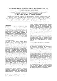
DTED-3
DTED-3
DTED-3

You also want an ePaper? Increase the reach of your titles
YUMPU automatically turns print PDFs into web optimized ePapers that Google loves.
Feasibility Analysis of Pol-InSAR Applications<br />
with a TerraSAR-X Tandem Mission<br />
Alberto Moreira, Gerhard Krieger, Irena Hajnsek, Hauke Fiedler, Kostas Papathanassiou,<br />
David Hounam und Marian Werner<br />
German Aerospace Center (DLR)<br />
Microwaves and Radar Institute (HR)<br />
Postfach 1116<br />
82230 Weßling, Germany<br />
Alberto.Moreira@dlr.de<br />
Jan. 2005<br />
Datum: German 30.09.2004 Aerospace Center SAR-Strategiediskussion, RADAR 2004 - slide Folie 11 Institut für Hochfrequenztechnik Microwaves und Radarsysteme<br />
and Radar Institute
Response to DLR Call<br />
for Proposals for the next<br />
National Earth Observation Mission<br />
Datum: 30.09.2004 SAR-Strategiediskussion, Folie 2<br />
Institut für Hochfrequenztechnik und Radarsysteme
Spatial<br />
Resolution<br />
Interferometry with<br />
TanDEM-X<br />
Absolute<br />
Vertical<br />
Accuracy<br />
(90%)<br />
Relative<br />
Vertical<br />
Accuracy<br />
(90%)<br />
Absolute<br />
Horizontal<br />
Accuracy<br />
(90% circ.)<br />
Relative<br />
Horizontal<br />
Accuracy<br />
(90% circ.)<br />
<strong>DTED</strong>-1 90m x 90m < 16 m < 10 m < 60 m < 45 m<br />
<strong>DTED</strong>-2 30m x 30m < 16 m < 10 m < 20 m < 15 m<br />
<strong>DTED</strong>-3<br />
(HRTI-3)<br />
10m x 10m < 10 m<br />
Other Other product specifications (e.g. (e.g.<br />
<strong>DTED</strong>-4) will will be be considered during during<br />
phase phase A with with respect to to users users<br />
requirements<br />
< 2 m<br />
(4m,slope>20 %)<br />
< 10 m < 3 m<br />
SRTM / X-SAR E-SAR<br />
100 150<br />
<strong>DTED</strong>-2 <strong>DTED</strong>-3<br />
Datum: 30.09.2004 SAR-Strategiediskussion, Folie 3<br />
Institut für Hochfrequenztechnik und Radarsysteme
System and Mission Heritage<br />
X-SAR SAR SRTM<br />
DESA TOPAS<br />
CHAMP GRACE<br />
TerraSAR-X<br />
TerraSAR<br />
TanDEM-X<br />
TanDEM<br />
Datum: 30.09.2004 SAR-Strategiediskussion, Folie 4<br />
Institut für Hochfrequenztechnik und Radarsysteme
2SAT Pendulum<br />
Interferometry with TanDEM-X<br />
horizontal<br />
baseline<br />
Digital Elevation Model (DEM)<br />
from SRTM Mission<br />
vertical<br />
baseline<br />
2SAT Helix<br />
horizontal<br />
baseline<br />
Single-Pass Cross-Track Interferometry with TerraSAR-X Tandem:<br />
• no temporal surface decorrelation (as opposed to repeat-pass interferometry)<br />
• almost no atmospheric distortions (as opposed to repeat-pass interferometry)<br />
• large interferometric baselines<br />
Datum: 30.09.2004 SAR-Strategiediskussion, Folie 5<br />
Institut für Hochfrequenztechnik und Radarsysteme
Orbit Configurations I<br />
Digital Elevation Model (DEM)<br />
from SRTM Mission<br />
Two-Satellite Pendulum<br />
Flight direction <br />
Datum: 30.09.2004 SAR-Strategiediskussion, Folie 6<br />
Institut für Hochfrequenztechnik und Radarsysteme
Orbit Configuration II<br />
Digital Elevation Model (DEM)<br />
from SRTM Mission<br />
Two-Satellite Helix<br />
Flight direction <br />
Datum: 30.09.2004 SAR-Strategiediskussion, Folie 7<br />
Institut für Hochfrequenztechnik und Radarsysteme
Datum: 30.09.2004 SAR-Strategiediskussion, Folie 8<br />
Institut für Hochfrequenztechnik und Radarsysteme
v/PRF<br />
Three interferograms with<br />
two “effective baselines”:<br />
Bistatic Mode with<br />
Alternating Transmitters<br />
B monostatic = 2 • B bistatic<br />
SAT 1<br />
SAT 2<br />
+ good height accuracy<br />
(use large monostatic<br />
baseline)<br />
+ improved phase<br />
unwrapping<br />
(use smaller bistatic<br />
baselines)<br />
+ phase synchronization<br />
possible<br />
– requires increased PRF<br />
(as in in polarimetric mode)<br />
∂ϕ ∂ϕ<br />
= 2<br />
⋅<br />
∂h<br />
∂h<br />
monostatic<br />
bistatic<br />
Datum: 30.09.2004 SAR-Strategiediskussion, Folie 9<br />
Institut für Hochfrequenztechnik und Radarsysteme
Parameter<br />
Wavelength<br />
Chirp Bandwidth<br />
Peak Transmit Power<br />
Duty Cycle<br />
Noise Figure<br />
Atmospheric Losses<br />
Antenna Size (Tx , Rx)<br />
PRF<br />
Processed Bandwidth<br />
Co-Registration Accuracy<br />
Quantization<br />
Sigma Nought Model<br />
(90% occurence levels)<br />
Effective Baseline<br />
Along-Track<br />
Displacement<br />
Swath Width<br />
Post Spacing<br />
Value<br />
0.031 m<br />
100 MHz<br />
2260 W<br />
18 %<br />
4.5 dB<br />
0.5 dB<br />
4.8 m x 0.7 m<br />
3500 Hz<br />
2300 Hz<br />
1/10 pixel<br />
3 bit (BAQ)<br />
Ulaby (X-Band,<br />
HH, Soil)<br />
1 km<br />
1 km<br />
30 km<br />
12 m x 12 m<br />
Interferometric<br />
Performance Estimation<br />
Relative Height Accuracy<br />
Datum: 30.09.2004 SAR-Strategiediskussion, Folie 10<br />
Institut für Hochfrequenztechnik und Radarsysteme
Scientific Areas<br />
Applications derived from across-track interferometry<br />
– Land Environment Topographic Topographic Mapping, Mapping, Cartography, Cartography, Urban Urban<br />
Areas, Areas, Disaster Disaster and and Crisis Crisis Management,<br />
Management,<br />
Navigation, Navigation, Archaeology, Archaeology, Change Change Detection Detection<br />
– Hydrology/Glaciology Ice Ice and and Snow, Snow, Wetlands, Wetlands, Morphology, Morphology, Flooding Flooding<br />
– Renewable Resources Land Land use use mapping, mapping, agriculture, agriculture, forestry forestry and and<br />
grassland grassland<br />
– Oceanography Wind Wind and and Waves, Waves, Ocean Ocean Dynamics, Dynamics,<br />
Ship Ship Detection, Detection, Bathymetry<br />
Bathymetry<br />
– Geology/Hazards Geological Geological mapping, mapping, Earthquake Earthquake /Tectonics, /Tectonics,<br />
Volcanoes, Volcanoes, Landslides<br />
Landslides<br />
Datum: 30.09.2004 SAR-Strategiediskussion, Folie 11<br />
Institut für Hochfrequenztechnik und Radarsysteme
Scientific Areas<br />
Applications with Along-Track Interferometry<br />
– Oceanography Ocean Ocean currents, currents, coastal coastal zone zone mapping mapping<br />
– Traffic Traffic Traffic flow flow monitoring monitoring<br />
– Glaciology Ice Ice flow flow monitoring monitoring<br />
New Techniques<br />
– Pol-InSAR<br />
– Digital beamforming<br />
– Multi-Angle Observations<br />
–Bi-static Processing<br />
–Super Resolution<br />
–Formation Flying<br />
Datum: 30.09.2004 SAR-Strategiediskussion, Folie 12<br />
Institut für Hochfrequenztechnik und Radarsysteme
Single Pass<br />
Polarimetric SAR Interferometry<br />
Pol-InSAR Natural Scatterers<br />
Observables<br />
3 Interferometric<br />
Coherences<br />
3 Interferometric<br />
Phases<br />
for one baseline and three<br />
polarisation states<br />
II Step: Model<br />
and Validation<br />
Inversion<br />
Coherent<br />
Scattering<br />
Model<br />
Forest<br />
Parameters<br />
Surface<br />
Parameters<br />
Agricultural<br />
Parameters<br />
Land Ice<br />
Parameters<br />
Datum: 30.09.2004 SAR-Strategiediskussion, Folie 13<br />
Institut für Hochfrequenztechnik und Radarsysteme
Polarimetric Interferometric:<br />
Performance Estimation<br />
ground-tovolume<br />
range<br />
µ min<br />
µ max<br />
Datum: 30.09.2004 SAR-Strategiediskussion, Folie 14<br />
Institut für Hochfrequenztechnik und Radarsysteme<br />
∆ϕ
Wheat (h=40cm, LAI=1.0, 30 m x 30 m)<br />
B = 500 m B = 1000 m B = 2000 m<br />
B = 4000 m B = 6000 m B = 8000 m<br />
Datum: 30.09.2004 SAR-Strategiediskussion, Folie 15<br />
Institut für Hochfrequenztechnik und Radarsysteme
Wheat (h=70cm, LAI=3.5, 30 m x 30 m)<br />
B = 500 m B = 1000 m B = 2000 m<br />
B = 4000 m B = 6000 m B = 8000 m<br />
Datum: 30.09.2004 SAR-Strategiediskussion, Folie 16<br />
Institut für Hochfrequenztechnik und Radarsysteme
Sun Flower (h=60cm, LAI=1.0, 30 m x 30 m)<br />
B = 500 m B = 1000 m B = 2000 m<br />
B = 4000 m B = 6000 m B = 8000 m<br />
Datum: 30.09.2004 SAR-Strategiediskussion, Folie 17<br />
Institut für Hochfrequenztechnik und Radarsysteme
Sun Flower (h=120cm, LAI=4.1, 30 m x 30 m)<br />
B = 500 m B = 1000 m B = 2000 m<br />
B = 4000 m B = 6000 m B = 8000 m<br />
ambiguous<br />
Datum: 30.09.2004 SAR-Strategiediskussion, Folie 18<br />
Institut für Hochfrequenztechnik und Radarsysteme
TanDEM-X Phase A<br />
Main challenges to to be be investigated in in Phase A: A:<br />
••PRF PRF and and Phase Synchronisation (design upgrade)<br />
••Precise Precise baseline determination using differential GPS<br />
and and phase measurements<br />
••Close Close formation flying capability<br />
••Bi-static Bi-static and and interferometric data data processing (<strong>DTED</strong>-3)<br />
••Spotlight Spotlight SAR interferometry<br />
••Interferometric Interferometric calibration (Ocean data data takes, tie tie points)<br />
••Scientific Scientific applications and and opportunities<br />
Datum: 30.09.2004 SAR-Strategiediskussion, Folie 19<br />
Institut für Hochfrequenztechnik und Radarsysteme
•• DEM-based applications (<strong>DTED</strong>-3):<br />
--land land environment, hydrology,<br />
geology, etc. etc.<br />
•• polarimetric SAR SAR interferometry<br />
•• along-track interferometry<br />
(e.g. (e.g. mapping of of ocean ocean currents,<br />
moving target target indication)<br />
•• super-resolution in in azimuth and and<br />
range range<br />
•• Digital Digital beam-forming with with 4<br />
phase phase centers<br />
•• multi-angle bistatic observations<br />
•• bi-static SAR SAR polarimetry<br />
•• stereogrammetric applications<br />
•• Formation flying<br />
flying<br />
Scientific Opportunities<br />
Datum: 30.09.2004 SAR-Strategiediskussion, Folie 20<br />
Institut für Hochfrequenztechnik und Radarsysteme
Datum: 30.09.2004 SAR-Strategiediskussion, Folie 21<br />
Institut für Hochfrequenztechnik und Radarsysteme