

Draft Town Belt Management Plan - Wellington City Council
Draft Town Belt Management Plan - Wellington City Council
Draft Town Belt Management Plan - Wellington City Council

Create successful ePaper yourself
Turn your PDF publications into a flip-book with our unique Google optimized e-Paper software.
8.1 Sector 1 Te Ahumairangi Hill<br />
8.1.1 Character and use<br />
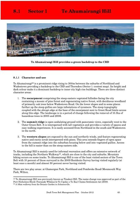
Te Ahumairangi Hill provides a green backdrop to the CBD<br />
Te Ahumairangi 29 is a prominent ridge rising to 300m between the suburbs of Northland and<br />
Wadestown providing a backdrop to the CBD and Thorndon (Sector 1: context map). Its height and<br />
dark colour make it a dominant backdrop to inner city high rise buildings. There are three distinct<br />
character areas:<br />
1. The escarpment comprising the steep eastern vegetated hillsides facing the city<br />
containing a mosaic of pine forest and regenerating native forest, with deciduous woodland<br />
of primarily oak trees below Wadestown Road. On the lower slopes and in some places<br />
further up the steep gullies are large infestations of sycamore. The steep topography<br />
coupled with the abrupt edge at the base of the escarpment next to Grant Road limits access<br />
along this edge. The landscape is in a period of change following the removal of 10.5ha of<br />
hazardous trees in 2005 and 2006.<br />
2. The summit ridge is open undulating ground with panoramic views, especially west to the<br />
Outer Green <strong>Belt</strong>. It is interspersed with tall vegetation and provides a variety of spaces and<br />
easy walking experiences. It is easily accessed from Northland in the south and Wadestown<br />
in the north.<br />
3. The western slopes are exposed to the sun and northerly winds, and feature regenerating<br />
native and exotic scrub interspersed with pines. This area extends fingers of open space<br />
from the summit ridge into the suburban housing below and into vegetated gullies. Access<br />
to the hill is easier than on the steep eastern side.<br />
Te Ahumairangi Hill is mainly used for informal recreation and offers an extensive network of<br />
tracks, including the Northern Walkway 30 , which are close to the city and suburbs. Mountain<br />
biking occurs on some tracks. Te Ahumairangi Hill is one of the least visited sectors of the <strong>Town</strong><br />
<strong>Belt</strong> with 10 percent of those surveyed in the 2009 Residents Survey having visited regularly (at<br />
least once a month) and almost 30 percent never having visited.<br />
There are two play areas: at Glamorgan Park, Northland and Pembroke Road/Monmouth Way<br />
Park, Wilton.<br />
29 Te Ahumairangi Hill was previously known as Tinakori Hill. The name change was approved as part of the<br />
Port Nicholson Block (Taranaki Whānui ki Te Upoko o Te Ika) Claims Settlement Act 2009.<br />
30 A 16km walkway from the Botanic Garden to Johnsonville.<br />
<strong>Draft</strong> <strong>Town</strong> <strong>Belt</strong> <strong>Management</strong> <strong>Plan</strong> October 2012 65 .


