

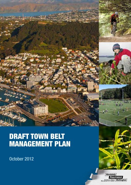
Draft Town Belt Management Plan - Wellington City Council
Draft Town Belt Management Plan - Wellington City Council
Draft Town Belt Management Plan - Wellington City Council

You also want an ePaper? Increase the reach of your titles
YUMPU automatically turns print PDFs into web optimized ePapers that Google loves.
DRAFT TOWN BELT<br />
MANAGEMENT PLAN<br />
October 2012
Contents<br />
1 Introduction 1<br />
1.1 The <strong>Town</strong> <strong>Belt</strong> concept 1<br />
1.2 What is the <strong>Wellington</strong> <strong>Town</strong> <strong>Belt</strong>? 2<br />
1.3 The <strong>Town</strong> <strong>Belt</strong> <strong>Management</strong> <strong>Plan</strong> 2<br />
1.3.1 Coverage of the plan 5<br />
1.4 Achievements of the 1995 <strong>Town</strong> <strong>Belt</strong> <strong>Management</strong> <strong>Plan</strong> 7<br />
1.5 Other relevant policies and plans 8<br />
2 <strong>Town</strong> <strong>Belt</strong> legislative and policy framework 12<br />
2.1 How is the <strong>Town</strong> <strong>Belt</strong> managed? 12<br />
2.2 <strong>Town</strong> <strong>Belt</strong> principles 13<br />
2.3 <strong>Town</strong> <strong>Belt</strong> legal status 15<br />
2.4 <strong>Town</strong> <strong>Belt</strong> alienations 16<br />
2.5 Reinstatement Policy in the 1995 <strong>Management</strong> <strong>Plan</strong> and 1998<br />
Reinstatement Policy 17<br />
2.6 The Port Nicholson Block (Taranaki Whānui ki Te Upoko o Te Ika)<br />
Claims Settlement Act 2009 17<br />
2.7 Proposed approach to <strong>Town</strong> <strong>Belt</strong> additions 18<br />
2.8 Objective 19<br />
2.9 Policies 19<br />
3 Partnership and community participation 21<br />
3.1 Partnership with mana whenua 21<br />
3.1.1 Objective 23<br />
3.1.2 Policies 23<br />
3.2 Community participation 23<br />
3.2.1 Objective 24<br />
3.2.2 Policies 24<br />
4. Landscape 25<br />
4.1 The <strong>Town</strong> <strong>Belt</strong> landscape 25<br />
4.1.1 <strong>Wellington</strong>’s landscape character 25<br />
4.1.2 <strong>Town</strong> <strong>Belt</strong> landscape change 26<br />
4.1.3 The <strong>Town</strong> <strong>Belt</strong> landscape today 28<br />
4.2 Objectives 30<br />
4.3 Policies 31<br />
5 Ecology 33<br />
5.1 Historic ecosystems 33<br />
5.2 Current ecological values 34<br />
5.3 Issues and opportunities 35<br />
5.3.1 Restoration 35<br />
5.3.2 Pest management 35<br />
5.3.3 Carbon management 38<br />
5.4 Objectives 38<br />
5.5 Policies 39<br />
<strong>Draft</strong> <strong>Town</strong> <strong>Belt</strong> <strong>Management</strong> <strong>Plan</strong> October 2012
6 Recreation 41<br />
6.1 Recreational role of <strong>Town</strong> <strong>Belt</strong> 41<br />
6.2 What is recreation? 42<br />
6.3 Existing recreational activities 43<br />
6.4 Sporting infrastructure 43<br />
6.5 Objectives 52<br />
6.6 Policies 52<br />
7 Culture and history 55<br />
7.1 Traditional history 55<br />
7.2 Historical outline of the development of the <strong>Wellington</strong> <strong>Town</strong> <strong>Belt</strong> 57<br />
7.3 Sites of interest and historical significance 58<br />
7.4 Objectives 61<br />
7.5 Policies 62<br />
8 <strong>Management</strong> sectors 63<br />
8.1 Te Ahumairangi Hill 66<br />
8.2 Kelburn Park 79<br />
8.3 Aro Valley 90<br />
8.4 Brooklyn Hills 101<br />
8.5 Macalister Park 112<br />
8.6 Golf Course/Mt Albert 122<br />
8.7 Newtown/Crawford Road 136<br />
8.8 Hataitai Park 149<br />
8.9 Mt Victoria/Matairangi 159<br />
9 Rules for use and development 171<br />
9.1 Objective 171<br />
9.2 Policies 171<br />
9.3 Allowed activities 172<br />
9.4 Managed activities 173<br />
9.5 Decision-making guidelines 175<br />
9.6 Prohibited activities 178<br />
9.7 <strong>Wellington</strong> <strong>City</strong> District <strong>Plan</strong> 182<br />
References 183<br />
Appendix 1: <strong>Town</strong> <strong>Belt</strong> and Basin Reserve Deed 1873 184<br />
Appendix 2: <strong>Town</strong> <strong>Belt</strong> land schedules 188<br />
Appendix 3: <strong>Town</strong> <strong>Belt</strong> traditional history 193<br />
Appendix 4: <strong>Town</strong> <strong>Belt</strong> historical outline 206<br />
<strong>Draft</strong> <strong>Town</strong> <strong>Belt</strong> <strong>Management</strong> <strong>Plan</strong> October 2012<br />
© <strong>Wellington</strong> <strong>City</strong> <strong>Council</strong><br />
ISBN 978 1877232 688
1 Introduction<br />
The horseshoe shaped <strong>Town</strong> <strong>Belt</strong> seen from Te Ahumairangi Hill Lookout<br />
<strong>Wellington</strong> has a very beautiful natural setting by world standards. The inner city faces north and<br />
east to the natural sweep of Lambton Harbour, and steep hills enclose it from behind. The inner<br />
suburbs cling to these hills of which large areas, including significant ridgetops, are <strong>Town</strong> <strong>Belt</strong>.<br />
1.1 The <strong>Town</strong> <strong>Belt</strong> concept<br />
<strong>Wellington</strong> is fortunate to retain a large portion of the space set aside as <strong>Town</strong> <strong>Belt</strong> in 1839 under<br />
the instruction of the Secretary of the New Zealand Company, John Ward, who stated:<br />
“It is indeed desirable that the whole outside of the <strong>Town</strong>, inland, should be separated from the<br />
country by a broad belt of land which you will declare that the Company intends to be public<br />
property on condition that no buildings be ever erected upon it."<br />
Originally held by Central Government (the Crown) after it was gazetted in 1841, this horseshoeshaped<br />
green space on the hills cradling the central city and inner suburbs has been administered<br />
and controlled by <strong>Wellington</strong> <strong>City</strong> <strong>Council</strong> since 1873.<br />
A <strong>Town</strong> <strong>Belt</strong> is an area of land set aside during the design of towns and cities to provide a green and<br />
open space for the pleasure and health of the citizens. This design approach had been advocated by<br />
utopian and radical social reformers in Britain since the early 19th century as a means of providing<br />
relief for ordinary citizens from the overcrowding of the cities.<br />
Today it is widely accepted that open space in the city is essential to not only the character and<br />
function of the city but the physical, emotional and spiritual health and wellbeing of its people.<br />
Cities around the world with environmental and social problems are working to improve the urban<br />
environment, and the provision of open space is high on the agenda. Once the built landscape is<br />
there, trying to retrofit the cityscape to include open space is incredibly difficult and often<br />
impossible. Established open space within the urban landscape, (especially a large, diverse,<br />
connected, accessible and visible open space network like the <strong>Town</strong> <strong>Belt</strong>), is extremely valuable to<br />
the city and the people who live there.<br />
Contemporary ideas on the value of natural environments fit with the <strong>Town</strong> <strong>Belt</strong> concept. The<br />
<strong>Town</strong> <strong>Belt</strong> in <strong>Wellington</strong> protects a large, predominantly natural, open-space environment with a<br />
<strong>Draft</strong> <strong>Town</strong> <strong>Belt</strong> <strong>Management</strong> <strong>Plan</strong> October 2012 1
huge range of direct and indirect environmental, social, recreational and economic benefits to the<br />
city and its residents.<br />
The concept of a <strong>Town</strong> <strong>Belt</strong> has endured through the development of the city. The values associated<br />
with the <strong>Town</strong> <strong>Belt</strong> have however changed and continue to evolve as the value and potential values<br />
of open space in the urban environment is more widely debated and understood.<br />
1.2 What is the <strong>Wellington</strong> <strong>Town</strong> <strong>Belt</strong>?<br />
Before the arrival of European colonists, the <strong>Town</strong> <strong>Belt</strong> land was under the kaitiakitanga<br />
(guardianship) of the resident iwi/hapu. The earliest documented description and pictures of the<br />
<strong>Town</strong> <strong>Belt</strong> have the land covered in forest with the slopes of Mt Victoria/Tangi te keo covered in<br />
kanuka shrubland. The Māori history and traditions related to the places that now make up the<br />
<strong>Town</strong> <strong>Belt</strong> go back to the earliest arrival of Māori in <strong>Wellington</strong>. Two important components of the<br />
<strong>Town</strong> <strong>Belt</strong> are the key ridgelines in the east and west of central <strong>Wellington</strong>, known as Te Ranga a<br />
Hiwi – or the ridge of Hiwi and the ridgeline of Ahumairangi. Hiwi was the son of the daughter of<br />
Tara, the eponymous ancestor of Ngāi Tara. Ngāi Tara were probably the first Māori to settle the<br />
area, constructing pā and developing gardens and using the forests to gather food. Before Ngāi<br />
Tara were others, more of the hunter-gatherer groups known by some as the kahui tipua, who<br />
moved around taking advantage of the natural resources of the region.<br />
The term ‘original <strong>Town</strong> <strong>Belt</strong>’ refers to all of the land proclaimed as <strong>Town</strong> <strong>Belt</strong> in 1841. being 1544<br />
acres (625 ha) that was set aside from land included in the Port Nicholson Deed of Purchase.<br />
Despite questions about the legality of purchase in 1841, Governor Hobson proclaimed the <strong>Town</strong><br />
<strong>Belt</strong> a Crown reserve, labelled as ‘land ... reserved for the enjoyment of the public and not to be<br />
built upon’ (see map on next page).<br />
The Crown (latterly through the Superintendent of the Province of <strong>Wellington</strong>) held the land from<br />
1841 to 1871 when it was transferred to the Superintendent of the Province of <strong>Wellington</strong> by the<br />
<strong>Wellington</strong> <strong>City</strong> Reserves Act 1871. The Superintendent was instructed to convey the land ‘upon<br />
such trusts and for such purposes of public utility to the <strong>City</strong> of <strong>Wellington</strong> and its inhabitants’ as<br />
the Superintendent wished. The Superintendent executed a deed of trust now usually referred to as<br />
the <strong>Town</strong> <strong>Belt</strong> Deed. See Appendix 1. Other land forming the Basin Reserve was ultimately put<br />
into trust under a separate deed.<br />
A total of 1061 acres (429 hectares) was finally conveyed to <strong>Wellington</strong> <strong>City</strong> <strong>Council</strong> on trust to be<br />
forever used as ‘public recreation ground for the inhabitants of the <strong>City</strong> of <strong>Wellington</strong>’. The <strong>Town</strong><br />
<strong>Belt</strong> Deed set out how the council was to manage the land and it remains the most important<br />
document for the <strong>Town</strong> <strong>Belt</strong> today. The <strong>Council</strong> holds the land in trust for the citizens of<br />
<strong>Wellington</strong> and is a similar concept to the public commons in England. A public commons means a<br />
place that has a public good that is free for people to view and enjoy and owned by everyone who<br />
wants to be a part of it.<br />
Since 1841, the growth of <strong>Wellington</strong> <strong>City</strong> has meant that over a third of the land originally<br />
designated for <strong>Town</strong> <strong>Belt</strong> has been taken for community purposes (see map on next page).<br />
Significant portions of the <strong>Town</strong> <strong>Belt</strong> were lost for predominantly Crown uses. These included land<br />
for <strong>Wellington</strong> College, the Governor General's residence, Victoria University, <strong>Wellington</strong> Hospital,<br />
and various roads linking the inner city with the suburbs.<br />
Today, the <strong>Town</strong> <strong>Belt</strong> is a significant piece of open space that provides a scenic backdrop to the<br />
inner city, brings nature to the heart of the city, and is very important to the health and wellbeing<br />
of residents and visitors.<br />
1.3 The <strong>Town</strong> <strong>Belt</strong> <strong>Management</strong> <strong>Plan</strong><br />
The purpose of the <strong>Wellington</strong> <strong>Town</strong> <strong>Belt</strong> <strong>Management</strong> <strong>Plan</strong> is to provide <strong>Wellington</strong> <strong>City</strong> <strong>Council</strong><br />
with a clear framework for making decisions and managing the <strong>Town</strong> <strong>Belt</strong> for the next 10 years.<br />
2<br />
<strong>Draft</strong> <strong>Town</strong> <strong>Belt</strong> <strong>Management</strong> <strong>Plan</strong> October 2012
Karo ri<br />
Ow hiro Bay<br />
Sector 1<br />
Te Ahumairangi Hill<br />
Wilton<br />
Sector 2<br />
Kelburn Park<br />
Sector 3<br />
Aro Valley / Polhill Gully<br />
Sector 4<br />
Brooklyn Hills<br />
Highb ury<br />
Sector 5<br />
Macalister Park<br />
Broo klyn<br />
Sector 6<br />
Golf Course / Mt Albert<br />
Northland<br />
Kin gston<br />
Kelburn<br />
Aro Va lley<br />
Morningto n<br />
Vo geltow n<br />
Islan d Bay<br />
Te Aro<br />
Mt C ook<br />
Berh amp ore<br />
Tho rn don<br />
Wellingt on C entral<br />
Wadesto wn<br />
New tow n<br />
Land managed under the <strong>Town</strong> <strong>Belt</strong> <strong>Management</strong> <strong>Plan</strong><br />
Other data has been com piled fr om a v ariety of s our ces and its acc uracy m ay vary, but is gener ally +/- 1m .<br />
Pip ite a<br />
Mt Victoria<br />
Melro se<br />
Orienta l B ay<br />
Lya ll Ba y<br />
Hata it ai<br />
Kilbirnie<br />
Rosen eath<br />
Sector 9<br />
Mt Victoria / Matairangi<br />
Sector 8<br />
Hataitai Park<br />
Sector 7<br />
Newtown / Crawford Road<br />
<strong>Town</strong> <strong>Belt</strong> sectors<br />
Ron gotai<br />
0 250 500 1,000<br />
metres<br />
scale 1:29,000<br />
¯<br />
Miram ar<br />
Original <strong>Town</strong> <strong>Belt</strong> - 1841<br />
Chest Hospital<br />
<strong>Wellington</strong> Zoo<br />
Suburbs<br />
<strong>Draft</strong> <strong>Town</strong> <strong>Belt</strong> <strong>Management</strong> <strong>Plan</strong> October 2012 3
4<br />
<strong>Town</strong> <strong>Belt</strong> between the suburbs of Thorndon and Wilton.<br />
In 2011 the <strong>Council</strong> approved a set of guiding principles to guide and support the review of the 1995<br />
management plan.<br />
This draft management plan identifies:<br />
• the legal framework for the <strong>Town</strong> <strong>Belt</strong><br />
• the guiding principles<br />
• the long-term vision for the <strong>Town</strong> <strong>Belt</strong><br />
• the natural and cultural features of the <strong>Town</strong> <strong>Belt</strong> and how these will be protected<br />
• recreational role and activities on the <strong>Town</strong> <strong>Belt</strong><br />
• general management objectives and policies<br />
• actions required to implement this plan.<br />
The guiding principles provide the wider community’s values and aspirations for the <strong>Town</strong> <strong>Belt</strong> and<br />
provide a framework for decision making. They are fully described in section 2.2.<br />
The objectives and policies in this plan explain the intended methods for the protection,<br />
management, development, operation and public use of the <strong>Town</strong> <strong>Belt</strong>.<br />
Structure of the plan: In order to provide a framework to achieve connectivity and sustainability on<br />
the <strong>Town</strong> <strong>Belt</strong>, this plan is principally structured around eight key themes:<br />
1. <strong>Town</strong> <strong>Belt</strong> legislative and policy framework<br />
2. Partnership and community participation<br />
3. Landscape<br />
4. Ecology and biodiversity<br />
5. Recreation<br />
6. Culture and history<br />
7. <strong>Management</strong> sectors<br />
8. Rules for use and development<br />
While the plan is structured around themes, the <strong>Town</strong> <strong>Belt</strong> is divided into sectors for the purposes<br />
of implementation and ease of understanding for local communities (see section 8). Each sector<br />
recognises the complexity of the topography, vegetation, uses and communities of interest inherent<br />
in the <strong>Town</strong> <strong>Belt</strong>. These sectors are:<br />
<strong>Draft</strong> <strong>Town</strong> <strong>Belt</strong> <strong>Management</strong> <strong>Plan</strong> October 2012
1. Te Ahumairangi Hill<br />
2. Kelburn Park<br />
3. Aro Valley<br />
4. Brooklyn Hills<br />
5. Macalister Park<br />
6. Golf Course/Mt Albert<br />
7. Newtown/Crawford Road<br />
8. Hataitai Park<br />
9. Mt Victoria/Matairangi<br />
The general policies need to be read alongside the specific policies for each sector. The sector<br />
policies take precedence over the general policies. The minimum period for review of this<br />
management plan is five years from the date it is adopted.<br />
1.3.1 Coverage of the plan<br />
Objectives and policies in the plan will cover:<br />
• 389.68 hectares held in trust under the <strong>Town</strong> <strong>Belt</strong> Deed, and<br />
• 85.4375 hectares of reserve land managed as <strong>Town</strong> <strong>Belt</strong>.<br />
See map on page 3 and 6, and Appendix 2.<br />
Policies are not included for the <strong>Wellington</strong> Botanic Garden or the <strong>Wellington</strong> Zoo or <strong>Wellington</strong><br />
showgrounds (except the artificial turf behind Te Whaea).<br />
<strong>Wellington</strong> Botanic Garden: In 1839 the New Zealand Company allocated 13 acres of <strong>Town</strong><br />
<strong>Belt</strong> land for a Botanic Garden alongside what is now Glenmore Street.<br />
In 1869 the Botanic Garden Act was passed and management of the garden was entrusted to a<br />
board under the auspices of the New Zealand Institute, the forerunner of the Royal Society of New<br />
Zealand.<br />
In 1891 the <strong>Wellington</strong> Botanic Garden Vesting Act dissolved the Botanic Garden Board and vested<br />
control in <strong>Wellington</strong> <strong>City</strong> <strong>Council</strong>. <strong>Wellington</strong> Botanic Garden is not covered by the provisions of<br />
the <strong>Town</strong> <strong>Belt</strong> Deed.<br />
The Botanic Garden is classified as Local Purpose Reserve (Botanic Garden) under the Reserves<br />
Act 1977 and managed under the Combined <strong>Management</strong> <strong>Plan</strong> (<strong>Wellington</strong> Botanic Garden,<br />
Anderson Park, Bolton Street Memorial Park (2002).<br />
<strong>Wellington</strong> Zoo: The Zoological Garden, established in 1906, sits on land managed in trust by<br />
the <strong>Council</strong> under the <strong>Town</strong> <strong>Belt</strong> Deed. It is an accepted historic use within the <strong>Town</strong> <strong>Belt</strong>. The zoo<br />
operation is now managed under the <strong>Wellington</strong> Zoo Trust Deed (2003).<br />
<strong>Wellington</strong> showgrounds: In 1959 5.223 ha of land in Hutchinson Road was suspended from<br />
the <strong>Town</strong> <strong>Belt</strong> Deed by the <strong>Wellington</strong> <strong>City</strong> Exhibition Act. If this Act is repealed or the lease<br />
terminates, the showground land will automatically return to <strong>Town</strong> <strong>Belt</strong> management.<br />
Since 2010, the <strong>Council</strong>-managed area known as Te Whaea artificial sportsfield has been removed<br />
from the Premises <strong>Management</strong> Lease for the showgrounds. This area will be managed as part of<br />
the <strong>Town</strong> <strong>Belt</strong>.<br />
Road reserve that adjoins <strong>Town</strong> <strong>Belt</strong> land managed under this management plan will be<br />
managed in a consistent manner with the objectives and policies of this plan.<br />
Chest Hospital: The former Chest Hospital land (Chest Hospital) and buildings were transferred<br />
at no cost to the <strong>Council</strong> in December 2002 by the Capital & Coast District Health Board. The<br />
acquisition was consistent with the <strong>Town</strong> <strong>Belt</strong> Reinstatement Policy 1998.<br />
<strong>Draft</strong> <strong>Town</strong> <strong>Belt</strong> <strong>Management</strong> <strong>Plan</strong> October 2012 5
6<br />
Wilton<br />
Victoria University<br />
Ow hiro Bay<br />
Highb ury<br />
Broo klyn<br />
<strong>Wellington</strong> Show Grounds<br />
(suspended from Deed)<br />
Northland<br />
Kin gston<br />
Kelburn<br />
Aro Va lley<br />
Morningto n<br />
Status of Original <strong>Town</strong> <strong>Belt</strong><br />
Vo geltow n<br />
Islan d Bay<br />
Te Aro<br />
Mt C ook<br />
Other data has been com piled fr om a v ariety of s our ces and its acc uracy m ay vary, but is gener ally +/- 1m .<br />
Berh amp ore<br />
Tho rn don<br />
Wellingt on C entral<br />
Wadesto wn<br />
New tow n<br />
Pip ite a<br />
Mt Victoria<br />
<strong>Wellington</strong><br />
Botanic Garden<br />
Orienta l B ay<br />
Hata it ai<br />
Government House<br />
Kilbirnie<br />
Lya ll Ba y<br />
Chest Hospital<br />
Rosen eath<br />
Land protected by <strong>Town</strong> <strong>Belt</strong> Deed<br />
Ron gotai<br />
0 250 500 1,000<br />
metres<br />
scale 1:29,000<br />
¯<br />
Miram ar<br />
Land to be added to <strong>Town</strong> <strong>Belt</strong> Deed<br />
Original <strong>Town</strong> <strong>Belt</strong> - 1841<br />
<strong>Wellington</strong> Zoo<br />
Suburbs<br />
<strong>Draft</strong> <strong>Town</strong> <strong>Belt</strong> <strong>Management</strong> <strong>Plan</strong> October 2012<br />
Ministry of Education land -<br />
<strong>Wellington</strong> College and<br />
<strong>Wellington</strong> East Girls' College
The historic nature of the Chest Hospital and the need to enable a long term sustainable use mean<br />
that specific objectives and policies have been prepared in <strong>Management</strong> Sector 7.<br />
These objectives and policies will generally be consistent with the objectives and policies of this<br />
management plan. However the specific policies for the Chest Hospital will take precedence over<br />
the general policies of the plan.<br />
1.4 Achievements of the 1995 <strong>Town</strong> <strong>Belt</strong> <strong>Management</strong> <strong>Plan</strong><br />
The 1995 plan provided strategic direction for the future management and development of the<br />
<strong>Town</strong> <strong>Belt</strong>. In particular:<br />
1. There has been significant recovery of original sections of <strong>Town</strong> <strong>Belt</strong>, including Telecom<br />
land at Te Ahumairangi Hill (23.33 hectares), and the Chest Hospital (3.21 hectares).<br />
Equally, there has been no further loss of <strong>Town</strong> <strong>Belt</strong> land held by <strong>Council</strong>, and<br />
encroachments on the <strong>Town</strong> <strong>Belt</strong> have been more effectively identified and monitored.<br />
Some major encroachments have been resolved, such as the Presbyterian Support Services<br />
easement in Berhampore and access to Upper Weld Street. The Crown has not sold off any<br />
Original <strong>Town</strong> <strong>Belt</strong> land since 1995.<br />
2. The <strong>Town</strong> <strong>Belt</strong> Reinstatement Policy 1998.<br />
3. Increased recreational use of the <strong>Town</strong> <strong>Belt</strong> has been possible with the following<br />
developments:<br />
Major improvements to visitor and sporting facilities include:<br />
• Mt Victoria lookout<br />
• Te Ahumairangi Hill (Tinakori Hill) landscape plan including the lookout at<br />
the southern end<br />
• Central Park redevelopment<br />
• Newtown Park<br />
• Rugby League Park redevelopment including the Te Whaea artificial<br />
• National Hockey Stadium parking<br />
• Development of two artificial sportsfields at Wakefield Park<br />
• New skatepark at Island Bay.<br />
Improved access and events for recreational enjoyment include:<br />
• <strong>City</strong> to Sea walkway<br />
• Mt Victoria track upgrades and mountain bike circuit<br />
• International mountain bike championships<br />
• World running championships.<br />
4. Some surplus buildings have been removed from the <strong>Town</strong> <strong>Belt</strong> and the land has been<br />
returned to open space.<br />
5. There has been interpretation and protection of some of the historic features, including<br />
restoring the Grant Road fountain and the entrance of Central Park, installing a plaque at<br />
Stellin Memorial, and providing information at the Mt Victoria and Te Ahumairangi Hill<br />
lookouts.<br />
6. The managed vegetation on the <strong>Town</strong> <strong>Belt</strong> has flourished, largely as a result of protection by<br />
the <strong>Council</strong>, weed and possum-control programmes and the great work of volunteer groups<br />
involved in revegetation and restoration projects. There are now 13 volunteer groups<br />
working on the <strong>Town</strong> <strong>Belt</strong>.<br />
• A possum control programme covers the entire <strong>Town</strong> <strong>Belt</strong><br />
<strong>Draft</strong> <strong>Town</strong> <strong>Belt</strong> <strong>Management</strong> <strong>Plan</strong> October 2012 7
8<br />
• A weed-control programme for the <strong>Town</strong> <strong>Belt</strong> targets, in particular, old man’s<br />
beard, banana passionfruit and climbing asparagus<br />
• Revegetation of 27 hectares with native ecosourced plants.<br />
7. The managed vegetation on the <strong>Town</strong> <strong>Belt</strong> has been gradually changing from pine trees to<br />
native forest. Over 26 hectares of exotic trees (mainly pines) have been removed and areas<br />
replanted with native species in accordance with the <strong>Town</strong> <strong>Belt</strong> <strong>Management</strong> <strong>Plan</strong>.<br />
Places where exotic trees have been replaced include:<br />
• Te Ahumairangi Hill<br />
• Telford Terrace (above Oriental Bay)<br />
• Finnimore Terrace (in Vogeltown)<br />
• Berhampore Golf Course<br />
• Owen Street (in Newtown).<br />
1.5 Other relevant policies and plans<br />
Other plans that give guidance in the development of this plan are listed below:<br />
<strong>Wellington</strong> towards 2040: Smart Capital<br />
<strong>Wellington</strong> <strong>City</strong> <strong>Council</strong>’s vision for <strong>Wellington</strong> is focused on the future development of the city<br />
over the next 30 years. It builds on <strong>Wellington</strong>’s current strengths, acknowledges the challenges the<br />
city faces now and over the medium to long term, understands the changing role of cities, and is<br />
informed by <strong>Wellington</strong>’s communities. The vision is supported by four community outcomes<br />
based on the city’s competitive advantage. These are: eco-city; connected city; people-centred city<br />
and dynamic central city. These goals are central to the <strong>Council</strong>'s Long Term <strong>Plan</strong> 2012–2022.<br />
Central <strong>City</strong> Framework (2011)<br />
This is a spatial structure plan that provides overall context, direction for future planning,<br />
coordination, prioritisation and assessment of key city projects. The resulting central city open<br />
space strategy has 10 key elements, and there are two that specifically relate to the <strong>Town</strong> <strong>Belt</strong>:<br />
• Big space links: There are large open areas that can play an improved role in the<br />
provision of open space in the city. Primarily these are the <strong>Town</strong> <strong>Belt</strong> and waterfront.<br />
Improving the links to these from the city area – and providing additional amenities within<br />
these large open areas – will enable increased use.<br />
• Cross-valley links: The greening of city streets with ‘urban forest’ across the valley will<br />
enhance urban ecology and reduce the hardness of the city-scape. This will also provide<br />
corridors across the valley to join the town belts and enhance accessibility.<br />
Capital Spaces – Open Space Strategy for <strong>Wellington</strong> Te Whanganui-a-Tara<br />
This strategy was developed in 1998 and provides directions for an integrated approach to<br />
managing the natural and recreational environment, including recognising important landscape<br />
features. The <strong>Town</strong> <strong>Belt</strong> is part of the ‘Inner Green <strong>Belt</strong>s’ open space:<br />
“a series of green belts or corridors, rich in ecological, recreational and heritage values,<br />
which weave green open space through the city, containing and identifying the suburbs and<br />
connecting other open spaces”<br />
Capital Spaces is currently under review.<br />
Biodiversity Action <strong>Plan</strong> (2007)<br />
The Biodiversity Action <strong>Plan</strong> coordinates the <strong>Council</strong>’s biodiversity activities and identifies local<br />
priorities and actions for biodiversity. Biodiversity activities include pest control, revegetation<br />
planting, and partnerships with other organisations and groups.<br />
<strong>Draft</strong> <strong>Town</strong> <strong>Belt</strong> <strong>Management</strong> <strong>Plan</strong> October 2012
The outcomes of the plan include:<br />
• identifying the current state of <strong>Wellington</strong>’s biodiversity and the areas/species that<br />
require the most protection<br />
• protecting <strong>Wellington</strong>’s indigenous biodiversity on public and private land<br />
• motivating the community to become more involved in biodiversity conservation<br />
• working closely with other organisations to ensure the conservation of <strong>Wellington</strong>’s<br />
biodiversity<br />
• restoring our indigenous biodiversity where possible and ensuring it is easily accessible<br />
for all <strong>Wellington</strong>ians<br />
• generating quality information through monitoring and research to enable us to conserve<br />
and manage our biodiversity into the future.<br />
Open Space Access <strong>Plan</strong> (2008)<br />
This plan sets out the <strong>Council</strong>’s strategic vision for tracks in the city’s parks, reserves and open<br />
spaces. The plan’s vision is to strengthen and improve the open space access network by:<br />
• providing outstanding opportunities for recreation and tourism within the open<br />
spaces of <strong>Wellington</strong><br />
• ensuring tracks provide for a range of user interests, skills, abilities and fitness levels<br />
within each area<br />
• achieving a quality primary network accessing major destination points in <strong>Wellington</strong><br />
and adjoining districts, and linking with an equitable distribution of secondary and<br />
local track networks and recreational facilities.<br />
Playground Policy (2002)<br />
This policy defines how the <strong>Council</strong> will provide playgrounds to the community in an equitable<br />
manner, recognising the needs of communities and suburbs and taking into account constraints of<br />
topography and funding. The objective of the Playgrounds Policy is therefore:<br />
The provision of a range of safe, enjoyable and stimulating playgrounds across the<br />
city in a way that best meets the needs of children, care-givers, communities and<br />
the city for access, safety, amenity and maintenance.<br />
Working towards this objective will establish an adequate provision of playgrounds in <strong>Wellington</strong>,<br />
as well as ensuring that excessive provision does not occur.<br />
Climate Change Action <strong>Plan</strong> (2010)<br />
This plan identifies cost-effective initiatives for <strong>Council</strong> operations and the community that will<br />
help the <strong>Council</strong> achieve its carbon neutral vision, and promote sustainable behaviour. The plan is<br />
divided into seven action areas: Actions of relevance to the <strong>Town</strong> <strong>Belt</strong>:<br />
Adaptation<br />
A1 A vulnerability assessment for the city to the impacts of climate change ($130k OPEX<br />
over two years).<br />
A2 Improve preparation for more frequent extreme weather events.<br />
A3 Enhance guidance for asset management on climate change risks.<br />
A7 Investigate opportunities to ‘green’ the roofs of council and city facilities and promote<br />
tree planting.<br />
Forestry<br />
F2 Investigate the impact of an enhanced pest-management programme in council forests to<br />
increase carbon sequestration.<br />
<strong>Draft</strong> <strong>Town</strong> <strong>Belt</strong> <strong>Management</strong> <strong>Plan</strong> October 2012 9
10<br />
F3 Investigate opportunities to develop forest sinks with other councils to meet respective<br />
ETS obligations.<br />
<strong>Council</strong> operations<br />
C4 Develop a policy to manage carbon credits and obligations.<br />
C5 Investigate development tools that encourage energy efficiency, quality urban design and<br />
built environment.<br />
<strong>Wellington</strong> <strong>City</strong> District <strong>Plan</strong><br />
This is the <strong>Council</strong>’s principal regulatory document setting out objectives and policies, methods<br />
and rules for managing the city environment, land uses and associated activities.<br />
The <strong>Wellington</strong> <strong>City</strong> District <strong>Plan</strong> is prepared in accordance with the Resource <strong>Management</strong> Act<br />
1991 and is based on the principles of sustainability:<br />
• Dependency: All life depends on the health of the natural environment.<br />
• Irreversibility: Some actions can result in permanent loss of species, landforms and<br />
heritage.<br />
• Diversity is necessary in both natural and urban environments. It can enable<br />
communities to adapt to change.<br />
• Efficiency in the use of renewable and non-renewable resources.<br />
• Finite resources: recognition that all resources are finite.<br />
• Equity in access to and the use of resources. Includes enabling communities to care for<br />
their environment and influence change.<br />
• Precautionary approach should be taken where there is uncertainty and potential for<br />
significant harm.<br />
The <strong>Wellington</strong> <strong>Town</strong> <strong>Belt</strong> is identified as a separate open space area Open Space C (Inner <strong>Town</strong><br />
<strong>Belt</strong>) in the <strong>Wellington</strong> District <strong>Plan</strong>. The District <strong>Plan</strong>’s policies, objectives and rules will relate to<br />
the management plan. In particular the District <strong>Plan</strong> proposes to:<br />
16.5.1.2 Recognise the special status of the Inner <strong>Town</strong> <strong>Belt</strong> as public recreation land held in<br />
trust by the <strong>Council</strong> under the <strong>Town</strong> <strong>Belt</strong> Deed 1873 and identify that land on the<br />
District <strong>Plan</strong> maps.<br />
16.5.1.3 Manage the impacts of activities in the Inner <strong>Town</strong> <strong>Belt</strong> in order to protect and preserve<br />
its special qualities for the benefit of future generations.<br />
In addition to policy guidance the District <strong>Plan</strong> has rules for <strong>Town</strong> <strong>Belt</strong> land. The rules allow the<br />
<strong>Council</strong> to exercise control on the type of building and activity that occurs, and this control is<br />
exercised by way of the resource consent process. The rules reflect the status of the <strong>Town</strong> <strong>Belt</strong>, but<br />
have not been reviewed since the District <strong>Plan</strong> became operative in 2000. A review of all Open<br />
Space rules (including the <strong>Town</strong> <strong>Belt</strong> / Open Space C rules) is currently programmed as a high<br />
priority review in the District <strong>Plan</strong> work programme. Notification of a plan change for this area is<br />
scheduled in the 2013–14 financial year. This will provide an opportunity to amend the policies and<br />
rules if it is determined they are no longer considered fit for purpose.<br />
<strong>Draft</strong> Leases Policy for Community and Recreation Groups (under review)<br />
The <strong>Council</strong> provides leases of land and/or buildings at a subsidised rental to a wide range of<br />
community and recreation groups (groups). As <strong>Council</strong>-owned land and buildings are a limited<br />
resource, the <strong>Council</strong> needs to allocate this resource in a way that maximises the use of its assets<br />
and responds to changing demands.<br />
<strong>Draft</strong> <strong>Town</strong> <strong>Belt</strong> <strong>Management</strong> <strong>Plan</strong> October 2012
The <strong>Draft</strong> Leases Policy for Community and Recreation Groups (policy) sets out the <strong>Council</strong>’s role<br />
in leasing land and/or buildings to groups and provides guidance on:<br />
• granting leases of land and/or buildings to community and recreation groups<br />
• managing leases relating to the groups<br />
• the standard to which land and/or buildings will be maintained to ensure appropriate asset<br />
management.<br />
The objectives of the policy are to:<br />
• ensure maximum community benefit is derived from <strong>Council</strong>-owned land and buildings<br />
• strengthen participation and engagement in community and recreational activities<br />
• ensure leases are managed fairly, processes are transparent and <strong>Council</strong> officers have the<br />
flexibility to respond to community needs.<br />
The policy applies to all community and recreation groups that lease <strong>Council</strong> owned land and/or<br />
buildings.<br />
<strong>Draft</strong> <strong>Town</strong> <strong>Belt</strong> <strong>Management</strong> <strong>Plan</strong> October 2012 11
2 <strong>Town</strong> <strong>Belt</strong> legislative and policy framework<br />
Land acquired by <strong>Council</strong> for <strong>Town</strong> <strong>Belt</strong> purposes but not protected under the Deed:<br />
Chest Hospital (2002) and Vice Regal Park (1981 and 1990)<br />
behind <strong>Wellington</strong> Hospital in Newtown<br />
2.1 How is the <strong>Town</strong> <strong>Belt</strong> managed?<br />
The <strong>Wellington</strong> <strong>Town</strong> <strong>Belt</strong> comprises 389.68 hectares held in Trust under the <strong>Town</strong> <strong>Belt</strong> Deed.<br />
The deed is the key document giving <strong>Council</strong> legal authority over the <strong>Town</strong> <strong>Belt</strong> and provides<br />
primary powers to make rules and regulations to govern the use of the <strong>Town</strong> <strong>Belt</strong> (See section 2.3).<br />
The deed is almost 140 years old. Its age, archaic language and nature, however, means it is too<br />
general to provide clear guidance and consistency for the management decisions that need to be<br />
made on a regular basis. For this reason, and to follow best practice, the <strong>Council</strong> adopted the<br />
current <strong>Town</strong> <strong>Belt</strong> <strong>Management</strong> <strong>Plan</strong> in 1995. This attempted to translate the intent of the deed<br />
into a set of operational practices through two statements of purpose (aims) and a number of<br />
policies on how different aspects of the <strong>Town</strong> <strong>Belt</strong> should be managed.<br />
In 2011 the <strong>Council</strong> approved a set of guiding principles to support the review of the management<br />
plan.<br />
The current management and governance framework is as follows:<br />
12<br />
<strong>Draft</strong> <strong>Town</strong> <strong>Belt</strong> <strong>Management</strong> <strong>Plan</strong> October 2012
Governance<br />
<strong>Management</strong><br />
2.2 <strong>Town</strong> <strong>Belt</strong> principles<br />
<strong>Town</strong> <strong>Belt</strong> Deed<br />
Trustee (<strong>Council</strong>)<br />
<strong>Town</strong> <strong>Belt</strong> <strong>Management</strong> <strong>Plan</strong><br />
• Guiding principles<br />
• Objectives/policies/rules<br />
Operational practice<br />
Guiding principles summarise common values shared by an organisation or a group of people for a<br />
collective purpose. They are developed by organisations to give their staff a clear understanding of<br />
the organisation’s priorities and guide them on how they should behave in the multitude of different<br />
situations they encounter in their work.<br />
Guiding principles are not rules or policies and do not dictate or set specific directives on how the<br />
<strong>Town</strong> <strong>Belt</strong> should be managed. Instead they are used to develop policies and guide decision making.<br />
The draft guiding principles for the <strong>Town</strong> <strong>Belt</strong> were developed from feedback on the wider<br />
community’s values and aspirations for the <strong>Town</strong> <strong>Belt</strong>. They are relatively generic, representing a<br />
generally accepted view for the <strong>Town</strong> <strong>Belt</strong> from a number of widely different perspectives.<br />
The final principles were approved by the <strong>Council</strong> on 16 December 2011:<br />
Reserves Act<br />
1977 and other<br />
legislation<br />
Reserves Act 1977<br />
and other<br />
legislation<br />
Other <strong>Council</strong><br />
plans and<br />
policies<br />
1. The <strong>Wellington</strong> <strong>Town</strong> <strong>Belt</strong> will be protected and enhanced by the <strong>Council</strong> for<br />
future generations.<br />
This reflects the <strong>Council</strong>’s commitment to ensuring that the <strong>Town</strong> <strong>Belt</strong> will be protected<br />
for <strong>Wellington</strong>ians to enjoy.<br />
The physical size and continuity of the <strong>Town</strong> <strong>Belt</strong> will be retained and enhanced.<br />
<strong>Draft</strong> <strong>Town</strong> <strong>Belt</strong> <strong>Management</strong> <strong>Plan</strong> October 2012 13
14<br />
2. The <strong>Town</strong> <strong>Belt</strong> will continue to be governed in trust by the <strong>Council</strong>, under the<br />
1873 Deed and subsequent legislation on behalf of the citizens of <strong>Wellington</strong>.<br />
3. The <strong>Council</strong> will work in partnership with mana whenua to manage the <strong>Town</strong><br />
<strong>Belt</strong>.<br />
This recognises that mana whenua will have an ongoing role in the management of the <strong>Town</strong><br />
<strong>Belt</strong>, consistent with our current relationship.<br />
4. The <strong>Town</strong> <strong>Belt</strong>’s landscape character will be protected and enhanced.<br />
The landscape character of the <strong>Town</strong> <strong>Belt</strong> has changed and been modified since humans first<br />
interacted with it. The <strong>Council</strong> will protect and enhance the key features of this landscape<br />
character (acknowledging that vegetation change will occur over time), which are:<br />
the continuous ‘horseshoe’ shape of hills between the central business district and<br />
surrounding suburbs<br />
the vegetated slopes interspersed with areas of open ground<br />
undeveloped skylines (ie Te Ahumairangi and Mt Victoria/Te Ranga a Hiwi etc.)<br />
the contrast between the patchwork of native and exotic vegetation and the densely<br />
developed central business district.<br />
5. The <strong>Town</strong> <strong>Belt</strong> will support healthy populations of indigenous biodiversity.<br />
The <strong>Town</strong> <strong>Belt</strong> already has an important role in bringing nature to the city and has the<br />
potential to expand that role by acting as a hub for indigenous biodiversity and improving the<br />
city’s ecological resilience.<br />
Key factors for supporting healthy populations of indigenous biodiversity include:<br />
the connectivity of indigenous vegetation to facilitate movement within and through the<br />
<strong>Town</strong> <strong>Belt</strong><br />
sufficient natural habitat (including streams and bush) to maintain native animal<br />
populations<br />
ensuring pest species do not threaten indigenous biodiversity.<br />
6. The <strong>Town</strong> <strong>Belt</strong> is for all to enjoy.<br />
This concerns equity of access and use of the <strong>Town</strong> <strong>Belt</strong>. The <strong>Council</strong> believes that the <strong>Town</strong><br />
<strong>Belt</strong> should be available for all <strong>Wellington</strong>ians to enjoy.<br />
7. The <strong>Town</strong> <strong>Belt</strong> will be used for a wide range of recreation activities.<br />
The <strong>Town</strong> <strong>Belt</strong> should cater for a wide range of sporting and recreation activities, managed in<br />
a way to minimise conflict between different users. Co-location and intensification of sports<br />
facilities within existing hubs and buildings is supported where appropriate.<br />
8. The <strong>Council</strong> will encourage and support community participation in the<br />
management of the <strong>Town</strong> <strong>Belt</strong>.<br />
This recognises that <strong>Wellington</strong>ians will have an ongoing role in the management of the <strong>Town</strong><br />
<strong>Belt</strong>. The <strong>Council</strong> values community input and acknowledges the work of individuals and<br />
groups to protect, enhance and use the <strong>Town</strong> <strong>Belt</strong>. The <strong>Council</strong> will support and encourage<br />
community participation, which underpins long-term sustainability.<br />
9. <strong>Management</strong> of the <strong>Town</strong> <strong>Belt</strong> will acknowledge historical and cultural links to<br />
the land.<br />
The <strong>Town</strong> <strong>Belt</strong> has a rich and diverse history and the <strong>Council</strong> recognises that the historical<br />
link of mana whenua to the land has not been well acknowledged in the past. The <strong>Council</strong><br />
intends to take significant historical and cultural values into account when making decisions<br />
about the <strong>Town</strong> <strong>Belt</strong>.<br />
<strong>Draft</strong> <strong>Town</strong> <strong>Belt</strong> <strong>Management</strong> <strong>Plan</strong> October 2012
2.3 <strong>Town</strong> <strong>Belt</strong> legal status<br />
The <strong>Town</strong> <strong>Belt</strong> is land held by the <strong>Council</strong> as the trustee of a charitable trust created in 1873.<br />
Under the <strong>Wellington</strong> <strong>City</strong> Reserves Act 1871, the Superintendent of the Province of <strong>Wellington</strong> was<br />
directed to convey the land that was to become the modern <strong>Town</strong> <strong>Belt</strong>:<br />
"to the Mayor, <strong>Council</strong>lors and Burgesses for the time being of the <strong>City</strong> of <strong>Wellington</strong> to<br />
hold the same to the said Mayor, <strong>Council</strong>lors and Burgesses and their successors upon<br />
such trusts and for such purposes of public utility to the <strong>City</strong> of <strong>Wellington</strong> and its<br />
inhabitants as shall in and by the Deed or Deeds of conveyance thereof be expressed<br />
and declared".<br />
The Superintendent complied with this direction by settling a trust. On 20 March 1873 a deed was<br />
sealed by the Superintendent which conveyed the <strong>Town</strong> <strong>Belt</strong> land to <strong>Council</strong>'s predecessor upon trust<br />
"to be forever hereafter used and appropriated as a public Recreation ground for the<br />
inhabitants of the <strong>City</strong> of <strong>Wellington</strong> in such manner as in and by such rules and<br />
regulations to be from time to time made in that behalf by the [<strong>Council</strong>] shall be<br />
prescribed and directed".<br />
The deed also empowered the <strong>Council</strong> to lease parts of the <strong>Town</strong> <strong>Belt</strong> in order to raise revenue for the<br />
purposes set out in the <strong>Wellington</strong> <strong>City</strong> Reserves Act 1871 and the <strong>Wellington</strong> <strong>City</strong> Reserves Act 1872.<br />
These purposes were to fund the 'ornamentation and utilisation of the <strong>Town</strong> <strong>Belt</strong>', the Board of<br />
Governors of the Botanic Gardens, and the construction and maintenance of various roads. This<br />
power is now effectively historic.<br />
As well as being the property of a charitable trust, the <strong>Town</strong> <strong>Belt</strong> is also a recreation reserve under the<br />
Reserves Act 1977.<br />
While the Reserves Act 1977 is probably the most important source of <strong>Council</strong>'s day-to-day powers,<br />
under section 5(2) of that Act, it applies to the <strong>Town</strong> <strong>Belt</strong> subject to the 1873 Deed 1 .<br />
The <strong>Council</strong>'s primary duty is to execute the trust created by the 1873 deed in accordance with its<br />
terms and the general law. In other words, the <strong>Council</strong>'s powers must be exercised in a manner that is<br />
consistent with the charitable object of using the <strong>Town</strong> <strong>Belt</strong> as a public recreation ground for the<br />
inhabitants of <strong>Wellington</strong>.<br />
The <strong>Council</strong>'s most important powers can be summarised as follows:<br />
General management powers<br />
Under the 1873 deed, the <strong>Council</strong> may manage the <strong>Town</strong> <strong>Belt</strong> "in such manner as in and by such<br />
rules and regulations to be from time to time made in that behalf by the [<strong>Council</strong>] shall be<br />
prescribed and directed". In practice however, <strong>Council</strong> manages the <strong>Town</strong> <strong>Belt</strong> under the powers it<br />
has in respect of recreation reserves under the Reserves Act 1977.<br />
Under section 41(11) of the Reserves Act 1977 <strong>Council</strong> must, in the exercise of its functions, comply<br />
with the <strong>Town</strong> <strong>Belt</strong> <strong>Management</strong> <strong>Plan</strong>.<br />
Leasing powers: The <strong>Council</strong> may lease parts of the <strong>Town</strong> <strong>Belt</strong> in accordance with section 54 of the<br />
Reserves Act 1977.<br />
1 The <strong>Council</strong>'s powers as the trustee of the <strong>Town</strong> <strong>Belt</strong> come from the 1873 Deed, the <strong>Wellington</strong> (<strong>City</strong>) <strong>Town</strong><br />
<strong>Belt</strong> Reserves Act 1908, the Trustee Act 1956, and the Reserves Act 1977<br />
<strong>Draft</strong> <strong>Town</strong> <strong>Belt</strong> <strong>Management</strong> <strong>Plan</strong> October 2012 15
Powers to grant easements: The <strong>Council</strong> may grant rights of way and other easements over the<br />
<strong>Town</strong> <strong>Belt</strong> in accordance with section 48 of the Reserves Act 1977.<br />
Powers to grant licences: The <strong>Council</strong> may grant licences to use parts of the <strong>Town</strong> <strong>Belt</strong> in<br />
accordance with section 54 of the Reserves Act 1977.<br />
2.4 <strong>Town</strong> <strong>Belt</strong> alienations<br />
The Crown (latterly through the Superintendent of the Province of <strong>Wellington</strong>) held the <strong>Town</strong> <strong>Belt</strong><br />
from 1841 to 1871 and, despite instructions from the New Zealand Company that the land was not to<br />
be built upon, one third of the original <strong>Town</strong> <strong>Belt</strong> (around 195 ha) was alienated and developed for<br />
community and social welfare purposes. For example, land for the McCleverty Awards, hospital,<br />
‘lunatic’ and educational purposes, and the Mt Victoria signal station. These alienations and others<br />
after 1871 are described below.<br />
The alienations were well intended in response to community pressures and problems. The perceived<br />
value of the <strong>Town</strong> <strong>Belt</strong>’s continuous open space was considered much less than the need to find<br />
affordable land for community facilities. Consequently, the size, continuity and shape of the original<br />
<strong>Town</strong> <strong>Belt</strong> changed significantly (see the map of original <strong>Town</strong> <strong>Belt</strong> on page 3).<br />
The first alienations took place in 1847 with the McCleverty Awards that allocated around 200 acres<br />
(80.94ha) of the 1544 acres to Maori in recompense for settlers occupying Maori land in Thorndon.<br />
The 200 acres now comprises the “Ex-Telecom” land on Te Ahumairangi Hill and land that has<br />
subsequently been developed for residential housing in Northland, Thorndon, Kelburn, Aro Valley,<br />
Brooklyn and Vogeltown. The remaining land was approximately 1344 acres (543.9ha).<br />
In 1861, of the 1344 acres, 1234 acres (499.4ha) was granted by the Crown to the Superintendent of<br />
<strong>Wellington</strong> Province to be held “in trust for the purposes of public utility of the <strong>Town</strong> of<br />
<strong>Wellington</strong>...” The 100 acre shortfall appears to include land at and around the Basin Reserve and<br />
land allocated for Wesleyan Reserve of which parts are part of the <strong>Wellington</strong> Botanic Garden.<br />
In 1872, the Superintendent allocated a total of at least 166 acres (67.18ha) of the 1234 acres for<br />
public utility purposes. This comprised 143 acres (57.87ha) for college purposes and a lunatic asylum.<br />
This land is now occupied by <strong>Wellington</strong> Hospital, the ‘Ex-Chest Hospital’ land off Alexandra Road,<br />
<strong>Wellington</strong> College, <strong>Wellington</strong> East Girls College and the Vice Regal property. The Superintendent<br />
also allocated 18 acres (7.28ha) at Clifton Terrace for general hospital purposes and 5 acres (2.02ha)<br />
at the top of Mt Victoria for a signal station.<br />
The purposes of community health, education and communication fall within the wide meaning of<br />
the phrase public utility, and accordingly are legally authorised in terms of the 1861 grant. The 166<br />
acres was never subject to legal protection of the more narrow purpose of public recreation ground<br />
under the 1873 deed.<br />
In 1873, only 1061 acres (429 hectares) was finally conveyed to the <strong>Wellington</strong> <strong>City</strong> <strong>Council</strong> on trust<br />
to be forever used as “public recreation ground for the inhabitants of the <strong>City</strong> of <strong>Wellington</strong>”. It is<br />
only this land that has been subject to trust for <strong>Town</strong> <strong>Belt</strong> reserve purposes. Since 1873, and contrary<br />
to the trust, land has been removed from the <strong>Town</strong> <strong>Belt</strong> by the Crown and/or the <strong>City</strong> <strong>Council</strong>. To do<br />
this requires legislative change. Since 1873, there have been the following alienations:<br />
16<br />
• land occupied by Victoria University<br />
• land off Colville/Paeroa streets in Newtown<br />
• ex-tram depot, now <strong>Council</strong> housing in Mansfield Street, Newtown<br />
• electricity substation on Nairn Street<br />
• Te Aro School land, Abel Smith Street<br />
• ex-fire brigade land at the top of Constable Street<br />
• land for roads as the city expanded.<br />
<strong>Draft</strong> <strong>Town</strong> <strong>Belt</strong> <strong>Management</strong> <strong>Plan</strong> October 2012
2.5 Reinstatement policy in the 1995 <strong>Management</strong> <strong>Plan</strong> and 1998<br />
Reinstatement Policy<br />
The 1995 <strong>Town</strong> <strong>Belt</strong> <strong>Management</strong> <strong>Plan</strong> aimed to reinstate to <strong>Town</strong> <strong>Belt</strong> status all original <strong>Town</strong> <strong>Belt</strong><br />
land owned by the Crown or Crown agencies and extend the <strong>Town</strong> <strong>Belt</strong> by adding new areas to<br />
enhance public recreational and green belt qualities, such as the reserve areas between existing <strong>Town</strong><br />
<strong>Belt</strong> and <strong>Wellington</strong>’s south coast, and between the <strong>Town</strong> <strong>Belt</strong> and Zealandia (Karori Wildlife<br />
Sanctuary).<br />
The <strong>Town</strong> <strong>Belt</strong> Reinstatement Policy 1998 had the following objectives:<br />
• To assess the extent to which there is a legitimate grievance.<br />
• To restore to <strong>Town</strong> <strong>Belt</strong> status land originally envisaged for <strong>Town</strong> <strong>Belt</strong> and which is suitable<br />
for such purposes.<br />
• For land that is suitable for <strong>Town</strong> <strong>Belt</strong> purposes but which is substantially constrained in<br />
some manner (eg by existing buildings meriting preservation or is land which forms an<br />
integral part of non-<strong>Town</strong> <strong>Belt</strong> activity, notably schools), either:<br />
• safeguard the open-space qualities of the area concerned from inappropriate<br />
development and obtain agreement for the land to be returned to <strong>Town</strong> <strong>Belt</strong> status if it<br />
is no longer required for those purposes or<br />
• seek compensation (eg financial, land exchange) in exchange for the alienated land or<br />
• recommend a mix of initiatives appropriate to the particular situation.<br />
• For land that is no longer suitable for open-space purposes, assess whether it is appropriate<br />
to seek compensation.<br />
• Assess the <strong>Council</strong>’s own past actions towards <strong>Town</strong> <strong>Belt</strong> land that has been alienated.<br />
• Recommend action to obtain Crown acknowledgement of the <strong>Council</strong>’s grievance.<br />
• Minimise the risk and cost to the <strong>Council</strong>, particularly from litigation, in achieving the above<br />
goal and objectives.<br />
Since 1995, the <strong>Council</strong> has acquired the following land for <strong>Town</strong> <strong>Belt</strong> purposes:<br />
• former Telecom land and Rangiohua land on Te Ahumairangi Hill<br />
• former Chest Hospital land on Mt Victoria.<br />
More information about these acquisitions is found in section 8 (8.1 and 8.7).<br />
The <strong>Council</strong> cannot add this land to <strong>Town</strong> <strong>Belt</strong>, without special legislation.<br />
2.6 The Port Nicholson Block (Taranaki Whānui ki Te Upoko o Te<br />
Ika) Claims Settlement Act 2009<br />
The 2009 Treaty Settlement of Taranaki Whānui gave mana whenua right of first refusal for some<br />
sections of former <strong>Town</strong> <strong>Belt</strong> land still held by the Crown or Crown agency. If the Crown wanted to<br />
dispose of the land it must be offered first to the trustees of the Port Nicholson Block Settlement<br />
Trust (PNBST).<br />
The Claims Settlement Act has altered the <strong>Council</strong>’s approach to the reinstatement of original <strong>Town</strong><br />
<strong>Belt</strong> land owned by the Crown or Crown agency.<br />
The <strong>Council</strong>’s priority is to identify land it wants returned to the <strong>Town</strong> <strong>Belt</strong> by following the <strong>Town</strong><br />
<strong>Belt</strong> Assessment criteria. The <strong>Council</strong> will then negotiate how this land can be returned to <strong>Town</strong> <strong>Belt</strong><br />
with the Port Nicholson Block Settlement Trust and relevant Crown agencies.<br />
<strong>Draft</strong> <strong>Town</strong> <strong>Belt</strong> <strong>Management</strong> <strong>Plan</strong> October 2012 17
The <strong>Council</strong> will no longer hold a grievance with the Crown on behalf of the citizens of <strong>Wellington</strong>,<br />
but will work with the Crown and PNBST concerning land that has been ‘lost’ from the <strong>Town</strong> <strong>Belt</strong> as<br />
originally set aside by the New Zealand Company.<br />
2.7 Proposed approach to <strong>Town</strong> <strong>Belt</strong> additions<br />
Regaining the original 1841 boundary of the <strong>Town</strong> <strong>Belt</strong> is unrealistic considering the way the <strong>City</strong> has<br />
developed. A majority of the alienated original <strong>Town</strong> <strong>Belt</strong> land has either been subdivided into private<br />
residential property or used for a community purpose, such as <strong>Wellington</strong> Hospital and Victoria<br />
University. The <strong>Council</strong>’s policy is to recognise and provide for the continued operation and<br />
development of <strong>Wellington</strong> Hospital and Victoria University.<br />
The proposed priorities focus on protecting existing <strong>Town</strong> <strong>Belt</strong> land from any further reduction,<br />
strengthening its continuity and open-space values through land additions and boundary<br />
adjustments, and ensuring formal legal <strong>Town</strong> <strong>Belt</strong> status of land identified to be added to the <strong>Town</strong><br />
<strong>Belt</strong>.<br />
It is the <strong>Council</strong>’s intention to continue to protect the existing <strong>Town</strong> <strong>Belt</strong> through the provisions of<br />
the 1873 <strong>Town</strong> <strong>Belt</strong> Deed.<br />
In situations where removal of <strong>Town</strong> <strong>Belt</strong> land occurs outside the <strong>Council</strong>’s control (eg by the central<br />
government through legislation), the <strong>Council</strong> will pursue the replacement of this land with open<br />
space land of equal value or character to be returned to the <strong>Town</strong> <strong>Belt</strong>.<br />
There are three categories of land that could potentially be added to the <strong>Town</strong> <strong>Belt</strong>. They are:<br />
1. Land alienated from the original <strong>Town</strong> <strong>Belt</strong> but still suitable for <strong>Town</strong> <strong>Belt</strong> purposes<br />
This includes:<br />
• land currently owned by the <strong>Council</strong> but not protected by the Deed. For example, former Vice<br />
Regal, Chest Hospital, and Telecom land and Stellin Memorial Park. These areas are included<br />
in this management plan.<br />
• land currently owned by the Crown or Crown agency. This land is now subject to the Port<br />
Nicholson Block (Taranaki Whānui ki Te Upoko o Te Ika) Claims Settlement Act 2009 giving<br />
Taranaki Whānui the right of first refusal to acquire when any of these properties are declared<br />
surplus (See 2.9.5). This land includes:<br />
• land at Clifton Terrace (former Correspondence School site)<br />
• land at Abel Smith Street (open-space land adjacent to Te Aro School)<br />
• part of the <strong>Wellington</strong> College<br />
• part of Government House (this land is not covered by the right of first refusal<br />
provisions).<br />
2. Existing <strong>Council</strong> reserve land not part of the original <strong>Town</strong> <strong>Belt</strong><br />
This includes:<br />
• land that strengthens the original <strong>Town</strong> <strong>Belt</strong> concept such as Point Jerningham, Western<br />
Slopes Reserve and the Rangiohua lands, and<br />
• land that extends the <strong>Town</strong> <strong>Belt</strong> concept area such as Tawatawa ridge and Houghton Valley<br />
reserves.<br />
3. Small pieces of land identified through <strong>Town</strong> <strong>Belt</strong> boundary adjustments<br />
In 1994, as part of the preparation of the 1995 <strong>Town</strong> <strong>Belt</strong> <strong>Management</strong> <strong>Plan</strong>, the <strong>Council</strong><br />
completed a <strong>Town</strong> <strong>Belt</strong> land status investigation. This identified some legal anomalies relating to<br />
the <strong>Town</strong> <strong>Belt</strong> boundaries. For example:<br />
• where roads have divided the land and created small unworkable alienations so that the land<br />
effectively functions as road reserve<br />
18<br />
<strong>Draft</strong> <strong>Town</strong> <strong>Belt</strong> <strong>Management</strong> <strong>Plan</strong> October 2012
• where actual road alignments differ significantly from the legal roads on land title documents.<br />
Boundary adjustments are required so that the legal <strong>Town</strong> <strong>Belt</strong> boundary conforms to the<br />
physical boundary. This may require land to be either removed or added to the <strong>Town</strong> <strong>Belt</strong>.<br />
Previous policy on <strong>Town</strong> <strong>Belt</strong> additions primarily focused on whether the land was part of the original<br />
envisaged <strong>Town</strong> <strong>Belt</strong> boundary of 1840. Although a historical basis is an important consideration, any<br />
additions to the <strong>Town</strong> <strong>Belt</strong> should be assessed to ensure the land complements and/or strengthens<br />
the <strong>Town</strong> <strong>Belt</strong>’s distinguishable character in addition to its historical basis.<br />
Assessment criteria for addition of land to <strong>Town</strong> <strong>Belt</strong> are based on what makes the <strong>Town</strong> <strong>Belt</strong><br />
distinct and recognisable. The <strong>Town</strong> <strong>Belt</strong>’s distinguishable features include its:<br />
• perceived continuity and horseshoe shape of open space, comprising the first line of hills and<br />
undeveloped skylines encircling the central city<br />
• geographic location and close visual relationship with the central city and inner suburbs<br />
• patchwork and diversity of vegetation cover<br />
• availability to be used for a wide range of sporting and recreation activities<br />
• accessibility and provision of linkages to key community destinations<br />
• rich historical and cultural links with <strong>Wellington</strong> citizens and mana whenua.<br />
There is more information about the possible additions to the <strong>Town</strong> <strong>Belt</strong> and boundary adjustments<br />
in each sector. The assessment criteria have been used to recommend additions and rationalisations.<br />
2.8 Objective<br />
To protect and enhance the <strong>Wellington</strong> <strong>Town</strong> <strong>Belt</strong> in a consistent manner that<br />
strengthens the <strong>Town</strong> <strong>Belt</strong> concept and continuity.<br />
2.9 Policies<br />
Protection of the <strong>Town</strong> <strong>Belt</strong><br />
2.9.1 To protect <strong>Town</strong> <strong>Belt</strong> land under the 1873 <strong>Town</strong> <strong>Belt</strong> Deed.<br />
2.9.2 The physical size of the <strong>Town</strong> <strong>Belt</strong> will be retained and enhanced.<br />
2.9.3 If the Crown proposes to take <strong>Town</strong> <strong>Belt</strong> land for a public work then the <strong>Council</strong> will pursue<br />
its replacement with Crown land of equal or greater landscape, ecological, and or recreational<br />
value for <strong>Town</strong> <strong>Belt</strong> purposes.<br />
<strong>Town</strong> <strong>Belt</strong> additions<br />
2.9.4 Land shall be added to the <strong>Town</strong> <strong>Belt</strong> that complements and strengthens the distinctive <strong>Town</strong><br />
<strong>Belt</strong> character based on the following criteria:<br />
1. The land strengthens the visual and/or physical continuity of the <strong>Town</strong> <strong>Belt</strong>s<br />
horseshoe shape and/or has a visual connection with the central city and/or inner<br />
suburbs.<br />
2. The land has consistent or complementary landscape and recreational values to<br />
neighbouring <strong>Town</strong> <strong>Belt</strong>.<br />
3. The land may have ecological and/or cultural features that require protection.<br />
4. The land may have been part of the original <strong>Town</strong> <strong>Belt</strong> in 1841.<br />
<strong>Draft</strong> <strong>Town</strong> <strong>Belt</strong> <strong>Management</strong> <strong>Plan</strong> October 2012 19
20<br />
These criteria must be taken together and not used in isolation however, in particular<br />
circumstances, certain criteria may have more relevance or weight.<br />
2.9.5 The <strong>Council</strong> will work in partnership with the Port Nicholson Block Settlement Trust, the<br />
Crown and relevant Crown agencies regarding the reinstatement of original <strong>Town</strong> <strong>Belt</strong> land as<br />
per the criteria in 2.9.4.<br />
Legalising additions to <strong>Town</strong> <strong>Belt</strong><br />
2.9.6 To seek formal <strong>Town</strong> <strong>Belt</strong> status for all land identified to be added to the <strong>Town</strong> <strong>Belt</strong> in<br />
Appendix 2 by introducing <strong>Town</strong> <strong>Belt</strong> legislation.<br />
2.9.7 To adjust the legal boundary of the <strong>Town</strong> <strong>Belt</strong> so it conforms with the physical boundary<br />
where appropriate. These areas are identified in the sector plans.<br />
2.9.8 Land identified to be either added or removed from the <strong>Town</strong> <strong>Belt</strong> as part of the legal<br />
boundary adjustment programme shall be included in the <strong>Town</strong> <strong>Belt</strong> legislation.<br />
<strong>Draft</strong> <strong>Town</strong> <strong>Belt</strong> <strong>Management</strong> <strong>Plan</strong> October 2012
3 Partnership and community participation<br />
The Mayor, <strong>Council</strong>lors and Port Nicholson Block Settlement Trust members<br />
at the opening of Te Ahumairangi Hill lookout<br />
3. Partnership and community participation<br />
The <strong>Town</strong> <strong>Belt</strong> is an essential part of what people recognise to be characteristically ‘<strong>Wellington</strong>’. It<br />
is important to <strong>Wellington</strong>ians and visitors, whether they visit the <strong>Town</strong> <strong>Belt</strong> or not. The <strong>Council</strong><br />
recognises that it governs 3 the <strong>Town</strong> <strong>Belt</strong> in trust for the people of <strong>Wellington</strong>. The <strong>Council</strong> will<br />
work in partnership with mana whenua and the wider community to involve them in the ongoing<br />
management 4 of the <strong>Town</strong> <strong>Belt</strong>.<br />
3.1 Partnership with mana whenua<br />
Guiding principle<br />
The <strong>Council</strong> will work in partnership with mana whenua to manage the <strong>Town</strong> <strong>Belt</strong>.<br />
This recognises that mana whenua will have an ongoing role in the management of the <strong>Town</strong> <strong>Belt</strong>,<br />
consistent with our current relationship.<br />
3 Governance involves setting the strategic direction for matters involving the <strong>Town</strong> <strong>Belt</strong> and ensuring there are funds for<br />
implementation.<br />
4 <strong>Management</strong> means carrying out the governance decisions<br />
<strong>Draft</strong> <strong>Town</strong> <strong>Belt</strong> <strong>Management</strong> <strong>Plan</strong> October 2012 21
The Waitangi Tribunal found that at 1840 the iwi groups that had take raupatu 4 , or rights of<br />
conquest over all the lands within the Port Nicholson block were: Te Ātiawa, Ngāti Ruanui,<br />
Taranaki, Ngāti Tama and Ngāti Toa Rangatira. However, the Tribunal also found that these iwi<br />
each had their own ahi kā 5 over particular areas as follows:<br />
22<br />
• Te Ātiawa at Te Whanganui ā Tara and parts of the south-west coast<br />
• Taranaki and Ngāti Ruanui at Te Aro<br />
• Ngāti Tama at Kaiwharawhara and environs, and parts of the south-west coast<br />
• Ngāti Toa at parts of the south-west coast<br />
From 1840, when the first New Zealand Company ships began to arrive at Port Nicholson<br />
(<strong>Wellington</strong>), conflict quickly escalated between local Māori (mana whenua) and new settlers. Land<br />
inhabited by mana whenua was invalidly ‘purchased’ by the New Zealand Company and sold to<br />
settlers. As settler numbers increased, mana whenua were forcibly displaced and their lands taken<br />
– including that area of land now known as the <strong>Town</strong> <strong>Belt</strong>.<br />
Following their initial displacement and the subsequent loss of almost all their land, mana whenua<br />
struggled to obtain the return of their lands through legal means eg McCleverty Award.<br />
For more than 150 years little progress was made to resolve the grievances of mana whenua and<br />
address the historical deprivation they had experienced. This changed in 2003, following the<br />
release of the Waitangi Tribunal report Te Whanganui ā Tara me ōna Takiwā on the <strong>Wellington</strong><br />
District. In this report, the Tribunal concluded that serious breaches of the Treaty of Waitangi by<br />
the Crown occurred in the Port Nicholson Block, and in particular:<br />
“The Tribunal finds that the Crown, in taking most of the <strong>Town</strong> <strong>Belt</strong> land from Māori without<br />
their consent or any consultation, and without making any payment, acted in breach of article 2<br />
of the Treaty and failed to respect the rangatiratanga of Māori in and over their land.”<br />
The Tribunal recommended that representatives of these groups enter into negotiation with the<br />
Crown to settle these grievances.<br />
Following the publication of the 2003 report, the Crown entered into negotiations with the<br />
claimants representing the descendants of tūpuna of Te Ātiawa, Taranaki, Ngāti Ruanui and Ngāti<br />
Tama. The Crown mandated claimant collective was named Taranaki Whānui ki te Upoko o te Ika.<br />
After six years of negotiation, the Port Nicholson Block (Taranaki Whānui ki te Upoko o te Ika)<br />
Claims Settlement Act 2009 came into force on 2 September 2009 following a signing between the<br />
Crown and representatives of Taranaki Whānui ki te Upoko o te Ika.<br />
The Crown are currently negotiating with Ngati Toa for the settlement of their claims in relation to<br />
the Port Nicholson Block. The Crown also found that in regards to Ngati Toa the Crown failed to<br />
act reasonably and in good faith and failed to protect the customary interests of Ngati Toa in and<br />
over the Port Nicholson block.<br />
At present, <strong>Wellington</strong> <strong>City</strong> <strong>Council</strong>’s relationship with mana whenua 6 is managed through<br />
Memoranda of Understanding (MOU’s) with the Port Nicholson Block Settlement Trust and Te<br />
Rūnanga o Toa Rangatira Incorporated. Mana whenua have indicated that they wish to be more<br />
involved in the future management of the <strong>Town</strong> <strong>Belt</strong>.<br />
4 Take raupatu refers to rights associated with conquest and is described as interests in: “…a wider area in which a<br />
group had more general rights by virtue of having participated in the conquest of that area, provided the group had<br />
sufficient strength to sustain those rights.”<br />
5 Ahi kā refers to non-contestable rights associated with occupation and is described as interests in:<br />
“…those areas which a group resided on or cultivated, or where it enjoyed the continuing use of the surrounding<br />
resources, provided such occupation or use was not successfully challenged by other Māori groups. Ahi kā is used in the<br />
report only in respect of those areas where a group had established non-contestable rights…”<br />
6 Mana whenua means customary authority exercised by an iwi or hapu in an identified area.<br />
<strong>Draft</strong> <strong>Town</strong> <strong>Belt</strong> <strong>Management</strong> <strong>Plan</strong> October 2012
3.1.1 Objective<br />
The <strong>Council</strong> and mana whenua will work in partnership on the management and<br />
development of the <strong>Wellington</strong> <strong>Town</strong> <strong>Belt</strong>.<br />
3.1.2 Policies<br />
3.1.2.1 <strong>Wellington</strong> <strong>City</strong> <strong>Council</strong> recognises the significance of <strong>Town</strong> <strong>Belt</strong> lands to mana whenua<br />
3.1.2.2 Mana whenua and <strong>Wellington</strong> <strong>City</strong> <strong>Council</strong> agree that to the extent that they are able<br />
under the Reserves Act 1977 and the Port Nicholson Block (Taranaki Whānui ki Te<br />
Upoko o Te Ika) Claims Settlement Act 2009, and the <strong>Town</strong> <strong>Belt</strong> Deed (1873) and any<br />
other relevant legislation or future deed of settlement with Ngati toa they will have<br />
particular regard to the mana whenua view.<br />
3.1.2.3 Mana whenua will recognise the role of <strong>Wellington</strong> <strong>City</strong> <strong>Council</strong> on matters relating to<br />
governance of the <strong>Town</strong> <strong>Belt</strong> under the <strong>Town</strong> <strong>Belt</strong> Deed (1873)<br />
3.1.2.4 Mana whenua and <strong>Wellington</strong> <strong>City</strong> <strong>Council</strong> will meet annually to review and report on<br />
the performance of the management year and proposed work programme for the<br />
upcoming year.<br />
3.1.2.5 <strong>Wellington</strong> <strong>City</strong> <strong>Council</strong> will work with the Port Nicholson Block Settlement Trust for<br />
the protection of former <strong>Town</strong> <strong>Belt</strong> land identified as Right of First Refusal (RFR) in the<br />
Deed of Settlement.<br />
3.2 Community participation<br />
Guiding principle<br />
The <strong>Council</strong> will encourage and support community participation<br />
in the management of the <strong>Town</strong> <strong>Belt</strong>.<br />
This recognises that <strong>Wellington</strong>ians will have an ongoing role in the management of the <strong>Town</strong> <strong>Belt</strong>.<br />
The <strong>Council</strong> values community input and acknowledges the work of individuals and groups to<br />
protect enhance and use the <strong>Town</strong> <strong>Belt</strong>. The <strong>Council</strong> will support and encourage community<br />
participation, which underpins long-term sustainability.<br />
There has always been public involvement in the management, development and protection of the<br />
<strong>Town</strong> <strong>Belt</strong>. This involvement ranges from individuals who look after the area of <strong>Town</strong> <strong>Belt</strong> adjacent<br />
to their properties, through to organised groups who lease areas and are responsible for managing<br />
these areas as, for example, bowling greens or tennis courts.<br />
With the development of the 1995 <strong>Management</strong> <strong>Plan</strong> and increased interest in the <strong>Town</strong> <strong>Belt</strong>, the<br />
Friends of the <strong>Town</strong> <strong>Belt</strong> group was established to promote and protect the <strong>Town</strong> <strong>Belt</strong> and assist<br />
<strong>Wellington</strong> <strong>City</strong> <strong>Council</strong> in its management.<br />
More recently there has been increased interest in the environmental enhancement of the <strong>Town</strong><br />
<strong>Belt</strong>, as pine trees have been removed and areas restored to native forest. This interest has been<br />
seen in the development of smaller neighbourhood-based groups who have an interest in parts of<br />
the <strong>Town</strong> <strong>Belt</strong> and work with the <strong>Council</strong> to restore them subject to an agreed restoration or<br />
development plan. There are 13 groups working on the <strong>Town</strong> <strong>Belt</strong> who have Memoranda of<br />
Understanding (MOUs) with the <strong>Council</strong>. These include Friends of Central Park, Coolidge Street<br />
Group, and Bell Street Reserve Restoration Group.<br />
<strong>Draft</strong> <strong>Town</strong> <strong>Belt</strong> <strong>Management</strong> <strong>Plan</strong> October 2012 23
Many individuals who live in houses that back<br />
onto the <strong>Town</strong> <strong>Belt</strong> have over time managed the<br />
<strong>Town</strong> <strong>Belt</strong> in some way be it for private or public<br />
benefit. These activities have ranged from<br />
effectively privatising parts of the <strong>Town</strong> <strong>Belt</strong> by<br />
adding structures, fences and so on through to<br />
planting trees and maintaining the area to<br />
improve its appearance. Privatising parts of the<br />
<strong>Town</strong> <strong>Belt</strong> are effectively encroachments and<br />
require removal within an agreed timeframe.<br />
Beautification by planting, provided it does not<br />
exclude other members of the public can often<br />
improve the appearance and maintenance of the<br />
<strong>Town</strong> <strong>Belt</strong>.<br />
There are 39 community leases on <strong>Town</strong> <strong>Belt</strong><br />
covering 5.9 ha. The lessees of these areas<br />
manage the <strong>Town</strong> <strong>Belt</strong> on behalf of the <strong>Council</strong><br />
subject to terms and conditions in the lease. In<br />
most cases, such as the Renouf Tennis Centre,<br />
the organisation owns, manages and maintains<br />
the facility.<br />
24<br />
<strong>Draft</strong> <strong>Town</strong> <strong>Belt</strong> <strong>Management</strong> <strong>Plan</strong> October 2012<br />
Arbor Day planting at the<br />
former-Chest Hospital in Newtown<br />
The future of the <strong>Town</strong> <strong>Belt</strong> depends on the active involvement of the community as it did during<br />
the early period of development. <strong>Council</strong> resources are limited and the future work on the <strong>Town</strong><br />
<strong>Belt</strong> depends heavily on the involvement of the public to ensure its success. <strong>Council</strong> officers and<br />
community groups need to work closely in organising projects that align with the objectives of this<br />
management plan.<br />
3.2.1 Objective<br />
To manage the <strong>Town</strong> <strong>Belt</strong> on behalf of, and in partnership with the wider <strong>Wellington</strong><br />
community.<br />
3.2.2 Policies<br />
3.2.2.1 The active participation by the community and the Friends of the <strong>Town</strong> <strong>Belt</strong> in the<br />
ongoing management, maintenance, development and monitoring of the <strong>Town</strong> <strong>Belt</strong><br />
shall be encouraged.<br />
3.2.2.2 To provide opportunities for individuals, groups and businesses to be involved in<br />
activities on the <strong>Town</strong> <strong>Belt</strong>, such as habitat restoration; and recreation development,<br />
such as tracks; and events.<br />
3.2.2.3 To establish, as appropriate, Memoranda of Understanding (MOUs) with groups that<br />
contribute to activities on the <strong>Town</strong> <strong>Belt</strong>, such as habitat restoration, recreation<br />
development, and events.<br />
3.2.2.4 To support the beautification of the <strong>Town</strong> <strong>Belt</strong> by adjacent property owners provided<br />
the work is consistent with the objectives and policies of this plan.
4 Landscape<br />
Gaps in the <strong>Town</strong> <strong>Belt</strong> between Brooklyn Hills on the left and<br />
Te Ahumairangi Hill on the right<br />
Guiding principles<br />
The <strong>Wellington</strong> <strong>Town</strong> <strong>Belt</strong> will be protected and enhanced by the <strong>Council</strong><br />
for future generations.<br />
This reflects the <strong>Council</strong>’s commitment to ensuring that the <strong>Town</strong> <strong>Belt</strong> will be protected for<br />
<strong>Wellington</strong>ians to enjoy.<br />
The physical size and continuity of the <strong>Town</strong> <strong>Belt</strong> will be retained and enhanced.<br />
The <strong>Town</strong> <strong>Belt</strong>’s landscape character will be protected and enhanced.<br />
The landscape character of the <strong>Town</strong> <strong>Belt</strong> has changed and been modified since humans first<br />
interacted with it. The <strong>Council</strong> will protect and enhance the key features of this landscape<br />
character, (acknowledging that vegetation change will occur over time). which are:<br />
• the continuous ‘horseshoe’ shape of natural landscape (hills and open space)<br />
between the central business district and surrounding suburbs<br />
• the vegetated slopes interspersed with areas of open ground<br />
• the changing patchwork of exotic and native vegetation<br />
• undeveloped skylines (ie Te Ahumairangi and Mt Victoria/Te Ranga a Hiwi etc.)<br />
• the contrast between the patchwork of native and exotic vegetation and<br />
the densely developed central business district.<br />
4.1 The <strong>Town</strong> <strong>Belt</strong> landscape<br />
4.1.1 <strong>Wellington</strong>’s landscape character<br />
<strong>Wellington</strong> owes much of its natural character to the expanse and visual dominance of open space<br />
within and surrounding urban areas. The most visible open space occupies the tops and steep<br />
<strong>Draft</strong> <strong>Town</strong> <strong>Belt</strong> <strong>Management</strong> <strong>Plan</strong> October 2012 25
flanks of the ridges. The <strong>Town</strong> <strong>Belt</strong> comprises a significant portion of this. The character is<br />
enhanced by pockets of green ‘unmanaged’ land too steep for development. The landform and<br />
vegetation cover of the <strong>Town</strong> <strong>Belt</strong> and its relationship to the city and suburbs is a significant and<br />
unique feature of <strong>Wellington</strong>.<br />
4.1.2 <strong>Town</strong> <strong>Belt</strong> landscape change<br />
The complex story of interaction between people and the <strong>Town</strong> <strong>Belt</strong> and the resulting landscape<br />
change began long before the <strong>Town</strong> <strong>Belt</strong> was planned in 1839.<br />
Māori settlement: During the long period of Māori settlement, parts of the land now known as<br />
<strong>Town</strong> <strong>Belt</strong> were occupied by pā and buildings and spaces ancillary to the functioning of the pā. But<br />
most of the land was heavily wooded with trees, including pukatea, rata, totara, and rewarewa.<br />
These woodlands were rich with birds and berries, which were a cultivated food source for Māori.<br />
The streams of the <strong>Town</strong> <strong>Belt</strong> were home to tuna/eels, kokopu, koaro, and other freshwater fish<br />
species. Landscape features, such as the ridgelines, were valued for lookouts, garden sites and other<br />
activities.<br />
The land was also used for recreation activities, which were often related to learning skills for later<br />
in life. Then, as now, the landscape was modified in response to a range of values specific to that<br />
time and social context.<br />
19 th century developments: The process of European settlement saw rapid change in the<br />
landscape that is now the <strong>Town</strong> <strong>Belt</strong>. These changes were closely tied to the changing needs and<br />
values of the people of the city.<br />
Soon after European settlement in 1840, trees were cleared from the <strong>Town</strong> <strong>Belt</strong> for firewood and<br />
house building. In the 1870s large areas of the <strong>Town</strong> <strong>Belt</strong> were converted to pasture and leased to<br />
local farmers to provide milk for the developing city.<br />
This wholesale clearance and occupation had a huge visual impact on the city. By the turn of the<br />
19 th century the only native forest remaining on Original <strong>Town</strong> <strong>Belt</strong> was in the Botanic Garden.<br />
Development of facilities and utilities: From this early exploitative-type activity (firewood,<br />
building materials, grazing and quarrying) there was a shift to proactive park development,<br />
including a number of sports fields and Central Park. The development of city roads also had a<br />
significant impact on the <strong>Town</strong> <strong>Belt</strong> landscape. Much of this work occurred in the 1920s and ’30s<br />
using relief workers hired on <strong>Council</strong> and central government unemployment schemes.<br />
Since the 1950s development in the <strong>Town</strong> <strong>Belt</strong> has been predominantly associated with buildings<br />
and structures (including large water reservoirs) rather than landform change or resource use. The<br />
recreation section of this plan (section 6) details how the buildings and formal sports provision<br />
became established in the <strong>Town</strong> <strong>Belt</strong>.<br />
The alteration of the landform has been less widespread than vegetation change, but each incident<br />
has arguably had a more permanent and sometimes detrimental effect on the values of the <strong>Town</strong><br />
<strong>Belt</strong>. For example, the cutting of the road to Mt Victoria has left a prominent and irreparable mark<br />
in the natural landform, as has the development of sport and recreation parks, such as Hataitai<br />
Park, formed using fill from the Mt Victoria Tunnel.<br />
Several facilities have been removed during the tenure of the previous plan, including custodial<br />
houses on Berhampore Golf Course, Macalister Park and Goldies Brae, the dog pound at the golf<br />
course, Telecom houses on Te Ahumairangi Hill and the scout hall on Grant Road.<br />
Amenity plantings: The denuded nature of the <strong>Town</strong> <strong>Belt</strong> prompted city councillors and citizens<br />
of <strong>Wellington</strong> to plant areas to improve its visual appearance.<br />
26<br />
<strong>Draft</strong> <strong>Town</strong> <strong>Belt</strong> <strong>Management</strong> <strong>Plan</strong> October 2012
<strong>Plan</strong>ting of exotic<br />
conifers and eucalypts<br />
started in 1880 with<br />
most planting<br />
occurring between 1920<br />
and 1940, and much of<br />
this using depression<br />
labour. The tree stands<br />
were rarely managed or<br />
thinned. Over time, as<br />
the planting has<br />
naturally thinned out,<br />
native understory has<br />
appeared in places. In<br />
addition, other exotic<br />
plants and weeds have<br />
moved in.<br />
A significant factor for<br />
landscape change in the<br />
<strong>Town</strong> <strong>Belt</strong> today is that<br />
many of these early<br />
amenity plantings are<br />
now at an age where<br />
they are prone to storm<br />
damage and have the<br />
potential to cause harm<br />
to people and property.<br />
Pine planting on Mt Victoria in 1884<br />
(Alexandra Turnbull Library GB2237 1/1 detail)<br />
A storm in 2004 resulted in a large area of Te Ahumairangi Hill being cleared of pines (both<br />
naturally by the storm and by removal to prevent more trees falling). A long-term restoration<br />
programme was established to return the hill to native forest. The initial storm and clearance of the<br />
pines has had a huge impact on the character of that part of the <strong>Town</strong> <strong>Belt</strong> and the developing<br />
native forest continues to alter the way the landscape looks and functions today.<br />
Supporting biodiversity: Over the past 20 years the value of biodiversity and urban biodiversity<br />
in particular has become better understood. Just as there has been a shift from valuing open space<br />
as pasture for food production to valuing open space for aesthetic reasons as the city grew, there is<br />
now a shift in valuing a certain type of vegetation cover. This is not to say that there is no value in<br />
the earlier layers of landscape character; these layers are the very attribute that gives landscape so<br />
much meaning and makes it so important to people. However any change needs to be very<br />
carefully considered.<br />
Growing recreation demands: Built development in the <strong>Town</strong> <strong>Belt</strong>, alongside alienation of<br />
land, vegetation changes and landform changes, has altered the character of the landscape. The<br />
balance of built development and natural landscape is a significant issue in preserving the open<br />
space values of the <strong>Town</strong> <strong>Belt</strong>.<br />
Since the last <strong>Town</strong> <strong>Belt</strong> <strong>Management</strong> <strong>Plan</strong> there has been further change associated with<br />
intensification of use, in particular for formal sports activity. Examples of development since 1995<br />
include: development of function rooms at Newtown Park, an extension to the Rugby League Park<br />
grandstand and artificial turfs at Te Whaea and Wakefield Park. Alongside development of this<br />
kind there is often earthworks, vegetation clearance, lighting, fencing, roads, parking and other<br />
hard surfaces, which can all result in significant landscape change in their own right and<br />
incrementally change the character of the <strong>Town</strong> <strong>Belt</strong>.<br />
Almost 90 percent of residents surveyed in 2009 said they used the <strong>Town</strong> <strong>Belt</strong> for informal<br />
recreation at least once every six months. This includes walking, running and mountain biking;<br />
<strong>Draft</strong> <strong>Town</strong> <strong>Belt</strong> <strong>Management</strong> <strong>Plan</strong> October 2012 27
picnicking and family outings or casual sport. Over two-thirds said they used formal recreation<br />
facilities in the <strong>Town</strong> <strong>Belt</strong> at least once every six months. These included playgrounds, sporting<br />
facilities, the Berhampore Golf Course, Renouf Tennis Centre and the National Hockey Stadium.<br />
Some areas of the <strong>Town</strong> <strong>Belt</strong> are more popular. The Mt Victoria sector was the most regularly used<br />
by residents with 68 percent having used it at least every six months. Te Ahumairangi was the least<br />
visited (32 percent).<br />
Use of the <strong>Town</strong> <strong>Belt</strong> by inner city residents has increased, putting pressure on existing facilities,<br />
such as tracks, and increasing the chance for conflict between users.<br />
The population of the <strong>Wellington</strong> central business district 7 has increased substantially over the past<br />
20 years in part due to high density apartment developments. In 1996 there were 4455 people<br />
living in the central city (CBD). In 2006 there were 11,526. The next Census, in 2013, is likely to<br />
show a further increase.<br />
The <strong>Town</strong> <strong>Belt</strong> plays a vital role in the quality of life of inner city residents who may otherwise have<br />
limited access to open space and the natural environment.<br />
In 2008, central city apartment dwellers were surveyed to obtain a greater understanding of this<br />
population. It found:<br />
• The second most disliked aspect of living in the central city was the lack of outdoor space<br />
(two-thirds of those surveyed did not have communal open space in their apartment<br />
complex).<br />
• Almost half visited a park at least once a week.<br />
• For most, their nearest public park was less than 5 minutes away.<br />
The landscape of the <strong>Town</strong> <strong>Belt</strong> has been most affected by changing management approaches in<br />
response to need for open space and recreation land in <strong>Wellington</strong>. Changes in land area (the loss<br />
of land), changes in land use and changes in vegetation cover (generally linked to land use) have<br />
altered the <strong>Town</strong> <strong>Belt</strong> landscape over time.<br />
The history of landscape management and vegetation cover on the <strong>Town</strong> <strong>Belt</strong> also illustrates how<br />
values associated with parks and open space in general, continuously evolve and change. Today the<br />
<strong>Town</strong> <strong>Belt</strong> contains a rich mix of land and vegetation unique to <strong>Wellington</strong>. The landscape of the<br />
<strong>Town</strong> <strong>Belt</strong> is an essential part of <strong>Wellington</strong>’s urban character.<br />
No landscape is ever static, being the result of the relationship between people and place. However<br />
the notion of green open space – or a natural environment in the context of an urban environment<br />
– has been protected over time through the concept of a <strong>Town</strong> <strong>Belt</strong>. The protection and<br />
management of the land becomes increasingly complex as the city grows and the pressure on open<br />
space to meet the needs of the people increases.<br />
4.1.3 The <strong>Town</strong> <strong>Belt</strong> Landscape today<br />
The landscape values of the <strong>Town</strong> <strong>Belt</strong> contribute to making it an iconic and distinct city resource.<br />
While the <strong>Town</strong> <strong>Belt</strong> as a whole and its relationship to the city has obvious value, there is also value<br />
in the various parts of the <strong>Town</strong> <strong>Belt</strong> and in the elements within these parts.<br />
The patchwork of vegetation and the prominent natural features of the ridgelines, hilltops and<br />
slopes have citywide significance. They provide a natural green backdrop to the central city and<br />
contribute to the city’s identity and sense of place.<br />
The <strong>Town</strong> <strong>Belt</strong> is appreciated both as a part of the wider city landscape and as an open space<br />
network in its own right. Views from the <strong>Town</strong> <strong>Belt</strong> demonstrate its importance on this citywide<br />
7 The Central Area as defined in the <strong>Wellington</strong> <strong>City</strong> <strong>Council</strong> District <strong>Plan</strong>.<br />
28<br />
<strong>Draft</strong> <strong>Town</strong> <strong>Belt</strong> <strong>Management</strong> <strong>Plan</strong> October 2012
scale just as much as views of the <strong>Town</strong> <strong>Belt</strong> from other parts of the city and harbour.<br />
Looking south from<br />
Mt Victoria to Mt<br />
Albert<br />
Left:<br />
open grazed land<br />
and early pine plantings<br />
in 1931<br />
(Evening Post Collection,<br />
Alexandra Turnbull Library<br />
G90002 1 /2)<br />
Bottom:<br />
Mosaic of exotic forest<br />
and native vegetation in<br />
2012<br />
While it is essential to consider the <strong>Town</strong> <strong>Belt</strong> as a whole, its size and geographic spread means its<br />
different parts will have specific values associated with them. When change occurs in a particular<br />
area it is necessary to consider the potential effects locally as well as citywide.<br />
The <strong>Town</strong> <strong>Belt</strong> provides continuous open space through the city, clearly separating and defining<br />
urban localities and providing a natural backdrop to the developed land on each side. Its distinctive<br />
pattern can be broken into three main areas:<br />
1. The inner curve of its horseshoe configuration around the Kelburn and Brooklyn Hills, across<br />
the low saddle between Berhampore and Island Bay and along the Mt Albert Ridge.<br />
The topography is flatter and more undulating than other parts of the <strong>Town</strong> <strong>Belt</strong>. Land use is<br />
mixed with pockets of vegetation and extensive areas of open space maintained for formal sport<br />
and recreation use. This area appears more fragmented than other parts, largely due to the lowlying<br />
and less uniform topography and the historic loss of land for Victoria University.<br />
2. The north-western end of the horseshoe is formed by Te Ahumairangi Hill.<br />
<strong>Draft</strong> <strong>Town</strong> <strong>Belt</strong> <strong>Management</strong> <strong>Plan</strong> October 2012 29
30<br />
Te Ahumairangi Hill is the highest part of the <strong>Town</strong> <strong>Belt</strong> comprising steep vegetated slopes with<br />
an open ridgeline. The tree cover, which predominates, gives the area a distinctive character<br />
when seen from a distance.<br />
This area is comparatively less developed, more informal and more natural or ‘wild’ with very<br />
few buildings and little formal sport development.<br />
The hill is relatively close to the sea with only a narrow strip of urban landscape between,<br />
contributing to the dominance of the landform over the urban landscape. There are no houses<br />
on the lower slopes and the hill is seen from the city as a steep mass rising from the flats. The<br />
hill is a highly visible and recognisable feature of the <strong>Wellington</strong> city landscape particularly from<br />
the harbour and other vantage points.<br />
3. The eastern side of the horseshoe is formed by Mt Victoria/Matairangi.<br />
This prominent high point comprises an open ridgeline with areas of steep vegetated slope. The<br />
ridgeline character is less uniform in shape with mixed vegetation cover and a greater variety of<br />
use and activity, creating a more complex landscape pattern than Te Ahumairangi Hill.<br />
This area also has a different character to the western end due to urban development extending<br />
part way up the slopes and the edges of the open space not being as clearly defined. The area is<br />
visibly prominent from more places around the city and appears to have a more direct<br />
relationship or connection to the sea.<br />
At the local scale the landscape confers identity and provides coherence, contributing to the<br />
amenities of individual communities and providing the setting for day-to-day experiences. Parts of<br />
the <strong>Town</strong> <strong>Belt</strong> can provide space for a playground, a kick-about space, a picnic spot, a shortcut<br />
route to work, a backdrop to a suburb or view from someone’s window.<br />
At the finest scale the <strong>Town</strong> <strong>Belt</strong> provides individual elements or spaces that are important to a<br />
variety of different people. For example, a particular tree may have heritage value due to its age or<br />
location, cultural value associated with use, ecological value as habitat, aesthetic value, practical<br />
value as shade, or even value associated with a memory of an event in someone’s life.<br />
The <strong>Town</strong> <strong>Belt</strong> provides a significant open space framework for the city and the differences in its<br />
three broad areas – the inner curve, the north-western end and the eastern side – are a large part<br />
of its overall value. The visual diversity and diversity of open space values and experience (across<br />
all scales of space from Te Ahumairangi Hill down to an individual tree) is important in its<br />
protection.<br />
4.2 Landscape objectives<br />
4.2.1 To protect the <strong>Town</strong> <strong>Belt</strong> as a predominantly natural 8 environment in contrast<br />
to the built environment of the city.<br />
4.2.2 To recognise and protect the unique landscape character of the <strong>Town</strong> <strong>Belt</strong> and,<br />
in particular, the:<br />
• ridgeline and hilltop landscapes<br />
• diversity of landscape aesthetic and experience<br />
• patchwork of native and exotic vegetation<br />
8 ‘Natural’ is not intended to mean ‘pristine’ or a landscape unmodified by humans, as the <strong>Town</strong> <strong>Belt</strong> landscape has a long<br />
history of human modification. While there are obviously degrees of naturalness, here the term is used to describe the<br />
difference between the <strong>Town</strong> <strong>Belt</strong> being ‘natural’ and the built environment of the city being not ‘natural’.<br />
<strong>Draft</strong> <strong>Town</strong> <strong>Belt</strong> <strong>Management</strong> <strong>Plan</strong> October 2012
• maintenance of a mature/large tree framework.4.2.3 To manage longterm<br />
vegetation change to enhance its ecological function while protecting the<br />
variety of functions, activities and experiences the vegetation provides.<br />
4.2.4 To recognise and protect the role of the <strong>Town</strong> <strong>Belt</strong> landscape in terms of:<br />
• the contribution the reserves (together and as individual parts) make to<br />
the character and identity of <strong>Wellington</strong> <strong>City</strong><br />
• the value of the reserves as a natural setting for a variety of recreation and<br />
leisure activities<br />
• providing an unbuilt visual backdrop and skyline to <strong>Wellington</strong><br />
• the significant area of land that provides environmental services such as<br />
urban biodiversity, stormwater management and as a carbon sink.<br />
4.3 Landscape policies<br />
The balance of built development and open space in the <strong>Town</strong> <strong>Belt</strong> requires careful management.<br />
Incremental increases in built development (including for example buildings, hard surfaces and<br />
lighting) detracts from the open space value of the <strong>Town</strong> <strong>Belt</strong>. It is the natural landscape<br />
environment of the <strong>Town</strong> <strong>Belt</strong> that provides the context for recreation activity and enjoyment of<br />
open space in the urban environment. It is the open space of the <strong>Town</strong> <strong>Belt</strong> that is an essential part<br />
of the unique and valued character of <strong>Wellington</strong> <strong>City</strong>.<br />
4.3.1 Development will only be sited on the <strong>Town</strong> <strong>Belt</strong> if it is necessary for public recreation<br />
purposes and subject to assessment as outlined in the administration section 9 covering<br />
rules for use. Development is defined in its broadest sense including, but not limited to,<br />
earthworks, new buildings and structures, additions and alterations to existing buildings,<br />
car parks and lighting.<br />
Note: Refer to section 9 for specific policy relating to utilities.<br />
4.3.2 Development for public recreation purposes will be sensitively designed and implemented<br />
to protect the landscape and open space values of the <strong>Town</strong> <strong>Belt</strong>.<br />
4.3.3 No new building or structures of any kind will be permitted on the skylines and ridgelines<br />
as viewed from the central city or suburban centres or the harbour. In exceptional<br />
circumstances, this policy shall not apply where buildings or structures are for essential<br />
utilities and cannot practicably be located elsewhere and their public benefits outweigh<br />
their adverse visual impacts.<br />
4.3.4 Development in prominent locations or development that detracts from landscape values<br />
will be avoided. Care shall be taken to minimise visual distraction from the natural<br />
environment.<br />
4.3.5 All development will be located and designed to protect existing landscape features and<br />
established vegetation with appropriate form, scale, materials and colour scheme used to<br />
integrate development into the landscape context.<br />
4.3.6 Colour schemes, planting and site design associated with existing buildings and structures<br />
shall be revised as each comes up for attention (either by <strong>Council</strong> or a lessee) to ensure the<br />
visual impact is minimised and they are well integrated into their surroundings.<br />
4.3.7 Earthworks and landscape modification will be limited in scale and effect to protect the<br />
natural landform.<br />
4.3.8 Soft engineering approaches will be used as a preference, for example swales and planted<br />
berms are preferred to piped stormwater and retaining walls.<br />
<strong>Draft</strong> <strong>Town</strong> <strong>Belt</strong> <strong>Management</strong> <strong>Plan</strong> October 2012 31
4.3.9 Sector plans will identify specific landscape characteristics and values associated with each<br />
area to be enhanced, maintained and/or protected.<br />
4.3.10 Areas of exotic forest will be removed over time as trees fall or become hazardous.<br />
Hazardous trees will be removed based on risk assessments.<br />
4.3.11 Areas to be replanted in indigenous vegetation are identified in sector plans.<br />
4.3.12 The values of existing trees and vegetation (including heritage trees and large trees<br />
generally) will be identified and managed to retain the mature-tree framework within parts<br />
of the <strong>Town</strong> <strong>Belt</strong>.<br />
4.3.13 <strong>Plan</strong>ting new and replacement large tree species (both native and exotic) will be supported<br />
where appropriate 9 in the <strong>Town</strong> <strong>Belt</strong>. A response to unplanned change will also be required<br />
as a result of storms that will occur from time to time.<br />
4.3.14 The speed of vegetation change, the size of the area undergoing change and the location of<br />
the change will be managed to protect <strong>Town</strong> <strong>Belt</strong> landscape values as much as possible<br />
during times of planned change such as major tree removal (as outlined in the sector plans).<br />
4.3.15 The effects of vegetation removal, maintenance and new planting on the following values<br />
will be considered on a project-by-project basis to guide management decisions:<br />
32<br />
a. enjoyment and interaction with nature and the outdoors<br />
b. views of the <strong>Town</strong> <strong>Belt</strong><br />
c. views from the <strong>Town</strong> <strong>Belt</strong><br />
d. diversity of landscape aesthetic and pattern<br />
e. the patchwork of native and exotic vegetation<br />
f. retention of a mature-tree (and large-tree) framework<br />
g. protecting heritage tree groupings as identified in sector plans<br />
h. ecology at a site scale, <strong>Town</strong> <strong>Belt</strong> scale and citywide scale<br />
i. land and soil health, and stability<br />
j. supporting outdoor recreation opportunities<br />
k. provision of shade and shelter<br />
l. mitigation of effects of buildings on and around the <strong>Town</strong> <strong>Belt</strong> (eg screen them,<br />
integrate them into landscape or reduce bulk and scale)<br />
m. natural environment education.<br />
Specific vegetation management issues will be identified in sector plans. Refer also to<br />
section 5 dealing with ecology and biodiversity.<br />
4.3.16 Structures, buildings and furniture no longer required shall be removed as soon as<br />
practicable, and those that are unsafe or irreparable shall be removed also and replaced<br />
only if consistent with the policies in this plan and the Leases Policy for Community and<br />
Recreation Groups.<br />
9 This assessment is at the discretion of the <strong>Council</strong> in its management of <strong>Town</strong> <strong>Belt</strong> reserves and reflects the need for the<br />
<strong>Town</strong> <strong>Belt</strong> to provide for a large-tree framework in the city landscape.<br />
<strong>Draft</strong> <strong>Town</strong> <strong>Belt</strong> <strong>Management</strong> <strong>Plan</strong> October 2012
5 Ecology<br />
Community revegetation project at Te Ahumairangi Hill<br />
Guiding principle<br />
The <strong>Town</strong> <strong>Belt</strong> will support healthy populations of indigenous biodiversity.<br />
The <strong>Town</strong> <strong>Belt</strong> already has an important role in bringing nature to the city and has the<br />
potential to expand that role by acting as a hub for indigenous biodiversity<br />
and improving the city’s ecological resilience.<br />
Key factors for supporting healthy populations of indigenous biodiversity include:<br />
the connectivity of the indigenous vegetation to facilitate movement<br />
both within and through the <strong>Town</strong> <strong>Belt</strong><br />
sufficient natural habitat (including streams and bush) to maintain<br />
native animal populations<br />
ensuring pest species do not threaten indigenous biodiversity.<br />
5.1 Historic ecosystems<br />
Podocarp and broadleaf forest containing rimu, rata and totara originally covered most of the<br />
<strong>Wellington</strong> Peninsula including the <strong>Town</strong> <strong>Belt</strong>.<br />
The impact of Māori on the vegetation of the <strong>Wellington</strong> <strong>Town</strong> <strong>Belt</strong> before European settlement is<br />
not known in detail. A Brees print of Mt Victoria (1843) shows low vegetation with flax growing on<br />
<strong>Draft</strong> <strong>Town</strong> <strong>Belt</strong> <strong>Management</strong> <strong>Plan</strong> October 2012 33
the summit ridge. This suggests the original podocarp and broadleaf forest was cleared before<br />
European settlement as no stumps of recently cleared trees are depicted.<br />
By contrast, most of the western edge of the present-day city was covered by forest at the time of<br />
settlement. Heaphy (1879) records that in 1839 high trees grew on the flat towards Te Ahumairangi<br />
Hill (Tinakori Hill) and the sides and summit of Te Ahumairangi Hill “were densely timbered …<br />
the rata being conspicuous” 19 . There were native cultivations along the base of Te Ahumairangi<br />
Hill. Around upper Willis Street and Polhill Gully were high pine trees (native conifers) and some<br />
of the forest was partly cleared for native gardens.<br />
At the time of European settlement the forest on the eastern edge of the <strong>Town</strong> <strong>Belt</strong>, from Mt<br />
Victoria to Newtown, had largely disappeared through the fires used by Māori for land clearance.<br />
Probably 99.5 percent 20 of the original forest cover has now been lost. The plant associations on the<br />
<strong>Town</strong> <strong>Belt</strong> are young (less than 150 years old) and simple in structure with a limited diversity of<br />
native species. However, there are many naturalised plants and heavy infestations of weeds.<br />
Despite the lack of native species there are, in fact, around 600 plant species on the <strong>Town</strong> <strong>Belt</strong>.<br />
Only in the Botanic Garden are there remnants of the podocarp and broadleaf rainforests, which<br />
included kohekohe, hinau and titoki.<br />
From as early as the 1880s, but mostly between 1920 and 1940, a considerable area of the <strong>Town</strong><br />
<strong>Belt</strong> was planted with exotic conifer species and eucalypts. The paramount motive for this work was<br />
the desire to cover the denuded slopes that formed the backdrop to the new city. The councillors<br />
and citizens saw the <strong>Town</strong> <strong>Belt</strong> as something to embellish with trees for the purposes of recreation<br />
and the ornamentation of the city.<br />
These tree stands were very rarely thinned or managed and today they have a considerable<br />
understory of native shrub species in some areas.<br />
Areas not in native or exotic tree stands are either managed as grassed playing fields and passive<br />
recreation areas or they are scrub-covered. These areas of scrub, often gorse and broom, have the<br />
potential to regenerate into native bush if left undisturbed and kept weed-free and safe from fires.<br />
In 1998, following the adoption of the 1995 <strong>Town</strong> <strong>Belt</strong> <strong>Management</strong> <strong>Plan</strong>, a proactive tree-removal<br />
programme started with the removal of trees on <strong>Town</strong> <strong>Belt</strong> land adjacent to Norway Street in Te<br />
Aro. Nearly 30 hectares of trees have been removed and the area either revegetated with native<br />
plants or restored since then.<br />
The lack of native species complexity in the vegetation, and its physical discontinuity, follows<br />
through to a lack of native fauna. Only common bird species are present (the only numerous<br />
natives are fantail, grey warbler and silvereye), as well as eight species of introduced mammal, five<br />
species of lizard and only common insect species.<br />
The planting of exotic trees may have reminded early settlers of home. Now residents support<br />
native vegetation being established on <strong>Town</strong> <strong>Belt</strong> (91 percent of residents surveyed, 2009). They<br />
valued the protection of native habitat for birds and other animals (93 percent).<br />
5.2 Current ecological values<br />
The <strong>Town</strong> <strong>Belt</strong> is an easily accessible place where people can experience and view nature. It is also<br />
a corridor bringing nature into the <strong>City</strong>. The view of the <strong>Town</strong> <strong>Belt</strong>, the experience in it, and the<br />
habitat it provides, makes it an important part of the ecology of the <strong>City</strong>. There are over 180<br />
hectares of native-dominated vegetation on the <strong>Town</strong> <strong>Belt</strong>, most of it in an early stage of<br />
regeneration (see map on page 34). It is made up of native forest (106.6 ha), native<br />
19 “Charles Heaphy, “Notes on Port Nicholson and the Natives in 1839,” Transactions and Proceedings of the New<br />
Zealand Institute, 1879, Vol 12. 32-39<br />
20 Natural <strong>Wellington</strong>. A <strong>Plan</strong> to Preserve and Enhance the Natural Treasures of <strong>Wellington</strong> <strong>City</strong>, <strong>Wellington</strong> Branch,<br />
Royal Forest and Bird protection Society of NZ Inc, 1990<br />
34<br />
<strong>Draft</strong> <strong>Town</strong> <strong>Belt</strong> <strong>Management</strong> <strong>Plan</strong> October 2012
scrub/shrubland (24.9 ha), mixed shrubland (exotic-native) and areas recently revegetated with<br />
natives (26.9 ha). (Section 8 has maps of vegetation cover for each geographic sector.)<br />
The native vegetation generally has the following characteristics:<br />
• <strong>Plan</strong>t communities are young and simple in structure and composition<br />
• Broadleaf and podocarp species and associated seed sources are absent from the <strong>Town</strong> <strong>Belt</strong><br />
• There is a well-developed naturalised flora with some major weed infestations.<br />
Ecological connectivity: For the health and resilience of forest areas, size, shape and<br />
connectivity are important. In general, an optimal forest patch will have a low edge-to-area ratio<br />
(eg circular or square, rather than linear or convoluted). It will also be large enough to ensure an<br />
intact ‘core’ (where the core is an inner area not influenced by edge effects such as increased light,<br />
wind and weeds). These elements can be addressed through restoration and revegetation priorities.<br />
An optimal forest patch will also be close enough to other forests to sustain seed dispersal and<br />
seedling recruitment. Research and modelling in New Zealand indicates that if optimal forest<br />
patches (‘sources’) are interspersed by habitats receptive to seed germination (‘sinks’) then<br />
ecological functions such as podocarp recruitment can be sustained 21 . The <strong>Town</strong> <strong>Belt</strong>, because of its<br />
size and location, can provide ecological connectivity between sectors of the <strong>Town</strong> <strong>Belt</strong> as well as<br />
between the Outer Green <strong>Belt</strong> to the west and south and Miramar Peninsula and the east harbour<br />
reserves to the east.<br />
5.3 Issues and opportunities<br />
5.3.1 Restoration<br />
Restoration is an important tool to ensure ecological health and resilience. Restoration may<br />
enhance an area (eg restoring podocarp species to a forest remnant), it may buffer an area (eg<br />
improving the shape or size of a forest remnant), or create ecological connectivity (eg revegetation<br />
of a riparian area).<br />
Priorities for restoration activities are developed at a city-scale in accordance with the Biodiversity<br />
Action <strong>Plan</strong> (2007), but should also recognise specific opportunities for the <strong>Town</strong> <strong>Belt</strong>.<br />
Opportunities for ecological enhancement planting will need to be assessed on a case-by-case basis<br />
and should be informed by ecological research. In the case of the <strong>Town</strong> <strong>Belt</strong> it will also be dictated<br />
by the speed and location of pine-tree removal.<br />
Restoration work to fill gaps in the connectivity of forest reserves is important.<br />
5.3.2 Pest management<br />
Effectively managing pest plants and animals is also fundamental to the ecological health of the<br />
<strong>Town</strong> <strong>Belt</strong>. Pest plants, or weeds, are an issue throughout the <strong>Town</strong> <strong>Belt</strong> and are a particular<br />
concern for small, isolated reserves. Common weeds in the <strong>Town</strong> <strong>Belt</strong> are tradescantia, blackberry,<br />
Japanese honeysuckle, climbing asparagus, eleagnus, sycamore, and karo. Gorse and broom are<br />
also common, but these species can act as a nursery for the regeneration of native plants.<br />
Pest-plant control is particularly important in areas where large trees have been removed and<br />
during the early stages of regeneration. A good example can be seen on Te Ahumairangi where<br />
10ha of pines were removed in 2005. The majority of the area was not replanted but natural<br />
regeneration was encouraged through intensive weed control. The results of the programme<br />
21 Meurk, C. and Hall, G. 2000. Biogeography and ecology of urban landscapes. In: Urban biodiversity and ecology as a<br />
basis for holistic planning and design: proceedings of a workshop held at Lincoln University 28-29 October 2000. eds<br />
G.H.Steward & M.E. Ignatieva. Christchurch: Wickliffe Press.<br />
<strong>Draft</strong> <strong>Town</strong> <strong>Belt</strong> <strong>Management</strong> <strong>Plan</strong> October 2012 35
36<br />
Karo ri<br />
Ow hiro Bay<br />
Highb ury<br />
Wilton<br />
Broo klyn<br />
Northland<br />
Kin gston<br />
Kelburn<br />
Aro Va lley<br />
Morningto n<br />
Native vegetation on <strong>Town</strong> <strong>Belt</strong><br />
Vo geltow n<br />
Islan d Bay<br />
Te Aro<br />
Mt C ook<br />
Other data has been com piled fr om a v ariety of s our ces and its acc uracy m ay vary, but is gener ally +/- 1m .<br />
Berh amp ore<br />
Tho rn don<br />
Wellingt on C entral<br />
Wadesto wn<br />
New tow n<br />
Pip ite a<br />
Mt Victoria<br />
Melro se<br />
<strong>Draft</strong> <strong>Town</strong> <strong>Belt</strong> <strong>Management</strong> <strong>Plan</strong> October 2012<br />
Orienta l B ay<br />
Lya ll Ba y<br />
Hata it ai<br />
Kilbirnie<br />
Rosen eath<br />
Ron gotai<br />
0 250 500 1,000<br />
metres<br />
scale 1:29,000<br />
¯<br />
Miram ar<br />
Native Vegetation<br />
Suburbs
Regeneration of native vegetation after pine removal<br />
and ongoing weed control, Te Ahumairangi Hill.<br />
Top: In 2005 Bottom: In 2011<br />
can be seen in the<br />
photographs on the left that<br />
show a part of the hill<br />
following tree removal and<br />
then six years later.<br />
Pest animals are also a<br />
problem, particularly<br />
possums, rats and<br />
mustelids (stoats, ferrets<br />
and weasels). Possums are<br />
controlled in the <strong>Town</strong> <strong>Belt</strong><br />
as part of <strong>Wellington</strong> <strong>City</strong><br />
<strong>Council</strong> and Greater<br />
<strong>Wellington</strong> Regional<br />
<strong>Council</strong>’s shared possumcontrol<br />
programme. This<br />
programme is thought to be<br />
contributing to increased<br />
numbers of native birds and<br />
improved forest<br />
regeneration and health.<br />
Mustelids are a particular<br />
threat to native birds<br />
(including eating eggs),<br />
lizards and insects (eg<br />
weta). Mustelid control<br />
requires intensive trap<br />
checking and is most<br />
successful where<br />
community groups are able<br />
to help. Feral and domestic<br />
cats are also a significant<br />
threat to native wildlife,<br />
particularly lizards and<br />
birds.<br />
<strong>Wellington</strong> <strong>City</strong> <strong>Council</strong>’s<br />
Pest <strong>Management</strong> <strong>Plan</strong><br />
(2004) identifies three<br />
kinds of pest control:<br />
species-led, site-led and<br />
amenity.<br />
Species-led programmes are particularly relevant in managing weeds and pest animals in the early<br />
stages of establishment when numbers are low and distribution is limited.<br />
Site-led programmes focus on areas of high biodiversity value and prioritise the control and<br />
management of pests that pose the greatest threats to these values. The Pest <strong>Management</strong><br />
Implementation <strong>Plan</strong> prioritises sites for weed control and pest animal control on a citywide basis.<br />
Priorities for pest control should also recognise specific opportunities for the <strong>Town</strong> <strong>Belt</strong> as<br />
resources allow. Key opportunities are to manage pests in parts of the <strong>Town</strong> <strong>Belt</strong> that are<br />
representative examples of the biodiversity of the central city area, to prioritise areas important for<br />
ecological connectivity, and to carry out amenity weed control where weeds are impacting on the<br />
<strong>Draft</strong> <strong>Town</strong> <strong>Belt</strong> <strong>Management</strong> <strong>Plan</strong> October 2012 37
public use of the area. This is also important to help reduce the <strong>Town</strong> <strong>Belt</strong> as a potential reservoir<br />
of weed infestation for other areas.<br />
One of the key contributors to weed establishment and spread in the <strong>Town</strong> <strong>Belt</strong> is the ongoing<br />
dumping of garden waste and movement of weed seeds from residential properties that back onto<br />
<strong>Town</strong> <strong>Belt</strong>.<br />
Due to the large number of pests, the greatest challenge for the <strong>Town</strong> <strong>Belt</strong> and citywide is to<br />
correctly prioritise control and use resources effectively.<br />
5.3.3 Carbon management<br />
As part of the <strong>Council</strong>'s climate change work programme the <strong>Council</strong>:<br />
• is placing eligible land into the Government's forest sink programmes so that it can<br />
generate emission unit returns on an annual basis<br />
• has requested an allocation of emission units for the <strong>Council</strong>'s older pine forest land (ie<br />
forest established before 1 Jan 1990).<br />
Some <strong>Town</strong> <strong>Belt</strong> areas have been included in the <strong>Council</strong>'s forest sink work programme. This<br />
includes:<br />
1. 1.2ha of post-1989 pine forest located on Berhampore Golf Course entered by the<br />
<strong>Council</strong> into the Emissions Trading Scheme (ETS). Owners of post-1989 forest land (as well<br />
as those with rights to post-1989 forests), who voluntarily enter the ETS, earn carbon<br />
credits called New Zealand Units (NZUs) as their forests grow. If and when the forest owner<br />
harvests their ETS forests, the owner must pay back the Government the NZUs that are<br />
equivalent to the amount of carbon lost through harvesting.<br />
2. 103.45 hectares of pre-1990 pine forests for which <strong>Council</strong> requested an allocation<br />
under the ETS. Pre-1990 forest landowners were eligible for a one-off allocation of NZUs<br />
from the Government.<br />
3 16ha of indigenous forest near Mt Albert that the <strong>Council</strong> is seeking to register in the<br />
Permanent Forest Sink Initiative (PFSI). The PFSI scheme promotes the establishment of<br />
permanent indigenous or exotic forests on previously unforested land with the aim of<br />
reducing climate-change effects.<br />
5.4 Objectives<br />
5.4.1 Ensure the protection of indigenous habitats on the <strong>Town</strong> <strong>Belt</strong> so that:<br />
• the biodiversity of the <strong>Town</strong> <strong>Belt</strong> is protected, enhanced and functions as a<br />
well-connected system<br />
• pest plants and animals are controlled efficiently and effectively.<br />
5.4.2 Restore and enhance streams and indigenous ecosystems on the <strong>Town</strong> <strong>Belt</strong> so<br />
that:<br />
• stormwater is managed and sedimentation minimised<br />
• communities are motivated, inspired and educated to get involved in<br />
restoration projects on the <strong>Town</strong> <strong>Belt</strong>.<br />
5.4.3 Gradually increase the indigenous vegetation cover on the <strong>Town</strong> <strong>Belt</strong> so that:<br />
• citywide ecological connectivity is improved and existing ecosystems<br />
enhanced<br />
• the ecological resilience of the city is improved.<br />
38<br />
<strong>Draft</strong> <strong>Town</strong> <strong>Belt</strong> <strong>Management</strong> <strong>Plan</strong> October 2012
5.5 Policies<br />
Protecting the biodiversity of the <strong>Town</strong> <strong>Belt</strong><br />
5.5.1 The <strong>Council</strong> will identify and restore all ecologically important areas on the <strong>Town</strong> <strong>Belt</strong>.<br />
5.5.2 The <strong>Council</strong> will protect all streams and natural water courses on the <strong>Town</strong> <strong>Belt</strong>.<br />
5.5.3 The <strong>Council</strong> will protect the natural structure and flow of streams on the <strong>Town</strong> <strong>Belt</strong> from<br />
modification, and restore them where possible.<br />
5.5.4 Where there is existing infrastructure, including stormwater management devices, within<br />
the <strong>Town</strong> <strong>Belt</strong> these will be managed and if necessary redesigned to minimise impacts on<br />
the natural environment.<br />
5.5.5 The <strong>Council</strong> will continue to recognise and manage <strong>Town</strong> <strong>Belt</strong> forest (exotic and<br />
indigenous) for its carbon absorption through programmes such as the Emissions Trading<br />
Scheme.<br />
Restoration<br />
5.5.6 Indigenous habitat restoration work carried out by the <strong>Council</strong> will be prioritised around:<br />
a. ensuring the ecological connectivity of the <strong>Town</strong> <strong>Belt</strong> and adjacent reserve land<br />
b. enhancing the species diversity of the <strong>Town</strong> <strong>Belt</strong><br />
c. replacing exotic trees removed as part of a hazardous tree removal programme.<br />
5.5.7 Where there is a significant barrier to fish passage in a section of stream flowing through<br />
the <strong>Town</strong> <strong>Belt</strong>, the fish passage shall be restored as resources allow.<br />
5.5.8 The <strong>Council</strong> will encourage and support local communities and interested groups to develop<br />
and implement restoration plans for the <strong>Town</strong> <strong>Belt</strong> consistent with these policies.<br />
5.5.9 All restoration work to native forest shall be carried out with eco-sourced plants.<br />
5.5.10 The <strong>Council</strong> will support community revegetation, restoration and education programmes<br />
in accordance with the Biodiversity Action <strong>Plan</strong> (2007).<br />
Increasing indigenous vegetation cover<br />
5.5.11 Continue with the vegetation priority and removal plan based on stand stability and risk<br />
assessment of exotic vegetation.<br />
5.5.12 Identify areas, as part of this removal plan, suitable for restoring indigenous vegetation<br />
cover in each sector.<br />
5.5.13 Revegetation priorities will be based on:<br />
• representativeness – an assessment of the characteristic (natural) vegetation and<br />
habitats of an area<br />
• rarity – an ecosystem type in a locality that does or could support a rare or threatened<br />
species<br />
• connectivity and buffering – area provides connectivity between fragmented indigenous<br />
habitats, buffers or enhances ecological values of a specific site of value, or provides<br />
seasonal or core habitat for specific indigenous species<br />
• diversity/special features – diversity of ecological units, ecosystems and physical<br />
features within a natural area.<br />
<strong>Draft</strong> <strong>Town</strong> <strong>Belt</strong> <strong>Management</strong> <strong>Plan</strong> October 2012 39
5.5.14 Restore and manage these areas consistent with the restoration policies (see above).<br />
Pest management<br />
5.5.15 <strong>Plan</strong>t and animal pest management will be carried out in accordance with the relevant<br />
policies and priorities set out in the <strong>Council</strong>’s Pest <strong>Management</strong> <strong>Plan</strong> (2004).<br />
5.5.16 In addition to the priorities stated in the Pest <strong>Management</strong> <strong>Plan</strong>, plant and animal pest<br />
management will be prioritised as resources allow to:<br />
a. areas representative of the biodiversity of the central city<br />
b. areas important for ecological connectivity<br />
c. areas of hazardous tree removal<br />
d. areas of high amenity and recreation value.<br />
Carbon management<br />
5.5.17 Manage forest areas eligible for carbon credits to maximise carbon sequestration for the<br />
city, prioritising areas of both carbon growth and biodiversity protection.<br />
Monitoring<br />
5.5.18 The <strong>Council</strong> shall ensure that the ecology of the <strong>Town</strong> <strong>Belt</strong> is represented in citywide<br />
monitoring programmes, and that monitoring is carried out in accordance with the<br />
Biodiversity Action <strong>Plan</strong> (2007).<br />
40<br />
<strong>Draft</strong> <strong>Town</strong> <strong>Belt</strong> <strong>Management</strong> <strong>Plan</strong> October 2012
6 Recreation<br />
The play area at Central Park, Brooklyn.<br />
A flying fox and bike skills area are also provided.<br />
Guiding principles<br />
The <strong>Town</strong> <strong>Belt</strong> is for all to enjoy.<br />
This concerns equity of access and use of the <strong>Town</strong> <strong>Belt</strong>. The <strong>Council</strong> believes that the<br />
<strong>Town</strong> <strong>Belt</strong> should be available for all <strong>Wellington</strong>ians to enjoy.<br />
The <strong>Town</strong> <strong>Belt</strong> will be used for a wide range of recreation activities.<br />
The <strong>Town</strong> <strong>Belt</strong> should cater for a wide range of sporting and recreation activities managed in a way<br />
to minimise conflict between different users. Co-location and intensification of sports facilities<br />
within existing hubs and buildings is supported where appropriate.<br />
6.1 Recreation role of the <strong>Town</strong> <strong>Belt</strong><br />
The <strong>Town</strong> <strong>Belt</strong> as we know it today was set aside in trust for the people of <strong>Wellington</strong> through the<br />
1873 <strong>Town</strong> <strong>Belt</strong> Deed (Appendix 1). This deed identified that the <strong>Town</strong> <strong>Belt</strong> was to be:<br />
“ever hereafter used and appropriated as a public recreation ground for the<br />
inhabitants of the city of <strong>Wellington</strong> …”<br />
Interpretation of ‘public recreation ground’ has been the cause of disagreement and subject to<br />
changing perceptions over the years.<br />
Recreational activity on the <strong>Town</strong> <strong>Belt</strong> was restricted in the latter part of the 19 th century as much<br />
of the land was undeveloped and leased for grazing. In 1881 Newtown Park was officially opened as<br />
the first sports ground on the <strong>Town</strong> <strong>Belt</strong> and as sporting activities increased by 1910, Nairn Street<br />
Park, Kelburn Park and Wakefield Park were established. As part of this development private<br />
sports clubs developed and leased land for buildings. There was concern this exclusive use of <strong>Town</strong><br />
<strong>Belt</strong> land was contrary to the principle of free public access. In 1908 legislation was passed through<br />
Parliament allowing the <strong>Council</strong> to lease up to a maximum of 100 acres (40.47ha) to sports clubs.<br />
This was followed by land being leased for a range of sport and recreation activities including<br />
bowls, dog obedience and croquet. In 2012 there are 39 leases for recreation sports and community<br />
groups on the <strong>Town</strong> <strong>Belt</strong> occupying 5.9ha (14.6 acres).<br />
Walking for pleasure, running, and mountain biking has continued to increased in popularity as<br />
<strong>Draft</strong> <strong>Town</strong> <strong>Belt</strong> <strong>Management</strong> <strong>Plan</strong> October 2012 41
the benefits of regular exercise on general health and wellbeing have been recognised. A 2009<br />
survey of 1000 <strong>Wellington</strong>ians found that nearly half use the <strong>Town</strong> <strong>Belt</strong> monthly for this type of<br />
informal recreation activity; 28 percent use it at least monthly for organised sport. Other research<br />
has identified the benefits to mental health of interaction (whether active or passive) with natural<br />
environments. The importance of children being able to play in an unstructured way in natural<br />
environments has also been widely documented in recent times.<br />
When given options, the top<br />
three values of the <strong>Town</strong> <strong>Belt</strong><br />
for <strong>Wellington</strong> residents<br />
(2009 survey) were:<br />
42<br />
• views from the <strong>Town</strong><br />
<strong>Belt</strong><br />
• ability to enjoy<br />
nature/the outdoors<br />
• protect native<br />
habitats for birds and<br />
other animals.<br />
These all emphasise the<br />
value placed on the natural<br />
unbuilt environment of the<br />
<strong>Town</strong> <strong>Belt</strong>.<br />
6.2 What is recreation?<br />
Mt Victoria lookout<br />
Although the intent of ‘recreational purpose’ is clear in the <strong>Town</strong> <strong>Belt</strong> Deed, attempting to decide<br />
what is (and what is not) a ‘recreational activity’ and whether it should be permitted on the <strong>Town</strong><br />
<strong>Belt</strong> is not so straightforward. Definitions of ‘recreation’ change over time and, in 1873, were likely<br />
to have meant something different to present-day interpretations. Many modern recreational<br />
activities (such as skateboarding, mountain biking and others) were not even conceived of at that<br />
time and it is also unclear whether leisure activities such as gardening would be classed as<br />
recreation.<br />
The lack of guidance in the deed on recreational activities means that it is up to the <strong>Council</strong> to try to<br />
work out what is – and what is not – permissible through rules in the management plan.<br />
The 1995 <strong>Town</strong> <strong>Belt</strong> <strong>Management</strong> <strong>Plan</strong> defined recreation and put an emphasis on outdoor<br />
informal recreation because of the original instruction from the New Zealand company to set aside<br />
land that “no buildings be ever erected upon it”. It recognises, however, that many clubs carry out<br />
formal (indoor and outdoor) recreational and sporting activities on the land.<br />
The problem of defining what is and isn’t recreation has led to some conflict at times over the type<br />
of recreation activity permitted. It is proposed that rather than set out a specific definition of<br />
recreation the <strong>Council</strong> uses the broad purpose of recreation reserve as outlined in the Reserves Act<br />
1977:<br />
“… for the purpose of providing areas for the recreation and sporting activities and<br />
the physical welfare and enjoyment of the public, and for the protection of the natural<br />
environment and beauty of the countryside, with emphasis on the retention of open<br />
spaces and on outdoor recreational activities, including recreational tracks in the<br />
countryside”.<br />
<strong>Draft</strong> <strong>Town</strong> <strong>Belt</strong> <strong>Management</strong> <strong>Plan</strong> October 2012
On that basis activities on <strong>Town</strong> <strong>Belt</strong> will not include:<br />
• leases for childcare, Plunket and learning institutions such as schools and community<br />
centres 25 .<br />
6.3 Existing recreational activities<br />
The <strong>Town</strong> <strong>Belt</strong> provides residents and visitors with a wide range of recreational activities:<br />
• informal activities such as jogging, walking, orienteering, gardening, biking, dog<br />
walking, skateboarding, children’s play, casual sport (eg kicking a ball), sightseeing<br />
picnicking and so on<br />
• organised sports such as football, netball, rugby, hockey, tennis, softball and cricket. This<br />
includes more commercial ‘pay-for-play’ activities such as touch rugby, golf at the<br />
Berhampore Golf Course and squash at Club Kelburn.<br />
See map on next page.<br />
Many of these activities are limited to certain areas. For instance:<br />
• sport and recreation parks (sportsfields) are primarily used for organised sports<br />
• neighbourhood parks are used for informal activities and may contain playgrounds and<br />
sometimes skateboard parks<br />
• the track network is used for walking (sometimes with a dog), running and mountain<br />
biking<br />
• dog-exercise areas are for dogs off leash<br />
• buildings and associated sports surfaces are for club/group activities, including<br />
indoor sports such as squash, badminton and gym sports.<br />
See the current uses map for each sector in section 8 for the distribution of these.<br />
All of these recreation facilities are managed as part of the wider parks network.<br />
6.4 Sporting infrastructure<br />
The 1840 plan of <strong>Wellington</strong> clearly states that land was to be “reserved for the enjoyment of the<br />
public and not to be built upon”. However, while it was the original intention of the New Zealand<br />
Company Secretary that there should be no building on the <strong>Town</strong> <strong>Belt</strong>, this stipulation was not<br />
included in the 1873 <strong>Town</strong> <strong>Belt</strong> Deed and the intention was not complied with over subsequent<br />
years. Between 1873 and 1995 a large number of recreational clubs leased land and/or buildings on<br />
<strong>Town</strong> <strong>Belt</strong> land.<br />
Since 1881, when Newtown Park was opened, the development of sporting infrastructure has<br />
occurred at a number of sites on the <strong>Town</strong> <strong>Belt</strong>.<br />
There are a range of facilities providing for junior sport through to international competition.<br />
Facilities providing for national or international sporting competitions and training, such as the<br />
Renouf Tennis Centre, Newtown Park (athletics) and National Hockey Stadium, have developed to<br />
cater for spectators and the requirements of their particular sport. The specialisation of some<br />
sporting facilities can lead to more exclusive use.<br />
25 Section 61 (2A) (a) of the Reserves Act outlines these activities as suitable for leasing local purpose reserve.<br />
<strong>Draft</strong> <strong>Town</strong> <strong>Belt</strong> <strong>Management</strong> <strong>Plan</strong> October 2012 43
Karo ri<br />
Ow hiro Bay<br />
Highb ury<br />
Wilton<br />
Broo klyn<br />
Northland<br />
Kelburn<br />
Kin gston<br />
Aro Va lley<br />
Morningto n<br />
<strong>Town</strong> <strong>Belt</strong> recreation facilities<br />
Vo geltow n<br />
Islan d Bay<br />
Te Aro<br />
Mt C ook<br />
Tho rn don<br />
Wellingt on C entral<br />
Other data has been com piled fr om a v ariety of s our ces and its acc uracy m ay vary, but is gener ally +/- 1m .<br />
44<br />
Tanera Park<br />
Renouf Tennis<br />
Centre<br />
Te Whaea<br />
Artificial<br />
Rugby League<br />
Park<br />
Wakefield Park<br />
Martin Luckie<br />
Park<br />
Wadesto wn<br />
Kelburn Park<br />
Mt Albert Park/<br />
National Hockey Stadium<br />
Club Kelburn<br />
Nairn Street<br />
Park<br />
Prince of<br />
Wales Park<br />
New tow n<br />
Macalister Park<br />
Pip ite a<br />
Mt Victoria<br />
Newtown Park<br />
Melro se<br />
Melrose Park<br />
Orienta l B ay<br />
Lya ll Ba y<br />
Hata it ai<br />
Hataitai Park<br />
Kilbirnie<br />
<strong>Draft</strong> <strong>Town</strong> <strong>Belt</strong> <strong>Management</strong> <strong>Plan</strong> October 2012<br />
Rosen eath<br />
Southern Walkway<br />
Northern Walkway<br />
Hataitai to <strong>City</strong> Walkway<br />
<strong>City</strong> to Sea Walkway<br />
WCC Leases<br />
Suburbs<br />
Ron gotai<br />
<strong>Wellington</strong> Zoo<br />
Neighbourhood Park<br />
Dog exercise areas<br />
¯<br />
Miram ar<br />
Sport and Recreation Park<br />
Berhampore Golf Course<br />
0 305 610 1,220<br />
metres<br />
scale 1:29,000
At the other end of the scale some sportsfields cater for junior sport each weekend (eg Nairn Street<br />
Park, Tanera Park). A list of sportsfields is included on the next page.<br />
Regional sport facilities have developed on the <strong>Town</strong> <strong>Belt</strong> due to the central location in the city and<br />
large spaces available for supporting infrastructure (eg grandstands). In the past there was a<br />
perception the <strong>Town</strong> <strong>Belt</strong> should accommodate sporting infrastructure with little thought to the<br />
loss of the natural environment.<br />
The <strong>Town</strong> <strong>Belt</strong> <strong>Management</strong> <strong>Plan</strong> 1995 contained policies on ‘Structure and Furniture’ that were<br />
more closely aligned with the original 1840 intention. One policy states that “the necessity for all<br />
buildings and structures will be progressively reassessed” and “structures, buildings and<br />
furniture which are no longer required shall be removed as soon as practicable”. The recreation<br />
objective is “to ensure that there will be no additional land area developed for organised<br />
recreation facilities (formal recreation)…”.<br />
The <strong>Town</strong> <strong>Belt</strong> is made up of a series of neighbourhood parks, sportfields and reserve areas. The<br />
emphasis is on maintaining the open space environment and the public recreation and<br />
environmental opportunities and benefits this open space provides. A building for a swimming<br />
pool can in effect go anywhere; a track through a native bush remnant is an experience that only an<br />
open space (most often a park) can provide. Infrastructure for recreation activity must not be<br />
provided to the detriment of open space values.<br />
Athletics at Newtown Park<br />
Junior football game at Wakefield Park<br />
The 2009 research study26 found the public:<br />
• supported the upgrade of existing facilities rather than the development of new ones<br />
• opposed new developments occurring throughout the <strong>Town</strong> <strong>Belt</strong><br />
• supported restricting new developments to existing sports hubs (eg Rugby League Park/Te<br />
Whaea, Wakefield Park, Newtown Park, Mt Albert Hockey Stadium and Hataitai Park)<br />
• opposed active removal of buildings and infrastructure.<br />
In addition, 39 percent of those surveyed saw further development and commercialisation as the<br />
main threats to the <strong>Town</strong> <strong>Belt</strong>, and 52 percent opposed commercial recreation activities, such as a<br />
golf driving range, with support for future cafés on the <strong>Town</strong> <strong>Belt</strong> being evenly split.<br />
This plan accepts some building and infrastructure is necessary to provide for the wide range of<br />
sporting and recreation activities that occur on the <strong>Town</strong> <strong>Belt</strong> and to retain some flexibility for their<br />
future development. However, this needs to be balanced against the incremental increase in<br />
‘developed’ parts of the <strong>Town</strong> <strong>Belt</strong> and the resulting perception of a reduction in public access to<br />
areas once there are buildings or when land is leased to community clubs and organisations.<br />
26 <strong>Wellington</strong> <strong>City</strong> Resident’s Usage of and Attitudes Towards the <strong>Town</strong> <strong>Belt</strong>, 2009<br />
<strong>Draft</strong> <strong>Town</strong> <strong>Belt</strong> <strong>Management</strong> <strong>Plan</strong> October 2012 45
Table: Sports and recreation parks on the <strong>Town</strong> <strong>Belt</strong><br />
Park Winter sports<br />
codes<br />
Kelburn Park Football<br />
Rugby<br />
Tanera Park<br />
Renouf Tennis<br />
Centre (Central<br />
Park)<br />
Nairn St Park<br />
46<br />
Winter Summer sports codes Summer<br />
grading *<br />
grading *<br />
Medium Cricket<br />
5-a-side football<br />
High<br />
Squash<br />
Croquet<br />
Tennis<br />
Squash<br />
Football Low Cricket Low<br />
Tennis Tennis<br />
Football Low Football Low<br />
Prince of Wales Rugby Medium Cricket Medium<br />
Te Whaea Football<br />
Artificial Touch rugby<br />
Artificial<br />
Rugby<br />
5-a-side football<br />
Rugby League<br />
Park<br />
Rugby (training) High Rugby (training) High<br />
Macalister Park Football Medium Cricket<br />
Medium<br />
(includes<br />
Liardet)<br />
and low Touch rugby<br />
and low<br />
Wakefield Park Football Medium Cricket<br />
Low<br />
Berhampore<br />
Golf Course<br />
Martin Luckie<br />
Park<br />
Mt Albert Park<br />
Mt Albert<br />
Hockey<br />
Stadium<br />
Newtown Park<br />
Melrose Park<br />
Hataitai Park<br />
Alexandra Road<br />
(southern end)<br />
Artificial Touch rugby<br />
5-a-side football<br />
Golf Golf<br />
Rugby<br />
Rugby League<br />
Medium Softball<br />
Ultimate<br />
<strong>Draft</strong> <strong>Town</strong> <strong>Belt</strong> <strong>Management</strong> <strong>Plan</strong> October 2012<br />
Artificial<br />
Medium<br />
Football Low<br />
Tennis<br />
Ultimate Low<br />
Hockey High Hockey High<br />
Football (training) High Athletics<br />
Football (training)<br />
High<br />
Football Medium Cricket Medium<br />
Football<br />
Rugby<br />
Netball<br />
Low<br />
High<br />
Softball<br />
tennis<br />
Croquet<br />
* Sportsfield gradings = High (national or international competition)<br />
Medium (regional or senior competition)<br />
Low (junior or social competition or training)<br />
High and<br />
low
This plan identifies the sports and recreation parks:<br />
• where more intensive development could occur to meet growing demand for residents (eg<br />
Wakefield Park)<br />
• that will be retained at their current status to protect the open space values of the <strong>Town</strong><br />
<strong>Belt</strong> (eg Kelburn Park)<br />
It is essential there is efficient/high use of existing buildings before new developments proceed.<br />
This can be achieved by:<br />
• encouraging the co-location of groups/sharing of buildings and/or resources (ie<br />
‘sportsville’)<br />
• monitoring the use of buildings to ensure that use remains high<br />
• developing strict criteria around development or expansion of existing buildings and<br />
associated infrastructure, (such as lease buildings, <strong>Council</strong> changing rooms and toilets)<br />
and/or construction of new ones. This includes preventing new development from<br />
impinging on natural areas within the <strong>Town</strong> <strong>Belt</strong>.<br />
6.4.1 Sport and recreation parks (“sportsfields”)<br />
The sport and recreation parks are managed as a city wide network. A large portion of these have<br />
been developed on <strong>Town</strong> <strong>Belt</strong> and are an integral part of this network.<br />
<strong>Council</strong> sportsfields are under growing pressure with increasing demand from sports groups –<br />
particularly from football. The pressure point is from April to August with ground closures<br />
occurring regularly during the winter season.<br />
The artificial sportsfields at Nairnville Park, Te Whaea, Wakefield Park and <strong>Wellington</strong> College<br />
have provided a great deal of extra capacity during the 2012 winter with those fields often used<br />
over 50 hours a week during peak times. To reduce the pressure on grass fields and improve the<br />
quality of sports competition, the <strong>Council</strong> plans to develop more artificial sportsfields over the next<br />
five years in other parts of the city, including Alex Moore Park in Johnsonville. The <strong>Council</strong> has<br />
also entered into a partnership with St Patrick's College to develop an artificial sportsfield in<br />
Kilbirnie.<br />
The growth and improvement in facilities, however, brings with it the need to upgrade<br />
infrastructure to cater for increased use, ie car parking, changing facilities, floodlighting, fencing,<br />
toilets and so on. This can be problematical in some areas where parking is already limited, ie<br />
Hataitai Park. New buildings and the infrastructure associated with development of outdoor formal<br />
sportsfields can result in significant impacts on the open space values and natural environment of<br />
the <strong>Town</strong> <strong>Belt</strong>. To protect specialist surfaces (and the investment) fencing is often built to limit use<br />
by casual users, for ball control and to protect the turf.<br />
At the other end of the scale there are sports not making full use of existing facilities. Bowls is one<br />
sport with declining numbers and club membership. There are currently two bowling clubs with<br />
leases on <strong>Town</strong> <strong>Belt</strong> land – Workingmen’s Club in Newtown and Victoria Bowling Club at Mt<br />
Victoria. <strong>Wellington</strong> Bowling Club in Brooklyn has been disestablished in the past two years, and<br />
Berhampore Bowling Club has relinquished its lease but will continue to use and manage the<br />
greens in conjunction with the Golf Club.<br />
There has been an increase in demand for indoor facilities from sports such as basketball,<br />
volleyball, netball, martial arts, futsal and badminton. In addition some sports, such as tennis, are<br />
keen to cover playing surfaces to get all-year-round play. The recent opening of the ASB<br />
Community Sports Centre in Kilbirnie has helped to alleviate this pressure but interest in indoor<br />
facilities on the <strong>Town</strong> <strong>Belt</strong> is likely to continue. Indoor sports using the <strong>Town</strong> <strong>Belt</strong> include:<br />
• squash with a 10-court facility at Kelburn Park<br />
• tennis with six covered courts and 12 uncovered courts in Central Park<br />
<strong>Draft</strong> <strong>Town</strong> <strong>Belt</strong> <strong>Management</strong> <strong>Plan</strong> October 2012 47
48<br />
• Chinese Cultural and Sports Centre with indoor facilities at Mt Albert (including<br />
basketball)<br />
• Harbour <strong>City</strong> Gym Sports at Hataitai Park<br />
• badminton with an eight-court facility at Hataitai Park<br />
• table tennis at the south end of Alexandra Road<br />
• martial arts in the Renouf Tennis Centre and Scottish Harriers clubrooms<br />
• fencing at Tanera Park<br />
• darts at Hataitai Park.<br />
Balancing the provision of a diverse range of recreation opportunities with maintaining public<br />
access to open space and the natural environment needs to be carefully managed.<br />
The 18-hole Berhampore Public Golf Course covers 37.2 ha at the southern end of the <strong>Town</strong><br />
<strong>Belt</strong>. The course is managed and maintained by the <strong>Council</strong> with the assistance of the Mornington<br />
Golf Club, which leases the former Berhampore Bowling clubrooms next to the course. The course<br />
is open to members of the public for casual play.<br />
The 1995 <strong>Management</strong> <strong>Plan</strong> proposed a study to “assess the scope, scale, and facilities provided at<br />
the Berhampore Golf Links, and the development and management opportunities available”. This<br />
work identified options to reduce the size of the course to nine holes as well as develop other<br />
activities. One activity proposed was to develop a golf driving range on the eastern side of Adelaide<br />
Road. This proposal did not proceed partly due to public pressure and concerns about a<br />
commercial operation on the <strong>Town</strong> <strong>Belt</strong>.<br />
Numbers using the course have continued to drop over the past 10 years and the <strong>Council</strong> and the<br />
Mornington Golf Club have recently embarked on a three-year programme involving divesting<br />
some management responsibility to the club, including assisting with the collection of green fees,<br />
marketing and promotion of the course and some maintenance activities.<br />
There has been a citywide programme to develop sport and recreation parks into multi-purpose<br />
recreation spaces for both organised sport and informal recreation. Karori Park is a good example<br />
of this with the development of the perimeter walking and cycling track. A similar proposal is<br />
planned for Alex Moore Park in Johnsonville. There is an opportunity to develop similar facilities<br />
on sport and recreation parks on the <strong>Town</strong> <strong>Belt</strong> particularly given their proximity to the CBD and<br />
inner city suburbs.<br />
Elite sport: There is increasing use of the sporting infrastructure for elite sport. For instance:<br />
• national and international events at the National Hockey Stadium and Newtown Park<br />
• training facilities for visiting sporting teams, such as during the Rugby World Cup 2011.<br />
There has also been growing demand from visiting Super 15 rugby teams, A-league<br />
football teams and sevens rugby teams as these sports have developed.<br />
• as a base for professional and semi-professional sporting teams. For instance the<br />
<strong>Wellington</strong> Rugby Football Union lease of Rugby League Park grandstand and the use of<br />
the park as a training facility for the <strong>Wellington</strong> Lions and Hurricanes. The <strong>Wellington</strong><br />
Phoenix uses the changing rooms and Newtown Park number two ground for training.<br />
• coaching and development, for instance at the Renouf Tennis Centre.<br />
The development of elite sport and the associated professional support and administration can put<br />
pressure on existing facilities used for community sport. It’s important community use and access<br />
is not compromised by these changes.<br />
<strong>Draft</strong> <strong>Town</strong> <strong>Belt</strong> <strong>Management</strong> <strong>Plan</strong> October 2012
However, elite sport and associated events are important to <strong>Wellington</strong> as a destination for major<br />
events, entertainment, and also to provide a pathway for talented young people to develop their<br />
skills and develop a career in elite or professional sport. Such sport can sometimes bring in<br />
external funds to improve facilities that can in turn benefit community sport.<br />
6.4.2 Club facilities<br />
Tennis, bowling and croquet clubs have leased areas for specialised playing surfaces and/or<br />
clubrooms. Other clubs, such as rugby, cricket and athletics, lease land for clubrooms. In addition,<br />
some clubs lease facilities for indoor sport including badminton, squash, darts and more recently<br />
Harbour <strong>City</strong> Gym Sports at Hataitai Park.<br />
<strong>Wellington</strong> Scottish Athletic Club,<br />
Prince of Wales Park<br />
There are 39 clubs and community groups<br />
leasing a total of 5.9ha of land on the <strong>Town</strong><br />
<strong>Belt</strong>. Most of these facilities have buildings<br />
that are only available for club members.<br />
Some, such as bowling clubs and tennis, are<br />
available to be used on a pay-for-play<br />
(casual) basis. The location and number of<br />
clubs are shown in the map of recreation<br />
facilities for each sector (section 8). Many<br />
clubs sub lease facilities to other clubs to<br />
make best use of the facilities and share costs<br />
as well as allowing casual play.<br />
Leasing is permitted to enable the public use<br />
of the <strong>Town</strong> <strong>Belt</strong> by providing a wider range<br />
of facilities than would otherwise be<br />
available.<br />
Over the past 15 to 20 years, public opinion has shifted in favour of informal recreation and access<br />
to the entire <strong>Town</strong> <strong>Belt</strong>. At the same time there has been growth in some structured formal sports,<br />
such as football, which has put more pressure on existing formal facilities. The shift to informal<br />
recreation was reflected in the policies in the 1995 plan, which identified that activities on leased<br />
land should be open to public participation and that leases should not restrict public access across<br />
the land except during times of active use. In practical terms this is very difficult to achieve given<br />
several sports have indoor facilities, including the Renouf Tennis Centre and Badminton Hall; and<br />
specialist surfaces such as bowling and croquet greens should not be accessed except for actual play<br />
because of the possibility of damage.<br />
With the exception of sports such as football, many traditional sports clubs are experiencing<br />
declining membership. This issue has been further complicated by the rising cost of maintenance,<br />
building compliance and insurance. However, another influencing factor is the increase in casual<br />
sport (pay-for-play). Many people are choosing to participate in sport and recreation on a casual<br />
basis rather than committing to membership of a club. There is also more choice, and there have<br />
been a number of emerging sports such as floorball, handball, ultimate frisbee and futsal.<br />
The <strong>Council</strong> is working with a number of clubs (eg bowls) to address sustainability issues. Many<br />
clubs are being encouraged to amalgamate or to share resources/facilities. This is commonly<br />
referred to as a ‘sportsville’ model. Some clubs are investigating commercial<br />
activities/opportunities to enable them to raise funds. This varies from charging for play, or<br />
sponsorship, through to running commercial facilities such as cafés.<br />
6.4.3 The track network<br />
The notion of public access is integral to the intent of the original <strong>Town</strong> <strong>Belt</strong> Deed. The emphasis<br />
has always been on walking access and, since the 1990s, mountain bike access. Other activities<br />
include orienteering, dog walking, school cross-country and harriers.<br />
<strong>Draft</strong> <strong>Town</strong> <strong>Belt</strong> <strong>Management</strong> <strong>Plan</strong> October 2012 49
Vehicle access is acknowledged as necessary for maintenance and service access to buildings. All<br />
other forms of motorised vehicles are excluded from <strong>Town</strong> <strong>Belt</strong> land except in designated parking<br />
areas.<br />
50<br />
Moturua Stream walkway at<br />
Central Park<br />
<strong>Draft</strong> <strong>Town</strong> <strong>Belt</strong> <strong>Management</strong> <strong>Plan</strong> October 2012<br />
The <strong>Town</strong> <strong>Belt</strong> research (2009)<br />
identified walking as the most popular<br />
regular activity on <strong>Town</strong> <strong>Belt</strong> (56<br />
percent), followed by sightseeing (28<br />
percent), commuting (25 percent) and<br />
cycling (7 percent). Cycling may have<br />
increased since then, with the<br />
development of new bike tracks on Mt<br />
Victoria and Polhill Gully and events on<br />
<strong>Town</strong> <strong>Belt</strong> land. In addition, the<br />
respondents’ top priority for future<br />
investment was increasing the<br />
maintenance of walking tracks (24<br />
percent).<br />
Only a few tracks are accessible to<br />
wheelchairs and prams, including Te<br />
Ahumairangi lookout, Mt Victoria<br />
lookout, and parts of Central Park.<br />
The <strong>Town</strong> <strong>Belt</strong>’s track network serves<br />
several functions:<br />
• primary track networks along<br />
the eastern ridgeline from Mt<br />
Victoria to the south coast<br />
(Southern Walkway/Te Ranga a<br />
Hiwi) and along the western<br />
ridgeline from the Botanic<br />
Garden to the south coast (<strong>City</strong><br />
to Sea Walkway) and through Te<br />
Ahumairangi Hill via the<br />
Northern Walkway<br />
• secondary track networks in each sector linking suburbs and often acting as commuting<br />
links for walkers and bikers (Hataitai to city link)<br />
• dual-use tracks for walkers and mountain bikers, except for part of Te Ahumairangi Hill,<br />
the <strong>City</strong> to Sea Walkway and the northern end of Mt Victoria/Roseneath<br />
• bike skills areas on Mt Victoria at the southern end of Alexandra Road and 4x dual slalom<br />
track at Mt Albert.<br />
The track network is shown in the map of recreation facilities for each sector (section 8).<br />
There is ongoing demand from users for more beginner level/family friendly biking and walking<br />
tracks. More work is needed to identify where these could be situated.<br />
Dog walkers: The track network is widely used by dog walkers with the <strong>Town</strong> <strong>Belt</strong> providing the<br />
largest natural area close to the CBD and inner city suburbs. There are 15 dog exercise areas on the<br />
<strong>Town</strong> <strong>Belt</strong> ranging from the long ridgeline of Te Ahumairangi Hill to smaller areas, such as the<br />
corner of Liardet and Balfour Street in Berhampore. In a recent survey 19 Te Ahumairangi Hill<br />
ridgeline and Tanera Park were the most frequently visited areas on <strong>Town</strong> <strong>Belt</strong>, with the area above<br />
the Terrace Tunnel on NZTA land the least visited. Areas are well distributed over the <strong>Town</strong> <strong>Belt</strong><br />
19 WCC Dog Exercise Area Survey 2008
with a gap between Tanera Park and Macalister Park on the west side. In addition, given the<br />
proximity of Mt Victoria to the city, and being the most visited sector of the <strong>Town</strong> <strong>Belt</strong> 20 there is as<br />
case for reviewing the provision of areas here when the Dog Policy is next reviewed.<br />
6.4.4 Community gardens<br />
Community gardens allow residents to share in the creation, maintenance and rewards of<br />
gardening. They provide food, recreation and therapeutic opportunities for a community. They can<br />
also promote environmental awareness and provide community education.<br />
A community garden is defined as:<br />
A small scale low- investment neighbourhood communal gardening venture, where the<br />
primary purpose is growing vegetables or fruit. Community gardens may have an<br />
explicit gardening philosophy, i.e. organic growing, they may be treated as one garden<br />
or they may allow participants with individual plots to manage them as they see fit.<br />
(<strong>Wellington</strong> <strong>City</strong> <strong>Council</strong> Guidelines for Community Gardens, September 2009)<br />
Community Gardens at Tanera Park<br />
In <strong>Wellington</strong> <strong>City</strong> there are already a number of different types of community gardens and<br />
orchards, including three on the <strong>Town</strong> <strong>Belt</strong>: the Tanera Community Gardens run by Mokai Kainga,<br />
Island Bay & Berhampore Community Orchard Trust, and Innermost Garden in Mt Victoria run by<br />
the Innermost Garden Trust.<br />
The increased interest in community gardens and orchards over the past few years has resulted in<br />
a number of applications to use <strong>Town</strong> <strong>Belt</strong> land and other urban parks and reserves. To assess<br />
these applications and ensure a consistent approach the <strong>Council</strong> has prepared a set of guidelines<br />
(<strong>Wellington</strong> <strong>City</strong> <strong>Council</strong> Guidelines for Community Gardens, September 2009).<br />
Assessment of applications for use of the <strong>Town</strong> <strong>Belt</strong> for community gardens and orchards will be<br />
according to the criteria specified in Section 9 (Rules for Use and Development)<br />
6.4.5 Neighbourhood parks and spaces<br />
These are smaller parks/spaces serving the local community. They may contain play equipment<br />
and typically lie on a pedestrian/commuting route. Given the proximity of the <strong>Town</strong> <strong>Belt</strong> to inner<br />
20 <strong>Wellington</strong> <strong>City</strong> Resident’s Usage of and Attitudes Towards the <strong>Town</strong> <strong>Belt</strong>, 2009<br />
<strong>Draft</strong> <strong>Town</strong> <strong>Belt</strong> <strong>Management</strong> <strong>Plan</strong> October 2012 51
city suburbs, several neighbourhood parks have been developed on the edge of the <strong>Town</strong> <strong>Belt</strong>. See<br />
the detailed sector maps for details of their location along with the catchment area they serve.<br />
6.5 Objectives<br />
6.5.1 The <strong>Town</strong> <strong>Belt</strong> is accessed and used by the community for a wide range of<br />
sporting and recreational activities.<br />
6.5.2 Recreational and sporting activities are environmentally, financially and<br />
socially sustainable.<br />
6.5.3 <strong>Management</strong> and development of formal sporting facilities and associated<br />
infrastructure does not compromise the landscape and ecological values of the<br />
<strong>Town</strong> <strong>Belt</strong>.<br />
6.5.4 To maximise use of existing formal indoor and outdoor recreation facilities by<br />
intensifying the use of sports surfaces and ensuring the multiple use of<br />
ancillary facilities, such as clubrooms, to reduce the demand for additional<br />
facilities on the <strong>Town</strong> <strong>Belt</strong>.<br />
6.5.5 The track (open space access) network provides for a range of user interest,<br />
skills, abilities and fitness levels, and pedestrian and cycling commuter links.<br />
6.5.6 Participation in all forms of sport and recreation is encouraged and<br />
supported.<br />
6.5.7 The <strong>Town</strong> <strong>Belt</strong> makes a significant contribution to the quality of life, health<br />
and wellbeing of <strong>Wellington</strong>ians by increasing physical activity and providing<br />
access to natural environments.<br />
6.6 Policies<br />
Sport and recreation parks and facilities<br />
6.6.1 Ensure the availability of a diverse range of sporting and recreation opportunities that<br />
satisfies the needs of citizens and visitors.<br />
6.6.2 Development of existing or building new sporting and club facilities is limited to the<br />
existing footprint of sport and recreation parks and/or current leased areas and associated<br />
hard infrastructure, such as car parks 21 . (These are identified in sector plans in Section 8<br />
and subject to assessment against other <strong>Town</strong> <strong>Belt</strong> <strong>Management</strong> <strong>Plan</strong> policy and section 9<br />
rules.)<br />
6.6.3 Applications for the development of existing or new sporting and club facilities are subject<br />
to:<br />
52<br />
• fulfilling the criteria set out in Policy 6.6.2 plus the assessment criteria in Section 9 and<br />
in particular policy 9.5.1.<br />
• research to confirm demand for such a development is required and sustainable for the<br />
sport<br />
• an assessment of alternative locations that are not on <strong>Town</strong> <strong>Belt</strong> land for such a<br />
development<br />
• the development minimising conflict with existing recreational activities<br />
21 Note that where a leased building occurs within a sport and recreation Park, the effective area where development can<br />
occur is limited by the sport and recreation park footprint and not the leased area.<br />
<strong>Draft</strong> <strong>Town</strong> <strong>Belt</strong> <strong>Management</strong> <strong>Plan</strong> October 2012
• being consistent with the Community Recreation and Leases Policy (where<br />
appropriate)<br />
• being consistent with the policies in section 4 (landscape) and section 8 (management<br />
sectors). See also policies in section 9 (rules for use and development).<br />
6.6.4 Support the use of the <strong>Town</strong> <strong>Belt</strong> by elite sport provided such activity compliments<br />
community use and access.<br />
Sport and recreation clubs<br />
6.6.4 Clubs will be encouraged to share facilities and develop ‘sportsville’-type models in the<br />
<strong>Town</strong> <strong>Belt</strong> subject to policies (see Sport and Recreation Park Facilities policies).<br />
6.6.5 Leasing of reserve land and facilities to sport and recreation clubs shall only be allowed<br />
where the activity is consistent with the objectives of this management plan and, as such,<br />
complies with the following:<br />
• the activity is concerned with public recreation<br />
• the activity is open for public participation (clubs will be encouraged to allow casual<br />
play at their facilities or, at least, that their membership shall be open to all members of<br />
the public).<br />
6.6.6 Leases will be administered in accordance with the <strong>Council</strong>’s Leases Policy for Community<br />
and Recreation Groups.<br />
Track (access) network<br />
6.6.7 The <strong>Town</strong> <strong>Belt</strong> will be improved by providing clearer information and signs, and by reducing<br />
the gradient of tracks where feasible so the <strong>Town</strong> <strong>Belt</strong>’s features are accessible and usable<br />
by everyone in the community. This includes the able-bodied, people pushing strollers, the<br />
elderly and people with impairments or disabilities.<br />
6.6.8 Tracks will be shared use (ie pedestrian and cycle) wherever this is appropriate. Tracks are<br />
open for biking unless otherwise identified in accordance with the Open Space Access <strong>Plan</strong><br />
(2008).<br />
6.6.9 The open space access network will be integrated with the wider city and regional access<br />
networks, and the transport/commuting needs of pedestrians and cyclists.<br />
6.6.10 Continue a programme for upgrading walking/cycling tracks in order of priority based on<br />
use and asset condition.<br />
6.6.11 All tracks will be physically sustainable and have minimal environmental impact, as far as<br />
possible.<br />
6.6.12 Tracks will be designed and maintained to defined standards in the Open Space Access <strong>Plan</strong>,<br />
with significant hazards identified and/or mitigated.<br />
6.6.13 Develop tracks within the <strong>Town</strong> <strong>Belt</strong> that are accessible to those with limited mobility, push<br />
chairs and wheelchairs.<br />
6.6.14 Develop a plan for additional beginner level/family friendly biking and walking tracks.<br />
6.6.15 Maintain a practicable network of pedestrian and maintenance access-ways to service the<br />
facilities, amenities, utilities and special features of the <strong>Town</strong> <strong>Belt</strong>.<br />
<strong>Draft</strong> <strong>Town</strong> <strong>Belt</strong> <strong>Management</strong> <strong>Plan</strong> October 2012 53
6.6.16 The walkway system will be accurately mapped and interpreted, and this information will<br />
be freely available to the community.<br />
Dog Exercise areas<br />
6.6.17 Review the provision of Dog Exercise areas on <strong>Town</strong> <strong>Belt</strong> during the next review of the Dog<br />
Policy. In particular Sector 3 Brooklyn Hills, Sector 4 MacAlister Park and Sector 9 Mt<br />
Victoria/Matairangi.<br />
Community gardens and orchards<br />
6.6.18 Community gardens and orchards may be permitted for community groups to provide food,<br />
recreation and therapeutic opportunities for the community.<br />
6.6.19 Assessment of applications for use of the <strong>Town</strong> <strong>Belt</strong> for community gardens and orchards<br />
will be according to the criteria specified in section 9 (Rules for use and development).<br />
6.6.20 Licences for community gardens and orchards will be for a maximum of 10 years.<br />
Recreation<br />
6.6.21 Provide passive and/or informal recreation spaces in a variety of settings for people to enjoy<br />
time out, explore nature and learn in a safe environment.<br />
6.6.22 The <strong>Town</strong> <strong>Belt</strong> will contribute to the citywide parks and reserves network where identified<br />
sites (see the sector plans in section 8) will provide sportsfields, neighbourhood parks, play<br />
grounds, skateparks, ecological connectivity and track networks.<br />
6.6.23 Recreation events and programmes will be run on <strong>Town</strong> <strong>Belt</strong> subject to section 9.4<br />
Managed activities<br />
54<br />
<strong>Draft</strong> <strong>Town</strong> <strong>Belt</strong> <strong>Management</strong> <strong>Plan</strong> October 2012
7 Culture and history<br />
Central Park in the 1920’s<br />
(S C Smith Collection, Alexander Turnbull Library, G- 46193-1/2)<br />
Guiding principle<br />
<strong>Management</strong> of the <strong>Town</strong> <strong>Belt</strong> will acknowledge historical and<br />
cultural links to the land.<br />
The <strong>Town</strong> <strong>Belt</strong> has a rich and diverse history and the <strong>Council</strong> recognises that the historical link of<br />
mana whenua to the land has not been well acknowledged in the past. The <strong>Council</strong> intends to take<br />
significant historical and cultural values into account when making decisions about the <strong>Town</strong> <strong>Belt</strong>.<br />
7.1 Traditional history<br />
The history and traditions related to the places that now make up the <strong>Town</strong> <strong>Belt</strong> go back to the<br />
earliest arrival of Māori in <strong>Wellington</strong>. That time was arguably 850 AD, but perhaps nearer 1200<br />
AD. Two important components of the <strong>Town</strong> <strong>Belt</strong> are the key ridgelines in the east and west of<br />
central <strong>Wellington</strong>, known as Te Ranga a Hiwi – or the ridge of Hiwi – and the ridgeline of<br />
Ahumairangi. Hiwi was the son of the daughter of Tara, the eponymous ancestor of Ngāi Tara. Ngāi<br />
Tara were probably the first Māori to settle the area, constructing pā and developing gardens and<br />
using the forests to gather food. Before Ngāi Tara were others, more of the hunter-gatherer groups<br />
<strong>Draft</strong> <strong>Town</strong> <strong>Belt</strong> <strong>Management</strong> <strong>Plan</strong> October 2012 55
known by some as the kahui tipua, who moved around taking advantage of the natural resources of<br />
the region.<br />
Ngāi Tara built a series of pā, the largest being the Akatarewa Pā on the <strong>Town</strong> <strong>Belt</strong> around<br />
<strong>Wellington</strong> College and extending up to the ridgeline. The Basin Reserve was the mahinga kai<br />
(access to food and resources) called Hauwai, where the eels and other fish from the swamp<br />
streams were gathered.<br />
The other great ridgeline to frame <strong>Wellington</strong> <strong>City</strong> was known as Ahumairangi and later as<br />
Tinakori Hill. Ahumairangi was to feature more in later Māori history as a place where Te<br />
Atiawa/Taranaki Whānui were to establish gardens to feed the pā below and keep lookouts to warn<br />
of the approach of raiding parties from other tribes. The name Ahumairangi could have derived<br />
from a type of whirlwind. That ridgeline was less favoured for building pā and none were known to<br />
be located there. By the time of Te Atiawa/Taranaki Whānui there had been the change from<br />
fortified pā situated on defendable headlands to pā with minimal fortifications sited around the<br />
harbour and close to the foreshore.<br />
Not all the areas included in the <strong>Town</strong> <strong>Belt</strong> were occupied by Māori with pā and kainga, but the<br />
entire area would have been used for food gathering with birds being snared. This is acknowledged<br />
in names such as Paekaka, which probably referred to the tree perch for catching parrots and was<br />
the name of a village situated in Thorndon close to the <strong>Town</strong> <strong>Belt</strong>.<br />
Sites of significance to Māori are listed below. Those protected as “Sites of Significance to Tangata<br />
Whenua or other Maori” in the District <strong>Plan</strong> are noted.<br />
Tinakori and Orangikaupapa: 80 acres of the <strong>Town</strong> <strong>Belt</strong> were awarded by McCleverty to<br />
Pipitea Māori in 1847. It is known that the <strong>Town</strong> <strong>Belt</strong> contained Māori cultivations, although it is<br />
not known if they were on these lands awarded to Māori.<br />
Polhill Gully Moe-i-ra: The area known as Polhill Gully, as established in McCleverty’s Award,<br />
comprised 89 acres three roods and five perches. This included 31 town sections, mainly along Aro<br />
Street, as well as the <strong>Town</strong> <strong>Belt</strong> additions known as blocks XV, XVa and XVb. By 1873, the Te Aro<br />
Māori owners were leasing out the three big <strong>Town</strong> <strong>Belt</strong> blocks along with most of the town sections<br />
to settler farmers.<br />
Moera (M56 District <strong>Plan</strong>): Moe-ra (Moe-i-ra 22 or Moe-i-te-ra 23 ) was “a Ngāti Awa kainga,<br />
possibly pallisaded”. It was situated where Marama Crescent now is, near the road to Brooklyn and<br />
Ohiro.<br />
Omaroro cultivation area (M74 District <strong>Plan</strong>): was located on steeply sloping ground, which<br />
was perhaps terraced on a spur of the Turangarere hills at Brooklyn facing north-east within an<br />
area now part of the <strong>Town</strong> <strong>Belt</strong>. This area became the Vogeltown Block and was awarded to Wi<br />
Tako Ngatata of Kumutoto Pā.<br />
Kumutoto kainga (M66 District <strong>Plan</strong>): Cultivations were situated on what is now the Botanic<br />
Garden.<br />
Te Akatarewa Pā (M70 District <strong>Plan</strong>): (above the Mt Victoria tunnel) was formerly home of<br />
Ngāi Tara.<br />
Matairangi/Tangi-te-keo - Mt Victoria (M72 District <strong>Plan</strong>): Māori tradition has it that<br />
<strong>Wellington</strong> Harbour was occupied by two taniwha, Ngāke and Whataitai. In their time the harbour<br />
was a lake blocked from the ocean and Ngāke wanted to escape to the open ocean. He crashed out<br />
to form the channel known as Te Au a Tane, the present channel into <strong>Wellington</strong> harbour. When<br />
Whataitai tried to follow suit through the area where Kilbirnie now is, he failed and became<br />
22 Cited by Neville Gilmore, Historian for <strong>Wellington</strong> Tenths Trust.<br />
23 Adkin, G Leslie: The Great Harbour of Tara 1959, p42.<br />
56<br />
<strong>Draft</strong> <strong>Town</strong> <strong>Belt</strong> <strong>Management</strong> <strong>Plan</strong> October 2012
stranded and instead the area uplifted leaving Whataitai high and dry. He then transformed into a<br />
manuwairua called Te Keo or a spirit bird. Te Keo alighted on the lesser peak next to<br />
Matairangi/Mt Victoria. The other peak became known Tangi Te Keo or the cry of Keo.<br />
7.2 Historical outline of the development of the <strong>Wellington</strong> <strong>Town</strong><br />
<strong>Belt</strong><br />
August 1839: The New Zealand Company instructed surveyor, William Mein Smith, to lay out a<br />
settlement at Port Nicholson (Te Whanganui-a-Tara, <strong>Wellington</strong> Harbour), requiring that “the<br />
whole of the town inland should be separated by a broad belt of land … to be public property on<br />
condition that no buildings be ever erected on it”.<br />
1840: The New Zealand Company settlement was moved, after three months, from its original site<br />
near the mouth of the Hutt River to the shores of Lambton Harbour. Captain Mein Smith finalised<br />
the plan of <strong>Wellington</strong> in August 1840. The plan was the first record of the <strong>Town</strong> <strong>Belt</strong>, which it<br />
denoted as “land … reserved for the enjoyment of the public and not to be built upon”.<br />
1841: Although the Port Nicholson deed of purchase, under which land for <strong>Wellington</strong> had been<br />
obtained from Māori, was invalid, the Crown assumed ownership of the <strong>Town</strong> <strong>Belt</strong> area<br />
(approximately 625ha) and proclaimed the land a public reserve without compensation.<br />
Governor Hobson directed that a notice be published in the New Zealand Gazette requiring anyone<br />
occupying public or native reserves to vacate those sites, and declaring that “all persons are<br />
warned not to clear, fence, cultivate or build in or upon any portion of the belt of reserved land<br />
surrounding the town”.<br />
1847 to 1873: Over this period, one third of the <strong>Town</strong> <strong>Belt</strong> was taken variously for native reserves<br />
awarded in partial compensation for land taken by the Crown, for social welfare and education<br />
purposes and public works. Some of the land was later sold as residential sections or claimed for<br />
roads.<br />
1873: The remaining <strong>Town</strong> <strong>Belt</strong> was transferred from the Crown to the <strong>City</strong> of <strong>Wellington</strong> by the<br />
<strong>Wellington</strong> <strong>City</strong> Reserves Act 1871 and the <strong>Town</strong> <strong>Belt</strong> and Basin Reserve Act 1873. The 1873 <strong>Town</strong><br />
<strong>Belt</strong> Deed set out the terms on which the <strong>City</strong> was to administer the land, as trustee, for the<br />
charitable objectives set out in the deed. In particular, the <strong>Town</strong> <strong>Belt</strong> was “to be forever hereafter<br />
used and appropriated as a public recreation ground for the inhabitants of the <strong>City</strong> of<br />
<strong>Wellington</strong>”.<br />
1873 to 1974: As the <strong>City</strong> grew, the <strong>Town</strong> <strong>Belt</strong> was increasingly developed and managed for<br />
recreation and amenity. Sports ground and park development was a major focus up to the 1970s,<br />
followed by the development of walkways and a track network in the late 20th century. Following<br />
the almost complete clearance of the <strong>Town</strong> <strong>Belt</strong>’s native forest cover by the 1870s, large areas were<br />
planted in exotic confers from 1880 to the 1930s. In the latter half of the 20th century a wider<br />
range of species were planted, with an increasing emphasis on planting and encouraging the<br />
natural regeneration of native species.<br />
Further smaller areas of <strong>Town</strong> <strong>Belt</strong> land were taken for roads, education, housing and public works,<br />
the largest of which was approximately 7.8ha for Victoria College (University) in 1901 and 1949. In<br />
1959, another area of 5.6ha was also taken through the <strong>Wellington</strong> <strong>City</strong> Exhibition Grounds Act,<br />
which authorised the <strong>Council</strong> to grant a 21-year lease with perpetual right of renewal to the<br />
<strong>Wellington</strong> Show Association, to use the area as an exhibition site.<br />
<strong>Management</strong> of the <strong>Town</strong> <strong>Belt</strong> was generally ad hoc during this period.<br />
1975: The <strong>Town</strong> <strong>Belt</strong> <strong>Management</strong> Policy was approved. This was the first time a set of objectives<br />
and policies for the entire <strong>Town</strong> <strong>Belt</strong> had been compiled.<br />
<strong>Draft</strong> <strong>Town</strong> <strong>Belt</strong> <strong>Management</strong> <strong>Plan</strong> October 2012 57
1980: Former <strong>Town</strong> <strong>Belt</strong> land behind Government House was returned to the <strong>Council</strong>.<br />
1994: The <strong>Council</strong> approved the <strong>Town</strong> <strong>Belt</strong> <strong>Management</strong> <strong>Plan</strong>, which was published in 1995. The<br />
plan provided a policy framework for managing and developing the <strong>Town</strong> <strong>Belt</strong>.<br />
1998: The <strong>Council</strong> approved the <strong>Town</strong> <strong>Belt</strong> Reinstatement Policy, which outlined the <strong>Council</strong>’s<br />
approach to recovering and reinstating land that had been in the original <strong>Town</strong> <strong>Belt</strong>.<br />
1998 to 2008: During this time some of the original sections of the <strong>Town</strong> <strong>Belt</strong> were recovered:<br />
Telecom land, Te Ahumairangi Hill (formerly called Tinakori Hill, 18.63ha) and the former Chest<br />
Hospital (2.4ha).<br />
2009: The Port Nicholson Block (Taranaki Whānui ki Te Upoko o Te Ika) Claims Settlement Act<br />
2009 came into force on September 2, signed by the Crown and the Port Nicholson Block<br />
Settlement Trust (representing descendants of tupuna of Te Ātiawa, Taranaki, Ngāti Ruanui and<br />
Ngāti Tama and holding a kaitiaki role for Ngāti Mutunga).<br />
The nature and development of the <strong>Town</strong> <strong>Belt</strong> since 1842 gives it historic and cultural significance.<br />
It is part of the story of <strong>Wellington</strong>’s development as a city. Its role as a recreation ground means<br />
many of its historic features relate to its landscape and open space character, such as landform<br />
modification, historic plantings, track development and garden development. However, the nature<br />
of <strong>Wellington</strong>’s topography and historical development has also seen <strong>Town</strong> <strong>Belt</strong> land used for<br />
infrastructure and public works purposes, resulting in places of historical significance.<br />
58<br />
Mt Victoria/Matairangi lookout with interpretation panels outlining<br />
the cultural and historical significance of the area<br />
7.3 Sites of interest and historic significance<br />
Wireless Station, Te Ahumairangi Hill. The New Zealand Post Office wireless transmitting<br />
station, initially called Etako (Wi Tako), was opened on 14 October 1912 and the first wireless<br />
communication between New Zealand and Australia was successfully transmitted. The station,<br />
which comprised a 45.75m aerial and a stone building, served as a coast radio station for shipping,<br />
aircraft and lighthouses and for New Zealand’s international telegraph and telephone circuits. It<br />
was modernised in 1924 into a short-wave radio station and further developed in 1939 for Radio<br />
ZLW. It was closed when under Telecom ownership in September 1993.<br />
<strong>Draft</strong> <strong>Town</strong> <strong>Belt</strong> <strong>Management</strong> <strong>Plan</strong> October 2012
Grant Road tunnel: The 40m tunnel on the hill above Grant Road was cut by a Mr G Thomas to<br />
supply metal, by agreement with the <strong>Council</strong> in 1906. The tunnel is a point of interest on the<br />
Northern Walkway.<br />
Queens Park: This was originally known as the Grant Road Reserve, but renamed Queens Park in<br />
1897 in honour of Queen Victoria’s reign (60 years). It was also later, but temporarily, known as<br />
Lady Macalister Park, (after the wife of the former mayor Sir Robert 1950–1956).<br />
The park holds two heritage objects listed in the District <strong>Plan</strong>. The Grant Road Fountain, circa<br />
1911–1913, provided natural spring water from a nearby spring until 1961 when contamination<br />
meant the mains supply had to be used. The Nathan Memorial, built in 1951, was sponsored by<br />
estate agent Sydney Nathan to commemorate his 24-year-old son, who died in action in Crete in<br />
1941.<br />
Restoration work was completed on the fountain in 2011, following recommendations in a 2010<br />
conservation plan. A conservation plan for the memorial is to be completed in 2012/13, followed by<br />
recommended restoration work.<br />
Stellin Memorial Park: James Stellin died in France in 1944 as he struggled to avoid crashing<br />
his damaged Hawker Typhoon fighter-bomber into the village of Saint-Maclou-la-Brière. The<br />
village gave him a hero’s funeral and have honoured his memory ever since. When James’s father,<br />
a prominent <strong>Wellington</strong> businessman and developer died in 1964, he bequeathed funds to build a<br />
memorial in Saint-Maclou-la-Brière. He also gifted land in trust on the eastern side of Tinakori Hill<br />
to <strong>Wellington</strong> <strong>City</strong> <strong>Council</strong> to create the James Stellin Memorial Park. The lookout was built in<br />
1977.<br />
On the 19 August 2007, the 63 rd anniversary of James Stellin’s death, a plaque was dedicated at the<br />
lookout. French Ambassador HE M. Michel Legras spoke and laid a wreath, as did the Mayor,<br />
Kerry Prendergast. The plaque reads:<br />
In memory of<br />
NZ 421785 Pilot Officer<br />
James Kingston Stellin<br />
Croix de Guerre avec Palme (Fr)<br />
Died 19 August 1944<br />
Aged 22 years<br />
A hero in France and a worthy son of an Anzac<br />
Kelburn Park: The park is significant as an early example of the <strong>Town</strong> <strong>Belt</strong> sports grounds that<br />
were created by extensive cut and fill earthworks carried out, at least in part, under relief labour<br />
schemes. Work began in 1895 and continued intermittently in tandem with the construction of<br />
Victoria College (University), using spoil from the building site to fill a gully in the park. The park<br />
was ready for use in the summer of 1906/07. The Kelburn Bowling Club and Kelburn Municipal<br />
Croquet Club both began leasing land for playing greens in 1913 and the croquet club still operates<br />
from the pavilion that was built in 1924.<br />
The park also features an illuminated fountain, designed by <strong>Wellington</strong> architectural firm Gray,<br />
Young and Morton for the New Zealand Centennial Exhibition in Rongotai in 1940. After the<br />
exhibition, it was put in storage until it was relocated to Kelburn Park in November 1956.<br />
Specimen cabbage trees along Kelburn Parade date from 1908 when cabbage trees, popular with<br />
the Edwardians, were a “signature tree of the Baths and Reserves Department” 24 .<br />
24 Walter Cook, “Why major specimen tree types were planted in the <strong>Wellington</strong> Botanic Garden”. Friends of<br />
the <strong>Wellington</strong> Botanic Garden Newsletter 2010.<br />
<strong>Draft</strong> <strong>Town</strong> <strong>Belt</strong> <strong>Management</strong> <strong>Plan</strong> October 2012 59
Aro Valley War Memorial: The memorial is located on <strong>Town</strong> <strong>Belt</strong> land at the top end of Aro<br />
Street, bounded by Raroa Road and Holloway Road. The inscription reads: “Erected in memory of<br />
the boys of the Mitchelltown School and district who served abroad in the Great War 1914–<br />
1919” 25 .<br />
The school operated on nearby <strong>Town</strong> <strong>Belt</strong> land above Holloway Road from 1894 26 to 1938 27 .<br />
Ohiro Benevolent Home: Also known as the Ohiro Old People’s Home, the home was built in<br />
1892 on a 2.23ha site, partly <strong>Town</strong> <strong>Belt</strong>, above Epuni Street and, from 1904, an access-way across<br />
the <strong>Town</strong> <strong>Belt</strong> was also leased. It was transferred to the <strong>Wellington</strong> Hospital Board in 1901 and<br />
later renamed the Central Park Hospital. The hospital closed in 1975 and, until its demolition in<br />
1977, was one the last remaining examples of 19th century large wooden hospitals. Today,<br />
remnants of the buildings foundations are visible at Ohiro Park 28 29 .<br />
Central Park: Tree planting in the area between Brooklyn Road and Ohiro Road, later named<br />
Central Park, began in 1907 with encouragement from the Scenery Preservation Society. Park<br />
development began in 1913, assisted by money raised by the Citizens Easter Carnival Association.<br />
The development plan included a children’s play area, provision for future sports grounds, a small<br />
lake and various walks. The fountain and main entrance gates, donated in 1920, still remain as well<br />
as exotic trees probably dating back to the early plantings.<br />
Various parts were used intermittently as rubbish dumps between 1904 and 1959, which<br />
contributed to the filling of gullies such as that now occupied by the Renouf Tennis Centre. The<br />
park was used as a military camp during the Second World War and it underwent various<br />
refurbishments during the 1960s, 1990s and, most recently, in 2006.<br />
Newtown Park: The first sportsfield on the <strong>Town</strong> <strong>Belt</strong> was opened at Newtown Park in 1881. It<br />
included a promenade, band rotunda and formal gardens and originally included a reservoir, which<br />
later became part of the <strong>Wellington</strong> Zoological Gardens. As well as sports and amenity uses, it was<br />
used as military camps during the Boer War and both World Wars, and was a site for mass<br />
meetings, such as those held during the Tramway Strike of 1912 30 . The park was substantially<br />
remodelled between 1969 and 1972 and all that now remains of the original features are the historic<br />
conifer plantings on the bank between Newtown Park and Mt Albert Road. The Entrance gates are<br />
listed as heritage objects in the District <strong>Plan</strong>.<br />
Mt Albert signal station site: <strong>Wellington</strong>’s first signal station for shipping was built on Mt<br />
Albert in 1844. It operated until 1866, when the signal station at Beacon Hill began operation. The<br />
first signalman at Mt Albert was Robert Houghton, a master mariner. Six different shaped signals<br />
were raised on a flagstaff to denote different types of ship approaching and were lowered once the<br />
ship was inside the harbour heads. Mt Albert is now the site of two water reservoirs 31 32 .<br />
Hataitai Park: The 4.05ha area was created for sports use between 1929 and 1936, partly through<br />
excavation works carried out by relief labour and partly by using spoil from the Mt Victoria traffic<br />
tunnel, which opened in 1931. The body of 17-year-old Phyllis Symons was discovered buried in fill<br />
on the site in 1931 and a site labourer, George Coats, was convicted and hanged for the ‘<strong>Town</strong> <strong>Belt</strong><br />
murder’.<br />
Sewer Ventilation Tower: This brick structure, located close to the present-day <strong>Wellington</strong><br />
Harrier Athletic Club building on Alexandra Road, was constructed to ventilate the drainage and<br />
sewerage tunnel built beneath the ridge during the 1890s.<br />
25 Aro Valley War Memorial, http://www.nzhistory.net.nz/media/photo/aro-valley-war-memorial, (Ministry for Culture<br />
and Heritage), updated 9 November 2010.<br />
26 <strong>Town</strong> <strong>Belt</strong> <strong>Management</strong> <strong>Plan</strong> 1995, Appendix 4.<br />
27 http://archway.archives.govt.nz/ViewRelatedEntities.do?code=W3771&relatedEntity=Item<br />
28 <strong>Wellington</strong> <strong>City</strong> Archives, Photographic negative Series, Ref. No. 00158:3:7.<br />
29 <strong>Town</strong> <strong>Belt</strong> <strong>Management</strong> <strong>Plan</strong> 1995, Appendix 4.<br />
30 <strong>Town</strong> <strong>Belt</strong> <strong>Management</strong> <strong>Plan</strong> 1995, Appendix 4.<br />
31 H. Baillie, “The Early Reclamations and Harbour-works of <strong>Wellington</strong>.” Transactions and Proceedings of the Royal<br />
Society of New Zealand, Volume 55, 1924.<br />
32 “Signal Station, Mt Albert”. New Zealand Spectator and Cook's Strait Guardian, Volume I, Issue 21, 1 March 1845, 4.<br />
60<br />
<strong>Draft</strong> <strong>Town</strong> <strong>Belt</strong> <strong>Management</strong> <strong>Plan</strong> October 2012
Former Chest Hospital: Originally built as a fever hospital, 1918-1920, the building was later<br />
used for the Chest Hospital (1969–1981) and then the <strong>Wellington</strong> Polytechnic Conservatorium of<br />
Music (1987–- 1998). The site, on Alexandra Road, was alienated from the <strong>Town</strong> <strong>Belt</strong> as part of a<br />
much larger alienation in 1872, and was returned to the <strong>Council</strong> in 2002. It includes the hospital<br />
wing and adjacent nurses hostel. The Chest Hospital building is listed as a Category II heritage<br />
building in the New Zealand Historic Places Trust register.<br />
Pirie Street Conifer plantations: These conifers, together with the conifers at Newtown Park,<br />
were planted in 1880. They are significant as the oldest of the conifer plantations on the <strong>Town</strong> <strong>Belt</strong><br />
and, therefore, representative of the early strains of conifers that were propagated at the<br />
<strong>Wellington</strong> Botanic Garden and used throughout New Zealand as well as on the <strong>Town</strong> <strong>Belt</strong>.<br />
Evidence of an early quarry site, closed around 1880, can also be seen in the Pirie Street area.<br />
The Byrd Memorial: The New Zealand National Memorial to Rear Admiral Richard E. Byrd,<br />
south of the Matairangi (Mt Victoria peak) lookout, was unveiled on 11 March 1962. Admiral Byrd,<br />
an aviator and explorer, was the first to fly over the South Pole and commanded American<br />
expeditions to Antarctica between 1828 and 1957. He developed close ties with New Zealand, which<br />
he used as a base for his expeditions, including <strong>Wellington</strong>. The concrete memorial, which was<br />
designed to evoke the shape of a polar tent, incorporates stones from Antarctica, a bronze bust of<br />
Admiral Byrd and commemoration of Paul Siple who accompanied Byrd on his expeditions. When<br />
the memorial was restored in the early 1990s, it was reclad with ceramic tiles depicting auroras,<br />
designed by artist Doreen Blumhardt.<br />
Time signal cannon: The bronze cannon, now sited on the slope below the Matairangi lookout,<br />
was hauled to the ridgetop in 1877. It was used as a time gun, firing daily at noon, until 1900.<br />
Former 2YA Transmitter Building: Also known as ‘the Castle’ because of its distinctive<br />
battlement design, the building and radio station 2YA was opened in 1927 by then Prime Minister<br />
Coates and new twin transmitter towers were commissioned at the same time. The building has<br />
played an important part in the history of broadcasting in New Zealand, having housed a number<br />
of radio stations (private and state-run) as well as early television broadcasting in the early 1960s.<br />
It is still used for radio broadcasting. Note this building is not on <strong>Town</strong> <strong>Belt</strong>.<br />
Mt Victoria Signal Station site: The signal station was built on Mt Victoria in 1866 as a<br />
repeater station – it repeated the signals from the Beacon Hill Signal Station, so they could be seen<br />
from <strong>Wellington</strong>. The area was also used as a quarantine area for scabby sheep. A signalman’s<br />
cottage was built in 1891. The station closed in 1940 and the cottage was destroyed in 1957. In 1964<br />
a paved courtyard was built on the site as part of the summit redevelopment.<br />
<strong>Wellington</strong> Centennial Memorial Lookout: The lookout was constructed at the north end of<br />
the Mt Victoria (Te Ranga a Hiwi) ridge in 1939 and opened officially in 1940. Granite that had<br />
been part of the Waterloo Bridge, demolished in 1938, was gifted for its construction by the London<br />
County <strong>Council</strong>. The covered lookout contains a direction indicator, as well as bronze busts of<br />
Edward Gibbon Wakefield (director of the New Zealand Company) and the Duke of <strong>Wellington</strong>.<br />
Any specific policies on individual sites are included in sector plans.<br />
7.4 Objectives<br />
7.4.1 Significant historical and cultural features and values of the <strong>Town</strong> <strong>Belt</strong> are<br />
identified, managed and protected.<br />
7.4.2 Appreciation of the cultural heritage of the <strong>Town</strong> <strong>Belt</strong> is enhanced through<br />
research and interpretation.<br />
<strong>Draft</strong> <strong>Town</strong> <strong>Belt</strong> <strong>Management</strong> <strong>Plan</strong> October 2012 61
7.5 Policies<br />
Recognition and protection<br />
7.5.1 Explore options for heritage recognition and protection under the Open Space C zoning<br />
during the review of the open space chapters in the District <strong>Plan</strong>.<br />
7.5.2 Consultation with the New Zealand Historic Places Trust and mana whenua will be an<br />
important part of managing historic and traditional sites and wāhi tapu (sacred sites).<br />
7.5.3 Recognised historic sites will be protected and managed in a manner reflecting their value<br />
and significance, in consultation with any directly affected groups or individuals.<br />
7.5.4 Authority shall be sought from the New Zealand Historic Places Trust before any work is<br />
carried out when there is reasonable cause to suspect that an archaeological site (recorded<br />
or unrecorded) may be damaged, modified or destroyed by any activity in accordance with<br />
the Historic Places Act (1993).<br />
7.5.5 Wherever possible, Māori place names will be used, in conjunction with European place<br />
names on signs and maps.<br />
7.5.6 Any activity occurring on or near the “Sites of Significance to Tangata Whenua or other<br />
Maori” listed in the District <strong>Plan</strong> shall be discussed with mana whenua before the activity<br />
starts.<br />
7.5.7 Interpretation of these significant sites will be carried out in partnership with mana<br />
whenua.<br />
Research<br />
7.5.8 Record and disseminate Māori and European historical information of the <strong>Town</strong> <strong>Belt</strong> land.<br />
Interpretation<br />
7.5.9 Work with mana whenua, community groups and historical societies to identify, assess and<br />
interpret important heritage sites.<br />
62<br />
<strong>Draft</strong> <strong>Town</strong> <strong>Belt</strong> <strong>Management</strong> <strong>Plan</strong> October 2012
8 <strong>Management</strong> Sectors<br />
Wakefield Park<br />
looking north<br />
towards<br />
Berhampore.<br />
Note the golf course<br />
on both sides of<br />
Adelaide road and<br />
the skatepark.<br />
Photo: Sports<br />
Technology<br />
International<br />
This plan divides the <strong>Town</strong> <strong>Belt</strong> into nine geographic sectors for ease of management and<br />
understanding by local communities (Figure 8). Each sector recognises the complexity of the<br />
topography, vegetation, uses and communities of interest in the <strong>Town</strong> <strong>Belt</strong>. These sectors are:<br />
1. Te Ahumairangi Hill<br />
2. Kelburn Park<br />
3. Aro Valley<br />
4. Brooklyn Hills<br />
5. Macalister Park<br />
6. Golf Course/Mt Albert<br />
7. Newtown/Crawford Road<br />
8. Hataitai Park<br />
9. Mt Victoria<br />
This section describes the features of each geographic area and existing uses. The proposed<br />
additions to the <strong>Town</strong> <strong>Belt</strong> are identified as well as some of the boundary adjustments. Potential<br />
management of landscape, ecology and biodiversity, cultural and historic values and recreation<br />
facilities are discussed.<br />
The draft policies are specific to each sector. The general policies should also be referred to. The<br />
sector policies take precedence over the general policies.<br />
There are four supporting maps for each sector showing the:<br />
1. context<br />
2. landscape and existing vegetation<br />
3. current uses (eg recreation facilities)<br />
4. management and projected future changes.<br />
These maps are at the end of each sector.<br />
<strong>Draft</strong> <strong>Town</strong> <strong>Belt</strong> <strong>Management</strong> <strong>Plan</strong> October 2012 63 .
64 .<br />
Karo ri<br />
Ow hiro Bay<br />
Sector 1<br />
Te Ahumairangi Hill<br />
Sector 2<br />
Kelburn Park<br />
Wilton<br />
Sector 3 Highb ury<br />
Aro Valley / Polhill Gully<br />
Sector 4<br />
Brooklyn Hills<br />
Sector 5<br />
Macalister Park<br />
Broo klyn<br />
Sector 6<br />
Golf Course / Mt Albert<br />
Northland<br />
Kin gston<br />
Kelburn<br />
Aro Va lley<br />
Morningto n<br />
<strong>Town</strong> <strong>Belt</strong> management sectors<br />
Vo geltow n<br />
Islan d Bay<br />
Te Aro<br />
Mt C ook<br />
Berh amp ore<br />
Other data has been com piled fr om a v ariety of s our ces and its acc uracy m ay vary, but is gener ally +/- 1m .<br />
<strong>Wellington</strong><br />
Botanic Garden<br />
Tho rn don<br />
Wellingt on C entral<br />
Wadesto wn<br />
New tow n<br />
Pip ite a<br />
Mt Victoria<br />
Melro se<br />
Oriental Bay<br />
Orienta l B ay<br />
<strong>Draft</strong> <strong>Town</strong> <strong>Belt</strong> <strong>Management</strong> <strong>Plan</strong> October 2012<br />
Lya ll Ba y<br />
Hata it ai<br />
Kilbirnie<br />
Rosen eath<br />
Sector 7<br />
Evans Bay<br />
Newtown / Crawford Road<br />
Ron gotai<br />
0 250 500 1,000<br />
metres<br />
scale 1:29,000<br />
¯<br />
Sector 9<br />
Mt Victoria / Matairangi<br />
Sector 8<br />
Hataitai Park<br />
Miram ar<br />
Chest Hospital<br />
<strong>Wellington</strong> Zoo<br />
Suburbs
8.1 Sector 1 Te Ahumairangi Hill<br />
8.1.1 Character and use<br />
Te Ahumairangi Hill provides a green backdrop to the CBD<br />
Te Ahumairangi 29 is a prominent ridge rising to 300m between the suburbs of Northland and<br />
Wadestown providing a backdrop to the CBD and Thorndon (Sector 1: context map). Its height and<br />
dark colour make it a dominant backdrop to inner city high rise buildings. There are three distinct<br />
character areas:<br />
1. The escarpment comprising the steep eastern vegetated hillsides facing the city<br />
containing a mosaic of pine forest and regenerating native forest, with deciduous woodland<br />
of primarily oak trees below Wadestown Road. On the lower slopes and in some places<br />
further up the steep gullies are large infestations of sycamore. The steep topography<br />
coupled with the abrupt edge at the base of the escarpment next to Grant Road limits access<br />
along this edge. The landscape is in a period of change following the removal of 10.5ha of<br />
hazardous trees in 2005 and 2006.<br />
2. The summit ridge is open undulating ground with panoramic views, especially west to the<br />
Outer Green <strong>Belt</strong>. It is interspersed with tall vegetation and provides a variety of spaces and<br />
easy walking experiences. It is easily accessed from Northland in the south and Wadestown<br />
in the north.<br />
3. The western slopes are exposed to the sun and northerly winds, and feature regenerating<br />
native and exotic scrub interspersed with pines. This area extends fingers of open space<br />
from the summit ridge into the suburban housing below and into vegetated gullies. Access<br />
to the hill is easier than on the steep eastern side.<br />
Te Ahumairangi Hill is mainly used for informal recreation and offers an extensive network of<br />
tracks, including the Northern Walkway 30 , which are close to the city and suburbs. Mountain<br />
biking occurs on some tracks. Te Ahumairangi Hill is one of the least visited sectors of the <strong>Town</strong><br />
<strong>Belt</strong> with 10 percent of those surveyed in the 2009 Residents Survey having visited regularly (at<br />
least once a month) and almost 30 percent never having visited.<br />
There are two play areas: at Glamorgan Park, Northland and Pembroke Road/Monmouth Way<br />
Park, Wilton.<br />
29 Te Ahumairangi Hill was previously known as Tinakori Hill. The name change was approved as part of the<br />
Port Nicholson Block (Taranaki Whānui ki Te Upoko o Te Ika) Claims Settlement Act 2009.<br />
30 A 16km walkway from the Botanic Garden to Johnsonville.<br />
<strong>Draft</strong> <strong>Town</strong> <strong>Belt</strong> <strong>Management</strong> <strong>Plan</strong> October 2012 65 .
There are two water reservoirs within the reserve – a large underground reservoir at the northern<br />
end and a smaller above ground reservoir at the southern end. Both have associated pipes and<br />
overflow pipes that run through the <strong>Town</strong> <strong>Belt</strong> to connect to the network outside the reserve.<br />
Chorus owns a small area at the southern end of the hill containing telecommunications equipment<br />
and masts. They have an access easement from Orangi Kaupapa Road over the <strong>Town</strong> <strong>Belt</strong>.<br />
8.1.2 Land addition and boundary rationalisation<br />
The existing <strong>Town</strong> <strong>Belt</strong> land on Te Ahumairangi Hill includes only about two-thirds of the open<br />
space on the Hill (Sector 1: context map). Adjacent reserve areas, such as Stellin Memorial Park,<br />
Western Slopes Reserve, Glamorgan Play area and Reserve, the former Telecom land and the<br />
Rangiohua Reserve, are <strong>Council</strong>-owned but not legally <strong>Town</strong> <strong>Belt</strong>. These five areas will be managed<br />
under this plan and are described below. It is proposed that 38.27ha of land in this sector will be<br />
managed as <strong>Town</strong> <strong>Belt</strong> and added to the <strong>Town</strong> <strong>Belt</strong> by legislation. Visually, the hill seems to be one<br />
area of open space, is accessible to the public and is currently managed by the <strong>Council</strong> as if it is all<br />
<strong>Town</strong> <strong>Belt</strong> and one natural reserve area.<br />
Please refer to Table 1 at the end of this sector for a complete list of <strong>Town</strong> <strong>Belt</strong> land additions and<br />
removals and boundary adjustments.<br />
Stellin Memorial Park: The park is part of the original <strong>Town</strong> <strong>Belt</strong>. The land can be accessed<br />
from Orangi Kaupapa Road. In 1964 the land now known as Stellin Memorial Park was bequeathed<br />
in trust to <strong>Wellington</strong> <strong>City</strong> <strong>Council</strong> in memory of James Stellin, who died in France in 1944 as he<br />
struggled to avoid crashing his damaged Hawker Typhoon fighter-bomber into the village of Saint-<br />
Maclou-la-Brière. The village gave him a hero’s funeral and have honoured his memory ever since.<br />
The lookout was built in 1977.<br />
A small lot adjoining the land above, described as Lot 16, DP 2011, comprising 0.0506ha, is still<br />
held as <strong>Council</strong>-owned freehold land and was taken by proclamation for housing development in<br />
1969. This land parcel, although not reserve land, is managed as part of Stellin Memorial Park.<br />
Stellin Memorial Park is visually and physically connected to existing <strong>Town</strong> <strong>Belt</strong> and former<br />
Telecom land, and together they make up the open space of Te Ahumairangi Hill. This land<br />
definitely strengthens the <strong>Town</strong> <strong>Belt</strong>’s horseshoe shape and contributes to the green backdrop for<br />
the central city. The existing tracks and informal recreation use complement the use within this<br />
sector of <strong>Town</strong> <strong>Belt</strong>.<br />
Western Slopes Reserve: This<br />
reserve, next to the former Telecom<br />
land, consists of a large bush-covered<br />
hillside linking Edgeware Road/Cecil<br />
Road to Pembroke Road (play area)<br />
and connecting through to Glamorgan<br />
Street.<br />
It is contiguous with the <strong>Town</strong> <strong>Belt</strong><br />
vegetation and landscape, and provides<br />
an important green backdrop, up to the<br />
ridgeline reserves of Te Ahumairangi<br />
Hill above the suburbs of Northland<br />
and Wilton. The land is accessible and<br />
has the potential to provide linkages<br />
between Te Ahumairangi Hill, and<br />
Otari-Wilton’s Bush through Wilton.<br />
66 .<br />
Land acquired by <strong>Council</strong> for <strong>Town</strong> <strong>Belt</strong><br />
purposes but not protected under the Deed:<br />
Western Slopes reserve, Northland<br />
<strong>Draft</strong> <strong>Town</strong> <strong>Belt</strong> <strong>Management</strong> <strong>Plan</strong> October 2012
A total of 3.4972ha of the Western Slopes Reserve is classified as Recreation Reserve and can be<br />
added to the <strong>Town</strong> <strong>Belt</strong>. The remaining land needs to be defined by survey and a new Certificate of<br />
Title issued before it can be added to the <strong>Town</strong> <strong>Belt</strong>.<br />
Glamorgan Play Area: The Reserve is held in two parts. The first, off Glamorgan Street, is a flat<br />
grassy section with children’s play equipment. The larger lot, behind the play area, is a bushcovered<br />
hillside next to the former Telecom land (also proposed to be added to the <strong>Town</strong> <strong>Belt</strong>). It<br />
provides a link through existing <strong>Town</strong> <strong>Belt</strong> to Glamorgan Street.<br />
Apart from the play area, the majority of this reserve land is connected with <strong>Town</strong> <strong>Belt</strong> vegetation<br />
and environs and links with the Western Slopes Reserve. This is an important green backdrop to<br />
the ridgeline reserves of Te Ahumairangi Hill above Northland and Wilton.<br />
Rangiohua Reserve: This reserve was acquired by the <strong>Council</strong> in 2007. It is an area of<br />
regenerating native bush of 0.9290ha next to the north-western boundary of Te Ahumairangi Hill<br />
and just above the unformed legal portion of Weld Street. Most of the area is dominated by low<br />
mahoe with a compact and dense canopy. Groundcover plants include hounds tongue fern and<br />
shining spleenwort. There are also local patches of flaxland and significant amounts of Darwin’s<br />
barberry both in the canopy and at seedling stage.<br />
The <strong>Council</strong> has resolved to classify the land as Recreation Reserve and add it to the <strong>Town</strong> <strong>Belt</strong>.<br />
Former Telecom (Chorus) land: The Telecom land on Te Ahumairangi Hill was originally part<br />
of the New Zealand Company’s <strong>Belt</strong> of land for ‘public purposes’. In 1847 the McCleverty Awards<br />
allocated the land to Māori in recompense for settlers occupying Māori land in Thorndon. Between<br />
1911 and 1935 the Crown took back the land for a wireless and telegraph station and then sold it to<br />
Telecom NZ Ltd in 1991.<br />
Part of the land was sold to the <strong>Council</strong> in 2000. The sale involved the subdivision of the 24ha into<br />
two lots, with the <strong>Council</strong> purchasing 18.63ha and Telecom retaining 6.23ha for use as a<br />
telecommunication site.<br />
In 2012 the <strong>Council</strong> acquired 4.7ha of the remaining land owned by Chorus. Chorus retain<br />
ownership of about 1.5ha which contains the existing telecommunication towers and associated<br />
equipment.<br />
The land is currently maintained by the <strong>Council</strong>, which carries out pest animal and plant control.<br />
The access road through the site is used for walking and biking and for reserve maintenance.<br />
Policies – Land additions and boundary rationalisations<br />
8.1.2.1 To formally add the following areas to <strong>Town</strong> <strong>Belt</strong>:<br />
• Stellin Memorial Park<br />
• Glamorgan Street Play Area and Reserve<br />
• Western Slopes Reserve<br />
• former Telecom land<br />
• Rangiohua land<br />
• land off Wadestown Road<br />
• Goldies Brae – the land next to Goldie’s Brae (following the necessary survey and<br />
road-stopping processes)<br />
• Grant Road – the unformed part of Grant Road (following the necessary roadstopping<br />
process).<br />
<strong>Draft</strong> <strong>Town</strong> <strong>Belt</strong> <strong>Management</strong> <strong>Plan</strong> October 2012 67 .
8.1.2.2 Upper Weld Street – To survey and define the road boundaries of Upper Weld Street and<br />
have the <strong>Town</strong> <strong>Belt</strong> status removed and the land gazetted as legal road.<br />
8.1.3 Landscape management<br />
Te Ahumairangi Hill is distinctive because of its three character areas – the escarpment, the<br />
summit ridge and the western slopes. In addition, the large mature tree framework associated with<br />
the stands of very large pine and macrocarpa trees give a sense of scale to the landscape. This is<br />
particularly visible at the Weld Street entrance and alongside Wadestown Road.<br />
Te Ahumairangi Hill has undergone major changes in vegetation structure as a result of the storms<br />
of February and August 2004 that caused severe damage to the existing conifer forest. Over 10.5ha<br />
of conifer forest were damaged and subsequently removed (see Sector 1: landscape and existing<br />
vegetation map). It is essential that during this period of major landscape change the distinct<br />
character of the hill is maintained as far as is practicable.<br />
Since that time, conifer removal has been limited to edge trees next to areas cleared in 2004/2005<br />
that have subsequently fallen. There are no plans for major tree removal over the next 10 years<br />
unless there is major storm damage. A group of pines at the bottom end of Wadestown Road has<br />
been identified as a high priority for removal over the next five years.<br />
Policies – Landscape management<br />
8.1.3.1 Manage the vegetation and maintain the grassland to protect the open-space character of<br />
the ridgeline consistent with the Tinakori Hill Landscape <strong>Plan</strong>.<br />
8.1.3.2 Manage conifer removal and replacement with native species on the escarpment based on<br />
a hazard assessment programme.<br />
8.1.3.3 Maintain the open nature of the western slopes and gradually remove wilding pines.<br />
8.1.3.4 Develop and maintain key viewing points as identified on Sector One: current uses map.<br />
8.1.3.5 Retain and enhance the deciduous woodland below Wadestown Road.<br />
8.1.3.6 Limit built structures on the skyline to telecommunication structures on Chorus land.<br />
68 .<br />
Te Ahumairangi Hill seven years after the pine tree removal<br />
showing native regeneration<br />
<strong>Draft</strong> <strong>Town</strong> <strong>Belt</strong> <strong>Management</strong> <strong>Plan</strong> October 2012
8.1.4 Ecology and biodiversity<br />
Te Ahumairangi Hill and the proposed additions to the <strong>Town</strong> <strong>Belt</strong> in this sector make up the largest<br />
neighbouring areas of vegetation on the <strong>Town</strong> <strong>Belt</strong> with nearly 100ha in pines and regenerating<br />
native vegetation (Sector 1: landscape and existing vegetation map). The area has additional value<br />
due to its size and shape. It has fewer edge effects and a larger core than most other <strong>Town</strong> <strong>Belt</strong><br />
areas, meaning it is more resilient to external influences. Its proximity to Otari-Wilton’s Bush<br />
(around 500m) and the Outer Green <strong>Belt</strong> means it has added potential as habitat due to the<br />
existing connections with these areas. The nature of the vegetated slopes also provides connections<br />
for our larger avian species with the wider <strong>Town</strong> <strong>Belt</strong>, to Mt Victoria for example. It also forms part<br />
of a key ecological corridor from Zealandia along the Hutt escarpment to Belmont Regional Park.<br />
Given the advanced natural regeneration on the east-facing slopes most of the areas were left to<br />
regenerate naturally following logging in 2005. <strong>Management</strong> in this area is limited to the control of<br />
exotic weeds. However, revegetation planting took place on other cleared sites:<br />
• Large-scale planting of northern rata was carried out at the northern end of the hill. This<br />
has been reasonably successful given the plants are very slow growing and suffer from<br />
competition. Plenty have survived and weed control will continue. There are no plans for<br />
more plantings in this area.<br />
• Over 300 rimu were planted in moist east-facing gullies as a trial restoration. Survival of<br />
these trees has been low because of competition from weeds, low light levels and poor soil<br />
conditions. Future planting will occur in light gaps once weeds are well controlled.<br />
There are a number of wilding pines in the Western Slopes Reserve adjacent to Te Ahumairangi<br />
Hill. These will be removed in the long term but are not a high priority.<br />
There is ongoing possum control on the hill.<br />
There are two community restoration groups working on the hill:<br />
• Friends of Patanga Crescent manage restoration of the land around Thorndon Green.<br />
• The Rangiohua Group is restoring the area acquired by the <strong>Council</strong> in 2007.<br />
Policies – Ecological and biodiversity<br />
8.1.4.1 Restore podocarp and broadleaf forest cover following removal of exotic tree cover.<br />
8.1.4.2 Trial enhancement planting of successional species on the west-facing escarpment.<br />
8.1.4.3 Maintain the northern rata planting on the north-east-facing slopes.<br />
8.1.4.4 Continue with animal pest control and the control of exotic weeds.<br />
8.1.5 Recreation<br />
Te Ahumairangi Hill is one of the least developed sectors of the <strong>Town</strong> <strong>Belt</strong> and provides a natural<br />
environment for informal recreation, particularly walking, running and biking (Sector 1: current<br />
uses map). Mountain biking is increasing in popularity and, in 2008, more of the tracks were<br />
opened up to bikes to reflect this increasing use. Its size and number of tracks can be confusing to<br />
users.<br />
In 2008 the Tinakori Hill Landscape plan was prepared. Key projects that have been implemented<br />
include a lookout and picnic area at the southern end and improved entrances and tracks. Some<br />
unused buildings have been removed.<br />
<strong>Draft</strong> <strong>Town</strong> <strong>Belt</strong> <strong>Management</strong> <strong>Plan</strong> October 2012 69 .
Dog walking is a very popular activity especially along the ridgeline, which is a designated dog<br />
exercise area. In a survey of dog owners in 2008 31 it was the fourth most used dog exercise area in<br />
<strong>Wellington</strong> <strong>City</strong>. There is also a dog exercise area on the north-eastern slopes.<br />
There are two leases in this sector:<br />
• <strong>Wellington</strong> Potters Association Ltd owns the large building on Grant Road and has a<br />
ground lease with the <strong>Council</strong> covering the footprint of the building (280sq m).<br />
• Wade Street Community Tennis Club Inc has a ground lease with the <strong>Council</strong> for one<br />
tennis court (700sq m) with no buildings or structures. The court surface was recently<br />
upgraded.<br />
Policies – Recreation<br />
8.1.5.1 Assess suitability of the track network for increased use by mountain bikes.<br />
8.1.5.2 Improve entry points and access from the Central Business District and neighbouring<br />
suburbs.<br />
8.1.5.3 There will be no increase in the footprint of the existing leased facilities (Wade Street<br />
Community Tennis Club and <strong>Wellington</strong> Potters Club). If the existing use of these facilities<br />
cease, then the structures and building will be removed.<br />
8.1.5.4 Maintain the dog exercise area along the ridgeline.<br />
8.1.6 Culture and history<br />
Before European settlement the entire ridgeline was known as Te Ahumairangi. The name may<br />
derive from a type of whirlwind. According to ethnographer Elsdon Best 32 part of the ridge had an<br />
‘old placename’ of Paehuia, possibly referring to the presence of the now extinct bird, the huia,<br />
which may have lived in the tall, dense forest.<br />
When Europeans did settle, one of the first roads constructed ran along the foot of the range. The<br />
story goes that Māori workmen were annoyed that they had to work without stopping for lunch<br />
(kahore meaning none) or dinner (tina). The phrase stuck and both the road and the range were<br />
called Tinakore and later Tinakori.<br />
The highest (southern) peak on Te Ahumairangi Hill has had various names. Elsdon Best recorded<br />
the name being used by Māori as Otari – a name we give to another peak. Its first colonial name,<br />
used into the early 1900s, was Mt Wakefield after the Englishman Edward Gibbon Wakefield. His<br />
New Zealand Company founded the colony we now know as <strong>Wellington</strong> in 1839. The surveyors<br />
aboard the HMSS Acheron labelled the peak McCleverty Hill on their 1849 chart of Port Nicholson.<br />
In 1847 Lieutenant Colonel McCleverty had been appointed by the government to resolve the<br />
problems caused by the New Zealand Company selling land to settlers that was already occupied by<br />
Māori. Mt Etako, Upper Etako or South Etako were names given to the same peak and the official<br />
title for its beaconed trig station is Upper Witako No.2. Early European maps give alternative<br />
names as Mt Wakefield or Mt Etako and the name Etako was still used in the 1940s. This name<br />
recalls the Ati Awa chief Hon. Wi (Wiremu) Tako Ngatata, who was a leading figure in the nearby<br />
Pipitea Pā and died in 1887.<br />
When Ati Awa established Pipitea Pā in the 1820s they made good use of a track over Te<br />
Ahumairangi Hill, through Karori and on to Owhariu (Makara Beach) from where they could<br />
31 WCC Dog Exercise Survey 2008<br />
32 Best, E. Forest Lore of the Maori. Dominion Museum Bulletin No. 14 and Polynesian Society Memoir No. 18. First<br />
published 1942. Reprint: E. C. Keating, Government Printer <strong>Wellington</strong>, New Zealand 1977<br />
70 .<br />
<strong>Draft</strong> <strong>Town</strong> <strong>Belt</strong> <strong>Management</strong> <strong>Plan</strong> October 2012
launch their waka (canoes) avoiding the treacherous rips of the south coast. Whether the trail was<br />
already established is unknown.<br />
European history<br />
Wireless station: In October 1912 an area of 60 acres (24.28ha) of former Māori Reserve land<br />
was granted for the New Zealand Post Office Wireless Transmitting Station. It consisted of a 150ft<br />
(45.75m) aerial, supported by masts of Oregon pine and a stone building designed to resist strong<br />
winds. The system was modernised into a short-wave station in 1924. In 1939 a new aerial was<br />
constructed for Radio LZW. The radio station, then owned by Telecom, was closed in 1993.<br />
The group of houses associated with the station was removed in 2011. One house has been retained<br />
– the former caretaker’s house built in the 1930s.<br />
The recently opened Te Ahumairangi lookout includes some information on the history of this area.<br />
Policies – Culture and history<br />
8.1.6.1 Investigate a possible future use and restoration of the Pump House on Wadestown Road.<br />
8.1.6.2 Review the heritage value of the former caretaker’s house and investigate possible<br />
sustainable uses.<br />
8.1.7 Encroachments<br />
There are no major access encroachments in this sector.<br />
<strong>Draft</strong> <strong>Town</strong> <strong>Belt</strong> <strong>Management</strong> <strong>Plan</strong> October 2012 71 .
Wilton Rd<br />
Pembro ke Rd<br />
Northland<br />
Albemarle Rd<br />
Crieff St<br />
Chequers Way<br />
Chartwell Dr<br />
Otari-Wilton's Bush<br />
Western Slopes<br />
Reserve Reserve<br />
Rochester St<br />
Chorus land<br />
Bedford St<br />
Northland Rd<br />
Harbo ur View Rd<br />
Warwick St<br />
Crofton Downs<br />
Wilton Bush Rd<br />
Huntingdon St<br />
Seaview Tce<br />
Sarah Way<br />
Churchill Dr<br />
Glamorgan Street<br />
Play Area & Reserve<br />
Former Telecom/<br />
Chorus Land land<br />
Wilton<br />
Arden Way<br />
Pembro ke Rd<br />
Puketiro Ave<br />
Garden Rd<br />
Blackbridg e Rd<br />
Edgeware Rd<br />
Glenmo re St<br />
Sector 1 - Te Ahumairangi Hill<br />
Context<br />
Churchill Dr<br />
Rose St<br />
Euston Rd<br />
St Mary St<br />
Other data has been com piled fr om a v ariety of s our ces and its acc uracy m ay vary, but is gener ally +/- 1m .<br />
72 .<br />
Stellin Memorial<br />
Park<br />
Rangiohua Reserve<br />
<strong>Wellington</strong> Botanic<br />
Garden<br />
Trelissick<br />
Park<br />
Tinakori Rd<br />
Salamanca Rd<br />
Kelburn<br />
Wadestown Rd<br />
Mairangi Rd<br />
Ascot St<br />
Talavera Tce<br />
Cecil Rd<br />
Weld St<br />
Harriett St<br />
Aurora Tce<br />
Clifton Tce<br />
Leslie St<br />
Poplar Gr<br />
Hanover St<br />
Wadestown<br />
Weld St<br />
Bolton Street<br />
Memorial Park<br />
Wade St<br />
Bowen St<br />
Grant Rd<br />
The Terrace<br />
Fern hill Tce<br />
Pitt St<br />
Thorndon<br />
* Land assigned to Te Aro,<br />
Pipitea and Kumototo Maori<br />
under the McCleverty awards (1847)<br />
<strong>Draft</strong> <strong>Town</strong> <strong>Belt</strong> <strong>Management</strong> <strong>Plan</strong> October 2012<br />
Fitzroy St<br />
Wadestown Rd<br />
Hill St<br />
Lennel Rd<br />
Burnell Ave<br />
Oban St<br />
Sefton St<br />
Stout St<br />
Sefton St<br />
Fitzherbert Tce<br />
Mu rphy St<br />
Mu lgrave St<br />
Fran di St<br />
Stowe Hill<br />
Hobson St<br />
Pipitea St<br />
Thorndon Quay<br />
Land managed as <strong>Town</strong> <strong>Belt</strong><br />
Ngaio<br />
Barnard St<br />
Anne St<br />
Wadestown Road<br />
Reserve<br />
Thorndon Quay<br />
Hobson St<br />
0 100 200 400<br />
metres<br />
scale 1:11,000<br />
¯<br />
Sar St<br />
Hutt Rd<br />
Pipitea<br />
Waterloo Quay<br />
Land protected by <strong>Town</strong> <strong>Belt</strong> Deed<br />
Land to be added to <strong>Town</strong> <strong>Belt</strong> Deed<br />
Other <strong>Town</strong> <strong>Belt</strong>/<strong>Council</strong> reserve land<br />
Original <strong>Town</strong> <strong>Belt</strong> - 1841<br />
McCleverty Awards (1847)*<br />
<strong>City</strong> access points<br />
Ecological connectivity<br />
Northern Walkway
Seaview Tce<br />
Wilton Bush Rd<br />
Orangi Kaup apa Rd<br />
Warwick St<br />
Cardigan Way<br />
Lanark Way<br />
Pembro ke Rd<br />
Huntingdon St<br />
Bedford St<br />
Stratford Way<br />
Arden Way<br />
Pembro ke Rd<br />
Churchill Dr<br />
Puketiro Ave<br />
Mataroa Ave<br />
Garden Rd<br />
Bank Rd<br />
Wilton Rd<br />
Norwich St<br />
Edgeware Rd<br />
Glenmo re St<br />
Euston Rd<br />
Pembroke Road/<br />
Monmouth Way Play Area<br />
Glamorgan Street<br />
Play Area<br />
Reservoir<br />
Mataroa Ave<br />
Rose St<br />
The Rangiohua Group<br />
Restoration Project<br />
Collins Tce<br />
Dorset Way<br />
Cecil Rd<br />
Te Ahumairang i<br />
Looko ut<br />
Kilmister Ave<br />
Sector 1 - Te Ahumairangi Hill<br />
Current uses<br />
Euston Rd<br />
Patanga Cres<br />
Mairangi Rd<br />
Lewisville Tce<br />
St Mary St<br />
Other data has been com piled fr om a v ariety of s our ces and its acc uracy m ay vary, but is gener ally +/- 1m .<br />
Rutland Way<br />
Cecil Rd<br />
Lytto n St<br />
Ascot St<br />
Tinakori Rd<br />
Reservoir<br />
Pitarua St<br />
Glenbervie Tce<br />
Friends of Patanga Crescent<br />
Restoration Project<br />
Wesley Rd<br />
Sydney St West<br />
Kinross St<br />
Harriett St<br />
Easdale St<br />
Wade St<br />
Weld St<br />
Aurora Tce<br />
Margaret St<br />
Poplar Gr<br />
Calg arry Ave<br />
Torless Tce<br />
Weld St<br />
Aoran gi Tce<br />
Chorus land with<br />
telecommunication masts<br />
Ballan trae Pl<br />
Bolton St<br />
Malcolm Lane<br />
Bowen St<br />
Mo wbray St<br />
Selwyn Tce<br />
Rankin St<br />
Pitt St<br />
<strong>Wellington</strong> Urban Moto rway<br />
Hill St<br />
The Terrace<br />
Roscoe Tce<br />
George St<br />
Mu seum St<br />
Wood ward St<br />
Mo orhouse St<br />
Wade Street Community<br />
Tennis Club<br />
<strong>Wellington</strong> Urban Moto rway<br />
Hawkeston e St<br />
Portland Cres<br />
Mo orhouse St<br />
Wadestown Rd<br />
Eccleston Hill<br />
Park St<br />
Whitmore St<br />
Stout St<br />
Grant Rd<br />
Mo lesworth St<br />
Lambton Qu ay<br />
Magin nity St<br />
Ballan ce St<br />
Lennel Rd<br />
Burnell Ave<br />
Collina Tce<br />
May St<br />
Featherston St<br />
Sefton St<br />
Oban St<br />
Orchard St<br />
Aitken St<br />
Mu rphy St<br />
Little Pipitea St<br />
Wingfield St<br />
Sefton St<br />
Pipitea St<br />
Mu lgrave St<br />
Kate Sh eppard Pl<br />
Hosking Lan e<br />
Newman Tce<br />
Mu rrayfield Dr<br />
<strong>Wellington</strong> Potters Association<br />
!(<br />
Landmark sculpture<br />
installation<br />
Grant Rd<br />
Bunny St<br />
Waterloo Quay<br />
¯<br />
Lower Watt St<br />
Hobson St<br />
Main access points<br />
!( Other access points<br />
4 Lookouts<br />
Bowen StBunny St<br />
Northern Walkway<br />
WCC tracks<br />
WCC leases<br />
Car parks<br />
Neighbourhood park<br />
Dog exercise areas<br />
Water facilities<br />
0 90 180 360<br />
metres<br />
scale 1:8,500<br />
Historic<br />
waterworks<br />
building<br />
Queens Park<br />
<strong>Draft</strong> <strong>Town</strong> <strong>Belt</strong> <strong>Management</strong> <strong>Plan</strong> October 2012 73 .
Sector 1 - Te Ahumairangi Hill<br />
Landscape and existing vegetation<br />
Other data has been com piled fr om a v ariety of s our ces and its acc uracy m ay vary, but is gener ally +/- 1m .<br />
74 .<br />
Open western slopes<br />
with exposed ridges<br />
and vegetated gullies<br />
Telecommunication<br />
structures on Chorus<br />
land<br />
Open summit ridge<br />
with panoramic views<br />
<strong>Draft</strong> <strong>Town</strong> <strong>Belt</strong> <strong>Management</strong> <strong>Plan</strong> October 2012<br />
Regenerating to native<br />
forest after pine-tree<br />
removal<br />
Mature tree framework<br />
at northern edge of the<br />
ridgeline<br />
Native forest - 33.5ha<br />
Native scrub/shrubland - 9.9ha<br />
¯<br />
Mixed shrubland (exotic-native) - 0.3ha<br />
Mixed forest (exotic-native) - 9.0ha<br />
Revegetation - 4.5ha<br />
Conifer dominant - 41.5ha<br />
Exotic scrub/shrubland - 3.5ha<br />
Exotic forest - 2.8ha<br />
Grassland - 3.8ha<br />
Steep vegetated<br />
escarpment provides<br />
backdrop to CBD<br />
0 90 180 360<br />
metres<br />
scale 1:8,500
Landscape:<br />
Limit skyline structures<br />
to telecommunication<br />
equipment on Chorus land<br />
Recreation:<br />
Future track link to<br />
Monmouth Way<br />
Sector 1 - Te Ahumairangi Hill<br />
<strong>Management</strong> and proposed future changes<br />
Upper Weld Street removal<br />
Landscape:<br />
Maintain open grassland<br />
on ridgetop and important<br />
lookout points<br />
Vegetation management:<br />
Gradually remove wilding<br />
pines from the western slopes<br />
Ecology:<br />
Maintain pest and<br />
weed control<br />
Other data has been com piled fr om a v ariety of s our ces and its acc uracy m ay vary, but is gener ally +/- 1m .<br />
Grant Road addition<br />
Ecology:<br />
Maintain northern rata<br />
within existing area and<br />
monitor success<br />
Vegetation management:<br />
Long-term removal of pines<br />
and restoration of native<br />
forest<br />
Recreation:<br />
Retain informal wilderness<br />
character of secondary tracks<br />
Recreation:<br />
Consider increased mountain bike<br />
access to the track network<br />
¯<br />
Vegetation management:<br />
Maintain and enhance the<br />
deciduous woodland. Selective<br />
removal of sycamore<br />
0 90 180 360<br />
metres<br />
scale 1:8,500<br />
Goldies Brae<br />
addition<br />
Heritage:<br />
Investigate future use<br />
and restoration of the<br />
historic water works building<br />
Vegetation management:<br />
Maintain large species conifers<br />
along Wadestown Road<br />
Ecology:<br />
Trial enhancement with<br />
successional species<br />
including podocarps and tawa<br />
Northern Walkway<br />
WCC tracks<br />
Land rationalisation<br />
Proposed addition<br />
Proposed removal<br />
<strong>Draft</strong> <strong>Town</strong> <strong>Belt</strong> <strong>Management</strong> <strong>Plan</strong> October 2012 75 .
Table 1: <strong>Town</strong> <strong>Belt</strong> land additions, removals and boundary rationalisation – Te Ahumairangi Hill sector<br />
Site name Legal description and<br />
area<br />
Privately<br />
owned<br />
undeveloped<br />
land below<br />
Stellin<br />
Memorial<br />
Park<br />
Orangi<br />
Kaupapa road<br />
reserve and<br />
isolation<br />
strips<br />
Stellin<br />
Memorial<br />
Park<br />
76 .<br />
Located off Orangi Kaupapa<br />
Road, this is a piece of<br />
<strong>Council</strong>-owned Recreation<br />
Reserve subject to the<br />
Reserves Act 1977. The land<br />
is described as Lot 4 DP<br />
71636, CT 41C/616,<br />
comprising 0.1787 ha.<br />
Zoned Open Space B in the<br />
District <strong>Plan</strong><br />
This is <strong>Council</strong>-owned land<br />
described as Pt Sections 13 &<br />
14 Orangi Kaupapa Blk, & Pt<br />
Lot 4 DP 706 & Lot 2 DP<br />
51241 and comprising of<br />
6.4719 ha. All Certificate of<br />
Title 21C/945. The majority<br />
of the reserve is Recreation<br />
Reserve, NZ Gazette 1989<br />
page 4485.<br />
A small lot adjoining the<br />
land above, described as Lot<br />
16 DP 2011 and comprising<br />
0.0506ha, is still held as<br />
<strong>Council</strong> freehold land and is<br />
managed as part of Stellin<br />
Memorial Park.<br />
Zoned Open Space B in the<br />
District <strong>Plan</strong><br />
Description, location, current use Previous policy Discussion, criteria<br />
assessment<br />
This includes privately owned residential The <strong>Town</strong> <strong>Belt</strong> Reinstatement The undeveloped sections provide<br />
properties to the south of Te Ahumairangi Policy 1998 ((TBRP) 1998 a green link between Te<br />
(Tinakori Hill), part of the Pipitea Māori refers to this residential area as Ahumairangi Hill and the Botanic<br />
Cultivation and original <strong>Town</strong> <strong>Belt</strong>. In “Northland –west of Glenmore Garden, which strengthens the<br />
1847 the McCleverty Awards allocated the Street. The policy states: “The visual continuity of Te<br />
land to Māori in recompense for settlers residential land is no longer Ahumairangi Hill. The steep<br />
occupying Māori land in Thorndon. suitable for <strong>Town</strong> <strong>Belt</strong><br />
topography would make access<br />
purposes …”<br />
difficult. This land has significant<br />
It includes privately owned bush-covered<br />
landscape and ecological values<br />
properties between Glenmore Street and The <strong>Town</strong> <strong>Belt</strong> <strong>Management</strong> and was also part of the original<br />
Stellin Memorial Park. These properties <strong>Plan</strong> (TBMP) 1995 states: the <strong>Town</strong> <strong>Belt</strong>.<br />
provide a green link from Stellin Memorial “<strong>Council</strong> shall seek to have …<br />
Park down to the Botanic Garden.<br />
the undeveloped land below<br />
Stellin Memorial Park,<br />
currently in private ownership<br />
… reinstated to the <strong>Town</strong> belt<br />
through negotiation with land<br />
owners” (TBMP 1995, part 2,<br />
page 2).<br />
This land was originally envisaged as part<br />
of the New Zealand Company’s belt of land<br />
for ‘public purposes’, set apart for the<br />
Pipitea Māori Cultivation and Tinakore<br />
North and South lands. It remains<br />
undeveloped and is densely vegetated.<br />
It is isolated from Stellin Memorial Park<br />
and adjoining <strong>Town</strong> <strong>Belt</strong>.<br />
Stellin Memorial Park is part of the land<br />
originally envisaged by the New Zealand<br />
Company as a belt of land for ‘public<br />
purposes’. The land is next to the <strong>Council</strong>owned<br />
former Telecom land, and part of<br />
the existing <strong>Town</strong> <strong>Belt</strong> at the southern end<br />
of Te Ahumairangi Hill. It can be accessed<br />
from Orangi Kaupapa Road.<br />
It was bequeathed in trust to the <strong>Council</strong><br />
in 1964 by James Stellin for use as a park<br />
with a lookout in memory of his son Jim<br />
who died in the Second World War.<br />
The TBMP 1995 identifies the<br />
“Telecom land, the <strong>Council</strong>owned<br />
reserve land in Stellin<br />
Memorial Park, the Western<br />
Slopes Reserve and some<br />
privately owned land below<br />
Stellin Memorial park on<br />
Tinakori Hill” ( part 1, page 16)<br />
as a proposed addition to <strong>Town</strong><br />
<strong>Belt</strong>.<br />
<strong>Draft</strong> <strong>Town</strong> <strong>Belt</strong> <strong>Management</strong> <strong>Plan</strong> October 2012<br />
This land is next to the privately<br />
owned undeveloped land below<br />
Stellin Memorial Park. It has high<br />
landscape and ecological value<br />
when considered together with the<br />
undeveloped sections. Access and<br />
recreational use is restricted due<br />
to its steep topography. This land<br />
was part of the original <strong>Town</strong> <strong>Belt</strong>.<br />
Visually and physically connected<br />
to existing <strong>Town</strong> <strong>Belt</strong> and former<br />
Telecom land, together they make<br />
up the open space of Te<br />
Ahumairangi Hill. This land<br />
strengthens the <strong>Town</strong> <strong>Belt</strong>’s<br />
horseshoe shape and contributes<br />
to the green backdrop for the<br />
central city.<br />
The existing tracks and informal<br />
recreation use complement the<br />
existing use of Te Ahumairangi<br />
Hill and <strong>Town</strong> <strong>Belt</strong>.<br />
Recommendation Land covered<br />
by this TBMP<br />
The <strong>Council</strong> will not pursue No<br />
acquisition of this land.<br />
Retain as Recreation reserve. No<br />
The Recreation Reserve held in<br />
CT 21C/945, comprising<br />
6.4719ha, and Lot 16 DP 2011,<br />
comprising 0.0506ha and held<br />
in CT D1/609, being Stellin<br />
Memorial Park should be<br />
formally added to the <strong>Town</strong><br />
<strong>Belt</strong>.<br />
Yes
Site name Legal description and<br />
area<br />
Corner of The land is in two lots and<br />
Bedford described as: Section 97<br />
Street and Karori District, comprising<br />
Orangi 0.0086ha (formerly stopped<br />
Kaupapa road) and Pt Section 30<br />
Road<br />
Karori District, Pt Balance<br />
CT 451/173, area not defined<br />
approximately 0.715ha.<br />
Zoned Outer Residential in<br />
the District <strong>Plan</strong>.<br />
Glamorgan The land is held in two<br />
Street Play parcels. The first is described<br />
Area and as Lot 60 DP 34918 (CT<br />
Reserve 11C/754), comprising<br />
0.0986ha.<br />
Western<br />
Slopes<br />
Reserve<br />
Former<br />
Telecom land<br />
Former<br />
Chorus<br />
(Telecom)<br />
land<br />
Rangiohua<br />
Reserve<br />
The larger freehold lot<br />
comprises bush-covered<br />
hillside described as Lot 73.<br />
DP 33790.The transfer<br />
history is documented in CTs<br />
451/173 & 437/213.<br />
Lot 1 DP 51766, CT 21A/468,<br />
comprising 3.3061 ha.<br />
Recreation Reserve, NZ<br />
Gazette 1989 page 4479.<br />
Lots 18 & 19 DP 27337, CT<br />
E2/191, comprising 0.1362<br />
ha. Recreation Reserve, NZ<br />
Gazette 1989 page 4479.<br />
(Pembroke Road Play Area).<br />
Pt Section 30 Karori Area. It<br />
is held as <strong>Council</strong> freehold<br />
land, with its land transfer<br />
history documented in CT<br />
437/213.<br />
This land is described as<br />
Section 2 SO <strong>Plan</strong> 38299, CT<br />
58B/128, comprising<br />
18.6364ha. It is held as<br />
<strong>Council</strong> freehold.<br />
Section 2 SO 452140<br />
comprising 4.7345 ha.<br />
The land is described as<br />
Pt Lot 11 DP 32496 (0.9290<br />
ha).<br />
Description, location, current use Previous policy Discussion, criteria<br />
assessment<br />
Located on the corner of Bedford Street This land was not identified in Not immediately adjacent to<br />
and Orangi Kaupapa Road, this land the TBMP 1995.<br />
existing <strong>Town</strong> <strong>Belt</strong>, it lies to the<br />
consists of a mown grass area with some<br />
west and below Orangi Kaupapa<br />
mature tress and a bush gully. It is across<br />
Road, which visually and<br />
the road from Stellin Memorial Park.<br />
physically separates it from the<br />
<strong>Town</strong> <strong>Belt</strong>. It has no visual<br />
connection with the CBD. The top<br />
grass area is accessible, but offers<br />
no linkages to other open space or<br />
<strong>Town</strong> <strong>Belt</strong> areas.<br />
Located off Glamorgan Street, it consists<br />
of a small flat grassy area with children’s<br />
play equipment and a larger bush-covered<br />
hillside that is next to the former Telecom<br />
land.<br />
This consists of a large bush-covered<br />
hillside linking Edgeware Road/Cecil<br />
Road to Pembroke Road Play Area and<br />
connecting through to Glamorgan Street.<br />
The land transferred to the <strong>Council</strong> under<br />
s.50 of the Public Works Act 1981. It is<br />
tagged for ‘better utilisation purposes’.<br />
In 2012 the <strong>Council</strong> acquired 4.7ha from<br />
Chorus.<br />
Acquired by <strong>Council</strong> in 2007, this is<br />
around 0.9290ha of regenerating native<br />
bush adjoining the north western<br />
boundary of Te Ahumairangi Hill.<br />
Identified in the TBMP 1995 as<br />
a proposed addition to the<br />
<strong>Town</strong> <strong>Belt</strong>. (TBMP part 1,<br />
figure 4, area 1A).<br />
It was identified in the TBMP<br />
1995 as a proposed addition to<br />
the <strong>Town</strong> <strong>Belt</strong>. (TBMP part 1,<br />
figure, 4 area 1A).<br />
The TBRP 1998 states “The<br />
<strong>Council</strong> affirms its existing<br />
policy in the <strong>Town</strong> <strong>Belt</strong><br />
<strong>Management</strong> <strong>Plan</strong> 1995 to seek<br />
for <strong>Town</strong> <strong>Belt</strong> purposes all the<br />
land currently in the<br />
ownership of ‘Telecom New<br />
Zealand’ situated on Tinakori<br />
Hill” (page 5).<br />
The land is adjacent to the former<br />
Telecom land and is contiguous<br />
with <strong>Town</strong> <strong>Belt</strong> vegetation and<br />
environs. Although not visually<br />
connected to the CBD, it is visually<br />
and physically part of Te<br />
Ahumairangi Hill landscape. It is<br />
accessible and provides linkages<br />
between Te Ahumairangi Hill and<br />
the suburb of Northland, and<br />
potentially Otari-Wilton’s Bush.<br />
Adjacent to the former Telecom<br />
land, the reserve is a significant<br />
part of the Te Ahumairangi hill<br />
landscape, forming the westernfacing<br />
slopes and green backdrop<br />
to the suburbs of Northland and<br />
Wilton. The land is accessible and<br />
has the potential to provide<br />
linkages between Te Ahumairangi<br />
Hill, Wilton and Otari-Wilton’s<br />
Bush. The vegetation, location,<br />
and use connects with the <strong>Town</strong><br />
<strong>Belt</strong>.<br />
The <strong>Council</strong> has resolved to add<br />
this land to the <strong>Town</strong> <strong>Belt</strong>.<br />
The <strong>Council</strong> has resolved to add<br />
this land to the <strong>Town</strong> <strong>Belt</strong>.<br />
The <strong>Council</strong> resolved to classify<br />
this land as Recreation Reserve<br />
and add to the <strong>Town</strong> <strong>Belt</strong>.<br />
Recommendation Land covered<br />
by this TBMP<br />
Classify the land as reserve but No<br />
not <strong>Town</strong> <strong>Belt</strong>.<br />
The Recreation Reserve known<br />
as Glamorgan Street play area,<br />
described as Lot 60 DP 34918<br />
comprising 0.0986ha, should<br />
be added to the <strong>Town</strong> <strong>Belt</strong>.<br />
The land, described as Lot 73<br />
DP 33790, should be defined<br />
by survey and a new CT issues<br />
and then formally added to the<br />
<strong>Town</strong> <strong>Belt</strong>.<br />
The Western Slopes Reserve,<br />
described as Lot 1 DP 51766,<br />
CT 21A/468, comprising<br />
3.3061 ha, and<br />
Lots 18 &19 DP 27337, CT<br />
E2/191, comprising 0.1362ha,<br />
should be added to the <strong>Town</strong><br />
<strong>Belt</strong> land schedule.<br />
The third area, Pt Section 30<br />
Karori Area held as <strong>Council</strong><br />
freehold land CT refers to<br />
437/213, should also be added<br />
to the <strong>Town</strong> <strong>Belt</strong> following<br />
survey.<br />
The land, described as Section<br />
2 SO <strong>Plan</strong> 38299, CT 58/128,<br />
and comprising of 18.6364ha,<br />
should be added to the <strong>Town</strong><br />
<strong>Belt</strong> schedule.<br />
It is recommended that this<br />
land be added to the <strong>Town</strong> <strong>Belt</strong><br />
schedule.<br />
It is recommended to add this<br />
land to the <strong>Town</strong> <strong>Belt</strong>.<br />
<strong>Draft</strong> <strong>Town</strong> <strong>Belt</strong> <strong>Management</strong> <strong>Plan</strong> October 2012 77 .<br />
Yes<br />
Yes<br />
Yes<br />
Yes<br />
Yes
Site name Legal description and<br />
area<br />
Upper Weld<br />
Street<br />
Goldies Brae<br />
rationalisation<br />
Land off<br />
Wadestown<br />
Road<br />
Unformed<br />
part of Grant<br />
Road<br />
78 .<br />
Comprising 0.0354ha held in<br />
CT 162/266 is described as<br />
Lot 24 DP 1453, this land is<br />
next to the <strong>Town</strong> <strong>Belt</strong> area<br />
known as Goldies Brae, off<br />
Wadestown Road.<br />
This <strong>Council</strong> land,<br />
comprising 0.0111ha held in<br />
CT12D/1439, is described as<br />
Part Lot 3 DP 33855.<br />
Description, location, current use Previous policy Discussion, criteria<br />
assessment<br />
The upper part of Weld Street is located<br />
This is land recommended to be<br />
on the north-western corner of Te<br />
removed from the <strong>Town</strong> <strong>Belt</strong>. It is<br />
Ahumairangi Hill. Upper Weld Street is a<br />
considered to be a boundary<br />
formed road of which one side is an<br />
encroachment on the <strong>Town</strong> <strong>Belt</strong>. <strong>Council</strong><br />
resolved on 4 August 1969 to have the<br />
road formalised but the process was not<br />
completed.<br />
anomaly.<br />
The strip of land concerned is still legally<br />
<strong>Town</strong> <strong>Belt</strong> and has not been formally<br />
removed from the <strong>Town</strong> <strong>Belt</strong> and gazetted<br />
as legal road.<br />
The land is now managed as part of the<br />
<strong>Town</strong> <strong>Belt</strong> but does not have <strong>Town</strong> <strong>Belt</strong><br />
status. It was transferred to the <strong>Council</strong><br />
from the Public Trust in 1924.<br />
Part of the land encroaches onto Goldies<br />
Brae Road. There is also some significant<br />
vegetation neighbouring this reserve,<br />
which is located on legal road (Grant Road<br />
and Frandi Street).<br />
It is next to the <strong>Town</strong> <strong>Belt</strong> off Wadestown<br />
Road. It is managed as <strong>Town</strong> <strong>Belt</strong>, but not<br />
subject to the Deed 1873.<br />
Vested in <strong>Council</strong> as<br />
Recreation Reserve.<br />
Unformed legal road This part of Grant Road, in Thorndon,<br />
running between Harriet Street and St<br />
Mary Street, is unformed legal road. The<br />
stretch of unformed road is next to the<br />
<strong>Town</strong> <strong>Belt</strong> (Tinakori Hill). The land is<br />
steep and covered in vegetation and large<br />
pine trees.<br />
<strong>Draft</strong> <strong>Town</strong> <strong>Belt</strong> <strong>Management</strong> <strong>Plan</strong> October 2012<br />
The land is near the <strong>Town</strong> <strong>Belt</strong>. It<br />
is difficult to distinguish the legal<br />
boundaries on the ground. It<br />
should be considered as a <strong>Town</strong><br />
<strong>Belt</strong> boundary anomaly. Grant<br />
Road is one of the few roads that<br />
dissect the <strong>Town</strong> <strong>Belt</strong> and the<br />
green corridor experience should<br />
be protected and enhanced.<br />
It is next to the <strong>Town</strong> <strong>Belt</strong> and is<br />
perceived to be <strong>Town</strong> <strong>Belt</strong>. Its use<br />
and landscape values complement<br />
existing <strong>Town</strong> <strong>Belt</strong>.<br />
This land borders existing <strong>Town</strong><br />
<strong>Belt</strong> land at the bottom of Te<br />
Ahumairangi Hill. It has<br />
consistent landscape values with<br />
adjacent <strong>Town</strong> <strong>Belt</strong> land.<br />
Recommendation Land covered<br />
by this TBMP<br />
Recommend that as resolved Yes (until land<br />
by the <strong>Council</strong>’s Environment has <strong>Town</strong> <strong>Belt</strong><br />
and Recreation Committee status removed).<br />
resolution 029/00z,<br />
1215/40/im, dated 10 May<br />
2000, action should be taken<br />
to legalise as road the part of<br />
Weld Street that encroaches on<br />
the <strong>Town</strong> <strong>Belt</strong>.<br />
Define road boundaries, have<br />
the <strong>Town</strong> <strong>Belt</strong> status removed<br />
and gazette as road.<br />
The land next to Goldies Brae,<br />
described as CT 162/ Lot 24 DP<br />
1453, should be added to the<br />
<strong>Town</strong> <strong>Belt</strong>, following survey<br />
and road stopping.<br />
The land, comprising 0.0111ha<br />
and held in CT12D/1439 and<br />
described as Part Lot 3 DP<br />
33855, should be added to the<br />
<strong>Town</strong> <strong>Belt</strong>.<br />
The land bordering the <strong>Town</strong><br />
<strong>Belt</strong> off Grant Road, running<br />
between Harriet Street and St<br />
Mary Street, which is defined<br />
as unformed legal road, should<br />
be added to the <strong>Town</strong> <strong>Belt</strong>.<br />
This will involve the necessary<br />
road-stopping procedures and<br />
consultation with the<br />
neighbouring private property<br />
owners.<br />
Yes<br />
Yes<br />
No. This is legal<br />
road but should<br />
be managed<br />
consistently with<br />
TBMP policies.
8.2 Sector 2 Kelburn Park<br />
8.2.1 Character and use<br />
Kelburn Park, near Victoria University<br />
Kelburn Park is an isolated part of the <strong>Town</strong> <strong>Belt</strong>, of a scale and character more like a suburban<br />
park. However, the woodland in the park is an unexpected pocket of 'natural' environment close to<br />
the city, with walking links between Kelburn, Victoria University and the CBD (Sector 2: context<br />
map). Kelburn is a typical <strong>Wellington</strong> suburb of winding streets and picturesque houses, easily<br />
accessible to visitors from the central city.<br />
Kelburn Park is located between Salamanca Road and the urban motorway. It is a remnant of the<br />
original <strong>Town</strong> <strong>Belt</strong> that ran from the Botanic Garden to Aro Valley and consists of three distinct<br />
areas:<br />
1. The flat open sports ground has a suburban and formal character. which includes the<br />
sportsfield, croquet green and tennis and squash courts. A play area is at the northern end.<br />
2. A woodland comprises mixed exotic and native species with a few large pine trees sloping<br />
steeply down to the urban motorway.<br />
3. A small open park area is located over the motorway (the Terrace Tunnel land owned by<br />
the New Zealand Transport Agency). It is not part of the <strong>Town</strong> <strong>Belt</strong> but managed as part of<br />
Kelburn Park as a dog exercise area.<br />
<strong>Draft</strong> <strong>Town</strong> <strong>Belt</strong> <strong>Management</strong> <strong>Plan</strong> October 2012 79 .
Kelburn Park is mainly used for formal recreation being an urban sport and recreation park close<br />
to the city and university.<br />
The <strong>City</strong> to Sea Walkway 33 passes through the Park. This walkway is part of Te Araroa, the national<br />
walkway.<br />
The <strong>Wellington</strong> Cable Car passes across the north corner of Kelburn Park, above the ground.<br />
8.2.2 Land addition and boundary rationalisation<br />
Much of the original <strong>Town</strong> <strong>Belt</strong> in this sector has been lost and taken for other purposes such as<br />
private residential housing and Victoria University.<br />
This sector includes a boundary<br />
rationalisation along Salamanca<br />
Road and adding the Everton Terrace<br />
access-way to the <strong>Town</strong> <strong>Belt</strong>. The<br />
Clifton Terrace land (former<br />
Correspondence School site), and the<br />
land designated for motorway<br />
purposes (including the park area<br />
over the Terrace Tunnel) are in this<br />
sector but are owned by the Crown<br />
and not covered by this management<br />
plan.<br />
Please refer to Table 2 at the end of<br />
this sector for a complete list of <strong>Town</strong><br />
<strong>Belt</strong> land additions and removals and<br />
boundary adjustments. It is proposed<br />
that 0.0605 ha of land comprising<br />
the Everton Terrace access-way be<br />
managed as <strong>Town</strong> <strong>Belt</strong> under this<br />
plan. (Sector 2: context map).<br />
80 .<br />
Kelburn Park and Victoria University.<br />
Note most of the cabbage trees, embankment and pavilion<br />
are on unformed legal road.<br />
Clifton Terrace land (former Correspondence School site): This land is located on the<br />
corner of Clifton Terrace and San Sebastian Road. The land was part of the original <strong>Town</strong> <strong>Belt</strong>,<br />
however it was never included in the 1873 Trust Deed.<br />
This land is subject to the ‘RFR’ provisions of the Port Nicholson Block (Taranaki Whānui ki Te<br />
Upoko O Te Ika) Claims Settlement Act 2009, which gives mana whenua the right of first refusal if<br />
the Crown plans to dispose of the land.<br />
The acquisition history of this land is complex. In 1991 it was transferred to Landcorp for disposal.<br />
The <strong>Council</strong> opposed moves to sell this land on the basis that it sought the land for <strong>Town</strong> <strong>Belt</strong>. The<br />
sale process was stopped in 1994/95 by the Minister of State-Owned Enterprises who asked for a<br />
full investigation into the history (acquisition and transfer) and that parties negotiate and sort out<br />
the differences. No further progress has been made. The land is now administered by Land<br />
Information New Zealand.<br />
The land has a driveway to two small flat areas on different levels, which are currently used for car<br />
parking, and a steep vegetated slope/road cut. There are some regenerating native and exotic<br />
species and mature trees around the perimeter off the site. It has poor street frontage.<br />
33 A 12km walkway from Bolton Street Memorial Park to Island Bay<br />
<strong>Draft</strong> <strong>Town</strong> <strong>Belt</strong> <strong>Management</strong> <strong>Plan</strong> October 2012
It is isolated from existing <strong>Town</strong> <strong>Belt</strong> land. Given its location and topographical level (below the<br />
Botanic Garden and just above the motorway), the site by itself adds little value for strengthening<br />
the <strong>Town</strong> <strong>Belt</strong>’s horseshoe or the visual character of the central city. The mature trees on the site do<br />
provide local landscape value. The ecological values are low. There are no known cultural values,<br />
but the land was part of the original <strong>Town</strong> <strong>Belt</strong>.<br />
The land is accessible but does not offer any linkages to other reserves or <strong>Town</strong> <strong>Belt</strong> areas. The poor<br />
street frontage and configuration of the site would restrict any recreational use and activity.<br />
Assessment of this land using the <strong>Town</strong> <strong>Belt</strong> acquisition criteria has concluded that as a standalone<br />
section it is not considered to be a high priority for addition to the <strong>Town</strong> <strong>Belt</strong>.<br />
It is recommended that the <strong>Council</strong> start discussions with Port Nicholson Block Settlement Trust<br />
and Land Information New Zealand about the future use of this land.<br />
New Zealand Transport Agency land – designated for motorway purposes: This land is<br />
the vegetated verge on the western side of the motorway from Bolton Street to Everton Terrace.<br />
The land is designated for ‘motorway purposes’ or for ‘better utilisation’, in a number of different<br />
land parcels. It is Crown-owned land administered by the New Zealand Transport Agency.<br />
This vegetation and open space is visually significant especially when entering the Central <strong>City</strong><br />
along the motorway. The southern end of this land visually links with the north-eastern corner of<br />
Kelburn Park but doesn’t connect to the <strong>Town</strong> <strong>Belt</strong>. The vegetation is of similar character to that of<br />
the Kelburn Park woodland and there is a walkway through the land to Bolton Street. There are no<br />
known ecological or cultural values.<br />
Although this land offers an important green link and entrance into the city, it would be a low<br />
priority for acquisition at market value for adding to the <strong>Town</strong> <strong>Belt</strong>.<br />
New Zealand Transport Agency land above The Terrace Tunnel: The land is a secluded<br />
area of sloping mown grass overlooked by neighbouring houses and is next to Kelburn Park above<br />
the Terrace Tunnel. Access is off The Terrace and by steps near Club Kelburn. The land is described<br />
as ‘motorway reserve’ and managed as a dog exercise area.<br />
This land was not part of the original <strong>Town</strong> <strong>Belt</strong>. It is subject to the ‘RFR’ provisions of the Port<br />
Nicholson Block (Taranaki Whānui ki Te Upoko O Te Ika) Claims Settlement Act 2009, which gives<br />
mana whenua the right of first refusal if the Crown plans to dispose of the land.<br />
This land is next to Kelburn Park and is perceived to be part of the park. Given its secluded location<br />
and lower topographical level it has a lower visual importance. However it offers a significant<br />
pedestrian link between Victoria University, Kelburn Park and the Central <strong>City</strong>. The mown grass<br />
and seating area is used for passive recreation.<br />
The <strong>Council</strong> identifies this land as an important piece of accessible open space and the preference<br />
is to retain the status quo regarding ownership and management.<br />
Policies – Land additions and boundary rationalisations<br />
8.2.2.1 Redefine by survey the portion of Salamanca Road from McKenzie Terrace to the Cable<br />
Car not required for future road widening so the road and <strong>Town</strong> <strong>Belt</strong> boundaries follow the<br />
future road alignment. This boundary rationalisation will involve taking land into the<br />
<strong>Town</strong> <strong>Belt</strong> and in some cases taking land out.<br />
8.2.2.2 Formally add the access-way off Everton Terrace to the <strong>Town</strong> <strong>Belt</strong>.<br />
8.2.2.3 The <strong>Council</strong> will initiate discussions with the Crown and Port Nicholson Block Settlement<br />
Trust over the future ownership, status and use of the Clifton Terrace Land, and the New<br />
Zealand Transport Agency land – designated for motorway purposes.<br />
<strong>Draft</strong> <strong>Town</strong> <strong>Belt</strong> <strong>Management</strong> <strong>Plan</strong> October 2012 81 .
8.2.3 Landscape and ecological management<br />
Kelburn Park is isolated from other parts of the <strong>Town</strong> <strong>Belt</strong>. The Botanic Garden close by provides<br />
some ecological connectivity (Sector 2: landscape and existing vegetation map).<br />
The woodland area and open park above the motorway have the potential to be better integrated<br />
and will be considered together.<br />
The woodland area is visually significant given its closeness to the CBD and provides easily<br />
accessible pedestrian links between Victoria University and the CBD. The area is a sheltered eastfacing<br />
slope with a complementary character to the mixed deciduous/native woodland around<br />
Everton Terrace further north. Exotic species are primarily weedy species such as wattle and<br />
sycamore.<br />
In the past 15 years vegetation management has involved the removal of several large pine trees<br />
above the motorway with limited removal of other exotic trees. There has been limited replanting<br />
of natives primarily by two restoration groups:<br />
• Onslow Gully Group is working above Everton Terrace and focusing on replacing exotic<br />
trees with natives, particularly species attractive to native birds.<br />
• Conservation Biology Group from Victoria University is planting natives in the area<br />
between the Squash Club and the dog exercise area.<br />
Policies – Landscape and ecological management<br />
8.2.3.1 Maintain the mixed species character of the woodland aiming for a gradual removal of<br />
exotic weed species and a return to podocarp and broadleaf forest.<br />
8.2.3.2 Retain and enhance the village green character of the sportsfield and croquet club.<br />
8.2.3.3 Retain the existing character of amenity plantings and pohutukawa planting around the<br />
sports grounds.<br />
8.2.3.4 Protect and manage the heritage cabbage trees between the sportsfield and Salamanca<br />
Road.<br />
8.2.4 Recreation<br />
The upper sports ground area has been developed for a range of mainly formal recreation facilities<br />
since 1908 (Sector 2: current uses maps). These include natural turf sportsfields used for summer<br />
and winter sport. In addition there are the following clubs:<br />
• Kelburn Municipal Croquet Club leases the clubhouse and uses the croquet greens<br />
under an arrangement where the <strong>Council</strong> maintains the greens and they pay an annual fee.<br />
• Kelburn Park Sports Club Association is made up of Victoria University football and<br />
cricket clubs and Hunters Rugby League club.<br />
• Club Kelburn (formally NZ Squash Inc.) is a major squash facility in <strong>Wellington</strong>. It is<br />
made up of 10 courts, a fitness club (gym) and a shop.<br />
• Victoria University of <strong>Wellington</strong> (Tennis Club) leases clubrooms and four outdoor<br />
courts.<br />
There is also a local playground due for renewal in 2017/2018. Walking tracks and a fitness trail<br />
pass through the woodland area, some of these are used for pedestrian access down to the city.<br />
82 .<br />
<strong>Draft</strong> <strong>Town</strong> <strong>Belt</strong> <strong>Management</strong> <strong>Plan</strong> October 2012
There is a close association between Victoria University and the park. Several of the sports<br />
facilities are used by university students and considerable foot traffic is generated between the<br />
Weir House hall of residence, the Cable Car and the university.<br />
The area is poorly accessed with large hedges and gates preventing access to the park. Pedestrian<br />
access from the university is poor with no crossing nearby.<br />
The New Zealand Transport Agency land above The Terrace, used as a dog exercise area, has<br />
recently been upgraded by NZTA as part of the Terrace Tunnel upgrade. This has a seating area and<br />
lookout at the northern end.<br />
Policies – Recreation<br />
8.2.4.1 Open up the park frontage onto Salamanca Road.<br />
8.2.4.2 Improve access to and information about the local park area above the motorway.<br />
8.2.4.3 Improve walking links between Kelburn Park and the CBD, including signs.<br />
8.2.4.4 Review long-term uses for the caretaker’s house.<br />
8.2.5 Encroachments<br />
There are no major access encroachments in this sector.<br />
<strong>Draft</strong> <strong>Town</strong> <strong>Belt</strong> <strong>Management</strong> <strong>Plan</strong> October 2012 83 .
Northland<br />
Glenmo re St<br />
North Tce<br />
Upland Rd<br />
Central Tce<br />
Thorndon<br />
Fairlie Tce<br />
Fairlie Tce<br />
Glasgow St<br />
Victoria University<br />
Rawhiti Tce<br />
Kelb urn Pde<br />
Sector 2 - Kelburn Park<br />
Context<br />
Kelb urn<br />
Victoria University<br />
Gladsto ne Tce<br />
Salamanca Rd<br />
Waiteata Rd<br />
Mckenzie Tce<br />
Other data has been com piled fr om a v ariety of s our ces and its acc uracy m ay vary, but is gener ally +/- 1m .<br />
84 .<br />
<strong>Wellington</strong> Botanic<br />
Garden<br />
Victoria University<br />
Salmo nt Pl<br />
Cable Car - CBD to<br />
Botanic Garden<br />
Clermont Tce<br />
Mo unt St<br />
Maurice Tce<br />
Wesley Rd<br />
Ghuznee St<br />
Karo Drive<br />
Talavera Tce<br />
Bolton St<br />
Onslow Tce<br />
<strong>Wellington</strong> Urban Moto rway<br />
Macdonald Cres<br />
San Sebastian Rd<br />
Clifton Tce<br />
<strong>Wellington</strong> Urban Moto rway<br />
Percival St<br />
The Terrace<br />
Allenby Tce<br />
Mount Street Cemetery<br />
Dixo n St<br />
Everton Tce<br />
Kumutoto Lane<br />
Church St<br />
Terrace Garden s<br />
Te Aro<br />
Aurora Tce<br />
<strong>Wellington</strong> Urban Moto rway<br />
Willis St<br />
Feltex Lane<br />
Rosina Fell Lane<br />
Tramway Ave<br />
Boulcott St<br />
* Land assigned to Te Aro,<br />
Pipitea and Kumototo Maori<br />
under the McCleverty awards (1847)<br />
<strong>Draft</strong> <strong>Town</strong> <strong>Belt</strong> <strong>Management</strong> <strong>Plan</strong> October 2012<br />
Athol Cres<br />
O'Reily Ave<br />
Boulcott St<br />
<strong>Wellington</strong> Central<br />
Gilmer Tce<br />
Shell Lan e<br />
Dalmuir Lane<br />
Clifton Terrace<br />
Boulcott St<br />
Ellers Ave<br />
Victoria St<br />
Lambton Quay<br />
Plimmers Steps<br />
Edward St<br />
Wood ward St<br />
Mercer St<br />
Bond St<br />
St Hill St<br />
Dixo n St<br />
Farmers Lan e<br />
Land managed as <strong>Town</strong> <strong>Belt</strong><br />
Brand on St<br />
Panama St<br />
Lombard St<br />
Manners St<br />
Featherston St<br />
Hunter St<br />
Cuba St<br />
Stout St<br />
Waring Taylor St<br />
Johnston St<br />
Grey St<br />
Willeston St<br />
Customhouse Quay<br />
Chews Lan e<br />
Wakefield St<br />
Land protected by <strong>Town</strong> <strong>Belt</strong> Deed<br />
NZTA land<br />
Cornhill St<br />
0 50 100 200<br />
metres<br />
scale 1:5,000<br />
¯<br />
Other <strong>Town</strong> <strong>Belt</strong>/<strong>Council</strong> Reserve land<br />
Original <strong>Town</strong> <strong>Belt</strong> - 1841<br />
McCleverty Awards (1847)*<br />
<strong>City</strong> access points<br />
<strong>City</strong> to Sea Walkway
Kelburn Pde<br />
Salamanca Rd<br />
Sector 2 - Kelburn Park<br />
Current uses<br />
Kelburn<br />
Play Area<br />
Car park<br />
Victoria University<br />
Tennis Club<br />
Waiteata Rd<br />
Other data has been com piled fr om a v ariety of s our ces and its acc uracy m ay vary, but is gener ally +/- 1m .<br />
Kelburn Park<br />
Sports Club Association<br />
Sportsfield<br />
Croquet Lawn<br />
Kelburn Municipal<br />
Croquet Club<br />
Club Kelburn<br />
Mckenzie Tce<br />
Mount St<br />
Parks House<br />
Conservation Biology<br />
Group restoration<br />
Everton Tce<br />
Onslow Tce<br />
Kelburn Park<br />
Fountain<br />
!(<br />
The Terrace<br />
Kelburn Gully<br />
Group restoration<br />
<strong>Wellington</strong> Urban Motorway<br />
Clifton Tce<br />
<strong>Wellington</strong> Urban Motorway<br />
Main access points<br />
!( Other access points<br />
<strong>City</strong> to Sea Walkway<br />
WCC tracks<br />
Car parks<br />
Neighbourhood park<br />
WCC leases<br />
Dog exercise areas<br />
Boulcott St<br />
Allenby Tce<br />
Percival St<br />
0 20 40 80<br />
metres<br />
scale 1:2,200<br />
¯<br />
Sport and Recreation park<br />
<strong>Draft</strong> <strong>Town</strong> <strong>Belt</strong> <strong>Management</strong> <strong>Plan</strong> October 2012 85 .
Sector 2 - Kelburn Park<br />
Landscape and existing vegetation<br />
Other data has been com piled fr om a v ariety of s our ces and its acc uracy m ay vary, but is gener ally +/- 1m .<br />
86 .<br />
Line of historic<br />
cabbage trees<br />
<strong>Draft</strong> <strong>Town</strong> <strong>Belt</strong> <strong>Management</strong> <strong>Plan</strong> October 2012<br />
Conifer dominant - 0.1ha<br />
Exotic forest - 2.6ha<br />
Exotic scrub/shrubland - 0.1ha<br />
Grassland - 2.9ha<br />
0 20 40 80<br />
metres<br />
scale 1:2,200<br />
¯<br />
Horticultural (amenity) plantings - 0.1ha<br />
Parkland/arboretum - 0.1ha
Vegetation management:<br />
Retain and enhance<br />
heritage cabbage trees along<br />
Salamanca Road frontage<br />
Landscape:<br />
Redesign Kelburn Park<br />
frontage to Salamanca<br />
Road and open up park<br />
frontage<br />
Landscape:<br />
Retain sportsfield<br />
and croquet lawn as<br />
open space<br />
<strong>Town</strong> <strong>Belt</strong> addition:<br />
Review the feasibility<br />
of stopping part of the<br />
unformed part of Salamanca<br />
Road not used for road widening<br />
and adding to <strong>Town</strong> <strong>Belt</strong><br />
Sector 2 - Kelburn Park<br />
<strong>Management</strong> and proposed future changes<br />
Other data has been com piled fr om a v ariety of s our ces and its acc uracy m ay vary, but is gener ally +/- 1m .<br />
Kumutoto Stream<br />
Assess future use of<br />
parks house and if<br />
no use remove<br />
Vegetation management:<br />
Gradual removal of exotic<br />
weed species and restore<br />
to native forest<br />
Open Streams<br />
0 20 40 80<br />
metres<br />
scale 1:2,200<br />
¯<br />
<strong>City</strong> to Sea Walkway<br />
WCC tracks<br />
Land rationalisation<br />
Proposed addition<br />
<strong>Draft</strong> <strong>Town</strong> <strong>Belt</strong> <strong>Management</strong> <strong>Plan</strong> October 2012 87 .
Table 2: <strong>Town</strong> <strong>Belt</strong> additions, removals and boundary rationalisation – Kelburn Park sector<br />
Site name Legal description<br />
and area<br />
Salamanca This is the portion of<br />
Road<br />
Salamanca Road, from<br />
boundaries McKenzie Terrace to<br />
the Cable Car.<br />
Access-way<br />
off Everton<br />
Terrace<br />
Former<br />
Correspondence<br />
School site,<br />
Clifton Terrace<br />
Land held for<br />
motorway<br />
purposes,<br />
Western<br />
Motorway<br />
edge<br />
88 .<br />
The land is described as<br />
an access-way,<br />
comprising 0.0605ha,<br />
NZ Gazette 1928 page<br />
700.<br />
This site is owned by<br />
the Crown and<br />
administered by Land<br />
Information New<br />
Zealand.<br />
It is included in the Port<br />
Nicholson Block Claims<br />
Settlement Act 2009<br />
land schedule and the<br />
PNBST has the first<br />
right of refusal if the<br />
land is declared<br />
surplus.<br />
The legal description of<br />
this area is <strong>City</strong> of<br />
<strong>Wellington</strong>, Section 1 on<br />
survey office plan 30711<br />
being land in CT<br />
39D/487.<br />
It is zoned Open Space<br />
B in the <strong>Council</strong>’s<br />
District <strong>Plan</strong>.<br />
Designated for<br />
‘motorway’ purposes or<br />
for ‘better utilisation’,<br />
in a number of different<br />
land parcels.<br />
It is Crown-owned land<br />
administered by the<br />
New Zealand Transport<br />
Agency.<br />
Description, location, current<br />
use<br />
The legal road boundaries of<br />
Salamanca Road, between McKenzie<br />
Terrace and the Cable Car, do not<br />
follow the actual road carriageway.<br />
In parts, particularly alongside the<br />
university tennis courts, the legal<br />
road encroaches onto the tennis<br />
courts and Kelburn Park.<br />
Further along, near the Cable Car,<br />
the actual road carriageway is on<br />
<strong>Town</strong> <strong>Belt</strong>.<br />
This is a public access-way, linking<br />
Kelburn Park and Everton Terrace.<br />
It was original <strong>Town</strong> <strong>Belt</strong>.<br />
Located on the corner of Clifton<br />
Terrace and San Sebastian Road, the<br />
site consists of a driveway up to a<br />
small flat area and a steep vegetated<br />
slope/road cut. There are some<br />
regenerating native and exotic<br />
species and mature trees around the<br />
perimeter off the site. Street frontage<br />
is poor.<br />
There is considerable acquisition<br />
history with this land. In 1991 it was<br />
transferred to Landcorp for disposal.<br />
The <strong>Council</strong> opposed moves to sell<br />
this land on the basis that it sought<br />
the land for <strong>Town</strong> <strong>Belt</strong>. The sale<br />
process was stopped in 1994/95 by<br />
the Minister of State-Owned<br />
Enterprises who asked for a full<br />
investigation into the history<br />
(acquisition and transfer) and that<br />
parties negotiate and sort out the<br />
differences.<br />
This is vegetated verge along the<br />
western motorway edge from Bolton<br />
Street to Everton Terrace.<br />
Previous policy Discussion, criteria assessment Recommendation Land covered<br />
by this TBMP<br />
The <strong>Town</strong> <strong>Belt</strong> <strong>Management</strong> This strip of land is next to and part The portion of Salamanca No. This is legal<br />
<strong>Plan</strong> (TBMP) states: “The of the Kelburn Park precinct. Kelburn Road, from McKenzie road but should<br />
<strong>Council</strong> shall have a Bill<br />
Park would be significantly altered if Terrace to the Cable Car, be managed<br />
introduced to Parliament to this strip of land was developed and should be redefined by consistently with<br />
regularise the legal status and used for another purpose. The land survey when future road TBMP policies.<br />
unite the lands managed as includes part of the university tennis widening takes place.<br />
<strong>Town</strong> <strong>Belt</strong> ...” (part 1, page 16). courts, croquet greens and sportsfield<br />
of Kelburn Park. The historic row of<br />
cabbage trees along the park<br />
boundary are on legal road. The land<br />
appears to be part of the <strong>Town</strong> <strong>Belt</strong>.<br />
The TBMP and TBRP identified<br />
the Clifton Terrace land as a<br />
significant area of open space<br />
that should be included as <strong>Town</strong><br />
<strong>Belt</strong> land.<br />
The TBRP considered a range of<br />
options and outlined two:<br />
1. Seek ownership for <strong>Town</strong> <strong>Belt</strong><br />
purposes, subject to consultation<br />
with Māori.<br />
2. Decide that the land is not<br />
particularly suitable for <strong>Town</strong><br />
<strong>Belt</strong> purposes.<br />
The Policy identified option 1.<br />
It was identified in the TBMP<br />
1995, as a potential addition to<br />
the <strong>Town</strong> <strong>Belt</strong>.<br />
This access-way and entrance into<br />
Kelburn Park, provides an important<br />
link from the university and Kelburn<br />
Park to the city. It has high recreation<br />
values, but low landscape or<br />
ecological values. It was part of<br />
original <strong>Town</strong> <strong>Belt</strong>.<br />
The site is isolated from the existing<br />
<strong>Town</strong> <strong>Belt</strong>. Given its location and<br />
topographical level (below the<br />
Botanic Garden and just above the<br />
motorway), the site by itself adds<br />
little value in strengthening the <strong>Town</strong><br />
<strong>Belt</strong>’s horseshoe or the visual<br />
character of the central city. The<br />
mature trees on the site do provide<br />
local landscape value. The ecological<br />
values are low. There are no known<br />
cultural values, but the land is<br />
original <strong>Town</strong> <strong>Belt</strong>.<br />
The land is accessible, but does not<br />
offer any linkages to other reserve or<br />
<strong>Town</strong> <strong>Belt</strong> areas. The poor street<br />
frontage and configuration of the site<br />
would restrict any recreational use<br />
and activity.<br />
This edge of vegetation and open<br />
space is visually significant, especially<br />
when entering the central city along<br />
the motorway. The southern end of<br />
this land visually links with the<br />
north-eastern corner of Kelburn<br />
Park. It strengthens the green<br />
backdrop of the <strong>Town</strong> <strong>Belt</strong> where the<br />
original continuity of the <strong>Town</strong> <strong>Belt</strong><br />
has been lost.<br />
<strong>Draft</strong> <strong>Town</strong> <strong>Belt</strong> <strong>Management</strong> <strong>Plan</strong> October 2012<br />
The access-way should be<br />
added to the <strong>Town</strong> <strong>Belt</strong>.<br />
The encroachment off<br />
Everton Terrace will need to<br />
be resolved as part of this<br />
work.<br />
The <strong>Council</strong> should have<br />
further discussions with the<br />
Crown and PNBST regarding<br />
this land.<br />
This land as a standalone<br />
section is not considered to<br />
be a high priority <strong>Town</strong> <strong>Belt</strong><br />
addition at market value.<br />
The <strong>Council</strong> should not<br />
pursue acquisition of this<br />
land.<br />
Yes<br />
No<br />
No
Site name Legal description<br />
and area<br />
Open space<br />
land above<br />
the Terrace<br />
Tunnel<br />
The land is described as<br />
motorway reserve.<br />
This is Crown-owned<br />
land and administered<br />
by the New Zealand<br />
Transport Agency.<br />
It is zoned Inner<br />
Residential in the<br />
<strong>Council</strong>’s District <strong>Plan</strong>.<br />
Included in the PNBST<br />
Act 2009.<br />
Description, location, current<br />
use<br />
This land above the Terrace Tunnel<br />
is a secluded area of sloping mown<br />
grass overlooked by neighbouring<br />
houses. It is next to Kelburn Park<br />
and access is from The Terrace.<br />
It was not part of the original <strong>Town</strong><br />
<strong>Belt</strong>.<br />
Previous policy Discussion, criteria assessment Recommendation Land covered<br />
by this TBMP<br />
It was identified in the TBMP<br />
1995 as a potential addition to<br />
the <strong>Town</strong> belt.<br />
The plan identifies this area,<br />
described as 3c, (figure 2, page<br />
5) as significant open space in a<br />
locality where the original<br />
continuity of the <strong>Town</strong> <strong>Belt</strong> has<br />
been lost.<br />
Policy 2 on page 8 states:<br />
The <strong>Council</strong> shall continue to<br />
maintain and manage the land<br />
above the motorway tunnel as<br />
part of Kelburn Park and<br />
negotiate for its addition to the<br />
<strong>Town</strong> <strong>Belt</strong>.<br />
The land borders Kelburn Park and is<br />
perceived to be part of the park.<br />
Given its secluded location and lower<br />
topographical level it has a lower<br />
visual importance. However it offers<br />
a significant pedestrian link between<br />
Victoria University, Kelburn Park and<br />
the central city. The mown grass and<br />
seating area is used for passive<br />
recreation.<br />
The <strong>Council</strong> should have<br />
further discussions with the<br />
New Zealand Transport<br />
Agency over future<br />
management of this land.<br />
No, but<br />
management of<br />
this land will be<br />
consistent with<br />
the objective<br />
and policies of<br />
the TBMP.<br />
<strong>Draft</strong> <strong>Town</strong> <strong>Belt</strong> <strong>Management</strong> <strong>Plan</strong> October 2012 89 .
8.3 Sector 3 Aro Valley/Polhill Gully<br />
8.3.1 Character and use<br />
90<br />
<strong>Draft</strong> <strong>Town</strong> <strong>Belt</strong> <strong>Management</strong> <strong>Plan</strong> October 2012<br />
Part of Sector 3,<br />
adjacent to Aro<br />
Street.<br />
Note the<br />
Central All Breeds<br />
Dog Training<br />
School site<br />
in the middle of<br />
the photo<br />
This sector is located at the head of the Aro Valley. It is made up of two wedges of <strong>Town</strong> <strong>Belt</strong> land<br />
on each side of Aro Street (Sector 3: context map).<br />
Only a small part of the original <strong>Town</strong> <strong>Belt</strong> still exists here. The green space in Aro Valley appears<br />
bigger because of the neighbouring reserves, including George Denton Park and Polhill Gully<br />
Recreation Reserve. Collectively they make up the Waimapihi Stream catchment and stretch up<br />
above Holloway Road to the Sanctuary fence line and the Outer Green <strong>Belt</strong>. These reserves contain<br />
stands of conifers, regenerating native vegetation and exotic scrub.<br />
This part of the <strong>Town</strong> <strong>Belt</strong> is steep and densely vegetated. A large stand of hazardous trees above<br />
houses on Entrance and Norway streets was removed in 1998 and the area was replanted with<br />
natives (Sector 3: landscape and existing vegetation).<br />
This area is used for informal recreation. There are some tracks that link to the Outer Green <strong>Belt</strong><br />
and Brooklyn.<br />
8.3.2 Land addition and boundary rationalisation<br />
The original <strong>Town</strong> <strong>Belt</strong> in this sector was continuous from Tanera Park around to Kelburn Park.<br />
Considerable portions have been alienated for residential development, roads and educational<br />
purposes such as Te Aro School and Victoria University.<br />
The proposed additions to the <strong>Town</strong> <strong>Belt</strong> in this sector include part of Polhill Gully Recreation<br />
Reserve, Semeloff Terrace and 20 Norway Street Reserve (Sector 3: context map). This totals<br />
12.6875ha. This land is covered under this management plan.
Please refer to Table 3 at the end of this sector for a complete list of <strong>Town</strong> <strong>Belt</strong> land additions,<br />
removals and boundary rationalisations.<br />
Polhill Gully Recreation Reserve: The front part of Polhill Gully Recreation Reserve (northwest<br />
of Durham Street) borders the existing wedge of <strong>Town</strong> <strong>Belt</strong> located on the southern corner of<br />
Aro Street and Holloway Road. This addition will increase the size of the <strong>Town</strong> <strong>Belt</strong> in this area,<br />
strengthening its continuity and providing a green backdrop to Aro Valley. This addition also<br />
accommodates an important track known as the ‘Transient’, which links the city with the Outer<br />
Green <strong>Belt</strong> and the Sanctuary fence line. The area forms part of the original <strong>Town</strong> <strong>Belt</strong> awarded to<br />
Te Aro Māori as part of the 1847 McCleverty Awards.<br />
The small area of Pleasure Ground (1406sq m) in Semeloff Terrace and Recreation Reserve<br />
(4027sq m) in Norway Street border the Polhill Gully Recreation Reserve.<br />
The reserves that are collectively part of the Waimapihi Stream Catchment and make up the open<br />
space above Holloway Road, including George Denton Park have been assessed. The assessment<br />
found that although these reserves have consistent recreation and landscape values to that of the<br />
neighbouring <strong>Town</strong> <strong>Belt</strong>, they are located behind and above the first line of hills (Durham Street<br />
ridge), and are visually outside the <strong>Town</strong> <strong>Belt</strong>’s horseshoe catchment. It is proposed that these<br />
reserves, except for the front section of Polhill Gully reserve, will not be added to the <strong>Town</strong> <strong>Belt</strong> but<br />
will be covered under the Outer Green <strong>Belt</strong> <strong>Management</strong> <strong>Plan</strong> when it is next reviewed.<br />
Part of the Te Aro School land – Abel Smith St: This land is owned by the Crown and<br />
managed by the Ministry of Education. It is included in the Deed of Settlement First Right of<br />
Refusal Land Schedule and the Port Nicholson Block Settlement Trust has the first right of refusal<br />
if the land is declared surplus.<br />
It is situated at the top of Abel Smith Street. Te Aro School uses about one third of the land. The<br />
rest of the land is made up of a 6000sq m steep gully bounded on the east by the school and on the<br />
west by the rear of properties on Devon Street. This steep gully section is assessed below.<br />
The vegetation is mixed exotic trees, including sycamore and large pines, with an understory of<br />
natives and exotic shrubs.<br />
Although this land was part of the original <strong>Town</strong> <strong>Belt</strong> Deed and taken out by the Crown in 1931 for<br />
education purposes, it is now isolated from any existing <strong>Town</strong> <strong>Belt</strong> lands. The original <strong>Town</strong> <strong>Belt</strong><br />
lands that connected this land have now been extensively developed and used for other purposes,<br />
such as residential development and education.<br />
The steep gully is small in scale, and its location, aspect and accessibility add little value in<br />
strengthening the <strong>Town</strong> <strong>Belt</strong>’s continuity and horseshoe shape. It does provide some local<br />
landscape value to Aro Street. The recreational and ecological values are low.<br />
From the above assessment, the <strong>Council</strong> now considers this land to be low priority for addition into<br />
the <strong>Town</strong> <strong>Belt</strong>.<br />
It is recommended that the <strong>Council</strong> has discussions with Port Nicholson Block Settlement Trust<br />
and the Crown regarding this land.<br />
Policies – Land additions and boundary rationalisations<br />
8.3.2.1 Formally add the following areas to <strong>Town</strong> <strong>Belt</strong>:<br />
a. Part of Polhill Gully Reserve<br />
b. Semeloff Terrace Reserve<br />
c. 20 Norway Street<br />
<strong>Draft</strong> <strong>Town</strong> <strong>Belt</strong> <strong>Management</strong> <strong>Plan</strong> October 2012 91
8.3.2.2 Formally remove from the <strong>Town</strong> <strong>Belt</strong> the land at Boyd Wilson Strip.<br />
8.3.2.3 The <strong>Council</strong> will initiate discussions with the Crown and Port Nicholson Block Settlement<br />
Trust over the future ownership, status and use of the steep gully that is part of the Te Aro<br />
School land.<br />
8.3.3 Landscape and ecological management<br />
The removal of the large stand of trees above Norway Street in 1998 was the first major pine<br />
removal project following implementation of the 1995 <strong>Town</strong> <strong>Belt</strong> <strong>Management</strong> <strong>Plan</strong>. The area was<br />
replanted with native plants and some limited weed management has taken place. Possum control<br />
is ongoing.<br />
The long-term plan is to replace the conifers with native forest. However, the removal of these trees<br />
is a low priority so any replacement over the next 10 years will occur only if there are major tree<br />
failures.<br />
Any work and ongoing revegetation will be consistent with the management of the adjacent reserve<br />
areas of the Waimapihi Stream Catchment and George Denton Park. This will improve ecological<br />
connections between Aro Valley and the Outer Green <strong>Belt</strong> and Karori Sanctuary.<br />
Policies – Landscape and ecological management<br />
8.3.3.1 Restore all but the mown road edges of the <strong>Town</strong> <strong>Belt</strong> into podocarp and broadleaf forest.<br />
8.3.3.2 Manage the forest consistently with George Denton Park and the Waimapihi Stream<br />
Catchment.<br />
8.3.3.3 Maintain the open mown grass areas adjacent to Aro Street.<br />
8.3.3.4 Protect and maintain the natural unbuilt character of this sector.<br />
8.3.4 Recreation<br />
The area is predominately natural with a series of tracks from Aro Street through the area linking<br />
with tracks to Brooklyn, the Sanctuary fenceline track and the Outer Green <strong>Belt</strong> (Sector 3: Current<br />
uses map). These tracks are dual use and were built by volunteers primarily for mountain biking.<br />
There is one lease in the sector:<br />
• The Central All Breeds Dog Training School has a ground lease with the <strong>Council</strong> for<br />
2000sq m of <strong>Town</strong> <strong>Belt</strong> land until 2017. There is informal vehicle access to the site from<br />
Holloway Road through land owned by Victoria University.<br />
There are three community groups working in this sector:<br />
Aro Valley project – planting on town <strong>Belt</strong> and adjacent reserve land at the north-western end of<br />
Aro Valley and Polhill<br />
Rollercoaster group – who are also planting around Polhill<br />
Waimapihi Trust – enhancing native forest cover in the Waimapihi Catchment, including<br />
Polhill, and controlling pest animals.<br />
92<br />
<strong>Draft</strong> <strong>Town</strong> <strong>Belt</strong> <strong>Management</strong> <strong>Plan</strong> October 2012
Policies – Recreation<br />
8.3.4.1 There should be no increase in the footprint of the existing leased facility used by the<br />
Central All Breeds Dog Training School.<br />
8.3.4.2 In the event of the existing use of the leased facility ceasing, then the site will be<br />
redeveloped for outdoor recreation use.<br />
8.3.4.3 The existing vacant building/pavilion/toilet will be assessed for removal.<br />
8.3.4.4 The <strong>Council</strong> will investigate opportunities for formal access from Holloway Road to the<br />
leased facility.<br />
8.3.5 Encroachments<br />
There are no known major encroachments in this sector.<br />
<strong>Draft</strong> <strong>Town</strong> <strong>Belt</strong> <strong>Management</strong> <strong>Plan</strong> October 2012 93
Karori<br />
Birdwood St<br />
Waiapu Rd<br />
Highbury Cres<br />
Chaytor St<br />
Raroa Cres<br />
Mo ana Rd<br />
Highbury Rd<br />
Disley St<br />
Broomhill Rd<br />
Putnam St<br />
Karori Tunnel<br />
Highbury<br />
Koromiko Rd<br />
Northland<br />
Raroa Rd<br />
Holloway Rd<br />
Ashton Fitchett Dr<br />
Northland Rd<br />
Cluny Ave<br />
Cluny Ave<br />
Ninian St<br />
The Rigi<br />
Norna Cres<br />
Mt Pleasant Rd<br />
Carey St<br />
Zetland St<br />
Glenmo re St<br />
The Rigi<br />
Upland Rd<br />
Fairview Cres<br />
Plun ket St<br />
Mertoun Tce<br />
Holloway Rd<br />
Hain es Tce<br />
Thule St<br />
Raroa Rd<br />
Apuka St<br />
Sector 3 - Aro Valley / Polhill Gully<br />
Context<br />
Mitchell St<br />
Irvine St<br />
Karepa St<br />
Boundary Rd<br />
Norway St<br />
Brooklyn<br />
Other data has been com piled fr om a v ariety of s our ces and its acc uracy m ay vary, but is gener ally +/- 1m .<br />
94<br />
Zealandia<br />
Holloway Road/<br />
Brosnahan Terrace<br />
Reserve<br />
Waimapihi Reserve<br />
Polhill Gully<br />
20 Norway Street<br />
Reserve<br />
Entrance St<br />
Mariri Rd<br />
Kowhai Rd<br />
Kelb urn<br />
St Michaels Cres<br />
Hadfield Tce<br />
Mo rtimer Tce<br />
Laura Ave<br />
Mo rtimer Tce<br />
Tanera Cres<br />
Penn Way<br />
Helen St<br />
Glen Rd<br />
Durham St<br />
Ohiro Rd<br />
Grove Rd<br />
Ngaio Rd<br />
Adams Tce<br />
Rimu Rd<br />
Victoria University<br />
Mo rtimer Tce<br />
Bretby Cres<br />
Tanera Cres<br />
Landcross St<br />
Durham Cres<br />
Brooklyn Tce<br />
Springfield Tce<br />
Epuni St<br />
North Tce<br />
Semeloff Terrace<br />
Reserve<br />
Polhill Gully<br />
Recreation Reserve<br />
Aro St<br />
Sector 4<br />
Brooklyn Hills<br />
* Land assigned to Te Aro,<br />
Pipitea and Kumototo Maori<br />
under the McCleverty awards (1847)<br />
Devon St<br />
Upland Rd<br />
Central Tce<br />
46 Devon<br />
Street<br />
<strong>Draft</strong> <strong>Town</strong> <strong>Belt</strong> <strong>Management</strong> <strong>Plan</strong> October 2012<br />
Fairlie Tce<br />
Alameda Tce<br />
Glasgow St<br />
Victoria University<br />
Rawhiti Tce<br />
St John St<br />
Maarama Cres<br />
Brooklyn Rd<br />
Kelb urn Pde<br />
Boston Tce<br />
Bell Rd<br />
Salamanca Rd<br />
Victoria University<br />
Aro St<br />
Land managed as <strong>Town</strong> <strong>Belt</strong><br />
<strong>Wellington</strong> Central<br />
The Terrace<br />
Bidwill St<br />
Waiteata Rd<br />
Te Aro<br />
Abel Smith St<br />
Palmer St<br />
Buller St<br />
Nairn St<br />
Willis St<br />
Maurice Tce<br />
Abel Smith Street<br />
land<br />
Karo Drive<br />
Webb St<br />
Stau nto n Ave<br />
Bell Rd<br />
¯<br />
Thompson St<br />
Mt Cook<br />
Central<br />
Land protected Park by <strong>Town</strong> <strong>Belt</strong> Deed<br />
Anderson Tce<br />
0 85 170 340<br />
metres<br />
scale 1:8,000<br />
Sector 2<br />
Kelburn Park<br />
Other <strong>Town</strong> <strong>Belt</strong>/<strong>Council</strong> Reserve land<br />
Original <strong>Town</strong> <strong>Belt</strong> - 1841<br />
McCleverty Awards (1847)*<br />
Ecological connectivity<br />
<strong>City</strong> to Sea Walkway<br />
Boyd Wilson<br />
Strip<br />
Land to be added to <strong>Town</strong> <strong>Belt</strong> Deed
Norna Cres<br />
Mo ana Rd<br />
Highbury Rd<br />
Holloway Rd<br />
Ninian St<br />
Mt Pleasant Rd<br />
Carey St<br />
Harrold St<br />
Zetland St<br />
Waimapihi Trust<br />
restoration project<br />
Holloway Rd<br />
Hain es Tce<br />
Mertoun Tce<br />
Raroa Rd<br />
Thule St<br />
Sector 3 - Aro Valley / Polhill Gully<br />
Current uses<br />
Irvine St<br />
Entrance St<br />
Norway St<br />
Central All Breeds<br />
Dog Training School<br />
Karepa St<br />
Other data has been com piled fr om a v ariety of s our ces and its acc uracy m ay vary, but is gener ally +/- 1m .<br />
Hadfield Tce<br />
Mo rtimer Tce<br />
Aro Valley<br />
War Memorial<br />
Durham St<br />
Aro Valley<br />
planting project<br />
Mo rtimer Tce<br />
Adams Tce<br />
Electricity pylons with<br />
associated access track<br />
Rollercoaster<br />
planting project<br />
!(<br />
Mo rtimer Tce<br />
Central Tce<br />
Aro St<br />
Durham Cres<br />
Kelb urn Pde<br />
Springfield Tce<br />
Landcross St<br />
Epuni St<br />
¯<br />
Main access points<br />
!( Other access points<br />
<strong>City</strong> to Sea Walkway<br />
WCC tracks<br />
WCC leases<br />
Ohiro Rd<br />
Dog exercise areas<br />
0 40 80 160<br />
metres<br />
scale 1:4,000<br />
<strong>Draft</strong> <strong>Town</strong> <strong>Belt</strong> <strong>Management</strong> <strong>Plan</strong> October 2012 95
Sector 3 - Aro Valley / Polhill Gully<br />
Landscape and existing vegetation<br />
Other data has been com piled fr om a v ariety of s our ces and its acc uracy m ay vary, but is gener ally +/- 1m .<br />
96<br />
<strong>Town</strong> <strong>Belt</strong> contiguous with<br />
reserve land linking <strong>Town</strong> <strong>Belt</strong><br />
and Outer Green <strong>Belt</strong><br />
<strong>Draft</strong> <strong>Town</strong> <strong>Belt</strong> <strong>Management</strong> <strong>Plan</strong> October 2012<br />
Native forest - 8.7ha<br />
Prominent ridgeline<br />
forming backdrop to<br />
Aro Valley<br />
Native scrub/shrubland - 2.2ha<br />
0 40 80 160<br />
metres<br />
scale 1:4,000<br />
¯<br />
Mixed shrubland (exotic-native) - 4.1ha<br />
Parkland/arboretum - 0.3ha<br />
Revegetation - 0.4ha<br />
Conifer dominant - 3.7ha<br />
Grassland - 0.4ha
Vegetation management:<br />
Maintain open grass<br />
areas adjacent to Aro<br />
Street<br />
Vegetation <strong>Management</strong>:<br />
management:<br />
Long Long-term term removal of<br />
conifers and restoration<br />
to native forest<br />
Vegetation management:<br />
Maintain pest and weed<br />
control over <strong>Town</strong> <strong>Belt</strong> and<br />
adjust where required<br />
Sector 3 - Aro Valley / Polhill Gully<br />
<strong>Management</strong> and proposed future changes<br />
Other data has been com piled fr om a v ariety of s our ces and its acc uracy m ay vary, but is gener ally +/- 1m .<br />
Landscape:<br />
Maintain natural unbuilt<br />
character of the sector<br />
Open streams<br />
0 40 80 160<br />
metres<br />
scale 1:4,000<br />
¯<br />
<strong>City</strong> to Sea Walkway<br />
WCC tracks<br />
<strong>Draft</strong> <strong>Town</strong> <strong>Belt</strong> <strong>Management</strong> <strong>Plan</strong> October 2012 97
Table 3: <strong>Town</strong> <strong>Belt</strong> additions, removals and boundary rationalisations – Aro Valley sector<br />
Site name Legal description<br />
and area<br />
Part of Polhill Section 1153 <strong>Town</strong><br />
Gully Reserve OF <strong>Wellington</strong>,<br />
part CT676/81<br />
11.7410ha. Declared<br />
Recreation Reserve,<br />
subject to the<br />
Reserves Act 1977,<br />
NZ Gazette 1989.<br />
Part of Polhill<br />
Gully Reserve<br />
George<br />
Denton Park<br />
Waimapihi<br />
Reserve<br />
Panorama<br />
Heights<br />
Reserve<br />
Brosnahan<br />
Reserves<br />
Semeloff<br />
Terrace<br />
Reserve<br />
98 .<br />
Part Subdivision 3<br />
Block XVA Polhill<br />
Gully Native<br />
Reserve,<br />
CT362/202<br />
0.4075ha<br />
Declared Recreation<br />
Reserve, subject to<br />
the Reserves Act<br />
1977, NZ Gazette<br />
1995 p4478<br />
Section 30 <strong>Town</strong> of<br />
<strong>Wellington</strong>.<br />
Recreation Reserve.<br />
part CT676/81<br />
Description, location, current use Previous policy Discussion, criteria assessment Recommend that; Land covered<br />
by this TBMP<br />
The reserve area is the small valley to the The TBMP 1995 identified this The land borders the <strong>Town</strong> <strong>Belt</strong>. Located The land should be added Yes<br />
west of Durham Street. It borders the land as potential additions. on the corner of Aro Street and Holloway to the <strong>Town</strong> <strong>Belt</strong>.<br />
existing part of the <strong>Town</strong> <strong>Belt</strong> on the corner<br />
Road, it strengthens the continuity of the<br />
of Aro Street and Holloway Road. It<br />
<strong>Town</strong> <strong>Belt</strong> and is already perceived to be<br />
accommodates the recreation track known<br />
<strong>Town</strong> <strong>Belt</strong> land. The site provides a green<br />
as the Transient, which links through to the<br />
backdrop to Aro Valley. The access track<br />
Karori Sanctuary fenceline track. The<br />
provides a significant and only link<br />
vegetation is a mix of native and exotics<br />
between <strong>Town</strong> <strong>Belt</strong> and the Outer Green<br />
and mature conifers.<br />
<strong>Belt</strong>. The vegetation is consistent with<br />
Transmission line transverses the land.<br />
neighbouring <strong>Town</strong> <strong>Belt</strong> lands. Original<br />
<strong>Town</strong> <strong>Belt</strong>.<br />
This is the steep gully of the Waimapihi<br />
Stream catchment sloping down towards<br />
Holloway Road. It lies on the western side<br />
of the Durham Street ridge.<br />
Recreation Reserve. This land comprises of the east facing<br />
slopes of the Waimapihi Stream catchment,<br />
immediately below Karori Sanctuary down<br />
to Holloway Road.<br />
Recreation Reserve. This is a small piece of Reserve land at the<br />
end of Holloway Road, and surrounded by<br />
Polhill Gully Reserve Part B.<br />
Recreation Reserve<br />
and local purpose<br />
reserve.<br />
Pleasure ground<br />
under Public Works<br />
Act (PWA).<br />
Described as Lots 1<br />
& 2, DP 2322,<br />
comprising<br />
0.1406ha. Declared<br />
Recreation Reserve,<br />
subject to the<br />
Reserves Act 1977,<br />
NZ Gazette 1989<br />
page 4483.<br />
This land comprises the upper north facing<br />
slopes of the Waimapihi Stream<br />
Catchment. It is above Polhill Gully<br />
Reserve Part B and George Denton Park.<br />
These reserves comprise the undeveloped<br />
land immediately above the residential<br />
houses on the western side of Holloway<br />
Road. They are adjacent to and below<br />
George Denton Park.<br />
Two parcels of land border the <strong>Town</strong> belt<br />
on Semeloff Terrace, located off Adams<br />
Terrace.<br />
The TBMP 1995 identified this<br />
land as potential additions.<br />
The TBMP 1995 identified this<br />
land as a potential addition.<br />
The TBMP 1995 identified this<br />
land as a potential addition.<br />
The TBMP 1995 identified this<br />
land as a potential addition.<br />
The TBMP 1995 identified this<br />
land as potential additions.<br />
<strong>Draft</strong> <strong>Town</strong> <strong>Belt</strong> <strong>Management</strong> <strong>Plan</strong> October 2012<br />
It is appropriate to discuss these areas<br />
together as they all are next to and part of<br />
the Waimapihi Stream catchment. The<br />
areas are not immediately adjacent to the<br />
<strong>Town</strong> <strong>Belt</strong> but border Polhill Gully Reserve<br />
part A, in the north-eastern corner. These<br />
areas lie behind the Durham Street/Aro<br />
Valley ridge and are not visually part of<br />
the <strong>Town</strong> <strong>Belt</strong>’s horseshoe. They border<br />
the Sanctuary boundary fence along the<br />
western boundary and therefore the<br />
topographic levels are consistent. The land<br />
is predominately regenerating native<br />
forest. There is a network of recreation<br />
tracks linking the Outer Green <strong>Belt</strong>. This<br />
land was not part of the originally<br />
envisaged <strong>Town</strong> <strong>Belt</strong> land.<br />
N/A These two lots are connected to the<br />
existing <strong>Town</strong> belt, both visually and<br />
physically. The land would be perceived to<br />
be already part of the <strong>Town</strong> <strong>Belt</strong> given its<br />
consistent open space character. This land<br />
is not original <strong>Town</strong> <strong>Belt</strong>.<br />
Consider this land for<br />
inclusion to the Outer<br />
Green <strong>Belt</strong>.<br />
Consider this land for<br />
inclusion in the OGB.<br />
Consider this land for<br />
inclusion in the Outer<br />
Green <strong>Belt</strong>.<br />
Consider this land for<br />
inclusion in the Outer<br />
Green <strong>Belt</strong>.<br />
Consider this land for<br />
inclusion in the Outer<br />
Green <strong>Belt</strong>.<br />
This land should added to<br />
the <strong>Town</strong> <strong>Belt</strong>.<br />
No<br />
No<br />
No<br />
No<br />
No<br />
Yes
Site name Legal description<br />
and area<br />
Raroa<br />
Freehold, Scenic<br />
Reserve Reserve, Pleasure<br />
Ground under the<br />
PWA.<br />
20 Norway<br />
Street<br />
Privately<br />
owned gully<br />
below<br />
Hadfield<br />
Grove<br />
Ministry of<br />
Education<br />
land, Abel<br />
Smith Street<br />
Lots 12, 13, 14 and 15<br />
DP 995, CT 425/168,<br />
comprising 0.4027ha<br />
Held as Recreation<br />
Reserve subject to<br />
the Reserves Act<br />
1977 NZ Gazette<br />
1995 page 4478.<br />
Privately owned<br />
gully.<br />
It is described as Pt<br />
<strong>Town</strong> <strong>Belt</strong>, <strong>Town</strong> of<br />
<strong>Wellington</strong>,<br />
comprising 0.4176ha<br />
and sec 1226, <strong>Town</strong> of<br />
<strong>Wellington</strong>,<br />
comprising 0.4221ha.<br />
The land was included<br />
in the <strong>Town</strong> <strong>Belt</strong> Deed<br />
conveyed to the<br />
<strong>Council</strong> in terms of the<br />
1873 deed. However,<br />
in 1931, the Crown<br />
under Act of<br />
Parliament took the<br />
land for educational<br />
purposes.<br />
It is zoned part<br />
Outer Residential<br />
and part Open Space<br />
B.<br />
Description, location, current use Previous policy Discussion, criteria assessment Recommend that; Land covered<br />
by this TBMP<br />
This is <strong>Council</strong>-owned land made up of a The TBMP 1995 identified this This land does not connect to the existing These lands should remain No<br />
number of individual parcels. It is bush- land as potential additions. <strong>Town</strong> <strong>Belt</strong> and given its steep topography as Recreation Reserve and<br />
covered reserve land along and below the<br />
and aspect it has little visual connection not be added to the <strong>Town</strong><br />
east side of Raroa Road.<br />
with the <strong>Town</strong> <strong>Belt</strong>’s horseshoe shape. It<br />
offers some landscape value to local<br />
residents, but not significant to enhance<br />
the visual character of Aro Street/CBD. It<br />
has limited recreational values. This land<br />
was not part of the originally envisaged<br />
<strong>Town</strong> <strong>Belt</strong>.<br />
<strong>Belt</strong>.<br />
This is <strong>Council</strong>-owned reserve land that is<br />
covered in regenerating bush in the gully<br />
below Norway Street. It is near existing<br />
<strong>Town</strong> <strong>Belt</strong>.<br />
This land is made up of the privately owned<br />
undeveloped gully being the residential<br />
properties in Hadfield Terrace.<br />
This land is owned by the Crown and used<br />
by the Ministry of Education.<br />
It is included in the Port Nicholson Block<br />
Claims Settlement Act 2009 and the Trust<br />
has the first right of refusal if the land is<br />
declared surplus.<br />
It is situated at the top of Abel Smith<br />
Street. Te Aro School uses about one third<br />
of the land.<br />
The rest of the land is made up of a 6000sq<br />
m steep gully bounded on the east by Te<br />
Aro School and on the west by the rear of<br />
properties on Devon Street.<br />
There is a track linking the school, Boyd<br />
Wilson Field and Devon St.<br />
The vegetation is mixed exotic trees,<br />
including sycamore and large pines, with<br />
an understory of natives and exotic shrubs.<br />
The TBMP 1995 identified this<br />
land as potential additions.<br />
The TBMP 1995 identified this<br />
land as potential additions.<br />
The TBRP 1998 policy options<br />
for this land include:<br />
Option 1. Seek the return to<br />
<strong>Town</strong> <strong>Belt</strong> status of the area not<br />
occupied by Te Aro School. Seek<br />
agreement for the return of the<br />
school land when the school<br />
activity ceases.<br />
Option2: Seek all of the land for<br />
<strong>Town</strong> <strong>Belt</strong> purposes. Lease back<br />
to the school the area currently<br />
occupied by the school for<br />
peppercorn rental.<br />
There is no doubt that the area<br />
not occupied by the school<br />
should be sought by the <strong>Council</strong><br />
for return to <strong>Town</strong> belt status.<br />
The land is heavily vegetated<br />
and significantly enhances the<br />
setting and enjoyment of<br />
surrounding residents.<br />
This land does immediately adjoin existing<br />
<strong>Town</strong> <strong>Belt</strong> land and is perceived to already<br />
be <strong>Town</strong> belt.<br />
Although offering local landscape values<br />
and limited recreational potential, it<br />
makes operational logic to incorporate this<br />
land into the <strong>Town</strong> <strong>Belt</strong>.<br />
This land lies below the residential<br />
properties in Hadfield Terrace and<br />
Kelburn Parade. Although bordering<br />
existing <strong>Town</strong> belt, they provide only local<br />
landscape value and have little<br />
significance in enhancing the continuity of<br />
the <strong>Town</strong> <strong>Belt</strong>’s horseshoe. The<br />
recreational values are limited and they<br />
are not part of the originally envisaged<br />
<strong>Town</strong> <strong>Belt</strong>.<br />
This land is very isolated from any existing<br />
<strong>Town</strong> <strong>Belt</strong> lands. Its small scale, location,<br />
and aspect add little value in<br />
strengthening the <strong>Town</strong> <strong>Belt</strong>’s continuity<br />
and horseshoe shape. It does provide<br />
some local landscape value to Aro Street.<br />
It has low recreational and ecological<br />
values. It was included in the <strong>Town</strong> <strong>Belt</strong><br />
Deed 1873 but taken out by the Crown in<br />
1931 for educational purposes.<br />
This land should be added<br />
to the <strong>Town</strong> <strong>Belt</strong>.<br />
The <strong>Council</strong> will not<br />
pursue acquisitions of<br />
these lands.<br />
<strong>Council</strong> will initiate<br />
discussions with PNSBT<br />
over the future of this<br />
land. Low priority for<br />
<strong>Council</strong> at market value.<br />
<strong>Draft</strong> <strong>Town</strong> <strong>Belt</strong> <strong>Management</strong> <strong>Plan</strong> October 2012 99 .<br />
Yes<br />
No<br />
No
Site name Legal description Description, location, current use Previous policy Discussion, criteria assessment Recommend that; Land covered<br />
and area<br />
by this TBMP<br />
46 Devon This land is described This land is adjacent to Boyd Wilson Field<br />
This land is similar to the undeveloped Recommend that this land No<br />
Street (part as Pt Lot 3 DP5759 ct and the Te Aro School land discussed<br />
gully of the Te Aro School land, discussed remain in joint ownership.<br />
<strong>Council</strong> and 433/88, comprising above. It has a narrow street frontage off<br />
above. It is very isolated from existing<br />
Ministry of 906sq m. It is held as Devon Street. It includes the track that<br />
<strong>Town</strong> <strong>Belt</strong> land and contributes little value<br />
Education) fee simple land and is links Devon St through to Body Wilson<br />
in strengthening the <strong>Town</strong> <strong>Belt</strong>’s<br />
owned by the <strong>Council</strong> Field.<br />
continuity. This land was not included in<br />
and the Crown<br />
(Education) in half<br />
shares as tenants in<br />
common. This<br />
arrangement was<br />
authorised by the 1931<br />
<strong>Wellington</strong> <strong>City</strong><br />
Empowering Act,<br />
schedule 5.<br />
the Trust Deed but was original <strong>Town</strong> <strong>Belt</strong>.<br />
Boyd Wilson This land is<br />
The TBMP 1995 refers to this<br />
This land should be Yes<br />
Reserve strip described as Pt<br />
land stating:<br />
removed from the <strong>Town</strong><br />
(currently section 435 <strong>Town</strong> of<br />
A small strip of land was added<br />
<strong>Belt</strong>.<br />
<strong>Town</strong> <strong>Belt</strong>) <strong>Wellington</strong> SO19119<br />
to the <strong>Town</strong> <strong>Belt</strong> in 1931 to<br />
comprising<br />
provide pedestrian access<br />
0.0234ha. This land<br />
[from] The Terrace to the newly<br />
has existing <strong>Town</strong><br />
created Boyd Wilson<br />
<strong>Belt</strong> status.<br />
sportsfield, which was then<br />
<strong>Town</strong> <strong>Belt</strong>.<br />
In 1949 the Boyd Wilson fields<br />
was alienated from <strong>Town</strong> <strong>Belt</strong><br />
and granted to Victoria<br />
University in exchange for<br />
other land. The access strip,<br />
although legally <strong>Town</strong> <strong>Belt</strong> is<br />
an anomaly in terms of <strong>Town</strong><br />
<strong>Belt</strong> management because of its<br />
isolation.<br />
100 .<br />
The TBRP states:<br />
The access strip to the Boyd<br />
Wilson fields shall be removed<br />
from <strong>Town</strong> <strong>Belt</strong> status ... and<br />
either kept as a public accessway<br />
or sold to the University or<br />
Te Aro School.<br />
<strong>Draft</strong> <strong>Town</strong> <strong>Belt</strong> <strong>Management</strong> <strong>Plan</strong> October 2012
8.4 Sector 4 Brooklyn Hills<br />
<strong>Town</strong> <strong>Belt</strong> on the Brooklyn Hills between Mount Cook and Brooklyn<br />
8.4.1 Character and use<br />
This sector extends around the city-facing slopes below Brooklyn, from Mortimer Terrace to<br />
Hutchison Road, and is traversed by Brooklyn Road, Ohiro Road and Bidwell Street (Sector 4:<br />
context map). Three adjacent undeveloped areas are also included, which the <strong>Council</strong> intends to<br />
add to and manage as part of the <strong>Town</strong> <strong>Belt</strong>.<br />
The Brooklyn Hills area is made up of a complex series of gullies and spurs, which have been<br />
levelled in several places to form sports grounds. The hills are a secondary but important backdrop<br />
to the city. Continuity of vegetation is needed to link the area visually.<br />
This area is used for both formal and informal recreation and has many entry points from<br />
suburban streets.<br />
1. Tanera Park consists of a gully and spur system sloping down from the western end of<br />
Brooklyn to Aro Valley with the upper level developed into a series of platforms for sporting<br />
activities. There is a community garden at the city end and a dog exercise area.<br />
2. Central Park is a 13ha community park made up of two major ridges in a north-south<br />
direction divided by the steep gully of the Moturua Stream. The existing park vegetation<br />
includes mature mixed conifer stands, eucalyptus, native regeneration, and some exotic<br />
shrubs and trees, which provide seasonal interest. There is a community playground and<br />
numerous tracks.<br />
3. Brooklyn Hills, from Nairn Street Park to Hutchison Road, is an area made up of a series<br />
of spurs and gullies with alternating open ground and vegetation. The Hutchison Road pine<br />
plantation is a landmark seen from much of Newtown and the CBD.<br />
4. Prince of Wales Park contains two sportsfields and the <strong>Wellington</strong> Harriers Club<br />
Building.<br />
There is one small reservoir at Bell Road, with a much larger one proposed for the spur above<br />
Prince of Wales Park (see section 8.4.3).<br />
<strong>Draft</strong> <strong>Town</strong> <strong>Belt</strong> <strong>Management</strong> <strong>Plan</strong> October 2012 101 .
8.4.2 Land additions and boundary rationalisation<br />
The proposed additions to the <strong>Town</strong> <strong>Belt</strong> in this sector include the Epuni Street lands, the closed<br />
road of Tanera Crescent and the <strong>Council</strong> owned gully between Coolidge and Connaught Terrace<br />
(Sector 4: context map). This totals 2.0054 ha. These lands are covered under this management<br />
plan.<br />
Please refer to Table 4 at the back of this sector for a complete list of <strong>Town</strong> <strong>Belt</strong> land additions and<br />
removals and boundary adjustments.<br />
Epuni Street lands - 67 and 67A Epuni St: The area of undeveloped land on the east side of<br />
Epuni Street was acquired by the <strong>Council</strong> in 1985 for housing purposes through a land exchange<br />
with the then <strong>Wellington</strong> Hospital Board. This land strengthens the visual character of the <strong>Town</strong><br />
<strong>Belt</strong> as it adjoins and is perceived to be part of the Park. The back portion of this land includes part<br />
of the mown grass area and current dog exercise area of Ohiro Park. It also provides an important<br />
pedestrian link between Aro Valley, via Ohiro and Central Parks through to the Mount Cook and<br />
Brooklyn communities. This land was not part of the Original <strong>Town</strong> <strong>Belt</strong> but given its location and<br />
current use it is recommended to be added to the <strong>Town</strong> <strong>Belt</strong>.<br />
Gully between Coolidge and Connaught Terrace: This comprises the bush valley area<br />
adjacent to <strong>Town</strong> <strong>Belt</strong> running between Coolidge St and Connaught Tec. This is <strong>Council</strong> owned<br />
recreation reserve. The reserve was vested in the <strong>Council</strong> as a reserve contribution when the larger<br />
gully area was subdivided in 1994. The land adjoins existing <strong>Town</strong> <strong>Belt</strong>, complements the existing<br />
<strong>Town</strong> <strong>Belt</strong> landscape in this locality and is currently zoned open space C in the <strong>Council</strong>’s District<br />
<strong>Plan</strong>. It is recommended to add this land to the <strong>Town</strong> <strong>Belt</strong>.<br />
Policies – Land additions and boundary rationalisations<br />
8.4.2.1 To formally add the following areas to <strong>Town</strong> <strong>Belt</strong>;<br />
• 67 and 67 A Epuni St<br />
102 .<br />
• the closed road section of Tanera Crescent<br />
• the reserve land between Coolidge Street and Connaught Terrace<br />
8.4.2.2 To formally remove from the <strong>Town</strong> <strong>Belt</strong> the following areas:<br />
• area of Washington Avenue and Brooklyn Road, Lot 5 and 6 DP 10508<br />
• corner of Nairn Street and Brooklyn Road (2 small sections)<br />
• area off Connaught Terrace<br />
8.4.3 Landscape and ecological management<br />
The vegetation patterns are complex (Sector 4: landscape and existing vegetation map). Prominent<br />
stands of pines and other conifers occur throughout, including a plantation above Hutchison Road.<br />
These are often associated with eucalypts. Mixed woodland in Central Park includes pines,<br />
eucalypts, deciduous trees such as elms, limes and a native understory. Amenity plantings occur in<br />
Central Park and around some of the sports grounds. Native vegetation is regenerating in gullies or<br />
as an understory beneath pines.<br />
There has been landscape change over the past 15 years with the removal of several prominent pine<br />
stands including:<br />
• Central Park (above Renouf Tennis Centre)<br />
• Bell Road Spur above Brooklyn Road<br />
• between Ohiro Road and Tanera Park<br />
• above Epuni Street.<br />
<strong>Draft</strong> <strong>Town</strong> <strong>Belt</strong> <strong>Management</strong> <strong>Plan</strong> October 2012
•<br />
Priorities for future pine removal include the area above Hutchinson Road. No other removals are<br />
planned over the next 10 years unless there are major tree failures.<br />
In addition there has been new tree planting in Central Park as part of the park’s restoration and<br />
revegetation.<br />
There are four community restoration groups working in this sector:<br />
• Bell Road Reserve Restoration Group is removing weeds, in particular Elaeagnus,<br />
from Bells Gully.<br />
• Coolidge Street Group is involved in revegetation and weeding on <strong>Town</strong> <strong>Belt</strong> and<br />
Coolidge Street reserve.<br />
• Friends of Central Park is working on revegetation and riparian planting in Central<br />
Park.<br />
• Papawai Reserve Group is involved in revegetation and stream care.<br />
The regeneration of native vegetation and current restoration projects will improve ecological<br />
connections between the inner suburbs and the Outer Green <strong>Belt</strong>.<br />
The <strong>Council</strong> is proposing to build a new 35 million litre reservoir above Prince of Wales Park. This<br />
will serve <strong>Wellington</strong> Hospital’s emergency needs and provide bulk water supply for the city’s<br />
growing inner city population. Work is planned to begin in 2015/2016. The reservoir will be buried<br />
to limit modification to the landscape. It will sit on the ridge above the sportsfield adjacent to<br />
Rolleston Street in Mt Cook.<br />
Policies – Landscape and ecological management<br />
8.4.3.1 Extend the existing native forest to form a consistent vegetation cover based around the<br />
moister gullies and south-facing slopes.<br />
8.4.3.2 Maintain the diverse amenity plantings in Central Park while returning east-facing slopes<br />
below Ohiro Road to native forest.<br />
8.4.3.3 Protect and manage the historic conifer plantings around Nairn Street Park.<br />
8.4.3.4 Ensure the proposed water reservoir is buried and remedial planting mitigates its impact<br />
on the <strong>Town</strong> <strong>Belt</strong>.<br />
8.4.3.5 Establish a memorial tree planting site on the grass slope adjacent to the Renouf Tennis<br />
Centre.<br />
8.4.4 Recreation<br />
The Brooklyn Hills are a diverse area used for a variety of informal and formal recreation (Sector 4:<br />
current uses map). They contain the <strong>City</strong> to Sea Walkway 34 (part of the national walkway Te<br />
Araroa), and a number of formal recreation facilities including playing and training fields at<br />
Tanera, Nairn Street and Prince of Wales parks. These are important areas of open space that<br />
should be retained for outdoor recreation and sport. There are no plans for the development of<br />
artificial turf on these fields.<br />
In addition there are the following leased facilities:<br />
• <strong>Wellington</strong> Swords Club leases the old bowling club building on Tanera Park.<br />
34 A 12km walkway from Bolton Street Memorial Park to Island Bay<br />
<strong>Draft</strong> <strong>Town</strong> <strong>Belt</strong> <strong>Management</strong> <strong>Plan</strong> October 2012 103 .
• <strong>Wellington</strong> Renouf Tennis Centre on Brooklyn Road is leased to <strong>Wellington</strong> Tennis<br />
Inc, which subleases the facility to Tennis Central Region Inc. This is a major recreation hub<br />
comprising six covered courts, 12 uncovered courts and a sports shop. The large building<br />
and associated grandstand just off Brooklyn Road is partly subleased to Kaizen Academy<br />
New Zealand Limited. The Centre covered four outdoor courts in 2006 to increase allweather<br />
use.<br />
• <strong>Wellington</strong> Scottish Athletic Club is adjacent to Prince of Wales Park. This large twostorey<br />
building, accessed off Salisbury Terrace, also provides a base for the Mt Victoria<br />
Kyokushin Karate Dojo, which has a sub-lease with the club.<br />
• Brooklyn Smallbore Rifle Club, off Bell Road, is formerly the home of Brooklyn United<br />
Soccer club.<br />
104 .<br />
<strong>Draft</strong> <strong>Town</strong> <strong>Belt</strong> <strong>Management</strong> <strong>Plan</strong> October 2012<br />
Northern end of<br />
Sector 4 showing<br />
Tanera Park,<br />
Central Park<br />
(including the<br />
Renouf Tennis Centre)<br />
and<br />
Nairn Street Park<br />
Walking tracks provide pedestrian routes along the hills and between Brooklyn and the city, and<br />
include the route of the <strong>City</strong> to Sea Walkway. These tracks provide access through a variety of<br />
environments from open spurs with city views to enclosed forest.<br />
The largest park in this sector is Central Park. In 2007 a plan was developed to guide Central Park’s<br />
redevelopment, in particular, to retain the natural character and encourage more use. Since then<br />
the Moturua Stream walkway has been opened.<br />
Mokai Kainga Maori Centre has received <strong>Council</strong> approval for a licence for a community<br />
garden at Tanera Park subject to community feedback.<br />
Policies – Recreation<br />
8.4.4.1 Maintain Tanera Park, Nairn Street Park and Prince of Wales Park as sites for outdoor<br />
sport and recreation.<br />
8.4.4.2 Manage the former bowling greens in Tanera Park for training facilities and junior sport<br />
as part of the sportsfield network.<br />
8.4.4.3 Complete the track network in Central Park.<br />
8.4.4.4 <strong>Wellington</strong> Tennis shall continue to operate the Renouf Tennis Centre as a major sporting<br />
facility and provide a sports shop, coaching and associated facilities for casual and<br />
organised sporting activities consistent with its lease.
8.4.5 Encroachments<br />
There are three major access encroachments in this sector:<br />
8.4.6.1 access encroachment and a parking and structure encroachment off Bell Road behind<br />
houses on Dorking Road<br />
8.4.6.2 access encroachment off Connaught Terrace<br />
8.4.6.3 access encroachment through Prince of Wales Park to houses on Wright Street.<br />
<strong>Draft</strong> <strong>Town</strong> <strong>Belt</strong> <strong>Management</strong> <strong>Plan</strong> October 2012 105 .
Mitchell St<br />
Sector 3<br />
Aro Valley/<br />
Polhill Gully<br />
Karepa St<br />
Tiketike Way<br />
Apuka St<br />
Sugarlo af Rd<br />
Reuben Ave<br />
Charlotte Ave<br />
Todman St<br />
Durham St<br />
Mo rtimer Tce<br />
Laura Ave<br />
Kopiko Way<br />
Butt St<br />
Borlase St<br />
Mo rtimer Tce<br />
Tanera Cres<br />
Penn Way<br />
Helen St<br />
Ohiro Rd<br />
Brooklyn<br />
Taft St<br />
Clarence St<br />
Cleveland St<br />
Lincoln St<br />
Mo rtimer Tce<br />
Bretby Cres<br />
Mo rnington Rd<br />
McKin ley Cres<br />
Lincoln St<br />
Sector 4 - Brooklyn Hills<br />
Context<br />
Brooklyn Tce<br />
Harland St<br />
Harrison St<br />
Taft St<br />
Vennell St<br />
Jefferson St<br />
Mills Rd<br />
Epuni St<br />
Garfield St<br />
Gowrie St<br />
Vero nica St<br />
Washington Ave<br />
Heaton Tce<br />
Connau ght Tce<br />
Krull St<br />
Other data has been com piled fr om a v ariety of s our ces and its acc uracy m ay vary, but is gener ally +/- 1m .<br />
106 .<br />
Closed road - Tanera<br />
Crescent<br />
Epuni Street properties<br />
Tanera Cres<br />
Coolidge Street Gully<br />
Mana St<br />
Fortunatus St<br />
Maarama Cres<br />
Hoggard St<br />
Coolidg e St<br />
Whaui St<br />
Brooklyn Rd<br />
Mccoll St<br />
Bell Rd<br />
Dorking Rd<br />
Asquith Tce<br />
Pearce St<br />
Mo ffitt St<br />
Vogeltown<br />
Liardet St<br />
Short St<br />
Nairn St<br />
Willis St<br />
Stau nto n Ave<br />
Elmira Ave<br />
Bell Rd<br />
Liardet St<br />
Thompson St<br />
Hankey St<br />
Anderson Tce<br />
Pearce St<br />
Dransfield St<br />
Travers St<br />
Finnimore Tce<br />
Victoria St<br />
Karo Drive<br />
Arling ton St<br />
Hankey St<br />
Bidwill St<br />
* Land assigned to Te Aro,<br />
Pipitea and Kumototo Maori<br />
under the McCleverty awards (1847)<br />
<strong>Draft</strong> <strong>Town</strong> <strong>Belt</strong> <strong>Management</strong> <strong>Plan</strong> October 2012<br />
Hutchison Rd<br />
Webb St<br />
Oak Gr<br />
Torrens Tce<br />
Rolleston St<br />
Mt Cook<br />
Te Aro<br />
Cuba St<br />
Hankey St<br />
Massey University<br />
Hopper St<br />
Hargreaves St<br />
Papawai Tce<br />
Wright St<br />
Salisbury Tce<br />
Wright St<br />
Westland Rd<br />
Te Whaea<br />
Arthur St<br />
Sector 5<br />
Macalister Park<br />
Abel Smith St<br />
Kelvin Gr<br />
Arthur St<br />
Hopper St<br />
Hill Lane<br />
Finlay Tce<br />
Wallace St<br />
Stoke St<br />
Mu dges Tce<br />
Boyd Tce<br />
Hanson St<br />
Taran aki St<br />
Newto wn<br />
Hall St<br />
Martin Sq<br />
Buckle St<br />
Yale Rd<br />
Trevor Tce<br />
Adelaide Rd<br />
Tainui Tce<br />
Hayward Tce<br />
Tasman St<br />
Coombe St<br />
Howard St<br />
Carrington St<br />
Land managed as <strong>Town</strong> <strong>Belt</strong><br />
John St<br />
Colomb o St<br />
Land protected by <strong>Town</strong> <strong>Belt</strong> Deed<br />
Land to be added to <strong>Town</strong> <strong>Belt</strong> Deed<br />
Manley Tce<br />
Stoke St<br />
¯<br />
Other <strong>Town</strong> <strong>Belt</strong>/<strong>Council</strong> Reserve land<br />
Original <strong>Town</strong> <strong>Belt</strong> - 1841<br />
McCleverty Awards (1847)*<br />
<strong>City</strong> to Sea Walkway<br />
Kenwyn Tce<br />
0 85 170 340<br />
metres<br />
scale 1:8,000
Durham St<br />
Helen St<br />
Mo rtimer Tce<br />
<strong>Wellington</strong><br />
Swords Club<br />
Penn Way<br />
Tanera Cres<br />
Ohiro Rd<br />
Taft St<br />
Lincoln St<br />
Butt St<br />
Clarence St<br />
Laura Ave<br />
Bretby Cres<br />
Cleveland St<br />
Mo rnington Rd<br />
Current uses<br />
McKin ley Cres<br />
Tanera Cres<br />
Brooklyn Tce<br />
Taft St<br />
Harland St<br />
Harrison St<br />
Vero nica St<br />
Epuni St<br />
Car park<br />
Tanera Park<br />
Jefferson St<br />
Jefferson St<br />
Cleveland St<br />
Bell Road Reserve Restoration<br />
Group - weed control and<br />
revegetation<br />
!(<br />
Gowrie St<br />
Garfield St<br />
Connau ght Tce<br />
Mills Rd<br />
Mana St<br />
Sector 4 - Brooklyn Hills<br />
Levina Ave<br />
Washington Ave<br />
Heaton Tce<br />
Dorking Rd<br />
Fortunatus St<br />
Mokai Kainga Maori Centrecommunity<br />
garden<br />
Other data has been com piled fr om a v ariety of s our ces and its acc uracy m ay vary, but is gener ally +/- 1m .<br />
Coolidg e St<br />
Whaui St<br />
Brooklyn Rd<br />
Bell Rd<br />
Asquith Tce<br />
Pearce St<br />
Mo ffitt St<br />
Willis St<br />
Stau nto n Ave<br />
Nairn St<br />
Elmira Ave<br />
Bell Rd<br />
Liardet St<br />
Thompson St<br />
Hankey St<br />
Anderson Tce<br />
Pearce St<br />
Hankey St<br />
Bidwill St<br />
Hutchison Rd<br />
Webb St<br />
Torrens Tce<br />
Arling ton St<br />
Oak Gr<br />
Rolleston St<br />
Cuba St<br />
Friends of Central Park<br />
Restoration Project<br />
Hankey St<br />
Hopper St<br />
Hargreaves St<br />
Papawai Tce<br />
Salisbury Tce<br />
Wright St<br />
Westland Rd<br />
Wright St<br />
Arthur St<br />
Carrington St<br />
Arthur St<br />
Hopper St<br />
Hill Lane<br />
Bell Road Reserve<br />
Restoration Group<br />
Wallace St<br />
Finlay Tce<br />
Hanson St<br />
Hall St<br />
Taran aki St<br />
John St<br />
Buckle St<br />
Yale Rd<br />
Howard St<br />
Carrington St<br />
Coolidge Street Group -<br />
revegetation and weeding<br />
Car park<br />
The Papawai Reserve Group -<br />
revegetation and stream care<br />
Main access points<br />
!( Other access points<br />
4 Lookouts<br />
<strong>City</strong> to Sea Walkway<br />
WCC tracks<br />
WCC leases<br />
Car parks<br />
Dog exercise areas<br />
Water facilities<br />
Neighbourhood park<br />
Central Park<br />
Sport and Recreation park<br />
Renouf<br />
Tennis Centre<br />
Brooklyn Smallbore<br />
Rifle Club<br />
Reservoir<br />
Nairn Street<br />
Park<br />
Ohiro Benevolent Home -<br />
remnant of building foundations<br />
Prince of<br />
Wales Park<br />
<strong>Wellington</strong> Scottish<br />
Athletics Club<br />
Martin Sq<br />
Tainui Tce<br />
Hayward Tce<br />
Tasman St<br />
Adelaide Rd<br />
¯<br />
0 70 140 280<br />
metres<br />
scale 1:6,500<br />
<strong>Draft</strong> <strong>Town</strong> <strong>Belt</strong> <strong>Management</strong> <strong>Plan</strong> October 2012 107
Open ridgetops<br />
and spurs<br />
Native forest regeneration<br />
in moister gullies<br />
Sector 4 - Brooklyn Hills<br />
Landscape and existing vegetation<br />
Other data has been com piled fr om a v ariety of s our ces and its acc uracy m ay vary, but is gener ally +/- 1m .<br />
108 .<br />
Native forest - 11.9ha<br />
Native scrub/shrubland - 4.0ha<br />
Mixed shrubland (exotic-native) - 0.7ha<br />
Mixed forest (exotic-native) - 0.01ha<br />
Parkland/Arboretum - 0.05ha<br />
Revegetation - 2.9ha<br />
Pohutukawa stands - 1.3ha<br />
Conifer dominant - 12.9ha<br />
Exotic scrub/shrubland - 0.4ha<br />
Exotic forest - 0.09ha<br />
Eucalyptus dominant - 0.7ha<br />
Grassland - 8.3ha<br />
Horticultural (amenity) plantings - 0.01ha<br />
<strong>Draft</strong> <strong>Town</strong> <strong>Belt</strong> <strong>Management</strong> <strong>Plan</strong> October 2012<br />
Built sporting infrastructure<br />
limited to Renouf Tennis Centre<br />
¯<br />
0 70 140 280<br />
metres<br />
scale 1:6,500
Recreation:<br />
Sportsfield retained<br />
for outdoor recreation<br />
Moturoa Stream<br />
Vegetation management:<br />
Central Park - retain diverse<br />
amenity plantings. Restore<br />
upper slopes and stream<br />
to native forest<br />
Brooklyn Road removal<br />
Vegetation management:<br />
Proposed memorial tree<br />
planting site<br />
Encroachment:<br />
Resolve long-term<br />
access encroachment<br />
off Bell Road<br />
Infrastructure:<br />
Proposed Central <strong>City</strong><br />
Reservoir buried and<br />
site revegetated<br />
Sector 4 - Brooklyn Hills<br />
<strong>Management</strong> and proposed future changes<br />
Vegetation management:<br />
Long-term removal of pines<br />
and restoration of native<br />
forest<br />
Connaught Terrace removal<br />
Other data has been com piled fr om a v ariety of s our ces and its acc uracy m ay vary, but is gener ally +/- 1m .<br />
Nairn street removal<br />
Vegetation management:<br />
Retain historic conifer<br />
framework around<br />
Nairn Park<br />
Recreation:<br />
Sportsfield retained<br />
for outdoor recreation<br />
Waitangi Stream<br />
Open streams<br />
¯<br />
<strong>City</strong> to Sea Walkway<br />
WCC tracks<br />
Land rationalisation<br />
Proposed removal<br />
0 70 140 280<br />
metres<br />
scale 1:6,500<br />
<strong>Draft</strong> <strong>Town</strong> <strong>Belt</strong> <strong>Management</strong> <strong>Plan</strong> October 2012 109
Table 4: <strong>Town</strong> <strong>Belt</strong> additions, removals and boundary rationalisations – Brooklyn Hills sector<br />
Site name Legal description and<br />
area<br />
Corner of Lots 5, DP 10508,<br />
Washington<br />
Ave and<br />
comprising 0.0785ha.<br />
Brooklyn Lot 6, DP 10508, comprising<br />
Road<br />
0.1518ha.<br />
Corner of<br />
Nairn Street<br />
and Brooklyn<br />
Road<br />
67 & 67 A<br />
Epuni Street<br />
110 .<br />
Lot 7 DP 10508, comprising<br />
0.4127ha, certificate of title<br />
12 D/1438.<br />
The land in this CT is subject<br />
to the <strong>Town</strong> <strong>Belt</strong> Deed and<br />
therefore legally <strong>Town</strong> <strong>Belt</strong>.<br />
Pt Lot 9, DP 10508<br />
comprising 0.0048ha.<br />
Pt Lots 11, DP 10508<br />
comprising 0.0206ha.<br />
Both lots being part of CT 12<br />
D/ 1438.<br />
Section 34 <strong>Town</strong> of<br />
<strong>Wellington</strong>, comprising<br />
0.4071 ha, CT 75/271.<br />
Section 36 <strong>Town</strong> of<br />
<strong>Wellington</strong>, comprising<br />
0.2522 ha, CT 125/25.<br />
Description, location, current<br />
use<br />
The area involves three parcels of<br />
land at the intersection of<br />
Washington Avenue and Brooklyn<br />
Road. The sites are subject to the<br />
<strong>Town</strong> <strong>Belt</strong> Deed.<br />
This area is complex with access and<br />
service encroachments over <strong>Town</strong><br />
<strong>Belt</strong> land.<br />
This land takes in the existing<br />
electricity substation on the corner<br />
of Nairn Street and Brooklyn Road.<br />
It was part of the <strong>Town</strong> <strong>Belt</strong> Deed.<br />
An area of undeveloped land on the<br />
east side of Epuni Street was<br />
acquired by <strong>Council</strong> in 1985 for<br />
housing purposes through a land<br />
exchange with the then <strong>Wellington</strong><br />
Hospital Board.<br />
Previous policy Discussion, criteria<br />
assessment<br />
The TBMP 1995 identifies these The end of Washington Ave<br />
areas as requiring a review of is legally <strong>Town</strong> <strong>Belt</strong> and<br />
their status.<br />
needs to be surveyed, the<br />
<strong>Town</strong> <strong>Belt</strong> status removed<br />
To transfer the three areas (in and the road made formal<br />
Nairn Street, Brooklyn Road and legal road. This will mean<br />
Connaught Terrace) to road the adjoining lot 5 will then<br />
reserve.<br />
be isolated from the rest of<br />
<strong>Town</strong> <strong>Belt</strong>.<br />
To transfer the land in Nairn<br />
Street and Brooklyn Road to<br />
road reserve.<br />
The TBMP 1995 states:<br />
To add the adjacent <strong>Council</strong><br />
owned land in Epuni St to the<br />
<strong>Town</strong> <strong>Belt</strong>, either in total or<br />
extending from Levina Ave<br />
access to the existing <strong>Town</strong> belt<br />
boundary with this land.<br />
The plan proposed that:<br />
“the residents of Levina Ave be<br />
given the opportunity to<br />
purchase part of this land to<br />
enable them to put in a private<br />
driveway. The remainder of this<br />
land will then be added to the<br />
<strong>Town</strong> <strong>Belt</strong>. If residents do not<br />
purchase the land within two<br />
years all of it will be added to<br />
the <strong>Town</strong> belt under<br />
appropriate legislation………”<br />
<strong>Draft</strong> <strong>Town</strong> <strong>Belt</strong> <strong>Management</strong> <strong>Plan</strong> October 2012<br />
These two small areas are<br />
isolated from the main <strong>Town</strong><br />
<strong>Belt</strong> area and better<br />
managed as road reserve or<br />
sold.<br />
These sections adjoin Tanera<br />
Park, existing <strong>Town</strong> <strong>Belt</strong> and<br />
the back portions are<br />
perceived to be part of the<br />
park, comprising the<br />
existing mown grass area<br />
and dog exercise area. The<br />
sections strengthen the<br />
character of Tanera Park and<br />
accommodate a well used<br />
pedestrian link between<br />
Brooklyn, Central Park and<br />
Aro Valley.<br />
49 Epuni Street is land<br />
administered by the<br />
<strong>Council</strong>’s <strong>City</strong> Housing Unit<br />
and its future role will be<br />
considered under the <strong>City</strong><br />
Housing Strategy.<br />
Recommendation Land covered<br />
by this TBMP<br />
It is recommended that lots 5 and 6 Yes, currently<br />
be removed from <strong>Town</strong> <strong>Belt</strong>.<br />
legal <strong>Town</strong> <strong>Belt</strong>.<br />
It is recommended that:<br />
a) The land on the corner of Nairn<br />
Street and Brooklyn Road, described<br />
as Pt Lot 9, DP 10508, comprising<br />
0.0048ha, part of CT 12D/1438, be<br />
removed from the <strong>Town</strong> <strong>Belt</strong>.<br />
Following this, the land will become<br />
road reserve.<br />
b) The land on the corner of Nairn<br />
and Thompson streets, described as<br />
Pt Lot 11, DP 10508, comprising<br />
0.0206ha, part of CT 12D/1438, be<br />
formally removed from the <strong>Town</strong><br />
<strong>Belt</strong>.<br />
It is recommended that these lands<br />
be added to the <strong>Town</strong> <strong>Belt</strong>.<br />
To work with the <strong>City</strong> Housing Unit<br />
regarding the future of the back<br />
portion of 49 Epuni St.<br />
Yes, currently<br />
legal <strong>Town</strong> <strong>Belt</strong>.<br />
Yes
Site name Legal description and<br />
area<br />
Closed road Part lot 1 DP 10508,<br />
Tanera comprising 0.4982ha, CT<br />
Crescent 608/49, also described as<br />
closed street.<br />
Connaught<br />
Terrace land<br />
Coolidge<br />
Street and<br />
Connaught<br />
Terrace Gully<br />
The road was formally<br />
stopped, SO <strong>Plan</strong> 19461, NZ<br />
Gazette 1943 page 1177.<br />
Described as Lot 3 DP 10337,<br />
CT 46 D/917, comprising<br />
0.0154ha.<br />
Described as Lot 3 DP 78149,<br />
CT 44D/514, comprising<br />
0.8479ha.<br />
This reserve land was vested<br />
in the <strong>Council</strong> as a reserve<br />
contribution when the large<br />
gully area was subdivided in<br />
1994.<br />
Description, location, current<br />
use<br />
This strip of land that crosses Tanera<br />
Park and the former bowling green<br />
was originally intended to be used<br />
for roading purposes but the road<br />
was never built. The road has been<br />
stopped.<br />
When Connaught Terrace was<br />
surveyed and constructed, a small<br />
triangle of land was isolated from<br />
the main parcel of the <strong>Town</strong> <strong>Belt</strong>.<br />
This comprises the bush valley area<br />
adjacent to the <strong>Town</strong> <strong>Belt</strong>, running<br />
between Coolidge Street and<br />
Connaught Terrace, and classified as<br />
Recreation Reserve.<br />
Previous policy Discussion, criteria<br />
assessment<br />
The TBMP 1995 states: To This land is located right<br />
regularise the legal status of the through the middle of<br />
closed road in Tanera Park. Tanera Park, adjoining the<br />
<strong>Town</strong> <strong>Belt</strong> on both sides. It is<br />
considered as a boundary<br />
anomaly.<br />
To transfer the land to road<br />
reserve with provisions made if<br />
necessary for isolation stripes<br />
between this road reserve and<br />
the adjacent freehold land.<br />
The TBMP 1995 states:<br />
To add the existing reserve land<br />
in the Coolidge Street<br />
Connaught Terrace gully to the<br />
<strong>Town</strong> <strong>Belt</strong> and investigate the<br />
acquisition of the adjacent<br />
undeveloped private land in the<br />
gully.<br />
This is a small triangular<br />
piece of existing <strong>Town</strong> <strong>Belt</strong><br />
land, which is isolated from<br />
the main <strong>Town</strong> <strong>Belt</strong> and<br />
better managed as road<br />
reserve.<br />
This land adjoins existing<br />
<strong>Town</strong> <strong>Belt</strong> land and<br />
complements existing <strong>Town</strong><br />
<strong>Belt</strong> landscape and<br />
vegetation. It is a logical<br />
extension of the <strong>Town</strong> <strong>Belt</strong><br />
boundary within this area.<br />
Recommendation Land covered<br />
by this TBMP<br />
The closed road in Tanera Park, Yes, closed road.<br />
described as Part Lot 1 DP 10508,<br />
comprising 0.4982 ha, CT 608/49,<br />
should be added to the <strong>Town</strong> <strong>Belt</strong>.<br />
It is recommended the land<br />
described as Lot 3 DP 10337,<br />
comprising 0.0154ha, CT 46D/917,<br />
located at the beginning of<br />
Connaught Terrace, be formally<br />
removed from the <strong>Town</strong> <strong>Belt</strong>.<br />
It is recommended that the <strong>Council</strong>owned<br />
Recreation Reserve,<br />
(described as Lot 3, DP 78149, CT<br />
44D/514, comprising 0.8479ha) be<br />
added to the <strong>Town</strong> <strong>Belt</strong>.<br />
<strong>Draft</strong> <strong>Town</strong> <strong>Belt</strong> <strong>Management</strong> <strong>Plan</strong> October 2012 111 .<br />
Yes<br />
Yes
8.5 Sector 5 Macalister Park<br />
8.5.1 Character and use<br />
112 .<br />
Macalister Park, Berhampore<br />
This sector defines the western edge of Newtown, extending from Hutchison Road to Britomart<br />
Street (Sector five: context map).<br />
The sector comprises three main areas:<br />
1. A low ridge extends south from the Brooklyn Hills. Large conifers have been removed<br />
from much of the ridgeline and replaced with native vegetation.<br />
2. Playing fields are to the east (Rugby League Park and Te Whaea artificial turf) and south<br />
(Macalister Park) of the ridge.<br />
3. At the southern end the land slopes steeply down to Berhampore. It is densely vegetated<br />
in a mixture of exotic and native scrub with a stand of pines at the west end.<br />
This area is mainly used for formal recreation. The 2009 Residents Survey found over a third of<br />
residents had visited this area and Berhampore (part of Sector 6) in the past six months. Almost 30<br />
percent had never visited.<br />
Rugby League Park and Macalister Park provide extensive areas of playing fields for formal<br />
recreation. In addition, the new artificial sports turf at Te Whaea was built in 2010.<br />
The playing fields also offer opportunities for casual ball games, kite flying, etc, while various tracks<br />
on the ridge and the southern slopes provide walking opportunities in less -developed<br />
environments.<br />
<strong>Draft</strong> <strong>Town</strong> <strong>Belt</strong> <strong>Management</strong> <strong>Plan</strong> October 2012
A play area near Hanson Street is easily accessible from western Newtown and another play area at<br />
Farnham Street provides for the Berhampore and Vogeltown communities.<br />
The former <strong>Wellington</strong> Showgrounds (Te Whaea Dance and Drama Centre) are part of the <strong>Town</strong><br />
<strong>Belt</strong>, but the provisions of the <strong>Town</strong> <strong>Belt</strong> Deed are suspended under the <strong>Wellington</strong> <strong>City</strong> Exhibition<br />
Act 1959. The showgrounds (except for the new Te Whaea artificial turf) are managed<br />
independently from this management plan.<br />
There is one reservoir in the sector at the southern edge of the ridge above Macalister Park.<br />
8.5.2 Land addition and boundary rationalisation<br />
The new Te Whaea artificial playing field is no longer covered by the <strong>Wellington</strong> <strong>City</strong> Exhibitions<br />
Act 1959 as it has been take out of the premises lease for the site. The land has reverted to the <strong>Town</strong><br />
<strong>Belt</strong> and is covered by the 1873 <strong>Town</strong> <strong>Belt</strong> Deed.<br />
The reserve land at Travers Street and Finnimore Terrace, and the land held for sanitary purposes<br />
on the corner of Farnham Street and Liardet Street, are covered under this management plan<br />
(Sector 5: context map). A total of 0.94 ha.<br />
Please refer to Table 5 at the end of this sector for a complete list of <strong>Town</strong> <strong>Belt</strong> land additions and<br />
removals and boundary adjustments.<br />
Wallace Street: The 1995 <strong>Town</strong> <strong>Belt</strong> <strong>Management</strong> <strong>Plan</strong> recommends that “the three isolated<br />
areas in the Wallace Street vicinity and west of Liardet Street shall be transferred to Road<br />
Reserve with provisions made, if necessary, for isolation strips between the areas made road<br />
reserve and adjacent freehold land.”<br />
The three areas near Wallace Street are grassed and have some significant pohutukawa trees and<br />
other plantings that contribute to the greening of this area. A community playground has been<br />
established on the larger of the three sections. It is recommended these three sections remain as<br />
<strong>Town</strong> <strong>Belt</strong>.<br />
Liardet Street boundary rationalisation: The area of <strong>Town</strong> <strong>Belt</strong> west of Liardet Street has<br />
been divided by legal road. The alignment of the legal road and existing road differ. Legal boundary<br />
rationalisation is required to make the legal and physical boundaries consistent. A number of<br />
access encroachments off Liardet Street across the <strong>Town</strong> <strong>Belt</strong> will be resolved at the same time.<br />
Policies – Land additions and boundary rationalisations<br />
8.5.2.1 Formally add the following areas to <strong>Town</strong> <strong>Belt</strong>:<br />
• the reserve land at Travers Street and Finnimore Terrace<br />
• the land held for sanitary purposes on the corner of Farnham Street and Liardet<br />
Street.<br />
8.5.2.2 In the event the use of the former showgrounds terminates, to integrate management of<br />
the <strong>Wellington</strong> Showgrounds site with that of adjacent <strong>Town</strong> <strong>Belt</strong>.<br />
8.5.2.3 Regularise the existing and legal road alignments at Liardet Street.<br />
8.5.3 Landscape and ecological management<br />
The area provides an open space backdrop to Newtown and Berhampore and is overlooked from<br />
Vogeltown and Mornington.<br />
<strong>Draft</strong> <strong>Town</strong> <strong>Belt</strong> <strong>Management</strong> <strong>Plan</strong> October 2012 113 .
A more unifying cohesive vegetation pattern is being developed to link the area and provide an<br />
attractive backdrop for the sportsfields (Sector 5: landscape and existing vegetation map). The<br />
major changes over the past 15 years have been:<br />
• pine-tree removal at the southern end of Finnimore Terrace and replanting in natives<br />
• extensive replanting around the new artificial turf at Te Whaea<br />
• planting of steep grass slopes to reduce mowing hazards<br />
• removal/management of young pine trees at the reservoir site.<br />
There are no large areas of pine trees prioritised for removal over the next 10 years.<br />
Policies – Landscape and ecological management<br />
8.5.3.1 Retain the open space character of Macalister Park and gradually improve plantings for<br />
shade and shelter.<br />
8.5.3.2 Gradually remove large conifer trees alongside Finnimore Terrace and replace with<br />
natives.<br />
8.5.3.3 Retain and manage the eucalyptus forest below Finnimore Terrace in the medium term.<br />
8.5.4 Recreation<br />
The sector is intensively developed for formal recreation (Sector 5: current uses map). Te Whaea<br />
and its artificial surface and the natural turf fields at Macalister Park and Rugby League Park are<br />
an integral part of the sportsfield network. It is proposed that the natural turf fields are retained at<br />
Macalister Park and any future development would support outdoor sport on this park.<br />
Te Whaea artificial sportsfield: In 2010 <strong>Wellington</strong> <strong>City</strong> <strong>Council</strong> completed the Te Whaea<br />
artificial sportsfield on what was the upper car park at Te Whaea National Dance and Drama<br />
Centre (former <strong>Wellington</strong> Showgrounds), next to Rugby League Park.<br />
The artificial sportsfield is used for training and competition games by football (soccer) rugby<br />
union teams, and other sports codes. The field is 65m by 120m and has floodlighting. The<br />
sportsfield area has been removed from the premises management lease and the land returned to<br />
<strong>Town</strong> <strong>Belt</strong> status, but the land for car parking to the north is still covered by the lease and is used<br />
by sportsfield and show building users.<br />
In addition there are a cluster of clubrooms situated on the <strong>Town</strong> <strong>Belt</strong> on the corner of Stoke and<br />
Hanson Streets adjacent to a large parking area. The clubs leasing the lareas are:<br />
• <strong>City</strong> of <strong>Wellington</strong> Pipe Band<br />
• Cook Island Society New Zealand <strong>Wellington</strong> Branch<br />
• Scout Association of New Zealand, Southern Cross<br />
In addition, the <strong>Wellington</strong> Rugby Football Union leases the grandstand at Rugby League<br />
Park, which is the home base for the Hurricanes and <strong>Wellington</strong> Lions.<br />
The Hanson Street Play Area is situated on the <strong>Town</strong> <strong>Belt</strong> to the north of the car park below Rugby<br />
League Park and is due for renewal or decommission in 2022/2023. An assessment will be carried<br />
out based on future demographic analysis.<br />
114 .<br />
<strong>Draft</strong> <strong>Town</strong> <strong>Belt</strong> <strong>Management</strong> <strong>Plan</strong> October 2012
The <strong>City</strong> to Sea Walkway 35 (part of Te Araroa, the national walkway), passes through the sector.<br />
Most tracks are open to mountain bikes. There is a comprehensive system of tracks linking northsouth<br />
and between Finnimore Terrace and Adelaide Road. Many of these could be used as key<br />
commuting routes and should be considered as part of the proposed Island Bay to <strong>City</strong> walkway<br />
and cycleway, as long as this does not conflict with the recreational nature of the <strong>Town</strong> <strong>Belt</strong>.<br />
There is a dog exercise area on the corner of Liardet and Farnham streets and another area at the<br />
southern end of Macalister Park.<br />
This area has the potential to become a major entrance to the <strong>Town</strong> <strong>Belt</strong> and, in the longer term, be<br />
developed into a neighbourhood park space and hub for sporting clubs.<br />
The development of the artificial turf at Te Whaea, the former <strong>Wellington</strong> Showgrounds, has<br />
created a major recreational hub in this location. It has also brought back the land into <strong>Town</strong> <strong>Belt</strong><br />
use and removed it from the lease between the <strong>Council</strong> and The New Zealand Schools of Dance and<br />
Drama Premises <strong>Management</strong> Trust Board.<br />
Policies – Recreation<br />
8.5.4.1 Maintain and develop Macalister Park, Rugby League Park and Te Whaea as facilities for<br />
outdoor sport and recreation.<br />
8.5.4.2 Investigate possible options through this sector for the Island Bay to CBD cycleway and<br />
walkway.<br />
8.5.5 Encroachments<br />
There are several access encroachments off Liardet Street that will be resolved during the<br />
adjustment of the legal road boundaries (see 8.5.2).<br />
35 A 12km walkway from Bolton Street Memorial Park to Island Bay<br />
<strong>Draft</strong> <strong>Town</strong> <strong>Belt</strong> <strong>Management</strong> <strong>Plan</strong> October 2012 115 .
Mo rnington Rd<br />
McKin ley Cres<br />
Harland St<br />
Vennell St<br />
The Ridgeway<br />
Harrison St<br />
Taft St<br />
Ontario St<br />
Mills Rd<br />
Halifax St<br />
Garfield St<br />
Gowrie St<br />
Vero nica St<br />
Ingestre St<br />
Laurent Pl<br />
Havelock St<br />
Brooklyn<br />
Mo rnington<br />
Kingsto n<br />
Washington Ave<br />
Krull St<br />
Mana St<br />
Priscilla Cres<br />
Breton Gr<br />
Fortunatus St<br />
Vogeltown<br />
Hoggard St<br />
Huron Pl<br />
Balfour St<br />
Coolidg e St<br />
Dorking Rd<br />
Whaui St<br />
Farn ham St<br />
Sector 5 - Macalister Park<br />
Context<br />
Mccoll St<br />
Asquith Tce<br />
Pearce St<br />
Mo ffitt St<br />
Liardet St<br />
Short St<br />
Pearce St<br />
Dransfield St<br />
Travers St<br />
Finnimore Tce<br />
Britomart St<br />
Mo rton St<br />
Other data has been com piled fr om a v ariety of s our ces and its acc uracy m ay vary, but is gener ally +/- 1m .<br />
116 .<br />
Travers Reserve land<br />
Farnham Street Reserve<br />
Sector 4<br />
Brooklyn Hills<br />
Liardet St<br />
Emerson St<br />
Sector 6<br />
Golf Course/<br />
Mt Albert<br />
Stan ley St<br />
Stan ley St<br />
Hutchison Rd<br />
Mt Cook<br />
Chilka St<br />
Wright St<br />
Salisbury Tce<br />
Westland Rd<br />
Palm Gr<br />
Duppa St<br />
Palm Gr<br />
Wallace St<br />
Adelaide Rd<br />
Berhampore<br />
Akatea St<br />
Hanson St<br />
Stoke St<br />
Boyd Tce<br />
Torqu ay Tce<br />
Waripori St<br />
Mu dges Tce<br />
Herald St<br />
Dawson St<br />
Tasman St<br />
Trevor Tce<br />
Luxford St<br />
Hall St<br />
Newto wn<br />
Stirling St<br />
Blythe St<br />
* Land assigned to Te Aro,<br />
Pipitea and Kumototo Maori<br />
under the McCleverty awards (1847)<br />
<strong>Draft</strong> <strong>Town</strong> <strong>Belt</strong> <strong>Management</strong> <strong>Plan</strong> October 2012<br />
John St<br />
Nikau St<br />
Rintoul St<br />
Hall Ave<br />
Kenwyn Tce<br />
Brixham Way<br />
Lavau d St<br />
Colomb o St<br />
Millward St<br />
Waripori St<br />
Milton St<br />
Glendavar St<br />
Drummond St<br />
Hugh St<br />
Winter Showgrounds<br />
(suspended from <strong>Town</strong> <strong>Belt</strong> Deed)<br />
Howell Ave<br />
Te Whaea - National Dance<br />
and Drama Centre<br />
Stoke St<br />
Herald St<br />
Regina Tce<br />
Herald St<br />
Penrose Ave<br />
Florence St<br />
Edin burgh Tce<br />
Emmett St<br />
Green St<br />
Riddiford St<br />
Gordo n Pl<br />
Wilson St<br />
Russell Tce<br />
Angus Ave<br />
Land managed as <strong>Town</strong> <strong>Belt</strong><br />
Mein St<br />
Wilson St<br />
Mansfield St<br />
Daniell St<br />
Constable St<br />
Newto wn Ave<br />
Normanby St<br />
Donald Mclean St<br />
Arney St<br />
¯<br />
Ferg uson St<br />
Rhodes St<br />
Horner St<br />
Land protected by <strong>Town</strong> <strong>Belt</strong> Deed<br />
Roy St<br />
Land to be added to <strong>Town</strong> <strong>Belt</strong> Deed<br />
Other <strong>Town</strong> <strong>Belt</strong>/<strong>Council</strong> Reserve land<br />
Original <strong>Town</strong> <strong>Belt</strong> - 1841<br />
McCleverty Awards (1847)*<br />
<strong>City</strong> to Sea Walkway<br />
0 85 170 340<br />
metres<br />
scale 1:8,000
Mills Rd<br />
Connau ght Tce<br />
Havelock St<br />
Washington Ave<br />
Mana St<br />
Krull St<br />
Mana St<br />
Fortunatus St<br />
Priscilla Cres<br />
Hoggard St<br />
Balfour St<br />
Coolidg e St<br />
Whaui St<br />
Farn ham St<br />
Mccoll St<br />
Asquith Tce<br />
Pearce St<br />
Car park<br />
Mo ffitt St<br />
Sector 5 - Macalister Park<br />
Current uses<br />
Liardet St<br />
Short St<br />
Liardet St<br />
Pearce St<br />
Dransfield St<br />
Travers St<br />
Reservoir<br />
Finnimore Tce<br />
Stan ley St<br />
Britomart St<br />
Mo rton St<br />
Other data has been com piled fr om a v ariety of s our ces and its acc uracy m ay vary, but is gener ally +/- 1m .<br />
Hutchison Rd<br />
Wright St<br />
Westland Rd<br />
Te Whaea<br />
Artificial Turf<br />
Rugby League<br />
Park<br />
Cook Island<br />
Society<br />
Palm Gr<br />
Car park<br />
Macalister Park<br />
Waripori St<br />
Palm Gr<br />
Adelaide Rd<br />
Wallace St<br />
Stoke St<br />
Mu dges Tce<br />
Boyd Tce<br />
Torqu ay Tce<br />
Post Office Ave<br />
Mt Cook<br />
Play Area<br />
Tasman St<br />
<strong>Wellington</strong> Rugby<br />
Football Union<br />
Hanson Street<br />
Play Area<br />
Trevor Tce<br />
Hanson St<br />
Luxford St<br />
Hall St<br />
Manley Tce<br />
Southern Cross Scouts<br />
<strong>City</strong> of <strong>Wellington</strong><br />
Pipe Band<br />
Herald St<br />
Stoke St<br />
!(<br />
Stirling St<br />
John St<br />
Nikau St<br />
Kenwyn Tce<br />
Rintoul St<br />
Hall Ave<br />
Brixham Way<br />
Herald St<br />
Howell Ave<br />
Colomb o St<br />
Milton St<br />
Regina Tce<br />
Millward St<br />
Florence St<br />
Waripori St<br />
Herald Tce<br />
Herald St<br />
Penrose Ave<br />
Main access points<br />
!( Other access points<br />
<strong>City</strong> to Sea Walkway<br />
WCC tracks<br />
WCC leases<br />
Car parks<br />
Mein St<br />
Emmett St<br />
Green St<br />
Gordo n Pl<br />
Riddiford St<br />
Angus Ave<br />
Neighbourhood park<br />
Dog exercise areas<br />
Water facilities<br />
Wilson St<br />
Constable St<br />
Russell Tce<br />
Edin burgh Tce<br />
¯<br />
Sport and Recreation park<br />
0 70 140 280<br />
metres<br />
scale 1:6,500<br />
<strong>Draft</strong> <strong>Town</strong> <strong>Belt</strong> <strong>Management</strong> <strong>Plan</strong> October 2012 117
Sector 5 - Macalister Park<br />
Landscape and existing vegetation<br />
Other data has been com piled fr om a v ariety of s our ces and its acc uracy m ay vary, but is gener ally +/- 1m .<br />
118 .<br />
Low ridge with large<br />
conifers at northern end<br />
<strong>Draft</strong> <strong>Town</strong> <strong>Belt</strong> <strong>Management</strong> <strong>Plan</strong> October 2012<br />
Open space character<br />
of sportsfields<br />
Native forest - 0.8ha<br />
Native scrub/shrubland - 0.7ha<br />
Mixed shrubland (exotic-native)<br />
¯<br />
Mixed forest (exotic-native) - 2.6ha<br />
Revegetation - 3.8ha<br />
Pohutukawa stands<br />
Conifer dominant - 2.2ha<br />
Exotic scrub/shrubland - 1.6ha<br />
Eucalyptus dominant - 3.2ha<br />
Grassland - 15.2ha<br />
0 70 140 280<br />
metres<br />
scale 1:6,500
Vegetation management:<br />
Gradual removal of large<br />
conifers on ridgeline<br />
Vegetation management:<br />
Retain and manage<br />
eucalypt forest<br />
Land additions and removals:<br />
Stop legal road and add land<br />
to <strong>Town</strong> <strong>Belt</strong><br />
Recreation:<br />
Investigate options for<br />
Island Bay to CBD<br />
cycleway via <strong>Town</strong> <strong>Belt</strong><br />
Sector 5 - Macalister Park<br />
<strong>Management</strong> and proposed future changes<br />
Other data has been com piled fr om a v ariety of s our ces and its acc uracy m ay vary, but is gener ally +/- 1m .<br />
Recreation:<br />
Review possible development<br />
as a <strong>Town</strong> <strong>Belt</strong> entrance and<br />
as a hub for sporting clubs<br />
Recreation:<br />
Retain open space character<br />
of Macalister Park<br />
¯<br />
<strong>City</strong> to Sea Walkway<br />
WCC tracks<br />
Land rationalisation<br />
Proposed addition<br />
Proposed removal<br />
0 70 140 280<br />
metres<br />
scale 1:6,500<br />
<strong>Draft</strong> <strong>Town</strong> <strong>Belt</strong> <strong>Management</strong> <strong>Plan</strong> October 2012 119
Table 5: <strong>Town</strong> <strong>Belt</strong> additions, removals and boundary rationalisation – Macalister Park sector<br />
Site name<br />
<strong>Wellington</strong><br />
Legal description and<br />
area<br />
Show<br />
The land is owned by the<br />
Association <strong>Council</strong>, described as Lot 4<br />
site<br />
DP 10337, CT 46D/917.<br />
Wallace<br />
Street land<br />
Reserve land<br />
at Travers<br />
Street and<br />
Finnimore<br />
Terrace<br />
120 .<br />
These three areas are defined<br />
as:<br />
Lot 5 DP 10337, comprising<br />
0.2003ha<br />
Lot 6 DP 10337, comprising<br />
0.1050ha<br />
Part Lot 7 DP 10337,<br />
comprising 0.1185ha.<br />
As all three lots are defined<br />
in CT 46D/917 and this title<br />
is subject to the <strong>Town</strong> <strong>Belt</strong><br />
Deed, this land is therefore<br />
legally <strong>Town</strong> <strong>Belt</strong>.<br />
The land is described as:<br />
Lots 445, 446 & 447, DP<br />
9808, CT 559/64,<br />
comprising 0.2727ha,<br />
Recreation Reserve, NZ<br />
Gazette 1995 page 2438.<br />
Lot 448, DP 9808, CT<br />
549/96, comprising<br />
0.0918ha, Recreation<br />
Reserve, NZ Gazette 1995<br />
page 2438.<br />
Lots 449 & 450, DP 9808, CT<br />
489/262, comprising<br />
0.1999ha, Recreation<br />
Reserve, NZ Gazette 1995<br />
page 2438.<br />
Closed Street as shown on<br />
SO <strong>Plan</strong> 23070, CT 624/38,<br />
comprising 0.1678ha,<br />
Recreation Reserve, NZ<br />
Gazette 1995 page 2438.<br />
Description, location, current use Previous policy Discussion, criteria<br />
assessment<br />
This land is located between Hutchison The <strong>Town</strong> <strong>Belt</strong> <strong>Management</strong> Approximately 2.1111 ha of this<br />
Road, John Street and Hanson Street. It <strong>Plan</strong> (TBMP) 1995, part 2, page land (This included the Te Whaea<br />
is 5.2230 ha and was taken for the 21, states that “In the event of Artificial sports field) has now<br />
<strong>Wellington</strong> <strong>City</strong> Exhibitions Grounds by the showgrounds use<br />
been returned to management<br />
the <strong>Wellington</strong> <strong>City</strong> Exhibitions<br />
terminating, to integrate under the <strong>Town</strong> <strong>Belt</strong> Deed.<br />
Grounds Act 1927 (WCEA) (see now the management of the <strong>Wellington</strong><br />
1959 Act). The land is still owned by Showgrounds site with that of<br />
<strong>Council</strong>. Part is leased by the<br />
<strong>Wellington</strong> Show Association, which<br />
subleases part to Premises <strong>Management</strong><br />
Trust for the New Zealand Dance and<br />
Drama School. This land is part of the<br />
<strong>Town</strong> <strong>Belt</strong>, but the provisions of the<br />
<strong>Town</strong> <strong>Belt</strong> Deed are suspended under<br />
the WCEA 1959.<br />
the adjacent <strong>Town</strong> belt”.<br />
Three small pockets of <strong>Town</strong> <strong>Belt</strong> land<br />
at the corner of Hanson and John<br />
streets, and to each side of the<br />
Hutchison Road/Wallace Street<br />
intersection, have been isolated from<br />
the main <strong>Town</strong> <strong>Belt</strong> by road alienations.<br />
A neighbourhood playground has been<br />
developed on one of the sites.<br />
This is <strong>Council</strong>-owned Recreation<br />
Reserve land at the southern end of<br />
Finnimore Terrace and off Travers<br />
Street, Vogeltown. The land is adjacent<br />
to Macalister Park Reservoir at 93<br />
Liardet Street.<br />
The TBMP, 1995 considers these<br />
areas anomalies in terms of<br />
<strong>Town</strong> <strong>Belt</strong> management and<br />
proposes that they be made road<br />
reserve.<br />
The land described above is<br />
identified as a potential addition<br />
to the <strong>Town</strong> <strong>Belt</strong> in the <strong>Town</strong><br />
<strong>Belt</strong> <strong>Management</strong> <strong>Plan</strong>. (Area 6A<br />
TBMP 1995, part 1, page 16).<br />
<strong>Draft</strong> <strong>Town</strong> <strong>Belt</strong> <strong>Management</strong> <strong>Plan</strong> October 2012<br />
These three areas contribute to the<br />
greening of this area. A<br />
community playground has been<br />
established on the larger of the<br />
three areas.<br />
This land connects with existing<br />
<strong>Town</strong> <strong>Belt</strong> land and is effectively<br />
managed as such. It is original<br />
<strong>Town</strong> <strong>Belt</strong> and now has Recreation<br />
Reserve status. The landscape and<br />
vegetation is consistent with<br />
adjoining <strong>Town</strong> <strong>Belt</strong> land.<br />
Recommendation Land covered<br />
by this TBMP<br />
In the event of the<br />
3.1119 ha is not<br />
showgrounds use<br />
managed under<br />
terminating, the<br />
this plan but the<br />
management of the<br />
2.1111 ha of Te<br />
<strong>Wellington</strong> Showgrounds Whaea Artificial<br />
site should be integrated<br />
with that of the adjacent<br />
<strong>Town</strong> <strong>Belt</strong>.<br />
is.<br />
These areas should be<br />
retained as <strong>Town</strong> <strong>Belt</strong>. No<br />
action required.<br />
The land, described as Lots<br />
445-450 DP 9808 and<br />
Closed Street SO <strong>Plan</strong><br />
23070, should be added to<br />
the <strong>Town</strong> <strong>Belt</strong>.<br />
Yes, currently<br />
<strong>Town</strong> <strong>Belt</strong>.<br />
Yes
Site name Legal description and<br />
area<br />
Liardet Street<br />
realignment<br />
Land held for<br />
sanitary<br />
purposes,<br />
corner of<br />
Farnham<br />
Street and<br />
Liardet Street<br />
Described as Section 1 SO<br />
<strong>Plan</strong> 22375, Certificate of<br />
Title 597/102, comprising<br />
0.2109ha. It is held for<br />
Sanitary Works, NZ Gazette<br />
1928 page 1732.<br />
Description, location, current use Previous policy Discussion, criteria<br />
assessment<br />
The defined legal road does not follow The TBMP 1995 recommends<br />
the existing formed road in this area of Liardet Street to be regularised,<br />
Liardet Street from the intersection including the area with the<br />
with Priscilla Crescent and running private encroachments, to<br />
alongside Macalister Park. This area become road reserve, with<br />
will require resurveying and the existing appropriate isolation strips<br />
road made legal road. The areas not Previous correspondence to<br />
required as legal road could be returned property owners has been<br />
to the <strong>Town</strong> <strong>Belt</strong>.<br />
In addition, five private properties at<br />
the top end of Liardet Street (opposite<br />
Macalister Park), numbers 64A, 66, 76,<br />
78 & 84 Balfour Street, all have access<br />
encroachments over <strong>Town</strong> <strong>Belt</strong> land<br />
connecting through to Liardet Street.<br />
consistent with the management<br />
plan policies.<br />
This land is adjacent to <strong>Town</strong> <strong>Belt</strong> land<br />
at the corner of Farnham Street and<br />
Liardet Street, Berhampore.<br />
The area contains a number of drainage<br />
assets, including the entrance to a large<br />
stormwater tunnel, which heads under<br />
Macalister Park to a sewer main. The<br />
tunnel entrance is now closed and<br />
converted to a standard manhole for<br />
inspection purposes. There are also two<br />
stormwater intakes, which are<br />
inspected and cleared of debris<br />
routinely.<br />
This is not original <strong>Town</strong> <strong>Belt</strong><br />
land, nor was it identified in the<br />
TBMP 1995 as a potential<br />
addition to the <strong>Town</strong> <strong>Belt</strong>.<br />
This land adjoins existing <strong>Town</strong><br />
<strong>Belt</strong> land and is part of the mown<br />
grass area. It is perceived to be<br />
part of the <strong>Town</strong> <strong>Belt</strong> and is a<br />
logical addition.<br />
Recommendation Land covered<br />
by this TBMP<br />
The Liardet Street road No, currently<br />
alignment and access legal road but<br />
encroachments for numbers should be<br />
64A, 66, 76, 78 & 84 Balfour managed<br />
Street should be resolved. consistently with<br />
TBMP policies.<br />
The <strong>Council</strong>-owned land on<br />
the corner of Farnham Street<br />
and Liardet Street,<br />
Berhampore, described as<br />
Section 1 SO <strong>Plan</strong> 22375,<br />
Certificate of Title 597/102,<br />
comprising 0.2109ha,<br />
should be formally added to<br />
<strong>Town</strong> <strong>Belt</strong>.<br />
Prior to this <strong>Town</strong> <strong>Belt</strong><br />
inclusion, the appropriate<br />
easements should be<br />
registered against the lands<br />
Certificate of Title to secure<br />
the access to and<br />
maintenance of drainage<br />
assets on the land.<br />
<strong>Draft</strong> <strong>Town</strong> <strong>Belt</strong> <strong>Management</strong> <strong>Plan</strong> October 2012 121 .<br />
Yes
8.6 Sector 6 Golf Course/Mt Albert<br />
122 .<br />
Martin Luckie Park, Mt Albert Park, National Hockey Stadium,<br />
Newtown Park and Melrose Park<br />
8.6.1 Character and use<br />
The sector forms the southern limit to the <strong>Town</strong> <strong>Belt</strong>. It extends from the slopes of Kingston across<br />
the valley, where it is bisected by Adelaide Road, to Mt Albert and then follows the ridge north to<br />
Manchester Street in Melrose (Sector 6: context map).<br />
Much of the area is developed into sports grounds with an extensive area (37.1ha) managed as the<br />
Berhampore Golf Course, an 18-hole public course. Most of the undeveloped land is on the steeper<br />
slopes of Kingston and the Mt Albert ridge with a variety of vegetation including exotic scrub,<br />
planted and naturally occurring native vegetation, stands of pines of various ages and some<br />
eucalypts (Sector 6: landscape and existing vegetation map).<br />
The typical <strong>Town</strong> <strong>Belt</strong> character is poorly developed in this sector due to the:<br />
• open nature of the golf course and sportsfields<br />
• incomplete forest cover on the higher ridgelines.<br />
The extensive conifer and exotic tree planting that occurred on other areas of the <strong>Town</strong> <strong>Belt</strong> did not<br />
extend into this sector. The exotic scrub that succeeded pasture was fire prone preventing<br />
regeneration of taller vegetation.<br />
The sector is characterised by a wide variety of formal recreation facilities. This includes<br />
sportsfields at Wakefield, Martin Luckie, Mt Albert, Newtown and Melrose parks, catering for<br />
<strong>Draft</strong> <strong>Town</strong> <strong>Belt</strong> <strong>Management</strong> <strong>Plan</strong> October 2012
cricket, football, hockey, rugby, rugby league and softball and ultimate frisbee. National facilities<br />
include the hockey stadium at Mt Albert and Newtown Park for athletics. There are tennis courts at<br />
Martin Luckie Park.<br />
This area is mainly used for formal recreation. The 2009 Residents Survey found over a third of<br />
residents had visited the Berhampore part of the sector and Macalister Park (Sector 5) in the past<br />
six months. Almost 30 percent had never visited.<br />
Most of the playing fields are available for informal recreation such as casual ball games, kite flying<br />
etc. There is a dog exercise area at Newtown Park and a skatepark opposite Wakefield Park.<br />
The sector is characterised by the two main tracks on the Mt Albert Ridge (Southern Walkway 36 )<br />
and Kingston Ridge (<strong>City</strong> to Sea Walkway 37 , part of Te Araroa, the national walkway). They provide<br />
walking and cycling opportunities with views of Cook Strait, the Miramar Peninsula and the<br />
airport.<br />
The area also contains the Parks and Gardens Depot off Russell Terrace in Newtown and the<br />
Berhampore Nursery off Emerson Street in Berhampore.<br />
There are two reservoirs in this sector, both situated on high ground off Mt Albert Road close to the<br />
National Hockey Stadium.<br />
8.6.2 Land addition and boundary rationalisation<br />
This sector of the <strong>Town</strong> <strong>Belt</strong> forms the curve of the distinctive horseshoe shape of the <strong>Town</strong> <strong>Belt</strong><br />
and defines the southern boundary of the <strong>Town</strong> <strong>Belt</strong> landscape framework that encircles the inner<br />
city.<br />
The current <strong>Town</strong> <strong>Belt</strong> <strong>Management</strong> <strong>Plan</strong> aimed to extend the <strong>Town</strong> <strong>Belt</strong> concept by including the<br />
<strong>Council</strong>-owned reserve areas south of the horseshoe, along Tawatawa Ridge in the west and<br />
Houghton Valley reserves in the east.<br />
The proposed approach is to strengthen the <strong>Town</strong> <strong>Belt</strong>’s continuity and its distinguishable features,<br />
such as the visual and physical relationship with the central city and defined horseshoe shape<br />
(Sector 6: context map). The location and aspect of the reserve areas along Tawatawa Ridge and<br />
within Houghton Valley are visually more connected with the suburb of Island Bay and the South<br />
Coast as apposed to the central city. It is recommended these reserve areas are not added to the<br />
<strong>Town</strong> <strong>Belt</strong> and are included in a reserves management plan for suburban parks and reserves to be<br />
developed over the next few years.<br />
There are two areas that require legal road boundary rationalisation. These include a small area of<br />
Stanley Street in front of the Berhampore Nursery, and Mt Albert Road/Volga Street realignment.<br />
The actual road and legal road boundaries are inconsistent. Part of this rationalisation will include<br />
assessing the granting of right-of-way easements to nearby houses with vehicle access off the<br />
existing legal road (which will become <strong>Town</strong> <strong>Belt</strong> land again).<br />
Policies – Land additions and boundary rationalisations<br />
8.6.2.1 The <strong>Council</strong> shall regularise the legal road alignments at:<br />
• Stanley Street, in front of the Berhampore Nursery<br />
• Volga Street/Mt Albert Road. Easements may be required to guarantee existing<br />
private vehicle access off existing legal road.<br />
36 An 11km walkway from Oriental Bay to Island Bay<br />
37 A 12km walkway from Bolton Street Memorial Park to Island Bay<br />
<strong>Draft</strong> <strong>Town</strong> <strong>Belt</strong> <strong>Management</strong> <strong>Plan</strong> October 2012 123 .
8.6.3 Landscape and ecological management<br />
There have been substantial vegetation changes over the past 15 years in this sector with:<br />
• major removal of exotic forest on the east-facing slopes above Berhampore Golf Course.<br />
There has been extensive replanting and restoration with native vegetation. However, the<br />
difficult site conditions has meant a generally low survival rate.<br />
• thinning out of younger pine-tree plantings within the golf course<br />
• revegetation of gorse-covered slopes and steep mowing sites on Mt Albert above the<br />
National Hockey Stadium<br />
• selective removal of hazardous trees on Manchester Street above <strong>Wellington</strong> Zoo.<br />
There is a strong coastal influence in this sector with the potential for much of the scrubland to<br />
return to coastal native forest. Restoration practices in these areas should support this long-term<br />
change. This should be carried out in conjunction with the reserve areas on the Kingston and<br />
Southgate ridges flanking Island Bay to improve ecological connectivity with the coast.<br />
The Golf Club and Wakefield Park sports turf are major constraints to developing a more<br />
recognisable <strong>Town</strong> <strong>Belt</strong> character and ecological corridors across the Adelaide Road saddle (Sector<br />
6: landscape and existing vegetation).<br />
There are still substantial areas of mature conifers on both sides of the zoo, which provide an<br />
important framework to the area and should be retained. It is accepted that some of the trees next<br />
to the zoo do provide substantial shading to some enclosures and consideration should be given to<br />
their replacement with shorter species once removal occurs.<br />
No major conifer removal is planned in next 10 years unless there are major tree failures.<br />
Policies – Landscape and ecological management<br />
8.6.3.1 Establish a coastal forest cover on the higher ground on the eastern and western ridges.<br />
8.6.3.2 Establish vegetation linkages across the valley to develop ecological and landscape<br />
corridors.<br />
8.6.3.3 Retain the open space character of the Golf Course.<br />
8.6.3.4 Establish a mixed forest around Newtown Park and the zoo to complement the zoo<br />
planting.<br />
8.6.3.5 Retain the parkland character and ultimately replace the historic pines around Newtown<br />
Park.<br />
8.6.4 Recreation<br />
The area is the most extensively developed for formal sport (including the golf course) on the <strong>Town</strong><br />
<strong>Belt</strong> (Sector 6: current uses map).<br />
There are play areas at Newtown Park and Melrose Park. Both have been renewed within the past<br />
10 years. There is a skatepark on the eastern side of Adelaide Road.<br />
There are two dog exercise parks – at Newtown Park and Mt Albert.<br />
There are several club facilities in this sector including:<br />
124 .<br />
<strong>Draft</strong> <strong>Town</strong> <strong>Belt</strong> <strong>Management</strong> <strong>Plan</strong> October 2012
• Foundation for the National Hockey Stadium which owns and manages the<br />
clubrooms at the National Hockey Stadium<br />
• Mornington Golf Club has a ground lease for the former Berhampore Bowling Club<br />
building off Duppa Street<br />
• Island Bay Softball Club and Island Bay United Association Football Club<br />
clubrooms are next to the artificial sports turf on Wakefield Park<br />
• Scout Association of New Zealand, 1st Island Bay Group is on Dover Street<br />
• Rangimarie Municipal Tennis Club leases the clubhouse next to the tennis courts on<br />
Lavaud Street<br />
• <strong>Wellington</strong> Car Club Incorporated<br />
• <strong>Wellington</strong> Chinese Sports & Cultural Centre owns and manages an indoor sports<br />
centre above the National Hockey stadium off Mt Albert Road.<br />
• <strong>Wellington</strong> Pistol Club and <strong>Wellington</strong> Smallbore Rifle Association share<br />
facilities next to Russell Terrace.<br />
• the former Mornington Golf Club building on Adelaide Road is currently empty. <strong>Council</strong> is<br />
looking for new tenants<br />
The Island Bay and Berhampore Community Orchard Trust has a licence for a community<br />
orchard.<br />
There are several possible changes and developments that could occur in this area.<br />
Wakefield Park: The redevelopment of this area with the installation of two artificial fields and<br />
infrastructure, including lighting, has increased use of this facility. The clubs using the park are<br />
investigating future club and changing facilities possibly as a stand-alone new facility. Other factors<br />
that need to be considered include:<br />
• the future use of the former Mornington Golf clubrooms at the northern end of the artificial<br />
turf<br />
• possible reconfiguration of the golf course and assess demand for car-parking.<br />
Wakefield Park artificial sportsfields<br />
<strong>Draft</strong> <strong>Town</strong> <strong>Belt</strong> <strong>Management</strong> <strong>Plan</strong> October 2012 125 .
Newtown Park in the 1890s<br />
(S C Smith Collection, Alexander Turnbull Library, F- 152785-1/2)<br />
126 .<br />
<strong>Draft</strong> <strong>Town</strong> <strong>Belt</strong> <strong>Management</strong> <strong>Plan</strong> October 2012<br />
Newtown Park: The<br />
Park has an all-weather<br />
athletics track and<br />
facilities including<br />
grandstand and club<br />
facilities. The artificial<br />
track surface is being<br />
replaced in 2012/2013<br />
with improvements to<br />
the Newtown No 1 field<br />
in the centre of the<br />
artificial track.<br />
The <strong>Wellington</strong> Phoenix<br />
is based at the park and<br />
uses the Number 2<br />
football pitch and<br />
changing facilities.<br />
National Hockey Stadium: The stadium has two artificial surfaces and clubroom and office<br />
facilities. It hosts club, regional, national and international competition.<br />
The Foundation for the National Hockey Stadium and <strong>Wellington</strong> Hockey Association have a longterm<br />
plan which proposes a third artificial surface and redeveloped infrastructure and<br />
clubroom/office facilities. This is to cater for increasing demand for hockey regionally and the<br />
ability of the stadium to host large hockey events including test matches.<br />
Berhampore Golf Course: The Mornington Golf Club is planning to move to the former<br />
Berhampore Bowling Club building on Duppa Street. It plans to convert the bowling greens to practice<br />
greens. The club has a Memorandum of Understanding to work in partnership with the <strong>Council</strong> and<br />
assist with some tasks associated with the maintenance and running of the golf course. Both parties<br />
will work on the future configuration of the course. Options include:<br />
• reconfiguration of the current 18 holes (to better suit the new golf club facility) and training<br />
area<br />
• reducing the course to a nine-hole course and playing on the western side of Adelaide Road<br />
only<br />
• reducing the course area to 13-holes on western side of Adelaide Road (five holes be played<br />
twice to continue with an 18-hole course).<br />
If the long-term configuration of the golf course is limited to the western side of Adelaide Road,<br />
consideration will be needed on the future management of the eastern side. The rolling, open nature of<br />
the landscape would lend itself to a range of informal recreation activities including biking, walking<br />
and running.<br />
Tracks: Track and commuter links in this area are constrained by the golf course. As part of the<br />
<strong>Council</strong>’s Walking Policy and Cycling Policy there are two proposals to improve access between<br />
suburbs and the CBD that could use the <strong>Town</strong> <strong>Belt</strong>:<br />
• A walking and cycling link could be created between Island Bay and Newtown (in<br />
particular South <strong>Wellington</strong> Intermediate School) using parts of the <strong>Town</strong> <strong>Belt</strong> on the<br />
eastern side of Adelaide Road through Martin Luckie Park.
• A commuter cycling link could be created between Island Bay and the CBD passing<br />
through sections of the <strong>Town</strong> <strong>Belt</strong>.<br />
These links would provide for local <strong>Town</strong> <strong>Belt</strong> use as well as commuting use and would be allweather<br />
tracks with a hard surface.<br />
Policies – Recreation<br />
8.6.4.1 Maintain and develop Wakefield Park, Martin Luckie Park, Mt Albert Park, Newtown Park<br />
and Melrose Park as facilities for outdoor sport and recreation.<br />
8.6.4.2 Continue to work with the Mornington Golf Club to assess the scope, scale and facilities<br />
provided at the Berhampore Golf Course and the development and management<br />
opportunities available.<br />
8.6.4.3 Assess the impact of the golf links on public access and other recreational opportunities<br />
and address how to integrate other recreational uses with golf.<br />
8.6.4.4 Assess the proposed track links between Newtown and the CBD to ensure they integrate<br />
with the <strong>Town</strong> <strong>Belt</strong> track network and minimise conflict with <strong>Town</strong> <strong>Belt</strong> users.<br />
8.6.4.5 Facilitate and work with the <strong>Wellington</strong> Hockey Association who are investigating options<br />
at the National Hockey Stadium including:<br />
a) a third hockey turf<br />
b) upgrading the Stadium to international standards.<br />
8.6.4.6 Facilitate and work with the clubs at Wakefield Park who are investigating options for a<br />
purpose-built sporting hub at the park.<br />
8.6.5 Parks infrastructure<br />
8.6.5.1 The Berhampore <strong>Plan</strong>t Nursery shall remain at its present location to provide plant<br />
material for <strong>Council</strong> restoration and beautification projects.<br />
8.6.5.2 The Newtown Parks Depot shall remain at its present location to provide an operational<br />
base for the management of <strong>Council</strong> parks and reserves.<br />
8.6.6 Encroachments<br />
There is one road legal boundary adjustment off Volga Street with associated access encroachments<br />
to houses on Jackson Street.<br />
<strong>Draft</strong> <strong>Town</strong> <strong>Belt</strong> <strong>Management</strong> <strong>Plan</strong> October 2012 127 .
Table 6: <strong>Town</strong> <strong>Belt</strong> additions, removals and boundary rationalisations – Berhampore Golf Course/ Mt Albert sector<br />
Site name Legal description and<br />
area<br />
Stanley Street Part of Stanley Street (legal<br />
road<br />
road) outside the entrance to<br />
alignment the <strong>Council</strong>-owned<br />
Berhampore Nursery, Part of<br />
CT 47B/388.<br />
Mt Albert/<br />
Volga Street<br />
road<br />
realignment<br />
128 .<br />
A length of legal road<br />
running from the corner of<br />
Lavaud Street and Mt Albert<br />
Road, Newtown, through to<br />
Volga Street/Jackson Street,<br />
Island Bay.<br />
Description, location, current<br />
use<br />
A small area of Stanley Street<br />
encroaches onto <strong>Town</strong> <strong>Belt</strong> land and<br />
this requires rationalisation. Part of<br />
the <strong>Town</strong> <strong>Belt</strong> land should become<br />
legal road.<br />
The stretch of road from the Mt<br />
Albert Road/Lavaud Street<br />
intersection through to the Volga<br />
Street/Jackson Street does not<br />
follow the alignment of the legal<br />
road on <strong>Town</strong> <strong>Belt</strong> land.<br />
Previous policy Discussion, criteria<br />
Recommendation Land covered<br />
assessment<br />
by this TBMP<br />
Boundary rationalisation. Part of Stanley Street, outside the<br />
entrance to the Berhampore<br />
Nursery, should be resurveyed to<br />
follow the actual road carriageway.<br />
As part of this process, a small area<br />
of <strong>Town</strong> <strong>Belt</strong> land will be removed<br />
(the exact area to be confirmed<br />
following survey).<br />
Yes<br />
The TBMP1995 (part 2,<br />
page 24) states:<br />
The <strong>Council</strong> shall<br />
regularise the existing road<br />
alignments at Volga<br />
Street/Mt Albert Road and<br />
grant such easements as<br />
may be required to<br />
guarantee existing private<br />
access-ways off the existing<br />
legal road.<br />
<strong>Draft</strong> <strong>Town</strong> <strong>Belt</strong> <strong>Management</strong> <strong>Plan</strong> October 2012<br />
The legal road should be redefined to<br />
reflect the actual road alignment.<br />
No, currently<br />
legal road but<br />
should be<br />
managed<br />
consistently with<br />
TBMP policies.
Ohiro Rd<br />
Brookl yn<br />
Vancouver St<br />
Mo ntreal Gr<br />
Cabot Pl<br />
Columb ia Way<br />
Camrose Gr<br />
Manawa Karioi<br />
Baffin Gr<br />
Manitoba Pl<br />
Mo ntreal Gr<br />
Tawatawa Reserve<br />
Quebec St<br />
The Ridgeway<br />
Maple Gr<br />
Winnipeg Way<br />
Caribou Pl<br />
Ontario St<br />
Kings ton<br />
Laurent Pl<br />
Mornington<br />
Halifax St<br />
Balfour St<br />
Priscilla Cres<br />
Sector 6 - Golf Course / Mt Albert<br />
Context<br />
Farn ham St<br />
Other data has been com piled from a v ariety of s ources and its acc uracy m ay var y, but is gener ally +/- 1m .<br />
Breton Gr<br />
Liardet St<br />
Rhine St<br />
Sector 5<br />
Macalister Park<br />
Rhine St<br />
Freeling St<br />
Emerson St<br />
Stan ley St<br />
Mu rray St<br />
Eden St<br />
Stan ley St<br />
Danube St<br />
Tamar St<br />
Waikato St<br />
Travancore St<br />
Medway St<br />
Britomart St<br />
Dee St<br />
Chilka St<br />
Akatea St<br />
Duppa St<br />
The Parade<br />
The Parade<br />
Palm Gr<br />
Island Bay<br />
Avon St<br />
Waripori St<br />
Palm Gr<br />
Clyd e St<br />
Adelaide Rd<br />
Berhampore<br />
Dover St<br />
Don St<br />
Herald St<br />
Dee St<br />
Melbo urne Rd<br />
Erskine Cl<br />
Melbo urne Rd<br />
Luxford St<br />
Melbo urne Rd<br />
Rintoul St<br />
Stirling St<br />
Blythe St<br />
Waripori St<br />
Lavaud St<br />
Jackson St<br />
Milton St<br />
Bay Lair Gr<br />
Vo lga St<br />
Hudson St<br />
Herald St<br />
Edin burgh Tce<br />
Russell Tce<br />
Arun Cres<br />
Mansfield St<br />
Mt Albert Rd<br />
Newtown<br />
Melrose<br />
Land protected by Houghton <strong>Town</strong> B ay <strong>Belt</strong> Deed<br />
Southgate<br />
Southgate Rd<br />
Roy St<br />
Houghton Bay Rd<br />
Buckley Rd<br />
Roy St<br />
Daniell St<br />
Manchester St<br />
<strong>Wellington</strong><br />
Zoo<br />
Owen St<br />
Sector 7<br />
Newtown /<br />
Crawford Road<br />
Hornsey Rd<br />
Antico St<br />
Heaphy Way<br />
Dunedin Tce<br />
Sutherland Cres<br />
Sunglow Ave<br />
Other <strong>Town</strong> <strong>Belt</strong>/<strong>Council</strong> Reserve land<br />
Original <strong>Town</strong> <strong>Belt</strong> - 1841<br />
McCleverty Awards (1847)*<br />
* Land assigned to Te Aro,<br />
Pipitea and Kumototo Maori<br />
under the McCleverty awards<br />
View Rd<br />
Sutherland Rd<br />
Miller Pl<br />
Rodrigo Rd<br />
Bella Vista<br />
Duncan Tce<br />
Buckingham St<br />
Kotinga St<br />
Tavistock Rd<br />
Carlton St<br />
Rua St<br />
Houghton Tce<br />
Queens Dr<br />
Queens Dr<br />
Bourke St<br />
Kilbirnie<br />
Imperial Tce<br />
Freyberg St<br />
Lya ll Ba y<br />
Lyall Pde<br />
Childers Tce<br />
<strong>Wellington</strong> Zoo<br />
Palm Ave<br />
Bay Rd<br />
Endeavour St<br />
Wha St<br />
¯<br />
Coutts St<br />
Cruickshank St<br />
Cockburn St<br />
0 145 290 580<br />
metres<br />
scale 1:11,000<br />
Onepu Rd<br />
Ecological connectivity<br />
Southern Walkway<br />
<strong>City</strong> to Sea Walkway<br />
<strong>Draft</strong> <strong>Town</strong> <strong>Belt</strong> <strong>Management</strong> <strong>Plan</strong> October 2012 129
Baffin Gr<br />
Manitoba Pl<br />
Quebec St<br />
Maple Gr<br />
Quebec St<br />
Caribou Pl<br />
The Ridgeway<br />
Kingsto n Heights Rd<br />
Ontario St<br />
Stormont Pl<br />
Laurent Pl<br />
Halifax St<br />
Balfour St<br />
Priscilla Cres<br />
Breton Gr<br />
Huron Pl<br />
Farn ham St<br />
Sector 6 - Golf Course / Mt Albert - western part<br />
Current uses<br />
Other data has been com piled fr om a v ariety of s our ces and its acc uracy m ay vary, but is gener ally +/- 1m .<br />
130 .<br />
Farnham Street<br />
Play Area<br />
!(<br />
Liardet St<br />
Rhine St<br />
Main access points<br />
Emerson St<br />
Mu rray St<br />
Danube St<br />
Seine St<br />
Britomart St<br />
Mo rton St<br />
Mornington Golf Club<br />
!( Other access points<br />
<strong>City</strong> to Sea Walkway<br />
WCC tracks<br />
WCC leases<br />
Rhine St<br />
<strong>Draft</strong> <strong>Town</strong> <strong>Belt</strong> <strong>Management</strong> <strong>Plan</strong> October 2012<br />
Stan ley St<br />
Stan ley St<br />
Eden St<br />
Dee St<br />
Jeypo re St<br />
Chilka St<br />
The Parade<br />
Palm Gr<br />
Duppa St<br />
The Parade<br />
Royal St<br />
Burwah St<br />
Waripori St<br />
Palm Gr<br />
Berhampore Nursery<br />
Wakefield Park<br />
Island Bay United Football Club<br />
Island Bay Softball Club<br />
Island Bay Tennis<br />
and Squash Club<br />
Car parks<br />
Neighbourhood park<br />
Akatea St<br />
Adelaide Rd<br />
Dover St<br />
Dee St<br />
Berhampore Golf Course<br />
¯<br />
Don St<br />
Sport and Recreation park<br />
Fairway<br />
Green<br />
0 55 110 220<br />
metres<br />
scale 1:5,100
Palm Gr<br />
Post Office Ave<br />
Britomart St<br />
Clyd e St<br />
Adelaide Rd<br />
Chilka St<br />
Akatea St<br />
Duppa St<br />
Don St<br />
Dover St<br />
Dee St<br />
Melbo urne Rd<br />
Luxford St<br />
Herald St Herald St<br />
Dawson St<br />
Erskine Cl<br />
Melbo urne Rd<br />
Chatham St<br />
Mace St<br />
Stirling St<br />
Blythe St<br />
Rintoul St<br />
Parks & Gardens<br />
Depot<br />
Island Bay and Berhampore<br />
Community Orchard Trust<br />
Berhampore<br />
Skate Park<br />
First Island Bay<br />
Scout Group<br />
Recreation <strong>Wellington</strong> -<br />
Phoenix use Newtown<br />
number two as a training<br />
base<br />
Rangimarie Municipal<br />
Tennis Club<br />
Jackson St<br />
Milton St<br />
Glendavar St<br />
Herald St<br />
Lavau d St<br />
Martin Luckie Park<br />
Reservoir<br />
Bay Lair Gr<br />
Edin burgh Tce<br />
Herald Tce<br />
Angus Ave<br />
Other data has been com piled fr om a v ariety of s our ces and its acc uracy m ay vary, but is gener ally +/- 1m .<br />
Russell Tce<br />
<strong>Wellington</strong> Pistol Club &<br />
<strong>Wellington</strong> Smallbore<br />
Rifle Association<br />
Reservoir<br />
Mt Albert Rd<br />
Mt Albert<br />
Dual Slalom<br />
bike track<br />
<strong>Wellington</strong><br />
Car Club<br />
Vo lga St<br />
Arun Cres<br />
Sector 6 - Golf Course / Mt Albert - eastern part<br />
Current uses<br />
Roy St<br />
Foundation for the<br />
National Hockey Stadium<br />
Mt Albert Park National<br />
Hockey Stadium<br />
Southgate Rd<br />
Newtown<br />
Play Area<br />
Newtown Park<br />
<strong>Wellington</strong> Chinese Sports<br />
and Cultural Centre<br />
!(<br />
Main access points<br />
!( Other access points<br />
Southern Walkway<br />
WCC tracks<br />
Buckley Rd<br />
WCC leases<br />
Skate park<br />
Neighbourhood park<br />
Roy St<br />
Houghton Bay Rd<br />
Owen St<br />
<strong>Wellington</strong><br />
Zoo<br />
Melrose Park<br />
Reservoir<br />
Manchester St<br />
Hornsey Rd<br />
Caprera St<br />
Melrose Cres<br />
Melrose<br />
Play Area<br />
Dog exercise areas<br />
Water facilities<br />
<strong>Wellington</strong> Zoo<br />
Auckland Tce<br />
Dunedin Tce<br />
¯<br />
Sunglow Ave<br />
Sport and Recreation park<br />
Berhampore Golf Course<br />
Fairway<br />
Green<br />
Telecommunication<br />
masts<br />
Kawakawa Commons<br />
Community Group<br />
0 62.5 125 250<br />
metres<br />
scale 1:6,000<br />
<strong>Draft</strong> <strong>Town</strong> <strong>Belt</strong> <strong>Management</strong> <strong>Plan</strong> October 2012 131
Sector 6 - Golf Course / Mt Albert - western side<br />
Landscape and existing vegetation<br />
Other data has been com piled fr om a v ariety of s our ces and its acc uracy m ay vary, but is gener ally +/- 1m .<br />
132 .<br />
Absence of conifer plantations.<br />
Regenerating shrubland<br />
Open space character<br />
of golf course<br />
<strong>Draft</strong> <strong>Town</strong> <strong>Belt</strong> <strong>Management</strong> <strong>Plan</strong> October 2012<br />
Native forest - 2.4ha<br />
¯<br />
Developed sporting<br />
infrastructure<br />
Native scrub/shrubland - 1.2ha<br />
Mixed shrubland (exotic-native) - 8.7ha<br />
Revegetation - 2.0ha<br />
Conifer dominant - 5.0ha<br />
Grassland - 22.0ha<br />
0 55 110 220<br />
metres<br />
scale 1:5,100
Native forest - 17.6ha<br />
Native scrub/shrubland - 1.5ha<br />
Mixed shrubland (exotic-native) - 8.6ha<br />
Parkland/arboretum - 0.4ha<br />
Revegetation - 4.8ha<br />
Pohutukawa stands - 0.6ha<br />
Conifer dominant - 8.9ha<br />
Exotic scrub/shrubland<br />
Eucalyptus dominant - 0.6ha<br />
Grassland - 22.6ha<br />
Open space character<br />
of golf course<br />
Sector 6 - Golf Course / Mt Albert - eastern part<br />
Landscape and existing vegetation<br />
Other data has been com piled fr om a v ariety of s our ces and its acc uracy m ay vary, but is gener ally +/- 1m .<br />
Slopes of Mt Albert -<br />
a mix of exotic scrub<br />
and native vegetation<br />
¯<br />
0 62.5 125 250<br />
metres<br />
scale 1:6,000<br />
<strong>Draft</strong> <strong>Town</strong> <strong>Belt</strong> <strong>Management</strong> <strong>Plan</strong> October 2012 133
Sector 6 - Golf Course / Mt Albert - western part<br />
<strong>Management</strong> and proposed future changes<br />
Other data has been com piled fr om a v ariety of s our ces and its acc uracy m ay vary, but is gener ally +/- 1m .<br />
134 .<br />
Vegetation management:<br />
Restore slopes to<br />
native forest<br />
Recreation:<br />
Investigate future golf<br />
course configuration in<br />
conjunction with<br />
Mornington Golf Club<br />
<strong>Draft</strong> <strong>Town</strong> <strong>Belt</strong> <strong>Management</strong> <strong>Plan</strong> October 2012<br />
Recreation:<br />
Facilitate the development<br />
of a purpose-built sporting hub<br />
to replace existing buildings<br />
¯<br />
Recreation:<br />
Investigate future uses<br />
for former Mornington Golf<br />
Club building<br />
Stanley Street removal<br />
<strong>City</strong> to Sea Walkway<br />
WCC tracks<br />
Land rationalisation<br />
Proposed removal<br />
0 55 110 220<br />
metres<br />
scale 1:5,100
Recreation:<br />
Retain open space character<br />
of Martin Luckie Park<br />
Recreation:<br />
Assess the impacts of<br />
the golf course on public<br />
access and other recreational<br />
opportunities<br />
Sector 6 - Golf Course / Mt Albert - eastern part<br />
<strong>Management</strong> and proposed future changes<br />
Other data has been com piled fr om a v ariety of s our ces and its acc uracy m ay vary, but is gener ally +/- 1m .<br />
Table 6: before maps<br />
Recreation:<br />
Investigate cycling and<br />
walking link between Island<br />
Bay and Berhampore<br />
Vegetation management:<br />
Maintain historic conifer<br />
planting around Newtown<br />
Park<br />
Recreation:<br />
Work with <strong>Wellington</strong><br />
Hockey to investiagte<br />
a possible upgrade to the<br />
National Hockey Stadium<br />
<strong>Town</strong> <strong>Belt</strong> rationalisation:<br />
Boundary changes to<br />
Mt Albert Rd & Volga Street<br />
legal boundaries subject to<br />
survey, encroachment<br />
restoration and consultation<br />
Vegetation management:<br />
Restore revegetated slopes<br />
to native forest<br />
¯<br />
Recreation:<br />
Retain open space character<br />
of Melrose Park<br />
Southern Walkway<br />
WCC tracks<br />
Land rationalisation<br />
Proposed addition<br />
Proposed removal<br />
0 62.5 125 250<br />
metres<br />
scale 1:6,000<br />
<strong>Draft</strong> <strong>Town</strong> <strong>Belt</strong> <strong>Management</strong> <strong>Plan</strong> October 2012 135
8.7 Sector 7 Newtown/Crawford Road<br />
8.7.1 Character and use<br />
136 .<br />
<strong>Draft</strong> <strong>Town</strong> <strong>Belt</strong> <strong>Management</strong> <strong>Plan</strong> October 2012<br />
Southern part<br />
of Sector 7<br />
between<br />
Newtown and<br />
Kilbirnie.<br />
Note Carmichael<br />
Reservoir in top<br />
left of <strong>Town</strong> <strong>Belt</strong>.<br />
This sector defines the eastern edge of Newtown occupying a lower part of the Mt Victoria/Mt<br />
Albert ridge between Manchester Street and Mt Alfred (Sector 7: context map).<br />
Most of this sector occupies the western-facing slopes above Newtown. The tall vegetation on the<br />
ridgetop is an important backdrop seen from the eastern suburbs. The sector has varied character<br />
from south to north with forested areas, open parkland and recreational development.<br />
1. The conifer plantation from Manchester Street to Crawford Road, partly removed in<br />
2010, forms a distinctive block of tall forest with some eucalypts and native regeneration on<br />
the eastern slopes.<br />
2. The Crawford Road saddle has areas of mixed vegetation along with mown grass.<br />
3. A parkland area north of Crawford Road has scattered tree groupings of mixed species<br />
with large open areas and sports and recreation clubrooms and facilities. The former Chest<br />
Hospital is at the northern end.<br />
4. A south-facing valley between <strong>Wellington</strong> Hospital and the Chest Hospital, known as<br />
Vice Regal Park, was formerly part of Government House.<br />
This area is mainly used for informal recreation. There is a network of tracks, including the<br />
Southern Walkway.<br />
There is a play area at Vice Regal Park and two dog exercise areas – at the corner of Owen and<br />
Manchester streets and at Vice Regal Park.<br />
There are two water reservoirs within the sector:<br />
• public reservoir south of Coromandel Street<br />
• reservoir off the northern end of Owen Street servicing the hospital and not part of the<br />
citywide network.
8.7.2 Land addition and boundary rationalisation<br />
There are five proposed additions to the <strong>Town</strong> <strong>Belt</strong> within this sector (Sector 7: context map).<br />
These include part of Owen Street Road Reserve, Antico Street Reserve, Crawford Road land, Vice<br />
Regal Park, and the former Chest Hospital land. Apart from the road reserve land at Owen Street,<br />
these areas will be managed under this management plan. Please refer to Table 7 at the end of this<br />
sector for a complete list of <strong>Town</strong> <strong>Belt</strong> land additions and removals and boundary rationalisations.<br />
Road reserve on the corner of Owen Street and Manchester Street. This is a small<br />
grassed area of road reserve neighbouring the <strong>Town</strong> <strong>Belt</strong> in the vicinity of Manchester and Owen<br />
streets. It contributes to the overall landscape values of this area and is already perceived to be<br />
<strong>Town</strong> <strong>Belt</strong>. This will require the appropriate survey work, road stopping and formal inclusion into<br />
the <strong>Town</strong> <strong>Belt</strong> through the proposed legislative change.<br />
Antico Street Recreation Reserve: Located just south of Truby King Historic Reserve at 27<br />
Antico Street, Melrose, this is 0.1617ha of steep vegetated gully next to the <strong>Town</strong> <strong>Belt</strong>. The<br />
landscape and vegetation values are consistent with the <strong>Town</strong> <strong>Belt</strong>.<br />
6 and 10 Crawford Road: The land was originally subject to the 1873 <strong>Town</strong> <strong>Belt</strong> Deed. It was<br />
removed from the <strong>Town</strong> <strong>Belt</strong> to rehouse people moved from land required for airport development<br />
during the 1950s. These two lots were not developed and are bush-covered sections in <strong>Council</strong><br />
ownership. The land is covered in vegetation and connects with the <strong>Town</strong> <strong>Belt</strong>. Landscape<br />
character and values are consistent with the <strong>Town</strong> <strong>Belt</strong>. The land is zoned Open Space B.<br />
Vice Regal Park: This reserve is located at the top of Coromandel Street between <strong>Wellington</strong><br />
Hospital, the former Chest Hospital and <strong>Wellington</strong> College. It is made up of 8.4ha of undulating<br />
land dropping down towards Newtown and <strong>Wellington</strong> Hospital. The reserve features mixed<br />
vegetation with areas of conifer forest, gorse and emergent native species woven between areas of<br />
open mown grass.<br />
This reserve forms a significant part of the green backdrop to Newtown. Although not physically<br />
adjacent to the <strong>Town</strong> <strong>Belt</strong>, it is next to the Chest Hospital land (now owned by <strong>Wellington</strong> <strong>City</strong><br />
<strong>Council</strong> and proposed to become <strong>Town</strong> <strong>Belt</strong>). It is surrounded by areas of open space and<br />
vegetation from neighbouring properties, such as Government House and <strong>Wellington</strong> College,<br />
giving the perception of continuity. The reserve is accessible from Coromandel Street and the Chest<br />
Hospital. There is also a track linking through to <strong>Wellington</strong> College. It is used for informal<br />
recreation and includes a play area, dog exercise area and a concrete skating facility. The land was<br />
part of the original <strong>Town</strong> <strong>Belt</strong> but was allocated for ‘lunatic asylum/college purposes’ in 1872. The<br />
Crown transferred the land to the <strong>City</strong> for <strong>Town</strong> <strong>Belt</strong> purposes in the 1980’s.<br />
Government House: The land owned by the Crown and used for Vice Regal/Head of State<br />
purposes was part of the original <strong>Town</strong> <strong>Belt</strong>. There are strong economic and cultural benefits to<br />
<strong>Wellington</strong> in continuing to be the home of the Vice Regal Representative. If the land, either in<br />
whole or part, becomes surplus to the requirements of the Crown, then the <strong>Council</strong> will discuss<br />
with the Crown the possible return of the land to the <strong>Town</strong> <strong>Belt</strong>.<br />
Former Chest Hospital Land: The Chest Hospital land and buildings were transferred at no<br />
cost to the <strong>Council</strong> in December 2002 by the Capital & Coast District Health Board. The land is<br />
located between the Vice Regal Park and existing <strong>Town</strong> <strong>Belt</strong> land next to Alexandra Road. It also<br />
borders <strong>Wellington</strong> College land along its northern boundary.<br />
This land will strengthen the visual and physical continuity of the <strong>Town</strong> <strong>Belt</strong> within this sector. The<br />
grass and vegetated areas of Lot 4 have complementary landscape values to that of adjoining <strong>Town</strong><br />
<strong>Belt</strong>. The land was part of the original <strong>Town</strong> <strong>Belt</strong>.<br />
It is proposed this land be managed under this plan and added to the <strong>Town</strong> <strong>Belt</strong> with the flexibility<br />
to enable appropriate and sustainable activities to take place consistent with the transfer<br />
<strong>Draft</strong> <strong>Town</strong> <strong>Belt</strong> <strong>Management</strong> <strong>Plan</strong> October 2012 137 .
conditions agreed with the Crown. Please refer to section 8.7.3 Former Chest Hospital land<br />
objectives and policies below.<br />
Ministry of Education – the back portion of <strong>Wellington</strong> College and <strong>Wellington</strong> East<br />
Girls’ College land: The land comprises the steep eastern slopes above <strong>Wellington</strong> College and<br />
<strong>Wellington</strong> East Girls’ College and Alexandra Park sportsfield, which is used from time to time by<br />
students.<br />
The site is next to the <strong>Town</strong> <strong>Belt</strong> and together they make up the vegetated slopes of Mt Victoria.<br />
The slopes are visually dominant from the central city and form the eastern most arm of the <strong>Town</strong><br />
<strong>Belt</strong>’s horseshoe shape. The site includes the summit of Mt Alfred and the site of Te Akatarewa Pā.<br />
It is identified as the Te Ranga a Hiwi Precinct in the <strong>Wellington</strong> <strong>City</strong> <strong>Council</strong>’s District <strong>Plan</strong>.<br />
The land was part of the Original <strong>Town</strong> <strong>Belt</strong>. In 1872 the land was allocated for a ‘Collegiate<br />
Institution’ and in 1874 <strong>Wellington</strong> College was opened followed later by <strong>Wellington</strong> East Girls’<br />
College. The land is owned by the Crown, and managed by the Ministry of Education.<br />
It is included in the Deed of Settlement RFR land schedule and the Port Nicholson Block<br />
Settlement Trust has the first right of refusal if the land is declared surplus.<br />
From the assessment, the <strong>Council</strong> considers this land to be high priority for addition into the <strong>Town</strong><br />
<strong>Belt</strong>.<br />
Policies – Land additions and boundary rationalisations<br />
8.7.2.1 To formally add the following areas to the <strong>Town</strong> <strong>Belt</strong>:<br />
• road reserve on the corner of Owen Street and Manchester Street<br />
138 .<br />
• Antico Street Recreation Reserve<br />
• 6 and 10 Crawford Road<br />
• Vice Regal Park<br />
• former Chest Hospital land to be managed in accordance with section 8.7.3 below.<br />
8.7.2.2 The <strong>Council</strong> will initiate discussions with the Crown and Port Nicholson Block Settlement<br />
Trust over the future ownership, status and use of the land formed by the steep eastern<br />
slopes above <strong>Wellington</strong> College and <strong>Wellington</strong> East Girls’ College and Alexandra Park<br />
sportsfield with the intention of returning these lands to the <strong>Town</strong> <strong>Belt</strong>.<br />
8.7.3 Former Chest Hospital land<br />
Background<br />
The former Chest Hospital land (Chest Hospital) and buildings were transferred at no cost to the<br />
<strong>Council</strong> in December 2002 by the Capital & Coast District Health Board. The land involves two lots<br />
with a total area of 3.21ha. Lot 3 is the open space area around the buildings with Lot 4 containing<br />
the Chest Hospital building, the Nurses Hostel and a covered walkway linking the two buildings.<br />
These are all listed as Heritage Buildings in the <strong>Wellington</strong> District <strong>Plan</strong>. The Chest Hospital<br />
Building is a Category II Historic Place. There is also a chapel, a boiler room and a small shed on<br />
the site.<br />
The acquisition was consistent with the <strong>Town</strong> <strong>Belt</strong> Reinstatement Policy 1998. The transfer from<br />
the Crown was made on the basis the <strong>Council</strong>:<br />
- accepted the buildings on an ‘as-is, where-is’ basis'<br />
- recognised the heritage status of the buildings<br />
- held it as reserve<br />
<strong>Draft</strong> <strong>Town</strong> <strong>Belt</strong> <strong>Management</strong> <strong>Plan</strong> October 2012
- never sold any of the land or buildings.<br />
In 2004 the <strong>Council</strong> issued a request for proposals for the future use of the facility. The SPCA<br />
submitted the preferred proposal and in June 2007 the <strong>Council</strong> approved granting a lease to SPCA.<br />
In August 2007 the SPCA entered into an agreement to lease.<br />
The <strong>Council</strong> completed all exterior refurbishment works in February 2010, which consisted of:<br />
• exterior refurbishment of the Chest Hospital building<br />
• upgrade of the infrastructure (power, gas ,water) to the buildings<br />
• exterior upgrade to the Nurses Home<br />
• earthquake strengthening works to the Chest Hospital and Nurses Home (additional<br />
strengthening is required to the Chest Hospital 2012/13).<br />
As of July 2012, the SPCA was proposing to lease the Chest Hospital and contribute to the <strong>Council</strong>’s<br />
planned capital upgrade works.<br />
Objectives and policies<br />
The objectives and polices relating to the Chest Hospital land and buildings need to allow<br />
sustainable activities to take place that meet with the Crown’s land transfer conditions.<br />
These objectives and policies will be sympathetic – but not necessarily consistent – with the<br />
guiding principles and general objectives and policies of this management plan. The Chest Hospital<br />
land and buildings will be managed in accordance with the following objectives and polices:<br />
Objectives<br />
• Manage the Chest Hospital land and buildings in a manner that seeks a longterm<br />
sustainable use of the buildings while protecting and enhancing the site’s<br />
heritage and reserve values.<br />
Policies<br />
8.7.3.1 Manage the Chest Hospital land and buildings in accordance with section 8.7.3 of this<br />
plan. When inconsistencies occur between the general objectives and policies of this plan<br />
and the Chest Hospital objective and policies, then the Chest Hospital objective and<br />
policies prevail. This section takes precedence over the rules for use and development in<br />
Chapter 9.<br />
8.7.3.2 The heritage values of the Chest Hospital building, the Nurses Hostel and the covered<br />
walkway linking the two buildings will be recognised and protected.<br />
8.7.3.3 Any proposed development will be assessed against the proposals consistency with the<br />
heritage listing in the District <strong>Plan</strong>.<br />
8.7.3.4 The <strong>Council</strong> will continue to work with the <strong>Wellington</strong> SPCA in accordance with the terms<br />
and conditions of the Agreement to Lease dated 31 August 2007.<br />
8.7.3.5 If in the event the Agreement to Lease terminates then the <strong>Council</strong> will seek to find a longterm<br />
sustainable use for the Chest Hospital, taking into account the following parameters:<br />
• evidence of a ‘public good’ element<br />
• strategic fit with <strong>Wellington</strong> 2040<br />
• optimal use of resources/assets – including use of the buildings’ secluded<br />
park-like setting<br />
• environmental impact – does the use have the potential to adversely affect<br />
heritage and reserve values?<br />
<strong>Draft</strong> <strong>Town</strong> <strong>Belt</strong> <strong>Management</strong> <strong>Plan</strong> October 2012 139 .
140 .<br />
• the extent of building modifications required<br />
• demonstrated need and community support for the activity.<br />
8.7.3.6 Public access will be maintained to the grounds and to the walking link between<br />
Alexandra Road and Owen streets through the site.<br />
8.7.4 Landscape and ecological management<br />
The vegetation includes a conifer plantation between Manchester Street and Crawford Road with<br />
some eucalypts and regenerating native vegetation and, north of Crawford Road, a parkland area of<br />
open grass with scattered trees (Sector 7: landscape and existing vegetation map).<br />
The area has undergone some major vegetation changes over the past 10 years. In particular:<br />
• hazardous tree removal adjacent to residential properties in Kotinga Street and Owen Street<br />
• tree removal and pruning of mature conifers along Alexandra Road<br />
• major revegetation planting on Vice Regal Park next to Government House<br />
• major tree removal and replanting around the Chest Hospital<br />
• tree removal around the Kilbirnie Tennis Club.<br />
This is part of the Mt Victoria/Mt Albert ridge where selective long-term use of conifers and<br />
eucalypts will continue due to:<br />
• site conditions where tall native trees may be difficult to establish<br />
• high recreational use where forests with open understory are desirable.<br />
The vegetation and its visual qualities need to be maintained as part of the scenic drive along<br />
Alexandra Road.<br />
Policies – Landscape and ecological management<br />
8.7.4.1 Manage the sports club area north of Crawford Road as open parkland with associated<br />
ridgetop stands of conifer and eucalypts.<br />
8.7.4.2 Retain a reduced area of conifer plantings as a landmark feature south of Crawford Road,<br />
with native vegetation on the lower slopes.<br />
8.7.4.3 Establish a commemorative tree planting area around the mown grass area between the<br />
former Chest Hospital land and Table Tennis Club known as Victory Gardens to<br />
acknowledge its historic use as a community garden.<br />
8.7.5 Recreation<br />
There are no large sportsfields in this sector given the steep topography, but a number of sporting<br />
and community clubs with associated facilities have developed (Sector 7: current uses map). In the<br />
south of the sector are:<br />
• Workingmen's Club Bowling Club with two outdoor greens on Owen Street<br />
• Kilbirnie Tennis Club, which has a clubhouse with five outdoor courts on Crawford<br />
Road.<br />
<strong>Draft</strong> <strong>Town</strong> <strong>Belt</strong> <strong>Management</strong> <strong>Plan</strong> October 2012
In addition, there are a cluster of clubs on the western slopes of Mt Victoria/ Matairangi at the<br />
southern end of Alexandra Road. The club facilities are clustered below the skyline within a<br />
parkland setting that reduces their visual impact. It is important that any development in this area<br />
does not change its character.<br />
Cluster of club buildings north of Constable<br />
Street, Newtown.<br />
At top of photo the red roofed building is the<br />
Mt Victoria Lifecare Rest Home situated<br />
on Original <strong>Town</strong> <strong>Belt</strong>.<br />
Policies – Recreation<br />
These clubs comprise:<br />
• Table Tennis <strong>Wellington</strong><br />
building.<br />
• <strong>Wellington</strong> Harrier Athletic<br />
Club building.<br />
• <strong>Wellington</strong> Canine<br />
Obedience Club, which leases a<br />
building and outdoor area.<br />
• <strong>Wellington</strong> Municipal<br />
Croquet Club, which owns the<br />
clubhouse next to the croquet<br />
greens.<br />
• <strong>Wellington</strong> Tennis Club,<br />
which has a clubhouse and four<br />
artificial courts.<br />
Walking routes include the Southern<br />
Walkway 38 and connections to local streets<br />
and the neighbouring Truby King Park.<br />
Alexandra Road is the main road to Mt<br />
Victoria lookout (Sector 9). The lookout<br />
area is the most visited part of the <strong>Town</strong><br />
<strong>Belt</strong> for residents. This area borders<br />
Alexandra Road and provides a scenic<br />
drive.<br />
8.7.5.1 Protect the natural visual quality of Alexandra Road as an important scenic route through<br />
the <strong>Town</strong> <strong>Belt</strong>.<br />
8.7.5.2 Limit development of club facilities to their existing lease footprints to retain the parkland<br />
character of this <strong>Town</strong> <strong>Belt</strong> sector.<br />
8.7.6 Encroachments<br />
A vehicle track, which provides access to the water reservoir off Owen Street, is also used by local<br />
residents for drive-on access to several nearby private properties. As the Southern Walkway passes<br />
along part of the length of this track, vehicle traffic is not only inappropriate but presents a<br />
potential safety hazard. This track also attracts rubbish dumping because it is secluded and<br />
accessible by car. A gate has been installed at Owen Street with private vehicle use being phased<br />
out over time. No new access is being permitted.<br />
Policy – Encroachments<br />
8.7.6.1 Measures shall be taken to exclude all private vehicle use from the reservoir access track.<br />
38 An 11km walkway from Oriental Bay to Island Bay<br />
<strong>Draft</strong> <strong>Town</strong> <strong>Belt</strong> <strong>Management</strong> <strong>Plan</strong> October 2012 141 .
Hanson St<br />
Tasman St<br />
Adelaide Rd<br />
Stoke St<br />
Rintoul St<br />
Myrtle Cres<br />
John St<br />
King St<br />
Mt Cook<br />
Hall St<br />
Colomb o St<br />
Kenwyn Tce<br />
Waripori St<br />
Berhampore<br />
Lavau d St<br />
Drummond St<br />
Government House<br />
Manley Tce<br />
Luxford St<br />
Blythe St<br />
Brixham Way<br />
Herald St<br />
Stirling St<br />
Drummond St<br />
Nikau St<br />
Milton St<br />
Hugh St<br />
Howell Ave<br />
Regina Tce<br />
Millward St<br />
Herald St<br />
Edin burgh Tce<br />
Brown St<br />
Penrose Ave<br />
Florence St<br />
Oxford St<br />
Emmett St<br />
Green St<br />
Riddiford St<br />
Gordo n Pl<br />
Russell Tce<br />
Angus Ave<br />
Mein St<br />
Wilson St<br />
Constable St<br />
Newto wn Ave<br />
Normanby St<br />
Mansfield St<br />
Daniell St<br />
Donald Mclean St<br />
Arney St<br />
Rhodes St<br />
Horner St<br />
Newto wn<br />
Princess St<br />
Roy St<br />
Owen St<br />
Cardall St<br />
Harper St<br />
Mt Victoria<br />
Picton Ave<br />
Somerset Ave<br />
Regent St<br />
Lawrence St<br />
Wingate Tce<br />
Roy St<br />
Blucher Ave<br />
Wilson St<br />
Sector 7 - Newtown / Crawford Road<br />
Context<br />
Owen St<br />
Manchester St<br />
Hiropi St<br />
Balmoral Tce<br />
Other data has been com piled fr om a v ariety of s our ces and its acc uracy m ay vary, but is gener ally +/- 1m .<br />
142 .<br />
<strong>Wellington</strong><br />
Hospital<br />
Vice Regal<br />
Park<br />
Ministry of Education<br />
College land<br />
Sector 6<br />
Golf Course / Mt Albert<br />
Corunna Ave<br />
Douro Ave<br />
Seddon Tce<br />
Coromandel St<br />
Antico St<br />
Mt Victoria Tunnel<br />
Alexandra Rd<br />
Colville St<br />
Manchester Tce<br />
Melrose Cres<br />
Sutherland Cres<br />
Crawford Rd<br />
Paeroa St<br />
Melrose<br />
Bella Vista<br />
Sutherland Rd<br />
Buckingham St<br />
Ruahine St (Transit)<br />
Henry St<br />
Duncan Tce<br />
Taurima St<br />
Sector 8<br />
Hataitai Park<br />
Chest Hospital<br />
Naughton Tce<br />
Lerwick Tce<br />
<strong>Draft</strong> <strong>Town</strong> <strong>Belt</strong> <strong>Management</strong> <strong>Plan</strong> October 2012<br />
Buckingham St<br />
<strong>Wellington</strong> Rd<br />
Rodrigo Rd<br />
Goa St<br />
Rodrigo Rd<br />
Imperial Tce<br />
Hinau Rd<br />
Walmer St<br />
Hataitai<br />
Kupe St<br />
Vallance St<br />
Duncan Tce<br />
Kilbirnie Cres<br />
Tully St<br />
Crawford Rd<br />
Truby King Park<br />
Antico Reserve<br />
Bourke St<br />
Queens Dr<br />
Taurima St<br />
Mo xham Ave<br />
Raupo St<br />
Hamilton Rd<br />
Baden Rd<br />
Crawford Road<br />
Reserves<br />
Busaco Rd<br />
Kilbirnie<br />
Childers Tce<br />
Tapiri St<br />
Bay Rd<br />
Hataitai Rd<br />
William St<br />
<strong>Wellington</strong> Rd<br />
Kilbirnie Park<br />
Onepu Rd<br />
Evans Bay Pde<br />
Rongotai Rd<br />
Cruickshank St<br />
Cockburn St<br />
Endeavour St<br />
Palm Ave<br />
Lyall Bay<br />
Konini Rd<br />
Waitoa Rd<br />
Land managed as <strong>Town</strong> <strong>Belt</strong><br />
Drake St<br />
Coutts St<br />
Arcus Way<br />
Overtoun Tce<br />
Kemp St<br />
Mahora St<br />
Ross St<br />
Endeavour St<br />
Resolution St<br />
Waipapa Rd<br />
Tacy St<br />
Matai Rd<br />
Cobham Dr (Transit)<br />
Evans Bay Pde<br />
Land to be added to <strong>Town</strong> <strong>Belt</strong> Deed<br />
Land protected by <strong>Town</strong> <strong>Belt</strong> Deed<br />
¯<br />
Other <strong>Town</strong> <strong>Belt</strong>/<strong>Council</strong> Reserve land<br />
Original <strong>Town</strong> <strong>Belt</strong> - 1841<br />
Chest Hospital<br />
Southern Walkway<br />
Yule St<br />
0 100 200 400<br />
metres<br />
scale 1:9,500
Emmett St<br />
Green St<br />
Gordo n Pl<br />
Riddiford St<br />
Wilson St<br />
Russell Tce<br />
Mein St<br />
Wilson St<br />
Newto wn Ave<br />
Normanby St<br />
Donald Mclean St<br />
Arney St<br />
Mansfield St<br />
Ferg uson St<br />
Rhodes St<br />
Horner St<br />
Princess St<br />
Roy St<br />
Reservoir<br />
Constable St<br />
Harper St<br />
Daniell St<br />
Roy St<br />
Owen St<br />
Wilson St<br />
Cardall St<br />
Blucher Ave<br />
Picton Ave<br />
Regent St<br />
Lawrence St<br />
Vice Regal<br />
Play Area<br />
Somerset Ave<br />
Owen St<br />
Manchester St<br />
Hiropi St<br />
Coromandel St<br />
Balmoral Tce<br />
Sector 7 - Newtown / Crawford Road<br />
Current uses<br />
Corunna Ave<br />
<strong>Wellington</strong> Municipal<br />
Croquet Club<br />
Working Mens Club<br />
Bowling Club<br />
Seddon Tce<br />
<strong>Wellington</strong> Tennis<br />
Club<br />
Other data has been com piled fr om a v ariety of s our ces and its acc uracy m ay vary, but is gener ally +/- 1m .<br />
Antico St<br />
Alexandra Rd<br />
Table Tennis <strong>Wellington</strong><br />
<strong>Wellington</strong> Canine<br />
Obedience Club<br />
Colville St<br />
<strong>Wellington</strong> Harrier<br />
Athletic Club<br />
Crawford Rd<br />
Paeroa St<br />
Carmichael Reservoir<br />
Kotinga St<br />
Henry St<br />
Ruahine St (Transit)<br />
Duncan Tce<br />
<strong>Wellington</strong> Rd<br />
Samoa St<br />
Kilbirnie<br />
Tennis Club<br />
Naughton Tce<br />
Rodrigo Rd<br />
Rodrigo Rd<br />
Imperial Tce<br />
Taurima St<br />
Goa St<br />
Kupe St<br />
Henry St<br />
Vallance St<br />
Upper Bourke St<br />
Walmer St<br />
Duncan Tce<br />
!(<br />
Bourke St<br />
Kilbirnie Cres<br />
Tully St<br />
Crawford Rd<br />
Mo xham Ave<br />
Childers Tce<br />
Queens Dr<br />
Zohrab St<br />
Raupo St<br />
Baden Rd<br />
Busaco Rd<br />
<strong>Wellington</strong> Rd<br />
Tapiri St<br />
Bay Rd<br />
William St<br />
Rongotai Rd<br />
Cruickshank St<br />
Cockburn St<br />
Hamilton Rd<br />
Overtoun Tce<br />
Evans Bay Pde<br />
Onepu Rd<br />
Coutts St<br />
¯<br />
Main access points<br />
!( Other access points<br />
Southern Walkway<br />
WCC tracks<br />
WCC leases<br />
Neighbourhood park<br />
Dog exercise areas<br />
Water facilities<br />
Chest Hospital<br />
0 75 150 300<br />
metres<br />
scale 1:7,300<br />
<strong>Draft</strong> <strong>Town</strong> <strong>Belt</strong> <strong>Management</strong> <strong>Plan</strong> October 2012 143
Continuous green backdrop<br />
to the inner suburbs and CBD<br />
Sector 7 - Newtown / Crawford Road<br />
Landscape and existing vegetation<br />
Other data has been com piled fr om a v ariety of s our ces and its acc uracy m ay vary, but is gener ally +/- 1m .<br />
144 .<br />
Parkland character<br />
interspersed with club<br />
facilities<br />
Significant ridgeline forming<br />
backdrop to Newtown and<br />
Kilbirnie<br />
<strong>Draft</strong> <strong>Town</strong> <strong>Belt</strong> <strong>Management</strong> <strong>Plan</strong> October 2012<br />
Alexandra Road. A scenic<br />
route through <strong>Town</strong> <strong>Belt</strong><br />
with a distinctive character<br />
Native forest - 3.7ha<br />
Native scrub/shrubland - 5.7ha<br />
¯<br />
Mixed shrubland (exotic-native) - 1.1ha<br />
Parkland/Arboretum - 0.6ha<br />
Revegetation - 3.3ha<br />
Pohutukawa stands - 0.4ha<br />
Conifer dominant - 11.3ha<br />
Eucalyptus dominant - 0.6ha<br />
Grassland - 4.1ha<br />
0 75 150 300<br />
metres<br />
scale 1:7,300
<strong>Town</strong> <strong>Belt</strong> addition:<br />
Seek return of part<br />
<strong>Wellington</strong>College lands<br />
Manchester Street addition<br />
Vegetation / Landscape:<br />
Retain open space parkland<br />
character along Alexandra<br />
Road and around existing<br />
club facilities<br />
Access Encroachment:<br />
Resolve private vehicle<br />
use of access track from<br />
Owen Street to Carmichael<br />
Reservoir and beyond<br />
Sector 7 - Newtown / Crawford Road<br />
<strong>Management</strong> and proposed future changes<br />
Other data has been com piled fr om a v ariety of s our ces and its acc uracy m ay vary, but is gener ally +/- 1m .<br />
Chest Hospital buildings and<br />
associated facilities leased.<br />
Adjacent open space remains<br />
open and accessible to the public<br />
Vegetation / Landscape:<br />
'Victory Gardens' commemorative<br />
tree planting area<br />
¯<br />
Southern Walkway<br />
WCC tracks<br />
Land rationalisation<br />
Proposed addition<br />
0 75 150 300<br />
metres<br />
scale 1:7,300<br />
<strong>Draft</strong> <strong>Town</strong> <strong>Belt</strong> <strong>Management</strong> <strong>Plan</strong> October 2012 145
Table 7: <strong>Town</strong> <strong>Belt</strong> additions, removals and boundary rationalisations – Newtown/ Crawford Road sector<br />
Site name Legal description<br />
and area<br />
Antico<br />
Street<br />
Recreation<br />
Reserve<br />
land<br />
Road<br />
Reserve on<br />
corner of<br />
Owen and<br />
Manchester<br />
Street<br />
6 & 10<br />
Crawford<br />
Road<br />
Former<br />
Chest<br />
Hospital<br />
land<br />
146<br />
The land is described as<br />
Lot 2, DP 80801, CT<br />
47B/602, comprising<br />
0.1617ha, vested as<br />
Recreation Reserve on<br />
the deposit of plan<br />
80801.<br />
Description, location,<br />
current use<br />
Located just south of the Truby<br />
King Historic Reserve, this land<br />
borders <strong>Town</strong> <strong>Belt</strong> land (CT<br />
46D/912) and is zoned Open<br />
Space B.<br />
Legal road. This is a small grassed area of<br />
Road Reserve adjoining the<br />
<strong>Town</strong> <strong>Belt</strong> in the vicinity of<br />
Manchester and Owen streets.<br />
The land, in two lots, is<br />
Recreation Reserve,<br />
subject to the Reserves<br />
Act 1977. It is described<br />
as Lots 35 and 36, DP<br />
17934, CT 42D/764.<br />
Lot 35 is at 6 Crawford<br />
Road and comprises<br />
0.1408ha. Lot 36 is at<br />
10 Crawford Road and<br />
comprises 0.1587ha.<br />
Lot 3 DP 316137 , 2.3ha<br />
grass and vegetated<br />
open space<br />
Lot 4 DP 316137, 0.9ha,<br />
contains the former<br />
chest hospital<br />
buildings.<br />
The land was originally subject<br />
to the 1873 <strong>Town</strong> <strong>Belt</strong> Deed. It<br />
was removed from the <strong>Town</strong><br />
<strong>Belt</strong> to rehouse people moved<br />
from land required for airport<br />
development during the 1950s.<br />
These two lots were not<br />
developed and are bush covered<br />
sections in <strong>Council</strong> ownership.<br />
The land is zoned Open Space B.<br />
The former Chest Hospital land<br />
and buildings were transferred<br />
at no cost to the <strong>Council</strong> in<br />
December 2002 by the Capital &<br />
Coast District Health Board. The<br />
land is located between Vice<br />
Regal Park and existing <strong>Town</strong><br />
<strong>Belt</strong> land next to Alexandra<br />
Road. It also borders <strong>Wellington</strong><br />
College land along its northern<br />
boundary.<br />
Previous policy Discussion, criteria<br />
assessment<br />
These two lots have been identified in<br />
the TBMP 1995 (pages 16–17, figure 4,<br />
9B) as potential additions to the <strong>Town</strong><br />
<strong>Belt</strong>.<br />
The TBMP 1995 states:<br />
The <strong>Council</strong> shall negotiate for the<br />
former Chest Hospital site to be<br />
returned to the <strong>Town</strong> <strong>Belt</strong>, as part of<br />
acquiring Area 9a.<br />
In the event of acquiring the Chest<br />
Hospital site, use of the existing<br />
buildings by suitable occupants shall<br />
continue and the historic value of the<br />
Chest Hospital recognised, but<br />
replacement of the buildings shall not<br />
be permitted (part 2, page 30).<br />
<strong>Draft</strong> <strong>Town</strong> <strong>Belt</strong> <strong>Management</strong> <strong>Plan</strong> October 2012<br />
The land is not original <strong>Town</strong> <strong>Belt</strong>,<br />
but has similar environmental<br />
characteristics and values to the<br />
adjoining <strong>Town</strong> <strong>Belt</strong> and its<br />
vegetation. This lot also provides<br />
an important physical link from<br />
Antico Street into the <strong>Town</strong> <strong>Belt</strong>.<br />
All these factors are strong reasons<br />
for including this land into the<br />
<strong>Town</strong> <strong>Belt</strong>.<br />
This land contributes to the overall<br />
landscape values of this area and is<br />
already perceived to be <strong>Town</strong> <strong>Belt</strong>.<br />
The land is covered in vegetation<br />
and borders the <strong>Town</strong> <strong>Belt</strong>.<br />
Landscape character and values are<br />
consistent with the <strong>Town</strong> <strong>Belt</strong>.<br />
It will strengthen the visual and<br />
physical continuity of the <strong>Town</strong><br />
<strong>Belt</strong>. The grass and vegetated areas<br />
of Lot 4 have complementary<br />
landscape values to that of<br />
adjoining <strong>Town</strong> <strong>Belt</strong> land.<br />
The land was part of the Original<br />
<strong>Town</strong> <strong>Belt</strong>.<br />
Recommendation Land covered<br />
by this TBMP<br />
The land should be<br />
included in the <strong>Town</strong><br />
<strong>Belt</strong>.<br />
This Road Reserve<br />
should be added to<br />
the <strong>Town</strong> <strong>Belt</strong><br />
following survey and<br />
road stopping.<br />
The two lots, at 6 and<br />
10 Crawford Road,<br />
Kilbirnie Heights,<br />
described as Lots 35<br />
& 36, DP17934, CT<br />
42D/764, should be<br />
added to the <strong>Town</strong><br />
<strong>Belt</strong>.<br />
Chest Hospital land<br />
should be added to<br />
the <strong>Town</strong> <strong>Belt</strong>.<br />
Yes<br />
No, currently<br />
legal road but<br />
should be<br />
managed<br />
consistently<br />
with TBMP<br />
policies.<br />
Yes<br />
Yes
Site name Legal description<br />
and area<br />
Vice Regal<br />
Park<br />
Government<br />
House<br />
The land is described<br />
as:<br />
Section 1342 <strong>Town</strong> of<br />
<strong>Wellington</strong>, comprising<br />
0.3462ha. It is vested<br />
in <strong>Wellington</strong> <strong>City</strong><br />
<strong>Council</strong> in trust as a<br />
reserve for recreation<br />
purposes, CT 38A/760.<br />
NZ Gazette 1990, page<br />
143.<br />
Section 1324 <strong>Town</strong> of<br />
<strong>Wellington</strong>, comprising<br />
8.1142ha. It is vested in<br />
the <strong>Wellington</strong> <strong>City</strong><br />
<strong>Council</strong> in trust as a<br />
reserve for recreation<br />
purposes, CT 22C/3.<br />
The land comprises<br />
11.1942ha and is<br />
described as Pt Sec<br />
1248 <strong>Town</strong> of<br />
<strong>Wellington</strong>. It is<br />
Government Purpose<br />
Reserve (Vice Regal<br />
Residence), NZ Gazette<br />
1984 page 5470.<br />
Description, location,<br />
current use<br />
This reserve area comprises land<br />
held in two parcels located at the<br />
top end of Coromandel Street,<br />
situated between <strong>Wellington</strong><br />
Hospital land, Chest Hospital<br />
land and <strong>Wellington</strong> College<br />
land.<br />
The reserve features mixed<br />
vegetation with areas of conifer<br />
forest, gorse and emergent<br />
native species woven between<br />
areas of open mown grass.<br />
The Vice Regal Residence or<br />
Government House is located on<br />
the eastern side of Adelaide<br />
Road, between <strong>Wellington</strong><br />
College and <strong>Wellington</strong><br />
Hospital. It can be accessed<br />
from the corner of Rugby and<br />
Dufferin streets off the Basin<br />
Reserve.<br />
Previous policy Discussion, criteria<br />
assessment<br />
The TBMP 1998 states:<br />
In 1981, the Crown returned 8.1ha of<br />
land to the citizens of <strong>Wellington</strong> at no<br />
cost. The land formed part of the<br />
current Vice Regal property<br />
originally allocated for such purposes<br />
in 1872 but was essentially not<br />
utilised. The Crown accepted that the<br />
land was originally envisaged for<br />
<strong>Town</strong> <strong>Belt</strong> reserve and was suitable<br />
for such purposes (page 11).<br />
The TBMP, 1995: states that this land,<br />
which was handed back to the city free<br />
of charge, needs to be reinstated to<br />
<strong>Town</strong> <strong>Belt</strong> status (page 17).<br />
The TBRP 1998 states:<br />
The current <strong>Council</strong> policy is to seek<br />
land ownership of all the Vice Regal<br />
land with a lease back to the Crown.<br />
This policy cannot be enforced by the<br />
<strong>Council</strong> and relies on cooperation<br />
from the Crown. However, the Crown<br />
opposes the policy. No progress has<br />
therefore been achieved.<br />
There is unlikely to be any land<br />
declared surplus to Vice Regal<br />
requirements and there are strong<br />
economic and cultural benefits to<br />
<strong>Wellington</strong> in continuing to be the<br />
home of the Vice Regal representative<br />
or any future Head of State.<br />
Accordingly, the policy is to seek<br />
agreement in principle from the<br />
Crown that should the land ever be<br />
surplus to Vice Regal/Head of State<br />
purposes, the land be transferred to<br />
the <strong>Council</strong> for <strong>Town</strong> <strong>Belt</strong> purposes.<br />
(page 19)<br />
This reserve forms a significant<br />
part of the green backdrop to<br />
Newtown. Although not physically<br />
connected to the <strong>Town</strong> <strong>Belt</strong>, it is<br />
next to the Chest Hospital land. It<br />
is surrounded by areas of open<br />
space and vegetation from<br />
Government House and <strong>Wellington</strong><br />
College, giving the perception of<br />
continuity. The reserve is accessible<br />
from Coromandel Street and the<br />
Chest Hospital. There is also a<br />
track linking through to <strong>Wellington</strong><br />
College. It is used for informal<br />
recreation and includes a play area,<br />
dog exercise area and a concrete<br />
skating facility. The land was part<br />
of the original <strong>Town</strong> <strong>Belt</strong> but was<br />
allocated for ‘lunatic<br />
asylum/college purposes’ in 1872.<br />
The Crown transferred the land to<br />
the <strong>City</strong> for <strong>Town</strong> <strong>Belt</strong> purposes.<br />
The land currently owned by the<br />
Crown and used for Vice<br />
Regal/Head of State purposes was<br />
part of the original <strong>Town</strong> <strong>Belt</strong>.<br />
There are strong economic and<br />
cultural benefits to <strong>Wellington</strong><br />
continuing to be the home of the<br />
Vice Regal Representative.<br />
Recommendation Land covered<br />
by this TBMP<br />
The Vice Regal Park<br />
which is <strong>Council</strong><br />
Recreation Reserve<br />
land, held in CTs<br />
22C/3 and 38A/760,<br />
comprising 8.46ha,<br />
should be added to<br />
the <strong>Town</strong> <strong>Belt</strong>.<br />
If the land either in<br />
whole or part become<br />
surplus to the<br />
requirements of the<br />
Crown, then the<br />
<strong>Council</strong> will discuss<br />
with the Crown the<br />
possible return of the<br />
land to the <strong>Town</strong> <strong>Belt</strong>.<br />
<strong>Draft</strong> <strong>Town</strong> <strong>Belt</strong> <strong>Management</strong> <strong>Plan</strong> October 2012 147<br />
Yes<br />
No
Site name Legal description<br />
and area<br />
Hospital The area comprises<br />
Road/Hugh 0.1695ha and is<br />
St Play Area described as Part <strong>Town</strong><br />
<strong>Belt</strong>, situated in Block<br />
XI, Port Nicholson<br />
Survey District, <strong>Town</strong><br />
of <strong>Wellington</strong>. It is held<br />
as a reserve for a<br />
children’s playground<br />
and vested in<br />
<strong>Wellington</strong> <strong>City</strong><br />
<strong>Council</strong>. Part New<br />
Zealand Gazette, 1945,<br />
page 260 and 306.<br />
Ministry of<br />
Education<br />
land<br />
‘College<br />
land’<br />
148<br />
The College land is<br />
located between<br />
Patterson Street,<br />
Alexandra Road and<br />
the Vice Regal<br />
residence. It is the site<br />
for <strong>Wellington</strong> College<br />
and <strong>Wellington</strong> East<br />
Girls College. The land<br />
is described as Part<br />
section 1078 on the<br />
<strong>Plan</strong> of the <strong>City</strong> of<br />
<strong>Wellington</strong>, comprising<br />
0.0799ha, held in NZ<br />
Gazette notice<br />
096525.1.<br />
Part of the <strong>Town</strong> <strong>Belt</strong><br />
reserve and parts of the<br />
College Site reserve,<br />
comprising 23.9662ha,<br />
held in NZ Gazette<br />
notice 096525.1.<br />
Description, location,<br />
current use<br />
This reserve area is located off<br />
Hospital Road, behind <strong>Council</strong>owned<br />
properties in Hugh Street<br />
and next to the Vice Regal<br />
residence. It is a small grassed<br />
area and, although it is<br />
described as a children’s play<br />
area, the land contains no play<br />
equipment.<br />
The land is owned by the Crown,<br />
and managed by the Ministry of<br />
Education.<br />
The land includes the steep<br />
eastern slopes above <strong>Wellington</strong><br />
College and <strong>Wellington</strong> East<br />
Girls College and Alexandra<br />
Park sportsfield, which is used<br />
from time to time by students.<br />
This land is included in the Deed<br />
of Settlement RFR Land<br />
Schedule and the Port Nicholson<br />
Block Settlement Trust has the<br />
first right of refusal if the land is<br />
declared surplus.<br />
Background information:<br />
The land was originally part of<br />
the New Zealand Company’s<br />
belt of land for ‘public purposes’.<br />
In 1872 the land was allocated<br />
for the purposes of a Collegiate<br />
Institution and in 1874<br />
<strong>Wellington</strong> College opened.<br />
Some time after that <strong>Wellington</strong><br />
East Girls College was opened.<br />
The land is therefore not subject<br />
to the 1873 Deed for <strong>Town</strong> <strong>Belt</strong><br />
reserves purposes.<br />
Previous policy Discussion, criteria<br />
assessment<br />
This small reserve is isolated from<br />
any existing <strong>Town</strong> <strong>Belt</strong> land by the<br />
Vice Regal lands. It is considered<br />
that while the Vice Regal land is<br />
used for Head of State purposes it<br />
is not justifiable to have this<br />
reserve land included in the <strong>Town</strong><br />
<strong>Belt</strong>. It is a reserve, and with<br />
Recreation Reserve classification<br />
has suitable protection.<br />
The TBRP 1998 states:<br />
The current <strong>Council</strong> policy is to seek<br />
land ownership of all the college land<br />
with a lease back to the Ministry of<br />
Education of the land not crosshatched<br />
on Map 5. This policy cannot<br />
be enforced by the <strong>Council</strong> and relies<br />
on cooperation from the Ministry and<br />
colleges. The Ministry and colleges<br />
oppose the policy. No progress has<br />
therefore been achieved in respect of<br />
any college land.<br />
The policy is that the <strong>Council</strong> initiate<br />
negotiations with the Ministry of<br />
Education, colleges and the Crown for<br />
the cross-hatched land to be<br />
transferred to the <strong>Council</strong> for <strong>Town</strong><br />
<strong>Belt</strong> purposes, in whole or in part.<br />
Negotiations should also seek<br />
agreement in principle that any land<br />
declared surplus to college<br />
requirements in the future would be<br />
transferred to the <strong>Council</strong> for <strong>Town</strong><br />
<strong>Belt</strong> purposes. The above should be<br />
advanced in the context of a<br />
partnership between the <strong>Council</strong>,<br />
Ministry of Education and the colleges<br />
(page 18–19).<br />
<strong>Draft</strong> <strong>Town</strong> <strong>Belt</strong> <strong>Management</strong> <strong>Plan</strong> October 2012<br />
The open space land behind the<br />
colleges, including Alexandra Park,<br />
connects with the <strong>Town</strong> <strong>Belt</strong> and<br />
together they make up the<br />
vegetated slopes of Mt Victoria. The<br />
slopes are visually dominant from<br />
the central city and form the<br />
easternmost arm of the <strong>Town</strong> <strong>Belt</strong>’s<br />
horseshoe shape. The land includes<br />
the summit of Mt Alfred and the<br />
site of Te Akatarewa Pā. It is<br />
identified as the Te Ranga a Hiwi<br />
Precinct in the <strong>Wellington</strong> <strong>City</strong><br />
<strong>Council</strong>’s District <strong>Plan</strong>.<br />
The land was part of the Original<br />
<strong>Town</strong> <strong>Belt</strong>. In 1872 the land was<br />
allocated for a Collegiate<br />
Institution and in 1874 <strong>Wellington</strong><br />
College was opened followed later<br />
by <strong>Wellington</strong> East Girls College.<br />
Recommendation Land covered<br />
by this TBMP<br />
No action required. No<br />
It is recommended<br />
that the <strong>Council</strong> will<br />
work in partnership<br />
with the Port<br />
Nicholson Block<br />
Settlement Trust and<br />
the Crown and<br />
relevant Crown<br />
agencies regarding<br />
the reinstatement to<br />
<strong>Town</strong> <strong>Belt</strong> status of<br />
the open space land<br />
behind <strong>Wellington</strong><br />
College and<br />
<strong>Wellington</strong> East Girls<br />
College.<br />
No
8.8 Sector 8 Hataitai Park<br />
The recreation hub at Hataitai Park.<br />
Note badminton hall at top of picture and Velodrome at bottom centre.<br />
8.8.1 Character and use<br />
The sector occupies the east face of the Mt Victoria ridge. Its entire western boundary is formed by<br />
Alexandra Road, which runs along the top of the ridge. Ruahine Street and Hapua Road form much<br />
of the eastern boundary (Sector 8: context map).<br />
The east-facing slope of Mt Victoria has two distinct parts. There is a distinct contrast between the<br />
southern area, subject to intense recreation use, and the northern part, a less-used more secluded<br />
area.<br />
• The area between the Mt Victoria summit and the Mt Victoria Tunnel features undeveloped<br />
slopes containing regenerating native vegetation with scattered clusters of pine trees on the<br />
skyline.<br />
• South of the tunnel the lower ground is occupied by a major sport and recreation park<br />
(Hataitai Park) mainly screened from view by landform and vegetation. The slopes above<br />
the sports hub are forested with a mosaic of exotic species, with a native understory<br />
developing in several places. Next to Ruahine Street is an open grass glade and clusters of<br />
ornamental trees and shrubs sloping down to the road.<br />
The area is an important green backdrop to Hataitai and the eastern suburbs. Tree height on the<br />
skyline emphasises the landform. The south-east aspect is favourable to native and broadleaf exotic<br />
species.<br />
<strong>Draft</strong> <strong>Town</strong> <strong>Belt</strong> <strong>Management</strong> <strong>Plan</strong> October 2012 149 .
The sector is a highly visible ‘green space’ between State Highway One (Ruahine Street) and<br />
Alexandra Road (the main road to the Mt Victoria lookout).<br />
This area is mainly used for formal recreation – 44 percent of <strong>Wellington</strong> residents had used this<br />
area in the past six months, 23 percent had never visited. There is a large sporting hub with<br />
facilities for sports including softball, netball, tennis, football, rugby, badminton, gymnastics, darts<br />
and cycling.<br />
A network of tracks, including part of the Southern Walkway 39 , provide varied walking<br />
opportunities through forest and open glades, many of which connect with the <strong>Town</strong> <strong>Belt</strong> and local<br />
streets in Hataitai. There is a bike skills area at the southern end as well as a dog exercise area.<br />
8.8.2 Land addition and boundary rationalisation<br />
There are no proposed additions to the <strong>Town</strong> <strong>Belt</strong> in this sector. However the northern section of<br />
Ruahine Street is on the <strong>Town</strong> <strong>Belt</strong>. The area has never been removed from the <strong>Town</strong> <strong>Belt</strong> and<br />
declared legal road. There is also a narrow strip of <strong>Town</strong> <strong>Belt</strong> land running from Goa Street to<br />
<strong>Wellington</strong> Road located between private properties and Ruahine Street. It contains a number of<br />
mature pohutukawa trees.<br />
State Highway 1: In July/August 2011, the New Zealand Transport Agency (NZTA) sought public<br />
feedback on “The Inner <strong>City</strong> Transport Network: Improvements for a Successful Capital <strong>City</strong>”.<br />
The proposal includes:<br />
• a bridge to the north of the Basin Reserve to improve traffic flows and reduce journey times<br />
for public transport<br />
• a second Mt Victoria Tunnel to the north of the existing one (two lanes east-bound)<br />
• widening Ruahine Street and <strong>Wellington</strong> Road. In places, particularly near Badminton Hall,<br />
the encroachment into <strong>Town</strong> <strong>Belt</strong> could exceed the existing designation boundary<br />
• a new pedestrian and cycle path between Cobham Drive and the Basin Reserve.<br />
The <strong>Council</strong>’s position is that:<br />
• It supports the alignment of the Mt Victoria tunnel to the north of the existing tunnel.<br />
• While it has various impacts that need to be considered, the option of widening Ruahine<br />
Street to the west (requiring the compulsory acquisition of <strong>Town</strong> <strong>Belt</strong> land) is preferable to<br />
widening into the residential area to the east.<br />
• It will seek to minimise the widening of the street on to the <strong>Town</strong> <strong>Belt</strong>.<br />
• If the second Mt Victoria Tunnel and widening of Ruahine Street goes ahead, the New<br />
Zealand Transport Agency (NZTA) will need to acquire part of the <strong>Town</strong> <strong>Belt</strong>, which is held<br />
in trust by the <strong>Council</strong>. During that process the <strong>Council</strong> will need to make decisions on its<br />
role as trustee under the <strong>Town</strong> <strong>Belt</strong> Deed 1873.<br />
The impacts of the proposal on the <strong>Town</strong> <strong>Belt</strong> include:<br />
• the loss of land<br />
• landscape impacts<br />
• loss of amenity and changes to the character of parts of the <strong>Town</strong> <strong>Belt</strong> next to Ruahine<br />
Street<br />
• displacement of recreational activities, particularly badminton and the dog exercise area,<br />
and the displacement of Hataitai Kindergarten<br />
39 An 11km walkway from Oriental Bay to Island Bay<br />
150 .<br />
<strong>Draft</strong> <strong>Town</strong> <strong>Belt</strong> <strong>Management</strong> <strong>Plan</strong> October 2012
• loss of mature trees and indigenous vegetation<br />
• improved vehicle access at Goa Street<br />
• changes to parking in Ruahine Street and traffic impacts in Moxham Avenue that are likely<br />
to impact on the demand for parking at Hataitai Park.<br />
Policies – Land additions and boundary rationalisations<br />
8.8.2.1 The <strong>Council</strong> will continue working with NZTA to identify options for reducing or<br />
mitigating the impacts of State Highway 1 on the <strong>Town</strong> <strong>Belt</strong> and in particular Hataitai<br />
Park.<br />
8.8.2.2 Also refer to policy 2.9.3 re: The Crown taking <strong>Town</strong> <strong>Belt</strong> land.<br />
8.8.3 Landscape and ecological management<br />
The vegetation and its visual qualities need to be carefully managed as this is a highly visible area,<br />
especially the boundary with Alexandra Road and along State Highway 1.<br />
The landscape has changed little over the past 15 years with few tree removals. The large mature<br />
conifers next to Alexandra Road have undergone major pruning. In addition there have been<br />
revegetation plantings on the Hataitai to <strong>City</strong> Walkway.<br />
The northern area, between the road tunnel and Mt Victoria faces east and native shrubland is<br />
regenerating well. Along the ridgeline are a number of mature conifers that provide a backdrop to<br />
the ridgeline and will be retained as long as practicable (Sector 8: landscape and existing vegetation<br />
map).<br />
The mixed planting around Hataitai Park and the native regeneration above the park provide a<br />
green framework for the recreation facilities and need to be retained and enhanced to mitigate the<br />
visual effects of this hub.<br />
Policies – Landscape and ecological management<br />
8.8.3.1 Return the northern wedge to native coastal forest and gradually remove the mature<br />
conifers on the eastern side of Alexandra Road.<br />
8.8.3.2 Perpetuate and diversify the mixed forest in and around Hataitai Park as both a visual<br />
backdrop and a recreational environment, in particular preserving the mature tree<br />
framework.<br />
8.8.3.3 Retain conifers on the skyline to emphasise the landform, provide shelter and integrate<br />
with vegetation types on the west side.<br />
8.8.4 Recreation<br />
Hataitai Park is one of the largest sporting hubs in the city and has facilities for formal recreation,<br />
including two playing fields, softball diamonds, a velodrome cycle track and 14 netball/tennis<br />
courts (Sector 8: current uses map). There are a number of associated pavilion buildings and<br />
clubrooms, including two club-owned gymnasiums. Facilities are leased to:<br />
• Harbour <strong>City</strong> Gym Sports, which owns and manages the indoor gym behind the<br />
<strong>Wellington</strong> Football club building<br />
• Marist St Pats Rugby Football Club clubrooms next to the Velodrome (note their home<br />
ground is Evans Bay park<br />
<strong>Draft</strong> <strong>Town</strong> <strong>Belt</strong> <strong>Management</strong> <strong>Plan</strong> October 2012 151 .
• Netball <strong>Wellington</strong> Centre administration building<br />
• St George Softball Club<br />
• <strong>Wellington</strong> Football Club , with a sub lease to darts<br />
• <strong>Wellington</strong> Badminton Association owns an eight-court facility with associated pro<br />
shop and has a ground lease covering the building and adjacent car park.<br />
<strong>Wellington</strong> Badminton Club has proposed to build an extension to Badminton Hall to add three<br />
courts. This proposal was declined by planning commissioners in 2010 and appealed to the<br />
Environment Court by the club in 2011. The development was approved by the Environment Court.<br />
However, Action for the Environment appealed the decision to the High Court. The appeal was<br />
heard in May 2012. On 13 th July 2012 the High Court dismissed the appeal. The club has not yet<br />
applied for landowner approval for this extension through a variation to their current lease.<br />
In addition the Hataitai Kindergarten occupies an elevated site just south of the Mt Victoria<br />
tunnel portal off Taurima Street.<br />
The Southern Walkway goes through this area and there is a bike skills area at the southern end. A<br />
dog exercise area is also provided.<br />
A 2007 report identified several issues with Hataitai Park:<br />
• The number and configuration of buildings on the park does not meet the needs of the<br />
various organisations using or leasing facilities on the park.<br />
• There is only one vehicle entrance off Ruahine Street (which is part of State Highway 1).<br />
Some sports activities create high volume of vehicles wishing to enter and leave the park,<br />
particularly netball.<br />
• There is an insufficient number of car parks to cope with the large number of users at peak<br />
times.<br />
Improvements to parking, lighting and access have been undertaken. Some of the demand from<br />
netball on Saturdays has been removed with the opening of the ASB Community Sports Centre at<br />
Kilbirnie. However, Netball <strong>Wellington</strong> may move its satellite leagues to Hataitai Park.<br />
The <strong>Wellington</strong> Darts Club building has been sold to Harbour <strong>City</strong> Gym Sports.<br />
The 2007 report recommended the preparation of a plan to develop this park as a recreation and<br />
sport hub. The report also recommended a landscape plan be developed for the Ruahine Street<br />
(SH1) frontage to reflect the amenity value and prominent location as part of the ‘city gateway’<br />
from the airport to the CBD.<br />
Policies – Recreation<br />
8.8.4.1 Establish a Hataitai Park Advisory Group of sporting organisations to develop a long-term<br />
master plan for the park, which includes:<br />
• retaining the landscape character of the hub while allowing flexibility for<br />
sporting development<br />
152 .<br />
• developing a landscape plan for the changed Ruahine Street frontage to reflect its<br />
amenity value and prominent location<br />
• Working with NZTA regarding potential changes to access and parking as a result<br />
of the state highway development<br />
• rationalisation and/or sharing of sporting infrastructure and buildings wherever<br />
possible. In particular, an assessment over the future of the velodrome.<br />
<strong>Draft</strong> <strong>Town</strong> <strong>Belt</strong> <strong>Management</strong> <strong>Plan</strong> October 2012
• working with <strong>Wellington</strong> Badminton and NZTA to look for suitable alternative<br />
locations for Badminton Hall if it is confirmed that the hall will be affected by the<br />
state highway development.<br />
8.8.4.2 Protect the natural character of Alexandra Road, as an important scenic route through the<br />
<strong>Town</strong> <strong>Belt</strong>.<br />
<strong>Draft</strong> <strong>Town</strong> <strong>Belt</strong> <strong>Management</strong> <strong>Plan</strong> October 2012 153 .
College St<br />
Te Aro<br />
Cambridge Tce<br />
Ellice St<br />
Mt Cook<br />
Dufferin St<br />
Wilson St<br />
Kent Tce<br />
Hania St<br />
Daniell St<br />
Normanby St<br />
Home St<br />
Mo ir St<br />
Brougham St<br />
Paterson St<br />
Owen St<br />
Owen St<br />
Constable St<br />
Newto wn<br />
Pirie St<br />
Mt Victoria<br />
Austin St<br />
Ellice St Hataitai Rd<br />
Mein St<br />
Wilson St<br />
Cardall St<br />
Harper St<br />
Mo ncrieff St<br />
Armour Ave<br />
Tutch en Ave<br />
Porritt Ave<br />
Somerset Ave<br />
Sector 8 - Hataitai Park<br />
Context<br />
Austin Tce<br />
Hiropi St<br />
Queen St<br />
Scarborough Tce<br />
Corunna Ave<br />
Douro Ave<br />
Seddon Tce<br />
Coromandel St<br />
Elizab eth St<br />
Westbou rne Gr<br />
Rixo n Gr<br />
Mt Victoria Tunnel<br />
Alexandra Rd<br />
Crawford Rd<br />
Colville St<br />
Bosworth Tce<br />
Other data has been com piled fr om a v ariety of s our ces and its acc uracy m ay vary, but is gener ally +/- 1m .<br />
154 .<br />
<strong>Wellington</strong> College<br />
Chest Hospital<br />
<strong>Wellington</strong> East<br />
Girls College<br />
Sector 7<br />
Newtown / Crawford Road<br />
Paeroa St<br />
Crawford Rd<br />
Mt Victoria Bus Tunnel<br />
Ruahine St (Transit)<br />
Henry St<br />
Sector 9<br />
Mt Victoria<br />
<strong>Wellington</strong> Rd<br />
Hinau Rd<br />
Taurima St<br />
Goa St<br />
Vallance St<br />
Kupe St<br />
<strong>Draft</strong> <strong>Town</strong> <strong>Belt</strong> <strong>Management</strong> <strong>Plan</strong> October 2012<br />
Walmer St<br />
Kilbirnie Cres<br />
Hapua St<br />
Taurima St<br />
Alexandra Lookout Rd<br />
Mo xham Ave<br />
Rakau Rd<br />
Raupo St<br />
Hamilton Rd<br />
Baden Rd<br />
Zohrab St<br />
Kilbirnie<br />
William St<br />
<strong>Wellington</strong> Rd<br />
Upoko Rd<br />
Tapiri St<br />
Busaco Rd<br />
Waitoa Rd<br />
Hataitai<br />
Evans Bay Pde<br />
Marewa Rd<br />
Konini Rd<br />
Looko ut Rd<br />
Drake St<br />
Roseneath<br />
Arcus Way<br />
Waipapa Rd<br />
Overtoun Tce<br />
Cobham Dr (Transit)<br />
Rewa Rd<br />
Belvedere Rd<br />
Hepara St<br />
Ariki Rd<br />
Land protected by <strong>Town</strong> <strong>Belt</strong> Deed<br />
Hohiria Rd<br />
Huia Rd<br />
¯<br />
Other <strong>Town</strong> <strong>Belt</strong>/<strong>Council</strong> Reserve land<br />
Original <strong>Town</strong> <strong>Belt</strong> - 1841<br />
Hataitai to <strong>City</strong> Walkway<br />
Southern Walkway<br />
Cobham Dr (Transit)<br />
Matai Rd<br />
Rata Rd<br />
0 85 170 340<br />
metres<br />
scale 1:8,000
Hania St<br />
Mo ir St<br />
Home St<br />
Owen St<br />
Brougham St<br />
Paterson St<br />
Owen St<br />
Mein St<br />
Ellice St<br />
Constable St<br />
Armour Ave<br />
Picton Ave<br />
Wilson St<br />
Porritt Ave<br />
Somerset Ave<br />
Tutch en Ave<br />
Austin Tce<br />
Hiropi St<br />
Coromandel St<br />
Queen St<br />
Pirie St<br />
Corunna Ave<br />
Seddon Tce<br />
Sector 8 - Hataitai Park<br />
Current uses<br />
Elizab eth St<br />
Austin St<br />
Scarborough Tce<br />
Rixo n Gr<br />
Mt Victoria Tunnel<br />
Alexandra Rd<br />
Bosworth Tce<br />
Westbou rne Gr<br />
Mt Victoria Bus Tunnel<br />
Marist St Pats<br />
Rugby Club<br />
St George<br />
Softball Club<br />
Harbour <strong>City</strong><br />
Gym Sports<br />
Crawford Rd<br />
Other data has been com piled fr om a v ariety of s our ces and its acc uracy m ay vary, but is gener ally +/- 1m .<br />
Henry St<br />
Ruahine St (Transit)<br />
Taurima St<br />
Mo xham Ave<br />
<strong>Wellington</strong> Rd<br />
Samoa St<br />
Hinau Rd<br />
Walmer St<br />
Goa St<br />
Kupe St<br />
Henry St<br />
Kilbirnie Cres<br />
Hapua St<br />
Alexandra Lookout Rd<br />
Netball <strong>Wellington</strong><br />
Centre<br />
Taurima St<br />
<strong>Wellington</strong> Softball<br />
Association<br />
Rakau Rd<br />
Tapiri St<br />
Mo xham Ave<br />
Raupo St<br />
Baden Rd<br />
<strong>Wellington</strong> Badminton<br />
Association<br />
Zohrab St<br />
<strong>Wellington</strong> Rd<br />
William St<br />
Upoko Rd<br />
Hataitai Rd<br />
Busaco Rd<br />
Konini Rd<br />
Hataitai Kindergarten<br />
Waitoa Rd<br />
!(<br />
Drake St<br />
Hamilton Rd<br />
Arcus Way<br />
Waipapa Rd<br />
Overtoun Tce<br />
Cobham Dr (Transit)<br />
Marewa Rd<br />
Rewa Rd<br />
Belvedere Rd<br />
Main access points<br />
Hepara St<br />
!( Other access points<br />
Cobham Dr (Transit)<br />
Ariki Rd<br />
Huia Rd<br />
Hohiria Rd<br />
Evans Bay Pde<br />
Hataitai to <strong>City</strong> Walkway<br />
Southern Walkway<br />
WCC tracks<br />
WCC leases<br />
Bike skills area<br />
Dog exercise areas<br />
¯<br />
Matai Rd<br />
Rata Rd<br />
Sport and Recreation park<br />
0 75 150 300<br />
metres<br />
scale 1:7,300<br />
<strong>Draft</strong> <strong>Town</strong> <strong>Belt</strong> <strong>Management</strong> <strong>Plan</strong> October 2012 155 .
Sector 8 - Hataitai Park<br />
Landscape and existing vegetation<br />
Other data has been com piled fr om a v ariety of s our ces and its acc uracy m ay vary, but is gener ally +/- 1m .<br />
156 .<br />
Major sports hub with<br />
green framework of<br />
mature trees<br />
Clusters of mature pines<br />
characteristic of ridgeline<br />
<strong>Draft</strong> <strong>Town</strong> <strong>Belt</strong> <strong>Management</strong> <strong>Plan</strong> October 2012<br />
Undeveloped slopes of<br />
regenerating native vegetation<br />
Green edge to Ruahine Street<br />
provides attractive gateway<br />
to city from airport<br />
Native forest - 17.8ha<br />
¯<br />
Native scrub/shrubland - 0.008ha<br />
Revegetation - 1ha<br />
Pohutukawa stands - 1.2ha<br />
Conifer dominant - 3.8ha<br />
Exotic scrub/shrubland<br />
Eucalyptus dominant - 0.01ha<br />
Grassland - 6.9ha<br />
0 75 150 300<br />
metres<br />
scale 1:7,300
Vegetation / Landscape:<br />
Retain conifers on<br />
skyline<br />
Recreation:<br />
Develop long-term master<br />
plan for Hataitai Park<br />
Sector 8 - Hataitai Park<br />
<strong>Management</strong> and proposed future changes<br />
Other data has been com piled fr om a v ariety of s our ces and its acc uracy m ay vary, but is gener ally +/- 1m .<br />
State Highway 1. Work<br />
with NZTA to reduce or<br />
mitigate the impact of SH1<br />
development on Hataitai<br />
Park and the <strong>Town</strong> <strong>Belt</strong><br />
Recreation:<br />
Develop new track link<br />
between Rakau Road and<br />
Lookout Road<br />
Vegetation / Landscape:<br />
Retain and enhance<br />
mixed forest framework<br />
around Hataitai Park<br />
¯<br />
Hataitai to <strong>City</strong> Walkway<br />
Southern Walkway<br />
WCC tracks<br />
0 75 150 300<br />
metres<br />
scale 1:7,300<br />
<strong>Draft</strong> <strong>Town</strong> <strong>Belt</strong> <strong>Management</strong> <strong>Plan</strong> October 2012 157 .
Table 8: <strong>Town</strong> <strong>Belt</strong> additions and boundary rationalisation – Hataitai sector<br />
Site name Legal<br />
description and<br />
Pohutukawa<br />
strip next to<br />
Ruahine<br />
Street<br />
Ruahine<br />
Street<br />
158 .<br />
area<br />
This land is legally<br />
defined as <strong>Town</strong><br />
<strong>Belt</strong> and<br />
contained in CT<br />
48B/341.<br />
Area marked<br />
green on DP<br />
81724, being part<br />
of the land in CT<br />
48B/341.<br />
Description, location, current<br />
use<br />
This is a narrow strip of land<br />
running from Goa Street to<br />
<strong>Wellington</strong> Road, between private<br />
residential properties and Ruahine<br />
Street, Hataitai.<br />
The stretch of Ruahine Street, from<br />
Taurima to Raupo streets is still<br />
<strong>Town</strong> <strong>Belt</strong> land. This portion of<br />
Ruahine Street has never formally<br />
been made legal road.<br />
This land is subject to the New<br />
Zealand Transport Agency’s roading<br />
project “The Inner <strong>City</strong> Transport<br />
Network: Improvements for a<br />
Successful Capital <strong>City</strong>”.<br />
Previous policy Discussion, criteria<br />
assessment<br />
The TBMP 1995<br />
recommends that this land<br />
be transferred to Road<br />
Reserve and have its <strong>Town</strong><br />
<strong>Belt</strong> status removed.<br />
The TBMP 1995 states:<br />
To regularise (making<br />
inconsistent legal and<br />
physical boundaries<br />
consistent) the legal status of<br />
Ruahine Street and, if<br />
necessary, make provision<br />
for an isolation strip on the<br />
east side of Ruahine Street<br />
(part 2, page 33).<br />
<strong>Draft</strong> <strong>Town</strong> <strong>Belt</strong> <strong>Management</strong> <strong>Plan</strong> October 2012<br />
Refer to Ruahine Street below. Refer to Ruahine Street<br />
below.<br />
The Inner <strong>City</strong> Transport<br />
Network: Improvements for a<br />
Successful Capital <strong>City</strong> proposal<br />
includes:<br />
A second Mt Victoria Tunnel to<br />
the north of the existing one<br />
(two lanes east-bound).<br />
Widening Ruahine Street and<br />
<strong>Wellington</strong> Road.<br />
An option is to widen Ruahine<br />
Street to the west into the <strong>Town</strong><br />
<strong>Belt</strong>.<br />
Recommendation Land covered<br />
by this TBMP<br />
The <strong>Council</strong> will continue<br />
working with NZTA to<br />
identify options for reducing<br />
or mitigating the impacts of<br />
the State Highway 1 on the<br />
<strong>Town</strong> <strong>Belt</strong> and, in particular,<br />
Hataitai Park.<br />
In situations where the<br />
Crown proposes to take <strong>Town</strong><br />
<strong>Belt</strong> land for a public work,<br />
then the <strong>Council</strong> will pursue<br />
its replacement with Crown<br />
Land of equal value.<br />
Yes<br />
Yes
8.9 Sector 9 Mt Victoria/Matairangi<br />
8.9.1 Character and use<br />
Looking south from Mt Victoria/Matairangi<br />
This sector lies at the north end of the long ridge forming the eastern arm of the <strong>Town</strong> <strong>Belt</strong>. The<br />
area extends from Mt Alfred north to the slopes of Oriental Bay (Sector 9: context map).<br />
There are three distinct areas.<br />
1. The ridge is a long narrow strip of open ground with scattered tree groups that slope<br />
southwards for one kilometre from the Mt Victoria summit to Mt Alfred with generally<br />
easy gradients. Alexandra Road runs along the ridge.<br />
2. The city slopes above the suburb of Mt Victoria are generally sunny, dry and exposed to<br />
the north-westerly wind. These are generally steep slopes dominated by pine and<br />
macrocarpa trees with areas of eucalypt and pohutukawa plantings. An understory of<br />
native vegetation and some exotic species are regenerating on more favourable sites,<br />
generally where there is more moisture, in the gullies and on the lower slopes. Open<br />
ground is generally confined to the less visible low ground.<br />
3. The Oriental Bay slopes occupy the mid-slopes with housing above and below, dropping<br />
down to sea level at the north end of Oriental Parade. This is also generally steep ground,<br />
sunny, dry and exposed to the north-westerly wind. There is a mosaic of vegetation types,<br />
including stands of conifers, eucalypt and pohutukawa, areas of rank and mown grassland,<br />
and areas of both exotic and native secondary growth.<br />
<strong>Draft</strong> <strong>Town</strong> <strong>Belt</strong> <strong>Management</strong> <strong>Plan</strong> October 2012 159 .
<strong>Town</strong> <strong>Belt</strong> between Mount Victoria and Hataitai<br />
bisected by Alexandra Road.<br />
8.9.2 Land addition and boundary rationalisation<br />
160 .<br />
<strong>Draft</strong> <strong>Town</strong> <strong>Belt</strong> <strong>Management</strong> <strong>Plan</strong> October 2012<br />
Mt Victoria is the most<br />
intensively used forest<br />
area on the <strong>Town</strong> <strong>Belt</strong><br />
according to recent<br />
market research with 95<br />
percent of residents<br />
having visited and 68<br />
percent visiting at least<br />
once every six months.<br />
The lookout area<br />
provides extensive views<br />
and information on the<br />
city and <strong>Town</strong> <strong>Belt</strong>. The<br />
forest provides shelter,<br />
shade and a variety of<br />
environments able to<br />
withstand heavy use.<br />
This is a popular area<br />
for mountain biking.<br />
The proposed additions to the <strong>Town</strong> <strong>Belt</strong> in this sector include Mt Victoria Lookout area, open<br />
space lands along Lookout Road, and Point Jerningham Reserve (Sector 9: context map). This<br />
totals 15.60 ha. This land is covered under this management plan.<br />
Please refer to Table 9 at the end of this sector for a complete list of <strong>Town</strong> <strong>Belt</strong> land additions,<br />
removals and boundary rationalisations.<br />
Mt Victoria Lookout area: The land described as the Mt Victoria Lookout includes the<br />
southern section of Lookout Road, the area around the Byrd Memorial, the lower car park and the<br />
lookout platform on top of the Mt Victoria summit.<br />
It was originally part of the <strong>Town</strong> <strong>Belt</strong> as set aside by the New Zealand Company, but was allocated<br />
for public purposes or public utility before 1873. The land was originally used as a signal station by<br />
the Harbour Board and subsequently vested in <strong>Wellington</strong> <strong>City</strong> <strong>Council</strong> for road and pleasure<br />
ground purposes.<br />
In 2006, the <strong>Council</strong> completed a major redevelopment of the Mt Victoria/Matairangi Lookout to<br />
retain and enhance its role as a major visitor destination.<br />
Mt Victoria Lookout is a prominent high point at the eastern end of the <strong>Town</strong> <strong>Belt</strong>’s horseshoe. It is<br />
a very obvious landmark and a focal point from the central city. This is accentuated by the steep<br />
unvegetated road cut below the lookout.<br />
The site links physically and visually with existing <strong>Town</strong> <strong>Belt</strong> land and the adjacent Lookout Road<br />
Open Space land (recommended to also become <strong>Town</strong> <strong>Belt</strong>).<br />
The site is accessible, with car parking available at the lower car park off Lookout Road, and an<br />
informal track leading south along the Te Ranga a Hiwi ridgeline, to the site of the historical Te<br />
Akatarewa Pā.<br />
The site has significant historical and cultural significance to mana whenua.
Lookout Road Open Space land: In 2000 the <strong>Council</strong> surveyed and gazetted the northern<br />
section of Lookout Road. The process created nine sections of land zoned Open Space B, located<br />
from the Mt Victoria Lookout, going north along Lookout Road to Alexandra Road.<br />
These sections do not have any reserve status or protection.<br />
The three sites below Lookout Road are steep west-facing slopes, mainly covered in gorse with<br />
some emergent native and exotic species. A track linking Mt Victoria Lookout with the Southern<br />
Walkway goes through the larger of the three sites.<br />
The area around the Centennial Memorial has been redeveloped to replace a water reservoir and<br />
incorporate a lookout/seating area, and a track linking down to a mown grass area and to<br />
Alexandra Road.<br />
The area between the transmitter mast and Mt Victoria Lookout is part of the ridgeline. The trig<br />
station is on this section of land. There have been two formal access easements granted off this<br />
driveway to private residential dwellings. An informal track has been created over the land.<br />
The remaining section of land is adjacent to and a continuation of the grassy slope running from<br />
the top car park of the Mt Victoria Lookout down to Alexandra Road.<br />
These sections of land are visually part of the Mt Victoria Lookout and ridgeline landscape, which<br />
provides a strong focal point from the central city. They are continuous with existing <strong>Town</strong> <strong>Belt</strong><br />
land and creates a link (both visually and physical) from the Mt Victoria Lookout to the Centennial<br />
Memorial.<br />
Panoramic views across the city, harbour and <strong>Town</strong> <strong>Belt</strong> can be experienced from different parts of<br />
this land and along Lookout Road. It is important that these views are protected.<br />
Some parts of this land is suited for passive recreation, such as sightseeing, picnicking and walking.<br />
The areas below Lookout Road are steep but a track linking Robieson Street with Lookout Road<br />
could be developed in the future.<br />
This land was never part of the original <strong>Town</strong> <strong>Belt</strong> or held under the <strong>Town</strong> <strong>Belt</strong> Deed.<br />
Point Jerningham Reserve: Point Jerningham is made up of the coastal area of land and steep<br />
escarpment that lies at the very eastern end of Oriental Bay Parade. It can be accessed from Carlton<br />
Gore Road and Oriental Bay Parade. The escarpment is too steep to be accessible but has<br />
significant landscape value given its prominent city location.<br />
There is a building on part of the Recreation Reserve, which is owned and used by a Dance Club.<br />
The land is also the firing base for the Defence Forces ceremonial salute, comprising two buildings<br />
and a concrete pad. It is used several times a year for this purpose.<br />
The escarpment is mainly covered by gorse with some emergent native or exotic species.<br />
Point Jerningham is prominent visually from the central city. The Recreation Reserve and<br />
escarpment extends the green backdrop to the central city by visually linking the existing <strong>Town</strong> <strong>Belt</strong><br />
with the harbour. The site is a natural extension to the <strong>Town</strong> <strong>Belt</strong>.<br />
This land was not part of the original <strong>Town</strong> <strong>Belt</strong> as set out by the New Zealand Company, but does<br />
have high historical value given that it was used for military purposes in the First and Second<br />
World Wars.<br />
Policies – Land additions and boundary rationalisations<br />
8.9.2.1 Formally add the following areas to <strong>Town</strong> <strong>Belt</strong>:<br />
<strong>Draft</strong> <strong>Town</strong> <strong>Belt</strong> <strong>Management</strong> <strong>Plan</strong> October 2012 161 .
162 .<br />
• Mt Victoria lookout land<br />
• Lookout Road Open Space lands<br />
• 150 Alexandra Road<br />
• Point Jerningham Reserve.<br />
8.9.2.2 The Hataitai bus tunnel passing under the <strong>Town</strong> <strong>Belt</strong> land should be surveyed. Following<br />
the survey, the legal status of the subsoil, used for tunnel purposes, should be legally<br />
removed from the <strong>Town</strong> <strong>Belt</strong> and then gazetted road.<br />
8.9.3 Landscape and ecological management<br />
The vegetation needs to be carefully managed as this is a highly visible area, especially the<br />
boundary with Alexandra Road and Palliser Road.<br />
This calls for a conservative approach to vegetation management. Simple large-scale vegetation<br />
patterns are required to protect the visual unity of this important city backdrop.<br />
Vegetation choices are influenced by the north-west aspect with exposure to drying winds and the<br />
steep slopes with little soil cover.<br />
Some of the earliest plantings of conifers occurred at Pirie Street. This sector still contains<br />
extensive areas of exotic conifers (Sector 9: landscape and existing vegetation map). Native species<br />
are regenerating in the understory.<br />
A return to native vegetation would result in low diversity coastal forest on the higher ground with<br />
taller species confined to the moister gullies.<br />
Mt Victoria is in a very strategic ecological location given its height and the fact it is roughly an<br />
equal distance from Maupuia/Watts peninsula, Te Ahumairangi Hill, Waimapihi/Polhill Gully and<br />
Karori Sanctuary. The taller mature forest canopy is a key stepping stone especially for our larger<br />
bird species. It is proposed to continue with the mixed vegetation patterns and have a staged<br />
approach to vegetation management on Mt Victoria. It is important to ensure the taller tree species<br />
are replaced through succession planting.<br />
Mt Victoria from above Central Park in<br />
Brooklyn, 1907<br />
(<strong>Wellington</strong> <strong>City</strong> <strong>Council</strong> Collection, Alexander Turnbull<br />
Library, G 025451 1/1)<br />
<strong>Draft</strong> <strong>Town</strong> <strong>Belt</strong> <strong>Management</strong> <strong>Plan</strong> October 2012<br />
Mt Victoria from above Central Park in<br />
Brooklyn, 2012
Over the past 15 years, there have been the following changes:<br />
• conifer removal (limited to removal of a large stand above Telford Terrace)<br />
• revegetation of gullies above Oriental Bay<br />
• shrubland revegetation around the Mt Victoria summit as part of its redevelopment<br />
• development of a commemorative planting area in Charles Plimmer Park, which is now full.<br />
The summit ridge between the Centennial Memorial and Mt Victoria Lookout is largely unbuilt. In<br />
2000, when the northern end of Lookout Road was partially legalised, it was proposed to establish<br />
an isolation strip along the rear of properties on Robieson Street to prevent development and<br />
access onto the summit ridge. Several property owners along the newly legalised road negotiated a<br />
settlement to prevent the strip being laid. Most were along the built edge at the northern end. One<br />
property, at what is now 34 Lookout Road, was on a more visible part of the ridge as seen from the<br />
Mt Victoria lookout. The <strong>Council</strong> has had several requests from other property owners on Robieson<br />
Street to have the isolation strip removed. The <strong>Council</strong> has always declined these applications<br />
because of the potential affects on the <strong>Town</strong> <strong>Belt</strong> and landscape character of the ridgeline.<br />
There are two community groups working in this sector:<br />
Mt Vic Revegers have been working for many years to revegetate the slopes of Mt Victoria with<br />
native plants. Recently they have been joined by the Rotary Club of <strong>Wellington</strong> who have<br />
commenced an enhancement planting project on Mt Victoria called “<strong>City</strong> to Summit” to celebrate<br />
their Centenary in 2021. The objectives of the project are:<br />
1. enhancing ecological values and scenic quality in one of central <strong>Wellington</strong>’s most popular<br />
tourist and walking areas, and<br />
2. fostering a sense of community through the participation and interaction of a range of<br />
community groups, including <strong>Wellington</strong> Rotary.<br />
Policies – Landscape and ecological management<br />
8.9.3.1 Retain the isolation strips along the ridgeline between the Centennial Memorial and Mt<br />
Victoria Lookout at the rear of the properties on Robieson Street.<br />
8.9.3.2 Develop vegetation guidelines for Mt Victoria based on the following intentions:<br />
• Assisting the establishment of native forest on the steep slopes north of Palliser<br />
Road.<br />
• Continue the theme of coastal shrub vegetation on the summit ridge between the<br />
Mt Victoria Lookout and Centennial Memorial.<br />
• Improve views from Mt Victoria Lookout with vegetation management and<br />
selective removal of mature pine trees.<br />
• Identify areas where conifer/eucalypt forest should be retained and perpetuated.<br />
• Maintain the commemorative planting area in Charles Plimmer Park.<br />
• Ensure succession planting of taller tree species.<br />
• Aim to strengthen visual unity along the ridge.<br />
8.9.3.3 Work in partnership with the Rotary Club of <strong>Wellington</strong> and Mt Vic Revegers on the “<strong>City</strong><br />
to Summit” project.<br />
8.9.3.4 Continue with animal pest control and the control of exotic weeds.<br />
<strong>Draft</strong> <strong>Town</strong> <strong>Belt</strong> <strong>Management</strong> <strong>Plan</strong> October 2012 163 .
8.9.4 Recreation<br />
Mt Victoria is mainly used for informal recreation and tourism (Sector 9: current uses map). The<br />
forested slopes offer an extensive area close to the city, in which a ‘natural’ environment can be<br />
experienced, while the summit ridge offers exhilarating panoramic views. A network of tracks<br />
amply provide for walking, jogging and mountain biking opportunities, including the Southern<br />
Walkway 40 , although the section of walkway from Oriental Bay to Palliser Road is closed to biking.<br />
The World Mountain Running and international mountain biking events have been held at Mt<br />
Victoria.<br />
The summit viewing area is a major tourist attraction, while Alexandra Road provides a scenic<br />
driving route along the ridgetop popular with tourists and <strong>Wellington</strong>ians alike.<br />
The Mt Victoria lookout area was improved in 2007 and includes:<br />
• a new viewing platform and a more gently contoured path to the summit<br />
• a more pedestrian-friendly area around the Byrd Memorial<br />
• improved car and bus parking<br />
• new handrails, seats and rubbish bins<br />
• revegetation of the summit slopes into a native shrubland<br />
• improved lighting, traffic management and directional and information signs<br />
• public toilets on the corner of Lookout Road and Alexandra Road.<br />
Interpretation signage covers Māori history and sites of significance on the <strong>Town</strong> <strong>Belt</strong>, the history<br />
of the <strong>Town</strong> <strong>Belt</strong>, the city's major earthquake fault lines and the memorials that are in the area.<br />
The Centennial Memorial at the northern end of the summit ridge was integrated with a new<br />
viewing area at the time of the reservoir upgrade in 2006. There is no car parking at this site and<br />
no footpath between the Centennial Memorial and Mt Victoria Lookout.<br />
Leased facilities comprise:<br />
• Victoria Bowling Club Inc, with two greens and clubhouse facilities off Pirie Street<br />
• The Long Hall Trust at Point Jerningham.<br />
The Innermost Garden Inc, next to Victoria Bowling Club, has a licence for a community<br />
garden.<br />
Two play areas provide facilities for the Mt Victoria and Roseneath communities.<br />
There is a dog exercise area at Charles Plimmer Park.<br />
Policies – Recreation<br />
8.9.4.1 Develop more single track mountain bike tracks; and endeavour to separate walkers and<br />
bikers in some areas.<br />
8.9.4.2 Upgrade the Hataitai to <strong>City</strong> Track as a major commuter route for walkers and cyclists.<br />
8.9.4.3 Improve walking access along the summit ridge between the lookout and the Centennial<br />
Memorial.<br />
8.9.4.4 Improve access from Pirie Street through to Charles Plimmer Park.<br />
40 An 11km walkway from Oriental Bay to Island Bay<br />
164 .<br />
<strong>Draft</strong> <strong>Town</strong> <strong>Belt</strong> <strong>Management</strong> <strong>Plan</strong> October 2012
Newto wn<br />
Roxburgh St<br />
Brougham St<br />
Porritt Ave<br />
Herd St<br />
Waitangi<br />
Park<br />
Caroline St<br />
Elizab eth St<br />
Queen St<br />
Ellice St<br />
Pirie St<br />
Oriental Pde<br />
Majoribanks St<br />
Scarborough Tce<br />
Prince St<br />
Duke St<br />
Hawker St<br />
Mcfarlane St<br />
Earls Tce<br />
Austin St<br />
Mt Victoria<br />
Westbou rne Gr<br />
Rixo n Gr<br />
Mt Victoria Tunnel<br />
Doctors Common<br />
Stafford St<br />
Port St<br />
Sector 9 - Mt Victoria<br />
Context<br />
Lawson Pl<br />
Shannon St<br />
Mt Victoria Bus Tunnel<br />
Taurima St<br />
Sector 8<br />
Hataitai Park<br />
Mo eller St<br />
Hinau Rd<br />
Oriental Tce<br />
Bayview Tce<br />
Alexandra Rd<br />
Hapua St<br />
Oriental Pde<br />
Alexandra Lookout Rd<br />
Other data has been com piled fr om a v ariety of s our ces and its acc uracy m ay vary, but is gener ally +/- 1m .<br />
Taurima St<br />
Rakau Rd<br />
Mo xham Ave<br />
Oriental Bay<br />
Hay St<br />
Upoko Rd<br />
Marewa Rd<br />
Konini Rd<br />
Waitoa Rd<br />
William St<br />
Baring St<br />
Telford Tce<br />
Looko ut Rd<br />
Robieson St<br />
Arcus Way<br />
Grass St<br />
Wilkinson St<br />
Hataitai<br />
Hepara St<br />
Huia Rd<br />
Robieson Lane<br />
Mt Victoria<br />
Lookout<br />
Rewa Rd<br />
Point Jerningham<br />
Palliser Rd<br />
Matai Rd<br />
Rata Rd<br />
Thane Rd<br />
Hohiria Rd<br />
Waipapa Rd<br />
Roseneath Tce<br />
Ariki Rd<br />
The Crescen t<br />
Peranga Tce<br />
Evans Bay Pde<br />
Carlto n Go re Rd<br />
Roseneath<br />
Hataitai Rd<br />
Arawa Rd<br />
Lindum Tce<br />
Lookout Road<br />
Reserves<br />
The Crescent<br />
Play Area<br />
Grafto n Rd<br />
Kain ui Rd<br />
Maida Vale Rd<br />
Te Anau Rd<br />
Waipapa Tce<br />
Treasure Gr<br />
Te Anau Ave<br />
Land managed as <strong>Town</strong> <strong>Belt</strong><br />
Kio Rd<br />
Evans Bay Pde<br />
Kio Cres<br />
Akautangi Way<br />
Land to be added to <strong>Town</strong> <strong>Belt</strong> Deed<br />
Land protected by <strong>Town</strong> <strong>Belt</strong> Deed<br />
¯<br />
Other <strong>Town</strong> <strong>Belt</strong>/<strong>Council</strong> Reserve land<br />
Original <strong>Town</strong> <strong>Belt</strong> - 1841<br />
Hataitai to <strong>City</strong> Walkway<br />
Southern Walkway<br />
0 90 180 360<br />
metres<br />
scale 1:8,800<br />
<strong>Draft</strong> <strong>Town</strong> <strong>Belt</strong> <strong>Management</strong> <strong>Plan</strong> October 2012 165 .<br />
Evans Bay Pde
Herd St<br />
Roxburgh St<br />
Caroline St<br />
Brougham St<br />
Queen St<br />
Ellice St<br />
Pirie St<br />
Oriental Pde<br />
Austin St<br />
Hawker St<br />
Majoribanks St<br />
Elizab eth St<br />
Scarborough Tce<br />
Prince St<br />
Duke St<br />
Mcfarlane St<br />
Earls Tce<br />
Claremont Gr<br />
Westbou rne Gr<br />
Rixo n Gr<br />
Doctors Common<br />
Mt Victoria Tunnel<br />
Stafford St<br />
Port St<br />
Bosworth Tce<br />
Lawson Pl<br />
Mt Victoria Bus Tunnel<br />
Sector 9 - Mt Victoria<br />
Current uses<br />
Mo eller St<br />
Shannon St<br />
Bayview Tce<br />
Hinau Rd<br />
Taurima St<br />
Oriental Tce<br />
Alexandra Rd<br />
Hapua St<br />
Oriental Pde<br />
Alexandra Lookout Rd<br />
Other data has been com piled fr om a v ariety of s our ces and its acc uracy m ay vary, but is gener ally +/- 1m .<br />
166 .<br />
Memorial tree<br />
planting site<br />
Mt Vic Revegers<br />
Revegetation<br />
Pirie Street<br />
Play Area<br />
Innermost Garden<br />
Community Garden<br />
Victoria Bowling Club<br />
Public toilet<br />
Rakau Rd<br />
Hay St<br />
Kilrud den Ave<br />
Upoko Rd<br />
Waitoa Rd<br />
Baring St<br />
Marewa Rd<br />
Konini Rd<br />
Telford Tce<br />
Looko ut Rd<br />
Lord of the Rings location<br />
site - Hobbiton Woods<br />
Robieson St<br />
Arcus Way<br />
Grass St<br />
Wilkinson St<br />
Byrd Memorial<br />
Hepara St<br />
Huia Rd<br />
Palliser Rd<br />
Robieson Lane<br />
Matai Rd<br />
Thane Rd<br />
Roseneath Tce<br />
Mt Victoria Lookout<br />
<strong>Draft</strong> <strong>Town</strong> <strong>Belt</strong> <strong>Management</strong> <strong>Plan</strong> October 2012<br />
Hohiria Rd<br />
Waipapa Rd<br />
Rata Rd<br />
Ariki Rd<br />
The Crescen t<br />
!(<br />
Peranga Tce<br />
Carlto n Go re Rd<br />
Arawa Rd<br />
Lindum Tce<br />
Hataitai Rd<br />
Grafto n Rd<br />
Maida Vale Rd<br />
Centennial Memorial<br />
Te Anau Rd<br />
Waipapa Tce<br />
Kain ui Rd<br />
Treasure Gr<br />
Te Anau Ave<br />
Kio Rd<br />
Evans Bay Pde<br />
Main access points<br />
!( Other access points<br />
4 Lookouts<br />
Kio Cres<br />
Akautangi Way<br />
Evans Bay Pde<br />
¯<br />
Hataitai to <strong>City</strong> Walkway<br />
Southern Walkway<br />
WCC tracks<br />
WCC leases<br />
The Long<br />
Hall Trust<br />
Neighbourhood park<br />
Dog exercise areas<br />
0 90 180 360<br />
metres<br />
scale 1:8,500
Natural vegetated backdrop<br />
to CBD and Oriental Bay<br />
Sector 9 - Mt Victoria<br />
Landscape and existing vegetation<br />
Unbuilt natural character<br />
of ridgeline<br />
Other data has been com piled fr om a v ariety of s our ces and its acc uracy m ay vary, but is gener ally +/- 1m .<br />
Views of CBD from<br />
Mt Victoria Lookout<br />
Native forest - 10.1ha<br />
¯<br />
Mixed shrubland (exotic-native) - 1.6ha<br />
Mixed forest (exotic-native) - 5.6ha<br />
Revegetation - 3.3ha<br />
Pohutukawa stands - 0.2ha<br />
Conifer dominant - 17.8ha<br />
Eucalyptus dominant - 0.4ha<br />
Grassland - 5.5ha<br />
0 90 180 360<br />
metres<br />
scale 1:8,500<br />
<strong>Draft</strong> <strong>Town</strong> <strong>Belt</strong> <strong>Management</strong> <strong>Plan</strong> October 2012 167 .
Sector 9 - Mt Victoria<br />
<strong>Management</strong> and proposed future changes<br />
Other data has been com piled fr om a v ariety of s our ces and its acc uracy m ay vary, but is gener ally +/- 1m .<br />
168 .<br />
Vegetation management:<br />
Implement <strong>City</strong>-to-Summit planting<br />
programme in partnership with the<br />
Rotary Club of <strong>Wellington</strong><br />
Vegetation management:<br />
Retain green framework<br />
along Alexandra Road<br />
Landscape:<br />
Retain views<br />
from Lookout<br />
Alexandra Road removal<br />
with Mt Victoria Lookout added<br />
to <strong>Town</strong> <strong>Belt</strong><br />
<strong>Draft</strong> <strong>Town</strong> <strong>Belt</strong> <strong>Management</strong> <strong>Plan</strong> October 2012<br />
Landscape:<br />
Retain unbuilt character of<br />
Lookout Road. Develop<br />
path between Mt Victoria<br />
Lookout and Centennial<br />
Memorial<br />
¯<br />
Hataitai to <strong>City</strong> Walkway<br />
Southern Walkway<br />
WCC tracks<br />
Land rationalisation<br />
Proposed removal<br />
0 90 180 360<br />
metres<br />
scale 1:8,500
Table 9: <strong>Town</strong> <strong>Belt</strong> additions and boundary rationalisation – Mt Victoria sector<br />
Site name Legal description and<br />
area<br />
Lookout Road Pt Lots 76,77 DP 1301<br />
open space Pt Lots 1 DP 88011<br />
lands<br />
Pt Lots 1 DP 89011<br />
Pt Lots 1 DP 85743<br />
Pt Lot 1 DP 8574<br />
Pt Lot DP 17217<br />
Pt Lots 1 & 2 DP 17217<br />
P t Lot 1 DP 23142<br />
Pt Lot 1 DP 89011.<br />
Mt Victoria<br />
Lookout land<br />
Mt Victoria<br />
Radio<br />
Networks site<br />
150<br />
Alexandra<br />
Road<br />
The land is held in two<br />
parcels and described as:<br />
Lot 1 DP 6438, subject to s.<br />
106 Res. & O.L.D. & P.B.<br />
Emp. Act 1922, vested in the<br />
<strong>Council</strong> in trust for road<br />
purposes, comprising<br />
0.1555ha.<br />
Part of Mt Victoria and part<br />
of the land described in the<br />
7 th Schedule to the<br />
<strong>Wellington</strong> Corporation and<br />
Harbour Board Streets and<br />
Lands Act 1892, CT 716/19.<br />
Held as Pleasure Ground and<br />
vested in the <strong>Council</strong>,<br />
pursuant to the Public Works<br />
Act 1928, Proclamation 5579,<br />
NZ Gazette 1956 page 917,<br />
comprising 1.8678ha.<br />
Description, location, current<br />
use<br />
Adjacent to, along the eastern side of,<br />
existing <strong>Town</strong> <strong>Belt</strong> and the Pleasure<br />
Ground land (at the Mt Victoria summit)<br />
is an area of <strong>Council</strong> owned land that is<br />
zoned open space B. This land contains,<br />
the Centennial memorial and around to<br />
the transmitter mast linking into<br />
Alexandra Road. Lookout Road was<br />
legally surveyed and gazetted in 2000.<br />
The area primarily consists of mown<br />
grass. It also has an outlook shelter and a<br />
water supply reservoir.<br />
The land described as the Mt Victoria<br />
Lookout includes the majority of the ring<br />
road, the Byrd Memorial, car parks and<br />
lookout platform on the top of Mt<br />
Victoria. This square-shaped land parcel<br />
was originally used as a signal station by<br />
the Harbour Board and subsequently<br />
vested in <strong>Wellington</strong> <strong>City</strong> <strong>Council</strong> for road<br />
and Pleasure Ground purposes.<br />
The Mt Victoria Lookout was original<br />
<strong>Town</strong> <strong>Belt</strong> land, but was allocated for<br />
public purposes or public utility before<br />
1873. Following its use as a signal station<br />
by the Harbour Board, it was then taken<br />
for a pleasure ground and roading<br />
purposes and vested in <strong>Wellington</strong> <strong>City</strong><br />
<strong>Council</strong> (CT 716/19).<br />
This land is located on the east side of<br />
Lookout Road along the Mt Victoria ridge,<br />
between the Mt Victoria Lookout and<br />
Centennial Memorial.<br />
This land is owned/administered by<br />
Radio Networks and the site used for<br />
telecommunications.<br />
Lot 1 DP11417 This is a <strong>Council</strong>-owned section next to<br />
Centennial Memorial land and located on<br />
the corner of Alexandra Road and<br />
Lookout Road.<br />
Previous policy Discussion, criteria<br />
assessment<br />
The land is identified in the These lands are contiguous<br />
TBMP 1995 as a potential with the <strong>Town</strong> <strong>Belt</strong>. These<br />
addition to the <strong>Town</strong> <strong>Belt</strong>. (Mt sections of land are visually<br />
Victoria Summit – the<br />
part of the Mount Victoria<br />
centennial memorial and area Lookout and ridgeline<br />
around the transmitter mast, as landscape which forms a<br />
per 11b, Figure 4 TBMP, pg. 17). strong focal point from the<br />
Central <strong>City</strong>.<br />
The <strong>Town</strong> <strong>Belt</strong> <strong>Management</strong><br />
<strong>Plan</strong> (TBMP) 1995 states:<br />
The <strong>Council</strong> shall initiate action<br />
to reinstate the land currently<br />
held as ‘Pleasure Ground’ to its<br />
former <strong>Town</strong> <strong>Belt</strong> status and at<br />
the same time, shall initiate<br />
action to legalise the road<br />
looping the summit.<br />
(part 2, page 38)<br />
The lands were never<br />
Original <strong>Town</strong> <strong>Belt</strong>, nor<br />
included in the 1873 Deed,<br />
however it is zoned Open<br />
Space B.<br />
The site borders existing<br />
<strong>Town</strong> <strong>Belt</strong> and is a<br />
significant landscape focal<br />
point within the <strong>Town</strong> <strong>Belt</strong><br />
and the city.<br />
Since the signal station<br />
closed, the land has been<br />
managed effectively and<br />
perceived as part of the<br />
<strong>Town</strong> <strong>Belt</strong>.<br />
It has significant historical<br />
and cultural meaning and<br />
memory associated with it –<br />
both European and Māori.<br />
This land adjoins Centennial<br />
Memorial (also proposed to<br />
become <strong>Town</strong> <strong>Belt</strong>). This<br />
section of land adds local<br />
landscape value to the<br />
Lookout Road experience.<br />
Recommendation Land covered<br />
by this TBMP<br />
It is recommended to add Yes<br />
these lands to the <strong>Town</strong> <strong>Belt</strong>.<br />
The <strong>Council</strong> should initiate<br />
action to reinstate the land<br />
currently held as ‘Pleasure<br />
Ground’ to its former <strong>Town</strong><br />
<strong>Belt</strong> status and at the same<br />
time, take action to legalise the<br />
road looping the summit.<br />
This will involve appropriate<br />
survey work, gazetting the<br />
road, and inclusions to and<br />
exclusions from the <strong>Town</strong> <strong>Belt</strong>.<br />
If the ownership and/or use of<br />
this site changes then the<br />
<strong>Council</strong> will assess this site for<br />
possible addition to <strong>Town</strong> <strong>Belt</strong>.<br />
This land should be added to<br />
the <strong>Town</strong> <strong>Belt</strong>.<br />
<strong>Draft</strong> <strong>Town</strong> <strong>Belt</strong> <strong>Management</strong> <strong>Plan</strong> October 2012 169<br />
Yes<br />
No<br />
Yes
Site name Legal description and<br />
area<br />
Oriental Lots 2 & 3 DP 10507<br />
Parade to Part CT 427/150<br />
Palliser Road 3.7365ha<br />
Subject to the Deed of<br />
Conveyance 144970.<br />
Point<br />
Jerningham<br />
170<br />
The area discussed is in two<br />
parts, namely:<br />
the existing Recreation<br />
Reserve at Point<br />
Jerningham, being all the<br />
land in CT 22B/899,<br />
described as Section 167<br />
Evans Bay District,<br />
comprising 0.7147ha, and<br />
the legal road, which is the<br />
green strip of land that lies<br />
between Carlton Gore Road<br />
and Oriental Parade.<br />
Description, location, current<br />
use<br />
This land is located between Oriental<br />
Parade, The Crescent and just south of<br />
Wilkinson Street.<br />
This land is subject to a right to the trusts<br />
and provisions set out in Deed of<br />
Conveyance 144970. Lot 3 was acquired<br />
as part of a land exchange in 1925. Lot 2<br />
was conveyed to <strong>Council</strong> in 1883.<br />
This land is held as pleasure ground for<br />
the <strong>City</strong> of <strong>Wellington</strong> and its inhabitants.<br />
The start of the Southern Walkway starts<br />
here.<br />
There is a playground at The Crescent.<br />
Point Jerningham is the coastal area of<br />
land and escarpment that lies at the very<br />
eastern end of Oriental Parade, heading<br />
around to Evans Bay Parade. It can be<br />
accessed from Carlton Gore Road and<br />
Oriental Bay Parade.<br />
Point Jerningham is <strong>Council</strong>-owned land<br />
with Open Space B zoning. There is a<br />
building on part of the Recreation<br />
Reserve, now leased for drama, arts, and<br />
dance purposes.<br />
The land is also the firing base for the<br />
Defence Forces ceremonial salute, with<br />
two buildings and a concrete pad. It is<br />
used several times a year for these<br />
purposes.<br />
The escarpment is mainly covered by<br />
gorse with some emergent native or exotic<br />
species.<br />
Previous policy Discussion, criteria<br />
assessment<br />
This land was included as <strong>Town</strong> This land is a prominent<br />
<strong>Belt</strong> in the 1995 <strong>Plan</strong>.<br />
backdrop to Oriental Bay.<br />
Lot 2 was part of the original<br />
<strong>Town</strong> <strong>Belt</strong> (1841).<br />
The <strong>Town</strong> <strong>Belt</strong> <strong>Management</strong><br />
<strong>Plan</strong> identifies the Point<br />
Jerningham reserve as a<br />
potential addition to the <strong>Town</strong><br />
<strong>Belt</strong> network, management area<br />
11, because of its visual<br />
continuity with this part of the<br />
<strong>Town</strong> <strong>Belt</strong>. The TBMP states:<br />
Undeveloped land at the tip of<br />
Point Jerningham can be seen<br />
as a small but significant<br />
extension of the <strong>Town</strong> <strong>Belt</strong>,<br />
linking the <strong>Town</strong> <strong>Belt</strong> open<br />
space to the harbour in this key<br />
location.<br />
(part 2, page 37)<br />
<strong>Draft</strong> <strong>Town</strong> <strong>Belt</strong> <strong>Management</strong> <strong>Plan</strong> October 2012<br />
Point Jerningham is<br />
prominent visually from the<br />
central city. The Recreation<br />
Reserve and escarpment<br />
extends the green backdrop<br />
to the central city by visually<br />
linking the existing <strong>Town</strong><br />
<strong>Belt</strong> with the harbour. The<br />
site is a natural extension to<br />
the <strong>Town</strong> <strong>Belt</strong>.<br />
Recommendation Land covered<br />
by this TBMP<br />
This land should be added to Yes<br />
the <strong>Town</strong> <strong>Belt</strong>.<br />
It is recommended that:<br />
a) the land at Point<br />
Jerningham, with Recreation<br />
Reserve status, described as<br />
Section 167 Evans Bay District,<br />
being all the land in CT<br />
22B/899, is added to the <strong>Town</strong><br />
<strong>Belt</strong>, because of its visual<br />
prominence and location in<br />
the city<br />
b) the longer term goal to<br />
protect the strip of open space<br />
land running between Oriental<br />
Parade and Carlton Gore Road<br />
be agreed to.<br />
Yes
9 Rules for use and development<br />
Mountain biking<br />
This part of the plan outlines the rules relating<br />
to the provision and management of all<br />
development and activities in the <strong>Town</strong> <strong>Belt</strong>.<br />
Within the <strong>Town</strong> <strong>Belt</strong> a range of activities and<br />
experiences are offered and there are a range of<br />
values associated with the <strong>Town</strong> <strong>Belt</strong> as a whole<br />
and with the various sectors. As activities have<br />
the potential to impact on other park visitors<br />
and the environment, they need to be managed<br />
by <strong>Wellington</strong> <strong>City</strong> <strong>Council</strong> (Parks and Gardens)<br />
giving approval for each activity.<br />
Each activity is identified as fitting one of the<br />
following three categories, and this determines<br />
what type of permission applies and what<br />
process any activity is subject to:<br />
• Allowed activities<br />
• Managed activities<br />
• Prohibited activities<br />
Rules for use and development are not intended to preclude day-to-day management by the<br />
<strong>Council</strong>. For example, use of a chainsaw is prohibited, but <strong>Council</strong> staff or their contractors will be<br />
permitted to use them as required for tree management.<br />
9.1 Objective<br />
Manage the <strong>Town</strong> <strong>Belt</strong> in a manner that reflects the principles of the <strong>Town</strong> <strong>Belt</strong> and<br />
recognises and protects key values: ecological, landscape, recreation, culture and<br />
history.<br />
9.2 Policies<br />
9.2.1. Provide for environmentally sustainable activities and uses that are consistent with the<br />
objectives and policies of this plan and each management sector.<br />
9.2.2. Manage and maintain discretion over specified activities to ensure appropriate allocation of<br />
resources and protection of <strong>Town</strong> <strong>Belt</strong> values.<br />
9.2.3. Maintain discretion over all other activities (including new activities and utilities) to avoid<br />
or limit impacts on the environment and <strong>Town</strong> <strong>Belt</strong> values.<br />
9.2.4. Follow a process for determining whether new activities and development are appropriate<br />
for the area of the <strong>Town</strong> <strong>Belt</strong> directly affected and for the <strong>Town</strong> <strong>Belt</strong> in general.<br />
9.2.5. Prohibit activities that are inappropriate for the <strong>Town</strong> <strong>Belt</strong>.<br />
<strong>Draft</strong> <strong>Town</strong> <strong>Belt</strong> <strong>Management</strong> <strong>Plan</strong> October 2012 171
9.2.6. Manage and maintain discretion over all activities to ensure the safety of park users.<br />
9.2.7. Guide balanced decision-making when assessing potentially conflicting activities and/or<br />
when assessing effects of activity on the range of <strong>Town</strong> <strong>Belt</strong> values.<br />
9.3 Allowed activities<br />
9.3.1 These are activities that are generally ‘allowed’ or anticipated in the <strong>Town</strong> <strong>Belt</strong>, but that may<br />
be subject to restrictions in order to protect park values and provide for the health, safety<br />
and wellbeing of visitors.<br />
9.3.2 The following activities by individuals or groups are permitted for non-commercial<br />
purposes and may be subject to certain conditions and temporary restrictions:<br />
• walking<br />
172<br />
• running<br />
• organised sport on a sport and recreation park – subject to formal booking with Parks<br />
and Gardens<br />
• sightseeing<br />
• picnics, barbecues (gas only), informal gatherings and group games and other similar<br />
activities are allowed and some facilities provided, but restrictions may apply to some<br />
locations or conditions (refer to 9.3.3)<br />
• informal games<br />
• painting, photography and filming 41<br />
• wildlife spotting<br />
• nature trails<br />
• orienteering<br />
• cycling and mountain biking on designated and shared tracks<br />
• dog walking (on leash unless in specified off leash area, refer to the <strong>Council</strong>’s Dog<br />
Policy)<br />
• firewood collection. Dead wood on the floor of exotic forest only may be taken by the<br />
public for firewood (except in the Botanic Garden and the zoo). Collection may be<br />
subject to restrictions around health and safety of collectors and other park users, and<br />
around the ecological values of dead wood. The wood must be collected by hand and<br />
must not result in any damage to the park or park infrastructure.<br />
• access for park management, emergency vehicles and as identified in the sector plans<br />
• earthworks for the construction or maintenance of walking or cycling tracks where the<br />
track surface does not exceed 1.5m wide and the work is carried out by or with the<br />
permission of the <strong>Council</strong>. Sedimentation is managed within 25 metres of streams.<br />
9.3.3 In order to protect the park, the environment, the health, safety and wellbeing of other<br />
users and to facilitate park operations, restrictions may be placed on allowed activities. The<br />
following is a guide of potential issues that may result in restrictions:<br />
a. group size (up to 30 people is generally considered allowed, subject to assessment of<br />
the impact of what the group is doing)<br />
41 Non-commercial filming that is anything other than a home video type activity is a managed activity. The need for<br />
commercial photography to obtain landowner approval will be assessed on a case-by-case basis, primarily considering<br />
the impact of the activity.<br />
<strong>Draft</strong> <strong>Town</strong> <strong>Belt</strong> <strong>Management</strong> <strong>Plan</strong> October 2012
. time of the day and duration of activity (assessed on impact)<br />
c. location (ensuring there is no user conflict between park users)<br />
d. day in the week or time of the year (restriction in regards to events during public<br />
holidays and considering weekday and weekend activity)<br />
e. the weather (restriction of activities and use of certain areas or facilities)<br />
f. environment conditions (any impact on the land and surrounding environment).<br />
9.3.4 Maintenance or management of <strong>Town</strong> <strong>Belt</strong> reserves may limit allowed activities at certain<br />
times.<br />
Explanation<br />
Allowed activities are largely informal and unstructured, and traditionally associated with parks<br />
and reserve areas. In addition, organised sport is allowed on dedicated sportfields subject to<br />
booking and payment (as per <strong>Council</strong> user charges). They have a low impact on park values and<br />
other users and need few restrictions. Members of the public do not need to book these activities<br />
(apart form sport and recreation park use) or seek approval for them (subject to 9.3.3, if in doubt<br />
please contact a park ranger).<br />
Commercial activity is not an ‘allowed’ activity. Commercial use refers to use by an individual,<br />
group or organisation that is carried out for profit or as a means of livelihood or gain. This includes,<br />
but is not limited to, recreation and sport, tourism and filming businesses.<br />
Some activities, like mountain biking and walking a dog off leash, will only be allowed on identified<br />
tracks or areas, otherwise these are specifically prohibited. Dog walking, for example, is also<br />
governed by a separate and specific <strong>Council</strong> policy (Bylaw and Dog Policy 2009). Open space areas<br />
that are closed to mountain biking and horse riding are listed in the Open Space Access <strong>Plan</strong><br />
(2008).<br />
9.4 Managed activities<br />
9.4.1 Managed activities are those that are not specifically ‘allowed’ or ‘prohibited’ and any that<br />
are not listed in this management plan or require a case-by-case assessment. These<br />
activities are generally undertaken in a specific location and may involve temporary or<br />
longer term allocation of a park area or structure for a specific use.<br />
Each application is considered on its merits, compatibility and appropriateness to both the<br />
<strong>Town</strong> <strong>Belt</strong> in general and the location proposed. Some applications may need to be publicly<br />
notified, and all applications can either be approved, subject to conditions, or declined.<br />
They may:<br />
• be new activities and development<br />
• be existing activities or development that does not have the appropriate approval in<br />
place<br />
• involve the exclusive use of an area for an extended period of time<br />
• require the development of temporary or permanent structures and buildings<br />
• include commercial activities<br />
• be large-scale events and a range of other uses.<br />
9.4.2 <strong>Wellington</strong> <strong>City</strong> <strong>Council</strong> will manage activities and development through landowner<br />
approval as either a:<br />
• concession<br />
• easement<br />
<strong>Draft</strong> <strong>Town</strong> <strong>Belt</strong> <strong>Management</strong> <strong>Plan</strong> October 2012 173
174<br />
• lease<br />
• licence<br />
• permit<br />
• booking.<br />
9.4.3 Managed activities include, but are not limited to:<br />
• leasing buildings and/or <strong>Town</strong> <strong>Belt</strong> land, (consistent with the Leases Policy for<br />
Community and Recreational Groups)<br />
• commercial activities (including but not limited to concerts, multisport events, guiding<br />
tours, selling food or drinks or hiring equipment)<br />
• community gardens and orchards<br />
• filming and photography (commercial, see footnote for 9.3.2)<br />
• conducting events (eg multisport) and including, but not limited to, events and<br />
activities run on a ‘cost-recovery’ or ‘not-for-profit’ basis<br />
• camping (for educational purposes – non-educational purposes is prohibited)<br />
• conducting one-off activities involving site occupation or use (eg weddings)<br />
• temporary access (except for park management, emergency access and as identified in<br />
the sector plans), eg infrastructure upgrades, art installations, vehicle access,<br />
construction access<br />
• parachuting, parapenting, hang gliding, kite carts/boards<br />
• aircraft and helicopter landing and activity<br />
• storage of materials (such as gravel in parking areas for infrastructure projects)<br />
• markets and fairs<br />
• collecting natural materials, removal of living plant material, cultural harvesting<br />
• planting (unless carried out by the <strong>Council</strong> or its contractors or as approved by <strong>Council</strong><br />
Parks and Gardens)<br />
• new buildings, building extensions, additions and alterations<br />
• structures and furniture (including track infrastructure, gates, footbridges, track<br />
overpasses, fences, walls, retaining walls, artworks, sculpture, plaques, memorials,<br />
seats, interpretation, lighting, sun/shade shelters. Does not include utilities)<br />
• car parks and hard surfaces (includes artificial turf)<br />
• utilities (essential systems and networks that provide the city with water, energy,<br />
communications and sewerage)<br />
• total or partial demolition or removal of buildings or structures<br />
• signs in relation to reserve activity only (signs and/or advertising for non-reserverelated<br />
activity are prohibited).<br />
9.4.4 Public notification. Applications for managed activities will be publicly notified when:<br />
a. it is required under the Reserves Act 1977<br />
b. where it is required by <strong>Council</strong> policy (eg the Leases Policy)<br />
c. an application to construct or modify a permanent utility would significantly alter the<br />
nature, scale or intensity of the effect on the <strong>Town</strong> <strong>Belt</strong><br />
d. because<br />
the <strong>Council</strong> deems the effects to be of a nature and/or scale that public<br />
notification is in the public interest.<br />
<strong>Draft</strong> <strong>Town</strong> <strong>Belt</strong> <strong>Management</strong> <strong>Plan</strong> October 2012
9.4.5 Information required with application. All applications are required to include the<br />
following 42 relevant information:<br />
a. a description and/or plans of the proposal with enough detail for <strong>Council</strong> staff to<br />
determine all potential effects<br />
b. an assessment of the impacts the development/activity will have on the immediate and<br />
wider environment<br />
c. the purpose of the proposed development/activity and why it needs to take place on<br />
<strong>Town</strong> <strong>Belt</strong><br />
d. an explanation of how the development/activity is aligned with the objectives and<br />
policies in the <strong>Town</strong> <strong>Belt</strong> <strong>Management</strong> <strong>Plan</strong><br />
e. details of other approvals or consents required (eg if consent is required under the<br />
Resource <strong>Management</strong> Act 1991)<br />
f. consultation with affected parties<br />
g. identification of health and safety issues and how these will be managed<br />
h. where required, a business plan for concessions, leases and licence applications<br />
i. information as required by other <strong>Council</strong> policy (eg the Leases Policy) or as required on<br />
any specific application form (eg the Temporary Access Permit).<br />
9.5 Decision-making guidelines<br />
9.5.1 <strong>Wellington</strong> <strong>City</strong> <strong>Council</strong> (Parks and Gardens) will consider the following when assessing<br />
applications for landowner approval:<br />
a. the degree to which the proposal is consistent with the relevant objectives and policies<br />
of each section of this plan and the relevant sector plan<br />
b. effects (positive and negative) on park infrastructure, approved activities, the<br />
surrounding environment and the enjoyment of other park users<br />
c. the level of any additional benefits, enjoyment and use opportunities for park visitors,<br />
local and regional community and mana whenua<br />
d. the extent to which the proposal affects current or future public access<br />
e. potential to improve access to and interaction with the natural environment and<br />
promote personal and community health and wellbeing<br />
f. the extent to which the proposal protects a predominance of open space over built<br />
development at the site and on the <strong>Town</strong> <strong>Belt</strong> generally<br />
g. assessment of the effects of the location, extent, design and cumulative effect of any<br />
infrastructure (such as earthworks, lighting, fencing, car parking, access roads and so<br />
on) associated with a development or activity proposal<br />
h. the potential to mitigate the effects of the development or activity in a way that is in<br />
keeping with existing <strong>Town</strong> <strong>Belt</strong> landscape character and values<br />
i. if the activity and/or development could be co-located, in particular when associated<br />
with formal sports facilities<br />
j. whether the proposal could reasonably be undertaken in another location, eg on nonreserve<br />
land, on another park, or at another location in the <strong>Town</strong> <strong>Belt</strong> where potential<br />
adverse effects would be less<br />
k. the degree of risk associated with any activity (in relation to biosecurity, sustainability<br />
etc).<br />
42 The amount of detail required will be in relation to the scale and complexity of the proposal and potential for effect on<br />
the <strong>Town</strong> <strong>Belt</strong> and other <strong>Town</strong> <strong>Belt</strong> users.<br />
<strong>Draft</strong> <strong>Town</strong> <strong>Belt</strong> <strong>Management</strong> <strong>Plan</strong> October 2012 175
9.5.2 Signs<br />
176<br />
a. No signs or hoardings shall be permitted on <strong>Town</strong> <strong>Belt</strong> land that are not immediately<br />
relevant to the activities occurring on, or features of, the reserve. This includes election<br />
hoardings and any commercial advertising.<br />
b. The size, location, design and appearance of signs and sponsorship information must<br />
not detract from the amenity of the area nor appear to dominate other public<br />
information signs. All signs must comply with the legislative requirements, District<br />
<strong>Plan</strong> and Leases Policy where relevant.<br />
c. In general, the use of <strong>Town</strong> <strong>Belt</strong> land for advertising purposes shall be prohibited.<br />
However, existing and future sponsorship advertising relating to sportsfields and<br />
events shall only be permitted where:<br />
• the wording of the sign is readable only from within the area concerned and the<br />
structure supporting the advertising is sited as unobtrusively as possible<br />
• sponsorship signs are proposed on a building, the name of the sponsor must be<br />
incorporated into the external name signs for buildings rather than as a separate<br />
sign<br />
• the <strong>Council</strong> has the right to refuse permission for the display of any sponsorship<br />
or advertising material that may offend any section of the community.<br />
d. Temporary signs relating to special events will require permission as part of an event<br />
permit application and assessment.<br />
9.5.3 Community Gardens and Orchards. In considering a request to establish a community<br />
garden on <strong>Council</strong>-owned public land, the following criteria will be considered (based on<br />
<strong>Wellington</strong> <strong>City</strong> <strong>Council</strong> Guidelines for Community Gardens – September 2009):<br />
a. <strong>Wellington</strong> <strong>City</strong> will seek to maintain the public use and open space values of the land<br />
in accordance with the policies in this plan.<br />
b. Alternative open spaces, such as schools, vacant or temporary lots, and community<br />
housing have been considered.<br />
c. The location of community gardens within the <strong>Town</strong> <strong>Belt</strong> should consider and<br />
complement the primary function of the <strong>Town</strong> <strong>Belt</strong> and its associated uses and users 43 .<br />
d. Community gardens should be located to minimise potential conflict with <strong>Town</strong> <strong>Belt</strong><br />
uses and users.<br />
e. Community gardens should not dominate the primary usable area of local or<br />
community parks within the <strong>Town</strong> <strong>Belt</strong>.<br />
f. Community gardens must retain their public character and community gardens must<br />
be not-for-profit.<br />
g. Community gardens on <strong>Town</strong> <strong>Belt</strong> must follow the <strong>Wellington</strong> <strong>City</strong> <strong>Council</strong> Leases<br />
Policy for Community and Recreational Groups (2001).<br />
9.5.4 Utilities. Use of the <strong>Town</strong> <strong>Belt</strong> for public utilities is considered appropriate in some<br />
circumstances. This does not mean that the utility must be in public ownership, but it must<br />
provide an essential service to the public. All new utilities, and all replacements and<br />
upgrading of existing utilities, will be allowed on the <strong>Town</strong> <strong>Belt</strong> only where the <strong>Council</strong>'s<br />
specific conditions have been met (see policies below):<br />
a. New utilities, replacement or upgrading of existing utilities may be permitted by<br />
granting leases or easements provided it is an essential service to the public, it cannot<br />
be reasonably located elsewhere, the recreational nature of the <strong>Town</strong> <strong>Belt</strong> is not<br />
significantly disturbed, and where the public benefits outweigh any adverse impacts on<br />
this recreational nature. ‘Recreational nature’ means such features as the openness, the<br />
43 The <strong>Town</strong> <strong>Belt</strong> does not have one primary function as such, but the intent of this point is to ensure that any community<br />
garden development considers and complements the ecological and recreation roles of the <strong>Town</strong> <strong>Belt</strong>.<br />
<strong>Draft</strong> <strong>Town</strong> <strong>Belt</strong> <strong>Management</strong> <strong>Plan</strong> October 2012
greenness and the peaceful, informal character and the public recreation opportunities<br />
provided on the <strong>Town</strong> <strong>Belt</strong>.<br />
b. The topography of <strong>Wellington</strong> means that some private property owners bordering the<br />
<strong>Town</strong> <strong>Belt</strong> must, because of the contour, route their stormwater or sewer discharges<br />
across the <strong>Town</strong> <strong>Belt</strong> to connect to main <strong>Council</strong> networks. It is appropriate that such<br />
connections be allowed with the written approval of the <strong>Council</strong> as manager and trustee<br />
of the <strong>Town</strong> <strong>Belt</strong>, provided that the <strong>Town</strong> <strong>Belt</strong> is not adversely affected.<br />
c. All existing and future public and private utilities (above and below ground) will to be<br />
accurately mapped and documented.<br />
d. Easements shall be granted for utilities that are located underground in terms of<br />
Section 48 of the Reserves Act.<br />
e. Leases shall be granted for utilities that are located on or above the ground and shall be<br />
for less than 20 years. This period shall include both the term of the current lease and<br />
the term of any right of renewal.<br />
f. Subject to the ability of the <strong>Council</strong> to do so under relevant legislation concerning<br />
utilities, the <strong>Council</strong> shall negotiate a lease and charge a market rental for any existing<br />
installations on the <strong>Town</strong> <strong>Belt</strong> if the ownership of the utility service or any of its<br />
installations changes. (Existing utilities do not necessarily have easements and/or<br />
leases.)<br />
g. All new utilities and replacement or upgrading of existing utilities shall comply with the<br />
following conditions to the satisfaction of the <strong>Council</strong>:<br />
(i) The impact of all utilities on <strong>Town</strong> <strong>Belt</strong> land and values shall be minimised.<br />
(ii) Utility infrastructure shall be as unobtrusive as practicable with forms appropriate<br />
for the landscape and finished in low reflective colours derived from the<br />
background landscape. Structures will be screened from view through planting<br />
where possible.<br />
(iii) All utility services shall be placed underground, except where it is not practicable<br />
to do so.<br />
(iv) Underground services shall be sited to minimise interference with existing<br />
features, facilities and vegetation.<br />
(v) Utility services shall be located so as not to restrict areas usable for outdoor<br />
activities or required for future facilities or tree planting.<br />
(vi) Any disturbance of the existing site during installation of a utility shall be<br />
minimised and made good immediately after completion.<br />
(vii) Opportunities for the existence of the utility structure to benefit the <strong>Town</strong> <strong>Belt</strong> will<br />
be explored where appropriate (eg an essential maintenance track might provide<br />
an alternative walking route for the general public).<br />
h. All costs arising from the application for a new utility or upgrading or replacement of<br />
an existing one shall be met by the applicant.<br />
i. When a utility is no longer required and it would improve the amenity and/or<br />
recreational value of the land, then that utility, including all related services, structures<br />
and materials shall be removed and the site reinstated as necessary. This will be<br />
required at the utility operator's or private owner’s expense.<br />
j. In assessing applications for routing privately owned utilities, the <strong>Council</strong> will assess<br />
whether the private utility intrudes unreasonably into the public's recreational<br />
enjoyment of the <strong>Town</strong> <strong>Belt</strong> (now and in the future) or the ecological values of the <strong>Town</strong><br />
<strong>Belt</strong> and may decline the application on this basis.<br />
k. The <strong>Council</strong> may grant written permission to adjoining property owners to lay private<br />
discharge utilities (such as stormwater and sewer pipes) through the <strong>Town</strong> <strong>Belt</strong> to<br />
connect into existing main piping networks subject to the following conditions:<br />
<strong>Draft</strong> <strong>Town</strong> <strong>Belt</strong> <strong>Management</strong> <strong>Plan</strong> October 2012 177
178<br />
(i) no practicable alternative route is available<br />
(ii) a fee for use of the route and a refundable site restoration bond, as determined by<br />
the <strong>Council</strong>, shall be paid<br />
(iii) the adjoining property owner shall be responsible for the accurate mapping of the<br />
connection(s) and shall provide documentation of this to the <strong>Council</strong><br />
(iv) the property owner shall be responsible for any future maintenance and repairs<br />
(including costs) of the private connection and shall be required to make good any<br />
site disturbance on the <strong>Town</strong> <strong>Belt</strong> to the <strong>Council</strong>'s satisfaction. This includes any<br />
emergency works being undertaken without the owners’ prior consent.<br />
(v) the property owner shall be liable for removal of any redundant materials,<br />
structures or utility infrastructure if required by the <strong>Council</strong>.<br />
Note: It is not intended that formal easements be required for single, private connections to<br />
mains utilities covered by policy 9.5.4 k above, but written permission will be required and<br />
may be declined if effects on the <strong>Town</strong> <strong>Belt</strong> are significant.<br />
9.6 Prohibited activities<br />
These are activities considered to be inappropriate because of the permanent adverse effects on the<br />
environment or those that are incompatible with the park values, characteristics and/or<br />
management focus or other approved activities.<br />
9.6.1 Prohibited activities include all those activities prohibited by <strong>Wellington</strong> <strong>City</strong> <strong>Council</strong><br />
bylaws or prohibited by the Reserves Act 1977.<br />
9.6.2 The <strong>Council</strong> will prohibit activities that would have a permanent adverse effect on <strong>Town</strong><br />
<strong>Belt</strong> values or would significantly detract from the enjoyment and safety of other park users.<br />
9.6.3 No long or short-term commercial use shall be permitted on <strong>Town</strong> <strong>Belt</strong> land except where it<br />
facilitates public recreational use and provides for a better appreciation by the public of the<br />
open space, conservation and recreational qualities of the <strong>Town</strong> <strong>Belt</strong>.<br />
9.6.4 Non-recreational activity and development are prohibited 44 .<br />
Note: In considering what is ‘non-recreational’, the Reserves Act 1977 will provide guidance<br />
though the definition of the primary purpose of Recreation Reserve: “… for the purpose of<br />
providing areas for recreation and sporting activities and the physical welfare and<br />
enjoyment of the public, and for the protection of the natural environment and beauty of<br />
the countryside, with emphasis on the retention of open spaces and on outdoor activities,<br />
including recreational tracks in the countryside”.<br />
9.6.5 Leases and licences for non-recreational purposes are prohibited (eg for childcare, Plunket<br />
and learning institutions, such as schools and community centres).<br />
9.6.6 Development of existing or new formal sporting or club facilities is prohibited outside of the<br />
existing footprint of sport and recreation parks and/or current lease areas and associated<br />
infrastructure (both as identified in the sector plans).<br />
9.6.7 Enforcement of all activities will be through the <strong>Wellington</strong> <strong>City</strong> <strong>Council</strong> Consolidated<br />
Bylaw 2008, and the Reserves Act 1977.<br />
9.6.8 The following activities are specifically prohibited:<br />
44 Does not include utilities.<br />
<strong>Draft</strong> <strong>Town</strong> <strong>Belt</strong> <strong>Management</strong> <strong>Plan</strong> October 2012
a. spreading of ashes or placenta<br />
b. construction of private dwellings or landscaping<br />
c. all mining activities<br />
d. commercial resource harvesting<br />
e. permanent private vehicle access<br />
f. firearms and weapons use (with the exception of ceremonial events at Point<br />
Jerningham, or as specified in a lease, or as approved for police training)<br />
g. fireworks and/or amplified sound (not associated with an approved event)<br />
h. use of trail bikes<br />
i. hunting<br />
j. use of a chainsaw<br />
k. golf (except as identified in the sector plans in relation to the Berhampore Golf Course)<br />
l. horses<br />
m. keeping of pets or livestock (including but not limited to chickens, pigs, sheep and<br />
cattle)<br />
n. open fires (except as approved by permit for special events).<br />
9.6.9 Encroachments. Encroachments into the <strong>Town</strong> <strong>Belt</strong> are a significant issue for the<br />
management of the reserve. The use of public reserve land by private property owners<br />
effectively alienates the public from use or enjoyment of that land 45 . This is contrary to both<br />
the <strong>Town</strong> <strong>Belt</strong> Deed and the purpose of provision of public open space.<br />
Due to the location of the <strong>Town</strong> <strong>Belt</strong>, contained within the fabric of <strong>Wellington</strong>’s urban and<br />
suburban development, the pressure on the edges of the <strong>Town</strong> <strong>Belt</strong> continues to increase.<br />
The cumulative effect of encroachments (even those that seem very minor if considered in<br />
isolation) results in considerable reductions of public open space in the city and the<br />
potential values of that open space are compromised.<br />
There are 206 known encroachments on the <strong>Town</strong> <strong>Belt</strong> covering 2.5626ha as of June 2012.<br />
These are broken down as follows:<br />
• 77 gardens/lawns and or plantings<br />
• 13 partial house encroachments<br />
• 8 pedestrian access-ways<br />
• 69 structures such as clotheslines, garden sheds, compost bins and so on<br />
• 35 vehicle accesses from parking places through to larger access routes, such as<br />
Carmichael Reservoir.<br />
The <strong>Town</strong> <strong>Belt</strong> is recognised as a unique and very valuable area of open space in <strong>Wellington</strong><br />
and requires protection against encroachment.<br />
9.6.9.1 Encroachments are a prohibited activity.<br />
9.6.9.2 The <strong>Council</strong> will resolve the existing encroachments with a view to regaining lost<br />
land.<br />
9.6.9.3 The <strong>Council</strong> will protect the <strong>Town</strong> <strong>Belt</strong> from new encroachments.<br />
45 Use and enjoyment may be indirect or indirect. Examples of indirect use and enjoyment include tourist revenue from<br />
having a <strong>Town</strong> <strong>Belt</strong>, views of open space or ecological value of vegetation.<br />
<strong>Draft</strong> <strong>Town</strong> <strong>Belt</strong> <strong>Management</strong> <strong>Plan</strong> October 2012 179
180<br />
Encroachments into the <strong>Town</strong> <strong>Belt</strong> range in scale and effect. They typically range from the<br />
minor and easily removed without effect (such as washing lines and children’s play<br />
equipment), to access driveways and, in the more extreme cases, to parts of dwellings or<br />
landscaping. Some of the encroachments on the <strong>Town</strong> <strong>Belt</strong> are very old and associated with<br />
early settlement and building in the city while some are more recent. Encroachments<br />
include access encroachments.<br />
In some cases, owners of encroachments believe these have been authorised by the <strong>Council</strong><br />
through the resource consent process under the Resource <strong>Management</strong> Act 1991 (RMA).<br />
The <strong>Town</strong> <strong>Belt</strong> is administered under the <strong>Town</strong> <strong>Belt</strong> Deed and Reserves Act 1977.<br />
Encroachments must be authorised under those provisions and not the RMA.<br />
As encroachments are prohibited on the <strong>Town</strong> <strong>Belt</strong>, the process to manage the<br />
encroachments that exist or are found is:<br />
9.6.9.4 The <strong>Council</strong> will keep a record of all known encroachments.<br />
9.6.9.5 The <strong>Council</strong> will require removal of all encroachments either immediately or as a<br />
managed process. Managed removal will require issuing a letter of understanding,<br />
and a licence to formalise the removal process.<br />
9.6.9.6 Encroachments must be removed immediately when:<br />
a. the encroachment is considered dangerous (the assessment of danger is at<br />
the full discretion of the <strong>Council</strong>)<br />
b. the encroachment is new.<br />
Note: A ‘new’ encroachment is one that did not exist before 1995 (the publication date of the<br />
previous <strong>Town</strong> <strong>Belt</strong> <strong>Management</strong> <strong>Plan</strong>). The onus of proof sits with the owner of the<br />
encroachment. The <strong>Council</strong> will consult all relevant records, including aerial photography,<br />
to assist with determining whether the encroachment is new.<br />
9.6.9.7 Managed removal of encroachments will result in a signed agreement between the<br />
property owner concerned and the <strong>Council</strong> and will detail:<br />
a. a description of the encroachment<br />
b. a process for removal<br />
c. a timeframe for removal<br />
d. responsibilities of each party for particular actions<br />
e. the payment of any one-off or ongoing fees<br />
f. any other matter the <strong>Council</strong> deems necessary to manage the encroachment<br />
removal.<br />
9.6.9.8 If the encroachment can be practically removed or stopped (it might be a garden<br />
fence, a shed, a path, an area of garden, part of a deck, a clothesline or a private<br />
vehicle access) it will be removed with full reinstatement of the land generally<br />
within 12 months or sooner. This type of removal will be managed by way of a<br />
signed letter of understanding including details as listed above (see 9.6.9.7).<br />
9.6.9.9 If the encroachment is associated with private vehicle or private pedestrian access<br />
and immediate removal is complicated by long-term historic use, then a longer<br />
term removal agreement such as a fixed-term licence may be negotiated. This will<br />
allow agreement of reasonable terms while also ensuring that the access<br />
encroachment is removed as per policy 9.6.9.1, 9.6.9.2 and 9.6.9.3. The maximum<br />
period of time for this type of agreement will be until there is a change of<br />
ownership or occupation in the property associated with the encroachment. The<br />
<strong>Draft</strong> <strong>Town</strong> <strong>Belt</strong> <strong>Management</strong> <strong>Plan</strong> October 2012
<strong>Council</strong> may limit access to manage the removal process by, for example, installing<br />
gates, specifying access hours and days, limiting numbers of people and/or<br />
vehicles.<br />
9.6.9.10 If the encroachment cannot be removed because of ground stability (such as a<br />
retaining wall or part of a building 46 ) then a longer term removal agreement,<br />
may be negotiated.<br />
9.6.9.11 Emergency retaining and/or land stabilisation will be managed by way of a<br />
licence and only where there is no alternative remedial action available. This<br />
clause is only intended to apply to unforeseen stability issues (it is the landowner<br />
and their contractor’s responsibility to carry out appropriate investigation before<br />
starting any work) and where there is an immediate need to retain the land and a<br />
public benefit to doing the work.<br />
9.6.9.12 If an application is received for a new retaining structure on the <strong>Town</strong> <strong>Belt</strong><br />
boundary, the applicant will be required to provide a survey of the boundary and<br />
the completed structure. The completed structure must be built on the applicants’<br />
side of the boundary and not on <strong>Town</strong> <strong>Belt</strong>. The applicant can apply for a<br />
temporary access permit to build the wall. The completed structure must be<br />
contained on the applicants’ property and will be the responsibility of the owner<br />
so no encroachment licence is needed.<br />
9.6.9.13 If the encroachment is part of a house or other building, the timeframe for<br />
removal is likely to be longer and an encroachment licence may be negotiated 47 to<br />
manage long-term removal. The agreement will generally link removal of the<br />
encroachment to a specified situation, such as where there are renovations done<br />
to that wall or if the house is removed, demolished or falls down.<br />
9.6.9.14 Any managed removal agreement does not run with the land. Any new owner will<br />
have to apply for an agreement. It is expected that change of property ownership<br />
will often be the point at which a licence will end and the encroachment is<br />
removed or access stopped.<br />
9.6.9.15 The removal of all encroaching features is the responsibility of the owner<br />
concerned. If the owner fails to comply with the immediate or managed removal<br />
as specified by the <strong>Council</strong>, the work will be carried out by the <strong>Council</strong> after<br />
consultation with the owner and the owner will be charged for the work.<br />
9.6.9.16 All costs associated with immediate or managed removal, including survey and<br />
legal costs, shall be met by the owner of the encroachment.<br />
9.6.9.17 <strong>Town</strong> <strong>Belt</strong> land will not be sold to resolve encroachment issues.<br />
9.6.9.18 Formalisation of managed removal through a licence may be publicly notified if<br />
the <strong>Council</strong> deems the effects of the agreement to be of a nature and scale that<br />
public notification is in the public interest and/or if required under the Reserves<br />
Act 1977.<br />
9.6.9.19 All encroachment easements and licences require approval by <strong>Council</strong><br />
9.6.9.20 Botanical enhancements. These are small areas of land that are maintained<br />
and/or enhanced by a neighbour through planting or vegetation management in<br />
keeping with the <strong>Town</strong> <strong>Belt</strong> values and character. These are managed by way of a<br />
‘letter of understanding’, which must be obtained by anyone who has or proposes<br />
to undertake ‘botanical enhancement’. For the purposes of managing<br />
46 This does not apply to new retaining or building as that will be removed immediately (refer 9.6.9.6 b above).<br />
47 This does not apply to new houses or parts of houses as they will be removed immediately (refer 9.6.9.6 b above).<br />
<strong>Draft</strong> <strong>Town</strong> <strong>Belt</strong> <strong>Management</strong> <strong>Plan</strong> October 2012 181
182<br />
encroachments, botanical enhancements are not considered encroachments and<br />
therefore are not by default prohibited.<br />
A letter of understanding to permit a ‘botanical enhancement’ will only by issued<br />
if all of the following conditions are met. The botanical enhancement:<br />
• is vegetation only (ie no paths, steps, walls, fences or structures of any kind<br />
are permitted)<br />
• is in keeping with the values and character of the <strong>Town</strong> <strong>Belt</strong><br />
• does not include any plant species considered weeds or that may result in<br />
unwanted maintenance issues<br />
• must provide a level of public good<br />
• must not prevent or discourage public access<br />
• must be adjacent to the applicants’ property (ie you will not be permitted to<br />
carry out botanical enhancement on <strong>Town</strong> <strong>Belt</strong> land that affects or is adjacent<br />
to your neighbour’s property)<br />
There is no formal right of occupation associated with a ‘botanical enhancement’<br />
and responsibility of the ongoing maintenance of the area will be negotiated.<br />
9.7 <strong>Wellington</strong> <strong>City</strong> District <strong>Plan</strong><br />
The District <strong>Plan</strong> is the <strong>Council</strong>’s principal regulatory document setting out objectives and policies,<br />
methods and rules for managing the city environment, land uses and associated activities.<br />
The <strong>Wellington</strong> <strong>Town</strong> <strong>Belt</strong> is identified as a separate open space area Open Space C (Inner <strong>Town</strong><br />
<strong>Belt</strong>) in the <strong>Wellington</strong> District <strong>Plan</strong>. The District <strong>Plan</strong>’s policies, objectives and rules will relate to<br />
the management plan. In particular the District <strong>Plan</strong> proposes to:<br />
16.5.1.2 Recognise the special status of the Inner <strong>Town</strong> <strong>Belt</strong> as public recreation land held in<br />
trust by the <strong>Council</strong> under the <strong>Town</strong> <strong>Belt</strong> Deed 1873 and identify that land on the<br />
District <strong>Plan</strong> maps.<br />
16.5.1.3 Manage the impacts of activities in the Inner <strong>Town</strong> <strong>Belt</strong> in order to protect and<br />
preserve the special qualities for the benefit of future generations.<br />
Approval for an activity or development under the Resource <strong>Management</strong> Act is a separate process<br />
from landowner approval required by this <strong>Town</strong> <strong>Belt</strong> <strong>Management</strong> <strong>Plan</strong> (developed in accordance<br />
with Reserves Act 1977, the <strong>Town</strong> <strong>Belt</strong> Deed 1873 and relevant <strong>Council</strong> policy).<br />
<strong>Draft</strong> <strong>Town</strong> <strong>Belt</strong> <strong>Management</strong> <strong>Plan</strong> October 2012
References<br />
Green and Promised Land: <strong>Wellington</strong>’s <strong>Town</strong> <strong>Belt</strong> (Boffa Miskell Limited)<br />
This booklet was published to coincide with an exhibition at the Museum of <strong>Wellington</strong> <strong>City</strong> & Sea<br />
in 2001. Reprinted in 2010.<br />
<strong>Town</strong> <strong>Belt</strong> Background Reports<br />
A series of Background Reports were produced during 1992-1994 for the <strong>Town</strong> <strong>Belt</strong> <strong>Management</strong><br />
<strong>Plan</strong> Review, which resulted in the 1995 <strong>Town</strong> <strong>Belt</strong> <strong>Management</strong> <strong>Plan</strong>.<br />
1 Ecology - prepared by Dr Margaret Wassilieff<br />
2 Maori History and Interests - prepared by the Maori Unit, <strong>Wellington</strong> <strong>City</strong> <strong>Council</strong>.<br />
3 European History - prepared by Walter Cook<br />
4 Environmental Forestry - prepared by John Wendelken<br />
5 Landscape - prepared by Boffa Miskell<br />
6 Recreation - prepared by Culture and Recreation Division, <strong>Wellington</strong> <strong>City</strong> <strong>Council</strong><br />
7 Administration and <strong>Management</strong> - prepared by Boffa Miskell and Culture and<br />
Recreation Division, <strong>Wellington</strong> <strong>City</strong> <strong>Council</strong><br />
8 Public Submissions - compiled by Boffa Miskell.<br />
<strong>Wellington</strong> <strong>City</strong> Residents’ Usage of and Attitudes Towards the <strong>Town</strong> <strong>Belt</strong> (Nielsen)<br />
This research was commissioned by <strong>Wellington</strong> <strong>City</strong> <strong>Council</strong> in 2009. The survey asked 1,000<br />
residents about their knowledge and use of the <strong>Town</strong> <strong>Belt</strong>; what they value and their opinions on<br />
management of recreation and vegetation.<br />
<strong>Draft</strong> <strong>Town</strong> <strong>Belt</strong> <strong>Management</strong> <strong>Plan</strong> October 2012 183
Appendix 1 <strong>Town</strong> <strong>Belt</strong> and Basin Reserve Deed<br />
1873<br />
DEED 40240 T.C. 50/830 (1976)<br />
(No 67/266)<br />
Deeds Envelope No. 188<br />
184<br />
The Superintendent of the<br />
Province of <strong>Wellington</strong><br />
to<br />
The Corporation of the <strong>City</strong> of<br />
<strong>Wellington</strong><br />
<strong>Town</strong> <strong>Belt</strong> and Basin Reserve<br />
<strong>Wellington</strong><br />
COPY<br />
Dated 20 th March 1873<br />
This is a True and Correct Copy of the Deed.<br />
Maps not included.<br />
Typed 23 August 2012 - WCC<br />
<strong>Draft</strong> <strong>Town</strong> <strong>Belt</strong> <strong>Management</strong> <strong>Plan</strong> October 2012<br />
C of W No. 1<br />
C O N V E Y A N C E<br />
under the<br />
<strong>Wellington</strong> <strong>City</strong> Reserves<br />
Act<br />
Corpn. Book Fol. 1<br />
Travers,<br />
<strong>City</strong> Solicitor<br />
<strong>Wellington</strong>
THIS DEED<br />
made the twentieth day of March<br />
One thousand eight hundred and seventy three<br />
BETWEEN<br />
THE HONOURABLE WILLIAM FITZHERBERT<br />
Superintendent of the Province of <strong>Wellington</strong><br />
in the Colony of New Zealand<br />
of the one part and<br />
THE MAYOR COUNCILLORS and CITIZENS OF THE CITY OF WELLINGTON<br />
(who with their Successors are hereinafter termed<br />
“the Corporation”)<br />
of the other part<br />
WITNESSETH<br />
that in pursuance and by virtue and in exercise and execution of the powers and authorities given to<br />
and vested in him the said William Fitzherbert as such Superintendent as aforesaid under and by<br />
virtue of “The <strong>Wellington</strong> <strong>City</strong> Reserves Act 1871” and of all other powers and authorities in anywise<br />
enabling him in that behalf HE THE SAID William Fitzherbert as such Superintendent as aforesaid<br />
DOTH hereby convey and assure unto the Corporation ALL AND SINGULAR the lands and<br />
hereditaments comprised and described in the first Schedule hereunder written and delineated upon<br />
the plan numbered 1 drawn upon these presents and therein colored red WITH all the rights and<br />
appurtenances to the same TO HOLD the same unto the Corporation UPON AND FOR the trusts and<br />
purposes and with under and subject to the powers provis es conditions declarations and agreements<br />
hereinafter declared expressed and contained of and concerning the same (that is to say) UPON<br />
TRUST as to such parts of the said lands hereby conveyed or expressed and intended so to be as are<br />
comprised and colored purple in the second plan hereunto annexed AND as to such parts of the said<br />
lands as are comprised and colored Blue in the third plan hereunto annexed and known as the Canal<br />
Reserve (subject as to the lands comprised and colored purple in the said second plan to the power of<br />
leasing hereinafter contained) to be for ever hereafter used and appropriated as a public Recreation<br />
ground for the inhabitants of the <strong>City</strong> of <strong>Wellington</strong> in such manner as in and by rules and regulations<br />
to be from time to time made in that behalf by the Corporation shall be prescribed and directed AND<br />
UPON TRUST as to such parts of the said lands as are comprised and colored green in the said third<br />
plan hereunto annexed and known as the Basin Reserve by any deed or deeds to convey the same to a<br />
body of not less than three Trustees to be from time to time appointed by the Corporation UPON<br />
SUCH TRUSTS and for such purposes of public utility to the <strong>City</strong> of <strong>Wellington</strong> and the inhabitants<br />
thereof as shall in and by such deed or deeds of conveyance be expressed and declared but without any<br />
power for the said trustees to alienate or dispose of the same AND so that no thoroughfare shall at any<br />
time be created across the said lands or any part thereof AND IT IS HEREBY DECLARED (that it?)<br />
shall be lawful for the Corporation to demise or lease all or any part or parts of the lands hereby<br />
conveyed or intended so to be which are comprised and described in the second schedule hereunder<br />
written and delineated upon the plan numbered 2 drawn upon these presents and therein colored<br />
purple for any term or number of years absolute not exceeding Forty two years to take effect in<br />
possession and not in reversion or by way of future interest so that there be reserved in every such<br />
demise or lease the best and most improved rent to be payable during the continuance of the term<br />
<strong>Draft</strong> <strong>Town</strong> <strong>Belt</strong> <strong>Management</strong> <strong>Plan</strong> October 2012 185
thereby granted which may be reasonably had or gotten for the same without taking any fine<br />
premium or foregift for the making thereof and so that there be contained in every such demise or<br />
lease a clause in the nature of a condition for re-entry or non-payment of the rent therein reserved for<br />
the space of twenty one days and so as the lessee or lessees do execute a counterpart thereof<br />
respectively and do covenant for the due payment of the rent thereby reserved and are not exempted<br />
from punishment for committing waste AND IT IS HEREBY ALSO DECLARED that the Corporation<br />
shall stand possessed of all the rents issues and profits arising or to arise from the lands comprised<br />
and described in the second Schedule to these presents UPON TRUST to apply or appropriate the same<br />
in manner described in and by “The <strong>Wellington</strong> <strong>City</strong> Reserves Act 1871” and “The <strong>Wellington</strong> <strong>City</strong><br />
Reserves Act 1872” respectively IN WITNESS whereof the said William Fitzherbert as such<br />
superintendent as aforesaid hath hereunto subscribed his name and affixed his seal the day and year<br />
first above written.<br />
186<br />
<strong>Draft</strong> <strong>Town</strong> <strong>Belt</strong> <strong>Management</strong> <strong>Plan</strong> October 2012
SCHEDULE 1<br />
FIRSTLY ALL THOSE several pieces or parcels of land adjoining the <strong>City</strong> of <strong>Wellington</strong> containing by<br />
admeasurement One thousand and sixty one acres one rood and two perches more or less and<br />
forming part and parcel of the lands commonly called or known by the name of the <strong>Town</strong> <strong>Belt</strong><br />
described in the first part of the first schedule to “The <strong>Wellington</strong> <strong>City</strong> Reserves Act 1871” SECONDLY<br />
ALL THAT piece or parcel of land situated in the <strong>City</strong> of <strong>Wellington</strong> aforesaid and containing by<br />
admeasurement Nine acres and three roods more or less and commonly called or known by the name<br />
of the basin Reserve BOUNDED on all sides by Sussex Square and THIRDLY ALL THAT piece or<br />
parcel of lands situated in the <strong>City</strong> of <strong>Wellington</strong> aforesaid and containing by admeasurement Five<br />
acres and one rood more or less and commonly called or known by the name of the Canal Reserve AS<br />
all and singular the said lands are delineated in the plan numbered 1 on this skin and thereon colored<br />
Red.<br />
SCHEDULE 2<br />
ALL THOSE several pieces or parcels of land situated in the city of <strong>Wellington</strong> containing by<br />
admeasurement One thousand and sixty one acres one rood and two perches more or less and<br />
forming part and parcel of the lands commonly called or known by the name of the <strong>Town</strong> <strong>Belt</strong><br />
described in the first part of the first schedule to “The <strong>Wellington</strong> <strong>City</strong> Reserves Act 1871” AS the same<br />
pieces or parcels of land are severally delineated on the plan numbered 2 on this skin and thereon<br />
colored purple.<br />
SCHEDULE 3<br />
ALL THAT piece or parcel of land situated in the <strong>City</strong> of <strong>Wellington</strong> and containing by<br />
admeasurement Nine Acres and three Roods more or less and commonly called or known by the name<br />
of the Basin Reserve BOUNDED on all sides by Sussex Square AS the same is delineated on the <strong>Plan</strong><br />
numbered 3 on this skin and thereon colored Green.<br />
C.B. BORLASE<br />
Provl. Solr.<br />
<strong>Wellington</strong><br />
Wm. Jones<br />
Clerk to Superintendent<br />
SIGNED SEALED AND DELIVERED<br />
By the Honourable William Fitzherbert<br />
Superintendent of the Province of <strong>Wellington</strong><br />
in the presence of us<br />
(the words “and commonly called or known by the<br />
name of the basin reserve”<br />
between the sixth and seventh line of the<br />
first schedule having been previously interlined)<br />
William SEAL Fitzherbert<br />
<strong>Draft</strong> <strong>Town</strong> <strong>Belt</strong> <strong>Management</strong> <strong>Plan</strong> October 2012 187
Appendix 2 Land Schedules<br />
Land covered by the <strong>Town</strong> <strong>Belt</strong> <strong>Management</strong> <strong>Plan</strong><br />
188<br />
Schedule 1: Land protected under the 1873 <strong>Town</strong> <strong>Belt</strong> Deed<br />
All that land situated in the <strong>Wellington</strong> Land District described below:<br />
Location Area Comprised in Description<br />
Oriental Parade to Palliser 6.5595 ha<br />
Road<br />
CT 427/150 Part Lot 1 DP 10507<br />
Palliser Rd to the Mt Victoria<br />
Tunnel<br />
38.9220 ha CT 52B/855 Part of the land DP 8835<br />
End of Pirie St, Mt Victoria 0.0033 ha CT 52B/853 Lot 1 DP 84926<br />
End of Pirie St, Mt Victoria 0.0018 ha CT 52B/854 Lot 2 DP 84926<br />
End of Pirie and Elizabeth St,<br />
Mt Victoria<br />
0.1075 ha CT 10A/991 Lot 1 DP 32684<br />
End of Pirie and Elizabeth St,<br />
Mt Victoria<br />
0.6032 ha CT 10A/992 Lot 2 DP 32684<br />
End of Pirie and Elizabeth St,<br />
Mt Victoria<br />
0.0670 ha CT 10A/993 Lot 3 DP 32684<br />
End of Elizabeth St 0.0278 ha CT 10A/1025 Lot 1 DP 33290<br />
Mt Victoria Tunnel to top of 35.7020ha CT 48B/341 Parts Lot 1 DP 8519 and Parts<br />
Constable St, Newtown<br />
College Reserve<br />
Off Taurimu St, Hataitai 0.0374 ha CT 48B/336 Lot 1 DP 81724<br />
Off Taurimu St, Hataitai 0.0511 ha CT 48B/337 Lot 2 DP 81724<br />
Off Taurimu St, Hataitai 0.0596 ha CT 48B/338 Lot 3 DP 81724<br />
Off Ruahine St, Hataitai 0.2515 ha CT 48B/339 Lot 4 DP 81724<br />
Off Ruahine St, Hataitai 0.0579 ha CT 48B/340 Lot 5 DP 81724<br />
Off Alexandra Road, above<br />
Mt Victoria Tunnel<br />
0.0407 ha CT 19A/370 Part College Site Reserve<br />
Off Taurimu St, Hataitai 0.0584 ha CT 12C/1223 Lot 1 DP 34625<br />
Off Taurimu St, Hataitai 0.0662 ha CT 15A/1225 Lot 1 DP 34024<br />
Off the end of Goa St,<br />
Hataitai<br />
0.0928 ha CT 9C/1229 Lot 1 DP 33006<br />
Off the end of Goa St,<br />
Hataitai<br />
0.0607 ha CT 20B/500 Lot 1 DP 33683<br />
Between Alexandra Rd and<br />
the end of Mein St Newtown<br />
0.0803 ha CT 18D/1360 Lot 1 DP 47203<br />
Between Alexandra Rd and<br />
the end of Mein St, Newtown<br />
0.2588 ha CT 18D/1361 Part Lot 1 DP 34279<br />
Off Ruahine St, Hataitai 0.1629 ha CT 18C/585 Lot 1 DP 46505<br />
End of Edinburgh Tce, off<br />
Russell Tce, Newtown<br />
0.0028 ha CT 47A/502 Lot 1 DP 80431<br />
End of Mansfield St,<br />
Newtown<br />
0.0050 ha CT 47B/500 Lot 1 DP 80751<br />
End of Mansfield St,<br />
Newtown<br />
0.0088 ha CT 47B/501 Lot 2 DP 80751<br />
<strong>Draft</strong> <strong>Town</strong> <strong>Belt</strong> <strong>Management</strong> <strong>Plan</strong> October 2012
Location Area Comprised in Description<br />
Between Manchester St and<br />
Russell Tce, Newtown<br />
24.1836 ha CT 47B/502 Part Lot 1 DP 8754<br />
Off Mt Albert Rd, Melrose 0.2201 ha CT 19B/858 Lot 1 DP 45564<br />
Off Mt Albert Rd, Melrose 0.1866 ha CT 19B/859 Lot 2 DP 45564<br />
Off Mt Albert Rd, Melrose 0.1365 ha CT 19B/860 Lot 3 DP 45564<br />
Between Hornsey Rd,<br />
Houghton Bay Rd and<br />
Adelaide Rd, Berhampore<br />
57.1086 ha CT 19B/861 Part of the land in DP 10181<br />
Between Adelaide Rd,<br />
Quebec St, and Britomart St,<br />
Berhampore<br />
45.3454 ha CT 47B/388 Part Lot 1 DP 10322<br />
Between Royal St and<br />
Adelaide Rd, Berhampore<br />
0.0027 ha CT 47B/387 Lot 1 DP 80711<br />
Off Britomart St,<br />
0.0347 ha Deeds Index Part <strong>Town</strong> <strong>Belt</strong> (SO 18506)<br />
Berhampore<br />
1/4a<br />
Off Adelaide St, Berhampore 0.0260 ha CT 11B/1136 Lot 1 DP 34790<br />
Between Farnham St, 30.1695 ha CT46D/915 Part Lots 1 - 2 DP 10397 & Lot 1<br />
Finnimore Tce and<br />
Hutchison Rd, Vogeltown<br />
DP 42773<br />
Between Liardet St and<br />
Balfour St, Vogeltown<br />
0.0042 ha CT 46D/914 Lot 2 DP 80169<br />
Between Liardet St and<br />
Balfour St, Vogeltown<br />
0.0026 ha CT 46D/913 Lot 1 DP 80169<br />
End of Palm Grove,<br />
Berhampore<br />
0.0948 ha CT 47A/234 Lot 1 DP 80322<br />
End of Palm Grove,<br />
Berhampore<br />
0.0060 ha CT 47A/235 Lot 2 DP 80322<br />
Hutchison Rd Brooklyn Rd, 22.2125 ha CT 46D/917 Lots 1, 3, 5, 6 & Part Lots 2 and 7<br />
Newtown<br />
DP 10337 and Lot 1 DP 31911<br />
Corner John St and<br />
Hutchison Rd, Newtown<br />
5.2230 ha<br />
Lot 4 DP 10337<br />
Off Hanson St, Newtown 0.0079 ha CT 46D/916 Lot 1 DP 80170<br />
End of Papawai Tce, Mt Cook 0.0102 ha CT 385/90 Lot 11 DP 8655<br />
Off Connaught Terrace,<br />
Vogeltown<br />
0.0032 ha CT 47A/347 Lot 1 DP 80376<br />
Between Brooklyn Rd, Ohiro<br />
Rd, Mortimer Tce and Epuni<br />
St, Brooklyn<br />
Between Durham St, Aro St,<br />
Raroa Rd and Kelburn Pde,<br />
Te Aro<br />
Off The Terrace, (Boyd<br />
Wilson Strip)<br />
Between Salamanca Rd and<br />
the Terrace Tunnel, Kelburn<br />
Between Glenmore St, Grant<br />
Rd, Orchard St and Weld St,<br />
Wadestown<br />
25.0141 ha CT 12D/1438 Lots 3, 5, 6, 7 & 8 and Part Lots<br />
1,2,4,9 & 11 DP 10508<br />
7.1139 ha CT 469/200 Lots 1, 2 & 3 DP10541<br />
0.0234 ha CT 46C/419 Part Section 435 <strong>Town</strong> of<br />
6.4657 ha CT 19A/369<br />
<strong>Wellington</strong> (SO 19119)<br />
Lot 1 DP 10086<br />
70.0072 ha CT 12D/1439 Lots 1, 3 and 6 DP 5461 & Part<br />
Lot 1 DP 8709<br />
Off Grant Rd, Wadestown 0.0727 ha CT 17B/358 Lot 2 DP 46132<br />
Off Grant Rd, Wadestown 0.0043 ha CT 47C/457 Lot 1 DP 81126<br />
Off Grant Rd, Wadestown 0.0541 ha CT 47C/458 Part Lot 1 DP 46132<br />
<strong>Draft</strong> <strong>Town</strong> <strong>Belt</strong> <strong>Management</strong> <strong>Plan</strong> October 2012 189
Land protected under the 1873 <strong>Town</strong> <strong>Belt</strong> Deed<br />
190<br />
Total Area of Land 392.79 ha<br />
Minus Winter Show building 3.1119 ha 48<br />
Total 389.68 ha<br />
Schedule 2: Other land managed under the <strong>Town</strong> <strong>Belt</strong> <strong>Management</strong> <strong>Plan</strong><br />
All that land situated in the <strong>Wellington</strong> Land District described below:<br />
Name & Location Area Comprised in Description<br />
Stellin Memorial Park 6.4719ha CT 21C/945 Pt Sections 13 & 14 Orangi<br />
Kaupapa Blk, & Pt Lot 4 DP 706<br />
& Lot 2 DP 51241<br />
The majority of the reserve is<br />
Recreation Reserve, NZ Gazette<br />
1989/4485.<br />
Glamorgan St Play Area and<br />
Reserve<br />
0.0506ha<br />
0.0986ha<br />
1.1ha<br />
Western Slopes Reserves 3.3061ha<br />
0.1362ha<br />
CT 11C/754<br />
CT’S 451/173 &<br />
437/213<br />
CT 21A/468<br />
CT E2/191<br />
<strong>Draft</strong> <strong>Town</strong> <strong>Belt</strong> <strong>Management</strong> <strong>Plan</strong> October 2012<br />
Lot 16 DP 2011<br />
Lot 60 DP 34918<br />
Lot 73 DP 33790<br />
Lot 1 DP 51766<br />
Recreation Reserve, NZ Gazette<br />
1989/4479.<br />
Lots 18 & 19 DP 27337<br />
Recreation Reserve, NZ<br />
Gaz1989/4479. (Pembrooke<br />
Road Play Area).<br />
2.8ha CT 437/213 Pt Section 30 Karori Area<br />
Former Telecom Land 18.6364ha CT 58B/128 Section 2 SO <strong>Plan</strong> 38299<br />
Former Chorus (Telecom)<br />
land<br />
4.7ha To be issued Section 2 SO <strong>Plan</strong> 452140<br />
Rangiohua Reserve 0.929ha CT 676/81 Part Lot 11 DP 32496<br />
Goldies Brae & Wadestown<br />
Road<br />
0.0354ha CT 162/266 Lot 24 DP 1453<br />
Land off Wadestown Road 0.0111ha CT12D/1439 Part Lot 3 DP 33855<br />
Access way off Everton<br />
Terrace<br />
0.0605ha NZ Gazette 1928/700<br />
Polhill Gully Reserve 11.7410ha CT676/81 Section 1153 <strong>Town</strong> OF<br />
<strong>Wellington</strong><br />
Declared Recreation Reserve,<br />
subject to the Reserves Act 1977,<br />
NZ Gazette 1989.<br />
0.4075ha<br />
CT362/202<br />
Part Subdivision 3 Block XVA<br />
Polhill Gully Native Reserve.<br />
Declared Recreation Reserve,<br />
subject to the Reserves Act 1977,<br />
NZ Gazette 1995 p4478<br />
48 This is the area of the Winter Show building site still subject to the <strong>Wellington</strong> <strong>City</strong> Exhibitions Ground Act 1959.<br />
Approx 2.1111 ha of land comprising Te Whaea Artificial has been returned to management under the <strong>Town</strong> <strong>Belt</strong> Deed.
Name & Location Area Comprised in Description<br />
Semeloff Terrace Reserve 0.1406 ha CT 420/183 Lots 1 & 2 DP 2322<br />
Declared Recreation Reserve,<br />
subject to the Reserves Act 1977,<br />
NZ Gazette 1989/4483<br />
20 Norway Street Reserve 0.4027 ha CT 425/168 Lots 12, 13, 14 and 15 DP 995.<br />
Held as Recreation Reserve<br />
subject to the Reserves Act 1977,<br />
Tanera Crescent 0.4982ha<br />
Epuni Street Lands 0.4071ha<br />
Coolidge St and Connaught<br />
Tec Gully<br />
Reserve land at Travers St<br />
and Finnimore Tce<br />
Land held for Sanitary<br />
purposes, corner of Farnham<br />
St and Liardet St<br />
Antico Street Recreation<br />
Reserve Land<br />
NZ Gazette 1995/4478<br />
CT 608/49 Part lot 1 DP 10508, also<br />
described as closed street. The<br />
road was formally stopped, SO<br />
<strong>Plan</strong> 19461, NZ Gazette<br />
1943/1177.<br />
CT 75/271 Section 34 <strong>Town</strong> of <strong>Wellington</strong><br />
0.2522ha CT 125/25 Section 36 <strong>Town</strong> of <strong>Wellington</strong><br />
0.8479ha CT 44D/514 Lot 3 DP 78149<br />
0.2727ha<br />
0.0918ha<br />
0.1999ha<br />
0.1678ha<br />
0.2109ha<br />
0.1617ha<br />
6 & 10 Crawford Road 0.1408ha<br />
0.1587ha<br />
Former Chest Hospital land 2.31ha<br />
0.9ha<br />
Former Vice Regal land 0.3462ha<br />
8.1142ha<br />
CT 559/64<br />
CT 549/96<br />
CT 489/262<br />
CT 624/38<br />
Lots 445, 446 & 447, DP 9808<br />
Recreation reserve, NZ Gazette<br />
1995/2438<br />
Lot 448, DP 9808<br />
Recreation reserve, NZ Gazette<br />
1995/2438.<br />
Lots 449 & 450, DP 9808<br />
Recreation reserve, NZ Gazette<br />
1995/2438.<br />
Closed Street as shown on SO<br />
<strong>Plan</strong> 23070<br />
Recreation reserve, NZ Gazette<br />
1995/2438.<br />
CT 597/102 Section 1 SO <strong>Plan</strong> 22375<br />
It is held for Sanitary Works (NZ<br />
Gazette 1928/1732).<br />
CT 47B/602 Lot 2 DP 80801<br />
It vested as Recreation Reserve<br />
on the deposit of plan 80801.<br />
CT 42D/764 Lots 35 and 36 DP 17934<br />
The land, in two lots, is<br />
<strong>Wellington</strong> <strong>City</strong> <strong>Council</strong> owned<br />
Recreation Reserve land, subject<br />
to the Reserves Act 1977.<br />
CT 45C/357 Lot 3 DP 316137<br />
CT 38A/760<br />
CT 22C/3<br />
Lot 4 DP 316137<br />
Section 1342 <strong>Town</strong> of<br />
<strong>Wellington</strong><br />
It is vested in <strong>Wellington</strong> <strong>City</strong><br />
<strong>Council</strong> in trust as a reserve for<br />
Recreation Purposes, NZ<br />
Gazette 1990, page 143.<br />
Section 1324 <strong>Town</strong> of<br />
<strong>Wellington</strong><br />
It is vested in the <strong>Wellington</strong><br />
<strong>City</strong> <strong>Council</strong> in trust as a reserve<br />
for Recreation Purposes<br />
<strong>Draft</strong> <strong>Town</strong> <strong>Belt</strong> <strong>Management</strong> <strong>Plan</strong> October 2012 191
Name & Location Area Comprised in Description<br />
Lookout Road reserves 0.85ha<br />
3.3ha<br />
1.6ha<br />
2.2ha<br />
0.7ha<br />
2.2ha<br />
0.88ha<br />
0.4ha<br />
0.175ha<br />
192<br />
1.8678ha<br />
CT 52A/317<br />
CT 52A/317<br />
CT 52A/317<br />
CT 385/162<br />
CT 385/162<br />
CT 631/18<br />
CT 631/18<br />
CT 631/18<br />
CT 52A/317<br />
CT 716/19<br />
<strong>Draft</strong> <strong>Town</strong> <strong>Belt</strong> <strong>Management</strong> <strong>Plan</strong> October 2012<br />
Pt Lots 76, 77 DP 1301<br />
Pt Lots 1 DP 88011<br />
Pt Lots 1 DP 89011<br />
Pt Lots 1 DP 85743<br />
Pt Lot 1 DP 8574<br />
Pt Lot DP 17217<br />
Pt Lots 1 & 2 DP 17217<br />
P t Lot 1 DP 23142<br />
Pt Lot 1 DP 89011<br />
150 Alexandra Road 0.555ha CT 464/324 Lot 1 DP11417<br />
Mt Victoria lookout land 0.1555ha<br />
Lot 1 DP 6438, subject to S. 106<br />
Res. & O.L.D. & P.B. Emp. Act<br />
1922, vested in WCC in trust for<br />
road purposes.<br />
Oriental Parade to Palliser<br />
Road<br />
3.7365ha<br />
Point Jerningham 0.7147ha<br />
Part of Mt Victoria and part of<br />
the land described in the 7 th<br />
Schedule to the “<strong>Wellington</strong><br />
Corporation and Harbour Board<br />
Streets and Lands Act 1892”,<br />
Held as Pleasure Ground and<br />
vested in WCC, pursuant to the<br />
Public Works Act 1928,<br />
Proclamation 5579, NZ Gazette<br />
1956/917.<br />
CT 427/150 Lots 2 & 3 DP 10507<br />
Subject to the Deed of<br />
CT 22B/899<br />
Other land managed under the <strong>Town</strong> <strong>Belt</strong> <strong>Management</strong> <strong>Plan</strong><br />
Conveyance 144970.<br />
Section 167 Evans Bay District<br />
Recreation Reserve<br />
Total 85.4375 ha
Appendix 3 <strong>Town</strong> <strong>Belt</strong> traditional history<br />
Morrie Love<br />
Pictorial Illustrations of New Zealand, S C Brees, Principal Engineer to the New<br />
Zealand Company, London 1847, showing Mt Alfred in background right.<br />
The history and traditions related to the places that now make up the <strong>Town</strong> <strong>Belt</strong> go back to the<br />
earliest arrival of Māori in <strong>Wellington</strong>. That time was arguably 850 AD but perhaps nearer 1200<br />
AD. Two important components of the <strong>Town</strong> <strong>Belt</strong> are the key ridgelines in the east and west of<br />
central <strong>Wellington</strong>, known as Te Ranga a Hiwi – or the ridge of Hiwi – and the ridgeline of<br />
Ahumairangi. Hiwi was the son of the daughter of Tara, the eponymous ancestor of Ngāi Tara. Ngāi<br />
Tara were probably the first Māori to settle the area, constructing pā and developing gardens and<br />
using the forests to gather food. Before Ngāi Tara were others, more of the hunter-gatherer groups<br />
known by some as the kahui tipua, who moved around taking advantage of the natural resources of<br />
the region.<br />
Before them was the time of the taniwha, the most famous being the two in the harbour of Ngāke<br />
and Whataitai. In their time the harbour was a lake blocked from the ocean and Ngāke wanted to<br />
escape to the open ocean. He crashed out to form the channel known as Te Au a Tane, the present<br />
channel into <strong>Wellington</strong> harbour. When Whataitai tried to follow suit through the area where<br />
Kilbirnie now is, however he failed and became stranded and instead the area uplifted leaving<br />
Whataitai high and dry. He then transformed into a manuwairua called Te Keo or a spirit bird. Te<br />
Keo alighted on the lesser peak next to Matairangi/Mt Victoria. This lesser peak became known as<br />
Tangi Te Keo or the cry of Keo. Before the taniwha, the North Island was Te Ika a Maui or Maui’s<br />
fish pulled up from the ocean from the South Island, Te Waka a Maui.<br />
Ngāi Tara built a series of pā, the largest being the Akatarewa Pā, on the <strong>Town</strong> <strong>Belt</strong> around<br />
<strong>Wellington</strong> College and extending up to the ridgeline. The Basin Reserve was the mahinga kai<br />
(access to food and resources) called Hauwai, where the eels and other fish from the swamp<br />
streams were gathered. The earliest gardens made by Māori simply involved clearing of the forest<br />
and allowing the regrowth of ferns as happens after a fire in forest. The bracken ferns have edible<br />
roots which Māori called aruhe. The terracing of the hills allowed the growth of the tropical<br />
kumara or sweet potato. Later potatoes, melons and corn were planted in gardens where land was<br />
<strong>Draft</strong> <strong>Town</strong> <strong>Belt</strong> <strong>Management</strong> <strong>Plan</strong> October 2012 193
left to lie fallow. The garden areas of Taranaki Whānui –Omaroro, Tinakore, Orangi-kaupapa,<br />
which were to become parts of the <strong>Town</strong> <strong>Belt</strong> – were used in these ways often well after the <strong>Town</strong> of<br />
<strong>Wellington</strong> was surveyed in 1840. Much of the forest was maintained as habitat for birds such as<br />
kaka, kereru and others, which were hunted for food.<br />
The other great ridgeline to frame <strong>Wellington</strong> <strong>City</strong> was known as Ahumairangi and later as<br />
Tinakori Hill. Ahumairangi was to feature more in later Māori history as a place where Te<br />
Atiawa/Taranaki Whānui were to establish gardens to feed the pā below and to keep lookouts to<br />
warn of the approach of raiding parties from other tribes. The name Ahumairangi could have<br />
derived from a type of whirlwind. That ridgeline was less favoured for building pā and none were<br />
known to be located there. By the time of Te Atiawa/Taranaki Whānui there had been the change<br />
from fortified pā situated on defendable headlands to pā with minimal fortifications sited around<br />
the harbour and close to the foreshore.<br />
Not all the areas included in the <strong>Town</strong> <strong>Belt</strong> were occupied by Māori with pā and kainga, but the<br />
entire area would have been used for food gathering and bird-snaring. This is acknowledged in<br />
names such as Paekaka, which probably referred to the tree perch for catching parrots and was the<br />
name of a village situated in Thorndon close to the <strong>Town</strong> <strong>Belt</strong>.<br />
Charles Heaphy, speaking in 1879 to the <strong>Wellington</strong> Philosophical Society, recalled that when he<br />
had arrived 40 years earlier, Tinakori Hill was ‘densely timbered ... the rata being conspicuous’.<br />
<strong>Wellington</strong> Terrace was timbered with ‘high manuka some 40ft high’ 49 . Hinau also grew in the area<br />
and its berries were used in bread and rongoa/medicines, as well as being used in ta moko/<br />
tattooing.<br />
Moe-i-te-ra was a Te Atiawa village and cultivations in the vicinity of Central Park and the northfacing<br />
slopes above the park and extending to the Prince of Wales Park. The area is drained by the<br />
Waimapihi Stream, which flowed to the harbour just west of Te Aro Pā.<br />
Puke Ahu/Mt Cook is a low rise between more dominant ridgelines. Te Ranga a Hiwi extended<br />
from Point Jerningham (Orua-kai-kuru) up to Te Matairangi/Mt Victoria and along though Mt<br />
Alfred, near Te Akatarewa Pā, to the old Te Uruhau Pā above Island Bay. The other dominant<br />
ridgeline extended from Ahumairangi/Thorndon Hill through to Te Kopahou, extending out to<br />
Rimurapa/Sinclair Head, along with the Tawatawa Ridge between Island Bay and Owhiro Bay. The<br />
<strong>Town</strong> <strong>Belt</strong> runs close to Puke Ahu near the Prince of Wales Park. Although this part of the <strong>Town</strong><br />
<strong>Belt</strong> does not have high concentrations of Māori cultural sites it would have been well used by<br />
Māori.<br />
The establishment of a ‘green belt’ around the <strong>Town</strong> of <strong>Wellington</strong> came with arrival, in September<br />
1839, of the New Zealand Company and its principal agent Colonel William Wakefield. That year<br />
the New Zealand Company surveyor was instructed that the outside of the inland <strong>Town</strong> should be<br />
separated from the country sections by a broad belt of land, which the company intended to be<br />
public property.<br />
In 1841 Hobson proclaimed the <strong>Town</strong> <strong>Belt</strong> a Crown Reserve. That status existed until 1861 when<br />
the <strong>Town</strong> <strong>Belt</strong> was granted to the provincial superintendent of <strong>Wellington</strong>. In 1873, the<br />
superintendent granted the <strong>Town</strong> <strong>Belt</strong> to the <strong>City</strong> of <strong>Wellington</strong> as a reserve for public recreation.<br />
Hobson also assumed Crown ownership of the islands of Mātiu and Makāro in the early 1840s.<br />
In 1847 Colonel McCleverty recommended that additional land in the <strong>Town</strong> <strong>Belt</strong> should be<br />
assigned to Māori and 219 acres of ‘<strong>Town</strong> <strong>Belt</strong>’ land were assigned to Te Aro, Pipitea and Kumutoto<br />
Māori.<br />
The Waitangi Tribunal 50 concluded the following:<br />
49 Heaphy , C. 1879 Notes on Port Nicholson and the Natives in 1839. Transactions and Proceedings of the New Zealand<br />
Institute XII.<br />
50 Waitangi Tribunal, Te Whanganui a Tara me ona Takiwa, <strong>Wellington</strong> District Report, 2003, p 105<br />
194<br />
<strong>Draft</strong> <strong>Town</strong> <strong>Belt</strong> <strong>Management</strong> <strong>Plan</strong> October 2012
The <strong>Town</strong> <strong>Belt</strong> was originally set aside out of land included in the Port Nicholson deed of purchase,<br />
a deed the Tribunal found was invalid. The <strong>Town</strong> <strong>Belt</strong> was not included in the 1844 deeds of release<br />
nor in Governor Fitzroy’s or Governor Grey’s Crown grants to the New Zealand Company.<br />
Following the 1847 McCleverty awards, Māori retained 219 acres of the original 1562 acres of the<br />
<strong>Town</strong> <strong>Belt</strong>. The remainder of the <strong>Town</strong> <strong>Belt</strong> was lost to Māori who received no compensation for<br />
the land and there was no consultation or consent to the taking of this valuable land.<br />
The Tribunal found that in taking reserves in and about <strong>Wellington</strong> from Māori in 1841 without<br />
their consent or any consultation and making any payment, the Crown acted in breach of article 2<br />
of the Treaty. As a consequence Te Atiawa, Ngati Tama, Taranaki and Ngati Ruanui were<br />
prejudiced.<br />
In addition the Tribunal also found that in regards to Ngati Toa the Crown failed to act reasonably<br />
and in good faith and failed to protect the customary interests of Ngati Toa in and over the Port<br />
Nicholson block.<br />
In 1841 Governor Hobson proclaimed reserves marked out by Government Surveyor-General<br />
Felton Mathews for the Crown 51 . The public reserves included the <strong>Town</strong> <strong>Belt</strong> together with Points<br />
Jerningham, Halswell and Waddell, and Pencarrow and Baring Heads.<br />
Despite Hobson’s prohibition on clearing and cultivating the <strong>Town</strong> <strong>Belt</strong>, Māori continued to do so<br />
largely unhindered. There were a number of areas of Māori cultivation within the <strong>Town</strong> <strong>Belt</strong> –<br />
Polhill Gully and Omaroro (Te Aro), Orangikaupapa/Tinakori (Pipitea) and in part of what is now<br />
the <strong>Wellington</strong> Botanic Garden 52 (Kumutoto).<br />
The agreement that transferred title from customary title to the creation of the Crown and New<br />
Zealand Company’s title was based on three sets of documents:<br />
• The 1839 agreement between the New Zealand Company and Māori, which was<br />
accompanied by surveys and allocation of sections in 1840 and 1842;<br />
• The 1844 releases which appear to have amounted to an agreement from the Crown to<br />
exclude certain Māori lands (pā, cultivations, sacred places, and company reserves) from<br />
any grant to the New Zealand Company in exchange for monetary compensation of £1500<br />
and in exchange for Māori agreeing to release their interests in all other company claimed<br />
land;<br />
• The 1847 McCleverty arrangement, which exchanged certain lands occupied by Māori pā<br />
and cultivations in ‘exchange for other land’. This agreement led to the 1848 Port Nicholson<br />
Crown Grant. 53<br />
Significant areas for Māori in the <strong>Town</strong> <strong>Belt</strong><br />
Polhill Gully: The area known as Polhill Gully comprised 89 acres 3 roods 5 perches as<br />
established in McCleverty’s Deed. This included 31 town sections, mainly along Aro Street, as well<br />
as the <strong>Town</strong> <strong>Belt</strong> additions known as blocks XV, XVa and XVb. By 1873 the Te Aro Māori owners<br />
were leasing the three big <strong>Town</strong> <strong>Belt</strong> blocks XV, XVa and XVb along with most of the town sections.<br />
In 1887 a Certificate of Title was issued in the names of the Te Aro Māori for the three large blocks<br />
and most of the town sections. Alienation of the land was restricted by mortgage or lease beyond 21<br />
years, however those restrictions were lifted in 1889. In 1891 the Crown acquired part of Block XVa<br />
as well as other town sections. This came from an ‘arrangement’ with two businessmen who then<br />
on-sold the land to the Crown for a rifle range. It was unsuitable for a rifle range and eventually<br />
transferred from the Defence Department and gazetted as Crown land in 1949. In 1954 the land<br />
was vested in <strong>Wellington</strong> <strong>City</strong> <strong>Council</strong> as a reserve and subsequently became the Polhill Gully<br />
Recreation Reserve in 1989.<br />
51 See attached map by Felton Mathews<br />
52 Waitangi Tribunal, Te Whanganui a Tara me ona Takiwa, <strong>Wellington</strong> District Report, 2003, p 105<br />
53 Quinn Steve, Report on the McCleverty Arrangements and McCleverty Reserves, November 1997, evidence document<br />
I8, Wai 145, <strong>Wellington</strong> Tenths Claim.<br />
<strong>Draft</strong> <strong>Town</strong> <strong>Belt</strong> <strong>Management</strong> <strong>Plan</strong> October 2012 195
Moera: Moe-ra (Moe-i-ra 54 or Moe-i-te-ra 55 ), was “a Ngāti Awa kainga, possibly palisaded”. It was<br />
situated where Maraama Crescent now is, near the road to Brooklyn and Ohiro. It was so named<br />
because the kainga caught the rays of the early sun, which shone on the hamlet even before the<br />
people woke up in the morning.” 56 This area was already used by Te Aro Māori as a cultivation,<br />
consequently the McCleverty Award reconfirmed land to them that should already have been<br />
reserved under the Crown Grant.<br />
Omaroro: The Omaroro cultivation area was located on steeply sloping ground, perhaps terraced,<br />
on a spur of the Turangarere hills at Brooklyn facing the north-east within an area now part of the<br />
<strong>Town</strong> <strong>Belt</strong>. This area became the Vogeltown Block and was awarded to Wi Tako Ngatata of<br />
Kumutoto Pā. It appears that this and other land in what was designated as <strong>Town</strong> <strong>Belt</strong> was<br />
purchased from the Kumutoto people, including Wi Tako, in 1852.<br />
The Omaroro Award also covered earlier cultivations belonging to the people at Te Aro. The<br />
original area was larger than the awarded area. This award left them worse off as only the northern<br />
end was reaffirmed in Te Aro ownership and the full cultivation area was never reserved. “It is<br />
likely that because it impinged upon the adjoining section the cultivation area ceased to be used as<br />
a cultivation reserve and was leased out for cash return.” 57 The lessee eventually purchased the<br />
freehold to this property, which had ceased to be of real value to the pā as a cultivation for<br />
sustainable needs.<br />
On 7 October 1847 Te Aro Māori were awarded a further 50 acres as “The Natives of Te Aro having<br />
represented that within the limits of the land assigned in the deed, no kumara plantations can be<br />
made …” 58 This half-section was sold in 1863 as the population of the pā declined and the viability<br />
of cultivating at such a distance on such poor land became unsustainable.<br />
The name of this block should perhaps be Omaruru after the native owl.<br />
Tinakore and Orangikaupapa: Eighty acres of the <strong>Town</strong> <strong>Belt</strong> were awarded by McCleverty to<br />
Pipitea Māori. It is known that the <strong>Town</strong> <strong>Belt</strong> contained Māori cultivations although it is not known<br />
if they were on these lands awarded. The 80 acres of the <strong>Town</strong> <strong>Belt</strong> were in the Tinakori range,<br />
towards Wadestown, made up of Orangikaupapa, Tinakore South and Tinakore North. Much of<br />
this land was leased by Māori to a Mr O’Neill for a very low rental as Māori had stopped using the<br />
land.<br />
The Orangikaupapa block was subdivided into 14 lots. In 1873 the Orangikaupapa lots were all<br />
given on long-term leases. The first sale of the lots was in 1877.<br />
Kumutoto Kainga – including the Botanic Garden: <strong>Town</strong> <strong>Belt</strong> land was treated by the<br />
Crown as Crown land and its ‘exchange’ to Kumutoto was seen as an act of generosity by the<br />
Crown. The land was subsequently used as cultivation land – some 62 acres of Māori cultivations<br />
were already situated on this land prior to this, and these were guaranteed by Fitzroy 59 .<br />
In October 1852 the entire <strong>Town</strong> <strong>Belt</strong> awarded to Kumutoto was purchased by the Government:<br />
196<br />
We the undersigned having accepted the sum of 160 pounds sterling, the receipt whereof is<br />
hereby acknowledged in payment for the block of land containing fifty-two acres, three<br />
roods and thirty perches, the boundaries which are described in the within deed, reconvey<br />
the same to the Governor-in-Chief upon behalf of Her Majesty Queen Victoria and<br />
renounce all rights and title and interest in the same forever.<br />
Signed: Wiremu Tako for himself and for Tamati Paratene<br />
Paora Hukiki for himself and Raniera<br />
54 Cited by Neville Gilmore, Historian for <strong>Wellington</strong> Tenths Trust<br />
55 Adkin, G Leslie: The Great Harbour of Tara 1959, p42<br />
56 Best, Elsdon 1911. Māori Notebook no 13 in WAI 145 I9(a) p85<br />
57 http://www.wcl.govt.nz/maori/wellington/ngawahiaro.html<br />
58 WAI 145 10(a) Doc 3 McCleverty Deeds, p12<br />
59 H Hansen Turton, ‘<strong>Wellington</strong> Tenths: Turton’s Epitome of Official Documents relative to Native Affairs and Land<br />
Purchases in the North Island of New Zealand, p D12<br />
<strong>Draft</strong> <strong>Town</strong> <strong>Belt</strong> <strong>Management</strong> <strong>Plan</strong> October 2012
Signed in my presence, having been previously translated this 11/10/52<br />
H. T. Kemp Native Secretary<br />
S. E. Grimestone, Chief Clerk Colonial Secretary’s Office 60<br />
While Māori sold this land on 11 October, on 27 October Governor Grey issued a Crown Grant to<br />
the Superintendent of the Wesleyan missions, Reverend James Watkin, for the establishment of a<br />
school. No school was forthcoming and the estate was transferred to the Provincial Government 61 .<br />
The demise of the pā in <strong>Wellington</strong> and Māori cease to use the <strong>Town</strong> <strong>Belt</strong> areas for<br />
gardening: The pressure from the growing town of <strong>Wellington</strong> and factors such as the wars in<br />
Taranaki saw the rapid decrease in the Māori population. Use of the large gardens also decreased<br />
rapidly. This often meant the land was leased out to Europeans wanting to farm the land largely for<br />
stock grazing.<br />
In 1850 Te Aro Pā had 186 inhabitants of Taranaki and Ngāti Ruanui descent. However by the mid-<br />
1850s, the Wesleyan mission near the pā noted that only “a small remnant of a once considerable<br />
tribe occupy a few miserable huts not far from the Mission House”. Many Māori went back to<br />
Taranaki with the altercations at Parihaka in the 1880s. Having moved back, the door closed<br />
behind them and they were unable to return to <strong>Wellington</strong> to reclaim their interests. The need for<br />
the difficult gardens on the hill quickly diminished.<br />
Tamati Wiremu Te Wera and his wife Te Awhitu Te Wera<br />
were some of the last residents at Te Aro in 1900.<br />
It was much the same story for Pipitea Pā and the gardens on Ahumairangi. The pressure on<br />
Pipitea Pā came from the arrival of European settlers from Petone. Māori moved out to the Hutt<br />
Valley where land remained and where the pressure of colonisation was less. Some also went back<br />
to Taranaki and their gardens too soon diminished. Gradually Māori disappeared from the streets<br />
of <strong>Wellington</strong> 62 .<br />
Kumutoto was no exception and, after being the centre of the flax trade in the early period of<br />
colonisation, it quickly succumbed to European urban pressure. When the people moved out the<br />
gardens –and their churches – were leased to Europeans.<br />
60 2 Deed 157 and 1 Deed 306<br />
61 1879 AJHR H-1 p60, testimony of Alexander Reid to the Royal Commission on Education Trusts.<br />
62 David Hamer, <strong>Wellington</strong> on the Urban Frontier, in The Making of <strong>Wellington</strong> 1800 – 1914, 1990, p231<br />
<strong>Draft</strong> <strong>Town</strong> <strong>Belt</strong> <strong>Management</strong> <strong>Plan</strong> October 2012 197
Waitangi Tribunal, Te Whanganui ā tara me ōna Takiwā: Report on the<br />
<strong>Wellington</strong> District 2003<br />
The Waitangi Tribunal found that in 1840 the iwi groups that had take raupatu, or rights of<br />
conquest over all the lands within the Port Nicholson block were: Te Ātiawa, Ngāti Ruanui,<br />
Taranaki, Ngāti Tama and Ngāti Toa. However, the Tribunal also found that these iwi each had<br />
their own ahi kā over particular areas as follows:<br />
• Te Ātiawa at Te Whanganui ā Tara and parts of the south-west coast<br />
• Taranaki and Ngāti Ruanui at Te Aro<br />
• Ngāti Tama at Kaiwharawhara and environs, and parts of the south-west coast<br />
• Ngāti Toa at parts of the south-west coast<br />
Taranaki Whānui ki Te Upoko o Te Ika historical claims resulting from acts or omissions by the<br />
Crown prior to 21 September 1992 and is made up of a package that includes:<br />
• an agreed historical account and Crown acknowledgements, which forms the basis for a<br />
Crown apology to Taranaki Whānui ki Te Upoko o Te Ika, as well as a Statement of<br />
Forgiveness from Taranaki Whānui ki Te Upoko o Te Ika to the Crown;<br />
• cultural redress; and<br />
• financial and commercial redress.<br />
Taranaki Whānui ki Te Upoko o Te Ika is a collective of people from Te Atiawa, Taranaki, Ngāti<br />
Ruanui, Ngāti Tama and others, including Ngāti Mutunga, from a number of Taranaki iwi whose<br />
ancestors migrated to <strong>Wellington</strong> in the 1820s and 1830s and who signed the Port Nicholson Block<br />
Deed of Purchase in 1839.<br />
The history of the interaction between Taranaki Whānui ki Te Upoko o Te Ika and the Crown has<br />
been outlined in The Waitangi Tribunal’s Te Whanganui a Tara Me ōna Takiwā report on the<br />
<strong>Wellington</strong> District Inquiry, published in 2003. The claims of Taranaki Whānui ki Te Upoko o Te<br />
Ika relate to breaches by the Crown of its obligations under the Treaty of Waitangi, particularly the<br />
Crown’s dealings over, and eventual acquisition of, the Port Nicholson Block, long delays in<br />
ensuring there was appropriate administration of the lands reserved for Taranaki Whānui ki Te<br />
Upoko o Te Ika in the Port Nicholson Block, and the Crown’s compulsory acquisition and<br />
endowment of Taranaki Whānui ki Te Upoko o Te Ika lands for public purposes.<br />
An account of the historical background agreed between the Crown and Taranaki Whānui ki Te<br />
Upoko o Te Ika is included in the Deed of Settlement, along with acknowledgments of Crown<br />
breaches of the Treaty of Waitangi, a Crown apology for those breaches, and a statement of<br />
forgiveness by Taranaki Whānui ki Te Upoko o Te Ika.<br />
A Deed of Settlement based on this agreement was initialled on 26 June 2008. The Deed was then<br />
ratified by members of Taranaki Whānui ki Te Upoko o Te Ika and signed on 19 August 2008. The<br />
Deed of Settlement is now being implemented following the passage of legislation which was<br />
completed on 4 August 2009.<br />
<strong>Town</strong> <strong>Belt</strong> and Reserves 63<br />
198<br />
2.13 The New Zealand Company’s initial settlement plan provided for a public reserve of 1,562<br />
acres around the town that would separate it from the Company’s rural district. In<br />
October 1841, the Governor proclaimed that the <strong>Town</strong> <strong>Belt</strong> and the other reserves<br />
provided for in the Company’s plans were to become Crown lands. Taranaki Whānui ki Te<br />
Upoko o Te Ika regarded this as one of their food gathering or mahinga kai areas. The<br />
reserves included a number of promontories around the harbour (Jerningham, Halswell<br />
63 Port Nicholson Block (Taranaki Whanui ki te Upoko o te Ika) Deed of Settlement, 2009 p 9<br />
<strong>Draft</strong> <strong>Town</strong> <strong>Belt</strong> <strong>Management</strong> <strong>Plan</strong> October 2012
and Waddell Points as well as Pencarrow and Baring Heads). This was done without<br />
consultation with or compensation to Taranaki Whānui ki Te Upoko o Te Ika.<br />
2.14 Parts of these public reserves were reallocated by way of grants in the <strong>Town</strong> <strong>Belt</strong> for<br />
<strong>Wellington</strong> Hospital and other public purposes, including the land that became the site of<br />
the Governor-General’s residence and grounds after 1911. In March 1873, 1,061 acres in<br />
the <strong>Town</strong> <strong>Belt</strong> were granted to the <strong>Wellington</strong> <strong>City</strong> in trust forever as a public recreation<br />
ground.”<br />
The Deed of Settlement and the related legislation set out a number of settlement mechanisms that<br />
are relevant to parts of the <strong>Town</strong> <strong>Belt</strong>:<br />
Right of first refusal (RFR): The right of first refusal relates to land held in fee simple by<br />
the Crown or a Crown body. If the Crown wished to dispose of the land it must be firstly offered<br />
to the Trustees of the Port Nicholson Block Settlement Trust. The Crown holds land that was in<br />
the <strong>Town</strong> <strong>Belt</strong> and which the <strong>Council</strong> may seek to return to the <strong>Town</strong> <strong>Belt</strong>. The right of first<br />
refusal mechanism would apply to that land.<br />
Cultural redress: The Deed of Settlement outlines various instruments to provide cultural<br />
redress. These instruments extend from the transfer of the fee simple of various Crown<br />
properties for which there is a direct connection with the claimants to areas where a statutory<br />
acknowledgement applies. There are no settlement properties in the Deed of Settlement for<br />
Taranaki Whānui and there are no statutory acknowledgement lands within the current <strong>Town</strong><br />
<strong>Belt</strong>.<br />
<strong>Town</strong> <strong>Belt</strong> and the Settlement: The bulk of the <strong>Town</strong> <strong>Belt</strong> is held in trust with <strong>Wellington</strong><br />
<strong>City</strong> <strong>Council</strong> as trustee. Such land, for Treaty of Waitangi purposes, is generally regarded as<br />
private land that has not been available for the settlement of Treaty claims. There appears to be<br />
some change to this policy from the current settlements process, however for the Port<br />
Nicholson Block settlement these matters have been settled.<br />
Recognition of Te Atiawa/Taranaki Whānui in the <strong>Town</strong> <strong>Belt</strong> today: Some signs exist<br />
to indicate sites of significance to Māori, such as Akatarewa Pā. More signs and interpretation<br />
would help people to understand the use of the areas before colonisation.<br />
<strong>Plan</strong>ting on the <strong>Town</strong> <strong>Belt</strong> can help to provide better recognition of these sites. Groves of trees,<br />
such as totara, rata and others, could extend across areas that were pā sites, however avoiding<br />
any remaining archaeology if that can be identified. Some of the old garden sites may be<br />
marked by turning them into grasslands or similar scrublands and providing some<br />
interpretation.<br />
Ngāti Toa Rangatira’s Treaty Claim<br />
Ngāti Toa Rangatira are in the final stages of negotiating their treaty redress package. Part of the<br />
redress seeks to acknowledge and compensate Ngati Toa Rangatira for their exclusion from the<br />
Port Nicholson Block reserves (known as the ‘tenths’) which includes the <strong>Town</strong> <strong>Belt</strong> Area. . The<br />
2003 Te Whanganui ā Tara me ōna Takiwā Report reaffirms and recognises the right of take<br />
raupatu of Ngati Toa Rangatira within the Port Nicholson Block, including the <strong>Town</strong> <strong>Belt</strong> area.<br />
Bibliography<br />
i. Adkin, G Leslie, The Great Harbour of Tara, Traditional Māori Place-names and Sites of<br />
<strong>Wellington</strong> Harbour and Environs, Whitcombe and Tombs Ltd 1959<br />
ii. Best, E, Journal of the Polynesian Society, Te Whanga-nui-a-Tara <strong>Wellington</strong> in Pre-Pakeha Days,<br />
Vol 10, 1901<br />
<strong>Draft</strong> <strong>Town</strong> <strong>Belt</strong> <strong>Management</strong> <strong>Plan</strong> October 2012 199
iii. Best, E, Journal of the Polynesian Society, The Land of Tara and they who settled it, Vol 26 & 27,<br />
1917–1919<br />
iv. Jellicoe, Roland L, The New Zealand Company’s Native Reserves, Government Printer, <strong>Wellington</strong>,<br />
1930<br />
200<br />
v. David Hamer & Roberta Nicholls (eds), The Making of <strong>Wellington</strong> 1800 – 1914, Victoria University<br />
Press, 1990<br />
vi. Ward, Louis E. Early <strong>Wellington</strong>, Whitcombe and Tombs Ltd, 1928<br />
vii. Māori Land Court Minute Book 1C<br />
viii. Mulgan, Alan, The <strong>City</strong> of the Strait, A H Reed <strong>Wellington</strong>, 1939<br />
ix. Waitangi Tribunal, Te Whanganui a Tara me Ōna Takiwā: Report on the <strong>Wellington</strong> District, 2003<br />
x. Smith, S Percy, History and Traditions of the Māoris of the West Coast, Memoirs of the Polynesian<br />
Society, 1910, pp 406–411<br />
xi. <strong>Wellington</strong> Tenths Trust, GIS Map Book 2004, Neville Gilmore, Ritihia Hailwood and Liz Mellish,<br />
November 2004<br />
xii. Crown Congress Joint Working Party Historical Report on <strong>Wellington</strong> Lands, evidence of the<br />
Waitangi Tribunal, Document A44, Wai 145, <strong>Wellington</strong> Inquiry<br />
xiii. Turton, H Hanson, An Epitome of Official Documents relative to Native Affairs and Land Purchases<br />
in the North Island of New Zealand, Government Printer, 1883<br />
xiv. Land Information New Zealand Deeds and <strong>Plan</strong>s<br />
<strong>Draft</strong> <strong>Town</strong> <strong>Belt</strong> <strong>Management</strong> <strong>Plan</strong> October 2012
<strong>Draft</strong> <strong>Town</strong> <strong>Belt</strong> <strong>Management</strong> <strong>Plan</strong> October 2012 201
202<br />
<strong>Draft</strong> <strong>Town</strong> <strong>Belt</strong> <strong>Management</strong> <strong>Plan</strong> October 2012
<strong>Draft</strong> <strong>Town</strong> <strong>Belt</strong> <strong>Management</strong> <strong>Plan</strong> October 2012 203
204<br />
<strong>Draft</strong> <strong>Town</strong> <strong>Belt</strong> <strong>Management</strong> <strong>Plan</strong> October 2012
<strong>Draft</strong> <strong>Town</strong> <strong>Belt</strong> <strong>Management</strong> <strong>Plan</strong> October 2012 205
Appendix 4 <strong>Town</strong> <strong>Belt</strong> historical outline<br />
206<br />
Shona McCahon<br />
This outline provides a broad overview of the main events and patterns of change in the story of the<br />
<strong>Wellington</strong> <strong>Town</strong> <strong>Belt</strong>. It should be read in conjunction with Appendix 3, which outlines the<br />
traditional Māori history of the land that the <strong>Town</strong> <strong>Belt</strong> covers, the history of occupation and title<br />
to the land from 1839, and the findings of the Waitangi Tribunal.<br />
This outline has been compiled from mainly secondary sources and is by no means a definitive<br />
history. For those wishing to find more about the <strong>Town</strong> <strong>Belt</strong>’s history, a list of references is<br />
included at the end of this outline.<br />
Today’s <strong>Town</strong> <strong>Belt</strong> has been shaped by many influences beginning, of course, with the intentions of<br />
<strong>Wellington</strong>’s founders’ and subsequently by such aspects as <strong>Wellington</strong>’s topography and climate,<br />
city growth, changing community needs, changing attitudes and, at times heated, public debate.<br />
These influences are reflected in the <strong>Wellington</strong> <strong>Town</strong> <strong>Belt</strong> story, which is told here under the<br />
following headings:<br />
1. Origins and governance<br />
2. a public recreation ground<br />
3. a green belt<br />
4. other purposes and pressures on the <strong>Town</strong> <strong>Belt</strong><br />
5. citizen action.<br />
1. Origins and governance: a brief chronology<br />
This section is a brief chronology of the main administrative and statutory events that affected the<br />
legal status and governance of the land set aside as <strong>Town</strong> <strong>Belt</strong>. (Note: a summary of the main losses<br />
and returns of <strong>Town</strong> <strong>Belt</strong> land is contained in section 4.)<br />
Origins of the <strong>Town</strong> <strong>Belt</strong>, 1839–1840<br />
The city of <strong>Wellington</strong> has its origins in a private colonisation scheme that was run from England<br />
by the New Zealand Company. The company envisaged establishing an idealised, class-based<br />
society in New Zealand through planned settlements. It would buy land cheaply from the native<br />
inhabitants and then resell it to investors at a price sufficient to ensure that a landed elite would be<br />
formed, supported by a working class of emigrants who could not yet afford to buy land 87 . Investors<br />
in the <strong>Wellington</strong> settlement were entitled to one town acre and 100 country acres.<br />
In promoting a better life to would-be emigrants, the New Zealand Company described New<br />
Zealand as a ‘Land of Promise’ 88 . In its planned settlements, it made provision for public reserves<br />
such as cemeteries and parks, quite possibly influenced by social reformers of the early 19th<br />
century who called for green open spaces to counteract the overcrowding and poor living<br />
conditions of Britain’s burgeoning industrial cities. So, when the company’s surveyor, Captain<br />
William Mein Smith, set sail from England in August 1839, his instructions for laying out a new<br />
settlement at Port Nicholson (Te Whanganui-a-Tara, <strong>Wellington</strong> Harbour) included providing a<br />
<strong>Town</strong> <strong>Belt</strong>. Company Secretary John Ward wrote:<br />
87 Jock Phillips. “History of immigration – British immigration and the New Zealand Company,” Accessed 19 June 2012,<br />
http://www.TeAra.govt.nz/en/history-of-immigration/3.<br />
88 Patricia Burns, Fatal Success, A History of the New Zealand Company. (Auckland: Heinmann Reed, 1989), 108-109.<br />
<strong>Draft</strong> <strong>Town</strong> <strong>Belt</strong> <strong>Management</strong> <strong>Plan</strong> October 2012
“It is indeed desirable that the whole outside of the <strong>Town</strong>, inland, should be separated<br />
from the country by a broad belt of land which you will declare that the Company intends<br />
to be public property on condition that no buildings be ever erected upon it" 89 .<br />
The objects of the <strong>Town</strong> <strong>Belt</strong>, as well as separating the town and country, were, Ward explained in his<br />
letter, “... to supply space for recreation and common to the public ...”. He also stated that the company<br />
directors “... wish the public convenience to be consulted and the beautiful appearance of the city to be<br />
secured ... rather than the immediate profit of the company ...” 90 .<br />
Following New Zealand Company land purchase negotiations with the Māori of Pito-one and Nga-iiranga<br />
under the Port Nicholson deed of September 1839, the first immigrants arrived in January 1840<br />
and established a settlement called Britannia at Petone, near the mouth of the Hutt River. They soon<br />
discovered that the flood-prone site was "quite unfit for a town" so, in March, New Zealand Company<br />
representative Colonel Wakefield moved the settlement to the shores of Lambton Harbour, even though<br />
the Māori communities of Te Aro, Kumototo and Pipitea, who lived there, had not been party to the<br />
earlier land purchases.<br />
Captain Mein Smith finalised the plan for the new settlement of <strong>Wellington</strong> in August 1840. The extent<br />
of the <strong>Town</strong> <strong>Belt</strong> was shown and marked as “land around the <strong>Town</strong> reserved for the enjoyment of the<br />
Public and not to be built upon”.<br />
Crown and provincial government, 1841–1873<br />
In 1841 the Crown assumed ownership of the <strong>Town</strong> <strong>Belt</strong> area (approximately 625ha) and proclaimed the<br />
land a public reserve. The Waitangi Tribunal later found that the earlier Port Nicholson land purchases<br />
had been invalid and the taking of reserves in <strong>Wellington</strong> prejudicial to Māori (see Appendix 3).<br />
Governor Hobson directed that a notice be published in the Government Gazette requiring anyone<br />
occupying public or native reserves to vacate those sites, and declaring that "all persons are warned not<br />
to clear, fence, cultivate or build in or upon any portion of the belt of reserved land surrounding the<br />
town" 91 .<br />
In 1862, the <strong>Town</strong> <strong>Belt</strong>’s management was vested in the newly formed <strong>Wellington</strong> <strong>Town</strong> Board 92 and an<br />
Act 93 passed that allowed for carriage roads and footpaths across the <strong>Town</strong> <strong>Belt</strong>, the leasing of allotment<br />
areas for up to 14 years, and the laying out, planting and enclosure of public areas, including for<br />
recreation.<br />
During the period of Crown and provincial government, approximately one-third (193 ha) of the <strong>Town</strong><br />
<strong>Belt</strong> area was taken for other purposes including land returned to Māori (see Appendix 3)<br />
Civic government, 1871–present<br />
Under the <strong>Wellington</strong> <strong>City</strong> Reserves Act 1871, the Superintendent of the Province of <strong>Wellington</strong> was<br />
instructed to convey the <strong>Town</strong> <strong>Belt</strong> from the Crown to the <strong>City</strong> of <strong>Wellington</strong> (made a borough in 1870). The<br />
Act stipulated that one half of revenue derived from the land was to be "devoted to the ornamentation and<br />
utilisation of the lands ... and ... the other half ... to the construction and maintenance of roads upon the<br />
<strong>Town</strong> <strong>Belt</strong> ... connecting the streets of the said city with the country roads”. In 1872, before the land was<br />
transferred in Trust the <strong>Wellington</strong> <strong>City</strong> Reserves Act 1872 authorised the Superintendent to appropriate<br />
21.85 ha (143 acres) of <strong>Town</strong> <strong>Belt</strong> in Newtown for education and social welfare purposes (see section four).<br />
89 Ward to Smith. Quoted in Walter Cook, “Background Report 3, European History,” <strong>Wellington</strong> <strong>Town</strong> <strong>Belt</strong><br />
<strong>Management</strong> <strong>Plan</strong> Review. (<strong>Wellington</strong>: <strong>Wellington</strong> <strong>City</strong> <strong>Council</strong>, 1992).<br />
90 Follows<br />
91 New Zealand Government Gazette 1841, P. 80, 16 October 1841. Quoted in Cook, “Background Report 3”.<br />
92 The Board was formed under the <strong>Wellington</strong> <strong>Town</strong> Board Act 1862, following the Public Reserves Amendment Act<br />
1862, which enabled the control of public reserves to be transferred or vested to commissioners or other persons, to be<br />
held in trust for similar or specified public purposes.<br />
93 <strong>Management</strong> of <strong>City</strong> Reserves Act 1862.<br />
<strong>Draft</strong> <strong>Town</strong> <strong>Belt</strong> <strong>Management</strong> <strong>Plan</strong> October 2012<br />
207
208<br />
Figure 1: <strong>Plan</strong> of the town of <strong>Wellington</strong>, Port Nicholson, drawn by Captain William Mein Smith, (Surveyor-General) 1840<br />
(Alexander Turnbull Library, MapColl 832.4799gbbd/1840/Acc.316)<br />
<strong>Draft</strong> <strong>Town</strong> <strong>Belt</strong> <strong>Management</strong> <strong>Plan</strong> October 2012
What remained of the original <strong>Town</strong> <strong>Belt</strong> (approximately 429.5 ha) was transferred to the <strong>City</strong> of<br />
<strong>Wellington</strong> 94 . The 1873 Deed of conveyance set out the terms upon which the <strong>Council</strong>, as trustee of<br />
the land, was to administer it. In particular, the <strong>Council</strong> was to hold the land "to be forever<br />
hereafter used and appropriated as a public recreation ground for the inhabitants of the <strong>City</strong> of<br />
<strong>Wellington</strong> ... but without any power ... to alienate or dispose of the same ...” The Deed also<br />
allowed <strong>Town</strong> <strong>Belt</strong> land to be leased for terms of up to 42 years for “the best and most improved<br />
rent ... that may reasonably be had ...” and allowed for all revenue raised from the land to be<br />
applied in the same way as that specified in the 1871 Act.<br />
As the city grew, further areas of <strong>Town</strong> <strong>Belt</strong> land were taken for roads, education, housing and<br />
utility purposes (see section 4). The <strong>Town</strong> <strong>Belt</strong> was also gradually developed for recreation and<br />
amenity purposes (see sections 2 and 3).<br />
In 1908 the <strong>Wellington</strong> (<strong>City</strong>) <strong>Town</strong> <strong>Belt</strong> Reserves Act provided the <strong>Council</strong> with certain statutory<br />
powers to lease parts of the <strong>Town</strong> <strong>Belt</strong>. These powers were in addition to the <strong>Council</strong>'s existing<br />
powers under the <strong>Town</strong> <strong>Belt</strong> Deed. In 1911 the <strong>Wellington</strong> <strong>City</strong> Empowering and Amendment Act<br />
authorised the <strong>Council</strong> to charge for admission to sports grounds subject to certain restrictions.<br />
The <strong>Town</strong> <strong>Belt</strong>’s management was generally ad hoc until, in 1975, the <strong>Council</strong> approved the<br />
<strong>Management</strong> Policy: <strong>Wellington</strong> <strong>Town</strong> <strong>Belt</strong>. This was the first policy aimed at consistent<br />
management of the <strong>Town</strong> <strong>Belt</strong> as a whole. The six-page document was based upon policies that had<br />
been adopted over the years for managing the <strong>Town</strong> <strong>Belt</strong>.<br />
A more comprehensive management plan was approved by <strong>Council</strong> in 1994. The two-volume<br />
<strong>Wellington</strong> <strong>Town</strong> <strong>Belt</strong> <strong>Management</strong> <strong>Plan</strong> 1995 was prepared over several years, including the<br />
publication of eight background reports in 1992 (see references).<br />
In 1998, following on from policy in the management plan, the <strong>Council</strong> approved the <strong>Town</strong> <strong>Belt</strong><br />
Reinstatement Policy, which outlined <strong>Council</strong>’s approach to the recovery and reinstatement of land<br />
that had been part of the original <strong>Town</strong> <strong>Belt</strong>. Since then about 26.5 ha 95 of original <strong>Town</strong> <strong>Belt</strong> land<br />
that had been alienated has been returned to the <strong>Council</strong> (see section 4).<br />
In 2009, the Port Nicholson Block (Taranaki Whānui ki Te Upoko 0 Te Ika) Claims Settlement Act<br />
2009 came into force, signed by the Crown and the Port Nicholson Block Settlement Trust<br />
(representing descendants of tupuna of Te Atiawa, Taranaki, Ngāti Ruanui and Ngāti Tama and<br />
holding a kaitiaki role for Ngāti Mutunga). This settlement gave Port Nicholson Block Settlement<br />
Trust (PNBST) first right of refusal on some of the remaining identified sections of former <strong>Town</strong><br />
<strong>Belt</strong> still held by the Crown (see Appendix 3 also).<br />
In August 2010, a Memorandum of Understanding between PNBST and the <strong>Council</strong> was agreed, in<br />
which mana whenua indicated their wish to be more involved in the <strong>Town</strong> <strong>Belt</strong>’s future<br />
management.<br />
2. Public recreation ground<br />
The idea of setting aside open recreational space for the benefit of all citizens was a new concept in<br />
1840. There was little precedent in Britain, where urban parklands had until then been mainly the<br />
private domain of the wealthy. What uses, then, and what kind of public benefit would be<br />
appropriate for <strong>Wellington</strong>’s <strong>Town</strong> <strong>Belt</strong>?<br />
To begin with, it appears that many of the settlers saw the <strong>Town</strong> <strong>Belt</strong> as little more than a resource<br />
for firewood, building timber, quarrying and grazing (see section 4). By the 1870s, however, with<br />
<strong>Wellington</strong> a well-established town of 7000, the townspeople started to think about the leisure and<br />
94 Under the <strong>Town</strong> <strong>Belt</strong> and Basin Reserve Act 1873 (which implemented the 1871 Act).<br />
95 The 26.5ha includes the recent return, in 2012, of a further 4.5 ha of Telecom land.<br />
<strong>Draft</strong> <strong>Town</strong> <strong>Belt</strong> <strong>Management</strong> <strong>Plan</strong> October 2012<br />
209
aesthetic possibilities of the “recreation ground” held on their behalf under the 1873 <strong>Town</strong> <strong>Belt</strong><br />
Deed.<br />
Amenity (public park) areas<br />
The Botanic Garden, (part of the original <strong>Town</strong> <strong>Belt</strong> in 1840) which had been established in 1852<br />
and extended to include former <strong>Town</strong> <strong>Belt</strong> land in 1865 was one of the few places popular with<br />
<strong>Wellington</strong>ians for outings and picnics. The shelter and ornamental plantings there gave hope that<br />
even the <strong>Town</strong> <strong>Belt</strong> – bare and windswept though it was at the time – might be beautified with<br />
suitable planting and parkland development.<br />
So it was that alongside the massive planting schemes and sports ground development that<br />
transformed much of the <strong>Town</strong> <strong>Belt</strong> over the next century, some parts were also developed simply<br />
as pleasant places for the public to enjoy.<br />
Newtown Park is an early example. Sheltered by some of the earliest plantings on the <strong>Town</strong> <strong>Belt</strong>, it<br />
was used in the 1880s and 1890s for picnics and children’s play equipment as well as sports<br />
activities. By 1924, it also boasted a band rotunda and a tea kiosk.<br />
The development of<br />
Central Park, partially a<br />
former tip site, was<br />
spurred by community<br />
initiative. The Scenery<br />
Preservation Society<br />
instigated tree planting<br />
in 1907 and, in 1913, the<br />
Citizens Easter Carnival<br />
Association raised funds<br />
that spurred the<br />
development, by 1915, of<br />
a park that boasted an<br />
ornamental lake, a rock<br />
garden, a children’s<br />
playground and<br />
pathways. In later years,<br />
donated ornamental<br />
gates and a drinking<br />
fountain were added, as<br />
well as a band rotunda<br />
shifted from Oriental<br />
Bay.<br />
210<br />
Figure 2: Central Park circa 1920s, developed as a park with<br />
ornamental plantings, donated gates (centre)<br />
and donated drinking fountain (left).<br />
(S C Smith Collection, Alexander Turnbull Library, G- 46193-1/2)<br />
Other such developments included the Queen’s Park gardens developed in Thorndon to honour<br />
Queen Victoria’s jubilee in 1897, the children’s playground at Pirie Street Reserve in the 1920s, the<br />
Mt Victoria Centennial Lookout in 1940 (not original <strong>Town</strong> <strong>Belt</strong>), the illuminated fountain (ex-<br />
<strong>Wellington</strong> Centennial Exhibition) at Kelburn Park in 1956 and the Byrd Memorial on Mt<br />
Victoria/Matairangi in 1962.<br />
In more recent years, the Vice Regal Playground was developed on former Government House land<br />
returned in 1980 for inclusion back into the <strong>Town</strong> <strong>Belt</strong>. The Mt Victoria Lookout was redeveloped<br />
in 2008 to better cater for increasing numbers of summit visitors, Central Park was refurbished in<br />
2009 with a Plimmer Trust grant and the Te Ahumairangi Hill Lookout developed in 2010.<br />
Sports facilities<br />
Organised sports began growing in popularity from around the 1870s and with it the demand for<br />
suitable venues. Newtown Park was opened in 1881, the first of many <strong>Town</strong> <strong>Belt</strong> sports grounds to<br />
<strong>Draft</strong> <strong>Town</strong> <strong>Belt</strong> <strong>Management</strong> <strong>Plan</strong> October 2012
e developed over the following century. These developments required significant landscape<br />
modification to create the flat land required; hillsides were carved out and gullies filled to create<br />
such hard-won platforms as Kelburn and Hataitai parks.<br />
Figure 3: Newtown Park, 1890s. Some of the<br />
earliest plantings on the <strong>Town</strong> <strong>Belt</strong> were<br />
already providing welcome shelter<br />
and visual amenity.<br />
(S C Smith Collection, Alexander Turnbull Library<br />
F- 152785-1/2)<br />
Figure 4: Hataitai Park under construction in<br />
1932. Relief labour dug out banks and<br />
moved spoil in metal bins on rails.<br />
Spoil from the Mount Victoria tunnel was also used<br />
to form the park.<br />
(Evening Post Collection, Alexander Turnbull Library<br />
G- 2478-1/2 -EP)<br />
Demand also developed for specialised sports grounds. In 1915, the <strong>Council</strong> opened the Municipal<br />
Golf Links which, after expansion in 1919, spanned Adelaide Road, adding to the challenges the<br />
steep topography already offered to golfers. Lawn tennis, bowls and croquet facilities were more<br />
controversial, however, because they involved fencing off areas to protect playing surfaces and were<br />
often associated with private clubs.<br />
Community concern about<br />
restricting public access on<br />
the <strong>Town</strong> <strong>Belt</strong> was triggered<br />
(see section 5). Amid<br />
considerable controversy, an<br />
Act 96 was nevertheless passed<br />
in 1908, which allowed the<br />
<strong>Council</strong> to lease out up to 100<br />
acres of <strong>Town</strong> <strong>Belt</strong> to sports<br />
clubs. A number of private<br />
sports club leases for<br />
specialised playing surfaces<br />
followed during the 1910s<br />
and, subsequently, leases have<br />
been taken out for a wide<br />
range of uses – some for club<br />
rooms associated with<br />
outdoor sports activities,<br />
others for indoor sports<br />
venues such as badminton,<br />
small bore shooting, tennis and fencing.<br />
Figure 5: Works in progress, 1949, to transform the Liardet<br />
Street tip into a 7 ½ acre playing field<br />
- now part of Macalister Park.<br />
After the <strong>Council</strong> stopped burning rubbish in 1930, the city engineers<br />
used layered and compacted refuse as fill to create flat land, of which<br />
there was a chronic shortage in <strong>Wellington</strong>.<br />
(<strong>Wellington</strong> Public Library 1083 & Alexander Turnbull Library 60267 ½ (EP)<br />
Sports ground development remained a major focus of expenditure on the <strong>Town</strong> <strong>Belt</strong> through to<br />
the 1970s. After the Second World War, there was a big push to provide sports facilities for<br />
returned servicemen and then for their baby boom offspring. At the same time, the demand for<br />
96 <strong>Wellington</strong> (<strong>City</strong>) <strong>Town</strong> <strong>Belt</strong> Reserves Act 1908<br />
<strong>Draft</strong> <strong>Town</strong> <strong>Belt</strong> <strong>Management</strong> <strong>Plan</strong> October 2012<br />
211
uilding leases grew, prompting the <strong>Council</strong> to decide, in 1966, that only buildings connected with<br />
active recreation should be allowed 97 .<br />
By the 1970s, questions started to<br />
be asked about the amount of<br />
sports-related development on<br />
the <strong>Town</strong> <strong>Belt</strong>. The 1975 <strong>Town</strong><br />
<strong>Belt</strong> <strong>Management</strong> Policy 98<br />
referred to the “considerable<br />
argument for the retention of the<br />
<strong>Town</strong> <strong>Belt</strong> solely for passive<br />
recreation”. It stated that playing<br />
fields and other facilities would<br />
still be provided for a range of<br />
recreational pursuits, but<br />
indicated that they needed to be<br />
appropriate to the area and not<br />
able to be provided elsewhere. By<br />
the early 1990s, when the public<br />
was consulted about the balance<br />
of active and passive recreation<br />
Figure 6: Opening of tennis courts in Newtown,<br />
circa 16 September 1939.<br />
(Alexander Turnbull Library, PAColl-5927-01)<br />
on the <strong>Town</strong> <strong>Belt</strong>, the majority<br />
view held that enough land had been developed for organised sport.<br />
The completion of Rugby League Park in 1979 saw the end of the major new sports grounds.<br />
However, rising expectations of sports facility standards, together with increasing use and the<br />
desire to host national and international sporting events, saw major upgrades subsequently<br />
undertaken in recent decades – at Newtown Park, Rugby League Park and the National Hockey<br />
Stadium as well as the recent installation of two artificial sportsfields at Wakefield Park and Te<br />
Whaea to provide all-weather playing surfaces.<br />
212<br />
Competitive sporting activities that have been based on the <strong>Town</strong> <strong>Belt</strong>: athletics,<br />
badminton, basketball, bowls, croquet, cricket, cycling (velodrome), fencing, football<br />
(soccer), golf, harriers, hockey, marching, mountain biking, mountain running, netball,<br />
orienteering, rugby, rugby league, smallbore shooting, softball, squash, table tennis, tennis.<br />
Track network<br />
In 1949, the Director of Parks and Reserves recommended that the whole of the <strong>Town</strong> <strong>Belt</strong> be<br />
“suitably roaded” for fire access and general maintenance 99 . Although he mentioned the added<br />
benefit of providing public walking access, it was not until the 1970s that a more deliberate<br />
approach to walking tracks was adopted. Walking as a leisure activity was growing in popularity at<br />
this time, as reflected in the passing of the New Zealand Walkways Act in 1975.<br />
The <strong>Council</strong> decided to incorporate walkways within <strong>Wellington</strong>’s parks and reserves, and set about<br />
improving tracks, signs and information 100 . In 1973 the community group, Action for Environment,<br />
suggested developing a continuous scenic walking track along the length of the <strong>Town</strong> <strong>Belt</strong> 101 , a<br />
concept that broadly came to fruition with the development of the Northern Walkway in<br />
1973 102 , the Southern Walkway in 1979 103 and the <strong>City</strong> to Sea Walkway in 1998.<br />
97 <strong>Wellington</strong> <strong>City</strong> <strong>Council</strong> File (WCCF) 00001:1905:50/830 Pt 2, <strong>Town</strong> <strong>Belt</strong> (general file), (Deed 188), 1935-1970,<br />
<strong>Wellington</strong> <strong>City</strong> Archives (WCA).<br />
98 WCCF 1905:50/830 Pt 4, <strong>Town</strong> <strong>Belt</strong>, (general file, Deed 88), WCA.<br />
99 WCCF 00004:82:5/1 Pt 1, <strong>Town</strong> <strong>Belt</strong>, General – 1947-1965, WCA.<br />
100 WCCF 00001:1905:50/830 Pt 3, <strong>Town</strong> <strong>Belt</strong> (general file), (Deed 188); 1970-1974, WCA.<br />
101 WCCF 00004:82:5/1 Pt 3, <strong>Town</strong> <strong>Belt</strong>, General – 1973-75, WCA.<br />
102 “Public Walks to Provide Refreshing Views,” Evening Post, 9 October, 1973.<br />
103 WCCF 2005/21:4:7 Southern Walkway, circa 1986, WCA.<br />
<strong>Draft</strong> <strong>Town</strong> <strong>Belt</strong> <strong>Management</strong> <strong>Plan</strong> October 2012
In the 1990s, mountain biking on <strong>Town</strong> <strong>Belt</strong> and other reserves became popular. Conflict between<br />
bikers and walkers led the <strong>Council</strong>, after consultation, to designate certain tracks for mountain bike<br />
use while keeping others clear for walkers. A new trend in recent years has been the use of the<br />
<strong>Town</strong> <strong>Belt</strong>’s track network for national and international mountain biking and mountain running<br />
championships.<br />
The <strong>Wellington</strong> Botanic Garden<br />
Figure 7: The <strong>Wellington</strong> Botanic Garden, ca 1906<br />
(Alexander Turnbull Library, F- 160096-1/2)<br />
The Botanic Garden was established on approximately 12 acres of land along Glenmore<br />
Street, reserve for the purpose in 1852. The Garden was further extended with the<br />
addition of former <strong>Town</strong> <strong>Belt</strong> land that the <strong>City</strong> had repurchased from the Wesleyan<br />
Missions in 1865 and the combined area of approximately 68 acres was formalised as the<br />
Botanic Garden of <strong>Wellington</strong> under the <strong>Wellington</strong> Botanic Garden Act 1869. The<br />
Garden was governed by a board comprising the governors of the New Zealand Institute<br />
(later the Royal Society) until the board was dissolved in 1891 and control returned to the<br />
<strong>Wellington</strong> <strong>City</strong> Corporation 104 .<br />
Early experimental planting of introduced species importantly demonstrated which<br />
species were suited to local conditions. It was from these plantings that the conifers used<br />
to reforest the <strong>Town</strong> <strong>Belt</strong> in succeeding decades were sourced.<br />
The Botanic Garden soon became popular with <strong>Wellington</strong>’s citizens for outings and<br />
picnics, providing welcome relief from the bare, exposed township. The garden showed<br />
what could be achieved by planting quick-growing species, tough enough to withstand<br />
<strong>Wellington</strong>’s rigorous environment.<br />
From its earliest beginnings, the garden was managed separately for its specialised<br />
purpose. Since 2002 it has operated under a management plan for the combined areas of<br />
the Botanic Garden, Anderson Park and the Bolton Street Memorial Park.<br />
104 <strong>Wellington</strong> Botanic Garden Vesting Act 1891<br />
<strong>Draft</strong> <strong>Town</strong> <strong>Belt</strong> <strong>Management</strong> <strong>Plan</strong> October 2012<br />
213
214<br />
The <strong>Wellington</strong> Zoological Gardens<br />
Figure 8: Entrance to the <strong>Wellington</strong> Zoological Gardens, ca 1920s.<br />
(Photo by Sydney Charles Smith, Alexander Turnbull Library, PAColl-8832)<br />
<strong>Wellington</strong>’s zoological gardens were New Zealand’s first, established in 1906, on <strong>Town</strong><br />
<strong>Belt</strong> land when a lion was gifted to the city. This gift coincided with a residents’ petition to<br />
the <strong>Council</strong> to establish a zoo. An existing reservoir at Newtown Park, together with<br />
adjoining land, was fenced off, cages erected and a menagerie at the Botanic Garden shifted<br />
to the new site. By 1912, when an entry charge was first introduced, more than 500 animals<br />
had been acquired. Interestingly, the zoo’s enclosure and admission charges did not attract<br />
the same level of opposition that ignited over leasing <strong>Town</strong> <strong>Belt</strong> to sports groups; perhaps<br />
because the zoo was perceived as a public facility available to all, even if not free of charge.<br />
The zoo’s development focused, for many years, on providing visitor entertainment such as<br />
elephant rides, chimpanzee tea parties and miniature railway rides. Since the mid-1980s,<br />
however, the emphasis has changed to animal welfare, species conservation programmes<br />
and visitor education.<br />
The <strong>Wellington</strong> Zoo Trust was formed in 2003 to take over the zoo’s day-to-day<br />
management on behalf of the <strong>Council</strong>.<br />
3. A green belt<br />
Now you see it, now it’s gone<br />
When the English settlers arrived in <strong>Wellington</strong> in 1840, Te Ahumairangi Hill (Tinakori Hill) and<br />
the inland parts of Kelburn and the Brooklyn hills were, according to early descriptions and<br />
illustrations, covered in verdant podocarp and broadleaf forest. Charles Heaphy recalled seeing<br />
“high manuka , some of the trees forty feet high” growing along The Terrace when he visited in<br />
<strong>Draft</strong> <strong>Town</strong> <strong>Belt</strong> <strong>Management</strong> <strong>Plan</strong> October 2012
1839, and noted “the rata, with its crimson flowers, being conspicuous” 105 on Te Ahumairangi Hill<br />
(Tinakori Hill). Kanuka shrubland and fern covered the Mt Victoria ridge (Te Ranga a Hiwi) and<br />
there were clearings used for Māori cultivation (see Appendix 3).<br />
In 1843, Colonel Wakefield, of the New Zealand Company, in a letter protesting against the<br />
Borough of <strong>Wellington</strong>’s intention to lease out <strong>Town</strong> <strong>Belt</strong> land, declared the forest to be “one of the<br />
greatest ornaments of the <strong>Town</strong>.” 106<br />
Despite government<br />
prohibitions against<br />
bush clearance,<br />
however, the <strong>Town</strong><br />
<strong>Belt</strong> had by the<br />
1870s been cleared<br />
of forest, converted<br />
to pasture with large<br />
areas leased out for<br />
grazing.<br />
The result was a<br />
backdrop of bare,<br />
windswept hills<br />
around a largely<br />
treeless settlement.<br />
<strong>Wellington</strong> was,<br />
according to the<br />
1897 Cyclopaedia of<br />
New Zealand, the<br />
“ugliest ... in the<br />
colony” 107 .<br />
Figure 9: Te Ahumairangi Hill (Tinakori Hill),<br />
with native forest partly cleared, 1863.<br />
(Ferguson Collection, Alexander Turnbull Library, PA7-09-02)<br />
The first re-greening<br />
By the 1880s, with <strong>Wellington</strong> well established and now run by a locally based civic government,<br />
<strong>Wellington</strong>’s citizens began to clamour for beautification planting.<br />
Provision had been made in 1871, that when the <strong>Town</strong> <strong>Belt</strong> was transferred to the <strong>Council</strong>, half the<br />
revenue derived from the land would be used for its “ornamentation and utilisation”. But no<br />
significant planting occurred on the <strong>Town</strong> <strong>Belt</strong> until 1880. This may have been partly due to the<br />
difficulty of getting trees to grow on <strong>Wellington</strong>’s exposed hillsides. Fortunately, experimental<br />
planting at the Botanic Garden during the 1870s demonstrated the suitability of certain introduced<br />
species. The garden donated around 600 surplus conifers to the <strong>Wellington</strong> Lunatic Asylum in<br />
1872 and to <strong>Wellington</strong> College in 1873. The resulting plantations, although both on alienated land,<br />
were the earliest examples of deliberate tree planting on what was originally <strong>Town</strong> <strong>Belt</strong>. They<br />
showed what could be done and were distinctive landmarks in the <strong>Wellington</strong> landscape for<br />
decades.<br />
In 1880, the <strong>Council</strong> undertook the first large scale planting on <strong>Town</strong> <strong>Belt</strong> land – at Newtown Park<br />
and the Pirie/Ellice streets area on the slopes of Mt Victoria. <strong>Plan</strong>ting slowed during the recession<br />
of the 1880s and 1890s but, by 1900, further plantations had been established in the Hutchison<br />
Road, Queens Park, Victoria Park and Nairn Street Reserve areas.<br />
105 “Charles Heaphy, “Notes Port Nicholson and the Natives in 1839,” Transactions of the New Zealand Institute, 1879,<br />
Vol 12. 86.<br />
106 New Zealand Gazette and <strong>Wellington</strong> Spectator, Volume IV, Issue 272, 16 August 1843, 3.<br />
107 The Cyclopedia of New Zealand, (<strong>Wellington</strong>: Cyclopedia Co, 1897).<br />
<strong>Draft</strong> <strong>Town</strong> <strong>Belt</strong> <strong>Management</strong> <strong>Plan</strong> October 2012<br />
215
The plantation years<br />
Public agitation for planting continued. The Scenery Preservation Society was formed in the mid-<br />
1890s and undertook a number of self-funded reserve planting projects, including <strong>Town</strong> <strong>Belt</strong> sites,<br />
over the following decade. In 1906, an editorial in the New Zealand Mail 108 deplored the <strong>Council</strong>’s<br />
expenditure on bedding plants in preference to trees and, in 1910, the Evening Post suggested<br />
fundraising “to buy some decent covering for the Cinderella of the <strong>Town</strong> <strong>Belt</strong>” 109 .<br />
Mass planting resumed<br />
again in the early 1900s<br />
and continued into the<br />
1930s. Relief labour<br />
employed under central<br />
government and<br />
<strong>Council</strong> unemployment<br />
relief schemes greatly<br />
assisted the completion<br />
of the major plantations<br />
by 1940.<br />
During this period,<br />
<strong>Council</strong> reorganisation<br />
in 1913 saw the setting<br />
up of a Forestry<br />
Department. It was<br />
soon absorbed into the<br />
new Parks and Reserves<br />
Department, set up in<br />
1918 to, among other<br />
things, apply a more<br />
comprehensive style of<br />
management to the<br />
<strong>Council</strong>’s reserves, with<br />
better integration of<br />
recreational and scenic objectives.<br />
216<br />
Figure 10: View from the new tramway on Brooklyn Road, 1907.<br />
Tree planting in Central Park (left) began this year. In the distance,<br />
the early Pirie/Ellice streets plantations can be seen on the<br />
otherwise mainly bare Mt Victoria ridge.<br />
(<strong>Wellington</strong> <strong>City</strong> <strong>Council</strong> Collection, Alexander Turnbull Library, G 025451 1/1)<br />
Much of the planting still relied on the fast-growing conifers that the Botanic Garden had found<br />
tolerant of <strong>Wellington</strong>’s clay soils and strong winds – in particular, radiata pine and macrocarpa.<br />
However, from the 1910s, mixed plantings with a wider selection of other conifers, eucalyptus trees,<br />
wattles and deciduous trees were also used. Native species, too, were planted extensively in the<br />
1920s and 1930s, including pohutukawa, griselinia, karo, ngaio and lacebarks. Long before the<br />
1970s, when the regenerative capacity of native vegetation became well known, the first Director of<br />
Parks and Reserves, J. G. McKenzie, saw the conifers as a means of suppressing gorse and<br />
providing shelter for native forest to regenerate 110 . He was subsequently proved right, although the<br />
conifers proved a far longer-living nursery cover then he anticipated.<br />
During the 1920s and 1930s there were calls for the plantations to be methodically planned for<br />
potential commercial harvest 111 . Although the Parks Department did plan planting configurations<br />
these were designed to withstand wind and provide shelter for young planting rather than quality<br />
timber. In reality, plantings were often haphazard, according to what land became available as<br />
grazing leases ended. Little, if any, silvicultural work was carried out.<br />
108 “Our Treelessness,” The New Zealand Mail, August 15, 1906, 69.<br />
109 Evening Post, 14 March 1910, 6.<br />
110 Cook, “Background Report,” 20.<br />
111 Follows, 26.<br />
<strong>Draft</strong> <strong>Town</strong> <strong>Belt</strong> <strong>Management</strong> <strong>Plan</strong> October 2012
Figure 11:<br />
Mt Victoria/<br />
Matairangi, early<br />
1990s; eucalyptus<br />
among the darker<br />
conifer plantings are<br />
evidence of the mixed<br />
plantings<br />
started in the early<br />
20th century.<br />
(Neil Price, <strong>City</strong><br />
Photographer)<br />
Post-war beautification<br />
During the 1940s and 1950s the success of the mass plantings started to have a public backlash.<br />
People complained about the sombre character of the conifers, the sunless forest environments and<br />
the views impeded by the maturing trees. This was an era of amenity horticulture when seasonal<br />
displays and colourful plantings were popular. The <strong>Wellington</strong> Beautifying Society, among others,<br />
called for the ‘drab pines’ 112 to be replaced with more ornamental species.<br />
In 1952 the Director of Parks & Reserves, E. Hutt, reported that, “... the policy of planting pines on<br />
the <strong>Town</strong> <strong>Belt</strong> has been discontinued. The use of native trees will predominate in the planting<br />
schemes of the future, and with this in view huge quantities of suitable native trees are being raised<br />
in the municipal nurseries. Other trees ... will be planted in fairly large groups and drifts to provide<br />
colour” 113 .<br />
Under the resulting propagation programme a wide variety of native and exotic species were<br />
produced, including deciduous trees, flowering gums, wattles, pohutukawa and kowhai for their<br />
seasonal displays.<br />
Large numbers of these species were planted on the <strong>Town</strong> <strong>Belt</strong> during the 1950s and 1960s – yet<br />
few remain today. Some of the eucalypts and native trees can still be seen behind Macalister Park<br />
and the <strong>Wellington</strong> Show Buildings, but many plantings disappeared. This can largely be attributed<br />
to inadequate follow-up maintenance which, in part at least, was due to the post-war labour<br />
shortage. It was difficult to find workers, let alone those with the necessary skills. Without<br />
maintenance, the seedlings were often out-competed by the gorse (a rampant legacy of the 19th<br />
century farm hedging ) or inadvertently destroyed by gorse cutting gangs 114 or incinerated in the<br />
gorse-fuelled fires that for many years flared in the summer months.<br />
As fires became less frequent, it was realised that gorse, if left to mature, provided a good nurse<br />
cover for native vegetation to naturally regenerate. Gradually, over a period of 15–20 years, the<br />
ageing gorse would open up, allowing the regenerating native plants to overtop and suppress the<br />
gorse canopy. This process has seen many of <strong>Wellington</strong>’s once gorse-infested hillsides return to<br />
native vegetation cover.<br />
112 “Colour Needed on the Hills,” Evening Post, 27 Sept, 1956.<br />
113 WCCF 00001:1905:50/830 Pt 2, <strong>Town</strong> <strong>Belt</strong> (general file), (Deed 188), 1935-1970, WCA.<br />
114 Cook, “Background Report,” 50.<br />
<strong>Draft</strong> <strong>Town</strong> <strong>Belt</strong> <strong>Management</strong> <strong>Plan</strong> October 2012<br />
217
The new balance – indigenous and exotic<br />
This changing perception of gorse, together with increased community appreciation of native<br />
vegetation, matched the emergence in the 1970s of environmentalism and ecological<br />
consciousness. Native vegetation was seen increasingly as a fast-disappearing resource and a<br />
symbol of New Zealand identity that should be conserved. By the 1980s, citizens were urging the<br />
<strong>Council</strong> not to clear gorse on the <strong>Town</strong> <strong>Belt</strong>, while at the same time recommending more native tree<br />
planting.<br />
The 1990s and 2000s saw ‘sustainability’ and ‘biodiversity’ become increasingly mainstream<br />
vocabulary in both public consciousness and central government/<strong>Council</strong> policy. In 1989, the<br />
<strong>Council</strong> launched ‘Campaign 2000’, a 10-year campaign towards achieving ‘a sustainable<br />
<strong>Wellington</strong> ecology’ that included plans for a major citywide tree planting programme. In 2000, the<br />
New Zealand Biodiversity Strategy was released and in 2007 the <strong>Council</strong> published its Biodiversity<br />
Action <strong>Plan</strong>, in which the restoration of native forest on areas of the <strong>Town</strong> <strong>Belt</strong> featured as part of<br />
the citywide strategy.<br />
As already mentioned, Parks Directors, McKenzie and Hutt, had advocated planting native species<br />
since the 1920s, although implementation had been ad hoc. When the first management policy<br />
document specific to the <strong>Town</strong> <strong>Belt</strong> was approved in 1975, a similar approach was adopted; to use<br />
native species wherever possible while continuing to use exotic species “for practical reasons”.<br />
The 1995 management plan took this a step further, specifying an overall objective of changing the<br />
vegetation balance from the existing 20 percent native cover to 60 percent over a 50 to 100-year<br />
period. The existing vegetation, including grassland and shrub land, had been surveyed and<br />
mapped in detail in the plan’s preparation and maps of the proposed new balance were included in<br />
the plan.<br />
<strong>Plan</strong>ting solely with native species was not advocated, however. Some replacement conifer planting<br />
was recommended for difficult sites or to perpetuate landmark features. The public had generally<br />
favoured increasing the proportion of native vegetation but wanted to see areas of mixed plantings<br />
and conifers retained for their amenity and heritage value. The <strong>Town</strong> <strong>Belt</strong>’s conifers – dark,<br />
forbidding and needing topping as some perceived them – were regarded by others as part of<br />
<strong>Wellington</strong>’s character and an important historic link back to the early plantings derived from the<br />
Botanic Garden. This latter attitude was reflected in periodic protests when conifers have been<br />
removed for safety reasons.<br />
During the 1990s and 2000s,<br />
the ageing condition of the<br />
conifer plantations became an<br />
issue as the risk of tree falls<br />
increased. A risk assessment<br />
was carried out and a plan<br />
adopted to progressively<br />
remove the most hazardous<br />
trees. Where access was<br />
difficult on steep slopes above<br />
vulnerable housing, helicopter<br />
extraction was the only option,<br />
despite the cost, and this<br />
attracted much public and<br />
media attention. The<br />
vulnerable state of the old<br />
plantations was graphically<br />
illustrated in 2004 when a<br />
storm brought down many of<br />
the ageing conifers, particularly<br />
on Te Ahumairangi Hill<br />
(Tinakori Hill).<br />
218<br />
Figure 12: Storm damage among the ageing conifers, Te<br />
Ahumairangi Hill (Tinakori Hill), 2005.<br />
(<strong>Wellington</strong> <strong>City</strong> <strong>Council</strong>)<br />
<strong>Draft</strong> <strong>Town</strong> <strong>Belt</strong> <strong>Management</strong> <strong>Plan</strong> October 2012
Figure 13: Te Ahumairangi Hill after storm damage in 2004<br />
Left: in 2005. Right: native revegetation 5 years later (in 2010)<br />
Compared to the largely failed plantings of the 1950s and 1960s, the revegetation planting of the<br />
last two or three decades has been more successful. Knowledge of revegetation techniques and<br />
native forest succession has developed nationally and the need for follow-up maintenance is now<br />
routinely recognised in budget planning. <strong>Plan</strong>ting has also increasingly focused on the use of ecosourced<br />
native plants that occur naturally in <strong>Wellington</strong>.<br />
Among the wide range of native species that were previously planted, karo, which is not natural to<br />
<strong>Wellington</strong> has become a pest plant particularly along the city’s coastal escarpments. Much of the<br />
<strong>Town</strong> <strong>Belt</strong> vegetation management is now focused on weed and pest control, enrichment planting<br />
to diversify the range of forest species and planting to attract the now proliferating native bird<br />
population.<br />
The value of green space<br />
Among the New Zealand Company’s motivations for creating town belts around its colonial<br />
settlements was the idea of creating green open space that would be the ‘lungs of the city’, as<br />
promoted by the Garden <strong>City</strong> Movement of the 19th century. The <strong>Town</strong> <strong>Belt</strong>’s 170-year history to<br />
date has seen the progressive realisation of that concept, following the initial setback when the land<br />
was cleared. The <strong>Town</strong> <strong>Belt</strong> plan 1840 along with the 1837 Adelaide plan are recognised as historic<br />
examples of the town <strong>Belt</strong>/green <strong>Belt</strong> concept in town planning.<br />
Walter Cook commented in his history of the <strong>Town</strong> <strong>Belt</strong>, that attempts to take <strong>Town</strong> <strong>Belt</strong> land for<br />
other purposes have often been based upon a perception of it being a useless and unsightly<br />
wasteland. He suggested that counteracting arguments have sought to show that the land is, on the<br />
contrary, being well utilised or improved. The early plantation plantings were justified in this<br />
way 115 . Now, in the 21 st century, open space advocates point to research which supports the concept<br />
that green open space does indeed act as the lungs of a city in terms of environmental servicing, as<br />
well as benefiting people’s wellbeing 116 .<br />
4. Other purposes and pressures on the <strong>Town</strong> <strong>Belt</strong><br />
Over its 170-year history, <strong>Town</strong> <strong>Belt</strong> land has been used and developed for purposes other than<br />
public recreation and scenic amenity. Some of those uses have been controversial; some have<br />
resulted in land being alienated; others are no longer considered suitable.<br />
115 Cook, “Background Report,” 16.<br />
116 <strong>Wellington</strong> Regional <strong>Council</strong>, <strong>Wellington</strong> Region Open Space Strategy and Action <strong>Plan</strong>, (<strong>Wellington</strong>, 2009).<br />
<strong>Draft</strong> <strong>Town</strong> <strong>Belt</strong> <strong>Management</strong> <strong>Plan</strong> October 2012<br />
219
Resource use<br />
To many of the early settlers, the <strong>Town</strong> <strong>Belt</strong> was a source of easily accessible building timber,<br />
firewood and grazing land that they needed in order to survive in an environment that was much<br />
less hospitable than they had expected. Although cutting timber and firewood on reserves was<br />
prohibited as early as 1841, and a number of prosecutions followed, most of the <strong>Town</strong> <strong>Belt</strong> had<br />
been cleared of native forest and converted to pasture by the early 1860s. The area grazed gradually<br />
decreased as reforestation progressed after 1880, but some grazing for the town milk supply<br />
persisted into the 1920s and horse grazing into the 1980s.<br />
In the early days, when transporting bulky goods any distance was an arduous task, several<br />
quarries on the <strong>Town</strong> <strong>Belt</strong> supplied stone until, in 1880, the <strong>City</strong> Surveyor was instructed to close<br />
them 117 . In 1906 a Mr Thomas gained permission to extract gravel from above Grant Road, where<br />
the resulting 40 metre tunnel is still visible today. Clay was also a valuable resource on the <strong>Town</strong><br />
<strong>Belt</strong>. Applications to erect brickworks on <strong>Town</strong> <strong>Belt</strong> land in the 19th and early 20th centuries were<br />
turned down although some clay extraction was permitted. The removal of clay from the Nairn<br />
Street Reserve in 1895 and from an area near Lavaud Street in 1919 both contributed to the<br />
levelling of land for sports and children’s play use 118 .<br />
The <strong>Town</strong> <strong>Belt</strong> even briefly hosted a gold mining operation in Polhill Gully during 1869. A small<br />
quantity of alluvial gold was found.<br />
Social welfare, education and housing<br />
As the settlement grew, so did the need to provide for social welfare and educational needs. By<br />
1873, under provincial and central government, substantial areas of the <strong>Town</strong> <strong>Belt</strong> had been<br />
granted for hospitals, care of the aged and orphaned, and educational institutions. To the<br />
governments of the day, the <strong>Town</strong> <strong>Belt</strong> provided cheap land conveniently close to the town for<br />
accommodating public services. At the time, there was apparently little protest but community<br />
attitudes changed as people started to recognise the <strong>Town</strong> <strong>Belt</strong>’s potential for public recreation and<br />
amenity.<br />
A home for the aged and destitute proposed on <strong>Town</strong> <strong>Belt</strong> land in 1882 was abandoned in the face<br />
of community protests (even so, the Home for the Aged and Needy built in 1888 was located on<br />
former <strong>Town</strong> <strong>Belt</strong> land that had been taken in 1872). Citizens also opposed a plague hospital built<br />
on the <strong>Town</strong> <strong>Belt</strong> near Liardet Street in 1900. The matter went to the Supreme Court and although<br />
the Court found in favour of the hospital it was in the context of an exceptional emergency situation<br />
and subject to a three-year lease 119 . Further amounts of land were taken well into the 20th century<br />
for Victoria College (later University) and for rehousing residents displaced by airport<br />
development, despite decreasing community tolerance of such alienations.<br />
In the years following the Second World War, continuing into the 1970s and 80s, the <strong>Town</strong> <strong>Belt</strong><br />
came under repeated pressure from private interests as well as government to be used for housing<br />
development. Some proposals were for welfare housing such as pensioner flats; others called for<br />
the land to be made available for private development. In 1944, the <strong>Council</strong> itself quashed a motion<br />
from two councillors to allow, via legislation, long-term leasing and sale of <strong>Town</strong> <strong>Belt</strong> land for<br />
housing. A decade later in 1952, however, nearly 4 hectares were taken from the Crawford Road<br />
area of the <strong>Town</strong> <strong>Belt</strong> to rehouse Rongotai residents displaced by the airport development. The<br />
land was exchanged for 4.5 hectares of flat land at Cobham Drive, of which most was later<br />
transferred to St Patrick's College in a deal negotiated over motorway development.<br />
Pre-school care and education was another activity that raised questions about appropriate <strong>Town</strong><br />
<strong>Belt</strong> use. In the post-war years, kindergartens and play centres found it difficult to find affordable<br />
accommodation and applied on a number occasions to lease land on the <strong>Town</strong> <strong>Belt</strong> and other<br />
reserves, successfully in some instances. With applications increasing for buildings of all sorts on<br />
117 <strong>Wellington</strong> <strong>City</strong> <strong>Council</strong>, <strong>Wellington</strong> <strong>Town</strong> <strong>Belt</strong> <strong>Management</strong> <strong>Plan</strong> (WTBMP 1995), (<strong>Wellington</strong>: Author, 1995),<br />
Appendix 4.<br />
118 Ibid; and Joan Quinn, “The Origin and Development of the <strong>Wellington</strong> <strong>Town</strong> <strong>Belt</strong> 1840-1940.” Masters thesis,<br />
(<strong>Wellington</strong>: Victoria University of <strong>Wellington</strong>, 1966) 49.<br />
119 Quinn, “Origin and Development,” 59 – 62.<br />
220<br />
<strong>Draft</strong> <strong>Town</strong> <strong>Belt</strong> <strong>Management</strong> <strong>Plan</strong> October 2012
eserves lands, the <strong>Council</strong> made a policy decision in 1966 that no further land would be made<br />
available for pre-school education although play centres were permitted to operate from existing<br />
buildings if they did not interfere with sporting activities. Youth activities such as boy scouts and<br />
girl guides were deemed acceptable. In 2008, feelings ran high when controversy flared over<br />
whether or not a crèche was a suitable activity on the <strong>Town</strong> <strong>Belt</strong>. The <strong>Council</strong> eventually decided<br />
against allowing it.<br />
Public works and utility<br />
Another purpose for which <strong>Town</strong> <strong>Belt</strong> land has been used – and often alienated – has been for the<br />
city’s infrastructure both above and below ground. The New Zealand Company’s instructions about<br />
the use of the <strong>Town</strong> <strong>Belt</strong> were not explicit on this aspect of the planned settlement but by the time<br />
the <strong>Town</strong> <strong>Belt</strong> was transferred to the <strong>Council</strong> in 1873, the <strong>Town</strong> <strong>Belt</strong> Deed included ‘public utility’<br />
as well as recreation as a stated purpose.<br />
In any event, infrastructure for the growing town was needed.<br />
Roads were needed to connect the town with the country acres and then to enable suburban growth<br />
as the city expanded. Construction of such connections was authorised in the <strong>Wellington</strong> <strong>City</strong><br />
Reserves Act passed in 1871 120 , and the major roads were completed between the 1870s and 1930s,<br />
aided in some instances by the pick and shovel efforts of relief labour employed in recessionary<br />
times. Several tramlines were also developed in the early 1900s across the <strong>Town</strong> <strong>Belt</strong> to<br />
Wadestown, Kilbirnie, Brooklyn and Island Bay. The public transport network was an important<br />
prerequisite to the city’s expansion in the days before car ownership became the norm.<br />
Connections that had less impact on the <strong>Town</strong> <strong>Belt</strong>’s open space were the tunnels: the Hataitai/<br />
Kilbirnie tram tunnel of 1907 and the Mt Victoria traffic and pedestrian tunnel of 1931. Less wellknown<br />
are the underground service tunnels, such as the drainage and sewerage tunnel built in the<br />
1890s beneath the Mt Victoria ridge (Te Ranga a Hiwi). A brick ventilation tower beside the<br />
Harrier Club building on Alexandra Road still remains today.<br />
In 1879, the holding reservoir in Polhill Gully, which received water from the Karori Reservoir via a<br />
tunnel, was described as the only source of water for the city. The <strong>Town</strong> <strong>Belt</strong>, with its high ground<br />
above the town was an obvious location for water reservoirs in order to achieve good water<br />
pressure.<br />
During the 1880s, some 10<br />
reservoirs, pumping stations or<br />
smaller holding tanks were<br />
constructed at various locations<br />
around the <strong>Town</strong> <strong>Belt</strong>. When, in<br />
the 1990s and 2000s, new or<br />
redeveloped water reservoirs<br />
were constructed on <strong>Town</strong> <strong>Belt</strong> at<br />
Macalister Park, Weld Street and<br />
Mt Albert Road, efforts were<br />
made to meet community<br />
demands to preserve the <strong>Town</strong><br />
<strong>Belt</strong>’s open space and visual<br />
amenity by installing them as far<br />
as possible underground.<br />
The <strong>Town</strong> <strong>Belt</strong>’s hill tops were<br />
also ideal locations for<br />
communications. A signal station<br />
operated on Mt Albert from 1844<br />
to 1866 and a repeater station on<br />
Mt Victoria from 1866 to 1891.<br />
120 <strong>Wellington</strong> <strong>City</strong> Reserves Act 1871<br />
Figure 14: View of Mt Victoria over Oriental Bay, 1965.<br />
The summit area typifies the pressure of use on the <strong>Town</strong> <strong>Belt</strong>’s high<br />
points. Pictured are radio masts and the broadcasting station above<br />
the new road works cut to construct Lookout Road and complete the<br />
ridgetop scenic drive along Alexandra Road. Interestingly, there was<br />
little protest at the time about the visual impact of this roading<br />
development.<br />
(Whites Aviation Collection, Alexander Turnbull Library WA-65323)<br />
<strong>Draft</strong> <strong>Town</strong> <strong>Belt</strong> <strong>Management</strong> <strong>Plan</strong> October 2012<br />
221
Other communications uses have included a time cannon on the Mt Victoria summit, the<br />
broadcasting station (popularly known as ‘the castle’) and radio masts installed on the Mt Victoria<br />
summit in 1927 (not original <strong>Town</strong> <strong>Belt</strong>), and the New Zealand Post wireless transmitting station<br />
that operated on Te Ahumairangi Hill (Tinakori Hill) from 1912 to 1933.<br />
Other infrastructure/public works for which <strong>Town</strong> <strong>Belt</strong> land has been taken include the substation<br />
opposite Central Park and the fire station in Newtown.<br />
222<br />
Military uses<br />
Figure 15: US Marine Corps camp entrance at Central Park, ca 1940.<br />
(<strong>Wellington</strong> <strong>City</strong> <strong>Council</strong> Archive. Ref:00155:0:121)<br />
Areas of <strong>Town</strong> <strong>Belt</strong> land have been used periodically for military or civilian war effort<br />
activities.<br />
Newtown Park was used for a military camp for Boer War contingents from 1899–1901, a<br />
parade ground during the Second World War and a military camp again during the<br />
Second World War. Polhill Gully was used for defence purposes in 1926 and as a rifle<br />
range for training territorial regiments during the 1940s.<br />
During the Second World War, the Women’s Auxiliary Army Corps had a camp of army<br />
huts on Mt Victoria and an artisans’ camp was established at Hataitai Park. Gun<br />
emplacements were constructed on Te Ahumairangi Hill and Mt Victoria during the<br />
Second World War, which were eventually demolished in 1969 and 1970 respectively.<br />
Nairn Street Park was also made available for military purposes and the HQ Battalion, 2 nd<br />
Marine Division of the United States Marine Corps was accommodated at a camp in<br />
Central Park.<br />
In 1943 the <strong>Council</strong> resolved to make more allotments available on the <strong>Town</strong> <strong>Belt</strong> for<br />
growing vegetables, in support of the wartime ‘Dig for Victory’ campaign, which aimed to<br />
increase vegetable supplies for civilian use. The extra allotments were to supplement the<br />
200 that already existed on the <strong>Town</strong> <strong>Belt</strong> and were made available for 2/- per annum 121 .<br />
121 Minutes of <strong>Wellington</strong> <strong>City</strong> <strong>Council</strong> Reserves Public Gardens Baths and Beaches Committee, 22 June 1943, WCA.<br />
<strong>Draft</strong> <strong>Town</strong> <strong>Belt</strong> <strong>Management</strong> <strong>Plan</strong> October 2012
Land lost<br />
Although legislation has always been required to take land out of the <strong>Town</strong> <strong>Belt</strong>, more than onethird<br />
of the original <strong>Town</strong> <strong>Belt</strong> had been taken by the time the remaining land was transferred to<br />
the <strong>Wellington</strong> <strong>City</strong> <strong>Council</strong> in 1873, as Table 1 shows. A vocal ‘hands off the <strong>Town</strong> <strong>Belt</strong>’ community<br />
lobby (see section 5) developed in response to the alienations, which continued well into the 20th<br />
century, albeit of smaller areas.<br />
Table 1: Area of <strong>Wellington</strong> <strong>Town</strong> <strong>Belt</strong>, 1841–2012<br />
Date Governance milestones Approx <strong>Town</strong><br />
<strong>Belt</strong> area<br />
1841 Reserved by the Crown 122 625 ha 100%<br />
1861 Granted to the Superintendent of <strong>Wellington</strong> 123 500 ha 80%<br />
1873 Conveyed to <strong>Wellington</strong> <strong>City</strong> <strong>Council</strong> 124 429.5 ha 69%<br />
1995 <strong>Town</strong> <strong>Belt</strong> <strong>Management</strong> <strong>Plan</strong> (only 387.5ha legally<br />
subject to the 1873 Deed) 125<br />
424.5 ha 68%<br />
2012 Managed as <strong>Town</strong> <strong>Belt</strong> by <strong>Wellington</strong> <strong>City</strong> <strong>Council</strong><br />
(only 389.68 ha legally subject to the 1873 Deed)<br />
474.7087 ha 76%<br />
<strong>Draft</strong> <strong>Town</strong> <strong>Belt</strong> <strong>Management</strong> <strong>Plan</strong> October 2012<br />
% of original<br />
area<br />
A brief summary of the major areas or representative types of alienation follows, but does not<br />
include the roading appropriations as these occurred in a complex succession of proclamations,<br />
including various widening and extensions of the original road alignments. Some areas are still<br />
being used for the same or similar purposes they were taken for but other areas ended up in<br />
different public uses or in private ownership.<br />
‘Native Reserves’, Tinakore (North and South), Moera, Orangikaupapa, Kumutoto<br />
and Omaroro, 1847: a number of areas totalling 88.6ha (219 acres) in the Te Ahumairangi Hill,<br />
Kelburn, Polhill Gully, Brooklyn and Vogeltown areas of the <strong>Town</strong> <strong>Belt</strong> were assigned to Pipitea,<br />
Kumutoto and Te Aro Māori in partial compensation for land taken by the Crown (see Appendix 3).<br />
The Wesleyan Reserve, Kelburn, 1852: this area of approximately 45ha (111 acres) was<br />
granted to the Wesleyan Mission for ‘education and religious purposes’, including an orphanage<br />
and hospital. Part of this land was later repurchased and became part of the Botanic Garden; the<br />
rest was eventually sold as residential sections or claimed for roads.<br />
Education and social welfare purposes, Newtown: 1872: this largest single appropriation<br />
(57.9ha or 143 acres) was originally taken for a collegiate institution and lunatic asylum and has<br />
subsequently accommodated a range of uses including: <strong>Wellington</strong> College (1874–present);<br />
<strong>Wellington</strong> East Girls' College (1925–present); the Mount View Mental Asylum (1875–1909);<br />
Government House in the converted mental asylum building (1910–present); <strong>Wellington</strong> Hospital<br />
(1882–present); Home for the Aged Needy (1888) which later became the Ewart Hospital and is<br />
now used for the Parkview Clinic; the Fever Hospital for infectious diseases (1919), later used as a<br />
Chest Hospital for tuberculosis patients (until 1981) and then used by the <strong>Wellington</strong> Polytechnic<br />
School of Music (1988– 1995) , before the site was returned to the <strong>Council</strong> in 2002.<br />
Signal station, Mt Victoria, 1872: the signal station operated from 1866 to 1940; the 2ha (5<br />
acre) area was reacquired from the <strong>Wellington</strong> Harbour Board in 1956 as a pleasure ground 126 .<br />
Government Observatory, Kelburn, 1891: this area of 2.4 ha (6 acres) is now the site of the<br />
present Meteorological Service office.<br />
122 WTBMP 1995, 5.<br />
123 Area of 1,234 acres, 2 roods & 18 perches recorded in <strong>Management</strong> of <strong>City</strong> Reserves Act 1862.<br />
124 Area of 1,061 acres, one rood and two perches as per <strong>Town</strong> <strong>Belt</strong> and Basin Reserve Deed, 20 March 1873.<br />
125 WTBMP 1995, 5.<br />
126 WTBMP 1995, Appendix 4.<br />
223
224<br />
Figure 16: Aerial view taken in 1934 of the large area appropriated in 1872<br />
for educational and hospital purposes.<br />
<strong>Wellington</strong> East Girls College and <strong>Wellington</strong> College are seen beyond the Basin Reserve (foreground),<br />
Government House among plantings (centre right) and <strong>Wellington</strong> Hospital beyond the plantings.<br />
(Evening Post Collection, Alexander Turnbull Library, F- 122291-1/2 detail)<br />
Victoria College (University), Kelburn, 1901 & 1949: 2.4ha (6 acres) were first granted in<br />
1901 and then a further 5.4ha (13.25 acres) in 1949, in exchange for land at Glenside and Miramar.<br />
The land received in exchange was used respectively for reserve and housing purposes.<br />
Tramways sheds and the Newtown Fire Station, 1912: the tramway depot closed in 1964.<br />
The 1.3 ha site is now used for the fire station and Newtown Park Housing Units, constructed in<br />
1970.<br />
Wireless transmitting station, Te Ahumairangi Hill (Tinakori Hill) 1912: 24.3ha (60<br />
acres) of <strong>Town</strong> <strong>Belt</strong>, formerly granted as a Māori Reserve (see Appendix 3), was granted to the New<br />
Zealand Post Office and later passed to Telecom. The transmitting station closed in 1993 and most<br />
of the land returned to the <strong>Council</strong> in 1998. Additional land was reacquired by the <strong>Council</strong> in 2012.<br />
Fire station, Newtown, 1916 & 1929: approximately 0.25 ha was proclaimed for use as a fire<br />
station and transferred to the <strong>Wellington</strong> Fire Board. The site was later acquired by the <strong>Wellington</strong><br />
<strong>City</strong> Mission for the Hadfield House rest home, which was sold in the 1990s. The land is now<br />
occupied by the Mt Victoria Lifecare Rest Home.<br />
Substation, Brooklyn, 1941 & 1962: 0.28ha beside Nairn Street was appropriated for a New<br />
Zealand Electricity Department substation, which became operational in 1945.<br />
Compensation housing, Newtown, 1952: approximately 3.6ha (9 acres) near Crawford Road<br />
was taken for rehousing residents displaced by the Rongotai Airport development.<br />
<strong>Draft</strong> <strong>Town</strong> <strong>Belt</strong> <strong>Management</strong> <strong>Plan</strong> October 2012
<strong>Wellington</strong> Showgrounds, Mt Cook, 1959: under the <strong>Wellington</strong> <strong>City</strong> Exhibition Grounds Act<br />
1959, the <strong>Wellington</strong> <strong>City</strong> Corporation was authorised to grant the <strong>Wellington</strong> Show Association a<br />
21-year lease with perpetual right of renewal over approximately 5.6ha (13 acres) of the <strong>Town</strong> <strong>Belt</strong><br />
for use as an exhibition site. The terms of the 1873 vesting Deed were suspended in relation to the<br />
site for as long as this Act or a related lease remained in force.<br />
Land regained<br />
Before the 1970s, a few areas of <strong>Town</strong> <strong>Belt</strong> land had come back to the <strong>Council</strong>, being mainly the<br />
result of administrative ‘tidy ups’ of land left over from roading and similar work, but also<br />
including the addition of about 0.2 ha ( ½ acre) to Tanera Park in 1943 and 6.4719 ha (15 acres, 2<br />
roods, 24 perches) in 1964, when former <strong>Town</strong> <strong>Belt</strong> land on Te Ahumairangi Hill (Tinakori Hill),<br />
which had been granted as Māori Reserve and then passed into private hands, was gifted back by<br />
the owner, James Stellin in memory of his war hero son James Stellin, who died in France in 1944.<br />
The gifted land is now Stellin Memorial Park 127 .<br />
In 1973 Action for Environment wrote to the <strong>Council</strong> suggesting that a new policy be adopted,<br />
under which the <strong>Town</strong> <strong>Belt</strong> would be given special status “as more sacrosanct than other reserves”<br />
and that former <strong>Town</strong> <strong>Belt</strong> land should be returned 128 . These proposals were, in essence, adopted in<br />
the <strong>Council</strong>’s first <strong>Town</strong> <strong>Belt</strong> <strong>Management</strong> Policy in 1975.<br />
The <strong>Council</strong> acknowledged that the “continued existence of the <strong>Town</strong> <strong>Belt</strong> despite increasing<br />
demands on the land for other uses from many different agencies is vitally important to<br />
<strong>Wellington</strong> <strong>City</strong>” 129 . It set out to establish existing boundaries, and to obtain <strong>Town</strong> <strong>Belt</strong> land that<br />
had been alienated “to gain a <strong>Town</strong> <strong>Belt</strong> more resembling the original land area.” The policy also<br />
stated that if any <strong>Town</strong> <strong>Belt</strong> land were to be taken for other uses, then the <strong>Council</strong> would seek land<br />
of equal value, which would be given the same <strong>Town</strong> <strong>Belt</strong> status.<br />
In 1983, when Action for the Environment investigated and found that some of the land taken for<br />
the Rongotai housing relocations in 1952 remained undeveloped 130 , the <strong>Council</strong> of the day decided<br />
not to buy it back for reinstatement in the <strong>Town</strong> <strong>Belt</strong>. However, in June 1980, an area named the<br />
Vice-Regal Play Area, on the upper part of Government House land adjoining the Ewart Hospital,<br />
was handed back to the city and planted as part of Arbor Day activities. Return of other land, was<br />
slower to occur, complicated by the creation of State-owned enterprises that were reluctant to let<br />
inherited – and valuable – former <strong>Town</strong> <strong>Belt</strong> land go, even if no longer used for the purposes taken.<br />
Furthermore, the status of <strong>Town</strong> <strong>Belt</strong> land in relation to the <strong>Wellington</strong> Treaty Claim was being<br />
considered by the Waitangi Tribunal.<br />
While return of legally alienated land was one issue, so too, was the use of <strong>Town</strong> <strong>Belt</strong> land by<br />
neighbouring property owners. In 1988, the <strong>Council</strong> set about inspecting the <strong>Town</strong> <strong>Belt</strong><br />
boundaries. An up-to-date register of all encroachments was compiled; some formalised under<br />
licence, others informal and historic in nature. Collectively, more than 2ha of <strong>Town</strong> <strong>Belt</strong> land was<br />
found to be in use for private purposes.<br />
The 1995 <strong>Management</strong> <strong>Plan</strong> introduced policies to systematically address the encroachments. It<br />
also reiterated the 1975 policy to seek the return of alienated former <strong>Town</strong> <strong>Belt</strong> land where<br />
possible, with the intention of introducing a Bill to Parliament “to regularise the legal status and<br />
unite the lands managed as <strong>Town</strong> <strong>Belt</strong>.” The <strong>Council</strong> developed its intentions in more detail in the<br />
<strong>Town</strong> <strong>Belt</strong> Reinstatement Policy, 1998 and undertook preparatory work on a Bill.<br />
In 2000, 18.63ha of the land held by Telecom on Te Ahumairangi Hill (formerly Tinakori Hill) was<br />
returned to the <strong>Council</strong>; in 2002, the 3.21 ha Chest Hospital site was returned; and, in 2012, a<br />
further 4.7 ha of Telecom (now Chorus) land was returned.<br />
127 WCCF00001: 1147:31/433, Pt 1 Reserve: Stellin Memorial Park, Orangi Kaupapa Road, WCA.<br />
128 WCCF 00001:1905:50/830 Pt 3, <strong>Town</strong> <strong>Belt</strong> (general file), (Deed 188), 1970-1974, WCA<br />
129 WCCF 00001:1905:50/830 Pt 4, <strong>Town</strong> <strong>Belt</strong> (General). <strong>Management</strong> Policy: <strong>Wellington</strong> <strong>Town</strong> <strong>Belt</strong>, WCA<br />
130 WCCF. 00001:1905:50.830 Pt 4, <strong>Town</strong> <strong>Belt</strong> (general file), (Deed 188), 1974-1983, WCA<br />
<strong>Draft</strong> <strong>Town</strong> <strong>Belt</strong> <strong>Management</strong> <strong>Plan</strong> October 2012<br />
225
5. Citizen action<br />
The <strong>Town</strong> <strong>Belt</strong> has attracted ardent citizen involvement over its history. A ‘hands off the <strong>Town</strong> <strong>Belt</strong>’<br />
lobby has regularly spoken out against the misuse and diminution of the <strong>Town</strong> <strong>Belt</strong>, positioning<br />
itself as the defender of a threatened public good. Many of the same groups and individuals have<br />
put their energies into practical ‘hands on’ beautification projects.<br />
Community advocacy for the <strong>Town</strong> <strong>Belt</strong> started as early as 1842 with letters to the editor and<br />
developed around the early 1880s, perhaps spurred by the realisation of what had been already lost<br />
– the <strong>Town</strong> <strong>Belt</strong> was already substantially diminished and denuded when it was transferred to the<br />
<strong>Council</strong> in 1873. Perhaps, too, citizens felt more able to influence <strong>Town</strong> <strong>Belt</strong> management once it<br />
was in local government hands.<br />
Several groups, in particular, have featured as <strong>Town</strong> <strong>Belt</strong> advocates:<br />
In the mid-1890s, the Scenery Preservation Society was formed to beautify the city. It carried out a<br />
number of reserve planting projects, including several on the <strong>Town</strong> <strong>Belt</strong>, raising money to fund the<br />
plant purchases and to employ a gardener to look after the plantings.<br />
The <strong>Wellington</strong> Beautifying Society was strong during the 1930s to 1960s. It too, was involved with<br />
tree planting to enhance the condition of the <strong>Town</strong> <strong>Belt</strong>, which it described in 1952 “as a disgrace<br />
to citizens” 131 . It was also vocal in its protests against alienations from the <strong>Town</strong> <strong>Belt</strong>, which it<br />
described as a “breathing space” 132 passed on from <strong>Wellington</strong>’s forefathers.<br />
Action for Environment became active in the 1970s. It not only undertook planting projects aimed<br />
at restoring native forest on the <strong>Town</strong> <strong>Belt</strong> but was also proactive in its advocacy, writing regularly<br />
to the <strong>Council</strong> asking for information about <strong>Town</strong> <strong>Belt</strong> management and suggesting policies for<br />
better protection and enhancement. It was active in promoting the establishment of the Open<br />
Space C zoning in the District <strong>Plan</strong>. Forty years on, it is still active, most recently having appealed<br />
an Environment Court decision to allow an extension of the <strong>Wellington</strong> Badminton Association’s<br />
hall on <strong>Town</strong> <strong>Belt</strong> land.<br />
The Friends of the <strong>Wellington</strong> <strong>Town</strong> <strong>Belt</strong> group was established in 1995 (in accordance with the<br />
<strong>Town</strong> <strong>Belt</strong> <strong>Management</strong> plan 1995) “to safeguard the <strong>Town</strong> <strong>Belt</strong> as a place of visual beauty and<br />
public recreation, and to assist in its management” 133 . It has made regular submissions on <strong>Town</strong><br />
<strong>Belt</strong> issues, disseminated information about the <strong>Town</strong> <strong>Belt</strong> and assisted with funding <strong>Town</strong> <strong>Belt</strong><br />
projects, including the preparation of the Te Ahumairangi Hill Landscape <strong>Plan</strong>.<br />
Other groups that have been involved with <strong>Town</strong> <strong>Belt</strong> issues or projects at various times over the<br />
decades have included progressive associations, residents associations, historic societies, sports<br />
and other user groups, environmental groups, rotary and lions clubs and gardening groups.<br />
Hands off the <strong>Town</strong> <strong>Belt</strong><br />
‘Hands off the <strong>Town</strong> <strong>Belt</strong>’ became the rallying call among those who lobbied to protect the <strong>Town</strong><br />
<strong>Belt</strong>. For them, the <strong>Town</strong> <strong>Belt</strong> was a sacrosanct open space that was held in trust for all and<br />
provided a valuable public good. Other interests perceived it as an under-used wasteland that<br />
would be better put to other use. Controversy and public debate between the opposing viewpoints<br />
has flared at intervals.<br />
As early as 1882, a <strong>Council</strong> proposal to build an old men’s home on five acres of <strong>Town</strong> <strong>Belt</strong> met with<br />
opposition and was abandoned. The New Zealand Times entered into the debate, declaring that,<br />
131 “Beautifying Society Dislikes Encroachments on <strong>Town</strong> <strong>Belt</strong>,” Evening Post, 4 June 1952.<br />
132 Ibid<br />
133 http://www.townbelt.wellington.net.nz/about_town_belt.html, 21 June 2012.<br />
226<br />
<strong>Draft</strong> <strong>Town</strong> <strong>Belt</strong> <strong>Management</strong> <strong>Plan</strong> October 2012
“... as plunder always will be deemed a holy thing by some, from Governors down to city<br />
councillors, so almost as soon as granted, the <strong>Town</strong> <strong>Belt</strong> has been mutilated” 134 .<br />
In 1900 nearly 150 residents and landowners opposed the building of a plague hospital on the<br />
<strong>Town</strong> <strong>Belt</strong> at Berhampore. One citizen, James Wilson, took the matter to the Supreme Court, on<br />
the grounds that such a use was in breach of the trust under which the <strong>Town</strong> <strong>Belt</strong> was held as a<br />
public recreation ground. Although the Court decided against him, the urgent necessity of the<br />
bubonic plague scare at the time was a likely factor 135 . Certainly, the case illustrated the strength of<br />
citizen feeling about protecting the <strong>Town</strong> <strong>Belt</strong>.<br />
Controversy over <strong>Town</strong> <strong>Belt</strong> housing proposals featured regularly in the media from the 1950s<br />
through to the early 1980s. The alienation of Bayview Terrace across the <strong>Town</strong> <strong>Belt</strong> to the then<br />
French Embassy in 1970, also caused a furore, prompting an editorial in The Dominion entitled<br />
‘Another Chunk’ 136 which highlighted the history of <strong>Town</strong> <strong>Belt</strong> alienations.<br />
As mentioned above, Action for the Environment was proactive in the 1970s in urging the <strong>Council</strong><br />
to develop policy that recognised the <strong>Town</strong> <strong>Belt</strong>’s special legal and heritage status, and sought the<br />
return of former <strong>Town</strong> <strong>Belt</strong> land.<br />
Free access for all<br />
Another issue that sparked controversy had to do with the widely held view that the <strong>Town</strong> <strong>Belt</strong>,<br />
being a public recreation ground, should be freely accessible to all.<br />
From this viewpoint, sportsfields were acceptable, being open for anyone to use and to walk across.<br />
However, leasing land to private sports groups was another matter. This issue came to a head<br />
around 1908, when an Act was passed allowing up to 100 acres of <strong>Town</strong> <strong>Belt</strong> to be leased to sports<br />
clubs 137 . Those who opposed the Bill envisaged wealthy interest groups taking over parts of the<br />
<strong>Town</strong> <strong>Belt</strong> for exclusive use and, potentially charging members of the public for access on land that<br />
was held in trust for everyone’s benefit 138 .<br />
The anti-leasing lobby lost that particular battle but the question of exclusive rights has from time<br />
to time resurfaced since. One example is the concept of community gardens. Productive gardens on<br />
the <strong>Town</strong> <strong>Belt</strong> were readily accepted during the Depression and Second World War when there was<br />
a clear public benefit, but subsequent garden allotments and the shared community garden that<br />
has existed at Ohiro Park for many years, led to concerns about whether the general public was<br />
being excluded for the benefit of a few. The issue arose again in recent years with applications for<br />
inner city residents without their own garden space to be able to use <strong>Town</strong> <strong>Belt</strong> land. Eventually a<br />
licence was granted to Innermost Gardens group to develop a community garden at a site on <strong>Town</strong><br />
<strong>Belt</strong> in Mt Victoria.<br />
Similarly, those in defence of the <strong>Town</strong> <strong>Belt</strong>’s public sanctity have opposed occasional applications<br />
by private interests for long-term commercial enterprises on <strong>Town</strong> <strong>Belt</strong> land. Applicants of such<br />
proposals as a driving range at the Municipal Golf Links (1988) or a gondola and summit<br />
restaurant on Mt Victoria (1987) have argued that such uses would add to the recreational and<br />
visitor opportunities on the <strong>Town</strong> <strong>Belt</strong> but the ‘hands off the <strong>Town</strong> <strong>Belt</strong>’ lobby has generally been<br />
adamant in its opposition.<br />
Buildings<br />
The question of building on the <strong>Town</strong> <strong>Belt</strong> has also been debated, given the New Zealand<br />
Company’s instruction in 1839 that the <strong>Town</strong> <strong>Belt</strong> was not to be built on.<br />
134 Quoted in “Another Chunk,” editorial by James Hartley, The Dominion, 15 December 1970.<br />
135 Quinn, “The Origin and Development,” 59–62<br />
136 James Hartely, “Another Chunk,” editorial, The Dominion, 15 December 1970.<br />
137 <strong>Wellington</strong> (<strong>City</strong>) <strong>Town</strong> <strong>Belt</strong> Reserves Act 1908<br />
138 Cook, “Background Report,” 12<br />
<strong>Draft</strong> <strong>Town</strong> <strong>Belt</strong> <strong>Management</strong> <strong>Plan</strong> October 2012<br />
227
Pragmatism appears to have driven some of the permitted building – utilitarian buildings such as<br />
cow bales and barns were permitted under the grazing licenses of the 19th century, and buildings<br />
that facilitated the <strong>Town</strong> <strong>Belt</strong>’s recreation purpose, such as public toilets, changing rooms, band<br />
rotundas, maintenance depots and lookouts appear to have been generally accepted.<br />
Dwellings were another matter, however. Those that sprang up during the 19th century were<br />
ordered to be cleared yet, in 1903, the Reserves Committee proposed raising revenue by leasing<br />
sections on the <strong>Town</strong> <strong>Belt</strong> for housing and in 1908 worker housing was proposed on the <strong>Town</strong> <strong>Belt</strong>.<br />
Both proposals were abandoned in the face of stiff public opposition 139 .<br />
By the 1970s and 1980s, the proliferation of buildings on the <strong>Town</strong> <strong>Belt</strong> including club rooms, halls,<br />
curator houses and larger indoor venues like the Renouf Centre, resulted in public concerns about<br />
their impact on public access and scenic quality.<br />
Hands on the <strong>Town</strong> <strong>Belt</strong><br />
As mentioned earlier, citizen groups have also participated on the ground with planting and<br />
development projects, aimed at enhancing the <strong>Town</strong> <strong>Belt</strong> as public parkland.<br />
<strong>Plan</strong>ting, in particular, has been a consistent ‘hands-on’ activity, including the first efforts of the<br />
Scenery Preservation Society in the late 19th century, the <strong>Wellington</strong> Beautifying Society plantings<br />
in the 1950s and regular <strong>Wellington</strong> Rotary Club planting days in the 1980s. In recent years, forest<br />
restoration groups have sprung into action at Te Ahumairangi Hill (Tinakori Hill), Kelburn Park,<br />
Central Park, Brooklyn Hills, Prince of Wales Park, Mt Albert, Clifton Terrace and Mt Victoria,<br />
supported by the <strong>Council</strong> with advice and annual allocations of native plants propagated at the<br />
Berhampore Nursery.<br />
6. References<br />
Boffa Miskell, “Background Report 8, Public Submissions,” <strong>Wellington</strong> <strong>Town</strong> <strong>Belt</strong> <strong>Management</strong> <strong>Plan</strong> Review.<br />
<strong>Wellington</strong>: <strong>Wellington</strong> <strong>City</strong> <strong>Council</strong>, 1992.<br />
Boffa Miskell, “Background Report 5, Landscape,” <strong>Wellington</strong> <strong>Town</strong> <strong>Belt</strong> <strong>Management</strong> <strong>Plan</strong> Review. <strong>Wellington</strong>:<br />
<strong>Wellington</strong> <strong>City</strong> <strong>Council</strong>, 1992.<br />
Boffa Miskell, “Background Report 7, Administration and <strong>Management</strong>,” <strong>Wellington</strong> <strong>Town</strong> <strong>Belt</strong> <strong>Management</strong> <strong>Plan</strong><br />
Review. <strong>Wellington</strong>: <strong>Wellington</strong> <strong>City</strong> <strong>Council</strong>, 1994.<br />
Boffa Miskell, Green and Promised Land: <strong>Wellington</strong>’s <strong>Town</strong> <strong>Belt</strong>. <strong>Wellington</strong>: Museum of <strong>City</strong> & Sea, c2001<br />
Boffa Miskell, <strong>Wellington</strong> <strong>Town</strong> <strong>Belt</strong> Vegetation Implementation <strong>Plan</strong>, 2000–2020. Report prepared for <strong>Wellington</strong> <strong>City</strong><br />
<strong>Council</strong>. <strong>Wellington</strong>: Boffa Miskell, 1999.<br />
Burns, Patricia. Fatal Success, A History of the New Zealand Company. Edited by Henry Richardson. Auckland:<br />
Heinemann Reed, 1989.<br />
Cook, Walter, “Background Report 3, European History,” <strong>Wellington</strong> <strong>Town</strong> <strong>Belt</strong> <strong>Management</strong> <strong>Plan</strong> Review. <strong>Wellington</strong>:<br />
<strong>Wellington</strong> <strong>City</strong> <strong>Council</strong>, 1992.<br />
Friends of the <strong>Wellington</strong> <strong>Town</strong> <strong>Belt</strong>, “About the Friends of the <strong>Wellington</strong> <strong>Town</strong> <strong>Belt</strong>.” Accessed 20 June, 2012.<br />
http://www.townbelt.wellington.net.nz/.<br />
Phillips, Jock, “History of immigration – British immigration and the New Zealand Company,”, Te Ara – the<br />
Encyclopedia of New Zealand, updated 6 April 2010. URL: http://www.TeAra.govt.nz/en/history-of-immigration/3<br />
Quinn, Joan, “The Origin and Development of the <strong>Wellington</strong> <strong>Town</strong> <strong>Belt</strong> 1840-1940.” Masters thesis, Victoria University<br />
of <strong>Wellington</strong>, 1966.<br />
Temple, Philip, A Sort of Conscience, The Wakefields. Auckland: Auckland University Press, 2002.<br />
Wassilief, Margaret, “Background Report 1, Ecology,” <strong>Wellington</strong> <strong>Town</strong> <strong>Belt</strong> <strong>Management</strong> <strong>Plan</strong> Review. <strong>Wellington</strong>:<br />
<strong>Wellington</strong> <strong>City</strong> <strong>Council</strong>, 1994.<br />
<strong>Wellington</strong> <strong>City</strong> <strong>Council</strong>, “Background Report 2, Māori History and Interests,” <strong>Wellington</strong> <strong>Town</strong> <strong>Belt</strong> <strong>Management</strong> <strong>Plan</strong><br />
Review. <strong>Wellington</strong>: <strong>Wellington</strong> <strong>City</strong> <strong>Council</strong>, 1994.<br />
139 Cook, “Background Report,” 11.<br />
228<br />
<strong>Draft</strong> <strong>Town</strong> <strong>Belt</strong> <strong>Management</strong> <strong>Plan</strong> October 2012
<strong>Wellington</strong> <strong>City</strong> <strong>Council</strong>, “Background Report 6, Recreation,” <strong>Wellington</strong> <strong>Town</strong> <strong>Belt</strong> <strong>Management</strong> <strong>Plan</strong> Review.<br />
<strong>Wellington</strong>: Boffa Miskell, 1994.<br />
<strong>Wellington</strong> <strong>City</strong> <strong>Council</strong>, <strong>Wellington</strong> <strong>Town</strong> <strong>Belt</strong> <strong>Management</strong> <strong>Plan</strong>. <strong>Wellington</strong> <strong>City</strong> <strong>Council</strong>: <strong>Wellington</strong>, 1995.<br />
Wendelken, John, “Background Report 4, Environmental Forestry,” <strong>Wellington</strong> <strong>Town</strong> <strong>Belt</strong> <strong>Management</strong> <strong>Plan</strong> Review.<br />
<strong>Wellington</strong>: <strong>Wellington</strong> <strong>City</strong> <strong>Council</strong>, 1992.<br />
<strong>Draft</strong> <strong>Town</strong> <strong>Belt</strong> <strong>Management</strong> <strong>Plan</strong> October 2012<br />
229


