KB 4 1999 - National Park Service
KB 4 1999 - National Park Service
KB 4 1999 - National Park Service

You also want an ePaper? Increase the reach of your titles
YUMPU automatically turns print PDFs into web optimized ePapers that Google loves.
NFS Form 10-900<br />
(Oct. 1990)<br />
OMB No. 10024-0018<br />
United States Department of the Interior <strong>National</strong> <strong>Park</strong> <strong>Service</strong><br />
NATIONAL REGISTER OF HISTORIC PLACES REGISTRATION FORIVf<br />
1. Name of Property MORGAN'S GROVE HISTORIC DISTRICT<br />
If'' RECEIVED 2280 ^<br />
historic name: Morgan's Grove<br />
other name/site number:<br />
2. Location<br />
| :%/<br />
wt"<br />
"',K'<br />
<strong>KB</strong> 4 <strong>1999</strong><br />
'%<br />
-HAluuiKircmH iioiUHiCPLACtS<br />
NATIONAL PARK SERVICE<br />
street & number: Roughly bordered by SR 480, SR 230, and Morgan's Grove Road<br />
city/town: Shepherdstown X_Vicinity N/A Not for Publication<br />
state: WV county: Jefferson code: 037 zip code: 25443<br />
3. State/Federal Agency Certification<br />
As the designated authority under the <strong>National</strong> Historic Preservation Act, as amended, I hereby<br />
certify that this _x_ nomination __ request for determination of eligibility meets the<br />
documentation standards for registering properties in the <strong>National</strong> Register of Historic Places and<br />
meets the procedural and professional requirements set forth in 36 CFR Part 60. In my opinion, the<br />
property _x_ meets __ does not meet the <strong>National</strong> Register Criteria. I recommend that this<br />
proper^be considered significant __ nationally __ statewide x locally.<br />
Signature of Certifying Official Date<br />
State or Federal agency and bureau Date<br />
In my opinion, the property __ meets __ does not meet the <strong>National</strong> Register criteria.<br />
(__ See continuation sheet for additional comments.)<br />
Signature of Certifying Official/Title Date<br />
State or Federal agency and bureau Date
Morgan's Grove Historic District<br />
Name of Property<br />
4. <strong>National</strong> <strong>Park</strong> <strong>Service</strong> Certification<br />
Jefferson County T WV<br />
County and State<br />
I, hereby certify that this property is: ^Tsignature of Keeper<br />
J ><br />
IS entered in the <strong>National</strong> Register<br />
__ See continuation sheet.<br />
__ determined eligible for the<br />
<strong>National</strong> Register<br />
__ See continuation sheet.<br />
_ determined not eligible for the<br />
<strong>National</strong> Register<br />
_ removed from the <strong>National</strong> Register<br />
other (explain):<br />
5. Classification<br />
Ownership of Property:<br />
(Check as many boxes as apply)<br />
x private<br />
__ public-local<br />
__public-State<br />
__ public-Federal<br />
Number of Resources within Property<br />
(Do not include previously listed resources in the count.)<br />
Contributing<br />
9<br />
3<br />
3<br />
1<br />
16<br />
Noncontributing<br />
11<br />
0<br />
1<br />
0<br />
12<br />
Category of Property<br />
(Check only one box)<br />
__ building(s)<br />
x_ district<br />
_ site<br />
_ structure<br />
_ object<br />
Name of related multiple property listing N/A<br />
(Enter "N/A" if property is not part of a multiple property listing.)<br />
Date of Action<br />
buildings<br />
sites<br />
structures<br />
objects<br />
TOTAL<br />
Number of contributing resources previously listed in the <strong>National</strong> Register
Morgan's Grove Historic District<br />
Name of Property<br />
6. Function or Use<br />
Historic Functions<br />
AGRICULTURE:<br />
Agricultural fields<br />
Agricultural Outbuildings<br />
DOMESTIC: Single Dwellings<br />
RECREATION: Fairgrounds. <strong>Park</strong><br />
DEFENSE: Military facility<br />
TRANSPORTATION: Road-related<br />
Rail-related<br />
7. Description<br />
Architectural Classification:<br />
COLONIAL: Georgian<br />
MID- 19th CENTURY: Greek Revival<br />
LATE 19th and 20th CENT!TRY REVIVALS:<br />
Neoclassical Revival<br />
Narrative Description<br />
(See continuation sheets.)<br />
8. Statement of Significance<br />
Jefferson County,. WV<br />
County and State<br />
Current Functions<br />
AGRICULTURE:<br />
Agricultural Fields<br />
Agricultural Outbuildings<br />
DOMESTIC: Single Dwellings<br />
RECREATION: <strong>Park</strong><br />
Materials<br />
Foundation: Stone<br />
Walls: Stone, Brick, Wood<br />
Roof: Asphalt, Slate<br />
Applicable <strong>National</strong> Register Criteria<br />
(Mark "X" in one or more boxes for the criteria qualifying the property for <strong>National</strong> Register<br />
listing.)<br />
x A Property is associated with events that have made a significant contribution to the broad<br />
patterns of our history.<br />
x B Property is associated with the lives of persons significant in our past.<br />
x C Property embodies the distinctive characteristics of a type, period, or method of<br />
construction or represents the work of a master, or possesses high artistic values, or represents a<br />
significant and distinguishable entity whose components lack individual distinction.<br />
x D Property has yielded, or is likely to yield, information important in prehistory or history.
Morgan's Grove Historic District Jefferson County, WV<br />
Name of Property County and State<br />
Criteria Considerations<br />
(Mark "X" in all the boxes that apply.)<br />
Property is:<br />
___ A owned by a religious institution or used for religious purposes.<br />
___ B removed from its original location.<br />
___ C a birthplace or grave.<br />
___ D a cemetery.<br />
___ E a reconstructed building, object, or structure.<br />
J£<br />
___ F a commemorative property.<br />
___ G less than 50 years of age or achieved significance within the past 50 years.<br />
Areas of Significance<br />
Agriculture<br />
Expl oration/S ettl ement<br />
Entertainm ent/Recreati on<br />
Military<br />
Transportation<br />
Architecture<br />
Archaeology - Historic<br />
Period of Significance<br />
1734-1932<br />
Significant Dates<br />
1775<br />
1864<br />
1885<br />
Significant Person<br />
Morgan, Richard<br />
Morgan, Col. William A.<br />
Boteler, Alexander Robinson<br />
Cultural Affiliation<br />
Euro-American<br />
Architect/Builder<br />
N/A<br />
Narrative Statement of Significance<br />
(See continuation sheets.)
Morgan's Grove Historic District Jefferson County. WV<br />
Name of Property County and State<br />
9. Major Bibliographical References<br />
Bibliography<br />
(Cite the books, articles, and other sources used in preparing this form on one or more continuation<br />
sheets.)<br />
Previous documentation on file (NPS):<br />
___ preliminary determination of individual listing (36 CFR 67) has been requested.<br />
_X_ previously listed in the <strong>National</strong> Register<br />
_ previously determined eligible by the <strong>National</strong> Register<br />
_ designated a <strong>National</strong> Historic Landmark<br />
_ recorded by Historic American Buildings Survey #___<br />
__ recorded by Historic American Engineering Record #_<br />
Primary location of additional data:<br />
State Historic Preservation Office<br />
Other State agency<br />
Federal agency<br />
Local government<br />
University<br />
x Other<br />
Name of Repository: Jefferson County Courthouse, Shepherd College Library<br />
10. Geographical Data<br />
Acreage of Property: Roughly 200 acres<br />
UTM References<br />
Verbal Boundary Description<br />
(See continuation sheet.)<br />
Boundary Justification<br />
(See continuation sheet.)<br />
Shepherdstown Quad Map<br />
See Continuation Sheet
Morgan's Grove Historic District Jefferson County, WV<br />
Name of Property County and State<br />
11. Form Prepared By<br />
Name/Title: Diana Suttenfield<br />
with Katherine Jourdan, WV SHPQ<br />
Organization: Date: August 3Q ? 1 998<br />
Street & Number: 1 Morgan Grove Road Telephone: 304/876-6263<br />
City or Town: Shepherdstown State: ffl£ Zip: 25443<br />
Property Owner<br />
(Complete this item at the request of SHPO or FPO.)<br />
Name: Multiple Property Owners
(NFS Form 10-900)<br />
United States Department of the Interior<br />
<strong>National</strong> <strong>Park</strong> <strong>Service</strong><br />
NATIONAL REGISTER OF HISTORIC PLACES<br />
CONTINUATION SHEET<br />
Morgan's Grove Historic District Jefferson County WV<br />
Name of Property County/State<br />
Section number 7 Page 1<br />
Morgan's Grove Historic District is comprised of a section of land west of Shepherdstown.<br />
The area is sited with a northwestern boundary along SR 480 or the old Shepherdstown to<br />
Smithfield Turnpike, and an eastern boundary along SR 230 or Flowing Springs Road. Other<br />
boundary lines follow property lines to Morgan Grove Road enclosing an area comprised of land<br />
once held by the Morgan family and their relations.<br />
The landscape is slightly rolling and has a number of active springs which feed into Town<br />
Run, that flows through the district. Many of the spring heads were located on Morgan property<br />
and some homes have become associated with the water source such as Fountain Rock and Falling<br />
Spring. Other spring names are Bubble, Morgan and Head.<br />
Some of the original 18th century lanes to the farmhouses have been altered due to the<br />
coming of the railroad in the 19th century which bisected the farms. These lanes are still visible,<br />
such as the one to Richard Morgan's Falling Spring Farm, evidenced by rows of trees, sections of<br />
stone walls and the imprint of ruts in the ground. This roadway also led to the Old Stone House<br />
between 1734 and the late 19th century and some of the road is in use today around Morgan Spring.<br />
In the 1740s another lane led from the turnpike to Poplar Grove, now called Rosebrake. The<br />
entrance is 200 feet north of the Falling Spring entrance and has 2 !/2 to 3 !/2 foot high dry laid stone<br />
walls marking the old boundaries and entrances.<br />
Stone walls are also present along the section of road leading from Falling Spring to<br />
Flowing Spring Road, or SR 230. These walls are dry laid and stand roughly 3-4 feet in height.<br />
Beside these walls marched the men in 1775 who participated in what was called the Bee Line<br />
March during the Revolutionary War. A stone wall also faces the roadway along the boundary of<br />
Springdale Farm located on SR 230.<br />
Sometime between 1809 and 1852 Sandy Ridge Road, now Morgan's Grove Road, was<br />
built off the Shepherdstown to Smithfield Turnpike. The name Sandy Ridge was taken from a<br />
nearby sand quarry on the road to Shenandoah Junction. The quarry appears on a 1899 plat along<br />
the boundary of William A. Morgan's property and Fountain Rock, present day Morgan's Grove<br />
<strong>Park</strong>. Off this side road were the Civil War encampments and a new road leading to Falling Spring.<br />
In the 1840s, when the main road became the turnpike, a tollhouse was constructed at this<br />
intersection. Also along Sandy Ridge Road and the railroad tracks was a railroad station for<br />
Morgan's Grove in the late 19th and early 20th century. The foundations of these two buildings<br />
are still present and have had some archaeological investigation.<br />
Derr Field lies between present day Morgan's Grove <strong>Park</strong> and Rosebrake Farm, with 39<br />
acres of gently rolling pastures. Some of the buildings for the pre-1885 Morgan's Grove Fair were<br />
in this field and it may hold other prehistoric sites.<br />
A more thorough description of each property follows:
(NFS Form 10-900)<br />
United States Department of the Interior<br />
<strong>National</strong> <strong>Park</strong> <strong>Service</strong><br />
NATIONAL REGISTER OF HISTORIC PLACES<br />
CONTINUATION SHEET<br />
Morgan's Grove Historic District Jefferson County, WV<br />
Name of Property County/State<br />
Section number 7 Page 2<br />
Property Descriptions:<br />
ROSEBRAKE SR480<br />
The main house and approximately 8 acres of land were included in the original nomination dating to 1983.<br />
The district nomination expands to include the farm outbuildings, and the rear agricultural fields associated<br />
with the farm that lie on the east side of SR 480.<br />
Main House 1745/c.1805/1860 Contributing Bldg <strong>National</strong> Register Listed (NR)<br />
2 story, 3 bay, brick home with center two story porch with Doric columns, and handrail on the<br />
second floor. Center door with sidelights and transom, paired 4/4 double-hung sash wood windows with<br />
shutters on second floor, triple-hung sash on first floor. Metal hip roof. This home is more thoroughly<br />
described in its nomination. The rear fields associated with the farm are within the new boundaries.<br />
Additional outbuildings are also included.<br />
Old Barn Foundation: c. 1745 Noncontributing structure due to fire damage.<br />
Stone foundation from early bam is all that remains from a fire in 1930s. The foundation has had a flat roof<br />
applied with wooden front walls, and plank door.<br />
Barn c. 1900 Contributing Building<br />
One story vertical wooden plank siding, gable asphalt roof.<br />
Shed c. 1940 Noncontributing Building<br />
1 story, vertical plank siding, located in field, with shed metal roof.<br />
Garage: c. 1920 Noncontributing Building<br />
One story, clapboard, shed asphalt roof, single bay with two wooden doors for opening. Building was<br />
moved from another property.<br />
Milk house: c. 1900 Contributing Building<br />
One story, clapboard siding, gable metal roof.<br />
Cottage c.l 940 Noncontributing Building<br />
one-story log sided buildings, gable metal roof, projecting gable end on front facade.<br />
WoodShed c. 1940 Noncontributing Building<br />
small one-story log outbuilding, metal gable roof
(NFS Form 10-900)<br />
United States Department of the Interior<br />
<strong>National</strong> <strong>Park</strong> <strong>Service</strong><br />
Morgan's Grove Historic District Jefferson County, WV<br />
Name of Property County/State<br />
Section number 7 Page 3<br />
FALLING SPRING Morgan's Grove Road<br />
The Falling Spring <strong>National</strong> Register nomination in 1988 included the Old Stone House and many of the<br />
outbuildings and landscape features associated with the property. Lying in the center of the historic district,<br />
the farm is an important part of the area. The property boundaries have been expanded to include the fields<br />
and woods once owned by Jacob and later by his son William. These woods were used during the Civil<br />
War by troops as an encampment area. The original nomination has more descriptive details.<br />
Main House c. 1831 -1837/1905 Contributing Building (NR)<br />
2 l/2 story, Greek Revival stucco residence with Ionic columns supporting a two story porch, center door<br />
with transom and sidelights. Door on second floor with metal balcony.<br />
Meat house c. 1840 Contributing Building (NR)<br />
one story, brick, diamond pattern vents, pyramid roof with bell on top, limestone foundation.<br />
Garage c. 1930 Contributing Building (NR)<br />
2 story, limestone walls, four car garage with slate roof.<br />
Cottage c. 1840 Contributing Building (NR)<br />
Converted from a log structure, the six room cottage may have been slave quarters for Morgan family.<br />
Windows 12/12 double-hung, slate gable roof over entrance.<br />
Bubbling Spring c. 1835 Contributing Structure (NR)<br />
low rectangular limestone foundation.<br />
Japanese Garden c. 1910 Contributing Structure (NR)<br />
low rubble stone walls, low plantings, oriental statuary, stone lanterns.<br />
OLD STONE HOUSE Off Morgan's Grove Road<br />
Included as part of the Falling Springs nomination, the house and springhouse date to the patriarch of the<br />
Morgan family and the original settler, Richard Morgan.<br />
Main House 1734 Contributing Building (NR)<br />
1 !/2 story, ruble fieldstone, with center door and side 6/6 double-hung windows. Gable dormer is slightly<br />
off center, end chimneys. Rear wooden dormer on 2nd floor and rear first floor stone wing. Porch with<br />
portico, and post supports. Lower level brick wing with wood balustrade on roof edge.<br />
Springhouse for Morgan Spring c. 1735 Contributing Building (NR)<br />
One story, rubble limestone walls and gable metal roof with overhang supported by posts. Side vents.
(NFS Form 10-900)<br />
United States Department of the Interior<br />
<strong>National</strong> <strong>Park</strong> <strong>Service</strong><br />
NATIONAL REGISTER OF HISTORIC PLACES<br />
CONTINUATION SHEET<br />
Morgan's Grove Historic District Jefferson County, WV<br />
Name of Property County/State<br />
Section number 7 Page 4<br />
SPRINGDALE SR230<br />
The home of Richard Morgan's son William, the property includes the home, outbuildings and farm fields,<br />
and the section of the Bee Line March road leading from the springs to SR 230. The original stone walls<br />
from the 1760s are still intact on two sides of the property's boundaries.<br />
Main House: c. 1760 Contributing Building<br />
2 !/a story, 3 bay, Federal style coursed stone home with gable roof, portico with railing. Center door with<br />
side round arch windows with 8/8 double-hung sash on first floor and 6/6 double-hung sash on second floor,<br />
all with shutters. End chimneys, gable roof, lower level with 6 light casement windows.<br />
Stone walls: c. 1760 Contributing Structure '<br />
Stone walls line the property along SR 230 and along the old drive to the farm, the rough dry laid walls date<br />
from the late 1700s.<br />
Springhouse c. 1760 Contributing Building<br />
1 story with lower level having spring running through it. Random coursed stone with slate gable roof,<br />
overhang supported by posts, railing on first floor. Single door with sides having 6/6 sash and lower level<br />
with grate. Rear chimney.<br />
Wagon Barn c. 1760 Contributing Building<br />
One and a half story, vertical plank siding with covered open area for wagon pull-in. Interior has logs for<br />
wall divisions and post and beam construction, vertical plank doors.<br />
Barn c. 1900 Contributing Building<br />
One and a half story, vertical plank, with metal gable roof, small wooden swing doors, stone foundation.<br />
Chicken Shed c. 1900 Contributing Building<br />
One story, vertical boards, steep shed metal roof, large open window areas.<br />
Barn c. 1950 Noncontributing Building<br />
One and a half story with lower level having concrete block walls, vertical plank siding, gable roof.<br />
Bridge: c. 1760 Contributing Structure<br />
Small stone bridge over the run between the house and bam.<br />
Bee Line March Road c. 1760 Contributing Structure<br />
This roadway is still visible, with dry stone walls to the south side bordering Springdale Farm and with trees<br />
delineating the north border of the roadway.
(NFS Form 10-900)<br />
United States Department of the Interior<br />
<strong>National</strong> <strong>Park</strong> <strong>Service</strong><br />
NATIONAL REGISTER OF HISTORIC PLACES<br />
CONTINUATION SHEET<br />
Morgan's Grove Historic District Jefferson County, WV<br />
Name of Property County/State<br />
Section number 7 Page 5<br />
DAR MARKER SR480 1932 Contributing Object<br />
Granite rectangular stone on stone base, with bronze plaque. On top of marker is carved "THE<br />
SPIRIT OF 76." The marker is to the west side of the old lane to Falling Spring.<br />
TOLLHOUSE SR 480 and Morgan's Grove Road c. 1840 Contributing Site<br />
Archaeological remains of foundations and artifacts from this mid-19th to 1930 homestead. Originally<br />
connected with the Shepherdstown to Smithfield turnpike.<br />
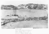
FOUNTAIN ROCK / MORGAN'S GROVE PARK SR 480 and Morgan's Grove Road<br />
This small park has an area of open fields for soccer, large trees over 100 years old, and is the<br />
source of Fountain Rock Spring.<br />
Foundation of Main House, or Fountain Rock: c. 1831-37 Contributing Site<br />
: Remains of the stone foundation of the house known as Fountain Rock are present and<br />
archaeological evidence of fire debris is expected 10 feet below the surface in what would be the cellar of<br />
the old home. A 1982 noncontributing pavilion has been constructed on the site but has not impacted the<br />
buried resources. Fountain Rock was a large two story home with columns supporting a two story porch.<br />
The stone house was stuccoed and had a rear kitchen wing. The house was burned by Federal troops in<br />
1864 and stood as ruins into the 20th century. A stone wall, 3 feet in height with cut stone, separates the<br />
springhouse from the Upper Grove where the house stood. Seven steps built into the wall are still intact.<br />
Springhouse 1831 Contributing Building<br />
One story, 4 bays with random course stone exterior walls and quoins. Two center doors with<br />
openings and grates to each side lead to two interior rooms. On the north wall is a third room which is<br />
smaller and has a 7 foot round arched doorway with stone keystone. Gable roof over main section and<br />
separate gable roof over side wing, wood shingles. Fountain Spring flows through the building.<br />
Fair building c. 1890 Contributing Building<br />
12 foot square building of wood siding, covered with metal, steep hip roof.<br />
<strong>Park</strong> Storage Building c. 1996 Noncontributing Building<br />
1 story, 1 bay, Quonset metal building.<br />
CIVIL WAR ENCAMPMENT Off Morgan's Grove Road 1863-1864 Contributing Site<br />
Maps from the time period of the Civil War indicate the extended presence of troops in the<br />
Shepherdstown area. Artifacts have been found but more study and excavations may provide more<br />
information about troop life in this area. The area is a grove of trees off Morgan's Grove Road.
(NFS Form 10-900)<br />
United States Department of the Interior<br />
<strong>National</strong> <strong>Park</strong> <strong>Service</strong><br />
NATIONAL REGISTER OF HISTORIC PLACES<br />
CONTINUATION SHEET<br />
Morgan's Grove Historic District Jefferson County, WV<br />
Name of Property County/State<br />
Section number 7 Page 6<br />
The following residences border the main properties and are considered noncontributing:<br />
RESIDENCE Pearl Drive, Beeline Estates c. 1967 Noncontributing Bldg (Owner: Stealey)<br />
1 !/2 story, modern ranch, with vertical board and batten, center door is recessed under partial porch,<br />
garage is attached to side with front bay. End brick chimney.<br />
RESIDENCE Morgan's Grove Road c. 1987 Noncontributing Bldg (Owner: Brown)<br />
1 l/2 story bi-level Ranch with wood and brick siding, hip asphalt roof, concrete foundation. Long<br />
porch across facade, door with sidelights, 2 story section to right with hip dormer with round<br />
window.<br />
RESIDENCE Morgan's Grove Road c. 1970 Noncontributing Bldg (Owner: Schley)<br />
1 !/2 story, clapboard siding in Cape Cod style, asphalt roof, concrete block foundation.<br />
RESIDENCE Morgan's Grove Road c. 1960/98 Noncontributing Bldg (Owner: Suttenfield)<br />
1 l/2 story, creative irregular plan, wood siding, gable and shed roofs, some material from older<br />
buildings. Artist studio which is still in progress.<br />
RESIDENCE SR230 c. 1920 Noncontributing Bldg (Owner: Chakmakian)<br />
2 l/2 story, American Foursquare with glazed brick siding, front porch with Doric Columns. Center<br />
door and sidelights, windows are paired 1/1 double-hung sash. Slate roof hip roof with center hip<br />
dormer, and side dormer. Attached garage to side of house.
(NFS Form 10-900)<br />
United States Department of the Interior<br />
<strong>National</strong> <strong>Park</strong> <strong>Service</strong><br />
Morgan's Grove Historic District Jefferson County T WV<br />
Name of Property County/State<br />
Section number 8 Page 1<br />
Statement of Significance:<br />
Morgan's Grove comprises an area of related lands, buildings, and structures spanning over<br />
two hundred years of history. Once held by a large family, the Morgans played prominent roles in<br />
the early settlement, military and political affairs of the area. Several resources have already been<br />
nominated to the <strong>National</strong> Register but this district nomination includes additional homes and<br />
outbuildings, potential archaeological resources, and farm acreage. The nomination is significant<br />
under Criteria A for Agriculture, Exploration/Settlement, Entertainment/Recreation, Military and<br />
Transportation; Criteria B for Richard Morgan, Colonel William Morgan, and Alexander Boteler,<br />
all property owners, local farmers and businessmen; Criteria C for Architecture; and Criteria D for<br />
Archaeology. The period of significance is 1734 to 1932 in relation to the settlement and<br />
development of the area by the Morgan family and their relations.<br />
HISTORY OF THE MORGAN'S GROVE AREA<br />
Early Settlement, 1730 - 1780<br />
Richard Morgan bought a large tract of land in 1730 which included much of present day<br />
Shepherdstown, WV. He received one of the first Fairfax grants of 500 acres in 1734 and sold<br />
some of his land to Thomas Shepherd, who founded Shepherdstown. By 1768, Richard and his two<br />
sons had accumulated over 4,000 acres in Northern Virginia.<br />
Richard Morgan was influential in raising troops for the French and Indian Wars. Located<br />
on his property (now Springdale Farm) was Morgan Fort. Archaeological finds by owners include<br />
arrowheads and small rifle balls which warrant further study. The area around the Springdale Farm<br />
has not had any archaeological investigation and may yield more information on prehistory and<br />
history.<br />
Maps dated 1736 to 1755, show a route of the pre-revolutionary wagon road between<br />
Winchester and Philadelphia. This was the route used earlier by Indians and early pioneers who<br />
settled the valley. Morgan's land was bisected by this road and he built a stone house (Old Stone<br />
House) in 1734, a distance off the road on high ground above the gushing springs he called Falling<br />
Springs. The limestone rubble house has a single gabled dormer. Nearby stands a stone<br />
springhouse from this period. Eleven years later in 1745, Richard Morgan built a new house which<br />
was one story in height. His eldest son, William, built a home nearby in 1760 called Springdale as<br />
he helped his father farm the family land which had pastures and crop land.<br />
Springdale faced a stone lined roadway leading off from today's SR 230 or Flowing Spring<br />
Road. The limestone house is Georgian in style with three symmetrical bays. The interior has eight<br />
rooms with much of the original woodwork being intact. Also on the farm property is a meat house,<br />
springhouse, and several later barns. After a fire in the 1930s, only foundations remain of the bank<br />
barn dating from the 1700s.
(NFS Form 10-900)<br />
United States Department of the Interior<br />
<strong>National</strong> <strong>Park</strong> <strong>Service</strong><br />
NATIONAL REGISTER OF HISTORIC PLACES<br />
CONTINUATION SHEET<br />
Morgan *s Grove Historic District Jefferson County, WV<br />
Name of Property County/State<br />
Section number 8 Page 2<br />
It was during the Revolutionary War when news of the battle of Lexington reached<br />
Shepherdstown that men began military drills in anticipation of battle on a vacant lot behind the old<br />
Entler Tavern. At the request of the Continental Congress two companies of riflemen from Virginia<br />
were organized in July 1775, by Captain Hugh Stephenson of Shepherdstown, and Captain Daniel<br />
Morgan of Winchester. Prior to marching, Stephenson's men enjoyed a barbecue given by Col.<br />
William Morgan at his home. The riflemen met at a large spring on Morgan's place and indulged in<br />
patriotic song. They then began the famous Bee Line March on July 17th, marching down the old<br />
road beside the stone wall leading from the springs, past William Morgan's home Springdale. This<br />
march to Boston often covered 30 to 36 miles a day, or a total of six hundred miles in 24 days. The<br />
group reached Cambridge to link with George Washington on August 11, 1775. The two<br />
companies were the first from the south to join Washington in the fight against the British.<br />
Middle Years - 1780 to 1860<br />
Following Richard's death, his son Daniel lived in his home from 1803-1833 and enlarged it<br />
with a two-story brick wing, incorporating the original building as the kitchen wing. Here Daniel<br />
Morgan was host in 1825 to the 50 year reunion of the men still living from the 1775 Bee Line<br />
March. Known as Poplar Grove, and later Rosebrake, the house's main section was constructed in<br />
1859 by owner Caroline Bedinger. This final two-story rectangular brick building is Georgian in<br />
style with a Greek Revival doorway and a two story portico with Doric columns. Listed on the<br />
<strong>National</strong> Register, the farm not only is recognized for its significance to the Morgan family, but also<br />
with the Bedinger's a prominent family. Caroline was the widow of the former minister to<br />
Denmark, Henry Bedinger, who died shortly after returning to Shepherdstown. His sister was<br />
married to one of the Morgan son's.<br />
During this period Daniel Morgan's son, Jacob Morgan, built Falling Spring a large white<br />
stuccoed house in 1831. A road connected the house to the 1734 stone house and to the Smithfield<br />
road (SR 480). This road was also lined with dry laid stone walls. The 39 acres of fields between<br />
the house and the turnpike were part of the Falling Spring property and were used for pastures and<br />
crops.<br />
The Shepherdstown to Smithfield turnpike operated from the 1840s to the early 1900s, .and<br />
helped lead to the settlement of the area. The toll house was located near Morgan's Grove Road<br />
and SR 480. Used by the turnpike and as a residence for the toll keeper, the home later became a<br />
private residence and was used until the 1950s. Some archaeological testing has been done by<br />
Shepherd College to document rural life.<br />
Off the Smithfield turnpike, Dr. Henry Boteler related by marriage to the Morgan's, built his<br />
home Fountain Rock in 1831. The two story limestone house was covered with stucco had ten<br />
rooms, and columns supporting a two story porch. The private lane was in the vicinity of Morgan's<br />
Grove Road and the turnpike. Five years later after Henry's death, his son Alexander Robinson
(NFS Form 10-900)<br />
United States Department of the Interior<br />
<strong>National</strong> <strong>Park</strong> <strong>Service</strong><br />
Morgan's Grove Historic District Jefferson County WV<br />
Name of Property County/State<br />
Section number 8 Page 3<br />
Boteler inherited the 200 acre farm which included the mansion, one large barn, several farm<br />
buildings, and limestone springhouse from which Fountain Rock Spring flows into Town Run. He<br />
also inherited the cement mill located east of Shepherdstown on the Potomac River.<br />
Alexander Boteler was known as a progressive farmer and experimented with new<br />
agricultural practices and new farming machinery including a "wheat cutter." Notes from his diary<br />
of 1845 indicated he used hotbeds for early starting of vegetables of many kinds. He grew many of<br />
the small fruits including grapes and several kinds of berries. As an orchardist, he experimented in<br />
grafting cherries, apples, and peaches. One entry read that he "planted 24 young pecan trees to graft<br />
on." He also raised cattle and hogs, but his major crop was grain, especially wheat.<br />
Boteler's practical experience and ability as a speaker accounted for his demand as a speaker<br />
during the 1850s. He addressed the Ohio State Agricultural Fair, the Shenandoah Valley<br />
Agricultural Society, and the Agricultural Society of Hagerstown, Maryland. In 1850, he was<br />
president of the Jefferson County Agricultural Society.<br />
Suffering a financial blow in 1852 from endorsing a friend's note, half of the Fountain Rock<br />
property was sold. This was the same year he became interested in politics and became known as<br />
the "Young Wheel Horse of Whiggery." Serving as a delegate to the Whig convention in<br />
Richmond of that year, he was a presidential elector. In 1859, Boteler took his seat as a US<br />
Representative from Virginia. Elected in May 1861 as a delegate to the Virginia legislature, he did<br />
not take office before he was selected by the 10th Congressional District to attend the Confederate<br />
Congress.<br />
Civil War Years - 1861-1865<br />
Since this area lies at the northern end of the Valley of Virginia, through which Confederate<br />
forces could strike at Washington, the B&O Railroad and C&O Canal; Jefferson County<br />
experienced much fighting throughout the Civil War. The Morgan's Grove area of 150 acres<br />
between SR 480 and SR 230 was the scene of several skirmishes and encampments of both<br />
Confederates and Union troops as they march along these two roads.<br />
South on Morgan's Grove Road is an area shown on period maps as having troop<br />
encampments by Federal forces during the period of 1862-64. Trees which have been felled bear<br />
the "blue blister"marks of target shooting. Finds by owners of the property include a small leather<br />
pouch with Indian head pennies, several buckles and buttons. Archaeological testing has the<br />
potential to document what camp life may have been like during the war. A letter dated October 7,<br />
1862, from Confederate Colonel William A. Morgan to his wife states, "it must be unpleasant for<br />
you to have troops quartered so near you," which confirms the local presence of Union troops.<br />
The Federal Cavalry encamped outside Shepherdstown during various intervals from 1862-1865.<br />
Col. Morgan received his first promotion in the Shepherdstown Calvary. This group was the first to<br />
reach Harpers Ferry at the time of John Brown's raid. Morgan's company was later incorporated<br />
with the 1 st Virginia Calvary at the beginning of the war. Morgan fought in over three hundred<br />
skirmishes, and at the end of the war led almost every brigade of calvary in the Army of Northern<br />
Virginia. (Steptoe 16, 17). The Confederate withdrawal from Shepherdstown was accompanied by
(NFS Form 10-900)<br />
United States Department of the Interior<br />
<strong>National</strong> <strong>Park</strong> <strong>Service</strong><br />
NATIONAL REGISTER OF HISTORIC PLACES<br />
CONTINUATION SHEET<br />
Morgan's Grove Historic District Jefferson County, WV<br />
Name of Property County/State<br />
Section number 8 Page 4<br />
a minor skirmish on August 26, 1864: "as the war raged around Falling Spring, both Yankee and<br />
Confederate soldiers sought refuge there, including Gen. John B. Gordon, and later Gen. Custer and<br />
his troops camped out in the woods." (Steptoe, 17)<br />
Fountain Rock, home of Col. Alexander Boteler, was used as a hospital for wounded<br />
soldiers after the Battle of Antietam. The house was later burned by Federal troops under Sherman<br />
during the Shenandoah Valley Campaign in 1864. Boteler was a member of the Confederate<br />
Congress and was influential in the design of the Great Seal of the Confederacy. Appointed a<br />
volunteer aide, Boteler served on Stonewall Jackson's personal staff. He also served with J.E.B.<br />
Stuart, governors Smith and Letcher of Virginia. The ruins of Boteler's home stood until around<br />
the turn of the century when the stone walls were torn down and reused as the new foundation for a<br />
dance pavilion. These stones are still present and there are recent discoveries of a nearby barn<br />
foundation. Some archaeological testing has been conducted by Shepherd College near the park<br />
pavilion. Still standing is the stone springhouse that also served as a dairy house and laundry. It<br />
was built in the 1830s, and damaged sections were rebuilt in the 1940s by the Jones brothers, well<br />
known local stone masons. The house was never rebuilt, but its ruins stood for many years.<br />
Boteler was also an artist and author and combined his talents in the book My Ride to the<br />
Barbecue based on the 1858 barbecue at Morgan Springs. Published in 1860, the bookvis of<br />
particular value for his pen and ink drawings of historic homes. Four drawings are of the Morgan<br />
Springs area entitled "the Morgan Springs," "the lake," "the diner," and "the welcome." According<br />
to the notes from the bound files of the SHEPHERDSTOWN REGISTER of August 14, 1858: "our<br />
citizens have determined to hold a Grand Military and Civic Barbecue at "Morgan's Spring." The<br />
REGISTER also reported in the September 11, 1858, issue: "the number of people present could not<br />
have been less than 5,000." During the Civil War, Boteler created oil sketches of Lee, Longstreet,<br />
Jefferson Davis, Wade, Hampton, Pickett, and John H. Morgan.<br />
Later Years-1865-1948<br />
Alexander Boteler was an innovative farmer, one of the incorporators of Shepherd College<br />
in 1871, a financial backer of the C&O Canal; and encouraged the routing of the telegraph lines and<br />
the routing of the Shenandoah Valley Railroad through Shepherdstown. After the war he lived in<br />
nearby Shepherdstown.<br />
The Shenandoah Valley Railroad was authorized to build a route through West Virginia in<br />
February of 1870. The six mile section was graded in 1872, but because of financial difficulties<br />
was not constructed until 1879. Morgan's Grove had a flag stop along this section of track with a<br />
small station off Morgan's Grove Road. It was a 16 x 24 foot platform with a three sided gabled<br />
roofed building. Historical documentation has confirmed the shape and location of the property.<br />
The railroad stop was used extensively for the yearly Morgan's Grove Fair.
(NFS Form 10-900)<br />
United States Department of the Interior<br />
<strong>National</strong> <strong>Park</strong> <strong>Service</strong><br />
NATIONAL REGISTER OF HISTORIC PLACES<br />
CONTINUATION SHEET<br />
Morgan's Grove Historic District Jefferson County WV<br />
Name of Property County/State<br />
Section number 8 Page 5<br />
When the railroad came through the area in the 1870s, they wanted to minimize the number<br />
of private crossings. The lanes leading to the Old Stone House and Falling Springs were changed to<br />
be accessed from Morgan's Grove Road.<br />
In the fall of 1885, an organization was formed in Shepherdstown to hold an agricultural,<br />
mechanical and livestock exhibition, based on the type of event held at Molers Crossroads. Col.<br />
William Morgan offered to hold the fair in his grove. The first fair was September 9 & 10, 1885,<br />
and was a great success. The Shenandoah Valley Railroad put in a switch to the grounds and sold<br />
excursion tickets with four to six thousand attending on the second day. Brass bands and ring<br />
tournaments were part of the entertainment. Several years later the fair became a four day event.<br />
Families rented tents and created tent colonies on the fairgrounds.<br />
The Morgan's Grove Agricultural Association purchased the Fountain Rock property in<br />
June of 1889, and moved the fair buildings from William Morgan's property to the new<br />
fairgrounds. The fair spilled over and used what is now called Derr Field but was part of the<br />
Falling Spring property owned by William Morgan. One of the great events to occur on the<br />
fairgrounds was on September 6, 1900, when William Kennings Bryan, the Democratic candidate<br />
for president, gave a speech to an estimated crown of 15,000 people. The fairs were annual events<br />
until 1931, the last year the fair was a community enterprise. Later fairs did not succeed and<br />
eventually the property was sold to farmer P.P. Steptoe who tore down all but one of the buildings.<br />
The c. 1890 square wooden building with the peaked roof was used for storage for the fair. The<br />
Shepherdstown Men's Club purchased the twenty acres in 1961 for use as a community park and<br />
playground.<br />
Recent research has disclosed that Rosebrake's name comes from Henry and Caroline<br />
Bedinger's daughter, Danske Dandridge, who following her marriage wrote and published several<br />
volumes of poetry and began a serious study of botany. Inheriting the Poplar Grove property of her<br />
parents she renamed it Rosebrake and planted a large grove of trees and shrubs surrounding the<br />
residence. She wrote and published profusely in various horticultural magazines in the United<br />
States and England. The English magazine, The Garden, published many of her articles under the<br />
heading "Letters from Rose Brake." Friends from around the world sent her seeds and plants for<br />
her estate, and she had 60 kinds of spireas at one time. While the farm continued as an agricultural<br />
base for the family who operated Dandridge Dairy in the early 1900s with pastures surrounding the<br />
main house. The gardens also prospered under Dandridge's hand.<br />
With the wave of patriotic commemoration in the early 20th century the Daughters of the<br />
American Revolution commemorated the valiant "Spirit of 76" with a stone marker in 1932. The<br />
marker identified the Bee Line March and was placed on SR 480 at the old entrance to Falling<br />
Springs. Standing for the last 67 years, the marker is now a local landmark.
(NFS Form 10-900)<br />
United States Department of the Interior<br />
<strong>National</strong> <strong>Park</strong> <strong>Service</strong><br />
Morgan's Grove Historic District Jefferson County, WV<br />
Name of Property * County/State<br />
Section number 8 Page 6<br />
ARCHAEOLOGICAL TESTING AT MORGAN'S GROVE<br />
Under Criteria D for Archaeology, the Fountain Rock area and the Toll House have had<br />
some testing and would be eligible for the potential to yield more information. The Civil War<br />
Encampment has not had any testing but artifacts uncovered by the owner indicates that the<br />
potential for information exists. The Train Station has not been tested, while Derr Field has had<br />
some testing to reveal two historic sites from 1850-1880, and one pre-historic site. However, the<br />
potential to yield other information has not been fully documented. Thus, the last two sites are<br />
described but at this time are not being included under Criteria D.<br />
Fountain Rock in Morgan's Grove <strong>Park</strong> (Contributing Site) 46 JF243 may have the best<br />
potential for providing information about family life in the Jefferson County area. The Boteler<br />
family is the only family to have occupied the site from 1832-1864. Because of the fire which<br />
destroyed the building, the potential for artifacts to still be in the area now occupied by the pavilion<br />
is high. Since the house was built on a rise, artifacts are expected to be on a level with the basement<br />
approximately 10 feet below the soil. A recent archaeological survey by Shepherd College<br />
indicates high artifact densities and intact soil stratigraphy in and around the mansion house<br />
foundation. A prehistoric component also exists at the spring head, about 100 feet west of the<br />
mansion foundation. Since the site was occupied by one family during a short period of the 19th<br />
century, research may lead to a better understanding of people occupying an upper economic life<br />
style. Used from the late 19th century to the 1930s as a fairgrounds, some artifacts and building<br />
foundations from this time period may also be found.<br />
The Shepherdstown - Smithfield Turnpike Tollhouse (Contributing Site) 46JF242, located at<br />
the corner of SR 480 and Morgan's Grove Road had some archeological testing by Shepherd<br />
College in 1998. This site was also undisturbed, and with the high range of test pits, the yard<br />
yielded an abundance of artifacts. Evaluation of the artifacts has yet to be made by researchers in<br />
reference to the lifestyle of a tollhouse collector. A comparison of his status in the economic level<br />
of his time period against the artifacts may also lead to a better understanding of life during the<br />
period of the mid-19th century.<br />
Civil War Encampment (Contributing Site) 46JF244, area off Morgan's Grove Road is<br />
highly documented with period maps and battle notes. When construction for a modern house was<br />
undertaken in the 1970s, numerous artifacts were uncovered such as belt buckles, canteens, and<br />
buttons. Areas with embattlements have been found but have not been tested. The potential is high<br />
to uncover information about camp life in this area. The area of woods is undisturbed near the<br />
homes.<br />
The Morgan's Grove Train Station, has had historic source documentation to locate the<br />
structure and to determine what the style of the building once was during the late 19th century. No<br />
archaeological testing has been done on the site, but research may be able to determine exact<br />
location and any future changes the building underwent past photo documentation. The site may<br />
also yield some evidence in the surrounding area of late 19th century artifacts.
(NFS Form 10-900)<br />
United States Department of the Interior<br />
<strong>National</strong> <strong>Park</strong> <strong>Service</strong><br />
NATIONAL REGISTER OF HISTORIC PLACES<br />
CONTINUATION SHEET<br />
Morgan's Grove Historic District Jefferson County WV<br />
Name of Property County/State<br />
Section number 8 Page 7<br />
Derr Field, has had some Phase I evaluation by Shepherd College and has uncovered some<br />
prehistoric and historic artifacts. While it is not yet eligible under Criteria D, the field was used for<br />
agriculture purposes by the Morgan family and was also used for the Morgan's Grove Fair.<br />
SUMMARY<br />
The Morgan's Grove Historic District provides a well rounded story of the Morgan family<br />
and their grouping of homes on the edge of Shepherdstown. The Morgan family was also<br />
influential in town life, offering their hospitality for military and recreational activities. Such<br />
hospitality is seen with the send-off for the troops in 1775, and the local fairs in the 1880s. The<br />
family members individually served in several wars. When the Civil War came to Shepherdstown,<br />
troop encampments took place on their property, and homes were used for shelter and as hospital<br />
use. Evidence of war included the burning of Fountain Rock, home to the Morgan's relatives, the<br />
Botelers. Architecturally the homes are significant, with stone being the main building material.<br />
Archaeological testing of some sites has been made possible by the students of local Shepherd<br />
College, and has the potential to yield information about the different class structures of the<br />
residents.
(NFS Form 10-900)<br />
United States Department of the Interior<br />
<strong>National</strong> <strong>Park</strong> <strong>Service</strong><br />
NATIONAL REGISTER OF HISTORIC PLACES<br />
CONTINUATION SHEET<br />
Morgan's Grove Historic District Jefferson County, WV<br />
Name of Property County/State<br />
Section number 9 Page 1<br />
Bibliography:<br />
Boone, Weldon. HISTORY OF BOTANY IN WEST VIRGINIA. Parsons, WV: McClain Printing<br />
Co., 1965.<br />
"Alexander Robinson Boteler". MAGAZINE OF THE JEFFERSON COUNTY HISTORICAL<br />
SOCIETY. Vol. 20. December 1954, pp 19-27.<br />
Boteler, Alexander R. MY RIDE TO THE BARBEQUE, 1860.<br />
"Boteler, Alexander Robinson". DICTIONARY OF AMERICAN BIOGRAPHY. Charles<br />
Scribner's Sons. New York. Vol. 1, 1964, pp 467-468.<br />
Boteler Oil Sketches and Letters. Serials Dept. Boston University, Mugar Memorial Library,<br />
Military Historical Society of Massachusetts Collection, Boston, MA.<br />
Bureau of Topographical Engineers. Map of Jefferson County, VA. 1852, 1862, 1883.<br />
Bushong,MillardKessler. A HISTORY OF JEFFERSON COUNTY, WV. Charles Town, WV:<br />
Jefferson Publishing, Co., 1941.<br />
Bushong, Millard Kessler. HISTORIC JEFFERSON COUNTY. Boyce, VA: Carr Publishing Co.,<br />
Inc., 1972.<br />
Cooper, Mason Y. NORFOLK & WESTERN SHENANDOAH VALLEY LINE. Norfolk &<br />
Western Historical Society, 1998.<br />
Deed Books, Jefferson County Courthouse, Charles Town,<br />
DB 27, pg. 386<br />
DB 35, pg. 295<br />
DB 87, pg. 229-230<br />
Erwin, Robert B. WEST VIRGINIA GAZETTEER OF PHYSICAL AND CULTURAL PLACE<br />
NAMES. West Virginia Geological and Economic Survey, 1986. Vol. 24, p. 477.<br />
Geffert, Hannah N., ed. ANNOTATED NARRATIVE OF THE AFRICAN-AMERICAN<br />
COMMUNITY IN JEFFERSON COUNTY, WV. Jefferson and Berkeley County NAACP:<br />
West Virginia Humanities Council, 1992.
United States Department of the Interior<br />
<strong>National</strong> <strong>Park</strong> <strong>Service</strong><br />
NATIONAL REGISTER OF HISTORIC PLACES<br />
CONTINUATION SHEET<br />
Morgan's Prove Historic District Jefferson County, WV<br />
Name of Property County/State<br />
Section number 9 Page 2<br />
Gibson, Susan Gregg. "The Story of Falling Springs". MAGAZINE OF THE JEFFERSON<br />
COUNTY HISTORICAL SOCIETY. Vol. 1, Dec. 1935, pp 54-55.<br />
Hartzell, Gladys. "Falling Spring Branch and Shepherdstown's Town Run". MAGAZINE OF<br />
THE JEFFERSON COUNTY HISTORICAL SOCIETY. Vol. 43, December 1977,<br />
pp. 56-59.<br />
Hartzell, Gladys and L.S. "Bicentennial Events in Jefferson County". MAGAZINE OF THE<br />
JEFFERSON COUNTY HISTORICAL SOCIETY. Vol. 42, Dec 1976, pp 58-63.<br />
Hatfield, William. SOIL SURVEY OF JEFFERSON COUNTY, WV. U.S. Government Printing<br />
Office, 1973.<br />
HISTORY OF THE LOWER SHENANDOAH VALLEY. Virginia Back Company, 1972, p. 41.<br />
Hbtchkiss, Jebediah, MAKE ME A MAP OF THE VALLEY.<br />
Jefferson County Historical Society. "Fountain Rock", MAGAZINE OF THE JEFFERSON<br />
COUNTY HISTORICAL SOCIETY, Vol. 10., 1944, pp 13-16.<br />
Kiwanis Club of Charles Town, WV. GATEWAY TO THE SHENANDOAH VALLEY,<br />
JEFFERSON COUNTY, WV: OFTEN CALLED THE LITTLE SWITZERLAND OF<br />
AMERICA. Charles Town, WV.<br />
"Land Grants in Jefferson County". MAGAZINE OF THE JEFFERSON COUNTY HISTORICAL<br />
SOCIETY. Vol. 22., December 1956, pp. 17-19.<br />
Lynch, Louise Anna. "The Morgan's Grove Fair". MAGAZINE OF THE JEFFERSON COUNTY<br />
HISTORICAL SOCIETY. Vol. 16, December 1950, pp. 21-26.<br />
Mann, Thomas F. and Emory Kemp. CEMENT MILLS ALONG THE POTOMAC RIVER, 1994,<br />
pp31-37.<br />
"The Morgan's Grove Fair". MAGAZINE OF THE JEFFERSON COUNTY HISTORICAL<br />
SOCIETY. December 1951.<br />
"Old Stone House at Morgan's Spring". MAGAZINE OF THE JEFFERSON COUNTY<br />
HISTORICAL SOCIETY. December 1975.
(NFS Form 10-900)<br />
United States Department of the Interior<br />
<strong>National</strong> <strong>Park</strong> <strong>Service</strong><br />
NATIONAL REGISTER OF HISTORIC PLACES<br />
CONTINUATION SHEET<br />
Morgan's Grove Historic District Jefferson County, WV<br />
Name of Property County/State<br />
Section number 9 Page 3<br />
Pendelton, Helen B. "The Wyncoop, Morgan, Selby, Hamtramck Families". MAGAZINE OF THE<br />
JEFFERSON COUNTY HISTORICAL SOCIETY. Vol. 8, December 1942, pp. 9-10.<br />
"Rose Brake or Poplar Grove". MAGAZINE OF THE JEFFERSON COUNTY HISTORICAL<br />
SOCIETY. Vol. 18, December 1952, pp 15-17.<br />
Steptoe, Nannie Moss. "Falling Spring". MAGAZINE OF THE JEFFERSON COUNTY<br />
HISTORICAL SOCIETY. Vol. 7, 1941, pp. 4-24.<br />
"Stone House at Morgan's Spring". BETWEEN THE SHENANDOAH AND THE POTOMAC.<br />
Winchester, VA: Winchester Printers, Inc., 1990,. pg. 133.<br />
Theriault, William. HISTORICAL WEST VIRGINIA DATABASE. (CD-ROM), 1993.<br />
Thruston, Mynna. HISTORIC TOURS OF JEFFERSON COUNTY, WV.<br />
US War Department. THE OFFICIAL MILITARY ATLAS OF THE CIVIL WAR. New York<br />
Armour Press, 1978.<br />
Interviews:<br />
Interview with William Theriault, by Diana Suttenfield, December 3, 1997.<br />
Interview with Dr. Charles Hulce, Anthropology Department of Shepherd College, about student<br />
excavations, by Katherine Jourdan, WV SHPO, 28 October 1998.
(NFS Form 10-900)<br />
United States Department of the Interior<br />
<strong>National</strong> <strong>Park</strong> <strong>Service</strong><br />
NATIONAL REGISTER OF HISTORIC PLACES<br />
CONTINUATION SHEET<br />
Morgan's Grove Historic District Jefferson County, WV<br />
Name of Property County/State<br />
Section number 10 Page 1<br />
Verbal Boundary Description:<br />
The boundaries of the Morgan's Grove Historic District follow the marked boundaries on the<br />
Jefferson County tax parcel map and have the following description:<br />
Beginning at the intersection of Morgan's Grove Road and SR 480, and proceeding SW with the<br />
southern edge of SR 480 to the legal property edge of Morgan's Grove <strong>Park</strong>; thence SE with the<br />
west legal property line of the <strong>Park</strong> to the Norfolk and Southern Railroad tracks; thence NE with the<br />
northern property line of the tracks to Morgan's Grove Road; thence South with the East edge of<br />
Morgan's Grove Road to the southern property line of the Brown's and Schley's; thence following<br />
the south property line for the Brown's and Schley's and thence the Falling Spring property line and<br />
cutting across the Stealey farm, omitting the modern farm buildings to the Springdale farm<br />
property; thence south with the west edge of the farm property to the southern property line; thence<br />
east with the southern property line to SR 230; thence northeast with the west edge of the property<br />
line and including the stone walls to the old Bee Line March Road; thence northwest with the<br />
northern boundary of the old roadway and including the road surface and stone walls to the Stealey<br />
property line; thence a short distance NE to the Norfolk and Railroad tracks and crossing to the<br />
north side of tracks; then following the southern property line of Rosebrake in a NE direction to the<br />
east property line; thence with the east property line in a NW direction to SR 480; thence SW with<br />
the southern edge of SR 480, and including any stone walls along the Rosebrake or old Falling<br />
Spring property, and excluding the two modern homes on the south side of SR 480, until reaching<br />
the point of beginning at Morgan's Grove Road.<br />
Boundary Justification:<br />
The boundaries include the homes and immediate fields associated with the historic properties, as<br />
well as the stone walls. Since the holdings of the Morgan's were so extensive, the fields across SR<br />
480 on the west side have been omitted due to modern construction. Also on SR 480, two<br />
properties have been omitted due to modem housing, and the same is true off SR 230, and along<br />
Morgan's Grove Road.
(NFS Form 10-900)<br />
United States Department of the Interior<br />
<strong>National</strong> <strong>Park</strong> <strong>Service</strong><br />
NATIONAL REGISTER OF HISTORIC PLACES<br />
CONTINUATION SHEET<br />
Morgan's Grove Historic District<br />
Name of Property<br />
Section number 10<br />
Jefferson County, WV<br />
County/State<br />
'Page 2<br />
UTM Numbers Shepherdstown Quad Map<br />
A<br />
B<br />
C<br />
D<br />
E<br />
F<br />
G<br />
H<br />
I<br />
J<br />
K<br />
L<br />
M<br />
Zone Easting Northing<br />
18<br />
18<br />
18<br />
18<br />
18<br />
18<br />
18<br />
18<br />
18<br />
18<br />
18<br />
18<br />
18<br />
257740<br />
258160<br />
257970<br />
258000<br />
258418<br />
258310<br />
257880<br />
257878<br />
257600<br />
257380<br />
257280<br />
257020<br />
256810
(NFS Form 10-900)<br />
United States Department of the Interior<br />
<strong>National</strong> <strong>Park</strong> <strong>Service</strong><br />
NATIONAL REGISTER OF HISTORIC PLACES<br />
CONTINUATION SHEET<br />
Morgan's Grove Historic District<br />
Name of Property<br />
Section number Photo<br />
Name of Property<br />
Address<br />
Town<br />
County<br />
Photographer:<br />
Date:<br />
Jefferson County, WV<br />
County/State<br />
Page 1<br />
Morgan's Grove Historic District<br />
Roughly bounded by SR 480, SR 230 and Morgan's Grove Road<br />
Shepherdstown Vicinity<br />
Jefferson County, WV<br />
Diana Suttenfield<br />
November 1998<br />
Negatives: WV SHPO, Charleston, WV<br />
Photo 1 Rosebrake, Main House and Front Facade,<br />
Camera facing South<br />
Photo 2 Rosebrake, stone walls along front property line or today's SR 480<br />
Camera facing SE<br />
Photo 3 Rosebrake - View of fields and outbuildings<br />
Camera facing South<br />
Photo 4 Rosebrake - View of fields, looking towards railroad tracks<br />
Camera facing SE<br />
Photo 5 DAR Marker and Old road to Falling Spring<br />
Camera facing South<br />
Photo 6 Falling Spring, front facade<br />
Camera facing East<br />
Photo 7 Falling Spring, east side of main house, and meat house<br />
Camera facing West<br />
Photo 8 Old Stone House, front and south facade<br />
Camera facing North<br />
Photo 9 Springdale, main facade<br />
Camera facing Southeast
(NFS Form 10-900)<br />
United States Department of the Interior<br />
<strong>National</strong> <strong>Park</strong> <strong>Service</strong><br />
NATIONAL REGISTER OF HISTORIC PLACES<br />
CONTINUATION SHEET<br />
Morgan's Grove Historic District<br />
Name of Property<br />
Section number Photo<br />
Jefferson County, WV<br />
County/State<br />
Page 2<br />
Photo 10 Springdale Farm, From left to right: springhouse, wagon barn, main barn<br />
Photo 11 Springdale Farm, wagon barn<br />
Photo 12 Springdale Farm, barn c. 1900<br />
Photo 13 Springdale Farm, fields and possible location of Morgan's Fort<br />
Photo 14 Beeline March Road, looking f rom SR 230<br />
Camera facing West<br />
Photo 15 Fountain Rock/Morgan's Grove <strong>Park</strong><br />
From left to right: Fountain Rock springhouse, fair building<br />
Camera facing SW<br />
Photo 16 Fountain Rock/Morgan's Grove <strong>Park</strong> Springhouse c. 1831 and stone walls<br />
Camera facing SW<br />
Photo 17 Fountain Rock/Morgan's Grove <strong>Park</strong> Fair Building/ <strong>Park</strong> Pavilion<br />
Camera facing West<br />
Photo 18 Civil War Encampment area off Morgan's Grove Road<br />
Camera facing East<br />
Photo 19 Brown House, off Morgan's Grove Road<br />
Camera facing South<br />
Photo 20 Chakmakian House, off SR 230<br />
Camera facing West
HISTORIC<br />
PS
1760
MORGAN'S GROVE HISTORIC DIST<br />
Jefferson Co., WV Fountain Rock Property<br />
House/Pavilion Site<br />
46JF243<br />
a<br />
111 #14 #15<br />
Test Sites by Shepherd College<br />
BMAW PAVIUON<br />
•ADDITION vw HAMJICAPPED RAMP<br />
°$MAL STONE BLDO.<br />
n STONEWALL<br />
^SHOVEL TEST UNITS<br />
1998<br />
MORGAN OROVE PARK<br />
STATE HWY. 480 3 MORGAN GROVE RD.<br />
SHEPHERDSTOWN, WV.<br />
a<br />
#10<br />
#21<br />
#20<br />
a #19<br />
#7 #18<br />
a #5 SI 7<br />
#18
MORGAN'S GROVE HISTORIC DIST. -<br />
Jefferson Co., WV<br />
Fountain Rock, - Spring house site<br />
#43<br />
#44<br />
#45<br />
10 FT.<br />
SOLE<br />
L£G€M):<br />
24' X 281<br />
NORTH EM3<br />
BLDO.<br />
"SPRWGHCiSE<br />
QSHOVEL TEST uws<br />
"SRWG FED STREAM<br />
•FOOT-BRDGE TO soccs?<br />
\ N<br />
\<br />
127<br />
OLD TOLLHOJSc SITE<br />
STATE HWY. 480 a MCHGAN GROVE RD.<br />
VW.<br />
A. a<br />
STATE HMVY. 480<br />
10 FT.<br />
3. * GLASS<br />
C. » CURVE) e^)CX (L!KH THOSE US© !M ARO€S)<br />
D.-5RJC<<br />
MORGAN'S GROVE HISTORIC DISTRICT<br />
Jefferson Co., WV<br />
Test sites by Shepherd College<br />
1998<br />
46JF242<br />
m<br />
LEGEND:<br />
G<br />
G<br />
FENCSRCW<br />
(<br />
cL=VATED<br />
(POSSSLY TOLLHOUS5 OR A<br />
HCMESm LOCATION)<br />
OLD FS^CE POSTS<br />
SHOVEL TIST UNITS<br />
EXISTING STONS FOUM3ATION<br />
AREA OF SCATTERED SURFACS<br />
ARTIFACTS; INCLUDING GRANTT5-<br />
WAR£, CS^AMICS, 8, SRSCK
*UJ-~**>Sr 1'<br />
MORGAN'S GROVE HISTORIC DISTRICT<br />
Jefferson Co., WV<br />
,***<br />
1852 Map<br />
• X\<br />
ts(<br />
/<br />
11 ^*MT _^^^ -^ X<br />
^^ "'^" ^" ,r<br />
*, * \ •*"***<br />
•>2 V 1 , ************ m _ £**~<br />
^r- ' "M~~~~ * -<br />
*•* L ^^<br />
X" ^ j^<br />
- x. \ \ -^ — _-L> ^'^<br />
^<br />
^<br />
yj^- — j- ^^ ^1 ^<br />
•^ $S<br />
v' %<br />
'-
M*iHtm$<br />
r<br />
., • MTU0**ftA4y«V f#m«m,<br />
L-~ --<br />
1*<br />
MORGAN'S GROVE HISTORIC DISTRICT<br />
Jefferson Co., WV<br />
1862 Map<br />
V / *\ \VA——*•<br />
r^v ;<br />
X x"<br />
^ < J^'-'V^<br />
«>^kJtiii '-.^ _ ^- ^ -\<br />
fjtnturut f.l.
MORGAN'S GROVE HISTORIC DISTRICT<br />
Jefferson Co., WV<br />
Civil War Maps, Official War Atlas<br />
Drawn by Jed. Hotchkiss, 1864.<br />
S FIE P HE RDb T O^v*XX-v..<br />
Tl 5 u rs«aa.\*_\u.ij use -•~> ; •"*.! 3 4.<br />
Sf.'<br />
4?,;.^-T""<br />
CofciASotaio-<br />
64.<br />
.Muck m. EH.af .'sag,
MORGAN'S GROVE HISTORIC DISTRICT<br />
Jefferson Co. WV<br />
1899 Platt Map Deed Book 87, p. 230<br />
Platt #1141
Fountain<br />
MORGAN'S GROVE HISTORIC DISTRICT<br />
Jefferson Co., WV<br />
Drawing of Fountain Rock
Morgan's Grove Historic District<br />
Jefferson Co. WY<br />
Boundaries