GPSMAP 195. A pilot's guide to quality view i n g . - Garmin
GPSMAP 195. A pilot's guide to quality view i n g . - Garmin
GPSMAP 195. A pilot's guide to quality view i n g . - Garmin

Create successful ePaper yourself
Turn your PDF publications into a flip-book with our unique Google optimized e-Paper software.
<strong>GPSMAP</strong> <strong>195.</strong> A pilot’s <strong>guide</strong> <strong>to</strong> <strong>quality</strong> <strong>view</strong> i n g .<br />
Continuous parallel carrier phase<br />
tracking of a l l satellites in <strong>view</strong><br />
B ig, bold HSI with VNAV<br />
indica<strong>to</strong>r on one screen<br />
Redraws fast <strong>to</strong> show<br />
runways and map details<br />
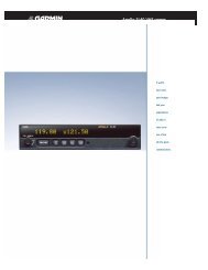
The industry’s #1 GPS manufacturer has again designed an all-new portable that combines<br />
years of GPS expertise with a unique understanding of users’ needs. The result is a pilot-friendly,<br />
one-hand operating, information-packed GPS with big, beautiful mapping capabilities.<br />
Great picture. 38,400 pixels in a high resolution, 4-level gray scale screen produce a wealth<br />
of information. It’s all easy on the eye – even in direct sunlight. And three level backlighting<br />
keeps readability up when the sun goes down.<br />
Big screen. A 2 1 ⁄ 4" x 3 3⁄8" display gives you 50% more useful space than any other handheld<br />
map. Space that is filled with geographically specific Jeppesen ® and land data, as well as<br />
context-sensitive prompts for on-screen assistance.<br />
Lots of channels. The <strong>GPSMAP</strong> 195 uses GARMIN’s exclusive PhaseT r a c12 T M continuous<br />
carrier phase 12 parallel channel receiver. Easily the most powerful, most intelligent GPS<br />
receiver available.<br />
The revolutionary <strong>GPSMAP</strong> <strong>195.</strong> A portable map system for those who won’t accept<br />
anything less than the big picture approach of GARMIN.
REV0797<br />
<strong>GPSMAP</strong> 195<br />
Navigation Features<br />
Waypoints:<br />
Total: 250 alphanumeric<br />
Nearest: 9 (au<strong>to</strong>matic)<br />
Routes: 20 reversible with up <strong>to</strong> 30<br />
points each, plus TracBack TM<br />
Map Datums: Over 100<br />
Performance<br />
Receiver: P h a s e T r a c 1 2TM , 12 parallel channel<br />
receiver continuously tracks and<br />
uses up <strong>to</strong> 12 satellites <strong>to</strong><br />
compute and update position<br />
Acquisition Times:<br />
Warm: Approx. 15 seconds<br />
Cold: Approx. 45 seconds<br />
Au<strong>to</strong>Locate TM : Approx. 5 minutes<br />
Update Rate: 1/second, continuous<br />
Accuracy:<br />
Position: 15 meters (49 feet) RMS*<br />
Velocity: 0.1 knot RMS steady state<br />
Dynamics: 6 g ’ s<br />
Interfaces: NMEA 0183, RTCM 104 DGPS<br />
corrections and proprietary<br />
GARMIN for all GARMIN panel<br />
mounts, PC interface kit and<br />
database updates<br />
Plotter/Moving Map Features<br />
Database: Built-in Jeppesen ® ; includes<br />
worldwide airports and VOR’s,<br />
plus Americas, or Atlantic<br />
International, or Pacific International<br />
NDB’s, Intersections, special use<br />
and controlled airspace, runway<br />
data, plus airport, FSS, and<br />
ARTCC frequencies<br />
Base Map: Americas or International;<br />
Includes: state/country boundaries,<br />
lakes, rivers, railroads, cities,<br />
coastlines, US, state, and interstate<br />
highways, and local thoroughfares<br />
Approach Waypoints: Jeppesen ® data also includes final<br />
approach sequence waypoints for<br />
all published approaches<br />
Plotting Scales: 1/10 <strong>to</strong> 3000 nm with<br />
push-but<strong>to</strong>n zoom control<br />
Physical<br />
Size: 7.6”H x 2.9”W x 2.1”D (19.3 x 7.4 x 5.3 cm)<br />
Weight: 1.4 lb. (635g)<br />
Display: 4.1” diagonal (10.4 cm) high-contrast,<br />
4-gray LCD with backlighting (160 x 240 pixels)<br />
Case: Rugged. Fully gasketed.<br />
Temp. Range: 5ºF <strong>to</strong> 158ºF (-15ºC <strong>to</strong> 70ºC)<br />
Power<br />
Source: 6-40vDC or 6-AA alkaline batteries<br />
Usage: 1.5 watts max. – battery life up <strong>to</strong> 10 hours<br />
Accessories<br />
Standard: <strong>GPSMAP</strong> 195 Receiver<br />
Yoke Mount<br />
GA 27 Low Profile Remote Antenna<br />
Cigarette Lighter Adapter<br />
6-AA Battery Pack<br />
Owner’s Manual<br />
Quick Reference Guide<br />
Carrying Case<br />
Wrist Strap<br />
Optional: Americas Or International Land Map Cartridge<br />
Power/Data Cable<br />
PC Interface Kit (Available August 1997)<br />
PC Update Cable<br />
Ni-Cad Battery Pack<br />
110vAC Charger<br />
Specifications are subject <strong>to</strong> change without notice.<br />
* Subject <strong>to</strong> accuracy degradation <strong>to</strong> 100m 2DRMS under the<br />
United States Department of Defense-imposed Selective Availability Program<br />
© 1997 GARMIN Corporation<br />
GARMIN International<br />
1200 East 151st Street<br />
Olathe, Kansas 66062, U.S.A.<br />
913/397.8200<br />
FAX 913/397.8282<br />
www.garmin.com<br />
<strong>GPSMAP</strong> 195 AVIATION NAVIGATOR TM<br />
GARMIN (Europe) Ltd.<br />
Unit 5, The Quadrangle<br />
Abbey Park Industrial Estate<br />
Romsey, SO51 9AQ, U.K.<br />
44/1794.519944<br />
FAX 44/1794.519222<br />
GARMIN (Asia) Corporation<br />
4th Floor, No. 1, Lane 45<br />
Pao-Hsing Road<br />
Hsin-Tien, Taiwan<br />
886/2.917.3773<br />
FAX 886/2.917.1758<br />
M02-10018-00