Download detailed specs - Garmin
Download detailed specs - Garmin
Download detailed specs - Garmin

Create successful ePaper yourself
Turn your PDF publications into a flip-book with our unique Google optimized e-Paper software.
Faster processor<br />
WAAS capable<br />
320 x 240 pixel display<br />
Runway extensions<br />
Pop-up map details<br />
Automatic logbook<br />
The finest portable,<br />
as determined by our panel of expertise.<br />
It takes innovation, design integrity, engineering ingenuity<br />
and old-fashioned pilot know-how to pull together all the<br />
capabilities of the GPSMAP 196. Just look at the panel page:<br />
GPS-derived HSI, airspeed indicator, altimeter, VSI and turn<br />
coordinator. Pilots have a term for this page: cool. Push the<br />
page key and more flying-friendly information appears. Like<br />
feathered runway extensions on the map page and <strong>detailed</strong><br />
data that pops-up when you scroll over built-in points of interest.<br />
A 320 x 240 pixel showcases crisp graphics which redraw with<br />
incredible speed thanks to a newer, faster processor.<br />
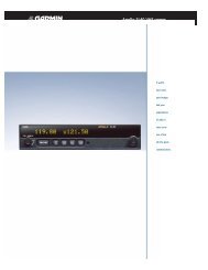
GPSMAP ® 196<br />
The GPSMAP 196’s first love is flying, but with userselectable<br />
formats and optional MapSource CD information,<br />
your aviation GPS can take to the streets and provide<br />
address look-up, automatic routing and turn-by-turn<br />
directions. And for those who also have propellers under the<br />
water, the GPSMAP 196 offers marine navaids, depth<br />
contours, tide data and more all in a waterproof case.<br />
The GPSMAP 196. <strong>Garmin</strong> expertise in a versatile portable.
GPSMAP ® 196 specifications<br />
Navigation features<br />
Waypoints:<br />
Total: 1000 with 10 characters (name and symbol)<br />
Nearest: Continuously updated; Airport, VOR,<br />
NDB, INT, user, ARTCC, FSS, airspace, Wx<br />
Routes: 50 reversible routes with up to 50 points<br />
each, plus TracBack ® modes<br />
Automatic turn-by-turn along-road routes<br />
Tracks: 2500 point automatic track log; 15 saved<br />
tracks; 500 points per saved track; lets<br />
you retrace your path in both directions<br />
Trip computer: Trip odometer, stopped time, moving<br />
average, moving time, total average,<br />
total time, maximum speed, odometer<br />
Alarms: Airspace, arrival, off-course,<br />
proximity waypoint, clock<br />
Tables: Built-in celestial tables for best times<br />
to fish and hunt, sunrise and sunset,<br />
sun and moon by date and position<br />
Map datums: More than 100 plus user datum<br />
Position format: Lat/Lon, UTM/UPS, Maidenhead, MGRS,<br />
Loran TDs and other grids, including<br />
user grid<br />
GPS performance<br />
Receiver:<br />
Acquisition times:<br />
WAAS enabled, 12 parallel channel GPS<br />
receiver continuously tracks and uses up<br />
to 12 satellites to compute and update<br />
your position<br />
Warm: Approximately 15 seconds<br />
Cold: Approximately 45 seconds<br />
AutoLocate : Approximately 2 minutes<br />
Update rate:<br />
GPS accuracy:<br />
1/second, continuous<br />
Position: < 15 meters, 95% typical*<br />
Velocity:<br />
DGPS (USCG) accuracy:<br />
0.05 meter/sec steady state<br />
Position: 3-5 meters, 95% typical<br />
Velocity:<br />
DGPS (WAAS) accuracy:<br />
0.05 meter/sec steady state<br />
Position: < 3 meters, 95% typical<br />
Velocity: 0.05 meter/sec steady state<br />
Dynamics: 6 g’s<br />
Interfaces: RS232 with NMEA 0183, RTCM 104 DGPS<br />
data format and proprietary GARMIN<br />
Antenna: Removable quad-helix<br />
Differential: WAAS, marine beacon<br />
Moving map features<br />
Basemap: Built-in routable basemap (North America<br />
and South America) contains state and<br />
country boundaries, lakes, rivers, streams,<br />
airports, cities, towns, coastlines, state<br />
and interstate highways, local thoroughfares<br />
and secondary roads within metro areas,<br />
federal interstate highway exit information<br />
for services such as food, lodging and<br />
truck, RV and automotive service stations<br />
Database: Built-in Jeppesen ® ; includes worldwide<br />
airports and VOR’s, plus Americas, or<br />
Atlantic international, or Pacific international<br />
NDB’s, intersections, special use and<br />
controlled airspace, runway data, plus<br />
airport, FSS, and ARTCC frequencies<br />
Approach waypoints: Jeppesen ® data also includes final<br />
approach sequence waypoints for all<br />
published approaches<br />
Uploadable maps: Accepts optional data cards for<br />
<strong>detailed</strong> maps<br />
Power<br />
Source: Four “AA” batteries (not included)<br />
Battery life: Up to 16 hours with no backlighting<br />
Up to 4 hours with full backlighting<br />
Physical<br />
Size: 6.18"W x 3.4"H x 2.25"D<br />
(15.7 x 8.64 x 5.72 cm)<br />
Weight: 1.5 lbs (680 g) with batteries<br />
Display:<br />
3.8" diagonal (9.65 cm) 320 x 240 pixels,<br />
12-level gray high contrast FSTN with<br />
backlighting<br />
Case: Fully gasketed, high impact plastic alloy,<br />
waterproof to IEC 529 IPX7 standards<br />
Temperature range: 5ºF to 158ºF (-15ºC to 70ºC)<br />
User data storage: Indefinite<br />
Accessories<br />
Standard: Auto mount<br />
PC interface cable<br />
GA 26C with suction mount<br />
Portable antenna<br />
Free single Jeppesen ® update<br />
12-volt adapter cable<br />
Yoke mount<br />
Owner’s manual<br />
Quick reference guide<br />
Optional:<br />
Auto mounting kit: (includes 64 MB data card, auto mount,<br />
beanbag mount, USB data card programmer<br />
and City Select U.S. Full Coverage)<br />
Remote antennas<br />
Deluxe carrying case<br />
12-volt adapter cable<br />
MapSource CD-ROMs<br />
8, 16, 32, 64 and 128 MB data cards<br />
USB data card programmer<br />
PC interface cable with 12-volt adapter<br />
A/C PC adapter<br />
1002 M02-10064-00<br />
GPSMAP ® 196<br />
Panel screen<br />
Map screen (with HSI)<br />
Automatic log book<br />
Turn-by-turn directions<br />
©2002 <strong>Garmin</strong> Ltd. or its subsidiaries<br />
<strong>Garmin</strong> International, Inc.<br />
1200 East 151st Street<br />
Olathe, Kansas 66062, U.S.A.<br />
913/397.8200 fax 913/397.8282<br />
GARMIN (Europe) Ltd.<br />
Unit 5, The Quadrangle<br />
Abbey Park Industrial Estate<br />
Romsey, SO51 9AQ, U.K.<br />
44/1794.519944 fax 44/1794.519222<br />
GARMIN (Asia) LTD<br />
No. 68, Jangshu 2nd Rd.<br />
Shijr, Taipei County, Taiwan<br />
886/2.2642.9199 fax 886/2.2642.9099<br />
www.garmin.com<br />
Specifications are preliminary and subject to change<br />
without notice.<br />
* Subject to accuracy degradation to 100m<br />
2DRMS under the U.S. Department of Defense<br />
imposed Selective Availability Program.