AVN/12616 295 SpcSht.lyt - Garmin
AVN/12616 295 SpcSht.lyt - Garmin
AVN/12616 295 SpcSht.lyt - Garmin

You also want an ePaper? Increase the reach of your titles
YUMPU automatically turns print PDFs into web optimized ePapers that Google loves.
WITH W AS<br />
for even greater accuracy<br />
Mapping details on GARMIN’s<br />
GPSMAP <strong>295</strong> provide a clear picture of the ground<br />
below. Its big, 4-inch (diagonal) 16-color display makes it<br />
easy to distinguish SUAs from highways, or VORs from<br />
nearby towns. Move the cursor to one of those SUAs and the name,<br />
controlling agency and vertical boundaries pop-up. Meanwhile a "vector<br />
to final" feature offers the finest situational awareness on approach.<br />
Like all GARMIN portables, the GPSMAP <strong>295</strong> is pilot configurable.<br />
You can split the screen to keep an eye on an HSI graphic while<br />
tracking your progress on the moving map. You can also store up to 30<br />
locations in a personal favorites list for quick access to those frequently<br />
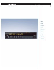
GPSMAP <strong>295</strong><br />
traveled spots. Installation options are equally handy. Mount the <strong>295</strong><br />
on the yoke for convenient one-thumb operation, or attach it to the<br />
glareshield in a heads-up configuration. Your choice.<br />
Since the GPSMAP <strong>295</strong> is CD-ROM compatible, you also enjoy<br />
virtually unlimited mapping utility. Load city-specific data into your<br />
<strong>295</strong> from a MapSource CD accessory, transfer the unit to your car<br />
and you’ll navigate to a restaurant on the ground as easily as you follow<br />
a flight plan in the air.<br />
The GPSMAP <strong>295</strong> – brilliant GPS innovation. See it at a dealer<br />
(or cockpit) near you.
specifications<br />
Navigation features<br />
Waypoints:<br />
Total: 500 with 10 characters (name and symbol)<br />
Nearest: Continuously updated; Airport, VOR,<br />
NDB, INT, user, ARTCC, FSS, airspace<br />
Routes: 20 reversible with up to 30 points each<br />
Map datums: Over 100<br />
Performance<br />
Receiver: WAAS enabled PhaseTrac12, 12 parallel<br />
channel receiver continuously tracks<br />
and uses up to 12 satellites to compute<br />
and update position<br />
Acquisition times:<br />
Warm: Approximately 15 seconds<br />
Cold: Approximately 45 seconds<br />
AutoLocate : Approximately 5 minutes<br />
Update rate: 1/second, continuous<br />
GPS Accuracy:<br />
Position: 15 meters (49 feet) RMS*<br />
Velocity: 0.1 knot RMS steady state<br />
WAAS Accuracy:<br />
Position: