StreetPilot® III - Garmin
StreetPilot® III - Garmin
StreetPilot® III - Garmin

You also want an ePaper? Increase the reach of your titles
YUMPU automatically turns print PDFs into web optimized ePapers that Google loves.
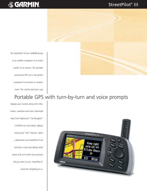
The StreetPilot ® <strong>III</strong> from GARMIN brings<br />
in-car satellite navigation to an entire<br />
market of car owners. This portable<br />
automotive GPS unit is the perfect<br />
companion for business or vacation<br />
travel. The colorful electronic map<br />
StreetPilot ®<br />
Portable GPS with turn-by-turn and voice prompts<br />
displays your location along with cities,<br />
streets, coastlines and more. Download<br />
maps from MapSource City Navigator <br />
CD-ROMs for more detail, address<br />
lookup and “find” features. Select<br />
a destination and StreetPilot <strong>III</strong> will<br />
calculate a route and display street<br />
names and turns while voice prompts<br />
tell you when to turn. StreetPilot <strong>III</strong>.<br />
Leave the navigating to us.<br />
<strong>III</strong>
specifications<br />
Moving map features<br />
Basemap: Built-in routable basemap (North America<br />
and South America) contains state and<br />
country boundaries, lakes, rivers, streams,<br />
airports, cities, towns, coastlines, state<br />
and interstate highways, local thoroughfares<br />
and secondary roads within metro areas,<br />
federal interstate highway exit information<br />
for services such as food, lodging and<br />
truck, RV and automotive service stations<br />
CD-ROM: Accepts downloadable map detail from<br />
GARMIN PC-based MapSource City<br />
Navigator CD-ROM which provides<br />
street-level detail, addresses, listings of<br />
nearest restaurants, hotels, ATMs and<br />
more; Note: Requires GARMIN data card<br />
(included with purchase)<br />
Map scale: Screen-width scale 900 feet to 6,100 miles<br />
Navigation features<br />
Routes: Automatically calculated with turn-by-turn<br />
instructions; Up to 50 stored; Using built-in<br />
basemap, routes include interstates,<br />
highways and major thoroughfares;<br />
With detailed data from CD-ROM, routes<br />
include residential street-level detail<br />
within metropolitan areas<br />
Voice: Navigation instructions and warnings<br />
Waypoints: 500 with name and graphic symbol<br />
Track log: 2000 track log points<br />
Trip computer: Resettable odometer, timers,<br />
average and maximum speeds<br />
GPS performance<br />
Receiver:<br />
Acquisition times:<br />
Differential-ready 12 parallel channel<br />
GPS receiver continuously tracks and<br />
uses up to 12 satellites to compute<br />
and update your position<br />
Warm: Approximately 15 seconds<br />
Cold: Approximately 45 seconds<br />
AutoLocate : Approximately 5 minutes<br />
Update rate:<br />
GPS Accuracy:<br />
1/second, continuous<br />
Position: