

Exploration for porphyry-style copper mineralisation near Llandeloy
Exploration for porphyry-style copper mineralisation near Llandeloy
Exploration for porphyry-style copper mineralisation near Llandeloy

You also want an ePaper? Increase the reach of your titles
YUMPU automatically turns print PDFs into web optimized ePapers that Google loves.
Correlations > 99.95 significance.<br />
Highest positive correlations of variables with no<br />
-- association > 99.95 significance level.<br />
Figure 5 Diagram matic illustration of highly significant<br />
positive correlations within the drainage survey data<br />
.<br />
dispersion train of anomalies downstream of the <strong>copper</strong><br />
<strong>mineralisation</strong> located by soil sampling. One marginally<br />
anomalous <strong>copper</strong> in stream sediment result is the only<br />
indication of the <strong>mineralisation</strong> about Treffynnon. The<br />
isolated position, small magnitude and absence of an<br />
anomaly in concentrate, but association with anomalous<br />
levels of elements concentrated in hydrous oxide<br />
precipitates, are reasons to suggest that this weak Cu<br />
anomaly would not have been followed up during a<br />
routine survey.<br />
The failure of the drainage survey to outline the area<br />
of hidden <strong>copper</strong> <strong>mineralisation</strong> about Treffynnon<br />
indicates the ineffectiveness of the technique <strong>for</strong><br />
mineral exploration in geographically similar terrains.<br />
Regional geophysics<br />
The <strong>Llandeloy</strong> and Middle Mill areas are covered by the<br />
national aeromagnetic and gravity surveys and by a<br />
recent helicopter-borne magnetic and very low<br />
frequency electromagnetic (VLF-EM) survey of part of<br />
west Dyfed. Mean terrain clearance was 60 m <strong>for</strong> the<br />
magnetic and 75 m <strong>for</strong> the VLF-EM sensors (Cornwell<br />
and Cave, in press). Extra gravity stations, including two<br />
detailed traverses, were occupied to supplement existing<br />
data in the area.<br />
Magnetic surveys<br />
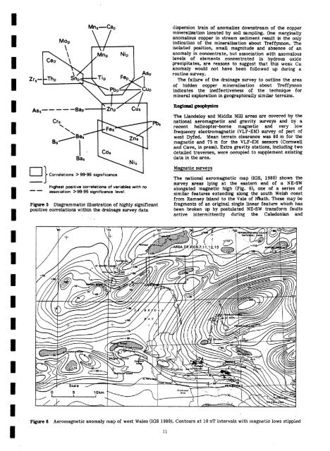
The national aeromagnetic map (IGS, 1980) shows the<br />
survey areas lying at the eastern end of a NE-SW<br />
elongated magnetic high (Fig. 6), one of a series of<br />
similar features extending along the south Welsh coast<br />
from Ramsey Island to the Vale of eath. These may be<br />
fragments of an original single li<strong>near</strong> feature which has<br />
been broken up by postulated NESW trans<strong>for</strong>m faults<br />
active intermittently during the Caledonian and<br />
Figure 6 Aeromagnetic anomaly map of west Wales (IGS 1980). Contours at 10 nT intervals with magnetic lows stippled


