ANTARIS GPS Evaluation Kit
ANTARIS GPS Evaluation Kit ANTARIS GPS Evaluation Kit
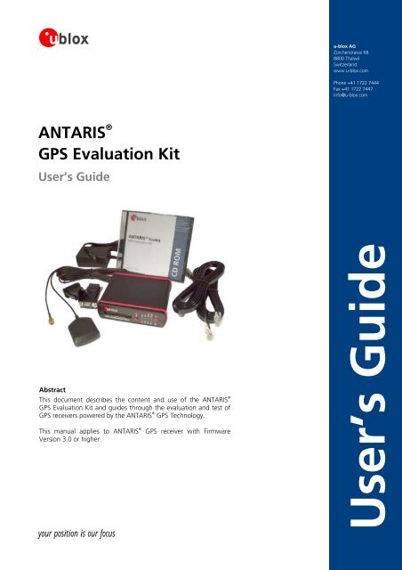
ANTARIS ® GPS Evaluation Kit User’s Guide Abstract This document describes the content and use of the ANTARIS ® GPS Evaluation Kit and guides through the evaluation and test of GPS receivers powered by the ANTARIS ® GPS Technology. This manual applies to ANTARIS ® GPS receiver with Firmware Version 3.0 or higher. your position is our focus u-blox AG Zürcherstrasse 68 8800 Thalwil Switzerland www.u-blox.com Phone +41 1722 7444 Fax +41 1722 7447 info@u-blox.com User’s Guide
- Page 2 and 3: Title ANTARIS ® Subtitle GPS Evalu
- Page 4 and 5: your position is our focus 4.3 Ante
- Page 6 and 7: your position is our focus D Glossa
- Page 8 and 9: 7. Troubleshooting This section giv
- Page 10 and 11: 2 Getting Started 2.1 Evaluation Ki
- Page 12 and 13: your position is our focus Control
- Page 14 and 15: your position is our focus transit
- Page 16 and 17: your position is our focus Measuri
- Page 18 and 19: your position is our focus assessin
- Page 20 and 21: your position is our focus DGPS los
- Page 22 and 23: GPS Satellites 9°26'26 46°48'41 R
- Page 24 and 25: 4 ANTARIS GPS Technology 4.1 Overvi
- Page 26 and 27: your position is our focus 4.2.2.1
- Page 28 and 29: start-up Acquisition IF ( got 1st f
- Page 30 and 31: your position is our focus Example
- Page 32 and 33: your position is our focus Example
- Page 34 and 35: your position is our focus same tim
- Page 36 and 37: 4.4.2.2 UBX Message Class your posi
- Page 38 and 39: 4.4.2.4 UBX Message Flow There are
- Page 40 and 41: your position is our focus Warmstar
- Page 42 and 43: 4.6 Navigation your position is our
- Page 44 and 45: your position is our focus Platform
- Page 46 and 47: your position is our focus navigati
- Page 48 and 49: Table 27 lists of the status fields
- Page 50 and 51: 4.6.10 DGPS (Differential GPS) your
<strong>ANTARIS</strong> ®<br />
<strong>GPS</strong> <strong>Evaluation</strong> <strong>Kit</strong><br />
User’s Guide<br />
Abstract<br />
This document describes the content and use of the <strong>ANTARIS</strong> ®<br />
<strong>GPS</strong> <strong>Evaluation</strong> <strong>Kit</strong> and guides through the evaluation and test of<br />
<strong>GPS</strong> receivers powered by the <strong>ANTARIS</strong> ® <strong>GPS</strong> Technology.<br />
This manual applies to <strong>ANTARIS</strong> ® <strong>GPS</strong> receiver with Firmware<br />
Version 3.0 or higher.<br />
your position is our focus<br />
u-blox AG<br />
Zürcherstrasse 68<br />
8800 Thalwil<br />
Switzerland<br />
www.u-blox.com<br />
Phone +41 1722 7444<br />
Fax +41 1722 7447<br />
info@u-blox.com<br />
User’s Guide
Title <strong>ANTARIS</strong> ®<br />
Subtitle <strong>GPS</strong> <strong>Evaluation</strong> <strong>Kit</strong><br />
Doc Type User’s Guide<br />
Doc Id <strong>GPS</strong>.G3-EK-02003-B<br />
Revision<br />
Index<br />
<strong>GPS</strong> <strong>Evaluation</strong> <strong>Kit</strong><br />
<strong>GPS</strong>.G3-EK-02003-B<br />
Date Name Status / Comments<br />
B 01/11/2004 Thomas Christen Integration of DR Technology<br />
A 06/03/2004 Thomas Christen Update for FW Version 3.00<br />
Initial Version 23/12/2002 Martin Vogel / Thomas Nigg<br />
P1<br />
We reserve all rights in this document and in the information contained therein. Reproduction, use or disclosure to third parties without express authority is strictly forbidden.<br />
For most recent documents, please visit www.u-blox.com<br />
your position is our focus<br />
The specifications in this document are subject to change at u-blox' discretion. u-blox assumes no responsibility for any claims or damages<br />
arising out of the use of this document, or from the use of modules based on this document, including but not limited to claims or damages<br />
based on infringement of patents, copyrights or other intellectual property rights. u-blox makes no warranties, either expressed or implied<br />
with respect to the information and specifications contained in this document. u-blox does not support any applications in connection with<br />
active weapon systems, ammunition, life support and commercial aircraft. Performance characteristics listed in this document are estimates<br />
only and do not constitute a warranty or guarantee of product performance.<br />
The copying, distribution and utilization of this document as well as the communication of its contents to others without expressed<br />
authorization is prohibited. Offenders will be held liable for the payment of damages. All rights reserved, in particular the right to carry out<br />
patent, utility model and ornamental design registrations.<br />
u-blox, the u-blox logo and <strong>ANTARIS</strong> are registered trademarks of u-blox AG. NavLox, u-center, FixNOW, SuperSense and EKF are trademarks<br />
of u-blox AG. Other trademarks are property of the respective companies. Copyright © 2004, u-blox AG
Contents<br />
your position is our focus<br />
1 Preface ..........................................................................................................................7<br />
1.1 How to use this Document ................................................................................................................... 7<br />
1.2 u-blox Glossary and Abbreviations ........................................................................................................ 8<br />
1.3 Technical Support ................................................................................................................................. 8<br />
2 Getting Started...........................................................................................................10<br />
2.1 <strong>Evaluation</strong> <strong>Kit</strong> Content........................................................................................................................ 10<br />
2.2 Eval<strong>Kit</strong> Installation............................................................................................................................... 10<br />
2.3 Serial Port Default Configuration ........................................................................................................ 10<br />
3 Introduction to <strong>GPS</strong>....................................................................................................11<br />
3.1 Overview ............................................................................................................................................ 11<br />
3.2 <strong>GPS</strong> System Segments ........................................................................................................................ 11<br />
3.3 Calculating Positions........................................................................................................................... 12<br />
3.3.1 Generating <strong>GPS</strong> Signal Transit Time............................................................................................. 12<br />
3.3.2 Determining a Position on a Plane ............................................................................................... 12<br />
3.3.3 The Effect and Correction of Time Error ...................................................................................... 13<br />
3.3.4 2D and 3D Navigation ................................................................................................................. 14<br />
3.4 The <strong>GPS</strong> Navigation Message.............................................................................................................. 14<br />
3.4.1 Structure of the Navigation Message........................................................................................... 14<br />
3.5 Accuracy of <strong>GPS</strong> ................................................................................................................................. 15<br />
3.5.1 Error Consideration and Satellite Signal ....................................................................................... 15<br />
3.6 Differential-<strong>GPS</strong> (D<strong>GPS</strong>) ...................................................................................................................... 19<br />
3.7 Satellite Based Augmentation System SBAS ........................................................................................ 20<br />
3.7.1 The most important SBAS functions ............................................................................................ 20<br />
3.7.2 Overview of existing and planned systems................................................................................... 20<br />
3.7.3 System description ...................................................................................................................... 21<br />
3.8 Achievable Accuracy with D<strong>GPS</strong> and SBAS.......................................................................................... 22<br />
4 <strong>ANTARIS</strong> <strong>GPS</strong> Technology..........................................................................................24<br />
4.1 Overview ............................................................................................................................................ 24<br />
4.2 Power Management ........................................................................................................................... 25<br />
4.2.1 Operating Modes ........................................................................................................................ 25<br />
4.2.2 Power States ............................................................................................................................... 25<br />
4.2.3 Continuous Tracking Mode (CTM)............................................................................................... 26<br />
4.2.4 FixNOW Mode (FXN)................................................................................................................ 26<br />
<strong>GPS</strong> <strong>Evaluation</strong> <strong>Kit</strong> Preface<br />
<strong>GPS</strong>.G3-EK-02003-B Page 3
your position is our focus<br />
4.3 Antenna ............................................................................................................................................. 33<br />
4.4 Serial Communication ........................................................................................................................ 33<br />
4.4.1 USART Ports ................................................................................................................................ 34<br />
4.4.2 UBX Binary Protocol .................................................................................................................... 35<br />
4.4.3 NMEA Protocol............................................................................................................................ 38<br />
4.4.4 RTCM Protocol ............................................................................................................................ 39<br />
4.5 Start-Up.............................................................................................................................................. 39<br />
4.5.1 Aiding / Assisted <strong>GPS</strong> (A<strong>GPS</strong>)....................................................................................................... 40<br />
4.6 Navigation .......................................................................................................................................... 42<br />
4.6.1 Overview ..................................................................................................................................... 42<br />
4.6.2 Navigation Update Rate............................................................................................................... 43<br />
4.6.3 Dynamic Platform Model ............................................................................................................. 43<br />
4.6.4 Static Hold Mode ........................................................................................................................ 44<br />
4.6.5 Degraded Navigation................................................................................................................... 45<br />
4.6.6 Almanac Navigation .................................................................................................................... 45<br />
4.6.7 Navigation Input Filters................................................................................................................ 46<br />
4.6.8 Navigation Output Filters............................................................................................................. 47<br />
4.6.9 Position Quality Indicators ........................................................................................................... 47<br />
4.6.10 D<strong>GPS</strong> (Differential <strong>GPS</strong>) ............................................................................................................... 50<br />
4.6.11 SBAS (Satellite Based Augmentation Systems) ............................................................................. 50<br />
4.6.12 RAIM (Receiver Autonomous Integrity Monitoring) ...................................................................... 54<br />
4.7 Timing ................................................................................................................................................ 55<br />
4.7.1 TIMEPULSE .................................................................................................................................. 55<br />
4.7.2 Timemark .................................................................................................................................... 56<br />
4.8 Receiver Configuration (Settings) ........................................................................................................ 57<br />
4.8.1 Configuration Concept................................................................................................................ 57<br />
4.8.2 Change Configuration temporarily .............................................................................................. 58<br />
4.8.3 Change Configuration permanently ............................................................................................ 58<br />
4.8.4 Loading a Configuration.............................................................................................................. 59<br />
4.8.5 Clear a Configuration permanently ............................................................................................. 59<br />
4.9 System Functions ................................................................................................................................ 60<br />
4.9.1 Reset Options.............................................................................................................................. 60<br />
4.9.2 STATUS Signal - (TIM-LL, TIM-LF, TIM-LP, TIM-LR, <strong>ANTARIS</strong> ® Eval<strong>Kit</strong>, <strong>ANTARIS</strong> ® SBE<strong>Kit</strong> only) ........ 60<br />
4.9.3 System Monitoring ...................................................................................................................... 61<br />
5 Eval<strong>Kit</strong> Description.....................................................................................................62<br />
5.1 Front and Rear Panel of the <strong>Evaluation</strong> Box......................................................................................... 62<br />
5.1.1 Service Connector ....................................................................................................................... 62<br />
<strong>GPS</strong> <strong>Evaluation</strong> <strong>Kit</strong> Preface<br />
<strong>GPS</strong>.G3-EK-02003-B Page 4
your position is our focus<br />
5.1.2 Reset Button (S2)......................................................................................................................... 63<br />
5.1.3 LEDs ............................................................................................................................................ 63<br />
5.1.4 On/Off Switch ............................................................................................................................. 64<br />
5.1.5 Power Supply Connector ............................................................................................................. 64<br />
5.1.6 Boot Button................................................................................................................................. 64<br />
5.1.7 Serial Interface Connectors (RJ45/DB9) ........................................................................................ 64<br />
5.1.8 Antenna Connector..................................................................................................................... 64<br />
5.2 Active Antenna................................................................................................................................... 65<br />
5.3 Cables and Adapters........................................................................................................................... 65<br />
5.3.1 Power Supply .............................................................................................................................. 65<br />
5.3.2 Serial Interface Cable................................................................................................................... 65<br />
5.4 Inside the <strong>GPS</strong> <strong>Evaluation</strong> Box............................................................................................................. 65<br />
5.4.1 Block Diagram............................................................................................................................. 65<br />
5.4.2 Backup Battery ............................................................................................................................ 66<br />
5.4.3 Mechanical dimensions ............................................................................................................... 66<br />
5.4.4 Schematics .................................................................................................................................. 67<br />
6 How to Evaluate a <strong>GPS</strong> Receiver ...............................................................................68<br />
6.1 Considerations before you start .......................................................................................................... 68<br />
6.2 What information does <strong>ANTARIS</strong> ® <strong>GPS</strong> Technology provide? .............................................................. 68<br />
6.2.1 Position ....................................................................................................................................... 68<br />
6.2.2 Velocity and Heading .................................................................................................................. 69<br />
6.2.3 Time............................................................................................................................................ 69<br />
6.2.4 Navigation Quality....................................................................................................................... 69<br />
6.3 Static Accuracy Measurements ........................................................................................................... 70<br />
6.4 Dynamic Receiver Comparison............................................................................................................ 70<br />
6.5 Time-to-First-Fix Tests ......................................................................................................................... 71<br />
6.6 Antenna Comparison ......................................................................................................................... 72<br />
6.7 The most common Pitfalls when evaluating <strong>GPS</strong> Receivers.................................................................. 74<br />
7 Troubleshooting.........................................................................................................75<br />
A Map Datums...............................................................................................................77<br />
B Index ...........................................................................................................................85<br />
C Lists .............................................................................................................................87<br />
C.1 List of Figures ..................................................................................................................................... 87<br />
C.2 List of Tables....................................................................................................................................... 88<br />
<strong>GPS</strong> <strong>Evaluation</strong> <strong>Kit</strong> Preface<br />
<strong>GPS</strong>.G3-EK-02003-B Page 5
your position is our focus<br />
D Glossary ......................................................................................................................90<br />
<strong>GPS</strong> <strong>Evaluation</strong> <strong>Kit</strong> Preface<br />
<strong>GPS</strong>.G3-EK-02003-B Page 6
1 Preface<br />
1.1 How to use this Document<br />
your position is our focus<br />
This user’s guide has been written with the intention to guide users through all necessary steps of an evaluation of<br />
the <strong>ANTARIS</strong> ®<br />
<strong>GPS</strong> Technology. The hardware integration of the <strong>ANTARIS</strong> ®<br />
<strong>GPS</strong> chipset or <strong>GPS</strong> receivers based on<br />
the <strong>ANTARIS</strong> ® <strong>GPS</strong> Technology is not part of this user’s guide. It is discussed in the system integration manual of the<br />
respective receiver.<br />
Figure 1: u-center <strong>GPS</strong> evaluation software<br />
The best way to evaluate the <strong>ANTARIS</strong> ®<br />
<strong>GPS</strong> Technology is to connect the <strong>ANTARIS</strong> ®<br />
Eval<strong>Kit</strong> to a personal computer,<br />
which runs the u-center <strong>GPS</strong> <strong>Evaluation</strong> Software. u-center is part of the <strong>ANTARIS</strong> ®<br />
Eval<strong>Kit</strong> deliveries and will be<br />
installed automatically to your PC. It is also available for download on the u-blox website. Should you not yet be<br />
familiar with the features and the handling of u-center, refer to the u-center user’s guide.<br />
In order to help you to find the information you need, we provide you a brief chapter overview.<br />
1. Preface<br />
This section gives an overview over the document.<br />
2. Getting Started<br />
This section guides you through the first steps when setting up the Eval<strong>Kit</strong> and starting the evaluation.<br />
3. Introduction to <strong>GPS</strong><br />
This section provides an overview about <strong>GPS</strong> and its functionality.<br />
4. <strong>ANTARIS</strong> <strong>GPS</strong> Technology<br />
This section discusses the functionality of the <strong>ANTARIS</strong> ® <strong>GPS</strong> Technology.<br />
5. Eval<strong>Kit</strong> Description<br />
This section discusses the hardware of the Eval<strong>Kit</strong>.<br />
6. How to Evaluate a <strong>GPS</strong> Receiver<br />
This section provides essential information for a successful evaluation.<br />
<strong>GPS</strong> <strong>Evaluation</strong> <strong>Kit</strong> Preface<br />
<strong>GPS</strong>.G3-EK-02003-B Page 7
7. Troubleshooting<br />
This section gives useful hints, when your system is not running as expected.<br />
If you have questions about u-blox <strong>GPS</strong> receivers, please:<br />
Read this manual carefully<br />
Refer to section 7 for troubleshooting information.<br />
Contact our information service on the homepage http://www.u-blox.com<br />
Read the questions and answers on our FAQ database<br />
1.2 u-blox Glossary and Abbreviations<br />
your position is our focus<br />
Every technology has it’s own language. To assure a precise terminology we provide a general <strong>GPS</strong> dictionary on our<br />
website. Feel free to download this information to better understand our documents.<br />
1.3 Technical Support<br />
Worldwide Web<br />
Our website (http://www.u-blox.com) is a rich pool of information. Product information, technical documents and<br />
helpful FAQ can be accessed 24h a day.<br />
By E-mail<br />
If you have technical problems or cannot find the required information in the provided documents, contact the<br />
nearest of the Technical Support offices by email. Use our service pool email addresses rather than any personal<br />
email address of our staff. This makes sure that your request is processed as soon as possible. You will find the<br />
contact details at the end of the document.<br />
By Phone<br />
If an email contact is not the right choice to solve your problem or does not clearly answer your questions, call the<br />
nearest Technical Support office for assistance. You will find the contact details at the end of the document.<br />
<strong>GPS</strong> <strong>Evaluation</strong> <strong>Kit</strong> Preface<br />
<strong>GPS</strong>.G3-EK-02003-B Page 8
your position is our focus<br />
Helpful Information when Contacting Technical Support<br />
If you contact Technical Support please prepare the following information. We may need some of this information to<br />
serve you:<br />
Information Type Example Description<br />
<strong>GPS</strong> Receiver Type macro component Macro component, Receiver board, Smart<br />
antenna, antenna, evaluation box,<br />
development platform<br />
Product TIM-LP Or <strong>GPS</strong>-MS1E, TIM, TIM-CS, TIM-CL, TIM-CJ,<br />
TIM-LF, TIM-LC, SBR-LS<br />
Serial No of<br />
Product<br />
1234567<br />
Data Code pppppv.hhff.xxx.nnnnnnn 231000.1000.00<br />
PC System OS Win98, W2k, XP, others<br />
Type JTAG MultICE, BDI2000, others<br />
Development Software Version<br />
Antenna Type Placement Near, window, roof, N/S/E/W direction,<br />
available sky view<br />
Distribution<br />
Additional Hardware Description<br />
Connection<br />
Failure Type Description<br />
Picture<br />
Log Files Enable All INF Messages<br />
Enable All MON Messages<br />
Screenshots Files Debugger<br />
u-center<br />
Others<br />
Other Information Description<br />
Picture<br />
Contact Information Your E-mail Name, address, telephone number<br />
Table 1: Helpful information when contacting technical support<br />
<strong>GPS</strong> <strong>Evaluation</strong> <strong>Kit</strong> Preface<br />
<strong>GPS</strong>.G3-EK-02003-B Page 9
2 Getting Started<br />
2.1 <strong>Evaluation</strong> <strong>Kit</strong> Content<br />
Please check if the content of your <strong>Evaluation</strong> <strong>Kit</strong> consist of the following components:<br />
<strong>ANTARIS</strong> ® <strong>GPS</strong> Technology evaluation box<br />
2 serial interface cable with RJ45 connectors<br />
2 serial adapters RJ45 to DB9 female<br />
1 power supply adapter<br />
1 active <strong>GPS</strong> antenna<br />
1 CD ROM with u-blox evaluation software<br />
2.2 Eval<strong>Kit</strong> Installation<br />
your position is our focus<br />
1. Connect the power adapter to the evaluation box and a power rail.<br />
2. Connect one of the serial interface cables to port 1 or 2 of the evaluation box and a personal computer running<br />
Microsoft Windows ® .<br />
3. Connect the <strong>GPS</strong> antenna to the evaluation box and place the antenna at a location with a good view to open<br />
sky.<br />
4. Enter the CD-ROM with u-blox Eval<strong>Kit</strong> software to your personal computer. The installation software will<br />
automatically start and guide you through the installation process.<br />
5. Power up the evaluation box.<br />
6. Start the u-center <strong>GPS</strong> <strong>Evaluation</strong> Software and synchronize COM port and baudrate (refer to the u-center user’s<br />
guide for more information).<br />
2.3 Serial Port Default Configuration<br />
Parameter Description Remark<br />
Port 1, Input UBX protocol, NMEA and RTCM at 9’600 Baud<br />
Port 1, Output UBX and NMEA protocol at 9’600 Baud Only NMEA messages are activated<br />
Port 2, Input UBX protocol, NMEA and RTCM at 57’600 Baud<br />
Port 2, Output UBX and NMEA protocol at 57’600 Baud Only UBX messages are activated<br />
Table 2: Default configuration<br />
<strong>GPS</strong> <strong>Evaluation</strong> <strong>Kit</strong> Getting Started<br />
<strong>GPS</strong>.G3-EK-02003-B Page 10
3 Introduction to <strong>GPS</strong><br />
your position is our focus<br />
This section provides an overview about <strong>GPS</strong> and its functionality. Please refer to the booklet <strong>GPS</strong> Basics,<br />
Introduction to the system [4] for a more detailed introduction to <strong>GPS</strong>. This document is available on the u-blox<br />
website.<br />
3.1 Overview<br />
The Global Positioning System is based on the US Department of Defense's NAVSTAR satellites. NAVSTAR<br />
(NAVigation Satellite Timing and Ranging) satellites permit users to determine their position in three dimensions<br />
anywhere on the earth. Additionally, time and velocity are also available.<br />
This service is free of charge and is provided 24 hours a day worldwide. The system is only slightly affected by the<br />
weather. When compared with other navigation systems, <strong>GPS</strong> is an order of magnitude improvement. For GIS, <strong>GPS</strong><br />
makes the world your digitizer table. "The <strong>GPS</strong> system is revolutionizing the practice of surveying and positioning".<br />
The <strong>GPS</strong> became fully operational on December 8, 1993.<br />
3.2 <strong>GPS</strong> System Segments<br />
There are three segments that make up the <strong>GPS</strong> system. They are Space, Control and User.<br />
Space Segment<br />
The Navstar satellites make up the space segment. 28 satellites inclined at 55° to the equator orbit the earth every<br />
11 hours and 58 minutes at a height of 20,180 km on 6 different orbital planes (Figure 2). The spacing of satellites<br />
in orbit is arranged so that a minimum of five satellites will be in view to users worldwide. A minimum of three<br />
satellites is required to obtain your Latitude, Longitude and Time. Having a forth satellite in view permits the <strong>GPS</strong><br />
receiver to compute altitude.<br />
Figure 2: <strong>GPS</strong> satellites orbit the earth on 6 orbital planes<br />
The satellites transmit time signals and data at a frequency of 1575.42 MHz. The minimum signal strength received<br />
on Earth is approx. -158dBW to -160dBW. The maximum power density on earth is 14.9 dB below receiver<br />
background noise (thermal noise floor).<br />
<strong>GPS</strong> <strong>Evaluation</strong> <strong>Kit</strong> Introduction to <strong>GPS</strong><br />
<strong>GPS</strong>.G3-EK-02003-B Page 11
your position is our focus<br />
Control Segment<br />
The control segment consists of five Monitor Stations (Hawaii, Kwajalein, Ascension Island, Diego Garcia and<br />
Colorado Springs) and three ground antennas, (Ascension Island, Diego Garcia, Kwajalein). The Master Control<br />
Station (MCS) is located in Colorado Springs, Colorado. The monitor stations passively track all satellites in view,<br />
accumulating ranging data. This data is processed at the Master Control Station to determine satellite orbits and to<br />
update each satellite's Navigation message. Updated information is transmitted to each satellite via the Ground<br />
Antennas. New navigation and ephemeris information is calculated from the monitored data and can be uploaded<br />
to the satellites once or twice daily. This information is sent to the satellite via an S band link.<br />
User Segment<br />
Anyone with a <strong>GPS</strong> receiver is part of this segment. The list of users keeps growing. New applications are coming on<br />
line daily.<br />
3.3 Calculating Positions<br />
A <strong>GPS</strong> receiver determines its position by computing the position of four or more satellites within view and then<br />
measuring its range from each. By solving four simultaneous equations, with four unknowns, the receiver calculates<br />
its coordinates in an Earth Centered Earth Fixed (ECEF) coordinate system.<br />
3.3.1 Generating <strong>GPS</strong> Signal Transit Time<br />
Each satellite transmits its exact position and precise on-board clock time to Earth at a frequency of 1575.42 MHz.<br />
These signals are transmitted at the speed of light (300,000 km/s) and therefore require approx. 67.3 ms to reach a<br />
position on the Earth’s surface located directly below the satellite. The signals require a further 3.33 us for each<br />
excess kilometer of travel. If you wish to establish your position on land (or at sea or in the air), all you require is an<br />
accurate clock. By comparing the arrival time of the satellite signal with the on board clock time the moment the<br />
signal was emitted, it is possible to determine the transit time of that signal. The distance S to the satellite can be<br />
determined by using the known transit time.<br />
Measuring signal transit time and knowing the distance to a satellite is still not enough to calculate one’s own<br />
position in 3-D space. To achieve this, four independent transit time measurements are required. It is for this reason<br />
that signal communication with four different satellites is needed to calculate one’s exact position and time. Why<br />
this should be so, can best be explained by initially determining one’s position on a plane.<br />
3.3.2 Determining a Position on a Plane<br />
Imagine that you are wandering across a vast plateau and would like to know where you are. Two satellites are<br />
orbiting far above you transmitting their own on board clock times and positions. By using the signal transit time to<br />
both satellites you can draw two circles with the radii S1 and S2 around the satellites. Each radius corresponds to the<br />
distance calculated to the satellite. All possible distances to the satellite are located on the circumference of the<br />
circle. If the position above the satellites is excluded, the location of the receiver is at the exact point where the two<br />
circles intersect beneath the satellites (Figure 3), Two satellites are sufficient to determine a position on the X/Y<br />
plane.<br />
<strong>GPS</strong> <strong>Evaluation</strong> <strong>Kit</strong> Introduction to <strong>GPS</strong><br />
<strong>GPS</strong>.G3-EK-02003-B Page 12
YP<br />
0<br />
0<br />
Y-co-ordinates<br />
Y coordinates<br />
S1= • c<br />
Circles<br />
Sat. 1<br />
XP<br />
S2= • c<br />
Position of<br />
the receiver<br />
(XP, YP)<br />
Sat. 2<br />
Figure 3: The position of the receiver at the intersection of the two circles<br />
X coordinates<br />
X-co-ordinates<br />
your position is our focus<br />
In reality, a position has to be determined in three-dimensional space, rather than on a plane. As the difference<br />
between a plane and three-dimensional space consists of an extra dimension (height Z), an additional third satellite<br />
must be available to determine the true position. If the distance to the three satellites is known, all possible positions<br />
are located on the surface of three spheres whose radii correspond to the distance calculated. The position sought is<br />
at the point where all three surfaces of the spheres intersect (Figure 4).<br />
Figure 4: The position is determined at the point where all three spheres intersect<br />
Position<br />
All statements made so far will only be valid, if the terrestrial clock and the atomic clocks on board the satellites are<br />
synchronized, i.e. signal transit time can be correctly determined.<br />
3.3.3 The Effect and Correction of Time Error<br />
We have been assuming up until now that it has been possible to measure signal transit time precisely. However,<br />
this is not the case. For the receiver to measure time precisely a highly accurate, synchronized clock is needed. If the<br />
<strong>GPS</strong> <strong>Evaluation</strong> <strong>Kit</strong> Introduction to <strong>GPS</strong><br />
<strong>GPS</strong>.G3-EK-02003-B Page 13
your position is our focus<br />
transit time is out by just 1 µs this produces a positional error of 300m. As the clocks on board all three satellites are<br />
synchronized, the transit time in the case of all three measurements is inaccurate by the same amount. Mathematics<br />
is the only thing that can help us now. We are reminded when producing calculations that if N variables are<br />
unknown, we need N independent equations.<br />
If the time measurement is accompanied by a constant unknown error, we will have four unknown variables in 3-D<br />
space:<br />
Longitude<br />
Latitude<br />
Height<br />
Time error<br />
It therefore follows that in three-dimensional space four satellites are needed to determine a position. The <strong>GPS</strong><br />
satellites are distributed around the globe in such a way that at least 4 of them are always “visible” from any point<br />
on Earth.<br />
3.3.4 2D and 3D Navigation<br />
3D (three dimensional) Navigation is a navigation mode in which altitude and horizontal position (longitude and<br />
latitude) are determined from satellite range measurements. It requires a minimum of four visible satellites. This is<br />
the standard navigation mode of <strong>GPS</strong> receivers.<br />
2D (two dimensional) Navigation is a navigation mode in which a fixed altitude is used for one or more position<br />
calculations while horizontal (2D) position can vary freely based on satellite range measurements. It requires a<br />
minimum of three visible satellites. 2D navigation is typically used if only three satellites are visible because of<br />
obstructed view. The accuracy of 2D positions heavily depends on the accuracy estimation.<br />
3.4 The <strong>GPS</strong> Navigation Message<br />
The navigation message is a continuous stream of data transmitted at 50 bits per second. Each satellite relays the<br />
following information to Earth:<br />
System time and clock correction values<br />
Its own highly accurate orbital data (ephemeris)<br />
Approximate orbital data for all other satellites (almanac)<br />
System health, etc.<br />
The navigation message is needed to calculate the current position of the satellites and to determine signal transit<br />
times.<br />
The data stream is modulated to the HF carrier wave of each individual satellite. Data is transmitted in logically<br />
grouped units known as frames or pages. Each frame is 1500 bits long and takes 30 seconds to transmit. The frames<br />
are divided into 5 subframes. Each subframe is 300 bits long and takes 6 seconds to transmit. In order to transmit a<br />
complete almanac, 25 different frames are required (called pages). Transmission time for the entire almanac is<br />
therefore 12.5 minutes.<br />
3.4.1 Structure of the Navigation Message<br />
A frame is 1500 bits long and takes 30 seconds to transmit. The 1500 bits are divided into five subframes each of<br />
300 bits (duration of transmission 6 seconds). Each subframe is in turn divided into 10 words each containing 30<br />
bits. Each subframe begins with a telemetry word and a handover word (HOW). A complete navigation message<br />
consists of 25 frames (pages). A frame is divided into five subframes, each subframe transmitting different<br />
information.<br />
<strong>GPS</strong> <strong>Evaluation</strong> <strong>Kit</strong> Introduction to <strong>GPS</strong><br />
<strong>GPS</strong>.G3-EK-02003-B Page 14
your position is our focus<br />
Subframe 1 contains the time values of the transmitting satellite, including the parameters for correcting signal<br />
transit delay and on board clock time, as well as information on satellite health and an estimation of the<br />
positional accuracy of the satellite. Subframe 1 also transmits the so-called 10-bit week number (a range of<br />
values from 0 to 1023 can be represented by 10 bits). <strong>GPS</strong> time began on Sunday, 6th January 1980 at<br />
00:00:00 hours. Every 1024 weeks the week number restarts at 0.<br />
Subframes 2 and 3 contain the ephemeris data of the transmitting satellite. This data provides extremely<br />
accurate information on the satellite’s orbit.<br />
Subframe 4 contains the almanac data on satellite numbers 25 to 32 (N.B. each subframe can transmit data<br />
from one satellite only), the difference between <strong>GPS</strong> and UTC time and information regarding any measurement<br />
errors caused by the ionosphere.<br />
Subframe 5 contains the almanac data on satellite numbers 1 to 24 (N.B. each subframe can transmit data from<br />
one satellite only). All 25 pages are transmitted together with information on the health of satellite numbers 1<br />
to 24.<br />
3.4.1.1 Comparison between Ephemeris and Almanac Data<br />
The satellite orbit information retrieved from an almanac is much less accurate than the information retrieved from<br />
the ephemeris. In order to achieve the typical <strong>GPS</strong> accuracy (see Table 3), a <strong>GPS</strong> receiver needs to download<br />
ephemeris data for all satellites it tracks.<br />
Some <strong>GPS</strong> receivers (including the <strong>ANTARIS</strong> <strong>GPS</strong> Technology) are able to navigate based on almanac orbits while<br />
the ephemeris are not available (i.e. at startup period while the ephemeris are being downloaded). However, with an<br />
almanac only solution the position will have an accuracy of a few kilometers.<br />
3.5 Accuracy of <strong>GPS</strong><br />
Although originally intended for purely military purposes, the <strong>GPS</strong> system is used today primarily for civil<br />
applications, such as surveying, navigation (air, sea and land), positioning, measuring velocity, determining time,<br />
monitoring stationary and moving objects, etc. The system operator guarantees the standard civilian user of the<br />
service that the following accuracy (Table 3) will be attained for 95% of the time (2drms value):<br />
Horizontal accuracy Vertical accuracy Time accuracy<br />
≤13 m ≤22 m ~40ns≤<br />
Table 3: Accuracy of the standard civilian service<br />
3.5.1 Error Consideration and Satellite Signal<br />
3.5.1.1 Error Consideration<br />
Error components in calculations have so far not been taken into account. In the case of the <strong>GPS</strong> system, several<br />
causes may contribute to the overall error:<br />
Satellite clocks: although each satellite has four atomic clocks on board, a time error of just 10 ns creates an<br />
error in the order of 3 m.<br />
Satellite orbits: The position of a satellite is generally known only to within approx. 1 to 5 m.<br />
Speed of light: the signals from the satellite to the user travel at the speed of light. This slows down when<br />
traversing the ionosphere and troposphere and can therefore no longer be taken as a constant.<br />
<strong>GPS</strong> <strong>Evaluation</strong> <strong>Kit</strong> Introduction to <strong>GPS</strong><br />
<strong>GPS</strong>.G3-EK-02003-B Page 15
your position is our focus<br />
Measuring signal transit time: The user can only determine the point in time at which an incoming satellite<br />
signal is received to within a period of approx. 10-20 ns, which corresponds to a positional error of 3-6 m.<br />
The error component is increased further still as a result of terrestrial reflection (multipath).<br />
Satellite geometry: The ability to determine a position deteriorates if the four satellites used to take<br />
measurements are close together. The effect of satellite geometry on accuracy of measurement (see 3.5.1.2)<br />
is referred to as GDOP (Geometric Dilution Of Precision).<br />
The errors are caused by various factors that are detailed in Table 4, which includes information on horizontal errors.<br />
Sigma-1 (68.3%) and sigma-2 (95.5%) are also given. Accuracy is, for the most part, better than specified, the<br />
values applying to an average satellite constellation (DOP value).<br />
Cause of error Error<br />
Effects of the ionosphere 4 m<br />
Satellite clocks 2.1 m<br />
Receiver measurements 0.5 m<br />
Ephemeris data 2.1 m<br />
Effects of the troposphere 0.7 m<br />
Multipath 1.4 m<br />
Total RMS value (unfiltered) 5.3 m<br />
Total RMS value (filtered) 5.1 m<br />
Vertical error (sigma-1 (68.3%) VDOP=2.5) 12.8m<br />
Vertical error (sigma-2 (95.5.3%) VDOP=2.5) 25.6m<br />
Horizontal error (sigma-1 (68.3%) HDOP=2.0) 10.2m<br />
Horizontal error (sigma-2 (95.5%) HDOP=2.0) 20.4m<br />
Table 4: Cause of errors<br />
! Note Measurements undertaken by the US Federal Aviation Administration over a long period of time<br />
indicate that in the case of 95% of all measurements, horizontal error is less than 7.4 m and vertical<br />
error is less than 9.0 m. In all cases, measurements were conducted over a period of 24 hours.<br />
In many instances, the number of error sources can be eliminated or reduced (typically to 1...2 m, sigma-2) by taking<br />
appropriate measures (Differential <strong>GPS</strong>, D<strong>GPS</strong>).<br />
3.5.1.2 DOP (Dilution of Precision)<br />
The accuracy with which a position can be determined using <strong>GPS</strong> in navigation mode depends, on the one hand, on<br />
the accuracy of the individual pseudo-range measurements, and on the other, on the geometrical configuration of<br />
the satellites used. This is expressed in a scalar quantity, which in navigation literature is termed DOP (Dilution of<br />
Precision).<br />
There are several DOP designations in current use:<br />
GDOP: Geometrical DOP (position in 3-D space, incl. time deviation in the solution)<br />
PDOP: Positional DOP (position in 3-D space)<br />
HDOP: Horizontal DOP (position on a plane)<br />
VDOP: Vertical DOP (height only)<br />
The accuracy of any measurement is proportionately dependent on the DOP value. This means that if the DOP value<br />
doubles, the error in determining a position increases by a factor of two.<br />
<strong>GPS</strong> <strong>Evaluation</strong> <strong>Kit</strong> Introduction to <strong>GPS</strong><br />
<strong>GPS</strong>.G3-EK-02003-B Page 16
PDOP: low (1,5)<br />
Figure 5: Satellite geometry and PDOP<br />
PDOP: high (5,7)<br />
your position is our focus<br />
PDOP can be interpreted as a reciprocal value of the volume of a tetrahedron, formed by the positions of the<br />
satellites and user, as shown in Figure 5. The best geometrical situation occurs when the volume is at a maximum<br />
and PDOP at a minimum.<br />
PDOP played an important part in the planning of measurement projects during the early years of <strong>GPS</strong>, as the limited<br />
deployment of satellites frequently produced phases when satellite constellations were geometrically very<br />
unfavorable. Satellite deployment today is so good that PDOP and GDOP values rarely exceed 3.<br />
Local time<br />
Figure 6: GDOP values and the number of satellites expressed as a time function<br />
It is therefore unnecessary to plan measurements based on PDOP values, or to evaluate the degree of accuracy<br />
attainable as a result, particularly as different PDOP values can arise over the course of a few minutes. In the case of<br />
kinematic applications and rapid recording processes, unfavorable geometrical situations that are short lived in<br />
nature can occur in isolated cases. The relevant PDOP values should therefore be included as evaluation criteria when<br />
<strong>GPS</strong> <strong>Evaluation</strong> <strong>Kit</strong> Introduction to <strong>GPS</strong><br />
<strong>GPS</strong>.G3-EK-02003-B Page 17<br />
Visible satellites
your position is our focus<br />
assessing critical results. PDOP values can be shown with all planning and evaluation programmes supplied by<br />
leading equipment manufacturers (Figure 7).<br />
HDOP = 1,2 DOP = 1,3 PDOP = 1,8 HDOP = 2,2 DOP = 6,4 PDOP = 6,8<br />
Figure 7: Effect of satellite constellations on the DOP value<br />
3.5.1.3 Multipath<br />
A multi-path environment exists if <strong>GPS</strong> signals arrive at the antenna directly from the satellite, (line of sight, LOS) and<br />
also from reflective surfaces, e.g. water or building walls. If there is a direct path in addition to the reflected path<br />
available, the receiver can usually detect the situation and compensate to some extend. If there is no direct line of<br />
sight, but only reflections, the receiver is not able to detect the situation. Under these multipath conditions the range<br />
measurement to the satellite will provide incorrect information to the navigation solution, resulting in less accurate<br />
position. If there are only few satellites in sight, the navigation solution might be wrong by several 100 m.<br />
Direct<br />
Direct<br />
Figure 8: A multipath environment<br />
Shadowing<br />
Multipath<br />
If there is a LOS available, the effect of multi-path is actually twofold. First, the correlation peak will be distorted<br />
which results in a less precise position. This effect can be compensated for by advanced receiver technology as our<br />
patented multipath mitigation scheme. The second relates to the carrier phase relation of the direct and reflected<br />
signal, the received signal strength is subject to an interference effect. The two signals may cancel out each other<br />
(out of phase) or add onto each other (in phase). Even if the receiver remains stationary, the motion of the satellite<br />
will change the phase relation between direct and reflected signal, resulting in a periodic modulation of the C/N 0<br />
measured by the receiver.<br />
<strong>GPS</strong> <strong>Evaluation</strong> <strong>Kit</strong> Introduction to <strong>GPS</strong><br />
<strong>GPS</strong>.G3-EK-02003-B Page 18
your position is our focus<br />
The receiver cannot compensate for the second effect, because the signals cancel out at the antenna, not inside the<br />
<strong>GPS</strong> unit. However, as the reflected signal is usually much weaker than the direct signal, the two signals will not<br />
cancel out completely. The reflected signal will also have an inverted polarity (left hand circular rather than right<br />
hand circular), further reducing the signal level, particularly if the antenna has good polarization selectivity.<br />
Water is a very good reflector; so all seaborne applications require special attention to reflected signals arriving at<br />
the antenna from the underside, i.e. the water surface. Also, location of the antenna close to vertical metal surfaces<br />
can be very harmful since metal is an almost perfect reflector. When mounting an antenna on top of a reflective<br />
surface, the antenna should be mounted as close to the surface as possible. Then, the reflective surface will act as an<br />
extension of the antennas ground plane and not as a source of multi-path.<br />
Because the periodicity of the modulation of C/N is easily visible in severe multi-path environments, the user can<br />
0<br />
detect the multi-path situation by observing the C/No values for a period of time.<br />
3.6 Differential-<strong>GPS</strong> (D<strong>GPS</strong>)<br />
A horizontal accuracy of approx. 20 m is probably not sufficient for every situation. In order to determine the<br />
movement of concrete dams down to the nearest millimeter, for example, a greater degree of accuracy is required.<br />
In principle, a reference receiver is always used in addition to the user receiver. This is located at an accurately<br />
measured reference point (i.e. the coordinates are known). By continually comparing the user receiver with the<br />
reference receiver, many errors (even SA ones, if it is switched on) can be eliminated. This is because a difference in<br />
measurement arises, which is known as Differential <strong>GPS</strong> (D<strong>GPS</strong>).<br />
Geneva<br />
Basel<br />
Berne<br />
<strong>GPS</strong> reference station<br />
Zurich<br />
Chur<br />
<strong>GPS</strong> receiver<br />
Figure 9: Principle operation of <strong>GPS</strong> with a <strong>GPS</strong> reference station<br />
A reference station whose coordinates are precisely known measures signal transit time to all visible <strong>GPS</strong> satellites<br />
and determines the pseudo-range from this variable (actual value). Because the position of the reference station is<br />
known precisely, it is possible to calculate the true distance (target value) to each <strong>GPS</strong> satellite. The difference<br />
between the true value and the measured pseudo-range can be ascertained by simple subtraction and will give the<br />
correction value (difference between the actual and target value). The correction value is different for every <strong>GPS</strong><br />
satellite and will hold good for every <strong>GPS</strong> user within a radius of a few hundred kilometers. As the correction values<br />
can be used within a wide area to correct measured pseudo-range, they are relayed without delay via a suitable<br />
medium (transmitter, telephone, radio, etc.) to other <strong>GPS</strong> users. After receiving the correction values, a <strong>GPS</strong> user can<br />
determine a more accurate distance using the pseudo- range he has measured. All causes of error can therefore be<br />
eliminated with the exception of those emanating from receiver noise and multipath (see section 3.5.1.3).<br />
<strong>GPS</strong> <strong>Evaluation</strong> <strong>Kit</strong> Introduction to <strong>GPS</strong><br />
<strong>GPS</strong>.G3-EK-02003-B Page 19
your position is our focus<br />
D<strong>GPS</strong> lost significance when the Selective Availability (SA) was discontinued in May 2000. These days, the<br />
applications of D<strong>GPS</strong> are typically limited to surveying.<br />
3.7 Satellite Based Augmentation System SBAS<br />
Satellite Based Augmentation Systems (SBAS) provide enhanced functions to <strong>GPS</strong> and GLONASS (and GALILEO as<br />
from 2008) functions that they are unable to provide alone. The geostationary SBAS satellites broadcast differential<br />
corrections and integrity data along the <strong>GPS</strong> frequency. In addition, they can also be used for navigation like any<br />
other <strong>GPS</strong> or GLONASS satellite thereby improving the <strong>GPS</strong> and GLONASS coverage.<br />
3.7.1 The most important SBAS functions<br />
SBAS is a considerable improvement compared to <strong>GPS</strong> because the positioning accuracy and the reliability of the<br />
positioning information is greater. SBAS, in contrast to <strong>GPS</strong>, delivers additional information broadcast from different<br />
geostationary satellites.<br />
Increased positioning accuracy using correction data: SBAS provides differential correction data , which can<br />
be used to improve the <strong>GPS</strong> positioning accuracy. First of all, Ionospheric error, caused by delays as signals pass<br />
through the ionosphere, has to be corrected. The ionospheric error varies during the day and is different from<br />
region to region. To ensure that the data is consistently valid, it is necessary to operate a network of earth<br />
stations in order to be able to measure and compensate for the ionospheric error. In addition to the ionospheric<br />
values, SBAS passes on correction information concerning the satellite position, location (Ephemeris) and the<br />
time measurement.<br />
Increased integrity and security: SBAS monitors each <strong>GPS</strong> satellite and notifies the user of any satellite errors<br />
or breakdown with a warning time of 6s. This warning information is only transmitted if the quality of the<br />
received signals remains below defined values.<br />
Increased availability through the broadcasting of navigation information: Each SBAS satellite transmits<br />
signals, which are similar to the standard <strong>GPS</strong> signals (Pseudo-ranges). A SBAS enabled <strong>GPS</strong> receiver can<br />
interpret this information and included it as part of the normal navigation solution.<br />
3.7.2 Overview of existing and planned systems<br />
As each Satellite Based Augmentation Systems (SBAS) covers a specific region (e.g. Europe or USA) it must be<br />
ensured that the systems are compatible with each other (i.e. that have interoperability). To achieve this the SBAS<br />
providers cooperate with each other and agree on their approach. Compatibility is guaranteed as each provider<br />
conforms to the RTCA DO-229C standard. At the current time, the SBAS for the areas below are in operation or<br />
development and will be compatible (<br />
Figure 10):<br />
Europe (EGNOS, European Geostationary Overlay Service): the European group of three members<br />
comprising ESA, the European Union and EUROCONTROL, is researching EGNOS, the European Geostationary<br />
Navigation Overlay Service. EGNOS is intended for the region of the European Civil Aviation Conference (ECAC).<br />
United States (WAAS, Wide Area Augmentation System): the Federal Aviation Administration (FAA) in the<br />
United States is leading the development of the Wide Area Augmentation System (WAAS) which covers the<br />
United States.<br />
Japan (MSAS, Multifunctional Satellite Based Augmentation System): the Japanese Office for Civil<br />
Aviation is developing the MTSAT based Augmentation System (MSAS) that is intended to cover the Flight<br />
Instrumental Region associated to Japan.<br />
India (GAGAN, <strong>GPS</strong> and GEO Augmented Navigation): the Indian Space Research Organisation (ISRO)<br />
intends to develop a system, which is compatible with the other SBAS’s.<br />
<strong>GPS</strong> <strong>Evaluation</strong> <strong>Kit</strong> Introduction to <strong>GPS</strong><br />
<strong>GPS</strong>.G3-EK-02003-B Page 20
Figure 10: Position and provision of WAAS, EGNOS, GAGAN and MSAS<br />
your position is our focus<br />
The geostationary satellites (Table 5) broadcast their signals from a height of approx. 36000 km above the equator in<br />
the direction of the area of use. The position of the GAGAN satellite is currently unknown. The Pseudo Random<br />
Number (PRN) for each satellite has been allocated. The broadcasting frequency of the signals is the same as <strong>GPS</strong><br />
(L1, 1575.42 MHz).<br />
Service Satellite description Position PRN<br />
WAAS Inmarsat 3F3 POR (Pacific Ocean Region) 178° E 134<br />
WAAS Inmarsat 3F4 AOR-W (Atlantic Ocean Region West) 54° W 122<br />
EGNOS Inmarsat 3F2 AOR-E (Atlantic Ocean Region East) 15.5° W 120<br />
EGNOS Artemis 21.5° E 124<br />
EGNOS Inmarsat 3F5 IOR-W (Indian Ocean Region West) 25° W 126<br />
MSAS MTSAT-1R 140° E 129<br />
MSAS MTSAT-2 140° E 137<br />
Table 5: The GEO satellites used with WAAS, EGNOS and MSAS<br />
3.7.3 System description<br />
The complex ground segment is composed of several base stations, a number of control centers and 2 to 3 satellite<br />
Earth stations (Figure 11). Each system uses its own designation for its station. Table 6 compares the designations.<br />
General description EGNOS designation WAAS designation MSAS designation<br />
Base station RIMS: Reference and Integrity<br />
Monitoring Station<br />
Control centre MCC: Mission Control<br />
Center<br />
Satellite earth station NLES: Navigation Land Earth<br />
Station<br />
Table 6: Designation of the SBAS stations<br />
WRS: Wide Area Base<br />
station<br />
GMS: Ground Monitor Station<br />
WMS: WAAS Master Station MCS: Master Control Station<br />
GES: Ground Earth Station NES/GES: Navigation Earth<br />
Station/Ground Earth Station<br />
<strong>GPS</strong> <strong>Evaluation</strong> <strong>Kit</strong> Introduction to <strong>GPS</strong><br />
<strong>GPS</strong>.G3-EK-02003-B Page 21
<strong>GPS</strong><br />
Satellites<br />
9°26'26<br />
46°48'41<br />
Reference<br />
Station Control<br />
Center<br />
Figure 11: Principle of all Satellite Based Augmentation Systems SBAS<br />
Satellite<br />
Earth Station<br />
SBAS GEO<br />
Satellite<br />
SBAS Area<br />
(e.g. USA, Europe, Japan)<br />
your position is our focus<br />
Base station: In the SBAS area there are several base stations, which are networked to each other. The base<br />
stations receive the <strong>GPS</strong> signals. Their location is surveyed to ensure their exact position is known. Each base<br />
station determines the nominal / real variation in the pseudo-range and then errors in the observed signals are<br />
transmitted to a control center.<br />
Control center: The control centers carry out the evaluation of the correction data, determine the accuracy of<br />
all <strong>GPS</strong> signals received by each base station, detect inaccuracies, possibly caused by variation in the ionosphere,<br />
and monitor the integrity of the <strong>GPS</strong> system. Data concerning these variations are then integrated into a signal<br />
and transmitted via distributed satellite Earth stations.<br />
Satellite Earth station: The satellite Earth stations broadcast signals to the different SBAS GEO satellites.<br />
SBAS GEO satellites: The SBAS GEO satellites receive the signals from the satellite Earth station and in turn<br />
broadcast them back to the <strong>GPS</strong> users. Unlike the <strong>GPS</strong> satellites, these GEO satellites do not have on-board<br />
signal generators but rather are equipped with transponders, which transmit the signals, which were processed<br />
on the ground. These signals are transmitted back to Earth on the standard <strong>GPS</strong>-L1-frequency (1575.42MHz).<br />
The SBAS signals are received and processed by suitably enabled <strong>GPS</strong> receivers.<br />
3.8 Achievable Accuracy with D<strong>GPS</strong> and SBAS<br />
Table 7 shows the typical values concerning achievable accuracy both with and without D<strong>GPS</strong>/SBAS.<br />
<strong>GPS</strong> <strong>Evaluation</strong> <strong>Kit</strong> Introduction to <strong>GPS</strong><br />
<strong>GPS</strong>.G3-EK-02003-B Page 22
Error cause and type Error without D<strong>GPS</strong>/SBAS Error with D<strong>GPS</strong>/SBAS<br />
Ephemeris data 2.1m 0.1m<br />
Satellite clocks 2.1m 0.1m<br />
Effect of the ionosphere 4.0m 0.2m<br />
Effect of the troposphere 0.7m 0.2m<br />
Multipath reception 1.4m 1.4m<br />
Effect of the receiver 0.5m 0.5m<br />
Total RMS value 5.3m 1.5m<br />
Total RMS value (filtered i.e. slightly averaged) 5.0m 1.3m<br />
Horizontal error (1-Sigma (68%) HDOP=1.3) 6.5m 1.7m<br />
Horizontal error (2-Sigma (95%) HDOP=1.3) 13.0m 3.4m<br />
Table 7: Positioning accuracy without and with D<strong>GPS</strong>/SBAS<br />
your position is our focus<br />
<strong>GPS</strong> <strong>Evaluation</strong> <strong>Kit</strong> Introduction to <strong>GPS</strong><br />
<strong>GPS</strong>.G3-EK-02003-B Page 23
4 <strong>ANTARIS</strong> <strong>GPS</strong> Technology<br />
4.1 Overview<br />
<strong>GPS</strong><br />
Antenna<br />
optional<br />
ATR0610<br />
LNA<br />
Figure 12: Block diagram<br />
Filter<br />
ATR0600<br />
RF<br />
Frontend<br />
<strong>ANTARIS</strong> <strong>GPS</strong> Technology<br />
your position is our focus<br />
<strong>GPS</strong> <strong>Evaluation</strong> <strong>Kit</strong> <strong>ANTARIS</strong> <strong>GPS</strong> Technology<br />
<strong>GPS</strong>.G3-EK-02003-B Page 24<br />
<strong>GPS</strong> Data<br />
CLK<br />
PWR Ctrl<br />
Serial Interface<br />
SPI<br />
ATR0620<br />
Baseband<br />
and<br />
XTAL XTAL<br />
Data<br />
<strong>ANTARIS</strong> ® <strong>GPS</strong> technology is an ultra-low power <strong>GPS</strong> technology, comprising<br />
GPIO<br />
Address Bus<br />
FLASH<br />
TIMEPULSE<br />
ATR0600 RF front-end IC<br />
ATR0620 Baseband IC with integrated ARM7<br />
ATR0610 Low Noise Amplifier<br />
The <strong>ANTARIS</strong> ® <strong>GPS</strong> technology offers extraordinary <strong>GPS</strong> performance at ultra-low power.<br />
The ATR0600 RF front-end IC together with the ATR0610 Low Noise Amplifier provides high sensitivity while being<br />
immune to nearby radiation (e.g. wireless communication systems).<br />
A total of 8192 simultaneous time-frequency search bins and 16 channels enable very fast Time-to-first-fix. The<br />
powerful ATR0620 Baseband, which runs the <strong>ANTARIS</strong> <strong>GPS</strong> software provides excellent navigation accuracy at an<br />
outstanding 4 Hz position update rate.
4.2 Power Management<br />
4.2.1 Operating Modes<br />
your position is our focus<br />
The <strong>ANTARIS</strong> ® <strong>GPS</strong> technology offers ultra-low power architecture with built-in autonomous power save functions.<br />
The receiver uses the <strong>ANTARIS</strong> ® Autonomous Power Management (APM) to minimize the power consumption at any<br />
given time. The CPU clock is geared down every time the full CPU performance is not needed. Even at very low clock<br />
speeds, the CPU can still respond to interrupts and gear up CPU clock quickly if demanded by the computing task.<br />
The software frequently makes use of this feature to reduce average power consumption. Furthermore, the clock<br />
supply to unused peripheral on-chip blocks is shut down by software.<br />
The <strong>ANTARIS</strong> ®<br />
<strong>GPS</strong> Technology defines the following Operating Modes:<br />
Operating Modes Description<br />
Continuous Tracking Mode (CTM) The Continuous Tracking Mode is optimized for position accuracy.<br />
This mode is optimized for minimal power consumption based on<br />
the <strong>ANTARIS</strong> ® Autonomous Power Management (APM).<br />
The Continuous Tracking Mode is the default setting of the<br />
<strong>ANTARIS</strong> ®<br />
<strong>GPS</strong> receiver. There is no specific configuration needed.<br />
Power Save Mode<br />
FixNOW Mode (FXN) FixNOW Mode allows an application to request a navigation<br />
solution as required. It includes additional power save functions and<br />
is the best mode for any mobile, tracking unit application where low<br />
power consumption is of primary consideration.<br />
This mode can be configured for different application requirements.<br />
! Note Not suitable for DR enabled <strong>GPS</strong> receivers!<br />
Table 8: Operating Modes<br />
4.2.2 Power States<br />
In the Continuous Tracking Mode (CTM) the receiver is always in the Full Power State. In FixNOW Mode (FXN) the<br />
receiver may use different power states influencing the functionality and power consumption of the receiver.<br />
Modes<br />
Power States CTM FXN Description<br />
Full Power State This is the state during satellite acquisition, reacquisition and<br />
tracking. All active sections are powered.<br />
Sleep State - Can be selected in FXN Mode when no navigation solution is<br />
required or possible.<br />
Table 10: Overview Power States<br />
On State Off State<br />
Full Power<br />
State<br />
Figure 13: On State - Off State<br />
Sleep State<br />
CPU only State<br />
<strong>GPS</strong> <strong>Evaluation</strong> <strong>Kit</strong> <strong>ANTARIS</strong> <strong>GPS</strong> Technology<br />
<strong>GPS</strong>.G3-EK-02003-B Page 25
your position is our focus<br />
4.2.2.1 Full Power State (On State)<br />
In Full Power State all parts of <strong>ANTARIS</strong> ®<br />
chipset are powered through pin VCC. This is the standard operation mode.<br />
Depending on CPU load, activity of the peripheral hardware and external load on the I/Os, actual supply current<br />
requirement may vary significantly.<br />
4.2.2.2 Sleep State (Off State)<br />
Within this mode the CPU is powered and the receiver can be woken up with a request on the serial communication<br />
interface or an external interrupt.<br />
If no computations need to be done, further power saving can be achieved by shutting down the clock.<br />
Nevertheless, the system can still respond to interrupt sources and wake up again.<br />
If voltage supply is always present at pin VCC, no backup battery is needed. The sleep state is useful if the system is<br />
idle and waiting for user input or similar events. The real time clock – as it remains active and running – can also<br />
schedule the sleep state to wake up the receiver after a pre-defined period of time.<br />
4.2.2.3 CPU Only State (Off State)<br />
In a custom application where ARM7 processor of the <strong>GPS</strong> receiver is needed, but no <strong>GPS</strong> functionality is required,<br />
the entire <strong>GPS</strong> part of the system can be shut down while e.g. no position output and no satellite tracking is<br />
required and the CPU is executing the custom code. This way the customer has access to 100% of the CPU power.<br />
(The CPU clock is still supplied from the RF section to the baseband processor.)<br />
! Note The SC<strong>Kit</strong> is required for using the CPU Only State.<br />
4.2.3 Continuous Tracking Mode (CTM)<br />
The Continuous Tracking Mode (CTM) continuously tracks <strong>GPS</strong> signals and computes position fixes. With integrated<br />
the <strong>ANTARIS</strong> ® Autonomous Power Management (APM), the receiver optimizes the power consumption continuously.<br />
! Note CTM is the default operation mode.<br />
4.2.4 FixNOW Mode (FXN)<br />
In FixNOW Mode (FXN), the receiver will shut down automatically if there is no <strong>GPS</strong> signal and wake up at<br />
predefined intervals in order to acquire <strong>GPS</strong> PVT Data. FixNOW Mode also allows the <strong>GPS</strong> receiver to be set into<br />
Sleep State to further reduce the power consumption of the receiver.<br />
! Note Do not use FixNow for all DR enabled <strong>GPS</strong> Receivers (e.g. TIM-LR, SBR-LS)<br />
4.2.4.1 Position upon Request<br />
The receiver can be configured to calculate a PVT solution upon request during the off time by:<br />
The UBX - RXM (Receiver Manager) – POSREQ (Position Request) Message<br />
EXTINT0 Pin<br />
To configure the FixNOW Mode (FXN) use the UBX–CFG–FXN message. Use the UBX–CFG–RXM message to<br />
enable or disable FixNOW Mode.<br />
The optimal settings of the receiver depend on the requirements of the application such as required update rate or<br />
maximum response time.<br />
<strong>GPS</strong> <strong>Evaluation</strong> <strong>Kit</strong> <strong>ANTARIS</strong> <strong>GPS</strong> Technology<br />
<strong>GPS</strong>.G3-EK-02003-B Page 26
your position is our focus<br />
4.2.4.2 Waking up <strong>ANTARIS</strong> ®<br />
<strong>GPS</strong> Receiver with external signals<br />
If the <strong>ANTARIS</strong> ®<br />
<strong>GPS</strong> Receiver has entered Sleep State and the power supply at pin VCC is present, various triggers<br />
can wake the receiver:<br />
Wakeup conditions<br />
Pin Trigger<br />
EXTINT0 Rising (or falling) 1 edge<br />
RxD1 or RxD2 Falling (or rising) 2<br />
edge<br />
Table 11: Possibilities to wakeup the receiver<br />
! Note When waking up TIM-Lx with RxD1, RxD2 from sleep- or backup state send a number (at least 8) of<br />
0xFF characters to wake up the serial communication module otherwise the first bytes may get lost. To<br />
request a position fix a position request message must be sent via serial port after waking up the<br />
<strong>ANTARIS</strong> ® <strong>GPS</strong> Receiver.<br />
! Note When waking up the <strong>ANTARIS</strong> ® <strong>GPS</strong> Receiver by EXTINT0 or SS_N a position will be calculated.<br />
During off state driving RESET_N low can wake the receiver up. If the receiver configuration has not been saved in<br />
BBR, the receiver will loose the actual configuration and load the last saved one.<br />
4.2.4.3 Waking up the <strong>ANTARIS</strong> ®<br />
<strong>GPS</strong> Receiver by RTC<br />
The <strong>ANTARIS</strong> ®<br />
<strong>GPS</strong> Receiver has an internal RTC, which is used to set a timeout to wake-up the receiver without any<br />
external signal. This is used in the FixNOW Mode (FXN) see Section 1.1.1).<br />
! Note The timeout to wake up the <strong>ANTARIS</strong> ®<br />
<strong>GPS</strong> receiver can’t be set independently of the FXN functionality.<br />
4.2.4.4 Active Antenna Power Control with FixNOW<br />
The FixNOW mode controls the Power Supply of any connected active antenna via the Antenna Bias Voltage<br />
(V_ANT). The voltage supply will be shut down when the receiver goes to Off State.<br />
4.2.4.5 Functional Overview<br />
The FXN mode has several parameters to optimize the <strong>GPS</strong>- and Power-Performance to meet specific user<br />
application requirements:<br />
Parameter Description<br />
T_on [s] Time the receiver stays on after achieving the first position fix with the flag 'position within limits' set.<br />
Note: If T_on is set to 0s, the receiver will shut down immediately after the first valid fix. If a new<br />
T_off [s]<br />
ephemeris is needed to achieve the defined accuracy, the receiver will automatically increase the "startup<br />
acquisition time T_acq" whenever necessary.<br />
Time the receiver stays in Off State<br />
Base TOW [s] Alignment of T_on (start-up) to <strong>GPS</strong> Time of Week.<br />
T_acq [s] Time the receiver tries to acquire SV before going to Off State, if SV acquisition is not successful.<br />
T_acq_off [s] Time the receiver stays in Off State, when SV acquisition was not successful.<br />
T_reacq [s] Time the receiver tries to reacquire as soon as a sky obstruction happens and no 2D or 3D fix is possible.<br />
T_reacq_off [s] Time the receiver stays in Off State, after reacquisition was not successful.<br />
Table 12: FXN mode parameter description<br />
1 Only available with the SC<strong>Kit</strong><br />
2 Only available with the SC<strong>Kit</strong><br />
<strong>GPS</strong> <strong>Evaluation</strong> <strong>Kit</strong> <strong>ANTARIS</strong> <strong>GPS</strong> Technology<br />
<strong>GPS</strong>.G3-EK-02003-B Page 27
start-up<br />
Acquisition<br />
IF ( got 1st fix )<br />
IF ( t > T_acq )<br />
Acquisition Off State<br />
IF ( FixNow requested )<br />
OR<br />
IF ( t > T_acq_off )<br />
Figure 14: Simplified FXN state diagram<br />
Reacquisition<br />
IF ( got fix )<br />
IF ( t > T_reacq )<br />
Reacquisition Off State<br />
IF ( FixNow requested )<br />
OR<br />
IF ( t > T_reacq_off )<br />
Get Fix Continuously<br />
IF ( no fix )<br />
IF ( t > T_on )<br />
Off State<br />
IF ( FixNow requested )<br />
OR<br />
IF ( t > T_off )<br />
(T_off will be aligned to TOW if<br />
TOW alignment is enabled)<br />
your position is our focus<br />
<strong>GPS</strong> <strong>Evaluation</strong> <strong>Kit</strong> <strong>ANTARIS</strong> <strong>GPS</strong> Technology<br />
<strong>GPS</strong>.G3-EK-02003-B Page 28
your position is our focus<br />
4.2.4.6 FXN without On/Off Time<br />
In this mode, the receiver will – as long as there is good <strong>GPS</strong> coverage – never turn itself off. If there is loss of signal,<br />
or if there is no signal at power-up, the receiver will time out and go to an Off State for a predefined period.<br />
T_acq (acquisition time) and T_acq_off (off time after an unsuccessful acquiring period) define the startup behavior<br />
after an off time. This can be an initial startup or a subsequent startup after an unsuccessful reacquisition procedure.<br />
T_reacq (reacquisition time) and T_reacq_off configure the reacquisition procedure after a <strong>GPS</strong> signal loss. If the<br />
<strong>GPS</strong> signal is lost, the receiver tries during T_reacq to reacquire the signal. If this fails, the receiver goes to Off State<br />
for T_reacq_off. After this time the receiver will startup as defined above.<br />
start-up<br />
Acquisition<br />
IF ( got 1st fix )<br />
IF ( t > T_ acq )<br />
Acquisition Off State<br />
IF ( FixNow requested )<br />
OR<br />
IF ( t > T_acq_off )<br />
Get Fix Continuously<br />
IF ( no fix )<br />
Reacquisition<br />
IF ( got fix )<br />
IF ( t > T_reacq )<br />
Reacquisition Off State<br />
IF ( FixNow requested )<br />
OR<br />
IF ( t > T_reacq_off )<br />
Figure 15: Simplified state diagram FXN Without On/Off Time<br />
<strong>GPS</strong><br />
signal<br />
timeouts<br />
System<br />
state<br />
signal OK<br />
<strong>GPS</strong> signal lost<br />
T_reacq<br />
no signal<br />
T_reacq_off<br />
signal OK<br />
<strong>GPS</strong> <strong>Evaluation</strong> <strong>Kit</strong> <strong>ANTARIS</strong> <strong>GPS</strong> Technology<br />
<strong>GPS</strong>.G3-EK-02003-B Page 29<br />
T_acq<br />
on off<br />
on<br />
Figure 16: FXN without On/Off Time, <strong>GPS</strong> signal is lost in Full Power State<br />
time
your position is our focus<br />
Example<br />
Use on/off time Disabled<br />
T_on [s] Not used T_off [s] Not used<br />
Absolute align Disabled Base TOW [s] Not used<br />
T_acq [s] 60 T_acq_off [s] 120<br />
T_reacq [s] 5 T_reacq_off [s] 60<br />
Operation<br />
As long as there is good <strong>GPS</strong> coverage, the receiver will keep running.<br />
If there is loss of signal for at least 5 seconds, the receiver will shut down for 60 seconds. After that off time,<br />
the receiver will try to find the signal for 60 seconds. If that fails it will shut down for another 120 seconds.<br />
Table 13: Example settings FXN without On/Off Time<br />
4.2.4.7 FXN with On/Off Time<br />
In contrast to using FXN without On/Off Time the receiver will only stay on for T_on after an initial fix has been<br />
achieved and switch to Off State for T_off afterwards.<br />
start-up<br />
Acquisition<br />
IF ( got 1st fix )<br />
IF ( t > T_acq )<br />
Acquisition Off State<br />
IF ( FixNow requested )<br />
OR<br />
IF ( t > T_acq_off )<br />
Reacquisition<br />
IF ( got fix )<br />
IF ( t > T_reacq )<br />
Reacquisition Off State<br />
IF ( FixNow requested )<br />
OR<br />
IF ( t > T_reacq_off )<br />
Figure 17: Simplified state diagram FXN With On/Off Time<br />
Get Fix Continuously<br />
IF ( no fix )<br />
IF ( t > T_on )<br />
Off State<br />
IF ( FixNow requested )<br />
OR<br />
IF ( t > T_off )<br />
<strong>GPS</strong> <strong>Evaluation</strong> <strong>Kit</strong> <strong>ANTARIS</strong> <strong>GPS</strong> Technology<br />
<strong>GPS</strong>.G3-EK-02003-B Page 30
your position is our focus<br />
If there is no <strong>GPS</strong> signal when the receiver wakes up, the receiver will try to acquire a fix as usual for T_acq. If this is<br />
not successful the receiver goes to Off State for T_acq_off.<br />
<strong>GPS</strong><br />
signal<br />
System<br />
state<br />
First<br />
Fix<br />
T_on<br />
T_off<br />
signal OK<br />
T_acq<br />
T_on<br />
T_off<br />
T_reacq<br />
no signal<br />
on off on off on off on<br />
First<br />
Fix<br />
Figure 18: FXN with On/Off Time, <strong>GPS</strong> signal is lost in Full Power State<br />
<strong>GPS</strong> <strong>Evaluation</strong> <strong>Kit</strong> <strong>ANTARIS</strong> <strong>GPS</strong> Technology<br />
<strong>GPS</strong>.G3-EK-02003-B Page 31<br />
First<br />
Fix<br />
<strong>GPS</strong> Signal<br />
lost<br />
T_acq<br />
T_acq_off<br />
If the signal is lost during the on time, the receiver starts to reacquire the SV for T_reacq, if this is not successful the<br />
receiver goes to Off State for T_reacq_off. If T_on is reached before T_reacq is expired, the receiver goes to Off<br />
State for T_off. After this time the <strong>GPS</strong> will start to acquire SV as a normal start up.<br />
! Note If T_reacq is longer than T_on a reacquisition timeout will never happen, because T_on overrules<br />
T_reacq.<br />
<strong>GPS</strong><br />
signal<br />
System<br />
state<br />
<strong>GPS</strong> Signal<br />
lost<br />
signal OK no signal<br />
T_off<br />
T_acq<br />
off on<br />
T_acq_off<br />
off on<br />
T_acq<br />
T_acq<br />
Figure 19: FXN with On/Off Time, <strong>GPS</strong> signal is lost in Full Power State<br />
T_on<br />
time<br />
T_off<br />
off<br />
time
your position is our focus<br />
Example<br />
Use on/off time Enabled<br />
T_on [s] 0 (= one valid fix) T_off [s] 60<br />
Absolute align Disabled Base TOW [s] Not used<br />
T_acq [s] 60 T_acq_off [s] 120<br />
T_reacq [s] 5 T_reacq_off [s] 60<br />
Operation<br />
As long as there is good <strong>GPS</strong> coverage, the receiver will perform PVT solutions for T_on, then switches to the<br />
sleep state for T_off (60 seconds).<br />
If – during the on time - there is loss of signal for T_reacq (5 seconds, before T_on expires), the receiver will<br />
shut down for T_reacq_off (60 seconds). After that off time, the receiver will try to find the signal for T_acq<br />
(60 seconds). If that fails it will shut down for another T_acq_off (2 minutes).<br />
Table 14: Example settings FXN with On/Off Time<br />
! Note If T_on is set to 0s, the receiver will enter Off State as soon as the Position Accuracy is below the<br />
P Accuracy Mask (see also section 4.6.8.1). For an improved accuracy, increase T_on by a few<br />
seconds.<br />
4.2.4.8 FXN with On/Off Time and absolute Alignment<br />
This mode’s operation is equivalent to “FXN With On/Off Time”, but the receiver will align on- and off time to an<br />
absolute TOW-based (<strong>GPS</strong> time) time grid after the first successful fix.<br />
start-up<br />
Acquisition<br />
IF ( got 1st fix )<br />
IF ( t > T_acq )<br />
Acquisition Off State<br />
IF ( FixNow requested )<br />
OR<br />
IF ( t > T_acq_off )<br />
Reacquisition<br />
IF ( got fix )<br />
IF ( t > T_reacq )<br />
Reacquisition Off State<br />
IF ( FixNow requested )<br />
OR<br />
IF ( t > T_reacq_off )<br />
Get Fix Continuously<br />
IF ( no fix )<br />
IF ( t > T_on )<br />
Off State<br />
IF ( FixNow requested )<br />
OR<br />
IF ( t > T_off )<br />
(T_off w ill be aligned to TOW )<br />
Figure 20: Simplified state diagram FXN With On/Off Time and absolute alignment<br />
<strong>GPS</strong> <strong>Evaluation</strong> <strong>Kit</strong> <strong>ANTARIS</strong> <strong>GPS</strong> Technology<br />
<strong>GPS</strong>.G3-EK-02003-B Page 32
your position is our focus<br />
The parameter T_off has a slightly different meaning compared to the non-aligned FixNOW mode. It is the time<br />
grid unit rather than the off time. T_on is still the time the receiver operates in Full Power State and output valid<br />
position fixes. Base TOW is the parameter, which shifts the time grid relative to TOW 0.<br />
The TOW count begins with the value 0 at the beginning of the <strong>GPS</strong> week (transition period from Saturday 23:59:59<br />
hours to Sunday 00:00:00 hours).<br />
<strong>GPS</strong><br />
signal<br />
TOW<br />
alignment<br />
System<br />
state<br />
T_on<br />
on<br />
signal OK<br />
T_off+<br />
TOW synch<br />
off<br />
<strong>GPS</strong> signal<br />
First Fix lost<br />
t_on<br />
on<br />
T_reaqu<br />
T_reacq_off<br />
no signal signal OK<br />
T_aqu<br />
T_acq_off<br />
First Fix First Fix<br />
First Fix<br />
T_aqu<br />
T_off+<br />
T_off+<br />
T_on<br />
TOW synch<br />
T_on<br />
TOW synch<br />
T_on<br />
off on off on<br />
off on off<br />
Figure 21: FXN With On/Off Time and absolute alignment after a first fix<br />
! Note<br />
Example<br />
If the division of number of seconds a week (604800) by T_off isn’t an integer value, at the end of the<br />
week the Off Time be shorter than T_off. This is caused by the synchronisation of the wake up time to<br />
TOW.<br />
Use on/off time Enabled<br />
T_on [s] 0 (= one valid fix) T_off [s] 86’400 (=24 hours)<br />
Absolute align Enabled Base TOW [s] 43’200 (=12 hours)<br />
T_acq [s] 60 (=1 minute) T_acq_off [s] 120 (=2 minutes)<br />
T_reacq [s]<br />
Operation<br />
5 T_reacq_off [s] 60<br />
The receiver will wake up once a day at 12:00 <strong>GPS</strong> and perform one position fix.<br />
Table 15: Example settings FXN With On/Off Time and absolute Alignment<br />
! Note If T_on is set to 0s, the receiver will enter Off State as soon as the Position Accuracy is below the<br />
P Accuracy Mask (see also section 4.6.8.1). For an improved accuracy, increase T_on by a few<br />
seconds.<br />
4.3 Antenna<br />
The <strong>ANTARIS</strong> ® Eval<strong>Kit</strong> supports active and passive <strong>GPS</strong> antennas. It is designed to collect the L1 band signals<br />
transmitted from the <strong>GPS</strong> satellites at a nominal frequency of 1575.42 MHz.<br />
4.4 Serial Communication<br />
The <strong>ANTARIS</strong> ® <strong>GPS</strong> Technology comes with a highly flexible communication interface. It supports both the NMEA<br />
and the proprietary UBX protocol and is able to accept differential correction data (RTCM). It is truly multi-port and<br />
multi-protocol capable. Each protocol (UBX, NMEA, RTCM, custom protocol) can be assigned to several ports at the<br />
<strong>GPS</strong> <strong>Evaluation</strong> <strong>Kit</strong> <strong>ANTARIS</strong> <strong>GPS</strong> Technology<br />
<strong>GPS</strong>.G3-EK-02003-B Page 33<br />
on<br />
Time
your position is our focus<br />
same time (multi-port capability) with individual settings (e.g. baudrate, messages enabled, etc.) for each port. It is<br />
even possible to assign more than one protocol (e.g. UBX protocol and NMEA) to a single port (multi-protocol<br />
capability), which is particularly useful for debugging purposes.<br />
Use the UBX proprietary messages UBX – CFG (Config) – PRT (Port) to activate a protocol (UBX, NMEA, RTCM) on a<br />
port and UBX - CFG (Config) – MSG (Message) to activate a specific Message on a serial port and define the output<br />
rate (see <strong>ANTARIS</strong> ® <strong>GPS</strong> Technology Protocol Specifications [6]). Every protocol can be activated on several ports if<br />
required.<br />
4.4.1 USART Ports<br />
All <strong>ANTARIS</strong> ® <strong>GPS</strong> receivers feature two universal synchronous/asynchronous receiver/transmitters (USART) ports<br />
(RxD1/TxD1 and RxD2/TxD2) that can be used to transmit <strong>GPS</strong> measurements, monitor status information and<br />
configure the receiver.<br />
Using the following functionality of the serial port requires the <strong>ANTARIS</strong> ® Software Customization <strong>Kit</strong>:<br />
Synchronous serial interfacing using the additional pins SCK0 SCK1 and SCK2 as synchronous serial clocks.<br />
SPI Interface<br />
All serial interface signals (Port1: TxD1, RxD1; Port2: TxD2, RxD2) operate on 3V CMOS signal levels. External line<br />
transceivers (e.g. MAX3232) are necessary to provide RS 232 compatible signal levels.<br />
The serial ports consist of a RX- and a TX line. No handshaking- or hardware flow control signals are available. These<br />
serial ports operate in asynchronous mode. Supported Baud Rates are:<br />
Possible Asynchronous Serial Interface Configurations Data bit Parity bit Stop bit<br />
Baud rate 4’800<br />
9’600<br />
19’200<br />
38’400<br />
57’600<br />
115’200<br />
8 N 1<br />
Table 18: USART configuration<br />
The baud rates can be set individually for each Serial Port. Different baud rates for RX and TX or for different<br />
protocols on the same port are not supported.<br />
4.4.1.1 Autobauding<br />
The user can individually configure each port to use an autobauding mechanism. This mechanism gets active if the<br />
receiver indicates an error when receiving data.<br />
If multiple break conditions are encountered, the baud rate of the serial port is reduced to the next lower<br />
standard baud rate<br />
If the receiver detects multiple framing errors, the baud rate is increased to the next higher standard baud rate.<br />
! Warning Don’t use the u-center AE autobauding feature if the <strong>GPS</strong> receiver autobauding is enabled.<br />
! Warning Some serial port cards/adapters frequently generate errors. The u-center autobauding may not work<br />
reliably in this case. If you experience frequent errors, please set the baud rate manually.<br />
<strong>GPS</strong> <strong>Evaluation</strong> <strong>Kit</strong> <strong>ANTARIS</strong> <strong>GPS</strong> Technology<br />
<strong>GPS</strong>.G3-EK-02003-B Page 34
4.4.2 UBX Binary Protocol<br />
your position is our focus<br />
The u-blox <strong>GPS</strong> Receivers use a u-blox proprietary protocol to transmit <strong>GPS</strong> data to a host computer using<br />
asynchronous RS232 ports. This proprietary protocol has the following key features:<br />
Compact. 8 Bit binary data is used<br />
Checksum protected, using a low-overhead checksum algorithm<br />
Modular, using a 2-stage Message Identifier (Class- and Message ID)<br />
! Note UBX protocol offers a greater flexibility and more powerful messages than NMEA protocol. It’s<br />
optimized to communicate with u-center to get the best performance and optimal debugging.<br />
4.4.2.1 UBX Packet Structure<br />
A basic UBX packet looks as follows:<br />
Figure 23: UBX Protocol Framing<br />
Every message starts with 2 Bytes: 0xB5 0x62<br />
A 1 Byte Class Field follows. The Class defines the basic subset of the message<br />
A 1 Byte ID Field defines the message that is to follow<br />
A 2 Byte Length Field is following. Length is defined as being the length of the payload, only. It does not include<br />
Sync Chars, Length Field, Class, ID or CRC fields. The number format of the length field is an unsigned 16-Bit<br />
integer in Little Endian Format.<br />
The Payload is a variable length field.<br />
CK_A and CK_B is a 16 Bit checksum whose calculation is defined below.<br />
<strong>GPS</strong> <strong>Evaluation</strong> <strong>Kit</strong> <strong>ANTARIS</strong> <strong>GPS</strong> Technology<br />
<strong>GPS</strong>.G3-EK-02003-B Page 35
4.4.2.2 UBX Message Class<br />
your position is our focus<br />
A Class is a grouping of messages, which are related to each other. The following table gives the short names,<br />
description and Class ID Definitions.<br />
Class ID Class Name Class No Description Examples<br />
NAV Navigation 0x01 Navigation Results Position, Speed, Time, Acc, Heading, DOP, SVs used<br />
RXM Receiver Manager 0x02 Receiver Manager Messages Pseudo Ranges, avg. C/N0, Channel STATUS<br />
INF Informative 0x04 Printf-Style Messages Error, Warning, Notice<br />
ACK Acknowledgement 0x05 Reply to CFG Input Messages Ack / Nack<br />
CFG Configuration 0x06 Receiver Configuration Input Set Dynamic Model, Set DOP Mask<br />
UPD Update 0x09 Firmware Update Messages<br />
MON Monitor 0x0A <strong>ANTARIS</strong> ®<br />
Monitor Stack Usage, CPU Load, Communication, IPC and task<br />
status<br />
AID Aiding 0x0B Navigation Aiding Position, Time, Ephemeris, Almanac feeds<br />
USR User 0x4x SCK Customer Messages SCK Customer Messages<br />
TIM Timing 0x0D Timing Timepulse data, Time mark data<br />
Table 19: UBX Message Class<br />
! Note All remaining class IDs are reserved<br />
4.4.2.3 UBX Payload<br />
Structure Packing<br />
Values are placed in an order that structure packing is not a problem. This means that 2-Byte values shall start on<br />
offsets, which are a multiple of 2, 4-byte values shall start at a multiple of 4, and so on. This can easily be achieved<br />
by placing the largest values first in the Message payload (e.g. R8), and ending with the smallest (i.e. one-byters such<br />
as U1) values.<br />
Message Naming<br />
Adding the class name and a dash in front of the message name does refer to messages. For example, the ECEF-<br />
Message is referred to as NAV-POSECEF. Adding a dash and the name, e.g. NAV-POSECEF-X, does referring to<br />
values.<br />
Number Formats<br />
All multi-byte values are ordered in Little Endian manner, unless mentioned otherwise. All floating-point values are<br />
transmitted in IEEE754 single or double precision. A technical description of the IEEE754 format can be found in the<br />
Answer Book from the ADS1.x (ARM Developers Suite) toolkit.<br />
<strong>GPS</strong> <strong>Evaluation</strong> <strong>Kit</strong> <strong>ANTARIS</strong> <strong>GPS</strong> Technology<br />
<strong>GPS</strong>.G3-EK-02003-B Page 36
The following table gives information about the various values:<br />
Number Formats<br />
your position is our focus<br />
Short Type Size (Bytes) Comment Min/Max Resolution<br />
U1 Unsigned Char 1 0..255 1<br />
I1 Signed Char 1 2's complement -128...127 1<br />
U2 Unsigned Short 2 0..65535 1<br />
I2 Signed Short 2 2's complement -32768...32767 1<br />
U4 Unsigned Long 4 0..4'294'967'295 1<br />
I4<br />
Signed Long<br />
4<br />
2's complement<br />
-2'147'483'648...<br />
2'147'483'647<br />
1<br />
R4 IEEE 754 Single<br />
Precision<br />
4<br />
-1*2^+127…2^+127 ~Value * 2^-24<br />
R8 IEEE 754 Double<br />
Precision<br />
8<br />
-1*2^+1023...2^+1023 ~Value * 2^-53<br />
CH ASCII / ISO 8859.1<br />
Encoding<br />
1<br />
Table 20: Internal Field Number Formats<br />
UBX Checksum<br />
The checksum is calculated over the packet, starting and including the CLASS field, up until, but excluding, the<br />
Checksum Field:<br />
Figure 24: UBX Checksum range<br />
The checksum algorithm used is the 8-Bit Fletcher Algorithm, which is being used in the TCP standard (RFC 1145).<br />
This algorithm works as follows:<br />
Buffer[N] contains the data over which the checksum is to be calculated.<br />
The two CK_ values are 8-Bit Unsigned Integers, only! If you implement it with larger-sized integer values, make sure<br />
to mask both CK_A and CK_B with 0xFF after both operations in the loop.<br />
CK_ A = 0, CK_B = 0;<br />
For(i=0; i
4.4.2.4 UBX Message Flow<br />
There are certain features associated with the messages being sent back and forth:<br />
your position is our focus<br />
Acknowledgement<br />
When messages from the Class CFG are sent to the receiver, the receiver will send an Acknowledge or a Not<br />
Acknowledge message back to the sender, depending on whether or not the message was processed correctly.<br />
Polling Mechanism<br />
Most messages that can be output by the receiver can also be polled.<br />
There is not a single specific message, which polls any other message. The UBX protocol was designed, that when<br />
sending a message with no payload (or just a single parameter which identifies the poll request) the message is<br />
polled.<br />
To configure UBX output messages to a specific repetition rate use UBX-CFG-MSG.<br />
4.4.3 NMEA Protocol<br />
The NMEA protocol is an industry-standard protocol that was developed for marine electronics and was originally<br />
designed to allow data exchange between various sensors and navigation equipment aboard ships. Nowadays, it is a<br />
de-facto standard for <strong>GPS</strong> receiver data output. For further information on the NMEA Standard please refer to<br />
“NMEA 0183 Standard For Interfacing Marine Electronic Devices", Version 2.300, March 1, 1998. The full<br />
specification of the protocol is available from the National Marine Electronics Association at http://www.nmea.org.<br />
! Note UBX protocol offers a greater flexibility and more powerful messages than NMEA protocol. It’s<br />
optimized to communicate with u-center to get the best performance and optimal debugging.<br />
4.4.3.1 NMEA Protocol Overview<br />
The NMEA protocol is an ASCII-based protocol. Records start with a $ and end with carriage return/line feed. <strong>GPS</strong><br />
specific messages all start with $GPxxx where xxx is a three-letter identifier of the message data that follows. NMEA<br />
messages have a checksum, which allows detection of corrupted data transfers Figure 25 shows the structure of a<br />
NMEA protocol message.<br />
Figure 25: NMEA Protocol Framing<br />
<strong>GPS</strong> <strong>Evaluation</strong> <strong>Kit</strong> <strong>ANTARIS</strong> <strong>GPS</strong> Technology<br />
<strong>GPS</strong>.G3-EK-02003-B Page 38
your position is our focus<br />
NMEA messages supported by the <strong>ANTARIS</strong> ®<br />
<strong>GPS</strong> Technology<br />
The <strong>ANTARIS</strong> ® <strong>GPS</strong> Technology supports NMEA-0183, version 2.3. This is upward compatible with NMEA-0183<br />
version 3.0. The NMEA protocol does not take advantage of all the features of the <strong>ANTARIS</strong> ® <strong>GPS</strong> Technology, due<br />
to bandwidth limitations of the ASCII-protocol.<br />
Standard NMEA<br />
GGA - Global positioning system fix data<br />
GLL - Geographic position - latitude/longitude<br />
GSA - GNSS DOP and active satellites<br />
GSV - GNSS satellites in view<br />
RMC - Recommended minimum specific GNSS data<br />
VTG - Course over ground and ground speed<br />
GRS - GNSS range residuals<br />
GST - GNSS pseudo range error statistics<br />
TXT – Text messages<br />
ZDA - Time and date<br />
The NMEA standard allows for proprietary, manufacturer-specific messages to be added. These shall be marked with<br />
a manufacturer mnemonic. The mnemonic assigned to u-blox is UBX and is used for all non-standard messages.<br />
Proprietary NMEA:<br />
PUBX,00 - Navstar Position (Lat/Long)<br />
PUBX,01 - Navstar Position (UTM)<br />
PUBX,02 - Navstar Position (Local Grid)<br />
PUBX,03 - Navstar Satellite Information<br />
PUBX,04 - Navstar Time & Clock Information<br />
PUBX,40 - Set NMEA message output rate<br />
PUBX,41 - Set Protocols and Baudrate<br />
Queries<br />
GPQ - Polls a standard message<br />
PUBX - Polls a PUBX message<br />
For further details, see <strong>ANTARIS</strong> ® <strong>GPS</strong> Technology Protocol Specifications [6].<br />
4.4.4 RTCM Protocol<br />
The RTCM (Radio Technical Commission for Maritime Services) protocol is a unidirectional protocol (input to the<br />
receiver) supplying the <strong>GPS</strong> receiver with real-time differential correction data (D<strong>GPS</strong>). The RTCM protocol<br />
specification is available from http://www.rtcm.org/.<br />
The <strong>ANTARIS</strong> ® <strong>GPS</strong> Technology support RTCM Correction Type Messages 1,2, 3 and 9.<br />
4.5 Start-Up<br />
Depending on the receiver’s knowledge of last position, current time and ephemeris Data, the receiver will apply<br />
different strategies to start-up, namely:<br />
Coldstart<br />
In Coldstart, the receiver has no knowledge of its last position or time. This is the case when the RTC has not been<br />
running; no valid ephemeris data or almanac data is available (This is the case if the receiver has never been<br />
navigating or the battery backup memory is lost).<br />
<strong>GPS</strong> <strong>Evaluation</strong> <strong>Kit</strong> <strong>ANTARIS</strong> <strong>GPS</strong> Technology<br />
<strong>GPS</strong>.G3-EK-02003-B Page 39
your position is our focus<br />
Warmstart<br />
Warmstart is performed whenever the receiver has only access to valid almanac data, and has not significantly<br />
moved since the last valid position calculation. This is typically the case, if the receiver has been shut off for more<br />
than 2 hours, but still has knowledge of last position, time and almanac. This allows it to predict the current visible<br />
SVs. However, since ephemeris data is not available or outdated, the receiver needs to wait for the ephemeris<br />
broadcast to complete.<br />
Hotstart<br />
Hotstart is performed whenever the receiver still has access to valid ephemeris data and precise time. This is typically<br />
the case if the receiver has been shut off for less than 2 hours and the RTC has been running during that time.<br />
Furthermore, during the previous session, the receiver must have been navigating (to allow it to decode and store<br />
ephemeris data).<br />
In Hotstart, the receiver can predict the currently visible SVs, and is therefore able to quickly acquire and track the<br />
signal. Because ephemeris is already known, there is no need to wait for the ephemeris broadcast to complete.<br />
startup<br />
Current Time<br />
and last position<br />
known?<br />
Yes<br />
Valid ephemeris<br />
available?<br />
Yes<br />
No<br />
No<br />
Figure 26: Decision Tree on Startup Mode<br />
Coldstart<br />
Warmstart<br />
Hotstart<br />
If external aiding information like ephemeris and/or precise position and time are provided to the receiver, the Time<br />
To First Fix may significantly be improved.<br />
4.5.1 Aiding / Assisted <strong>GPS</strong> (A<strong>GPS</strong>)<br />
The <strong>ANTARIS</strong> ®<br />
aiding feature allows supplying external information to improve Time To First Fix (TTFF). This is<br />
particularly useful if a receiver does not have a backup battery. Depending on the information provided the<br />
<strong>ANTARIS</strong> ®<br />
<strong>GPS</strong> receiver will perform the best possible startup scenario.<br />
<strong>GPS</strong> <strong>Evaluation</strong> <strong>Kit</strong> <strong>ANTARIS</strong> <strong>GPS</strong> Technology<br />
<strong>GPS</strong>.G3-EK-02003-B Page 40
External data source, e.g. wireless network operator<br />
Cold Start<br />
34 s<br />
Figure 28: Aiding Principal<br />
Almanac<br />
Ephemeris<br />
Coarse Position<br />
Coarse Time<br />
Improved to<br />
typ 24 s<br />
Precise Time Mark<br />
Improved to<br />
typ 4-12 s<br />
! Note To evaluate Aiding <strong>ANTARIS</strong> ®<br />
performance please contact your regional u-blox office.<br />
your position is our focus<br />
<strong>GPS</strong> <strong>Evaluation</strong> <strong>Kit</strong> <strong>ANTARIS</strong> <strong>GPS</strong> Technology<br />
<strong>GPS</strong>.G3-EK-02003-B Page 41
4.6 Navigation<br />
your position is our focus<br />
Once the <strong>GPS</strong> receiver is tracking enough satellites, it uses the measurements to calculate the current position. This<br />
part of the code is called Navigation Solution.<br />
The following section discusses mainly the usage of the UBX proprietary messages UBX - CFG (Config) - RATE<br />
(Rates), UBX - CFG (Config) - DAT (Datums) and UBX - CFG (Config) - NAV (Navigation) to configure the Navigation<br />
Engine of the <strong>ANTARIS</strong> ® <strong>GPS</strong> receiver. To get an optimal setting the application environment must be considered.<br />
4.6.1 Overview<br />
Parameter Description<br />
Navigation Output The <strong>ANTARIS</strong> ®<br />
<strong>GPS</strong> Technology outputs the navigation data in LLA (Latitude,<br />
Longitude and Altitude), ECEF coordinate frame or Universal Transverse<br />
Mercator (UTM) format.<br />
The LLA output can be configured to one out of more than 200 pre-defined<br />
datums, or to a user datum.<br />
Map Datum The <strong>ANTARIS</strong> ®<br />
<strong>GPS</strong> Technology supports more than 200 different map<br />
datums (including one user specific datum) and Universal Transverse Locator<br />
(UTM)<br />
Navigation Update Rate The <strong>ANTARIS</strong> ®<br />
<strong>GPS</strong> Technology supports navigation update rates higher than<br />
1 update per second.<br />
Dynamic Platform Model Dynamic models adjust the navigation engine, tuning the <strong>GPS</strong> performance<br />
to the application environment.<br />
Allow Almanac Navigation Enable Almanac Navigation (without ephemeris data) as a degraded mode of<br />
the <strong>GPS</strong> receiver to realize fast fixes with reduced position accuracy.<br />
Navigation Input Filters Applies a mask to the input parameters of the navigation engine to filter the<br />
data input. It screens potentially poor quality data preventing its use in the<br />
navigation engine.<br />
Navigation Output Filters Applies a mask to the solution of the navigation engine to prevent poor<br />
quality from being output. Internally, the positions are still calculated to<br />
further track the SVs.<br />
RAIM Receiver Autonomous Integrity Monitoring<br />
D<strong>GPS</strong> Specific Differential <strong>GPS</strong> parameters<br />
Table 22: Overview <strong>GPS</strong> Navigation Parameter<br />
4.6.1.1 Navigation Output<br />
The <strong>ANTARIS</strong> ® <strong>GPS</strong> Technology outputs the navigation data in LLA (Latitude, Longitude and Altitude), ECEF (Earth<br />
Centered Earth Fixed) or UTM (Universal Transverse Mercator) format.<br />
The LLA output can be configured to one out of more than 200 predefined datums or to a user datum. The default<br />
datum is WGS84. The altitude is available as height above ellipsoid (HAE). The height above mean sea level (MSL) is<br />
available if the default datum WGS84 is selected.<br />
! Note Refer to Appendix A for a list of all predefined datums<br />
<strong>GPS</strong> <strong>Evaluation</strong> <strong>Kit</strong> <strong>ANTARIS</strong> <strong>GPS</strong> Technology<br />
<strong>GPS</strong>.G3-EK-02003-B Page 42
4.6.2 Navigation Update Rate<br />
your position is our focus<br />
The <strong>ANTARIS</strong> ® <strong>GPS</strong> Technology supports raw data and navigation update rates higher or lower than 1 update per<br />
second.<br />
Parameter Description<br />
Measurement Period Defines the time between two raw data (pseudo range) measurements.<br />
Navigation Rate Defines the navigation update rate (see formula below).<br />
Time Source 1 Defines whether the navigation update is aligned to <strong>GPS</strong> time or UTC.<br />
Table 23: Navigation rate parameters<br />
/ s<br />
NavigationUpdateRate<br />
1 <br />
NavigationRate<br />
*<br />
1000<br />
MeasurementPeriodms<br />
! Note The update rate has a direct influence on the power consumption. The more fixes that are required, the<br />
more CPU power and communication resources are required.<br />
! Note The higher the dynamics of the device holding a <strong>GPS</strong> system, the faster the position update shall be.<br />
4.6.3 Dynamic Platform Model<br />
The <strong>ANTARIS</strong> ®<br />
<strong>GPS</strong> Technology supports different dynamic platform models to adjust the navigation engine to the<br />
expected environment. These platform settings can be changed dynamically without doing a power cycle or reset. It<br />
allows a better interpretation of the measurements and hence provides a more accurate position output. Setting the<br />
<strong>GPS</strong> receiver to an unsuitable platform model for the application environment may reduce the receiver performance<br />
and position accuracy significantly.<br />
1 This parameter has only an effect if the navigation update rate is less than 1 update per second (e.g. 1 update per 10s).<br />
<strong>GPS</strong> <strong>Evaluation</strong> <strong>Kit</strong> <strong>ANTARIS</strong> <strong>GPS</strong> Technology<br />
<strong>GPS</strong>.G3-EK-02003-B Page 43
your position is our focus<br />
Platform Description<br />
Stationary Timing applications (antenna must be stationary) or other stationary applications<br />
Velocity is constrained to 0 m/s<br />
No process noise (assuming zero dynamics)<br />
Pedestrian Applications with low accelerations and low speed, as any portable devices carried and<br />
moved by manpower.<br />
Assuming low accelerations<br />
Automotive Used for applications that can be compared with the dynamics of a passenger car.<br />
Assuming low process noise<br />
Assuming low vertical acceleration<br />
At sea Recommended for applications at sea, with zero vertical velocity.<br />
Assuming zero vertical velocity<br />
Assuming low process noise<br />
Airborne
Speed<br />
2 x static threshold level<br />
static threshold level<br />
Figure 29: Static Hold Mode<br />
Position is held constant<br />
your position is our focus<br />
! Note Do not set the parameter of the Static Hold Mode too aggressive, as it may degrade the performance<br />
of the <strong>GPS</strong> receiver, when e.g. a Vehicle equipped with a <strong>ANTARIS</strong> ® Receiver starts moving after a<br />
longer stop. A threshold in a range of 0.25 to 0.5 m/s will suit most of the requirements.<br />
4.6.5 Degraded Navigation<br />
Degraded navigation describes all navigation modes, which use less than 4 satellites.<br />
4.6.5.1 2D Navigation<br />
If the <strong>GPS</strong> receiver only has 3 satellites to calculate a position, the navigation algorithm uses a constant altitude to<br />
make up for the missing fourth satellite. When losing a satellite after a successful 3D fix (min. 4 SV available), the<br />
altitude is kept constant to the last known altitude. This is called a 2D fix.<br />
! Note The <strong>ANTARIS</strong> ®<br />
<strong>GPS</strong> <strong>Evaluation</strong> <strong>Kit</strong> <strong>ANTARIS</strong> <strong>GPS</strong> Technology<br />
<strong>GPS</strong>.G3-EK-02003-B Page 45<br />
time<br />
<strong>GPS</strong> Technology does not calculate any solution with a number of SVs less than 3 SV.<br />
! Note If the receiver makes initial 2D LSQ fixes during acquisition, the initial altitude is set to 500m. This<br />
default setup cannot be changed.<br />
4.6.5.2 Dead Reckoning/ extrapolating positioning<br />
The implemented extrapolation algorithm gets active as soon as the receiver looses all signals from the previously<br />
tracked SV’s. It keeps a fix track (heading is equal to the last calculated heading) until the Dead Reckoning Timeout is<br />
reached. The position is extrapolated but it’s indicated with “NoFix”.<br />
! Note For sensor based Dead Reckoning <strong>GPS</strong> solutions, u-blox offers Dead Reckoning enabled <strong>GPS</strong> modules<br />
(TIM-LR). It allows high accuracy position solutions for automotive applications at places with poor or<br />
no <strong>GPS</strong> coverage. This technology relies on additional inputs from a turn rate sensor (gyro) and a speed<br />
sensor (odometer or wheel tick).<br />
4.6.6 Almanac Navigation<br />
The satellite orbit information retrieved from an almanac is much less accurate than the information retrieved from<br />
the ephemeris. If during a startup period, only almanac information is available, (e.g. while the ephemeris still is<br />
being downloaded) the receiver still is able to navigate based on almanac orbits.<br />
With almanac navigation enabled, when a new satellite rises and its reception just has started, the receiver might use<br />
an almanac to use this satellite in the navigation solution until the ephemeris is fully retrieved. By disabling almanac
your position is our focus<br />
navigation, the receiver does not use the almanac for navigation, but will always wait to collect the entire ephemeris<br />
information before including a satellite in the navigation solution.<br />
With an almanac only solution the position will only have an accuracy of a few kilometers. Normal <strong>GPS</strong> performance<br />
requires at least 4 satellites included in the navigation solution, which have ephemeris information available.<br />
Almanac navigation allows much faster start up, as there is no need to wait for the completion of the ephemeris<br />
download (>18s). This is useful whenever an inaccurate position is better than no position (e.g. emergency or<br />
security devices).<br />
! Note The almanac information is NOT used for calculating a position, if valid ephemeris information is<br />
present, regardless of the setting of this flag. But the almanac information is needed to acquire the SV<br />
when there is no ephemeris data available.<br />
! Note Refer to Section 4.6.8 for information on how to filter any position solutions with high deviation<br />
caused by enabling almanac navigation.<br />
4.6.7 Navigation Input Filters<br />
Parameter Description<br />
Min SVs Restricts the navigation solution to be calculated with at least n satellites.<br />
This could be used to inhibit a solution with only 3 satellites.<br />
Max SVs Uses at most ‘n’ satellites for a navigation solution.<br />
Min C/No Conditional lower limit for C/N0:<br />
This threshold is only applied if the number of satellites (e.g. 5) with a C/No<br />
ratio above it is sufficient to calculate a position solution. This ensures that<br />
the satellites with the highest C/No ratio are used for navigation.<br />
Abs Min C/No Absolute lower limit for C/N0:<br />
A satellite with a C/N0 below this limit is not used for navigation.<br />
Min CLT Conditional lower limit for carrier lock time (CLT):<br />
Carrier Lock Time (CLT) is the amount of time during which the receiver was<br />
able to track the carrier signal without loosing lock. This limit is applied, if<br />
and only if there are enough (e.g. 5) satellites above this limit to be able to<br />
calculate a solution.<br />
Abs Min CLT Absolute lower limit for carrier lock time (CLT):<br />
Carrier Lock Time (CLT) is the amount of time during which the receiver was<br />
able to track the carrier signal without loosing lock. A satellite with a CLT<br />
below this limit is not used for navigation.<br />
Min SV Elevation<br />
Minimum elevation of a satellite above the horizon in order to be used in the<br />
navigation solution. Low elevation satellites may provide degraded accuracy,<br />
because of the long signal path through the atmosphere.<br />
DR (Dead Reckoning)<br />
Timeout 1<br />
Table 25: Navigation Input Filter parameters<br />
The time during which the receiver provides an extrapolated solution. After<br />
the DR timeout has expired no <strong>GPS</strong> solution is provided at all.<br />
The navigation input filters mask the input data of the navigation engine. These settings are optimized already. It is<br />
not recommended that changes to any parameters are made unless advised by u-blox support engineers.<br />
1 Does not apply to TIM-LR<br />
<strong>GPS</strong> <strong>Evaluation</strong> <strong>Kit</strong> <strong>ANTARIS</strong> <strong>GPS</strong> Technology<br />
<strong>GPS</strong>.G3-EK-02003-B Page 46
4.6.8 Navigation Output Filters<br />
Parameter Description<br />
PDOP Mask<br />
P Accuracy Mask<br />
TDOP Mask<br />
T Accuracy Mask<br />
Table 26: Navigation Output Filter parameter<br />
your position is our focus<br />
The PDOP and Position Accuracy Mask are used to determine, if a position<br />
solution is marked valid in the NMEA sentences or the UBX PosLimit Flag is<br />
set.<br />
A solution is considered valid, when both PDOP and Accuracy lie below the<br />
respective limits.<br />
The TDOP and Time Accuracy Mask are used to determine, when a Time<br />
Pulse should be allowed.<br />
The TIMEPULSE is disabled if either TDOP or the time accuracy exceeds its<br />
respective limit.<br />
4.6.8.1 PDOP and P Accuracy Mask<br />
These navigation output filters adjust the valid flag of the NMEA and UBX- message. Users of the UBX protocol have<br />
additional access to messages containing an accuracy indicator, along with the position.<br />
4.6.8.2 TDOP and T Accuracy Mask<br />
The TDOP and T accuracy mask control the TIMEPULSE output. They define when the TIMEPULSE is available and<br />
within the requested accuracy range. Only when these conditions are met the TIMEPULSE is available on the<br />
TIMEPULSE pin.<br />
4.6.9 Position Quality Indicators<br />
4.6.9.1 NMEA Valid Flag (Position Fix Indicator)<br />
A position fix is declared as valid if all of the conditions below are met:<br />
Position fix with at least 3 satellites (2D or 3D fix). In order to ensure a good accuracy, the <strong>ANTARIS</strong> ®<br />
<strong>GPS</strong><br />
Technology does not support 1D fixes.<br />
The ‘3D Position Accuracy Estimate’ needs to be below the ‘Position Accuracy Mask’<br />
The PDOP value needs to be below the ‘PDOP Accuracy Mask’.<br />
! Note The ‘Position Accuracy Mask’ and the ‘PDOP Mask’ are configurable. This allows customizing the<br />
behaviour of the valid flag to application requirements (see Section 4.6.8).<br />
<strong>GPS</strong> <strong>Evaluation</strong> <strong>Kit</strong> <strong>ANTARIS</strong> <strong>GPS</strong> Technology<br />
<strong>GPS</strong>.G3-EK-02003-B Page 47
Table 27 lists of the status fields (valid flags) for the different NMEA message:<br />
NMEA Message Field<br />
GGA Status<br />
GLL<br />
GSA<br />
RMC<br />
VTG<br />
Status<br />
No Position Fix<br />
(after power-up, after<br />
losing Satellite lock)<br />
Valid Position<br />
Fix but User<br />
Limits exceeded<br />
Dead Reckoning<br />
(DR) 1<br />
2D<br />
Position<br />
Fix<br />
your position is our focus<br />
3D<br />
Position<br />
Fix<br />
0 0 6 1/2 1/2 1/2<br />
0=Fix not available/invalid, 1=<strong>GPS</strong> SPS Mode, Fix valid 3<br />
, 2=Differential <strong>GPS</strong>, SPS Mode, Fix Valid,<br />
6=Estimated/Dead Reckoning<br />
V V A A A A<br />
A=Data VALID, V=Data Invalid<br />
Mode N N E A/D A/D A/D<br />
Indicator<br />
N=No Fix, A=Autonomous GNSS Fix, D=Differential GNSS Fix, E=Estimated/Dead Reckoning Fix<br />
Nav<br />
Mode<br />
Status<br />
Table 27: NMEA Valid Flag<br />
1 1 E 2 3 3<br />
1=Fix Not available, 2=2D Fix, 3=3D Fix, E=Estimated/Dead Reckoning Fix<br />
V V A A A A<br />
A=Data VALID, V=Data Invalid<br />
Mode N N E A/D A/D A/D<br />
Indicator<br />
N=No Fix, A=Autonomous GNSS Fix, D=Differential GNSS Fix, E=Estimated/Dead Reckoning Fix<br />
Mode N N E A/D A/D A/D<br />
Indicator<br />
N=No Fix, A=Autonomous GNSS Fix, D=Differential GNSS Fix, E=Estimated/Dead Reckoning Fix<br />
Combined <strong>GPS</strong>/EKF<br />
Position Fix 2<br />
NMEA Output in case of invalid position fixes<br />
Starting with firmware release V3.00, the <strong>ANTARIS</strong> ®<br />
<strong>GPS</strong> Technology will not output data in case of invalid position<br />
fixes. By default, it will output comma-separated fields for position, velocity and time as depicted in Table 28.<br />
Data Validity GGA Output<br />
Invalid time and invalid position $GPGGA,,,,,,0,0,99.99,,,,,,0*48<br />
Valid time, invalid position fix $GPGGA,125749.00,,,,,0,0,99.99,,,,,,0*6A<br />
Valid time and position fix $GPGGA,125822.00,4717.11387,N,00833.91113,E,1,4,2.15,498.4,M,48.0,M,,0*57<br />
Table 28: NMEA Output in case of invalid position fixes (Firmware V3.00)<br />
Receivers running a firmware older than V3.00 (e.g. V2.00) will output data even in case of invalid position fixes. It’s<br />
up to the user to filter invalid data based on the information in the valid flag (see Table 27). It is also possible to<br />
configure receivers with a firmware V3.00 to comply to the old output philosophy with the UBX-CFG-NMEA<br />
message.<br />
1<br />
TIM-LR / DR enabled receivers only<br />
2<br />
TIM-LR / DR enabled receivers only<br />
3<br />
For DR enabled receiver a valid fix is always a combination of a <strong>GPS</strong> fix with a DR position based on the attached DR sensor (turn rate sensor,<br />
odometer)-<br />
<strong>GPS</strong> <strong>Evaluation</strong> <strong>Kit</strong> <strong>ANTARIS</strong> <strong>GPS</strong> Technology<br />
<strong>GPS</strong>.G3-EK-02003-B Page 48
4.6.9.2 UBX Valid Flag (Position Fix Indicator)<br />
UBX protocol provides status information in abundance. Table 29 lists the position fix flags:<br />
Status Field Message Enumeration Description<br />
<strong>GPS</strong>fix NAV-STATUS<br />
NAV-SOL<br />
Flags NAV-STATUS<br />
NAV-SOL<br />
0x00<br />
0x01<br />
0x02<br />
0x03<br />
0x04<br />
0x01<br />
0x02<br />
0x04<br />
0x08<br />
Table 29: UBX Valid Flags (Position Fix Indicator)<br />
No Fix<br />
Dead Reckoning only<br />
2D-fix<br />
3D-fix<br />
<strong>GPS</strong> + Dead Reckoning combined 1<br />
<strong>GPS</strong> fix OK (i.e. within PDOP & Position Accuracy Masks)<br />
D<strong>GPS</strong> used<br />
Week Number valid<br />
Time of Week valid<br />
your position is our focus<br />
A position fix shall be treated as valid, if ‘<strong>GPS</strong>fix’ reports either a ‘2D-fix’ or a ‘3D-fix’ and ‘Flags’ indicates ‘<strong>GPS</strong> fix<br />
OK’.<br />
For DR enabled receivers a position fix shall be treated as valid if ‘<strong>GPS</strong>fix’ reports either a ‘<strong>GPS</strong> + Dead Reckoning<br />
combined’ or ‘Dead Reckoning only’ and ‘Flags’ indicates ‘<strong>GPS</strong> fix OK’.<br />
4.6.9.3 UBX Status Information<br />
For debugging purposes, additional status information is available in UBX protocol:<br />
Status Field Message Enumeration / Unit Description<br />
Pacc NAV-SOL<br />
NAV-POSECEF<br />
cm 3D Position Accuracy Estimate<br />
SAcc NAV-SOL<br />
NAV-VELECEF<br />
NAV-VELNED<br />
cm/s Speed Accuracy Estimate<br />
CAcc NAV-VELNED Course / Heading Accuracy Estimate<br />
Hacc cm Horizontal Accuracy Estimate<br />
Vacc cm Vertical Accuracy Estimate<br />
TAcc NAV-TIME<strong>GPS</strong><br />
NAV-TIMEUTC<br />
PDOP NAV-SOL<br />
NAV-DOP<br />
ns Time Accuracy Estimate<br />
- Position DOP<br />
numSV NAV-SOL - Number of SVs used in Nav Solution<br />
DiffS NAV-STATUS Bits [1:0] - D<strong>GPS</strong> Input Status<br />
00: none<br />
01: PR+PRR Correction<br />
10: PR+PRR+CP Correction<br />
11: High accuracy PR+PRR+CP Correction<br />
TTFF NAV-STATUS ms Time to first fix (millisecond time tag)<br />
MSSS NAV-STATUS ms Milliseconds since Startup / Reset<br />
Valid (Time) NAV-TIME<strong>GPS</strong><br />
NAV-TIMEUTC<br />
0x01<br />
0x02<br />
0x04<br />
Table 30: Status Information in UBX Protocol<br />
Valid Time of Week<br />
Valid Week Number<br />
Valid UTC (Leap Seconds known)<br />
For further information about the UBX messages, refer to the <strong>ANTARIS</strong> ® <strong>GPS</strong> Technology Protocol Specifications [6].<br />
1 Requires TIM-LR or SBR-LS<br />
<strong>GPS</strong> <strong>Evaluation</strong> <strong>Kit</strong> <strong>ANTARIS</strong> <strong>GPS</strong> Technology<br />
<strong>GPS</strong>.G3-EK-02003-B Page 49
4.6.10 D<strong>GPS</strong> (Differential <strong>GPS</strong>)<br />
your position is our focus<br />
Differential <strong>GPS</strong> (D<strong>GPS</strong>) provides slightly better accuracy than a stand-alone <strong>GPS</strong> receiver. The correction data from a<br />
reference station is transmitted to the <strong>GPS</strong> receiver in order to eliminate pseudorange errors. Additional hardware is<br />
required to receive these data.<br />
Parameter Description<br />
Timeout Indicates how long the received D<strong>GPS</strong> data can be used, before suspending<br />
the D<strong>GPS</strong> mode.<br />
Max PRC Age The maximum age of a pseudo range correction data (D<strong>GPS</strong> time tag) that<br />
will be used in the navigation solution.<br />
Timetag Rounding Allow the Timetag of the differential corrections to be rounded to the top of<br />
second.<br />
Table 31: D<strong>GPS</strong> parameters<br />
The D<strong>GPS</strong> parameters are based on good experience with common D<strong>GPS</strong> systems. Do not change them if you don’t<br />
have very specific requirements.<br />
! Note D<strong>GPS</strong> lost significance when the Selective Availability (SA) was discontinued in May 2000. These days,<br />
the applications of D<strong>GPS</strong> are typically limited to surveying.<br />
4.6.11 SBAS (Satellite Based Augmentation Systems)<br />
SBAS (Satellite Based Augmentation System) is an augmentation technology to <strong>GPS</strong>, which calculates <strong>GPS</strong> integrity<br />
and correction data with RIMS (Ranging and Integrity Monitoring Stations) on the ground and uses geostationary<br />
satellites (GEOs) to broadcast <strong>GPS</strong> integrity and correction data to <strong>GPS</strong> users. The correction data is transmitted on<br />
the <strong>GPS</strong> L1 frequency (1575.42 MHz) therefore there is no additional receiver required to make use of the<br />
correction- and integrity data.<br />
Ionosphere<br />
Influences signal<br />
propagation delay<br />
Ranging and<br />
Integrity<br />
Monitoring<br />
Stations (RIMS)<br />
at known<br />
locations<br />
Solar activity<br />
(e.g. charged<br />
particle storms)<br />
RIMS<br />
RIMS<br />
RIMS<br />
RIMS<br />
Figure 30: SBAS-Principle<br />
<strong>GPS</strong> Satellites<br />
Contents:<br />
Signal Propagation delays<br />
Orbit deviations<br />
SV Clock errors<br />
Ionospheric conditions<br />
Integrity information<br />
SBAS Satellites (e.g. WAAS, EGNOS), geostationary orbit<br />
Additional Contents:<br />
Ranging Signal (like a <strong>GPS</strong> SV)<br />
<strong>ANTARIS</strong> ®<br />
<strong>GPS</strong><br />
receiver<br />
Master<br />
Control<br />
Centers<br />
Contents:<br />
Ephemeris corrections<br />
Clock corrections<br />
Ionosphere corrections<br />
Integrity info (SV use / don't use info)<br />
Uplink<br />
Stations<br />
<strong>GPS</strong> <strong>Evaluation</strong> <strong>Kit</strong> <strong>ANTARIS</strong> <strong>GPS</strong> Technology<br />
<strong>GPS</strong>.G3-EK-02003-B Page 50
There are several compatible SBAS systems available or in development all around the world:<br />
your position is our focus<br />
WAAS (Wide Area Augmentation System) for Northern America is in operation since 2003.<br />
EGNOS (European Geostationary Navigation Overlay Service) is in test mode ESTB (EGNOS satellite test bed). Full<br />
operation of EGNOS is planned for 2006.<br />
MSAS (Multi-Functional Satellite Augmentation System) for Asia is in development stage. This system is not yet<br />
available, not even in test mode.<br />
Other systems are planned for Canada (CSAS), India (GAGAN), Africa (EGNOS) and South America.<br />
SBAS is primarily used to meet the requirements of onboard aircraft navigation. SBAS Support allows the <strong>ANTARIS</strong> ®<br />
Technology to take full benefit of the augmentation systems that are available (WAAS, EGNOS), the test beds (NSTB,<br />
ESTB) and future systems that are planned (such as MSAS) for non-avionics applications.<br />
! Note This <strong>ANTARIS</strong> ® SBAS implementation is – in accordance with standard RTCA/DO-229C – a class Beta-1<br />
equipment. All timeouts etc. are chosen for the En Route Case. Do not use this equipment for safety of<br />
live applications!<br />
With SBAS enabled the user benefits of additional satellites for ranging (navigation). The <strong>ANTARIS</strong> ® Technology uses<br />
the available SBAS Satellites for navigation just like <strong>GPS</strong> satellites, if the SBAS satellites offer this service.<br />
To improve position accuracy SBAS uses different types of correction data:<br />
Fast Corrections account for short-term disturbances in <strong>GPS</strong> signals (due to clock problems, etc)<br />
Long term corrections cancel effects due to slow <strong>GPS</strong> clock problems, broadcast orbit errors etc.<br />
Ionosphere corrections cancel effects due to Ionosphere activity<br />
Another benefit is the use of <strong>GPS</strong> integrity information. In that way SBAS Control stations can ‘disable’ usage of <strong>GPS</strong><br />
satellites in case of major <strong>GPS</strong> satellite problems within 6 seconds time to alarm.<br />
For more information on SBAS and associated services please refer to<br />
RTCA/DO-229C (MOPS). Available from www.rtca.org<br />
gps.faa.gov for information on WAAS and the NSTB<br />
www.esa.int for information on EGNOS and the ESTB<br />
www.essp.be for information about European Satellite Services Provider EEIG is the EGNOS operations manager.<br />
4.6.11.1 SBAS Features<br />
<strong>ANTARIS</strong> ® is capable to receive multiple SBAS satellites in parallel, even from different SBAS systems (WAAS, EGNOS,<br />
etc.). They can be tracked and used for navigation simultaneously. Up to three SBAS satellites can be searched in<br />
parallel and every SBAS satellite tracked utilizes one vacant <strong>GPS</strong> receiver channel. Only the number of receiver<br />
channels limits the total number of satellites used, which is 16 for <strong>ANTARIS</strong> ® based products. Each SBAS satellite,<br />
which broadcasts ephemeris or almanac information, can be used for navigation, just like a normal <strong>GPS</strong> satellite.<br />
For receiving correction data, the <strong>ANTARIS</strong> ®<br />
<strong>GPS</strong> receiver automatically chooses the best SBAS satellite as its primary<br />
source. It will select only one since the information received from other SBAS GEOs is redundant and/or could be<br />
inconsistent. The selection strategy is determined by the proximity of the GEOs, the services offered by the GEO, the<br />
configuration of the receiver (Testmode allowed/disallowed, Integrity enabled/disabled) and the signal link quality to<br />
the GEO.<br />
In case corrections are available from the chosen GEO and used in the navigation calculation, the D<strong>GPS</strong> flag is set in<br />
the receiver’s output protocol messages.<br />
The most important SBAS feature for accuracy improvement is Ionosphere correction. The measured data from RIMS<br />
stations of a region are combined to a TEC (Total Electron Content) Map. This map is transferred to the <strong>GPS</strong> devices<br />
via the GEOs to allow a correction of the ionosphere error on each received satellite.<br />
<strong>GPS</strong> <strong>Evaluation</strong> <strong>Kit</strong> <strong>ANTARIS</strong> <strong>GPS</strong> Technology<br />
<strong>GPS</strong>.G3-EK-02003-B Page 51
Figure 31: Examples of a TEC-Map over Europe<br />
The following SBAS messages are supported, in accordance to standard DO-229C:<br />
Message Type Message Content Used from<br />
0(0/2) Test Mode All<br />
1 PRN Mask Assignment Primary<br />
2, 3, 4, 5 Fast Corrections Primary<br />
6 Integrity Primary<br />
7 Fast Correction Degradation Primary<br />
9 GEO Navigation (Ephemeris) All<br />
10 Degradation Primary<br />
12 Time Offset Primary<br />
17 GEO Almanachs All<br />
18 Ionosphere Grid Point Assignment Primary<br />
24 Mixed Fast / Long term Corrections Primary<br />
25 Long term Corrections Primary<br />
26 Ionosphere Delays Primary<br />
Table 32: Supported SBAS messages<br />
your position is our focus<br />
4.6.11.2 SBAS GEO PRN Numbers<br />
The PRN of the GEO’s used for SBAS are in a range from 120 to 150. Table 33 shows the SBAS GEO’s in operation.<br />
GEO identification Stationed over <strong>GPS</strong> PRN SBAS Provider<br />
INMARSAT AOR-E (Atlantic Ocean Region East) Eastern Africa 120 EGNOS<br />
INMARSAT AOR-W (Atlantic Ocean Region West) Western Africa 122 WAAS<br />
INMARSAT IOR (Indian Ocean Region) Indian Ocean 131 EGNOS<br />
INMARSAT POR (Pacific Ocean Region) Pacific 134 WAAS<br />
INMARSAT IOR-W (III-F5) (Indian Ocean Region West) Africa (Congo) 126 EGNOS<br />
Artemis Africa (Congo) 124 EGNOS<br />
MTSAT-1R Start anticipated in 2004 129 MSAS<br />
MTSAT-2 Start anticipated in 2005 137 MSAS<br />
Table 33: PRN of GEO's used for SBAS<br />
As each GEO services a specific region, the correction signal is only useful within that region. Therefore, mission<br />
planning is crucial to determine the best possible configuration. The different stages (Testmode vs. Operational) of<br />
the various SBAS systems further complicate this task. The following examples show possible scenarios:<br />
<strong>GPS</strong> <strong>Evaluation</strong> <strong>Kit</strong> <strong>ANTARIS</strong> <strong>GPS</strong> Technology<br />
<strong>GPS</strong>.G3-EK-02003-B Page 52
your position is our focus<br />
Example 1: SBAS Receiver in North America<br />
At the time of writing, the WAAS system is in operational stage, whereas the EGNOS system is still in test mode<br />
(ESTB). Therefore, and especially in the eastern parts of the US, care must be taken in order not to have EGNOS<br />
satellites taking preference over WAAS satellites. This can be achieved by Disallowing Test Mode use (this inhibits<br />
EGNOS satellites from being used as a correction data source), but keeping the PRN Mask to have all SBAS GEOs<br />
enabled (which allows EGNOS GEOs to be used for navigation).<br />
Example 2: SBAS Receiver in Europe<br />
At the time of writing, the EGNOS system is still in test mode. To try out EGNOS operation, Testmode usage must be<br />
enabled. Since the WAAS GEO #122 can be received in the western parts of Europe, but since this GEO does not<br />
carry correction data for the European continent, the GEOs from all but the EGNOS system should be disallowed,<br />
using the PRN Mask. It is important to understand that while EGNOS is in test mode, anything can happen to the<br />
EGNOS signals, such as sudden interruption of service or broadcast of invalid or inconsistent data.<br />
! Note The <strong>ANTARIS</strong> ®<br />
<strong>GPS</strong> receiver makes always use of the best available SBAS correction data.<br />
4.6.11.3 SBAS Configuration<br />
To configure the SBAS functionalities use the UBX proprietary message UBX – CFG (Config) – SBAS (SBAS<br />
Configuration) message.<br />
Parameter Description<br />
Mode SBAS Subsystem Enables or disables the SBAS subsystem<br />
Services/<br />
Usage<br />
Allow test mode usage<br />
(Msg0)<br />
Allow / Disallow SBAS usage from satellites in Test Mode<br />
(Message 0)<br />
Ranging Use the SBAS satellites for navigation<br />
Apply SBAS correction Combined enable/disable switch for Fast-, Long-Term and<br />
data<br />
Ionosphere Corrections<br />
Apply integrity<br />
information<br />
Use integrity data<br />
Number of search channels Sets on how many channels SBAS satellites are searched in parallel.<br />
SBAS satellites, which are already received, do not count for the<br />
maximum.<br />
PRN Mask Allows to selectively enable/disable SBAS satellite. With this<br />
parameter, for example, one can restrict SBAS usage to WAASonly<br />
Table 34: SBAS parameters<br />
By default SBAS is enabled with one SBAS search channel and it will use any received SBAS satellites for navigation.<br />
<strong>GPS</strong> <strong>Evaluation</strong> <strong>Kit</strong> <strong>ANTARIS</strong> <strong>GPS</strong> Technology<br />
<strong>GPS</strong>.G3-EK-02003-B Page 53
your position is our focus<br />
4.6.11.4 SBAS Status Information<br />
Parameter Description<br />
GEO/ ID SBAS GEO which is used for receiving correction data is shown (this GEO is<br />
automatically chosen and can change depending on signal conditions and<br />
distance from the receiver’s location)<br />
System SBAS System, which is being used for correction data (WAAS, EGNOS, etc.)<br />
Mode Indicates the mode of the tracked SBAS satellite (Disable, Testmode,<br />
Operational)<br />
For each received GNSS<br />
The SV Number<br />
signal (<strong>GPS</strong> and SBAS)<br />
UDRE; monitoring status as defined in DO-229C<br />
Whether or not fast corrections are used for this SV. The PRC value<br />
in meters is given<br />
Whether or not Ionosphere corrections are used for this SV. The<br />
slant PRC delay is given in meters.<br />
Whether or not Long term corrections are used for this SV<br />
Whether or not Integrity Data is used for this SV<br />
The GNSS system for this SV (currently limited to <strong>GPS</strong> or SBAS)<br />
The Services and Status provided by this SV. Can be a combination<br />
of ‘Ranging’, ‘Correction Data’, ‘Integrity Information’ and ‘Testmode’.<br />
! Note The Message UBX-NAV-D<strong>GPS</strong> does not monitor SBAS correction data. That message is used for<br />
monitoring RTCM-input, only!<br />
! Warning The <strong>ANTARIS</strong> ®<br />
SBAS implementation is not certified, nor is it planned to get certifications for<br />
avionics. <strong>ANTARIS</strong> ® <strong>GPS</strong> receivers shall not – under any circumstances – be used for safety-of-life<br />
applications or avionics navigation.<br />
4.6.12 RAIM (Receiver Autonomous Integrity Monitoring)<br />
RAIM is a process where the <strong>GPS</strong> unit itself uses various techniques to monitor the signals it is receiving from the<br />
satellites, ensuring that the information used in the navigation solution is valid. Four SVs are required for a 3D<br />
navigation solution. The presence of one bad SV could be detected if five SVs were available. A bad SV could be<br />
identified and eliminated from the solution if six or more SVs are available (Fault Detection and Exclusion (FDE)).<br />
The <strong>ANTARIS</strong> ® Technology supports RAIM and has the ability to enable/disable this feature using software<br />
commands.<br />
RAIM can only work with sufficient SV visibility and acceptable DOP geometry. It is our recommendation that RAIM<br />
is enabled all the time.<br />
<strong>GPS</strong> <strong>Evaluation</strong> <strong>Kit</strong> <strong>ANTARIS</strong> <strong>GPS</strong> Technology<br />
<strong>GPS</strong>.G3-EK-02003-B Page 54
4.7 Timing<br />
4.7.1 TIMEPULSE<br />
your position is our focus<br />
<strong>ANTARIS</strong> ® <strong>GPS</strong> receivers provide a hardware-synchronized TIMEPULSE (Pin 29) with a Time Pulse Period of 1 ms to<br />
60 s. The polarity (rising or falling edge) and the pulse duration can be configured. Use the UBX proprietary message<br />
UBX - CFG (Config) - TP (Time Pulse) to change the TIMEPULSE settings. The UBX - TIM (Time) - TP (Timepulse)<br />
message provides the time information for the next TIMEPULSE, time source and a quantization error.<br />
Parameter Description<br />
Pulse Mode ‘falling edge’<br />
‘disabled’<br />
‘rising edge’<br />
TIMEPULSE synchronization on the falling edge<br />
TIMEPULSE disabled (output signal low)<br />
TIMEPULSE synchronization on the rising edge<br />
Pulse Period Period of the TIMEPULSE<br />
Pulse Length Duration of the TIMEPULSE<br />
Pulse Frequency The pulse frequency is calculated from the pulse period (u-center output only)<br />
Time Source Selection whether the Time Pulse is <strong>GPS</strong> time or UTC time synchronized<br />
Cable Delay Signal delay in the cable from the antenna to the <strong>ANTARIS</strong> ® <strong>GPS</strong> Receiver<br />
User Delay The cable delay from <strong>ANTARIS</strong> ® <strong>GPS</strong> Receiver to the user device plus signal delay of any<br />
user application<br />
RF Group Delay Delay of the signal in the <strong>ANTARIS</strong> ® <strong>GPS</strong> Receiver RF module (hard coded)<br />
Table 35: TIMEPULSE Parameter description<br />
Pulse Mode: Rising<br />
TIMEPULSE<br />
Pulse Mode: Falling<br />
TIMEPULSE<br />
Pulse Length<br />
Pulse Period<br />
top of second top of second<br />
Figure 32: Example of a 1PPS Signal designed with TIMEPULSE<br />
As a pulse reference <strong>GPS</strong> or UTC time can be selected. This makes a difference if the Pulse Period exceeds 1s. As the<br />
TIMEPULSE is synchronized with <strong>GPS</strong>- or UTC-time the Pulse Period must fulfill the following condition:<br />
n PulsePeriod<br />
60s<br />
n must be a integer value!<br />
<strong>GPS</strong> <strong>Evaluation</strong> <strong>Kit</strong> <strong>ANTARIS</strong> <strong>GPS</strong> Technology<br />
<strong>GPS</strong>.G3-EK-02003-B Page 55<br />
time
your position is our focus<br />
! Note The Maximum Pulse Length can’t exceed the Pulse Period minus 1ms.<br />
Figure 33 shows the sequential order of the signal present at pin TIMEPULSE and the respective output message for<br />
the simple case of 1 pulse per second and a one second navigation update rate.<br />
TIMEPULSE<br />
Serial Data Out<br />
Position fix<br />
calculation<br />
UTC 8:30:00 UTC 8:30:01<br />
Protocol: UTC 8:30:00<br />
Protocol: UTC 8:30:01<br />
Figure 33: TIMEPULSE output signal and protocol time message, example for 1 s period and rising edge configuration<br />
The navigation update rate and TIMEPULSE period should be configured to result in a meaningful pattern. E.g.<br />
having four navigation updates per second and 3 TIMEPULSE’s per second would make correlation of TIMEPULSE<br />
output and output message difficult.<br />
The TIMEPULSE signal is aligned to the sampling clock of 23.104 MHz. This results in a timing resolution of 43 ns.<br />
This quantization error has to be added to the time accuracy estimation delivered through the timing message UBX –<br />
TIM (Timing)- TP (Timepulse).<br />
The rise time of the TIMEPULSE signal affects the absolute accuracy of the TIMEPULSE signal and needs to be<br />
considered. At 15 pF load capacitance the output driver is able to deliver a typical rise time of 7 ns, but the<br />
maximum rise time may also reach 25 ns. Low load on this pin is therefore mandatory.<br />
The <strong>GPS</strong> receiver always calculates time and position at the phase center of the <strong>GPS</strong> antenna. As the application<br />
using the time signal is not directly at the antenna, any delays caused by cables, filters and any other processes have<br />
to be considered. The Cable Delay (5.5 ns / m for PTFE isolated coaxial cable) is the delay in the antenna cable from<br />
the <strong>GPS</strong> antenna phase center to the Antenna Pin, the RF Group Delay is the delay from the Antenna Pin to the<br />
TIMEPULSE Pin (which is defined as a constant) and the User Delay are any other delays in the user application.<br />
! Note When using the TIMEPULSE for a Timing Application it is recommended that the RF signal delay is<br />
calibrated against a reference timing source.<br />
! Note To get the best timing accuracy with the <strong>GPS</strong> antenna, a fixed position is needed and the receiver must<br />
be configured to the static platform (refer to Section 4.6.3).<br />
4.7.2 Timemark<br />
<strong>ANTARIS</strong> ® <strong>GPS</strong> Receiver can be used for time measurements with a sub millisecond resolution using the external<br />
interrupt (EXTINT0). The Timemark functionality can be enabled with UBX – CFG – TM.<br />
The results are transmitted via serial port with the UBX – TIM – TM messages including time of the last Timemark<br />
time source, validity, number of marks, delta time and a quantization error.<br />
<strong>GPS</strong> <strong>Evaluation</strong> <strong>Kit</strong> <strong>ANTARIS</strong> <strong>GPS</strong> Technology<br />
<strong>GPS</strong>.G3-EK-02003-B Page 56
EXTINT0<br />
(neg Edge)<br />
Time of last mark<br />
Delta Time<br />
Time Source<br />
Nr. of marks<br />
Figure 34: Timemark example<br />
wno:117014.000<br />
1'234 ms<br />
UTC<br />
n<br />
UTC 8:30:00.000 UTC 8:30:01.234 UTC 8:30:02.234<br />
wno:117014.000<br />
1'000 ms<br />
UTC<br />
n+1<br />
4.8 Receiver Configuration (Settings)<br />
4.8.1 Configuration Concept<br />
your position is our focus<br />
The <strong>ANTARIS</strong> ® <strong>GPS</strong> Technology is fully configurable with UBX protocol configuration messages (message class UBX-<br />
CFG). The configuration of the receiver can be changed during normal operation mode. The configuration data is<br />
automatically stored to the current configuration section and becomes immediately active (see Figure 38). The<br />
<strong>ANTARIS</strong> ® <strong>GPS</strong> core always uses the current configuration.<br />
The settings from the current section will only become permanent settings if they are saved to the permanent<br />
configuration section with a ‘SAVE’ command. The permanent settings are copied to the current section after a<br />
start-up or whenever a ‘LOAD’ command is received. The ‘CLEAR’ command erases the settings in the permanent<br />
section but not the current section.<br />
! Note The ‘SAVE’, ‘LOAD’ and ‘CLEAR’ commands can be sent to the receiver with an UBX-CFG-CFG<br />
message.<br />
UBX-CFG-xxx<br />
set parameter<br />
UBX-CFG-xxx<br />
poll parameter<br />
Current<br />
Configuration<br />
Figure 38: Configuration concept<br />
<strong>ANTARIS</strong> ® <strong>GPS</strong> Core<br />
Save<br />
UBX-CFG-CFG<br />
Load/Reset<br />
Permanent<br />
Configuration<br />
UBX-CFG-CFG<br />
Clear<br />
Default<br />
Configuration<br />
An alternative approach is to hard-code user settings but this requires software customization. TIM-LC also offers the<br />
possibility to choose a configuration with pin settings (<strong>GPS</strong>MODE pins). For further information refer to the<br />
<strong>ANTARIS</strong> ®<br />
TIM-Lx System Integration Manual [2].<br />
<strong>GPS</strong> <strong>Evaluation</strong> <strong>Kit</strong> <strong>ANTARIS</strong> <strong>GPS</strong> Technology<br />
<strong>GPS</strong>.G3-EK-02003-B Page 57
your position is our focus<br />
4.8.1.1 Organization of the Configuration Sections<br />
The configuration is divided into several sub-sections. Each of these sub-sections corresponds to one or several<br />
UBX-CFG messages.<br />
Sub-Section CFG - Messages Description<br />
0 PRT UBX–CFG–PRT Port settings<br />
1 MSG UBX–CFG–MSG<br />
UBX–CFG–NMEA<br />
Message settings (enable/disable, update rate)<br />
2 INF UBX–CFG–INF Information output settings (Errors, Warnings, Notice,<br />
Test etc.)<br />
3 NAV<br />
DAT<br />
RATE<br />
TP<br />
TM<br />
4 RXM<br />
SBAS<br />
UBX–CFG–NAV<br />
UBX–CFG–DAT<br />
UBX–CFG–RATE<br />
UBX–CFG–TP<br />
UBX–CFG–TM<br />
UBX–CFG–RXM<br />
UBX–CFG–SBAS<br />
Navigation Parameter<br />
Receiver Datum<br />
Measurement and Navigation Rate setting<br />
Timepulse Settings<br />
Timemark Settings<br />
RXM<br />
SBAS<br />
5 FXN UBX–CFG–FXN Parameters of FixNOW mode<br />
6-9 EKF Configuration UBX–CFG–EKF EKF Configuration (TIM-LR only)<br />
10 ANT UBX–CFG–ANT Antenna Configuration<br />
11 Reserved N/A Reserved<br />
12-15 User0 – User3 N/A User settings, only available with the SC<strong>Kit</strong><br />
Table 37: Configuration messages<br />
! Note The sub-sections can be saved, loaded and cleared individually. If a sub-section is cleared, saved or<br />
loaded with one single UBX-CFG-CFG message, the ‚CLEAR’ command will be executed first, then<br />
the ‚SAVE’ and finally the ‚LOAD’ command.<br />
! Note The user sections (User0 – User3) are only usable in conjunction with the SC<strong>Kit</strong>.<br />
4.8.2 Change Configuration temporarily<br />
To change the configuration temporarily, any of the UBX configuration messages can be sent over the Serial<br />
Communication Port. The receiver will change its configuration immediately after receiving the message.<br />
However it will not be stored in non-volatile memory.<br />
4.8.3 Change Configuration permanently<br />
To change a configuration permanently on the receiver, the configuration parameters must have been previously<br />
stored in order to be available at startup. Therefore any permanent change of configuration must be saved in the<br />
battery backed-up RAM (TIM-LA and TIM-LC) or FLASH (TIM-LL, TIM-LF, TIM-LP and TIM-LR).<br />
<strong>GPS</strong> <strong>Evaluation</strong> <strong>Kit</strong> <strong>ANTARIS</strong> <strong>GPS</strong> Technology<br />
<strong>GPS</strong>.G3-EK-02003-B Page 58
your position is our focus<br />
To store a configuration select the section to be saved in the UBX – CFG (Config) – CFG (Configuration) in<br />
u-center AE and send the message to the receiver by pressing the send button ( ).<br />
Figure 39: Saving a configuration section<br />
! Note Use the + to deselect the last selection, if you choose “user defined”.<br />
4.8.4 Loading a Configuration<br />
Generally there is no need to manually load configuration settings since they are automatically loaded at startup.<br />
The ability to force a load of the settings can be useful if you changed some settings (without saving them) and<br />
want to reset the configuration to the last saved configuration. To do this select the requested sections in the<br />
load box and send the message to the receiver.<br />
4.8.5 Clear a Configuration permanently<br />
Clearing a configuration can be useful if you want to reset to the factory default state. You have to load them<br />
afterwards to become effective.<br />
! Note This operation only clears the configuration Memory. It doesn‘t reapply defaults. You need to do a<br />
„Load“ or restart the system in order to load the defaults.<br />
! Note When selecting sections in the Clear, Save and Load box Configuration is first cleared then saved<br />
and finally reloaded.<br />
<strong>GPS</strong> <strong>Evaluation</strong> <strong>Kit</strong> <strong>ANTARIS</strong> <strong>GPS</strong> Technology<br />
<strong>GPS</strong>.G3-EK-02003-B Page 59
4.9 System Functions<br />
4.9.1 Reset Options<br />
your position is our focus<br />
The <strong>ANTARIS</strong> ® <strong>GPS</strong> Technology distinguishes between four types of reset. An external hardware reset (by pulling<br />
open drain RESET_N pin low), two resets are controlled software resets and one is an asynchronous software<br />
reset, which are used to shut down and restart parts or the whole receiver.<br />
The controlled software resets are broadcasting events when shutting down. This may help when running user<br />
specific software with the <strong>ANTARIS</strong> ® Software Customization <strong>Kit</strong> (SC<strong>Kit</strong>) to execute some code before resetting.<br />
The forced reset performs an immediate hardware reset similar to the external hardware reset.<br />
Upon every software reset, it’s possible to define the type of start-up scenario (hotstart, warmstart, coldstart).<br />
This start-up scenario defines which <strong>GPS</strong> data is reused and which is cleared (e.g. the ephemeris data is cleared<br />
for a warmstart).<br />
4.9.1.1 Controlled Reset<br />
The Controlled Reset waits until the system is in the background task (all tasks are idle). It then broadcasts a <strong>GPS</strong><br />
Stop Event and a System Stop Event. After that the software is started again. This means that the configuration<br />
from BBR (battery backed-up RAM) or Flash (depending on the firmware used) is reloaded.<br />
4.9.1.2 Controlled <strong>GPS</strong> only Reset<br />
The Controlled <strong>GPS</strong> only Reset waits until all <strong>GPS</strong> Tasks are idle (not running or pending). It then resets the<br />
Navigation and Tracking Engine and starts them again. The system is not fully restarted from scratch.<br />
4.9.1.3 Forced Reset (Watchdog)<br />
The Forced Reset is an asynchronous reset that immediately stops all tasks that are running and resets the<br />
hardware. No System Stop or <strong>GPS</strong> Stop Event is sent. This reset is equivalent to an externally supplied reset<br />
signal.<br />
4.9.2 STATUS Signal - (TIM-LL, TIM-LF, TIM-LP, TIM-LR, <strong>ANTARIS</strong> ® Eval<strong>Kit</strong>, <strong>ANTARIS</strong> ®<br />
SBE<strong>Kit</strong> only)<br />
The <strong>ANTARIS</strong> ®<br />
<strong>GPS</strong> Receiver provide a STATUS signal on pin 9. It is a software specific feature of the receiver. It<br />
can be used to monitor the STATUS of the receiver e.g. with a LED. The pattern indicates the number of visible<br />
satellites that are actually used for the navigation solution. The pattern always starts with a 1 s start bit followed<br />
by one pulse for each satellite used in the calculation. The pattern is repeated every 5 s<br />
500 ms<br />
500 ms<br />
100 ms<br />
100 ms<br />
Figure 40: Output pattern at pin P8<br />
No. of pulses = No. of satellites in navigation solution<br />
5 s<br />
<strong>GPS</strong> <strong>Evaluation</strong> <strong>Kit</strong> <strong>ANTARIS</strong> <strong>GPS</strong> Technology<br />
<strong>GPS</strong>.G3-EK-02003-B Page 60
4.9.3 System Monitoring<br />
your position is our focus<br />
The <strong>ANTARIS</strong> ®<br />
<strong>GPS</strong> Receiver provides System Monitoring functions that allow the operation of the embedded<br />
processor and associated peripherals to be supervised. These System Monitoring functions are being output as<br />
part of the UBX protocol, class ‘MON’. The information available from the system monitoring functions is:<br />
1. Software Version<br />
2. Hardware Version<br />
3. Current system CPU load<br />
4. Maximum stack usage since last reset<br />
5. Last exception (type/registers/ stack dump)<br />
6. Target (USART/SPI) specific values:<br />
Number of bytes received<br />
Number of bytes transmitted<br />
Number of parity errors<br />
Number of framing errors<br />
Number of overrun errors<br />
Number of break conditions<br />
Number of bytes received, that were not part of any of the supported protocols<br />
Current transmission buffer usage<br />
Maximum transmission buffer usage since last reset<br />
Number of bytes pending for transmission<br />
Current reception buffer usage<br />
Maximum reception buffer usage since last reset<br />
Number of received and correctly decoded messages for each supported protocol<br />
Please refer to the <strong>ANTARIS</strong> ® <strong>GPS</strong> Technology Protocol Specifications [6] for more information on individual<br />
system monitoring functions.<br />
<strong>GPS</strong> <strong>Evaluation</strong> <strong>Kit</strong> <strong>ANTARIS</strong> <strong>GPS</strong> Technology<br />
<strong>GPS</strong>.G3-EK-02003-B Page 61
5 Eval<strong>Kit</strong> Description<br />
5.1 Front and Rear Panel of the <strong>Evaluation</strong> Box<br />
your position is our focus<br />
Figure 43 and Figure 44 show the front and the rear side of the <strong>GPS</strong> <strong>Evaluation</strong> Box. It indicates schematically<br />
the interface elements on the <strong>Evaluation</strong> Box.<br />
<strong>GPS</strong> <strong>Evaluation</strong> Box<br />
Figure 43: Front Panel<br />
Power +<br />
9-18V DC<br />
Figure 44: Rear Panel<br />
Boot<br />
5.1.1 Service Connector<br />
-<br />
Port 1<br />
Reset<br />
Rx1<br />
Tx1<br />
Port 2<br />
The 30-pin connector with a pitch of 2.54mm on the front panel of the <strong>GPS</strong> <strong>Evaluation</strong> Box gives access to the<br />
most important signal of the <strong>ANTARIS</strong> ® Eval<strong>Kit</strong>. Extension boards or other interface electronic can be connected<br />
to this connector.<br />
! Note The driver capability of this connector is limited. In case of increasing the length of the signals<br />
coming out of this connector, the signals might have to be repeated with additional drivers. For<br />
further details please refer to the electronic schematics in section 5.4.4.<br />
Figure 45 shows the view of the “Service connector“ from a front view.<br />
V3_3V<br />
29<br />
30<br />
I-V3_3V<br />
27<br />
28<br />
I+VBAT_TIM<br />
25<br />
26<br />
VBAT_TIM<br />
23<br />
24<br />
VANT<br />
21<br />
22 20<br />
GND<br />
V3_3V<br />
17<br />
18<br />
15<br />
16<br />
13<br />
14<br />
11<br />
12<br />
9<br />
10<br />
7<br />
8<br />
5<br />
6<br />
3<br />
4 2<br />
Figure 45: Service connector and pin assignment in front view<br />
FORWARD+ FORWARD-<br />
FORCE_FWD<br />
GND<br />
Pin1 SPEED+<br />
1<br />
SPEED-<br />
<strong>GPS</strong> <strong>Evaluation</strong> <strong>Kit</strong> Eval<strong>Kit</strong> Description<br />
<strong>GPS</strong>.G3-EK-02003-B Page 62<br />
Rx2<br />
Tx2<br />
Status<br />
OCD<br />
TPulse<br />
Pwr<br />
ANT<br />
ON<br />
OFF
*)<br />
your position is our focus<br />
Pin Nr. Signal Name Description Signal Direction<br />
1 SPEED+ *)<br />
Speedpulse Signal Input<br />
2 SPEED- *) Speedpulse Signal Input<br />
3 N.C. N.C.<br />
4 N.C. N.C.<br />
5 FORECE_FWD Forces Direction Signal to forward Output<br />
6 GND Ground<br />
7 FORWARD+ *)<br />
Forward/ Backward Signal Input<br />
8 FORWARD- *) Forward/ Backward Signal Input<br />
9<br />
:<br />
18<br />
N.C. N.C.<br />
19 V3.3V 3.3V DC<br />
20 N.C. N.C.<br />
21 VANT Bias voltage for active antenna Input<br />
22 GND Ground<br />
23 N.C. N.C.<br />
24 N.C. N.C.<br />
25 I+VBAT_TIM Service Pin to measure the Backup Battery Current Output<br />
26 VBAT_TIM Backup Battery Voltage Output<br />
27 N.C. N.C.<br />
28 N.C. N.C.<br />
29 V3.3V 3.3V DC Output<br />
30 I-V3.3V Service Pin to measure the Receiver Current Output<br />
Active only on a DR enabled <strong>ANTARIS</strong> Eval<strong>Kit</strong><br />
Table 39: Pin assignment of the “Service” connector<br />
5.1.2 Reset Button (S2)<br />
The red button (S2) on the front panel of the <strong>GPS</strong> <strong>Evaluation</strong> Box is the reset button.<br />
5.1.3 LEDs<br />
On the front panel there are 8 LEDs to monitor the status of the <strong>GPS</strong> <strong>Evaluation</strong> Box. .<br />
LED Name Description<br />
Tx1 Indicates data transmission on Tx1 (transmission to the host)<br />
Rx1 Indicates data reception on Rx1 (reception from the host)<br />
Tx2 Indicates data transmission on Tx2 (transmission to the host)<br />
Rx2 Indicates data reception on Rx2 (reception from the host)<br />
OCD Indicates the status of the open circuit detection circuit.<br />
Status Status LED (pin P8 of the <strong>ANTARIS</strong> ®<br />
chipset)<br />
Power Indicates if power is applied to the <strong>GPS</strong> <strong>Evaluation</strong> Box<br />
TPulse Timepulse Signal (pin P20 of <strong>ANTARIS</strong> ® chipset)<br />
Table 40: Features of the LEDs on the <strong>Evaluation</strong> Box<br />
<strong>GPS</strong> <strong>Evaluation</strong> <strong>Kit</strong> Eval<strong>Kit</strong> Description<br />
<strong>GPS</strong>.G3-EK-02003-B Page 63
5.1.4 On/Off Switch<br />
There is a power switch on the right side of the front panel of <strong>Evaluation</strong> Box.<br />
5.1.5 Power Supply Connector<br />
your position is our focus<br />
The power supply connector is a DC power supply jack with a diameter of 2.1mm. The matching connector has<br />
to have an inner diameter of 2.1mm and an outer diameter of 5.5mm. According to the specification, the<br />
<strong>Evaluation</strong> Box works with a power supply voltage range from 9 to 18V DC, whereas the inner contact of the<br />
jack is the positive pole.<br />
5.1.6 Boot Button<br />
If the boot button is pressed during a reset, the module will power up in firmware update mode.<br />
5.1.7 Serial Interface Connectors (RJ45/DB9)<br />
The two RS232 ports are available on the <strong>GPS</strong> <strong>Evaluation</strong> Box. The pin assignment of the RJ45 connector is<br />
according to the EIA/TIA 561 standard for RS-232D.<br />
RJ45<br />
DB9<br />
Port 1 Port 2<br />
Name Description Direction Name Description Direction<br />
1 9 DTR DTR; Timepulse signal Output DTR DTR; Timepulse signal Output<br />
2 1 DTR DTR; Timepulse signal Output DTR DTR; Timepulse signal Output<br />
3 4 DSR DSR; for future use Input NC Not connected<br />
4 5 GND Signal ground – there is no<br />
cable shield!<br />
5 2 TxD Transmission Data to the host<br />
computer<br />
6 3 RxD Receiving Data from the host<br />
computer<br />
GND Signal ground – there is no<br />
cable shield!<br />
Output TxD Transmission Data to the<br />
host computer<br />
Input RxD Receiving Data from the<br />
host computer<br />
7 8 NC Not connected NC Not connected<br />
8 7 NC Not connected NC Not connected<br />
Table 41: Pin assignment of the serial interface connectors<br />
Pin 1<br />
Figure 46: RJ45 connector pin order<br />
5.1.8 Antenna Connector<br />
Output<br />
There is a SMA female jack on the rear side of the <strong>GPS</strong> <strong>Evaluation</strong> Box for connecting an active or passive<br />
antenna.<br />
<strong>GPS</strong> <strong>Evaluation</strong> <strong>Kit</strong> Eval<strong>Kit</strong> Description<br />
<strong>GPS</strong>.G3-EK-02003-B Page 64<br />
Input
5.2 Active Antenna<br />
your position is our focus<br />
The <strong>ANTARIS</strong> ®<br />
Eval<strong>Kit</strong> comes with an active <strong>GPS</strong> antenna with 5m of cable. It is possible to connect various active<br />
and passive <strong>GPS</strong> antennas with a SMA connector to the <strong>GPS</strong> <strong>Evaluation</strong> Box.<br />
! Note The antenna biasing current can be measured by placing an ampere meter instead of the jumper<br />
on PIN19 and PIN21 of the Service Connector (see section 5.1.1).<br />
5.3 Cables and Adapters<br />
5.3.1 Power Supply<br />
The Power supply delivered in the Eval<strong>Kit</strong> is a standard 12V/0.8A DC external device with a detachable power<br />
cord, which is available with power plugs for specific countries. The input range of the power supply is from 100<br />
to 240 V AC within a range of 50 to 60 Hz.<br />
! Note The power supply current can be measured over a 1Ohm Resistor at PIN29 to PIN30 of the Service<br />
Connector (see section 5.1.1).<br />
5.3.2 Serial Interface Cable<br />
The <strong>ANTARIS</strong> ®<br />
Eval<strong>Kit</strong> comes with two 8-pole “1:1” serial interface cables RJ45 plugs at both ends. The maximal<br />
length of the cable depends on the quality of the cable and on the speed of the cable. Therefore a<br />
recommendation is given that the cable should not exceed more than 3m connected directly to the host PC.<br />
5.4 Inside the <strong>GPS</strong> <strong>Evaluation</strong> Box<br />
5.4.1 Block Diagram<br />
The <strong>GPS</strong> <strong>Evaluation</strong> Box consists of the mechanical housing for the Baseboard. The following picture shows the<br />
block diagram of the <strong>GPS</strong> <strong>Evaluation</strong> Box.<br />
<strong>GPS</strong> <strong>Evaluation</strong> <strong>Kit</strong> Eval<strong>Kit</strong> Description<br />
<strong>GPS</strong>.G3-EK-02003-B Page 65
Tx1, Rx1<br />
Tx2, Rx2<br />
BOOT_INT<br />
RESET<br />
DSR_PORT1<br />
DTR_PORT1<br />
DTR_PORT2<br />
SPEED+<br />
SPEED-<br />
1<br />
FORWARD+<br />
FORWARD-<br />
1<br />
FORCE_FWD<br />
Lithium<br />
battery<br />
1kOhm<br />
P17<br />
Figure 47: Block diagram of the <strong>GPS</strong> <strong>Evaluation</strong> BOX<br />
5.4.2 Backup Battery<br />
I+VBAT_TIM<br />
VBAT_TIM<br />
TIM-Lx<br />
SPEED/ EXT_INT0<br />
P29/P25<br />
Open<br />
circuit<br />
detection<br />
Legend:<br />
your position is our focus<br />
Service IF<br />
Connector 30 pins<br />
3.3V<br />
DC<br />
Converter<br />
<strong>GPS</strong> <strong>Evaluation</strong> <strong>Kit</strong> Eval<strong>Kit</strong> Description<br />
<strong>GPS</strong>.G3-EK-02003-B Page 66<br />
TIMEPULSE<br />
2.8V<br />
LDO<br />
VANT<br />
1Ohm<br />
I-3.3V<br />
3.3V<br />
Power<br />
switch<br />
Line transceivers<br />
RS-232 signal levels<br />
RF in<br />
9-18VDC<br />
The Backup Battery in the <strong>Evaluation</strong> Box is a 3V lithium battery of the type 2450N. This battery has a capacity of<br />
540 mA, which should last for at least 2 years for storing the <strong>GPS</strong> data in the <strong>ANTARIS</strong> ®<br />
Eval<strong>Kit</strong>.<br />
! Note The backup battery current can be measured over a 1kOhm Resistor at PIN26 to PIN25 of the<br />
Service Connector (see section 5.1.1).<br />
5.4.3 Mechanical dimensions<br />
Length (excl. ON/OFF switch) 87 mm<br />
Width 110 mm<br />
Height 36 mm<br />
Table 45: Mechanical dimensions
5.4.4 Schematics<br />
Figure 49: Eval<strong>Kit</strong> circuit<br />
your position is our focus<br />
<strong>GPS</strong> <strong>Evaluation</strong> <strong>Kit</strong> Eval<strong>Kit</strong> Description<br />
<strong>GPS</strong>.G3-EK-02003-B Page 67
6 How to Evaluate a <strong>GPS</strong> Receiver<br />
your position is our focus<br />
This section shall guide you through a successful evaluation of <strong>ANTARIS</strong> TM <strong>GPS</strong> receivers and help you to avoid<br />
some of the most popular pitfalls.<br />
6.1 Considerations before you start<br />
There is no easy recipe to choose the right <strong>GPS</strong> receiver! A certain receiver can be excellent for avionics but<br />
might not the best choice for a portable application and vice versa. Evaluating a <strong>GPS</strong> receiver means to<br />
understand the requirements of the application and as well the fundamentals of <strong>GPS</strong>. These are in general:<br />
A <strong>GPS</strong> receiver needs to receive signals from as many satellites as possible. A <strong>GPS</strong> receiver doesn’t work<br />
properly in narrow streets and underground parking lots or if objects or animals or human beings cover the<br />
antenna. Poor visibility may result in position drift or a prolonged Time-To-First-Fix (TTFF). A good sky<br />
visibility is therefore a prerequisite.<br />
A <strong>GPS</strong> receiver will only achieve the specified performance if the average Carrier-To-Noise-Ratio (C/No) of<br />
the strongest satellites reaches at least 44dBHz. In a well-designed system, the average of the C/No ratio of<br />
high elevation satellites should be in the range between 44 dBHz and about 50dBHz. With a standard offthe-shelf<br />
active antenna, 47 dBHz should easily be achieved. Even the best receiver can’t make up for<br />
signal loss due to a poor antenna, in-band jamming or a bad RF-board design.<br />
<strong>GPS</strong> is a non-deterministic system. The satellites constellation changes constantly, atmospheric effects<br />
(i.e. dawn and dusk) have an impact on signal propagation time and the position of the <strong>GPS</strong> receiver is<br />
typically not fixed. Comparative tests shall therefore be conducted in parallel, statistical tests shall be run for<br />
24 hours.<br />
Some cars have a metallic coating on the windscreens. <strong>GPS</strong> reception may not be possible in such a car.<br />
There is usually a small section, typically behind the rear view mirror, spared for mobile phone and <strong>GPS</strong><br />
antennas.<br />
6.2 What information does <strong>ANTARIS</strong> ®<br />
<strong>GPS</strong> Technology provide?<br />
The list below gives a summary of the most important parameters for an evaluation that are available from the<br />
<strong>ANTARIS</strong> ® <strong>GPS</strong> Technology. Depending on the selected protocol and configuration, some of the data will not be<br />
output automatically.<br />
6.2.1 Position<br />
Variable Option Example<br />
Position in ECEF Coordinate Frame WGS84<br />
X = 4286464.18m<br />
Y = 645608.37m<br />
Z = 4663736.37m<br />
Latitude, Longitude WGS84<br />
Latitude = 8.5652576°<br />
216 predefined Datums (Ellipsoids)<br />
User-configurable Datum<br />
Longitude = 47.2852570°<br />
Altitude Above currently selected Ellipsoid<br />
Above Mean Sea Level (geoid undulation).<br />
Altitude = 551.2m<br />
UTM WGS84 Easting= 0467200.67m,<br />
Northing= 5237057.85m,<br />
Zone Number=32,<br />
Hemisphere= North<br />
Position Accuracy Estimation 3D<br />
3D = 4.07m<br />
(Position Measurement Quality)<br />
Horizontal (2D)<br />
Horizontal = 2.529m<br />
Vertical<br />
Vertical = 3.187m<br />
Table 46: Position Output<br />
<strong>GPS</strong> <strong>Evaluation</strong> <strong>Kit</strong> How to Evaluate a <strong>GPS</strong> Receiver<br />
<strong>GPS</strong>.G3-EK-02003-B Page 68
6.2.2 Velocity and Heading<br />
Variable Option Example<br />
Velocity in ECEF Coordinate Frame WGS84<br />
VX = 3.32m/s<br />
VY = 1.52m/s<br />
VZ = 2.32m/s<br />
Velocity in Northing, Easting, Down WGS84<br />
VN = 0.52m/s<br />
216 predefined Datums (Ellipsoids)<br />
VE = 2.33m/s<br />
User-configurable Datum<br />
VD = 0.23m/s<br />
Ground Speed, 3D Speed WGS84<br />
Ground Speed = 6.23m/s<br />
216 predefined Datums (Ellipsoids)<br />
User-configurable Datum<br />
3D Speed = 7.27m/s<br />
Velocity Accuracy Estimation<br />
(Velocity Measurement Quality)<br />
3D Velocity 3D Velocity Accuracy = 0.17m/s<br />
Heading (2D), also refer to as WGS84<br />
Heading = 144.17°<br />
‘Course over Ground’<br />
216 predefined Datums (Ellipsoids)<br />
User-configurable Datum<br />
Heading Accuracy Estimation<br />
(Heading Measurement Quality)<br />
Table 47: Velocity and Heading Output<br />
6.2.3 Time<br />
Heading (2D) Heading (2D) Accuracy = 2.23°<br />
Variable Option Example<br />
your position is our focus<br />
<strong>GPS</strong> Time Week Number and Time of Week Week Number = 1189<br />
Time of Week = 144609.000<br />
Leap Second Correction = 13s<br />
UTC Time Year, Month, Day, Hours, Minutes, Seconds Date = 21.10.2002<br />
Time = 16:09:56<br />
Time Accuracy Estimate<br />
(Time Measurement Quality)<br />
Time Accuracy Time Accuracy Estimate = 0.007µs<br />
Table 48: Time and Date Output<br />
6.2.4 Navigation Quality<br />
Variable Option Example<br />
Position Fix Status Position Fix Type Position Fix Status = 3D Fix<br />
Position Accuracy Estimation<br />
(Position Measurement Quality)<br />
Velocity A Estimation<br />
(Velocity Measurement Quality)<br />
Heading Accuracy Estimation<br />
(Heading Measurement Quality)<br />
Time Accuracy Estimate<br />
(Time Measurement Quality)<br />
3D<br />
Horizontal (2D)<br />
Vertical<br />
DOP Values Geometric DOP (GDOP)<br />
Position DOP (PDOP)<br />
Time DOP (TDOP)<br />
Vertical DOP (VDOP)<br />
Horizontal DOP (HDOP)<br />
Northing DOP (NDOP)<br />
Easting DOP (EDOP)<br />
Table 49: Navigation Quality Output<br />
3D = 4.07m<br />
Horizontal = 2.529m<br />
Vertical = 3.187m<br />
3D Velocity 3D Velocity Accuracy = 0.17m/s<br />
Heading (2D) Heading (2D) Accuracy = 2.23°<br />
Time Accuracy Time Accuracy Estimate = 0.007µs<br />
GDOP = 2.24<br />
PDOP = 2.00<br />
TDOP = 1.00<br />
VDOP = 1.15<br />
HDOP = 1.27<br />
NDOP = 1.06<br />
EDOP = 0.70<br />
<strong>GPS</strong> <strong>Evaluation</strong> <strong>Kit</strong> How to Evaluate a <strong>GPS</strong> Receiver<br />
<strong>GPS</strong>.G3-EK-02003-B Page 69
your position is our focus<br />
Please refer to the <strong>ANTARIS</strong> ® <strong>GPS</strong> Technology Protocol Specifications [6] for a comprehensive list of all available<br />
receiver output data as well as the details of the individual parameters.<br />
6.3 Static Accuracy Measurements<br />
<strong>GPS</strong> is a non-deterministic system. The satellites revolve twice a day around the globe. Dusk and dawn have an<br />
impact on the <strong>GPS</strong> signal travel time and position accuracy. It’s therefore necessary to run static accuracy<br />
measurements for 24 hours in order to get statistical results. Momentary measurements will not tell the truth.<br />
Static Accuracy Measurements using u-center<br />
u-center offers various features to support static accuracy tests:<br />
Statistic view<br />
Displays the statistical result (minimum, maximum, average and standard deviation) of the test in tabular<br />
form. The content can easily be exported to other application (i.e. Excel) with Copy/Paste.<br />
Chart view<br />
Displays user-selected variables in a graphical form. The most typical chart for the analysis of static tests are<br />
altitude vs. UTC, position accuracy vs. UTC, satellites used (SV_used) vs. UTC and HDOP vs. UTC.<br />
Deviation map<br />
Displays positions (latitude and longitude) relative to a user-defined position. The deviation map can easily<br />
be exported to other application (i.e. Winword) with Copy/Paste.<br />
Table view<br />
Lists user selected variables in tabular form. The content can easily be exported to other applications (i.e.<br />
Excel) with Copy/Paste.<br />
Histogram view<br />
Displays user-selected variables in form of a histogram.<br />
Please refer to the u-center User’s guide for a detailed description of the different views and tables.<br />
! Note Recording the test data to a logfile will allow offline data analysis.<br />
! Warning Some <strong>GPS</strong> receiver can be configured for ‘static navigation’. In this mode, the navigation output is<br />
clamped to a single position if the velocity (or the acceleration) falls below a certain threshold. This<br />
mode cannot be used for static accuracy measurements.<br />
6.4 Dynamic Receiver Comparison<br />
Dynamic navigation performance measurement can either be made with a <strong>GPS</strong> simulator or by operating a <strong>GPS</strong><br />
receiver in a real-world test environment. Both scenarios have their pros and cons. Road tests show the behavior<br />
of the <strong>GPS</strong> receiver under real-world conditions but they are not reproducible due to the non-deterministic<br />
nature of <strong>GPS</strong>. Just make sure the receiver is tested under the circumstances it will encounter in the real<br />
application. Simulator tests clearly reveal the behavior of the navigation algorithms under various circumstances<br />
but they usually are not able to simulate multi-path effects or ionospheric distortions.<br />
Every evaluation will certainly be based on road tests. The decision whether a <strong>GPS</strong> simulator tests are conducted<br />
depends on the application (can the intended operation mode be reproduced with road tests?), but also on the<br />
available budget since multi-channel <strong>GPS</strong> simulators are expensive.<br />
<strong>GPS</strong> <strong>Evaluation</strong> <strong>Kit</strong> How to Evaluate a <strong>GPS</strong> Receiver<br />
<strong>GPS</strong>.G3-EK-02003-B Page 70
Dynamic Receiver Comparison using u-center<br />
u-center offers different features to support dynamic accuracy tests:<br />
your position is our focus<br />
Chart view<br />
Displays user-selected variables in a graphical form. The most typical charts for the analysis of dynamic tests<br />
are altitude vs. UTC, position accuracy vs. UTC, satellites used (SV_used) vs. UTC, velocity vs. UTC and HDOP<br />
vs. UTC.<br />
Map view<br />
Displays positions (latitude and longitude) on a map. Since u-center allows calibrating maps, this is an<br />
excellent tool to verify the receiver performance without having true reference data.<br />
Table view<br />
Lists user selected variables in tabular form. This is very handy when the receiver didn’t show quite what you<br />
expected. A popular table consists of UTC, latitude, longitude, altitude, position accuracy, valid flag, velocity<br />
and the satellites used (SV_used). Looking at all these values usually reveals the cause of the unexpected<br />
behavior. The content can easily be exported to other applications (i.e. Excel) with Copy/Paste.<br />
Please refer to the u-center user’s guide for a detailed description of the different views and tables.<br />
! Note Recording the test data to a logfile will allow offline data analysis.<br />
6.5 Time-to-First-Fix Tests<br />
A <strong>GPS</strong> receiver has different start-up scenarios, which differ significantly in the Time-To-First-Fix (TTFF). These<br />
start-up scenarios depend on the amount of knowledge the <strong>GPS</strong> receiver has regarding its position and the<br />
availability of satellites. Just like <strong>GPS</strong> accuracy, startup times for <strong>GPS</strong> receivers are another field where every<br />
manufacturer has its own naming scheme, and therefore, comparison between receivers is difficult. Refer to<br />
section 1.1.1 for a list containing the definitions used by u-blox<br />
! Note Some vendors use factory-programmed almanac to achieve faster cold starts. Even though this may<br />
reduce the TTFF initially, it will in fact prolong cold start TTFF in the long run once the factoryprogrammed<br />
almanac is outdated.<br />
The Time-to-First-Fix heavily depends on the satellite signal strength or Carrier-to-Noise Ratio. The lower the<br />
C/No, the lower the probability of (signal) detection will be, which eventually results in a longer TTFF (see Figure<br />
50). The average of the C/No ratio of the high elevation satellites should be in the range between 44 dBHz and<br />
about 50 dBHz for a TTFF test. If the purpose of the test receiver comparison, the signal to the receivers shall be<br />
fed through a signal splitter.<br />
TTFF [s]<br />
5s<br />
Figure 50: C/NO dependency of TTFF<br />
Attenuation [dB]<br />
<strong>GPS</strong> <strong>Evaluation</strong> <strong>Kit</strong> How to Evaluate a <strong>GPS</strong> Receiver<br />
<strong>GPS</strong>.G3-EK-02003-B Page 71<br />
1dB
your position is our focus<br />
TTFF should be measured over a 24-hour period at a location with open view to the sky. A single power cycle or<br />
reset will not be sufficient due to the non-deterministic nature of <strong>GPS</strong>. Obstructed view will result in longer startup<br />
times although the degradation will not be too significant with the <strong>ANTARIS</strong> ®<br />
<strong>GPS</strong> Technology in case of only<br />
partial obstruction. And make sure, the startups are evenly distributed over the subframe transition time in order<br />
to avoid incorrect conclusions.<br />
Measuring the TTFF is straightforward with the <strong>ANTARIS</strong> ®<br />
<strong>GPS</strong> Technology. The receiver can either be power<br />
cycled or reset by a software command (UBX-CFG-RST). The TTFF is reported by the UBX-NAV-STATUS message.<br />
! Note The <strong>ANTARIS</strong> <strong>GPS</strong> Technology produces valid navigation data one to three seconds prior to<br />
declaring TTFF.<br />
Time-to-First-Fix Tests using u-center<br />
u-center offers different features to support TTFF tests:<br />
Statistic view<br />
Displays the statistical result (minimum, maximum, average and standard deviation) of the test in tabular<br />
form. The content can easily be exported to other applications (i.e. Excel) with Copy/Paste.<br />
Histogram view<br />
Displays user-selected variables (i.e. TTFF) in form of a histogram.<br />
Chart view<br />
Displays user-selected variables (i.e. TTFF) in a graphical form.<br />
Deviation map<br />
Displays all positions (latitude and longitude) relative to a user-defined position. The deviation map can easily<br />
be exported to other applications (i.e. Winword) with Copy/Paste.<br />
Table view<br />
Lists user selected variables in tabular form. The content can easily be exported to other applications (i.e.<br />
Excel) with Copy/Paste.<br />
Please refer to the u-center User’s guide for a detailed description of the different views and tables.<br />
! Note Recording the test data to a logfile will allow offline data analysis.<br />
6.6 Antenna Comparison<br />
The performance of a <strong>GPS</strong> system heavily depends on the quality of the antenna. The selection of the antenna is<br />
therefore a crucial part of every <strong>GPS</strong> receiver design. The best approach to test antennas is to measure the<br />
antenna characteristics. However, this requires expensive equipment, which may not be available to all <strong>GPS</strong><br />
users. Antenna comparisons are an alternative approach to test different antennas. It’s an easy and cheap way of<br />
finding the best performing antenna.<br />
A <strong>GPS</strong> system with a passive antenna should reach an average C/No of the strongest satellites of at least 44<br />
dBHz. In a well-designed system, the average of the C/No ratio of the high elevation satellites should be in the<br />
range between 44 dBHz and about 50 dBHz. With a standard off-the-shelf active antenna, 47 dBHz should easily<br />
be achieved. A second criterion for a good antenna is the C/No of the low elevation satellites. Low elevation<br />
satellites (i.e. at 10 to 40°) are also important for a good performance since they are needed to achieve a low<br />
DOP.<br />
Test data for each antenna shall be logged during 24 hours. And make sure, the sky visibility is as good as<br />
possible, obstructed view may lead to misinterpretation and incorrect conclusions.<br />
<strong>GPS</strong> <strong>Evaluation</strong> <strong>Kit</strong> How to Evaluate a <strong>GPS</strong> Receiver<br />
<strong>GPS</strong>.G3-EK-02003-B Page 72
Figure 51: u-center Sky View (antenna plot)<br />
your position is our focus<br />
! Note Due to the orbital planes of the <strong>GPS</strong> satellites, there are no satellites exactly over the poles.<br />
Antenna plots recoded at high latitude on the northern hemisphere (see Figure 51) will not show<br />
satellites in the very North whereas in the southern hemisphere, there won’t be any satellites in the<br />
very South.<br />
Antenna Comparison using u-center<br />
u-center offers different features to support antenna comparisons:<br />
Sky view<br />
Sky View is an excellent tool for analyzing the performance of antennas as well as the conditions of the<br />
satellite observation environment. The polar plot graphically displays the averaged relative satellite signal<br />
strength, the position of satellites in the sky, identifies satellites by number and indicates which satellites are<br />
being used in the receiver calculation (see Figure 51).<br />
Chart view<br />
Displays user-selected variables in a graphical form. The most typical charts for an antenna comparison are<br />
satellites used (SV_used) vs. UTC and HDOP vs. UTC.<br />
Table view<br />
Lists user selected variables in tabular form. The content can easily be exported to other applications (i.e.<br />
Excel) with Copy/Paste.<br />
Please refer to the u-center user’s guide for a detailed description of the different views and tables.<br />
! Note Recording the test data to a logfile will allow offline data analysis.<br />
<strong>GPS</strong> <strong>Evaluation</strong> <strong>Kit</strong> How to Evaluate a <strong>GPS</strong> Receiver<br />
<strong>GPS</strong>.G3-EK-02003-B Page 73
6.7 The most common Pitfalls when evaluating <strong>GPS</strong> Receivers<br />
your position is our focus<br />
Parameter may have the same name but a different definition. <strong>GPS</strong> receivers may have a similar size, price<br />
and power consumption but can still have different functionalities (e.g. no support for passive antennas,<br />
different temperature range). Also, the definitions of Hot, Warm, Cold Start times may differ between<br />
suppliers.<br />
Verify design-critical parameters; do not base a decision on unconfirmed numbers from datasheets.<br />
Try to use identical or at least similar settings when comparing the <strong>GPS</strong> performance of different receivers.<br />
Data, which had not been recorded at the same time and the same place, should not be compared. The<br />
satellite constellation, the number of visible satellites and the sky view might have been different.<br />
Do not compare momentary measurements. <strong>GPS</strong> is a non-deterministic system. The satellite constellation<br />
changes constantly. Atmospheric effects (i.e. dawn and dusk) have an impact on signal travel time. The<br />
position of the <strong>GPS</strong> receiver is typically not the same between two tests. Comparative tests shall therefore be<br />
conducted in parallel by using one antenna and a signal splitter; statistical tests shall be run for 24 hours.<br />
Monitor the Carrier-To-Noise-Ratio. The average C/No ratio of the high elevation satellites should be<br />
between 44 dBHz and about 50dBHz. A low C/No ratio will result in a prolonged TTFF and more position<br />
drift.<br />
When comparing receivers side by side, make sure that all receivers have the same signal levels. The best<br />
way to achieve this is by using a signal splitter. Comparing results measured with different antenna types<br />
(with different sensitivity) will lead to incorrect conclusions.<br />
Try to feed the same signal to all receivers in parallel (i.e. through a splitter); the receivers won’t have the<br />
same sky view otherwise. Even small differences can have an impact on the accuracy. One additional satellite<br />
can lead to a lower DOP and less position drift.<br />
When doing reacquisition tests, cover the antenna in order to block the sky view. Do not unplug the<br />
antenna since the <strong>ANTARIS</strong> ®<br />
<strong>GPS</strong> Technology continuously does a noise calibration on idle channels.<br />
<strong>GPS</strong> <strong>Evaluation</strong> <strong>Kit</strong> How to Evaluate a <strong>GPS</strong> Receiver<br />
<strong>GPS</strong>.G3-EK-02003-B Page 74
7 Troubleshooting<br />
your position is our focus<br />
My application (e.g. u-center AE) does not receive anything<br />
Check if the evaluation box is powered and make sure the serial cable is properly connected to the evaluation<br />
box and the PC. By default, the evaluation box will output UBX protocol on port 2 at 57600 baud.<br />
My application (e.g. u-center AE) does not receive all messages<br />
Make sure the baudrate is sufficient. If the baudrate is insufficient, <strong>GPS</strong> receivers based on the <strong>ANTARIS</strong> ®<br />
<strong>GPS</strong><br />
Technology will skip excessive messages.<br />
Some serial port cards/adapters (i.e. USB to RS232 converter) frequently generate errors. If a communication<br />
error occurs while u-center receives a message, the message will be discarded.<br />
My application (e.g. u-center AE) looses the connection to the <strong>GPS</strong> receiver<br />
The <strong>ANTARIS</strong> ® <strong>GPS</strong> Technology and u-center have an autobauding feature. If frequent communication errors<br />
occur (i.e. due to problems with the serial port), the connection may be lost since u-center AE and the <strong>GPS</strong><br />
receiver will autonomously try to adjust the baudrate. Do not enable the u-center AE autobauding feature if the<br />
<strong>GPS</strong> receiver has the autobauding flag enabled.<br />
Some COM ports are not shown in the port list of my application (e.g. u-center AE)<br />
Only the COM ports, that are available on your computer, will show up in the COM port drop down list. If a<br />
COM Port is gray, another application running on this computer is using it.<br />
The <strong>ANTARIS</strong> ®<br />
<strong>GPS</strong> receiver does not meet the TTFF specification<br />
Make sure your antenna has a good sky view. Obstructed view leads to prolonged startup times.<br />
In a well-designed system, the average of the C/No ratio of high elevation satellites should be in the range of<br />
44 dBHz to about 50 dBHz. With a standard off-the-shelf active antenna, 47 dBHz should easily be achieved.<br />
Low C/No values lead to a prolonged startup time.<br />
The position drifts heavily<br />
Make sure your antenna has a good sky view. Obstructed view leads to position drift. Check the current satellite<br />
constellation before starting static tests in order to make sure it matches the test specifications (typically<br />
HDOP
your position is our focus<br />
In NMEA protocol, position solutions with high deviation (e.g. due to enabling almanac navigation) can be<br />
filtered with the Position Accuracy Mask. UBX protocol does not directly support this since it provides a position<br />
accuracy estimation, which allows the user to filter the position according to his requirements. However, the<br />
‘Position within Limits’ flag of the UBX-NAV-STATUS message indicate whether the configured thresholds (i.e. P<br />
Accuracy Mask and PDOP) are exceeded.<br />
The <strong>ANTARIS</strong> ® <strong>GPS</strong> does not preserve the configuration in case of a reset<br />
The <strong>ANTARIS</strong> ®<br />
<strong>GPS</strong> technology uses a slightly different concept than most of the other <strong>GPS</strong> receivers do. Settings<br />
are initially stored to volatile memory. In order to save them permanently, sending a second command is<br />
required. This allows testing the new settings and reverting to the old settings by resetting the receiver if the<br />
new settings are no good. This is some kind of a safety procedure as it's no longer possible to accidentally<br />
program a bad configuration (e.g. disabling the main communication port). See section 4.8.1 for the details.<br />
On my <strong>GPS</strong> receiver with external power management, the TTFF times are much longer than specified<br />
On startup (after the first position fix) the <strong>GPS</strong> receiver performs a RTC calibration to have an accurate internal<br />
time source. A calibrated RTC is required to achieve minimal startup time.<br />
Before shutting down the receiver externally, check the status in MON-HW in field ‘Real Time Clock Status’.<br />
Don’t shut down the receiver if the RTC is not calibrated.<br />
The Battery Backup Current is much higher than specified in the datasheet.<br />
The battery backup current will be at an undefined level if the backup voltage is applied to the <strong>GPS</strong> receiver<br />
without having the <strong>GPS</strong> receiver turned on once to put the real-time-clock (RTC) into a known state.<br />
If you are using the <strong>GPS</strong> receiver with backup battery connected, turn the <strong>GPS</strong> receiver on for the first time to<br />
bring it into a known state.<br />
NMEA GGA Messages shows ‘SV used’=0, but the receiver receives more than 12 satellites<br />
The NMEA protocol only defines the behavior up to 12 satellites. The <strong>ANTARIS</strong> FW 3.00 outputs 0 ‘SV used’ if<br />
the number of used satellites is higher than 12 (‘NMEA flag’ = valid). Three workarounds are possible:<br />
1. Use NMEA GSA message to calculate the number of satellites by counting the number of reported SV IDs.<br />
Max Number of Satellites will be 12 as the 12 strongest satellites are displayed in the list.<br />
2. Check for the Nav Ok flag and if the Navigation solution is valid and ‘SV used’ = 0, then set ‘SV used to 12.<br />
3. Set UBX-CFG-NAV MaxSV=12 to force the receiver to use only the best 12 SV for the navigation solution.<br />
The <strong>ANTARIS</strong> ® <strong>GPS</strong> receiver does not work after a firmware update<br />
There are different firmware images for TIM-LL, TIM-LF and TIM-LP, which are both available from the u-blox<br />
website. If an incorrect firmware image has accidentally be downloaded, one will need to pull the BOOT_INT pin<br />
to high, then power cycle or reset the receiver before attempting to download the correct firmware image again.<br />
<strong>GPS</strong> <strong>Evaluation</strong> <strong>Kit</strong> Troubleshooting<br />
<strong>GPS</strong>.G3-EK-02003-B Page 76
A Map Datums<br />
your position is our focus<br />
Please refer to the booklet <strong>GPS</strong> Basics, Introduction to the system [4] for a detailed introduction to coordinate<br />
systems, datums and datum conversion.<br />
Index Name Acronym<br />
Ellipsoid index<br />
(see Table 51)<br />
Rotation and scale<br />
index (see Table 52)<br />
dX [m] dY [m] dZ [m]<br />
0 World Geodetic System - 84 WGS84 0 0 0.0 0.0 0.0<br />
1 World Geodetic System - 72 WGS72 23 1 0.0 0.0 4.5<br />
2 Earth-90 - GLONASS Coordinate system ETH90 8 0 0.0 0.0 4.0<br />
3 Adindan - Mean Solution (Ethiopia & Sudan) ADI-M 7 0 -166.0 -15.0 204.0<br />
4 Adindan - Burkina Faso ADI-E 7 0 -118.0 -14.0 218.0<br />
5 Adindan - Cameroon ADI-F 7 0 -134.0 -2.0 210.0<br />
6 Adindan - Ethiopia ADI-A 7 0 -165.0 -11.0 206.0<br />
7 Adindan - Mali ADI-C 7 0 -123.0 -20.0 220.0<br />
8 Adindan - Senegal ADI-D 7 0 -128.0 -18.0 224.0<br />
9 Adindan - Sudan ADI-B 7 0 -161.0 -14.0 205.0<br />
10 Afgooye - Somalia AFG 21 0 -43.0 -163.0 45.0<br />
11<br />
ARC 1950 - Mean (Botswana, Lesotho, Malawi,<br />
Swaziland, Zaire, Zambia, Zimbabwe) ARF-M 7 0 -143.0 -90.0 -294.0<br />
12 ARC 1950 - Botswana ARF-A 7 0 -138.0 -105.0 -289.0<br />
13 ARC 1950 - Burundi ARF-H 7 0 -153.0 -5.0 -292.0<br />
14 ARC 1950 - Lesotho ARF-B 7 0 -125.0 -108.0 -295.0<br />
15 ARC 1950 - Malawi ARF-C 7 0 -161.0 -73.0 -317.0<br />
16 ARC 1950 - Swaziland ARF-D 7 0 -134.0 -105.0 -295.0<br />
17 ARC 1950 - Zaire ARF-E 7 0 -169.0 -19.0 -278.0<br />
18 ARC 1950 - Zambia ARF-F 7 0 -147.0 -74.0 -283.0<br />
19 ARC 1950 - Zimbabwe ARF-G 7 0 -142.0 -96.0 -293.0<br />
20 ARC 1960 - Mean (Kenya, Tanzania) ARS 7 0 -160.0 -6.0 -302.0<br />
21 Ayabelle Lighthouse - Djibouti PHA 7 0 -79.0 -129.0 145.0<br />
22 Bissau - Guinea-Bissau BID 20 0 -173.0 253.0 27.0<br />
23 Cape - South Africa CAP 7 0 -136.0 -108.0 -292.0<br />
24 Carthage - Tunisia CGE 7 0 -263.0 6.0 431.0<br />
25 Dabola - Guinea DAL 7 0 -83.0 37.0 124.0<br />
26 Leigon - Ghana LEH 7 0 -130.0 29.0 364.0<br />
27 Liberia 1964 LIB 7 0 -90.0 40.0 88.0<br />
28 Massawa - Eritrea (Ethiopia) MAS 5 0 639.0 405.0 60.0<br />
29 Merchich - Morocco MER 7 0 31.0 146.0 47.0<br />
30 Minna - Cameroon MIN-A 7 0 -81.0 -84.0 115.0<br />
31 Minna - Nigeria MIN-B 7 0 -92.0 -93.0 122.0<br />
32 M'Poraloko - Gabon MPO 7 0 -74.0 -130.0 42.0<br />
33 North Sahara 1959 - Algeria NSD 7 0 -186.0 -93.0 310.0<br />
<strong>GPS</strong> <strong>Evaluation</strong> <strong>Kit</strong> Map Datums<br />
<strong>GPS</strong>.G3-EK-02003-B Page 77
Index Name Acronym<br />
Ellipsoid index<br />
(see Table 51)<br />
Rotation and scale<br />
index (see Table 52)<br />
your position is our focus<br />
dX [m] dY [m] dZ [m]<br />
34 Old Egyptian 1907 - Egypt OEG 17 0 -130.0 110.0 -13.0<br />
35 Point 58 - Mean Solution (Burkina Faso & Niger) PTB 7 0 -106.0 -129.0 165.0<br />
36 Pointe Noire 1948 - Congo PTN 7 0 -148.0 51.0 -291.0<br />
37 Schwarzeck - Namibia SCK 5 0 616.0 97.0 -251.0<br />
38 Voirol 1960 - Algeria VOR 7 0 -123.0 -206.0 219.0<br />
39 Ain El Abd 1970 - Bahrain Island AIN-A 20 0 -150.0 -250.0 -1.0<br />
40 Ain El Abd 1970 - Saudi Arabia AIN-B 20 0 -143.0 -236.0 7.0<br />
41 Djakarta (Batavia)- Sumatra (Indonesia) BAT 5 0 -377.0 681.0 -50.0<br />
42 Hong Kong 1963 - Hong Kong HKD 20 0 -156.0 -271.0 -189.0<br />
43 Hu-Tzu-Shan - Taiwan HTN 20 0 -637.0 -549.0 -203.0<br />
44 Indian - Bangladesh IND-B 9 0 282.0 726.0 254.0<br />
45 Indian - India & Nepal IND-I 11 0 295.0 736.0 257.0<br />
46 Indian 1954 - Thailand INF-A 9 0 217.0 823.0 299.0<br />
47 Indian 1960 - Vietnam (near 16N) ING-A 9 0 198.0 881.0 317.0<br />
48 Indian 1960 - Con Son Island (Vietnam) ING-B 9 0 182.0 915.0 344.0<br />
49 Indian 1975 - Thailand INH-A 9 0 209.0 818.0 290.0<br />
50 Indonesian 1974 IDN 19 0 -24.0 -15.0 5.0<br />
51 Kandawala - Sri Lanka KAN 9 0 -97.0 787.0 86.0<br />
52 Kertau 1948 - West Malaysia & Singapore KEA 13 0 -11.0 851.0 5.0<br />
53 Nahrwan - Masirah Island (Oman) NAH-A 7 0 -247.0 -148.0 369.0<br />
54 Nahrwan - United Arab Emirates NAH-B 7 0 -249.0 -156.0 381.0<br />
55 Nahrwan - Saudi Arabia NAH-C 7 0 -243.0 -192.0 477.0<br />
56 Oman FAH 7 0 -346.0 -1.0 224.0<br />
57 Qatar National - Qatar QAT 20 0 -128.0 -283.0 22.0<br />
58 South Asia - Singapore SOA 15 0 7.0 -10.0 -26.0<br />
59<br />
60<br />
Timbalai 1948 - Brunei & East Malaysia (Sarawak<br />
& Sabah) TIL 10 0 -679.0 669.0 -48.0<br />
Tokyo - Mean Solution (Japan,Okinawa & South<br />
Korea) TOY-M 5 0 -148.0 507.0 685.0<br />
61 Tokyo - Japan TOY-A 5 0 -148.0 507.0 685.0<br />
62 Tokyo - Okinawa TOY-C 5 0 -158.0 507.0 676.0<br />
63 Tokyo - South Korea TOY-B 5 0 -146.0 507.0 687.0<br />
64 Australian Geodetic 1966 - Australia & Tasmania AUA 3 0 -133.0 -48.0 148.0<br />
65 Australian Geodetic 1984 - Australia & Tasmania AUG 3 0 -134.0 -48.0 149.0<br />
66<br />
67<br />
European 1950 - Mean (AU, B, DK, FN, F, GER,<br />
GR, I, LUX, NL, N, P, E, S, CH) EUR-M 20 0 -87.0 -98.0 -121.0<br />
European 1950 - Western Europe (AU, DK, FR,<br />
GER, NL, CH) EUR-A 20 0 -87.0 -96.0 -120.0<br />
68 European 1950 - Cyprus EUR-E 20 0 -104.0 -101.0 -140.0<br />
69 European 1950 - Egypt EUR-F 20 0 -130.0 -117.0 -151.0<br />
<strong>GPS</strong> <strong>Evaluation</strong> <strong>Kit</strong> Map Datums<br />
<strong>GPS</strong>.G3-EK-02003-B Page 78
Index Name Acronym<br />
70<br />
71<br />
Ellipsoid index<br />
(see Table 51)<br />
Rotation and scale<br />
index (see Table 52)<br />
your position is our focus<br />
dX [m] dY [m] dZ [m]<br />
European 1950 - England, Wales, Scotland &<br />
Channel Islands EUR-G 20 0 -86.0 - 96.0 -120.0<br />
European 1950 - England, Wales, Scotland &<br />
Ireland EUR-K 20 0 -86.0 - 96.0 -120.0<br />
72 European 1950 - Greece EUR-B 20 0 -84.0 -95.0 -130.0<br />
73 European 1950 - Iran EUR-H 20 0 -117.0 -132.0 -164.0<br />
74 European 1950 - Italy - Sardinia EUR-I 20 0 -97.0 -103.0 -120.0<br />
75 European 1950 - Italy - Sicily EUR-J 20 0 -97.0 -88.0 -135.0<br />
76 European 1950 - Malta EUR-L 20 0 -107.0 -88.0 -149.0<br />
77 European 1950 - Norway & Finland EUR-C 20 0 -87.0 -95.0 -120.0<br />
78 European 1950 - Portugal & Spain EUR-D 20 0 -84.0 -107.0 -120.0<br />
79 European 1950 - Tunisia EUR-T 20 0 -112.0 -77.0 -145.0<br />
80<br />
European 1979 - Mean Solution (AU, FN, NL, N,<br />
E, S, CH) EUS 20 0 -86.0 -98.0 -119.0<br />
81 Hjorsey 1955 - Iceland HJO 20 0 -73.0 46.0 -86.0<br />
82 Ireland 1965 IRL 2 0 506.0 -122.0 611.0<br />
83<br />
Ordnance Survey of GB 1936 - Mean (E, IoM, S,<br />
OGB-M 1 0 375.0 -111.0 431.0<br />
ShI, W)<br />
84 Ordnance Survey of GB 1936 - England OGB-A 1 0 371.0 -112.0 434.0<br />
85<br />
86<br />
Ordnance Survey of GB 1936 - England, Isle of<br />
OGB-B 1 0 371.0 -111.0 434.0<br />
Man & Wales<br />
Ordnance Survey of GB 1936 - Scotland &<br />
OGB-C 1 0 384.0 -111.0 425.0<br />
Shetland Isles<br />
87 Ordnance Survey of GB 1936 - Wales OGB-D 1 0 370.0 -108.0 434.0<br />
88 Rome 1940 - Sardinia Island MOD 20 0 -225.0 -65.0 9.0<br />
89 S-42 (Pulkovo 1942) - Hungary SPK 21 0 28.0 -121.0 -77.0<br />
90 S-JTSK Czechoslavakia (prior to 1 Jan 1993) CCD 5 0 589.0 76.0 480.0<br />
91<br />
Cape Canaveral - Mean Solution (Florida &<br />
Bahamas) CAC 6 0 -2.0 151.0 181.0<br />
92 N. American 1927 - Mean Solution (CONUS) NAS-C 6 0 -8.0 160.0 176.0<br />
93 N. American 1927 - Western US NAS-B 6 0 -8.0 159.0 175.0<br />
94 N. American 1927 - Eastern US NAS-A 6 0 -9.0 161.0 179.0<br />
95<br />
96<br />
97<br />
98<br />
N. American 1927 - Alaska (excluding Aleutian<br />
Islands) NAS-D 6 0 -5.0 135.0 172.0<br />
N. American 1927 - Aleutian Islands, East of<br />
180W NAS-V 6 0 -2.0 152.0 149.0<br />
N. American 1927 - Aleutian Islands, West of<br />
180W NAS-W 6 0 2.0 204.0 105.0<br />
N. American 1927 - Bahamas (excluding San<br />
Salvador Island) NAS-Q 6 0 -4.0 154.0 178.0<br />
99 N. American 1927 - San Salvador Island NAS-R 6 0 1.0 140.0 165.0<br />
100<br />
N. American 1927 - Canada Mean Solution<br />
(including Newfoundland) NAS-E 6 0 -10.0 158.0 187.0<br />
101 N. American 1927 - Alberta & British Columbia NAS-F 6 0 -7.0 162.0 188.0<br />
<strong>GPS</strong> <strong>Evaluation</strong> <strong>Kit</strong> Map Datums<br />
<strong>GPS</strong>.G3-EK-02003-B Page 79
Index Name Acronym<br />
102<br />
N. American 1927 - Eastern Canada<br />
(Newfoundland, New Brunswick, Nova Scotia &<br />
Quebec)<br />
Ellipsoid index<br />
(see Table 51)<br />
Rotation and scale<br />
index (see Table 52)<br />
your position is our focus<br />
dX [m] dY [m] dZ [m]<br />
NAS-G 6 0 -22.0 160.0 190.0<br />
103 N. American 1927 - Manitoba & Ontario NAS-H 6 0 -9.0 157.0 184.0<br />
104<br />
N. American 1927 - Northwest Territories &<br />
Saskatchewan NAS-I 6 0 4.0 159.0 188.0<br />
105 N. American 1927 - Yukon NAS-J 6 0 -7.0 139.0 181.0<br />
106 N. American 1927 - Canal Zone NAS-O 6 0 0.0 125.0 201.0<br />
107 N. American 1927 - Caribbean NAS-P 6 0 -3.0 142.0 183.0<br />
108 N. American 1927 - Central America NAS-N 6 0 0.0 125.0 194.0<br />
109 N. American 1927 - Cuba NAS-T 6 0 -9.0 152.0 178.0<br />
110 N. American 1927 - Greenland (Hayes Peninsula) NAS-U 6 0 11.0 114.0 195.0<br />
111 N. American 1927 - Mexico NAS-L 6 0 -12.0 130.0 190.0<br />
112<br />
N. American 1983 - Alaska (excluding Aleutian<br />
Islands) NAR-A 16 0 0.0 0.0 0.0<br />
113 N. American 1983 - Aleutian Islands NAR-E 16 0 -2.0 0.0 4.0<br />
114 N. American 1983 - Canada NAR-B 16 0 0.0 0.0 0.0<br />
115 N. American 1983 - Mean Solution (CONUS) NAR-C 16 0 0.0 0.0 0.0<br />
116 N. American 1983 - Hawaii NAR-H 16 0 1.0 1.0 -1.0<br />
117 N. American 1983 - Mexico & Central America NAR-D 16 0 0.0 0.0 0.0<br />
118 Bogota Observatory - Colombia BOO 20 0 307.0 304.0 -318.0<br />
119 Campo Inchauspe 1969 - Argentina CAI 20 0 -148.0 136.0 90.0<br />
120 Chua Astro - Paraguay CHU 20 0 -134.0 229.0 -29.0<br />
121 Corrego Alegre - Brazil COA 20 0 -206.0 172.0 -6.0<br />
122<br />
Prov S. American 1956 - Mean Solution (Bol, Col,<br />
Ecu, Guy, Per & Ven) PRP-M 20 0 -288.0 175.0 -376.0<br />
123 Prov S. American 1956 - Bolivia PRP-A 20 0 -270.0 188.0 -388.0<br />
124<br />
125<br />
Prov S. American 1956 - Northern Chile (near<br />
19S) PRP-B 20 0 -270.0 183.0 -390.0<br />
Prov S. American 1956 - Southern Chile (near<br />
43S) PRP-C 20 0 -305.0 243.0 -442.0<br />
126 Prov S. American 1956 - Colombia PRP-D 20 0 -282.0 169.0 -371.0<br />
127 Prov S. American 1956 - Ecuador PRP-E 20 0 -278.0 171.0 -367.0<br />
128 Prov S. American 1956 - Guyana PRP-F 20 0 -298.0 159.0 -369.0<br />
129 Prov S. American 1956 - Peru PRP-G 20 0 -279.0 175.0 -379.0<br />
130 Prov S. American 1956 - Venezuela PRP-H 20 0 -295.0 173.0 -371.0<br />
131 Prov South Chilean 1963 HIT 20 0 16.0 196.0 93.0<br />
132<br />
South American 1969 - Mean Solution (Arg, Bol,<br />
Bra, Chi, Col, Ecu, Guy, Par, Per, Tri & Tob, Ven)<br />
SAN-M 22 0 -57.0 1.0 -41.0<br />
133 South American 1969 - Argentina SAN-A 22 0 -62.0 -1.0 -37.0<br />
134 South American 1969 - Bolivia SAN-B 22 0 -61.0 2.0 -48.0<br />
135 South American 1969 - Brazil SAN-C 22 0 -60.0 -2.0 -41.0<br />
<strong>GPS</strong> <strong>Evaluation</strong> <strong>Kit</strong> Map Datums<br />
<strong>GPS</strong>.G3-EK-02003-B Page 80
Index Name Acronym<br />
Ellipsoid index<br />
(see Table 51)<br />
Rotation and scale<br />
index (see Table 52)<br />
your position is our focus<br />
dX [m] dY [m] dZ [m]<br />
136 South American 1969 - Chile SAN-D 22 0 -75.0 -1.0 -44.0<br />
137 South American 1969 - Colombia SAN-E 22 0 -44.0 6.0 -36.0<br />
138<br />
South American 1969 - Ecuador (excluding<br />
Galapagos Islands) SAN-F 22 0 -48.0 3.0 -44.0<br />
139 South American 1969 - Baltra, Galapagos Islands SAN-J 22 0 -47.0 26.0 -42.0<br />
140 South American 1969 - Guyana SAN-G 22 0 -53.0 3.0 -47.0<br />
141 South American 1969 - Paraguay SAN-H 22 0 -61.0 2.0 -33.0<br />
142 South American 1969 - Peru SAN-I 22 0 -58.0 0.0 -44.0<br />
143 South American 1969 - Trinidad & Tobago SAN-K 22 0 -45.0 12.0 -33.0<br />
144 South American 1969 - Venezuela SAN-L 22 0 -45.0 8.0 -33.0<br />
145 Zanderij - Suriname ZAN 20 0 -265.0 120.0 -358.0<br />
146<br />
Antigua Island Astro 1943 - Antigua, Leeward<br />
Islands AIA 7 0 -270.0 13.0 62.0<br />
147 Ascension Island 1958 ASC 20 0 -205.0 107.0 53.0<br />
148 Astro Dos 71/4 - St Helena Island SHB 20 0 -320.0 550.0 -494.0<br />
149 Bermuda 1957 - Bermuda Islands BER 6 0 -73.0 213.0 296.0<br />
150 Deception Island, Antarctica DID 7 0 260.0 12.0 -147.0<br />
151<br />
152<br />
Fort Thomas 1955 - Nevis, St <strong>Kit</strong>ts, Leeward<br />
Islands FOT 7 0 -7.0 215.0 225.0<br />
Graciosa Base SW 1948 - Faial, Graciosa, Pico,<br />
Sao Jorge, Terceira Islands (Azores) GRA 20 0 -104.0 167.0 -38.0<br />
153 ISTS 061 Astro 1968 - South Georgia Islands ISG 20 0 -794.0 119.0 -298.0<br />
154 L.C. 5 Astro 1961 - Cayman Brac Island LCF 6 0 42.0 124.0 147.0<br />
155<br />
Montserrat Island Astro 1958 - Montserrat<br />
Leeward Islands ASM 7 0 174.0 359.0 365.0<br />
156 Naparima, BWI - Trinidad & Tobago NAP 20 0 -10.0 375.0 165.0<br />
157<br />
Observatorio Meteorologico 1939 - Corvo and<br />
Flores Islands (Azores) FLO 20 0 -425.0 -169.0 81.0<br />
158 Pico De Las Nieves - Canary Islands PLN 20 0 -307.0 -92.0 127.0<br />
159<br />
Porto Santo 1936 - Porto Santo and Madeira<br />
Islands POS 20 0 -499.0 -249.0 314.0<br />
160 Puerto Rico - Puerto Rico & Virgin Islands PUR 6 0 11.0 72.0 -101.0<br />
161 Qornoq - South Greenland QUO 20 0 164.0 138.0 -189.0<br />
162<br />
Sao Braz - Soa Miguel, Santa Maria Islands<br />
(Azores) SAO 20 0 -203.0 141.0 53.0<br />
163 Sapper Hill 1943 - East Falkland Island SAP 20 0 -355.0 21.0 72.0<br />
164 Selvagem Grande 1938 - Salvage Islands SGM 20 0 -289.0 -124.0 60.0<br />
165 Tristan Astro 1968 - Tristan du Cunha TDC 20 0 -632.0 438.0 -609.0<br />
166 Anna 1 Astro 1965 - Cocos Islands ANO 3 0 -491.0 -22.0 435.0<br />
167 Gandajika Base 1970 - Republic of Maldives GAA 20 0 -133.0 -321.0 50.0<br />
168 ISTS 073 Astro 1969 - Diego Garcia IST 20 0 208.0 -435.0 -229.0<br />
169 Kerguelen Island 1949 - Kerguelen Island KEG 20 0 145.0 -187.0 103.0<br />
<strong>GPS</strong> <strong>Evaluation</strong> <strong>Kit</strong> Map Datums<br />
<strong>GPS</strong>.G3-EK-02003-B Page 81
Index Name Acronym<br />
Ellipsoid index<br />
(see Table 51)<br />
Rotation and scale<br />
index (see Table 52)<br />
your position is our focus<br />
dX [m] dY [m] dZ [m]<br />
170 Mahe 1971 - Mahe Island MIK 7 0 41.0 -220.0 -134.0<br />
171 Reunion - Mascarene Islands RUE 20 0 94.0 -948.0 -1262.0<br />
172 American Samoa 1962 - American Samoa Islands AMA 6 0 -115.0 118.0 426.0<br />
173 Astro Beacon E 1945 - Iwo Jima ATF 20 0 145.0 75.0 -272.0<br />
174 Astro Tern Island (Frig) 1961 - Tern Island TRN 20 0 114.0 -116.0 -333.0<br />
175 Astronomical Station 1952 - Marcus Island ASQ 20 0 124.0 -234.0 -25.0<br />
176 Bellevue (IGN) - Efate and Erromango Islands IBE 20 0 -127.0 -769.0 472.0<br />
177 Canton Astro 1966 - Phoenix Islands CAO 20 0 298.0 -304.0 -375.0<br />
178<br />
Chatham Island Astro 1971 - Chatham Island<br />
(New Zeland) CHI 20 0 175.0 -38.0 113.0<br />
179 DOS 1968 - Gizo Island (New Georgia Islands) GIZ 20 0 230.0 -199.0 -752.0<br />
180 Easter Island 1967 - Easter Island EAS 20 0 211.0 147.0 111.0<br />
181 Geodetic Datum 1949 - New Zealand GEO 20 0 84.0 -22.0 209.0<br />
182 Guam 1963 - Guam Island GUA 6 0 -100.0 -248.0 259.0<br />
183 GUX 1 Astro - Guadalcanal Island DOB 20 0 252.0 -209.0 -751.0<br />
184 Indonesian 1974 - Indonesia IDN 19 0 -24.0 -15.0 5.0<br />
185 Johnston Island 1961 - Johnston Island JOH 20 0 189.0 -79.0 -202.0<br />
186<br />
Kusaie Astro 1951 - Caroline Islands, Fed. States<br />
of Micronesia KUS 20 0 647.0 1777.0 -1124.0<br />
187 Luzon - Philippines (excluding Mindanao Island) LUZ-A 6 0 -133.0 -77.0 -51.0<br />
188 Luzon - Mindanao Island (Philippines) LUZ-B 6 0 -133.0 -79.0 -72.0<br />
189 Midway Astro 1961 - Midway Islands MID 20 0 912.0 -58.0 1227.0<br />
190 Old Hawaiian - Mean Solution OHA-M 6 0 61.0 -285.0 -181.0<br />
191 Old Hawaiian - Hawaii OHA-A 6 0 89.0 -279.0 -183.0<br />
192 Old Hawaiian - Kauai OHA-B 6 0 45.0 -290.0 -172.0<br />
193 Old Hawaiian - Maui OHA-C 6 0 65.0 -290.0 -190.0<br />
194 Old Hawaiian - Oahu OHA-D 6 0 58.0 -283.0 -182.0<br />
195 Pitcairn Astro 1967 - Pitcairn Island PIT 20 0 185.0 165.0 42.0<br />
196 Santo (Dos) 1965 - Espirito Santo Island SAE 20 0 170.0 42.0 84.0<br />
197 Viti Levu 1916 - Viti Levu Island (Fiji Islands) MVS 7 0 51.0 391.0 -36.0<br />
198 Wake-Eniwetok 1960 - Marshall Islands ENW 18 0 102.0 52.0 -38.0<br />
199 Wake Island Astro 1952 - Wake Atoll WAK 20 0 276.0 -57.0 149.0<br />
200<br />
201<br />
202<br />
Bukit Rimpah - Bangka and Belitung Islands<br />
(Indonesia) BUR 5 0 -384.0 664.0 -48.0<br />
Camp Area Astro - Camp McMurdo Area,<br />
Antarctica CAZ 20 0 -104.0 -129.0 239.0<br />
European 1950 - Iraq, Israel, Jordan, Kuwait,<br />
Lebanon, Saudi Arabia & Syria EUR-S 20 0 -103.0 -106.0 -141.0<br />
203 Gunung Segara - Kalimantan (Indonesia) GSE 5 0 -403.0 684.0 41.0<br />
204 Herat North - Afghanistan HEN 20 0 -333.0 -222.0 114.0<br />
205 Indian - Pakistan IND-P 9 0 283.0 682.0 231.0<br />
<strong>GPS</strong> <strong>Evaluation</strong> <strong>Kit</strong> Map Datums<br />
<strong>GPS</strong>.G3-EK-02003-B Page 82
Index Name Acronym<br />
Ellipsoid index<br />
(see Table 51)<br />
Rotation and scale<br />
index (see Table 52)<br />
your position is our focus<br />
dX [m] dY [m] dZ [m]<br />
206 Pulkovo 1942 - Russia PUK 21 0 28.0 -130.0 -95.0<br />
207 Tananarive Observatory 1925 - Madagascar TAN 20 0 -189.0 -242.0 -91.0<br />
208 Yacare - Uruguay YAC 20 0 -155.0 171.0 37.0<br />
209 Krassovsky 1942 - Russia KRA42 21 0 26.0 -139.0 -80.0<br />
210 Lommel Datum 1950 - Belgium & Luxembourg BLG50 20 0 -55.0 49.0 -158.0<br />
211 Reseau National Belge 1972 - Belgium RNB72 20 0 -104.0 80.0 -75.0<br />
212 NTF - Nouvelle Triangulation de la France NTF 7 0 -168.0 -60.0 320.0<br />
213 Netherlands 1921 - Netherlands NL21 5 0 719.0 47.0 640.0<br />
214<br />
European Datum 1987, IAG RETrig<br />
Subcommision. ED87 20 2 -82.5 -91.7 -117.7<br />
215 Swiss Datum 1903+ (LV95) CH95 5 0 674.374 15.056 405.346<br />
Table 50: Datum<br />
<strong>GPS</strong> <strong>Evaluation</strong> <strong>Kit</strong> Map Datums<br />
<strong>GPS</strong>.G3-EK-02003-B Page 83
Index Ellipsoid Semi Major Axis [m] 1/Flattening<br />
0 WGS 84 6378137.000 298.257223563<br />
1 Airy 1830 6377563.396 299.3249646<br />
2 Modified Airy 6377340.189 299.3249646<br />
3 Australian National 6378160.000 298.25<br />
4 Bessel 1841 (Namibia) 6377483.865 299.1528128<br />
5 Bessel 1841 6377397.155 299.1528128<br />
6 Clarke 1866 6378206.400 294.9786982<br />
7 Clarke 1880 6378249.145 293.465<br />
8 Earth-90 6378136.000 298.257839303<br />
9 Everest (India 1830) 6377276.345 300.8017<br />
10 Everest (Sabah Sarawak) 6377298.556 300.8017<br />
11 Everest (India 1956) 6377301.243 300.8017<br />
12 Everest (Malaysia 1969) 6377295.664 300.8017<br />
13 Everest (Malay. & Singapore 1948) 6377304.063 300.8017<br />
14 Everest (Pakistan) 6377309.613 300.8017<br />
15 Modified Fischer 1960 6378155.000 298.3<br />
16 GRS 80 6378137.000 298.257222101<br />
17 Helmert 1906 6378200.000 298.3<br />
18 Hough 1960 6378270.000 297.0<br />
19 Indonesian 1974 6378160.000 298.247<br />
20 International 1924 6378388.000 297.0<br />
21 Krassovsky 1940 6378245.000 298.3<br />
22 South American 1969 6378160.000 298.25<br />
23 WGS 72 6378135.000 298.26<br />
Table 51: Ellipsoids<br />
your position is our focus<br />
Index Description Rot X [seconds] Rot Y [seconds] Rot Z [seconds] Scale [-]<br />
0 +0.0000 +0.0000 +0.0000 0.000<br />
1 0.0000 0.0000 -0.5540 0.220<br />
2 European Datum 1987 IAG RETrig Subcommision 0.1338 -0.0625 -0.0470 0.045<br />
Table 52: Rotation and scale<br />
<strong>GPS</strong> <strong>Evaluation</strong> <strong>Kit</strong> Map Datums<br />
<strong>GPS</strong>.G3-EK-02003-B Page 84
B Index<br />
2<br />
2D Navigation, 14, 45<br />
3<br />
3D Navigation, 14<br />
3D Speed, 69<br />
A<br />
Accuracy, 25, 32, 33, 46, 47, 50, 56, 57, 75, 76<br />
A<strong>GPS</strong>, 40<br />
Aiding, 40<br />
Almanac, 14, 15, 40, 71<br />
Almanac Navigation, 42, 45, 75<br />
Altitude, 68<br />
Antenna, 10, 64, 68, 72, 73, 74, 75<br />
Antenna Characteristics, 72<br />
Antenna Comparison, 72, 73<br />
Antenna Performance Analysis, 73<br />
Antenna Plot, 73<br />
APM, 25, 26<br />
Assisted <strong>GPS</strong>, 40<br />
ATR0600, 24<br />
ATR0610, 24<br />
ATR0620, 24<br />
Autobauding, 75<br />
Autonomous Power Management, 25, 26<br />
B<br />
Background Noise, 11<br />
, 63, 66<br />
Baseboard, 65<br />
Baudrate, 10, 75<br />
C<br />
C/No, 68, 71, 72, 74, 75<br />
Carrier-To-Noise-Ratio, 68<br />
Chart View, 70, 71, 72, 73<br />
Clear Configuration, 58, 61<br />
Coldstart, 39, 40, 60, 61<br />
COM Port, 10<br />
Configuration, 36, 53, 57, 58, 59<br />
Continuous Tracking Mode, 25, 26, 33<br />
Control Segment, 12<br />
CPU Only, 26, 33<br />
CTM, 25, 26, 33<br />
D<br />
Datum, 42, 68, 69, 75<br />
DB9, 10, 64, 65<br />
Dead Reckoning, 45, 46, 48, 49<br />
Degraded Navigation, 45<br />
Deviation Map, 70, 72<br />
D<strong>GPS</strong>, 16, 19, 20, 39, 42, 50<br />
Dilution of precision, 16<br />
DOP, 16, 18, 69, 72, 74<br />
Dynamic Receiver Tests, 70, 71<br />
your position is our focus<br />
<strong>GPS</strong> <strong>Evaluation</strong> <strong>Kit</strong> Index<br />
<strong>GPS</strong>.G3-EK-02003-B Page 85<br />
E<br />
Easting, 68, 69<br />
ECEF, 42, 68, 69<br />
EDOP, 69<br />
Ellipsoid, 68, 69<br />
Ephemeris, 12, 14, 15, 16, 40<br />
Error Consideration, 15<br />
Eval<strong>Kit</strong> Software, 10<br />
<strong>Evaluation</strong> Box, 10<br />
EXTINT0, 26, 27<br />
F<br />
, 33<br />
FixNOW, 25, 26, 27, 33, 58, 90<br />
FLASH, 58, 61<br />
Full Power State, 25, 26, 29, 33<br />
FXN, 26, 33<br />
G<br />
GDOP, 69<br />
, 63<br />
<strong>GPS</strong> <strong>Evaluation</strong> Software, 7, 10<br />
<strong>GPS</strong> Simulator, 70<br />
<strong>GPS</strong> time, 43, 55<br />
<strong>GPS</strong> Time, 15, 69<br />
Ground Speed, 69<br />
H<br />
HDOP, 69, 70, 71, 73<br />
Heading, 69<br />
Heading Accuracy Estimation, 69<br />
Height, 14, 66<br />
Histogram View, 70, 72<br />
Hotstart, 40, 60, 61<br />
I<br />
, 61<br />
J<br />
, 64, 66<br />
L<br />
Latitude, 14, 68<br />
Load Configuration, 58, 61<br />
Longitude, 14, 68<br />
Low Noise Amplifier, 24<br />
Low Noise Amplifier, 90<br />
M<br />
Measurement Period, 43<br />
Message Class, 36<br />
Multipath, 16, 18<br />
Multi-Port, 34<br />
Multi-Protocol, 33
N<br />
Navigation Message, 14<br />
Navigation Output, 42<br />
Navigation Quality, 69<br />
Navigation Update Rate, 42, 43<br />
NDOP, 69<br />
NMEA, 33, 38, 47, 76<br />
Northing, 68, 69<br />
O<br />
Odometer, 45, 48<br />
Orbital Data, 14<br />
P<br />
Passive Antenna, 64<br />
PDOP, 47, 69, 76<br />
Position Accuracy, 68, 69<br />
Position Accuracy Estimation, 68, 69<br />
Position Accuracy Mask, 76<br />
Position Drift, 68, 74<br />
Position Fix Indicator, 47, 49<br />
Position Fix Status, 69<br />
Power Density, 11<br />
Power Saving Modes, 25<br />
Power Supply, 10, 64, 65<br />
R<br />
Receiver Autonomous Integrity Monitoring, 42, 54, 57<br />
Receiver Configuration, 57<br />
Reset, 27, 60, 61, 63<br />
Rise time, 56, 57<br />
RJ45, 10, 64, 65<br />
Road Test, 70<br />
RTC, 27<br />
RTCM, 33, 39<br />
S<br />
Satellite Based Augmentation Systems, 90<br />
Save Configuration, 58, 61<br />
SBAS, 50<br />
Schematics, 67<br />
, 39<br />
Selective Availability, 20<br />
Serial Interface Cable, 65<br />
Serial Port Default Configuration, 10<br />
Service Connector, 62<br />
Simulator, 70<br />
Sky View, 73<br />
Sleep State, 25, 26, 27, 33<br />
, 39<br />
Space Segment, 11<br />
, 40<br />
Static Accuracy, 70<br />
Static Hold Mode, 44<br />
Statistic View, 70, 72<br />
Status Information, 49<br />
Subframe, 15<br />
SV_used, 70, 71, 73<br />
your position is our focus<br />
<strong>GPS</strong> <strong>Evaluation</strong> <strong>Kit</strong> Index<br />
<strong>GPS</strong>.G3-EK-02003-B Page 86<br />
T<br />
Table View, 70, 71, 72, 73<br />
TDOP, 69<br />
Thermal Noise, 11<br />
Time Accuracy Estimate, 69<br />
Time Error, 13<br />
Time Pulse, 47, 55<br />
Timemark, 56, 57<br />
Time-To-First-Fix, 68, 71<br />
Time-to-First-Fix Tests, 71, 72<br />
TIM-LC, 9<br />
TIM-LF, 9, 60<br />
TIM-LL, 60<br />
TIM-LP, 9<br />
TIM-LR, 60<br />
Troubleshooting, 75<br />
TTFF, 68, 71, 72, 75<br />
turn rate sensor, 45, 48<br />
U<br />
UBX, 72<br />
UBX Protocol, 35<br />
u-center, 7, 10, 70, 71, 72, 73, 75<br />
Universal Transverse Mercator, 42<br />
Update Rate, 42, 43<br />
USART, 34, 61<br />
User Datum, 77<br />
User Segment, 12<br />
UTC time, 43, 55, 57<br />
UTC Time, 69<br />
UTM, 68, 90<br />
V<br />
Valid Flag, 47, 49<br />
VDOP, 69<br />
Velocity, 69<br />
Velocity Accuracy Estimation, 69<br />
W<br />
Warmstart, 40, 60, 61<br />
WGS84, 42, 68, 69, 75
C Lists<br />
C.1 List of Figures<br />
your position is our focus<br />
Figure 1: u-center <strong>GPS</strong> evaluation software.................................................................................................................................................7<br />
Figure 2: <strong>GPS</strong> satellites orbit the earth on 6 orbital planes .........................................................................................................................11<br />
Figure 3: The position of the receiver at the intersection of the two circles .................................................................................................13<br />
Figure 4: The position is determined at the point where all three spheres intersect .....................................................................................13<br />
Figure 5: Satellite geometry and PDOP......................................................................................................................................................17<br />
Figure 6: GDOP values and the number of satellites expressed as a time function.......................................................................................17<br />
Figure 7: Effect of satellite constellations on the DOP value .......................................................................................................................18<br />
Figure 8: A multipath environment...........................................................................................................................................................18<br />
Figure 9: Principle operation of <strong>GPS</strong> with a <strong>GPS</strong> reference station ..............................................................................................................19<br />
Figure 10: Position and provision of WAAS, EGNOS, GAGAN and MSAS....................................................................................................21<br />
Figure 11: Principle of all Satellite Based Augmentation Systems SBAS .......................................................................................................22<br />
Figure 12: Block diagram .........................................................................................................................................................................24<br />
Figure 13: On State - Off State .................................................................................................................................................................25<br />
Figure 14: Simplified FXN state diagram....................................................................................................................................................28<br />
Figure 15: Simplified state diagram FXN Without On/Off Time...................................................................................................................29<br />
Figure 16: FXN without On/Off Time, <strong>GPS</strong> signal is lost in Full Power State.................................................................................................29<br />
Figure 17: Simplified state diagram FXN With On/Off Time........................................................................................................................30<br />
Figure 18: FXN with On/Off Time, <strong>GPS</strong> signal is lost in Full Power State......................................................................................................31<br />
Figure 19: FXN with On/Off Time, <strong>GPS</strong> signal is lost in Full Power State......................................................................................................31<br />
Figure 20: Simplified state diagram FXN With On/Off Time and absolute alignment....................................................................................32<br />
Figure 21: FXN With On/Off Time and absolute alignment after a first fix...................................................................................................33<br />
Figure 23: UBX Protocol Framing..............................................................................................................................................................35<br />
Figure 24: UBX Checksum range ..............................................................................................................................................................37<br />
Figure 25: NMEA Protocol Framing...........................................................................................................................................................38<br />
Figure 26: Decision Tree on Startup Mode ................................................................................................................................................40<br />
Figure 28: Aiding Principal .......................................................................................................................................................................41<br />
Figure 29: Static Hold Mode.....................................................................................................................................................................45<br />
Figure 30: SBAS-Principle .........................................................................................................................................................................50<br />
Figure 31: Examples of a TEC-Map over Europe ........................................................................................................................................52<br />
Figure 32: Example of a 1PPS Signal designed with TIMEPULSE..................................................................................................................55<br />
Figure 33: TIMEPULSE output signal and protocol time message, example for 1 s period and rising edge configuration ...............................56<br />
Figure 34: Timemark example ..................................................................................................................................................................57<br />
Figure 38: Configuration concept.............................................................................................................................................................57<br />
Figure 39: Saving a configuration section..................................................................................................................................................59<br />
Figure 40: Output pattern at pin P8..........................................................................................................................................................60<br />
Figure 43: Front Panel..............................................................................................................................................................................62<br />
Figure 44: Rear Panel ...............................................................................................................................................................................62<br />
Figure 45: Service connector and pin assignment in front view ..................................................................................................................62<br />
Figure 46: RJ45 connector pin order .........................................................................................................................................................64<br />
<strong>GPS</strong> <strong>Evaluation</strong> <strong>Kit</strong> Lists<br />
<strong>GPS</strong>.G3-EK-02003-B Page 87
your position is our focus<br />
Figure 47: Block diagram of the <strong>GPS</strong> <strong>Evaluation</strong> BOX ................................................................................................................................66<br />
Figure 49: Eval<strong>Kit</strong> circuit...........................................................................................................................................................................67<br />
Figure 50: C/NO dependency of TTFF........................................................................................................................................................71<br />
Figure 51: u-center Sky View (antenna plot)..............................................................................................................................................73<br />
C.2 List of Tables<br />
Table 1: Helpful information when contacting technical support..................................................................................................................9<br />
Table 2: Default configuration..................................................................................................................................................................10<br />
Table 3: Accuracy of the standard civilian service.......................................................................................................................................15<br />
Table 4: Cause of errors ...........................................................................................................................................................................16<br />
Table 5: The GEO satellites used with WAAS, EGNOS and MSAS ...............................................................................................................21<br />
Table 6: Designation of the SBAS stations.................................................................................................................................................21<br />
Table 7: Positioning accuracy without and with D<strong>GPS</strong>/SBAS.......................................................................................................................23<br />
Table 8: Operating Modes........................................................................................................................................................................25<br />
Table 10: Overview Power States..............................................................................................................................................................25<br />
Table 11: Possibilities to wakeup the receiver............................................................................................................................................27<br />
Table 12: FXN mode parameter description...............................................................................................................................................27<br />
Table 13: Example settings FXN without On/Off Time................................................................................................................................30<br />
Table 14: Example settings FXN with On/Off Time.....................................................................................................................................32<br />
Table 15: Example settings FXN With On/Off Time and absolute Alignment ...............................................................................................33<br />
Table 18: USART configuration.................................................................................................................................................................34<br />
Table 19: UBX Message Class...................................................................................................................................................................36<br />
Table 20: Internal Field Number Formats...................................................................................................................................................37<br />
Table 22: Overview <strong>GPS</strong> Navigation Parameter..........................................................................................................................................42<br />
Table 23: Navigation rate parameters .......................................................................................................................................................43<br />
Table 24: Dynamic Platform Model...........................................................................................................................................................44<br />
Table 25: Navigation Input Filter parameters .............................................................................................................................................46<br />
Table 26: Navigation Output Filter parameter............................................................................................................................................47<br />
Table 27: NMEA Valid Flag.......................................................................................................................................................................48<br />
Table 28: NMEA Output in case of invalid position fixes (Firmware V3.00)................................................................................................48<br />
Table 29: UBX Valid Flags (Position Fix Indicator) .......................................................................................................................................49<br />
Table 30: Status Information in UBX Protocol............................................................................................................................................49<br />
Table 31: D<strong>GPS</strong> parameters......................................................................................................................................................................50<br />
Table 32: Supported SBAS messages ........................................................................................................................................................52<br />
Table 33: PRN of GEO's used for SBAS......................................................................................................................................................52<br />
Table 34: SBAS parameters ......................................................................................................................................................................53<br />
Table 35: TIMEPULSE Parameter description..............................................................................................................................................55<br />
Table 37: Configuration messages............................................................................................................................................................58<br />
Table 39: Pin assignment of the “Service” connector ................................................................................................................................63<br />
Table 40: Features of the LEDs on the <strong>Evaluation</strong> Box................................................................................................................................63<br />
Table 41: Pin assignment of the serial interface connectors........................................................................................................................64<br />
Table 45: Mechanical dimensions .............................................................................................................................................................66<br />
Table 46: Position Output ........................................................................................................................................................................68<br />
<strong>GPS</strong> <strong>Evaluation</strong> <strong>Kit</strong> Lists<br />
<strong>GPS</strong>.G3-EK-02003-B Page 88
your position is our focus<br />
Table 47: Velocity and Heading Output ....................................................................................................................................................69<br />
Table 48: Time and Date Output ..............................................................................................................................................................69<br />
Table 49: Navigation Quality Output.........................................................................................................................................................69<br />
Table 50: Datum......................................................................................................................................................................................83<br />
Table 51: Ellipsoids ..................................................................................................................................................................................84<br />
Table 52: Rotation and scale ....................................................................................................................................................................84<br />
<strong>GPS</strong> <strong>Evaluation</strong> <strong>Kit</strong> Lists<br />
<strong>GPS</strong>.G3-EK-02003-B Page 89
D Glossary<br />
API Application Programming Interface<br />
APM Autonomous Power Management<br />
BBR Battery backed-up RAM<br />
CTM Continuous Tracking Mode, operation Mode of the u-blox <strong>GPS</strong> receiver technology<br />
ECEF Earth Centered Earth Fixed<br />
ESD Electro Static Discharge<br />
FixNOW Operation Mode of the u-blox <strong>GPS</strong> receiver technology, initiates fix.<br />
FXN FixNOW, operation Mode of the u-blox <strong>GPS</strong> receiver technology, initiates PVT fix.<br />
HAE Height Above WGS84-Ellipsoid<br />
LLA Latitude, Longitude and Altitude<br />
LNA Low Noise Amplifier<br />
LOS Line of sight,<br />
MSL Height above Mean Sea Level or Orthometric Height<br />
NMEA 0183 ASCII based standard data communication protocol used by <strong>GPS</strong> receivers.<br />
PUBX u-blox proprietary extension to the NMEA protocol<br />
PVT Position, Velocity, Time<br />
SA Selective Availability<br />
SBAS Satellite Based Augmentation Systems<br />
UBX File extension for u-center log file or short form for the UBX protocol<br />
UBX Protocol A proprietary binary protocol used by the <strong>ANTARIS</strong> <strong>GPS</strong> technology<br />
UTM Universal Transverse Mercator<br />
u-center AE u-center <strong>ANTARIS</strong> ® Edition<br />
your position is our focus<br />
<strong>GPS</strong> <strong>Evaluation</strong> <strong>Kit</strong> Glossary<br />
<strong>GPS</strong>.G3-EK-02003-B Page 90
Related Documents<br />
your position is our focus<br />
[1] u-center <strong>ANTARIS</strong> ® Edition – Users Guide, Doc No <strong>GPS</strong>.SW-02001<br />
[2] TIM-Lx System Integration Manual, Doc No <strong>GPS</strong>.G3-MS3-01001<br />
[3] ANN Active <strong>GPS</strong> Antenna Datasheet<br />
[4] <strong>GPS</strong> Basics, Introduction to the system – Application overview, Doc No <strong>GPS</strong>-X-02007<br />
[5] u-blox' <strong>GPS</strong> Dictionary, Doc No <strong>GPS</strong>-X-00001<br />
[6] <strong>ANTARIS</strong> ® <strong>GPS</strong> Technology Protocol Specifications – CHM, online help file Doc No <strong>GPS</strong>.G3-X-03002<br />
All these documents are available on our homepage (http://www.u-blox.com).<br />
Contact<br />
For further info, please contact us:<br />
Headquarters<br />
u-blox AG<br />
Zuercherstrasse 68<br />
CH-8800 Thalwil<br />
Switzerland<br />
Phone: +41 44 722 74 44<br />
Fax: +41 44 722 74 47<br />
E-mail: info@u-blox.com<br />
www.u-blox.com<br />
Technical Support:<br />
Phone: +41 44 722 74 74<br />
E-mail: support@u-blox.com<br />
Sales Offices<br />
u-blox Asia Pacific Ltd.<br />
Suite A, 8/F, Block 7<br />
398 Castle Peak Road<br />
Tsuen Wan<br />
Hong Kong<br />
Phone: +852-2940-0085<br />
Fax: +852-2615-2285<br />
E-mail: info_ap@u-blox.com<br />
www.u-blox.com<br />
Technical Support:<br />
Phone: +852-2569-7974<br />
E-mail: support_ap@u-blox.com<br />
u-blox America, Inc.<br />
13800 Coppermine Road<br />
Herndon, VA 20171<br />
USA<br />
Phone: +1 (703) 234 5290<br />
Fax: +1 (703) 234 5770<br />
E-mail: info_us@u-blox.com<br />
www.u-blox.com<br />
Technical Support:<br />
Phone: +1 (703) 234 5290<br />
E-mail: support_us@u-blox.com<br />
u-blox America, Inc.<br />
Regional Office West Coast<br />
8600 Lemon Ave #1<br />
La Mesa, CA 91941<br />
USA<br />
Phone: +1 (619) 741 3011<br />
Fax: +1 (619) 741 4334<br />
E-mail: info_us@u-blox.com<br />
www.u-blox.com<br />
Technical Support:<br />
Phone: +1 (703) 234 5290<br />
E-mail: support_us@u-blox.com<br />
<strong>GPS</strong> <strong>Evaluation</strong> <strong>Kit</strong><br />
<strong>GPS</strong>.G3-EK-02003-B Page 91


