Geology of Croton Point and Peekskill Hollow, NY - People Page
Geology of Croton Point and Peekskill Hollow, NY - People Page
Geology of Croton Point and Peekskill Hollow, NY - People Page

Create successful ePaper yourself
Turn your PDF publications into a flip-book with our unique Google optimized e-Paper software.
DUKE GEOLOGICAL LABORATORY<br />
Web: www.dukelabs.com<br />
E-Mail: CharlesM@dukelabs.com<br />
TRIPS ON THE ROCKS<br />
Guide 09: <strong>Geology</strong> <strong>of</strong> <strong>Croton</strong> <strong>Point</strong> <strong>and</strong> <strong>Peekskill</strong> <strong>Hollow</strong>, <strong>NY</strong><br />
Trip 10: 12 May 1990; Trip 25: 21 November 1992<br />
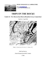
Figure 1 – Location map <strong>of</strong> <strong>Croton</strong> <strong>Point</strong> Park showing the probable extent <strong>of</strong> deltaic deposits <strong>and</strong> inferred sediment<br />
transport directions. (Markl, 1971, fig. 1, p. 506.)<br />
Field Trip Notes by:<br />
Charles Merguerian <strong>and</strong> John E. S<strong>and</strong>ers<br />
© 2010
CONTENTS<br />
CONTENTS..................................................................................................................................... i<br />
INTRODUCTION .......................................................................................................................... 1<br />
GEOLOGIC BACKGROUND................................................................................................... 2<br />
Physiographic Setting ............................................................................................................. 2<br />
Bedrock Units ............................................................................................................................. 5<br />
Layers I (The Proterozoic Basement Complex) <strong>and</strong> Metamorphosed Parts <strong>of</strong> Layer II (the<br />
Lower Paleozoic Shelf Sequence <strong>and</strong> Allochthonous Rocks) ................................................ 5<br />
Layer V - Newark Basin-filling Strata.................................................................................. 12<br />
<strong>Geology</strong> <strong>of</strong> <strong>Peekskill</strong> <strong>Hollow</strong>................................................................................................ 12<br />
<strong>Geology</strong> <strong>of</strong> the Cortl<strong>and</strong>t Complex....................................................................................... 14<br />
GLACIAL GEOLOGY............................................................................................................. 21<br />
Direction(s) <strong>of</strong> Flow <strong>of</strong> Ancient Glacier(s)........................................................................... 21<br />
L. D. Gale's Geological Survey <strong>of</strong> Manhattan Isl<strong>and</strong> (1828-1830) ...................................... 22<br />
One Glacier, Several Flow Directions .................................................................................. 23<br />
Ice Lobes............................................................................................................................... 25<br />
Flow Determined by Ice Domes on Top <strong>of</strong> Glacier.............................................................. 26<br />
Multiple Flow Directions, Multiple Glaciers: Boston Area, MA ........................................ 26<br />
Our View <strong>of</strong> the Situation..................................................................................................... 27<br />
Contrasting Glacial Effects on Valleys as a Function <strong>of</strong> Valley Trend: Valleys Trending<br />
NE-SW vs. Those Trending NW-SE .................................................................................... 28<br />
Preservation <strong>of</strong> Stratigraphic Units....................................................................................... 28<br />
Fjords on the New Engl<strong>and</strong> coast?........................................................................................ 29<br />
Glacial <strong>Geology</strong> <strong>of</strong> Southeastern New York ........................................................................ 30<br />
Holocene Sediments Deposited by the Fl<strong>and</strong>rian Submergence .......................................... 33<br />
DRAINAGE HISTORY ........................................................................................................... 37<br />
Relationship Between Modern Rivers <strong>and</strong> Valleys .............................................................. 37<br />
Cross-axial Drainage: Hudson Crossing the Hudson Highl<strong>and</strong>s ......................................... 39<br />
GEOLOGY OF CROTON POINT PARK ................................................................................... 40<br />
ENVIRONMENTAL LITIGATION OVER WESTCHESTER COUNTY'S USE OF<br />
CROTON POINT PARK AS A LANDFILL ........................................................................... 48<br />
OBJECTIVES............................................................................................................................... 56<br />
LIST OF LOCALITIES TO BE VISITED................................................................................... 56<br />
DRIVING DIRECTIONS AND DESCRIPTIONS OF LOCALITIES ("STOPS")..................... 58<br />
ACKNOWLEDGEMENTS.......................................................................................................... 72<br />
TABLES ....................................................................................................................................... 73<br />
Table 02 ........................................................................................................................................ 75<br />
REFERENCES CITED................................................................................................................. 80<br />
ORDER BLANK FOR PAST ON THE ROCKS GUIDEBOOKS............. Error! Bookmark not<br />
defined.<br />
i
DUKE GEOLOGICAL LABORATORY<br />
TRIPS ON THE ROCKS<br />
Guide 09: <strong>Croton</strong> <strong>Point</strong> <strong>and</strong> <strong>Peekskill</strong> <strong>Hollow</strong>, New York<br />
Trip 10: 12 May 1990<br />
Trip 25: 21 November 1992<br />
INTRODUCTION<br />
As a result <strong>of</strong> our collaboration in preparing for <strong>and</strong> carrying out these On-The-Rocks<br />
field trips, which began in 1988, we have arrived at an interpretation <strong>of</strong> the glacial history <strong>of</strong><br />
southeastern New York that differs considerably for what has come to be accepted as the<br />
"conventional wisdom" or "revealed truth" or whatever names one cares to apply to the currently<br />
fashionable dogma. Our ideas differ so pr<strong>of</strong>oundly from the accepted versions that all we can<br />
say is that both interpretations could be wrong, but only one <strong>of</strong> them can be correct. The<br />
ultimate test as to whether our new interpretation or the current-consensus interpretation is<br />
correct will come from stratigraphic relationships among the Pleistocene glacial- <strong>and</strong> interglacial<br />
sediments. In that connection, <strong>Croton</strong> <strong>Point</strong> Park is a key locality. One <strong>of</strong> the reasons for<br />
revisiting <strong>Croton</strong> <strong>Point</strong> so soon after our previous trip (May 1990) is to consider how the<br />
significant stratigraphic relationships that we have discovered at <strong>Croton</strong> <strong>Point</strong> fit with the<br />
relationships based on our studies elsewhere (S<strong>and</strong>ers <strong>and</strong> Merguerian, 1991, 1992).<br />
According to our interpretation, <strong>Croton</strong> <strong>Point</strong> was under seige during numerous discrete<br />
advances <strong>of</strong> Pleistocene continental glaciers. As each glacier advanced, it brought along<br />
distinctive boulders set in a matrix <strong>of</strong> finely pulverized rock flour (together forming a glacial<br />
sediment named till) that takes on the average color <strong>of</strong> the parent rocks from which the glacier<br />
eroded the debris. We argue that three <strong>and</strong> probably four separate Pleistocene glaciations left<br />
their mark on this part <strong>of</strong> New York State in the form <strong>of</strong> glacial striae, tills, outwash, interglacial<br />
marine, <strong>and</strong> proglacial deltaic- <strong>and</strong> -lake deposits.<br />
Today's On-The-Rocks field trip to <strong>Croton</strong> <strong>Point</strong> Park <strong>and</strong> <strong>Peekskill</strong> <strong>Hollow</strong> is intended<br />
to familiarize participants with the glacial- <strong>and</strong> bedrock geology <strong>of</strong> the <strong>Peekskill</strong> area <strong>of</strong><br />
southeastern New York. See Table 1 for a geologic time chart for the names <strong>of</strong> the geologic eras<br />
<strong>and</strong> periods, the estimated times <strong>of</strong> their boundaries, <strong>and</strong> selected events in the greater New York<br />
City region; <strong>and</strong> Table 2, Generalized descriptions <strong>of</strong> major geologic "layers," southeastern New<br />
York State <strong>and</strong> vicinity. An exp<strong>and</strong>ed section on the Glacial <strong>Geology</strong> <strong>and</strong> Drainage History is<br />
provided for your reading enjoyment.<br />
We will spend the first half <strong>of</strong> the day examining glacial-, deltaic-, <strong>and</strong> lacustrine deposits<br />
at <strong>Croton</strong> <strong>Point</strong> Park (Figure 1, cover). We will examine the variously colored tills <strong>and</strong> find<br />
them to harbor distinctive suites <strong>of</strong> boulders that can be traced to regions to the northwest<br />
(Newark Basin strata) <strong>and</strong> to the north-northeast (New Engl<strong>and</strong>). We will expend considerable<br />
effort in trying to identify <strong>and</strong> categorize the kinds <strong>and</strong> sizes <strong>of</strong> the glacial boulders that the river<br />
1
has conveniently washed out <strong>of</strong> the till <strong>and</strong> cleaned <strong>of</strong>f for our study, thus affording us an<br />
excellent opportunity for a vigorous exercise course in boulder bashing <strong>and</strong> rock identification.<br />
We will spend the afternoon examining nearby parent areas <strong>of</strong> some very distinctive boulders left<br />
by two glaciers that flowed from NNE to SSW (the New Engl<strong>and</strong> source for ice that flowed<br />
down the Hudson Valley). Based on geologic relationships exposed at <strong>Croton</strong> <strong>Point</strong> Park <strong>and</strong><br />
New York City, the older <strong>of</strong> these two New Engl<strong>and</strong> glaciers antedated <strong>and</strong> the younger<br />
postdated the widely recognized glacial deposits that resulted from ice that flowed one or more<br />
times from NNW to SSE across the Hudson Valley (the Newark source). Thus, by the end <strong>of</strong> our<br />
day, we will have seen the effects <strong>of</strong> glaciation <strong>and</strong> have traced back the distinctive glacial<br />
boulders parallel to the striae developed on their parent bedrock areas.<br />
Independently <strong>of</strong> how the glacial stratigraphy <strong>of</strong> <strong>Croton</strong> <strong>Point</strong> is interpreted, two other<br />
fascinating topics will be addressed on today's trip. These are (1) the relationship between<br />
distinctive indicator stones washed out <strong>of</strong> the till(s), <strong>and</strong> their bedrock parent areas, <strong>and</strong> (2) the<br />
postglacial history implied by the results <strong>of</strong> borings made in connection with the l<strong>and</strong>mark<br />
litigation over Westchester County's use <strong>of</strong> the low central area <strong>of</strong> <strong>Croton</strong> <strong>Point</strong> Park for a<br />
l<strong>and</strong>fill. We include a brief summary <strong>of</strong> this litigation <strong>and</strong> <strong>of</strong> Westchester's County's responses<br />
to the court orders directed to the County. This summary follows the Geologic Background<br />
section.<br />
GEOLOGIC BACKGROUND<br />
Under this heading, we discuss the physiographic setting, bedrock units, the glacial<br />
deposits, the drainage history, <strong>and</strong> local geologic summaries <strong>of</strong> our field-trip route. Refer to<br />
Tables 1 <strong>and</strong> 2 for details not fully explained in text. Figure 2 <strong>of</strong>fers a panoramic<br />
geological/physiographic bird's-eye-view <strong>of</strong> the Manhattan Prong, Hudson Valley, Newark<br />
Basin, <strong>and</strong> adjacent areas.<br />
Physiographic Setting<br />
The crystalline bedrock exposed in New York City is part <strong>of</strong> the Manhattan Prong<br />
(Figures 2, 3), a terrane that widens northward into the New Engl<strong>and</strong> Upl<strong>and</strong> physiographic<br />
province <strong>of</strong> the Appalachian mountain belt. The Manhattan Prong is composed <strong>of</strong> a complexly<br />
deformed, northeastly trending sequence <strong>of</strong> metamorphosed Proterozoic to Lower Paleozoic<br />
rocks. Under the heading Bedrock Units - Layers I <strong>and</strong> II, we describe these rocks in some<br />
detail. Suffice it to say here that northeastward, the crystalline bedrock <strong>of</strong> the region continues<br />
extends into Connecticut <strong>and</strong> Massachusetts; southwestward, near Staten Isl<strong>and</strong>, the units plunge<br />
beneath younger rocks <strong>and</strong> -sediments but in the vicinity <strong>of</strong> Philadelphia, Pennsylvania, they<br />
come to the surface again. To the west, this crystalline basement terrane is truncated <strong>and</strong><br />
unconformably overlain by gently dipping strata consisting <strong>of</strong> interlayered igneous- <strong>and</strong><br />
sedimentary units <strong>of</strong> the Newark Basin (Figures 2, 3). The tilted- <strong>and</strong> eroded remnants <strong>of</strong> the<br />
Newark strata are exposed along the west side <strong>of</strong> the Hudson River, forming the Palisade cliffs,<br />
from Stony <strong>Point</strong> southward to Staten Isl<strong>and</strong>. As shown on the diagonal cut-away slice in Figure<br />
2, the Newark strata generally dip about 15° to the northwest <strong>and</strong> are truncated against the<br />
Ramapo fault in New Jersey <strong>and</strong> New York.<br />
2
Figure 2 - Oblique, aerial physiographic diagram <strong>of</strong> a part <strong>of</strong> the Manhattan Prong, Newark Basin, Hudson-Reading<br />
Prong, <strong>and</strong> Atlantic Coastal Plain <strong>of</strong> the Appalachians. The vertical slice is oriented NW-SE to illustrate the<br />
generalized across-strike structural relations among major geologic "Layers" as outlined in Table 2. (E. Raisz.)<br />
The Proterozoic <strong>and</strong> Paleozoic metamorphic rocks <strong>of</strong> the Manhattan Prong are in ductile-<br />
<strong>and</strong> brittle fault contact with the Hudson Highl<strong>and</strong>-Reading Prong, an ancient elongate hilly<br />
terrane <strong>of</strong> moderate relief that shows the effects <strong>of</strong> significant uplift <strong>and</strong> protracted Pleistocene<br />
glaciation. These billion-year-old <strong>and</strong> older rocks trend northeastward from Reading,<br />
Pennsylvania through westernmost New Jersey onward through SE New York State. They cross<br />
the Hudson River just north <strong>of</strong> today's prime objectives near <strong>Peekskill</strong>, New York. Beyond<br />
eastern New York State, the Hudson-Reading Prong is continuous in the subsurface with<br />
exposed Proterozoic rocks forming the New Milford, Housatonic, Berkshire, Green, <strong>and</strong> Long<br />
Mountain massifs throughout New Engl<strong>and</strong> <strong>and</strong> Newfoundl<strong>and</strong>.<br />
3
Figure 3 - Simplified geologic map <strong>of</strong> the Manhattan Prong showing the distribution <strong>of</strong> metamorphic rocks (Layers<br />
I <strong>and</strong> II) ranging from Proterozoic Y through Early Paleozoic in age. Most faults <strong>and</strong> intrusive rocks have been<br />
omitted. (Mose <strong>and</strong> Merguerian, 1985.)<br />
4
The region north <strong>of</strong> <strong>Peekskill</strong>, New York is traversed by numerous northeast-trending<br />
sub-parallel ridges <strong>and</strong> valleys. <strong>Peekskill</strong> <strong>Hollow</strong> is a northeast-trending valley stretching from<br />
the Hudson River northeastward for about 9 km; its average width is 0.8 km. Gallows Hill is a<br />
prominent ridge ending at <strong>Peekskill</strong> Bay in the Hudson River near Annsville, New York. This<br />
ridge separates <strong>Peekskill</strong> <strong>Hollow</strong> <strong>and</strong> Sprout Brook Valley to the northwest. Here, Sprout Brook<br />
is continuous with Canopus Creek to the northwest <strong>of</strong> Cortl<strong>and</strong>t Lake. These valleys <strong>and</strong> the<br />
intervening ridge are lithologically controlled by phyllite (Gallows Hill) <strong>and</strong> easily erodable<br />
rocks (carbonate rocks) <strong>and</strong>/or faults as described below. Northwest <strong>of</strong> Gallows Hill, the rocks<br />
<strong>of</strong> the Manhattan Prong <strong>and</strong> the Hudson Highl<strong>and</strong>s are in contact. As described in detail under<br />
the heading <strong>Geology</strong> <strong>of</strong> <strong>Peekskill</strong> <strong>Hollow</strong>, the carbonate unit at the boundary <strong>of</strong> these disparate<br />
terranes shows abundant evidence for ductile- <strong>and</strong> brittle faulting <strong>and</strong> controls the position <strong>of</strong><br />
Sprout Brook.<br />
In its course through the Hudson Highl<strong>and</strong>s, the Hudson River follows numerous<br />
orthogonal bends which produce an unusual zig-zag path in comparison to the Hudson's<br />
"normal" straight-line course to the north <strong>and</strong> south <strong>of</strong> the Highl<strong>and</strong>s. We address this point later<br />
in the text <strong>and</strong> provide a full discussion in our guidebook on the Hudson Highl<strong>and</strong>s (On the<br />
Rocks Trip 14 - October 1990).<br />
Bedrock Units<br />
Layers I (The Proterozoic Basement Complex) <strong>and</strong> Metamorphosed Parts <strong>of</strong> Layer II (the<br />
Lower Paleozoic Shelf Sequence <strong>and</strong> Allochthonous Rocks)<br />
As we begin Trip 25 from the New York Academy <strong>of</strong> Sciences, let us express a few<br />
thoughts about the rocks beneath our feet. Before Paleozoic metamorphism <strong>and</strong> deformation,<br />
the New York City strata were sedimentary strata that for the most part, had been deposited on<br />
an eroded, complexly deformed cratonic sequence <strong>of</strong> layered feldspathic gneiss, schist,<br />
amphibolite, calc-silicate rock, <strong>and</strong> massive granitoid gneiss <strong>of</strong> uncertain stratigraphic<br />
relationships known as the Fordham, Yonkers, <strong>and</strong> Pound Ridge gneisses (Layer I).<br />
These complexly deformed, dominantly felsic rocks are <strong>of</strong> Precambrian age, <strong>and</strong> are<br />
assigned to the alphabetical-letter scheme <strong>of</strong> Precambrian rocks designated as Proterozoic by the<br />
United States Geological Survey. Present in southeastern New York are representatives <strong>of</strong><br />
Proterozoic Y <strong>and</strong> Z (Tables 1 <strong>and</strong> 2). These rocks are inferred to represent the ancient<br />
continental crust <strong>of</strong> proto-North America that were involved in the Grenville orogeny<br />
(Proterozoic Y) <strong>and</strong> post-Grenville, pre-Iapetus extensional tectonic activity (Proterozoic Z).<br />
Early in the Paleozoic Era, this region became the trailing edge <strong>of</strong> a continental plate, a<br />
passive continental margin (Figure 4) adjacent to the ancestral Atlantic Ocean (Iapetus). This<br />
tectonic setting persisted until the Taconic orogeny late in the Ordovician Period (Figure 5).<br />
Interestingly, the current plate-tectonic passive-continental-margin setting <strong>of</strong> eastern North<br />
America [deformed Paleozoic <strong>and</strong> older basement covered by essentially nondeformed Mesozoic<br />
<strong>and</strong> younger sediments that were (<strong>and</strong> continue to be) deposited as the margin subsides toward<br />
an ocean basin to the east] more or less duplicates that <strong>of</strong> Early Paleozoic time!.<br />
5
Figure 4 - Block diagram showing the Lower Paleozoic continental shelf edge <strong>of</strong> embryonic North America<br />
immediately before the deposition <strong>of</strong> Layer IIB. Current state outlines are dotted. The depositional areas for Layers<br />
IIA(W) <strong>and</strong> IIA(E), <strong>and</strong> the position <strong>of</strong> the Taconic arc <strong>and</strong> forel<strong>and</strong> basin are shown.<br />
The Cambrian <strong>and</strong> Ordovician bedrock units (Layer II) underlying the Manhattan Prong<br />
<strong>and</strong> adjacent parts <strong>of</strong> western Connecticut consist <strong>of</strong> sedimentary- <strong>and</strong> igneous rocks that formed<br />
near the Earth's surface. They began their geologic lives approximately 550 million years ago as<br />
thick accumulations <strong>of</strong> both shallow- <strong>and</strong> deep-water sediments adjacent to the Early Paleozoic<br />
shores <strong>of</strong> proto-North America (Figure 5).<br />
Layer II can be divided into two sub-layers, IIA <strong>and</strong> IIB. The older <strong>of</strong> these, IIA,<br />
represents the ancient passive-margin sequence <strong>of</strong> the proto-Atlantic (Iapetus) ocean. In turn,<br />
these rocks can be subdivided into two facies that differ in their original geographic positions<br />
with respect to the shoreline <strong>and</strong> shelf. A nearshore-shelf facies [Layer IIA(W)] was deposited<br />
in shallow water <strong>and</strong> is designated as the Sauk Sequence. The local representatives <strong>of</strong> the Sauk<br />
Sequence are from base upward, the Lower Cambrian Lowerre Quartzite <strong>and</strong> Cambro-<br />
Ordovician Inwood Marble in New York City (Poughquag Quartzite <strong>and</strong> Wappinger Group<br />
carbonates in Westchester County; Cheshire Quartzite <strong>and</strong> Woodbridge <strong>and</strong> Stockbridge marbles<br />
in western Connecticut <strong>and</strong> Massachusetts). These Sauk strata were deposited as s<strong>and</strong>y- <strong>and</strong><br />
6
limey sediments in an environment closely similar to that <strong>of</strong> the present-day Bahama Banks. The<br />
chief difference is that the salinity <strong>of</strong> the Early Paleozoic seas exceeded that <strong>of</strong> normal seawater<br />
(inferred from the features <strong>of</strong> the Cambro-Ordovician dolostones).<br />
Figure 5 - Sequential tectonic cross-sections for the Taconic orogeny in New Engl<strong>and</strong>. (Rowley <strong>and</strong> Kidd, 1981.)<br />
7
Farther <strong>of</strong>fshore, fine-textured terrigenous time-stratigraphic equivalents <strong>of</strong> the shallowwater<br />
Sauk strata were evidently deposited under deep water on oceanic crust [Layer IIA(E)].<br />
This sequence is also <strong>of</strong> Cambrian to Ordovician age <strong>and</strong> is known as the Taconic Sequence in<br />
upstate New York, as units C-Ot <strong>and</strong> C-Oh <strong>of</strong> the Manhattan Schist(s) in New York City <strong>and</strong><br />
vicinity (Figure 6). In western Connecticut, the deep-water sequence includes the Waramaug (or<br />
Manhattan B <strong>and</strong> C <strong>of</strong> Hall, 1968) <strong>and</strong> the Hartl<strong>and</strong> formations (Merguerian, 1983).<br />
Figure 6 - Geologic map <strong>of</strong> Manhattan Isl<strong>and</strong> showing a new interpretation <strong>of</strong> the stratigraphy <strong>and</strong> structure <strong>of</strong> the<br />
Manhattan Schist. (Geologic mapping <strong>and</strong> drawing by C. Merguerian.)<br />
8
Layer IIB consists <strong>of</strong> younger, mostly terrigenous, strata with thin basal Balmville<br />
Limestone, which unconformably overlie the Sauk Sequence [Layer IIA(W)]. These are now<br />
collectively designated as the Tippecanoe Sequence. The depositional setting for the basal<br />
Tippecanoe limestones was somewhat analogous to that <strong>of</strong> the Sauk Sequence, but with the<br />
exception that the salinity <strong>of</strong> the waters was normal rather than hypersaline. (This is inferred<br />
from the limestones <strong>of</strong> the basal Tippecanoe as contrasted with the dolostones <strong>of</strong> the Sauk.)<br />
After the basal Tippecanoe limestones had been deposited, the depositional setting shifted<br />
drastically. The former passive continental margin gave way to a forel<strong>and</strong> basin, which subsided<br />
deeply in response to the loads on the lithosphere being imposed by the advancing overthrust<br />
sheets <strong>and</strong> -adjacent volcanic arc from the east. The sedimentary fill <strong>of</strong> the forel<strong>and</strong> basin<br />
contains thick units <strong>of</strong> terrigenous sediments that were deposited under anoxic (low-oxygen)<br />
conditions <strong>and</strong> thus are dark colored as a result <strong>of</strong> finely disseminated pyrite <strong>and</strong>/or organic<br />
matter. In this respect, they differ notably from the fine-textured sedimentary strata <strong>of</strong> the older<br />
Taconic Sequence, which were deposited under oxidizing conditions.<br />
In eastern New York State, the metamorphosed equivalents <strong>of</strong> the dark-colored<br />
terrigenous Tippecanoe Sequence rocks are mapped as the Walloomsac Schist, Annsville<br />
Phyllite, <strong>and</strong> parts <strong>of</strong> the Manhattan Formation (Unit Om in Figure 6, Manhattan A <strong>of</strong> Hall<br />
(1968)).<br />
The schists originally named as the Manhattan Schist by Merrill <strong>and</strong> others (1902) were<br />
thought to be entirely younger than the Inwood Marble (Layer IIB) <strong>and</strong> thus to be the<br />
metamorphosed equivalents <strong>of</strong> units now assigned to the Tippecanoe Sequence. As a result <strong>of</strong><br />
mapping by CM, large parts <strong>of</strong> this body <strong>of</strong> schist are now recognized as correctly belonging to<br />
rock units that are the same age or older than Manhattan Schist unit Om <strong>and</strong> the Inwood Marble,<br />
<strong>and</strong> thus their protoliths belong to the Taconic Sequence. According to CM, at Inwood Hill Park<br />
in Manhattan (<strong>NY</strong>AS On-The-Rocks Rain Trips 3 <strong>and</strong> 16), this Manhattan Schist Unit Om is<br />
demonstrably interlayered with the Inwood Marble <strong>and</strong> at its base <strong>and</strong> contains thin layers <strong>of</strong><br />
calcite marble (Balmville equivalent). Such stratigraphic evidence is used to indicate that unit<br />
Om <strong>of</strong> the Manhattan Schist is in place where found <strong>and</strong> is therefore belongs to the Tippecanoe<br />
Sequence. This unit is probably younger than most <strong>of</strong> Manhattan units C-Ot <strong>and</strong> C-Oh whose<br />
protoliths belong to the Taconic Sequence. The upper part <strong>of</strong> the Taconic Sequence spans the<br />
same age range as the lower Tippecanoe Sequence but the main body <strong>of</strong> the Taconic Sequence is<br />
the same age as the Sauk Sequence.<br />
During the middle <strong>of</strong> the Ordovician Period, roughly 450 million years ago, after the<br />
forel<strong>and</strong> basin had begun started filling very rapidly with anoxic sediments <strong>and</strong> prior to the main<br />
events <strong>of</strong> the Taconic orogeny, vast overthrust sheets began to move westward along the floor <strong>of</strong><br />
the forel<strong>and</strong> basin. The first <strong>of</strong> these broke loose inboard <strong>of</strong> the former shelf edge. In<br />
northwestern Vermont, the these thrusts involve rocks no older than the base <strong>of</strong> the Sauk<br />
Sequence (the Champlain family <strong>of</strong> overthrusts). From Dutchess County, <strong>NY</strong> southwestward<br />
into New Jersey, however, these thrust sheets include continental-type basement rocks <strong>and</strong> the<br />
overlying Sauk Sequence. In this New York-New Jersey segment <strong>of</strong> the Appalachians, these<br />
mid-Ordovician overthrusts involving continental-type basement rocks have been recognized<br />
only recently. (See summaries in On-The-Rocks guidebooks to Franklin Mines, Delaware Water<br />
Gap, Stokes Forest, <strong>and</strong> Bellvale Mountain <strong>and</strong> the Shawangunks.) Next came sheets involving<br />
9
only the older eastern, deep-water formations <strong>of</strong> the Taconic Sequence [Layer IIA(E)] that were<br />
stripped away from their presumed oceanic basement crust <strong>and</strong> shifted into positions above the<br />
Inwood (Sauk Sequence) <strong>and</strong> its younger overlying terrigenous sediment <strong>of</strong> the Tippecanoe<br />
Sequence (all <strong>of</strong> the Manhattan Schist as originally conceived, but only Manhattan Schist unit<br />
Om, according to CM). In other words, the Taconic allochthon (On-the-Rocks Trips 8 <strong>and</strong> 22),<br />
is present as one or more overthrust slices in the Manhattan Prong <strong>and</strong> extends into New York<br />
City (Figure 7). (In much <strong>of</strong> the tectonic literature <strong>of</strong> the Taconic region, the term allochthon is<br />
reserved for the displaced Taconic Sequence. The strata that compose the earlier overthrusts that<br />
broke loose inboard <strong>of</strong> the former shelf edge <strong>and</strong> that may or may not involve continental-type<br />
basement rocks have been referred to as parautochthonous. "Para" means "almost." We think<br />
these older, pre-Taconic-allochthon thrusts are just as allochthonous as the displaced rocks <strong>of</strong> the<br />
Taconic Sequence. The overthrust Sauk strata include non-metamorphosed protoliths <strong>of</strong> the<br />
Inwood Marble.<br />
Figure 7 - Geologic cross section across northern Manhattan <strong>and</strong> the Bronx showing folded overthrusts (Cameron's<br />
Line <strong>and</strong> the St. Nicholas thrust), New York City. Symbols defined on Figure 6. (C. Merguerian.)<br />
The root zone <strong>of</strong> the overthrust involving the Taconic Sequence is thought to be<br />
Cameron's Line (See Figures 3, 7.), a feature widely known in western Connecticut (Merguerian,<br />
1983). CM interprets Cameron's line as a fundamental plate-tectonic boundary along which<br />
rocks belonging in place on the North American continent were overridden by materials from the<br />
former continental margin when the plate-tectonic regime changed from a passive margin to a<br />
convergent margin featuring an active subduction zone.<br />
During <strong>and</strong> after the overthrusting, the rocks <strong>of</strong> the Manhattan Prong were crowded<br />
together in complex folds <strong>and</strong> metamorphosed under medium- to high-grade Barrovian<br />
conditions. This can be inferred from the presence <strong>of</strong> such "indicator" minerals as kyanite,<br />
staurolite, sillimanite, hornblende, <strong>and</strong> garnet. Such diagnostic metamorphic minerals suggests<br />
that rocks now exposed at the modern l<strong>and</strong> surface <strong>of</strong> New York City formerly were at depths <strong>of</strong><br />
10
25 to 40 km. Rocks north <strong>of</strong> the city in the Manhattan Prong were buried by 25 to 30 km <strong>of</strong><br />
overburden. If this is correct, it indicates that between the middle <strong>of</strong> the Paleozoic Era, the time<br />
<strong>of</strong> the last great metamorphism, <strong>and</strong> late in the Triassic Period, when these metamorphic rocks<br />
began to be covered by the sedimentary strata filling the Newark basin, enormous uplift <strong>and</strong> vast<br />
erosion took place. A simplified geologic section showing the relationships between the folded<br />
New York City rocks, at the former l<strong>and</strong> surface, <strong>and</strong> the Newark Supergroup drawn along an<br />
east-west line at the George Washington Bridge (GWB) is shown in Figure 8. The overturned<br />
anticlines <strong>and</strong> synclines <strong>of</strong> the New York City metamorphic rocks are unconformably overlain<br />
by the west-dipping strata <strong>of</strong> the Newark Supergroup (Layer V, Table 2). The unconformity<br />
surface projects out <strong>of</strong> the Hudson River over the Manhattan Prong <strong>and</strong> New York City. On the<br />
west side <strong>of</strong> the Hudson River, this surface dips westward at the same angle as the overlying<br />
strata <strong>of</strong> the Newark Supergroup.<br />
Figure<br />
8 - Pr<strong>of</strong>ile-section across Hudson River at George Washington Bridge. Topography from<br />
U. S. Geological Survey Central Park 7.5-minute quadrangle. (J. E. S<strong>and</strong>ers, 1974, fig. 3, p. 11.)<br />
The foregoing paragraphs imply that all the bedrock in New York City has been involved<br />
in overthrusting<br />
<strong>and</strong> that some <strong>of</strong> it is even allochthonous in the Taconic-Sequence-only sense<br />
referred to above. (See CM's cross section <strong>of</strong> Figure 7.) It may not have occurred to you in<br />
these terms, but as you observe outcrops in New York City <strong>and</strong> the Manhattan Prong, you are<br />
doing two contrasting things. First, you are vicariously walking backward in time. And second,<br />
you are figuratively descending deep within a former mountain zone.<br />
11
Layer V - Newark Basin-filling Strata<br />
The tilted- <strong>and</strong> eroded remnants <strong>of</strong><br />
the Newark strata are exposed along the west side <strong>of</strong><br />
the<br />
Hudson River, from Stony <strong>Point</strong> south to Staten Isl<strong>and</strong>. As shown on the diagonal cut-away<br />
slice in Figure 2, the Newark strata generally dip about 15° to the northwest.<br />
The formal stratigraphic name for the dominantly red-brown colored Newark<br />
strata is<br />
Newark<br />
Supergroup (Olsen, 1980). Included are various sedimentary formations, <strong>of</strong> which the<br />
basal unit is the Stockton Arkose. Above it is the Lockatong Formation, the unit into which the<br />
Palisades sheet has been intruded. Higher up are other sedimentary units <strong>and</strong> three interbedded<br />
sheets <strong>of</strong> mafic extrusive igneous rock (ancient lava flows), whose tilted edges are resistant <strong>and</strong><br />
underlie ridges known as the Watchungs. The age <strong>of</strong> the sedimentary units beneath the oldest<br />
extrusive sheet is Late Triassic. The remainder <strong>of</strong> the formations are <strong>of</strong> Early Jurassic age<br />
(Cornet, 1977; Cornet <strong>and</strong> Travers, 1975, Olsen, 1980).<br />
The Newark sedimentary strata were deposited in a fault-bounded basin (the Ramapo<br />
Border<br />
fault in Figure 2) to which the sea never gained access. In this basin, the filling strata<br />
were de posited in various oxygen-enriched nonmarine environments, including subaerial fans,<br />
streams, <strong>and</strong> shallow- <strong>and</strong> deep lakes. Lake levels varied according to changes in climate (Olsen,<br />
1986) <strong>and</strong> produced hematite-stained clastic sediments or "redbeds".<br />
After the Newark strata had been deeply buried, they were elevated<br />
<strong>and</strong> tilted, probably<br />
during<br />
a period <strong>of</strong> mid-Jurassic tectonic activities (S<strong>and</strong>ers, 1963). They were then eroded <strong>and</strong><br />
truncated<br />
to form a surface upon which the Upper Cretaceous <strong>and</strong> younger coastal-plain strata<br />
were deposited.<br />
<strong>Geology</strong> <strong>of</strong> <strong>Peekskill</strong><br />
<strong>Hollow</strong><br />
The region north <strong>of</strong> <strong>Peekskill</strong>,<br />
New York is traversed by numerous northeast-trending<br />
sub-parallel<br />
ridges <strong>and</strong> valleys. The region has been studied by many geologists including<br />
Berkey (1907, 1933), Berkey <strong>and</strong> Rice (1919), Berkey <strong>and</strong> Colony (1933), Gordon (1911), Paige<br />
(1956), Bucher (1957), Lowe (1958), Schaffel (1958), <strong>and</strong> Ratcliffe (1971, 1980). Simon<br />
Schaffel's paper is the last to summarize the important stratigraphic-structural problems related<br />
to <strong>Peekskill</strong> <strong>Hollow</strong>, a northeast-trending valley stretching from the Hudson River for roughly<br />
9<br />
km with an average width <strong>of</strong> 0.8 km. Gallows Hill is a prominent ridge ending near the Hudson<br />
River at Annsville, New York bifurcated by <strong>Peekskill</strong> <strong>Hollow</strong> <strong>and</strong> Sprout Brook Valley to the<br />
northwest. These valleys <strong>and</strong> intervening ridge are structurally <strong>and</strong> lithologically controlled by<br />
faults <strong>and</strong> easily differentially eroded rocks as described below <strong>and</strong> at Stops 8 <strong>and</strong> 9.<br />
The <strong>Peekskill</strong> <strong>Hollow</strong> section was first diagrammed by Berkey (Figure 9) who interpreted<br />
Gallows<br />
Hill as a syncline <strong>of</strong> Hudson River Phyllite (now called the Annsville Phyllite). The<br />
syncline is bounded to the northwest <strong>and</strong> southeast by faults <strong>and</strong> carbonate rocks <strong>of</strong> various ages<br />
ranging from Proterozoic through Cambro-Ordovician. Proterozoic gneisses (Reservoir Granite)<br />
crop out on the northwest side <strong>of</strong> Gallows Hill <strong>and</strong> also to the southeast, beyond the outcrop belt<br />
<strong>of</strong> Wappinger Limestone <strong>and</strong> Poughquag Quartzite. Berkey's interpretation <strong>of</strong> a Proterozoic<br />
limestone belt beneath Sprout Brook was challenged by Bucher (1957) who suggested (Figure<br />
12
10) that the Paleozoic strata are transgressive against the Precambrian gneiss which results in a<br />
pinch-out <strong>of</strong> the infolded basal Paleozoic section beneath the syncline <strong>of</strong> black shale (phyllite).<br />
In his view, the western limestone ("a" = black unit in Figure 10) was "Trentonian" (late Middle<br />
Ordovician = Balmville limestone) in age <strong>and</strong> thus separated from the limestone beneath the<br />
Annsville syncline (actually an inlier) by a steep reverse fault.<br />
Figure 9 - Geologic section at <strong>Peekskill</strong> <strong>Hollow</strong> showing the structure across Gallows Hill. (Berkey, 1933.)<br />
Paige (1956) attempted to correlate the Manhattan Schist <strong>and</strong> Inwood Marble at<br />
Verplanck<br />
<strong>Point</strong> with the Cambro-Ordovician Annsville Phyllite-Wappinger Limestone<br />
succession in <strong>Peekskill</strong> <strong>Hollow</strong>. His geologic map <strong>and</strong> cross section are shown in Figure 11.<br />
Note section B-B' from the Cortl<strong>and</strong>t Complex in <strong>Peekskill</strong> northwestward to Sprout Brook<br />
Creek wherein Paige interprets the Annsville cut as forming a normal-faulted overturned limb <strong>of</strong><br />
an anticline cored by Precambrian rocks (Reservoir Gneiss). More recently, in reversing his<br />
earlier opinion published in 1971, Ratcliffe (1980) has suggested that Berkey's Precambrian call<br />
on the limestone belt to northwest <strong>of</strong> the Annsville syncline the model is more correct.<br />
According to Ratcliffe, the unusual marble, which contains rounded inclusions <strong>of</strong> gneiss, is<br />
actually Proterozoic limestone that has been intensely sheared to form a tectonic-mylonite<br />
breccia. The Annsville Phyllite (in the Annsville cut) is in fault contact with the flow-b<strong>and</strong>ed<br />
mylonitic Proterozoic marble along the N40°E-trending Annsville fault located adjacent to<br />
Sprout Brook. Fault textures superimposed upon the Proterozoic mylonite indicate right-lateral<br />
oblique thrusting <strong>of</strong> probable Late Ordovician age according to Ratcliffe (1980). The Annsville<br />
fault may mark an extension <strong>of</strong> the northeast-trending Theills fault on the west side <strong>of</strong> the<br />
Hudson River.<br />
13
Figure 10 - Diagrammatic cross section <strong>of</strong> Paleozoic sediments infolded into Precambrian (Proterozoic Y) gneiss<br />
n orthwest <strong>of</strong> <strong>Peekskill</strong>, New York. The section shows the westward overlap <strong>of</strong> the young Trentonian limestones <strong>and</strong><br />
shales (eroded at left <strong>of</strong> fault) onto the gneiss. The Annsville cut (Stop 8) is at "b". Poughquag quartzite (dotted);<br />
C-O dolostone-limestone (blocks); Trenton limestone (black); <strong>and</strong> Annsville (Hudson River) Phyllite in center <strong>of</strong><br />
syncline. (W. H. Bucher, 1957.)<br />
Structural interpretations may vary but it is clear that the positions <strong>of</strong> <strong>Peekskill</strong> <strong>and</strong><br />
Sprout<br />
Brook Creeks are controlled by both lithology <strong>and</strong> structure. As discussed at Stops 8 <strong>and</strong><br />
9, CM <strong>and</strong> JES <strong>of</strong>fer a new interpretation <strong>of</strong> the structure based on the presence <strong>of</strong> very low dips<br />
in the metamorphic- <strong>and</strong> sedimentary layering <strong>of</strong> the Poughquag Quartzite southeast <strong>of</strong> <strong>Peekskill</strong><br />
Creek. Stay tuned to the text for further developments.<br />
<strong>Geology</strong> <strong>of</strong> the Cortl<strong>and</strong>t Complex<br />
The Cortl<strong>and</strong>t Complex is one <strong>of</strong> many mafic-ultramafic plutons that were emplaced in<br />
the<br />
general vicinity <strong>of</strong> Cameron's Line (the inferred Taconic suture) in Mid-Ordovician time. As<br />
has been noted by many workers, the structural settings, mineral compositions, <strong>and</strong> ages <strong>of</strong> these<br />
composite plutons, including the Hodges Complex, Mount Prospect Complex, <strong>and</strong> Bedford<br />
Augen Gneiss in western Connecticut, as well as the Peach Lake, <strong>Croton</strong> Falls, Torment Hill,<br />
Rosetown, Cortl<strong>and</strong>t <strong>and</strong> Stony <strong>Point</strong> complexes in New York, are similar.<br />
Since late in the nineteenth century, geologists interested in igneous rocks have studied<br />
the<br />
various aspects <strong>of</strong> the Cortl<strong>and</strong>t pluton near <strong>Peekskill</strong>, New York. Work by Dana (1881) <strong>and</strong><br />
Williams (1884, 1886) helped set the stage for early twentieth-century studies by Rogers (1911)<br />
(Figure 12), Balk (1927) <strong>and</strong> later studies by Sh<strong>and</strong> (1942) <strong>and</strong> Bucher (1948). A geologic map<br />
<strong>of</strong> the complex at this time identified a central basin with western- <strong>and</strong> eastern "funnels" (Figure<br />
13). By the 1950's, geophysical- <strong>and</strong> geologic data <strong>of</strong> Steenl<strong>and</strong> <strong>and</strong> Woollard (1952; Figure<br />
14), <strong>and</strong> work by Friedman (1956) provided data on which new models <strong>of</strong> the crustal structure <strong>of</strong><br />
14
the Cortl<strong>and</strong>t Complex could be conceived. A summary diagram (Figure 15) shows the various<br />
structural models proposed for the complex by this time. Compare these with the gravity<br />
anomalies displayed on the gravity map <strong>of</strong> New York State (Figure 16).<br />
Figure 11 - Geologic <strong>and</strong> structural map <strong>of</strong> the southwest portion <strong>of</strong> the West <strong>Point</strong> quadrangle, New York. (Sidney<br />
Paige,<br />
1956.)<br />
15
Figure 12 - Geologic map <strong>of</strong> the Cortl<strong>and</strong>t Series according to Rogers (1911) as redrafted by K. E. Lowe in 1938.<br />
Modern studies since the 1950's have built upon the geological data <strong>of</strong> earlier workers.<br />
Using geochemical- <strong>and</strong> geochronologic data, Ratcliffe (1968, 1971, 1981) <strong>and</strong> Ratcliffe <strong>and</strong><br />
others (1982, 1983) have defined the ages <strong>of</strong> intrusion, contact-metamorphic relationships, <strong>and</strong><br />
internal configurations <strong>of</strong> the Cortl<strong>and</strong>t pluton(s). The Cortl<strong>and</strong>t Complex is a lopolithic<br />
(inverted mushroom shaped) mass consisting <strong>of</strong> six temporally related plutons <strong>of</strong> varying<br />
compositions (Figures 17-19). Intrusive into the metamorphic rocks <strong>of</strong> the Manhattan Prong,<br />
the<br />
oldest pluton (Pluton 1) is a kaersutite (alkali amphibole) hornblendite, gabbro, <strong>and</strong> pyroxenite<br />
grading internally into norite. It is internally well layered; aligned primary amphiboles define a<br />
flow layering. Pluton 2 is a green hornblende gabbro, a diorite, <strong>and</strong> a biotite quartz diorite that<br />
are correlative with identical rocks at Stony <strong>Point</strong> on the west side <strong>of</strong> the Hudson. (See Figure<br />
17.) Pluton 3 cuts across the core <strong>of</strong> Pluton 1, sends apophyses into Pluton 2, <strong>and</strong> consists <strong>of</strong><br />
clinopyroxenite <strong>and</strong> hornblende pyroxenite (websterite). Pluton 4 consists <strong>of</strong> hornblende<br />
16
pyroxenite, peridotite, <strong>and</strong> cortl<strong>and</strong>tite displaying cumulate layering. These four plutons form<br />
the western "funnel" <strong>of</strong> Balk but are now interpreted (See Figure 19.) as separate intrusives<br />
along<br />
the west edge <strong>of</strong> the Cortl<strong>and</strong>t lopolithic mass.<br />
Figure 13 - Geologic map <strong>of</strong> the Cortl<strong>and</strong>t Complex after Sh<strong>and</strong> (1942) showing "critical phases." (W. H. Bucher, 1948.)<br />
Figure 14 - Gravity map <strong>of</strong> Cortl<strong>and</strong>t Complex. (Steenl<strong>and</strong> <strong>and</strong> Woollard, 1952.)<br />
17
Figure 15 - Summary diagram showing various cross-sectional interpretations <strong>of</strong> the Cortl<strong>and</strong>t Complex.<br />
The central basin is underlain by Pluton 5 that consists <strong>of</strong> biotite-hornblende norite <strong>and</strong><br />
gabbro, <strong>and</strong> coarse poikilitic kaersutite norite. This pluton, which contains abundant xenoliths <strong>of</strong><br />
Manhattan Schist <strong>and</strong> calc-silicate rock (Inwood Marble?), shows evidence in the form <strong>of</strong> bent<br />
crystals <strong>of</strong> plagioclase <strong>and</strong> biotite <strong>and</strong> delicate folds in igneous flow layers <strong>of</strong> the norite that it<br />
was intruded while compressive forces were active. The eastern "funnel" is composed <strong>of</strong><br />
hornblende pyroxenite <strong>and</strong> hornblende peridotite <strong>of</strong> Pluton 6 that engulf abundant cognate<br />
xenoliths <strong>of</strong> Pluton 5.<br />
The results <strong>of</strong> geochronologic dating <strong>of</strong> various phases <strong>of</strong> the Cortl<strong>and</strong>t Complex indicate<br />
that the plutons were intruded roughly 430 to 470 Ma (million years ago). The igneous rocks <strong>of</strong><br />
these plutons contact metamorphosed rocks <strong>of</strong> the Manhattan Prong that already possessed a<br />
regional-metamorphic fabric related to the Taconic orogeny. Therefore, this date <strong>of</strong> intrusion<br />
sets a medial Ordovician minimum age for the Taconic orogeny. This corroborates estimates<br />
from structural- <strong>and</strong> paleontologic studies along the sole thrusts <strong>of</strong> the Taconic Mountains. The<br />
fact that the Cortl<strong>and</strong>t rocks have not been deformed indicates that they were intruded during the<br />
waning stages <strong>of</strong> the Taconic orogeny. In addition, studies <strong>of</strong> the contact-metamorphic minerals<br />
18
in the 20- to 50-meter-thick aureole <strong>of</strong> the Cortl<strong>and</strong>t Complex allows the interpretation that the<br />
complex was intruded into the rocks <strong>of</strong> the Manhattan Prong at depths <strong>of</strong> 25 kilometers.<br />
In retaining radiometric ages <strong>of</strong> 430 to 470 Ma, the rocks near <strong>Peekskill</strong> contrast with<br />
those farther south, in Manhattan <strong>and</strong> surroundings, for instance. In Manhattan, all radiometric<br />
ages fall in the range <strong>of</strong> 350 to 365 Ma, reflecting regional heating <strong>and</strong> "resetting <strong>of</strong> isotopic<br />
clock" by the Acadian orogeny (mid-Devonian). Clearly, the rocks around Peeksill escaped the<br />
effects <strong>of</strong> the mid-Devonian heating that affected the rocks farther south.<br />
This brief summary <strong>of</strong> the bedrock geology is to provide a solid basis for underst<strong>and</strong>ing<br />
some <strong>of</strong> the distinctive boulders that have been eroded out <strong>of</strong> the Pleistocene till at <strong>Croton</strong> <strong>Point</strong>.<br />
Figure 16 - Simple Bouguer gravity-anomaly map <strong>of</strong> part <strong>of</strong> southeastern New York State <strong>and</strong> contiguous states<br />
showing localized positive anomaly SE <strong>of</strong> <strong>Peekskill</strong>. (T. C. Urban, R. W. Bromery, F. A. Revetta, <strong>and</strong> W. H.<br />
Diment, 1973.)<br />
19
Figure 17 - Geologic map <strong>of</strong> the western <strong>and</strong> central funnels <strong>of</strong> the Cortl<strong>and</strong>t Complex <strong>and</strong> the Stony <strong>Point</strong> <strong>and</strong><br />
Rosetown extensions <strong>of</strong> the Cortl<strong>and</strong>t. (Ratcliffe <strong>and</strong> others, 1982, 1983.)<br />
Figure 18 - Explanation <strong>and</strong> lithologic descriptions <strong>of</strong> rocks <strong>of</strong> the Cortl<strong>and</strong>t Complex. (Ratcliffe <strong>and</strong> others, 1983.)<br />
20
Figure 19 - Geologic section oriented SW to NE <strong>of</strong> the Cortl<strong>and</strong>t Complex (Section A-A' on Figure 17) showing<br />
internal flow structure, cross-cutting relationships, <strong>and</strong> general lopolithic form <strong>of</strong> the intrusive. (Ratcliffe <strong>and</strong><br />
others, 1983.)<br />
GLACIAL<br />
GEOLOGY<br />
As mentioned under the description <strong>of</strong> Layer VII, the Quaternary sediments in Table 2,<br />
the glacial deposits, include several contrasting varieties. We will be especially interested in the<br />
characteristics <strong>of</strong> till <strong>and</strong> outwash. Till is a general name for any sediment deposited directly by<br />
the flowing ice <strong>of</strong> the glacier. Typically, till is not stratified <strong>and</strong> contains a wide range <strong>of</strong> particle<br />
sizes, from boulders to clay. Outwash is a general term for any sediment deposited by water<br />
melted from a glacier. Outwash includes such contrasting sediments as stream s<strong>and</strong>s/gravels <strong>and</strong><br />
lake clays. The key point about distinguishing outwash is the stratification that resulted from the<br />
action <strong>of</strong> water.<br />
Direction(s) <strong>of</strong> Flow <strong>of</strong> Ancient Glacier(s)<br />
An important point to be determined in studying a glacial deposit is which way the<br />
glacier flowed. Because glaciers create scratches <strong>and</strong> even large grooves on solid bedrock, it is<br />
usually a straightforward matter to infer ice-flow direction. The directions <strong>of</strong> flow <strong>of</strong> a former<br />
glacier can be determined easily <strong>and</strong> unambiguously in the field by recording the azimuths <strong>of</strong><br />
features eroded on bedrock by the flowing ice (such as striae <strong>and</strong> grooves, <strong>and</strong> the long axes <strong>and</strong><br />
slope asymmetry<br />
<strong>of</strong> roche moutonnées <strong>and</strong> rock drumlins), by plotting the distribution <strong>of</strong><br />
distinctive clasts, <strong>and</strong> by recording certain asymmetrical properties <strong>of</strong> glacial deposits (such as<br />
directions <strong>of</strong> orientations <strong>of</strong> elongate clasts <strong>and</strong> the long axes <strong>of</strong> drumlins).<br />
21
Direction <strong>of</strong> flow based on distribution <strong>of</strong> distinctive clasts comes under the heading <strong>of</strong><br />
provenance studies; that is, where the clasts (= large particles) in a deposit come from. Because<br />
glaciers can transport stones long distances, one commonly finds a collection <strong>of</strong> clasts in a<br />
glacial deposit that are unlike the bedrock on which the glacial deposits rest. Such stones are<br />
known as erratics. If an erratic can be traced to a distinctive source, it becomes an indicator<br />
stone. Use <strong>of</strong> striae <strong>and</strong> indicator stones shows that glaciers flowed across the New York region<br />
from several directions. You will share in this type <strong>of</strong> analysis on today's trip!<br />
The distribution <strong>of</strong> erratics derived from as far away as the anthractite district in eastern<br />
Pennsylvania <strong>and</strong> pebbles <strong>of</strong> the distinctive maroon-matrix, white pebble rock in the Green Pond<br />
Formation (Lower Silurian -- the "Braunschweiger-sausage rock" <strong>of</strong> the late Barnard biology<br />
Pr<strong>of</strong>essor Donald Ritchie) in the red- brown tills <strong>and</strong> outwashes in New York City (Figure 20)<br />
lends strong support to the interpretation that the striae <strong>and</strong> other directional indicators oriented<br />
NW-SE indicate regional ice flow from that direction, rather than a local SE deviation <strong>of</strong> a<br />
glacier whose main axis <strong>of</strong> flow was from NNE to SSW.<br />
Figure 20 - Distinctive erratics found in till in New York City, (1) anthracite from northeastern Pennsylvania, <strong>and</strong><br />
(2) Green Pond Conglomerate from northern New Jersey, support interpretation <strong>of</strong> rectilinear flow <strong>of</strong> glacier from<br />
NW to SE. Stippled area, outcrops <strong>of</strong> anthracite coal; S. I. = Staten Isl<strong>and</strong>; P. B. = Princess Bay. (JES in Friedman<br />
<strong>and</strong> S<strong>and</strong>ers, 1978, fig.<br />
2-1, p. 27; Friedman, S<strong>and</strong>ers, <strong>and</strong> Kopaska-Merkel, 1992, Box 2.2 fig.1, p. 48.)<br />
L. D. Gale's Geological Survey <strong>of</strong> Manhattan Isl<strong>and</strong> (1828-1830)<br />
The easiest method for tracking the directions <strong>of</strong> flow <strong>of</strong> an ancient glacier is to record<br />
directions <strong>of</strong> striae <strong>and</strong> grooves on the bedrock. In New York City, such a survey was first<br />
carried out in 1828-29 by L. D. Gale (in Mather, 1843). As was common in his day, Gale<br />
supposed that the grooves <strong>and</strong> scratches had been made by water currents, perhaps assisted by<br />
icebergs. The presumed significance <strong>of</strong> water is implied in the use <strong>of</strong> the term diluvial.<br />
22
Gale's extensive observations clearly demonstrate that on Manhattan Isl<strong>and</strong>, one can see<br />
the effects <strong>of</strong> two contrasting flow directions. Nearly all the "diluvial scratches <strong>and</strong> furrows"<br />
recorded by Gale indicate flow (1) from the NW to the SE. By contrast, the displacement <strong>of</strong><br />
indicator erratics (the anthophyllite-bearing rock <strong>and</strong> the white limestone) show transport (2)<br />
from the NNE to the SSW.<br />
Despite his compilation <strong>of</strong> data implying two contrasting flow directions,<br />
Gale<br />
interpreted<br />
all <strong>of</strong> his evidence in terms <strong>of</strong> a single event, which he expressed as "the diluvial<br />
current."<br />
Gale tried to show how the changes in flow <strong>of</strong> a single such current could account for<br />
both the regional trends <strong>of</strong> the scratches <strong>and</strong> furrows on the smoothed bedrock <strong>and</strong> the displaced<br />
indicator erratics.<br />
By appealing to a single transport event to account for the evidence <strong>of</strong> two transport<br />
directions, Gale began a pattern that would be followed by most subsequent students <strong>of</strong> the<br />
"diluvial" deposits. But Gale's single transport event differed<br />
significantly from the one favored<br />
by<br />
later investigators. Gale concluded that his single "diluvial current" had flowed from NW to<br />
SE <strong>and</strong> he sought aberrations in this flow direction to account for the displacement from NNE to<br />
SSW <strong>of</strong> indicator erratics. In contrast, the single flow event for most later workers was taken to<br />
be from the NNE to the SSW; they invoked aberrations to explain the scratches <strong>and</strong> furrows that<br />
trend NW-SE.<br />
The idea that the features Gale referred to as "Diluvial" had been made by a nowvanished<br />
continental glacier was proposed later in the ninenteenth century. T. C. Chamberlin<br />
(1895) argued that only one Late Pleistocene ice sheet had invaded the New York City region.<br />
Chamberlin's view was reinforced by R. D. Salisbury <strong>and</strong> assistants (1902), <strong>and</strong> is implicit in all<br />
recent papers where the term "lobe" is used with respect to the margin <strong>of</strong> the ice sheet (for<br />
example, Connally <strong>and</strong> Sirkin, 1970, 1973; Sirkin, 1982).<br />
One Glacier, Several Flow Directions<br />
Salisbury <strong>and</strong> assistants (1902) found that the predominance <strong>of</strong> ice-flow indicators<br />
showed glacial flow from the NNW to the SSE over the Palisades whereas by contrast, such<br />
indicators<br />
demonstrated that glacial flow over the Watchung ridges had been predominantly from<br />
the NNE to the SSW. In his interpretation <strong>of</strong> these indicators <strong>of</strong> contrasting directions <strong>of</strong> ice<br />
flow, Salisbury argued that within the margins <strong>of</strong> an ice sheet are localized zones within which<br />
the ice-flow paths are faster than elsewhere. Accordingly, the ice-flow "streamlines" are thought<br />
to be crowded close together (Figure 21). On either side <strong>of</strong> such supposed zones <strong>of</strong> concentrated<br />
flow,<br />
the ice tends to spread out toward each side.<br />
In applying this concept to the New York metropolitan area, Salisbury<br />
inferred that<br />
during<br />
the latest glaciation <strong>of</strong> the New York City region, the axis <strong>of</strong> fastest-flowing ice had not<br />
been down<br />
the Hudson Valley, as one might expect on the basis <strong>of</strong> valley size, but rather had<br />
followed the Hackensack Valley to the west (Salisbury <strong>and</strong> assistants, 1902). From this inferred<br />
zone <strong>of</strong> concentrated flow down the Hackensack Valley, they thought that the ice had flowed<br />
toward the SSE over the Palisades ridge <strong>and</strong> Manhattan, <strong>and</strong> toward the SSW over the crests <strong>of</strong><br />
the Watchung Ridges in New Jersey (Figure 22).<br />
23
Figure 21 - A divergent system <strong>of</strong> striae found west <strong>of</strong> Lake Michigan. (Salisbury, 1902, fig. 31.)<br />
Figure 22 - Map <strong>of</strong> northeastern New Jersey <strong>and</strong> southeastern New York showing inferred flow lines in the latest<br />
Pleistocene glacier. Further explanation in text. (U. S. Geological Survey, Passaic Folio, No. 157, fig. 11, 1908,<br />
rendering <strong>of</strong> R. D. Salisbury).<br />
24
Salisbury admitted that the regional distribution <strong>of</strong> erratics <strong>of</strong> the distinctive Silurian<br />
Green Pond Conglomerate from NW New Jersey constituted an anomaly to this explanation <strong>of</strong><br />
marginal-flow divergence within a single glacier as the cause <strong>of</strong> the divergent orientations <strong>of</strong> the<br />
glacial grooves <strong>and</strong> scratches. Salisbury acknowledged that another succession <strong>of</strong> events which<br />
could explain the distribution <strong>of</strong> erratics <strong>of</strong> Green Pond Conglomerate involved two glaciations:<br />
Ice Lobes<br />
"No single Green Pond mountain conglomerate bowlder<br />
has been found on the ridge. West <strong>of</strong> Hackensack, such<br />
bowlders are found in abundance, <strong>and</strong> this in spite <strong>of</strong><br />
(sic) the fact that in New Jersey the movement <strong>of</strong> the<br />
ice along the Green Pond mountain range was to the<br />
southwest, approximately parallel to the range itself.<br />
Glacial movement in this direction could not have<br />
carried bowlders from the New Jersey part <strong>of</strong> the Green<br />
Pond mountain formation to the Hackensack valley. It<br />
would seem that the conglomerate ledges which<br />
furnished the Hackensack valley bowlders must have<br />
lain somewhere north <strong>of</strong> New Jersey, in the axis <strong>of</strong><br />
the ice lobe, or perhaps a little to the west <strong>of</strong> it,<br />
<strong>and</strong> that the bowlders derived from this ledge were<br />
carried southward in the direction <strong>of</strong> ice movement,<br />
<strong>and</strong> finally out <strong>of</strong> the valley onto the highl<strong>and</strong>s to<br />
the west by the westerly-diverging currents, but that<br />
they were not brought within the influence <strong>of</strong> easterly<br />
diverging currents, <strong>and</strong> therefore were not carried<br />
eastward upon the Palisades ridge. Another hypo-<br />
thesis which would equally well explain the distri-<br />
bution <strong>of</strong> the Green Pond mountain conglomerate<br />
bowlders, but for which there is no demonstrative<br />
evidence at h<strong>and</strong>, is that these bowlders were carried<br />
southeastward from their parent ledges by an earlier<br />
ice movement, the movement in the last epoch being<br />
to the southwest over or along the Green Pond<br />
mountain formation. (A good deal may be said for<br />
this suggestion). The distribution <strong>of</strong> these bowlders<br />
has not been studied beyond the State <strong>of</strong> New Jersey"<br />
(Salisbury <strong>and</strong> Peet, 1894, p. 180).<br />
Another version <strong>of</strong> how a single glacier could create flow indicators having several<br />
directions is based on the behavior <strong>of</strong> ice lobes. Such lobes characterize the terminus<br />
<strong>of</strong> a valley<br />
glacier<br />
that has spread beyond the confining bedrock valley walls. Although the main flow<br />
direction <strong>of</strong> ice in a valley glacier is parallel to the trend <strong>of</strong> the valley, within the terminal lobe,<br />
the spreading ice creates divergent flow paths.<br />
25
Flow Determined<br />
by Ice Domes on Top <strong>of</strong> Glacier<br />
The theoretical background in support <strong>of</strong> the concept that one <strong>and</strong> the same continental<br />
ice sheet could display multiple flow directions was proposed at the time when the modern<br />
version <strong>of</strong> the Laurentide Ice Sheet was advocated (Flint, 1943). According to Flint, the<br />
Laurentide<br />
Ice Sheet began as one or more snowfields in the highl<strong>and</strong>s <strong>of</strong> northeastern Canada.<br />
With continued additions <strong>of</strong> snow, an ice cap appeared <strong>and</strong> it began to spread<br />
southward <strong>and</strong><br />
westward. The azimuth from the northeastern Canadian highl<strong>and</strong>s to New<br />
York City is 195 or<br />
along a line from N15E to S15W. After this ice cap had become a full-fledged<br />
ice sheet <strong>and</strong><br />
had attained something close to its full thickness, it is presumed to have<br />
itself become a factor in<br />
localizing where additional snow would fall. Flint inferred that the ice<br />
sheet could divert the<br />
flow <strong>of</strong> moisture-bearing winds from the Gulf <strong>of</strong> Mexico <strong>and</strong> thus would<br />
have acted as an<br />
orographic source <strong>of</strong> precipitation. In other words, the ice sheet forced the air to rise <strong>and</strong> to be<br />
cooled <strong>and</strong> thus to drop its moisture. Enough snow is therefore thought to have been heaped up<br />
at various localities near the outer margin <strong>of</strong> the ice sheet <strong>and</strong> thus to have<br />
formed ice domes<br />
whose relief may<br />
have altered the direction <strong>of</strong> glacial flow. Thus, the initial direction <strong>of</strong> regional<br />
rectilinear flow toward the SSW as a result <strong>of</strong> snow supply from northeastern<br />
Canada, could<br />
change locally to centers <strong>of</strong> quasiradial flow under <strong>of</strong> the influence <strong>of</strong> the ice domes each <strong>of</strong><br />
which could display divergent flow patterns, including zones <strong>of</strong> flow<br />
from NNW to SSE. During<br />
meltback <strong>and</strong> retreat <strong>of</strong> the ice front, the above-described situation would<br />
be reversed. The<br />
factors responsible<br />
for radial ice-dome flow, including sectors from NNW toward the SSE,<br />
would cease to operate <strong>and</strong> those causing rectilinear flow toward the SSW to resume their former<br />
pre-eminence. The predicted pattern <strong>of</strong> flow for each advance <strong>of</strong> such an ice sheet, therefore,<br />
would involve three phases in the following order: (1) rectilinear flow from the NNE toward the<br />
SSW; (2) quasi-radial flow from the glacier-marginal ice domes, but<br />
locally from the NNW<br />
toward the SSE ; <strong>and</strong> (3) rectilinear from the NNE toward the SSW.<br />
Flint opposed the multiple-glacier hypothesis because he was<br />
convinced that if two<br />
glaciers had flowed over an area <strong>and</strong> both had extended their influence<br />
deep enough to polish<br />
<strong>and</strong> scratch the bedrock, then the younger glacier would obliterate all traces <strong>of</strong> the older one.<br />
Accordingly, he argued that all the striae must have been made by only<br />
one glacier, the youngest<br />
one.<br />
Multiple Flow Directions, Multiple Glaciers: Boston Area, MA<br />
After he had analyzed the Pleistocene stratigraphy<br />
<strong>of</strong> the Boston<br />
area, Kaye (1982) wrote<br />
the<br />
following paragraph under the headings <strong>of</strong> directions<br />
<strong>of</strong> glacial flow:<br />
"The direction <strong>of</strong> ice flow in the Boston Basin<br />
<strong>and</strong> adjoining upl<strong>and</strong>s was studied by means <strong>of</strong> the<br />
orientation <strong>of</strong> striations (sic) <strong>and</strong> grooves on the<br />
bedrock surface, the orientation (sic) <strong>of</strong> the long<br />
axes <strong>of</strong> drumlins, the direction <strong>of</strong> transport <strong>of</strong> erratics<br />
in till, <strong>and</strong> the direction <strong>of</strong> thrusting <strong>and</strong><br />
overturning <strong>of</strong> bedding in glacially deformed drift.<br />
These data range through 360° in azimuth. Analysis<br />
26
<strong>of</strong> this confusing message shows the existence not<br />
<strong>of</strong> an ever-shifting ice current but <strong>of</strong> at least four<br />
separate <strong>and</strong> distinct ice currents <strong>of</strong> different<br />
ages. Three <strong>of</strong> these flowed fairly rectilinearly,<br />
but one (the last) was multicomponent <strong>and</strong> marked by<br />
strong lobation" (1982, p. 31).<br />
Kaye numbered these tills from I (oldest) to IV (youngest). Tills I, II, <strong>and</strong> III flowed<br />
from the NW to the SE, the mean direction being S23°E +/- 1° for Till I; S64°E +/- 18° for Till<br />
II; <strong>and</strong> S31°E +/- 2° for Till III.<br />
Our View <strong>of</strong> the Situation<br />
The regional geologic relationships in the New York City region are especially helpful<br />
with regard to ice-flow recon-structions. The distribution <strong>of</strong> the reddish-brown bedrock in the<br />
strata filling the Newark basin lying west <strong>of</strong> the Hudson River provides an especially valuable<br />
indicator with respect to ice flow across the Hudson Valley in contrast to ice flow down the<br />
Hudson Valley. In many localities east <strong>of</strong> the Hudson River, color <strong>of</strong> the glacial sediments alone<br />
suffices for distinguishing source-distinctive tills <strong>and</strong> -outwash sediments. Any reddish-brown<br />
sediments resulted from action <strong>of</strong> ice that flowed across the Hudson River. By contrast,<br />
sediments that are yellowish brown or gray were deposited as a result <strong>of</strong> glaciation by ice that<br />
flowed down the Hudson Valley. This interpretation is not valid on parts <strong>of</strong> Long Isl<strong>and</strong> because<br />
red-colored sediments <strong>of</strong> the Connecticut River Valley basin may have been distributed<br />
southwestward by ice flow from the NNE (See our On-The-Rocks Trip 15 guidebook for Long<br />
Isl<strong>and</strong>.)<br />
According to us, several interpretations <strong>of</strong> these two sets <strong>of</strong> ice-flow indicators are<br />
possible. These are: (1) that various changing conditions caused the direction <strong>of</strong> flow <strong>of</strong> a single<br />
ice sheet to shift with time, <strong>and</strong> (2) each set <strong>of</strong> flow directions was made by a single glacier<br />
having only one dominant flow direction.<br />
(1) Almost without exception, geologists who have studied the Pleistocene deposits in the<br />
New York metropolitan<br />
area have accepted T. C. Chamberlin's viewpoint that a single ice sheet<br />
<strong>of</strong> Late Wisconsinan age created all the flow indicators observed. We<br />
agree that the various<br />
mechanisms<br />
that have been proposed (deviated flow related to change <strong>of</strong> speeds <strong>of</strong> ice<br />
streamlines, lobes at the margin, <strong>and</strong> peripheral ice domes) are valid concepts. Our main dispute<br />
is with the ways in which these concepts have been proposed <strong>and</strong> that the proposers have ignored<br />
the<br />
evidence <strong>of</strong> glacial erosion <strong>of</strong> the bedrock, provenance, <strong>and</strong> stratigraphic<br />
relationships <strong>of</strong> the<br />
tills.<br />
(2) We think that the evidence in the New York City region is best interpreted by<br />
multiple glacia tions, several <strong>of</strong> which displayed what C. A. Kaye referred to as "rectilinear"<br />
flow. Our interpretation <strong>of</strong> the relationships in New York City almost<br />
exactly mataches those<br />
described by C.<br />
A. Kaye from the Boston area.<br />
27
Contrasting Glacial Effects on Valleys as a Function <strong>of</strong> Valley Trend: Valleys Trending<br />
NE-SW vs. Those<br />
Trending NW-SE<br />
Although room for doubt may still exist in the minds <strong>of</strong> some readers on the subject <strong>of</strong><br />
the relationship between the contrasting azimuths <strong>of</strong> the glacially sculpted<br />
striae <strong>and</strong> other<br />
features on the bedrock <strong>and</strong> the stratigraphy <strong>of</strong> the Quaternary sediments, glacial ice flowing in<br />
two<br />
contrasting directions [at whatever time(s) it may have done so] has affected valleys<br />
differently according to the angle between valley trend <strong>and</strong> ice-flow direction. For example, ice<br />
flowing from NNE to the SSW has tended to deepen <strong>and</strong> clean out valleys trending NE-SW <strong>and</strong><br />
to fill but not otherwise change valleys<br />
trending NW-SE. By contrast, ice flowing from NW to<br />
SE has deepened <strong>and</strong> cleaned out valleys<br />
trending NW-SE <strong>and</strong> filled valleys trending NE-SW.<br />
These relationships between glacial-flow direction <strong>and</strong> valley trend have affected the<br />
preservation<br />
<strong>of</strong> stratigraphic units associated with each glacial episode, may have been<br />
signific ant factors in determining the course <strong>of</strong> the Hudson River across the Hudson Highl<strong>and</strong>s,<br />
<strong>and</strong> affect the application <strong>of</strong> the correct use <strong>of</strong> the term fjord for valleys along the New Engl<strong>and</strong><br />
coast. (For further discussion, see our On-The-Rocks guidebook for the Hudson Highl<strong>and</strong>s trip.)<br />
Preservation <strong>of</strong> Stratigraphic Units<br />
The direction <strong>of</strong> flow <strong>of</strong> the last (youngest) glacier to spread into the New York City<br />
region was from NNE to SSW, a direction that is down the Hudson Valley, the Hackensack<br />
Valley, <strong>and</strong> other valleys having this trend, <strong>and</strong> is close to the regional strike <strong>of</strong> many bedrock<br />
formations. The last glacier deepened these valleys that trend NE-SW. The ice dug down<br />
to<br />
bedrock <strong>and</strong> thus removed most traces <strong>of</strong> sedimentary units deposited by older glaciers.<br />
Engineering borings in the Hudson <strong>and</strong> Hackensack valleys, for example, show a<br />
succession from brownish gravel (probable till) resting on bedrock <strong>and</strong> overlain by brownish<br />
s<strong>and</strong> <strong>and</strong> brownish varved clay that shows but slight resistance to penetration <strong>of</strong> the drilling<br />
tools. Clasts from gravels associated with these deposits tend to be well rounded.<br />
Course <strong>of</strong> the Hudson River across the Hudson<br />
Highl<strong>and</strong>s<br />
The fact that the major river <strong>of</strong> the region, the Hudson, flows across the largest<br />
topographic barrier in the region, the Hudson Highl<strong>and</strong>s, has attracted the attention <strong>of</strong> several<br />
geomorphologists. Two contrasting interpretations have been proposed: (1) superposition, <strong>and</strong><br />
(2) headward erosion along zones <strong>of</strong> weakness. The most-recent analysis (by Thompson,<br />
1936)<br />
emphasized the close relationship between zones <strong>of</strong> weakness in the bedrock <strong>and</strong> the zig-zag<br />
course <strong>of</strong> the Hudson River. Closely spaced joints <strong>and</strong> faults trending NW-SE have been<br />
followed by dikes; these fracture provide ready-made zones <strong>of</strong> weakness in that direction.<br />
All previous students <strong>of</strong> the subject <strong>of</strong> the course <strong>of</strong> the Hudson across the Highl<strong>and</strong>s<br />
have acknowledged that the history includes continental glaciation, but all have presumed that<br />
only one glacier was involved, that it flowed from NNE to SSW, <strong>and</strong> that glacial effects were not<br />
significant factors in determining the river's location. Our proposed new interpretation <strong>of</strong> the<br />
glacial history introduces many new dimensions to the subject <strong>of</strong> the course <strong>of</strong> the river across<br />
the<br />
highl<strong>and</strong>s. For example, each <strong>of</strong> the two flow directions is parallel to one <strong>of</strong> the two zig-zag<br />
segments<br />
<strong>of</strong> the river. The regional joint patterns <strong>and</strong> structural trends break up the bedrock into<br />
28
locks cut by NE-SW- <strong>and</strong> NW-SE-trending fractures <strong>and</strong> structural fabrics. The edges <strong>of</strong> these<br />
blocks would be easily eroded by flowing<br />
water or ice scour across the region. Glacial flow<br />
from<br />
the NW would erode <strong>and</strong> enlarge valleys trending NW-SE. Glacial flow from the NE<br />
would e rode <strong>and</strong> enlarge valley segments trending NE-SW. The proposed order <strong>of</strong> ice flow (as<br />
explained below) is: (1) from NNE, (2) from NW; (3) from NW; <strong>and</strong> (4) from NNE. Thus,<br />
the<br />
end result <strong>of</strong> erosion associated with these four glacial advances could easily have been a<br />
bedrock-controlled path across the highl<strong>and</strong>s. Significant pieces <strong>of</strong> this path could have been<br />
eroded one at a time by a single glacier: the zigs being cut by ice flow from one direction at one<br />
time <strong>and</strong> the zags, by ice flowing from another direction at another time. Such zig-zag erosion<br />
need not have been the only influence <strong>of</strong> the glaciers on drainage history. Clearly, the glacial<br />
striae <strong>and</strong> crescentic marks that we have detected on top <strong>of</strong> Bear Mountain indicate flow by two<br />
glaciers, one from the NW <strong>and</strong> another from the NNE. The thick glaciers passed over this<br />
rugged l<strong>and</strong>scape without ever blinking an eye; they were not impressed.<br />
We know from the effects <strong>of</strong> glacial erosion on the highest peaks that ice completely<br />
covered the highl<strong>and</strong>s probably to a depth <strong>of</strong> several kilometers. Therefore, streams <strong>of</strong> meltwater<br />
that began to flow southward on the top <strong>of</strong> the melting glacier would have been flowing across<br />
the highl<strong>and</strong>s from a still-higher elevation<br />
associated with the glacier. To some degree, drainage<br />
across<br />
a resistant mass that was established on a wasting glacier at a higher elevation would<br />
q ualify it as being a special kind <strong>of</strong> superposition, that is a lowering <strong>of</strong> a downcutting stream so<br />
that it flows across a buried resistant rock mass after having been established at a higher<br />
elevation. As first defined <strong>and</strong> widely applied, superposition involves the lowering by<br />
downcutting <strong>of</strong> a drainage network which began on a younger stratigraphic unit that<br />
unconformably overlies the resistant feature.<br />
F jords on the New Engl<strong>and</strong> coast?<br />
Fjords are glaciated valleys that have been drowned by the sea. Typically, the glacier<br />
involved was a valley glacier <strong>and</strong> it flowed down the valley, deepening it into a typical<br />
U-shaped<br />
cross section. Because the valleys on the rugged Maine coast have been glaciated,<br />
some<br />
geologists<br />
suggested that they should be referred to as fjords.<br />
Despite the combination <strong>of</strong><br />
glaciation <strong>and</strong> coastal valleys, Douglas Johnson objected to the designation <strong>of</strong> coastal-Maine<br />
valleys as fjords. His chief reason for doing so was that the direction <strong>of</strong> glacial flow (from NW<br />
to SE) had been across the valleys (that trended NE-SW) rather than along their axes. But, if any<br />
glacier had flowed down the axes <strong>of</strong> Maine's coastal valleys (that is, from NE to SW), then<br />
whatever merit may have attended Johnson's argument virtually disappears.<br />
Because the direction <strong>of</strong> flow <strong>of</strong> the last glacier to overspread the New York City region<br />
was<br />
down the Hudson <strong>and</strong> Hackensack valleys, <strong>and</strong> subsequently these valleys have been<br />
drowne d by the sea, we think it is appropriate to refer to these valleys as fjords. Although the<br />
Hackensack valley is situated in an area <strong>of</strong> low relief <strong>and</strong> has been nearly completely filled with<br />
sediment, it would still qualify as being a fjord. In addition to its other fjord-like characteristics,<br />
the slope <strong>of</strong> the thalweg (defined as the line joining the deepest points <strong>of</strong> a stream channel or<br />
more generally, valley pr<strong>of</strong>ile) <strong>of</strong> the Hackensack valley reverses at the southern limit <strong>of</strong> the ice<br />
(Lovegreen, 1974). This reversal is from the usual NNE to SSW gradient to a steep slope from<br />
SSW to NNE.<br />
29
Glacial <strong>Geology</strong> <strong>of</strong> Southeastern New York<br />
The stratigraphy <strong>of</strong> glacial deposits is worked out by noting the relationships among till,<br />
outwash, <strong>and</strong> sediments that have nothing at all to do with a glacier <strong>and</strong>, in fact, were deposited<br />
under a climate regime that is nonglacial. In a coastal area such as New York City, glacial<br />
deposits may be interstratified with marginal-marine deposits. This has resulted from the<br />
relationship between growth <strong>of</strong> continental ice sheets <strong>and</strong> the volume <strong>of</strong> water in the ocean<br />
basins. Pr<strong>of</strong>essor R. A. Daly (1934, p. 1), <strong>of</strong> Harvard, once described this relationships between<br />
"deployments" <strong>of</strong> glacial ice <strong>and</strong> the water <strong>of</strong> the oceans as one <strong>of</strong> "robbery" <strong>and</strong> <strong>of</strong> "restitution. "<br />
By robbery, he meant the locking up <strong>of</strong> the water in the glaciers. By restitution, he meant the<br />
return <strong>of</strong> the water to the oceans when glaciers melted. Although the exact climate settings<br />
involved in these changes are not as well known as one might suppose, it has been firmly<br />
established that when the glaciers reached their maximum extents, the sea was at its lowest st<strong>and</strong>,<br />
a level around 75 m lower than now.<br />
Figure 23 shows a map <strong>of</strong> North America with what was for a long time the st<strong>and</strong>ard<br />
view <strong>of</strong> how the Pleistocene ice covered Canada <strong>and</strong> northern United States. Notice that New<br />
York is within the flow pattern shown for the Labrador Ice Sheet.<br />
Figure 23 - Reconstruction <strong>of</strong> North American Pleistocene Ice Sheets with Keewatin center <strong>and</strong> Labrador center<br />
shown as attaining simultaneous maxima. Further explanation in text. (U. S. Geological Survey).<br />
30
Given the concept that ice from the Labrador center should have been present in New<br />
York<br />
City, then the expected direction <strong>of</strong> such glacier flow is from the NNE to the SSW, a<br />
direction<br />
that is parallel to the Hudson River. However, in Manhattan <strong>and</strong> on the top <strong>of</strong> the<br />
Palisades Ridge, striae are oriented from about N20°W to S20°E, or even more toward the NW-<br />
SE direction. A previous generation <strong>of</strong> glacial geologists adopted the view <strong>of</strong> deviated flow from<br />
a central lobate glacier (Figure 24). According to this concept, the main flow <strong>of</strong> the latest ( <strong>and</strong>,<br />
according to many, the only Wisconsinan) glacier was concentrated down the Hackensack<br />
lowl<strong>and</strong>, but the ice deviated to its left <strong>and</strong> crossed the Palisades ridge <strong>and</strong> New York City on a<br />
NW-to-SE course.<br />
Figure 24 - Rectilinear flow from NW to SE <strong>of</strong> glacier older than the latest Wisconsinan. This glacier flowed across<br />
the Hudson Valley <strong>and</strong> deposited red-brown till <strong>and</strong> -outwash on the east side <strong>of</strong> the Hudson River. (J. E. S<strong>and</strong>ers.)<br />
From studying the stratigraphic relationships, provenance <strong>of</strong> indicator stones, <strong>and</strong><br />
grooves on the bedrock, we propose an alternative view. In the our scheme <strong>of</strong> things, the flow<br />
indicated in Figure 22 is not the product <strong>of</strong> one glacier, but <strong>of</strong> more than three (possibly four).<br />
The oldest glacier advanced from the NNE <strong>and</strong> is responsible for the basal till exposed at<br />
Teller's <strong>Point</strong> in <strong>Croton</strong> <strong>Point</strong> Park (Stop 2 <strong>of</strong> today's trip) <strong>and</strong> roche moutonnée sculpting <strong>of</strong><br />
bedrock ridges in New York City that were subsequently scratched by a later NW-trending<br />
glacial advance. Following this earliest glacier, for which evidence is scarce <strong>and</strong> obscure<br />
(younger<br />
glaciers have removed most <strong>of</strong> the evidence for it), a second <strong>and</strong> possibly third<br />
glaciation took place from the NW direction.<br />
31
The distribution <strong>of</strong> erratics derived from as far away as the anthracite district in eastern<br />
Pennsylvania (See Figure 20.) in the red-brown tills <strong>and</strong> outwashes in New York City lends<br />
strong support to the interpretation shown in Figure 24, as contrasted to Figure 22. In Figure 24,<br />
the ice is shown as having flowed rectilinearly from NW to SE, across the highest ridges <strong>and</strong><br />
across the Hudson Valley without deflection. This suggests a thick ice sheet whose flow pattern<br />
was governed by the ice gradient on the top <strong>of</strong> the glacier. Local red-colored outwash<br />
s<strong>and</strong>wiched between two red-brown tills suggests an interglacial (or short-term interstadial? )<br />
period within the NW-trending advance. At Stop 4, two red-brown tills are indeed separated by<br />
stratified red-brown s<strong>and</strong> which we interpret as glacial outwash. Interestingly, pebbles in the<br />
lower<br />
red-brown till show a higher degree <strong>of</strong> decomposition compared to those in the upper redbrown<br />
till.<br />
Figure 25 shows the regional flow from NNE to SSW as resulting from a later (youngest<br />
or Woodfordian) glacier. According to our view, the two prominent moraine ridges on Long<br />
Isl<strong>and</strong> resulted from ice flowing as in Figure 24 <strong>and</strong> not from the Woodfordian glacier! The<br />
latest glacier, shown in Figure 25, did not reach much <strong>of</strong> Long Isl<strong>and</strong>. This conclusion is based<br />
on our studies <strong>of</strong> glacial stratigraphy <strong>and</strong> provenance <strong>of</strong> till boulders. The Woodfordian glacier<br />
covered parts <strong>of</strong> Queens <strong>and</strong> Brooklyn, Manhattan, <strong>and</strong> Staten Isl<strong>and</strong> <strong>and</strong> was responsible for the<br />
yellow-brown till that caps the drumlin at Enoch's Nose in <strong>Croton</strong> <strong>Point</strong> Park (Stop 4). The<br />
extent <strong>and</strong> nature <strong>of</strong> its terminal moraine is not as yet known.<br />
Figure 25 - Inferred flow pattern <strong>of</strong> latest Wisconsinan glacier, down the Hudson <strong>and</strong> Hackensack lowl<strong>and</strong>s from<br />
NNE to SSW. This glacier affected only westernmost parts <strong>of</strong> Long Isl<strong>and</strong>; elsewhere, its terminal moraine was<br />
along the south coast <strong>of</strong> Connecticut. (J. E. S<strong>and</strong>ers).<br />
32
Thus, our new view <strong>of</strong> glaciation is based on evidence for four discrete glacial advances<br />
listed from oldest (1) to youngest (4):<br />
1) early advance from NNE to SSW generating gray-brown till (in areas E <strong>of</strong> the Hudson River).<br />
2) first advance from NNW to SSE generating red-brown till on E side <strong>of</strong> Hudson River<br />
S <strong>of</strong><br />
Stony <strong>Point</strong>.<br />
3) a second advance from NNW to SSE generating a second red brown till.<br />
4) most-recent<br />
ice advance from NNE to SSW generating yellow-brown till.<br />
Holocene Sediments Deposited by the Fl<strong>and</strong>rian Submergence<br />
The Late Wisconsinan (Woodfordian) ice sheet disappeared from the New York City<br />
region very rapidly. The ice front retreated northward, uncovering the lower Hudson Valley, the<br />
Mohawk Valley, <strong>and</strong> the Champlain lowl<strong>and</strong>. It lingered for a time in the upper reaches <strong>of</strong> the<br />
St. Lawrence lowl<strong>and</strong>, thus plugging the outlet now used by all the drainage out <strong>of</strong> the Great<br />
Lakes via Lake Ontario (Figure 26). The weight <strong>of</strong> the remaining ice continued to depress the<br />
surface <strong>of</strong> the lithosphere so much that even though the level <strong>of</strong><br />
the sea was still generally low,<br />
the<br />
sea was able to inundate the St. Lawrence-Champlain lowl<strong>and</strong>, forming the Champlain Sea.<br />
At this same time, all the water flowing out <strong>of</strong> the Great Lakes did so via the Mohawk Valley-<br />
Hudson Valley route past New York City. (See Figure 26.) Eventually, vast quantities <strong>of</strong> water<br />
from the melting ice flowed back to the oceans. As a result, the sea rose rapidly. This rapid rise<br />
<strong>of</strong> sea level has been named by European geologists as the Fl<strong>and</strong>rian submergence. In the New<br />
York City region, the oldest deposit <strong>of</strong> the rising sea is the so-called gray "organic silt" found in<br />
the major river valleys, such as the Hudson. The thickness <strong>of</strong> the Holocene organic silt ranges<br />
up to 150 feet or so, as indicated in borings made for engineering structures such as the<br />
Newburgh-Beacon Bridge across the Hudson River (Figure 27).<br />
33
Figure 26 - Sketch maps showing Great Lakes at Wisconsinan glacial maximum, at two stages during deglaciation,<br />
<strong>and</strong> at present. (From F. B. Taylor, in Frank Leverett <strong>and</strong> F. B. Taylor, 1915, (b), pl. 17 facing p. 392; (c), pl. 19<br />
facing p. 400; redrawn by J. E. S<strong>and</strong>ers, 1981, fig. 13.34, p. 333.)<br />
( a) Maximum <strong>of</strong> Wisconsin glacier (in white).<br />
(b)<br />
Early stage <strong>of</strong> deglaciation; outlet to Gulf <strong>of</strong> Mexico via Illinois River at Chicago, Illinois, <strong>and</strong> Mississippi<br />
River.<br />
(c) Later stage <strong>of</strong> deglaciation; St. Lawrence lowl<strong>and</strong> still blocked by remnant <strong>of</strong> glacier; outlet from Lake Erie via<br />
Niagara Falls into Lake Ontario, thence eastward via Mohawk Valley into Lake Hudson/Albany, which was<br />
dammed at south end by terminal-moraine ridge.<br />
(d) Conditions today; outlet from Lake Ontario into St. Lawrence lowl<strong>and</strong>, within which the water flows<br />
northeastward into the Atlantic Ocean via the Gulf <strong>of</strong> St. Lawrence, northeastern Canada (not shown).<br />
Once this silt began to be deposited in an area, the pattern did not change. We note a few<br />
points about this Holocene silt. First <strong>of</strong> all, similar to a geologist after a pizza lunch, it is full <strong>of</strong><br />
gas bubbles. As a result, it is very reflective to sound waves. This means that the silt serves as a<br />
blanket which effective precludes using ordinary small-boat continuous seismic-reflection<br />
pr<strong>of</strong>ilers, as with sparkers, boomers, <strong>and</strong> air guns to obtain continuous seismic-reflection pr<strong>of</strong>iles<br />
<strong>of</strong> subbottom sediments. Many a hopeful investigator has supposed that it would be possible to<br />
obtain such continuous seismic-reflection pr<strong>of</strong>iles <strong>of</strong> the sediments in the Hudson Estuary. An<br />
equal number has been defeated; all they ever got was multiples. (Remember the chorus in the<br />
34
song about Mary Ann McCarthy who went out to dig some clams? "All she ever got was<br />
mussels, etc.")<br />
Figure 27 - Pr<strong>of</strong>ile-section across Hudson River at Newburgh-Beacon bridge on I-84, based on samples from<br />
engineering borings, showing thick Holocene organic silt overlying lacustrine clay <strong>and</strong> -deltaic s<strong>and</strong> <strong>and</strong> gravel.<br />
Geologic interpretation by Newman, Thurber, Zeiss, Rokach, <strong>and</strong> Musich (1969); samples from boring 5S studied<br />
by Owens, Stefannson, <strong>and</strong> Sirkin (1974). (J. P. Owens; K. Stefannson; <strong>and</strong> L. A. Sirkin, 1974, fig. 10, p. 403.)<br />
35
Attempts have been made to date the basal silt from samples obtained at Iona Isl<strong>and</strong> <strong>and</strong><br />
at the Newburgh-Beacon<br />
bridge on I-84. Based on samples dated by the radiocarbon method,<br />
Newman,<br />
Thurber, Zeiss, Rokach, <strong>and</strong> Musich (1969) concluded that the age <strong>of</strong> the oldest<br />
estuarine silt is 12,000 radiocarbon years. D. Weiss (1974) placed the date at 11,000 years B. P.<br />
(before present). Owens, Stefansson, <strong>and</strong> Sirkin (1974, p. 404-405) obtained samples from the I-<br />
84 Newburgh-Beacon bridge borings (See Figure 27.) <strong>and</strong> compared the clay minerals from<br />
samples <strong>of</strong> the Upper Quaternary lake sediments with those <strong>of</strong> the Holocene estuarine silt <strong>and</strong><br />
also performed chemical analyses on the silt. They found that illite is the predominant clay<br />
mineral; next came about equal amounts <strong>of</strong> kaolinite <strong>and</strong> chlorite. Montmorillonite was least<br />
abundant (averaging 15%). Illite <strong>and</strong> montmorillonite are more abundant in the estuarine silt<br />
than in the lake sediments. Chemically, in the lake sediments, CaO <strong>and</strong> CO2 are consistently<br />
higher than in the estuarine silts, sulfur is more abundant, <strong>and</strong> ferrous iron is higher than ferric<br />
iron. Other papers devoted to the Holocene sediments are by Agron (1980) in the Hackensack<br />
meadowl<strong>and</strong>s, New Jersey; <strong>and</strong> by Averill, Pardi, Newman, <strong>and</strong> Dineen (1980) for both the<br />
Hackensack <strong>and</strong> Hudson valleys.<br />
New insights into the behavior <strong>of</strong> the fine sediments in the Hudson Estuary have come<br />
from the use <strong>of</strong> geochemical tracers-- from the atmosphere, from discharges <strong>of</strong> radionuclides<br />
from the Indian <strong>Point</strong> reactors, <strong>and</strong> from the General Electric capacitor-manufacturing plants at<br />
Hudson Falls <strong>and</strong> Fort Edward (results from the geochemical laboratory at Lamont-Doherty<br />
Geological Observatory <strong>of</strong> Columbia University, by the team headed by H. J. Simpson, <strong>and</strong><br />
including Richard Bopp, Curt Olsen, <strong>and</strong> others). Using the vertical distribution in sediment<br />
cores <strong>of</strong> the radioactive isotope <strong>of</strong> cesium (137Cs - derived from nuclear-weapons tests in the<br />
atmosphere that began in 1954 <strong>and</strong> reached a peak in 1963--just before the treaty banning such<br />
tests took effect--<strong>and</strong> were distributed worldwide via the atmosphere), these investigators have<br />
found two contrasting depositional settings: (1) marginal flats, where the post-fallout sediment is<br />
only a few millimeters thick (equals the modern rate <strong>of</strong> submergence); <strong>and</strong> (2) dredged channels,<br />
where the thickness <strong>of</strong> post-fallout sediment ranges up to several tens <strong>of</strong> centimeters. In the<br />
marginal flats, sediment has evidently built up to the pr<strong>of</strong>ile <strong>of</strong> equilibrium <strong>and</strong> new sediment<br />
can be added only as this pr<strong>of</strong>ile is lowered (as it is during submergence). In newly dredged<br />
channels, sediment fills in very rapidly, at rates in the tens <strong>of</strong> centimeters per year (C. R. Olsen,<br />
Simpson, Bopp, S. C. Williams, Peng, <strong>and</strong> Deck, 1978; Simpson, C. R. Olsen, Trier, <strong>and</strong> S. C.<br />
Williams, 1976).<br />
In the spring <strong>of</strong> 1974, <strong>and</strong> again in 1976, two mighty surges <strong>of</strong> sediments highly<br />
contaminated with PCBs from the General Electric plants at Hudson Falls <strong>and</strong> Fort Edward<br />
spread throughout the Hudson Estuary <strong>and</strong> beyond. Prior to 1973, most <strong>of</strong> these sediments were<br />
being kept upriver behind the ancient Fort Edward Dam. For reasons <strong>of</strong> safety, <strong>and</strong> to prevent a<br />
disastrous downriver surge <strong>of</strong> sediments that would accompany a damburst flood, the Niagara-<br />
Mohawk Power Company, owner <strong>of</strong> the dam, obtained permission from the Federal Power<br />
Commission <strong>and</strong> New York State Department <strong>of</strong> Environmental Conservation to remove the Fort<br />
Edward Dam. Granted this permission, Niagara-Mohawk dismantled the dam, starting in July<br />
1 973 <strong>and</strong> ending in October 1973. Two subsequent floods <strong>and</strong> a general time <strong>of</strong> high flows<br />
brought about the very result that removal <strong>of</strong> the dam was supposed to forestall! (It is a splendid<br />
analogy to that story <strong>of</strong> the downcast person who was told by a cheery friend to "Cheer up!<br />
36
Things could be worse." Thus heartened, the downcast person cheered up <strong>and</strong> sure enough,<br />
things got worse.)<br />
The effects <strong>of</strong> industrial pollution have obliterated the once-flourishing oysters <strong>of</strong> the<br />
Hudson estuary. In 1966, JES participated in a small experiment <strong>of</strong> lowering a TV camera <strong>and</strong><br />
light to the bottom <strong>of</strong> the Tappan Zee <strong>of</strong>f Irvington. The bottom is paved with dead oyster shells.<br />
DRAINAGE HISTORY<br />
The key objective <strong>of</strong> analyzing drainage history is to underst<strong>and</strong> the relationships<br />
between rivers <strong>and</strong> the modern l<strong>and</strong>scape. As a starting point, one pays attention to the<br />
relationships between rivers <strong>and</strong> the valleys in which they are flowing <strong>and</strong> between rivers that<br />
flow across highl<strong>and</strong> areas (which rivers are supposed to avoid). Such rivers form parts <strong>of</strong> what<br />
are known technically as cross-axial drainage (the axis referring to the highl<strong>and</strong> area).<br />
Relationship<br />
Between Modern Rivers <strong>and</strong> Valleys<br />
Modern rivers are flowing in valleys having considerable age spans. Some <strong>of</strong> these<br />
valleys have been in existence for hundreds <strong>of</strong> millions <strong>of</strong> years. Others are only a few tens <strong>of</strong><br />
thous<strong>and</strong>s <strong>of</strong> years old. The local c<strong>and</strong>idate in the "oldest-valley" category is the strike valley at<br />
the base <strong>of</strong> the Newark Supergroup (Figure 28). (A strike valley is defined as a linear valley,<br />
parallel to the strike <strong>of</strong> dipping strata, that has been eroded where weak strata are enclosed<br />
between resistant units. At the base <strong>of</strong> the Newark Supergroup, the two resistant units are the<br />
pre-Newark metamorphic rocks <strong>of</strong> the Manhattan Prong <strong>and</strong> the Palisades sheet <strong>of</strong> igneous rock.<br />
The weak strata are the s<strong>and</strong>stones <strong>and</strong> shales between the Palisades sheet <strong>and</strong> the surface <strong>of</strong><br />
nonconformity at the base <strong>of</strong> the Newark Supergroup. It is a reasonable geologic inference that<br />
this strike valley was established almost immediately after the Newark strata had tilted to the<br />
NNW, elevated, <strong>and</strong> eroded, starting in Mid-Jurassic time. The modern Hudson River enters this<br />
basal-Newark strike valley at Stony <strong>Point</strong>, New York, <strong>and</strong> follows it to Hoboken, New Jersey.<br />
At Hoboken, the Hudson River makes a turn to its left <strong>of</strong> about 15° (from about N15°E-S15°W<br />
to about N-S). It continues on this N-S course past Jersey City <strong>and</strong> into Upper New York Bay.<br />
The strike valley, however, persists on its regional trend toward the SSW <strong>and</strong> eventually passes<br />
beneath the coastal-plain<br />
Cretaceous on Staten Isl<strong>and</strong>. (See Figure 28.)<br />
Figure 29 shows buried valleys in the New York City area inferred to be <strong>of</strong> Late Pliocene<br />
age. (Drainage changes from Lovegreen, 1974.) The post-Miocene interval was marked by the<br />
first <strong>of</strong> the great swings <strong>of</strong> sea level <strong>and</strong> stream erosion <strong>of</strong> the lowl<strong>and</strong> now occupied by Long<br />
Isl<strong>and</strong> Sound (<strong>and</strong> the inner lowl<strong>and</strong> elsewhere along the eroded edge <strong>of</strong> the coastal-plain strata).<br />
After the last glacier melted <strong>and</strong> receded northward, the damming effects <strong>of</strong> the Harbor Hill<br />
moraine <strong>of</strong> Long Isl<strong>and</strong> westward through Staten Isl<strong>and</strong> created a large lake <strong>of</strong> meltwater (Lake<br />
Albany) that stretched from the Narrows northward to Albany, New York. JES reckons that the<br />
lake received water from Great Lakes via the Mohawk River when the St. Lawrence Seaway was<br />
plugged with ice. The reign <strong>of</strong> glacial lake Albany ended abruptly when a dam at Narrows broke<br />
<strong>and</strong> water surged out across the shelf, eroding Hudson Shelf Valley. The <strong>Croton</strong> <strong>Point</strong> delta was<br />
built into this lake <strong>and</strong> once formed a conspicuous delta lobe into <strong>Croton</strong> <strong>and</strong> Haverstraw Bays<br />
(Figure 1, cover; further details in a following section). After the dam at the Narrows had<br />
37
oken, <strong>and</strong> Proglacial Lake Albany (Hudson) had drained catastrophically, the sea still stood<br />
near the outer edge <strong>of</strong> the existing continental shelf. Soon afterward, however, sea level rose<br />
rapidly.<br />
The rising saline water entered the former lake basin to create the modern Hudson<br />
estuary. The timing <strong>of</strong> the changeover from lacustrine- to estuarine conditions is contrained by<br />
a<br />
radiocarbon date <strong>of</strong> 12,000 b.p. on a basal peat deposit found beneath 120 feet <strong>of</strong> continuous<br />
tidal silt on Iona Isl<strong>and</strong>, north <strong>of</strong> <strong>Croton</strong> <strong>Point</strong> near the Bear Mountain Bridge (Newman <strong>and</strong><br />
others, 1969).<br />
Figure 28 - Strike valley at base <strong>of</strong> Newark Supergroup as inferred during the late Cretaceous, after tilting <strong>and</strong><br />
erosion <strong>of</strong> Newark strata (Layer V) but prior to submergence <strong>and</strong> deposition <strong>of</strong> coastal-plain strata (Layer VI). (J.<br />
Lovegreen, 1974 ms., Figure 19, p. 148).<br />
38
Figure 29 - Inferred drainage channels, Late Pliocene (before first glacier arrived). (J. Lovegreen, 1974 ms., Figure<br />
22, p. 151).<br />
Cross-axial Drainage: Hudson Crossing the Hudson Highl<strong>and</strong>s<br />
Locally, three rivers cross parts or all <strong>of</strong> the Hudson Highl<strong>and</strong>s <strong>and</strong> thus might qualify as<br />
being cross-axial drainage anomalies. From W to E these are: the Ramapo, Hudson, <strong>and</strong> <strong>Croton</strong><br />
rivers. We begin with the Hudson River.<br />
39
From Hudson Falls to Storm King opposite Cornwall, the Hudson River flows almost due<br />
S across the Appalachian Great Valley, a ready-made lowl<strong>and</strong> that trends NNE-SSW. At Storm<br />
King, the Hudson enters the Hudson Highl<strong>and</strong>s, the highest territory around. It follows a zig-zag<br />
course through the Highl<strong>and</strong>s. H. D. Thompson (1936) showed how the Hudson's zig-zag course<br />
through the Highl<strong>and</strong>s follows zones <strong>of</strong> weakness in the Precambrian bedrock.<br />
From <strong>Peekskill</strong> south to Hoboken, the Hudson follows another ready-made lowl<strong>and</strong>, the<br />
strike valley at the base <strong>of</strong> the Newark strata. Thompson thought that the Pleistocene glaciers<br />
did not significantly influence the course <strong>of</strong> the Hudson through the Highl<strong>and</strong>s. However, if our<br />
interpretation <strong>of</strong> multiple glaciations from contrasting directions is correct, then at least four<br />
continental glaciers buried the highl<strong>and</strong>s. Two <strong>of</strong> these flowed parallel to the Hudson's zigs, <strong>and</strong><br />
two parallal to the Hudson's zags.<br />
The Ramapo River begins at Central Valley, where <strong>NY</strong> 17 (the Quickway) branches <strong>of</strong>f<br />
from the <strong>NY</strong> State Thruway, <strong>and</strong> flows southward to across the Ramapo Mountains to Suffern.<br />
The Thruway was built in the valley <strong>of</strong> the Ramapo River, part <strong>of</strong> which follows along the axis<br />
<strong>of</strong> a structural feature that has been named the Thruway graben (Jaffe <strong>and</strong> Jaffe, 1973).<br />
The <strong>Croton</strong> River, whose lower reach lies within the Manhattan Prong, cuts across the<br />
Highl<strong>and</strong>s from Carmel into the Harlem Valley.<br />
GEOLOGY OF CROTON POINT PARK<br />
<strong>Croton</strong> <strong>Point</strong> Park is situated on the east shore <strong>of</strong> the Hudson River near Harmon, New<br />
York. Warring (1877) first identified the high s<strong>and</strong>y plains as being erosional remnants <strong>of</strong> a<br />
delta fed by the <strong>Croton</strong> River into a postglacial lake (Lake Albany). Here, Pleistocene- <strong>and</strong><br />
Holocene surficial deposits unconformably overlie subvertically oriented Proterozoic <strong>and</strong><br />
younger rocks (Layers I <strong>and</strong> II) <strong>of</strong> the Manhattan Prong. To the west <strong>and</strong> across the Hudson<br />
River (estuary), the trap-rock ridge <strong>of</strong> the Palisades is clearly visible.<br />
The most-comprehensive modern review article on the geology <strong>of</strong> <strong>Croton</strong> <strong>Point</strong> Park was<br />
published by Markl (1971) who gave due credit to the important work <strong>of</strong> Kindle (1949, 1958).<br />
According to Markl, the deposits at <strong>Croton</strong> <strong>Point</strong> consist, by order <strong>of</strong> superposition, <strong>of</strong> till, clay,<br />
<strong>and</strong> s<strong>and</strong>. We agree that this is the correct order for the youngest units, but have discovered <strong>and</strong><br />
will demonstrate today that more than one till is present <strong>and</strong> that the undulating top <strong>of</strong> a narrow<br />
N-S-trending ridge <strong>of</strong> till extends from Enoch's Nose to Teller's <strong>Point</strong>. This ridge <strong>of</strong> till<br />
pr<strong>of</strong>oundly<br />
influenced the distribution <strong>of</strong> sediments in the Lake-Albany phase <strong>of</strong> the park's<br />
history.<br />
John Muenzinger, <strong>of</strong> the Westchester County Department <strong>of</strong> Planning, prepared a prel<strong>and</strong>fill<br />
map <strong>of</strong> the surficial deposits <strong>of</strong> the <strong>Croton</strong> <strong>Point</strong> Park (Figure 30). Muenzinger's map<br />
shows not only the general locations <strong>of</strong> various sedimentary units but<br />
includes notations about<br />
exposures.<br />
His "moraine" is our till. We have not yet seen the exposures on which he based the<br />
diagonal-lined area <strong>of</strong> "glacial outwash containing apparent Triassic source material" on the E<br />
side <strong>of</strong> the knoll at Enoch's Nose (but have seen distinctive red-brown outwash in the cliffs along<br />
the W side <strong>of</strong> this knoll). Likewise, we have<br />
not yet seen the patch <strong>of</strong> eroded till in the intertidal<br />
40
z one W <strong>of</strong> Enoch's Nose. The "delta remnants" underlie the flat terraces at altitude <strong>of</strong> 50 to 60<br />
feet; two <strong>of</strong> these are separated by "organic marsh <strong>and</strong> estuarine mud".<br />
Figure 30 - Surficial deposits <strong>of</strong> <strong>Croton</strong> <strong>Point</strong> Park prior to beginning <strong>of</strong> major garbage dumping in the mid-1960s,<br />
compiled by John Muenzinger. (Slightly modified from Geraghty & Miller, Inc., report on Ground-water<br />
investigation at the <strong>Croton</strong> <strong>Point</strong> l<strong>and</strong>fill, fig. 2, p. 10.)<br />
41
The tills are exposed along the west edge <strong>of</strong> <strong>Croton</strong> <strong>Point</strong> Park at <strong>and</strong> northward from<br />
Teller's <strong>Point</strong> (Stop 2) <strong>and</strong> near Enoch's Nose (Stop 4). (See Figure 1, cover.) The upper surface<br />
<strong>of</strong><br />
the exposed till(s) is undulatory. Just N <strong>of</strong> Teller's <strong>Point</strong> (Stop 2), till extends continuously<br />
from river level up to the crest <strong>of</strong> a knoll at altitude 50 feet (UTM Grid = 592.38E, 4557.95N). In<br />
Squaw Cove (Stop 3), the top <strong>of</strong> the exposed till drops below water level. At Enoch's Nose, till<br />
(interrupted by a layer <strong>of</strong> outwash) extends from river level to the top <strong>of</strong> the knoll at altitude 60<br />
feet.<br />
Markl noted that boulders from the Palisades, from the Newark Basin, from the Cortl<strong>and</strong>t<br />
Complex, <strong>and</strong> from the Hudson Highl<strong>and</strong>s are being eroding from the till at these two localities.<br />
Markl agreed with Kindle's conclusion that the elongate distribution <strong>of</strong> till is best explained by<br />
supposing that it represents a lateral moraine deposited by glacial ice flowing down the Hudson<br />
River channel.<br />
Sirkin, Cadwell, <strong>and</strong> Connally (1989) described two tills in southeastern New York as<br />
follows:<br />
"Lower Till. In general the drumlin-shaped hills<br />
that form the upl<strong>and</strong>s <strong>of</strong> southeastern New York are<br />
capped by a layer <strong>of</strong> glacial (sic) till up to 10 m<br />
thick. This appears to be a basal till deposited<br />
during the earlier <strong>of</strong> two glaciations. This lower<br />
till forms the north-south trending (sic) drumlins<br />
in Westchester County. It is usually medium (sic)<br />
to dark brown, blocky <strong>and</strong> oxidized on the blocky<br />
surfaces. Upl<strong>and</strong>s formed on the resistant ridges<br />
<strong>of</strong> Fordham Gneiss <strong>and</strong> Cortl<strong>and</strong>t Complex have (sic)<br />
only thin patchy deposits <strong>of</strong> till. The lower till<br />
may be correlative with the 'drumlin till' <strong>of</strong><br />
southern New Engl<strong>and</strong>." (p. 232)<br />
"Upper Till. The upper till appears poorly<br />
sorted, with occasional crude stratification <strong>and</strong> is<br />
interpreted to be a recessional deposit, such as<br />
ablation (sic) or meltout till. This unit is<br />
generally 1-3 m thick <strong>and</strong> may overlie the lower till.<br />
It may also occur as a meltout (sic) or flow till in<br />
ice-contact deposits. The upper till represents<br />
wasting <strong>of</strong> the Woodfordian glacier.<br />
"Many glacial erratics in the study area were<br />
quarried by the glacier from the rectangularly jointed<br />
bedrock units. Some erratics retain a rectangular<br />
shape <strong>and</strong> presumably were not transported far.<br />
Striations (sic) on bedrock surfaces generally trend<br />
north-northwest to south-southeast. Glacier flow from<br />
42
the north-northwest would account for Palisades basalt<br />
<strong>and</strong> Brunswick s<strong>and</strong>stone erratics <strong>of</strong> Hudson Lobe<br />
deposits in southern Westchester <strong>and</strong> western Long<br />
Isl<strong>and</strong>." (p. 233)<br />
"LACUSTRINE DEPOSITS"<br />
"...Glacial Lake Hudson developed between the Terminal Moraine <strong>and</strong> the retreating<br />
Woodfordian glacier margin <strong>and</strong> Lake Flushing formed in the position <strong>of</strong> the present Long Isl<strong>and</strong><br />
Sound behind the end moraines on Long Isl<strong>and</strong>.<br />
"The best evidence <strong>of</strong> Lake Hudson in northern Westchester County is <strong>Croton</strong> <strong>Point</strong>, a<br />
large delta that juts<br />
into Haverstraw Bay (Figure 1.) (sic) This bay, just south <strong>of</strong> the Hudson<br />
Highl<strong>and</strong>s,<br />
is a widened <strong>and</strong> overdeepened part <strong>of</strong> the Hudson estuary. Some <strong>of</strong> the glacial<br />
deposits can still be seen even though much <strong>of</strong> the delta has been eroded, mined for the brickmaking<br />
industry,<br />
or covered by a l<strong>and</strong>fill. Stratified drift is exposed locally on the hillslopes<br />
adjacent<br />
to the railroad. Grain size (sic) analyses <strong>of</strong> these deposits show fining toward the delta<br />
<strong>and</strong> the sediments may represent the topsets <strong>of</strong> the delta. The west<br />
end <strong>of</strong> <strong>Croton</strong> <strong>Point</strong> is<br />
composed <strong>of</strong> ablation till overlying stratified drift. Here, erosion <strong>of</strong> these deposits has left a lag<br />
<strong>of</strong> boulders, dominantly composed <strong>of</strong> Cortl<strong>and</strong>t, Palisades, Brunswick,<br />
<strong>and</strong> Highl<strong>and</strong>s lithologies<br />
as a beach. Lake clays are also exposed in the cliffs along the west side <strong>of</strong> the <strong>Point</strong> a few feet<br />
above river lev el <strong>and</strong> overlying glacial drift. The clays appear to be rhythmites possibly<br />
deformed during initial glacial retreat from the <strong>Croton</strong> <strong>Point</strong> ice margin..."<br />
(p. 235).<br />
Althou gh they did not mention it in their guidebook, Sirkin,<br />
Cadwell, <strong>and</strong> Connally<br />
accept the interpretation that the ridge <strong>of</strong> till, thought by Kindle to<br />
be a lateral moraine, is a<br />
drumlin. We agree.<br />
Immed iately above the till in several places occurs a minimum 3-10 foot thick gray clay<br />
deposits (commonly varved) that in the nineteenth<br />
century, were used to supply brickyards on<br />
<strong>Croton</strong> <strong>Point</strong>. Similar clays (up to 200 feet thick) are present near Haverstraw (Reeds, 1928;<br />
Schuberth, 1968); thinner deposits are known at <strong>Peekskill</strong> <strong>and</strong> Ossining. These clay are lake<br />
deposits that formed<br />
away from the <strong>Croton</strong> deltaic s<strong>and</strong>s.<br />
Clean, stratified, fine- to coarse-textured s<strong>and</strong>s are<br />
present stratigraphically above the<br />
gray-clay unit. They are interbedded with pockets <strong>of</strong> gravel <strong>and</strong> lenses<br />
<strong>of</strong> silty clay <strong>and</strong> extend<br />
from below the present level <strong>of</strong> the Hudson River to thicknesses <strong>of</strong><br />
100 feet. (Is this fluffy s<strong>and</strong><br />
really part <strong>of</strong> th e deltaic complex? or is it wind-reworked delta sediments?)<br />
In total contrast to the narrow ridge <strong>of</strong> till are two isolated flat-topped areas underlain by<br />
well-stratified s<strong>and</strong>s <strong>and</strong> gravels (at the surface, but giving way<br />
downward to silts <strong>and</strong> clays).<br />
One <strong>of</strong> these fl at-topped areas lies just NNE <strong>of</strong> the Teller's <strong>Point</strong> ridge (what's left <strong>of</strong> the former<br />
playing field); it tops out at altitude 60 feet. The second is about 1 km ENE <strong>of</strong> Enoch's Nose (the<br />
camping area) whose top reaches an altitude <strong>of</strong> 70 feet.<br />
43
The flat-topped areas form the s<strong>and</strong> terraces <strong>of</strong> <strong>Croton</strong> <strong>Point</strong> Park.<br />
(See Figure 1, cover<br />
<strong>and</strong> Figure 30. ) Particle-size distribution population studies by Markl<br />
(1971) indicate that<br />
gravels are more numerous near Harmon Park than regions to the south,<br />
that progressively<br />
coarser material is present from the<br />
bottom up, <strong>and</strong> that the long axes <strong>of</strong> current ripples are<br />
oriented<br />
roughly NE-SW. As such, the s<strong>and</strong> unit represents a former progradational delta whose<br />
source area was the Lower Paleozoic<br />
rocks to the north. One or more rivers may have fed this<br />
delta.<br />
One could have flowed in the valley occupied by the present <strong>Croton</strong> River. A second<br />
could have occupied the valley now followed by Route 129. The position <strong>of</strong> Route 129<br />
<strong>and</strong> the<br />
inferred channels are shown on Figure 1 (on cover). An extensive intertidal marsh formerly<br />
extended along the SE side <strong>of</strong> the low area between<br />
these two flat-topped areas underlain by s<strong>and</strong><br />
(Figure<br />
31). (See also Figure 30.)<br />
Figure 31 - Topographic map <strong>of</strong> <strong>Croton</strong> <strong>Point</strong> Park before major changes resulting from dumping <strong>of</strong> garbage. Line<br />
B-B' indicates line <strong>of</strong> pr<strong>of</strong>ile-section <strong>of</strong> Figure 34, B. Location <strong>of</strong> Boring PH1 transferred by JES from Figure 33.<br />
(Part <strong>of</strong> U. S. Geological Survey 7.5-min topographic map <strong>of</strong> the Haverstraw quadrangle edition <strong>of</strong> 1967.)<br />
44
Shell middens (masses <strong>of</strong> oyster shells) have been discovered at many places along the<br />
shores <strong>of</strong> the Hudson River from New York City to the Bear Mountain Bridge. Shell middens<br />
are especially numerous at <strong>Croton</strong> <strong>Point</strong> at Enoch's Nose where they overlie the till above river<br />
level. Another is exposed at Teller's <strong>Point</strong>. A radiocarbon date on charcoal associated with the<br />
middens at <strong>Croton</strong> <strong>Point</strong> yielded 5,863 (+/- 200) B.P. (Markl, 1971). Because oysters <strong>of</strong> the kind<br />
whose shells are in these middens need saline water to exist, the above date marks a modern<br />
period <strong>of</strong> estuarine conditions as discussed earlier.<br />
The former low area underlain by intertidal-marsh sediments is now a high mound <strong>of</strong><br />
garbage, a local Mt. Trashmore (Figures 32, 33, <strong>and</strong> 34, A). Westchester County dumped its<br />
garbage here from the mid-1960s to 1986. Much <strong>of</strong> the s<strong>and</strong> from the delta built by the <strong>Croton</strong><br />
River<br />
into the former high-level lake was dug up <strong>and</strong> used to bury the trash.<br />
Figure 32 - Topographic map <strong>of</strong> <strong>Croton</strong> <strong>Point</strong> Park in 1974, after top <strong>of</strong> l<strong>and</strong>fill had reached an altitude <strong>of</strong> 60 feet.<br />
(Modified by JES from map in Geraghty <strong>and</strong> Miller, 1976, fig. 11, p. 35.)<br />
45
Figure 33 shows the general outline <strong>of</strong> the l<strong>and</strong>fill, location <strong>of</strong> the Geraghty <strong>and</strong> Miller<br />
wells <strong>and</strong> borings, <strong>and</strong> the location <strong>of</strong> the pr<strong>of</strong>ile section <strong>of</strong> Figure 34. Figure 33 is a topographic<br />
map <strong>of</strong> the l<strong>and</strong> surface dated June 1974 when the top <strong>of</strong> the l<strong>and</strong>fill had reached altitude 80 feet<br />
<strong>and</strong> thus had completely filled in the natural depression between the flat-topped remnants <strong>of</strong> the<br />
delta deposits (top at altitude 60 feet on the SW side; altitude 70 feet to the NE).<br />
Figure 33 - Map <strong>of</strong> <strong>Croton</strong> <strong>Point</strong> Park showing location <strong>of</strong> l<strong>and</strong>fill, line <strong>of</strong> pr<strong>of</strong>ile-section <strong>of</strong> Figure 34, A, <strong>and</strong><br />
locations <strong>of</strong> borings. (Modified by JES from map in Geraghty <strong>and</strong> Miller, 1976, fig. 1, p. 4.)<br />
46
Figure 34 - Pr<strong>of</strong>ile-sections <strong>of</strong> <strong>Croton</strong> <strong>Point</strong> Park.<br />
A. Along line A-A' <strong>of</strong> Figure 33; parallel to axis <strong>of</strong> buried valley. (Geraghty <strong>and</strong> Miller, 1976, fig. 3, p. 11.)<br />
B. Along line B-B' <strong>of</strong> Figure 31; perpendicular to axis <strong>of</strong> buried valley. (JES, using topographic base <strong>of</strong> Geraghty<br />
<strong>and</strong><br />
Miller, 1976.)<br />
47
The borings through the l<strong>and</strong>fill prove that the former low, flat area underlain by the<br />
intertidal marsh is the top <strong>of</strong> a sediment fill <strong>of</strong> a valley that was eroded into the delta when the<br />
lake level dropped suddenly. The base <strong>of</strong> the silt <strong>and</strong> clay at about -73 feet (sea-level reference)<br />
marks the former valley floor (Figure 34, B). The thickness <strong>of</strong> this silt-clay is about 50 feet.<br />
Overlying the silt/clay unit is about 20 feet <strong>of</strong> "bog," which probably indicates intertidal marsh<br />
deposits that became established when relative sea level stood about 20 feet lower than today,<br />
<strong>and</strong> which thickened upward as sea level rose. The depth to bedrock is projected with queries at<br />
a subsea elevation <strong>of</strong> about 160 feet. The only control on this estimate is based on Hole PH 1,<br />
located about 1200 feet SW <strong>of</strong> the midpoint <strong>of</strong> this pr<strong>of</strong>ile-section (location on Figures 31 <strong>and</strong><br />
33) began at altitude 60 feet on the ballfield adjacent to the l<strong>and</strong>fill (subsequently removed in the<br />
Phase-II expansion <strong>of</strong> the l<strong>and</strong>fill) was drilled 200 feet deep in what JES interprets as deltaic<br />
sediments to about 55 feet <strong>and</strong> lake clays <strong>and</strong> silts from 55 to total depth <strong>of</strong> 200 feet. Thus, no<br />
bedrock nor till was encountered at the bottom <strong>of</strong> the hole (-140 feet, MSL reference datum).<br />
In summary, the sediments exposed at <strong>Croton</strong> <strong>Point</strong> are products <strong>of</strong> three contrasting<br />
depositional settings: (1) continental glacier; (2) postglacial lake with water level about 70 feet<br />
higher than modern river level; <strong>and</strong> (3) sediments deposited during the Fl<strong>and</strong>rian submergence,<br />
including a basal silt/clay <strong>and</strong> capping "bog" (intertidal marsh formed along the encroaching<br />
shores <strong>of</strong> the Hudson Estuary).<br />
So much for geologic background. We now summarize the litigation over Westchester<br />
County's use <strong>of</strong> <strong>Croton</strong> <strong>Point</strong> Park as a l<strong>and</strong>fill.<br />
ENVIRONMENTAL LITIGATION OVER WESTCHESTER COUNTY'S USE OF<br />
CROTON POINT PARK AS A LANDFILL<br />
In the early 1960s, Westchester County began to dump garbage on the intertidal marsh at<br />
<strong>Croton</strong> <strong>Point</strong> Park. (See Figure 31.)<br />
Figure 30 shows the surficial geologic relationships as prepared by John Muenzinger for<br />
the Westchester County Department <strong>of</strong> Planning (in the 1970's?). The site <strong>of</strong> the future l<strong>and</strong>fill<br />
is labeled "organic marsh <strong>and</strong> estuarine mud."<br />
On 09 May 1972, the U. S. District Attorney filed a complaint in the U. S. District Court,<br />
Southern District <strong>of</strong> New York, seeking injunctive relief for the pollution <strong>of</strong> the Hudson River by<br />
leachate coming from Westchester County's <strong>Croton</strong> <strong>Point</strong> l<strong>and</strong>fill. The U. S. Attorney based this<br />
case on Sections 10 <strong>and</strong> 13 <strong>of</strong> the Rivers <strong>and</strong> Harbors Act <strong>of</strong> 1899 (33rd U.S. Congress pars. 403<br />
<strong>and</strong> 407) <strong>and</strong> on Section 1 <strong>of</strong> the New York Harbor Act <strong>of</strong> 1888 (33rd U. S. Congress, par. 441.)<br />
After several court orders, the first <strong>of</strong> which was dated 06 June 1972, Westchester<br />
County<br />
agreed to undertake certain actions with respect to the operation <strong>of</strong> the County l<strong>and</strong>fill, the<br />
parties negotiated a settlement that was formalized as a Final Judgment (On Consent) 72 Civ.<br />
1964, signed on 04 February 1975 by Constance Baker Motley, filed on 11 February 1975, <strong>and</strong><br />
entered<br />
as a Judgment on 18 February 1975.<br />
48
Several notable consequences resulted from this Judgment. First <strong>of</strong> all, the then-County<br />
Executive was Edward Michaelian, who was a "force" in the Republican Party; his influence<br />
extended well beyond Westchester County. The case against Westchester County was the last<br />
one ever to be brought under the Rivers <strong>and</strong> Harbors Act <strong>of</strong> 1899 (33rd U.S. Congress pars. 403<br />
<strong>and</strong> 407) <strong>and</strong> under the New York Harbor Act <strong>of</strong> 1888 (33rd U. S. Congress, par. 441). A<br />
noteworthy feature <strong>of</strong> these two acts was the bounty provision whereby citizens who instigated<br />
successful court actions against a polluter were awarded the fines levied against the convicted<br />
polluter. When the U. S. Congress passed PL92-500, the Federal Water Pollution Control Act <strong>of</strong><br />
1972 (popularly referred to as the "Clean Water Act" or CWA), it established the U. S.<br />
Environmental Protection Agency. At the behest <strong>of</strong> the Nixon Administration, a special<br />
amendment was added to this act. The date the amendment passed was 18 October 1972. This<br />
amendment specifically took away the bounty-hunting aspect <strong>of</strong> the 1888 New York Harbor Act<br />
<strong>and</strong> the 1899 Federal Refuse Act.<br />
Although we have not investigated any documentary pro<strong>of</strong> <strong>of</strong> the proposition <strong>and</strong><br />
mention it as pure speculation, we think that not much stretching <strong>of</strong> the imagination is required<br />
to visualize that Ed Michaelian (former Westchester County Executive) got in touch with his pal,<br />
the unimpeachable Richard Nixon in the White House, <strong>and</strong> drew Nixon's attention to the<br />
potential havoc that could be wrought<br />
by active citizen pollution bounty hunters, such as those<br />
who<br />
had founded the Hudson River Fishermen's Association <strong>and</strong> had just laid a Judgment on<br />
Westchester County over the <strong>Croton</strong> <strong>Point</strong> l<strong>and</strong>fill.<br />
The environmental groups who had brought the matter <strong>of</strong> the pollution <strong>of</strong> the Hudson<br />
River by leachate from the <strong>Croton</strong> <strong>Point</strong> l<strong>and</strong>fill to the attention <strong>of</strong> the U. S. Attorney felt that<br />
this Consent Order represented a great victory for them <strong>and</strong> that Westchester County had been<br />
immediately enjoined from dumping trash at the <strong>Croton</strong> l<strong>and</strong>fill <strong>and</strong> had been forced to begin<br />
immediately<br />
using alternative means <strong>of</strong> dealing with its ever-growing stream <strong>of</strong> solid wastes. A<br />
careful reading <strong>of</strong> the Consent Order, however, indicates that what the environmentalists thought<br />
they had gained <strong>and</strong> what was actually agreed to were not the same. In order to show the<br />
differences,<br />
we quote from the consent order.<br />
III<br />
"The County is permanently enjoined <strong>and</strong> restrained from depositing or permitting the<br />
deposit <strong>of</strong> refuse <strong>of</strong> any kind from the L<strong>and</strong>fill into the waters <strong>of</strong> <strong>Croton</strong> Bay or the Hudson<br />
River; provided, however, that this paragraph shall not be deemed to apply to the discharge <strong>of</strong><br />
leachate occurring due to the natural movement <strong>of</strong> water through, over or under the L<strong>and</strong>fill so<br />
long as the County is in full compliance with the following provisions <strong>of</strong> this Judgment:<br />
"A. The County shall continue to operate <strong>and</strong> maintain<br />
the l<strong>and</strong>fill in a manner conforming to the<br />
regulations <strong>and</strong> st<strong>and</strong>ards <strong>of</strong> the New York State<br />
Department <strong>of</strong> Environmental Conservation (hereafter<br />
"DEC")."<br />
[JES comment: This is not exactly the<br />
49
same thing as telling the County to cease<br />
immediately the dumping <strong>of</strong> further trash<br />
at <strong>Croton</strong> <strong>Point</strong>!]<br />
"B. The County shall within six (6) months <strong>of</strong> the<br />
date <strong>of</strong> this Judgment decide upon the maximum<br />
elevation <strong>and</strong> final grade <strong>and</strong> shape <strong>of</strong> the<br />
L<strong>and</strong>fill, based upon the studies <strong>and</strong> recom-<br />
mendations <strong>of</strong> Geraghty & Miller, Inc., <strong>and</strong> as<br />
approved by DEC. The final shape <strong>of</strong> the<br />
L<strong>and</strong>fill shall be in accordance with such<br />
decision."<br />
[JES comment: This subparagraph left the County<br />
room to maneuver, <strong>and</strong> maneuver they did. They<br />
kept delaying this decision about the "final<br />
grade <strong>and</strong> shape <strong>of</strong> the L<strong>and</strong>fill." They took<br />
advantage <strong>of</strong> a clause in the Geraghty <strong>and</strong><br />
Miller report about "further studies" by<br />
changing consultants, each <strong>of</strong> whom drilled<br />
more holes, <strong>and</strong> whatever, en route to this<br />
nebulous decision. More than 10 years elapsed<br />
before the County announced that it was<br />
able to decide on the "final shape <strong>of</strong> the<br />
l<strong>and</strong>fill." Meanwhile, they doubled its size!<br />
However, the County did modify its opera-<br />
tions <strong>of</strong> the l<strong>and</strong>fill so as to conform to DEC<br />
regulations, <strong>and</strong> thus it remained within the<br />
language <strong>of</strong> the Judgment.]<br />
“C. Those portions <strong>of</strong> the L<strong>and</strong>fill which have<br />
reached or hereafter reach final grade from<br />
time to time shall promptly be provided with<br />
a suitable cover <strong>and</strong> seeded <strong>and</strong> maintained<br />
in accordance with DEC regulations so as to<br />
eliminate the washing <strong>of</strong> silt <strong>and</strong> refuse<br />
there from into the adjacent marshes, <strong>and</strong><br />
furthermore shall promptly be capped or<br />
otherwise sealed in such a manner as<br />
substantially to eliminate infiltration <strong>of</strong><br />
rainfall water or other source <strong>of</strong> recharge<br />
<strong>of</strong> the ground water. The proposed method<br />
<strong>of</strong> capping or sealing,<br />
including gas<br />
venting,<br />
shall have been submitted to <strong>and</strong><br />
approved by the Environmental Protection<br />
50
Agency <strong>of</strong> the United States (hereinafter<br />
"EPA") <strong>and</strong> DEC prior to implementation<br />
there<strong>of</strong>.<br />
"D. The County shall continue until five (5)<br />
years after the date <strong>of</strong> the final closing<br />
<strong>of</strong> the L<strong>and</strong>fill, to monitor annually the<br />
level <strong>of</strong> the ground water (sic) table<br />
under the L<strong>and</strong>fill <strong>and</strong> the amount <strong>of</strong> flow<br />
<strong>of</strong> leachate from the L<strong>and</strong>fill, to determine<br />
whether the capping has lowered<br />
the water table <strong>and</strong> substantially eliminated<br />
leachate flow by the end <strong>of</strong> said five<br />
years."<br />
[JES comment: Notice that the date <strong>of</strong><br />
final closure is not mentioned; only that<br />
whenever the closure is fixed, the County<br />
is committed to 5 years <strong>of</strong> "post-closure<br />
studies." In the summer <strong>of</strong> 1986, after the<br />
County's resource-recovery plant had been<br />
opened at <strong>Peekskill</strong> in October 1984, the<br />
<strong>Croton</strong> <strong>Point</strong> l<strong>and</strong>fill was finally closed.]<br />
"E. At the end <strong>of</strong> the first <strong>and</strong> fifth <strong>and</strong><br />
tenth<br />
years following the final closing <strong>of</strong><br />
the L<strong>and</strong>fill, the County shall monitor, in<br />
a manner acceptable to EPA <strong>and</strong> DEC, the<br />
quality <strong>of</strong> the leachate, if any, still flowing<br />
from the L<strong>and</strong>fill. Monitoring<br />
shall<br />
include<br />
making the chemical analyses at<br />
various sampling wells as described in<br />
Exhibit 'A' annexed.<br />
"F. The County shall continue to employ the<br />
Boyce Thompson Institute For Plant Research,<br />
Inc. as necessary to complete its present<br />
study <strong>of</strong> the effect on the adjacent marshes<br />
<strong>of</strong> the discharge <strong>of</strong> leachate from the<br />
L<strong>and</strong>fill, <strong>and</strong> the possibility <strong>of</strong> restoring<br />
the marshes.<br />
"G. The County shall submit annually, until<br />
five (5) years after the final closing <strong>of</strong><br />
the L<strong>and</strong>fill, a written report to EPA <strong>and</strong><br />
DEC <strong>and</strong> to the United States Attorney's<br />
51
"If on the basis <strong>of</strong> such studies <strong>and</strong> reports it should<br />
at any time appear to EPA, DEC or<br />
the County that (a) the flow <strong>of</strong> leachate will not be substantially<br />
eliminated within five (5) years<br />
from the final closing <strong>of</strong><br />
the L<strong>and</strong>fill <strong>and</strong> that therefore a different system should be instituted to<br />
reduce leachate, or treat the pollutants in the leachate from the L<strong>and</strong>fill, or (b) that feasible <strong>and</strong><br />
practicable steps can be taken to restore the adjacent marsh<br />
to a healthy condition, the County,<br />
EPA <strong>and</strong> DEC shall consult with regard thereto <strong>and</strong> shall<br />
devise such plans as may be<br />
appropriate to achieve said results. In the event that the parties<br />
hereto cannot agree as to the said<br />
plans, any party hereto may thereupon apply, on notice to<br />
all parties, for such modification <strong>of</strong><br />
this Judgment as may be appropriate.<br />
IV<br />
Office for the Southern District <strong>of</strong> New<br />
York, describing the decisions made <strong>and</strong><br />
steps taken by the County in compliance<br />
with<br />
subparagraphs B <strong>and</strong> C, here<strong>of</strong> <strong>and</strong><br />
the results <strong>of</strong> the monitoring <strong>and</strong> studies<br />
done in compliance with subparagraphs D,<br />
E <strong>and</strong> F, <strong>and</strong> shall also furnish EPA <strong>and</strong><br />
DEC with the results <strong>of</strong> the monitoring<br />
done at the end <strong>of</strong> ten (10) years after<br />
the final closing <strong>of</strong> the L<strong>and</strong>fill.<br />
"The<br />
County's expansion <strong>of</strong> the L<strong>and</strong>fill into<br />
adjacent areas <strong>of</strong> <strong>Croton</strong> <strong>Point</strong> shall be subject<br />
to<br />
approval by DEC <strong>and</strong> EPA <strong>of</strong> plans for the<br />
elimination<br />
or collection <strong>and</strong> treatment <strong>of</strong> any leachate therefrom."<br />
[JES comment: This paragraph scarcely qualifies<br />
as an injunction against continued operation<br />
<strong>of</strong><br />
the <strong>Croton</strong> <strong>Point</strong> l<strong>and</strong>fill. Indeed, it specifically<br />
mentions "expansion" <strong>and</strong> "into adjacent<br />
areas <strong>of</strong><br />
<strong>Croton</strong> <strong>Point</strong>," provided,<br />
<strong>of</strong> course, that DEC <strong>and</strong><br />
EPA<br />
approve. The County sought <strong>and</strong> received<br />
approval from DEC <strong>and</strong> EPA <strong>of</strong> its newly adopted<br />
practices <strong>of</strong> operating the l<strong>and</strong>fill <strong>and</strong> thus was<br />
granted permission to continue dumping trash<br />
at<br />
<strong>Croton</strong> <strong>Point</strong> for about 10 years after the environ-<br />
mental groups thought they had "nailed<br />
the County<br />
to the wall" <strong>and</strong> had obtained a court order<br />
to<br />
shut down the <strong>Croton</strong> <strong>Point</strong> l<strong>and</strong>fill.]<br />
Most <strong>of</strong> the many borings were made through the l<strong>and</strong>fill<br />
to determine the physical<br />
characteristics <strong>of</strong> the underlying estuarine/marsh deposits<br />
for the purposes <strong>of</strong> deciding how high<br />
the trash could be piled with safety. Geraghty <strong>and</strong> Miller reckoned a limit <strong>of</strong> 100 feet. (Figure<br />
35 shows the Geraghty-Miller version <strong>of</strong> the final shape <strong>of</strong> the l<strong>and</strong>fill.) By contrast, Dolph<br />
52
Rotfeld Associates <strong>and</strong> Wehran Engineering computed a safe upper limit <strong>of</strong> 120 feet. Naturally,<br />
the County opted for the larger number because it enabled<br />
them to keep dumping during the<br />
difficulties they were experiencing in inaugurating an alternative<br />
method <strong>of</strong> disposing <strong>of</strong> the<br />
solid wastes. T hese borings make possible a delineating <strong>of</strong> the shape <strong>of</strong> the valley eroded<br />
through the de lta sediments when the lake level dropped.<br />
(See Figure 34, B.)<br />
Figure 35 - Artis t's conception <strong>of</strong> final shape <strong>of</strong> <strong>Croton</strong> <strong>Point</strong> l<strong>and</strong>fill with top at 100 feet, the safe upper limit<br />
recommended by Geraghty <strong>and</strong> Miller (1976). (Geraghty <strong>and</strong> Miller, 1976, fig. 15, p. 39.)<br />
The second cluster <strong>of</strong> borings was made in the remnant <strong>of</strong> delta sediments lying<br />
southwest <strong>of</strong> the l<strong>and</strong>fill <strong>and</strong> on the flat surface <strong>of</strong> which was situated<br />
a ballfield. A significant<br />
factor in the so-called Phase-II expansion <strong>of</strong> the l<strong>and</strong>fill consisted<br />
<strong>of</strong> digging up all the s<strong>and</strong> from<br />
this ballfield ar ea, laying down a plastic liner, <strong>and</strong> then using the s<strong>and</strong>y sediments dug up to<br />
cover, from time to time, new layers <strong>of</strong> trash as they were added to<br />
the pile. Most <strong>of</strong> these<br />
borings stoppe d at the base <strong>of</strong> the s<strong>and</strong>y parts <strong>of</strong> the delta foresets.<br />
An exception was Geraghty<br />
<strong>and</strong> Miller's boring PH 1, drilled to a depth <strong>of</strong> 200 feet from a surface<br />
elevation <strong>of</strong> about 60 feet.<br />
Figure 36 show s the gamma-ray log <strong>and</strong> geologic log <strong>of</strong> this boring.<br />
The gamma-ray trace from<br />
190 to about 55 feet shows a zig-zag pattern that begins with high<br />
gamma-ray readings (at lower<br />
right), indicatin g clay, <strong>and</strong> decreases upward (indicating less <strong>and</strong> less clay. The irregular pattern<br />
<strong>of</strong> increasing again toward the top, starting at about 20 feet, coincides<br />
with gravel in the<br />
sediments (indicating<br />
topset beds <strong>of</strong> the delta).<br />
One <strong>of</strong> the important problems with the l<strong>and</strong>fill<br />
was the spreading <strong>of</strong> leachate (rainwater<br />
that<br />
has seeped through a l<strong>and</strong>fill <strong>and</strong> reacted with the wastes therein <strong>and</strong> then flows away from<br />
the l<strong>and</strong>fill). JES pointed out in the early 1970s that leachate could be identified by its<br />
temperature, which is warmer than non-leachate ground water. This relationship <strong>of</strong> warm<br />
leachate is well shown on Figure 37. The outer limit <strong>of</strong> the dump is marked by water having a<br />
temperature <strong>of</strong> 75° Fahrenheit. The maximum is 95° F. This contrasts with the temperature <strong>of</strong><br />
53
normal ground water, which generally approximates the mean annual air temperature <strong>of</strong> a region<br />
(in this case, about 55° F).<br />
Figure 36 - Gamma-ray log <strong>and</strong> geologic section <strong>of</strong> boring PH 1. (location at UTM 592.68E - 4559.23N, on Figure<br />
33) showing upward coarsening from clay to silt to s<strong>and</strong> <strong>and</strong> to gravelly s<strong>and</strong>, a typical succession found in a<br />
Gilbert-type delta. (Geraghty <strong>and</strong> Miller, 1976, fig. 2, following p. 10.)<br />
54
Figure 37 - Map <strong>of</strong> <strong>Croton</strong> <strong>Point</strong> l<strong>and</strong>fill showing distribution <strong>of</strong> temperature <strong>of</strong> ground water in test wells.<br />
(Modified by JES from map in Geraghty <strong>and</strong> Miller, 1976, fig. 20.)<br />
Onward! We now get to the specifics <strong>of</strong> the trip, starting with the objectives.<br />
55
OBJECTIVES<br />
1) To examine the depositional features in the deltaic sediments at <strong>Croton</strong> <strong>Point</strong> Park.<br />
2) To compare <strong>and</strong> contrast the red-brown tills with those having colors other than red-brown.<br />
3) To study the gray varved clays that were deposited in the same lake into which the delta<br />
grew, but that were protected by higher-st<strong>and</strong>ing parts <strong>of</strong> the former lake bottom (underlain by<br />
till) from the influx <strong>of</strong> s<strong>and</strong> from the east.<br />
4) To relate the modern depositional setting (intertidal marsh, beach, <strong>and</strong> boulder-strewn flats)<br />
to the Pleistocene sediments.<br />
5) To infer a chronology <strong>of</strong> events that took place during the Pleistocene glacial age(s) <strong>and</strong> the<br />
Holocene.<br />
6) To study the boulders washed out <strong>of</strong> the till(s) as indicators <strong>of</strong> provenance. In this respect,<br />
we will concentrate on the kinds <strong>of</strong> mafic rocks derived from the Cortl<strong>and</strong>t Complex, a pluton<br />
near <strong>Peekskill</strong>, <strong>and</strong> the surrounding country rocks, <strong>and</strong>,<br />
7) To examine the bedrock geology in the vicinity <strong>of</strong> <strong>Peekskill</strong> <strong>Hollow</strong>, a source for many <strong>of</strong> the<br />
boulders in the NNE-derived tills exposed to the south.<br />
LIST OF LOCALITIES TO BE VISITED<br />
The localities for today's On-The-Rocks Field Trip are shown on Figure 38.<br />
Stop 1: N side <strong>of</strong> Camping area, <strong>Croton</strong> <strong>Point</strong> Park: Pleistocene deltaic sediments along cliff<br />
face <strong>and</strong> SST in beach s<strong>and</strong>s (UTM 592.8E-4560.0N).<br />
Stop 2: Cliff at Teller's <strong>Point</strong>: oyster midden; red-brown till overlying gray till containing<br />
decayed granite boulders <strong>and</strong> erratics from Cortl<strong>and</strong>t Complex; boulder-residue "beach"<br />
(592.38E-4557.81N).<br />
Stop 3: Squaw Cove: gray varved clay resting on red-brown till <strong>and</strong> capped by brownish silty<br />
s<strong>and</strong>; boulder-residue "beach." (592.27E-4558.37N).<br />
Stop 4: Enoch's Nose: Drumlin, red-brown tills, oyster middens, <strong>and</strong> upper yellow-brown till;<br />
boulder-residue "beach" (592.1E-4559.9N).<br />
Stop<br />
5: Buchanan, <strong>NY</strong>: igneous flow layering in norite, Cortl<strong>and</strong>t Complex.<br />
Stop 6: Verplanck, <strong>NY</strong>: glaciated Inwood Marble <strong>and</strong> Manhattan<br />
Schist? (Annsville Phyllite?).<br />
Stop<br />
7: Roadcut on US9 S <strong>of</strong> <strong>Peekskill</strong>: poikilitic flow-layered norite (Pluton V) with xenolith <strong>of</strong><br />
Inwood Marble.<br />
56
Stop<br />
8: Roadcut at Annsville: type locality <strong>of</strong> Annsville phyllite.<br />
Stop<br />
9: Annsville, <strong>NY</strong>: Poughquag Quartzite (optional).<br />
Figure 38 - Road map <strong>of</strong> Westchester County showing the localities (Stops 1 through 9) planned for today's field<br />
trip.<br />
57
DRIVING DIRECTIONS AND DESCRIPTIONS OF LOCALITIES ("STOPS")<br />
Driving<br />
directions from <strong>NY</strong>AS:<br />
<strong>NY</strong>AS to FDR Drive Northbound to Major Deegan Expressway (I-84) Northbound to<br />
exit for Mosholu Parkway <strong>and</strong> Saw Mill River Parkway Northbound. Follow Saw Mill River<br />
Parkway to Hawthorne Circle area <strong>and</strong> exit to Taconic Parkway Northbound. Leave Taconic<br />
Parkway (at second exit ramp on R) for <strong>NY</strong> Route 9A North.<br />
Detailed road log starts here:<br />
00.0 Follow Route 9A northbound. You are now located within the United States Geological<br />
Survey Ossining quadrangle (UTM Grid 598.8E / 4455.3N).<br />
02.1 <strong>Croton</strong> Aqueduct crossing underground.<br />
02.2 North State Road traffic light.<br />
03.5 Junction with <strong>NY</strong> Route 133.<br />
04.9 Junction with <strong>NY</strong> Route 134.<br />
05.3 Exposure <strong>of</strong> Manhattan Schist, cuts on R.<br />
05.7 View ahead to Hudson Highl<strong>and</strong>s, Hudson R.<br />
06.6 New enlarged cut <strong>of</strong> Fordham gneiss (Layer I) <strong>and</strong> pink pegmatite on R immediately before<br />
<strong>Croton</strong> River.<br />
06.8 On bridge crossing <strong>Croton</strong> River. Leave Ossining quadrangle <strong>and</strong> enter Haverstraw<br />
quadrangle.<br />
07.1 Exit on R for <strong>Croton</strong> <strong>Point</strong> Park.<br />
07.2 At stop sign turn L, cross under <strong>NY</strong> Routes 9 & 9A.<br />
07.4 Stop light at start <strong>of</strong> bridge over RR. This is a long light because <strong>of</strong> the one-lane bridge<br />
ahead. If you are the first car, be sure to drive close enough to the traffic light to trip the lightsignal<br />
sensor in the road (otherwise you might have to wait all day for the light to change!).<br />
07.6 Passing railroad shops on R.<br />
07.7 End <strong>of</strong> bridge. On the R, closed part <strong>of</strong> <strong>Croton</strong> l<strong>and</strong>fill extension. On Hill at R, plastic pipe<br />
marks boundary <strong>of</strong> natural terrace <strong>of</strong> deltaic s<strong>and</strong> <strong>and</strong> cover <strong>of</strong> l<strong>and</strong>fill. On L, is low marshy<br />
area, not yet totally changed by construction.<br />
07.8 Road curves R. There is a natural terrace underlain by s<strong>and</strong> on R. The hill ahead on L<br />
without trees is capped by the main part <strong>of</strong> the <strong>Croton</strong> l<strong>and</strong>fill (affectionately known as Mt.<br />
Trashmore). Watch for the Leachate Monster (first cousin <strong>of</strong> the Toxic Avenger) known to lurk<br />
here!<br />
08.2 End <strong>of</strong> deltaic terrace on R. The low area to the R <strong>of</strong> Park Office leads to beach <strong>and</strong> Stop<br />
1. Park vans near Park <strong>of</strong>fice on R. Mr. Tom Kelly is Park Superintendent/Ranger.<br />
STOP 1 - Pleistocene deltaic sediments along cliff face <strong>and</strong> SST (S<strong>and</strong>ers Scientific Trench) in<br />
beach s<strong>and</strong>s. [UTM Coordinates: 592.8E / 4560.0N, Haverstraw quadrangle.]<br />
Walk northward beyond the Park Office then turn right along the beach at opening in<br />
fence. A couple <strong>of</strong> hundred yards along the shore look up (to right) to find the preliminary dig<br />
site. Our four stops at <strong>Croton</strong> <strong>Point</strong> Park are shown on the location map in Figure 39. Note the<br />
58
view to the north <strong>of</strong> the Hudson Highl<strong>and</strong>s <strong>and</strong> electric power-generating plants (including<br />
Indian<br />
<strong>Point</strong> nuclear reactors). To the west note the north end <strong>of</strong> the Palisades at High Tor where<br />
this sheet <strong>of</strong> igneous rock swings inl<strong>and</strong><br />
away from the Hudson River. The undulating lowl<strong>and</strong>s<br />
to the east <strong>and</strong> northeast are underlain by metamorphic rocks <strong>of</strong> the Manhattan Prong that project<br />
upward from beneath the water <strong>of</strong> the Hudson River.<br />
Figure 39 - Map <strong>of</strong> <strong>Croton</strong> <strong>Point</strong> Park showing Stops 1 through 4. (Modified by JES from map drawn by<br />
Westchester Department <strong>of</strong> Parks, Recreation, <strong>and</strong> Conservation <strong>and</strong> given to us courtesy Mr. Tom Kelly.)<br />
59
The dig site will expose the lower part <strong>of</strong> the deltaic s<strong>and</strong>s <strong>of</strong> the <strong>Croton</strong> River delta.<br />
(See Figure 36.) The delta was built into Lake Albany that formed when the Woodfordian<br />
glacier retreated northward past <strong>Croton</strong> <strong>Point</strong> Park. This lake persisted until roughly 12,000<br />
years ago (based on radiocarbon date published by Newman <strong>and</strong> others, 1969). Glacial Lake<br />
Albany drained abruptly when a glacial moraine dam at the Narrows broke <strong>and</strong> water surged out<br />
across<br />
the shelf, eroding the Hudson Shelf Valley. Then a very rapid submergence took place,<br />
<strong>and</strong> the Hudson estuary formed <strong>and</strong> has stayed that way ever since.<br />
The sediments here include fine s<strong>and</strong>s, very fine s<strong>and</strong>s, <strong>and</strong> clays. The s<strong>and</strong>s show ripple<br />
cross laminae <strong>and</strong> ripple shapes. The s<strong>and</strong>s <strong>and</strong> clays are interbedded suggesting they may be<br />
seasonal. They could be winter layers when the delta was quiet <strong>and</strong> the lake was frozen over.<br />
Along the base <strong>of</strong> the thickest clay layer seen during our pre-trip investigations, we found a row<br />
<strong>of</strong> "stones", possibly concretions. Two colors <strong>of</strong> clay are present, light brown <strong>and</strong> tan. Possibly<br />
the tan is the winter deposit <strong>and</strong> the tan, the finest suspended sediments from the delta. The river<br />
mouth was to the south, so the lobe built out <strong>and</strong> currents on its face here could have been<br />
flowing N, NW or NE. Any evidence <strong>of</strong> what Jopling calls toesets? (Beds deposited at outer<br />
base <strong>of</strong> delta by bottom countercurrent that flows toward the river, even up the slope <strong>of</strong> the<br />
foresets. Not seen in the dig, but typically found in delta foresets, are slump structures.) At the<br />
base <strong>of</strong> a thick fine- to medium-textured s<strong>and</strong> is a thin clay drape <strong>and</strong> below that, a very compact,<br />
very fine s<strong>and</strong>. The clay drape has been deformed, possibly while the s<strong>and</strong> was being deposited.<br />
Pockets <strong>of</strong> coarser s<strong>and</strong> project down in underlying s<strong>and</strong>, even beneath the clay drape.<br />
Now what you've all been waiting for--an SST. A S<strong>and</strong>ers Scientific Trench is to be<br />
constructed on the beach below the deltaic sediments at the top <strong>of</strong> a minibeachface. In our pretrip<br />
investigation in March <strong>of</strong> 1990 we found a heavy-mineral concentrate full <strong>of</strong> garnets <strong>and</strong><br />
black opaque minerals (magnetite <strong>and</strong>/or ilmenite?). A small trench showed that these dark<br />
minerals form a surface capping about 1 cm thick overlying brown s<strong>and</strong>. Below the brown s<strong>and</strong><br />
was another, slightly thicker (4 cm?) heavy-mineral layer.<br />
The boulderless beach here is totally different from the beaches we will encounter on<br />
Stops 2 through 4 at <strong>Croton</strong> <strong>Point</strong> Park. This boulderless business may not seem significant to<br />
you now but at the other "beaches," you will see boulders, boulders, <strong>and</strong> more boulders. Here,<br />
driftwood <strong>and</strong> flotsam are abundant, but the cliff being eroded consists <strong>of</strong> s<strong>and</strong>, so the beach<br />
consists <strong>of</strong> s<strong>and</strong>. Where till is eroded, the beach is littered with boulders, a coarse residue<br />
washed out <strong>of</strong> the till(s). The water body to the north is Haverstraw Bay, the striped-bass<br />
nursery <strong>of</strong> the east coast. The fetch distance for NW winds blowing across the bay is about 5<br />
miles, large enough to enable potent choppy waves to form for eroding the bluff. Other erosion<br />
results from water seepage <strong>and</strong> gravity.<br />
08.2 Reboard vans <strong>and</strong> leave park <strong>of</strong>fice.<br />
08.4 At traffic circle turn L following sign to Family Campground climbing edge <strong>of</strong> l<strong>and</strong>fill on<br />
L.<br />
08.7 Pipes are observation wells.<br />
08.8<br />
Gates L <strong>and</strong> R to l<strong>and</strong>fill <strong>and</strong> park buildings.<br />
60
08.9 Bear R at sign "for authorized vehicles only" (we are authorized) past Ranger Road marked<br />
G.F. Smalls.<br />
09.2 Pass gate <strong>and</strong> "Do Not Enter" sign; we have permission to enter.<br />
09.5 Parking for cabins <strong>and</strong> pool. Keep R past cliff <strong>and</strong> cabins.<br />
09.8 Park near small brick shelter <strong>and</strong> loop at end <strong>of</strong> dirt road You are now at Stop 2.<br />
STOP<br />
2 - Cliffs at Teller's <strong>Point</strong> to examine oyster middens, red-brown till overlying gray till<br />
containing decayed granite boulders <strong>and</strong> erratics from Cortl<strong>and</strong>t Complex <strong>and</strong> boulder-residue<br />
"beach". [UTM Coordinates: 592.38E / 4557.81N, Haverstraw quadrangle.]<br />
The cliffs at Teller's <strong>Point</strong> are immediately across (about 2 km or 1.2 miles) the Hudson<br />
River from the Palisades intrusive just south <strong>of</strong> Haverstraw, New York. At the left <strong>of</strong> the path<br />
just before the steep descent to the river are some oyster shells from an Indian midden. Walk<br />
down the path to the water's edge <strong>and</strong> begin by scraping <strong>of</strong>f loose sediment from the cliff face.<br />
While hacking away at the hard till here in 1990, JES broke his old sidekick army trenching tool.<br />
On the day <strong>of</strong> our previous trip, he showed up with a new one. Will it survive a second<br />
onslaught?<br />
Note that two tills are present here. A red-brown till caps the cliff; at a level <strong>of</strong> about 3 m<br />
above the water can be seen the top <strong>of</strong> a gray-brown till that persists down to water level.<br />
We<br />
know<br />
that the red-brown till is associated with a glacial advance from New Jersey (from NW to<br />
SE): it contains boulders <strong>and</strong> pebbles <strong>of</strong> various facies <strong>of</strong> the Palisades trap rock, red-colored<br />
sedimentary rocks from the Newark Supergroup, the Green Pond Conglomerate, <strong>and</strong> chips <strong>of</strong><br />
anthracitic coal. These unique igneous- <strong>and</strong> sedimentary indicator stones could have come only<br />
from west <strong>of</strong> the Hudson River. You will find evidence for most <strong>of</strong> these in the cliff face <strong>and</strong><br />
strewn along the "beach" where they have been washed out <strong>of</strong> the till that forms the cliff. The<br />
impression we would like to create here is that the two different<br />
tills harbor uniquely different<br />
suites<br />
<strong>of</strong> boulders, cobbles, <strong>and</strong> pebbles.<br />
The lower gray-tan till contains rocks not found west <strong>of</strong> the Hudson River. Rather, the<br />
distinctive rocks eroding out <strong>of</strong> the lower till consist <strong>of</strong> igneous- <strong>and</strong> metamorphic lithologies<br />
which crop out to the east <strong>of</strong> the Hudson, mostly from regions due north <strong>of</strong> us. The feldspars in<br />
the dark, smaller stones in the lower part <strong>of</strong> the cliff face have totally decayed.<br />
These granitic rocks having such totally decayed feldspars are subject to several<br />
interpretations. One possibility is that the feldspars decomposed as a result <strong>of</strong> being weathered<br />
after they had been incorporated in the till<br />
as reasonably fresh rock fragments. This kind <strong>of</strong><br />
postdepositional<br />
decay <strong>of</strong> till stones has been extensively studied; it can be used as an indicator<br />
<strong>of</strong><br />
the relative ages <strong>of</strong> tills: the more the stones have decayed, the older the till.<br />
The second possibility is that the ice picked up stones that had already been decayed insitu<br />
in their bedrock sites. This possibility seems absurd at first thought--how could the ice pick<br />
up, transport, <strong>and</strong> not destroy such "s<strong>of</strong>t" rocks? The strongest argument in favor <strong>of</strong> the notion<br />
<strong>of</strong> pre-transport decay is the fact that all the stones in this old gray till have<br />
not been decomposed<br />
to the same degree as the feldspars in the granitic stones. In particular, some <strong>of</strong> the mafic stones,<br />
61
which normally decompose well before granitic rocks, display only slight effects <strong>of</strong><br />
decomposition. Borings for the Garrison Tunnel <strong>of</strong> the Catskill Aqueduct <strong>of</strong> the New York<br />
Water-Supply System have disclosed a zone <strong>of</strong> deeply decomposed bedrock<br />
near in northern<br />
Westchester County (Berkey <strong>and</strong> Fluhr, 1948; Figure 40; location shown on Figure 41). If we<br />
can invoke permafrost or something to toughen decayed bedrock, then possibly it is not<br />
outrageous<br />
to suppose that such s<strong>of</strong>t stones could have been picked up, in a frozen-solid state, by<br />
a glacier, survived glacial transport, <strong>and</strong> have been deposited without coming apart.<br />
Figure 40 - Geologic pr<strong>of</strong>ile-section at north end <strong>of</strong> Garrison Tunnel <strong>of</strong> Catskill Aqueduct <strong>of</strong> New York City water-<br />
supply<br />
system showing two bodies <strong>of</strong> in-situ decayed granitic gneiss that is present immediately beneath the glacial<br />
d eposits. The larger body extends for a length <strong>of</strong> about 250 feet along the line <strong>of</strong> the tunnel. (Berkey <strong>and</strong> Fluhr,<br />
1948, fig. 8, p. 132.)<br />
If the pre-transport-decay concept is valid, then granitic stones having decayed feldspars<br />
become<br />
a specific kind <strong>of</strong> indicator stone <strong>and</strong> not badges <strong>of</strong> the extent <strong>of</strong> decomposition<br />
<strong>of</strong> the<br />
till. In this case, they indicate ice flow from the same direction as the boulders from the<br />
Cortl<strong>and</strong>t Complex.<br />
Whatever is eventually decided about the significance <strong>of</strong> the granitic stones having<br />
decayed feldspars, we are certain from the stratigraphic relationships here <strong>and</strong> the content <strong>of</strong><br />
indicator<br />
stones from the Cortl<strong>and</strong>t Complex that the direction <strong>of</strong> flow <strong>of</strong> the oldest glacier at<br />
<strong>Croton</strong> <strong>Point</strong> was from N (or NNE) to S (or SSW; down the Hudson Valley) <strong>and</strong> not from NW to<br />
SE (across the Hudson Valley).<br />
This locality provides the first stratigraphic evidence for an initial glaciation in the New<br />
York City area that antdates the accepted advance <strong>of</strong> glacial from NW to SE across the Hudson.<br />
What is more, it corroborates observations made by JES, CM, <strong>and</strong> itinerant On-The-Rockers at<br />
62
Inwood Hill Park in Manhattan <strong>and</strong> in the Bronx Botanical Garden, where NW-SE-trending<br />
glacial grooves have been cut into an older NNE-SSW-trending roche moutonnée structure <strong>of</strong><br />
bedrock knobs. CM <strong>and</strong> JES were quite happy about discovering this--you should be too!<br />
Figure 41 - Index map <strong>of</strong> Catskill <strong>and</strong> Delaware Aqueducts <strong>of</strong> New York City water-supply system, showing<br />
location <strong>of</strong> Garrison Tunnel <strong>of</strong> Catskill Aqueduct. (Berkey <strong>and</strong> Fluhr, 1948, fig. 2, p. 124.)<br />
63
A list <strong>of</strong> boulders averaging from 2 m to pebbles in size observed at our pre-trip<br />
investigation follows. See if you can find these distinctive rock types <strong>and</strong> perhaps identify some<br />
odd lithogies that we've missed. Boulder bashing is an acceptable method <strong>of</strong> investigation here.<br />
Boulders, boulders everywhere------<br />
IGNEOUS<br />
Diabase showing fine, medium, <strong>and</strong> coarse textures<br />
Hornblende diorite<br />
Poikilitic pyroxenite<br />
Pyroxenite<br />
Gabbro, norite, <strong>and</strong> poikilitic norite<br />
Granite <strong>and</strong> granite pegmatite<br />
Red-orange granite<br />
METAMORPHIC<br />
Granite gneiss +/- garnet, epidote<br />
Hornblende gneiss<br />
Mica schist<br />
Phyllite<br />
Amphibolite<br />
Foliated granite<br />
Hematitic quartzite<br />
Clean quartzite<br />
Greenstone<br />
Folded, foliated rocks<br />
Red jasper<br />
SEDIMENTARY<br />
Limestone<br />
Dolostone<br />
Arkose<br />
Siltstone<br />
Graywacke<br />
09.8 Reboard vans <strong>and</strong> drive northward a short ways past circle.<br />
10.3 Park at swimming pool parking lot (Pool parking is on flat field by road) <strong>and</strong> disembark<br />
from vans. Backtrack <strong>and</strong> follow jeep trail that leads downslope toward the river (west) at N end<br />
<strong>of</strong> cabins.<br />
64
STOP 3 - Squaw Cove beach: Gray varved clay overlying red-brown till overlain by fluffy<br />
brownish s<strong>and</strong> <strong>and</strong> boulder-residue "beach." [UTM Coordinates: 592.27E / 4558.37N,<br />
Haverstraw quadrangle.]<br />
Walk through wooded area to the beach for Stop 3. At the beach,<br />
gray varved clay is<br />
exposed<br />
at the top <strong>of</strong> a low bluff. A dig a few meters to the N from where the pat ends shows<br />
that this same<br />
gray clay overlies the red-brown till. We note many more reddish Newark<br />
s<strong>and</strong>stone boulders here plus mafic rocks <strong>of</strong> the Palisades<br />
intrusive sheet (in comparison to Stop<br />
2) <strong>and</strong> lesser mafic- <strong>and</strong> ultramafic rocks <strong>of</strong> the Cortl<strong>and</strong>t intrusive suite.<br />
Walk northward along the beach for 100 m or so to larger dig face. Divide effort<br />
between digging <strong>and</strong> bashing boulders.<br />
Make a list <strong>of</strong> boulders encountered <strong>and</strong> compare to the<br />
list provided for Stop 2. Note that<br />
the l<strong>and</strong> surface undulates. The highest l<strong>and</strong> is at Tellers<br />
<strong>Point</strong>; we think this reflects<br />
the abundance <strong>of</strong> boulders that form a natural armor. In addition, the<br />
top<br />
<strong>of</strong> the red-brown till undulates; the gray clay is limited to the low spots. Traced along the<br />
bluff toward the north,<br />
the whole face is higher <strong>and</strong> consists entirely <strong>of</strong> red-brown till. The gray<br />
clay is same age as the deltaic s<strong>and</strong>/clays<br />
at Stop 1. It represents a more-distal depositional site<br />
that was isolated from the influx <strong>of</strong> deltaic s<strong>and</strong> from the east. The N-S-trending ridge <strong>of</strong> till<br />
kept the deltaic<br />
s<strong>and</strong>s from spreading this far west. On our pre-trip investigation on 21 October<br />
1992, we found a large dropstone in the clay. (A dropstone is a stone that started its career by<br />
being incorporated<br />
into a glacier. At the terminus, the glacier calved into the water <strong>of</strong> a lake, <strong>and</strong><br />
the ice+stone became<br />
an iceberg. The iceberg drifted out into the middle <strong>of</strong> the lake. When the<br />
iceberg melted, the stone<br />
to the bottom, coming to rest in a quiet environment where otherwise<br />
only clay was being<br />
deposited.) On trip day, we plan to clean up a face to show the relationship<br />
between this dropstone <strong>and</strong> the laminae in the clay.<br />
Another<br />
100 m or so to the north is a low bluff that exposes the top <strong>of</strong> the gray clay. The<br />
unit<br />
above is a brownish fluffy s<strong>and</strong> that strikes us as being comparable to coarse loess<br />
(windblown s<strong>and</strong>y silt).<br />
The pr<strong>of</strong>ile-section <strong>of</strong> Figure 42 illustrates the relationships visible at<br />
Stops 2, 3, <strong>and</strong><br />
4.<br />
Figure 42 - Pr<strong>of</strong>ile-section along N-S line from Enoch's Nose to Teller's <strong>Point</strong>, <strong>Croton</strong> <strong>Point</strong> Park, drawn from<br />
G eraghty <strong>and</strong> Miller June 1974 topographic map. (JES.)<br />
10.3<br />
Back to vans <strong>and</strong> drive northward to Y-intersection.<br />
10.5<br />
Exit on dirt road (lower road) to R.<br />
10.7<br />
Marsh on R is small remnant <strong>of</strong> a larger area destroyed by the l<strong>and</strong>fill.<br />
65
10.9 At gate make a L-turn <strong>and</strong> join main road (high road) at intersection past G.F. Small's<br />
residence.<br />
11.0 Junction with main (high) road.<br />
11.5<br />
At traffic circle follow around to L <strong>and</strong> pause ahead at Stop sign. Follow straight ahead<br />
(west) toward large parking lot.<br />
11.6 Park on R near end <strong>of</strong> blacktop. Walk across grass to trail into woods to N along terrace<br />
level for Stop 4.<br />
STOP<br />
4 - Enoch's Nose: Drumlin, red-brown till, red-brown outwash, upper yellow-brown till,<br />
oyster middens, <strong>and</strong> boulder-residue "beach". [UTM Coordinates: 592.1E / 4559.9N,<br />
Haverstraw quadrangle.]<br />
Walk along the trail to the large erratic boulder marked by two smaller rocks. The<br />
elongate shape <strong>of</strong> the promontory suggests that it is a drumlin, shaped by the advance <strong>of</strong> glacial<br />
ice. The bluffs here consist <strong>of</strong> two red-brown tills with local reddish outwash between two units<br />
<strong>of</strong> till. Note that no gray-tan till as observed at Stop 2 is exposed here. However, boulders <strong>of</strong> the<br />
Cortl<strong>and</strong>t Complex suggest that some gray till or other must have been eroded. Possibly the<br />
older such till is present exposed at or below river level. (We will attempt to check this<br />
possibility in our diggings). Possibly these boulders came from the upper yellow-brown till that<br />
caps the hill.<br />
Walk along the boulder beach. Notice the large erratics from the Cortl<strong>and</strong>t Complex <strong>and</strong><br />
a few Newark s<strong>and</strong>stone boulders. Dig at the NW end <strong>of</strong> the promontory <strong>and</strong>, depending on<br />
time, we'll look at the large cliff at the north end <strong>of</strong> the<br />
drumlin. Note the oyster middens on the<br />
terrace<br />
level at the boundary between the youngest yellow-brown till (capping the drumlin) <strong>and</strong><br />
the older red-brown till(s) exposed in the eroding bluffs.<br />
Kindle's (1949) <strong>Croton</strong> <strong>Point</strong> moraine at Enoch's Nose is a drumlin. The capping <strong>of</strong> this<br />
drumlin is composed<br />
<strong>of</strong> yellowish-brown till which is perched above red-brown till. At one<br />
place,<br />
the sequence is (from the base up): red-brown till, red-brown outwash s<strong>and</strong> <strong>and</strong> then redbrown<br />
till up to path level where oyster middens occur. Higher up is the yellow-brown till, but<br />
such diggings as JES <strong>and</strong> CM have done previously have not yet exposed the contact between<br />
the yellow-brown till <strong>and</strong> the red-brown till.<br />
Therefore, if the red-brown till here is correlative with those observed at Stops 2 <strong>and</strong> 3,<br />
then the <strong>Croton</strong> <strong>Point</strong> till sequence is (from oldest to youngest): gray-tan till, older red-brown<br />
till, outwash deposits, newer red-brown till, <strong>and</strong> yellow-brown till. At the end <strong>of</strong> this stop, field<br />
trip<br />
participants will join in to sing a few bars <strong>of</strong> "Till There Was You".<br />
The s<strong>and</strong> terraces <strong>of</strong> <strong>Croton</strong> <strong>Point</strong> Park (Figure<br />
1, cover) form broad, flat-topped areas<br />
now<br />
covered by vegetation. Continuous with the delta s<strong>and</strong>s examined at Stop 1, the terraces<br />
mark the topsets <strong>of</strong> the <strong>Croton</strong> delta which fed into Lake Albany.<br />
Thus, to summarize the Pleistocene history <strong>of</strong> <strong>Croton</strong> <strong>Point</strong>, we <strong>of</strong>fer<br />
sequence <strong>of</strong> events:<br />
66<br />
the following
(1) Several tills starting with gray-tan, then red-brown, then, after red outwash was<br />
deposited, another red-brown till, followed by the yellow-brown till. The red-brown tills contain<br />
erratics from the west side <strong>of</strong> the Hudson<br />
River whereas the youngest <strong>and</strong> oldest tills contain<br />
only rocks found on the east side <strong>of</strong> the Hudson River.<br />
(2) After the youngest <strong>of</strong> the tills had been deposited <strong>and</strong> the glacier responsible for it had<br />
melted away, the region was flooded. All the drainage from the Great Lakes flowed eastward<br />
through<br />
the Mohawk Valley <strong>and</strong> down the Hudson. Proglacial Lake Albany was backed up<br />
behind<br />
the natural dam <strong>of</strong> till at the Narrows. Deltaic sediments from the ancestral <strong>Croton</strong> River<br />
<strong>and</strong> possibly drainages to the north were deposited along the east shore <strong>of</strong> this lake. The water<br />
plane presumably stood at about elevation +70 feet (level <strong>of</strong> the flat terrace underlain by topset<br />
beds <strong>of</strong> the delta that coincide<br />
with the uppermost water level). To the west, the depth <strong>of</strong> water<br />
where<br />
the clay was deposited away from influence <strong>of</strong> the delta was 70 feet. The coarse browner<br />
clays probably represent the dark suspended load <strong>of</strong> the river(s). The light clays are winter<br />
deposits when river(s) experienced low- flow conditions <strong>and</strong>/or were shut down altogether<br />
because their waters froze solid.<br />
(3) The dam at the Narrows burst <strong>and</strong> Lake Albany drained catastrophically out across<br />
the shelf, eroding the Hudson Shelf Valey en route to the Hudson Submarine Canyon. The<br />
delta<br />
was dissected; a valley extending down to at least -73 feet (modern sea-level reference) was cut<br />
into it. When the rising sea formed the Hudson Estuary (about 12,000 yr B.P. based on Newman<br />
<strong>and</strong><br />
others' radiocaron date <strong>of</strong> basal peat recovered from a boring at Iona marsh), this valley was<br />
backfilled with 50 feet <strong>of</strong> fine silty-clay sediments. When the sea reached a position <strong>of</strong> about<br />
-20 feet with respect to its modern level, a marsh became established. The 20 feet <strong>of</strong> thickness<br />
<strong>of</strong><br />
the marsh peat indicates that the marsh was able to grow upward as sea level rose from -20 to its<br />
present level.<br />
Walk back to vans; brief rest at rest rooms. Now that we've examined the glacial geology<br />
<strong>of</strong> <strong>Croton</strong> <strong>Point</strong> Park, discussed the development <strong>of</strong> tills, lacustrine sediments, <strong>and</strong> deltaic<br />
sediments, it is now time to do a little provenance study by heading northward to examine the<br />
possible parent areas for many <strong>of</strong> the boulders seen today eroding from the lowermost (gray-tan)<br />
<strong>and</strong> uppermost (yellow-brown) tills.<br />
11.6 Reboard vans <strong>and</strong> backtrack toward the Park<br />
Office.<br />
12.0<br />
Pass traffic circle leaving park.<br />
12.3 Park <strong>of</strong>fice on L (Wave to Mr. Kelly).<br />
12.7 Boundary <strong>of</strong> l<strong>and</strong>fill.<br />
12.8 Bear L to one-lane bridge.<br />
12.9 Traffic light for one-lane bridge over RR.<br />
13.2<br />
Turn R for ramp to Route 9 Northbound.<br />
13.9 Ramp<br />
on R for 9A <strong>and</strong> <strong>NY</strong> Route 129. Excellent view <strong>of</strong> High Tor on L (Palisades Sill)<br />
<strong>and</strong> the Hudson Highl<strong>and</strong>s (including Bear Mountain) in the distance.<br />
14.6 Ramp on R for Sanasqua Rd.<br />
15.5<br />
Cuts on R <strong>of</strong> sub-vertical Manhattan Schist.<br />
15.8-16.2 More Manhattan Schist.<br />
16.7 Take exit on R ( Exit 5) for Route 9A.<br />
67
16.8 Turn L at bottom <strong>of</strong> ramp onto Route 9A. At the junction to R is a glaciated knoll <strong>of</strong><br />
contact metamorphosed Manhattan Schist. On north side <strong>of</strong> Route 9A occur hornblende diorites<br />
<strong>and</strong> biotite norites <strong>of</strong> the Cortl<strong>and</strong>t Complex. (Possible pull-over Stop).<br />
17.2 Continuing on Route 9A. Old Albany Post Road on R.<br />
17.3<br />
Traffic light at Springvale Road. Onward to N.<br />
17.5-17.6 Contact metamorphosed Manhattan Schist on L.<br />
17.7 Cross Amtrak Railroad.<br />
17.9 Mafic rocks <strong>of</strong> Cortl<strong>and</strong>t pluton on both sides <strong>of</strong> road.<br />
18.6 Leave Haverstraw quadrangle. Enter <strong>Peekskill</strong> quadrangle.<br />
18.8 Traffic signal at Kings Ferry Road to Verplanck.<br />
19.1 Village <strong>of</strong> Buchanan sign on R opposite Hendrick Hudson High School.<br />
19.3 Buchanan Commons on R.<br />
19.7 Signal at Tate Ave entering from L. As <strong>of</strong> April 1990 there was construction here exposing<br />
highly jointed flow-layered norite <strong>of</strong> Pluton V. The power lines overhead lead westward to the<br />
Indian <strong>Point</strong> Power Generating Station.<br />
19.8 Turn L onto Bleakley Avenue.<br />
20.0<br />
Park on R. Walk back to exposure for Stop 5.<br />
STOP 5 - Igneous flow layering in norite, Pluton V <strong>of</strong> Cortl<strong>and</strong>t Complex. [UTM Coordinates:<br />
588.94E / 4568.78N, <strong>Peekskill</strong> quadrangle.]<br />
The purpose <strong>of</strong> this stop is to examine flow layering in igneous rocks <strong>of</strong> Pluton V (norite)<br />
<strong>of</strong> the Cortl<strong>and</strong>t Complex. (See Figure 17.) We are situated at the western edge <strong>of</strong> the Central<br />
Basin <strong>of</strong> Balk (1927). Here notice the well-developed, northeast-dipping coarse- to mediumtextured<br />
norite with an igneous flow layering. The layers consist <strong>of</strong> plagioclase laths (reddish<br />
tint)<br />
<strong>and</strong> hypersthene (an orthopyroxene). Note the northeast-dipping lithologic contact between<br />
texturally <strong>and</strong> mineralogically different phases within the igneous rock, the presence <strong>of</strong> schlieren<br />
(mafic clots), <strong>and</strong> the compact, dense mafic rock here. Are you convinced that bedrock such<br />
as<br />
some <strong>of</strong> the coarse layers exposed here could have supplied some <strong>of</strong> boulders we have just<br />
examined at <strong>Croton</strong> <strong>Point</strong>?<br />
20.0<br />
Continue west on Bleakley Avenue. Note more coarse-textured mafic rocks on R.<br />
20.3 Traffic light at entrance to Indian <strong>Point</strong> Generating Station<br />
(Turn on your geiger counters.)<br />
Turn L onto Broadway headed toward Verplanck <strong>and</strong> note Cortl<strong>and</strong>t rocks on both sides <strong>of</strong> road.<br />
20.6 Powerlines by transformer station on L.<br />
20.8 Indian <strong>Point</strong> 3 entrance<br />
on R.<br />
21.1 Manhattan schist on R (phyllite?)<br />
21.5 Turn R onto 11th Street.<br />
21.6 Pull over to side <strong>of</strong> road for Stop 6.<br />
68
STOP 6 - Glaciated Inwood Marble <strong>and</strong> Manhattan Schist? [UTM Coordinates: 587.29E /<br />
4567.44N, <strong>Peekskill</strong> quadrangle.]<br />
On the north side <strong>of</strong> 11th Street, note the low, rounded knoll underlain by Inwood<br />
Marble. Here, the marble is fine textured <strong>and</strong> foliated;<br />
some calc-silicate minerals typical <strong>of</strong><br />
contact metamorphism have formed. The vertical foliation in the marble strikes N15°E. Glacial<br />
striae on the marble here are oriented<br />
S17°W.<br />
On the south side <strong>of</strong> the street both marble plus schist? (or is it phyllite?) show glacial<br />
striae <strong>and</strong> grooves trending S7°E. According to Ratcliffe<br />
<strong>and</strong> others (1983), the Manhattan<br />
Schist member A (<strong>of</strong> Hall, 1968) is weakly metamorphosed here. In our opinion,<br />
the rock is<br />
technically a compact, carbonaceous-<br />
<strong>and</strong> pyritiferous phyllite or slate showing none <strong>of</strong> the<br />
coarse mica textures typical <strong>of</strong> schist. Oxidation <strong>of</strong> the abundant fine-textured pyrite in the rock<br />
has created a deep iron-stained weathering color. The phyllitic foliation is oriented N30°E,<br />
60°SE. This stop is included to examine the Manhattan A <strong>and</strong> to take a sample <strong>and</strong> to compare it<br />
to the Annsville Phyllite at its type locality<br />
(Stop 8). Of geologic significance, this is one <strong>of</strong> the<br />
few places where the low regional metamorphic grade<br />
allows one to examine the contact<br />
between<br />
the Sauk Sequence (Cambro-Ordovician) carbonates <strong>and</strong> their overlying Tippecanoe<br />
Sequence<br />
(Middle Ordovician) pelitic cover rocks. As such, the contact here is overturned <strong>and</strong><br />
dips toward the southeast. Can anyone remember any till boulders consisting <strong>of</strong> these<br />
lithologies?<br />
21.6 Turn around, retrace route to Broadway.<br />
21.7 Turn L on Broadway headed North.<br />
22.8 Turn R onto Bleakley Avenue at traffic light by Indian <strong>Point</strong> entrance.<br />
23.1 Note extremely coarse boulder or bedrock(?) consisting <strong>of</strong> poikilitic ultramafic rock on R<br />
by building.<br />
23.3 Turn L on Route 9A, headed N.<br />
23.6 New Bypass Diner on L. Pull over for rest stop.<br />
23.6 After a high-cholesterol<br />
snack, pull out <strong>of</strong> the "Triple Bypass Diner" <strong>and</strong> turn L (headed N).<br />
23.8<br />
Turn R at light, then move into L lane for immediate L turn onto ramp for US Route 9<br />
northbound.<br />
24.3 New cut on R <strong>of</strong> typical Cortl<strong>and</strong>t norite rock.<br />
24.6 Pull-over on Route 9 just before bridge immediately south <strong>of</strong> sign for South Street <strong>and</strong><br />
Hudson Avenue for Stop 7.<br />
STOP 7 - Poikilitic flow-layered<br />
norite (Pluton V) with xenolith <strong>of</strong> isoclinally folded, contact-<br />
metamorphosed Inwood marble. [UTM Coordinates:<br />
589.65E / 4570.3N, <strong>Peekskill</strong> quadrangle.]<br />
Just a quick stop here to examine more <strong>of</strong> the norites <strong>of</strong> the Central Basin <strong>of</strong> Balk (1927).<br />
Here<br />
the norites enclose a contact-metamorphosed xenolith <strong>of</strong> isoclinally folded Inwood<br />
(Wappinger)<br />
Marble. Get your cameras ready for a textbook shot. Note also that the igneous<br />
layering<br />
is dipping more toward the east <strong>and</strong> southeast in subsequent stops along Route 9. We<br />
are<br />
seeing the effects <strong>of</strong> the conical distribution <strong>of</strong> the flow layering <strong>of</strong> the igneous funnel. (See<br />
69
Figures 17, 19.) If the light is right, one can see large plates <strong>of</strong> alkalic amphibole (kaersutite)<br />
forming large poikilitic crystals that<br />
enclose the plagioclase <strong>and</strong> orthopyroxenes.<br />
24.6 Reboard vans <strong>and</strong> continue past bridge for another pull-over stop.<br />
24.7 Note new cuts on both sides or road. Good cumulate layers visible dipping SE at about 75°.<br />
Fewer joints here compared to the Tate Avenue rocks. Layering is great here. Dip down to<br />
about 30° near the second bridge.<br />
24.9<br />
Note exit on R exposes a new cut with glacial polish.<br />
25.3 Pass exit for Main Street, <strong>NY</strong> 35, US 6-US 202 on R. High cuts on R consist <strong>of</strong> light<br />
Proterozoic granitoid gneiss, granite, <strong>and</strong> amphibolite. Keep to L for US 6 <strong>and</strong> 202. Do not take<br />
Bear Mountain Parkway.<br />
26.0 Turn L at light. Keep R for US 9 Northbound upon crossing bridge over Annsville Creek.<br />
26.2 Bear R for to US 9 North.<br />
26.4 Proterozoic rock on L beneath till.<br />
26.8 Turn R onto Roa Hook Road.<br />
27.0 Turn R at Stop sign onto Albany Post Road (Eastbound).<br />
27.1 Pull over to R before large cut exposed on both sides <strong>of</strong> Albany Post Road.<br />
STOP 8 - Type locality <strong>of</strong> Annsville Phyllite, Annsville, <strong>NY</strong>. [UTM Coordinates: 590.00E<br />
/<br />
4573.19N, <strong>Peekskill</strong><br />
quadrangle.]<br />
This large roadcut exposes the Annsville<br />
Phyllite <strong>of</strong> Medial Ordovician age. We are in<br />
the town <strong>of</strong> Annsville <strong>and</strong> you are therefore<br />
in the type locality <strong>of</strong> this distinctive, black to dark-<br />
gray carbonaceous rock unit. Here, the lithology holds up a ridge bifurcated by Sprout Brook to<br />
the west <strong>and</strong> <strong>Peekskill</strong> <strong>Hollow</strong> Creek to the east. The cut exposes a rather monotonous, steeply<br />
dipping <strong>and</strong> highly<br />
cleaved sequence <strong>of</strong> uniform micaceous slate <strong>and</strong> lustrous, flaggy phyllite<br />
that extends northeastward toward Gallows<br />
Hill. On the north side <strong>of</strong> the cut try to identify<br />
compositional layering (bedding) in the form <strong>of</strong> gray siltstone<br />
interlayers about 1 cm thick <strong>and</strong><br />
convince<br />
yourself that bedding <strong>and</strong> slaty (phyllitic) cleavage are subparallel. They strike N50°E<br />
<strong>and</strong> dip 77°SE. CM argues that the presence <strong>of</strong> a steep down-dip intersection lineation <strong>and</strong><br />
mineral streaking within the slaty cleavage indicates the presence <strong>of</strong> non-obvious intrafolial F1<br />
isoclinal folds<br />
that are probably best observed on top <strong>of</strong> the outcrop. In a few places isoclinal<br />
folds (probably F2 or second generation) <strong>of</strong> thin quartz<br />
veins occur showing SE plunges. There<br />
is a sub-horizontal rock cleavage that is axial planar to kink b<strong>and</strong>s <strong>and</strong> crenulations <strong>of</strong> the slaty<br />
cleavage <strong>and</strong> late joints that trend N28°E, 32°NW. The overall structure <strong>of</strong> the ridge is probably<br />
that<br />
<strong>of</strong> a synform overturned to the northwest.<br />
On the S side <strong>of</strong> the cut, at the E end, isoclinal folds <strong>of</strong> the foliation plunge steeply<br />
northward <strong>and</strong> display a sub-parallel stretching lineation. At the W end, cm-scale siltstone<br />
interlayers<br />
parallel the slaty cleavage <strong>and</strong> may represent thin, fine-textured distal graywackes.<br />
The Annsville Phyllite is considered to be equivalent to the upper part (Penn Argyl<br />
carbonaceous shale member) <strong>of</strong> the Martinsburg Formation (Tippecanoe Sequence, Middle<br />
Ordovician). Compare these rocks to those sampled at Stop 6 <strong>and</strong> appreciate the reason why the<br />
Annsville Phyllite is regarded as being the lithostratigraphic equivalent <strong>of</strong> the Middle Ordovician<br />
70
part <strong>of</strong> the Manhattan Schist. Could these rocks be the potential parents <strong>of</strong> the dark,<br />
carbonaceous boulders <strong>and</strong> pebbles that have been eroded out <strong>of</strong> the lower tan-gray till at Teller's<br />
<strong>Point</strong><br />
(Stop 2)? CM <strong>and</strong> JES think so! How about you?<br />
27.1 Reboard vans <strong>and</strong> continue ahead (Eastbound) on Albany Post Road for optional Stop 9.<br />
27.4 Turn R into entrance for <strong>Peekskill</strong> Wastewater Treatment Plant. Authorized vehicles only!<br />
27.7 Disembark from vans, hold noses<br />
<strong>and</strong> examine quartzite exposed to L.<br />
STOP 9 - Poughquag Quartzite. (Optional, time permitting). [UTM Coordinates: 589.82E /<br />
4559.9N, <strong>Peekskill</strong> quadrangle.]<br />
Here, hopefully up-wind from the sewage treatment plant on the day <strong>of</strong> our trip, note the<br />
gently east-dipping thinly laminated bedding<br />
<strong>and</strong> sub-parallel foliation <strong>of</strong> the Poughquag<br />
Quartzite. The quartzite is <strong>of</strong> Early Cambrian age; it represents the basal part <strong>of</strong> the Sauk<br />
Sequence (deposits <strong>of</strong> former Early Paleozoic shelf). The protolith<br />
was clean s<strong>and</strong>stone laid<br />
down on the deeply eroded <strong>and</strong> submerged Proterozoic basement gneiss <strong>of</strong> the Hudson<br />
Highl<strong>and</strong>s<br />
(Consult Tables 1 <strong>and</strong> 2). The Sauk Sequence (Cambro-Ordovician) carbonates are<br />
present<br />
in an antiform. They underlie the valley to the northwest <strong>of</strong> us <strong>and</strong> probably continue<br />
beneath the Annsville Phyllite cut <strong>of</strong> Stop 8. (See Figures 9-11 <strong>and</strong> discussion <strong>of</strong> <strong>Peekskill</strong><br />
<strong>Hollow</strong> earlier in the text.) Alternatively,<br />
the carbonate sequence, which is quite thin here, may<br />
be<br />
faulted out completely. Northwest <strong>of</strong> Annsville, no Sauk carbonates are present--only the<br />
Lower Cambrian quartzite resting on Proterozoic gneiss.<br />
The Poughquag is a dense, hard, fine- to medium-textured quartzite that ranges in color<br />
from white to tan <strong>and</strong> brown to reddish (Schaffel, 1958). Local conglomeratic facies contain<br />
distinctive bluish quartz pebbles. As such, this outcrop belt <strong>of</strong> the Poughquag (<strong>and</strong> perhaps its<br />
northern correlative--the Cheshire Quartzite) are the probable parents for many <strong>of</strong> the resistant<br />
quartzite (+/- hematite stained) boulders that we found had been eroded from the tills at <strong>Croton</strong><br />
<strong>Point</strong> Park.<br />
Driving Directions Back to <strong>NY</strong>AS from Stop 9.<br />
27.7 Turn around <strong>and</strong> drive northward away from the smell.<br />
28.0 Turn R onto Albany Post Road (Eastbound).<br />
28.3 Turn R onto Bear Mountain State Parkway (headed south). Link up with Route 9<br />
(Southbound) as far as <strong>Croton</strong> <strong>Point</strong>. After crossing<br />
bridge over <strong>Croton</strong> River, move left for<br />
upcoming<br />
left exit to Route 9A Southbound. After passing exit ramp on R for Saw Mill River<br />
Parkway, take next exit on R to <strong>NY</strong> 100 (Hawthorne) <strong>and</strong> signs for Sprain Brook Parkway.<br />
Continue south on <strong>NY</strong> 100; at top <strong>of</strong> hill, make R turn for entrance ramp to Sprain Brook<br />
Parkway southbound. Follow Sprain Brook Parkway to its end (merges with Bronx River<br />
Parkway).<br />
Eventually turn R on Sheridan Expressway, Major Deegan Expressway, local bridges<br />
to Manhattan <strong>and</strong> back to the Academy.<br />
71
We sincerely hope you've enjoyed today's On-The-Rocks Trip to <strong>Croton</strong> <strong>Point</strong><br />
Park <strong>and</strong><br />
<strong>Peekskill</strong> <strong>Hollow</strong> <strong>and</strong> look forward to seeing you again on future trips. Our Spring 1993<br />
schedule will be sent out as soon as possible.<br />
In the meantime - - - - - - - - - - - - - ->>>Keep On Rockin' :)<br />
ACKNOWLEDGEMENTS<br />
We would like to thank Mr. Tom Kelly for assisting us in gaining access to <strong>Croton</strong> <strong>Point</strong><br />
Park's unique geological treasures.<br />
Mr. Barry Samuel, Acting Commissioner <strong>of</strong> Westchester<br />
County<br />
Department <strong>of</strong> Parks, Recreation, <strong>and</strong> Conservation, kindly granted us permission to<br />
conduct today's trip <strong>and</strong> waived the admission fee. We also thank Mr. Anthony Colao, Director<br />
<strong>of</strong> Northern Westchester Parks, for his cooperation. Help from Matt Katz <strong>and</strong> Marcie Brenner<br />
<strong>of</strong> the New York Academy <strong>of</strong> Sciences is, as always, appreciated. Help from the Merguerian<br />
storklets keeps the whole show rolling.<br />
72
TABLES<br />
Table 01 - GEOLOGIC TIME CHART<br />
(with selected major geologic events from southeastern<br />
New York <strong>and</strong> vicinity)<br />
ERA<br />
Periods Years Selected Major Events<br />
(Epochs) (Ma)<br />
CENOZOIC<br />
(Holocene) 0.1 Rising sea forms Hudson Estuary, Long Isl<strong>and</strong> Sound, <strong>and</strong> other<br />
bays. Barrier isl<strong>and</strong>s form <strong>and</strong> migrate.<br />
(Pleistocene) 1.6 Melting <strong>of</strong> last glaciers forms large lakes.<br />
Drainage from Great Lakes overflows into Hudson Valley.<br />
Dam at The Narrows suddenly breached <strong>and</strong> flood waters erode<br />
Hudson shelf valley.<br />
Repeated continental glaciation with five? glaciers flowing from<br />
NW <strong>and</strong> NE form moraine ridges on Long Isl<strong>and</strong>.<br />
(Pliocene) 6.2 Regional uplift, tilting <strong>and</strong> erosion <strong>of</strong> coastal-plain strata; sea level<br />
drops. Depression eroded that later becomes Long Isl<strong>and</strong> Sound.<br />
(Miocene) 26.2 Fans spread E <strong>and</strong> SE from Appalachians <strong>and</strong> push back sea.<br />
Last widespread marine unit in coastal-plain strata.<br />
M ESOZOIC 66.5<br />
(Cretaceous)<br />
96 Passive eastern margin <strong>of</strong> North American plate subsides <strong>and</strong><br />
sediments (the coastal-plain strata) accumulate.<br />
131 (Begin Atlantic Passive-Margin Stage II).<br />
(Jurassic) Baltimore Canyon Trough forms <strong>and</strong> fills with 8,000 feet <strong>of</strong> pre-<br />
Cretaceous sediments.<br />
Atlantic Ocean starts to open.<br />
Newark basins deformed, arched, eroded.<br />
190 Continued filling <strong>of</strong> subsiding Newark basins <strong>and</strong> mafic igneous<br />
(Triassic) activity both extrusive <strong>and</strong> intrusive.<br />
Newark basins form <strong>and</strong> fill with non-marine sediments.<br />
73
PALEOZOIC 245<br />
(Permian)<br />
Pre-Newark erosion surface formed.<br />
260 Appalachian orogeny. (Terminal stage.) Folding, overthrusting,<br />
<strong>and</strong> metamorphism <strong>of</strong> Rhode Isl<strong>and</strong> coal basins; granites intruded.<br />
(Carboniferous) Faulting, folding, <strong>and</strong> metamorphism<br />
in New York City area.<br />
Southeastern New York undergoes continued uplift <strong>and</strong> erosion.<br />
(Devonian) 365 Acadian orogeny. Deep burial <strong>of</strong> sedimentary strata.<br />
Faulting, folding, <strong>and</strong> metamorphism in New York City area.<br />
<strong>Peekskill</strong> Granite <strong>and</strong> Acadian granites intruded.<br />
(Silurian)<br />
440 Taconic orogeny. Intense deformation <strong>and</strong> metamorphism.<br />
450 Cortl<strong>and</strong>t Complex <strong>and</strong> related rocks intrude<br />
Taconian suture zone.<br />
(Cameron's Line <strong>and</strong> St. Nicholas Thrusr Zone). Arc-continent<br />
collision. Great overthrusting from ocean toward continent.<br />
Taconic deep-water strata<br />
thrust above shallow-water strata.<br />
(Ordovician) Ultramafic rocks (oceanic lithosphere) sliced <strong>of</strong>f <strong>and</strong> transported<br />
structurally above deposits <strong>of</strong> continental shelf.<br />
Shallow-water clastics <strong>and</strong> carbonates accumulate in west <strong>of</strong> basin.<br />
(= Sauk Sequence; protoliths <strong>of</strong> the Lowerre Quartzite, Inwood<br />
(Cambrian)<br />
Marble, Walloomsac Schist). Transitional slope/rise sequence<br />
(Manhattan Schist) <strong>and</strong> deep-water terrigenous strata (Hartl<strong>and</strong><br />
Formation) form to east. (= Taconic Sequence).<br />
PROTEROZOIC<br />
Period <strong>of</strong> uplift, rifting,<strong>and</strong> erosion followed by subsidence <strong>of</strong><br />
margin <strong>and</strong> development <strong>of</strong> Iapetan Passive-Margin Stage I.<br />
(Z) 600 Rifting with rift sediments, volcanism, <strong>and</strong> intrusive activity.<br />
(Ned Mountain, Pound Ridge, <strong>and</strong> Yonkers gneiss<br />
protoliths).<br />
(Y) 1100 Grenville orogeny. Sediments <strong>and</strong> volcanics deposited,<br />
compressive deformation, intrusive activity, <strong>and</strong> granulite facies<br />
metamorphism. (Fordham Gneiss, Hudson Highl<strong>and</strong>s <strong>and</strong> related<br />
rocks).<br />
ARCHEOZOIC<br />
570<br />
2600 No record in New York.<br />
4600 Solar system (including Earth) forms.<br />
74
Table 02 - Generalized Descriptions <strong>of</strong> Major Geologic "Layers", SE New York State <strong>and</strong><br />
Vicinity<br />
This geologic table is a tangible result <strong>of</strong> the On-The-Rocks<br />
Field Trip Program<br />
conducted<br />
by Drs. John E. S<strong>and</strong>ers <strong>and</strong> Charles Merguerian between 1988 <strong>and</strong> 1998. In<br />
Stenoan <strong>and</strong> Huttonian deli ght, we here present the seven layer cake model that has proved<br />
so effective in simplifying the<br />
complex geology <strong>of</strong> the region. Under continual scrutiny <strong>and</strong><br />
improvement,<br />
we provide this updated web-based information as a public service to all<br />
students <strong>and</strong> educators <strong>of</strong> geology. We encourage any comments, additions, or corrections.<br />
References cited can be sought<br />
by following this link.<br />
LAYER VII - QUATERNARY SEDIMENTS<br />
A blanket <strong>of</strong> irregular thickness [up to 50 m or more] overlying <strong>and</strong> more<br />
or less covering<br />
all older bedrock<br />
units. Includes four or five tills <strong>of</strong> several ages each <strong>of</strong> which was deposited by<br />
a continental glacier that flowed across the region from one <strong>of</strong> two contrasting directions: ( 1)<br />
from N10E to S10W (direction from Labrador center <strong>and</strong> down the Hudson Valley), or (2)<br />
from N20W to S20E (direct ion from Keewatin center in Hudson's Bay region <strong>of</strong> Canada <strong>and</strong><br />
across the Hudson Valley). The inferred relationship <strong>of</strong> the five tills is as follows from youngest<br />
[I] to oldest [V]. [I] - Yellow-brown to gray till from NNE to SSW, [II] - red-brown till from<br />
NW to SE, [III] - red-brown till from NW to SE, <strong>and</strong> [IV] - yellow-brown to gray till from NNE<br />
to SSW, <strong>and</strong> [V] - red-brown till from NW to SE containing decayed stones (S<strong>and</strong>ers<br />
<strong>and</strong><br />
Merguerian, 1991a,b, 1992, 1994a, b; S<strong>and</strong>ers, Merguerian, <strong>and</strong> Mills, 1993; S<strong>and</strong>ers <strong>and</strong> others,<br />
1997; Merguerian <strong>and</strong> S<strong>and</strong>ers, 1996). Quaternary sediments consist chiefly <strong>of</strong> till <strong>and</strong> outwash.<br />
On Long Isl<strong>and</strong>, outwash (s<strong>and</strong> <strong>and</strong> gravel) <strong>and</strong> glacial lake sediment predominates <strong>and</strong> till is<br />
minor <strong>and</strong> local. By contrast, on Staten Isl<strong>and</strong>, tills <strong>and</strong> interstratified lake sediments<br />
predominate <strong>and</strong> s<strong>and</strong>y outwash<br />
appears only locally, near Great Kills beach.<br />
[Pliocene episode <strong>of</strong> extensive <strong>and</strong> rapid epeirogenic uplift <strong>of</strong> New Engl<strong>and</strong> <strong>and</strong> deep<br />
erosion <strong>of</strong> major river valleys, including the excavation <strong>of</strong> the prominent inner lowl<strong>and</strong> alongside<br />
the<br />
coastal-plain cuesta; a part <strong>of</strong> the modern l<strong>and</strong>scape in New Jersey, but submerged in part to<br />
form Long Isl<strong>and</strong> Sound].<br />
~~~~~~~~~~~~~~~~~~~~~Surface <strong>of</strong> unconformity~~~~~~~~~~~~~~~~~~~~~<br />
LAYER VI - COASTAL-PLAIN<br />
STRATA (L. Cretaceous to U. Miocene; products <strong>of</strong><br />
Passive Continental Margin II - Atlantic).<br />
Marine- <strong>and</strong> nonmarine s<strong>and</strong>s <strong>and</strong> clays, present beneath the Quaternary sediments on<br />
Long Isl<strong>and</strong> (but exposed<br />
locally in NW Long Isl<strong>and</strong> <strong>and</strong> on SW Staten Isl<strong>and</strong>) <strong>and</strong> forming a<br />
wide<br />
outcrop belt in NE New Jersey. These strata underlie the submerged continental terrace.<br />
The basal unit (L. Cretaceous from Maryl<strong>and</strong> southward,<br />
but U. Cretaceous in vicinity <strong>of</strong> New<br />
York<br />
City) overlaps deformed- <strong>and</strong> eroded Newark strata <strong>and</strong> older formations. Also includes<br />
thick (2000 m) L. Cretaceous s<strong>and</strong>s <strong>and</strong> shales filling the <strong>of</strong>fshore Baltimore<br />
Canyon Trough. At<br />
the<br />
top are Miocene marine- <strong>and</strong> coastal units that are coarser than lower strata <strong>and</strong> in many<br />
75
localities<br />
SW <strong>of</strong> New Jersey, overstep farther inl<strong>and</strong> than older coastal-plain strata. Capping unit<br />
is a thin (
Xenoliths <strong>and</strong> screens <strong>of</strong> both Stockton Arkose <strong>and</strong> Lockatong Argillite are present near<br />
the base <strong>of</strong> the sill. Locally, marginal zones <strong>of</strong> some xenoliths were melted to form granitic<br />
rocks (examples: the trondhjemite formed from the Lockatong Argillite at the Graniteville<br />
quarry, Staten Isl<strong>and</strong>, described by Benim<strong>of</strong>f <strong>and</strong> Sclar, 1984; <strong>and</strong> a "re-composed" augite<br />
granite associated with pieces <strong>of</strong> Stockton Arkose at Weehawken <strong>and</strong> Jersey City, described by J.<br />
V. Lewis, 1908, p. 135-137).<br />
[Appalachian terminal orogeny; large-scale overthrusts <strong>of</strong> strata over strata (as in the<br />
bedding thrusts <strong>of</strong> the "Little Mountains east <strong>of</strong> the Catskills" <strong>and</strong> in the strata underlying the<br />
NW<br />
side <strong>of</strong> the Appalachian Great Valley), <strong>of</strong> basement over strata (in the outliers NW <strong>of</strong> the<br />
Hudson Highl<strong>and</strong>s, <strong>and</strong> possibly also in many parts <strong>of</strong> the Highl<strong>and</strong>s themselves), <strong>and</strong><br />
presumably also <strong>of</strong> basement over basement (localities not yet identified). High-grade<br />
metamorphism <strong>of</strong> Coal Measures <strong>and</strong> intrusion <strong>of</strong> granites in Rhode Isl<strong>and</strong> dated at 270 Ma.<br />
Extensive uplift <strong>and</strong> erosion, ending with the formation <strong>of</strong> the pre-Newark peneplain].<br />
~~~~~~~~~~~~~~~~~~~~~Surface <strong>of</strong> unconformity~~~~~~~~~~~~~~~~~~~~~<br />
LAYER IV - COAL MEASURES AND RELATED STRATA (Carboniferous)<br />
Mostly nonmarine coarse strata, about 6 km thick, including thick coals altered to<br />
anthracite grade, now preserved only in tight synclines in the Anthracite district, near Scranton,<br />
NE Pennsylvania; inferred to have formerly extended NE far enough to have buried the Catskills<br />
<strong>and</strong> vicinity in eastern New York State (Friedman <strong>and</strong> S<strong>and</strong>ers, 1982, 1983).<br />
[Acadian orogeny; great thermal activity <strong>and</strong> folding, including metamorphism<br />
on a<br />
regional<br />
scale, ductile deformation, <strong>and</strong> intrusion <strong>of</strong> granites; dated at ~360 Ma].<br />
LAYER III - MOSTLY MARINE STRATA OF APPALACHIAN BASIN AND<br />
CATSKILLS (Carbonates <strong>and</strong> terrigenous strata <strong>of</strong> Devonian <strong>and</strong> Silurian age)<br />
(Western Facies) (Eastern Facies)<br />
Catskill Plateau, Delaware SE <strong>of</strong> Hudson-Great Valley<br />
Valley monocline, <strong>and</strong> "Little lowl<strong>and</strong> in Schunnemunk-<br />
Mountains" NW <strong>of</strong> Hudson-Great<br />
Valley lowl<strong>and</strong>.<br />
Bellvale graben.<br />
Kaaterskill redbeds <strong>and</strong> cgls. Schunnemunk Cgl.<br />
Ashokan Flags (large cross strata) Bellvale Fm., upper unit<br />
Mount Marion Fm. (graded layers, Bellvale Fm., lower unit<br />
marine)<br />
(graded layers, marine)<br />
Bakoven Black Shale Cornwall Black Shale<br />
77
Onondaga Limestone<br />
Schoharie buff siltstone Pine Hill Formation<br />
Esopus Formation<br />
Glenerie Chert<br />
Esopus Formation<br />
Connelly Conglomerate<br />
Central Valley S<strong>and</strong>stone<br />
Connelly Conglomerate<br />
Carbonates <strong>of</strong> Helderberg<br />
Group Carbonates <strong>of</strong> Helderberg Group<br />
Manlius Limestone<br />
Rondout Formation<br />
Decker Formation<br />
Rondout Formation<br />
Binnewater S<strong>and</strong>stone Poxono Isl<strong>and</strong> Formation<br />
High Falls Shale Longwood Red Shale<br />
Shawangunk Formation Green Pond Conglomerate<br />
[Taconic orogeny; 480 Ma deep-seated folding, dynamothermal metamorphism <strong>and</strong><br />
mafic-<br />
to ultramafic (alkalic) igneous intrusive activity (dated in the range <strong>of</strong> 470 to 430 Ma)<br />
across suture zone (Cameron's Line-St. Nicholas thrust zones). Underthrusting <strong>of</strong> shallow-water<br />
western<br />
carbonates <strong>of</strong> Sauk Sequence below supracrustal deep-water eastern Taconic strata <strong>and</strong><br />
imbrication<br />
<strong>of</strong> former Sauk-Tippecanoe margin. Long-distance transport <strong>of</strong> strata over strata has<br />
been demonstrated; less certain locally is pro<strong>of</strong> <strong>of</strong> basement thrust over strata <strong>and</strong> <strong>of</strong> basement<br />
shifted<br />
over basement. In Newfoundl<strong>and</strong>, a full ophiolite sequence, 10 km thick, has been thrust<br />
over shelf-type sedimentary strata]. In <strong>NY</strong>C <strong>and</strong> throughout New Engl<strong>and</strong>, dismembered<br />
ophiolite is common (Merguerian 1979; Merguerian <strong>and</strong> Moss 2005, 2007).<br />
~~~~~~~~~~~~~~~~~~~~~Surface <strong>of</strong> unconformity~~~~~~~~~~~~~~~~~~~~~<br />
LAYER<br />
II - CAMBRO-ORDOVICIAN CONTINENTAL-MARGIN COVER (Products <strong>of</strong><br />
Passive<br />
Continental Margin I - Iapetus). Subdivided into two sub layers, IIB <strong>and</strong> IIA.<br />
Layer IIA is further subdivided into western- <strong>and</strong> eastern facies.<br />
LAYER IIB - TIPPECANOE SEQUENCE - Middle Ordovician flysch with basal limestone<br />
(Balmville, Jacksonburg limestones).<br />
Not metamorphosed / Metamorphosed<br />
Martinsburg<br />
Fm. / Walloomsac Schist<br />
Normanskill<br />
Fm. / Annsville Phyllite<br />
Subaerial exposure; karst features form on Sauk (Layer IIA[W]) platform.<br />
~~~~~~~~~~~~~~~~~~~~~Surface <strong>of</strong> unco nformity~~~~~~~~~~~~~ ~~~~~~~~<br />
78
LA YER IIA [W] - SAUK SEQUENCE LAYER IIA [E] - TACONIC SEQUENCE<br />
Western shallow-water platform Eastern deep-water zone<br />
(L. Cambrian<br />
- M. Ordovician) (L. Cambrian-M. Ordovician)<br />
Copake Limestone (Stockbridge,<br />
Rochdale Limestone (Inwood Marble)<br />
Halcyon Lake<br />
Fm.<br />
Briarcliff Dolostone (C-Oh) Hartl<strong>and</strong> Fm.<br />
Pine Plains Fm.<br />
Stissing Dolostone<br />
Poughquag Quartzite<br />
Lowerre Quartzite<br />
Ned Mtn Fm.<br />
(C-Om)<br />
Manhattan Fm.<br />
[Pre-Iapetus Rifting Event; extensional tectonics, volcanism, rift-facies sedimentation,<br />
<strong>and</strong> plutonic igneous activity precedes development <strong>of</strong> Iapetus ocean basin. Extensional interval<br />
yields protoliths <strong>of</strong> Pound Ridge Gneiss, Yonkers granitoid gneisses, <strong>and</strong> the Ned Mountain<br />
Formation (Brock, 1989, 1993). In New Jersey, metamorphosed rift facies rocks are mapped as<br />
the Chestnut Hill Formation <strong>of</strong> A. A. Drake, Jr. (1984)].<br />
~~~~~~~~~~~~~~~~~~~~~Surface <strong>of</strong> unconformity~~~~~~~~~~~~~~~~~~~~~<br />
LAYER I - PROTEROZOIC BASEMENT ROCKS<br />
Many individual lithologic units including Proterozoic Z <strong>and</strong> Y ortho- <strong>and</strong> paragneiss,<br />
granitoid rocks, metavolcanic- <strong>and</strong> metasedimentary rocks identified, but only a few attempts<br />
have<br />
been made to decipher the stratigraphic relationships; hence, the three-dimensional<br />
structural<br />
relationships remain obscure. Followed by a period <strong>of</strong> uplift <strong>and</strong> erosion.<br />
~~~~~~~~~~~~~~~~~~~~~Surface <strong>of</strong> unconformity~~~~~~~~~~~~~~~~~~~~~<br />
[Grenville orogeny; deformation, metamorphism, <strong>and</strong> plutonism dated about 1,100 Ma.<br />
After the orogeny, an extensive period <strong>of</strong> uplift <strong>and</strong> erosion begins. Grenville-aged (Proterozoic<br />
Y) basement rocks include the Fordham Gneiss <strong>of</strong> Westchester County, the Bronx, <strong>and</strong> the<br />
subsurface<br />
<strong>of</strong> western Long Isl<strong>and</strong> (Queens <strong>and</strong> Brooklyn Sections, <strong>NY</strong>C Water Tunnel #3), the<br />
Hudson Highl<strong>and</strong>-Reading Prong terrane, the<br />
Franklin Marble Belt <strong>and</strong> associated rocks, <strong>and</strong> the<br />
New Milford, Housatonic, Berkshire, <strong>and</strong><br />
Green Mountain Massifs.]<br />
~~~~~~~~~~~~~~~~~~~~~Surface <strong>of</strong> unconformity~~~~~~~~~~~~~~~~~~~~~<br />
In New Jersey <strong>and</strong> Pennsylvania rocks older than the Franklin Marble Belt <strong>and</strong> associated<br />
rocks<br />
include the Losee Metamorphic Suite. Unconformably beneath the Losee, in<br />
Pennsylvania,<br />
Proterozoic X rocks <strong>of</strong> the Hexenkopf Complex crop out.<br />
79
REFERENCES CITED<br />
Agron, S. L., 1980, Environmental geology <strong>of</strong> the Hackensack meadowlan ds, p. 215-241 in Manspeizer, Warren, ed., Field studies<br />
<strong>of</strong> New Jersey<br />
geology <strong>and</strong> gui de to field trips: New York State Geological Association, Annual Meeting, 52nd, Newark, NJ, 10-12 October 1980: Newark,<br />
New Jersey,<br />
Rutgers University, Newark College <strong>of</strong> Arts <strong>and</strong> Sciences, <strong>Geology</strong> Department,<br />
398 p.<br />
Averill, S . P., Pardi, R. R., Newman, W. S., <strong>and</strong> Dineen, R. J., 1980, Late Wisconsin-Holocene<br />
history <strong>of</strong> the lower Hudson region: new<br />
evidence from the Hackensack <strong>and</strong> Hudson River valleys, p. 160-186 in Manspeizer,<br />
Warren, editor, Field studies <strong>of</strong> New Jersey geology <strong>and</strong><br />
guide to field trips: New York State Geological Association Annual Meeting, 52nd,<br />
Newark, New Jersey, 10-12 October 1980: Newark, New<br />
Jersey, Rutgers University, Newark College <strong>of</strong> Arts <strong>and</strong> Sciences, <strong>Geology</strong> Department,<br />
398 p.<br />
Balk, R., 1927, Die primare struktur des noritmassivs von <strong>Peekskill</strong> am Hudson Nordlich, New York: Neues Jahrbuch fur Mineralogy,<br />
Berlageb<strong>and</strong>, v. 57, p. 249-303.<br />
Benim<strong>of</strong>f, A. I., <strong>and</strong> Sclar, C. B., 1984, Coexisting silicic<br />
<strong>and</strong> mafic melts resulting from marginal fusion <strong>of</strong> a xenolith <strong>of</strong> Lockatong<br />
Argillite in the Palisad es sill, Graniteville, Staten Isl<strong>and</strong>,<br />
New York: American Mineralogist, v. 69, nos. 11/12, p. 1005-1014.<br />
Berkey, C. P., 1907, Structural <strong>and</strong> stratigraphic features<br />
<strong>of</strong> the basal gneisses <strong>of</strong> the Highl<strong>and</strong>s: New York State Museum Bulletin 107, p. 361-<br />
378.<br />
Berkey,<br />
C. P., 1933, Engineering geology <strong>of</strong> the City <strong>of</strong> New York: in Berkey, C. P., ed., Guidebook 9, New York Excursions, New York City<br />
<strong>and</strong> vicinity:<br />
16th International Geological Congress, United States, 1933, Washington, D. C., United States Government Printing Office, p. 77-<br />
123.<br />
Berkey, C. P., <strong>and</strong> Colony, C. P., 1933, Structural geology between New York <strong>and</strong> Schunemunk Mountain: in Berkey, C. P., ed., Guidebook 9,<br />
New York Excursions, New York City <strong>and</strong> vicinity: 16th International Geological Congress, United States, 1933, Washington, D. C., United<br />
States Government Printing Office, p. 40-41.<br />
Berkey,<br />
C. P., <strong>and</strong> Rice, Marion, 1919, <strong>Geology</strong> <strong>of</strong> the West <strong>Point</strong> quadrangle, New York:<br />
New York State Museum, Bulletin 225-226, 179 p.<br />
Ber key, C. P.; <strong>and</strong> Fluhr, T., 1948, Engineering geology <strong>of</strong> New York City water supply, p. 121-135 in Creagh, Agnes, ed., Geological Society <strong>of</strong><br />
America,<br />
Annual<br />
Meeting, 61st, New York City, Guidebook <strong>of</strong> Excursions, 135 p.<br />
Brock, P. J. C., 1989, Stratigraphy <strong>of</strong> the northeastern Manhattan Prong, Peach Lake quadrangle, New York-Connecticut, p. 1-27 in Weiss,<br />
Dennis, ed., New York State Geological Association Annual Meeting, 61st, Field trip guidebook: Middletown, <strong>NY</strong>, Orange County Community<br />
College,<br />
Department <strong>of</strong> Science <strong>and</strong> Engineering, 302 p.<br />
Brock, P. J. C., 1993 ms., <strong>Geology</strong> <strong>of</strong> parts <strong>of</strong> the Peach Lake <strong>and</strong> Brewster quadrangle, southeastern New York <strong>and</strong> adjacent Connecticut, <strong>and</strong><br />
basement blocks <strong>of</strong> the north-central Appalachians: New York, <strong>NY</strong>, City University <strong>of</strong> New York Graduate Faculty in Earth <strong>and</strong> Environmental<br />
Sciences, Ph. D. Dissertation, 494 p., 6 plates.<br />
Bucher, W. H., 1948, The Cortl<strong>and</strong>t intrusive: in Creagh, ed., Guidebook for Excursions: 61st Annual Meeting, New York, Geological<br />
Society <strong>of</strong><br />
America,<br />
p. 33-38.<br />
Bucher, W. H., 1957, Taconic klippe--a stratigraphic-structural problem: Geological Society <strong>of</strong> America Bulletin, v. 68, no. 6, p. 657-673.<br />
Carey, S. W., 1953, The orocline concept in geotectonics: Royal Society <strong>of</strong> Tasmania, Proceedings, v. 89, p. 255-288.<br />
Chamberlin, T. C., 1895, Glacial phenomena <strong>of</strong> North America, p. 724-775 in Geikie, James, The great ice age: New York, D. Appleton <strong>and</strong><br />
Company.<br />
Connally, C. G., <strong>and</strong> Sirkin, L. A., 1970, Late glacial history <strong>of</strong> the upper Wallkill Valley, New York: Geological Society <strong>of</strong> America, Bulletin,<br />
v. 81, no. 11, p. 3297-3305.<br />
Connally, C. G., <strong>and</strong> Sirkin, L. A., 1973, The Wisconsinan history <strong>of</strong> the Hudson-Champlain lobe, p. 47-69 in Black, R. F., Goldthwait, R. P., <strong>and</strong><br />
Willman, H. B., eds., The Wisconsinan Stage: Geological Society <strong>of</strong> America, Memoir 136, 334 p.<br />
Cornet, Bruce, 1977, The palynostratigraphy <strong>and</strong> age <strong>of</strong> the Newark Supergroup: University Park, Pennsylvania, Pennsylvania State University,<br />
Ph.<br />
D. dissertation,<br />
506 p.<br />
Cornet, Bruce;<br />
<strong>and</strong> Traverse, Alfred, 1975, Palynological contributions to the chronology <strong>and</strong> stratigraphy <strong>of</strong> the Hartford Basin in Connecticut<br />
<strong>and</strong> Massachusetts, p. 1-33 in Geoscience <strong>and</strong> Man: American Association <strong>of</strong> Stratigraphic Palynologists, Annual Meeting, 6th, Proceedings, v.<br />
11,<br />
Cornet, Bruce; Traverse, Alfred; <strong>and</strong> MacDonald, N. G., 1973, Fossil spores, pollen <strong>and</strong> fishes from Connecticut<br />
indicate early Jurassic age for<br />
part<br />
<strong>of</strong> the Newark Group: Science, v. 182, p. 1243-1247.<br />
Daly,<br />
R. A., 1934, The changing world <strong>of</strong> the ice age: Yale University Press, New Haven, Connecticut, 271 p. Reprinted 1973 by Hafner Press,<br />
New York.<br />
80
Dana, J. D., 1881, Origin <strong>of</strong> the rocks <strong>of</strong> the Cortl<strong>and</strong> t series: American Journal <strong>of</strong> Science, v.<br />
22, p. 103-112.<br />
Dolph Rotfeld Associates <strong>and</strong> Wehran Engineering, P. C., 1977 ms., Engineering report for Phase I <strong>of</strong> <strong>Croton</strong> <strong>Point</strong> l<strong>and</strong>fill, Westchester County,<br />
New York: Tarrytown, New York, Project No. P-76174, 66 p. + App. (Tables 1 through 5), Exhibit 1 (Wind roses), <strong>and</strong> Exhibit 2 (Logs <strong>of</strong><br />
Borings 11, 14, <strong>and</strong> 15).<br />
Dolph Rotfeld Associates <strong>and</strong> Wehran Engineering, P. D., 1980 ms., Engineering report. Phase II <strong>of</strong> <strong>Croton</strong> <strong>Point</strong> l<strong>and</strong>fill: Tarrytown <strong>and</strong><br />
Middletown, New York, for Westchester County Department <strong>of</strong> Public Works, Project No. 01336174, 40 p. + App. (Assumptions <strong>and</strong><br />
calculations for a barrier approach ventilation system; logs <strong>of</strong> 19 test borings; water-balance analysis; initial moisture-holding capacity <strong>of</strong> solid<br />
waste; <strong>and</strong> cost estimates).<br />
Drake, A. A., Jr., 1984, The Reading Prong <strong>of</strong> New Jersey <strong>and</strong> eastern Pennsylvania; an appraisal <strong>of</strong> rock relations (sic) <strong>and</strong> chemistry <strong>of</strong><br />
a major<br />
Proterozoic terrane in the Appalachians, in Bartholomew, M. J., ed., The Grenville event in the Appalachians <strong>and</strong> related topics: Geological<br />
Society<br />
<strong>of</strong> America Special Paper 194, p. 75-109.<br />
Flint, R. F., 1943, Growth <strong>of</strong> North American ice sheet during the Wisconsin Age: Geological Society <strong>of</strong> America Bulletin, v. 54, no. 3, p. 325-<br />
362.<br />
Friedman, G. M., 1956, The origin <strong>of</strong> the spinel-emery deposits with particular reference to those <strong>of</strong> the Cortl<strong>and</strong>t Complex, New York: New<br />
York<br />
State Museum Bulletin 351, 68p.<br />
Friedman, G. M., <strong>and</strong> S<strong>and</strong>ers, J. E., 1978, Principles <strong>of</strong> sedimentology: New York-Chichester-Brisbane-Toronto, John Wiley <strong>and</strong> Sons, 792 p.<br />
Friedman,<br />
G. M., <strong>and</strong> S<strong>and</strong>ers, J. E., 1982, Time-temperature-burial significance <strong>of</strong> Devonian anthracite implies former great (~6.5 km) depth <strong>of</strong><br />
burial <strong>of</strong> Catskill Mountains, New York: <strong>Geology</strong>, v. 10, no. 2, p. 93-96. (Also, reply to discussion, 1983, ibid., v. 11, no. 2, p. 123-124.)<br />
Friedman, G. M., <strong>and</strong> S<strong>and</strong>ers, J. E., 1983, Reply to discussion: <strong>Geology</strong>, v. 11, no. 2, p. 123-124.<br />
Friedman, G. M., S<strong>and</strong>ers, J. E., <strong>and</strong> Kopaska-Merkel, D. C., 1992, Principles <strong>of</strong> sedimentary deposits. Stratigraphy <strong>and</strong> Sedimentology: New<br />
York,<br />
Macmillan Publishing Company, 717 p.<br />
Gale, L. D., 1839, <strong>Geology</strong> <strong>of</strong> New York isl<strong>and</strong>: In Mather, W. W., 1843, <strong>Geology</strong> <strong>of</strong> New York. Part I. Comprising (sic) the geology <strong>of</strong> the<br />
First<br />
Geological District: Albany, Carroll & Cook, Printers to the Assembly, 653 p. , 46 pl.<br />
Geraghty <strong>and</strong> Miller, Inc., 1975 ms., Phase II program <strong>of</strong> hydrogeologic investigations at the <strong>Croton</strong> <strong>Point</strong> l<strong>and</strong>fill site, Westchester County, New<br />
York: Port Washington, New York, 61 p + App. A <strong>and</strong> App. B by Joseph S. Ward <strong>and</strong> Associates; App. C on l<strong>and</strong>fill liners; <strong>and</strong> App. D, by R.<br />
E.<br />
Schwegler, on Energy recovery at the l<strong>and</strong>fill.<br />
Geraghty <strong>and</strong> Miller, Inc., 1976 ms., Ground-water investigation at the <strong>Croton</strong> <strong>Point</strong> L<strong>and</strong>fill: Port Washington, New York, Summary Report to<br />
Westchester County, 47 p.<br />
Gordon, C. E., 1911, <strong>Geology</strong> <strong>of</strong> the Poughkeepsie quadrangle: New York State Museum Bulletin 148.<br />
Hall,<br />
L. M., 1968, Times<br />
<strong>of</strong> origin <strong>and</strong> deformation <strong>of</strong> bedrock in the Manhattan Prong, in Zen, E-an, White, W., S., Hadley, J. B., <strong>and</strong><br />
Thompson, J. B., eds., Studies <strong>of</strong> Appalachian geology, northern <strong>and</strong> Maritime: Wiley-Interscience, New York, p. 117-127.<br />
Jaffe, H. W., <strong>and</strong> Jaffe, E. B., 1973, Bedrock geology <strong>of</strong> the Monroe quadrangle, Orange County, New York: New York State Museum <strong>and</strong><br />
Science<br />
Service, Geological Survey Map <strong>and</strong> Chart Series, No. 20, 74 p. (Includes colored geologic map on a scale <strong>of</strong> 1:24, 000.)<br />
Kaye, C. A., 1982, Bedrock <strong>and</strong> Quaternary geology <strong>of</strong> the Boston area, Massachusetts, in Legget, R. F., ed., <strong>Geology</strong> under cities: Reviews in<br />
Engineering<br />
<strong>Geology</strong>,<br />
The Geological Society <strong>of</strong> America, Boulder, Colorado, v. 5, p. 25-40.<br />
Kindle, C. H., 1949, The <strong>Croton</strong> <strong>Point</strong> moraine: Rocks <strong>and</strong> Minerals, November-December, p. 563-568.<br />
Kindle, C. H., 1958, Pleistocene geology <strong>of</strong> <strong>Croton</strong> <strong>Point</strong>: in K. E. Lowe, ed., Field Guide Book, 13th Annual Meeting, New York State<br />
Geological Association, <strong>Peekskill</strong>, New York, p. 25-26.<br />
Lewis, J. V., 1908, Petrography <strong>of</strong> the Newark igneous rocks <strong>of</strong> New Jersey. Part IV, p. 97-167 in Geological Survey <strong>of</strong> New Jersey, Annual<br />
Report <strong>of</strong> the State Geologist for the year 1907: Trenton, New Jersey, The John L. Murphy Publishing Company, Printers, 192 p.<br />
Lovegreen, J. R., 1974, Paleodrainage history <strong>of</strong> the Hudson Estuary: New York, N. Y., Columbia University, Department <strong>of</strong> Geological<br />
Sciences, Master's Thesis, 151 p., 8 pl.<br />
Lowe,<br />
K. E., 1958, Pre-Cambrian <strong>and</strong> Paleozoic geology <strong>of</strong> the Hudson Highl<strong>and</strong>s: in K. E. Lowe, ed., Field Guide Book, 13th Annual Meeting,<br />
New York State Geological Association, <strong>Peekskill</strong>, New York, p. 41-52.<br />
Markl,<br />
R. G., 1971, Pleistocene geology <strong>of</strong> <strong>Croton</strong> <strong>Point</strong>, New York:<br />
New York Academy <strong>of</strong> Science, Transactions, series II, v. 33, no. l5, p.<br />
505-515.<br />
81
Mather, W. W., 1843, <strong>Geology</strong> <strong>of</strong> New York. Part I. Comprising (sic) the geology <strong>of</strong> the First Geological District: Albany, Carroll & Cook,<br />
Printers to the Assembly, 653 p., 46 pl. (Includes report <strong>of</strong> Pr<strong>of</strong>. L. D. Gale on New York isl<strong>and</strong> in 1828-29.)<br />
Merguerian, C., 1983, Tectonic significance <strong>of</strong> Cameron's Line in the vicinity <strong>of</strong> the Hodges Complex - an imbricate thrust model for Western<br />
Connecticut: American Journal <strong>of</strong> Science, v. 283, p. 341-368.<br />
Merguerian, Charles;<br />
<strong>and</strong> S<strong>and</strong>ers, J. E., 1992, Xenoliths as indicators <strong>of</strong> pale<strong>of</strong>low <strong>and</strong> paleoenvironmental conditions in the Palisades sheet,<br />
New York <strong>and</strong> New Jersey (abs.): Geological Society <strong>of</strong> America, Abstracts with Programs, v. 24, no. 3, p. 62-63.<br />
Merrill, F. J. H., Darton, N. H., Hollick, Arthur; Salisbury, R. D., Dodge, R. E., Willis, Bailey, <strong>and</strong> Pressey, H. A., 1902, Description <strong>of</strong> the New<br />
York City district: United States<br />
Geological Survey, Geologic Atlas <strong>of</strong> the United States, New York City Folio, No. 83, 19 p. (Includes colored<br />
geologic map on a scale <strong>of</strong> l:62,500).<br />
Mose, D. G., <strong>and</strong> Merguerian, Charles, 1985, Rb-Sr whole-rock age determination on parts <strong>of</strong> the Manhattan Schist <strong>and</strong> its bearing on<br />
allochthony in the Manhattan Prong, southeastern New York: Northeastern <strong>Geology</strong>, v. 7, no. 1, p. 20-27.<br />
Newman, W. S., Thurber, D. H., Zeiss, H. S., Rokach, A., <strong>and</strong> Musich, L., 1969, Late Quaternary geology <strong>of</strong> the Hudson River estuary: a<br />
preliminary<br />
report: New York Academy <strong>of</strong> Sciences, Transactions, series 2, v. 31, p. 548-570.<br />
Olsen, C. R., Simpson, H. J., Bopp, R. F., Williams, S. C., Peng, T.-H., <strong>and</strong> Deck, B. L., 1978, A geochemical analysis <strong>of</strong> the sediments <strong>and</strong><br />
sedimentation in the Hudson estuary: Journal<br />
<strong>of</strong> Sedimentary Petrology, v. 48, p. 401-418.<br />
Olsen, P. E., 1980, Triassic <strong>and</strong> Jurassic formations <strong>of</strong> the Newark basin, p. 2-39 in Manspeizer, Warren, ed., Field studies <strong>of</strong> New Jersey geology<br />
<strong>and</strong> guide to field trips:<br />
New York State Geological Association, Annual Meeting, 52nd, Newark, New Jersey, 10-12 October 1980: Newark,<br />
New Jersey, Rutgers University, Newark College <strong>of</strong> Arts <strong>and</strong> Sciences, <strong>Geology</strong> Department, 398 p.<br />
Olsen, P.E., 1986, A 40-million<br />
year (sic) lake record <strong>of</strong> orbital climatic forcing: Science, v. 234, p. 842-847.<br />
Owens, J. P.; Stefannson, Karl; <strong>and</strong> Sirkin, L. A., 1974, Chemical (sic), mineralogic (sic), <strong>and</strong> palynologic character (sic) <strong>of</strong> the Upper<br />
Wisconsinan-Lower Holocene fill in parts <strong>of</strong> Hudson, Delaware, <strong>and</strong> Chesapeake estuaries: Journal <strong>of</strong> Sedimentary Petrology, v. 44, no. 2, p.<br />
390-408.<br />
Paige, Sidney, 1956, Cambro-Ordovician age <strong>of</strong> the "Inwood" limestone <strong>and</strong> "Manhattan" schist near <strong>Peekskill</strong>, New York: Geological Society<br />
<strong>of</strong> America Bulletin, v. 67, no. 3, p. 391-394.<br />
Ratcliffe, N. M., 1968, Contact relations (sic) <strong>of</strong> the Cortl<strong>and</strong>t complex at Stony <strong>Point</strong>, New York, <strong>and</strong> their regional implications: Geological<br />
Society <strong>of</strong> America Bulletin, v. 79, p. 777-786.<br />
Ratcliffe, N. M., 1971, The Ramapo fault system in New York <strong>and</strong> adjacent northern New Jersey: a case <strong>of</strong> tectonic heredity: Geological<br />
Society <strong>of</strong> America Bulletin, v. 82, no. 1, p. 125-142.<br />
Ratcliffe, N. M., 1980, Brittle faults (Ramapo fault) <strong>and</strong> phyllonitic ductile shear zones in the basement rocks <strong>of</strong> the Ramapo seismic zones New<br />
York <strong>and</strong> New Jersey, <strong>and</strong> their relationship to current seismicity, in Manspeizer, Warren, ed., Field studies<br />
<strong>of</strong> New Jersey geology <strong>and</strong> guide to<br />
field trips:<br />
New York State Geological Association, 52nd Annual Meeting, Rutgers University, Newark College <strong>of</strong> Arts <strong>and</strong> Sciences, <strong>Geology</strong><br />
Department, Newark, New Jersey, p. 278-311.<br />
Ratcliffe, N. M., 1981, Cortl<strong>and</strong>t-Beemerville magmatic belt: a probable late Taconian alkalic cross trend in the central Appalachians: <strong>Geology</strong>,<br />
v. 9, no. 7, p. 329-335.<br />
Ratcliffe, N. M., Armstrong, R. L., Mose, D. G., Seneschal, R., Williams, R., <strong>and</strong> Baramonte, M. J., 1982, Emplacement history <strong>and</strong> tectonic<br />
significance <strong>of</strong> the Cortl<strong>and</strong>t Complex <strong>and</strong> related plutons, <strong>and</strong> dike swarms in the Taconide zone <strong>of</strong> southeastern New York based on K-Ar <strong>and</strong><br />
Rb-Sr investigations: American Journal <strong>of</strong> Science, v. 282, p. 358-390.<br />
Ratcliffe, N. M., Bender, J. F., <strong>and</strong> Tracy, R. J., 1983, Tectonic setting, chemical petrology <strong>and</strong> petrogenesis<br />
<strong>of</strong> the Cortl<strong>and</strong>t Complex <strong>and</strong> related<br />
igneous<br />
rocks <strong>of</strong> southeastern New York State: Guidebook for Field Trip 1, Geological Society <strong>of</strong> America Meeting, March 23-26, 1983,<br />
Concord Hotel, Kiamesha Lake, New York, 101 p.<br />
Reeds,<br />
C. A., 1928, Varved glacial clays at Haverstraw, New York: Geological Society <strong>of</strong> America Bulletin, v. 39, p. 217-218.<br />
Reeds, C. A., 1928, Varved glacial clays at Haverstraw, New York: Geological Society <strong>of</strong> America Bulletin, v. 39, p. 217-218.<br />
Rogers, G., 1911, <strong>Geology</strong> <strong>of</strong> the Cortl<strong>and</strong>t series <strong>and</strong> it emery deposits: Annals <strong>of</strong> the New York Academy <strong>of</strong> Sciences, v. 21, p. 11-86.<br />
Rowley,<br />
D.B., <strong>and</strong> Kidd, W.S.F., 1981, Stratigraphic relationships <strong>and</strong> detrital composition <strong>of</strong> the Medial Ordovician flysch <strong>of</strong> western New<br />
Engl<strong>and</strong>: Implications for the tectonic evolution <strong>of</strong> the Taconic orogeny: Journal <strong>of</strong> <strong>Geology</strong>, v. 89, p. 199-218.<br />
Salisbury,<br />
R. D., <strong>and</strong> Peet, C. E., 1894, Section V. Drift phenomena <strong>of</strong> the Palisade ridge, p. 157-224 in Geological Survey <strong>of</strong> New Jersey,<br />
Annual Report <strong>of</strong> the State Geologist for the year 1893: Trenton, New Jersey, The John L. Murphy Publishing Company Printers, 457 p.<br />
82
Salisbury, R. D., assisted by H. B. Kummel, C. E. Peet, <strong>and</strong> G. N. Knapp, 1902, The glacial geology <strong>of</strong> New Jersey: Geological Survey <strong>of</strong> New<br />
Jersey, Final Report <strong>of</strong> the State Geologist, v. 5: Trenton, New Jersey, MacCrellish <strong>and</strong> Quigley, Book <strong>and</strong> Job Printers, 802 p.<br />
S<strong>and</strong>ers, J. E., 1963, Late Triassic tectonic history <strong>of</strong> northeastern United States: American Journal <strong>of</strong> Science, v. 261, p. 501-524.<br />
S<strong>and</strong>ers,<br />
J. E., 1974, Geomorphology <strong>of</strong> the Hudson Estuary, p. 5-38 in Roels, Oswald, ed., Hudson River Colloquium: New York Academy <strong>of</strong><br />
Sciences, Annals, v. 250, 185 p.<br />
S<strong>and</strong>ers,<br />
J. E., 1981, Principles <strong>of</strong> physical geology: New York, John Wiley <strong>and</strong> Sons, 624 p.<br />
S<strong>and</strong>ers, J. E.; <strong>and</strong> Merguerian, Charles, 1991, Pleistocene tills in the New York City region: New evidence confirms multiple (three <strong>and</strong><br />
possibly four) glaciations from two directions<br />
(NNE to SSE (sic) <strong>and</strong> NW to SE) (abs.): Geological Society <strong>of</strong> America Abstracts with Programs,<br />
v.<br />
23, no. 1, p. 123.<br />
S<strong>and</strong>ers, J. E.; <strong>and</strong> Merguerian, Charles, 1992, Directional history <strong>of</strong> Pleistocene glaciers inferred from features<br />
eroded on bedrock, New York<br />
metropolitan<br />
area, SE <strong>NY</strong> (abs.): Geological Society <strong>of</strong> America Abstracts with Programs, v. 24, no. 1, p. 72.<br />
Schaffel, S., 1958, Paleozoic inlier <strong>of</strong> the <strong>Peekskill</strong> Valley: in K. E. Lowe, ed., Field Guide Book,<br />
13th Annual Meeting, New York State<br />
Geological<br />
Association, <strong>Peekskill</strong>, New York, p. 1-8.<br />
Schuberth, C. J., 1968, The geology <strong>of</strong> New York City <strong>and</strong> environs: Natural History Press, Garden City, New York, 304 p.<br />
Sh<strong>and</strong>, S., 1942, Phase petrology <strong>of</strong> the Cortl<strong>and</strong>t Complex: New York: Geological Society <strong>of</strong> America Bulletin, v. 53, p. 409-428.<br />
Simpson, H. J., Olsen, C. R., Williams, S. C., <strong>and</strong> Trier, R. M., 1976, Man-made radionuclides <strong>and</strong> sedimentation<br />
in the Hudson River estuary:<br />
Science,<br />
v. 194, p. 179-183.<br />
Sirkin,<br />
L. A., 1982, Wisconsinan glaciation <strong>of</strong> Long Isl<strong>and</strong>, New York to Block Isl<strong>and</strong>, Rhode Isl<strong>and</strong>, p. 35-59 in Larson, G. J., <strong>and</strong> Stone, B. D.,<br />
eds., Late Wisconsinan glaciation <strong>of</strong> New Engl<strong>and</strong>. A symposium: Dubuque, Iowa, Kendall/Hunt Publishing Company, 242 p. (Symposium<br />
held<br />
at Northeastern section <strong>of</strong> Geological Society <strong>of</strong> America, 13 March 1980, Philadelphia, Pennsylvania.)<br />
Sirkin,<br />
L. A., Cadwell, D. H., <strong>and</strong> Connally, C. G., 1989, Pleistocene geology<strong>of</strong> the eastern, lower Hudson Valley, New York, p. 231-240 in<br />
Weiss, Dennis, ed., New York State Geological Association Annual Meeting, 61st, 13-15 October 1989, Middletown, <strong>NY</strong>, Field Trip (sic)<br />
Guidebook, 302 p.<br />
Steenl<strong>and</strong>, N. C., <strong>and</strong> Woollard, G. P., 1952, Gravity <strong>and</strong> magnetic investigation <strong>of</strong> the structure <strong>of</strong> the Cortl<strong>and</strong>t Complex, New York:<br />
Geological Society <strong>of</strong> America Bulletin, v. 63, p.<br />
1075-1104.<br />
Thompson, H. D., 1936, Hudson gorge in the Highl<strong>and</strong>s: Geological Society <strong>of</strong> America Bulletin, v. 47, no. 12, part 1, p. 1831-1848.<br />
Urban,<br />
T. C., Bromery, R. W., Ravetta, F. A., <strong>and</strong> Diment, W. H., 1973, Simple Bouguer gravity anomaly (sic) map <strong>of</strong> southeastern New York<br />
<strong>and</strong> contiguous states (covers area <strong>of</strong> Lower Hudson Sheet <strong>of</strong> the 1961 <strong>and</strong> 1970 editions <strong>of</strong> the Geologic Map <strong>of</strong> New York): New York State<br />
Museum <strong>and</strong> Science Service Map <strong>and</strong> Chart Series, No. 17C.<br />
Ward, Joseph S., <strong>and</strong> Associates, Consulting Engineers,<br />
14 August 1974 ms., Report <strong>of</strong> geotechnical investigation, <strong>Croton</strong> <strong>Point</strong> sanitary l<strong>and</strong>fill,<br />
<strong>Croton</strong>,<br />
New York, for Geraghty & Miller, Inc., Project No. A7308-10.<br />
Warring, C. B., 1887, The<br />
cutting at <strong>Croton</strong> <strong>Point</strong>, New York: Transactions Vassar Brothers Institute, v. 4, part 2.<br />
Weiss, Dennis, 1974, Late (sic) Pleistocene stratigraphy <strong>and</strong> paleoecology <strong>of</strong> the lower Hudson River Estuary: Geological Society <strong>of</strong> America<br />
Bulletin, v. 85, no. 10, p. 1561-1570.<br />
Westchester<br />
County, Department <strong>of</strong> Public Works, 19 April 1976, First annual report <strong>of</strong> the County <strong>of</strong> Westchester pursuant to Section 3G <strong>of</strong> the<br />
Consent Decree <strong>of</strong> the United States vs. Edwin G. Michaelian concerning <strong>Croton</strong> <strong>Point</strong> sanitary l<strong>and</strong>fill, <strong>Croton</strong>-on-Hudson, New York,<br />
Reporting date: 11 February 1976, 15 p. + 17 App. items.<br />
Williams,<br />
G. H., 1884, On the parametamorphism <strong>of</strong> pyroxene to hornblende in rocks: American Journal <strong>of</strong> Science, Third Series, v. 28, p. 259-<br />
268.<br />
Williams, G. H., 1886, The peridotites <strong>of</strong> the Cortl<strong>and</strong>t series on the Hudson River near <strong>Peekskill</strong>: American Journal <strong>of</strong> Science,<br />
v. 31, p. 26-31.<br />
83<br />
Filename: DL OTR09 <strong>Croton</strong> <strong>Point</strong> <strong>Peekskill</strong> <strong>Hollow</strong>.doc