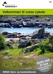
Get our free cycling brochure 2013 - Bornholms Velkomstcenter
Get our free cycling brochure 2013 - Bornholms Velkomstcenter
Get our free cycling brochure 2013 - Bornholms Velkomstcenter

You also want an ePaper? Increase the reach of your titles
YUMPU automatically turns print PDFs into web optimized ePapers that Google loves.
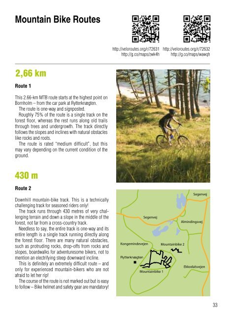
Mountain Bike Routes<br />
2,66 km<br />
Route 1<br />
This 2.66-km MTB route starts at the highest point on<br />
Bornholm – from the car park at Rytterknægten.<br />
The route is one-way and signposted.<br />
Roughly 75% of the route is a single track on the<br />
forest floor, whereas the rest runs along old trails<br />
through trees and undergrowth. The track directly<br />
follows the slopes and inclines with natural obstacles<br />
like rocks and roots.<br />
The route is rated “medium difficult”, but this<br />
may vary depending on the current condition of the<br />
ground.<br />
430 m<br />
Route 2<br />
Downhill mountain-bike track. This is a technically<br />
challenging track for seasoned riders only!<br />
The track runs through 430 metres of very challenging<br />
terrain and down a slope in the middle of the<br />
forest, not far from a cross-country track.<br />
Needless to say, the entire track is one-way and its<br />
entire length is a single track running directly along<br />
the forest floor. There are many natural obstacles,<br />
such as protruding rocks, drop-offs from rocks and<br />
slopes, boardwalks for adventuresome bikers, not to<br />
mention an electrifying steep downward incline.<br />
This is definitely an extremely difficult route – and<br />
only for experienced mountain-bikers who are not<br />
afraid to let her rip!<br />
The c<strong>our</strong>se of the route is not marked out but is easy<br />
to follow – Bike helmet and safety gear are mandatory!<br />
http://veloroutes.org/r/72631<br />
http://g.co/maps/zwk4h<br />
http://veloroutes.org/r/72632<br />
http://g.co/maps/wawqh<br />
33