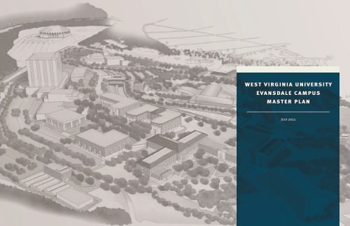
west virginia university evansdale campus master plan
west virginia university evansdale campus master plan
west virginia university evansdale campus master plan

Create successful ePaper yourself
Turn your PDF publications into a flip-book with our unique Google optimized e-Paper software.
<strong>west</strong> <strong>virginia</strong> <strong>university</strong><br />
<strong>evansdale</strong> <strong>campus</strong><br />
<strong>master</strong> <strong>plan</strong><br />
July 2011
2<br />
<strong>west</strong> <strong>virginia</strong> <strong>university</strong> <strong>evansdale</strong> <strong>campus</strong> <strong>master</strong> <strong>plan</strong><br />
Acknowledgements Table of Contents<br />
The WVU Evansdale Master Plan was prepared by:<br />
Strada Architecture, LLC; Michael Stern, principal,<br />
Claudia Saladin, landscape architect<br />
Sean Beasley, architect<br />
Rob Dower, intern architect<br />
www.stradallc.com<br />
In collaboration with:<br />
CJL Engineering: Jim Vizzini, managing partner,<br />
Adam McKinley, Kris Rickabaugh, Mark Rosko,<br />
and Frank Wilhelm (utility assessment: mechanical,<br />
electric & plumbing)<br />
GAI Consultants: Jeffrey Parobek (storm water management)<br />
Desman Associates: Michael Connor, David Taxman<br />
(parking & traffic)<br />
Keri Allison, graphic designer<br />
In addition the following departments and individuals from West Virginia University provided<br />
invaluable input and support in preparing this <strong>plan</strong>.<br />
Academic Affairs Administration<br />
• Russell K. Dean,<br />
Senior Associate Provost<br />
Finance & Administration<br />
• Narvel G. Weese,<br />
Vice President, Administration & Finance<br />
• Elizabeth P. Reynolds,<br />
Associate Vice President for Planning<br />
& Treasury Operations<br />
• Joseph Fisher,<br />
Senior Advisor to the VP of Finance & Administration<br />
Associate VP Facilities Office<br />
• Randal Hudak, Interim Associate Vice President<br />
• Robert Moyer, Director<br />
• Kimberly Hartsell, Manager Facilities Planning<br />
Facilities Management<br />
• Joseph Patten, Interim Assistant Vice President<br />
• Daniel Olthaus, Director<br />
Facilities management PDC<br />
• John Thompson, Associate Director,<br />
• Kevin Kilinsky, Construction Manager<br />
• Scott Owen, Construction Manager<br />
Facilities Management Maintenance<br />
• Lisa Saurborn, Manager Engineering<br />
• Steve Adams, Operations Manager<br />
• George Hall, Operations Manager<br />
Parking Management<br />
• Hugh Kierig, Director<br />
• Eric Rosie, Assistant Director<br />
Environmental Health & Safety Office<br />
• Kathy Powell, Associate Director<br />
• Michael Trantham, Senior Program Administrator<br />
• Brian Lemme, Environmental Health & Safety Specialist<br />
Introduction .......................................................................................... 3<br />
Historical Context and Place Making ..........................................3<br />
Campus Place Making .................................................................. 4<br />
The Planning Process: Place Precedents .......................................5<br />
WVU Evansdale Campus Plan: Guiding Principles ................... 6<br />
Analysis and Concept Diagrams ...........................................................7<br />
WVU Evansdale Campus: Existing Conditions ......................... 8<br />
Development Program ..................................................................9<br />
Pedestrian Circulation ................................................................11<br />
Vehicle Circulation .....................................................................13<br />
Landscape Enhancements .......................................................... 15<br />
Precinct Plans ....................................................................................... 17<br />
Campus Precincts Map ............................................................... 18<br />
Health & Wellness Precinct ........................................................19<br />
Arts Precinct ................................................................................ 20<br />
Engineering Precinct ................................................................... 21<br />
Agriculture and Natural Resources Precinct .............................. 25<br />
Residential Precinct ..................................................................... 27<br />
Guidelines ............................................................................................ 29<br />
Campus Building Guidelines ..................................................... 30<br />
Site Guidelines ............................................................................ 34<br />
Appendices<br />
Parking Impact & Traffic Analysis<br />
Utilities Assessment<br />
Storm Water Management<br />
july 2011
3<br />
STUDY<br />
AREA<br />
PRT<br />
Early <strong>plan</strong>s for the Evansdale Campus<br />
<strong>west</strong> <strong>virginia</strong> <strong>university</strong> <strong>evansdale</strong> <strong>campus</strong> <strong>master</strong> <strong>plan</strong><br />
DOWNTOWN<br />
CAMPUS<br />
Photo credit: West Virginia and Regional History Collection, West Virginia University Libraries.<br />
Photo credit: West Virginia and Regional History Collection, West Virginia University Libraries.<br />
The Evansdale <strong>campus</strong> developed as<br />
a series of isolated complexes along the<br />
ridge line accessed by car.<br />
Introduction:<br />
HISTORICAL CONTEXT AND PLACE MAKING<br />
Because Evansdale was developed at a very different time (the 1950’s and 60’s) than the Downtown<br />
<strong>campus</strong> (late 19th – early 20th century), its <strong>plan</strong>ning reflects the shift from traditional to modernist<br />
architecture and <strong>plan</strong>ning that characterized the post-war period in the United States. This conceptual<br />
change is reflected in the series of historical images, which illustrate the radical transformation of<br />
<strong>plan</strong>ning from a pedestrian, to a vehicular orientation.<br />
The physical result of this was large, isolated projects like the Coliseum, the Engineering and<br />
Agricultural Schools and the Evansdale Residential College that are functional islands and are so far<br />
removed from each other that the only reasonable connections are vehicular. Infill development on<br />
the <strong>campus</strong> over the years has still not achieved a level of density necessary to create a critical mass of<br />
pedestrian activity, and the connections that do exist have not been enhanced to the level that they<br />
actively encourage walking. Nor has the construction of a mass-transit system like the PRT resulted<br />
in the development of a pedestrian precinct on the Evansdale <strong>campus</strong>, perhaps because it has largely<br />
evolved into a parking shuttle system providing service to remote parking for the Downtown <strong>campus</strong>.<br />
Because of this history of <strong>plan</strong>ning – and a generally utilitarian approach to architecture – Evansdale<br />
at present suffers from a lack of a “sense of place’ that is in marked contrast to the Downtown<br />
<strong>campus</strong> where a more traditional approach to <strong>plan</strong>ning and design has shaped a place-based <strong>campus</strong><br />
environment. But, what do we mean by “place-based” design?<br />
july 2011
4<br />
Percival completed<br />
Photo credit: West Virginia and Regional History Collection, West Virginia University Libraries.<br />
Allen Hall and Coliseum completed<br />
<strong>west</strong> <strong>virginia</strong> <strong>university</strong> <strong>evansdale</strong> <strong>campus</strong> <strong>master</strong> <strong>plan</strong><br />
PRT built, further dividing the<br />
Evansdale Campus<br />
Photo credit: West Virginia and Regional History Collection, West Virginia University Libraries. Photo credit: West Virginia and Regional History Collection, West Virginia University Libraries.<br />
CAMPUS PLACE MAKING<br />
A successful <strong>campus</strong> place results in the classic American <strong>university</strong> quadrangle, a blend of<br />
architecture and landscape that is characterized by:<br />
• An ensemble approach to building siting that uses buildings to shape and define outdoor spaces<br />
for social or contemplative use<br />
• Campus identity is defined as much by the collection of buildings as any single one<br />
• The primary function of these outdoor spaces is pedestrian not vehicular<br />
• Buildings are designed to foster interior and exterior connections between them<br />
• Architectural style can be eclectic within a general set of humanistic principles that emphasize<br />
human scale and proportion, natural materials and clearly defined entrances and organization<br />
Within these overall goals of finding and reinforcing <strong>campus</strong> places, this <strong>master</strong> <strong>plan</strong> has three<br />
primary goals:<br />
• Develop a comprehensive development <strong>plan</strong> for the next 10 years of development on the<br />
Evansdale <strong>campus</strong>, with a particular focus on the next 5 years, which is anticipated to be a<br />
period of intensive development on the <strong>campus</strong>.<br />
• Establish clear, but flexible design guidelines for the architecture and landscape associated with<br />
this new wave of construction that will be consistent with the placemaking goals for the <strong>campus</strong>.<br />
• Understand and organize the infrastructure needed to implement these new projects including<br />
parking and transportation, utilities and stormwater management with a goal towards supporting<br />
the sustainability goals of the <strong>university</strong>.<br />
july 2011
5<br />
Figural space of the Downtown<br />
<strong>campus</strong> overlaid on Evansdale.<br />
<strong>west</strong> <strong>virginia</strong> <strong>university</strong> <strong>evansdale</strong> <strong>campus</strong> <strong>master</strong> <strong>plan</strong><br />
1400’ - 10 MIN. WALK<br />
Downtown <strong>campus</strong>-exterior spaces<br />
UNIVERSITY AVENUE<br />
More than four versions of the Downtown<br />
<strong>campus</strong> would fit on Evansdale.<br />
THE PLANNING PROCESS | PLACE PRECEDENTS<br />
At the beginning of the <strong>plan</strong>ning process for the Evansdale <strong>campus</strong> there was extensive discussion<br />
with the WVU <strong>plan</strong>ning team and leadership about architectural style and what is appropriate to<br />
the <strong>university</strong> and specifically to Evansdale. But a visual and spatial analysis of the precedents found<br />
on the WVU Downtown <strong>campus</strong> indicated that the issue relates less to architectural style and more<br />
to the quality of place.<br />
The fact is that the architecture of WVU Downtown is highly eclectic and variable in style, but much<br />
more consistent in site <strong>plan</strong>ning and shaping exterior spaces that are interconnected. There is also<br />
a consistent approach across most of the pre-WWII buildings, and even some of the later ones that<br />
emphasizes humanistic scale, proportion and articulation. And more importantly, the buildings are<br />
arranged and composed in a manner that creates habitable outdoor spaces for a variety of functions.<br />
The end result is a strong and identifiable pedestrian <strong>campus</strong>, in spite of the large volumes of traffic<br />
that can cause such headaches on University Avenue.<br />
A scale comparison of the main figural space of the Downtown <strong>campus</strong> overlaid on the Evansdale<br />
<strong>campus</strong> reveals, however, the vast difference between the two. More than four versions of the<br />
Downtown <strong>campus</strong> would fit in the area of the Evansdale <strong>campus</strong>. This realization led to an approach<br />
that looked for localized place making opportunities within different precincts of the overall <strong>campus</strong>,<br />
interconnected by pedestrian passages.<br />
july 2011
6<br />
<strong>west</strong> <strong>virginia</strong> <strong>university</strong> <strong>evansdale</strong> <strong>campus</strong> <strong>master</strong> <strong>plan</strong><br />
WVU EVANSDALE CAMPUS PLAN | GUIDING PRINCIPLES<br />
• Establish a sense of place that reflects the history and character of West Virginia’s mountains,<br />
rivers and forests.<br />
• Focus on <strong>plan</strong>ning strategies that create a set of precincts and spatially defined outdoor<br />
spaces, in order to create a set of linked pedestrian <strong>campus</strong> places with the character of<br />
a traditional <strong>campus</strong>.<br />
• Create a pedestrian core to the <strong>campus</strong> by pushing parking to the exterior of a ring road system.<br />
• Build a vocabulary of academic architecture that expresses the solidity and importance of the<br />
institution and creates a monumental presence for key buildings.<br />
• Accept the architectural diversity of the existing buildings, but use new buildings<br />
and renovations to advance humanistic design based in placemaking principles<br />
and traditional architecture.<br />
• Use durable, local and natural materials as much as possible for new building projects that draw<br />
on local character and building techniques.<br />
• Use elements of the local (topography, <strong>plan</strong>ts, water) and distant landscape views to unify<br />
the <strong>campus</strong>.<br />
• Develop sustainability goals for the <strong>campus</strong> that set high standards for building performance,<br />
water management and sustainable landscapes.<br />
july 2011
<strong>west</strong> <strong>virginia</strong> <strong>university</strong> <strong>evansdale</strong> <strong>campus</strong> <strong>master</strong> <strong>plan</strong><br />
ANALYSIS AND<br />
CONCEPT DIAGRAMS
8<br />
<strong>west</strong> <strong>virginia</strong> <strong>university</strong> <strong>evansdale</strong> <strong>campus</strong> <strong>master</strong> <strong>plan</strong><br />
20<br />
1 3<br />
5<br />
MONONGAHELA BOULEVARD<br />
2<br />
EVANSDALE DRIVE<br />
FINE ARTS DRIVE<br />
16<br />
15<br />
PATTESON DRIVE<br />
17<br />
22<br />
14<br />
LOWER CAMPUS<br />
13 12<br />
EVANSDALE DRIVE<br />
23<br />
UPPER CAMPUS<br />
10<br />
11<br />
9<br />
21<br />
18<br />
7<br />
EVANSDALE DRIVE<br />
RAWLEY LANE<br />
4<br />
EVANSDALE DRIVE<br />
8<br />
6<br />
VAN VOORHIS ROAD<br />
19<br />
UNIVERSITY AVENUE<br />
RESIDENTIAL<br />
PRECINCT<br />
EXISTING CONDITIONS<br />
Steep slopes<br />
PRT<br />
The first buildings on the Evansdale Campus developed along the high ground of the ridge.<br />
The PRT was added in the 1970s and hugs the steep slopes to north of the ridge. Both the PRT<br />
and the topography divide the <strong>campus</strong> into a lower and upper <strong>campus</strong>. This divide presents certain<br />
challenges and opportunities in terms of creating and reinforcing <strong>campus</strong> places and creating<br />
pedestrian places and connections on Evansdale.<br />
Existing Buildings in the Study Area:<br />
1. Coliseum<br />
2. Creative Arts Center (CAC)<br />
3. Museum Education Center<br />
4. Facilities Management<br />
5. Lincoln Hall<br />
6. Evansdale Residential College (ERC)<br />
7. Agricultural Sciences Annex<br />
8. Allen Percival<br />
9. Greenhouses<br />
10. Agricultural Sciences Building (to be demolished)<br />
11. South Agricultural Sciences Building<br />
12. Evansdale Library<br />
13. NRCCE<br />
14. Engineering Research Building (ERB)<br />
15. Engineering Sciences Building (ESB)<br />
16. Mineral Resources Building (MRB)<br />
17. Engineering PRT Station<br />
18. Tower PRT Station<br />
19. Blaney House (President’s Residence)<br />
20. Communications Building (to be demolished)<br />
21. former Saint Francis School (to be demolished)<br />
22. PRT shop (to be relocated)<br />
23. Student Recreation Center (SRC)<br />
july 2011
9<br />
11<br />
<strong>west</strong> <strong>virginia</strong> <strong>university</strong> <strong>evansdale</strong> <strong>campus</strong> <strong>master</strong> <strong>plan</strong><br />
11<br />
7<br />
4<br />
10<br />
14<br />
8<br />
9<br />
12<br />
14<br />
13<br />
15<br />
19<br />
18<br />
20<br />
17<br />
6<br />
4<br />
16<br />
5<br />
24<br />
21<br />
1<br />
20<br />
3<br />
23<br />
2<br />
22<br />
25<br />
DEVELOPMENT PROGRAM | PHASE 1<br />
Phase 1<br />
The impetus for the Evansdale Master Plan is the massive redevelopment effort being undertaken by<br />
WVU over the next several years. Finding the synergies and relationships between these programmed<br />
and funded projects is the focus of the <strong>plan</strong>ning efforts. The goal is to set <strong>plan</strong>ning and design<br />
guidelines that will lead to a greater coherence within the Evansdale Campus. The two phases of the<br />
<strong>master</strong> <strong>plan</strong> are defined by the currently funded projects – Phase 1 – and the anticipated and desired<br />
building projects (but not yet funded) that will complete the <strong>plan</strong> – Phase 2.<br />
Health & Wellness Precinct:<br />
1. 2 soccer fields – one artificial and one natural turf<br />
2. 5 tennis courts<br />
3. Running and walking trail<br />
4. Student Health Building – 80,000 gross square feet<br />
5. CPASS building – 104,000 gross square feet<br />
6. Parking<br />
Arts Precinct:<br />
7. Art Museum – 20,000 gross square feet<br />
8. Student Center/Cross Campus Connector – 20,000 gross square feet – connected to the<br />
Engineering PRT Station<br />
9. Central Green – new stormwater management/park landscape<br />
10. Renovated, signalized and expanded <strong>campus</strong> entrance at Patteson Drive<br />
11. Intersection and pedestrian improvements at Evansdale Drive and Mon Boulevard, Evansdale<br />
Drive and Fine Arts Drive and Mineral Resources building<br />
Engineering Precinct:<br />
12. Advance Engineering Research Building (AERB) – 114,000 gross square feet<br />
13. Renovation of Evansdale Library to convert to Digital Library/Student Center<br />
14. New landscaped quadrangles<br />
15. Reorganized parking and service (Evansdale) drive<br />
Agricultural Precinct:<br />
16. New Agricultural Sciences Building – 250,000 gross square feet<br />
17. New entry and façade for South Agricultural Sciences Building<br />
18. Reconstructed greenhouse – 18,550 gross square feet<br />
19. New greenhouse headhouse – 10,000 gross square feet<br />
20. New quadrangles and gardens<br />
21. Conversion of Evansdale Drive to service-only access<br />
Residential Precinct:<br />
22. Renovated ERC groundfloor to create Student Center<br />
23. Conversion of Evansdale Drive to service-only access and accommodation of bus turnaround.<br />
24. Pedestrian improvements to PRT underpasses at Ag Annex<br />
25. Pedestrian underpass to new sports fields at Rawley Lane<br />
july 2011
4<br />
10<br />
<strong>west</strong> <strong>virginia</strong> <strong>university</strong> <strong>evansdale</strong> <strong>campus</strong> <strong>master</strong> <strong>plan</strong><br />
1<br />
3<br />
5<br />
10<br />
7<br />
9<br />
8<br />
8<br />
6<br />
11<br />
2<br />
DEVELOPMENT PROGRAM | PHASE 2<br />
Phase 2<br />
Health & Wellness Precinct:<br />
1. Additional development site at the Patteson Drive entrance<br />
2. Additional development site at the current site of Facilities Management<br />
3. Relocated tennis and basketball courts.<br />
Arts Precinct:<br />
4. Parking structure and pedestrian bridge at Coliseum<br />
Engineering Precinct:<br />
5. Additional academic/research development site opposite the quad from the South Agricultural<br />
Sciences Building.<br />
Agricultural Precinct:<br />
6. New entrance addition to Allen/Percival Hall<br />
7. Pedestrianization of Evansdale Drive<br />
Residential Precinct:<br />
8. Additional academic/research building to complete the Residential quad.<br />
9. Removal of Evansdale Drive.<br />
10. Construction of service court. Access for service, emergency and maintenance vehicles only.<br />
11. New quadrangle landscape.<br />
july 2011
11<br />
<strong>west</strong> <strong>virginia</strong> <strong>university</strong> <strong>evansdale</strong> <strong>campus</strong> <strong>master</strong> <strong>plan</strong><br />
a<br />
11<br />
3<br />
10<br />
9<br />
2<br />
4<br />
b<br />
12<br />
7<br />
6<br />
5<br />
15<br />
13<br />
1<br />
14<br />
8<br />
6<br />
PEDESTRIAN CIRCULATION | PHASE 1 & 2<br />
Phase 1<br />
Pedestrian Places<br />
Pedestrian Circulation Phase 1<br />
Pedestrian Circulation Phase 2<br />
1. Pedestrianize Evansdale Drive between ERC and the south end of the new Agricultural<br />
Sciences Building. The reality is that during construction this portion of Evansdale Drive<br />
will need to be closed during construction. This provides an opportunity to experiment with<br />
pedestrianizing this portion of Evansdale Drive and creating pedestrian improvements along<br />
the restricted portion of the roadway.<br />
2. Enhance pedestrian spine on the upper <strong>campus</strong>.<br />
3. Landscape and pedestrian enhancements to the engineering quad.<br />
4. AERB Building sited to create a second engineering quad.<br />
5. Agriculture building sited to provide a vertical connection between the lower agricultural<br />
precinct and the engineering precinct on the top of the hill, by using the building as a major<br />
<strong>campus</strong> circulation route. See section, next page.<br />
6. Pedestrian underpass to the playing fields.<br />
7. Enhance pedestrian connection between the Recreation Center and the new playing fields.<br />
8. Redesign the ground floor of the ERC to connect to the landscape.<br />
9. Enhance ponds and landscape to create a new Central Green for the <strong>campus</strong>.<br />
10. Create a pedestrian connection between the upper and lower <strong>campus</strong> using the new<br />
Cross-Campus Connector and the existing Engineering PRT station for vertical circulation,<br />
including an elevator for ADA accessibility. See section, next page.<br />
11. Move the access drive for the Student Recreation Center behind the new Cross-Campus<br />
Connector Building, so that there is an unimpeded pedestrian connection between the Cross-<br />
Campus Connector and the new Central Green.<br />
12. Quad and garden.<br />
Phase 2<br />
13. Permanently close Evansdale Drive and create further pedestrian enhancements.<br />
14. Create new quad adjacent to the ERC.<br />
15. Use new academic building to provide ADA accessible pedestrian access from<br />
ERC to the engineering <strong>campus</strong>.<br />
july 2011
12<br />
<strong>west</strong> <strong>virginia</strong> <strong>university</strong> <strong>evansdale</strong> <strong>campus</strong> <strong>master</strong> <strong>plan</strong><br />
ERB EXISTING PRT BRIDGE OVER MEADOW<br />
EXISTING ENGINEERING PRT STATION NEW PEDESTRIAN BRIDGE<br />
OVER ACCESS DRIVE<br />
PED.<br />
BRIDGE<br />
SERVICE<br />
ROAD<br />
NEW CAMPUS CONNECTOR/<br />
STUDENT CENTER<br />
NEW UPPER ACADEMIC QUAD NEW AGRICULTURAL SCIENCES BUILDING NEW AGRICULTURE QUAD<br />
CENTRAL GREEN<br />
a<br />
b<br />
PEDESTRIAN CIRCULATION | PHASE 1<br />
The Engineering Precinct is disconnected from the rest of the<br />
Evansdale <strong>campus</strong> by over 50 feet of elevation change, steep<br />
slopes and the PRT. New cross-<strong>campus</strong> connections will be<br />
important unifiers of the <strong>campus</strong> and should be incorporated<br />
into new building projects. Internal building circulation<br />
(elevators) will also enhance accessibility across <strong>campus</strong>.<br />
Cross-Campus<br />
Connection at the<br />
Engineering PRT<br />
Cross-Campus<br />
Connector<br />
through the new<br />
Agricultural<br />
Sciences Building<br />
july 2011
13<br />
2<br />
<strong>west</strong> <strong>virginia</strong> <strong>university</strong> <strong>evansdale</strong> <strong>campus</strong> <strong>master</strong> <strong>plan</strong><br />
3<br />
5<br />
1<br />
13<br />
10<br />
12<br />
11<br />
8<br />
7<br />
6<br />
9<br />
4<br />
VEHICLE CIRCULATION | PHASE 1<br />
Improved Intersections<br />
Pedestrian Places<br />
Service, facilities and emergency vehicle access only<br />
Vehicle Circulation<br />
Transponder gates<br />
1. Signalize intersection at Patteson and Fine Arts Drives to allow entrance to Evansdale<br />
from both directions along Patteson. Create a major new entrance to <strong>campus</strong> with<br />
landscape enhancements.<br />
2. Realign exit from Coliseum parking to align with Evansdale Drive. Improve intersection<br />
to eliminate by-pass lane and allow for full movement. Provide pedestrian cross walk.<br />
3. Improve intersection of Evansdale Drive and Fine Arts Drive by narrowing intersection and<br />
realigning Evansdale Drive to create better sight lines for both pedestrians and vehicles.<br />
Make this intersection a 3-way stop to calm traffic.<br />
4. Re-design intersection of Evansdale Drive and University Avenue to improve traffic movement<br />
and enhance pedestrian safety. The right hand turn lane at the southeast corner of the intersection<br />
should be abolished and a new pedestrian cross walk added closer to the corner. Realign south<strong>west</strong><br />
corner of the intersection to better support buses turning into the ERC.<br />
5. Realign bus turn around.<br />
6. Close Rawley Lane.<br />
7. Create a service access only road between facilities management and the new parking lot in the<br />
Health & Wellness precinct.<br />
8. Close Evansdale Drive to through traffic, by installing transponder gates where indicated.<br />
Evansdale Drive would still be accessible for facilities maintenance, service and emergency<br />
vehicles, but not for general traffic.<br />
9. Create one-way loop for pick up and drop off traffic at ERC, including buses.<br />
10. Consolidate parking next to buildings in the Engineering Precinct and move Evansdale Drive to<br />
the outside. This provides for a more efficient parking layout and reduces the opportunities for<br />
vehicle-pedestrian conflict.<br />
11. Service access for AERB. This option removes service traffic entirely from the pedestrian quad.<br />
Gates will limit access to authorized vehicles and prohibit unauthorized parking along this road.<br />
See Engineering Precinct section for a more indepth analysis of the different Engineering Service Options.<br />
12. Alternative service access for AERB. Gates would be required to limit access.<br />
13. Move the access road for the SRC behind the new Cross-Campus Connector to reduce<br />
pedestrian-vehicle conflict.<br />
july 2011
14<br />
<strong>west</strong> <strong>virginia</strong> <strong>university</strong> <strong>evansdale</strong> <strong>campus</strong> <strong>master</strong> <strong>plan</strong><br />
2<br />
3<br />
1<br />
4<br />
VEHICLE CIRCULATION | PHASE 2<br />
Improved Intersections<br />
Pedestrian Places<br />
Service, facilities and emergency vehicle access only<br />
Vehicle Circulation<br />
Transponder gates<br />
1. Permanently close Evansdale Drive. Provide further pedestrian enhancements. Leave pedestrian<br />
walkway that can accommodate maintenance and emergency vehicles.<br />
2. Provide service at back of new academic building, reusing the existing roadbed.<br />
3. The new plaza in front of the new Agricultural Sciences Building creates a connection for service<br />
and emergency vehicles between the walk in front of the Agricultural Sciences Building and the<br />
service drive on the north side of the building.<br />
4. Create new service access for Percival Allen, to remove this service access from the new quad.<br />
july 2011
<strong>west</strong> <strong>virginia</strong> <strong>university</strong> <strong>evansdale</strong> <strong>campus</strong> <strong>master</strong> <strong>plan</strong><br />
1. 2.<br />
15<br />
3.<br />
FUTURE<br />
RECREATION<br />
FIELDS<br />
LANDSCAPE ENHANCEMENTS | EXISTING CONDITIONS<br />
As part of an overall placemaking approach, the <strong>master</strong> <strong>plan</strong> creates different landscape types on<br />
the <strong>campus</strong> that enhance the beauty of the <strong>campus</strong>, create special pedestrian places, and foster<br />
connections across the <strong>campus</strong>. By using more native landscape types and materials, the landscape<br />
<strong>plan</strong> can also help to evoke the landscape of West Virginia and address the stormwater impacts of the<br />
<strong>university</strong>’s ambitious development program.<br />
1. Slope Analysis<br />
On some of the <strong>campus</strong> steep slopes, more native landscapes types will provide for greater<br />
stormwater benefits, reduce erosion and provide greater beauty for the <strong>campus</strong>.<br />
Less than 5%<br />
5 - 10%<br />
10 - 25%<br />
Greater than 25%<br />
2. Watershed Diagram:<br />
The <strong>campus</strong> can be divided into a series of sub-watersheds, which either discharge along Patteson<br />
Drive or Monongahela Boulevard. By increasing the amount of meadow and forest cover in<br />
these subwatersheds, the <strong>university</strong> can help to offset increases in storm water run-off from<br />
development.<br />
Sub-watersheds<br />
Water flow<br />
Highpoint<br />
3. Existing Landscape Types<br />
The existing Evansdale <strong>campus</strong> is characterized by a largely undifferentiated landscape of mown<br />
lawn with trees. This monotonous landscape fails to distinguish between different types of spaces<br />
and to provide the kind of connections that encourage walking.<br />
On some of the <strong>campus</strong> steep slopes, more native landscapes types will provide for greater<br />
stormwater benefits, reduce erosion and provide greater beauty for the <strong>campus</strong>.<br />
Remnant woodland<br />
Designed landscape<br />
Leftover landscape<br />
july 2011
16<br />
1<br />
7<br />
<strong>west</strong> <strong>virginia</strong> <strong>university</strong> <strong>evansdale</strong> <strong>campus</strong> <strong>master</strong> <strong>plan</strong><br />
7<br />
2<br />
2<br />
3<br />
2<br />
1<br />
6<br />
3 3<br />
1<br />
4<br />
7<br />
2<br />
2<br />
1<br />
7<br />
7<br />
1<br />
7<br />
5<br />
2<br />
2<br />
1<br />
2<br />
1<br />
7<br />
2<br />
2<br />
7<br />
1<br />
LANDSCAPE ENHANCEMENTS | PHASE 1 & 2<br />
Lawn, garden, tended landscape<br />
Meadow <strong>plan</strong>tings<br />
Woodland understory<br />
Trees<br />
Water Elements<br />
1. Concentrate landscape resources – design, materials and maintenance – at placemaking<br />
opportunities – the quads and entrances to <strong>campus</strong>.<br />
2. Stop mowing steep slopes and instead convert slopes to native meadow and woodland <strong>plan</strong>tings<br />
that in the long term will require less maintenance and provide greater stormwater functionality.<br />
By creating different types of landscape spaces, the landscape enhancements help to create a<br />
hierarchy of space within the <strong>campus</strong> and provide structure to the spaces framed by buildings.<br />
3. Conserve and restore remnant woodlands, including the woodland understory, in the Arts and<br />
Health and Wellness Precincts as part of a new Central Green. The Central Green would be a<br />
feature element of the new Evansdale Campus, connecting to the new Cross-Campus Connector<br />
and the SRC.<br />
4. As part of the new Central Green, renovate the existing ponds by the SRC to enhance the<br />
aesthetics, as well as increasing the depth and aeration of the pools to provide stormwater quality<br />
and quantity controls.<br />
5. Daylight and renovate the existing drainage by the fields and new student health building<br />
6. Create a pond and landscape at the entrance at Patteson and Fine Arts Drives. Connect the SRC<br />
ponds and fields stream to the new ponds, creating a single point of discharge along Patteson.<br />
7. To reduce runoff overall, but particularly from the engineering precinct toward Monongahela<br />
Boulevard, consider using porous paving materials for new parking.<br />
july 2011
<strong>west</strong> <strong>virginia</strong> <strong>university</strong> <strong>evansdale</strong> <strong>campus</strong> <strong>master</strong> <strong>plan</strong><br />
precinct <strong>plan</strong>s
18<br />
ARTS PRECINCT<br />
<strong>west</strong> <strong>virginia</strong> <strong>university</strong> <strong>evansdale</strong> <strong>campus</strong> <strong>master</strong> <strong>plan</strong><br />
ENGINEERING<br />
PRT<br />
CONNECTION<br />
POINT<br />
ENGINEERING PRECINCT<br />
HEALTH & WELLNESS PRECINCT<br />
TOWERS<br />
PRT<br />
CONNECTION<br />
POINT<br />
AGRICULTURE & NATURAL<br />
RESOURCES PRECINCT<br />
RESIDENTIAL PRECINCT<br />
CAMPUS PRECINCTS MAP<br />
july 2011
Phase 1<br />
19<br />
16<br />
Phase 1 Phase 2<br />
1. New fields complex with running<br />
and walking trail.<br />
2. Student Health Buildings – 80,000<br />
gross square feet.<br />
3. CPASS building – 104,000 gross<br />
square feet.<br />
4. Parking<br />
9<br />
13<br />
12<br />
8<br />
HEALTH & WELLNESS | PRECINCT PLAN<br />
5. Provide a limited access service road<br />
between facilities management and<br />
the new parking at Student Health/<br />
CPASS. This would be available<br />
only to facilities maintenance and<br />
emergency vehicles and would be<br />
secured with gates with transponders.<br />
6. Close Rawley Lane.<br />
10<br />
13<br />
7<br />
4<br />
7. Enhance pedestrian connection<br />
between the Recreation Center, the<br />
new playing fields, and the Student<br />
Health and CPASS buildings.<br />
8. Student Center/Cross-Campus<br />
Connector – 20,000 gross square feet.<br />
This building creates a pedestrian<br />
connection between the upper and<br />
lower <strong>campus</strong> using the new Cross-<br />
Campus Connector and the existing<br />
Engineering PRT station for vertical<br />
circulation, including an elevator for<br />
ADA accessibility.<br />
9. Move the access drive for the<br />
Student Recreation Center behind<br />
the new Student Center/Cross-<br />
Campus Connector, so that there<br />
is an unimpeded pedestrian<br />
connection between it and<br />
2<br />
the new Central Green.<br />
11<br />
3<br />
14<br />
1<br />
5<br />
10. Renovate ponds to increase depth and<br />
provide stormwater functionality as<br />
well as improve aesthetics. The flow<br />
of stormwater would begin from the<br />
terrace of the new Cross-Campus<br />
Connector.<br />
6<br />
11. Daylight and enhance open drainage<br />
way adjacent to fields and new<br />
Student Health Building to provide<br />
stormwater benefit and aesthetic<br />
enhancement.<br />
15<br />
12. Create new storm water pond<br />
at Patteson and Fine Arts Drive<br />
connected to SRC ponds and the<br />
stream by Student Health Building.<br />
Provide one point of discharge for<br />
stormwater along Patteson.<br />
13. Enhance woodland <strong>plan</strong>ting and<br />
restore understory <strong>plan</strong>ting around<br />
ponds to create new Central Green.<br />
14. Pedestrian improvements to PRT<br />
underpasses at Towers PRT station.<br />
15. Pedestrian underpass to new sports<br />
fields at Rawley Lane.<br />
16. Signalize intersection at Patteson and<br />
Fine Arts Drives to allow entrance<br />
to Evansdale from both directions<br />
along Patteson. Create a major new<br />
entrance to <strong>campus</strong> with landscape<br />
enhancements.<br />
17<br />
18<br />
Phase 2<br />
17. New building at Patteson and Fine<br />
Arts Drives with parking. Given the<br />
location of this building, it will be a<br />
major entry piece for the Evansdale<br />
Campus and would be a good<br />
location for a building that has a<br />
more public function. This building<br />
incorporates a terrace that connects<br />
to the new pond.<br />
18. 4 additional tennis courts and two<br />
additional basketball courts adjacent<br />
to the SRC. These courts would<br />
replace those that will be lost by<br />
ERC in phase 2.<br />
19. New building and parking to replace<br />
the facilities management buildings.<br />
Given its location at a major entry<br />
to <strong>campus</strong> and near the Alumni<br />
Center, it will be a major entry piece<br />
for Evansdale and would be a good<br />
location for a building that has a<br />
public function.<br />
19<br />
july 2011
20<br />
15<br />
14<br />
12<br />
11<br />
4<br />
14<br />
9<br />
8<br />
5<br />
13<br />
6<br />
1<br />
7<br />
10<br />
3<br />
14<br />
2<br />
Phase 1<br />
Phase 2<br />
ARTS | PRECINCT PLAN<br />
Phase 1<br />
1. Art Museum – 20,000 gross square feet.<br />
2. Student Center/Cross-Campus Connector – 20,000 gross square feet. This building creates<br />
a pedestrian connection between the upper and lower <strong>campus</strong> using the new Cross-Campus<br />
Connector and the existing Engineering PRT station for vertical circulation, including an<br />
elevator for ADA accessibility.<br />
3. Signalize intersection at Patteson and Fine Arts Drives to allow entrance to Evansdale<br />
from both directions along Patteson. Create a major new entrance to <strong>campus</strong> with<br />
landscape enhancements.<br />
4. Realign exit from Coliseum parking to align with Evansdale Drive. Improve intersection<br />
signalization, eliminate by-pass lane and allow for full movements. Provide pedestrian<br />
cross-walk.<br />
5. Improve intersection of Evansdale Drive and Fine Arts Drive by narrowing intersection<br />
and realigning Evansdale Drive to create better sight line for both pedestrians and vehicles.<br />
Make this intersection a 3-way stop to calm traffic.<br />
6. Improve bus turn around at Mineral Resources Building to allow for a full size bus to turn<br />
around and improve pedestrian movements.<br />
7. Eliminate parking along Evansdale Drive the backs directly into traffic lane.<br />
8. Redesign parking behind the CAC to provide a larger, more efficient parking lot. Eliminate the<br />
driveway connecting this to Patteson Drive and provide access from the front of the CAC.<br />
9. Tighten up the entrance to the CAC parking lot to Evansdale Drive to 24 feet to provide<br />
for shorter pedestrian crossing distance and less impervious area.<br />
10. Tighten up the entrance to the lot on Fine Arts Drive to 24 feet.<br />
11. Add an additional bay of parking to the lot in front of the CAC.<br />
12. Redesign landscape area in front of the CAC to be a gateway for WVU. Some portion<br />
of this landscape would be an appropriate area for a raingarden.<br />
13. Enhance woodland <strong>plan</strong>ts and restore understory <strong>plan</strong>ting along Patteson Drive, particularly<br />
by new Art Museum.<br />
14. Monument locations.<br />
Phase 2<br />
15. Parking garage with pedestrian bridge.<br />
july 2011
Phase 1<br />
21<br />
10<br />
8<br />
Phase 1 Phase 2<br />
1. AERB – 114,000 gross square feet,<br />
sited to create a second engineering<br />
quad.<br />
2. Renovation of Evansdale Library<br />
to convert to Digital Library/<br />
Student Center.<br />
3. Student Center/Cross-Campus<br />
Connector – 20,000 gross square feet.<br />
This building creates a pedestrian<br />
connection between the upper and<br />
lower <strong>campus</strong> using the new Cross-<br />
Campus Connector and the existing<br />
Engineering PRT station for vertical<br />
circulation, including an elevator for<br />
ADA accessibility.<br />
11<br />
ENGINEERING | PRECINCT PLAN<br />
7<br />
3<br />
11<br />
4. New entry to existing South<br />
Agricultural Sciences Building to<br />
provide entry from new quad and a<br />
new façade<br />
5. New quad and gardens.<br />
6. New landscaped quadrangle.<br />
7. Enhance existing engineering<br />
quadrangle.<br />
9<br />
8. Improve bus turn around at Mineral<br />
Resources Building to allow for a full<br />
size bus to turn around and improve<br />
6<br />
pedestrian movements.<br />
2<br />
1<br />
12b.<br />
11<br />
5<br />
4<br />
9. Consolidate parking next to buildings<br />
in the Engineering Precinct and move<br />
Evansdale Drive to the outside. This<br />
provides for a more efficient parking<br />
layout and reduces the opportunities<br />
for vehicle-pedestrian conflict.<br />
Consider utilizing porous pavers for<br />
new parking. Parking should include<br />
a 10 foot <strong>plan</strong>ted bioretention area<br />
between parking and roadway. Planted<br />
islands in the parking should be<br />
bioretention areas.<br />
10. Eliminate parking along Evansdale<br />
Drive that backs directly into<br />
traffic lane.<br />
11. Enhance pedestrian spine on the<br />
upper <strong>campus</strong><br />
12a. 13<br />
12a. AERB service access option 1 –<br />
see discussion on following pages.<br />
12b. AERB service access option 2 –<br />
Phase 2<br />
see discussion on following pages.<br />
13. New academic building, serviced<br />
by same roadway as AERB.<br />
july 2011
22<br />
ERB<br />
Evansdale Library<br />
OPTION 2<br />
3<br />
Location Of South Agricultural<br />
Sciences Building<br />
South Agricultural<br />
Sciences Building With<br />
New Facade And Entry<br />
OPTION 1<br />
4<br />
AERB<br />
OPTION 2<br />
3<br />
4<br />
2<br />
2<br />
Phase 2 Buildings<br />
1<br />
OPTION 1<br />
New Agricultural<br />
Sciences Building<br />
ENGINEERING | SERVICE OPTIONS<br />
1. Loading at the existing Agricultural Sciences Building is one level below the main pedestrian entry<br />
from the <strong>campus</strong>, as can be seen in the historic photo. Access to this loading area will need to<br />
preserved during phase 1 construction, as the existing Agricultural Sciences Building will remain<br />
in use until the new one is completed.<br />
2. The main entry of the existing agricultural sciences building is at the level of the existing and<br />
future academic quad. Entrances to the new academic buildings that make up the new upper quad,<br />
including the new Agricultural Sciences Building and the AERB will be at this level.<br />
3. When the South Agricultural Sciences building was added, its loading was adjacent to the loading<br />
dock for the main Agricultural Sciences Building at the same level. This is the lower level of<br />
the South Agricultural Sciences building. Access to this loading area at the lower level must be<br />
preserved in future phases.<br />
4. The South Agricultural Sciences building will need a new entry at its upper level<br />
from the new quad.<br />
There are two options for providing service access the new AERB.<br />
• Option 1 – Reusing the existing service area and roadbed behind current Agricultural<br />
Sciences Building.<br />
• Option 2 – Bring the service through the parking lot, across the academic quad.<br />
july 2011
23<br />
Proposed <strong>plan</strong><br />
9<br />
8<br />
7<br />
1<br />
2<br />
2<br />
9<br />
4<br />
10<br />
10<br />
8<br />
4<br />
3<br />
3<br />
Demolition <strong>plan</strong>.<br />
Hatched areas<br />
denote existing<br />
elements to be<br />
demolished.<br />
SECTION AT NEW AGRICULTURAL SCIENCE CONNECTION<br />
SECTION AT EXISTING SOUTH AGRICULTURAL SCIENCES BUILDING AND NEW AGRICULTURAL SCIENCE WING<br />
a<br />
b<br />
1<br />
5<br />
2<br />
8<br />
6<br />
a<br />
b<br />
a<br />
b<br />
ENGINEERING | SERVICE OPTION 1<br />
1. Existing Agricultural Sciences Building to be demolished after completion of the new<br />
Agricultural Sciences Building.<br />
2. Existing parking and service road behind existing Agricultural Sciences Building. Access to existing<br />
service docks needs to be maintained until new Agricultrual Sciences Building is compelted.<br />
3. Existing grade.<br />
4. Pedestrian bridge over service drive.<br />
5. Grade at center of new Agricultural Sciences Plaza.<br />
6. Grade adjacent to building.<br />
7. Existing Agricultural Sciences Building loading dock.<br />
8. Existing South Agricultural Sciences Building to remain. Loading access on lower level<br />
to be maintained.<br />
9. New entrance onto upper academic quad will be on upper level of the<br />
South Agricltural Sciences Building.<br />
10. Proposed new service drive.<br />
july 2011
4<br />
24<br />
Proposed <strong>plan</strong><br />
9<br />
8<br />
4<br />
1<br />
1<br />
7<br />
2<br />
2 6<br />
3<br />
9<br />
10<br />
3<br />
3<br />
Demolition <strong>plan</strong>.<br />
Hatched areas<br />
denote existing<br />
elements to be<br />
demolished.<br />
SECTION AT NEW AGRICULTURAL SCIENCE CONNECTION<br />
SECTION AT EXISTING SOUTH AGRICULTURAL SCIENCES BUILDING AND NEW AGRICULTURAL SCIENCE WING<br />
8 2<br />
a<br />
b<br />
1<br />
5<br />
6<br />
a<br />
b<br />
a<br />
b<br />
ENGINEERING | SERVICE OPTION 2<br />
1. Existing Agricultural Sciences Building to be demolished after completion of the new<br />
Agricultural Sciences Building.<br />
2. Existng parking and service road behind existing Agricultural Sciences Building. Access to existing<br />
service docks needs to be maintained until new Agricultrual Science Building is compelted.<br />
3. Existing grade.<br />
4. Service Drive through academic quad.<br />
5. Grade at center of new Agricultural Sciences Plaza.<br />
6. Grade adjacent to building.<br />
7. Existing Agricultural Sciences Building loading dock.<br />
8. Existing South Agricultural Sciences Building to remain. Loading access on lower level<br />
to be maintained.<br />
9. New entrance onto upper academic quad will be on upper level of the South Agricltural<br />
Sciences Building.<br />
10. Bring up grade against new Agricultural Sciences Building to created a connection to the new<br />
upper academic quad.<br />
11. Access to South Agricultural Sciences loading dock needs to be maintained.<br />
july 2011
25<br />
11<br />
7<br />
11<br />
5<br />
2<br />
12<br />
8<br />
3<br />
4<br />
6<br />
11<br />
11<br />
1<br />
13<br />
13<br />
5<br />
9<br />
11<br />
11<br />
10<br />
7<br />
12<br />
8<br />
6<br />
2<br />
11<br />
AGRICULTURE AND NATURAL RESOURCES | PRECINCT PLAN<br />
Phase 1<br />
1. New Agricultural Science building – 250,000 gross square feet, with new quadrangle.<br />
Agricultural sciences building provides ADA accessible pedestrian circulation to the<br />
upper <strong>campus</strong>.<br />
2. New façade on the existing South Agricultural Sciences Building. This would include a new<br />
entrance on the north side of the building to the new quad at the upper level of the building.<br />
3. Existing service to the South Agricultural Sciences Building at the lower level to be<br />
maintained.<br />
4. Pedestrian bridge connecting new Agricultural Sciences Building to agricultural quad<br />
over service drive – see discussion on previous pages.<br />
5. New quadrangles.<br />
6. Reconstructed greenhouse – 18,550 gross square feet.<br />
7. Consolidate parking adjacent to green house, consider using porous surface for new areas.<br />
8. New greenhouse headhouse – 10,000 gross square feet.<br />
9. Pedestrianize Evansdale Drive between ERC and the south end of the new Agricultural<br />
Sciences Building. The reality is that during construction this portion of Evansdale Drive<br />
will need to be closed during construction. This provides an opportunity to experiment with<br />
pedestrianizing this portion of Evansdale Drive and creating pedestrian improvements along<br />
the restricted portion of the roadway. Provide a turn-around at the south side of the closure.<br />
Provide gates with transponder to restrict unauthorized access.<br />
10. Remove water tower and expand parking lot next to President’s house. Consider using porous<br />
paving for new paved areas. Supplement <strong>plan</strong>ting on slope to address stormwater runoff.<br />
11. Convert steep slopes to a mix of meadow and woodland <strong>plan</strong>ting.<br />
12. Provide <strong>plan</strong>ted bioswales in new parking and consider using porous paving in parking stalls.<br />
13. Provide service access at north and south sides of new Agricultural Sciences Building.<br />
5<br />
1<br />
11<br />
9<br />
5<br />
july 2011
26<br />
14<br />
15<br />
17<br />
20<br />
15<br />
18<br />
16<br />
19<br />
14<br />
AGRICULTURE AND NATURAL RESOURCES | PRECINCT PLAN<br />
Phase 2<br />
14. New academic building, serviced by same roadway as AERB.<br />
15. Evansdale Drive closed completely and fully pedestrianized, although still accessible<br />
to emergency and maintenance vehicles.<br />
16. New Entry for Allen/Percival creating a new plaza (18).<br />
17. New academic building, served from the back. This building will also provide an ADA<br />
accessible pedestrian connection to the new plaza (18).<br />
18. New plaza provides a pedestrian connection point between Allen Percival, the new Phase 2<br />
building (17), and the new Agricultural Sciences Building. It will also provide a connection<br />
point between service drive and fully pedestrianized Evansdale Drive, for maintenance and<br />
emergency vehicles that may require access.<br />
19. New service drive for Allen/Percival.<br />
20. Existing electric transformers and steam demark to remain.<br />
15<br />
18<br />
17<br />
19<br />
july 2011
27<br />
4<br />
7<br />
3<br />
6<br />
2<br />
5<br />
1<br />
4<br />
University Avenue<br />
and Evansdale<br />
Drive intersection.<br />
Hatched areas show<br />
elements to<br />
be demolished<br />
3<br />
RESIDENTIAL | PRECINCT PLAN<br />
Phase 1<br />
1. Re-design intersection of Evansdale Drive and University Avenue to improve traffic movement<br />
and enhance pedestrian safety. The right hand turn lane at the southeast corner of the<br />
intersection should be abolished and a new pedestrian cross walk added closer to the corner.<br />
Realign south<strong>west</strong> corner of the intersection to better support buses turning into the ERC.<br />
2. Renovate ERC ground floor to create Student Center, connected to the landscape.<br />
3. Conversion of Evansdale Drive to service-only access.<br />
4. Pedestrian improvements to PRT underpasses at Towers PRT.<br />
5. Pedestrian underpass to new sports fields at Rawley Lane.<br />
6. Create one-way loop for pick up and drop off traffic at ERC, including buses.<br />
7. Facilities and emergency vehicle access only between Facilities Management and health<br />
and wellness precinct parking lots.<br />
2<br />
july 2011
28<br />
11<br />
9<br />
12<br />
8<br />
10<br />
13<br />
14<br />
11<br />
11<br />
19<br />
9<br />
10<br />
13<br />
RESIDENTIAL | PRECINCT PLAN<br />
Phase 2<br />
8. Eliminate Evansdale Drive entirely.<br />
9. New academic building.<br />
10. New residential quadrangle.<br />
11. Provide service and emergency access behind new academic building, connecting to pedestrian<br />
walk in front of the new Agricultural Sciences building.<br />
12. ADA accessible pedestrian circulation through the proposed building.<br />
13. New access drive to Allen/Percival, separated from the new quad both by grade change<br />
and by dense tree <strong>plan</strong>ting on the slope.<br />
14. New building at corner of University Avenue and Evansdale Drive with parking.<br />
july 2011