Socio-economic Baseline Report - foreverindus.org - WWF - Pakistan
Socio-economic Baseline Report - foreverindus.org - WWF - Pakistan
Socio-economic Baseline Report - foreverindus.org - WWF - Pakistan

You also want an ePaper? Increase the reach of your titles
YUMPU automatically turns print PDFs into web optimized ePapers that Google loves.
Preliminary <strong>Socio</strong>-Economic <strong>Baseline</strong><br />
Study <strong>Report</strong><br />
Prepared by<br />
Shirkat Gah – Women’s Resource Centre<br />
Indus for All Programme<br />
World Wide Fund for Nature – <strong>Pakistan</strong><br />
(March 2007)
Table of Contents<br />
Page #<br />
1. Introduction 1<br />
1.1. Methodology 2<br />
1.2. Problems in the field 3<br />
1.3. The <strong>Report</strong> 4<br />
2. Overview 5<br />
2.1. Population 5<br />
2.2. Other <strong>Socio</strong>-<strong>economic</strong> Indicators 7<br />
2.3. On-going Development Initiatives 8<br />
2.4. NGOs Working in IFAP Districts 11<br />
3. Findings From the Field 13<br />
3.1. Pai Forest 14<br />
3.2. Chotiari Reservoir 26<br />
3.3. Keenjhar Lake: District Thatta 39<br />
3.4. Ket Bunder : District Thatta. 55<br />
4. Conclusions 68<br />
4.1 Overall Conclusions 68<br />
4.2. Recommendations 76<br />
Annexes 78<br />
References 82
<strong>WWF</strong> – <strong>Pakistan</strong>: Indus for All Programme<br />
List of Tables<br />
Table # Title<br />
Table 1 Districts & their Rural Areas<br />
Table 2 Area, Population by Sex, Density, Urban Proportion, Average Household<br />
Size & Average Annual Growth Rate, 1998 by Talukas of IFAP Sites<br />
Table 3 Population figures Taluka and UC Sanghar - 2006<br />
Table 4 Presence of Arsenic in District Nawabshah<br />
Table 5 Nawabshah, Livestock by Taluka, Census 2005<br />
Table 6 Village Profile – Pai Forest<br />
Table 7 Women Income and Sources: Pai Forest<br />
Table 8 Village Profile: Chotiari Reservoir<br />
Table 9 Chillya Hatchery<br />
Table 10 Profiles: Jhimpir neighbourhoods/paras<br />
Table 11 Sources of Livelihood: Jhimpir neihbourhoods/paras<br />
Table 12 Village Profiles:- Keenjhar Lake<br />
Table 13 Village Profiles: All IFAP sites<br />
Table 14 Sources of Livelihood in all IFAP Sites<br />
Table 15 Select Vulnerabilities in IFAP Villages<br />
Table 16 Women’s income and sources in All IFAP Sites<br />
List of Boxes<br />
Box # Title<br />
Box 1 Major Development Projects by IFAP Districts<br />
Box 2 Major NGOs working in IFAP Districts<br />
Box 3 IFAP Sites and Villages by District<br />
Box 4 Village Ranking by Capitals: Pai Forest<br />
Box 5 Issues between the provincial and district governments<br />
Box 6 Fish price paid to fishermen and the rate in market –Village Pholel<br />
Box 7 Village Ranking by Capitals: Chotiari Reservoir<br />
Box 8 Prices paid to women for major fish - Village Sonahri<br />
Box 9 Important/Influential persons in goths of Jhimpir Town<br />
Box 10 Village Ranking by Capitals: Keenjhar Lake<br />
Box 11 RHC Facilities: Keti Bunder<br />
Box 12 Prices paid to fishermen and rate in market –Yusuf Dablo<br />
Box 13 Price paid to fishermen and rate in market – Siddique Dablo<br />
Box 14 Price paid to fishermen and market rate--Muhammad Lakhio<br />
Box 15 Village Ranking by Capitals: Keti Bundar<br />
List of Maps<br />
Map # Title<br />
Map 1 Pai Forest<br />
Map 2 Chotiari Reservoir<br />
Map 3 Keenjhar Lake<br />
Map 4 IFAP Villages: Keti Bundar<br />
Preliminary <strong>Socio</strong>-Economic <strong>Baseline</strong> Assessment<br />
ii
<strong>WWF</strong> – <strong>Pakistan</strong>: Indus for All Programme<br />
List of Figures<br />
Figure # Title<br />
Fig. 1. Impact Diagram Pai-Forest: Jaffar Jamali (males)<br />
Fig. 2: Pie Chart: Livelihoods Comparison: Mari Jalbani (males)<br />
Fig. 3 Social Map-Padhrio Village (males)<br />
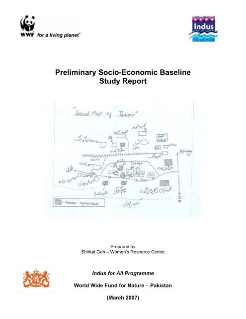
Fig. 4 Social Map of Jhimpir goths (males)<br />
Fig. 5 Seasonal Calendar: Village Yousaf Dablo – Keti Bundar<br />
SG Team members who participated in the preparation of this <strong>Report</strong>:<br />
Field Research:<br />
1. Ghazala Perveen<br />
2. Abdul Majeed Mangrio<br />
3. Pasand Ali Khoso<br />
4. Shahzadi Khoso<br />
5. Hassan (<strong>WWF</strong>)<br />
Secondary Research:<br />
1. Dhunmai Cowasjee<br />
2. Muhammad Asim<br />
3. Naheed Raheem<br />
<strong>Report</strong> Writing:<br />
1. Khawar Mumtaz<br />
2. Ahmad Raza Khan<br />
3. Tahir Iqbal<br />
Team -1 Team-2<br />
Preliminary <strong>Socio</strong>-Economic <strong>Baseline</strong> Assessment<br />
1. Afshan Naz<br />
2. Ali Muhammad Jat<br />
3. Tariq Baloch<br />
4. Aalia Baloch<br />
Thanks are due to District officials and special gratitude to local participants in the 22 villages<br />
Pai Forest, Chotiari Reservoir, Keenjhar Lake and Keti Bundar.<br />
iii
1. Introduction<br />
Indus for All Programme<br />
Preliminary <strong>Socio</strong>-Economic <strong>Baseline</strong> Assessment<br />
<strong>WWF</strong>- <strong>Pakistan</strong>’s recently initiated 6-year project titled “Indus for All Programme” stems<br />
out of the poverty-environment linkages present in the Lower Indus River Basin, as<br />
identified in the Indus Eco-region Programme. The Indus Eco-region is one of the most<br />
prioritized eco-regions within the Asia-Pacific. The aim of establishing an eco-region<br />
programme by <strong>WWF</strong>-<strong>Pakistan</strong> is to facilitate articulation of a 50-year vision for the ecoregion.<br />
The beneficiaries of the program are the communities dependent upon natural<br />
resources. While implementing the proposed activities it is envisaged that partners’<br />
capacity will be built and they will ultimately benefit from the programme.<br />
The programme objectives are:<br />
• Community-based NRM in four (Keti Bunder, Kinjhar, Pai forest and Chotiari)<br />
priority areas contributes to improved livelihoods;<br />
• improved natural resources and livelihoods through mainstreaming of povertyenvironment<br />
linkages at policy, planning and decision-making levels;<br />
• Improved institutional capacity and awareness for sustainable environmental<br />
management at various levels;<br />
• Improved alignment and collaboration for stakeholder interventions.<br />
Towards developing the programme for achieving the above Shirkat Gah was<br />
commissioned to carry out the first level scoping study to establish an initial socio<strong>economic</strong><br />
baseline by carrying out a situation analysis in and around the four project ecozones<br />
(Keti Bunder, Kinjhar, Pai Forest and Chotiari). The exercise would enable the<br />
selection of appropriate villages within the sites for project implementation. A central<br />
concern of the study is the extent of dependence of local populations on the natural<br />
resources of the areas. 1<br />
Among the variables to be covered were:<br />
• Number of households<br />
• Incomes<br />
• Land ownership and other assets<br />
• Dependency on natural resources<br />
• Relationship with natural resources including management of NR by sex,<br />
assessment of customary practices, religion and NR<br />
• Vulnerabilities and risks including the implications of inter and intra-communal and<br />
other conflicts on livelihoods and NR<br />
• Social <strong>org</strong>anisations in the area.<br />
1 See Annex 1 for TORs.
1.1. Methodology<br />
<strong>WWF</strong> – <strong>Pakistan</strong>: Indus for All Programme<br />
A two pronged methodology was employed for the assessment: one of collecting data and<br />
information from available secondary sources like official reports and surveys, NGO and<br />
newspaper reports; interviews with relevant departments at the provincial level and the<br />
three districts (Nawabshah, Sanghar and Thatta) covered in the assessment, and with<br />
NGOs working in these areas. The other component of the study was a field-based study<br />
of 22 selected villages identified by <strong>WWF</strong> in the four project areas.<br />
The methodology of the assessment in the field is PRA (Participatory Reflection and<br />
Action) and the framework of analysis is the Livelihoods Framework. The central concept<br />
of the Livelihoods Framework is that critical for people’s well-being is a set of basic<br />
resources/capitals/assets which are the principal means of generating income, and coping<br />
with natural disasters or <strong>economic</strong> shocks. This scoping study focuses on these assets/<br />
capitals i.e. Natural, Produced, Social/Political, and Human capitals.<br />
• Natural capital includes land, forests, water, marine and wild resources (trees, land,<br />
clean air, coastal resources). The benefits of these can be both direct and indirect.<br />
• Produced capital includes physical infrastructure and credit. It comprises the basic<br />
infrastructure and physical goods that support livelihoods. Key components include<br />
power supplies, roads, water and sanitation systems, school and health systems,<br />
buildings, productive equipment, and agricultural stores. It also includes monetary<br />
wealth and credit.<br />
• Human capital includes nutrition, health, education and local knowledge. This<br />
represents the skills, knowledge, capacity to work, and good health that together<br />
enable people to pursue different livelihood strategies, and achieve their livelihood<br />
outcomes. At a household level human capital is a factor of the amount and quality<br />
of labour available.<br />
• Social/Political capital focuses on the benefits of patterns of association. It relates<br />
to the formal and informal social relationships from which various opportunities and<br />
benefits can be drawn by people in their pursuit of livelihoods. The critical benefits<br />
of social/political capital are access to information, to influence or power, to claims<br />
or obligation for support from others, and leverage used in influencing decisions. It<br />
encompasses the power relations between and within state and society.<br />
As a first step a field team was put together and trained with reference to the specific focus<br />
of this study. Fluency in Sindhi and experience of PRA were the two criteria for selecting<br />
the team. Two teams of two males and two females each were put together by Shirkat<br />
Gah, one to cover the Kinjhar Lake and Keti Bundar sites and the other to cover Pai Forest<br />
and Chotiari Reservoir sites. The former team had a resident of Keti Bundar and the latter<br />
one from Chotiari area which helped in making possible quick local arrangements for stay,<br />
transport and access. Three of the team members had been involved in the PPPA<br />
exercise in Sindh with Shirkat Gah and were therefore familiar with the process of<br />
documentation. Three staff members from <strong>WWF</strong> also participated in the training and one<br />
of them accompanied the field team in Pai Forest. There was a debriefing session after<br />
completing each site in Shirkat Gah office in Karachi.<br />
Three-day training was <strong>org</strong>anised at the <strong>WWF</strong> centre in Karachi and conducted by<br />
<strong>Pakistan</strong>’s leading PRA trainer, Rashida Dohad with Shirkat Gah trainers. A field guide<br />
was developed to facilitate the fieldwork and given to each member of the team (Annex III<br />
in hard copy of this <strong>Report</strong>). Given the limited time available, PRA tools that the team was<br />
trained and tested in and then employed in the field were: social mapping, well- being<br />
Preliminary <strong>Socio</strong>-Economic <strong>Baseline</strong> Assessment<br />
2
<strong>WWF</strong> – <strong>Pakistan</strong>: Indus for All Programme<br />
ranking, transect walks, pie charts, Venn diagrams, seasonal calendars and focus group<br />
discussions across different age, ethnic, and gender groupings in each site. In addition the<br />
teams also took some in-depth interviews with key informants. Due to the time constraint<br />
only selected villages in each site were covered.<br />
1.2. Problems in the field<br />
The nature of problems faced varied from site to site. Where a local contact was identified<br />
beforehand the process went more smoothly, otherwise the teams had to spend time<br />
breaking the ice and building rapport. Accessing villages was not always easy especially of<br />
those located in the creeks of Keti Bundar and in Keenjhar Lake. In both sites boats were<br />
the mode of transport and took more time than planned. In the creeks access was<br />
dependent on the tide and necessitated coming back to Keti Bundar for the night. In the<br />
absence of a rest house or hotel the team in Keti Bundar had not only to arrange<br />
accommodation but also water for personal use and drinking, and gas lights. The<br />
household sizes as indicated by <strong>WWF</strong> were at variance with the situation on the ground in<br />
some instances requiring longer stay in some locations and shorter ones in others which<br />
posed problems of coordination. At least one village in one of the creeks was not there<br />
physically, there were a few abandoned huts. In another the population moved seasonally<br />
to Rehri Goth on the mainland and since most people were not in the village at the time of<br />
the assessment, Lakhio village in Rehri was visited to get the migrant community’s<br />
perspective.<br />
Both teams had to adjust timing of the assessment according to the availability of local<br />
people. Men engaged in fishing were not available during the day; women’s availability<br />
was determined by their household or other activities. Ideally more time should have been<br />
available for a more in-depth investigation. But given the constraints the teams managed<br />
to draw insightful information. The team in Pai and Chotiari finished their work early and<br />
joined the other team in Keti Bundar to share in the assessment there. Since a good<br />
proportion of documentation (activity sheets) in the field was in Sindhi more time was<br />
consumed to get them translated into Urdu and then use for the report in English.<br />
Secondary data was also not consistently found in each district especially for Taluka and<br />
UC levels. The quality and extent of information became scant as one went down the<br />
administrative tiers. Similarly data sets did not always match e.g. the data provided by the<br />
EDO, Education for 2004-05 did not seem to match the SEMIS data for 2002-03. There<br />
are also data gaps, for instance out-migration data is not available.<br />
It is important to point out the limitations of PRA. The methodology essentially captures<br />
people’s perceptions and experiential realities and not necessarily exact data. The<br />
quantitative information when given by local people/analysts often represents estimations<br />
based on that particular group’s knowledge and information, often coloured by their<br />
history, culture and their local pressing priorities. Information is triangulated after getting<br />
the perspective from different groups in the same village and cannot be seen as<br />
statistically exact. PRA enables insights and captures change particularly well. Ranking<br />
too is challenging as variables identified by local people are often nuanced and not always<br />
similar or comparable.<br />
Preliminary <strong>Socio</strong>-Economic <strong>Baseline</strong> Assessment<br />
3
1.3. The <strong>Report</strong><br />
<strong>WWF</strong> – <strong>Pakistan</strong>: Indus for All Programme<br />
The <strong>Report</strong> is in four sections. Besides the Introduction (Section 1), Section 2 gives an<br />
overview of the three districts where the four sites are located based on available official<br />
and other data/information and provides the broader context for the findings from the field.<br />
The Section gives the profiles of the three districts (Sanghar, Nawabshah and Thatta) and<br />
the Taluka level information of the four sites based on the 1998 census. Union Council<br />
level information was not available in District offices. Development projects underway in<br />
the three Districts by sector and NGOs operating in them is also provided in the section.<br />
Section 3 pulls together the village wise field assessment by site with secondary data<br />
providing the backdrop. A comparison of villages in each site is presented to facilitate<br />
selection for programme implementation. Ranking of villages in each site has been<br />
attempted wherever possible; diversity of variables makes ranking across sites difficult.<br />
Vulnerabilities are also discussed in this section.<br />
Section 4 is the concluding section that brings the salient features of the study together<br />
and makes suggestions for village selection and further specific investigation/research to<br />
be included as part of programme implementation. Annexes and References are at the<br />
end of the <strong>Report</strong>.<br />
Preliminary <strong>Socio</strong>-Economic <strong>Baseline</strong> Assessment<br />
4
2. Overview<br />
<strong>WWF</strong> – <strong>Pakistan</strong>: Indus for All Programme<br />
Whereas Sindh has the highest per capita income among the four provinces in <strong>Pakistan</strong>, it<br />
is the second least developed province in terms of human and social development.<br />
In a ranking of the 100 districts of <strong>Pakistan</strong>—with Karachi being counted as 1—according<br />
to 11 social and 16 <strong>economic</strong> development indicators, of the three districts under review,<br />
Nawabshah was relatively better off with Sanghar in the middle and Thatta at the bottom of<br />
the scale. 2<br />
Within Sindh, Nawabshah was classified as medium deprived, Sanghar and Thatta<br />
emerged among the 8 most deprived districts in the province with Thatta almost at the end<br />
at 94.7 points out of 100. If the same districts are ranked by their rural areas, then an even<br />
poorer situation emerges. All three rank higher on the deprivation scale, with rural Thatta<br />
at 98.5 points even though it improves slightly in the national ranking.<br />
Table 1: Districts & their Rural Areas<br />
Districts Provincial<br />
Rank Order<br />
National Rank Order Deprivation scale<br />
1 = Least Deprived 1 = Least Deprived<br />
[1- 100]<br />
16 = Most Deprived<br />
Medium Deprivation<br />
100 = Most Deprived<br />
Nawabshah 6 29 70.5<br />
Rural Nawabshah 8<br />
High Deprivation<br />
50 78.9<br />
Sanghar 10 47 78.8<br />
Rural Sanghar 10 59 85.9<br />
Thatta 15 78 94.7<br />
Rural Thatta 15 76<br />
Source: adapted from SPDC, 2001 (reference below)<br />
98.5<br />
2.1. Population<br />
The three districts, Nawabshah, Sanghar and Thatta that form the universe of IFAP are<br />
primarily rural with Thatta district least urbanised with only 11% of the district population<br />
living in urban areas (Census1998) and Nawabshah most urbanised with a quarter (26%)<br />
of its population urban (See Table 2 below).<br />
2<br />
Social Policy and Development Center. 2001. Social Development in <strong>Pakistan</strong>: Growth, Inequality and Poverty.<br />
Oxford University Press. Karachi.<br />
Preliminary <strong>Socio</strong>-Economic <strong>Baseline</strong> Assessment<br />
5
<strong>WWF</strong> – <strong>Pakistan</strong>: Indus for All Programme<br />
Table 2. Area, Population by Sex, Density, Urban Proportion, Average Household<br />
Size & Average Annual Growth Rate, 1998 by Talukas of IFAP Sites<br />
Admin Unit Area<br />
(sq km)<br />
Total<br />
Population<br />
Preliminary <strong>Socio</strong>-Economic <strong>Baseline</strong> Assessment<br />
Population 1998<br />
Male Female Population<br />
Density<br />
(per sq. km)<br />
Urban<br />
Proportion<br />
Average<br />
Household<br />
Size<br />
Nawabshah Distt 4,502 1,071,533 555,677 515,856 238.0 26 6.0 1.63<br />
1981-98<br />
Average<br />
Annual<br />
Growth<br />
Rate (%)<br />
Sakrand 1,394 269,860 137,919 131,941 193.6 10 5.6 0.90<br />
Sanghar Distt 10,728 1,453,028 762,284 690,744 135.4 22.8 5.8 2.74<br />
Sanghar 2,118 264,882 138,931 125,951 125.1 23 5.9 3.16<br />
Thatta District 17,355 1,113,194 589,341 523,853 64.1 11.2 5.1 2.26<br />
Keti Bunder 771 25,700 13,553 12,147 33.3 9.8 4.9 1.14<br />
Thatta 3,823 253,748 134,200 119,548 66.4 14.8 5.6 2.36<br />
Source: District Census <strong>Report</strong> of Nawabshah, Sanghar, Thatta. 1998.<br />
Examination at taluka level in the three districts reveals that Sakrand in Nawabshah and<br />
Keti Bunder in Thatta are the least urbanised talukas with up to 90% of the population<br />
rural. Population density in Keti Bunder is the lowest (33.3% per sq. km) and highest in<br />
Sakrand reflecting the district density pattern. In keeping with the national demographic<br />
pattern all three districts and talukas showed a negative sex ratio at the time of the last<br />
census. Males in 1998 were 108% of females in Nawabshah, 110.3% in Sanghar and<br />
113% in Thatta Districts. Similarly a high proportion of the population in all three districts<br />
was young and below 18 years of age – 48% in Thatta and almost 50% in both<br />
Nawabshah and Sanghar Districts.<br />
If the population of each district is extrapolated on the basis of the 1981-1998 annual<br />
growth rates of 2.26%, the 2005 population of district Thatta is estimated to be around<br />
1.331 million (an increase of 19.5%). The draft Census 2005-2006 quoted by SPO in its<br />
District Profile of Nawabshah shows that the district population here has increased from<br />
1.071 million of 1998 to 1.259 million – i.e. 17.5% in the intervening years. In District<br />
Sanghar on the basis of an average annual growth rate of 2.74%, the population is<br />
projected to double in the next 25 years. This increase in the population in the three<br />
districts (with implications on densities and dependence on resources) seems to be in<br />
accordance with the trend in other parts of the districts. For instance figures for 2006 put<br />
together from existing official data and reports and interviews with relevant officials by<br />
SAFWCO, a local NGO, in Taluka Sanghar and its two Union Councils indicate an<br />
increase of 24 % in the population (Table 3 below). However it would be important to keep<br />
in mind the fact that the population growth rate in 1998 had revealed a declining decennial<br />
trend and if that trend has continued then the population configuration would be very<br />
different from that calculated on the basis of the growth rates of 1998.<br />
6
Taluka<br />
Sanghar<br />
UC Shah<br />
Sikandar<br />
UC<br />
Khadwari<br />
<strong>WWF</strong> – <strong>Pakistan</strong>: Indus for All Programme<br />
Table 3: Population figures Taluka and UC Sanghar - 2006<br />
Census Total Pop. 0-11 < 5 years Pregnant CBAs<br />
1998 2006 months<br />
Women<br />
272,032 337,592 11,927 57,391 13,504 60,767<br />
25,299 31,396 1,109 5,337 1,256 5,651<br />
27,180 33,730 1,192 5,734 1,349 6,071<br />
Source: SAFWCO, District Profile, Sanghar. 2006<br />
2.2. Other <strong>Socio</strong>-<strong>economic</strong> Indicators<br />
Comparable literacy rates for the three Districts are from the 1998 Census, whereby the<br />
total literacy rates stood at 34.1%, 30.8% and 22% in Nawabshah, Sanghar and Thatta<br />
Districts respectively. There were marked urban-rural and male-female differentials. In<br />
Nawabshah the urban literacy rate was almost twice that of rural areas (54.3% urban vs<br />
26.5 % rural); the ratio in Sanghar District was wider (53% urban; 23.9% rural) and was<br />
the widest in Thatta District at almost two and a half times in urban areas (46% urban;<br />
19% rural). Female literacy was particularly low in rural Thatta at 8% and rural Nawabshah<br />
at 10.9% Sanghar. Overall the gap between male-female literacy was 21% (Thatta),<br />
25.45% (Sanghar) and 28% (Nawabshah). In terms of ranking Thatta was ranked 20,<br />
Sanghar 15 and Nawabshah 13 out of the 21 districts of Sindh. 3<br />
In the health sector, according to the SPO’s profile of Nawabshah 4 the Total Fertility Rate<br />
is 5.4—with persistent maternal morbidity; a low contraceptive prevalence rate (22%); at<br />
least one health facility in each UC of the District: only two Mother and Child care centres<br />
in the entire District; and 70% of births not attended by skilled birth attendant. In Sanghar<br />
District the Total Fertility Rate is 4.9% and the contraceptive prevalence rate 15.1%. It has<br />
88 health institutions and 64 District Council government dispensaries. The LHW<br />
programme started in Sanghar in 1995; currently 1,027 LHWs cover 52.59% of the current<br />
population with 810 in the rural areas and 217 in the urban centres. The health<br />
infrastructure in Thatta is scant. In the six coastal Talukas, three do not have any Rural<br />
Health Centre or any veterinary dispensary. The BHUs and dispensaries are also in small<br />
number.<br />
As far as potable water is concerned Nawabshah District is without access to safe drinking<br />
water as the District has arsenic in its ground water. In a study commissioned by UNICEF<br />
two focal blanket surveys were coducted in three talukas each of Khairpur Mir, Dadu and<br />
Nawabshah districts in 2002-2003 and 2003-04. The surveys were carried out in the two<br />
former districts by SAFWCO and in Nawabshah by SHEDS. The final report was compiled<br />
by SAFWCO (2005). Water samples were collected from hand pumps, tube wells, wells<br />
and water supply schemes (94% of the samples were from hand pumps). In the three<br />
Talukas of Nawabshah, 16890 samples confirmed 9% (1,472) carried arsenic at different<br />
levels ranging from 10-500 parts per billion (upto 10 ppb is the acceptable WHO guideline<br />
value). About 3% (465) samples were in the 50-500 ppb range and these were mostly in<br />
Sakrand Taluka where 99.6% of samples were from hand pumps. In all 4,602 samples<br />
were collected from 12 Union Councils of Taluka Sakrand. The survey revealed that<br />
3<br />
“Facts and Figures <strong>Pakistan</strong> 2002,” Ministry of Education, GoP. Available: http://www.moe.gov.pk.<br />
4<br />
SPO, “District Profile Nawabshah”. (n.d.) The brief profile consists of information from secondary data. As the <strong>Report</strong><br />
quotes the draft Census 2005-2006 one can presume it was put together in 2006.<br />
7<br />
Preliminary <strong>Socio</strong>-Economic <strong>Baseline</strong> Assessment
<strong>WWF</strong> – <strong>Pakistan</strong>: Indus for All Programme<br />
arsenic was found in water pumped from a depth of 50-100 ft and that most of the water<br />
sources were installed in the last decade. One water filtration plant was installed in a<br />
school in Mari Jalbani after the survey.<br />
Table 4. Presence of Arsenic in District Nawabshah<br />
Taluka 00 10 25 ppb 50 ppb 100 ppb 500 ppb Total<br />
Nawabshah<br />
1. Nawabshah 7,899 210 54 41 2 1 8,207<br />
2. Sakrand 3,901 206 222 163 107 3 4,602<br />
3. Daulatpur 3,618 221 94 77 50 21 4,081<br />
Total 15,418 637 370 281 159 25 16,890<br />
% 91.28 3.77 2.19 1.66 0.94 0.15 100.00<br />
Source: SAFWCO, “Arsenic Contamination in Drinking Water in Sindh Province of <strong>Pakistan</strong>.” 2004<br />
The Thatta District is also very poor in terms of the indicator of piped water, which is<br />
available to only about 14% of the housing units. About 13% of rural households have<br />
hand pumps inside the housing units, while 16% use outside ponds for fetching water and<br />
6% of housing units use dug wells. 5 Not much information on Sanghar District potable<br />
water could be found<br />
2.3. On-going Development Initiatives<br />
While the link between the Millennium Development Goals, the Medium-Term<br />
Development Framework, national policies and plans, and the Public Sector Development<br />
Plans / Annual Plans are quite clear, this is less apparent in the Annual Development<br />
Plans at the provincial level and even less so at the district level, with the exception of<br />
foreign project assistance.<br />
GoP clearly states that the MTDF (2005-10) has given priority to the Environment Sector<br />
with an outlay of Rs. 28.3 billion. The allocations have been increasing every year from<br />
743.0 million in 2004-05, to a four-fold increase to Rs. 3,075.0 million during 2005-06, to<br />
Rs. 5,756.0 million in 2006-07. Such figures are not easily extrapolated for the Sindh ADP<br />
2006-07 though a figure of Rs.1 billion for the environment sector has been cited. 6<br />
NRM-related projects are funded through the PSDP, the Sindh ADP and through foreign<br />
assisted funding. There are some national or provincial NRM-related projects in Sindh<br />
such as the World Bank-funded On-Farm Water Management or the Clean Drinking Water<br />
for All Project. The drinking water project is aimed at installing one water purification plant<br />
in each UC by end 2007 at an overall cost of Rs. 8.0 billion. In its first year, it was<br />
implemented by the Federal EPA; in October/November 2006, it was shifted to the Ministry<br />
of Industries, Production and Special Initiatives.<br />
There is also the ADB-funded 7-year Sindh Rural Support Project 2003–09 under the<br />
Local Government Department. The Project will reduce poverty in the canal-irrigated areas<br />
of Badin, Mirpurkhas, Sanghar and Thatta districts in southern Sindh through increasing<br />
empowerment and improving governance, improving access of the rural poor to public<br />
services, transferring technology for improved livelihoods, and providing essential<br />
infrastructure. The Project will focus on (i) tenants and agricultural labourers, (ii) marginal<br />
owners-cum tenants, and (iii) small village-based artisans. One 'lead' NGO per district will<br />
5 Figures based on the 1998 Housing Census in World Bank study, “<strong>Socio</strong><strong>economic</strong> Study and proposal for Livelihood<br />
Improvements: Badin and Thatta Districts, Sindh, <strong>Pakistan</strong>.” Mimeo. 2005. p.16<br />
6 Dawn, editorial, June 17, 2006.<br />
Preliminary <strong>Socio</strong>-Economic <strong>Baseline</strong> Assessment<br />
8
<strong>WWF</strong> – <strong>Pakistan</strong>: Indus for All Programme<br />
be selected to support the CBOs in their community interventions. HANDS and NRSP<br />
were mentioned among the possible choices of NGOs.<br />
The Bank developed Sindh Coastal Areas Development Program (Phase I: 2006-2008,<br />
US$ 6 million) to be implemented by the Bank-funded <strong>Pakistan</strong> Poverty Alleviation Fund is<br />
a significant programme in the coastal area. PPAF’s partners NGOs include, AKPBS,<br />
BRDS, HANDS, Indus Earth, NRSP, SCOPE and SPO. It will cover Keti Bunder Taluka<br />
among others. Phase II will be for a period of three years (2008-2011) with planned<br />
funding of US$12 million.<br />
There are a number of other province wide projects operating or approved in the three<br />
districts (Nawabshah, Sanghar and Thatta). These include:<br />
• The National Programme of Improvement of 29,000 Watercourses in Sindh (2004-<br />
2008)<br />
• The Indus Dairy Development Project in Sindh (ADP, approved with PC-1 under<br />
revision);<br />
• Training of Rural Women for Increasing Livestock Production & Conversion into<br />
By-products in each Taluka (ADP, approved, Rs 35.247 million);<br />
• Control of Edo and Ecto Parasites in Livestock (ADP, Rs. 39.999 million);<br />
• Establishment of Research and Breeding Farm of Pateri Goat Breed (unapproved,<br />
Rs. 95 million);<br />
• The Awareness of Farmers through Transfer of Appropriate Technology regarding<br />
Livestock Nutrition, Breeding, Management, Disease Control and marketing.<br />
• Phase II Crop Maximization Programme, 2006-07 to 2011-12 (PSDP, total Rs. 500<br />
million)<br />
• The Decentralized Elementary Education Project and the USAID Education Sector<br />
Reform Assistance;<br />
• The Women's Health Project (ADP, funded by ADB);<br />
• The National Programme for Family Planning and Health Care (PSDP funded);<br />
• The Sindh Devolved Social Services Program;<br />
A sector-wise list of area specific programmes in the three districts is in Box 1 below.<br />
Preliminary <strong>Socio</strong>-Economic <strong>Baseline</strong> Assessment<br />
9
<strong>WWF</strong> – <strong>Pakistan</strong>: Indus for All Programme<br />
A number of them have provisions for involving NGOs in implementation, and many<br />
projects have an infrastructural focus.<br />
Nawabshah<br />
Sanghar<br />
Box 1: Major Development Projects by IFAP Districts<br />
District Projects<br />
Forest:<br />
1. The 5 year Afforestation of New Area and Rehabilitation of<br />
Existing Irrigation Plantation (2003-2007)<br />
2. The Afforestation in Riverine Forests through Participatory<br />
Forestry<br />
3. Combating Desertification and Conservation of Riverine<br />
Forests of Sindh<br />
Agriculture:<br />
1. The National IPM Project (PSDP-funded, Rs. 197.433<br />
million) 7<br />
2. The National Programme of Improvement of 29,000<br />
Watercourses in Sindh (2004-2008)<br />
3. Inclusion of Malhi Training Course at ATI Sakrand for<br />
Horticulture Development (2006-2007)<br />
4. Phase II Crop Maximization Programme, 2006-07 to 2011-1<br />
(PSDP, total Rs. 500 million)<br />
Livestock:<br />
1. Indus Dairy Development Project in Sindh<br />
2. Training of Rural Women for Increasing Livestock Productio<br />
& Conversion into By-Products for each Taluka<br />
3. The Awareness of Farmers through Transfer of Appropriate<br />
Technology regarding Livestock Nutrition, Breeding,<br />
Management, Disease Control and marketing.<br />
Fisheries:<br />
1. Establishment of Carp Fish Hatchery<br />
Irrigation: (Project Planned)<br />
1. Earth Work and Stone Pitching along Chotiari Reservoir<br />
2. Installation of 100 Tubewells of Saline Water (Chotiari)<br />
3. Makhi-Farash Link Canal Project to Remodel Existing<br />
Channels<br />
4. National Programme for Improvement of 29,000<br />
Watercourses in Sindh (2004-2008)<br />
Health:<br />
1. Women’s Health Project<br />
7 The DDO, Agriculture, Nawabshah mentioned the FAO-EU IPM Program for Cotton in Asia that ran from 2001-04<br />
with <strong>WWF</strong> <strong>Pakistan</strong> as a public-private partnership in IPM-Farmers Field Schools. FFS are accepted in Sindh and<br />
Punjab as dominant interface between government and farmers for filling the need that regular extension had not been<br />
able to satisfy. While the programme ended the Sindh Agriculture Development Organization (SADO) was formed in<br />
2005 to work as an IPM network of all district and village <strong>org</strong>anizations in Sindh.<br />
Preliminary <strong>Socio</strong>-Economic <strong>Baseline</strong> Assessment<br />
10
<strong>WWF</strong> – <strong>Pakistan</strong>: Indus for All Programme<br />
2. National Programme for Family Planning and Health Care<br />
(LHWS Programme)<br />
Thatta<br />
Coastal Development Authority:<br />
1. Rehabilitation and Propagation of Drought Affected Coastal<br />
Mangroves of Thatta District (2003-2007) in Chan Creek<br />
2. Conservation and Rehabilitation of Indus Delta Mangroves f<br />
Sustainable Management (2005-2007) in Buri and Turshian<br />
Creeks.<br />
3. Indus Delta Mangroves Phase II (FY2003-FY2007, ADP, tot<br />
cost Rs. 35.20 million) in Prar Creek in Keti Bunder.<br />
4. Coastal Area Development Program (CADP) of World Bank<br />
be implemented by PPAF<br />
5. Improvement of Livestock in the Coastal Areas of Thatta and<br />
Badin FY2003-FY2007 (Rs. 39.990 million)<br />
Irrigation:<br />
1. Electrification of Four Coastal Settlements through Wind-So<br />
Hybrid Power Generation System in District Thatta (2 in Ket<br />
Bunder; 2 in Shah Bunder) FY2005-FY2006<br />
Urban water supply:<br />
1. Upgrading Kinjhar Lake System (for improved water supply<br />
Karachi)<br />
Fisheries:<br />
1. Introduction of Integrated Fish Farming, (ending 2007)<br />
including Livestock-Fish, Duck-Fish, Poultry-fish and Crop<br />
Fish Farming<br />
2. Improvement and Restoration of Lake Ecosystem (ending<br />
(2007)<br />
3. Control of Eutrophication and Vegetation in Keenjhar Lake<br />
(ending 2007)<br />
4. Establishment of Prawn Hatchery, Disease Diagnostic Cent<br />
and Research Unit (under review) in Chilya.<br />
5. Introduction of Modern Technology for the Welfare of<br />
Fisherman Community of Keenjhar Lake<br />
6. Marine Fisheries Surveillance in the Coastal Areas of Sindh<br />
(2003-2007)<br />
7. Pen culture Demonstration in the Coastal Creeks and<br />
Backwaters of Sindh (2003-2005)<br />
8. Aquaculture Development in the Coastal Areas of Sindh<br />
FY2003-FY2007 (Rs. 32.958 million)-research study<br />
Source: Various official documents.<br />
2.4. NGOs Working in IFAP Districts<br />
Most of the more prominent NGOs in the three districts appear to be involved in health and<br />
education. There seem to be no environment-related NGOs in Nawabshah. SPO is the<br />
major NGO working in the Nawabshah District and has led 40 CBOs through 2-year DPM<br />
training. It is now supporting the Nawabshah Social Development Coalition (coalition of<br />
CBOs) in agriculture-related work.<br />
Preliminary <strong>Socio</strong>-Economic <strong>Baseline</strong> Assessment<br />
11
<strong>WWF</strong> – <strong>Pakistan</strong>: Indus for All Programme<br />
There are a number of NGOs operating in Sanghar but only two in the environment sector:<br />
Sustainable Development Foundation (SDF) and Sindh Agricultural & Forestry Workers<br />
Coordination Organisation (SAFWCO). <strong>Pakistan</strong> Fisher Folk Forum (PFFF) also has a<br />
chapter here. Shirkat Gah has worked here in the past on the issue of Chotiari Reservoir<br />
and networks with local <strong>org</strong>anisations. There are several NGOs in the health sector<br />
according to the Health Department. Among the more prominent ones are: Marie Stopes<br />
Society and HANDS.<br />
NGOs working in Thatta District range from relief and rehabilitation, social welfare,<br />
livelihoods improvement, development of community infrastructure, provision of microfinance,<br />
to advocacy and awareness raising. It does seem that to work in Thatta District<br />
the main stakeholders will be the NGOs funded either through the WB CADP programme<br />
and/or the ADB Sindh Coastal Community Development Project. Some of the key<br />
agencies here include the NRSP, PPAF, Aga Khan Planning and Building Services<br />
(AKPBS), IUCN, <strong>WWF</strong>, SPO and <strong>Pakistan</strong> Fisherfolk Forum. Given below is a<br />
comprehensive list of major NGOs (Box 2). There are a number of smaller <strong>org</strong>anisations<br />
also working in the districts.<br />
Some larger <strong>org</strong>anisations working in Sindh may not be operating in the three districts but<br />
work on themes that would be relevant to IFAP e.g. Indus Earth, a potential partner in<br />
CADP works in coastal areas on environment, potable water supply, wind and solar<br />
energy. Shirkat Gah’s work in the coastal areas has been with fishing communities on<br />
rehabilitation of mangroves, fuel saving stoves, mobilisation of women, and on advocacy<br />
issues (deep sea fishing, illegal nets, sale of islands to developers, etc.). Shirkat Gah has<br />
worked in the past in Chotiari with local CBOs and is presently working in other districts of<br />
Sindh on women’s legal rights and reproductive health and rights. SCOPE works on water<br />
conservation; Indus Resource Centre on female education; etc., etc.<br />
Nawabshah<br />
Sanghar<br />
Box 2. Major NGOs working in IFAP Districts<br />
District NGOs<br />
Preliminary <strong>Socio</strong>-Economic <strong>Baseline</strong> Assessment<br />
1. Sindh Health and Education Development Society (SHEDS<br />
2. Rotary Club<br />
3. Marie Stopes Society,<br />
4. HANDS<br />
5. VWA<br />
6. National Rural Support Programme (NRSP)<br />
7. Strengthening Participatory Organization (SPO)<br />
1. Sustainable Development Foundation<br />
2. Sindh Agricultural & Forestry Workers Coordinating<br />
Organization (SAFWCO)<br />
3. <strong>Pakistan</strong> Fisherfolk Forum<br />
4. Marie Stopes Society<br />
5. SEDA<br />
6. Women Welfare Association (WWA)<br />
7. Thardeep<br />
8. Shirkat Gah<br />
12
Thatta<br />
<strong>WWF</strong> – <strong>Pakistan</strong>: Indus for All Programme<br />
District NGOs<br />
3. Findings from the Field<br />
Preliminary <strong>Socio</strong>-Economic <strong>Baseline</strong> Assessment<br />
1. National Rural Support Program (NRSP),<br />
2. Aga Khan Planning and Building Services<br />
3. IUCN<br />
4. <strong>WWF</strong><br />
5. Strengthening Participatory Organization (SPO)<br />
6. HANDS<br />
7. <strong>Pakistan</strong> Fisherfolk Forum<br />
8. Adventure Foundation of <strong>Pakistan</strong><br />
9. Indus Earth<br />
10. SCOPE<br />
Altogether 22 villages in the four IFAP sites were visited (See Box 3 below). The<br />
participatory analysis was carried out with men and women ensuring the inclusion of<br />
different age, caste/ethnic and professional groups to assess the status of the various<br />
assets/capitals (natural, produced, social/political) in each site and thereby determine the:<br />
• key natural resources that people’s livelihoods are dependent upon,<br />
• threats and sources of threats to natural resources,<br />
• basic means and levels of income of men and women,<br />
• available and operational services and institutions,<br />
• the nature of social/political capital available to people, and<br />
• their risks and vulnerabilities<br />
Box 3: IFAP Sites and Villages by District<br />
Pai Forest - District Nawabshah<br />
1. Village Nangar Chandio<br />
2. Village Jafar Jamali<br />
3. Village Mari Jalbani<br />
Chotiari Reservoir - District Sanghar<br />
1. Village Pholel<br />
2. Village Padrio<br />
3. Village Aud<br />
4. Dubi-Khamiso Gaho<br />
5. Village Haji Ghulam Hussain Leghari<br />
Keenjhar Lake - District Thatta<br />
1. Jhumpir<br />
2. Sonehri<br />
3. Haji Ali Bux Manchari<br />
4. Haji Jafer Hillaya<br />
5. Shaukat Gandhro<br />
6. Abdullah Gandhro Khanbo<br />
7. Daulatpur<br />
13
3.1. Pai Forest<br />
3.1.1 Background 8<br />
<strong>WWF</strong> – <strong>Pakistan</strong>: Indus for All Programme<br />
Keti Bundar - District Thatta<br />
1. Keti Bundar<br />
2. Hamza Dablo (Kharion)<br />
3. Yousuf Dablo<br />
4. Siddique Dablo<br />
5. Goth Mohammad Lakhio<br />
6. Meero Dablo<br />
7. Ayub Dablo<br />
On February 12, 1883, under Government Notification No. 1337, an area of 5,982 acres in<br />
Dehs 18-Sakrand (456.60 ha), Morio Lakho (260.30 ha), 6-Marvi (364 ha), Tali (1,306.50<br />
ha) and 25-Butho (33.48 ha) of Taluka Sakrand were declared 'reserved' for forests. Of the<br />
area notified as a reserve forest of 5,982 acres (see Map 1):<br />
• 1,154.40 acres was transferred to the Agriculture Department in 1959.<br />
• 140 acres was transferred to the <strong>Pakistan</strong> Army in 1992.<br />
• 5 acres was used by the National Highway to construct the Sakrand Bypass.<br />
This has left 4,726.60 acres under the control of the Forest Department. Under the ADBfunded<br />
10-year Sindh Forestry Development Project 1991-2002, 1,240 acres were<br />
replanted in Pai. Currently 229 acres are under encroachment: 178 acres forcibly<br />
encroached, 35 acres under a boundary dispute, 16 acres under illegal allotment. Hence<br />
of the original 5,982 acres, only 75% of the land is now left under the Forest Department's<br />
active management.<br />
Pai was sanctioned 30 cusecs of irrigation water from the Rahib Shah Minor canal,<br />
sufficient to water 2,000 acres: 10 cusec from W.C. IL, 15 from W.C. IIL and 5 from W.C.<br />
IIIL. This allowed an irrigated plantation to be maintained supplemented by canal water for<br />
2 months in the agricultural off-season period. However, in the last 5 years, both the<br />
sanctioned supply and the off-season water are not available as it is being drawn off by<br />
influential locals for agriculture. The forest is now dependant on tube-well water through 12<br />
electrified tube-wells. Pai is staffed by two Range Forest Officers, two Foresters and four<br />
guards.<br />
Pai Forest was officially declared a game reserve in 1972, and is famous as a hunting<br />
ground for black and grey partridge (titter). The current situation is that a special hunting<br />
license has to be sought from the Conservator, Wildlife at Karachi and approved by the<br />
Minister for Forests and Wildlife. The fee is Rs. 1,000 for 1 gun under which 10 partridge<br />
can be shot; however, there is no real accountability for this. The Game Reserve is<br />
managed by 1 Game Inspector and 4 Game Watchers.<br />
8 Forest Department, n.d. “Brief for Secretary to Government of Sindh for Forest and Wildlife Department Regarding Pai Irrigated<br />
Plantation.”<br />
Preliminary <strong>Socio</strong>-Economic <strong>Baseline</strong> Assessment<br />
14
Map 1: Pai Forest<br />
<strong>WWF</strong> – <strong>Pakistan</strong>: Indus for All Programme<br />
Sakrand Taluka, where the Pai Forest is located, is the least urbanised of Nawabshah’s<br />
Talukas with 90% of the population living in rural areas and a low annual growth rate of<br />
0.9%. Livestock is an important source of livelihood in District Nawabshah and Taluka<br />
Sakrand, according to data collected in 2005, possesses almost a quarter of cattle and<br />
sheep in the district (Table 5).<br />
Table 5: Nawabshah, Livestock by Taluka, Census 2005<br />
Taluka Cattle Buffalo Sheep Goat<br />
No % No % No % No %<br />
Nawabshah 100,272 22.47 139,882 23.86 50,334 27.07 192,161 27.67<br />
Sakrand 123,046 27.57 147,082 25.09 52,250 28.10 166,620 23.99<br />
Daur 98,723 22.12 160,877 27.44 50,167 26.98 194,603 28.02<br />
Daulatpur 119,160 26.70 138,482 23.62 33,167 17.84 141,080 20.31<br />
Total 446,301 100.00 586,323 100.00 185,918 100.00 694,464 100.00<br />
Source: “Note from District Officer, Livestock & Animal Husbandry, Nawabshah,” using data collected for fourth<br />
decennial census of livestock 2006.<br />
According to information on primary schools 2005-06 there were a total of 36 schools, (22<br />
male and 14 female) in UC Sakrand and of these 1 male and 3 female schools were<br />
closed. 9 The water quality of the Taluka, as mentioned earlier, is poor with arsenic found in<br />
water drawn from hand pumps (See Section 2.2 above).<br />
9 Information provided by EDO (Education) Nawabshah. Dec. 2006<br />
Preliminary <strong>Socio</strong>-Economic <strong>Baseline</strong> Assessment<br />
15
3.2.2. Local People’s Analysis<br />
<strong>WWF</strong> – <strong>Pakistan</strong>: Indus for All Programme<br />
The three villages (Nangar Chandio, Jafar Jamali and Mari Jalbani) lying close to Pai<br />
Forest and included in the assessment fall in three different Union Councils of Taluka<br />
Sakrand.<br />
Village Nangar Chandio lies in the 32 km strip of land between Pai forest and Indus River<br />
at a distance of 16 km from Sakrand. It is one km from Pai forest and about 5 km from the<br />
river. Nangar Chandio is made up of 60-70 households. The dominant tribe in the village is<br />
Chandio though there are other groups/tribes (Oudhes, Khumbar, etc.) also living there but<br />
are fewer in number.<br />
Village Jaffar Jamali is a relatively new (established 11 years ago) and small village with<br />
about 40 households and located on either side of the National Highway and closer to<br />
Sakrand town (8 km). It is one km away from the Pai forest. As indicated by its name<br />
Jamali is the dominant tribe in the village.<br />
Village Mari Jablani, is a 200-250 year old village and the largest of the three villages<br />
with over 1000 households. It is also farthest from Sakrand town (16-20 km). The<br />
dominant tribe/ethnic group is Jablani, the others being Summa and Mallah. The three big<br />
neighbourhoods of the village are inhabited by these dominant tribes. Among other<br />
tribes/biraderis are Sehr, Wada, Kanbhar and Raho.<br />
Table 6: Village Profile – Pai Forest (Findings from the field)<br />
Village House- Pop. School Electric Health Road Water<br />
hold<br />
Male Female<br />
Pub Pvt.<br />
P / M High P / M High<br />
Nangar<br />
Chandio<br />
65 800 1*/- - 1*/- - Yes 1 Yes 65 Hand pumps<br />
J. Jamali 40 500 1 / - - - - Yes - - Yes 10-12 Hand pumps<br />
M. Jalbani 1140 8000 2 / - 1 - / 1* Yes 1 Yes 1140 Hand pumps<br />
* Not functional<br />
Pop. Population<br />
P / M Primary/Middle<br />
Pub. Public<br />
Pvt. Private<br />
Natural Capital: In all three villages water was the main natural resource that local<br />
people’s livelihoods depended upon historically and was mentioned as a capital that used<br />
to be available free of cost and now expensive and in decline but still very critical.<br />
According to local people water from the Indus and the fertile soil it brought were the<br />
backbone of their livelihoods. However with the building of the “bacaho bund” near village<br />
Nagar Chandio the nutrient rich flood waters of the River Indus no longer reach the lands<br />
in the area. They mentioned the flood of 1993 (the last one experienced) as the beginning<br />
of the decline in the volume of water. The residents of Jaffar Jamali dated the scarcity of<br />
water to the last 10 years i.e. to the time they came and settled here about 11 years ago.<br />
While those of Mari Jalbani dated the shortage to 16 years or so when the Rihab canal<br />
that brought water to this village dried up, located at the tail end of the canal made the<br />
situation worse for the villages. In their view the stoppage of water in natural tributaries<br />
coming from Punjab combined with the illegal occupation of land by two powerful persons,<br />
Syed Shabbir Shah and Bashir Shahid, and diverting water to their banana farms (1000<br />
Preliminary <strong>Socio</strong>-Economic <strong>Baseline</strong> Assessment<br />
16
<strong>WWF</strong> – <strong>Pakistan</strong>: Indus for All Programme<br />
acres) were responsible for current shortages. On the other side other influential landlords<br />
have occupied the land near the mouth of the Rihab Canal and use up the water.<br />
Villagers from Mari Jalbani and Nangar Chandio spoke of the time when the flood water<br />
would come to the bund about 5 km from the river and inundate 2 km of the “survey lands”<br />
as well as the forest on its banks, and create ponds of water in the katcha area. One of<br />
the biggest lakes so formed was the Khauf Jheel. Similarly the water from Rihab Canal<br />
would accumulate in Jhakli Jheel. “At that time there was greenery all round and now its<br />
only dust.” The area was green and its people were prosperous. The Mallah (fishing)<br />
community of Mari Jalbani used to fish in the ponds and are now forced to abandon their<br />
ancestral occupation. In Jaffar Jamali water shortage has affected pastures and grazing<br />
lands and poses a major a threat to cattle farming, the principal occupation of local<br />
people. Water in the area has to be drawn from tube wells and a free commodity now<br />
involves costs of installing tube wells and then running them on electricity or diesel.<br />
According to the locals 300 tube wells have been installed to tap sub-soil water [the figure<br />
needs to be cross checked]. With the water table falling, from10 feet to below 80 feet<br />
according to Nangar Chandio residents, these have often to be re-bored. The rains are<br />
irregular and usually scarce but sometimes untimely, destroying crops.<br />
Forest: According to villagers (male and female) of Nangar Chandio, Pai and katcha<br />
forests have been the next most significant natural asset. However the forests and their<br />
resources have drastically shrunk. The katcha forest that used to be south of the village is<br />
now substantially depleted principally because of lack of water. The residents of Mari<br />
Jalbani and Namgar Chandio said that the katcha riverine forests used to have keekar, lai,<br />
karar, tali, kamoon, etc. apart from wood for furniture they provided fire wood, fodder, lakh<br />
(lacquer) and honey, all free of cost. The latter was available in huge quantities and was<br />
sold by locals. Even now villagers manage to forage for some fuel wood and fodder from<br />
trees according to women of Mari Jalbani but have to purchase firewood at Rs. 50-100 a<br />
maund which usually lasts for about a fortnight.<br />
In their view Pai forest, called “Government farms” by the Jalbanis, used to provide fuel<br />
and fodder to their community. Women said that the stronger wood in Pai forest was good<br />
for making furniture and doors, the wood of beri, kundi and devi as fire wood. The forest<br />
reportedly also had wild herbs like kanni booti (used for as painkiller), aryal (for bone<br />
fractures), kamo (for hair care), charya dhatoora (for healing early wounds), and ik (for<br />
treating burns and toothache). These medical herbs are now no longer abundantly found<br />
and are not accessible due to restrictions on entry. Entry of the villagers is possible if they<br />
pay the officials and Rangers Rs.1000-5000 to cut wood or collect honey. People from<br />
Jaffar Jamali shared that besides the bribes there was the fear of being beaten or taking<br />
away of their crops. Pai Forest used to be irrigated by the Rihab branch canal but now is<br />
dependent on tube wells and has just enough water to maintain the rest house and<br />
surrounding garden which are used by VIPs for hunting parties. Local people felt that the<br />
Forest Department officials, responsible for the maintenance and protection of the Forest,<br />
keep the villagers out and collude with influential people in illegal cutting and resultant<br />
depletion. Women liked keekar for its usefulness as fodder and lamented the loss of<br />
honey. They said that devi and bed-i-mushk introduced by the government “are of no use<br />
to us.”<br />
The residents of Jaffar Jamali were in fact of the opinion that Pai Forest was only<br />
beneficial to influential people and officials of the Forest Department (though some felt<br />
that locals also harmed it by using its resources), was a hideout for dacoits that resulted in<br />
exposing people to police harassment. Since some of the forest land is under litigation<br />
Preliminary <strong>Socio</strong>-Economic <strong>Baseline</strong> Assessment<br />
17
<strong>WWF</strong> – <strong>Pakistan</strong>: Indus for All Programme<br />
and some has been taken on lease by the local influential landlords for cultivation, the<br />
local poor were of the opinion that the forest land ought to be cleared and distributed<br />
among the poor. They also did an impact assessment of clearing the Forest (Fig. 1). On<br />
the other hand residents of Mari Jalbani were not in favour of clearing the forest or<br />
distribution of land which in their view would go into the hands of the powerful Jamali<br />
landlords. They felt the Forest could be re-generated if water supply was restored.<br />
Fish, as a natural resource was mentioned by people of Mari Jalbani where there is a<br />
sizable community of Mallahs. It is however a dwindling resource as a result of water<br />
scarcity and the consequential shrinking and drying of wetlands of the area. Fishing was<br />
the main source of earning for the Mallah community up to 13 years ago; its members now<br />
work in construction work and other menial labour. Now with fewer fish there is conflict<br />
over contracts; one such feud a month ago resulted in 22 people being wounded.<br />
Produced Capital: Nangar Chandio has tube wells for irrigation and hand pumps in all<br />
homes, a metalled road, electricity, a mosque, one flour mill, two government primary<br />
schools one each for girls and boys (both non-functional), a private clinic, three shops and<br />
an old well. Livestock, (buffaloes, cows and goats) that used to be the mainstay of<br />
people’s livelihoods is still a secondary source of livelihood (agriculture is the primary<br />
occupation). Buffaloes are preferred because of their better market value. Goats are<br />
second in the order of preference as they reproduce twice a year. Children take the cattle<br />
for grazing and women look after them as well as milk and milk products, both are mainly<br />
for domestic use. Collectively the village owns 260 buffaloes, 100 cows, 200 goats and 10<br />
oxen.<br />
Preliminary <strong>Socio</strong>-Economic <strong>Baseline</strong> Assessment<br />
18
<strong>WWF</strong> – <strong>Pakistan</strong>: Indus for All Programme<br />
Fig. 1. Impact Diagram Pai-Forest: Jaffar Jamali (males)<br />
Negative impact<br />
Forest life will die Dacoits will not get shelter Land will be cleared<br />
No more fuel wood will be<br />
available for cooking<br />
Local population will be<br />
affected<br />
Cutting of present forest<br />
in the area<br />
Preliminary <strong>Socio</strong>-Economic <strong>Baseline</strong> Assessment<br />
Thefts will end Cleared land will be given to local<br />
population<br />
People will be rid of the<br />
police processes<br />
People will work with keen<br />
interest<br />
and rest without fear<br />
“At the end, there<br />
will be only<br />
happiness and<br />
happiness”<br />
Positive impact<br />
People will make it suitable for<br />
agricualture purposes<br />
People will till the land<br />
Crops will be ready<br />
Earning of the people of the area will<br />
increase<br />
“Happiness will<br />
come to the area”<br />
Jaffar Jamali comprises of a few cemented houses, some semi-pucca and some mud<br />
huts. It has electricity, a mosque, a government boy’s primary school and 10-12 hand<br />
pumps (one hand pump for four households) as its produced capital. The National<br />
Highway running through Village Jaffar Jamali makes it accessible from outside. The<br />
village has no healthcare facility. However livestock, mainly 14-15 buffaloes and goats, is<br />
the principal produced capital on which their livelihood depends. Women look after the<br />
livestock. Buffaloes are fed by fodder that is grown by local people and are not free<br />
grazed.<br />
Mari Jalbani, the largest of the three villages has pucca and semi-pucca houses and a few<br />
huts. There is a small market in the centre of the village with 10-12 shops. It has a<br />
mosque, a BHU, a police station, primary schools for girls and boys, a boy’s high school<br />
19
<strong>WWF</strong> – <strong>Pakistan</strong>: Indus for All Programme<br />
and a girl’s middle school that remains closed. The primary school here was established<br />
as far back as 1883. The roads are metalled and there is electricity in the village. As<br />
mentioned earlier there are 300 tube wells in the area and hand pumps in all households.<br />
People are also aware that there is arsenic in water which otherwise is sweet. The bund<br />
and canals now seem redundant. There is a Forest rest house that is in the custody of<br />
villagers and an old bungalow of the irrigation department constructed to keep an eye on<br />
River Indus during storms. Livestock is important here too however due to declining water,<br />
forests, and pastures, livestock farming has suffered. Because of the reduction in<br />
livestock numbers there has been a shift from livestock farming to agriculture as also from<br />
cows to goats that are easier to feed and care and reproduce rapidly (twice a year).<br />
Where once each family could keep 500-600 cows, 100-150 buffaloes and an equal<br />
number of goats there are now a total of 1000 each of cows and buffaloes in the village<br />
and 5000 goats and sheep.<br />
Social Capital: Social capital basically is defined by the skill/educational levels of people<br />
and/or their political or social standing. Nangar Chandio has among its male population<br />
one graduate, three intermediate and four matric pass individuals. Only one female has<br />
completed intermediate level education. Given the fact that the two primary schools in the<br />
village are shut this is not surprising. The marketable skill in the village is with women –<br />
that of making rallis, stitching and embroidery. The formal institution that people have to<br />
directly contend with is the Forest Department and its officials. The village itself is quite<br />
cohesive as the majority belongs to the same biraderi which prevents internal conflicts.<br />
Local landlords who have political connections wield the most power. None of the NGOs<br />
working in the District has come to it.<br />
In Jaffar Jamali the Jamali biraderi is seen as the most important capital by the villagers.<br />
Its leader is affiliated with the <strong>Pakistan</strong> People’s Party and politically influential. While the<br />
majority of the village is illiterate and female education is not approved of there are 10<br />
intermediate, 12 matriculate and 50 primary educated individuals. The village also has<br />
three government servants. Women here too are proficient in ralli making, stitching and<br />
embroidery.<br />
Mari Jalbani, the largest of the three villages boasts of 10 post graduate males and 2 post<br />
graduate females besides 20 graduate men and 5 graduate women. There are also 40<br />
men and 10 women who have passed intermediate; and 400 boys and 50 girls who have<br />
done their matriculation. The reason for low literacy was given as poverty. One young man<br />
has succeeded in getting a job as lecturer (Computer Science) and was going abroad on<br />
scholarship.<br />
The village takes pride in its unity. Internal differences take a back seat in face of disputes<br />
with outsiders. Most disputes among them are over land. Conflicts are resolved through<br />
mediation of Muneer Shah, a local influential. Major decisions are taken by Bashir Shah. If<br />
the dispute is intense then the issue is solved through the Quran. The people are politically<br />
aware and affiliated with the People’s Party and the majority vote for it. Disputes among<br />
women are of minor nature and resolved by them.<br />
Males reported two social welfare <strong>org</strong>anisations working in the village (women did not<br />
know their names). One was Village Welfare Organisation (VWO) and another Sufi Shah<br />
Inayat Development Organisation. Both are not very active. SAFWCO an NGO has<br />
installed an arsenic removal plant in the boy’s primary school in collaboration with the<br />
district government.<br />
Preliminary <strong>Socio</strong>-Economic <strong>Baseline</strong> Assessment<br />
20
<strong>WWF</strong> – <strong>Pakistan</strong>: Indus for All Programme<br />
Livelihoods/Income: The depletion of natural resources particularly the availability of<br />
water, that used to sustain people’s livelihoods, has resulted in major changes in people’s<br />
occupations and livelihood patterns. That the newer sources of income are inadequate is<br />
evident from widespread indebtedness of almost all the people in these villages.<br />
In Nangar Chandio, traditionally dependent on livestock and herding, there has been a<br />
shift to agriculture as sharecroppers and farm labour. Currently 75% of the people rely on<br />
agriculture. There is seasonal variation in income with greater earnings during August-<br />
November from summer cash crops of cotton and vegetable harvested between these<br />
months. This is the period when they make their principal earning. December to January,<br />
are acute water shortage months and the winter crops of wheat, maize and onions are<br />
inadequate to meet livelihood needs. For sharecroppers and small farmers agriculture<br />
entails higher levels of expenditure as input costs have gone up. The use of chemicals and<br />
cost of seeds means that the farmers rely on loans usually from the local money lender at<br />
25% interest rate (the big landlords take bank loans).. Total household expenditures were<br />
said to range from Rs. 2000-10000 a month and the income fell far short of requisite<br />
expenses. Livestock is local people’s insurance in lean times as these can be sold. About<br />
15% of the population are cattle herders.<br />
In Jaffar Jamali, farming is not the main source of livelihood and only 8 households are<br />
engaged in it, livestock (mainly buffaloes and goats) being the principal occupation here.<br />
However during the cotton season all men work on the lands of the local powerful landlord<br />
who has leased land from Pai Forest for cultivation -- as wage labourers and women as<br />
cotton pickers.<br />
About 15% of the people go to cities in search of construction or other work on daily wage<br />
basis. According to men those involved in agriculture related work earn about Rs.20,000-<br />
30,000 biannually. Livestock is kept on a sharing basis. These are owned by the Magsis (a<br />
tribe/caste) and looked after by villagers. In the case of buffaloes (14-15 in the village)<br />
there is an equal share in the milk which they use as well as sell. For goats the caretaker<br />
gets one kid each time the goat gives birth (which is twice a year). The dung is made into<br />
cakes and used as fuel. Livestock provides cash income not only through the sale of milk<br />
but also meat and the animals. The share if a buffalo is sold ranges between Rs.35,000-<br />
50,000.<br />
In Mari Jalbani according to the assessment of local people only 10-15% of the Jalbani<br />
tribe were prosperous the rest were poor (in the observation of the field team however<br />
people generally appeared to be comparatively more prosperous than those of Jaffar<br />
Jamali and Nangar Chandio). It was said that about 90% of the people were indebted.<br />
Currently the majority of the population is engaged in agriculture, others are in livestock<br />
and the Mallah who have been <strong>economic</strong>ally completely displaced because of the drying<br />
up of water bodies work as wage labourers. Up until 20-30 years ago cattle farming used<br />
to be the main source of income of almost 75% of the population (Fig. 2) However due to<br />
declining water, forests, and pastures, livestock farming has suffered with the composition<br />
of animals undergoing change. Where one family could keep several hundred cows, 100-<br />
150 buffaloes and an equal number of goats now they prefer to keep goats as it is difficult<br />
to feed cows and buffaloes. The goats are less costly to keep and reproduce frequently.<br />
With this switch the number of cows and buffaloes in the village has come down to1000<br />
each and that of goats and sheep gone up to 5000. The production of milk and ghee has<br />
therefore also declined.<br />
While women’s unpaid work is taken for granted (collecting fuel, fodder, getting and<br />
storing water, cooking, etc.) women’s labour and productive activities are very critical to<br />
21<br />
Preliminary <strong>Socio</strong>-Economic <strong>Baseline</strong> Assessment
<strong>WWF</strong> – <strong>Pakistan</strong>: Indus for All Programme<br />
household incomes in all three villages. Women work in the fields especially at the time of<br />
harvesting and make rallis, as well as sew and embroider to make ends meet in lean<br />
periods. They charge from Rs.200-1000 for a ralli that takes up to a month to make in<br />
both Nangar Chandio and Jaffar Jamali. The rates are a little lower in Mari Jalbani at Rs.<br />
200-500. In Nangar Chandio and Mari Jalbani women also stitch clothes at Rs.50 per suit<br />
and when they manage to collect honey they sell it for Rs.400-500 a bottle. Milk and ghee<br />
are sold when cash is needed. Embroidery by women in Jaffar Jamali fetches between<br />
Rs.100-500 per piece and parandas Rs.100 a piece in Mari Jalbani. Picking cotton is a<br />
major source of earning for women .Rs.100/maund is paid for cotton picking and a women<br />
can pick up to 1-2 maunds in a day (between 8.00 am and 6.00 pm). Rs 7/kg is paid for<br />
cutting bajra. In addition, Mari Jalbani being a larger village with a BHU has three or four<br />
Lady Health Workers (LHWs) who receive Rs.1800/month. A few women here have been<br />
enterprising and have opened shops in their homes and earn Rs.30-50 daily.<br />
Table 7. Women’s Income and Sources: Pai Forest<br />
Preliminary <strong>Socio</strong>-Economic <strong>Baseline</strong> Assessment<br />
Nangar Chandio Mari Jalbani Jaffar Jamali<br />
Plaits (Paranda)* Rs.100 per piece<br />
Stitching Rs. 50 per suit Rs. 50-60 per suit<br />
Making Ralli* Rs.1000 Rs.500-2000 Rs.200-1000<br />
Bottle of Honey Rs.400-500<br />
Embroidery Rs.100 per suit Rs.100-500<br />
Cutting Bajra (season Rs.7/- kg<br />
Cotton picking<br />
(seasonal)<br />
Charpai Rs.100/-<br />
per charpai<br />
Govt. employee** Rs.1800<br />
Rs.100/- Maund Rs.100/- Maund<br />
Milk Irregular Irregular Irregular<br />
Notes: * These are sale prices and do not include costs incurred in raw material<br />
** LHW<br />
22
<strong>WWF</strong> – <strong>Pakistan</strong>: Indus for All Programme<br />
Conclusions: The PRA in the three villages reveals that:<br />
• The reduction of water resources in the area has changed both the natural resource<br />
base and the livelihood patterns of the people, particularly the poor. From being a<br />
livestock and cattle herding area it now has shifted to agriculture. Those engaged in<br />
fishing in the past can no longer pursue the profession and rely on menial labour for<br />
their living.<br />
• The Pai Forest has shrunk. Its wood, medicinal herbs and honey have declined<br />
drastically. It no longer serves the needs of the local people and while there is still<br />
dependence on it, there is a price to be paid (bribes, fewer livestock, purchase of<br />
fuel wood, growing of fodder). There is litigation over ownership of some of the<br />
Forest land and the interest of one of the villages is in clearing the Forest<br />
altogether.<br />
• The villages are poor in infrastructure. While there is electricity and road access,<br />
educational and health facilities are abysmal. Drinking water is available through<br />
hand pumps but there is arsenic in the water at shallow depths (upto150 ft).<br />
• Incomes are irregular and seasonal from multiple sources and occupations and<br />
inadequate as high indebtedness suggests.<br />
• Of the various development programmes in the District (See Box 1) none has<br />
reached the three villages except for the water treatment plant in a school in Mari<br />
Jalbani. The plant is not sufficient to meet the drinking needs of the whole village.<br />
• Of the number of NGOs working in the District only one has come to this area<br />
(SAFWCO) to put up the water treatment plant.<br />
• Women’s role is significant in the total household income through craft production<br />
which however is not systematic.<br />
• Coping mechanisms for dealing with vulnerabilities (<strong>economic</strong> or others) is taking<br />
loans, selling animals, selling milk and women’s craft production.<br />
Ranking of the villages has not been easy or straight forward. A qualitative analysis based<br />
upon people’s perceptions does not elicit data that can be compared easily. Below is an<br />
attempt to rank villages on variables regarding which there was comparable information.<br />
Preliminary <strong>Socio</strong>-Economic <strong>Baseline</strong> Assessment<br />
23
<strong>WWF</strong> – <strong>Pakistan</strong>: Indus for All Programme<br />
Fig. 2: Pie Chart: Sources of Livelihoods Compared: Mari Jalbani (males) 10<br />
Current Situation<br />
Govt. Services<br />
5%<br />
Daily Wages<br />
10%<br />
Unemployment<br />
25%<br />
Situation 20-30 years ago<br />
Forest<br />
10%<br />
Livestock<br />
10%<br />
Agriculture<br />
5%<br />
Fishing<br />
10%<br />
Preliminary <strong>Socio</strong>-Economic <strong>Baseline</strong> Assessment<br />
Livestock<br />
75%<br />
Agriculture<br />
50%<br />
Under natural capital current “dependence” in terms of fuel, fodder and honey from Pai<br />
Forest is measured. A score of 1-5 is used for each variable with 1 standing for least<br />
dependence and 5 for maximum. Under produced capital livestock, hand pumps, schools,<br />
health facility and others are included. “Livestock” only includes buffaloes as the most<br />
expensive animal in local people’s perception and because there numbers are given, and<br />
“Others” includes other infrastructure e.g. shops, mosque, etc. Included under<br />
10 The pie chart was the outcome of an exercise in which 35 largely poor men (30-60 year old) from different caste<br />
groups in the village analysed the change in livelihood sources over 20-30 year period.<br />
24
<strong>WWF</strong> – <strong>Pakistan</strong>: Indus for All Programme<br />
social/political capital are educational level (above matric), women’s craft skills, presence<br />
of NGOs and the politically influential in the area. For all variables the score is 1-5. Shared<br />
hand pumps are ranked lower than hand pumps in all house holds, a non-functional school<br />
just gets one score, a high school gets the highest, etc. etc.<br />
Nangar Chandio<br />
Household = 65<br />
Population = 800<br />
Jaffar Jamali<br />
Household = 40<br />
Population = 500<br />
Mari Jalbani<br />
Box 4: Village Ranking by Capitals: Pai Forest<br />
Villages Dependence on<br />
Natural Capital<br />
Household = 1140<br />
Population = 8000<br />
Fuel 3<br />
Honey 2 = 8<br />
Fodder 3<br />
Fuel 3<br />
Fodder 3 = 6<br />
Fuel 1<br />
Fodder 1 = 3<br />
Honey 1<br />
Score: 1 is minimum and 5 maximum for each variable<br />
Preliminary <strong>Socio</strong>-Economic <strong>Baseline</strong> Assessment<br />
Produced Capital Social Capital<br />
No of buffaloes HH 5<br />
Handpumps 5<br />
Schools 2 =18<br />
Health facility 3<br />
Others 3<br />
No of buffaloes HH 1<br />
Handpumps 2<br />
Schools 2 = 6<br />
Health facility 0<br />
Others 1<br />
No of buffaloes HH 3<br />
Handpumps 5<br />
Schools 5 =23<br />
Health facility 5<br />
Others 5<br />
Matric &<br />
above 1<br />
NGOs 0 =4<br />
Politician 1<br />
Women’s<br />
Crafts 2<br />
Matric &<br />
above 2<br />
NGOs 0 = 7<br />
Politician 3<br />
Women’s<br />
Crafts 2<br />
Matric &<br />
above 4<br />
NGOs 2 = 10<br />
Politician 2<br />
Women’s<br />
crafts 2<br />
The above indicates that Mari Jalbani is the least dependent on Pai Forest, while Nangar<br />
Chandio is the most. It may be deduced from this that it is perhaps the poorest of the three<br />
villages. From the produced capital perspectives Mari Jalbani is better endowed with<br />
Nangar Chandio and Jaffar Jamali following in that order. Mari Jalbani has comparatively<br />
more opportunities in the shape of educational (male and female) and health facilities and<br />
is ahead of the others in social capital as it has about six to seven hundred matric and<br />
above individuals including women (out of an estimated population of 8000) qualified for<br />
government jobs, there are two NGOs working here and also two influential politicians.<br />
Nangar Chandio is lowest in ranking under this.<br />
Taken together Mari Jalbani ranks the highest among the three villages as having the most<br />
produced social and produced capital and least dependence on natural resources.<br />
Recommendations: Given that the forest cover is now a quarter less than its original<br />
area, is under litigation, the allocated water does not reach it and it is in a state of<br />
degradation its inclusion in IFAP needs to be thought through and given serious<br />
consideration. Making water available would require political intervention. The Forest<br />
Department’s role so far in protecting the forest does not inspire confidence especially in<br />
the light of allegations of its officials’ connivance in cutting of trees and the depletion of the<br />
forest. With Jaffar Jamali small in size and not interested in the maintenance of the forest<br />
and Mari Jablani least dependent on its resources Nangar Chandio would be the logical<br />
village to select if Pai is at all included in the project.<br />
25
3.2. Chotiari Reservoir<br />
3.2.1. Background<br />
<strong>WWF</strong> – <strong>Pakistan</strong>: Indus for All Programme<br />
Chotiari Reservoir is located in Taluka Sanghar, District Sanghar at a distance of about 30-<br />
35 km north-east of Sanghar town. It occupies an area of about 18000 hectares and water<br />
storage capacity of 0.75 million acre feet (MAF). Created in a natural depression along the<br />
left bank of the Nara Canal its construction began in1994 and was completed in 2003. The<br />
Chotiari Reservoir was designed to store the flood waters of River Indus during the flood<br />
season (June to September) and to release them as required in the winter (December to<br />
March) or early summer (April to June) season. There are depressions and dhands (lakes)<br />
in the area that are filled up with rain water and seepage from the Lower Nara Canal as<br />
well as the surplus water of Nara Canal. The largest dhands are Bakar and Makhi reaching<br />
a depth of 45 feet in places. The reservoir lands cover seven clusters of villages (dehs)<br />
Makhi, Haranthari, Bakar, Phuleli, Akanwari and Khadvari.<br />
The main storage of the Reservoir has the Thar Desert on one side and is bounded by<br />
sand hills towards north, east and south-east and the Nara Canal towards the west and<br />
south. Bunds and dykes surround the reservoir: The Northern Bund (19 km long<br />
embankments), Western Bund (14 km), The Southern Bund (16km) and South Eastern<br />
Dykes (9km). Land in the vicinity of the embankments is largely waterlogged with reeds<br />
growing in it. The area is a rich breeding and nesting ground for birds and stopping place<br />
for migratory birds and is equally rich in fish.<br />
According to the Directorate of Fisheries Sindh 11 the Chotiari Reservoir project was<br />
handed over to the Irrigation and Power Department, GoS in May 2005 for operation and<br />
maintenance. According to the project design fish production in the reservoir area was<br />
expected to increase from 525 tons to 4,200 tons, and cropping intensity from 118% to<br />
148%.<br />
The Department estimates that about 30,000 people live in the different villages in and<br />
around the reservoir. The main landing centres are Phulel, Village A. Qadir, Pariyo Goth,<br />
Raheem Dino Tar, Seri Tar, Village A. Karim, Haji Islam Goth, Village Ali Gul, Village Pir<br />
Bux Mallah, Village M. Hayat, Tar Harnee, Tar Awadh, Wadhki and Mundh Jamrao.<br />
There are about 800 fishing boats and about 20 long shaft motorboats. Fishing gear<br />
include cast nets, gill nets, seine nets and hook/line, which are manually operated in the<br />
reservoir. The licensing system was introduced with the following category-wise fees per<br />
annum:<br />
• fishing license fee with nets and boats Rs. 1,500<br />
• fishing license fee with nets but without boats Rs. 800<br />
• helper license fee without nets and boats Rs. 375<br />
11<br />
“Brief Note on Chotiari Reservoir, District Sanghar,” Directorate of Fisheries Sindh Inland Hyderabad, Livestock and<br />
Fisheries Department, Government of Sindh.<br />
26<br />
Preliminary <strong>Socio</strong>-Economic <strong>Baseline</strong> Assessment
Map 2: Chotiari Reservoir<br />
<strong>WWF</strong> – <strong>Pakistan</strong>: Indus for All Programme<br />
Source: Preliminary Environmental <strong>Baseline</strong> Study <strong>Report</strong>: Indus for All Programme Sites<br />
However, income under this system fell to under Rs. 500,000. The Mole system was<br />
introduced in 1996 but again did not yield sufficient monetary benefit. Ultimately it was<br />
decided to introduce the contract system in Chotiari: in the year 2003-04, contracts fetched<br />
Rs. 2,050,000. The lease period was then extended for a further two years. In 2004-05, it<br />
fetched Rs 2,255,000 and in 2005-06 (up to 30.07.2006) Rs. 2,480,500 which represents<br />
94.54 % of Sanghar District earnings from fisheries. 12<br />
12 Ibid.<br />
Preliminary <strong>Socio</strong>-Economic <strong>Baseline</strong> Assessment<br />
27
<strong>WWF</strong> – <strong>Pakistan</strong>: Indus for All Programme<br />
Box 5. Issues between the provincial and district governments 13<br />
1. Angling licenses. Before devolution, the district officer incharge issued<br />
angling licenses according to the fee fixed by the government.<br />
2. Fish stock replenishment in natural water bodies. To date, fish seed are not<br />
released in any natural waters. However, the District Officer Fisheries has<br />
requested the Director Fisheries Sindh, Inland vide letter dated 22.8.05 for<br />
permission to do this.<br />
3. Seed production, distribution and supply programme. To date no such<br />
programme exists, though the District Officer Fisheries has made this<br />
request for the last three years. The hatchery at Jacobabad has been shifted<br />
to Sanghar vide letter no P&D/AGRI-PO/Fish/Jacobabad/20003 dated<br />
25.08.05.<br />
4. District level school training programmes or trainings. There are no<br />
arrangements at the district level and all trainings are arranged through the<br />
Director Fisheries Sindh, Inland in Hyderabad through public notices. If a<br />
budget is available to the district, the DG is willing to <strong>org</strong>anize a high school<br />
level training programme in the whole district.<br />
5. Aquaculture development training is for provincial level officers only. No<br />
training is offered to district level officers.<br />
6. Implementation of Sindh Fisheries Ordinance, 1980. This is to be<br />
implemented by the Provincial Government as most waters are under their<br />
control. However in Sanghar, this is done locally by the field staff. In the large<br />
water areas or canals, there is occasional misappropriation.<br />
The auction system, however, is seen as a major threat to the inland fisheries of <strong>Pakistan</strong>.<br />
It is alleged that the fishing contracts are often awarded under influence and in a nontransparent<br />
manner. The local fishermen have been continuing their protest against the<br />
auction system and demanding the restoration of license system. The fishermen in<br />
Chotiari, with the assistance of the <strong>Pakistan</strong> Fisherfolk Forum have protested against the<br />
auction system.<br />
In Taluka Sanghar, according to the SEMIS Census 2002-03, there were 646 schools with<br />
584 in rural and 62 in urban areas. The number of closed schools was quite high at 109,<br />
with 105 in the rural areas. Total enrolment figures were 35,826 with rural figures double<br />
that of urban—24,859 versus 10,967 respectively. 14<br />
3.2.2. Local People’s Analysis<br />
In all, five villages in the Chotiari Reservoir project area were covered in the field analysis.<br />
Of these, four villages – Phulel, Padhrio, Dubi-Khamiso Gaho and Avad— are located in<br />
Union Council Shah Sikanderabad while Village Haji Ghulam Hussain Leghari is in Union<br />
Council Khadwari. All the villages are affected by the flow of water in the reservoir and<br />
many have been displaced. Given the high population growth rate recorded in the 1998<br />
Census and a low CPR (15.1%) it is not surprising that the household sizes were found to<br />
be rather large here. It would need to be further determined whether the numbers in a<br />
household include those who may be periodically or on long term outside the village.<br />
13 Ibid.<br />
14 SEMIS, n.d. District Education Profile, 2002-03, Sanghar. Karachi: Education and Literacy Department, GoS.<br />
Available: http://www.sindhedu.gov.pk/Links/semisprevious2005.asp<br />
Preliminary <strong>Socio</strong>-Economic <strong>Baseline</strong> Assessment<br />
28
<strong>WWF</strong> – <strong>Pakistan</strong>: Indus for All Programme<br />
1. Village Phulel dates back to 1965 and is situated at a distance of 40 km south-east of<br />
Sanghar on the bank of Phulel Lake (dhand) in Chotiari Reservoir project area and is<br />
surrounded by water on all sides. The access to the village is by boat. Phulel is the<br />
biggest, and in the eyes of local people, the “most beautiful village” of Chotiari. It is flanked<br />
by a big sand dune (Bari Warotor) on the east and Lake Phulel on the west. To the south<br />
is the Nara Canal that releases the water from the Chotiari reservoir, as well as “the<br />
beautiful” Rehri lake. Comprising of the Mallah community the village used to have 250<br />
households but during the past six months around 40% of the households have migrated<br />
to lakes (wetlands) in Punjab. The reason for migration is the decrease in fish stock and<br />
the prevalent contracting system of the area. Presently the village has 150 households<br />
(women’s assessment of the number of households is at variance with that of the men)<br />
with an estimated high population of around1600. The village is divided into three<br />
mohallahs/paras -- Hashmani, Kundani and Chandny.<br />
2. Village Padhrio: Village Padhrio at a distance of 50-70 km from Sanghar, also located<br />
in the Chotiari project area (villagers refer to the reservoir as “dam”) near Padhrio Lake<br />
and is accessible only by boat. The village has two parts one is (Padhrio-1) where Mangria<br />
biraderi lives (10-15 houses) and at a distance of 2 km to its north is Mangrio Junejo<br />
(Padhrio-2) where the people of Juneja caste live (18 households) along with Mangrios<br />
and Hangoros. The two villages are located in the midst of dunes and dhands. Besides<br />
Lake Padhrio there are other dhands of which Kundi is a large saline dhand Fish farms<br />
have been established in Wanhel Wari Sim and Galao dhands. The villagers feel their lives<br />
have become difficult and their whole culture is under threat, as a group of men in Padhrio<br />
stated:<br />
“The face of this place will be wiped out. If we are not here what will be the<br />
use of this dam or water; ultimately we will leave our ancestral land.”<br />
3. Village Avadh is situated at a distance of 32 km north-west of Sanghar City with Nara<br />
Canal on its west. The Chhotiari “dam” surrounds the village on three sides i.e. south, east<br />
and north. The village and adjacent area was to come under the Chhotiari reservoir but on<br />
agitation by local people, the village was left out of the scheme. The people are scattered<br />
by choice in goths at some distance from each other according to their caste/tribe. The<br />
larger area has almost 450 households. The particular village where this assessment was<br />
done comprised 15 households with a population of around 300 [the figure needs to be<br />
cross checked] though the general discussion covered the whole area. Junejos, Syeds,<br />
Legharis, Muchis, Bhattis, Hangoros, live in the village. Avadh is the only village among<br />
the five with electricity.<br />
4. Village Dubi-Khamiso Gaho is situated at a distance of 50 km north-east of Sanghar<br />
city. At the time of the visit of the field team it had 20-25 households with a population of<br />
about 200-300 people. According to the survey conducted by SDF, the village earlier was<br />
a conglomerate of 11 smaller goths and almost 365 households. But after the construction<br />
of Chhotiari “dam” (neither compensation given, nor a proper survey done) and the release<br />
of water many of the households migrated to safer places. At present around seven goths<br />
are left with an estimated 150 households. The villagers reported that the reservoir<br />
managing authority or the contractor release water suddenly without any prior notice as a<br />
result 11 people and unlimited numbers of cattle have died at different points in time.<br />
Village Dubi-Khamiso gets inundated when water is released in Ranto canal or if the<br />
reservoir is filled and water released as happened about a month back, when it inundated<br />
standing crops over an area of 450 acres. Nobody was paid compensation. The roads for<br />
Preliminary <strong>Socio</strong>-Economic <strong>Baseline</strong> Assessment<br />
29
<strong>WWF</strong> – <strong>Pakistan</strong>: Indus for All Programme<br />
commuting to and from the village also get submerged and people can move out only by<br />
boat. The Ranto canal flows over an area of around 20 km between Head Jamrao and<br />
Ranto and has a single bridge over it; people have to use boats to cover this distance<br />
which is not always safe because of the condition of boats. Five days before the Shirkat<br />
Gah team visited the area, two men and 4 women died when their boat capsized.<br />
5. Village Haji Ghulam Hussain Leghari is also situated between Chotiari and the Nara<br />
Canal. Located on a mound called Sarmast ka Teela (the mound of Sarmast), it dates<br />
back to the creation of <strong>Pakistan</strong>. Till about five years ago the population of the village was<br />
quite large but due to dwindling livelihood opportunities people have migrated from this<br />
area. At present, the village has around 45-50 households comprising about 500 people<br />
who hail from Leghari, Mangwanay, Narleeja and Mallah castes. Earlier, the Mallahs lived<br />
inside the reservoir area, but after it filled up their houses were inundated and they had to<br />
move out. They are living on the right side of Nara Canal since the past six months.<br />
Table 8: Village Profile: Chotiari Reservoir (Findings from the field)<br />
Village House- Pop.<br />
School Electr Health Road Water<br />
hold<br />
icity<br />
Male Famale Pub. Pvt.<br />
P / M High P / M High<br />
Phulel 150 1800 1 / - 1 / - - 2 dais 14 ** Hand-pumps<br />
Padhrio 33 300 1 / - - - - - - - - 2 Hand-pumps<br />
Awadh 15 300 1 / - 1 - - Yes 1* 1 disp<br />
1 dai<br />
Yes 15 Hand-pumps<br />
Dubi-Khamiso20-25<br />
Gaho<br />
200<br />
-300<br />
- / - - - - - - - - 1** Hand-pump<br />
Haji Ghulam<br />
Hussain Legh<br />
40-50 500 1 / - - - - - - - - 40-50 Hand-pumps<br />
Note: * Closed. ** 8 handpumps in Phulel and the only one in Dubi Khamiso Gaho not working.<br />
Natural Capital: All five villages count water, forest, fish, pasture and land as the most<br />
important natural capital; however there was some difference between the villages as to<br />
which of these mattered more like in Avadh where agriculture is the secondary occupation<br />
land has more importance than in other villages. People of all villages spoke nostalgically<br />
about the state of natural resources available to them before the Reservoir was built.<br />
According to villagers (men and women) in Phulel, the largest village among the ones<br />
analysed, earlier (almost 10-15 years ago) the area used to be irrigated through outlets<br />
from Nara Canal when its water was released into the three nearby lakes. During the rainy<br />
season when the water level rose the whole area would get irrigated. The people of Dubi<br />
Khamiso Gaho, a much smaller village with about 25 households, corroborated the<br />
information adding that the Ranto canal used to be a natural stream flowing from Head<br />
Jamrao and provided water in their area. The water used to be released in smaller<br />
quantities and the natural flow helped maintain fresh water supply to small lakes, pastures<br />
and forests. People would also lift water for irrigation with the “lift machine.”<br />
In both Phulel and Dubi Khamiso construction of the reservoir brought in dramatic change.<br />
As a male group in Phulel doing a change assessment of natural resources said,<br />
“After the construction of Chotiari dam, the quantity of water fell resulting in a<br />
great loss to the area. Plants and trees in the forest withered, pastures were<br />
destroyed and the trees and plants along the lake dried up.”<br />
Preliminary <strong>Socio</strong>-Economic <strong>Baseline</strong> Assessment<br />
30
<strong>WWF</strong> – <strong>Pakistan</strong>: Indus for All Programme<br />
According to the residents of Dubi Khamiso the construction of the reservoir and<br />
conversion of the Ranto Canal to a discharge canal with fast flowing water ruined all the<br />
water bodies (dhands/lakes) from Head Jamrao to Ranto Escape. “The pastures withered,<br />
mango orchards and standing wheat crops were destroyed.” They further said that the<br />
increase in the level of water in the canal has resulted in water logging; after heavy rains<br />
the water does not drain out. In Phulel, villagers reported that three years after the<br />
construction of the Reservoir the level of water increased and then it was released<br />
suddenly in great quantity. As a result the forests were submerged, and almost half the<br />
villages of the area were inundated (75% of Phulel itself) forcing almost 40% of the people<br />
to leave the area with others shifting to safer places. However the Incharge of the Irrigation<br />
Department (met at the time of the field analysis) said the Reservoir is still not full and in<br />
order to fill it the water level of 25 feet has to be maintained which presently is only at 15<br />
feet (implying that the Reservoir and its water management is not responsible for the<br />
damage). Despite the problems water from the lakes and sub-soil is a critical resource for<br />
the villages of the area.<br />
For residents of Padhrio sweet water lakes around it are breeding grounds for fish and<br />
saline lakes, pastures and forests along them for grazing and watering their cattle. The<br />
villagers extract soda and salt from saline lakes and both kinds of lakes attract seasonal<br />
birds. The residents of Padhrio and Avadh complained that the water of the Reservoir<br />
causes rash and is bad for the hair and those of Haji Ghulam Hussain Leghari said that the<br />
Nara Canal water gets infested with worms when the water flow is low. Avadh, the village<br />
that was excluded from the Chotiari project area, as well as Haji G. H. Laghari use water<br />
from Nara Canal tributaries for irrigation on payment (to the government). When the level<br />
of the canal water rises, as these days, it damages cultivable land. Salinity is also rising<br />
and stagnant water is harmful for animals.<br />
Closely connected with water is fish, the principal natural resource of village Phulel where<br />
fishing is the main occupation whereas in Dubi Khamiso Gaho it is the secondary<br />
occupation (25% of households). In Haji G.H. Laghari while there is fish in the nearby Nara<br />
Canal and the Reservoir, only 10% of the people fish as the traditional fishing community,<br />
Mallah, is too poor to afford boats and nets and is only able to fish in shallow waters and<br />
cannot sustain the contractor’s prices. In Padhrio, commercial fishing is not permitted by<br />
the contractor.<br />
For people in Phulel fishing is the sole source of livelihood and both men and women are<br />
engaged in the activity. Men fish and women look after the catch and weave the cotton<br />
nets (nylon ones are bought). From the good days in 1952, when the whole area turned<br />
into lakes, the fish was in abundance and fishing at its peak, to the falling of the water<br />
levels 15-20 years back, the Mallah community continues to depend on fishing. At that<br />
time an individual owning a boat used to catch one to two maunds of fish in a day. Now<br />
due to the increase in water level fish quantity has decreased on the one hand and on the<br />
other when the water is released through Nara Canal outlet the fish also goes out. As<br />
many as 37 types of fish are found in the lake including Rahoo, Morakh, Dahi, Shakar,<br />
Chatto, Srahio, Singiari, Kheera etc.<br />
Preliminary <strong>Socio</strong>-Economic <strong>Baseline</strong> Assessment<br />
31
<strong>WWF</strong> – <strong>Pakistan</strong>: Indus for All Programme<br />
Box. 6: Prices paid to fishermen and rate in Hyderabad market –Village Pholel<br />
Name of the fish Rates paid to the fishermen Market rates in Hyderabad<br />
Chhatto Rs.70 Rs.250-300<br />
Seengari Rs.80 Rs.350-400<br />
Jargo Rs.80 Rs.350-400<br />
Rao and Morakho Rs.65 Rs.180-200<br />
Sarhio Rs.07 Rs.40-60<br />
Gooj Rs.25 Rs.90-100<br />
Dahi Rs.25 Rs.70-80<br />
Gadan Rs.25 Rs.100-110<br />
Danbar small Rao Rs.25 Rs.80-90<br />
Shakir Rs.25 Rs.80-90<br />
Note: Names of fish are in Sindhi as given by locals.<br />
The role of the contractor is very critical from the point of view of local people whose<br />
livelihoods depend on fishing. In Padhrio the contractor does not allow villagers from even<br />
fishing in the fish farm established by local people in Wanhel Mangrio village. He has<br />
extended his writ beyond the two lakes that feed the Nara Canal for which he has a<br />
contract and is said to be trying to take control of the lakes below the village even though<br />
no fresh water flows into them. Similarly in Phulel and Dubi Khamiso Gaho fishing is<br />
controlled by contractors. In Phulel the influential Nizamanis are the contractors and do not<br />
let local people to sell fish to anyone else. They determine the time of picking the catch<br />
and the price to be paid. Without the capacity to keep the fish fresh for a prolonged period<br />
the fishermen are dependent on the contractor. They are heavily indebted to the<br />
Nizamanis who harass them or call the police if fishermen try to sell the fish elsewhere.<br />
Fishermen said they are forced to sell fish at very low prices when the same is sold,<br />
according to them, at several times higher rates in the Hyderabad market (See Box 5).<br />
In Dubi Khamiso too despite the abundance of fish the contractors will not let anyone catch<br />
or sell fish without their permission. 20-25 houses of Aidpoto caste, who are not traditional<br />
fishermen started fishing when their cattle died, were helpless at the hands of the<br />
contractors. The latter’s chowkidars and servants harassed them; their vehicles were<br />
searched to prevent fish from being sneaked out. The field team saw a contractor’s vehicle<br />
picking up good quality fish from fishermen without weighing it. The combination of<br />
decreased quantity of fish and the low rates given to villagers makes for very little earning<br />
for local people.<br />
Forests and pastures: According to the residents of all five villages up until the work on<br />
the reservoir began (15-20 years ago), the entire Chotiari Reservoir area used to have<br />
thick forests with a large variety of trees (kundi, phog, lai, lao, ber, khubar etc.) and<br />
especially kundi, lai and honey in abundance. The honey it was said could cure 32<br />
diseases. All villages reported that there still are some thick forests and also pastures that<br />
provide free grazing and fodder for cattle, goats, camels and horses especially in Padhrio<br />
where livestock is the main occupation. Inside the village in Phulel only those trees remain<br />
which give fodder for the cattle, or are used as firewood or in construction. Women here<br />
claimed to have planted neem, date, poplar and beri trees inside the village. Neem and<br />
poplar is used in construction, neem is considered good for its medicinal values and<br />
comforting shade, its leaves are used for making medicines and boiled to wash wounds<br />
and its fruit for longer and stronger hair. Kundi (known as jhojha in Padhrio) is sed as<br />
Preliminary <strong>Socio</strong>-Economic <strong>Baseline</strong> Assessment<br />
32
<strong>WWF</strong> – <strong>Pakistan</strong>: Indus for All Programme<br />
firewood and for construction, and its fruit (mewat/sagar) is used for a curry and fed to the<br />
goats. Thauber is used as fodder.<br />
However, the forests are reportedly in decline and fast dwindling. Around Phulel the sand<br />
dunes on which the forests grew are being swept away because of the rising reservoir<br />
water, in Padhrio rising water has inundated pastures as also in Haji G.H. Laghari village<br />
where fire also damaged some of the forest. All villagers feel that this natural resource is<br />
under serious threat, though good rainfall yields grasses and fodder. In Dubi Khamiso the<br />
reduction in pastures during the past five years has led to the reduction in the number of<br />
animals. The forests were a source of fuel wood (collected by women) but since the<br />
building of the reservoir there has been a ban on cutting wood. Those relying on the sale<br />
of wood find their income seriously reduced as in H.G.H. Laghari. The remaining forests<br />
are controlled by local influential people who harass those collecting wood from there.<br />
The forests at one time were also rich in wild life. While some animals still exist their<br />
numbers are much reduced. There is however a game reserve with hog deer on the left<br />
side of Nara Canal, named after Pir Sahib Pagaro; and one in the south of Avadh bridge<br />
for Makhdoom Sahib. Partridges are abundant in the area and there is a partridge game<br />
reserve for Pir Sahib Pagara. Interestingly, a ban on hunting of animals or birds is<br />
observed in “his name”.<br />
On a sand dune in village Padhrio local landlord, Karim Dad Juneja has kept deer but their<br />
numbers have decreased. In Haji Ghulam Hussain Leghari, people mentioned seerai [not<br />
clear what this is] as a precious resource as well as pan (wild reeds) that grows very thick<br />
in the area and is used for making mats, fans and construction material for sale. There has<br />
been a reduction in the medicinal herbs.<br />
Produced Capital: In all villages livestock is the most important produced capital. The<br />
sole exception is Phulel where it is only kept for domestic use or as insurance for difficult<br />
times. In both parts of village Padhrio (1 and 2) sole dependency is on cattle farming.<br />
Meat, milk, butter, ghee, lassi and hides from animals are sold to meet the daily household<br />
expenses. At present Padhrio-1 has 300 cows and around 100 goats and Padhrio-2 has<br />
350 cows, 150-200 goats and 100 buffaloes besides 10-156 camels. Cows and buffaloes<br />
are preferred and while milk is used at home, ghee is sold @ Rs.190/kg. Goats are<br />
preferred for their ability to multiply fast and considered more financially beneficial as these<br />
are sold when there is a shortfall in cash. Livestock grazes in the nearby forest, cows<br />
coming home in the evening to be milked and then returning, goats are herded by children.<br />
In Avadh everyone owns livestock, the preference is for buffaloes. Men graze the cattle<br />
while women look after it and are responsible for collecting and growing fodder (lucerne,<br />
junter, jawar, etc.).<br />
In Haji Ghulam Hussain Laghari where livestock was the backbone of people’s livelihood<br />
because of easy availability of fodder, the submersion of pastures has led to people selling<br />
their animals, moving out with their animals to safer places, with some getting one<br />
caretaker to shift with the cattle to higher ground. Goats are still in the village and people<br />
grow lucerne and nar (types of fodder) on their lands. In Dubi due to the inundation there<br />
has been a drastic reduction in livestock including in camels and horses from the time<br />
when every household had 100-200 buffaloes, 400-500 cows, 300-400 goats to now when<br />
they are left with 4-5 buffalos, 10-15 cows and 20-25 goats and a preference for the latter.<br />
Children take the goats for grazing.<br />
Preliminary <strong>Socio</strong>-Economic <strong>Baseline</strong> Assessment<br />
33
<strong>WWF</strong> – <strong>Pakistan</strong>: Indus for All Programme<br />
Fig.3. Social Map Padhrio Village (males)<br />
As far as physical infrastructure and services go almost all villages are very<br />
inadequately provided. Phulel has one government co-educational primary school with one<br />
male teacher (the classes are held in a hut or under the tree as there is no building); two<br />
dhabas that open in the evening; a mosque; a madrassah run by a village maulvi; 14 hand<br />
pumps which are shared by all and of which 8 are out of use (due to rising water table).<br />
The sweet sub-soil water is used for drinking and various domestic needs. It is fetched and<br />
stored by women and girls in pitchers or plastic jerry cans. There is no health facility but<br />
Preliminary <strong>Socio</strong>-Economic <strong>Baseline</strong> Assessment<br />
34
<strong>WWF</strong> – <strong>Pakistan</strong>: Indus for All Programme<br />
there are two birth attendants (dais).People go to Sanghar for treatment. Transport out of<br />
the village consists of one vehicle that daily goes to the city in the morning and comes<br />
back in the evening. There are 525 boats in the village and each family has its own nets.<br />
Padhrio, with houses made of mud does not have telephone, electricity, hospital or<br />
transport. Boats are the only mode of transport here. People travel by boats taking two<br />
hours to reach Pholel, the nearest village. Both parts of Padhrio have a primary school<br />
each for boys and girls. The one in Padhrio-1 is run by the NGO, SDF and that in Padhrio-<br />
2 by the villagers who pay the same teacher Rs 2000 pm as salary. The village has two<br />
hand pumps and one mosque.<br />
Avadh, on the other hand appears to be slightly better off with some cement houses. The<br />
goth assessed in this study has one boy’s primary school (the full cluster has 18 primary<br />
schools for boys, most of which are shut, one high school in Allah Dino Bhan and one BHU<br />
which is also usually closed). There is a mosque but no proper health facility (except a<br />
voluntary quick health service/first aid and two dais) is available, people go to Sanghar<br />
when ill and women with complications have sometimes to be taken to Nawabshah city.<br />
Handpumps are found in every house. The government has installed electricity lines<br />
exclusively for the reservoir area, but the supply is erratic disappearing sometimes for<br />
three days at a time. In any case it is not accessible to the villagers and only three<br />
influential people (Allah Bux Junejo, Alahdino Bhan and Fazal Leghari) have taken<br />
connections. There is transport service available; daily two Datsons take people to<br />
Sanghar and come back in the evening. A pumping station to prevent the flooding of<br />
Avadh, especially of the road has two of its five pumps out of order, and the remaining<br />
three usually switched off because of poor electricity. The road and houses thus all get<br />
inundated whenever the water level rises.<br />
Dubi Khamiso Gaho, perhaps the poorest is made up of mud housed and was suffering<br />
from acute domestic water shortage at the time of the field work as the only water pump of<br />
the village was broken. The other accessible pump was at a distance of one to one and a<br />
half km in a hotel near the canal. <strong>Report</strong>edly a hand pump has a life of 3-4 years and has<br />
to be re-bored. Fortunately the water is sweet and found at the depth of about 20-25 feet.<br />
Dubi is under serviced. It has one mosque and a flourmill at the bridge of Ranto Escape<br />
where PTCL wireless phone is being installed. There are no school or health facilities.<br />
Every house in Haji Ghulam Hussain Laghari has a hand pump for domestic purposes.<br />
Clothes are washed in canal water. Here too people have mud huts. There is a primary<br />
boy’ school nearby accessible by boat, a mosque and one autaq (community meeting<br />
place). People go to Sanghar for medical treatment though polio drops are administered in<br />
the village. Mobile phones are the principal means of communication (Ufone, Telenor,<br />
Mobilink) and boats the only means of access to the village as it is surrounded by water.<br />
People have to travel from Nara canal to Pattan by boat to go anywhere. A broken plastic<br />
boat is currently used as the previously wooden boat broke down.<br />
Social Capital: The low level of development of the area is reflected in limited social<br />
capital in the villages. As far as literacy levels go only Phulel has some literates: 3<br />
intermediate, 4 matriculate, 5 middle grade and 40 primary educated males and 10<br />
primary educated females. Padhrio has only one girl who has studied up to 8 th grade and<br />
there is a school teacher in Haji G.H. Laghari. There is some social mobilisation probably<br />
due to the presence of NGOs in the area. In Phulel the villagers whose houses had been<br />
damaged due to construction of the reservoir had mobilised for compensation, though only<br />
about half of those managed to receive it. The villagers are members of <strong>Pakistan</strong> Fisher<br />
Preliminary <strong>Socio</strong>-Economic <strong>Baseline</strong> Assessment<br />
35
<strong>WWF</strong> – <strong>Pakistan</strong>: Indus for All Programme<br />
Folk Forum (PFFF) that has been here since the past three years. During field work men<br />
and women were found to be on hunger strike against the contract system. SDF is working<br />
in all the villages for promoting education and creating awareness. Polio drops are also<br />
administered by some NGO in Dubi. Other than that Thardeep has started a credit<br />
programme in Avadh since the past one year. However the local people are irked by the<br />
high interest rate, surcharge on late payment and using the police to get loans repaid. In<br />
Dubi one person took the initiative of filing a court suit following the inundation of standing<br />
crops and mango orchards. He received a decision in his favour for compensation for both<br />
crop and land. The Revenue Department has appealed against the decision.<br />
Generally speaking social cohesion was evident among residents of various villages as<br />
reflected in the statement of an elderly man in Dubi who said that “if a person falls ill we<br />
take him on our shoulders to the roadside to get a transport for the city.” In the same<br />
manner the sharing of hand pumps, or one person looking after everyone’s cattle in Haji<br />
G.H. Laghari also reflects this. That does not mean there are no disputes at all. In Avadh<br />
major conflicts are over irrigation water. The presence of landlords and other influential<br />
people helps in resolving conflict if it occurs. However the influentials are also responsible<br />
for oppressing local people as an old man in Phulel said, “our thekedari nizam has killed<br />
us; we are not getting freed from it …we are weak and weak people can’t fight back.”.<br />
Livelihoods and Income: As mentioned above the major source of income for Phulel<br />
residents is fishing but is not sufficient for their livelihood needs as they are forced to sell<br />
at low prices. Women contribute through supplementary activities like weaving nets,<br />
collecting paban/babh (a kind of wild grass)-- naturally found in the reservoir in winters at a<br />
depth of 15-20 feet —which they sell in the Sanghar market at Rs.5-9/kg, and make rallis<br />
on order. However this additional income not withstanding, families have to take loans that<br />
are repaid after selling the fish.<br />
All other villages depend on livestock for their incomes and livelihood. Cattle farming<br />
however has suffered a set back due to the construction of the reservoir. From the<br />
villagers’ perspective substantial pastures and forests have become submerged and if not<br />
for the rainfall this season, local people said, they would have had to migrate. People earn<br />
by selling milk products, salt, and animals. Goats are sold @ Rs.1500-Rs 3000 and a cow<br />
at Rs 5000-Rs 20000, the price determined by the quality of the animal. Livestock is kept<br />
largely on a 50% sharing basis (if a goat gives birth to two kids one goes to the owner; if<br />
the owner sells a buffalo/cow then he gives half the amount to them) local people have<br />
control over their own share of milk and animals. Ghee in Padhrio is sold at Rs. 195/kg.<br />
In Avadh where people are secondarily engaged in agriculture the threat of excessive rain<br />
damaging crops and by extension their incomes is ever present. There is also the fear that<br />
agricultural land will get affected by water logging in the future in the same manner as 90%<br />
of their land that is already lost. They take loans from the zamindar at 30% interest rate<br />
and sometimes have to sell their assets (silver, gold, cattle) to repay the loans. In Dubi<br />
Khamiso Gaho, men work in farms and cut wood from the forests for sale. The people are<br />
heavily indebted as they are compelled to take loans from the landlord in case of illnesses<br />
(which are a great cause of vulnerability in all villages) and before the harvest. If for any<br />
reason the yield is low, like this year because of the rains, they sell their livestock.<br />
In Haji G.H. Laghari only 50% of people depend on livestock incomes, 40% are wage<br />
labourers. Mallah, who are the poorest, depend on craft products (mats and hand held<br />
fans) made by men and women with pan and khajoor sur (date palm fronds).<br />
Preliminary <strong>Socio</strong>-Economic <strong>Baseline</strong> Assessment<br />
36
<strong>WWF</strong> – <strong>Pakistan</strong>: Indus for All Programme<br />
Women bring pan from the forest then flatten it with a two feet long iron bar then<br />
make mats that are used in making their huts. Each mat is about 5 to 6 ft long and<br />
3 to 4 ft wide. The contractor charges Rs.10 as commission for each fan and Rs.<br />
2000 for a truck load of goods made from pan. (Women, Haji Ghulam Hussain<br />
Laghari Village)<br />
These are taken by the contractor/middleman (from the Nizamani caste) at very low rates<br />
and sold in the market at a much higher price. Craft producers are indebted to the<br />
contractor who does not help them in times of illness or other emergencies. The male field<br />
team saw the 10-year old son of Soomar Mallah, who was suffering from stones in the<br />
kidneys, he had a catheter fixed, but the family did not have the money for the operation.<br />
The child was in great pain and discomfort.<br />
In all the villages incomes are supplemented by women making rallis which are sold at the<br />
rate of Rs. 200-1000 a piece, stitching clothes at Rs. 50 per suit and doing embroidery.<br />
The women in Avadh prefer to stitch and embroider as they earn more from these in less<br />
time.<br />
Conclusions: the above information shows that:<br />
• Construction of the Chotiari Resrvoir has affected the rich natural resources of the<br />
area and by extension the livelihoods of those depending on them. Forests (75%<br />
around Phulel), pastures, have all been damaged or reduced; land has become<br />
saline or waterlogged and even the fish stock has been affected.<br />
• Many of the local people have been displaced and out-migration has been quite<br />
extensive.<br />
• While livestock farming is still the main occupation, except in Phulel, incomes have<br />
to be supplemented by agriculture, wage labour, sale of wood, wild grass and craft<br />
products (fans, mats, rallis).<br />
• Development work under government schemes in Chotiari area has not benefited<br />
the poor (e.g. electricity). Mobile phones in Haji Ghulam Hussain Laghari are the<br />
only manifestation of modern facilities.<br />
• People are vulnerable to ill health and the weather, poor transport (boats are<br />
needed to get out of 4 of the villages), distance to nearest town, Sanghar. Taking<br />
loans and selling livestock or other assets is their means of coping with<br />
vulnerabilities. Out-migration is the last resort.<br />
• The poor in all the villages are in bondage—to fish contractors in Phulel and<br />
Phadrio; to landlords; and to contractors who sell mats and fans. The fish<br />
contractors are particularly powerful and even control water bodies that are not part<br />
of their contract, they determine who can fish and where, and what price is to be<br />
fixed<br />
• All the villages are under-serviced with poor or no health, education and transport<br />
services. Human capital is low.<br />
• There are NGOs in the villages: Fisher Folk Forum, SDF and Thardeep with its<br />
micro-credit programme.<br />
• There is wildlife (hog dear, black partridge) still and some of it conserved in the<br />
name of Pir Paghara.<br />
Ranking: at best is indicative of the relative status of each village. The influence of the<br />
contractor is not factored in as contractors are not seen as assets by local people. Nor<br />
could the fact that local populations have decreased be included as the ranking below is of<br />
the villages and villagers as they are at this point and time. While the same principle is<br />
Preliminary <strong>Socio</strong>-Economic <strong>Baseline</strong> Assessment<br />
37
<strong>WWF</strong> – <strong>Pakistan</strong>: Indus for All Programme<br />
followed as for Pai Forest livestock here includes goats as well as camels and horses.<br />
Scores for individual items range from 1-5.<br />
Box 7. Village Ranking by Capitals: Chotiari Reservoir<br />
Villages Dependence on<br />
Natural Capital<br />
Phulel<br />
Household = 150<br />
Population = 1600<br />
Padhrio<br />
Household = 33<br />
Population = 300<br />
Awadh<br />
Household =15<br />
Population =300<br />
Dubi Khamiso Gaho<br />
Household = 25<br />
Population = 300<br />
Fuel 3<br />
Fish 5 = 9<br />
Fodder 1<br />
Fuel 4<br />
Fodder 4 = 10<br />
Honey 1<br />
Fish 1<br />
Fuel 4<br />
Fodder 4 = 9<br />
Honey 1<br />
Fuel 4<br />
Fodder 4 = 14<br />
Honey 4<br />
Fish 2<br />
Preliminary <strong>Socio</strong>-Economic <strong>Baseline</strong> Assessment<br />
Produced Capital Social Capital<br />
Livestock 1<br />
Handpumps 2<br />
Boats 5 = 15<br />
Schools 2<br />
Dai 3<br />
Others 2<br />
Livestock 4<br />
Handpumps 1 = 11<br />
Milk 4<br />
Schools 2<br />
Livestock 3<br />
Handpumps 5<br />
Schools 2 =17<br />
Dai 1<br />
Milk 3<br />
Livestock 3<br />
Handpumps 1 = 8<br />
Milk 3<br />
Others 1<br />
Haji Ghulam Hussain Fuel 3 Livestock 3<br />
Leghari<br />
Fodder 3 Handpumps 5<br />
Honey 4 = 14 Schools 2 =15<br />
Household = 50 Reeds 4 Milk 3<br />
Population = 500<br />
Others 2<br />
Score: 1 is minimum and 5 maximum for each variable<br />
Matric &<br />
above 1<br />
NGOs 2 =5<br />
Women’s<br />
Crafts 2<br />
NGOs 1<br />
Women’s =3<br />
Crafts 2<br />
NGOs 1 = 3<br />
Politician 2<br />
NGOs 2 = 3<br />
Politician 1<br />
NGOs 1<br />
Women’s = 3<br />
crafts 2<br />
As in Pai Forest area the poorer the people the more their dependence on natural capital.<br />
The villages are at almost equal levels in terms of produced capital except Dubi Khamiso<br />
Gaho which is the poorest. Social capital is also almost the same with Phulel relatively<br />
better with some literate people. The villages are reflective of Sanghar district’s extreme<br />
state of deprivation (94% in rural areas) and the high number of closed schools (105 out of<br />
109 closed schools in rural Sanghar).<br />
Recommendations: In terms of selection for the IFAP Phulel, Padhrio and Avadh are all<br />
recommended for inclusion. Phulel because of its size and the fact of it being the only<br />
fishing village; Padhrio because of its rich natural environs and livestock farming base; and<br />
Avadh along with its scattered goths as an area not included in the Chotiari project site but<br />
affected by the reservoir. The natural environment—dhands, forests and wildlife—are<br />
potential attractions for tourism. While Phulel and Avadh are important as main landing<br />
centres, all three have NGOs working in them on relevant issues: PFFF on fishermen<br />
rights, SDF for promotion of education and Thardeep offering micro-credit. A prominent<br />
health service delivery NGO, Marie Stopes Society operates in the District and could be<br />
38
<strong>WWF</strong> – <strong>Pakistan</strong>: Indus for All Programme<br />
drawn into the programme to provide services here especially for women and children.<br />
Shirkat Gah that had been involved in advocacy in the region and has a community-based<br />
health and women’s rights programme in Sindh could be engaged on these aspects. Given<br />
that Chotiari Reservoir’s share in Sanghar district’s earning from fish is almost 94.5%<br />
suggests that with appropriate interventions to regulate the exploitative contract system<br />
and facilities for storage fishermen’s livelihoods could be made sustainable in Phulel.<br />
Since women’s craft production is an integral component of cash incomes it is suggested<br />
that market chain analysis of both rallies and reed products be undertaken as one of the<br />
initial activities of the programme, linkage with credit programmes and markets for<br />
sustained production could then follow. If only one site is to be selected then Phulel is<br />
recommended for reasons given above.<br />
3.3. Keenjhar Lake: District Thatta<br />
3.3.1. Background<br />
Keenjhar Lake is one of the 103 (out of 230) public waters in Thatta District that is<br />
controlled by the provincial government and one of the waters where fish auction does not<br />
take place. 15 It falls in Taluka Thatta of District Thatta. The sweet water Lake Keenjhar,<br />
also known as Kalri Lake, is located in the dry and stony desert at a distance of about 20<br />
km north and north-west of Thatta. It is 24 km long and 6 km wide and has an area of<br />
14000 ha. The lake is fed by the Kalri Bagar feeder canal from the north-west as well as by<br />
small seasonal streams entering it from the north and the west. The feeder is also the<br />
conduit for the industrial wastes of Kotri town. The only outlet is the Jam branch canal in<br />
the south-east end of the lake. Keenjhar is a wild life sanctuary and a Ramsar site. Jhimpir<br />
town, on the northern banks of the lake is the main town on Keenjhar besides twelve large<br />
and twenty small villages scattered around it. About 50,000 people are said to be<br />
dependent on the lake and in 2005-06 about 800 boats of different size are said to be<br />
operating in it (declining from 2200 in 1988-89 and 1710 in 1998-99) 16<br />
There are four fish landing centres at Chilya, Sonahri, Jhimpir and Khumbo. 17 Chilya also<br />
has a hatchery that produces carp fry in season for both the fish farmers and public waters<br />
including Keenjhar. Chilya's fish seed production and income is given below.<br />
Year Hatch (in<br />
millions)<br />
Table 9: Chillya Hatchery<br />
Fish Seed<br />
Stocked in<br />
Public Waters<br />
(no.)<br />
Preliminary <strong>Socio</strong>-Economic <strong>Baseline</strong> Assessment<br />
Fish Seed Sold<br />
to Farmers<br />
(no.)<br />
Income from<br />
Fish Seed Sale<br />
2002-03 7.394 150,000 141,655 127,625<br />
2003-04 2.824 289,400 46,900 35,540<br />
2004-05 8.120 500,000 311,710 375,990<br />
Source: Brief Note on Activities of Fisheries Department in District Thatta.<br />
15 Brief Note on Activities of Fisheries Department in District Thatta.<br />
16 As cited on the basis of official data in, Preliminary Environmental <strong>Baseline</strong> Study <strong>Report</strong> Indus for All Programme<br />
Sites. September 2006. p.34.<br />
17 Ibid. p. 34<br />
39
<strong>WWF</strong> – <strong>Pakistan</strong>: Indus for All Programme<br />
Map 3: Keenjhar Lake<br />
Source: Preliminary Environmental <strong>Baseline</strong> Study <strong>Report</strong>: Indus for All Programme Sites<br />
The most significant aspect of Keenjhar Lake area is its out-migration. A sample<br />
household survey carried out in 2005 in Thatta and Badin Districts found that even though<br />
out-migration was occurring for a long time, it had increased in the last few years<br />
coinciding with extreme weather events and natural disasters in the [coastal] area. 18 For a<br />
World Commission on Dam study, respondents in 18 villages in the districts Thatta and<br />
Badin were interviewed. Out of eighty, fifty respondents were from 13 villages of Talukas<br />
Thatta and Jatti, (30 were from 5 villages of Taluka Badin). The population in the selected<br />
villages was mainly fishermen who fished in the Keenjhar Lake and the open sea.<br />
Fishermen at Keenjhar pointed out that if cold storage had been available, they would<br />
have sent the fish directly to Karachi and obtained better returns. In summer, fish perishes<br />
quickly, and they are therefore unable to store it for transportation to Karachi. In such<br />
cases they are compelled to sell it to the middleman for less than a reasonable price.<br />
According to a World Commission on Dam study (2000) the family income of fishermen<br />
fishing on Keenjhar Lake ranges between Rs. 4 000 to 6000 per month. 13 villages of<br />
Taluka Thatta and Jatti were covered in the 18 village study in districts Thatta and Badin.<br />
Out of eighty, fifty respondents were from 13 villages of Talukas Thatta and Jatti. The<br />
population in the selected villages was mainly fishermen who fished in the Kinjhar Lake<br />
and the open sea. 19 Fishermen at Kinjhar had pointed out even then if cold storage had<br />
been available they would have sent the fish directly to Karachi and obtained better<br />
18 World Bank, April 2005. <strong>Socio</strong><strong>economic</strong> Study and Proposal for Livelihood Improvements: Badin and Thatta<br />
Districts, Sindh, <strong>Pakistan</strong>. Agriculture and Rural Development Sector Unit, South Asia Region.<br />
19 .Asianics Agro-Dev. International (Pvt) Ltd. 2000. “Tarbela Dam and related aspects of the Indus River Basin, <strong>Pakistan</strong>, A WCD<br />
case study prepared as an input to the World Commission on Dams, Cape Town.” Available: www.dams.<strong>org</strong><br />
Preliminary <strong>Socio</strong>-Economic <strong>Baseline</strong> Assessment<br />
40
<strong>WWF</strong> – <strong>Pakistan</strong>: Indus for All Programme<br />
returns. In summer, fish perishes quickly, and they are therefore unable to store it for<br />
transportation.<br />
3.3.2. Local People’s Analysis<br />
There are small and large goths/ villages around the lake; of these Jhimpir on the north<br />
west of the lake is the largest comprising of 15 paras/neighbourhoods. The present<br />
assessment covers 7 of Jhimpir’s neighbourhoods/paras/goths selected after a preliminary<br />
analysis of their composition and occupational characteristics. Other villages included in<br />
the assessment of Keenjhar are Sonahri (UC Sonahri) on the eastern bank, Daulatpur on<br />
the south west and Haji Ali Bux Manchari (UC Hillaya) near the southern tip of the lake.<br />
Hillaya and its neighbouring villages Shaukat Gandhro and Abdullah Gandhro (all in UC<br />
Hillaya) are at a little distance from the lake on the main National Highway going to<br />
Hyderabad. Brief descriptions of the sites follow.<br />
1. Jhimpir: People of Jhimpir defined it as an old town of historical significance, rich in<br />
minerals and natural resources and a population of about 35000 – 40000 scattered in<br />
several goths/paras. Among its resources people counted Keenjhar Lake, the nearby hills<br />
that produce limestone, gypsum, dolomite stone, coal, etc. (of significance for industrial<br />
use including the steel mill), and forest. Jhimpir has variable topography e.g. Esso<br />
Manchhari is mountainous with more stones than trees and Palari is surrounded by devi<br />
forest. Dependence on natural resources is determined, as much by available natural<br />
resources as by the occupations of the tribes/castes living in each of the paras, for<br />
instance the residents of Palari graze animals, get their firewood from the forest and work<br />
as wage labourers in the nearby coal mines. In Haji Jumman Dars and Haji Qasim Jakhro,<br />
people depend on livestock and graze them near the Lake, do agricultural labour and rely<br />
on commercial activities. Those in Solangi and Abbas Mir Beher and Manchhari are<br />
engaged in fishing, etc.<br />
Basic problems identified were related to services that are lacking-- health, education,<br />
electricity, gas, water supply and drainage. Poor drainage and health were identified as<br />
inter-linked issues, particularly as most of the sewerage of Jhimpir town is collected<br />
through open drains into a big pond and then drained into the lake, only1000 feet away<br />
from one of the goths included in the assessment-- Abbas Mir Beher.<br />
Preliminary <strong>Socio</strong>-Economic <strong>Baseline</strong> Assessment<br />
41
<strong>WWF</strong> – <strong>Pakistan</strong>: Indus for All Programme<br />
Fig. 4: Social Map of Jhimpir goths (males) 20<br />
The goths/neighbourhoods of Jhimpir included in the assessment are:<br />
• Mohammad Abbas Mir Beher /Gandhari (old name), is on the road going from<br />
Thatta to Hyderabad with the lake on one side and main Jhimpir town on the other.<br />
The locality is about 15-20 years old with 50-60 households and 600 or so people<br />
who are very poor belonging to mahigeer community and depending largely on<br />
fishing (the stocks of which have drastically declined) for their livelihood. They<br />
depend on the lake water for their drinking and domestic use. When the water<br />
levelof the lake falls women have to walk one to one and a half miles to fetch water.<br />
Women walk two and a half hours to bring fuel wood. Selling fuelwood within the<br />
neighbourhood is one of the occupations of number of people here. One donkey<br />
cart is sold at Rs. 300-400. Residents are highly indebted to Hindu shopkeepers<br />
who charge 10% interest; and many have pawned their belongings for loans.<br />
• Ali Ahmad Palari, was established in 1985 when the current residents migrated from<br />
the north-eastern Chhul side of Keenjhar to Jhimpir. It comprises of 20 households<br />
and about 125 people and named after the Palari tribe/caste which is dominant.<br />
Educational level of this neighbourhood is high with several young men with<br />
Intermediate, BA and MA degrees and some women educated upto Intermediate.<br />
People have to pay Rs. 300 for a water tanker.<br />
20<br />
This exercise in Jhimpir town involved a large group (40-50) of men belonging to different communities and paras.<br />
Carried out at the beginning of the assessment, it provided an overview of the town and its <strong>org</strong>anisation and helped in<br />
deciding which neighbourhoods to be included in the study.<br />
42<br />
Preliminary <strong>Socio</strong>-Economic <strong>Baseline</strong> Assessment
<strong>WWF</strong> – <strong>Pakistan</strong>: Indus for All Programme<br />
Table 10. Profiles: Jhimpir neighbourhoods/paras (Findings from the field)<br />
Paras: Jhampir<br />
Town<br />
Household<br />
Pop.<br />
P / M<br />
School<br />
Male Female<br />
High P / M High<br />
Electricity<br />
Health<br />
Pub. Pvt.<br />
Road Water<br />
Essa Manchari 35 350 - - - - - - - - Lake<br />
water<br />
Ali Ahmad Palar 20 125 1 1 - - Yes BHU - Yes Purchase<br />
M. Abbas 60 600 1 - - - - - - - Water supp<br />
Bahar<br />
Bheemo 25 250 1 - - - Yes - - Yes Water<br />
Mall M. Para<br />
supply<br />
Haji Qasim 45 450 1 - 1 - Yes - - Yes Water<br />
Jakhro<br />
supply<br />
Goth Muhamm 50 500 1 - 1 - Yes - - Yes Well,hand<br />
Juman Dars<br />
pump<br />
water<br />
supply<br />
Hashim 25 200 - - - - - - - - Lake water<br />
Solangi<br />
& purchse<br />
Total 270 2475 5 / - 1 2 / - - - 1 - -<br />
• Hashim Solangi, is an older part of Jhimpir about 50-60 years old situated on both<br />
sides of the road. On one side it has the Meghwar para, on the other Jhimpir town,<br />
and on the east touches the banks of the Lake. It is the farthest from the forest.<br />
There are about 50 households in the village. The water pipeline passes at a<br />
distance of 50-100 feet from the locality but does not benefit it; locals have to buy<br />
potable water at Rs. 50 a drum. The majority of the people are engaged in fishing<br />
here. There were complaints that any fisherman who does not sell his catch to the<br />
contractor is reported to the police and harassed. Here too people are tied in debt to<br />
the Hindu beoparis (traders) over generations.<br />
Preliminary <strong>Socio</strong>-Economic <strong>Baseline</strong> Assessment<br />
43
Paras:<br />
Jhampir town<br />
<strong>WWF</strong> – <strong>Pakistan</strong>: Indus for All Programme<br />
Table 11: Sources of Livelihood: Jhimpir neighbourhoods /paras<br />
Agriculture<br />
Essa Manchari - Poultry<br />
(seasonal)<br />
Preliminary <strong>Socio</strong>-Economic <strong>Baseline</strong> Assessment<br />
Livestock Labour Professional Fishing Stone<br />
crushing<br />
Works in<br />
other cities<br />
(seasonal)<br />
Ali Ahmad Palari - - Works in coal<br />
mines<br />
(seasonal)<br />
Muhammad Abbas<br />
Mir Bahar<br />
Bheemo Mall<br />
Maghwar Para<br />
- - Labour<br />
(seasonal)<br />
- Majority (Seasonal) -<br />
teacher, 1<br />
policeman & 1<br />
crane driver<br />
Govt. & Pvt.<br />
services<br />
- Majority -<br />
80% - -<br />
Others<br />
- - 26% Govt. services<br />
15%,<br />
Cobbler 12%,<br />
Pvt. Services 25<br />
&<br />
Tailor 14%<br />
- - Business 8%<br />
Haji Qasim Jakhav - - 40% Govt. services<br />
10%,<br />
- - Business 30%<br />
Pvt. Services 2%<br />
Goth Muhammad<br />
Juman Dars<br />
- - 70% Govt. services 5<br />
Pvt. Services<br />
7%<br />
3% - Business 5% &<br />
unempl. 10%<br />
Hashim Solangi - - - - 80% - Catching<br />
birds<br />
• Haji Jumman Dars, surrounded by devi trees comprises 40-50 households with a<br />
population of 400 to 500. A 50-year old goth it is inhabited by migrants from Multan<br />
who came here in search of livelihood and settled down. Every house here has a<br />
fruit tree (mango and lemon). People rear livestock, predominantly goats for<br />
domestic use and purchase fuel wood at Rs. 300 a cart. The population (male and<br />
female) here is relatively better educated and better off. Several men are in<br />
government employment as school teachers.<br />
• Haji Qasim Jakhro, is situated at the left side of Jhimpir station and dates back to<br />
almost 200 years. The locality has 45 households with a population of about 450<br />
people. The majority of men work as daily wage labourers and women do bead<br />
work but do not have tomarket their product as men feel embarrassed about selling<br />
women’s work.<br />
• Esso Manchhari, dates back to 1840 and its actual name is Esso Chandani Mallah<br />
but people call it Esso Manchhari. This is inhabited largely by people belonging to<br />
the fishing community. The village has about 25-30 households and a population of<br />
about 300. While the principal fuel wood source like in all goths is devi it is<br />
supplemented by purchase of fuel from the market (Rs. 100 a sack).<br />
• Meghwar Para is inhabited by Meghwar Hindu community who came in search of<br />
livelihood from Mithi, Tharparkar about 50 years ago and settled here. This para is<br />
adjacent to Mir Beher neighbourhood mentioned above. The community keeps<br />
livestock and is engaged in a number of commercial activities (shop keepers, shoe<br />
makers, etc.). A number of people are vendors who sell home made products<br />
(henna patterns, children’s toys, medicinal plants) in other neighbourhoods. Here<br />
44
<strong>WWF</strong> – <strong>Pakistan</strong>: Indus for All Programme<br />
women vendors earn more than their male counterparts. Girls and boys both<br />
receive education in the neighbourhood and because of this a number of men work<br />
in NGOs as filed workers and as school teachers. Houses suffer cracks from the<br />
dynamiting of dolomite in the nearby hills and the water supply is irregular (every 2-<br />
3 days).<br />
2. Sonahri came into existence almost 50 years ago. The village lies in a deep depression<br />
with Keenjhar hills on one side and very high banks of the Link canal on the other.<br />
Excessive rain or overflowing of the Lake poses a constant threat to the village as in the<br />
flood of 1986 and more recently in 2006. The village was inundated and 250 houses razed<br />
to the ground (for which no compensation was paid the locals complained). Recent rains<br />
led to accumulation of water in the village that has added to the pollution. The village<br />
comprises 300 households distributed in its 8 paras with a population of around 3000<br />
people. The majority of the population belongs to Gandhra tribe with a sprinkling of<br />
Sheedi, Banbra and Kangani castes. They are mahigeers (fishermen) by profession but do<br />
not fish in the Lake. A small number (10-15 households) are in government jobs, own land,<br />
or are shopkeepers and labourers.<br />
3. Haji Ali Bux Manchari is called Manchari because its residents migrated from<br />
Manchhar Lake and settled here as the water quality of the latter deteriorated as also the<br />
shrinking of its size. The village is inside the Lake and at a distance of about 10 km from<br />
Jhimpir city. It has 40 50 households with a population of 450-500. The village is about 50<br />
years old but its population fluctuates as people migrate out (to Thatta, Karachi, Ibrahim<br />
Hydery, Rehri Goth, Gharo, etc.) in search of livelihood and often settle down. At the time<br />
of this assessment most of the men had gone to Zero point. The main occupation is<br />
fishing.<br />
4. Haji Jafer Hillaya village was established in 1940 and lies near the road leading to<br />
Hyderabad and Karachi at the picnic point site of Keenjhar Lake. It comprises of 40 or so<br />
households with a population of 400-500 people. As a picnic point it is the hub of activity;<br />
officers from all departments frequently visit the place and keep an eye on the overall<br />
facilities in the area rectifying any shortcoming found. The people in the village are hard<br />
working and conscientious and comparatively more prosperous than in other areas of the<br />
Lake.<br />
5. Shaukat Gandhro, inhabited by the Gandhro biraderi/tribe has between 15-20<br />
households and a population of 250-300. The village dates back to almost 50-70 years. In<br />
the south of the village there is Keenjhar Lake. The village is in a depression so the water<br />
from the last rain is still standing in the fields near the hill and is of no use because it is<br />
brackish. Fishing is the principle occupation of the people.<br />
6. Abdullah Gandhro Khanbo situated on either side of the wide highway that passes<br />
through it is bigger than the other villages of the area with about 250- 300 households and<br />
an estimated population of 3000-3500 distributed across 15 mohallas/paras. Local people<br />
claim that the village dates back to almost 100 years and is probably historically the oldest<br />
of the goths in and around Keenjhar Lake. The village is inhabited predominantly by<br />
Gandhra community/tribe. Other castes living here are Goya, Belai, Mallah, Kangani,<br />
Sahrai, Khalesai and Saman. The population has declined over the last 20 years because<br />
of the decline in fish in the Lake and people migrated in search of livelihoods to Karachi,<br />
Ibrahim Hydery, Rehri Goth, Thatta, and Danb, Balochistan.<br />
Preliminary <strong>Socio</strong>-Economic <strong>Baseline</strong> Assessment<br />
45
<strong>WWF</strong> – <strong>Pakistan</strong>: Indus for All Programme<br />
7. Daulatpur is situated at the foot of the mountains facing Keenjhar Lake and was<br />
established almost 40-50 years ago when people from different parts of Sindh came and<br />
settled here. The village population dwindled and migrated to different parts of Sindh with<br />
reduction in the Lake’s fish quantity made it difficult for people to sustain themselves.<br />
Presently, the village’s population is 200 and all are fishermen. The village has two<br />
mohallahs --- Gathani Mir Behar and Halani Mir Bahar.<br />
Natural Capital: Whereas communities in some of the neighbourhoods of Jhimpir follow<br />
other occupations, in all other villages of this assessment fishing is the principal<br />
occupation. Hence the main natural capital sited was Keenjhar Lake, its water and fish and<br />
the seasonal birds (karwa, chakor, arion, hanj and nergi) that visit the lake in winter. Other<br />
natural capital included ares forest (devi, thouar, babbar, lai, karar, trees), stone, coal and<br />
minerals from the hills.<br />
Fishing has been the traditional occupation which has been drastically affected by the<br />
reduction in water (“there is no water in the delta”). The water level of the Lake goes down<br />
in June and July and water is not released because of the fear of flooding. Despite the<br />
decline in fish resource 90% people continue with fishing. All villages reported a steep<br />
decline in fish stocks in Keenjhar Lake over the past 10-15 years. Essentially,<br />
mismanagement is perceived to be at the root of the fish crisis. Specific reasons for the<br />
reduction in fish stocks in common perception are:<br />
• The removal of sieve at the mouth of the canal at Chhul lets the fish “seed” (fry)<br />
to float back into the canal; the Lake therefore does not get adequate quantity of<br />
“seed”.<br />
• Absence of sieve at the branch canal outlet allows the fish to swim out of the<br />
Lake.<br />
• Plucking out the grass along with its roots in which fish lay eggs by the<br />
government when cleaning the Lake.<br />
• Reduced quantity of fresh water in the Lake as a result of the construction of the<br />
link canal to irrigate agricultural lands in Thatta which by-passes the Lake and<br />
could have been routed through it.<br />
• End of the contract system. Earlier, under the contract system the contractor<br />
was responsible for looking after fish breeding and would never let the fish go<br />
waste. He made sure that fresh water was released in the lake during the<br />
breeding season. As a result fish was in abundance and all the fishermen were<br />
prosperous. With the end of the contract system (on the demand of local<br />
fishermen) now nobody owns the lake; the Fishery Department is indifferent and<br />
does not put in enough fry/fingerlings.<br />
• Spread of weed (bari wal) that floats on the lake surface and prevents sunlight<br />
from reaching the fish, as well as chokes the natural grasses and reeds that fish<br />
feed on.<br />
• Excessive fishing and pollution.<br />
• Establishment of fish farms that take away the fry/ “seed” meant for the lake.<br />
Fishing begins in November and between November-January is the peak fishing<br />
season. From February to April strong winds blow across the lake and fishermen do<br />
not take their boats out though they put out their nets. The catch however is very<br />
nominal, not even enough to cover costs of two meals. In these days most fishermen<br />
go to the sea and sometime do not return for two months. May – July, the rainy season<br />
begins and also the breeding season for fish, in these months no fishing is done. A<br />
number of fish of commercial value are in decline for example morakhi, dhai, karori,<br />
Preliminary <strong>Socio</strong>-Economic <strong>Baseline</strong> Assessment<br />
46
<strong>WWF</strong> – <strong>Pakistan</strong>: Indus for All Programme<br />
jarko, etc. New species, chhilori, loron and diya, that were not found in the lake earlier<br />
have been introduced (and may also be a factor in the depletion of fish).<br />
Box 8: Prices paid to women for fish in Sonahri<br />
Name of the fish Rates paid to the fishermen<br />
Karori Rs.100/- kg<br />
Morakhi Rs.50/- kg<br />
Jarko Rs.50-60/- kg<br />
Singario Rs.50-60/- kg<br />
Dhai Rs.50-60/- kg<br />
Traditionally women in Sonahri used to be involved in fishing as well as cleaning the catch<br />
but not any more, as the catch is sold immediately to the “vepari” (middle man). In an<br />
exercise involving a group of women who still catch fish the rates at which they sold fish<br />
were given by them (Box 7). These according to them were the rates at which fish was<br />
sold in the local market. In Hillaya both men and women still fish; the men paddle the boat<br />
while the women throw the net. The Lake is the source of water for drinking, bathing and<br />
domestic use in all villages. In village Haji Jaffar Hillaya Lake water is now available from a<br />
tank built for this purpose. Women of Palari walk about one km to reach the Lake when the<br />
water level is high and walk up to 2-3 km in February March when the level is low. The<br />
grasses and bushes on the banks of the Lake provide grazing grounds for livestock except<br />
when rain has been inadequate and fodder has to be purchased. Pan is another natural<br />
resource found in abundance on the lakeside, and used to make mats and hand held fans.<br />
Women in Daulatpur cut and dry pan and are engaged in weaving throughout the yea r.<br />
Forests: Forests are referred to by local people with reference to fuel i.e. a combination of<br />
trees, bushes and grasses. People of Haji Jaffar Hillaya and Abdullah Gandhro Khanbo<br />
spoke of the very thick babbar and kundi (keekar) forest of the past that was irrigated by<br />
River Indus. Now due to the scarcity of water in the delta it has withered, and the denuded<br />
forest land has been leased out to new owners for cultivation. Randomly growing devi<br />
seems to be spreading and is the most widely used fuel along with thuar. Fuel wood is<br />
collected by women and entails walking distances as in Abbas Mir Beher goth of Jhimpir<br />
where women spend up to five hours (going and coming) to fetch fire wood that lasts two<br />
days. Women of Sonahri walk four miles --one visit taking 3-4 hours. They find this chore<br />
most trying as their clothes get caught in the thorns and tear and their feet get wounded.<br />
When it is the off season for fishing wood is also sold to make two ends meet. In goth<br />
Hashim Solangi and Meghwar para wood is bought from the market (Rs.250 per donkey<br />
cart load lasting up to 15 days) as the forest is at a distance. There are however date trees<br />
in Hashim Solangi.<br />
Birds: Birds that visit the lake include badak, ari, dhanore, seeklo, hong, pen, san, jonghlo,<br />
blue bet etc. They remain on the lake for 4-5 months. The rich hunt them while the poor<br />
cannot due to a ban but they stealthily do so and sell them for a good price. Sometime the<br />
latter are arrested for hunting and are forced to sell their assets to secure release<br />
(according to men in Sonahri). Residents of Hashim Solangi also depend on the sale of<br />
birds arriving in the Lake during winter. Catching birds is banned but they still net and hunt<br />
them on the sly. Ari is in large numbers here and fetches Rs.30-35 per bird.<br />
47<br />
Preliminary <strong>Socio</strong>-Economic <strong>Baseline</strong> Assessment
<strong>WWF</strong> – <strong>Pakistan</strong>: Indus for All Programme<br />
Mountains: the area near Haji Jafer Hillaya has a big range of small mountains, which<br />
contain natural minerals like limestone, gypsum, and marble. The range is also a source of<br />
stones, which are used in road construction. In Daulatpur between September and<br />
February if fishing is insufficient people turn to cutting/breaking stones.<br />
Produced Capital: The produced capital -- electricity, schools, drinking water, health<br />
services and sanitation—in all villages is very limited (Table 11 below). Drinking water is<br />
taken from the Lake except in parts of Jhimpir town. In Shaukat Gandhro government had<br />
constructed a water tank which was never filled. The water in Khanbo becomes so filthy in<br />
summer that the people in the area suffer from gastric illnesses. Sanitation and drainage is<br />
non existent except in Hillaya and poor drainage results in the accumulation of rain water<br />
as in Sonahri. Hillaya has a water tank built by the World Bank last year water from the<br />
Lake is stored in it. Women get drinking water from here and do their necessary washing.<br />
Earlier, there was a tap provided by the Water Supply department from where women<br />
fetched water twice a day but needed to go to the Lake for washing clothes and bathing.<br />
The supply was not reliable as power breakdowns would disrupt the supply.<br />
Even Jhimpir, while relatively better is actually poorly serviced. Here considerable variation<br />
was found between localities that were very poor and those relatively better off among the<br />
7 constituting goths covered in the study. Thus, Haji Qasim Jhakro, Haji Jumman Dars and<br />
the Meghwar Para each have a boy’s and a girl’s primary school, electricity, roads, and<br />
water supply. Hashim Solangi and Mohammad Abbas Mir Beher do not have electricity,<br />
school, or water supply (despite the fact that the water supply lines go past these<br />
neighbourhoods) and have to pay from Rs.25 a barrel to Rs.500 a tanker (for a month’s<br />
supply). In Jumman Dars, a number of people work in offices/schools and use motorcycles<br />
for commuting.<br />
Schools: Five out of seven villages of Keenjhar have primary boy’s schools and three<br />
primary girl’s schools. In Manchari the school is co-educational and the teacher attends<br />
irregularly. The two female teachers in the girl’s school in Sonahri are working with the<br />
support of NGO, HANDS.<br />
Health poses serious problem to residents of all villages as facilities are missing or very<br />
poor. Most people come to Jhimpir or even Thatta for treatment. Women in particular<br />
experience difficulties related to reproductive health/child birth especially if there are<br />
complications. The government primary health facility in Sonahri is more or less closed<br />
since 5 years; a doctor comes for 2-3 hours every 6-7 months and patients have died in<br />
emergency situations because of lack of treatment. Even dais are present in only two<br />
villages. The situation is compounded by poor transport. Bus service in Jhimpir is<br />
available once a day leaving in the morning returning in the evening. The usual routing for<br />
all villages is by boat to Jhimpir and then by road to Thatta. In Manchari there are only<br />
paddle boats that take up to 2-21/2 hours to get to Jhimpir and the vehicle to Thatta<br />
charges Rs.600 which is steep for the poor fishermen. The cost from Abdullah Gandhro<br />
Khanbo is Rs.700 to get to Thatta. Daulatpur has a kutcha road going to Thatta (20-25 km)<br />
via Chalya. Here donkey carts are used in rare cases. Haji Jaffar Hallaya is the only village<br />
which has access to metalled road as it lies on the Hyderabad-Karachi highway.<br />
The transport available is boats that are usually dilapidated as in Manchari where people<br />
are too poor to afford a motorboat and therefore commute by slow moving paddle boats<br />
that sometimes capsize. The 1.5 km long pathway connecting Manchari to goth Khadai<br />
usually remains submerged in water. Some people in Jhimpir own motorcycles.<br />
Preliminary <strong>Socio</strong>-Economic <strong>Baseline</strong> Assessment<br />
48
Note: * Non-functional<br />
<strong>WWF</strong> – <strong>Pakistan</strong>: Indus for All Programme<br />
Table 12: Village Profiles:- Keenjhar Lake<br />
Village Househ Pop. Male<br />
School<br />
Famale<br />
P / M High P / M High<br />
Most people of the fishing community own boats, which are often worn out, and nets of<br />
different types for catching various kinds of fish. In Sonahri all local people own boats that<br />
they have made themselves and possess two types of nets. One made of fine yarn bought<br />
from the market at the wholesale rate of Rs.300; the other rough and made at home, used<br />
for catching singario and dhai fish. The homemade net costs Rs.3000-4000. Women mend<br />
the nets and in Manchari they reported that nets are sometimes stolen. Here people also<br />
catch fish with hooks. In Shaukat Gandhro only 8-10 people own boats that are 20-30 feet<br />
long and can carry 3-4 persons at a time to go fishing. In Abdullah Gandhro Khanbo, a<br />
particularly poor village, fishermen own 20-26 boats that are in a state of disrepair as<br />
people cannot afford to repair them. Her many neither have nets nor have the money to<br />
buy new ones. Their boats can only ply in shallow water and they use three types of<br />
nets—level, badam and jari—to catch fish to a depth of 10-15 feet; when the water in the<br />
Lake increases the boats have to be anchored.<br />
Other infrastructure is in the shape of mosques, mandirs and shops selling basic<br />
groceries, a poultry farm and the tomb of a saint in Hillaya, etc. Residents of Shaukat<br />
Gandhro mentioned their keeping weapons in spite of abject poverty for security reasons.<br />
Social Capital: Each village and every goth/para of Jhimpir in the study operates like a<br />
well knit tribe/community/caste with the local wadera/landlord as the most powerful and<br />
influential person and financial standing an important element in wielding influence.<br />
Usually the wadera is well connected with politicians, the judiciary, bureaucracy and the<br />
police and has good relations with the local MPA and MNA. The most influential person of<br />
Thatta district is District Nazim Ejaz Shah Sherazi who belongs to PML-Q and good<br />
relations with him are seen as valuable.<br />
Most serious disputes in Jhimpir related to conflict between two tribes, murder or dacoity<br />
are referred to the District Nazim (See Box 10). In some of the goths more than one<br />
person may be influential in which case local decisions are taken by consensus of all of<br />
them, like in Palari. Here exceptionally a school teacher (Abdul Qadir) who has affiliation<br />
with NGOs, CBOs and Teacher’s Association and a social worker (Abu Bakar) enjoy some<br />
importance.<br />
Preliminary <strong>Socio</strong>-Economic <strong>Baseline</strong> Assessment<br />
Electricity<br />
Health<br />
Road Water<br />
Pub. Pvt.<br />
Jhimpir 235 2275 5 / - 1 3/ - - Partly 1BHU- In part Buy + multiple<br />
Sonehri 300 3000 1/- - 1/- - Yes 1* - Yes<br />
water supply+<br />
Lake<br />
Haji Ali Bux<br />
Manchari 50 450 1 / - - - - - - 1 dai - Lake<br />
Haji Jafer<br />
Hillaya 40 500 1 / 1 1 1 / - - Yes 1 - Yes Water supply<br />
Shaukat<br />
Gandhro 20 300 - - - - - - - - Lake<br />
Abdullah G.<br />
Khanbo 300 3500 1 / - - - - Yes - - Yes Lake<br />
Daulatpur 60 200 - - - - - - 1 dai Dirt- Lake<br />
49
<strong>WWF</strong> – <strong>Pakistan</strong>: Indus for All Programme<br />
Box 9: Important/Influential persons in goths of Jhimpir Town<br />
Goth Palari; Ali Ahmed Palari<br />
Esso Manchari Pagdar Dur Mohammad Wadera<br />
Jumman Daras Hasan Daras<br />
Haji Qasim Jakhro Wadera Muhammad Yousuf, Haji Qasim Jhakro<br />
Mohd Abbas Mir Behr Wadera Mohammad Ishaq<br />
Beher Mohammad Hashim Solangi Beher Mohammad Hashim Solangi<br />
Meghwar Para Saiyu Ram<br />
In Sonahri, the UC Nazim is the most influential person whose decisions are abided by;<br />
most conflicts here are around elections and more serious matters are referred to District<br />
Nazim Sherazi. In Manchari there are three groups led by three influential people (one<br />
leads a big group of fishermen) but none is strong enough to control the whole community<br />
and needs concurrence for community related decisions. In Hillaya Sardar Munawwar Ali<br />
is responsible for all major decisions regarding the village. In Shaukat Gandhro, Wadera<br />
Shaukat is the biraderi leader. He is seen as very sympathetic towards the poor (had<br />
recently borne treatment expenses of an ailing child). As an exception to the rule three<br />
persons have a lot of influence and respect in Abdullah Gandhro despite being poor.<br />
Poverty prevents them from politically representing the community but no decision can be<br />
taken without their concurrence. In fact the politically powerful person here is not seen as<br />
sympathetic to the community. Most disputes in this village are over stealing of nets.<br />
Sonahri is the only village with three outside <strong>org</strong>anizations working in it. The Fisher Folk<br />
Forum has helped in solving employment problems, HANDS is working for education and<br />
NCHD for education. NGOs have fixed the power transformer of the village and restored<br />
the electricity supply.<br />
Livelihoods/Income: The principal means of livelihood in all villages is fishing except Hillaya<br />
where the picnic point and services associated with it are the main source of income. Other<br />
activities are undertaken when fishing stops or to supplement earning. That fish stock has<br />
drastically declined and people have been forced to out-migrate from the area was stated by<br />
residents of the villages. Fish that is caught is taken by middlemen (veparis) to sell in the<br />
market in Thatta.<br />
In Jhimpir while the main sources of income for men is fishing , hunting/catching birds is<br />
done at least for 4 months of the year. Other sources of income are wage labour in coal<br />
mines, stone quarries, other menial labour, and working as vendors and qulis at the<br />
Jhimpir railway station. Here a number of the educated are in jobs (schools, offices) in<br />
Thatta, and members of the Meghwar community are engaged in making shoes and<br />
handicrafts, are entrepreneurs, shopkeepers, in jobs and labourers. They are also money<br />
lenders (seths) and middlemen (veparis). Women belonging to fishing households help in<br />
repairing and making nets and cleaning fish. Otherwise women of all communities make<br />
rallis, stitch and embroider for cash income, the Meghwar women make handicrafts like<br />
children’s toys, herbal medicines used by rural women, and often sell these themselves<br />
and earn almost as much as or more than men.<br />
Fishing is the principle form of earning in Sonehri, Haji Ali Bux Manchari, Shaukat<br />
Gandhro, Abdullah Gandhro Khanbo, and Daulatpur. The fish is sold both to the<br />
middlemen and in markets at Thatta and Karachi. Karoro, being large in size fetches a<br />
higher price @ Rs.100/kg. Similarly, therako weighs more and fetches a better price<br />
whereas moraki, jarko, singario and dahi are sold at a lower rate of Rs.50-60/kg. In the<br />
50<br />
Preliminary <strong>Socio</strong>-Economic <strong>Baseline</strong> Assessment
<strong>WWF</strong> – <strong>Pakistan</strong>: Indus for All Programme<br />
fishing off season almost half of village Sonahri works as daily labourers in construction,<br />
breaking stones, or in poultry farms and agricultural farms earning up to Rs.2500 to 4000<br />
per month. Some go outside the village in search of work. Others make charcoal from<br />
wood to sell, and yet others go out to sea for work. There are a few government servants<br />
in Sonahri.<br />
Manchari fishermen said they earned between Rs. 60-100 a day (according to one woman<br />
they sold 18 maunds of fish for Rs 360 in the last 2-3 weeks).Fish is taken by the<br />
vepari/seth belonging to the Hindu community of Jhimpir at 50% of the market price<br />
(Manchari) and at 10-20% commission (Shaukat Gandhro and Abdullah Gandhro). In<br />
Daulatpur the vepari from Hillaya takes their fish. In Daulatpur small fish is sold in nearby<br />
villages the big ones to the seth. The fish from Keenjhar is sold in Khanbo, Thatta and<br />
Karachi markets. The veparis are also the ones fishermen take loans from when the catch<br />
is not good or if there is a drought. Goats are kept to be sold in case of emergency.<br />
Fishermen in Manchari are also indebted to the local grocery shop to a tune of Rs.10,000-<br />
15,000 and up to Rs.100,000 in some instances. The repayment is in kind i.e. fish and not<br />
a single person in the village feels that he is in a position to completely repay the loan. In<br />
Daulatpur outstanding loans from the shopkeeper stand at Rs. 5000-10000 per household.<br />
Breaking stone/quarrying is a major male activity in Hillaya, Abdullah Gandhro and family<br />
activity in Daultapur carried out throughout the year. These are sold through the<br />
contractor. Big stones are sold at a higher price; small pebbles at lower. A truckload of<br />
stone that takes 3-4 days to fill fetches Rs 700-800. The money is shared by all those<br />
involved in the quarrying (pathar torna). One truck of rorri (pebbles) in Abdullah Gandhro<br />
fetches Rs 800-1200 and six to seven labourers fill one truck, if the contractor decides to<br />
stop the work people starve. In Daulatpur the entire family participates in this activity and<br />
women and children often get hurt. Women are said to work The stone breaking is done<br />
for 4-5 months (Sept-February or March) for truck owners belonging to Jhakar and<br />
Bhanbhro caste people. Women are said to work more than men in this task<br />
Principally residents of Hillaya and some of Shaukat Gandhro also earn about Rs. 150 a<br />
day through services at the picnic point, e.g. working in hotels and on boats, as hawkers,<br />
selling fish, running motorboat service, etc. Others work as agricultural labourers, or as<br />
wage labourers, In addition people from most households also cut wood and sell in the<br />
nearby villages. Women’s role in earning is almost negligible except for making handicrafts<br />
or stitching that brings in some income. The combination of activities (stones, birds, wage<br />
labour) people earn about Rs.2000-3500 a month in off season<br />
Women’s incomes supplement household earnings in most villages especially when the<br />
pressure of debts is high. In such situations the house is run on women’s income<br />
generated from embroidery, ralli work and stitching. They earn Rs.500 for one suit and<br />
Rs.100 for zari work per suit in Sonahri. Older women of Shaukat Gandhro do bharat work<br />
and earn Rs 2000 to Rs 3000 in the wedding season, Ramazan and summer vacations,<br />
charging Rs.1000 for one suit. Women in Daulatpur earn from embroidery, stitching and<br />
crotchet work but their household expenditure outstrips their incomes.<br />
For the first time villagers in Daulatpur have kept a few goats for somebody from the city<br />
and can use the milk. The owner will take the goats away at the time of Eidul Azha. They<br />
are satisfied with this arrangement.<br />
Preliminary <strong>Socio</strong>-Economic <strong>Baseline</strong> Assessment<br />
51
<strong>WWF</strong> – <strong>Pakistan</strong>: Indus for All Programme<br />
Conclusions: The above findings establish that:<br />
• The fish stock in Keenjhar Lake is fast depleting and the principal occupation i.e.<br />
fishing cannot sustain people’s livelihoods. There are multiple reasons for this -- not<br />
enough fresh water and fry (seed), plant growth in the Lake prevents oxygen to fish,<br />
escape of fry from the Lake, not enough fry introduced every year, overfishing,<br />
pollution and lack of ownership—indifference and mismanagement of the Fisheries<br />
Department.<br />
• Poverty prevents the poorest from maintaining nets and boats and to seek<br />
supplementary means of earning – mainly menial work or dependence on selling<br />
wood, making charcoal, cutting stones, seasonal migration, etc.<br />
• Poor social services especially for health and reproductive health services for<br />
women and large families.<br />
• Transport is expensive and entails both boat and vehicular travel to get to nearest<br />
town—Thatta. The boats are dilapidated, buses run once a day, hired vehicle for<br />
emergencies can cost between Rs.500-700. Delays in taking patients to appropriate<br />
health service results in deaths.<br />
• Potable water is not available in all villages, nor is drainage and adequate<br />
sanitation.<br />
• People are highly indebted to middlemen and shopkeepers.<br />
• The most powerful political person is Nazim of District Council, Ejaz Shah Sherazi.<br />
Beraderi relationships are strong and no decisions are possible without the wish of<br />
the caste/tribe head. Connections with influential people are important.<br />
• Women participate in stone crushing and contribute to household income through<br />
crafts while important it is not adequate for household needs.<br />
• There are NGOs in the area: PFFF working for fishermen’s rights, HANDS for<br />
education and health and NCHD for education.<br />
• No mention was made by the local people about the several specific development<br />
programmes and projects for Keenjhar including one for the welfare of fishing<br />
communities that official documents show (Box 1). The project they mentioned and<br />
were apprehensive about was the water supply scheme for providing water to<br />
Karachi and its implication for Keenjhar’s water.<br />
• Among major vulnerabilities are declining sources of livelihood, poor health and<br />
high indebtedness.<br />
Ranking: Village wise ranking follows the same pattern as the previous two sites.<br />
Variables across sites in each category (Dependence on natural capital, Produced capital<br />
and Social capital) are not exactly the same e.g. some places do not have NGOs, others<br />
no school, etc. It should also be mentioned that ranking does not take away from the fact<br />
that all villages of Keenjhar are highly deprived (rural Thatta has a 98% rate of high<br />
deprivation) and the ranking is relative between the study villages. Here, like Pai and<br />
Chotiari, there is an inverse correlation between dependence on natural resources and<br />
produced capital. Where there is more produced capital there is less dependence on<br />
natural resources. In terms of Produced capital Jhimpir the largest location ranks the<br />
highest and also ranks high by being low on dependence on natural capital. Similarly<br />
Hillaya which is much smaller in size but being a picnic spot has proportionately more<br />
schools, water supply, etc. and a point higher in Produced capital. On the other hand<br />
Manchari and Shaukat Gandhro rank at the bottom in produced capital and high on natural<br />
resource dependence. Social Capital is more or less even with Sonehri on top because of<br />
NGOs working in it.<br />
Preliminary <strong>Socio</strong>-Economic <strong>Baseline</strong> Assessment<br />
52
<strong>WWF</strong> – <strong>Pakistan</strong>: Indus for All Programme<br />
Recommendations: That Keenjhar is an environmental hot spot and needs attention is<br />
unquestionable. Over here a big issue is that of lack of interest in the maintenance of the<br />
lake and the mismanagement of its resources. As pointed out by various local people,<br />
there is indifference of the Fisheries Department in ensuring sufficient fresh water, clearing<br />
of water weeds and plants, timely introduction of fry/seeds, and non-prevention of fish<br />
escaping the lake through its only outlet.<br />
Regulatory mechanism for fishing is weak as also for hunting birds. The bondage of<br />
fishermen and local poor is debilitating and needs to be broken with alternative credit<br />
facilities and appropriate equipment (e.g. cold storage units) to enable sales in the market,<br />
improvement of their boats, opportunities of employment etc. Health and education<br />
services for women are almost non-existent. Transport needs to be improved. For these<br />
the powerful Nazim probably needs to be mobilised. Marketing of women’s crafts can be<br />
stream-lined to ensure regular and proper remuneration.<br />
Jhimpir<br />
Box 10: Village Ranking by Capitals: Keenjhar Lake<br />
Villages Dependence on<br />
Natural Capital<br />
Household = 235<br />
Population = 2275<br />
Sonehri<br />
Household = 300<br />
Population = 3000<br />
Haji Ali Bux Manchari<br />
Household = 50<br />
Population = 450<br />
Haji Jaffer Hillaya<br />
Household = 40<br />
Population = 500<br />
Shaukat Gandhro<br />
Household = 20<br />
Population = 300<br />
Abdullah Gandhro<br />
Khanbo<br />
Household = 300<br />
Population = 3500<br />
Fuel 2<br />
Fish 3 = 6<br />
Fodder 1<br />
Fuel 4 = 8<br />
Fish 4<br />
Fuel 4<br />
Fish 5 = 14<br />
Water 5<br />
Fuel 5<br />
Fodder 4 = 9<br />
Fuel 4<br />
Fodder 4<br />
Fish 4 = 16<br />
Water 4<br />
Fuel 1<br />
Fodder 1<br />
Fish 4 = 10<br />
Water 4<br />
Preliminary <strong>Socio</strong>-Economic <strong>Baseline</strong> Assessment<br />
Produced Capital Social Capital<br />
Livestock 1<br />
Water supply 3<br />
Boats 3 = 28<br />
Schools 19<br />
Health facility 2<br />
Livestock 1<br />
Water supply 5<br />
Milk 1 = 15<br />
Schools 4<br />
Boats 4<br />
Schools 2 = 2<br />
Livestock 4<br />
Water supply 5<br />
Milk 4 = 27<br />
School 12<br />
Health facility 2<br />
Livestock 1<br />
Milk 3 = 7<br />
Boats 3<br />
Livestock 2<br />
Milk 2 = 10<br />
School 2<br />
Boats 4<br />
Matric & above 2<br />
Politician 4 =8<br />
Women’s Crafts 2<br />
Matric and above 1<br />
NGOs 2<br />
Politician 4 =9<br />
Women’s Crafts 2<br />
Matric & above 1<br />
Politician 4 = 7<br />
Women’s crafts 2<br />
Matric & above 2<br />
Politician 4 = 8<br />
Women crafts 2<br />
Politician 4 = 6<br />
Women’s crafts 2<br />
Politician 4 = 6<br />
Women’s crafts 2<br />
53
Daulatpur<br />
<strong>WWF</strong> – <strong>Pakistan</strong>: Indus for All Programme<br />
Villages Dependence on<br />
Natural Capital<br />
Household = 60<br />
Population = 200<br />
Fuel 4<br />
Fish 4 = 12<br />
Water 4<br />
Preliminary <strong>Socio</strong>-Economic <strong>Baseline</strong> Assessment<br />
Produced Capital Social Capital<br />
Livestock 1<br />
Milk 1 = 6<br />
Boats 3<br />
Dai 1<br />
Score: 1 is minimum and 5 maximum for each variable<br />
Politician 4 = 6<br />
Women’s crafts 2<br />
The most appropriate villages for inclusion in IFAP would be Sohnari, Jhimpir and Hillaya<br />
because the former two are are already landing centres and therefore important; Hillaya’s<br />
significance is its tourism potential. The NGOs in Sonehri can expand to the other two<br />
locations and also Abdullah Gandhro a substantially larger village. In Jhimpir town<br />
recommended paras are Essa Manchari and Muhammad Abbas Mir Bahar for their<br />
poverty, deprivation in terms of services and dependence on fishing.<br />
A significant component for Keenjhar site should be an assessment of the current and<br />
pipeline government programmes for the Lake especially for their implications for people in<br />
order to take up the issue of their implementation as an advocacy matter with relevant<br />
agencies. Here it would be advisable to work closely with the Fisheries Department and<br />
District administration to improve the maintenance and management of the Lake and its<br />
resources.<br />
NGOs that can be collaborated with are those already working in the area i.e. PFFF<br />
working for fishermen’s rights, HANDS for education and health and NCHD for education.<br />
54
3.4. Keti Bunder : District Thatta.<br />
3.4.1. Background<br />
<strong>WWF</strong> – <strong>Pakistan</strong>: Indus for All Programme<br />
Keti Bunder is a Taluka of Thatta District and situated about 200 km south-east of Karachi.<br />
It is located in the Indus Delta and has four major creeks – Chan, Hajamoro, Khobar and<br />
Kangri. Keti Bunder consists of 42 village clusters (dehs) a number of the clusters have<br />
been engulfed by the intruding sea. The town itself is very old and was devastated thrice<br />
and rehabilitated, the first time in 1948 when it was swept away completely by a hurricane<br />
leaving many dead. Keti Bunder town consist of 253 families with a total of 1,437 people. 21<br />
Together the population of the town and adjacent creeks is estimated to be 12,000. 22<br />
Majority of the people living here are fishermen and belong to Baloch, Jat, Dabla, Solangi,<br />
Syed, Memon, and Gug, etc. tribes.<br />
In the past, coastal villages used to rely on multiple sources of income depending upon the<br />
household resource ownership. While fishing formed a major part of their livelihoods, crop<br />
farming was also a key component as each family had access to some land, which they<br />
cultivated on a subsistence basis. The first diversion of livelihoods from crop and livestock<br />
farming towards the fishing sector coincided with the decrease in the fresh water flows in<br />
the Indus Delta. These changes forced the agricultural communities to shift their<br />
livelihoods to fisheries. Livestock ownership was an additional strategy for supplementing<br />
household consumption needs and as a store of value. Wood cutting enabled households<br />
to meet their fuel needs as well as supplement incomes for the poorer households. The<br />
decrease in water availability and increase in salinity was a source of pressure on all the<br />
diverse livelihoods. The choice that was once available to households gradually<br />
diminished and increasingly households became dependent upon one or two sources of<br />
income. Fishing, the single most important source of income for many families has<br />
become highly unreliable with much lower returns than were possible a decade or so<br />
ago. 23<br />
Currently the main source of livelihood is fishing (90%) with agriculture and livestock at<br />
8%. It is assessed that there has been a significant change in the fishing sector in the last<br />
few decades. The number of fish species, which were in abundance, has now declined;<br />
however, the number of fishing boats has increased and there is increased mechanization<br />
in the sector. Livestock comprises cattle, buffaloes and camels and feed on the mangroves<br />
with the latter free grazing 10 months of the year. In Kharochan they feed on grasses<br />
growing on mud flats. While officially locals have a customary right over mangroves forest,<br />
the stronger Jat community has sub-divided the forests for grazing among villagers. 24<br />
Historically Keti Bundar was the headquarters of Thatta exported rice to other parts of<br />
India and beyond and had a a rice mill. Keti Bunder town is protected by a bund, about<br />
15% of houses are made of brick or block masonry. Otherwise chattai is used. It has a<br />
Rural Health Centre, 3 Lady Health Workers, one dispenser who only distributes medicine<br />
and drips and one vaccinator. The centre is practically run by the dispenser as government<br />
appointed doctors who despite buildings, staff and residences have not stayed in Keti<br />
21<br />
Aga Khan Planning and Building Service, <strong>Pakistan</strong>. General information for Education Facilities in Keti Bunder, October 2006.<br />
22<br />
<strong>WWF</strong> <strong>Pakistan</strong>, 2005. Village Development Plan, Keti Bunder.<br />
23<br />
World Bank, April 2005. <strong>Socio</strong><strong>economic</strong> Study and Proposal for Livelihood Improvements: Badin and Thatta<br />
Districts, Sindh, <strong>Pakistan</strong>. Agriculture and Rural Development Sector Unit, South Asia Region.<br />
24<br />
Preliminary Environmental <strong>Baseline</strong> <strong>Report</strong> IFAP. <strong>WWF</strong>. September 2006.<br />
55<br />
Preliminary <strong>Socio</strong>-Economic <strong>Baseline</strong> Assessment
<strong>WWF</strong> – <strong>Pakistan</strong>: Indus for All Programme<br />
Bunder. Local lady health workers have successfully conducted a vaccination program for<br />
children below 2 years of age.<br />
Source: AKPBS.<br />
Box 11: RHC Facilities: Keti Bunder<br />
Beds 2<br />
Tube lights In each room<br />
Fans In each room<br />
Oxygen 1<br />
Freezer (for<br />
vaccination)<br />
1<br />
Assessment<br />
beds<br />
2<br />
A particular problem is of access to health services due to the scattered nature of the<br />
population. Thus many of the people have no access to health services within a<br />
convenient location from their homes. The common diseases in the community are<br />
diarrhoea or dysentery, typhoid, hepatitis B, asthma, TB, malaria, skin and eye infections<br />
and other seasonal diseases. Both people from Keti Bunder and other nearby villages<br />
come to Keti Bunder RHC for medicines for seasonal diseases. In an emergency, people<br />
go to Baghan Rural Health Centre, which is 25 km away. No gynaecology facility is<br />
available except for 8-9 dais and at the time of delivery, cases go to Baghan RHC. 25<br />
Out-migration from the coastal areas is a significant aspect of the area especially as a<br />
result of the shortage of drinking water and disruption of livelihoods as well as vagaries of<br />
weather. According to the World Bank survey of Badin and Thatta mentioned in the earlier<br />
sections nearly 27% of the households reported migration from among their families from<br />
coastal areas between 2000 and 2004. In 57% of the cases of out-migration, the entire<br />
family moved out; in 31% of the cases, only part of the family moved out while in 4% of the<br />
out-migrations this was seasonal in nature. From among the families that out-migrated,<br />
one-third find daily wage labour, one-third undertake farming in another location, one-fifth<br />
are engaged in fishing while the rest undertake other types of work. Most families that<br />
migrated relocated either to Golarchi or Karachi followed by Badin and other locations.<br />
While Karachi is a favourite location for resettling due to its potential for work, the principal<br />
problem is the shortage of land along the coast in and around Karachi. . 26<br />
3.4.2. Findings from the Field<br />
Altogether seven locations were covered in the field study. These included besides Keti<br />
Bunder town six villages belonging to UC Keti Bunder and scattered in the four creeks of<br />
the Indus Delta. At the time of the assessment it was found that men from Mohammad<br />
Lakhio village seasonally migrate to Rehri Goth and were not in the village at the time of<br />
the field visit they were therefore met by the field team in the Lakhio para of Rehri Goth.<br />
The villages covered are as follows:<br />
Keti Bunder, a very old town devastated thrice and rehabilitated, it has seen change in its<br />
status from rice growing and exporting centre to an exclusive fishing hub. According to<br />
local people the construction of Kotri barrage marked the beginning of the gradual<br />
25<br />
Aga Khan Planning and Building Service, <strong>Pakistan</strong>. “General Information for Health Facilities in Keti Bunder,”<br />
October 2006.<br />
26<br />
World Bank, April 2005. “<strong>Socio</strong><strong>economic</strong> Study and Proposal for Livelihood Improvements: Badin and Thatta<br />
Districts, Sindh, <strong>Pakistan</strong>”. Agriculture and Rural Development Sector Unit, South Asia Region.<br />
Preliminary <strong>Socio</strong>-Economic <strong>Baseline</strong> Assessment<br />
56
<strong>WWF</strong> – <strong>Pakistan</strong>: Indus for All Programme<br />
diminishing of sweet water supply to the area and the elimination of irrigated agriculture.<br />
Local estimate was that 2500-3000 people belonging to around 300 households are<br />
presently living in Keti Bundar (this figure is at variance with that given by AKFEB). The<br />
main livelihood of the area is fishing and women and men both are engaged in it while<br />
some people also work as wage labourers and in commercial activities.<br />
Goth Hamza Dablo is situated 5 kilometres south-west of Keti Bandar in the Khario area<br />
of Hajamaro Creek. It is an island half an hour away by boat from Keti Bundar. The village<br />
consists of 20 or so households. All the people in the village belong to the same caste/tribe<br />
and live in a single para/mohallah. The houses are made of wood and mats. The villagers<br />
have been living in this area for many generations. According to men many years ago the<br />
River Indus flowed by Bhanbore and fell into the sea passing through Chan Creek. But<br />
gradually the river changed its direction, and fell into the sea at Keti Bandar via Hajamaro<br />
creek. Now it has shifted towards Khobar creek.<br />
Yousuf Dablo, 15 km from Keti Bandar is on the north west of the Gabri creek area of<br />
Chan creek. The access to the village is only through boat and it takes almost 2 hours to<br />
reach the village. It is a tiny village on a small piece of land surrounded by water with<br />
about 12-15 houses and an estimated population of 100 people all of whom belong to the<br />
same extended family and caste--Dabla. People came here about three years ago in<br />
search of livelihood. The winds here are strong and furious in the summer months.<br />
Siddique Dablo is situated 5 km south-west of Keti Bandar, inside the creek of Hajamaro.<br />
The village is only accessible by boat. It takes half an hour to reach it and while coming<br />
back one has to walk through a muddy pathway. Surrounded by the sea, it has about 40 or<br />
so houses divided into two paras -- Golani Jamro and Badiani Jamro. The total population<br />
of about 400 belongs to Dabla caste. Mathara Jamro is the nearest village accessible by a<br />
mud road. The houses in Badiani para remain wet and damp despite being built on raised<br />
land.<br />
Goth Mohammad Lakhio dates back to 1885 when the freshwater from River Indus<br />
flowed here. It lies 25 km southeast of Keti Bundar. On three sides of the village there are<br />
three creeks—Khobar creek (Darba), Tarchhan (Tarsham) and Kanghri. It takes almost 2-<br />
2 ½ hrs by boat from Keti Bundar to reach the village. The village was reduced to its<br />
current strength of 15 households and an estimated population of 100 people after 1962<br />
when fresh water from Indus River stopped flowing here and the sea intruded, engulfing<br />
thousands of acres of land as well as the village itself. The last hurricane destroyed it<br />
completely. All the inhabitants belong to Lakhio tribe/caste and the remoteness from Keti<br />
Bandar means high commuting cost to Keti Bundar (Rs. 1000 in fuel). Many households of<br />
Mohammad Lakhio migrate seasonally to Pan Para in Rehri Goth for six months.<br />
Meero Dablo, at a distance of 2 km from Keti Bundar was established 13 years ago when<br />
people moved in from Hajmoro Creek. It comprises of 35-40 households and a population<br />
of 250 persons, all engaged in fishing the year round. Like other villages in the study<br />
Meero Dablo does not have basic facilities but for the locals bringing drinking water to the<br />
village poses a particularly grave problem as the water tanker is unable to reach the village<br />
storage tank because of the fortnightly jwar (lunar high tide) and gets stuck in the wet mud.<br />
The villagers either have to get water before the tide or bring it by boat.<br />
Ayub Dablo is made up of 80 houses and 400 people belonging to the Dabla tribe, of<br />
which about 150 are children. The village gets inundated by knee high water during the<br />
rainy season which takes several days to drain out and remains muddy for days<br />
afterwards. Residents of Ayub Dablo claimed that they make a reasonable earning from<br />
Preliminary <strong>Socio</strong>-Economic <strong>Baseline</strong> Assessment<br />
57
<strong>WWF</strong> – <strong>Pakistan</strong>: Indus for All Programme<br />
fishing as they are hard working but admitted to wasteful expenditure especially at the time<br />
of marriages and deaths.<br />
Map 4. IFAP Villages: Keti Bundar<br />
Provided by <strong>WWF</strong> to field teams<br />
Natural Capital: Almost everyone involved in the assessment, regardless of the village<br />
they belonged to, were nostalgic about what the delta was and despaired at what it has<br />
become. In the words of men from Yusuf Dablo:<br />
“River Indus used to flow here many years ago; the lands were fertile, basmati rice was<br />
grown and livestock grazed in the many goths that were present then. The last flow of<br />
fresh water was seen in the era of Zufikar Ali Bhutto and earlier during Ayub Khan’s<br />
tenure. As soon as fresh water stopped flowing the greenery vanished, mangroves<br />
were damaged, fish dwindled and some species like the palla were totally eliminated,<br />
and salt water engulfed the fertile lands as well as homes leaving the area surrounded<br />
by sea water. Goths were destroyed; the landowners left and only fishermen stayed<br />
behind. Now at midnight at high tide the sea water enters the houses to retreat around<br />
mid day as the tide recedes.”<br />
Sea, water, fish, cattle and forests are identified as the main natural resources of the area<br />
by both men and women with fish as the current most important capital on which the<br />
livelihoods of the entire area depends and which has become the only viable occupation<br />
left. Men and women are both involved in fishing in most of the villages. Usually men fish<br />
while females dry up small fish for domestic use and look after the left-over fish from the<br />
nets (gund).<br />
The fishing season starts in September and continues till March. Fishing is done from<br />
December to February in the deep sea and from September to November in the streams<br />
inside the creeks area or in shallow sea water. During April and May the catch is very<br />
58<br />
Preliminary <strong>Socio</strong>-Economic <strong>Baseline</strong> Assessment
<strong>WWF</strong> – <strong>Pakistan</strong>: Indus for All Programme<br />
nominal; June-July is the breeding season for fish and there is an official ban on fishing.<br />
The wind from the sea is also strong during this month; August is the rainy season bringing<br />
with it the fear of storms/hurricanes. During off season (and ban period) small boats are<br />
used to fish in the creek.<br />
Fig. 5: Seasonal Calendar: Village Yousaf Dablo – Keti Bundar<br />
Need to take loans<br />
Not a good season<br />
June<br />
July<br />
August<br />
September<br />
Season becoming good October<br />
People try and repay as<br />
much of their loan as<br />
possible: remaining loans<br />
are carried over<br />
Season changes.<br />
Not safe for ships and<br />
boats<br />
November<br />
December<br />
January<br />
February<br />
March<br />
April<br />
May<br />
Preliminary <strong>Socio</strong>-Economic <strong>Baseline</strong> Assessment<br />
No fishing done<br />
Nets and other equipment<br />
prepared for fishing<br />
Earning increases some<br />
what in this month<br />
Maximum amount of fishing<br />
as this season is best for<br />
fishing good earning.<br />
Life becomes easy.<br />
Fishing confined to rivers<br />
and lakes. Fishing declines<br />
and stops<br />
In the open sea a variety of fish is still available known in local language as paplet,<br />
chhodri, gusar, sao, wangar, aal, khagga, pallo, tarzan jheenga, kalri jheenga, suha, palla,<br />
koka safaid (crab), koka kala (crab) and masko. While good quality, larger sized fish is<br />
sold (for export) the small fish like danthi, maska, patel, singara, etc. is sold to the poultry<br />
feed industry or used at home. Fishermen complain about the reduction in fish stock<br />
particularly over the past 10-15 years. Their reasons for this decline are:<br />
• Non-availability of sweet water due to stoppage of fresh water to the Indus Delta;<br />
thus some kinds of fish like palla, a specie specific to the Sindh delta has now<br />
become rare.<br />
• Indiscriminate use of bholo (fine mesh, nylon net), katro and other banned nets and<br />
widespread over-fishing for commercial reasons. <strong>Report</strong>edly 75% of the people of<br />
the area use bholo net.<br />
• Diminishing mangrove forests that used to serve as nurseries/breeding grounds as<br />
well as provide food for the fish.<br />
• Increase in sea pollution.<br />
• Lowering of the market value of available fish.<br />
• Increase in the number of fishermen and nets.<br />
• Government’s permission to foreign deep sea fishing trawlers to fish.<br />
• Oil spill that left tons of fish dead (probably referring to Tasman spirit).<br />
59
<strong>WWF</strong> – <strong>Pakistan</strong>: Indus for All Programme<br />
Referring to the state of fish stock the residents of Goth Mohammad Lakhio said that fish<br />
now is depleted to the point that they sometimes catch nothing for a whole week.<br />
Forests/mangroves: Qualities of mangroves and their usefulness to coastal communities<br />
was pointed out by all villagers. It was also said that only 10% of the thick mangrove<br />
forests remain. The wood of timar (mangrove) was used as fuel and the forests served as<br />
a natural nursery for young fish, prawns and sata jheenga (crab) that was found in<br />
abundance in the thick forests. Wood for fuel and construction used to be taken entirely<br />
from the forest besides fodder for livestock, especially camels. The forests would resist<br />
sea tides and also had some animals living in them. A lot of birds e.g. sanain, bagh,<br />
choraro, teto, pen, keno and crow were attracted to the forest and nested in it. (Some of<br />
the birds including keno, bagh etc were sighted by the male field team). Animals like<br />
jackal, fox and snakes are still found. One type of snake, Lundi Bala was specifically<br />
mentioned. It lives inside a small plant that grows in the creek and is very venomous;<br />
people die from its bite. Among reasons for the drastic reduction of mangrove forests<br />
were:<br />
• Shortage of sweet water.<br />
• Illegal cutting by locals in collusion with officials of the Forest Department.<br />
• Overgrazing by camels (reportedly around 500-1500 camels graze unchecked).<br />
• Excessive use as fuel, and leaves and twigs as fodder.<br />
• Sea intrusion due to heavy winds and reduction of water flowing to the delta.<br />
• Hurricanes and storms especially the storm of 1999 that damaged the thick swathe<br />
of mangrove forests that spanned the belt from Shah Bandar to the Indian border.<br />
With the destruction of forests, the livelihood of the local people has been badly affected.<br />
According to the residents of Hamza Dablo the negative effects are:<br />
• People have to buy firewood at Rs.15 for a 5 kg bundle that was earlier available<br />
free of cost. The firewood is often soggy and has to be dried before use.<br />
• Quantity of fish has reduced, especially sana prawns.<br />
• High tides have engulfed homes and dry land.<br />
• Destruction of homes has forced many to out migrate.<br />
Despite the decline, wood from mangroves is used in construction of huts, as industrial<br />
and domestic fuel, making boats and nets. Many people are in the wood business, cutting<br />
the wood and sending it by boat to coastal villages of Sindh (for doing this the officials of<br />
the Forest Department are said to demand financial gratification).<br />
Yusuf Dablo has mangroves as well as pan near it. Here men cut wood for fuel for<br />
domestic use and women dry it in the sun if it is soggy. According to local residents<br />
mangroves have started regenerating because of need-based cutting by locals that has<br />
given smaller trees time to grow. Wood for construction is bought in Keti Bandar and<br />
Gharo.<br />
The forest on the west of Siddique Dablo is an hour-and-a-half away by boat. Here it also<br />
has babbar, lai, devi and ber trees. The ber wood is used in the construction of houses<br />
while mangrove, babbar, lai and devi are used as firewood. Firewood becomes scarce<br />
during the rainy season and has to be bought from Keti Bundar at Rs.20 for 20 kg –<br />
considered dear by local people. The mangrove forest is at quite a distance from village<br />
Preliminary <strong>Socio</strong>-Economic <strong>Baseline</strong> Assessment<br />
60
<strong>WWF</strong> – <strong>Pakistan</strong>: Indus for All Programme<br />
Mohammad Lakhio; it takes women almost 24 hours to reach it (they do not go there<br />
during high tides) to purchase fuel wood from forest caretakers.<br />
Produced Capital:<br />
Keti Bundar is the only place in the area that has primary and secondary schools for boys<br />
and a primary school for girls. It also has a Rural Health Centre but no doctor. The<br />
dispenser, vaccinator, clerk and chowkidar attend office. At the time of Shirkat Gah team’s<br />
visit the vaccinator was the acting doctor as well as the dispenser. There are three Lady<br />
Health Workers in the area but are not of much help to female patients in emergency as<br />
there is no lady doctor or LHV to deal with maternal health matters and many lives have<br />
been lost in emergency cases.<br />
The water supply scheme built during Mumtaz Bhutto’s tenure no longer works. People<br />
now buy water tankers for Rs.300-Rs.600 for their daily use. Drainage is a persistent<br />
problem currently addressed through a water and sanitation project initiated with<br />
collaboration of Aga Khan Foundation (AKF) whereby cement latrines (AKF designed)<br />
cement are provided to households at a cost of Rs.2000. Rest of the cost (Rs. 14000) is<br />
subsidised by AKF. 100 houses now have latrines. The Foundation has also constructed<br />
drainage and sanitation lines. It will also build protective walls under the project to save the<br />
adjoining villages/goths of Keti Bundar from sea water.<br />
All other villages do not have any infrastructural facilities other than a roofless mosque and<br />
autaq in Yusuf Dablo and one in Hamza Dablo. In places like Siddique Dablo, houses are<br />
made of wood and straw and the land is so low that they get inundated during high tides.<br />
Dependence for all necessities is on Keti Bunder from groceries to drinking water, fuel<br />
wood, diesel, and gas. Residents of Lakhio village purchase a boatload of fuel wood for Rs<br />
400-500 from forest caretakers. Siddique Dablo has a dai but in serious cases patients are<br />
taken to Keti Bunder, the distance from it determining the time taken to get there. Given<br />
the rudimentary nature of health service seriously ill persons have to be taken onwards by<br />
road to Thatta or Gharo or even to Ibrahim Hydery. The expense from there point of view<br />
of the poor residents is prohibitive. Transport can cost from Rs. 800 in the case of Ayub<br />
Dablo to Rs. 1000 in Mohammad Lakhio (in the latter just to get to Kaeti Bunder). The<br />
Dispenser in Keti Bunder charges Rs. 500 for administering an injection.<br />
Drinking water shortage in all villages mean that sweet water for drinking and cooking is<br />
purchased from Keti Bundar @ Rs 100/drum; a half-drum is sold @ Rs 50 and a 16kg<br />
ghee can is available for Rs 5. A drum at times lasts only one day. Siddique Dablo. Often<br />
sea water is used for washing utensils. However women in Yousuf Dablo said that in the<br />
rainy season when there is water released in Khobar Creek they get free of cost sweet<br />
water.<br />
There are few individually owned assets except for fishing equipment and nets.<br />
Material/equipment needed for fishing includes hora (boat), net, chabbi (basket), plastic<br />
can, lona (salt), rope and pulley and thermopor sheets salvaged from the sea. Around nine<br />
types (dek, rebi, gobhi, raos, jari, qatro, bin, tohkar, and perat) of fishing nets are used for<br />
catching different types of fish. They are made of two types of ropes -- one nylon; the other<br />
silk. The nets are usually owned by fishermen, often bought with borrowed money. Boats<br />
in the villages are in poor condition (a woman who used to fish in her own boat was<br />
restless as her boat was broken and she could not afford to have it repaired). While inside<br />
the creek fishing is done in small boats, for deep sea fishing fishermen who do not have a<br />
Preliminary <strong>Socio</strong>-Economic <strong>Baseline</strong> Assessment<br />
61
<strong>WWF</strong> – <strong>Pakistan</strong>: Indus for All Programme<br />
big boat go as labourers (khalasi) in the big boat belonging to a seth. In Hamza Dablo<br />
there are 20-25 small boats and four big boats (hora) for fishing in the sea. A small boat<br />
with nets costs Rs. 20,000-25,000, while katra net and a big boat up to Rs. 20-25 lakh. In<br />
Lakhio there are 6 small boats and the one relatively big boat is owned by the contractor.<br />
The sea also brings material that the fishermen can use e.g. diyar planks that are<br />
sometimes found floating and are used for construction, or sheets of thermopore. In<br />
Yousuf Dablo, women mentioned amber (resin) that came from the sea, had medicinal<br />
value, and was worth lakhs of rupees. A grain of amber boiled in one kg milk till only a ¼<br />
kg is left cures colds. Doctors reportedly buy amber from them at Rs.35, 000 per tola<br />
(approx 12 grammes). Whoever finds this herb becomes rich. Yet another profitable<br />
resource mentioned by residents of Ayub Dablo was the very precious hawk that fetches<br />
Rs.500,000 to 1,000,000 and is searched and caught by local people. Once the location of<br />
a hawk is confirmed people use a kind of net/trap with a pigeon or dove as bait to capture<br />
it. Three or four kinds of hawk were said to be around the coastal forest. Gulf sheiks pay a<br />
high price for the bird.<br />
Social Capital: According to local people in Keti Bunder social capital consists of business<br />
and trade, opportunities for labour, government and private sector jobs, fishing, and<br />
people. The latter are further categorised as “prosperous” i.e. those who own businesses<br />
and/or boats, are commission agents in the fish market, or have shops and enjoy influence<br />
in the area. They work as contractors/agents for fish and crabs, and can give loans to<br />
small fishermen or poor and middle class people. Such people also have somebody to sell<br />
fish to or have a couple of shops and enjoy influence in the area. “Middle class” people<br />
own a shop or boat; have a small fishing business or commercial activity (small hotel or<br />
café), or are in employment with government or NGO. The “poor” don’t have a business or<br />
regular income and work for others. They earn very little and hardly manage to meet the<br />
daily needs of their families.<br />
Local people are generally supporters of PPP and any development work done for the<br />
area was, in local perception, by PPP when it was in power. Currently the UC Nazim, his<br />
brother and Councillor belong to the Shirazi group and are the powerful people of the area.<br />
Political rivalries are seen as the underlying reason for the area’s unresolved problems as<br />
people amongst themselves have few political differences and those too of a temporary<br />
nature. People were critical of the current leaders. The Nazim however denied that the<br />
present government has not undertaken development. According to him development work<br />
is underway and the budget for the water supply system has been approved..<br />
Village Hamza Dablo does not have any educated person, except one man who studied till<br />
third grade. <strong>WWF</strong> has been working in the area and has helped form Hajamaro<br />
Environment Friendly Committee (HMDC). People seemed happy with <strong>WWF</strong>’s initiative.<br />
Most of Aga Khan Building and Service <strong>Pakistan</strong>’s work is in Keti Bundar but it has<br />
provided smoke les efficient stoves in the village. No other institution operates in the area<br />
and the government only administers polio drops. Local people arrange for BCG vaccine<br />
for their children themselves. Disputes here are mostly related to exchange marriages and<br />
usually end if somebody falls ill and is visited by the other. People seemed dejected with<br />
political leaders, sardars and pirs and afraid of influential people.<br />
Yusuf Dablo has only one primary educated boy who can read and write a little. There<br />
seemed to be little inclination towards education or political understanding. There was<br />
however social cohesion as reflected in the way they managed water, collectively owned<br />
the big boat, and sold their catch, etc. The few disputes (matrimonial or others) in the<br />
Preliminary <strong>Socio</strong>-Economic <strong>Baseline</strong> Assessment<br />
62
<strong>WWF</strong> – <strong>Pakistan</strong>: Indus for All Programme<br />
village, are solved by the village female elder (dadi). Interestingly, loans were not<br />
considered a major problem despite the fact that most people were indebted. They<br />
perceived themselves as poor and expected that someone from outside will do something<br />
for them. People were fatalistic and have the tendency to spend recklessly on receiving<br />
payments in the belief that “God will give us more tomorrow.”<br />
Village Mohammad Lakhio is particularly desolate. People seemed dejected and rather<br />
annoyed with the government and NGOs. They complained that nobody does anything for<br />
them. Similarly, leaders take votes from them, but have no interest in their problems. An<br />
old man was a member of <strong>Pakistan</strong> Fisher Folk Forum, but it too hasn’t done anything for<br />
the village. There is an inter-tribe conflict in the village over land ownership. According to<br />
the people of Lakhio community, before the sea intrusion people of Syed, Jat, Khatri<br />
castes owned land and were agriculturists. But after the submersion of their land they<br />
shifted to fishing and have occupied fishermen’s land and also the creek which is relatively<br />
richer in fish. These people also commit dacoities and sometimes snatch nets and fish at<br />
night. The Lakhios allege that a year ago on the instigation of a Syed influential of Thatta,<br />
the people of Dabla community took away their nets. The latter have the support of<br />
political people as well as the police. The case is in the lower court; no decision has been<br />
given so far. The Lakhio community however is cohesive and are mureeds of a pir who<br />
wields influence in the village.<br />
In Ayub Dablo village Talib Dablo is seen as influential as he is financially strong and has<br />
good relations with the Shirazi group as well as the PPP. His relationship is also good with<br />
PFFF, <strong>WWF</strong> and AKBSP. Meero Dablo is poorly endowed like the other villages.<br />
Livelihoods/Income: Fishing is the main occupation of the inhabitants of all villages and<br />
the sole source of income. In Keti Bundr a small percentage are employed as labourers,<br />
work in hotels, shops, etc. and a small number in government and private jobs. In rest of<br />
the villages almost the entire populations are engaged in fishing. Fish catch varies<br />
seasonally but the main complaints are related to a) the marketing of fish; b) the rising<br />
costs entailed in fishing of boats, nets, diesel for the bigger sea-faring boats, etc. and c)<br />
the relationship of bondage with the contractors who finance the fishing and bind them to<br />
sell the catch to them at prices they set. The result is a lifelong indebtedness of all<br />
fishermen. The contractor, fishermen complain pays them a pittance for fish which he sells<br />
at high rates in the Karachi Fish Harbour Society market where the fish auctions are held<br />
(Boxes 11 12, 13 below). There is a local fish market in Ibrahim Hyderi and also in Thatta.<br />
There are various small companies and agents also present in different areas and<br />
variations in the rates of different kinds of fish according to local fishermen. Some have<br />
greater export potential and more expensive while the smaller ones are sometimes<br />
returned by the contractor and used at home or sold locally. The contractor picks up the<br />
catch as soon as the boats return and sometimes while they are still in the waters. The<br />
market rates of fish according to fishermen are two to three times the amount paid to<br />
fishermen (Boxes 11, 12, 13).<br />
The cost of taking a launch to sea for 10-15 days is very steep, about Rs.200, 000; and of<br />
a boat between Rs.30-40 thousand. When going fishing, men take food, nets, diesel,<br />
ropes, etc. and on board big boats ice, as well as tamboo/dafa (tent). The latter in case the<br />
boat capsizes, they can swim with its help. The fishing equipment is acquired on loan from<br />
contractors in Keti Bundar. The investment on big boat and on kastra net is high worth<br />
from Rs.5-6 lakh and is usually done by a contractor. Around 5-6 people go in the kastra<br />
boat and make a round daily. This costs around Rs.6000 (on diesel and food) and while<br />
sometimes they get a normal catch there are times they come back empty handed.<br />
Preliminary <strong>Socio</strong>-Economic <strong>Baseline</strong> Assessment<br />
63
<strong>WWF</strong> – <strong>Pakistan</strong>: Indus for All Programme<br />
Generally after deducting all expenses, they individually manage to earn around Rs 2500-<br />
3000 per month (almost Rs 100/day). Occasionally, if in luck a person can get Rs.50, 000-<br />
60, 000 also. At times fishermen work as labourers (khalasi) on boats owned by the<br />
contractor (vepari). If the catch is good they receive some income.<br />
Box 12: Prices paid to fishermen and rate in market –Yusuf Dablo<br />
Type of fish Rates paid to the fishermen Karachi Market<br />
per kg<br />
Sao Rs.100-150 Rs.300-400<br />
Mangarwa Rs.50-60 Rs.200-250<br />
Dangro Rs.100 Rs.200<br />
Mitto Rs.500/bag of 60 kg Rs.1200/bag of 60 kg<br />
Goli Rs.30-40 Rs.50-60<br />
Khaggo Rs.30-40 Rs.50-60<br />
Khekhar/Koko Rs.20-25/piece Rs.60/piece<br />
Loans are taken from the contractor or “seth” not only for fishing equipment, but also for<br />
marriages and illness and daily expenditures in off season. The loan though easily<br />
available leads to long term bondage as the loans keep accumulating. The irony is that<br />
while fishermen sell their catch at lower rates they purchase groceries and diesel at higher<br />
rates from the Keti Bundar market (e.g. diesel is sold at Rs.10/litre more than elsewhere).<br />
Box 13: Price paid to fishermen and rate in market – Siddique Dablo<br />
Type of fish Rates paid to the Karachi Market<br />
fishermen<br />
per kg<br />
Solo Rs.60-100 Rs.700-1000<br />
Dangro Rs.100 Rs.200-300<br />
Seenery (gand ki fish) Rs.500/hunar Rs.800-1000/hunar<br />
Khago Rs.30/piece Rs.200-250/piece<br />
Aal Rs.200/- Rs.500-600/-<br />
Dothar Rs.200/- Rs.900-1000/-<br />
Dana Rs.100/- Rs.300-400/-<br />
Dungar (big fish) Rs.80,000-90,000/piece May be sold for Rs. One lakh per piece<br />
Godogasar Rs.15,000-20,000/piece Rs.80,000-90,000/piece<br />
Yatu Rs.500/hunar Rs.1000/hunar (60 kg)<br />
Bhuro Rs.500/hunar Rs.1000/-hunar<br />
Masko Rs.20/- Rs.50-60/-<br />
Dathi Rs.40/- Rs.150/-<br />
Dandio Rs.25/- Rs.60/-<br />
Heero Rs.25/- Rs.60/-<br />
Kokha Rs.15/- Rs.45/-<br />
Surmai Rs.15/- Rs.50/-<br />
Koko Rs.27/piece Rs.45-50/piece<br />
Sano/Jheeglo Rs.50/- Rs.250/-<br />
Paplait Rs.50/- Rs.250/-<br />
Jerio Rs.100/- Rs.200/-<br />
Kaddi Rs.20/- Rs.60/-<br />
Malar (dolphin) Rs.1000/piece Rs.8000-15000/piece<br />
Preliminary <strong>Socio</strong>-Economic <strong>Baseline</strong> Assessment<br />
64
<strong>WWF</strong> – <strong>Pakistan</strong>: Indus for All Programme<br />
Given that the average income of each household is about Rs. 2000-3000 and household<br />
expenditures vary from Rs 2000-3000 to Rs 5000 there is an obvious deficit in cash flow.<br />
Expenses related to illness are additional it is therefore not surprising that there is such a<br />
high level of indebtedness. There is also abject poverty in the case of more than 50% of<br />
the people.<br />
Women have a significant role in the fishing process. Usually men fish while females dry<br />
up small fish for domestic use and look after the left-over fish from the nets (gund). From<br />
this chhodri and mitto (small fish) is kept for their own use. Gund sells at Rs.400-500/hunar<br />
(60kg) and at Rs. 800-1000 in the Karachi market at, small crabs at Rs.30-40/kg and big<br />
prawns for Rs 80-100/kg. Sometimes women also go fishing with men and some women<br />
fish alone, by themselves. Fish caught by women, often with a fishing rod, is used at home<br />
except crabs that are sold at Rs. 20-25 a piece. During the season they sell crabs worth<br />
Rs. 200-250. The price of gund, in the market has gone down in the past 2-3 years. These<br />
were earlier purchased for making poultry feed and fetched a good price. Since the<br />
government has started the import of poultry feed from India and China the demand for<br />
local feed has gone down. Women also make rallis at home --a cover for Rs.50 and a<br />
complete ralli for Rs 200—and weave fishing nets.<br />
Box 14: Price paid to fishermen and market rate--Muhammad Lakhio<br />
Type of fish Rates paid to the fishermen Karachi Market<br />
per kg<br />
Jeero Rs.80/- Rs.280/-<br />
Patas Sano Rs.40/- Rs.150/-<br />
Kiddi Sano Rs.20/- Rs.120/-<br />
Sao Rs.150/- Rs.500/-<br />
Dangro Rs.30/- Rs.150/-<br />
Small Fish Rs.20/- Rs.100/-<br />
Gand Rs.450/-hunar (60 kg) Rs.800/-hunar (60 kg)<br />
Koko Rs.20/piece Rs.60/piece<br />
Koko Bilo Rs.20/- Rs.140/-<br />
The villages covered in the study did not keep livestock except in Keti Bunder where<br />
camels were kept.<br />
Local people had several suggestions for the improvement of their livelihood both for<br />
government and NGOs working in the area. These include:<br />
• The government should release fresh river water into the sea.<br />
• Provide drinking water to all villages in the creek on a weekly basis.<br />
• Provide ration to fishermen during off season and banned months.<br />
• Provide big boats and nets to all fishermen.<br />
• Open a market in Keti Bandar where it buys fish from local fishermen.<br />
• Provide with other institutions educational, health and clean drinking water facilities<br />
to villages of the area.<br />
• AKF could introduce refrigerators to fishermen on cost sharing basis so that they<br />
are not compelled to sell their catch immediately.<br />
• Give electricity connections and build power stations; explore solar power.<br />
• Introduce credit programmes on easy and affordable terms and conditions. Small<br />
loans for emergencies should also be <strong>org</strong>anised, so that loans from contractors are<br />
be stopped. Develop a system of access to the market without intermediaries.<br />
Preliminary <strong>Socio</strong>-Economic <strong>Baseline</strong> Assessment<br />
65
<strong>WWF</strong> – <strong>Pakistan</strong>: Indus for All Programme<br />
Conclusions: The salient points of the study in Ket Bunder highlight that:<br />
• The natural resources of the area are heavily depleted and under stress largely due<br />
to manmade factors i.e. not enough water flowing down the Indus to the sea has<br />
destroyed mangroves. In the process the stock and variety of fish has reduced, and<br />
has been further depleted by over fishing especially because of the widespread use<br />
of banned nets and foreign trawlers.<br />
• The fishing community living in the Indus Delta region is extremely poor and its<br />
current pattern of dependence on a single resource is highly unsustainable.<br />
• Fishing households are in bondage for life because of the loans they take from the<br />
contractor. Not only are they exploited they are forced to fish more to be able to<br />
make some earning and repay loans thus exacerbating the pressure on a rapidly<br />
depleting resource.<br />
• There is no alternative means of livelihood. In fact traditional occupation of<br />
agriculture is dead and livestock barely exists in the creek region except in Keti<br />
Bunder.<br />
• Human capital in terms of education and health is abysmal. Basic social services<br />
are missing. The costs involved in accessing health care and basic livelihood needs<br />
like drinking water, fuel, diesel is beyond the capacity of the poor.<br />
• The presence of two NGOs (<strong>WWF</strong> and AKF) is encouraging; both are welcome in<br />
the area, though their scope of work is limited.<br />
• There is general cohesion as each village is small and has the same caste group<br />
residing in it. In fact at least five of the smaller villages were from the same tribe<br />
(Dabla). However one major conflict is between the Lakhios and Syeds on the one<br />
hand and Dablos on the other, over fishing rights on submerged agricultural<br />
property and the issue of stealing of nets.<br />
• Women’s role is tied to fishing—a full time occupation with little room for any other<br />
activity.<br />
Preliminary <strong>Socio</strong>-Economic <strong>Baseline</strong> Assessment<br />
66
<strong>WWF</strong> – <strong>Pakistan</strong>: Indus for All Programme<br />
Box 15: Village Ranking by Capitals: Keti Bundar<br />
Villages Dependence on<br />
Natural Capital<br />
Keti Bundar<br />
Household = 300<br />
Population = 3000<br />
Ayoub Dablo<br />
Household = 80<br />
Population = 400<br />
Meero Dablo<br />
Household = 40<br />
Population = 250<br />
Hamza Dablo<br />
Household = 40<br />
Population = 450<br />
Yousuf Dablo<br />
Household = 15<br />
Population = 100<br />
Siddique Dablo<br />
Household = 40<br />
Population = 400<br />
Fuel 2<br />
Fish 4 = 10<br />
Fodder 4<br />
Fuel 2<br />
Fish 4<br />
Hawk 2 = 10<br />
Amber 2<br />
Fuel 2<br />
Fish 4 = 6<br />
Fish 5 = 5<br />
Fuel 2<br />
Fish 5 = 7<br />
Wild life 2<br />
Fuel 2<br />
Fish 5 = 9<br />
Amber 2<br />
Goth Mohammad LakhFish<br />
5 = 5<br />
Household = 15<br />
Population = 100<br />
Preliminary <strong>Socio</strong>-Economic <strong>Baseline</strong> Assessment<br />
Produced Capital Social Capital<br />
Boats 4<br />
Camel 4<br />
Health facility 3 = 26<br />
School 9<br />
Others 3<br />
Nets 3<br />
Boats 3 = 5<br />
Nets 2<br />
Boats 3 = 5<br />
Nets 2<br />
Water supply 1<br />
Boats 3 = 7<br />
Others 1<br />
Nets 2<br />
Water supply 1<br />
Boats 3<br />
Dispenser 1 = 9<br />
Others 2<br />
Nets 2<br />
Water 1<br />
Boat 2<br />
Dai 1 = 6<br />
Others 1<br />
Nets 1<br />
Water supply 1<br />
Boat 3 = 7<br />
Others 1<br />
Nets 2<br />
Score: 1 is minimum and 5 maximum for each variable<br />
NGOs 1<br />
Politician 3 = 5<br />
Women crafts 1<br />
NGOs 3<br />
Politician 5<br />
Women crafts 1 =13<br />
Cohesion 4<br />
Politician 2 = 6<br />
Cohesion 4<br />
NGOs 2<br />
Politician 3 = 5<br />
Cohesion 4 = 4<br />
Politician 1<br />
Women’s crafts 2 = 7<br />
Cohesion 4<br />
Politician 1<br />
NGOs 1 = 5<br />
Cohesion 3<br />
Ranking: The 6 villages and Keti Bunder town are all engaged in the same activity and<br />
experience almost the same kind and extent of problems, issues and <strong>economic</strong> status.<br />
The villages of Keti Bunder are poor on the one hand and isolated on the other but their<br />
dependence is on one natural resource. As a result the pattern observed in other sites, of<br />
67
<strong>WWF</strong> – <strong>Pakistan</strong>: Indus for All Programme<br />
an inverse relationship between dependence on natural capital and produced capital is<br />
very diffused here except in the case of Ayub Dablo (low produced capital and high<br />
dependence on natural capital). Keti Bunder which has a several times higher produced<br />
capital at the same time has high dependency on natural resources. Social capital here is<br />
only relatively high in Ayub Dablo where NGOs are working and there is minimal political<br />
rivalry. In all other villages including Keti Bunder town it is almost the same and uniformly<br />
low with no apparent significance.<br />
Recommendations: The fact that villages in this site are fairly uniform with similar<br />
problems (depleted fish stock, bonded status and poor social capital) offers the possibility<br />
of a programme with a wider ranging impact and higher replicable potential. Even if twothree<br />
villages are selected for implementing the programme a wider multiplier effect can be<br />
anticipated. A systemic change in the contract system would inevitably have similar results<br />
whether a village is in the programme or not. Conversely an argument can be made for the<br />
same reasons to consider the entire area for programme implementation. A good entry<br />
point would be Ayub Dablo where <strong>WWF</strong> already has some work and Keti Bander as an<br />
administrative focal point.<br />
An initial useful exercise in the area would be an analysis (if it has not already been done)<br />
of the fish markets in Karachi, Thatta and Ibrahim Hyderi for their respective significance,<br />
the dynamics of markets’ operations, the role of the contractor and its various dimensions<br />
(as creditor, middleman, employer), the logic of the rates paid to fishermen, etc. Indicators<br />
here would be regarding reduction in the use of banned nets, disentanglement from loans,<br />
rehabilitation of mangroves, introduction of alternative occupations, and increase in health<br />
and education facilities.<br />
4. Conclusions<br />
4.1. Overall Conclusions<br />
Specific conclusions pertaining to each site are included in relevant sub-sections of<br />
Section 3 of the <strong>Report</strong>. Over here a few overall conclusions are highlighted to provide<br />
broad framework to incorporate socio-<strong>economic</strong> dimensions in the implementation design<br />
of the programme.<br />
To conclude, the study very strongly reaffirms the poverty-environment nexus. Lack of<br />
opportunities and varied livelihood options as well as the absence of employable skills<br />
compels the poor to place greater reliance on natural resources, traditionally freely<br />
available. However, as poverty deepens the reliance on freely available natural resources<br />
increases. In our sites it is observed that the resources that used to be easily available<br />
traditionally are no longer free and have a cost attached which in most instances is<br />
unaffordable.<br />
Alternatively the reliance is on human capital i.e. physical labour. The fact that the only self<br />
owned capital is people’s physical capacity was established very strongly in the <strong>Pakistan</strong><br />
Participatory Poverty Assessment. That poverty is also responsible for the debilitation of<br />
this asset combined with the absence of necessary healthcare to maintain and sustain it<br />
renders it a vulnerable asset and underscores the need to address health needs of the<br />
poor in deprived rural areas. All four sites of the Indus Delta selected for IFAP are poor,<br />
their natural resource base is under severe threat and stress, and people’s health needs<br />
are unaddressed.<br />
Preliminary <strong>Socio</strong>-Economic <strong>Baseline</strong> Assessment<br />
68
<strong>WWF</strong> – <strong>Pakistan</strong>: Indus for All Programme<br />
The village profiles of the 22 villages (Table 13) show large household sizes<br />
notwithstanding the out-migration and displacement that has occurred due to depleting<br />
natural resources and paucity of livelihood sources in Chotiari, Keenjhar and Keti Bunder.<br />
Thus the out-migration and/or displacement have not reduced the dependency ratio as is<br />
indicated by the big household size.<br />
Table 13: Village Profiles - all IFAP Sites<br />
Village Househ Pop. School Electr Health<br />
Male Female<br />
icity<br />
Pub Pvt.<br />
PaiForest<br />
(Nawabsahah)<br />
P / M High P / M High<br />
Preliminary <strong>Socio</strong>-Economic <strong>Baseline</strong> Assessment<br />
Road Water<br />
Nangar Chandio 65 800 1* - 1* - Yes 1 Yes 65 Hand<br />
pump<br />
Jaffar Jamali 40 500 1 / - - - - Yes - - - 10-12 H.<br />
pump<br />
Mari Jalbani<br />
Chotiari Reservoir<br />
District Sanghar<br />
1140 8000 2 / - 1 - / 1* Yes 1 Yes 1140 H.<br />
pump<br />
Pholel 150 1800 1 / - 1 / - - 2 dais 14(8*) H.<br />
pump<br />
Padrio 33 300 1 / - - - - - - - - 2 Hand-pum<br />
Awad 450 - 1 / - 1 - - Yes 1* 1 desp<br />
1 dai<br />
Yes 15 Handpump<br />
Dubi-Hamiso Gaho 25 300 - - - - - - - - 1* Handpump<br />
Haji G. Hussain<br />
Leghari<br />
Keenjhar Lake:<br />
District Thatta<br />
50 500 1 / - - - - - - - - 40-50 Hpum<br />
Jhimpir 235 2275 5 / - 1 2 / - - Partly 1 - In part Purchase +<br />
multiple<br />
Sonehri 300 3000 1 - 1 - Yes 1* - Yes<br />
water<br />
supply<br />
Haji Ali Bux Mancha 50 450 1 / - - - - - - 1 dai -<br />
Lake<br />
water<br />
Haji Jafer Hillaya 40 500 1 / 1 1 1 / - - Yes 1 - Yes Water<br />
supply<br />
Shaukat Gandhro 20 300 - - - - - - - -<br />
Abdullah Gandhro 300 3500 1 / - - - - Yes - - Yes<br />
Daulatpur 60 200 - - - - - - 1 dai -<br />
KetiBundar:<br />
District Thatta<br />
Lake<br />
water<br />
Lake<br />
water<br />
Lake<br />
water<br />
69
Village Househ Pop.<br />
Keti Bundar<br />
Ayoub Dablo<br />
Meero Dablo<br />
Hamza Dablo<br />
Yousuf Dablo<br />
Siddique Dablo<br />
<strong>WWF</strong> – <strong>Pakistan</strong>: Indus for All Programme<br />
300 3000 1 / - 1<br />
School Electr Health<br />
Male Female<br />
icity<br />
Pub Pvt.<br />
P / M High P / M High<br />
second<br />
y<br />
1 / - - Yes RHC<br />
3<br />
Road Water<br />
- Yes Purchase<br />
water<br />
Lhw<br />
1 dis<br />
80 400 - - - - - - - - Purchase<br />
water<br />
40 250 - - - - - - 1 dai - Purchase<br />
water<br />
40 450 - - - - - - - - Purchase<br />
water<br />
15 100 - - - - - - 1 - Purchase<br />
dispens water<br />
40 400 - - - - - - 1 dai - Purchase<br />
water<br />
15 100 - - - - - - - - Purchase<br />
Goth<br />
Lakhio<br />
Mohamm<br />
water<br />
Keys:<br />
* Not functional<br />
** Collective purchase of water tank Rs.1500-2000<br />
Pop. Population<br />
P / M Primary/Middle<br />
Pub. Public<br />
Pvt. Private<br />
The profile also reveals the poor state of essential physical infrastructure (roads, transport,<br />
and communication) and basic social services. Between them, 11 of the 22 villages (50%)<br />
do not have a primary school for boys, and only 7 have a girl’s school. The figure includes<br />
non-functional schools. Similarly, only 6 villages have a public sector health facility and<br />
that too very rudimentary, either not properly staffed or closed. Women’s health issues,<br />
especially of child birth and related complications, reportedly lead to deaths and incur high<br />
transport and treatment costs (Table 15 for vulnerabilities). Illness as the PPPA<br />
established heightens the vulnerability of the poor and plunges them into greater poverty.<br />
The fact is reaffirmed here also. LHWs under the National Programme for grassroots level<br />
70<br />
Preliminary <strong>Socio</strong>-Economic <strong>Baseline</strong> Assessment
<strong>WWF</strong> – <strong>Pakistan</strong>: Indus for All Programme<br />
health coverage were found in a few places, absence of proper back up or medical service<br />
their efficacy becomes minimal. Even TBAs (dais), usually the most easily available and<br />
affordable service providers in rural areas were found in only 6 villages. Hand pumps in<br />
Chotiari and Pai provided potable water, though dropping water tables require regular reboring<br />
and in Keenjhar and Keti Bunder it has to be purchased.<br />
Transport systems on all four sites are extremely poor. People have to spend hours in<br />
travel and at unaffordable cost. In many instances getting to the main town or village<br />
means using more than on mode of transport i.e. boat and vehicles (Table 15).<br />
A look at the sources of livelihoods in all sites shows the dominance of one principal<br />
occupation in each site with a secondary source during lean times or off-season (Table<br />
14).<br />
Table 14: Sources of Livelihood in all IFAP Sites<br />
Site Agriculture Livestock Labour Professiona Fishing Stone<br />
crushing<br />
Pai Forest:<br />
Nawabshah<br />
Preliminary <strong>Socio</strong>-Economic <strong>Baseline</strong> Assessment<br />
Others<br />
Nangar Chandio 75% 15% 2% 5% - - 3%+<br />
women crafts<br />
Jaffar Jamali 20% Majority 15% 5% - - 10%* +<br />
women crafts<br />
Mari Jalbani<br />
ChotiariReservoir:<br />
District Sanghar<br />
50% 10% 10% 5% - - 25%*+<br />
women crafts<br />
Pholel - - - 1 teacher 99% 2 dais +<br />
women crafts<br />
Padrio Secondary 100% - 1 teacher - - Women crafts<br />
Awad Secondary Majority - 1 dispen - - 1 dai<br />
1 teacher<br />
Dubi-Hamiso G. - 75% - - 25% - Women crafts<br />
Haji G. Hussain<br />
Leghari<br />
Kiti Bundar:<br />
District Thatta<br />
Keti Bundar - Camel<br />
1000 –<br />
1500<br />
buffalo<br />
10% 50% 40% - - - -<br />
5% 3 LH85%<br />
10% (vap<br />
1 Vaccina women cra<br />
1 Dispenser<br />
Ayoub Dablo - - - - 100% -<br />
Meero Dablo - - - 1 dai 100% -<br />
71
<strong>WWF</strong> – <strong>Pakistan</strong>: Indus for All Programme<br />
Site Agriculture Livestock Labour Professiona Fishing Stone<br />
crushing<br />
Others<br />
Hamza Dablo - - - - 100% - -<br />
Yousuf Dablo - - - 1 dispenser 100% - Women crafts<br />
Siddique Dablo - - - - 100% - Women crafts<br />
Goth M. Lakhio<br />
Keenjhar Lake:<br />
District Thatta<br />
- - - - 100% - -<br />
Jhumpir<br />
- Poultry Majority Govt. & In In 2 Traders/<br />
seasonal<br />
Pvt.<br />
Services,<br />
cobblers,<br />
tailors<br />
2 paras paras women crafts<br />
Sonehri<br />
- 3% 4% 3% 85% 5%<br />
Haji Ali Bux Mancha<br />
- - - - 100% - -<br />
Haji Jafer Hillaya<br />
Shaukat Gandhro<br />
Abdullah Gandhro<br />
Daulatpur<br />
* - Unemployment<br />
- - 70% 22% - - 8%<br />
- - Working<br />
field +<br />
other<br />
cities<br />
seasonal)<br />
Preliminary <strong>Socio</strong>-Economic <strong>Baseline</strong> Assessment<br />
- 90% Crushing<br />
stone:<br />
seasonal)<br />
- - 10% 10% Majority Crushing<br />
stone<br />
(seasonal)<br />
-<br />
- - - - Majority Crushing<br />
stone:<br />
seasonal<br />
Women crafts<br />
1 dai +<br />
women crafts<br />
Diversity of livelihood sources is therefore a desirable objective. Streamlining of existing<br />
skills, setting up smooth marketing channels combined with the creation of employment<br />
opportunities and training in newer skills would be the way forward.<br />
Vulnerabilities and risks of the poor are found to be invariably mediated by debt and loans<br />
in all sites. Indeed the mainstay of the poor, like other parts of <strong>Pakistan</strong>, is the “debt<br />
economy” of the rural poor. The four sites are no exception to this (See Table 15). In<br />
Chotiari, Keenjhar and Keti Bunder the contractors while ready to provide loans, control<br />
markets, prices and even the exercise of choice in selecting livelihood (as in Chotiari) and<br />
by extension the lives of local people who depend on natural resources. Landlords with<br />
whom land is share cropped or livestock reared on sharing basis create similar<br />
dependency and bondage. The nature of the relationship reinforces social power relations<br />
and structures of inequity and creates a vicious circle that needs to be broken if<br />
sustainable development and sustainable use of natural resources is to be achieved. The<br />
nature of contractual obligations and arrangements may have local specificities that need<br />
to be determined.<br />
72
Site / Villag Distance<br />
from<br />
town<br />
Pai Forest:<br />
Nangar<br />
Chandio<br />
Jafar<br />
Jamali<br />
Mari<br />
Jalbani<br />
Chotiari<br />
Reservoir<br />
Skrand<br />
16 km<br />
Skrand<br />
8 km<br />
Skrand<br />
16 km<br />
Pholel Sanghar<br />
km<br />
Padrio Sanghar<br />
km<br />
Awad Sanghar<br />
km<br />
Dubi K.<br />
Gaho<br />
Haji G.<br />
Hussain<br />
Leghari<br />
Keenjhar<br />
Lake<br />
Sanghar<br />
km<br />
Sanghar<br />
km<br />
<strong>WWF</strong> – <strong>Pakistan</strong>: Indus for All Programme<br />
Table 15: Select Vulnerabilities in IFAP Villages<br />
Mode<br />
Transport<br />
Loans /<br />
rate<br />
By Road Contractor<br />
25%<br />
Drinking<br />
Water<br />
Preliminary <strong>Socio</strong>-Economic <strong>Baseline</strong> Assessment<br />
Fuel Fish<br />
Stock<br />
Water Forest/<br />
Pasture<br />
- - - Acute<br />
shortages<br />
lowering table<br />
Dry<br />
denuded<br />
By Road Landlord - - - Acute Dry<br />
shortages<br />
lowering table<br />
denuded<br />
a<br />
By Road Contra<br />
ctor 25%<br />
By Boat<br />
Road<br />
By Boat<br />
+ Road<br />
Contra<br />
ctor<br />
- Contra<br />
ctor 30%<br />
By Boat<br />
+ Road<br />
By Boat<br />
+ Road<br />
Jhumpir - By Road<br />
to Thatta<br />
Rs.600/-<br />
Arsenic Buy Rs.<br />
100/-<br />
maund<br />
- - Contractor<br />
control<br />
Relative - - Contractor<br />
control<br />
- - Contractor<br />
control<br />
Landlord - - Contractor<br />
control<br />
Landlord - - Contractor<br />
control<br />
Contra<br />
ctor<br />
relatives<br />
Sonehri Jhumpir By Boat Contra<br />
Road (That<br />
ctor<br />
Haji Ali<br />
Bux M<br />
Haji<br />
J. Hillaya<br />
Shaukat<br />
Gandhro<br />
Jhumpir<br />
km<br />
By Boat<br />
Road (Tha<br />
Rs.600/-<br />
Contra<br />
ctor<br />
Purchase+<br />
Multiple<br />
- Acute<br />
Shortages<br />
lowering<br />
table<br />
5 hrs aw Contractor<br />
/ buy c control<br />
Rs.500/-<br />
- 4 hrs awa Reduced<br />
stock<br />
- - Reduced<br />
stock<br />
- By Road - - - Reduced<br />
stock<br />
Thatta By Road Contra<br />
ctor<br />
- - Reduced<br />
stock<br />
Dry<br />
denuded<br />
Inundated Reduced<br />
Inundated Reduced<br />
Water logging -<br />
Inundated Reduced<br />
Inundated Reduced<br />
Acute<br />
shortage<br />
Shortage<br />
water<br />
Shortage<br />
water<br />
Shortage<br />
water<br />
Polluted<br />
water<br />
Reduced<br />
Reduced<br />
Reduced<br />
Dry<br />
denuded<br />
Abdullaha Thatta By Contra - Buy Rs. Reduced Shortage Reduced<br />
-<br />
73
Site / Villag Distance<br />
from<br />
town<br />
Gandhro<br />
Daulatpur Thatta<br />
25km<br />
Keti<br />
Bundar<br />
Keti<br />
Bundar<br />
Ayoub*<br />
Dablo<br />
Meero<br />
Dablo<br />
Hamza<br />
Dablo<br />
Yousuf<br />
Dablo*<br />
Siddique<br />
Dablo*<br />
Mode<br />
Transport<br />
Road<br />
Rs.700/-<br />
By<br />
Boat/<br />
Road<br />
<strong>WWF</strong> – <strong>Pakistan</strong>: Indus for All Programme<br />
Loans /<br />
rate<br />
ctor<br />
Drinking<br />
Water<br />
Preliminary <strong>Socio</strong>-Economic <strong>Baseline</strong> Assessment<br />
Fuel Fish<br />
Stock<br />
maund stock<br />
Contractor - - Reduced<br />
stock<br />
Thatta By Road Contractor Water<br />
Tanker<br />
Rs.<br />
300-600/-<br />
Keti<br />
Bundar<br />
Keti Bun<br />
2 km<br />
Gharo<br />
Keti<br />
Bunder<br />
5 km<br />
1 ½ hrs<br />
Keti<br />
Bunder<br />
km<br />
2 hrs<br />
Keti B<br />
5 km<br />
½ hrs<br />
By<br />
Boat<br />
Rs.800/-<br />
Road<br />
Taxi fare<br />
Rs.1000/- t<br />
Gharo<br />
Contra<br />
ctor<br />
- Contra<br />
ctor<br />
By<br />
Boat +<br />
road<br />
Boat<br />
+ road<br />
12<br />
litter<br />
Rs.20/-<br />
Contractor Tanker<br />
Rs.800<br />
1000/-<br />
Contra<br />
ctor<br />
Contra<br />
ctor<br />
Goth M Keti Bun Boat + Contra<br />
Lakhio<br />
25<br />
2 ½ hrs<br />
road<br />
Rs.1000/- f<br />
ctor<br />
* - These get inundated at high tide and rain<br />
20 kg<br />
drum<br />
buy<br />
Rs.20/-<br />
Buy 2<br />
trailer@<br />
Rs.4000-<br />
5000/-<br />
8 gallon<br />
water<br />
Rs.100/-<br />
Buy drum<br />
Rs.60-70/-<br />
Forest +<br />
Buy 1<br />
Maund<br />
Rs.120/-<br />
Datson<br />
Rs.1000<br />
-1500/-<br />
Acute<br />
reduced<br />
Water Forest/<br />
Pasture<br />
Shortage Reduced<br />
Shortage Illegal cutt<br />
& grazing<br />
- Reduced Shortage Reduced<br />
- Reduced Shortage Inundated<br />
Buy<br />
Rs.<br />
4/ kg<br />
Acute<br />
reduced<br />
- Acute<br />
reduced<br />
Buy<br />
Rs.4/ kg<br />
Boat<br />
wood<br />
Rs.500/-<br />
Acute<br />
reduced<br />
Acute<br />
reduced<br />
Shortage Reduced<br />
Shortage Inundated<br />
Polluted water /<br />
inundated<br />
Shortage<br />
water<br />
-<br />
Reduced<br />
forest<br />
Women in all sites are found to be actively engaged in the primary occupation of their<br />
household (Table 16). In addition they generate incomes from supplementary activities.<br />
These activities however are either seasonal or irregular. Inclusion of women’s activities<br />
and concerns in order to tap their full potential will therefore be essential.<br />
74
<strong>WWF</strong> – <strong>Pakistan</strong>: Indus for All Programme<br />
Table 16: Women’s income and sources in All IFAP Sites<br />
Site / Village Paranda Stitching Ralli Embro<br />
idery<br />
Pai Forest:<br />
Nangar Chan Rs.50/per<br />
suit<br />
Jafar<br />
Jamali<br />
Mari<br />
Jalbani<br />
Chotiari<br />
Reservoir<br />
Rs.100/-<br />
Per<br />
piece<br />
Rs.50-60/per<br />
suit<br />
Rs.1000/ Rs.100/per<br />
suit<br />
Rs.200-<br />
1000/-<br />
Rs.500-<br />
2000/-<br />
Rs.100<br />
-500/per<br />
suit<br />
Preliminary <strong>Socio</strong>-Economic <strong>Baseline</strong> Assessment<br />
Cotton Paban Pan Zari Fish<br />
Rs.100/-<br />
Maund<br />
Rs.100/-<br />
Maund<br />
Pholel Yes Yes Rs.<br />
5-9/sold<br />
in m<br />
Padrio Rs.50/- Rs.500per<br />
suit<br />
1000/-<br />
Awad Rs.50/per<br />
suit<br />
Dubi-K<br />
Gaho<br />
Haji<br />
Ghulam<br />
Hussain Legh<br />
Keenjhar<br />
Lake<br />
Rs.50/per<br />
suit<br />
Rs.<br />
50-100/per<br />
suit<br />
Jhumpir Rs.<br />
80-100/per<br />
suit<br />
Rs.200-<br />
1000/-<br />
Rs.200-<br />
1000/-<br />
Rs.<br />
200-500/-<br />
Charpai<br />
Rs.100/-<br />
Hand<br />
Fan +<br />
mat<br />
Rs.<br />
20-40/-<br />
Yes Yes Yes Rs.<br />
2500/<br />
Sonehri Rs.500/- Rs.<br />
1000/<br />
Haji Ali Bux<br />
Manchari<br />
Haji Jafer<br />
Hillaya<br />
Shaukat<br />
Gandhro<br />
Abdullaha<br />
Gandhro<br />
Yes<br />
Bhart<br />
Rs.1000<br />
Rs.<br />
1000/<br />
75
<strong>WWF</strong> – <strong>Pakistan</strong>: Indus for All Programme<br />
Site / Village Paranda Stitching Ralli Embro<br />
idery<br />
Daulatpur<br />
Keti Bundar<br />
Yes<br />
Crochet<br />
Keti Bundar Bedsheet<br />
Rs.1000<br />
Suit<br />
Rs.500/<br />
Ayoub<br />
Dablo<br />
Preliminary <strong>Socio</strong>-Economic <strong>Baseline</strong> Assessment<br />
Cotton Paban Pan Zari Fish<br />
Meero D Crab<br />
Rs.<br />
20-25/<br />
piece<br />
Hamza D Gand<br />
Yousuf D Yes Gand<br />
Siddique D<br />
Rs.200/- Rs.20-25/per<br />
piece<br />
Goth<br />
Mohammad<br />
Lakhio<br />
Mats<br />
Yes<br />
Gand<br />
Gund & Cr<br />
Poor governance or rather the absence of it marks all the sites. The devolved local bodies<br />
system while subject to elite capture still has the space to involve people at the local level<br />
and provide opportunities to counter the prevailing social relationships. (See Annex II for<br />
the List of influential people in the four sites and villages.)<br />
4.2. Recommendations<br />
Specific recommendations related to each site are included in the previous section<br />
(Section 3). Here strategic recommendations for the broader framework are being given.<br />
• It is suggested that a census of villages that are included in IFAP be made part of<br />
implementation design to determine the dependency levels and establish the exact<br />
demographic baseline. This would also help in tracking progress as well as change.<br />
• Partnership with NGOs working in the site districts or specific locations and relevant<br />
Government Departments to ensure that basic services essential for ensuring<br />
sustainability, especially for women be made an integral component of IFAP.<br />
(Recommendations regarding NGOs for each site are in Section 3).<br />
• Systematic analysis of the contractual systems in Chotiari, Keenjhar and Keti<br />
Bunder to be undertaken to examine the dynamics of each system, their financial<br />
underpinnings, and political dimensions.<br />
• Exploration of alternate systems/institutions of credit for short term off season<br />
needs for both men and women, and substantive requirements like equipment,<br />
tools, etc .including subsidized provision of essential equipment. This could be part<br />
of the partnership arrangements with NGOs and institutions (Thardeep, PPAF).<br />
76
<strong>WWF</strong> – <strong>Pakistan</strong>: Indus for All Programme<br />
• Market chain survey of the existing major crafts or income generating activities of<br />
women in the sites and exploration of new <strong>economic</strong> enterprises. Appropriate<br />
strategies for taking this forward should be a part of the implementation design.<br />
• Two-pronged advocacy strategy is recommended (1) for awareness about natural<br />
resources, implementation of rules regarding use of banned nets, hunting birds,<br />
allocating water, etc.. (2) For improved health, educational and skill development<br />
services for women for alternate sources of livelihood. This would be best done in<br />
collaboration with strong advocacy NGOs like Shirkat Gah, PFFF, SPO and local<br />
CBOs in Chotiari and Thatta.<br />
Preliminary <strong>Socio</strong>-Economic <strong>Baseline</strong> Assessment<br />
77
<strong>WWF</strong> – <strong>Pakistan</strong>: Indus for All Programme<br />
Terms of reference of baseline study using situational analysis tool<br />
SOCIO-ECONOMIC ASSESSMENT<br />
Indus for All Programme<br />
A. Proposal Rational:<br />
Preliminary <strong>Socio</strong>-Economic <strong>Baseline</strong> Assessment<br />
Annex-1<br />
<strong>WWF</strong> – <strong>Pakistan</strong> has recently initiated a 6-years project titled “Indus for all Programme”<br />
with the financial support of the Royal Netherlands Embassy. The rational for developing<br />
the Indus for all Programme stems out of the poverty-environment nexus. The Indus Ecoregion<br />
is one of the most prioritized eco-region within the region. The aim of establishing<br />
an eco-region programme by <strong>WWF</strong>-<strong>Pakistan</strong> is to facilitate articulation of a 50-year vision<br />
for the eco-region. The beneficiaries of the program are the communities dependent upon<br />
natural resources. While implementing the proposed activities the partners’ capacity will be<br />
built and they will ultimately benefit from the program. The project has an inception phase<br />
of first nine months in which a situation analysis is of four project is to be conducted.<br />
B. Programme Objectives<br />
1. Community-based NRM in four (Keti Bunder, Kinjhar, Pai forest and Chotiari)<br />
priority areas contributes to improved livelihoods;<br />
2. Improved natural resources and livelihoods through mainstreaming of povertyenvironment<br />
linkages at policy, planning and decision-making levels;<br />
3. Improved institutional capacity and awareness for sustainable environmental<br />
management at various levels;<br />
4. Improved alignment and collaboration for stakeholder interventions.<br />
C. Purpose of this consultancy<br />
Establish a socio-<strong>economic</strong> baseline using participatory rural appraisal in and around the<br />
four project sites which will involve the following outputs:<br />
1. Collection of socio-<strong>economic</strong> data using primary and secondary sources on the<br />
following factors but not limited to:<br />
i. Number of selected villages<br />
ii. Number of households and population profile<br />
iii. Poverty profiles and livelihood dependencies (including resources such as<br />
human, <strong>economic</strong>, asset, knowledge, livelihoods etc)<br />
iv. Local level institutions and their institutional capacity.<br />
2. Gender profiling and analysis<br />
3. Mapping of resource use practices<br />
4. Assessment of non-consumptive/customary practices such as traditions, religion<br />
and human interaction with natural assets.<br />
5. Analysis of stakeholders, their relationship and the role they play in rural<br />
development and natural resource management.<br />
78
<strong>WWF</strong> – <strong>Pakistan</strong>: Indus for All Programme<br />
6. Assessment of development status in the project areas and identify gaps and<br />
potential areas of improvement.<br />
7. Identification of inter and intra communal conflicts, their sources and implications on<br />
NR.<br />
8. Identification of conflicts between communities and other stakeholders such as<br />
government, NGOs etc.<br />
9. Identification of social issues and potential areas for project interventions in line with<br />
the recommendations of the environmental baseline studies.<br />
10. Preparation of area/cluster specific reports and a consolidated report of all four<br />
sites.<br />
Preliminary <strong>Socio</strong>-Economic <strong>Baseline</strong> Assessment<br />
79
<strong>WWF</strong> – <strong>Pakistan</strong>: Indus for All Programme<br />
Influential People in IFAP sites<br />
Site / Village<br />
Pai Forest:<br />
Politicians/Influential Persons<br />
Jafar Jamali • Syed Maqbool Jamali<br />
Mari Jalbani • Muneer Shah<br />
• Bashir Shah<br />
Chotiari Reservoir<br />
Haji Ghulam Hussain Leghari • Nizamani’s<br />
Keenjhar Lake<br />
Jhumpir • Ijaz Shah Shirazi (PML-Q)<br />
Sonehri • Shirazi group<br />
Haji Ali Bux Manchari • Wadera Ghulam Mohammad<br />
• Sahib Dino<br />
• Ata Mohammad<br />
Haji Jafer Hillaya • Sardar Munawar Ali<br />
• Haji Hassan<br />
Shaukat Gandhro • Wadera Shaukat<br />
Abdullaha Gandhro • Haji Salman Hillayo<br />
Daulatpur • Mir Behar<br />
• Munawar Manchari<br />
Preliminary <strong>Socio</strong>-Economic <strong>Baseline</strong> Assessment<br />
Annex II.<br />
Keti Bundar<br />
Keti Bundar • Union council Nazim (Pir Ali Hassan Shah) Shir<br />
group<br />
• Sikandar Shah (Shirazi group)<br />
Ayoub Dablo • Ayoub Dablo<br />
• Mohammad Amin Dablo<br />
Meero Dablo<br />
• Pir Ali Hassan (Shirazi group)<br />
• Haji Cholani (Shirazi group)<br />
• Pir Hussain (PPP)<br />
• Abdul Razaq (PPP)<br />
Hamza Dablo • Haji Shafi Mohammad Jamote<br />
Siddique Dablo • Wadera Hassan Jamote<br />
• Haji Shafi Mohammad Jamote<br />
Goth Mohammad Lakhio • Mureed (Peer Ibrahim Jan Sarhadi)<br />
80
<strong>WWF</strong> – <strong>Pakistan</strong>: Indus for All Programme<br />
Preliminary <strong>Socio</strong>-Economic <strong>Baseline</strong> Assessment<br />
Annex III<br />
Indus For All Programme<br />
<strong>Socio</strong>-Economic Assessment<br />
FIELDWORK GUIDE<br />
Shirkat Gah<br />
October 2006<br />
81
<strong>WWF</strong> – <strong>Pakistan</strong>: Indus for All Programme<br />
References<br />
Asian Development Bank, December 2005. <strong>Pakistan</strong>: “Sindh Coastal and Inland<br />
Community Development Project,” Technical Assistance Consultant's <strong>Report</strong>.<br />
Aga Khan Planning and Building Service, <strong>Pakistan</strong>, 2006. “General Information for<br />
Education Facilities in Keti Bunder.” <strong>Baseline</strong> Data on Boys Schools.<br />
Aga Khan Planning and Building Service, <strong>Pakistan</strong>, 2006. “General Information for<br />
Education Facilities in Keti Bunder.” <strong>Baseline</strong> Data on Girls School.<br />
Aga Khan Planning and Building Service, <strong>Pakistan</strong>, 2006. “General Information for Health<br />
Facilities in Keti Bunder.”<br />
Asianics Agro-Development International (Pvt) Ltd., 2000. “Tarbela Dam and related<br />
aspects of the Indus River Basin, <strong>Pakistan</strong>.” A WCD case study prepared as an input to<br />
the World Commission on Dams, Cape Town. Available: www.dams.<strong>org</strong><br />
“Brief Note of Fisheries Department, District Sanghar”. Office of the District Officer,<br />
Fisheries, Sanghar. No date.<br />
“Brief Note on Activities of Fisheries Department in District Thatta.” No date.<br />
“Brief Note on Chotiari Reservoir, District Sanghar,” Directorate of Fisheries Sindh Inland<br />
Hyderabad, Livestock and Fisheries Department, Government of Sindh. No date.<br />
Dawn, Editorial, June 17, 2006.<br />
“Facts and Figures: <strong>Pakistan</strong>.” 2002. Ministry of Education, GoP. Available:<br />
http://www.moe.gov.pk.<br />
Forest Department, n.d. “Brief for Secretary to Government of Sindh for Forest and Wildlife<br />
Department Regarding Pai Irrigated Plantation.”<br />
National Rural Support Programme. 2006. “Programme Update.” Available:<br />
http://www.nrsp.<strong>org</strong>.pk/Programme%20Update%20as%20of%20November%20(with%20tit<br />
le%20Pages)%20in%20PDF.pdf<br />
National Rural Support Programme. 2006. NRSP 11th Annual Progress <strong>Report</strong>, 2004-05.<br />
Islamabad: NRSP.<br />
Planning Commission, 2003. <strong>Pakistan</strong> Participatory Poverty Assessment. GoP. Islamabad<br />
Population Census Organization, Statistics Division. 1998. District Census <strong>Report</strong> of<br />
Nawabshah 1998. Islamabad. GoP.<br />
Population Census Organization, Statistics Division. 1998. District Census <strong>Report</strong> of<br />
Sanghar 1998. Islamabad. GoP.<br />
Population Census Organization, Statistics Division. 1998. Provincial Census <strong>Report</strong> of<br />
Sindh 1998. Islamabad: GoP.<br />
Population Census Organization, Statistics Division, 1998. District Census <strong>Report</strong> of<br />
Thatta 1998. Islamabad: GoP.<br />
Preliminary <strong>Socio</strong>-Economic <strong>Baseline</strong> Assessment<br />
82
<strong>WWF</strong> – <strong>Pakistan</strong>: Indus for All Programme<br />
SAFWCO, 2004. “Arsenic Contamination in Drinking Water in Sindh Province of <strong>Pakistan</strong>.”<br />
Study done for UNICEF. Available at: www.pcrwr.gov.pk<br />
SAFWCO, 2006. District Profile of Sanghar.<br />
SDSSP Local Support Unit. n.d. “<strong>Report</strong> on Tranche Condition D (i). Utilization of<br />
Conditional Grants in Accordance with Agreed Eligibility Criteria.” District Government<br />
Nawabshah.<br />
Sindh Education Management Information System, n.d. “District Education Profile, 2002-<br />
03, Sanghar. Karachi: Education and Literacy Department.” GoS. Available:<br />
http://www.sindhedu.gov.pk/Links/semisprevious2005.asp<br />
Sindh Education Management Information System, n.d. “District Education Profile, 2002-<br />
03, Thatta.” Karachi: Education and Literacy Department, GoS. Available:<br />
http://www.sindhedu.gov.pk/Links/semisprevious2005.asp<br />
SEMIS, n.d. “Sindh Education Profile 2003-04.” Karachi: Education and Literacy<br />
Department, GoS. Available: http://www.sindhedu.gov.pk/Links/semisprevious2005.asp<br />
Social Policy and Development Center. 2001. Social Development in <strong>Pakistan</strong>: Growth,<br />
Inequality and Poverty. Oxford University Press. Karachi.<br />
Strengthening Participatory Organisation, n.d. Profile of District Nawabshah.<br />
USAID/ESRA Reform Support Unit, n.d. “Sindh Education Profile 2005-06.” District<br />
Nawabshah.<br />
World Bank, April 2005. “<strong>Socio</strong><strong>economic</strong> Study and Proposal for Livelihood Improvements:<br />
Badin and Thatta Districts, Sindh, <strong>Pakistan</strong>.” Agriculture and Rural Development Sector<br />
Unit, South Asia Region.<br />
World Bank, October 2006. “Inspection Panel Investigation <strong>Report</strong>, <strong>Pakistan</strong> National<br />
Drainage Program Project. Management Response, Elaboration of the Short Term Action<br />
Plan.”<br />
<strong>WWF</strong> <strong>Pakistan</strong>, 2005. “Village Development Plan, Keti Bunder.”<br />
Preliminary <strong>Socio</strong>-Economic <strong>Baseline</strong> Assessment<br />
83