Canewdon Church Conservation Area Appraisal - Amazon Web ...
Canewdon Church Conservation Area Appraisal - Amazon Web ...
Canewdon Church Conservation Area Appraisal - Amazon Web ...

Create successful ePaper yourself
Turn your PDF publications into a flip-book with our unique Google optimized e-Paper software.
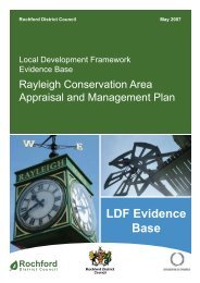
Rochford District Council October<br />
2007<br />
Local Development Framework<br />
Evidence Base<br />
<strong>Canewdon</strong> <strong>Church</strong> <strong>Conservation</strong><br />
<strong>Area</strong> <strong>Appraisal</strong> and Management<br />
Plan<br />
Rochford<br />
District Council<br />
LDF Evidence<br />
Base
Cantonese<br />
如果你 需要 放大,盲<br />
文資訊或者不同語言的<br />
版本請聯絡 01702 546 366<br />
Urdu<br />
Shona<br />
Kana uchida ruzivo, kana<br />
tsananguro iyi yakanyorwa<br />
nemavara makuru, kana kuthi<br />
yakanyorwa nerurimi<br />
rwemapofu, kana nerumwe<br />
rurimi, kana umwe mufauro<br />
sununguka kuti taurira parunare<br />
ronoti 01702 546 366<br />
Gujarati Spanish<br />
Si desea esta información<br />
impresa en letra grande,<br />
Braille o en otro idioma,<br />
por favor llame al teléfono<br />
01702 546 366<br />
Portugese<br />
Caso necessite desta<br />
informação em impressão<br />
maior, em Braille ou<br />
noutra língua, por favor<br />
contacte 01702 546 366<br />
If you would like this information in<br />
large print, Braille or another language<br />
please contact 01702 546 366
This document was produced by Essex County Council for<br />
Rochford District Council.<br />
Contributions to this document were made by the following officers<br />
in the Essex County Council Historic Buildings Section:<br />
Karen Fielder MA, PGDip<br />
With document production by Cathryn Thaiss<br />
© Rochford District Council and Essex County Council
Contents<br />
1. Introduction 1<br />
2. Character statement 2<br />
3. Statutory Protection 3<br />
4. Planning Policies 5<br />
5. Origins and development<br />
Location and Landscape Setting 5<br />
Historical Development 6<br />
6. Character <strong>Appraisal</strong><br />
Spatial Analysis 11<br />
Character Analysis 16<br />
Problems and Pressures 23<br />
7. Recommendations 23<br />
Bibliography 25<br />
Appendix<br />
Listed buildings in the conservation area 26
1. INTRODUCTION<br />
1.1 <strong>Canewdon</strong> is a large parish, which extends for several miles along the southern<br />
side of the Crouch estuary. The area has important historical associations, with<br />
old entrenchments that once existed between the village and the river believed<br />
to mark the site of Canute’s camp before his victorious battle over Edmund<br />
Ironside in 1016 1 . The church lies at the western end of the village. Set high on<br />
a hill its massive tower is a conspicuous local landmark, and is widely thought to<br />
be the site of Canute’s Minster.<br />
1.2 There are two conservation areas in <strong>Canewdon</strong> village, one taking in most of the<br />
High Street, the other centred on the church. <strong>Canewdon</strong> <strong>Church</strong> conservation<br />
area (Fig. 1) comprises St Nicholas church and churchyard and The Vicarage<br />
and grounds, and covers the western end of the High Street where it meets the<br />
churchyard, taking in the village lock-up and stocks and Vicarage Cottage.<br />
1.3 <strong>Conservation</strong> areas are ‘<strong>Area</strong>s of Special Architectural or Historic Interest, the<br />
character or appearance of which it is desirable to preserve or enhance’<br />
(Planning (Listed Buildings and <strong>Conservation</strong> <strong>Area</strong>s) Act 1990). Government<br />
Planning Policy Guidance 15, Planning and the Historic Environment,<br />
emphasises that our experience of historic areas depends on more than the<br />
quality of individual buildings. Other significant elements might include the<br />
historic layout of property boundaries and thoroughfares, characteristic<br />
materials, street furniture and hard and soft surfaces or vistas along streets and<br />
between buildings.<br />
1.4 Designation of a conservation area extends planning controls over certain types<br />
of development, including extensions, boundary treatments, the demolition of<br />
unlisted buildings and works to trees. However it does not prevent any change<br />
and the area may be subject to pressures (good and bad) that will affect its<br />
character and appearance. Although <strong>Canewdon</strong> is a relatively remote village, it<br />
still faces pressure for change including housing development, and in recent<br />
years the churchyard and its environs have become the focus of antisocial<br />
behaviour which threatens its special character.<br />
1.5 Rochford District Council commissioned Essex County Council to prepare this<br />
conservation area appraisal and the research and fieldwork were carried out in<br />
July 2006.<br />
1.6 The appraisal provides a brief development history of the current settlement,<br />
followed by a description and assessment of character. The contribution of<br />
different elements to the character is identified. Any issues which may affect the<br />
protection of character will be highlighted and opportunities for enhancement<br />
identified.<br />
1 The Victoria County History (Vol. 1 1903) records a large oblong enclosure to the north of the church at<br />
<strong>Canewdon</strong>, which is identified on early OS maps as the supposed site of Canute’s Camp. No above<br />
ground evidence of this survives.<br />
1
Reproduced by permission of Ordnance Survey ® on behalf of the Controller of Her Majesty’s Stationery<br />
Office. ©Crown copyright. Licence number LA100019602<br />
Fig. 1 <strong>Canewdon</strong> showing the two designated conservation areas and listed buildings<br />
(dotted)<br />
2. CHARACTER STATEMENT<br />
2.1 The conservation area encompasses the surviving elements of the historic<br />
church/hall settlement complex that historically remained separate from the<br />
more linear village settlement further east along the High Street. The east gate<br />
of the churchyard marks the transition from the intimate enclosure of the High<br />
Street to the open rural setting of the churchyard with its broad views across the<br />
landscape. From its elevated position the massive ancient tower of <strong>Canewdon</strong><br />
<strong>Church</strong> is an important local landmark and sacred site, steeped in folklore and<br />
tradition. The conservation area has a rich architectural heritage, embracing four<br />
dramatically different buildings varying in scale from the church with its mighty<br />
tower to the diminutive parish lock-up, and displays a varied palette of materials<br />
including stone, flintwork, brick, weatherboard, render and clay tiles. Through<br />
these visually disparate buildings the conservation area carries a strong sense<br />
of place and of history, each one having contributed in its own way to the<br />
development of the village. The conservation area retains historical integrity both<br />
in its layout and in its architecture with few modern intrusions, in contrast to the<br />
High Street where significant modern development has occurred. The<br />
contributions of green open space, trees and hedgerows, and the informality of<br />
the spaces emphasise the essentially rural character of the area.<br />
2
3. STATUTORY PROTECTION WITHIN THE CONSERVATION AREA<br />
(Fig. 2)<br />
3.1 <strong>Canewdon</strong> <strong>Church</strong> conservation area was designated in March 1986.<br />
3.2 There are 6 listed structures in the conservation area, including the church, The<br />
Vicarage, Vicarage Cottage, a headstone and a table tomb, and the village lockup<br />
and stocks. The church is designated Grade II*, the remainder are all Grade<br />
II.<br />
3.3 There are no scheduled ancient monuments within the conservation area.<br />
3.4 There are no public rights of way indicated on the Definitive Map of footpaths in<br />
Essex.<br />
3.5 The conservation area lies within Green Belt.<br />
3.6 One large horse chestnut tree on the southern boundary of the churchyard is<br />
protected by a Tree Preservation Order (TPO). Another horse chestnut adjacent<br />
to the village lock-up is also protected by a TPO, and is one of a group of eight<br />
horse chestnuts protected by TPOs, the remainder of which are outside the<br />
conservation area. Other trees within the conservation area enjoy protection in<br />
as much as anyone within a conservation area carrying out works to a tree must<br />
give written notification to the local planning department at least six weeks<br />
beforehand.<br />
3
Fig. 2 <strong>Canewdon</strong> <strong>Church</strong> conservation area showing statutory designations.<br />
Reproduced by permission of Ordnance Survey ® on behalf of the Controller of Her Majesty’s Stationery Office.<br />
©Crown Copyright. Licence number LA100019602<br />
4
4. PLANNING POLICIES<br />
4.1 Rochford District Replacement Local Plan was adopted in June 2006. Its<br />
objectives include the maintenance and enhancement of local heritage.<br />
4.2 The Replacement Local Plan includes specific planning objectives to protect and<br />
enhance the historic character of settlements, particularly within conservation<br />
areas, and to formulate and publish a detailed assessment of each conservation<br />
area, indicating townscape features, buildings and spaces that distinguish the<br />
character of each conservation area, to be taken into consideration when new<br />
development is being proposed.<br />
4.3 The Replacement Local Plan contains policies (BC1-2) formulated to ensure the<br />
preservation of the special character of the conservation areas and to promote<br />
good design within them. Further guidance for the assessment of proposals for<br />
development in conservation areas is provided in Local Plan Supplementary<br />
Planning Document 6.<br />
4.4 The Replacement Local Plan also includes a range of policies dealing with<br />
development in Green Belt (policies R1-R10), and there is a general<br />
presumption against inappropriate development. The preservation of the<br />
character of historic towns and villages including <strong>Canewdon</strong> is included in the<br />
Council’s objectives in applying Green Belt policies.<br />
5. ORIGINS AND DEVELOPMENT<br />
Location and landscape setting<br />
5.1 <strong>Canewdon</strong> lies in the north of Rochford District, south of the Crouch estuary.<br />
The town of Rochford is approximately four miles to the south west.<br />
5.2 The main village settlement is surrounded by Green Belt, and is bounded to the<br />
west and north by Coastal Protection Belt which follows the western boundary of<br />
the <strong>Canewdon</strong> <strong>Church</strong> conservation area.<br />
5.3 The geology of the wider area comprises brickearth deposits overlying patches<br />
of head and gravel. The village occupies a low hill of London Clay about 30m<br />
above sea level, south of the marshes. The hill is one of the highest on the<br />
Essex coastline, and the church commands a dominant position on the western<br />
edge of the village with wide views across the Crouch estuary. The hilltop<br />
location is reflected in the settlement name which has the Saxon meaning ‘hill of<br />
Cana’s people’ (Reaney 1935).<br />
5.4 The coastal landscape of the Crouch Estuary has changed considerably over<br />
time. Until the post-medieval period the tidal marshes bordering the Crouch<br />
estuary came much closer to the village. Between the edge of the London Clay<br />
on which the village now sits and the river was a broad sweep of coastal marsh<br />
which would have been bisected by numerous small creeks and tidal channels.<br />
Much of it may have been submerged with each high tide. Piecemeal<br />
embankment and drainage of the marshes took place throughout the medieval<br />
5
and early post-medieval period until final enclosure in 1774. The coastal<br />
marshes are under renewed threat from rising sea-levels (Medlycott 2003).<br />
5.5 The surrounding landscape is predominantly composed of arable fields.<br />
Boundary loss has resulted in large prairie fields in places, but there is a<br />
rectilinear pattern of fields along the axis of the main east-west roads through<br />
the village representing a more historic field structure, perhaps pre-medieval in<br />
date.<br />
5.6 The village stands on a quiet country road leading from Hullbridge eastwards to<br />
the reclaimed land between the Crouch and the Roach estuaries, terminating at<br />
Wallasea Island. The church and churchyard close the High Street at its western<br />
end, and can also be reached via a lane that climbs the hill off Lark Hill Road.<br />
This lane also provides access to The Vicarage and <strong>Canewdon</strong> Hall Farm.<br />
Historical development 2<br />
5.7 Despite a lack of formal archaeological excavations a range of sites and<br />
deposits are known at <strong>Canewdon</strong> reflecting multi-period occupation from at least<br />
the Neolithic (4,000-2,000 BC). The elevated position of the site made it an<br />
attractive choice for early settlers, and its proximity to the coast was valuable for<br />
sea trading and salt production. Prehistoric and Roman settlement in the area<br />
comprised farmsteads and cemeteries on the higher ground, and salterns and<br />
other coastal sites fringing the edges of the marshes. Gravel extraction in the<br />
early 18 th century to the north of the church revealed a cremation cemetery of<br />
unknown date. In the first half of the 20 th century gravel extraction revealed an<br />
important range of prehistoric remains including a Neolithic axe hoard and Iron<br />
Age burials. One of the most significant finds from the area is the Bronze Age<br />
<strong>Canewdon</strong> paddle, now in the National Maritime Museum, Greenwich, which<br />
demonstrates the close links with the coastal environment. The area to the north<br />
of the present settlement is characterised by a line of Iron Age or Roman Red<br />
Hills (salt production sites) marking the edge of the coastal marsh at that date.<br />
5.8 The earliest documentary reference to the place-name of <strong>Canewdon</strong> is in the<br />
Domesday Book of 1086, although the place name indicates earlier Saxon<br />
origins (Reaney,1935). The area between <strong>Canewdon</strong> and Ashingdon is widely<br />
believed to have been the site of the important battle of Assandune between the<br />
Saxons under Edmund Ironside and the armies of the Danish King Canute.<br />
<strong>Canewdon</strong> is identified in local folklore as the site of King Canute’s camp, and<br />
<strong>Canewdon</strong> church is a possible candidate for the site of the Minster built by<br />
Canute in 1020 to commemorate the war-dead. However the location of both the<br />
battle site and the Minster are matters of academic dispute.<br />
5.9 The Domesday Book records <strong>Canewdon</strong> at the very end of the Saxon period in<br />
1066, at which time there were a total of 28 households. The lands belonged to<br />
Swein of Essex, the principal land-holder of the Rochford area, who would have<br />
had a hall there. Although the location of the hall is not proven, <strong>Canewdon</strong> Hall<br />
2 For the history of <strong>Canewdon</strong> from an archaeological perspective, see Medlycott 2003, and for<br />
<strong>Canewdon</strong> and the wider historic environment of Rochford District see the Rochford District Historic<br />
Environment Characterisation Project report of 2005. General village history can be found in<br />
publications by Ken Smith.<br />
6
which lay to the north of the church (outside the present conservation area and<br />
now occupied by <strong>Canewdon</strong> Hall Close) is the most logical site. The parish<br />
church of St Nicholas is known to have been in existence in 1100, when the<br />
advowson was acquired by Prittlewell Priory, and it is probable that a church<br />
existed on the site prior to the Norman Conquest. The location of the late Saxon<br />
settlement is unproven, but comparison with other sites would suggest that a<br />
number of households would have been clustered close to the church and hall.<br />
The remainder would have been scattered throughout the parish in individual<br />
farms and cottages.<br />
5.10 By the beginning of the medieval period the area was divided into five manorial<br />
holdings, <strong>Canewdon</strong> Hall, Pudsey Hall, Apton Hall, Scotts Hall and Lambourne<br />
Hall.The principal manor of <strong>Canewdon</strong> comprised 26 households in 1086, whilst<br />
the four smaller manors had 19 households between them. The medieval<br />
settlement is thought to have consisted of a mix of village settlement close to the<br />
church and <strong>Canewdon</strong> Hall, individual manorial holdings, and scattered farms<br />
and cottages.<br />
5.11 <strong>Canewdon</strong> Hall which, together with the church, formed the focus for early<br />
settlement in <strong>Canewdon</strong>, was at one time a fortified or moated mansion. Morant<br />
(1768) recorded that <strong>Canewdon</strong> Hall “hath been a strong fortified place, in the<br />
manner of a castle, doubly trenched and fenced after the oldest fashion. The<br />
remains of the moates are still visible”. The Hall was rebuilt around 1807. Parts<br />
of the medieval moated complex were still visible in the mid-19 th century when<br />
local historian Philip Benton reported on the site (Benton 1867), and moated<br />
earthworks are indicated on the First Edition OS map of 1873. The buildings<br />
were demolished in 1966 and the moat levelled. <strong>Canewdon</strong> Hall Close was built<br />
on the site.<br />
5.12 The church, dedicated to St Nicholas, is unusually large for a rural parish<br />
church. The majority of the church as it stands today, including the nave,<br />
chancel and north aisle, is of 14 th and 15 th century date, and we have no<br />
information on whether the great size of this building reflects an earlier church<br />
on the site. On the north side of the chancel was the de Chanceaux Chantry or<br />
chapel, now demolished. The tower is early 15 th century and is exceptionally tall<br />
and substantial. Its height meant that it served as a navigation landmark for<br />
shipping within the Crouch during the reign of Queen Elizabeth I. In local<br />
folklore, <strong>Canewdon</strong> and the surrounding area has strong associations with<br />
witchcraft, and local tradition has it that whilst the church tower stands there will<br />
always be six witches in the village. From the top of the church tower there are<br />
extensive views of the surrounding countryside.<br />
5.13 A vicarage was ordained in <strong>Canewdon</strong> in about 1231 by Roger Niger, bishop of<br />
London. The vicarage house and grounds were located to the south of the<br />
church. A purpose built vicarage of red brick construction, was built by George<br />
Walker in 1758 on the presumed site of the medieval vicarage. A map of 1788<br />
shows that The Vicarage once had a formal arrangement of south-facing<br />
gardens leading down the hill, with outbuildings arranged around a courtyard<br />
(Fig. 3). The Vicarage is now in private ownership. It is Grade II listed.<br />
7
Fig. 3. Map of Vicarage Lands, 1788<br />
(ERO D/DU 743).<br />
Fig. 4 Chapman and André map,<br />
1777.<br />
5.14. A degree of nucleation took place in the later medieval and post-medieval period<br />
with the development of the village along the High Street to the east of the<br />
church and hall, as well as more dispersed settlement around the four smaller<br />
manorial halls and scattered isolated farms and cottages. The extent and<br />
location of the later medieval village settlement can be assessed from the 1777<br />
Essex map of Chapman and André, which shows the church/hall complex and a<br />
line of dwellings along the southern edge of the High Street (Fig. 4).<br />
5.15. The village lock-up or cage, used by the parish constable for the temporary<br />
imprisonment of felons, is believed to have been constructed in 1775. It was<br />
originally located along with the stocks now housed within it close to the village<br />
pond . About 1913 the cage and stocks were moved to Anchor Lane, with a<br />
charge of one penny made to view the interior, and the building underwent<br />
large-scale restoration at the time. It was moved to its present position outside<br />
the east gate of the churchyard in 1938.<br />
5.16. Recent excavations in the south-west corner of the churchyard to install a new<br />
septic tank uncovered human remains in a grave likely to be of 18 th century<br />
date. This was a relatively wealthy individual, buried in a decorated coffin with<br />
good quality iron fittings. The excavations also revealed part of a brick wall with<br />
a window opening housing an iron grille that appeared to be 18 th century in date,<br />
and was most probably the cellar of a now removed building. This may be the<br />
remains of <strong>Church</strong>yard House, which is shown on the Tithe Award map of 1840<br />
(Fig. 5), although it does not appear on the Chapman and André map of 1777. A<br />
building is marked in this location subdivided into two dwellings by the time of<br />
the First OS map of 1873, and had disappeared by the time of the 1974 edition<br />
(Hillman-Crouch 2006). A second small weatherboarded building existed to the<br />
west of the tower at about the same time, the purpose of which is not known.<br />
8
Fig. 5 Tithe map, 1840.<br />
5.17. In the late 18 th century a number of new buildings were erected which were to<br />
play a key role in community life. These included a school and schoolmaster’s<br />
house, built in 1799 on the south side of the High Street using parishioners’<br />
money on Poors’ Land. The schoolhouse was used until at least the 1850s,<br />
when a new school was erected further along the High Street, at which point the<br />
old building became the residence of the schoolmaster. The old school is now<br />
known as Vicarage Cottage and is a private residence.<br />
5.18. By 1801 the population was 569, rising to 723 in 1841, and declining once more<br />
to 495 in 1901. The local economy was based on coastal industries, agriculture<br />
and the brick industry, but economic prosperity declined during the latter 19 th<br />
century. Writing in 1867, Philip Benton recorded that the area already exhibited<br />
a degree of neglect, with some houses unfit for human habitation, and ‘few<br />
recreations … except those enjoyments afforded by the public houses’.<br />
Fig. 6 <strong>Canewdon</strong> from the 1st edition OS map, 1873. Further development has<br />
occurred to the north of the High Street, but the west end towards the church is<br />
undeveloped<br />
9
Fig. 7 <strong>Canewdon</strong> from the 2nd<br />
edition OS map, 1897. This<br />
map shows the continuing<br />
separation between the<br />
church/hall complex and the<br />
village settlement along the<br />
High Street.<br />
Fig. 8 <strong>Canewdon</strong> Hall, church and<br />
vicarage from the 3 rd OS<br />
map, 1924. At this time<br />
remains of the moat from<br />
the earlier hall are still<br />
visible north east of the<br />
church. The map shows<br />
that trees made an<br />
important contribution to the<br />
grounds north of The<br />
Vicarage. A line of trees is<br />
also shown to the north of<br />
the High Street.<br />
5.19. <strong>Canewdon</strong> village was significantly extended by residential development in the<br />
latter 20 th century, including the building of the model village to the south west in<br />
the 1960s. Today the village offers a wide range of local services including<br />
village stores, pubs and a school, and it is a close knit community. The 2001<br />
census revealed the population of the parish to be1477 with 558 households.<br />
The area includes Wallasea Island, a popular centre for sailing and fishing, and<br />
the site of an ambitious project to create new wetland habitat by breaching the<br />
old sea walls.<br />
10
6. CHARACTER APPRAISAL<br />
Spatial Analysis<br />
6.1 The <strong>Canewdon</strong> <strong>Church</strong> conservation area focuses on the parish church and<br />
churchyard and the vicarage and grounds, including the lane to the west as far<br />
as the boundary of the vicarage grounds. It also encompasses the western end<br />
of the High Street, taking in Vicarage Cottage and the village lock-up.<br />
6.2 The conservation area can be approached either from the east along the High<br />
Street or from the south via a small lane off Lark Hill Road.<br />
©UK Perspectives<br />
Fig. 9 Aerial photograph of conservation area.<br />
11
6.3 From the village green there are views into the conservation area, which has a<br />
hedge boundary with trees and scrub. The church tower rises above the trees<br />
with glimpses of the red brick vicarage through gaps in the hedge. Vicarage<br />
Cottage and its gardens are also visible from the green. Despite the modern<br />
housing around the green, the rural quality of the adjoining conservation area<br />
creates an impression of a traditional village setting overlooked by the parish<br />
church (Fig. 10).<br />
Fig. 10 The church viewed from the village green.<br />
6.4 Approached from the High Street the conservation area lies beyond the<br />
transitional zone of modern housing development that separates it from the High<br />
Street conservation area. This is a quiet stretch of the High Street that carries no<br />
through traffic. The view towards the conservation area narrows towards the end<br />
of the street with mature trees obscuring the view of the church and churchyard<br />
beyond (Fig. 11). An old iron side gate with a heart-shaped detail and adjacent<br />
wooden gate terminate the street, inviting further investigation and progression<br />
to the end (Fig. 12).<br />
12<br />
Fig. 11 High Street. Fig. 12 High Street.
6.5 Vicarage Cottage, a white rendered cottage, marks the start of the conservation<br />
area, at which point the kerbed pavement ends and the High Street becomes<br />
less formal. Opposite the cottage, a row of mature horse chestnut trees in the<br />
open front gardens of modern houses set well back from the road enclose the<br />
northern edge of the street.<br />
6.6 Just before reaching the gate into<br />
the churchyard, a driveway<br />
branches round to the left, and here<br />
the view opens out across a field<br />
gate to the red brick vicarage, a two<br />
storey building with a crow-stepped<br />
gable and off-centre porch (Fig.<br />
13).<br />
Fig. 13 View from the High Street to The<br />
Vicarage.<br />
6.7 From within the churchyard, the view opens out, and the elevated position of the<br />
site is immediately apparent with exceptional views to the distant landscape<br />
beyond the boundaries (Fig. 14). If it is possible to climb the church tower, yet<br />
more expansive views can be obtained. From the east gate of the churchyard, a<br />
path passes south of the church, drawing the visitor through to another gate on<br />
the west side (Fig. 15). From this path the wide front elevation of the vicarage is<br />
clearly visible over the boundary wall with views across its grounds emphasising<br />
the open rural setting. The boundary between the churchyard and the vicarage<br />
grounds is defined partly by an old red brick wall that has collapsed in places,<br />
and by a newly planted laurel hedge planted within the vicarage boundary.<br />
Fig. 14 <strong>Church</strong>yard looking south-west. Fig. 15 <strong>Church</strong>yard, east side.<br />
6.8 The space is generally more open and sparse on the north side, except in the<br />
north-west corner where the majority of the graves are clustered (Fig. 16).<br />
13
Fig. 16 North side of the<br />
churchyard looking<br />
north-west.<br />
6.9 The boundary around the northern edge of the churchyard is defined by a low<br />
wooden post and rail fence with a thin hedgerow and occasional mature trees<br />
that allow frequent views out. The buildings of <strong>Canewdon</strong> Hall Farm are visible<br />
to the north through gaps in the hedge. Modern housing adjoins the churchyard<br />
to the north east.<br />
6.10 The lane running off Lark Hill Road is a historic route leading to <strong>Canewdon</strong> Hall.<br />
It climbs the hill to the church tower in a gentle curve that draws the eye<br />
upwards, providing visual drama as the massive tower reveals itself above the<br />
surrounding trees and hedgerow (Fig. 17). The lane is edged with hedgerow<br />
contributing to the rural character, and the modern housing developments of<br />
<strong>Canewdon</strong> village are visible across paddocks to the east. Field gates provide<br />
access to the vicarage grounds from the lane. At the top of the hill the lane<br />
opens up to provide a parking area by the west gate to the churchyard, and a<br />
field gate leads through to <strong>Canewdon</strong> Hall Farm. Gaps in the hedge at the top<br />
of the lane allow expansive views north towards the Crouch estuary and west<br />
across arable fields towards Ashingdon.<br />
14<br />
Fig. 17 Lane leading up to the<br />
church.
Reproduced by permission of Ordnance Survey ® on behalf of the Controller of Her Majesty’s Staionery Office.<br />
©Crown Copyright. Licence number LA10001962<br />
Fig. 18 Important views in, out and through the conservation area.<br />
15
Character Analysis<br />
6.11 The main focus of the conservation area is provided by the churchyard and<br />
vicarage grounds, which are characterised by their open and rural setting.<br />
However the western end of the High Street is also included which is of a more<br />
enclosed and intimate in character, and has been treated as a sub-area of the<br />
main conservation area.<br />
<strong>Church</strong>yard and Vicarage Grounds<br />
6.12 The churchyard and vicarage grounds follow the historic layout as they appear<br />
in the 1788 map of Vicarage Lands at <strong>Canewdon</strong> (Fig. 3). The churchyard is<br />
dominated by the grey Ragstone church which is unusually large for a rural<br />
parish church and separates the more enclosed and varied south side of the<br />
churchyard from the extensive and open north side. The south side of the<br />
churchyard is overlooked by the red brick façade of The Vicarage, and views of<br />
the vicarage grounds fall away over the churchyard wall.<br />
6.13 The large parish church provides the focus for the conservation area (Fig. 19). It<br />
is mainly constructed of Kentish Ragstone with some septaria and flint and<br />
limestone dressings. The building is about 38.5 metres in length, and 14 metres<br />
wide (excluding the south porch). The roof is mainly red plain tile, with lead over<br />
the north aisle. The dominant feature of the church is the early 15 th century<br />
tower, which is an important local landmark clearly visible on the skyline, and<br />
provides an exceptional viewing point to the surrounding landscape. It is about<br />
23 metres in height, and is constructed of ashlared Ragstone, and is heavily<br />
buttressed with crenellations with flint chequerwork. The tower was restored in<br />
1998. Great difficulty was experienced in obtaining new Kentish Ragstone to<br />
match the original. New stone from the Nicholls quarries at Folkestone was used<br />
which although geologically similar to the original proved to be an unsatisfactory<br />
match. It is not now considered suitable for repairing historical Ragstone<br />
buildings. In view of the prominence of the tower, it is important that any future<br />
repairs use matching Ragstone. This can be obtained provided there is sufficient<br />
early planning and allowance is made for long delivery times. Although the<br />
building is generally in good condition, at the time of visiting the door to the west<br />
tower had been removed for repair following damage during an attempted<br />
break-in, and some windows were broken as a result of vandalism. Some<br />
windows are protected by grilles and more are to be installed in the future.<br />
Building work is underway to introduce new facilities into the church including<br />
toilets, with the intention that the building will be used for a wider range of<br />
community activities. The church is Grade II* listed.<br />
16
Fig. 19 The north side of the church.<br />
6.14 The vicarage stands close to the churchyard boundary on the south east and is<br />
a fine brick building with an elegant façade that is clearly visible over the low<br />
boundary wall, providing architectural contrast with the church (Fig. 20). A<br />
memorial in the church records that the vicarage was built by George Walker<br />
M.A. in 1758. There have been extensive 19 th century alterations since this date.<br />
It is constructed of warm red brick laid in Flemish bond with some burnt black<br />
headers, with a plain clay tile roof to the front range and vertical sliding sash<br />
windows. The off-centre 19 th century crow stepped gable and gabled porch add<br />
interest to the elevation. Other elevational details include a brick string course<br />
running at first floor level across the east end and the gable and an eaves<br />
cornice. The Vicarage and its grounds are currently undergoing extensive<br />
sympathetic repairs and restoration. The grounds had become overgrown but<br />
are being tidied and a red brick garden wall which is a significant feature visible<br />
from the churchyard is being repaired. A new laurel hedge has been planted<br />
along the boundary with the churchyard, where perhaps a more mixed hedge of<br />
native species would have been more appropriate to the rural character of the<br />
area.<br />
17
Fig. 20 The Vicarage viewed over the<br />
churchyard boundary wall. Fig. 21 The vicarage<br />
grounds.<br />
6.15 In the churchyard the low red brick boundary wall around the southern perimeter<br />
is an important feature. Although there have been recent repairs to the wall,<br />
much of it is in a very poor state of repair, collapsed in places, or exhibiting<br />
serious structural cracks. Cement pointing in some sections has resulted in<br />
decay of the soft brick and further deterioration. Hedgerow around the perimeter<br />
contributes to the rural character of the area, and allows frequent views out to<br />
take in broad vistas of the surrounding countryside. There is evidence that<br />
encroaching scrub has been cleared from the boundary recently, but there is still<br />
a degree of encroachment which if left unchecked will alter the form of the<br />
churchyard.<br />
6.16 The churchyard south of the church is of different character to the north, and is<br />
more enclosed with much visual interest, texture and detail. It is overlooked by<br />
The Vicarage, emphasising the important historic relationship with the church.<br />
There are tombstones of varying design in an irregular arrangement, including<br />
upright headstones and flat body tombs. A small Garden of Remembrance is<br />
defined by a low rope barrier. The brick boundary wall adds colour and texture,<br />
with planting, shrubs and scrub around the boundary. A tarmac path passes<br />
round the south side of the church, past the attractive south porch with its flint<br />
chequerwork crenellations (Fig. 23). Another path, now grassed over but visible<br />
as a shallow ditch, leads from a blocked 14 th century door in the south wall of<br />
the church to a small gate in the boundary wall heading towards The Vicarage,<br />
reinforcing the historic link between the two. There is one Grade II listed<br />
headstone adjacent to the path, dated 1691, next to which is a table tomb with a<br />
red brick plinth (Fig. 22). With the exception of the boundary wall which is in<br />
urgent need of repair, this part of the churchyard is generally well maintained,<br />
and there has been some recent clearance of scrub. A few gravestones<br />
however have become rather overgrown or have suffered collapse.<br />
18
Fig. 22 Listed headstone adjacent to a<br />
tabletomb.<br />
Fig. 23 The south porch.<br />
6.16 The north side of the churchyard is more open, with the majority of the graves<br />
clustered in the north-west corner, including the most recent. The churchyard<br />
is clearly in active use with well tended graves and colourful plantings of<br />
flowers. The graves are of varying design, and mostly arranged in neat rows.<br />
There are few grand monuments in the churchyard, but there is a fine Grade<br />
II listed table tomb west of the church tower dated 1795, with a moulded top<br />
slab, bulbous corner pilasters with moulded capitals and bases (Fig. 24). This<br />
tomb has undergone repairs in recent years following vandalism, and the iron<br />
railings around it have been reinstated. There are a high number of post-war<br />
wooden crosses, probably reflecting a past decline in economic prosperity.<br />
Some are now 40 years old or more, and they have become a characteristic<br />
feature of the churchyard (Fig. 25). Several memorial trees have been planted<br />
in the open area to the north of the church, adding visual interest particularly<br />
in the otherwise sparse open area. The buildings of <strong>Canewdon</strong> Hall Farm are<br />
visible through gaps in the hedge, and these do not unduly detract from the<br />
character and setting of the churchyard. To the north and north east the<br />
churchyard is generally of less visual interest, with fewer views out to the<br />
surrounding countryside and modern housing in close proximity. There is a<br />
heap of cleared scrub and flowers tidied from graves, together with a water<br />
trough and some containers evidently for use by families tending graves. This<br />
heap includes discarded plastic bottles, polystyrene and other rubbish, and is<br />
unsightly in the otherwise well maintained churchyard.<br />
19
Fig. 24 Listed table tomb. Fig. 25 Wooden cross.<br />
6.17 The west entrance of the churchyard has a metal gate with a wooden post<br />
and rail fence, and leads to a small parking area (Fig. 26). There is an iron<br />
side gate with a heart detail matching that at the east end which has been<br />
incorporated into the fence. At the time of visiting this presented a rather<br />
unattractive entrance to the churchyard, but as building work was underway<br />
at the time this is likely to improve. A new cess pit has recently been dug in<br />
the south west corner adjacent to the gate to provide toilet facilities in the<br />
church. The northern end of the lane leading to the church with rough grass<br />
edging and hedgerow on each side contributes to the attractive rural<br />
character and low level management of this lane is important to retaining this<br />
quality.<br />
20<br />
Fig. 26 The west gate.
High Street<br />
6.18 The High Street east of the churchyard is quiet and informal, contrasting with<br />
the rest of the High Street. This part of the street carries no through traffic,<br />
although it is used for car parking. The detached rural quality follows the<br />
historic settlement pattern, providing a degree of separation from the more<br />
developed stretch of the High Street. The enclosed, intimate scale of the<br />
street provides an experience in marked contrast to the grandeur of the<br />
church and the sweeping views from within the churchyard.<br />
6.19 Vicarage Cottage stands on the street edge on the south side, and was built<br />
in 1799 on charitable property known as Poors Land to serve as the village<br />
school and schoolmaster’s house 3 (Fig. 27). It is a white rendered timber<br />
framed cottage with black and white painted joinery and a plain clay tile roof.<br />
It is one storey with two gabled dormers and19 th century small paned<br />
casement windows. The off-centre door has a small clay tiled gabled hood.<br />
An early 20 th century photograph of the cottage shows that it was once fully<br />
weatherboarded, a material that was historically more prevalent in the<br />
vernacular architecture of the village than it is now. The cottage is Grade II<br />
listed.<br />
Fig. 27 Vicarage Cottage<br />
3 More information on the charities of <strong>Canewdon</strong> can be found in Crowe (2002).<br />
21
6.20 The village lock-up sits just outside the east gate of the churchyard, and is a<br />
curious shed-like building, timber framed with black weatherboard and a clay<br />
tiled roof, positioned gable-end to the road (Fig.28). It has a vertically boarded<br />
door with two strap hinges and crossed metal straps. The door is sometimes left<br />
open to reveal the village stocks on the floor inside. The structure is in good<br />
condition, having undergone significant restoration in 1983. However until<br />
recently a board hung over the door identifying the building, along with a round<br />
plaque presented to the village for the 900 th anniversary of the Domesday Book.<br />
Both these were recently stolen. This little structure is a good survival of a<br />
building type that has been lost from many villages, and is a fascinating nugget<br />
of social history 4 . The stocks and cage are Grade II listed.<br />
Fig. 28 The village lock-up.<br />
6.21 The northern edge of the street opposite Vicarage Cottage is bordered by a row<br />
of mature horse chestnuts trees. A row of trees is shown here in the 3 rd edition<br />
OS map of 1924 (Fig. 8). These trees are protected by TPOs but are outside the<br />
conservation area boundary, although they are essential to the green and rural<br />
character of this part of the High Street. They provide screening from modern<br />
housing that might otherwise detract from the undeveloped quality of this part of<br />
the street, and help to soften the negative effect of hard landscaping of front<br />
gardens that might otherwise intrude on the street scene.<br />
4 More information on village lock ups is available from the Village Lock-Up Association which is carrying<br />
out a national survey of surviving structures. Further information and contact details are available through<br />
the Historic Environment Information Resources Portal (Heirport) on the Archaeology Data Service<br />
website at http://ads.ahds.ac.uk.<br />
22
Problems and pressures<br />
6.22 <strong>Canewdon</strong> <strong>Church</strong>yard has in recent years become the focus for anti-social<br />
behaviour which has resulted in some damage to the historic fabric and<br />
undermines attempts to make repairs and improvements. A recent attempted<br />
break-in at the church caused damage to the ancient west door, and church<br />
windows have been broken by stones. Gravestones have also been damaged.<br />
Rails from a new wooden fence that is being built by the west gate have been<br />
stolen. The sign and plaque over the door of the Grade II listed village lock-up<br />
have been forcibly removed. The threat of vandalism has necessitated the<br />
introduction of protective measures, including grilles over church windows and<br />
cages around the church floodlights (previously the floodlights were stolen).<br />
These essentially urban interventions undermine the tranquil rural character of<br />
the conservation area.<br />
6.23 The churchyard boundary wall is in a serious state of disrepair, despite some<br />
repairs having been made. This has partly been caused by previous<br />
cementitious repairs, but structural problems have also resulted due to the<br />
instability of the ground, the site being located on slumping London clay, and<br />
from damage caused by encroaching scrub. Localised rebuilding and repairs are<br />
planned, including building a new gate pier by the vicarage gate leading to the<br />
now blocked south door, and some stitching in of brickwork with stainless steel<br />
ties. Sections of the wall have been lost, and a new laurel hedge has been<br />
planted within the vicarage grounds to provide a continuous boundary. The wall<br />
has undergone extensive repair and replacement of original fabric in the past,<br />
but it is an important historic boundary and a valuable feature of the churchyard.<br />
7. RECOMMENDATIONS<br />
Extensions to <strong>Conservation</strong> <strong>Area</strong><br />
7.1 It is proposed that the existing conservation area is extended on the north side<br />
of the High Street to encompass the row of horse chestnut trees and the private<br />
gardens in which they stand at the front of The Hunters, Clays, Noss Mayo,<br />
Chestnuts, Lynton and Beginnings. These trees make a vital contribution to the<br />
conservation area, creating a green frame to the churchyard gates from the long<br />
view down the High Street, enclosing the north side of the street and<br />
emphasising its informal and rural character. They also reinforce the historic<br />
separation of the church/hall complex from the main village settlement and<br />
provide screening from modern development to the north of the High Street.<br />
Further hard landscaping of the gardens here should also be avoided in order to<br />
preserve the essentially rural quality of the conservation area.<br />
Management proposals<br />
7.2 The creeping use of protective measures to limit damage from vandalism will<br />
increasingly undermine the character of the conservation area, as will damage<br />
caused by nuisance behaviour. The community will need support to help them<br />
address the causes of this behaviour and reduce the number of nuisance<br />
incidents in order to avoid further degradation of the environment. Specific<br />
community strategies and aims with regard to reducing anti-social behaviour are<br />
23
contained in the Rochford and District Crime and Disorder Reduction Strategy<br />
2005-2008.<br />
7.3 Boundary treatments are important to the character of the conservation area and<br />
should be appropriate to the rural context. Appropriate materials include soft red<br />
brick, timber post and rail fencing and native hedgerow planting. The boundary<br />
between the vicarage and churchyard should be kept low to maintain the<br />
important visual relationship between the two. The structural instability of the<br />
existing wall means that further loss of this important feature is likely without<br />
intervention, and repair, consolidation and ongoing condition monitoring should<br />
be undertaken. Views through the vicarage grounds should be preserved to<br />
protect the open and rural character of the churchyard.<br />
7.4 Encroaching scrub in the churchyard has caused damage both to the boundary<br />
wall and to gravestones in the past. Much has been cleared recently, but an<br />
appropriate management scheme should be in place for trees and planting to<br />
maintain the historic form of the churchyard and prevent further encroachment. It<br />
is equally important that the hedgeline allows views to the surrounding<br />
landscape to the south, west and east. The planting of memorial trees should<br />
also be part of this management scheme, avoiding the introduction of unsuitable<br />
species. Guidance notes on trees in churchyards, including advice on<br />
appropriate species, have been produced by the Chelmsford Diocesan Advisory<br />
Committee (1995) 5 .<br />
7.5 The churchyard would benefit from some improvements. At present there is one<br />
simple timber bench in the north-west corner for visitors, but given the size of<br />
the churchyard and the splendid views and peaceful setting a few more benches<br />
would enhance the amenity value of the space. The provision of facilities for<br />
those tending graves, including a composting area, and a discrete area for<br />
rubbish and discarded flowers would improve the appearance of the north side<br />
and help to keep the area tidy. The cremated remains area near the east<br />
entrance could be improved as the wooden posts are sagging. As the tarmac<br />
paths reach the end of their life a more appropriate surface treatment should be<br />
considered, such as bound gravel or pea shingle. The west entrance could be<br />
improved, although efforts to install a new timber fence have been thwarted by<br />
theft.<br />
5<br />
Practical Notes on Trees in <strong>Church</strong>yards, Diocese of Chelmsford, Chelmsford Diocesan Advisory<br />
Committee 1995<br />
24
BIBLIOGRAPHY<br />
Benton, Philip 1968 The History of Rochford Hundred: <strong>Canewdon</strong>, Rochford Hundred<br />
Historical Society<br />
Crowe, Ken (2002) Charity and economy of the poor in an Essex parish: <strong>Canewdon</strong> in<br />
the early modern period, Essex Archaeology and History 33, 310-322<br />
Hillman-Crouch, Barry J. 2006 Excavations in the SW Corner of the <strong>Church</strong>yard of Saint<br />
Nicholas <strong>Church</strong>, <strong>Canewdon</strong>, unpublished report<br />
Medlycott, M. 2003 <strong>Canewdon</strong> Historic Settlement Assessment, Essex County Council<br />
Morant, P. 1768 The History and Antiquities of the County of Essex<br />
Reaney, P.H. 1935 Place-names of Essex, Cambridge<br />
Rochford District Historic Environment Characterisation Project, Essex County Council<br />
Smith, Ken 1987 <strong>Canewdon</strong>: a pattern of life through the ages, Ian Henry Publications<br />
Victoria County History 1903 History of Essex Vol. 1<br />
25
APPENDIX<br />
LISTED BUILDINGS IN CONSERVATION AREA<br />
26