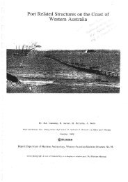
the rottnest wrecks heritage trail - Western Australian Museum
the rottnest wrecks heritage trail - Western Australian Museum
the rottnest wrecks heritage trail - Western Australian Museum

You also want an ePaper? Increase the reach of your titles
YUMPU automatically turns print PDFs into web optimized ePapers that Google loves.
Reef. Despite desperate attempts to drive it ashore, it went<br />
down on an even keel, <strong>the</strong> holds full of water. The crew was<br />
saved and some of <strong>the</strong> cargo salvaged. Lack of telephone<br />
communication between <strong>the</strong> lookout at <strong>the</strong> lighthouse and <strong>the</strong><br />
pilot at <strong>the</strong> settlement was blamed. The varied cargo included<br />
books, spirits, machinery, furniture, assorted hardware, farm<br />
equipment and over 80 cases of cartridges. The loss was a<br />
severe blow to <strong>the</strong> West <strong>Australian</strong> Shipping Association, a<br />
local company competing with <strong>the</strong> London Shipping Brokers<br />
by chartering vessels like Mira Flores. GPS position: 32°00' S<br />
115°28' E.<br />
City Of York 1899<br />
This Glasgow-built iron 1 194-ton barque was lost with her<br />
master and 11 crew on 12 July, 1899 while bound from San<br />
Francisco with a cargo of timber and 5 000 doors. At 6.45 am,<br />
<strong>the</strong> assistant lighthouse-keeper challenged <strong>the</strong> barque with a<br />
flare-up from <strong>the</strong> lighthouse in <strong>the</strong> centre of <strong>the</strong> island. Capt.<br />
Jones knew that a flare-up in <strong>the</strong> international code was used<br />
only on a pilot boat when in safe water, as a signal for <strong>the</strong><br />
ship to approach. He replied with customary blue lights and<br />
steered his ship towards what he thought to be <strong>the</strong> pilot boat.<br />
It struck a reef and appeared in danger of sinking. Although<br />
lifeboats were manned, <strong>the</strong> rope of <strong>the</strong> first boat snapped and<br />
it drifted away. The remaining 20 crew boarded <strong>the</strong> last craft.<br />
After several hours <strong>the</strong>y considered it safe to reboard <strong>the</strong><br />
ship, which, though on <strong>the</strong> reef, was still intact. The lifeboat<br />
capsized, drowning 12 men. The vessel lies in <strong>the</strong> bay now<br />
bearing its name, a tangle of iron plates, ribs and beams.<br />
GPS position: 31°59.649' S 115°29.3394' E.<br />
Kiryo Maru I 1984<br />
On August 6, 1984, <strong>the</strong> Japanese tuna boat Kiryo Maru I was<br />
on its way to Fremantle when it went aground 50 metres<br />
offshore at Ca<strong>the</strong>dral Rocks. One seaman swam ashore with<br />
a line and <strong>the</strong> o<strong>the</strong>r 17 men followed safely. After a careful<br />
analysis by an environmental study group, it was decided to<br />
leave <strong>the</strong> wreck in situ because any efforts to remove it may<br />
have resulted in irreversible damage to <strong>the</strong> fragile reef. GPS<br />
position 32°01' S 115°27' E.<br />
For fur<strong>the</strong>r information on Rottnest Island ship<strong>wrecks</strong> and GPS positions visit:<br />
http://www.museum.wa.gov.au/collections/maritime/march/ship<strong>wrecks</strong>/Metro/<br />
Intro.html<br />
The Rottnest Trail is a combined WA <strong>Museum</strong> and Rottnest Authority Venture.<br />
Assisted by Elder Prince Marine Services. Updated by Jessica Berry, Tracey Miller<br />
and Jessica Reynolds, WAM 2008.<br />
5<br />
Rottnest Island map showing wreck <strong>trail</strong><br />
Diving notes<br />
All <strong>wrecks</strong> except Uribes and Shark require transport by boat and all<br />
divers should be fit and properly trained in <strong>the</strong> <strong>the</strong>ory and use of <strong>the</strong>ir<br />
equipment. Snorkels can be used on all sites though scuba equipment<br />
is useful on <strong>the</strong> deeper sites. Persons diving on <strong>the</strong>se <strong>wrecks</strong> do so at<br />
<strong>the</strong>ir own risk. These <strong>wrecks</strong> are part of <strong>Western</strong> Australia’s <strong>heritage</strong>.<br />
They are protected under legislation. Please enjoy <strong>the</strong>m but do not<br />
disturb <strong>the</strong>m.<br />
Back<br />
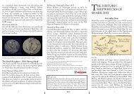
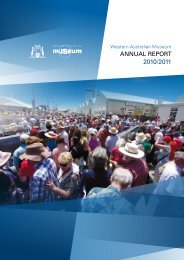
THE ROTTNEST<br />
WRECKS HERITAGE<br />
TRAIL<br />
The coast and outlying reefs of Rottnest Island have claimed<br />
at least 12 vessels since 1842 when <strong>the</strong> schooner Transit<br />
was lost. Underwater and land plaques are now positioned<br />
giving details of <strong>the</strong> <strong>wrecks</strong> of Rottnest Island, and visitors<br />
are invited to view <strong>the</strong> sites by using <strong>the</strong> <strong>trail</strong>s explained in<br />
this pamphlet: Land Trail (by foot or bike), snorkel dives,<br />
semi-submersible tour, boat <strong>trail</strong> and dives.<br />
Macedon wreck<br />
The Trails<br />
Walks<br />
Starting at <strong>the</strong> <strong>Museum</strong>, <strong>the</strong> land <strong>trail</strong> leads to Anitra,<br />
<strong>the</strong> Thomson Bay plaque, overlooking <strong>the</strong> area where<br />
Macedon, Denton Holme, Janet, Transit and Gem were<br />
lost and viewing <strong>the</strong> anchors from Mira Flores and City<br />
of York. From <strong>the</strong>re one can walk through <strong>the</strong> settlement<br />
to <strong>the</strong> panoramic views of <strong>the</strong> Bathurst Point Lighthouse<br />
and <strong>the</strong> Leeman Monument, or take a stroll in <strong>the</strong> opposite<br />
direction along Thomson Bay to Uribes.<br />
Snorkel dives<br />
Two <strong>wrecks</strong>, Uribes and <strong>the</strong> barge Shark lie metres from<br />
shore and are suitable for snorkel diving. Diving is only<br />
recommended on <strong>the</strong>se sites in calm conditions. A shirt or<br />
wetsuit top is recommended to avoid cuts, stings or sunburn.<br />
1
Garden gloves are useful protection.<br />
Semi-submersible/glass-bottomed boat tour<br />
The semi-submersible/glass-bottomed boat leaves takes<br />
visitors to <strong>the</strong> aquatic life and reefs of Thomson Bay visiting<br />
<strong>the</strong> iron vessels Macedon, Denton Holme and occasionally<br />
<strong>the</strong> wooden cutter Gem. The visit is highly recommended to<br />
divers and non-divers alike.<br />
Boat <strong>trail</strong> and dives<br />
The WA <strong>Museum</strong> and Public Works Department (PWD)<br />
marked <strong>the</strong> wreck sites on PWD Chart WA 54153 Rottnest<br />
Island 1:25000. Experienced boat skippers can visit <strong>the</strong> areas<br />
where <strong>the</strong> Rottnest Island <strong>wrecks</strong> were lost and on calm,<br />
clear days, see some of <strong>the</strong>se (notably Lady Elizabeth and<br />
Macedon) from <strong>the</strong> surface. Navigation is often difficult due<br />
to wreckage and reefs lying close to <strong>the</strong> surface and care<br />
must be taken in anchoring to avoid snagging <strong>the</strong> wreck.<br />
The <strong>wrecks</strong> and reefs of Rottnest are dangerous in bad<br />
wea<strong>the</strong>r and inexperienced boat skippers and divers should<br />
not attempt to visit <strong>the</strong> <strong>wrecks</strong>. Snorkels and dives can also<br />
be made in good conditions, though qualifications and<br />
experience are a must. The major <strong>wrecks</strong> are marked with<br />
underwater information plaques and <strong>the</strong> <strong>wrecks</strong> <strong>the</strong>mselves<br />
vary from scattered, almost non-existent sites, e.g. Transit<br />
and Raven to large hull sections, e.g. Macedon, Denton<br />
Holme, Lady Elizabeth, City of York and Mira Flores.<br />
The Vessels<br />
Transit 1842<br />
This 124-ton wooden, two-masted schooner, was wrecked<br />
on 18 May, 1842, rounding Rottnest, on a voyage from Port<br />
Leschenault to Fremantle. The master gave directions to<br />
steer in to Gage Roads Anchorage and went below. Soon<br />
after, it struck Duck Rock and sank. The cabin rapidly filled<br />
with water and <strong>the</strong> captain saved only his chronometer and<br />
desk containing 120 gold sovereigns. It broke up and little<br />
remains. GPS position: 31°30' S; 31°30' E.<br />
Gem 1876<br />
This British–built 52-ton cutter went down with all hands,<br />
four passengers and six crew, whilst approaching Rottnest<br />
on May 18, 1876. It had come from Port Irwin with bags<br />
of wheat and was in sight of <strong>the</strong> Fremantle light-keeper<br />
when it disappeared, leaving only top-masts and cross trees<br />
above water. Rescue crafts were sent immediately but found<br />
no trace of <strong>the</strong> people on board. Divers reported that <strong>the</strong><br />
hull was sound and an attempt had been made to cut <strong>the</strong><br />
2 3<br />
ship’s boat free. They were unable to conduct a thorough<br />
inspection due to tangled rope, rigging and numerous<br />
sharks. Most of <strong>the</strong> bodies were thought to be within <strong>the</strong><br />
vessel. Many <strong>the</strong>ories were suggested ranging from kidnap<br />
to <strong>the</strong> swelling of <strong>the</strong> cargo of wheat. It is still a mystery. The<br />
wreck lies on sand with some ribs and timbers still showing.<br />
GPS position: 21°37' S 113°59'E.<br />
Macedon 1883<br />
This British–built iron screw steamer of 562 tons was wrecked<br />
on 21 March, 1883, with 50 passengers, about 40 horses, mail,<br />
specie, general cargo and a survey party containing Alexander<br />
and John Forrest and Walter James, a future Premier. The<br />
captain took in tow a party of officials with business on<br />
Rottnest, and in displaying such hospitality, took his vessel<br />
too close to <strong>the</strong> reefs. After releasing <strong>the</strong> tow and turning<br />
north, <strong>the</strong> vessel struck. Attempts were made to get it off but<br />
<strong>the</strong> hull was holed. It sank with no loss of life. The captain’s<br />
certificate was suspended for three months. This wreck, along<br />
with <strong>the</strong> nearby Denton Holme, lies in 3–6 metres of water.<br />
GPS position: 31°59' S 115°33' E.<br />
Janet 1887<br />
This 211-ton, three-masted schooner, was built of jarrah<br />
and was at <strong>the</strong> time, <strong>the</strong> largest vessel built at Fremantle. It<br />
was wrecked on 11 December, 1887 whilst in-bound from<br />
Colombo with grain, Ceylon-made furniture, and o<strong>the</strong>r goods.<br />
It was wrecked close to SS Macedon, lost four years previously.<br />
Distress signals were seen by <strong>the</strong> pilot station and <strong>the</strong> crew was<br />
saved, even though <strong>the</strong> vessel’s decks were awash with heavy<br />
seas. The wreckage lies scattered in 4–5 metres of water, 150<br />
metres from Macedon. Little apart from two anchors and o<strong>the</strong>r<br />
small artefacts are visible. GPS position 31°30 'S 112°00' E.<br />
Rottnest <strong>heritage</strong> <strong>trail</strong> plinth<br />
Lady Elizabeth 1878<br />
This composite vessel was wrecked on 30 June, 1878 bound<br />
for Shanghai from Fremantle with a cargo of sandalwood.<br />
For four days it battled heavy gales and Capt. Scott finally<br />
decided to return to <strong>the</strong> safety of Fremantle. The intensity<br />
of <strong>the</strong> squalls was such that one man was lost overboard<br />
and visibility was reduced to a few metres. Somehow, it was<br />
driven in behind Dyer Island and was wrecked. It is a good<br />
scuba dive with lots of wreck structure including hull and<br />
masts. GPS position: 32°01' S 115°32' E.<br />
Raven 1891<br />
This British–built three-masted wooden barque of 343 tons<br />
was wrecked with no loss of life on 11 March, 1891 whilst on<br />
a voyage from Fremantle to Bunbury in ballast. The inquiry<br />
held on 13 March, 1891 disclosed that it left port under a<br />
drunken skipper and while attempting <strong>the</strong> South Passage,<br />
struck <strong>the</strong> reefs surrounding Dyer Island. The crew returned<br />
to Fremantle in <strong>the</strong> boats and Raven soon broke up. The<br />
wreckage lies partly buried in sand and week in 6 metres of<br />
water and is difficult to distinguish from <strong>the</strong> surrounding<br />
reef. GPS position 32°01' S 115°33' E.<br />
Shark 1939<br />
This hopper barge was wrecked in 1939. According to one<br />
source she broke free from moorings at Fremantle and drifted<br />
on to Henrietta Rocks where she was wrecked. Its remains<br />
are visible above water where it lies offshore in 4metres,<br />
immediately below Lookout Hill. It is an accessible wreck<br />
snorkel dive in calm seas. GPS position 32°00' S 115°32' E.<br />
Uribes<br />
This 117.59-tonne auxiliary schooner was wrecked in June<br />
or July 1942 laden with military stores and two motor<br />
vehicles. The motors cut out near Phillip Rock. With anchors<br />
dragging Uribes driffted and was wrecked near <strong>the</strong> base of<br />
<strong>the</strong> natural jetty. It quickly sank and filled with sand. Built in<br />
1868 at Stockon-on-Tees, Uribes was quite an old ship when<br />
wrecked. The remains lie in 3–4 metres of water close to <strong>the</strong><br />
shore, machinery and parts of <strong>the</strong> hull are well preserved. It<br />
is a safe dive for snorklers, unless <strong>the</strong> wind and waves are<br />
blowing on shore.<br />
Mira Flores 1886<br />
This German-owned, British–built iron barque of 500 tons<br />
was wrecked on 30 November, 1886. It was sighted by <strong>the</strong><br />
lookout at 5.30 am and shortly after, struck Horseshoe<br />
4