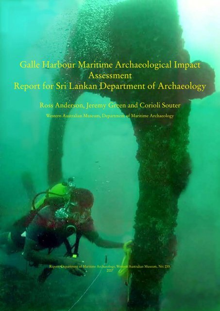
Galle Harbour Maritime Archaeological Impact Assessment Report ...
Galle Harbour Maritime Archaeological Impact Assessment Report ...
Galle Harbour Maritime Archaeological Impact Assessment Report ...

You also want an ePaper? Increase the reach of your titles
YUMPU automatically turns print PDFs into web optimized ePapers that Google loves.
<strong>Galle</strong> <strong>Harbour</strong> <strong>Maritime</strong> <strong>Archaeological</strong> <strong>Impact</strong><br />
<strong>Assessment</strong><br />
<strong>Report</strong> for Sri Lankan Department of Archaeology<br />
Ross Anderson, Jeremy Green and Corioli Souter<br />
Western Australian Museum, Department of <strong>Maritime</strong> Archaeology<br />
<strong>Report</strong>–Department of <strong>Maritime</strong> Archaeology, Western Australian Museum, No. 235.<br />
2007
2<br />
Background<br />
Following discussions between the Sri Lankan Department of<br />
Archaeology (SLDA) and Department of <strong>Maritime</strong> Archaeology,<br />
Western Australian Museum (WAM), WAM was engaged as a consultant<br />
to undertake a maritime archaeological survey of <strong>Galle</strong> <strong>Harbour</strong> as part<br />
of an <strong>Archaeological</strong> <strong>Impact</strong> <strong>Assessment</strong> (AIA) process. The scope of<br />
the consultancy was to carry out a maritime archaeological survey, and<br />
provide a report to the SLDA outlining the impact of the proposed <strong>Galle</strong><br />
port development on the underwater cultural heritage of <strong>Galle</strong> <strong>Harbour</strong>.<br />
The survey took place between 14 November and 2 December 2007.<br />
WAM has been involved in maritime archaeological investigations<br />
in <strong>Galle</strong> <strong>Harbour</strong> since 1992. Previous work includes: remote sensing<br />
surveys, site inspections and excavation of shipwrecks. Remote sensing<br />
and diving search projects undertaken in 1992, 1993 and 1996 resulted in<br />
the location of a range of significant maritime heritage sites in the harbour<br />
including Arab-Indian stone anchors, the VOC wrecks of the Avondster<br />
(1659) and Hercules (1661) and 19th century iron steamship wrecks.<br />
Due to advances since 1997 in position-fixing and remote sensing<br />
techniques, it was necessary to resurvey the proposed port development<br />
area to accurately position and identify possible sites to be impacted by<br />
the development. Existing GPS positions were only accurate to 200 m as<br />
a result of GPS Selective Availability (decommissioned in 2000).<br />
As part of the contractual agreement between WAM and the Sri<br />
Lankan Department of Archaeology, this report is to be submitted to the<br />
Sri Lankan Department of Archaeology by 17 December 2007.<br />
Staff<br />
Three members of the Department of <strong>Maritime</strong> Archaeology, WAM<br />
travelled to Sri Lanka to carry out the survey: Jeremy Green; Corioli<br />
Souter; and Ross Anderson.<br />
WAM staff were supported in Sri Lanka by the Department of<br />
Archaeology who provided logistical assistance, accommodation, food<br />
and transport. The Sri Lankan <strong>Maritime</strong> <strong>Archaeological</strong> Unit (MAU),<br />
Central Cultural Fund provided workshop and office facilities; diving<br />
support for wreck inspections and survey of the Hercules site.<br />
Equipment Overview<br />
Equipment used for the remote sensing and position fixing components<br />
of the survey were:<br />
a) Marine Sonics side scan sonar and PC processing software<br />
The Marine Sonics side scan sonar uses a dual frequency tow fish (60/160
Figure 1. Plan of <strong>Galle</strong> <strong>Harbour</strong> showing the first version of the proposed new port development<br />
including 1997 site positions.<br />
KHz) and the software, Sea Scan PC, uses an Intel-based computer<br />
with the Windows operating system for data display and system control.<br />
The Sea Scan PC program allows the operator to control the sonar data<br />
collection process, view, analyze and save the sonar image with the related<br />
navigational information. The program also features a sophisticated<br />
integrated plotter to plot location and estimated swath coverage. The<br />
Sea Scan PC enables the operator to view wide tracts of the seafloor<br />
by insonifying along the swath width and recording the strength of the<br />
echoes from the sea bottom. The towfish is towed just above the bottom<br />
of the seafloor. The towfish continuously emits narrowly focused beams<br />
of sound perpendicular to the path of motion. The sound pulses pass<br />
through the water but are reflected from the seafloor and objects, such<br />
as wreck sites, on the seafloor. The control computer records the echo<br />
signal strengths as they return and then draws the entire sonar record line<br />
on the screen. An image of the seafloor is built, line by line, as the sonar<br />
record line from each pulse of the sonar is returned and drawn on the<br />
screen. (Marine Sonics, 2006: 7).<br />
b) Elsec Type 7706 magnetometer<br />
This magnetometer has a field strength range of 20,000–90,000 nT in<br />
24 switched ranges. The data is also shown in real time with along with<br />
the side scan trace and navigational information using the Sea Scan PC<br />
3
4<br />
Figure 2. Plan of the revised version of the proposed development.<br />
software. This enables the operator to analyse and correlate magnetic<br />
anomalies with sonar imagery of the seabed. The magnetometer operates<br />
using proton precession and measures magnetic field intensity variations<br />
causes by ferrous deposits.<br />
c) Garmin GPS and Fugro Omnistar Differential GPS 8400<br />
The handheld Garmin GPS has a position accuracy of within 5m while<br />
the Fugro DGPS has an accuracy of within 20cm. The Garmin GPS was<br />
used to plot and record tracks of the survey vessel and position-fix targets.<br />
The DGPS was used to record land-based survey control points in order<br />
to geo-reference sites onto maps and charts.
Survey aims<br />
The survey aims of WAM were to:<br />
• Survey <strong>Galle</strong> <strong>Harbour</strong> using remote sensing to locate maritime<br />
archaeological sites that may be affected by the port development.<br />
The MAU were then responsible for inspecting the targets both<br />
during and following the remote sensing survey.<br />
• Position-fix all targets and identify sites of significance. The sites<br />
located during the 2007 survey would then be compared with the<br />
earlier surveys of 1992, 1993 and 1997.<br />
• Carry out a detailed survey of the VOC ship Hercules (1661) site<br />
(already known to be within the development area) in conjunction<br />
with MAU.<br />
Staff met in Colombo on 13 November 2007 with the Sri Lankan Port<br />
Authority, Sri Lankan Navy, Japanese Port Development Consultants<br />
and UNESCO representatives to discuss the scope of the survey and<br />
work to be undertaken. All diving work in <strong>Galle</strong> <strong>Harbour</strong> requires the<br />
permission of the Sri Lankan Navy and an observer from the Sri Lankan<br />
Navy Clearance Diving Team based at Dakshina Naval Base, Sri Lankan<br />
Navy Southern Command was present on the survey vessel and during<br />
diving work at all times.<br />
Remote Sensing Survey methodology<br />
The methodology was to cover the entire development footprint using<br />
magnetometer and side scan sonar operating on the low frequency for<br />
maximum range.<br />
From the above survey, having identified targets of interest, conduct<br />
north-south and east-west runs to accurately position-fix targets using<br />
magnetometer and side scan sonar operating on high frequency to give<br />
maximum resolution.<br />
Then to use the side scan sonar on high frequency setting to provide<br />
high quality imagery of identified targets and register new targets on a<br />
shipwrecks database.<br />
MAU to dive and record targets with measurements, photography<br />
and videography.<br />
Given the potential positional error and to avoid confusion with<br />
previous surveys, all targets recorded during the 2007 survey were given<br />
new field names using the format: 07-Day-MST File No.-Target number-<br />
Side-scan/ Magnetometer run file number e.g. 07-24-01-M04 indicating<br />
the data was collected on 24 November, it was recorded on MST File<br />
number 01 and it was magnetic target number 4. Once the sites had been<br />
identified, they were then give a site number 07-XX. At this point it was<br />
possible to compare the sites with sites recorded in the 1990s with the<br />
5
6<br />
Figure 3. Plan of <strong>Galle</strong> harbour showing the extent of the side scan sonar coverage and 2007<br />
targets.<br />
Figure 4. Plan of <strong>Galle</strong> harbour showing the side scan sonar tracks.
Figure 5. Plan showing harbour depth contours and 2007 targets.<br />
Figure 6. Plan showing development proposal (general, blue is dredged, purple is land fill) and<br />
2007 targets.<br />
7
8<br />
alphabetical codes Site A–Site Y.<br />
The survey equipment was set up aboard the survey vessel. The<br />
vessel maintained a constant speed of approximately 3.5 knots to<br />
enable quality low-frequency side scan sonar imagery of the seabed and<br />
magnetometer recording. The Seascan GPS plotting software was used to<br />
run parallel lanes approximately 50 metres apart giving adequate overlap<br />
and coverage of the investigation area. Coverage confidence of the survey<br />
area was 100%.<br />
Limitations of survey<br />
The remote-sensing survey is limited by the capabilities of equipment.<br />
For the magnetometer, the limitation is the background noise that can<br />
mask a magnetic anomaly in the earth’s magnetic field intensity. Noise can<br />
be caused by a variety of sources including geomagnetic anomalies, cable<br />
microphany and electromagnetic radiation (sun-spot activity, lightning,<br />
and electrical noise from generators and engines). The limitation of side<br />
scan sonar is that target must protrude from the sea-bed, the sea-bed<br />
needs to be uniform (rocky areas make it difficult to resolve sites), calm<br />
surface conditions (surface wave cause interference with sonar return)<br />
and sea conditions need to be calm to avoid pitching of the tow-fish.<br />
During the survey period, conditions were ideal with low sunspot<br />
activity and calm seas. However, much of <strong>Galle</strong> <strong>Harbour</strong> seabed consists<br />
of rock outcrops with some sand and mud areas. No large sites were<br />
found with the side scan sonar on sand areas except for Site A and the<br />
Avondster site, both known from the 1990s surveys. In the rocky areas<br />
the magnetometer indicated a number of large magnetic targets that<br />
were subsequently identified with high resolution side scan sonar. It is<br />
possible that buried wooden sailing vessels (wrecks without enough iron<br />
to provide a magnetic signature and too low a profile to provide a side<br />
scan sonar target image), or non-ferrous targets such as stone anchors,<br />
might not be identified via remote-sensing methods. It is recommended<br />
that the remote sensing survey is followed up by a visual diving survey<br />
to sample transects in the development area in order to identify other<br />
possible archaeological or cultural remains (see recommendations section<br />
in this report).<br />
Results<br />
Preliminary Correlation with 1992 and 1996 surveys<br />
At the end of the survey a total of 17 sites were located, some were<br />
obviously sites recorded in the 1990s, although now with greater precision.<br />
However, a number of the sites were new or could not easily be correlated<br />
with the sites found in the 1990s, therefore it was decided to completely
enumber the sites to avoid confusion. All sites were give prefix 07 and a<br />
running number or where appropriate a name. The following is the log<br />
of sites.<br />
Table 1. Coordinates of sites located in 2007 survey (Decimal degrees, WGS84 datum)<br />
ID LONG LAT<br />
07_01 80.22179500 6.03467100<br />
07_02 80.22953800 6.01843200<br />
07_03 80.22522100 6.01417200<br />
07_04 80.22185300 6.01478600<br />
07_05 80.22814900 6.02214700<br />
07_06 80.22556800 6.02243700<br />
07_07 80.22336900 6.02386000<br />
07_08 80.22303300 6.02935900<br />
07_09 East 80.20856100 6.01436600<br />
07_09 West 80.20773500 6.01404900<br />
07_10 80.21366000 6.01673700<br />
07_11 80.22319200 6.02764200<br />
07_12 80.23785200 6.01951400<br />
07_13 Avondster 80.22121600 6.03471700<br />
07_13 Avondster Keel 80.22141300 6.03455500<br />
07_14 Hercules 80.23231600 6.03006500<br />
07_15 Part Scorpio 2 80.22668400 6.03667800<br />
07_15 Part Scorpio 3 80.22638200 6.03473200<br />
07_15 Scorpio 80.22896100 6.03007900<br />
07_16 SiteANorth 80.22292900 6.03476400<br />
07_16 SiteASouth 80.22350800 6.03437000<br />
07_17 Azarakhshito Barge 80.21511100 6.02561100<br />
07_18 Site E<br />
9
10<br />
Site inventory<br />
Site 07_01<br />
Site 07_01 was an unusual sonar and magnetometer target slightly to the<br />
east of Site 07_13 Avondster but further to the west than the site 07_18<br />
known as Site E in the 1990s survey. It is possible that this is debris<br />
from the tsunami and warrants further investigation.<br />
Site 07_02<br />
Figure 7. Side scan sonar image and magnetometer contour plot of Site 07_02.<br />
A small magnetic target with no obvious sonar record. This is possibly a<br />
mooring anchor or tsunami debris.<br />
Site 07_03<br />
Figure 8. Magnetometer contour plot of Site 07_03 on nautical chart.
Small magnetic target near Secundra Rock, likely to be mooring anchor<br />
for the navigation buoy.<br />
Site 07_04<br />
Figure 9. Side scan sonar image of Site 07_04.<br />
Site 07_04 was a sonar and magnetic target of a large iron wreck on<br />
Inner Kadda Rock.<br />
Site 07_05<br />
Figure 10. Side scan sonar image and magnetometer contour plot of Site 07_05.<br />
One can see in this side scan Image above, the outline of the site with<br />
propeller aperture visible.<br />
11
12<br />
Figure 11. Site inspection of Site 07_05 (Original Video: MAU, Video Mosaic: P. Baker, WAM)<br />
Site 07_06<br />
Figure 12. Side scan sonar image and magnetometer contour plot of Site 07_06.<br />
Large iron wreck near Matte Madda.<br />
Site 07_07<br />
Figure 13. Side scan sonar image and magnetometer contour plot of Site 07_07.<br />
Large iron wreck on port side of channel into <strong>Galle</strong> <strong>Harbour</strong> to the east<br />
of the lighthouse on Utrecht Bastion.
Site 07_08<br />
Figure 14. Magnetometer contour plot of Site 07_08 on nautical chart.<br />
Large magnetic target to the east of the Black Fort with no obvious sonar<br />
target.<br />
Site 07_09<br />
Figure 15. Side scan sonar image of Site 07_09.<br />
Large iron shipwreck 1.6 km to the south-west of <strong>Galle</strong> lighthouse.<br />
thought possibly to be the RMS Rangoon.<br />
13
14<br />
Figure 16. Wreck of the P. & O Company RMS Rangoon, off Point de <strong>Galle</strong> by Robert Bruce,<br />
Print: wood engraving, 1872, State Library of Victoria, Acc. No. IAN01/01/72/8.<br />
Site 07_10<br />
Small magnetic target 1 km south-west of <strong>Galle</strong> lighthouse<br />
Site 07_11<br />
Small magnetic target 350 m east of Sailors Bastion.<br />
Site 07_12<br />
Figure 17. Side scan sonar image of Site 07_12.<br />
Iron wreck at Watering point.
Site 07_13 Avondster<br />
Figure 18. Side scan sonar image of Site 07_13 Avondster.<br />
See Parthesius, 2007. Note the sonar target 07_01.<br />
Site 07_14 Hercules<br />
Figure 19. Inshore Hercules site transit image.<br />
15
16<br />
Figure 20. Wide angle Hercules site transit image.<br />
See site description below.<br />
Site 07_15 Scorpio dredger<br />
Figure 21. Scorpio dredger wreck site as of November 2007.<br />
Iron dredger wrecked August 2007, now in three parts.
Site 07_16 Site A<br />
Figure 22. Side scan sonar image of Site 07_16.<br />
Large iron wreck previously described in Green et al. 1998<br />
Site 07_17 Azarakhshito Barge<br />
Figure 23. The Azarakhshito barge as of November 2007.<br />
The Azarakhshito, a large barge owned by Iranian interests lies on the<br />
shallow reef between Neptune and Clippenburg Bastions. The <strong>Galle</strong><br />
Deputy <strong>Harbour</strong>master ordered the barge ballasted with seawater<br />
to stop it banging into the fort walls (G. Sirimanna, pers. comm. 29<br />
November 2007). Local court proceedings are underway in the case of<br />
both wrecks to order the owners to remove them; however this is likely<br />
to take some time.<br />
17
18<br />
The Hercules site<br />
Site description<br />
The following is the 1992 description of the Hercules site:<br />
This site consists of about 20 large iron cannon, located between<br />
Gibbet and Closenburg Islands. The site extends from close to the<br />
shore in a roughly southerly direction down to a depth of about 8<br />
m. Some of the cannon on the shoreward part of the site were badly<br />
eroded by sand abrasion and, in some cases, the bore of the gun was<br />
exposed. The position of the site is interesting; it lies on what was<br />
Gibbet Island, to the west of the entrance (now filled in) to what<br />
was once a small bay between Gibbet and Closenburg Islands. This<br />
area has been filled in during the development of the harbour. It was<br />
thought, at first, that the site was either a shipwreck or a place where<br />
cannon had been abandoned, possibly from a battery on Gibbet<br />
Island. On the 15 March a large bronze bell was recovered from<br />
the site, suggesting that the site is a shipwreck. The bell was heavily<br />
encrusted with marine growth, but close examination indicated<br />
that it was well preserved, although the suspension point in the<br />
top of the bell was damaged. Around the upper part of the bell an<br />
inscription was noted under the marine growth. Following initial<br />
deconcretion the inscription “AMOR VINCIT OMNIA ANNO<br />
1625” was revealed. This, together with a Dutch Overijsselsteen<br />
and a Southeast Asian jar fragment (not inconsistent with the<br />
provenance of the other material), suggests that this is a wreck of<br />
a VOC (Dutch East India Company) vessel of the first half of the<br />
17th century. If this is a VOC shipwreck, it will be important to<br />
carry out further work in the future, as it is anticipated that there<br />
may well be structure and material in the sand at the bottom end of<br />
the site.<br />
A number of VOC vessels are known to have been wrecked in<br />
or around <strong>Galle</strong>. Preliminary examination of the outward and<br />
homeward voyages (Bruijn et al, 1979) indicates that two vessels<br />
were lost at <strong>Galle</strong>: the Barbestien (1735) and Geinwens (1776).<br />
However, recent archival research in the Algemeen Rijksarchief in<br />
the Hague, by Robert Parthesius has almost certainly determined<br />
the name of the vessel as the Hercules. This vessel was wrecked on<br />
21 May 1661 and is one of four vessels lost near <strong>Galle</strong> in the 1660s.<br />
Its identification was confirmed by a map that was based on another<br />
map dated around 1658. The Hercules was recorded as being a jacht<br />
of 540 tons. It is also quite clear from the position of the site that<br />
it must have been quite visible to the inhabitants of <strong>Galle</strong>, as such
Figure 24. An undated 17th century map of <strong>Galle</strong> showing the Hercules wreck (National<br />
Archives, the Hague, VEL 1056)<br />
Figure 25. Admiralty chart of <strong>Galle</strong> <strong>Harbour</strong> dating from 1950s showing Gibbet Island and<br />
Closenberg before the Fisheries <strong>Harbour</strong> development.<br />
19
20<br />
Figure 26. The 1950s chart (white) overlaying the modern chart.<br />
Figure 27. An undated 17th century map of <strong>Galle</strong> showing the Hercules wreck (National<br />
Archives, the Hague, VEL 1056) with current port facilities.
Figure 28. GPS positions of buoyed cannon groups on Hercules site.<br />
Figure 29. Diver and insitu cannon, Hercules site.<br />
21
22<br />
Figure 30. High resolution side scan sonar image, GPS position of buoyed cannons and photo<br />
mosaic of rock sea wall, Hercules site.<br />
Figure 31. High resolution side scan sonar image and position of cannon (Site Recorder) on<br />
Hercules site.
Figure 32. Site Recoder plot of cannon on Hercules site.<br />
we can therefore expect that the vessel would have been heavily<br />
salvaged at the time of the loss. It is surprising that the guns were<br />
still in situ on the site and, in view of the fact that the site was well<br />
known to local divers it is quite surprising that the bell survived<br />
(Green & Devendra, 1992: 23–5).<br />
Hercules site survey methodology<br />
In conjunction with the MAU, WAM staff undertook a manual survey<br />
of the Hercules to better define the site post the 1993 preliminary survey.<br />
The methods to record the site included:<br />
• Accurately fix position and ascertain total extent of area of the site<br />
using GPS to mark cannon locations.<br />
• Use Differential GPS (DGPS) land-based control points for georeferencing<br />
the site in relation to the port development.<br />
• Locate, buoy and tag all cannon, and survey cannon and artefacts<br />
using tape-trilateration and 3H Site Recorder program (Fig. 32).<br />
• Record the length and orientation of the cannon.<br />
• Photographic insitu recording of cannon<br />
Following the above survey a test excavation using a water dredge<br />
was carried out by the MAU that sounded 0.5m down to bedrock in<br />
the sandy seabed south of cannon ‘1’ (Buoy ‘C’). Concreted and<br />
eroded remains of what is possibly a small iron swivel gun or bar-shot,<br />
cannonballs, coal and iron concretions and iron-staining on rocks indicate<br />
23
24<br />
a cultural deposit. The presence of oyster shells on rocks and a plastic<br />
bag at the base layer show that the site is periodically exposed with sand<br />
cover removed from this area.<br />
Hercules site environment<br />
As previously described the major remaining features of the Hercules site<br />
are the 36 cannon scattered down the boulder slope between 1.5 and 7.8m,<br />
covering an area approximately 50 x 50 m2 (refer Figure 31). All cannon<br />
located were tagged with consecutive numbers. Sand is trapped between<br />
some of the boulders and the boulders give way to sand to the west and<br />
east of the site, as well as seaward of the boulder reef where it meets<br />
the seabed. Therefore potential exists for artefacts to be trapped in sand<br />
crevices or buried in the sandy seabed in these areas. It is also possible<br />
that parts of the wreck were washed into the sandy bay that existed<br />
between Gibbet and Closenburg Islands at the time of the wrecking and<br />
may be presently buried under the modern harbour. Tag 21 identifies an<br />
iron concretion, possibly related to a rigging or armament function.<br />
The significance of the Hercules site also lies in its relationship to the<br />
two, still currently visible remnant landforms of Gibbet and Closenburg<br />
Islands, which were connected by a man-made rock wall sometime during<br />
the 1950s to enclose the marina and naval base (Jayatilake in Green &<br />
Devendra, 1993: 13–4). The proposed port development as currently<br />
planned will directly and irrevocably impact the Hercules site as it will<br />
be buried under 3–11m of rock and earth infill to provide reclaimed land<br />
for the port road access. The original heights and forms of Closenburg<br />
and Gibbet Islands are not presently being considered for blasting or<br />
modification for roads and infrastructure (AQADGPD, 2007), though<br />
this will have to be checked in light of alternative plans. At time of writing,<br />
the Sri Lankan Ports Authority provided two alternative modified plans<br />
for the port development that propose avoiding direct impact to the<br />
Hercules site by diverting the access road. These are considered below.<br />
<strong>Maritime</strong> landscape of <strong>Galle</strong> <strong>Harbour</strong><br />
<strong>Galle</strong> <strong>Harbour</strong> is recognized at the highest world heritage level as the<br />
location of the UNESCO listed ancient Portuguese and Dutch fort, later<br />
taken over by the British. The massive ramparts, bastions, buildings,<br />
lighthouse, clock tower and magazine are the most visible features of <strong>Galle</strong><br />
<strong>Harbour</strong>’s maritime landscape, that also includes underwater maritime<br />
archaeological sites and Sinhalese and Buddhist sites of significance.<br />
In terms of maritime archaeological sites the Dutch East India<br />
Company (VOC) shipwrecks in the vicinity of <strong>Galle</strong> <strong>Harbour</strong> that relate<br />
to the Dutch colonial period are: Avondster (1659); Hercules (1661);
Dolfijn (1663); Barbestien (1735); Geinwens (1776) (the last three sites<br />
have yet to be located). These sites are an integral part of the values<br />
for which <strong>Galle</strong> <strong>Harbour</strong> is perceived as significant i.e. as physical and<br />
archaeological evidence of Dutch colonial activity, port development and<br />
maritime trade in <strong>Galle</strong>, Sri Lanka and Southeast Asia generally.<br />
The European colonial fort and port infrastructure on the western<br />
shore is in juxtaposition to the virtually untouched eastern shore, with<br />
the Buddhist architecture of the Peace Dagoba and other Buddhist sites<br />
of significance, Jungle Beach and Watering Point. Other evidence of <strong>Galle</strong><br />
Fort’s operations and construction is present in the quarries and likely<br />
archaeological remains of Dutch infrastructure at Watering Point.<br />
The original rocky landforms of Gibbet and Closenburg Islands<br />
are still visible, though now connected by a man-made rock wall. Gibbet<br />
Island is likely to have human remains and possibly graves relating to<br />
executions and burials carried out during the Dutch occupation period.<br />
The name given to Gibbet Island in early Dutch records is ‘Hercules<br />
Kirkhof (trans graveyard)’ (Jayatilake in Green & Devendra (eds), 1993<br />
:13–14).<br />
Overall, the setting of <strong>Galle</strong> <strong>Harbour</strong> is one of cultural continuity<br />
in that it has the same natural form and has operated in the same capacity<br />
for centuries, from Indian-Arab trading times to the present day.<br />
Moorings and anchorages<br />
Late 19th and 20th century infrastructure, including port moorings,<br />
are recorded at the Inner Katta, Katta North, Katta South, New<br />
Katta, Capera Berth, and Watering Point anchorages. Copies of transit<br />
bearings for checking the location of mooring and channel buoys,<br />
dating between 1920–1970s, were provided to Darshani Samathanlika<br />
by the previous <strong>Galle</strong> <strong>Harbour</strong> Master (D. Samalanthika, pers. comm.<br />
29 November 2007). A visit was made to <strong>Galle</strong>’s Deputy <strong>Harbour</strong><br />
Master Capt. Gadjiba Sirimanna to attempt to locate archival records<br />
for shipwrecks, salvage, and maritime infrastructure in <strong>Galle</strong> <strong>Harbour</strong>.<br />
This visit resulted in information that the historic <strong>Harbour</strong> Master’s log,<br />
old charts, photographs and artefacts were lost in the 26 December 2004<br />
tsunami, that completely destroyed the Deputy <strong>Harbour</strong> Master’s office<br />
on Customs Road, <strong>Galle</strong> Fort (G. Sirimanna, pers. comm. 28 November<br />
2007). The possibility that archival copies of <strong>Harbour</strong> Masters’ records<br />
exist in Colombo is being followed up.<br />
At least one heavy single arm mooring anchor and three mushroom<br />
anchors (used for mud and sand bottoms) are on display in the Customs<br />
Road maritime precinct at <strong>Galle</strong> Fort. It is likely that these at one time<br />
related to the <strong>Galle</strong> anchorage moorings. As the moorings were made<br />
redundant following construction of the inner harbour it would have<br />
25
26<br />
been simple for them to have been recovered and re-used, or in the case<br />
of the afore-mentioned anchors put on display. However the possibility<br />
exists that anchors, chain or other artefacts that relate to the moorings<br />
are still in situ. <strong>Archaeological</strong> deposits such as rubbish, bottles, ballast,<br />
boiler furnace slag and broken crockery thrown overboard vessels are<br />
also likely to exist in these areas.<br />
Results<br />
Eleven iron steamship wrecks have been located (excluding the two<br />
modern wrecks). The following wrecks are known to be wrecked in the<br />
vicinity of <strong>Galle</strong> <strong>Harbour</strong>: SS Phatti Allum; SS Rangoon (south-west of<br />
<strong>Galle</strong> <strong>Harbour</strong>). The two recent wrecks demonstrate possible impacts<br />
to the <strong>Galle</strong> ancient fort and maritime archaeological sites. The modern<br />
wreck of a Singapore-owned dredger Scorpio lies in three parts. The main<br />
hull and machinery of the dredger lies on the western end of the Gibbet<br />
Island breakwater where it was carried by currents after running aground<br />
near the Hercules site in June 2007. Part of the dredger’s pontoon hull<br />
subsequently broke away and was carried by currents to a position just<br />
outside of the naval base entrance (this wreckage appears to lie directly<br />
on top of a wreck marked on Admiralty charts) while a third broken<br />
part of the pontoon lies on the fishers’ beach next to the Naval Base.<br />
The Scorpio was under tow by two tugs when it entered <strong>Galle</strong> <strong>Harbour</strong><br />
without charts or a pilot. When the Scorpio first ran aground and was<br />
damaged the tug master attempted to tow it into the harbour, however<br />
the <strong>Harbour</strong> Master refused permission for it to enter the harbour in<br />
damaged condition in case in sank and blocked the channel. While being<br />
towed out to the anchorage the tow broke and the Scorpio ran ashore<br />
on Gibbet Island. Both tugs were impounded by the <strong>Harbour</strong> Master<br />
pending court action.<br />
While it is fortunate that neither of these wrecks have directly<br />
impacted the highly significant VOC Hercules or Avondster sites, or<br />
damaged the fort walls, they do demonstrate the natural dangers of <strong>Galle</strong><br />
<strong>Harbour</strong>, the potential for large modern wrecks to end up in the same<br />
places as historic shipwrecks, and the real potential for modern shipping<br />
accidents in <strong>Galle</strong> <strong>Harbour</strong> even with its current status as a minor port.<br />
If the port is expanded to take larger ships and increased shipping traffic,<br />
then the impact to the heritage landscape values and amenity of <strong>Galle</strong> Fort<br />
UNESCO heritage site caused by major port infrastructure, increased<br />
shipping movements and attendant increased risk of shipping related<br />
incidents such as wrecks, marine oil spills, and dust and pollution from<br />
heavy road traffic must be taken into consideration.
Recommendations<br />
General<br />
In view of the proposed world heritage listing of <strong>Galle</strong> <strong>Harbour</strong> itself, the<br />
Department of Archaeology should consider the impact to the heritage<br />
landscape values (including both tangible and intangible cultural heritage<br />
values) and amenity of <strong>Galle</strong> Fort UNESCO world heritage site caused<br />
by major port infrastructure.<br />
Tangible cultural heritage consists of physical archaeological remains<br />
both on the land and underwater. Intangible cultural heritage is defined<br />
by UNESCO as forms of popular and traditional cultural expressions<br />
and cultural spaces. This heritage is made up of many and varied complex<br />
forms of living manifestations in constant evolution including oral<br />
traditions, performing arts, music, festive events, rituals, social practices<br />
and knowledge and practices concerning nature (UNESCO, 2007).<br />
Figure 33. View of Watering Point and the Peace Dagoba at Rumussala.<br />
<strong>Galle</strong> <strong>Harbour</strong> should be viewed as a maritime cultural landscape<br />
which includes, tangible and intangible cultural heritage values. In<br />
its current form, <strong>Galle</strong> harbour may be described as an entrepôt,<br />
demonstrating the continuity of trade and maritime cultural activity both<br />
as a centre and transit point. <strong>Maritime</strong> cultural landscapes, as defined by<br />
27
28<br />
Westerdahl (1992), incorporate centres of maritime culture, sea routes,<br />
shipwrecks, port remains and monuments, natural topography and<br />
havens, place names, inland sites and living traditions.<br />
The effect of the port development would be to effectively split the<br />
natural haven of <strong>Galle</strong> <strong>Harbour</strong> in two. The western and northern shores<br />
exhibit the main focus of ancient and modern maritime activity while<br />
the eastern shore remains relatively unspoiled in its natural state with<br />
Jungle Beach and coral gardens at Watering Point. The Peace Dagoba at<br />
Rumassala also incorporates aesthetic and spiritual values of the eastern<br />
shore.<br />
To preserve the heritage values of the harbour, as described<br />
above, our recommendation is to relocate shipping facilities to a less<br />
culturally sensitive region. The establishment of a port in <strong>Galle</strong> will have<br />
implications for the harbour’s proposed listing as a world heritage site. If<br />
<strong>Galle</strong> harbour is selected for redevelopment, all attempts should be made<br />
to minimise the impact of any built structure on the cultural and natural<br />
aesthetics of the harbour.<br />
Consideration of SLPA Hercules site avoidance options presented in<br />
Sri Lanka December 2007<br />
At the close of the survey, the team were presented with two proposed<br />
modifications to the development specifically designed to avoid the<br />
Hercules site:<br />
• Option 1 Figure 34: A realignment of the road and sea wall that<br />
would leave the Hercules site outside the development zone.<br />
• Option 2 Figure 35: Incorporation of the Hercules site within the<br />
development. In this option the Hercules site would be preserved<br />
by enclosure with an interior sea wall.<br />
While both of these options are supported given that they ostensibly<br />
preserve the Hercules site, there are a number of issues that need to be<br />
considered. Firstly, both of these options require a buffer zone around<br />
the site. For Option 1, a 50m buffer zone seaward of the 8m contour is<br />
recommended (as shown in Figure 36) given the likelihood of further<br />
archaeological material to be buried in the sand in this region. Enclosing<br />
the site as per Option 2, will change the immediate site environment and<br />
therefore has implications for the long term conservation of the site and<br />
artefacts. This will require further survey and site definition. In particular,<br />
a full pre-disturbance survey is required to obtain baseline data of artefacts<br />
prior to changes in environmental conditions. In addition, conservation<br />
advice on relative merits of in-filling site with sterile soil or maintaining<br />
a saltwater environment will be required.
Figure 34. Option 1 showing road bypassing site to west leaving site in its natural environment.<br />
Figure 35. Option 2 showing road enclosing Hercules site.<br />
29
30<br />
Figure 36. Recommended buffer zone around Hercules site.
Specific recommendations<br />
1) That the Hercules site is left untouched by port development and<br />
an appropriate buffer zone is established around the site (as per<br />
Option 1).<br />
2) That the original landforms of Gibbet and Closenburg Islands,<br />
including gravesites on Gibbet Island, are left untouched by the<br />
development.<br />
3) That consideration for the heritage values of <strong>Galle</strong> UNESCO site<br />
are extended to the wider maritime landscape of <strong>Galle</strong> <strong>Harbour</strong>,<br />
that under current plans will be significantly impacted by placing<br />
major modern port infrastructure between the ancient fort and<br />
eastern bay area, along with attendant risks from increased shipping<br />
movements.<br />
4) Following 3) that the Sri Lankan Ports Authority focus on<br />
Hambantota and Colombo as the sites for major port and<br />
infrastructure developments, and limit development in <strong>Galle</strong> to<br />
upgrading and improving existing facilities in accordance with its<br />
current status as a minor port.<br />
5) Confirm with the Sri Lankan Ports Authority that alternative plans<br />
for the port development to avoid impacting the Hercules site<br />
will not impact Gibbet or Closenburg Islands’ original form, or<br />
anticipated grave sites.<br />
6) It is recommended that the 2007 remote sensing survey is followed<br />
up by a diving survey along transects, to sample the seabed in the<br />
development area to identify other possible archaeological/ cultural<br />
remains.<br />
7) That historic research is carried out into the 19th and 20th century<br />
iron and steam shipwrecks in Sri Lankan newspapers and archives to<br />
attempt to determine the identities and historic background to these<br />
wrecks and enable an informed assessment of their significance..<br />
8) Research in British institutions particularly Guildhall Library<br />
London should be conducted with searches made of the following<br />
archives: Lloyd’s List 1740-1990; Board of Trade Casualty Returns<br />
1850–1918; Board of Trade Inquiries 1850 to 1965; Lloyd’s Missing<br />
Vessel Books 1873-1954; refer to Guide to the Lloyd’s Marine<br />
Collection, by Declan Barriskill (London: Guildhall Library, 2nd<br />
edition 1994) for further details of the Lloyds collection.<br />
31
32<br />
Acknowledgements<br />
The Australian team wish to gratefully acknowledge the contributions of<br />
the following people who assisted in the November field operations;<br />
Lt. Cdr. Somasiri Devendra (Ret.)<br />
Department of Archaeology:<br />
Dr Senerath Dissanayaka, Director General<br />
Rohan Perera, Deputy Director<br />
G.A. Darshani Samanthilaka, 2007 Survey Project Coordinator<br />
W.K. Sanath<br />
R.A. Jayantha Kumara, Driver<br />
Ajith Senavirathna, Driver<br />
Central Cultural Fund, <strong>Maritime</strong> Archaeology Unit:<br />
S.M. Nandadasa, Officer in Charge<br />
Rasika Muthucumarana,<br />
A.M.A Dayananda<br />
W. Chandraratne<br />
K.D. Palitha Weerasinghe<br />
Central Cultural Fund<br />
Dr Mohan Abeyratne<br />
Sri Lankan Navy, Southern Command:<br />
Captain Kurukulasuriya<br />
Sri Lankan Ports Authority:<br />
Capt. Gadjaba Sirimanna, Port of <strong>Galle</strong> Deputy <strong>Harbour</strong> Master<br />
Submarine Dive School, Unawatuna:<br />
Shirley Koralage<br />
Wishni Niranjana Koralage<br />
Asanka Liyanage<br />
<strong>Maritime</strong> Seamen Training Institute:<br />
Chamika Ruwan Aviyadasa<br />
References<br />
Barriskill, D., 1994, Guide to the Lloyd’s Marine Collection, Guildhall Library, London.<br />
Green, J. & Devendra, S. (eds), 1993, <strong>Maritime</strong> archaeology in Sri Lanka: the <strong>Galle</strong><br />
<strong>Harbour</strong> project 1992, <strong>Archaeological</strong> Department of Sri Lanka, Central<br />
Cultural Fund, Western Australian <strong>Maritime</strong> Museum, Post Graduate Institute<br />
of Archaeology, University of Kelinya, Sri Lanka.<br />
Green, J., Devendra, S. and Parthesius, R., 1998, Sri Lanka Department of Archaeology<br />
report on the joint Sri Lanka-Australia-Netherlands <strong>Galle</strong> <strong>Harbour</strong> project<br />
1996-1997, Special Publication No. 4, Australian National Centre for Excellence<br />
for <strong>Maritime</strong> Archaeology, Western Australian <strong>Maritime</strong> Museum, Fremantle.<br />
Jayatilake, G., 1993, The Sri Lankan Sub-Aqua Club, maritime archaeology and <strong>Galle</strong><br />
<strong>Harbour</strong>, in Green, J. & Devendra, S. (Eds.), 1993, <strong>Maritime</strong> archaeology in Sri<br />
Lanka: the <strong>Galle</strong> <strong>Harbour</strong> project 1992, <strong>Archaeological</strong> Department of Sri Lanka,<br />
Central Cultural Fund, Western Australian <strong>Maritime</strong> Museum, Post Graduate<br />
Institute of Archaeology, University of Kelinya, Sri Lanka.
Parthesius, R. (Ed.), 2007, Excavation <strong>Report</strong> of the VOC Ship Avondster (1659), Centre<br />
for International Heritage Activities, The Netherlands.<br />
Sri Lanka Port Authority, 2007, Answers to the questions raised by the <strong>Archaeological</strong><br />
Department on maritime archaeology and <strong>Galle</strong> Fort in relation to <strong>Galle</strong> Port<br />
Development Project (AQADGPD), September 2007, Sri Lanka Ports Authority,<br />
Sri Lanka (unpublished report).<br />
UNESCO 2007, http://portal.unesco.org/culture/en/ev.php-URL_ID=21427&URL_<br />
DO=DO_TOPIC&URL_SECTION=201.html#def<br />
Westerdahl, C., 1992, The maritime cultural landscape, International Journal of Nautical<br />
Archaeology, 21(1): 5–14.<br />
33