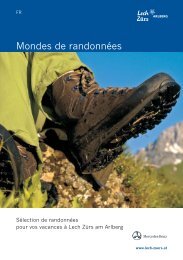
Lech-Zürs - Worlds of hiking
Lech-Zürs - Worlds of hiking
Lech-Zürs - Worlds of hiking

You also want an ePaper? Increase the reach of your titles
YUMPU automatically turns print PDFs into web optimized ePapers that Google loves.
EN<br />
<strong>Worlds</strong> <strong>of</strong> <strong>hiking</strong><br />
Selected hikes<br />
for your holiday in <strong>Lech</strong> <strong>Zürs</strong> am Arlberg<br />
www.lech-zuers.at
Discover worlds <strong>of</strong> <strong>hiking</strong><br />
<strong>Worlds</strong> <strong>of</strong> <strong>hiking</strong><br />
Who hasn’t experienced and longed for it – the relief <strong>of</strong> a deep breath again when, after a stressful<br />
week <strong>of</strong> hustle and bustle, one starts <strong>of</strong>f on a hike, is surrounded by luscious green pastures<br />
and breathes fresh air again at last – or the pleasant feeling <strong>of</strong> stretching one’s legs under the<br />
pub table after a long hike. In these moments – for example at beautiful viewpoints or idyllic<br />
picnic areas – one is in complete harmony with oneself and one's environment.<br />
The pace <strong>of</strong> our lives has accelerated to such an extent that our senses are sometimes hardly<br />
able to cope anymore. Hiking gives us back some <strong>of</strong> that fleeting time and provides an unhurried<br />
environment in which body and soul can really thrive.<br />
This is why you won’t find any <strong>of</strong> the usual superlatives on the next few pages – just a selection<br />
<strong>of</strong> various paths, routes, trails and hikes, suitable for people <strong>of</strong> all ages and levels <strong>of</strong> fitness.<br />
More than 350 km <strong>of</strong> clearly sign-posted <strong>hiking</strong> trails lead through a unique region <strong>of</strong> majestic<br />
mountains, blooming pastures, fragrant forests, murmuring streams and crystal clear mountain<br />
lakes. With a little luck, you can witness chamois and ibex jumping daringly across steep rocks,<br />
or hear the distinctive whistling call <strong>of</strong> marmots by the wayside. Happy cows graze peacefully<br />
on succulent pastures and traditional rustic taverns invite you to take a pleasant break and enjoy<br />
homemade products.<br />
We wish you a great time finding new perspectives, discovering new favourite spots and gaining<br />
new impressions!
All tours 1<br />
Contents<br />
No. Page Category<br />
<strong>Lech</strong> Card 2<br />
Difficulty index 3<br />
1 Burgwald path j 4 – 5<br />
2 Flühenweg path j 6 – 7<br />
3 <strong>Lech</strong> riverbank path j 8 – 9<br />
4 Bodenalpe 10 – 11<br />
5 Zuger Tobel j 12 – 13<br />
6 Ravensburger hut 14 – 15<br />
7 Tannberg 16 – 17<br />
8 Geology hike “Rüfikopf” 18 – 19<br />
9 Geology hike “Sea <strong>of</strong> Stone” – Freiburger hut 20 – 23<br />
10 On the footsteps <strong>of</strong> the Walser people 24 – 25<br />
11 Nature protection area “gypsum holes” 26 – 27<br />
12 “Der Grüne Ring“ (the Green Ring) – 1. Leg 28 – 29<br />
13 “Der Grüne Ring“ (the Green Ring) – 2. Leg 30 – 31<br />
14 “Der Grüne Ring“ (the Green Ring) – 3. Leg 32 – 33<br />
15 On crystal clear paths 34 – 35<br />
16 <strong>Lech</strong>weg – 1. Leg 36 – 37<br />
17 <strong>Lech</strong>weg – 2. Leg 38 – 39<br />
18 Göppinger hut 40 – 41<br />
19 Stuttgarter hut 42 – 43<br />
20 Gehren ridge 44 – 45<br />
21 Mohnenfluh 46 – 47<br />
22 Rüfispitze 48 – 49<br />
23 Karhorn fixed rope route 50 – 51<br />
24 Spullersee Lake 52 – 53<br />
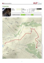
25 Kriegerhorn tour 54 – 55<br />
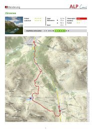
26 All around the Karhorn 56 – 57<br />
27 Burgwald Bike Trail 58 – 59<br />
Behaviour guidelines for hikes / bus network 60<br />
Legend 61<br />
WALKS<br />
FAMILY HIKES<br />
THEME HIKES<br />
MYTHOLOGICAL HIKES<br />
WATER HIKES<br />
MOUNTAIN HIKES<br />
PEAKS<br />
CYCLING TOURS
2 <strong>Lech</strong> Card<br />
<strong>Lech</strong> is waiting for you!<br />
Small, stylish, practical and as valuable as<br />
cash: the <strong>Lech</strong> card is your recreation<br />
ticket* for <strong>Lech</strong> and its surrounding areas.<br />
It has everything you want, from modern<br />
mobility to healthy sports, from childfriendly<br />
activities to family-friendly fun,<br />
from breath-taking mountain adventures to<br />
cultivated cultural delights.<br />
A whole spectrum <strong>of</strong> experiences just for<br />
you. Can you hear that? The Arlberg is calling!<br />
Enjoy this unique range <strong>of</strong> options:<br />
• Access to all running cable cars and chairlifts<br />
• Local and tour buses, regional lines 40 and 91/92 between <strong>Lech</strong> and <strong>Zürs</strong><br />
• Child care in the Kids Active Club<br />
• Selected, guided hikes<br />
• Forest swimming pool with rock island<br />
• Tennis- and beach volleyball courts<br />
• Running and walking trails<br />
• Day fee for the <strong>Lech</strong> Golf Academy (driving range, putting green and 3 holes)<br />
• Buxbaum family play park: mini golf, Pit-pat (obstacle billiards), billiards, baby and toddler<br />
paradise<br />
• Open-air concerts, slide shows, museums, library<br />
* You receive the <strong>Lech</strong> Card with just one overnight stay.
Dfficult index 3<br />
Difficulty index<br />
Each recommendation in "<strong>Worlds</strong> <strong>of</strong> Hiking” contains details about the difficulty <strong>of</strong> the hike. The<br />
most difficult hike in the brochure is marked as black, the difficult routes are blue, intermediate<br />
hikes are red and the easiest are yellow. The colours are shown in the elevation pr<strong>of</strong>ile <strong>of</strong> the<br />
relevant hike and on the markers and sign-posts in the <strong>hiking</strong> area. The following illustration<br />
shows the basic classification:<br />
HIKING<br />
hikes in alpine valleys or<br />
low mountain ranges<br />
Hikes on level terrain; more like long<br />
walks. The terrain consists <strong>of</strong> comfortable<br />
paths through forests and<br />
pastures or forest and transportation<br />
roads and tracks without significant<br />
changes in altitude.<br />
Mostly unspoilt and clearly signposted<br />
paths and tracks, rarely in<br />
steep terrain. Short challenging passages<br />
are possible. The changes in altitude<br />
are so moderate that the hike<br />
can also be undertaken with athletic<br />
children.<br />
MOUNTAIN HIKES<br />
day-trips in low mountain<br />
ranges, as well as classic<br />
mountain hut hikes<br />
Intermediate hikes including both<br />
comfortable <strong>hiking</strong> trails and sometimes<br />
stony paths and “tree root<br />
trails”. Only moderate changes in altitude<br />
<strong>of</strong> up to 300 m at most and<br />
never for long.<br />
Easy to walk, sign-posted mountain trails<br />
or mountain hut routes without any<br />
climbing required. Follows sometimes<br />
steep tracks and paths that do not have<br />
any obvious dangers. No summit ascents.<br />
The changes in altitude are hard<br />
work for untrained people, but for trained<br />
people they are moderate. A good level <strong>of</strong><br />
fitness and sure-footedness are required.<br />
ALPINE<br />
Alpine tours. You must be<br />
sure-footed and not suffer<br />
from vertigo.<br />
Summit ascents with some easy<br />
climbing (I) without obvious dangers.<br />
Routes not sign-posted throughout,<br />
partially not on paths. You must have<br />
some alpine experience and be surefooted<br />
and free from vertigo.<br />
Summit ascent with climbing up to a<br />
maximum difficulty level <strong>of</strong> II (UIAA).<br />
Some alpine fixed rope routes in categories<br />
C+D. Usually without paths<br />
and not sign-posted.
4 Walks<br />
1 Burgwald path<br />
This hike is a little more challenging<br />
but you will be rewarded with<br />
gorgeous views.<br />
Elevation pr<strong>of</strong>il: Burgwald path<br />
Distance: 3,0 km Altitude difference: 191 m 192 m Duration: 1:30 h<br />
Hikes:<br />
Condition:<br />
The walk starts at the hike starting point in<br />
front <strong>of</strong> the post <strong>of</strong>fice. You then follow the<br />
<strong>Lech</strong> Promenade downstream to (1) Martin’s<br />
Chapel. Here, you follow the forest trail to<br />
your left, going steeply uphill. After the first<br />
incline, you will get to a (2) rest place. Then<br />
continue through the forest, always slightly<br />
uphill. You can enjoy the view back over <strong>Lech</strong><br />
from several clearings. You will eventually
Walks 5<br />
reach a forest road, which you follow downhill<br />
to the left through the forest.<br />
After the wooded area, you reach broad<br />
swathes through which the forest road winds<br />
its way downwards.<br />
Soon, you reach the rustic (3) Rud-Alpe.<br />
Here, you can rest and have a bite to eat on<br />
the generous sun terrace or in the cosy interior<br />
with its open fireplace. Further on downwards<br />
you will pass a (4) rest place.<br />
INSIDER’S TIP:<br />
From here, it is only a few metres downhill<br />
until you get to a back road.<br />
Follow the road on the left-hand side and<br />
turn right at the next junction going downhill<br />
until you reach an old ro<strong>of</strong>ed wooden bridge.<br />
Follow the <strong>Lech</strong> Promenade to the left going<br />
downstream. When you reach the Pension<br />
Waldesruh, cross the <strong>Lech</strong> River on the<br />
bridge and you will end up back at the starting<br />
point.<br />
• Special features: The walk can be shortened by using the Oberlech cable car<br />
• Sights: Martin’s Chapel “an der Straß“; roadside shrine in the Tannberg district<br />
• Refreshment stops: Restaurants in <strong>Lech</strong> am Arlberg or Oberlech and the Rud-Alpe
6 Walks<br />
2 Flühenweg path<br />
This walk <strong>of</strong>fers gorgeous views <strong>of</strong><br />
the picturesque <strong>Lech</strong> am Arlberg.<br />
Elevation pr<strong>of</strong>il: Flühenweg path<br />
Distance: 3,3 km Altitude difference: 90 m 90 m Duration: 1:00 h<br />
Hikes:<br />
Condition:<br />
The walk begins at the hike starting point in<br />
front <strong>of</strong> the post <strong>of</strong>fice. Follow the <strong>Lech</strong><br />
Promenade upstream until you see the Hotel<br />
Pfefferkorn to your left. Walk past the hotel<br />
and turn left onto a back road going slightly<br />
uphill. The street goes through the Ebra district<br />
for a few metres. Soon, a paved path<br />
branches <strong>of</strong>f to the left, which you follow to<br />
the edge <strong>of</strong> the forest. Here, you now take a
Walks 7<br />
forest path to the left going slightly uphill.<br />
From here, you can already enjoy the fantastic<br />
panoramic view <strong>of</strong> <strong>Lech</strong> am Arlberg and<br />
the (1) 3-hole golf course.<br />
After a few metres, you will get to a (2) barbecue<br />
site built with great attention to detail.<br />
You will find everything you need for a<br />
fun barbecue here. It is therefore definitely a<br />
good idea to bring food and possibly paper<br />
plates and cutlery with you!<br />
The walk continues along the same path until<br />
you reach a small forest. A very special<br />
rest stop awaits you here – the (3) Seelenbaumler<br />
(hammock). Take a seat, relax and<br />
enjoy the view <strong>of</strong> the mountain landscape.<br />
INSIDER’S TIP:<br />
The path continues to the edge <strong>of</strong> the forest,<br />
where you will find another (4) rest place.<br />
Here, turn left and follow the agricultural<br />
road past the stables and across the pasture<br />
until you reach the first houses.<br />
From here, continue along the paved back<br />
road through the Anger district to the church<br />
square. The (5) Steinplatz is located here,<br />
which boasts stone sculptures made from<br />
6 different types <strong>of</strong> stone. These witnesses<br />
<strong>of</strong> the Earth's history invite you to a geological<br />
"investigation".<br />
You then walk around the church and, via a<br />
paved pathway, you will get back to the<br />
starting point.<br />
• Special features: The pastures contain numerous medicinal herbs; there is a good<br />
place for a break at Mesner’s Stables (next to the church)<br />
• Sights: Parish church St. Nikolaus<br />
• Refreshment stops: Restaurants in <strong>Lech</strong> am Arlberg
8 Walks<br />
3 <strong>Lech</strong> riverbank path<br />
This walk is ideal for families with<br />
small children, as a pram can be<br />
taken along.<br />
Elevation pr<strong>of</strong>il: <strong>Lech</strong> riverbank path<br />
Distance: 3,2 km Altitude difference: 90 m 90 m Duration: 1:00 h<br />
Hikes:<br />
Condition:<br />
From the hike starting point in front <strong>of</strong> the<br />
post <strong>of</strong>fice, follow the <strong>Lech</strong> Promenade on<br />
the left and continue upstream. Cross the<br />
road when you reach the old ro<strong>of</strong>ed wooden<br />
bridge and continue past the house “Chalet<br />
Säge”. When you reach Hûs No. 8, turn right
Walks 9<br />
onto the back road. Follow the road past the<br />
(1) Chapel, continue straight ahead uphill,<br />
then across level ground until the path ends<br />
and leads onto a gravel forest path. Follow<br />
the path alongside the sparkling <strong>Lech</strong> River.<br />
When you reach the (2) Kneipp facilities, a<br />
wooden bridge leads across the <strong>Lech</strong> River<br />
to the (3) forest swimming pool. You can<br />
take a break here and relax in the warm water,<br />
which is at a constant temperature <strong>of</strong><br />
25°. The forest swimming pool <strong>of</strong>fers lots <strong>of</strong><br />
fun especially for children, with its water<br />
slide, rock island, children’s pool, playground,<br />
etc.<br />
Once you have refreshed yourselves, continue<br />
alongside the river past a (4) barbecue<br />
site built with great attention to detail. Just<br />
INSIDER’S TIP:<br />
before you reach the Zug district, you will<br />
find (5) relaxation recliners directly on the<br />
riverside.<br />
Follow the path until you get to the lower station<br />
<strong>of</strong> the Zug cable car. From here on, the<br />
path is paved again. Cross the bridge and<br />
walk across the car park to the (6) fish pond.<br />
Here you can do some fishing yourself and<br />
enjoy your freshly prepared fish right there<br />
and then.<br />
The journey back takes you along the <strong>Lech</strong><br />
riverside path again, or you can walk into<br />
Zug town centre and take the <strong>hiking</strong> bus<br />
back to the starting point.<br />
• Special features: The extensive gravel banks allow you to “immortalise” yourself<br />
here with a little stone man<br />
• Sights: Omesberg Chapel<br />
• Refreshment stops: Restaurants in <strong>Lech</strong> am Arlberg or Zug and the fish pond
10 Family hikes<br />
4 Bodenalpe<br />
This family hike is particularly<br />
diverse due to the many possible<br />
route options.<br />
The walk begins at the hike starting point in<br />
front <strong>of</strong> the post <strong>of</strong>fice. Follow the <strong>Lech</strong><br />
Promenade upstream until you see the Hotel<br />
Pfefferkorn to your left. Walk past the hotel<br />
and turn left onto a back road going slightly<br />
uphill. The street goes through the Ebra district<br />
for a few metres.<br />
Soon, a paved path branches <strong>of</strong>f to the left,<br />
which you follow to the edge <strong>of</strong> the forest.<br />
Here, you now take a forest path to your left<br />
going slightly uphill. From here, you can already<br />
enjoy the fantastic panoramic view <strong>of</strong><br />
Elevation pr<strong>of</strong>il: Bodenalpe<br />
Distance: 5,0 km Altitude difference: 214 m 224 m Duration: 2:00 h<br />
Hikes:<br />
Condition:<br />
<strong>Lech</strong> am Arlberg and the (1) 3-hole golf<br />
course.<br />
After a few metres, you will get to a (2) barbecue<br />
site built with great attention to<br />
detail.<br />
The walk continues down the same path until<br />
you reach a small wood. A very special<br />
spot for a rest awaits you here – the (3) Seelenbaumler<br />
(hammock). The path continues<br />
to the edge <strong>of</strong> the forest, where you will find<br />
another (4) rest stop. You now continue<br />
downhill to the stables and then turn right<br />
again onto a forest path. Follow the path<br />
through a forest and across a stream until<br />
you reach a christian wayside shrine. At the<br />
shrine, take the ascending supply road on<br />
the right. When you have passed a (5) rustic
Family hikes 11<br />
lodge, follow the path to the left going uphill<br />
towards the Tristeller Alpe. The path continues<br />
fairly evenly here on level ground. You<br />
will reach a junction; follow the signpost to<br />
the left going downhill onto a forest road<br />
through the forest. Stay on the wide gravel<br />
road until you see a narrow track that<br />
branches <strong>of</strong>f sharply to the left towards the<br />
Bodenalpe. Follow the path through the forest;<br />
a few steps will take you down to the<br />
<strong>Lech</strong> River.<br />
Cross the wooden bridge to get to the other<br />
side. From here, a narrow path leads upwards<br />
across a pasture to the (6) Bodenalpe.<br />
After a well-deserved rest, you can take the<br />
same path back to <strong>Lech</strong>, or you can take the<br />
<strong>hiking</strong> bus, which stops directly in front <strong>of</strong><br />
the Bodenalpe.<br />
INSIDER’S TIP:<br />
Route A: Tristeller Alpe<br />
When you reach the junction follow the signpost<br />
to Tristeller Alpe. Going slightly uphill,<br />
you will reach the Göldenboden Alpe after<br />
crossing wide pastures. Across mountain<br />
pastures and finally over winding roads, you<br />
will ascend steadily to the Tristeller Alpe.<br />
From there you have a fantastic view <strong>of</strong> <strong>Lech</strong><br />
am Arlberg, Oberlech and Bürstegg. You can<br />
return via the same path.<br />
Route B: Hike around Stubenbach<br />
When you reach the junction to the Tristeller<br />
Alpe, follow the signpost to the left going<br />
downhill onto a forest road through the forest.<br />
After a few hairpin curves, a narrow forest<br />
path branches <strong>of</strong>f to your left, which<br />
takes you back to the Stubenbach area and<br />
the <strong>Lech</strong> am Arlberg town centre.<br />
• Special features: The path can also be completed in the opposite direction.<br />
• Sights: The Bodenalpe is a 400 year old building, today’s the Bodenalpe welcomes<br />
guests with beautiful architecture, charming ambience and invigorating<br />
fare.<br />
• Refreshment stops: Restaurants in <strong>Lech</strong> am Arlberg, Stubenbach-Stüble and<br />
Bodenalpe
12 Family hikes<br />
5 Zuger Tobel<br />
This hike through the Zuger Tobel<br />
valley leads through a particularly<br />
charming landscape.<br />
Elevation pr<strong>of</strong>il: Zuger Tobel<br />
Take the <strong>hiking</strong> bus towards Oberlech directly<br />
from the hike starting point at the post<br />
<strong>of</strong>fice. Get <strong>of</strong>f at the last stop “Schlössle”<br />
and follow the street. Follow the paved back<br />
road to your right going uphill.<br />
You will get to the (1) view point “Tannegg”<br />
incl. barbecue site, continue uphill to the left<br />
past the (2) Grubenalpe.<br />
The hike continues along a gravel alpine path<br />
across species-rich pastures, always going<br />
Distance: 6,9 km Altitude difference: 309 m 524 m Duration: 2:30 h<br />
Mountain hikes:<br />
Condition:
Family hikes 13<br />
uphill. You will get to the (3) Kriegeralpe,<br />
where you can take a rest. From here, it is<br />
only a short walk uphill, past the (4) "Chlup -<br />
pa" stone wall and the (5) Speichersee Lake.<br />
Now follow the alpine path downhill through<br />
the Zugertobel, past the valley station <strong>of</strong> the<br />
Steinmähder lift. The lively murmuring <strong>of</strong> the<br />
stream will accompany you on your descent<br />
INSIDER’S TIP:<br />
until you reach a paved road. Follow the<br />
street to the left going downhill into the Zug<br />
district.<br />
From here, you can take the <strong>hiking</strong> bus at the<br />
toll station and ride back to the starting<br />
point. Or you can hike back to <strong>Lech</strong> am Arlberg<br />
via the <strong>Lech</strong> riverbank path.<br />
• Special features: Instead <strong>of</strong> taking the <strong>hiking</strong> bus, you can also reach Oberlech<br />
with the Oberlech cable car and then hike to the “Schlössle” on foot<br />
• Sights: nature protection area “gypsum holes” – a beautifully designed geological<br />
education path branches <strong>of</strong>f at the Grubenalpe. It provides easily understandable<br />
insights into the formation <strong>of</strong> this sinkhole landscape. The varied landscape<br />
also provides protection to marmots and the s<strong>of</strong>t gypsum rocks are ideal<br />
for building caves.<br />
• Refreshment stops: Restaurants in <strong>Lech</strong> am Arlberg or Oberlech, Kriegeralpe and<br />
restaurants in Zug
14 Family hikes<br />
6 Ravensburger hut<br />
The hike to the Ravensburger hut<br />
is a great experience for the whole<br />
family, with beautiful views over<br />
the Spullersee Lake.<br />
From the hike starting point at the post <strong>of</strong>fice,<br />
you take the <strong>hiking</strong> bus towards<br />
Spullersee (please observe the toll fee). Get<br />
<strong>of</strong>f at the last stop and walk around the<br />
(1) Spul lersee Lake on the wide alpine path.<br />
Elevation pr<strong>of</strong>il: Ravensburger hut<br />
When you have left the lake behind, the path<br />
begins to ascend a little.<br />
When you reach the (2) Ravensburger hut,<br />
you can rest and have a bite to eat, enjoying<br />
the gorgeous view <strong>of</strong> the lake below you. After<br />
some refreshments, the alpine path continues<br />
uphill for a short distance. Keep to the<br />
left and reach the (3) Alpe Brazer Staffel.<br />
Between the residential house and the stables,<br />
the alpine path continues uphill; after a<br />
few hairpin bends, you have reached the<br />
Distance: 9,0 km Altitude difference: 345 m 688 m Duration: 3:30 h<br />
Mountain hikes:<br />
Condition:
Family hikes 15<br />
highest point, the (4) Stierlochjoch Pass<br />
(2,009 m).<br />
From here, the path continues gently downhill.<br />
After a few metres <strong>of</strong> altitude difference,<br />
you leave the wide alpine path. Continue<br />
straight ahead through the Mugo Pines and<br />
then later through the forest.<br />
You will reach a forest and alpine road where<br />
you walk to the right going uphill for a<br />
stretch. Soon, you will see a sign-posted path<br />
to your left leading to the (5) “Wasserfall-<br />
INSIDER’S TIP:<br />
weg”, the waterfall path. Now you walk down<br />
to the waterfall along a narrow trail. Shortly<br />
after the waterfall, you will get to a beautiful<br />
barbecue site that is recommended particularly<br />
for hot days.<br />
Follow the path continuing downstream towards<br />
Zug. You will reach a wide path. Now<br />
you can either walk on the right-hand side on<br />
the <strong>Lech</strong> riverbank path towards <strong>Lech</strong> am<br />
Arlberg, or you turn left and walk to the<br />
(6) fish pond and take the bus back to the<br />
start ing point.<br />
• Special features: The Spullersee Lake is also suitable for fishing. You can get your<br />
fishing permit at the <strong>Lech</strong> <strong>Zürs</strong> Tourist Office.<br />
• Sights: The waterfall and nearby barbecue site invite you to stay for a while<br />
• Refreshment stops: Ravensburger hut, Alpe Brazer Staffel, fish pond and restaurants<br />
in <strong>Lech</strong> am Arlberg or Zug
16 Family hikes<br />
7 Tannberg<br />
This varied hike takes you through<br />
the beautiful natural and cultural<br />
landscape <strong>of</strong> the Tannberg <strong>hiking</strong><br />
region.<br />
Take the <strong>hiking</strong> bus towards Oberlech directly<br />
from the hike starting point at the post<br />
<strong>of</strong>fice. Get <strong>of</strong>f at the last stop “Schlössle”.<br />
Follow the road going uphill. Soon a paved<br />
back road branches <strong>of</strong> to the right. Follow<br />
the road until you get to the (1) view point<br />
“Tannegg” incl. barbecue site. From here, a<br />
good path on your right takes you downhill<br />
to the far side <strong>of</strong> the Tobel River. Now you<br />
Elevation pr<strong>of</strong>il: Tannberg<br />
take the wooden bridge to the other side and<br />
then ascend steadily to the (2) Gaisbühelalpe.<br />
Across colourful mountain pastures with extensive<br />
(3) chive fields, you ascend leisurely<br />
to the Auenfeld saddle. Here, turn left onto<br />
the wide alpine path and walk to the (4) Untere<br />
Auenfeldalpe. Continue along the alpine<br />
path to your left, following the stream<br />
through the Auenfeld out <strong>of</strong> the valley until<br />
you see a small path branching <strong>of</strong>f to your<br />
right leading towards Körbersee Lake. Follow<br />
this path uphill and soon you will enjoy the<br />
beautiful view <strong>of</strong> the (5) Körbersee Lake. The<br />
path now follows the slope <strong>of</strong> the hill down to<br />
Distance: 9,0 km Altitude difference: 288 m 354 m Duration: 2:30 h<br />
Mountain hikes:<br />
Condition:
Family hikes 17<br />
the shore <strong>of</strong> the lake. Continue along the<br />
shore until you reach (6) Hotel Körbersee.<br />
Keep going, following a distinctly wider<br />
alpine path until you reach the (7) Kalbelesee<br />
Lake. Now you are just a few metres, following<br />
the main road keeping right, from the<br />
bus stop. The <strong>hiking</strong> bus will take you back to<br />
the starting point.<br />
INSIDER’S TIP:<br />
Route A:<br />
Instead <strong>of</strong> following the narrow path towards<br />
Körbersee Lake, stay on the wide alpine path<br />
that leads you directly to the (8) "Alpine museum<br />
on the Tannberg" and to the<br />
Batzenalpe.<br />
After visiting the museum and, if you like,<br />
taking some refreshments at the Batzenalpe,<br />
follow the alpine path uphill keeping right.<br />
The path will lead you directly to the Hotel<br />
Körbersee. From here, continue to the final<br />
point <strong>of</strong> this hike along the route described<br />
above.<br />
• Special features: Instead <strong>of</strong> taking the <strong>hiking</strong> bus, you can also reach Oberlech<br />
with the Oberlech cable car and then hike to the “Schlössle” on foot<br />
• Sights: “Sennerei” alpine dairy farming museum – the front <strong>of</strong> the building<br />
<strong>of</strong>fers the opportunity to take a peek through the windows to see the housing and<br />
living style <strong>of</strong> former days.<br />
• Refreshment stops: Restaurants in <strong>Lech</strong> am Arlberg or Oberlech, Untere<br />
Auenfeldalpe, Batzenalpe and Hotel Körbersee
18 Theme hikes<br />
8 Geology hike “Rüfikopf”<br />
This geological tour takes you on<br />
a fantastic journey through time –<br />
past the “stone witnesses” on a<br />
trail through the centuries. Discover<br />
the secrets <strong>of</strong> a world that<br />
allows us to unlock new dimensions<br />
<strong>of</strong> time.<br />
From the hike starting point, follow the <strong>Lech</strong><br />
Promenade upstream until you see the<br />
Rüfikopfbahn cable car to your left. Take the<br />
cable car up the (1) Rüfikopf (2,350 m).<br />
Elevation pr<strong>of</strong>il: Geology hike “Rüfikopf”<br />
When you have passed the top station <strong>of</strong> the<br />
Rüfikopfbahn cable car, turn right and follow<br />
the sign-posted path through the grandiose<br />
(2) “Rüfikopf Plateau” until you reach a<br />
wider path that will take you to the (3) Monzabonsee<br />
Lake.<br />
Here, follow the sign-posted path to your left<br />
going uphill to the pass. Then keep going uphill<br />
for a short stretch until you reach a wide<br />
alpine path.<br />
Turn right and follow the path back to the<br />
starting point.<br />
Distance: 3,4 km Altitude difference: 201 m 201 m Duration: 1:30 h<br />
Mountain hikes:<br />
Condition:
Theme hikes 19<br />
INSIDER’S TIP:<br />
OVERVIEW OF THE JOURNEY<br />
THROUGH TIME<br />
• Special features: On this hike, you will find the Geoweg logo (a mollusc) at each<br />
geological site <strong>of</strong> interest, along with a number and a capital letter for identification.<br />
• The accompanying brochure is available at the <strong>Lech</strong> <strong>Zürs</strong> Tourist Office and from<br />
the valley and summit stations <strong>of</strong> the Rüfikopf cable car. It costs € 5.–<br />
• Sights: “Stone witnesses” – the sites <strong>of</strong> interest along the Geoweg adhere to the<br />
chronology <strong>of</strong> the history <strong>of</strong> the Earth as far as possible. In addition to a range<br />
<strong>of</strong> rock strata, a number <strong>of</strong> fossils can also be admired.<br />
• Refreshment stops: Panorama restaurant Rüfikopf and restaurants in <strong>Lech</strong> am<br />
Arlberg<br />
1 Rüfikopf meets Abu Dhabi – the Dolomia Principale Formation<br />
2 Veined stone – fine strata created by microbial mats<br />
3 Crawled and burrowed through – traces <strong>of</strong> micro-life in the rock<br />
4 The changing sea level – grey and yellow lithographic limestone<br />
5 “Cow ho<strong>of</strong> prints” on the seabed – the mystery <strong>of</strong> the megalodons<br />
6 A revealing cycle – sea level fluctuations and bank formation<br />
7 From stormy times – mud flakes become stone breccias<br />
8 The “fluctuating sea” – rock strata and the sea level<br />
9 The changing climate – dark layers as evidence<br />
10 Born in the ocean – Rhaeto-Lias limestone made from shells and corals<br />
11 Boulders embedded with red – about breccia fissures and red Lias limestone<br />
12 Colouration due to oxidation in the sea – the red Lias limestone<br />
13 A “living fossil” – the nautilus has been around for 500 million years<br />
14 Horns <strong>of</strong> Ammon – about the ammonites' beautiful spiral shape<br />
15 Spines in the rock – about the “spiky” traces <strong>of</strong> sea urchins in the limestone<br />
16 Thunderbolts in the rock – the bizarre world <strong>of</strong> the belemnites<br />
17 Delicate life preserved in stone – fragments <strong>of</strong> sea lilies in the limestone<br />
18 When time stood still geologically – gaps in the sedimentation and mineralisation<br />
19 The foundation <strong>of</strong> the green meadows – about the Cretaceous shale and fertile soil in the<br />
<strong>Lech</strong> valley<br />
A A violent collision – the Rüfikopf with its folds, an example <strong>of</strong> an overthrust mountain<br />
B Time turned on its head – the Rüfispitze as an overthrust mountain<br />
C The creation <strong>of</strong> the landscape – the power <strong>of</strong> Ice Age glaciers and the climate<br />
D The beauty <strong>of</strong> the barren – to the karst area with its channels and sink holes
20 Theme hikes<br />
9 Geology hike “Sea <strong>of</strong> Stone” –<br />
Freiburger Hütte<br />
Delve into the stone sea <strong>of</strong> corals,<br />
sea shells, auger shells,<br />
ammonites ...<br />
From the hike starting point at the post <strong>of</strong>fice,<br />
take the <strong>hiking</strong> bus towards Formarinsee<br />
Lake (please observe the toll fee).<br />
After the ride through the beautiful Zugertal<br />
valley, get <strong>of</strong>f at the last stop. Follow the<br />
main road back to the (1) Alpe Formarin.<br />
After the alp, a pasture path branches <strong>of</strong>f to<br />
the right, which takes you past the (2) ibex<br />
monument across alpine pastures. At the<br />
next junction, follow the sign-posted trail to<br />
your right going uphill.<br />
After the climb, you reach the first find site<br />
<strong>of</strong> interest: a (b) small coral reef, a precur-
Theme hikes 21<br />
sor <strong>of</strong> the stone sea. All the sites <strong>of</strong> interest<br />
are marked by metal sleeves indicating the<br />
relevant capital letters.<br />
Continue along the path, which takes you to<br />
the sites <strong>of</strong> interest through the (c) Karstgebiet<br />
region.<br />
At the next junction, turn left to a further<br />
(d) si te <strong>of</strong> interest. Here you are challenged<br />
to discover countless belemnites, nautiloids<br />
and ammonites in the red limestone. They<br />
are generally regarded as the predecessors<br />
<strong>of</strong> the squid.<br />
Walk back to the junction and take the path<br />
going straight ahead. After just a few metres<br />
INSIDER’S TIP:<br />
you will encounter a big agglomeration <strong>of</strong><br />
(e) Me galodontidae in various forms and<br />
cross sections, among them the “ibex horn”.<br />
This is a giant clam, the shell <strong>of</strong> which has<br />
been partially abraded by erosion.<br />
Stay on this path until you reach the (3) Frei -<br />
burger hut. Here you can have a bite to eat<br />
and enjoy the view <strong>of</strong> the (4) Formarinsee<br />
Lake.<br />
From here, you can either follow the wide<br />
supply road around the lake or take the<br />
shorter, narrower <strong>hiking</strong> trail to your right –<br />
this path is only recommended for experienced<br />
hikers that do not suffer from vertigo.<br />
• Special features: Fossils up to 200 million years old can be discovered,<br />
examined and touched here<br />
• Sights: Stone Sea – a big agglomeration <strong>of</strong> fossils, among them the fossil<br />
referred to by local hunters as the "ibex horn"<br />
• Refreshment stops: Restaurants in <strong>Lech</strong> am Arlberg or Zug, Alpe Formarin,<br />
Gasth<strong>of</strong> Älpele and Freiburger hut
22 Theme hikes<br />
Small geological encyclopaedia<br />
Oberrät limestone: This light limestone is<br />
approx. 220 million years old. Its formation<br />
is comparable to a “small-scale barrier reef":<br />
corals at the front with lagoon conditions behind<br />
them; a habitat for snails and shells,<br />
amongst other species. This sedimentary<br />
rock developed from the shells <strong>of</strong> these and<br />
from limestone deposits from the ocean.<br />
Red limestone: This limestone gives the Rote<br />
Wand (red wall) its name, is approx. 200 million<br />
years old and contains traces <strong>of</strong> iron.<br />
The main fossils here are ammonites and<br />
belemnites.<br />
Calcite: A "crevice filler” that fills out cavities,<br />
e.g. cracks in the limestone. The aragonite<br />
that the shells <strong>of</strong> clams and snails are<br />
made <strong>of</strong> crystallises to form calcite. Branching<br />
corals, too, are filled with this white, crystal-like<br />
material.<br />
Ammonite (Fig. p. 20): Ammonites are ce -<br />
pha lopods that died out around 70 million<br />
years ago. They had a flat, spiralled limestone<br />
shell, part <strong>of</strong> which was used as the<br />
body chamber. They are generally regarded<br />
as the predecessors <strong>of</strong> squid.<br />
Elevation pr<strong>of</strong>il: Geology hike “Sea <strong>of</strong> Stone” – Freiburger hut<br />
Belemnites: Belemnites are stick-shaped,<br />
squid-like cephalopods with 10 arms. The<br />
skeletal rostrum <strong>of</strong> this mollusc is bulletshaped<br />
and has been preserved as a fossil. It<br />
died out approx. 70 million years ago and<br />
lives on in the form <strong>of</strong> squid today.<br />
Megalodontidae (Fig. p. 23): These molluscs<br />
used to stick upright in the sand and could<br />
sometimes reach quite an impressive size.<br />
The shells <strong>of</strong> these extinct molluscs have<br />
been replaced by calcite. People used to believe<br />
that the formations in the rock resembling<br />
cow's feet were the devil's ho<strong>of</strong> prints.<br />
Nautiloids: are squid with a spiralled or<br />
stretched shell with several chambers; the<br />
animal lives in the outermost chamber. In<br />
contrast to ammonites, the spirals <strong>of</strong> the<br />
shell are bent forwards, and nautiloids can<br />
still be found in our oceans today.<br />
Please do not damage the objects –<br />
you would be destroying the fossils forever!<br />
Distance: 8,3 km Altitude difference: 250 m 250 m Duration: 3:30 h<br />
Mountain hikes:<br />
Condition:
Theme hikes 23<br />
“Ibex horn” and<br />
Megalodontidae
24 Theme hikes<br />
10 On the footsteps <strong>of</strong> the<br />
Walser people<br />
This route takes you to numerous<br />
sites that are significant in terms<br />
<strong>of</strong> culture and natural history.<br />
Elevation pr<strong>of</strong>il: On the footsteps <strong>of</strong> the Walser People<br />
Take the <strong>hiking</strong> bus towards Oberlech directly<br />
from the hike starting point at the post<br />
<strong>of</strong>fice. Get <strong>of</strong>f at the last stop “Schlössle”.<br />
Follow the road. Soon a paved back road<br />
branches <strong>of</strong>f to the right, so you will get to<br />
the (1) view point “Tannegg” incl. barbecue<br />
site. From here, a narrow path on your right<br />
takes you downhill to the far side <strong>of</strong> the Tobel<br />
River. Now take the wooden bridge to the<br />
other side and then ascend steadily to the<br />
(2) Gaisbühelalpe.<br />
Distance: 6,6 km Altitude difference: 294 m 558 m Duration: 2:30 h<br />
Mountain hikes:<br />
Condition:
Theme hikes 25<br />
Across colourful mountain pastures with extensive<br />
(3) chive fields, you will ascend<br />
leisurely to the Auenfeld saddle. Turn right<br />
and follow the <strong>hiking</strong> path, initially uphill and<br />
then downhill again, until you reach an<br />
alpine path just before Bürstegg.<br />
Go to the left until you reach (4) Bürstegg.<br />
You can rest here and take in the unique<br />
landscape and peacefulness. On nice days,<br />
descending to the (5) Wanghus house is definitely<br />
worth the trip. To get there, follow the<br />
INSIDER’S TIP:<br />
path through the pasture behind Bürstegg<br />
going right. Soon, the path becomes a narrow<br />
track that goes downhill fairly steeply to<br />
the Wanghus and ends at the bus stop. In the<br />
event <strong>of</strong> rain, the descent from Bürstegg to<br />
the Bodenalpe via the alpine path is recommended.<br />
Here, too, the path ends right at a<br />
bus stop.<br />
The <strong>hiking</strong> bus will take you back to the starting<br />
point.<br />
• Special features: In the footsteps <strong>of</strong> the Walser settlers on the Tannberg – this<br />
walking guide invites you on a fascinating historical journey through the cultural<br />
landscape <strong>of</strong> the Tannberg. Drawing on the ancient buildings, abandoned Walser<br />
settlements, legends and stunning landscape, the author paints a multifaceted<br />
portrait <strong>of</strong> historical highlights with enthralling details and rich historical atmosphere.<br />
€ 16.50 – available at the <strong>Lech</strong> <strong>Zürs</strong> Tourist Office<br />
• Places <strong>of</strong> interest: Wang-Hus – the oldest house in <strong>Lech</strong> am Arlberg<br />
• Bürstegg – a former Walser settlement, which includes a church and used to be<br />
inhabited all year round, but is now only used for alpine farming<br />
• Refreshment stops: Restaurants in <strong>Lech</strong> am Arlberg or Oberlech, Bürstegg and<br />
Bodenalpe
26 Theme hikes<br />
11 Nature protection area “gypsum holes”<br />
The ideal themed hike for families,<br />
on which ten different types<br />
<strong>of</strong> orchids can be discovered.<br />
The walk begins at the hike starting point in<br />
front <strong>of</strong> the post <strong>of</strong>fice. From here, you take<br />
the back road between the Raiffeisen bank<br />
and the post <strong>of</strong>fice. After you have crossed<br />
the <strong>Lech</strong> River, follow the <strong>Lech</strong> Promenade<br />
on the left-hand side and continue upstream<br />
to the lower station <strong>of</strong> the Schlegelkopf lift.<br />
From the top station, keep left and walk past<br />
the lower station <strong>of</strong> the Kriegerhorn cable<br />
Elevation pr<strong>of</strong>il: Nature protection area “gypsum holes”<br />
car. Follow the path that branches <strong>of</strong>f to the<br />
left here. When you reach a junction, follow<br />
the path going straight ahead ascending to<br />
the (1) nature protection area “gypsum<br />
holes”. Keep to the left and traverse the gypsum<br />
holes. You will reach a supply road,<br />
which you follow downhill to the right until<br />
you reach the (2) Grubenalpe. A beautifully<br />
designed geological education path branches<br />
<strong>of</strong>f to the right here. Follow the <strong>hiking</strong> path<br />
back across the gypsum holes nature protection<br />
area until you reach another junction.<br />
Follow the path to the left going downhill<br />
through beautiful pastures full <strong>of</strong> flowers to-<br />
Distance: 3,4 km Altitude difference: 106 m 272 m Duration: 1:30 h<br />
Mountain hikes:<br />
Condition:
Theme hikes 27<br />
wards Oberlech. You will reach another path.<br />
Follow it, keeping right and going downhill.<br />
The path leads onto a paved back road.<br />
Turn right and walk past the Hotel Goldener<br />
Berg and follow the path to the (3) Bergbahn<br />
Oberlech cable car.<br />
Additional information:<br />
Approximately 220 million years ago, in the Triassic<br />
age, the climate <strong>of</strong> the Oberlech region was very<br />
arid and hot near the equator. The landscape <strong>of</strong> the<br />
then coastal area consisted <strong>of</strong> many small lagoons.<br />
Floods left behind water in the lagoons, which then<br />
evaporated in the scalding heat. As a result, the<br />
concentration <strong>of</strong> the solute substances rose and<br />
sulphates (gypsum, anhydrite) were emitted.<br />
Since the formation <strong>of</strong> the gypsum 220 million<br />
years ago, the Oberlech region has been moving<br />
northwards on a tectonic plate. This plate collided<br />
with the European plate, forming the Alps, and the<br />
former lagoon sediments were lifted to high altitudes.<br />
INSIDER’S TIP:<br />
From here, you can either take the cable car<br />
back to the starting point or take the <strong>hiking</strong><br />
path through the “Burgwald” forest or across<br />
the Rud-Alpe back to the starting point.<br />
The fast-eroding gypsum landscapes display varying<br />
morphological phenomena. On the one hand,<br />
gypsum formation leads to a swelling <strong>of</strong> the<br />
ground and thus to the formation <strong>of</strong> elevations in<br />
the terrain. The sulphate mineral anhydrite, which<br />
is stable at great depths, is turned into gypsum on<br />
the surface level through water absorption. This<br />
also brings about an increase in volume <strong>of</strong> 50 %.<br />
On the other hand, gypsum is dissolved and gypsum<br />
holes are created. An annual average <strong>of</strong> 3 kg<br />
<strong>of</strong> rock per square metre is dissolved and removed<br />
subterraneously.<br />
The gypsum holes are special in botanical terms,<br />
too, as each gypsum hole creates a special microclimate<br />
for plants.<br />
• Special features: The varied landscape also provides protection to marmots.<br />
When the orchids are in bloom from July to mid August, 10 different types <strong>of</strong> orchids<br />
can be found right next to the <strong>hiking</strong> path.<br />
• Sights: The gypsum holes – with over 1000 sinkholes that are unique in size and<br />
appearance, this is one <strong>of</strong> Europe's special geological sites. The largest sinkhole<br />
has a diameter <strong>of</strong> 100 m and a depth <strong>of</strong> 35 m.<br />
• Refreshment stops: Restaurants in <strong>Lech</strong> am Arlberg and Oberlech
28 Mythological hikes<br />
12 “Der Grüne Ring“ – 1. Leg<br />
(the Green Ring)<br />
The newly-designed hike takes you<br />
onto the trails <strong>of</strong> the legendary<br />
"White Ring" ski tour on three<br />
daytrips through the beautiful<br />
mountain landscape <strong>of</strong> <strong>Lech</strong> <strong>Zürs</strong><br />
am Arlberg.<br />
Elevation pr<strong>of</strong>il: “Der Grüne Ring“ – 1. Leg<br />
From the hike starting point, follow the <strong>Lech</strong><br />
Promenade upstream until you see the Rüfikopfbahn<br />
cable car to your left. Take the cable<br />
car to the (1) Rüfikopf (2,350 m). At the<br />
top station <strong>of</strong> the Rüfikopfbahn cable car<br />
there is a (2) book, in which you can document<br />
your visit.<br />
Then follow the (3) Geology hike “Rüfikopf”<br />
going downhill towards (4) Monzabonsee<br />
Lake. From there, continue downwards to the<br />
(5) Monzabonalpe.<br />
Distance: 6,0 km Altitude difference: 96 m 699 m Duration: 2:30 h<br />
Mountain hikes:<br />
Condition:
Mythological hikes 29<br />
Shortly before crossing the Pazüelbach<br />
stream, you will see the very special (6) Hüttenbibliothek<br />
library. You can select a nice<br />
book here, read for a while and relax. Then<br />
continue along the wide alpine path, past the<br />
valley station <strong>of</strong> the Trittkopf lift and onwards,<br />
ascending slightly until the path leads<br />
steeply downhill all the way to <strong>Zürs</strong> am Arlberg.<br />
When you reach <strong>Zürs</strong>, you can take the <strong>hiking</strong><br />
bus back to the starting point or you can<br />
INSIDER’S TIP:<br />
take a little detour and visit the European<br />
watershed.<br />
To do so, follow the road through <strong>Zürs</strong> until<br />
you reach the Trittkopf lift. Here, a pasture<br />
trail winds through the grazing pastures<br />
alongside the river towards the Flexenpass.<br />
When you reach the Flexenpass, cross the<br />
street and you will find this impressive<br />
installation right next to the Flexenhäuslhouse.<br />
• Special features: On this three-day hike, you enter a modern world <strong>of</strong> mythology<br />
that is very humorously and charmingly designed. You can get the book to accompany<br />
the hike at the <strong>Lech</strong> <strong>Zürs</strong> Tourist Office for € 12.–.<br />
• Sights: The European Watershed – here, the water divides and flows either to the<br />
Black Sea or into the North Sea<br />
• Refreshment stops: Restaurants in <strong>Lech</strong> am Arlberg, Panorama restaurant Rüfikopf,<br />
Alpe Monzabon and Flexenhäusl<br />
• At the (7) post boxes, you can pick up free postcards that you can write on the<br />
spot and throw back into the post box. Post is collected and sent out once a year.
30 Mythological hikes<br />
13 “Der Grüne Ring“ – 2. Leg<br />
(the Green Ring)<br />
Take the <strong>hiking</strong> bus towards <strong>Zürs</strong> directly<br />
from the hike starting point at the post <strong>of</strong>fice.<br />
Get <strong>of</strong>f at the <strong>Zürs</strong> stop and walk along<br />
the main road until you reach the roundabout.<br />
Shortly after the roundabout, take the supply<br />
road going steeply uphill with hairpin<br />
bends until you reach the (1) <strong>Zürs</strong>ersee Lake<br />
and then continue uphill to the (2) Taurins<br />
Elevation pr<strong>of</strong>il: “Der Grüne Ring“ – 2. Leg<br />
cave and past the (3) Gate until you reach<br />
the (4) Glacial city <strong>of</strong> Madloch, then on up to<br />
the highest point <strong>of</strong> the Madlochjoch Pass,<br />
where you will find a (5) book which you can<br />
sign.<br />
From there, a narrower path leads through<br />
partially karsified terrain downhill to the<br />
pass between the Stierlochkopf and the<br />
Zuger Mittagsspitze.<br />
Distance: 9,5 km Altitude difference: 793 m 1005 m Duration: 5:30 h<br />
Mountain hikes:<br />
Condition:
Mythological hikes 31<br />
Up here you can see the (6) bivouac. Follow<br />
the hairpins downhill past (7) Taurin the Giant<br />
until you reach another <strong>hiking</strong> trail. Keep<br />
to the right and then turn left going downhill<br />
shortly afterwards. Continue downhill until<br />
you reach the <strong>Lech</strong>weg trail.<br />
Here, you can turn left and take a short detour<br />
to the (8) waterfall and the barbecue<br />
site.<br />
INSIDER’S TIP:<br />
Or you can stay on the trail and walk past the<br />
(9) fish pond until you reach the bus stop in<br />
Zug town centre.<br />
From here, you can take the <strong>hiking</strong> bus back<br />
to the starting point. Those who have not had<br />
enough yet can turn right onto the <strong>Lech</strong> riverbank<br />
path and take a nice stroll back into<br />
<strong>Lech</strong> am Arlberg.<br />
• Special features: The bivouac – serves as a dwelling for anyone who wants to<br />
experience something unique and can make do with a slightly more spartan accommodation.<br />
The key for this airy refuge is available at the <strong>Lech</strong> <strong>Zürs</strong> Tourist<br />
Office. (Please register beforehand)<br />
• Sights: Taurin the Giant – to represent the legend, a huge giant made <strong>of</strong> wood<br />
stands in a crevice, trying to carry the scattered lumps <strong>of</strong> rock back up<br />
• Refreshment stops: Restaurants in <strong>Lech</strong> am Arlberg or Zug, and fish pond<br />
• At the (10) post boxes, you can pick up free postcards that you can write on the<br />
spot and throw back into the post box. Post is collected and sent out once a year.
32 Mythological hikes<br />
14 “Der Grüne Ring“ – 3. Leg<br />
(the Green Ring)<br />
Take the <strong>hiking</strong> bus towards Zug from the<br />
hike starting point at the post <strong>of</strong>fice. Get <strong>of</strong>f<br />
at the “Zuger Kirchle” stop. Follow the paved<br />
road through town until you reach the turn<strong>of</strong>f<br />
to the (1) fish pond.<br />
A pasture trail branches <strong>of</strong>f to the right here,<br />
which leads up through the “ditch” to where<br />
the alp is fenced <strong>of</strong>f. From there, follow the<br />
path diagonally to the right, slightly uphill<br />
between pillars 7 and 8 <strong>of</strong> the Zug cable car<br />
to the edge <strong>of</strong> the forest. A forest path then<br />
goes steeply uphill through the (2) Scribbles<br />
to the (3) Balmalp. From here, a wider alpine<br />
Elevation pr<strong>of</strong>il: “Der Grüne Ring“ – 3. Leg<br />
path continues, on level ground at first, then<br />
inclining to the right and then further uphill<br />
to the peak <strong>of</strong> the (4) Kriegerhorn (2,173 m)<br />
(but you can also stay on the alpine path and<br />
walk directly to the Kriegeralpe).<br />
From there, walk downhill to the (6) stone<br />
wall, past the Speichersee Lake to the<br />
(7) Krie geralpe. After some invigorating refreshments,<br />
continue along the wide alpine<br />
path. Soon, you take a path that branches<br />
<strong>of</strong>f to the right. At the next junction, take the<br />
lovely <strong>hiking</strong> trail to the left through blooming<br />
alpine pastures going downhill until you<br />
Distance: 8,7 km Altitude difference: 644 m 1715 m Duration: 4:30 h<br />
Mountain hikes:<br />
Condition:
Mythological hikes 33<br />
reach a path by the river. Follow the path to<br />
the right going downhill alongside the river<br />
until you reach a paved back road.<br />
Turn right and walk past the Hotel Goldener<br />
Berg. Here you will reach a gravel path on<br />
your left which takes you back downhill to<br />
the lower station <strong>of</strong> the Oberlech cable car.<br />
Turn right and follow the supply road through<br />
the forest clearing to the (8) Libellensee<br />
Lake. The (9) forest education trail will take<br />
you to the extensive pastures <strong>of</strong> the<br />
Schlegelkopf (you can also follow the trail<br />
going downhill from the Oberlech cable car,<br />
which will take you directly to the Rud-Alpe.)<br />
INSIDER’S TIP:<br />
From here, follow the wide supply road going<br />
steeply downhill to the (10) Rud-Alpe, where<br />
you will be rewarded with refreshments on<br />
the beautiful sun terrace.<br />
Continue downhill from here until you reach<br />
a paved back road. Keep to the left and turn<br />
right at the next junction and continue downhill.<br />
This path will take you to the old ro<strong>of</strong>ed<br />
wooden bridge.<br />
Follow the <strong>Lech</strong> Promenade to the left <strong>of</strong> the<br />
river until you reach the Pension Waldesruh.<br />
Cross the <strong>Lech</strong> River on the bridge and you<br />
end up back at the starting point.<br />
• Special features: Scribbles – here you will encounter woodcarvings <strong>of</strong> mythological<br />
creatures at every turn<br />
• Sights: The Libellensee Lake – hidden deep within the forest, the shores <strong>of</strong> this<br />
calm lagoon are inhabited by countless mythological creatures<br />
• Refreshment stops: Restaurants in <strong>Lech</strong> am Arlberg, Zug or Oberlech, Kriegeralpe<br />
and Rud-Alpe<br />
• At the (11) post boxes, you can pick up free postcards that you can write on the<br />
spot and throw back into the post box. Post is collected and sent out once a year.
34 Water hikes<br />
15 On crystal clear paths<br />
On this hike you discover the<br />
source <strong>of</strong> the <strong>Lech</strong> spring water,<br />
which is also fondly referred to as<br />
“Chateau Madloch” or<br />
“Schwarzbach Riesling“.<br />
Elevation pr<strong>of</strong>il: On crystal clear paths<br />
Distance: 84,1 km Altitude difference: 120 m 120 m Duration: 0:45 h<br />
Hikes:<br />
Condition:<br />
From the hike starting point at the post <strong>of</strong>fice,<br />
take the "<strong>Lech</strong> riverbank path” hike described<br />
above to Zug, or take the <strong>hiking</strong> bus<br />
to Zug. When you have passed the (1) fish<br />
pond, continue on the left bank <strong>of</strong> the <strong>Lech</strong><br />
River going upstream.<br />
You can cross the <strong>Lech</strong> at a bridge and will<br />
soon reach the (2) sawmill. Here is the natural<br />
spring <strong>of</strong> the (3) Weissbach River.
Water hikes 35<br />
Just 100 m into the valley along the paved<br />
toll road, you will find the spring <strong>of</strong> the<br />
(4) Schwarz bach River.<br />
Walk over the bridge back to the (5) barbecue<br />
site and follow the <strong>hiking</strong> trail alongside<br />
the river until you cross the <strong>Lech</strong> when you<br />
reach the (6) Gasth<strong>of</strong> Älpele.<br />
Here you can rest for a while and then take<br />
the <strong>hiking</strong> bus back to the starting point.<br />
INSIDER’S TIP:<br />
Additional information:<br />
The high-alpine origin <strong>of</strong> the <strong>Lech</strong> spring water<br />
guarantees natural drinking water that is,<br />
to a large extent, untainted by pollutants<br />
caused by civilisation.<br />
Even using highly-sensitive methods, no<br />
levels <strong>of</strong>, for example, heavy metals, pesticides<br />
or hydrocarbons can be found in the<br />
Schwarzbach spring.<br />
Likewise, the content <strong>of</strong> generally undesirable<br />
nitrate is more than fifty times below<br />
the acceptable guideline value <strong>of</strong> 1 mg per<br />
litre (this value is <strong>of</strong>ten exceeded in regions<br />
with intensive agriculture).<br />
• Special features: Sections <strong>of</strong> the <strong>Lech</strong> have been made available for fly fishing.<br />
Fishing permits are available at the <strong>Lech</strong> <strong>Zürs</strong> Tourist Office.<br />
• Sights: The water treasure <strong>of</strong> the <strong>Lech</strong> municipality – fulfils all the criteria for the<br />
designations “suitable for a low-sodium diet” and “suitable for the preparation <strong>of</strong><br />
baby food".<br />
• Refreshment stops: Restaurants in <strong>Lech</strong> am Arlberg or Zug, fish pond and Gasth<strong>of</strong><br />
Älpele
36 Water hikes<br />
16 <strong>Lech</strong>weg – 1. Leg<br />
This easy long-distance hike takes<br />
you across 120 km <strong>of</strong> trails<br />
through the Alps and one <strong>of</strong> Europe’s<br />
last wild river landscapes.<br />
Elevation pr<strong>of</strong>il: <strong>Lech</strong>weg – 1. Leg<br />
Distance: 14,6 km Altitude difference: 177 m 612 m Duration: 4:30 h Condition:<br />
..<br />
Take the <strong>hiking</strong> bus that heads towards the<br />
Formarinsee Lake from the hike starting<br />
point at the post <strong>of</strong>fice (please observe the<br />
toll fee).<br />
Get <strong>of</strong>f at the last stop and follow the supply<br />
road going gently downhill to the (1) Formarinsee<br />
Lake. Here, you can enjoy the<br />
Mountain hikes:
Water hikes 37<br />
beautiful panoramic view <strong>of</strong> the lake. Turn<br />
back and follow the main road back to the<br />
(2) Alpe Formarin. After the alp, a path<br />
through a pasture branches <strong>of</strong>f to the right,<br />
which takes you past the (3) ibex monument<br />
and across alpine pastures.<br />
At the next junction, follow the sign-posted<br />
trail to the left, stay alongside the <strong>Lech</strong> going<br />
INSIDER’S TIP:<br />
out down the valley, past the (4) Gasth<strong>of</strong><br />
Älpele until you reach the (5) fish pond in<br />
Zug. From here, you can take the “<strong>Lech</strong> riverbank<br />
path” already described above all the<br />
way to <strong>Lech</strong> am Arlberg.<br />
You will pass interesting resting places, idyllic<br />
barbecue sites and cosy inns and restaurants<br />
on your way.<br />
• Special features: Further information on the long-distance hike is available at the<br />
<strong>Lech</strong> <strong>Zürs</strong> Tourist Office or at www.lechweg.com<br />
• Sights: The Formarinsee Lake – a natural mountain lake where fishing is also permitted.<br />
You can obtain a fishing permit at the <strong>Lech</strong> <strong>Zürs</strong> Tourist Office.<br />
• Possible stops: Gasthaus Älpele, restaurants in Zug and <strong>Lech</strong> am Arlberg
38 Water hikes<br />
17 <strong>Lech</strong>weg – 2. Leg<br />
120 kilometres cannot be covered<br />
in a single day. This second leg <strong>of</strong><br />
the hike takes you above the “<strong>Lech</strong><br />
canyon" all the way to Warth.<br />
Elevation pr<strong>of</strong>il: <strong>Lech</strong>weg – 2. Leg<br />
The walk begins at the hike starting point in<br />
front <strong>of</strong> the post <strong>of</strong>fice.<br />
Follow the “Bodenalpe” trail described above<br />
until you reach a narrow track that branches<br />
<strong>of</strong>f sharply to the left towards (1) Bodenalpe.<br />
Distance: 9,3 km Altitude difference: 560 m 508 m Duration: 5:00 h<br />
Mountain hikes:<br />
Condition:
Water hikes 39<br />
Stay on the wide forest path that takes you<br />
above the “<strong>Lech</strong> canyon” to a (2) small<br />
wooden bridge across the <strong>Lech</strong>.<br />
From here, continue upstream, first along a<br />
wagon road and later along a narrow paved<br />
road that leads to (3) Warth town centre.<br />
INSIDER’S TIP:<br />
The <strong>hiking</strong> bus will take you back to <strong>Lech</strong> am<br />
Arlberg from here. If you enjoyed the <strong>Lech</strong><br />
path, you can continue along it all the way to<br />
Füssen im Allgäu.<br />
• Special features: The path can also be walked in the opposite direction<br />
• Sights: Warth town centre – the parish church St. Sebastian and the Walserhus<br />
house are impressive testimonies to the Walser arts and crafts<br />
• Refreshment stops: Bodenalpe, restaurants in Warth and <strong>Lech</strong> am Arlberg
40 Mountain hikes<br />
18 Göppinger hut<br />
This slightly longer and difficult<br />
hike should be started early in the<br />
morning and only in good weather<br />
conditions.<br />
Elevation pr<strong>of</strong>il: Göppinger hut<br />
Take the <strong>hiking</strong> bus towards Formarinsee<br />
Lake from the hike starting point at the post<br />
<strong>of</strong>fice (please observe the toll fee). Get <strong>of</strong>f at<br />
the last stop (1) Formarinsee Lake.<br />
Walk on to the (2) Alpe Formarin. Follow the<br />
path that branches <strong>of</strong>f to the left going uphill.<br />
A short, steep incline across steel-secured<br />
rock cliffs follows. Soon, the path becomes<br />
more moderate and leads through a<br />
Distance: 12,5 km Altitude difference: 813 m 1120 m Duration: 6:00 h<br />
Mountain hikes:<br />
Condition:
Mountain hikes 41<br />
wide basin to the Schönbühel. From here, the<br />
path continues slightly downhill to the Upper<br />
Johannesjoch pass. The path then continues<br />
steeply downhill into a basin.<br />
Now there is a steep ascent to just below the<br />
peak <strong>of</strong> the eastern Johanneskopf. From<br />
here, the path leads in a gentle downward<br />
slope all the way to the (3) Göppinger hut<br />
(2,245 m). After resting for a while, follow<br />
the path to the right going downhill to<br />
Laubegg.<br />
INSIDER’S TIP:<br />
From here, a steep path with hairpin bends<br />
leads you down to the (4) Upper Älpele.<br />
The path then becomes slightly wider and<br />
leads to the (5) Gasthaus Älpele in a gentle<br />
downward slope. From here, take the <strong>hiking</strong><br />
bus back to the starting point (please observe<br />
the toll fee).<br />
• Special features: A wildly romantic alpine path through a very beautiful landscape<br />
• Sights: Climbing park Göppinger hut – just behind the hut there is a natural<br />
climbing park for sports climbers with around 10 different routes<br />
• Refreshment stops: Gasthaus Älpele, Göppinger Hütte and restaurants in Zug and<br />
<strong>Lech</strong> am Arlberg
42 Mountain hikes<br />
19 Stuttgarter hut<br />
This very easy mountain hike leads<br />
you through untouched valley<br />
basins and across mountain crests<br />
with beautiful views.<br />
From the hike starting point at the post <strong>of</strong>fice,<br />
follow the <strong>Lech</strong> Promenade upstream<br />
until you reach the Rüfikopfbahn cable car.<br />
Take the cable car up the (1) Rüfikopf (2,350<br />
m). From here, take the wide alpine path<br />
downhill until you reach a signpost.<br />
Elevation pr<strong>of</strong>il: Stuttgarter hut<br />
Take the <strong>hiking</strong> trail to the left uphill to a<br />
pass. Continue along a relatively steep path<br />
with hairpins going downhill to a saddle. Follow<br />
the path downhill to the valley floor <strong>of</strong><br />
the (2) Ochsengümple.<br />
Follow the trail to the right to the very end <strong>of</strong><br />
the valley. There are no more significant<br />
changes in altitude after this. From here, the<br />
trail becomes a little steeper going uphill until<br />
you reach a junction. Turn right going uphill<br />
to the (3) Rauhekopfscharte. Then continue<br />
gently downhill to the (4) Stuttgarter hut.<br />
Distance: 12,5 km Altitude difference: 813 m 1120 m Duration: 6:00 h<br />
Mountain hikes:<br />
Condition:
Mountain hikes 43<br />
After a bite to eat, follow the trail going<br />
steadily downhill until you reach a mountain<br />
torrent. The trail continues quite steeply<br />
downhill to the valley floor <strong>of</strong> the (5) Pa züel -<br />
tal.<br />
From here, the path continues in a gentle<br />
downward slope to the Trittalpe. Continue<br />
along a supply road gently downhill until you<br />
INSIDER’S TIP:<br />
reach a paved back road in <strong>Zürs</strong> am Arlberg.<br />
Follow the road, continuing downhill past the<br />
(6) mountain church, until you reach the<br />
main road.<br />
The <strong>hiking</strong> bus will take you back to the starting<br />
point from there.<br />
• Special features: From the Bockbach saddle, you can enjoy a gorgeous view <strong>of</strong> the<br />
Allgäuer Alpen all the way to the Zugspitze<br />
• Sights: Bergkirche <strong>Zürs</strong> – this mountain church is a religious building <strong>of</strong> several<br />
storeys towers above visitors like a castle. And, like a donjon, the three-storey<br />
tower symbolizes the significance <strong>of</strong> the church, which is additionally marked<br />
with a red cross.<br />
• Refreshment stops: Panorama restaurant Rüfikopf, Stuttgarter hut and restaurants<br />
in <strong>Lech</strong> am Arlberg
44 Mountain hikes<br />
20 Gehren ridge<br />
This difficult hike leads past two<br />
lakes and across the Gehrengrat<br />
ridge.<br />
Take the <strong>hiking</strong> bus to Spullersee Lake from<br />
the hike starting point at the post <strong>of</strong>fice<br />
(please observe the toll fee).<br />
Elevation pr<strong>of</strong>il: Gehren ridge<br />
Get <strong>of</strong>f at the last stop and follow the supply<br />
road around the lake. After a few turns, a <strong>hiking</strong><br />
path branches <strong>of</strong>f to the right here.<br />
Follow the path uphill until you reach the<br />
(1) Schützhütte hut.<br />
Continue uphill across mountain pastures.<br />
The path continues, with a number <strong>of</strong> hair-<br />
Distance: 10,2 km Altitude difference: 378 m 981 m Duration: 4:00 h<br />
Mountain hikes:<br />
Condition:
Mountain hikes 45<br />
pins, up the (2) Gehrengrat ridge (2,439 m).<br />
Descend on the other side on a very steep<br />
path with hairpins through tough terrain to<br />
the (3) Geology hike “Sea <strong>of</strong> Stones”.<br />
Follow the trail going straight ahead without<br />
significant changes in altitude through the<br />
Karst region to the (4) Freiburger hut<br />
(1,918 m).<br />
INSIDER’S TIP:<br />
After resting and taking a bite to eat, take<br />
the supply road around the lake to the bus<br />
stop.<br />
Experienced hikers can take the track above<br />
the eastern shore going slightly downhill<br />
back to the bus stop.<br />
• Special features: This area is home to Europe's largest ibex colony. With a little<br />
luck, you will come across these majestic animals.<br />
• Sights: Sea <strong>of</strong> Stones – fossils up to 200 million years old can be found on the<br />
high plateau.<br />
• Refreshment stops: Freiburger Hütte, Gasth<strong>of</strong> Älpele, restaurants in <strong>Lech</strong> am Arlberg<br />
and Zug
46 Peaks<br />
21 Mohnenfluh<br />
This hike is particularly rewarding<br />
when undertaken at sunrise. You<br />
can enjoy the first rays <strong>of</strong> sunlight<br />
<strong>of</strong> the new day across dewy,<br />
steaming pastures looking towards<br />
the peak.<br />
Elevation pr<strong>of</strong>il: Mohnenfluh<br />
Distance: 10,6 km Altitude difference: 521 m 521 m Duration: 4:00 h<br />
Alpine:<br />
Condition:<br />
Take the <strong>hiking</strong> bus towards Oberlech directly<br />
from the hike starting point at the post<br />
<strong>of</strong>fice. Get <strong>of</strong>f at the last stop “Schlössle”<br />
and follow road uphill. Soon a paved back<br />
road branches <strong>of</strong>f to the right, so you will get<br />
to the (1) view point “Tannegg” incl. barbecue<br />
site. A gravel <strong>hiking</strong> trail to your right<br />
leads down into the valley and across a<br />
wooden bridge to the other side <strong>of</strong> the Tobel<br />
River.
Peaks 47<br />
From here, the trail ascends gently to the<br />
(2) Untere Gaisbühelalpe. Turn left here and<br />
hike through sometimes swampy mountain<br />
pastures across the valley floor. A mule track<br />
then takes you quite steeply upwards to the<br />
Obere Gaisbühelalpe. Walk past it and then<br />
in a wide circle gently uphill to the basin below<br />
the Mohnenfluh saddle. Carry on to the<br />
Mohnenfluh saddle and continue towards the<br />
mountain on a path with steep hairpins and<br />
across rocks and boulders to the peak.<br />
From the (3) Mohnenfluh peak (2,542 m)<br />
you can enjoy a fantastic panoramic view.<br />
Follow the path back to the Mohnenfluh saddle<br />
and from there keep to the right until you<br />
reach the top station <strong>of</strong> the Steinmähder lift.<br />
The path leads to a supply road, which you<br />
follow downhill to the (4) Kriegeralpe. Treat<br />
INSIDER’S TIP:<br />
yourself to a little rest and enjoy the traditional<br />
cuisine. Then continue along the supply<br />
road going downhill. Soon, a path<br />
branches <strong>of</strong>f to the right, which you follow<br />
going downhill. Turn left onto a path through<br />
pastures and walk downhill towards Oberlech.<br />
You will reach a wider riverside path, which<br />
you follow keeping right alongside the Gipsbach<br />
River. The path leads onto a paved back<br />
road.<br />
Turn right and walk past the Hotel Goldener<br />
Berg. Here you will reach a path that takes<br />
you to the top station <strong>of</strong> the (5) Oberlech cable<br />
car.<br />
Enjoy the comfortable ride back into the<br />
valley and to the starting point.<br />
• Special features: This hike can also be completed in the opposite direction, which<br />
makes this sunrise route very rewarding, too. The hike can be shortened by using<br />
the Petersbodenbahn cable car.<br />
• Sights: Peaks view – the view <strong>of</strong> Lake Constance from the peak is breathtaking<br />
• Refreshment stops: Kriegeralpe, restaurants in Oberlech and <strong>Lech</strong> am Arlberg
48 Peaks<br />
22 Rüfispitze<br />
Beautiful hike to a peak with<br />
a grand view.<br />
From the hike starting point at the post <strong>of</strong>fice,<br />
follow the <strong>Lech</strong> Promenade until you<br />
reach the Rüfikopfbahn cable car. Take the<br />
cable car to the (1) Rüfikopf top station<br />
(2,350 m).<br />
Elevation pr<strong>of</strong>il: Rüfispitze<br />
Distance: 10,3 km Altitude difference: 861 m 943 m Duration: 3:00 h<br />
Alpine:<br />
Condition:<br />
Then take the wide alpine path straight<br />
ahead downhill until you reach the signpost.<br />
A short ascent to a pass follows. From there,<br />
continue on a steep path with hairpins down<br />
to the saddle to the north-western ridge <strong>of</strong><br />
the Rüfispitze. Keep going along the ridge.<br />
At the end <strong>of</strong> the grass ridge, there is a small<br />
cliff ascent that is secured by steel ropes.<br />
Continue across rocks and boulders to the
Peaks 49<br />
(2) Rüfispitze peak (2,632 m). This provides<br />
a wonderful view <strong>of</strong> the glittering (3) Monzabonsee<br />
Lake. Take the same path back to<br />
the saddle. A path then branches <strong>of</strong>f to the<br />
right, which you take going downhill to the<br />
plain <strong>of</strong> the (4) Ochsengümple.<br />
After crossing a river, continue along a mountain<br />
ridge, ascending slightly, until you reach<br />
the intersection with the Friedrich-Meyer-<br />
Weg.<br />
Follow the road below the Wösterspitzen<br />
peaks to the left until you reach the (5)<br />
INSIDER’S TIP:<br />
Wöster saddle. The path becomes slightly<br />
wider and descends in hairpins to the<br />
Tälialpe. Follow the alpine path further keeping<br />
to the left going downwards until you<br />
reach a paved back road in the (6) Stubenbach<br />
district.<br />
Follow the road to the bus stop. From here,<br />
you can take the <strong>hiking</strong> bus back to the starting<br />
point or you can take the Flühenweg<br />
described above back to <strong>Lech</strong> am Arlberg<br />
town centre.<br />
• Special features: The hike can be shortened by using the Rüfibahn cable car<br />
• Sights: Geoweg Rüfikopf – a journey through the history <strong>of</strong> the Earth. On this exciting,<br />
informative hike you will pass through the grandiose alpine “stone garden”,<br />
in which magnificent flowers and herbs provide enchanting contrasts to the<br />
various rock formations.<br />
• Refreshment stops: Panorama restaurant Rüfikopf, Stubenbach Stüble and restaurants<br />
in <strong>Lech</strong> am Arlberg
50 Peaks<br />
23 Karhorn fixed rope route<br />
Due to its moderate length and difficulty,<br />
this fixed rope route is also<br />
suitable for beginners. The ascent<br />
and descent do require a good fitness<br />
level, however. For those who<br />
do not feel entirely secure, experienced<br />
mountain guides are there<br />
to help.<br />
Elevation pr<strong>of</strong>il: Karhorn fixed rope route<br />
Distance: 6,0 km Altitude difference: 556 m 990 m Duration: 4:30 h<br />
Alpine:<br />
Condition:<br />
Take the free <strong>hiking</strong> bus to Warth from the<br />
hike starting point at the post <strong>of</strong>fice.<br />
The (1) Steffisalp-Express will take you to<br />
the top station. Right after the top station, a<br />
path branches <strong>of</strong>f to the left going uphill,<br />
which you should take.<br />
You will get to a basin, on the left side <strong>of</strong><br />
which a path goes uphill to the saddle.<br />
Before taking the path on the right to the access<br />
point <strong>of</strong> the rope route, you can stop <strong>of</strong>f<br />
at the peak <strong>of</strong> the Warther Horn (2,256 m) if<br />
you wish.
Peaks 51<br />
To do so, turn left at the saddle and follow<br />
the sign-posted path to the peak.<br />
Back at the access point, follow the (2) fixed<br />
rope route to the (3) Karhorn peak<br />
(2,416 m).<br />
In addition to plenty <strong>of</strong> climbing fun <strong>of</strong> difficulty<br />
levels II and III, a varied panorama<br />
awaits you, extending all the way to Valluga,<br />
Säntis and the Allgäuer Alps.<br />
INSIDER’S TIP:<br />
The descent uses the normal route until the<br />
path leads onto a wider trail on the Karbühel.<br />
Here you can either turn left towards<br />
(4) Bürst egg and continue downhill to the<br />
(5) Bodenalpe, or your can turn right towards<br />
the Auenfeld saddle and then hike to<br />
Oberlech from there.<br />
In both cases, you can take the <strong>hiking</strong> bus<br />
back to the starting point in <strong>Lech</strong> am Arlberg.<br />
• Special features: Besides the obligatory <strong>hiking</strong> equipment, a rope climbing set<br />
and helmet must be taken along.<br />
• Sights: Vorarlberg’s first fixed rope route ever was installed on the eastern ridge<br />
<strong>of</strong> the distinctive Karhorn.<br />
• Refreshment stops: Restaurants in Warth, Bürstegg, Bodenalpe and restaurants<br />
in <strong>Lech</strong> am Arlberg
52 Cycling tours<br />
24 Spullersee Lake<br />
A long but moderately difficult<br />
mountain bike tour with incredible<br />
views and plenty <strong>of</strong> resting places<br />
to choose from.<br />
Elevation pr<strong>of</strong>il: Spullersee Lake<br />
Distance: 25,0 km Altitude difference: 809 m 805 m Duration: 4:00 h Condition:<br />
From the hike starting point at the post <strong>of</strong>fice,<br />
follow the <strong>Lech</strong> Promenade upstream<br />
until you reach the old ro<strong>of</strong>ed wooden bridge.<br />
Turn right towards Zug here.<br />
After leaving Zug district, the road leads onto<br />
a (1) toll road (free for cyclists). Follow the<br />
paved road past the (2) Gasth<strong>of</strong> Älpele and<br />
Cycling tour:
Cycling tours 53<br />
the (3) forest camp until you reach the junction.<br />
Turn left and continue uphill past the<br />
(4) Alpe Dalaaser Staffel until you reach the<br />
dam wall <strong>of</strong> the (5) Spullersee Lake.<br />
Along a gravel road, you go around the lake<br />
across the southern dam wall. From here,<br />
the path ascends towards the (6) Ravensburger<br />
hut. After passing the Ravensburger<br />
hut, continue ascending at the (7) Alpe<br />
Brazer Staffel until you reach the (8) Stierlochjoch<br />
Pass (2,009 m).<br />
INSIDER’S TIP:<br />
The path then continues on coarse gravel<br />
and with hairpin bends down to the Stierlochalpe.<br />
Follow this alpine path downhill towards<br />
Zug.<br />
You will reach a paved back road at the<br />
(9) fish pond. A short ascent follows, then<br />
turn right onto the main road.<br />
From here, walk through Zug town centre on<br />
the same path back to the starting point.<br />
• Special features: Up until the Spullersee Lake, the route is also suitable for racing<br />
bikes and road bikes<br />
• Sights: St. Sebastian church in Zug – the justification for the construction <strong>of</strong> this<br />
small church was purportedly a vow made during the times <strong>of</strong> the plague<br />
in the early 17th century, a fact which is backed up by its dedication to<br />
St. Sebastian<br />
• Refreshment stops: Restaurants in <strong>Lech</strong> am Arlberg or Zug, Gasth<strong>of</strong> Älpele,<br />
Dalaaser Staffel, Ravensburger Hütte, Brazer Staffel and fish pond
54 Cycling tours<br />
25 Kriegerhorn tour<br />
A challenging tour that takes<br />
athletic cyclists all the way to the<br />
Kriegerhorn peak.<br />
From the hike starting point in front <strong>of</strong> the<br />
post <strong>of</strong>fice, follow the main road downstream<br />
towards Warth.<br />
Shortly before leaving <strong>Lech</strong> am Arlberg, turn<br />
onto the paved back road that goes uphill towards<br />
Oberlech.<br />
Elevation pr<strong>of</strong>il: Kriegerhorn tour<br />
Continue past the (1) Berg area going<br />
straight ahead, ascend through the forest<br />
and then across a mountain pasture until<br />
you reach the first houses <strong>of</strong> (2) Oberlech.<br />
After the "Schlössle” bus stop, take the paved<br />
bach road right and continue cycling uphill<br />
until you reach the (3) view point “Tannegg”<br />
incl. barbecue site.<br />
From here, follow the gravel alpine path to<br />
the left going uphill past the (4) Grubenalpe.<br />
From here, the trail ascends steadily to the<br />
Distance: 16,7 km Altitude difference: 731 m 731 m Duration: 2:30 h<br />
Cycling tour:<br />
Condition:
Cycling tours 55<br />
(5) Kriegeralpe. After some refreshments<br />
here, it is only a short walk uphill to the<br />
(6) Spei chersee Lake and the (7) stone wall.<br />
Very fit cyclists can take a little detour turning<br />
left onto the supply road and up to the<br />
top station <strong>of</strong> the Kriegerhorn cable car and<br />
the (8) Kriegerhorn summit cross (2,173 m).<br />
Or else you can cycle past the Speichersee<br />
INSIDER’S TIP:<br />
Lake on the right-hand side and follow the<br />
supply road downhill, across mountain pastures<br />
and then along the Zuger Tobel valley<br />
until you reach the paved toll road.<br />
Exit to the left here and go into Zug town centre<br />
and make your way back to the starting<br />
point.<br />
• Special features: Up until the Tannegg, the tour can also be done on a racing bike<br />
or road bike<br />
• Sights: The Chluppa (stone wall) – each inhabitant <strong>of</strong> <strong>Lech</strong> <strong>Zürs</strong> am Arlberg was<br />
“immortalised” in 2010 with a stone onto which their name and year <strong>of</strong> birth are<br />
engraved<br />
• Refreshment stops: Kriegeralpe, restaurants in <strong>Lech</strong> am Arlberg, Oberlech and<br />
Zug
56 Cycling tours<br />
26 All around the Karhorn<br />
A demanding tour that includes<br />
short stretches where bikes need<br />
to be pushed.<br />
From the hike starting point in front <strong>of</strong> the<br />
post <strong>of</strong>fice, take the main road towards<br />
Warth. Leave the town <strong>Lech</strong> am Arlberg and<br />
cycle past the (1) Bodenalpe.<br />
Soon you will see a quarry where a forest<br />
road banches <strong>of</strong>f to your left. Follow it going<br />
uphill through the forest. After the wooded<br />
area, the trail continues steadily uphill<br />
across mountain pastures to (2) Bürstegg.<br />
Elevation pr<strong>of</strong>il: All around the Karhorn<br />
Here the trail becomes narrower and continues<br />
ascending through fragrant mountain<br />
pastures. The bikes now need to be pushed<br />
for a stretch across a few natural terraces.<br />
When you have reached the (3) Wannenkopf,<br />
follow the trail on the left going uphill, then<br />
downhill to the top station <strong>of</strong> the (4) Steffisalp-Express.<br />
After passing the top station, bikes need to<br />
be pushed again for a short stretch until you<br />
reach the (5) Spitziger Stein rock. Take the<br />
trail to your left here and turn right at the<br />
next signpost. Traverse a small stream and<br />
continue to the (6) Krumbacher Alpe. The<br />
trail continues in a curve around the houses<br />
Distance: 23,6 km Altitude difference: 1006 m 1006 m Duration: 4:00 h<br />
Cycling tour:<br />
Condition:
Cycling tours 57<br />
and then on to the left, ascending to the<br />
(7) Hoch alphütte lodge. Here you can have a<br />
bite to eat before another short ascent to the<br />
(8) Saloberkopf (2,043 m). Then follow the<br />
alpine path with sweeping hairpins downhill<br />
until a wide <strong>hiking</strong> trail branches <strong>of</strong>f to the<br />
left. Take this trail keeping left across marsh<br />
areas, going straight ahead at first. Alongside<br />
a stone wall, the trail continues steeply<br />
downhill for a short stretch until you reach<br />
an alpine path again.<br />
Cycle on, keeping left along the alpine path<br />
past the (9) Auenfeldhütte lodge and the<br />
(10) Obere Auenfeldalpe continuing downhill<br />
until you reach another alpine path at the<br />
(11) Untere Auenfeldalpe. Pass by the alp<br />
on the left-hand side, then continue gently<br />
INSIDER’S TIP:<br />
uphill to the (12) Auenfeld saddle. Turn right<br />
here and continue for a short stretch uphill<br />
until you reach the (13) Gaisbühelalpe.<br />
Directly at the junction near the Gaisbühelalpe,<br />
turn right onto the wide wagon road to<br />
the Weibermahr valley station until you reach<br />
a paved road at the (14) view point “Tannegg”<br />
incl. barbecue site.<br />
Follow the road going downhill into Oberlech<br />
and turn left at the first intersection.<br />
Across pastures and forests, the street winds<br />
its way back to <strong>Lech</strong>. When you reach the<br />
main road, turn right and follow the path<br />
back to the starting point.<br />
• Special features: From the Wannenkopf, you can enjoy a grandiose view <strong>of</strong> the<br />
Schr<strong>of</strong>en pass, Gehren and <strong>Lech</strong>leiten<br />
• Sights: The Auenfeld – once a permanent Walser settlement in an enchanting<br />
setting<br />
• Refreshment stops: Bodenalpe, Bürstegg, Hochalphütte, Auenfeldhütte, Untere<br />
Auenfeldalpe and restaurants in Oberlech and <strong>Lech</strong> am Arlberg
58 Cycling tours<br />
27 Burgwald Bike Trail<br />
The Burgwald Trail in <strong>Lech</strong> am Arlberg is the<br />
first <strong>of</strong>ficial freeride and enduro track in the<br />
Vorarlberg region and provides an additional<br />
sporting attraction for guests coming to <strong>Lech</strong><br />
<strong>Zürs</strong> and the surrounding area.<br />
The Trail, which is next to the <strong>Lech</strong>-Oberlech<br />
cable car, has been designed so that both beginners<br />
and advanced mountain-bikers can<br />
enjoy freeriding on it. Compared to other<br />
bike tracks, the length and difference in alti-<br />
Elevation pr<strong>of</strong>il: Burgwald Bike Trail<br />
tude <strong>of</strong> the trail may not appear to be much<br />
to talk about at first sight, but the track is<br />
very cleverly designed and will challenge any<br />
biker. Some obstacles have been incorporated<br />
for sporty riders, all <strong>of</strong> which are<br />
clearly visible. Beginners can simply ride<br />
past on the easy line.<br />
After the ascent on the cable car to Oberlech,<br />
the track first follows a small road towards<br />
Rud-Alpe. After a few hundred metres, the<br />
Distance: ca. 1,4 km Altitude difference: 220 m Year <strong>of</strong> construction: July 2012<br />
Start: Under the summit station <strong>of</strong> the <strong>Lech</strong>-Oberlech cable car<br />
Finish: Next to the valley station <strong>of</strong> the <strong>Lech</strong>-Oberlech cable car
Cycling tours 59<br />
route turns <strong>of</strong>f into the gorge, marking the<br />
start <strong>of</strong> the actual trail, which is 1,400 m<br />
long and has a difference in altitude <strong>of</strong> 220<br />
m. The track continues through the gorge<br />
along pleasant forest soil and gravel trails towards<br />
the village. Branching <strong>of</strong>f continually<br />
from the original line are moderately difficult<br />
and difficult sections, which are equipped<br />
with drops <strong>of</strong> different heights and North<br />
Shore obstacles.<br />
The end <strong>of</strong> the trail is near the valley station<br />
<strong>of</strong> the <strong>Lech</strong>-Oberlech cable car.<br />
INSIDER’S TIP:<br />
There is also a facility for washing bikes here,<br />
so you can clean up your bike ready for<br />
transporting on the cable car for the next descent.<br />
Further information can be found at:<br />
www.skiarlberg.at<br />
• To enjoy biking on the “Burgwald Trail”, we recommend a freeride or enduro bike.<br />
It is possible to hire appropriately equipped bikes at the sports shop, Sportalp,<br />
with advance reservation.<br />
• Difficulty: blue, some red and black elements<br />
• Surface: forest floor, gravel, North Shore obstacles, slalom curves
60 Behaviour guidelines for hikes / bus network<br />
WELCOME AND ENJOY OUR HIKING AREA!<br />
• Never undertake a mountain tour or longer mountain hikes alone.<br />
• Before starting the tour, check the condition <strong>of</strong> the path, any hazardous points<br />
and the length <strong>of</strong> the tour.<br />
• If you have less experience with mountain <strong>hiking</strong>, join one <strong>of</strong> the guided tours <strong>of</strong>fered<br />
by <strong>Lech</strong> <strong>Zürs</strong> Tourism or ask a local certificated tour or mountain guide for<br />
assistance.<br />
• Inform your host <strong>of</strong> the planned route, the tour destination and the expected time<br />
<strong>of</strong> your return and stick to these plans, for a successful emergency rescue.<br />
• When choosing your equipment always check the weather forecast. The weather<br />
can change very quickly in the mountains. Thus in addition to ankle-high <strong>hiking</strong>/walking<br />
boots with corrugated sole your gear should include a backpack with<br />
provisions, first aid kit and appropriate clothing for protection against wind and<br />
cold. It’s recommended that you bring a mobile phone for emergencies.<br />
• Don’t start too late and pass on shortcuts. For your own safety, always follow the<br />
signs and marked <strong>hiking</strong> paths.<br />
• Keep calm in event <strong>of</strong> an accident. For emergency aid call 144 for the mountain<br />
rescue or 112 for the European emergency number. If you don’t have a mobile<br />
phone or cannot get a signal, attempt to obtain help through audible signals<br />
(yelling, whistling) or visible signals (reflection, light signal, waving a large piece<br />
<strong>of</strong> clothing).<br />
• Keep the mountains clean.<br />
Villages not included in the “<strong>Lech</strong> Card”<br />
and “Warth-Card”
Legend 61<br />
Pushchair-friendly<br />
routes<br />
j
Imprint:<br />
Concept and Layout: <strong>Lech</strong> <strong>Zürs</strong> Toursim with Peter Bauer<br />
Photos: Gerhard Eisenschink, Bernd Fischer, Daniel Nikolaus Kocher, Peter Mathis, Georg Schnell,<br />
Hans Wiesenh<strong>of</strong>er, Warth Schröcken Tourism and <strong>Lech</strong> <strong>Zürs</strong> Tourism<br />
Cover Picture: Hans Wiesenh<strong>of</strong>er<br />
Cartography: Alpenwelt Verlag GmbH<br />
Print: Buchdruckerei Lustenau, www.bulu.at<br />
The right <strong>of</strong> errors and alterations is reserved!<br />
Use <strong>of</strong> the <strong>hiking</strong> trails is at your own risk!