Parks - IUCN
Parks - IUCN Parks - IUCN
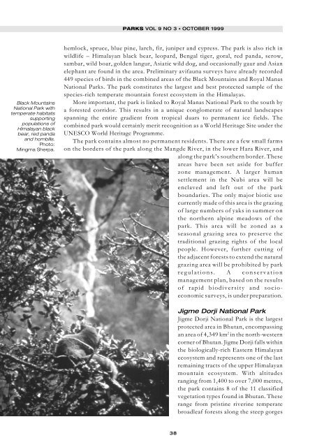
Black Mountains National Park with temperate habitats supporting populations of Himalayan black bear, red panda and hornbills. Photo: Mingma Sherpa. PARKS VOL 9 NO 3 • OCTOBER 1999 hemlock, spruce, blue pine, larch, fir, juniper and cypress. The park is also rich in wildlife – Himalayan black bear, leopard, Bengal tiger, goral, red panda, serow, sambar, wild boar, golden langur, Asiatic wild dog, and occasionally gaur and Asian elephant are found in the area. Preliminary avifauna surveys have already recorded 449 species of birds in the combined areas of the Black Mountains and Royal Manas National Parks. The park constitutes the largest and best protected sample of the species-rich temperate mountain forest ecosystem in the Himalayas. More important, the park is linked to Royal Manas National Park to the south by a forested corridor. This results in a unique conglomerate of natural landscapes spanning the entire gradient from tropical duars to permanent ice fields. The combined park would certainly merit recognition as a World Heritage Site under the UNESCO World Heritage Programme. The park contains almost no permanent residents. There are a few small farms on the borders of the park along the Mangde River, in the lower Hara River, and along the park’s southern border. These areas have been set aside for buffer zone management. A larger human settlement in the Nubi area will be enclaved and left out of the park boundaries. The only major biotic use currently made of this area is the grazing of large numbers of yaks in summer on the northern alpine meadows of the park. This area will be zoned as a seasonal grazing area to preserve the traditional grazing rights of the local people. However, further cutting of the adjacent forests to extend the natural grazing area will be prohibited by park regulations. A conservation management plan, based on the results of rapid biodiversity and socioeconomic surveys, is under preparation. 38 Jigme Dorji National Park Jigme Dorji National Park is the largest protected area in Bhutan, encompassing an area of 4,349 km 2 in the north-western corner of Bhutan. Jigme Dorji falls within the biologically-rich Eastern Himalayan ecosystem and represents one of the last remaining tracts of the upper Himalayan mountain ecosystem. With altitudes ranging from 1,400 to over 7,000 metres, the park contains 8 of the 11 classified vegetation types found in Bhutan. These range from pristine riverine temperate broadleaf forests along the steep gorges
MINGMA NORBU SHERPA AND UGEN P NORBU to temperate evergreen forests, subalpine grasslands, alpine meadows, and glaciated ice, rock, and scree found in the higher elevations. In addition to populations of wildlife such as blue sheep, takin, snow leopard, musk deer, Himalayan black bear, Bengal tiger, and red panda, approximately 6,500 local people live within the park. They practice subsistence agriculture at the lower elevations and subsistence livestock grazing, particularly yak management, at the higher elevations. The wide variety of natural habitats – from the alpine highland of the north to broadleaf forests in south – is important for several migratory wildlife species such as takin, snow leopard, Bengal tiger, blue sheep, deer, and blood pheasant. A richlyforested corridor connects the park to the Black Mountains National Park. Jigme Dorji has immense cultural and economic significance. Alternatively known as ‘the abode of gods,’ the park has many sacred natural features and cultural monuments. Mount Chomolhari and Mount Jitchu Drake, two of the most popular mountain peaks in Bhutan, are worshipped by the Bhutanese as homes of the local deity. Outstanding fortresses such as Lingshi Dzong and Gasa Dzong reflect Bhutan’s magnificent culture and history. Four major rivers – Mo Chhu, Pho Chhu, Wang Chhu, and Pa Chhu – have their sources in the glacial lakes located in the alpine valleys of the park. Hydropower plants downstream in southern Bhutan harness the turbulent waters of these rivers to produce electricity, currently the country’s largest export product in terms of generation of foreign revenue. The protection of these rivers is also critical for downstream communities in Bhutan, India, and Bangladesh. Biological corridor linking Black Mountains and Jigme Dorji National Parks A forest corridor connects the Black Mountains and Jigme Dorji National Parks. This area is not officially recognised for major conservation intervention. Subtropical and temperate forests cover more than 75% of the area. The forest corridor serves as wintering grounds for the charismatic but rare black-necked cranes. Several forestry and conservation units within the corridor already provide substantial protection to the link area. Conservation Areas: Phobjikha and Khotokha areas have been set aside as conservation areas for protecting the wintering habitats of the black-necked cranes. The conservation areas attract more than 200 cranes every winter. These areas are multiple-use areas and do not require detailed conservation plans. Nevertheless, they require some special regulations to provide adequate protection for the cranes and their natural habitats. Scenic Landscapes: Pele La, a main divide of Wangdi and Tongsa Dzongkhags, serves as a scenic area and also provides prime habitat for langur, red panda, and many bird species such as satyr tragopan and blood pheasant. This largely forested landscape is managed by the Forestry Service Division, which applies restrictions on forest uses as necessary. Forest Management Units: Two forest management units, one in Khotoka area and the other in Chendebji area, allow harvesting of timber and fuelwood based on sustainable forest management plans. Ecological and socio-economic considerations receive due attention in operating the forest management units. These units and other forested areas serve as an excellent wildlife corridor for both migrant and resident species. Most of the valleys and the ridges along Pele La are still densely forested and serve as a good biological corridor. 39
- Page 1 and 2: Protected Areas Programme PARKS Vol
- Page 3 and 4: Editorial EDITORIAL KENTON R. MILLE
- Page 5 and 6: EDITORIAL information, and opportun
- Page 7 and 8: EDITORIAL fundamental elements and
- Page 9 and 10: The Western Australian South Coast
- Page 11 and 12: JOHN WATSON AND PETER WILKINS Weste
- Page 13 and 14: JOHN WATSON AND PETER WILKINS To re
- Page 15 and 16: JOHN WATSON AND PETER WILKINS ❚ a
- Page 17 and 18: JOHN WATSON AND PETER WILKINS We th
- Page 19 and 20: Yellowstone to Yukon: romantic drea
- Page 21 and 22: in the Yukon to the rapidly growing
- Page 23 and 24: LOUISA WILLCOX AND PETER AENGST low
- Page 25 and 26: LOUISA WILLCOX AND PETER AENGST ❚
- Page 27 and 28: The corridor of the Serra do Mar GE
- Page 29 and 30: GEORGE GEORGIADIS AND SILVANA CAMPE
- Page 31 and 32: GEORGE GEORGIADIS AND SILVANA CAMPE
- Page 33 and 34: GEORGE GEORGIADIS AND SILVANA CAMPE
- Page 35 and 36: GEORGE GEORGIADIS AND SILVANA CAMPE
- Page 37 and 38: GEORGE GEORGIADIS AND SILVANA CAMPE
- Page 39: MINGMA NORBU SHERPA AND UGEN P NORB
- Page 43 and 44: MINGMA NORBU SHERPA AND UGEN P NORB
- Page 45 and 46: MINGMA NORBU SHERPA AND UGEN P NORB
- Page 47 and 48: MINGMA NORBU SHERPA AND UGEN P NORB
- Page 49 and 50: KENTON R. MILLER AND LAWRENCE S. HA
- Page 51 and 52: KENTON R. MILLER AND LAWRENCE S. HA
- Page 53 and 54: RÉSUMÉS Etablissement de liens en
- Page 55 and 56: Uniendo áreas protegidas para la c
- Page 57 and 58: PARKS VOL 9 NO 3 • OCTOBER 1999 5
- Page 59 and 60: Protected Areas Programme PARKS The
Black Mountains<br />
National Park with<br />
temperate habitats<br />
supporting<br />
populations of<br />
Himalayan black<br />
bear, red panda<br />
and hornbills.<br />
Photo:<br />
Mingma Sherpa.<br />
PARKS VOL 9 NO 3 • OCTOBER 1999<br />
hemlock, spruce, blue pine, larch, fir, juniper and cypress. The park is also rich in<br />
wildlife – Himalayan black bear, leopard, Bengal tiger, goral, red panda, serow,<br />
sambar, wild boar, golden langur, Asiatic wild dog, and occasionally gaur and Asian<br />
elephant are found in the area. Preliminary avifauna surveys have already recorded<br />
449 species of birds in the combined areas of the Black Mountains and Royal Manas<br />
National <strong>Parks</strong>. The park constitutes the largest and best protected sample of the<br />
species-rich temperate mountain forest ecosystem in the Himalayas.<br />
More important, the park is linked to Royal Manas National Park to the south by<br />
a forested corridor. This results in a unique conglomerate of natural landscapes<br />
spanning the entire gradient from tropical duars to permanent ice fields. The<br />
combined park would certainly merit recognition as a World Heritage Site under the<br />
UNESCO World Heritage Programme.<br />
The park contains almost no permanent residents. There are a few small farms<br />
on the borders of the park along the Mangde River, in the lower Hara River, and<br />
along the park’s southern border. These<br />
areas have been set aside for buffer<br />
zone management. A larger human<br />
settlement in the Nubi area will be<br />
enclaved and left out of the park<br />
boundaries. The only major biotic use<br />
currently made of this area is the grazing<br />
of large numbers of yaks in summer on<br />
the northern alpine meadows of the<br />
park. This area will be zoned as a<br />
seasonal grazing area to preserve the<br />
traditional grazing rights of the local<br />
people. However, further cutting of<br />
the adjacent forests to extend the natural<br />
grazing area will be prohibited by park<br />
regulations. A conservation<br />
management plan, based on the results<br />
of rapid biodiversity and socioeconomic<br />
surveys, is under preparation.<br />
38<br />
Jigme Dorji National Park<br />
Jigme Dorji National Park is the largest<br />
protected area in Bhutan, encompassing<br />
an area of 4,349 km 2 in the north-western<br />
corner of Bhutan. Jigme Dorji falls within<br />
the biologically-rich Eastern Himalayan<br />
ecosystem and represents one of the last<br />
remaining tracts of the upper Himalayan<br />
mountain ecosystem. With altitudes<br />
ranging from 1,400 to over 7,000 metres,<br />
the park contains 8 of the 11 classified<br />
vegetation types found in Bhutan. These<br />
range from pristine riverine temperate<br />
broadleaf forests along the steep gorges


