

Parks - IUCN
Parks - IUCN
Parks - IUCN

You also want an ePaper? Increase the reach of your titles
YUMPU automatically turns print PDFs into web optimized ePapers that Google loves.
JOHN WATSON AND PETER WILKINS<br />
To realise this potential and reach<br />
long-term objectives, an assessment of<br />
habitats is being made to determine<br />
those which are of most value for a<br />
bioregional wildlife corridor network.<br />
Characteristics that are being assessed<br />
include:<br />
❚ remnants with significant nature<br />
conservation value. Factors to determine<br />
conservation value include representation<br />
of vegetation types within the current<br />
protected area system, habitat values,<br />
and the presence or absence of rare and<br />
threatened flora and fauna;<br />
❚ the location of remnant vegetation within the landscape which is necessary to<br />
assess the degree of risk from threatening processes, such as rising groundwater (see<br />
George et al. 1995). Vegetation along drainage-lines and other low-lying areas is<br />
particularly vulnerable to salinity and/or waterlogging, whilst wind erosion is<br />
adversely affecting small patches of remnant vegetation located high in the<br />
landscape. It is also important to determine the degree to which threats can be<br />
managed;<br />
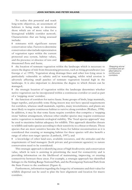
❚ the strategic location of vegetation within the landscape determines whether<br />
native vegetation can be incorporated within a continuous corridor or used as part<br />
of a ‘stepping stone’ corridor;<br />
❚ the function of corridors for native fauna. Some groups of birds, large mammals,<br />
larger reptiles, and possibly some flying insects may not have special requirements<br />
for corridors, whereas small mammals, reptiles, many invertebrates, and plants are<br />
most likely to require continuous habitat to survive along corridors (Wallace, 1998).<br />
In addition, it may be that some fauna require corridors that comprise a ‘stepping<br />
stone’ habitat arrangement, whereas other smaller species may require continuous<br />
native vegetation to maintain ecological stability. The ‘focal species approach’ may<br />
be used to maximise habitat adequacy for wildlife. This approach identifies threats<br />
to wildlife and ranks species according to their sensitivity to a threat or threats. Those<br />
species that are most sensitive become the focus for habitat reconstruction as it is<br />
considered that creating or managing habitat for these species will also benefit a<br />
range of other non-target species (Lambeck, 1997); and<br />
❚ a knowledge of other land-uses, available resources, and the attitudes and the<br />
requirements of land managers (both private and government agencies) to nature<br />
conservation need to be considered.<br />
This strategic approach is identifying areas of high biodiversity and conservation<br />
value, which in turn is assisting in prioritising the need for connectivity and is<br />
providing information on the likelihood of maintaining, improving, or creating<br />
connectivity between these areas. For example, a strategic approach has identified<br />
linkages to the Stirling Range National Park, and the Porongurup National Park from<br />
the State Forest to the southwest (Figure 4).<br />
Furthermore, information regarding the longevity of remnants and their value for<br />
wildlife dispersal can be used to plan the best alignment and location for macro<br />
corridors.<br />
11<br />
'Stepping stone'<br />
corridors are an<br />
alternative to<br />
continuous<br />
corridors.


