

2011 - Cooperative Institute for Research in Environmental Sciences ...
2011 - Cooperative Institute for Research in Environmental Sciences ...
2011 - Cooperative Institute for Research in Environmental Sciences ...

You also want an ePaper? Increase the reach of your titles
YUMPU automatically turns print PDFs into web optimized ePapers that Google loves.
Figure 1: Global image of the Radiance Calibrated Nighttime Lights<br />
from 2010 DMSP F16<br />
Figure 2: Ho Chi M<strong>in</strong> City, Vietnam. The first image shows the Operational<br />
Stable Lights data where the urban core is saturated. The second<br />
image is the Radiance Calibrated data where the urban core is resolved.<br />
The radiance of the brightest pixels is measured to be a factor of about<br />
12 larger than the saturated values.<br />
Advanced Network (APAN) conference proceed<strong>in</strong>gs. In<br />
order to create this product, a generalized method was created<br />
<strong>for</strong> process<strong>in</strong>g other years.<br />
Product: Zisk<strong>in</strong>, D, KE Baugh, FC Hsu, T Ghosh, and CD<br />
Elvidge (2010), Methods used <strong>for</strong> the 2006 radiance lights,<br />
Asia-Pacific Advanced Network conference.<br />
Milestone 2: Develop a methodology <strong>for</strong> determ<strong>in</strong><strong>in</strong>g ga<strong>in</strong><br />
sett<strong>in</strong>gs on DMSP OLS operational data <strong>for</strong> satellites F16<br />
and F18.<br />
Due to the fact that the ga<strong>in</strong> sett<strong>in</strong>gs are not stored <strong>in</strong><br />
the DMSP Operational L<strong>in</strong>escan System (OLS), smooth<br />
resolution visible band data has been a barrier toward <strong>in</strong>tercomparability<br />
of the OLS data. This work was the first step<br />
toward the goal of OLS data calibration (see Milestone 3).<br />
Figure 3: Comparison of the recorded OLS visible band ga<strong>in</strong> values and<br />
the software-reconstructed values <strong>for</strong> the last sample <strong>in</strong> each scanl<strong>in</strong>e of<br />
an F16 f<strong>in</strong>e-resolution orbital segment.<br />
126 CIRES Annual Report <strong>2011</strong><br />
Software was created to reconstruct the DMSP-OLS ga<strong>in</strong><br />
sett<strong>in</strong>gs <strong>for</strong> any orbital swath of data from satellites F16 and<br />
F18. The software is a recreation of the onboard along-scan<br />
ga<strong>in</strong> control algorithms that the OLS uses to set the visible<br />
band ga<strong>in</strong>. Onboard constants to the ga<strong>in</strong> algorithm are<br />
modified weekly via Payload Activation Messages (PAMs).<br />
The PAMs were obta<strong>in</strong>ed and converted <strong>in</strong>to a temporal<br />
database of ga<strong>in</strong> constants that is accessed by the ga<strong>in</strong> reconstruction<br />
software. The OLS f<strong>in</strong>e-resolution datastream<br />
records the ga<strong>in</strong> <strong>for</strong> the last sample <strong>in</strong> each scanl<strong>in</strong>e. This<br />
sample of recorded ga<strong>in</strong>s was used <strong>for</strong> software validation.<br />
Milestone 3: Development of a robust and effective calibration<br />
method <strong>for</strong> the DMSP OLS time series based on<br />
reflected moonlight from desert surfaces <strong>for</strong> satellites F16<br />
and F18.<br />
Moonlight reflected off of desert surfaces was measured<br />
with the DMSP F16 and F18 satellites. The satellite ga<strong>in</strong><br />
sett<strong>in</strong>gs were estimated <strong>for</strong> each overpass (see Milestone<br />
2). This allowed us to determ<strong>in</strong>e the <strong>in</strong>strument’s response<br />
and calculate an ‘uncalibrated radiance.’ We also modeled<br />
the expected radiance us<strong>in</strong>g an advanced radiative<br />
transfer model (MODTRAN). The comparison between<br />
the uncalibrated radiance from the <strong>in</strong>strument and the<br />
modeled radiance has yielded a compell<strong>in</strong>g relationship.<br />
Work along this promis<strong>in</strong>g l<strong>in</strong>e will cont<strong>in</strong>ue with the goal<br />
of develop<strong>in</strong>g an absolute calibration of the OLS.<br />
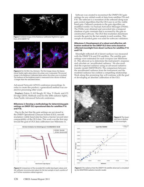
Figure 4: The Uyuni<br />
Salt Flats <strong>in</strong> Bolivia<br />
<strong>in</strong> full moonlight.<br />
Figure 5: The radiance that the DMSP F18 satellite observed is simulated<br />
by the MODTRAN radiative transfer model.


