

15Mb pdf - Cooperative Institute for Research in Environmental ...
15Mb pdf - Cooperative Institute for Research in Environmental ...
15Mb pdf - Cooperative Institute for Research in Environmental ...

Create successful ePaper yourself
Turn your PDF publications into a flip-book with our unique Google optimized e-Paper software.
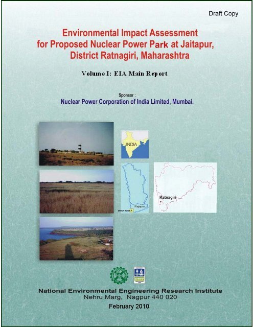
<strong>Environmental</strong> Impact Assessment <strong>for</strong><br />
Proposed Nuclear Power Park at Jaitapur,<br />
District Ratnagiri, Maharashtra<br />
Volume I: EIA (Ma<strong>in</strong> Report)<br />
Sponsor:<br />
Nuclear Power Corporation of India Limited, Mumbai<br />
National <strong>Environmental</strong> Eng<strong>in</strong>eer<strong>in</strong>g <strong>Research</strong> <strong>Institute</strong><br />
Nehru Marg, Nagpur – 440 020<br />
February 2010<br />
Draft Copy
FOREWORD<br />
India is poised to go <strong>for</strong> peaceful use of nuclear energy <strong>in</strong> generat<strong>in</strong>g electricity,<br />
lead<strong>in</strong>g to susta<strong>in</strong>able development, conservation of conventional sources of energy and<br />
mitigation of environmental pollution.<br />
India's ef<strong>for</strong>ts <strong>in</strong> pursuance of the above policy consistently <strong>in</strong> fairness and<br />
transparency has, recently, resulted <strong>in</strong> the waiver from "Nuclear Supply Group",<br />
enabl<strong>in</strong>g India to share nuclear trade with other countries <strong>in</strong> the field of peaceful use<br />
of nuclear energy. Immediately after the above event, India has signed bilateral<br />
agreements <strong>for</strong> such nuclear trade with USA, France and is <strong>in</strong> further process with<br />
Russia and other countries.<br />
Presently, Nuclear Power Corporation of India Limited, under the Department of<br />
Atomic Energy, is operat<strong>in</strong>g 17 Nuclear Power Reactors with <strong>in</strong>stalled capacity of 4120<br />
MWe. The present share of nuclear power of 4120 MWe is expected to <strong>in</strong>crease to 7280<br />
MWe by December, 2010 on completion of 6 projects under construction <strong>in</strong>clud<strong>in</strong>g one<br />
500 MWe FBR type nuclear power plant by BHAVINI under Department of Atomic<br />
Energy.<br />
The Department of Atomic Energy has three stage <strong>in</strong>digenously developed<br />
nuclear power generation programme which is be<strong>in</strong>g pursued <strong>for</strong> implementation.<br />
However, to meet the grow<strong>in</strong>g demand of electricity <strong>in</strong> the country, Government of India<br />
has decided to augment the contribution of nuclear power by import<strong>in</strong>g nuclear power<br />
reactors from various countries hav<strong>in</strong>g capacity of 1000 MWe and above and establish<br />
Nuclear Power Park of 8000 to 10000 MWe at different locations <strong>in</strong> the country.<br />
Accord<strong>in</strong>gly, it is planned to have an <strong>in</strong>stalled capacity of 23000 MWe from <strong>in</strong>digenous<br />
and import route by the end of XIIth National Five year Plan.<br />
In l<strong>in</strong>e with the above, Government of India has "<strong>in</strong> pr<strong>in</strong>ciple" approved 2 X 1000<br />
MWe LWR type reactor at Jaitapur, Taluka Rajapur, District Ratnagiri, Maharashtra<br />
State <strong>in</strong> October 2005. However, <strong>in</strong> October 2009, Government of India has “<strong>in</strong><br />
pr<strong>in</strong>ciple” approved sett<strong>in</strong>g up of 6 units of 1650 MWe each at Jaitapur site <strong>for</strong><br />
utilization of its full potential. Accord<strong>in</strong>gly, the site is planned to have 6 X 1650 MWe<br />
NPP units to be implemented <strong>in</strong> tw<strong>in</strong>-mode construction <strong>in</strong> a period of 15 to 18 years so<br />
as to have a Nuclear Power Park of 10000 MWe at Jaitapur.
Contents<br />
Item No. Particulars Page No.<br />
List of Plates (xxi)<br />
List of Figures (xxiv)<br />
List of Tables (xxvii)<br />
Abbreviations (xxxii)<br />
Summary EIA S1-S56<br />
1. Introduction 1-28<br />
1.0 Purpose of the EIA report 1<br />
1.1 Identification of Project and Project Proponent 2<br />
1.1.1 Historical Development of Nuclear Power Program<br />
<strong>in</strong> India and Present Status<br />
1.2 JNPP Site Selection 3<br />
1.2.1 Brief Description of the Project 7<br />
1.3 Importance of JNPP to the Region / Country 7<br />
1.4 Scope of the Study 8<br />
1.4.1 TOR Proposed by NPCIL 8<br />
1.4.2 Additional TOR by MoEF <strong>for</strong> Nuclear Power Park 9<br />
1.4.2.1 Additional TOR by MoEF <strong>for</strong> Residential<br />
Complex<br />
11<br />
1.5 Additional Studies 13<br />
1.6 Role of AERB & MoEF on Establishment of a Nuclear Power<br />
Project<br />
14<br />
1.6.1 Consent <strong>for</strong> Sit<strong>in</strong>g <strong>for</strong> the Proposed Project 15<br />
1.6.2 Consent <strong>for</strong> Sit<strong>in</strong>g from M<strong>in</strong>istry of Environment &<br />
Forests<br />
15<br />
1.6.3 Consent <strong>for</strong> Sit<strong>in</strong>g from AERB 15<br />
1.6.4 Other Consents and Authorizations 16<br />
1.7 Structure of the EIA Report 16<br />
2. Project Description 29-118<br />
Section-I: Project Description 29<br />
2.0 Need of the Project 29<br />
i<br />
2
Item No. Particulars Page No.<br />
2.1 Proposed Nuclear Power Park at Jaitapur 30<br />
2.2 Project Sit<strong>in</strong>g 30<br />
2.2.1 Location and General Area 30<br />
2.2.2 JNPP Location, Land Profile and Land-use 31<br />
2.2.3 Exist<strong>in</strong>g Water Dra<strong>in</strong>age System at the Site 32<br />
2.2.4 Available Source of Water 33<br />
2.2.5 Seismicity Considerations 33<br />
2.2.6 Flood Analysis <strong>in</strong>clud<strong>in</strong>g Tsunami 33<br />
2.2.7 Power Evacuation 34<br />
2.2.8 Population Density 34<br />
2.2.9 Access to the JNPP Site 34<br />
2.2.10 General Environment Neighbour<strong>in</strong>g JNPP Site 35<br />
2.2.11 Construction Facilities 35<br />
2.2.12 Proposed Schedule of Project Implementation 36<br />
2.3 Technology and Process Description of Proposed PWR<br />
Category NPPs at Jaitapur<br />
2.4 Overview of the Design under Consideration 41<br />
2.5 Reactor Fuel 42<br />
2.6 Core Design 43<br />
2.6.1 Overall Features 43<br />
2.6.1.1 Boron Concentration, Reactivity<br />
Coefficients, Shutdown Efficiency<br />
2.6.1.2 Design of the Shutdown System 44<br />
2.6.1.3 Reactor Coolant System 44<br />
2.6.1.4 Pr<strong>in</strong>cipal Mechanical Components 46<br />
2.6.1.4.1 Reactor Pressure Vessel<br />
(RPV)<br />
ii<br />
36<br />
43<br />
46<br />
2.6.1.4.2 Pressurizer (PZR) 46<br />
2.6.1.4.3 Steam Generator 46<br />
2.6.1.4.4 Reactor Coolant Pump 47
Item No. Particulars Page No.<br />
2.6.1.5 Pr<strong>in</strong>cipal Fluid Systems 48<br />
2.6.1.5.1 Conceptual Features 48<br />
2.6.1.5.2 Safety Functions 48<br />
2.6.1.5.3 Reactivity Control 48<br />
2.6.1.5.4 RCS Inventory and<br />
Integrity<br />
iii<br />
48<br />
2.6.1.5.5 Residual Heat Removal 48<br />
2.6.1.5.6 Systems Required to<br />
Support Operation of<br />
Fluid systems<br />
49<br />
2.6.1.5.7 Configuration of Systems 49<br />
2.6.2 Reactor Build<strong>in</strong>g and Support<strong>in</strong>g Systems 50<br />
2.6.2.1 Reactor Build<strong>in</strong>g Structure 50<br />
2.6.2.2 Annulus 51<br />
2.6.2.3 Conta<strong>in</strong>ment Isolation 51<br />
2.6.3 Condenser Cool<strong>in</strong>g Sea Water Discharge 51<br />
2.6.4 Other Safety Related Build<strong>in</strong>gs 53<br />
2.6.4.1 General Description 53<br />
2.6.5 Spent Fuel Storage Facility 54<br />
2.6.6 Auxiliary Systems 55<br />
2.6.6.1 Fire Protection Systems 55<br />
2.6.6.2 Steam Generator Blowdown System 55<br />
2.6.7 Waste Process<strong>in</strong>g System 56<br />
2.6.7.1 Gaseous Waste Process<strong>in</strong>g System 56<br />
2.6.7.2 Liquid Waste Process<strong>in</strong>g System 57<br />
2.6.7.3 Solid Waste Process<strong>in</strong>g System 58<br />
2.6.7.3.1 Operational Solid<br />
Radioactive Waste<br />
58<br />
2.6.7.3.2 Activated Metallic Waste 58<br />
2.6.7.4 Radioactive Waste Process<strong>in</strong>g Build<strong>in</strong>g 59
Item No. Particulars Page No.<br />
2.6.7.5 Domestic Solid Waste Management 60<br />
2.6.8 Diesel Build<strong>in</strong>g 60<br />
2.6.9 Turb<strong>in</strong>e Island Design 60<br />
2.6.9.1 Turb<strong>in</strong>e Build<strong>in</strong>g 60<br />
2.6.9.2 Turb<strong>in</strong>e 61<br />
2.7 Electrical System 62<br />
2.8 Desal<strong>in</strong>ation Plant 62<br />
2.9 Mitigation Aspects & <strong>Environmental</strong> Standards of NPP at<br />
Jaitapur<br />
2.9.1 Safety Objectives 63<br />
2.9.2 Concept of Defense <strong>in</strong> Depth 63<br />
2.9.3 Normative Basis 66<br />
2.9.4 Radiation Dose Limits <strong>for</strong> NPP Workers/Public 66<br />
2.9.4.1 Workers of NPP 66<br />
2.9.4.2 Public 67<br />
2.9.5 Additional Safety Provisions 67<br />
Section –II Residential Complex of JNPP 86<br />
2.10 Proposed JNPP Residential Complex 86<br />
2.10.1 Location 87<br />
2. 10.1.1 Land Profile and Land-use 87<br />
2. 10.2 Details of Residential Complex 88<br />
2. 10.3 Hydrological and Geophysical Survey of Study Area 89<br />
2. 10.3.1 Hydrogeology 89<br />
2. 10.3.2 Soil Characteristics 90<br />
2.10.4 Air Quality 90<br />
2. 10.4.1 Ambient Air Quality Survey 91<br />
2. 10.4.2 Arithmetic Mean Values of Air<br />
Pollutants<br />
2. 10.4.3 The 98th Percentile Values of Air<br />
Pollutants<br />
iv<br />
63<br />
91<br />
92
Item No. Particulars Page No.<br />
2. 10.5 Water quality <strong>in</strong>clud<strong>in</strong>g Ground Water 93<br />
2. 10.5.1 Physico-chemical Characteristics 93<br />
2. 10.5.1.1 Estuar<strong>in</strong>e Water 93<br />
2. 10.5.1.2 Ground Water 96<br />
2. 10.5.1.3 Heavy Metal Content 98<br />
2. 10.5.1.4 Bacteriological<br />
Characteristics<br />
2. 10.5.2 Biological Characteristics 99<br />
2. 10.5.3 Assessment of Biological Quality of<br />
Water<br />
v<br />
98<br />
100<br />
2.10.6 Noise Environment Quality 101<br />
2. 10.7 Status of Flora and Fauna 101<br />
2. 10.8 Infrastructure Facilities and Requirement 102<br />
2. 10.8.1 Land, Electricity and Construction<br />
Material<br />
2.10.8.2 Domestic Water Requirement <strong>for</strong><br />
Residential Complex<br />
2.10.8.3 Use of Renewable and Alternate<br />
Source of Energy<br />
2.11 Impacts Assessment 103<br />
102<br />
103<br />
103<br />
2.11.1 Impact on Air Quality and Noise Levels 103<br />
2.11.2 Water Impact Assessment 104<br />
2.11.2.1 Availability of Water 104<br />
2.11.2.2 Impacts due to Domestic Wastewater 104<br />
2.11.3 Impact Assessment on Land Environment 105<br />
2.11.3.1 Assessment of Impact due to Soil<br />
Erosion<br />
105<br />
2.11.4 Biological Environment 105<br />
2.11.5 Socio Economic Impact 105<br />
2.12 <strong>Environmental</strong> Management Plan (EMP) 106<br />
2.12.1 Site Preparation 106<br />
2.12.2 Air Environment 106
Item No. Particulars Page No.<br />
2.12.3 Water Environment 106<br />
2.12.4 Land Environment 106<br />
2.12.5 Site Security 107<br />
2.12.6 Air and Noise Pollution 107<br />
2.12.7 Wastewater Management 107<br />
2.12.8 Ra<strong>in</strong> Water Harvest<strong>in</strong>g 107<br />
2.12.9 EMP <strong>for</strong> Domestic Solid Waste 107<br />
2.12.10 Landscape Development and Roadside Plantation <strong>in</strong><br />
Residential Complex<br />
vi<br />
108<br />
2.12.11 Aquatic Component 108<br />
2.12.12 Socio-economic Environment EMP 108<br />
2.12.13 Guard Pond and Sewage Treatment Plant (1830 cu.<br />
m. /day)<br />
109<br />
2.12.14 Traffic Management 110<br />
2.12.15 Disaster Management Plan <strong>for</strong> Residential Complex<br />
of JNPP<br />
3 Description of Environment 119-326<br />
3.1 Identification of the Study Area 119<br />
3.2 Identification of the Project Phases 120<br />
110<br />
3.2.1 Sit<strong>in</strong>g 120<br />
3.2.2 Construction & Commission<strong>in</strong>g 120<br />
3.2.3 Operation 120<br />
3.3 Methodology <strong>for</strong> EIA 121<br />
3.3.1 Identification of Impacts 121<br />
3.3.2 Identification of the <strong>Environmental</strong> Parameters 121<br />
3.3.2.1 Air Environment 121<br />
3.3.2.2 Water Environment 122<br />
3.3.2.3 Land Environment 122<br />
3.3.2.4 Biological Environment 122<br />
3.3.2.5 Noise Environment 122
Item No. Particulars Page No.<br />
3.3.2.6 Socio-economic Environment 122<br />
3.4 <strong>Environmental</strong> Methodology and Radiological <strong>Environmental</strong><br />
Status<br />
3.4.1 Methodology <strong>for</strong> Basel<strong>in</strong>e Conventional Pollutants<br />
Status<br />
vii<br />
122<br />
123<br />
3.4.2 Methodology <strong>for</strong> Basel<strong>in</strong>e Radiological Status 123<br />
3.4.2.1 Components Selected For Sampl<strong>in</strong>g 124<br />
3.4.2.2 Radiation Monitor<strong>in</strong>g Instruments 125<br />
3.4.2.3 Results of Basel<strong>in</strong>e Radiological Survey 125<br />
3.5 Air Environment 133<br />
3.5.1 Basel<strong>in</strong>e Status of Air Environment With Respect to<br />
Conventional Pollutants<br />
3.5.1.1 Design of Ambient Air Quality<br />
Monitor<strong>in</strong>g Network<br />
133<br />
133<br />
3.5.1.2 Meteorology 134<br />
3.5.1.3 Micro-meteorology 134<br />
3.5.1.4 Ambient Air Quality Survey 135<br />
3.5.1.5 Basel<strong>in</strong>e Status 136<br />
3.5.1.5.1 Arithmetic Mean Values<br />
of Air Pollutants<br />
3.5.1.5.2 The 98th Percentile<br />
Values of Air Pollutants<br />
136<br />
137<br />
3.5.2 Basel<strong>in</strong>e Status of Natural Radiation Levels 138<br />
3.6 Water Environment 161<br />
3.6.1 Basel<strong>in</strong>e Status With Respect to Conventional<br />
Water Pollutants<br />
161<br />
3.6.1.1 Physico-chemical Characteristics 161<br />
3.6.1.2 Surface Freshwater 161<br />
3.6.1.3 Sea Water and Estuar<strong>in</strong>e Water 164<br />
3.6.1.4 Ground Water 166<br />
3.6.1.5 Heavy Metal Content 169<br />
3.6.2 Bacteriological Characteristics 169
Item No. Particulars Page No.<br />
3.6.2.1 Surface Water 169<br />
3.6.2.2 Sea Water and Estuar<strong>in</strong>e Water 169<br />
3.6.2.3 Groundwater 170<br />
3.6.3 Basel<strong>in</strong>e Radioactivity Levels <strong>in</strong> Water Environment 170<br />
3.6.3.1 Basel<strong>in</strong>e Radioactivity levels <strong>in</strong> fresh<br />
Water Samples<br />
viii<br />
170<br />
3.6.3.2 Tritium <strong>in</strong> Water Samples 171<br />
3.6.3.3 Radioactivity Levels <strong>in</strong> Sea Water<br />
Samples<br />
171<br />
3.6.4 Biological Characteristics 171<br />
3.6.4.1 Assessment of Biological Quality of<br />
Water<br />
173<br />
3.6.5 Water Availability 175<br />
3.6.6 Water Drawal & Discharge 175<br />
3.6.6.1 Thermal Water Pollution 175<br />
3.6.7 Wastewater 176<br />
3.6.7.1 Radioactive Liquid Wastes from the<br />
Plant<br />
176<br />
3.6.7.2 Non- Radioactive Wastes 176<br />
3.6.7.3 Wastewater from Residential Complex 176<br />
3.7 Land Environment 207<br />
3.7.1 Geology 207<br />
3.7.1.1 Physiography of the Coastal Region of<br />
Konkan<br />
207<br />
3.7.1.2 Dra<strong>in</strong>age 208<br />
3.7.1.3 Climate 208<br />
3.7.1.4 Soils 208<br />
3.7.1.5 Evolution of Land<strong>for</strong>ms <strong>in</strong> Coastal<br />
Region<br />
208<br />
3.7.1.6 Stratigraphy 208<br />
3.7.1.7 Structure and Tectonics 208<br />
3.7.1.8 Geo-hydrology 209
Item No. Particulars Page No.<br />
3.7.2 Seismotectonics 209<br />
3.7.3 Basel<strong>in</strong>e Status of Soil with Respect to Conventional<br />
Parameters<br />
ix<br />
210<br />
3.7.4 Physical Properties of Soil 210<br />
3.7.5 Chemical Properties of Soil 211<br />
3.7.6 Soil Microbiology 212<br />
3.7.7 Basel<strong>in</strong>e Radioactivity Levels <strong>in</strong> Soil, Rock and<br />
Sand Samples<br />
213<br />
3.7.8 Land use Pattern Based on Census Data 214<br />
3.7.9 Land use Pattern based on Remote Sens<strong>in</strong>g Data 214<br />
3.7.10 HTL / LTL Demarcation off Jaitapur Coast 218<br />
3.8 Biological Environment 233<br />
3.8.1 Introduction 233<br />
3.8.2 Study Area 234<br />
3.8.3 Methodology and Sampl<strong>in</strong>g Locations 234<br />
3.8.4 Terrestrial Biodiversity <strong>in</strong> Study Area 235<br />
3.8.5 Structure and Composition of Flora 239<br />
3.8.6 River<strong>in</strong>e Vegetation 239<br />
3.8.7 Fruit Trees around JNPP 240<br />
3.8.8 Mangrove Ecosystem 240<br />
3.8.9 Grassland Ecosystem 241<br />
3.8.10 The Creeks 241<br />
3.8.11 Medic<strong>in</strong>al Plants <strong>in</strong> Study Area 242<br />
3.8.12 Threatened Plant Species 243<br />
3.8.13 Fauna : Wildlife Survey 243<br />
3.8.14 Agriculture 249<br />
3.8.15 Mar<strong>in</strong>e and Coastal Biodiversity Mapp<strong>in</strong>g 250<br />
3.8.16 Basel<strong>in</strong>e Radioactivity Levels <strong>in</strong> Edible Items 255<br />
3.8.16.1 Basel<strong>in</strong>e Radioactivity Levels <strong>in</strong><br />
Vegetation Samples<br />
255
Item No. Particulars Page No.<br />
3.8.16.2 Radioactivity Levels <strong>in</strong> Cereal and<br />
Pulse Samples<br />
x<br />
255<br />
3.8.16.3 Radioactivity Levels <strong>in</strong> Milk Sample 255<br />
3.8.16.4 Radioactivity Levels <strong>in</strong> Fish and Algae<br />
Samples<br />
3.9 Noise Environment 282<br />
256<br />
3.9.1 Methodology and Basel<strong>in</strong>e <strong>Environmental</strong> Status 282<br />
3.9.2 Reconnaissance 282<br />
3.9.3 Background Noise Levels at Surround<strong>in</strong>g<br />
Residential and Commercial Zones<br />
3.9.4 Noise level at Sensitive Receptors: Temple, Hospital<br />
and School premises<br />
3.9.5 Noise Levels near National Highway Outside Study<br />
Area<br />
283<br />
283<br />
283<br />
3.9.6 Comparison of Noise Levels with CPCB Standards 283<br />
3.10 Socio Economic Environment 287<br />
3.10.1 Introduction 287<br />
3.10.2 Basel<strong>in</strong>e Status 287<br />
3.10.2.1 Demographic Structure 287<br />
3.10.2.2 Infrastructure Resource Base 288<br />
3.10.2.3 Economic Attributes 289<br />
3.10.2.4 Health Status 289<br />
3.10.3 Socio-economic Status 290<br />
3.10.3.1 Sampl<strong>in</strong>g Method 290<br />
3.10.3.2 Observations of Socio-economic Status 290<br />
3.10.4 Social Welfare and Community Development<br />
Programme<br />
291<br />
3.10.4.1 Around NPPs By NPCIL 291<br />
3.10.4.2 Welfare Measures Proposed to be<br />
Implemented by JNPP<br />
292<br />
3.10.5 Cultural and Aesthetic Attributes 293<br />
3.10.6 Brief of Project Affected Families 293
Item No. Particulars Page No.<br />
3.10.7 Quality of Life 296<br />
4. Anticipated <strong>Environmental</strong> Impacts and Mitigation Measures 327- 411<br />
Section I Assessment and Prediction of Impacts due to Proposed<br />
Nuclear Power Park at Jaitapur<br />
4.1 Impacts Assessment dur<strong>in</strong>g Project Construction Phase 328<br />
xi<br />
327<br />
4.1.1 Positive Impact on Landscape 328<br />
4.1.2<br />
Impact Assessment <strong>for</strong> SPM aris<strong>in</strong>g out of<br />
Construction Activities<br />
328<br />
4.1.3 Impact on <strong>Environmental</strong> Sanitation 333<br />
4.1.4 Impact of Construction Activity on Coastal Ecology 333<br />
4.1.5 Impact of Construction and Operation of Jetty 334<br />
4.1.6 Impact of Construction on Sea Water Currents 334<br />
4.1.7 Impact Assessment due to Radiological Releases<br />
dur<strong>in</strong>g Project Construction Phase<br />
335<br />
4.1.8 Improvement of Communication Facilities 335<br />
4.1.9 Availability of Direct Employment 335<br />
4.2 Impacts dur<strong>in</strong>g Operation Phase 335<br />
4.2.1 Air Environment 335<br />
4.2.1.1 Impact Assessment due to<br />
Conventional Air Pollutants<br />
335<br />
4.2.1.2 Prediction of Impacts of DG sets 336<br />
4.2.1.3<br />
Impact Assessment due to Radioactive<br />
Emissions<br />
351<br />
4.2.2 Water Environment 354<br />
4.2.2.1 Impact Assessment Due to<br />
Conventional Water Pollutants<br />
4.2.2.1.1 Water Availability and<br />
Water Balance<br />
4.2.2.1.2 Impact due to<br />
Discharges from<br />
Desal<strong>in</strong>ation Plant<br />
4.2.2.1.3 Impacts due to<br />
Domestic Wastewater<br />
354<br />
354<br />
355<br />
355<br />
4.2.2.1.4 Impacts of CCW 356
Item No. Particulars Page No.<br />
xii<br />
Discharges on Water<br />
Quality and Biodiversity<br />
4.2.2.2 Impact Assessment due to Radiological<br />
Releases through Water Route:<br />
Mitigation Measures<br />
4.2.2.2.1 Typical Annual Liquid<br />
Discharges<br />
361<br />
362<br />
4.2.2.2.2 Laundry System 362<br />
4.2.2.2.3 Radioactive<br />
Concentrates<br />
Process<strong>in</strong>g<br />
4.2.2.2.4 Radiation Dose<br />
Apportionment through<br />
Water Route<br />
363<br />
363<br />
4.2.3 Land Environment 367<br />
4.2.3.1 Impact Assessment due to Change <strong>in</strong><br />
Land-use<br />
4.2.3.2 Impact Assessment due to Radiological<br />
Solid Waste<br />
367<br />
367<br />
4.2.4 Noise Environment 369<br />
4.2.4.1 Impacts due to Stationary Noise<br />
Sources<br />
4.2.4.2 Identification of Sources of Noise <strong>in</strong> the<br />
Proposed Plant<br />
369<br />
370<br />
4.2.4.3 Prediction of Impacts on Community 371<br />
4.2.4.4 Prediction of Impact on Occupational<br />
Health<br />
371<br />
4.2.5 Biological Environment 374<br />
4.2.6 Socio-economic Environment 376<br />
4.2.6.1 Social Welfare & Community<br />
Development Programme around NPPs<br />
by NPCIL<br />
4.2.6.2 Welfare Measures Proposed to be<br />
implemented around JNPP<br />
376<br />
376<br />
4.2.6.3 Socio Economic Impact 377<br />
4.2.6.3.1 Beneficial Impacts 377
Item No. Particulars Page No.<br />
4.2.6.3.2 Adverse Impacts 377<br />
4.3 Impacts dur<strong>in</strong>g Decommission<strong>in</strong>g Phase 383<br />
Section II Radiological Risk Assessment & Emergency Response<br />
System<br />
4.4 Radiological Risk Assessment & Emergency Response System 384<br />
xiii<br />
384<br />
4.4.1 Introduction & Design Philosophy 384<br />
4.4.2 Safety Objectives 384<br />
4.4.2.1 Safety Aspects of NPP at Jaitapur 384<br />
4.4.2.2 Multi Barriers of Safety 386<br />
4.4.3 Radiological Objectives 386<br />
4.4.3.1 Radiological Aspects <strong>for</strong> NPP at<br />
Jaitapur<br />
387<br />
4.4.3.2 Radiation Protection Considerations 387<br />
4.4.3.2.1 ALARA Policy 387<br />
4.4.3.2.2 General Design<br />
Considerations<br />
4.4.3.3 Average <strong>Environmental</strong> Radiation Dose<br />
to the Members of Public at 1.6 Km<br />
Radius <strong>for</strong> Operat<strong>in</strong>g NPP’s <strong>in</strong> India<br />
388<br />
389<br />
4.4.4 Monitor<strong>in</strong>g of Environment around NPP Site 390<br />
4.4.4.1 <strong>Environmental</strong> Survey Laboratory 390<br />
4.4.5 Radiation Emergency Response System <strong>in</strong> Indian<br />
Nuclear Power Plants<br />
391<br />
4.4.6 Emergency Preparedness System <strong>for</strong> JNPP 396<br />
4.4.7 Volume-I Plant/Site Emergency Procedure 397<br />
4.4.7.1 Emergency Organization and<br />
Responsibility<br />
397<br />
4.4.7.2 Communication 397<br />
4.4.7.3 Resources and Facilities 397<br />
4.4.7.4 Action plan <strong>for</strong> respond<strong>in</strong>g to<br />
Emergency<br />
398<br />
4.4.8 Volume-II Procedure <strong>for</strong> Off-Site Emergency 398
Item No. Particulars Page No.<br />
4.4.8.1 Emergency Plann<strong>in</strong>g Zones and<br />
Sectors<br />
xiv<br />
398<br />
4.4.9 Frequency /Periodicity of Emergency Exercises 398<br />
4.4.10 Habitability of Control Rooms under Accident<br />
Conditions<br />
399<br />
4.4.10.1 Mode I – Normal Operat<strong>in</strong>g Conditions 399<br />
4.4.10.2 Mode II – Filter<strong>in</strong>g/Ventilation Mode 399<br />
4.4.10.3 Mode III – Mode of Total Isolation of the<br />
MCR Rooms<br />
Section III The Assessment And Prediction of Impacts under CRZ <strong>for</strong><br />
The Proposed Nuclear Power Park at Jaitapur<br />
4.5 <strong>Environmental</strong> Impact Assessment <strong>for</strong> Coastal Regulation Zone<br />
(CRZ)<br />
4.5.1 Applicable Provisions of CRZ Notification to Projects<br />
Proposed by Department of Atomic Energy (DAE)<br />
400<br />
404<br />
404<br />
404<br />
4.5.2 Salient Features of the Project Site 405<br />
4.5.3 HTL / LTL Demarcation of Jaitapur Coast 406<br />
4.5.4 Project Facilities Located <strong>in</strong> CRZ 407<br />
4.5.5 Assessment of Impact on CRZ 408<br />
4.5.5.1 Impact on Coastal L<strong>in</strong>e 408<br />
4.5.5.2 Effect of Excavation of Intake Channel,<br />
Construction of RoRo Jetty and<br />
Breakwater on Sediment Transport<br />
4.5.5.3 Disposal of excavated material from<br />
ma<strong>in</strong> Plant, Intake Channel and Hot<br />
Water Discharge Tunnels<br />
408<br />
409<br />
4.5.5.4 Impact on Inter-tidal Region 409<br />
4.5.5.5 Impact on Coastal Zone beyond HTL 410<br />
4.5.5.6 Impact on Sensitive Ecosystem 410<br />
Section IV Assessment Of Irreversible Irretrievable Impacts And<br />
Significant Impacts<br />
4.6<br />
Assessment of Irreversible and Irretrievable Impacts and<br />
Significant Impacts<br />
5. Analysis of Alternatives (Technology and Site) 412 - 414<br />
411<br />
411
Item No. Particulars Page No.<br />
6. <strong>Environmental</strong> Monitor<strong>in</strong>g Program 415 - 420<br />
6.1 Implementation and Monitor<strong>in</strong>g 415<br />
6.2 Air Quality Monitor<strong>in</strong>g 416<br />
6.3 Water Quality Monitor<strong>in</strong>g 416<br />
6.4 Land Environment Monitor<strong>in</strong>g 417<br />
6.5 Dose Assessment 417<br />
6.6 Noise Environment Monitor<strong>in</strong>g 417<br />
6.7 House Keep<strong>in</strong>g 417<br />
6.8 <strong>Environmental</strong> Monitor<strong>in</strong>g 417<br />
6.9 Staff Requirement <strong>for</strong> Environment Management 418<br />
6.10 Operation and Ma<strong>in</strong>tenance of Pollution Control System 419<br />
6.11 Monitor<strong>in</strong>g of Pollution 419<br />
6.12 <strong>Environmental</strong> Management Apex Review Committee 419<br />
6.13 Budgetary Provisions 420<br />
6.14 Submission of Monitor<strong>in</strong>g Reports to MoEF 420<br />
7. Additional Studies 421 - 426<br />
7.1 Public Consultation 421<br />
7.2 Risk Assessment 421<br />
7.3 Social Impact Assessment and R& R Action Plan 421<br />
7.3.1 Rehabilitation and Resettlement Plan (R&R Plan) <strong>for</strong><br />
PAFs<br />
xv<br />
422<br />
7.3.1.1 One time Cash Assistance 422<br />
7.3.1.2 Subsistence Allowance 422<br />
7.3.1.3 Pension <strong>for</strong> Life to the Vulnerable<br />
Affected Persons<br />
7.3.1.4<br />
Assistance <strong>for</strong> Employment, Selfemployment<br />
and Labour<br />
7.3.1.4.1 Direct Employment<br />
Opportunities with<br />
NPCIL<br />
422<br />
423<br />
423
Item No. Particulars Page No.<br />
7.3.1.4.2 Employment<br />
Opportunities with<br />
Contractors<br />
7.3.1.4.3 Assistance <strong>in</strong> Tra<strong>in</strong><strong>in</strong>g<br />
and Skill Development<br />
7.4 Additional Studies <strong>for</strong> JNPP 425<br />
8. Project Benefits 427 - 436<br />
8.0 Economical Benefits of Nuclear Power 427<br />
8.1 Levelised Lifetime Cost of Generation 427<br />
8.1.1 Effect of Distance from Pit-head on Cost of<br />
Generation<br />
8.2 Advantage <strong>in</strong>-terms of Energy Security 429<br />
8.3 Advantage <strong>in</strong> terms of Least Green House Gases (GHGs)<br />
Emissions<br />
8.4 <strong>Environmental</strong> Susta<strong>in</strong>ability of the Project 433<br />
8.5 Socio-Economic Development of the Region around JNPP 433<br />
xvi<br />
423<br />
423<br />
428<br />
430<br />
8.5.1 Socio Economic Benefits 434<br />
8.5.2 Other Tangible Benefits 434<br />
8.5.3 Direct Employment Opportunities with NPCIL 435<br />
8.5.4 Employment Opportunities with Contractors 435<br />
8.5.5 Assistance <strong>in</strong> Tra<strong>in</strong><strong>in</strong>g and Skill Development 435<br />
8.5.6 Opportunities <strong>for</strong> Self Employment 435<br />
8.5.6.1 Award of Small Value Contracts to<br />
“Registered Local Societies”<br />
8.5.6.2 Allotment of Shops <strong>in</strong> Residential<br />
Complex of JNPP<br />
436<br />
436<br />
8.5.6.3 Other Indirect Bus<strong>in</strong>ess Opportunities 436<br />
9. <strong>Environmental</strong> Cost – Benefit Analysis 437<br />
10. <strong>Environmental</strong> Management Plan 438 – 472<br />
10.1 Air Environment 438<br />
10.2 Water Environment 439<br />
10.3 Land Environment 441
Item No. Particulars Page No.<br />
10.4 Biological Environment 441<br />
10.5 Aesthetics 442<br />
10.6 Noise Environment 442<br />
10.7 Socio-economic Environment 443<br />
10.8 Plan <strong>for</strong> Safety <strong>in</strong> Design 443<br />
10.8.1 Considerations of Natural Events <strong>in</strong> the Design 444<br />
10.9 <strong>Environmental</strong> Management Plan (EMP) dur<strong>in</strong>g Construction<br />
Phase<br />
xvii<br />
451<br />
10.9.1 Site Preparation 451<br />
10.9.2 Sanitation 451<br />
10.9.3 Air Environment 451<br />
10.9.4 Water Environment 451<br />
10.9.5 Land Environment 452<br />
10.9.6 Noise Environment 452<br />
10.9.7 Site Security 452<br />
10.9.8 Industrial Safety at JNPP 452<br />
10.10 EMP dur<strong>in</strong>g Operational Phase 454<br />
10.10.1 Air Environment EMP 454<br />
10.10.1.1 EMP <strong>for</strong> Conventional Air Pollutants 454<br />
10.10.1.2 EMP <strong>for</strong> Radiological Discharges<br />
through Air Route<br />
454<br />
10.10.2 Water Environment EMP 455<br />
10.10.2.1 EMP <strong>for</strong> Conventional Water Pollutants 455<br />
10.10.2.1.1 Suggestions of College<br />
of Fisheries, Ratnagiri<br />
10.10.2.1.2 Compliance to Thermal<br />
Regulation<br />
455<br />
455<br />
10.10.2.1.3 Wastewater 455<br />
10.10.2.1.4 Ra<strong>in</strong> Water harvest<strong>in</strong>g 455<br />
10.10.2.2 EMP <strong>for</strong> Radiological Liquid Discharges<br />
through Water Route<br />
456
Item No. Particulars Page No.<br />
10.10.2.2.1 Treatment of<br />
Radiological Effluent<br />
10.10.2.2.2 Water Quality<br />
Monitor<strong>in</strong>g<br />
xviii<br />
456<br />
456<br />
10.10.3 Land Environment EMP 456<br />
10.10.3.1 EMP <strong>for</strong> Conventional Solid Waste 456<br />
10.10.3.1.1 EMP <strong>for</strong> Domestic Solid<br />
Waste<br />
10.10.3.1.2 Green Belt<br />
Development<br />
456<br />
458<br />
10.10.3.2 EMP <strong>for</strong> Radioactive Solid Wastes 461<br />
10.10.4 Biological Environment EMP 465<br />
10.10.4.1 Aquatic Component 465<br />
10.10.4.2 Terrestrial Component 465<br />
10.10.4.3 Mitigation Measures 465<br />
10.10.5 Noise Environment EMP 466<br />
10.10.6 Socio-economic Environment EMP 466<br />
10.10.6.1 R & R Plan EMP 468<br />
10.10.7 EMP <strong>for</strong> CRZ Impact 468<br />
10.10.8 Radiation Protection 469<br />
10.10.9 Occupational Health and Safety 470<br />
10.10.10 Budgetary Provisions <strong>for</strong> EMP 471<br />
11. Summary and Conclusions 473 – 477<br />
11.0 Summary 473<br />
11.1 Conclusions 473<br />
11.1.1 Suitability of Proposed Site 474<br />
11.1.2 Impact on CRZ 474<br />
11.1.3 Monitor<strong>in</strong>g of Radiological Parameters around JNPP 474<br />
11.1.4 Management of Conventional and Non-conventional<br />
Releases of Pollutants<br />
475<br />
11.1.5 Green Belt Development 475
Item No. Particulars Page No.<br />
11.1.6 Water Requirement and Water Balance 476<br />
11.1.7 Resettlement and Rehabilitation Plan 476<br />
11.1.8 Corporate Social Responsibility of NPCIL 476<br />
11.1.9 Radiological Risk Assessment & Emergency<br />
Response System<br />
11.2 Remarks 477<br />
12 Disclosure of Consultants Enganged 478 - 513<br />
12.1 NEERI Profile 478<br />
xix<br />
476<br />
12.1.1 NEERI Mission and Vision 478<br />
12.1.2 Mandate of NEERI 479<br />
12.1.3 NEERI Activities 479<br />
12.1.4 NEERI Services and Goods 480<br />
12.1.5 NEERI Human Resources 481<br />
12.1.6 Organisational Chart of CSIR and NEERI 482<br />
12.1.7 F<strong>in</strong>ancial Resources of NEERI 484<br />
12.1.8 Analytical Instruments, Computer Systems and<br />
Software at NEERI<br />
485<br />
12.1.8.1 Analytical Instrumentation Resource 485<br />
12.1.8.2 Computer Hardware & Peripherials 486<br />
12.1.8.3 Support<strong>in</strong>g Software 486<br />
12.1.9 Clients of NEERI 490<br />
12.1.9.1 Clients : International 490<br />
12.1.9.2 Clients: Central Government 491<br />
12.1.9.3 Clients: State Government 491<br />
12.1.9.4 Clients : Private Industries (National) 492<br />
12.1.9.5 Clients : Private Industries (Multi-<br />
National)<br />
493<br />
12.1.10 Studies with International Fund<strong>in</strong>g 494<br />
12.1.11 US-AEP Award to NEERI 495<br />
12.1.12 Con<strong>for</strong>mity to ISO 9001: 2000 496
Item No. Particulars Page No.<br />
12.1.13 Contact Persons 497<br />
12.2 Consultants <strong>for</strong> Outsourced Studies 497<br />
12.2.1 Dr. Balasaheb Sawant Konkan Krishi Vidyapeeth,<br />
Dapoli<br />
12.2.1.1 College of Forestry of Dr. B.S. Konkan<br />
Krishi Vidyapeeth, Dapoli, Dist.<br />
Ratnagiri, Maharashtra.<br />
12.2.1.2 College of Fisheries of Dr. B.S. Konkan<br />
Krishi Vidyapeeth, Dapoli, Dist.<br />
Ratnagiri, Maharashtra<br />
12.2.2 Central Water and Power <strong>Research</strong> Station,<br />
Government of India, P.O.- Khadakwasla <strong>Research</strong><br />
Station, Pune 24<br />
xx<br />
497<br />
498<br />
498<br />
499<br />
12.2.2.1 Area of Activities 499<br />
12.2.2.2 <strong>Research</strong> and Development Activities 502<br />
12.2.2.3 Foundations and Structures 508<br />
12.2.2.4 Budget and F<strong>in</strong>ance 509<br />
12.2.3 National <strong>Institute</strong> of Ocean Technology, Chennai 509<br />
12.2.3.1 Technology Projects > Deep Sea<br />
M<strong>in</strong><strong>in</strong>g<br />
510<br />
12.2.3.2 Technology Projects > Desal<strong>in</strong>ation 510<br />
12.2.3.3 One of the Operational Programs at<br />
NIOT > National Data Buoy Programme<br />
511<br />
12.2.4 Bhabha Atomic <strong>Research</strong> Centre, Mumbai, India 511<br />
Bibliography B-1 – B-5
List of Plates<br />
Plate No. Title Page No.<br />
2.1 Light house on the North West of Project Site 69<br />
2.2<br />
2.3<br />
2.4<br />
2.5<br />
2.6<br />
2.7<br />
2.8<br />
2.9<br />
2.10<br />
View of Plant Site Area from South Side with<br />
Light House on North West Side<br />
View of Plant Site Area from Light House from<br />
N/W to S/E Direction<br />
View of Plant Site Area from Light House from<br />
N to S Direction<br />
View of Plant Site Area Show<strong>in</strong>g Rocky Barren<br />
Land<br />
View of Plant Site Area Show<strong>in</strong>g Rocky Barren<br />
Land<br />
View of Plant Site Boundary towards Jaitapur<br />
Creek<br />
Land of Residential Complex on Either Side of<br />
State Highway 113 (June, 2009)<br />
View of Sector- III from Jaitapur Village<br />
(June, 2009)<br />
View of Jaitapur Creek from Sector – III<br />
(June, 2009)<br />
xxi<br />
69<br />
70<br />
70<br />
71<br />
71<br />
72<br />
111<br />
112<br />
112<br />
2.11 View from SH -113 of Sector IV (June, 2009) 113<br />
2.12<br />
2.13<br />
View of Sector - II from N-E Corner (June,<br />
2009)<br />
View Show<strong>in</strong>g Slop<strong>in</strong>g Profile of Sector - II<br />
(June, 2009)<br />
113<br />
114<br />
2.14 View of Sector-I from East Side (June, 2009) 114<br />
2.15<br />
2.16<br />
2.17<br />
View of Sector-I from Coastal Highway (MSH-<br />
4) (June, 2009)<br />
Photographs of the Proposed JNPP<br />
Residential Complex (Dec., 2005)<br />
Photographs of the Proposed JNPP<br />
Residential Complex (Dec., 2005)<br />
3.7.1 False Colour Composite of Study Area around<br />
Proposed Jaitapur Nuclear Power Project<br />
(Grid Size: 7.4 km x 7.4 km)<br />
115<br />
115<br />
116<br />
219<br />
3.7.2 Landuse/Landcover of Study Area around 220
Plate No. Title Page No.<br />
3.8.1<br />
3.8.2<br />
3.8.3<br />
3.8.4<br />
Proposed Jaitapur Nuclear Power Project<br />
(Grid Size : 7.4 km x 7.4 km)<br />
Wildlife Habitats beyond 5 km from the project<br />
site and upto 25 km study area from the<br />
project site<br />
Wildlife Habitats beyond 5 km from the project<br />
site and upto 25 km study area from the<br />
project site<br />
Glimpses of Plant Biodiversity beyond 5 km<br />
from the project site and upto 25 km study<br />
area from the project site<br />
Mangrove Ecosystem beyond 5 km from the<br />
project site and upto 25 km study area from<br />
the project site<br />
xxii<br />
257<br />
258<br />
259<br />
260<br />
3.8.5 Pneumatophores of Mangrove Trees 261<br />
3.8.6 Rhizophora sp. 261<br />
3.8.7 Avicennia sp. 261<br />
3.8.8. View of Plant Site Area Land Slop<strong>in</strong>g to Sea<br />
with Vegetation<br />
3.8.9<br />
Medic<strong>in</strong>al Plants beyond 5 km <strong>for</strong>m the project<br />
site and upto 25 km study area from the<br />
project site<br />
262<br />
263<br />
3.8.10 Rocky Shore near Project Site 264<br />
3.8.11<br />
Madban Sandy Beach around 3-4 km from the<br />
project site<br />
3.8.12 Common Butterflies of the Proposed Site of<br />
JNPP<br />
264<br />
265<br />
3.10.1 Mango Trees <strong>in</strong> Study Area 299<br />
3.10.2 Cashew nut Trees <strong>in</strong> Study Area 299<br />
3.10.3 Fish<strong>in</strong>g Activities <strong>in</strong> Study Area 300<br />
3.10.4 Gyan Gangothri Yojna at KKNPP 301<br />
3.10.5 Distribution of Note Books & Uni<strong>for</strong>ms 302<br />
3.10.6 Construction & Inauguration of Anu-Vikas<br />
Vidyalay, Dandi - Tarapur<br />
3.10.7 Gyan Gangothri Yojna at KAPS –<br />
KAKRAPARA<br />
303<br />
304
Plate No. Title Page No.<br />
3.10.8 Arogya Sudha Yojna 305<br />
3.10.9 Medical Camp <strong>for</strong> Labourers at Tarapur 306<br />
3.10.10 Welfare Measures by KKNPP 307<br />
3.10.11 Women’s Development 308<br />
3.10.12 Water is precious: dr<strong>in</strong>k<strong>in</strong>g water facilities at<br />
Schools and villages at Kaiga<br />
xxiii<br />
309<br />
3.10.13 View of Vijaydurg Fort from Plant Site Area 310
Figure<br />
No.<br />
List of Figures<br />
Title Page No.<br />
1.1 Nuclear Power Plants <strong>in</strong> India 19<br />
1.2<br />
Seismic Zone Map of India 20<br />
1.3 Comparison of Waste Production from Nuclear &<br />
Thermal Power Stations<br />
1.4 Study Area Show<strong>in</strong>g Project Site and Road Network,<br />
Rivers and Villages<br />
2.1(a) Demarcation of Various Zones of Jaitapur Nuclear<br />
Power Project (Radial Zone of 1.6 km, 5 km, 8 km, 10<br />
km, 16 km, and 30 km)<br />
2.1(b) Plant Site Boundary Wall Layout with Waghapur Light<br />
House on N/W Side<br />
2.2 Simplified Diagram of PWR 75<br />
2.3 Plant Configuration 76<br />
2.4 Layout of Major Build<strong>in</strong>gs 77<br />
2.5 Reactor Coolant System 78<br />
2.6 RCS Layout 79<br />
2.7 Reactor Process Vessel 80<br />
2.8 Pressurizer 81<br />
2.9 Steam Generator (SG) 82<br />
2.10 Reactor Coolant Pump Assembly 83<br />
2.11 Ma<strong>in</strong> Fluid Systems 84<br />
2.12 Mechanical Vapor Compression Desal<strong>in</strong>ation Process 85<br />
2.13 Residential Complex Boundary Wall Layout 111<br />
3.4.1 Exposure Pathways <strong>for</strong> Atmospheric Releases from<br />
NPP<br />
3.4.2 Exposure Pathways <strong>for</strong> Releases by NPP to Aquatic<br />
Environment<br />
3.4.3 View of <strong>Environmental</strong> Sampl<strong>in</strong>g Locations around<br />
Jaitapur Site <strong>for</strong> Basel<strong>in</strong>e Radiological Survey<br />
3.4.4 Sampl<strong>in</strong>g Locations <strong>for</strong> Radiological Survey<br />
(October 29, 2006 to November 06, 2006)<br />
xxiv<br />
21<br />
22<br />
73<br />
74<br />
126<br />
127<br />
128<br />
129
Figure<br />
No.<br />
Title Page No.<br />
3.5.1 Sampl<strong>in</strong>g Locations <strong>for</strong> Air Quality Monitor<strong>in</strong>g <strong>in</strong> the<br />
Study Area<br />
3.5.2 Twenty Four Hourly W<strong>in</strong>drose Diagram <strong>for</strong><br />
Summer, 2006<br />
3.5.3 Twenty Four Hourly W<strong>in</strong>drose Diagram <strong>for</strong> Post-<br />
Monsoon, 2006<br />
3.5.4 Twenty Four Hourly W<strong>in</strong>drose Diagram <strong>for</strong> W<strong>in</strong>ter,<br />
2006-07<br />
xxv<br />
139<br />
140<br />
141<br />
142<br />
3.6.1 Locations <strong>for</strong> Water Sampl<strong>in</strong>g <strong>in</strong> the Study Area 178<br />
3.7.1 Locations <strong>for</strong> Soil Sampl<strong>in</strong>g <strong>in</strong> the Study Area 221<br />
3.7.2 Texture Diagram of Soils Collected from Study Area 222<br />
3.8.1 Sampl<strong>in</strong>g Locations <strong>for</strong> Biological Environment 266<br />
3.8.2 Diagrammatic Representation of the Study Area and<br />
Sampl<strong>in</strong>g Stations <strong>for</strong> Survey of Plant Biodiversity<br />
3.8.3 Number of Species Recorded <strong>in</strong> Shrubs, Climbers and<br />
Herbs dur<strong>in</strong>g Summer and Monsoon <strong>in</strong> the 25km Radial<br />
Area of Jaitapur NPP Site<br />
267<br />
268<br />
3.8.4 Species Discovery <strong>for</strong> the Bird Sampl<strong>in</strong>g Ef<strong>for</strong>t 268<br />
3.9.1 Sampl<strong>in</strong>g Locations <strong>for</strong> Noise Environment 284<br />
3.10.1 Sampl<strong>in</strong>g Locations <strong>for</strong> Socio-economic Study by<br />
NEERI <strong>in</strong> the Study Area<br />
3.10.2 Employment Pattern <strong>in</strong> Study Area 312<br />
4.1 Incremental GLCs of SO2 due to emergency operation<br />
of two DG sets of 7000 KVA (one DG of 7000 KVA<br />
housed <strong>in</strong> each DB) Dur<strong>in</strong>g W<strong>in</strong>ter Season at JNPP<br />
4.2 Incremental GLCs of NOx due to emergency operation<br />
of two DG sets of 7000 KVA (one DG of 7000 KVA<br />
housed <strong>in</strong> each DB) Dur<strong>in</strong>g W<strong>in</strong>ter Season at JNPP<br />
4.3 Incremental GLCs of SPM due to emergency operation<br />
of two DG sets of 7000 KVA (one DG of 7000 KVA<br />
housed <strong>in</strong> each DB) Dur<strong>in</strong>g W<strong>in</strong>ter Season at JNPP<br />
4.4 Incremental GLCs of SO2 due to emergency operation<br />
of all DG sets (two DGs of 1000 KVA and one DG of<br />
7000 KVA housed <strong>in</strong> each DB) Dur<strong>in</strong>g W<strong>in</strong>ter Season at<br />
JNPP<br />
4.5 Incremental GLCs of NOx due to emergency operation<br />
of all DG sets (two DGs of 1000 KVA and one DG of<br />
311<br />
343<br />
344<br />
345<br />
346<br />
347
Figure<br />
No.<br />
Title Page No.<br />
7000 KVA housed <strong>in</strong> each DB) Dur<strong>in</strong>g W<strong>in</strong>ter Season at<br />
JNPP<br />
4.6 Incremental GLCs of SPM due to emergency operation<br />
of all DG sets (two DGs of 1000 KVA and one DG of<br />
7000 KVA housed <strong>in</strong> each DB) Dur<strong>in</strong>g W<strong>in</strong>ter Season at<br />
JNPP<br />
4.7 Exposure of Fish Sarotherodon mossambica at<br />
Different Temperatures under Different Consequences<br />
(NT: normal temperature; MT: maximum temperature)<br />
4.8 Diagrammatic Representation of Mar<strong>in</strong>e Biodiversity<br />
around Proposed Jaitapur Nuclear Power Project<br />
4.9 Predicted Noise Levels due to Noise Sources <strong>in</strong> the<br />
Proposed Nuclear Power Plant without Consider<strong>in</strong>g<br />
Attenuation due to Barriers Like Build<strong>in</strong>g and Greenbelt.<br />
The noise level <strong>in</strong> the build<strong>in</strong>g of NPP is predicted to be<br />
95 dB(A)<br />
4.10 Locations of National Parks & Sanctuaries nearest to<br />
Proposed Jaitapur Nuclear Power Park Site<br />
xxvi<br />
348<br />
364<br />
365<br />
372<br />
375<br />
4.11 Various Zones around Proposed Site of Jaitapur NPP 401<br />
4.12 Action Flow Diagram <strong>for</strong> Site / Off Site Emergencies 402<br />
8.1 Comparison of Waste Production from Nuclear and<br />
Thermal Power Stations<br />
10.1 Proposed Green Belt Design <strong>for</strong> JNPP 462<br />
432
Table<br />
No.<br />
List of Tables<br />
Title<br />
1.1 Indian Nuclear Power Programme 23<br />
1.2 (a) Safety Codes/Guides <strong>for</strong> Regulation of Nuclear and Radiation<br />
Facilities<br />
1.2 (b) Safety Codes/Guides <strong>for</strong> Nuclear Power Plant Sit<strong>in</strong>g 25<br />
1.2 (c) Safety Codes/Guides <strong>for</strong> Operation of Nuclear Power Plants 26<br />
1.2 (d) Safety Codes/Guides <strong>for</strong> Quality Assurance 27<br />
1.3 List of Consents / Authorizations 28<br />
2.1 Details of Land <strong>for</strong> JNPP Plant Site 32<br />
2.2 Details of Land <strong>for</strong> JNPP Residential Complex 32<br />
2.3 Sewage Treatment Plant Design Parameters<br />
(Total Flow: 1830 m 3 /d)<br />
xxvii<br />
Page<br />
No.<br />
2.4 Sewage Treatment Plant: Design Criteria 118<br />
3.4.1 Details of Samples Collected from Different Locations <strong>for</strong><br />
Basel<strong>in</strong>e Radiological Survey (October-November 2006)<br />
3.4.2 Physicochemical Parameters of Water Samples from JNPP Site<br />
dur<strong>in</strong>g Radiological Survey (October to November 2006)<br />
3.5.1 <strong>Environmental</strong> Attributes and Frequency of Monitor<strong>in</strong>g 143<br />
3.5.2 Techniques Used <strong>for</strong> Ambient Air Quality Monitor<strong>in</strong>g 143<br />
3.5.3 Ambient Air Quality Monitor<strong>in</strong>g Stations (2006-2007) 144<br />
3.5.4 Ambient Air Quality Status with<strong>in</strong> the Study Area (Summer,<br />
2006)<br />
3.5.5 Ambient Air Quality Status with<strong>in</strong> the Study Area (Post-<br />
Monsoon, 2006)<br />
3.5.6<br />
Ambient Air Quality Status with<strong>in</strong> the Study Area (W<strong>in</strong>ter, 2006-<br />
2007)<br />
3.5.7 Cumulative Percentiles of SPM (Summer, 2006) 148<br />
3.5.8 Cumulative Percentiles of SPM (Post-Monsoon, 2006) 148<br />
3.5.9 Cumulative Percentiles of SPM (W<strong>in</strong>ter, 2006-2007) 149<br />
3.5.10 Cumulative Percentiles of PM10 (Summer, 2006) 149<br />
3.5.11 Cumulative Percentiles of PM10 (Post-Monsoon, 2006) 150<br />
24<br />
118<br />
130<br />
132<br />
145<br />
146<br />
147
Table<br />
No.<br />
Title<br />
xxviii<br />
Page<br />
No.<br />
3.5.12 Cumulative Percentiles of PM10 (W<strong>in</strong>ter, 2006-2007) 151<br />
3.5.13 Cumulative Percentiles of PM2.5 (Summer, 2006) 152<br />
3.5.14 Cumulative Percentiles of PM2.5 (Post-Monsoon, 2006) 153<br />
3.5.15 Cumulative Percentiles of PM2.5 (W<strong>in</strong>ter, 2006-2007) 154<br />
3.5.16 Cumulative Percentiles of SO2 (Summer, 2006) 155<br />
3.5.17 Cumulative Percentiles of SO2 (Post-Monsoon, 2006) 156<br />
3.5.18 Cumulative Percentiles of SO2 (W<strong>in</strong>ter, 2006-2007) 157<br />
3.5.19 Cumulative Percentiles of NOx (Summer, 2006) 158<br />
3.5.20 Cumulative Percentiles of NOx (Post-Monsoon, 2006) 159<br />
3.5.21 Cumulative Percentiles of NOx (W<strong>in</strong>ter, 2006-2007) 160<br />
3.6.1 Water Quality Sampl<strong>in</strong>g Locations 179<br />
3.6.2 Water Quality - Physical Parameters (Summer, 2006) 180<br />
3.6.3 Water Quality-Physical Parameters (Post Monsoon, 2006) 181<br />
3.6.4 Water Quality – Physical Parameters (W<strong>in</strong>ter, 2006-07) 182<br />
3.6.5 Water Quality - Inorganic Parameters (Summer, 2006) 183<br />
3.6.6 Water Quality- Inorganic Parameters (Post-monsoon, 2006) 184<br />
3.6.7 Water Quality- Inorganic Parameters (W<strong>in</strong>ter, 2006-07) 185<br />
3.6.8 Water Quality - Nutrient and Demand Parameters<br />
(Summer, 2006)<br />
3.6.9 Water Quality – Nutrient and Demand Parameters<br />
(Post Monsoon, 2006)<br />
3.6.10 Water Quality – Nutrient and Demand Parameters<br />
(W<strong>in</strong>ter, 2006-07)<br />
3.6.11 Water Quality-Heavy Metals (Summer, 2006) 189<br />
3.6.12 Water Quality-Heavy Metals (Post Monsoon, 2006) 190<br />
3.6.13 Water Quality-Heavy Metals (W<strong>in</strong>ter, 2006-07) 191<br />
3.6.14 Water Quality – Bacteriological Parameters (Summer, 2006) 192<br />
3.6.15 Water Quality - Bacteriological Parameters<br />
(Post-monsoon, 2006)<br />
3.6.16 Water Quality - Bacteriological Parameters (W<strong>in</strong>ter, 2006-07) 194<br />
186<br />
187<br />
188<br />
193
Table<br />
No.<br />
Title<br />
xxix<br />
Page<br />
No.<br />
3.6.17 Biological Parameters – Phytoplankton (Summer, 2006) 195<br />
3.6.18 Biological Parameters – Phytoplankton Species<br />
(Summer, 2006))<br />
3.6.19 Biological Parameters – Phytoplankton (Post-monsoon, 2006) 197<br />
3.6.20 Biological Parameters – Phytoplankton Species<br />
(Post Monsoon, 2006)<br />
3.6.21 Biological Parameters – Phytoplankton (W<strong>in</strong>ter, 2006-07) 199<br />
3.6.22 Biological Parameters – Phytoplankton Species<br />
(W<strong>in</strong>ter, 2006-07)<br />
3.6.23 Biological Parameters- Zooplanktons (Summer, 2006) 201<br />
3.6.24 Biological Parameters- Zooplankton Species (Summer, 2006) 202<br />
3.6.25 Biological Parameters- Zooplanktons (Post Monsoon, 2006) 203<br />
3.6.26 Biological Parameters- Zooplankton Species<br />
(Post Monsoon, 2006)<br />
3.6.27 Biological Parameters – Zooplankton (W<strong>in</strong>ter, 2006-07) 205<br />
3.6.28 Biological Parameters- Zooplankton Species (W<strong>in</strong>ter, 2006-07) 206<br />
3.7.1 Physiographic Features <strong>in</strong> Coastal Bas<strong>in</strong> of Maharashtra State 223<br />
3.7.2 Stratigraphic Sequence <strong>in</strong> Maharasthra 223<br />
3.7.3 Distribution of Hydrogeological Units <strong>in</strong> Maharashtra and their<br />
Ground Water Potential<br />
3.7.4 List of Soil Sampl<strong>in</strong>g Locations 225<br />
3.7.5 Textural Class of Soil (Summer, 2006) 225<br />
3.7.6 Physical Characteristics of Soil (Summer, 2006) 226<br />
3.7.7 Chemical Characteristics of Soil Extract (Summer, 2006) 226<br />
3.7.8 Cation Exchange Capacity of Soil (Summer, 2006) 227<br />
3.7.9 Fertility Status of Soils <strong>in</strong> Study Area (Summer, 2006) 227<br />
3.710 Relationship of CEC with Productivity (Summer, 2006) 228<br />
3.7.11 Relationship of CEC with Adsorptivity (Summer, 2006) 228<br />
3.7.12 Trace Metals Content <strong>in</strong> Soil (Summer, 2006) 228<br />
3.7.13 Microbiological Characteristics of Soil (Summer, 2006) 229<br />
3.7.14 Land Use Pattern Based on Census Data (Area <strong>in</strong> Ha) 229<br />
196<br />
198<br />
200<br />
204<br />
224
Table<br />
No.<br />
Title<br />
3.7.15 Land use/Land Cover Classification System With<strong>in</strong> the Study<br />
Area<br />
3.7.16 Inventory of Landuse / Landcover with<strong>in</strong> the Study Area<br />
(21-Dec-2005)<br />
3.7.17 Talukawise Land (Hectares) Under Cultivation For Various<br />
Crops<br />
xxx<br />
Page<br />
No.<br />
3.7.18 Landuse Pattern (Hectare) 232<br />
3.8.1 List of Sampl<strong>in</strong>g Stations <strong>in</strong> the Study Area <strong>for</strong> Biological Survey 269<br />
3.8.2 Common Insects Observed at and around Proposed Site of<br />
Nuclear Power Park at Jaitapur<br />
3.8.3 Checklist of Birds Recorded <strong>in</strong> the Study Area 271<br />
3.8.4 List of Mar<strong>in</strong>e Fishes along the Coastal Belt of Ratnagiri District 277<br />
3.8.5 Details of Mar<strong>in</strong>e Fishery <strong>in</strong> Year 2003-04 280<br />
3.8.6 Details of Inland Fishery <strong>in</strong> Year 2003-2004 280<br />
3.8.7 List of Common Crops <strong>in</strong> Study Area 281<br />
3.8.8<br />
3.9.1<br />
3.9.2<br />
Plantation of Commercial Crop Plants Under Horticultural<br />
Practices <strong>in</strong> Rajapur, Ratnagiri<br />
Monitor<strong>in</strong>g of Noise Levels <strong>in</strong> the Study Area<br />
(Summer, 2006)<br />
Traffic Load and Noise Levels due to Vehicular Traffic<br />
(Summer, 2006)<br />
3.10.1 Distance and Direction of the Villages Surveyed 313<br />
3.10.2 Demographic Structure <strong>in</strong> Study Area <strong>in</strong> Different Radial Zones<br />
(<strong>in</strong> kms) Around Project Site<br />
3.10.3 Summary of Demographic Structure <strong>in</strong> Study Area<br />
(As per Census 2001)<br />
3.10.4 Infrastructure Resource Base of the Ratnagiri and S<strong>in</strong>dhudurg<br />
District (As per Primary Census Abstract, 2001)<br />
3.10.5 Yearly Record of Birth, Death and Infant and Child Mortality<br />
Rate (IMR) <strong>in</strong> Ratnagiri District<br />
3.10.6 Morbidity Status as Available <strong>in</strong> Study Area 323<br />
3.10.7 Details of Land <strong>in</strong>clud<strong>in</strong>g Trees be<strong>in</strong>g acquired <strong>for</strong> Plant &<br />
Colony of Jaitapur Nuclear Power Project<br />
3.10.8 Quality of Life Exist<strong>in</strong>g <strong>in</strong> Villages Surveyed 325<br />
230<br />
231<br />
231<br />
270<br />
281<br />
285<br />
286<br />
315<br />
321<br />
322<br />
323<br />
324
Table<br />
No.<br />
Title<br />
xxxi<br />
Page<br />
No.<br />
4.1 Stack Emissions of DG sets along with details 349<br />
4.2 Meteorological Data <strong>for</strong> W<strong>in</strong>ter Season 350<br />
4.3 GLCs due to one hour operation <strong>for</strong> test<strong>in</strong>g regularly <strong>in</strong> one<br />
week<br />
4.4 Temperature Tolerance of Organisms Recorded at Jaitapur 366<br />
4.5 Ma<strong>in</strong> Sources of Noise from Different Equipments <strong>in</strong> Proposed<br />
NPP & Their Noise Levels<br />
4.6 Prediction of Qualitative Impacts on Socio-Economic<br />
Environment<br />
4.7 Exist<strong>in</strong>g Quality of Life <strong>in</strong> Study Area dur<strong>in</strong>g Year 2006 379<br />
4.8 Expected Change <strong>in</strong> Cumulative Quality of Life 381<br />
4.9 Radiological Emergency and Risk to Public 403<br />
8.1 Nuclear and Coal-Fired Power : Per Unit Cost <strong>in</strong> Paisa 429<br />
8.2 Comparative CO2 (GHG) Emissions from Various Energy<br />
Sources<br />
10.1<br />
Summary of Impacts and <strong>Environmental</strong> Management Plan <strong>for</strong><br />
Jaitapur Project dur<strong>in</strong>g Construction Phase<br />
10.2 Summary of Impacts and <strong>Environmental</strong> Management Plan <strong>for</strong><br />
Jaitapur Project dur<strong>in</strong>g Operation Phase<br />
10.3 Additional List of the Plant Species Suggested <strong>for</strong> Enrichment of<br />
Greenbelt<br />
10.4 Budgetary Provision <strong>for</strong> EMP 472<br />
350<br />
373<br />
378<br />
431<br />
445<br />
447<br />
463
Chapter 1<br />
1.0 Purpose of the EIA report<br />
Introduction<br />
The Government of India <strong>in</strong> pr<strong>in</strong>ciple accorded approval to establish<br />
2x 1000 MWe LWR category Nuclear Power Plant (NPP) units at Jaitapur <strong>in</strong> Taluka<br />
Rajapur, Distt. Ratnagiri, Maharashtra State <strong>in</strong> October 2005. Although, Government<br />
of India accorded <strong>in</strong> pr<strong>in</strong>ciple approval <strong>for</strong> 2x 1000 MWe LWR category NPPs at<br />
Jaitapur site, however, ow<strong>in</strong>g to the advancement <strong>in</strong> the technology and <strong>in</strong> view of<br />
recent development <strong>in</strong> International scenario of NSG waiver, enabl<strong>in</strong>g India to have<br />
nuclear trade with other countries, Govt. of India has now <strong>in</strong> October 2009 “<strong>in</strong><br />
pr<strong>in</strong>ciple” approved 6 x1650 MWe LWR NPPs at this location (Annexure-XVI, Vol-II)<br />
<strong>for</strong> utilization of its full potential. Thus the present <strong>Environmental</strong> Impact Assessment<br />
(EIA) study has been carried out by tak<strong>in</strong>g <strong>in</strong>to account the <strong>in</strong>puts and impact due to<br />
6 X 1650 MWe NPP units <strong>for</strong> obta<strong>in</strong><strong>in</strong>g environmental clearance from M<strong>in</strong>istry of<br />
Environment & Forests (MoEF).<br />
Based on the authorization from Department of Atomic Energy (DAE),<br />
Govt. of India, vide letter No.2/14(1)/2005-Power/ 726 dated 20 th October, 2005<br />
(Annexure-XIII, Vol-II) actions <strong>for</strong> land acquisition and other pre-project activities<br />
<strong>in</strong>clud<strong>in</strong>g the action <strong>for</strong> obta<strong>in</strong><strong>in</strong>g <strong>Environmental</strong> Clearance from MoEF have been<br />
<strong>in</strong>itiated by Nuclear Power Corporation of India Limited (NPCIL). Accord<strong>in</strong>gly, the<br />
work of <strong>Environmental</strong> Impact Assessment (EIA) study was assigned to National<br />
<strong>Environmental</strong> Eng<strong>in</strong>eer<strong>in</strong>g <strong>Research</strong> <strong>Institute</strong> (NEERI), Nagpur vide work order no.<br />
NPCIL / AD (JP)/ EMS/ EIA / 2005 / M/ 133 dated 16 th December, 2005.
Chapter 1: Introduction<br />
1.1 Identification of Project and Project Proponent<br />
2<br />
National<br />
<strong>Environmental</strong><br />
Eng<strong>in</strong>eer<strong>in</strong>g<br />
<strong>Research</strong><br />
<strong>Institute</strong><br />
In the year 1967, the Department of Atomic Energy <strong>for</strong>med Power Projects<br />
Eng<strong>in</strong>eer<strong>in</strong>g Division (PPED) and entrusted it with the responsibilities of design,<br />
construction and operation of the nuclear power plants. PPED was then converted<br />
<strong>in</strong>to Nuclear Power Board (NPB), a unit of DAE, <strong>in</strong> 1984. In September 1987, with a<br />
view to shift nuclear power generation to commercial doma<strong>in</strong>, NPB was converted<br />
under the Companies Act – 1956 <strong>in</strong>to Nuclear Power Corporation of India Ltd.<br />
(NPCIL) as a Public Limited Company, under the adm<strong>in</strong>istrative control of<br />
Department of Atomic Energy (DAE), with the objective of undertak<strong>in</strong>g the activities<br />
of design, construction, operation and ma<strong>in</strong>tenance of nuclear power stations <strong>for</strong><br />
generation of electricity <strong>in</strong> pursuance of the schemes and programme of Government<br />
of India under the provisions of Atomic Energy Act, 1962.<br />
1.1.1 Historical Development of Nuclear Power Program <strong>in</strong> India and<br />
Present Status<br />
India’s first nuclear power station Tarapur Atomic Power Station, at<br />
Tarapur - Maharashtra Site, consist<strong>in</strong>g of two Boil<strong>in</strong>g Water Reactors was set up by a<br />
U.S. firm “General Electric” on a turnkey basis. These reactors commenced<br />
commercial operation <strong>in</strong> the year 1969. It was first nuclear power station <strong>in</strong> Asia<br />
outside the earstwhile Soviet Union. The unit capacity of 210 MWe at that time was<br />
the largest <strong>in</strong> the country.<br />
The first 2 X 220 MWe Pressurized Heavy Water Reactors (PHWRs) <strong>in</strong><br />
India were set up at Rawatbhata, Rajasthan <strong>in</strong> collaboration with Canada.<br />
Subsequently PHWRs of 2 X 220 MWe at Kalpakkam - Tamil Nadu, 2 X 220 MWe at<br />
Narora – U.P., 2 X 220 MWe at Kakrapar – Gujarat, 3 X 220 MWe at Kaiga –<br />
Karnataka, 2 X 220 MWe at Rawatbhata – Rajasthan and 2 X 540 MWe at Tarapur –<br />
Maharashtra have been designed, constructed & commissioned <strong>in</strong>digenously and are<br />
<strong>in</strong> operation. NPCIL / DAE, India has atta<strong>in</strong>ed self reliance <strong>in</strong> the field of technology<br />
of design<strong>in</strong>g, construct<strong>in</strong>g and operat<strong>in</strong>g nuclear power plants with high capacity<br />
factor and safety records of <strong>in</strong>ternational standards, comply<strong>in</strong>g with all the<br />
requirements of Atomic Energy Regulatory Board (AERB) and other statutory bodies.<br />
Some of the plants are adjudged the best operat<strong>in</strong>g stations by the <strong>in</strong>ternational<br />
agencies such as World Association of Nuclear Power Operators (WANO).<br />
In the year 2003, one more company – Bhartiya Nabhikiya Vidyut Nigam<br />
(BHAVINI) was <strong>for</strong>med <strong>for</strong> sett<strong>in</strong>g Prototype Fast Breeder Reactor (PFBR) and future
Chapter 1: Introduction<br />
3<br />
National<br />
<strong>Environmental</strong><br />
Eng<strong>in</strong>eer<strong>in</strong>g<br />
<strong>Research</strong><br />
<strong>Institute</strong><br />
fast breeder reactors. Chairman & Manag<strong>in</strong>g Director of Nuclear Power Corporation<br />
of India Limited is also the Chairman & Manag<strong>in</strong>g Director of BHAVINI. The<br />
construction of a 500 MWe PFBR at Kalpakkam – Tamil Nadu is <strong>in</strong> progress.<br />
At present the total <strong>in</strong>stalled capacity of Nuclear Power is 4120 MWe<br />
(17 operat<strong>in</strong>g reactors) and total capacity of 3160 MWe (6 reactors <strong>in</strong>clud<strong>in</strong>g one<br />
Fast Breeder Reactor) are under construction viz. Kaiga – 4 and RAPP – 5 & 6 of<br />
220 MWe each. PHWR, two units each of 1000 MWe PWRs at Kudankulam (KKNPP<br />
– 1 & 2), and 500 MWe FBR at Kalpakkam Tamil Nadu are under construction<br />
Government of India, <strong>for</strong> the present, and “<strong>in</strong> pr<strong>in</strong>ciple” has approved <strong>in</strong><br />
October, 2005 addition of 6800 MWe capacity through NPPs <strong>in</strong> different locations <strong>in</strong><br />
the country, <strong>in</strong>clud<strong>in</strong>g sett<strong>in</strong>g up of 2 X 1000 MWe PWR type Nuclear Power<br />
Plants (NPPs) at Jaitapur <strong>in</strong> Taluka Rajapur, District Ratnagiri, Maharashtra<br />
State (as <strong>in</strong>dicated <strong>in</strong> Table 1.1). The locations of various nuclear power plants<br />
under operation, the ongo<strong>in</strong>g projects and approved projects are shown <strong>in</strong> Fig. 1.1.<br />
Nuclear Power Corporation of India Limited (NPCIL) is the notified Project<br />
Proponent through authorization issued by DAE, Govt. of India vide letter no. 2 /<br />
14(1) / 2005-Power / 726 dated 20 th October,2005 (Annexure-XIII, Vol-II of EIA<br />
Report) <strong>for</strong> establishment of Jaitapur Nuclear Power Park.<br />
Vision of NPCIL/ DAE<br />
“To develop nuclear power technology and to produce nuclear power as a<br />
safe, environmentally benign and economically viable source of electrical energy to<br />
meet the <strong>in</strong>creas<strong>in</strong>g electricity needs of the country”.<br />
1.2 JNPP Site Selection<br />
The Jaitapur site is considered suitable <strong>for</strong> sett<strong>in</strong>g up multi-unit NPPs of<br />
PWR category and approved by Government of India <strong>in</strong> October, 2005. The site<br />
selection is based on the recommendations of Site Selection Committee,<br />
(Constituted by Government of India / Department of Atomic Energy), which is one of<br />
the <strong>in</strong>put among several other considerations to Atomic Energy Commission (AEC)<br />
and Govt. of India to take f<strong>in</strong>al decision on particular site. The site so selected is<br />
assigned to NPCIL through an authorization by Department of Atomic Energy to take<br />
further actions <strong>for</strong> obta<strong>in</strong><strong>in</strong>g statutory clearances from various agencies / Govt.<br />
Organizations to establish NPP units at such site. DAE Authorisation to NPCIL <strong>for</strong>
Chapter 1: Introduction<br />
4<br />
National<br />
<strong>Environmental</strong><br />
Eng<strong>in</strong>eer<strong>in</strong>g<br />
<strong>Research</strong><br />
<strong>Institute</strong><br />
Jaitapur site is presented <strong>in</strong> Annexure XIII, Vol. II of EIA Report. The Site Selection<br />
Committee had surveyed the Jaitapur site to establish NPPs by analyz<strong>in</strong>g the<br />
follow<strong>in</strong>g parameters and submitted their recommendations to Govt. of India.<br />
a. Location and General Area<br />
b. Land availability<br />
c. Available source of cool<strong>in</strong>g water<br />
d. Electrical System<br />
e. Meteorology<br />
f. Population Distribution<br />
g. Land Use<br />
h. Foundation Conditions & Seismicity<br />
i. Flood Analysis & Safe grade elevation at site etc.<br />
j. Solid Waste Management & Radiological Burden<br />
k. Proper access <strong>for</strong> transportation of heavy / over dimensional equipment.<br />
l. Environment aspects<br />
The site selection committee, dur<strong>in</strong>g process of site evaluation and while<br />
submitt<strong>in</strong>g their recommendations <strong>in</strong> September, 2002, had considered Jaitapur site<br />
suitable <strong>for</strong> sett<strong>in</strong>g up of three tw<strong>in</strong> units of 1000 MWe LWRs and would hold good<br />
<strong>for</strong> same number of tw<strong>in</strong> units modules of 700 MWe PHWRs or 500 MWe FBRs<br />
NPPs as well. However, with the present technological advancement, this coastal<br />
site is considered better suited <strong>for</strong> sett<strong>in</strong>g up of 6 x 1650 MWe PWR NPP units, as<br />
the Jaitapur Nuclear Power Project is proposed to be executed on an Inter-<br />
Governmental Agreement with Foreign Agency on technical co-operation basis.<br />
Further at the time of site selection process, State Government had<br />
considered the availability of fresh Water requirement of proposed Plant & residential<br />
complex from Dam on Arjuna River. But with present uncerta<strong>in</strong>ty of meet<strong>in</strong>g the<br />
requirement of fresh water from the above Dam and with the availability of advanced<br />
technology on desal<strong>in</strong>ation, NPCIL proposes to establish suitable Desal<strong>in</strong>ation<br />
Facility of sea water of appropriate capacity at Jaitapur site.
Chapter 1: Introduction<br />
5<br />
National<br />
<strong>Environmental</strong><br />
Eng<strong>in</strong>eer<strong>in</strong>g<br />
<strong>Research</strong><br />
<strong>Institute</strong><br />
The follow<strong>in</strong>g are some of the salient features of the proposed site <strong>for</strong><br />
Nuclear Power Project:<br />
(i) The adequate land required to set up multi unit NPPs at Jaitapur <strong>for</strong><br />
plant site and residential complex is be<strong>in</strong>g acquired <strong>in</strong> one go. The<br />
brief details are given <strong>in</strong> the Section 4.0 of Summary EIA. Most of the<br />
land be<strong>in</strong>g acquired <strong>for</strong> project site and residential complex is barren,<br />
with no physical displacement of any family.<br />
(ii) Water availability and drawl of condenser cool<strong>in</strong>g water from sea is<br />
assured at the site. Fresh water from Desal<strong>in</strong>ation facility of seawater<br />
of appropriate capacity shall be planned <strong>for</strong> meet<strong>in</strong>g the fresh water<br />
supply requirement.<br />
(iii) Foundation conditions are favorable with rocky substrata. Basaltic<br />
rock is available at a depth of 20 m from the ground. The site area lies<br />
<strong>in</strong> Seismic Zone-III <strong>in</strong> the Seismic Zon<strong>in</strong>g Map of India (Fig. 1.2). The<br />
Map Show<strong>in</strong>g the location of JNPP and the study area <strong>for</strong> EIA is given<br />
<strong>in</strong> Fig. 1 and Fig. 2 of Summary EIA. As per the studies carried out<br />
by ONGC, Dehradun; GSI, Nagpur; NGRI, Hyderabad, and Indian<br />
<strong>Institute</strong> of Geomagnetism (IIG), Mumbai, there is no active fault <strong>in</strong> the<br />
radius of 39 km around the JNPP site. As per AERB requirement,<br />
there should not be an active fault with<strong>in</strong> a radius of 5 km from the site<br />
and as such, this requirement is met on the basis of above studies.<br />
Further, the Design value of Peak Ground Acceleration (PGA)<br />
prevail<strong>in</strong>g at Jaitapur site <strong>for</strong> Safe Shutdown Earthquake (SSE) is<br />
be<strong>in</strong>g worked out <strong>for</strong> project implementation by GSI, Nagpur and the<br />
site is eng<strong>in</strong>eerable from the seismic consideration.<br />
(iv) The average elevation of the site is about RL +24.5 m above the mean<br />
sea level. The detailed analysis / studies have been carried out by<br />
Central Water and Power <strong>Research</strong> Station (CWPRS), Pune to arrive<br />
at the safe grade elevation <strong>for</strong> proposed JNPP due to flood / tsunami.<br />
Safe grade elevation of +7.0 m with respect to Chart Datum has been<br />
recommended <strong>for</strong> proposed JNPP site. This safe grade elevation has<br />
been estimated consider<strong>in</strong>g the highest astronomical tidal level of +3.3<br />
m, 2.5 m of tsunami or the 1000-year Return Period Storm Surge of
Chapter 1: Introduction<br />
6<br />
National<br />
<strong>Environmental</strong><br />
Eng<strong>in</strong>eer<strong>in</strong>g<br />
<strong>Research</strong><br />
<strong>Institute</strong><br />
2.7 m, maximum wave set-up of 0.5 m and the free-board of 0.5 m.<br />
Hence the site is considered to be safe from flood<strong>in</strong>g / tsunami view<br />
po<strong>in</strong>t. However, further studies will be carried out to fix grade level<br />
elevation at the design stage, tak<strong>in</strong>g <strong>in</strong>to account the need to reduce<br />
pump<strong>in</strong>g head.<br />
(v) Power evacuation “<strong>in</strong> pr<strong>in</strong>ciple” is feasible <strong>in</strong>itially <strong>for</strong> 3,300 / 2,000<br />
MWe power from site depend<strong>in</strong>g on the capacity of the units.<br />
Appropriate transmission system <strong>for</strong> power evacuation will be taken<br />
up based on detailed studies, tak<strong>in</strong>g <strong>in</strong>to account shares of beneficiary<br />
States. For additional units, power evacuation schemes would be<br />
f<strong>in</strong>alized <strong>in</strong> consultation with appropriate State and Central Authority.<br />
(vi) As per the census data of the year 2001, the average population<br />
density with<strong>in</strong> 10 km around the site is estimated to be about 78<br />
persons / sq .km. There are no population centers hav<strong>in</strong>g a population<br />
of more than 10,000 with<strong>in</strong> 10 km around the site.<br />
(vii) The nearest National Highway is NH-17 at 38 km distance from the<br />
site. The nearest railway station Rajapur on Konkan Railway is about<br />
60 km from site. Separate studies will be required to be carried out <strong>for</strong><br />
improvements of roads <strong>for</strong> transport of normal consignment of NPP<br />
units at JNPP.<br />
(viii) The Over Dimensional Consignment (ODC) of NPP equipments of<br />
JNPP will be transported by sea. A jetty is planned to be constructed<br />
at the site <strong>for</strong> load<strong>in</strong>g and unload<strong>in</strong>g of such equipments.<br />
(ix) The proposed site <strong>for</strong> the project is rocky and almost barren with no<br />
sensitive species like mangroves are present upto 5 km from the site.<br />
No <strong>in</strong>dustries handl<strong>in</strong>g toxic chemicals or explosives are reported to<br />
exist with<strong>in</strong> 10 km. There are no railways sid<strong>in</strong>gs or road transport<br />
depots with<strong>in</strong> 10 km. There are no civil or military airports with<strong>in</strong> 50 km<br />
around the site. There is land<strong>in</strong>g ground at Ratangiri at radial distance<br />
of 40 km from the site, which can handle Dakotas. In general, the<br />
<strong>in</strong>dustrial activities <strong>in</strong> the area are practically negligible and as such,<br />
impact on environment aris<strong>in</strong>g out of human utilization is <strong>in</strong>significant.
Chapter 1: Introduction<br />
1.2.1 Brief Description of the Project<br />
7<br />
National<br />
<strong>Environmental</strong><br />
Eng<strong>in</strong>eer<strong>in</strong>g<br />
<strong>Research</strong><br />
<strong>Institute</strong><br />
NPCIL <strong>in</strong>tends to establish a Nuclear Power Park by <strong>in</strong>stall<strong>in</strong>g 6x1650<br />
MWe PWR category NPPs at this location <strong>in</strong> a phased manner. Required land is<br />
available <strong>for</strong> establish<strong>in</strong>g the NPP and the residential complex at Jaitapur. The land<br />
be<strong>in</strong>g acquired <strong>for</strong> JNPP (site and residential complex) admeasur<strong>in</strong>g around 938.026<br />
ha is rocky with poor fertility and barren with small patches of agriculture. The land is<br />
non <strong>for</strong>est and is privately owned. There is no physical displacement of any family<br />
from the proposed land be<strong>in</strong>g acquired <strong>for</strong> the project (site and residential complex).<br />
Abundant sea water is available <strong>for</strong> Condenser Cool<strong>in</strong>g and desal<strong>in</strong>ation plant. The<br />
project site is far away from urban area. The population density with<strong>in</strong> 10 km around<br />
the site is estimated to be about 150 persons / sq. km. The average elevation of the<br />
site is about RL +24.5 m above mean sea level while the safe grade elevation is +7.0<br />
m with respect to Chart Datum (as per the study of CWPRC, Pune)<br />
1.3 Importance of JNPP to the Region / Country<br />
The comparison of nuclear power plant with that of coal based thermal<br />
power plant with respect to fuel use and emissions of conventional pollutants <strong>in</strong>dicate<br />
that the nuclear power plants do not generate conventional pollutants as can be seen<br />
from the Fig. 1.3. The radio-nuclides generated from nuclear power plants are<br />
handled, processed and disposed off carefully with<strong>in</strong> the limits, which are specified<br />
by Atomic Energy Regulatory Board (AERB) of India.<br />
The important factors affect<strong>in</strong>g the operat<strong>in</strong>g economics of power<br />
generat<strong>in</strong>g technologies are capital cost, debt equity pattern, and <strong>in</strong>terest dur<strong>in</strong>g<br />
construction, discount rate and fuel choice. The analysis of economics of the<br />
technologies as on date reveals that nuclear power, <strong>in</strong> the long term, is an<br />
economical option particularly at locations away from coal – m<strong>in</strong>es e.g. regions of<br />
western coast of India. Consider<strong>in</strong>g that the component of fuel cost relative to coal is<br />
lower <strong>in</strong> case of nuclear power accord<strong>in</strong>gly, the escalation impact on tariff is also<br />
lower. Nuclear power <strong>in</strong> India has been established to be safe, reliable, clean &<br />
environment friendly and economically compatible with other sources of power<br />
generation of the NPP units <strong>in</strong> India. There<strong>for</strong>e, establishment of JNPP <strong>in</strong> the<br />
western coast of the country assumes importance, as it will provide much needed<br />
electricity with m<strong>in</strong>imal environmental impact and with comparable cost of electricity<br />
generation.
Chapter 1: Introduction<br />
1.4 Scope of the Study<br />
1.4.1 TOR Proposed by NPCIL<br />
given below:<br />
8<br />
National<br />
<strong>Environmental</strong><br />
Eng<strong>in</strong>eer<strong>in</strong>g<br />
<strong>Research</strong><br />
<strong>Institute</strong><br />
The Terms of Reference (TOR) of the study proposed by NPCIL are as<br />
a) Assessment of the present status of Air, Noise, Water, Land,<br />
Biological, Mar<strong>in</strong>e and Socio-economic components of environment<br />
<strong>in</strong>clud<strong>in</strong>g biodiversity and also parameters of human <strong>in</strong>terest and<br />
health up to 25 km radius from the project site (Fig. 1.4).<br />
b) Identification of potential impacts due to proposed Nuclear Power<br />
Park, residential complex and desal<strong>in</strong>ation plant (proposed to be<br />
<strong>in</strong>stalled at plant site) on various environmental components <strong>in</strong>clud<strong>in</strong>g<br />
biodiversity due to activities envisaged dur<strong>in</strong>g construction and<br />
operational phases of the proposed project.<br />
c) Prediction of significant impacts due to proposed nuclear power plant,<br />
residential complex and desal<strong>in</strong>ation plant (proposed to be <strong>in</strong>stalled at<br />
plant site) through identification, calibration and validation of<br />
appropriate mathematical/simulation models.<br />
d) The database collected dur<strong>in</strong>g the status survey should be utilized and<br />
additional data should be generated if required <strong>for</strong> calibrat<strong>in</strong>g the<br />
prediction models <strong>for</strong> the future dose/pollution level scenarios so as to<br />
enhance the reliability of the prediction.<br />
e) Evaluation of impacts through appropriate evaluation technique and<br />
preparation of environmental impact statements based on the<br />
identification, prediction and evaluation of impacts.<br />
f) Del<strong>in</strong>eation of <strong>Environmental</strong> Management Plan (EMP) outl<strong>in</strong><strong>in</strong>g<br />
preventive and control strategies <strong>for</strong> m<strong>in</strong>imiz<strong>in</strong>g adverse impacts<br />
dur<strong>in</strong>g construction and operational stages of the proposed project.<br />
g) Formulation of environmental quality monitor<strong>in</strong>g programs <strong>for</strong><br />
construction and operational phases to be undertaken by the project<br />
proponent as per the requirements of the statutory authorities.<br />
h) Radiological Risk assessment and emergency preparedness plan
Chapter 1: Introduction<br />
1.4.2 Additional TOR by MoEF <strong>for</strong> Nuclear Power Park<br />
9<br />
National<br />
<strong>Environmental</strong><br />
Eng<strong>in</strong>eer<strong>in</strong>g<br />
<strong>Research</strong><br />
<strong>Institute</strong><br />
The Expert Appraisal Committee <strong>for</strong> environmental appraisal of Nuclear<br />
Power Projects considered the EC proposal <strong>for</strong> JNPP dur<strong>in</strong>g its meet<strong>in</strong>g held on 2nd<br />
April, 2009. Based on the review of the documents submitted and the presentation<br />
made by the NPCIL, the Committee prescribed the follow<strong>in</strong>g additional Terms of<br />
Reference (TOR) vide letter no. J-14011/1/2009-IA.II (N) dated 8 th May, 2009 <strong>for</strong><br />
<strong>in</strong>corporat<strong>in</strong>g the same <strong>in</strong> the EIA report already prepared <strong>for</strong> the above mentioned<br />
project: The compliance of the additional TOR <strong>in</strong> subject EIA report <strong>for</strong> illustration<br />
purpose is also presented below aga<strong>in</strong>st each additional TOR.<br />
Sr.<br />
No.<br />
1<br />
2<br />
3<br />
4<br />
5<br />
Additional TOR Compliance Status<br />
A Section on the site selection should<br />
be <strong>in</strong>cluded <strong>in</strong> the EIA report<br />
It may be confirmed whether the<br />
proposed site con<strong>for</strong>ms to the<br />
approved land use of the area. The<br />
necessary support<strong>in</strong>g documentation<br />
<strong>in</strong> this regard should also be provided.<br />
The land use of the study area<br />
(separately <strong>for</strong> plant area and<br />
surround<strong>in</strong>gs), which should, besides<br />
other, <strong>in</strong>ter-alia also provide<br />
<strong>in</strong><strong>for</strong>mation on the Alphenzo mango<br />
plantation <strong>in</strong> the area.<br />
The impact of the proposed project, if<br />
any, on the Alphenzo mango<br />
plantation should be brought out. The<br />
necessary support<strong>in</strong>g documentation /<br />
study reports, if any, should be<br />
provided<br />
The impact of cutt<strong>in</strong>g of hill at the<br />
proposed plant site, to make it<br />
compatible with safe grade elevation<br />
on the dra<strong>in</strong>age of the area should be<br />
provided. The proposed safeguard<br />
measures to avoid flood<strong>in</strong>g should also<br />
be <strong>in</strong>corporated <strong>in</strong> the EIA.<br />
A brief description of the site selection process<br />
is presented <strong>in</strong> Section 1.2 of Chapter-1.<br />
The site con<strong>for</strong>ms to the approved plan of Govt.<br />
of Maharashtra as expla<strong>in</strong>ed <strong>in</strong> Section 2.2.2,<br />
Chapter-2. The support<strong>in</strong>g document is<br />
attached as <strong>in</strong> Annexure-XIV, Vol-II of EIA<br />
report.<br />
The Alphenzo mango plantation is present<br />
sporadically upto a distance of 5 km from<br />
project site and near to the proposed residential<br />
complex site The details of trees present <strong>in</strong> the<br />
land be<strong>in</strong>g acquired <strong>for</strong> the project is presented<br />
<strong>in</strong> Table 3.10.7 of Chapter-3. Moreover, the<br />
vegetation present <strong>in</strong> the study area (25 km) as<br />
given <strong>in</strong> the Table 3.7.16 of Chapter - 3 is only<br />
around 14%. Alphenzo mango orchards are<br />
distributed <strong>in</strong> many villages and are <strong>in</strong>cluded <strong>in</strong><br />
14% vegetation cover.<br />
S<strong>in</strong>ce the project dur<strong>in</strong>g operation phase does<br />
not emit SO2, NOx or SPM, impacts due to<br />
these parameters is not envisaged. Impact due<br />
to radiation on mango plantation will also be<br />
negligible as background radiation level<br />
available <strong>in</strong> vegetation and surround<strong>in</strong>g<br />
environment are not go<strong>in</strong>g to be exceeded<br />
dur<strong>in</strong>g operation phase as radiation emission<br />
will be regulated as per AERB norms.<br />
Impact of cutt<strong>in</strong>g of hill is given <strong>in</strong> Section<br />
4.5.5.3 of Chapter 4. Excavated material will be<br />
used <strong>in</strong> construction of breakwater and plant<br />
and any clay material or silt would be dumped<br />
<strong>in</strong> the sea beyond 20m depth contour<br />
sufficiently away from out all location. The<br />
details of coastal land proposed <strong>for</strong> the JNPP is<br />
given <strong>in</strong> Section 4.2.3.1 of Chapter 4 under
Chapter 1: Introduction<br />
Sr.<br />
No.<br />
6<br />
7<br />
8<br />
9<br />
10<br />
11<br />
12<br />
10<br />
National<br />
<strong>Environmental</strong><br />
Eng<strong>in</strong>eer<strong>in</strong>g<br />
<strong>Research</strong><br />
<strong>Institute</strong><br />
Additional TOR Compliance Status<br />
A detailed plan of disposal /<br />
management of solid waste likely to be<br />
generated as a result of cutt<strong>in</strong>g of hill<br />
(tak<strong>in</strong>g <strong>in</strong>to account the quantity of<br />
waste to be generated) should be<br />
given.<br />
The mar<strong>in</strong>e ecology and the impact of<br />
the proposed activities on the same<br />
<strong>in</strong>clud<strong>in</strong>g creek ecosystem should be<br />
comprehensively covered <strong>in</strong> the EIA<br />
report. The impacts dur<strong>in</strong>g<br />
construction phase as well as dur<strong>in</strong>g<br />
operational phase <strong>in</strong>clud<strong>in</strong>g the<br />
impacts due to the thermal discharges<br />
should be covered.<br />
Impact of construction of jetty <strong>in</strong>clud<strong>in</strong>g<br />
dredg<strong>in</strong>g, sediment movement on the<br />
mar<strong>in</strong>e environment should also be<br />
covered <strong>in</strong> the EIA report.<br />
A plan <strong>for</strong> disposal of dredged material<br />
should be <strong>in</strong>cluded.<br />
The pre-operational basel<strong>in</strong>e<br />
radiological survey need to be carried<br />
out and <strong>in</strong>cluded <strong>in</strong> the EIA report.<br />
CRZ map duly demarcat<strong>in</strong>g the HTL,<br />
LTL, the CRZ boundary by one of the<br />
authorized agencies should be<br />
<strong>in</strong>cluded <strong>in</strong> the report. The plant layout<br />
should also be superimposed on the<br />
CRZ map.<br />
Location of any Sanctuary / National<br />
Park / Biosphere Reserve with<strong>in</strong> 10 km<br />
of the proposed power plant should be<br />
<strong>in</strong>dicated. A location map <strong>in</strong> this<br />
regard duly authenticated by Chief<br />
Wildlife Warden should also be<br />
provided<br />
Land Environment. NPCIL will provide proper<br />
dra<strong>in</strong>age design <strong>for</strong> the area <strong>for</strong> post-JNPP<br />
construction phase along with the necessary<br />
safeguard measures to avoid flood<strong>in</strong>g.<br />
However, Detailed flood analysis <strong>in</strong>clud<strong>in</strong>g<br />
Tsunami studies carried out by CWPRS, Pune<br />
has been given <strong>in</strong> Section 2.2.6 of Chapter 2.<br />
All the material generated due to cutt<strong>in</strong>g<br />
excavation will be utilized <strong>in</strong> construction of<br />
breakwater, construction of plant and residential<br />
complex and other areas depend<strong>in</strong>g upon the<br />
quality of the excavated material. The details<br />
are provided <strong>in</strong> Section 4.5.5.3 of Chapter-4.<br />
Details are <strong>in</strong>cluded <strong>in</strong> Section 4.2.2.1.4 under<br />
Water Environment of Chapter-4. Suggestions<br />
of College of Fisheries, Ratnagiri and<br />
Compliance to Thermal Regulation are given <strong>in</strong><br />
Section 10.10.2.1.1, and 10.10.2.1.2,<br />
Chapter-10<br />
The impact of construction of jetty on mar<strong>in</strong>e<br />
environment will be <strong>in</strong>significant. The details<br />
are given <strong>in</strong> Section 4.5.5.2, Chapter 4.<br />
In<strong>for</strong>mation given <strong>in</strong> Section 4.5.5.3, Chapter 4<br />
of this report and Section 10.10.7, Chapter-10<br />
under EMP <strong>for</strong> CRZ Impact.<br />
Given <strong>in</strong> Section 3.4.2, Chapter 3 under<br />
Results of Basel<strong>in</strong>e Radiological Survey and full<br />
report is Presented as Annexure-IX(a), Vol –II<br />
of EIA Report<br />
CRZ Categorization and HTL / LTL<br />
Demarcation of JNPP Site given <strong>in</strong> Section<br />
3.7.10 of Chapter 3 and Section 5.1 of<br />
Summary EIA. The work carried out by NIOT<br />
Chennai is enclosed as Annexure VI of Vol. II<br />
of EIA Report, and the map is given <strong>in</strong> Fig. 5 of<br />
the Summary EIA<br />
There is no Sanctuary / National Park /<br />
Biosphere reserve with<strong>in</strong> 10 km of the proposed<br />
project. No Objection Certificate (NOC) from<br />
Forest Department is enclosed as Annexure -<br />
XI of Vol. II of EIA report.<br />
The necessary certificate from Chief Wildlife<br />
Warden is enclosed as Annexure XII of Vol. II<br />
of EIA report
Chapter 1: Introduction<br />
Sr.<br />
No.<br />
13<br />
14<br />
15<br />
16<br />
17<br />
18<br />
Sr.<br />
No.<br />
1<br />
2<br />
3<br />
11<br />
National<br />
<strong>Environmental</strong><br />
Eng<strong>in</strong>eer<strong>in</strong>g<br />
<strong>Research</strong><br />
<strong>Institute</strong><br />
Additional TOR Compliance Status<br />
Detailed R&R plan / compensation to<br />
be paid to the land oustees should be<br />
given <strong>in</strong> the report. Besides<br />
compensation, details of the activities<br />
to be undertaken with f<strong>in</strong>ancial outlays<br />
<strong>for</strong> the activities to be taken up <strong>in</strong> the<br />
area as part of CSR should also be<br />
provided.<br />
Details of the stacks to be provided<br />
with the DG sets should be given <strong>in</strong><br />
the EIA report. Details of the model<br />
used <strong>for</strong> air quality prediction and the<br />
<strong>in</strong>put data used <strong>for</strong> model<strong>in</strong>g should be<br />
given <strong>in</strong> the EIA report.<br />
The basel<strong>in</strong>e data collected (date<br />
wise) as well as their analysis should<br />
<strong>for</strong>m part of the EIA report.<br />
The dose commitment as given <strong>in</strong> the<br />
EIA report should be correlated with<br />
the emissions data.<br />
The issues raised dur<strong>in</strong>g PH should<br />
also be addressed <strong>in</strong> the f<strong>in</strong>al EIA<br />
report.<br />
A detailed plan <strong>for</strong> post project<br />
monitor<strong>in</strong>g should be <strong>in</strong>cluded <strong>in</strong> the<br />
EIA report. It should <strong>in</strong>ter-alia <strong>in</strong>clude<br />
parameters to be monitored and their<br />
frequency. The parameters / data to be<br />
put <strong>in</strong> public doma<strong>in</strong> and their<br />
frequency of updation should also be<br />
specified.<br />
R & R plan approved by State Government will<br />
be implemented. Details are given <strong>in</strong> Section<br />
7.3 of Chapter-7 under Social Impact<br />
Assessment and R and R Plan and also <strong>in</strong><br />
Section 10.10.6.1 of Chapter-10 and Section<br />
3.10.6 of Chapter 3.<br />
The details of the stack & other parameters <strong>for</strong><br />
DG sets are given <strong>in</strong> Section 2.6.8, Chapter-2.<br />
The model<strong>in</strong>g details are given <strong>in</strong><br />
Section 4.2.1.2 <strong>in</strong> Chapter 4 of this report.<br />
Basel<strong>in</strong>e data and analysis <strong>in</strong>cluded <strong>in</strong><br />
Chapter 3 and 4 and at other relevant places <strong>in</strong><br />
different Chapters.<br />
Details are given <strong>in</strong> Section 4.2.1.3 <strong>in</strong><br />
Chapter 4 and Annexure IX(d), Vol II.<br />
Relevant issues raised dur<strong>in</strong>g Public Hear<strong>in</strong>g<br />
will be <strong>in</strong>cluded <strong>in</strong> the report as an addendum.<br />
Details are <strong>in</strong>cluded <strong>in</strong> Chapter-6<br />
1.4.2.1 Additional TOR by MoEF <strong>for</strong> Residential Complex<br />
In respect of the residential complex, the follow<strong>in</strong>g TOR are prescribed <strong>for</strong><br />
address<strong>in</strong>g the same <strong>in</strong> the EIA report.<br />
Additional TOR Compliance Status<br />
A site plan show<strong>in</strong>g the project site and its<br />
surround<strong>in</strong>gs with physical features and<br />
topographical details, such as land use,<br />
contours and dra<strong>in</strong>age pattern, along with<br />
photographs of the site from all four sides,<br />
shall be exam<strong>in</strong>ed <strong>in</strong> detail.<br />
If the site is low ly<strong>in</strong>g and will require extra<br />
earth, exam<strong>in</strong>e the quantity required and<br />
identify the area from where the earth will be<br />
borrowed and whether any permission will be<br />
required or not.<br />
Exam<strong>in</strong>e <strong>in</strong> detail the proposed site with<br />
reference to impact on <strong>in</strong>frastructure cover<strong>in</strong>g<br />
Details of land use and other details <strong>for</strong><br />
JNPP Residential Complex are given <strong>in</strong><br />
Plates 2.8 to 2.17 of Chapter-2 Section II,<br />
Section 2.10.1 of Chapter-2, and Fig.4(a)<br />
and Fig. 4(b) of Summary EIA<br />
The average elevation of the site is<br />
+24.5 m above the mean sea level, so the<br />
site is not low ly<strong>in</strong>g. Details of land are<br />
given <strong>in</strong> Section II, Sub-Section 2.10.8.1<br />
of Chapter-2<br />
Details are given <strong>in</strong> Section II, Sub-<br />
Section 2.10.8, 2.11.2, 2.12.8, 2.12.13 <strong>in</strong>
Sr.<br />
No.<br />
4<br />
5<br />
6<br />
7<br />
8<br />
9<br />
10<br />
11<br />
12<br />
13<br />
Chapter 1: Introduction<br />
Additional TOR Compliance Status<br />
water supply, storm water dra<strong>in</strong>age, sewerage,<br />
power, etc., and the disposal of treated/ raw<br />
wastes from the complex on land/water body<br />
and <strong>in</strong>to sewerage system.<br />
Carry out hydro-geological <strong>in</strong>vestigations<br />
<strong>in</strong>clud<strong>in</strong>g water quality and seek permission<br />
from Central Ground Water Authority <strong>for</strong><br />
withdrawal of ground water.<br />
Consider soil characteristics and permeability<br />
<strong>for</strong> ra<strong>in</strong>water harvest<strong>in</strong>g proposals, which<br />
should be made with due safeguards <strong>for</strong><br />
ground water quality. Maximise recycl<strong>in</strong>g of<br />
water and utilisation of ra<strong>in</strong>water.<br />
Provision should be made <strong>for</strong> guard pond and<br />
other provisions <strong>for</strong> safety aga<strong>in</strong>st failure <strong>in</strong> the<br />
operation of wastewater treatment facilities.<br />
Identify acceptable outfall <strong>for</strong> treated effluent.<br />
Exam<strong>in</strong>e exist<strong>in</strong>g education and health<br />
facilities, police and other services and <strong>in</strong>clude<br />
adequate provisions <strong>in</strong> the proposal.<br />
Study the exist<strong>in</strong>g flora and fauna of the area<br />
and the impact of the project on them.<br />
Landscape plan, green belts and open spaces<br />
should be described.<br />
Assess soil erosion <strong>in</strong> view of the soil<br />
characteristics, topography and ra<strong>in</strong>fall<br />
pattern.<br />
Application of renewable energy/alternate<br />
energy, such as solar and w<strong>in</strong>d energy may be<br />
described <strong>in</strong>clud<strong>in</strong>g solar water heat<strong>in</strong>g.<br />
Provide <strong>for</strong> conservation of resources, energy<br />
efficiency and use of renewable sources of<br />
energy <strong>in</strong> the light of ECBC code.<br />
Arrangements <strong>for</strong> waste management may be<br />
described as also the common facilities <strong>for</strong><br />
waste collection, treatment, recycl<strong>in</strong>g and<br />
disposal of all effluent, emission and refuse<br />
<strong>in</strong>clud<strong>in</strong>g MSW. Identification of recyclable<br />
wastes and waste utilisation arrangements<br />
may be made.<br />
Traffic management plan <strong>in</strong>clud<strong>in</strong>g park<strong>in</strong>g<br />
and load<strong>in</strong>g / unload<strong>in</strong>g areas may be<br />
described. Traffic survey should be carried<br />
out both on weekdays and weekend.<br />
12<br />
Chapter-2 of this report<br />
National<br />
<strong>Environmental</strong><br />
Eng<strong>in</strong>eer<strong>in</strong>g<br />
<strong>Research</strong><br />
<strong>Institute</strong><br />
Details of hydro-geological survey is given<br />
<strong>in</strong> Section II, Subsection 2.10.3,<br />
Chapter 2 of this report<br />
Details of soil characteristics and ra<strong>in</strong>water<br />
harvest<strong>in</strong>g scheme is given <strong>in</strong> Section II,<br />
Subsection 2.10.3.2 and Section 2.12.8,<br />
Chapter-2 of EIA Report<br />
A suitable guard pond will be provided,<br />
details of the same are given <strong>in</strong> Section II,<br />
Subsection 2.12.13, Chapter-2 of EIA<br />
Report<br />
The details of the education and health<br />
facilities are given <strong>in</strong> Section 3.10.2.2 &<br />
3.10.2.4 of Chapter-3 and future plans <strong>in</strong><br />
Section II Subsection 2.12.12 of Chapter<br />
2 of EIA Report<br />
There will be <strong>in</strong>significant impact on the<br />
Flora and fauna of the area due the project.<br />
Details of flora and fauna is given <strong>in</strong><br />
Section II, Subsection 2.10.7, Chapter-2<br />
of EIA Report<br />
Details of landscape / green belt are given<br />
<strong>in</strong> Section II, Subsection 2.12.10,<br />
Chapter-2 of EIA Report<br />
There will not be any significant soil<br />
erosion. Details of soil erosion is given <strong>in</strong><br />
Section II, Subsection 2.11.3.1,<br />
Chapter-2 of this report<br />
Details are given <strong>in</strong> Section II, Sub-<br />
Section 2.10.8.3 of Chapter-2 of EIA<br />
Report<br />
Waste water from Residential Complex is<br />
discussed <strong>in</strong> Section 3.6.7.3, Chapter 3<br />
and Sewage Treatment Plant (capacity:<br />
1830 cu.m. /day) <strong>in</strong> Section 2.12.13,<br />
Chapter 2 of EIA Report<br />
Details are given <strong>in</strong> Section II, Sub-<br />
Section 2.12.14 of Chapter-2 of this report
Sr.<br />
No.<br />
14<br />
15<br />
16<br />
17<br />
Chapter 1: Introduction<br />
Additional TOR Compliance Status<br />
Use of local build<strong>in</strong>g materials should be<br />
described.<br />
Application of resettlement and rehabilitation<br />
policy may be described. Project affected<br />
persons should be identified and rehabilitation<br />
and resettlement plan should be prepared.<br />
Exam<strong>in</strong>e separately the details <strong>for</strong> construction<br />
and operation phases both <strong>for</strong> <strong>Environmental</strong><br />
Management Plan and <strong>Environmental</strong><br />
Monitor<strong>in</strong>g Plan<br />
Exam<strong>in</strong>e and prepare <strong>in</strong> detail the Disaster<br />
Management Plan and emergency Evacuation<br />
Plan <strong>for</strong> natural and manmade disasters like<br />
earthquakes, cyclones/flood<strong>in</strong>g, Tsunami and<br />
terrorists attack.<br />
13<br />
National<br />
<strong>Environmental</strong><br />
Eng<strong>in</strong>eer<strong>in</strong>g<br />
<strong>Research</strong><br />
<strong>Institute</strong><br />
Local construction material will be used.<br />
Details are given <strong>in</strong> Section II, Sub-<br />
Section 2.2.11 <strong>in</strong> Chapter-2 of this report<br />
R & R plan approved by State Government<br />
will be implemented. Details are given <strong>in</strong><br />
Section 7.3 of Chapter-7 and Section<br />
3.10.6 <strong>in</strong> Chapter 3 of EIA Report<br />
Details are given <strong>in</strong> Section II, Sub-<br />
Section 2.11 & 2.12 <strong>in</strong> Chapter-2 and<br />
Chapter 6 of EIA Report<br />
Details are given <strong>in</strong> Section II, Sub-<br />
Section 2.12.15 of Chapter-2 of EIA<br />
Report<br />
The proposed TOR by NPCIL read <strong>in</strong> conjunction with additional TOR by<br />
MoEF are the f<strong>in</strong>al basis <strong>for</strong> the EIA study <strong>for</strong> the JNPP and the report has been<br />
prepared accord<strong>in</strong>gly.<br />
1.5 Additional Studies<br />
In Addition, follow<strong>in</strong>g special studies have been carried out by <strong>in</strong>dependent<br />
<strong>in</strong>stitutes / agencies, organized by NPCIL as well as NEERI <strong>for</strong> generation of<br />
important basel<strong>in</strong>e data / specific <strong>in</strong><strong>for</strong>mation required <strong>for</strong> the subject EIA study.<br />
(i) 2D Mathematical Model Studies <strong>for</strong> Thermal Dispersion of Condenser<br />
Cool<strong>in</strong>g Seawater discharges from proposed Nuclear Power Project at<br />
Jaitapur, Ratnagiri, Dist. Maharashtra, by CWPRS, Pune (NPCIL)<br />
(ii) HTL / LTL and CRZ Demarcation off Jaitapur Maharashtra Coast by<br />
NIOT, Chennai (NPCIL)<br />
(iii) Status of Biodiversity <strong>in</strong> the area of 25 km around the project site by<br />
College of Forestry, Dr. Balasaheb Sawant Konkan Krishi Vidyapeeth,<br />
Dapoli, District Ratnagiri, Maharashtra (NEERI)<br />
(iv) Basel<strong>in</strong>e Mar<strong>in</strong>e Ecological Assessment of Sea around proposed<br />
Jaitapur Nuclear Power Project near village Madban District, Ratnagiri<br />
(Maharashtra) by College of Fisheries, Ratnagiri (NEERI)
Chapter 1: Introduction<br />
14<br />
National<br />
<strong>Environmental</strong><br />
Eng<strong>in</strong>eer<strong>in</strong>g<br />
<strong>Research</strong><br />
<strong>Institute</strong><br />
(v) Pre–operational basel<strong>in</strong>e radiological survey <strong>in</strong> the area of 30 km<br />
around the project site by HPD, BARC, <strong>in</strong> the year 2007 (NPCIL)<br />
1.6 Role of AERB & MoEF on Establishment of a Nuclear<br />
Power Project<br />
S<strong>in</strong>ce the <strong>in</strong>ception of Atomic Energy Programme <strong>in</strong> the country,<br />
importance has been given to the adoption and ma<strong>in</strong>tenance of high safety<br />
standards. In order to en<strong>for</strong>ce safety standards, the Government of India constituted<br />
AERB <strong>in</strong> November 1983. AERB is entrusted with the responsibilities <strong>for</strong> lay<strong>in</strong>g down<br />
safety standards and fram<strong>in</strong>g rules and regulations cover<strong>in</strong>g regulatory and safety<br />
functions envisaged under the Atomic Energy Act-1962. AERB has also been<br />
empowered as an en<strong>for</strong>c<strong>in</strong>g agency <strong>in</strong> respect of implementation and monitor<strong>in</strong>g<br />
aspects (<strong>in</strong>clud<strong>in</strong>g <strong>for</strong> <strong>in</strong>dustrial safety) of Factory Act – 1948.<br />
While undertak<strong>in</strong>g the activities of establishment and operation of nuclear<br />
power plant, the safety of workers, public and the environment is to be ensured, and<br />
this is achieved through compliance with the relevant provisions of the Atomic Energy<br />
Act-1962. AERB has developed safety standards, codes, guides and manuals <strong>for</strong><br />
nuclear facilities, cover<strong>in</strong>g all aspects such as sit<strong>in</strong>g, design, construction, operation,<br />
quality assurance, de-commission<strong>in</strong>g and regulation thereof. The details of these are<br />
presented <strong>in</strong> Table 1.2 (a) to 1.2 (d).<br />
Safety standards conta<strong>in</strong> <strong>in</strong>ternationally accepted safety criteria <strong>for</strong> design,<br />
construction and operation of specific equipment, systems, structures and<br />
components of nuclear and radiation facilities. Safety codes are <strong>in</strong>tended to<br />
establish objectives and to set m<strong>in</strong>imum requirements that shall be fulfilled to provide<br />
adequate assurance <strong>for</strong> safety <strong>in</strong> nuclear and radiation facilities.<br />
AERB strongly emphasizes and regulate the reduction <strong>in</strong> generation,<br />
treatment, handl<strong>in</strong>g, monitor<strong>in</strong>g, disposal & safe storage of various radioactive waste<br />
generated <strong>in</strong> a Nuclear Establishment.<br />
The major stages of AERB’s consent<strong>in</strong>g process <strong>for</strong> Nuclear Power Plants<br />
are as follows:<br />
(a) Sit<strong>in</strong>g<br />
(b) Construction<br />
(c) Commission<strong>in</strong>g
Chapter 1: Introduction<br />
(d) Operation<br />
(e) De-commission<strong>in</strong>g<br />
15<br />
National<br />
<strong>Environmental</strong><br />
Eng<strong>in</strong>eer<strong>in</strong>g<br />
<strong>Research</strong><br />
<strong>Institute</strong><br />
Safety <strong>in</strong> sit<strong>in</strong>g, construction, commission<strong>in</strong>g and operation of the NPPs is<br />
ensured by AERB through regulatory actions <strong>in</strong>clud<strong>in</strong>g grant<strong>in</strong>g of consent <strong>for</strong><br />
activities and impos<strong>in</strong>g of conditions on the applicant. Regulatory body per<strong>for</strong>ms its<br />
activities on the basis of its review and assessment. In general, a three-tier review<br />
process is followed by regulatory body be<strong>for</strong>e any major activity concern<strong>in</strong>g Nuclear<br />
Power Project / station is granted consent.<br />
The AERB also monitors the status on various statutory clearances. Dur<strong>in</strong>g<br />
various submissions and discussions with AERB, the status on stipulations on<br />
various statuary clearances and its compliance report is required to be submitted.<br />
Dur<strong>in</strong>g its regulatory <strong>in</strong>spections programme, the <strong>in</strong>spection team of AERB verifies<br />
the status of compliance of rules / stipulations at site.<br />
1.6.1 Consent <strong>for</strong> Sit<strong>in</strong>g <strong>for</strong> the Proposed Project<br />
The process of Sit<strong>in</strong>g <strong>for</strong> the proposed Jaitapur Nuclear Power Project<br />
(JNPP) <strong>in</strong>volves consents from<br />
• M<strong>in</strong>istry of Environment & Forests (MoEF)<br />
• Atomic Energy Regulatory Board(AERB)<br />
1.6.2 Consent <strong>for</strong> Sit<strong>in</strong>g from M<strong>in</strong>istry of Environment & Forests<br />
In order to comply with the requirements of M<strong>in</strong>istry of Environment of<br />
Forests (MOEF), Government of India, The Nuclear Power Corporation of India<br />
Limited entrusted the work of “<strong>Environmental</strong> Impact Assessment Study (EIA)” to<br />
National <strong>Environmental</strong> Eng<strong>in</strong>eer<strong>in</strong>g <strong>Research</strong> <strong>Institute</strong> (NEERI), Nagpur with a view<br />
to establish the basel<strong>in</strong>e status with respect to various environmental components<br />
viz. air, noise, water, land, biological and socio-economic <strong>in</strong>clud<strong>in</strong>g parameters of<br />
human <strong>in</strong>terest and to evaluate and predict the potential impacts due to the proposed<br />
activities and advise Environment Management Plan.<br />
1.6.3 Consent <strong>for</strong> Sit<strong>in</strong>g from AERB<br />
The process of Sit<strong>in</strong>g Consent by AERB is based on the AERB Safety<br />
Code No. AERB/SC/S (Code of practice on Safety <strong>in</strong> Nuclear Power Plant Sit<strong>in</strong>g).<br />
This Safety Code def<strong>in</strong>es the criteria <strong>for</strong> selection of sites <strong>for</strong> nuclear power plant,
Chapter 1: Introduction<br />
16<br />
National<br />
<strong>Environmental</strong><br />
Eng<strong>in</strong>eer<strong>in</strong>g<br />
<strong>Research</strong><br />
<strong>Institute</strong><br />
effects of site characteristics on plant and impact of nuclear power plant on site. The<br />
ma<strong>in</strong> objective of this sit<strong>in</strong>g consent review of AERB is from the po<strong>in</strong>t of view of<br />
Nuclear Safety to ensure safe construction and operation of the nuclear power plant<br />
and to provide protection of the public and environment aga<strong>in</strong>st the radiological<br />
impact result<strong>in</strong>g from unlikely event of release of radioactive materials dur<strong>in</strong>g<br />
operation. The objective is achieved by ensur<strong>in</strong>g<br />
a) The radiological risk to the nuclear power plant due to external events<br />
should not exceed the range of radiological risk associated with accidents<br />
of <strong>in</strong>ternal orig<strong>in</strong>.<br />
b) The possible radiological impact of a nuclear power plant on the<br />
environment should be acceptably low <strong>for</strong> normal operation and accident<br />
conditions and with<strong>in</strong> the stipulated criteria <strong>for</strong> radiological safety.<br />
For evaluat<strong>in</strong>g the suitability of the site <strong>for</strong> locat<strong>in</strong>g the Nuclear Power<br />
Plant, follow<strong>in</strong>g are the major aspects that are considered.<br />
i) Effect of external events (natural and man-<strong>in</strong>duced) on the plant<br />
ii) Effect of plant on environment and public<br />
iii) Implementation of emergency procedures particularly protective counter<br />
measures <strong>in</strong> the public doma<strong>in</strong>.<br />
The Site Evaluation Committee conducts its review based on the AERB<br />
Safety Code No. AERB/SC/S.<br />
1.6.4 Other Consents and Authorizations<br />
The lists of consents / authorizations that have to be obta<strong>in</strong>ed and<br />
ma<strong>in</strong>ta<strong>in</strong>ed <strong>for</strong> JNPP are given <strong>in</strong> Table 1.3. These authorizations / consents shall be<br />
obta<strong>in</strong>ed prior to start of construction or be<strong>for</strong>e the actual occurrence of the activity<br />
whichever is early.<br />
1.7 Structure of the EIA Report<br />
The structure of the EIA report has been made as per Appendix- III, of<br />
<strong>Environmental</strong> Clearance Notification -2006 (S. O. 1533). Accord<strong>in</strong>gly, the subject<br />
EIA report has been organized <strong>in</strong> two volumes viz. Volume-I, which consists of ma<strong>in</strong><br />
contents of the EIA studies, whereas the Volume-II conta<strong>in</strong>s the Appendices of the
Chapter 1: Introduction<br />
17<br />
National<br />
<strong>Environmental</strong><br />
Eng<strong>in</strong>eer<strong>in</strong>g<br />
<strong>Research</strong><br />
<strong>Institute</strong><br />
additional studies carried out by various <strong>in</strong>dependent <strong>in</strong>stitutes / agencies as<br />
mentioned <strong>in</strong> the preced<strong>in</strong>g section, <strong>in</strong>clud<strong>in</strong>g other support<strong>in</strong>g documents,<br />
ma<strong>in</strong>ta<strong>in</strong><strong>in</strong>g the structure as per Appendix-III as mentioned above.<br />
The volume –I consists of the follow<strong>in</strong>g chapters:<br />
• Summary EIA<br />
Chapter-1 Introduction<br />
Chapter-2 Project Description<br />
Chapter-3 Description of the Environment<br />
Chapter-4 Anticipated <strong>Environmental</strong> Impacts and Mitigation Measures<br />
Section –I: Prediction of Impacts on Environment<br />
Section–II: Radiological Risk Assessment & Emergency<br />
Response System<br />
Section –III: Prediction of Impacts under CRZ<br />
Section IV: Assessment of Irreversible and Irretrievable<br />
Impacts and Significant Impacts<br />
Chapter -5 Analysis of Alternatives (Technology & Site)<br />
Chapter -6 <strong>Environmental</strong> Monitor<strong>in</strong>g Program<br />
Chapter -7 Additional Studies<br />
Chapter -8 Project Benefits<br />
Chapter -9 <strong>Environmental</strong> Cost Benefit Analysis<br />
Chapter -10 Environnemental Management Plan<br />
Chapter -11 Summary & Conclusions<br />
Chapter -12 Disclosure of Consultants engaged<br />
Bibliography<br />
Volume –II<br />
The volume –II conta<strong>in</strong>s additional study reports from the <strong>in</strong>stitutes / Agencies<br />
<strong>in</strong>clud<strong>in</strong>g support<strong>in</strong>g documents / Annexures of the ma<strong>in</strong> EIA study report as<br />
presented below.<br />
Annexure<br />
No.<br />
Particulars<br />
I National Ambient Air Quality Standards (NAAQS), 1994<br />
II Noise Standards (CPCB, 1998)<br />
III Indian Standards <strong>for</strong> Dr<strong>in</strong>k<strong>in</strong>g Water (IS 10500 – 1991)<br />
IV Indian Standards <strong>for</strong> Industrial and Sewage Effluents Discharge, IS: 2490-1982<br />
V(a) Letter no. MMC/PRO/2009-1208 dated 17-04-2009 from CWPRS related to maximum
Chapter 1: Introduction<br />
18<br />
National<br />
<strong>Environmental</strong><br />
Eng<strong>in</strong>eer<strong>in</strong>g<br />
<strong>Research</strong><br />
<strong>Institute</strong><br />
Annexure<br />
Particulars<br />
No.<br />
temperature range at outfall, effect of excavation, construction and breakwater on<br />
sediment transport and disposal of excavated material<br />
2D Mathematical Model Studies <strong>for</strong> Dispersion of Condenser Cool<strong>in</strong>g Water<br />
Discharge from Proposed Nuclear Power Plant at Jaitapur, Ratnagiri, Dist.<br />
V(b)<br />
Maharashtra, prepared by CWPRS, Pune (Technical Report No. 4492,<br />
October, 2008)<br />
Report on HTL / LTL Demarcation off Jaitapur Maharashtra Coast <strong>for</strong> Nuclear<br />
VI Power Corporation of India Limited, Mumbai, prepared by NIOT, Chennai (Report<br />
No. NIOT / C-1102/ NPCIL, November, 2007)<br />
Report on Status of Biodiversity at the Proposed Site of the Nuclear Power Plant<br />
VII at Jaitapur prepared by College of Forestry, Dr. Balasaheb Sawant Konkan Krishi<br />
Vidyapeeth, Dapoli, District Ratnagiri, Maharashtra (Report dated 20th February, 2008)<br />
The Basel<strong>in</strong>e Mar<strong>in</strong>e Ecological Assessment of Sea around Proposed Jaitapur<br />
VIII Nuclear Power Project near village Madban District, Ratnagiri (Maharashtra)<br />
prepared by College of Fisheries, Ratnagiri (Report dated 31st March, 2008)<br />
Pre-Operational <strong>Environmental</strong> Surveillance Around Proposed Jaitapur Nuclear<br />
IX(a) Power Plant Site <strong>in</strong> Ratnagiri District (Maharashtra) prepared by Bhabha Atomic<br />
<strong>Research</strong> Centre, Mumbai, India. (2007) (Report no. BARC/2007/1/003)<br />
IX(b) HPD, BARC: W<strong>in</strong>drose <strong>for</strong> Jaitapur site, 1999-2003<br />
IX(c) HPD, BARC: Analysis of IMD Ratnagiri Data<br />
IX(d) HPD, BARC: Dose Apportionment <strong>for</strong> Jaitapur Site<br />
X<br />
Letter No. B/survey/land/1352/2005-2006,dated 27-10-2005 from the Office of Sub<br />
Divisional Forest Officer, Ratnagiri (Chiplun) <strong>for</strong> declaration of site as non-<strong>for</strong>est land<br />
XI<br />
Letter No. Survey/NOC/1617/06-07 dated 05-12-2006 from the Office of Sub Divisional<br />
Forest Officer, Ratnagiri (Chiplun) (No Objection Certificate)<br />
XII<br />
Letter No. Desk-23(2)/C. No. 43 / Survey/802/09-10 dated 02-07-2009 from PCCF<br />
(Wildlife) and Authenticated maps show<strong>in</strong>g locations of JNPP, National<br />
Park/Sanctuary/Biosphere Reserve<br />
XIII DAE Authorization Letter no. 2/14(1)/2005-Power/726 dated 20-10-2005<br />
XIV<br />
Notification No. TPS 1290/CR 120/UD-12 dated 02-06-1995 by Urban Development<br />
Department, Mantralaya, Bombay related to regional and town plann<strong>in</strong>g <strong>for</strong> land use<br />
XV<br />
Notification dated 23-12-2005 from Divisional Commissioner, Konkan Division <strong>in</strong><br />
relation to rehabilitation<br />
XVI<br />
Approval of Govt. of India <strong>for</strong> 6 x 1650 MWe units <strong>for</strong> Jaitapur Site vide letter no.<br />
1/5(1)/2007-Power/S-66 dated October 08, 2009.<br />
XVII One Complete Season AAQ Data along with Data Monitor<strong>in</strong>g<br />
Note:<br />
1. The figures / tables / plates appear<strong>in</strong>g <strong>for</strong> the first time <strong>in</strong> Summary EIA or <strong>in</strong><br />
any of the Chapters are not appended <strong>in</strong> subsequent chapters to avoid<br />
repetition.<br />
2. The figures / tables / plates are identified by source and period except those<br />
prepared by NEERI, Nagpur dur<strong>in</strong>g the study period of EIA (January 2006 to<br />
March, 2007).
Chapter 1: Introduction<br />
Rawatbhata (Raj)<br />
1x 100 MW<br />
1x 200 MW<br />
2x 220 MW<br />
2x 220 MW<br />
2x 700 MW<br />
Kakrapar (Guj)<br />
2x 220 MW<br />
2x 700 MW<br />
Jaitapur ( Mah.)<br />
2x1650/1000 MW<br />
Tarapur (Mah)<br />
Kaiga (Kar)<br />
3x 220 MW<br />
1x 220 MW<br />
Narora (UP)<br />
2x 220 MW<br />
2x 160 MW<br />
2X540 MW<br />
~ 800<br />
Kms<br />
Fig. 1.1: Nuclear Power Plants <strong>in</strong> India<br />
19<br />
Coal<br />
Fields<br />
Kalpakkam (TN)<br />
2x 220 MW<br />
500 MW (PFBR)<br />
Kudankulam (TN)<br />
2x 1000 MW<br />
2x 1000 MW<br />
National<br />
<strong>Environmental</strong><br />
Eng<strong>in</strong>eer<strong>in</strong>g<br />
<strong>Research</strong><br />
<strong>Institute</strong><br />
In Operation - 4120 MW<br />
Under construction - 3160 MW<br />
Future Projects - 6800 MW<br />
Note: As per present plan of Government of India, 6 x 1650 MWe Nuclear Power Park will be<br />
established at Jaitapur site <strong>in</strong> a phased manner.
Chapter 1: Introduction<br />
Fig. 1.2: Seismic Zone Map of India<br />
20<br />
National<br />
<strong>Environmental</strong><br />
Eng<strong>in</strong>eer<strong>in</strong>g<br />
<strong>Research</strong><br />
<strong>Institute</strong>
Chapter 1: Introduction<br />
21<br />
National<br />
<strong>Environmental</strong><br />
Eng<strong>in</strong>eer<strong>in</strong>g<br />
<strong>Research</strong><br />
<strong>Institute</strong><br />
Fuel consumption Waste production per year<br />
About 26 lakh tonnes<br />
of coal per year<br />
About 27 tonnes of<br />
low enriched UO2 per<br />
year<br />
1000 MWe Coal fired power station<br />
1000 MWe Nuclear power station<br />
Source: “Choos<strong>in</strong>g the Nuclear Power Option: Factors to be considered”,<br />
IAEA, Publication, 1998<br />
-65 lakh tonnes of CO2<br />
-3 lakh tonnes of Ash<br />
-20,000 tonnes of SO2<br />
-4000 tonnes of NOx<br />
-400 tonnes of heavy metals<br />
-27 tonnes high level waste,<br />
if reprocessed this gives 8<br />
tonnes of waste to be<br />
disposed off<br />
-300 tonnes <strong>in</strong>termediate<br />
level waste<br />
-450 tonnes low level waste<br />
Fig. 1.3: Comparison of Waste Production from Nuclear and Thermal Power<br />
Stations
Chapter 1: Introduction<br />
22<br />
Project Site<br />
National<br />
<strong>Environmental</strong><br />
Eng<strong>in</strong>eer<strong>in</strong>g<br />
<strong>Research</strong><br />
<strong>Institute</strong><br />
Fig. 1.4: Study Area Show<strong>in</strong>g Project Site and Road Network,<br />
Rivers and Villages
Chapter 1: Introduction<br />
Operational Units<br />
Table 1.1<br />
Indian Nuclear Power Programme<br />
Category of Units Capacity (MWe)<br />
Tarapur (TAPS) (Unit 1 and 2)<br />
Rajasthan (RAPS) (Unit 1 and 2)<br />
Kalpakkam (MAPS) (Unit 1 and 2)<br />
Narora (NAPS) (Unit 1 and 2)<br />
Kakrapar (KAPS) (Unit 1 and 2)<br />
Rajasthan (RAPS) (Unit 3 and 4)<br />
Kaiga (KGS) (Unit 1, 2 and 3)<br />
Tarapur (TAPS (Unit 3 and 4)<br />
Units under Construction<br />
Rajasthan (RAPP) (Unit 5 and 6)<br />
Kaiga (Unit 4)<br />
Kudankulam (KKNP) (Unit 1 and 2)<br />
Fast Breeder Reactor, Kalpakkam<br />
(FBR)<br />
New Projects Approved<br />
Kakrapar (KAPP) (Unit 3 and 4)<br />
Kudankulam (KKNP) (Unit 3 and 4)<br />
Jaitapur (Unit 1 and 2)<br />
Rajasthan (RAPP) (Unit 7 and 8)<br />
23<br />
2 x 160<br />
1 x 100+ 1 x 200<br />
2 x 220<br />
2 x 220<br />
2 x 220<br />
2 x 220<br />
3 x 220<br />
2 x 540<br />
2 x 220<br />
1 x 220<br />
2 x 1000<br />
1 x 500<br />
2 x 700<br />
2 x 1000<br />
2 x 1650/1000<br />
2 x 700<br />
National<br />
<strong>Environmental</strong><br />
Eng<strong>in</strong>eer<strong>in</strong>g<br />
<strong>Research</strong><br />
<strong>Institute</strong><br />
Cumulative<br />
Capacity (MWe)<br />
320<br />
620<br />
1060<br />
1500<br />
1940<br />
2380<br />
3040<br />
4120<br />
4560<br />
4780<br />
6780<br />
7280<br />
8680<br />
10680<br />
13980/12680<br />
15380/14080
Chapter 1: Introduction<br />
Table 1.2 (a)<br />
24<br />
National<br />
<strong>Environmental</strong><br />
Eng<strong>in</strong>eer<strong>in</strong>g<br />
<strong>Research</strong><br />
<strong>Institute</strong><br />
Safety Codes/Guides <strong>for</strong> Regulation of Nuclear and Radiation Facilities<br />
AERB Safety<br />
Code/Guide<br />
Number<br />
AERB/SG/G-1<br />
AERB/SG/G-2<br />
AERB/SG/G-3<br />
AERB/SG/G-4<br />
AERB/SG/G-5<br />
AERB/SG/G-6<br />
AERB/SG/G-7<br />
AERB/SG/G-8<br />
Title<br />
Consent<strong>in</strong>g Process <strong>for</strong> Nuclear Power Plants and <strong>Research</strong><br />
Reactors: Documents Submission, Regulatory Review and<br />
Assessment of Consent Applications.<br />
Consent<strong>in</strong>g Process <strong>for</strong> Nuclear Fuel Cycle and Related<br />
Industrial Facilities: Documents Submission, Regulatory Review<br />
and Assessment of Consent Applications.<br />
Consent<strong>in</strong>g Process <strong>for</strong> Radiation Facilities: Documents<br />
Submission, Regulatory Review and Assessment Of Consent<br />
Applications.<br />
Regulatory Inspection and En<strong>for</strong>cement <strong>in</strong> Nuclear and<br />
Radiation Facilities.<br />
Role of Regulatory Body with respect to Emergency Response<br />
and Preparedness at Nuclear and Radiation Facilities.<br />
Codes, Standards and Guides to be Prepared by the Regulatory<br />
Body <strong>for</strong> Nuclear and Radiation Facilities.<br />
Regulatory Consents <strong>for</strong> Nuclear and Radiation Facilities:<br />
Contents & Format<br />
Criteria <strong>for</strong> Regulation of Health and Safety of Nuclear Power<br />
Plant Personnel, the Public and the Environment
Chapter 1: Introduction<br />
Table 1.2 (b)<br />
Safety Codes/Guides <strong>for</strong> Nuclear Power Plant Sit<strong>in</strong>g<br />
AERB Safety<br />
Code/Guide Number<br />
25<br />
Title<br />
AERB/SC/S Code of Safety <strong>in</strong> Sit<strong>in</strong>g of NPPs<br />
AERB/SG/S-1 Meteorological Dispersion Modell<strong>in</strong>g<br />
AERB/SG/S-2<br />
AERB/SG/S-3<br />
National<br />
<strong>Environmental</strong><br />
Eng<strong>in</strong>eer<strong>in</strong>g<br />
<strong>Research</strong><br />
<strong>Institute</strong><br />
Hydrological dispersion of Radioactive Materials<br />
<strong>in</strong> relation to Nuclear Power Plant Sit<strong>in</strong>g<br />
Extreme value Analysis <strong>for</strong> Meteorological<br />
Parameters<br />
AERB/SG/S-4 Hydrogeological Aspects related to NPP Sit<strong>in</strong>g<br />
AERB/SG/S-5 Calculation Models <strong>for</strong> Dose from Concentrations<br />
AERB/SG/S-6A Design Basis Flood <strong>for</strong> Inland Sites<br />
AERB/SG/S-6B Design Basis Flood <strong>for</strong> Coastal Sites<br />
AERB/SG/S-7 Man <strong>in</strong>duced events and establishment of DBs<br />
AERB/SG/S-8<br />
Influence of Site Parameters on Emergency<br />
Preparedness<br />
AERB/SG/S-9 Population Distribution and its Analysis<br />
AERB/SG/S-10 Quality Assurance <strong>in</strong> Sit<strong>in</strong>g<br />
AERB/SG/S-11<br />
Design Basis Ground Motion <strong>for</strong> Nuclear Power<br />
Plant Sites
Chapter 1: Introduction<br />
AERB Safety<br />
Code/Guide<br />
Number<br />
Table 1.2 (c)<br />
26<br />
National<br />
<strong>Environmental</strong><br />
Eng<strong>in</strong>eer<strong>in</strong>g<br />
<strong>Research</strong><br />
<strong>Institute</strong><br />
Safety Codes/Guides <strong>for</strong> Operation of Nuclear Power Plants<br />
Title<br />
AERB/SC/O Code of Practice on Safety <strong>in</strong> NPP Operation<br />
AERB/SG/O-1 Tra<strong>in</strong><strong>in</strong>g & Qualification of Operat<strong>in</strong>g Personnel of NPPs<br />
AERB/SG/O-2 ISI of NPPs<br />
AERBSG/O-3 Operational Limits and Conditions <strong>for</strong> NPPs<br />
AERB/SG/O-4 Commission<strong>in</strong>g of NPPs<br />
AERB/SG/O-5 Radiation Protection dur<strong>in</strong>g Operation of NPP<br />
AERB/SG/O-6<br />
Preparedness of the Operat<strong>in</strong>g Organization <strong>for</strong><br />
Emergencies at NPPs<br />
AERB/SG/O-7 Ma<strong>in</strong>tenance and Modifications of NPPs<br />
AERB/SG/O-8 Surveillance of Items Important to Safety <strong>in</strong> NPPs<br />
AERB/SG/O-9 Management of NPPs <strong>for</strong> Safe Operation<br />
AERB/SG/O-10A<br />
AERB/SG/O-10B<br />
Core Management and Fuel Handl<strong>in</strong>g <strong>for</strong> Heavy Water<br />
Reactor Based NPPs<br />
Core Management and Fuel Handl<strong>in</strong>g <strong>for</strong> Boil<strong>in</strong>g Water<br />
Reactor Based NPPs<br />
AERB/SG/O-11<br />
Operational Management of Radioactive<br />
Effluents and Wastes Aris<strong>in</strong>g <strong>in</strong> NPPs<br />
AERB/SG/O-12 Renewal Of Authorisation <strong>for</strong> Operation of NPPs<br />
AERB/SG/O-13 Operational Experience Feedback <strong>for</strong> NPPs<br />
AERB/SG/O-14 Life Cycle Management of NPPs<br />
AERB/NF/SM/O-1 Probabilistic Safety Assessment Guidel<strong>in</strong>es
Chapter 1: Introduction<br />
AERB Safety<br />
Code/Guide<br />
Number<br />
Table 1.2 (d)<br />
Safety Codes/Guides <strong>for</strong> Quality Assurance<br />
27<br />
Title<br />
AERB/SC/QA Code of Practice on QA <strong>for</strong> Safety <strong>in</strong> NPPs<br />
National<br />
<strong>Environmental</strong><br />
Eng<strong>in</strong>eer<strong>in</strong>g<br />
<strong>Research</strong><br />
<strong>Institute</strong><br />
AERB/SG/QA-1 Quality assurance <strong>in</strong> the design of nuclear power plants.<br />
AERB/SG/QA-2<br />
AERB/SG/QA-3<br />
AERB/SG/QA-4<br />
AERB/SG/QA-5<br />
Quality assurance <strong>in</strong> procurement of items and services<br />
<strong>for</strong> nuclear power plants.<br />
Quality assurance <strong>in</strong> the manufacture of items <strong>for</strong><br />
nuclear power plants.<br />
Quality assurance dur<strong>in</strong>g site construction of nuclear<br />
power plants.<br />
Quality assurance dur<strong>in</strong>g Commission<strong>in</strong>g and Operation<br />
of nuclear power plants.<br />
AERB/SG/QA-6 Assessment of Implementation of QA Program<br />
AERB/SG/QA-7 Establish<strong>in</strong>g and Implement<strong>in</strong>g QA Program<br />
AERB/SG/QA-8 Non-con<strong>for</strong>mance control and Corrective Actions<br />
AERB/SG/QA-9 Documents and Records
Chapter 1: Introduction<br />
Table 1.3<br />
List of Consents / Authorizations<br />
28<br />
National<br />
<strong>Environmental</strong><br />
Eng<strong>in</strong>eer<strong>in</strong>g<br />
<strong>Research</strong><br />
<strong>Institute</strong><br />
Sr.<br />
No.<br />
Aspect Legislation reference Issu<strong>in</strong>g authority<br />
1. Regulatory Consent <strong>for</strong> Sit<strong>in</strong>g<br />
Regulatory Consents <strong>for</strong> Construction.<br />
Atomic Energy Act 1962 AERB<br />
2.<br />
• Excavation<br />
• First pour of concrete<br />
• Erection of Major Equipment<br />
Atomic Energy Act 1962 AERB<br />
3. Regulatory Consents <strong>for</strong> Commission<strong>in</strong>g Atomic Energy Act 1962 AERB<br />
4. Regulatory Consents <strong>for</strong> Operation Atomic Energy Act 1962 AERB<br />
5.<br />
6.<br />
Regulatory Consents <strong>for</strong> Authorization<br />
<strong>for</strong> Power Generation.<br />
Authorization <strong>for</strong> Storage and Import of<br />
Hazardous Chemicals<br />
Section 6 of Factory Act-1948 read <strong>in</strong><br />
conjunction of Atomic Energy Act<br />
1962<br />
Manufacture, Storage & Import of<br />
Hazardous Chemicals Rule 1989<br />
(Amendment Rule 2000)<br />
AERB<br />
AERB<br />
7.<br />
Authorization <strong>for</strong><br />
Radioactive Waste<br />
safe disposal of<br />
Atomic Energy Act 1962 AERB<br />
8.<br />
Authorization <strong>for</strong> transfer/safe disposal<br />
of Radioactive Waste<br />
Atomic Energy Act 1962 AERB<br />
9 <strong>Environmental</strong> Clearance Environment Protection Act 1986 MoEF<br />
10. Consent to establish plant Water Act 1974 and Air Act 1981<br />
State Pollution<br />
Control Board<br />
11.<br />
Authorization <strong>for</strong> Storage and Disposal<br />
of Hazardous Waste<br />
Hazardous Waste (Management,<br />
Handl<strong>in</strong>g & Transboundary<br />
Movement) Rule-2008<br />
State Pollution<br />
Control Board<br />
12. Consent to Discharge Air<br />
Air (Prevention & Control of Pollution)<br />
Act-1981<br />
State Pollution<br />
Control Board<br />
13. Consent to Discharge Water<br />
Water (Prevention & Control of<br />
Pollution) Act-1974 as amended up to<br />
1978<br />
State Pollution<br />
Control Board<br />
14<br />
Bulk Consumers of Batteries as per<br />
Form VIII of Batteries Rules 2001<br />
Batteries (Handl<strong>in</strong>g and Management)<br />
Rule-2001<br />
State Pollution<br />
Control Board<br />
15 License to Import & Export Petroleum Petroleum Act-1934<br />
Chief Controller of<br />
Explosives<br />
16.<br />
License to store petroleum <strong>in</strong> tank or<br />
tanks <strong>in</strong> connection with pump out fit <strong>for</strong><br />
fill<strong>in</strong>g motor conveyances<br />
--<br />
Chief Controller of<br />
Explosives<br />
17.<br />
License to Store Compressed Gas <strong>in</strong><br />
Cyl<strong>in</strong>ders.<br />
Storage of Gas Cyl<strong>in</strong>der Act-1981<br />
Chief Controller of<br />
Explosives<br />
18 Inspection of Electrical Installations<br />
Indian Electricity Act 1910/1948 & Central Electricity<br />
Indian Electricity Rules 1956<br />
Authority.<br />
Chief Inspector,<br />
19 Lifts / Elevators State Lift and Escalator Rules (Latest) Energy<br />
Department.<br />
20. Vehicle Registration / ‘PUC’ Motor Vehicle Act-1936<br />
Regional Transport<br />
Officer.<br />
21.<br />
Fixed & Portable Mobile / wireless hand<br />
sets<br />
--<br />
M<strong>in</strong>istry of<br />
Communication.
Chapter 2<br />
Project Description<br />
This chapter is presented <strong>in</strong> two sections, Section –I, presents the project<br />
description and Section –II, presents the description of the residential complex.<br />
Section-I: Project Description<br />
2.0 Need of the Project<br />
Nuclear power is green and clean source of energy and very much<br />
necessary <strong>for</strong> India to complement the electricity production <strong>in</strong> the country which is<br />
mostly by thermal power plants (with 63.95% share) & are responsible <strong>for</strong> release of<br />
conventional pollutants, global warm<strong>in</strong>g, depletion of conventional sources of energy<br />
and associated impacts. The present share of nuclear power <strong>in</strong> total generation of<br />
electricity <strong>in</strong> the country is only 2.83% as on 31 st July 2008. India is poised to go<br />
largely <strong>for</strong> peaceful use of nuclear energy <strong>in</strong> generat<strong>in</strong>g electricity, which resulted <strong>in</strong><br />
the waiver from Nuclear Supplier Group, enabl<strong>in</strong>g India to have nuclear trade with<br />
other countries <strong>in</strong> the field of peaceful use of nuclear energy. India, thus, aims at<br />
<strong>in</strong>creas<strong>in</strong>g the share of nuclear energy to reach from the present 4120 MWe to 23000<br />
MWe by the end of XIIth National Plan. The electricity genegrated by Jaitapur<br />
Nuclear Power Park (JNPP) will be supplied to the beneficiary states <strong>in</strong> westerns<br />
region with possibility of <strong>in</strong>ter regional transfer.
Chapter 2: Project Description<br />
2.1 Proposed Nuclear Power Park at Jaitapur<br />
30<br />
National<br />
<strong>Environmental</strong><br />
Eng<strong>in</strong>eer<strong>in</strong>g<br />
<strong>Research</strong><br />
<strong>Institute</strong><br />
Based on the recommendation of Site Selection Committee (SSC),<br />
(appo<strong>in</strong>ted by Government of India), and, after tak<strong>in</strong>g <strong>in</strong>to account the laid down site<br />
selection criterion <strong>for</strong> suitability of site <strong>for</strong> sett<strong>in</strong>g up of multi-units of NPPs of<br />
appropriate capacity, the Government of India has accorded <strong>in</strong> pr<strong>in</strong>ciple approval (as<br />
enumerated <strong>in</strong> Section 1.1.1 of Chapter-1) <strong>for</strong> sett<strong>in</strong>g up NPP units at Jaitapur site.<br />
It is pert<strong>in</strong>ent to mention that Jaitapur site has potential to set up NPPs of overall<br />
capacity of 10000 MWe. Accord<strong>in</strong>gly, NPCIL <strong>in</strong>tends to establish a Nuclear Power<br />
Park by <strong>in</strong>stall<strong>in</strong>g 6 X 1650 MWe PWR category NPPs at this location <strong>in</strong> a phased<br />
manner.<br />
2.2 Project Sit<strong>in</strong>g<br />
2.2.1 Location and General Area<br />
The site <strong>for</strong> Jaitapur Nuclear Power Park (JNPP) is situated <strong>in</strong> the area<br />
between Rajapur creek and Vijaydurg creek, about 40 km south of Ratnagiri, on the<br />
West Coast (Fig. 1 as presented <strong>in</strong> Summary EIA of this report). Mumbai, the State<br />
capital is about 400 km away from the site by road (255 km radial). The 25 km radius<br />
study area is selected <strong>for</strong> EIA studies (as def<strong>in</strong>ed <strong>in</strong> Fig. 2.1 (a), Chapter 3,<br />
Section 3.1 and Fig. 1.4 of Chapter -1. At one corner of the site, Waghapur po<strong>in</strong>t<br />
lighthouse of Rajapur bay is situated. The nearest village to the site is Madban. The<br />
Plant Site Boundary Wall Layout of the site area is presented as <strong>in</strong> Fig. 2.1 (b).<br />
The Latitude and Longitude of the site are as follows:<br />
Latitude : 16 o 34’ 38” N - 16 o 36’ 29” N<br />
Longitude : 73 o 19’ 02” E - 73 o 20’ 48” E<br />
The nearest Thermal Power Station to the site is at Dabhol, about 175 km<br />
north of the site where the <strong>in</strong>stalled generat<strong>in</strong>g capacity is 3 x 765 MWe. Unit 1 & 2<br />
are already commissioned. The nearest major hydro-electric power station is at<br />
Koyna (about 100 km north east of the site) with an <strong>in</strong>stalled generat<strong>in</strong>g capacity of<br />
1710 MWe.
Chapter 2: Project Description<br />
2.2.2 JNPP Location, Land Profile and Land-use<br />
31<br />
National<br />
<strong>Environmental</strong><br />
Eng<strong>in</strong>eer<strong>in</strong>g<br />
<strong>Research</strong><br />
<strong>Institute</strong><br />
Urban Development Department, Government of Maharashtra had Notified<br />
area around Jaitapur & surround<strong>in</strong>g area of 2000 ha <strong>for</strong> <strong>in</strong>dustrial purposes <strong>in</strong><br />
regional plan <strong>for</strong> the development and use of land <strong>in</strong> the Ratnagiri – S<strong>in</strong>dhudurg<br />
Region as per Notification No. TPS 1290 / CR -120 / UD-12 dated June 2, 1995<br />
under Maharshtra Regional and Town Plann<strong>in</strong>g Act 1966. A copy of the same is<br />
attached as Annexure-XIV, Vol-II of EIA report.<br />
The photographs of JNPP plant site as well as residential complex site are<br />
shown <strong>in</strong> Plate no. 2.1 to 2.7 and Plate no. 2.8 to 2.17 along with Fig. 2.13<br />
respectively. The satellite images and maps show<strong>in</strong>g of actual land use pattern of the<br />
land be<strong>in</strong>g acquired <strong>for</strong> nuclear power plant and residential complex are presented <strong>in</strong><br />
Fig. 3(a) & 3(b) and Fig. 4(a) & 4(b) respectively <strong>in</strong> Summary EIA.<br />
In order to implement above plan and as a pre-project activity, NPCIL had<br />
submitted a request <strong>for</strong> acquir<strong>in</strong>g land admeasur<strong>in</strong>g to 970 Hectares (approximately)<br />
<strong>for</strong> its plant and residential complex with the State Government <strong>in</strong> October, 2005.<br />
The land, which is be<strong>in</strong>g acquired <strong>for</strong> locat<strong>in</strong>g NPP as well as residential complex<br />
would be adequate to meet the <strong>in</strong>tent of establishment of multi-units of NPP at this<br />
location hav<strong>in</strong>g over all capacity of 10000 MWe. The above land belongs to private<br />
owners, with no physical displacement. After complet<strong>in</strong>g the total process of Land<br />
Acquisition as per Land Acquisition Act of Maharashtra State, NPCIL is f<strong>in</strong>ally<br />
acquir<strong>in</strong>g land admeasur<strong>in</strong>g to 938.026 ha <strong>for</strong> JNPP site and residential complex.<br />
Out of above, the land measur<strong>in</strong>g 692.311 ha adjo<strong>in</strong><strong>in</strong>g the sea is be<strong>in</strong>g<br />
acquired <strong>for</strong> JNPP to set-up all the planned PWR type units of proposed “Nuclear<br />
Power Park” of multi units. The present elevation of the site varies from RL + 20 m to<br />
RL + 29 m with an average elevation of about RL + 24.5 m. The brief details of<br />
present Land Use of the proposed plant site is presented <strong>in</strong> Table 2.1.<br />
Further, land admeasur<strong>in</strong>g to 245.715 ha is also be<strong>in</strong>g acquired which is<br />
located at a distance of about 5 km from the proposed site of nuclear power plant to<br />
set-up residential complex (JNPP residential complex). The brief details of present<br />
Land Use of the JNPP residential complex is presented <strong>in</strong> Table 2.2 as given below.<br />
It is pert<strong>in</strong>ent to mention that the total land acquisition <strong>for</strong> JNPP site &<br />
residential complex, admeasur<strong>in</strong>g to 938.026 ha, does not <strong>in</strong>volve displacement of
Chapter 2: Project Description<br />
32<br />
National<br />
<strong>Environmental</strong><br />
Eng<strong>in</strong>eer<strong>in</strong>g<br />
<strong>Research</strong><br />
<strong>Institute</strong><br />
even s<strong>in</strong>gle family. It may also be noted from above tables that most of the land is<br />
barren. The above land also does not fall under the category of <strong>for</strong>est land (copy of<br />
the NOC from Department of Forest vide Letter No. B./Survey/Land/1352/2005-<br />
2006 dated 27.10.2005 is attached <strong>in</strong> the Annexure-X, Vol -II and vide Letter No.<br />
Survey/NOC/1617/06-07 dated 05-12-2006 is attached <strong>in</strong> the Annexure-XI, Vol II.<br />
Sr. Name of<br />
No. the Village<br />
Table 2.1<br />
Details of Land <strong>for</strong> JNPP Plant Site<br />
Type of Land (Area <strong>in</strong> Hectares and as percentage of Total)<br />
Bagayat<br />
(Irrigated)<br />
Kharip<br />
Varkas<br />
(fallow land)<br />
Pot Kharaba<br />
(Barren)<br />
Area % Area % Area % Area %<br />
Total land<br />
be<strong>in</strong>g<br />
acquired<br />
(Ha)<br />
No. of<br />
Khatedars<br />
1 Madban 0 0% 62.074 8.99% 227.565 32.96% 400.762 58.05% 690.401 1719<br />
2 Varilwada 0 0% 0 0.00% 0.380 19.90% 1.53 80.10% 1.910 22<br />
Total 0 0% 62.074 8.97% 227.945 32.93% 402.292 58.11% 692.311 1741<br />
Source: District Adm<strong>in</strong>istration, Ratnagiri, May, 2008<br />
Sr.<br />
No.<br />
Name of<br />
the Village<br />
Table 2.2<br />
Details of Land <strong>for</strong> JNPP Residential Complex<br />
Type of Land (Area <strong>in</strong> Hectares and as percentage of Total)<br />
Bagayat<br />
(Irrigated)<br />
Kharip<br />
Varkas<br />
(fallow land)<br />
Pot Kharaba<br />
(Barren)<br />
Area % Area % Area % Area %<br />
Total<br />
land<br />
be<strong>in</strong>g<br />
acquired<br />
(Ha)<br />
No. of<br />
Khatedars<br />
1 Niveli 0 0% 2.031 2.80% 16.150 22.24% 54.433 74.96% 72.614 144<br />
2 Karel 0 0% 5.025 7.11% 6.402 9.06% 59.259 83.83% 70.686 142<br />
3 Mithgavane 0 0% 0.857 0.84% 10.270 10.03% 91.288 89.14% 102.415 118<br />
Total 0 0% 7.913 3.22% 32.822 13.36% 204.98 83.42% 245.715 404<br />
Source: District Adm<strong>in</strong>istration Ratnagiri, May, 2008<br />
2.2.3 Exist<strong>in</strong>g Water Dra<strong>in</strong>age System at the Site<br />
The proposed site <strong>for</strong> the Nuclear Power Park and residential complex is<br />
present on more or less flat island surrounded by creeks on north and south side and
Chapter 2: Project Description<br />
33<br />
National<br />
<strong>Environmental</strong><br />
Eng<strong>in</strong>eer<strong>in</strong>g<br />
<strong>Research</strong><br />
<strong>Institute</strong><br />
sea on western side with narrow connection with land. There is no river or rivulet <strong>in</strong><br />
this area except gullies which carry run off water to the creek or sea dur<strong>in</strong>g ra<strong>in</strong>y<br />
season and rema<strong>in</strong> dry dur<strong>in</strong>g rest of the year. This system will be effectively<br />
<strong>in</strong>tegrated with the project layout & residential complex <strong>for</strong> an effective water<br />
dra<strong>in</strong>age management at JNPP.<br />
2.2.4 Available Source of Water<br />
Water availability and drawl of condenser cool<strong>in</strong>g water from sea is<br />
assured at the site. Fresh water from Desal<strong>in</strong>ation facility of seawater of appropriate<br />
capacity shall be planned <strong>for</strong> meet<strong>in</strong>g the fresh water supply requirement. The details<br />
of water requirements and the water balance <strong>for</strong> the JNPP are provided <strong>in</strong><br />
Section 4.2.2.1.1 of Chapter 4 of this report.<br />
2.2.5 Seismicity Considerations<br />
Foundation conditions are favorable with rocky substrata. Basaltic rock is<br />
available at a depth of 20 m from the ground. The site area lies <strong>in</strong> Seismic Zone-III <strong>in</strong><br />
the Seismic Zon<strong>in</strong>g Map of India (IS 1893, (Part -1, 2002). There is no active fault <strong>in</strong><br />
the radius of 39 km around the JNPP site. The details of the seismicity of the site are<br />
presented <strong>in</strong> Section 3.7.2 of Chapter-3 and <strong>in</strong> Section 1.2 and Fig. 1.2 of<br />
Chapter-1.<br />
2.2.6 Flood Analysis <strong>in</strong>clud<strong>in</strong>g Tsunami<br />
The detailed analysis / studies have been carried out by Cental Water and<br />
Power <strong>Research</strong> Station (CWPRS), Pune to arrive at the safe grade elevation <strong>for</strong><br />
proposed JNPP due to flood / tsunami. Safe grade elevation of +7.0 m with respect<br />
to Chart Datum has been recommended <strong>for</strong> proposed JNPP. This safe grade<br />
elevation has been estimated consider<strong>in</strong>g the highest astronomical tidal level of +3.3<br />
m, 2.5 m of tsunami, the 1000-year Return Period Storm Surge of 2.7 m, maximum<br />
wave set-up of 0.5 m and the free-board of 0.5 m. The average site elevation is about<br />
24.5 m above the mean sea level. Hence the site is considered to be safe from<br />
flood<strong>in</strong>g / tsunami. However, studies will have to be carried out to fix grade level<br />
elevation above the safe grade elevation at the design stage, tak<strong>in</strong>g <strong>in</strong>to account the<br />
need to reduce pump<strong>in</strong>g head and also to be above Design Basis Flood (DBF) level.
Chapter 2: Project Description<br />
2.2.7 Power Evacuation<br />
34<br />
National<br />
<strong>Environmental</strong><br />
Eng<strong>in</strong>eer<strong>in</strong>g<br />
<strong>Research</strong><br />
<strong>Institute</strong><br />
Power evacuation is feasible <strong>for</strong> the power generated from all the six units<br />
of 1650 MWe, which are be<strong>in</strong>g implemented <strong>in</strong> a tw<strong>in</strong> unit construction mode <strong>in</strong><br />
phased manner. NPCIL has already <strong>in</strong>itiated action by submitt<strong>in</strong>g a proposal to<br />
Central Electricity Authority (CEA), New Delhi, request<strong>in</strong>g to undertake power system<br />
studies and develop an appropriate power evacuation system with associated<br />
transmission scheme <strong>for</strong> implementation <strong>for</strong> JNPP site. Based on this study, the<br />
required transmission l<strong>in</strong>e will be constructed through Power Grid Corporation of<br />
India Limited (PGCIL), to evacuate power genrarted from JNPP to western region<br />
grid and transmitted to respective benefirciaries based on allocation of power by<br />
Government of India.<br />
2.2.8 Population Density<br />
As per the census data of the year 2001, the average population density<br />
with<strong>in</strong> 10 km around the site is estimated to be about 96 persons / sq .km. There are<br />
no population centers hav<strong>in</strong>g a population of more than 10,000 with<strong>in</strong> 10 km around<br />
the site. The details of demographic profile of the area around the JNPP site are<br />
presented <strong>in</strong> Section 3.10.2.1, Chapter - 3 of this report.<br />
2.2.9 Access to the JNPP Site<br />
The nearest National Highway is at Hativale junction on NH-17 (Mumbai-<br />
Goa Highway) at a distance of 38 km from site. Road from Hativale to Sonargadaga<br />
(26 kms) is State Highway (SH-113). Sonargadaga to Madban (4 km) is Major District<br />
Road (MDR). Madban to site, the road is yet to be constructed. Kolhapur station on<br />
the Central Railway is about 140 km and road from Kolhapur to site runs via<br />
Shahuwadi, Malkapur, Pali (via Amba Ghat), Lanja, Rajapur, Hativale. NH-4<br />
(Mumbai-Pune-Bangalore-Madras road) passes through Kolhapur.<br />
The nearest broad-gauge railway station is Rajapur of Konkan Railway.<br />
Nearest major port is at Madgaon 150 km south of site. This port is hav<strong>in</strong>g all<br />
required facilities <strong>for</strong> handl<strong>in</strong>g heavy cargo. At a distance of 100 kms from project<br />
site, Ratnagiri port is hav<strong>in</strong>g moderate facility to receive certa<strong>in</strong> ODC and heavy<br />
cargo. Some of the ODC and heavy equipments could be received at these ports and<br />
transported by the barges to the temporary jetty at site. Alternatively ships hav<strong>in</strong>g
Chapter 2: Project Description<br />
35<br />
National<br />
<strong>Environmental</strong><br />
Eng<strong>in</strong>eer<strong>in</strong>g<br />
<strong>Research</strong><br />
<strong>Institute</strong><br />
RORO facility can anchor off shore near the site and discharge the heavy cargo <strong>for</strong><br />
further transportation to the site.<br />
The nearest airports are at Pune and Belgaum, about 100 km from<br />
Kolhapur. Kolhapur also has a small air-strip which is not be<strong>in</strong>g used at present<br />
<strong>for</strong> any commercial flights.<br />
2.2.10 General Environment Neighbour<strong>in</strong>g JNPP Site<br />
No <strong>in</strong>dustries handl<strong>in</strong>g toxic chemicals or explosives are reported to exist<br />
with<strong>in</strong> 10 km. There are no railway sid<strong>in</strong>gs or road transport depots with<strong>in</strong> 10 km.<br />
There are no civil or military airports with 50 km around the site. There is a land<strong>in</strong>g<br />
ground at Ratnagiri at a radial distance of 40 km from the site, which can handle<br />
Dakotas. As mentioned earlier, a lighthouse exists with<strong>in</strong> the exclusion zone and<br />
hence adm<strong>in</strong>istrative measures will be required <strong>for</strong> controll<strong>in</strong>g the entry of small<br />
number of operators (7 persons) and they will be treated as radiological workers as<br />
per the requirements of emergency preparedness plan. In general, the <strong>in</strong>dustrial<br />
activity <strong>in</strong> the general area is practically negligible and as such, impact on the<br />
environment aris<strong>in</strong>g out of human activities is <strong>in</strong>significant. Nearest International<br />
Border is at a distance of 800 km. There are no places of archeological/historical<br />
importance with<strong>in</strong> a distance of 20 km radius from the plant except Vijaydurg Fort,<br />
which is located at a radial distance of approximately 5 km and around 120 km by<br />
road. It is to mention that no pollutants are released from propsed NPPs hence there<br />
won’t be any adverse impact on the Vijaydurg Fort.<br />
2.2.11 Construction Facilities<br />
Construction materials like stone, metal will have to come from Vatul about<br />
60 km from site. Sand will have to be brought from Sangli, Haripur about 200 to 250<br />
km from site. Good quality bricks are not available <strong>in</strong> this area. However, stone bricks<br />
from laterite can be obta<strong>in</strong>ed from number of sources <strong>in</strong> the region and can be used<br />
<strong>for</strong> the construction of the residential complex.<br />
Ground water table is very low <strong>in</strong> the region. Special arrangements<br />
(<strong>in</strong>clud<strong>in</strong>g desal<strong>in</strong>ation plant) will be required to meet the fresh water requirements <strong>for</strong><br />
construction and residential complex as there are no ready sources available close to
Chapter 2: Project Description<br />
36<br />
National<br />
<strong>Environmental</strong><br />
Eng<strong>in</strong>eer<strong>in</strong>g<br />
<strong>Research</strong><br />
<strong>Institute</strong><br />
site. Construction power of 10 MWe would be drawn from nearby sub-station of<br />
Maharashtra State Electricity Board near Jaitapur.<br />
2.2.12 Proposed Schedule of Project Implementation<br />
The proposed nuclear power park (6x1650 MWe) at Jaitapur will be<br />
implemented <strong>in</strong> a tw<strong>in</strong> unit construction mode <strong>in</strong> phased manner with<strong>in</strong> a span of 15-<br />
18 years. The first tw<strong>in</strong> units of JNPP (2x 1650 MWe) are scheduled to be completed<br />
by the year 2016-17, which will generate electricity of 3300 MWe.<br />
2.3 Technology and Process Description of Proposed<br />
PWR Category NPPs at Jaitapur<br />
The proposed PWR is an evolutionary Pressurized Water Reactor with<br />
various advanced features. It has four-loop <strong>in</strong> Nuclear Steam Supply System with a<br />
rated power of 4,500 MWe. The primary system design, loop configuration, and ma<strong>in</strong><br />
components are similar to those of currently operat<strong>in</strong>g PWRs, thus <strong>for</strong>m<strong>in</strong>g a proven<br />
foundation <strong>for</strong> the design.<br />
The system under consideration is a global product with a basic set of<br />
common design features adaptable to the specific safety, regulatory and commercial<br />
requirements of each country <strong>in</strong> which it is established. The basic version shares the<br />
basic set of design features such as four redundant tra<strong>in</strong>s of emergency core cool<strong>in</strong>g,<br />
a steel l<strong>in</strong>ed conta<strong>in</strong>ment, Shield Build<strong>in</strong>g, and a core melt retention system <strong>for</strong><br />
severe accident mitigation.<br />
The Design features of the NPP address extensively the requisite safety<br />
features as follow<strong>in</strong>g:<br />
• The Reactor shall meet all the regulatory requirements of India and its<br />
designs have to be licensed by <strong>in</strong>dependent Regulatory Body.<br />
• The plant shall be capable of operat<strong>in</strong>g with high per<strong>for</strong>mance, reliably<br />
and safely with<strong>in</strong> Indian grid condition.<br />
• It should have the latest design features and meet the latest<br />
<strong>in</strong>ternational safety requirements.
Chapter 2: Project Description<br />
37<br />
National<br />
<strong>Environmental</strong><br />
Eng<strong>in</strong>eer<strong>in</strong>g<br />
<strong>Research</strong><br />
<strong>Institute</strong><br />
• The plant will be based on the most reliable and safe PWR technology,<br />
which uses ord<strong>in</strong>ary water <strong>for</strong> cool<strong>in</strong>g and moderation purposes.<br />
• Indian eng<strong>in</strong>eers / scientists will verify the designs, quality of equipment<br />
and witness necessary <strong>in</strong>spection and test<strong>in</strong>g dur<strong>in</strong>g manufacture and<br />
will also carry out construction and commission<strong>in</strong>g.<br />
The PWRs proposed to be set up have all the features of the modern third<br />
generation technology similar to western designs <strong>in</strong> respect of philosophy, features<br />
and construction. The design of plant is consistent with the standard <strong>in</strong>ternational<br />
practices <strong>for</strong> safety systems. The basic concept of defense <strong>in</strong> depth <strong>in</strong> this plant<br />
<strong>in</strong>cludes the use of redundancy, diversity, <strong>in</strong>dependence and fail safe design. In fact,<br />
design features of the PWR’s proposed to be set up fall <strong>in</strong> the category of advanced<br />
Light Water Reactor (LWR) as per International Atomic Energy Agency (IAEA).<br />
The design philosophy is based on the follow<strong>in</strong>g objectives related to the<br />
current generation of PWRs:<br />
• Increase redundancy and separation<br />
• Reduce Core Damage Frequency (CDF)<br />
• Reduce Large Release Frequency (LRF)<br />
• Mitigate severe accidents<br />
• Protect critical systems from external events<br />
• Improve Man-Mach<strong>in</strong>e Interface (MMI)<br />
• Extend response times <strong>for</strong> operator actions<br />
A cornerstone of this design philosophy, the pr<strong>in</strong>ciple of “defense-<strong>in</strong>depth,”<br />
has been improved on all levels, result<strong>in</strong>g <strong>in</strong>:<br />
• Reductions<br />
frequencies<br />
<strong>in</strong> radiological consequences and accident <strong>in</strong>itiator<br />
• Favorable transient plant behavior<br />
• Simplification of the safety systems and functional separation
Chapter 2: Project Description<br />
38<br />
National<br />
<strong>Environmental</strong><br />
Eng<strong>in</strong>eer<strong>in</strong>g<br />
<strong>Research</strong><br />
<strong>Institute</strong><br />
• Elim<strong>in</strong>ation of common mode failures by physical separation and diverse<br />
back-up safety functions<br />
• Increased redundancy and arrangement of the redundant tra<strong>in</strong>s <strong>in</strong>to<br />
separated divisions (The divisional separation is also extended to<br />
support<strong>in</strong>g features such as cool<strong>in</strong>g water, power supply and<br />
Instrumentation and Control (I&C). The divisions are without<br />
<strong>in</strong>terconnections, except <strong>for</strong> some normally closed headers, up to the<br />
connection to the primary or secondary circuit. In the event of a loss of<br />
one division by an <strong>in</strong>ternal hazard, the rema<strong>in</strong><strong>in</strong>g divisions provide at<br />
least one full system capacity, tak<strong>in</strong>g <strong>in</strong>to account a s<strong>in</strong>gle failure.)<br />
• Low sensitivity to failures, <strong>in</strong>clud<strong>in</strong>g human errors, by <strong>in</strong>corporation of<br />
adequate design marg<strong>in</strong>s; automation and extended times <strong>for</strong> operator<br />
actions; high reliability of the devices <strong>in</strong> their expected environment; and<br />
protection aga<strong>in</strong>st common mode failures. (Response times <strong>for</strong> operator<br />
actions are <strong>in</strong>creased by the larger Steam Generator (SG) <strong>in</strong>ventory and<br />
Pressurizer (PZR) steam volume to ameliorate transients)<br />
• Less sensitivity to human errors by optimized digital I & C systems and<br />
<strong>in</strong><strong>for</strong>mation supplied by state-of-the art operator <strong>in</strong><strong>for</strong>mation systems<br />
• Consideration of operat<strong>in</strong>g concerns <strong>in</strong> the design phase to simplify and<br />
optimize operation<br />
In order to ensure the safety of the reactors, a Defense <strong>in</strong>-depth<br />
Philosophy is followed <strong>in</strong> which there are three successive levels of safety. If one<br />
level fails, there is the next level to stop the event from develop<strong>in</strong>g <strong>in</strong>to an accident.<br />
The basic level <strong>in</strong> the system is the preventive level <strong>in</strong> which accidents are prevented<br />
by adopt<strong>in</strong>g a sound design, good quality assurance practices and by deploy<strong>in</strong>g<br />
competent and tra<strong>in</strong>ed operat<strong>in</strong>g personnel. In spite of this, if a failure occurs there is<br />
the protective level <strong>in</strong> which certa<strong>in</strong> safety systems actuate automatically when<br />
important plant parameters, like temperature, pressure, power or radiation levels,<br />
transgress predeterm<strong>in</strong>ed values to arrest development of accidents or m<strong>in</strong>imize their<br />
effects. Some examples of such system are Reactor protection system, Shut-off rod<br />
system, Emergency electric supply system, etc.
Chapter 2: Project Description<br />
39<br />
National<br />
<strong>Environmental</strong><br />
Eng<strong>in</strong>eer<strong>in</strong>g<br />
<strong>Research</strong><br />
<strong>Institute</strong><br />
Protective safety systems are quadruplicated (4 x 100%). It means, even<br />
though one channel would be sufficient, four <strong>in</strong>dependent channels have been<br />
provided <strong>for</strong> such systems. These systems have adequate redundancy, diversity and<br />
segregation to ensure their high reliability. If, f<strong>in</strong>ally, an accident sequence is not<br />
stopped on the protective level, there is the mitigation level, which ensures that any<br />
radiological releases to the environment stay with<strong>in</strong> acceptable limits. For this<br />
purpose, the reactor is provided with leak tight double conta<strong>in</strong>ment, <strong>in</strong>ner<br />
conta<strong>in</strong>ment, made up of 1.3 m thick pre-stressed concrete structure hav<strong>in</strong>g 6 mm<br />
thick steel l<strong>in</strong><strong>in</strong>g on the <strong>in</strong>side. Outer conta<strong>in</strong>ment of sufficient thickness of<br />
Re<strong>in</strong><strong>for</strong>ced Cement Concrete (R.C.C) with <strong>in</strong>ner space be<strong>in</strong>g kept at negative<br />
pressure. This conta<strong>in</strong>ment is also provided with cool<strong>in</strong>g systems and filters <strong>in</strong> order<br />
to ensure that any release to the atmosphere even <strong>in</strong> the case of an accident are<br />
with<strong>in</strong> safe limits.<br />
The Safety design is based primarily on determ<strong>in</strong>istic analyses<br />
complemented by probabilistic analyses. The determ<strong>in</strong>istic approach is based on the<br />
“defense-<strong>in</strong>-depth” concept, which comprises five levels:<br />
Level of<br />
Defence <strong>in</strong><br />
Depth<br />
1.<br />
2.<br />
3.<br />
4.<br />
5.<br />
Objectives<br />
Prevention of abnormal operation<br />
and failures.<br />
Control of abnormal operation<br />
and detection of failures.<br />
Control of accidents with<strong>in</strong> the<br />
design basis.<br />
Control of severe plant<br />
conditions, <strong>in</strong>clud<strong>in</strong>g prevention<br />
and mitigation of the<br />
consequences of severe<br />
accidents.<br />
Mitigation of radiological<br />
consequences of significant<br />
releases of radioactive materials.<br />
Innovation direction to enhance the levels<br />
of defence <strong>in</strong> depth<br />
Enhance prevention by <strong>in</strong>creased emphasis<br />
on <strong>in</strong>herently safe design characteristics and<br />
passive safety features.<br />
Give priority to advanced control and<br />
monitor<strong>in</strong>g systems with enhanced reliability,<br />
<strong>in</strong>telligence and limit<strong>in</strong>g features.<br />
Achieve fundamental safety functions by<br />
optimised comb<strong>in</strong>ation of active & passive<br />
design features, limit fuel failures, <strong>in</strong>crease<br />
grace period to several hours.<br />
Increase reliability of systems to control<br />
complex accident sequences, decrease<br />
severe core damage frequency by at least<br />
one order of magnitude, and even more <strong>for</strong><br />
urban-sited facilities.<br />
Emergency Preparedness Plan <strong>in</strong> Public<br />
Doma<strong>in</strong>
Chapter 2: Project Description<br />
40<br />
National<br />
<strong>Environmental</strong><br />
Eng<strong>in</strong>eer<strong>in</strong>g<br />
<strong>Research</strong><br />
<strong>Institute</strong><br />
All the above scenarios expla<strong>in</strong>ed namely Design Basis Accidents<br />
(DBAs) and Beyond Design Basis Accidents (BDBAs) scenarios are thoroughly<br />
studied, analysed and detailed reports are generated as Prelim<strong>in</strong>ary Safety<br />
Analysis Reports (PSAR) and these reports will be submitted to Atomic Energy<br />
Regulatory Board (AERB) <strong>for</strong> review and approval <strong>for</strong> construction of Nuclear Power<br />
Project at Jaitapur.<br />
Low probability events with multiple failures and co<strong>in</strong>cident occurrences up<br />
to the total loss of safety-grade systems are considered <strong>in</strong> addition to the<br />
determ<strong>in</strong>istic design basis. Representative scenarios are def<strong>in</strong>ed <strong>for</strong> prevent<strong>in</strong>g both<br />
core melt and large releases <strong>in</strong> order to develop parameters <strong>for</strong> risk reduction<br />
features. A probabilistic approach is used to def<strong>in</strong>e these events and assess the<br />
specific measures available <strong>for</strong> the management. Consistent with <strong>in</strong>ternational and<br />
U.S. probabilistic safety objectives, the frequency of core melt is less than 10 -<br />
5<br />
/reactor-year <strong>in</strong>clud<strong>in</strong>g all events and all reactor states.<br />
The values of overall Core Damage Frequency (CDF) will be with<strong>in</strong> the<br />
design target of 1.0 E-6 /reactor-year <strong>for</strong> the reactor proposed to be set up at<br />
Jaitapur, which is below the acceptable limit of 1.0 E-5 /reactor-year as per<br />
International Atomic Energy Agency (IAEA) Safety Series No. 75 – INSAG-3, 1988.<br />
The overall mean Large Release Frequency (LRF) of radioactive materials<br />
to the environment from a core damage event will be less than 10 -7 /reactor-year.<br />
Innovative features result <strong>in</strong> the low probability of energetic scenarios that<br />
could lead to early conta<strong>in</strong>ment failure. Design provisions <strong>for</strong> the reduction of the<br />
residual risk, core melt mitigation, and the prevention of large releases are:<br />
• Prevention of high pressure core melt by high reliability of decay heat<br />
removal systems, complemented by primary system Over Pressure<br />
Protection (OPP)<br />
• Primary system discharge <strong>in</strong>to the conta<strong>in</strong>ment <strong>in</strong> the event of a total<br />
loss of secondary side cool<strong>in</strong>g<br />
• Features <strong>for</strong> corium spread<strong>in</strong>g and cool<strong>in</strong>g
Chapter 2: Project Description<br />
41<br />
National<br />
<strong>Environmental</strong><br />
Eng<strong>in</strong>eer<strong>in</strong>g<br />
<strong>Research</strong><br />
<strong>Institute</strong><br />
• Prevention of hydrogen detonation by reduc<strong>in</strong>g the hydrogen<br />
concentration <strong>in</strong> the conta<strong>in</strong>ment at an early stage with catalytic<br />
hydrogen recomb<strong>in</strong>ers.<br />
• Control to the conta<strong>in</strong>ment pressure <strong>in</strong>crease by a dedicated Severe<br />
Accident Heat Removal System (SAHRS) consist<strong>in</strong>g of a spray with<br />
recirculation through the cool<strong>in</strong>g structure of the melt retention device<br />
• Collection of all leaks and prevention of bypass of the conf<strong>in</strong>ement,<br />
achieved by a double-wall conta<strong>in</strong>ment<br />
External events such as an aircraft hazard, Explosion Pressure Wave<br />
(EPW), seismic events, missiles, tornado, and fire have been considered <strong>in</strong> the<br />
design of Safeguard Build<strong>in</strong>gs and the harden<strong>in</strong>g of the Shield Build<strong>in</strong>g.<br />
2.4 Overview of the Design under Consideration<br />
The tentative plot plan <strong>for</strong> six EPR units of 1650 MWe each as proposed at<br />
JNPP site is shown <strong>in</strong> Fig. 6 <strong>in</strong> Summary EIA. The brief layout of reactor and other<br />
associated build<strong>in</strong>gs as well as other facilities <strong>for</strong> tw<strong>in</strong> unit of EPR is also shown <strong>in</strong><br />
Fig. 7 <strong>in</strong> Summary EIA of this report.<br />
The design of JNPP is furnished with a four-loop, pressurized water,<br />
Reactor Coolant System (RCS) (composed of a reactor vessel that conta<strong>in</strong>s the fuel<br />
assemblies, a Pressurizer (PZR) <strong>in</strong>clud<strong>in</strong>g control systems to ma<strong>in</strong>ta<strong>in</strong> system<br />
pressure, one Reactor Coolant Pump (RCP) per loop, one SG per loop, associated<br />
pip<strong>in</strong>g, and related control and protection systems (Fig. 2.2).<br />
The RCS is conta<strong>in</strong>ed with<strong>in</strong> a concrete conta<strong>in</strong>ment build<strong>in</strong>g. The<br />
conta<strong>in</strong>ment build<strong>in</strong>g is enclosed by a Shield Build<strong>in</strong>g with an annular space between<br />
the two build<strong>in</strong>gs. The pre-stressed concrete shell of the Conta<strong>in</strong>ment Build<strong>in</strong>g l<strong>in</strong>ed<br />
with a steel l<strong>in</strong>er from <strong>in</strong>ner side and the Shield Build<strong>in</strong>g wall is re<strong>in</strong><strong>for</strong>ced concrete.<br />
The annular space (Annulus) between these two walls is kept at negative pressure to<br />
ensure that no uncontrolled releases are discharged to the atmosphere. The<br />
Conta<strong>in</strong>ment and Shield Build<strong>in</strong>gs comprise the Reactor Build<strong>in</strong>g. The Reactor<br />
Build<strong>in</strong>g is surrounded by four Safeguard Build<strong>in</strong>gs and a Fuel build<strong>in</strong>g (Fig. 2.3 &<br />
Fig. 2.4). The <strong>in</strong>ternal structures and components with<strong>in</strong> the Reactor Build<strong>in</strong>g, Fuel<br />
Build<strong>in</strong>g, and two Safeguard Build<strong>in</strong>gs (<strong>in</strong>clud<strong>in</strong>g the plant Control Room) are
Chapter 2: Project Description<br />
42<br />
National<br />
<strong>Environmental</strong><br />
Eng<strong>in</strong>eer<strong>in</strong>g<br />
<strong>Research</strong><br />
<strong>Institute</strong><br />
protected aga<strong>in</strong>st aircraft hazard and external explosions. The other two Safeguard<br />
Build<strong>in</strong>gs are not protected aga<strong>in</strong>st aircraft hazard or external explosions; however,<br />
they are separated by the Reactor Build<strong>in</strong>g, which restricts damage from these<br />
external events to a s<strong>in</strong>gle safety division.<br />
Redundant 100% capacity safety systems (one per Safeguard Build<strong>in</strong>g)<br />
are strictly separated <strong>in</strong>to four divisions. This divisional separation is provided <strong>for</strong><br />
electrical and mechanical safety systems. The four divisions of safety systems are<br />
consistent with an N+2 safety concept. With four divisions, one division is out-ofservice<br />
<strong>for</strong> ma<strong>in</strong>tenance and division can fail to operate, while the rema<strong>in</strong><strong>in</strong>g two<br />
divisions are available to per<strong>for</strong>m the necessary safety functions even if one is<br />
<strong>in</strong>effective due to the <strong>in</strong>itiat<strong>in</strong>g event.<br />
In the event of a loss of off-site power, each safeguard division is powered<br />
by a separate Emergency Diesel Generator (EDG). In addition to the four safetyrelated<br />
diesels that power various safeguards, two <strong>in</strong>dependent diesel generators are<br />
available to power essential equipment dur<strong>in</strong>g a postulated Station Blackout (SBO)<br />
event-loss of off-site AC power with co<strong>in</strong>cident failure of all four EDGs.<br />
Water storage <strong>for</strong> safety <strong>in</strong>jection is provided by the In-conta<strong>in</strong>ment<br />
Refuel<strong>in</strong>g Water Storage Tank (IRWST). Also <strong>in</strong>side conta<strong>in</strong>ment, below the Reactor<br />
Pressure Vessel (RPV), is a dedicated spread<strong>in</strong>g area <strong>for</strong> molten core material<br />
follow<strong>in</strong>g a postulated worst-case severe accident.<br />
The fuel pool is located outside the Reactor Build<strong>in</strong>g <strong>in</strong> a dedicated<br />
build<strong>in</strong>g to simplify access <strong>for</strong> fuel handl<strong>in</strong>g dur<strong>in</strong>g plant operation and handl<strong>in</strong>g of<br />
fuel casks. As stated previously, the Fuel Build<strong>in</strong>g is protected aga<strong>in</strong>st aircraft hazard<br />
and external explosions. Fuel pool cool<strong>in</strong>g is assured by two redundant, safetyrelated<br />
cool<strong>in</strong>g tra<strong>in</strong>s.<br />
2.5 Reactor Fuel<br />
The reactor core conta<strong>in</strong>s 241 nos. of Fuel Assemblies (FA), which will be<br />
of low enriched uranium arranged <strong>in</strong> a lattice pattern with<strong>in</strong> the reactor core with the<br />
help of sta<strong>in</strong>less steel support<strong>in</strong>g structure. The fuel is uranium-di-oxide enriched up<br />
to 5 wt% U 235 . Spr<strong>in</strong>g-loaded upper block assembly keeps the fuel assemblies <strong>in</strong> their<br />
position. Load<strong>in</strong>g and unload<strong>in</strong>g of fuel is achieved with the help of specially
Chapter 2: Project Description<br />
43<br />
National<br />
<strong>Environmental</strong><br />
Eng<strong>in</strong>eer<strong>in</strong>g<br />
<strong>Research</strong><br />
<strong>Institute</strong><br />
designed fuell<strong>in</strong>g mach<strong>in</strong>e positioned above the reactor. The Fuel and Fuel Clad<br />
<strong>for</strong>ms the primary barrier aga<strong>in</strong>st the release of radioactivity, generated <strong>in</strong> the reactor<br />
and is designed to ensure a high degree of <strong>in</strong>tegrity through out the life of the plant.<br />
2.6 Core Design<br />
2.6.1 Overall Features<br />
The design has a rated core thermal power of 4,500 MWt. The ma<strong>in</strong><br />
features of the core and its operat<strong>in</strong>g conditions result <strong>in</strong> a high thermal efficiency of<br />
the plant, low fuel cycle costs, and flexibility <strong>for</strong> extended fuel cycle lengths.<br />
The reactor core consists of an array of 241 fuel assemblies with the<br />
follow<strong>in</strong>g characteristics:<br />
• A 17 x 17 lattice composed of 265 fuel rods mechanically jo<strong>in</strong>ed <strong>in</strong> a<br />
square array<br />
• Optimized and proven fuel rod design parameters<br />
• Enrichment of up to 5 wt% U 235<br />
• Gd2O3 <strong>in</strong>tegral burnable poison with Gd concentration of 2 wt% to 87<br />
wt%<br />
• Highly corrosion-resistant and low-growth M5TM cladd<strong>in</strong>g and tub<strong>in</strong>g<br />
• Monobloc TM guide thimbles to <strong>in</strong>crease structural strength<br />
• Low growth M5TM <strong>in</strong>termediate spacers<br />
• Alloy 718 end spacers provid<strong>in</strong>g improved fuel rod support and flow<strong>in</strong>duced<br />
frett<strong>in</strong>g resistance<br />
• Debris-resistant robust FUELGUARDTM bottom nozzle<br />
• Removable top nozzle <strong>for</strong> ease of assembly repair<br />
2.6.1.1 Boron Concentration, Reactivity Coefficients, Shutdown Efficiency<br />
The core design meets the safety objectives of provid<strong>in</strong>g stabiliz<strong>in</strong>g<br />
reactivity coefficients and an effective shutdown system.<br />
The number of Gd rods and concentrations are adjusted to limit the critical<br />
boron concentration at beg<strong>in</strong>n<strong>in</strong>g -of-cycle, hot zero power, all rods out; and to<br />
ensure that the moderator temperature coefficient under these conditions rema<strong>in</strong>s<br />
negative (<strong>in</strong>clud<strong>in</strong>g consideration of uncerta<strong>in</strong>ties).
Chapter 2: Project Description<br />
2.6.1.2 Design of the Shutdown System<br />
44<br />
National<br />
<strong>Environmental</strong><br />
Eng<strong>in</strong>eer<strong>in</strong>g<br />
<strong>Research</strong><br />
<strong>Institute</strong><br />
In the event of an accidental cool down, the shutdown system ma<strong>in</strong>ta<strong>in</strong>s<br />
subcriticality assum<strong>in</strong>g one stuck rod after actuation of the reactor trip until conditions<br />
are reached <strong>for</strong> automatic boration with safety-related systems. The criterion is to<br />
reach subcriticality after reactor trip and cool down the RCS to 260 0 C with<br />
consideration of an additional 500-pcm (Percentage Milli) marg<strong>in</strong> <strong>for</strong> fuel<br />
management flexibility.<br />
The shutdown system is sized to meet the <strong>in</strong>itial conditions of accidents <strong>in</strong><br />
accordance with the def<strong>in</strong>ed LCO as well as uncerta<strong>in</strong>ties <strong>in</strong> the design tools and<br />
measurement systems. LCO considered <strong>for</strong> this purpose <strong>in</strong>clude:<br />
• The reactor power<br />
• The <strong>in</strong>itial <strong>in</strong>sertion of control rods (maximum required negative<br />
reactivity <strong>in</strong>serted <strong>for</strong> control purposes)<br />
• The <strong>in</strong>itial axial power and Xe distributions<br />
2.6.1.3 Reactor Coolant System<br />
The RCS configuration is a conventional four-loop design. The RPV is<br />
located at the center of the Reactor Build<strong>in</strong>g and conta<strong>in</strong>s the core with fuel<br />
assemblies. The reactor coolant flows through the hot leg pipes to the SGs and<br />
returns to the RPV via the cold leg pipes by the RCPs. The PZR is connected to one<br />
hot leg via the surge l<strong>in</strong>e and to two cold legs by the spray l<strong>in</strong>es. Fig. 2.5 shows a<br />
flow schematic of the RCS and Fig. 2.6 shows the layout of the RCS.<br />
The RPV, PZR, SGs have relatively large volume-to-core power ratios and<br />
are <strong>in</strong>dividually discussed below. For the RPV, the volume between the elevation of<br />
the RPV nozzles and the top of the active core is larger to improve the mitigation of<br />
Small Break Loss of Coolant Accident (SBLOCAs) by prolong<strong>in</strong>g the period until<br />
beg<strong>in</strong>n<strong>in</strong>g of core uncovery or m<strong>in</strong>imiz<strong>in</strong>g of core uncovery depth, if any. The<br />
<strong>in</strong>crease <strong>in</strong> volume also contributes to an improvement <strong>in</strong> the mitigation of accidents<br />
dur<strong>in</strong>g shutdown conditions, particularly <strong>in</strong> mid-loop operation (e.g., with loss of<br />
RHR), by extend<strong>in</strong>g the period <strong>for</strong> operator action.
Chapter 2: Project Description<br />
For the PZR, larger volume provides the follow<strong>in</strong>g benefit:<br />
45<br />
National<br />
<strong>Environmental</strong><br />
Eng<strong>in</strong>eer<strong>in</strong>g<br />
<strong>Research</strong><br />
<strong>Institute</strong><br />
• An <strong>in</strong>crease of both water and steam volume with associated pressure<br />
and level scal<strong>in</strong>g is favorable <strong>in</strong> handl<strong>in</strong>g many types of transients. A<br />
s<strong>in</strong>gle countermeasure actuated at one limit can more easily become<br />
fully effective be<strong>for</strong>e the next limit is reached (e.g., <strong>in</strong> certa<strong>in</strong> load<br />
reduction one PZR spray valve, <strong>in</strong>stead of two, is sufficient to stop the<br />
pressure <strong>in</strong>crease). The result is a reduction of loads on relevant<br />
systems and components (i.e., a reduced number of load cycles).<br />
• For normal operat<strong>in</strong>g transients, parameter changes (i.e., pressure,<br />
water level) are mild and thus the potential <strong>for</strong> reactor trips is m<strong>in</strong>imized.<br />
• For events such as loss of condenser, the actuation of PZR safety valves<br />
can be avoided altogether.<br />
• For SBLOCAs, the time until core uncovery is prolonged.<br />
For the SG, the larger volume of the secondary side provides the<br />
follow<strong>in</strong>g advantages:<br />
• For normal operat<strong>in</strong>g transients, smooth parameter changes (e.g.<br />
pressure and water level) are obta<strong>in</strong>ed and thus the potential <strong>for</strong><br />
unplanned reactor trips is further reduced.<br />
• For mitigation of Steam Generator Tube Rupture (SGTR) scenarios, a<br />
large steam space results <strong>in</strong> a significant time delay <strong>for</strong> a mitigat<strong>in</strong>g<br />
response prior to fill<strong>in</strong>g of the SG.<br />
• The secondary side water <strong>in</strong>ventory of the SG at full load satisfies the<br />
most limit<strong>in</strong>g requirement of a total loss of feedwater supply (<strong>in</strong>clud<strong>in</strong>g<br />
emergency feedwater). In this scenario, time between reactor trip and<br />
loss of heat removal is greater than 30 m<strong>in</strong>utes and is sufficient <strong>for</strong><br />
operat<strong>in</strong>g personnel to recover feed water supply or <strong>in</strong>itiate other<br />
countermeasures, such as primary side feed and bleed cool<strong>in</strong>g.<br />
The design <strong>for</strong> a non-isolable Ma<strong>in</strong> Stem L<strong>in</strong>e Break (MSLB) considers the<br />
<strong>in</strong>creased water <strong>in</strong>ventory <strong>in</strong> the SGs and resultant higher potential of mass and<br />
energy release <strong>in</strong>to the conta<strong>in</strong>ment. The large conta<strong>in</strong>ment volume accommodates<br />
the pressure response.
Chapter 2: Project Description<br />
2.6.1.4 Pr<strong>in</strong>cipal Mechanical Components<br />
2.6.1.4.1 Reactor Pressure Vessel (RPV)<br />
46<br />
National<br />
<strong>Environmental</strong><br />
Eng<strong>in</strong>eer<strong>in</strong>g<br />
<strong>Research</strong><br />
<strong>Institute</strong><br />
The RPV is the ma<strong>in</strong> component of the RCS. The vessel is cyl<strong>in</strong>drical, with<br />
a welded hemispherical bottom and a removable flanged hemispherical upper head<br />
with gasket. It is designed to provide the volume required to conta<strong>in</strong> the reactor core,<br />
the control rods, the heavy reflector, and the support<strong>in</strong>g and flow-direct<strong>in</strong>g <strong>in</strong>ternals.<br />
The RPV nozzles are the fixed po<strong>in</strong>t of the RCS.<br />
Fig. 2.7 is an outl<strong>in</strong>e draw<strong>in</strong>g of the RPV. The RPV is made of low-alloy<br />
steel. The complete <strong>in</strong>ternal surface of the RPV is covered by sta<strong>in</strong>less steel cladd<strong>in</strong>g<br />
<strong>for</strong> corrosion resistance.<br />
2.6.1.4.2 Pressurizer (PZR)<br />
The PZR consists of a vertical cyl<strong>in</strong>drical shell, closed at both ends by<br />
hemispherical heads. It is constructed of ferritic steel, with austenitic steel, cladd<strong>in</strong>g<br />
on all <strong>in</strong>ternal surfaces <strong>in</strong> contact with the reactor coolant. Fig. 2.8 shows a cutaway<br />
view of the PZR.<br />
The ma<strong>in</strong> functional requirements of the PZR are summarized below.<br />
• The PZR <strong>for</strong>ms part of the RCPB and provides RCS volume control (it<br />
is the coolant expansion vessel of the RCS) and RCS pressure<br />
control.<br />
• The large water volume <strong>in</strong> the PZR prevents the heaters from be<strong>in</strong>g<br />
uncovered dur<strong>in</strong>g out-surges and is also large enough to compensate<br />
<strong>for</strong> coolant expansion between 0% and 100% power under normal<br />
conditions.<br />
• The large steam volume accommodates RCS OPP requirements.<br />
• The large steam volume prevents frequent actuation of the pressure<br />
control equipment dur<strong>in</strong>g normal operation.<br />
• The PZR is designed not to empty on a reactor trip or turb<strong>in</strong>e trip.<br />
2.6.1.4.3 Steam Generator<br />
The SGs are vertical shell, natural circulation. U-tube heat exchangers with<br />
<strong>in</strong>tegral moisture separat<strong>in</strong>g equipment. They are also fitted with and axial
Chapter 2: Project Description<br />
47<br />
National<br />
<strong>Environmental</strong><br />
Eng<strong>in</strong>eer<strong>in</strong>g<br />
<strong>Research</strong><br />
<strong>Institute</strong><br />
economizer to provide <strong>in</strong>creased steam pressure. Fig. 2.9 shows a cutaway view of<br />
the SG.<br />
The reactor coolant flows through the <strong>in</strong>verted U-tubes, enter<strong>in</strong>g and<br />
leav<strong>in</strong>g nozzles located <strong>in</strong> the hemispherical bottom channel head of the SG. The<br />
bottom head is divided <strong>in</strong>to <strong>in</strong>let and outlet cambers by a vertical partition plate<br />
extend<strong>in</strong>g from the tube sheet.<br />
The heat conveyed by the reactor coolant is transferred to the secondary<br />
fluid through the tube walls of the tube bundle. On the secondary side the feedwater<br />
is directed to the cold side of the tube sheet by an annular skirt <strong>in</strong> which feedwater is<br />
<strong>in</strong>jected by the feedwater distribution r<strong>in</strong>g.<br />
The axial economizer directs all the feedwater to the cold leg side of the<br />
tube bundle and about 90% of the recirculated water to the hot leg. This is made<br />
possible by the double wrapper <strong>in</strong> the cold leg of the downcomer. Feedwater is<br />
routed to the cold leg of the tube bundle and a secondary side partition plate (that<br />
extends up to the sixth tube support plate) separates the cold leg and the hot leg<br />
sides of the tube bundle. The <strong>in</strong>ternal feedwater distribution system (r<strong>in</strong>g with oblongshaped<br />
holes and deflect<strong>in</strong>g sheet) of the SG covers only about 180 degrees of the<br />
wrapper on the cold side. Once the feedwater reaches the bottom of the cold side the<br />
subcooled water makes a U-turn, flows up along the cold leg tube bundle between<br />
the wrapper ant the partition Plate, and is heated to a po<strong>in</strong>t where it boils. The steamwater<br />
mixture flows upward through the moisture separators and dryers and the dried<br />
steam exits the SG through the outlet nozzle located at the top of the SG elliptical<br />
head. This design enhances the heat exchange efficiency between the primary side<br />
and the secondary side and <strong>in</strong>crease the outlet steam pressure by about 0.35 Mpa<br />
as compared with a boiler type SG with the same tube surface.<br />
2.6.1.4.4 Reactor Coolant Pump<br />
The RCPs are vertical, shaft s<strong>in</strong>gle-stage, seal units, driven by air-cooled,<br />
three-phase <strong>in</strong>duction motors. The complete unit is a vertical assembly consist<strong>in</strong>g of<br />
(from top to bottom) a motor, a seal assembly, and a hydraulic unit. Fig. 2.10 shows<br />
a cutaways view of the RCP.
Chapter 2: Project Description<br />
48<br />
National<br />
<strong>Environmental</strong><br />
Eng<strong>in</strong>eer<strong>in</strong>g<br />
<strong>Research</strong><br />
<strong>Institute</strong><br />
Reactor coolant is pumped by an impeller attached to the bottom of the<br />
rotor shaft. Coolant is drawn up through the bottom r<strong>in</strong>g of the impeller, and<br />
discharged through the diffuser and an exit nozzle located <strong>in</strong> the side of the cas<strong>in</strong>g.<br />
2.6.1.5 Pr<strong>in</strong>cipal Fluid Systems<br />
2.6.1.5.1 Conceptual Features<br />
This section describes the conceptual features of the pr<strong>in</strong>cipal fluid<br />
systems of the design under consideration.<br />
2.6.1.5.2 Safety Functions<br />
The safety functions provided by the pr<strong>in</strong>cipal fluid systems are:<br />
• Control of reactivity<br />
• RCS <strong>in</strong>ventory and <strong>in</strong>tegrity<br />
• Residual heat removal<br />
2.6.1.5.3 Reactivity Control<br />
The fluid systems that ensure of contribute to reactivity control are the<br />
Extra Borat<strong>in</strong>g System (EBS), the Chemical and Volume Control System (CVCS),<br />
and the Safety Injection System (SIS).<br />
2.6.1.5.4 RCS Inventory and Integrity<br />
Fluid systems that ensure control of the RCS <strong>in</strong>ventory are the CVCS and<br />
the SIS. Fluid systems or equipment that contribute to ensur<strong>in</strong>g RCS <strong>in</strong>tegrity are<br />
those required <strong>for</strong> Over Pressure Protection (OPP) and those needed <strong>for</strong> cool<strong>in</strong>g and<br />
supply of <strong>in</strong>jection water to the RCP seals (s<strong>in</strong>ce damage to an RCP seal could result<br />
<strong>in</strong> loss of RCS <strong>in</strong>tegrity). Cool<strong>in</strong>g of RCP seals is provided by the Component Cool<strong>in</strong>g<br />
Water System (CCWS), with <strong>in</strong>jection water ensured by the CVCS. OPP of the RCS<br />
is ensured by the primary side OPP system<br />
2.6.1.5.5 Residual Heat Removal<br />
RHR from the SG secondary side is ensured by the Emergency Feedwater<br />
System (EFWS) and the secondary side OPP system. The Start-up and Shutdown<br />
System (SSS) also contributes to this function.
Chapter 2: Project Description<br />
49<br />
National<br />
<strong>Environmental</strong><br />
Eng<strong>in</strong>eer<strong>in</strong>g<br />
<strong>Research</strong><br />
<strong>Institute</strong><br />
RHR from the primary side dur<strong>in</strong>g shutdown conditions is ensured by the<br />
Residual Heat Removal System (RHRS) comb<strong>in</strong>ed with the Low Head Safety<br />
Injection (LHSI) system.<br />
2.6.1.5.6 Systems Required to Support Operation of Fluid systems<br />
The cool<strong>in</strong>g water support systems <strong>for</strong> the pr<strong>in</strong>cipal fluid systems are<br />
described below.<br />
The CCWS consists of both a safety-related portion and a non-safetyportion.<br />
The safety-related portion has the same number of tra<strong>in</strong>s as the safety<br />
systems that require cool<strong>in</strong>g by the CCWS. Common headers provid<strong>in</strong>g redundant<br />
and safety-grade isolation valves and tra<strong>in</strong> separation (as required dur<strong>in</strong>g plant<br />
transients or accidents) connect both components of the CCWS.<br />
The Essential Service Water System (ESWS) provides the heat s<strong>in</strong>k <strong>for</strong><br />
the CCWS and has the same number of tra<strong>in</strong>s as the CCWS.<br />
2.6.1.5.7 Configuration of Systems<br />
The follow<strong>in</strong>g systems and their associated electrical power supply and I<br />
&C systems are arranged <strong>in</strong> a four-tra<strong>in</strong> configuration:<br />
• SIS/RHRS<br />
• EFWS<br />
• CCWS<br />
• ESWS<br />
The four-tra<strong>in</strong> arrangement <strong>for</strong> the pr<strong>in</strong>cipal fluid systems, correspond<strong>in</strong>g to<br />
the four-loop configuration of the RCS, leads to a simplified design concept <strong>for</strong> the<br />
fluid systems <strong>in</strong> that each system is connected to a s<strong>in</strong>gle loop with no operator<br />
action required to balance flow between loops. This arrangement also allows<br />
flexibility and redundancy dur<strong>in</strong>g plant shutdown conditions when capacity<br />
requirements <strong>for</strong> heat removal and other functions are reduced relative to the needs<br />
associated with normal power operations. The four-tra<strong>in</strong> configuration also offers the<br />
possibility of extend<strong>in</strong>g ma<strong>in</strong>tenance <strong>in</strong>tervals on parts of the systems, which can be<br />
beneficial <strong>for</strong> <strong>in</strong>stance; preventive ma<strong>in</strong>tenance or general repair requirements. For<br />
<strong>in</strong>stance, preventive of one complete safety tra<strong>in</strong> can be per<strong>for</strong>med dur<strong>in</strong>g power<br />
operation.
Chapter 2: Project Description<br />
50<br />
National<br />
<strong>Environmental</strong><br />
Eng<strong>in</strong>eer<strong>in</strong>g<br />
<strong>Research</strong><br />
<strong>Institute</strong><br />
The follow<strong>in</strong>g systems are arranged <strong>in</strong> a two- tra<strong>in</strong> configuration:<br />
• EBS<br />
• Fuel Pool Cool<strong>in</strong>g System (FPCS), <strong>in</strong> which two FPCS pumps operate<br />
<strong>in</strong> parallel <strong>in</strong> each of the two tra<strong>in</strong>s<br />
The organization of the systems that provide <strong>in</strong>jection of water <strong>in</strong>to the<br />
RCS is given below.<br />
Fig. 2.11 shows a schematic of the ma<strong>in</strong> fluid systems. Each of the<br />
systems identified above is described <strong>in</strong> more detail below.<br />
2.6.2 Reactor Build<strong>in</strong>g and Support<strong>in</strong>g Systems<br />
2.6.2.1 Reactor Build<strong>in</strong>g Structure<br />
The Reactor Build<strong>in</strong>g consists of a cyl<strong>in</strong>drical re<strong>in</strong><strong>for</strong>ced concrete outer<br />
Shield Build<strong>in</strong>g, a cyl<strong>in</strong>drical post-tensioned concrete <strong>in</strong>ner Conta<strong>in</strong>ment Build<strong>in</strong>g with<br />
a 6 mm thick steel l<strong>in</strong>er, and an annular space between the two build<strong>in</strong>gs. The Shield<br />
build<strong>in</strong>g functions to protect the Conta<strong>in</strong>ment Build<strong>in</strong>g <strong>for</strong>m external hazards. The<br />
Conta<strong>in</strong>ment Build<strong>in</strong>g conta<strong>in</strong>s the RCS and portions of associated structures,<br />
systems, and components. In the event of a LOCA or severe accident, the<br />
Conta<strong>in</strong>ment Build<strong>in</strong>g severs from the release of stored energy.<br />
The Rector Build<strong>in</strong>g is designed to withstand <strong>in</strong>ternal accidents as well as<br />
external hazards <strong>in</strong>clud<strong>in</strong>g the follow<strong>in</strong>g: aircraft hazard, EPW, seismic events,<br />
missiles, tornado, and fire.<br />
The common basemat of the Nuclear Island (the Reactor Build<strong>in</strong>g,<br />
Safeguard Build<strong>in</strong>gs, and Fuel Build<strong>in</strong>g) ensures that overturn<strong>in</strong>g due to a seismic<br />
event or aircraft hazard will not occur.<br />
The Shield Build<strong>in</strong>g is designed to withstand the potential effects of an<br />
external explosion.
Chapter 2: Project Description<br />
51<br />
National<br />
<strong>Environmental</strong><br />
Eng<strong>in</strong>eer<strong>in</strong>g<br />
<strong>Research</strong><br />
<strong>Institute</strong><br />
MHSI<br />
Medium Head Safety Injection (MHSI) System 4 tra<strong>in</strong>s; cold leg <strong>in</strong>jection<br />
Accumulator 4 accumulators; cold leg <strong>in</strong>jection<br />
LHSI/RHR<br />
Low Head Safety Injection/Residual 4 tra<strong>in</strong>s; cold leg <strong>in</strong>jection <strong>for</strong> short term +<br />
Heat Removal System cold and hot leg <strong>in</strong>jection <strong>for</strong> long term<br />
EBS<br />
Extra Borat<strong>in</strong>g System 2 tra<strong>in</strong>s; <strong>in</strong>jection of borated water, cold<br />
leg Injection<br />
IRWST<br />
In-Conta<strong>in</strong>ment Refuel<strong>in</strong>g Water<br />
Storage Tank Storage of borated water <strong>in</strong>side<br />
conta<strong>in</strong>ment<br />
The design pressure and temperature of the Conta<strong>in</strong>ment Build<strong>in</strong>g are<br />
def<strong>in</strong>ed by the follow<strong>in</strong>g events:<br />
2.6.2.2 Annulus<br />
• Double-ended rupture of a reactor coolant pipe (Large Break (LB)<br />
LOCA)<br />
• Ma<strong>in</strong> steam l<strong>in</strong>e break<br />
• Severe accidents<br />
The annulus between the Shield Build<strong>in</strong>g and Conta<strong>in</strong>ment Build<strong>in</strong>g is<br />
ventilated by the Annulus Ventilation System (AVS). Dur<strong>in</strong>g normal operation,<br />
transients and accidents, the AVS ensures a sub-atmospheric pressure of between<br />
0.33 psi and 0.9 psi <strong>in</strong> the annulus by extraction and filtration through High Efficiency<br />
Particulate Air (HEPA) and iod<strong>in</strong>e filters be<strong>for</strong>e release to the environment via the<br />
plant stack.<br />
2.6.2.3 Conta<strong>in</strong>ment Isolation<br />
Conta<strong>in</strong>ment isolation valve m<strong>in</strong>imize the release of radioactive fluids to<br />
the environment <strong>in</strong> the event of an accident with fission product releases <strong>in</strong> the<br />
conta<strong>in</strong>ment.<br />
2.6.3 Condenser Cool<strong>in</strong>g Sea Water Discharge<br />
For the cool<strong>in</strong>g water <strong>in</strong>take and cool<strong>in</strong>g water discharge alternative<br />
arrangements and design solutions have been reviewed, based on scientific and<br />
research studies. Mathematical model<strong>in</strong>g has been done <strong>for</strong> scientific validation of<br />
the optimum layout and structural design of water <strong>in</strong>take/discharge structures.
Chapter 2: Project Description<br />
The tasks of the study have been <strong>for</strong>mulated as follows:<br />
52<br />
National<br />
<strong>Environmental</strong><br />
Eng<strong>in</strong>eer<strong>in</strong>g<br />
<strong>Research</strong><br />
<strong>Institute</strong><br />
1. Assessment of the effect of various natural factors on water <strong>in</strong>take<br />
conditions<br />
2. Prediction of alteration of hydro-, thermal- and lithodynamic processes<br />
3. Analysis of layout and design alternatives of water <strong>in</strong>take <strong>for</strong> selection<br />
of the optimum alternative<br />
4. Detailed analysis of hydrothermal and lithodynamic regimes of the<br />
proposed optimum solutions.<br />
Many <strong>in</strong>puts have been considered <strong>for</strong> the study of sea water <strong>in</strong>take and<br />
discharge structures. The important <strong>in</strong>puts are given below:<br />
i) Bathymetry Survey of the sea coast<br />
ii) Tidal levels and currents<br />
iii) Waves<br />
iv) W<strong>in</strong>d<br />
v) Water Temperature<br />
vi) Sal<strong>in</strong>ity<br />
vii) Mix<strong>in</strong>g Characteristics<br />
viii) Sediments<br />
ix) Littoral Drift<br />
x) Various codes, guides and standards<br />
For design of each structure, various alternatives have been considered.<br />
Each Structure means all the sea water structure which <strong>in</strong>cludes<br />
i) Caisson Structure which allows the water to be drawn from the bottom<br />
of the sea<br />
ii) Sea Water Intake structure (Break water dyke)<br />
iii) Fish protection facility structure<br />
iv) Forebay<br />
v) Pump house<br />
vi) Discharge tunnel with appropriate diffuser at discharge po<strong>in</strong>t<br />
At JNPP, sea water <strong>for</strong> various cool<strong>in</strong>g purposes shall be drawn from the<br />
Jaitapur sea coast and discharged at the follow<strong>in</strong>g comb<strong>in</strong>ation of outfall distances<br />
dur<strong>in</strong>g three stages of the project through underground tunnels as per the follow<strong>in</strong>g<br />
stage wise plan <strong>for</strong> CCW outfall distances.
Chapter 2: Project Description<br />
Stage Operat<strong>in</strong>g Units Outfall Distance<br />
I 1 and 2 1.5 km<br />
II<br />
III<br />
1, 2,<br />
3 and 4<br />
1, 2,<br />
3 and 4<br />
5 & 6<br />
53<br />
1.5 km<br />
2.0 km<br />
1.5 km<br />
2.0 km<br />
2.5 km<br />
National<br />
<strong>Environmental</strong><br />
Eng<strong>in</strong>eer<strong>in</strong>g<br />
<strong>Research</strong><br />
<strong>Institute</strong><br />
The figure show<strong>in</strong>g the layout of proposed <strong>in</strong>take / outfall structure is<br />
presented as Fig. 1.2 (A) <strong>in</strong> Volume II, V(b) of this report.<br />
2.6.4 Other Safety Related Build<strong>in</strong>gs<br />
2.6.4.1 General Description<br />
The Nuclear Island consists of the Reactor Build<strong>in</strong>g, Safeguard Build<strong>in</strong>gs<br />
and the Fuel Build<strong>in</strong>g, all of which are located on a common basemat. The Nuclear<br />
Auxiliary Build<strong>in</strong>g, two emergency Diesel Build<strong>in</strong>gs, the Radioactive Waste<br />
Process<strong>in</strong>g Build<strong>in</strong>g, and ESW <strong>in</strong>take structure are located on <strong>in</strong>dividual basemats.<br />
Fig. 2.3 & Fig. 2.4 show the general layout of the major Build<strong>in</strong>gs.<br />
Of these build<strong>in</strong>gs and structure, those that are safety-related <strong>in</strong>clude the<br />
four Safeguard Build<strong>in</strong>gs, the Fuel Build<strong>in</strong>g, the two Diesel Build<strong>in</strong>gs that house the<br />
four EDGs and the two SBO generators, the vent stack, the ESW <strong>in</strong>take structure,<br />
the Nuclear Auxiliary Build<strong>in</strong>g, and the Radioactive Waste Process<strong>in</strong>g Build<strong>in</strong>g.<br />
These safety-related build<strong>in</strong>gs provide a physical arrangement that supports a fourtra<strong>in</strong><br />
divisional separation <strong>for</strong> the <strong>in</strong>tegral systems and components.<br />
Each tra<strong>in</strong> of the safety systems is protected aga<strong>in</strong>st propagation of<br />
<strong>in</strong>ternal hazards (e.g. fire, high-energy l<strong>in</strong>e break, flood<strong>in</strong>g) from one tra<strong>in</strong> to any<br />
other. This requirement leads to an allocation of each tra<strong>in</strong> <strong>in</strong>to a specific area or<br />
division that is separated from the other tra<strong>in</strong>s. Accord<strong>in</strong>g to the number of tra<strong>in</strong>s, the<br />
four Safeguard Build<strong>in</strong>gs correspond to the four safety divisions.<br />
Both the structural design and physical arrangement of the build<strong>in</strong>gs<br />
provide protection from both external and <strong>in</strong>ternal hazards. Additionally, all safetyrelated<br />
build<strong>in</strong>gs are designed to withstand the effects of the SSE and a tornado.
Chapter 2: Project Description<br />
54<br />
National<br />
<strong>Environmental</strong><br />
Eng<strong>in</strong>eer<strong>in</strong>g<br />
<strong>Research</strong><br />
<strong>Institute</strong><br />
The safety concept of aircraft hazard <strong>for</strong> the design under consideration is<br />
a comb<strong>in</strong>ation of hardened structures and spatial separation and <strong>in</strong>corporates the<br />
follow<strong>in</strong>g design considerations:<br />
• Fully hardened by means of a protection shell <strong>for</strong> Safeguard Build<strong>in</strong>gs<br />
2 and 3, Reactor Build<strong>in</strong>g and Fuel Build<strong>in</strong>g<br />
• The Ma<strong>in</strong> Control Room and the Remote Shutdown Station (RSS) are<br />
located <strong>in</strong>side the fully hardened Safeguard Build<strong>in</strong>gs 2 and 3<br />
• The <strong>in</strong>ner structure of Safeguard Build<strong>in</strong>gs 2 and 3 and the Fuel<br />
Build<strong>in</strong>g are decoupled from the outer protection walls to isolate the<br />
consequences of an aircraft hazard<br />
• Safeguard Build<strong>in</strong>gs 1 and 4 are physically separated, limit<strong>in</strong>g<br />
potential destruction to only one division<br />
• The ma<strong>in</strong> steam and feedwater valve stations are physically separated<br />
two-by-two to per<strong>for</strong>m their safety functions <strong>in</strong> the event of an aircraft<br />
hazard<br />
• Safety functions per<strong>for</strong>med by systems <strong>in</strong>stalled <strong>in</strong> other build<strong>in</strong>gs<br />
(e.g. emergency diesels and ESWS) are ensured by physical<br />
separation<br />
All build<strong>in</strong>gs and structures, <strong>in</strong>clud<strong>in</strong>g cool<strong>in</strong>g water structures and the<br />
auxiliary structures <strong>for</strong> gas supply, auxiliary boiler and trans<strong>for</strong>mer foundation, are<br />
arranged based on economical optimization, hazard potential and operation factors.<br />
The Turb<strong>in</strong>e Build<strong>in</strong>g is <strong>in</strong>dependent from the Nuclear Island. The turb<strong>in</strong>e<br />
itself is located <strong>in</strong> a radial position with respect to the Reactor Build<strong>in</strong>g to avoid the<br />
impact of a turb<strong>in</strong>e missile.<br />
The Switchgear Build<strong>in</strong>g which conta<strong>in</strong>s the power supply and the I&C <strong>for</strong><br />
the balance of plant, is located next to the Turb<strong>in</strong>e Build<strong>in</strong>g. Both build<strong>in</strong>gs are<br />
designed on the basis of technical requirements and safety regulations and do not<br />
impact the Nuclear Island.<br />
2.6.5 Spent Fuel Storage Facility<br />
In all 241 numbers of fuel assemblies are loaded <strong>in</strong> each reactor core. The<br />
life cycle of each core is 18-24 months. At the end of 18-24 months, 33% of the fuel<br />
assemblies are transferred to spent fuel storage bay located near to the Reactor
Chapter 2: Project Description<br />
55<br />
National<br />
<strong>Environmental</strong><br />
Eng<strong>in</strong>eer<strong>in</strong>g<br />
<strong>Research</strong><br />
<strong>Institute</strong><br />
build<strong>in</strong>g and removed fuel assembly locations of the core are loaded with fresh fuel<br />
assemblies and the reactor is boxed up. Thus, dur<strong>in</strong>g each refuell<strong>in</strong>g outage the<br />
spent fuel generated is stored <strong>in</strong> the fuel pool as an <strong>in</strong>terim storage facility. These<br />
spent fuel assemblies are later transferred from the reactor build<strong>in</strong>g to a separate<br />
spent fuel storage facility called “Away From Reactor (AFR) facility”, which will be<br />
located with<strong>in</strong> the JNPP premises. In a Nuclear Power Plant, the fuel assemblies are<br />
used only to produce energy and then these are stored <strong>in</strong> the spent fuel bays as per<br />
IAEA and AERB requirements.<br />
2.6.6 Auxiliary Systems<br />
2.6.6.1 Fire Protection Systems<br />
The fire protection design basis is focused to protect safety of the public,<br />
the environment and plant personnel from a plant fire and its potential effect on the<br />
safe reactor operation. The fire protection design basis is based on the concept of<br />
defense-<strong>in</strong>-depth. Relative to fire protection, defense-<strong>in</strong>-depth is achieved when an<br />
adequate balance of each of the follow<strong>in</strong>g elements is provided:<br />
• Fire prevention<br />
• Rapidly detect<strong>in</strong>g fires that do occur<br />
• Promptly controll<strong>in</strong>g and ext<strong>in</strong>guish<strong>in</strong>g fires that do occur, thereby<br />
limit<strong>in</strong>g fire damage<br />
• Provid<strong>in</strong>g an additional level of protection <strong>for</strong> structures, systems and<br />
components important to safety, so that a fire that is not promptly<br />
ext<strong>in</strong>guished will not prevent essential plant safety functions from<br />
be<strong>in</strong>g per<strong>for</strong>med.<br />
The fire protection features are capable of provid<strong>in</strong>g reasonable assurance<br />
that, <strong>in</strong> the event of fire, the plant will not be subjected to an unrecoverable <strong>in</strong>cident.<br />
2.6.6.2 Steam Generator Blowdown System<br />
The Steam Generator Blowdown System (SGBS) ma<strong>in</strong>ta<strong>in</strong>s the necessary<br />
quality of the water/steam cycle <strong>in</strong> conjunction with the nuclear sampl<strong>in</strong>g system.<br />
The radioactive and chemical characteristics of secondary-side water are kept with<strong>in</strong><br />
permissible limits dur<strong>in</strong>g all plant operat<strong>in</strong>g conditions. SG secondary water is<br />
removed cont<strong>in</strong>uously, because the secondary side may conta<strong>in</strong> impurities <strong>in</strong> the
Chapter 2: Project Description<br />
56<br />
National<br />
<strong>Environmental</strong><br />
Eng<strong>in</strong>eer<strong>in</strong>g<br />
<strong>Research</strong><br />
<strong>Institute</strong><br />
<strong>for</strong>m of corrosion products, condenser <strong>in</strong>-leakage, or primary-to-secondary leakage<br />
contam<strong>in</strong>ants. After treatment, the blowdown water is normally recycled to the<br />
condenser, except <strong>for</strong> exceptional cases when it is discharged to the liquid waste<br />
discharge system.<br />
2.6.7 Waste Process<strong>in</strong>g System<br />
2.6.7.1 Gaseous Waste Process<strong>in</strong>g System<br />
Radioactive fission gases, among them and krypton, are generated <strong>in</strong> the<br />
reactor core. A portion of these gases is released to the reactor coolant if fuel<br />
cladd<strong>in</strong>g defects occur. Additionally, hydrogen is added to the reactor coolant by the<br />
CVCS <strong>for</strong> the purpose of oxygen control. S<strong>in</strong>ce the gases are dissolved <strong>in</strong> the reactor<br />
coolant, they are transported to various systems <strong>in</strong> the plant as a result of process<br />
fluid <strong>in</strong>terchange. Because of the explosive nature of hydrogen <strong>in</strong> a mixture with<br />
oxygen, the amount of these gases <strong>in</strong> components of the auxiliary systems is<br />
controlled.<br />
The GWPS per<strong>for</strong>ms the follow<strong>in</strong>g tasks:<br />
• Compensates <strong>for</strong> the level deviations of the free gas atmosphere <strong>in</strong> the<br />
connected tanks by <strong>in</strong>ject<strong>in</strong>g or accommodat<strong>in</strong>g the correspond<strong>in</strong>g gas<br />
volume.<br />
• Prevent the escape of radioactive gases from the connected<br />
components <strong>in</strong>to the build<strong>in</strong>g air by ma<strong>in</strong>ta<strong>in</strong><strong>in</strong>g a negative system<br />
pressure.<br />
• Flushes components <strong>in</strong> which coolant degasification occurs with<br />
nitrogen <strong>in</strong> order to process the waste gases.<br />
• Limits the hydrogen content <strong>in</strong> the system and <strong>in</strong> the flushed<br />
components to less than 4% by volume and the oxygen content to less<br />
than 0.1% by volume <strong>in</strong> order to prevent the <strong>for</strong>mation of a combustible<br />
mixture. (This also prevents absorption of oxygen by the reactor<br />
coolant, thereby prevent<strong>in</strong>g corrosion <strong>in</strong> the RCS).<br />
• Handles the excess gas flow rates aris<strong>in</strong>g from the several systems<br />
connected to the GWPS dur<strong>in</strong>g start-up and shutdown of the plant.
Chapter 2: Project Description<br />
The follow<strong>in</strong>g safety functions are per<strong>for</strong>med by the GWPS:<br />
• Contam<strong>in</strong>ation isolation<br />
57<br />
National<br />
<strong>Environmental</strong><br />
Eng<strong>in</strong>eer<strong>in</strong>g<br />
<strong>Research</strong><br />
<strong>Institute</strong><br />
• Activity retention and contribution to limit<strong>in</strong>g release to the<br />
environment. The GWPS limits the hydrogen concentration <strong>in</strong> the<br />
connected systems <strong>in</strong> order to prevent the <strong>for</strong>mation of explosive<br />
mixture and processes radioactive gaseous wastes so as to m<strong>in</strong>imize<br />
personnel exposure to radiation. Per<strong>for</strong>mance of these tasks will<br />
effectively control the release of radioactive gaseous wastes to the<br />
environment through a stack of height 100 m to limit the total radiation<br />
exposure to personnel <strong>in</strong> accordance with the relevant regulation and<br />
ALARA standards.<br />
2.6.7.2 Liquid Waste Process<strong>in</strong>g System<br />
Dur<strong>in</strong>g operation of the nuclear power plant, waste and liquid wastes are<br />
produce by system dra<strong>in</strong>s, leakage, flush<strong>in</strong>g, and other processes. The design has<br />
liquid radioactive waste process<strong>in</strong>g and storage system that per<strong>for</strong>ms the collection,<br />
short-term storage, process<strong>in</strong>g, and clean<strong>in</strong>g of the waste streams produced by<br />
letdown, dra<strong>in</strong>age, purge, vent<strong>in</strong>g, or leakage from systems <strong>in</strong> the controlled area.<br />
tasks:<br />
The Liquid Waste Process<strong>in</strong>g System is designed to per<strong>for</strong>m the follow<strong>in</strong>g<br />
• Activity retention and limit<strong>in</strong>g releases to the environment<br />
• Selectively collect and segregate liquid effluents produced by the RCS,<br />
reactor auxiliary systems, reactor cavity and SFP, as well as all<br />
potentially contam<strong>in</strong>ated liquids produced <strong>in</strong> the plant such as floor<br />
dra<strong>in</strong>s, laundry, and decontam<strong>in</strong>ation wastes<br />
• Route the collected waste to the storage and process<strong>in</strong>g facilities<br />
• Manage, under adm<strong>in</strong>istrative and automatic controls, the wastewater<br />
fed to the wastewater collect<strong>in</strong>g tanks accord<strong>in</strong>g to the collection,<br />
treatment, and discharge capacity of the Liquid Waste Process<strong>in</strong>g<br />
System.<br />
Total storage capacity <strong>for</strong> the system corresponds to the average quantity<br />
of effluents produced on a weekly basis.
Chapter 2: Project Description<br />
58<br />
National<br />
<strong>Environmental</strong><br />
Eng<strong>in</strong>eer<strong>in</strong>g<br />
<strong>Research</strong><br />
<strong>Institute</strong><br />
Oil removal equipment is provided <strong>in</strong> radioactive liquid waste systems<br />
(sumps) prior to subsequent treatment.<br />
The system provides <strong>for</strong> analysis of the contents of each storage tank and<br />
subsequent treatment so that the quality of the treated liquid is acceptable and can<br />
be discharged to the environment.<br />
Prior to discharg<strong>in</strong>g the processed wastewater to the environment, the<br />
follow<strong>in</strong>g tasks are per<strong>for</strong>med by the system:<br />
• Measur<strong>in</strong>g the volumes of the liquid effluents to be released<br />
• Measur<strong>in</strong>g the activity of the liquid effluents to be released<br />
• Determ<strong>in</strong><strong>in</strong>g and record<strong>in</strong>g release rates<br />
The processed wastewater is monitored dur<strong>in</strong>g discharge. The discharge<br />
l<strong>in</strong>e is automatically isolated if an authorized limit is exceeded.<br />
Processed water discharged to the environment via the Liquid Waste<br />
Process<strong>in</strong>g /Storages System will comply with applicable regulations. The liquid<br />
wastewater can be pumped from the monitor<strong>in</strong>g tank only if the concentration of<br />
radionuclides <strong>in</strong> the monitor<strong>in</strong>g tank is <strong>in</strong> accordance with applicable discharge<br />
regulations.<br />
2.6.7.3 Solid Waste Process<strong>in</strong>g System<br />
The solid Process<strong>in</strong>g and Storage System is designed to handle and deal<br />
with solid Radioactive Waste generated <strong>in</strong> the controlled area dur<strong>in</strong>g power<br />
operation, overhauls and refuel<strong>in</strong>g and to store the operational solid radioactive<br />
waste <strong>in</strong> the storage rooms.<br />
2.6.7.3.1 Operational Solid Radioactive Waste<br />
The Solid Radioactive Waste has to be treated and trans<strong>for</strong>med <strong>in</strong>to dry<br />
and suitable product, which is to be safely reta<strong>in</strong>ed and prevented from enter<strong>in</strong>g the<br />
environment <strong>in</strong> the long term.<br />
For this reason the solid Radioactive Waste is collected and treated <strong>in</strong> a<br />
suitable system.<br />
2.6.7.3.2 Activated Metallic Waste<br />
The <strong>in</strong>struments lances and RCCA drive shafts rema<strong>in</strong> <strong>in</strong> the reactor
Chapter 2: Project Description<br />
59<br />
National<br />
<strong>Environmental</strong><br />
Eng<strong>in</strong>eer<strong>in</strong>g<br />
<strong>Research</strong><br />
<strong>Institute</strong><br />
build<strong>in</strong>g stored under water dur<strong>in</strong>g outages. Should any of such items need to be<br />
stored dur<strong>in</strong>g normal plant operation, they can be stored <strong>in</strong> the <strong>in</strong>strumentation lance<br />
compartment, which rema<strong>in</strong>s flooded <strong>in</strong> every plant state.<br />
Large components such as lower core plate and heavy reflector are<br />
designed <strong>for</strong> full life of the plant. In case of unexpected event of the replacement of<br />
such equipment the dismantl<strong>in</strong>g (cutt<strong>in</strong>g <strong>in</strong>to smaller pieces and putt<strong>in</strong>g <strong>in</strong>to a special<br />
conta<strong>in</strong>er) of the irradiated equipment is done underwater <strong>in</strong> the <strong>in</strong>ternal<br />
compartment of reactor pool and then the conta<strong>in</strong>er is then stored at a specific place<br />
on the site.<br />
2.6.7.4 Radioactive Waste Process<strong>in</strong>g Build<strong>in</strong>g<br />
The Radioactive Waste process<strong>in</strong>g Build<strong>in</strong>g is used <strong>for</strong> the collection,<br />
storage, treatment and disposal of liquid and solid radioactive waste and is adjacent<br />
to the Nuclear Auxiliary Build<strong>in</strong>g. A basement extends underneath the entire build<strong>in</strong>g.<br />
The build<strong>in</strong>g has a total of seven full stories that conta<strong>in</strong> all the components required<br />
<strong>for</strong> liquid and solid radioactive waste process<strong>in</strong>g.<br />
As with the Nuclear Auxiliary Build<strong>in</strong>g, there is a complete separation<br />
with<strong>in</strong> the build<strong>in</strong>g between operat<strong>in</strong>g compartments and passageways on the one<br />
hand and equipment compartments, valve compartments and the connect<strong>in</strong>g pipe<br />
ducts on the other. Areas of high activity are separated by means of compartments<br />
and the connect<strong>in</strong>g pipe ducts on the other. Areas of high activity are separated by<br />
means of shield<strong>in</strong>g facilities from areas of low or no activity. It is not necessary to<br />
pass through compartments with a high dose rate to enter ones with a lower dose<br />
rate.<br />
The Radioactive Waste Build<strong>in</strong>g is designed aga<strong>in</strong>st the SSE and a<br />
tornado. Isolation of the build<strong>in</strong>g is ensured if radioactivity is released <strong>in</strong>side the<br />
build<strong>in</strong>g and the basemat of the build<strong>in</strong>g is designed to be leak tight.<br />
The Radioactive Waste Build<strong>in</strong>g is supported on a shallow re<strong>in</strong><strong>for</strong>cedconcrete<br />
slab foundation which is separated from the adjacent foundation of the<br />
Nuclear Auxiliary Build<strong>in</strong>g by a settlement jo<strong>in</strong>t permitt<strong>in</strong>g relative movement. The<br />
design of the outer and <strong>in</strong>ternal walls is based on the results of structural analyses<br />
and on requirements <strong>for</strong> radiation protection.
Chapter 2: Project Description<br />
2.6.7.5 Domestic Solid Waste Management<br />
60<br />
National<br />
<strong>Environmental</strong><br />
Eng<strong>in</strong>eer<strong>in</strong>g<br />
<strong>Research</strong><br />
<strong>Institute</strong><br />
Proposed residential complex is a residential complex <strong>for</strong> the employees<br />
of Jaitapur Nuclear Power Park. It consists of various categories of residential<br />
build<strong>in</strong>gs and public build<strong>in</strong>gs like school, club, guesthouse, hostels and hospital. A<br />
quantity of 0.06 cum of recyclable and 0.03 cum of kitchen waste is anticipated per<br />
flat per day. A suitable scheme shall be eng<strong>in</strong>eered ensur<strong>in</strong>g meet<strong>in</strong>g all the standard<br />
practices and requirements.<br />
2.6.8 Diesel Build<strong>in</strong>g<br />
There are two Diesel Build<strong>in</strong>gs (DBs), which house all four Emergency<br />
Diesel Generators (EDGs) and the two Station Black Out (SBO) Diesel Generators<br />
sets along with their diesel fuel storage tanks. These two diesel build<strong>in</strong>g are located<br />
on opposite sides of the plant, provid<strong>in</strong>g physical separation <strong>for</strong> protection aga<strong>in</strong>st<br />
external hazards. Each DB conta<strong>in</strong> two redundant tra<strong>in</strong>s comprised of the ma<strong>in</strong> diesel<br />
generators <strong>for</strong> emergency power supply and one SBO diesel generator, fuel storage<br />
tanks (with<strong>in</strong> a dedicated fire compartment), air cool<strong>in</strong>g equipment and roof level<br />
silencer <strong>for</strong> diesel eng<strong>in</strong>es. Each DG set is provided with a suitably designed stack<br />
such that the flue gases from the DGs are emitted at height of between 17 to 30 m<br />
from the ground level, depend<strong>in</strong>g upon the KVA rat<strong>in</strong>g 1000 KVA to 7000 KVA rat<strong>in</strong>g<br />
to comply with the requirements of MoEF Notification GSR 489 (E) July, 2002. The<br />
diesel consumption will be 1500 litres/hr/d and test run of diesel is carried out <strong>for</strong> one<br />
hour once <strong>in</strong> a week.<br />
2.6.9 Turb<strong>in</strong>e Island Design<br />
2.6.9.1 Turb<strong>in</strong>e Build<strong>in</strong>g<br />
The Turb<strong>in</strong>e Build<strong>in</strong>g conta<strong>in</strong>s the components of the steam-condensatefeedwater-cycle,<br />
<strong>in</strong>clud<strong>in</strong>g the turb<strong>in</strong>e and generator set. The Build<strong>in</strong>g is divided <strong>in</strong>to<br />
two bays: the ma<strong>in</strong> bay with the turb<strong>in</strong>e generator set, the condensate system, and<br />
the feedwater heat<strong>in</strong>g system; and the service bay with the deaerator, feedwater<br />
storage tank, and the feedwater pumps.<br />
The steam and power conversion system <strong>in</strong>cludes the Ma<strong>in</strong> Steam System<br />
(MSS), the turb<strong>in</strong>e generator, the ma<strong>in</strong> condenser, the feedwater system, the<br />
feedwater storage tank, and other auxiliary systems.
Chapter 2: Project Description<br />
61<br />
National<br />
<strong>Environmental</strong><br />
Eng<strong>in</strong>eer<strong>in</strong>g<br />
<strong>Research</strong><br />
<strong>Institute</strong><br />
The ma<strong>in</strong> condenser the turb<strong>in</strong>e exhaust and transfers the heat rejected <strong>in</strong><br />
the cycle to the circulat<strong>in</strong>g water system. Regenerative feedwater heaters heat the<br />
condensate and the feed water and return it to the SGs. A feedwater storage tank is<br />
<strong>in</strong>tegrated <strong>in</strong>to this cycle to deaerate and heat the condensate. This tank also<br />
provides a buffer volume to accommodate m<strong>in</strong>or system transients.<br />
The follow<strong>in</strong>g parts of the steam and power conversion system have<br />
safety-related functions with respect to RHR:<br />
• EFWS<br />
• MSS <strong>in</strong>side the Nuclear Island<br />
• MFWS <strong>in</strong>side the Nuclear Island<br />
The Turb<strong>in</strong>e Build<strong>in</strong>g is <strong>in</strong>dependent of the Nuclear Island such that<br />
<strong>in</strong>ternal hazards <strong>in</strong> the Turb<strong>in</strong>e Build<strong>in</strong>g rema<strong>in</strong> conf<strong>in</strong>ed. The build<strong>in</strong>g is located <strong>in</strong> a<br />
radial position with respect to the Reactor Build<strong>in</strong>g to provide protection from turb<strong>in</strong>e<br />
missile impact.<br />
The ma<strong>in</strong> circulat<strong>in</strong>g water l<strong>in</strong>es are routed <strong>in</strong> the basement of the Turb<strong>in</strong>e<br />
Build<strong>in</strong>g. The low pressure (LP) dra<strong>in</strong>s cooler; the conventional closed cool<strong>in</strong>g water<br />
system; and pumps that require a high suction head are located <strong>in</strong> the basement.<br />
The ma<strong>in</strong> condenser is positioned crosswise to the turb<strong>in</strong>e axis and occupies the<br />
space below the LP turb<strong>in</strong>e. The turb<strong>in</strong>e oil system with ma<strong>in</strong> oil bank, filters, coolers,<br />
and pumps is <strong>in</strong>stalled <strong>in</strong> a dedicated fire zone below the turb<strong>in</strong>e generator.<br />
Two vertical moisture separator/reheaters are <strong>in</strong>stalled <strong>in</strong> front of the high<br />
pressure (HP) turb<strong>in</strong>e and extend over several floors. Located with<strong>in</strong> the ma<strong>in</strong> bay<br />
are LP and HP heaters, the vacuum pumps, and the generator auxiliary system. The<br />
MFW pumps will be located at appropriate elevation <strong>in</strong> the plant.<br />
Additional LP and HP heater are arranged with<strong>in</strong> the ma<strong>in</strong> bay on an<br />
<strong>in</strong>termediate floor elevation.<br />
The generator bus ducts are located at the <strong>in</strong>termediate level and cross<br />
above the Turb<strong>in</strong>e Build<strong>in</strong>g entrance bay and leave the build<strong>in</strong>g toward the generator<br />
trans<strong>for</strong>mer bank.<br />
2.6.9.2 Turb<strong>in</strong>e<br />
The turb<strong>in</strong>e generator is of the tandem compound design. Standard design
Chapter 2: Project Description<br />
62<br />
National<br />
<strong>Environmental</strong><br />
Eng<strong>in</strong>eer<strong>in</strong>g<br />
<strong>Research</strong><br />
<strong>Institute</strong><br />
consists of a double flow HP turb<strong>in</strong>e and a six–flow low-pressure turb<strong>in</strong>e solidly<br />
coupled to a three phase synchronous generator with a directly connected exciter.<br />
2.7 Electrical System<br />
The construction power of about 10 MWe can be drawn either from the<br />
exist<strong>in</strong>g 33 kV/11 kV sub-station <strong>in</strong> the near by area or likely to be available when the<br />
construction activities are taken up.<br />
Start-up power can be drawn from nearby 220 kV grid sub-station at Karad<br />
and from exist<strong>in</strong>g Koyna Hydel Power Project<br />
Power Evacuation <strong>for</strong> 6 X 1650 MWe is technically feasibly <strong>in</strong> stages and<br />
overall scheme will be f<strong>in</strong>alized based on the CEA recommendations.<br />
2.8 Desal<strong>in</strong>ation Plant<br />
For JNPP, electric power based distillation technology called as<br />
“Mechanical Vapor Compression (MVC)” process has been adopted. The <strong>in</strong>com<strong>in</strong>g<br />
sea water is pre-heated with m<strong>in</strong>ute dose of scale <strong>in</strong>hibit<strong>in</strong>g additive and passed<br />
through a heat exchanger, where the heat <strong>in</strong> the discharged br<strong>in</strong>e and product water<br />
is recovered. The sea water is then re-circulated and sprayed on the outside of a<br />
bundle of horizontal heat transfer tubes at a rate just sufficient to create th<strong>in</strong><br />
cont<strong>in</strong>uous liquid films.<br />
Product water generated by this technology is very close to DM water<br />
quality, and requires m<strong>in</strong>imum further treatment to be used <strong>for</strong> plant DM water make<br />
up requirement. The schematic flow chart of the desal<strong>in</strong>ation process is shown <strong>in</strong><br />
Fig. 2.12. Br<strong>in</strong>e generated by this technology (MVC) has temperature only about 2<br />
to 3 0 C higher than <strong>in</strong>take sea water temperature. Very small quantities of chemicals<br />
are used to protect equipment from scal<strong>in</strong>g and bio-foul<strong>in</strong>g. The residual<br />
concentration of these chemicals will be with<strong>in</strong> the allowable regulatory limits and are<br />
not harmful & bio-degradable. Salt concentration <strong>in</strong> br<strong>in</strong>e typically shall be 2 to 3<br />
times that of <strong>in</strong>take sea water. To dilute the salt concentration, the br<strong>in</strong>e shall be<br />
mixed with condenser cool<strong>in</strong>g sea water be<strong>for</strong>e discharg<strong>in</strong>g <strong>in</strong>to sea. Because of this<br />
the temperature rise and sal<strong>in</strong>ity level will be comparable to <strong>in</strong>take sea water levels.
Chapter 2: Project Description<br />
63<br />
National<br />
<strong>Environmental</strong><br />
Eng<strong>in</strong>eer<strong>in</strong>g<br />
<strong>Research</strong><br />
<strong>Institute</strong><br />
2.9 Mitigation Aspects & <strong>Environmental</strong> Standards of NPP<br />
at Jaitapur<br />
The design as a whole complies with the requirements and trends <strong>in</strong> the<br />
requirements of the safety regulations, accepted worldwide and by AERB <strong>in</strong><br />
develop<strong>in</strong>g the nuclear power <strong>in</strong>stallations.<br />
2.9.1 Safety Objectives<br />
The NPP meets the safety requirements if its radiation effect on the<br />
personnel, population and the environment under normal operat<strong>in</strong>g conditions and<br />
violation of normal operat<strong>in</strong>g conditions <strong>in</strong>clud<strong>in</strong>g the design basis accidents, does<br />
not result <strong>in</strong> any violations of the established exposure doses <strong>for</strong> the personnel and<br />
population, established values <strong>for</strong> releases and discharges and the content of<br />
radioactive substances <strong>in</strong> the environment and the radiological effects are limited<br />
dur<strong>in</strong>g beyond design basis accident.<br />
The permissible exposure doses <strong>for</strong> the personnel and <strong>for</strong> the population<br />
and when necessary, the permissible emissions and discharges and the content of<br />
radioactive substances <strong>in</strong> the environment are established <strong>in</strong> accordance with the<br />
codes and regulations adopted <strong>in</strong>ternationally, and also con<strong>for</strong>m<strong>in</strong>g to Indian safety<br />
regulations. The levies of exposure doses to the personnel at the NPP and to the<br />
population result<strong>in</strong>g from releases and discharge of any radioactive substances from<br />
the NPP must be below the established limits and as low level as is reasonably<br />
atta<strong>in</strong>able. These are governed by AERB requirements.<br />
2.9.2 Concept of Defense <strong>in</strong> Depth<br />
This safety of the NPP is ensured due to consecutive implementation of<br />
the defense-<strong>in</strong>-depth concept; this protection concept implies a system of physical<br />
barriers on the way by which the ioniz<strong>in</strong>g radiation and radioactive substances can<br />
release <strong>in</strong>to the environment. This system is used together with a complex of<br />
eng<strong>in</strong>eer<strong>in</strong>g and managerial measures <strong>for</strong> protect<strong>in</strong>g these barriers and ma<strong>in</strong>ta<strong>in</strong><strong>in</strong>g<br />
their effectiveness and measures <strong>for</strong> protect<strong>in</strong>g the personnel, population and the<br />
environment.
Chapter 2: Project Description<br />
64<br />
National<br />
<strong>Environmental</strong><br />
Eng<strong>in</strong>eer<strong>in</strong>g<br />
<strong>Research</strong><br />
<strong>Institute</strong><br />
The system of physical barriers of the NPP power unit <strong>in</strong>corporates: a fuel<br />
element, fuel element cladd<strong>in</strong>g, the pressure boundary of the reactor coolant and the<br />
conta<strong>in</strong>ment.<br />
The complex of eng<strong>in</strong>eer<strong>in</strong>g and managerial measures <strong>for</strong>ms the follow<strong>in</strong>g<br />
five levels of defense <strong>in</strong> depth.<br />
1. Level 1 Conditions of sit<strong>in</strong>g to Nuclear Power Plant and<br />
prevention of anticipated operational occurrences.<br />
2. Level 2 Prevent<strong>in</strong>g design basis accidents by the systems of<br />
normal operation.<br />
3. Level 3 Prevent<strong>in</strong>g design basis accidents by safety systems.<br />
4. Level 4 Control of beyond the design basis accidents<br />
5. Level 5 Emergency plann<strong>in</strong>g.<br />
All the above scenarios expla<strong>in</strong>ed namely Design Basis Accidents<br />
(DBAs) and Beyond Design Basis Accidents (BDBAs) scenarios are thoroughly<br />
studied, analysed and detailed reports are generated as Prelim<strong>in</strong>ary Safety<br />
Analysis Reports (PSAR) and these reports will be submitted to Atomic Energy<br />
Regulatory Board (AERB) <strong>for</strong> thorough review and approval <strong>for</strong> construction of<br />
Nuclear Power Park at Jaitapur.<br />
Level 1: Conditions of sit<strong>in</strong>g the NPP and prevention of anticipated operational<br />
occurrences<br />
Assess<strong>in</strong>g and select<strong>in</strong>g a site suitable <strong>for</strong> plac<strong>in</strong>g the NPP<br />
Establish<strong>in</strong>g a sanitary protection zone (exclusion zone) and an<br />
observation zone around the NPP <strong>in</strong> which the protective measures<br />
are planned<br />
Develop<strong>in</strong>g the design us<strong>in</strong>g a conservative approach with a mature<br />
<strong>in</strong>ternal self-protection feature of the reactor plant<br />
Ensur<strong>in</strong>g the required quality of the systems (components) at the NPP<br />
and works be<strong>in</strong>g accomplished<br />
Operat<strong>in</strong>g the NPP <strong>in</strong> accordance with the requirements of the<br />
relevant normative documents, process stipulations and operat<strong>in</strong>g<br />
manuals<br />
Ma<strong>in</strong>ta<strong>in</strong><strong>in</strong>g, the proper condition, the systems (components) essential<br />
<strong>for</strong> safety by timely detect<strong>in</strong>g flaws, tak<strong>in</strong>g preventive measures,<br />
replac<strong>in</strong>g the equipment that have worked out its operat<strong>in</strong>g resource
Chapter 2: Project Description<br />
65<br />
National<br />
<strong>Environmental</strong><br />
Eng<strong>in</strong>eer<strong>in</strong>g<br />
<strong>Research</strong><br />
<strong>Institute</strong><br />
<br />
and establish<strong>in</strong>g an efficient system <strong>for</strong> document<strong>in</strong>g the results of<br />
work and checks<br />
Select<strong>in</strong>g the personnel <strong>for</strong> the NPP and ma<strong>in</strong>ta<strong>in</strong><strong>in</strong>g their required<br />
qualification level to ensure that they are properly act<strong>in</strong>g under normal<br />
and abnormal operat<strong>in</strong>g conditions <strong>in</strong>clud<strong>in</strong>g pre- emergency<br />
situations, accidents and creation of safety culture<br />
Level 2: Prevent<strong>in</strong>g design-basis accidents by the systems of normal operation<br />
Reveal<strong>in</strong>g deviations from normal operation and remov<strong>in</strong>g them<br />
Control under conditions of AOO<br />
Level 3: Prevent<strong>in</strong>g beyond the design basis accidents by safety system<br />
Prevent<strong>in</strong>g <strong>in</strong>itiat<strong>in</strong>g events from develop<strong>in</strong>g <strong>in</strong>to design basis<br />
accidents and employ<strong>in</strong>g the safety systems<br />
Mitigat<strong>in</strong>g the consequences of the accidents whose prevention was<br />
not met with success by localiz<strong>in</strong>g the releas<strong>in</strong>g radioactive<br />
substances<br />
Level 4: Control of beyond the design basis accidents<br />
Prevent<strong>in</strong>g beyond the design basis accidents from their develop<strong>in</strong>g<br />
and mitigat<strong>in</strong>g their consequences<br />
Protect<strong>in</strong>g the hermetic enclosure from destruction under beyond the<br />
design basis accidents and ma<strong>in</strong>ta<strong>in</strong><strong>in</strong>g its service operability<br />
Return<strong>in</strong>g the NPP <strong>in</strong>to a controllable condition, <strong>in</strong> which the cha<strong>in</strong><br />
fission reaction is stopped, the nuclear fuel is cont<strong>in</strong>uously cooled and<br />
the radioactive substances are kept <strong>in</strong> the preset boundaries<br />
Level 5: Emergency plann<strong>in</strong>g<br />
It consists of prepar<strong>in</strong>g and implement<strong>in</strong>g when necessary, plans of<br />
emergency measures at the NPP site and beyond its boundaries,<br />
Emergency plann<strong>in</strong>g is a part of the concept of defense <strong>in</strong> depth.<br />
Emergency measures to be adopted at JNPP site is a mandatory<br />
requirement as per Atomic Energy Regulatory Board.<br />
This emergency plan and the implementation methodology have to be<br />
demonstrated be<strong>for</strong>e mak<strong>in</strong>g the reactor critical with the close<br />
coord<strong>in</strong>ation between NPCIL, <strong>Environmental</strong> Survey Laboratory and
Chapter 2: Project Description<br />
66<br />
National<br />
<strong>Environmental</strong><br />
Eng<strong>in</strong>eer<strong>in</strong>g<br />
<strong>Research</strong><br />
<strong>Institute</strong><br />
the State Authorities. The conduct of mock exercise is a mandatory<br />
requirement prior to mak<strong>in</strong>g the reactor critical.<br />
The emergency preparedness plan is prepared by JNPP and it will be<br />
approved by the State Authorities.<br />
The concept of defense-<strong>in</strong>-depth is conveyed at all phases or activities<br />
related to ensur<strong>in</strong>g the NPP safety <strong>in</strong> the part touched by this k<strong>in</strong>d of activities. Here,<br />
the strategy <strong>for</strong> prevent<strong>in</strong>g unfavorable <strong>in</strong>itiat<strong>in</strong>g events, especially <strong>for</strong> the 1st and<br />
2nd level is of primary importance.<br />
In normal operat<strong>in</strong>g conditions, all of the physical barriers must be capable<br />
of function<strong>in</strong>g, whereas the measures on protect<strong>in</strong>g them must be available. On<br />
detect<strong>in</strong>g any problems <strong>in</strong> any of the barriers envisaged by the design or<br />
unavailability of measures <strong>for</strong> protect<strong>in</strong>g it, the reactor plant must be shut down and<br />
measures <strong>for</strong> br<strong>in</strong>g<strong>in</strong>g the nuclear power unit <strong>in</strong> a safe state must be taken.<br />
The eng<strong>in</strong>eer<strong>in</strong>g measures and managerial decisions meant <strong>for</strong> ensur<strong>in</strong>g<br />
safety of NPP must be proven by the previous experience or tests, studies or<br />
operat<strong>in</strong>g experience with prototypes. Such an approach should be applied not only<br />
when develop<strong>in</strong>g the equipment and design<strong>in</strong>g the NPP, but when manufactur<strong>in</strong>g the<br />
equipment, construct<strong>in</strong>g and operat<strong>in</strong>g the NPP and upgrad<strong>in</strong>g its systems<br />
(components) as well.<br />
The design and the reliability of the systems (components) essential <strong>for</strong><br />
safety, the documents and activities that have an effect on ensur<strong>in</strong>g the safety of the<br />
NPP, all there must be subject of activities aimed at quality assurance.<br />
2.9.3 Normative Basis<br />
Jaitapur NPP project is be<strong>in</strong>g developed on the basis of the requirements<br />
of codes, standards and nuclear safety regulations as per the requirements of,<br />
International and other statutory bodies.<br />
2.9.4 Radiation Dose Limits <strong>for</strong> NPP Workers/Public<br />
2.9.4.1 Workers of NPP<br />
The dose limits <strong>for</strong> occupational workers and members of public will be<br />
approved by AERB. AERB specifies that <strong>for</strong> occupational workers of NPP, an annual
Chapter 2: Project Description<br />
67<br />
National<br />
<strong>Environmental</strong><br />
Eng<strong>in</strong>eer<strong>in</strong>g<br />
<strong>Research</strong><br />
<strong>Institute</strong><br />
<strong>in</strong>dividual dose of 100 mSv over 5 years with less than 30 mSv <strong>in</strong> any year is<br />
imposed as effective maximum dose as per AERB requirements.<br />
The adopted design of proposed reactor at JNPP is aimed at provid<strong>in</strong>g low<br />
dose rates work places and suitable ergonomics. This design can be described as<br />
“passive protection” ensures that further optimization of <strong>in</strong>dividual dose can be<br />
obta<strong>in</strong>ed dur<strong>in</strong>g plant operation.<br />
It is fully anticipated that an <strong>in</strong>dividual dose restra<strong>in</strong>t of 5 mSv/year will be<br />
atta<strong>in</strong>ed <strong>for</strong> normal operation.<br />
2.9.4.2 Public<br />
For members of public the upper limit of radiation exposure is 1 mSv/year<br />
(0.001Sv/year) as specified by AERB.<br />
To achieve the above objective, the present design objective states “the<br />
limit <strong>for</strong> the dose commitment of an <strong>in</strong>dividual of the population, aris<strong>in</strong>g from normal<br />
operation of the nuclear power plant <strong>in</strong> period of one year is 0.1 mSv per unit<br />
(Ref. Sections 4.2.1.2 and 4.2.2.2.3). Based on this limit, the release limits <strong>for</strong><br />
radioactive materials dur<strong>in</strong>g normal operation of the NPP Units are def<strong>in</strong>ed <strong>in</strong><br />
Chapter - 4.<br />
However, the design of the reactor and effective operat<strong>in</strong>g procedures will<br />
ensure that the annual effective dose due to emissions through air and releases<br />
through water routes consider<strong>in</strong>g all the exposure pathways to the members of public<br />
varies between 0.002 to 0.003 mSv/year per unit, which is well with<strong>in</strong> the maximum<br />
designed dose limits per unit as def<strong>in</strong>ed <strong>in</strong> the above mentioned paragraphs.<br />
2.9.5 Additional Safety Provisions<br />
In addition to the high level of safety consciousness <strong>in</strong> the design of<br />
reactors, the nuclear <strong>in</strong>dustry takes great care <strong>in</strong> the selection and tra<strong>in</strong><strong>in</strong>g of its<br />
operat<strong>in</strong>g personnel. Indian reactors are be<strong>in</strong>g operated to safety standards accepted<br />
<strong>in</strong>ternationally.<br />
At each nuclear power station site, environmental survey laboratories are<br />
set up long be<strong>for</strong>e the plant goes <strong>in</strong>to operation. These laboratories carry out<br />
analysis of background radioactivity <strong>in</strong> the area. The purpose is to establish the<br />
basel<strong>in</strong>e radiation levels. Thereafter, when the power plant is commissioned and
Chapter 2: Project Description<br />
68<br />
National<br />
<strong>Environmental</strong><br />
Eng<strong>in</strong>eer<strong>in</strong>g<br />
<strong>Research</strong><br />
<strong>Institute</strong><br />
operated, the radiation levels <strong>in</strong> the environment are monitored regularly upto 30 km<br />
distance from the reactors. With<strong>in</strong> the exclusion boundary, cont<strong>in</strong>uous monitor<strong>in</strong>g of<br />
radiation situation is done by automated environmental radiation monitor<strong>in</strong>g system.<br />
This is be<strong>in</strong>g done at all the nuclear power plants <strong>in</strong> India on cont<strong>in</strong>uous basis.<br />
It has been reassur<strong>in</strong>g to note that there has been no adverse impact on<br />
the environment due to operation of the Nuclear Power Plants <strong>in</strong> India.
Chapter 2: Project Description<br />
Plate 2.1: Light house on the North West of Project Site<br />
69<br />
National<br />
<strong>Environmental</strong><br />
Eng<strong>in</strong>eer<strong>in</strong>g<br />
<strong>Research</strong><br />
<strong>Institute</strong><br />
Plate 2.2: View of Plant Site Area from South Side with Light House on North<br />
West Side
Chapter 2: Project Description<br />
70<br />
National<br />
<strong>Environmental</strong><br />
Eng<strong>in</strong>eer<strong>in</strong>g<br />
<strong>Research</strong><br />
<strong>Institute</strong><br />
Plate 2.3: View of Plant Site Area from Light House from N/W to S/E Direction<br />
Plate 2.4: View of Plant Site Area from Light House from N to S Direction
Chapter 2: Project Description<br />
71<br />
National<br />
<strong>Environmental</strong><br />
Eng<strong>in</strong>eer<strong>in</strong>g<br />
<strong>Research</strong><br />
<strong>Institute</strong><br />
Plate 2.5: View of Plant Site Area Show<strong>in</strong>g Rocky Barren Land<br />
Plate 2.6: View of Plant Site Area Show<strong>in</strong>g Rocky Barren Land
Chapter 2: Project Description<br />
72<br />
National<br />
<strong>Environmental</strong><br />
Eng<strong>in</strong>eer<strong>in</strong>g<br />
<strong>Research</strong><br />
<strong>Institute</strong><br />
Plate 2.7: View of Plant Site Boundary towards Jaitapur Creek
Chapter 2: Project Description<br />
73<br />
National<br />
<strong>Environmental</strong><br />
Eng<strong>in</strong>eer<strong>in</strong>g<br />
<strong>Research</strong><br />
<strong>Institute</strong><br />
Fig. 2.1(a): Demarcation of Various Zones of Jaitapur Nuclear Power Park<br />
(Radial Zone of 1.6 km, 5 km, 8 km, 10 km, 16 km, and 30 km)
Chapter 2: Project Description<br />
PLANT SITE SEA FACE<br />
BOUNDARY (3.2 KMS LONG)<br />
74<br />
National<br />
<strong>Environmental</strong><br />
Eng<strong>in</strong>eer<strong>in</strong>g<br />
<strong>Research</strong><br />
<strong>Institute</strong><br />
PROPERTY BOUNDARY<br />
WALL (11.65 KMS LONG)<br />
Fig. 2.1 (b): Plant Site Boundary Wall Layout with Waghapur Light House on<br />
N/W Side
Chapter 2: Project Description<br />
75<br />
National<br />
<strong>Environmental</strong><br />
Eng<strong>in</strong>eer<strong>in</strong>g<br />
<strong>Research</strong><br />
<strong>Institute</strong><br />
Fig. 2.2: Simplified Diagram of PWR
Chapter 2: Project Description<br />
Fig. 2.3: Plant Configuration<br />
76<br />
National<br />
<strong>Environmental</strong><br />
Eng<strong>in</strong>eer<strong>in</strong>g<br />
<strong>Research</strong><br />
<strong>Institute</strong>
Chapter 2: Project Description<br />
Fig. 2.4: Layout of Major Build<strong>in</strong>gs<br />
77<br />
National<br />
<strong>Environmental</strong><br />
Eng<strong>in</strong>eer<strong>in</strong>g<br />
<strong>Research</strong><br />
<strong>Institute</strong>
Chapter 2: Project Description<br />
Fig. 2.5: Reactor Coolant System<br />
78<br />
National<br />
<strong>Environmental</strong><br />
Eng<strong>in</strong>eer<strong>in</strong>g<br />
<strong>Research</strong><br />
<strong>Institute</strong>
Chapter 2: Project Description<br />
Fig. 2.6: RCS Layout<br />
79<br />
National<br />
<strong>Environmental</strong><br />
Eng<strong>in</strong>eer<strong>in</strong>g<br />
<strong>Research</strong><br />
<strong>Institute</strong>
Chapter 2: Project Description<br />
Fig. 2.7: Reactor Process Vessel<br />
80<br />
National<br />
<strong>Environmental</strong><br />
Eng<strong>in</strong>eer<strong>in</strong>g<br />
<strong>Research</strong><br />
<strong>Institute</strong>
Chapter 2: Project Description<br />
Fig. 2.8: Pressurizer (PZR)<br />
81<br />
National<br />
<strong>Environmental</strong><br />
Eng<strong>in</strong>eer<strong>in</strong>g<br />
<strong>Research</strong><br />
<strong>Institute</strong>
Chapter 2: Project Description<br />
Fig. 2.9: Steam Generator (SG)<br />
82<br />
National<br />
<strong>Environmental</strong><br />
Eng<strong>in</strong>eer<strong>in</strong>g<br />
<strong>Research</strong><br />
<strong>Institute</strong>
Chapter 2: Project Description<br />
Fig. 2.10: Reactor Coolant Pump Assembly<br />
83<br />
National<br />
<strong>Environmental</strong><br />
Eng<strong>in</strong>eer<strong>in</strong>g<br />
<strong>Research</strong><br />
<strong>Institute</strong>
Chapter 2: Project Description<br />
Fig. 2.11: Ma<strong>in</strong> Fluid Systems<br />
84<br />
National<br />
<strong>Environmental</strong><br />
Eng<strong>in</strong>eer<strong>in</strong>g<br />
<strong>Research</strong><br />
<strong>Institute</strong>
Chapter 2: Project Description<br />
Flash tank<br />
85<br />
Surge tank<br />
BRINE<br />
National<br />
<strong>Environmental</strong><br />
Eng<strong>in</strong>eer<strong>in</strong>g<br />
<strong>Research</strong><br />
<strong>Institute</strong><br />
Fig. 2.12: Mechanical Vapor Compression Desal<strong>in</strong>ation Process
Chapter 2: Project Description<br />
Section –II<br />
Residential Complex of JNPP<br />
2.10 Proposed JNPP Residential Complex<br />
86<br />
National<br />
<strong>Environmental</strong><br />
Eng<strong>in</strong>eer<strong>in</strong>g<br />
<strong>Research</strong><br />
<strong>Institute</strong><br />
Nuclear Power Corporation of India Limited (NPCIL) has proposed to set<br />
up a Residential Complex at a distance of 5.5 km from the proposed project site. For<br />
this purpose, the land of three villages viz. Karel, Niveli and Mithgavane admeasur<strong>in</strong>g<br />
245.715 ha is be<strong>in</strong>g acquired. This is to mention that no families would be displaced<br />
from the land be<strong>in</strong>g acquired from these villages <strong>for</strong> JNPP residential complex.<br />
The residential complex of Jaitapur Nuclear Power Park (JNPP) is an<br />
<strong>in</strong>tegral part of the project only and not commercial entity. Permanent employees,<br />
who are required <strong>for</strong> safe operation of JNPP will be allowed to reside <strong>in</strong> the above<br />
residential complex. Such residential complex <strong>for</strong> nuclear power plants are<br />
established <strong>in</strong> l<strong>in</strong>e with the requirements laid down as per Atomic Energy Act and<br />
Rules. Some of the mandatory facilities which are necessary to meet the NPP<br />
requirements dur<strong>in</strong>g the operational phase of the NPPs are enumerated below:<br />
(a) <strong>Environmental</strong> Survey Laboratory (ESL): An <strong>Environmental</strong> Survey<br />
Laboratory is required to be established outside the exclusion zone of<br />
the project be<strong>for</strong>e operation of the NPP commences to monitor<br />
regularly the environmental parameters dur<strong>in</strong>g pre and post<br />
operational phase of the NPP. Hence, this facility is established <strong>in</strong> the<br />
residential complex of the project.<br />
(b) Health Care and Decontam<strong>in</strong>ation Centre: Health care and<br />
decontam<strong>in</strong>ation centre <strong>for</strong> the occupational workers and permanent<br />
employees need to be established <strong>in</strong> the residential complex. This is a<br />
facility which will monitor the health of the employees on regular basis<br />
as per the requirements of AERB and dur<strong>in</strong>g emergency situations will<br />
act as decontam<strong>in</strong>ation centre.<br />
(c) Emergency Control Room – An emergency control room is to be<br />
established as a part of the emergency response system <strong>in</strong> case of off<br />
site emergency conditions of the plant.<br />
(d) The above residential complex is meant <strong>for</strong> provid<strong>in</strong>g residential
Chapter 2: Project Description<br />
87<br />
National<br />
<strong>Environmental</strong><br />
Eng<strong>in</strong>eer<strong>in</strong>g<br />
<strong>Research</strong><br />
<strong>Institute</strong><br />
facilities only <strong>for</strong> the employees and other people, who will be required<br />
<strong>for</strong> regular operation and ma<strong>in</strong>tenance requirements of the plant as<br />
well as may be called <strong>for</strong> emergency and other essential duties at<br />
short notice.<br />
In view of above, the proposed residential complex of the JNPP is not a<br />
private or a commercial residential colony, hence, considered as an <strong>in</strong>tegral part of<br />
the nuclear power park <strong>for</strong> all the purposes <strong>in</strong>clud<strong>in</strong>g <strong>Environmental</strong> Clearance.<br />
2.10.1 Location<br />
The site <strong>for</strong> Jaitapur Nuclear Power Park Residential Complex is situated<br />
<strong>in</strong> the area of villages Mithgavane, Niveli and Karel. It is about 40 km south of<br />
Ratnagiri, on the West Coast (Fig. 1 as presented <strong>in</strong> Summary EIA of this report).<br />
Mumbai, the State capital is about 400 km away from the site by road (255 km<br />
radial).<br />
2. 10.1.1 Land Profile and Land-use<br />
Urban Development Department, Government of Maharashtra had Notified<br />
area around Jaitapur & surround<strong>in</strong>g area of 2000 ha <strong>for</strong> <strong>in</strong>dustrial purposes (which<br />
<strong>in</strong>cludes NPP units and associate residential complex) <strong>in</strong> regional plan <strong>for</strong> the<br />
development and use of land <strong>in</strong> the Ratnagiri – S<strong>in</strong>dhudurg Region as per<br />
Notification No. TPS 1290 / CR -120 / UD-12 dated June 2, 1995 under Maharshtra<br />
Regional and Town Plann<strong>in</strong>g & attached as Annexure XIV, Vol. II of this report.<br />
The photographs of JNPP residential complex site are shown <strong>in</strong> Plate 2.8<br />
to Plate 2.17 along with Fig. 2.13. The satellite image and map show<strong>in</strong>g of actual<br />
land use pattern of the land be<strong>in</strong>g acquired <strong>for</strong> residential complex are presented <strong>in</strong><br />
Fig. 4(a) & 4(b) of the Summary EIA. NPCIL had submitted a request <strong>for</strong> acquir<strong>in</strong>g<br />
land admeasur<strong>in</strong>g to 245.715 Hectares (approximately) <strong>for</strong> its residential complex<br />
with the State Government <strong>in</strong> October, 2005. The land, which is be<strong>in</strong>g acquired,<br />
would be adequate to meet the land requirement <strong>for</strong> establishment of the residential<br />
complex <strong>for</strong> the required employees <strong>for</strong> all the six units of the proposed project. It is<br />
to mention that the required land belongs to private owners, with no physical<br />
displacement. The brief details of present Land Use of the JNPP residential complex<br />
is presented <strong>in</strong> Table 2.2.<br />
The land notified <strong>for</strong> residential complex as well as <strong>for</strong> NPP units does not
Chapter 2: Project Description<br />
88<br />
National<br />
<strong>Environmental</strong><br />
Eng<strong>in</strong>eer<strong>in</strong>g<br />
<strong>Research</strong><br />
<strong>Institute</strong><br />
fall under the category of <strong>for</strong>est land (copy of the NOC from Department of Forest<br />
vide letter No.J.K.B./S./J./1352/2005-2006 dated 27.10.2005 is attached <strong>in</strong> the<br />
Annexure-X, Vol -II and Letter no. Survey/NOC/1617/06-07 dated 05-12-2006 is<br />
attached <strong>in</strong> the Annexure XI, Vol. II.<br />
2. 10.2 Details of Residential Complex<br />
There are no <strong>in</strong>dustrial establishments near the site. The whole area is<br />
pla<strong>in</strong> area. The Residential Complex is be<strong>in</strong>g constructed to support maximum total<br />
population of 5500 persons, <strong>for</strong> planned strength of O & M manpower of 1100<br />
persons per set of two units required <strong>for</strong> proposed type of NPP units. The Residential<br />
Complex will have residential quarters & other common facilities as per the tentative<br />
details given below, which may undergo few changes due to plant requirements:<br />
1. Residential Quarters:<br />
B Type - 108 houses<br />
C Type - 648 houses<br />
D Type - 210 houses<br />
E Type - 52 houses<br />
F Type - 2 houses<br />
a) Sub - Total 1020 x 5 persons / house = 5100 persons<br />
2. Service Personnel Hostel (48 x 5) = 240 persons<br />
3. Senior Hostel = 24 persons<br />
4. Junior Hostel = 48 persons<br />
5. Officer's Hostel = 48 persons<br />
6. Guest House = 40 persons<br />
b) Sub- Total = 400 persons<br />
Total (a + b) = 5500 persons.<br />
Apart from this, the Residential Complex would have follow<strong>in</strong>g facilities:<br />
(i) <strong>Environmental</strong> Survey Laboratory (ESL)<br />
(ii) Emergency Control Centre (Off site emergency)<br />
(iii) Health Care / Decontam<strong>in</strong>ation Centre (Hospital)<br />
(iv) School<br />
(v) Club House / Community Hall<br />
(vi) Shopp<strong>in</strong>g Complex
Chapter 2: Project Description<br />
(vii) Ma<strong>in</strong>tenance Office<br />
(viii) Water Treatment Plant<br />
(ix) C.I.S.F. Residential complex<br />
(x) Sewage treatment plant<br />
(xi) Park, nursery, and plantations<br />
(xii) Play Field<br />
(xiii) Hockey and Football ground<br />
(xiv) Police outpost<br />
(xv) NPCIL Bus Depot<br />
(xvi) Private bus stand<br />
(xvii) Burial / Cremation ground<br />
2.10.3 Hydrological and Geophysical Survey of Study Area<br />
89<br />
National<br />
<strong>Environmental</strong><br />
Eng<strong>in</strong>eer<strong>in</strong>g<br />
<strong>Research</strong><br />
<strong>Institute</strong><br />
The hydrogeological and geophysical survey of the study area was carried<br />
out by Central Ground Water Board, Nagpur dur<strong>in</strong>g <strong>in</strong>itial survey of the site <strong>in</strong> 1989.<br />
The survey was carried out over an area of about 400 km 2 extend<strong>in</strong>g from the West<br />
coast to about 15 km East of the plant site, which <strong>in</strong>cludes the site <strong>for</strong> residential<br />
complex also. It has very rugged topography as the elevation ranges from sea level<br />
to 26.3 m above mean sea level. Multitude of small seasonal streams have dissected<br />
it result<strong>in</strong>g <strong>in</strong> narrow deep V-shaped valleys and flat topped low hills. The area is<br />
dra<strong>in</strong>ed by Westerly flow<strong>in</strong>g Muchkundi, Kodavali and Waghotan rivers which are<br />
tidal <strong>in</strong> their entire course. The average annual ra<strong>in</strong>fall <strong>in</strong> the area is very high viz.<br />
3215 mm dur<strong>in</strong>g the months of June to September. However, a major part of this is<br />
lost as runoff due to rugged terra<strong>in</strong> and high gradients.<br />
2. 10.3.1 Hydrogeology<br />
Geologically the area is occupied by laterite <strong>for</strong>mation which overlie<br />
basaltic lava flows of Deccan Traps at depths 30 to 40 m. The hill slopes and valleys<br />
show laterite screen over basalts. Laterite is reddish brown <strong>in</strong> colour, exhibits<br />
vermicular texture and is ferrug<strong>in</strong>ous. The rocks are jo<strong>in</strong>ed and fractured with major<br />
jo<strong>in</strong>t directions be<strong>in</strong>g NW-SE, N-S, NE-SW, S-W, ENE-WSW, NNE-SSE. The basalt<br />
<strong>for</strong>mation also has N-S and E-W trend<strong>in</strong>g jo<strong>in</strong>ts besides horizontal jo<strong>in</strong>ts.<br />
Ground water occurs under water table conditions <strong>in</strong> laterite <strong>in</strong> Weathered,<br />
jo<strong>in</strong>ted / fractured zones and network of s<strong>in</strong>uous conduits <strong>in</strong> laterite. By nature of its<br />
orig<strong>in</strong> this rock is porous, permeable and <strong>for</strong>ms good aquifers. It is saturated dur<strong>in</strong>g
Chapter 2: Project Description<br />
90<br />
National<br />
<strong>Environmental</strong><br />
Eng<strong>in</strong>eer<strong>in</strong>g<br />
<strong>Research</strong><br />
<strong>Institute</strong><br />
monsoon period as the ra<strong>in</strong>fall <strong>in</strong> this area is very heavy. However due to moderate<br />
to good transmission, rough <strong>for</strong>mation and high relief, movement of ground water is<br />
comparatively faster. This results <strong>in</strong> high seasonal variations <strong>in</strong> water levels <strong>in</strong> wells<br />
located <strong>in</strong> plateau. Ground water also occurs under conf<strong>in</strong>ed conditions <strong>in</strong> the<br />
basaltic underl<strong>in</strong>e laterits. 55 wells were exam<strong>in</strong>ed <strong>in</strong> the study area (Plateau and<br />
valley), which were mostly tapp<strong>in</strong>g laterite and weathered / transported laterite. The<br />
wells located <strong>in</strong> the plateau ranged <strong>in</strong> depth from 6.33 to 17.33 m below ground level<br />
<strong>in</strong> which depth to water ranged from 6.11 to 16.89 m below ground level dur<strong>in</strong>g<br />
May –June 1989. The wells located <strong>in</strong> the valley slopes and lower valley area ranged<br />
<strong>in</strong> depth from 3.35 to 15.40 m below ground level <strong>in</strong> which depth of water table<br />
ranged from 2.45 to 15.26 m below ground level dur<strong>in</strong>g May –June 1989.<br />
The yield from such wells ranges between 5 to 20 m 3 per day, However,<br />
there are few wells which were tested and found to yield 80 to 100 m 3 /day. Heavy<br />
withdrawal from wells located near creeks has deteriorated the quality of water due to<br />
salt water <strong>in</strong>trusion. The redeem<strong>in</strong>g feature is that the area is traversed by many<br />
l<strong>in</strong>eaments, which are parallel to the trend of master jo<strong>in</strong>ts <strong>in</strong> the area. The dra<strong>in</strong>age<br />
pattern of the area is also found to generally follow the l<strong>in</strong>eaments. Many spr<strong>in</strong>gs are<br />
also observed along these l<strong>in</strong>eaments. The rocks have good hydraulic parameters<br />
and are fully saturated by <strong>in</strong>filtration <strong>for</strong>m heavy ra<strong>in</strong>fall. However, high gradients,<br />
small plateau and deep narrow valleys facilitate <strong>in</strong>creased ground water movement<br />
result<strong>in</strong>g <strong>in</strong> water level decl<strong>in</strong>e <strong>in</strong> March to June.<br />
2. 10.3.2 Soil Characteristics<br />
The major portion of the area is covered by laterite soil. The thickness of<br />
this varies from 1.5 m to 5 m. This soil is medium gra<strong>in</strong>ed and reddish brown <strong>in</strong><br />
colour.<br />
2.10.4 Air Quality<br />
Based on the meteorological data collected dur<strong>in</strong>g three seasons from the<br />
area near to the residential complex, viz. summer 2006, post-monsoon 2006 and<br />
w<strong>in</strong>ter 2006-07 seasons, w<strong>in</strong>d rose diagrams have been prepared and are presented<br />
<strong>in</strong> Fig 3.5.2, 3.5.3 & 3.5.4 respectively of Chapter-3. The pre-dom<strong>in</strong>ant w<strong>in</strong>d<br />
directions as recorded <strong>in</strong> summer season were from North-West and West, and their<br />
frequencies were 54.2% and 16.7% respectively. There was no calm condition dur<strong>in</strong>g<br />
the study period <strong>in</strong> this area. Dur<strong>in</strong>g post-monsoon season pre-dom<strong>in</strong>ant w<strong>in</strong>d
Chapter 2: Project Description<br />
91<br />
National<br />
<strong>Environmental</strong><br />
Eng<strong>in</strong>eer<strong>in</strong>g<br />
<strong>Research</strong><br />
<strong>Institute</strong><br />
directions were from South, South-West and West and their frequencies were 16.7%,<br />
25% and 16.7% respectively. Dur<strong>in</strong>g w<strong>in</strong>ter pre-dom<strong>in</strong>ant w<strong>in</strong>d directions were from<br />
North-West and North, and their frequencies were 16.7%, 25% respectively. The<br />
calm conditions were 8.3% and 16.7% <strong>in</strong> post monsoon and w<strong>in</strong>ter respectively.<br />
2. 10.4.1 Ambient Air Quality Survey<br />
The ambient air quality monitor<strong>in</strong>g was carried out dur<strong>in</strong>g summer, postmonsoon<br />
and w<strong>in</strong>ter seasons to assess the ambient air quality status near to the<br />
residential complex. SPM, PM10, PM2.5 as well as gaseous pollutants like SO2 and<br />
NOx were monitored on 24 hourly basis. The data collected was subjected to<br />
statistical analysis to arrive at various percentile values. The results were also<br />
compared with ambient air quality standards (Annexure I, Vol. II).<br />
The ambient air quality status along with statistical <strong>in</strong>terpretation dur<strong>in</strong>g<br />
three seasons is reported <strong>in</strong> Tables 3.5.4 to 3.5.21 <strong>in</strong> Chapter -3.<br />
2. 10.4.2 Arithmetic Mean Values of Air Pollutants<br />
In summer season, the arithmetic mean of 24 hourly concentrations of<br />
SPM, PM10, PM2.5, SO2 and NOx (Table 3.5.4) at Padwe, which is close to residential<br />
complex ranged as follows:<br />
SPM = 150 µg/m³<br />
PM10 = 48 µg/m³<br />
PM2.5= 22 µg/m³<br />
SO2 = 5 µg/m³<br />
NOx = 28 µg/m³<br />
In Post monsoon season, the arithmetic mean of 24 hourly concentrations<br />
of SPM, PM10, PM2.5, SO2 and NOx (Table 3.5.5) at Padwe, which is close to<br />
residential complex ranged as follows:<br />
SPM = 52 µg/m³<br />
PM10 = 27 µg/m³<br />
PM2.5=12 µg/m³<br />
SO2 = 6 µg/m³<br />
NOx = 10 µg/m³
Chapter 2: Project Description<br />
92<br />
National<br />
<strong>Environmental</strong><br />
Eng<strong>in</strong>eer<strong>in</strong>g<br />
<strong>Research</strong><br />
<strong>Institute</strong><br />
In w<strong>in</strong>ter season, arithmetic mean of 24 hourly concentrations of SPM,<br />
PM10, PM2.5, SO2 and NOx (Table 3.5.6) at Padwe, which is close to residential<br />
complex ranged as follows:<br />
SPM = 123 µg/m³<br />
PM10 = 29 µg/m³<br />
PM2.5 = 13 µg/m³<br />
SO2 = 7 µg/m³<br />
NOx = 30 µg/m³<br />
Average values of PM10 and PM2.5 are below stipulated standards of 100<br />
µg/m 3 and 60 µg/m 3 <strong>for</strong> <strong>in</strong>dustrial, residential, rural and other areas respectively,<br />
(Annexure I, Vol. II).<br />
2. 10.4.3 The 98th Percentile Values of Air Pollutants<br />
The 98 th percentile values of 24 hourly concentrations of SPM, PM10,<br />
PM2.5, SO2 and NOx along with m<strong>in</strong>imum and maximum concentrations at Padwe,<br />
which is close to residential complex ranged as follows (Table 3.5.7 – 3.5.21).<br />
In summer season, the 98 th percentile values of SPM (Table 3.5.7), PM10<br />
(Table 3.5.10), PM2.5 (Table 3.5.13), SO2 (Table 3.5.16) and NOx (Table 3.5.19 are<br />
as follows:<br />
SPM = 198 µg/m 3<br />
PM10 = 77 µg/m³<br />
PM2.5 = 35 µg/m³<br />
SO2 = 8 µg/m 3<br />
NOx = 56 µg/m 3<br />
In post-monsoon season the 98 th percentile values of SPM (Table 3.5.8),<br />
PM10 (Table 3.5.11), PM2.5 (Table 3.5.14), SO2 (Table 3.5.17) and NOx<br />
(Table 3.5.20) at Padwe, which is close to residential complex are as follows:<br />
SPM = 78 µg/m 3<br />
PM10 = 35 µg/m³<br />
PM2.5 = 16 µg/m³<br />
SO2 = 8 µg/m 3
Chapter 2: Project Description<br />
NOx = 16 µg/m 3<br />
93<br />
National<br />
<strong>Environmental</strong><br />
Eng<strong>in</strong>eer<strong>in</strong>g<br />
<strong>Research</strong><br />
<strong>Institute</strong><br />
In w<strong>in</strong>ter season the 98 th percentile values of SPM (Table 3.5.9), PM10<br />
(Table 3.5.12), PM2.5 (Table 3.5.15), SO2 (Table 3.5.18) and NOx (Table 3.5.21) at<br />
Padwe, which is close to residential complex are as follows:<br />
SPM = 177 µg/m 3<br />
PM10 = 42 µg/m³<br />
PM2.5 = 19 µg/m³<br />
SO2 = 8 µg/m 3<br />
NOx = 55 µg/m 3<br />
Dust pollution <strong>in</strong> summer and w<strong>in</strong>ter season was observed to be due to<br />
relatively dry conditions and dust gett<strong>in</strong>g air borne due to w<strong>in</strong>ds and by vehicular<br />
movements and other activities. However, with the <strong>in</strong>troduction of the project with<br />
effective EMP such as with good roads and green belt at the site, these values are<br />
expected to be on lower side around the residential complex site.<br />
SO2 and NOx concentrations were observed to be well below the stipulated<br />
National Ambient Air Quality Standards of CPCB <strong>for</strong> residential/ rural areas. This is<br />
due to less vehicular transport and absence of any <strong>in</strong>dustry <strong>in</strong> study area.<br />
2. 10.5 Water quality <strong>in</strong>clud<strong>in</strong>g Ground Water<br />
2. 10.5.1 Physico-chemical Characteristics<br />
Physico-chemical parameters along with biological <strong>in</strong>dicators of pollution<br />
have been estimated at near Chauvanwadi (Arjuna River Estuary) <strong>for</strong> estuar<strong>in</strong>e water<br />
and at Padwe <strong>for</strong> ground water quality, <strong>for</strong> ascerta<strong>in</strong><strong>in</strong>g the basel<strong>in</strong>e status of water<br />
environment near to the residential complex dur<strong>in</strong>g summer, post monsoon and<br />
w<strong>in</strong>ter seasons and presented <strong>in</strong> Table 3.6.2 to 3.6.10 of Chapter - 3.<br />
2. 10.5.1.1 Estuar<strong>in</strong>e Water<br />
Physical Parameters<br />
In summer season, <strong>for</strong> estuar<strong>in</strong>e Water near Chauvanwadi (Arjuna River<br />
Estuary), the physical characteristics i.e. pH, temperature, turbidity, total suspended<br />
solids (TSS), and total dissolved solids (TDS) were observed as follows<br />
(Table 3.6.2 of Chapter - 3).
Chapter 2: Project Description<br />
pH 7.6<br />
Temperature 31 °C<br />
Turbidity 21 NTU<br />
Total suspended solids (TSS) 39 mg/l<br />
Total dissolved solids (TDS) 19425 mg/l<br />
94<br />
National<br />
<strong>Environmental</strong><br />
Eng<strong>in</strong>eer<strong>in</strong>g<br />
<strong>Research</strong><br />
<strong>Institute</strong><br />
In post monsoon season, <strong>for</strong> estuar<strong>in</strong>e water near Chauvanwadi (Arjuna<br />
River Estuary), the physical characteristics i.e. pH, temperature, turbidity, total<br />
suspended solids (TSS), and total dissolved solids (TDS) of sea water were<br />
observed as follows: (Table 3.6.3 of Chapter -3).<br />
pH 8.9<br />
Temperature 30 °C<br />
Turbidity 3 NTU<br />
Total suspended solids (TSS) 6 mg/l<br />
Total dissolved solids (TDS) 18187 mg/l<br />
In w<strong>in</strong>ter season, <strong>for</strong> estuar<strong>in</strong>e water near Chauvanwadi (Arjuna River<br />
Estuary), the physical characteristics i.e. pH, temperature, turbidity, total suspended<br />
solids (TSS), and total dissolved solids (TDS) of sea water were observed to be as<br />
follows (Table 3.6.4 of Chapter -3).<br />
pH 7.6<br />
Temperature 24 °C<br />
Total suspended solids (TSS) 8 mg/l<br />
Total dissolved solids (TDS) 19900 mg/l<br />
Turbidity
Chapter 2: Project Description<br />
95<br />
National<br />
<strong>Environmental</strong><br />
Eng<strong>in</strong>eer<strong>in</strong>g<br />
<strong>Research</strong><br />
<strong>Institute</strong><br />
In w<strong>in</strong>ter season, <strong>for</strong> estuar<strong>in</strong>e water near Chauvanwadi (Arjuna River<br />
Estuary), <strong>in</strong>organic parameters i.e. total alkal<strong>in</strong>ity; chloride, sulphates, and sal<strong>in</strong>ity<br />
were observed to be as follows (Table 3.6.7 of Chapter - 3).<br />
Total alkal<strong>in</strong>ity 75 mg/l<br />
Chloride 6493 mg/l<br />
Sulphates 2146 mg/l<br />
Sal<strong>in</strong>ity 26 ‰<br />
Nutrient Parameters<br />
In summer season, <strong>for</strong> estuar<strong>in</strong>e water Chauvanwadi (Arjuna River<br />
Estuary), nutrient and demand parameters viz. nitrate, total phosphate, dissolved<br />
oxygen, and Biochemical Oxygen Demand (B.O.D.) were as follows (Table 3.6.8 of<br />
Chapter -3).<br />
Nitrate 0.7 mg/l<br />
Total phosphate 0.4 mg/l<br />
Dissolved oxygen 6.5 mg/l<br />
Biochemical oxygen demand
Chapter 2: Project Description<br />
nutrients and no pollution.<br />
2. 10.5.1.2 Ground Water<br />
96<br />
National<br />
<strong>Environmental</strong><br />
Eng<strong>in</strong>eer<strong>in</strong>g<br />
<strong>Research</strong><br />
<strong>Institute</strong><br />
Groundwater quality was assessed through characterization of different<br />
parameters. at Padwe <strong>for</strong> ground water quality, <strong>for</strong> ascerta<strong>in</strong><strong>in</strong>g the basel<strong>in</strong>e status of<br />
water environment near to the residential complex dur<strong>in</strong>g summer, post monsoon<br />
and w<strong>in</strong>ter seasons and presented <strong>in</strong> Table 3.6.2 to 3.6.17 of Chapter -3.<br />
Physical Parameters<br />
In summer season, <strong>for</strong> ground water at Padwe, the water quality<br />
parameters viz. pH, temperature, turbidity, TSS, and TDS are observed as follows<br />
(Table 3.6.2 of Chapter -3).<br />
pH = 5.9<br />
Temperature = 30 0 C<br />
Turbidity =7 NTU<br />
TSS = 20 mg/l<br />
TDS = 194 mg/l<br />
In post monsoon season, <strong>for</strong> ground water at Padwe, the water quality<br />
parameters viz. pH, temperature, turbidity, TSS, and TDS are observed as follows<br />
(Table 3.6.3 of Chapter -3).<br />
pH = 8.8<br />
Temperature = 28 0 C<br />
Turbidity = 1 NTU<br />
TSS = 4 mg/l<br />
TDS = 125 mg/l<br />
In w<strong>in</strong>ter season, <strong>for</strong> ground water at Padwe, the water quality parameters<br />
viz. pH, temperature, turbidity, TSS, and TDS are observed as follows (Table 3.6.4 of<br />
Chapter -3).<br />
pH = 7.1<br />
Temperature = 22 0 C<br />
Turbidity = 0.8 NTU<br />
TSS = 5 mg/l<br />
TDS = 129 mg/l<br />
Inorganic Parameters<br />
In summer season, <strong>for</strong> ground water at Padwe, <strong>in</strong>organic parameters <strong>in</strong><br />
terms of alkal<strong>in</strong>ity, total hardness, Ca-hardness, chloride, sulphate, sodium and<br />
potassium are found to be as follows (Table 3.6.5 of Chapter -3).
Chapter 2: Project Description<br />
Alkal<strong>in</strong>ity = 19 mg/l<br />
Total hardness = 67 mg/l<br />
Ca-hardness = 18 mg/l<br />
Chloride = 60 mg/l<br />
Sulphate = 3 mg/l<br />
Sodium = 36 mg/l<br />
Potassium = 4 mg/l<br />
97<br />
National<br />
<strong>Environmental</strong><br />
Eng<strong>in</strong>eer<strong>in</strong>g<br />
<strong>Research</strong><br />
<strong>Institute</strong><br />
In post monsoon season, <strong>for</strong> ground water at Padwe, <strong>in</strong>organic parameters<br />
<strong>in</strong> terms of alkal<strong>in</strong>ity, total hardness, Ca-hardness, chloride, sulphate, sodium and<br />
potassium are found to be as follows (Table 3.6.6 of Chapter -3).<br />
Alkal<strong>in</strong>ity = 62 mg/l<br />
Total hardness = 49 mg/l<br />
Ca-hardness = 35 mg/l<br />
Chloride = 13 mg/l<br />
Sulphate = 3 mg/l<br />
Sodium = 38 mg/l<br />
Potassium = 8 mg/l<br />
In w<strong>in</strong>ter season, <strong>for</strong> ground water at Padwe, <strong>in</strong>organic parameters <strong>in</strong><br />
terms of alkal<strong>in</strong>ity, total hardness, Ca-hardness, chloride, sulphate, sodium and<br />
potassium are found to be as given below (Table 3.6.7 of Chapter -3).<br />
Alkal<strong>in</strong>ity = 36 mg/l<br />
Total hardness = 67 mg/l<br />
Ca-hardness = 16 mg/l<br />
Chloride = 9 mg/l<br />
Sulphate = 3 mg/l<br />
Sodium = 10 mg/l<br />
Potassium = 1 mg/l<br />
Nutrient Parameters<br />
In summer season <strong>for</strong> ground water at Padwe, levels of nutrients <strong>in</strong> terms<br />
of nitrate, total phosphate, dissolved oxygen and B.O.D. were observed to be as<br />
given below (Table 3.6.8 of Chapter -3).<br />
Nitrate = 11.0 mg/l<br />
Total phosphate = 0.3 mg/l<br />
Dissolved oxygen = 6.0 mg/l<br />
Biochemical oxygen demand = BDL<br />
(B.O.D.)
Chapter 2: Project Description<br />
98<br />
National<br />
<strong>Environmental</strong><br />
Eng<strong>in</strong>eer<strong>in</strong>g<br />
<strong>Research</strong><br />
<strong>Institute</strong><br />
In post monsoon season <strong>for</strong> ground water at Padwe, levels of nutrients <strong>in</strong><br />
terms of nitrate, total phosphate, dissolved oxygen and B.O.D. were observed to be<br />
as follows (Table 3.6.9 of Chapter -3).<br />
Nitrate = 0.9 mg/l<br />
Total phosphate = 0.25 mg/l<br />
Dissolved oxygen = 1.5 mg/l<br />
Biochemical oxygen demand = BDL<br />
(B.O.D.)<br />
In w<strong>in</strong>ter season <strong>for</strong> ground water at Padwe, levels of nutrients <strong>in</strong> terms of<br />
nitrate, total phosphate, dissolved oxygen and B.O.D. were observed to <strong>in</strong> the<br />
follow<strong>in</strong>g range (Table 3.6.10 of Chapter -3).<br />
Nitrate = 2.0 mg/l<br />
Total phosphate = 0.02 mg/l<br />
Dissolved oxygen = 5.2 mg/l<br />
Biochemical oxygen demand = BDL<br />
(B.O.D.)<br />
2. 10.5.1.3 Heavy Metal Content<br />
The heavy metal content <strong>in</strong> groundwater (Table 3.6.11 to 3.6.13 of<br />
Chapter -3) was observed to be very low and below the stipulated limits <strong>for</strong> dr<strong>in</strong>k<strong>in</strong>g<br />
water at Padwe dur<strong>in</strong>g all the three seasons.<br />
2. 10.5.1.4 Bacteriological Characteristics<br />
The coli<strong>for</strong>m group of bacteria is significant as a pr<strong>in</strong>cipal <strong>in</strong>dicator of<br />
degree of pollution of water and is also <strong>in</strong>dicative of the sanitary quality. The coli<strong>for</strong>m<br />
density is now a criterion to assess the suitability of water <strong>for</strong> domestic and<br />
recreational uses. The coli<strong>for</strong>m group belongs to the family of Enterobacteriaceae<br />
and <strong>in</strong>cludes all aerobic and facultative anaerobic, gram-negative, non-spore <strong>for</strong>m<strong>in</strong>g,<br />
rod-shaped bacteria that ferment lactose with gas and acid <strong>for</strong>mation with<strong>in</strong> 48 hrs at<br />
35°C.<br />
For estimation of bacterial contents <strong>in</strong> water samples, the standard test <strong>for</strong><br />
the coli<strong>for</strong>m group was carried out by the membrane filter (MF) technique. The MF<br />
technique <strong>in</strong>volves direct plat<strong>in</strong>g <strong>for</strong> detection and estimation of total coli<strong>for</strong>m and<br />
faecal coli<strong>for</strong>m densities.
Chapter 2: Project Description<br />
Estuar<strong>in</strong>e Water<br />
99<br />
National<br />
<strong>Environmental</strong><br />
Eng<strong>in</strong>eer<strong>in</strong>g<br />
<strong>Research</strong><br />
<strong>Institute</strong><br />
In summer, post monsoon and w<strong>in</strong>ter seasons, the total coli<strong>for</strong>m density <strong>in</strong><br />
estuary water at Chauvanwadi (Arjuna River Estuary), was observed as 7200<br />
CFU/100 ml, 260 CFU/100 ml and 190 CFU/100 ml respectively whereas faecal<br />
coli<strong>for</strong>m were detectable at different locations <strong>in</strong> levels rang<strong>in</strong>g between 275<br />
CFU/100 ml, 35 CFU/100 ml, and 20 CFU/100 ml respectively. These values<br />
<strong>in</strong>dicated some amount of organic contam<strong>in</strong>ation <strong>in</strong> sea water. Please refer<br />
Tables 3.6.14, 3.6.15 and 3.6.16 of Chapter-3.<br />
Groundwater<br />
In order to assess bacteriological quality of groundwater, <strong>for</strong> residential<br />
complex samples were collected at Padwe, which is near to the area earmarked <strong>for</strong><br />
residential complex of JNPP. The bacteriological quality of the groundwater is<br />
presented <strong>in</strong> Tables 3.6.14, 3.6.15 and 3.6.16 of Chapter-3 <strong>for</strong> summer, post<br />
monsoon and w<strong>in</strong>ter seasons respectively.<br />
In summer, post monsoon and w<strong>in</strong>ter seasons, Total Coli<strong>for</strong>ms were found<br />
as 170 CFU/100 ml, 1900 CFU/100 ml, and 80 CFU/100 ml respectively whereas<br />
faecal coli<strong>for</strong>ms were as 8 CFU/100 ml, 115 CFU/100 ml, and 18 CFU/100 ml<br />
respectively.<br />
Comparison with Dr<strong>in</strong>k<strong>in</strong>g water Quality Standards<br />
(Vol. II, Annexure III)<br />
The Groundwater quality at Padwe <strong>in</strong> the area near to the site of the<br />
proposed residential complex of JNPP is good <strong>in</strong> comparison with Dr<strong>in</strong>k<strong>in</strong>g water<br />
Quality Standards.<br />
2. 10.5.2 Biological Characteristics<br />
The study on biological parameters shall lead to detect<strong>in</strong>g various factors<br />
contam<strong>in</strong>at<strong>in</strong>g or pollut<strong>in</strong>g the aquatic environment.<br />
The phytoplankton and zooplankton are practically suitable choice of<br />
<strong>in</strong>dicators of water quality due to ease of sampl<strong>in</strong>g, their cosmopolitan distribution<br />
and lot of available <strong>in</strong><strong>for</strong>mation on these groups. The monitor<strong>in</strong>g <strong>for</strong> biological<br />
parameters is rapid, <strong>in</strong>expensive and reliable requir<strong>in</strong>g only biological exam<strong>in</strong>ation of<br />
the water samples. The impact of pollution is directly reflected by the survival status
Chapter 2: Project Description<br />
100<br />
National<br />
<strong>Environmental</strong><br />
Eng<strong>in</strong>eer<strong>in</strong>g<br />
<strong>Research</strong><br />
<strong>Institute</strong><br />
of flora and fauna. Hence the biological data gives an overall picture of the<br />
subsequent effects of pollution.<br />
2. 10.5.3 Assessment of Biological Quality of Water<br />
Phytoplankton<br />
The data on phytoplankton community estuar<strong>in</strong>e and groundwater <strong>for</strong><br />
summer season, post monsoon season and w<strong>in</strong>ter season is shown <strong>in</strong> Tables 3.6.17<br />
to Table 3.6.22 of Chapter-3.<br />
The population dynamics were estimated by phytoplankton count <strong>in</strong> no/ml<br />
<strong>in</strong> estuary water at Chauvanwadi (Arjuna River Estuary), which were observed <strong>in</strong> the<br />
range of 123-200 dur<strong>in</strong>g study period (Table 3.6.17, 3.6.19 and 3.6.21 of Chapter-3).<br />
Palmer’s Pollution Indices (7-10) <strong>in</strong>dicate oligotrophic water quality.<br />
Groundwater samples were collected from Padwe dug wells, which is<br />
close to the residential complex site. The Shannon We<strong>in</strong>er Diversity Index (SWDI) &<br />
phytoplankton count were found <strong>in</strong> the range of 1.584- 1.921 and 56-168 algae per<br />
ml respectively. PPI values (2-7) showed good quality of water but SWDI values<br />
(1.584 – 1.921) showed presence of organic contam<strong>in</strong>ation <strong>in</strong> groundwater samples.<br />
Zooplankton<br />
The data on zooplankton community <strong>for</strong> estuar<strong>in</strong>e water and groundwater,<br />
<strong>for</strong> summer, post monsoon and w<strong>in</strong>ter seasons are shown <strong>in</strong> Tables 3.6.23 to 3.6.28<br />
of Chapter -3.<br />
In estuar<strong>in</strong>e water at Chauvanwadi (Arjuna River Estuary), the Shannon<br />
Wiener Diversity Index (SWDI) and zooplankton count varies between BDL - 2.07<br />
and BDL-10000 nos/m 3 respectively (Table 3.6.23, 3.6.25 and 3.6.27 of Chapter -3).<br />
The percentage composition reveals highest count <strong>for</strong> Rotifera & Copepoda. These<br />
values <strong>in</strong>dicate that the estuar<strong>in</strong>e at Chavanwadi near to Residential Complex is<br />
oligotrophic with low productivity.<br />
The groundwater, at Padwe dug well showed presence of zooplankton<br />
counts, which were <strong>in</strong> the range of 800-1000 nos/m 3 . The Shannon We<strong>in</strong>er Diversity<br />
Index (SWDI) <strong>for</strong> ground water varies between 1.86 -1.906. These values showed<br />
that ground water is oligotrophic with low productivity.
Chapter 2: Project Description<br />
2.10.6 Noise Environment Quality<br />
101<br />
National<br />
<strong>Environmental</strong><br />
Eng<strong>in</strong>eer<strong>in</strong>g<br />
<strong>Research</strong><br />
<strong>Institute</strong><br />
Noise, often def<strong>in</strong>ed as unwanted sound, <strong>in</strong>terferes with speech<br />
communication, causes annoyance, distracts from work, disturbs sleep and<br />
deteriorates quality of human life.<br />
The noise levels were measured <strong>in</strong> residential, commercial and sensitive<br />
locations around the proposed residential complex of JNPP and were compared with<br />
stipulated CPCB standards, 1998 (Vol II, Annexure II).<br />
Most of the villages <strong>in</strong> the area around the proposed site of residential<br />
complex are show<strong>in</strong>g calm and quiet environment due to no major human activities<br />
except some traffic. The National Highway i.e. Mumbai to Goa passes through the<br />
town of Kharepatan is approximately 40 km away from the proposed site of<br />
residential complex. A State Highway (SH) jo<strong>in</strong>s the area. Vehicular movements on<br />
this SH are medium. Roads adjo<strong>in</strong><strong>in</strong>g the villages with the SH are rural <strong>in</strong> nature with<br />
very less vehicular movements.<br />
Noise levels recorded at residential areas, commercial areas and silence<br />
zones are presented <strong>in</strong> Table 3.9.1 of Chapter 3. In residential areas, noise levels<br />
observed to be 48 dB(A) at Girye village, which is close to the proposed site of<br />
residential complex.<br />
The noise levels at Mumbai-Goa highway were measured <strong>for</strong> day and night<br />
time on which around 1000 and 380 vehicles ply per hour dur<strong>in</strong>g day and night time<br />
respectively. The background noise level was observed between 51-55 dB(A) which<br />
<strong>in</strong>creases to 78 dB(A) at the time of pass<strong>in</strong>g of vehicles dur<strong>in</strong>g day time and 69 dB(A)<br />
dur<strong>in</strong>g night time as presented <strong>in</strong> the Table 3.9.2 of Chapter -3.<br />
The noise levels were observed to be below the stipulated standards at all<br />
places except at Mumbai – Goa highway at the time of high traffic density dur<strong>in</strong>g day<br />
time as well as dur<strong>in</strong>g night time.<br />
2. 10.7 Status of Flora and Fauna<br />
The exist<strong>in</strong>g status of the details of the flora and fauna around the<br />
residential complex was studied by College of Forestry, Dapoli University, Ratnagiri<br />
and NEERI, Nagpur. The proposed residential complex site of JNPP is mostly a
Chapter 2: Project Description<br />
102<br />
National<br />
<strong>Environmental</strong><br />
Eng<strong>in</strong>eer<strong>in</strong>g<br />
<strong>Research</strong><br />
<strong>Institute</strong><br />
barren stretch of land with sparse savanna vegetation. Only a part of land is covered<br />
with agriculture and orchards, the details of the same are presented <strong>in</strong> Fig. 4(a) &<br />
4(b) of the Summary EIA. The habitats <strong>in</strong> study area are shown <strong>in</strong> Plate 3.8.1 and<br />
3.8.2 of Chapter-3. The floristic survey <strong>in</strong> the area reveals low species composition<br />
represent<strong>in</strong>g poor gene pool because of human settlement <strong>in</strong> area. The vegetation <strong>in</strong><br />
this area is mixed consist<strong>in</strong>g of uneven-aged deciduous species.<br />
The study area consists chiefly of hilly ranges. The vegetation here is<br />
mostly on slopes and usually scattered <strong>in</strong> patches. While, on lower slopes and flatter<br />
slopes of hills, many agricultural activities are per<strong>for</strong>med. Much of the study area is<br />
under agricultural practices due to which domestic animals are predom<strong>in</strong>antly found<br />
here. The vegetation cover is moderately good due to social plantation and<br />
agricultural practices, which <strong>for</strong>ms the habitat of birds, reptiles, mammals and lower<br />
<strong>in</strong>vertebrates. It is mentioned that bare m<strong>in</strong>imum number of trees will be cut or<br />
uprooted, however, care will be taken to plant 2-3 times number of fresh trees <strong>in</strong> lieu<br />
of the trees cut or uprooted dur<strong>in</strong>g the course of construction.<br />
The major habitats of wildlife present <strong>in</strong> the study area are grassland,<br />
<strong>for</strong>est, mangroves, coastal scrubland (Plate 3.8.2 of Chapter-3), rocky seashore and<br />
sandy beach (Plate 3.8.10 and 3.8.11 of Chapter-3).<br />
2. 10.8 Infrastructure Facilities and Requirement<br />
2. 10.8.1 Land, Electricity and Construction Material<br />
It is proposed to acquire about 245 Hectare land <strong>for</strong> residential complex.<br />
Majority of the land area is barren and rocky (Ref. Section 2.10.1.1 of Chapter 2).<br />
The proposed site <strong>for</strong> Residential complex is not low ly<strong>in</strong>g so no extra earth will be<br />
required <strong>for</strong> land fill<strong>in</strong>g. Dur<strong>in</strong>g construction phase raw construction material is<br />
planned to be used from excavated material from plant site and from local sources.<br />
For development of the green belt landscape lawns and gardens soil of suitable<br />
quality and other local material will be brought from the nearby area.<br />
A peak demand of 1 MVA per tw<strong>in</strong> unit is envisaged. Thus a provision of<br />
feed<strong>in</strong>g total load of 3 MVA <strong>for</strong> Jaitapur Residential Complex is considered.<br />
Accord<strong>in</strong>gly, the residential complex is proposed to be fed through three substation of<br />
1 MVA, 11 kV / 400 Volt rat<strong>in</strong>g. Location of these substations will be decided, while<br />
f<strong>in</strong>aliz<strong>in</strong>g residential complex master plan.
Chapter 2: Project Description<br />
2.10.8.2 Domestic Water Requirement <strong>for</strong> Residential Complex<br />
103<br />
National<br />
<strong>Environmental</strong><br />
Eng<strong>in</strong>eer<strong>in</strong>g<br />
<strong>Research</strong><br />
<strong>Institute</strong><br />
The requirement of plant water as well as residential complex will met<br />
through a desal<strong>in</strong>ation plant as described <strong>in</strong> Section 2.8 of this Chapter. However,<br />
exercixe to exam<strong>in</strong>e the suiability of the ground water will be carried out to meet the<br />
domestic water requirement <strong>for</strong> the proposed residential complex of JNPP by drill<strong>in</strong>g<br />
bore well at suitable locations <strong>in</strong> the land under acquisition by NPCIL <strong>for</strong> this<br />
complex. This will be implemented after resurvey<strong>in</strong>g the availability of the ground<br />
water to update the old data of the survey conducted <strong>in</strong> the year 1989. Based on<br />
above survey, if required, suitable permission would be obta<strong>in</strong>ed <strong>for</strong>m the Central<br />
Ground Water Authority. The estimated domestic water requirement <strong>for</strong> residential<br />
complex is 500 m 3 / day/unit, which is <strong>in</strong>cluded <strong>in</strong> the dr<strong>in</strong>k<strong>in</strong>g and domestic water<br />
requirements as presented <strong>in</strong> Table 4, of Summary EIA.<br />
2.10.8.3 Use of Renewable and Alternate Source of Energy<br />
A detailed survey of the site will be carried out <strong>for</strong> prepar<strong>in</strong>g a feasibility<br />
analysis <strong>for</strong> use of renewable and alternate source of energy such as w<strong>in</strong>d energy<br />
and solar energy. However, based on techno-economic considerations, public<br />
build<strong>in</strong>gs such as guest houses, canteens, hospital etc may be provided with solar<br />
heaters and solar lights <strong>for</strong> street light<strong>in</strong>g. Additionally, use of energy efficient devices<br />
such as CFL etc. may be used <strong>for</strong> all public build<strong>in</strong>gs <strong>in</strong> the residential complex.<br />
2.11 Impacts Assessment<br />
Construction Phase of the Residential Complex<br />
The construction of the residential complex of JNPP would be carried out<br />
<strong>in</strong> phased manner <strong>in</strong> l<strong>in</strong>e with the stage–wise project implementation. Accord<strong>in</strong>gly,<br />
the impact from the residential complex is presented <strong>in</strong> the follow<strong>in</strong>g paragraphs:<br />
2.11.1 Impact on Air Quality and Noise Levels<br />
There will be a temporary <strong>in</strong>crease <strong>in</strong> number of transport vehicles <strong>for</strong><br />
transport of construction material and mach<strong>in</strong>ery. These activities may have impact<br />
on air due to eng<strong>in</strong>e exhausts and emission of dust. This impact will be temporary<br />
dur<strong>in</strong>g construction phase only and air pollutants will be diluted due to good w<strong>in</strong>d<br />
speed (average daily w<strong>in</strong>d speed range: 0-19 km/hr) <strong>in</strong> the coastal area. Moreover,
Chapter 2: Project Description<br />
104<br />
National<br />
<strong>Environmental</strong><br />
Eng<strong>in</strong>eer<strong>in</strong>g<br />
<strong>Research</strong><br />
<strong>Institute</strong><br />
the background levels of air pollutants are well below the stipulated standards due to<br />
meager human activity <strong>in</strong> the area and have good assimilative capacity to assimilate<br />
the temporary fluctuation <strong>in</strong> the emission of dust and exhaust gases dur<strong>in</strong>g<br />
construction period.<br />
The residential complex construction activity may contribute to slight<br />
<strong>in</strong>crease of noise levels <strong>in</strong> the local area dur<strong>in</strong>g constriction phase only, which will not<br />
have much impact on the background noise levels <strong>in</strong> the nearby villages.<br />
Operation Phase of the Residential Complex<br />
2.11.2 Water Impact Assessment<br />
2.11.2.1 Availability of Water<br />
The fresh water from the desal<strong>in</strong>ation plant, proposed to be established at<br />
the project site, will be used <strong>for</strong> the purpose. The details of the proposed desal<strong>in</strong>ation<br />
plant are presented <strong>in</strong> Section 2.8 of Chapter -2. Alternatively, the domestic water<br />
requirement <strong>for</strong> the proposed residential complex of JNPP may be met from the<br />
available ground water <strong>in</strong> the area by drill<strong>in</strong>g bore well at suitable locations <strong>in</strong> the<br />
land under acquisition by NPCIL <strong>for</strong> this complex. This will be implemented after<br />
resurvey<strong>in</strong>g the availability of the ground water to update the old data of the survey<br />
conducted <strong>in</strong> the year 1989.<br />
2.11.2.2 Impacts due to Domestic Wastewater<br />
Domestic wastewater from residential complex will be treated and recycled<br />
/ reused <strong>in</strong> a proper way. The detail design parameters of the sewage treatment plant<br />
(STP) are presented <strong>in</strong> Section 2.12.13, Chapter 2 and the treated effluent will be<br />
utilized <strong>for</strong> irrigat<strong>in</strong>g plantation and green belt <strong>in</strong> the residential complex. The<br />
stabilized dried sludge cake obta<strong>in</strong>ed from STP will be utilized as manure <strong>for</strong> the<br />
plantation. Additionally, <strong>for</strong> storm water, a suitable scheme will be designed such that<br />
the storm water dra<strong>in</strong> does not have any adverse impact on the water body rather it<br />
is collected and utilized through a ra<strong>in</strong> water harvest<strong>in</strong>g scheme as described <strong>in</strong><br />
Section 2.12.8.<br />
A guard pond will be provided <strong>in</strong> parallel to sewage treatment plant to<br />
store the domestic wastewater <strong>in</strong> case breakdown or failure of wastewater treatment<br />
facility. The guard pond will have capacity of 3700 m 3 storage area <strong>for</strong> reta<strong>in</strong><strong>in</strong>g
Chapter 2: Project Description<br />
wastewater dur<strong>in</strong>g repair of treatment plant.<br />
2.11.3 Impact Assessment on Land Environment<br />
105<br />
National<br />
<strong>Environmental</strong><br />
Eng<strong>in</strong>eer<strong>in</strong>g<br />
<strong>Research</strong><br />
<strong>Institute</strong><br />
At present, the proposed residential complex site is mostly barren with<br />
sparse vegetation <strong>in</strong> the <strong>for</strong>m of grasses. However, with the <strong>in</strong>troduction of the<br />
complex, the land use pattern of the area will improve with neat and clean project<br />
build<strong>in</strong>gs, lawns and gardens. There<strong>for</strong>e, there will be positive impact on exist<strong>in</strong>g<br />
landscape due to proper plann<strong>in</strong>g <strong>for</strong> landscap<strong>in</strong>g, development of roads with avenue<br />
trees and green belt development <strong>in</strong> the residential complex mak<strong>in</strong>g the landscape<br />
beautiful with lush green cover.<br />
2.11.3.1 Assessment of Impact due to Soil Erosion<br />
The residential complex site will be leveled and compacted. Subsequently,<br />
at suitable locations and identified places as per master plan, landscape gardens,<br />
lawns and rest of the vacant area will be developed as green belt with the fertile soil<br />
brought from the nearby areas and mixed with the manure generated from the<br />
municipal solid waste management plant at the residential complex of JNPP. Due to<br />
above activities and regular ma<strong>in</strong>tenance soil erosion will be m<strong>in</strong>imal.<br />
2.11.4 Biological Environment<br />
The residential complex area is occupied by barren land with grasses and<br />
scrub vegetation. Thus development of the complex would not affect the green cover<br />
of the area on the contrary, plantation <strong>in</strong> residential complex area will result <strong>in</strong><br />
<strong>in</strong>crease <strong>in</strong> green cover and biodiversity of plants and birds <strong>in</strong> the area apart from<br />
creation of beautiful landscape.<br />
2.11.5 Socio Economic Impact<br />
• The proposed residential complex would generate direct and<br />
<strong>in</strong>direct employment opportunities as daily wage labors dur<strong>in</strong>g<br />
construction, transportation activities, supply of raw materials,<br />
house hold activities, hotels, shops etc.<br />
• Due to the proposed residential complex, there would be an overall<br />
development of the area and job opportunities, which may improve<br />
the quality of life <strong>in</strong> the region.<br />
• Development <strong>in</strong> hous<strong>in</strong>g, education, medical, health, sanitation,
Chapter 2: Project Description<br />
106<br />
National<br />
<strong>Environmental</strong><br />
Eng<strong>in</strong>eer<strong>in</strong>g<br />
<strong>Research</strong><br />
<strong>Institute</strong><br />
power supply, electrification and transport <strong>in</strong> the area around the<br />
proposed residential complex<br />
2.12 <strong>Environmental</strong> Management Plan (EMP)<br />
Construction Phase of Residential Complex<br />
2.12.1 Site Preparation<br />
Dur<strong>in</strong>g construction of the residential complex the follow<strong>in</strong>g aspects will be<br />
taken care of.<br />
(i) Proper stock pil<strong>in</strong>g and back fill<strong>in</strong>g of the excavated soil.<br />
(ii) All the disturbed land will be stabilized.<br />
(iii) The top soil conta<strong>in</strong><strong>in</strong>g rich humus, soil will be utilized <strong>for</strong><br />
development of greenbelt <strong>in</strong> and around the residential complex.<br />
2.12.2 Air Environment<br />
Vehicular emissions, dust and other sources of emissions can affect air<br />
quality <strong>in</strong> the localized area dur<strong>in</strong>g the construction of residential complex. It will be<br />
ensured that both gasol<strong>in</strong>e and diesel powered vehicles will be properly ma<strong>in</strong>ta<strong>in</strong>ed<br />
to m<strong>in</strong>imize air pollution.<br />
2.12.3 Water Environment<br />
The vehicle ma<strong>in</strong>tenance / wash<strong>in</strong>g area will be selected <strong>in</strong> such a way<br />
that it does not contam<strong>in</strong>ate surface or ground water by accidental spillage of oil or<br />
unauthorized dump<strong>in</strong>g of waste oil.<br />
2.12.4 Land Environment<br />
An effective house keep<strong>in</strong>g needs to be established dur<strong>in</strong>g construction<br />
phase. The solid wastes generated dur<strong>in</strong>g construction phase will be collected and<br />
segregated and will not be disposed off on land. Combustible waste will be burnt <strong>in</strong><br />
controlled manner, whereas bio-degradable waste will be sent <strong>for</strong> compost<strong>in</strong>g and<br />
non bio degradable should be disposed <strong>in</strong> secured land fills. Dur<strong>in</strong>g construction of<br />
the project, development of an effective green belt around the project and aesthetic<br />
considerations will be reviewed on regular basis.
Chapter 2: Project Description<br />
2.12.5 Site Security<br />
107<br />
National<br />
<strong>Environmental</strong><br />
Eng<strong>in</strong>eer<strong>in</strong>g<br />
<strong>Research</strong><br />
<strong>Institute</strong><br />
The residential complex will be secured by fenc<strong>in</strong>g and no unauthorized<br />
entry will be permitted <strong>in</strong> the construction area.<br />
Operation Phase of Residential Comlplex<br />
2.12.6 Air and Noise Pollution<br />
Air and noise pollution will be reduced by ma<strong>in</strong>ta<strong>in</strong><strong>in</strong>g good quality roads<br />
<strong>in</strong> the residential complex along with traffic guidel<strong>in</strong>es near sensitive areas like<br />
schools, colleges, hospitals and markets. Belt of avenue trees on both sides of the<br />
roads will be ma<strong>in</strong>ta<strong>in</strong>ed apart from parks, tree plantation around public build<strong>in</strong>gs and<br />
waste management areas. The commercial places like guest house, hostels, market<br />
place, and play<strong>in</strong>g ground will be away from residential zones.<br />
2.12.7 Wastewater Management<br />
The sewage from residential complex would be treated to comply with the<br />
standards stipulated by MPCB and it will preferably be reused <strong>for</strong> garden<strong>in</strong>g or<br />
plantations to the maximum possible extent.<br />
2.12.8 Ra<strong>in</strong> Water Harvest<strong>in</strong>g<br />
Ra<strong>in</strong>water harvest<strong>in</strong>g is normally practiced <strong>for</strong> recharg<strong>in</strong>g ground water<br />
levels and provide water <strong>for</strong> human consumption, by collect<strong>in</strong>g the ra<strong>in</strong>water from the<br />
roofs of the build<strong>in</strong>gs and storm water dra<strong>in</strong>s <strong>in</strong>to artificially constructed ra<strong>in</strong>water<br />
tanks. At Jaitapur Project residential complex, the average ground water level is 17 m<br />
below ground level. Accord<strong>in</strong>gly, a suitable ra<strong>in</strong>water harvest<strong>in</strong>g schemes will be<br />
worked out <strong>in</strong> consultation with a suitable agency.<br />
2.12.9 EMP <strong>for</strong> Domestic Solid Waste<br />
The domestic solid waste normally constitutes about 50% organic matter.<br />
This material can be composted to yield the compost, which can be used along with<br />
the chemical fertilizer <strong>in</strong> the surround<strong>in</strong>g farms. Studies carried out by various<br />
authorities have clearly shown that the yield that is obta<strong>in</strong>ed by us<strong>in</strong>g chemical<br />
fertilizers along-with compost is normally more than the yield obta<strong>in</strong>ed by the use of
Chapter 2: Project Description<br />
108<br />
National<br />
<strong>Environmental</strong><br />
Eng<strong>in</strong>eer<strong>in</strong>g<br />
<strong>Research</strong><br />
<strong>Institute</strong><br />
chemical fertilizer alone. Progressive farmers will hence readily accept to utilize the<br />
produced compost.<br />
Compost<strong>in</strong>g<br />
As the quantities of solid waste to be composted are small, the semimechanized<br />
method of compost<strong>in</strong>g will be used. For compost<strong>in</strong>g, suitable land (4 ha)<br />
will be identified at a low-ly<strong>in</strong>g area <strong>in</strong> the residential complex. The total area that will<br />
be required <strong>for</strong> this compost<strong>in</strong>g plant will be around 1.5 ha. In addition to the plant, a<br />
build<strong>in</strong>g will have to be provided to house the front end loaders and other<br />
equipments. The details of sanitary land fill<strong>in</strong>g design are presented <strong>in</strong> Chapter-10,<br />
Section 10.10.3.1.1.<br />
2.12.10 Landscape Development and Roadside Plantation <strong>in</strong><br />
Residential Complex<br />
The residential complex site will be leveled and compacted. Subsequently,<br />
at suitable locations and identified places as per master plan, landscape gardens,<br />
and lawns will be developed with the fertile soil brought from the nearby areas and<br />
mixed with the manure generated from the municipal solid waste management plant<br />
at the residential complex of JNPP.<br />
Roadside plantation plays a very important role <strong>for</strong> mak<strong>in</strong>g the area green,<br />
<strong>in</strong>creas<strong>in</strong>g the shady area, <strong>in</strong>creas<strong>in</strong>g aesthetic value and <strong>for</strong> eco-development of the<br />
area. The approach roads <strong>in</strong> the residential complex can be planted with shade<br />
giv<strong>in</strong>g flower<strong>in</strong>g trees <strong>in</strong> 10 m area on both sides of road with large trees, medium<br />
trees and shrubs alternat<strong>in</strong>g with each other. Besides this, all the local voluntary<br />
organizations will be encouraged to undertake massive plantation along the roadside<br />
at suitable places to uplift the regional ecosystem of the area.<br />
2.12.11 Aquatic Component<br />
All domestic waste / Sewage would be adequately treated and would be<br />
re-used <strong>for</strong> green belt development.<br />
2.12.12 Socio-economic Environment EMP<br />
The follow<strong>in</strong>g measure would be adopted: -<br />
• The hospital facility, which will cater to the needs of the project staff,<br />
will conduct medical camps, mobile dispensary, etc and <strong>in</strong> case of
Chapter 2: Project Description<br />
109<br />
National<br />
<strong>Environmental</strong><br />
Eng<strong>in</strong>eer<strong>in</strong>g<br />
<strong>Research</strong><br />
<strong>Institute</strong><br />
emergency availability of full hospital facility <strong>for</strong> the local <strong>in</strong>habitants.<br />
• The participation of local people <strong>in</strong> the project sponsored events such<br />
as sports tournaments; fairs etc. will be encouraged to develop & reta<strong>in</strong><br />
the goodwill of the people.<br />
• Separate allocation of funds towards welfare activities <strong>for</strong> the local<br />
people.<br />
• Some basic amenities, viz. education welfare, safe dr<strong>in</strong>k<strong>in</strong>g water<br />
supply, street Light<strong>in</strong>g, roads facilities <strong>in</strong> the villages may be taken up<br />
by project authorities<br />
• Educational programmes should be cont<strong>in</strong>ued <strong>in</strong> the nearby villages<br />
viz. Books <strong>for</strong> students, computers <strong>for</strong> schools, construction of<br />
additional classrooms <strong>in</strong> Govt. school and Talent nature programme <strong>for</strong><br />
the benefit of talented kids from economically poor background<br />
• Construction of bus shelters <strong>in</strong> near by project villages<br />
2.12.13 Guard Pond and Sewage Treatment Plant (1830 cu. m. /day)<br />
The residential complex of JNPP will be provided with a guard pond and a<br />
sewage treatment plant (STP) <strong>for</strong> hold of slightly polluted water generated dur<strong>in</strong>g<br />
various activities <strong>in</strong> the residential complex and treatment of sewage from the houses<br />
and other facilities. The design parameters of the STP shall be based on the<br />
conditions given <strong>in</strong> Table 2.3. The design criteria <strong>for</strong> different units <strong>in</strong> sewage<br />
treatment plant are given <strong>in</strong> Table 2.4.<br />
The flow sheet of sewage treatment plant is shown <strong>in</strong> Fig. 2.14. The system<br />
comprises the follow<strong>in</strong>g sections:<br />
- Primary Treatment<br />
♦ Screen Chamber<br />
♦ Grit Chamber<br />
♦ Sewage Collection Sump<br />
- Biological Treatment<br />
♦ Fluidized Bed Bio Reactor (FBR)<br />
♦ Clarisettler
Chapter 2: Project Description<br />
- Tertiary Treatment<br />
♦ Chlor<strong>in</strong>e Contact Tank<br />
♦ Dual Media Filter<br />
♦ Activated Carbon Filter<br />
- Sludge Handl<strong>in</strong>g / Guard Pond<br />
110<br />
National<br />
<strong>Environmental</strong><br />
Eng<strong>in</strong>eer<strong>in</strong>g<br />
<strong>Research</strong><br />
<strong>Institute</strong><br />
• The sludge dry<strong>in</strong>g beds / pond of suitable capacity will be designed<br />
2.12.14 Traffic Management<br />
to dry the sludge generated from the sewage treatment plant dur<strong>in</strong>g<br />
its normal operation as well as its break down. In case of failure of<br />
the STP, the sewage will be pumped to the guard pond directly to<br />
allow the gravity settl<strong>in</strong>g of the solid waste / sludge. This sludge will<br />
be removed from the guard pond regularly and will be used as<br />
manure <strong>for</strong> development of green belt at the project site and<br />
residential complex.<br />
As per the master plan of the complex, no public road or highways (state<br />
or national) will be allowed to pass through the residential complex. The official and<br />
private vehicles of the employees will be parked <strong>in</strong> the residential complex at<br />
designated places and <strong>in</strong> the stilt area provided <strong>in</strong> the residential build<strong>in</strong>gs. The roads<br />
will be provided with footpaths on both the sides of the roads and other essential<br />
road safety features. It is envisaged that there would not be any load<strong>in</strong>g / unload<strong>in</strong>g<br />
heavy mach<strong>in</strong>ery and component <strong>in</strong> the residential complex. All the official vehicles<br />
will be regularly checked and ma<strong>in</strong>ta<strong>in</strong>ed <strong>for</strong> their road worth<strong>in</strong>ess.<br />
2.12.15 Disaster Management Plan <strong>for</strong> Residential Complex of JNPP<br />
The residential complex is the <strong>in</strong>tegral part of the project as mentioned <strong>in</strong><br />
Section 2.10. The risk assessment and emergency preparedness plan as presented<br />
<strong>in</strong> Section-II, Chapter - 4 will be applicable to Residential Complex also. Hence<br />
dur<strong>in</strong>g any emergency situations aris<strong>in</strong>g due to natural disasters and man made such<br />
as earthquake, cyclone/ flood<strong>in</strong>g / tsunami and radiological emergencies will be dealt<br />
<strong>in</strong> l<strong>in</strong>e with the plan as presented <strong>in</strong> Section-II of Chapter-4.
Chapter 2: Project Description<br />
JAITAPUR<br />
JANSI<br />
MSH #4<br />
SECTOR -I<br />
5.6 Kms & 61.04 Ha<br />
BOUNDARY WALL<br />
LAYOUT<br />
SH-113<br />
Area -'A'<br />
0.25 Ha<br />
JAMBAL<br />
SECTOR -III<br />
2.2 Kms & 14.35 Ha<br />
NIVELI<br />
Sector <strong>for</strong> guest<br />
house and hostels<br />
PHASE-II<br />
Reservoir<br />
SECTOR -II<br />
6.4 Kms & 150.84 Ha<br />
111<br />
PHASE-I<br />
Reservoir<br />
Sector <strong>for</strong><br />
CISF coloney<br />
RIDGE LINE<br />
PHASE-III<br />
Reservoir<br />
KARELManeswar<br />
Temple<br />
SECTOR -IV<br />
2.5 Kms & 18.71 Ha<br />
Area - 'B'<br />
0.13 Ha<br />
Fig. 2.13: Residential Complex Boundary Wall Layout<br />
National<br />
<strong>Environmental</strong><br />
Eng<strong>in</strong>eer<strong>in</strong>g<br />
<strong>Research</strong><br />
<strong>Institute</strong><br />
Area - 'C'<br />
0.39 Ha<br />
RAJAPUR<br />
SECTOR NO. PERIMETER AREA<br />
MTR Ha<br />
SECTOR - I 5599 61.04<br />
SECTOR - II 6440 150.84<br />
SECTOR - III 2291 14.35<br />
SECTOR - IV 2533 18.71<br />
TOTAL = 16917 244.94<br />
Plate 2.8: Land of Residential Complex on Either Side of State Highway 113<br />
(June, 2009)
Chapter 2: Project Description<br />
112<br />
National<br />
<strong>Environmental</strong><br />
Eng<strong>in</strong>eer<strong>in</strong>g<br />
<strong>Research</strong><br />
<strong>Institute</strong><br />
Plate 2.9: View of Sector- III from Jaitapur Village (June, 2009)<br />
Plate 2.10: View of Jaitapur Creek from Sector – III (June, 2009)
Chapter 2: Project Description<br />
Plate 2.11: View from SH -113 of Sector IV (June, 2009)<br />
113<br />
National<br />
<strong>Environmental</strong><br />
Eng<strong>in</strong>eer<strong>in</strong>g<br />
<strong>Research</strong><br />
<strong>Institute</strong><br />
Plate 2.12: View of Sector - II from N-E Corner (June, 2009)
Chapter 2: Project Description<br />
114<br />
National<br />
<strong>Environmental</strong><br />
Eng<strong>in</strong>eer<strong>in</strong>g<br />
<strong>Research</strong><br />
<strong>Institute</strong><br />
Plate 2.13: View Show<strong>in</strong>g Slop<strong>in</strong>g Profile of Sector - II (June, 2009)<br />
Plate 2.14: View of Sector-I from East Side (June, 2009)
Chapter 2: Project Description<br />
115<br />
National<br />
<strong>Environmental</strong><br />
Eng<strong>in</strong>eer<strong>in</strong>g<br />
<strong>Research</strong><br />
<strong>Institute</strong><br />
Plate 2.15: View of Sector-I from Coastal Highway (MSH-4) (June, 2009)<br />
Plate 2.16: Photographs of the Proposed JNPP Residential Complex<br />
(Dec., 2005)
Chapter 2: Project Description<br />
116<br />
National<br />
<strong>Environmental</strong><br />
Eng<strong>in</strong>eer<strong>in</strong>g<br />
<strong>Research</strong><br />
<strong>Institute</strong><br />
Plate 2.17: Photographs of the Proposed JNPP Residential Complex<br />
(Dec., 2005)
Chapter 2: Project Description<br />
117<br />
National<br />
<strong>Environmental</strong><br />
Eng<strong>in</strong>eer<strong>in</strong>g<br />
<strong>Research</strong><br />
<strong>Institute</strong><br />
Fig. 2.14: Flow Sheet of Sewage Treatment Plant<br />
DMF – Dual Media filter, ACF- Activated Carbon Filter, FBR- Fixed Bed Reactor
Chapter 2: Project Description<br />
Sr.<br />
No.<br />
Table 2.3<br />
Sewage Treatment Plant: Design Parameters<br />
(Total Flow: 1830 m 3 /d)<br />
Sr.<br />
No. Parameters Be<strong>for</strong>e<br />
Treatment<br />
Table 2.4<br />
Sewage Treatment Plant: Design Criteria<br />
Description of Treatment Units<br />
Value to be<br />
Considered <strong>for</strong><br />
Design<br />
118<br />
National<br />
<strong>Environmental</strong><br />
Eng<strong>in</strong>eer<strong>in</strong>g<br />
<strong>Research</strong><br />
<strong>Institute</strong><br />
Range of Value<br />
Specified by the<br />
Codes<br />
1 Screen Chamber<br />
- Velocity through screen 0.75 m/sec 0.6 to 1.2 m/sec<br />
- Clear open<strong>in</strong>gs 20 mm 20 to 50 mm<br />
2 Grit Chamber<br />
- Detention time 60 sec 30 to 60 sec<br />
3 Sewage Collection Sump at STP<br />
- Detention time 6 hrs 6 to 8 hrs<br />
- Air requirement <strong>for</strong> mix<strong>in</strong>g 750 to 800 m 3 /d<br />
0.9 m 3 /m 3 of tank<br />
volume<br />
4 FBR (Two Stages)<br />
- Organic load<strong>in</strong>g rate<br />
- Oxygen required<br />
Value<br />
After Treatment<br />
(Be<strong>for</strong>e Dual Media<br />
Filter)<br />
3.2 to3.6 kg<br />
BOD/m 3 /d<br />
2.0 kgO2/kg BOD<br />
removed<br />
After Treatment<br />
(After Carbon<br />
Filter)<br />
1 pH 7.65 7 to 8 6.5 to 8<br />
2 BOD (mg/I) 250
Chapter 3<br />
3.1 Identification of the Study Area<br />
Description of<br />
Environment<br />
Impact of Nuclear Power Project (NPP) operations on surround<strong>in</strong>g<br />
environment is negligible. NPP does not release conventional air pollutants e.g. SO2,<br />
NO2 and SPM, but releases some amount of radioactive materials through air and<br />
water route. So <strong>for</strong> NPPs, assess<strong>in</strong>g the radiation level at various distances from the<br />
project site is required to be monitored to demonstrate compliance with regulatory<br />
standards.<br />
In normal operation of the proposed PWR category nuclear power plant,<br />
the impact zone would not be beyond 1.6 km, which would also hold good <strong>for</strong> off<br />
normal situations due to advanced technological features <strong>in</strong> built <strong>in</strong> the design of the<br />
reactor. However, on a conservative side, an area of 16 km around the plant is<br />
considered as emergency plann<strong>in</strong>g zone as per the requirements of AERB.<br />
In view of the above specific characteristics <strong>for</strong> NPPs, the impact zone <strong>for</strong><br />
the various environmental matrices <strong>for</strong> the present EIA study is identified as 16 km.<br />
However, <strong>for</strong> socio-economic aspects this zone is considered as 25 km (as per MoEF<br />
guidel<strong>in</strong>es <strong>for</strong> thermal power plants). For trend monitor<strong>in</strong>g/ surveillance of radiation<br />
doses to the members of public, various environmental samples are collected <strong>for</strong><br />
dose estimation with<strong>in</strong> a radial distance of 30 km from NPP by <strong>Environmental</strong> Survey<br />
Laboratory (ESL) of Health Physics Division (HPD), BARC. For the present<br />
<strong>Environmental</strong> Impact Assessment (EIA), the impact zone is depicted <strong>in</strong> Fig. 1.4
Chapter 3: Description of Environment<br />
120<br />
National<br />
<strong>Environmental</strong><br />
Eng<strong>in</strong>eer<strong>in</strong>g<br />
<strong>Research</strong><br />
<strong>Institute</strong><br />
Chapter-1. The data <strong>for</strong> air, water, were collected <strong>for</strong> three seasons from the study<br />
zone as identified <strong>in</strong> the proceed<strong>in</strong>g sections. It should be noted that <strong>for</strong> trend<br />
monitor<strong>in</strong>g of the radiation doses sample location gets dispersed and sampl<strong>in</strong>g<br />
frequency generally reduces as the distance from the plant <strong>in</strong>creases.<br />
3.2 Identification of the Project Phases<br />
The various phases of the project identified, which would affect the<br />
environment are as follows:<br />
3.2.1 Sit<strong>in</strong>g<br />
This is the first phase of the project activity and <strong>in</strong>volves construction of the<br />
access road and site clear<strong>in</strong>g. This phase of the project would not have any<br />
noticeable impact on the environment.<br />
3.2.2 Construction & Commission<strong>in</strong>g<br />
The construction of the power plant will have no significant impact due to<br />
various project activities such as transportation, excavation, construction and<br />
fabrication works. These impacts would be of localized nature and would be <strong>for</strong><br />
period of construction. However, there will be positive impact <strong>in</strong> terms of more direct<br />
and <strong>in</strong>direct job opportunities <strong>for</strong> the local people. Some of the activities taken up<br />
dur<strong>in</strong>g this phase such as development of the green belt, <strong>in</strong>creased job opportunities<br />
will have positive impacts on local ecology and environment after the plant comes to<br />
operation. Marg<strong>in</strong>al impacts are also anticipated on aesthetic environmental<br />
components. However, even dur<strong>in</strong>g this phase a suitable environmental<br />
management plan will be implemented to maximize the positive impacts and<br />
m<strong>in</strong>imize the negative impact.<br />
3.2.3 Operation<br />
Dur<strong>in</strong>g operation phase of the project, due to gaseous, liquid releases,<br />
disposal of solid waste, generation of noise etc., the various components of the<br />
environment such as air, water, land, noise, socio-economic may not have any<br />
significant impact as discharge values through these routes will be much below the<br />
safe limits specified by AERB. Dur<strong>in</strong>g this phase a proper and effective<br />
environmental management plan will be put <strong>in</strong> place to make the project<br />
environmentally benign. The generation of employment opportunity, social &<br />
community welfare measures will have long-term positive impact. It will provide much
Chapter 3: Description of Environment<br />
121<br />
National<br />
<strong>Environmental</strong><br />
Eng<strong>in</strong>eer<strong>in</strong>g<br />
<strong>Research</strong><br />
<strong>Institute</strong><br />
needed electricity with m<strong>in</strong>imal environmental impact and with comparable cost of<br />
electricity generation.<br />
3.3 Methodology <strong>for</strong> EIA<br />
<strong>Environmental</strong> impact can be def<strong>in</strong>ed as any alteration of environmental<br />
conditions, which could be either adverse or beneficial, caused or <strong>in</strong>duced by the set<br />
of project activities. There<strong>for</strong>e, the present <strong>Environmental</strong> Impact Assessment (EIA)<br />
is also based on three sequential elements:<br />
• Identification of Impacts based on basel<strong>in</strong>e status of environment<br />
• Prediction of Impacts due to proposed project activity and<br />
identification of mitigation measures<br />
• Del<strong>in</strong>eation of <strong>Environmental</strong> Management Plan<br />
3.3.1 Identification of Impacts<br />
In the process of identification of impacts, the exist<strong>in</strong>g status of<br />
environmental quality with respect to various identified parameters and those<br />
components of project activities, which have an effect, are characterized. These are<br />
analyzed <strong>for</strong> both beneficial and adverse impacts as a part of EIA process. The<br />
various factors considered <strong>in</strong> the impact identification of the project are as follows.<br />
• Identification of the environmental parameters<br />
• Identification of the impact zone<br />
• Identification of the project phases<br />
• Identification of the impact generat<strong>in</strong>g activities<br />
The EIA of proposed JNPP site has been carried out through<br />
reconnaissance survey and assessment of basel<strong>in</strong>e status of three seasons by<br />
identification, prediction and evaluation of impacts under each environmental<br />
component viz. air, noise, water, land, biological and socio-economic environment.<br />
3.3.2 Identification of the <strong>Environmental</strong> Parameters<br />
The various environmental parameters, which are identified and likely to be<br />
affected by the project activities, are as follows:<br />
3.3.2.1 Air Environment<br />
The radioactive gaseous releases such as Carbon-14, Iod<strong>in</strong>e isotops,<br />
noble gases, Tritium, from the nuclear power plants may lead to radiation doses to
Chapter 3: Description of Environment<br />
122<br />
National<br />
<strong>Environmental</strong><br />
Eng<strong>in</strong>eer<strong>in</strong>g<br />
<strong>Research</strong><br />
<strong>Institute</strong><br />
man. The <strong>in</strong>ter-relationships of these different exposure pathways through air route<br />
have been depicted <strong>in</strong> Fig. 3.4.1.<br />
3.3.2.2 Water Environment<br />
The liquid effluent discharges from the proposed project will <strong>in</strong>volve<br />
conventional as well as radioactive liquid releases such as gross beta activity.<br />
Possible exposure pathways <strong>for</strong> releases from JNPP to aquatic environment are<br />
depicted <strong>in</strong> Fig. 3.4.2.<br />
3.3.2.3 Land Environment<br />
The exist<strong>in</strong>g land use pattern and soil characteristics may change due to<br />
the project activities.<br />
3.3.2.4 Biological Environment<br />
For biological environment, basel<strong>in</strong>e data on flora and fauna, biological<br />
characteristics of aquatic bodies with respect to phytoplankton and zooplankton<br />
along with <strong>in</strong><strong>for</strong>mation and availability of common animals at various places around<br />
the project site have been considered.<br />
3.3.2.5 Noise Environment<br />
Noise is often def<strong>in</strong>ed as unwanted sound which <strong>in</strong>terferes with various<br />
human activities and disturbs physical and mental peace, and sleep, thus,<br />
deteriorat<strong>in</strong>g quality of human environment.<br />
3.3.2.6 Socio-economic Environment<br />
Demographic pattern, population density per hectare, educational facilities,<br />
agriculture, <strong>in</strong>come, fuel, medical facilities, health status, transport and enterta<strong>in</strong>ment<br />
centers and <strong>in</strong><strong>for</strong>mation related to health are required to determ<strong>in</strong>e the quality of life<br />
<strong>in</strong>dices <strong>in</strong> the region.<br />
3.4 <strong>Environmental</strong> Methodology and Radiological<br />
<strong>Environmental</strong> Status<br />
The basel<strong>in</strong>e status of environment with respect to the follow<strong>in</strong>g two types<br />
of pollutants with<strong>in</strong> the impact zone is essential and is also a primary requirement <strong>for</strong><br />
impact assessment of proposed nuclear power plant under study.<br />
• Conventional pollutants<br />
• Radioactive pollutants
Chapter 3: Description of Environment<br />
123<br />
National<br />
<strong>Environmental</strong><br />
Eng<strong>in</strong>eer<strong>in</strong>g<br />
<strong>Research</strong><br />
<strong>Institute</strong><br />
Such status would <strong>for</strong>m the basis over which the anticipated impacts from<br />
proposed <strong>in</strong>stallation are super-imposed to derive f<strong>in</strong>al impacts on environment.<br />
3.4.1 Methodology <strong>for</strong> Basel<strong>in</strong>e Conventional Pollutants Status<br />
The conventional parameters <strong>in</strong> air, water, land were monitored <strong>in</strong> the<br />
study zone as per the guidel<strong>in</strong>es of CPCB / MPCB.<br />
It is mentioned that there is no possibility of emission of conventional air<br />
pollutants viz. dust, SO2 and NOx dur<strong>in</strong>g operation phase of the nuclear power plants.<br />
However, dur<strong>in</strong>g operation of emergency power supply diesel generators <strong>for</strong> test<strong>in</strong>g,<br />
operation of auxiliary boilers etc. conventional pollutants may be generated. S<strong>in</strong>ce<br />
the operation of these equipments is <strong>for</strong> a very short period and the exhaust of these<br />
are led through chimneys as specified by MPCB, these pollutants do not assume any<br />
significance. Only dur<strong>in</strong>g construction phase of the nuclear power plant, these<br />
pollutants will be generated <strong>in</strong> a limited manner. Data about the prevail<strong>in</strong>g<br />
background levels of Suspended Particulate Matter (SPM), Respirable Particulate<br />
Matter (RPM) and gaseous pollutants <strong>in</strong> the vic<strong>in</strong>ity of nuclear power plant were<br />
collected to know the prevail<strong>in</strong>g levels and <strong>for</strong> future reference.<br />
Similarly, nuclear power plants do not generate liquid effluent hav<strong>in</strong>g<br />
conventional pollutants, except that domestic waste water, which are treated as per<br />
the norms of State Pollution Control Board. However, as per the guidel<strong>in</strong>es of MoEF,<br />
parametric values <strong>for</strong> water environment which <strong>in</strong>cludes surface water, ground water<br />
and sea water are monitored to establish the basel<strong>in</strong>e status. Similarly, the basel<strong>in</strong>e<br />
status of land, noise and socio –economic environment was established as per the<br />
norms of CPCB / MPCB / MoEF. The basel<strong>in</strong>e study was carried out <strong>in</strong> summer<br />
(March to May 2006), post-monsoon (October, 2006), and w<strong>in</strong>ter (January, 2006).<br />
3.4.2 Methodology <strong>for</strong> Basel<strong>in</strong>e Radiological Status<br />
The radioactive emissions / effluents / solid waste like any other pollutants<br />
once released to the environment with<strong>in</strong> prescribed limits of AERB undergo dilution,<br />
dispersion and deposition process depend<strong>in</strong>g on the prevail<strong>in</strong>g conditions and<br />
surround<strong>in</strong>g population may receive external and <strong>in</strong>ternal radiation doses through<br />
different routes (please refer Fig. 3.4.1 and Fig. 3.4.2). The extent of the radiological<br />
impact depends on the physico-chemical properties of radioactive isotopes released<br />
<strong>in</strong>to the environment, their concentrations and the type of radionuclide.
Chapter 3: Description of Environment<br />
124<br />
National<br />
<strong>Environmental</strong><br />
Eng<strong>in</strong>eer<strong>in</strong>g<br />
<strong>Research</strong><br />
<strong>Institute</strong><br />
It is worth to note that there are natural radiation levels, which may vary<br />
from place to place and the local population receives a radiation dose due to the<br />
prevail<strong>in</strong>g natural radiological conditions. There<strong>for</strong>e, to know the natural exist<strong>in</strong>g<br />
radiation levels and radiation dose to the public through all the routes, pre operational<br />
radiation survey is conducted to establish the natural radiation levels over. This is<br />
essentially to estabilish a base l<strong>in</strong>e status and to note any significant variation dur<strong>in</strong>g<br />
operat<strong>in</strong>g life of the plant.<br />
Accord<strong>in</strong>gly, a pre-operational basel<strong>in</strong>e radiological status around the<br />
JNPP site has been carried out by Health Physics Division (HPD), BARC,<br />
Department of Atomic Energy between 10/4/2006 – 18/4/2006 & between 29/10/06 –<br />
04/11/06. Dur<strong>in</strong>g this study, the external gamma radiation levels (<strong>in</strong> the air) & <strong>in</strong>direct<br />
radiation exposure (<strong>in</strong> the various components of environment) were measured at<br />
various locations with<strong>in</strong> a radial distance of 30 km from the proposed site.<br />
3.4.2.1 Components Selected For Sampl<strong>in</strong>g<br />
Different types of environmental samples were collected from the terrestrial<br />
and aquatic environment of JNPP to estimate the levels of various radionuclides of<br />
natural (U-238, Th-232 and K-40) and fallout (Sr-90 and Cs-137) orig<strong>in</strong>. Table 3.4.1<br />
and Fig. 3.4.3 and Fig 3.4.4 gives the details of samples collected dur<strong>in</strong>g the<br />
surveillance from 43 locations. 20 to 100 liter fresh water and seawater, 1 kg<br />
soil/sediment, cereals and organism samples, 2 to 5 kg fresh vegetation samples<br />
were collected. These samples were processed and analysed by gamma<br />
spectrometry and radiochemical separation as per the prescribed standard<br />
procedures given <strong>in</strong> ERL/HPD Procedure Manual, 1998.<br />
Additionally, the site specific items such as the Alphenzo (Happus) mango,<br />
which grow <strong>in</strong> this region (a few mango plantations are with<strong>in</strong> 0-2 km), rice and ragi<br />
grown are consumed locally. Coconut, Betel nut, Cashew nut, Jackfruit and Cocum<br />
which are the other major crops from this region were selected <strong>for</strong> monitor<strong>in</strong>g the<br />
radioactivity levels. In coastal area, fish<strong>in</strong>g is carried out and the major fish<strong>in</strong>g port is<br />
located at Sakhri Nate (with<strong>in</strong> 5 km). There are many prawn breed<strong>in</strong>g farms <strong>in</strong> the<br />
creeks towards south east, where small dams are made <strong>for</strong> the same purpose. Bricks<br />
locally known as “Chira” are made from laterite rocks are mostly used to build the<br />
houses <strong>in</strong> the region.
Chapter 3: Description of Environment<br />
3.4.2.2 Radiation Monitor<strong>in</strong>g Instruments<br />
125<br />
National<br />
<strong>Environmental</strong><br />
Eng<strong>in</strong>eer<strong>in</strong>g<br />
<strong>Research</strong><br />
<strong>Institute</strong><br />
Radiation measurements were made <strong>in</strong> the study zone dur<strong>in</strong>g the period<br />
11/04/2006 – 18/4/2006 us<strong>in</strong>g FIELDSPEC Gamma radiation Monitor, Spectrometer<br />
& BICRON ANALYST and read<strong>in</strong>gs were taken 1m above ground level at least <strong>for</strong> 1<br />
m<strong>in</strong> at two-three places <strong>for</strong> one location. Range was taken <strong>for</strong> non-steady read<strong>in</strong>gs.<br />
Instruments Used dur<strong>in</strong>g the Survey<br />
Calibration<br />
(i) Gamma Radiation Monitor & Spectrometer<br />
Model: Field SPEC<br />
S. No.: 02F3/887<br />
Make: Target, Germany<br />
Detector: Sc<strong>in</strong>tillator (Nal (Tl)1”x2”), G.M. Tube<br />
(ii) Name: BICRON ANALYST<br />
Modal: micro analyst<br />
S. No.: B007Q<br />
Make: Harshaw Bicron<br />
Detector: Sc<strong>in</strong>tillator (NaI(Tl)<br />
Isotopic calibration per<strong>for</strong>med with a J. L. Shepherd & Associates Model<br />
28-6A calibrator, S/N 10081 and is traceable to NIST on 5-16-94 <strong>for</strong> various dose<br />
rates.<br />
3.4.2.3 Results of Basel<strong>in</strong>e Radiological Survey<br />
Table 3.4.2 gives the physicochemical parameters analysed <strong>in</strong>clud<strong>in</strong>g<br />
uranium levels <strong>in</strong> various surface and ground water samples collected from different<br />
locations around JNPP. WTW make pH meter, and Laser based fluorimeter were<br />
used to analyse the water samples. The trace and major elements were estimated by<br />
us<strong>in</strong>g GBC make Atomic Absorption Spectrometer. The levels of these parameters<br />
are <strong>in</strong> the normal range.<br />
The results of the radiological survey are presented <strong>in</strong> the various<br />
environmental components as suitable <strong>in</strong> the sections those follow and also the full<br />
report is enclosed as Annexure-IX(a) <strong>in</strong> Volume II of this report.
Chapter 3: Description of Environment<br />
Food/Water<br />
Contam<strong>in</strong>ation<br />
Ingestion<br />
Dose<br />
Agricultural<br />
Production<br />
Data<br />
Deposition<br />
on Land/water<br />
External<br />
Dose<br />
Atmospheric<br />
Release<br />
Atmospheric<br />
Dispersion<br />
Resuspension<br />
Population<br />
Distribution<br />
and Habits<br />
Collective<br />
Dose<br />
126<br />
Inhalation<br />
Dose<br />
National<br />
<strong>Environmental</strong><br />
Eng<strong>in</strong>eer<strong>in</strong>g<br />
<strong>Research</strong><br />
<strong>Institute</strong><br />
Cloud<br />
β γ Dose<br />
Fig. 3.4.1: Exposure Pathways <strong>for</strong> Atmospheric Releases from NPP
Chapter 3: Description of Environment<br />
Water<br />
Treatment<br />
Dr<strong>in</strong>k<strong>in</strong>g Dr<strong>in</strong>k<strong>in</strong>g<br />
Water<br />
Concentration<br />
Concentration<br />
Agricultural and<br />
Aquatic Food<br />
Production<br />
Dispersion<br />
Water<br />
Concentration<br />
Liquid Releases<br />
Irrigation Bio -<br />
Accumulation<br />
Terrestrial<br />
Food Stuff<br />
Concentration<br />
127<br />
Aquatic<br />
Food Stuff<br />
Concentration<br />
National<br />
<strong>Environmental</strong><br />
Eng<strong>in</strong>eer<strong>in</strong>g<br />
<strong>Research</strong><br />
<strong>Institute</strong><br />
Sedimentation<br />
Sediment<br />
Concentration<br />
Other Aquatic<br />
Environment<br />
Utilization<br />
* Boat<strong>in</strong>g<br />
* Fish<strong>in</strong>g<br />
* Swimm<strong>in</strong>g<br />
* Ski<strong>in</strong>g etc.<br />
Ingestion External<br />
radiation<br />
Population<br />
Distribution<br />
and Habitats<br />
Collective<br />
Dose<br />
Fig. 3.4.2: Exposure Pathways <strong>for</strong> Releases by NPP to Aquatic Environment
Chapter 3: Description of Environment<br />
128<br />
National<br />
<strong>Environmental</strong><br />
Eng<strong>in</strong>eer<strong>in</strong>g<br />
<strong>Research</strong><br />
<strong>Institute</strong><br />
Fig. 3.4.3: View of <strong>Environmental</strong> Sampl<strong>in</strong>g Locations around Jaitapur Site <strong>for</strong><br />
Basel<strong>in</strong>e Radiological Survey
Chapter 3: Description of Environment<br />
E 73 0 18 `<br />
N 16 0 39 ` N 16 0 41 `<br />
N 16 0 36 `<br />
Arabian Sea<br />
N 16 0 33 `<br />
N 16 0 30 `<br />
N 16 0 27 ` E 73 0 18 `<br />
Kasheli<br />
Lighthouse<br />
Gharwadi<br />
N<br />
Kondsar(bu)<br />
Ambolgad<br />
Vijaydurg<br />
Girye wm<br />
E 73 0 20 `<br />
Navedar<br />
Moosakazi<br />
Raj<br />
Dhanivare<br />
apur<br />
bay<br />
Tulsunde<br />
E 73 0 20 `<br />
Adivare<br />
Madban<br />
Girye<br />
Kondsar(ku)<br />
Rajwadi<br />
Baklade<br />
Vaghotan River<br />
Tarbandar<br />
Nate<br />
Sakhri Nate<br />
Kubeshi<br />
Holi<br />
Janshi<br />
Mithamgavan<br />
Pangera<br />
Sirsa<br />
Anapur<br />
Hurshi<br />
Jaitapur<br />
Anusure<br />
E 73 0 22 `<br />
Parel<br />
E 73 0 22 `<br />
Mogre<br />
Sagve<br />
Dale<br />
Danda<br />
Bharedev<br />
Niveli<br />
Katrodevi<br />
Padel<br />
Dhaulvalli Bhalavalli<br />
DevacheGothan<br />
Karel<br />
Gothivre<br />
Sugam w<br />
129<br />
E 73 0 24 `<br />
Sakhar<br />
E 73 0 24 `<br />
Chavhan w<br />
Solgaon<br />
Paliya<br />
E 73 0 26 `<br />
Padve B<br />
E 73 0 26 `<br />
Nanar<br />
Padve<br />
Sade vaghotoan Vaghotoan<br />
Tervan<br />
Bhoo<br />
Barsu<br />
Sivane ku<br />
National<br />
<strong>Environmental</strong><br />
Eng<strong>in</strong>eer<strong>in</strong>g<br />
<strong>Research</strong><br />
<strong>Institute</strong><br />
Vilaye<br />
E 73 0 28 `<br />
E 73 0 28 `<br />
Goval<br />
Kumbhwade<br />
E 73 0 29 `<br />
N 16 0 39 ` N 16 0 41 `<br />
shede<br />
N 16 0 36 ` Donger<br />
N 16 0 33 `<br />
N 16 0 30 `<br />
N 16 0 27 `<br />
E 73 0 29 `<br />
Fig. 3.4.4: Sampl<strong>in</strong>g Locations <strong>for</strong> Radiological Survey<br />
(October 29, 2006 to November 06, 2006)
Chapter 3: Description of Environment<br />
Sr.<br />
No.<br />
Table 3.4.1<br />
130<br />
National<br />
<strong>Environmental</strong><br />
Eng<strong>in</strong>eer<strong>in</strong>g<br />
<strong>Research</strong><br />
<strong>Institute</strong><br />
Details of Samples Collected from Different Locations <strong>for</strong> Basel<strong>in</strong>e<br />
Radiological Survey (October-November 2006)<br />
Location<br />
Distance<br />
(km)<br />
Date of<br />
Collection<br />
Type of samples<br />
1. Dhanivare 0-2 30/10/2006 Coconut, Rice, Soil, Rock, WW<br />
2. Kuveshi 0-2 30/10/2006 Banana Leaf, BW<br />
3.<br />
Light House<br />
(O)<br />
0-2 30/10/2006 Grass, BW, SW , Soil, Shore Sand<br />
4. Madban 0-2 30/10/2006<br />
Arvi Leaf, Rice, Pumpk<strong>in</strong> Red , Areca<br />
Nut, WW, SW, Shore Sand<br />
5. Tulsunde 0-2 30/10/2006 Fish (Pomfret, Vale)<br />
6. Ambolgad 2-5 02/11/2006 Coconut, WW<br />
7. Janshi 2-5 30/10/2006 Soil, WW<br />
8. MithGavane 2-5 30/10/2006 Pumpk<strong>in</strong> White, Soil<br />
9. Moosssakazi 2-5 02/11/2006<br />
Green Algae, Grass, Shore Sand ,<br />
Soil, SW<br />
10. Vijaydurg 2-5 01/11/2006 Grass, BW, SW , Soil<br />
11. Ansure 5-10 30/10/2006 Soil, WW<br />
12.<br />
Chavan<br />
Wadi<br />
5-10 30/10/2006 Banana Leaf, RW, Rice<br />
13.<br />
Dande<br />
Wadi(T)<br />
5-10 30/10/2006 Grass, Soil,<br />
14. Dhaul Valli 5-10 02/11/2006 WW<br />
15. Girye 5-10 01/11/2006 Raggi<br />
16. Jaitapur 5-10 30/10/2006 Pumpk<strong>in</strong> Red, SW<br />
17. Nate 5-10 02/11/2006 Fish (Bangdi, Kate)<br />
18. Neveli 5-10 30/10/2006 Soil<br />
19. Sirse 5-10 31/10/2006 Banana Leaf, Banana<br />
20. Sugamwadi 5-10 31/10/2006 Arvi Leaf, Smooth Guard<br />
21. Goval 10-16 31/10/2006 Soil, RW<br />
22. Hurshe 10-16 01/11/2006 Soil<br />
23. Nanar Wadi 10-16 31/10/2006 Rock<br />
24. Shivne 10-16 31/10/2006 Soil<br />
25. Solgaon 10-16 02/11/2006 Guava, Udad Dal, WW , Soil<br />
26. Thakurwad 10-16 01/11/2006 RW<br />
27. Tirlot 10-16 01/11/2006 Soil<br />
28. Adivare 16-32 02/11/2006 Padval<br />
29. Baparde 16-32 01/11/2006 Soil<br />
30. Devgarh 16-32 01/11/2006 Shore Sand, SW, Fish(Kap, Leapa)<br />
31. Hathivale 16-32 03/11/2006 Milk<br />
32. Juvathi 16-32 30/10/2006<br />
Grass (Rice), Rice, Husk (Rice) , Soil,<br />
WW<br />
33.<br />
Kumbhe<br />
Wadi<br />
16-32 31/10/2006<br />
Raw Pappya, Kakdi, Soil , River<br />
Water
Chapter 3: Description of Environment<br />
Sr.<br />
No.<br />
Location<br />
Distance<br />
(km)<br />
Date of<br />
Collection<br />
131<br />
National<br />
<strong>Environmental</strong><br />
Eng<strong>in</strong>eer<strong>in</strong>g<br />
<strong>Research</strong><br />
<strong>Institute</strong><br />
Type of samples<br />
34. Mond 16-32 01/11/2006 Prawn<br />
35. Nadan 16-32 01/11/2006 Grass, Soil<br />
36. Pata Goval 16-32 01/11/2006 Sooran<br />
37. Patharde 16-32 02/11/2006 Soil<br />
38.<br />
Pooran<br />
Garah<br />
16-32 02/11/2006 SW<br />
39. Rajapur 16-32 03/11/2006 RW<br />
40. Rantale 16-32 02/11/2006 Rock<br />
41. Shede 16-32 31/10/2006 Soil<br />
42. Taral 16-32 31/10/2006 Raggi, Smooth Guard<br />
43. Unhale 16-32 03/11/2006 Hot Water Stream<br />
Source: Health Physics Division, BARC<br />
Note SW-Sea water, RW-River water, BW-Borewell water, WW-Well water
Chapter 3: Description of Environment<br />
Table 3.4.2<br />
132<br />
National<br />
<strong>Environmental</strong><br />
Eng<strong>in</strong>eer<strong>in</strong>g<br />
<strong>Research</strong><br />
<strong>Institute</strong><br />
Physicochemical Parameters of Water Samples from JNPP Site dur<strong>in</strong>g<br />
Radiological Survey<br />
(October to November 2006)<br />
Sr.<br />
No.<br />
Location Type DOC pH<br />
Na K Ca Mg<br />
ppm<br />
Sr Fe Zn U<br />
Ppb<br />
1 Hathivale BW 03/11/2006 6.43 6.15 0.19 2.58 1.99 0.02 0.07 1.3 0.2<br />
2 Kuveshi BW 30/10/2006 6.97 4.45 1.18 1.93 1.52 0.15
Chapter 3: Description of Environment<br />
3.5 Air Environment<br />
133<br />
National<br />
<strong>Environmental</strong><br />
Eng<strong>in</strong>eer<strong>in</strong>g<br />
<strong>Research</strong><br />
<strong>Institute</strong><br />
3.5.1 Basel<strong>in</strong>e Status of Air Environment With Respect to<br />
Conventional Pollutants<br />
The ambient air quality depends upon the emission scenario,<br />
meteorological conditions and the background concentrations of the pollutants. The<br />
study on basel<strong>in</strong>e ambient air quality status <strong>in</strong> the impact zone of the project is an<br />
essential and primary requirement <strong>for</strong> assess<strong>in</strong>g the impacts on air environment due<br />
to proposed developmental activity. The study is necessary to identify<br />
environmentally significant issues prior to <strong>in</strong>itiation of the proposed activity as well as<br />
to enumerate the potential critical environmental changes likely to occur when the<br />
project is commissioned. The environmental attributes and frequency of monitor<strong>in</strong>g<br />
are presented <strong>in</strong> Table 3.5.1.<br />
The basel<strong>in</strong>e status of air environment <strong>in</strong>cludes identification of specific air<br />
pollutants expected to have significant impacts and assess<strong>in</strong>g their exist<strong>in</strong>g levels <strong>in</strong><br />
ambient air with<strong>in</strong> the impact zone. The basel<strong>in</strong>e status of air environment with<br />
respect to the identified conventional air pollutants can be established through air<br />
quality monitor<strong>in</strong>g programme us<strong>in</strong>g methodically designed air monitor<strong>in</strong>g network.<br />
Micro-meteorological data collection is an <strong>in</strong>dispensable part of any air<br />
pollution study. The meteorological data collected dur<strong>in</strong>g ambient air quality<br />
monitor<strong>in</strong>g is used <strong>for</strong> <strong>in</strong>terpretation of basel<strong>in</strong>e status and to simulate the<br />
meteorological conditions <strong>for</strong> prediction of impacts. The basel<strong>in</strong>e studies <strong>for</strong> air<br />
environment with<strong>in</strong> the impact zone were carried out through reconnaissance<br />
followed by ambient air quality monitor<strong>in</strong>g programme and micro-meteorological<br />
study.<br />
3.5.1.1 Design of Ambient Air Quality Monitor<strong>in</strong>g Network<br />
The studies on air environment consist of assessment of exist<strong>in</strong>g status of<br />
ambient air quality and collection of meteorological data to del<strong>in</strong>eate the basel<strong>in</strong>e<br />
status of the region. Representative selection of sampl<strong>in</strong>g locations is primarily<br />
guided by the topography and micro-meteorology of the region. A methodically<br />
designed ambient air quality-monitor<strong>in</strong>g (AAQM) network cover<strong>in</strong>g 14 sampl<strong>in</strong>g<br />
locations was designed us<strong>in</strong>g the follow<strong>in</strong>g criteria:<br />
• Persistence of w<strong>in</strong>d direction and speed<br />
• Representation of regional background
Chapter 3: Description of Environment<br />
134<br />
National<br />
<strong>Environmental</strong><br />
Eng<strong>in</strong>eer<strong>in</strong>g<br />
<strong>Research</strong><br />
<strong>Institute</strong><br />
The selected sampl<strong>in</strong>g locations are shown <strong>in</strong> Fig 3.5.1. The directions<br />
and distances of these locations with respect to project site are reported <strong>in</strong><br />
Table 3.5.3. Various conventional pollutants such as Suspended Particulate Matter<br />
(SPM), Particulate Matter (PM10), Particulate Matter (PM2.5), Sulphur Dioxide (SO2)<br />
and Oxides of Nitrogen (NOx) were identified as significant parameters <strong>for</strong> ambient<br />
air quality monitor<strong>in</strong>g. The standard methods used <strong>for</strong> sampl<strong>in</strong>g and analysis of<br />
different pollutants are summarized <strong>in</strong> Table 3.5.2.<br />
3.5.1.2 Meteorology<br />
The site is <strong>in</strong> the costal area and hence w<strong>in</strong>d speeds are good. Mean w<strong>in</strong>d<br />
speeds as measured from 1971 to 2003 at Ratnagiri about 40 km away from the site<br />
vary from 0 to 19 km/hr. Topography around the site is totally pla<strong>in</strong>. In view of the<br />
pla<strong>in</strong> topography associated with good w<strong>in</strong>d speeds, dispersal of gaseous releases<br />
will be good. The predom<strong>in</strong>ant w<strong>in</strong>d directions, as recorded at Ratnagiri from 1971 -<br />
2003 are from W, E, NW and SW with their frequencies be<strong>in</strong>g 29%, 18%, 19.5% and<br />
10.5% respectively. The calm conditions <strong>in</strong> this area are about 5% of the time, which<br />
is extremely good.<br />
The basel<strong>in</strong>e annual m<strong>in</strong>imum and maximum values of meteorological data<br />
at Ratnagiri (1971- 2003) are as follows:<br />
Year<br />
Mean Temperature<br />
(°C)<br />
Lowest Highest<br />
Lowest<br />
M<strong>in</strong>imum<br />
Temperature<br />
(°C)<br />
Highest<br />
Maximum<br />
Temperature<br />
Relative Humidity<br />
( %)<br />
(°C) M<strong>in</strong>imum Maximum<br />
Annual Ra<strong>in</strong>fall<br />
(mm)<br />
1971-1980 18.0-27.6 28.2-34.3 14.8-25.7 29.5-37.9 52-92 42-92 1835.6-3747.6<br />
1981-1990 17.7-27.4 27.9-34.7 14.0-26.1 29.0-37.8 51-90 48.95 1714.5-3880.5<br />
1991-2000 17.6-27.7 28.2-34.2 11.5-24.5 29.1-39.6 50-89 42-91 2550.6-3836.7<br />
2001-2003 14.0-23.7 28.3-34.9 14.0-23.7 29.9-39.4 48-88 53-91 2465.6-2923.2<br />
Source: IMD, Ratnagiri<br />
3.5.1.3 Micro-meteorology<br />
The micro-meteorological conditions at the proposed project site regulate<br />
the transport and diffusion of air pollutants released <strong>in</strong>to the atmosphere. The<br />
pr<strong>in</strong>cipal meteorological variables are horizontal convective transport (average w<strong>in</strong>d<br />
speed and direction), vertical convective transport (atmospheric stability, mix<strong>in</strong>g<br />
height) and topography of the area. The data on surface meteorological parameters<br />
(w<strong>in</strong>d speed and direction) <strong>in</strong> the study area were collected us<strong>in</strong>g portable weather<br />
monitor<strong>in</strong>g station. The sensors of this equipment were kept at about 10 m above
Chapter 3: Description of Environment<br />
135<br />
National<br />
<strong>Environmental</strong><br />
Eng<strong>in</strong>eer<strong>in</strong>g<br />
<strong>Research</strong><br />
<strong>Institute</strong><br />
ground level with free exposure to atmosphere. In addition, temperature and<br />
percentage humidity were also recorded simultaneously us<strong>in</strong>g a thermo hygrometer.<br />
Based on the meteorological data collected dur<strong>in</strong>g three seasons, viz.<br />
summer 2006, post-monsoon 2006 and w<strong>in</strong>ter 2006-07 seasons, w<strong>in</strong>d rose diagrams<br />
have been prepared and are presented <strong>in</strong> Fig 3.5.2, 3.5.3 & 3.5.4 respectively. The<br />
pre-dom<strong>in</strong>ant w<strong>in</strong>d directions as recorded at site <strong>in</strong> summer season were from North-<br />
West and West, and their frequencies were 54.2% and 16.7% respectively. There<br />
was no calm condition dur<strong>in</strong>g the study period <strong>in</strong> this area. Dur<strong>in</strong>g post-monsoon<br />
season pre-dom<strong>in</strong>ant w<strong>in</strong>d directions were from South, South-West and West and<br />
their frequencies were 16.7%, 25% and 16.7% respectively. Dur<strong>in</strong>g w<strong>in</strong>ter predom<strong>in</strong>ant<br />
w<strong>in</strong>d directions were from North-West and North, and their frequencies<br />
were 16.7%, 25% respectively. The calm conditions were 8.3% and 16.7% <strong>in</strong> post<br />
monsoon and w<strong>in</strong>ter respectively.<br />
It is mentioned that meteorological measurements at the proposed site are<br />
also carried out by meteorological laboratory set up at the site by Health Physics<br />
Division (HPD), BARC. The meteorological measurements carried out by HPD,<br />
BARC are presented as 24 -hourly monthly average w<strong>in</strong>drose <strong>for</strong> the period<br />
September 2006 to January, 2007 as presented <strong>in</strong> Volume –II, Annexure-IX(a) and<br />
<strong>for</strong> the period from 1999 to 2003 <strong>in</strong> Volume –II, Annexure-IX(b) and <strong>for</strong> the period<br />
1969 to 2003 <strong>in</strong> Volume –II, Annexure-IX(c). However, it should be noted that the<br />
data presented as <strong>in</strong> the above paragraphs are <strong>for</strong> seasonal average <strong>for</strong> summer,<br />
post monsoon and w<strong>in</strong>ter seasons.<br />
3.5.1.4 Ambient Air Quality Survey<br />
The ambient air quality monitor<strong>in</strong>g was carried out <strong>for</strong> a period of two<br />
months each dur<strong>in</strong>g summer (March to May 2006), post-monsoon (October, 2006)<br />
and w<strong>in</strong>ter (January, 2006) seasons to assess the ambient air quality status <strong>in</strong> the<br />
region. At all these sampl<strong>in</strong>g stations SPM, PM10 and PM2.5 as well as gaseous<br />
pollutants like SO2 and NOx were monitored on 24 hourly basis. The data collected<br />
was subjected to statistical analysis to arrive at various percentile values. The results<br />
were also compared with ambient air quality standards (Annexure I, Vol. II). the<br />
detail raw data is given <strong>in</strong> Annexure XVII of Volume II.
Chapter 3: Description of Environment<br />
3.5.1.5 Basel<strong>in</strong>e Status<br />
136<br />
National<br />
<strong>Environmental</strong><br />
Eng<strong>in</strong>eer<strong>in</strong>g<br />
<strong>Research</strong><br />
<strong>Institute</strong><br />
The ambient air quality status <strong>for</strong> fourteen sampl<strong>in</strong>g stations along with<br />
statistical <strong>in</strong>terpretation dur<strong>in</strong>g three seasons is reported <strong>in</strong> Tables 3.5.4 to 3.5.21.<br />
They represent the cross sectional distribution of basel<strong>in</strong>e air quality status over the<br />
study area.<br />
3.5.1.5.1 Arithmetic Mean Values of Air Pollutants<br />
In summer season, the arithmetic mean of 24 hourly concentrations of<br />
SPM, PM10, PM2.5, SO2 and NOx (Table 3.5.4) at all these stations ranged as follows:<br />
SPM = 39-150 µg/m³<br />
PM10=14-66 µg/m³<br />
PM2.5=6-30 µg/m³<br />
SO2 = 3-5 µg/m³<br />
NOx = 4-45 µg/m³<br />
In post monsoon season, the arithmetic mean of 24 hourly concentrations<br />
of SPM, PM10, PM2.5, SO2 and NOx (Table 3.5.5) at all these stations ranged as<br />
follows:<br />
SPM = 48-96 µg/m³<br />
PM10 = 16-41 µg/m³<br />
PM2.5 = 4-19 µg/m³<br />
SO2 = 3-7 µg/m³<br />
NOx = 5-25 µg/m³<br />
In w<strong>in</strong>ter season, arithmetic mean of 24 hourly concentrations of SPM,<br />
PM10, PM2.5, SO2 and NOx (Table 3.5.6) at all these stations ranged between as<br />
follows:<br />
SPM = 73-140 µg/m³<br />
PM10= 17-60 µg/m³<br />
PM2.5= 8-27 µg/m³<br />
SO2 = 4-9 µg/m³<br />
NOx = 6-33 µg/m³<br />
Average values of PM10 and PM2.5 are below stipulated standards of 100<br />
µg/m 3 and 60 µg/m 3 <strong>for</strong> <strong>in</strong>dustrial, residential, rural and other areas respectively,
Chapter 3: Description of Environment<br />
137<br />
National<br />
<strong>Environmental</strong><br />
Eng<strong>in</strong>eer<strong>in</strong>g<br />
<strong>Research</strong><br />
<strong>Institute</strong><br />
(Annexure I, Vol. II). There is no other source of dust except local vehicular<br />
activities, and natural dust gett<strong>in</strong>g air borne due to blow<strong>in</strong>g w<strong>in</strong>d.<br />
3.5.1.5.2 The 98th Percentile Values of Air Pollutants<br />
The 98 th percentile values of 24 hourly concentrations of SPM, PM10, PM2.5,<br />
SO2 and NOx along with m<strong>in</strong>imum and maximum concentrations at all these stations<br />
are presented <strong>in</strong> the Table 3.5.7 – 3.5.21.<br />
In summer season, the 98 th percentile values of SPM (Table 3.5.7), PM10<br />
(Table 3.5.10), PM2.5 (Table 3.5.13), SO2 (Table 3.5.16) and NOx (Table 3.5.19)<br />
ranged as follows:<br />
SPM = 75-198 µg/m3<br />
PM10= 26-108 µg/m³<br />
PM2.5= 12-49 µg/m³<br />
SO2 = 3-8 µg/m3<br />
NOx = 4-65 µg/m3<br />
In post-monsoon season the 98 th percentile values of SPM (Table 3.5.8),<br />
PM10 (Table 3.5.11), PM2.5 (Table 3.5.14), SO2 (Table 3.5.17) and NOx<br />
(Table 3.5.20) ranged as follows:<br />
SPM = 59-118 µg/m3<br />
PM10= 20-47 µg/m³<br />
PM2.5= 9-21 µg/m³<br />
SO2 = 4 -11µg/m3<br />
NOx = 6-36 µg/m3<br />
In w<strong>in</strong>ter season the 98 th percentile values of SPM (Table 3.5.9), PM10<br />
(Table 3.5.12), PM2.5 (Table 3.5.15),SO2 (Table 3.5.18) and NOx (Table 3.5.21)<br />
ranged as follows:<br />
SPM = 78 -180 µg/m3<br />
PM10= 27-88 µg/m³<br />
PM2.5= 12-40 µg/m³<br />
SO2 = 5 -14 µg/m3<br />
NOx = 8-55 µg/m3<br />
PM10, PM2.5, SO2 and NOx concentrations were observed to be well below<br />
the stipulated National Ambient Air Quality Standards of MoEF <strong>for</strong> <strong>in</strong>dustrial,
Chapter 3: Description of Environment<br />
138<br />
National<br />
<strong>Environmental</strong><br />
Eng<strong>in</strong>eer<strong>in</strong>g<br />
<strong>Research</strong><br />
<strong>Institute</strong><br />
residential, rural and other areas (November, 2009). This is due to less vehicular<br />
transport and absence of any <strong>in</strong>dustry <strong>in</strong> study area.<br />
3.5.2 Basel<strong>in</strong>e Status of Natural Radiation Levels<br />
Tables 2 (a to d), as appended <strong>in</strong> Volume II, Annexure-IX(a) presents the<br />
levels of natural gamma radiation exposure at various villages which were easily<br />
accessible dur<strong>in</strong>g above survey with<strong>in</strong> 0-5 km., 5-10 km, 10-15 km and 15-30 km<br />
respectively from the site.<br />
Radiation levels with<strong>in</strong> 0-2 km range were observed between 20-120 nSv/h<br />
with a maximum at Light house, Kuveshi and Dhanivare village. At 2-5 km, the range<br />
was between 40-200 nSv/h, with a maximum level be<strong>in</strong>g observed at Vijaydurg (top).<br />
At 5-10 km, it ranged between 60-200 nSv/h, the maximum be<strong>in</strong>g at Niveli (chira<br />
digg<strong>in</strong>g area). At 10-15 km, the levels were between
Chapter 3: Description of Environment<br />
139<br />
National<br />
<strong>Environmental</strong><br />
Eng<strong>in</strong>eer<strong>in</strong>g<br />
<strong>Research</strong><br />
<strong>Institute</strong><br />
Sampl<strong>in</strong>g Location<br />
Project Site<br />
Fig. 3.5.1: Sampl<strong>in</strong>g Locations <strong>for</strong> Air Quality Monitor<strong>in</strong>g <strong>in</strong> the Study Area
Chapter 3: Description of Environment<br />
140<br />
National<br />
<strong>Environmental</strong><br />
Eng<strong>in</strong>eer<strong>in</strong>g<br />
<strong>Research</strong><br />
<strong>Institute</strong><br />
Fig. 3.5.2: Twenty Four Hourly W<strong>in</strong>drose Diagram <strong>for</strong> Summer, 2006
Chapter 3: Description of Environment<br />
16.7%<br />
25%<br />
8.3%<br />
4.2%<br />
8.3%<br />
16.7%<br />
141<br />
4.2%<br />
8.3%<br />
8.3%<br />
National<br />
<strong>Environmental</strong><br />
Eng<strong>in</strong>eer<strong>in</strong>g<br />
<strong>Research</strong><br />
<strong>Institute</strong><br />
1-5 6-10 11-15 >15 kmph<br />
Fig. 3.5.3: Twenty Four Hourly W<strong>in</strong>drose Diagram <strong>for</strong> Post-Monsoon, 2006
Chapter 3: Description of Environment<br />
16.7%<br />
8.3%<br />
25%<br />
16.7%<br />
4.2%<br />
4.2%<br />
142<br />
12.5%<br />
12.5%<br />
National<br />
<strong>Environmental</strong><br />
Eng<strong>in</strong>eer<strong>in</strong>g<br />
<strong>Research</strong><br />
<strong>Institute</strong><br />
1-5 6-10 11-15 >15 kmph<br />
Fig. 3.5.4: Twenty Four Hourly W<strong>in</strong>drose Diagram <strong>for</strong> W<strong>in</strong>ter, 2006-07
Sr.<br />
No.<br />
Chapter 3: Description of Environment<br />
Attribute Parameters<br />
Table 3.5.1<br />
<strong>Environmental</strong> Attributes and Frequency of Monitor<strong>in</strong>g<br />
143<br />
No. of<br />
Sampl<strong>in</strong>g<br />
Locations<br />
1 Ambient air quality SPM, PM10, PM2.5, SO2, NO2 and CO 14<br />
2 Meteorology<br />
3<br />
4<br />
Surface water<br />
quality<br />
Groundwater<br />
quality<br />
W<strong>in</strong>d speed and direction, temperature,<br />
relative humidity and ra<strong>in</strong>fall.<br />
Mix<strong>in</strong>g Height<br />
Physical, chemical bacteriological and<br />
biological parameters.<br />
Physical, chemical bacteriological and<br />
biological parameters.<br />
5 Ecology Exist<strong>in</strong>g flora and fauna. 16<br />
6 Noise levels Noise levels <strong>in</strong> dBA 22<br />
7 Soil characteristics<br />
8<br />
9<br />
Sr.<br />
No.<br />
1<br />
2<br />
Land use / Land<br />
Cover<br />
Socio-economic<br />
Environment<br />
Physical, chemical and biological<br />
parameters to assess agricultural and<br />
af<strong>for</strong>estation potential.<br />
Land use <strong>for</strong> different land use<br />
classifications.<br />
Socio-economic characteristics, labour<br />
<strong>for</strong>ce characteristics, population<br />
statistics exist<strong>in</strong>g amenities <strong>in</strong> the study<br />
area and quality of life.<br />
Table 3.5.2<br />
1<br />
9<br />
9<br />
8<br />
W<strong>in</strong>ter<br />
season<br />
Study area<br />
& 61<br />
stations <strong>for</strong><br />
survey<br />
Techniques Used <strong>for</strong> Ambient Air Quality Monitor<strong>in</strong>g<br />
Parameter Technique<br />
Suspended Particulate<br />
Matter<br />
Respirable Particulate<br />
Matter<br />
High Volume Sampler (Gravimetric method)<br />
Respirable Dust Sampler (Gravimetric method)<br />
3 Sulphur dioxide Modified West and Gaeke Method<br />
4 Nitrogen Oxide Jacob & Hochheiser Method<br />
National<br />
<strong>Environmental</strong><br />
Eng<strong>in</strong>eer<strong>in</strong>g<br />
<strong>Research</strong><br />
<strong>Institute</strong><br />
Frequency of Monitor<strong>in</strong>g / Data<br />
Collection<br />
24 hourly samples ur<strong>in</strong>g study period of<br />
w<strong>in</strong>ter, summer and post monsoon<br />
seasons<br />
Historical data has been collected <strong>for</strong> IMD,<br />
<strong>for</strong> corroborat<strong>in</strong>g the data and plann<strong>in</strong>g<br />
the monitor<strong>in</strong>g network <strong>for</strong> three seasons.<br />
Once dur<strong>in</strong>g study period of w<strong>in</strong>ter,<br />
summer and post monsoon seasons.<br />
Once dur<strong>in</strong>g study period of w<strong>in</strong>ter,<br />
summer and post monsoon seasons<br />
Through field visit dur<strong>in</strong>g the study period<br />
and substantiated through secondary<br />
sources.<br />
Hourly observation once dur<strong>in</strong>g the<br />
summer season<br />
Sub surface composite samples collected<br />
once dur<strong>in</strong>g the study period.<br />
Land use / Land Cover Analysis us<strong>in</strong>g<br />
satellite imag<strong>in</strong>g and GIS Technique<br />
Based on field surveys and data collected<br />
from secondary sources<br />
Technical<br />
Protocol<br />
IS-5182<br />
& CPCB<br />
IS-5182<br />
& CPCB<br />
IS-5182<br />
& CPCB<br />
IS-5182<br />
& CPCB<br />
M<strong>in</strong>imum Detectable<br />
Limit (µg/m 3 )<br />
3.0<br />
3.0<br />
3.0<br />
3.0
Sr.<br />
No.<br />
Chapter 3: Description of Environment<br />
Sampl<strong>in</strong>g<br />
Location<br />
Table 3.5.3<br />
Ambient Air Quality Monitor<strong>in</strong>g Stations (2006-07)<br />
Approximate<br />
Direction Aerial Distance<br />
(km)<br />
With respect to Proposed<br />
Project Site<br />
144<br />
Sampl<strong>in</strong>g<br />
Height above<br />
Ground Level<br />
(m)<br />
National<br />
<strong>Environmental</strong><br />
Eng<strong>in</strong>eer<strong>in</strong>g<br />
<strong>Research</strong><br />
<strong>Institute</strong><br />
Monitor<strong>in</strong>g<br />
Season<br />
(S/ PM/ W)<br />
1. Project site - 0 2 S, PM, W<br />
2. Vijaydurg SSE 6 2 S, PM, W<br />
3. Nate NNE 8 5 S, PM, W<br />
4. Padwe E 15 2 S, PM, W<br />
5. Barsu NE 16 3 S, PM, W<br />
6. Navedar N 16 2 S, PM, W<br />
7. Soundale SE 17 2 S, PM, W<br />
8. Wada SSE 21 3 S, PM, W<br />
9. Taral ESE 22 2 PM, W<br />
10. Chouke E 23 2 S, PM, W<br />
11. Rajapur ENE 23 2 PM, W<br />
12. Unhale ENE 23 2 S, PM, W<br />
13. Kelwade NE 24 2 S, PM, W<br />
14. Bhade NNE 24 2 S, PM, W
Chapter 3: Description of Environment<br />
Table 3.5.4<br />
Ambient Air Quality Status (Summer, 2006)<br />
145<br />
National<br />
<strong>Environmental</strong><br />
Eng<strong>in</strong>eer<strong>in</strong>g<br />
<strong>Research</strong><br />
<strong>Institute</strong><br />
Unit: µg/m 3 24 hourly average<br />
Sr. No. Sampl<strong>in</strong>g<br />
Location<br />
1 Project Site<br />
2 Vijaydurg<br />
3 Nate<br />
4 Padwe<br />
5 Barsu<br />
6 Navedar<br />
7 Soundale<br />
8 Wada<br />
9 Taral<br />
10 Chouke<br />
11 Rajapur<br />
12 Unhale<br />
13 Kelwade<br />
14 Bhade<br />
24 Hrs. Average (Range)<br />
SPM PM10 PM2.5 SO2 NO2<br />
72<br />
(49-98)<br />
97<br />
(52-117)<br />
110<br />
(49-144)<br />
150<br />
(80-198)<br />
132<br />
(55-187)<br />
122<br />
(41-191)<br />
120<br />
(26-183)<br />
138<br />
(93-195)<br />
120<br />
(26-183)<br />
141<br />
(98-187)<br />
124<br />
(75-190)<br />
72<br />
(49-98)<br />
124<br />
(75-190)<br />
39<br />
(13-76)<br />
26<br />
(17-36)<br />
46<br />
(23-61)<br />
44<br />
(11-74)<br />
48<br />
(17-79)<br />
48<br />
(14-97)<br />
47<br />
(18-76)<br />
66<br />
(11-95)<br />
64<br />
(48-87)<br />
66<br />
(11-94)<br />
66<br />
(36-87)<br />
54<br />
(33-78)<br />
26<br />
(17-36)<br />
54<br />
(33-78)<br />
14<br />
(6-26)<br />
12<br />
(8-16)<br />
21<br />
(10-27)<br />
20<br />
(5-33)<br />
22<br />
(8-35)<br />
22<br />
(6-44)<br />
21<br />
(8-34)<br />
30<br />
(5-43)<br />
29<br />
(22-39)<br />
30<br />
(5-42)<br />
30<br />
(16-39)<br />
24<br />
(15-35)<br />
12<br />
(8-16)<br />
24<br />
(15-35)<br />
6<br />
(3-12)<br />
Note: Figures <strong>in</strong> the parenthesis <strong>in</strong>dicate range of values<br />
3<br />
(3-3)<br />
3<br />
(3-3)<br />
3<br />
(3-3)<br />
5<br />
(3-8)<br />
3<br />
(3-3)<br />
3<br />
(3-4)<br />
4<br />
(3-5)<br />
5<br />
(3-6)<br />
5<br />
(3-6)<br />
3<br />
(3-4)<br />
3<br />
(3-3)<br />
3<br />
(3-3)<br />
3<br />
(3-3)<br />
3<br />
(3-3)<br />
4<br />
(3-4)<br />
29<br />
(23-39)<br />
18<br />
(11-26)<br />
28<br />
(4-57)<br />
4<br />
(3-5)<br />
12<br />
(8-16)<br />
44<br />
(21-64)<br />
45<br />
(22-66)<br />
44<br />
(21-64)<br />
21<br />
(16-30)<br />
21<br />
(12-26)<br />
4<br />
(3-4)<br />
21<br />
(12-26)<br />
13<br />
(8-18)
Chapter 3: Description of Environment<br />
Sr.<br />
No.<br />
Table 3.5.5<br />
Ambient Air Quality Status (Post monsoon, 2006)<br />
146<br />
National<br />
<strong>Environmental</strong><br />
Eng<strong>in</strong>eer<strong>in</strong>g<br />
<strong>Research</strong><br />
<strong>Institute</strong><br />
Unit: µg/m 3 24 hourly average<br />
Sampl<strong>in</strong>g Location<br />
1 Project Site<br />
2 Vijaydurg<br />
3 Nate<br />
4 Padwe<br />
5 Barsu<br />
6 Navedar<br />
7 Soundale<br />
8 Wada<br />
9 Taral<br />
10 Chouke<br />
11 Rajapur<br />
12 Unhale<br />
13 Kelwade<br />
14 Bhade<br />
24 Hrs. Average (Range)<br />
SPM PM10 PM2.5 SO2 NO2<br />
64<br />
(14-115)<br />
57<br />
(47-69)<br />
81<br />
(50-119)<br />
52<br />
(36-80)<br />
73<br />
(48-119)<br />
51<br />
(34-71)<br />
80<br />
(61-99)<br />
84<br />
(66-98)<br />
48<br />
(31-59)<br />
85<br />
(49-113)<br />
96<br />
(78-110)<br />
64<br />
(14-115)<br />
73<br />
(51-97)<br />
59<br />
(33-79)<br />
23<br />
(6-43)<br />
16<br />
(11-23)<br />
24<br />
(14-38)<br />
27<br />
(18-35)<br />
24<br />
(16-38)<br />
16<br />
(11-23)<br />
24<br />
(15-33)<br />
23<br />
(17-28)<br />
20<br />
(9-20)<br />
30<br />
(16-41)<br />
41<br />
(32-47)<br />
23<br />
(6-43)<br />
25<br />
(18-33)<br />
18<br />
(11-25)<br />
10<br />
(8-19)<br />
7<br />
(5-10)<br />
11<br />
(6-17)<br />
12<br />
(8-16)<br />
11<br />
(7-17)<br />
7<br />
(5-10)<br />
11<br />
(7-16)<br />
11<br />
(8-13)<br />
9<br />
(4-9)<br />
4<br />
(7-18)<br />
19<br />
(14-21)<br />
11<br />
(3-19)<br />
11<br />
(8-15)<br />
8<br />
(5-11)<br />
Note: Figures <strong>in</strong> the parenthesis <strong>in</strong>dicate range of values<br />
5<br />
(3-7)<br />
4<br />
(3-6)<br />
4<br />
(3-5)<br />
6<br />
(3-8)<br />
3<br />
(3-4)<br />
5<br />
(3-6)<br />
4<br />
(3-5)<br />
4<br />
(3-7)<br />
4<br />
(3-4)<br />
6<br />
(3-6)<br />
7<br />
(3-10)<br />
5<br />
(3-7)<br />
6<br />
(3-11)<br />
4<br />
(3-4)<br />
6<br />
(3-10)<br />
25<br />
(13-37)<br />
16<br />
(11-19)<br />
10<br />
(3-16)<br />
5<br />
(3-6)<br />
10<br />
(6-13)<br />
14<br />
(6-14)<br />
22<br />
(11-32)<br />
5<br />
(3-9)<br />
20<br />
(14-27)<br />
9<br />
(5-14)<br />
6<br />
(3-10)<br />
19<br />
(13-23)<br />
13<br />
(9-17)
Chapter 3: Description of Environment<br />
Sr.<br />
No<br />
Table 3.5.6<br />
Ambient Air Quality Status (W<strong>in</strong>ter, 2006-07)<br />
147<br />
National<br />
<strong>Environmental</strong><br />
Eng<strong>in</strong>eer<strong>in</strong>g<br />
<strong>Research</strong><br />
<strong>Institute</strong><br />
Unit: µg/m 3 24 hourly average<br />
Sampl<strong>in</strong>g Location<br />
1 Project Site<br />
2 Vijaydurg<br />
3 Nate<br />
4 Padwe<br />
5 Barsu<br />
6 Navedar<br />
7 Soundale<br />
8 Wada<br />
9 Taral<br />
10 Chouke<br />
11 Rajapur<br />
12 Unhale<br />
13 Kelwade<br />
14 Bhade<br />
24 Hrs. Average (Range)<br />
SPM PM10 PM2.5 SO2 NO2<br />
80<br />
(39-125)<br />
101<br />
(82-121)<br />
106<br />
(62-151)<br />
123<br />
(73-180)<br />
111<br />
(58-173)<br />
123<br />
(79-163)<br />
119<br />
(96-135)<br />
140<br />
(99-175)<br />
77<br />
(44-119)<br />
117<br />
(82-182)<br />
118<br />
(103-177)<br />
80<br />
(39-125)<br />
126<br />
(84-177)<br />
73<br />
(69-78)<br />
29<br />
(11-58)<br />
17<br />
(38-53)<br />
47<br />
(24-78)<br />
29<br />
(19-43)<br />
41<br />
(26-58)<br />
41<br />
(23-67)<br />
34<br />
(25-44)<br />
58<br />
(37-78)<br />
20<br />
(13-29)<br />
55<br />
(26-89)<br />
60<br />
(35-87)<br />
29<br />
(11-58)<br />
47<br />
(28-63)<br />
21<br />
(15-27)<br />
Note: Figures <strong>in</strong> the parenthesis <strong>in</strong>dicate range of values<br />
13<br />
(5-26)<br />
8<br />
(17-24)<br />
21<br />
(11-35)<br />
13<br />
(9-19)<br />
21<br />
(12-26)<br />
21<br />
(10-30)<br />
11<br />
(11-20)<br />
26<br />
(17-35)<br />
9<br />
(6-30)<br />
25<br />
(12-40)<br />
27<br />
(16-39)<br />
13<br />
(5-26)<br />
21<br />
(13-28)<br />
10<br />
(7-12)<br />
5<br />
(3-7)<br />
7<br />
(4-8)<br />
6<br />
(3-9)<br />
7<br />
(3-8)<br />
4<br />
(3-5)<br />
5<br />
(3-8)<br />
5<br />
(3-11)<br />
9<br />
(4-14)<br />
4<br />
(3-7)<br />
5<br />
(3-11)<br />
9<br />
(6-13)<br />
5<br />
(3-7)<br />
7<br />
(3-12)<br />
5<br />
(4-6)<br />
8<br />
(4-12)<br />
33<br />
(26-40)<br />
23<br />
(14-29)<br />
30<br />
(14-56)<br />
7<br />
(6-8)<br />
14<br />
(10-19)<br />
14<br />
(11-16)<br />
22<br />
(12-34)<br />
6<br />
(3-9)<br />
19<br />
(14-33)<br />
21<br />
(11-31)<br />
8<br />
(4-12)<br />
20<br />
(14-27)<br />
14<br />
(9-21)
Chapter 3: Description of Environment<br />
148<br />
National<br />
<strong>Environmental</strong><br />
Eng<strong>in</strong>eer<strong>in</strong>g<br />
<strong>Research</strong><br />
<strong>Institute</strong><br />
Table 3.5.7<br />
Cumulative Percentiles of SPM (Summer, 2006)<br />
Units: µg/m 3 Average. : 24 hrs.<br />
Sr. No.<br />
Sampl<strong>in</strong>g<br />
Location<br />
M<strong>in</strong>.<br />
25%<br />
Cumulative Percentiles<br />
50% 75% 95% 98%<br />
Max.<br />
1. Project site 49 60 72 85 96 97 98<br />
2. Vijaydurg 52 89 102 109 117 117 117<br />
3. Nate 49 104 110 130 137 141 144<br />
4. Padwe 80 116 160 187 198 198 198<br />
5. Barsu 55 108 135 151 187 187 187<br />
6. Navedar 41 102 128 142 184 189 191<br />
7. Soundale 26 92 132 155 180 182 183<br />
8. Wada 93 119 134 155 192 194 195<br />
9. Taral 26 96 117 147 180 182 183<br />
10. Chouke 98 127 142 156 184 186 187<br />
11. Rajapur 75 100 124 142 186 189 190<br />
12. Unhale 49 60 74 82 97 98 98<br />
13. Kelwade 75 104 121 140 186 189 190<br />
14. Bhade 13 27 36 50 74 75 76<br />
Table 3.5.8<br />
Cumulative Percentiles of SPM (Post-Monsoon, 2006)<br />
Units: µg/m 3 Average. : 24 hrs.<br />
Sr. No. Sampl<strong>in</strong>g Location M<strong>in</strong>.<br />
25%<br />
Cumulative Percentiles<br />
50% 75% 95% 98%<br />
Max.<br />
1. Project site 14 25 54 83 108 112 115<br />
2. Vijaydurg 47 50 54 59 66 68 69<br />
3. Nate 50 51 74 96 116 118 119<br />
4. Padwe 36 37 47 55 74 78 80<br />
5. Barsu 48 50 55 82 113 116 119<br />
6. Navedar 34 36 48 58 70 70 71<br />
7. Soundale 61 64 73 89 98 99 99<br />
8. Wada 66 69 87 92 97 97 98<br />
9. Taral 31 35 52 55 58 59 59<br />
10. Chouke 49 55 89 100 111 112 113<br />
11. Rajapur 78 84 94 103 109 110 110<br />
12. Unhale 14 25 54 83 108 112 115<br />
13. Kelwade 51 54 69 84 97 97 97<br />
14. Bhade 33 37 57 71 78 79 79
Chapter 3: Description of Environment<br />
149<br />
National<br />
<strong>Environmental</strong><br />
Eng<strong>in</strong>eer<strong>in</strong>g<br />
<strong>Research</strong><br />
<strong>Institute</strong><br />
Table 3.5.9<br />
Cumulative Percentiles of SPM (W<strong>in</strong>ter, 2006-2007)<br />
Units: µg/m 3 Average. : 24 hrs.<br />
Sr. No.<br />
Cumulative Percentiles<br />
Sampl<strong>in</strong>g<br />
Location<br />
M<strong>in</strong>.<br />
25% 50% 75% 95% 98%<br />
Max.<br />
1. Project site 39 52 71 91 117 122 125<br />
2. Vijaydurg 82 86 95 108 118 120 121<br />
3. Nate 62 70 91 128 147 149 151<br />
4. Padwe 73 85 109 140 171 177 180<br />
5. Barsu 58 63 95 136 164 169 173<br />
6. Navedar 79 89 118 139 159 161 163<br />
7. Soundale 96 100 113 133 135 135 135<br />
8. Wada 99 109 131 158 172 174 175<br />
9. Taral 44 52 62 90 112 116 119<br />
10. Chouke 82 97 117 147 176 180 182<br />
11. Rajapur 103 111 118 125 168 176 177<br />
12. Unhale 39 52 71 91 117 122 125<br />
13. Kelwade 84 92 109 142 170 174 177<br />
14. Bhade 69 70 71 75 77 78 78<br />
Table 3.5.10<br />
Cumulative Percentiles of PM10 (Summer, 2006)<br />
Units: µg/m 3 Average. : 24 hrs.<br />
Sr. No.<br />
Sampl<strong>in</strong>g<br />
Location<br />
M<strong>in</strong>.<br />
Cumulative Percentiles<br />
25% 50% 75% 95% 98%<br />
1. Project site 17 17 26 28 34 35 36<br />
2. Vijaydurg 23 34 47 51 59 60 61<br />
3. Nate 11 26 43 55 67 72 74<br />
4. Padwe 17 32 45 58 74 77 79<br />
5. Barsu 14 23 41 52 94 108 117<br />
6. Navedar 18 24 42 51 76 76 76<br />
7. Soundale 11 53 70 82 93 94 95<br />
8. Wada 48 49 57 65 87 87 87<br />
9. Taral 11 54 68 87 92 93 94<br />
10. Chouke 36 59 68 74 85 86 87<br />
11. Rajapur 33 39 44 63 75 77 78<br />
12. Unhale 17 17 26 28 34 35 36<br />
13. Kalwade 33 39 44 63 75 77 78<br />
14. Bhade 6 7 11 14 24 26 26<br />
Max.
Chapter 3: Description of Environment<br />
Table 3.5.11<br />
150<br />
National<br />
<strong>Environmental</strong><br />
Eng<strong>in</strong>eer<strong>in</strong>g<br />
<strong>Research</strong><br />
<strong>Institute</strong><br />
Cumulative Percentiles of PM10<br />
(Post-Monsoon, 2006)<br />
Units: µg/m 3 Average. : 24 hrs.<br />
Sr.<br />
No.<br />
Sampl<strong>in</strong>g<br />
Location<br />
M<strong>in</strong>.<br />
Cumulative Percentiles<br />
25% 50% 75% 95% 98%<br />
1. Project site 6 9 21 28 40 42 43<br />
2. Vijaydurg 11 12 14 18 22 22 23<br />
3. Nate 14 14 19 30 37 37 38<br />
4. Padwe 18 20 25 31 34 35 35<br />
5. Barsu 16 17 21 27 36 37 38<br />
6. Navedar 11 12 13 17 22 23 23<br />
7. Soundale 15 17 20 27 32 33 33<br />
8. Wada 17 19 21 25 27 28 28<br />
9. Taral 9 11 15 18 19 20 20<br />
10. Chouke 16 19 28 36 40 41 41<br />
11. Rajapur 32 34 41 45 46 47 47<br />
12. Unhale 6 9 21 28 40 42 43<br />
13. Kalwade 18 19 23 29 32 33 33<br />
14. Bhade 11 12 17 22 25 25 25<br />
Max.
Chapter 3: Description of Environment<br />
Sr.<br />
No.<br />
Table 3.5.12<br />
Cumulative Percentiles of PM10<br />
(W<strong>in</strong>ter, 2006-2007)<br />
151<br />
National<br />
<strong>Environmental</strong><br />
Eng<strong>in</strong>eer<strong>in</strong>g<br />
<strong>Research</strong><br />
<strong>Institute</strong><br />
Units: µg/m 3 Average. : 24 hrs.<br />
Sampl<strong>in</strong>g<br />
Location<br />
M<strong>in</strong>.<br />
Cumulative Percentiles<br />
25% 50% 75% 95% 98%<br />
1. Project site 11 12 21 36 54 56 58<br />
2. Vijaydurg 38 40 42 48 52 53 53<br />
3. Nate 24 27 36 56 74 76 78<br />
4. Padwe 19 20 27 31 40 42 43<br />
5. Barsu 26 27 41 47 56 57 58<br />
6. Navedar 23 24 36 48 63 65 67<br />
7. Soundale 25 27 35 41 44 44 44<br />
8. Wada 37 43 52 67 76 77 78<br />
9. Taral 13 15 18 21 27 28 29<br />
10. Chouke 26 72 78 81 87 88 89<br />
11. Rajapur 35 40 51 70 83 86 87<br />
12. Unhale 11 12 21 36 54 56 58<br />
13. Kelwade 28 34 43 54 61 62 63<br />
14. Bhade 15 17 19 24 26 27 27<br />
Max.
Chapter 3: Description of Environment<br />
Table 3.5.13<br />
152<br />
National<br />
<strong>Environmental</strong><br />
Eng<strong>in</strong>eer<strong>in</strong>g<br />
<strong>Research</strong><br />
<strong>Institute</strong><br />
Cumulative Percentiles of PM2.5<br />
(Summer, 2006)<br />
Units: µg/m 3 Average. : 24 hrs.<br />
Sr.<br />
No.<br />
Sampl<strong>in</strong>g<br />
Location<br />
M<strong>in</strong>.<br />
Cumulative Percentiles<br />
25% 50% 75% 95% 98%<br />
1. Project site 8 8 12 13 15 16 16<br />
2. Vijaydurg 10 15 21 23 27 27 27<br />
3. Nate 5 12 19 25 30 32 33<br />
4. Padwe 8 14 20 26 33 35 36<br />
5. Barsu 6 10 18 23 42 49 53<br />
6. Navedar 8 11 19 23 34 34 34<br />
7. Soundale 5 24 32 37 42 42 43<br />
8. Wada 22 22 26 29 39 39 39<br />
9. Taral 5 24 31 39 41 42 42<br />
10. Chouke 16 27 31 33 38 39 39<br />
11. Rajapur 15 18 20 28 34 35 35<br />
12. Unhale 8 8 12 13 15 16 16<br />
13. Kalwade 15 18 20 28 34 35 35<br />
Max.<br />
14. Bhade 3 3 5 6 11 12 12
Chapter 3: Description of Environment<br />
Table 3.5.14<br />
153<br />
National<br />
<strong>Environmental</strong><br />
Eng<strong>in</strong>eer<strong>in</strong>g<br />
<strong>Research</strong><br />
<strong>Institute</strong><br />
Cumulative Percentiles of PM2.5<br />
(Post-Monsoon, 2006)<br />
Units: µg/m 3 Average. : 24 hrs.<br />
Sr.<br />
No.<br />
Sampl<strong>in</strong>g<br />
Location<br />
M<strong>in</strong>.<br />
Cumulative Percentiles<br />
25% 50% 75% 95% 98%<br />
1. Project site 3 4 9 13 18 19 19<br />
2. Vijaydurg 5 5 6 8 10 10 10<br />
3. Nate 6 6 9 14 17 17 17<br />
4. Padwe 8 9 11 14 15 16 16<br />
5. Barsu 7 8 9 12 16 17 17<br />
6. Navedar 5 5 6 8 10 10 10<br />
7. Soundale 7 8 9 12 14 15 15<br />
8. Wada 8 9 9 11 12 13 13<br />
9. Taral 4 5 7 8 9 9 9<br />
10. Chouke 7 9 13 16 18 18 18<br />
11. Rajapur 14 15 18 20 21 21 21<br />
12. Unhale 3 4 9 13 18 19 19<br />
13. Kalwade 8 9 10 13 14 15 15<br />
14. Bhade 5 5 8 10 11 11 11<br />
Max.
Chapter 3: Description of Environment<br />
Sr.<br />
No.<br />
Table 3.5.15<br />
Cumulative Percentiles of PM2.5<br />
(W<strong>in</strong>ter, 2006-2007)<br />
154<br />
National<br />
<strong>Environmental</strong><br />
Eng<strong>in</strong>eer<strong>in</strong>g<br />
<strong>Research</strong><br />
<strong>Institute</strong><br />
Units: µg/m 3 Average. : 24 hrs.<br />
Sampl<strong>in</strong>g<br />
Location<br />
M<strong>in</strong>.<br />
Cumulative Percentiles<br />
25% 50% 75% 95% 98% Max.<br />
1. Project site 5 5 9 16 24 25 26<br />
2. Vijaydurg 17 18 19 22 23 24 24<br />
3. Nate 11 12 16 25 33 34 35<br />
4. Padwe 9 9 12 14 18 19 19<br />
5. Barsu 12 12 18 21 25 26 26<br />
6. Navedar 10 11 16 22 28 29 30<br />
7. Soundale 11 12 16 18 20 20 20<br />
8. Wada 17 19 23 30 34 35 35<br />
9. Taral 6 7 8 9 12 13 13<br />
10. Chouke 12 32 35 36 39 40 40<br />
11. Rajapur 16 18 23 32 37 39 39<br />
12. Unhale 5 5 9 16 24 25 26<br />
13. Kelwade 13 15 19 24 27 28 28<br />
14. Bhade 7 8 9 11 12 12 12
Chapter 3: Description of Environment<br />
Table 3.5.16<br />
155<br />
National<br />
<strong>Environmental</strong><br />
Eng<strong>in</strong>eer<strong>in</strong>g<br />
<strong>Research</strong><br />
<strong>Institute</strong><br />
Cumulative Percentiles of SO2<br />
(Summer, 2006)<br />
Units: µg/m 3 Average. : 24 hrs.<br />
Sr. No.<br />
Sampl<strong>in</strong>g<br />
Location<br />
M<strong>in</strong>.<br />
Cumulative Percentiles<br />
25% 50% 75% 95% 98%<br />
1. Project site 3 3 3 3 3 3 3<br />
2. Vijaydurg 3 3 3 3 3 3 3<br />
3. Nate 3 3 3 3 3 3 3<br />
4. Padwe 3 4 5 6 8 8 8<br />
5. Barsu 3 3 3 3 3 3 3<br />
6. Navedar 3 3 3 4 4 4 4<br />
7. Soundale 3 4 4 4 5 5 5<br />
8. Wada 3 5 5 6 6 6 6<br />
9. Taral 3 5 5 6 6 6 6<br />
10. Chouke 3 3 3 4 4 4 4<br />
11. Rajapur 3 3 3 3 3 3 3<br />
12. Unhale 3 3 3 3 3 3 3<br />
13. Kalwade 3 3 3 3 3 3 3<br />
14. Bhade 3 3 3 3 3 3 3<br />
Max.
Chapter 3: Description of Environment<br />
Sr.<br />
No.<br />
Table 3.5.17<br />
156<br />
National<br />
<strong>Environmental</strong><br />
Eng<strong>in</strong>eer<strong>in</strong>g<br />
<strong>Research</strong><br />
<strong>Institute</strong><br />
Cumulative Percentiles of SO2<br />
(Post-Monsoon, 2006)<br />
Units: µg/m 3 Average. : 24 hrs.<br />
Sampl<strong>in</strong>g<br />
Location<br />
M<strong>in</strong>.<br />
Cumulative Percentiles<br />
25% 50% 75% 95% 98% Max.<br />
1. Project site 3 3 4 6 7 7 7<br />
2. Vijaydurg 3 4 4 5 6 6 6<br />
3. Nate 3 3 3 4 5 5 5<br />
4. Padwe 3 4 4 7 8 8 8<br />
5. Barsu 3 3 3 4 4 4 4<br />
6. Navedar 3 3 4 6 6 6 6<br />
7. Soundale 3 3 3 4 5 5 5<br />
8. Wada 3 3 4 6 7 7 7<br />
9. Taral 3 3 3 4 4 4 4<br />
10. Chouke 3 3 3 6 6 6 6<br />
11. Rajapur 3 4 7 8 9 10 10<br />
12. Unhale 3 3 4 6 7 7 7<br />
13. Kelwade 3 3 4 6 10 11 11<br />
14. Bhade 3 3 3 4 4 4 4
Chapter 3: Description of Environment<br />
Sr.<br />
No.<br />
Table 3.5.18<br />
Cumulative Percentiles of SO2<br />
(W<strong>in</strong>ter, 2006-2007)<br />
157<br />
National<br />
<strong>Environmental</strong><br />
Eng<strong>in</strong>eer<strong>in</strong>g<br />
<strong>Research</strong><br />
<strong>Institute</strong><br />
Units: µg/m 3 Average. : 24 hrs.<br />
Sampl<strong>in</strong>g<br />
Location<br />
M<strong>in</strong>.<br />
Cumulative Percentiles<br />
25% 50% 75% 95% 98% Max.<br />
1. Project site 3 3 4 6 7 7 7<br />
2. Vijaydurg 4 4 5 6 7 8 8<br />
3. Nate 3 4 4 7 9 9 9<br />
4. Padwe 3 4 4 7 8 8 8<br />
5. Barsu 3 4 4 5 5 5 5<br />
6. Navedar 3 4 5 6 7 8 8<br />
7. Soundale 3 3 3 5 10 10 11<br />
8. Wada 4 5 9 12 14 14 14<br />
9. Taral 3 3 3 4 6 7 7<br />
10. Chouke 3 3 3 6 10 10 11<br />
11. Rajapur 6 6 8 11 12 13 13<br />
12. Unhale 3 3 4 6 7 7 7<br />
13. Kelwade 3 3 5 9 11 12 12<br />
14. Bhade 4 4 4 5 6 6 6
Chapter 3: Description of Environment<br />
Sr.<br />
No.<br />
Table 3.5.19<br />
Cumulative Percentiles of NOX<br />
(Summer, 2006)<br />
158<br />
National<br />
<strong>Environmental</strong><br />
Eng<strong>in</strong>eer<strong>in</strong>g<br />
<strong>Research</strong><br />
<strong>Institute</strong><br />
Units: µg/m 3 Average. : 24 hrs.<br />
Sampl<strong>in</strong>g<br />
Location<br />
M<strong>in</strong>.<br />
Cumulative Percentiles<br />
25% 50% 75% 95% 98% Max.<br />
1. Project site 3 4 4 4 4 4 4<br />
2. Vijaydurg 23 26 29 33 37 38 39<br />
3. Nate 11 15 18 21 25 26 26<br />
4. Padwe 4 22 30 33 53 56 57<br />
5. Barsu 3 4 4 5 5 5 5<br />
6. Navedar 8 11 12 13 14 15 16<br />
7. Soundale 21 37 42 53 63 64 64<br />
8. Wada 22 37 44 54 64 65 66<br />
9. Taral 21 37 42 53 63 64 64<br />
10. Chouke 16 19 21 24 27 29 30<br />
11. Rajapur 12 19 21 24 26 26 26<br />
12. Unhale 3 4 4 4 4 4 4<br />
13. Kelwade 12 19 21 24 26 26 26<br />
14. Bhade 8 12 13 15 17 18 18
Chapter 3: Description of Environment<br />
Sr.<br />
No.<br />
Table 3.5.20<br />
Cumulative Percentiles of NOX<br />
(Post-Monsoon, 2006)<br />
159<br />
National<br />
<strong>Environmental</strong><br />
Eng<strong>in</strong>eer<strong>in</strong>g<br />
<strong>Research</strong><br />
<strong>Institute</strong><br />
Units: µg/m 3 Average. : 24 hrs.<br />
Sampl<strong>in</strong>g<br />
Location<br />
M<strong>in</strong>.<br />
Cumulative Percentiles<br />
25% 50% 75% 95% 98% Max.<br />
1. Project site 3 3 4 7 9 10 10<br />
2. Vijaydurg 13 16 23 29 35 36 37<br />
3. Nate 11 13 15 17 19 19 19<br />
4. Padwe 3 5 9 12 15 16 16<br />
5. Barsu 3 3 4 5 6 6 6<br />
6. Navedar 6 7 9 12 13 13 13<br />
7. Soundale 6 7 10 12 13 13 13<br />
8. Wada 11 14 19 26 31 32 32<br />
9. Taral 3 3 4 5 8 9 9<br />
10. Chouke 14 15 19 22 26 27 27<br />
11. Rajapur 5 5 8 10 13 14 14<br />
12. Unhale 3 3 4 7 9 10 10<br />
13. Kelwade 13 15 19 21 22 23 23<br />
14. Bhade 9 10 12 14 16 17 17
Chapter 3: Description of Environment<br />
Sr.<br />
No.<br />
Table 3.5.21<br />
Cumulative Percentiles of NOx<br />
(W<strong>in</strong>ter, 2006-2007)<br />
160<br />
National<br />
<strong>Environmental</strong><br />
Eng<strong>in</strong>eer<strong>in</strong>g<br />
<strong>Research</strong><br />
<strong>Institute</strong><br />
Units: µg/m 3 Average. : 24 hrs.<br />
Sampl<strong>in</strong>g<br />
Location<br />
M<strong>in</strong>.<br />
Cumulative Percentiles<br />
25% 50% 75% 95% 98% Max.<br />
1. Project site 4 5 6 9 11 12 12<br />
2. Vijaydurg 26 27 33 36 39 40 40<br />
3. Nate 14 16 23 27 29 29 29<br />
4. Padwe 14 16 19 37 52 55 56<br />
5. Barsu 6 6 7 7 8 8 8<br />
6. Navedar 10 11 13 16 19 19 19<br />
7. Soundale 11 12 13 15 16 16 16<br />
8. Wada 12 15 18 23 30 34 34<br />
9. Taral 3 3 4 5 8 9 9<br />
10. Chouke 14 16 21 28 32 33 33<br />
11. Rajapur 11 13 18 26 30 31 31<br />
12. Unhale 4 5 6 9 11 12 12<br />
13. Kalwade 14 15 17 22 26 27 27<br />
14. Bhade 9 10 12 16 20 21 21
Chapter 3: Description of Environment<br />
3.6 Water Environment<br />
161<br />
National<br />
<strong>Environmental</strong><br />
Eng<strong>in</strong>eer<strong>in</strong>g<br />
<strong>Research</strong><br />
<strong>Institute</strong><br />
3.6.1 Basel<strong>in</strong>e Status With Respect to Conventional Water Pollutants<br />
Physico-chemical parameters have been determ<strong>in</strong>ed to establish the<br />
basel<strong>in</strong>e status of the exist<strong>in</strong>g sources of water such as groundwater and surface<br />
water. Samples were collected dur<strong>in</strong>g summer (April, 2006), post monsoon<br />
(November, 2006) and w<strong>in</strong>ter season (January, 2007). Sampl<strong>in</strong>g locations <strong>for</strong> surface<br />
water and groundwater quality monitor<strong>in</strong>g are shown <strong>in</strong> the Fig. 3.6.1 and enlisted <strong>in</strong><br />
Table 3.6.1.<br />
In order to assess the quality of surface water, water samples were taken<br />
from two sea water stations, three estuar<strong>in</strong>e water stations and four river water<br />
stations (Total n<strong>in</strong>e stations). The groundwater quality was assessed by collect<strong>in</strong>g<br />
representative samples from dug wells and hand pumps <strong>in</strong> 9 villages with<strong>in</strong> the study<br />
area.<br />
College of Fisheries, Dr. Balasaheb Sawant Konkan Krishi<br />
Vidyapeeth, Ratnagiri was engaged to carry out the study of Mar<strong>in</strong>e biodiversity<br />
mapp<strong>in</strong>g. Dur<strong>in</strong>g this study, they have analysed sea water and sediments near light<br />
house. The report is appended at Annexure –VIII of Vol. II.<br />
3.6.1.1 Physico-chemical Characteristics<br />
Physico-chemical parameters along with biological <strong>in</strong>dicators of pollution<br />
have been estimated <strong>for</strong> ascerta<strong>in</strong><strong>in</strong>g the basel<strong>in</strong>e status of water environment dur<strong>in</strong>g<br />
summer, post monsoon and w<strong>in</strong>ter seasons and presented <strong>in</strong> Table 3.6.2 to 3.6.10.<br />
3.6.1.2 Surface Freshwater<br />
Physical Parameters<br />
In summer season, <strong>for</strong> surface water the values of physical parameters viz.<br />
pH, temperature, turbidity, TSS and TDS were found <strong>in</strong> the range as follows<br />
(Table 3.6.2).<br />
pH = 6.7-7.9<br />
Temperature = 31-34 0 C<br />
Turbidity = 3-18 NTU<br />
TSS = 2-20 mg/l<br />
TDS = 60-187 mg/l
Chapter 3: Description of Environment<br />
162<br />
National<br />
<strong>Environmental</strong><br />
Eng<strong>in</strong>eer<strong>in</strong>g<br />
<strong>Research</strong><br />
<strong>Institute</strong><br />
In post monsoon season, <strong>for</strong> surface water the values of physical parameters<br />
viz. pH, temperature, turbidity, TSS and TDS were found <strong>in</strong> the range as follows<br />
(Table 3.6.3).<br />
pH = 7.7-8.5<br />
Temperature = 30-31 0 C<br />
Turbidity = 4-17 NTU<br />
TSS = 1-20 mg/l<br />
TDS = 81-184 mg/l<br />
In w<strong>in</strong>ter season, <strong>for</strong> surface water, the values of physical parameters viz. pH,<br />
temperature, turbidity, TSS and TDS were found <strong>in</strong> the range as follows<br />
(Table 3.6.4).<br />
Inorganic Parameters<br />
pH = 7.9-8.1<br />
Temperature = 26-27 0 C<br />
Turbidity =
Chapter 3: Description of Environment<br />
163<br />
National<br />
<strong>Environmental</strong><br />
Eng<strong>in</strong>eer<strong>in</strong>g<br />
<strong>Research</strong><br />
<strong>Institute</strong><br />
In w<strong>in</strong>ter season, <strong>for</strong> surface water, Inorganic parameters viz. total<br />
alkal<strong>in</strong>ity, total hardness, chlorides, sulphate, sodium and potassium are found <strong>in</strong> the<br />
range as follows (Table 3.6.7).<br />
Nutrient Parameters<br />
Total alkal<strong>in</strong>ity = 50-66 mg/l<br />
Total hardness = 40-64 mg/l<br />
Chlorides = 6-36 mg/l<br />
Sulphate = 4-6 mg/l<br />
Sodium = 9-28 mg/l<br />
Potassium = 1-2 mg/l<br />
In summer season, <strong>for</strong> surface water, nutrient and demand parameters viz.<br />
nitrate, total phosphate, dissolved oxygen, chemical oxygen demand and<br />
biochemical oxygen demand were <strong>in</strong> the range as follows (Table 3.6.8).<br />
Nitrate = 0.2-3.2 mg/l<br />
Total phosphate = 0.3-0.4 mg/l<br />
Dissolved Oxygen = 5.9-7.0 mg/l<br />
Chemical Oxygen Demand =
Chapter 3: Description of Environment<br />
164<br />
National<br />
<strong>Environmental</strong><br />
Eng<strong>in</strong>eer<strong>in</strong>g<br />
<strong>Research</strong><br />
<strong>Institute</strong><br />
Comparison with Dr<strong>in</strong>k<strong>in</strong>g Water Quality Standards (Volume II, Annexure III)<br />
It was observed that the water quality of all the three rivers is good with no<br />
organic pollution and very less nutrients especially nitrates, except higher turbidity <strong>in</strong><br />
Wagothan and Muchkundi rivers.<br />
3.6.1.3 Sea Water and Estuar<strong>in</strong>e Water<br />
Physical Parameters<br />
In summer season, <strong>for</strong> sea and estuar<strong>in</strong>e Water, the physical<br />
characteristics i.e. pH, temperature, turbidity, total suspended solids (TSS), and total<br />
dissolved solids (TDS) were observed to be <strong>in</strong> the range as follows (Table 3.6.2).<br />
Sea Water Estuar<strong>in</strong>e Water<br />
pH 7.8-8.0 6.7-7.6<br />
Temperature 30-32 0 C 31-32°C<br />
Turbidity 2-3 NTU 3-21 NTU<br />
Total suspended solids (TSS) 2-22 mg/l 3-39 mg/l<br />
Total dissolved solids (TDS) 34687-34890 mg/l 16375-20787 mg/l<br />
In post monsoon season, <strong>for</strong> sea and estuar<strong>in</strong>e water, the physical<br />
characteristics i.e. pH, temperature, turbidity, total suspended solids (TSS), and total<br />
dissolved solids (TDS) of sea water were observed to be <strong>in</strong> the range as follows:<br />
(Table 3.6.3).<br />
pH<br />
Sea Water Estuar<strong>in</strong>e Water<br />
8.0 -8.4 8.3-8.9<br />
Temperature 29-30 0 C 29-31 °C<br />
Turbidity 3-5 NTU 3-5 NTU<br />
Total suspended solids (TSS) 5-6 mg/l 6-9 mg/l<br />
Total dissolved solids (TDS) 28127-30385 mg/l 13154-18946 mg/l<br />
In w<strong>in</strong>ter season, <strong>for</strong> sea and estuar<strong>in</strong>e water, the physical characteristics<br />
i.e. pH, temperature, turbidity, total suspended solids (TSS), and total dissolved<br />
solids (TDS) of sea water were observed to be <strong>in</strong> the range as follows (Table 3.6.4).<br />
Sea Water Estuar<strong>in</strong>e Water<br />
pH 7.8-8.0 7.5 -7.9<br />
Temperature 24 0 C 22- 28 °C<br />
Total suspended solids (TSS) 3-4 mg/l 4-8 mg/l<br />
Total dissolved solids (TDS) 32460-33470 mg/l 16750-19900 mg/l<br />
Turbidity < 1 NTU
Chapter 3: Description of Environment<br />
Inorganic Parameters<br />
165<br />
National<br />
<strong>Environmental</strong><br />
Eng<strong>in</strong>eer<strong>in</strong>g<br />
<strong>Research</strong><br />
<strong>Institute</strong><br />
In summer season, <strong>for</strong> sea and estuar<strong>in</strong>e water, <strong>in</strong>organic parameters i.e.<br />
total alkal<strong>in</strong>ity, chloride, sulphates and sal<strong>in</strong>ity were observed to be <strong>in</strong> the range as<br />
follows (Table 3.6.5).<br />
Sea Water Estuar<strong>in</strong>e Water<br />
Total alkal<strong>in</strong>ity 104-114 mg/l 21-87 mg/l<br />
Chloride 15008-15320 mg/l 6172-8094 mg/l<br />
Sulphate 364-365 mg/l 360- 369 mg/l<br />
Sal<strong>in</strong>ity 34 ‰ 26-28 ‰<br />
In post monsoon season, <strong>for</strong> sea and estuar<strong>in</strong>e water, <strong>in</strong>organic<br />
parameters i.e. total alkal<strong>in</strong>ity, total hardness, chlorides, sulphates, and sal<strong>in</strong>ity were<br />
observed to be <strong>in</strong> the range as follows (Table 3.6.6).<br />
Sea Water Estuar<strong>in</strong>e Water<br />
Total alkal<strong>in</strong>ity 63-76 mg/l 58-84 mg/l<br />
Chloride 12033-14332 mg/l 6341-9101 mg/l<br />
Sulphates 1025-1521 mg/l 1010-1638 mg/l<br />
Sal<strong>in</strong>ity 32-33‰ 15-18‰<br />
In w<strong>in</strong>ter season, <strong>for</strong> sea and estuar<strong>in</strong>e water, <strong>in</strong>organic parameters i.e.<br />
total alkal<strong>in</strong>ity; chloride, sulphates, and sal<strong>in</strong>ity were observed to be <strong>in</strong> the range as<br />
follows (Table 3.6.7).<br />
Sea Water Estuar<strong>in</strong>e Water<br />
Total alkal<strong>in</strong>ity 105-110 mg/l 75-97 mg/l<br />
Chloride 14044-14666 mg/l 6493-7697 mg/l<br />
Sulphates 1056-1764 mg/l 1124-2146 mg/l<br />
Sal<strong>in</strong>ity 33-34 ‰ 26 -28‰<br />
Nutrient Parameters<br />
In summer season, <strong>for</strong> sea and estuar<strong>in</strong>e water, nutrient and demand<br />
parameters viz. nitrate, total phosphate, dissolved oxygen, and Biochemical oxygen<br />
demand (B.O.D.) were <strong>in</strong> the range as follows (Table 3.6.8).<br />
Sea Water Estuar<strong>in</strong>e Water<br />
Nitrate 0.6 -0.8 mg/l 0.7-0.9 mg/l<br />
Total phosphate 0.4-0.5 mg/l 0.3 – 0.4 mg/l<br />
Dissolved oxygen 7.9 – 8.0 mg/l 5.9 – 6.5 mg/l<br />
Biochemical oxygen demand
Chapter 3: Description of Environment<br />
166<br />
National<br />
<strong>Environmental</strong><br />
Eng<strong>in</strong>eer<strong>in</strong>g<br />
<strong>Research</strong><br />
<strong>Institute</strong><br />
In post monsoon season, <strong>for</strong> sea and estuar<strong>in</strong>e water, nutrient and<br />
demand parameters viz. nitrate, total phosphate, dissolved oxygen, and Biochemical<br />
oxygen demand (B.O.D.) were <strong>in</strong> the range as follows (Table 3.6.9).<br />
Sea Water Estuar<strong>in</strong>e Water<br />
Nitrate 0.3 -0.5 mg/l 0.2-0.9 mg/l<br />
Total phosphate 0.17-0.23 mg/l 0.24 – 0.70 mg/l<br />
Dissolved oxygen 6.9 – 7.0 mg/l 6.0 – 6.5 mg/l<br />
Biochemical oxygen demand
Chapter 3: Description of Environment<br />
pH = 7.1-8.8<br />
Temperature = 28-30 0 C<br />
Turbidity = 1-4 NTU<br />
TSS = 1-5 mg/l<br />
TDS = 36-1296 mg/l<br />
167<br />
National<br />
<strong>Environmental</strong><br />
Eng<strong>in</strong>eer<strong>in</strong>g<br />
<strong>Research</strong><br />
<strong>Institute</strong><br />
In w<strong>in</strong>ter season, <strong>for</strong> ground water, the water quality parameters viz. pH,<br />
temperature, turbidity, TSS, and TDS are observed <strong>in</strong> the range as follows<br />
(Table 3.6.4). Jaitapur groundwater showed higher conductivity of 2370 µS/cm.<br />
pH = 7.1-8.3<br />
Temperature = 22-24 0 C<br />
Turbidity =
Chapter 3: Description of Environment<br />
168<br />
National<br />
<strong>Environmental</strong><br />
Eng<strong>in</strong>eer<strong>in</strong>g<br />
<strong>Research</strong><br />
<strong>Institute</strong><br />
values of chlorides (693 mg/l), sulphates (101 mg/l), sodium (350 mg/l) and<br />
potassium (70 mg/l) which may be due to seawater <strong>in</strong>gress.<br />
Alkal<strong>in</strong>ity = 27-91 mg/l<br />
Total hardness = 29-264 mg/l<br />
Ca-hardness = 11-181 mg/l<br />
Chloride = 5-693 mg/l<br />
Sulphate = 2-101 mg/l<br />
Sodium = 3-350 mg/l<br />
Potassium = 1-70 mg/l<br />
Nutrient Parameters<br />
In summer season, levels of nutrients <strong>in</strong> terms of nitrate, total phosphate,<br />
dissolved oxygen and B.O.D. were observed to be <strong>in</strong> the follow<strong>in</strong>g range<br />
(Table 3.6.8).<br />
Nitrate = 0.1-11.0 mg/l<br />
Total phosphate = 0.2-0.3 mg/l<br />
Dissolved oxygen = 2.5-6.0 mg/l<br />
Biochemical oxygen demand = BDL<br />
(B.O.D.)<br />
In post monsoon season, levels of nutrients <strong>in</strong> terms of nitrate, total<br />
phosphate, dissolved oxygen and B.O.D. were observed to <strong>in</strong> the follow<strong>in</strong>g range<br />
(Table 3.6.9).<br />
Nitrate = 0.05-1.8 mg/l<br />
Total phosphate = 0.07-0.25 mg/l<br />
Dissolved oxygen = 1.5-5.6 mg/l<br />
Biochemical oxygen demand = BDL<br />
(B.O.D.)<br />
In w<strong>in</strong>ter season, levels of nutrients <strong>in</strong> terms of nitrate, total phosphate,<br />
dissolved oxygen and B.O.D. were observed to <strong>in</strong> the follow<strong>in</strong>g range (Table 3.6.10).<br />
Nitrate = 0.1-3.0 mg/l<br />
Total phosphate = 0.01-0.04 mg/l<br />
Dissolved oxygen = 2.4-7.2 mg/l<br />
Biochemical oxygen demand = BDL<br />
(B.O.D.)<br />
Comparison with Dr<strong>in</strong>k<strong>in</strong>g water Quality Standards (Vol. II, Annexure III)<br />
Groundwater quality was found to be good, however, <strong>in</strong> summer some of<br />
the dug wells showed higher dissolved solids at (1795 mg/l) and total hardness at<br />
Jaitapur (402 mg/l) show<strong>in</strong>g the impact of sea water <strong>in</strong>gress to some extent.
Chapter 3: Description of Environment<br />
3.6.1.5 Heavy Metal Content<br />
169<br />
National<br />
<strong>Environmental</strong><br />
Eng<strong>in</strong>eer<strong>in</strong>g<br />
<strong>Research</strong><br />
<strong>Institute</strong><br />
The heavy metal content <strong>in</strong> groundwater, surface water and mar<strong>in</strong>e water<br />
(Table 3.6.11 to 3.6.13) was observed to be very low and below the stipulated limits<br />
<strong>for</strong> dr<strong>in</strong>k<strong>in</strong>g water at most of the places dur<strong>in</strong>g all the three seasons.<br />
3.6.2 Bacteriological Characteristics<br />
The coli<strong>for</strong>m group of bacteria is significant as a pr<strong>in</strong>cipal <strong>in</strong>dicator of<br />
degree of pollution of water and is also <strong>in</strong>dicative of the sanitary quality. The coli<strong>for</strong>m<br />
density is now a criterion to assess the suitability of water <strong>for</strong> domestic and<br />
recreational uses. The coli<strong>for</strong>m group belongs to the family of Enterobacteriaceae<br />
and <strong>in</strong>cludes all aerobic and facultative anaerobic, gram-negative, non-spore <strong>for</strong>m<strong>in</strong>g,<br />
rod-shaped bacteria that ferment lactose with gas and acid <strong>for</strong>mation with<strong>in</strong> 48 hrs at<br />
35°C.<br />
For estimation of bacterial contents <strong>in</strong> water samples, the standard test <strong>for</strong><br />
the coli<strong>for</strong>m group was carried out by the membrane filter (MF) technique. The MF<br />
technique <strong>in</strong>volves direct plat<strong>in</strong>g <strong>for</strong> detection and estimation of total coli<strong>for</strong>m and<br />
faecal coli<strong>for</strong>m densities.<br />
3.6.2.1 Surface Water<br />
Surface water quality was assessed by analyz<strong>in</strong>g samples collected from<br />
different locations. The results are shown <strong>in</strong> Tables 3.6.14, 3.6.15 and 3.6.16 <strong>for</strong><br />
summer season, post monsoon season and <strong>for</strong> w<strong>in</strong>ter season respectively.<br />
In summer, post monsoon and w<strong>in</strong>ter seasons, the total coli<strong>for</strong>m density <strong>in</strong><br />
surface water was observed to be <strong>in</strong> the range of 367-7500 CFU/100 ml, 230-370<br />
CFU/100 ml, and 85-255 CFU/100 ml respectively whereas faecal coli<strong>for</strong>m were<br />
detectable at different locations <strong>in</strong> levels rang<strong>in</strong>g between 40-655 CFU/100 ml, 20-80<br />
CFU/100 ml, and 16-58 CFU/100 ml respectively. The water quality satisfies the<br />
Class C of surface water (Dr<strong>in</strong>k<strong>in</strong>g water source with conventional treatment followed<br />
by dis<strong>in</strong>fection) (IS2296: 1982). The levels of total coli<strong>for</strong>m and faecal coli<strong>for</strong>m are at<br />
normal level with slight organic pollution.<br />
3.6.2.2 Sea Water and Estuar<strong>in</strong>e Water<br />
In summer, post monsoon and w<strong>in</strong>ter seasons, the total coli<strong>for</strong>m density <strong>in</strong><br />
sea water, estuary and creek water was observed to be <strong>in</strong> the range of 500-7200
Chapter 3: Description of Environment<br />
170<br />
National<br />
<strong>Environmental</strong><br />
Eng<strong>in</strong>eer<strong>in</strong>g<br />
<strong>Research</strong><br />
<strong>Institute</strong><br />
CFU/100 ml, 140-690 CFU/100 ml and 115-190 CFU/100 ml respectively whereas<br />
faecal coli<strong>for</strong>m were detectable at different locations <strong>in</strong> levels rang<strong>in</strong>g between 28-<br />
275 CFU/100 ml, 10-50 CFU/100 ml, and 10-38 CFU/100 ml respectively. These<br />
values <strong>in</strong>dicated some amount of organic contam<strong>in</strong>ation <strong>in</strong> sea water. Please refer<br />
Tables 3.6.14, 3.6.15 and 3.6.16.<br />
3.6.2.3 Groundwater<br />
In order to assess bacteriological quality of groundwater, 9 samples were<br />
collected <strong>in</strong> the study area. The bacteriological quality of the groundwater is<br />
presented <strong>in</strong> Tables 3.6.14, 3.6.15 and 3.6.16 <strong>for</strong> summer, post monsoon and w<strong>in</strong>ter<br />
seasons respectively.<br />
In summer, post monsoon and w<strong>in</strong>ter seasons, Total Coli<strong>for</strong>ms were found<br />
<strong>in</strong> the range of 45-320 CFU/100 ml, BDL-1900 CFU/100 ml, and 20-138 CFU/100 ml<br />
respectively whereas faecal coli<strong>for</strong>ms were <strong>in</strong> the range of BDL-16 CFU/100 ml,<br />
BDL-115 CFU/100 ml, and BDL-28 CFU/100 ml respectively. Ground water is slightly<br />
contam<strong>in</strong>ated at few places. This may be due to human settlement with poor<br />
sanitation facilities around these places.<br />
3.6.3 Basel<strong>in</strong>e Radioactivity Levles <strong>in</strong> Water Environment<br />
3.6.3.1 Basel<strong>in</strong>e Radioactivity Levels <strong>in</strong> Fresh Water Samples<br />
Table 7, as appended <strong>in</strong> Volume II, Annexure-IX(a), presents the activity<br />
levels of fallout and naturally occurr<strong>in</strong>g radionuclides <strong>in</strong> 17 fresh water samples<br />
collected from borewell, public well, hot water stream and river around JNPP site, Sr-<br />
90 concentration <strong>in</strong> borewell ranged from
Chapter 3: Description of Environment<br />
3.6.3.2 Tritium <strong>in</strong> Water Samples<br />
171<br />
National<br />
<strong>Environmental</strong><br />
Eng<strong>in</strong>eer<strong>in</strong>g<br />
<strong>Research</strong><br />
<strong>Institute</strong><br />
A total of 35 water samples were analysed <strong>for</strong> tritium activity. As shown <strong>in</strong><br />
Table 4, as appended <strong>in</strong> Volume II Annexure-IX(a), the tritium activity was less than<br />
the detection level of 1.0 Bq/l <strong>in</strong> water samples collected from river, stream and<br />
borewell. The tritium activity level ranged between
Chapter 3: Description of Environment<br />
172<br />
National<br />
<strong>Environmental</strong><br />
Eng<strong>in</strong>eer<strong>in</strong>g<br />
<strong>Research</strong><br />
<strong>Institute</strong><br />
considerable accuracy. Organisms are counted under microscope <strong>in</strong> strips on slide<br />
from a drop of centrifuged, decanted and concentrated volume of sample and<br />
number of <strong>in</strong>dividuals of each organism is counted <strong>in</strong> 45 x magnification. The number<br />
is expressed per ml of the sample. The <strong>for</strong>mula is given as:<br />
Y x 35 x 25 x X<br />
No/ml = ------------------------- -------------------------------- (3.6.1)<br />
15<br />
Where,<br />
Y is average number of each organism per strip; it is the number of<br />
organisms divided by total number of strips observed <strong>for</strong> a sample<br />
35 is number of microscopic strips <strong>in</strong> 18 mm length of cover slip<br />
25 is number of drops mak<strong>in</strong>g up <strong>for</strong> 1 ml <strong>in</strong> a pipette (number can vary<br />
accord<strong>in</strong>g to type of pipette used)<br />
X is volume of concentrated sample after centrifug<strong>in</strong>g and decant<strong>in</strong>g<br />
supernatant water<br />
15 is the volume <strong>in</strong> ml of water used <strong>for</strong> centrifugation<br />
For study<strong>in</strong>g community structure, the species are grouped <strong>in</strong> taxonomic<br />
classes and the percentages of groups are calculated from total counts of sample.<br />
The diversity is calculated <strong>for</strong> each community by Shannon Wiener<br />
Diversity Index (SWDI). It is where proportion is obta<strong>in</strong>ed by divid<strong>in</strong>g the number of<br />
<strong>in</strong>dividuals of species by total number of <strong>in</strong>dividuals <strong>in</strong> a sample <strong>for</strong> which log2<br />
proportion is obta<strong>in</strong>ed from <strong>in</strong>dex table (Shannon, 1968).<br />
Where,<br />
n = number of species<br />
N = total number of <strong>in</strong>dividuals of all species<br />
ni = number of <strong>in</strong>dividuals of “i” th species<br />
d = Shannon Wiener Diversity Index<br />
b) Zooplankton Analysis<br />
d = -∑ (ni/N).log2(ni/N)<br />
n<br />
i =1<br />
----------- (3.6.2)<br />
Zooplankton density is always lesser than phytoplankton density; there<strong>for</strong>e<br />
around 20-50 L of water is passed through plankton net (mesh size 50 µm) to<br />
concentrate zooplankton. The entire water is centrifuged, decanted and concentrated
Chapter 3: Description of Environment<br />
173<br />
National<br />
<strong>Environmental</strong><br />
Eng<strong>in</strong>eer<strong>in</strong>g<br />
<strong>Research</strong><br />
<strong>Institute</strong><br />
to make 1 ml volume <strong>for</strong> observation <strong>in</strong> S-R (Sedgwick-Rafter) count<strong>in</strong>g cell. The<br />
zooplankton is counted <strong>in</strong> 10x magnification. Its number per m 3 is expressed by the<br />
<strong>for</strong>mula:<br />
Where,<br />
C x V2<br />
No/m 3 = ------------- --------------------------- (3.6.3)<br />
V1 x V3<br />
C = total number of counted <strong>in</strong>dividuals of species <strong>in</strong> a sample<br />
V1 = volume of concentrated sample through plankton net<br />
V2 = centrifuged, decanted and concentrated volume of sample <strong>in</strong> ml<br />
V3 = volume of grab sample <strong>in</strong> m 3 i.e. 20 L/1000<br />
For study<strong>in</strong>g community structure, the species are grouped <strong>in</strong> taxonomic<br />
classes and percentages of groups are calculated from total counts of sample. The<br />
diversity is calculated <strong>for</strong> each community by Shannon Wiener Diversity Index<br />
(SWDI).<br />
n<br />
d = -∑ (ni/N).log2(ni/N)<br />
i =1<br />
------------ (3.6.4)<br />
Where,<br />
n = number of species<br />
N = total number of <strong>in</strong>dividuals of all species<br />
ni = number of <strong>in</strong>dividuals of “i” th species<br />
d = Shannon Wiener Diversity Index<br />
Where proportion is obta<strong>in</strong>ed by divid<strong>in</strong>g the number of <strong>in</strong>dividuals of a<br />
species by total number of <strong>in</strong>dividuals of all species <strong>for</strong> which log2 proportion is<br />
obta<strong>in</strong>ed by Index table (Shannon, 1968).<br />
3.6.4.1 Assessment of Biological Quality of Water<br />
Phytoplankton<br />
The data on phytoplankton community <strong>in</strong> surface fresh water, seawater,<br />
estuar<strong>in</strong>e water and groundwater <strong>for</strong> summer season, post monsoon season and<br />
w<strong>in</strong>ter season is shown <strong>in</strong> Tables 3.6.17 to Table 3.6.22.
Chapter 3: Description of Environment<br />
174<br />
National<br />
<strong>Environmental</strong><br />
Eng<strong>in</strong>eer<strong>in</strong>g<br />
<strong>Research</strong><br />
<strong>Institute</strong><br />
The population dynamics of surface fresh water were estimated by<br />
phytoplankton count <strong>in</strong> no/ml, which were observed <strong>in</strong> the range of 90-314 dur<strong>in</strong>g<br />
study period (Table 3.6.17, 3.6.19 and 3.6.21). The percentage composition of<br />
groups revealed highest amount of diatom (Clean water <strong>in</strong>dicator) (30%-86.66%)<br />
followed by Chlorophyceae (polluted water <strong>in</strong>dicator) (13.3%-70%). The species<br />
identified <strong>for</strong> phytoplankton are presented <strong>in</strong> Tables 3.6.18, 3.6.20 and 3.6.22. The<br />
dom<strong>in</strong>ance of Bacillariophyceae <strong>in</strong> most of the surface water samples and low<br />
phytoplankton count and low value of Palmer’s Pollution Indices (3-11) <strong>in</strong>dicate<br />
oligotrophic water quality. But the presence of Chlorophyceae (13.3%-70.0%) <strong>in</strong><br />
small amount <strong>in</strong>dicate poor productivity due to limited enrichment. This is also<br />
supported by the value of Shannon Wiener Diversity Index rang<strong>in</strong>g from 1.83-2.48.<br />
Groundwater samples were collected from dug-wells and hand pumps.<br />
Only dug-well samples showed presence of phytoplankton count. The Shannon<br />
We<strong>in</strong>er Diversity Index (SWDI) & phytoplankton count were found <strong>in</strong> the range of<br />
1.37-2.15 and 47-202 algae per ml respectively. The phytoplankton showed the<br />
presence of diatoms (20%-85.7%), Chlorophyceae (20%-100%), Cyanophyceae<br />
(0%-16.6%) and Euglenophyceae (0%-25%). Though the diatoms were dom<strong>in</strong>ant <strong>in</strong><br />
most of the samples, the presence of other groups <strong>in</strong>dicated presence of some<br />
nutrient enrichment <strong>in</strong> ground water. PPI values (0-12) showed good quality of water<br />
but SWDI values (1.3-2.15) showed presence of organic contam<strong>in</strong>ation <strong>in</strong><br />
groundwater samples.<br />
The seawater and estuar<strong>in</strong>e water showed low algal count (5-42 algae per<br />
ml), low PPI values (6-13), show<strong>in</strong>g oligotrophic nature of water.however, sub<br />
dom<strong>in</strong>ance of Chorophyceae and Cyanophyceae and medium values of SWDI (1.37-<br />
2.6) <strong>in</strong>dicated presence of some amount of nutrients <strong>in</strong> sea water.<br />
Zooplankton<br />
The data on zooplankton community <strong>for</strong> surface fresh water, sea water,<br />
estuar<strong>in</strong>e water and groundwater, <strong>for</strong> summer, post monsoon and w<strong>in</strong>ter seasons are<br />
shown <strong>in</strong> Tables 3.6.23 to 3.6.28.<br />
In surface fresh water and seawater/estuar<strong>in</strong>e water, the Shannon Wiener<br />
Diversity Index (SWDI) and zooplankton count varies between 0.00-2.48 and BDL-<br />
14000 nos/m 3 respectively (Table 3.6.23, 3.6.25 and 3.6.27). The percentage
Chapter 3: Description of Environment<br />
175<br />
National<br />
<strong>Environmental</strong><br />
Eng<strong>in</strong>eer<strong>in</strong>g<br />
<strong>Research</strong><br />
<strong>Institute</strong><br />
composition reveals highest count <strong>for</strong> Rotifera & Copepoda. These values <strong>in</strong>dicate<br />
that the surface water is oligotrophic with low productivity.<br />
In case of groundwater, only dug well samples showed presence of<br />
zooplankton counts, which were <strong>in</strong> the range of 0-3000 No/m 3 . The Shannon We<strong>in</strong>er<br />
Diversity Index (SWDI) <strong>for</strong> ground water varies between 0.00-2.26. These values<br />
showed that ground water is oligotrophic with low productivity. The list of identified<br />
zooplankton species is given <strong>in</strong> Tables 3.6.24, 3.6.26, and 3.6.28 <strong>for</strong> summer, post<br />
monsoon and w<strong>in</strong>ter respectively.<br />
3.6.5 Water Availability<br />
Be<strong>in</strong>g a coastal site, seawater will be used on once-through basis <strong>for</strong><br />
condenser cool<strong>in</strong>g. Desal<strong>in</strong>ation facility of appropriate capacity will be planned <strong>for</strong> the<br />
fresh water supply to meet the freshwater requirement of the JNPP.<br />
3.6.6 Water Drawal & Discharge<br />
The average elevation of the site is about 24.5 m above the mean sea<br />
level. In this case approximate pump<strong>in</strong>g head will be of the order of 24.5 m.<br />
Consider<strong>in</strong>g the need to adopt once through system of cool<strong>in</strong>g <strong>for</strong> the condenser and<br />
reduce the energy required <strong>for</strong> pump<strong>in</strong>g, it is possible to reduce the pump<strong>in</strong>g head by<br />
suitably grad<strong>in</strong>g the site and hous<strong>in</strong>g the turb<strong>in</strong>e system at a lower level. The seabed<br />
is rocky and it may be possible to adopt open channels <strong>for</strong> <strong>in</strong>take and discharge of<br />
seawater or open channel <strong>for</strong> <strong>in</strong>take and <strong>in</strong>dividual tunnel <strong>for</strong> discharge. Based on<br />
the sea bed contours near the site area, the length of the <strong>in</strong>take channel and the<br />
discharge po<strong>in</strong>t will be designed <strong>in</strong> l<strong>in</strong>e with the model study carried out by CWPRS<br />
(Annexure –V(b), Vol. II) on re-circulation.<br />
3.6.6.1 Thermal Water Pollution<br />
In this regard, “2-D mathematical model studies” on thermal dispersion <strong>for</strong><br />
discharges of Condenser Cool<strong>in</strong>g Water to the sea from all the proposed six units of<br />
1650 MWe with cool<strong>in</strong>g water discharge rate of 100 m 3 /s per unit have been carried<br />
out by Khadakwasla <strong>Research</strong> Station, Central Water and Power <strong>Research</strong><br />
Station (CWPRS), Pune. A report of the CWPRS is enclosed separately as<br />
Annexure-V(b) <strong>in</strong> Volume II. The <strong>in</strong>put parameters such as the planned layout /<br />
arrangement of <strong>in</strong>take and outfall structure <strong>for</strong> all the 6 units (as shown <strong>in</strong> the<br />
attached draw<strong>in</strong>g as a part of Annexure-V(b) <strong>in</strong> Volume II) and the other
Chapter 3: Description of Environment<br />
176<br />
National<br />
<strong>Environmental</strong><br />
Eng<strong>in</strong>eer<strong>in</strong>g<br />
<strong>Research</strong><br />
<strong>Institute</strong><br />
oceanographic data used <strong>for</strong> studies by CWPRS, Pune are based on the survey<br />
reports by National <strong>Institute</strong> of Oceanography, Goa, the published data and related<br />
national reports.<br />
CWPRS has run the models <strong>for</strong> various options like <strong>in</strong>take from north side<br />
or <strong>in</strong>take from south side <strong>for</strong> all the six units with sets of variable length of<br />
underground discharge tunnels. CWPRS has suggested various length comb<strong>in</strong>ations<br />
of discharge tunnels per tw<strong>in</strong> units. Accord<strong>in</strong>gly, the optimum length of the tunnels<br />
<strong>for</strong> each tw<strong>in</strong> unit’s vis-à-vis design of the condensers will be implemented to ensure<br />
the compliance of MOEF requirement with regard to maximum temperature rise of<br />
7 °C due to discharges of condenser cool<strong>in</strong>g water at the po<strong>in</strong>t of discharge.<br />
3.6.7 Wastewater<br />
The wastewaters likely to be generated from the proposed nuclear power<br />
project are ma<strong>in</strong>ly from the process<strong>in</strong>g units and the residential complex as also<br />
sanitary wastes from the canteen, toilets and bathrooms with<strong>in</strong> the plant premises.<br />
3.6.7.1 Radioactive Liquid Wastes from the Plant<br />
The liquid radio active waste generated from the project will be classified<br />
<strong>in</strong>to various categories depend<strong>in</strong>g upon the activity levels as per AERB guidel<strong>in</strong>es.<br />
These wastes will be treated suitably so that the activity levels are much below the<br />
discharge limits specified by AERB.<br />
Proposed Management System <strong>for</strong> Active Liquid Waste<br />
Liquid waste is not directly discharged <strong>in</strong> environment. It is processed and<br />
stored <strong>in</strong> waste management facility. The suitable provisions shall be eng<strong>in</strong>eered and<br />
it shall be ensured that f<strong>in</strong>al discharges are well with<strong>in</strong> the stipulated specified<br />
discharge limits set by AERB.<br />
3.6.7.2 Non- Radioactive Wastes<br />
Under this category, the sources would be conventional type <strong>in</strong>clud<strong>in</strong>g<br />
domestic wastewater from the residential complex, canteen and sanitary wastes from<br />
toilets and bathrooms with<strong>in</strong> the plant.<br />
3.6.7.3 Wastewater from Residential Complex<br />
A residential complex, which will be about 5 km from the plant site, has<br />
been proposed, <strong>for</strong> the staff and workers of proposed nuclear power plant. It is
Chapter 3: Description of Environment<br />
177<br />
National<br />
<strong>Environmental</strong><br />
Eng<strong>in</strong>eer<strong>in</strong>g<br />
<strong>Research</strong><br />
<strong>Institute</strong><br />
proposed to employ unskilled, skilled workers and O and M staff as also<br />
management officers. A sewage treatment plant to treat around 1830 m 3 /d of<br />
domestic sewage compris<strong>in</strong>g primary and secondary biological treatment based on<br />
either activated sludge system or oxidation ditch will be constructed. The treated<br />
wastewater from the STP will preferably be utilized on land <strong>for</strong> plantation <strong>in</strong> the<br />
residential complex and <strong>for</strong> green belt development around the nuclear power plant.<br />
The treated wastewater will satisfy the requirements of State Pollution Control Board<br />
as also the requirements conta<strong>in</strong>ed <strong>in</strong> IS 2490-1982 (Vol. II, Annexure-IV).
Chapter 3: Description of Environment<br />
178<br />
National<br />
<strong>Environmental</strong><br />
Eng<strong>in</strong>eer<strong>in</strong>g<br />
<strong>Research</strong><br />
<strong>Institute</strong><br />
Fig. 3.6.1: Locations <strong>for</strong> Water Sampl<strong>in</strong>g <strong>in</strong> the Study Area<br />
Sampl<strong>in</strong>g Location<br />
Project Site
Chapter 3: Description of Environment<br />
Sr.<br />
No.<br />
Sampl<strong>in</strong>g location<br />
Table 3.6.1<br />
Water Quality Sampl<strong>in</strong>g Locations<br />
179<br />
Distance<br />
From Site<br />
(KM)<br />
National<br />
<strong>Environmental</strong><br />
Eng<strong>in</strong>eer<strong>in</strong>g<br />
<strong>Research</strong><br />
<strong>Institute</strong><br />
Direction<br />
1<br />
Surface water<br />
Sea Water<br />
Opposite Vijaydurg 6 S<br />
2 Opposite Village Jaitapur<br />
Estuary Water<br />
4 N<br />
3 Near Chauvanwadi (Arjuna River Estuary) 12 E<br />
4 Near Saundale (Waghotan River Estuary) 16 SE<br />
5<br />
Near Dabhil Ambhore (Muchkundi River<br />
Estuary)<br />
River water<br />
23 N<br />
6 Village Bhanawli (Muchkundi River) 19 NNE<br />
7 Village Dasur (Muchkundi River) 23 NNE<br />
8 Village Taral (Waghotan River) 21 SEE<br />
9 Village Unhale ( Arjuna River)<br />
Ground water<br />
Hand Pump<br />
22 NEE<br />
10 Vijaydurg 6 SSE<br />
11 Mahalunge<br />
Dug Well<br />
22 E<br />
12 Jaitapur 4 NNE<br />
13 Nate 8 NE<br />
14 Mogare 13 NE<br />
15 Padwe 15 ESE<br />
16 Nadan 21 SE<br />
17 Waghotan 21 SE<br />
18 Kelwade 24 NE
Sr.<br />
No.<br />
Chapter 3: Description of Environment<br />
Sampl<strong>in</strong>g Location pH<br />
Surface water<br />
Sea Water<br />
Table 3.6.2<br />
Water Quality – Physical Parameters<br />
(Summer, 2006)<br />
Temp.<br />
( O C)<br />
180<br />
Turbidity<br />
(NTU)<br />
Total<br />
Suspended<br />
Solids<br />
(mg/l)<br />
National<br />
<strong>Environmental</strong><br />
Eng<strong>in</strong>eer<strong>in</strong>g<br />
<strong>Research</strong><br />
<strong>Institute</strong><br />
Total<br />
Dissolved<br />
Solids<br />
(mg/l)<br />
Conductivity<br />
(µS/cm)<br />
1 Opposite Vijaydurg 8.0 30 2 2 34687 69160<br />
2 Opposite Village Jaitapur<br />
Estuary Water<br />
7.8 32 3 22 34890 62340<br />
3<br />
Near Chauvanwadi (Arjuna<br />
River Estuary)<br />
7.6 31 21 39 19425 32930<br />
4<br />
Near Saundale (Waghotan<br />
River Estuary)<br />
7.5 32 3 3 16375 27230<br />
5<br />
Near Dabhil Ambhore<br />
(Muchkundi River Estuary)<br />
River water<br />
6.7 31 3 14 20787 37190<br />
6<br />
Village Bhanawli<br />
(Muchkundi River)<br />
6.7 33 18 11 60 115<br />
7<br />
Village Dasur (Muchkundi<br />
River)<br />
7.2 34 3 2 67 95<br />
8<br />
Village Taral (Waghotan<br />
River)<br />
7.9 31 5 20 183 255<br />
9<br />
Village Unhale ( Arjuna<br />
River)<br />
Ground water<br />
7.8 34 4 4 187 269<br />
Hand Pump<br />
10 Vijaydurg 8.2 30 3 2 186 307<br />
11 Mahalunge 7.9 29 2 3 148 290<br />
Dug Well<br />
12 Jaitapur 7.6 31 5 17 1795 3105<br />
13 Nate 6.7 30 6 3 93 135<br />
14 Mogare 7.1 29 3 4 95 147<br />
15 Padwe 5.9 30 7 20 194 357<br />
16 Nadan 7.4 27 17 20 188 290<br />
17 Waghotan 8.2 28 1 9 152 210<br />
18 Kelwade 6.7 28 6 1 60 80
Chapter 3: Description of Environment<br />
Sr.<br />
No.<br />
Sampl<strong>in</strong>g Location pH Temp.<br />
( O C)<br />
Surface water<br />
Sea Water<br />
Table 3.6.3<br />
Water Quality-Physical Parameters<br />
(Post Monsoon, 2006)<br />
181<br />
Turbidity<br />
(NTU)<br />
Total<br />
Suspended<br />
Solids<br />
(mg/l)<br />
National<br />
<strong>Environmental</strong><br />
Eng<strong>in</strong>eer<strong>in</strong>g<br />
<strong>Research</strong><br />
<strong>Institute</strong><br />
Total<br />
Dissolved<br />
Solids<br />
(mg/l)<br />
Conductivity<br />
(µS/cm)<br />
1 Opposite Vijaydurg 8.4 29 5 6 28127 50127<br />
2 Opposite Village Jaitapur 8.0 30 3 5 30385 54252<br />
3<br />
4<br />
5<br />
6<br />
7<br />
8<br />
9<br />
Estuary Water<br />
Near Chauvanwadi (Arjuna<br />
River Estuary)<br />
Near Saundale (Waghotan<br />
River Estuary)<br />
Near Dabhil Ambhore<br />
(Muchkundi River Estuary)<br />
River water<br />
Village Bhanawli (Muchkundi<br />
River)<br />
Village Dasur (Muchkundi<br />
River)<br />
Village Taral (Waghotan<br />
River)<br />
Village Unhale ( Arjuna<br />
River)<br />
Ground water<br />
Hand Pump<br />
8.9 30 3 6 18187 35186<br />
8.3 29 5 7 13154 23787<br />
8.5 31 4 9 18946 33238<br />
7.7 31 4 1 81 156<br />
8.2 30 11 8 94 177<br />
8.5 31 17 20 184 295<br />
8.2 31 4 5 177 327<br />
10 Vijaydurg 8.2 30 4 2 126 194<br />
11 Mahalunge 8.1 28 1 1 143 243<br />
Dug Well<br />
12 Jaitapur 8.4 28 1 1 1296 2353<br />
13 Nate 7.7 29 1 5 104 148<br />
14 Mogare 7.1 30 2 3 36 69<br />
15 Padwe 8.8 28 1 4 125 213<br />
16 Nadan 8.3 29 1 1 136 249<br />
17 Waghotan 8.6 29 1 2 115 226<br />
18 Kelwade 8.2 29 1 2 121 189
Chapter 3: Description of Environment<br />
Sr.<br />
No.<br />
Sampl<strong>in</strong>g Location pH<br />
Table 3.6.4<br />
Water Quality – Physical Parameters<br />
(W<strong>in</strong>ter, 2006-07)<br />
Temp.<br />
( O C)<br />
182<br />
Turbidity<br />
(NTU)<br />
Total<br />
Suspended<br />
Solids<br />
(mg/l)<br />
National<br />
<strong>Environmental</strong><br />
Eng<strong>in</strong>eer<strong>in</strong>g<br />
<strong>Research</strong><br />
<strong>Institute</strong><br />
Total<br />
Dissolved<br />
Solids<br />
(mg/l)<br />
Conductivity<br />
(µS/cm)<br />
1<br />
Surface water<br />
Sea Water<br />
Opposite Vijaydurg 8.0 24
Sr.<br />
No.<br />
Chapter 3: Description of Environment<br />
Sampl<strong>in</strong>g Locations<br />
Surface water<br />
Sea Water<br />
Table 3.6.5<br />
Water Quality – Inorganic Parameters<br />
(Summer, 2006)<br />
Total<br />
Alkal<strong>in</strong>ity<br />
Total<br />
Hardness<br />
as CaCO3<br />
Calcium<br />
Hardness<br />
183<br />
National<br />
<strong>Environmental</strong><br />
Eng<strong>in</strong>eer<strong>in</strong>g<br />
<strong>Research</strong><br />
<strong>Institute</strong><br />
Chloride Sulphate Sodium Potassium<br />
1 Opposite Vijaydurg 114 9465 1249 15008 364 9326 402 34<br />
2 Opposite Village Jaitapur<br />
Estuary Water<br />
104 9350 2100 15320 365 9160 330 34<br />
3<br />
Near Chauvanwadi<br />
(Arjuna River Estuary)<br />
81 5275 1600 7701 369 5300 290 28<br />
4<br />
Near Saundale<br />
(Waghotan River Estuary)<br />
Near Dabhil Ambhore<br />
87 4250 1825 6172 365 4996 144 26<br />
5 (Muchkundi River<br />
Estuary)<br />
21 5075 1250 8094 360 6056 40 28<br />
6<br />
7<br />
8<br />
9<br />
River water<br />
Village Bhanawli<br />
(Muchkundi River)<br />
Village Dasur (Muchkundi<br />
River)<br />
Village Taral (Waghotan<br />
River)<br />
Village Unhale (Arjuna<br />
River)<br />
Ground water<br />
Hand Pump<br />
mg/l<br />
Sal<strong>in</strong>ity<br />
19 22 12 8 4 5 3 -<br />
36 23 11 3 5 8 5 -<br />
71 55 26 41 9 32 11 -<br />
69 57 43 55 12 26 10 -<br />
10 Vijaydurg 70 65 41 64 8 28 3 -<br />
11 Mahalunge 55 46 36 35 4 16 1 -<br />
Dug Well<br />
12 Jaitapur 44 402 125 815 34 392 24 -<br />
13 Nate 23 46 17 20 4 7 2 -<br />
14 Mogare 14 34 15 30 5 11 1 -<br />
15 Padwe 19 67 18 60 3 36 4 -<br />
16 Nadan 23 154 66 8 7 66 35 -<br />
17 Waghotan 83 101 59 20 3 11 1 -<br />
18 Kelwade 20 29 13 8 6 6 1 -<br />
%
Chapter 3: Description of Environment<br />
Table 3.6.6<br />
Water Quality- Inorganic Parameters<br />
(Post-monsoon, 2006)<br />
184<br />
National<br />
<strong>Environmental</strong><br />
Eng<strong>in</strong>eer<strong>in</strong>g<br />
<strong>Research</strong><br />
<strong>Institute</strong><br />
Total Total Calcium<br />
Sr. Sampl<strong>in</strong>g Alkal<strong>in</strong>ity Hardness Hardness Chloride Sulphate Sodium Potassium Sal<strong>in</strong>ity<br />
No. Locations<br />
Surface water<br />
Sea Water<br />
as CaCO3<br />
mg/l<br />
%<br />
1 Opposite Vijaydurg 76 7906 776 12033 1025 6480 128 32<br />
2<br />
Opposite Village<br />
Jaitapur<br />
Estuary Water<br />
Near Chauvanwadi<br />
63 7358 841 14332 1521 6938 192 33<br />
3 (Arjuna River<br />
Estuary)<br />
Near Saundale<br />
84 5458 312 8332 1638 2356 169 15<br />
4 (Waghotan River<br />
Estuary)<br />
Near Dabhil<br />
62 4176 234 6341 1010 1828 115 18<br />
5<br />
Ambhore<br />
(Muchkundi River<br />
Estuary)<br />
River water<br />
58 5912 325 9101 1424 2012 173 16<br />
6<br />
Village Bhanawli<br />
(Muchkundi River)<br />
26 23 17 21 4 20 2 -<br />
7<br />
Village Dasur<br />
(Muchkundi River)<br />
38 47 40 18 1 11 3 -<br />
8<br />
Village Taral<br />
(Waghotan River)<br />
44 29 30 58 23 43 10 -<br />
9<br />
Village Unhale<br />
(Arjuna River)<br />
Ground water<br />
Hand Pump<br />
34 20 17 51 9 38 3 -<br />
10 Vijaydurg 80 351 37 64 4 73 10 -<br />
11 Mahalunge<br />
Dug Well<br />
122 86 55 11 6 28 4 -<br />
12 Jaitapur 60 51 138 725 29 167 13 -<br />
13 Nate 19 35 32 22 8 15 2 -<br />
14 Mogare 9 14 7 6 2 3 1 -<br />
15 Padwe 62 49 35 13 3 38 8 -<br />
16 Nadan 83 62 43 14 3 22 3 -<br />
17 Waghotan 58 41 43 5 2 33 6 -<br />
18 Kelwade 49 39 35 23 10 13 6 -
Chapter 3: Description of Environment<br />
Table 3.6.7<br />
Water Quality- Inorganic Parameters<br />
(W<strong>in</strong>ter, 2006-07)<br />
185<br />
National<br />
<strong>Environmental</strong><br />
Eng<strong>in</strong>eer<strong>in</strong>g<br />
<strong>Research</strong><br />
<strong>Institute</strong><br />
Total Total Calcium<br />
Alkal<strong>in</strong>ity Hardness Hardness<br />
as CaCO3<br />
Sulphate Sodium<br />
Chloride<br />
Potassium<br />
Sr.<br />
No.<br />
Sampl<strong>in</strong>g<br />
Locations<br />
Surface water<br />
Sea Water<br />
mg/l<br />
Sal<strong>in</strong>ity<br />
%<br />
1 Opposite Vijaydurg 110 6910 989 14666 1764 9635 350 33<br />
2<br />
Opposite Village<br />
Jaitapur<br />
105 6592 582 14044 1056 9525 410 34<br />
Estuary Water<br />
3<br />
Near Chauvanwadi<br />
(Arjuna River<br />
Estuary)<br />
Near Saundale<br />
75 5944 1112 6493 2146 4740 290 26<br />
4 (Waghotan River<br />
Estuary)<br />
Near Dabhil<br />
92 4365 494 6563 1989 3362 320 28<br />
5<br />
Ambhore<br />
(Muchkundi River<br />
Estuary)<br />
River water<br />
97 5635 659 7697 1124 4210 356 28<br />
6<br />
Village Bhanawli<br />
(Muchkundi River)<br />
57 52 28 6 5 9 1 -<br />
7<br />
Village Dasur<br />
(Muchkundi River)<br />
59 40 19 8 4 17 1 -<br />
8<br />
Village Taral<br />
(Waghotan River)<br />
66 64 30 36 5 28 2 -<br />
9<br />
Village Unhale<br />
(Arjuna River)<br />
Ground water<br />
Hand Pump<br />
50 47 26 15 6 14 1 -<br />
10 Vijaydurg 91 59 24 12 4 21 6 -<br />
11 Mahalunge<br />
Dug Well<br />
74 29 21 7 3 24 1 -<br />
12 Jaitapur 33 264 181 693 101 350 70 -<br />
13 Nate 40 61 46 53 3 33 7 -<br />
14 Mogare 39 29 18 5 5 7 1 -<br />
15 Padwe 36 67 16 9 32 10 1 -<br />
16 Nadan 33 32 12 11 4 19 5 -<br />
17 Waghotan 57 61 57 5 2 3 1 -<br />
18 Kelwade 27 29 11 6 3 9 1 -
Chapter 3: Description of Environment<br />
Sr.<br />
No.<br />
Table 3.6.8<br />
Water Quality - Nutrient and Demand Parameters<br />
(Summer, 2006)<br />
Sampl<strong>in</strong>g Location<br />
Nitrate<br />
as N<br />
Total<br />
Phosphates<br />
186<br />
Dissolved<br />
Oxygen<br />
Chemical<br />
Oxygen<br />
Demand<br />
mg/l<br />
Biochemical<br />
Oxygen<br />
Demand<br />
National<br />
<strong>Environmental</strong><br />
Eng<strong>in</strong>eer<strong>in</strong>g<br />
<strong>Research</strong><br />
<strong>Institute</strong><br />
Oil &<br />
Grease<br />
1<br />
Surface water<br />
Sea Water<br />
Opposite Vijaydurg 0.6 0.5 7.9 - < 3 0.3<br />
2<br />
Opposite Village<br />
Jaitapur<br />
Estuary Water<br />
Near Chauvanwadi<br />
0.8 0.4 8.0 - < 3 0.6<br />
3 (Arjuna River<br />
Estuary)<br />
Near Saundale<br />
0.7 0.4 6.5 - < 3 0.5<br />
4 (Waghotan River<br />
Estuary)<br />
Near Dabhil Ambhore<br />
0.7 0.4 5.9 - < 3 0.8<br />
5 (Muchkundi River<br />
Estuary)<br />
River water<br />
0.9 0.3 6.2 - < 3 0.3<br />
6<br />
Village Bhanawli<br />
(Muchkundi River)<br />
0.5 0.3 5.9 6.2 < 3 1.3<br />
7<br />
Village Dasur<br />
(Muchkundi River)<br />
0.2 0.4 6.5 < 5 < 3 1.7<br />
8<br />
Village Taral<br />
(Waghotan River)<br />
0.2 0.4 6.8 < 5 < 3 1.5<br />
9<br />
Village Unhale<br />
(Arjuna River)<br />
Ground water<br />
Hand Pump<br />
3.2 0.3 7.0 8.0 < 3 1.7<br />
10 Vijaydurg 0.1 0.3 2.5 < 5 - -<br />
11 Mahalunge<br />
Dug Well<br />
0.2 0.3 3.0 < 5 - -<br />
12 Jaitapur 0.9 0.3 4.7 < 5 - -<br />
13 Nate 2.0 0.2 4.5 < 5 - -<br />
14 Mogare 0.2 0.2 5.7 < 5 - -<br />
15 Padwe 11.0 0.3 6.0 < 5 - -<br />
16 Nadan 0.2 0.3 4.0 < 5 - -<br />
17 Waghotan 3.0 0.3 5.3 < 5 - -<br />
18 Kelwade 1.0 0.3 3.4 < 5 - -
Chapter 3: Description of Environment<br />
Sr.<br />
No.<br />
Table 3.6.9<br />
Water Quality – Nutrient and Demand Parameters<br />
(Post Monsoon, 2006)<br />
Sampl<strong>in</strong>g Location<br />
Nitrate<br />
as N<br />
Total<br />
Phosphates<br />
187<br />
Dissolved<br />
Oxygen<br />
Chemical<br />
Oxygen<br />
Demand<br />
National<br />
<strong>Environmental</strong><br />
Eng<strong>in</strong>eer<strong>in</strong>g<br />
<strong>Research</strong><br />
<strong>Institute</strong><br />
Biochemical<br />
Oxygen<br />
Demand<br />
Oil &<br />
Grease<br />
mg/l<br />
1<br />
Surface water<br />
Sea Water<br />
Opposite Vijaydurg 0.5 0.17 6.9 -
Chapter 3: Description of Environment<br />
Sr.<br />
No<br />
Sampl<strong>in</strong>g Location<br />
Surface water<br />
Sea Water<br />
Table 3.6.10<br />
Water Quality – Nutrient and Demand Parameters<br />
(W<strong>in</strong>ter, 2006-07)<br />
Nitrate<br />
as N<br />
Total<br />
Phosphates<br />
188<br />
Dissolved<br />
Oxygen<br />
Chemical<br />
Oxygen<br />
Demand<br />
(mg/l)<br />
National<br />
<strong>Environmental</strong><br />
Eng<strong>in</strong>eer<strong>in</strong>g<br />
<strong>Research</strong><br />
<strong>Institute</strong><br />
Bio-<br />
Chemical<br />
Oxygen<br />
Demand<br />
Oil &<br />
Grease<br />
1 Opposite Vijaydurg 0.3 0.4 6.7 -
Chapter 3: Description of Environment<br />
Table 3.6.11<br />
Water Quality-Heavy Metals<br />
(Summer, 2006)<br />
189<br />
National<br />
<strong>Environmental</strong><br />
Eng<strong>in</strong>eer<strong>in</strong>g<br />
<strong>Research</strong><br />
<strong>Institute</strong><br />
Sr.<br />
No.<br />
Sampl<strong>in</strong>g Stations<br />
Surface water<br />
Sea Water<br />
Ni Cd Cr Cu Pb<br />
mg/l<br />
Fe Mn Zn Co<br />
1 Opposite Vijaydurg BDL 0.02 0.15 0.01 1.81 0.42 0.03 0.04 0.01<br />
2 Opposite Village Jaitapur<br />
Estuary Water<br />
0.05 0.05 0.20 0.16 1.90 0.37 0.03 0.03 0.00<br />
3<br />
Near Chauvanwadi (Arjuna<br />
River Estuary)<br />
0.04 0.01 0.03 0.25 1.80 0.42 0.02 0.03 0.03<br />
4<br />
Near Saundale (Waghotan<br />
River Estuary)<br />
0.06 0.01 0.11 0.03 1.48 0.37 0.02 0.02 0.02<br />
5<br />
Near Dabhil Ambhore<br />
(Muchkundi River Estuary)<br />
River water<br />
0.03 BDL BDL 0.01 0.03 0.55 0.05 0.04 BDL<br />
6<br />
Village Bhanawli (Muchkundi<br />
River)<br />
BDL BDL 0.01 BDL 0.02 0.40 0.04 0.04 BDL<br />
7<br />
Village Dasur (Muchkundi<br />
River)<br />
BDL BDL 0.01 BDL 0.03 0.34 0.02 0.01 BDL<br />
8<br />
Village Taral (Waghotan<br />
River)<br />
0.05 0.01 BDL BDL 0.02 0.01 0.01 0.06 0.01<br />
9 Village Unhale (Arjuna River)<br />
Ground water<br />
Hand Pump<br />
0.03 BDL 0.01 0.02 0.05 0.30 0.02 0.05 0.01<br />
10 Vijaydurg 0.07 0.02 0.03 BDL 0.03 0.23 0.01 0.08 BDL<br />
11 Mahalunge<br />
Dug Well<br />
0.07 0.01 0.02 0.02 0.05 0.45 0.01 0.30 0.01<br />
12 Jaitapur 0.06 0.01 0.04 BDL 0.04 0.40 0.01 0.60 0.02<br />
13 Nate 0.03 0.04 0.02 BDL 0.03 0.42 0.04 0.05 BDL<br />
14 Mogare 0.04 0.02 0.03 BDL 0.02 0.12 0.06 0.70 BDL<br />
15 Padwe 0.05 0.01 0.04 BDL 0.05 0.56 0.01 0.08 0.02<br />
16 Nadan 0.03 0.01 ND 0.01 0.04 1.30 0.02 0.34 0.10<br />
17 Waghotan 0.04 0.02 BDL BDL 0.07 0.60 0.03 0.01 BDL<br />
18 Kelwade 0.01 0.02 0.02 BDL 0.03 0.34 0.06 0.04 BDL<br />
BDL: Below Detectable Limit
Chapter 3: Description of Environment<br />
Sr.<br />
No.<br />
Sampl<strong>in</strong>g Stations<br />
Surface water<br />
Sea Water<br />
Table 3.6.12<br />
Water Quality-Heavy Metals<br />
(Post Monsoon, 2006)<br />
190<br />
National<br />
<strong>Environmental</strong><br />
Eng<strong>in</strong>eer<strong>in</strong>g<br />
<strong>Research</strong><br />
<strong>Institute</strong><br />
Ni Cd Cr Cu Pb Fe Mn Zn Co<br />
1 Opposite Vijaydurg BDL BDL BDL BDL BDL 0.32 0.07 0.36 BDL<br />
2<br />
Opposite Village<br />
Jaitapur<br />
BDL BDL 0.02 BDL 0.01 1.07 0.09 0.19 BDL<br />
3<br />
4<br />
5<br />
6<br />
7<br />
8<br />
9<br />
Estuary Water<br />
Near Chauvanwadi<br />
(Arjuna River Estuary)<br />
Near Saundale<br />
(Waghotan River<br />
Estuary)<br />
Near Dabhil Ambhore<br />
(Muchkundi River<br />
Estuary)<br />
River water<br />
Village Bhanawli<br />
(Muchkundi River)<br />
Village Dasur<br />
(Muchkundi River)<br />
Village Taral (Waghotan<br />
River)<br />
Village Unhale (Arjuna<br />
River)<br />
Ground water<br />
Hand Pump<br />
mg/l<br />
0.01 BDL 0.05 0.02 0.06 0.35 0.19 6.33 0.01<br />
0.01 BDL 0.04 0.02 0.1 0.43 0.11 0.05 0.01<br />
BDL BDL 0.04 0.02 0.04 0.12 0.04 0.08 BDL<br />
BDL ND 0.02 0.01 0.05 0.19 0.03 0.03 BDL<br />
0.01 BDL 0.02 0.02 0.05 0.77 0.08 0.03 0.01<br />
0.02 BDL 0.04 0.02 0.07 0.32 0.06 0.04 0.01<br />
BDL BDL 0.02 0.01 0.02 0.35 0.04 0.03 BDL<br />
10 Vijaydurg 0.03 BDL 0.10 0.02 0.08 1.92 0.09 0.08 0.02<br />
11 Mahalunge 0.01 BDL 0.02 0.01 0.04 0.15 0.02 0.07 BDL<br />
Dug Well<br />
12 Jaitapur 0.02 BDL 0.05 0.02 0.04 0.25 0.09 0.13 0.01<br />
13 Nate 0.02 BDL 0.01 0.01 0.03 BDL 0.01 2.23 BDL<br />
14 Mogare 0.05 BDL 0.06 0.02 0.07 0.17 0.05 0.13 0.01<br />
15 Padwe 0.01 BDL 0.03 0.02 0.06 0.09 0.13 0.18 0.01<br />
16 Nadan 0.02 BDL 0.04 0.03 0.11 0.14 0.13 0.09 0.01<br />
17 Waghotan 0.02 BDL 0.04 0.03 0.09 0.11 0.12 0.08 0.01<br />
18 Kelwade 0.02 BDL 0.04 0.02 0.06 0.14 0.06 0.03 0.01<br />
BDL: Below Detectable Limit
Chapter 3: Description of Environment<br />
Sr.<br />
No.<br />
Sampl<strong>in</strong>g Stations<br />
Surface water<br />
Sea Water<br />
Table 3.6.13<br />
Water Quality-Heavy Metals<br />
(W<strong>in</strong>ter, 2006-07)<br />
191<br />
National<br />
<strong>Environmental</strong><br />
Eng<strong>in</strong>eer<strong>in</strong>g<br />
<strong>Research</strong><br />
<strong>Institute</strong><br />
Ni Cd Cr Cu Pb Fe Mn Zn Co<br />
1 Opposite Vijaydurg 0.01 0.03 0.01 BDL 0.13 0.57 0.02 BDL 0.01<br />
2<br />
Opposite Village<br />
Jaitapur<br />
0.01 0.04 0.03 0.02 0.16 0.45 0.03 0.03 0.02<br />
3<br />
4<br />
5<br />
6<br />
7<br />
8<br />
9<br />
Estuary Water<br />
Near Chauvanwadi<br />
(Arjuna River<br />
Estuary)<br />
Near Saundale<br />
(Waghotan River<br />
Estuary)<br />
Near Dabhil<br />
Ambhore<br />
(Muchkundi River<br />
Estuary)<br />
River water<br />
Village Bhanawli<br />
(Muchkundi River)<br />
Village Dasur<br />
(Muchkundi River)<br />
Village Taral<br />
(Waghotan River)<br />
Village Unhale<br />
(Arjuna River)<br />
Ground water<br />
Hand Pump<br />
mg/l<br />
BDL BDL 0.01 BDL 0.09 0.91 0.07 BDL 0.01<br />
0.01 0.04 0.01 BDL 0.16 0.60 0.07 0.01 0.04<br />
BDL 0.01 0.03 0.02 0.12 0.63 0.04 0.04 0.01<br />
0.01 0.01 BDL BDL 0.05 1.24 0.05 BDL 0.01<br />
0.01 0.02 0.01 0.01 0.05 0.43 0.04 0.03 0.01<br />
BDL 0.01 0.04 0.02 0.03 1.05 0.10 0.04 0.01<br />
BDL BDL 0.01 BDL 0.04 0.40 0.02 0.02 BDL<br />
10 Vijaydurg 0.02 0.03 BDL BDL 0.03 0.52 0.03 0.02 0.02<br />
11 Mahalunge<br />
Dug Well<br />
0.03 0.04 0.02 0.01 0.05 3.86 0.04 0.07 0.03<br />
12 Jaitapur 0.02 0.03 0.02 0.01 0.05 0.52 0.06 0.09 0.01<br />
13 Nate 0.01 0.02 0.07 BDL BDL 0.03 0.01 0.06 0.01<br />
14 Mogare 0.01 0.01 0.01 0.01 BDL 0.13 0.01 0.03 BDL<br />
15 Padwe 0.01 0.02 0.01 BDL 0.01 0.28 0.01 0.02 0.01<br />
16 Nadan 0.02 0.03 BDL BDL 0.04 0.30 0.01 0.05 0.01<br />
17 Waghotan 0.03 0.04 0.03 0.24 0.05 2.90 0.09 0.59 0.03<br />
18 Kelwade BDL BDL BDL BDL BDL 0.42 0.01 0.02 BDL<br />
BDL : Below Detectable Limit
Chapter 3: Description of Environment<br />
Sr.<br />
No.<br />
Table 3.6.14<br />
Water Quality – Bacteriological Parameters<br />
(Summer, 2006)<br />
Surface water<br />
Sea Water<br />
Sampl<strong>in</strong>g Location<br />
192<br />
National<br />
<strong>Environmental</strong><br />
Eng<strong>in</strong>eer<strong>in</strong>g<br />
<strong>Research</strong><br />
<strong>Institute</strong><br />
Total Coli<strong>for</strong>m Faecal<br />
CFU/100 ml<br />
1 Opposite Vijaydurg 800 54<br />
2 Opposite Village Jaitapur 800 135<br />
Estuary Water<br />
3 Near Chauvanwadi (Arjuna River Estuary) 7200 275<br />
4 Near Saundale (Waghotan River Estuary) 500 28<br />
5 Near Dabhil Ambhore (Muchkundi River<br />
Estuary)<br />
River water<br />
1350 105<br />
6 Village Bhanawli (Muchkundi River) 6250 300<br />
7 Village Dasur (Muchkundi River) 7500 655<br />
8 Village Taral (Waghotan River) 367 40<br />
9 Village Unhale (Arjuna River) 3000 36<br />
Ground water<br />
Hand Pump<br />
10 Vijaydurg 65 BDL<br />
11 Mahalunge 45 BDL<br />
Dug Well<br />
12 Jaitapur 130 BDL<br />
13 Nate 235 BDL<br />
14 Mogare 320 16<br />
15 Padwe 170 8<br />
16 Nadan 230 BDL<br />
17 Waghotan 200 8<br />
18 Kelwade 150 BDL<br />
BDL: Below Detectable Limit
Chapter 3: Description of Environment<br />
Sr.<br />
No.<br />
Sampl<strong>in</strong>g Location<br />
Table 3.6.15<br />
Water Quality - Bacteriological Parameters<br />
(Post-monsoon, 2006)<br />
193<br />
National<br />
<strong>Environmental</strong><br />
Eng<strong>in</strong>eer<strong>in</strong>g<br />
<strong>Research</strong><br />
<strong>Institute</strong><br />
Total<br />
Faecal Coli<strong>for</strong>m<br />
Coli<strong>for</strong>m<br />
CFU/100 ml<br />
1<br />
Surface water<br />
Sea Water<br />
Opposite Vijaydurg 140 25<br />
2 Opposite Village Jaitapur<br />
Estuary Water<br />
150 10<br />
3 Near Chauvanwadi (Arjuna River Estuary) 260 35<br />
4 Near Saundale (Waghotan River Estuary) 250 10<br />
5 Near Dabhil Ambhore (Muchkundi River Estuary)<br />
River water<br />
690 50<br />
6 Village Bhanawli (Muchkundi River) 240 25<br />
7 Village Dasur (Muchkundi River) 370 20<br />
8 Village Taral (Waghotan River) 270 80<br />
9 Village Unhale (Arjuna River)<br />
Ground water<br />
Hand Pump<br />
230 20<br />
10 Vijaydurg BDL BDL<br />
11 Mahalunge<br />
Dug Well<br />
BDL BDL<br />
12 Jaitapur 180 10<br />
13 Nate 1150 75<br />
14 Mogare 390 40<br />
15 Padwe 1900 115<br />
16 Nadan 500 40<br />
17 Waghotan 270 80<br />
18 Kelwade<br />
BDL : Below Detectable Limit<br />
CFU : Colony Form<strong>in</strong>g Unit<br />
US : Upstream<br />
DS : Down stream<br />
90 BDL
Chapter 3: Description of Environment<br />
Sr.<br />
No.<br />
Table 3.6.16<br />
Water Quality - Bacteriological Parameters<br />
(W<strong>in</strong>ter, 2006-07)<br />
Sampl<strong>in</strong>g Location<br />
Surface water<br />
Sea Water<br />
194<br />
National<br />
<strong>Environmental</strong><br />
Eng<strong>in</strong>eer<strong>in</strong>g<br />
<strong>Research</strong><br />
<strong>Institute</strong><br />
Total coli<strong>for</strong>m Faecal colifrom<br />
(CFU/100ml)<br />
1 Opposite Vijaydurg 115 10<br />
2 Opposite Village Jaitapur 120 15<br />
3<br />
4<br />
5<br />
6<br />
7<br />
8<br />
9<br />
Estuary Water<br />
Near Chauvanwadi<br />
(Arjuna River Estuary)<br />
Near Saundale (Waghotan<br />
River Estuary)<br />
Near Dabhil Ambhore<br />
(Muchkundi River Estuary)<br />
River water<br />
Village Bhanawli<br />
(Muchkundi River)<br />
Village Dasur (Muchkundi<br />
River)<br />
Village Taral (Waghotan<br />
River)<br />
Village Unhale (Arjuna<br />
River)<br />
Ground water<br />
Hand Pump<br />
190 20<br />
125 38<br />
120 25<br />
125 20<br />
255 20<br />
85 16<br />
170 58<br />
10 Vijaydurg 20 ND<br />
11 Mahalunge 55 10<br />
Dug Well<br />
12 Jaitapur 138 28<br />
13 Nate 50 BDL<br />
14 Mogare 105 20<br />
15 Padwe 80 18<br />
16 Nadan 110 20<br />
17 Waghotan 70 8<br />
18 Kelwade<br />
BDL: Below Detectable Limit<br />
85 8
Chapter 3: Description of Environment<br />
Sr.<br />
No.<br />
Sampl<strong>in</strong>g Locations<br />
Surface water<br />
Sea Water<br />
Table 3.6.17<br />
Biological Parameters – Phytoplankton<br />
Phytoplankton<br />
no./ ml<br />
(Summer, 2006)<br />
Percentage Composition of Algal Group<br />
Bacillariophyceae<br />
195<br />
Cyano-<br />
phyceae<br />
Chloro-<br />
pyceae<br />
Eugleno-<br />
phyceae<br />
National<br />
<strong>Environmental</strong><br />
Eng<strong>in</strong>eer<strong>in</strong>g<br />
<strong>Research</strong><br />
<strong>Institute</strong><br />
Shannon<br />
Wiener<br />
Diversity<br />
Index*<br />
Palmer’s<br />
Pollution<br />
Index<br />
(PPI) +<br />
1 Opposite Vijaydurg 94 50.00 - 50.00 - 2.250 7<br />
2 Opposite Village Jaitapur<br />
Estuary Water<br />
176 73.34 - 26.66 - 1.888 7<br />
3<br />
Near Chauvanwadi<br />
(Arjuna River Estuary)<br />
200 52.94 23.52 23.52 - 2.225 7<br />
4<br />
Near Saundale (Waghotan<br />
River Estuary)<br />
165 57.14 28.58 14.28 - 1.923 6<br />
5<br />
Near Dabhil Ambhore<br />
(Muchkundi River Estuary)<br />
165 50.00 - 50.00 - 2.605<br />
6<br />
7<br />
8<br />
9<br />
River water<br />
Village Bhanawli<br />
(Muchkundi River)<br />
Village Dasur (Muchkundi<br />
River)<br />
Village Taral (Waghotan<br />
River)<br />
Village Unhale (Arjuna<br />
River)<br />
Ground water<br />
Hand Pump<br />
153 30.76 - 69.24 - 1.881 5<br />
153 30.76 - 69.24 - 2.196 8<br />
129 54.54 - 45.46 - 2.114 9<br />
118 30.00 - 70.00 - 2.170 3<br />
10 Vijaydurg NIL - - - - - -<br />
11 Mahalunge<br />
Dug Well<br />
NIL - - - - - -<br />
12 Jaitapur 82 - - 100.00 - 1.556 2<br />
13 Nate 59 - - 100.00 - 1.370 2<br />
14 Mogare 82 28.58 - 71.42 - 1.556 0<br />
15 Padwe 71 33.34 - 66.66 - 1.584 2<br />
16 Nadan 59 20.00 - 80.00 - 1.921 5<br />
17 Waghotan 82 - - 100.00 - 1.448 2<br />
18 Kelwade 47 50.00 - 25.00 25.00 1.500 10<br />
- : Not Detectable<br />
+<br />
Ranges of Palmer’s Pollution Index<br />
20: Indicate presence of high organic pollution<br />
*Ranges of Shannon Wiener Diversity Index:<br />
3: <strong>in</strong>dicates absence of any impact
Chapter 3: Description of Environment<br />
Table 3.6.18<br />
Biological Parameters – Phytoplankton Species<br />
(Summer, 2006)<br />
196<br />
National<br />
<strong>Environmental</strong><br />
Eng<strong>in</strong>eer<strong>in</strong>g<br />
<strong>Research</strong><br />
<strong>Institute</strong><br />
Bacillariophyceae Cyanophyceae Chlorophyceae Euglenophyceae<br />
Diatoma sp. Phormidium sp. Act<strong>in</strong>astrum sp. Euglena sp.<br />
Melosira sp. Ankistrodesmus sp.<br />
Navicula sp. Aphanizomenon sp.<br />
Nitzschia sp. Chlorococcum sp.<br />
P<strong>in</strong>nularia sp. Cosmarium sp.<br />
Tabellaria sp. Penium sp.<br />
Selenastrum sp.<br />
Spirogyra sp.<br />
Staurastrum sp.
Chapter 3: Description of Environment<br />
Sr. No. Sampl<strong>in</strong>g Locations<br />
Surface water<br />
Sea Water<br />
Table 3.6.19<br />
Biological Parameters – Phytoplankton<br />
(Post-monsoon, 2006)<br />
Phytoplankton<br />
no./ ml Bacillario-<br />
Phyceae<br />
197<br />
Percentage Composition of Algal<br />
Group<br />
Chloro-<br />
phyceae<br />
Cyano-<br />
phyceae<br />
National<br />
<strong>Environmental</strong><br />
Eng<strong>in</strong>eer<strong>in</strong>g<br />
<strong>Research</strong><br />
<strong>Institute</strong><br />
Shannon<br />
Wiener<br />
Diversity<br />
Index*<br />
1 Opposite Vijaydurg 112 70.00 30.00 - 1.970 7<br />
2 Opposite Village Jaitapur 56 100.00 - - 1.370 7<br />
3<br />
4<br />
5<br />
6<br />
7<br />
8<br />
Estuary Water<br />
Near Chauvanwadi (Arjuna<br />
River Estuary)<br />
Near Saundale (Waghotan<br />
River Estuary)<br />
Near Dabhil Ambhore<br />
(Muchkundi River Estuary)<br />
River water<br />
Village Bhanawli (Muchkundi<br />
River)<br />
Village Dasur (Muchkundi<br />
River)<br />
Village Taral (Waghotan<br />
River)<br />
Palmer’s<br />
Pollution<br />
Index+<br />
(PPI)<br />
123 36.36 27.28 36.36 2.114 10<br />
123 63.63 18.18 18.18 1.934 6<br />
101 66.66 33.34 - 2.058 9<br />
90 37.50 62.50 - 2.156 8<br />
90 62.50 37.50 - 1.906 6<br />
112 60.00 40.00 - 2.245 9<br />
9 Village Unhale (Arjuna River) 101 66.66 33.34 - 1.836 6<br />
Ground water<br />
Hand Pump<br />
10 Vijaydurg NIL - - - - -<br />
11 Mahalunge NIL - - - - -<br />
Dug Well<br />
12 Jaitapur 112 40.00 50.00 10.00 2.121 4<br />
13 Nate 67 33.34 66.66 - 1.916 5<br />
14 Mogare 78 42.86 57.14 - 1.556 3<br />
15 Padwe 56 60.00 40.00 - 1.921 3<br />
16 Nadan 90 62.50 37.50 - 1.781 3<br />
17 Waghotan 101 66.66 33.34 - 1.836 5<br />
18 Kelwade 112 40.00 60.00 - 1.921 3<br />
- : Not Detectable<br />
+ Ranges of Palmer’s Pollution Index<br />
20: Indicate presence of high organic pollution<br />
*Ranges of Shannon Wiener Diversity Index<br />
2: Indicate lowest or no impact of pollution
Chapter 3: Description of Environment<br />
Table 3.6.20<br />
Biological Parameters – Phytoplankton Species<br />
(Post Monsoon, 2006)<br />
Bacillariophyceae Chlorophyceae Cyanophyceae<br />
Melosira sp. Ankistorodesmus sp. Phormidium sp.<br />
Navicula sp. Act<strong>in</strong>astrum sp.<br />
Nitzschia sp. Chlorococcum sp.<br />
P<strong>in</strong>nularia sp. Cosmarium sp.<br />
Tabellaria sp. Spirogyra sp.<br />
Staurastrum sp.<br />
198<br />
National<br />
<strong>Environmental</strong><br />
Eng<strong>in</strong>eer<strong>in</strong>g<br />
<strong>Research</strong><br />
<strong>Institute</strong>
Sr.<br />
No.<br />
Chapter 3: Description of Environment<br />
Sampl<strong>in</strong>g Locations<br />
Table 3.6.21<br />
Biological Parameters – Phytoplankton<br />
(W<strong>in</strong>ter, 2006-07)<br />
Phytoplankton<br />
no./ ml<br />
- : Not Detectable<br />
*Ranges of PPI (Palmer’s Pollution Index)<br />
20: Indicate presence of high organic pollution<br />
+<br />
Ranges of Shannon Wiener Diversity Index<br />
2: Indicate lowest or no impact of pollution or adverse factor<br />
Percentage Composition of Algal Group<br />
Bacillario-<br />
phyceae<br />
199<br />
Chloro<br />
phyceae<br />
Cyno<br />
phyceae<br />
Euglenophyceae<br />
National<br />
<strong>Environmental</strong><br />
Eng<strong>in</strong>eer<strong>in</strong>g<br />
<strong>Research</strong><br />
<strong>Institute</strong><br />
Shannon<br />
Wiener<br />
Diversity<br />
Index +<br />
Palmer’s<br />
Pollution<br />
Index<br />
(PPI)*<br />
1<br />
Surface water<br />
Sea Water<br />
Opposite Vijaydurg 146 61.54 38.46 - - 1.920 7<br />
2 Opposite Village Jaitapur<br />
Estuary Water<br />
179 50.00 50.00 - - 2.451 6<br />
3<br />
Near Chauvanwadi<br />
(Arjuna River Estuary)<br />
157 71.44 14.28 14.28 - 2.124 8<br />
4<br />
Near Saundale (Waghotan<br />
River Estuary)<br />
224 40.00 40.00 20.00 - 2.084 9<br />
5<br />
Near Dabhil Ambhore<br />
(Muchkundi River Estuary)<br />
River water<br />
426 60.52 26.32 13.16 - 2.454 13<br />
6<br />
Village Bhanawli<br />
(Muchkundi River)<br />
202 66.66 33.34 - - 1.903 10<br />
7<br />
Village Dasur (Muchkundi<br />
River)<br />
269 62.50 37.50 - - 2.489 11<br />
8<br />
Village Taral (Waghotan<br />
River)<br />
168 86.66 13.34 - - 2.089 7<br />
9<br />
Village Unhale (Arjuna<br />
River)<br />
Ground water<br />
Hand Pump<br />
314 35.72 64.28 - - 2.264 6<br />
10 Vijaydurg Nil - - - - - -<br />
11 Mahalunge<br />
Dug Well<br />
Nil - - - - - -<br />
12 Jaitapur 134 83.34 - 16.66 - 1.482 5<br />
13 Nate 101 33.34 66.66 - - 1.890 3<br />
14 Mogare 157 85.72 - - 14.28 1.876 12<br />
15 Padwe 168 66.66 20.00 13.34 - 1.907 7<br />
16 Nadan 202 50.00 50.00 - - 2.131 3<br />
17 Waghotan 90 62.50 37.50 - - 1.562 3<br />
18 Kelwade 146 61.54 30.76 7.70 - 2.157 8
Chapter 3: Description of Environment<br />
Table 3.6.22<br />
Biological Parameters – Phytoplankton Species<br />
(W<strong>in</strong>ter, 2006-07)<br />
200<br />
National<br />
<strong>Environmental</strong><br />
Eng<strong>in</strong>eer<strong>in</strong>g<br />
<strong>Research</strong><br />
<strong>Institute</strong><br />
Bacillariophyceae Chlorophyceae Cynophyceae Euglenophyceae<br />
Diatoma sp. Ankistrodesmus sp. Anabaena sp. Chlamydomonas sp.<br />
P<strong>in</strong>nularia sp. Act<strong>in</strong>astrum sp. Aphanizomenon sp.<br />
Melosira sp. Botryococcus sp. Merismopedia sp.<br />
Navicula sp. Chlorella sp.<br />
Nitzschia sp. Closteridium sp.<br />
Stephanodiscus sp. Chlorococcum sp.<br />
Synedra sp. Cosmarium sp.<br />
Pediastrum sp.<br />
Staurastrum sp.<br />
Stigeoclonium sp.
Chapter 3: Description of Environment<br />
Sr.<br />
No.<br />
Sampl<strong>in</strong>g Locations<br />
Table 3.6.23<br />
Biological Parameters-Zooplankton<br />
(Summer, 2006)<br />
201<br />
National<br />
<strong>Environmental</strong><br />
Eng<strong>in</strong>eer<strong>in</strong>g<br />
<strong>Research</strong><br />
<strong>Institute</strong><br />
Zooplankton<br />
Percentage Organism <strong>in</strong> Groups<br />
no. / m3 Copepoda Rotifera Cladocera Nematoda<br />
Shannon<br />
Wiener<br />
Index*<br />
1<br />
Surface water<br />
Sea Water<br />
Opposite Vijaydurg 2200 50 50 - - 1.26<br />
2 Opposite Village Jaitapur<br />
Estuary Water<br />
1100 82 9 9 - 1.69<br />
3<br />
Near Chauvanwadi (Arjuna<br />
River Estuary)<br />
9000 79 15 - 6 0.94<br />
4<br />
Near Saundale (Waghotan<br />
River Estuary)<br />
5800 84 8 8 - 1.47<br />
5<br />
Near Dabhil Ambhore<br />
(Muchkundi River Estuary)<br />
River water<br />
400 60 40 - - 1.89<br />
6<br />
Village Bhanawli (Muchkundi<br />
River)<br />
100 - 100 - - 0.00<br />
7<br />
Village Dasur (Muchkundi<br />
River)<br />
100 - 100 - - 0.00<br />
8<br />
Village Taral (Waghotan<br />
River)<br />
8300 30 60 10 - 1.14<br />
9 Village Unhale (Arjuna River)<br />
Ground water<br />
Hand Pump<br />
1600 88 12 - - 1.49<br />
10 Vijaydurg NIL - - - - -<br />
11 Mahalunge<br />
Dug Well<br />
NIL - - - - -<br />
12 Jaitapur 1000 80 20 - - 1.98<br />
13 Nate 700 71 29 - - 1.92<br />
14 Mogare 3000 92 8 - - 1.26<br />
15 Padwe 800 60 40 - - 1.86<br />
16 Nadan 900 100 - - - 0.00<br />
17 Waghotan 700 86 4 10 - 2.12<br />
18 Kelwade 300 67 33 - - 1.67<br />
- : Not Detectable<br />
*Ranges of Shannon Wiener Diversity Index:<br />
2: <strong>in</strong>dicates absence of any impact
Chapter 3: Description of Environment<br />
Table 3.6.24<br />
Biological Parameters-Zooplankton Species<br />
(Summer, 2006)<br />
Phylum Species<br />
Copepoda Cyclops sp.<br />
Nauplius larva<br />
Rotifera Keratella sp.<br />
Brachionus sp.<br />
Monostyla sp.<br />
Lepadella sp.<br />
Euchlanis sp.<br />
Fil<strong>in</strong>ia sp.<br />
Proales sp.<br />
Aspelta sp.<br />
Cladocera Daphnia sp.<br />
Nematoda Rabditi<strong>for</strong>m larva<br />
202<br />
National<br />
<strong>Environmental</strong><br />
Eng<strong>in</strong>eer<strong>in</strong>g<br />
<strong>Research</strong><br />
<strong>Institute</strong>
Chapter 3: Description of Environment<br />
Sr.<br />
No.<br />
Sampl<strong>in</strong>g<br />
Locations<br />
Surface water<br />
Sea Water<br />
Table 3.6.25<br />
Biological Parameters- Zooplanktons<br />
(Post Monsoon, 2006)<br />
Zooplankton<br />
no. / m 3<br />
203<br />
% of Organisms <strong>in</strong> Groups<br />
National<br />
<strong>Environmental</strong><br />
Eng<strong>in</strong>eer<strong>in</strong>g<br />
<strong>Research</strong><br />
<strong>Institute</strong><br />
Protozoa Copepoda Rotifera Cladocera Nematoda<br />
1 Opposite Vijaydurg 150 - - 100 - - 0<br />
2<br />
3<br />
4<br />
5<br />
6<br />
7<br />
8<br />
9<br />
Opposite Village<br />
Jaitapur<br />
Estuary Water<br />
Near Chauvanwadi<br />
(Arjuna River<br />
Estuary)<br />
Near Saundale<br />
(Waghotan River<br />
Estuary)<br />
Near Dabhil<br />
Ambhore<br />
(Muchkundi River<br />
Estuary)<br />
River water<br />
Village Bhanawli<br />
(Muchkundi River)<br />
Village Dasur<br />
(Muchkundi River)<br />
Village Taral<br />
(Waghotan River)<br />
Village Unhale<br />
(Arjuna River)<br />
Ground water<br />
Hand Pump<br />
Shannon<br />
Wiener<br />
Index*<br />
2100 64 - - 8 29 1.19<br />
NIL - - - - - -<br />
150 - 100 - - - 0<br />
65 - 70 - 30 - 1.78<br />
77 - 100 - - - 1.83<br />
68 - 58 - 42 - 1.68<br />
4513 - 20 48 32 - 2.12<br />
917 - 67 - 33 - 1.90<br />
10 Vijaydurg - - - - - - -<br />
11 Mahalunge - - - - - - -<br />
Dug Well<br />
12 Jaitapur NIL - - - - - -<br />
13 Nate NIL - - - - - -<br />
14 Mogare NIL - - - - - -<br />
15 Padwe NIL - - - - - -<br />
16 Nadan NIL - - - - - -<br />
17 Waghotan NIL - - - - - -<br />
18 Kelwade 1200 - 100 - - - 0<br />
- : Not Detectable<br />
*Ranges of Shannon Wiener Diversity Index:<br />
2: <strong>in</strong>dicates absence of any impact
Chapter 3: Description of Environment<br />
Table 3.6.26<br />
Biological Parameters-Zooplankton Species<br />
(Post Monsoon, 2006)<br />
Phylum Species<br />
Nematoda Dilogastroid sp.<br />
Cladocera Daphnia magna<br />
Protozoa Paramecium bursaria<br />
Stylonchia pustulata<br />
Copepoda Microcyclops varicans<br />
Cyclops strennus<br />
Rotifera Trichocerca capnc<strong>in</strong>a<br />
204<br />
National<br />
<strong>Environmental</strong><br />
Eng<strong>in</strong>eer<strong>in</strong>g<br />
<strong>Research</strong><br />
<strong>Institute</strong>
Sr.<br />
No.<br />
Chapter 3: Description of Environment<br />
Sampl<strong>in</strong>g<br />
Locations<br />
Surface water<br />
Sea Water<br />
Zooplankton<br />
no. / m 3<br />
- : Not Detectable<br />
*Ranges of Shannon Wiener Diversity Index:<br />
2: <strong>in</strong>dicates absence of any impact<br />
Table 3.6.27<br />
Biological Parameters – Zooplankton<br />
(W<strong>in</strong>ter, 2006-07)<br />
Percentage of Organisms<br />
Rotifera Copepoda Cladocera Polychaeta Macrura<br />
205<br />
National<br />
<strong>Environmental</strong><br />
Eng<strong>in</strong>eer<strong>in</strong>g<br />
<strong>Research</strong><br />
<strong>Institute</strong><br />
Shannon<br />
Wiener<br />
Diversity<br />
Index*<br />
1 Opposite Vijaydurg 8,000 50 50 - - - 2.25<br />
2<br />
3<br />
4<br />
5<br />
6<br />
7<br />
8<br />
9<br />
Opposite Village<br />
Jaitapur<br />
Estuary Water<br />
Near Chauvanwadi<br />
(Arjuna River<br />
Estuary)<br />
Near Saundale<br />
(Waghotan River<br />
Estuary)<br />
Near Dabhil<br />
Ambhore<br />
(Muchkundi River<br />
Estuary)<br />
River water<br />
Village Bhanawli<br />
(Muchkundi River)<br />
Village Dasur<br />
(Muchkundi River)<br />
Village Taral<br />
(Waghotan River)<br />
Village Unhale<br />
(Arjuna River)<br />
Ground water<br />
9,000 33 22 - - 45 2.42<br />
10,000 31 62 - - 8 2.07<br />
12,000 33 66 - - - 2.05<br />
14,000 28 50 11 11 - 2.48<br />
83 15 85 - - - 1.73<br />
78 - 100 - - - 1.78<br />
6600 35 65 - - - 1.66<br />
11,000 27 46 27 - - 2.23<br />
Hand Pump Nil - - - - - -<br />
10 Vijaydurg Nil - - - - - -<br />
11 Mahalunge<br />
Dug Well 1200 8 50 42 - - 1.82<br />
12 Jaitapur 900 - 78 22 - - 1.53<br />
13 Nate 800 38 50 13 - 2.16<br />
14 Mogare 1100 27 55 19 - - 2.18<br />
15 Padwe 800 38 63 - - - 1.91<br />
16 Nadan 800 38 62 - - - 1.91<br />
17 Waghotan 1000 36 50 14 - - 2.27<br />
18 Kelwade
Chapter 3: Description of Environment<br />
Table 3.6.28<br />
Biological Parameters-Zooplankton Species<br />
(W<strong>in</strong>ter, 2006-07)<br />
Group Species<br />
Rotifera<br />
Brachionus calciflorus<br />
Brachionus sp.<br />
Euchlanis sp.<br />
Fil<strong>in</strong>ia sp.<br />
Keratella procurva<br />
Keratella vulga<br />
Keratella sp.<br />
Cladocera Daphnia sp.<br />
Copepoda<br />
Macrura<br />
Cyclops sp.<br />
Nauplius larva<br />
Penaid nauplius<br />
Shrimp nauplius<br />
Polychaeta Chaetospora larva<br />
206<br />
National<br />
<strong>Environmental</strong><br />
Eng<strong>in</strong>eer<strong>in</strong>g<br />
<strong>Research</strong><br />
<strong>Institute</strong>
Chapter 3: Description of Environment<br />
3.7 Land Environment<br />
3.7.1 Geology<br />
207<br />
National<br />
<strong>Environmental</strong><br />
Eng<strong>in</strong>eer<strong>in</strong>g<br />
<strong>Research</strong><br />
<strong>Institute</strong><br />
The proposed area <strong>for</strong> Jaitapur Nuclear Power Project lies very close to<br />
the lighthouse of the Rajapur bay, situated on a promontory. The site is located on a<br />
lateritic plateau along the seashore, to the south of the adjo<strong>in</strong><strong>in</strong>g Rajapur Bay. The<br />
plateau region is mostly composed of the laterites, which are derived from orig<strong>in</strong>al<br />
basaltic rock. These laterite rock exposures are light to dark brown <strong>in</strong> colour. The<br />
valley cutt<strong>in</strong>gs and borehole log <strong>in</strong>dicate that laterites are 20-30 m thick, hard and<br />
spongy at the top with lithomarge clay <strong>in</strong> the middle and weathered basaltic rocks at<br />
the bottom. Fresh basaltic rocks are exposed <strong>in</strong> the nala cutt<strong>in</strong>gs at villages<br />
Dhaulwalli and Devache Gothane. These basaltic rocks are composed of horizontally<br />
disposed lava flows. Most of the lava flow units are predom<strong>in</strong>antly massive.<br />
From the po<strong>in</strong>t of view of found<strong>in</strong>g the heavy structures, foundation will<br />
have to be provided by the basaltic rock below the laterite to a depth of 20-30 m and<br />
the underly<strong>in</strong>g weathered zone, from the grade level. Actual depth of excavation will<br />
be known by sub-surface <strong>in</strong>vestigations undertaken by GSI at Jaitapur site.<br />
Basalt as the foundation is adequate <strong>in</strong> strength to bear the heavy loads of<br />
the reactor structures and wherever jo<strong>in</strong>ts are there, consolidation grout<strong>in</strong>g may be<br />
necessary to seal the weak zones up to some depth. The seacoast at the site seems<br />
to be prone to erosion by breaker (waves) as evidenced by the large number of<br />
boulders strewn below the cliff. The proposed breakwall structure will act as a barrier<br />
to the sea waves and coastal area will be stabilised & completely protected.<br />
There<strong>for</strong>e, coastal erosion will be nil.<br />
3.7.1.1 Physiography of the Coastal Region of Konkan<br />
The narrow strip of land, west of the Sahyadri up to the Arabian Sea on the<br />
west coast of India, is the coastal region of the Konkan. It is broader, about 50 km, <strong>in</strong><br />
the north and narrower to about 30 km <strong>in</strong> width southwards. It is nowhere flat, be<strong>in</strong>g<br />
cut up by many east-west trend<strong>in</strong>g ridges, some of which reach right to the coast.<br />
The region is also traversed by several short rivers, with steep gradient, which have<br />
their orig<strong>in</strong> <strong>in</strong> the Sahyadris. There are some small and narrow plateaus at different<br />
elevations <strong>in</strong> this region at places covered by laterite. The Sahyadris <strong>for</strong>m the ma<strong>in</strong><br />
watershed of the rivers of Pen<strong>in</strong>sular India.
Chapter 3: Description of Environment<br />
3.7.1.2 Dra<strong>in</strong>age<br />
208<br />
National<br />
<strong>Environmental</strong><br />
Eng<strong>in</strong>eer<strong>in</strong>g<br />
<strong>Research</strong><br />
<strong>Institute</strong><br />
The Sahyadri <strong>for</strong>ms the major dra<strong>in</strong>age systems <strong>in</strong> the Konkan and the<br />
central Maharashtra regions. The rivers <strong>in</strong> the Konkan region flow towards west. The<br />
physiographic features <strong>in</strong> coastal region are presented <strong>in</strong> the Table 3.7.1.<br />
3.7.1.3 Climate<br />
Three dist<strong>in</strong>ct seasons are recognized, viz. summer, ra<strong>in</strong>y and w<strong>in</strong>ter. In<br />
summer the highest temperature ranges between 40° to 48°Celsius over a greater<br />
part of the State. In Konkan region weather is hot and humid. The coastal region of<br />
Konkan receives 2000-3000 mm ra<strong>in</strong>fall.<br />
3.7.1.4 Soils<br />
In Konkan region, soil is ma<strong>in</strong>ly lateritic.<br />
3.7.1.5 Evolution of Land<strong>for</strong>ms <strong>in</strong> Coastal Region<br />
Konkan coast exhibits fairly the types of land<strong>for</strong>ms <strong>in</strong> this coastal region. A<br />
perusal of the list will <strong>in</strong>dicate that most of them are erosional (cliff, cove, headland,<br />
reentrant) and some of them due to oscillations <strong>in</strong> sea level, abandoned cliff cove<br />
beach, dismembered streams drowned valley river island, stacks valley fill.<br />
3.7.1.6 Stratigraphy<br />
The stratigraphic succession of the different rock <strong>for</strong>mations of the State<br />
are summarized <strong>in</strong> the Table 3.7.2.<br />
3.7.1.7 Structure and Tectonics<br />
The State of Maharashtra <strong>for</strong>ms a part of the Indian Pen<strong>in</strong>sular shield. It<br />
shows impr<strong>in</strong>ts of the structural and tectonic events the Pen<strong>in</strong>sula has experienced.<br />
The second group of l<strong>in</strong>eaments has a conspicuous NW-SE trend and is<br />
represented by the Godavari group of l<strong>in</strong>eaments, which <strong>in</strong>cludes Kadam, Godavari,<br />
Ghod, Bhima and Varna l<strong>in</strong>eaments. These traverse across the entire Maharashtra<br />
plateau. All these l<strong>in</strong>eaments, controll<strong>in</strong>g the courses of major rivers, are considered<br />
as fault l<strong>in</strong>eaments cutt<strong>in</strong>g the Deccan lava flows and are manifestations of<br />
Quaternary tectonic activity.
Chapter 3: Description of Environment<br />
L<strong>in</strong>eaments<br />
209<br />
National<br />
<strong>Environmental</strong><br />
Eng<strong>in</strong>eer<strong>in</strong>g<br />
<strong>Research</strong><br />
<strong>Institute</strong><br />
It is observed that <strong>in</strong> the State l<strong>in</strong>eaments have NW-SE trend, which is<br />
major, followed by NE-SW. A few l<strong>in</strong>eaments have N-S and E-W trend. The<br />
Azimuthal frequency diagram based on number and direction of l<strong>in</strong>eaments shows<br />
that <strong>in</strong> west coast (Mumbai-Ratnagiri) the major trend is N-S followed by NE-SW. The<br />
density of l<strong>in</strong>eaments is higher <strong>in</strong> Mumbai, Ratnagiri, Nasik and Dhule districts.<br />
3.7.1.8 Geo-hydrology<br />
The Laterites, high ra<strong>in</strong>fall (3000 mm/year) and high relief of the land<strong>for</strong>ms<br />
heavily <strong>in</strong>fluence groundwater around Jaitapur. The lateritic rock cover up to a depth<br />
of 20-30 m from the surface level seems to show poor retentivity, and hence no<br />
ground water saturated zone is found with<strong>in</strong> this unit. Coupled with its poor<br />
retentivity, because of good dra<strong>in</strong>age and consequent run-off towards the sea, due to<br />
hydraulic gradient, the lateritic zone may not hold much ground water potential.<br />
Perhaps, the saturation zone level may lie at the junction between the Laterite and<br />
the underly<strong>in</strong>g weathered basalt. Such a zone has been picked up <strong>in</strong> a well-cutt<strong>in</strong>g<br />
below the cliff section, <strong>for</strong> the pump-house of the light house establishment, where<br />
the water level is at a depth of about 17 m below surface level. Here the water level<br />
fluctuates from about 14 m below ground level dur<strong>in</strong>g post monsoon times to less<br />
than 18 m <strong>in</strong> the summer when it gets contam<strong>in</strong>ated dur<strong>in</strong>g post monsoon times. As<br />
such, geo-hydrological conditions at this site do not <strong>in</strong>dicate good ground water<br />
potential as presented <strong>in</strong> the Table 3.7.3. Ground water conditions may not pose any<br />
problems <strong>for</strong> foundations.<br />
3.7.2 Seismotectonics<br />
The site area is <strong>in</strong> zone-III as per the seismic zon<strong>in</strong>g map of India (IS-1893<br />
Part-I-2002). Map show<strong>in</strong>g Seismic Zones of India is reproduced <strong>in</strong> Fig. 1.2 of the<br />
Chapter 1. The site area is on the southwestern fr<strong>in</strong>ges of Deccan Trap exposed on<br />
the land, which overlies the geologically older <strong>for</strong>mations <strong>in</strong>clud<strong>in</strong>g Precambrian<br />
granite gneiss:<br />
NW-SE trend<strong>in</strong>g deep-seated fault east of Sawantwadi was identified by<br />
ONGC (1968) at a distance of about 64 km to the east of the site area. This passes<br />
northward close to the N-S trend<strong>in</strong>g fault, which is the extension of Koyna Rift. The
Chapter 3: Description of Environment<br />
210<br />
National<br />
<strong>Environmental</strong><br />
Eng<strong>in</strong>eer<strong>in</strong>g<br />
<strong>Research</strong><br />
<strong>Institute</strong><br />
length of the later fault is about 540 km and it passes at a distance of about 76 km<br />
from the Jaitapur Site.<br />
In view of what has been stated above, the nearest tectonic feature would<br />
be the ONGC del<strong>in</strong>eated deep crustal fault at 64 km to the east of the site. The<br />
Koyna earthquake of 6.5 magnitude (December 10, 1967) is the maximum observed<br />
and recorded event <strong>in</strong> this region.<br />
A prelim<strong>in</strong>ary study has also been made from the Micro earthquake data<br />
available from ‘Koyna Bandhkam Authority’. The data has been analysed and plotted<br />
<strong>in</strong> the <strong>for</strong>m of an epicentral map. From this study, it emerged that there is no<br />
earthquake activity around Jaitapur site <strong>in</strong> a radius of 39 km.<br />
3.7.3 Basel<strong>in</strong>e Status of Soil with Respect to Conventional<br />
Parameters<br />
Total fifteen soil samples were collected from the study area with<strong>in</strong> 25 km<br />
radial distance from project site. Location of these places are depicted <strong>in</strong> Fig. 3.7.1<br />
and summarised <strong>in</strong> Table 3.7.4. Representative soil samples from depth (0-15cm)<br />
were collected <strong>in</strong> April, 2006 from these villages and m<strong>in</strong><strong>in</strong>g area <strong>for</strong> estimation of the<br />
physico-chemical characteristics of soil. Standard methods have been followed <strong>for</strong><br />
the analysis of soil samples.<br />
The International Pipette Method (Black, 1964) was adopted <strong>for</strong><br />
determ<strong>in</strong>ation of particle size analysis. The textural diagram was generated us<strong>in</strong>g<br />
“SEE Soil Class 2.0 version based on United States Department of Agriculture<br />
(USDA) classification of soils. Physical parameters such as bulk density, porosity and<br />
water hold<strong>in</strong>g capacity were determ<strong>in</strong>ed by follow<strong>in</strong>g KR Box Method (Keen and<br />
Raczkowski, 1921).<br />
The chemical characteristics of soil were determ<strong>in</strong>ed by prepar<strong>in</strong>g soil<br />
extract <strong>in</strong> distilled water <strong>in</strong> ratio 1:1 (Jackson, 1967). Organic matter was determ<strong>in</strong>ed<br />
<strong>in</strong> terms of organic carbon by Walkley & Black method (1972). Fertility status of soil<br />
<strong>in</strong> terms of nitrogen and phosphorus and potassium was determ<strong>in</strong>ed by Kjeldhal<br />
Method, Olsen’s method (1954) and Flame photometer (Jackson, 1967) respectively.<br />
3.7.4 Physical Properties of Soil<br />
Air-dried and sieved samples were used <strong>for</strong> determ<strong>in</strong>ation of physical
Chapter 3: Description of Environment<br />
211<br />
National<br />
<strong>Environmental</strong><br />
Eng<strong>in</strong>eer<strong>in</strong>g<br />
<strong>Research</strong><br />
<strong>Institute</strong><br />
properties of soil. Soil characteristics such as the particle size distribution <strong>in</strong> terms of<br />
percentage of sand, silt and clay are presented <strong>in</strong> Table 3.7.5 and Table 3.7.6. The<br />
texture of the soil varies from loam to clay loam Fig 3.7.2 Clay to clay loam is the<br />
prom<strong>in</strong>ent textural class <strong>in</strong> the impact zone. The physical characteristics of soils viz.,<br />
particle size distribution, bulk density, porosity and water hold<strong>in</strong>g capacity are<br />
presented <strong>in</strong> Table 3.7.6.<br />
The soil be<strong>in</strong>g of friable consistency, the bulk density of the soil <strong>in</strong> the study<br />
area is <strong>in</strong> the range of 1.20 - 1.35 g/cm 3 whereas the porosity and water hold<strong>in</strong>g<br />
capacity are <strong>in</strong> the range of (40.53-55.61 %) and (38.8-55.59%) respectively.<br />
3.7.5 Chemical Properties of Soil<br />
The collected soil samples were analysed <strong>for</strong> various chemical properties.<br />
The parameters selected were pH, electrical conductivity, soluble anions and cations,<br />
Cation Exchange Capacity (CEC), exchangeable cations, Exchangeable Sodium<br />
Percentage (ESP), nutrients and organic carbon content. The results are presented<br />
<strong>in</strong> Table 3.7.7 to Table 3.7.9.<br />
pH is an important parameter which <strong>in</strong>dicates the alkal<strong>in</strong>e or acidic nature<br />
of soil. Soil of all the villages of the study area are moderately acidic to moderately<br />
neutral <strong>in</strong> nature hav<strong>in</strong>g pH <strong>in</strong> the range of 4.47 to 6.89 (Table 3.7.7). This pH range<br />
is low to moderately suitable <strong>for</strong> the growth of plants.<br />
The soluble salts were determ<strong>in</strong>ed from soil extract (1:1). The soluble salts<br />
are expressed <strong>in</strong> terms of electrical conductivity (EC). The EC <strong>for</strong> the soil samples<br />
are <strong>in</strong> the range of 0.059-0.133 mS/m (Table 3.7.7). The electrical conductivity of all<br />
soils is <strong>in</strong> the normal range.<br />
The most important cations present <strong>in</strong> soluble state <strong>in</strong> the soil are calcium<br />
and magnesium. It is observed that calcium and magnesium are <strong>in</strong> the range of 1.01-<br />
1.07 meq/l and 0.18-0.70 respectively (Table 3.7.7). Sodium and potassium were<br />
found to be 0.040-0.089 meq/l and 0.04-0.19 meq/l respectively.<br />
In general, the soil <strong>in</strong> the region has moderate adsorption capacity as<br />
evident from the cation exchange capacity which was found to be <strong>in</strong> the range of<br />
14.34 - 21.47 cmol (p+) kg -1 of soil (Table 3.7.8).
Chapter 3: Description of Environment<br />
212<br />
National<br />
<strong>Environmental</strong><br />
Eng<strong>in</strong>eer<strong>in</strong>g<br />
<strong>Research</strong><br />
<strong>Institute</strong><br />
Soils from all the villages are normal with respect of alkal<strong>in</strong>ity as<br />
Exchangeable Sodium Percentage (ESP) was found from 0.001-0.003 (Table 3.7.8).<br />
The normal soil have ESP value
Chapter 3: Description of Environment<br />
213<br />
National<br />
<strong>Environmental</strong><br />
Eng<strong>in</strong>eer<strong>in</strong>g<br />
<strong>Research</strong><br />
<strong>Institute</strong><br />
microflora of normal soil. They are active <strong>in</strong> <strong>in</strong>itial stages of decomposition of plant<br />
residues and actively participate <strong>in</strong> the process of soil aggregation.<br />
Total viable microbial population per gram of soil varied from 70x10 6 -<br />
190x10 6 CFU. Different microflroa observed per gram of soil samples were fungi<br />
(7x10 4 -10x10 4 CFU), act<strong>in</strong>omycetes (5x10 4 -9x10 4 CFU), Rhizobium (3x10 4 -<br />
10x10 4 CFU) and Azotobacter (6x10 4 -9x10 4 CFU). Soils are rich <strong>in</strong> diverse microbial<br />
flora and their beneficial activity would be enhanced under proper soil management<br />
and fertilizer application.<br />
3.7.7 Basel<strong>in</strong>e Radioactivity Levels <strong>in</strong> Soil, Rock and Sand Samples<br />
18 soils, 3 shore deposited sand, 4 rock and one sediment samples were<br />
collected from various locations around site and analysed <strong>for</strong> natural and fallout<br />
activity contents. The samples were subjected to gamma spectrometry <strong>for</strong> estimation<br />
of U-238, Th-232, K-40 and Cs-137 and also analysed <strong>for</strong> Sr-90 by radiochemical<br />
separation. The results of analysis are presented <strong>in</strong> Table 8, as appended <strong>in</strong><br />
Volume II, Annexure-IX(a).<br />
The concentration of naturally occurr<strong>in</strong>g radionuclides <strong>in</strong> rock samples ranged<br />
as follows:<br />
Ra-226 = 51.5 Bq/kg - 86.5 Bq/kg<br />
U-238 = 47.2 Bq/kg - 56.7 Bq/kg<br />
Th-232 = 55.6 Bq/kg - 59.1 Bq/kg<br />
K-40 = < 44 Bq/kg - 82.1 Bq/kg<br />
U-238, Th-232 and K-40 levels <strong>in</strong> shore deposited sand were <strong>in</strong> the range of<br />
7.4 Bq/kg - 13.1 Bq/kg and 4.4 Bq/kg - 7.8 Bq/kg and
Chapter 3: Description of Environment<br />
214<br />
National<br />
<strong>Environmental</strong><br />
Eng<strong>in</strong>eer<strong>in</strong>g<br />
<strong>Research</strong><br />
<strong>Institute</strong><br />
The fallout activity due to Sr-90 and Cs-137 were less than their detection<br />
limits of 0.8 Bq/kg <strong>in</strong> all the shore deposited sand and sediment samples. In soil<br />
samples these radionuclides ranged from
Chapter 3: Description of Environment<br />
Data Used<br />
215<br />
National<br />
<strong>Environmental</strong><br />
Eng<strong>in</strong>eer<strong>in</strong>g<br />
<strong>Research</strong><br />
<strong>Institute</strong><br />
In order to strengthen the basel<strong>in</strong>e <strong>in</strong><strong>for</strong>mation on exist<strong>in</strong>g landuse pattern,<br />
the follow<strong>in</strong>g data at the latitude (16°22’-16°50') N longitude (73°04'-73°34’) E<br />
(approx.) (The grid size is 7.4 km x 7.4 km) were used:<br />
A. Remote sens<strong>in</strong>g data<br />
IRS P6 LISS III Scene<br />
Path 095, Row 061 dated 21-Dec-2005; CD <strong>for</strong>mat<br />
B. Collateral data<br />
Toposheet No.: - 47H/5,47H/6,47H/7,47H/9,47H/10,47H/11<br />
Detailed location map<br />
Methodology<br />
Salient features of Methodology are given below:<br />
• Acquisition of Satellite data<br />
• Data load<strong>in</strong>g<br />
• Data process<strong>in</strong>g<br />
• Geo-referenc<strong>in</strong>g Image<br />
• Rectification<br />
• Classification<br />
• Ground Truth<strong>in</strong>g / field Checks us<strong>in</strong>g Global Position<strong>in</strong>g System<br />
• Mask<strong>in</strong>g<br />
The spatial resolution and the spectral bands <strong>in</strong> which the sensor collects<br />
the remotely sensed data are two important parameters <strong>for</strong> any landuse survey. IRS<br />
P6 LISS III data offers spatial resolution of 23.5 m with the swath width of 141 x 141<br />
km. The data is collected <strong>in</strong> four visible bands namely green (Band 2) (0.52-0.59µ),<br />
red (Band 3) (0.62-0.69µ), near Infrared (NIR) (Band 4) (0.77-0.89µ), Short wave<br />
<strong>in</strong>frared band (Band 5) (1.55-1.75µ) with orbit repeat period of 24 days (three days<br />
revisit). The shapes, sizes, colours, tone and texture of several geomorphic features<br />
are visible <strong>in</strong> IRS data. Four spectral bands provide high degree of measurability<br />
through band comb<strong>in</strong>ation <strong>in</strong>clud<strong>in</strong>g FCC generation, bands ration<strong>in</strong>g, classification<br />
etc. These features of the IRS data are particularly important <strong>for</strong> better<br />
comprehension and del<strong>in</strong>eation of the landuse classes. Hence, IRS P6 LISS-III data<br />
has been used <strong>for</strong> landuse mapp<strong>in</strong>g.
Chapter 3: Description of Environment<br />
216<br />
National<br />
<strong>Environmental</strong><br />
Eng<strong>in</strong>eer<strong>in</strong>g<br />
<strong>Research</strong><br />
<strong>Institute</strong><br />
The digital image process<strong>in</strong>g was per<strong>for</strong>med on EARDAS IMAGINE 8.7<br />
System on high-configured computer. This software package is a collection of image<br />
process<strong>in</strong>g functions necessary <strong>for</strong> pre-process<strong>in</strong>g, rectification, band comb<strong>in</strong>ation,<br />
filter<strong>in</strong>g, statistics, classification etc. Apart from contrast stretch<strong>in</strong>g, there are large<br />
numbers of image process<strong>in</strong>g functions that can be per<strong>for</strong>med on this station.<br />
The satellite data from the compact disc is loaded on the hard disk and by<br />
study<strong>in</strong>g quick looks (the sampled image of the appropriate area), the sub-scene of<br />
the study area is extracted.<br />
Supervised classification us<strong>in</strong>g all the spectral bands can separate fairly<br />
accurately, the different landuse classes at level II on the basis of the spectral<br />
responses, which <strong>in</strong>volve the follow<strong>in</strong>g three steps:<br />
a) Acquisition of ground truth<br />
b) Calculation of the statistics of tra<strong>in</strong><strong>in</strong>g area<br />
c) Classification us<strong>in</strong>g maximum likelihood algorithm<br />
The tra<strong>in</strong><strong>in</strong>g areas <strong>for</strong> classification were homogeneous, well spread<br />
throughout the scene with border<strong>in</strong>g pixels excluded <strong>in</strong> process<strong>in</strong>g. Several tra<strong>in</strong><strong>in</strong>g<br />
sets have been used through the scene <strong>for</strong> similar landuse classes. After evaluat<strong>in</strong>g<br />
the statistical parameters of tra<strong>in</strong><strong>in</strong>g sets, the tra<strong>in</strong><strong>in</strong>g areas were rectified by delet<strong>in</strong>g<br />
no congruous tra<strong>in</strong><strong>in</strong>g sets and creat<strong>in</strong>g new ones.<br />
Results<br />
Landuse refers to man’s activities on land, utilitarian <strong>in</strong> nature whereas<br />
landcover denotes the vegetation cover, water body cover and artificial constructions<br />
etc.<br />
The landuse/landcover classification system standardized by Department of<br />
Space, <strong>for</strong> mapp<strong>in</strong>g different agro-climatic zones has been adopted. This<br />
classification system has six major land use classes at level I and twenty-eight at<br />
level II (Table 3.7.15). The six major classes at level I was further enunciated <strong>in</strong> the<br />
follow<strong>in</strong>g six categories:<br />
a) Built up land: This comprises areas of land covered by structures<br />
b) Agricultural land: Land used <strong>for</strong> production of food, fiber, crop and plantation
Chapter 3: Description of Environment<br />
217<br />
National<br />
<strong>Environmental</strong><br />
Eng<strong>in</strong>eer<strong>in</strong>g<br />
<strong>Research</strong><br />
<strong>Institute</strong><br />
c) Forest: This <strong>in</strong>cludes land such as dense or sparse evergreen <strong>for</strong>ests, deciduous<br />
Forests and degraded <strong>for</strong>ests.<br />
d) Wastelands: Land hav<strong>in</strong>g potential <strong>for</strong> development of vegetation cover but not<br />
be<strong>in</strong>g used due to constra<strong>in</strong>t <strong>in</strong>cludes salt affected land, eroded land and water<br />
logged areas.<br />
e) Water bodies: Area persistently covered by water such as rivers/streams,<br />
reservoirs / tanks, lakes / ponds and canals<br />
f) Others: Grassland and snow covered land are <strong>in</strong>cluded <strong>in</strong> this category.<br />
Landuse / landcover distribution <strong>in</strong> the study area has been estimated as<br />
given below us<strong>in</strong>g the above classification system and digital analysis techniques.<br />
Plate 3.7.1<br />
It is the LISS III Image of proposed Site of Jaitapur, Ratnagiri district,<br />
Maharashtra. In the image, vegetation (plantation, shrub, <strong>for</strong>est) appears red, water<br />
bodies and river as blue/dull green. Attributes such as colour, tone, texture, shape<br />
and size are used to <strong>in</strong>terpret the image visually. Morphologically the area is irregular<br />
and most of the part is hilly, which is surrounded by flat country. Water bodies are<br />
distributed throughout the whole area. In the FCC vegetation cover is marked with<br />
red color.<br />
Muchkundi, Kodavli, Vaghotan, Phanse and Kharada River are the major<br />
Rivers, present <strong>in</strong> the study area.<br />
Plate 3.7.2<br />
It is the colour-coded output of supervised classification with colours<br />
assigned to various classes <strong>for</strong> proposed Site at Jaitapur, Ratnagiri district,<br />
Maharashtra. In this image, colours are assigned to various classes as given <strong>in</strong><br />
legend .The landuse / landcover classification <strong>in</strong>dicates half of the portion of study<br />
area covered by Ocean/River and it covers 54.24% area. It is assigned by dark blue<br />
color. (Table 3.7.16).<br />
Six different classes are identified, along with correspond<strong>in</strong>g area. Water<br />
bodies are <strong>in</strong>dicated by light blue colour, covers 0.01% area. Vegetation, which is<br />
spread all over area cover 14.46% and it, is assigned by light green color. Sand/Bare<br />
soil covers 0.26% and it is assigned by white color and 30.43% area covered by
Chapter 3: Description of Environment<br />
218<br />
National<br />
<strong>Environmental</strong><br />
Eng<strong>in</strong>eer<strong>in</strong>g<br />
<strong>Research</strong><br />
<strong>Institute</strong><br />
wasteland. Mangrove that is present near the river and seacoast covers 0.60% area<br />
and it is assigned by dark green color.<br />
3.7.10 HTL / LTL Demarcation off Jaitapur Coast<br />
The high and Low Tide l<strong>in</strong>e demarcation off Waghapur Head Land <strong>for</strong> the<br />
proposed Power Project was carried out as per the standard methodology of Survey<br />
of India. The work carried out by National <strong>Institute</strong> of Ocean Technology (NIOT),<br />
Chennai, is enclosed separately as Annexure-VI <strong>in</strong> Vol II, of this report. The<br />
coverage of HTL / LTL at the proposed revenue map of the project site is presented<br />
<strong>in</strong> Fig. 5 of the Summary EIA of this report. The correspond<strong>in</strong>g HTL/LTL<br />
demarcation superimposed on the plant layout <strong>for</strong> all the six and tw<strong>in</strong> NPP units at<br />
JNPP Site are presented <strong>in</strong> Fig. 6 & Fig. 7 of the Summary EIA of this report.
Chapter 3: Description of Environment<br />
219<br />
National<br />
<strong>Environmental</strong><br />
Eng<strong>in</strong>eer<strong>in</strong>g<br />
<strong>Research</strong><br />
<strong>Institute</strong><br />
Plate 3.7.1: False Colour Composite of Study Area around Proposed Jaitapur<br />
Nuclear Power Park<br />
(Grid Size: 7.4 km x 7.4 km)<br />
Project Site
Chapter 3: Description of Environment<br />
220<br />
National<br />
<strong>Environmental</strong><br />
Eng<strong>in</strong>eer<strong>in</strong>g<br />
<strong>Research</strong><br />
<strong>Institute</strong><br />
Project Site<br />
Plate 3.7.2: Landuse/Landcover of Study Area around Proposed Jaitapur<br />
Nuclear Power Park<br />
(Grid Size: 7.4 km x 7.4 km)
Chapter 3: Description of Environment<br />
Fig. 3.7.1: Locations <strong>for</strong> Soil Sampl<strong>in</strong>g <strong>in</strong> the Study Area<br />
221<br />
National<br />
<strong>Environmental</strong><br />
Eng<strong>in</strong>eer<strong>in</strong>g<br />
<strong>Research</strong><br />
<strong>Institute</strong><br />
Sampl<strong>in</strong>g Location<br />
Project Site
Chapter 3: Description of Environment<br />
222<br />
National<br />
<strong>Environmental</strong><br />
Eng<strong>in</strong>eer<strong>in</strong>g<br />
<strong>Research</strong><br />
<strong>Institute</strong><br />
Fig. 3.7.2: Texture Diagram of Soils Collected from Study Area
Chapter 3: Description of Environment<br />
Bas<strong>in</strong> Name<br />
Table 3.7.1<br />
223<br />
National<br />
<strong>Environmental</strong><br />
Eng<strong>in</strong>eer<strong>in</strong>g<br />
<strong>Research</strong><br />
<strong>Institute</strong><br />
Physiographic Features <strong>in</strong> Coastal Bas<strong>in</strong> of Maharashtra State<br />
Geographical Area<br />
(Sq. km)<br />
% of Total<br />
Area<br />
Prom<strong>in</strong>ent Dra<strong>in</strong>age and<br />
Hills<br />
Coastal Bas<strong>in</strong> 31,650 10.38<br />
P<strong>in</strong>jal, Vaitarna, Bhatsai,<br />
Ulhas, Amba, Kundalika,<br />
Savitri, Vashishti, Shashtri<br />
and Keijvi etc. are prom<strong>in</strong>ent<br />
rivers. Dra<strong>in</strong><strong>in</strong>g to west coast<br />
Sahyadri hill range, Elevation<br />
300-1600 m amsl<br />
Source: District Adm<strong>in</strong>istration Ratnagiri, May, 2008<br />
Stratigraphic<br />
sequence<br />
Miocene<br />
Phiocene<br />
Eocene-upper<br />
Cretaceous<br />
Table 3.7.2<br />
Stratigraphic Sequence <strong>in</strong> Maharasthra<br />
Age <strong>in</strong> million<br />
years<br />
1.65 - 23.5<br />
34 -135<br />
Proterozoic 540-2500<br />
Representative<br />
rock <strong>for</strong>mation<br />
Tertiary sediments,<br />
lignite, shales<br />
Deccan Trap basalt<br />
flows with<br />
Intertrappeans and<br />
Infratrappeans<br />
(Larnetas, Bagh<br />
beds)<br />
Limestone, shales<br />
and sandstones<br />
(V<strong>in</strong>dhyan<br />
Supergroup)<br />
Penganga Beds,<br />
Limestones and<br />
shales (Pakal<br />
Group)<br />
Conglomerates,<br />
sandstones and<br />
shales (Kaladgi<br />
Group)<br />
Archean 2500-3500<br />
Sausar Group,<br />
Nandgaon Group,<br />
Sakoli Group<br />
Bailadila Group<br />
Amgaon Group<br />
Unclassified<br />
gneisses<br />
Source: District Adm<strong>in</strong>istration Ratnagiri, May, 2008<br />
Geographic distribution<br />
Areas Dra<strong>in</strong>ed<br />
Ratnagiri &<br />
S<strong>in</strong>dhdurg<br />
districts.<br />
Ratnagiri and S<strong>in</strong>dhudurg districts<br />
Basalt flows cover most of the State<br />
from west of Nagpur and Chanrapur<br />
up to the Arabian sea coast<br />
except<strong>in</strong>g <strong>in</strong> the eastern parts of<br />
Nagpur, Bhandara- Chandrapur,<br />
Ratnagiri districts. Infratrappeans <strong>in</strong><br />
parts of Nagpur and Chandrapur<br />
districts and Bagh Beds <strong>in</strong> Dhule<br />
district<br />
Ratnagiri and S<strong>in</strong>dhudurg districts<br />
Nagpur, Bhandara, Chandrapur,<br />
Gadchiroli, Ratnagiri and<br />
S<strong>in</strong>dhudurg districts<br />
Bhandara district<br />
Nagpur, Bhandara, Chandrapur,<br />
Gadchiroli, Ratnagiri and<br />
S<strong>in</strong>dhudurg districts
Chapter 3: Description of Environment<br />
Table 3.7.3<br />
224<br />
National<br />
<strong>Environmental</strong><br />
Eng<strong>in</strong>eer<strong>in</strong>g<br />
<strong>Research</strong><br />
<strong>Institute</strong><br />
Distribution of Hydrogeological Units <strong>in</strong> Maharashtra and their Ground Water<br />
Potential<br />
Geological Age Stratigraphic Unit Rock<br />
Formation<br />
Basalt, Dolerite<br />
UPPER<br />
CRETACEOUS TO<br />
EOCENE<br />
DECCAN TRAPS<br />
and other<br />
acidic<br />
derivatives of<br />
Basaltic<br />
Magma.<br />
PRECAMBRIAN<br />
SEDIMENTARIES<br />
ARCHAEANS<br />
TERTIARY<br />
PLEISTOCENE<br />
RECENT TO<br />
SUB-RECENT<br />
VINDHYANS<br />
CUDDAPAHS<br />
KALADGHIS<br />
DHARWAD,<br />
IRON ORE<br />
SERIES,<br />
SAUSER SERIES,<br />
ARCHAEAN<br />
COMPLEX<br />
COASTAL<br />
SEDIMENTARIES,<br />
LATERITE<br />
BEACH DEPOSITS<br />
(COASTAL BEACH<br />
SANDS)<br />
RIVER ALLUVIUM<br />
(OTHER RIVERS)<br />
Sandstone,<br />
Limestone,<br />
Shale, and<br />
Conglomerates<br />
Quartzite,<br />
Banded<br />
Hematite<br />
quartzite,<br />
Schist, Phyllite,<br />
Marble,<br />
Gneisse,<br />
Gondites,<br />
Intrusive<br />
Granites and<br />
Dolerite.<br />
Sandstone,<br />
Lignite bear<strong>in</strong>g<br />
Shale and<br />
Laterite.<br />
Sands, Sand<br />
rock and<br />
Conglomerate.<br />
Silts, Clays,<br />
Sands, Gravel<br />
and<br />
occasionally<br />
cobble beds.<br />
Source: District Adm<strong>in</strong>istration Ratnagiri, May, 2008<br />
Districts & Hydrogeological<br />
Characters<br />
Occurs <strong>in</strong> all the districts except <strong>in</strong><br />
Gadchiroli and Bhandara. Fractured<br />
and Vesicular layers are productive.<br />
Yield of dug wells varies from 5 to even<br />
725 m 3 /day.<br />
Occurs <strong>in</strong> Ratnagiri, Chandrapur,<br />
Yavatmal, Gadchiroli, S<strong>in</strong>dhudurg,<br />
Wardha districts. Aquifer becomes<br />
productive by fractures and solution<br />
cavities. Yield of dug-wells ranges from<br />
27 to 240 m 3 /day dur<strong>in</strong>g w<strong>in</strong>ter and from<br />
13 to 27 m 3 /day dur<strong>in</strong>g summer.<br />
Occurs <strong>in</strong> Ratnagiri, S<strong>in</strong>dhudurg, Bhandar<br />
Gadchiroli, Chandrapur, Nagpur an<br />
Nanded districts. Ground water <strong>in</strong> thes<br />
aquifers is controlled by degree<br />
weather<strong>in</strong>g, fractur<strong>in</strong>g and jo<strong>in</strong>t<strong>in</strong>g. Yield<br />
dug-wells tapp<strong>in</strong>g these aquifer range<br />
from 70 to 80 m 3 /day dur<strong>in</strong>g w<strong>in</strong>ter and<br />
between 10 and 33 m3/day dur<strong>in</strong>g summe<br />
Occurs <strong>in</strong> Ratnagiri, S<strong>in</strong>dhudurg and<br />
Kolhapur districts. This <strong>for</strong>ms a dist<strong>in</strong>ct<br />
hydrogeological unit and yields good<br />
discharge to dug-wells.<br />
Occurs <strong>in</strong> Thane, Raigarh, Ratnagiri<br />
and S<strong>in</strong>dhudurg all along the konkan<br />
coast. The yield of the wells dur<strong>in</strong>g<br />
summer ranges from 20 to 230m3 /day.<br />
Occurs <strong>in</strong> Thane, Ratnagiri,<br />
S<strong>in</strong>dhudurg, Jalgaon, Dhule, Nasik,<br />
Ahmadnagar, Satara, Sangli, Kolhapur,<br />
Jalna, Parbhani, Beed, Latur, Buldhana,<br />
Akola, Amravati, Wardha, Nagpur,<br />
Chandrapur, Gadchiroli. The yield of the<br />
dug-wells ranges from 13 to 56 m3 /day.
Chapter 3: Description of Environment<br />
Sr.<br />
No.<br />
Sr.<br />
No Villages<br />
Table 3.7.4<br />
List of Soil Sampl<strong>in</strong>g Locations<br />
Distance from Site<br />
(km)<br />
225<br />
National<br />
<strong>Environmental</strong><br />
Eng<strong>in</strong>eer<strong>in</strong>g<br />
<strong>Research</strong><br />
<strong>Institute</strong><br />
Direction w.r.t.<br />
Site<br />
1. Jaitapur Light House 2 N<br />
2. Jaitapur 4 NNE<br />
3. Vijaydurg 6 SSE<br />
4. Nadan 21 SE<br />
5. Unhale 22 NEE<br />
6. Dobhil Ambhore 23 N<br />
7. Dasur 23 NNE<br />
8. Kelwade 24 NE<br />
Sampl<strong>in</strong>g<br />
Stations<br />
F<strong>in</strong>e Sand<br />
Table 3.7.5<br />
Textural Class of Soil<br />
(Summer, 2006)<br />
Particle size distribution<br />
(%)<br />
Coarse<br />
Silt Clay<br />
Sand<br />
Textural<br />
Class<br />
1.<br />
Jaitapur Light<br />
House<br />
12.92 31.42 22.86 32.8 Clay Loam<br />
2. Jaitapur 14.28 11.68 29.84 44.2 Clay<br />
3. Vijaydurg 17.98 13.60 26.00 42.4 Clay<br />
4. Nadan 26.36 17.00 15.44 41.2 Clay<br />
5. Unhale 15.58 9.22 31.40 43.8 Clay<br />
6. Dabhil Ambhore 18.00 21.02 18.18 42.8 Clay<br />
7. Dasur 13.78 32.24 29.18 24.8<br />
Sandy Clay<br />
Loam<br />
8. Kelwade 13.38 14.26 29.16 43.2 Clay
Chapter 3: Description of Environment<br />
Sr.<br />
No.<br />
Sr.<br />
No.<br />
Sampl<strong>in</strong>g Locations<br />
Table 3.7.6<br />
Physical Characteristics of Soil<br />
(Summer, 2006)<br />
Bulk<br />
Density<br />
226<br />
Porosity<br />
National<br />
<strong>Environmental</strong><br />
Eng<strong>in</strong>eer<strong>in</strong>g<br />
<strong>Research</strong><br />
<strong>Institute</strong><br />
Water hold<strong>in</strong>g<br />
capacity<br />
(gm/cm 3 ) % %<br />
1. Jaitapur Light House 1.35 46.79 42.8<br />
2. Jaitapur 1.20 55.61 46.71<br />
3. Vijaydurg 1.31 43.08 52.2<br />
4. Nadan 1.35 44.56 51.4<br />
5. Unhale 1.25 49.82 52.2<br />
6. Dabhil Ambhore 1.26 40.96 55.59<br />
7. Dasur 1.28 44.32 38.8<br />
8. Kelwade 1.26 40.53 52.4<br />
Sampl<strong>in</strong>g<br />
Locations<br />
Table 3.7.7<br />
Chemical Characteristics of Soil Extract<br />
(Summer, 2006)<br />
pH<br />
EC<br />
Calcium Magnesium Sodium Potassium<br />
mS/cm meq/l<br />
1.<br />
Jaitapur Light<br />
House<br />
6.63 0.133 1.05 0.70 0.089 0.05<br />
2. Jaitapur 5.24 0.117 1.07 0.50 0.055 0.04<br />
3. Vijaydurg 4.47 0.064 1.01 0.6 0.077 0.11<br />
4. Nadan 5.03 0.064 1.02 0.6 0.079 0.13<br />
5. Unhale 5.15 0.063 1.03 0.2 0.063 0.14<br />
6. Dabhil Ambhore 6.89 0.086 1.04 0.22 0.040 0.04<br />
7. Dasur 5.48 0.059 1.04 0.18 0.048 0.09<br />
8. Kelwade 5.41 0.079 1.06 0.28 0.071 0.19
Chapter 3: Description of Environment<br />
Sr.<br />
No.<br />
Sampl<strong>in</strong>g Locations<br />
Table 3.7.8<br />
Cation Exchange Capacity of Soil<br />
(Summer, 2006)<br />
Ca ++ Mg ++ Na + K + CEC<br />
227<br />
cmol (p + ) kg -1<br />
National<br />
<strong>Environmental</strong><br />
Eng<strong>in</strong>eer<strong>in</strong>g<br />
<strong>Research</strong><br />
<strong>Institute</strong><br />
1. Jaitapur Light House 10.26 7.2 0.019 0.01 20.52 0.001<br />
2. Jaitapur 8.15 3.8 0.015 0.01 16.72 0.001<br />
3. Vijaydurg 10.03 7.6 0.003 0.02 18.24 0.002<br />
4. Nadan 10.05 6.8 0.031 0.02 19.09 0.002<br />
5. Unhale 8.26 4.2 0.035 0.02 17.95 0.002<br />
6. Dabhil Ambhore 10.36 6.8 0.013 0.01 21.47 0.001<br />
7. Dasur 10.18 5.6 0.022 0.01 18.24 0.001<br />
8. Kelwade 6.17 3.2 0.005 0.02 14.34 0.003<br />
Sr.<br />
No.<br />
Sampl<strong>in</strong>g Locations<br />
Table 3.7.9<br />
Fertility Status of Soils <strong>in</strong> Study Area<br />
(Summer, 2006)<br />
Organic<br />
Carbon (%)<br />
N P2O5 K2O<br />
Kg/ha.<br />
1. Jaitapur Light House 0.60 250.8 21.2 138.8<br />
2. Jaitapur 0.62 256.6 16.2 128.4<br />
3. Vijaydurg 0.15 126.2 18.6 146.2<br />
4. Nadan 0.56 246.8 17.4 142.2<br />
5. Unhale 0.52 232.4 18.8 130.2<br />
6. Dabhil Ambhore 0.20 194.8 18.8 128.6<br />
7. Dasur 0.18 196.2 16.8 130.4<br />
8. Kelwade 0.19 180.4 16.2 126.8<br />
Level <strong>in</strong> poor soil 337.0<br />
ESP<br />
(%)
Chapter 3: Description of Environment<br />
Sr.<br />
No.<br />
Table 3.7.10<br />
Relationship of CEC with Productivity<br />
(Summer, 2006)<br />
228<br />
National<br />
<strong>Environmental</strong><br />
Eng<strong>in</strong>eer<strong>in</strong>g<br />
<strong>Research</strong><br />
<strong>Institute</strong><br />
CEC Range (cmol (p + ) kg -1 ) Productivity Location Sr. Nos.<br />
Very low < 10 Very low<br />
Low 10 - 20 Low 2, 3, 4, 5, 8, 7<br />
Moderate 21 - 50 Moderate 1, 6<br />
High > 50 High<br />
Table 3.7.11<br />
Relationship of CEC with Adsorptivity<br />
(Summer, 2006)<br />
CEC Range (cmol (p + ) kg -1 ) Adsorptivity Location Sr. Nos.<br />
Limited 30 Very high<br />
Sampl<strong>in</strong>g Location<br />
Table 3.7.12<br />
Trace Metals Content <strong>in</strong> Soil<br />
(Summer, 2006)<br />
Cd Cr Co Cu Ni Pb Mn Zn<br />
mg/kg<br />
1. Jaitapur Light House 1.77 12.65 1270 52.2 60 10.15 452 59.5<br />
2. Jaitapur 2.02 182 1235 56.5 93.5 19.9 595 61<br />
3. Vijaydurg 1.33 170 50 55 30.25 15.05 465 45.55<br />
4. Nadan 0.32 40.7 167.5 13.85 13.25 35.4 54.5 44.5<br />
5. Unhale 1.82 87.5 940 114 94.5 20.0 870 90<br />
6. Dabhil Ambhore 1.83 13.0 1470 96.5 70 15.6 1275 91<br />
7. Dasur 0.22 16.25 1780 131 103 20.75 1370 104<br />
8. Kelwade 1.73 23.55 1440 75 106.5 18.55 1040 82
Sr.<br />
No.<br />
Chapter 3: Description of Environment<br />
1.<br />
Sampl<strong>in</strong>g<br />
Location<br />
Jaitapur Light<br />
House<br />
Table 3.7.13<br />
Microbiological Characteristics of Soil<br />
(Summer, 2006)<br />
TVC<br />
229<br />
National<br />
<strong>Environmental</strong><br />
Eng<strong>in</strong>eer<strong>in</strong>g<br />
<strong>Research</strong><br />
<strong>Institute</strong><br />
Fungi Act<strong>in</strong>omycetes Rhizobium Azotobacter<br />
CFU/g<br />
72 x 10 6 10 x 10 4 8 x 10 4 5 x 10 4 8 x 10 4<br />
2. Jaitapur 190 x 10 6 10 x 10 4 5 x 10 4 10 x 10 4 6 x 10 4<br />
3. Vijaydurg 106 x 10 6 7 x 10 4 7 x 10 4 6 x 10 4 9 x 10 4<br />
4. Nadan 109 x 10 6<br />
7 x 10 4 6 x 10 4 3 x 10 4 7 x 10 4<br />
5. Unhale 143 x 10 6 9 x 10 4 5 x 10 4 4 x 10 4 6 x 10 4<br />
6. Dabhil Ambhore 130 x 10 6 10 x 10 4 9 x 10 4 4 x 10 4 8 x 10 4<br />
7. Dasur 70 x 10 6 9 x 10 4 6 x 10 4 4 x 10 4 6 x 10 4<br />
8. Kelwade 93 x 10 6 10 x 10 4 8 x 10 4 6 x 10 4 6 x 10 4<br />
TVC : Total Viable Count<br />
CFU : Colony Form<strong>in</strong>g Unit<br />
Table 3.7.14<br />
Land Use Pattern Based on Census Data (Area <strong>in</strong> Ha)<br />
Name of Taluka Total Area Forest Irrigated Unirrigated Cultureable<br />
Waste<br />
Ratnagiri District<br />
Area not<br />
Availed <strong>for</strong><br />
Cultivation<br />
Lanja 75528 1049 242 39475 14506 20256<br />
Rajpur 127780 801 263 41206 69505 16005<br />
S<strong>in</strong>dhdurg District<br />
Devgad 55033 3004 2000 11996 3043 34990<br />
Total 258339 4854 2503 92677 87054 71251<br />
Percentage 1.879% 0.969% 35.87% 33.69% 27.58%
Chapter 3: Description of Environment<br />
Table 3.7.15<br />
230<br />
National<br />
<strong>Environmental</strong><br />
Eng<strong>in</strong>eer<strong>in</strong>g<br />
<strong>Research</strong><br />
<strong>Institute</strong><br />
Land use/Land Cover Classification System with<strong>in</strong> the Study Area<br />
Sr. No. Level – I Level – II<br />
1. Built-up Land 1.1 Built-up land<br />
1.2 Road<br />
1.3 Railway<br />
2. Agricultural Land 2.1 Crop land<br />
2.2 Fallow (Residual)<br />
3. Forest 3.1 Evergreen/Semi-evergreen <strong>for</strong>est<br />
3.2 Deciduous <strong>for</strong>est<br />
3.3 Degraded/Scrub land<br />
3.4 Forest blank<br />
3.5 Forest plantation<br />
3.6 Mangrove<br />
3.7 Cropland <strong>in</strong> <strong>for</strong>est<br />
4. Wasteland 4.1 Salt affected land<br />
4.2 Waterlogged land<br />
4.3 Marshy/Swampy land<br />
4.4 Gullied/Rav<strong>in</strong>ous land<br />
4.5 Land with or without scrub<br />
4.6 Sandy area (coastal and desert)<br />
4.6<br />
Barren rocky/Stony<br />
Waste/sheetrock area<br />
5. Water bodies 5.1 River/Stream<br />
5.2 Lake/Reservoir<br />
5.3 Tank/Canal<br />
6. Others 6.1 Grassland/Graz<strong>in</strong>g land<br />
6.2 Shift<strong>in</strong>g cultivation<br />
6.3 Snow cover/Glacial area
Chapter 3: Description of Environment<br />
Table: 3.7.16<br />
Inventory of Landuse / Landcover with<strong>in</strong> the Study Area<br />
(21-Dec-2005)<br />
Sr. No. Landuse/Landcover Classes<br />
231<br />
Area <strong>in</strong><br />
(Sq. Km)<br />
National<br />
<strong>Environmental</strong><br />
Eng<strong>in</strong>eer<strong>in</strong>g<br />
<strong>Research</strong><br />
<strong>Institute</strong><br />
Area <strong>in</strong> (%)<br />
1 Ocean / River 1064.394 54.24<br />
2 Water bodies 0.263 0.01<br />
3 Vegetation 283.811 14.46<br />
4 Waste land 597.189 30.43<br />
5 Sand / Bare soil 5.017 0.26<br />
6 Mangrove 11.826 0.60<br />
Total 1962.5 100<br />
Table 3.7.17<br />
Talukawise Land (Hectares) Under Cultivation<br />
For Various Crops<br />
Crops Rajapur Lanja Kankavely<br />
Rice 9,974 9,991 13,680<br />
Vari 159 124 32<br />
Nachni 1,891 1,839 136<br />
Tuwar 26 25 -<br />
Udid 56 11 65<br />
Chilli 19 12 1<br />
Betel nut 99 22 5<br />
Green gram 629 1,279 1,579<br />
Cashew nut 3,280 6,150 3,804<br />
Groundnut - 10 844<br />
Til 63 227 -<br />
Coconut 114 32 270<br />
Source: Statistic Abstract Book, Ratnagiri and S<strong>in</strong>dhudurg District, year 2003-04
Chapter 3: Description of Environment<br />
Taluka<br />
Forest<br />
Land<br />
Table 3.7.18<br />
Landuse Pattern (Hectare)<br />
Nonagricultural<br />
Land<br />
Land not<br />
used <strong>for</strong><br />
Agriculture<br />
232<br />
Fallow<br />
Land<br />
National<br />
<strong>Environmental</strong><br />
Eng<strong>in</strong>eer<strong>in</strong>g<br />
<strong>Research</strong><br />
<strong>Institute</strong><br />
Agriculture<br />
Land<br />
Total<br />
Rajapur 801 13,449 69,505 2,181 41,469 1,27,405<br />
Lanja 1049 19,095 14,506 6,011 39,717 80,378<br />
Kankavely 8997 12,771 26,613 4,876 24,240 77,497<br />
Source: Statistic Abstract Book, Ratnagiri and S<strong>in</strong>dhudurg District year 2003-04
Chapter 3: Description of Environment<br />
3.8 Biological Environment<br />
3.8.1 Introduction<br />
233<br />
National<br />
<strong>Environmental</strong><br />
Eng<strong>in</strong>eer<strong>in</strong>g<br />
<strong>Research</strong><br />
<strong>Institute</strong><br />
Study of biological environment is one of the important aspects <strong>for</strong><br />
<strong>Environmental</strong> Impact Assessment, <strong>in</strong> view of the need <strong>for</strong> conservation of<br />
environmental quality and biodiversity. Ecological systems show complex <strong>in</strong>terrelationships<br />
between biotic and abiotic components <strong>in</strong>clud<strong>in</strong>g dependence,<br />
competition and mutualism. Biotic components comprises of both plant and animal<br />
communities which <strong>in</strong>teract not only with<strong>in</strong> and between themselves but also with the<br />
abiotic components viz. Physical and chemical components of the environment.<br />
Generally, biological communities are the good <strong>in</strong>dicators of climatic and<br />
edaphic factors. Studies on biological aspects of ecosystems are important <strong>in</strong><br />
<strong>Environmental</strong> Impact Assessment <strong>for</strong> safety of natural flora and fauna. In<strong>for</strong>mation<br />
on the impact of environmental stress on the community structure serves as an<br />
<strong>in</strong>expensive and efficient early warn<strong>in</strong>g system to check the damage to a particular<br />
ecosystem. The biological environment <strong>in</strong>cludes ma<strong>in</strong>ly terrestrial ecosystem and<br />
aquatic ecosystem.<br />
Biological communities are dependent on the environmental conditions<br />
and resources of its location. It may change, if there is any change <strong>in</strong> the<br />
environment. A number of variables like temperature, humidity, ra<strong>in</strong>fall, soils<br />
characteristic, topography, etc. are responsible <strong>for</strong> ma<strong>in</strong>ta<strong>in</strong><strong>in</strong>g the homeostasis of<br />
the environment. A change <strong>in</strong> any one of these variables may lead to stress on the<br />
ecosystem. The animal and plant communities exist <strong>in</strong> their natural habitats <strong>in</strong> wellorganized<br />
manner. Their natural sett<strong>in</strong>gs can be disturbed by any externally <strong>in</strong>duced<br />
anthropological activities or by naturally <strong>in</strong>duced calamities or disaster. So, once this<br />
sett<strong>in</strong>g is disturbed, it becomes practically impossible or takes a longer time to come<br />
to its orig<strong>in</strong>al state. Plants and animals are more susceptible to environmental stress.<br />
A change <strong>in</strong> the composition of biotic communities is reflected by a change <strong>in</strong> the<br />
distribution pattern, density, diversity, frequency, dom<strong>in</strong>ance and abundance of<br />
natural species of flora and fauna exist<strong>in</strong>g <strong>in</strong> the ecosystem. These changes over a<br />
span of time can be quantified and related to the exist<strong>in</strong>g environmental factors. The<br />
field observations on vegetation characteristics were made by us<strong>in</strong>g random<br />
observation method. The sensitivity of animal and plant species to the changes
Chapter 3: Description of Environment<br />
234<br />
National<br />
<strong>Environmental</strong><br />
Eng<strong>in</strong>eer<strong>in</strong>g<br />
<strong>Research</strong><br />
<strong>Institute</strong><br />
occurr<strong>in</strong>g <strong>in</strong> their exist<strong>in</strong>g ecosystem can there<strong>for</strong>e, be used <strong>for</strong> monitor<strong>in</strong>g<br />
<strong>Environmental</strong> Impact Assessment studies of any project.<br />
The assessment of fauna have been done on the basis of secondary data<br />
collected from different government departments like <strong>for</strong>est department, wildlife<br />
department, fisheries, etc.<br />
The study on terrestrial biodiversity was outsourced to College of<br />
Forestry of Dr. B.S. Konkan Krishi Vidyapeeth, Dapoli, Dist. Ratnagiri,<br />
Maharashtra and study on mar<strong>in</strong>e and coastal biodiversity mapp<strong>in</strong>g was<br />
outsourced to College of Fisheries of Dr. B.S. Konkan Krishi Vidyapeeth, Dapoli,<br />
Dist. Ratnagiri, Maharashtra <strong>for</strong> ensur<strong>in</strong>g participation of local experts and <strong>for</strong><br />
enrichment of report. Their f<strong>in</strong>al report is based on their observations from January<br />
2007 to December 2007. The report on terrestrial biodiversity and mar<strong>in</strong>e and<br />
coastal biodiversity are enclosed as Annexure VII and VIII respectively <strong>in</strong> Vol. II.<br />
3.8.2 Study Area<br />
The proposed project site is located at Jaitapur <strong>in</strong> Ratnagiri District,<br />
Maharashtra. The study area is del<strong>in</strong>eated <strong>in</strong> 25 km radius from the project site. The<br />
proposed site is <strong>in</strong> Rajapur tehsil of Ratnagiri District but some part with<strong>in</strong> 25 km<br />
radius also <strong>in</strong>cludes Lanja tehsil of Ratnagiri District and Deogarh tehsil of<br />
S<strong>in</strong>dhudurg District. The proposed plant site is adjo<strong>in</strong><strong>in</strong>g the sea coast and is mostly<br />
a barren stretch of land with sparse savanna vegetation. At project site upto 5 km,<br />
only a sparse vegetation is present, howver, beyond 5 km, a part of land is covered<br />
with agriculture and orchards. The areas fall <strong>in</strong> the coastal belt, especially the<br />
estuar<strong>in</strong>e stretch of Arjuna River near Jaitapur creek. Mangroves are found scattered<br />
along the fr<strong>in</strong>ges of the river and creek. However, they are 5-6 km away from the<br />
project site. A few patches of the degraded <strong>for</strong>est were observed on the hilly terra<strong>in</strong>.<br />
The habitats <strong>in</strong> study area are shown <strong>in</strong> Plate 3.8.1 and 3.8.2. Most of the land <strong>in</strong> the<br />
study area is used <strong>for</strong> agricultural and horticultural practices.<br />
3.8.3 Methodology and Sampl<strong>in</strong>g Locations<br />
The list of sampl<strong>in</strong>g stations is given <strong>in</strong> Table 3.8.1 and Fig. 3.8.1 <strong>for</strong><br />
survey of flora and fauna and <strong>for</strong> validation of the data. For plant biodiversity survey,<br />
the study area was overlaid with a grid of 1 km mesh size cover<strong>in</strong>g the entire area of<br />
25 km radius from the center. A total of 1250 cross-sectional po<strong>in</strong>ts cover the
Chapter 3: Description of Environment<br />
235<br />
National<br />
<strong>Environmental</strong><br />
Eng<strong>in</strong>eer<strong>in</strong>g<br />
<strong>Research</strong><br />
<strong>Institute</strong><br />
terrestrial ecosystem around the study area. Among them 100 po<strong>in</strong>ts have been<br />
selected us<strong>in</strong>g random numbers table (Panse & Sukhatme 1985) (Fig. 3.8.2) <strong>for</strong><br />
evaluat<strong>in</strong>g the diversity and distribution of the floral and faunal components of the<br />
ecosystem. These po<strong>in</strong>ts are surveyed by the team from College of Forestry, Dapoli<br />
<strong>for</strong> three seasons dur<strong>in</strong>g the project period i.e. w<strong>in</strong>ter, summer and monsoon period<br />
of 2007.<br />
The parameters <strong>for</strong> evaluat<strong>in</strong>g the phytosociology were recorded by lay<strong>in</strong>g<br />
quadrats of 10x10 m, 5x5 m and 1x1 m <strong>for</strong> trees, shrubs and herbs respectively. A<br />
total of 22 po<strong>in</strong>ts were enumerated <strong>for</strong> their floral and faunal attributes dur<strong>in</strong>g<br />
January, 2007. Basal area (diameter at breast height, DBH) was considered as an<br />
<strong>in</strong>dicator of dom<strong>in</strong>ance of trees, while, collar diameter and number of tillers <strong>in</strong>dicated<br />
dom<strong>in</strong>ance respectively <strong>for</strong> shrubs and herbs. Furthermore, the frequency, density,<br />
abundance, relative frequency, relative density and IVI were calculated us<strong>in</strong>g<br />
<strong>for</strong>mulae given <strong>in</strong> Odum (1975).<br />
The species were identified with the help of Flora of Maharashtra State<br />
(2000), Flowers of Sahyadri (2001) and Further Flowers of Sahyadri (2007).<br />
Avifauna was assessed by us<strong>in</strong>g the McK<strong>in</strong>non’s Species Richness method<br />
(Javed and Koul 2002). In this, several species lists were prepared, each completed<br />
after record<strong>in</strong>g a pre-determ<strong>in</strong>ed number of species (10 <strong>in</strong> this case). A total of 11<br />
lists were prepared at different localities <strong>in</strong> the study area dur<strong>in</strong>g 15 th to 24 th January<br />
2007 dur<strong>in</strong>g early morn<strong>in</strong>g and late even<strong>in</strong>g hours (6:30 to 9.00 am and 4.00 pm to<br />
6.30 pm, respectively). Average time taken to complete one list was 95 m<strong>in</strong>utes. The<br />
frequency, density, abundance, IVI, species richness Simpson’s Diversity Index (D)<br />
and Shannon Index (H) was computed. In<strong>for</strong>mation on the species richness of the<br />
animals recorded <strong>in</strong> the work<strong>in</strong>g plan of Ratnagiri-Chiplun Sub Division <strong>for</strong> year 2002-<br />
03 to 2011-2012 was collected us<strong>in</strong>g a questionnaire which was taken to 32 villages<br />
and <strong>in</strong> every village one person was asked to fill <strong>in</strong> the questionnaire. The respondent<br />
<strong>in</strong><strong>for</strong>mation was plotted on the grid to map the distribution patterns of important<br />
species.<br />
3.8.4 Terrestrial Biodiversity <strong>in</strong> Study Area<br />
Major ecosystems<br />
The major ecosystems of the study area are grassland, <strong>for</strong>est, patches of<br />
coastal mangrove flora, and agricultural land. The grasslands are extensive patches<br />
of grass cover on the lateritic plateaus mostly around the lighthouse. The study area
Chapter 3: Description of Environment<br />
236<br />
National<br />
<strong>Environmental</strong><br />
Eng<strong>in</strong>eer<strong>in</strong>g<br />
<strong>Research</strong><br />
<strong>Institute</strong><br />
is covered by <strong>for</strong>est area with villages and agricultural fields distributed among them<br />
(Plate 3.8.1 and Plate 3.8.2).<br />
Plant Biodiversity<br />
Checklist of plants recorded <strong>in</strong> the study area is given <strong>in</strong> Volume –II,<br />
Annexure VII, Appendix-I. Glimpses of plant biodiversity are shown <strong>in</strong> Plate 3.8.3.<br />
Mangrove ecosystems <strong>in</strong> the study area are shown <strong>in</strong> Plate 3.8.4. The Table 4.1<br />
(Volume –II, Annexure VII) presents the trees and their attributes at the sampl<strong>in</strong>g<br />
po<strong>in</strong>ts <strong>in</strong> the study area. The tree attributes are same <strong>for</strong> both the monsoon and<br />
summer seasons as the sampl<strong>in</strong>g po<strong>in</strong>ts were fixed and tree flora doesn’t change<br />
over seasons. Table 4.2, Table 4.3 and Table 4.4 (Volume –II, Annexure VII)<br />
present the attributes of shrubs, climbers and herbs <strong>in</strong> summer Season. A total of 23<br />
shrub species, 24 climber species and 8 herb species were recorded <strong>in</strong> summer<br />
season.<br />
Among the tree component, it is observed that there are more species with<br />
low IVI. The species namely Term<strong>in</strong>alia paniculata has had the highest IVI (27.69)<br />
followed by Bridelia retusa (25.65), Memecylon umbellatum (18.77), Term<strong>in</strong>alia<br />
elliptica (16.02), Ficus bengalensis (14.28) and Mangifera <strong>in</strong>dica (13.26) and five<br />
species namely Firmiana colorata, Dillenia pentagyna, Manilkara hexandra,<br />
Gardenia latifolia and Annona reticulosa has the lowest IVI (0.19). Furthermore,<br />
more than 80% of trees, 50% of shrubs, 60% of climbers and 20% of herbs had IVI<br />
value less than 10. The most dom<strong>in</strong>ant trees <strong>in</strong> this region are Term<strong>in</strong>alia paniculata,<br />
Term<strong>in</strong>alia tomentosa, and Memecylon umbellatum. While Acacia catechu, Mor<strong>in</strong>da<br />
citrifolia, Tectona grandis, and Strychnos nux-vomica are found <strong>in</strong> association and<br />
phytosociological order. Among shrubs, Holarrhaena pubescens, Carrisa congesta,<br />
Zizyphus rugosa and Calycopteris floribunda were the dom<strong>in</strong>ants. Among herbs,<br />
Daedalcanthus roseus and Hemidesmus <strong>in</strong>dicus were observed to be dom<strong>in</strong>ants<br />
while Dioscorea bulbifera and Smilax macrophylla were dom<strong>in</strong>ants among the<br />
climbers.<br />
Among shrub species <strong>in</strong> summer season, Euphorbia antiquum showed<br />
highest IVI values (41.02) followed by Carissa congesta (36.5), Holarrhaena<br />
pubescens (31.36) and Barleria prionities (30.59).<br />
In herbs species <strong>in</strong> summer season, Eranthemum roseus had highest IVI<br />
(144.80) followed by Cassia tora (56.09) and Nelsania sp. (45.36). In climber species
Chapter 3: Description of Environment<br />
237<br />
National<br />
<strong>Environmental</strong><br />
Eng<strong>in</strong>eer<strong>in</strong>g<br />
<strong>Research</strong><br />
<strong>Institute</strong><br />
<strong>in</strong> summer season, Smilax ovalifolia showed highest IVI (43.8) followed by<br />
Calycopteris floribunda (38.79), Jasm<strong>in</strong>um malabaricum (29.96) and Hemidesmus<br />
<strong>in</strong>dicus (26.12). However it was least <strong>in</strong> case of Ampelocissus erioclada and Cissus<br />
rependa (2.89).<br />
However, the shrubs, climber and herbaceous flora changes dur<strong>in</strong>g seasons.<br />
The community attributes climbers, shrubs, and herbs are shown respectively <strong>in</strong><br />
Table 4.5, Table 4.6 and Table 4.7 (Volume –II, Annexure VII). A total of 27 shrub<br />
species, 47 climber species and 77 herb species were recorded <strong>in</strong> summer season.<br />
Fig. 3.8.3 shows the number of species recorded <strong>in</strong> shrubs, climbers and herbs<br />
dur<strong>in</strong>g summer and monsoon <strong>in</strong> the study area.<br />
In Monsoon, a total of 47 climber species were recorded. Among them Smilax<br />
ovalifolia (11.61), Hemidesmus <strong>in</strong>dicus (11.39) and Dioscorea bulbifera (10.51) were<br />
widely distributed <strong>in</strong> the region. Among the 27 species of shrubs Leea <strong>in</strong>dica (16.22),<br />
Holarrhena pubescens (15.88), Carissa congesta (13.60), Helicteres isora (12.01)<br />
and Ixora cocc<strong>in</strong>ea (11.82) had the highest Importance Value Index ow<strong>in</strong>g to their<br />
wide distribution. The 77 herb species were recorded and Cassia tora and<br />
Daedalcanthus roseus frequently occupied the lower canopy with their Importance<br />
Value Index of 9.98 and 7.42 respectively. The abundant ground flora <strong>in</strong> the study<br />
area dur<strong>in</strong>g the monsoon season certifies the stress conditions developed <strong>in</strong> the dry<br />
periods ow<strong>in</strong>g to the low water hold<strong>in</strong>g capacity of the soil.<br />
It is clear from the tables that the species diversity <strong>in</strong>creases suddenly with<br />
the onset of the Monsoon. This <strong>in</strong>crease is highly dramatic <strong>in</strong> case of herbaceous<br />
species which recorded around 900% <strong>in</strong>crease <strong>in</strong> Monsoon flora over the summer<br />
flora.<br />
A summary of the number of species recorded <strong>in</strong> each of these categories <strong>in</strong><br />
the two seasons is presented <strong>in</strong> Fig.3.8.4. The number of species <strong>in</strong> consecutive<br />
ranges of IVI values <strong>for</strong> all the four groups are shown <strong>in</strong> this figure. This chart also<br />
presents a comparison of percentage of common species and rare species <strong>in</strong> all the<br />
groups.<br />
Table 4.8 (Volume –II, Annexure –VII) shows the values of Simpson’s <strong>in</strong>dex<br />
and Shannon <strong>in</strong>dex along with the simplest <strong>in</strong>dex of diversity- the species richness.<br />
On Simpson’s scale, the diversity of trees <strong>in</strong> the study area is the highest followed by<br />
that of shrubs and climbers. But the diversity of herbs is relatively very low. This<br />
entirely corresponds with the species richness (S) of the respective group i.e. higher
Chapter 3: Description of Environment<br />
238<br />
National<br />
<strong>Environmental</strong><br />
Eng<strong>in</strong>eer<strong>in</strong>g<br />
<strong>Research</strong><br />
<strong>Institute</strong><br />
the number of species, higher the <strong>in</strong>dex. The Simpson’s <strong>in</strong>dex <strong>for</strong> pooled data of all<br />
plants is the highest i.e. 97.48% which is typically highest.<br />
However, the Shannon’s <strong>in</strong>dex defies to follow the species richness to some<br />
extent. The most evident case is that of trees and climbers whose <strong>in</strong>dex values are of<br />
same order but the species richness is uncomparable. In case of pooled data also,<br />
the highest species richness doesn’t make it highest on the Shannon <strong>in</strong>dex. This is<br />
because the Simpson’s <strong>in</strong>dex gives more weightage to the rare species. This is if<br />
there are few rare species, the <strong>in</strong>dex will be higher and vice versa. Thus the shrubs<br />
have higher Shannon <strong>in</strong>dex because there are only 4 species i.e. 16% which can be<br />
called rare (less than 10 <strong>in</strong>dividuals <strong>in</strong> the entire sampl<strong>in</strong>g exercise) where as <strong>in</strong> case<br />
of trees the Shannon <strong>in</strong>dex is relatively lower because there are more than 50%<br />
species which can be called rare.<br />
Seasonal Variation <strong>in</strong> Diversity of Forest Flora<br />
Comparison of Seasonal Changes <strong>in</strong> Diversity Indices of the Major Groups of<br />
Flora <strong>in</strong> the Study Area is presented <strong>in</strong> Table 4.8 (Volume –II, Annexure –VII).<br />
There was a marked <strong>in</strong>crease <strong>in</strong> species richness dur<strong>in</strong>g the monsoon sampl<strong>in</strong>g <strong>in</strong><br />
case of herbs (890%), shrubs (11%) and climbers (51%). Furthermore, a high<br />
diversity of grasses (36 species) was observed <strong>in</strong> the entire study area and also <strong>in</strong><br />
the grassland ecosystem surround<strong>in</strong>g the project site. The diversity <strong>in</strong>dices <strong>in</strong> case of<br />
herbs, shrubs and climbers also <strong>in</strong>creased <strong>in</strong> monsoon depict<strong>in</strong>g that these emerged<br />
<strong>in</strong> the monsoon period. A more pronounced <strong>in</strong>crease <strong>in</strong> Shannon-Wiener Diversity<br />
<strong>in</strong>dex was observed among the herbs (0.9512). Simpson’s Diversity Index of the<br />
habits ranged from 0.909 (shrubs) to 0.946 (trees), while the Shannon Wiener’s<br />
Diversity Index ranged <strong>for</strong>m 0.788 (trees) to 0.945 (climbers). However, the diversity<br />
<strong>in</strong>dices of the tree flora rema<strong>in</strong>ed unaltered as the same quadrats were resampled <strong>in</strong><br />
the monsoon season.<br />
Spatial Variations <strong>in</strong> the Flora<br />
The spatial variation <strong>in</strong> floral diversity was obta<strong>in</strong>ed by segregat<strong>in</strong>g the<br />
sampl<strong>in</strong>g stations as per their distance from the actual plant site. The 25 km radial<br />
study area was divided <strong>in</strong>to 5 zones i.e. A (0 to 5 km from the lighthouse – the centre<br />
of the study area), B (6 to10 km), C (11 to 15 km), D (16 to 20 km) and E (21-25 km).<br />
In these concentric circular zones as depicted <strong>in</strong> Fig. 3.8.2, respectively 9, 15, 23, 24<br />
and 13 sampl<strong>in</strong>g stations of <strong>for</strong>est vegetation fell. The data collected from these
Chapter 3: Description of Environment<br />
239<br />
National<br />
<strong>Environmental</strong><br />
Eng<strong>in</strong>eer<strong>in</strong>g<br />
<strong>Research</strong><br />
<strong>Institute</strong><br />
stations was separately analysed <strong>for</strong> f<strong>in</strong>d<strong>in</strong>g out the differences <strong>in</strong> diversity <strong>in</strong>dices<br />
(Simpson’s diversity <strong>in</strong>dex) of these circles. Table 4.9 (Volume –II, Annexure –VII)<br />
summarizes the f<strong>in</strong>d<strong>in</strong>gs of this exercise. The table clearly shows that the maximum<br />
diversity <strong>in</strong>dex across the categories of trees, shrubs, climbers & herbs gradually<br />
decreases from the distant zone to the nearest zone due to the rocky topography<br />
near coastal area. As a result, that the actual plant site is dom<strong>in</strong>ated by herbaceous<br />
vegetation whereas as we go away from the plant site, <strong>for</strong>est vegetation <strong>in</strong>creases <strong>in</strong><br />
composition. The 0-10 km zone represents the lowest values of diversity <strong>in</strong>dex<br />
suggest<strong>in</strong>g that the overall diversity <strong>in</strong>creases away from the actual plant site.<br />
3.8.5 Structure and Composition of Flora<br />
The floristic survey <strong>in</strong> this area reveals low species composition<br />
represent<strong>in</strong>g poor gene pool because of human settlement <strong>in</strong> area. The vegetation <strong>in</strong><br />
this area is mixed consist<strong>in</strong>g of uneven-aged deciduous species. The human<br />
population is dependent on agriculture and allied activities <strong>for</strong> their livelihood. The<br />
graz<strong>in</strong>g activity by livestock is a common.<br />
Grasses ma<strong>in</strong>ly cover open degraded land <strong>in</strong> the study area. Herbs and<br />
shrubs are abundant only dur<strong>in</strong>g monsoon, whereas dur<strong>in</strong>g rest of the year when the<br />
land turn dry, herbs cannot survive and become dry, wither and get wiped away from<br />
the vic<strong>in</strong>ity.<br />
Generally trees observed here have low stunted branches, diffuse crown<br />
and are mostly younger plants. Dependency of villagers on natural vegetation <strong>in</strong> this<br />
region is more <strong>for</strong> timber and firewood. The dependency on <strong>for</strong>est resources <strong>for</strong><br />
firewood, fodder, graz<strong>in</strong>g, etc. is less. Some medic<strong>in</strong>al plants were found, amongst<br />
which Acacia catechu, Azadirachta <strong>in</strong>dica, Cassia fistula etc are important one.<br />
Commercial exploitation of medic<strong>in</strong>al plants is not the regular practice <strong>in</strong> this region.<br />
Only local <strong>in</strong>habitants use the medic<strong>in</strong>al plants <strong>for</strong> cur<strong>in</strong>g the various ailments <strong>for</strong><br />
their own sake.<br />
3.8.6 River<strong>in</strong>e Vegetation<br />
River<strong>in</strong>e vegetation is well known <strong>for</strong> its biodiversity and is less disturbed<br />
area. Three ma<strong>in</strong> Rivers flow from the study area are Muchkudi, Arjuna, and<br />
Waghotan River. The composition of vegetation cover is even-aged, mixed,<br />
deciduous natural vegetation. As most of the human population is depend<strong>in</strong>g on
Chapter 3: Description of Environment<br />
240<br />
National<br />
<strong>Environmental</strong><br />
Eng<strong>in</strong>eer<strong>in</strong>g<br />
<strong>Research</strong><br />
<strong>Institute</strong><br />
agricultural and allied activities <strong>for</strong> their livelihood, dependency on green resources is<br />
very less. However, <strong>for</strong> project purpose, no trees will be cleared as they are far away<br />
from the project area.<br />
There are associations of lotus and water lily plants <strong>in</strong> most of the water<br />
bodies. Grow<strong>in</strong>g submerged are Ceratophyllum, Utricularia, Chara, etc., all <strong>for</strong>m<strong>in</strong>g a<br />
close tangle underneath, nearer the shore are Ipomoea sp. They often so closely<br />
cover portions of the marg<strong>in</strong> that they are deceptive of solid ground beneath. Other<br />
tanks with shallow water and the river bas<strong>in</strong> <strong>in</strong> dry weather exhibit reeds which grow<br />
<strong>in</strong> marshy soil, consist<strong>in</strong>g of Juncus, Scirpus, Cyperus and Typha grow<strong>in</strong>g together<br />
and <strong>for</strong>m<strong>in</strong>g a close palisade of leaves over the surface of water. Large number of<br />
marshy plants grows <strong>in</strong> the places between the reeds and along the marg<strong>in</strong>.<br />
3.8.7 Fruit Trees around the JNPP<br />
Around 5 km radial area around the JNPP is rocky and barren <strong>for</strong> most of<br />
the part with almost <strong>in</strong>significant fruit trees. The fruit trees are present near the<br />
proposed plant site residential complex site. The details are given <strong>in</strong> Table 3.10.7.<br />
Only a few trees, essential <strong>for</strong> estabilish<strong>in</strong>g residential complex of the project will be<br />
cut / uprooted, however, twice the number of trees cut will be planted <strong>in</strong> lieu of them.<br />
3.8.8 Mangrove Ecosystem<br />
Mangroves are a diverse group of salt tolerant plants grow<strong>in</strong>g <strong>in</strong> the <strong>in</strong>tertidal<br />
estuar<strong>in</strong>e zones above the mean sea level of sheltered coastal environments.<br />
The mangrove ecosystem <strong>in</strong> Jaitapur area is shown <strong>in</strong> Plate 3.8.4, which are quite<br />
far away (5-6 km ) from the project site and none of them will be affected due to the<br />
project. The habitat of mangroves is often referred to as mangrove <strong>for</strong>est or ‘tidal<br />
<strong>for</strong>est’. These plants are constantly subjected to tidal flush<strong>in</strong>g with the ability to live <strong>in</strong><br />
salt water. Pneumatophores, support<strong>in</strong>g stilt roots and buttresses, salt excret<strong>in</strong>g<br />
glands <strong>in</strong> the leaves and viviparous propagules are some of the several highly<br />
specialized and collectively well-known adaptations of this group. The advantage of<br />
the mangroves grow<strong>in</strong>g <strong>in</strong> a sal<strong>in</strong>e environment is the lack of other compet<strong>in</strong>g plant<br />
elements. A limited number of plants alone have evolved adapt<strong>in</strong>g to such <strong>in</strong>ter tidal<br />
conditions. Pneumatophores are specialized root-like structures, which stick up out of<br />
the soil like straws <strong>for</strong> breath<strong>in</strong>g, which are covered <strong>in</strong> lenticels. These “breath<strong>in</strong>g<br />
tubes” reach heights of up to 30 centimeters, though some species have ones that
Chapter 3: Description of Environment<br />
241<br />
National<br />
<strong>Environmental</strong><br />
Eng<strong>in</strong>eer<strong>in</strong>g<br />
<strong>Research</strong><br />
<strong>Institute</strong><br />
reach over 3 meters high. The roots also conta<strong>in</strong> wide aerenchyma to facilitate<br />
oxygen transport with<strong>in</strong> the plant. (Plate 3.8.5)<br />
The dom<strong>in</strong>ant Mangroves Rhizophora sp. (Plate 3.8.6), Avicennia sp.,<br />
Acanthus sp (Plate 3.8.7), Derris sp., Sonneratia sp., etc. are commonly recorded <strong>in</strong><br />
the study area near the Jaitapur and Vijaypur creek <strong>in</strong> narrow belt. Mangrove patches<br />
were distributed along the coasts of the project site. These ecosystems are rich with<br />
12 mangroves and mangrove associates (Volume –II, Annexure –VII, Table 4.10)<br />
and are dom<strong>in</strong>ated by Aegiceras corniculatum (34.22) and co-dom<strong>in</strong>ated by<br />
Rhizophora mucronata (31.52) and Sonneratia caseolaris (20.89). The mangrove<br />
<strong>for</strong>ests are located along the edges of the creeks <strong>in</strong> the study area. Their value as<br />
habitat of wildlife is immense and they support a variety of wildlife as will be clear<br />
from the discussion <strong>in</strong> the chapter on Faunal Investigations.<br />
3.8.9 Grassland Ecosystem<br />
The grassland ecosystem (Plate 3.8.2) around the project site conta<strong>in</strong>ed<br />
36 species of which Arund<strong>in</strong>ella metzii, Glyphocloa acum<strong>in</strong>ata, Glyphocloa<br />
ratnagirica, Glyphochloa santapaui, Ischaemum diplopogon, Ischaemum impressum<br />
and Icshaemum k<strong>in</strong>gii are endemic to this region. The list of these species is<br />
provided <strong>in</strong> Table 4.11 (Volume –II, Annexure –VII).<br />
The dom<strong>in</strong>ant species around the actual plant site are Apluda mutica,<br />
Ischaemum impressum, Themeda triandra. The local people use these grasses<br />
commonly as fodder <strong>for</strong> cattle. The other uses of these species <strong>in</strong>clude thatch<strong>in</strong>g of<br />
huts and rab<strong>in</strong>g (burn<strong>in</strong>g dry plant material at nursery of paddy crop).<br />
3.8.10 The Creeks<br />
There are two major creeks located <strong>in</strong> the study area namely, Jaitapur<br />
creek and the Vijaydurg Creek. The Jaitapur creek is located at N 16 0 37” 46.1’ and E<br />
73 0 22” 24.7’ hav<strong>in</strong>g a length of 10 km and width of 300-500 m. This creek is at<br />
around 5 km to the North and North-West of the actual site of the JNPP. The<br />
ecosystem developed due to the mix<strong>in</strong>g of fresh water (Arjuna River) and brackish<br />
water, sedimentation, humid climate and high ra<strong>in</strong>fall <strong>in</strong> this creek facilitates the<br />
development of mangroves. Mangrove patches are found <strong>in</strong> the periphery of the<br />
creek and <strong>in</strong> the central portion, which are quite far away (5-6 km ) from the project<br />
site and none of them will be affected due to the project.The mangroves are<br />
composed of Avicennia offic<strong>in</strong>alis, Avicennia mar<strong>in</strong>a, Excoecaria agallocha,<br />
Sonneratia caseolaris, Acanthus ilicifolius and Rhizophora mucronata. Mangrove
Chapter 3: Description of Environment<br />
242<br />
National<br />
<strong>Environmental</strong><br />
Eng<strong>in</strong>eer<strong>in</strong>g<br />
<strong>Research</strong><br />
<strong>Institute</strong><br />
associates namely; Calophyllum <strong>in</strong>ophyllum, Thespesia lampas, Thespesia villosa<br />
and Derris eliptica are distributed <strong>in</strong> the periphery of the ecosystem. The landward<br />
side of the creek conta<strong>in</strong>ed components of moist deciduous <strong>for</strong>ests. The slopes on<br />
the boundary of project site consists of vegetation composed of shrubs and trees of<br />
moist deciduous <strong>for</strong>ests (Plate 3.8.8)<br />
The Vijaydurg creek is hav<strong>in</strong>g a width of 200m and length of 4-5 km and is<br />
located at N 16 0 33” 08.6’ and E 73 0 21” 11.7’. This creek is located at around 8 km<br />
to the South and South-West of the actual site of JNPP. Mangrove patches are<br />
distributed along this creek and have had the same composition as that of the<br />
Jaitapur creek, which are quite far away (5-6 km) from the project site and none of<br />
them will be affected due to the project. Along with them Aegiceras corniculatu and<br />
Bruguiera gymnorhiza were distributed below the canopy of Avicennia offic<strong>in</strong>alis.<br />
Zonation of mangrove species was observed <strong>in</strong> the ecosystem with larger seed sized<br />
species like Rhizophora mucronata and Sonneratia caseolaris were distributed on<br />
the seaward side while small seeded species like Avicennia offic<strong>in</strong>alis were found on<br />
the landward side of the <strong>for</strong>est due to variable tidal <strong>in</strong>undation present <strong>in</strong> the<br />
ecosystem.<br />
3.8.11 Medic<strong>in</strong>al Plants <strong>in</strong> Study Area<br />
The ethnologically or commercially important medic<strong>in</strong>al plant species are<br />
considered from environmental po<strong>in</strong>t of view. The conservation of medic<strong>in</strong>al plants<br />
means every species of plant <strong>in</strong> its actual habitat <strong>for</strong> protection and preservation.<br />
Conservation of biodiversity is a national and <strong>in</strong>ternational agenda. Due to<br />
overexploitation of natural resources many of plant species have become ext<strong>in</strong>ct<br />
from the wild. The study area of Nuclear Power plant shows less important presence<br />
of medic<strong>in</strong>al plants <strong>in</strong> terms of quantity as there is very less <strong>for</strong>est area <strong>in</strong> the study<br />
region. However qualitatively out of total plants studied, 21 plant species <strong>in</strong>clud<strong>in</strong>g 10<br />
trees, 6 herbs and 5 shrubs are of medic<strong>in</strong>al value (Volume –II, Annexure –VII,<br />
Appendix -II). Some of the medic<strong>in</strong>al plants are shown <strong>in</strong> Plate 3.8.9.<br />
The local communities directly <strong>in</strong>fluence the terrestrial ecosystems <strong>in</strong> the<br />
<strong>for</strong>m of their access to fulfill the needs of collection of medic<strong>in</strong>al plants, as well as<br />
other economically important plants. The local community collects the medic<strong>in</strong>al<br />
plants from <strong>for</strong>est area, but their livelihood is not entirely dependent on collection of<br />
medic<strong>in</strong>al plants.
Chapter 3: Description of Environment<br />
3.8.12 Threatened Plant Species<br />
243<br />
National<br />
<strong>Environmental</strong><br />
Eng<strong>in</strong>eer<strong>in</strong>g<br />
<strong>Research</strong><br />
<strong>Institute</strong><br />
Threatened species are those found only <strong>in</strong> small numbers or those on the<br />
verge of ext<strong>in</strong>ction <strong>in</strong> the country. India has a list of threatened species <strong>in</strong> Red Data<br />
Book, published by the Botanical Survey of India.<br />
The follow<strong>in</strong>g recorded species were found to be placed <strong>in</strong> Red List under<br />
different threat categories as <strong>in</strong>dicated aga<strong>in</strong>st them (After S<strong>in</strong>gh et al. 2000).<br />
Kokan dipkadi Dipcadi concanense – Critically Endangered<br />
Karete Cucumis setosus – Endangered<br />
Dhal terda Impatiens pulcherrima – Vulnerable<br />
Phonda terda Impatiens tomentosa – Vulnerable<br />
Raan halad Curcuma amada – Vulnerable<br />
Dudhi Euphorbia concanensis – Vulnerable<br />
However, none of these species were found <strong>in</strong> the zone of 5 km radius<br />
from the project site. There<strong>for</strong>e the establishment of NPP would not affect these<br />
species.<br />
3.8.13 Fauna: Wildlife Survey<br />
• Habitat<br />
The study area consists chiefly of hilly ranges <strong>in</strong> study area. The<br />
vegetation here is mostly on slopes and usually scattered <strong>in</strong> patches. While, on lower<br />
slopes and flatter slopes of hills, many agricultural activities are per<strong>for</strong>med. Much of<br />
the study area is under agricultural practices due to which domestic animals are<br />
predom<strong>in</strong>antly found here. The vegetation cover is moderately good due to social<br />
plantation and agricultural practices, which <strong>for</strong>ms the habitat of birds, reptiles,<br />
mammals and lower <strong>in</strong>vertebrates.<br />
The major habitats of wildlife present <strong>in</strong> the study area are grassland,<br />
<strong>for</strong>est, mangroves, coastal scrubland (Plate 3.8.2), rocky seashore and sandy beach<br />
(Plate 3.8.10 and 3.8.11). Their coastal scrublands are l<strong>in</strong><strong>in</strong>g along the rough seacoast<br />
where the beeches are absent. These comprise of low vegetation and support<br />
small mammalian species and several bird species. The birds like cormorants,<br />
Jungle crows use this habitat <strong>for</strong> roost<strong>in</strong>g and from here they go on feed<strong>in</strong>g onto the<br />
seashore. Mammals like civets, mongooses use this habitat <strong>for</strong> spend<strong>in</strong>g daytime<br />
and then they venture <strong>in</strong>to nearby grasslands <strong>for</strong> <strong>for</strong>ag<strong>in</strong>g <strong>in</strong> the nights. This habitat is
Chapter 3: Description of Environment<br />
244<br />
National<br />
<strong>Environmental</strong><br />
Eng<strong>in</strong>eer<strong>in</strong>g<br />
<strong>Research</strong><br />
<strong>Institute</strong><br />
replaced near habitations by orchards of coconut and areca nut and also by the<br />
plantations of Casuar<strong>in</strong>a. These orchards and plantations also support important bird<br />
species like the endangered White-bellied sea eagle.<br />
The mangroves are found all along the lower reaches of the creeks. They<br />
<strong>for</strong>m a typically wetland habitat support<strong>in</strong>g small felids, canids, bats and wetland<br />
birds. This is a typical roost<strong>in</strong>g of habitat of several heron, egret species and also <strong>for</strong><br />
rallids. The herons and egrets go to open water bodies <strong>for</strong> feed<strong>in</strong>g whereas the<br />
rallids get a good supply of food <strong>in</strong> the mangrove <strong>for</strong>est itself. The bats are attracted<br />
to the fruits of the mangrove species and they also get to roost <strong>in</strong> the nearby coastal<br />
caves. There<strong>for</strong>e bats assemble <strong>in</strong> these areas <strong>in</strong> large numbers. The other<br />
mammals are not found so frequently as the habitat is with wetland environment.<br />
The <strong>for</strong>est is the most abundant habitat. This is basically dry deciduous<br />
<strong>for</strong>est towards the coast and moist deciduous <strong>for</strong>est towards the Western Ghats. This<br />
habitat supports a large variety of <strong>for</strong>est birds. The typical <strong>for</strong>est birds <strong>in</strong>clude<br />
different Doves & Pigeons, Mynas and Starl<strong>in</strong>gs, Flycatchers etc. These frugivorous<br />
and <strong>in</strong>sectivorous birds get ample supply of food from the <strong>for</strong>est ecosystem.<br />
Predators like Shikra and Serpent Eagle are also found. The <strong>for</strong>est with its multiple<br />
strata provides different niches and breed<strong>in</strong>g (nest<strong>in</strong>g) sites to a variety of birds. A<br />
variety of small mammals, ungulates and their predators also take shelter <strong>in</strong> the<br />
<strong>for</strong>est. In the study area, the largest predator is Leopard. However, they are observed<br />
much fa away (around 10 km away) <strong>for</strong>m the project site and which are quite far<br />
away (5-6 km) from the project site and none of them will be affected due to the<br />
project. It is at the apex of a complex pyramid compris<strong>in</strong>g of ungulates, primates,<br />
small felids and canids.<br />
Grasslands are the second common habitat of wildlife <strong>in</strong> the study area. It<br />
is also the major habitat at the actual plant site of NPP. The grasslands support birds<br />
like Raptors, Larks and small granivores. The key raptors are Brahm<strong>in</strong>y kite, Harriers,<br />
Black kite etc. They depend on the rodent population and the serpents of this region.<br />
Other predators compet<strong>in</strong>g <strong>for</strong> the same food are wolves and foxes. The only<br />
difference is that the raptors are active dur<strong>in</strong>g daytime and the predatory mammals<br />
dur<strong>in</strong>g night.<br />
The agriculture and fruit-orchards are not usually considered habitat of<br />
wildlife. However, the mango orchards provide excellent habitat to some of the rare
Chapter 3: Description of Environment<br />
245<br />
National<br />
<strong>Environmental</strong><br />
Eng<strong>in</strong>eer<strong>in</strong>g<br />
<strong>Research</strong><br />
<strong>Institute</strong><br />
species like Hornbills, Woodpeckers and Paradise flycatchers. Agricultural area also<br />
supports a large variety of small mammals. However, human disturbance reduces<br />
their frequency of occurrence<br />
The study area was surveyed and the data on wild life and birds was<br />
collected. This data was supplemented by <strong>in</strong><strong>for</strong>mation obta<strong>in</strong>ed through enquiry with<br />
villages and secondary data collected from different sources. Ef<strong>for</strong>ts were made to<br />
collect as much possible <strong>in</strong><strong>for</strong>mation on the wildlife of the study area. Survey was<br />
cont<strong>in</strong>uously conducted <strong>for</strong> birds of the entire study area. Similarly, respondentperception<br />
survey was conducted <strong>for</strong> presence/absence of mammals and other<br />
animals.<br />
• Mammals<br />
The mammal species recorded from the region are few. However, most<br />
are not populous as <strong>in</strong> some protected area. There<strong>for</strong>e, application of any census<br />
method <strong>for</strong> estimation of their abundance over such a vast area would have been<br />
riddled with many challenges. The way out was to collect <strong>in</strong><strong>for</strong>mation on their<br />
distribution and depend on already published works to <strong>in</strong>dicate their abundance.<br />
A list of mammals found <strong>in</strong> the study area is prepared by us<strong>in</strong>g first-hand<br />
sight<strong>in</strong>gs by the study team, <strong>in</strong>teraction with the local people and the work<strong>in</strong>g plan <strong>for</strong><br />
the period 2002-20012 of the Ratnagiri-Chiplun Forest sub-division (Takalkar, 2002).<br />
This list is presented <strong>in</strong> Table 5.1 (Volume –II, Annexure –VII). Their IUCN status as<br />
per Menon (2003) and their latest position <strong>in</strong> Wildlife (Protection) Act, 1972<br />
Schedules is also given.<br />
The species diversity of mammals i.e. 23 species is quite comparable with<br />
any area of same size. Given that Takalkar (2002) has mentioned only 19 species of<br />
mammals <strong>for</strong> the entire Ratnagiri-Chiplun sub-division. Both these numbers don’t<br />
<strong>in</strong>clude many species of rats and bats which are rare and difficult to identify despite<br />
the fact that they <strong>for</strong>m the bulk (upto 75%) of the mammalian fauna of any place. The<br />
status of mammals <strong>in</strong> the study area suggests that more than 50% species are<br />
classified as ‘Lower Risk’ by IUCN <strong>in</strong> its Red List. That means there is no immediate<br />
threat to their existence. Locally also, observations <strong>in</strong>dicate, these species are<br />
abundant.
Chapter 3: Description of Environment<br />
246<br />
National<br />
<strong>Environmental</strong><br />
Eng<strong>in</strong>eer<strong>in</strong>g<br />
<strong>Research</strong><br />
<strong>Institute</strong><br />
Some species like Leopard, Muntjack, Wolf etc which are placed <strong>in</strong><br />
Schedule - I of the Wildlife (Protection) Act, 1972 are of major concern. The Wolf,<br />
be<strong>in</strong>g an animal of grasslands, is recorded from such habitats <strong>in</strong> the study area. Its<br />
habitat is also present on the actual site of the NPP. Many more habitats are<br />
available to wolves all along the coastl<strong>in</strong>e <strong>in</strong> the <strong>for</strong>m of plateau grasslands. Its prey<br />
is also distributed there. However, none of them will be affected due to the project as<br />
exclusion zone of 1.6 km associated with the project will provid them a suitable<br />
habitate.<br />
Leopard and Muntjack are animals of <strong>for</strong>est. They prefer dense vegetation.<br />
Hence their distribution is restricted to the <strong>for</strong>est areas which ma<strong>in</strong>ly lie on the<br />
Eastern side of the Mumbai-Goa highway – a far way site from the actual site of<br />
NPP.<br />
Respondent perception was used to estimate the possibility of existence of<br />
different mammal species. A total of 32 respondents from different villages <strong>in</strong> the<br />
study area were asked whether a particular species was found <strong>in</strong> the nearby areas or<br />
not (Volume –II, Annexure –VII, Fig. 5.2). Fifteen species received a response of<br />
existence <strong>in</strong> excess of 75%. It suggests that most of the mammal species are<br />
common. Whereas those gett<strong>in</strong>g low response <strong>for</strong> presence are the rarer ones and<br />
not found all over the study area, like Leopard, Wolf, Otter etc.<br />
Further, 28 species of mammals have been reported from the region <strong>in</strong> the<br />
work<strong>in</strong>g plan of Ratnagiri-Chiplun Sub-division. Fig. 5.2 to Fig. 5.3 (Volume–II,<br />
Annexure-VII) shows the presence-absence maps of the two important species i.e.<br />
leopard and wolf accord<strong>in</strong>g to the respondent perception. The shaded area <strong>in</strong> the<br />
map shows the patches of study area where respondents believed these animals<br />
were present.<br />
Wild life is very less <strong>in</strong> number due to anthropogenic activity. They are<br />
mostly present <strong>in</strong> <strong>for</strong>est areas outside the study area and may <strong>in</strong>frequently move <strong>in</strong><br />
study area. The monkeys Maccaca radiata, Semnopithecus entellus were commonly<br />
observed. Mongoose was once observed <strong>in</strong> the study area. Other than these animals<br />
the domestic mammals viz., cow, buffaloes, cat, stray dogs, goat etc were seen <strong>in</strong> all<br />
the villages. The local <strong>in</strong>terviews with the villagers, the langoors are the most<br />
frequent visitors <strong>in</strong> their fields and mango orchard.
Chapter 3: Description of Environment<br />
247<br />
National<br />
<strong>Environmental</strong><br />
Eng<strong>in</strong>eer<strong>in</strong>g<br />
<strong>Research</strong><br />
<strong>Institute</strong><br />
Among <strong>in</strong>sects, 22 species of <strong>in</strong>sects have been recorded roam<strong>in</strong>g the<br />
study area. The <strong>in</strong>sect diversity is observed to be less due to anthropogenic activity.<br />
The list of <strong>in</strong>sect species is given <strong>in</strong> Table 3.8.2.<br />
• Birds<br />
Birds are the easiest to survey and study. There<strong>for</strong>e they were selected <strong>for</strong><br />
detailed survey. Birds act as an <strong>in</strong>dicator of environmental quality. The bird diversity<br />
and important bird species have also been used by NPCIL to promote the clean<br />
nuclear energy.<br />
Table 5.2 (Volume–II, Annexure –VII) shows the comparison of bird diversity<br />
dur<strong>in</strong>g monsoon/w<strong>in</strong>ter with that dur<strong>in</strong>g Summer/w<strong>in</strong>ter. This is accomplished by<br />
compar<strong>in</strong>g several <strong>in</strong>dices of diversity of birds – species richness, Simpson’s <strong>in</strong>dex<br />
and Shannon <strong>in</strong>dex. In addition, the slope of log-trendl<strong>in</strong>e of species discovery curve<br />
is also provided as another <strong>in</strong>dex (Fig. 3.8.4).<br />
All the explorations <strong>in</strong> the study area revealed a total of 110 bird species. Out<br />
of these, 90 species feature <strong>in</strong> Summer/W<strong>in</strong>ter data and 97 <strong>in</strong> Monsoon data. A list of<br />
all these species is provided <strong>in</strong> the next table. The <strong>in</strong>dices <strong>in</strong>dicate a very high<br />
diversity. The <strong>in</strong>dices suggest that there is not much difference <strong>in</strong> the diversity of<br />
birds from season to season. Every <strong>in</strong>dex suggests a slightly higher diversity dur<strong>in</strong>g<br />
Monsoon/W<strong>in</strong>ter.<br />
This diversity represents nearly 40% of the avifauna of the Ratnagiri district,<br />
20% of the entire hotspot of the Western Ghats and 8% of the Indian subcont<strong>in</strong>ent.<br />
This broad spectrum of avian species comprises of 41 families and 90 genera. This<br />
means the species are not dom<strong>in</strong>ated by only a few taxa as <strong>in</strong> cases of some<br />
wetlands. This is ma<strong>in</strong>ly because of the variety of habitats available <strong>in</strong> the study area.<br />
The status of these bird species <strong>in</strong> the region was ascerta<strong>in</strong>ed from Pande et<br />
al. (2003). Accord<strong>in</strong>gly, 2 species are abundant, 68 are common, 20 uncommon, 8<br />
species occasional, 9 rare, 1 vulnerable and 2 near-threatened. These numbers<br />
suggest that more than 35% species are anyth<strong>in</strong>g but common and slightly less than<br />
20% can be put <strong>in</strong> threatened categories. This may be due to the natural rarity of<br />
some species or population decl<strong>in</strong>e due to anthropogenic factors. The vulnerable<br />
species is the Common kestrel Falco t<strong>in</strong>nunculus whereas the two near-threatened
Chapter 3: Description of Environment<br />
248<br />
National<br />
<strong>Environmental</strong><br />
Eng<strong>in</strong>eer<strong>in</strong>g<br />
<strong>Research</strong><br />
<strong>Institute</strong><br />
species are Malabar Pied Hornbill Anthracoceros coronatus (though locally common)<br />
and Grey-headed fish eagle Ichthyophaga ichthyatus.<br />
The sociological <strong>in</strong><strong>for</strong>mation about the bird community is given <strong>in</strong> Table 5.3<br />
(Volume –II, Annexure –VII) and Table 3.8.3. The checklist of the birds recorded<br />
from the study area is given <strong>in</strong> Table 3.8.3 <strong>in</strong>clud<strong>in</strong>g their common names, English<br />
name, abundance category and status accord<strong>in</strong>g to Wildlife (Protection) Act, 1972.<br />
• Community Attributes of Birds<br />
The IVI was calculated <strong>for</strong> assess<strong>in</strong>g the dom<strong>in</strong>ance status of each species <strong>in</strong><br />
its community. The value of IVI gives <strong>in</strong><strong>for</strong>mation about the status and relationships<br />
of the species <strong>in</strong> different communities or <strong>in</strong> the same community over seasons or<br />
years. The species with higher IVI value are dom<strong>in</strong>ants <strong>in</strong> their community whereas<br />
those with low IVI values are rare ones. Table 5.4 (Volume –II, Annexure –VII)<br />
presents a similarity check on the dom<strong>in</strong>ant and rare species of the study area<br />
across the seasons. In case of dom<strong>in</strong>ant species, the overlap is 5 out of 7 i.e. 70%.<br />
In case of rare species, this overlap drops to 5 out of 12 i.e. 45%. The similarity <strong>in</strong>dex<br />
values <strong>for</strong> the two scenarios are 0.77 & 0.48 respectively. The high similarity of<br />
dom<strong>in</strong>ant species across the seasons <strong>in</strong>dicates the predom<strong>in</strong>ance of residents as<br />
compared to the seasonal immigrants. These po<strong>in</strong>ts to a general phenomenon that<br />
the seasonal migrants are the rare species <strong>in</strong> any stable community. It can be seen<br />
that many of the non-overlapp<strong>in</strong>g species <strong>in</strong> ‘rare’ group are migrants.<br />
• Migratory Bird Species<br />
Dur<strong>in</strong>g the two sampl<strong>in</strong>g ef<strong>for</strong>ts, there were 76 species which were recorded<br />
<strong>in</strong> both the times. The rema<strong>in</strong><strong>in</strong>g 34 species were not recorded <strong>in</strong> one but recorded <strong>in</strong><br />
other ef<strong>for</strong>t. This <strong>in</strong>dicated a possible sampl<strong>in</strong>g error or emigration of that species<br />
dur<strong>in</strong>g the period when it was not recorded. It is observed that that out of these 34<br />
species, 22 species are migrants. Twelve of them are Local migrants i.e. migrat<strong>in</strong>g<br />
only a short distance. But the rema<strong>in</strong><strong>in</strong>g six are w<strong>in</strong>ter migrants i.e. migrat<strong>in</strong>g from<br />
other parts of the country or even other countries. Some other w<strong>in</strong>ter migrant species<br />
not observed <strong>in</strong> the sampl<strong>in</strong>g but recorded from the study area are Common<br />
Redshank (Tr<strong>in</strong>ga tetanus), Green Shank (Tr<strong>in</strong>ga nebularia) and Osprey (Pandion<br />
haliaetus) etc. The status was obta<strong>in</strong>ed from Pande et al. (2003). These are basically<br />
small migratory species settl<strong>in</strong>g <strong>in</strong> the vic<strong>in</strong>ity of mostly fresh-water bodies. They also<br />
do not migrate <strong>in</strong> large flocks like cranes. The migration status of some of the birds <strong>in</strong>
Chapter 3: Description of Environment<br />
249<br />
National<br />
<strong>Environmental</strong><br />
Eng<strong>in</strong>eer<strong>in</strong>g<br />
<strong>Research</strong><br />
<strong>Institute</strong><br />
study area is shown <strong>in</strong> Table 5.5 (Volume –II, Annexure –VII). However, these<br />
migratory species are not hav<strong>in</strong>g any habitate with<strong>in</strong> 5-6 km radious from the project<br />
site.<br />
• Amphibians & Reptiles<br />
The species of amphibians and reptiles recorded dur<strong>in</strong>g the study period from<br />
the study area are given <strong>in</strong> Table 5.6 (Volume –II, Annexure –VII).<br />
• Butterflies<br />
The Table 5.7 (Volume –II, Annexure –VII) presents a list of butterfly<br />
species encountered dur<strong>in</strong>g the study period <strong>in</strong> the study area (Plate 3.8.12).<br />
• Fish and Fishery<br />
The coast of Ratnagiri is well known <strong>for</strong> the rich variety of fishes. The fish<strong>in</strong>g<br />
activities are carried dur<strong>in</strong>g n<strong>in</strong>e months from September to May. The commercially<br />
important varieties of fish available <strong>in</strong> large quantities are Bangada, Turli, Pedwa,<br />
Mushi, Sh<strong>in</strong>gada, pamphlet, Halva, Gedar, Surmai, Z<strong>in</strong>ga, Dhoma, Bh<strong>in</strong>g, Ghol, Karli.<br />
Beside these, clam and oysters are also available along the entire coastl<strong>in</strong>e ma<strong>in</strong>ly <strong>in</strong><br />
creeks, backwaters and estuaries. The sea prawns are abundantly found <strong>in</strong> the<br />
district.<br />
Pisces are the important constituent of the aquatic ecosystem. They are<br />
the ma<strong>in</strong> victims of the aquatic environmental changes. Inland fisheries <strong>in</strong> this region<br />
have not been observed. The presence of mangroves on the bank of river firmly<br />
supports the presence of fish fauna <strong>in</strong> those regions. The list of mar<strong>in</strong>e fish species is<br />
given <strong>in</strong> Table 3.8.4. The mar<strong>in</strong>e and <strong>in</strong>land fish production <strong>in</strong> study area is given <strong>in</strong><br />
Table 3.8.5 and 3.8.6 respectively.<br />
3.8.14 Agriculture<br />
Agriculture is, and always has been, an activity <strong>in</strong>volv<strong>in</strong>g a close<br />
<strong>in</strong>teraction with the environment. Soil, climate, topography, hydrological and<br />
biological conditions together, exerts a major control upon farm<strong>in</strong>g operations and<br />
profitability of agriculture.<br />
Ma<strong>in</strong> agricultural crops grown <strong>in</strong> study area are Paddy (Oryza sativa),<br />
Millets <strong>in</strong>cludes namely Maize (Zea mays), Pulses, Groundnut (Arachis hypogea),
Chapter 3: Description of Environment<br />
250<br />
National<br />
<strong>Environmental</strong><br />
Eng<strong>in</strong>eer<strong>in</strong>g<br />
<strong>Research</strong><br />
<strong>Institute</strong><br />
Castor (Ric<strong>in</strong>us communis), etc. are <strong>in</strong>cluded under oil seeds and are listed <strong>in</strong><br />
Table 3.8.7. Productivity of the agricultural crops <strong>in</strong> this region is very low because of<br />
ra<strong>in</strong>fed farm<strong>in</strong>g, low consumption of fertilizer, illiteracy, lack of improved agricultural<br />
technology and improper communication.<br />
Horticulture is popular <strong>in</strong> the study area. The major horticultural trees <strong>in</strong><br />
study area are mango, cashew nut and coconut. The year wise plantation of<br />
commercial crop trees is given <strong>in</strong> Table 3.8.8.<br />
3.8.15 Mar<strong>in</strong>e and Coastal Biodiversity Mapp<strong>in</strong>g<br />
NEERI had engaged College of Fisheries, Ratnagiri to carry out study on<br />
coastal diversity around the proposed nuclear power plant at Jaitapur with respect to<br />
plankton, benthos, fish, and diversity of fauna and flora along the shore l<strong>in</strong>e along<br />
with the physicochemical features of the coastal water dur<strong>in</strong>g study period fro<br />
December 2007 to February 2008. College of Fisheries was also entrusted the job of<br />
<strong>in</strong>terpretation of thermal impact on coastal and mar<strong>in</strong>e flora and fauna on the basis of<br />
<strong>in</strong><strong>for</strong>mation from secondary data and CWPRS study on prediction of thermal impact<br />
on coastal water.<br />
Habitat<br />
The coastal belt near proposed Jaitapur nuclear power plant consists of<br />
elevated rocky land. The coast on north near Jaitpur is rocky with a small stretch of<br />
white sand. The southern stretch near Madban has small beach of white sand and<br />
rocky coast on north side.<br />
The <strong>in</strong>ter-tidal zone of the coastal stretch under study was divided <strong>in</strong>to<br />
three localities <strong>in</strong> order to understand the shorel<strong>in</strong>e structure and biotic variation. The<br />
localities are designated as under<br />
1. JN: This <strong>for</strong>med the sector of coast, just 1.5 km north east of the Jaitapur<br />
lighthouse.<br />
2. JC: The locality of the shore, ly<strong>in</strong>g about 0.5 km south of the Jaitapur<br />
lighthouse.<br />
3. JS: About 0.5 km long coastal l<strong>in</strong>e situated south of the Madban beach but<br />
north of Waghotan creek was the last segment of the belt.
Chapter 3: Description of Environment<br />
251<br />
National<br />
<strong>Environmental</strong><br />
Eng<strong>in</strong>eer<strong>in</strong>g<br />
<strong>Research</strong><br />
<strong>Institute</strong><br />
The field visits were made <strong>in</strong> lowest low tide conditions to the above<br />
localities <strong>for</strong> mak<strong>in</strong>g observations on the substratum and also the collection of biotic<br />
components represent<strong>in</strong>g the flora as well as fauna.<br />
Coastal Biodiversity<br />
• Mangrove Vegetation<br />
Small patch of mangrove vegetation is found near Jaitapur creek near<br />
Jaitapur which is dom<strong>in</strong>ated by Rhizophora macronata and Sonneratia alba along<br />
with patchy distribution of Acanthus ilicifolius.<br />
• Macro-algae<br />
The northern stretch of location at 1.5 to 2 km was observed to be<br />
<strong>in</strong>habitated by four species of seaweeds with the maximum abundance by the brown<br />
algal species Sargassum tenerrimum (60%) followed by Pad<strong>in</strong>a tetrastomastica<br />
(30%) (Volume –II, Annexure –VIII, Table 2.).<br />
Near light house, Sargassum tenerrimum (dom<strong>in</strong>ant), Pad<strong>in</strong>a tetrastomastica<br />
(dom<strong>in</strong>ant), and Caulerpa (common) were recorded.<br />
At Madban, 5 species of seaweeds were recorded with the abundance<br />
pattern as under.<br />
1. P. tetrastomasticus (40%)<br />
2. S. tenerriumum (40%)<br />
3. Dictyota dicotoma (15%)<br />
4. Others (5%)<br />
• Shore Fauna<br />
The faunistic shore components of the different localities of the study area<br />
represented five phyla viz. Arthopoda (Cl. Crustacea), Bryozoa, Mollusca (Bivalve<br />
and gastropods), Coelenterata (Corals and sea anemones) and Chordata (Fish and<br />
birds) (Volume –II, Annexure –VIII, Table 3).
Chapter 3: Description of Environment<br />
252<br />
National<br />
<strong>Environmental</strong><br />
Eng<strong>in</strong>eer<strong>in</strong>g<br />
<strong>Research</strong><br />
<strong>Institute</strong><br />
The Jaitapur creek locality was dom<strong>in</strong>ated by Babylonia spirata, Trochus<br />
radiatus and Bursa sp. <strong>in</strong> terms of number. The bivalve species namely Arca sp. and<br />
Paphia sp. were moderate <strong>in</strong> abundance. Other mollusks were sporadic <strong>in</strong><br />
occurrence. Among the crustaceans the crab Graspus striagasus was most abundant<br />
followed by Thalamita and Xanthid species. Under the phylum Chordata, s<strong>in</strong>gle<br />
specimen of a bird species and rare occurrence of cichlid and gobid fish species was<br />
observed. No other phyla were represented <strong>in</strong> this locality.<br />
In the JC locality the occurrence of sea slug (Volvotella sp.) and coral<br />
Peorietes sp. was sporadic. These were not recorded <strong>in</strong> other areas of observation.<br />
This locality displayed lowest faunistic diversity. Among them the gastropods Turbo<br />
burneus and the Littor<strong>in</strong>a sp.were the most abundant; while the bryozoan colonies<br />
and the oyster species Crossostea gryphodes were <strong>in</strong> moderate numbers, other<br />
members of the fauna <strong>in</strong>clud<strong>in</strong>g four species of fish were scanty <strong>in</strong> abundance.<br />
The southernmost locality near Madban notably represented maximum<br />
diversity of fauna, the shore be<strong>in</strong>g mixture of sandy as well as rocky components.<br />
The fauna was dom<strong>in</strong>ated by the large numbers of oyster and acorn barnacle settled<br />
as the rocky substratum, followed by the species of Littor<strong>in</strong>a (gastropod) and Matuta<br />
(crab). The Donax sp. was the dom<strong>in</strong>ant bivalve <strong>in</strong> the sandy stretch of this locality.<br />
The moderate occurrence of the spats of bivalve Perna viridis, the gastropod Murex<br />
and the crab species of Charybdis was notable. The goose barnacle Lepas sp, .a sea<br />
anemone species and the bivalve Modiolus were observed to be the least common.<br />
A lot of tube <strong>for</strong>mations with the sand and shell piece were recorded <strong>in</strong> the rocky<br />
segment.<br />
Mar<strong>in</strong>e Biodiversity<br />
Plankton Population<br />
The variety wise abundance of phytoplankton is presented <strong>in</strong> Table 6<br />
(Volume –II, Annexure –VIII). It is seen that the diatom species of Bacillaria<br />
dom<strong>in</strong>ates the phytoplankton <strong>in</strong> all the localities of which peak value was noted at J4<br />
(9500 no/l) followed by J8. The other species of diatom viz. Navicula, Nitzschia and<br />
Chaetoceros were next <strong>in</strong> abundance.<br />
Consider<strong>in</strong>g the overall phytoplankton numbers, it was observed to be<br />
maximum at the station J8 while J3 recorded the lowest.
Chapter 3: Description of Environment<br />
253<br />
National<br />
<strong>Environmental</strong><br />
Eng<strong>in</strong>eer<strong>in</strong>g<br />
<strong>Research</strong><br />
<strong>Institute</strong><br />
The zooplankton as seen from Table 7 (Volume –II, Annexure –VIII) was<br />
ma<strong>in</strong>ly composed of the copepod Calanus and the rotifer Lecane was next <strong>in</strong><br />
dom<strong>in</strong>ance. The zooplankton content was maximum at J6. At J1, J6 and J7 the larval<br />
<strong>for</strong>m of shrimp and crab also were present, although <strong>in</strong> low numbers.<br />
Fish Abundance and Fish Catch<br />
Of the three trawl<strong>in</strong>g zones J9 to J10 stretch recorded maximum fish catch of<br />
59.4 kg/hr, which was ma<strong>in</strong>ly composed of Legiognathus b<strong>in</strong>dus, Lepturacanthus<br />
savala, while the shrimp species were low <strong>in</strong> abundance (Volume –II,<br />
Annexure –VIII, Table 8).<br />
The stretches J6-J7 and J3-J4 recorded comparatively lower catch viz. 41.50<br />
and 44.7 kg/hr respectively. In the haul No.2 (J6-J7) Atropus atropus was<br />
predom<strong>in</strong>ated followed by Neptunus species while the Metapenaeus dobsoni was the<br />
lowest (0.1 kg/hr.).<br />
The haul No.1 (Zone J3-J4) was ma<strong>in</strong>ly composed of L. savala and A.<br />
atropus at 6.0 kg/hr followed by Lactarius lactarius and L. b<strong>in</strong>dus. The shrimp<br />
Penaeus mergue<strong>in</strong>sis made the lowest contribution <strong>in</strong> this stretch.<br />
Benthos<br />
The sediment sample collected from the sea transect studied did not have<br />
any phytobenthos. However the muddy substrata harboured few species of animals<br />
belong<strong>in</strong>g to Polychaeta (Phylum: Annelida), Bivalvia (Phylum: Mollusca), and<br />
Amphipoda (Cl. Crustacea and Phylum. Arthpopoda)<br />
Worms of Nereis at J1 represented the polycheates. In the mud sample at J4<br />
bivalve shell pieces only could be recorded. A s<strong>in</strong>gle amphipod species was present<br />
<strong>in</strong> J3.<br />
Fisheries Scenario<br />
The coastal stretch Jaitapur-Madban <strong>for</strong>ms an important component of the<br />
district of Ratnagiri. Represent<strong>in</strong>g the southern segment, it has sea fish<strong>in</strong>g as<br />
prom<strong>in</strong>ent traditional activity. About 35% of the population is engaged <strong>in</strong> active<br />
fish<strong>in</strong>g both at Jaitapur and Madban. In this coastal region two fish land<strong>in</strong>g centers<br />
are commercially important viz. Sakhar<strong>in</strong>ate and Tulsunde. The proportion of<br />
mechanized to non mechanized vessel is nearly 1:1.
Chapter 3: Description of Environment<br />
254<br />
National<br />
<strong>Environmental</strong><br />
Eng<strong>in</strong>eer<strong>in</strong>g<br />
<strong>Research</strong><br />
<strong>Institute</strong><br />
The fish production trend analysis of the above mar<strong>in</strong>e fish land<strong>in</strong>g centers<br />
(Volume –II, Annexure –VIII, Table 11) <strong>in</strong>dicates fluctuat<strong>in</strong>g pattern. The fish<br />
quantity landed show<strong>in</strong>g decl<strong>in</strong>e <strong>in</strong> the last two year 2004-05 and 2005-06. Pelagic<br />
varieties- sard<strong>in</strong>e and mackerels and the demersal <strong>for</strong>ms like shrimp, catfish, ribbon<br />
fish ma<strong>in</strong>ly contribute to the mar<strong>in</strong>e fish production of the region. The ma<strong>in</strong> fish<strong>in</strong>g<br />
gear consists of trawl, gill net, purse se<strong>in</strong>es and shore se<strong>in</strong>es to a lesser extent.<br />
Oysters from the creek and rocks around <strong>for</strong>m an important commodity <strong>in</strong> monsoon<br />
period (Jun-Sept).<br />
There are two shrimp culture ponds currently <strong>in</strong> operation at Jaitapur and<br />
Dhaulwali with 3.20 and 2.0 ha. area respectively. A production of about 1.0 ton/ha<br />
has been reported from the above.<br />
The ma<strong>in</strong> f<strong>in</strong>d<strong>in</strong>gs of the study, are summarized below:<br />
1. The bottom & surface sea water temperature varied from 25 to 26.5 0 C<br />
<strong>in</strong>dicat<strong>in</strong>g well -mixed water due to ocean currents.<br />
2. The seawater pH showed narrow fluctuation with values of 8.39- 8.78 ,<br />
3. The levels of Dissolved Oxygen (DO) at the surface varied <strong>in</strong> the range 6.28-<br />
6.92 mg/l. Typically the DO decl<strong>in</strong>ed with depth with a lowest value of 4.6 mg/l<br />
at the bottom water.<br />
4. The nutrients <strong>in</strong> sea water especially phosphate and nitrate are very low<br />
<strong>in</strong>dicate absence of pollution and low productivity of the seawater <strong>in</strong> the study<br />
area. There<strong>for</strong>e, planktons are very less <strong>in</strong> amount.<br />
5. The fish catch is low near the shore, which <strong>in</strong>creases towards seaside with<br />
<strong>in</strong>crease <strong>in</strong> depth.<br />
6. The sensitive species <strong>in</strong> the study area like mangroves, present <strong>in</strong> the<br />
Jaitapur along the creak are quite far away (approximately 5 km) from the<br />
<strong>in</strong>fluenc<strong>in</strong>g area of the thermal plume from the project.<br />
7. The thermal dispersion studies carried out by CWPRS shows that the<br />
maximum temperature rise of 4 - 5 0 C will be conf<strong>in</strong>ed to a limited area and<br />
hence will not adversely affect the native flora and fauna under normal<br />
ambient conditions.
Chapter 3: Description of Environment<br />
3.8.16 Basel<strong>in</strong>e Radioactivity Levels <strong>in</strong> Edible Items<br />
3.8.16.1 Basel<strong>in</strong>e Radioactivity levels <strong>in</strong> Vegetation Samples<br />
255<br />
National<br />
<strong>Environmental</strong><br />
Eng<strong>in</strong>eer<strong>in</strong>g<br />
<strong>Research</strong><br />
<strong>Institute</strong><br />
Different varieties of vegetation samples grown around Jaitapur region<br />
were collected. The samples <strong>in</strong>clud<strong>in</strong>g edible vegetables like pumpk<strong>in</strong>, smooth guard,<br />
banana, cucumber, snake guard, arvi leaves, guava, papaya, coconut, Yam, beetle<br />
nuts and non edible vegetations such as banana leaves, grass etc. were analysed <strong>for</strong><br />
various radionuclides of natural and fallout activity orig<strong>in</strong>. The activity levels are given<br />
<strong>in</strong> Table 9 [Volume –II, Annexure –IX(a)] on fresh weight basis, which are<br />
comparable with the average parametric values observed <strong>in</strong> the western region of the<br />
country.<br />
In case of edible vegetable samples the naturally occurr<strong>in</strong>g Ra-226 and<br />
Ra-228 levels varied between
Chapter 3: Description of Environment<br />
3.8.16.4 Radioactivity Levels <strong>in</strong> Fish and Algae Samples<br />
256<br />
National<br />
<strong>Environmental</strong><br />
Eng<strong>in</strong>eer<strong>in</strong>g<br />
<strong>Research</strong><br />
<strong>Institute</strong><br />
Seven different species of fish samples and one alga from the coastal regions<br />
were analysed and the results are given <strong>in</strong> Table 6 (Volume –II, Annexure- IX(a)).<br />
The activity levels due to long lived Sr-90 and Cs-137 <strong>in</strong> all the analysed samples<br />
were below their detection limits of 0.04 Bq/kg and 0.2 Bq/kg fresh edible weight<br />
respectively. The levels of naturally occurr<strong>in</strong>g Ra-226 and Ra-228 ranged between<br />
Chapter 3: Description of Environment<br />
257<br />
National<br />
<strong>Environmental</strong><br />
Eng<strong>in</strong>eer<strong>in</strong>g<br />
<strong>Research</strong><br />
<strong>Institute</strong><br />
Plate 3.8.1: Wildlife Habitats beyond 5 km from the project site and upto 25 km<br />
study area from the project site
Chapter 3: Description of Environment<br />
258<br />
National<br />
<strong>Environmental</strong><br />
Eng<strong>in</strong>eer<strong>in</strong>g<br />
<strong>Research</strong><br />
<strong>Institute</strong><br />
Wetland habitat <strong>in</strong> Creeks Typical Hornbill Nest-site<br />
Roost<strong>in</strong>g & Nest<strong>in</strong>g places <strong>for</strong> Whitebellied<br />
Sea-Eagle<br />
Casuar<strong>in</strong>a trees – nest<strong>in</strong>g sites of Whitebellied<br />
Sea-Eagle<br />
Moist Deciduous Forest Long Stretches of Grassland<br />
Semi-Evergreen Forest Coastal vegetation<br />
Plate 3.8.2: Wildlife Habitats beyond 5 km from the project site and upto 25 km study<br />
area from the project site
Chapter 3: Description of Environment<br />
259<br />
National<br />
<strong>Environmental</strong><br />
Eng<strong>in</strong>eer<strong>in</strong>g<br />
<strong>Research</strong><br />
<strong>Institute</strong><br />
Plate 3.8.3: Glimpses of Plant Biodiversity beyond 5 km from the project site<br />
and upto 25 km study area from the project site
Chapter 3: Description of Environment<br />
The Look of vegetated hillsides along<br />
creeks<br />
260<br />
National<br />
<strong>Environmental</strong><br />
Eng<strong>in</strong>eer<strong>in</strong>g<br />
<strong>Research</strong><br />
<strong>Institute</strong><br />
Mangroves <strong>in</strong> the Creek<br />
Mangrove Island at Jaitapur Prist<strong>in</strong>e Mangrove Habitat<br />
Regeneration of Mangroves<br />
Mangrove biodivesity <strong>in</strong> the creek<br />
Plate 3.8.4: Mangrove Ecosystem beyond 5 km from the project site and upto 25<br />
km study area from the project site
Chapter 3: Description of Environment<br />
261<br />
National<br />
<strong>Environmental</strong><br />
Eng<strong>in</strong>eer<strong>in</strong>g<br />
<strong>Research</strong><br />
<strong>Institute</strong><br />
Plate 3.8.5: Pneumatophores of Mangrove Trees<br />
Plate 3.8.6: Rhizophora sp.<br />
Plate 3.8.7: Avicennia sp.<br />
All are beyond 5 km <strong>for</strong>m the project site and upto 25 km study area from the<br />
project site
Chapter 3: Description of Environment<br />
262<br />
National<br />
<strong>Environmental</strong><br />
Eng<strong>in</strong>eer<strong>in</strong>g<br />
<strong>Research</strong><br />
<strong>Institute</strong><br />
Plate 3.8.8: View of Plant Site Area Land Slop<strong>in</strong>g to Sea with Vegetation
Chapter 3: Description of Environment<br />
Achyranthes aspera Gloriosa superba<br />
Mucuna pruriens Sida cordifolia<br />
Nerium <strong>in</strong>dicum Urena lobata<br />
263<br />
National<br />
<strong>Environmental</strong><br />
Eng<strong>in</strong>eer<strong>in</strong>g<br />
<strong>Research</strong><br />
<strong>Institute</strong><br />
Plate 3.8.9: Medic<strong>in</strong>al Plants beyond 5 km <strong>for</strong>m the project site and upto 25 km<br />
study area from the project site
Chapter 3: Description of Environment<br />
Plate 3.8.10: Rocky Shore near Project Site<br />
264<br />
National<br />
<strong>Environmental</strong><br />
Eng<strong>in</strong>eer<strong>in</strong>g<br />
<strong>Research</strong><br />
<strong>Institute</strong><br />
Plate 3.8.11: Madban Sandy Beach around 3-4 km from the project site
Chapter 3: Description of Environment<br />
265<br />
National<br />
<strong>Environmental</strong><br />
Eng<strong>in</strong>eer<strong>in</strong>g<br />
<strong>Research</strong><br />
<strong>Institute</strong><br />
Common Leopard Common Even<strong>in</strong>g Brown<br />
Angled Pierrot Lime Butterfly<br />
Common Mormon Lemon Pansy<br />
Common Sailor Chocolate Pansy<br />
Plate 3.8.12: Common Butterflies of the Proposed Site of JNPP
Chapter 3: Description of Environment<br />
Fig. 3.8.1: Sampl<strong>in</strong>g Locations <strong>for</strong> Biological Environment<br />
266<br />
National<br />
<strong>Environmental</strong><br />
Eng<strong>in</strong>eer<strong>in</strong>g<br />
<strong>Research</strong><br />
<strong>Institute</strong><br />
Sampl<strong>in</strong>g Location<br />
Project Site
Chapter 3: Description of Environment<br />
267<br />
National<br />
<strong>Environmental</strong><br />
Eng<strong>in</strong>eer<strong>in</strong>g<br />
<strong>Research</strong><br />
<strong>Institute</strong><br />
Fig. 3.8.2: Diagrammatic Representation of the Study Area and Sampl<strong>in</strong>g<br />
Stations <strong>for</strong> Survey of Plant Biodiversity
Chapter 3: Description of Environment<br />
No. of species<br />
90<br />
80<br />
70<br />
60<br />
50<br />
40<br />
30<br />
20<br />
10<br />
0<br />
Species Recorded <strong>in</strong> Different seasons<br />
Shrubs Climbers Herbs<br />
Categories<br />
268<br />
National<br />
<strong>Environmental</strong><br />
Eng<strong>in</strong>eer<strong>in</strong>g<br />
<strong>Research</strong><br />
<strong>Institute</strong><br />
Summer<br />
Monsoon<br />
Fig. 3.8.3: Number of Species Recorded <strong>in</strong> Shrubs, Climbers and Herbs dur<strong>in</strong>g<br />
Summer and Monsoon <strong>in</strong> the 25-km Radial Area of Jaitapur NPP Site<br />
Fig. 3.8.4: Species Discovery <strong>for</strong> the Bird Sampl<strong>in</strong>g Ef<strong>for</strong>t
Chapter 3: Description of Environment<br />
Table 3.8.1<br />
269<br />
National<br />
<strong>Environmental</strong><br />
Eng<strong>in</strong>eer<strong>in</strong>g<br />
<strong>Research</strong><br />
<strong>Institute</strong><br />
List of Sampl<strong>in</strong>g Stations <strong>in</strong> the Study Area <strong>for</strong> Biological Survey<br />
Sr. No. Sampl<strong>in</strong>g Location<br />
Distance from<br />
Site<br />
(km)<br />
Direction<br />
w.r.t. Site<br />
1. Kuveshi 2 N<br />
2. Madban 3 SE<br />
3. Dale 5 E<br />
4. Nate 8 NE<br />
5. Chauvanwadi 12 E<br />
6. Sakhar 14 SE<br />
7. Magare 15 NNE<br />
8. Barsu 16 NE<br />
9. Saundale 16 SE<br />
10. Pural 17 SSE<br />
11. Navodar 18 N<br />
12. Rajapur 18 NE<br />
13. Waghotan 21 SE<br />
14. Chauke 22 SEE<br />
15. Unhale 22 NEE<br />
16. Dasur 23 NNE
Chapter 3: Description of Environment<br />
Table 3.8.2<br />
270<br />
National<br />
<strong>Environmental</strong><br />
Eng<strong>in</strong>eer<strong>in</strong>g<br />
<strong>Research</strong><br />
<strong>Institute</strong><br />
Common Insects Observed at and around Proposed Site of<br />
Nuclear Power Park at Jaitapur<br />
Sr.<br />
No.<br />
Common Name Order<br />
1. Black cotton bug Hemiptera<br />
2. Bumble bee Hymenoptera<br />
3. Cashew root & stem borer Coleopteran<br />
4. Charthorn grasshopper Orthoptera<br />
5. Cockroach Dictyoptera<br />
6. Dragon fly Odonata<br />
7. Dung roller Coleopteran<br />
8. Honey bee Hymenoptera<br />
9. Horse fly Diptera<br />
10. Leaf cutt<strong>in</strong>g bee Hymenoptera<br />
11. Long horned grasshopper Orthoptera<br />
12. Longicorn beetle Lepidoptera<br />
13. Mole cricket Orthoptera<br />
14. Mulberry silk moth Lepidoptera<br />
15. Pa<strong>in</strong>ted bug Hemiptera<br />
16. Pray<strong>in</strong>g mantid Dictyoptera<br />
17. Red cotton bug Hemipter<br />
18. Short horn grasshopper Hemiptera<br />
19. C<strong>in</strong>namon butterfly Lepidoptera<br />
20. Wasps Hymenoptera<br />
21.<br />
White grub (Leucopholis<br />
lepidophora)<br />
Coleopteran<br />
22. White grub (Annomala sp.) Coleopteran
Chapter 3: Description of Environment<br />
Sr.<br />
No.<br />
Marathi<br />
Name<br />
Table 3.8.3<br />
Checklist of Birds Recorded <strong>in</strong> the Study Area<br />
English<br />
Name<br />
1 Salunkhi Jungle Myna<br />
2 Ganga Myna Bank Myna<br />
Scientific<br />
Name<br />
Acridotheres<br />
fuscus<br />
Acridotheres<br />
g<strong>in</strong>g<strong>in</strong>ianus<br />
271<br />
Family<br />
National<br />
<strong>Environmental</strong><br />
Eng<strong>in</strong>eer<strong>in</strong>g<br />
<strong>Research</strong><br />
<strong>Institute</strong><br />
WPA<br />
Schedule Abundance<br />
Sturnidae IV th Common<br />
Sturnidae IV th Rare<br />
3 Salunkhi, Myna Common/<br />
Indian Myana<br />
Acridotheres tristis Sturnidae IVth Common<br />
4 Tutwar<br />
Common<br />
Sandpiper<br />
Actitis hypoleucos Scolopacidae IVth Common<br />
5 Subhaga Common Iora Aegith<strong>in</strong>a tiphia Irenidae IVth Common<br />
Gawai Chandol,<br />
6<br />
Bharat<br />
7 Dhiwar,<br />
Khandya<br />
Indian Small<br />
Sky Lark<br />
Small Blue<br />
K<strong>in</strong>gfisher<br />
8 Lal Munia Red Munia<br />
9 Lajri<br />
Pankombadi<br />
10 Murari<br />
11<br />
12<br />
Kakan/ Kakner/<br />
Garud<br />
Vanchak, Bhura<br />
Bagla, Kok<br />
White-<br />
Breasted<br />
Waterhen<br />
Rufous-tailed<br />
Lark<br />
Malabar/<br />
Indian- Pied<br />
Hornbill<br />
Indian Pond<br />
Heron/ Paddy<br />
Bird<br />
Alauda gulgula Alaudidae IV th Common<br />
Alcedo atthis Alced<strong>in</strong>idae IV th Common<br />
Amandava<br />
amandava<br />
Amaurornis<br />
phoenicurus<br />
Ammomanes<br />
phoenicurus<br />
Anthracoceros<br />
coronatus<br />
Estrildidae IV th Uncommon<br />
Rallidae IV th Common<br />
Alaudidae IV th Common<br />
Bucerotidae I st<br />
Near<br />
threatened<br />
Ardeola grayii Ardeidae IV th Common<br />
13 P<strong>in</strong>gala Spotted Owlet Athene brama Strigidae Ist Common<br />
14 Gai Gagla, Cattle egret Bubulcus ibis Ardeidae IVth Common<br />
15 Gulabi chimni<br />
Common<br />
Rosef<strong>in</strong>ch<br />
Carpodacus<br />
erythr<strong>in</strong>us<br />
Fr<strong>in</strong>gillidae IVth Uncommon<br />
16<br />
Bhardwaj,<br />
Sonkavla,<br />
Kukkudkumbha<br />
Greater<br />
Coucal<br />
Centropus<br />
s<strong>in</strong>ensis<br />
Cuculidae IVth Common<br />
17<br />
Bhil Kavda,<br />
Pachoo Kavda<br />
Emerald Dove Chalcophaps<br />
<strong>in</strong>dica<br />
Columbidae IVth Gold-fronted<br />
Rare<br />
18 Hirva Bulbul<br />
Chloropsis /<br />
Leafbird<br />
Chloropsis<br />
aurifrons<br />
Irenidae IVth Occasional<br />
19 Kavdya Hareen Pied Harrier<br />
20 Chatak<br />
Pied crested<br />
cuckoo<br />
Circus<br />
melanoleucos<br />
Clamator<br />
jacob<strong>in</strong>us<br />
Accipitridae IV th Rare<br />
Cuculidae IV th Common
Chapter 3: Description of Environment<br />
Sr.<br />
No.<br />
21 Parwa<br />
Marathi<br />
Name<br />
Dayal,<br />
22 Dom<strong>in</strong>ga,<br />
Chitko<br />
23 Neelkhanth,<br />
Neelpankh<br />
24 Motha Kahua<br />
25 Kahua<br />
English<br />
Name<br />
Blue-Rock<br />
Pigeon<br />
Oriental-<br />
Magpie Rob<strong>in</strong><br />
Indian Roller<br />
Large Cuckoo<br />
Shrike<br />
Black-headed<br />
Cuckooshrike<br />
26 Domkavla Jungle Crow<br />
27 Kavla<br />
28 Pandharpotya<br />
Nartak<br />
29 Neelang<br />
30 Takachor,<br />
Bhera<br />
31 Maratha/<br />
Kawdya Sutar<br />
32<br />
Kotwal/<br />
Bangda/ Kolsa/<br />
Gov<strong>in</strong>da<br />
33 Sonpathi Sutar<br />
34<br />
Lahan Bagla,<br />
Chota Bagla,<br />
Mor Bagla<br />
35 Kapsi<br />
Indian House<br />
Crow<br />
White-Bellied<br />
Blue<br />
Flycatcher<br />
Tickells Blue<br />
Flycatcher<br />
Indian/<br />
Rufous<br />
Treepie<br />
Yellow-<br />
Fronted Pied<br />
Woodpecker<br />
Black Drongo/<br />
K<strong>in</strong>g Crow<br />
Lesser<br />
Golden<br />
Backed<br />
Woodpecker<br />
Scientific<br />
Name<br />
272<br />
Family<br />
National<br />
<strong>Environmental</strong><br />
Eng<strong>in</strong>eer<strong>in</strong>g<br />
<strong>Research</strong><br />
<strong>Institute</strong><br />
WPA<br />
Schedule Abundance<br />
Columba livia Colimbidae IV th Common<br />
Copsychus<br />
saularis<br />
Coracias<br />
benghalensis<br />
Muscicapidae IV th Common<br />
Coraciidae IV th Uncommon<br />
Corac<strong>in</strong>a macei Compephagidae IV th Uncommon<br />
Corac<strong>in</strong>a<br />
melanoptera<br />
Corvus<br />
macrorhynchos<br />
Campephagidae IV th Uncommon<br />
Corvidae IV th Common<br />
Corvus splendens Corvidae IV th Common<br />
Cyornis pallipes Muscicapidae IV th Uncommon<br />
Cyornis tickelliae Muscicapidae IV th Common<br />
Dendrocitta<br />
vagabunda<br />
Dendrocopus<br />
mahrattensis<br />
Dicrurus<br />
macrocerus<br />
D<strong>in</strong>opium<br />
benghalense<br />
Corvidae IV th Rare<br />
Picidae IV th Common<br />
Dicruridae IV th Common<br />
Picidae IV th Common<br />
Little Egret Egretta garzetta Ardeidae IV th Common<br />
Black<br />
shouldered<br />
Kite<br />
36 Kokil/ Kokila Asian Koel<br />
37 Sasana,<br />
Laggad<br />
38 Kharuchi<br />
39<br />
Chitur, Tittir,<br />
Titur<br />
Lagger<br />
Falcon<br />
Common<br />
Kestrel<br />
Grey<br />
Francol<strong>in</strong><br />
Elanus caeruleus Accipitridae IV th Common<br />
Eudynamys<br />
scolopacea<br />
Cuculidae IV th Common<br />
Falco jugger Falconidae IV th Uncommon<br />
Falco t<strong>in</strong>nunculus Falconidae IV th Vulnerable<br />
Francol<strong>in</strong>us<br />
pondicerianus<br />
Phasianidae IV th Occasional<br />
40 Dongri, Malabar- Galerida Alaudidae IV th Common
Chapter 3: Description of Environment<br />
Sr. Marathi<br />
No. Name<br />
Malabari<br />
Chandol<br />
41 Chakotri,<br />
Sakotri<br />
42 Panbh<strong>in</strong>gari<br />
43<br />
Jalmadgu,<br />
Meenaranka<br />
44 Sheshari,<br />
Samudra Garud<br />
English Scientific<br />
Name<br />
Name<br />
Crested Lark malabarica<br />
Pa<strong>in</strong>ted<br />
spourfowl<br />
Small<br />
prat<strong>in</strong>cole<br />
Stork Billed<br />
K<strong>in</strong>gfisher<br />
White-Bellied<br />
Sea Eagle<br />
Galloperdix<br />
lunulata<br />
273<br />
Family<br />
Phasianidae IV th<br />
National<br />
<strong>Environmental</strong><br />
Eng<strong>in</strong>eer<strong>in</strong>g<br />
<strong>Research</strong><br />
<strong>Institute</strong><br />
WPA<br />
Schedule Abundance<br />
Uncommon<br />
(patchily)<br />
Glareola lactea Glareolidae - Uncommon<br />
Halcyon capensis Alced<strong>in</strong>idae IV th Rare<br />
Haliaeetus<br />
leucogaster<br />
Accipitridae I st Common<br />
45 Brahm<strong>in</strong>y Ghar Brahm<strong>in</strong>y Kite Haliastur <strong>in</strong>dus Accipitridae IV th Common<br />
46 Khandya,<br />
Kilkilya<br />
47 Karna<br />
48 Dilwala Sutar<br />
49 Kabra Khatik<br />
50 Turebaaz<br />
Pangali<br />
51 Pawasha<br />
52 Lalbudi Bh<strong>in</strong>gri<br />
White-<br />
Throated<br />
K<strong>in</strong>gfisher<br />
Malabar/<br />
Indian Trogon<br />
Heart Spotted<br />
Woodpecker<br />
Pied-<br />
Flycatcher<br />
Shrike<br />
Crested Tree<br />
Swift<br />
Bra<strong>in</strong>fever<br />
Bird<br />
Red rumped<br />
swallow<br />
Halcyon<br />
smyrnensis<br />
Harpactes<br />
fasciatus<br />
Hemicircus<br />
canente<br />
Alced<strong>in</strong>idae IV th Common<br />
Trogonidae IV th Rare<br />
Picidae IV th Rare<br />
Hemipus picatus Campephagidae IV th Occasional<br />
Hermiprocne<br />
coronate<br />
Hierococcyx<br />
varius<br />
Hermiprocnidae IV th Uncommon<br />
Cuculidae IV th Uncommon<br />
Hirundo daurica Hirund<strong>in</strong>idae IVth Common<br />
53 Pakoli Cliff Swallows Hirundo fluvicola Hirund<strong>in</strong>idae IVth Common<br />
54 Pakoli<br />
Common<br />
Barn Swallow Hirundo rustica Hirund<strong>in</strong>idae IVth Common<br />
55 Kala bulbul Black bulbul<br />
56 Garud<br />
57 Kajal<br />
58 Hooman,<br />
Matsya Ghubad<br />
59 Naklya Khatik<br />
60<br />
Tambat,<br />
Pukpukya,<br />
Tuktuk<br />
61 Kartuk, Kuturga<br />
Grey Headed<br />
Fish Eagle<br />
Yellowbrowed<br />
bulbul<br />
Brown-Fish<br />
Owl<br />
Rufous<br />
Backed<br />
Shrike<br />
Coppersmith<br />
Barbet<br />
White<br />
Cheeked<br />
Barbet<br />
Hypsipetes<br />
leucocephalus<br />
Ichthyophaga<br />
ichthyaetus<br />
Pycnonotidae IV th Common<br />
Accipitridae IV th<br />
Near<br />
threatened<br />
Iole <strong>in</strong>dica Pycnonotidae IV th Common<br />
Ketupa<br />
zeylonensis<br />
Strigidae IV th Uncommon<br />
Lanius schach Laniidae IV th Common<br />
Megalaima<br />
haemacephala<br />
Capitonidae IV th Common<br />
Megalaima viridis Capitonidae IV th Common
Chapter 3: Description of Environment<br />
Sr.<br />
No.<br />
62 Kartuk<br />
64<br />
Marathi<br />
Name<br />
Bahira Popat/<br />
Veda Raghu<br />
English<br />
Name<br />
Brown<br />
Headed<br />
Barbet<br />
Small Bee-<br />
Eater<br />
65 Ghar Black Kite<br />
66<br />
S<strong>in</strong>g<strong>in</strong>g Bush<br />
Lark<br />
67 Thorla Dhobi<br />
68 Suryapakshi<br />
69 Kuree/Kural<br />
70<br />
Nakshidar lahan<br />
kudlya<br />
S<strong>in</strong>g<strong>in</strong>g Bush<br />
Lark<br />
Large/ Indian<br />
Pied Wagtail<br />
Purple Sun<br />
Bird<br />
Eurasian<br />
Curlew<br />
Whimbrel<br />
71 Raat Bagla Night Heron<br />
72 Dhanesh<br />
Haldya/<br />
73 Kanchan/<br />
Amrapakshi<br />
74 Kala-Dokya<br />
Haldya<br />
Ghar Chimni,<br />
75<br />
Chimni<br />
76 Mor, Mayur<br />
77 Jungli Durlav<br />
Indian Grey<br />
Hornbill<br />
Scientific<br />
Name<br />
Megala<strong>in</strong>a<br />
zeylanica<br />
274<br />
Family<br />
National<br />
<strong>Environmental</strong><br />
Eng<strong>in</strong>eer<strong>in</strong>g<br />
<strong>Research</strong><br />
<strong>Institute</strong><br />
WPA<br />
Schedule Abundance<br />
Capitonidae IV th Common<br />
Merops orientalis Meropidae IV th Abundant<br />
Milvus migrans<br />
gov<strong>in</strong>da.<br />
Accipitridae IV th Common<br />
Mirafa cantillans Alaudidae IV th Common<br />
Motacilla<br />
maderaspatensis<br />
Motacillidae IV th Common<br />
Nectar<strong>in</strong>ia asiatica Nectar<strong>in</strong>iidae IV th Common<br />
Numenius arquata Scolopacidae IV th Uncommon<br />
Numenius<br />
phaeopus<br />
Nycticorax<br />
nycticorax<br />
Scolopacidae IV th Uncommon<br />
Ardeidae IV th Common<br />
Ocyceros birostris Bucerotidae IV th<br />
Occasional<br />
to Rare<br />
Eurasian<br />
Golden Oriole Oriolus oriolus Oriolidae IVth Occasional<br />
Black Headed<br />
Oriole<br />
House<br />
Sparrow<br />
Indian<br />
Peafowl<br />
Jungle Bush<br />
Quail/<br />
common<br />
Quail<br />
78 Chota Nikhar Small M<strong>in</strong>ivet<br />
79 Madhadya<br />
Garud<br />
Crested<br />
Honey<br />
Buzzard<br />
80 Pankavla Indian Shag<br />
81 Pankavla<br />
82 Mungshya<br />
83<br />
Blue Capped<br />
Redstart<br />
Little<br />
Coromorant<br />
Sirkeer<br />
Malkoha<br />
Blue Capped<br />
Redstart<br />
Oriolus<br />
xanthornus<br />
Passer<br />
domesticus<br />
Oriolidae IV th Occasional<br />
Passeridae IV th Common,<br />
Pavo cristatus Phasianidae I th Common<br />
Perdicula asiatica Phasianidae IV th Common<br />
Pericrocotus<br />
c<strong>in</strong>namomeus<br />
Pernis<br />
ptilorhynchus<br />
Campephagidae IV th Common<br />
Accipitridae IV th Rare<br />
Phalacrocorax<br />
fuscicolis<br />
Phalacrocoracidae IVth Uncommon<br />
Phalacrocorax<br />
niger<br />
Phalacrocoracidae IVth Common<br />
Phoenicophaeus<br />
leshenaultii<br />
Cuculidae IVth Occasional<br />
Phoenicurus<br />
coeruleocephalus Muscicapidae IVth Uncommon
Chapter 3: Description of Environment<br />
275<br />
National<br />
<strong>Environmental</strong><br />
Eng<strong>in</strong>eer<strong>in</strong>g<br />
<strong>Research</strong><br />
<strong>Institute</strong><br />
Sr.<br />
No.<br />
Marathi<br />
Name<br />
English<br />
Name<br />
Scientific<br />
Name<br />
Family<br />
WPA<br />
Schedule Abundance<br />
84 Panphukti Dusky warbler Phylloscopus<br />
collybita<br />
Muscicapidae IVth Common<br />
85 Hirvi Panphutki<br />
Greenish Leaf<br />
Warbler<br />
Phylloscopus<br />
trochioides<br />
Muscicapidae IVth Common<br />
86 Navrang Indian Pitta Pitta brachyuran Pittadae IVth Occasional<br />
87<br />
Sugran, Gavlan,<br />
Baya<br />
Baya Weaver<br />
Ploceus<br />
philipp<strong>in</strong>us<br />
Passeridae IVth Common<br />
88<br />
Popat, Raghu,<br />
Keer<br />
Rose-r<strong>in</strong>ged<br />
Parakeet<br />
Psittacula krameri Psittacidae IVth Common<br />
89 Lalbudya Bulbul Red-Vented<br />
Bulbul<br />
Pycnonotus cafer Pycnonotidae IVth Abundant<br />
90<br />
Shipai/ Narad<br />
Bulbul, Bulandi<br />
Red-<br />
Whiskered<br />
Bulbul<br />
Pynonotus<br />
jocosus<br />
Pycnonotidae IVth Common<br />
91<br />
Nachra, Navhi<br />
White Spotted<br />
Fantail<br />
Flycatcher<br />
Rhipidura<br />
albicollis<br />
Muscicapidae IVth Common<br />
92 Rangeet<br />
Vatvatya<br />
Common<br />
Stone Chat<br />
Saxicola torquata Muscicapidae IVth Occasional<br />
93 Chirak/<br />
Lalbudya<br />
Indian Rob<strong>in</strong><br />
Saxicoloides<br />
fulicata<br />
Muscicapidae IVth Common<br />
94<br />
Grey Hooded<br />
Warbler<br />
Grey Hooded<br />
Warbler<br />
Seicercus<br />
xanthoschistos<br />
Muscicapidae IVth Common<br />
95<br />
Panghada,<br />
Pannagad,<br />
Sarpari<br />
Crested<br />
Serpent Eagle<br />
Spilornis cheela Accipitridae<br />
-<br />
Uncommon<br />
96<br />
Mor Ghaar/<br />
Vydh/ Shendri<br />
Ghaar<br />
Crested<br />
Hawk-Eagle<br />
Spizaetus<br />
cirrhatus<br />
Accipitridae IVth Uncommon<br />
97 Nadi suray River Tern Sterna aurantia Laridae IVth Common<br />
98<br />
Kavda/ Tipkya<br />
Kavda<br />
Spotted Dove<br />
Streptopelia<br />
ch<strong>in</strong>ensis<br />
Columbidae IVth Common<br />
99 Hola<br />
Little brown<br />
dove<br />
Streptopelia<br />
senegalensis<br />
Columbidae IVth Common<br />
100 Bamani myna<br />
Brahm<strong>in</strong>y<br />
Starl<strong>in</strong>g<br />
Sturnus<br />
pagodarum<br />
Sturnidae IVth Bhordi, Gulabi<br />
Common<br />
101 Myna, Palas<br />
Maya<br />
Rosy Starl<strong>in</strong>g Sturnus roseus Sturnidae IVth Common<br />
102<br />
Brahmani<br />
Badak,<br />
Chakrawak<br />
Brahm<strong>in</strong>y<br />
duck<br />
Tadorna<br />
ferrug<strong>in</strong>ea<br />
Anatidae IVth Common to<br />
occasional<br />
103 Raan Khatik<br />
Common<br />
wood Shrike<br />
Tephrodornis<br />
podicerianus<br />
Campephagidae IVth Common<br />
104<br />
Banpakhroo,<br />
Surangi,<br />
Swargiya<br />
Asian<br />
Paradise-<br />
Flycatcher<br />
Terpsiphone<br />
paradise<br />
Muscicapidae IVth Uncommon
Chapter 3: Description of Environment<br />
Sr.<br />
No.<br />
Marathi<br />
Name<br />
Nartak<br />
105 Raktasurama<br />
106<br />
Gosawi,<br />
Satbhai,<br />
Kekatya<br />
107 Kaloo<br />
108 Titwi<br />
109 Maaltitwi<br />
110<br />
Kadookhaoo,<br />
Shubhrakanthi<br />
Kastur<br />
English<br />
Name<br />
Common<br />
Redshank<br />
Large Grey<br />
Babbler<br />
Eurasian<br />
Black Bird<br />
Red-Wattled<br />
Lapw<strong>in</strong>g<br />
Yellowwattled<br />
Lapw<strong>in</strong>g<br />
Orange<br />
Headed<br />
Thrush<br />
Scientific<br />
Name<br />
276<br />
Family<br />
National<br />
<strong>Environmental</strong><br />
Eng<strong>in</strong>eer<strong>in</strong>g<br />
<strong>Research</strong><br />
<strong>Institute</strong><br />
WPA<br />
Schedule Abundance<br />
Tr<strong>in</strong>ga totanus Scolopacidae - Common<br />
Turdoides<br />
malcolmi<br />
Muscicapidae IV th Common<br />
Turdus merula Muscicapidae IV th Common<br />
Vanellus <strong>in</strong>dicus Charadriidae IV th Common<br />
Vanellus<br />
malabaricus<br />
Zoothera<br />
citr<strong>in</strong>acyanotus<br />
* Abundance derived from Pande et al. (2003)<br />
** WPA Schedule derived from Wild Life (Protection) Act, 1972<br />
Charadridae - Uncommon<br />
Muscicapidae IV th Common
Chapter 3: Description of Environment<br />
Table 3.8.4<br />
277<br />
National<br />
<strong>Environmental</strong><br />
Eng<strong>in</strong>eer<strong>in</strong>g<br />
<strong>Research</strong><br />
<strong>Institute</strong><br />
List of Mar<strong>in</strong>e Fishes along the Coastal Belt of Ratnagiri District<br />
Sr. No. Common Name Local Name Scientific Name<br />
Shellfishes<br />
1. White prawn Solat Penaeus <strong>in</strong>dicus<br />
2. White prawn Solat Penaeus merguiensis<br />
3. Tiger prawn Tiger Penaeus monodon<br />
4. Flower prawn Flower Penaeus semisulcatus<br />
5. Banana prawn Polan Metapenaeus dobsoni<br />
6. Brown prawn Kapashi Metapenaeus monoceros<br />
7. K<strong>in</strong>g prawn Chaity Metapenaeus aff<strong>in</strong>is<br />
8. Mar<strong>in</strong>e shrimp T<strong>in</strong>y Parapenaeopsis stylifera<br />
9. Mar<strong>in</strong>e shrimp Go<strong>in</strong>ar Solanocera <strong>in</strong>dica<br />
10. Mar<strong>in</strong>e shrimp Ambad Paleomon teanopy<br />
11. Mar<strong>in</strong>e shrimp Jawala Acetes <strong>in</strong>dicus<br />
12. Scampi Pocha Macrobrachium rosenbergii<br />
13. Sand lobster Shewand Thenus orientalis<br />
14. Rock Jobster Shewand Panulirus ornatus<br />
15. Deep sea lobster Shewand Puerulus spp.<br />
16. Mud crab Kurli Scylla serrata<br />
17. Sea crab T<strong>in</strong> dole Portunus sangu<strong>in</strong>olentus<br />
18. Sea crab Mori Portunus pelagicus<br />
19.<br />
Mollusks<br />
Sea crab - Charybdis cruciata<br />
20. Cuttle fish Kawtya makul Sepia spp.<br />
21. Squid Makul Loligo spp.<br />
22. Octopus Shydya makul Octopus spp.<br />
Elasmobranchs<br />
23. Sharp nosed shark Son mushi Scoliodon sarakawor<br />
24. Black tip shark Balada Charcharnus melanopterus<br />
25. Hammar head shark Kanmushi Sphyma zygaena<br />
26. Tiger shark Waghawir Galeoocerus tigr<strong>in</strong>us<br />
27. Guitar fish Lanja Rynchobatus ojiddensis<br />
28. Saw fish Nalabi Pristis cuspidatus<br />
29. Marbled st<strong>in</strong>g ray Waghya pakat Dasyatis uarnak<br />
30. Whip tail st<strong>in</strong>g ray Pakat Himantura bleekeri<br />
31. Bat ray Boladh Ateomylaeus maculates<br />
32.<br />
Pomfrets<br />
Javanese cow ray Boladh Rh<strong>in</strong>optera javanica<br />
33. Silver pomfret Saranga Pampus argenteus
Chapter 3: Description of Environment<br />
Sr. No. Common Name Local Name Scientific Name<br />
278<br />
National<br />
<strong>Environmental</strong><br />
Eng<strong>in</strong>eer<strong>in</strong>g<br />
<strong>Research</strong><br />
<strong>Institute</strong><br />
34. White pomfret Kalet Pampus ch<strong>in</strong>ensis<br />
35. Black pomfret Halawa Parastromateus niger<br />
Scombroides<br />
36. Indian mackerel Bangada Rastrelliger kanagurta<br />
37. Seer fish Suramai Scomberomorus guttatus<br />
38. Seer fish Towar<br />
Scomberomorus<br />
commersoni<br />
39. Seer fish Towar Scomberomorus l<strong>in</strong>eolatus<br />
40. Little tuna Gedar/Kupa Euthynnus aff<strong>in</strong>is<br />
41. Yellow f<strong>in</strong> tuna Gedar/Kupa Euthynnus albacares<br />
42. Big eye tuna Gedar/Kupa Euthynnus obesus<br />
43.<br />
Perches<br />
Skipjack tuna Gedar/Kupa Euthynnus pelamis<br />
44. Red snapper Kombada Lutjanus rosaceous<br />
45. Blood Red snapper Tamb Lutjanus sangu<strong>in</strong>eus<br />
46. Snapper Chawari tamb Lutjanus johnii<br />
47. Brown l<strong>in</strong>e reef cod Hekaru Ep<strong>in</strong>ephelus maculates<br />
48. Reef cod Hekaru Ep<strong>in</strong>ephelus diacanthus<br />
49. Target perch Nawhera Therapon jarbua<br />
50. Sea bass Jitada/Khajura Lates calcarifer<br />
Sciaenids (Croakers)<br />
51. Dhoma Dhoma Otolithes argenteus<br />
52. Croakers Datari dhoma Otolithes soidada<br />
53. Jew fish Karkara Pomadasys maculatum<br />
54. Ghol Ghol Pseudasciaena diacanthus<br />
55. Dori Koth Otolithes brunneus<br />
Carangids<br />
56. Scad Tel bangada Alepes mate<br />
57. Horse mackerel Kat bangada Megalaspis cordyla<br />
58. Leather sk<strong>in</strong> mackerel Falai Scomberoides lysan<br />
59. Naked breast trevally<br />
Khawalya<br />
bangada<br />
Decapterus ruselli<br />
Ribbon fish<br />
60. Silver ribbon fish Wakati Trichurius savala<br />
61.<br />
Cat fish<br />
Gray ribbon fish Baga Trichurius hau<strong>in</strong>eta<br />
62. Catfish Diwal sh<strong>in</strong>gala Arius gagorides<br />
63. Giant mar<strong>in</strong>e catfish Petara sh<strong>in</strong>gala Arius thalass<strong>in</strong>us<br />
Sard<strong>in</strong>e, Shad & Anchovy<br />
64. Hilsa Pala Hilsa ilisha
Chapter 3: Description of Environment<br />
Sr. No. Common Name Local Name Scientific Name<br />
279<br />
National<br />
<strong>Environmental</strong><br />
Eng<strong>in</strong>eer<strong>in</strong>g<br />
<strong>Research</strong><br />
<strong>Institute</strong><br />
65. Giant herr<strong>in</strong>g Bh<strong>in</strong>g Hilsa toli<br />
66. White sard<strong>in</strong>e Bhilagi Kowala coval<br />
67. Golden anchovy Mandeli Coilia dussumeri<br />
68. Anchovy Kati Thrissoceles mystax<br />
69.<br />
Flatfish<br />
Oil Sard<strong>in</strong>e Tarali Sard<strong>in</strong>ella longiceps<br />
70. Indian turbot Bhacus Psttodes erumei<br />
71. Flounder Repan Pscudorhombeus arsius<br />
72.<br />
Others<br />
Sole Data Paraplagusia bil<strong>in</strong>eata<br />
73. Barracuda Toi Sphyraena jello<br />
74. Indian Salmon Rawas<br />
Eleutheronema<br />
tatradactylus<br />
75. Bombay duck Bombil Harpadon nehereus<br />
76. Sickle fish Chand Drepane punctata<br />
77. Japanese thread f<strong>in</strong> Rani masa/Chiri Nemipterus japonicus<br />
78. Long sp<strong>in</strong>e bream Chandwa Argyrops sp<strong>in</strong>ifer<br />
79. Mullet Boi Mugil cephalus<br />
80. Pearl spot Kharwat Etroplus suratensis<br />
81. Scat Wada Scatophagus argus<br />
82. Silver bar Karali Chirocentrus dorab<br />
83. Eel Wam Muraenesox talabonoides<br />
84. Black eel Kilis<br />
Mureaenapseudotsyrooide<br />
a<br />
85. Mudskipper Niwati Periophalmus scholsseri<br />
Source: Department of Fisheries, Ratnagiri
Chapter 3: Description of Environment<br />
Talukas<br />
Table 3.8.5<br />
Details of Mar<strong>in</strong>e Fishery <strong>in</strong> Year 2003-04<br />
Seashore<br />
Length (km)<br />
Number of<br />
Villages<br />
engaged <strong>in</strong><br />
Fishery<br />
280<br />
Number<br />
of Fish<br />
land<strong>in</strong>g<br />
Centres<br />
National<br />
<strong>Environmental</strong><br />
Eng<strong>in</strong>eer<strong>in</strong>g<br />
<strong>Research</strong><br />
<strong>Institute</strong><br />
Production<br />
(metric tonnes)<br />
Rajapur 18 17 3 11,351<br />
Lanja - - - -<br />
Kankauli - - - -<br />
Source: Statistic Abstract Book, Ratnagiri and S<strong>in</strong>dhudurg District, 2003-04<br />
Talukas<br />
Table 3.8.6<br />
Details of Inland Fishery <strong>in</strong> Year 2003-2004<br />
Area available<br />
<strong>for</strong> Fishery (km 2 )<br />
Total area used<br />
<strong>for</strong> Fishery (km 2 )<br />
Production<br />
(metric tonnes)<br />
Rajapur 27 26.48 7.50<br />
Lanja 115 47.28 15.50<br />
Kankauli 125.80 104.80 1.50<br />
Source: Statistic Abstract Book, Ratnagiri and S<strong>in</strong>dhudurg District year 2003-04
Chapter 3: Description of Environment<br />
Table 3.8.7<br />
List of Common Crops <strong>in</strong> Study Area<br />
Sr. No. Crop Botanical name<br />
1 Paddy Oriza sativa<br />
2 Maize Zea maize<br />
3 Coconut Cocous nucifera<br />
4 Groundnut Arachis hypogea<br />
5 Banana Musa paradisica<br />
6 Cashewnut Anacardium occidentalis<br />
7 Arecanut Areca catechu<br />
8 Mango Mangifera <strong>in</strong>dica<br />
9 Pulses -<br />
Table 3.8.8<br />
281<br />
National<br />
<strong>Environmental</strong><br />
Eng<strong>in</strong>eer<strong>in</strong>g<br />
<strong>Research</strong><br />
<strong>Institute</strong><br />
Plantation of Commercial Crop Plants Under Horticultural<br />
Practices <strong>in</strong> Rajapur, Ratnagiri<br />
(Values <strong>in</strong> ha)<br />
Sr. No. Year Mango Cashewnut Coconut Other Total<br />
1. 2000-01 334.89 696 13.73 1.31 104.93<br />
2. 2001-02 318.67 408.71 21.93 9.3 758.61<br />
3. 2002-03 22.61 269.83 169.19 3.64 512.27<br />
4. 2003-04 164.05 222.67 3.68 11.92 402.32<br />
5. 2004-05 88.15 165.8 6.88 5.22 266.05<br />
6. 2005-06 185.27 232.16 8.55 6.9 432.88<br />
Source: Taluka Agriculture Officer, Rajapur, Ratnagiri
Chapter 3: Description of Environment<br />
3.9 Noise Environment<br />
282<br />
National<br />
<strong>Environmental</strong><br />
Eng<strong>in</strong>eer<strong>in</strong>g<br />
<strong>Research</strong><br />
<strong>Institute</strong><br />
Noise, often def<strong>in</strong>ed as unwanted sound, <strong>in</strong>terferes with speech<br />
communication, causes annoyance, distracts from work, disturbs sleep and<br />
deteriorates quality of human life.<br />
3.9.1 Methodology and Basel<strong>in</strong>e <strong>Environmental</strong> Status<br />
The objective of survey of noise pollution around proposed atomic power<br />
project near Jaitapur, Maharashtra was to assess the exist<strong>in</strong>g levels of noise, and the<br />
impact of proposed project on the human settlements <strong>in</strong> 25 km radial area. Survey<br />
was carried out <strong>in</strong> the follow<strong>in</strong>g steps:<br />
Reconnaissance survey<br />
Identification and communication of expected noise sources<br />
Measurement of basel<strong>in</strong>e noise levels <strong>in</strong> the study area<br />
Present noise exposure of general population<br />
Measurement of prevail<strong>in</strong>g noise levels due to vehicular movements<br />
The noise meter, D-1426 (DAQE, USA), type 2230 (Bruel & Kjaer,<br />
Denmark), was used <strong>for</strong> monitor<strong>in</strong>g noise. The noise levels were measured <strong>in</strong><br />
residential, commercial and sensitive locations <strong>in</strong> the study area and were compared<br />
with stipulated CPCB standards, 1998 (Vol II, Annexure II).<br />
3.9.2 Reconnaissance<br />
A reconnaissance survey was conducted <strong>in</strong> summer 2006 with a view to<br />
establish the basel<strong>in</strong>e status of the environment with respect to noise levels <strong>in</strong> the<br />
surround<strong>in</strong>g villages and other centres of human activities.<br />
The proposed activity to be located is on a flat terra<strong>in</strong> and the most of the<br />
study area is undulat<strong>in</strong>g hilly terra<strong>in</strong>. On the northern side of project area, there is<br />
Rajapur Creek, where Kodavli River meets. Most of the villages are show<strong>in</strong>g calm<br />
and quiet environment due to no major human activities except some traffic. The<br />
National Highway i.e. Mumbai to Goa passes through the town of Kharepatan is<br />
approximately 45 km away from the proposed site. A State Highway (SH) jo<strong>in</strong>s the<br />
area with the nearest town Tadare. Vehicular movements on this SH are medium.
Chapter 3: Description of Environment<br />
283<br />
National<br />
<strong>Environmental</strong><br />
Eng<strong>in</strong>eer<strong>in</strong>g<br />
<strong>Research</strong><br />
<strong>Institute</strong><br />
Roads adjo<strong>in</strong><strong>in</strong>g the villages with the SH are rural <strong>in</strong> nature with very less vehicular<br />
movements.<br />
3.9.3 Background Noise Levels at Surround<strong>in</strong>g Residential and<br />
Commercial Zones<br />
Background noise levels were monitored <strong>in</strong> human settlements of the<br />
villages with<strong>in</strong> the study area. Locations <strong>for</strong> monitor<strong>in</strong>g noise levels <strong>in</strong> the villages are<br />
shown <strong>in</strong> Fig. 3.9.1.<br />
Noise levels recorded at residential areas, commercial areas and silence<br />
zones are presented <strong>in</strong> Table 3.9.1. Noise levels were monitored <strong>for</strong> residential and<br />
commercial areas <strong>in</strong> the study area. In residential areas, noise levels varied between<br />
44-51 dB(A), and <strong>in</strong> commercial areas between 54-62 dB(A). At the proposed project<br />
site, the noise was observed to be 47-50 dB(A).<br />
3.9.4 Noise level at Sensitive Receptors: Temple, Hospital and<br />
School premises<br />
Most of the temples, schools and hospitals with<strong>in</strong> the study zone are<br />
located 500-700 m away from the National and State highway. The noise levels at<br />
these receptors ranges between 41-43 dB(A).<br />
3.9.5 Noise Levels near National Highway Outside Study Area<br />
The noise levels at Mumbai-Goa highway were measured <strong>for</strong> day and night<br />
time on which around 1000 and 380 vehicles ply per hour dur<strong>in</strong>g day and night time<br />
respectively. The background noise level was observed between 51-55 dB(A) which<br />
will <strong>in</strong>crease to 78 dB(A) at the time of pass<strong>in</strong>g of vehicles dur<strong>in</strong>g day time and 69<br />
dB(A) dur<strong>in</strong>g night time as presented <strong>in</strong> the Table 3.9.2.<br />
3.9.6 Comparison of Noise Levels with CPCB Standards<br />
The noise levels were observed to be below the stipulated standards at all<br />
places except at Mumbai – Goa highway at the time of high traffic density dur<strong>in</strong>g day<br />
time as well as dur<strong>in</strong>g night time.
Chapter 3: Description of Environment<br />
Fig. 3.9.1: Sampl<strong>in</strong>g Locations <strong>for</strong> Noise Environment<br />
284<br />
National<br />
<strong>Environmental</strong><br />
Eng<strong>in</strong>eer<strong>in</strong>g<br />
<strong>Research</strong><br />
<strong>Institute</strong><br />
Sampl<strong>in</strong>g Location<br />
Project Site
Chapter 3: Description of Environment<br />
Table 3.9.1<br />
Monitor<strong>in</strong>g of Noise Levels <strong>in</strong> the Study Area<br />
(Summer, 2006)<br />
S. No. Sampl<strong>in</strong>g Locations<br />
Industrial<br />
285<br />
Distance<br />
From Site<br />
(km)<br />
Direction<br />
National<br />
<strong>Environmental</strong><br />
Eng<strong>in</strong>eer<strong>in</strong>g<br />
<strong>Research</strong><br />
<strong>Institute</strong><br />
Leq<br />
dB(A)<br />
1. Proposed JNPP Site 0 -- 47-50<br />
Residential<br />
2. Dale 3 N 48<br />
3. Vijaydurg 3 S 48<br />
4. Jaitapur 4 NNE 50<br />
5. Girye 5 E 48<br />
6. Vijaydurg Church 6 SSE 45<br />
7. Wadatiware 10 NNE 49<br />
8. Padwe 15 ESE 47<br />
9. Padwe temple 15 NEE 44<br />
10. Soundale 16 SE 47<br />
11. Padel 17 SE 49<br />
12. Ghoopeshwar 20 NE 51<br />
13. Waghotan 21 SE 48<br />
14. Dasur 23 NNE 48<br />
Commercial<br />
15. Jaitapur 4 NNE 59<br />
16. Padwe 15 ESE 60<br />
17. Padel 17 SE 54<br />
18. Tadere 22 NE 62<br />
19. Hatiwale 24 E 55<br />
Silence Zones<br />
20. Jaitapur, School 4 NNE 43<br />
21. Jaitapur Hospital 4 NNE 41<br />
22. Jaitapur temple 4 NNE 43<br />
CPCB Noise Standards are as follows: Industrial Area = 75 dB (A), Commercial Area = 65 dB<br />
(A), Residential Area = 55 dB (A) and Silence Zone = 50 dB (A)
Chapter 3: Description of Environment<br />
Sr.<br />
No<br />
Sampl<strong>in</strong>g<br />
Locations<br />
1 Mumbai-Goa<br />
National<br />
Highway<br />
(Day time)<br />
2 Mumbai-Goa<br />
National<br />
Highway<br />
(Night time)<br />
Table 3.9.2<br />
Traffice Load and Noise Levels due to Vehicular Traffic<br />
(Summer, 2006)<br />
Number<br />
of Heavy<br />
vehicle<br />
per hour<br />
Number of<br />
Medium<br />
vehicle per<br />
hour<br />
286<br />
Number of<br />
Light<br />
vehicle per<br />
hour<br />
National<br />
<strong>Environmental</strong><br />
Eng<strong>in</strong>eer<strong>in</strong>g<br />
<strong>Research</strong><br />
<strong>Institute</strong><br />
Leq<br />
dB(A)<br />
225 255 525 78<br />
85 120 175 69<br />
CPCB Noise Standards are as follows: Industrial Area = 75 dB (A), Commercial Area = 65 dB (A),<br />
Residential Area = 55 dB (A) and Silence Zone = 50 dB (A).
Chapter 3: Description of Environment<br />
3.10 Socio Economic Environment<br />
3.10.1 Introduction<br />
287<br />
National<br />
<strong>Environmental</strong><br />
Eng<strong>in</strong>eer<strong>in</strong>g<br />
<strong>Research</strong><br />
<strong>Institute</strong><br />
The study of socio-economic component of environment <strong>in</strong>corporates<br />
various facets viz. demographic structure, availability of basic amenities such as<br />
hous<strong>in</strong>g, educational, health and medical services, occupation, water supply and<br />
sanitation communication and power supply, prevail<strong>in</strong>g diseases <strong>in</strong> the region as well<br />
as features such as places of tourist attraction and monuments of archaeological<br />
importance. The study of these parameters helps <strong>in</strong> identify<strong>in</strong>g predict<strong>in</strong>g and<br />
evaluat<strong>in</strong>g the likely impacts due to the proposed project activity <strong>in</strong> that region.<br />
3.10.2 Basel<strong>in</strong>e Status<br />
The survey has been carried out with the help of a pre-designed set of<br />
questionnaires. Adult (males and females) represent<strong>in</strong>g various communities were<br />
<strong>in</strong>terviewed on judgmental or purposive basis. Data on follow<strong>in</strong>g parameters has<br />
been collected <strong>for</strong> the study region:<br />
1 Demographic structure<br />
2 Infrastructure resources base<br />
3 Economic attributes<br />
4 Health status<br />
5 Aesthetic attributes<br />
6 Socio-economic status with reference to quality of life<br />
7 Awareness and op<strong>in</strong>ion of the people about the project activity.<br />
The data is generated us<strong>in</strong>g secondary sources viz. Census records, district<br />
statistical abstract, official document and primary sources viz. Field survey and field<br />
observation.<br />
3.10.2.1 Demographic Structure<br />
The study area upto 32 km from the project site comprises 185 villages<br />
com<strong>in</strong>g <strong>in</strong> Ratnagiri and S<strong>in</strong>dhudurg districts. The revenue map of the study area is<br />
enclosed <strong>in</strong> the back pocket on the back side of rear cover of this report. 135 villages<br />
are com<strong>in</strong>g under Ratnagiri and 50 villages are com<strong>in</strong>g <strong>in</strong> S<strong>in</strong>dhudurg district. NPP
Chapter 3: Description of Environment<br />
288<br />
National<br />
<strong>Environmental</strong><br />
Eng<strong>in</strong>eer<strong>in</strong>g<br />
<strong>Research</strong><br />
<strong>Institute</strong><br />
also proposes to have a residential complex and a suitable desal<strong>in</strong>ation plant <strong>for</strong><br />
<strong>in</strong>dustrial and domestic use.<br />
The salient features of human population <strong>in</strong> the study area (Table 3.10.2)<br />
are as follows:<br />
• Total households <strong>in</strong> the study area are 39936<br />
• Total population of the study area is 187952<br />
• Sex ratio (No. females per 1000 males) is 1137<br />
• The literacy rate <strong>in</strong> the study area is 64.64%<br />
• The percentage of scheduled caste 1.25% and scheduled tribe 0.20%<br />
respectively<br />
• Out of total population, 28.62% ma<strong>in</strong> workers, 17.51% are marg<strong>in</strong>al<br />
workers and 53.87% non-workers<br />
The AERB guidel<strong>in</strong>e permits natural population growth beyond exclusion<br />
zone. The basel<strong>in</strong>e status of population is based on Primary Census Abstract 2001.<br />
A population center hav<strong>in</strong>g more than 10,000 persons with<strong>in</strong> 50 km radius from site is<br />
Rajapur and Ratnagiri which are at a radial distance of 18 and 40 km from the project<br />
site respectively.<br />
The list of 61 villages <strong>in</strong> the study area selected <strong>for</strong> assess<strong>in</strong>g the<br />
socioeconomic ststus on the basis of survey and/or secondary data along with their<br />
distance and direction with respect to project site is given <strong>in</strong> Fig. 3.10.1 and<br />
Table 3.10.1. Table 3.10.2 presents the total household, total population, density,<br />
sex ratio viz. scheduled caste, scheduled tribe population and number of literate<br />
around the site upto 32 km <strong>in</strong> the zones of 0-5 km, 5-8 km, 8-10 km, 10-16 km, 16-25<br />
km and 25-32 km. The summarized demographic details are presented <strong>in</strong><br />
Table 3.10.3.<br />
3.10.2.2 Infrastructure Resource Base<br />
Infrastructure resource base of the villages <strong>in</strong> the study area with reference<br />
to the basic amenities viz. Education, Medical, power supply, Dr<strong>in</strong>k<strong>in</strong>g water etc. of<br />
selected villages <strong>in</strong> the study area are depicted <strong>in</strong> Table 3.10.4.<br />
The salient features are:<br />
• All villages have primary school and some villages are hav<strong>in</strong>g middle<br />
and high school facility
Chapter 3: Description of Environment<br />
289<br />
National<br />
<strong>Environmental</strong><br />
Eng<strong>in</strong>eer<strong>in</strong>g<br />
<strong>Research</strong><br />
<strong>Institute</strong><br />
• Jaitapur village has primary health center and rest of the villages avail<br />
this facility at distance of 5 to 10 km<br />
• Dr<strong>in</strong>k<strong>in</strong>g water sources are well, tube well and some villages has taps also<br />
• Post offices, telegraph facility and phones are available <strong>in</strong> most of the<br />
village <strong>in</strong> the study area<br />
• Bus facility is not so good <strong>in</strong> this region and most of the villages hav<strong>in</strong>g<br />
kaccha road<br />
• All villages hav<strong>in</strong>g electricity supply but there are frequent power cuts.<br />
3.10.2.3 Economic Attributes<br />
Most of the ma<strong>in</strong> workers are engaged <strong>in</strong> agricultural and its allied activity.<br />
In the study area, ma<strong>in</strong>ly paddy crops are grown, and mango and cashew nut are the<br />
important cash crops. Among horticultural practices, mango especially Hapus<br />
(Alfanso) varieties of mango are grown <strong>in</strong> the study area. Many peoples <strong>in</strong> this area<br />
are engaged <strong>in</strong> plantation of mango and cashew nut (Plate 3.10.1 and Plate 3.10.2).<br />
Employment Pattern of the study area is shown <strong>in</strong> Fig. 3.10.2.<br />
With<strong>in</strong> 30 km radius from site follow<strong>in</strong>g fish<strong>in</strong>g villages exists: Kasheli,<br />
Sakhari, Nate, Jaitapur, Juve, Tulsunde, Madban, Bekale, Wadap, Ingalwadi,<br />
Sagave, Katali, Purnagad, Goankhadi, Gawade-Ambhore and Ambolgad. Total<br />
active fishermen <strong>in</strong> the area are 2547 fish<strong>in</strong>g yield is 16257 MT. per annum. No salt<br />
pans are reported to exist <strong>in</strong> the vic<strong>in</strong>ity of the site with<strong>in</strong> 5 km. Fish<strong>in</strong>g activity is<br />
carried out <strong>in</strong> some villages. A photographic depiction of the same is presented <strong>in</strong> the<br />
(Plate 3.10.3).<br />
3.10.2.4 Health Status<br />
Health of the people is not only a desirable goal, but it is also an essential<br />
<strong>in</strong>vestment <strong>in</strong> human resources. As per the National Health Policy (1983), Primary<br />
Health Care has been accepted as ma<strong>in</strong> <strong>in</strong>strument <strong>for</strong> achiev<strong>in</strong>g this goal of<br />
development and strengthen<strong>in</strong>g rural health <strong>in</strong>frastructure through a three-tier<br />
system, viz. Primary Health Sub Centres, Primary Health Centre (PHC) and<br />
Community Health Center (CHC), which have been established.<br />
Lack of build<strong>in</strong>g, shortage of manpower and <strong>in</strong>adequate provision of drug<br />
supplies are hamper<strong>in</strong>g the operation of these units. The standards to be met<br />
accord<strong>in</strong>g to National Health Policy are given below:
Chapter 3: Description of Environment<br />
Population Infrastructure Personnel<br />
1,00,000 Rural Medical super<strong>in</strong>tendent<br />
25,000 – 30,000 1 PHC, 6 beds 2 Medical officers<br />
290<br />
National<br />
<strong>Environmental</strong><br />
Eng<strong>in</strong>eer<strong>in</strong>g<br />
<strong>Research</strong><br />
<strong>Institute</strong><br />
3,000 – 5,000 1 Sub center 1 Auxiliary Nurse Midwife (ANM)<br />
Health problems generally reported are attributed to improper sanitation,<br />
mosquito nuisance and water logg<strong>in</strong>g. Diarrhea is one of the most frequently<br />
occurr<strong>in</strong>g diseases. Birth, Death, Child Mortality Rate & Infant Mortality Rate (IMR)<br />
<strong>for</strong> Ratnagiri District are given <strong>in</strong> Table 3.10.5.<br />
Dur<strong>in</strong>g the discussion with medical practitioner, it was revealed that<br />
Diarrhoea, Respiratory <strong>in</strong>fections, Hypertension, Anemia, Asthma and Pulmonary<br />
diseases are the most prevalent disease <strong>in</strong> the study area shown <strong>in</strong> Table 3.10.6.<br />
3.10.3 Socio-economic Status<br />
3.10.3.1 Sampl<strong>in</strong>g Method<br />
Socio-economic survey was conducted <strong>in</strong> 61 villages of the study area<br />
located <strong>in</strong> all directions with reference to the project site, which are shown <strong>in</strong><br />
Table 3.10.1. Sarpanch of villages and respondent (Adult male-female) were chosen<br />
<strong>for</strong> the collection of awareness and op<strong>in</strong>ion, by us<strong>in</strong>g judgmental or purposive<br />
sampl<strong>in</strong>g methods represent<strong>in</strong>g various socio-economic sections of the community.<br />
Whereever the survey was not possible due to un<strong>for</strong>eseen reasons viz. unavilabiolity<br />
of authoritative people or any othe difficulty <strong>in</strong> this remote area, the secondary data<br />
from government records was utilized <strong>for</strong> asseessmnet of socioeconomic status.<br />
The survey methodology was a questionnaire <strong>in</strong>corporat<strong>in</strong>g questions<br />
regard<strong>in</strong>g personal <strong>in</strong>ventory, provisions of basic amenities, op<strong>in</strong>ion and awareness<br />
about the project and aspirations about the project. Occupational stratification is<br />
prime parameters <strong>for</strong> sampl<strong>in</strong>g because each strata of the sample unit possess<br />
specific characteristics and their views and attitudes would reflect on the different<br />
parameters of quality of life. The data thus collected is compiled and analyzed to<br />
arrive at an overview of the present situation and the quality of life of the area<br />
surveyed.<br />
3.10.3.2 Observations on Socio-economic Status<br />
The salient f<strong>in</strong>d<strong>in</strong>gs on socioeconomic status are given below:
Chapter 3: Description of Environment<br />
• 100% awareness regard<strong>in</strong>g proposed project<br />
291<br />
National<br />
<strong>Environmental</strong><br />
Eng<strong>in</strong>eer<strong>in</strong>g<br />
<strong>Research</strong><br />
<strong>Institute</strong><br />
• Most of the respondents are engaged <strong>in</strong> fish<strong>in</strong>g and agricultural<br />
activities. Farm<strong>in</strong>g is the ma<strong>in</strong> occupation, a few respondent have<br />
service <strong>in</strong> government sector and most of other respondent are labour<br />
• Land will be acquired from the villages, Madban, Warilvada, Karel,<br />
Niveli and Mithigavane villages<br />
• The respondents whose land will be acquired <strong>for</strong> project are hav<strong>in</strong>g<br />
apprehension on land acquisition.<br />
• Wood, kerosene and LPG are the ma<strong>in</strong> source of fuels used <strong>for</strong><br />
cook<strong>in</strong>g purpose<br />
3.10.4 Social Welfare & Community Development Programme<br />
3.10.4.1 Around NPPs by NPCIL<br />
The policy of NPCIL towards social welfare & community development<br />
aims at strengthen<strong>in</strong>g the bond between the project / station authorities and the local<br />
population <strong>in</strong> the vic<strong>in</strong>ity of nuclear power plants.<br />
areas:<br />
The sphere of activities conta<strong>in</strong>s the contribution of NPCIL <strong>in</strong> the follow<strong>in</strong>g<br />
Education – Gyan Gangothri Yojana<br />
Health – Arogya Sudha Yojana<br />
Community Welfare<br />
1. Education – Gyan Gangothri Yojana<br />
In this scheme social welfare activites, f<strong>in</strong>ancial assistance <strong>for</strong> upgradation<br />
of educational facility and tools are provided to the school and colleges <strong>in</strong> the area<br />
around the project. A photographic view of the same is presented <strong>in</strong> Plate 3.10.4 to<br />
Plate 3.10.7.<br />
2. Health: Arogya Sudha Yojna<br />
In this social welfare scheme, mobile cl<strong>in</strong>ics, medical camps and health<br />
care services are provided to the needy people <strong>in</strong> the area around the project. A<br />
photographic view of the same is presented <strong>in</strong> Plate 3.10.8 and Plate 3.10.9.
Chapter 3: Description of Environment<br />
292<br />
National<br />
<strong>Environmental</strong><br />
Eng<strong>in</strong>eer<strong>in</strong>g<br />
<strong>Research</strong><br />
<strong>Institute</strong><br />
3. Community Welfare Programme<br />
In this scheme of social welfare activities, number of community<br />
development programs such as construction of community halls, dr<strong>in</strong>k<strong>in</strong>g water<br />
facilities, roads, etc. <strong>in</strong> the area around the project. A photographic view of the same<br />
is presented <strong>in</strong> Plate 3.10.10 to Plate 3.10.12.<br />
3.10.4.2 Welfare Measures Proposed to be implemented by JNPP<br />
Health Welfare:<br />
Hepatitis ‘B’ vacc<strong>in</strong>ation to school & village children.<br />
Educational Welfare:<br />
Construction of school build<strong>in</strong>g, classroom, laboratory, compound wall,<br />
distribution of computers, notebooks, sports item, benches, laboratory<br />
equipment.<br />
Dr<strong>in</strong>k<strong>in</strong>g Water, Street Light<strong>in</strong>g, Roads etc.<br />
Bore well, pipel<strong>in</strong>e, motor & pumps, widen<strong>in</strong>g of roads, solar street light<strong>in</strong>g<br />
etc.<br />
Development of local Entrepreneurs and <strong>in</strong>dustries<br />
Fishermen:<br />
• Life Jackets<br />
Other Welfare activities<br />
• Assistance <strong>for</strong> mak<strong>in</strong>g bore-wells <strong>in</strong> local villages.<br />
• Petrol pump started at Residential complex cater<strong>in</strong>g to project<br />
personnel and local public.<br />
• Procurement of furniture <strong>for</strong> school, Russian flats, Guest house, Office<br />
etc. from local cottage <strong>in</strong>dustry.<br />
• Allotment of shops <strong>in</strong> the shopp<strong>in</strong>g centres <strong>in</strong> the Residential complex<br />
<strong>for</strong> local villagers.<br />
• Ma<strong>in</strong>tenance contract <strong>for</strong> house keep<strong>in</strong>g the plant site & residential<br />
complex to local villagers.<br />
• F<strong>in</strong>ancial help to the local people affected <strong>in</strong> the tsunami<br />
• Books <strong>for</strong> students <strong>in</strong> schools <strong>in</strong> nearby villages.<br />
• Construction of additional classrooms <strong>in</strong> Govt. school <strong>in</strong> nearby<br />
villages.<br />
• Computers <strong>for</strong> schools <strong>in</strong> nearby villages<br />
• Construction of bypass roads <strong>in</strong> the nearby villages<br />
• Construction of bus shelters.
Chapter 3: Description of Environment<br />
293<br />
National<br />
<strong>Environmental</strong><br />
Eng<strong>in</strong>eer<strong>in</strong>g<br />
<strong>Research</strong><br />
<strong>Institute</strong><br />
• F<strong>in</strong>anc<strong>in</strong>g to State Govt. <strong>for</strong> widen<strong>in</strong>g and improvement of roads <strong>in</strong> the<br />
nearby area connect<strong>in</strong>g to the National Highway.<br />
• Talent nurture programme <strong>in</strong> our schools: <strong>for</strong> the benefit of talented<br />
kids from economically poor background <strong>in</strong> the near by area <strong>in</strong> our<br />
schools with full sponsorship upto 12th std<br />
3.10.5 Cultural and Aesthetic Attributes<br />
The nearest tourist attraction by study area is Vijaydurg Fort, which is,<br />
situated at aerial distance of around 5 km from the project site on SE direction across<br />
the creek (Plate 3.10.13). The distance of Vijaydurg <strong>for</strong>t from project site by road is<br />
around 120 Km. Vijaydurg <strong>for</strong>t is the historical monument. Every year local and<br />
<strong>for</strong>eign tourists visit this monument. As project would not be emitt<strong>in</strong>g any<br />
conventional pollutants and the radiological releases will be much below the<br />
stipulated limits (around 10% of the specified limits) at a distance of 1.6 km from the<br />
project, there would not be any adverse impact on the <strong>for</strong>t & the near by area due to<br />
project activity.<br />
3.10.6 Brief of Project Affected Families<br />
Demographic Profile of Project Affected People<br />
The land from five villages namely Karel, Niveli, Mithgavane, Madban and<br />
Warilvada is go<strong>in</strong>g to be acquired cover<strong>in</strong>g 938.026 hectare of land <strong>for</strong> plant site and<br />
residential complex. The details of type of land <strong>in</strong>clud<strong>in</strong>g trees be<strong>in</strong>g acquired <strong>for</strong><br />
JNPP are presented <strong>in</strong> Table 3.10.7. No person from study area would be displaced<br />
<strong>for</strong> project activity. The socio-economic survey of the Project Affected Persons<br />
(PAPs) was undertaken. The op<strong>in</strong>ion of the PAPs was obta<strong>in</strong>ed and they expressed<br />
the fear of los<strong>in</strong>g sustenance consequent to loss of land. It is to mention that while<br />
establish<strong>in</strong>g the project, only m<strong>in</strong>imum number of trees will be removed from the<br />
plant site, moreover tree plantation will be carried out <strong>in</strong> the exclusion zone.<br />
Almost all the Project Affected Persons (PAPs) <strong>in</strong> the study area have the<br />
knowledge about the land acquisition <strong>for</strong> the developmental activity and residential<br />
complex. They are also aware of the loss of land, especially their land hold<strong>in</strong>gs on<br />
which they depend by practic<strong>in</strong>g agriculture.
Chapter 3: Description of Environment<br />
Socio Economic Survey<br />
294<br />
National<br />
<strong>Environmental</strong><br />
Eng<strong>in</strong>eer<strong>in</strong>g<br />
<strong>Research</strong><br />
<strong>Institute</strong><br />
• Almost all the Project Affected People have knowledge about the<br />
acquisition of land. The total land hold<strong>in</strong>gs likely to be acquired will be<br />
938.026 hectares<br />
• The ma<strong>in</strong> occupation of the Project Affected People is agriculture and<br />
they ma<strong>in</strong>ly depend on it <strong>for</strong> their lively hood<br />
Dur<strong>in</strong>g survey, it was noticed that project affected people are hav<strong>in</strong>g<br />
certa<strong>in</strong> expectations from project authority that are stated below:<br />
• Project authority should consult the villagers and Govt. of Maharashtra<br />
be<strong>for</strong>e estimat<strong>in</strong>g the cost of the agricultural land.<br />
• Project authorities should improve <strong>in</strong>frastructural facilities to the people<br />
<strong>in</strong> surround<strong>in</strong>g villages viz. water, electricity etc.<br />
• The Project Authorities should provide preference <strong>in</strong> employment <strong>for</strong><br />
project-affected families <strong>in</strong> the category of unskilled and skilled<br />
workmen as per the need of the project. Every affected family must be<br />
helped <strong>in</strong> start<strong>in</strong>g some ga<strong>in</strong>ful occupation/gett<strong>in</strong>g tra<strong>in</strong><strong>in</strong>g to facilitate<br />
secondary employment <strong>in</strong> the region. Eligible persons should be given<br />
employment after consider<strong>in</strong>g their skills and capabilities and wages<br />
should be provided to them as fixed by the corporation.<br />
R&R Programme Monitor<strong>in</strong>g and Report<strong>in</strong>g Procedure<br />
R&R committee meet<strong>in</strong>gs should be held on periodic basis <strong>in</strong> order to<br />
ensure <strong>in</strong>corporation of preference of the PAPs and resolve logistic problems <strong>in</strong><br />
implementation of R&R Plans. The project co-ord<strong>in</strong>ator with team members must<br />
meet every PAF to ensure the implementation of R&R programme from time to time.<br />
Six-monthly progress reports will be prepared and reviewed <strong>for</strong> evaluation. The<br />
Potential Evaluation Indicators <strong>for</strong> monitor<strong>in</strong>g would be:<br />
• Task completion as per schedule<br />
• Identification of conflict among stakeholders, and its resolution<br />
• Awareness of PAPs and their <strong>in</strong>volvement <strong>in</strong> overall development and<br />
improvement <strong>in</strong> their quality of life<br />
Resettlement and Rehabilitation Strategy<br />
Divisional Commissionar, Konkan Division notified the villages Madban,<br />
Karel, Niveli ane Mithgavane as project affected villages <strong>for</strong> rehabilation (Vide
Chapter 3: Description of Environment<br />
295<br />
National<br />
<strong>Environmental</strong><br />
Eng<strong>in</strong>eer<strong>in</strong>g<br />
<strong>Research</strong><br />
<strong>Institute</strong><br />
Notification no. Rehabilitation/office-1/Jaitapur Project/CR-10/2005 dated 23-12-2005<br />
as presented <strong>in</strong> Annexure XV, Volume II.<br />
Based on National Policy on Resettlement and Rehabilitation <strong>for</strong> Project<br />
Affected Families, the Maharashtra State Govt. has constituted “State Rehabilitation<br />
Authority” at state level under State Govt. Resolution dated 17.03.2006.<br />
Based on above resolution, the project proponent is required to sign MOU<br />
with Department of Rehabilitation, Maharashtra State. Accord<strong>in</strong>gly, NPCIL has<br />
signed a MOU with Pr<strong>in</strong>cipal Secretary, Relief and Rehabilitation, Department of<br />
Revenue and Forest, Govt. of Maharashtra on 25 th September, 2006, which has<br />
follow<strong>in</strong>g provisions:<br />
1. Base l<strong>in</strong>e Socio-Economic survey of the families affected by land acquisition<br />
will be carried out to prepare base l<strong>in</strong>e data <strong>for</strong> the above families.<br />
2. Total loss of the land <strong>for</strong> all the families and its impact upon their livelihood<br />
will be ascerta<strong>in</strong>ed through an <strong>in</strong>dependent agency to be appo<strong>in</strong>ted by Govt.<br />
of Maharashtra.<br />
3. Based on above survey and assessment, a proper resettlement and<br />
rehabilitation plan will be jo<strong>in</strong>tly prepared and agreed by NPCIL and State<br />
Govt. The above plan will be approved by State Rehabilitation Authority <strong>for</strong> its<br />
implementation.<br />
4. The above plan will be implemented by NPCIL through State Adm<strong>in</strong>istration.<br />
The implementation of above rehabilitation plan will be <strong>in</strong> addition to<br />
compensation to be paid to the each project affected family <strong>for</strong> the cost of land which<br />
is fall<strong>in</strong>g under different categories like agriculture, non-agriculture, bagachi, etc. The<br />
valuation of the land will be carried out by officials from Revenue, Agriculture and<br />
Horticultural Department & PWD of State Govt. <strong>for</strong> the respective type of the land.<br />
Based on above valuation, the award <strong>for</strong> the compensation will be issued by SLAO,<br />
Office of Collector, Ratnagiri (appo<strong>in</strong>ted <strong>for</strong> the purpose by the State Govt.). The<br />
above valuation will be based on the govt. notification applicable as on date <strong>for</strong> the<br />
purpose of deriv<strong>in</strong>g rates <strong>in</strong> each of above category of land.<br />
Implementation of rehabilitation plan by NPCIL shall be closely monitored<br />
by State Govt.
Chapter 3: Description of Environment<br />
3.10.7 Quality of Life<br />
296<br />
National<br />
<strong>Environmental</strong><br />
Eng<strong>in</strong>eer<strong>in</strong>g<br />
<strong>Research</strong><br />
<strong>Institute</strong><br />
Quality of Life (QoL) is a term, which <strong>in</strong>dicates overall status of socio-<br />
economic environment <strong>in</strong> a given area. Quality of Life (QoL) is def<strong>in</strong>ed as a function<br />
between “objective conditions” and “subjective attitudes” <strong>in</strong>volv<strong>in</strong>g a def<strong>in</strong>ed “area” of<br />
concern.<br />
The “objective conditions” are def<strong>in</strong>ed as numerically measurable artifacts of<br />
a physical, sociological event or economic event. Objective conditions may be<br />
def<strong>in</strong>ed as any number, which stands <strong>for</strong> a given quantity of a variable of <strong>in</strong>terest so<br />
long as it is <strong>in</strong>dependent of subjective op<strong>in</strong>ion.<br />
“Subjective attitude” is primarily concerned with affective and cognitive<br />
dimensions. It is specifically concerned with ‘how aspects of cognition vary with<br />
variation <strong>in</strong> objective conditions.<br />
Respondents op<strong>in</strong>ion is trans<strong>for</strong>med to a normal scale vary<strong>in</strong>g from 0 to 1<br />
(value function curve) <strong>in</strong> which 0 corresponds to the lowest or least satisfactory<br />
measure and 1 corresponds to the highest. The normalized weights are assigned to<br />
each factor by ranked-pair wise technique by the expert group based on the<br />
secondary data and general observations.<br />
The total trans<strong>for</strong>med values of respondent’s op<strong>in</strong>ion <strong>for</strong> ‘i’th factor (Qlij) is<br />
multiplied by normalized weight of ‘i’th factor. The summation of all the values<br />
multiplied by 1/p gives QoL(s).<br />
Qli is the satisfactory level <strong>for</strong> ‘i’th factor assigned by the expert group<br />
(vary<strong>in</strong>g from 0 to 1) based on the observations. Qli is multiplied by Wi <strong>for</strong> ‘i’th factor<br />
and summation of all the values give the value of QoL(o).<br />
The mean value of QoL(s) and QoL(o) is calculated to obta<strong>in</strong> QoL(c).<br />
The Socio-economic Indicators <strong>for</strong> QoL Assessment are:<br />
1. Income, Employment and Work<strong>in</strong>g Condition<br />
2. Hous<strong>in</strong>g<br />
3. Food<br />
4. Cloth<strong>in</strong>g<br />
5. Water Supply and Sanitation
Chapter 3: Description of Environment<br />
297<br />
National<br />
<strong>Environmental</strong><br />
Eng<strong>in</strong>eer<strong>in</strong>g<br />
<strong>Research</strong><br />
<strong>Institute</strong><br />
6. Health<br />
7. Energy<br />
8. Transportation and Communication<br />
9. Education<br />
I.<br />
10. Environment and Pollution<br />
11. Recreation<br />
12. Social Security<br />
13. Human Rights<br />
Subjective Quality of life<br />
In mathematical <strong>for</strong>m it can be expressed as follows.<br />
M p<br />
QoLs = 1/p ∑ ∑ Qiij X Wi …………………. (3.10.1)<br />
Where,<br />
I =1 j=1<br />
QoLs = Subjective quality of life <strong>in</strong>dex<br />
p = No. of respondents, j = 1... p<br />
m = No. of factors, I = 1... m<br />
Qiij = Subjective quality <strong>in</strong>dex <strong>for</strong> i th factor assigned by j th<br />
respondent<br />
∑ Qiij = Subjective quality <strong>in</strong>dex <strong>for</strong> ith factor assigned by all<br />
respondents <strong>in</strong> an area<br />
Wi = Normalised weight of the i th factor<br />
II. Objective Quality of life<br />
i=n<br />
QoLo = ∑ QIi X Wi …………………………………… (3.10.2)<br />
i=1<br />
Where,<br />
QoLo = Objective quality of life <strong>in</strong>dex<br />
n = No. of QoL Factors<br />
I = 1, 2, 3, … n<br />
Qli = Satisfaction level (assigned by the expert group) <strong>for</strong> the i th<br />
objective <strong>in</strong>dicator<br />
Wi = Normalized weight <strong>for</strong> i th factor
Chapter 3: Description of Environment<br />
III. Quality of Life (Cumulative Index)<br />
298<br />
National<br />
<strong>Environmental</strong><br />
Eng<strong>in</strong>eer<strong>in</strong>g<br />
<strong>Research</strong><br />
<strong>Institute</strong><br />
QoLo + QoLs<br />
QoLc = ------------------- …………………………………… ( 3.10.3)<br />
2<br />
The subjective and objective QoL <strong>in</strong>dices prior to commission<strong>in</strong>g of the<br />
project are presented <strong>in</strong> Table 3.10.8.<br />
The average QoL <strong>in</strong>dex values are estimated as:<br />
QoL (s) = 0.49<br />
QoL (o) = 0.51<br />
QoL (c) = 0.50<br />
The average QoL <strong>in</strong>dex value <strong>for</strong> the study area is lean<strong>in</strong>g towards<br />
satisfactory level due to good economic status like <strong>in</strong>come, employment and also<br />
availability of basic needs, viz. food, cloth<strong>in</strong>g, and hous<strong>in</strong>g. The area lack<strong>in</strong>g with<br />
medical, educational facilities and social security, besides water scarcity, <strong>in</strong>adequate<br />
irrigation, lack of sanitation, which are subjective conditions and are not much<br />
satisfactory as compared to objective conditions.
Chapter 3: Description of Environment<br />
Plate 3.10.1: Mango Trees <strong>in</strong> Study Area<br />
Plate 3.10.2: Cashew nut Trees <strong>in</strong> Study Area<br />
299<br />
National<br />
<strong>Environmental</strong><br />
Eng<strong>in</strong>eer<strong>in</strong>g<br />
<strong>Research</strong><br />
<strong>Institute</strong>
Chapter 3: Description of Environment<br />
Plate 3.10.3: Fish<strong>in</strong>g Activities <strong>in</strong> Study Area<br />
300<br />
National<br />
<strong>Environmental</strong><br />
Eng<strong>in</strong>eer<strong>in</strong>g<br />
<strong>Research</strong><br />
<strong>Institute</strong>
Chapter 3: Description of Environment<br />
Plate 3.10.4: Gyan Gangothri Yojna at KKNPP<br />
301<br />
National<br />
<strong>Environmental</strong><br />
Eng<strong>in</strong>eer<strong>in</strong>g<br />
<strong>Research</strong><br />
<strong>Institute</strong><br />
Construction of School Boundary Wall & Toiletry Blocks to<br />
Neighbor<strong>in</strong>g Schools<br />
Construction of Class Room Build<strong>in</strong>g & Furniture to<br />
Neighbor<strong>in</strong>g Schools<br />
Distribut<strong>in</strong>g Educational Aids to Students
Chapter 3: Description of Environment<br />
302<br />
National<br />
<strong>Environmental</strong><br />
Eng<strong>in</strong>eer<strong>in</strong>g<br />
<strong>Research</strong><br />
<strong>Institute</strong><br />
Plate 3.10.5: Distribution of Note Books & Uni<strong>for</strong>ms
Chapter 3: Description of Environment<br />
303<br />
National<br />
<strong>Environmental</strong><br />
Eng<strong>in</strong>eer<strong>in</strong>g<br />
<strong>Research</strong><br />
<strong>Institute</strong><br />
Plate 3.10.6: Construction & Inauguration of Anu-Vikas Vidyalay,<br />
Dandi - Tarapur
Chapter 3: Description of Environment<br />
304<br />
National<br />
<strong>Environmental</strong><br />
Eng<strong>in</strong>eer<strong>in</strong>g<br />
<strong>Research</strong><br />
<strong>Institute</strong><br />
Plate 3.10.7: Gyan Gangothri Yojna at KAPS - KAKRAPARA<br />
Present<strong>in</strong>g Sta<strong>in</strong>less<br />
Steel Utensils In Mid-Day<br />
Meal Scheme<br />
Present<strong>in</strong>g Science<br />
Musical Instruments<br />
To Primary School<br />
F<strong>in</strong>ancial Assistance<br />
For Construction Of<br />
Additional Class<br />
Rooms<br />
Present<strong>in</strong>g Science<br />
Lab Equipment To<br />
Primary School
Chapter 3: Description of Environment<br />
Plate 3.10.8: Arogya Sudha Yojna<br />
Health is Wealth: Kudankulam’s Motto<br />
Regular Medical camps <strong>for</strong> neighbor<strong>in</strong>g villagers<br />
Arogya Sudha At Kaiga<br />
Medical Camps <strong>in</strong> progress<br />
305<br />
National<br />
<strong>Environmental</strong><br />
Eng<strong>in</strong>eer<strong>in</strong>g<br />
<strong>Research</strong><br />
<strong>Institute</strong>
Chapter 3: Description of Environment<br />
Plate 3.10.9: Medical Camp <strong>for</strong> Labourers at Tarapur<br />
Ayurvedic Medical Camp Organized At Kakrapar<br />
306<br />
National<br />
<strong>Environmental</strong><br />
Eng<strong>in</strong>eer<strong>in</strong>g<br />
<strong>Research</strong><br />
<strong>Institute</strong>
Chapter 3: Description of Environment<br />
Plate 3.10.10: Welfare Measures by KKNPP<br />
307<br />
National<br />
<strong>Environmental</strong><br />
Eng<strong>in</strong>eer<strong>in</strong>g<br />
<strong>Research</strong><br />
<strong>Institute</strong><br />
Construction of 17.6 km road from Anjugramam to Kudankulam and<br />
several connect<strong>in</strong>g roads <strong>in</strong> the area<br />
Installation of 10 Solar street Lights and 45 Sodium Street Lights to the<br />
neighbour<strong>in</strong>g villages<br />
Dr<strong>in</strong>k<strong>in</strong>g Water Supply <strong>in</strong> the Neighbour<strong>in</strong>g Villages
Chapter 3: Description of Environment<br />
Plate 3.10.11: Women’s Development<br />
Mahila Kalyan Yojana at Kaiga<br />
308<br />
National<br />
<strong>Environmental</strong><br />
Eng<strong>in</strong>eer<strong>in</strong>g<br />
<strong>Research</strong><br />
<strong>Institute</strong><br />
Distribut<strong>in</strong>g sew<strong>in</strong>g mach<strong>in</strong>es to village women<br />
General Welfare<br />
Provid<strong>in</strong>g Infrastructure <strong>in</strong> Nearby Villages at Kaiga<br />
Water Tank Constructed at<br />
Mallapur Village<br />
Bridge constructed at<br />
Kuchegar Village
Chapter 3: Description of Environment<br />
309<br />
National<br />
<strong>Environmental</strong><br />
Eng<strong>in</strong>eer<strong>in</strong>g<br />
<strong>Research</strong><br />
<strong>Institute</strong><br />
Plate 3.10.12: Water is precious: dr<strong>in</strong>k<strong>in</strong>g water facilities at Schools and<br />
villages at Kaiga<br />
Borewell <strong>in</strong>stalled at Kuchegar School Water pipel<strong>in</strong>es at Mallapur village<br />
Better Catch For the Fishermen at Kaiga<br />
One lakh fish seedl<strong>in</strong>gs be<strong>in</strong>g released to Kadra Reservoir<br />
Protect The Earth. It Is the Only World We Have- Kaiga<br />
Village School children participat<strong>in</strong>g <strong>in</strong> tree plantation<br />
programme as part of World Environment Day
Chapter 3: Description of Environment<br />
Plate 3.10.13: View of Vijaydurg Fort from Plant Site Area<br />
310<br />
National<br />
<strong>Environmental</strong><br />
Eng<strong>in</strong>eer<strong>in</strong>g<br />
<strong>Research</strong><br />
<strong>Institute</strong>
Chapter 3: Description of Environment<br />
311<br />
National<br />
<strong>Environmental</strong><br />
Eng<strong>in</strong>eer<strong>in</strong>g<br />
<strong>Research</strong><br />
<strong>Institute</strong><br />
Fig. 3.10.1: Sampl<strong>in</strong>g Locations <strong>for</strong> Socio-economic Study by NEERI <strong>in</strong> the<br />
Study Area<br />
(A3 Size)
Chapter 3: Description of Environment<br />
Marg<strong>in</strong>al Workers 17.51%<br />
Other Workers 35.35%<br />
Household Industry 2.13%<br />
Agricultural labour 10.67%<br />
Ma<strong>in</strong> Workers 28.62%<br />
cultivators 51.85%<br />
Non Workers 53.87%<br />
312<br />
Fig. 3.10.2: Employment Pattern <strong>in</strong> Study Area<br />
National<br />
<strong>Environmental</strong><br />
Eng<strong>in</strong>eer<strong>in</strong>g<br />
<strong>Research</strong><br />
<strong>Institute</strong><br />
Note:<br />
The census does not have a precise def<strong>in</strong>ition of unemployment, however National Sample Survey organization<br />
(NSSO) def<strong>in</strong>ed the unemployment or non workers as “Persons who ow<strong>in</strong>g to lack of work , had not worked but<br />
either sought work through employment exchanges, <strong>in</strong>termediaries, friends or relatives or by mak<strong>in</strong>g applications<br />
to prospective employers or expressed their will<strong>in</strong>gness or availability <strong>for</strong> work under the prevail<strong>in</strong>g conditions of<br />
work and remuneration are considered as those who are seek<strong>in</strong>g or available <strong>for</strong> work (or unemployed).
Chapter 3: Description of Environment<br />
Table 3.10.1<br />
Distance and Direction of the Villages Surveyed<br />
Sr.<br />
No.<br />
Villages Distance(Km) Direction<br />
1. Madban 1.5 SE<br />
2. Tulsavade 2.3 NE<br />
3. Kuveshi 3 ENE<br />
4. Jaitapur 3.5 NNE<br />
5. Holi 4 NE<br />
6. Mithgavane 4 ESE<br />
7. Dale 5 E<br />
8. Anantwadi 5.5 NN E<br />
9. Jambhulwadi 6 E<br />
10. Bandhawadi 6.2 SSE<br />
11. Vijaydurg 6.4 S<br />
12. Nate 7 NE<br />
13. Karel 8 ESE<br />
14. Kuvale 8 SSE<br />
15. Agarewadi 9 NE<br />
16. Rameshwar 9.2 S<br />
17.<br />
Kambale<br />
Lavgan<br />
313<br />
10 SSE<br />
18. Rajawadi 10 NNE<br />
19.<br />
Devache<br />
Gothane<br />
10 E<br />
20. Sakhar 10.2 ESE<br />
21. Shengalwadi 11 E<br />
22. Solgaon 12.7 ENE<br />
23. Tirlot 12.9 SSE<br />
24. Wadapeth 13 SE<br />
25.<br />
Bag Abdul<br />
Kadir<br />
13.5 ENE<br />
26. Nannar 13.5 ESE<br />
27. Navodar 13.5 N<br />
28. Shejavali 13.5 E<br />
29. Saundale 15 SE<br />
National<br />
<strong>Environmental</strong><br />
Eng<strong>in</strong>eer<strong>in</strong>g<br />
<strong>Research</strong><br />
<strong>Institute</strong>
Chapter 3: Description of Environment<br />
Sr.<br />
No.<br />
Villages Distance(Km) Direction<br />
30. Padel 15 SSE<br />
31. Kondsar Bk. 15 NN E<br />
32. Ghumewadi 15.4 NE<br />
33. Vilaye 15.8 E<br />
34. Rajapur 16 ENE<br />
35. Unhale 16 ENE<br />
36. Kalakawadi 16 NE<br />
37. Barsu 16 ENE<br />
38. Kunbiwadi 16.2 ESE<br />
39. Barsu 16.5 NE<br />
40. Pural 16.5 SSE<br />
41. Kaneri 17 E<br />
42. Dhopeshwar 17 ENE<br />
43. Kotapur 17.5 NE<br />
44. Dongar 17.5 E<br />
45. Panore 17.5 NNE<br />
46. Phanase 19 SSE<br />
47. Dorle 19.5 NN E<br />
48. Chauke 20 ESE<br />
49. Mahalunge 20 E<br />
50.<br />
Bag Kazi<br />
Husen<br />
314<br />
20 E<br />
51. Padvane 20.5 SSE<br />
52. Chikhale 22 NE<br />
53. Nanij 22.1 NN E<br />
54. Hativale 22.5 E<br />
55. Baparde 23 SE<br />
56. Sheel 23 ENE<br />
57. Juvathi 23.5 E<br />
58. Mond 24 SSE<br />
59. Roon 24.3 NE<br />
60. Dhaulvali 26.5 ESE<br />
61. Madheliwadi 28.5 E<br />
National<br />
<strong>Environmental</strong><br />
Eng<strong>in</strong>eer<strong>in</strong>g<br />
<strong>Research</strong><br />
<strong>Institute</strong>
Chapter 3: Description of Environment<br />
Table 3.10.2<br />
315<br />
National<br />
<strong>Environmental</strong><br />
Eng<strong>in</strong>eer<strong>in</strong>g<br />
<strong>Research</strong><br />
<strong>Institute</strong><br />
Demographic Structure <strong>in</strong> Study Area <strong>in</strong> Different Radial Zones (<strong>in</strong> kms)<br />
Around Project Site<br />
NAME No_HH TOT_P TOT_M TOT_F P_SC P_ST P_LIT MAINW_P MARGW_P NONW_P<br />
0-5 Km Radial Zone<br />
Rajapur Tehsil<br />
Tulsavade 239 1206 534 672 0 0 624 555 182 469<br />
Jaitapur 76 265 124 141 0 0 220 73 76 116<br />
Kuveshi 206 797 358 439 0 0 544 216 224 357<br />
Madban 130 437 196 241 0 0 317 137 134 166<br />
Warilwade 101 414 182 232 0 0 284 178 50 186<br />
Mithgavane 445 1816 829 987 17 3 1203 454 336 1026<br />
Bakale 65 268 119 149 6 1 171 116 44 108<br />
Holi 135 550 233 317 0 0 332 203 80 267<br />
Chavhanwadi 86 391 162 229 0 0 232 160 21 210<br />
Total 1483 6144 2737 3407 23 4 3927 2092 1147 2905<br />
5-8 Km Radial Zone<br />
Rajapur Tehsil<br />
Ambolgad 206 619 244 375 0 0 374 109 239 271<br />
Bandiwade 56 277 118 159 0 0 190 76 89 112<br />
Math Kh. 57 284 136 148 0 0 152 79 89 116<br />
Anantwadi 35 127 61 66 0 0 104 27 23 77<br />
Sakhari Nate 739 4510 2387 2123 8 0 2702 1668 292 2550<br />
Dale 172 668 299 369 4 5 451 48 301 319<br />
Waghran 51 215 92 123 0 0 119 4 99 112<br />
Jambhulwadi<br />
(N.V.) 59 277 125 152 0 0 146 139 0 138<br />
Niveli 61 233 106 127 0 0 136 97 46 90<br />
Janshi 96 403 169 234 0 0 254 106 103 194<br />
Hatade 163 597 268 329 41 0 347 224 128 245<br />
Bandhawadi 94 374 183 191 6 0 256 189 14 171<br />
Devgad Tehsil<br />
Rameshwar 412 2191 1042 1149 8 0 1457 481 380 1330<br />
Vijaydurg 408 1764 824 940 107 8 1375 232 181 1351<br />
Total 2609 12539 6054 6485 174 13 8063 3479 1984 7076<br />
8-10 Km Radial Zone<br />
Ratnagiari Tehsil<br />
Kambale<br />
Lavgan 132 561 253 308 0 0 314 312 40 209<br />
Rajapur Tehsil<br />
Chavhatawadi 49 204 96 108 0 0 158 34 89 81<br />
Shengalwadi 75 328 145 183 0 0 185 124 70 134<br />
Pishedwadi 62 283 132 151 0 0 145 9 143 131
Chapter 3: Description of Environment<br />
316<br />
National<br />
<strong>Environmental</strong><br />
Eng<strong>in</strong>eer<strong>in</strong>g<br />
<strong>Research</strong><br />
<strong>Institute</strong><br />
NAME No_HH TOT_P TOT_M TOT_F P_SC P_ST P_LIT MAINW_P MARGW_P NONW_P<br />
Burbewadi 162 633 239 394 0 0 353 263 17 353<br />
Karel 54 205 93 112 0 0 120 65 50 90<br />
Rajawadi 128 427 169 258 0 0 222 183 24 220<br />
Ghumewadi 88 428 187 241 0 0 223 110 142 176<br />
Pangari Bk. 157 634 275 359 0 0 403 313 24 297<br />
Manjarewadi 77 371 170 201 0 1 189 162 25 184<br />
Dasurewadi 77 396 150 246 0 0 201 146 79 171<br />
Agarewadi 125 528 229 299 0 0 279 207 102 219<br />
Bholewadi 48 233 118 115 0 0 191 100 15 118<br />
Yashavantgad 85 425 213 212 0 0 268 143 10 272<br />
Total 1319 5656 2469 3187 0 1 3251 2171 830 2655<br />
10-16 Km Radial Zone<br />
Rajapur Tehsil<br />
Kumbhavade 313 1489 688 801 17 25 1004 664 99 726<br />
Rajapur 2202 10499 5222 5277 171 38 8177 3263 582 6654<br />
Wadapeth 198 885 429 456 34 4 636 245 149 491<br />
Palekarwadi 79 382 182 200 11 0 241 210 17 155<br />
Katradevi<br />
(sagave) 151 809 383 426 57 6 494 337 16 456<br />
Bhandarwadi 88 428 187 241 0 0 223 110 142 176<br />
Ganganwadi<br />
(N.V.) 87 370 157 213 0 0 247 25 177 168<br />
Nanar 233 1086 525 561 8 0 655 602 54 430<br />
Sakhar 333 1292 550 742 39 0 761 621 106 565<br />
Madheliwadi 62 321 143 178 0 0 169 67 66 188<br />
Kondwadi 241 1320 589 731 58 0 691 525 130 665<br />
Takkewadi<br />
(N.V.) 89 415 187 228 0 0 283 54 177 184<br />
Shejavali 124 564 236 328 16 0 348 304 17 243<br />
Vilaye 111 492 232 260 20 1 345 217 54 221<br />
Kasarwadi 124 593 279 314 0 0 324 121 178 294<br />
Solgaon 493 2181 932 1249 24 0 1164 662 334 1185<br />
Devache<br />
Gothane 291 1144 442 702 16 0 675 225 351 568<br />
Bagavewadi 139 742 320 422 0 0 350 163 261 318<br />
Bag Abdul<br />
Kadir 28 130 68 62 0 0 107 31 59 40<br />
Unhale 200 999 463 536 0 0 601 242 276 481<br />
Ambelkarwadi 158 664 285 379 0 0 360 142 160 362<br />
Bhabalewadi 100 404 144 260 0 0 257 97 127 180<br />
Khalchi<br />
Bhandarwadi 70 311 146 165 19 0 204 144 79 88<br />
Kalakawadi 126 448 185 263 3 0 250 176 38 234<br />
Kondsar Bk. 225 947 402 545 0 0 550 319 137 491
Chapter 3: Description of Environment<br />
317<br />
National<br />
<strong>Environmental</strong><br />
Eng<strong>in</strong>eer<strong>in</strong>g<br />
<strong>Research</strong><br />
<strong>Institute</strong><br />
NAME No_HH TOT_P TOT_M TOT_F P_SC P_ST P_LIT MAINW_P MARGW_P NONW_P<br />
Devgad Tahsil<br />
Girye 536 2779 1317 1462 5 0 1914 814 325 1640<br />
Gavane 173 777 367 410 38 0 464 30 399 348<br />
Padel 638 3714 1782 1932 12 12 2546 461 915 2338<br />
Tirlot 471 2370 1187 1183 76 12 1464 425 462 1483<br />
Thakurwadi 219 1065 472 593 0 0 827 74 141 850<br />
Kuvale 305 1301 604 697 31 6 844 370 173 758<br />
Sandve 130 574 279 295 9 3 357 58 172 344<br />
Total 8737 41495 19384 22111 664 107 27532 11798 6373 23324<br />
16-25 Km Radial Zone<br />
Rajapur Tehsil<br />
Kunbiwadi 110 493 212 281 0 0 335 191 141 161<br />
Guravwadi<br />
(N.V.) 66 335 171 164 0 0 193 154 69 112<br />
Upale 245 1135 563 572 3 2 719 557 144 434<br />
Ranewadi<br />
(N.V.) 70 290 129 161 0 0 134 94 59 137<br />
Chauke 73 305 123 182 1 0 171 129 38 138<br />
Mahalunge 168 653 304 349 20 0 371 183 233 237<br />
Hativale 187 768 373 395 3 1 449 175 257 336<br />
Juvathi 441 1940 894 1046 28 1 1161 602 478 860<br />
Dongar 139 621 295 326 4 3 398 155 76 390<br />
Vikhare<br />
Gothane 229 882 418 464 38 0 324 491 64 327<br />
Kaneri 174 756 349 407 1 0 477 134 208 414<br />
Shendewadi<br />
(N.V.) 90 406 175 231 0 0 217 206 30 170<br />
Bag Kazi<br />
Husen 17 82 55 27 0 0 50 33 15 34<br />
Dandewadi 114 446 197 249 2 6 308 68 131 247<br />
Sheel 267 1407 629 778 11 0 811 270 498 639<br />
Dhopeshwar 345 1786 878 908 51 0 966 522 386 878<br />
Barsu 97 407 183 224 0 0 220 137 65 205<br />
Tithavali (N.V.) 130 558 269 289 0 0 242 157 156 245<br />
Paratvali 64 307 139 168 34 0 178 119 94 94<br />
Pokalewadi<br />
(N.V.) 70 287 101 186 0 0 182 140 32 115<br />
Gorulewadi 127 623 279 344 5 4 346 196 119 308<br />
Dasur 112 485 228 257 23 0 347 148 71 266<br />
Chikhale 106 449 180 269 23 0 219 93 163 193<br />
Lanja Tehsil<br />
Lavgan 134 537 220 317 3 0 258 175 71 291<br />
Khanavali 398 1632 736 896 72 0 967 567 221 844<br />
Ch<strong>in</strong>churti 92 383 151 232 0 0 161 166 92 125
Chapter 3: Description of Environment<br />
318<br />
National<br />
<strong>Environmental</strong><br />
Eng<strong>in</strong>eer<strong>in</strong>g<br />
<strong>Research</strong><br />
<strong>Institute</strong><br />
NAME No_HH TOT_P TOT_M TOT_F P_SC P_ST P_LIT MAINW_P MARGW_P NONW_P<br />
Panore 119 521 207 314 0 0 256 200 126 195<br />
Kudewadi 71 320 149 171 0 0 211 59 150 111<br />
Satavali 441 1971 910 1061 14 0 1294 545 276 1150<br />
Musalmanwadi 113 588 235 353 0 0 329 144 36 408<br />
Roon 259 1109 503 606 9 0 579 335 227 547<br />
Ratnagiri Tehsil<br />
Kotavade 747 3090 1439 1651 30 15 2065 806 643 1641<br />
Gavade<br />
Ambere 431 1924 848 1076 0 0 1288 171 648 1105<br />
Jakimirya 409 1832 904 928 9 3 1441 509 98 1225<br />
Bhandarwadi 9 39 20 19 0 0 27 11 2 26<br />
Nanij 476 2154 1059 1095 0 0 1409 406 693 1055<br />
Dorle 224 947 441 506 0 0 642 300 99 548<br />
Patharat 94 427 192 235 0 0 241 151 67 209<br />
Devgad Tehsil<br />
Pural 263 1274 600 674 25 0 864 61 140 1073<br />
Phanase 156 783 357 426 0 4 590 109 212 462<br />
Padvane 147 697 362 335 0 4 536 279 21 397<br />
Wadetar 77 303 151 152 0 5 205 107 22 174<br />
Nadan 360 2063 976 1087 5 0 1391 895 320 848<br />
Waghivare 105 462 217 245 47 1 299 194 27 241<br />
Ch<strong>in</strong>chwad 98 361 151 210 0 0 248 38 29 294<br />
Elaye 351 1687 802 885 100 10 1229 840 51 796<br />
Mond 304 1671 819 852 47 70 1143 250 155 1266<br />
Mondpar 216 1007 477 530 9 12 660 191 123 693<br />
Kasaba<br />
Waghotan 72 344 168 176 1 2 282 44 49 251<br />
Mouje<br />
Waghotan 207 1318 652 666 0 0 787 424 121 773<br />
Juveshwar 179 1105 537 568 0 3 733 377 124 604<br />
Baparde 263 1382 669 713 87 12 983 56 674 652<br />
Wanivade 165 858 398 460 0 0 599 10 220 628<br />
Pendhari 187 1066 499 567 0 8 668 476 148 442<br />
Palekarwadi 215 1237 608 629 0 3 854 615 12 610<br />
Manche 452 2274 1090 1184 21 11 1477 708 351 1215<br />
Malpewadi 116 622 295 327 18 2 336 98 156 368<br />
Total 11391 53409 24986 28423 744 182 33870 15271 9931 28207<br />
25-32 Km Radial Zone<br />
Rajapur Tehsil<br />
Wadavali 183 768 350 418 0 0 506 379 158 231<br />
Kala Savali 334 1386 587 799 5 0 807 662 67 657<br />
Oni 255 1191 545 646 27 1 816 419 55 717<br />
Rautwadi 286 1277 500 777 5 4 731 353 321 603
Chapter 3: Description of Environment<br />
319<br />
National<br />
<strong>Environmental</strong><br />
Eng<strong>in</strong>eer<strong>in</strong>g<br />
<strong>Research</strong><br />
<strong>Institute</strong><br />
NAME No_HH TOT_P TOT_M TOT_F P_SC P_ST P_LIT MAINW_P MARGW_P NONW_P<br />
Mandrul 244 1103 502 601 13 0 525 473 109 521<br />
Chuna Kolwan 115 592 275 317 0 0 327 175 222 195<br />
Madhaliwadi<br />
(N.V.) 89 348 157 191 0 0 174 91 97 160<br />
Khadakvali 89 418 171 247 0 0 259 73 174 171<br />
Chikhalgaon 146 697 292 405 0 0 373 409 4 284<br />
Gothane<br />
Doniwade 168 816 356 460 3 0 514 303 127 386<br />
Saundal 215 949 467 482 12 0 543 419 135 395<br />
Hasol Tarf<br />
Saundal 230 1148 509 639 7 0 617 497 158 493<br />
Musalmanwadi<br />
(saundal) 141 814 394 420 0 0 564 318 56 440<br />
Khalchi<br />
Bhandarwadi 70 311 146 165 19 0 204 144 79 88<br />
Lanja Tehsil<br />
Wadi Limbu 229 894 432 462 28 8 450 276 172 446<br />
Kot 306 1410 609 801 0 0 721 202 567 641<br />
Waghrat 256 1100 476 624 36 0 556 335 227 538<br />
Kangavali 174 824 357 467 0 0 480 135 228 461<br />
Pateregaon 105 482 246 236 9 0 298 60 162 260<br />
Isavali 251 1075 516 559 12 0 668 201 426 448<br />
Ravari 124 495 201 294 0 0 305 293 0 202<br />
Kheravse 172 816 412 404 0 0 464 434 14 368<br />
Golavashi 202 1032 460 572 25 0 578 559 131 342<br />
Vilavade 278 1205 539 666 0 0 788 470 16 719<br />
Borivale 149 703 294 409 0 0 365 256 96 351<br />
Ratnagiri Tehsil<br />
Marathwadi 120 482 244 238 8 0 362 150 17 315<br />
Harchiri 492 2462 1148 1314 80 0 1384 536 722 1204<br />
Madhaliwadi 113 436 197 239 0 0 185 162 86 188<br />
Mavalange 305 1489 705 784 8 0 955 473 159 857<br />
Natunde 30 116 51 65 0 0 92 33 0 83<br />
Sheel 129 683 347 336 0 5 501 138 134 411<br />
Thikan Soman 3 13 5 8 0 0 10 3 0 10<br />
Kasarweli 313 1506 725 781 15 3 1083 479 157 870<br />
Nalewathar 147 713 345 368 0 0 488 234 26 453<br />
Ganeshgule 257 1096 525 571 0 0 765 256 224 616<br />
Pavas 969 4977 2507 2470 32 3 3551 1168 562 3247<br />
Nakhare 540 2560 1256 1304 19 7 1620 685 530 1345<br />
Devgad Tehsil<br />
Korle 143 769 340 429 0 1 448 171 190 408<br />
Dhalavali 235 1186 572 614 13 0 831 338 70 778
Chapter 3: Description of Environment<br />
320<br />
National<br />
<strong>Environmental</strong><br />
Eng<strong>in</strong>eer<strong>in</strong>g<br />
<strong>Research</strong><br />
<strong>Institute</strong><br />
NAME No_HH TOT_P TOT_M TOT_F P_SC P_ST P_LIT MAINW_P MARGW_P NONW_P<br />
Katvan 127 789 384 405 0 0 547 102 280 407<br />
Patgaon 189 935 445 490 0 1 614 32 168 735<br />
Undil 172 735 339 396 9 0 497 20 289 426<br />
Phanasgaon 310 1437 642 795 9 0 911 542 155 740<br />
Goval 201 963 458 505 0 0 575 190 191 582<br />
Somlewadi 130 700 353 347 0 7 407 193 185 322<br />
Vitthaladevi 209 931 447 484 8 9 605 356 112 463<br />
Pavnai 147 856 420 436 4 0 576 33 380 443<br />
Tembavali 218 962 462 500 0 0 713 216 170 576<br />
Mahalunge 210 1030 469 561 0 0 642 464 79 487<br />
Chandoshi 148 667 302 365 0 0 479 151 102 414<br />
Rahateshwar 192 753 353 400 32 4 490 303 1 449<br />
Wade 420 1862 878 984 20 1 1350 436 453 973<br />
Dabhole 376 2136 1010 1126 21 1 1517 392 613 1131<br />
Jamsande 1726 8521 4201 4320 255 9 6368 1895 1195 5431<br />
Wareri 324 1706 817 889 0 0 1206 308 451 947<br />
Mithmumbari 221 957 438 519 10 5 710 161 305 491<br />
Kunkeshwar 312 1676 822 854 4 0 1219 328 529 819<br />
L<strong>in</strong>gdal 106 473 223 250 5 0 341 13 217 243<br />
Kankavali Tehsil<br />
Kajirde 52 278 112 166 1 0 191 63 106 109<br />
Total 14397 68709 32335 36374 754 69 44866 18960 12659 37090<br />
Grand Total 39936 187952 87965 99987 2359 376 121509 53771 32924 101257<br />
Source: Census of Maharashtra C.D.2001, Revenue Department of Rajapur, Devged, Lanja, Ratnagiri and<br />
Kankavali Tahasil<br />
No_HH : number of house hold; TOT_P: total population; TOT_M: total male; TOT_F:<br />
total female; P_SC: scheduled caste; P_ST: scheduled tribe; P_LIT: Literates; MAIN<br />
WOR_POP : ma<strong>in</strong> worker population; MARG WORK_POP: marg<strong>in</strong>al worker population;<br />
NON_WORK_POP : non worker population
Chapter 3: Description of Environment<br />
Table 3.10.3<br />
Summary of Demographic Structure <strong>in</strong> Study Area<br />
(As per census 2001)<br />
Demographic parameters Details<br />
Number of Districts 02<br />
Number of Talukas 05<br />
Number of Villages 185<br />
Total No. of households 39936<br />
Total population 187952<br />
Sex ratio (No. of females per 1000 males) 1137<br />
Scheduled Castes (%) 2359 (1.25%)<br />
Scheduled Tribe (%) 376 (0.20%)<br />
Literate (%) 121509 (64.64%)<br />
Ma<strong>in</strong> workers (%) 53771 (28.62%)<br />
Marg<strong>in</strong>al workers (%) 32924 (17.51%)<br />
Non workers (%) 101257 (53.87%)<br />
Source: Primary Census Abstract –Census of Maharashtra – 2001 (CD)<br />
321<br />
National<br />
<strong>Environmental</strong><br />
Eng<strong>in</strong>eer<strong>in</strong>g<br />
<strong>Research</strong><br />
<strong>Institute</strong>
Chapter 3: Description of Environment<br />
322<br />
National<br />
<strong>Environmental</strong><br />
Eng<strong>in</strong>eer<strong>in</strong>g<br />
<strong>Research</strong><br />
<strong>Institute</strong><br />
Table 3.10.4<br />
Infrastructure Resource Base of Ratnagiri and S<strong>in</strong>dhdurg Districts<br />
(As per Primary Census Abstract 2001)<br />
District Educational<br />
Institution<br />
Ratnagiri District<br />
Medical<br />
Facilities<br />
Power<br />
Supply<br />
Tap<br />
Hand<br />
pump<br />
Tube<br />
well<br />
Source of Dr<strong>in</strong>k<strong>in</strong>g Water<br />
Well<br />
Tank,<br />
pond,<br />
lake<br />
River,<br />
canal<br />
Spr<strong>in</strong>g Any<br />
other<br />
Total 5274 1340 330572 150453 8722 10129 157201 4128 12378 22052 1542<br />
Rural 4985 980 294524 122467 8487 8829 149198 4063 12308 21984 1194<br />
Urban 289 360 36048 27986 235 1300 8003 65 70 68 348<br />
S<strong>in</strong>dhudurg District<br />
Total 3,065 909 176,683 3,956 314 372 10,494 - - - 762<br />
Rural 2,844 719 159,237 3,531 308 362 9,709 - - - 761<br />
Urban 221 190 17,446 425 6 10 785 - - - 1<br />
Note: Infrastructure Data of S<strong>in</strong>dhdurg of Tank, Pond, Lake, River, Canal, spr<strong>in</strong>g are not available <strong>in</strong> the Census.<br />
Above <strong>in</strong>frastructure facilites are <strong>for</strong> Population 1696777 <strong>in</strong> Ratnagiri District and <strong>for</strong> Population 868825 <strong>in</strong><br />
S<strong>in</strong>dhudurg
Chapter 3: Description of Environment<br />
Table 3.10.5<br />
323<br />
National<br />
<strong>Environmental</strong><br />
Eng<strong>in</strong>eer<strong>in</strong>g<br />
<strong>Research</strong><br />
<strong>Institute</strong><br />
Yearly Record of Birth, Death and Infant and Child Mortality Rate (IMR) <strong>in</strong><br />
Ratnagiri District<br />
Sr.<br />
No.<br />
Year 1998 2004 2006 2008<br />
1 2 3 4 5 6<br />
1 Birth Rate 22.3 18.0 14.5 13.2<br />
2 Death Rate 7.6 6.4 9.7 10.2<br />
3<br />
Total Delivery<br />
Rate<br />
2.5 2.1 1.8 1.73<br />
4<br />
Child<br />
Mortality<br />
49 25 20.5 25.1<br />
5<br />
Infant<br />
Mortality<br />
35.0 20.0 15.6 36.25<br />
Table 3.10.6<br />
Morbidity Status as Available <strong>in</strong> Study Area<br />
Month Cough Diarrhoea T.B. S.T.D. Injuries<br />
January 93 40 03 04 98<br />
February 114 36 05 06 64<br />
March 131 56 02 14 87<br />
April 100 59 04 13 76<br />
May 80 68 01 - 129<br />
June 126 72 01 22 114<br />
July 121 71 07 - 69<br />
August 131 41 03 06 116<br />
September 95 67 02 15 45<br />
October 57 31 02 06 70<br />
November 102 49 01 16 78<br />
December 83 40 05 - 56<br />
Source: District Health Office Ratnagiri and S<strong>in</strong>dhdurg (Data <strong>for</strong> 2005)<br />
Population <strong>in</strong> study area of Ratnagiri District 43137 and<br />
Population <strong>in</strong> study area of S<strong>in</strong>dhdurg is 22864
Chapter 3: Description of Environment<br />
Table 3.10.7<br />
324<br />
National<br />
<strong>Environmental</strong><br />
Eng<strong>in</strong>eer<strong>in</strong>g<br />
<strong>Research</strong><br />
<strong>Institute</strong><br />
Details of Land <strong>in</strong>clud<strong>in</strong>g Trees be<strong>in</strong>g Acquired <strong>for</strong> Plant & Residential<br />
Complex of Jaitapur Nuclear Power Park
Chapter 3: Description of Environment<br />
Table 3.10.8<br />
Quality of Life Exist<strong>in</strong>g <strong>in</strong> Villages Surveyed<br />
Sr.<br />
No.<br />
Villages QoL (S) QoL (O) QoL(C)<br />
1. Kuveshi 0.54 0.56 0.55<br />
2. Madban 0.48 0.50 0.49<br />
3. Jaitapur 0.52 0.54 0.53<br />
4. Dale 0.52 0.54 0.53<br />
5. Nate 0.54 0.56 0.55<br />
6. Karel 0.46 0.48 0.47<br />
7. Rajawadi 0.46 0.48 0.47<br />
8. Dhaulvali 0.52 0.54 0.53<br />
9. Barsu 0.48 0.50 0.49<br />
10. Nannar 0.46 0.48 0.47<br />
11. Saundale 0.52 0.54 0.53<br />
12. Padel 0.54 0.56 0.55<br />
13. Pural 0.51 0.53 0.52<br />
14. Rajapur 0.56 0.58 0.57<br />
15. Navodar 0.51 0.53 0.52<br />
16. Kotapur 0.46 0.48 0.47<br />
17. Dongar 0.46 0.48 0.47<br />
18. Unhale 0.50 0.52 0.51<br />
19. Baparde 0.50 0.52 0.51<br />
20. Mond 0.53 0.55 0.54<br />
21. Holi 0.50 0.52 0.51<br />
22. Tulsavade 0.51 0.53 0.52<br />
23. Mithgavane 0.53 0.55 0.54<br />
24. Vijaydurg 0.52 0.54 0.53<br />
25. Anantwadi 0.46 0.48 0.47<br />
26. Jambhulwadi 0.48 0.50 0.49<br />
27. Bandhawadi 0.46 0.48 0.47<br />
28. Rameshwar 0.54 0.56 0.55<br />
29. Kambale Lavgan 0.50 0.52 0.51<br />
30. Shengalwadi 0.47 0.49 0.48<br />
31. Ghumewadi 0.46 0.49 0.48<br />
32. Agarewadi 0.47 0.48 0.47<br />
33. Wadapeth 0.45 0.43 0.48<br />
34. Sakhar 0.47 0.47 0.46<br />
35. Madheliwadi 0.45 0.49 0.48<br />
36. Shejavali 0.50 0.47 0.46<br />
37. Vilaye 0.53 0.52 0.51<br />
38. Solgaon 0.51 0.55 0.54<br />
39. Devache Gothane 0.45 0.53 0.52<br />
40. Bag Abdul Kadir 0.50 0.47 0.46<br />
41. Kalakawadi 0.50 0.52 0.51<br />
42. Kondsar Bk. 0.50 0.52 0.51<br />
43. Tirlot 0.51 0.53 0.52<br />
44. Kuvale 0.52 0.54 0.53<br />
325<br />
National<br />
<strong>Environmental</strong><br />
Eng<strong>in</strong>eer<strong>in</strong>g<br />
<strong>Research</strong><br />
<strong>Institute</strong>
Chapter 3: Description of Environment<br />
Sr.<br />
No.<br />
Villages QoL (S) QoL (O) QoL(C)<br />
45. Kunbiwadi 0.50 0.52 0.51<br />
46. Chauke 0.47 0.49 0.48<br />
47. Mahalunge 0.49 0.51 0.50<br />
48. Hativale 0.50 0.52 0.51<br />
49. Juvathi 0.53 0.55 0.54<br />
50. Kaneri 0.51 0.53 0.52<br />
51. Bag Kazi Husen 0.46 0.48 0.47<br />
52. Sheel 0.52 0.54 0.53<br />
53. Dhopeshwar 0.53 0.55 0.52<br />
54. Dasur 0.49 0.51 0.50<br />
55. Chikhale 0.50 0.52 0.51<br />
56. Panore 0.50 0.52 0.51<br />
57. Roon 0.51 0.53 0.52<br />
58. Nanij 0.54 0.56 0.55<br />
59. Dorle 0.50 0.52 0.51<br />
60. Phanase 0.51 0.53 0.52<br />
61. Padvane 0.50 0.52 0.51<br />
Total 0.49 0.51 0.50<br />
QoL(S) = Subjective Quality of Life<br />
QoL(O) = Objective Quality of Life<br />
QoL(C) = Cumulative Quality of Life<br />
326<br />
National<br />
<strong>Environmental</strong><br />
Eng<strong>in</strong>eer<strong>in</strong>g<br />
<strong>Research</strong><br />
<strong>Institute</strong>
Chapter 4<br />
Anticipated <strong>Environmental</strong><br />
Impacts & Mitigation Measures<br />
The predictions of impacts and mitigation measures have been assessed<br />
<strong>in</strong> the follow<strong>in</strong>g four sections:<br />
Section –I: Assessment and prediction of impacts due to proposed<br />
nuclear power park at Jaitapur.<br />
Section –II: Radiological Risk Assessment & Emergency Response<br />
System<br />
Section –III: The assessment and prediction of impacts under Coastal<br />
Regulation Zone (CRZ) <strong>for</strong> the proposed nuclear power park<br />
at Jaitapur<br />
Section –IV: Assessment of Irreversible and Irretrievable Impacts and<br />
Significant Impacts<br />
Section -I<br />
The impacts on environment due to activities of the proposed project could<br />
be broadly divided <strong>in</strong>to two parts as discussed <strong>in</strong> the chapter-1: -<br />
1) Impact dur<strong>in</strong>g project construction phase<br />
2) Impact dur<strong>in</strong>g operation phase of the project
Chapter 4: Anticipated <strong>Environmental</strong> Impact And Mitigation Measures<br />
3) Impact dur<strong>in</strong>g decommission<strong>in</strong>g phase of the project<br />
328<br />
National<br />
<strong>Environmental</strong><br />
Eng<strong>in</strong>eer<strong>in</strong>g<br />
<strong>Research</strong><br />
<strong>Institute</strong><br />
4.1 Impacts Assessment dur<strong>in</strong>g Project Construction<br />
Phase<br />
The construction of nuclear power plant of proposed magnitude would<br />
require large <strong>in</strong>put from civil, mechanical aspects <strong>in</strong>clud<strong>in</strong>g transport, labour etc. The<br />
construction activity will be carried out over rocky barren area with basaltic rock upto<br />
20 m depth.<br />
4.1.1 Positive Impact on Landscape<br />
There will be positive impact on exist<strong>in</strong>g landscape due to proper plann<strong>in</strong>g<br />
<strong>for</strong> landscap<strong>in</strong>g, development of roads with avenue trees and green belt development<br />
around the project build<strong>in</strong>g mak<strong>in</strong>g the landscape beautiful with lush green cover.<br />
4.1.2 Impact Assessment <strong>for</strong> SPM aris<strong>in</strong>g out of Construction<br />
Activities<br />
Fugitive Dust Model (FDM)<br />
Impact on air due to eng<strong>in</strong>e exhausts and emission of dust as a result of<br />
temporary <strong>in</strong>crease <strong>in</strong> number of transport vehicles and operation of heavy vehicles<br />
<strong>for</strong> transport of construction material and mach<strong>in</strong>ery and load<strong>in</strong>g / unload<strong>in</strong>g<br />
operations is envisaged. Fugitive Dust Model (FDM) is used to predict the ground<br />
level concentrations (GLCs) dur<strong>in</strong>g construction activities.<br />
Fugitive Dust Model (FDM) is used <strong>for</strong> predictions due to construction<br />
operations. The impact on air quality due to emissions from s<strong>in</strong>gle source or a group<br />
of sources is evaluated by use of mathematical models. When air pollutants are<br />
emitted <strong>in</strong>to the atmosphere, they are immediately diffused <strong>in</strong>to surround<strong>in</strong>g<br />
atmosphere, transported and diluted due to w<strong>in</strong>ds. The air quality models are<br />
designed to simulate these processes mathematically and to relate emissions of<br />
primary pollutants to the result<strong>in</strong>g downw<strong>in</strong>d air quality. The <strong>in</strong>puts <strong>in</strong>clude emissions,<br />
meteorology and surround<strong>in</strong>g topographic details to predict the impacts of<br />
conservative pollutants.<br />
The Fugitive Dust Model (FDM) is a computerized air quality model<br />
specifically designed <strong>for</strong> comput<strong>in</strong>g concentration and deposition impacts due to<br />
fugitive dust sources. The sources may be po<strong>in</strong>t, l<strong>in</strong>e or area sources. The model has<br />
not been designed to compute the impacts of buoyant po<strong>in</strong>t sources, thus it conta<strong>in</strong>s<br />
no plume-rise algorithm. The model is generally based on the well-known
Chapter 4: Anticipated <strong>Environmental</strong> Impact And Mitigation Measures<br />
329<br />
National<br />
<strong>Environmental</strong><br />
Eng<strong>in</strong>eer<strong>in</strong>g<br />
<strong>Research</strong><br />
<strong>Institute</strong><br />
Gaussian Plume <strong>for</strong>mulation <strong>for</strong> comput<strong>in</strong>g concentrations, but the model has been<br />
specifically adapted to <strong>in</strong>corporate an improved gradient-transfer deposition<br />
algorithm. Emissions <strong>for</strong> each source are apportioned by the user <strong>in</strong>to a series of<br />
particle size classes. A gravitational sett<strong>in</strong>g velocity and a deposition velocity are<br />
calculated by FDM <strong>for</strong> each class. Concentration and deposition are computed at all<br />
user-selectable receptor locations. It should be noted that while FDM has the<br />
capability of treat<strong>in</strong>g 500 receptors, POSTZ can only accept 200 receptors, thus longterm<br />
sequential uses of FDM should carefully consider the number of receptors to be<br />
used.<br />
The sources can be of three types: po<strong>in</strong>ts, l<strong>in</strong>es or areas. The l<strong>in</strong>e source<br />
and area source algorithms are based on algorithms <strong>in</strong> the CALINE3 Model<br />
(Cali<strong>for</strong>nia Department of Transportation, 1979). For area sources, the user supplies<br />
the coord<strong>in</strong>ates of the center and the dimension <strong>in</strong> the x and y directions. Area<br />
sources need not be square, but rather can be rectangular, up to an aspect ratio of 1<br />
to 5 (ratio of width to length). Area sources with the length greater than five times the<br />
width must be divided <strong>in</strong> a series of area sources, or modeled as a l<strong>in</strong>e source. The<br />
model divides the area source <strong>in</strong>to a series of l<strong>in</strong>e sources perpendicular to the w<strong>in</strong>d<br />
direction. Emissions from all sources may be divided <strong>in</strong>to a maximum of 20 particle<br />
size classes.<br />
Prediction of Impacts due to Construction Activities<br />
Follow<strong>in</strong>g operations are considered dur<strong>in</strong>g construction: Drill<strong>in</strong>g, Blast<strong>in</strong>g,<br />
Doz<strong>in</strong>g, Load<strong>in</strong>g trucks, Unload<strong>in</strong>g trucks, load<strong>in</strong>g & unload<strong>in</strong>g of Quarry waste,<br />
Dumps, Active waste dumps, Haul road dust etc. Emission factors <strong>for</strong> different<br />
operations estimated as per USEPA Emission estimation manual. Fugitive Dust<br />
Model (FDM) is used <strong>for</strong> predictions due to construction operations. Maximum<br />
<strong>in</strong>cremental GLC of SPM due to construction activities at project site is predicted to<br />
be 37 µg/m 3 which is with<strong>in</strong> NAAQS <strong>for</strong> residential/<strong>in</strong>dustrial areas.<br />
Reduced level emissions were predicted consider<strong>in</strong>g water spr<strong>in</strong>kl<strong>in</strong>g and<br />
w<strong>in</strong>d break<strong>in</strong>g by green belts as a mitigation measure of environmental management<br />
plan. Efficiency of control methods is considered as per the USEPA standards <strong>for</strong><br />
emission factors. With proper EMP, maximum <strong>in</strong>cremental GLC of SPM due to<br />
construction activities at project site is found to be 15 µg/m 3 . There will be a decrease<br />
of more than 50% of SPM concentration after employ<strong>in</strong>g control methods at various<br />
activities with<strong>in</strong> the study area.
Chapter 4: Anticipated <strong>Environmental</strong> Impact And Mitigation Measures<br />
330<br />
National<br />
<strong>Environmental</strong><br />
Eng<strong>in</strong>eer<strong>in</strong>g<br />
<strong>Research</strong><br />
<strong>Institute</strong><br />
The ambient 98 th percentile value of SPM levels <strong>in</strong> W<strong>in</strong>ter (2006-07) is<br />
122 µg/m 3 . The resultant ambient concentration due to construction activity will be<br />
159 µg/m 3 without implementation of EMP, while the same will be 137 µg/m 3 after<br />
implementation of EMP measures of dust control. as given <strong>in</strong> follow<strong>in</strong>g table. Thus<br />
the SPM will be reduced by 86.16% by implementation of EMP. The resultant values<br />
of SPM are well below the stipulated standards <strong>for</strong> <strong>in</strong>dustrial and residential, rural &<br />
mixed use area. Moreover, the construction activity is a temporary phase and the<br />
dust levels will come down aga<strong>in</strong> after the construction phase would be over.<br />
Site<br />
Proposed<br />
project<br />
site.<br />
Ambient<br />
SPM Level<br />
(98 th<br />
percentile)<br />
W<strong>in</strong>ter<br />
Season<br />
(2006-07<br />
Predicted<br />
Concentration<br />
of<br />
SPM<br />
Without EMP With EMP NAAQS,1994<br />
Resultant<br />
SPM<br />
Concentra<br />
tion<br />
Predicted<br />
Concentration<br />
of<br />
SPM<br />
Resultant<br />
SPM<br />
Concentration<br />
with<br />
EMP<br />
Industrial<br />
area<br />
Residential,<br />
rural &<br />
mixed use<br />
area<br />
122 37 159 15 137 500 200<br />
* All values <strong>in</strong> µg/m 3<br />
Impact Assessment <strong>for</strong> Gaseous Vehicular Emissions<br />
Cal<strong>in</strong>e 4 model is used <strong>for</strong> predict<strong>in</strong>g the contribution of vehicular/transport<br />
activities dur<strong>in</strong>g construction phase of the project at project site. The impacts due to<br />
proposed L<strong>in</strong>e sources i.e. vehicular emission dur<strong>in</strong>g construction activity are<br />
predicted by us<strong>in</strong>g CL4 model. CL4 (Caltrans, 1989) is a dispersion model that<br />
predicts concentrations of pollutants emitted by vehicles i.e. Carbon Monoxide (CO),<br />
Oxides of Nitrogen (NOx) and hydrocarbons (HC) near roadways. CL4 is a simple<br />
l<strong>in</strong>e source Gaussian plume dispersion model and predicts air pollutant<br />
concentrations <strong>for</strong> averag<strong>in</strong>g periods of 1 hour and 8 hour. The user def<strong>in</strong>es the<br />
proposed roadway geometry, worst-case meteorological parameters, anticipated,<br />
traffic volumes, and receptor positions. The user must also def<strong>in</strong>e emission factors<br />
<strong>for</strong> each roadways l<strong>in</strong>k. CL4 is a graphical w<strong>in</strong>dows-based user <strong>in</strong>terface, designed to<br />
ease data entry and <strong>in</strong>crease the on-l<strong>in</strong>e help capabilities of CL4.<br />
The purpose of the model is to assess air quality impacts near<br />
transportation facilities <strong>in</strong> what is known as the microscale region. Given source<br />
strength, meteorology, site geometry, and site characteristics, the model can reliably
Chapter 4: Anticipated <strong>Environmental</strong> Impact And Mitigation Measures<br />
331<br />
National<br />
<strong>Environmental</strong><br />
Eng<strong>in</strong>eer<strong>in</strong>g<br />
<strong>Research</strong><br />
<strong>Institute</strong><br />
predict pollutant concentrations <strong>for</strong> receptors located with<strong>in</strong> 500 meters of the<br />
roadways.<br />
In this model<strong>in</strong>g exercise, 8 hourly concentrations of CO, NOx, are<br />
predicted <strong>for</strong> the duration 10-17 Hrs, 18-01 Hrs and 02-09 Hrs.<br />
CL4 divides <strong>in</strong>dividual highway l<strong>in</strong>ks <strong>in</strong>to a series of elements from which<br />
<strong>in</strong>cremental concentration are computed and then summed to <strong>for</strong>m a total<br />
concentration estimate <strong>for</strong> a particular receptor location. The receptor distance is<br />
measured along a perpendicular from the reactor to the roadway centerl<strong>in</strong>e. The first<br />
element is <strong>for</strong>med at this po<strong>in</strong>t as a square with sides equal to the l<strong>in</strong>e source width.<br />
Thus, as element resolution becomes less important with distance from the<br />
receptor, elements become larger to permit efficiency <strong>in</strong> computation. The choice of<br />
the element growth factor as a function of roadway-w<strong>in</strong>d angle (PHI) range<br />
represents a good compromise between accuracy and computational efficiency.<br />
F<strong>in</strong>er <strong>in</strong>itial element resolution is unwarranted because the vertical dispersion curves<br />
used by CL4 have been calibrated <strong>for</strong> the l<strong>in</strong>k half – width (W2) distance from the<br />
element center po<strong>in</strong>t.<br />
Each element is modeled as an “equivalent” f<strong>in</strong>ite l<strong>in</strong>e source (EFLS)<br />
positioned normal to the w<strong>in</strong>d direction and centered at the element midpo<strong>in</strong>t. A local<br />
x-y coord<strong>in</strong>ate system aligned with the w<strong>in</strong>d direction and orig<strong>in</strong>at<strong>in</strong>g at the element<br />
midpo<strong>in</strong>t is def<strong>in</strong>ed <strong>for</strong> each element. The emissions occurr<strong>in</strong>g with<strong>in</strong> an element are<br />
assumed to be released along the EFLS represent<strong>in</strong>g the element. The emissions<br />
are then assumed to disperse <strong>in</strong> a Gaussian manner downw<strong>in</strong>d from the element.<br />
The length and orientation of the EFLS are functions of the element size and the<br />
angle (PHI, φ) between the average w<strong>in</strong>d direction and highway alignment. Values of<br />
PHI = 0 or PHI = 90 degrees are altered with<strong>in</strong> the program an <strong>in</strong>significant amount<br />
to avoid division by zero dur<strong>in</strong>g the FELS trigonometric computations.<br />
CL4 treats the region directly over the highway as a zone of uni<strong>for</strong>m<br />
emissions and turbulence. This is designated as the mix<strong>in</strong>g zone, and is def<strong>in</strong>ed as<br />
the region over the traveled way (traffic lanes – not <strong>in</strong>clud<strong>in</strong>g shoulders) plus three<br />
meters on either side. The additional width accounts <strong>for</strong> the <strong>in</strong>itial horizontal<br />
dispersion imparted to pollutants by the vehicle wake effect. With<strong>in</strong> the mix<strong>in</strong>g zone,
Chapter 4: Anticipated <strong>Environmental</strong> Impact And Mitigation Measures<br />
332<br />
National<br />
<strong>Environmental</strong><br />
Eng<strong>in</strong>eer<strong>in</strong>g<br />
<strong>Research</strong><br />
<strong>Institute</strong><br />
the mechanical turbulence created by mov<strong>in</strong>g vehicles and the thermal turbulence<br />
created by hot vehicle exhaust is assumed to predom<strong>in</strong>ate near the ground.<br />
Prediction of Impacts<br />
Follow<strong>in</strong>g vehicles movement is considered <strong>for</strong> impact due to vehicular<br />
emissions: Trucks – 125; Excavator – 2; Loaders – 6; Drills – 3; Water Tanks – 3;<br />
Jeeps – 5; Dozer – 2; Grader – 1. Diesel is the ma<strong>in</strong> fuel used <strong>in</strong> these vehicles. US<br />
EPA emission factors are used <strong>for</strong> comput<strong>in</strong>g the pollutant emission rates. Prediction<br />
of impacts <strong>for</strong> CO and NOx was made on 8 hourly bases up to a distance of 500 m on<br />
either side of the roads of project site.<br />
The GLCs of CO and NOx are found to be less than 10 µg/m 3 and 5 µg/m 3<br />
respectively. Thus, there is no significant impact due to vehicular emissions with<strong>in</strong><br />
the study area aga<strong>in</strong>st stipulated standards of 80 µg/m 3 and 2000 µg/m 3 <strong>for</strong> NOx and<br />
CO respectively. The background concentration of NOx at project site is 8 µg/m 3 , so<br />
resultant concentration of NOx would be 13 µg/m 3 which is well below the stipulated<br />
standards (MoEF, 2009).<br />
Impact due to Noise Pollution dur<strong>in</strong>g Construction Phase<br />
The movement of heavy vehicles and mach<strong>in</strong>ery and construction activity<br />
may contribute to noise pollution dur<strong>in</strong>g construction phase. There will be impact of<br />
noise on construction workers, however the village people will not be affected due to<br />
long distance between plant and village.<br />
Mitigation Measures<br />
The mach<strong>in</strong>ery, vehicles (all types), blast<strong>in</strong>g and construction activity may<br />
contribute to the noise level <strong>in</strong> the area <strong>for</strong> on-site workers, who will be provided<br />
noise protective ear muffs <strong>in</strong> high noise level zone. The green belt will be developed<br />
<strong>in</strong> exclusion zone <strong>in</strong> construction phase which will act as barrier to noise and dust<br />
generated dur<strong>in</strong>g construction. The nearest village is at 2 km distance <strong>for</strong> the project<br />
site and the noise levels reach<strong>in</strong>g the village will be very low and the impact due to<br />
above will be <strong>in</strong>significant.<br />
The regular ma<strong>in</strong>tenance and up keep<strong>in</strong>g of construction mach<strong>in</strong>ery, heavy<br />
vehicles, dumpers, and trucks will be helpful <strong>in</strong> reduc<strong>in</strong>g gaseous emissions and<br />
noise. On site workers near noise produc<strong>in</strong>g source shall be provided ear muffs and<br />
the workers near construction site will be provided with helmets. The depth, charge<br />
and the matrix of the holes, delay<strong>in</strong>g and deck<strong>in</strong>g of shots <strong>for</strong> blast<strong>in</strong>g will be<br />
optimized to m<strong>in</strong>imize and noise.
Chapter 4: Anticipated <strong>Environmental</strong> Impact And Mitigation Measures<br />
4.1.3 Impact on <strong>Environmental</strong> Sanitation<br />
333<br />
National<br />
<strong>Environmental</strong><br />
Eng<strong>in</strong>eer<strong>in</strong>g<br />
<strong>Research</strong><br />
<strong>Institute</strong><br />
Temporary labour colonies, if not properly planned, may create<br />
environmental pollution, unsanitary conditions and health problems.<br />
Mitigation Measures<br />
The temporary labour colonies with adequate sanitary measures will be<br />
planned to m<strong>in</strong>imize pollution of soil, water and public health problems.<br />
4.1.4 Impact of Construction Activity on Coastal Ecology<br />
The whole project site is pla<strong>in</strong> rocky land with Basaltic rock available at a<br />
depth of about 20 m from the ground surface. The overburden will be mostly <strong>in</strong> the<br />
<strong>for</strong>m of rock pieces, boulders etc. This will result <strong>in</strong> <strong>in</strong>significant amount of turbidity <strong>in</strong><br />
coastal water which will be diluted rapidly due to northward or southward currents of<br />
sea water dur<strong>in</strong>g the year.<br />
As the coastal area is poor <strong>in</strong> biodiversity and no sensitive habitat is<br />
present <strong>in</strong> coastal water, the biological impact will be <strong>in</strong>significant.<br />
Limited dredg<strong>in</strong>g will be carried out <strong>for</strong> maneuver<strong>in</strong>g of small ships and<br />
barges at RoRo jetty and <strong>for</strong> lay<strong>in</strong>g down underground CCW discharge channels.<br />
Inter tidal habitat area is too narrow near the project site due to elevated<br />
rocky land <strong>for</strong> mar<strong>in</strong>e organisms to develop lead<strong>in</strong>g to low biodiversity of benthic<br />
fauna, Low fish catch, except presence of a few sea weeds. Biodiversity is better on<br />
northern and southern direction away from the project site (Vol II EIA Report,<br />
Annexure-VIII). Thus due to activities dur<strong>in</strong>g construction phase <strong>in</strong> CRZ would not affect<br />
coastal ecology.<br />
The patches of mangrove flora is present at a distance of 5-6 km from the<br />
project site <strong>in</strong> the estuary of Kodavali River. The estuary is far away from site and will not<br />
be affected <strong>in</strong> any way by the project activity.<br />
Mitigation Measures<br />
The whole quantity of rocky overburden will be utilized <strong>for</strong> level<strong>in</strong>g of land<br />
<strong>in</strong> project area as well as <strong>in</strong> the construction of the project and break water structure.<br />
The overburden will be securely stored till it will be utilized as construction material.
Chapter 4: Anticipated <strong>Environmental</strong> Impact And Mitigation Measures<br />
334<br />
National<br />
<strong>Environmental</strong><br />
Eng<strong>in</strong>eer<strong>in</strong>g<br />
<strong>Research</strong><br />
<strong>Institute</strong><br />
The dredged sediment material will also be utilized <strong>in</strong> construction as well<br />
as <strong>for</strong> land fill<strong>in</strong>g and excess silt will be disposed off <strong>in</strong> deep sea.<br />
The construction of water <strong>in</strong>take structure and proposed Jetty will be carried<br />
out by specialized eng<strong>in</strong>eer<strong>in</strong>g technology which does not produce turbidity <strong>in</strong> the coastal<br />
waters and mar<strong>in</strong>e flora, fauna and fisheries would not be affected.<br />
Though, the patches of mangrove flora is present at a distance of 5-6 km from<br />
the project site, they will not be affected by the project activity, yet, special ef<strong>for</strong>ts will be<br />
made <strong>for</strong> the conservation and propagation of mangrove vegetation at suitable sites<br />
around the project area.<br />
4.1.5 Impact of Construction and Operation of Jetty<br />
As mentioned that the coastal area around the project site is not very<br />
productive and devoid of presence of any sensitive species. The proposed jetty,<br />
which will be of very small <strong>in</strong> size and will be situated <strong>in</strong>side the breakwater wall,<br />
there<strong>for</strong>e, Construction of Jetty will not have any adverse impact on the coastal<br />
environment. Moreover, the jetty, which will be used occasionally, will provide safe<br />
habitat <strong>for</strong> the mar<strong>in</strong>e organism <strong>in</strong> long span of time.<br />
Small ships and barges will visit the site dur<strong>in</strong>g construction period only to<br />
carry the imported <strong>in</strong>struments and equipments and will not be a cont<strong>in</strong>uous shipp<strong>in</strong>g<br />
activity and may not have impact on the coastal environment.<br />
4.1.6 Impact of Construction on Sea Water Currents<br />
As per the study carried out by CWPRS, the flow <strong>in</strong> the open sea near<br />
project site is unidirectional, either northerly or southerly. Dur<strong>in</strong>g non-monsoon period<br />
(March-May) and SW monsoon period (June-September), the flow is southward while<br />
dur<strong>in</strong>g NE monsoon period (November-January), the flow is northward. In October-<br />
February, the flow is <strong>in</strong> transition.<br />
The seaward boundary of the project construction is well aligned with the<br />
exist<strong>in</strong>g shorel<strong>in</strong>e. Moreover, the discharge canals <strong>for</strong> disposal of condenser cool<strong>in</strong>g<br />
water will be underground. There<strong>for</strong>e, the project structures will put m<strong>in</strong>imum<br />
resistance to the ocean currents which are parallel to the coast.
Chapter 4: Anticipated <strong>Environmental</strong> Impact And Mitigation Measures<br />
335<br />
National<br />
<strong>Environmental</strong><br />
Eng<strong>in</strong>eer<strong>in</strong>g<br />
<strong>Research</strong><br />
<strong>Institute</strong><br />
4.1.7 Impact Assessment due to Radiological Releases dur<strong>in</strong>g<br />
Project Construction Phase<br />
There will not be any radiological releases dur<strong>in</strong>g the first phase of the tw<strong>in</strong><br />
unit construction of JNPP. There<strong>for</strong>e, there will not be any impact on the environment<br />
due to radiological parameters dur<strong>in</strong>g construction of the first phase of JNPP.<br />
However, dur<strong>in</strong>g second & third phase of the tw<strong>in</strong> unit construction, the first phase<br />
tw<strong>in</strong> units and second phase tw<strong>in</strong> units, already constructed will be under operation<br />
and hence will have radiological impact which has been described <strong>in</strong> the<br />
Section 4.2.1.3, 4.2.2.2 and 4.3.2.2.<br />
4.1.8 Improvement of Communication Facilities<br />
Dur<strong>in</strong>g construction phase, the <strong>in</strong>frastructural facilities like roads,<br />
telephone, public transport will be improved <strong>in</strong> the area.<br />
4.1.9 Availability of Direct Employment<br />
Many local people <strong>in</strong>clud<strong>in</strong>g youths, contractors and small entrepreneurs<br />
would get direct / <strong>in</strong>direct employment dur<strong>in</strong>g construction phase.<br />
4.2 Impacts dur<strong>in</strong>g Project Operation Phase<br />
This section describes the environmental impact, consider<strong>in</strong>g phased<br />
construction and operation of all the six units of 1650 MWe <strong>in</strong> tw<strong>in</strong> unit mode<br />
4.2.1 Air Environment<br />
The Air Environment will have impact due to conventional Air Pollutants<br />
and Radioactive Pollutants.<br />
4.2.1.1 Impact Assessment due to Conventional Air Pollutants<br />
As such, there is no possibility of emission of conventional air pollutants<br />
from nuclear power plants except dur<strong>in</strong>g construction phase. Hence, the impacts of<br />
the proposed nuclear power plant on ambient air quality due to conventional air<br />
pollutants <strong>in</strong> that region will be <strong>in</strong>significant. There will be marg<strong>in</strong>al <strong>in</strong>crease <strong>in</strong><br />
conventional air pollutants levels due to <strong>in</strong>crease <strong>in</strong> vehicular traffic and urbanization,<br />
which can be attributed to <strong>in</strong>direct impacts of the project <strong>in</strong> that region. However,<br />
these concentrations shall be with<strong>in</strong> the prescribed limits of CPCB / MPCB as the
Chapter 4: Anticipated <strong>Environmental</strong> Impact And Mitigation Measures<br />
336<br />
National<br />
<strong>Environmental</strong><br />
Eng<strong>in</strong>eer<strong>in</strong>g<br />
<strong>Research</strong><br />
<strong>Institute</strong><br />
proposed nuclear power project is not the source of conventional air pollution and<br />
present levels of conventional air pollutants are very low.<br />
4.2.1.2 Prediction of Impacts of DG sets<br />
There are two Diesel Build<strong>in</strong>gs (DBs), each house two Emergency Diesel<br />
Generators (EDGs) and one Station Black Out (SBO) Diesel Generator sets along<br />
with their diesel fuel storage tanks. Each DB houses two DGs of 1000 KVA (DB1-<br />
DG1 & DB1-DG2 <strong>in</strong> DB1 and DB2-DG1 & DB2-DG2 <strong>in</strong> DB2) and one DG of 7000<br />
KVA (DB1-DG3 and DB2-DG3) rat<strong>in</strong>g. These two diesel build<strong>in</strong>gs are located on<br />
opposite sides of the plant, provid<strong>in</strong>g physical separation <strong>for</strong> protection aga<strong>in</strong>st<br />
external hazards. Each DB conta<strong>in</strong> two redundant tra<strong>in</strong>s comprised of the ma<strong>in</strong> diesel<br />
generators <strong>for</strong> emergency power supply and one SBO diesel generator, fuel storage<br />
tanks (with<strong>in</strong> a dedicated fire compartment), air cool<strong>in</strong>g equipment and roof level<br />
silencer <strong>for</strong> diesel eng<strong>in</strong>es. A common stack of 30 m will be provided to vent out the<br />
flue gases from the DGs of each DB. The stack height is estimated as per MoEF<br />
Notification GSR 489 (E) July, 2002 <strong>for</strong> estimation of stack height of DG set<br />
depend<strong>in</strong>g upon the KVA rat<strong>in</strong>g 1000 KVA to 7000 KVA. The diesel consumption will<br />
be from 270 to 1900 litres/hr depend<strong>in</strong>g on KVA rat<strong>in</strong>g and test run of DG is carried<br />
out <strong>for</strong> one hour once <strong>in</strong> a week.<br />
In order to predict impacts on ambient air quality due to DG sets operation<br />
on regular and emergency basis proposed at JNPP site, data on emission scenario<br />
and micrometeorology data collected by NEERI and along with historical data<br />
collected from India Meteorology Department (IMD) were used to predict Ground<br />
Level Concentrations (GLCs) of SO2, NOx and SPM.<br />
Micro Meteorology<br />
The hourly w<strong>in</strong>d speed, solar <strong>in</strong>sulation and cloud<strong>in</strong>ess dur<strong>in</strong>g the day<br />
whereas <strong>in</strong> the night, w<strong>in</strong>d speed and cloud<strong>in</strong>ess parameters were used to determ<strong>in</strong>e<br />
the hourly atmospheric stability Class A to F (Pasquill and Gif<strong>for</strong>d).<br />
The hourly stabilities were determ<strong>in</strong>ed based on the technique suggested<br />
by Turner. Turner’s system used <strong>for</strong> determ<strong>in</strong><strong>in</strong>g the stability classes is as follows:<br />
NR=0<br />
For day or night: If total cloud cover (TC) = 10/10 and ceil<strong>in</strong>g
Chapter 4: Anticipated <strong>Environmental</strong> Impact And Mitigation Measures<br />
after sunrise):<br />
337<br />
National<br />
<strong>Environmental</strong><br />
Eng<strong>in</strong>eer<strong>in</strong>g<br />
<strong>Research</strong><br />
<strong>Institute</strong><br />
For night-time (def<strong>in</strong>ed as period from one hour be<strong>for</strong>e sunset to one hour<br />
a) If TC4/10, use NR = -1<br />
For day time: Determ<strong>in</strong>e <strong>in</strong>sulation class number (IN)<br />
a) If TC5/10, modify IN by the sum of the follow<strong>in</strong>g applicable criteria<br />
If ceil<strong>in</strong>g7000 ft but 7000 ft, modification = -1, and let modified value of<br />
IN=NR, except <strong>for</strong> day-time NR cannot be
Chapter 4: Anticipated <strong>Environmental</strong> Impact And Mitigation Measures<br />
ISCST3 - Model Description<br />
338<br />
National<br />
<strong>Environmental</strong><br />
Eng<strong>in</strong>eer<strong>in</strong>g<br />
<strong>Research</strong><br />
<strong>Institute</strong><br />
The impact on air quality due to emissions from s<strong>in</strong>gle source or group of<br />
sources is evaluated by use of mathematical models. When air pollutants are emitted<br />
<strong>in</strong>to the atmosphere, they are immediately diffused <strong>in</strong>to surround<strong>in</strong>g atmosphere,<br />
transported and diluted due to w<strong>in</strong>ds. The air quality models are designed to simulate<br />
these processes mathematically and to relate emissions of primary pollutants to the<br />
result<strong>in</strong>g downw<strong>in</strong>d air. The <strong>in</strong>puts needed <strong>for</strong> model development are emission load<br />
and nature, meteorology and topographic features, to predict the GLCs.<br />
The Industrial Source Complex – Short Term Version 3 (ISCST-3)<br />
models has been developed to simulate the effect of emissions from the po<strong>in</strong>t<br />
sources on air quality. The ISCST-3 model was adopted from the USEPA guidel<strong>in</strong>es<br />
which are rout<strong>in</strong>ely used as a regulatory model to simulate plume dispersion and<br />
transport from and up to 100 po<strong>in</strong>t sources and 20000 receptors. ISCST–3 is<br />
extensively used <strong>for</strong> predict<strong>in</strong>g the Ground Level Concentrations (GLCs) of<br />
conservative pollutants from po<strong>in</strong>t, area and volume sources. The impacts of<br />
conservative pollutants were predicted us<strong>in</strong>g this air quality model keep<strong>in</strong>g <strong>in</strong> view<br />
the pla<strong>in</strong> terra<strong>in</strong> at and around the project site. The micrometeorological data<br />
monitored at project site dur<strong>in</strong>g study period have been used <strong>in</strong> this model.<br />
The ISCST-3 model is, an hour-by-hour steady state Gaussian model<br />
which takes <strong>in</strong>to account the follow<strong>in</strong>g:<br />
- Terra<strong>in</strong> adjustments<br />
- Stack-tip downwash<br />
- Gradual plume rise<br />
- Buoyancy-<strong>in</strong>duced dispersion<br />
- Complex terra<strong>in</strong> treatment and consideration of partial reflection<br />
- Plume reflection off elevated terra<strong>in</strong><br />
- Build<strong>in</strong>g downwash<br />
- Partial penetration of elevated <strong>in</strong>versions<br />
- Hourly source emission rate, exit velocity, and stack gas temperature<br />
The ISCST-3 model, thus, provides estimates of pollutant concentrations<br />
at various receptor locations.
Chapter 4: Anticipated <strong>Environmental</strong> Impact And Mitigation Measures<br />
339<br />
National<br />
<strong>Environmental</strong><br />
Eng<strong>in</strong>eer<strong>in</strong>g<br />
<strong>Research</strong><br />
<strong>Institute</strong><br />
The ISC short term model <strong>for</strong> stacks uses the steady-state Gaussian<br />
plume equation <strong>for</strong> a cont<strong>in</strong>uous elevated source. For each source and each hour,<br />
the orig<strong>in</strong> of the source's coord<strong>in</strong>ate system is placed at the ground surface at the<br />
base of the stack. The x axis is positive <strong>in</strong> the downw<strong>in</strong>d direction, the y axis is<br />
crossw<strong>in</strong>d (normal) to the x axis and the z axis extends vertically. The fixed receptor<br />
locations are converted to each source's coord<strong>in</strong>ate system <strong>for</strong> each hourly<br />
concentration calculation. The hourly concentrations calculated <strong>for</strong> each source at<br />
each receptor are summed to obta<strong>in</strong> the total concentration produced at each<br />
receptor by the comb<strong>in</strong>ed source emissions.<br />
For a steady-state Gaussian plume, the hourly concentration at downw<strong>in</strong>d<br />
distance x (meters) and crossw<strong>in</strong>d distance y (meters) is given by:<br />
Concentration<br />
Where:<br />
Q = pollutant emission rate (mass per unit time)<br />
……..(4.1)<br />
K = a scal<strong>in</strong>g coefficient to convert calculated concentrations to<br />
desired units<br />
V = vertical term<br />
D = decay term<br />
σy,σz = standard deviation of lateral and vertical concentration<br />
distribution (m)<br />
us<br />
=<br />
QKVD<br />
2 πU<br />
S S<br />
S<br />
Y<br />
Z<br />
⎡ y<br />
exp ⎢−<br />
0.5 (<br />
⎢⎣<br />
σ y<br />
= mean w<strong>in</strong>d speed (m/s) at release height<br />
Equation (1) <strong>in</strong>cludes a Vertical Term (V), a Decay Term (D), and<br />
dispersion parameters (σy and σz). It should be noted that the Vertical Term <strong>in</strong>cludes<br />
the effects of source elevation, receptor elevation, plume rise, limited mix<strong>in</strong>g <strong>in</strong> the<br />
vertical, and the gravitational settl<strong>in</strong>g and dry deposition of particulates (with<br />
diameters greater than about 0.1 microns).<br />
The ISC model uses either a polar or a Cartesian receptor network as<br />
specified by the user. The model allows <strong>for</strong> the use of both types of receptors and <strong>for</strong><br />
multiple networks <strong>in</strong> a s<strong>in</strong>gle run. All receptor po<strong>in</strong>ts are converted to Cartesian (X,Y)<br />
coord<strong>in</strong>ates prior to per<strong>for</strong>m<strong>in</strong>g the dispersion calculations. In the Cartesian<br />
⎤ 2<br />
) ⎥<br />
⎥⎦
Chapter 4: Anticipated <strong>Environmental</strong> Impact And Mitigation Measures<br />
340<br />
National<br />
<strong>Environmental</strong><br />
Eng<strong>in</strong>eer<strong>in</strong>g<br />
<strong>Research</strong><br />
<strong>Institute</strong><br />
coord<strong>in</strong>ate system, the X axis is positive to the east of the user-specified orig<strong>in</strong> and<br />
the Y axis is positive to the north.<br />
The Vertical Term (V), which is <strong>in</strong>cluded <strong>in</strong> the Equation, accounts <strong>for</strong> the<br />
vertical distribution of the Gaussian plume. It <strong>in</strong>cludes the effects of source elevation,<br />
receptor elevation, plume rise, limited mix<strong>in</strong>g <strong>in</strong> the vertical, and the gravitational<br />
settl<strong>in</strong>g and dry deposition of particulates. In addition to the plume height, receptor<br />
height and mix<strong>in</strong>g height, the computation of the Vertical Term requires the vertical<br />
dispersion parameter (σz).<br />
Prediction of Impacts<br />
SCREEN3 and ISCST3 models are used to predict the ground level<br />
concentrations (GLCs) of criteria pollutants: SO2, NOx and SPM that are emitted<br />
from the DG sets dur<strong>in</strong>g w<strong>in</strong>ter season. Prediction of GLCs has been carried <strong>for</strong><br />
three scenarios of DG sets operations: (i) one hour operation <strong>for</strong> test<strong>in</strong>g regularly <strong>in</strong><br />
one week (DB1-DG1/DB1-DG2, DB1-DG3, DB1-DG1+DB1-DG2+DB1-DG3), (ii)<br />
emergency operation <strong>for</strong> 24 hours (DB1-DG3+DB2-DG3) and (iii) emergency<br />
operation of all DG sets (DB1-DG1+DB1-DG2+DB1-DG3+DB2-DG1+DB2-<br />
DG2+DB2-DG3). Sulphur content of diesel fuel is taken as 2% by weight <strong>in</strong><br />
estimat<strong>in</strong>g the SO2 emission rates. Emission rates of SPM are computed assum<strong>in</strong>g<br />
the DG sets will be follow<strong>in</strong>g norms of 50 ppm <strong>for</strong> particulate matter emissions <strong>for</strong> DG<br />
sets. The emissions of SO2, NOx and SPM along with stack details, such as stack<br />
height, stack <strong>in</strong>ternal diameter, stack gas exit velocity and stack gas exit<br />
temperature, are given <strong>in</strong> Table 4.1. The meteorological data <strong>for</strong> w<strong>in</strong>ter season used<br />
<strong>in</strong> prediction of GLCs is given <strong>in</strong> Table 4.2.<br />
Prediction of GLCs under Different Scenarios<br />
(i) One hour operation <strong>for</strong> test<strong>in</strong>g regularly <strong>in</strong> one week (DB1-DG1/DB1-<br />
DG2, DB1-DG3, DB1-DG1+DB1-DG2+DB1-DG3)<br />
SCREEN3 model is used predict the one hour concentrations of SO2, NOx<br />
and SPM from each DG set <strong>in</strong> DB1 when operated <strong>for</strong> one hour as a regular test<strong>in</strong>g<br />
measure. The predicted GLCs are given Table 4.3. It is observed that one hour<br />
concentrations of SPM are very low and negligible even all DGs are tested parallelly.<br />
The GLCs of SO2 and NOx are found to be low when DGs of 1000 KVA are
Chapter 4: Anticipated <strong>Environmental</strong> Impact And Mitigation Measures<br />
341<br />
National<br />
<strong>Environmental</strong><br />
Eng<strong>in</strong>eer<strong>in</strong>g<br />
<strong>Research</strong><br />
<strong>Institute</strong><br />
operated, whereas the GLCs are high when DGs of 7000 KVA are operated. The<br />
total concentrations (one hourly) when all three DGs <strong>in</strong> one DB are operated are<br />
found to be 123 µg/m 3 <strong>for</strong> SO2, 131 µg/m 3 <strong>for</strong> NOx and 4.6 µg/m 3 <strong>for</strong> SPM. These are<br />
found to be well with<strong>in</strong> the NAAQS <strong>for</strong> residential areas when converted to 24 hourly<br />
averages viz. SPM 0.192 µg/m 3 , SO2 5.125 µg/m 3 and NOx 6.46 µg/m 3 . Same<br />
concentrations can be attributed to DG sets <strong>in</strong> DB2.<br />
(ii) Emergency operation <strong>for</strong> 24 hours (DB1-DG3+DB2-DG3)<br />
ISCST3 model is used to predict the GLCs due to emergency operations of<br />
two 7000 KVA DGs (DB1-DG3+DB2-DG3) that are operated <strong>for</strong> 24 hours. The<br />
predicted GLCs are shown <strong>in</strong> the <strong>for</strong>m of isopleths <strong>in</strong> Fig. 4.1 to 4.3. It is observed<br />
that the GLCs of SO2, NOx and SPM are found to be 19.6 µg/m 3 , 20.84 µg/m 3 and<br />
0.72 µg/m 3 occurr<strong>in</strong>g at a distance of 1.1 Km <strong>in</strong> SSE direction. These are very well<br />
with<strong>in</strong> NAAQS <strong>for</strong> residential areas.<br />
(iii) Emergency operation of all DG sets (DB1-DG1+DB1-DG2+DB1-<br />
DG3+DB2-DG1+DB2-DG2+DB2-DG3)<br />
ISCST3 model is used to predict the GLCs due to emergency operations of<br />
all six (DB1-DG1+DB1-DG2+DB1-DG3+DB2-DG1+DB2-DG2+DB2-DG3) are perated<br />
<strong>for</strong> 24 hours. The predicted GLCs are shown <strong>in</strong> the <strong>for</strong>m of isopleths <strong>in</strong> Fig. 4.4 – 4.6.<br />
It is observed that the GLCs of SO2, NOx and SPM are found to be 25.2 µg/m 3 , 26.8<br />
µg/m 3 and 0.93 µg/m 3 occurr<strong>in</strong>g at a distance of 1.1 Km <strong>in</strong> SSE direction. These are<br />
very well with<strong>in</strong> NAAQS <strong>for</strong> residential areas.<br />
Different<br />
Scenarios<br />
Scenario<br />
i<br />
The results of all the three scenarios are summarized <strong>in</strong> follow<strong>in</strong>g table.<br />
Different<br />
Scenarios of<br />
operation<br />
Ambient<br />
Concentrations<br />
Incremental<br />
concentration<br />
due to Weekly<br />
One hour<br />
operation of all<br />
DGs <strong>for</strong> regular<br />
test<strong>in</strong>g<br />
Resultant<br />
concentrations<br />
SPM SO2 NOx<br />
µg/m 3<br />
122.00 7.00 12.00<br />
0.192 5.125 5.46<br />
122.192 12.125 17.46<br />
Remarks<br />
Below<br />
stipulated
Chapter 4: Anticipated <strong>Environmental</strong> Impact And Mitigation Measures<br />
Different<br />
Scenarios<br />
Scenario<br />
ii<br />
Scenario<br />
iii<br />
Different<br />
Scenarios of<br />
operation<br />
Incremental<br />
concentration<br />
due to<br />
Emergency<br />
operation of two<br />
7000 KVA DGs<br />
<strong>for</strong> 24 hours<br />
Resultant<br />
concentrations<br />
Incremental<br />
concentration<br />
due to<br />
Emergency<br />
operation of all<br />
DG sets <strong>for</strong> 24<br />
hours<br />
Resultant<br />
concentrations<br />
NAAQS <strong>for</strong><br />
Industrial Area<br />
NAAQS <strong>for</strong><br />
Residential,<br />
Rural & Mixed<br />
use Area<br />
SPM SO2 NOx<br />
342<br />
µg/m 3<br />
0.72 19.6 20.84<br />
122.72 26.6 32.84<br />
0.93 25.2 26.8<br />
122.93 32.2 38.8<br />
500 120 120<br />
200 80 80<br />
National<br />
<strong>Environmental</strong><br />
Eng<strong>in</strong>eer<strong>in</strong>g<br />
<strong>Research</strong><br />
<strong>Institute</strong><br />
Remarks<br />
standards<br />
Below<br />
stipulated<br />
standards<br />
Below<br />
stipulated<br />
standards<br />
From the study it is <strong>in</strong>terpreted that operation of these DG sets on regular<br />
<strong>for</strong> one hour test<strong>in</strong>g as well as emergency basis <strong>for</strong> 24 hours will not impact the<br />
ambient air quality of the study area as the GLCs of criteria pollutants are well with<strong>in</strong><br />
the prescribed NAAQS <strong>for</strong> residential areas and also their occurrence is with<strong>in</strong> the<br />
plant boundary only.
Chapter 4: Anticipated <strong>Environmental</strong> Impact And Mitigation Measures<br />
343<br />
Project site<br />
Max. GLC = 19.6 µg/m 3 at 1.1 Km <strong>in</strong> SSE direction<br />
National<br />
<strong>Environmental</strong><br />
Eng<strong>in</strong>eer<strong>in</strong>g<br />
<strong>Research</strong><br />
<strong>Institute</strong><br />
Fig.4.1: Incremental GLCs of SO2 due to Emergency Operation of Two<br />
DG Sets of 7000 KVA (One DG of 7000 KVA Housed <strong>in</strong> Each DB)<br />
Dur<strong>in</strong>g W<strong>in</strong>ter Season at JNPP
Chapter 4: Anticipated <strong>Environmental</strong> Impact And Mitigation Measures<br />
344<br />
Project site<br />
Max. GLC = 20.84 µg/m 3 at 1.1 Km <strong>in</strong> SSE direction<br />
National<br />
<strong>Environmental</strong><br />
Eng<strong>in</strong>eer<strong>in</strong>g<br />
<strong>Research</strong><br />
<strong>Institute</strong><br />
Fig.4.2 : Incremental GLCs of NOx due to Emergency Operation of Two<br />
DG Sets of 7000 KVA (One DG of 7000 KVA Housed <strong>in</strong> Each DB)<br />
Dur<strong>in</strong>g W<strong>in</strong>ter Season at JNPP
Chapter 4: Anticipated <strong>Environmental</strong> Impact And Mitigation Measures<br />
345<br />
Project site<br />
Max. GLC = 0.72 µg/m 3 at 1.1 Km <strong>in</strong> SSE direction<br />
National<br />
<strong>Environmental</strong><br />
Eng<strong>in</strong>eer<strong>in</strong>g<br />
<strong>Research</strong><br />
<strong>Institute</strong><br />
Fig.4.3 : Incremental GLCs of SPM due to Emergency Operation of Two<br />
DG Sets of 7000 KVA (One DG of 7000 KVA Housed <strong>in</strong> Each DB)<br />
Dur<strong>in</strong>g W<strong>in</strong>ter Season at JNPP
Chapter 4: Anticipated <strong>Environmental</strong> Impact And Mitigation Measures<br />
346<br />
Project site<br />
Max. GLC = 25.2 µg/m 3 at 1.1 Km <strong>in</strong> SSE direction<br />
National<br />
<strong>Environmental</strong><br />
Eng<strong>in</strong>eer<strong>in</strong>g<br />
<strong>Research</strong><br />
<strong>Institute</strong><br />
Fig.4.4: Incremental GLCs of SO2 due to Emergency Operation of All DG<br />
Sets (Two DGs of 1000 KVA and One DG of 7000 KVA Housed <strong>in</strong><br />
Each DB) Dur<strong>in</strong>g W<strong>in</strong>ter Season at JNPP
Chapter 4: Anticipated <strong>Environmental</strong> Impact And Mitigation Measures<br />
347<br />
Project site<br />
Max. GLC = 26.8 µg/m 3 at 1.1 Km <strong>in</strong> SSE direction<br />
National<br />
<strong>Environmental</strong><br />
Eng<strong>in</strong>eer<strong>in</strong>g<br />
<strong>Research</strong><br />
<strong>Institute</strong><br />
Fig.4.5 : Incremental GLCs of NOx due to Emergency Operation of All<br />
DG Sets (Two DGs of 1000 KVA and One DG of 7000 KVA<br />
Housed <strong>in</strong> Each DB) Dur<strong>in</strong>g W<strong>in</strong>ter Season at JNPP
Chapter 4: Anticipated <strong>Environmental</strong> Impact And Mitigation Measures<br />
348<br />
Project site<br />
Max. GLC = 0.93 µg/m 3 at 1.1 Km <strong>in</strong> SSE direction<br />
National<br />
<strong>Environmental</strong><br />
Eng<strong>in</strong>eer<strong>in</strong>g<br />
<strong>Research</strong><br />
<strong>Institute</strong><br />
Fig.4.6: Incremental GLCs of SPM due to Emergency Operation of All<br />
DG Sets (Two DGs of 1000 KVA and One DG of 7000 KVA<br />
Housed <strong>in</strong> Each DB) Dur<strong>in</strong>g W<strong>in</strong>ter Season at JNPP
Chapter 4: Anticipated <strong>Environmental</strong> Impact And Mitigation Measures<br />
Sr.No. Stack Id Capacity<br />
(KVA)<br />
Table 4.1<br />
Stack Emissions of DG Sets along with Details<br />
h<br />
(m)<br />
d<br />
(m)<br />
349<br />
V<br />
(m/s)<br />
T (K)<br />
National<br />
<strong>Environmental</strong><br />
Eng<strong>in</strong>eer<strong>in</strong>g<br />
<strong>Research</strong><br />
<strong>Institute</strong><br />
Emission rate (g/s)<br />
SO2 NOx SPM<br />
1 DB1-DG1 1000 30 1.2 20 623 2.44 2.60 0.09<br />
2 DB1-DG2 1000 30 1.2 20 623 2.44 2.60 0.09<br />
3 DB1-DG3 7000 30 1.2 20 623 17.10 18.20 0.63<br />
4 DB2-DG1 1000 30 1.2 20 623 2.44 2.60 0.09<br />
5 DB2-DG2 1000 30 1.2 20 623 2.44 2.60 0.09<br />
6 DB2-DG3 7000 30 1.2 20 623 17.10 18.20 0.63<br />
h – stack height; d – stack <strong>in</strong>ternal dimater; V – stack gas exit velocity; T – stack gas<br />
exit temperature
Chapter 4: Anticipated <strong>Environmental</strong> Impact And Mitigation Measures<br />
Hrs.<br />
W<strong>in</strong>d Direction<br />
(deg. From)<br />
Table 4.2<br />
Meteorological Data <strong>for</strong> W<strong>in</strong>ter Season<br />
W<strong>in</strong>d Speed<br />
(m/s)<br />
350<br />
Ambient<br />
Temp.<br />
(K)<br />
Atmospheric<br />
Stability<br />
Class<br />
National<br />
<strong>Environmental</strong><br />
Eng<strong>in</strong>eer<strong>in</strong>g<br />
<strong>Research</strong><br />
<strong>Institute</strong><br />
Mix<strong>in</strong>g Height<br />
(m)<br />
1 90 1.6 293.9 5 100<br />
2 90 1.5 293.3 5 100<br />
3 45 1.8 293.3 5 100<br />
4 360 2.5 292.8 5 100<br />
5 360 2.2 292.1 5 100<br />
6 315 1.8 291.0 5 100<br />
7 315 1.5 289.9 3 300<br />
8 270 3.5 291.3 3 450<br />
9 315 1.8 293.9 3 600<br />
10 315 1.8 294.8 2 800<br />
11 360 3.0 295.9 2 900<br />
12 360 3.7 296.8 2 950<br />
13 360 4.2 297.7 2 950<br />
14 360 3.6 298.1 2 1000<br />
15 360 3.7 298.3 2 900<br />
16 315 2.5 298.6 3 700<br />
17 360 3.8 297.7 3 600<br />
18 360 4.6 295.9 4 400<br />
19 360 2.8 294.5 5 200<br />
20 360 2.7 293.8 5 200<br />
21 360 2.6 293.3 5 100<br />
22 45 1.8 292.9 5 100<br />
23 45 1.9 293.3 5 100<br />
24 315 1.5 292.9 5 100<br />
Table 4.3<br />
GLCs due to One Hour Operation <strong>for</strong> Test<strong>in</strong>g Regularly <strong>in</strong> One Week<br />
Pollutant<br />
Concentration<br />
Scenario<br />
(µg/m 3 ) DB1-DG1 DB1-DG2 DB1-DG3 DB1-DG1+DB1-DG2+DB1-DG3<br />
SO2 13.66 13.66 95.62 122.90<br />
NOx 14.56 14.56 101.92 131.04<br />
SPM 0.51 0.51 3.57 4.59
Chapter 4: Anticipated <strong>Environmental</strong> Impact And Mitigation Measures<br />
4.2.1.3 Impact Assessment due to Radioactive Emissions<br />
351<br />
National<br />
<strong>Environmental</strong><br />
Eng<strong>in</strong>eer<strong>in</strong>g<br />
<strong>Research</strong><br />
<strong>Institute</strong><br />
Dur<strong>in</strong>g operation phase, the impacts from nuclear power projects to air<br />
environment would be ma<strong>in</strong>ly radiological type because of the release of radioactive<br />
gaseous emissions.<br />
The follow<strong>in</strong>g ma<strong>in</strong> gaseous radioactive components may be generated<br />
from the project dur<strong>in</strong>g the operation phase.<br />
Radio-nuclides through Air- Route<br />
Fission Product Noble Gases (FPNGs)<br />
Iod<strong>in</strong>e 131<br />
Particulates<br />
Mitigation Measures<br />
The actual releases will be regularly monitored and reviewed and will be<br />
far lower than the stipulated limits. The details of gaseous waste process<strong>in</strong>g System<br />
and the typical annual discharges to comply with the dose apportionment are given<br />
below.<br />
Gaseous Waste Process<strong>in</strong>g<br />
General Design<br />
The Gaseous Waste Process<strong>in</strong>g System (GWPS) is designed <strong>for</strong> all<br />
normal operat<strong>in</strong>g conditions of the plant. The details are presented <strong>in</strong><br />
Section 2.6.7.1, Chapter -2.<br />
The different systems connected to the GWPS consist ma<strong>in</strong>ly of tanks and<br />
vessels, which conta<strong>in</strong> a variable volume of free gas.<br />
Accord<strong>in</strong>gly, there are two primary functions to be fulfilled:<br />
- To compensate the level deviations of the free gas atmosphere <strong>in</strong> the<br />
connected tanks by the correspond<strong>in</strong>g gas volume, <strong>in</strong>ject<strong>in</strong>g or<br />
accommodat<strong>in</strong>g.<br />
- To purge components <strong>in</strong> which coolant degasification occurs <strong>in</strong> order to<br />
process the waste gases.
Chapter 4: Anticipated <strong>Environmental</strong> Impact And Mitigation Measures<br />
General Design Criteria:<br />
352<br />
National<br />
<strong>Environmental</strong><br />
Eng<strong>in</strong>eer<strong>in</strong>g<br />
<strong>Research</strong><br />
<strong>Institute</strong><br />
- Prevent the release of radioactive gases from the connected systems and<br />
components <strong>in</strong>to the atmosphere of the build<strong>in</strong>g; this is ensured by<br />
exhaust<strong>in</strong>g gases orig<strong>in</strong>at<strong>in</strong>g <strong>in</strong> the Reactor Coolant System and<br />
ma<strong>in</strong>ta<strong>in</strong><strong>in</strong>g a sub-atmospheric pressure <strong>in</strong> the flush<strong>in</strong>g part of the GWPS.<br />
- M<strong>in</strong>imize the discharge of gases to the environment by us<strong>in</strong>g a closed<br />
loop GWPS <strong>in</strong> which the flush<strong>in</strong>g gas nitrogen is reused after reduction of<br />
the H2 and O2 content at a value of approx. 0 to 0.3 % H2 by volume and<br />
approx. 0 to 0.1% O2 by volume.<br />
- Hold up the radioactive gases (xenon, krypton) <strong>for</strong> a sufficient decay time<br />
and release to the Nuclear Auxiliary Build<strong>in</strong>g Ventilation System.<br />
- Use activated charcoal <strong>for</strong> delay<strong>in</strong>g the noble gases to reduce the<br />
necessary component volume of the delay l<strong>in</strong>e.<br />
- Limit the oxygen concentration <strong>in</strong> the GWPS to
Chapter 4: Anticipated <strong>Environmental</strong> Impact And Mitigation Measures<br />
353<br />
National<br />
<strong>Environmental</strong><br />
Eng<strong>in</strong>eer<strong>in</strong>g<br />
<strong>Research</strong><br />
<strong>Institute</strong><br />
Aerosols, Iod<strong>in</strong>e and Tritium are ma<strong>in</strong>ly reta<strong>in</strong>ed <strong>in</strong> the liquid phase at the<br />
different coolers and at the waste gas compressor unit. There<strong>for</strong>e they are not<br />
relevant <strong>for</strong> the design of the delay unit.<br />
Typical Annual Gaseous Discharges<br />
The follow<strong>in</strong>g tables provide the expected annual releases of radioactive<br />
gases <strong>in</strong>to the atmosphere per unit after filter<strong>in</strong>g.<br />
Radionuclides<br />
Expected per<strong>for</strong>mance<br />
exclud<strong>in</strong>g operat<strong>in</strong>g<br />
cont<strong>in</strong>gencies<br />
Maximum release<br />
Tritium 500 GBq 3000 GBq<br />
Carbon-14 350 GBq 900 GBq<br />
Iod<strong>in</strong>e isotopes 0.05 GBq 0.400 GBq<br />
Noble gases 800 GBq 22 500 GBq<br />
Other FP/AP 0.004 GBq 0.340 GBq<br />
Dose Apportionment<br />
The radiation dose apportionment from each unit of JNPP is given below.<br />
Also the report on The Prelim<strong>in</strong>ary Radiological Dose Apportionment <strong>for</strong> Jaitapur Site<br />
carried out by HPD BARC is enclosed as Annexure-IX (d), Vol –II. The report<br />
presents the dose apportionment up to unit level. However, dose apportionment <strong>for</strong><br />
emitted radionuclide from the plant will be carried out once a detailed site specific<br />
meteorological data on hourly basis are available <strong>for</strong> the Jaitapur site. It is planned<br />
that the proposed <strong>Environmental</strong> Survey Laboratory (ESL), which will be set up at the<br />
Jaitapur site much be<strong>for</strong>e the plant operation will generate the required data. This<br />
whole scheme of dose apportionment will be approved by AERB.<br />
Dose limit of each site as per AERB = 1milli Sievert per year(from all routes)<br />
Dose limit of each unit of JNPP= 0.1 milli Sievert per year(from all routes)<br />
Dose limit of each unit of JNPP from air route = 0.08 milli Sievert per year<br />
Noble gases 0.06 milli Sievert per year<br />
I 131 and other gases 0.02 milli Sievert per year
Chapter 4: Anticipated <strong>Environmental</strong> Impact And Mitigation Measures<br />
354<br />
National<br />
<strong>Environmental</strong><br />
Eng<strong>in</strong>eer<strong>in</strong>g<br />
<strong>Research</strong><br />
<strong>Institute</strong><br />
Releases through air route will be constantly monitored and reviewed such<br />
that the actual releases are much less than the specified limits. There<strong>for</strong>e, the impact<br />
on air environment due to radioactive discharges through air route will be<br />
<strong>in</strong>significant.<br />
4.2.2 Water Environment<br />
4.2.2.1 Impact Assessment Due to Conventional Water Pollutants<br />
4.2.2.1.1 Water Availability and Water Balance<br />
Water Availability<br />
The Jaitapur nuclear power project is proposed to be situated on the west<br />
coast of India. The seawater availability is plenty, however groundwater availability is<br />
less. The lateritic rock cover up to a depth of 20-30 m from surface level seems to<br />
show poor water retentivity hence no groundwater-saturated zone is found with<strong>in</strong> this<br />
unit. The saturation zone level lie at the junction between the laterite and the<br />
underly<strong>in</strong>g weathered basalt, which also fluctuates from 14 m below ground water<br />
level dur<strong>in</strong>g post monsoon time to less than 18 m <strong>in</strong> summer. It gets contam<strong>in</strong>ated<br />
dur<strong>in</strong>g post-monsoon season.<br />
Mitigation Measures<br />
The groundwater and freshwater resources are limited <strong>in</strong> this area and are<br />
required to be conserved <strong>for</strong> public utility. There<strong>for</strong>e, the seawater which is of good<br />
quality and is present <strong>in</strong> plenty will be used <strong>for</strong> JNPP. The details of water balance<br />
are given below.<br />
Water Balance<br />
Water requirement of the project <strong>for</strong> condenser cool<strong>in</strong>g system would be<br />
met from seawater. The Process water, raw water and domestic water (<strong>for</strong> Plant Site<br />
and Residential complex) are proposed to be met from Desal<strong>in</strong>ation Plant of<br />
appropriate capacity to be <strong>in</strong>stalled at Plant Site of JNPP. The details of the<br />
desal<strong>in</strong>ation plant are described <strong>in</strong> Section 2.8, Chapter-2 of this report.<br />
The total water requirements, which <strong>in</strong>clude condenser cool<strong>in</strong>g sea water,<br />
Desal<strong>in</strong>ation plant sea water and fresh water requirements <strong>for</strong> each unit of 1650<br />
MWe JNPPs, is given <strong>in</strong> Tables 3 and 4 of the Summary EIA of this report.
Chapter 4: Anticipated <strong>Environmental</strong> Impact And Mitigation Measures<br />
355<br />
National<br />
<strong>Environmental</strong><br />
Eng<strong>in</strong>eer<strong>in</strong>g<br />
<strong>Research</strong><br />
<strong>Institute</strong><br />
Sea water (8640000 m 3 /day) will be used as condenser cool<strong>in</strong>g water,<br />
which will be discharged after its circulation through condensers. Seawater 20000<br />
m 3 /d will be used <strong>for</strong> desal<strong>in</strong>ation plant with production of 6650 m 3 /d freshwater and<br />
13350 m3/d br<strong>in</strong>e water. The br<strong>in</strong>e water will be mixed with condenser cool<strong>in</strong>g water<br />
be<strong>for</strong>e discharge <strong>in</strong> the sea.<br />
Out of total freshwater produced, 2200 m 3 /d will be used <strong>for</strong> dr<strong>in</strong>k<strong>in</strong>g and<br />
domestic purpose, result<strong>in</strong>g <strong>in</strong> the <strong>for</strong>mation of 1830 m 3 /d of domestic sewage which<br />
will be treated <strong>in</strong> Sewage Treatment Plant and treated sewage will be used <strong>for</strong><br />
development of green belt.<br />
The rema<strong>in</strong><strong>in</strong>g 4450 m 3 /d fresh water will be utilized <strong>in</strong> plant as process<br />
water, service water and fire water. The wastewater from plant will be treated to<br />
remove radioactive and other impurities and then mixed with CCW be<strong>for</strong>e discharge<br />
<strong>in</strong> sea.<br />
4.2.2.1.2 Impact due to Discharges from Desal<strong>in</strong>ation Plant<br />
Br<strong>in</strong>e generated by this technology (MVC) has temperature only about 2 to<br />
3 0 C higher than sea water <strong>in</strong>take temperature. Very small quantities of chemicals are<br />
used to protect equipment from scal<strong>in</strong>g and bio-foul<strong>in</strong>g. The residual concentration of<br />
these chemicals will be with<strong>in</strong> the allowable regulatory limits and are not harmful &<br />
bio-degradable. Salt concentration <strong>in</strong> br<strong>in</strong>e typically shall be 2 to 3 times that <strong>in</strong>take<br />
sea water. To dilute the salt concentration, the br<strong>in</strong>e shall be mixed with condenser<br />
cool<strong>in</strong>g sea water be<strong>for</strong>e discharg<strong>in</strong>g <strong>in</strong>to sea. Because of this the temperature rise<br />
and sal<strong>in</strong>ity level will be comparable to <strong>in</strong>take sea water levels and hence will not<br />
have any impact on sea water due to discharges from desal<strong>in</strong>ation plant.<br />
4.2.2.1.3 Impacts due to Domestic Wastewater<br />
If domestic wastewater from residential complex, canteen and toilet is<br />
allowed to be disposed of <strong>in</strong> surface water viz. river, creek or coastal water without<br />
treatment, it may lead to deterioration of coastal water through eutrophication. Thus<br />
domestic wastewater needs to be treated and recycled/reused <strong>in</strong> a proper way.<br />
Mitigation Measures<br />
The domestic sewage will be treated <strong>in</strong> STP of proper capacity with<br />
arrangement <strong>for</strong> transport pipel<strong>in</strong>es to carry treated sewage to irrigate green belt<br />
around the plant / to irrigate park and avenue plantations <strong>in</strong> the residential complex.
Chapter 4: Anticipated <strong>Environmental</strong> Impact And Mitigation Measures<br />
356<br />
National<br />
<strong>Environmental</strong><br />
Eng<strong>in</strong>eer<strong>in</strong>g<br />
<strong>Research</strong><br />
<strong>Institute</strong><br />
A guard pond of appropriate capacity would also be provided to store the domestic<br />
wastewater <strong>for</strong> a short period of 1 -2 days <strong>in</strong> case of breakdown of STP and the time<br />
required <strong>for</strong> repairs.<br />
The sewage treatment plant (STP) has been designed as given <strong>in</strong><br />
Section 2.12.13, Chapter 2 and the treated effluent will be utilized <strong>for</strong> irrigat<strong>in</strong>g<br />
plantation <strong>in</strong> the residential complex and green belt <strong>in</strong> plant area. The stabilized dried<br />
sludge cake obta<strong>in</strong>ed from STP will be utilized as manure <strong>for</strong> the plantation.<br />
Basel<strong>in</strong>e data <strong>in</strong>dicates that the coastal water quality as well as water<br />
quality of rivers <strong>in</strong> study area is oligotrophic <strong>in</strong> nature with slight organic<br />
contam<strong>in</strong>ation. The area is also important <strong>for</strong> local fisheries. These water bodies<br />
have, thus, large resilience and may undertake self-purification with limited quantity<br />
of waste. Thus, with implementation of proposed EMP as given <strong>in</strong> Chapter 7 would<br />
be helpful <strong>in</strong> ma<strong>in</strong>ta<strong>in</strong><strong>in</strong>g the good water quality <strong>in</strong> surface water bodies of the study<br />
area.<br />
4.2.2.1.4 Impacts of CCW Discharges on Water Quality and Biodiversity<br />
The condenser cool<strong>in</strong>g (CCW) sea is drawn from <strong>in</strong>take channel and it<br />
goes to chlor<strong>in</strong>ation plant <strong>for</strong> removal of sea weeds etc. This purified seawater<br />
passes through the condenser tubes and takes away the residual heat of condensate<br />
steam, be<strong>for</strong>e discharged to the sea through a specially designed underground<br />
outfall tunnel. The details are presented <strong>in</strong> Section 2.6.3, Chapter-2. It is mentioned<br />
that residual chlor<strong>in</strong>e levels <strong>in</strong> the CCW at the outfall will be below stipulated limits of<br />
0.5 ppm of MoEF. Hence there will be no impact on water quality and biodiversity of<br />
the sea environment due to residual chlor<strong>in</strong>e of CCW discharges.<br />
The stipulated standard of MoEF <strong>for</strong> thermal discharge <strong>in</strong> sea water is the<br />
maximum allowable rise of 7 0 C <strong>in</strong> receiv<strong>in</strong>g sea water above ambient sea water<br />
temperature. This <strong>in</strong>dicates that If the temperature rise exceeds 7 0 C above ambient<br />
sea water temperature, the flora and fauna will be affected.<br />
Mitigation Measures<br />
The condenser cool<strong>in</strong>g system is designed <strong>in</strong> such a way that the rise <strong>in</strong><br />
seawater temperature across the condenser will be below 7 0 C above the <strong>in</strong>take<br />
seawater temperature. Then, on the basis of the study carried out by CWPRS, Pune,<br />
the discharge channels are designed <strong>in</strong> such a way that the temperature rise of the<br />
receiv<strong>in</strong>g sea water will be below 4 0 C at most of the places and around 4.9 0 C at
Chapter 4: Anticipated <strong>Environmental</strong> Impact And Mitigation Measures<br />
357<br />
National<br />
<strong>Environmental</strong><br />
Eng<strong>in</strong>eer<strong>in</strong>g<br />
<strong>Research</strong><br />
<strong>Institute</strong><br />
very small area near the discharge po<strong>in</strong>t. The literature survey as well as the<br />
laboratory studies carried out at NEERI <strong>in</strong>dicate that the local fishes and the benthic<br />
and planktonic microflora and fauna are affected only above seawater temperature of<br />
36 to 38 0 C. The study by CWPRS predicted the temperature of receiv<strong>in</strong>g sea water<br />
at Jaitapur to be upto 33 to 34 0 C. There<strong>for</strong>e the mar<strong>in</strong>e flora and fauna will not be<br />
affected by discharge of CCW <strong>in</strong> seawater at Jaitapur. The College of Fisheries,<br />
Ratnagiri also recommended that the rise <strong>in</strong> temperature of receiv<strong>in</strong>g seawater<br />
should be ma<strong>in</strong>ta<strong>in</strong>ed below 5 0 C above ambient seawater temperature i.e. 34 0 C to<br />
35 0 C (ambient maximum seawater temperature <strong>in</strong> w<strong>in</strong>ter 29 0 C and <strong>in</strong> summer 30 0 C<br />
at Jaitapur). The details of above mentioned study carried out by CWPRS is given<br />
below.<br />
(a) Prediction of Temperatures of Coastal Water at Jaitapur due to<br />
Thermal Discharge<br />
For assess<strong>in</strong>g impact of elevated temperature on mar<strong>in</strong>e biota, it was<br />
prerequisite to predict temperature of receiv<strong>in</strong>g mar<strong>in</strong>e water. The CWPRS has<br />
conducted the studies us<strong>in</strong>g MIKE 21 model (HD & AD module) on water<br />
temperature consider<strong>in</strong>g the maximum rise <strong>in</strong> temperature of receiv<strong>in</strong>g coastal water<br />
upto 7 0 C due to discharge of condenser cool<strong>in</strong>g water (Annexure-V(b), Volume II).<br />
Scenarios were generated <strong>for</strong> different seasons. A worst case scenario was<br />
generated, by tak<strong>in</strong>g a scenario where six units are discharg<strong>in</strong>g condenser cool<strong>in</strong>g<br />
water (100 cubic m /s) at a temperature 7 °C rise across the condenser at a distance<br />
of 1.5 km <strong>for</strong> the first two units, 2 km <strong>for</strong> the second two units and at 2.5 km <strong>for</strong> the<br />
last two units. The resultant temperature rise ∆T at <strong>in</strong>take po<strong>in</strong>t near breakwater has<br />
been predicted to be below 2.5 0 C– 3 0 C at most of the places with around 4.0 -4.9 0 C<br />
will be conf<strong>in</strong>ed to a limited area of 0.28 km 2 , when all the six units are operat<strong>in</strong>g and<br />
ocean currents are <strong>in</strong> transient state, which is the most severe conditions throughout<br />
the year. The rise <strong>in</strong> water temperature ∆T along the coast (northern and southern<br />
side) has been shown to be below 2 0 C. Thus the maximum water temperature due<br />
to discharge of condenser cool<strong>in</strong>g water will be 33 0 C <strong>in</strong> w<strong>in</strong>ter (ambient max. 29 0 C)<br />
and 34 0 C <strong>in</strong> summer (ambient max. 30 0 C) and 31 0 C consider<strong>in</strong>g annual average<br />
temperature of 27 0 C. Temperature <strong>in</strong>crease is not predicted <strong>in</strong> creek waters and thus<br />
mangrove flora <strong>in</strong> the creek will not have any impact.<br />
Detailed studies on mar<strong>in</strong>e bio-diversity and their temperature tolerance<br />
were carried out by College of Fisheries, Ratnagiri (Annexure-VIII, Vol II). The
Chapter 4: Anticipated <strong>Environmental</strong> Impact And Mitigation Measures<br />
358<br />
National<br />
<strong>Environmental</strong><br />
Eng<strong>in</strong>eer<strong>in</strong>g<br />
<strong>Research</strong><br />
<strong>Institute</strong><br />
results <strong>in</strong>dicated that this rise of ambient seawater temperature will not have any<br />
adverse impact on mar<strong>in</strong>e flora and fauna, <strong>in</strong>clud<strong>in</strong>g benthos.<br />
(b) Effect of Predicted Water Temperature on Fish<br />
Maximum rise <strong>in</strong> temperature of mar<strong>in</strong>e water near JNPP is predicted to be<br />
upto 33 0 C to 34 0 C after discharge of cool<strong>in</strong>g water. Literature review <strong>in</strong>dicates that<br />
at this temperature (Table 4.4), fish will not generally face any acute stress. Moreover, the<br />
<strong>in</strong>fluence of temperature is restricted to a maximum of 2 m depth due to low density of<br />
warm water (Hameed et al., 2007). The fish may easily escape the undesirable<br />
temperature by mov<strong>in</strong>g to deep sea water near JNPP.<br />
The literature survey was carried out and the temperature tolerance ranges <strong>for</strong> the<br />
genera and groups of aquatic organisms recorded <strong>in</strong> Jaitapur coastal seawater has been<br />
given <strong>in</strong> Table 4.4. Accord<strong>in</strong>g to DAE-BRNS Report 2004, the fish can tolerate ∆T of 10 0 C,<br />
while NEERI (EIA Report 1993) reported temperature tolerance of fish from Dahanu upto<br />
380C. Other reports on Indian mar<strong>in</strong>e fish <strong>in</strong>dicate that fish is <strong>in</strong>significantly affected at<br />
35 0 C temperature. DAE-BRNS Report, 2004 reported that most aquatic <strong>for</strong>ms <strong>in</strong> tropical<br />
water can tolerate temperature upto 40 0 C and that fish species mostly tolerate ∆T of 10<br />
0<br />
C. Accord<strong>in</strong>g many Indian authors (Bhattacharya, 1981, 1982, 1984; Battacharya<br />
and Kewalramani, 1973, 1975, 1976, Biebl, 1962), zooplankton fauna and algae<br />
tolerate temperature upto 33 – 36 0 C temperature. Bivalvia and gastropoda tolerate<br />
temperature upto 47.5 0 C and 36.3 0 C (F<strong>in</strong>german & Fairbanks, 1956; Evans, 1948;<br />
Henderson, 1929). It is observed from this table that most of the <strong>in</strong>digenous organisms<br />
start gett<strong>in</strong>g affected above 36-38 0 C temperature of sea water.<br />
(c) Thermal Ecological Studies Carried Out Under Project Sponsored by<br />
Department of Atomic Energy and Board of <strong>Research</strong> <strong>in</strong> Nuclear<br />
Sciences (DAE-BRNS) and National <strong>Environmental</strong> Eng<strong>in</strong>eer<strong>in</strong>g<br />
<strong>Research</strong> <strong>Institute</strong> (NEERI)<br />
Under DAE-BRNS Project, 2000-2004, detail studies were carried out on<br />
the impact of thermal discharges from Madras Atomic Power Station (MAPS) on<br />
coastal waters of Kalpakkam. The ∆T was observed to be ~3 0 C -5 0 C <strong>in</strong> ~o.1 km 2<br />
area <strong>in</strong> zone 1 and ∆T of 1 0 C-3 0 C <strong>in</strong> ~0.15 km 2 area <strong>in</strong> zone 2. It was observed that<br />
the thermal discharges did not affect the distribution of the physicochemical<br />
parameters of coastal water.<br />
Most aquatic <strong>for</strong>ms <strong>in</strong> tropics generally show an optimum temperature<br />
requirement of 25 0 C-33 0 C <strong>for</strong> their growth and development and they also tolerate
Chapter 4: Anticipated <strong>Environmental</strong> Impact And Mitigation Measures<br />
359<br />
National<br />
<strong>Environmental</strong><br />
Eng<strong>in</strong>eer<strong>in</strong>g<br />
<strong>Research</strong><br />
<strong>Institute</strong><br />
temperature rise up to 40 0 C, though higher temperatures above 40 0 C are lethal<br />
(DAE-BRNS Report, 2004).<br />
The algal species richness and their proportional abundance were not very<br />
different between the <strong>in</strong>take and outfall waters and the sediments, though species<br />
composition showed differences.<br />
The field study on micro-algae distribution showed that power plant<br />
<strong>in</strong>duced effect on phytoplankton is only localized. The coastal waters showed no<br />
<strong>in</strong>dication of altered species composition or reduced phytoplankton stand<strong>in</strong>g stock.<br />
The reduction <strong>in</strong> phytoplankton observed dur<strong>in</strong>g the transit of water through the<br />
cool<strong>in</strong>g circuit (caused by thermal and chlor<strong>in</strong>e stress) was not observed beyond the<br />
mix<strong>in</strong>g po<strong>in</strong>t, due to rapid and effective mix<strong>in</strong>g of the discharge with the coastal<br />
water.<br />
Laboratory experiments to study the Thermal impact on native fishes of<br />
Dahanu creek area was carried out at NEERI (NEERI- EIA Report 1993) the results<br />
showed that the fish can exhibit normal behavior up to 35 0 C and below <strong>for</strong> a longer<br />
period. When the temperature was gradually <strong>in</strong>creased, the fish showed stress up to<br />
40 0 C. Fish lost balance at and above 40 0 C temperature. The <strong>in</strong>cipient lethal<br />
temperature was estimated as 38 0 C.<br />
In order to evaluate different scenarios, as may come across due to<br />
discharge of warm water dur<strong>in</strong>g different tidal conditions, laboratory studies on the<br />
model fish Sarotherodon mossambica (average weight 59.3g; length 16.0 cm) which can<br />
tolerate wide range of sal<strong>in</strong>ity, were carried out (NEERI 1993). Besides estimat<strong>in</strong>g tolerance<br />
of extreme lethal temperature, the fish were exposed at different temperatures<br />
simulat<strong>in</strong>g various consequences (Fig. 4.7). Loss of equilibrium (LE) was determ<strong>in</strong>ed<br />
as the time when a fish could not ma<strong>in</strong>ta<strong>in</strong> its normal swimm<strong>in</strong>g position, while death was<br />
def<strong>in</strong>ed as the time when opercular activity and response to physical stimulus ceased.<br />
(d) Study on Aquatic Biodiversity and Thermal Impact by College of<br />
Fisheries, Ratnagiri (Volume –II, Annexure-VIII)<br />
The diagrammatic representation of mar<strong>in</strong>e biodiversity around proposed<br />
JNPP is presented <strong>in</strong> Fig. 4.8.
Chapter 4: Anticipated <strong>Environmental</strong> Impact And Mitigation Measures<br />
The Ma<strong>in</strong> F<strong>in</strong>d<strong>in</strong>gs of the Study<br />
360<br />
National<br />
<strong>Environmental</strong><br />
Eng<strong>in</strong>eer<strong>in</strong>g<br />
<strong>Research</strong><br />
<strong>Institute</strong><br />
1. The bottom & surface sea water temperature varied from 25 to 26.5 °C<br />
<strong>in</strong>dicat<strong>in</strong>g well -mixed water due to ocean currents.<br />
2. The seawater pH showed narrow fluctuation with values of 8.39- 8.78 ,<br />
3. The levels of Dissolved Oxygen (DO) at the surface varied <strong>in</strong> the range<br />
6.28- 6.92 mg/l. Typically the DO decl<strong>in</strong>ed with depth with a lowest value of<br />
4.6 mg/l at the bottom water.<br />
4. The nutrients <strong>in</strong> sea water especially phosphate and nitrate are very low<br />
<strong>in</strong>dicate absence of pollution and low productivity of the seawater <strong>in</strong> the<br />
study area. There<strong>for</strong>e, planktons are very less <strong>in</strong> amount.<br />
5. The fish catch is low near the shore, which <strong>in</strong>creases towards seaside with<br />
<strong>in</strong>crease <strong>in</strong> depth.<br />
6. The sensitive species <strong>in</strong> the study area like mangroves, present <strong>in</strong> the<br />
Jaitapur along the creak are quite far away (approximately 5 km) from the<br />
<strong>in</strong>fluenc<strong>in</strong>g area of the thermal plume from the project.<br />
7. The thermal dispersion studies carried out by CWPRS shows that the<br />
maximum temperature rise of around 5 0 C will be conf<strong>in</strong>ed to a limited area<br />
of 0.28 km 2 , when all the six units are operat<strong>in</strong>g and ocean currents are <strong>in</strong><br />
transient state, which is the most severe conditions throughout the year<br />
hence will not adversely affect the native flora and fauna under normal<br />
ambient conditions.<br />
The study and literature glance <strong>in</strong>dicates important po<strong>in</strong>ts, which need to<br />
be considered as under,<br />
1. The magnitude of temperature rise of the receiv<strong>in</strong>g water body (sea <strong>in</strong> this<br />
case) depends upon the mix<strong>in</strong>g pattern and season.<br />
2. The effect of warm water discharge are localized <strong>in</strong> nature and short term<br />
due to the coastal mix<strong>in</strong>g processes br<strong>in</strong>g<strong>in</strong>g out horizontal and vertical<br />
distribution of the biota. However, it should be noted that alteration <strong>in</strong> the<br />
aquatic ecosystem could also be due to natural <strong>in</strong>fluences, which should be<br />
clearly differentiated from man -made activities.
Chapter 4: Anticipated <strong>Environmental</strong> Impact And Mitigation Measures<br />
Conclusion<br />
361<br />
National<br />
<strong>Environmental</strong><br />
Eng<strong>in</strong>eer<strong>in</strong>g<br />
<strong>Research</strong><br />
<strong>Institute</strong><br />
3. The response of mar<strong>in</strong>e species would depend on acclimation period and<br />
the ambient temperature, as seen from the Fig. 2 (Volume –II,<br />
Annexure-VIII) zones of activity and <strong>in</strong>activity exist <strong>for</strong> the species under<br />
consideration<br />
4. Stenberg, (1985) suggested that besides heat load<strong>in</strong>g, the radioactive<br />
waste and chlor<strong>in</strong>e also may appear as pollutant <strong>in</strong> the CCW from nuclear<br />
power plant. However, studies carried out at Kalpakkam site and other<br />
nuclear power plant sites <strong>in</strong> the country with advanced design features,<br />
<strong>in</strong>dicates that radioactive and chlor<strong>in</strong>e levels <strong>in</strong> the CCW are much below<br />
the stipulated limits and do not pose any impact on the mar<strong>in</strong>e ecosystem.<br />
Above enumerations and thermal dispersion studies <strong>in</strong>dicate that the mar<strong>in</strong>e<br />
aquatic food cha<strong>in</strong> organisms will not be affected by the predicted maximum temperature<br />
rise of around 5 0 C will be conf<strong>in</strong>ed to a limited area of 0.28 km 2 , when all the six<br />
units are operat<strong>in</strong>g and ocean currents are <strong>in</strong> transient state, which is the most<br />
severe conditions throughout the year. At this range of temperature rise above ambient<br />
temperature of water, most of the organisms are either not affected or get benefit of<br />
stimulation of metabolic activity. The mar<strong>in</strong>e biodiversity of the coastal stretch around<br />
proposed Jaitapur Nuclear Power Park is prepared and shown <strong>in</strong> Fig 4.8. When this<br />
figure is compared with thermal prediction <strong>in</strong> coastal water, it is observed that the<br />
temperature zone of 4 °C to 5 °C lie <strong>in</strong> low fish catch and low mar<strong>in</strong>e biodiversity area,<br />
while at other place temperature rise is mostly upto 1-3 °C. Further, no sensitive mar<strong>in</strong>e<br />
species have been recorded on the coastal area near JNPP site, however, mangrove<br />
flora is present <strong>in</strong> the estuary far away from the project site where no thermal impact is<br />
predicted and may not be affected by discharge of condenser cool<strong>in</strong>g water.<br />
4.2.2.2 Impact Assessment due to Radiological Releases through Water<br />
Route: Mitigation Measures<br />
The ma<strong>in</strong> aim of mitigation measures is to design the plant to keep the<br />
radiological discharges through water route below stipulated standards. The details<br />
are given below.<br />
The data provided hereafter gives <strong>in</strong>dicative typical values of effective<br />
dose, critical exposure pathway and critical nuclide related to liquid waste of one Unit<br />
of NPP. The Liquid Waste Storage and Process<strong>in</strong>g Systems are designed to store<br />
and process Liquid Waste Water accumulated <strong>in</strong>to the controlled area dur<strong>in</strong>g power
Chapter 4: Anticipated <strong>Environmental</strong> Impact And Mitigation Measures<br />
362<br />
National<br />
<strong>Environmental</strong><br />
Eng<strong>in</strong>eer<strong>in</strong>g<br />
<strong>Research</strong><br />
<strong>Institute</strong><br />
operation, overhauls and refuel<strong>in</strong>g. The details are presented <strong>in</strong> Section 2.6.7.2,<br />
Chapter 2.<br />
Average Amount of Liquid Waste expected ≈ 360 m 3 /week, (which<br />
<strong>in</strong>cludes Tritium balance of about 45 m 3 /week & regenerated / flush<strong>in</strong>g water of about<br />
70 m 3 /week). The total expected liquid effluent discharges are about 1500 m 3 /year.<br />
The systems are controlled from a separate local station. Due to retention equipment<br />
<strong>in</strong> the waste treatment plant and the mode of operation, activity releases less than 4<br />
x 10 10 Bq/y <strong>for</strong> radionuclide mixture without tritium and less than 6 x 10 13 Bq/y <strong>for</strong><br />
Tritium (H 3 ) are expected.<br />
4.2.2.2.1 Typical Annual Liquid Discharges<br />
The follow<strong>in</strong>g table shows the expected annual and maximum discharge of<br />
radioactive substances released <strong>in</strong>to the sea per unit.<br />
Radionuclides<br />
Expected per<strong>for</strong>mance<br />
exclud<strong>in</strong>g operat<strong>in</strong>g<br />
cont<strong>in</strong>gencies<br />
Maximum release<br />
Tritium 52 000 GBq 75 000 GBq<br />
Carbon-14 23 GBq 95 GBq<br />
Iod<strong>in</strong>e isotopes 0.007 GBq 0.05 GBq<br />
Other FP/AP 0.6 GBq 10 GBq<br />
4.2.2.2.2 Laundry System<br />
An active laundry is provided to decontam<strong>in</strong>ate cloth<strong>in</strong>g and rubber wears<br />
such as lab coats, hand gloves, Shoe cover, coveralls etc received from the station.<br />
The laundry equipment is provided to take care of the entire wash<strong>in</strong>g load of<br />
contam<strong>in</strong>ated protective wears from the plant on a s<strong>in</strong>gle shift operation basis.<br />
However, <strong>in</strong>creased load requirements, if any, dur<strong>in</strong>g shutdown and other<br />
cont<strong>in</strong>gencies can be met by <strong>in</strong>creas<strong>in</strong>g the no. of shifts. This system is located <strong>in</strong><br />
nuclear build<strong>in</strong>g very close to change room (po<strong>in</strong>t of generation) and new cloth issue<br />
room (po<strong>in</strong>t of utilization) thereby avoid<strong>in</strong>g movement of contam<strong>in</strong>ated cloth<strong>in</strong>g from<br />
change room to laundry system. The dra<strong>in</strong> l<strong>in</strong>es from these laundry mach<strong>in</strong>es are led<br />
to laundry waste collection sump from where it is pumped to laundry waste collection<br />
tank of dyke area.
Chapter 4: Anticipated <strong>Environmental</strong> Impact And Mitigation Measures<br />
4.2.2.2.3 Radioactive Concentrates Process<strong>in</strong>g<br />
363<br />
National<br />
<strong>Environmental</strong><br />
Eng<strong>in</strong>eer<strong>in</strong>g<br />
<strong>Research</strong><br />
<strong>Institute</strong><br />
The Radioactive Concentrates Process<strong>in</strong>g System is designed to receive<br />
condition and process Liquid Radioactive Waste stored <strong>in</strong> storage tanks. The type of<br />
waste to be processed is evaporator concentrate, slurry, spent res<strong>in</strong>s, and the liquid<br />
radioactive waste residues generated <strong>in</strong> water and waste waster treatment systems.<br />
Typical Values: per unit<br />
- Evaporator ≈ 20m 3 /y<br />
- Slurry ≈ 2 m 3 /y<br />
- Spent res<strong>in</strong>s ≈ 2.5 m 3 /y<br />
4.2.2.2.4 Radiation Dose Apportionment through Water Route<br />
The radiation dose apportionment from each unit of JNPP is given below.<br />
Dose limit of each site as per AERB = 1milli Sievert per year<br />
(from all routes)<br />
Dose limit of each unit of JNPP= 0.1 milli Sievert per year (from all routes)<br />
Dose limit of each unit of JNPP from water route = 0.02 milli Sievert per<br />
year<br />
Radionuclide mixture without Tritium (H 3 ) 0.01 milli Sievert per year<br />
Tritium (H 3 ) 0.01 milli Sievert per year<br />
Releases through water route will be constantly monitored and reviewed<br />
such that the actual releases are much less than the specified limits. The above<br />
apportionment of dose through liquid will be reviewed and approved by AERB. It is<br />
mentioned that permissible AERB dose limit <strong>for</strong>m all the units at the site is 1 mSv /<br />
year. There<strong>for</strong>e, the impact on water environment due to radioactive discharges<br />
through water route will be <strong>in</strong>significant.
Chapter 4: Anticipated <strong>Environmental</strong> Impact And Mitigation Measures<br />
364<br />
National<br />
<strong>Environmental</strong><br />
Eng<strong>in</strong>eer<strong>in</strong>g<br />
<strong>Research</strong><br />
<strong>Institute</strong><br />
Fig. 4.7: Exposure of Fish Sarotherodon mossambica at Different<br />
Temperatures under Different Consequences<br />
(NT: normal temperature; MT: maximum temperature)
Chapter 4: Anticipated <strong>Environmental</strong> Impact And Mitigation Measures<br />
365<br />
National<br />
<strong>Environmental</strong><br />
Eng<strong>in</strong>eer<strong>in</strong>g<br />
<strong>Research</strong><br />
<strong>Institute</strong><br />
Fig. 4.8: Diagrammatic Representation of Mar<strong>in</strong>e Biodiversity around<br />
Proposed Jaitapur Nuclear Power Park
Chapter 4: Anticipated <strong>Environmental</strong> Impact And Mitigation Measures<br />
Sr.<br />
No.<br />
Table 4.4<br />
366<br />
National<br />
<strong>Environmental</strong><br />
Eng<strong>in</strong>eer<strong>in</strong>g<br />
<strong>Research</strong><br />
<strong>Institute</strong><br />
Temperature Tolerance of Organisms Recorded at Jaitapur<br />
Group/Species<br />
(A) Zooplankton :<br />
Copepods<br />
Decapods<br />
Maximum<br />
Temperature<br />
Tolerance<br />
33-35°C<br />
33-36°C<br />
(B) Fish 35°C<br />
(<strong>in</strong>significant<br />
impact)<br />
Saurida tumbil<br />
(pre & post larvae of fish)<br />
(C) Most aquatic <strong>for</strong>ms <strong>in</strong><br />
tropical mar<strong>in</strong>e waters<br />
31°C<br />
40°C<br />
Reference<br />
Bhattacharya, 1981,<br />
1982, 1984;<br />
Bhattacharya and<br />
Kewalramani, 1973,<br />
1975, 1976<br />
Bhattacharya, 1981,<br />
1982, 1984;<br />
Battacharya and<br />
Kewalramani, 1973,<br />
1975, 1976<br />
Kuthal<strong>in</strong>gem, 1959<br />
DAE-BRNS Report,<br />
2004<br />
(D) Fish species ∆T of 10°C DAE-BRNS Report,<br />
2004<br />
Native Fishes of Dahanu<br />
Creek<br />
(E) Bivalvia crapsostrea<br />
virg<strong>in</strong>ica<br />
38°C NEERI-EIA Report<br />
1993<br />
47.5°C F<strong>in</strong>german &<br />
Fairbanks, 1956<br />
Modiolus modiolus 36.3°C Henderson, 1929<br />
(F) Gastropoda : Littor<strong>in</strong>a<br />
littoralis<br />
(G) Algae<br />
44.3°C Evans, 1948<br />
Enteromorpha flexuosa 35°C Biebl, 1962<br />
Dictyota dichotoma 32°C Biebl, 1962
Chapter 4: Anticipated <strong>Environmental</strong> Impact And Mitigation Measures<br />
4.2.3 Land Environment<br />
4.2.3.1 Impact Assessment due to Change <strong>in</strong> Land-use<br />
367<br />
National<br />
<strong>Environmental</strong><br />
Eng<strong>in</strong>eer<strong>in</strong>g<br />
<strong>Research</strong><br />
<strong>Institute</strong><br />
The coastal land proposed <strong>for</strong> the Jaitapur Nuclear Power Park is a flat<br />
terra<strong>in</strong> with small undulat<strong>in</strong>g soil. Most of the land <strong>in</strong> 15 km radius area is barren with<br />
elevation from RL + 20 m to RL + 29 m with an average elevation of about RL + 24.5<br />
m. There is no river or streams over proposed site except gullies to carry ra<strong>in</strong>water<br />
runoff. The cultivated area is very small i.e. paddy and some mango plantations.<br />
Large area is covered by grassland. As present, the project site is barren with sparse<br />
vegetation <strong>in</strong> the <strong>for</strong>m of grasses. However, with the <strong>in</strong>troduction of the project, the<br />
land use pattern of the area will improve with neat and clean project build<strong>in</strong>gs, lawns<br />
and gardens. The area <strong>in</strong> the exclusion zone around the project will be developed<br />
<strong>in</strong>to a green belt as per the requirements of Maharashtra Pollution Control Board<br />
(MPCB). This will further improve the aesthetic and land use environment at the<br />
proposed project site.<br />
4.2.3.2 Impact Assessment due to Radiological Solid Waste<br />
Active solid waste is produced from different sections of nuclear power<br />
plants <strong>in</strong> the <strong>for</strong>m of metallic and non metallic waste. These solid wastes need to be<br />
treated and disposed off properly <strong>for</strong> the protection of flora, fauna and human be<strong>in</strong>g.<br />
Mitigation Measures<br />
Treatment and disposal of radioactive solid waste at Jaitapur Nuclear<br />
Power Project will be carried out as per AERB requirements. The solid process<strong>in</strong>g<br />
and storage system is designed to handle and deal with solid radioactive waste<br />
generated <strong>in</strong> the controlled area dur<strong>in</strong>g power operation, overhauls and refuel<strong>in</strong>g and<br />
to store the operational solid radioactive waste <strong>in</strong> the storage rooms. The designed<br />
features are presented <strong>in</strong> Section 2.6.7.3, Chapter 2.<br />
The operational solid radioactive waste generated per year is handled and<br />
stored <strong>in</strong> the drums / conta<strong>in</strong>ers as described follow<strong>in</strong>g.<br />
Categorisation of solid waste storage drums:<br />
Type I : capacity 140 litre <strong>for</strong> res<strong>in</strong>s & concentrates with different thickness<br />
Type II : capacity 350 litre <strong>for</strong> res<strong>in</strong>s & concentrates with different thickness<br />
Type III : capacity 950 litre <strong>for</strong> res<strong>in</strong>s & concentrates with different thickness<br />
Type IV : capacity 500 litre <strong>for</strong> filter cartridges with different thickness
Chapter 4: Anticipated <strong>Environmental</strong> Impact And Mitigation Measures<br />
368<br />
National<br />
<strong>Environmental</strong><br />
Eng<strong>in</strong>eer<strong>in</strong>g<br />
<strong>Research</strong><br />
<strong>Institute</strong><br />
Typical overall volume of waste to be treated <strong>for</strong> one year <strong>for</strong> TWO<br />
UNITS<br />
Filter cartridges ≈ 300 Units<br />
Spent res<strong>in</strong>s ≈ 45 m 3 (high activity 10 m 3 , medium activity 15 m 3 , Low activity 10<br />
Concentrates ≈ 30 m 3<br />
Chemical waste ≈ negligible<br />
m 3 , very low activity 10 m 3 )<br />
Miscellaneous dry waste ≈ 420 m 3 (of which 85% is Compactable – reduction by the<br />
factor of 9 and 15 % is non- Compactable)<br />
Average annual drum output <strong>for</strong> one year <strong>for</strong> two plant units<br />
Type I: ≈ 120<br />
Type II: ≈ 100<br />
Type III: ≈ 200<br />
Type IV: ≈ 150<br />
ANS 55 (208 litres) Gallon metal drums ≈ 800<br />
Spent res<strong>in</strong> or concentrate volume <strong>in</strong> different concrete drums<br />
Type I: ≈ 340 litres of concentrates or ≈ 300 litres of spent res<strong>in</strong>s<br />
Type II: ≈ 130 liters of concentrates or ≈ 130 litres of spent res<strong>in</strong>s<br />
Type III: ≈ 50 liters of spent res<strong>in</strong>s<br />
Activated Metallic Waste<br />
The <strong>in</strong>struments lances and RCCA drive shafts rema<strong>in</strong> <strong>in</strong> the reactor<br />
build<strong>in</strong>g stored under water dur<strong>in</strong>g outages. Should any of such items need to be<br />
stored dur<strong>in</strong>g normal plant operation, they can be stored <strong>in</strong> the <strong>in</strong>strumentation lance<br />
compartment, which rema<strong>in</strong>s flooded <strong>in</strong> every plant state.<br />
Large components such as lower core plate and heavy reflector are<br />
designed <strong>for</strong> full life of the plant. In case of unexpected event of the replacement of<br />
such equipment the dismantl<strong>in</strong>g (cutt<strong>in</strong>g <strong>in</strong>to smaller pieces and putt<strong>in</strong>g <strong>in</strong>to a special<br />
conta<strong>in</strong>er) of the irradiated equipment is done underwater <strong>in</strong> the <strong>in</strong>ternal<br />
compartment of reactor pool and then the conta<strong>in</strong>er is stored at a specified place<br />
called radioactive solid waste disposal site at the project site.<br />
After seal<strong>in</strong>g, the dose rate at outside surface of the drum / conta<strong>in</strong>er will<br />
be
Chapter 4: Anticipated <strong>Environmental</strong> Impact And Mitigation Measures<br />
369<br />
National<br />
<strong>Environmental</strong><br />
Eng<strong>in</strong>eer<strong>in</strong>g<br />
<strong>Research</strong><br />
<strong>Institute</strong><br />
drum will be
Chapter 4: Anticipated <strong>Environmental</strong> Impact And Mitigation Measures<br />
etc.<br />
370<br />
National<br />
<strong>Environmental</strong><br />
Eng<strong>in</strong>eer<strong>in</strong>g<br />
<strong>Research</strong><br />
<strong>Institute</strong><br />
Lpa, Lpb, Lpc, are the noise levels at a sampl<strong>in</strong>g po<strong>in</strong>t due to sources A, B, C,<br />
The above-mentioned model is used <strong>for</strong> predict<strong>in</strong>g <strong>in</strong>crease <strong>in</strong> noise levels<br />
due to proposed unit <strong>in</strong> Jaitapur nuclear power plant. Cumulative noise levels<br />
consider<strong>in</strong>g sources <strong>in</strong> proposed Units are also predicted.<br />
4.2.4.2 Identification of Sources of Noise <strong>in</strong> the Proposed Plant<br />
The ma<strong>in</strong> sources of noise <strong>in</strong> the nuclear power plant are 1) Turb<strong>in</strong>es, 2)<br />
Air Compressors, 3) Ventilation <strong>in</strong>lets, 4) Diesel Generators, 5) Pump House<br />
Equipments, 6) Chillers, 7) Vents, 8) Exhaust Fans and 9) Heavy and medium<br />
automobiles mov<strong>in</strong>g around the plant. The noise levels likely to be generated by<br />
these sources are presented <strong>in</strong> Table 4.5. It is likely that improved technology may<br />
further reduce the noise levels. Most of the mach<strong>in</strong>es will be work<strong>in</strong>g cont<strong>in</strong>uously<br />
round the clock dur<strong>in</strong>g operation of the nuclear power plant. However, these<br />
mach<strong>in</strong>es would be housed <strong>in</strong> acoustic enclosures / build<strong>in</strong>gs such that they would<br />
not be contribut<strong>in</strong>g any additional noise levels <strong>in</strong> the surround<strong>in</strong>g environment.<br />
The noise level contours due to the noise sources <strong>in</strong> units of the proposed<br />
nuclear power plant without consider<strong>in</strong>g noise barriers are shown <strong>in</strong> Fig. 4.9. Without<br />
any barriers viz. build<strong>in</strong>gs and green belt, it is predicted that the noise levels <strong>in</strong> the<br />
surround<strong>in</strong>g environment due to above said equipments of the proposed units at a<br />
distance of 500 m will be 52 dB(A) and at 1000 m will be 50 dB(A). It is also predicted<br />
that the noise levels from these sources at 2000 m distance will be
Chapter 4: Anticipated <strong>Environmental</strong> Impact And Mitigation Measures<br />
4.2.4.3 Prediction of Impacts on Community<br />
371<br />
National<br />
<strong>Environmental</strong><br />
Eng<strong>in</strong>eer<strong>in</strong>g<br />
<strong>Research</strong><br />
<strong>Institute</strong><br />
Above discussion <strong>in</strong>dicates that there will not be any <strong>in</strong>crease <strong>in</strong> noise<br />
levels above ambient due to operation of the nuclear power plant <strong>in</strong> the nearest<br />
village Kuveshi at 2 km distance. There<strong>for</strong>e the community will not be affected by the<br />
operation of the NPP at Jaitapur.<br />
As the human settlement near to the plant site are relatively less and study<br />
area consist<strong>in</strong>g of green belt and vegetation with very less vehicular density, the<br />
noise impact on surround<strong>in</strong>g population would be <strong>in</strong>significant.<br />
4.2.4.4 Prediction of Impact on Occupational Health<br />
Equivalent sound pressure level, 8 hrs average, (Leq 8 hrs), is used to<br />
describe exposure to noise <strong>in</strong> workplaces. The damage risk criteria <strong>for</strong> hear<strong>in</strong>g loss,<br />
en<strong>for</strong>ced by Occupational Safety and Health Adm<strong>in</strong>istration, (OSHA) USA and<br />
stipulated by other organizations, is that noise levels upto 90 dB(A) are acceptable<br />
<strong>for</strong> eight hours exposure per day. M<strong>in</strong>istry of Labour, Government of India has also<br />
recommended similar criterion vide Factories Act, Schedule No. XXIV (Government<br />
Notification FAC/1086/CR-9/Lab-4, dated 8/2/1988).<br />
The noise levels <strong>in</strong> the build<strong>in</strong>g are predicted to be 90 dB(A). However, the<br />
workers <strong>in</strong> the noise zone area will be provided with protective equipments like ear<br />
muffs and as a result the occupational exposure of the workers is reduced<br />
considerably with<strong>in</strong> stipulated limits.
Distance In North Direction, meters<br />
Chapter 4: Anticipated <strong>Environmental</strong> Impact And Mitigation Measures<br />
10000<br />
9000<br />
8000<br />
7000<br />
6000<br />
5000<br />
4000<br />
3000<br />
2000<br />
1000<br />
372<br />
National<br />
<strong>Environmental</strong><br />
Eng<strong>in</strong>eer<strong>in</strong>g<br />
<strong>Research</strong><br />
<strong>Institute</strong><br />
0<br />
0 1000 2000 3000 4000 5000 6000 7000 8000 9000 10000<br />
Distance <strong>in</strong> East Direction, meters<br />
Units of Power Plant<br />
Fig 4.9: Predicted Noise Levels due to Noise Sources <strong>in</strong> the Proposed<br />
Nuclear Power Plant without Consider<strong>in</strong>g Attenuation due to<br />
Barriers Like Build<strong>in</strong>g and Greenbelt. The noise level <strong>in</strong> the build<strong>in</strong>g<br />
of NPP is predicted to be 95 dB(A)
Chapter 4: Anticipated <strong>Environmental</strong> Impact And Mitigation Measures<br />
Table 4.5<br />
373<br />
National<br />
<strong>Environmental</strong><br />
Eng<strong>in</strong>eer<strong>in</strong>g<br />
<strong>Research</strong><br />
<strong>Institute</strong><br />
Ma<strong>in</strong> Sources of Noise from Different Equipments <strong>in</strong> Proposed NPP & Their<br />
Noise Levels<br />
Sr. No. Source<br />
Noise Levels<br />
Range, dB(A)<br />
Distance from<br />
Noise Source<br />
1 Turb<strong>in</strong>e 94 – 96 5 m<br />
2 Diesel Generator 92 – 98 2 m<br />
3 Air Compressor 92 – 98 2 m<br />
4 Cool<strong>in</strong>g Water Pump 89 – 95 2 m<br />
5 Deaerator 92 – 94 2 m<br />
6 Intake Ventilator 94 – 97 5 m<br />
7 Exhaust Ventilator 92 – 96 2 m<br />
Source: NPCIL<br />
Note:<br />
1. All the above-mentioned equipments will be housed <strong>in</strong> properly designed<br />
and eng<strong>in</strong>eered build<strong>in</strong>gs, which will work as protective enclosures<br />
2. The occupancy of human be<strong>in</strong>gs like occupational workers on cont<strong>in</strong>uous<br />
basis is not envisaged <strong>in</strong> the areas around these equipments
Chapter 4: Anticipated <strong>Environmental</strong> Impact And Mitigation Measures<br />
4.2.5 Biological Environment<br />
374<br />
National<br />
<strong>Environmental</strong><br />
Eng<strong>in</strong>eer<strong>in</strong>g<br />
<strong>Research</strong><br />
<strong>Institute</strong><br />
The project area is occupied by barren land with grasses and scrub<br />
vegetation. Thus development of JNPP would not affect the green cover of the area<br />
on the contrary, JNPP has extensive developmental plan <strong>for</strong> green belt and<br />
plantation <strong>in</strong> plant and residential complex area result<strong>in</strong>g <strong>in</strong> <strong>in</strong>crease <strong>in</strong> green cover<br />
and biodiversity of plants and birds <strong>in</strong> the area apart from creation of beautiful<br />
landscape.<br />
There is no discharge of conventional pollutants <strong>in</strong> the aquatic<br />
environment; so mar<strong>in</strong>e fauna and flora would not be affected.<br />
The thermal discharges of condenser cool<strong>in</strong>g water would not exceed the<br />
stipulated standards and thus would not create stress on aquatic flora and fauna.<br />
There is no sensitive ecosystem like National Park, Sanctuary or<br />
Biosphere Reserve with<strong>in</strong> 10 km radial area around the JNPP (Fig. 4.10). The<br />
authenticated maps show<strong>in</strong>g locations of JNPP, National Park/Sanctuary/Biosphere<br />
Reserve are <strong>in</strong>cluded <strong>in</strong> Annexure XII, Vol. II. Thus, biodiversity would not be<br />
affected, on the contrary, would be enriched, due to plantation drive of JNPP.<br />
The radioactive release due to operation of JNPP is expected to be<br />
<strong>in</strong>significant and impact would be negligible. The discharge of liquid effluents from<br />
the plant will be with<strong>in</strong> the stipulated limits of AERB there<strong>for</strong>e their impacts would be<br />
negligible.
Chapter 4: Anticipated <strong>Environmental</strong> Impact And Mitigation Measures<br />
Karnala Bird<br />
Sanctuary<br />
Phansad<br />
Sanctuary<br />
Chandoli<br />
National Park<br />
Jaitapur<br />
NPP Site<br />
Malwan<br />
Sanctuary<br />
10 km Area<br />
around JNPP<br />
pnvel<br />
jEtapUr<br />
malv`<br />
raygD<br />
cndaelI<br />
pakR<br />
375<br />
National<br />
<strong>Environmental</strong><br />
Eng<strong>in</strong>eer<strong>in</strong>g<br />
<strong>Research</strong><br />
<strong>Institute</strong><br />
Fig. 4.10: Locations of National Parks & Sanctuaries nearest to<br />
Proposed Jaitapur Nuclear Power Park Site
Chapter 4: Anticipated <strong>Environmental</strong> Impact And Mitigation Measures<br />
4.2.6 Socio-economic Environment<br />
376<br />
National<br />
<strong>Environmental</strong><br />
Eng<strong>in</strong>eer<strong>in</strong>g<br />
<strong>Research</strong><br />
<strong>Institute</strong><br />
4.2.6.1 Social Welfare & Community Development Programme around NPPs<br />
by NPCIL<br />
The policy of NPCIL towards social welfare & community development<br />
aims at strengthen<strong>in</strong>g the bond between the project / station authorities and the<br />
local population <strong>in</strong> the vic<strong>in</strong>ity of nuclear power plants.<br />
4.2.6.2 Welfare Measures Proposed to be implemented around JNPP<br />
Assistance <strong>in</strong> Educational Welfare Measures<br />
• Assistance <strong>for</strong> Up-gradation of Schools facilities like<br />
classrooms, laboratories and other associated requirements.<br />
• Provid<strong>in</strong>g computers, sports item, laboratory equipment etc.<br />
• Introduction of the talent nurture schemes <strong>for</strong> students from<br />
nearby villages by provid<strong>in</strong>g admission to AECS schools of<br />
NPCIL <strong>for</strong> free education or by provid<strong>in</strong>g suitable scholarships.<br />
Assistance <strong>in</strong> Health-Care Welfare Measures<br />
• Organization of the regular medical camps <strong>for</strong> chronic ailments<br />
prevail<strong>in</strong>g amongst the peoples of villages <strong>in</strong> and around<br />
JNPP.<br />
• Prov<strong>in</strong>g consultancy and medic<strong>in</strong>es as a part of preventive and<br />
promotive health care<br />
• Hepatitis ‘B’ vacc<strong>in</strong>ation to school & village children.<br />
Assistance <strong>in</strong> Community Welfare Measures<br />
• Assistance <strong>in</strong> provid<strong>in</strong>g dr<strong>in</strong>k<strong>in</strong>g water, street light<strong>in</strong>g, widen<strong>in</strong>g<br />
of roads, etc.<br />
• Assistance <strong>in</strong> construction of general community <strong>in</strong>frastructure<br />
facilities.<br />
Assistance <strong>in</strong> Development of Fisherman’s Welfare Measures<br />
• Distribution of life jackets to fisherman <strong>for</strong> local costal villages<br />
around JNPP and release of fish seedl<strong>in</strong>gs <strong>in</strong>to water bodies<br />
around JNPP<br />
• Assistance <strong>in</strong> upgrad<strong>in</strong>g fish<strong>in</strong>g facilities <strong>in</strong> area around JNPP.
Chapter 4: Anticipated <strong>Environmental</strong> Impact And Mitigation Measures<br />
4.2.6.3 Socio Economic Impact<br />
377<br />
National<br />
<strong>Environmental</strong><br />
Eng<strong>in</strong>eer<strong>in</strong>g<br />
<strong>Research</strong><br />
<strong>Institute</strong><br />
Critically analyz<strong>in</strong>g the basel<strong>in</strong>e status of the socioeconomic profile and<br />
visualiz<strong>in</strong>g the scenario with the project, the impacts of the project would be varied<br />
nature. Prediction of qualitative impacts on socioeconomic environment is shown <strong>in</strong><br />
Table 4.6. Expected change <strong>in</strong> subjective and cumulative quality of life (QoL) <strong>in</strong> the<br />
project region is presented <strong>in</strong> Table 4.7 and Table 4.8 respectively.<br />
4.2.6.3.1 Beneficial Impacts<br />
The proposed project would generate <strong>in</strong>direct employment<br />
opportunities as daily wage labors dur<strong>in</strong>g construction, transportation<br />
activities, supply of raw materials, auxiliary and ancillary works etc.<br />
The project has favorable rank<strong>in</strong>g by the majority of the people<br />
surveyed and is looked upon as a step <strong>for</strong> further development of the<br />
area<br />
Due to the project there would be an overall development of the area<br />
and job opportunities, which may improve the quality of life <strong>in</strong> the<br />
region.<br />
Proposed project would help to fulfill the gap between demand and<br />
supply of electricity with<strong>in</strong> the country and particularly <strong>in</strong> the region<br />
The electricity generated <strong>in</strong> plant will result <strong>in</strong> electrification of villages,<br />
development of irrigation facilities, dr<strong>in</strong>k<strong>in</strong>g water supply, development<br />
of <strong>in</strong>dustries etc<br />
Development <strong>in</strong> hous<strong>in</strong>g, education, medical, health, sanitation, power<br />
supply, electrification and transport <strong>in</strong> the study area<br />
4.2.6.3.2 Adverse Impacts<br />
Influx of workers dur<strong>in</strong>g the project construction phases would impose<br />
marg<strong>in</strong>al stra<strong>in</strong> on the exist<strong>in</strong>g basic amenities with<strong>in</strong> the study area<br />
Although low level generation of conventional pollutants may exists<br />
dur<strong>in</strong>g the construction phase but with proper <strong>Environmental</strong><br />
Management Plan (EMP), it will have <strong>in</strong>significant impact on the<br />
environment
Chapter 4: Anticipated <strong>Environmental</strong> Impact And Mitigation Measures<br />
Table 4.6<br />
378<br />
National<br />
<strong>Environmental</strong><br />
Eng<strong>in</strong>eer<strong>in</strong>g<br />
<strong>Research</strong><br />
<strong>Institute</strong><br />
Prediction of Qualitative Impacts on Socio-Economic Environment<br />
Sr.<br />
No.<br />
Parameter Direct Indirect Reversible Irreversible<br />
1. Employment + + • +<br />
2. Income + + • +<br />
3. Transport • + • +<br />
4. Education • + • +<br />
5. Medical<br />
facilities<br />
• + • +<br />
6. Communication • + • +<br />
7.<br />
Availability of<br />
power supply<br />
+ • • +<br />
8. Sanitation • + + •<br />
9. Hous<strong>in</strong>g • + • +<br />
10. Health • + + •<br />
11. Agriculture + • • +<br />
12. Cost of liv<strong>in</strong>g • + • +<br />
13. Bus<strong>in</strong>ess + + • +<br />
14.<br />
Per Capita<br />
Income<br />
+ Positive Impact<br />
- Negative Impact<br />
• Insignificant<br />
• + • +
Chapter 4: Anticipated <strong>Environmental</strong> Impact And Mitigation Measures<br />
Table 4.7<br />
Exist<strong>in</strong>g Quality of Life <strong>in</strong> Study Area dur<strong>in</strong>g Year 2006<br />
Sr.<br />
No.<br />
Villages QoL(S)<br />
379<br />
National<br />
<strong>Environmental</strong><br />
Eng<strong>in</strong>eer<strong>in</strong>g<br />
<strong>Research</strong><br />
<strong>Institute</strong><br />
QoL(s) after<br />
implementation of<br />
EMP and welfare<br />
measure<br />
1. Kuveshi 0.54 0.60<br />
2. Madban 0.48 0.53<br />
3. Jaitapur 0.52 0.55<br />
4. Dale 0.52 0.58<br />
5. Nate 0.54 0.57<br />
6. Karel 0.46 0.52<br />
7. Rajawadi 0.46 0.51<br />
8. Dhaulvali 0.52 0.55<br />
9. Barsu 0.48 0.52<br />
10. Nannar 0.46 0.50<br />
11. Saundale 0.52 0.56<br />
12. Padel 0.54 0.60<br />
13. Pural 0.51 0.54<br />
14. Rajapur 0.56 0.61<br />
15. Navedar 0.51 0.54<br />
16. Kotapur 0.46 0.51<br />
17. Dongar 0.46 0.51<br />
18. Unhale 0.50 0.53<br />
19. Baparde 0.50 0.55<br />
20. Mond 0.53 0.57<br />
21. Holi 0.50 0.56<br />
22. Tulsavade 0.51 0.53<br />
23. Mithgavane 0.53 0.56<br />
24. Vijaydurg 0.52 0.56<br />
25. Anantwadi 0.46 0.51<br />
26. Jambhulwadi 0.48 0.52<br />
27. Bandhawadi 0.46 0.50<br />
28. Rameshwar 0.54 0.57<br />
29. Kambale<br />
Lavgan<br />
0.50 0.54<br />
30. Shengalwadi 0.47 0.50<br />
31. Ghumewadi 0.47 0.51<br />
32. Agarewadi 0.46 0.50<br />
33. Wadapeth 0.47 0.51
Chapter 4: Anticipated <strong>Environmental</strong> Impact And Mitigation Measures<br />
Sr.<br />
No.<br />
Villages QoL(S)<br />
380<br />
National<br />
<strong>Environmental</strong><br />
Eng<strong>in</strong>eer<strong>in</strong>g<br />
<strong>Research</strong><br />
<strong>Institute</strong><br />
QoL(s) after<br />
implementation of<br />
EMP and welfare<br />
measure<br />
34. Sakhar 0.45 0.49<br />
35. Madheliwadi 0.47 0.50<br />
36. Shejavali 0.45 0.49<br />
37. Vilaye 0.50 0.53<br />
38. Solgaon 0.53 0.56<br />
39.<br />
Devache<br />
Gothane<br />
0.51 0.54<br />
40. Bag Abdul<br />
Kadir<br />
0.45 0.47<br />
41. Kalakawadi 0.50 0.54<br />
42. Kondsar Bk. 0.50 0.55<br />
43. Tirlot 0.51 0.54<br />
44. Kuvale 0.52 0.55<br />
45. Kunbiwadi 0.50 0.53<br />
46. Chauke 0.47 0.51<br />
47. Mahalunge 0.49 0.53<br />
48. Hativale 0.50 0.54<br />
49. Juvathi 0.53 0.56<br />
50. Kaneri 0.51 0.54<br />
51. Bag Kazi<br />
Husen<br />
0.46 0.50<br />
52. Sheel 0.52 0.55<br />
53. Dhopeshwar 0.53 0.56<br />
54. Dasur 0.49 0.53<br />
55. Chikhale 0.50 0.54<br />
56. Panore 0.50 0.55<br />
57. Roon 0.51 0.54<br />
58. Nanij 0.54 0.57<br />
59. Dorle 0.50 0.54<br />
60. Phanase 0.51 0.54<br />
61. Padvane 0.50 0.54<br />
Total 0.49 0.53<br />
Qol(s) = Subjective Quality of Life
Chapter 4: Anticipated <strong>Environmental</strong> Impact And Mitigation Measures<br />
Table 4.8<br />
Expected Change <strong>in</strong> Cumulative Quality of Life<br />
381<br />
National<br />
<strong>Environmental</strong><br />
Eng<strong>in</strong>eer<strong>in</strong>g<br />
<strong>Research</strong><br />
<strong>Institute</strong><br />
Sr. No. Villages QoL(C)<br />
QoL(c) after<br />
implementation of<br />
EMP and welfare<br />
measure<br />
1. Kuveshi 0.55 0.59<br />
2. Madban 0.49 0.55<br />
3. Jaitapur 0.53 0.57<br />
4. Dale 0.53 0.56<br />
5. Nate 0.55 0.60<br />
6. Karel 0.47 0.52<br />
7. Rajawadi 0.47 0.52<br />
8. Dhaulvali 0.53 0.58<br />
9. Barsu 0.49 0.53<br />
10. Nannar 0.47 0.51<br />
11. Saundale 0.53 0.58<br />
12. Padel 0.55 0.60<br />
13. Pural 0.52 0.57<br />
14. Rajapur 0.57 0.61<br />
15. Navedar 0.52 0.56<br />
16. Kotapur 0.47 0.52<br />
17. Dongar 0.47 0.53<br />
18. Unhale 0.51 0.54<br />
19. Baparde 0.51 0.56<br />
20. Mond 0.54 0.59<br />
21. Holi 0.51 0.55<br />
22. Tulsavade 0.52 0.56<br />
23. Mithgavane 0.54 0.57<br />
24. Vijaydurg 0.53 0.56<br />
25. Anantwadi 0.47 0.51<br />
26. Jambhulwadi 0.49 0.55<br />
27. Bandhawadi 0.47 0.52<br />
28. Rameshwar 0.55 0.60<br />
29. Kambale Lavgan 0.51 0.55<br />
30. Shengalwadi 0.48 0.53<br />
31. Ghumewadi 0.48 0.53<br />
32. Agarewadi 0.47 0.52<br />
33. Wadapeth 0.48 0.52<br />
34. Sakhar 0.46 0.50<br />
35. Madheliwadi 0.48 0.52<br />
36. Shejavali 0.46 0.50<br />
37. Vilaye 0.51 0.55<br />
38. Solgaon 0.54 0.58<br />
39. Devache<br />
Gothane<br />
0.52 0.56<br />
40. Bag Abdul Kadir 0.46 0.51
Chapter 4: Anticipated <strong>Environmental</strong> Impact And Mitigation Measures<br />
382<br />
National<br />
<strong>Environmental</strong><br />
Eng<strong>in</strong>eer<strong>in</strong>g<br />
<strong>Research</strong><br />
<strong>Institute</strong><br />
Sr. No. Villages QoL(C)<br />
QoL(c) after<br />
implementation of<br />
EMP and welfare<br />
measure<br />
41. Kalakawadi 0.51 0.55<br />
42. Kondsar Bk. 0.51 0.55<br />
43. Tirlot 0.52 0.56<br />
44. Kuvale 0.53 0.58<br />
45. Kunbiwadi 0.51 0.55<br />
46. Chauke 0.48 0.52<br />
47. Mahalunge 0.50 0.54<br />
48. Hativale 0.51 0.55<br />
49. Juvathi 0.54 0.58<br />
50. Kaneri 0.52 0.54<br />
51. Bag Kazi Husen 0.47 0.52<br />
52. Sheel 0.53 0.56<br />
53. Dhopeshwar 0.52 0.59<br />
54. Dasur 0.50 0.54<br />
55. Chikhale 0.51 0.55<br />
56. Panore 0.51 0.55<br />
57. Roon 0.52 0.56<br />
58. Nanij 0.55 0.59<br />
59. Dorle 0.51 0.55<br />
60. Phanase 0.52 0.56<br />
61. Padvane 0.51 0.55<br />
Total 0.50 0.54<br />
Qol(c) = Cumulative Quality of Life
Chapter 4: Anticipated <strong>Environmental</strong> Impact And Mitigation Measures<br />
4.3 Impacts dur<strong>in</strong>g Decommission<strong>in</strong>g Phase<br />
383<br />
National<br />
<strong>Environmental</strong><br />
Eng<strong>in</strong>eer<strong>in</strong>g<br />
<strong>Research</strong><br />
<strong>Institute</strong><br />
At the end of the operat<strong>in</strong>g life of the operat<strong>in</strong>g units, which would be<br />
around 60 years <strong>for</strong> EPR type NPPs, proposed to be established at Jaitapur site, a<br />
detail decommission<strong>in</strong>g plan will be worked out. The process of decommission<strong>in</strong>g will<br />
start after the f<strong>in</strong>al shutdown of the plant and ends with the release of the site <strong>for</strong> a<br />
responsible organization as authorized by AERB or <strong>for</strong> unrestricted use by the public.<br />
The decommission<strong>in</strong>g plan will be prepared by NPCIL & approved by AERB and will<br />
be implemented as stated above. The plan will ensure that there will not be any<br />
radioactive releases <strong>in</strong> the public doma<strong>in</strong> / environment, thus impact <strong>in</strong> the public<br />
doma<strong>in</strong> due to decommission<strong>in</strong>g of the unit will be negligible.
Chapter 4: Anticipated <strong>Environmental</strong> Impact And Mitigation Measures<br />
Section -II<br />
384<br />
National<br />
<strong>Environmental</strong><br />
Eng<strong>in</strong>eer<strong>in</strong>g<br />
<strong>Research</strong><br />
<strong>Institute</strong><br />
4.4 Radiological Risk Assessment & Emergency<br />
Response System<br />
4.4.1 Introduction & Design Philosophy<br />
The Pressurized Water Reactors (PWRs) proposed to be set up at Jaitapur<br />
have all the features of the modern third generation technology, similar to western<br />
designs <strong>in</strong> respect of philosophy, features and construction. The design of plant is<br />
consistent with the standard <strong>in</strong>ternational practices <strong>for</strong> safety systems. The basic<br />
concept of defense <strong>in</strong> depth <strong>in</strong> this plant <strong>in</strong>cludes the use of redundancy, diversity,<br />
<strong>in</strong>dependence and fail safe design. In fact, design features of the PWR’s proposed to<br />
be set up fall <strong>in</strong> the category of advanced Light Water Reactor (LWR) as per<br />
International Atomic Energy Agency (IAEA).<br />
Accord<strong>in</strong>g to International Nuclear Safety Advisory Group, INSAG – 10<br />
IAEA 1996 <strong>for</strong> water cooled reactors at power operation, the barriers conf<strong>in</strong><strong>in</strong>g the<br />
fission products are typically the fuel matrix, the fuel cladd<strong>in</strong>g, the boundary of the<br />
reactor coolant system and the conta<strong>in</strong>ment system. Accord<strong>in</strong>gly, there are five<br />
levels of defense <strong>in</strong> depth with objectives as briefly expla<strong>in</strong>ed <strong>in</strong> Section 2.3,<br />
Chapter 2 of this report.<br />
4.4.2 Safety Objectives<br />
The safety objective is to verify that the reactor and safety systems are<br />
properly designed and operated so that the occupational doses and dose to the<br />
members of public as a result of discharge of radioactive substances from the plant<br />
rema<strong>in</strong> with<strong>in</strong> the limits specified by AERB.<br />
4.4.2.1 Safety Aspects of NPP at Jaitapur<br />
All the radioactive sources <strong>in</strong> the plant which may lead to radioactive<br />
releases are identified and assessed <strong>for</strong> their hazard magnitude. However, the worst<br />
case scenario <strong>for</strong> any nuclear power plant is considered to be the damage of core<br />
where the fuel is loaded and a susta<strong>in</strong>ed cha<strong>in</strong> reaction takes place <strong>in</strong> normal course<br />
of plant operation.
Chapter 4: Anticipated <strong>Environmental</strong> Impact And Mitigation Measures<br />
385<br />
National<br />
<strong>Environmental</strong><br />
Eng<strong>in</strong>eer<strong>in</strong>g<br />
<strong>Research</strong><br />
<strong>Institute</strong><br />
Accord<strong>in</strong>gly, safety aspects are identified and evaluated by determ<strong>in</strong>istic<br />
as well as by probabilistic assessment. Probabilistic safety assessment is seen as<br />
an extension of or complement to determ<strong>in</strong>istic analyses. It systematically considers<br />
conceivable accident causes (Postulated Initiat<strong>in</strong>g Events (PIEs)) and <strong>for</strong> each<br />
<strong>in</strong>itiat<strong>in</strong>g events, which can lead to core damage of different categories Core Damage<br />
Frequency (CDF) is calculated based on <strong>in</strong>dividual <strong>in</strong>itiat<strong>in</strong>g events (IE) frequency.<br />
Through <strong>in</strong>dividual event sequence analysis <strong>for</strong> different IEs, it is estimated that the<br />
plant is provided adequate safety features and measures to mitigate or m<strong>in</strong>imize any<br />
unsafe consequences.<br />
As per AERB Safety Guide (SG-D-5), DBE (Design Basis Events) are<br />
categorized <strong>in</strong>to four categories on the basis of their expected frequency of<br />
occurrence. Each of the DBE considered should be assigned to one of the follow<strong>in</strong>g<br />
groups.<br />
(1) Category-1 Events- Normal Operation, Operation transient and AOO<br />
(2) Category-2 Events- Events of moderate frequency<br />
(3) Category-3 Events- Events of low frequency<br />
(4) Category-4 Events- Multiple failures and rare events.<br />
Events not fall<strong>in</strong>g <strong>in</strong> any of the above categories are called BDBE (Beyond<br />
Design Basis Events).<br />
The concept of defense-<strong>in</strong>-depth is conveyed at all phases or activities<br />
related to ensur<strong>in</strong>g the NPP safety. Here, the strategy <strong>for</strong> prevent<strong>in</strong>g unfavorable<br />
plant damage state <strong>in</strong>itiat<strong>in</strong>g events, especially <strong>for</strong> the 1st and 2nd level is of primary<br />
importance (details are provided <strong>in</strong> Section 2.3 of Chapter 2 of this report).<br />
In normal operat<strong>in</strong>g conditions, all of the physical barriers must be capable<br />
of function<strong>in</strong>g, whereas the measures on protect<strong>in</strong>g them must be available. On<br />
detect<strong>in</strong>g any problems <strong>in</strong> any of the barriers envisaged by the design or<br />
unavailability of measures <strong>for</strong> protect<strong>in</strong>g it, the reactor plant must be shut down and<br />
measures <strong>for</strong> br<strong>in</strong>g<strong>in</strong>g the nuclear power unit <strong>in</strong> a safe state must be taken.<br />
The eng<strong>in</strong>eer<strong>in</strong>g measures and managerial, decisions meant <strong>for</strong> ensur<strong>in</strong>g<br />
safety of NPP must be proven by the previous experience or tests, studies or<br />
operat<strong>in</strong>g experience with prototypes. Such an approach should be applied not only<br />
when develop<strong>in</strong>g the equipment and design<strong>in</strong>g the NPP, but when manufactur<strong>in</strong>g the
Chapter 4: Anticipated <strong>Environmental</strong> Impact And Mitigation Measures<br />
386<br />
National<br />
<strong>Environmental</strong><br />
Eng<strong>in</strong>eer<strong>in</strong>g<br />
<strong>Research</strong><br />
<strong>Institute</strong><br />
equipment, construct<strong>in</strong>g and operat<strong>in</strong>g the NPP and upgrad<strong>in</strong>g its systems<br />
(components) as well.<br />
The values of overall Core Damage Frequency (CDF) will be with<strong>in</strong> the<br />
design target of 1.0 E-6 /reactor-year <strong>for</strong> the reactor proposed to be set up at<br />
Jaitapur, which is below acceptable limit of 1.0 E-5 /reactor-year, as per International<br />
Atomic Energy Agency (IAEA) Safety Series No. 75 – INSAG-3, 1988.<br />
4.4.2.2 Multi Barriers of Safety<br />
The safety of the NPP is ensured by <strong>in</strong>corporat<strong>in</strong>g many barriers between<br />
the source and the receptor. Protection implies a system of physical barriers on the<br />
way by which the ioniz<strong>in</strong>g radiation and radioactive substances can release <strong>in</strong>to the<br />
environment. This system is used together with a complex of eng<strong>in</strong>eer<strong>in</strong>g and<br />
managerial measures <strong>for</strong> protect<strong>in</strong>g these barriers and ma<strong>in</strong>ta<strong>in</strong><strong>in</strong>g their<br />
effectiveness and measures <strong>for</strong> protect<strong>in</strong>g the personnel, population and the<br />
environment.<br />
The system of physical barriers of the NPP power unit <strong>in</strong>corporates: a fuel<br />
element, fuel element cladd<strong>in</strong>g, the pressure boundary of the reactor coolant and the<br />
conta<strong>in</strong>ment. An exclusion zone also provides a dilution of radioactivity be<strong>for</strong>e it is<br />
reaches to the public doma<strong>in</strong>.<br />
4.4.3 Radiological Objectives<br />
The general pr<strong>in</strong>ciple applied is that, <strong>for</strong> the transients, <strong>in</strong>cidents and<br />
accidents considered <strong>in</strong> the design (Table 4.9), the more frequent the event, the<br />
lower the radiological consequences must be.<br />
The normal operat<strong>in</strong>g and transient conditions must not result <strong>in</strong> normal<br />
operat<strong>in</strong>g limits be<strong>in</strong>g exceeded. These operat<strong>in</strong>g conditions and transients are<br />
covered by the overall dose limit of 1.0 mSv /yr to the members of public at 1.6 km<br />
from the reactor i.e. the fence post of the exclusion zone.<br />
The radiological objectives associated with other conditions viz. accidents<br />
(Table 4.9) to meet the appropriate reference dose limits under these conditions. For<br />
the above referred conditions, the maximum thyroid and whole body doses from NPP<br />
at a distance of 1.6 km would be kept well with<strong>in</strong> the reference doses of 500 mSv to<br />
child thyroid and 100 mSv to an adult whole body as stipulated by AERB.
Chapter 4: Anticipated <strong>Environmental</strong> Impact And Mitigation Measures<br />
4.4.3.1 Radiological Aspects <strong>for</strong> NPP at Jaitapur<br />
387<br />
National<br />
<strong>Environmental</strong><br />
Eng<strong>in</strong>eer<strong>in</strong>g<br />
<strong>Research</strong><br />
<strong>Institute</strong><br />
The radiological consequences to the public can be broadly divided <strong>in</strong>to<br />
two categories i.e. dur<strong>in</strong>g normal operation and dur<strong>in</strong>g accident condition. Dur<strong>in</strong>g<br />
normal operations, the controlled release of radioactive materials is governed by the<br />
Effective Dose Limits (EDL), applicable to the members of public. EDL as stipulated<br />
by AERB is 1 mSv/year. There are ma<strong>in</strong>ly two routes of exposures i.e. air route and<br />
aquatic route. In accident conditions, the consequence depends on the accident<br />
scenario.<br />
While sit<strong>in</strong>g nuclear power plants, three areas are def<strong>in</strong>ed as exclusion<br />
zone, sterilized zone and monitor<strong>in</strong>g zone. Exclusion zone extends up to 1.6 kms,<br />
which will be under the exclusive control of the power station where no public<br />
habitation is allowed. The sterilized zone is the annulus between 1.6 kms and 5 kms<br />
radius from the reactors where natural growth is permitted but new expansion of<br />
activities which lead to enhance population growth are regulated. Whereas, the area<br />
from project to site 30 kms zone is the monitor<strong>in</strong>g zone. The areas under plant zone,<br />
exclusion zone and sterilized zone <strong>for</strong> the JNPP Project are shown <strong>in</strong> Fig. 4.11.<br />
For, Jaitapur Site, the methodology <strong>for</strong> calculation of doses dur<strong>in</strong>g off<br />
normal situations will be as per AERB safety guide (AERB/SG/S-5D-21). The doses<br />
will be worked out by us<strong>in</strong>g the two types of dose conversion factors. For <strong>in</strong>itial two<br />
hrs <strong>in</strong>to the accident, the site-specific worst meteorological parameters are assumed<br />
to maximize the dose. For subsequent releases, time averaged dispersion<br />
parameters are used. The worst affected sector will be taken with no change <strong>in</strong> w<strong>in</strong>d<br />
direction.<br />
The maximum thyroid and whole body doses from NPP under abnormal<br />
situations at a distance of 1.6 km will be kept well with<strong>in</strong> the reference doses of 500<br />
mSv and 100 mSv as stipulated by AERB <strong>for</strong> thyroid and whole body respectively.<br />
4.4.3.2 Radiation Protection Considerations<br />
4.4.3.2.1 ALARA Policy<br />
The radiation protection policy taken <strong>in</strong>to account <strong>for</strong> design is to ensure<br />
that the <strong>in</strong>dividual dose of site personnel and members of the public does not exceed<br />
the dose limits set by the regulatory agency and is kept at a level As Low As
Chapter 4: Anticipated <strong>Environmental</strong> Impact And Mitigation Measures<br />
388<br />
National<br />
<strong>Environmental</strong><br />
Eng<strong>in</strong>eer<strong>in</strong>g<br />
<strong>Research</strong><br />
<strong>Institute</strong><br />
Reasonably Achievable (ALARA) and as per the requirements of AERB. The details<br />
are presented as <strong>in</strong> Section 2.9.4, Chapter -2.<br />
This policy is embodied <strong>in</strong> the design, construction, operation,<br />
ma<strong>in</strong>tenance, <strong>in</strong>-service <strong>in</strong>spection, refuel<strong>in</strong>g, and non-rout<strong>in</strong>e activities.<br />
4.4.3.2.2 General Design Considerations<br />
General design considerations and methods employed to ma<strong>in</strong>ta<strong>in</strong> <strong>in</strong><br />
Plant occupational radiation exposures, <strong>in</strong> l<strong>in</strong>e with ALARA have two objectives:<br />
- to m<strong>in</strong>imize the amount of personnel time spent <strong>in</strong> radiation areas,<br />
- to m<strong>in</strong>imize radiation levels <strong>in</strong> rout<strong>in</strong>ely occupied Plant areas and <strong>in</strong> the<br />
vic<strong>in</strong>ity of Plant equipment expected to require personnel attention.<br />
Equipment and facility design are considered <strong>in</strong> ma<strong>in</strong>ta<strong>in</strong><strong>in</strong>g occupational<br />
radiation exposures ALARA dur<strong>in</strong>g plant operations <strong>in</strong>clud<strong>in</strong>g: normal operation,<br />
ma<strong>in</strong>tenance and repairs, refuel<strong>in</strong>g operations and fuel storage, <strong>in</strong>-service <strong>in</strong>spection<br />
and calibrations, radioactive waste handl<strong>in</strong>g and disposal, and other anticipated<br />
operational occurrences.<br />
General equipment design considerations to m<strong>in</strong>imize the amount of<br />
personnel time spent <strong>in</strong> a radiation area <strong>in</strong>clude:<br />
- Reliability, durability, construction, and design features of equipment,<br />
components, and materials to reduce or elim<strong>in</strong>ate the need <strong>for</strong> repair or<br />
preventive ma<strong>in</strong>tenance.<br />
- Service convenience <strong>for</strong> anticipated ma<strong>in</strong>tenance or potential repair,<br />
<strong>in</strong>clud<strong>in</strong>g ease of disassembly and modularization of components <strong>for</strong><br />
replacement or removal to a lower radiation area <strong>for</strong> repair,<br />
- Redundancy of equipment or components to reduce the need <strong>for</strong><br />
immediate repair when radiation levels may be high, and when no feasible<br />
method is available to reduce radiation levels,<br />
- Provisions, where practicable, to remotely or mechanically operate, repair,<br />
service, monitor, or <strong>in</strong>spect equipment.
Chapter 4: Anticipated <strong>Environmental</strong> Impact And Mitigation Measures<br />
389<br />
National<br />
<strong>Environmental</strong><br />
Eng<strong>in</strong>eer<strong>in</strong>g<br />
<strong>Research</strong><br />
<strong>Institute</strong><br />
General facility layout design considerations to m<strong>in</strong>imize the amount of<br />
personnel time spent <strong>in</strong> a radiation area <strong>in</strong>clude:<br />
- locat<strong>in</strong>g equipment, <strong>in</strong>struments, and sampl<strong>in</strong>g stations which will require<br />
rout<strong>in</strong>e ma<strong>in</strong>tenance, calibration, operation, or <strong>in</strong>spection, <strong>for</strong> ease of<br />
access and m<strong>in</strong>imum required occupancy time <strong>in</strong> radiation areas,<br />
- lay<strong>in</strong>g out Plant areas to allow remote or mechanical operation, service,<br />
monitor<strong>in</strong>g, or <strong>in</strong>spection of highly radioactive equipment,<br />
- provid<strong>in</strong>g, where practicable, <strong>for</strong> transportation of equipment or<br />
components requir<strong>in</strong>g service to a lower radiation area.<br />
General facility layout design considerations directed towards m<strong>in</strong>imiz<strong>in</strong>g<br />
radiation levels <strong>in</strong> Plant access areas and <strong>in</strong> the vic<strong>in</strong>ity of equipment requir<strong>in</strong>g<br />
personnel attention, <strong>in</strong>clude:<br />
- separat<strong>in</strong>g radiation sources and occupied areas, where practicable (e.g.,<br />
pipes or ducts conta<strong>in</strong><strong>in</strong>g potentially highly radioactive fluids, do not pass<br />
through occupied areas),<br />
- provid<strong>in</strong>g adequate shield<strong>in</strong>g between radiation sources, and access and<br />
service areas,<br />
- where appropriate, separat<strong>in</strong>g equipment or components <strong>in</strong> service areas<br />
with permanent shield<strong>in</strong>g,<br />
- locat<strong>in</strong>g equipment, <strong>in</strong>struments and sampl<strong>in</strong>g sites <strong>in</strong> the lowest<br />
practicable radiation zone,<br />
- provid<strong>in</strong>g means and adequate space <strong>for</strong> utiliz<strong>in</strong>g movable shield<strong>in</strong>g <strong>for</strong><br />
sources with<strong>in</strong> the service area, when required,<br />
- provid<strong>in</strong>g means <strong>for</strong> decontam<strong>in</strong>ation of service areas,<br />
- provid<strong>in</strong>g means to control radioactive contam<strong>in</strong>ation and to facilitate<br />
decontam<strong>in</strong>ation of potentially contam<strong>in</strong>ated areas.<br />
4.4.3.3 Average <strong>Environmental</strong> Radiation Dose to the Members of Public at<br />
1.6 Km Radius <strong>for</strong> Operat<strong>in</strong>g NPP’s <strong>in</strong> India<br />
As per the reports from <strong>Environmental</strong> Survey Laboratory (ESL), BARC,<br />
the average environmental radiation dose (micro Sievert per year) at 1.6 Km radius<br />
due to operation of Nuclear Power Plants <strong>in</strong> India 2000-2007 is given <strong>in</strong> the Fig. 8 of<br />
the Summary EIA. The present AERB public doma<strong>in</strong> dose limit is 1000 micro Sievert
Chapter 4: Anticipated <strong>Environmental</strong> Impact And Mitigation Measures<br />
390<br />
National<br />
<strong>Environmental</strong><br />
Eng<strong>in</strong>eer<strong>in</strong>g<br />
<strong>Research</strong><br />
<strong>Institute</strong><br />
/year. It may be seen that the public doma<strong>in</strong> dose values <strong>in</strong> case of TAPS, RAPS<br />
and MAPS have been reported to be mostly below 50 micro Sievert / year (20 times<br />
lesser than stipulated standard). In the case of NAPS, KAPS and Kaiga, these value<br />
are <strong>in</strong> the range of 1.7 to 2.8 micro Sievert / year. This is also to mention that these<br />
values are exclud<strong>in</strong>g background natural radiation average dose of 2400 micro<br />
Sievert / year and medical exposures. This <strong>in</strong>dicates that the exposure of public to<br />
the radiation is far below the stipulated limit <strong>in</strong> all the nuclear power plants <strong>in</strong> India.<br />
4.4.4 Monitor<strong>in</strong>g of Environment around NPP Site<br />
At each nuclear power plant, <strong>Environmental</strong> Survey Laboratories are set<br />
up long be<strong>for</strong>e the plant goes <strong>in</strong>to operation. These laboratories carry out analysis of<br />
background radioactivity <strong>in</strong> the area. The purpose is to establish the basel<strong>in</strong>e<br />
radiation levels. Thereafter, when the power plant is commissioned and operated, the<br />
radiation levels <strong>in</strong> the environment are monitored regularly up to 30 km distance from<br />
the reactors. With<strong>in</strong> the exclusion boundary, cont<strong>in</strong>uous monitor<strong>in</strong>g of radiation<br />
situation is done by automated environmental radiation monitor<strong>in</strong>g system. This is<br />
be<strong>in</strong>g done at all the nuclear power plants <strong>in</strong> India on cont<strong>in</strong>uous basis.<br />
It has been reassur<strong>in</strong>g to note that there has been no adverse impact on<br />
the environment due to operation of the Nuclear Power Plants <strong>in</strong> India.<br />
4.4.4.1 <strong>Environmental</strong> Survey Laboratory<br />
An <strong>Environmental</strong> Survey Laboratory (ESL) will be set up <strong>for</strong> regular<br />
monitor<strong>in</strong>g of environmental parameters throughout the operation of the plant.<br />
The primary aim of the environment monitor<strong>in</strong>g program is to assess the<br />
radiation exposure of public resid<strong>in</strong>g around Jaitapur site and to demonstrate that<br />
radiation exposure received by the member of the public is with<strong>in</strong> the limit prescribed<br />
by the regulatory agency based on <strong>in</strong>ternational guidel<strong>in</strong>es<br />
Objectives of <strong>Environmental</strong> Monitor<strong>in</strong>g<br />
• To generate environmental radiological database.<br />
• To assess the possible dose commitments to the population due to operation<br />
of the nuclear power station.<br />
• To determ<strong>in</strong>e control action dur<strong>in</strong>g site / off site emergencies.
Chapter 4: Anticipated <strong>Environmental</strong> Impact And Mitigation Measures<br />
391<br />
National<br />
<strong>Environmental</strong><br />
Eng<strong>in</strong>eer<strong>in</strong>g<br />
<strong>Research</strong><br />
<strong>Institute</strong><br />
This requires detailed measurements on a number of environmental<br />
matrices <strong>for</strong> radioactivity content that may result from the release of radioactivity<br />
effluents dur<strong>in</strong>g the normal operation of the nuclear facilities.<br />
• Pre-operational survey<br />
• Operational Survey<br />
– External Radiation<br />
– Radioactivity concentration <strong>in</strong> air & water.<br />
– Strontium, Cesium and Iod<strong>in</strong>e activity <strong>in</strong> environmental matrices.<br />
Type of Sample Number of Typical Samples<br />
Analyzed <strong>in</strong> a Year<br />
-----------------------------------------------------------------------------------------------------------------<br />
Surface water 500<br />
Dr<strong>in</strong>k<strong>in</strong>g water 200<br />
Well water 400<br />
Air Samples <strong>for</strong> tritium 500<br />
Air samples <strong>for</strong> particulates 50<br />
Goat Thyroid 50<br />
Vegetables, milk, pulses, cereals, meat, eggs, fish, etc. 70<br />
Weed, silt, soil, sediments, grass, leaves, etc. 40<br />
-----------------------------------------------------------------------------------------------------------------<br />
<strong>Environmental</strong> Survey Laboratories (ESL) are located at each of the<br />
nuclear power project sites <strong>in</strong> the country. These ESLs are operated by an<br />
<strong>in</strong>dependent organization viz. Health Physics Division of Bhabha Atomic <strong>Research</strong><br />
Centre. At the exist<strong>in</strong>g NPPs, ESLs have been collect<strong>in</strong>g samples <strong>in</strong> the radius of 30<br />
km from the plant site and their reports conclude that the dose to population at the<br />
fence result<strong>in</strong>g from the exist<strong>in</strong>g NPPs <strong>in</strong> the country is about 1.5% of the authorized<br />
dose limit, which is a small fraction of the natural background radiation. The doses at<br />
further distances are still lower.<br />
4.4.5 Radiation Emergency Response System <strong>in</strong> Indian Nuclear<br />
Power Plants<br />
The purpose of plann<strong>in</strong>g <strong>for</strong> on-site/off-site radiation emergency response<br />
is to ensure adequate preparedness <strong>for</strong> protection of the plant personnel and<br />
members of the public from significant radiation exposures <strong>in</strong> the unlikely event of a<br />
severe accident. The probability of a major accident result<strong>in</strong>g <strong>in</strong> the releases of large<br />
quantities of radioactivity is extremely small. The probability, however, can never be
Chapter 4: Anticipated <strong>Environmental</strong> Impact And Mitigation Measures<br />
392<br />
National<br />
<strong>Environmental</strong><br />
Eng<strong>in</strong>eer<strong>in</strong>g<br />
<strong>Research</strong><br />
<strong>Institute</strong><br />
reduced to absolute zero and there<strong>for</strong>e this residual risk is sought to be mitigated by<br />
appropriate sit<strong>in</strong>g criteria and implement<strong>in</strong>g suitable arrangements <strong>for</strong> emergency<br />
plann<strong>in</strong>g and preparedness.<br />
As stipulated <strong>in</strong> AERB Safety Guide No. SG/HS-1, to limit the radiological<br />
consequences <strong>in</strong> public doma<strong>in</strong>, the whole area around NPPs is divided <strong>in</strong>to three<br />
doma<strong>in</strong>s based on severity of prevail<strong>in</strong>g radiation fields subsequent to the accidental<br />
release of radioactivity. Appropriate <strong>in</strong>tervention levels and derived <strong>in</strong>tervention levels<br />
are assigned <strong>in</strong> advance <strong>for</strong> each doma<strong>in</strong> so that off-site emergency countermeasures<br />
could be implemented <strong>in</strong> a pre-planned manner. Follow<strong>in</strong>g countermeasures<br />
have been found suitable to deal with radiological emergency <strong>in</strong> the public<br />
doma<strong>in</strong>.<br />
• Iod<strong>in</strong>e Prophylaxis adm<strong>in</strong>istration<br />
• Shelter<strong>in</strong>g<br />
• Evacuation<br />
• Decontam<strong>in</strong>ation<br />
• Control of food and water supplies<br />
• Use of stored animal feed<br />
• Decontam<strong>in</strong>ation of area<br />
The selection of one or more of the above protective measures is based on<br />
the nature of the accident and its associated risk and <strong>in</strong> particular, time factor<br />
associated with these two factors.<br />
The <strong>in</strong>tervention levels as stipulated <strong>in</strong> AERB Safety Guide No. SG/HS-1<br />
<strong>for</strong> protective measures are implemented at very low radiation levels, compared to<br />
radiation levels which cause serious <strong>in</strong>jurious to persons receiv<strong>in</strong>g acute whole-body<br />
radiation exposure.<br />
The requirements of emergency counter-measures <strong>in</strong> case of various DBE<br />
are assessed. Emergency counter-measures like distribution of iod<strong>in</strong>e prophylaxis<br />
and shelter<strong>in</strong>g would be needed based on <strong>in</strong>tervention level.<br />
The agencies responsible <strong>for</strong> carry<strong>in</strong>g out remedial measures dur<strong>in</strong>g the<br />
different categories of emergencies mentioned above are as follows:
Chapter 4: Anticipated <strong>Environmental</strong> Impact And Mitigation Measures<br />
Type of Emergency Responsible Agency<br />
Emergency Standby<br />
Personnel Emergency Plant / Site Management<br />
Plant Emergency<br />
Site Emergency<br />
Off-site Emergency<br />
Emergency Standby<br />
393<br />
National<br />
<strong>Environmental</strong><br />
Eng<strong>in</strong>eer<strong>in</strong>g<br />
<strong>Research</strong><br />
<strong>Institute</strong><br />
District authorities of the State Government<br />
hav<strong>in</strong>g jurisdiction over the public doma<strong>in</strong> affected<br />
by the accident, normally the District Collector.<br />
Emergency standby is def<strong>in</strong>ed as abnormal plant conditions with potential<br />
to develop <strong>in</strong>to accident situations, if timely preventive actions are not taken. Dur<strong>in</strong>g<br />
this situation pre-identified plant personnel are placed <strong>in</strong> a state of alert <strong>for</strong><br />
implement<strong>in</strong>g the emergency response procedure.<br />
Personnel Emergency<br />
When the radiological consequences of an abnormal situation are conf<strong>in</strong>ed<br />
to some personnel work<strong>in</strong>g <strong>in</strong> a plant, without affect<strong>in</strong>g the plant, it is described as a<br />
personnel emergency. For example, some of the plant personnel may be work<strong>in</strong>g at<br />
a location with<strong>in</strong> the reactor build<strong>in</strong>g where the radiation field is significantly above<br />
prescribed limits <strong>for</strong> extended period result<strong>in</strong>g <strong>in</strong> their excessive radiation exposure.<br />
Some other examples of personnel emergency are given below:<br />
- splash<strong>in</strong>g of radioactive material on personnel while carry<strong>in</strong>g out<br />
operation/ma<strong>in</strong>tenance <strong>in</strong> such a manner that excessive contam<strong>in</strong>ation,<br />
<strong>in</strong>ternal and/or external, has occurred or is suspected;<br />
- high uptake of radioactive material has <strong>in</strong>advertently occurred or is<br />
suspected;<br />
- personnel contam<strong>in</strong>ation at levels exceed<strong>in</strong>g prescribed limits;<br />
- high external exposures has occurred or is <strong>in</strong>dicated;<br />
- the person is physically ill or <strong>in</strong>capacitated;<br />
- exposed to a heavy chlor<strong>in</strong>e dose <strong>in</strong> a chlor<strong>in</strong>e plant.
Chapter 4: Anticipated <strong>Environmental</strong> Impact And Mitigation Measures<br />
Plant Emergency<br />
394<br />
National<br />
<strong>Environmental</strong><br />
Eng<strong>in</strong>eer<strong>in</strong>g<br />
<strong>Research</strong><br />
<strong>Institute</strong><br />
When the radiological consequences of an abnormal situation are<br />
expected to rema<strong>in</strong> conf<strong>in</strong>ed to the plant, it is described as a plant emergency. This<br />
situation may arise dur<strong>in</strong>g operation or shutdown ma<strong>in</strong>tenance of the reactor.<br />
Site Emergency<br />
An accidental release of radioactivity extend<strong>in</strong>g beyond the plant but<br />
conf<strong>in</strong>ed to the site boundary (exclusion zone) constitutes a site emergency. An<br />
assessment of such a situation would imply that protective measures are limited to<br />
the exclusion zone. Site Emergency is declared and term<strong>in</strong>ated by Site Emergency<br />
Director (SED). The protective measures <strong>in</strong> a Site emergency <strong>in</strong>clude evacuation<br />
from the affected parts of the site and also radiological monitor<strong>in</strong>g of the environment<br />
<strong>in</strong> the Emergency Plann<strong>in</strong>g Zone (EPZ). The emergency reference level <strong>for</strong> on-site<br />
emergency is given below.<br />
Off Site Emergency<br />
An off-site emergency occurs when the radiological consequences of an<br />
emergency situation orig<strong>in</strong>at<strong>in</strong>g from NPP are likely to extend beyond the site<br />
boundary (exclusion zone) and <strong>in</strong>to the public doma<strong>in</strong>. For the purpose of plann<strong>in</strong>g<br />
off-site emergency, an emergency-plann<strong>in</strong>g zone (EPZ) up to 16-km radius is<br />
specified. There should be fixed criteria to determ<strong>in</strong>e an off-site emergency <strong>in</strong> terms<br />
of the release of radioactivity as <strong>in</strong>dicated by the radiation monitor<strong>in</strong>g system.<br />
The protective measures <strong>in</strong> public doma<strong>in</strong> shall be implemented by the<br />
District Officials under the supervision of the district collector or the divisional<br />
Commissioner, who shall be designated as the off-site Emergency Director (OED).<br />
The manual on Off-site Emergency Response Plans would be issued by<br />
the State Level Emergency Response Committee. The manual shall specify the need<br />
of radiation impact assessment based on immediate, <strong>in</strong>termediate and long-term<br />
consequences accord<strong>in</strong>g to space-time doma<strong>in</strong> concept and the necessary<br />
<strong>in</strong>tervention measures such as evaluation, shelter<strong>in</strong>g and food control. Off-site<br />
emergency shall be declared and term<strong>in</strong>ated by OED on the basis of technical<br />
assessment made by SED.<br />
The Station Director JNPP is identified as the Plant Emergency Director<br />
(PED) and all the Super<strong>in</strong>tendent and Health Physicist are the members of the plant<br />
Emergency Committees.
Chapter 4: Anticipated <strong>Environmental</strong> Impact And Mitigation Measures<br />
395<br />
National<br />
<strong>Environmental</strong><br />
Eng<strong>in</strong>eer<strong>in</strong>g<br />
<strong>Research</strong><br />
<strong>Institute</strong><br />
Consequent to the declaration of the site emergency the Station Director of<br />
JNPP handover the charge of Plant emergency director (PED) to Chief<br />
Super<strong>in</strong>tendent and assumes the charge of Site Emergency Director (SED). The<br />
PED provides all plant related <strong>in</strong><strong>for</strong>mation to the SED and works as per the advice of<br />
the SED to mitigate the situation <strong>in</strong> the plant.<br />
The SED is the Chairman of the Site Emergency Committee (SEC) and is<br />
responsible <strong>for</strong> conven<strong>in</strong>g the SEC, when the 1st report of the <strong>in</strong>itiation of an<br />
emergency is received by SED. SED shall obta<strong>in</strong> technical <strong>in</strong>puts, such as particulars<br />
of the accident, from the members of the SEC. The decisions <strong>for</strong><br />
declaration/term<strong>in</strong>ation of an emergency shall be based on <strong>in</strong>puts so obta<strong>in</strong>ed. The<br />
Site Emergency Organisation structure & the recommended plant emergency<br />
response action flow diagram are chalked out.<br />
Consequent to the declaration of the Off-site emergency For JNPP, the<br />
District Collector, Ratnagiri will be the Off-site Emergency Director (OED). Its<br />
membership <strong>in</strong>cludes the chiefs of all public services relevant to the emergency<br />
management <strong>in</strong> the district and the Station Director of JNPP. The OED shall be the<br />
Chairman of the Off-site Emergency Committee (OEC) and is responsible <strong>for</strong><br />
conven<strong>in</strong>g OEC when the report of the <strong>in</strong>itiation of an emergency is received by<br />
OED. The Action Flow Diagram <strong>for</strong> the site/off-site emergencies and In<strong>for</strong>mation<br />
Flow Diagram <strong>for</strong> site/off-site emergencies have been chalked out.<br />
The Shift Charge Eng<strong>in</strong>eer (SCE) on duty is among the first to learn about<br />
the occurrence of an off-normal situation. He shall evaluate the condition and the<br />
data on the basis of which an emergency may be declared / term<strong>in</strong>ated. He shall<br />
notify SED about any condition which may warrant the declaration of an emergency.<br />
Exercises<br />
Emergency scenarios shall be developed to test emergency plans and<br />
operational response at all levels. Exercises and drills shall be conducted once <strong>in</strong> a<br />
quarter <strong>for</strong> Plant Emergency to see that the staffs are adequately tra<strong>in</strong>ed and all the<br />
emergency equipment are kept <strong>in</strong> good conditions. At the end of each exercise/drill<br />
an evaluation of the response call shall be carried out to take care of any deficiency<br />
noticed. Site emergency exercise is carried out once <strong>in</strong> a year. Off-site Emergency<br />
exercise is carried out once <strong>in</strong> two years.
Chapter 4: Anticipated <strong>Environmental</strong> Impact And Mitigation Measures<br />
396<br />
National<br />
<strong>Environmental</strong><br />
Eng<strong>in</strong>eer<strong>in</strong>g<br />
<strong>Research</strong><br />
<strong>Institute</strong><br />
Emergency plan shall be reviewed at least once <strong>in</strong> five years, the<br />
improvements and updat<strong>in</strong>g procedures shall be implemented based on feed back<br />
and critiques from exercises.<br />
Periodic exercises are conducted as per stipulation of AERB with the<br />
active participation of relevant state and public authorities. These exercises are<br />
witnessed by observers from Crisis Management Group (CMG), DAE, AERB, BARC<br />
and NPCIL-HQ.<br />
Feed back is a very valuable aspect of the exercise of offsite emergency<br />
and authorities will resolve the deficiencies surfaced out and action plan will be<br />
chalked out depend<strong>in</strong>g upon the requirements.<br />
The approved plan <strong>for</strong> JNPP will be ready be<strong>for</strong>e criticality of JNPP -unit1.<br />
The nature and magnitude of response measures would depend on the<br />
specific category or extent of emergency. Though safety evaluation of an NPP<br />
relates to design basis, the JNPP emergency response plan shall be based not only<br />
on design basis events but also on accident conditions due to more severe events,<br />
even if they have a very low probability of occurrence. An analysis of such events<br />
and the projected radiological consequences specific to the NPP shall <strong>for</strong>m the basis<br />
of response plan, so that the nature and magnitude of response actions could be<br />
established.<br />
4.4.6 Emergency Preparedness System <strong>for</strong> JNPP<br />
The documented emergency plann<strong>in</strong>g and preparedness program to be<br />
established and practiced <strong>for</strong> JNPP will be approved by AERB. This documented<br />
manual on emergency preparedness and response <strong>for</strong> JNPP will be <strong>in</strong> two volumes<br />
as follows:<br />
Volume-I - Plant/Site Emergency Procedure.<br />
Volume-II - Procedure <strong>for</strong> Off-Site Emergency.<br />
The salient features of the emergency preparedness system <strong>for</strong> JNPP are<br />
elaborated <strong>in</strong> the follow<strong>in</strong>g sections.
Chapter 4: Anticipated <strong>Environmental</strong> Impact And Mitigation Measures<br />
4.4.7 Volume-I Plant/Site Emergency Procedure<br />
4.4.7.1 Emergency Organization and Responsibility<br />
397<br />
National<br />
<strong>Environmental</strong><br />
Eng<strong>in</strong>eer<strong>in</strong>g<br />
<strong>Research</strong><br />
<strong>Institute</strong><br />
To effectively manage the emergency situation at JNPP, Jaitapur site<br />
Emergency Committee (JEC) consist<strong>in</strong>g of Advisory Group, Service Group, Damage<br />
Control Group and Rescue Team will be established. The details of Jaitapur<br />
Emergency action flow diagram <strong>for</strong> site / off site emergencies is presented <strong>in</strong><br />
Fig. 4.4.2.<br />
4.4.7.2 Communication<br />
The responsibility of communication dur<strong>in</strong>g emergency lies with<br />
Communication Group. This group ensures that all communication equipment is kept<br />
functional at all time. It consists of Eng<strong>in</strong>eer- <strong>in</strong> -charge of the Plant, communication<br />
system, Telephone operators and wireless operator.<br />
4.4.7.3 Resources and Facilities<br />
Ma<strong>in</strong> Control Room conference room will be made <strong>in</strong>to Plant Emergency<br />
Control Centre (PECC) and Station Director’s Office will be converted <strong>in</strong> to Site<br />
Emergency Control Centre. These centers will be provided with communication<br />
facility with<strong>in</strong> the JNPP site and outside agency.<br />
The plant emergency equipment centre will be located at Adm<strong>in</strong>istrative<br />
build<strong>in</strong>g or any suitable location and it will be augmented with ready to use<br />
equipment <strong>for</strong> the plant /site emergency. Normally Zone-II and Zone III area shower<br />
and wash room are to be used <strong>for</strong> emergency personnel decontam<strong>in</strong>ation purpose.<br />
However there will be a separate facility <strong>for</strong> casualty at Residential complex hospital<br />
when it is commissioned. A special emergency service vehicle fitted with two –way<br />
radio equipment and necessary monitor<strong>in</strong>g & survey equipment will be available at all<br />
time under control of on duty Shift Charge- Eng<strong>in</strong>eer (SCE). Different assembly<br />
areas <strong>for</strong> different work<strong>in</strong>g groups will be identified <strong>in</strong>side the operat<strong>in</strong>g area or plant<br />
fenc<strong>in</strong>g and ma<strong>in</strong>ta<strong>in</strong>ed <strong>for</strong> assembly <strong>in</strong> the event of an emergency. Emergency<br />
shelter locations will be identified <strong>for</strong> shelter<strong>in</strong>g /evacuation due to emergency<br />
condition and the plant personnel shall proceed to the shelter areas <strong>in</strong> the event of an<br />
emergency.
Chapter 4: Anticipated <strong>Environmental</strong> Impact And Mitigation Measures<br />
4.4.7.4 Action plan <strong>for</strong> respond<strong>in</strong>g to Emergency<br />
398<br />
National<br />
<strong>Environmental</strong><br />
Eng<strong>in</strong>eer<strong>in</strong>g<br />
<strong>Research</strong><br />
<strong>Institute</strong><br />
After hear<strong>in</strong>g the emergency siren and announcement about emergency<br />
situation and or gett<strong>in</strong>g <strong>in</strong><strong>for</strong>mation of the same through telephone, all responsible<br />
members of the JEC shall proceed to Ma<strong>in</strong> control room/ PECC. Details of handl<strong>in</strong>g<br />
plant /on-site emergency situations will be documented and made available at PECC.<br />
The action flow diagram <strong>for</strong> on site and off site emergencies is given <strong>in</strong> Fig. 4.12.<br />
4.4.8 Volume-II Procedure <strong>for</strong> Off-Site Emergency<br />
This volume will provide guidel<strong>in</strong>es <strong>for</strong> handl<strong>in</strong>g off-site emergency at<br />
JNPP and deals with emergency management organization, emergency equipment<br />
and facilities <strong>for</strong> handl<strong>in</strong>g the situation up to 16 km radius.<br />
4.4.8.1 Emergency Plann<strong>in</strong>g Zones and Sectors<br />
The area around the plant site is divided <strong>in</strong>to various zones and sectors as<br />
described below <strong>for</strong> effective handl<strong>in</strong>g of the emergency situations:<br />
In normal operation of the proposed PWR category nuclear power plant,<br />
the impact zone would not be beyond 1.6 km, which would also hold good <strong>for</strong> off<br />
normal situations due to advanced technological features <strong>in</strong> built <strong>in</strong> the design of the<br />
reactor. However, on a conservative side, an area of 16 km around the plant is<br />
considered as emergency plann<strong>in</strong>g zone as per the requirements of AERB as<br />
described below:<br />
As per AERB requirements, the exclusion zone covers a distance of about<br />
1.6 km around the plant site with<strong>in</strong> which no habitation is permitted and is protected<br />
by security personal from state /central government agency/Central Industrial<br />
Security Force (CISF). The sterilized zone covers a distance from exclusion<br />
boundary at 1.6 km to 5 km radius around the plant site with<strong>in</strong> which natural growth<br />
of population is permitted and unrestricted growth of population and development are<br />
controlled by state adm<strong>in</strong>istration through adm<strong>in</strong>istrative measures. The zone of<br />
0 -16 km is termed as emergency plann<strong>in</strong>g zone (EPZ) and is divided <strong>in</strong> to 16 sectors<br />
marked as A to P <strong>in</strong> clockwise direction .<br />
4.4.9 Frequency /Periodicity of Emergency Exercises<br />
• Plant emergency Exercise – Quarterly<br />
• Site emergency Exercise – Yearly
Chapter 4: Anticipated <strong>Environmental</strong> Impact And Mitigation Measures<br />
• Off-Site emergency Exercise – Two Yearly<br />
399<br />
National<br />
<strong>Environmental</strong><br />
Eng<strong>in</strong>eer<strong>in</strong>g<br />
<strong>Research</strong><br />
<strong>Institute</strong><br />
4.4.10 Habitability of Control Rooms under Accident Conditions<br />
<strong>in</strong>dicated below:-<br />
The habitability of control rooms under accident conditions is ensured as<br />
The habitability systems of the ma<strong>in</strong> control room (MCR) and<br />
supplementary control room (SCR) <strong>in</strong>corporate systems and equipment, protect<strong>in</strong>g<br />
the operators from radioactive, toxic and harmful gases, aerosols and smoke, <strong>for</strong><br />
creat<strong>in</strong>g safe normal habitability conditions permitt<strong>in</strong>g the operators to control the<br />
power unit and also to ma<strong>in</strong>ta<strong>in</strong> it <strong>in</strong> a safe state even under emergency modes,<br />
<strong>in</strong>clud<strong>in</strong>g accidents <strong>in</strong>volv<strong>in</strong>g the primary circuit loss of coolant.<br />
4.4.10.1 Mode I – Normal Operat<strong>in</strong>g Conditions<br />
In the normal mode, supply of outdoor air cleaned from dust is provided.<br />
Duration of mode I is not restricted. The air enter<strong>in</strong>g from outside is mixed with<br />
recirculation air, is cleaned on coarse and f<strong>in</strong>e filters, cooled <strong>in</strong> the air cooler and by<br />
the fan along air ducts network is supplied to the room via fire-retard<strong>in</strong>g ducts. The<br />
air from the rooms is withdrawn by exhaust fans and is supplied to the suction of the<br />
air condition<strong>in</strong>g systems and to plenum vent center. The difference between the<br />
amount of the plenum and recirculation air creates the required air head <strong>in</strong> the MCR<br />
rooms.<br />
4.4.10.2 Mode II – Filter<strong>in</strong>g/Ventilation Mode<br />
The operation mode II is <strong>in</strong>troduced automatically by <strong>in</strong>dications of the<br />
radiation monitor<strong>in</strong>g transducers on rise of radioactivity <strong>in</strong> the <strong>in</strong>take air more than<br />
≥3⋅10-7 Gy/h, correspond<strong>in</strong>g value of volume activity of iod<strong>in</strong>e radionuclides 3⋅10 +2<br />
Bq/m3. Mode II duration is not less than 10 hr - period required <strong>for</strong> br<strong>in</strong>g<strong>in</strong>g the unit to<br />
cool down state. The outdoor air flow rate is determ<strong>in</strong>ed by the necessity to create a<br />
head <strong>in</strong> the MCR air-tight area, as well as provid<strong>in</strong>g of the personnel with the outdoor<br />
air meet<strong>in</strong>g the sanitary (public health) standards (60 m3 per human be<strong>in</strong>g).<br />
Outdoor air, now passes via filters, is cleaned, and supplied to suction of<br />
the air condition<strong>in</strong>g system. The air condition<strong>in</strong>g system cont<strong>in</strong>ues function<strong>in</strong>g as <strong>in</strong><br />
mode I.
Chapter 4: Anticipated <strong>Environmental</strong> Impact And Mitigation Measures<br />
4.4.10.3 Mode III – Mode of Total Isolation of the MCR Rooms<br />
400<br />
National<br />
<strong>Environmental</strong><br />
Eng<strong>in</strong>eer<strong>in</strong>g<br />
<strong>Research</strong><br />
<strong>Institute</strong><br />
This mode is <strong>in</strong>troduced dur<strong>in</strong>g emergencies <strong>for</strong> a period permitt<strong>in</strong>g the<br />
external services of radiometric and chemical control to determ<strong>in</strong>e the content and<br />
concentration of toxic substances <strong>in</strong> the atmospheric air <strong>in</strong> the MCR conditioners air<br />
<strong>in</strong>take area.<br />
Besides, mode III shall be <strong>in</strong>troduced <strong>in</strong> case of the outdoor air<br />
contam<strong>in</strong>ation by toxic substances, carbon monoxide (<strong>in</strong> case of fire) and other<br />
harmful substances not reta<strong>in</strong>ed by the absorb<strong>in</strong>g filters. In mode III air-tight valves <strong>in</strong><br />
the outdoor l<strong>in</strong>e close, the operator opens manually a valve on compressed air<br />
pipel<strong>in</strong>e. On loss of power supply to the system the operator manually opens a valve<br />
on compressed air pipel<strong>in</strong>e. The condition<strong>in</strong>g system cont<strong>in</strong>ues operat<strong>in</strong>g <strong>for</strong> full<br />
recirculation.<br />
To ma<strong>in</strong>ta<strong>in</strong> the required pressure <strong>in</strong> the MCR rooms, compressed air from<br />
cyl<strong>in</strong>ders is used. The mode duration is assumed to be 4 h, without replenishment.<br />
With replenishment, the occupancy <strong>for</strong> <strong>in</strong>def<strong>in</strong>ite period is possible. Storage location<br />
on the cyl<strong>in</strong>ders is decided consider<strong>in</strong>g this aspect.<br />
By signals of external surveillance services the operator takes decision<br />
about the necessary mode of ventilation (I, II, III).
Chapter 4: Anticipated <strong>Environmental</strong> Impact And Mitigation Measures<br />
401<br />
National<br />
<strong>Environmental</strong><br />
Eng<strong>in</strong>eer<strong>in</strong>g<br />
<strong>Research</strong><br />
<strong>Institute</strong><br />
Fig. 4.11: Various Zones around Proposed Site of Jaitapur NPP
Chapter 4: Anticipated <strong>Environmental</strong> Impact And Mitigation Measures<br />
402<br />
National<br />
<strong>Environmental</strong><br />
Eng<strong>in</strong>eer<strong>in</strong>g<br />
<strong>Research</strong><br />
<strong>Institute</strong><br />
Fig. 4.12: Action Flow Diagram <strong>for</strong> Site / Off Site Emergencies
Chapter 4: Anticipated <strong>Environmental</strong> Impact And Mitigation Measures<br />
Sr.<br />
No<br />
Table 4.9<br />
Radiological Emergency and Risk to Public<br />
Risk Categories Affected Zone<br />
403<br />
Classification of<br />
Emergency/<br />
agency <strong>for</strong><br />
handl<strong>in</strong>g it<br />
1 Normal operation Nil Nil Nil<br />
2<br />
3<br />
4<br />
5<br />
6<br />
Operational<br />
deviations<br />
Natural or any man<br />
made <strong>in</strong>cidents/<br />
accidents without<br />
release of<br />
radioactivity<br />
Natural or any man<br />
made <strong>in</strong>cidents/<br />
accidents which<br />
are DBA caus<strong>in</strong>g<br />
release of<br />
radioactivity<br />
Natural or any man<br />
made <strong>in</strong>cidents/<br />
accidents, which<br />
are beyond DBA<br />
caus<strong>in</strong>g release of<br />
radioactivity to<br />
environment.<br />
Nil Nil Nil<br />
Localized area<br />
<strong>in</strong>side the plant<br />
Hypothetical<br />
Incidents or<br />
accidents that<br />
causes impact<br />
with<strong>in</strong> operat<strong>in</strong>g<br />
area or plant<br />
boundary<br />
Hypothetical<br />
Incidents or<br />
accidents that<br />
causes impact with<br />
<strong>in</strong> Plant boundary<br />
and with<strong>in</strong> 1.6 km<br />
radius (Exclusion<br />
Zone)<br />
Hypothetical<br />
Incidents or<br />
accidents that<br />
causes impact<br />
beyond 1.6 km<br />
radius (Exclusion<br />
Zone)<br />
Plant Emergency/<br />
Plant management<br />
as per exist<strong>in</strong>g<br />
preparedness<br />
procedure<br />
Plant Emergency/<br />
Plant management<br />
as per exist<strong>in</strong>g<br />
preparedness<br />
procedure<br />
On-Site Emergency/<br />
Site/Plant<br />
management as per<br />
exist<strong>in</strong>g emergency<br />
preparedness<br />
procedure <strong>for</strong> on-site<br />
Off-Site Emergency/<br />
off-Site emergency<br />
preparedness<br />
procedure/manual<br />
National<br />
<strong>Environmental</strong><br />
Eng<strong>in</strong>eer<strong>in</strong>g<br />
<strong>Research</strong><br />
<strong>Institute</strong><br />
Risk to public<br />
Nil<br />
Nil<br />
Nil<br />
Countermeasu<br />
res are<br />
implemented<br />
to mitigate the<br />
consequences.
Chapter 4: Anticipated <strong>Environmental</strong> Impact And Mitigation Measures<br />
Section -III<br />
404<br />
National<br />
<strong>Environmental</strong><br />
Eng<strong>in</strong>eer<strong>in</strong>g<br />
<strong>Research</strong><br />
<strong>Institute</strong><br />
The assessment and prediction of impacts <strong>for</strong> Coastal Regulation Zone (as<br />
per) due to the proposed nuclear power park at Jaitapur is enumerated below:<br />
4.5 <strong>Environmental</strong> Impact Assessment <strong>for</strong> Coastal<br />
Regulation Zone (CRZ)<br />
This proposed project is a coastal site project and thus falls under the<br />
purview of Coastal Regulation Zone (CRZ) Notification -1991 amended till October<br />
2001. Accord<strong>in</strong>gly, a detailed CRZ demarcation study has been carried out by<br />
National <strong>Institute</strong> of Ocean Technology (NIOT), Chennai. The report issued by NIOT,<br />
Chennai <strong>in</strong> November, 2007 is appended as Annexure-VI, Volume-II. The plot plan<br />
of all six units <strong>in</strong> proposed location with associated project facilities is superimposed<br />
on the CRZ zon<strong>in</strong>g map <strong>for</strong> assessment of the environmental impact on CRZ due to<br />
the proposed project.<br />
4. 5.1 Applicable Provisions of CRZ Notification to Projects Proposed<br />
by Department of Atomic Energy (DAE)<br />
Costal Regulation Zone Notification dated 19th February, 1991 issued by<br />
the M<strong>in</strong>istry of Environment & Forests (MoEF) (under section 3 (1) and Section 3 (2)<br />
(v) of the Environment (Protection) Act, 1986 and Section 5(3)(d) of Environment<br />
(Protection) Rules, 1986) as amended till October 2001 declares the Coastal<br />
Stretches of seas, bays, estuaries, creeks, rivers and backwaters, which are<br />
<strong>in</strong>fluenced by tidal actions (on the land ward side) up to 500 m from the High Tide<br />
L<strong>in</strong>e (HTL) and the <strong>in</strong>tertidal land between the Low Tide L<strong>in</strong>e (LTL) & HTL as Coastal<br />
Regulation Zone (CRZ). As per the provisions of Para `2` of MOEF notification vide<br />
S.O. 114 (E) <strong>in</strong> October 2001, the sett<strong>in</strong>g-up of new <strong>in</strong>dustries and expansion of<br />
exist<strong>in</strong>g <strong>in</strong>dustries and other activities are prohibited <strong>in</strong> CRZ, except <strong>for</strong> (a) those<br />
directly related to water front or directly need <strong>for</strong>eshore facilities and (b) Projects of<br />
Department of Atomic Energy (DAE).<br />
However, under Para 3.0 <strong>for</strong> “Regulation of Permissible Activities”, of<br />
subject notification, the proposed Nuclear Power Park at Jaitapur under DAE, which<br />
also requires water front and <strong>for</strong>eshore facilities falls <strong>in</strong> CRZ and need to obta<strong>in</strong>
Chapter 4: Anticipated <strong>Environmental</strong> Impact And Mitigation Measures<br />
405<br />
National<br />
<strong>Environmental</strong><br />
Eng<strong>in</strong>eer<strong>in</strong>g<br />
<strong>Research</strong><br />
<strong>Institute</strong><br />
“<strong>Environmental</strong> Clearance” from MOEF as per amended notification of October 2001<br />
on CRZ from MOEF.<br />
The subject CRZ Notification def<strong>in</strong>es HTL as the l<strong>in</strong>e on the land up to<br />
which the highest water l<strong>in</strong>e reaches dur<strong>in</strong>g the spr<strong>in</strong>g tide. The MoEF guidel<strong>in</strong>es<br />
stipulate that HTL / LTL be identified based on geomorphologic signatures <strong>in</strong> the field<br />
/ satellite imageries / aerial photographs.<br />
4. 5.2 Salient Features of the Project Site<br />
The Jaitapur Nuclear Power Park (JNPP) will be located <strong>in</strong> the area<br />
between Rajapur creek and Vijaydurg creek, about 40 km south of Ratnagiri, on the<br />
West Coast. At one corner of the site <strong>in</strong> the north - west direction, Waghapur po<strong>in</strong>t<br />
lighthouse of Rajapur Bay is situated. The nearest village to the site is Madban<br />
The Latitude and Longitude of the site are as follows:<br />
Latitude : 16 o 34’ 38” N - 16 o 36’ 29” N<br />
Longitude : 73 o 19’ 02” E - 73 o 20’ 48” E<br />
A land measur<strong>in</strong>g 692.301 ha adjo<strong>in</strong><strong>in</strong>g the sea is available and be<strong>in</strong>g<br />
acquired <strong>for</strong> locat<strong>in</strong>g a Nuclear Power Park of 10,000 MWe capacity (NPPs of 6 x<br />
1650 MWe or 10 x 1000 MWe PWRs).<br />
Most of the site area is barren with laterite rocks without any vegetation<br />
and human activities. As per the basel<strong>in</strong>e survey of land and mar<strong>in</strong>e area of<br />
proposed NPP carried out by NEERI, Nagpur and an exclusive report on “The<br />
Basel<strong>in</strong>e Mar<strong>in</strong>e Ecological Assessment Study of Sea Around Proposed NPP”, by<br />
College of Fisheries, Ratnagiri (The study report is appended as Annexure-VIII <strong>in</strong><br />
Volume-II), the report has concluded that there are no suitable sites <strong>for</strong> roost<strong>in</strong>g or<br />
breed<strong>in</strong>g of the birds and mar<strong>in</strong>e species like tortoise etc. exists <strong>in</strong> the coastal zone<br />
around the project site. The <strong>in</strong>tertidal area varies from 0 to 2.8 m <strong>in</strong> width and is<br />
rocky, there<strong>for</strong>e, no significant beach fauna and flora are present. The small patches<br />
of mangrove vegetation are at about 5 km north from the proposed project site.<br />
Fish<strong>in</strong>g activities, salt pans etc are not be<strong>in</strong>g carried out <strong>in</strong> the CRZ area of the<br />
project site.<br />
The elevation of the site varies from RL + 20 m to RL + 29 m with an<br />
average elevation of about RL + 24.5 m above the mean sea level. The safe
Chapter 4: Anticipated <strong>Environmental</strong> Impact And Mitigation Measures<br />
406<br />
National<br />
<strong>Environmental</strong><br />
Eng<strong>in</strong>eer<strong>in</strong>g<br />
<strong>Research</strong><br />
<strong>Institute</strong><br />
elevation <strong>for</strong> west coast is 3.0 m. The f<strong>in</strong>al designed safe elevation of the project site<br />
would be decided consider<strong>in</strong>g the flood, tsunami, etc due to sea waves. Residential<br />
complex is also proposed at a distance of about 5 km <strong>in</strong> South East direction from<br />
the proposed site of nuclear power plant, and does not fall under CRZ.<br />
4. 5.3 HTL / LTL Demarcation of Jaitapur Coast<br />
High and Low Tide L<strong>in</strong>e demarcation off Waghapur Head land <strong>for</strong> the<br />
proposed JNPP was carried out by National <strong>Institute</strong> of Ocean Technology (NIOT),<br />
Chennai.<br />
The High tide level at the survey site was taken to be at +1.4 m (w. r. t<br />
mean sea level). The chart datum which is equivalent to Low tide l<strong>in</strong>e is at –1.4 m<br />
from MSL. These relations are derived from the tidal characteristics published on<br />
Naval Hydrographic Chart (NHO 213).<br />
The MSL reference was recovered from permanent Bench Marks situated<br />
at Vijayadurg and Musakazi near the survey site. The tidal data from two tide gauges<br />
<strong>in</strong>stalled at Musakazi and Vijayadurg port were used <strong>for</strong> bathymetry reduction as well<br />
as confirmation of tidal characteristics. RTK-GPS reference station was set up along<br />
with radio telemetry and the field measurements were carried out with respect to the<br />
position and level of this Reference station.<br />
The vertical control was tied to a permanent bench mark established by<br />
Survey of India. The survey consisted of spot level<strong>in</strong>g and position<strong>in</strong>g by mov<strong>in</strong>g the<br />
rover unit <strong>in</strong> profiles <strong>for</strong> HTL and bathymetry <strong>for</strong> LTL. The topographic survey was<br />
supplemented by the data from Survey of India. Based on comb<strong>in</strong>ed data of<br />
topography and bathymetry, a digital terra<strong>in</strong> model was prepared and on which the<br />
High Tide L<strong>in</strong>e was del<strong>in</strong>eated at a level of +1.4m and Low Tide l<strong>in</strong>e at -1.4m from<br />
MSL.<br />
The cadastral map issued by local revenue authorities has been<br />
superimposed on the HTL demarcation. The scal<strong>in</strong>g and orientation of cadastral map<br />
were adjusted to match with the HTL <strong>for</strong> chart purposes.<br />
The HTL/LTL demarcation superimposed on the revenue map of JNPP<br />
Site is presented as <strong>in</strong> Fig. 5 of Summary EIA of this report <strong>in</strong> WGS-84 UTM<br />
coord<strong>in</strong>ates.
Chapter 4: Anticipated <strong>Environmental</strong> Impact And Mitigation Measures<br />
4.5.4 Project Facilities Located <strong>in</strong> CRZ<br />
407<br />
National<br />
<strong>Environmental</strong><br />
Eng<strong>in</strong>eer<strong>in</strong>g<br />
<strong>Research</strong><br />
<strong>Institute</strong><br />
The lay-out of 6 X 1650 MWe units <strong>in</strong>dicat<strong>in</strong>g all the build<strong>in</strong>gs, structures<br />
and other facilities of the project superimposed on HTL demarcation is presented <strong>in</strong><br />
Fig. 6 & Fig. 7 of the Summary EIA of this report. From the study of the Fig. 6 &<br />
Fig. 7, it is <strong>in</strong>ferred that the follow<strong>in</strong>g essential ma<strong>in</strong> plant build<strong>in</strong>gs will be located <strong>in</strong><br />
CRZ.<br />
i Reactor Build<strong>in</strong>gs<br />
ii Safeguard Build<strong>in</strong>gs<br />
iii Fuel Build<strong>in</strong>gs<br />
iv Nuclear Auxiliary Build<strong>in</strong>gs<br />
v Diesel Build<strong>in</strong>gs<br />
vi Radioactive Waste Process<strong>in</strong>g Build<strong>in</strong>gs<br />
vii Electrical Build<strong>in</strong>gs<br />
viii Turb<strong>in</strong>e Build<strong>in</strong>gs<br />
ix Pump House Build<strong>in</strong>gs<br />
x Health Physics Build<strong>in</strong>gs<br />
xi DM Water Plant<br />
xii Desal<strong>in</strong>ation Plant.<br />
xiii Fire Fight<strong>in</strong>g Pump<strong>in</strong>g Stations<br />
xiv Oil and Grease Storage<br />
xv Plant service Workshop/Ware-house<br />
xvi Interim storage <strong>for</strong> Solid Rad-Waste<br />
xvii Technical Services Build<strong>in</strong>g.<br />
It is mentioned that some of the above mentioned build<strong>in</strong>gs / facilities are<br />
common <strong>for</strong> all the units. These build<strong>in</strong>gs are required to be constructed, on sea<br />
shore because of requirements of <strong>for</strong>eshore / water front facilities as well as <strong>in</strong> view<br />
of economic viability of the project. The total covered area <strong>for</strong> all the above<br />
mentioned essential build<strong>in</strong>gs will be 1.5 km 2 (3 km x 0.5 km) <strong>for</strong> proposed plot plan<br />
<strong>for</strong> 6 units of 1650 MW each.
Chapter 4: Anticipated <strong>Environmental</strong> Impact And Mitigation Measures<br />
4. 5.5 Assessment of Impact on CRZ<br />
4. 5.5.1 Impact on Coastal L<strong>in</strong>e<br />
408<br />
National<br />
<strong>Environmental</strong><br />
Eng<strong>in</strong>eer<strong>in</strong>g<br />
<strong>Research</strong><br />
<strong>Institute</strong><br />
The Jaitapur Nuclear Power Park (JNPP) requires water front and<br />
<strong>for</strong>eshore facilities <strong>for</strong> draw<strong>in</strong>g and discharg<strong>in</strong>g condenser cool<strong>in</strong>g sea water.<br />
Accord<strong>in</strong>gly, the segment of coastal l<strong>in</strong>e of project site around 3 km length is required<br />
<strong>for</strong> construct<strong>in</strong>g the <strong>in</strong>take water structures and associated break wall structures. In<br />
addition, the project will also require the construction of under sea bed condenser<br />
cool<strong>in</strong>g water discharge tunnels of vary<strong>in</strong>g lengths from 1.5 km to 2.5 km. There<strong>for</strong>e,<br />
the natural coastal area will have some of project structures. As the exist<strong>in</strong>g coastal<br />
l<strong>in</strong>e is elevated and rocky, it functions as a natural barrier to the ocean currents and<br />
waves. However, the proposed break water wall will also act as barrier to the sea<br />
waves and will not affect the natural function of the coastal l<strong>in</strong>e.<br />
4. 5.5.2 Effect of Excavation of Intake Channel, Construction of RoRo Jetty<br />
and Breakwater on Sediment Transport<br />
Detailed studies <strong>for</strong> tidal hydrodynamics <strong>in</strong> the region of Jaitapur are<br />
carried out by CWPRS, Pune and communicated vide their letter no.<br />
MMC/PROJ/2009 dated 17/4/2009 (Annexure – V(a), Volume –II). The analysis of<br />
prototype data <strong>in</strong>dicated that at Jaitapur mean spr<strong>in</strong>g and neap tidal ranges are of the<br />
order of 2.0 m and 1.0 m respectively. The current magnitude upto 0.4 m was<br />
observed <strong>in</strong> March / April, while it was up to 0.3 m/s <strong>in</strong> January/ February. The<br />
current flows were predom<strong>in</strong>antly parallel to the shorel<strong>in</strong>e with reversal <strong>in</strong> direction<br />
tak<strong>in</strong>g place depend<strong>in</strong>g on the phase of the tide. The monthly ocean circulation<br />
pattern <strong>in</strong>dicated that near Jaitapur coast, the sea currents are northward dur<strong>in</strong>g<br />
November- January and are southward dur<strong>in</strong>g March – September. Dur<strong>in</strong>g the<br />
months of February and October, the currents are <strong>in</strong> transition.<br />
For the proposed project, a breakwater of length of about 2300 m is<br />
proposed which is aligned with the configuration of the Jaitapur headland with<br />
open<strong>in</strong>g towards north. All the six <strong>in</strong>takes are proposed to be <strong>in</strong>stalled <strong>in</strong> the channel<br />
created by the breakwater. The velocity <strong>in</strong> the channel is of the order of 0.5 m/s<br />
which is non scour<strong>in</strong>g, non silt<strong>in</strong>g velocity. The RoRo jetty is proposed to be<br />
developed <strong>in</strong> the sheltered area of the breakwater and would be mounted on piles so<br />
that it would offer least resistance to the flow <strong>in</strong> the channel.
Chapter 4: Anticipated <strong>Environmental</strong> Impact And Mitigation Measures<br />
409<br />
National<br />
<strong>Environmental</strong><br />
Eng<strong>in</strong>eer<strong>in</strong>g<br />
<strong>Research</strong><br />
<strong>Institute</strong><br />
As regards effect of the proposed development on the sediment transport,<br />
no major siltation is expected <strong>in</strong> the <strong>in</strong>take channel s<strong>in</strong>ce velocities are ma<strong>in</strong>ta<strong>in</strong>ed at<br />
non scour<strong>in</strong>g, non silt<strong>in</strong>g velocity. Some realignment of flow is expected at the tip of<br />
the breakwater and along the breakwater. However, s<strong>in</strong>ce the breakwater layout is<br />
generally to the parallel to the configuration of the headland, no major change is<br />
siltation pattern is expected.<br />
The littoral drift <strong>in</strong> the Jaitapur region is also low, which is of the order of<br />
100,000 m 3 /year with general direction towards North. S<strong>in</strong>ce the breakwater wall <strong>for</strong><br />
the proposed project is almost parallel to the configuration of the headland and<br />
channel open<strong>in</strong>g is towards North, the sediment transport <strong>in</strong> the region is expected to<br />
be m<strong>in</strong>imum.<br />
4. 5.5.3 Disposal of excavated material from ma<strong>in</strong> Plant, Intake Channel and<br />
Hot Water Discharge Tunnels<br />
It is estimated that approximately around 11 million m 3 of excavated<br />
material will be generated from the ma<strong>in</strong> plant, <strong>in</strong>take structure, and outfall tunnel. It<br />
is planned to utilize the same <strong>in</strong> construction of breakwater, plant construction and<br />
other areas depend<strong>in</strong>g upon the quality of the excavated material. If there is any clay<br />
material / silt etc. <strong>in</strong> the excavated material, the same would be dumped <strong>in</strong> the sea<br />
beyond 20 m depth contour, sufficiently away from the outfall locations. It is observed<br />
that the sea currents off Jaitapur are generally parallel to the coastl<strong>in</strong>e throughout the<br />
year. The currents are towards north dur<strong>in</strong>g November-January and are towards<br />
South dur<strong>in</strong>g March-September. There<strong>for</strong>e, the dumped material is expected to be<br />
transported <strong>in</strong> the deep sea with the sea currents and not move to the coastl<strong>in</strong>e. The<br />
dredged spoil would be dumped <strong>in</strong> the deep sea over a large area to avoid <strong>for</strong>mation<br />
of heaps, so that effect of dump<strong>in</strong>g of excavated material on the environment would<br />
be m<strong>in</strong>imum.<br />
4.5.5.4 Impact on Inter-tidal Region<br />
The Jaitapur coastal area be<strong>in</strong>g rocky and elevated, the <strong>in</strong>tertidal region is<br />
very narrow vary<strong>in</strong>g from 0 to 2.8 m width with mostly rocky beach. This <strong>in</strong>tertidal<br />
region is poor <strong>in</strong> mar<strong>in</strong>e biodiversity of <strong>in</strong>vertebrates, sea weeds etc. There<strong>for</strong>e, the<br />
conversion of <strong>in</strong>tertidal area <strong>in</strong>to constructed area to locate the various facilities of the<br />
project <strong>in</strong> the small stretch will not affect the local mar<strong>in</strong>e ecosystem.
Chapter 4: Anticipated <strong>Environmental</strong> Impact And Mitigation Measures<br />
4. 5.5.5 Impact on Coastal Zone beyond HTL<br />
410<br />
National<br />
<strong>Environmental</strong><br />
Eng<strong>in</strong>eer<strong>in</strong>g<br />
<strong>Research</strong><br />
<strong>Institute</strong><br />
The National <strong>in</strong>stitute of Ocean Technology (NIOT), Chennai, while<br />
carry<strong>in</strong>g out the CRZ demarcation studies and also Department of Environment,<br />
State Government of Maharashtra, while grant<strong>in</strong>g NOC under CRZ -1991 Notification<br />
have classified the coastal zone around JNPP site as CRZ-III, which is undeveloped<br />
without any sensitive zones. Presently, this stretch of land with average elevation of<br />
RL +24.5 above the Mean Sea Level is rocky and barren without any habitation,<br />
vegetation or roost<strong>in</strong>g and breed<strong>in</strong>g sites of the birds and other species. It is also<br />
mentioned that the above area is not be<strong>in</strong>g used <strong>for</strong> salt pans and by the fishermen<br />
<strong>for</strong> any associated land based activities.<br />
There<strong>for</strong>e, conversion of this stretch of land <strong>for</strong> the construction of the<br />
essential facilities will not have any significant adverse impact on flora, fauna and<br />
human activities.<br />
4.5.5.6 Impact on Sensitive Ecosystem<br />
There is no sensitive eco-system <strong>in</strong> the <strong>in</strong>tertidal area and 500 m coastal<br />
zone beyond HTL and also this area is not <strong>in</strong>cluded <strong>in</strong> any national park or sanctuary.<br />
There<strong>for</strong>e, the proposed project activity will not affect any sensitive ecosystem.<br />
It has been observed that a small patch of mangroves is present along the Jaitapur<br />
Creek at a distance of 5 km on the landward side <strong>in</strong> the northern direction from the<br />
proposed project site. It will not <strong>in</strong> any way be affected by the proposed project.<br />
A brief description of the impacts, mitigation measures and environmental<br />
management plan <strong>for</strong> Jaitapur Nuclear Power Plant is given <strong>in</strong> Table 5 and 6 <strong>in</strong><br />
Summary EIA.
Sr.<br />
No.<br />
Chapter 4: Anticipated <strong>Environmental</strong> Impact And Mitigation Measures<br />
Section - IV<br />
411<br />
National<br />
<strong>Environmental</strong><br />
Eng<strong>in</strong>eer<strong>in</strong>g<br />
<strong>Research</strong><br />
<strong>Institute</strong><br />
4.6 Assessment of Irreversible and Irretrievable Impacts<br />
and Significant Impacts<br />
The proposed nuclear power project is environmentally friendly and all the<br />
irreversible/irretrievable/significant impacts are positive and leads to the betterments<br />
of environmental components <strong>in</strong>clud<strong>in</strong>g the socioeconomic component as described<br />
below.<br />
Component Impact Remark<br />
A. Irreversible & Irretrievable Impacts<br />
1. Coastal<br />
Regulation Zone<br />
B. Significant Impacts<br />
2. Mangrove<br />
Vegetation<br />
3. Socio-economic<br />
Aspect<br />
Positive Impact<br />
Positive impact<br />
due to proposed<br />
protection and<br />
conservation<br />
(Significance of<br />
10 po<strong>in</strong>ts)<br />
Positive impact<br />
(highly significant)<br />
Change <strong>in</strong> QoL(c)<br />
from 0.50 to 0.54<br />
be<strong>for</strong>e and after<br />
implementation of<br />
Social Welfare<br />
measures as<br />
given <strong>in</strong> EMP<br />
The rocky and barren land will be<br />
converted <strong>in</strong>to beautiful landscape with<br />
beautiful build<strong>in</strong>gs, parks and green belts,<br />
as well as protective function of sea cost<br />
from sea waves, tsunami and flood will be<br />
ma<strong>in</strong>ta<strong>in</strong>ed by safe grade elevation of<br />
project site. The terrestrial biodiversity will<br />
be improved.<br />
The criteria <strong>for</strong> impact on mangrove<br />
vegetation on 10 po<strong>in</strong>t scale:<br />
0 : No protection & conservation<br />
5 : Only Protection of mangroves<br />
10 : Protection & conservation of<br />
mangroves<br />
Criteria : Change <strong>in</strong> QoL( c) be<strong>for</strong>e and<br />
after EMP i.e. application socioeconomic<br />
welfare measures<br />
No change : <strong>in</strong>significant<br />
Change of 1 po<strong>in</strong>t : Less significant<br />
Change of 2 po<strong>in</strong>ts : Medium significant<br />
Change equal to or > 3 : Highly significant
Chapter 5<br />
Analysis of Alternatives<br />
(Technology & Site)<br />
The Department of Atomic Energy (DAE) has an ongo<strong>in</strong>g programme <strong>for</strong><br />
development of Nuclear Power by pursu<strong>in</strong>g different technologies. Accord<strong>in</strong>gly, three<br />
stage programme <strong>for</strong> generation of nuclear power has been adopted.<br />
The First Stage program <strong>in</strong>volves utilization of available resource of natural<br />
Uranium <strong>in</strong> the country <strong>for</strong> generation of nuclear power by Pressurized Heavy Water<br />
Reactor (PHWR) technology.<br />
The Second Stage program <strong>in</strong>volves Fast Breeder Reactor (FBR)<br />
technology where<strong>in</strong> plutonium is utilized, which is obta<strong>in</strong>ed by reprocess<strong>in</strong>g spent<br />
fuel from PHWR units from first stage and at the same time us<strong>in</strong>g Thorium as<br />
blankets <strong>in</strong> these type of reactors, which will be converted <strong>in</strong>to uranium.<br />
The Third Stage <strong>in</strong>volves use of uranium obta<strong>in</strong>ed from second stage and<br />
later on from third stage itself as fuel and thorium as blanket (which is available <strong>in</strong><br />
abundance <strong>in</strong> India) and will be converted <strong>in</strong>to uranium <strong>for</strong> long term energy<br />
generation.<br />
In order to meet the grow<strong>in</strong>g demand of electricity <strong>in</strong> the country,<br />
Government of India has decided to enhance the share of nuclear power <strong>in</strong> overall<br />
electricity generation of the country. In order to meet the gap between supply and<br />
demand, it has been planned to generate nuclear power by import<strong>in</strong>g reactors of<br />
LWR technology from various countries. A beg<strong>in</strong>n<strong>in</strong>g has been made <strong>in</strong> this l<strong>in</strong>e by<br />
import<strong>in</strong>g 2 x 1000 MWe VVER reactors of LWR technology from Russian
Chapter 5: Analysis of Alternatives<br />
413<br />
National<br />
<strong>Environmental</strong><br />
Eng<strong>in</strong>eer<strong>in</strong>g<br />
<strong>Research</strong><br />
<strong>Institute</strong><br />
Federation, which are at the advanced stage of construction at Kudankulam, Tamil<br />
Nadu State. Due to International embargo, the above mission could not be further<br />
pursued <strong>in</strong> the past but as a sequel to the Nuclear Supplier Group (NSG) wavier<br />
dur<strong>in</strong>g 2008 <strong>for</strong> hav<strong>in</strong>g Civil Nuclear Trade by India with other countries, now doors<br />
are open to import reactors from various countries like Russian Federation, France,<br />
USA etc. These reactors of LWR technology have capacity vary<strong>in</strong>g from 1000 MWe<br />
to 1650 MWe depend<strong>in</strong>g on country of orig<strong>in</strong>.<br />
As such today our country has option <strong>for</strong> generat<strong>in</strong>g nuclear power by<br />
PHWR technology with capacity of 220 MWe to 700 MWe, FBR technology with<br />
capacity of 500 MWe and Advanced Heavy Water Reactor of 300 MWe capacity<br />
which is under launch<strong>in</strong>g stage by DAE. In addition, LWR technology of 1000 to 1650<br />
MWe from various countries are available <strong>for</strong> establish<strong>in</strong>g at various sites <strong>in</strong> India.<br />
The sites <strong>for</strong> location of a Nuclear Power Plant is surveyed, selected and<br />
recommended by a Site Selection Committee constituted by Department of Atomic<br />
Energy, Government of India. The above Committee has members from various<br />
departments <strong>in</strong>clud<strong>in</strong>g one member from M<strong>in</strong>istry of Environment and Forest. The<br />
above committee has a standard procedure as prescribed by AERB <strong>for</strong> selection of<br />
the site cover<strong>in</strong>g all the studies, data, parameters which are necessary to meet the<br />
requirements to establish a nuclear power plant at a particular site. The nuclear<br />
power plants are located either on <strong>in</strong>land site like Rawatbhatta, Narora, Kakarpara, &<br />
Kaiga and the coastal sites like, Tarapur and Madras. The <strong>in</strong>land sites are assigned<br />
<strong>for</strong> reactor capacities vary<strong>in</strong>g from 220 MWe to 700 MWe. The above limit of the<br />
capacity of reactor is ma<strong>in</strong>ly due to requirement of cool<strong>in</strong>g water as well as<br />
availability of <strong>in</strong>frastructure <strong>for</strong> transportation of heavy equipment of nuclear power<br />
plant. The coastal sites are assigned <strong>for</strong> reactor capacity of 1000 MWe and more<br />
because these units require huge amount of cool<strong>in</strong>g water, which is available <strong>in</strong><br />
abundance from the sea and availability of sea route <strong>for</strong> transportation of heavy<br />
equipment of nuclear power plant.<br />
In l<strong>in</strong>e with the above program, Jaitapur Site has been identified as the<br />
site, which is hav<strong>in</strong>g potential of sett<strong>in</strong>g up 6x1650 MWe LWRs. Jaitapur site has<br />
several favorable factors <strong>for</strong> locat<strong>in</strong>g 6 x 1650 MWe LWRs. Some of the major ones<br />
are summarized below and presented <strong>in</strong> details <strong>in</strong> Section 1.2 of Chapter -1.<br />
(a) Availability of sufficient cool<strong>in</strong>g sea water.
Chapter 5: Analysis of Alternatives<br />
414<br />
National<br />
<strong>Environmental</strong><br />
Eng<strong>in</strong>eer<strong>in</strong>g<br />
<strong>Research</strong><br />
<strong>Institute</strong><br />
(b) Foundation conditions are favorable with rocky strata with basaltic rock is<br />
available at a depth of 20 m from the ground.<br />
(c) Power evacuation is feasible <strong>for</strong> around 10,000 MWe power from the site.<br />
(d) No physical displacement of the members of the public<br />
(e) Connectivity of the site via road and sea route.<br />
There<strong>for</strong>e, it is proposed to set up a Nuclear Power Park of 10000 MWe<br />
capacity at Jaitapur site with 6 units Light Water Reactors (LWRs) EPR of 1650 MWe<br />
at above site. Sea water requirements <strong>for</strong> cool<strong>in</strong>g and desal<strong>in</strong>ation plant and fresh<br />
water requirements are worked out consider<strong>in</strong>g 1 unit of 1650 MWe.<br />
Government of India has accorded <strong>in</strong> pr<strong>in</strong>cipal approval <strong>for</strong> tak<strong>in</strong>g up of pre<br />
project activities like land acquisition, obta<strong>in</strong><strong>in</strong>g environmental clearance & <strong>in</strong>itiation<br />
of required studies, technical <strong>in</strong>vestigations required <strong>for</strong> sett<strong>in</strong>g up the proposed<br />
project at Jaitapur site.<br />
The Light Water Reactors (LWRs) proposed to be set up at Jaitapur have<br />
all the features of the modern third generation technology, similar to western designs<br />
<strong>in</strong> respect of philosophy, features and construction. The design of plant is consistent<br />
with the standard <strong>in</strong>ternational practices <strong>for</strong> safety systems. The emissions <strong>in</strong> water,<br />
air and land from proposed project will be with<strong>in</strong> the limits prescribed by MPCB /<br />
AERB.
Chapter 6<br />
<strong>Environmental</strong><br />
Monitor<strong>in</strong>g Program<br />
Based on the basel<strong>in</strong>e data collected on various environmental<br />
parameters and with the prediction of impacts, it is desirable to an environmental<br />
monitor<strong>in</strong>g program to establish the trend of various environmental parameters and<br />
their compliance with the discharge limits specified by the regulat<strong>in</strong>g agencies. The<br />
details of the proposed environmental monitor<strong>in</strong>g program is summarized below<br />
6.1 Implementation & Monitor<strong>in</strong>g<br />
The various components of the environment needs to be monitored on<br />
regular basis as per the requirements of regulat<strong>in</strong>g agencies as well as <strong>for</strong> trend<br />
monitor<strong>in</strong>g of the pollutants levels <strong>in</strong> various environmental matrices. At the project,<br />
an <strong>Environmental</strong> Management Apex Review Committee (EMARC) will be <strong>for</strong>med,<br />
which will review the effectiveness of environmental management system of the<br />
project / station <strong>in</strong> l<strong>in</strong>e with ISO-14001 & HSAS 18000 and monitor the effectiveness<br />
of <strong>Environmental</strong> Management Programs (EMP) implementation at the project.<br />
EMARC will work out a schedule <strong>for</strong> monitor<strong>in</strong>g and will meet regularly to<br />
review the effectiveness of the EMP implementation. The data collected on various<br />
EMP measures would be reviewed by this committee and if needed corrective action<br />
will be <strong>for</strong>mulated <strong>for</strong> implementation. EMARC will <strong>for</strong>m short term & long term plans<br />
<strong>for</strong> environmental issues, which require monitor<strong>in</strong>g and effective implementation.<br />
The environmental quality-monitor<strong>in</strong>g program will be carried out <strong>in</strong> the<br />
impact zone with suitable sampl<strong>in</strong>g stations and frequency <strong>for</strong> radiological and non<br />
radiological parameters as identified <strong>in</strong> Chapter-1. Radiological and conventional
Chapter 6: <strong>Environmental</strong> Monitor<strong>in</strong>g Program<br />
416<br />
National<br />
<strong>Environmental</strong><br />
Eng<strong>in</strong>eer<strong>in</strong>g<br />
<strong>Research</strong><br />
<strong>Institute</strong><br />
parameters will be monitored by <strong>Environmental</strong> Survey Laboratory (ESL), which will<br />
be set up at the site, at least 18 months be<strong>for</strong>e operation of the plant units. For<br />
conventional pollutants the methods prescribed <strong>in</strong> "Standard Methods <strong>for</strong> Water and<br />
Wastewater Analysis" published by APHA (American Public Health Association),<br />
AWWA (American Water Works Association) & WPCF (Water Pollution Control<br />
Federation) will be adhered with. Some of these plans to be pursued by the JNNP<br />
are presented as follows:<br />
6.2 Air Quality Monitor<strong>in</strong>g<br />
The follow<strong>in</strong>g measures would be taken up <strong>for</strong> air quality monitor<strong>in</strong>g on a<br />
regular basis:<br />
(i) Installation of stack monitor<strong>in</strong>g system <strong>for</strong> the sampl<strong>in</strong>g and<br />
monitor<strong>in</strong>g of gaseous radioactive effluents on a cont<strong>in</strong>uous basis<br />
with alarm <strong>in</strong> the control room.<br />
(ii) Monitor<strong>in</strong>g of air activity levels <strong>in</strong> the air environment around the<br />
project as per the requirements of AERB.<br />
(iii) Ambient air quality monitor<strong>in</strong>g <strong>for</strong> conventional pollutants such as<br />
suspended particulate matter (SPM), sulphur dioxide (SO2) and<br />
Nitrogen dioxide (NO2) as per the requirements of State Pollution<br />
Control Board.<br />
(iv) Monitor<strong>in</strong>g of micrometeorological data such as w<strong>in</strong>d data, air<br />
temperature, relative humidity, ra<strong>in</strong>fall and atmospheric dilution<br />
factor.<br />
6.3 Water Quality Monitor<strong>in</strong>g<br />
Water quality is to be monitored <strong>for</strong> assess<strong>in</strong>g potability as well as <strong>for</strong> its<br />
suitability <strong>for</strong> general uses. The follow<strong>in</strong>g measures should be taken <strong>for</strong> water quality<br />
monitor<strong>in</strong>g program:<br />
(i) Onl<strong>in</strong>e monitor<strong>in</strong>g and sampl<strong>in</strong>g station <strong>for</strong> liquid effluent monitor<strong>in</strong>g<br />
<strong>for</strong> radiological parameters.<br />
(ii) Monitor<strong>in</strong>g of Gross Beta gamma activity levels <strong>in</strong> lake water, aquatic<br />
organisms, weeds, silt, fish etc. as per AERB requirements
Chapter 6: <strong>Environmental</strong> Monitor<strong>in</strong>g Program<br />
417<br />
National<br />
<strong>Environmental</strong><br />
Eng<strong>in</strong>eer<strong>in</strong>g<br />
<strong>Research</strong><br />
<strong>Institute</strong><br />
(iii) Monitor<strong>in</strong>g of conventional pollutant levels at the liquid effluent<br />
discharge po<strong>in</strong>t as per the requirements of State Pollution Control<br />
Board.<br />
6.4 Land Environment Monitor<strong>in</strong>g<br />
The follow<strong>in</strong>g parameters proposed to be monitored <strong>for</strong> land environment<br />
(i) Monitor<strong>in</strong>g and review of the effectiveness & constant strengthen<strong>in</strong>g of<br />
green belt development <strong>in</strong> and around the project site and associated<br />
residential complex.<br />
(ii) Monitor<strong>in</strong>g of activity levels <strong>in</strong> dietary items, soil, & grass samples<br />
from the impact zone, as per AERB requirements<br />
(iii) Monitor<strong>in</strong>g of activity levels <strong>in</strong> goat thyroid from the impact zone<br />
(iv) Measurements of external radiation exposure by TLDs.<br />
6.5 Dose Assessment<br />
The external, <strong>in</strong>ternal and total doses to the members of the public will be<br />
monitored and estimated at various distances from the project as per AERB’s<br />
requirements.<br />
6.6 Noise Environment Monitor<strong>in</strong>g<br />
Monitor<strong>in</strong>g of noise levels should be undertaken as per the requirements of<br />
EP Act (1986) and AERB Factories Rules (1996). The noise monitor<strong>in</strong>g results will be<br />
utilized to assess the efficacy of ma<strong>in</strong>tenance schedules of noise protection<br />
measures undertaken to reduce noise levels with<strong>in</strong> the plant boundary.<br />
6.7 House Keep<strong>in</strong>g<br />
The house keep<strong>in</strong>g at the project site and residential complex should be<br />
effective and monitored on a regular basis.<br />
6.8 <strong>Environmental</strong> Monitor<strong>in</strong>g<br />
The radiation exposures to occupational workers and the releases to the<br />
environment are controlled by the station and monitored by Health Physics Unit. The<br />
radioactivity levels <strong>in</strong> the public doma<strong>in</strong> will be monitored by the <strong>Environmental</strong>
Chapter 6: <strong>Environmental</strong> Monitor<strong>in</strong>g Program<br />
418<br />
National<br />
<strong>Environmental</strong><br />
Eng<strong>in</strong>eer<strong>in</strong>g<br />
<strong>Research</strong><br />
<strong>Institute</strong><br />
Survey Laboratory (ESL), BARC to ensure compliance with the regulatory<br />
requirements. It is added here that ESL at nuclear power project site should be set<br />
up two-three years be<strong>for</strong>e the start of the actual operation of the unit to generate preoperational<br />
base l<strong>in</strong>e data <strong>for</strong> comparison as per AERB Safety Guide No.<br />
AERB/SG/O-9.<br />
6.9 Staff Requirement <strong>for</strong> Environment Management<br />
Consider<strong>in</strong>g the importance of the pollution control and environmental<br />
protection, a set of personnel shall be identified from Construction, Technical,<br />
Operations, Ma<strong>in</strong>tenance, Health Physics, Industrial Safety, Waste Management,<br />
Human Resource and Contract & Material Management W<strong>in</strong>gs of the Project and<br />
Station Organizations who shall also work full time <strong>for</strong> implementation of various<br />
components of EMP such as the ma<strong>in</strong>tenance and operation of pollution control<br />
systems, monitor<strong>in</strong>g of pollutants <strong>in</strong>clud<strong>in</strong>g radioactivity and development of green<br />
belt etc. M<strong>in</strong>imum number of personnel required <strong>for</strong> the project to meet the<br />
responsibilities associated with the implementation of EMP shall be as follows:<br />
<strong>Environmental</strong> Survey Officer : 1<br />
Officer In Charge (Pollution Control)<br />
- Radiation Safety<br />
- Industrial Safety<br />
: 2<br />
Lab Chemist : 2<br />
Lab Assistant : 2<br />
Horticultural Adviser : 1<br />
(Work <strong>for</strong>ce may be drawn from casual labour <strong>for</strong> clean<strong>in</strong>g and water<strong>in</strong>g of<br />
green belt, clean<strong>in</strong>g of storm water and other plant dra<strong>in</strong>s, housekeep<strong>in</strong>g etc.<br />
The posts / titles given above are generic <strong>in</strong> nature. The organization may<br />
designate them differently to suit its convenience, so long as the functional<br />
responsibilities are fully met with.<br />
In addition to this a separate <strong>Environmental</strong> Management Apex Review<br />
Committee (EMARC) will be organized compris<strong>in</strong>g senior officers to ensure<br />
implementation of recommendations as per the EMP.
Chapter 6: <strong>Environmental</strong> Monitor<strong>in</strong>g Program<br />
419<br />
National<br />
<strong>Environmental</strong><br />
Eng<strong>in</strong>eer<strong>in</strong>g<br />
<strong>Research</strong><br />
<strong>Institute</strong><br />
6.10 Operation and Ma<strong>in</strong>tenance of Pollution Control<br />
System<br />
Normally persons engaged <strong>in</strong> production are also entrusted with operation<br />
and ma<strong>in</strong>tenance of pollution control systems. This may result <strong>in</strong> neglect of these<br />
systems as priority is given to production equipment. In view of this and the<br />
requirement of ensur<strong>in</strong>g emission and ambient air and water standards, an officer of<br />
the plant shall be made responsible <strong>for</strong> the effective function<strong>in</strong>g of all pollution control<br />
systems. He will report to the Head of the Ma<strong>in</strong>tenance Department. Whenever<br />
required, he will draw crew from the ma<strong>in</strong> plant ma<strong>in</strong>tenance team <strong>for</strong> ma<strong>in</strong>tenance of<br />
pollution control system.<br />
S<strong>in</strong>ce waste management is taken care by the fully dedicated Central<br />
Waste Management Facility, the requirements <strong>for</strong> effective treatment of radioactive<br />
waste and monitor<strong>in</strong>g will be implemented as per AERB guidel<strong>in</strong>es.<br />
6.11 Monitor<strong>in</strong>g of Pollution<br />
Manpower will be provided <strong>for</strong> monitor<strong>in</strong>g of pollutants. This group will<br />
directly report to Plant Management. It will also be responsible <strong>for</strong> implementation of<br />
measures suggested <strong>in</strong> EMP and all other environmental aspects.<br />
As <strong>in</strong> the case of operation and ma<strong>in</strong>tenance, a dedicated team of health<br />
physics officials will be available to take care to monitor constantly radiation levels<br />
with<strong>in</strong> the plant boundary. Likewise, Environment Survey Lab will meet the<br />
monitor<strong>in</strong>g requirements <strong>in</strong> the public doma<strong>in</strong>.<br />
6.12 <strong>Environmental</strong> Management Apex Review Committee<br />
An <strong>Environmental</strong> Management Apex Review Committee (EMARC) shall<br />
be constituted to review, assess and monitor the progress of Environment<br />
Management Plan implementation. Chief Construction Eng<strong>in</strong>eer / Chief<br />
Super<strong>in</strong>tendent / Technical Services Super<strong>in</strong>tendent of the Project / Station will head<br />
this committee. If necessary, the committee may <strong>in</strong>vite experts from the plant or from<br />
outside. This group will meet once <strong>in</strong> a six months and monitor the progress made<br />
with respect to Environment Management Plan implementation and <strong>in</strong>itiate necessary<br />
measures as and when required.
Chapter 6: <strong>Environmental</strong> Monitor<strong>in</strong>g Program<br />
6.13 Budgetary Provisions<br />
420<br />
National<br />
<strong>Environmental</strong><br />
Eng<strong>in</strong>eer<strong>in</strong>g<br />
<strong>Research</strong><br />
<strong>Institute</strong><br />
The budgetary provisions towards environmental monitor<strong>in</strong>g program <strong>for</strong><br />
the proposed project will be ma<strong>in</strong>ta<strong>in</strong>ed. The details of the same are provided <strong>in</strong> the<br />
Table 10.4 of Chapter-10.<br />
6.14 Submission of Monitor<strong>in</strong>g Reports to MoEF<br />
As per the requirements, the status of environmental clearance stipulation<br />
implementation will be submitted to MoEF <strong>in</strong> hard and soft copy on 1 st December and<br />
1 st June of every calendar year. These reports will be put up on MoEF web site as per<br />
their procedure and will be updated every six months. The conventional pollutants<br />
and radioactivity levels will be monitored on monthly basis and reports will be<br />
submitted to SPCB and to AERB respectively, as per the requirements.
Chapter 7<br />
Additional Studies<br />
In Addition, to the ma<strong>in</strong> EIA study, follow<strong>in</strong>g additional special studies have<br />
been carried out by <strong>in</strong>dependent <strong>in</strong>stitutes/agencies, organized by NPCIL as well as<br />
NEERI <strong>for</strong> generation of important basel<strong>in</strong>e data / specific <strong>in</strong><strong>for</strong>mation required <strong>for</strong> the<br />
subject EIA study. The details of the same are presented as follows:<br />
7.1 Public Consultation<br />
NPCIL is <strong>in</strong> the process of preparation of the required documents <strong>for</strong><br />
Public Hear<strong>in</strong>g <strong>in</strong> l<strong>in</strong>e with MoEF Notification. The Public Hear<strong>in</strong>g will be organized by<br />
the State Pollution Control Board (SPCB) after receipt of application from NPCIL.<br />
The details of the proceed<strong>in</strong>gs of the public hear<strong>in</strong>g will be <strong>in</strong>corporated <strong>in</strong> this<br />
section as an annexure <strong>in</strong> due course of time.<br />
7.2 Risk Assessment<br />
The risk assessment is an important component <strong>for</strong> Nuclear Power Project.<br />
There<strong>for</strong>e, the subject is dealt <strong>in</strong> detail as presented <strong>in</strong> Section –II-4.4 of Chapter - 4<br />
of this report.<br />
7.3 Social Impact Assessment and R & R Action Plan<br />
NPCIL had submitted a request to the office of the District Collector,<br />
Ratnagiri <strong>for</strong> acquisition of land admeasur<strong>in</strong>g approximately 975 hectares <strong>in</strong> October,<br />
2005, which <strong>in</strong>cludes land <strong>for</strong> site as well as <strong>for</strong> residential complex. After issue of<br />
various required Gazette Notifications under the Land Acquisition Act of Maharashtra<br />
State and jo<strong>in</strong>t survey of the proposed land, f<strong>in</strong>ally total land of 938.026 hectares with
Chapter 7: Additional Studies<br />
422<br />
National<br />
<strong>Environmental</strong><br />
Eng<strong>in</strong>eer<strong>in</strong>g<br />
<strong>Research</strong><br />
<strong>Institute</strong><br />
a break up of 692.311 hectares from Madban & Warilpada <strong>for</strong> Project Site and<br />
245.715 hectares from the village Mithgavane, Karel & Niveli <strong>for</strong> residential complex<br />
is be<strong>in</strong>g acquired.<br />
Further, <strong>in</strong> accordance with the decision taken <strong>in</strong>itially with the State<br />
Government, NPCIL has signed a MOU with the Pr<strong>in</strong>cipal Secretary, R&R<br />
Department, Government of Maharashtra with regard to R&R plan <strong>for</strong> Project<br />
Affected Families (PAFs) which provides <strong>for</strong> preparation of jo<strong>in</strong>t R&R plan based on<br />
the basel<strong>in</strong>e socio-economic survey by an <strong>in</strong>dependent agency YASHADA appo<strong>in</strong>ted<br />
by the State Government. R&R plan has been prepared, tak<strong>in</strong>g <strong>in</strong>to account the data<br />
from <strong>in</strong>terim proposal from YASHADA, Pune.<br />
7.3.1 Rehabilitation and Resettlement Plan (R&R Plan) <strong>for</strong> PAFs<br />
In addition to the compensation <strong>for</strong> acquired property, NPCIL proposes<br />
follow<strong>in</strong>g Interim R&R Package <strong>for</strong> the Project Affected Families (PAFs) of JNPP <strong>in</strong><br />
l<strong>in</strong>e with the best of the provisions of National Rehabilitation & Resettlement Policy<br />
2007 vis-a-vis Maharashtra Project Affected Persons Rehabilitation act 1999<br />
(Amended till date).<br />
7.3.1.1 One time Cash Assistance<br />
One time Cash Assistance shall be given <strong>in</strong> l<strong>in</strong>e with Section 3 (iii) of<br />
Maharastra GR No RPA-006/PK(4)/ R-1Dtd 17/04/2006 and as per Section 7.14 of<br />
National R&R Policy-2007.<br />
7.3.1.2 Subsistence Allowance<br />
Subsistence allowance is proposed to be given to PAFs <strong>for</strong> a period of one<br />
year from the date of possession of land as per Section 7.16 of National R&R Policy<br />
2007.<br />
7.3.1.3 Pension <strong>for</strong> Life to the Vulnerable Affected Persons<br />
NPCIL shall, at its cost, arrange <strong>for</strong> annuity policies that will pay pension<br />
<strong>for</strong> life to the vulnerable affected persons as per Section 6.4(v) of National<br />
Rehabilitation & Resettlement Policy 2007 at a m<strong>in</strong>imum amount of Rs. Five Hundred<br />
per month. The number of such vulnerable PAFs will have to be ascerta<strong>in</strong>ed through<br />
the socio-economic survey by YASHADA.
Chapter 7: Additional Studies<br />
7.3.1.4 Assistance <strong>for</strong> Employment, Self-employment and Labour<br />
423<br />
National<br />
<strong>Environmental</strong><br />
Eng<strong>in</strong>eer<strong>in</strong>g<br />
<strong>Research</strong><br />
<strong>Institute</strong><br />
The R&R act of Maharashtra state and National R&R Policy 2007 has<br />
follow<strong>in</strong>g Prevision <strong>for</strong> direct employment opportunities <strong>for</strong> PAFs.<br />
i. As per the provisions of Section 4 of the GR No.RPA-2006/PK(4)/R-1 dated<br />
17-04-2006 under Maharashtra RR Act 1999, each PAF who falls <strong>in</strong> the<br />
category of landless farmer, i.e. whose 100% land has been acquired <strong>for</strong> the<br />
project shall be provided certificate to this extent by SLAO, Ratnagiri to make<br />
him eligible to get a job aga<strong>in</strong>st 5% quota available under State Government<br />
throughout the Maharashtra State <strong>for</strong> such people.<br />
ii. As per the provisions of Section 7.13 .1 (a), the acquir<strong>in</strong>g body shall give<br />
preference to the affected families – at least one person per nuclear family –<br />
<strong>in</strong> provid<strong>in</strong>g employment <strong>in</strong> the project, subject to the availability of vacancies<br />
and suitability of the affected person <strong>for</strong> the employment.<br />
NPCIL proposes to provide direct employment opportunities as per<br />
National R&R Policy 2007 adher<strong>in</strong>g to the guidel<strong>in</strong>es of Government of India <strong>for</strong> the<br />
recruitment of the people to be employed <strong>in</strong> the particular project <strong>in</strong> various<br />
categories. The brief details of job opportunities are given below:<br />
7.3.1.4.1 Direct Employment Opportunities with NPCIL<br />
Preference will be given by NPCIL to one person per nuclear family of<br />
PAFs <strong>in</strong> provid<strong>in</strong>g employment <strong>in</strong> the project <strong>in</strong> categories as per details given below,<br />
subject to the availability of vacancies and the suitability of person <strong>for</strong> the<br />
employment.<br />
7.3.1.4.2 Employment Opportunities with Contractors<br />
A large Number of Contract labours would be required dur<strong>in</strong>g,<br />
construction. This <strong>in</strong>cludes skilled, semi skilled and unskilled workers. Suitable<br />
provisions are proposed to be made <strong>in</strong> all contracts to the effect that the PAFs shall<br />
be given, preference <strong>in</strong> jobs as per their suitability and skill under the respective<br />
contract. Opportunities available may be as under.<br />
7.3.1.4.3 Assistance <strong>in</strong> Tra<strong>in</strong><strong>in</strong>g and Skill Development<br />
As per the provisions of National R&R Policy 2007 and State R&R Act,<br />
NPCIL proposes to provide assistance, sponsor<strong>in</strong>g, tra<strong>in</strong><strong>in</strong>g <strong>for</strong> skill development to
Chapter 7: Additional Studies<br />
424<br />
National<br />
<strong>Environmental</strong><br />
Eng<strong>in</strong>eer<strong>in</strong>g<br />
<strong>Research</strong><br />
<strong>Institute</strong><br />
the wards of PAFs as well as to other meritorious students <strong>in</strong> the area around<br />
Jaitapur site <strong>for</strong> avail<strong>in</strong>g various job opportunities. In brief, the follow<strong>in</strong>g are<br />
proposed:<br />
(a) Sponsor<strong>in</strong>g Program:<br />
(i) NPCIL proposes to sponsor around 250 Nos. of meritorious<br />
students on SSC level with preference to PAFs <strong>for</strong> full time ITI<br />
course <strong>in</strong> different trades to develop such <strong>in</strong>dividual <strong>for</strong><br />
employment. Such candidates will be given preference <strong>in</strong> the job<br />
at JNPP subject to their suitability and qualify<strong>in</strong>g recruitment<br />
process.<br />
(ii) NPCIL also proposes to sponsor about 10 Nos. of meritorious<br />
students from SSC level <strong>for</strong> full time Diploma course to develop<br />
them to acquire employment.<br />
(b) Scholarship Scheme:<br />
NPCIL also proposes to give scholarship to meritorious students<br />
(belong<strong>in</strong>g to PAF category) dur<strong>in</strong>g study at SSC level and higher<br />
courses.<br />
(c) Opportunities <strong>for</strong> Self Employment:<br />
NPCIL, as a policy, provides opportunities to PAFs <strong>for</strong> self<br />
employment dur<strong>in</strong>g construction, operation and ma<strong>in</strong>tenance phase of<br />
the Plant. This also meets the provisions of National and State R&R<br />
Policy mentioned above. The brief details are given below:<br />
(i) Award of Small Value Contracts to “Registered local<br />
Societies”: NPCIL promotes <strong>for</strong>mulation of Registered<br />
Societies consist<strong>in</strong>g of members from local <strong>in</strong>clud<strong>in</strong>g Project<br />
affected families. These Societies are proposed to be given<br />
small value contracts <strong>for</strong> auxiliary services such as<br />
Housekeep<strong>in</strong>g, Garden<strong>in</strong>g, transport service etc. With the<br />
provisions to deploy as much Project affected persons <strong>in</strong> the<br />
project as possible. It is mentioned that as on date, two such<br />
Societies from the area around Jaitapur have already been<br />
registered.<br />
These societies have been awarded the various<br />
contracts like: (i) contract <strong>for</strong> Housekeep<strong>in</strong>g to ma<strong>in</strong>ta<strong>in</strong> the<br />
Liaison Office-cum-transit Guest House of JNPP at Ratnagiri,
Chapter 7: Additional Studies<br />
425<br />
National<br />
<strong>Environmental</strong><br />
Eng<strong>in</strong>eer<strong>in</strong>g<br />
<strong>Research</strong><br />
<strong>Institute</strong><br />
(ii) contract to meet transport service requirement of the<br />
Liaison Office at Ratnagiri and (iii) contract <strong>for</strong> provid<strong>in</strong>g<br />
fabricated wooden boxes <strong>for</strong> storage of bore-hole logs at the<br />
site.<br />
(ii) Allotment of shops <strong>in</strong> Residential Complex of JNPP: NPCIL<br />
also propose to provide allotment of shops <strong>in</strong> Shopp<strong>in</strong>g Centre of<br />
Residential Complex at JNPP like Milk Vend<strong>in</strong>g, Barbershop,<br />
Washer man shop, Vegetable shops, Communication centre,<br />
Chemist shop etc. through Registered Societies.<br />
(iii) Other <strong>in</strong>direct bus<strong>in</strong>ess opportunities: Dur<strong>in</strong>g the construction<br />
phase of NPP, various contractors will be execut<strong>in</strong>g works at<br />
Jaitapur site. They will be required to deploy contract labour <strong>in</strong><br />
different categories depend<strong>in</strong>g on the requirement of skill etc.<br />
The strength of the percentage of contract labours will gradually<br />
<strong>in</strong>crease from the beg<strong>in</strong>n<strong>in</strong>g and at peak the number may<br />
<strong>in</strong>crease to 5000 to 6000. All these labourers will be stay<strong>in</strong>g <strong>in</strong><br />
the labour camp to be established <strong>in</strong>side the property boundary<br />
of JNPP site. Each of such family will be spend<strong>in</strong>g a m<strong>in</strong>imum of<br />
Rs.1500 to 2000 per month to meet their day to day needs on<br />
grocery, milk, vegetable and other such items. In many cases,<br />
these needs have to be met locally and as such, the average<br />
expenditure per month on such account will be approximately<br />
Rs.1 Crore. There<strong>for</strong>e, this will provide ample bus<strong>in</strong>ess<br />
opportunities to the local people around Jaitapur site.<br />
7.4 Additional Studies <strong>for</strong> JNPP<br />
In Addition, follow<strong>in</strong>g special studies have been carried out by <strong>in</strong>dependent<br />
<strong>in</strong>stitutes/agencies, organized by NPCIL as well as NEERI <strong>for</strong> generation of important<br />
basel<strong>in</strong>e data / specific <strong>in</strong><strong>for</strong>mation required <strong>for</strong> the subject EIA study. The details of<br />
these studies are presented <strong>in</strong> Volume –II of EIA report <strong>for</strong> JNPP.<br />
(i) 2D Mathematical Model Studies <strong>for</strong> Thermal Dispersion of<br />
Condenser Cool<strong>in</strong>g Seawater Discharges from Proposed Nuclear<br />
Power Project at Jaitapur, Ratnagiri, Dist. Maharashtra, by<br />
CWPRS, Pune (NPCIL)
Chapter 7: Additional Studies<br />
426<br />
National<br />
<strong>Environmental</strong><br />
Eng<strong>in</strong>eer<strong>in</strong>g<br />
<strong>Research</strong><br />
<strong>Institute</strong><br />
(ii) HTL / LTL and CRZ Demarcation off Jaitapur Maharashtra Coast<br />
by NIOT, Chennai (NPCIL)<br />
(iii) Status of Biodiversity <strong>in</strong> the Area of 25 km around the Project<br />
Site by College of Forestry, Dr. Balasaheb Sawant Konkan Krishi<br />
Vidyapeeth, Dapoli, District Ratnagiri, Maharashtra (NEERI)<br />
(iv) Basel<strong>in</strong>e Mar<strong>in</strong>e Ecological Assessment of Sea around proposed<br />
Jaitapur Nuclear Power Project near village Madban District,<br />
Ratnagiri (Maharashtra) by College of Fisheries, Ratnagiri (NEERI)<br />
(v) Pre–operational Basel<strong>in</strong>e Radiological Survey <strong>in</strong> the Area of<br />
30 km around the Project Site by HPD, BARC, <strong>in</strong> the year 2007<br />
(NPCIL)
Chapter 8<br />
8.0 Economical Benefits of Nuclear Power<br />
Project Benefits<br />
The important factors affect<strong>in</strong>g the operat<strong>in</strong>g economics of power<br />
generat<strong>in</strong>g technologies are capital cost, debt equity pattern, and <strong>in</strong>terest dur<strong>in</strong>g<br />
construction, discount rate and fuel choice. The analysis of economics of the<br />
technologies as on date reveals that nuclear power, <strong>in</strong> the long term, is an<br />
economical option particularly at locations away from coal - m<strong>in</strong>es. Consider<strong>in</strong>g that<br />
the component of fuel cost relative to coal is lower <strong>in</strong> case of nuclear power,<br />
accord<strong>in</strong>gly, the escalation impact on tariff is also lower. Nuclear power <strong>in</strong> India has<br />
been established to be safe, reliable, clean & environmental friendly and<br />
economically compatible with other sources of power generation.<br />
Comprehensive capabilities <strong>in</strong> the area of design, manufacture of<br />
equipment, construction, operation and ma<strong>in</strong>tenance have been established<br />
<strong>in</strong>digenously <strong>in</strong> nuclear power. Nuclear power <strong>in</strong> India has been established to be<br />
safe, reliable and is now produc<strong>in</strong>g electricity at comparable and economic rate. The<br />
current average tariff of NPCIL is Rs. 2.28 per kWh <strong>for</strong> all the operat<strong>in</strong>g plants. In<br />
fact, tariff of TAPS-1&2 (operat<strong>in</strong>g s<strong>in</strong>ce the year 1969) is lower than Re 1.00 per<br />
kWh.<br />
8.1 Levelised Lifetime Cost of Generation<br />
Levelised lifetime costs have been evaluated at 2005-06 price level. The<br />
break-even discount rate <strong>for</strong> nuclear and coal-fired power, at which levelised costs<br />
are equal, works out to be 7.12% and the correspond<strong>in</strong>g levelised cost Rs.1.78 per<br />
kWh. (Internal Report of Corporate Plann<strong>in</strong>g (CP), NPCIL-2005)
Chapter 8: Project Benefits<br />
428<br />
National<br />
<strong>Environmental</strong><br />
Eng<strong>in</strong>eer<strong>in</strong>g<br />
<strong>Research</strong><br />
<strong>Institute</strong><br />
It is observed that levelised cost is very sensitive to discount rate. At 5%<br />
discount rate nuclear is cheaper than coal-fired and gas-fired power generation.<br />
However, at 10% discount rate coal-fired power becomes cheaper. The reason <strong>for</strong><br />
nuclear power becom<strong>in</strong>g costlier at higher discount rate is its high capital <strong>in</strong>vestment<br />
compared to that of coal-fired power plants and gas-fired power plants. However, the<br />
contribution of fuel cost is least <strong>in</strong> case of nuclear compared to others. This gives<br />
advantages to nuclear generation cost at current prices i.e. when effect of escalation<br />
is taken <strong>in</strong>to account.<br />
8.1.1 Effect of Distance from Pit-head on Cost of Generation<br />
The coal price becomes almost double at distance of about 1200 km from<br />
pit-head. Thus the cost of power generation is very sensitive to distance from pithead<br />
<strong>in</strong> case of coal-fired power. In case of nuclear, fuel transportation cost is<br />
<strong>in</strong>significant when compared to that of coal.<br />
The annual fuel requirement <strong>for</strong> each unit of 1650 MWe (LWR) power station is:<br />
Nuclear : 40 Tonnes<br />
(4 Trucks per annum of 10 Tonnes capacity each)<br />
Thermal Coal : 70,00,000 Tonnes<br />
(10 Tra<strong>in</strong>s per day of 2000 Tonnes capacity each)<br />
The break-even discount rate <strong>for</strong> nuclear-vs-coal-fired power generation<br />
has been worked out at various distances from coal pit-head. The result shows that<br />
the nuclear power is favorable <strong>for</strong> regions located away from pit-head. About 90%<br />
coal reserves <strong>in</strong> India are located <strong>in</strong> Bihar, Jharkhand, Orissa, Madhya Pradesh and<br />
West Bengal. Thus the parts of the country, much away from coal m<strong>in</strong>es, are<br />
economically better location <strong>for</strong> nuclear.<br />
Further, <strong>for</strong> illustrative purpose, the costs of electricity generation from<br />
nuclear and coal-fired power at various locations from coal pit-head <strong>for</strong> the first eight<br />
years of operation are <strong>in</strong>dicated <strong>in</strong> Table 8.1.
Chapter 8: Project Benefits<br />
Year of<br />
operation<br />
Table 8.1<br />
Nuclear and Coal-Fired Power: Per Unit Cost <strong>in</strong> Paisa<br />
Nuclear<br />
(Not affected<br />
by distance) 500<br />
Km<br />
600<br />
Km<br />
429<br />
Coal Plant<br />
Distance from pithead<br />
700<br />
Km<br />
800<br />
Km<br />
National<br />
<strong>Environmental</strong><br />
Eng<strong>in</strong>eer<strong>in</strong>g<br />
<strong>Research</strong><br />
<strong>Institute</strong><br />
900<br />
Km<br />
1000<br />
Km<br />
Cost per unit (Paisa)<br />
1 260 234 243 251 260 268 276<br />
2 266 241 250 259 268 277 286<br />
3 273 249 258 268 277 286 295<br />
4 281 257 267 276 286 296 305<br />
5 288 265 275 286 296 306 316<br />
6 270 254 264 275 286 297 307<br />
7 279 263 274 285 297 308 319<br />
8 288 272 284 296 308 320 332<br />
It is observed that cost of coal-fired power generation is very sensitive to<br />
its location <strong>for</strong>m pit-head. At very near to pit-head e.g. at about 500 km. Cost of<br />
nuclear generation is only marg<strong>in</strong>ally higher than the cost of coal-fired generation<br />
(about 1-25 paisa/kwh <strong>for</strong> about half the lifetime period). At a distance of about 700-<br />
800 km from pithead, nuclear is cheaper. There<strong>for</strong>e, Jaitapur site, which is far away<br />
from the coal pit head and on the western coast is ideal site on economical<br />
considerations <strong>for</strong> locat<strong>in</strong>g nuclear power park.<br />
The contribution of fuel cost is least <strong>in</strong> case of nuclear and this gives long<br />
term economic advantages to nuclear over others. It is to mention that the distance of<br />
the coal pit <strong>for</strong>m Jaitapur site is around 1100 km, which makes the Jaitapur site cost<br />
competitive <strong>for</strong> establish<strong>in</strong>g Nuclear Power Park.<br />
8.2 Advantage <strong>in</strong>-terms of Energy Security<br />
Energy security <strong>for</strong> the country is very important issue. After the oil price<br />
<strong>in</strong>crease, France went <strong>in</strong> a big way <strong>for</strong> Nuclear Power. Energy security is one of the<br />
ma<strong>in</strong> reasons that Japan has also launched a large scale Nuclear Power Program.<br />
India has achieved maturity <strong>in</strong> design, manufacture, construction and safe operation<br />
of nuclear power plants as well as self sufficiency <strong>in</strong> the whole nuclear fuel cycle.<br />
The required fuel <strong>for</strong> JNPP will be imported as part of the overall package from the<br />
supplier of the nuclear power plants.
Chapter 8: Project Benefits<br />
430<br />
National<br />
<strong>Environmental</strong><br />
Eng<strong>in</strong>eer<strong>in</strong>g<br />
<strong>Research</strong><br />
<strong>Institute</strong><br />
8.3 Advantage <strong>in</strong> terms of least Green House Gases<br />
(GHGs) Emissions<br />
The comparison of nuclear power plant with that of coal based thermal<br />
power plant with respect to fuel use and emissions of conventional pollutants <strong>in</strong>dicate<br />
that the nuclear power plants do not generate conventional pollutants as can be seen<br />
from the Fig 8.1. The radio- nuclides generated from nuclear power plants are<br />
handled, processed and disposed off carefully with<strong>in</strong> the limits, which are specified<br />
by Atomic Energy Regulatory Board (AERB) of India.<br />
Various control measures are <strong>for</strong>eseen to be brought to reduce the<br />
emissions of greenhouse gases, which are an unavoidable product of combustion of<br />
all fossil fuels. Nuclear power and renewable sources contribute very little to<br />
atmospheric carbon dioxide (one of the GHG) or sulfur and nitrogen oxide levels, as<br />
shown presented <strong>in</strong> the Table 8.2 and comparative emissions and fuel requirements<br />
<strong>for</strong> a 1000 MWe plant are presented <strong>in</strong> Fig. 8.1.<br />
Many of the Thermal Power Stations <strong>in</strong> developed as well as <strong>in</strong> develop<strong>in</strong>g<br />
countries are not meet<strong>in</strong>g the current <strong>in</strong>ternational control measures <strong>for</strong> emissions of<br />
green house gases, oxides of Nitrogen and Sulphur. Any measures <strong>for</strong> implement<strong>in</strong>g<br />
these standards would <strong>in</strong>crease the capital costs of the Thermal Power Plants,<br />
mak<strong>in</strong>g Nuclear Power a clear favourite. Nuclear Power Plants have already adopted<br />
the prevail<strong>in</strong>g <strong>in</strong>ternational standards on radioactive emissions. The nuclear power<br />
can play an important role <strong>in</strong> reduc<strong>in</strong>g global emissions of greenhouse gases.<br />
Nuclear Power <strong>in</strong> the world is today avoid<strong>in</strong>g some 8% additional CO2 emissions that<br />
would occur if the electricity produced by nuclear power were to be produced by<br />
fossil fuels.
Chapter 8: Project Benefits<br />
Table 8.2<br />
431<br />
National<br />
<strong>Environmental</strong><br />
Eng<strong>in</strong>eer<strong>in</strong>g<br />
<strong>Research</strong><br />
<strong>Institute</strong><br />
Comparative CO2 (GHG) Emissions from Various Energy Sources<br />
Energy Sources Gram CO2/KWh Ratio (over Nuclear<br />
Small Hydro (Earth-filled<br />
dam type)<br />
6 0.75<br />
Nuclear 8 1<br />
Geo-Thermal 11 1.38<br />
W<strong>in</strong>d 20 2.50<br />
Tidal 35 4.38<br />
Solar 55 6.88<br />
Gas 181 22.63<br />
Oil 205 25.5<br />
Coal 295 36.88<br />
Source: Work<strong>in</strong>g Material <strong>for</strong> RCA Workshop on Economic and F<strong>in</strong>ancial<br />
Aspect of NPPs- MANILA (August 1997)
Chapter 8: Project Benefits<br />
432<br />
National<br />
<strong>Environmental</strong><br />
Eng<strong>in</strong>eer<strong>in</strong>g<br />
<strong>Research</strong><br />
<strong>Institute</strong><br />
Fuel consumption Waste production per year<br />
About 26 lakh tonnes<br />
of coal per year<br />
About 27 tonnes of<br />
low enriched UO2 per<br />
year<br />
1000 MWe Coal fired power station<br />
1000 MWe Nuclear power station<br />
Source: “Choos<strong>in</strong>g the Nuclear Power Option: Factors to be considered”,<br />
IAEA, Publication, 1998<br />
-65 lakh tonnes of CO2<br />
-3 lakh tonnes of Ash<br />
-20,000 tonnes of SO2<br />
-4000 tonnes of NOx<br />
-400 tonnes of heavy metals<br />
-27 tonnes high level waste,<br />
if reprocessed this gives 8<br />
tonnes of waste to be<br />
disposed off<br />
-300 tonnes <strong>in</strong>termediate<br />
level waste<br />
-450 tonnes low level waste<br />
Fig. 8.1: Comparison of Waste Production from Nuclear and Thermal Power<br />
Stations
Chapter 8: Project Benefits<br />
8.4 <strong>Environmental</strong> Susta<strong>in</strong>ability of the Project<br />
433<br />
National<br />
<strong>Environmental</strong><br />
Eng<strong>in</strong>eer<strong>in</strong>g<br />
<strong>Research</strong><br />
<strong>Institute</strong><br />
NPCIL’s Nuclear Power Plants <strong>in</strong> India are amongst the safest plants from<br />
environmental and safety assessment po<strong>in</strong>t of view. The conventional pollutants viz.<br />
SO2, NOx, SPM, RSPM are not emitted from the plants. Consequently, the<br />
environmental concerns such global warm<strong>in</strong>g, acid ra<strong>in</strong>, green house effect,<br />
depletion of the ozone layer of the earth atmosphere are not associated with the<br />
JNPPs. Also with <strong>in</strong>significant emission of conventional pollutants, JNPP will not at all<br />
affect the important monuments located nearby. However, with regards to<br />
m<strong>in</strong>imization and mitigation of radiological risk, there are five dist<strong>in</strong>ct barriers<br />
between the radioactive material <strong>in</strong> the NPP and the environment to protect the<br />
public, flora and fauna and the environment, from radioactive releases. The fool-proof<br />
advanced technological systems would be adopted <strong>for</strong> segregat<strong>in</strong>g treat<strong>in</strong>g,<br />
process<strong>in</strong>g and secured disposal of radioactive waste through air, liquid and solid<br />
waste routes as per AERB requirements.<br />
8.5 Socio-Economic Development of the Region around<br />
JNPP<br />
The establishment of Nuclear Power Park at Jaitapur <strong>for</strong> Power generation<br />
would provide electricity at a fairly competitive price and result <strong>in</strong> electrification of<br />
villages, development of irrigation facilities / dr<strong>in</strong>k<strong>in</strong>g water supply, development of<br />
<strong>in</strong>dustries, overall development of area and consequent <strong>in</strong>direct and direct job<br />
opportunities which would f<strong>in</strong>ally result <strong>in</strong> improvement <strong>in</strong> the quality of life of people<br />
<strong>in</strong> the western region and especially <strong>in</strong> the area around the NPPs site.<br />
The policy of NPCIL towards social welfare & community development<br />
aims at strengthen<strong>in</strong>g the bond between the project / station authorities and the local<br />
population <strong>in</strong> the vic<strong>in</strong>ity of nuclear power plants. In l<strong>in</strong>e with this policy, NPCIL at the<br />
exist<strong>in</strong>g stations and projects has been carry<strong>in</strong>g out number of community welfare<br />
activities <strong>in</strong> the follow<strong>in</strong>g areas:<br />
Education – Gyan Gangothri Yojana<br />
Health– Arogya Sudha Yojana<br />
Community Welfare
Chapter 8: Project Benefits<br />
434<br />
National<br />
<strong>Environmental</strong><br />
Eng<strong>in</strong>eer<strong>in</strong>g<br />
<strong>Research</strong><br />
<strong>Institute</strong><br />
Some of the photographs depict<strong>in</strong>g the above activities implemented by<br />
NPCIL at the exist<strong>in</strong>g NPPs Operat<strong>in</strong>g stations as well as projects are presented <strong>in</strong><br />
the Plate 3.10.4 - Plate 3.10.12 <strong>in</strong> Chapter-3 of this report.<br />
Accord<strong>in</strong>gly NPCIL planned to implement above social and community<br />
welfare measures <strong>in</strong> area around the JNPP with the follow<strong>in</strong>g action plan.<br />
NPCIL would contribute <strong>in</strong> implement<strong>in</strong>g social welfare activities <strong>in</strong><br />
collaboration with local Gram Panchayat, Block Development Office etc.<br />
<strong>for</strong> better development of area around JNPP.<br />
To m<strong>in</strong>imize stra<strong>in</strong> on exist<strong>in</strong>g <strong>in</strong>frastructure, adequate provision of basic<br />
amenities, viz. education, health, transport etc. would be made consider<strong>in</strong>g<br />
the needs of work<strong>for</strong>ce and migrat<strong>in</strong>g population.<br />
Sanitation facilities <strong>in</strong> residential complex and labour colonies would be<br />
provided to ensure better hygiene and health<br />
Regular environmental awareness programs would be organised by NPCIL<br />
to impress upon the surround<strong>in</strong>g population about the beneficial impacts of<br />
the project and also about the measures be<strong>in</strong>g undertaken <strong>for</strong><br />
environmental safety.<br />
8.5.1 Socio Economic Benefits<br />
Critically analyz<strong>in</strong>g the basel<strong>in</strong>e status of the socioeconomic profile and<br />
visualiz<strong>in</strong>g the scenario with the project, the impacts of the project would be varied<br />
nature. Prediction of qualitative impacts on socioeconomic environment is shown <strong>in</strong><br />
Table 4.6 <strong>in</strong> Chapter 4 of this report. Expected change <strong>in</strong> subjective and cumulative<br />
quality of life (QoL) <strong>in</strong> the project region is presented <strong>in</strong> Table 4.7 and Table 4.8<br />
respectively <strong>in</strong> Chapter 4 of this report.<br />
8.5.2 Other Tangible Benefits<br />
The proposed project would generate <strong>in</strong>direct employment<br />
opportunities as daily wage labors dur<strong>in</strong>g construction, transportation<br />
activities, supply of raw materials, auxiliary and ancillary works etc.<br />
The project has favorable rank<strong>in</strong>g by the people and is looked upon as<br />
a step <strong>for</strong> further development of the area
Chapter 8: Project Benefits<br />
435<br />
National<br />
<strong>Environmental</strong><br />
Eng<strong>in</strong>eer<strong>in</strong>g<br />
<strong>Research</strong><br />
<strong>Institute</strong><br />
Due to the project there would be an overall development of the area<br />
and job opportunities, which may improve the quality of life <strong>in</strong> the<br />
region.<br />
Proposed project would help to fulfill the gap between demand and<br />
supply of electricity with<strong>in</strong> the country and particularly <strong>in</strong> the region<br />
The electricity generated <strong>in</strong> plant will result <strong>in</strong> electrification of villages,<br />
development of irrigation facilities, dr<strong>in</strong>k<strong>in</strong>g water supply, development<br />
of <strong>in</strong>dustries etc<br />
Development <strong>in</strong> hous<strong>in</strong>g, education, medical, health, sanitation, power<br />
supply, electrification and transport <strong>in</strong> the study area<br />
8.5.3 Direct Employment Opportunities with NPCIL<br />
Preference will be given by NPCIL to one person per nuclear family of<br />
PAFs <strong>in</strong> provid<strong>in</strong>g employment <strong>in</strong> the project <strong>in</strong> categories as per details given below,<br />
subject to the availability of vacancies and the suitability of person <strong>for</strong> the<br />
employment.<br />
8.5.4 Employment Opportunities with Contractors<br />
A large Number of Contract labours would be required dur<strong>in</strong>g,<br />
construction. This <strong>in</strong>cludes skilled, semi skilled and unskilled workers. Suitable<br />
provisions are proposed to be made <strong>in</strong> all contracts to the effect that the PAFs shall<br />
be given, preference <strong>in</strong> jobs as per their suitability and skill under the respective<br />
contract. Opportunities available may be as under.<br />
8.5.5 Assistance <strong>in</strong> Tra<strong>in</strong><strong>in</strong>g and Skill Development<br />
NPCIL proposes to provide assistance, sponsor<strong>in</strong>g, tra<strong>in</strong><strong>in</strong>g <strong>for</strong> skill<br />
development to the wards of PAFs as well as to other meritorious students <strong>in</strong> the<br />
area around Jaitapur site <strong>for</strong> avail<strong>in</strong>g various job opportunities. In brief, the follow<strong>in</strong>g<br />
are proposed:<br />
8.5.6 Opportunities <strong>for</strong> Self Employment<br />
NPCIL, as a policy, provides opportunities to PAFs <strong>for</strong> self employment<br />
dur<strong>in</strong>g construction, operation and ma<strong>in</strong>tenance phase of the Plant. This also meets<br />
the provisions of National and State R&R Policy mentioned above. The brief details<br />
are given below:
Chapter 8: Project Benefits<br />
436<br />
National<br />
<strong>Environmental</strong><br />
Eng<strong>in</strong>eer<strong>in</strong>g<br />
<strong>Research</strong><br />
<strong>Institute</strong><br />
8.5.6.1 Award of Small Value Contracts to “Registered Local Societies”<br />
NPCIL promotes <strong>for</strong>mulation of Registered Societies consist<strong>in</strong>g of<br />
members from local <strong>in</strong>clud<strong>in</strong>g Project affected families. These Societies are<br />
proposed to be given small value contracts <strong>for</strong> auxiliary services such as<br />
Housekeep<strong>in</strong>g, Garden<strong>in</strong>g, transport service etc. with the provisions to deploy as<br />
much Project affected persons <strong>in</strong> the project as possible. It is mentioned that as on<br />
date, two such Societies from the area around Jaitapur have already been<br />
registered.<br />
These societies have been awarded the various contracts like (i) contract<br />
<strong>for</strong> Housekeep<strong>in</strong>g to ma<strong>in</strong>ta<strong>in</strong> the Liaison Office-cum-transit Guest House of JNPP at<br />
Ratnagiri, (ii) contract to meet transport service requirement of the Liaison Office at<br />
Ratnagiri and (iii) contract <strong>for</strong> provid<strong>in</strong>g fabricated wooden boxes <strong>for</strong> storage of borehole<br />
logs at the site.<br />
8.5.6.2 Allotment of Shops <strong>in</strong> Residential Complex of JNPP<br />
NPCIL also propose to provide allotment of shops <strong>in</strong> Shopp<strong>in</strong>g Centre of<br />
Residential Complex at JNPP like Milk Vend<strong>in</strong>g, Barbershop, Washer man shop,<br />
Vegetable shops, Communication centre, Chemist shop etc. through Registered<br />
Societies.<br />
8.5.6.3 Other Indirect Bus<strong>in</strong>ess Opportunities<br />
Dur<strong>in</strong>g the construction phase of NPP, various contractors will be<br />
execut<strong>in</strong>g works at Jaitapur site. They will be required to deploy contract labour <strong>in</strong><br />
different categories depend<strong>in</strong>g on the requirement of skill etc. The strength of the<br />
percentage of contract labours will gradually <strong>in</strong>crease from the beg<strong>in</strong>n<strong>in</strong>g and at peak<br />
the number may <strong>in</strong>crease to 5000 to 6000. All these labourers will be stay<strong>in</strong>g <strong>in</strong> the<br />
labour camp to be established <strong>in</strong>side the property boundary of JNPP site. Each of<br />
such family will be spend<strong>in</strong>g a m<strong>in</strong>imum of Rs.1500 to 2000 per month to meet their<br />
day to day needs on grocery, milk, vegetable and other such items. In many cases,<br />
these needs have to be met locally and as such, the average expenditure per month<br />
on such account will be approximately Rs.1 Crore. There<strong>for</strong>e, this will provide ample<br />
bus<strong>in</strong>ess opportunities to the local people around Jaitapur site.
Chapter 9<br />
<strong>Environmental</strong> Cost-<br />
Benefit Analysis<br />
The establishment of a nuclear power project at any site <strong>in</strong> the country is<br />
approved by the Government of India based on number of considerations <strong>in</strong>clud<strong>in</strong>g<br />
environmental suitability of the site. Accord<strong>in</strong>gly, Jaitapur site is approved <strong>in</strong> pr<strong>in</strong>ciple<br />
by Government of India. The site is barren and rocky and support only sparse<br />
vegetation / tree. There<strong>for</strong>e, it will not <strong>in</strong>volve loss of any significant number of trees<br />
from the site and hence no environmental loss will be there <strong>in</strong> terms of net<br />
productivity value. The cost of the project and expenditure on the implementation of<br />
the <strong>Environmental</strong> Management Plan (EMP) are presented <strong>in</strong> Table 10.4 of<br />
Chapter -10 of the report. Besides the tangible benefits, the project has got number<br />
of <strong>in</strong>tangible benefits like no emissions of the green house gases, no adverse impact<br />
on environment, socio economic benefits to the local people and the region and<br />
enhancement of the energy security <strong>for</strong> the country. The details of the same are<br />
presented <strong>in</strong> Sections 8.2 to 8.5 of Chapter - 8 of this report. The establishment of<br />
6x1650 MWe i.e. total 10,000 MWe electricity generation by JNPP at Jaitapur site,<br />
when operated at 90 % capacity factor will save annually around 2.91 million tonnes<br />
of CO2, <strong>in</strong> comparison to coal thermal power plant, based on the <strong>in</strong>put data given <strong>in</strong><br />
Table 8.2 of Chapter - 8.
Chapter 10<br />
<strong>Environmental</strong><br />
Management Plan<br />
Based on the basel<strong>in</strong>e data collected on various environmental parameters<br />
and with the prediction of impacts, an impact statement has been prepared. While<br />
prepar<strong>in</strong>g this statement, note was taken of the results <strong>for</strong> environmental surveys<br />
carried out by ESLs at the other operat<strong>in</strong>g units of NPCIL, which demonstrate that<br />
<strong>in</strong>crease <strong>in</strong> background radioactivity levels due to operation of the nuclear power<br />
plant is <strong>in</strong>significant (Details given <strong>in</strong> Para 4.3). The mean dose received by a<br />
hypothetical man at exclusion zone boundary of these plants is only a small fraction<br />
of the prescribed limit. The component-wise environmental impact statement is<br />
summarized below and tabulated <strong>in</strong> Table 10.1 and 10.2.<br />
10.1 Air Environment<br />
As far as conventional air pollutants are concerned viz. SPM, RPM, SO2<br />
and NOx, their concentrations <strong>in</strong> the ambient air at the proposed site were observed<br />
to be well with<strong>in</strong> the prescribed limits. However, with the proposed construction<br />
activities of the project, concentrations of these air pollutants are expected to<br />
<strong>in</strong>crease to some level <strong>in</strong> the impact zone. However, their concentration would not be<br />
cross<strong>in</strong>g the prescribed limits <strong>for</strong> the follow<strong>in</strong>g reasons.<br />
(i) The small levels of emissions of the conventional pollutants will be ma<strong>in</strong>ly<br />
dur<strong>in</strong>g construction phase ma<strong>in</strong>ly from operation of fossil fuelled<br />
construction mach<strong>in</strong>ery. The construction phase will be <strong>for</strong> about 5 years<br />
<strong>for</strong> any tw<strong>in</strong> unit.
Chapter 10: <strong>Environmental</strong> Management Plan<br />
439<br />
National<br />
<strong>Environmental</strong><br />
Eng<strong>in</strong>eer<strong>in</strong>g<br />
<strong>Research</strong><br />
<strong>Institute</strong><br />
(ii) Dur<strong>in</strong>g the operation phase of the station, the operation of the ma<strong>in</strong><br />
nuclear power plant does not release any conventional pollutants.<br />
However, the conventional pollutants emissions will take place from<br />
emergency power supply diesel generator, which will be operated, either<br />
<strong>for</strong> test<strong>in</strong>g or <strong>for</strong> feed<strong>in</strong>g power supply to safety related loads dur<strong>in</strong>g short<br />
period of off-site power supply failure.<br />
(iii) The exist<strong>in</strong>g reference values of the conventional pollutants are much<br />
below the prescribed limits; there<strong>for</strong>e, the construction/operation phase<br />
activities would not be contribut<strong>in</strong>g to the extent that values of these<br />
pollutants would cross the prescribed limits.<br />
However, proper measurements of the conventional pollutants shall be<br />
done as per the guidel<strong>in</strong>es of the regulat<strong>in</strong>g agencies.<br />
Dur<strong>in</strong>g operation phase of the Jaitapur NPP, <strong>for</strong> radioactive gaseous<br />
emissions, effective treatment, control and review mechanism would be <strong>in</strong> place such<br />
that the limits <strong>for</strong> gaseous route specified by AERB would never be crossed.<br />
Moreover, ESL would regularly monitor the environmental doses to the members of<br />
public and report would be submitted to the regulat<strong>in</strong>g agencies.<br />
10.2 Water Environment<br />
The basel<strong>in</strong>e data on water quality <strong>in</strong> the impact zone, <strong>for</strong> water sources<br />
such as surface water and ground water, <strong>in</strong>dicate slight organic pollution of these<br />
resources due to anthropogenic activities of the surround<strong>in</strong>g population. Some of the<br />
well waters have been detected positive <strong>for</strong> faecal contam<strong>in</strong>ation due to absence of<br />
sanitation facilities and land disposal of domestic sewage practice at that village.<br />
Due to this, adverse impacts of low magnitude are imposed on groundwater sources<br />
and river waters. However, JNPP will have a proper treatment facility <strong>for</strong> domestic<br />
sewage and will monitor the quality of ground water at regular <strong>in</strong>terval as per MPCB<br />
guidel<strong>in</strong>es,<br />
Dur<strong>in</strong>g construction phase of the Jaitapur NPP, waste materials, spillages<br />
of oils, pa<strong>in</strong>ts, domestic waste from the workers colonies etc. may contribute to<br />
certa<strong>in</strong> amount of water pollution. But these would be <strong>for</strong> a short duration. This<br />
requires an effective plan / measures dur<strong>in</strong>g construction to protect the water<br />
resources from occurrence of adverse impacts, if any.
Chapter 10: <strong>Environmental</strong> Management Plan<br />
440<br />
National<br />
<strong>Environmental</strong><br />
Eng<strong>in</strong>eer<strong>in</strong>g<br />
<strong>Research</strong><br />
<strong>Institute</strong><br />
Dur<strong>in</strong>g the operational phase, the other source of impact to water bodies<br />
would be domestic sewage from plant & residential complex and heated effluent from<br />
the station. For the domestic effluents, a sewage treatment plant based on activated<br />
sludge process will be commissioned <strong>for</strong> both plant site as well as residential<br />
complex.<br />
As far as condenser cool<strong>in</strong>g water from the project is concerned, the<br />
proposed project would be adopt<strong>in</strong>g once through cool<strong>in</strong>g system <strong>for</strong> condenser such<br />
that the resultant rise of sea water at the po<strong>in</strong>t of discharge will be less than 7 o C as<br />
per the exit<strong>in</strong>g stipulation of MoEF (Thermal model<strong>in</strong>g by CWPRS, Pune). There<strong>for</strong>e,<br />
thermal pollution due to discharge of condenser cool<strong>in</strong>g water would not arise. Even<br />
heated effluent of small quantity from steam generator blow down system which may<br />
be unavoidable dur<strong>in</strong>g the period when steam generator polish<strong>in</strong>g system goes out of<br />
service, shall be mixed with other effluent <strong>in</strong> the effluent monitor<strong>in</strong>g pond and be<strong>for</strong>e<br />
the discharge, all the parameters <strong>in</strong>clud<strong>in</strong>g temperature would be monitored and<br />
ma<strong>in</strong>ta<strong>in</strong>ed as per the guidel<strong>in</strong>es / requirements of MPCB/ MoEF (GOI).<br />
The mar<strong>in</strong>e biodiversity study carried out by College of Fisheries, Ratnagiri and<br />
thermal impact study carried out by NEERI and by DAE-BRNS along with thermal<br />
dispersion studies of CWPRS, Pune <strong>in</strong>dicate that the mar<strong>in</strong>e aquatic food cha<strong>in</strong><br />
organisms will not be affected by the predicted maximum temperature rise of around 5 0 C<br />
will be conf<strong>in</strong>ed to a limited area of 0.28 km 2 , when all the six units are operat<strong>in</strong>g and<br />
ocean currents are <strong>in</strong> transient state, which is the most severe conditions throughout<br />
the year. At this range of temperature rise above ambient temperature of water, most of<br />
the organisms are either not affected or get benefit of stimulation of metabolic activity.<br />
Further, no sensitive mar<strong>in</strong>e species have been recorded on the coastal area near JNPP<br />
site, however, mangrove flora is present <strong>in</strong> the estuary far away from the project site and<br />
may not be affected by discharge of condenser cool<strong>in</strong>g water.<br />
Dur<strong>in</strong>g the operational phase of Jaitapur NPP, liquid radioactive effluents,<br />
and sewage effluents are expected to be generated. For radioactive effluents, there<br />
would be an effective storage, treatment / monitor<strong>in</strong>g and review process <strong>for</strong> any<br />
discharges from the station. With this process <strong>in</strong> place, the liquid effluent releases<br />
would be much below the limits specified by AERB. Moreover, the activity levels <strong>in</strong><br />
the water bodies would be <strong>in</strong>dependently monitored by ESL and reports would be<br />
submitted to the station / regulat<strong>in</strong>g agencies <strong>for</strong> trend monitor<strong>in</strong>g and corrective<br />
action if any.
Chapter 10: <strong>Environmental</strong> Management Plan<br />
10.3 Land Environment<br />
441<br />
National<br />
<strong>Environmental</strong><br />
Eng<strong>in</strong>eer<strong>in</strong>g<br />
<strong>Research</strong><br />
<strong>Institute</strong><br />
Dur<strong>in</strong>g construction phase of the proposed project at Jaitapur, an adverse<br />
impact of smaller level would be felt on land use pattern and topographical features<br />
of the area due to land clear<strong>in</strong>g and enhanced labour activities.<br />
Dur<strong>in</strong>g operation phase, the domestic solid waste would be treated by<br />
vermiculture compost<strong>in</strong>g; this would be utilized <strong>for</strong> green belt development and <strong>for</strong><br />
enhanc<strong>in</strong>g the soil fertility.<br />
The radioactive solid waste would have an effective treatment mechanisms<br />
backed by regular monitor<strong>in</strong>g. There<strong>for</strong>e, this would not have any significant impact<br />
on the land environment.<br />
Dur<strong>in</strong>g operational phase, the releases of particulate matters would be<br />
almost zero and gaseous discharges through air route would be kept much below the<br />
permissible levels. There would be <strong>in</strong>significant deposition on the soils. However, the<br />
radioactivity levels <strong>in</strong> different components of land environment such as soil, grass,<br />
vegetables, fruits, milk would be monitored <strong>for</strong> trend monitor<strong>in</strong>g by ESL. There<strong>for</strong>e,<br />
the impact on land due to air emissions would be <strong>in</strong>significant <strong>in</strong> the impact Zone.<br />
10.4 Biological Environment<br />
The project site at Jaitapur and the surround<strong>in</strong>g area <strong>in</strong> Ratnagiri District<br />
has pla<strong>in</strong> land with moist climate. The proposed nuclear power project area has<br />
barren fields with grassland and some scrub vegetation. The <strong>for</strong>ests and fairly dense<br />
vegetation is only beyond 15 km radial distance <strong>in</strong> this area. There is no sensitive<br />
ecosystem like national park or sanctuary or biosphere reserve <strong>in</strong> or near about the<br />
project area. There<strong>for</strong>e, the proposed NPP at Jaitapur may not adversely affect the<br />
exist<strong>in</strong>g green cover <strong>in</strong> the area, on the contrary, the plantations, which would be<br />
grown <strong>in</strong> the plant area, residential area as well as <strong>in</strong> the exclusion zone around the<br />
plant site will be helpful <strong>in</strong> <strong>in</strong>creas<strong>in</strong>g green cover <strong>in</strong> the area.<br />
The mangrove wetland would be protected and promoted through<br />
plantation. This would have beneficial impact on mar<strong>in</strong>e fish, other fauna and<br />
planktons.
Chapter 10: <strong>Environmental</strong> Management Plan<br />
442<br />
National<br />
<strong>Environmental</strong><br />
Eng<strong>in</strong>eer<strong>in</strong>g<br />
<strong>Research</strong><br />
<strong>Institute</strong><br />
The temperature of condenser cool<strong>in</strong>g water would be controlled so that<br />
temperature rise at discharge po<strong>in</strong>t would not be more than 7°C and would not affect<br />
the mar<strong>in</strong>e flora and fauna.<br />
No conventional air pollutants would be released from the plant. However,<br />
domestic wastewater and solid waste would be treated and reused as irrigation water<br />
and manure respectively, thus would have positive impact on the green belt of the<br />
area.<br />
10.5 Aesthetics<br />
Aesthetic environment of the whole area is very good and it will not be<br />
affected adversely due to the proposed activity. Topographical features, however, will<br />
be affected dur<strong>in</strong>g the construction phase <strong>for</strong> a short period of time of 5 yrs.<br />
However, dur<strong>in</strong>g operation phase, water, air, land and aesthetics will show<br />
improvement. The landscape would become beautiful due to green belt, plantations<br />
and clean & smart build<strong>in</strong>gs of Nuclear Power Plants.<br />
The Vijaydurg <strong>for</strong>t, which is a place of tourism importance, is at a radial<br />
distance of 5-7 km away from the project site and would not be affected by the<br />
project activity.<br />
10.6 Noise Environment<br />
With the <strong>in</strong>troduction of the Jaitapur NPP, like any mega project and its<br />
construction activities, the basel<strong>in</strong>e noise levels will <strong>in</strong>crease due to heavy<br />
earthmov<strong>in</strong>g mach<strong>in</strong>eries, construction equipments and enhanced transportation<br />
activities. However, <strong>in</strong>crease <strong>in</strong> ambient noise levels will be <strong>for</strong> the duration of the<br />
construction activities only. However, the employees and workers will be provided<br />
with noise protection devices such as ear muffs etc. to reduce the exposure to noise<br />
levels and also the construction site would be fenced properly, which will help <strong>in</strong><br />
attenuat<strong>in</strong>g the noise levels reach<strong>in</strong>g to public doma<strong>in</strong>.<br />
Dur<strong>in</strong>g operation phase of Jaitapur Nuclear Power Project, noise would be<br />
generated by equipments such as compressors, turb<strong>in</strong>es, fans, pumps, air dryers,<br />
ventilators, DG sets etc. with<strong>in</strong> the operat<strong>in</strong>g island. However, these equipments<br />
would be conf<strong>in</strong>ed <strong>in</strong> the noise proof build<strong>in</strong>gs, there<strong>for</strong>e, the basel<strong>in</strong>e noise levels<br />
are not expected to <strong>in</strong>crease due to <strong>in</strong>troduction of the project. There may be<br />
occasional noise levels due to steam releases from SDVs <strong>for</strong> short duration.
Chapter 10: <strong>Environmental</strong> Management Plan<br />
443<br />
National<br />
<strong>Environmental</strong><br />
Eng<strong>in</strong>eer<strong>in</strong>g<br />
<strong>Research</strong><br />
<strong>Institute</strong><br />
However, the green belt <strong>in</strong> the exclusion zone of 1.6 km around the plant boundary<br />
would completely attenuate noise to background levels.<br />
10.7 Socio-economic Environment<br />
With the <strong>in</strong>troduction of Jaitapur Project, an <strong>in</strong>crease of around 10, 000<br />
MWe of electricity <strong>for</strong> the Western region / country would be available. Thus, this<br />
would lead to cost-effective availability of electricity with little pollution load compared<br />
to any other power generat<strong>in</strong>g source. The <strong>in</strong>troduction of the project would<br />
contribute to creation of job opportunity <strong>for</strong> local people, and improved education,<br />
transportation, medical facilities.<br />
Also, the doses to the members of the public would be with<strong>in</strong> the location<br />
based variation <strong>in</strong> the natural background radiation levels and will not have any<br />
adverse effect on their health status. There<strong>for</strong>e, the project would have beneficial<br />
impact on the socio-economic component of the environment.<br />
Based on the basel<strong>in</strong>e environmental status of various environmental<br />
parameters and prediction of impacts with the <strong>in</strong>troduction of the proposed Jaitapur<br />
Project, appropriate action plans have been <strong>for</strong>mulated <strong>for</strong> m<strong>in</strong>imiz<strong>in</strong>g the adverse<br />
impacts and enhancement of beneficial impacts. These have been presented <strong>in</strong> the<br />
<strong>for</strong>m of an <strong>Environmental</strong> Management Plan under two separate phases i.e. dur<strong>in</strong>g<br />
construction phase and operational phase. The various components of the same are<br />
summarized <strong>in</strong> Table 10.2 and described below:<br />
10.8 Plan of Safety <strong>in</strong> Design<br />
The objective of plan of safety <strong>in</strong> design <strong>for</strong> the proposed project is<br />
protection of <strong>in</strong>dividuals, society and environment from undue radiation hazard.<br />
Accord<strong>in</strong>gly, the design, construction and operation of project are aimed at achiev<strong>in</strong>g<br />
the follow<strong>in</strong>g safety goals:<br />
1. Dur<strong>in</strong>g rout<strong>in</strong>e operation, to m<strong>in</strong>imize the radiation dose to plant personnel<br />
and to the members of public; so as not to exceed the dose limits<br />
specified by AERB.<br />
2. To m<strong>in</strong>imize the risk to public from release of radioactivity, if any, under<br />
abnormal and postulated accident conditions by <strong>in</strong>corporat<strong>in</strong>g
Chapter 10: <strong>Environmental</strong> Management Plan<br />
444<br />
National<br />
<strong>Environmental</strong><br />
Eng<strong>in</strong>eer<strong>in</strong>g<br />
<strong>Research</strong><br />
<strong>Institute</strong><br />
eng<strong>in</strong>eered safety features <strong>in</strong> the plant design with sufficient redundancy,<br />
diversity and meet<strong>in</strong>g the requirements of AERB.<br />
3. Incorporate emergency preparedness measures to deal with situations<br />
aris<strong>in</strong>g out of highly unlikely ‘beyond design basis accidents <strong>in</strong> l<strong>in</strong>e with<br />
AERB requirements.<br />
4. To meet the Nuclear Security requirements as specified <strong>in</strong> AERB manual<br />
on Security.<br />
10.8.1 Considerations of Natural Events <strong>in</strong> the Design<br />
The design of the project will <strong>in</strong>corporate the requirements of seismicity<br />
and the consequences of flood on the safety of the proposed project. Accord<strong>in</strong>gly,<br />
the design of the reactor and other structures are based on the requirements of<br />
earthquake design basis that are prescribed by the relevant Indian standards (IS-<br />
1893, Year 2002). Hence, all components, <strong>in</strong>struments and structures, will be<br />
qualified consider<strong>in</strong>g the requirements of Safe Shut down Earthquake (SSE) and<br />
Operat<strong>in</strong>g Basis Earthquake (OBE).<br />
The basic requirement is the selection of suitable site with respect to<br />
seismicity and flood / tsunami disaster criteria. It has been observed that proposed<br />
site has been selected with reference to these and other factors as per the<br />
guidel<strong>in</strong>es. The proposed site of NPP lies <strong>in</strong> Zone III as per the Seismic Map of India<br />
(IS – 2002). Based on the prelim<strong>in</strong>ary study made from the micro earthquake data<br />
available from “Koyna Bandhkam Authority”, it has emerged that there is no<br />
earthquake activity around Jaitapur site <strong>in</strong> a radius of 39 km. Thus, the site is suitable<br />
<strong>for</strong> nuclear power development activity from the seismicity considerations.<br />
The safe grade elevation of +7.0 m with respect to Chart Datum has been<br />
recommended <strong>for</strong> proposed JNPP. This safe grade elevation has been estimated<br />
consider<strong>in</strong>g the highest astronomical tidal level of +3.3 m, 2.5 m of tsunami or the<br />
1000 years Return Period Storm Surge of 2.7 m, maximum wave set-up of 0.5 m and<br />
the free-board of 0.5 m. The average site elevation is about 24.5 m above the mean<br />
sea level. Hence the site is considered to be safe from flood<strong>in</strong>g / tsunami.
Chapter 10: <strong>Environmental</strong> Management Plan<br />
445<br />
National<br />
<strong>Environmental</strong><br />
Eng<strong>in</strong>eer<strong>in</strong>g<br />
<strong>Research</strong><br />
<strong>Institute</strong><br />
Table 10.1<br />
Summary of Impacts, & <strong>Environmental</strong> Management Plan <strong>for</strong> Jaitapur Nuclear<br />
Power Project dur<strong>in</strong>g Construction Phase<br />
Phase<br />
of the<br />
Project<br />
Construction Phase<br />
.<br />
Sr.<br />
No.<br />
1.1<br />
1.2<br />
1.3<br />
1.4<br />
<strong>Environmental</strong><br />
Component<br />
Occupational<br />
health and<br />
safety<br />
Air<br />
Environment<br />
Water<br />
Environment<br />
Land<br />
Environment<br />
Impacts Mitigation measures<br />
Hazards to<br />
workers<br />
Only small<br />
levels of<br />
conventional<br />
pollutants <strong>for</strong> a<br />
period of 5<br />
years, which will<br />
not cross the<br />
specified limits<br />
because of low<br />
values of<br />
background<br />
levels.<br />
-Impact on<br />
aquatic system /<br />
ground water of<br />
small magnitude<br />
due to soil<br />
erosion &<br />
leach<strong>in</strong>g.<br />
-Impact on<br />
aquatic system /<br />
ground water of<br />
small magnitude<br />
from<br />
construction<br />
workers<br />
colonies.<br />
Land pollution of<br />
small magnitude<br />
due to solid<br />
waste<br />
generation.<br />
Overburden and<br />
construction<br />
waste will also<br />
be produced<br />
Occupational Safety<br />
and health measures<br />
Ma<strong>in</strong>tenance of<br />
mach<strong>in</strong>ery, heavy<br />
vehicles and trucks<br />
Proper sanitation and<br />
disposal of excavated<br />
soil and waste<br />
Management of solid<br />
waste and excavated<br />
soil & construction<br />
waste<br />
Element of <strong>Environmental</strong><br />
Management Plan<br />
- Provision of proper<br />
occupational safety and health<br />
conditions<br />
- Provision of safety equipments<br />
- Regular medical check-up and<br />
treatment<br />
-Regular ma<strong>in</strong>tenance of the<br />
vehicles and equipment.<br />
-Regular monitor<strong>in</strong>g of the<br />
levels of conventional<br />
pollutants as per MPCB<br />
requirements<br />
- Stabilization of the excavated<br />
soil.<br />
- Provision of trenches around<br />
the stock pil<strong>in</strong>gs.<br />
- Provision of appropriate<br />
sanitary facilities <strong>for</strong> the<br />
construction workers.<br />
- Construction of oil and water<br />
separation facility.<br />
- Effective house –keep<strong>in</strong>g.<br />
-Effective collection &<br />
segregation of solid waste.<br />
-Compost<strong>in</strong>g of bio-degradable<br />
waste.<br />
-Disposal of non bio-degradable<br />
waste <strong>in</strong> secured land –fills.<br />
-Overburden will consists of<br />
rocky material and will be<br />
utilized <strong>for</strong> construction of<br />
breakwater wall, project<br />
build<strong>in</strong>g, and O.B. and<br />
construction waste will be used<br />
<strong>for</strong> land fill<strong>in</strong>g purpose
Chapter 10: <strong>Environmental</strong> Management Plan<br />
Phase<br />
of the<br />
Project<br />
Sr.<br />
No.<br />
1.5<br />
1.6<br />
<strong>Environmental</strong><br />
Component<br />
Noise<br />
Environment<br />
Socioeconomic<br />
Environment<br />
Impacts Mitigation measures<br />
Higher Noise<br />
levels due to<br />
<strong>in</strong>creased<br />
activities <strong>in</strong> a<br />
small zone.<br />
Beneficial<br />
effects outweigh<br />
adverse<br />
effects on socioeconomic<br />
environment.<br />
- Isolation of project<br />
site<br />
- noise protection<br />
gadgets<br />
- Job and employment<br />
to local people;<br />
- construction site to be<br />
fenced;<br />
- Social, cultural and<br />
<strong>in</strong>frastructural<br />
development<br />
446<br />
National<br />
<strong>Environmental</strong><br />
Eng<strong>in</strong>eer<strong>in</strong>g<br />
<strong>Research</strong><br />
<strong>Institute</strong><br />
Element of <strong>Environmental</strong><br />
Management Plan<br />
- Project fence, green belt &<br />
exclusion zone will attenuate<br />
the noise levels considerably<br />
to reach to the public doma<strong>in</strong>.<br />
- Employees and workers will<br />
be provided with ear muffs<br />
etc. <strong>for</strong> noise protection.<br />
- Rules & Regulations of<br />
Factories Act will be<br />
implemented.<br />
- Regular fumigation of the<br />
construction workers<br />
colonies.<br />
- Fenc<strong>in</strong>g of the construction<br />
site to check unauthorized<br />
entry.<br />
- Preference to local peoples <strong>in</strong><br />
the job opportunities as per<br />
the norms.
Phase<br />
of the<br />
Project<br />
Chapter 10: <strong>Environmental</strong> Management Plan<br />
Operation Phase.<br />
447<br />
National<br />
<strong>Environmental</strong><br />
Eng<strong>in</strong>eer<strong>in</strong>g<br />
<strong>Research</strong><br />
<strong>Institute</strong><br />
Table 10.2<br />
Summary of Impacts, & <strong>Environmental</strong> Management Plan <strong>for</strong> Jaitapur Nuclear<br />
Power Project dur<strong>in</strong>g Operation Phase<br />
Sr.<br />
No.<br />
2.1<br />
<strong>Environmental</strong><br />
Component<br />
Safety of<br />
Individual,<br />
society &<br />
Environment<br />
2.2 Radiological<br />
Pollution<br />
Impact<br />
Health<br />
Effects of<br />
Radiation<br />
Mitigation<br />
Measures<br />
.Safety <strong>in</strong><br />
plant design;<br />
Monitor<strong>in</strong>g &<br />
compliance<br />
to<br />
radiological<br />
standards;<br />
Occupational<br />
safety,<br />
Element of <strong>Environmental</strong><br />
Management Plan<br />
-Safety <strong>in</strong> design as per AERB<br />
requirements.<br />
-Proper ma<strong>in</strong>tenance of exclusion<br />
zone and sterilized zone as per<br />
AERB requirements<br />
-M<strong>in</strong>imize the radiation doses as per<br />
specified limits of AERB<br />
-Adequate Eng<strong>in</strong>eered safety system<br />
with sufficient redundancy, diversity<br />
to deal with off –normal situations<br />
as per AERB requirements.<br />
-Hazard analysis and safety<br />
measures <strong>in</strong> place to reduce the<br />
undue risk to employees, members<br />
of public & environment as per<br />
AERB requirements<br />
-Regular monitor<strong>in</strong>g of the<br />
radiological levels <strong>in</strong> different<br />
components <strong>in</strong> surround<strong>in</strong>g<br />
environment<br />
-Regular monitor<strong>in</strong>g of personal<br />
radiation dose and regular health<br />
check-up of the workers<br />
- Rotation of places of duties<br />
- Occupational and safety tra<strong>in</strong><strong>in</strong>g<br />
-EMP implementation and<br />
environmental monitor<strong>in</strong>g<br />
programme to evaluate the<br />
effectiveness of environmental<br />
management system<br />
Radiological Risk Assessment and<br />
Emergency Response System
Phase<br />
of the<br />
Project<br />
Chapter 10: <strong>Environmental</strong> Management Plan<br />
Sr.<br />
No.<br />
<strong>Environmental</strong><br />
Component<br />
2.3 Air<br />
Environment<br />
2.4<br />
Water<br />
Environment<br />
Impact<br />
- Radioactive<br />
gaseous<br />
emissions of<br />
small<br />
magnitude.<br />
- No impact<br />
due to<br />
conventional<br />
pollutants.<br />
- Impact on<br />
aquatic<br />
system /<br />
ground<br />
water of<br />
small<br />
magnitude<br />
due to<br />
liquid<br />
effluent<br />
discharges.<br />
- Impact on<br />
mar<strong>in</strong>e<br />
aquatic<br />
system due<br />
to<br />
discharges<br />
of heated<br />
CCW.<br />
448<br />
Mitigation<br />
Measures<br />
Active<br />
gaseous<br />
waste<br />
process<strong>in</strong>g;<br />
Compliance<br />
to standards;<br />
Monitor<strong>in</strong>gfeedbackrectification<br />
system<br />
Proper<br />
management<br />
of active and<br />
domestic<br />
wastewater;<br />
proper<br />
design of<br />
Condenser<br />
Cool<strong>in</strong>g<br />
system and<br />
discharge<br />
channels <strong>for</strong><br />
compliance<br />
to thermal<br />
discharge<br />
standards;<br />
Conservation<br />
of water<br />
National<br />
<strong>Environmental</strong><br />
Eng<strong>in</strong>eer<strong>in</strong>g<br />
<strong>Research</strong><br />
<strong>Institute</strong><br />
Element of <strong>Environmental</strong><br />
Management Plan<br />
-Effective program to control air<br />
emission at source.<br />
-Effective treatment to reduce the<br />
emission levels.<br />
-Provision of on l<strong>in</strong>e monitor<strong>in</strong>g <strong>for</strong><br />
tak<strong>in</strong>g appropriate measures.<br />
-Emissions much below the<br />
discharge limits of AERB<br />
-Regular ma<strong>in</strong>tenance of the<br />
vehicles<br />
-Regular monitor<strong>in</strong>g of the levels of<br />
conventional pollutants as per<br />
MPCB requirements<br />
-Effective program to control liquid<br />
waste at source.<br />
-Effective collection & treatment of<br />
active liquid effluents.<br />
-Provision of on l<strong>in</strong>e monitor<strong>in</strong>g <strong>for</strong><br />
tak<strong>in</strong>g appropriate measures.<br />
-liquid effluent discharges much<br />
below the discharge limits of AERB.<br />
-Treatment of domestic waste and<br />
reuse of effluent <strong>for</strong> irrigation of<br />
plantation/green belt<br />
-Regular monitor<strong>in</strong>g of the levels of<br />
conventional pollutants <strong>in</strong> liquid<br />
discharges<br />
as per MPCB requirements<br />
-Construction of oil and water<br />
separation facility.<br />
-Implementation of ra<strong>in</strong> water<br />
harvest<strong>in</strong>g measures.<br />
-Heated CCW would be ma<strong>in</strong>ta<strong>in</strong>ed<br />
with<strong>in</strong> 7 0 C as per MOEF<br />
requirements<br />
-Proper ra<strong>in</strong> water harvest<strong>in</strong>g<br />
methods will be applied
Phase<br />
of the<br />
Project<br />
Chapter 10: <strong>Environmental</strong> Management Plan<br />
Sr.<br />
No.<br />
2.5<br />
<strong>Environmental</strong><br />
Component<br />
Land<br />
Environment<br />
2.6 Biological<br />
Environment<br />
2.7<br />
Noise<br />
Environment<br />
Impact<br />
Land<br />
pollution of<br />
small<br />
magnitude<br />
due to solid<br />
waste.<br />
Generation.<br />
Impact on<br />
terrestrial<br />
and mar<strong>in</strong>e<br />
flora and<br />
fauna<br />
Noise levels<br />
due to plant<br />
activities.<br />
449<br />
Mitigation<br />
Measures<br />
Management<br />
of active and<br />
domestic<br />
solid waste;<br />
development<br />
of green belt<br />
Discharges<br />
through air<br />
and water<br />
below<br />
stipulated<br />
levels;<br />
Conservation<br />
of<br />
mangroves<br />
Development<br />
of barriers to<br />
control noise<br />
<strong>in</strong> public<br />
doma<strong>in</strong>;<br />
occupational<br />
safety<br />
measures<br />
National<br />
<strong>Environmental</strong><br />
Eng<strong>in</strong>eer<strong>in</strong>g<br />
<strong>Research</strong><br />
<strong>Institute</strong><br />
Element of <strong>Environmental</strong><br />
Management Plan<br />
-Effective house keep<strong>in</strong>g.<br />
-Effective collection & segregation of<br />
active solid waste.<br />
-Treatment & disposal of active solid<br />
waste as per AERB requirements<br />
-Compost<strong>in</strong>g of degradable solid<br />
waste.<br />
-Disposal of non-degradable solid<br />
waste <strong>in</strong> secured land fills.<br />
-Development of green belt around<br />
the plant and exclusion zone<br />
-Compliance to radiological<br />
standards <strong>for</strong> air and water<br />
-Treatment and disposal of active<br />
waste as per AERB requirements<br />
-Development of Green belt of<br />
diverse local trees and shrubs<br />
-Protection and conservation of<br />
mangrove patch on nearby sea<br />
shore<br />
-Control of eutrophication by<br />
treatment and reuse of wastewater<br />
-Regular monitor<strong>in</strong>g of diversity and<br />
density of flora <strong>in</strong> green belt<br />
-Regular monitor<strong>in</strong>g of radioactivity<br />
<strong>in</strong> biological samples collected from<br />
surround<strong>in</strong>g area<br />
-Conf<strong>in</strong>ement of noise generat<strong>in</strong>g<br />
equipments.<br />
-Project fence, green belt &<br />
exclusion zone will attenuate the<br />
noise levels considerably to reach to<br />
the public doma<strong>in</strong>.<br />
-Employees and workers will be<br />
provided with ear muffs etc. <strong>for</strong><br />
noise protection.<br />
-Rules & Regulations of Factories<br />
Act will be implemented.
Phase<br />
of the<br />
Project<br />
Chapter 10: <strong>Environmental</strong> Management Plan<br />
Sr.<br />
No.<br />
2.8<br />
<strong>Environmental</strong><br />
Component<br />
Socioeconomic<br />
Environment<br />
2.9 Aesthetic<br />
environment<br />
Impact<br />
Beneficial<br />
effects outweigh<br />
adverse<br />
effects on<br />
socioeconomic<br />
environment.<br />
Quality of<br />
aesthetic<br />
environment<br />
will be<br />
improved<br />
450<br />
Mitigation<br />
Measures<br />
Awareness<br />
camps,<br />
health care;<br />
R & R plan;<br />
job and<br />
employment<br />
generation;<br />
Social,<br />
cultural and<br />
<strong>in</strong>frastructura<br />
l<br />
development<br />
Improvement<br />
of vegetation<br />
cover and<br />
good roads<br />
National<br />
<strong>Environmental</strong><br />
Eng<strong>in</strong>eer<strong>in</strong>g<br />
<strong>Research</strong><br />
<strong>Institute</strong><br />
Element of <strong>Environmental</strong><br />
Management Plan<br />
-Regular fumigation of the plant &<br />
residential complex.<br />
-Implementation of social welfare<br />
measures <strong>for</strong> the local people<br />
<strong>in</strong>clud<strong>in</strong>g fishermen.<br />
-Enhancement of awareness about<br />
the project by plant visits, <strong>in</strong>teractive<br />
Sem<strong>in</strong>ars, etc.<br />
-Fenc<strong>in</strong>g of the project site to check<br />
unauthorized entry <strong>in</strong> exclusion<br />
zone<br />
-Preference to local peoples <strong>in</strong> the<br />
job opportunities as per the norms.<br />
-Implementation of proper<br />
Resettlement and Rehabilitation plan<br />
<strong>for</strong> the benefit of project affected<br />
people<br />
-Ensure participation of local people<br />
<strong>in</strong> cultural events to create social<br />
harmony and goodwill<br />
-The project area would be<br />
aesthetically adorable due to green<br />
belt, plantation, beautiful build<strong>in</strong>gs,<br />
good roads etc.<br />
-The historical Vijaydurg <strong>for</strong>t or the<br />
natural mangrove vegetation patch<br />
along the nearby sea coast will not<br />
be affected by project activity
Chapter 10: <strong>Environmental</strong> Management Plan<br />
451<br />
National<br />
<strong>Environmental</strong><br />
Eng<strong>in</strong>eer<strong>in</strong>g<br />
<strong>Research</strong><br />
<strong>Institute</strong><br />
10.9 <strong>Environmental</strong> Management Plan (EMP) dur<strong>in</strong>g<br />
Construction Phase<br />
phase.<br />
Follow<strong>in</strong>g aspects require control mechanisms dur<strong>in</strong>g the construction<br />
10.9.1 Site Preparation<br />
Dur<strong>in</strong>g construction of the project, substantial quantity of soil and rock will<br />
be removed dur<strong>in</strong>g excavation. The follow<strong>in</strong>g aspects will be taken care of.<br />
(i) Proper stock pil<strong>in</strong>g and back fill<strong>in</strong>g of the excavated soil.<br />
(ii) All the disturbed land will be stabilized.<br />
(iii) Dur<strong>in</strong>g dry weather condition, it will be necessary to control the<br />
higher dust levels created by the excavation, level<strong>in</strong>g and<br />
transportation activities.<br />
(iv) The top soil conta<strong>in</strong><strong>in</strong>g rich humus, soil will be utilized <strong>for</strong><br />
development of greenbelt <strong>in</strong> and around the project area.<br />
10.9.2 Sanitation<br />
Dur<strong>in</strong>g construction of the project, it will be ensured that the site is<br />
provided with sufficient sanitation facilities and supply of potable water.<br />
10.9.3 Air Environment<br />
Vehicular emissions, dust and other sources of emissions can affect air<br />
quality <strong>in</strong> the localized area dur<strong>in</strong>g the construction of the project. It will be ensured<br />
that both gasol<strong>in</strong>e and diesel powered construction vehicles and mach<strong>in</strong>es will be<br />
properly ma<strong>in</strong>ta<strong>in</strong>ed to m<strong>in</strong>imize air pollution.<br />
10.9.4 Water Environment<br />
The stock pil<strong>in</strong>g of waste material generated dur<strong>in</strong>g excavation can be<br />
source of erosion and leach<strong>in</strong>g, which may have impacts on aquatic system and / or<br />
groundwater. Programs will be implemented to stabilize the soil and if need arises<br />
trenches will be provided all around the stock pil<strong>in</strong>gs.<br />
The vehicle ma<strong>in</strong>tenance / wash<strong>in</strong>g area will be selected <strong>in</strong> such a way<br />
that it does not contam<strong>in</strong>ate surface or ground water by accidental spillage of oil or
Chapter 10: <strong>Environmental</strong> Management Plan<br />
452<br />
National<br />
<strong>Environmental</strong><br />
Eng<strong>in</strong>eer<strong>in</strong>g<br />
<strong>Research</strong><br />
<strong>Institute</strong><br />
unauthorized dump<strong>in</strong>g of waste oil. A facility will be constructed that separates the<br />
oil from the wastewater generated dur<strong>in</strong>g vehicle wash<strong>in</strong>g and ma<strong>in</strong>tenance. The<br />
water collected <strong>in</strong> such a way will be reused be<strong>for</strong>e its f<strong>in</strong>al discharge.<br />
10.9.5 Land Environment<br />
An effective house keep<strong>in</strong>g needs to be established dur<strong>in</strong>g construction<br />
phase. The solid wastes generated dur<strong>in</strong>g construction phase will be collected and<br />
segregated and will not be disposed off on land. Combustible waste will be burnt <strong>in</strong><br />
controlled manner, whereas bio-degradable waste will be sent <strong>for</strong> compost<strong>in</strong>g and<br />
non bio degradable should be disposed <strong>in</strong> secured land fills. Dur<strong>in</strong>g construction of<br />
the project, development of an effective green belt around the project and aesthetic<br />
considerations will be reviewed on regular basis.<br />
10.9.6 Noise Environment<br />
Dur<strong>in</strong>g construction of the project, noise aris<strong>in</strong>g from blast<strong>in</strong>g operations<br />
and operation of construction mach<strong>in</strong>ery such as concrete mixers and heavy earth<br />
mov<strong>in</strong>g mach<strong>in</strong>eries may constitute an additional stress on noise environment.<br />
The employees as well as the construction workers of JNPP will be<br />
provided with suitable noise protective devices like earmuffs, whenever necessary.<br />
The noise level at the project site and around it should be monitored regularly and if it<br />
crosses the regulatory limits <strong>in</strong> the nearby villages, effective measures will be put <strong>in</strong>to<br />
place <strong>for</strong> its possible reduction.<br />
10.9.7 Site Security<br />
The site will be secured by fenc<strong>in</strong>g and no unauthorized entry will be<br />
permitted <strong>in</strong> the construction area.<br />
10.9.8 Industrial Safety at JNPP<br />
Dur<strong>in</strong>g construction and operation phase of the project, all the project<br />
activities will be carried out as per the regulations covered under Atomic Energy<br />
(Factories) Rules 1996, Electricity Act and Rules, Explosives Act and Rules,<br />
Petroleum Act and Rules etc.<br />
Dur<strong>in</strong>g Construction, the occupational Health aspects will be m<strong>in</strong>imal as<br />
the work location is open and is of dynamic nature. The ma<strong>in</strong> hazard potential will be
Chapter 10: <strong>Environmental</strong> Management Plan<br />
453<br />
National<br />
<strong>Environmental</strong><br />
Eng<strong>in</strong>eer<strong>in</strong>g<br />
<strong>Research</strong><br />
<strong>Institute</strong><br />
fall of person through a height, exposure to chemicals and noise, fall of material and<br />
electrical shocks etc. which will be addressed by built <strong>in</strong> eng<strong>in</strong>eered safety<br />
provisions. Accord<strong>in</strong>gly, the construction workers will be provided compulsorily<br />
Personal Protective Equipments (PPE) depend<strong>in</strong>g upon the risks and use of Safety<br />
Helmet and Shoes will be must at the project construction sites. NPCIL will <strong>in</strong>tegrate<br />
separate safety clauses <strong>in</strong> the contract document <strong>for</strong> the project execut<strong>in</strong>g agencies<br />
to properly plan and to appropriately provide the cost factor such that safety of the<br />
personnel at project construction sites do not suffer <strong>for</strong> any reason. Safety coverage<br />
by professionals will be mandatory <strong>for</strong> the construction works and post<strong>in</strong>g of safety<br />
officers <strong>for</strong> particular works will be must to en<strong>for</strong>ce Industrial safety at the work sites.<br />
Such Safety officers and Safety supervisors will be arranged to technically report to<br />
the departmental Industrial Safety Head such that a direct guidance and monitor<strong>in</strong>g<br />
of the contract works are made possible effectively.<br />
Other worker friendly measures adopted <strong>in</strong> the construction of nuclear<br />
Power Plant works will be the compulsory <strong>in</strong>duction and refresher tra<strong>in</strong><strong>in</strong>g based on a<br />
syllabus monitored by the corporate office <strong>for</strong> each worker. The worker will be issued<br />
a gate pass only after undergo<strong>in</strong>g the <strong>in</strong>dustrial safety tra<strong>in</strong><strong>in</strong>g <strong>in</strong> which environmental<br />
management aspect will also be touched upon properly. Facility of dr<strong>in</strong>k<strong>in</strong>g water,<br />
ur<strong>in</strong>als, toilets and construction roads will be arranged <strong>in</strong> the beg<strong>in</strong>n<strong>in</strong>g of the work<br />
itself. Similarly, provision of First aid measures both departmental and that of<br />
contractors’ will be ensured <strong>in</strong> the beg<strong>in</strong>n<strong>in</strong>g of the work itself. Establishment of Fire<br />
fight<strong>in</strong>g facility will be another area where priority will be assured dur<strong>in</strong>g the<br />
construction work.<br />
Dur<strong>in</strong>g commission<strong>in</strong>g, operation and ma<strong>in</strong>tenance of the operat<strong>in</strong>g units,<br />
<strong>in</strong> addition to the <strong>in</strong>dustrial hazards, the occupational hazard is the exposure to<br />
ioniz<strong>in</strong>g radiation with<strong>in</strong> prescribed limits which is governed by the Atomic energy Act<br />
and Radiation Protection Act and Rules. In order to m<strong>in</strong>imize possibility of radiation<br />
exposure to the occupational workers, adequate safety measures are <strong>in</strong>corporated <strong>in</strong><br />
the design, construction, operation and work practices of the plant <strong>in</strong>clud<strong>in</strong>g the<br />
systems associated with fuel handl<strong>in</strong>g and waste management. All the occupational<br />
workers undergo periodical medical check ups, bioassay sampl<strong>in</strong>g and whole body<br />
count<strong>in</strong>g as applicable.<br />
Only qualified eng<strong>in</strong>eers and technicians are recruited to carry out the<br />
design, construction, operation and ma<strong>in</strong>tenance (O & M) of the plant. All O & M
Chapter 10: <strong>Environmental</strong> Management Plan<br />
454<br />
National<br />
<strong>Environmental</strong><br />
Eng<strong>in</strong>eer<strong>in</strong>g<br />
<strong>Research</strong><br />
<strong>Institute</strong><br />
personnel undergo mandatory tra<strong>in</strong><strong>in</strong>g (at various levels) <strong>in</strong> the plant and related subsystems<br />
of the plant through nuclear <strong>in</strong>duction tra<strong>in</strong><strong>in</strong>g. A committee consist<strong>in</strong>g of a<br />
panel of experts and a representative from the regulatory agency evaluates<br />
designated operat<strong>in</strong>g staff <strong>for</strong> licens<strong>in</strong>g. The qualification thus obta<strong>in</strong>ed will be<br />
renewed, periodically.<br />
10.10 EMP dur<strong>in</strong>g Operational Phase<br />
10.10.1 Air Environment EMP<br />
10.10.1.1 EMP <strong>for</strong> Conventional Air Pollutants<br />
Dur<strong>in</strong>g the operational phase of the project, the emissions of conventional<br />
air pollutants will be negligible as there will not be any direct sources emitt<strong>in</strong>g such<br />
pollutants. However, ambient air quality needs to be monitored as per the<br />
requirements of the State Pollution Control Board <strong>for</strong> conventional pollutants.<br />
10.10.1.2 EMP <strong>for</strong> Radiological Discharges through Air Route<br />
• Air from ventilation stacks would be monitored on regular basis <strong>for</strong><br />
Fission Product Noble Gases (FPNG), radioactive iod<strong>in</strong>e and active<br />
particulate matter. The monitor<strong>in</strong>g sensors shall be connected with the<br />
alarm system to <strong>in</strong>dicate the levels of radioactive particulates<br />
exceed<strong>in</strong>g permissible atmospheric release levels.<br />
• The exclusion zone (1.6 km radius) around the power plant will be<br />
fenced as per AERB requirements. NPCIL would take precautionary<br />
measures such as adoption of proper land use plans and transport<br />
facilities <strong>for</strong> effective evacuation under emergency conditions <strong>in</strong> the<br />
sterilized zone of 1.6 km to 5km and beyond as per the requirements of<br />
AERB. However, no new <strong>in</strong>dustrial or any other set up is envisaged to<br />
be developed <strong>in</strong> the sterilized zone.<br />
• Dur<strong>in</strong>g emergency conditions, appropriate emergency preparedness<br />
procedures shall be devised <strong>in</strong> advance and suitable measures shall<br />
be taken to ensure that radiation doses received by members of public<br />
and plant personnel are well with<strong>in</strong> safe limits as prescribed by AERB.
Chapter 10: <strong>Environmental</strong> Management Plan<br />
10.10.2 Water Environment EMP<br />
10.10.2.1 EMP <strong>for</strong> Conventional Water Pollutants<br />
10.10.2.1.1 Suggestions of College of Fisheries, Ratnagiri<br />
455<br />
National<br />
<strong>Environmental</strong><br />
Eng<strong>in</strong>eer<strong>in</strong>g<br />
<strong>Research</strong><br />
<strong>Institute</strong><br />
In view of the likely impact of the CCW waste water along the Jaitapur-<br />
Madban coast, follow<strong>in</strong>g suggestions made by College of Fisheries, Ratnagiri, will be<br />
implemented by NPCIL.<br />
• Suitable convective diffusion based CCW discharge system <strong>for</strong> dilut<strong>in</strong>g the<br />
heat load. Further, preferably, the resultant maximum rise of 5 o C of<br />
receiv<strong>in</strong>g body may be ma<strong>in</strong>ta<strong>in</strong>ed to m<strong>in</strong>imize the effect.<br />
• The norms of water quality standards <strong>for</strong> CCW discharges should be<br />
adhered by the project.<br />
• Monitor<strong>in</strong>g of CCW discharges should be carried out regularly and impact on<br />
mar<strong>in</strong>e eco system if any should recorded follow<strong>in</strong>g advanced techniques.<br />
10.10.2.1.2 Compliance to Thermal Regulation<br />
Further, the impact to the aquatic environment due to discharge of<br />
condenser cool<strong>in</strong>g water <strong>in</strong>to the Arabian Sea and its consequent impacts on aquatic<br />
life will be m<strong>in</strong>imized. Accord<strong>in</strong>gly, the condensers will be designed <strong>in</strong> such a way<br />
that the resultant temperature rise of the receiv<strong>in</strong>g water body will not be more than<br />
7 O C <strong>in</strong> l<strong>in</strong>e with MoEF notification on CCW discharge temperature limits. However,<br />
this would also be monitored on cont<strong>in</strong>uous basis by NPCIL.<br />
10.10.2.1.3 Wastewater<br />
The sewage from the plant site & residential complex would be treated to<br />
comply with the standards stipulated by MPCB and it will preferably be reused <strong>for</strong><br />
garden<strong>in</strong>g or plantations to the maximum possible extent. The backwash water from<br />
filter media would be reused after settl<strong>in</strong>g <strong>for</strong> secondary purposes such as floor<br />
wash<strong>in</strong>g operations<br />
10.10.2.1.4 Ra<strong>in</strong> Water Harvest<strong>in</strong>g<br />
Ra<strong>in</strong>water harvest<strong>in</strong>g is normally practiced <strong>for</strong> recharg<strong>in</strong>g ground water<br />
levels and provide water <strong>for</strong> human consumption, by collect<strong>in</strong>g the ra<strong>in</strong>water from the<br />
roofs of the build<strong>in</strong>gs and storm water dra<strong>in</strong>s <strong>in</strong>to artificially constructed ra<strong>in</strong>water<br />
tanks. At Jaitapur Project site, the average ground water level is 17 m below ground
Chapter 10: <strong>Environmental</strong> Management Plan<br />
456<br />
National<br />
<strong>Environmental</strong><br />
Eng<strong>in</strong>eer<strong>in</strong>g<br />
<strong>Research</strong><br />
<strong>Institute</strong><br />
level. For the Jaitapur Project and associated Residential complex, suitable ra<strong>in</strong>water<br />
harvest<strong>in</strong>g schemes will be worked out <strong>in</strong> consultation with a suitable agency.<br />
10.10.2.2 EMP <strong>for</strong> Radiological Liquid Discharges through Water Route<br />
10.10.2.2.1 Treatment of Radiological Effluent<br />
• In-plant control measures would be implemented to m<strong>in</strong>imize the<br />
quantities of wastewater generation.<br />
• For radio-active effluent from the project, an effective liquid waste<br />
management plan based on segregation of the waste, treatment,<br />
on l<strong>in</strong>e monitor<strong>in</strong>g and regular review will be implemented as<br />
discussed <strong>in</strong> Chapter 4.<br />
• Per<strong>for</strong>mance evaluation of wastewater treatment plant would be<br />
undertaken on regular basis to take corrective actions well <strong>in</strong> time.<br />
• Tra<strong>in</strong>ed personnel would be engaged <strong>for</strong> operat<strong>in</strong>g the effluent<br />
treatment plant.<br />
• Wherever possible, treated effluent would be recycled and reused<br />
<strong>for</strong> water<strong>in</strong>g plantations <strong>in</strong> order to conserve fresh water.<br />
10.10.2.2.2 Water Quality Monitor<strong>in</strong>g<br />
The mar<strong>in</strong>e water quality and ground water quality of the area near the<br />
solid waste disposal site and <strong>in</strong> the impact zone will be regularly monitored as<br />
specified by AERB. In addition, the follow<strong>in</strong>g measures will be carried out on a<br />
suitable frequency.<br />
Evaluation of compliance of liquid discharges from the station as per AERB<br />
(Atomic Energy Regulat<strong>in</strong>g Board) approved discharge limits <strong>for</strong> radiological<br />
parameters and <strong>for</strong> non-radiological parameters as per MPCB limits.<br />
10.10.3 Land Environment EMP<br />
10.10.3.1 EMP <strong>for</strong> Conventional Solid Waste<br />
10.10.3.1.1 EMP <strong>for</strong> Domestic Solid Waste<br />
The domestic solid waste normally constitutes about 50% organic matter.<br />
This material can be composted to yield the compost, which can be used along with
Chapter 10: <strong>Environmental</strong> Management Plan<br />
457<br />
National<br />
<strong>Environmental</strong><br />
Eng<strong>in</strong>eer<strong>in</strong>g<br />
<strong>Research</strong><br />
<strong>Institute</strong><br />
the chemical fertilizer <strong>in</strong> the surround<strong>in</strong>g farms. Studies carried out by various<br />
authorities have clearly shown that the yield that is obta<strong>in</strong>ed by us<strong>in</strong>g chemical<br />
fertilizers along-with compost is normally more than the yield obta<strong>in</strong>ed by the use of<br />
chemical fertilizer alone. Progressive farmers will hence readily accept to utilize the<br />
produced compost.<br />
Compost<strong>in</strong>g<br />
As the quantities of solid waste to be composted are small, the semimechanized<br />
method of compost<strong>in</strong>g will be used. For compost<strong>in</strong>g, suitable land (4 ha)<br />
will be identified at a low-ly<strong>in</strong>g area <strong>in</strong> the residential complex. The total area that will<br />
be required <strong>for</strong> this compost<strong>in</strong>g plant will be around 1.5 ha. In addition to the plant, a<br />
build<strong>in</strong>g will have to be provided to house the front end loaders and other<br />
equipments.<br />
Sanitary Landfill<strong>in</strong>g<br />
The non-compostable material will be segregated from the residential<br />
complex solid waste <strong>for</strong> which compost<strong>in</strong>g cannot be carried out, and it will be<br />
disposed of by us<strong>in</strong>g sanitary landfill<strong>in</strong>g. For the entire operation, adequate land<br />
would be made available. In general, the process <strong>in</strong>volves fill<strong>in</strong>g of low-ly<strong>in</strong>g land.<br />
Normally, after the material is deposited at the site, it is spread, compacted and<br />
covered at the end of every day’s operation with a layer of soil / earth. The soil /<br />
earth layer precludes the possibility of rats burrow<strong>in</strong>g through it, fly breed<strong>in</strong>g etc.<br />
Sanitary landfill<strong>in</strong>g is normally carried out <strong>in</strong> 3 ways:<br />
i) Trench Method<br />
ii) Area Method<br />
iii) Ramp Method<br />
Trench method is normally used <strong>in</strong> the case of flat terra<strong>in</strong> or where the soil<br />
can be easily excavated.<br />
Area method is suitable <strong>for</strong> irregular or marshy wasteland hav<strong>in</strong>g a high<br />
level of groundwater as <strong>in</strong> such cases excavation <strong>for</strong> the more orderly method of<br />
trench and ramp types cannot be carried out.<br />
Ramp method is commonly used <strong>in</strong> the case of flat or gently roll<strong>in</strong>g areas.
Chapter 10: <strong>Environmental</strong> Management Plan<br />
Suggested Landfill<strong>in</strong>g Method<br />
458<br />
National<br />
<strong>Environmental</strong><br />
Eng<strong>in</strong>eer<strong>in</strong>g<br />
<strong>Research</strong><br />
<strong>Institute</strong><br />
It is envisaged that bulky wastes such as furniture etc., will be absent <strong>in</strong><br />
solid wastes at Jaitapur Nuclear Power Project Residential complex. The suggested<br />
method of landfill<strong>in</strong>g is as follows:<br />
• A suitable site will be selected, which should have an all weather access road<br />
from exist<strong>in</strong>g ma<strong>in</strong> road to the po<strong>in</strong>t at which fill<strong>in</strong>g is to commence. This road<br />
can be prepared from construction and demolition waste, ash, cl<strong>in</strong>ker, etc. A<br />
small stock of this material should be ma<strong>in</strong>ta<strong>in</strong>ed at the site <strong>for</strong> day to day<br />
repairs.<br />
• At the site, there will be guid<strong>in</strong>g flags to the spot/ location and the site should<br />
be demarcated <strong>for</strong> clear identification. For <strong>in</strong>dicat<strong>in</strong>g height to which fill<strong>in</strong>g has<br />
to be done, ‘sight rails’ should be provided<br />
• The fill<strong>in</strong>g will start from a po<strong>in</strong>t nearest to road. The solid waste transport<br />
vehicles will approach the po<strong>in</strong>t after revers<strong>in</strong>g. Tipp<strong>in</strong>g vehicles can unload<br />
faster and hence assure a quicker out-turns. The dumped material can be<br />
spread and leveled manually by us<strong>in</strong>g rakes hav<strong>in</strong>g a number of teeth. By<br />
us<strong>in</strong>g Ramp method, the fill<strong>in</strong>g will move progressively <strong>in</strong>side the site<br />
• To <strong>in</strong>dicate the po<strong>in</strong>t where vehicles will stop <strong>for</strong> unload<strong>in</strong>g, a strong heavy<br />
wooden bumper bar can be provided<br />
• To avoid the rear wheels of vehicles from s<strong>in</strong>k<strong>in</strong>g <strong>in</strong> the newly deposited<br />
mass, the area will be covered with steel or wooden sleepers.<br />
• At the end of the day’s operation, the waste will be covered.<br />
10.10.3.1.2 Green Belt Development<br />
Preparation of Greenbelt Plan Keep<strong>in</strong>g <strong>in</strong> View the Selected Plant<br />
Species<br />
Development of green belt around the JNPP is recommended to improve<br />
the aesthetic value of project area as well as to reduce the air pollutants around the<br />
plant. A land measur<strong>in</strong>g 692.301 ha adjo<strong>in</strong><strong>in</strong>g the sea is available <strong>for</strong> locat<strong>in</strong>g NPPs<br />
of 6x1650 or 10x1000 MWe PWRs. The peripheral 1.5 km radius area around the<br />
plant build<strong>in</strong>gs, roads, pipel<strong>in</strong>es etc. will be developed <strong>in</strong> green belt. NPCIL is<br />
committed to develop greenbelt <strong>in</strong> approximately one third of total area that is around<br />
200 ha <strong>in</strong> nuclear power plant area. In residential complex area (245.715 ha), avenue
Chapter 10: <strong>Environmental</strong> Management Plan<br />
459<br />
National<br />
<strong>Environmental</strong><br />
Eng<strong>in</strong>eer<strong>in</strong>g<br />
<strong>Research</strong><br />
<strong>Institute</strong><br />
plantation, garden and lawns will be developed over open spaces <strong>for</strong> aesthetic<br />
purpose.<br />
Criteria <strong>for</strong> Selection of Species <strong>for</strong> Greenbelt<br />
The plant species suitable <strong>for</strong> green belt development would be selected<br />
based on the follow<strong>in</strong>g characteristics.<br />
♦ Diverse fast grow<strong>in</strong>g local plants<br />
♦ They should have thick canopy cover<br />
♦ They should be perennial and evergreen<br />
♦ They should have high s<strong>in</strong>k potential <strong>for</strong> pollutants<br />
♦ They should be efficient <strong>in</strong> absorb<strong>in</strong>g pollutants without significantly<br />
affect<strong>in</strong>g their growth.<br />
Guidel<strong>in</strong>es <strong>for</strong> Plantation<br />
The plant species identified <strong>for</strong> greenbelt development should be planted<br />
us<strong>in</strong>g pitt<strong>in</strong>g technique. The pit size should be either 45 cm x 45 cm x 45 cm or 60 cm<br />
x 60 cm x 60 cm. Bigger pit size is prepared on marg<strong>in</strong>al and poor quality soil. Soil<br />
used <strong>for</strong> fill<strong>in</strong>g the pit should be mixed with well decomposed farm yard manure or<br />
sewage sludge at the rate of 2.5 kg (on dry weight basis) and 3.6 kg (on dry weight<br />
basis) <strong>for</strong> 45cm x 45 cm x 45 cm and 60 cm x 60 cm x 60 cm size pits respectively.<br />
The fill<strong>in</strong>g of soil should be completed at least 5-10 days be<strong>for</strong>e actual plantation.<br />
Healthy sapl<strong>in</strong>g of identified species will be planted <strong>in</strong> each pit.<br />
The follow<strong>in</strong>g major tree species are proposed <strong>for</strong> greenbelt development<br />
around the plant premises. Additional list of plant species is also given <strong>in</strong> Table 10.3,<br />
which can be added at proper place <strong>in</strong> green belt depend<strong>in</strong>g upon their height and as<br />
per their availability.<br />
The break up of green belt from periphery <strong>for</strong> the nuclear power plant is<br />
given below:<br />
20 m width Tress of 10 – 20 m height 8 rows<br />
10 m width Trees of 5 – 10 m height 4 rows
Chapter 10: <strong>Environmental</strong> Management Plan<br />
below:<br />
460<br />
National<br />
<strong>Environmental</strong><br />
Eng<strong>in</strong>eer<strong>in</strong>g<br />
<strong>Research</strong><br />
<strong>Institute</strong><br />
The list of 10-20 m height trees <strong>for</strong> 20 m block area of greenbelt is given<br />
Sr.<br />
No.<br />
Name of Plant Species Marathi Name<br />
Symbol used<br />
to denote the<br />
plant<br />
1. Term<strong>in</strong>alia chebula Harda ⌂<br />
2. Acacia auriculi<strong>for</strong>mis Australian babul Ω<br />
3. Tectona grandis Sagwan ∩<br />
4. Azadirachta <strong>in</strong>dica Neem π<br />
5. Calophyllum <strong>in</strong>ophyllum Surangi λ<br />
6. Mangifera <strong>in</strong>dica Amba δ<br />
7. Samania saman Ra<strong>in</strong> tree β<br />
8. Ficus religiosa Pimpal Ψ<br />
9. Syzygium cum<strong>in</strong>i Jambhul σ<br />
10. Tamar<strong>in</strong>dus <strong>in</strong>dica Ch<strong>in</strong>ch φ<br />
11. Term<strong>in</strong>alia bellerica Behra φ<br />
Shrubs selected <strong>for</strong> 20 m block area:<br />
♦ Vitex negundo<br />
♦ Jatropha curcas<br />
♦ Calotropis procera (Madar)<br />
♦ Mussaenda glabrata<br />
♦ Lawsonia <strong>in</strong>ermis<br />
♦ Holarrhaena pubescens<br />
♦ Zizyphus mauritiana<br />
The lists of 5-10 m height trees <strong>for</strong> 10 m block area:<br />
Sr.<br />
No.<br />
Name of Plant Species Marathi Name<br />
Symbol used<br />
to denote the<br />
plant<br />
1. Pongamia p<strong>in</strong>nata Karanj Θ<br />
2. Annona reticulata Ramphal ©<br />
3. Bauh<strong>in</strong>ia acum<strong>in</strong>ata Kanchan ®<br />
4. Cassia fistula Amaltash •<br />
5. Erythr<strong>in</strong>a variegate Pangara +<br />
6. Ficus hispida Umbar *
Chapter 10: <strong>Environmental</strong> Management Plan<br />
Shrubs selected <strong>for</strong> 10 m block area:<br />
♦ Clerodendron serratum (Bharangi)<br />
♦ Holarrhaena pubiscens (Pandhara kuda)<br />
♦ Ixora cocc<strong>in</strong>ia (Bakara)<br />
♦ Jatropha sp. (Ratanjyot/Vanerand)<br />
♦ Vitex negundo (Nirgudi)<br />
♦ Calotropis procera (Rui)<br />
461<br />
National<br />
<strong>Environmental</strong><br />
Eng<strong>in</strong>eer<strong>in</strong>g<br />
<strong>Research</strong><br />
<strong>Institute</strong><br />
All the shrubs <strong>in</strong> the greenbelt are denoted by x as shown <strong>in</strong> Fig. 10.1.<br />
Which comply with the requirements of MoEF guidel<strong>in</strong>es (CPCB (2000) Guidel<strong>in</strong>es<br />
<strong>for</strong> Development of Greenbelts Published by CPCB, Delhi).<br />
Roadside Plantation <strong>in</strong> Plant Premises and Residential complex<br />
Roadside plantation plays a very important role <strong>for</strong> mak<strong>in</strong>g the area green,<br />
<strong>in</strong>creas<strong>in</strong>g the shady area, <strong>in</strong>creas<strong>in</strong>g aesthetic value and <strong>for</strong> eco-development of the<br />
area. The approach roads to project site, residential complex, hospitals, etc. can be<br />
planted with shade giv<strong>in</strong>g flower<strong>in</strong>g trees <strong>in</strong> 10 m area on both sides of road with<br />
large trees, medium trees and shrubs alternat<strong>in</strong>g with each other. JNPP should<br />
encourage all the local voluntary organizations to undertake massive plantation along<br />
the roadside at suitable places to uplift the regional ecosystem of the area.<br />
Mangrove Plantation <strong>in</strong> Creeks<br />
Mangrove vegetation is present <strong>in</strong> the Jaitapur creek at 5 km distance and <strong>in</strong><br />
Vijaydurg creek at 8 km distance on the landward side away from coastal area. The<br />
mangrove species recorded are Avicennia offic<strong>in</strong>alis, Avicennia mar<strong>in</strong>a, Exocaecaria<br />
agallocha, Sonneratia caseolaris, Acanthus ilicifolius, Rhizophora mucronata,<br />
Aegiceras corniculata and Bruguiera gymnorhiza. These mangrove patches are<br />
required to be protected from lopp<strong>in</strong>g by local people and need to be conserved<br />
through regular plantation of all mangrove species <strong>in</strong> degraded areas.<br />
10.10.3.2 EMP <strong>for</strong> Radioactive Solid Wastes<br />
The solid radioactive waste scheme <strong>for</strong> Jaitapur Nuclear Power Project will<br />
be designed to collect, segregate, and suitably pack solid waste generated <strong>in</strong> the<br />
active areas of the station. It is f<strong>in</strong>ally transferred to Waste Management Plant <strong>for</strong><br />
treatment & disposal. The scheme of handl<strong>in</strong>g of radioactive solid waste is presented<br />
<strong>in</strong> Chapter 4.
Chapter 10: <strong>Environmental</strong> Management Plan<br />
20 m<br />
10 m<br />
2.5 m<br />
Nuclear Power Plant<br />
⌂ x x Ω x ∩ x x π x λ x x δ x β x xΨ x σ x x Φ x Øxx<br />
⌂ x Ωx x ∩ x π x x λ x δ x x β x Ψx x σ x Φx xØx<br />
⌂ x x Ω x ∩ x x π x λ x x δ x β x xΨ x σ x x Φ x Øxx<br />
⌂ x Ωx x ∩ x π x x λ x δ x x β x Ψx x σ x Φx xØx<br />
⌂ x x Ω x ∩ x x π x λ x x δ x β x xΨ x σ x x Φ x Øxx<br />
⌂ x Ωx x ∩ x π x x λ x δ x x β x Ψx x σ x Φx xØx<br />
x x Ω x ∩ x x π x λ x x δ x β x xΨ x σ x x Φ x Øxx<br />
⌂ x Ωx x ∩ x π x x λ x δ x x β x Ψx x σ x Φx xØx<br />
+x x Θ x•xx + x Θ xx•x +x x Θ x•xx +x Θ xx•x<br />
© x ® xx*x © xx ® x*xx ©x ® xx*x © xx ® x<br />
+x x Θ x•xx + x Θ xx•x +x x Θ x•xx +x Θ xx•x<br />
©x ® xx*x © xx ® x*xx ©x ® xx*x © xx ® x<br />
4 m<br />
Fig. 10.1: Proposed Green Belt Design <strong>for</strong> JNPP<br />
(The symbols are described <strong>in</strong> Section 7.2.6.3 of this report)<br />
462<br />
National<br />
<strong>Environmental</strong><br />
Eng<strong>in</strong>eer<strong>in</strong>g<br />
<strong>Research</strong><br />
<strong>Institute</strong><br />
10-20 m<br />
height<br />
trees<br />
5-10 m<br />
height<br />
trees
Chapter 10: <strong>Environmental</strong> Management Plan<br />
Table 10.3<br />
463<br />
National<br />
<strong>Environmental</strong><br />
Eng<strong>in</strong>eer<strong>in</strong>g<br />
<strong>Research</strong><br />
<strong>Institute</strong><br />
Additional List of the Plant Species Suggested <strong>for</strong> Enrichment of Greenbelt<br />
Sr.<br />
No.<br />
Name of Plant Marathi Name Tree/Shrub Height (m)<br />
1. Acacia catechu Khair Shrub 3<br />
2. Acacia auriculi<strong>for</strong>mis Australian babul Tree 5<br />
3. Albizia procera K<strong>in</strong>hai Tree 20<br />
4.<br />
Artocarpus<br />
heterophyllus<br />
Phannas Tree 10<br />
5. Bauh<strong>in</strong>ia acum<strong>in</strong>ate Kanchan Tree 7<br />
6. Bauh<strong>in</strong>ia racemosa Apta Small tree 5<br />
7.<br />
Calophyllum<br />
<strong>in</strong>ophyllum<br />
Undi Tree 18<br />
8. Calotropis procera Mandare Shrub 6<br />
9.<br />
10.<br />
Casuar<strong>in</strong>as<br />
equisetifolia<br />
Clerodendrum<br />
serratum<br />
Suru Tree 10<br />
Bharangi Shrub 5<br />
11. Delonix regia Gulmohr Tree 15<br />
12.<br />
Dendrocalamus<br />
strictus<br />
Bhariyel, Bans<br />
Shrub/tall<br />
perennial grass<br />
13. Ficus benghalensis Vad Tree 20<br />
14. Ficus glomerata Umbar Tree 15<br />
15. Gardenia jasm<strong>in</strong>oides Anant Tree 5<br />
16. Grewia serrulata Dhaman Tree 10<br />
17. Garc<strong>in</strong>ia <strong>in</strong>dica Kokam Tree 8<br />
18. Grewia nervosa Hasoli Shrub 6<br />
19. Ixora branchiate Malwa Tree 8<br />
20. Ixora cocc<strong>in</strong>ea Bakara/Devari Shrub 6<br />
21.<br />
Lagerstroemia<br />
mcrocarpa<br />
Nana Bondara Tree 20<br />
22. Mangifera <strong>in</strong>dica Amba Tree 15<br />
23. Mammea sur<strong>in</strong>ga Sur<strong>in</strong>gi Tree 18<br />
24. Mor<strong>in</strong>ga oleifera Shevga Tree 10<br />
25. Mussaenda glabrata Sarvad Shrub 2<br />
26. Phyllanthus emblica Awla Tree 8<br />
27. Pithecellobium ducle Vilayati ch<strong>in</strong>ot Tree 8<br />
12
Chapter 10: <strong>Environmental</strong> Management Plan<br />
Sr.<br />
No.<br />
464<br />
National<br />
<strong>Environmental</strong><br />
Eng<strong>in</strong>eer<strong>in</strong>g<br />
<strong>Research</strong><br />
<strong>Institute</strong><br />
Name of Plant Marathi Name Tree/Shrub Height (m)<br />
28. Sapium <strong>in</strong>signe Hura / Kirk<strong>in</strong>d Tree 10<br />
29. Syzygium cum<strong>in</strong>i Jambhul Tree 20<br />
30. Tamar<strong>in</strong>dus <strong>in</strong>dica Ch<strong>in</strong>ch Tree 20<br />
31. Term<strong>in</strong>alia chebula Hirda Tree 15<br />
32.<br />
Thespecia<br />
populneoides<br />
Bhendi Tree 10<br />
33. Writia t<strong>in</strong>ctoria Kala Kuda Shrub 2<br />
34. Ziziphus mauritiana Bor Tree 10
Chapter 10: <strong>Environmental</strong> Management Plan<br />
10.10.4 Biological Environment EMP<br />
10.10.4.1 Aquatic Component<br />
465<br />
National<br />
<strong>Environmental</strong><br />
Eng<strong>in</strong>eer<strong>in</strong>g<br />
<strong>Research</strong><br />
<strong>Institute</strong><br />
All domestic waste / Sewage would be adequately treated and would be<br />
re-used <strong>for</strong> green belt development to avoid disposal <strong>in</strong> water bodies and enrichment<br />
of nutrients, which may result <strong>in</strong> profound algal growth lead<strong>in</strong>g to eutrophication.<br />
The radioactivity levels <strong>in</strong> the various elements of aquatic environment<br />
such as water, sand, benthos, phytoplankton, zooplankton, small fish, big fish etc. will<br />
be monitored regularly by ESL, BARC. One of the basic aims of this exercise will be<br />
to establish the trend of the radioactivity levels at various levels of aquatic food cha<strong>in</strong>.<br />
At the other operat<strong>in</strong>g stations of NPCIL, it is observed that these levels are with<strong>in</strong><br />
the statistical variation of measurements only. There<strong>for</strong>e, the radioactivity levels <strong>in</strong><br />
the various elements of aquatic system are not expected to <strong>in</strong>crease due to the<br />
<strong>in</strong>troduction of the JNPP.<br />
10.10.4.2 Terrestrial Component<br />
The monitor<strong>in</strong>g of the radioactivity levels <strong>in</strong> the various components of<br />
terrestrial environment will also be carried out regularly. The elements, which will be<br />
exam<strong>in</strong>ed <strong>for</strong> radioactivity levels, will <strong>in</strong>clude<br />
• Rice, Wheat, Pulses<br />
• Millets<br />
• Milk<br />
• Fruits<br />
• Vegetables<br />
• Goat (different parts of the body)<br />
At the exist<strong>in</strong>g operat<strong>in</strong>g nuclear power stations of NPCIL, it is observed<br />
that the radioactivity levels <strong>in</strong> all the above items are with<strong>in</strong> the statistical variation of<br />
measurements only. There<strong>for</strong>e, the radioactivity levels <strong>in</strong> the various elements of<br />
terrestrial environment are not expected to <strong>in</strong>crease due to the <strong>in</strong>troduction of the<br />
project.<br />
10.10.4.3 Mitigation Measures<br />
Further, follow<strong>in</strong>g measures will be adopted to make the EMP more<br />
effective.
Chapter 10: <strong>Environmental</strong> Management Plan<br />
466<br />
National<br />
<strong>Environmental</strong><br />
Eng<strong>in</strong>eer<strong>in</strong>g<br />
<strong>Research</strong><br />
<strong>Institute</strong><br />
• Development of protective green belt <strong>in</strong> the exclusion zone of<br />
1.6 Km around the project which would also act as a buffer<br />
zone.<br />
• Effective treatment <strong>for</strong> wastewater from the station and<br />
residential complex as per the standards from regulat<strong>in</strong>g<br />
agencies and treated domestic sewage will be reused <strong>for</strong><br />
irrigation of plantations and green belt development.<br />
• Regular monitor<strong>in</strong>g of physico-chemical and radiological<br />
parameters dur<strong>in</strong>g construction and operation phase of the<br />
project.<br />
10.10.5 Noise Environment EMP<br />
All the noise generat<strong>in</strong>g mach<strong>in</strong>es/ equipment will be with<strong>in</strong> conf<strong>in</strong>ed<br />
places with and would be ma<strong>in</strong>ta<strong>in</strong>ed with an effective ma<strong>in</strong>tenance plan on regular<br />
basis. Additionally, follow<strong>in</strong>g measures would also be implemented with well def<strong>in</strong>ed<br />
control procedures.<br />
The operator’s cab<strong>in</strong>s of mach<strong>in</strong>es particularly prone to noise would be<br />
acoustically <strong>in</strong>sulated with special door and observation w<strong>in</strong>dows<br />
The operators & other staff work<strong>in</strong>g <strong>in</strong> high-noise area would be provided<br />
with ear-muffs/ear-plugs and they should be properly tra<strong>in</strong>ed to use the same<br />
The duties of employees work<strong>in</strong>g <strong>in</strong> high noise area will be rotated<br />
systematically to avoid occupational health hazards<br />
With the <strong>in</strong>troduction of the present project, the noise levels <strong>in</strong> the<br />
surround<strong>in</strong>g environment are expected to <strong>in</strong>crease by a small fraction of the present<br />
noise levels.<br />
10.10.6 Socio-economic Environment EMP<br />
A critical review of the socio-economic profile of the study area and the<br />
socio-economic survey conducted <strong>in</strong> the adjo<strong>in</strong><strong>in</strong>g rural area of project has brought<br />
the follow<strong>in</strong>g significant observations which are considered <strong>for</strong> prepar<strong>in</strong>g an effective<br />
EMP. It is envisaged that such an EMP would help <strong>in</strong> mitigat<strong>in</strong>g the adverse and
Chapter 10: <strong>Environmental</strong> Management Plan<br />
467<br />
National<br />
<strong>Environmental</strong><br />
Eng<strong>in</strong>eer<strong>in</strong>g<br />
<strong>Research</strong><br />
<strong>Institute</strong><br />
unfavorable reactions of the people <strong>in</strong> the area towards the project. The follow<strong>in</strong>g<br />
measure would be adopted: -<br />
• The hospital facility which will cater to the needs of the project staff will<br />
be extended to the local rural <strong>in</strong>habitants by conduct<strong>in</strong>g more medical<br />
camps, mobile dispensary, etc and <strong>in</strong> case of emergency availability of<br />
full hospital facility.<br />
• The participation of local people <strong>in</strong> the project sponsored events such<br />
as sports tournaments; fairs etc. will be encouraged to develop & reta<strong>in</strong><br />
the goodwill of the people.<br />
• Separate allocation of funds towards welfare activities <strong>for</strong> the local<br />
people.<br />
• All the occupational workers will be provided with protective equipment<br />
as per the requirements and will be tra<strong>in</strong>ed <strong>for</strong> both normal and<br />
abnormal conditions.<br />
• Monitor<strong>in</strong>g of the work<strong>in</strong>g environment will be carried out regularly to<br />
ensure that the design features of the plant and its mode of operation<br />
are such that the personnel are adequately protected.<br />
• The occupational workers would go through mandatory medical<br />
checkups as per the requirements of AERB<br />
• Records of doses received by the workers will be ma<strong>in</strong>ta<strong>in</strong>ed as per<br />
the requirements.<br />
• Some basic amenities, viz. education welfare, safe dr<strong>in</strong>k<strong>in</strong>g water<br />
supply, street Light<strong>in</strong>g, roads facilities <strong>in</strong> the villages may be taken up<br />
by project authorities<br />
• Special privilege should be given to Fishermen <strong>for</strong> Life Jackets <strong>for</strong><br />
their safety<br />
• For all the other welfare activities to be undertaken by the project<br />
authorities, viz. mak<strong>in</strong>g bore-wells <strong>in</strong> local villages, Petrol pump<br />
started at Residential complex cater<strong>in</strong>g <strong>for</strong> local public, allotment of
Chapter 10: <strong>Environmental</strong> Management Plan<br />
468<br />
National<br />
<strong>Environmental</strong><br />
Eng<strong>in</strong>eer<strong>in</strong>g<br />
<strong>Research</strong><br />
<strong>Institute</strong><br />
shops <strong>in</strong> the Residential complex <strong>for</strong> local villagers, F<strong>in</strong>ancial help<br />
local people,<br />
• Educational programmes should be cont<strong>in</strong>ued <strong>in</strong> the nearby villages<br />
viz. Books <strong>for</strong> students, computers <strong>for</strong> schools, construction of<br />
additional classrooms <strong>in</strong> Govt. school and Talent nature programme<br />
<strong>for</strong> the benefit of talented kids from economically poor background<br />
• Construction of bus shelters <strong>in</strong> near by project villages<br />
10.10.6.1 R & R Plan EMP<br />
The recommendations <strong>for</strong> smooth implementation of the Resettlement and<br />
Rehabilitation Plan are del<strong>in</strong>eated below:<br />
• Compensation should be provided earlier enough be<strong>for</strong>e<br />
commencement of project construction to the PAPs, <strong>for</strong> the loss of their<br />
land.<br />
• Project authorities should ensure frequent meet<strong>in</strong>gs with the<br />
implementation and monitor<strong>in</strong>g committee and teams to enable smooth<br />
implementation of all relief measures<br />
• Project authorities should seek advice and help of local NGO’s and<br />
other registered welfare bodies <strong>in</strong> the area. Their participation and<br />
<strong>in</strong>volvement <strong>in</strong> the proposed development schemes shall be helpful <strong>in</strong><br />
confidence build<strong>in</strong>g. This would also help <strong>in</strong> conflict resolution if any<br />
such, situation arises.<br />
• The quality of the land to be given to PAPs will be considered as it may<br />
not h<strong>in</strong>der the economic status of the project affected people and<br />
affects their quality of life<br />
• If the desirable quality of land required is not available, then the net<br />
profit or the annual <strong>in</strong>come of the oustee must be considered.<br />
• Land compensation must be given as per the government land rates<br />
consider<strong>in</strong>g the type of land, type of stand<strong>in</strong>g crops and production per<br />
person per hectare<br />
10.10.7 EMP <strong>for</strong> CRZ Impact<br />
It is <strong>in</strong>ferred from the Section 4.7.5 <strong>in</strong> Chapter 4 of this report that the<br />
impact on the biotic and abiotic components of CRZ of Jaitapur project site due to the<br />
<strong>in</strong>troduction of the proposed project will be <strong>in</strong>significant. However, it is planned to
Chapter 10: <strong>Environmental</strong> Management Plan<br />
469<br />
National<br />
<strong>Environmental</strong><br />
Eng<strong>in</strong>eer<strong>in</strong>g<br />
<strong>Research</strong><br />
<strong>Institute</strong><br />
take adequate precautions to control land erosion and leach<strong>in</strong>g dur<strong>in</strong>g dredg<strong>in</strong>g and<br />
construction of the project facilities. Further follow<strong>in</strong>g measures are to avoid any<br />
potential impact as given below.<br />
• Secured disposal of overburden with effective bund<strong>in</strong>g and dra<strong>in</strong>age<br />
<strong>for</strong> leachate water.<br />
• Collection and treatment of leachate water through sedimentation and<br />
separation techniques be<strong>for</strong>e disposal.<br />
• Complete reuse of overburden <strong>in</strong> the construction of project facilities<br />
and break water wall.<br />
• Restoration and landscap<strong>in</strong>g of the project area after construction.<br />
10.10.8 Radiation Protection<br />
The aim of radiation protection is to protect the <strong>in</strong>dividuals from radiation,<br />
while still allow<strong>in</strong>g necessary activities from which radiation exposure might result.<br />
Two categories of exposure, viz., occupational exposure to radiation workers and<br />
exposure to members of the public are to be addressed. Apart from meet<strong>in</strong>g the<br />
statutory limits, all ef<strong>for</strong>ts are made to keep the exposures as low as reasonably<br />
achievable (ALARA), tak<strong>in</strong>g <strong>in</strong>to account the economic and social factors.<br />
The radiation exposure limits <strong>for</strong> occupational workers to be followed <strong>for</strong><br />
design and operation are specified by AERB. The dose limits applicable to the<br />
members of the public has already been discussed <strong>in</strong> the Chapter 4.<br />
Compliance with dose limits will be ensured by provid<strong>in</strong>g adequate<br />
shield<strong>in</strong>g to reactor components, coolant pipes, fuel handl<strong>in</strong>g equipment, etc., by<br />
proper zon<strong>in</strong>g of the areas, implementation of suitable ventilation mechanism, and<br />
implement<strong>in</strong>g access control etc.<br />
The occupational exposure of persons engaged <strong>in</strong> operations,<br />
ma<strong>in</strong>tenance, waste management activities will be controlled by the elaborate<br />
radiation protection procedures <strong>in</strong> vogue as <strong>in</strong> other operat<strong>in</strong>g atomic power stations<br />
<strong>in</strong> the country. A Health Physics Unit will be established at the plant be<strong>for</strong>e operation<br />
starts to recommend and supervise radiation protection requirements. All the<br />
accessible areas of the plant are constantly monitored <strong>for</strong> ambient radiation levels
Chapter 10: <strong>Environmental</strong> Management Plan<br />
470<br />
National<br />
<strong>Environmental</strong><br />
Eng<strong>in</strong>eer<strong>in</strong>g<br />
<strong>Research</strong><br />
<strong>Institute</strong><br />
and concentration of radioactivity <strong>in</strong> air. Area monitors with audio / visual alarm at<br />
preset levels are <strong>in</strong>stalled <strong>in</strong> accessible as well as shut down areas.<br />
All the radiation workers are provided with personal monitor<strong>in</strong>g devices to<br />
quantitatively estimate the dose received by them dur<strong>in</strong>g the course of their work.<br />
The accumulated radiation dose is measured and added to the personal dose record<br />
of the <strong>in</strong>dividual.<br />
All the occupational workers are subjected to whole body count<strong>in</strong>g <strong>for</strong><br />
detection and measurement of radioactive materials <strong>in</strong>side their body, which might<br />
have entered dur<strong>in</strong>g the rout<strong>in</strong>e course of work. All these facilities will be available<br />
<strong>in</strong>-house <strong>in</strong> the laboratory manned by experts <strong>in</strong> the field be<strong>for</strong>e plant operation.<br />
Any <strong>in</strong>dividual effective dose exceed<strong>in</strong>g specified levels (10 mSv <strong>in</strong> a<br />
month or 15 mSv <strong>in</strong> a quarter or 20 mSv <strong>in</strong> a year) shall be <strong>in</strong>vestigated by a<br />
committee constituted by the station. Planned special exposures are permitted,<br />
provided cumulative exposure dose not exceed the annual limit.<br />
10.10.9 Occupational Health & Safety<br />
All the activities except those <strong>in</strong>volv<strong>in</strong>g radiation exposures are governed<br />
by the rules and regulations prescribed <strong>in</strong> the Atomic Energy (Factories) Rules 1996.<br />
Similarly, dur<strong>in</strong>g commission<strong>in</strong>g, operation and ma<strong>in</strong>tenance of the plant,<br />
<strong>in</strong> addition to the <strong>in</strong>dustrial hazards, the occupational hazard is the exposure to<br />
ioniz<strong>in</strong>g radiation with<strong>in</strong> prescribed limits. In order to m<strong>in</strong>imize possibility of radiation<br />
exposure to the occupational workers, adequate safety measures are <strong>in</strong>corporated <strong>in</strong><br />
the design, construction and operation of the plant and the associated systems such<br />
as fuel handl<strong>in</strong>g and waste management. All the occupational workers undergo<br />
annual medical exam<strong>in</strong>ation <strong>in</strong> order to ensure their general health.<br />
Only qualified eng<strong>in</strong>eers and technicians are recruited to carry out the<br />
design, construction, operation and ma<strong>in</strong>tenance (O & M) of the plant. All O & M<br />
personnel undergo mandatory tra<strong>in</strong><strong>in</strong>g (at various levels) <strong>in</strong> the plant and related subsystems<br />
of the plant. A committee consist<strong>in</strong>g of a panel of experts and a<br />
representative from the regulatory agency evaluates designated operat<strong>in</strong>g staff <strong>for</strong><br />
licens<strong>in</strong>g. The qualification thus obta<strong>in</strong>ed has to be renewed, periodically.
Chapter 10: <strong>Environmental</strong> Management Plan<br />
10.10.10 Budgetary Provisions <strong>for</strong> EMP<br />
471<br />
National<br />
<strong>Environmental</strong><br />
Eng<strong>in</strong>eer<strong>in</strong>g<br />
<strong>Research</strong><br />
<strong>Institute</strong><br />
The budgetary provisions towards <strong>Environmental</strong> Management Plan <strong>for</strong> the<br />
proposed project, by virtue of provid<strong>in</strong>g necessary measures towards safety of the<br />
occupational workers & members of the public both dur<strong>in</strong>g normal operation of the<br />
plant as well as dur<strong>in</strong>g accident conditions, pollution control & its monitor<strong>in</strong>g, green<br />
belt development, and socio-welfare measures are given <strong>in</strong> Table 10.4.
Chapter 10: <strong>Environmental</strong> Management Plan<br />
Table 10.4<br />
Budgetary Provision <strong>for</strong> EMP<br />
472<br />
National<br />
<strong>Environmental</strong><br />
Eng<strong>in</strong>eer<strong>in</strong>g<br />
<strong>Research</strong><br />
<strong>Institute</strong><br />
Pollution Control – Radiological aspects<br />
(Towards the cost of Nuclear safety systems, eng<strong>in</strong>eered safety features,<br />
consequence mitigat<strong>in</strong>g measures, waste treatment, management & storage,<br />
spent fuel storage, radiation emergency preparedness etc.)<br />
- Non-recurr<strong>in</strong>g : Rs. 900 Crores<br />
- Recurr<strong>in</strong>g / Annum : Rs. 15 Crores<br />
Pollution Control – Conventional aspects<br />
- Non-recurr<strong>in</strong>g<br />
: Rs.<br />
15<br />
Crores<br />
- Recurr<strong>in</strong>g / Annum : Rs. 30 Lakhs<br />
<strong>Environmental</strong> & Pollution Monitor<strong>in</strong>g - Establishment of chemical & radiochemical<br />
sampl<strong>in</strong>g & analysis, health physics & bioassay sampl<strong>in</strong>g & monitor<strong>in</strong>g<br />
facilities etc. and enhancement of Environment Survey sampl<strong>in</strong>g & monitor<strong>in</strong>g.<br />
(Radiological & non-radiological)<br />
- Non-recurr<strong>in</strong>g : Rs. 3 Crores<br />
- Recurr<strong>in</strong>g / Annum : Rs. 60 Lakhs<br />
Green Belt Development<br />
- Non-recurr<strong>in</strong>g : Rs. 3 Crores<br />
- Recurr<strong>in</strong>g / Annum : Rs. 30 Lakhs.<br />
Social Welfare Measures<br />
(Health & Water Supply Facilities, educational matters, area development / up<br />
gradation & Sanitation etc.)<br />
- Non-recurr<strong>in</strong>g : Rs. 1.5 Crore<br />
- Recurr<strong>in</strong>g / Annum Rs 30 Lakhs<br />
-<br />
Total Investment on EMP<br />
Non-recurr<strong>in</strong>g : Rs. 922.5 Crores<br />
- Recurr<strong>in</strong>g / Annum : Rs. 16.5Crores<br />
Note : 1. Capital cost of one unit of 1650 MWe is under f<strong>in</strong>alization by Government of India.<br />
2. ‘Non-recurr<strong>in</strong>g’ cost refers to the portion of capital cost of the proposed project based<br />
on estimation <strong>for</strong> 1000 MWe LWR units.<br />
3. ‘Recurr<strong>in</strong>g / Annum’ cost refers to the revenue expenditure and does not <strong>in</strong>clude capital<br />
depreciation and <strong>in</strong>terest on capital
Chapter 11<br />
11.0 Summary<br />
Summary & Conclusions<br />
The summary of the environmental impact assessment report is presented<br />
as Summary - EIA <strong>in</strong> the beg<strong>in</strong>n<strong>in</strong>g of the report on page numbers S-1 to S-57. This<br />
Summary EIA has been prepared <strong>for</strong> its circulation <strong>in</strong> the public doma<strong>in</strong> as per the<br />
requirement of the MoEF, Notification No. S. O. 1533, 14 th September, 2006 on<br />
<strong>Environmental</strong> Clearance / Public Hear<strong>in</strong>g. This Summary EIA has also been<br />
translated <strong>in</strong> local language (Marathi) and will be made available to the public at the<br />
time of public hear<strong>in</strong>g.<br />
11.1 Conclusions<br />
The proposed project is environmental friendly and is proposed <strong>in</strong><br />
accordance with the Government of India’s Policy to promote the present share of<br />
nuclear energy <strong>in</strong> the country’s total electricity production.<br />
The present report is based on the work carried out by NEERI on<br />
environmental aspects as well as specialized studies carried out by Health Physics<br />
Division of BARC (Radiological studies), NIOT, Chennai (HTL/LTL demarcation),<br />
CWPRS, Pune (Model<strong>in</strong>g of thermal discharges), College of Forestry, Dapoli, District<br />
Ratnagiri (Terrestrial Biodiversity), College of Fisheries, Ratnagiri (Mar<strong>in</strong>e biodiversity<br />
and thermal impact on biodiversity).<br />
The EIA report conta<strong>in</strong>s <strong>in</strong>-depth study on environmental quality and<br />
Comprehensive <strong>Environmental</strong> Management Plan to mitigate the impacts <strong>in</strong>clud<strong>in</strong>g<br />
Radiological Risk Assessment and Emergency Response System and Social Welfare
Chapter 11: Summary and Conclusions<br />
474<br />
National<br />
<strong>Environmental</strong><br />
Eng<strong>in</strong>eer<strong>in</strong>g<br />
<strong>Research</strong><br />
<strong>Institute</strong><br />
Commitment. The project is technically, environmentally and socio-<br />
economically viable and highly beneficial at local level, state level and national<br />
level. The summary of different aspects of the project is given below.<br />
11.1.1 Suitability of Proposed Site<br />
Jaitapur site has been recommended by the site Selection Committee<br />
appo<strong>in</strong>ted by Government of India, which is one of the <strong>in</strong>put amongst several other<br />
considerations <strong>for</strong> <strong>in</strong> pr<strong>in</strong>cipal approval by the Government of India <strong>for</strong> tak<strong>in</strong>g up pre<br />
project activities <strong>in</strong>clud<strong>in</strong>g environmental clearance. The project site is a coastal site<br />
between Rajapur Creek and Jaitapur creek near Jaitapur <strong>in</strong> Rajapur taluka of<br />
Ratnagiri district. The land is non-<strong>for</strong>est land, rocky, barren, and privately owned with<br />
small patches of agriculture. Physical displacement of any family from the project site<br />
is nil. All the required resources are available at the proposed site. The site is at safe<br />
grade elevation from the po<strong>in</strong>t of tides, floods, tsunami and also present <strong>in</strong> Seismic<br />
Zone - III. It is also mentioned that the Projects of Department of Atomic Energy are<br />
under permissible activities <strong>in</strong> CRZ as per the provisions of Para `2` of MOEF<br />
notification <strong>for</strong> CRZ vide S.O. 114 (E) <strong>in</strong> October 2001. There<strong>for</strong>e, the Jaitapur site<br />
is viable <strong>for</strong> the development of Nuclear Power Park of 10,000 MWe capacity.<br />
11.1.2 Impact on CRZ<br />
The project site comes under CRZ –III, which is undeveloped area with<br />
rocky barren land with no notified biologically sensitive ecosystem with<strong>in</strong> 10 km radial<br />
area around JNPP. The scientific study <strong>in</strong>dicates that the project development will not<br />
adversely affect the ocean currents, sediment transport, narrow <strong>in</strong>tertidal area, and<br />
CRZ area of 500 m from HTL.<br />
11.1.3 Monitor<strong>in</strong>g of Radiological Parameters around JNPP<br />
Comprehensive pre-operational radiological survey has been conducted<br />
by Health Physics Division (HPD) of Bhabha Atomic <strong>Research</strong> Centre dur<strong>in</strong>g April,<br />
October and November, 2006 <strong>in</strong> the zone of radial distance of 32 km and the same<br />
will be cont<strong>in</strong>ued till the life of JNPP <strong>for</strong> monitor<strong>in</strong>g of radiation impacts and to<br />
establish that the radiation dose, <strong>in</strong> the public doma<strong>in</strong> are with<strong>in</strong> the prescribed limits<br />
of AERB.
Chapter 11: Summary and Conclusions<br />
475<br />
National<br />
<strong>Environmental</strong><br />
Eng<strong>in</strong>eer<strong>in</strong>g<br />
<strong>Research</strong><br />
<strong>Institute</strong><br />
11.1.4 Management of Conventional and Non-conventional Releases<br />
of Pollutants<br />
JNPP is committed to the guidel<strong>in</strong>es and standards given by AERB,<br />
M<strong>in</strong>istry of Environment and Forest (MoEF), and Maharashtra State Pollution Control<br />
Board. JNPP is governed by the guidel<strong>in</strong>es, standards and the <strong>in</strong>spection schedules<br />
of AERB. The design of the plant will be done accord<strong>in</strong>g to the guidel<strong>in</strong>es to keep the<br />
radiological discharges through air and liquid routes below the stipulated levels of 1<br />
mSv/year dur<strong>in</strong>g normal operation. This is achieved by proposed elaborate treatment<br />
<strong>for</strong> active gaseous waste, active liquid and solid waste be<strong>for</strong>e discharges.<br />
Some amount of conventional pollutants like dust and gaseous pollutants<br />
are produced <strong>for</strong> a short construction period, <strong>for</strong> which proper management plan has<br />
been prepared. The conventional pollutants releases from the plant dur<strong>in</strong>g operation<br />
stage will be <strong>in</strong>significant. The domestic sewage and solid waste from proposed<br />
residential complex, toilets and canteens will be treated and the treated sewage and<br />
digested manure will be used <strong>for</strong> green belt. Noise pollution will be reduced by<br />
development of different barrier i.e. acoustic cover<strong>in</strong>g of noise generation<br />
mach<strong>in</strong>eries, specially designed build<strong>in</strong>g <strong>in</strong> which the plant is enclosed, and<br />
exclusion zone of 1.6 km with green belt. Occupational exposure of noise will be<br />
reduced by provid<strong>in</strong>g protective gadgets to the workers work<strong>in</strong>g <strong>in</strong> the high noise<br />
zone.<br />
The specific design of plant will only allow a rise of CCW temperature of
Chapter 11: Summary and Conclusions<br />
476<br />
National<br />
<strong>Environmental</strong><br />
Eng<strong>in</strong>eer<strong>in</strong>g<br />
<strong>Research</strong><br />
<strong>Institute</strong><br />
conventional pollutants <strong>in</strong> the atmosphere as well as it will enhance the aesthetics<br />
and beauty of the landscape of the area.<br />
11.1.6 Water Requirement and Water Balance<br />
Only sea water will be used to meet the requirement of plant <strong>for</strong> condenser<br />
cool<strong>in</strong>g and freshwater through desal<strong>in</strong>ation plant to conserve the freshwater<br />
resources.<br />
11.1.7 Resettlement and Rehabilitation Plan<br />
There is no physical displacement of PAFs from the land be<strong>in</strong>g acquired<br />
<strong>for</strong> Project site and the residential complex. In addition to the compensation <strong>for</strong><br />
acquired property, NPCIL proposes R&R Package <strong>for</strong> the Project Affected Families<br />
(PAFs) of JNPP <strong>in</strong> l<strong>in</strong>e with the best of the provisions of National Rehabilitation &<br />
Resettlement Policy 2007 vis-a-vis Maharashtra Project Affected Persons<br />
Rehabilitation act 1999 (Amended till date)<br />
11.1.8 Corporate Social Responsibility of NPCIL<br />
The policy of NPCIL towards social welfare & community development<br />
aims at strengthen<strong>in</strong>g the bond between Project Authorities and local population <strong>in</strong><br />
the vic<strong>in</strong>ity of nuclear power plant. In l<strong>in</strong>e with this policy, NPCIL planned to<br />
implement social and community welfare measures aim<strong>in</strong>g at improv<strong>in</strong>g the<br />
<strong>in</strong>frastructural facilities <strong>in</strong>clud<strong>in</strong>g education, health, employment and women &<br />
Children welfare.<br />
11.1.9 Radiological Risk Assessment & Emergency Response System<br />
The nuclear power plant is based on advanced technology. A defense <strong>in</strong><br />
depth philosophy is followed <strong>in</strong> which there are five successive levels of safety.<br />
Number of eng<strong>in</strong>eered safety features has been <strong>in</strong>cluded <strong>in</strong> the Nuclear Plant Design<br />
to enhance the safety of the plant. Process<strong>in</strong>g systems <strong>for</strong> gaseous, liquid and solid<br />
waste are elaborate and effective <strong>in</strong> controll<strong>in</strong>g releases of radioactivity and<br />
comply<strong>in</strong>g with the stipulated dose limits to the members of public and occupational<br />
workers. Emergency Plan is the part of the concept of Defense <strong>in</strong> Depth and it is<br />
executed jo<strong>in</strong>tly by NPCIL and State Authorities. Be<strong>for</strong>e mak<strong>in</strong>g the plant critical and<br />
conduct of mock exercise is a mandatory requirement.
Chapter 11: Summary and Conclusions<br />
11.2 Remarks<br />
477<br />
National<br />
<strong>Environmental</strong><br />
Eng<strong>in</strong>eer<strong>in</strong>g<br />
<strong>Research</strong><br />
<strong>Institute</strong><br />
The <strong>for</strong>ego<strong>in</strong>g discussion <strong>in</strong>dicates that the project is planned <strong>in</strong> such a<br />
way that it will not deteriorate the environment; on the other hand it will improve the<br />
environmental quality and uplift the socio economic environment of the region. The<br />
safety measures <strong>in</strong>built <strong>in</strong> the design of the project will m<strong>in</strong>imize the hazard if any.<br />
The safety analysis considers the worst case scenarios <strong>for</strong> risk assessment and<br />
emergency plann<strong>in</strong>g. There will be cont<strong>in</strong>uous monitor<strong>in</strong>g, review and rectification<br />
system. The local people will be immensely benefited due to social welfare schemes<br />
proposed by NPCIL, which will result <strong>in</strong> the improvement <strong>in</strong> the quality of life.
Chapter 12<br />
Disclosure of Consultants Engaged<br />
12.1 NEERI Profile<br />
NEERI (National <strong>Environmental</strong> Eng<strong>in</strong>eer<strong>in</strong>g <strong>Research</strong> <strong>Institute</strong>) is a<br />
Constituent Laboratory of CSIR (Council of Scientific & Industrial <strong>Research</strong>), India<br />
(Website: www.neeri.res.<strong>in</strong>) was established <strong>in</strong> 1958.<br />
12.1.1 NEERI Mission and Vision<br />
NEERI Mission<br />
The <strong>Institute</strong> dedicates itself <strong>in</strong> the service of mank<strong>in</strong>d by provid<strong>in</strong>g<br />
<strong>in</strong>novative and effective solutions to environmental and natural resource problems. It<br />
strives to enable <strong>in</strong>dividuals and organizations to achieve productive and susta<strong>in</strong>able<br />
use of natural resources on which all life and human activity depend. Highly skilled<br />
and motivated, the <strong>Institute</strong> strives <strong>for</strong> excellence <strong>in</strong> environmental science,<br />
technology and management by work<strong>in</strong>g hand <strong>in</strong> hand with its partners.<br />
NEERI Vision<br />
NEERI envisions a world <strong>in</strong> which:<br />
All <strong>in</strong>dividuals and Institutions have capacity to act <strong>in</strong> a manner that ensures<br />
achievement of susta<strong>in</strong>able environmental and economic goals.<br />
The natural balance is no longer threatened and all share the benefit of a<br />
healthy environment.<br />
NEERI would cont<strong>in</strong>ue to strive <strong>for</strong>:<br />
Leadership <strong>in</strong> environmental science, technology and management<br />
domestically and worldwide.
<strong>Environmental</strong><br />
Eng<strong>in</strong>eer<strong>in</strong>g<br />
<strong>Research</strong><br />
Chapter 12: Disclosure of Consultants Engaged <strong>Institute</strong><br />
Strong and effective work<strong>in</strong>g relationship with its partners <strong>in</strong> ensur<strong>in</strong>g<br />
ecological health of all regions <strong>in</strong> India.<br />
12.1.2 Mandate of NEERI<br />
To conduct R&D studies <strong>in</strong> environmental science and eng<strong>in</strong>eer<strong>in</strong>g.<br />
To render assistance to the <strong>in</strong>dustries of the region, local bodies etc. <strong>in</strong> solv<strong>in</strong>g<br />
the problems of environmental pollution.<br />
To <strong>in</strong>teract and collaborate with academic and research <strong>in</strong>stitutions on<br />
environmental science and eng<strong>in</strong>eer<strong>in</strong>g <strong>for</strong> mutual benefit.<br />
To participate <strong>in</strong> CSIR thrust area and mission projects.<br />
12.1.3 NEERI Activities<br />
• R&D Thrust Areas<br />
<strong>Environmental</strong> Monitor<strong>in</strong>g<br />
<strong>Environmental</strong> Model<strong>in</strong>g<br />
<strong>Environmental</strong> Impact & Risk Assessment<br />
<strong>Environmental</strong> System Design<br />
<strong>Environmental</strong> Biotechnology<br />
<strong>Environmental</strong> Genomics<br />
<strong>Environmental</strong> Policy Analysis<br />
• Advisory<br />
Central Govt. M<strong>in</strong>istries<br />
State Govt. M<strong>in</strong>istries<br />
Industries<br />
Judiciary<br />
479
<strong>Environmental</strong><br />
Eng<strong>in</strong>eer<strong>in</strong>g<br />
<strong>Research</strong><br />
Chapter 12: Disclosure of Consultants Engaged <strong>Institute</strong><br />
12.1.4 NEERI Services & Goods<br />
• <strong>Research</strong> <strong>in</strong>tensive areas<br />
Air, Water, Wastewater, Soil (Land), Solid & Hazardous Waste<br />
<strong>Environmental</strong> Biotechnology & Genomics<br />
<strong>Environmental</strong> Materials<br />
• Public and strategic areas<br />
<strong>Environmental</strong> Monitor<strong>in</strong>g<br />
<strong>Environmental</strong> Policy Analysis<br />
• Socio-economic areas (urban & rural)<br />
Dr<strong>in</strong>k<strong>in</strong>g water<br />
Clean Air<br />
Environment & Health<br />
Advice to Central & State Government Agencies<br />
Judiciary<br />
• Industry focus<br />
<strong>Environmental</strong> Monitor<strong>in</strong>g, Management and Audit<br />
<strong>Environmental</strong> Technology Assessment<br />
<strong>Environmental</strong> Impact & Risk Assessment<br />
480
<strong>Environmental</strong><br />
Eng<strong>in</strong>eer<strong>in</strong>g<br />
<strong>Research</strong><br />
Chapter 12: Disclosure of Consultants Engaged <strong>Institute</strong><br />
12.1.5 NEERI Human Resources<br />
Adm<strong>in</strong>istration<br />
(140)<br />
Technical Gr. II & I<br />
(95)<br />
Medical<br />
(2)<br />
NEERI : Human Resources<br />
Total : 407 (As on February, 2008)<br />
NEERI : Human Resource<br />
(Scientific) (As on March 1, 2008)<br />
481<br />
Scientists Gr. IV<br />
(124/160)<br />
Technical Gr. III<br />
(46)
<strong>Environmental</strong><br />
Eng<strong>in</strong>eer<strong>in</strong>g<br />
<strong>Research</strong><br />
Chapter 12: Disclosure of Consultants Engaged <strong>Institute</strong><br />
12.1.6 Organisational Chart of CSIR and NEERI<br />
Advisory<br />
Board<br />
Management<br />
Council<br />
An Autonomus R&D Society<br />
President: Prime M<strong>in</strong>ister<br />
Vice President : M<strong>in</strong>ister, S&T<br />
Govern<strong>in</strong>g Body<br />
Chairman: Director General<br />
CSIR HQrs<br />
Head : Director General<br />
Laboratories (38)<br />
NEERI is one Amongst<br />
These Head : Director<br />
CSIR, India (Organisational Chart)<br />
482<br />
Per<strong>for</strong>mance<br />
Appraisal Board<br />
<strong>Research</strong><br />
Council
<strong>Environmental</strong><br />
Eng<strong>in</strong>eer<strong>in</strong>g<br />
<strong>Research</strong><br />
Chapter 12: Disclosure of Consultants Engaged <strong>Institute</strong><br />
Management<br />
Council<br />
R&D Divisions/Units<br />
• Air Pollution Control<br />
• <strong>Environmental</strong> Analytical<br />
Instrumentation<br />
• <strong>Environmental</strong><br />
Biotechnology<br />
• <strong>Environmental</strong> Genomics<br />
• <strong>Environmental</strong> Impact and<br />
Risk Assessment<br />
• <strong>Environmental</strong> Materials<br />
• <strong>Environmental</strong> Systems<br />
Design and Modell<strong>in</strong>g<br />
• Geo-environment<br />
Management<br />
• Analytical Instrumentation<br />
• Solid Waste Management<br />
• Wastewater Technology<br />
Zonal<br />
Laboratories<br />
• Chennai<br />
• Delhi<br />
• Hyderabad<br />
• Kolkata<br />
• Mumbai<br />
Director <strong>Research</strong><br />
Council<br />
NEERI: Organisation Chart<br />
483<br />
Support Services<br />
(Scientific)<br />
• R&D Plann<strong>in</strong>g<br />
and Bus<strong>in</strong>ess<br />
Development<br />
• Project<br />
Monitor<strong>in</strong>g<br />
• In<strong>for</strong>mation<br />
Technology<br />
• Library &<br />
Documentation<br />
Support Services<br />
(Technical)<br />
• Construction &<br />
Ma<strong>in</strong>tenance<br />
• Instrumentation<br />
Workshop<br />
• Mechanical<br />
Workshop<br />
• Electrical<br />
Workshop<br />
• Photography<br />
Support Services<br />
(Adm<strong>in</strong>istration)<br />
• Controller of<br />
Adm<strong>in</strong>istration<br />
• F<strong>in</strong>ance & Accounts<br />
Officer(s)<br />
• Adm<strong>in</strong>istrative<br />
Officer(s)<br />
• Bill Section<br />
• Establishment Section<br />
• General Section<br />
• Personnel & Vigilance<br />
Section<br />
• Purchase Section<br />
• Stores Section<br />
• Security<br />
• Hospital/Medical<br />
Facilities
25<br />
20<br />
Rs. <strong>in</strong> Crore<br />
15<br />
10<br />
5<br />
0<br />
<strong>Environmental</strong><br />
Eng<strong>in</strong>eer<strong>in</strong>g<br />
<strong>Research</strong><br />
Chapter 12: Disclosure of Consultants Engaged <strong>Institute</strong><br />
12.1.7 F<strong>in</strong>ancial Resources of NEERI<br />
14.6 14.6 14.7<br />
10<br />
12.8<br />
10.9<br />
11.07<br />
6.6 6.8<br />
9.2<br />
7<br />
8.5<br />
7.6<br />
9.17<br />
7.49 7.3<br />
484<br />
20<br />
16.9<br />
17.21<br />
16.22<br />
2000-01 2001-02 2002-03 2003-04 2004-05 2005-06 2006-07 2007-08<br />
Govt. Grant ECF Year LRF Generated<br />
F<strong>in</strong>ancial Resources (1999-2008) (Rs. <strong>in</strong> Crore)<br />
(ECF- <strong>Environmental</strong> Consultancy Fund, LRF- Laboratory Reserve Fund)<br />
20.63<br />
23.66<br />
18.01
<strong>Environmental</strong><br />
Eng<strong>in</strong>eer<strong>in</strong>g<br />
<strong>Research</strong><br />
Chapter 12: Disclosure of Consultants Engaged <strong>Institute</strong><br />
12.1.8 Analytical Instruments, Computer Systems and Software<br />
at NEERI<br />
12.1.8.1 Analytical Instrumentation Resource<br />
UV-VIS-NIR Spectrophotometer : Hitachi 330<br />
Atomic Absorption Spectrophotometer : GBC 904 A<br />
Fluorescence Spectrophotometers : Hitachi F-4000 & Hitachi F-4500<br />
Mercury Analyzers : Perk<strong>in</strong> Elmer MAS-50 A and MAS-50 B<br />
Gas Chromatographs : Perk<strong>in</strong> Elmer Autosystem – 5 nos.<br />
High Per<strong>for</strong>mance Liquid Chromatographs : Waters 204 and 501; Shimadzu –<br />
LC10<br />
Gas Chromatograph-Mass Spectrometer : Varian Saturn III<br />
Liquid Chromatograph-Mass Spectrometer-Mas Spectrometer : Quattro Ultima<br />
Ocean related studies : ADCP, CODAR, GPS, Ekmen Dredge, Reversible<br />
sampler, (Nishk<strong>in</strong> type) DRDF, Reversible thermometer, Tide Gauges<br />
Doppler SODAR<br />
M<strong>in</strong>i Sonde<br />
Microscopes<br />
Biolistic particle delivery system with accessories<br />
Gene Pulser II System with accessories & consumables<br />
Membrane Bioreactor Assembly<br />
Wet air Oxidation High pressure reactor<br />
Ground Penetrat<strong>in</strong>g Radar<br />
Multi Electrode resistivity Imag<strong>in</strong>g system<br />
Ambient Ozone Analysers<br />
Eight Stage Cascade Impactor<br />
Microwave Furnace<br />
Catalyst Evaluation assembly with GC<br />
485
<strong>Environmental</strong><br />
Eng<strong>in</strong>eer<strong>in</strong>g<br />
<strong>Research</strong><br />
Chapter 12: Disclosure of Consultants Engaged <strong>Institute</strong><br />
Simultaneous Inductively Coupled Plasma Atomic Emission Spectrometer (<strong>for</strong><br />
Heavy Metals ) : Perk<strong>in</strong> Elmer Optima 4100 DV<br />
Atomic Absorption Spectrometer (<strong>for</strong> Heavy Metals ) : Perk<strong>in</strong> Elmer Analyst<br />
800 with Auto Sampler and HGA Furnace<br />
Total Organic Carbon (TOC) Analyser: Thermo Euroglass TC 1200<br />
VOC Analyser : Photovac 2020 and Photovac Voyager <strong>for</strong> Analysis of VOCs <strong>in</strong><br />
Ambient Air<br />
Carbon Analyser : Behr Labor Technis C-30-IRF<br />
12.1.8.2 Computer Hardwares & Prepherials<br />
Computer Hardware<br />
High per<strong>for</strong>mance computer systems configures around RISC workstations<br />
Sun Ultra Sparc Computer Station: Sun Ultra 1 Model 170<br />
Silicon Graphics 02 Workstations<br />
Silicon Graphics 2000 Workstations<br />
HP APOLLO 90001730 Workstations<br />
Personal Computers<br />
Laptop Computers<br />
Local Area Network<br />
12.1.8.3 Support<strong>in</strong>g Software<br />
Geographic In<strong>for</strong>mation Systems – ARC INFO, MAP INFO<br />
Knowledge Based System – Prokappa<br />
Digital Image Process<strong>in</strong>g – ERDAS, EASIPACE, PCI WORKS<br />
INGRES<br />
CADCORE<br />
SPSS<br />
IMSL<br />
COMPLIERS<br />
GRAPHICS<br />
MATLAB<br />
DIVAST<br />
486
<strong>Environmental</strong><br />
Eng<strong>in</strong>eer<strong>in</strong>g<br />
<strong>Research</strong><br />
Chapter 12: Disclosure of Consultants Engaged <strong>Institute</strong><br />
Softwares <strong>for</strong> Mathematical Model<strong>in</strong>g (Available at NEERI)<br />
Air Environment<br />
Model Used <strong>for</strong> Predict<strong>in</strong>g Impacts due to<br />
PAL-DS Po<strong>in</strong>t (stacks), area (quarry) and l<strong>in</strong>e (vehicular) sources <strong>in</strong> short range<br />
ISCST-3 Po<strong>in</strong>t and area sources <strong>in</strong> short range<br />
CALINE 4 Vehicular sources close to road<br />
RTDM3.2 Po<strong>in</strong>t and area sources exist<strong>in</strong>g at rough terra<strong>in</strong> <strong>in</strong> short range<br />
VALLEY Po<strong>in</strong>t and area sources exist<strong>in</strong>g <strong>in</strong> valley <strong>in</strong> short range<br />
MESOPUFF Po<strong>in</strong>t and area sources <strong>in</strong> long range<br />
CDM Po<strong>in</strong>t and area sources <strong>in</strong> short range<br />
RAM Po<strong>in</strong>t and area sources <strong>in</strong> short range<br />
BLP Po<strong>in</strong>t and l<strong>in</strong>e sources <strong>in</strong> short range<br />
SDM Po<strong>in</strong>t and area sources exist<strong>in</strong>g <strong>in</strong> coastal region <strong>in</strong> short range<br />
CAL3QHC Vehicular sources close to road <strong>for</strong> Hydrocarbon Levels<br />
ADAM Po<strong>in</strong>t and area sources <strong>in</strong> long range<br />
ADMS-3 Po<strong>in</strong>t and area sources <strong>in</strong> long range<br />
PANACHE Meteorological data and po<strong>in</strong>t, area & l<strong>in</strong>e sources <strong>in</strong> any range<br />
MTDDIS Po<strong>in</strong>t and area sources <strong>in</strong> long range<br />
TAPM Meteorological data and impacts due to po<strong>in</strong>t, area and l<strong>in</strong>e sources <strong>in</strong> short and long<br />
range<br />
Noise Environment<br />
Model Used <strong>for</strong> Predict<strong>in</strong>g Impacts due to<br />
FHWA Vehicular sources<br />
Wave Divergence Stationary sources<br />
487
<strong>Environmental</strong><br />
Eng<strong>in</strong>eer<strong>in</strong>g<br />
<strong>Research</strong><br />
Chapter 12: Disclosure of Consultants Engaged <strong>Institute</strong><br />
Model<br />
Aquatic Environment – Ground Water<br />
Used <strong>for</strong> Predict<strong>in</strong>g Impacts due to<br />
GMS Flow, direction, contam<strong>in</strong>ant transport <strong>in</strong> saturated and unsaturated zones, subsurface<br />
solute transport with aerobic and sequential anaerobic biodegeneration, remediation<br />
FEMWATER/ Stable contam<strong>in</strong>ant transport & pollution, groundwater pollution and remediation<br />
LEWASTE<br />
PATRIOT Hydrology, stable contam<strong>in</strong>ant transport & pollution and landuse management<br />
PRZM3 Stable contam<strong>in</strong>ant transport & pollution and landuse management, consequence of<br />
surface water pollution on groundwater<br />
WhAEM2000 Risk of groundwater contam<strong>in</strong>ation, hydrology, stable contam<strong>in</strong>ant transport &<br />
pollution<br />
Aquatic Environment – Surface Water<br />
Model<br />
Used <strong>for</strong> Predict<strong>in</strong>g Impacts due to<br />
MIKE 11 One dimensional model <strong>for</strong> dam break analysis, sediment transport, ecological and<br />
water quality assessments <strong>in</strong> rivers and wetlands<br />
MIKE 21 Two dimensional model <strong>for</strong> <strong>Environmental</strong> Impact Assessment of mar<strong>in</strong>e<br />
<strong>in</strong>frastructure, sediment and mud transport, spill analysis<br />
MIKE 3 Three dimensional model <strong>for</strong> various applications <strong>in</strong> different water bodies <strong>for</strong> water<br />
pollutions studies<br />
MIKE SHE Integrated surface and groundwater model<strong>in</strong>g<br />
ECO LAB For ecological model<strong>in</strong>g <strong>in</strong> rivers wetlands, lakes, reservoirs, estuaries, coastal waters<br />
and sea<br />
CORMIX Software <strong>for</strong> simulation <strong>for</strong> fluid-flow mix<strong>in</strong>g <strong>in</strong> different water bodies<br />
EXAMS Aquatic Chemistry & Biology <strong>in</strong> streams and sea<br />
GCSOLAR Photolysis, half life<br />
HSCTM2D Hydrology, sediment & contam<strong>in</strong>ant transport <strong>in</strong> river and estuary<br />
HSPF Aquatic chemistry and biology sediment transport and deposition <strong>in</strong> rivers<br />
OXYREF Dissolved oxygen, respiration, ventilation<br />
PLUMES Available dilution, design of mar<strong>in</strong>e outfall<br />
PRZM3 Hydrology, metals and pesticides prediction <strong>in</strong> surface water<br />
QUAL2EU Water quality <strong>in</strong> stream, plann<strong>in</strong>g, non-po<strong>in</strong>t sources<br />
SED3D Hydrodynamics, sediment transport, 3-D, lakes, estuary, harbour, coastal<br />
SMPTOX3 Toxic-chemicals <strong>in</strong> streams, aquatic biology, comb<strong>in</strong>ed sewers<br />
SWMM Aquatic biology, comb<strong>in</strong>e sewers, community discharge, rivers, streams<br />
TMDL USLE Soil and sediment loss, watershed management<br />
Visual Plumes Surface water, contam<strong>in</strong>ant transport<br />
WASP Hydrodynamics, aquatic biology, toxicant dispersal, hydrology<br />
488
<strong>Environmental</strong><br />
Eng<strong>in</strong>eer<strong>in</strong>g<br />
<strong>Research</strong><br />
Chapter 12: Disclosure of Consultants Engaged <strong>Institute</strong><br />
Model<br />
Surface Water Runoff<br />
Used <strong>for</strong> Predict<strong>in</strong>g Impacts due to<br />
HEC-5 Flood hydrography, runoff estimation, catchment area treatment<br />
HSPF Hydrologic simulation <strong>in</strong> reservoir, nutrient growth<br />
STORM Urban watershed, storage/reservoir rout<strong>in</strong>g, sedimentation, erosion, reservoir<br />
chemistry<br />
Model<br />
Ecology<br />
Used <strong>for</strong> Predict<strong>in</strong>g Impacts due to<br />
ECOMOD Estuary l<strong>in</strong>ked reservoirs, tidal action, saltwater <strong>in</strong>trusion, <strong>in</strong>-stream and <strong>in</strong>-reservoir<br />
dissolved oxygen primary and secondary productivity estimation<br />
LAKE-I Thermal stratification primary and secondary productivity<br />
Model<br />
Food Cha<strong>in</strong><br />
Used <strong>for</strong> Predict<strong>in</strong>g Impacts due to<br />
EGETS Exposure levels and effects of contam<strong>in</strong>ants on organisms which make food<br />
cha<strong>in</strong><br />
LC50 Lethal concentration, LC50 toxicity levels<br />
Model<br />
Multimedia<br />
Useful <strong>for</strong> Predict<strong>in</strong>g Impacts due to<br />
3MRA Multimedia pathway, receptor exposure, risk assessment<br />
MINTEQA2 Aquatic biology, multimedia pathway<br />
MMSOILS Multimedia pathway, exposure assessment<br />
MULTIMED (1.01) <strong>Environmental</strong> effects of waste disposal <strong>in</strong> one media to another surface &<br />
ground water<br />
SAFETI 6.21 &<br />
6.42V<br />
PHAST 6.21 V &<br />
6.42V<br />
Model<br />
Dam Break Analysis<br />
Useful <strong>for</strong> Predict<strong>in</strong>g Impacts due to<br />
DAMBRK Downstream flow simulation consequent to dam break<br />
Risk Assessment<br />
Model Useful <strong>for</strong> Predict<strong>in</strong>g Impacts due to<br />
Complete package <strong>for</strong> consequence analysis and risk analysis <strong>in</strong> onshore<br />
process eng<strong>in</strong>eer<strong>in</strong>g<br />
Complete package <strong>for</strong> consequence analysis <strong>in</strong> onshore process eng<strong>in</strong>eer<strong>in</strong>g<br />
489
<strong>Environmental</strong><br />
Eng<strong>in</strong>eer<strong>in</strong>g<br />
<strong>Research</strong><br />
Chapter 12: Disclosure of Consultants Engaged <strong>Institute</strong><br />
12.1.9 Clients of NEERI<br />
12.1.9.1 Clients: International<br />
The World Bank<br />
Asian Development Bank<br />
United Nations Development Programme<br />
United Nations Environment Programme<br />
World Health Organization<br />
International Union of Conservation <strong>for</strong> Nature<br />
Danish International Development Agency<br />
Global Scan Technologies, Dubai<br />
Global Tech Safety & <strong>Environmental</strong> Consultancy, Dubai<br />
Dept. of Public Works and Highways (DPWH) / Environment and Social<br />
Services Office (ESSO), Philipp<strong>in</strong>es<br />
490
<strong>Environmental</strong><br />
Eng<strong>in</strong>eer<strong>in</strong>g<br />
<strong>Research</strong><br />
Chapter 12: Disclosure of Consultants Engaged <strong>Institute</strong><br />
12.1.9.2 Clients: Central Government<br />
Atomic Energy Regulatory Board<br />
Bharat Oman Ref<strong>in</strong>eries Limited<br />
Bharat Petroleum Corporation Limited<br />
Gas Authority of India Limited<br />
H<strong>in</strong>dustan Organic Chemicals Limited<br />
H<strong>in</strong>dustan Petroleum Corporation Limited<br />
Indian Oil Corporation Limited<br />
Indian Petrochemicals Corporation Limited<br />
Jawaharlal Nehru Port Trust<br />
Madras Ref<strong>in</strong>eries Limited<br />
Mangalore Ref<strong>in</strong>ery and Petrochemicals Limited<br />
Mumbai Port Trust<br />
National Alum<strong>in</strong>ium Corporation Limited<br />
National Hydroelectric Power Corporation<br />
National Thermal Power Corporation Limited<br />
Nuclear Power Corporation India Limited<br />
Numaligarh Ref<strong>in</strong>eries Limited<br />
Oil India Limited<br />
Oil and Natural Gas Corporation Limited<br />
Rashtriya Chemicals & Fertilizers Limited<br />
Tuticor<strong>in</strong> Port Trust<br />
12.1.9.3 Clients: State Government<br />
Gujarat Industrial Development Corporation Limited<br />
Gujarat Narmada Valley Fertilizers Company Limited<br />
Gujarat State Petroleum Corporation Limited<br />
491
<strong>Environmental</strong><br />
Eng<strong>in</strong>eer<strong>in</strong>g<br />
<strong>Research</strong><br />
Chapter 12: Disclosure of Consultants Engaged <strong>Institute</strong><br />
Gujarat State Petronet Limited<br />
Kudremukh Iron Ore Company Limited<br />
Maharashtra State Electricity Board<br />
Tamilnadu Industrial Development Corporation<br />
Chattisgarh State Electricity Board<br />
12.1.9.4 Clients : Private Industries (National)<br />
Alembic Pharmaceuticals Ltd.<br />
Asian Pa<strong>in</strong>ts India Ltd.<br />
Andhra Sugars<br />
Ballarpur Industries Ltd.<br />
Dighi Port Pvt. Ltd.<br />
Dony Polo Petrochemicals Ltd.<br />
Electrosteel Cast<strong>in</strong>gs Ltd.<br />
ESSAR Oil Ltd.<br />
Grasim Industries Ltd.<br />
Gujarat Pipavav Port Ltd.<br />
Gujarat Positra Port Infrastructure Ltd.<br />
Hazira Port Pvt. Ltd.<br />
H<strong>in</strong>dustan Oil Exploration Company Ltd.<br />
J<strong>in</strong>dal Vijaynagar Steel Pvt. Ltd.<br />
Paradeep Phosphates Ltd.<br />
Pipavav Ship Dismantl<strong>in</strong>g & Eng<strong>in</strong>eer<strong>in</strong>g Ltd.<br />
Reliance Petrochemical Ltd.<br />
Reliance Industries Ltd.<br />
Sahara India Pvt. Ltd.<br />
Saurashtra Chemicals Ltd.<br />
492
<strong>Environmental</strong><br />
Eng<strong>in</strong>eer<strong>in</strong>g<br />
<strong>Research</strong><br />
Chapter 12: Disclosure of Consultants Engaged <strong>Institute</strong><br />
Search Chem Industries Ltd.<br />
Tata Petrodyne<br />
United Phosphorus Ltd.<br />
Zuari Industries Ltd.<br />
12.1.9.5 Clients : Private Industries (Multi-National)<br />
British Gas International (India)<br />
Cairn Energy India Pty. Limited<br />
Command Petroleum, Australia<br />
Enron Oil & Gas India Limited<br />
H<strong>in</strong>dustan Oil Exploration Company Limited<br />
H<strong>in</strong>dustan Oman Petroleum Company Limited<br />
Niko Resources Limited<br />
Petro Energy Products Company India Limited<br />
Rio T<strong>in</strong>to Orissa M<strong>in</strong><strong>in</strong>g Limited<br />
Shell India Private Limited<br />
South Asia LPG Company Limited (a JV of M/s Total Gas & Power India)<br />
Mitsui & Company, Japan<br />
OAO Gazprom, Russia<br />
Mosbacher India L.L.C<br />
493
<strong>Environmental</strong><br />
Eng<strong>in</strong>eer<strong>in</strong>g<br />
<strong>Research</strong><br />
Chapter 12: Disclosure of Consultants Engaged <strong>Institute</strong><br />
12.1.10 Studies with International Fund<strong>in</strong>g<br />
Construction of Middle Vaitarna Dam <strong>for</strong> Augmentation of Water Resources<br />
and Irrigation near Mumbai (WB) (1990-1993)<br />
Augmentation of Chennai Water Supply – a Project at New Veeranam,<br />
Tamilnadu (WB) (1994-1995)<br />
Construction of Aerated Lagoons and Selection of Mar<strong>in</strong>e Outfall Location<br />
(Worli) off Mumbai Coast (WB) (1994-1995)<br />
Water Quality Studies <strong>for</strong> Hyderabad Water Supply and Sanitation Project<br />
(WB) (1995-1990)<br />
Oceanographic Model<strong>in</strong>g Studies <strong>for</strong> Sewage Outfall Location (Bandra) off<br />
Mumbai Coast (WB) (1995-1998)<br />
Strengthen<strong>in</strong>g EIA capacity and environmental legislation <strong>in</strong> India (ADP) (1998-<br />
2000)<br />
Implementation off Master Tourism Plan <strong>in</strong> Andaman Islands (UNDP) (1999-<br />
2000)<br />
Design & Implementation of In<strong>for</strong>mation Network <strong>for</strong> Indian Centre <strong>for</strong> Cleaner<br />
Technologies (WB) (1999-2002)<br />
Plann<strong>in</strong>g <strong>for</strong> Coastal and Mar<strong>in</strong>e Environment under Gujarat State<br />
<strong>Environmental</strong> Action Programme (WB) (1999-2000)<br />
494
<strong>Environmental</strong><br />
Eng<strong>in</strong>eer<strong>in</strong>g<br />
<strong>Research</strong><br />
Chapter 12: Disclosure of Consultants Engaged <strong>Institute</strong><br />
Development of National Guidance Manual & Support Manual on EIA<br />
Practices <strong>for</strong> Enhanc<strong>in</strong>g the Quality & Effectiveness of Indian EIA’s (WB)<br />
(2002-2004)<br />
Water needs of Brahmani & Sabrmati river bas<strong>in</strong>s (ICID) (2002-2004)<br />
Technical Assistance to ESSO to Enhance the Management of Social and<br />
<strong>Environmental</strong> Safeguards <strong>for</strong> DPWH Projects, Manila, Philipp<strong>in</strong>es (WB)<br />
(2005-2007)<br />
12.1.11 US-AEP AWARD TO NEERI<br />
495
<strong>Environmental</strong><br />
Eng<strong>in</strong>eer<strong>in</strong>g<br />
<strong>Research</strong><br />
Chapter 12: Disclosure of Consultants Engaged <strong>Institute</strong><br />
12.1.12 Con<strong>for</strong>mity to ISO 9001:2000<br />
496
<strong>Environmental</strong><br />
Eng<strong>in</strong>eer<strong>in</strong>g<br />
<strong>Research</strong><br />
Chapter 12: Disclosure of Consultants Engaged <strong>Institute</strong><br />
12.1.13 Contact Persons:<br />
DIRECTOR : Dr. T. Chakrabarti<br />
Phone : +91 712 2249999<br />
Fax : +91 712 2249900<br />
GSM : +91 98232 79961<br />
Email : director@neeri.res.<strong>in</strong><br />
DIRECTOR LEVEL SCIENTIST: Dr. S.R. Wate<br />
Head, <strong>Environmental</strong> Impact & Risk Assessment Division<br />
Phone : +91 712 2247844<br />
Fax : +91 712 2249896<br />
GSM : +91 98231 10987<br />
Email : sr_wate@neeri.res.<strong>in</strong><br />
12.2 Consultants <strong>for</strong> Outsourced Studies<br />
The follow<strong>in</strong>g studies were outsourced by NEERI / NPCIL <strong>for</strong> participation of<br />
other expert agencies and <strong>for</strong> enrichment of the report.<br />
12.2.1 Dr. Balasaheb Sawant Konkan Krishi Vidyapeeth, Dapoli<br />
The university carries out extensive research related to rice, fruits,<br />
horticulture, fisheries and agricultural technology. It has fifteen off-campus research<br />
stations throughout the Konkan region. There are two Krishi Vigyan Kendras<br />
(Agricultural Science Centres) at Shirgaon (Ratnagiri) and Karjat (Raigad) provid<strong>in</strong>g<br />
education and tra<strong>in</strong><strong>in</strong>g to local farmers. College of Fishery, Ratnagiri and College of<br />
Forestery, Dapoli are affiliated to this university and undertaken extensive research <strong>in</strong><br />
aquatic and terrestrial ecology. Dr. Balasaheb Sawant Konkan Krishi<br />
Vidyapeeth is an agricultural university at Dapoli <strong>in</strong> Ratnagiri district of the Indian<br />
state of Maharashtra. It was established on May 18, 1972 as Konkan Krishi<br />
Vidyapeeth, and got its present name on February 12, 2001. Its research centre at<br />
Karjat has developed some patented varieties of rice. Its major focus areas are rice,<br />
497
<strong>Environmental</strong><br />
Eng<strong>in</strong>eer<strong>in</strong>g<br />
<strong>Research</strong><br />
Chapter 12: Disclosure of Consultants Engaged <strong>Institute</strong><br />
horticulture and fisheries. In 1997, it received the Best <strong>Institute</strong> Award of the Indian<br />
Council of Agricultural <strong>Research</strong>.<br />
12.2.1.1 College of Forestry of Dr. B.S. Konkan Krishi Vidyapeeth, Dapoli, Dist.<br />
Ratnagiri, Maharashtra<br />
In ma<strong>in</strong> campus of Dr. Balasaheb Sawant Konkan Krishi Vidyapeeth, the<br />
College of Forestry was established on 1st August 2005. It offers the B. Sc. Forestry<br />
Degree. B. Sc. Forestry is four year Degree course. There are only Two Forestry<br />
College <strong>in</strong> Maharashtra State. One <strong>in</strong> Dapoli and another located at Akola.College of<br />
Forestry, Akola (Dr.Panjabrao Deshmukh Krishi Vidyapith, Akola, Maharashtra, India).<br />
The college also undertake biodiversity survey of flora and fauna <strong>in</strong> the <strong>for</strong>est area on<br />
request.<br />
The study on terrestrial biodiversity was outsourced to College of Forestry<br />
of Dr. B.S. Konkan Krishi Vidyapeeth, Dapoli, Dist. Ratnagiri, Maharashtra. The report<br />
is based on their observations from January 2007 to December 2007. The report on<br />
terrestrial biodiversity and mar<strong>in</strong>e and coastal biodiversity are enclosed as Annexure<br />
VII <strong>in</strong> Vol. II.<br />
12.2.1.2 College of Fisheries of Dr. B.S. Konkan Krishi Vidyapeeth, Dapoli,<br />
Dist. Ratnagiri, Maharashtra<br />
This college is affiliated to Dr. Balasaheb Sawant Konkan Krishi Vidyapeeth.<br />
It was established <strong>in</strong> 1981 and is the only college <strong>in</strong> the Maharashtra state to offer an<br />
undergraduate fisheries programme. Courses offered:<br />
• B. F. Sc.<br />
• M. F. Sc. (Aquaculture)<br />
• M. F. Sc. (Fish Process<strong>in</strong>g Technology)<br />
• M. F. Sc. (Fisheries Resource Management and Extension Education)<br />
• Ph. D. (Fisheries)<br />
request.<br />
The college also undertake the work of survey of mar<strong>in</strong>e biodiversity on<br />
The study on mar<strong>in</strong>e and coastal biodiversity mapp<strong>in</strong>g was outsourced to<br />
College of Fisheries of Dr. B.S. Konkan Krishi Vidyapeeth, Dapoli, Dist. Ratnagiri,<br />
498
<strong>Environmental</strong><br />
Eng<strong>in</strong>eer<strong>in</strong>g<br />
<strong>Research</strong><br />
Chapter 12: Disclosure of Consultants Engaged <strong>Institute</strong><br />
Maharashtra. The report is based on the observations from January 2007 to<br />
December 2007. The report on mar<strong>in</strong>e and coastal biodiversity is enclosed as<br />
Annexure VIII <strong>in</strong> Vol. II of this report.<br />
12.2.2 Central Water and Power <strong>Research</strong> Station, Government of India,<br />
P.O.- Khadakwasla <strong>Research</strong> Station, Pune 24<br />
Central Water and Power <strong>Research</strong> Station (CWPRS) is the premier<br />
national <strong>in</strong>stitute offer<strong>in</strong>g comprehensive R&D support to a variety of projects <strong>in</strong> the<br />
areas of water and energy resources development and water-borne transport. S<strong>in</strong>ce<br />
<strong>in</strong>dependence, the expansion of CWPRS has been synonymous with the growth of the<br />
nation. The recognition of CWPRS as the Regional Laboratory <strong>for</strong> the ESCAP <strong>in</strong> 1971<br />
is a testimony to the quality of services offered by it. The UNDP aid delivered through<br />
projects <strong>in</strong> selected discipl<strong>in</strong>es such as ship hydrodynamics, photo elasticity, hydromach<strong>in</strong>ery,<br />
coastal eng<strong>in</strong>eer<strong>in</strong>g, hydraulic <strong>in</strong>strumentation, earth sciences, hydraulic<br />
structures and <strong>in</strong><strong>for</strong>mation technology, upto the eighties, brought the <strong>Research</strong> Station<br />
on par with the lead<strong>in</strong>g hydraulic laboratories of the world. The capability of the<br />
<strong>Research</strong> Station has enhanced s<strong>in</strong>ce then <strong>in</strong> the areas of thermal Modell<strong>in</strong>g,<br />
computational hydraulics, remote sens<strong>in</strong>g, hydraulic <strong>in</strong>strumentation and field<br />
<strong>in</strong>vestigations. The <strong>in</strong>frastructure developed with the above <strong>in</strong>puts over the successive<br />
Five Year Plans paved the way <strong>for</strong> further assistance by the UNDP <strong>in</strong> the areas of<br />
‘Mathematical Modell<strong>in</strong>g of Fluvial and Ocean Hydromechanics’ and ‘Automated<br />
Operation of Irrigation Canal Systems <strong>in</strong> the n<strong>in</strong>eties. Nearly 90% of the research<br />
ef<strong>for</strong>ts are currently devoted to the study of government f<strong>in</strong>anced projects executed<br />
through various Central and State agencies.<br />
The Mathematical Modell<strong>in</strong>g Centre (Coastal And Offshore Eng<strong>in</strong>eer<strong>in</strong>g) of<br />
CWPRS, Pune, conducted the study on 2D Mathematical Model Studies <strong>for</strong><br />
dispersion of condenser cool<strong>in</strong>g water discharge from proposed nuclear power<br />
plants at Jaitapur, Ratnagiri Dist., Maharashtra. The details of the study are given as<br />
“Technical Report No. 4492 (Revision -1), October 2008” as Annexure V(b) <strong>in</strong> Vol. II<br />
of this report.<br />
12.2.2.1 Areas of Activities<br />
Hydrology and Water Resources Analysis:<br />
The Hydrology and Water Resources Analysis Laboratory undertakes<br />
various water resources management studies such as those relat<strong>in</strong>g to simulation of<br />
499
<strong>Environmental</strong><br />
Eng<strong>in</strong>eer<strong>in</strong>g<br />
<strong>Research</strong><br />
Chapter 12: Disclosure of Consultants Engaged <strong>Institute</strong><br />
probable maximum flood discharge, estimation of the flood levels, rout<strong>in</strong>g of the floods<br />
and reservoir operations, dam break flood analysis, design of the storm water<br />
dra<strong>in</strong>age systems with the help of mathematical models, reservoir sedimentation, river<br />
channelisation, back water effects, optimization of water resources utilization,<br />
estimation of seepage, development of decision support systems, automated<br />
operation of irrigation canals, etc.<br />
River Eng<strong>in</strong>eer<strong>in</strong>g<br />
River Eng<strong>in</strong>eer<strong>in</strong>g Laboratory is responsible <strong>for</strong> studies relat<strong>in</strong>g to flood<br />
protection works, bank protection measures, coffer dams and diversion works,<br />
barrages and weirs, hydraulic design of bridges, sediment control and exclusion<br />
devices, sit<strong>in</strong>g of cool<strong>in</strong>g water <strong>in</strong>takes along rever<strong>in</strong>e water bodies, vortex prevention<br />
at <strong>in</strong>takes, design of canals and canal structures, flood rout<strong>in</strong>g and flood <strong>for</strong>ecast<strong>in</strong>g,<br />
studies on transportation of river detritus and transportation of solids <strong>in</strong> conduits and<br />
Inland Navigation.<br />
Reservoir and Appurtenant Structures<br />
Reservoir and Appurtenant Structures laboratory is responsible <strong>for</strong> efficient<br />
hydraulic design of spillways, gates, water conduct<strong>in</strong>g systems and other structures<br />
appurtenant to dams and reservoirs; crest and spillway profiles, energy dissipaters,<br />
protection works, high head gates, sluices and outlets, surge tanks, tunnels,<br />
penstocks and galleries, <strong>in</strong>takes <strong>for</strong> pumps and power plants, construction stage<br />
profiles <strong>for</strong> large dams etc.<br />
Coastal and Offshore Eng<strong>in</strong>eer<strong>in</strong>g<br />
The activities of the Offshore Eng<strong>in</strong>eer<strong>in</strong>g Group encompass Hydraulic<br />
design of ports and harbors, Design of maritime and off-shore structures <strong>in</strong>clud<strong>in</strong>g<br />
coastal protection works, Tra<strong>in</strong><strong>in</strong>g of estuaries and tidal rivers, Evaluation of the effect<br />
of thermal discharge <strong>in</strong>to the mar<strong>in</strong>e environment, Water quality and pollution due to<br />
waste disposal, <strong>in</strong>take / outfall studies <strong>for</strong> Hydraulic Model Studies <strong>for</strong> spillway and skijump<br />
bicket- Dhauliganga H.E Project, Uttar Pradesh power plants draw<strong>in</strong>g seawater<br />
<strong>for</strong> cool<strong>in</strong>g purposes, Inland water transport, Field data collection, Study of hulls and<br />
propellers, calibration of current meters, Navigation studies and Assessment of <strong>for</strong>ces<br />
<strong>in</strong> moor<strong>in</strong>g l<strong>in</strong>es.<br />
500
<strong>Environmental</strong><br />
Eng<strong>in</strong>eer<strong>in</strong>g<br />
<strong>Research</strong><br />
Chapter 12: Disclosure of Consultants Engaged <strong>Institute</strong><br />
Hydraulic Mach<strong>in</strong>ery<br />
Hydraulic Mach<strong>in</strong>ery Laboratory caters to contractual tests on turb<strong>in</strong>es,<br />
pumps (<strong>in</strong>clud<strong>in</strong>g submersible pumps), calibration of flow measur<strong>in</strong>g devices etc.<br />
measurement of critical per<strong>for</strong>mance parameters of large hydromach<strong>in</strong>es like<br />
efficiency, flow rate etc. <strong>in</strong> the field and evolution of remedial measures to mitigate<br />
operational problems of large hydro mach<strong>in</strong>es, evolution of comprehensive designs of<br />
pump<strong>in</strong>g systems <strong>in</strong>clusive of remedial measures to mitigate water hammer <strong>in</strong><br />
pump<strong>in</strong>g ma<strong>in</strong>s, the laboratory also contributes to evolution of hydraulic designs of<br />
pump <strong>in</strong>takes <strong>for</strong> thermal and nuclear power stations, large water supply systems, lift<br />
irrigation schemes etc.<br />
Applied Earth Sciences<br />
The applied Earth Sciences Laboratory undertakes various studies <strong>in</strong>volv<strong>in</strong>g<br />
different discipl<strong>in</strong>es like hydrogeology, Tracer Hydrology, Vibration Technology,<br />
Earthquake Eng<strong>in</strong>eer<strong>in</strong>g <strong>Research</strong> and Geophysics as relevant to a number of water<br />
resources, projects, development of ports, establishment of power plants etc.<br />
Instrumentation and Control Eng<strong>in</strong>eer<strong>in</strong>g<br />
Scientific analysis of natural processes, <strong>in</strong> nature or <strong>in</strong> the laboratory under<br />
simulated conditions, requires observation of various parameters by way of<br />
measurements. The Instrumentation and Control Eng<strong>in</strong>eer<strong>in</strong>g Laboratory at CWPRS<br />
is responsible <strong>for</strong> provid<strong>in</strong>g <strong>in</strong>struments <strong>for</strong> measurement of various hydraulic<br />
parameters, data acquisition, analysis and control systems. This laboratory is<br />
equipped with sophisticated systems <strong>for</strong> measurement, data acquisition and analysis.<br />
The Laboratory undertakes some field observations and data collection to provide<br />
essential and reliable data <strong>for</strong> use <strong>in</strong> physical/ mathematical models.<br />
Foundations and Structures<br />
The Foundation Structures Group consists of six divisions namely :<br />
a. Photo elasticity Division<br />
b. Model Eng<strong>in</strong>eer<strong>in</strong>g Division<br />
c. Rock Mechanics Division<br />
d. Soil and Concrete Division<br />
501
<strong>Environmental</strong><br />
Eng<strong>in</strong>eer<strong>in</strong>g<br />
<strong>Research</strong><br />
Chapter 12: Disclosure of Consultants Engaged <strong>Institute</strong><br />
e. Hydraulic Structures <strong>Research</strong> Division<br />
f. Mathematics Division<br />
The group undertakes model and prototype studies relat<strong>in</strong>g to foundation/<br />
structural problems of dams, power houses, water conductor system, bridges,<br />
aqueducts, surge shafts, tunnels and rehabilitation of structures of national<br />
importance.<br />
Water and Power In<strong>for</strong>mation System<br />
Water and Power In<strong>for</strong>mation System caters to collection, storage, analysis<br />
and retrieval of <strong>in</strong><strong>for</strong>mation <strong>in</strong> the broad areas of Water and Power.<br />
12.2.2.2 <strong>Research</strong> and Development Activities<br />
under :-<br />
Important R&D projects undertaken dur<strong>in</strong>g the year 1999-2000 were as<br />
Hydrology and Water Resources Analysis<br />
River Eng<strong>in</strong>eer<strong>in</strong>g<br />
- Selection of site <strong>for</strong> the proposed Mega Power Project <strong>in</strong> Barh –<br />
Mokama Area<br />
- Mathematical model studies <strong>for</strong> proposed storm water dra<strong>in</strong>age system<br />
of south region of Vasai-Virar.<br />
- Surface water yield analysis <strong>for</strong> INS Mandovi, Goa.<br />
- Estimation of Vaitarna river flood Hydrographs and f<strong>in</strong>al Mathematical<br />
model studies <strong>for</strong> prediction of water levels <strong>in</strong> Vaitarna creek.<br />
- Mathematical model studies <strong>for</strong> proposed storm water dra<strong>in</strong>age system<br />
of Central and North region of Vasai- Virar.<br />
- Hydraulic model studies <strong>for</strong> the Eastern Yamuna Canal (EYC) Head<br />
Regulator Section of Hathnikund Barrage.<br />
- Mathematical model studies to assess the effect of proposed flood<br />
embankments along the river Godavari at Bhadrachalam, Andhra<br />
Pradesh.<br />
502
<strong>Environmental</strong><br />
Eng<strong>in</strong>eer<strong>in</strong>g<br />
<strong>Research</strong><br />
Chapter 12: Disclosure of Consultants Engaged <strong>Institute</strong><br />
- Flush<strong>in</strong>g of deposition <strong>in</strong>front of <strong>in</strong>take of Nathpa Jhakri Project.<br />
- Morphological studies of River Brahmaputra at Nagaghuli Maijan-<br />
Oakland area upstream of Dibrugarh Town, Assam.<br />
- Protection works <strong>for</strong> river Parvati at Manikaran, Kullu, Himachal<br />
Pradesh.<br />
- Protection works <strong>for</strong> right bank of river Beas from Harsipattan to<br />
Alampur bridge site, Himachal Pradesh.<br />
- Morphological studies of river Brahmaputra at Palasbari-Gumi-Alikash<br />
Reach, Assam.<br />
- Model studies <strong>for</strong> estimation of discharge distribution and flood heights<br />
<strong>in</strong> Mahanadi and Kathjuri river below Naraj, Orissa.<br />
- Measurement of <strong>in</strong>-situ stresses and De<strong>for</strong>mability of rock mass <strong>in</strong> the<br />
approach tunnel of Ghatghar pumped storage scheme, Thane,<br />
Maharashtra.<br />
Reservoir and Appurtenant Structures<br />
- Hydraulic model studies <strong>for</strong> Dhauliganga dam spillway, Uttar Pradesh.<br />
- Model studies <strong>for</strong> protection work <strong>for</strong> the river bank, down stream of<br />
Supa dam spillway, Kali Nadi, H.E. Project, Karnataka.<br />
- Hydraulic model studies with extension of piers <strong>for</strong> Nathpa Jhakri Dam<br />
Spillway, Himachal Pradesh.<br />
- Hydraulic model studies <strong>for</strong> temporary crest profile <strong>for</strong> 1999 construction<br />
stage of Sardar Sarovar Dam Spillway, Gujarat.<br />
- Hydraulic model studies <strong>for</strong> spillway and ski-jump Bucket, Dhauliganga<br />
H.E. Project, Uttar Pradesh.<br />
- Hydraulic model studies <strong>for</strong> flow conditions <strong>in</strong> the vic<strong>in</strong>ity of trunnion<br />
axis of radial gates, Dhauliganga dam spillway, Uttar Pradesh.<br />
503
<strong>Environmental</strong><br />
Eng<strong>in</strong>eer<strong>in</strong>g<br />
<strong>Research</strong><br />
Chapter 12: Disclosure of Consultants Engaged <strong>Institute</strong><br />
Coastal and Offshore Eng<strong>in</strong>eer<strong>in</strong>g<br />
- Mathematical model studies to assess the effect of proposed Flood<br />
embankments along the river Godavari at Eturnnagaram, Andhra<br />
Pradesh.<br />
- Report on the field and model studies <strong>for</strong> the proposed oil/ fuel berth at<br />
Pirpau, Mumbai <strong>for</strong> Tata Electric Companies.<br />
- Studies <strong>for</strong> Hydraulic aspects <strong>for</strong> cofferdam <strong>in</strong> Mormugao Bay <strong>for</strong><br />
Eng<strong>in</strong>eer<strong>in</strong>g Offshore stockyard berth of M/s. MML<br />
- Design of Rock bund <strong>for</strong> Catamaran Beach North of fisheries Harbour at<br />
Visakhapatnam.<br />
- Studies <strong>for</strong> assess<strong>in</strong>g effects of MCGM cofferdam across Mahim<br />
causeway.<br />
- Physical model studies <strong>for</strong> development of outer harbour at<br />
Puthauvypeen and <strong>in</strong>ner harbour facilities at Coch<strong>in</strong> Port.<br />
- Storm wave h<strong>in</strong>dcast<strong>in</strong>g studies <strong>for</strong> estimat<strong>in</strong>g extreme wave conditions<br />
at Coch<strong>in</strong>.<br />
- Mathematical model studies <strong>for</strong> improv<strong>in</strong>g entrance channel conditions<br />
at Bhavanapadu Fish<strong>in</strong>g Harbour, Andhra Pradesh.<br />
- Hydraulic model studies <strong>for</strong> chemical term<strong>in</strong>al at Jawaharlal Nehru Port,<br />
Mumbai.<br />
- Field data collection and analysis <strong>for</strong> development of Bhavanapadu<br />
Fish<strong>in</strong>g Harbour, Andhra Pradesh.<br />
- Storm wave h<strong>in</strong>dcast<strong>in</strong>g and wave flume studies <strong>for</strong> immediate<br />
protective measures <strong>for</strong> the restoration of damaged breakwater at<br />
Porbandar Port.<br />
- Wave flume studies <strong>for</strong> the permanent restoration of the damaged<br />
breakwater at Porbandar Port, Gujarat.<br />
- Remedial measures to reduce wave transmission through south<br />
breakwater at Visakhapatnam port.<br />
504
<strong>Environmental</strong><br />
Eng<strong>in</strong>eer<strong>in</strong>g<br />
<strong>Research</strong><br />
Chapter 12: Disclosure of Consultants Engaged <strong>Institute</strong><br />
- Physical model studies to assess the impact of ship-lift system<br />
proposed by M/s Coch<strong>in</strong> Shipyard Ltd. In the Ernakulam Channel.<br />
- Tidal hydraulic model studies <strong>for</strong> M/s Bharat Petroleum Corporation Ltd.<br />
at Kandla.<br />
- Mathematical model studies <strong>for</strong> Alignment of proposed LNG jetty at<br />
Pipavav Port, Gujarat <strong>for</strong> M/s GPPL.<br />
- Mathematical model studies <strong>for</strong> simulation of oil dispersion at New<br />
Mangalore Port <strong>for</strong> M.R.P.L. Project.<br />
- Analysis of sea bed samples <strong>in</strong> approach channel and bas<strong>in</strong> area <strong>in</strong><br />
Mormugao Port.<br />
- Model studies <strong>for</strong> the development of Kulpi Port project on the left bank<br />
of River Hugli, West Bengal.<br />
- Tidal Hydraulic model studies <strong>for</strong> the conversion of virtual jetty of IOCL<br />
to permanent jetty at Kandla.<br />
- 3-D Hydraulic model studies <strong>for</strong> improvement of wave Tranquility at<br />
OSTT <strong>in</strong> Visakhapatnam Port.<br />
- Physical model studies <strong>for</strong> wave tranquillity near the proposed oil jetty<br />
Ship Hydrodynamics<br />
with and without offshore island breakwater at Paradip Port, Orissa.<br />
- Calibration of current meter <strong>for</strong> National <strong>Institute</strong> of Oceanography<br />
(NIO), Goa.<br />
- Mathematical model studies <strong>for</strong> motions and moor<strong>in</strong>g l<strong>in</strong>e and fender<br />
Hydraulic Mach<strong>in</strong>ery<br />
analysis <strong>for</strong> ships to be berthed at the jetty off Nagapatt<strong>in</strong>am, Tamilnadu<br />
<strong>for</strong> M/s MRL.<br />
- Desk studies on the design of new pump<strong>in</strong>g system of 200 MGD (900<br />
MLD) capacity <strong>for</strong> Indore water supply project.<br />
- Advice on selection of Air Vessel <strong>for</strong> Tekepar Lift Irrigation Scheme,<br />
Maharashtra.<br />
505
<strong>Environmental</strong><br />
Eng<strong>in</strong>eer<strong>in</strong>g<br />
<strong>Research</strong><br />
Chapter 12: Disclosure of Consultants Engaged <strong>Institute</strong><br />
Earth Sciences<br />
- Investigations on the per<strong>for</strong>mance of Francis Turb<strong>in</strong>e at Loktak<br />
Hydroelectric Project, Manipur.<br />
- Field studies to determ<strong>in</strong>e C-Value of GRP pipe <strong>for</strong> M/s. Carbon<br />
Everflow Ltd., Nashik.<br />
- Interim report on Inspection and test<strong>in</strong>g of newly <strong>in</strong>stalled 660 mm NB<br />
orifice meter at H<strong>in</strong>dustan Organic Chemicals Ltd. (HOC) Rasayani.<br />
- Mathematical model studies on ship motions at the Offshore Tank<br />
Term<strong>in</strong>al (OSTT) Berth, at Visakhapatnam Port Trust (VPT).<br />
- A report on the monitor<strong>in</strong>g of blast vibrations dur<strong>in</strong>g quarry operations<br />
<strong>for</strong> Ennore Coal Port Project, Shol<strong>in</strong>ghur, Tamil Nadu.<br />
- Geophysical borehole logg<strong>in</strong>g <strong>for</strong> determ<strong>in</strong>ation of <strong>in</strong>-situ properties of<br />
substrata at the rockfill dam site, Arkavathy reservoir project, Karnataka.<br />
- Downhole seismic logg<strong>in</strong>g studies <strong>for</strong> Pipavav LNG Term<strong>in</strong>al, Rajula,<br />
Gujarat.<br />
- Generation of design accelerograms <strong>for</strong> dynamic analysis of Ujjani<br />
Dam, Maharashtra.<br />
- Ultrasonic Non-destructive studies <strong>for</strong> estimation of quality of <strong>in</strong>-situ<br />
concrete of 210 M.W. T.G. foundation of Unit No. 3, Khaperkheda<br />
Thermal Power Station, Nagpur, M.S.E.B., Maharashtra.<br />
- F<strong>in</strong>al report on underwater seismic reflection survey <strong>for</strong> Marali Port at<br />
Umargaon, Gujarat.<br />
- Analysis of prototype data perta<strong>in</strong><strong>in</strong>g to gate operation of Farakka<br />
Barrage dur<strong>in</strong>g low flow period <strong>for</strong> the years 1997-98.<br />
Mathematical Modell<strong>in</strong>g<br />
- Mathematical model studies <strong>for</strong> flow circulation, siltation and disposal of<br />
dredged material <strong>for</strong> mar<strong>in</strong>e facility at Jamnagar, Gujarat.<br />
506
<strong>Environmental</strong><br />
Eng<strong>in</strong>eer<strong>in</strong>g<br />
<strong>Research</strong><br />
Chapter 12: Disclosure of Consultants Engaged <strong>Institute</strong><br />
- Mathematical model studies to <strong>in</strong>vestigate the behaviour of a 1,00,000<br />
DWT moored vessel at the proposed multipurpose berth,<br />
Visakhapatnam Port Trust.<br />
- Mathematical model studies <strong>for</strong> cool<strong>in</strong>g water system <strong>for</strong> power station<br />
at Sikka, Jamnagar, Gujarat.<br />
- Mathematical model studies <strong>for</strong> wave tranquility <strong>for</strong> development of<br />
harbour on the eastern side of Kalpendi island, Lakshadweep.<br />
- Mathematical model studies <strong>for</strong> wave propagation <strong>for</strong> development of<br />
fisheries harbour at Ponnani, Kerala.<br />
- Mathematical model studies to <strong>in</strong>vestigate the behaviour of a 50,000<br />
DWT vessel at the proposed multipurpose berth, us<strong>in</strong>g SUC1450 H<br />
fender, Visakhapatnam port trust.<br />
- Mathematical model studies <strong>for</strong> wave tranquility <strong>for</strong> development of<br />
outer and <strong>in</strong>ner harbours at Coch<strong>in</strong> Port.<br />
- Mathematical model studies <strong>for</strong> wave tranquility <strong>for</strong> extension of Rock<br />
bund <strong>for</strong> development at Catamaran Beach at Visakhapatnam Harbour.<br />
- Physical model studies <strong>for</strong> evaluation of quantity of water recirculated<br />
through CW system of Trombay Thermal Power Station.<br />
- Mathematical model studies <strong>for</strong> estimation of littoral drift and shorel<strong>in</strong>e<br />
evolution <strong>for</strong> of Coch<strong>in</strong> Port accord<strong>in</strong>g to Master Plan.<br />
- Mathematical model studies <strong>for</strong> wave propogation <strong>for</strong> Development of<br />
Deep Sea Fisheries harbour at Agardanda, Maharashtra.<br />
- Mathematical model studies to evaluate optimum width requirement of<br />
approach channel to Coch<strong>in</strong> Port <strong>for</strong> the manoeuvr<strong>in</strong>g of LNG tankers to<br />
the outer Harbour.<br />
- Mathematical model studies <strong>for</strong> s<strong>in</strong>gle diffuser system <strong>for</strong> captive power<br />
plant and De-Sal<strong>in</strong>ation Plant of M/s L&T at Kovaya, Gujarat State.<br />
- Mathematical model studies <strong>for</strong> littoral drift distribution and shorel<strong>in</strong>e<br />
evolution <strong>for</strong> construction of Jetty off Nagapatt<strong>in</strong>am.<br />
507
<strong>Environmental</strong><br />
Eng<strong>in</strong>eer<strong>in</strong>g<br />
<strong>Research</strong><br />
Chapter 12: Disclosure of Consultants Engaged <strong>Institute</strong><br />
12.2.2.3 Foundations and Structures<br />
- The structural model studies on penstock bifurcation (External pressure<br />
gauge) Nathpa Jhakri H.E. project, Himachal pradesh.<br />
- Soil Investigation <strong>for</strong> determ<strong>in</strong><strong>in</strong>g the extent of Sandy strata <strong>in</strong> the<br />
foundation to assess its effect on seepage and stability analysis of<br />
Mask<strong>in</strong>ala earthen dam, Karnataka.<br />
- Rock Mechanics Studies <strong>for</strong> the foundation of the spillway portion of<br />
Mask<strong>in</strong>ala Dam, Karnataka.<br />
- Analysis of <strong>in</strong>strumentation data <strong>for</strong> <strong>for</strong>ecast<strong>in</strong>g the deflection of Koyna<br />
dam, Maharashtra.<br />
- Precool<strong>in</strong>g of the constituents of mass concrete with fly ash, Indira<br />
Sagar dam, Madhya Pradesh.<br />
- In-situ stresses and de<strong>for</strong>mability of rock mass <strong>for</strong> 5 km long<br />
underground tunnel between Ruparel College and Dr. E. Moses Road,<br />
Mumbai, Maharashtra.<br />
- Dynamic analysis of upper Vaitarna Dam, Maharashtra.<br />
- Desk studies to determ<strong>in</strong>e optimum bottom width of cut off Trench <strong>for</strong><br />
proposed subsidiary earthen bunds ‘C’ and ‘D’ of Telugu Ganga Project,<br />
Cuddapah, Andhra Pradesh.<br />
- Studies on Hundri and Khadarbagh Aqueducts <strong>in</strong> connection with<br />
modernization programme, Andhra Pradesh.<br />
- Monitor<strong>in</strong>g of blast vibrations dur<strong>in</strong>g construction of approach channel,<br />
tunnel and exit channel <strong>in</strong> 1st km of D.Devaraj Urs Canal Mysore,<br />
Karnataka.<br />
- Studies on epoxy mortar <strong>for</strong> upgradation of sluice gates, Hirakud Dam,<br />
Orissa.<br />
- Geo-technical studies of foundation rock material <strong>for</strong> Markandeya Dam,<br />
Karnataka.<br />
508
<strong>Environmental</strong><br />
Eng<strong>in</strong>eer<strong>in</strong>g<br />
<strong>Research</strong><br />
Chapter 12: Disclosure of Consultants Engaged <strong>Institute</strong><br />
- Temperature control studies <strong>for</strong> Roller Compacted concrete, Ghatgar<br />
Pumped Storage Scheme, Maharashtra.<br />
- Soil Investigation and stability analysis <strong>for</strong> Sarai Naga Dra<strong>in</strong>, Punjab.<br />
12.2.2.4 Budget and F<strong>in</strong>ance<br />
Dur<strong>in</strong>g the year 1999-2000 the <strong>Research</strong> Station had a target of recovery of<br />
about Rs. 450 lakh of its Non-Plan expenditure of Rs. 1663 lakh through client<br />
sponsored applied studies. Activities under plan comprise execution of six ongo<strong>in</strong>g<br />
schemes viz.<br />
- Sediment Disposal <strong>Research</strong><br />
- Augmentation of Water & Power Supply<br />
- Staff Colony Phase-III<br />
- Hydrology Project<br />
- Development and Application of Remote Sens<strong>in</strong>g Techniques <strong>for</strong> Water<br />
Resources.<br />
- Upgradation of Coastal and Offshore Data Collection Capabilities<br />
Out of the six schemes <strong>in</strong> operation four are ‘spillover’ schemes from Eighth<br />
Plan and two have been recently sanctioned <strong>in</strong> July 1999. The total budget allocation<br />
<strong>for</strong> execution of these schemes dur<strong>in</strong>g the year 1999-2000 was Rs. 3.50 crore, was<br />
revised as Rs. 3.00 crore at the revised estimate stage. Out of the six schemes <strong>in</strong><br />
operation the schemes at seriatim 1 and 2 are likely to be completed dur<strong>in</strong>g the year<br />
2000-2001. Transfer of title <strong>for</strong> UN aid equipment of Rs. 9.4 lakh <strong>for</strong> the scheme of<br />
Automated Operation of Irrigation Canal System, completed on 31.12.1998, is to be<br />
effected dur<strong>in</strong>g the current f<strong>in</strong>ancial year as a committed liability. This could not be<br />
effected earlier s<strong>in</strong>ce the necessary clearance and the relevant documents from<br />
UNDP and DEA were received only <strong>in</strong> August 1999.<br />
12.2.3 National <strong>Institute</strong> of Ocean Technology, Chennai<br />
The National <strong>Institute</strong> of Ocean Technology (NIOT) was established <strong>in</strong><br />
November 1993 as an autonomous society under the M<strong>in</strong>istry of Earth Sciences,<br />
509
<strong>Environmental</strong><br />
Eng<strong>in</strong>eer<strong>in</strong>g<br />
<strong>Research</strong><br />
Chapter 12: Disclosure of Consultants Engaged <strong>Institute</strong><br />
Government of India. NIOT is managed by a Govern<strong>in</strong>g Council and the Director is the<br />
head of the <strong>Institute</strong>.<br />
The major aim of start<strong>in</strong>g NIOT under the M<strong>in</strong>istry of Earth Sciences, is to<br />
develop reliable <strong>in</strong>digenous technology to solve the various eng<strong>in</strong>eer<strong>in</strong>g problems<br />
associated with harvest<strong>in</strong>g of non-liv<strong>in</strong>g and liv<strong>in</strong>g resources <strong>in</strong> the Indian Exclusive<br />
Economic Zone (EEZ), which is about two-thirds of the land area of India.<br />
High and Low Tide L<strong>in</strong>e demarcation off Waghapur Head land <strong>for</strong> the<br />
proposed Power Plant of Nuclear Power Corporation of India Ltd was carried out by<br />
NIOT, Chennai. The details are given as “Report on HTL/ LTL Demarcation off<br />
Jaitapur Maharashtra Coast, November, 2007”. The report is presented as<br />
Annexure VI <strong>in</strong> Vol. II.<br />
12.2.3.1 Technology Projects - Deep Sea M<strong>in</strong><strong>in</strong>g<br />
The deep ocean has abundant m<strong>in</strong>eral resources like polymetallic nodules,<br />
cobalt rich manganese crust and hydrothermal deposits. Utilis<strong>in</strong>g this m<strong>in</strong>eral wealth<br />
<strong>for</strong> the benefit of mank<strong>in</strong>d will be the focus of ocean m<strong>in</strong><strong>in</strong>g activities <strong>in</strong> this century.<br />
Deep sea technology and ocean m<strong>in</strong><strong>in</strong>g group of NIOT has been actively <strong>in</strong>volved <strong>in</strong><br />
the development of technology <strong>for</strong> Polymetallic nodule m<strong>in</strong><strong>in</strong>g from 6000m water<br />
depth. The Polymetallic nodules conta<strong>in</strong><strong>in</strong>g copper, cobalt, nickel and manganese are<br />
viewed as potential resources to meet the <strong>in</strong>creas<strong>in</strong>g demand <strong>for</strong> these metals <strong>in</strong> our<br />
country. India has a status of pioneer <strong>in</strong>vestor and has been allotted a site <strong>in</strong> the<br />
Central Indian Ocean Bas<strong>in</strong> by the International Sea Bed Authority (ISBA) <strong>for</strong><br />
exploration and exploitation of polymetallic nodules<br />
12.2.3.2 Technology Projects - Desal<strong>in</strong>ation<br />
The ma<strong>in</strong> area of focus of the group is the utilization of the ocean<br />
resources to f<strong>in</strong>d alternative technologies <strong>for</strong> fresh water and renewable energy.<br />
Currently the group is work<strong>in</strong>g on three specific areas, fresh water production us<strong>in</strong>g<br />
low temperature thermal desal<strong>in</strong>ation (LTTD) process, and energy production us<strong>in</strong>g<br />
two dist<strong>in</strong>ctly different processes, Ocean Thermal Energy Conversion and Wave<br />
Energy.<br />
510
<strong>Environmental</strong><br />
Eng<strong>in</strong>eer<strong>in</strong>g<br />
<strong>Research</strong><br />
Chapter 12: Disclosure of Consultants Engaged <strong>Institute</strong><br />
12.2.3.3 One of the Operational Programs at NIOT > National Data Buoy<br />
Programme<br />
Systematic real-time meteorological and oceanographic observations are<br />
necessary to improve oceanographic services and predictive capability of short and<br />
long-term climatic changes. Time series observations are vital to improve the<br />
understand<strong>in</strong>g of ocean dynamics and its variability. The exist<strong>in</strong>g systems <strong>for</strong><br />
collect<strong>in</strong>g the ocean related <strong>in</strong><strong>for</strong>mation are remote sens<strong>in</strong>g, ships of opportunity and<br />
moored / drift<strong>in</strong>g / profil<strong>in</strong>g plat<strong>for</strong>ms. Among these the moored buoys play an<br />
important role <strong>in</strong> provid<strong>in</strong>g long-term, time series, surface / subsurface observations at<br />
a location.<br />
Consider<strong>in</strong>g the importance of ocean observations to the country like India<br />
hav<strong>in</strong>g a long coastl<strong>in</strong>e of about 7500 km and a vast oceanic area of 2.02 million sq.<br />
km of EEZ available <strong>for</strong> exploitation, Department of Ocean Development, Government<br />
of India has established the National Data Buoy Programme (NDBP) <strong>in</strong> 1997 at<br />
National <strong>Institute</strong> of Ocean Technology (NIOT) Chennai. A network of twelve data<br />
buoys has been established both <strong>in</strong> Arabian Sea and Bay of Bengal dur<strong>in</strong>g the<br />
implementation period of 1997-2002, which has subsequently been <strong>in</strong>creased to<br />
twenty five and poised <strong>for</strong> further growth.<br />
12.2.4 Bhabha Atomic <strong>Research</strong> Centre, Mumbai, India<br />
The Bhabha Atomic <strong>Research</strong> Centre (BARC) is India's primary nuclear<br />
research facility. It has a number of nuclear reactors, all of which are used <strong>for</strong> India's<br />
nuclear power and research programme.<br />
BARC was started <strong>in</strong> 1954, as the Atomic Energy Establishment,<br />
Trombay (AEET), and became India's primary nuclear research centre, tak<strong>in</strong>g over<br />
charge of most nuclear scientists that were at the Tata <strong>Institute</strong> of Fundamental<br />
<strong>Research</strong>. After Homi J. Bhabha's death <strong>in</strong> 1966, the centre was renamed as the<br />
Bhabha Atomic <strong>Research</strong> Centre.<br />
The first reactors at BARC and its affiliated power generation centres were<br />
imported from the west. India's first power reactors, <strong>in</strong>stalled at the Tarapur Atomic<br />
Power Plant (TAPP) were from the United States.<br />
511
<strong>Environmental</strong><br />
Eng<strong>in</strong>eer<strong>in</strong>g<br />
<strong>Research</strong><br />
Chapter 12: Disclosure of Consultants Engaged <strong>Institute</strong><br />
The primary importance of BARC is as a research centre. The BARC and<br />
the Indian government has consistently ma<strong>in</strong>ta<strong>in</strong>ed that the reactors are used <strong>for</strong> this<br />
purpose only: Apsara (1956; named by the then Prime M<strong>in</strong>ister of India, Jawaharlal<br />
Nehru when he likened the blue Cerenkov radiation to the beauty of the Apsaras<br />
(Indra's court dancers), CIRUS (1960; the "Canada-India Reactor" with assistance<br />
from Canada), the now-defunct ZERLINA (1961; Zero Energy Reactor <strong>for</strong> Lattice<br />
Investigations and Neutron Assay), Purnima I (1972), Purnima II (1984),<br />
Dhruva(1985), Purnima III (1990), and Kam<strong>in</strong>i.<br />
The plutonium used <strong>in</strong> India's 1974 nuclear test carried out <strong>in</strong> Pokhran <strong>in</strong><br />
the Thar desert of Rajasthan (Peaceful Nuclear Explosion) came from CIRUS the<br />
primary charter of which was peaceful nuclear research. The 1974 test (and the 1998<br />
tests that followed) gave Indian scientists the technological know-how and confidence<br />
not only to develop nuclear fuel <strong>for</strong> future reactors to be used <strong>in</strong> power generation and<br />
research, but also the capacity to ref<strong>in</strong>e the same fuel <strong>in</strong>to weapons-grade fuel to be<br />
used <strong>in</strong> the development of nuclear weapons.<br />
The BARC also conducts research <strong>in</strong> biotechnology at the Gamma<br />
Gardens, and has developed numerous disease resistant and high-yield<strong>in</strong>g crop<br />
varieties, particularly groundnuts. There is also a great deal of research <strong>in</strong> Liquid Metal<br />
Magnetohydrodynamics <strong>for</strong> power generation.<br />
On June 4, 2005, with the goal of encourag<strong>in</strong>g research <strong>in</strong> basic sciences,<br />
BARC started the Homi Bhabha National <strong>Institute</strong>. <strong>Research</strong> <strong>in</strong>stitutions affiliated to<br />
BARC <strong>in</strong>clude IGCAR (Indira Gandhi Centre <strong>for</strong> Atomic <strong>Research</strong>), RRCAT (Raja<br />
Ramanna Centre <strong>for</strong> Advanced Technology), and VECC (Variable Energy Cyclotron<br />
Centre).<br />
512
<strong>Environmental</strong><br />
Eng<strong>in</strong>eer<strong>in</strong>g<br />
<strong>Research</strong><br />
Chapter 12: Disclosure of Consultants Engaged <strong>Institute</strong><br />
BUDGETORY ALLOCATION (Rs. <strong>in</strong> crores)<br />
PLAN<br />
CAPITAL REVENUE<br />
513<br />
NON-<br />
PLAN<br />
PLAN<br />
NON-<br />
PLAN<br />
TOTAL<br />
Budget Estimates 2007-2008 629.10 0.00 13.66 632.29 1275.05<br />
F<strong>in</strong>al Grant 2007-2008 610.00 0.00 21.04 693.02 1324.06<br />
Actual Exp. 2007-2008 599.61 0.00 19.33 683.16 1302.10<br />
Budget Estimates 2008-2009 630.10 0.00 23.45 707.60 1361.15<br />
Actual Exp. 2008-2009 (Up to<br />
May 2008)<br />
55.53 0.00 4.63 154.54 214.70<br />
The <strong>Environmental</strong> Studies Section, Health Physics Division conducted<br />
preoperational environmental surveillance around proposed Jaitapur Nuclear Power<br />
Plant Site <strong>in</strong> Ratnagiri District, Maharashtra <strong>in</strong> 2007 (Report No. : BARC/200711/003).<br />
The work is presented as Annexure IX (a), IX (b), IX (c) and dose apportionment <strong>in</strong><br />
IX (d) of Volume II.


