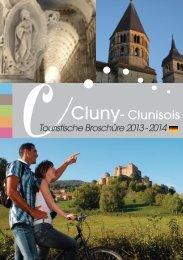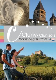
Cluny - Clunisois Cluny- Clunisois - Cluny tourisme
Cluny - Clunisois Cluny- Clunisois - Cluny tourisme
Cluny - Clunisois Cluny- Clunisois - Cluny tourisme

Create successful ePaper yourself
Turn your PDF publications into a flip-book with our unique Google optimized e-Paper software.
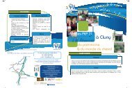
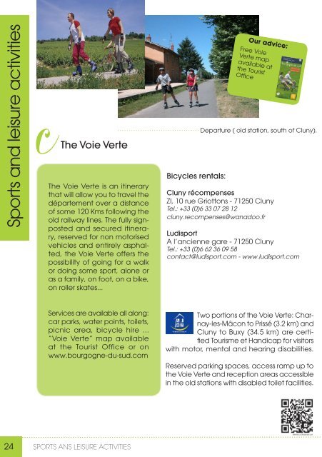
Sports and leisure activities<br />
cThe Voie Verte<br />
The Voie Verte is an itinerary<br />
that will allow you to travel the<br />
département over a distance<br />
of some 120 Kms following the<br />
old railway lines. The fully signposted<br />
and secured itinera-<br />
ry, reserved for non motorised<br />
vehicles and entirely asphal-<br />
ted, the Voie Verte offers the<br />
possibility of going for a walk<br />
or doing some sport, alone or<br />
as a family, on foot, on a bike,<br />
on roller skates...<br />
Services are available all along:<br />
car parks, water points, toilets,<br />
picnic area, bicycle hire ...<br />
“Voie Verte” map available<br />
at the Tourist Office or on<br />
www.bourgogne-du-sud.com<br />
Bicycles rentals:<br />
Our advice:<br />
Free Voie<br />
Verte map<br />
available at<br />
the Tourist<br />
Office<br />
Departure ( old station, south of <strong>Cluny</strong>).<br />
<strong>Cluny</strong> récompenses<br />
ZI, 10 rue Griottons - 71250 <strong>Cluny</strong><br />
Tel.: +33 (0)6 33 07 28 12<br />
cluny.recompenses@wanadoo.fr<br />
Ludisport<br />
A l’ancienne gare - 71250 <strong>Cluny</strong><br />
Tel.: +33 (0)6 62 36 09 58<br />
contact@ludisport.com - www.ludisport.com<br />
Two portions of the Voie Verte: Charnay-les-Mâcon<br />
to Prissé (3.2 km) and<br />
<strong>Cluny</strong> to Buxy (34.5 km) are certified<br />
Tourisme et Handicap for visitors<br />
with motor, mental and hearing disabilities.<br />
Reserved parking spaces, access ramp up to<br />
the Voie Verte and reception areas accessible<br />
in the old stations with disabled toilet facilities.<br />
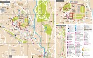
cHiking trails in the <strong>Cluny</strong> area.<br />
Ramblings<br />
The <strong>Cluny</strong> area is ideal for rambling, cycling or pony trekking thanks to a remarkably<br />
varied and rich landscape: mixed woodland and pasture-land, forests, vineyards.<br />
There are many possibilities for rambling:<br />
- Three long-distance footpaths converge<br />
on the town (GR 76, GR 76 C and GR 76 D)<br />
allowing Saint Gengoux le National, Lournand,<br />
Tramayes, Suin, Château, the col<br />
des 4 vents and col de Montmain to be<br />
reached on foot.<br />
- «Balades Vertes»:<br />
We can suggest over 40 different<br />
walks, detailed in printed<br />
brochures and taking in the<br />
areas of <strong>Cluny</strong>, Matour and Tramayes (randofiche<br />
on sale at the Tourist Office).<br />
- <strong>Cluny</strong> is a stage on the pilgrim’s<br />
way to Santiago de Compostella.<br />
Follow the marker:<br />
Pilgrims can come to stamp their credential<br />
to the tourist office to validate their step.<br />
Our booklets:<br />
Fiche: 0,50 € - book: 6,50 € - map: 3,50 €<br />
Markers along the way:<br />
information posts are available in every<br />
village.<br />
Circuits are marked out in yellows, follows<br />
these signposts:<br />
24 SPORTS ANS LEISURE ACTIVITIES<br />
25