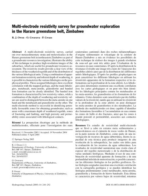
Multi-electrode resistivity survey for groundwater exploration in the ...
Multi-electrode resistivity survey for groundwater exploration in the ...
Multi-electrode resistivity survey for groundwater exploration in the ...

You also want an ePaper? Increase the reach of your titles
YUMPU automatically turns print PDFs into web optimized ePapers that Google loves.
<strong>Multi</strong>-<strong>electrode</strong> <strong>resistivity</strong> <strong>survey</strong> <strong>for</strong> <strong>groundwater</strong> <strong>exploration</strong><br />
<strong>in</strong> <strong>the</strong> Harare greenstone belt, Zimbabwe<br />
R. J. Owen · O. Gwavava · P. Gwaze<br />
Abstract A multi-<strong>electrode</strong> <strong>resistivity</strong> <strong>survey</strong>, carried<br />
out over metasedimentary strata and metavolcanics <strong>in</strong> <strong>the</strong><br />
Harare greenstone belt <strong>in</strong> nor<strong>the</strong>astern Zimbabwe as part of<br />
a <strong>groundwater</strong> resources <strong>in</strong>vestigation, illustrates <strong>the</strong> ability<br />
of this technique to produce high-resolution images of <strong>the</strong><br />
subsurface, which are useful <strong>for</strong> <strong>groundwater</strong> resources assessment.<br />
The <strong>resistivity</strong> results provide a clear view of <strong>the</strong><br />
thickness of <strong>the</strong> wea<strong>the</strong>red regolith and of <strong>the</strong> distribution of<br />
<strong>the</strong> various lithological units. Us<strong>in</strong>g a comb<strong>in</strong>ation of apparent<br />
<strong>for</strong>mation <strong>resistivity</strong> and <strong>in</strong>ferred depth of wea<strong>the</strong>r<strong>in</strong>g, it<br />
is possible to characterize <strong>the</strong> various lithologies on <strong>the</strong> geophysical<br />
profiles. These assigned lithologies show excellent<br />
correlation with <strong>the</strong> mapped geology, and <strong>the</strong> ma<strong>in</strong> lithologies,<br />
metabasalt, meta-arenite, granodiorite and banded<br />
iron <strong>for</strong>mation can be clearly identified. The banded iron<br />
<strong>for</strong>mation is characterized by low <strong>resistivity</strong> values, while a<br />
comb<strong>in</strong>ation of <strong>the</strong> depth of wea<strong>the</strong>r<strong>in</strong>g and <strong>resistivity</strong> values<br />
are used to dist<strong>in</strong>guish between <strong>the</strong> meta-arenite on one<br />
hand and <strong>the</strong> metabasalt and granodiorite on <strong>the</strong> o<strong>the</strong>r. The<br />
multi-<strong>electrode</strong> method is successful <strong>in</strong> identify<strong>in</strong>g potentially<br />
favourable zones <strong>for</strong> obta<strong>in</strong><strong>in</strong>g <strong>groundwater</strong>, such as<br />
areas with a maximum depth of wea<strong>the</strong>red regolith, zones<br />
of fractur<strong>in</strong>g and fault<strong>in</strong>g, and high porosity and permeability<br />
zones associated with lithological contacts.<br />
Résumé La prospection électrique par la méthode de<br />
multiélectrodes, effectuée pour l’<strong>in</strong>vestigation des eaux<br />
Received: 11 November 2003 / Accepted: 19 November 2004<br />
Published onl<strong>in</strong>e: 9 April 2005<br />
C○ Spr<strong>in</strong>ger-Verlag 2005<br />
R. J. Owen ()<br />
Departments of Geology, University of Zimbabwe,<br />
Box MP 167, Harare, Zimbabwe<br />
e-mail: rowen@science.uz.ac.zw<br />
Tel.: 2634303556<br />
Fax: 2634303557<br />
O. Gwavava<br />
Departments of Physics, University of Zimbabwe,<br />
Box MP 167, Harare, Zimbabwe<br />
e-mail: gwavava@science.uz.ac.zw<br />
P. Gwaze<br />
Formerly of Department of Physics, University of Zimbabwe,<br />
Zimbabwe<br />
souterra<strong>in</strong>es cantonnés dans des roches métamorphiques<br />
d’orig<strong>in</strong>e sédimentaire et volcanique de la ce<strong>in</strong>ture de<br />
Harare-Zimbabwe a mis en évidence les possibilités de<br />
cette technique de réaliser des images à grande résolution<br />
du sous-sol qui sont très utiles pour l’évaluation de la<br />
ressource en eaux souterra<strong>in</strong>es. D’après la distribution de la<br />
résistance il résulte une image très claire de l’épaisseur des<br />
regoli<strong>the</strong>s altérés a<strong>in</strong>si que de la distribution des différentes<br />
unités lithologiques. D’après les profiles géophysiques on<br />
peut caractériser les différents lithologies en utilisant les<br />
résistivités apparentes de la <strong>for</strong>mation respective et les <strong>in</strong><strong>for</strong>mations<br />
sur la profondeur de la zone altérée. Les lithologies<br />
a<strong>in</strong>si déterm<strong>in</strong>ées montrent une excellente corrélation<br />
avec les cartes géologiques et on peut très bien identifier<br />
les lithologies pr<strong>in</strong>cipales comme les metabasaltes et<br />
les meta-arenites, les granodiorites et les <strong>for</strong>mations de fer<br />
rubanées. Cettes dernières sont caractérisées par des faibles<br />
valeurs de la résistivité, tandis que en utilisant les résistivité<br />
et la profondeur de la zone altérée on peut dist<strong>in</strong>guer<br />
les meta-arenites de granodiorites et des metabasaltes. La<br />
méthode des multiélectrodes est donc capable d’identifier<br />
des <strong>for</strong>mations favorables à l’accumulation en eau comme<br />
les zones de faille et des fractures, a<strong>in</strong>si que les zones à<br />
grande porosité et perméabilité, associées aux contactes<br />
lithologiques.<br />
Resumen Un estudio de resistividad multi-electrodo<br />
que se llevó a cabo en estratos meta sedimentarios y<br />
metavolcánicos en el c<strong>in</strong>turón de rocas verdes de Harare,<br />
en la parte noreste de Zimbabwe, como parte de una <strong>in</strong>vestigación<br />
de recursos de agua subterránea, ilustra la capacidad<br />
de esta técnica para producir imágenes de alta<br />
resolución de la subsuperficie, las cuales son útiles para<br />
la evaluación de los recursos da agua subterránea. Los<br />
resultados de resistividad sum<strong>in</strong>istran una visión clara el<br />
espesor del regolito meteorizado y de la distribución de<br />
varias unidades litológicas. Mediante el uso de una comb<strong>in</strong>ación<br />
de resistividad aparente de <strong>for</strong>mación y de una<br />
profundidad <strong>in</strong>ferida de meteorización, es posible caracterizar<br />
las diferentes litologías en los perfiles geofísicos. Estas<br />
litologías asignadas muestran una excelente correlación<br />
con la cartografía geológica y se pueden identificar las<br />
litologías predom<strong>in</strong>antes como metabasalto, meta-arenita,<br />
granodiorita y <strong>for</strong>mación de hierro bandeado. Esta última<br />
se caracteriza por valores bajos de resistividad, mientras<br />
Hydrogeology Journal (2005) 14: 244–252 DOI 10.1007/s10040-004-0420-7
que se utiliza una comb<strong>in</strong>ación de profundidad de meteorización<br />
y valores de resistividad, para dist<strong>in</strong>guir entre<br />
meta-arenita por un lado y metabasalto y granodiorita por<br />
el otro. El método multi-electrodo es exitoso para identificar<br />
zonas potencialmente favorables para captar agua<br />
subterránea, las cuales pueden ser áreas con una profundidad<br />
máxima de regolito meteorizado, o bien zonas de fracturamiento<br />
y fallamiento, o también zonas de porosidad y<br />
permeabilidad altas asociadas con contactos litológicos.<br />
Keywords Zimbabwe . Groundwater <strong>survey</strong><strong>in</strong>g .<br />
<strong>Multi</strong>-<strong>electrode</strong> <strong>resistivity</strong> . Crystall<strong>in</strong>e basement<br />
aquifers . Drill<strong>in</strong>g site selection<br />
Introduction<br />
The multi-<strong>electrode</strong> <strong>resistivity</strong> technique is now fairly well<br />
established with respect to <strong>the</strong>ory, practical application and<br />
<strong>in</strong>terpretation techniques (e.g. Barker 1981; Dahl<strong>in</strong> 1993;<br />
Loke and Barker 1996a, b). The aim of this paper is to create<br />
an awareness of some of <strong>the</strong> values and benefits of us<strong>in</strong>g<br />
multi-<strong>electrode</strong> <strong>resistivity</strong> <strong>for</strong> <strong>groundwater</strong> <strong>exploration</strong>.<br />
Resistivity methods are very sensitive to variations <strong>in</strong><br />
earth <strong>resistivity</strong>, and are <strong>the</strong>re<strong>for</strong>e useful <strong>for</strong> identify<strong>in</strong>g<br />
lithological units and variations with<strong>in</strong> lithological units.<br />
Such features and changes are usually highly significant<br />
with respect to <strong>groundwater</strong> occurrence. Conventional DC<br />
<strong>resistivity</strong> sound<strong>in</strong>g and profil<strong>in</strong>g has successfully capitalised<br />
on this aspect of <strong>resistivity</strong> <strong>survey</strong><strong>in</strong>g but is weak<br />
<strong>in</strong> respect of spatial coverage. By utilis<strong>in</strong>g microcomputer<br />
control, <strong>the</strong> multi<strong>electrode</strong> <strong>resistivity</strong> method has overcome<br />
this weakness <strong>in</strong> <strong>resistivity</strong> <strong>survey</strong><strong>in</strong>g.<br />
In this case study <strong>the</strong> multi-<strong>electrode</strong> <strong>resistivity</strong> method<br />
has been used to assess <strong>the</strong> <strong>groundwater</strong> potential <strong>in</strong> a<br />
valley at Rudolphia farm, which lies approximately 40 km<br />
ENE of Harare <strong>in</strong> <strong>the</strong> Harare greenstone belt, nor<strong>the</strong>astern<br />
Zimbabwe, centred at 31 ◦ 24.6 ′ E and 17 ◦ 45.2 ′ S (Fig. 1a).<br />
Locality and geology<br />
Rudolphia farm lies towards <strong>the</strong> eastern edge of <strong>the</strong><br />
Harare greenstone belt, on a sequence of metabasalts and<br />
meta-arenites, strik<strong>in</strong>g ENE WSW to EW, and <strong>in</strong>truded<br />
locally by younger granitic rocks. The central portion of<br />
<strong>the</strong> geological map (Fig. 1b) is underla<strong>in</strong> by meta-arenites,<br />
with subord<strong>in</strong>ate banded iron <strong>for</strong>mation and talc schist, and<br />
<strong>the</strong>se <strong>for</strong>mations are flanked both to <strong>the</strong> north and south by<br />
metabasalt. The central area, underla<strong>in</strong> by meta-arenite,<br />
<strong>for</strong>ms an open EW trend<strong>in</strong>g valley, which is occupied by<br />
a small stream dra<strong>in</strong><strong>in</strong>g eastwards. Soft talc schists occur<br />
as an outcrop preserved between two ridges of banded<br />
iron <strong>for</strong>mation on <strong>the</strong> sou<strong>the</strong>rn valley flank, but are not<br />
observed downslope <strong>in</strong> <strong>the</strong> valley floor, although <strong>the</strong>y are<br />
presumed to occur under a cover of soil and colluvium.<br />
Small outcrops of <strong>in</strong>trusive granodiorite are observed both<br />
at <strong>the</strong> eastern and <strong>the</strong> western ends of <strong>the</strong> <strong>survey</strong>ed area,<br />
and are shown on <strong>the</strong> generalized geological map of <strong>the</strong><br />
245<br />
farm (Fig. 1b), which is based on <strong>the</strong> 1:100,000 geological<br />
map of <strong>the</strong> area by <strong>the</strong> Zimbabwe Geological Survey<br />
(Baldock 1991). Where observed, <strong>the</strong> dip of <strong>the</strong> strata is<br />
subvertical. Based on <strong>the</strong> distribution of <strong>the</strong> lithological<br />
units and <strong>the</strong> dip directions and angles, it is possible that<br />
<strong>the</strong> central meta-arenites may be <strong>the</strong> core of an anti<strong>for</strong>m<br />
that has been exposed by erosion, but <strong>the</strong>re is <strong>in</strong>sufficient<br />
field evidence to conclusively prove this.<br />
Resistivity <strong>survey</strong><br />
Basic pr<strong>in</strong>ciples<br />
Electrical sound<strong>in</strong>g (1D vertical) and electrical profil<strong>in</strong>g<br />
(1D horizontal) are rout<strong>in</strong>ely used <strong>for</strong> <strong>groundwater</strong>, and<br />
are well described <strong>in</strong> standard geophysical texts such as<br />
Parasnis (1986). A detailed picture of <strong>the</strong> subsurface can<br />
be obta<strong>in</strong>ed by comb<strong>in</strong><strong>in</strong>g <strong>the</strong> sound<strong>in</strong>g and profil<strong>in</strong>g data<br />
to give two-dimensional (2D) cross sections, which can <strong>in</strong><br />
turn be comb<strong>in</strong>ed to give a 3D model of <strong>the</strong> ground. However,<br />
to carry out such <strong>in</strong>vestigations manually is both time<br />
consum<strong>in</strong>g and labour <strong>in</strong>tensive. This has lead to <strong>the</strong> development<br />
of computer-controlled multi<strong>electrode</strong> <strong>resistivity</strong><br />
systems (Dahl<strong>in</strong> 1993), which entails <strong>the</strong> use of multiple<br />
<strong>electrode</strong>s, connected via multicore cables to a switch<strong>in</strong>g<br />
box, which <strong>in</strong> turn is connected to a DC <strong>resistivity</strong> meter.<br />
A computer protocol file <strong>in</strong>structs <strong>the</strong> switch<strong>in</strong>g box<br />
to automatically select comb<strong>in</strong>ations of four <strong>electrode</strong>s at<br />
a time accord<strong>in</strong>g to <strong>the</strong> <strong>survey</strong> design, and <strong>the</strong> <strong>resistivity</strong><br />
meter takes read<strong>in</strong>gs <strong>for</strong> each set of selected <strong>electrode</strong>s,<br />
thus produc<strong>in</strong>g a 2D data set.<br />
Data acquisition and process<strong>in</strong>g<br />
The <strong>resistivity</strong> system used <strong>for</strong> data acquisition was a<br />
modified version of <strong>the</strong> ABEM Lund Imag<strong>in</strong>g System. It<br />
consists of six ma<strong>in</strong> elements: a high-resolution voltmeter<br />
(Terraohm AD201) which is a 24 bit analogue/digital<br />
converter; a portable field computer with two serial ports<br />
and one parallel port (e.g. Husky FC486) that controls data<br />
acquisition; 4×64 channel relay switch<strong>in</strong>g unit (ABEM<br />
Electrode Selector ES464); a current amplifier (ABEM<br />
Booster SAS 2000) and an active booster <strong>in</strong>terface; four<br />
100-m multiconductor cables with 21 takeouts at 5-m spac<strong>in</strong>g;<br />
steel rod <strong>electrode</strong>s of different lengths (0.6–1.2 m)<br />
and cable jumpers <strong>for</strong> connect<strong>in</strong>g <strong>the</strong> <strong>electrode</strong>s to <strong>the</strong><br />
takeouts. This system uses <strong>the</strong> data acquisition software<br />
Eric ad developed by Dr T. Dahl<strong>in</strong>, Lund Institute of<br />
Geotechnology, Sweden. A detailed explanation of how <strong>the</strong><br />
<strong>in</strong>strument is setup and data is collected is given by Dahl<strong>in</strong><br />
(1993). The program allows <strong>the</strong> user to set <strong>the</strong> m<strong>in</strong>imum<br />
and maximum current, and to select <strong>electrode</strong> configurations<br />
through protocol files, e.g. Wenner, dipole-dipole,<br />
pole-pole, Schlumberger, etc. or a comb<strong>in</strong>ation of <strong>the</strong>se and<br />
o<strong>the</strong>rs. After <strong>the</strong> system is setup, <strong>the</strong> software checks <strong>for</strong><br />
sufficient ground contact across <strong>the</strong> entire <strong>electrode</strong> spread.<br />
Three nearly parallel profiles (Fig. 1b), trend<strong>in</strong>g NS<br />
across <strong>the</strong> valley, were <strong>survey</strong>ed <strong>in</strong> three days by a crew<br />
of four us<strong>in</strong>g <strong>the</strong> Wenner array configuration, an <strong>electrode</strong><br />
Hydrogeology Journal (2005) 14: 244–252 DOI 10.1007/s10040-004-0420-7
246<br />
Fig. 1 a Location of<br />
Rudolphia farm; b General<br />
geology and locations of three<br />
NS profile—Rudolphia.<br />
Topographic contour <strong>in</strong>terval<br />
10 m; <strong>the</strong> UTM coord<strong>in</strong>ates <strong>in</strong><br />
metres. Rudolphia farm covers<br />
<strong>the</strong> whole area<br />
spac<strong>in</strong>g of 5 m and <strong>the</strong> rollalong technique. In <strong>the</strong> rollalong<br />
technique, measurements are done on a spread of say four<br />
cables l<strong>in</strong>ked toge<strong>the</strong>r and <strong>the</strong>n <strong>the</strong> first cable is moved to<br />
<strong>the</strong> upper end of <strong>the</strong> spread and measurements are taken<br />
<strong>for</strong> <strong>the</strong> second setup. This procedure is repeated until <strong>the</strong><br />
whole profile length is covered. Profile lengths range from<br />
600–1,000 m and all cross <strong>the</strong> central WE dra<strong>in</strong>age l<strong>in</strong>e.<br />
A total of 483 <strong>electrode</strong>s were implanted along <strong>the</strong> three<br />
profiles. On average, a current of 20–50 mA (milliampere)<br />
was <strong>in</strong>jected <strong>in</strong>to <strong>the</strong> ground. The profiles were levelled and<br />
<strong>the</strong> profile topography has been <strong>in</strong>corporated <strong>in</strong> <strong>the</strong> <strong>in</strong>verted<br />
models.<br />
The data was modelled us<strong>in</strong>g RES2DINV (ver3.42d) developed<br />
by Dr M. H. Loke. The <strong>in</strong>version rout<strong>in</strong>e used by<br />
RES2DINV is based on <strong>the</strong> smoothness constra<strong>in</strong>ed leastsquares<br />
technique (deGroot-Hedl<strong>in</strong> and Constable 1990;<br />
Sasaki 1992) and offers three options, namely a very fast<br />
quasi Newton method (Loke and Barker 1996a), a slow but<br />
more accurate conventional Gauss Newton method, and a<br />
hybrid of <strong>the</strong> quasi Newton and Gauss Newton methods.<br />
The program automatically creates a 2D model by divid<strong>in</strong>g<br />
<strong>the</strong> subsurface <strong>in</strong>to rectangular blocks and chooses optimum<br />
<strong>in</strong>version parameters <strong>for</strong> <strong>the</strong> data which <strong>in</strong>clude <strong>the</strong><br />
damp<strong>in</strong>g factor, vertical to horizontal flatness filter ratio,<br />
convergence limit and number of iterations. The user can<br />
modify <strong>the</strong> <strong>in</strong>version parameters to suit different data types.<br />
The program calculates <strong>the</strong> apparent <strong>resistivity</strong> values of<br />
<strong>the</strong> model blocks us<strong>in</strong>g ei<strong>the</strong>r a f<strong>in</strong>ite difference or f<strong>in</strong>ite<br />
element method and compares <strong>the</strong>se to measured data. The<br />
<strong>resistivity</strong> of <strong>the</strong> model blocks is adjusted iteratively until<br />
<strong>the</strong> calculated apparent <strong>resistivity</strong> values of <strong>the</strong> model agree<br />
with <strong>the</strong> actual measurements.<br />
A Gauss Newton <strong>in</strong>version method with smooth constra<strong>in</strong>t<br />
parameters was applied to all <strong>the</strong> profiles. Us<strong>in</strong>g a<br />
Pentium III laptop computer with 64 MB RAM, it took<br />
about 4 m<strong>in</strong> to get an <strong>in</strong>verted model <strong>for</strong> <strong>the</strong> shortest profile<br />
(600 m) with 121 <strong>electrode</strong>s and 543 data po<strong>in</strong>ts, whereas<br />
<strong>the</strong> 1,000-m profile with 201 <strong>electrode</strong>s and 1,326 data<br />
po<strong>in</strong>ts required about 25 m<strong>in</strong>. Inversion of 2D and 3D data<br />
sets is an active area of research with faster and more accurate<br />
algorithms be<strong>in</strong>g developed.<br />
The f<strong>in</strong>al output from RES2DINV displays three sections,<br />
i.e. measured and calculated apparent <strong>resistivity</strong> pseudosections,<br />
and <strong>the</strong> <strong>in</strong>verse model <strong>resistivity</strong> section. The pseudosections<br />
are a qualitative way of present<strong>in</strong>g <strong>the</strong> spatial<br />
variation of <strong>the</strong> measured or calculated apparent <strong>resistivity</strong><br />
<strong>in</strong> cross section and do not reflect <strong>the</strong> true depth. The<br />
<strong>in</strong>verse model section shows <strong>the</strong> true depth and true <strong>for</strong>mation<br />
<strong>resistivity</strong>. The location of <strong>the</strong> data po<strong>in</strong>ts and <strong>the</strong><br />
isopleths of <strong>resistivity</strong> values toge<strong>the</strong>r with a series of grey<br />
shades can be shown on all three sections. The topography<br />
can only be <strong>in</strong>cluded on <strong>the</strong> <strong>in</strong>verse model section.<br />
Hydrogeology Journal (2005) 14: 244–252 DOI 10.1007/s10040-004-0420-7
Geoelectrical expectation model<br />
It is useful to construct a hydrogeological “expectation”<br />
model <strong>for</strong> <strong>the</strong> area with<strong>in</strong> <strong>the</strong> <strong>resistivity</strong> <strong>survey</strong> doma<strong>in</strong>,<br />
based on <strong>the</strong> distribution of <strong>the</strong> various lithological units<br />
and <strong>the</strong> anticipated wea<strong>the</strong>r<strong>in</strong>g profiles associated with each<br />
unit. Such a model can be used to produce a <strong>the</strong>oretical<br />
geoelectrical model based on <strong>the</strong> expected geoelectric signatures<br />
<strong>for</strong> <strong>the</strong> various hydrogeological units. This model<br />
can be used to assist with <strong>the</strong> <strong>in</strong>terpretation of <strong>the</strong> actual<br />
<strong>resistivity</strong> profile data, giv<strong>in</strong>g rise to a more realistic <strong>in</strong>terpretation<br />
of <strong>the</strong> earth model.<br />
In this <strong>survey</strong> area, five lithological units have been identified<br />
by field mapp<strong>in</strong>g (Baldock 1991), and <strong>the</strong>se are tabulated<br />
<strong>in</strong> Table 1, toge<strong>the</strong>r with <strong>the</strong> anticipated depth and nature<br />
of <strong>the</strong>ir various wea<strong>the</strong>red regoliths, and <strong>the</strong> expected<br />
<strong>resistivity</strong> signature range <strong>for</strong> each of <strong>the</strong>se units.<br />
The <strong>groundwater</strong> potential, as identified <strong>in</strong> Table 1, is<br />
estimated based on <strong>the</strong> lithology. The permeability and<br />
porosity values that occur <strong>in</strong> <strong>the</strong> profile are closely l<strong>in</strong>ked<br />
to <strong>the</strong> depth of wea<strong>the</strong>r<strong>in</strong>g and fractur<strong>in</strong>g <strong>in</strong> <strong>the</strong> subsurface,<br />
and to <strong>the</strong> degree of alteration and type of wea<strong>the</strong>red<br />
products that are developed. Acworth (1987) carried out<br />
detailed studies on <strong>the</strong> wea<strong>the</strong>red regolith, as developed <strong>in</strong><br />
a tropical environment, of crystall<strong>in</strong>e basement rocks, and<br />
estimated <strong>the</strong> variation of permeability and porosity down<br />
<strong>the</strong> profile (Fig. 2).<br />
The potential <strong>for</strong> obta<strong>in</strong><strong>in</strong>g <strong>groundwater</strong> and <strong>the</strong> well<br />
yields are closely l<strong>in</strong>ked to <strong>the</strong> nature of <strong>the</strong> regolith profile,<br />
with <strong>the</strong> saturated thickness of <strong>the</strong> high porosity upper<br />
saprolite, and <strong>the</strong> development of a high permeability transition<br />
zone between regolith and bedrock be<strong>in</strong>g <strong>the</strong> two<br />
key factors controll<strong>in</strong>g respectively <strong>the</strong> aquifer storage capacity<br />
and <strong>the</strong> well yield potential. One of <strong>the</strong> pr<strong>in</strong>cipal<br />
advantages of us<strong>in</strong>g multi<strong>electrode</strong> <strong>resistivity</strong> <strong>survey</strong><strong>in</strong>g is<br />
Table 1 Lithology and potential <strong>for</strong> obta<strong>in</strong><strong>in</strong>g <strong>groundwater</strong> <strong>in</strong> <strong>the</strong> study area<br />
Lithological unit Wea<strong>the</strong>red regolith: nature<br />
and thickness<br />
Metabasalt Deep wea<strong>the</strong>red regolith<br />
(20–40 m). Clay with<br />
thick transition zone<br />
Meta-arenite Shallow wea<strong>the</strong>r<strong>in</strong>g<br />
(2–20 m). Clays absent<br />
due to lack labile gra<strong>in</strong>s <strong>in</strong><br />
sedimentary <strong>for</strong>mations<br />
Granite/granodiorite Moderate to deep<br />
wea<strong>the</strong>r<strong>in</strong>g (10–40 m).<br />
Clay with residual mica<br />
and quartz<br />
Banded iron <strong>for</strong>mation Very limited wea<strong>the</strong>r<strong>in</strong>g<br />
but fractured to moderate<br />
depth (20–30 m). Intact<br />
rock conducts current<br />
Talc schist Clay wea<strong>the</strong>r<strong>in</strong>g, moderate<br />
to very shallow depths<br />
247<br />
that <strong>the</strong> technique af<strong>for</strong>ds <strong>the</strong> user a view of <strong>the</strong> geoelectrical<br />
changes with<strong>in</strong> <strong>the</strong> regolith, which can be readily related<br />
to <strong>the</strong> changes <strong>in</strong> <strong>the</strong> porosity and permeability values anticipated<br />
<strong>in</strong> a typical vertical profile through <strong>the</strong> regolith <strong>in</strong><br />
crystall<strong>in</strong>e rocks.<br />
Results and <strong>in</strong>terpretation<br />
Results of <strong>resistivity</strong> Profiles 1 to 3 are presented below<br />
toge<strong>the</strong>r with a correlation of <strong>the</strong> results with <strong>the</strong> mapped<br />
geology. It is <strong>in</strong>terest<strong>in</strong>g to note that <strong>the</strong> vertical profile<br />
changes may be readily <strong>in</strong>terpreted <strong>in</strong> light of <strong>the</strong> model<br />
profiles proposed by Acworth (1987, Fig. 2). Three <strong>resistivity</strong><br />
sections, as outl<strong>in</strong>ed above, are presented <strong>for</strong> each<br />
profile.<br />
Figure 3 shows <strong>the</strong> three sections of Profile 1. The overburden<br />
along <strong>the</strong> profile is conductive as expected <strong>for</strong><br />
wea<strong>the</strong>red greenstone lithologies. The nor<strong>the</strong>rn valley flank<br />
from 0–240 m is underla<strong>in</strong> by metabasalt, which due to <strong>the</strong><br />
presence of labile m<strong>in</strong>erals, wea<strong>the</strong>rs relatively easily to<br />
smectite type clays. This is clearly shown by <strong>the</strong> surficial<br />
low <strong>resistivity</strong> zone (20–50 m) around 20 m thick<br />
and is <strong>in</strong>terpreted as wea<strong>the</strong>red regolith. Ano<strong>the</strong>r zone of<br />
low <strong>resistivity</strong> values is seen from 480–800 m. The depth<br />
of wea<strong>the</strong>r<strong>in</strong>g is around 20 m, with a deeper section from<br />
500–720 m <strong>in</strong>dicat<strong>in</strong>g wea<strong>the</strong>red regolith up to 30 m depth,<br />
fur<strong>the</strong>r <strong>in</strong>creas<strong>in</strong>g to 40 m at 630 m along <strong>the</strong> profile. This<br />
part corresponds with <strong>the</strong> granodiorite as mapped <strong>in</strong> <strong>the</strong><br />
1:100,000 geological map (Fig. 1b). The f<strong>in</strong>al section of<br />
<strong>the</strong> profile from 720–800 m exhibits shallow wea<strong>the</strong>r<strong>in</strong>g,<br />
and corresponds to meta-arenite on <strong>the</strong> geological map. Below<br />
<strong>the</strong> wea<strong>the</strong>red regolith, <strong>the</strong> <strong>resistivity</strong> values <strong>in</strong>crease,<br />
suggest<strong>in</strong>g that <strong>the</strong> rock becomes less wea<strong>the</strong>red, grad<strong>in</strong>g<br />
Potential <strong>for</strong> obta<strong>in</strong><strong>in</strong>g<br />
<strong>groundwater</strong><br />
Resistivity range <strong>in</strong> m Fresh rock Regolith<br />
Moderate to very good >400 10–50<br />
Poor to moderate >600 40–100<br />
Moderate to low >400 25–100<br />
Moderate to very good 200 20–100<br />
*Data from Interconsult (1987). National master water plan <strong>for</strong> rural water supply and sanitation; vol 2.2. Hydrogeology. Department of<br />
Water Resources, Government of Zimbabwe<br />
Hydrogeology Journal (2005) 14: 244–252 DOI 10.1007/s10040-004-0420-7
248<br />
Fig. 2 Typical vertical regolith profile <strong>for</strong> crystall<strong>in</strong>e rocks <strong>in</strong> a tropical environment . Copied from Acworth (1987)<br />
<strong>in</strong>to fresh rock. The central part of <strong>the</strong> profile from 240–<br />
500 m exhibits very high <strong>resistivity</strong> values (>630 m) at<br />
shallow depth, <strong>in</strong>dicat<strong>in</strong>g a very limited depth of wea<strong>the</strong>r<strong>in</strong>g.<br />
This correlates well with <strong>the</strong> mapped meta-arenites,<br />
which are known to be resistant to wea<strong>the</strong>r<strong>in</strong>g (Interconsult<br />
1987). There is a narrow vertical feature, with slightly<br />
lower <strong>resistivity</strong> values, <strong>in</strong> <strong>the</strong> middle of <strong>the</strong> meta-arenite<br />
at approximately 350 m, which may be an unmapped fault<br />
zone. This <strong>resistivity</strong> profile shows a good correlation with<br />
<strong>the</strong> mapped geology.<br />
Figure 4 shows <strong>the</strong> three sections of <strong>resistivity</strong> Profile 2.<br />
From 0–260 m, <strong>the</strong>re is a thick (20–60 m) low <strong>resistivity</strong><br />
(20–80 m) upper zone, <strong>in</strong>terpreted as wea<strong>the</strong>red regolith<br />
overly<strong>in</strong>g meta basalt. The depth of wea<strong>the</strong>r<strong>in</strong>g becomes<br />
significantly less <strong>in</strong> <strong>the</strong> valley floor from 260–500 m, while<br />
<strong>the</strong> <strong>resistivity</strong> of fresh bedrock <strong>in</strong>creases (>600 m); this<br />
section corresponds with <strong>the</strong> meta-arenite on <strong>the</strong> geological<br />
map (Fig. 1b). From 460–660 m <strong>in</strong> <strong>the</strong> valley floor, a<br />
strik<strong>in</strong>g feature, with very low <strong>resistivity</strong> (In <strong>the</strong> case study presented, it has been possible to<br />
differentiate between <strong>the</strong> two major lithologic types, <strong>the</strong><br />
metabasalt and <strong>the</strong> meta-arenite, pr<strong>in</strong>cipally due to <strong>the</strong><br />
Hydrogeology Journal (2005) 14: 244–252 DOI 10.1007/s10040-004-0420-7
difference <strong>in</strong> thickness of <strong>the</strong> wea<strong>the</strong>red regolith that develops<br />
above <strong>the</strong>se two, but also by <strong>the</strong> higher <strong>resistivity</strong> values<br />
associated with <strong>the</strong> fresh meta-arenite. Clastic sedimentary<br />
<strong>for</strong>mations typically tend to be less susceptible to chemical<br />
wea<strong>the</strong>r<strong>in</strong>g, result<strong>in</strong>g <strong>in</strong> th<strong>in</strong> wea<strong>the</strong>red profiles, <strong>in</strong> contrast<br />
to igneous rocks, particularly those of mafic composition,<br />
which may be wea<strong>the</strong>red to considerable depth.<br />
In Profile 1, <strong>the</strong> granodiorite, though it has a broadly similar<br />
<strong>resistivity</strong> range, can be dist<strong>in</strong>guished from <strong>the</strong> metaarenite<br />
by <strong>the</strong> depth of <strong>the</strong> wea<strong>the</strong>red profile. In Profile<br />
2, a very low <strong>resistivity</strong> vertical feature corresponds with<br />
a mapped outcrop of banded iron <strong>for</strong>mation. Banded iron<br />
<strong>for</strong>mation has <strong>the</strong> ability to conduct electrical current due<br />
to <strong>the</strong> presence of iron <strong>in</strong> <strong>the</strong> <strong>for</strong>mation and registers low to<br />
Fig. 3 Sections <strong>for</strong> Profile 1.<br />
The top pseudosection is <strong>for</strong> <strong>the</strong><br />
measured apparent resistivities<br />
with <strong>the</strong> data po<strong>in</strong>ts shown as<br />
dots; <strong>the</strong> middle pseudosection<br />
is <strong>for</strong> <strong>the</strong> calculated apparent<br />
resistivities with <strong>the</strong> data po<strong>in</strong>ts<br />
shown as dots; <strong>the</strong> bottom<br />
section is <strong>for</strong> <strong>the</strong> <strong>in</strong>verse model<br />
with topography <strong>in</strong>cluded and<br />
<strong>the</strong> white l<strong>in</strong>e marks <strong>the</strong> <strong>in</strong>ferred<br />
boundary of wea<strong>the</strong>red regolith<br />
and freshrock. Ps depth means<br />
pseudo depth. Resistivity<br />
isopleth values are <strong>in</strong> m<br />
249<br />
very low <strong>resistivity</strong> values. Fractured and wea<strong>the</strong>red banded<br />
iron <strong>for</strong>mation, which may be expected <strong>in</strong> <strong>the</strong> near surface<br />
environment, is less able to conduct electrical current due to<br />
<strong>the</strong> air and soil between <strong>the</strong> conductive ironstone material,<br />
and tends to register higher apparent <strong>resistivity</strong> values.<br />
Potential <strong>for</strong> obta<strong>in</strong><strong>in</strong>g <strong>groundwater</strong><br />
The results from <strong>the</strong> multi<strong>electrode</strong> <strong>resistivity</strong> <strong>survey</strong> are<br />
useful <strong>in</strong> estimat<strong>in</strong>g <strong>the</strong> potential <strong>for</strong> obta<strong>in</strong><strong>in</strong>g <strong>groundwater</strong>,<br />
and <strong>in</strong> particular <strong>for</strong> locat<strong>in</strong>g drill<strong>in</strong>g sites. Drill<strong>in</strong>g site<br />
selection may be based on an understand<strong>in</strong>g of <strong>the</strong> hydrogeological<br />
properties of <strong>the</strong> various lithologies (Table 1), but<br />
Hydrogeology Journal (2005) 14: 244–252 DOI 10.1007/s10040-004-0420-7
250<br />
knowledge of <strong>the</strong> saturated thickness of <strong>the</strong> wea<strong>the</strong>red and<br />
fractured regolith as <strong>in</strong>ferred from <strong>the</strong> <strong>resistivity</strong> sections<br />
will greatly enhance <strong>the</strong> success of drill<strong>in</strong>g site selection.<br />
All <strong>the</strong> profiles show that <strong>the</strong> meta-arenite has a limited<br />
thickness of wea<strong>the</strong>red regolith, rang<strong>in</strong>g from 10 to 20 m,<br />
and is <strong>the</strong>re<strong>for</strong>e not a good source of <strong>groundwater</strong>. Both<br />
<strong>the</strong> metabasalt and <strong>the</strong> granodiorite exhibit considerably<br />
thicker wea<strong>the</strong>red regolith profiles, rang<strong>in</strong>g from 20 to 50 m<br />
depth, and <strong>the</strong> deeper regolith sections are identified as <strong>the</strong><br />
Fig. 4 Sections <strong>for</strong> Profile 2.<br />
The top pseudosection is <strong>for</strong> <strong>the</strong><br />
measured apparent resistivities<br />
with <strong>the</strong> data po<strong>in</strong>ts shown as<br />
dots; <strong>the</strong> middle pseudosection<br />
is <strong>for</strong> <strong>the</strong> calculated apparent<br />
resistivities with <strong>the</strong> data po<strong>in</strong>ts<br />
shown as dots; <strong>the</strong> bottom<br />
section is <strong>for</strong> <strong>the</strong> <strong>in</strong>verse model<br />
with topography <strong>in</strong>cluded and<br />
<strong>the</strong> white l<strong>in</strong>e marks <strong>the</strong> <strong>in</strong>ferred<br />
boundaries. BIF means Banded<br />
Iron Formation. Ps depth means<br />
pseudo depth. Resistivity<br />
isopleth values are <strong>in</strong> m<br />
better sources of <strong>groundwater</strong>. In addition to evaluat<strong>in</strong>g potential<br />
sources of <strong>groundwater</strong> based on regolith thickness,<br />
<strong>the</strong>re are specific features on <strong>the</strong> profiles associated with<br />
l<strong>in</strong>ear features, such as fault<strong>in</strong>g, jo<strong>in</strong>t<strong>in</strong>g and lithological<br />
contacts, which are also useful <strong>in</strong> <strong>the</strong> evaluation.<br />
Profile 1 at 350 m has a th<strong>in</strong> vertical feature of relatively<br />
low <strong>resistivity</strong> with<strong>in</strong> <strong>the</strong> meta-arenite, which may be a<br />
fault, and thus <strong>in</strong>dicative of a potential source of <strong>groundwater</strong>.<br />
Profile 2 holds <strong>the</strong> most promise <strong>for</strong> <strong>groundwater</strong><br />
Hydrogeology Journal (2005) 14: 244–252 DOI 10.1007/s10040-004-0420-7
development. In addition to reasonably deep wea<strong>the</strong>r<strong>in</strong>g<br />
over <strong>the</strong> metabasalt, this profile is characterized by a major<br />
break with low to very low resistivities <strong>in</strong> <strong>the</strong> central part of<br />
<strong>the</strong> profile between 460 and 660 m, which co<strong>in</strong>cides with<br />
<strong>the</strong> mapped banded iron <strong>for</strong>mation. Due to its brittle nature<br />
and its resistance to chemical wea<strong>the</strong>r<strong>in</strong>g, banded iron <strong>for</strong>mation<br />
tends to provide a highly permeable, fractured rock<br />
mass, particularly at moderate depths, and at contacts with<br />
<strong>the</strong> country rock where <strong>the</strong> degree of fractur<strong>in</strong>g is greatest.<br />
The banded iron <strong>for</strong>mation shows high <strong>resistivity</strong> values<br />
<strong>in</strong> <strong>the</strong> centre of <strong>the</strong> zone at 550 m, and this is tentatively<br />
<strong>in</strong>terpreted as <strong>the</strong> development of quartz fill migrat<strong>in</strong>g <strong>in</strong>to<br />
<strong>the</strong> zone of fold closure of a subvertical anti<strong>for</strong>mal fold.<br />
The more fractured banded iron <strong>for</strong>mation, located near<br />
Fig. 5 Sections <strong>for</strong> Profile 3.<br />
The top pseudosection is <strong>for</strong> <strong>the</strong><br />
measured apparent resistivities<br />
with <strong>the</strong> data po<strong>in</strong>ts shown as<br />
dots; <strong>the</strong> middle pseudosection<br />
is <strong>for</strong> <strong>the</strong> calculated apparent<br />
resistivities with <strong>the</strong> data po<strong>in</strong>ts<br />
shown as dots; <strong>the</strong> bottom<br />
section is <strong>for</strong> <strong>the</strong> <strong>in</strong>verse model<br />
with topography <strong>in</strong>cluded and<br />
<strong>the</strong> white l<strong>in</strong>e marks <strong>the</strong> <strong>in</strong>ferred<br />
boundary of wea<strong>the</strong>red regolith<br />
and fresh rock. Ps depth means<br />
pseudo depth. Resistivity<br />
isopleth values are <strong>in</strong> m<br />
251<br />
<strong>the</strong> surface and along <strong>the</strong> contacts with <strong>the</strong> meta-arenite,<br />
exhibits relatively low <strong>resistivity</strong> values. Profile 3 clearly<br />
dist<strong>in</strong>guishes <strong>the</strong> difference <strong>in</strong> <strong>the</strong> depth of wea<strong>the</strong>r<strong>in</strong>g between<br />
<strong>the</strong> metabasalt and <strong>the</strong> meta-arenite and offers some<br />
prospects <strong>for</strong> obta<strong>in</strong><strong>in</strong>g <strong>groundwater</strong> based on <strong>the</strong> deeper<br />
wea<strong>the</strong>r<strong>in</strong>g developed over <strong>the</strong> metabasalts.<br />
Potentially favourable drill<strong>in</strong>g sites have been selected<br />
based on <strong>the</strong> <strong>resistivity</strong> profiles and are tabulated below<br />
(Table 2), toge<strong>the</strong>r with an <strong>in</strong>dication of <strong>the</strong> hydrogeological<br />
nature of <strong>the</strong> sites. The sites are ranked <strong>in</strong> order of<br />
preference based on <strong>the</strong> estimated relative well yields. The<br />
deeply fractured contact zones between <strong>the</strong> banded iron<br />
<strong>for</strong>mation and <strong>the</strong> meta-arenite are considered to be <strong>the</strong><br />
most favourable drill<strong>in</strong>g sites.<br />
Hydrogeology Journal (2005) 14: 244–252 DOI 10.1007/s10040-004-0420-7
252<br />
Table 2 Features of selected<br />
drill<strong>in</strong>g sites<br />
Conclusions<br />
Metabasalt, meta-arenite, granodiorite and banded iron <strong>for</strong>mation<br />
can be identified by <strong>the</strong> <strong>resistivity</strong> data, based pr<strong>in</strong>cipally<br />
on <strong>the</strong> depth of wea<strong>the</strong>r<strong>in</strong>g, but also partly on <strong>the</strong> relative<br />
<strong>resistivity</strong> values. Meta-arenite exhibits <strong>the</strong> least depth<br />
of wea<strong>the</strong>r<strong>in</strong>g and <strong>the</strong> highest <strong>resistivity</strong> values. Metabasalt<br />
and granodiorite are more deeply wea<strong>the</strong>red than metaarenite,<br />
and exhibit slightly lower <strong>resistivity</strong> values (e.g.<br />
Profile 1). Metabasalt can be dist<strong>in</strong>guished from granodiorite<br />
by its lower surficial <strong>resistivity</strong> values, which are a<br />
result of <strong>the</strong> clay rich nature of basaltic soils (e.g. Profile<br />
1). The occurrence of deeper wea<strong>the</strong>r<strong>in</strong>g may also be<br />
used to dist<strong>in</strong>guish <strong>the</strong> metabasalt from <strong>the</strong> granodiorite<br />
(e.g. Profiles 2 and 1). The <strong>resistivity</strong> values of <strong>the</strong>se three<br />
lithologies all <strong>in</strong>crease with depth. Banded iron <strong>for</strong>mation<br />
may be dist<strong>in</strong>guished by very low <strong>resistivity</strong> values, which<br />
tend to decrease with depth as <strong>the</strong> <strong>for</strong>mation becomes more<br />
<strong>in</strong>tact. In profile 2, <strong>the</strong> <strong>resistivity</strong> <strong>in</strong> <strong>the</strong> centre of <strong>the</strong> banded<br />
iron <strong>for</strong>mation zone is relatively high, possibly due to quartz<br />
<strong>in</strong>fill <strong>in</strong> a fault.<br />
The ability of multi-<strong>electrode</strong> <strong>resistivity</strong> profil<strong>in</strong>g to provide<br />
a detailed cont<strong>in</strong>uous 2D map of <strong>the</strong> subsurface, identify<strong>in</strong>g<br />
<strong>the</strong> different lithologies, del<strong>in</strong>eat<strong>in</strong>g contact zones<br />
and faults, and measur<strong>in</strong>g <strong>the</strong> thickness of <strong>the</strong> wea<strong>the</strong>red<br />
regolith, makes this technique a very useful tool <strong>for</strong> <strong>groundwater</strong><br />
<strong>in</strong>vestigations, both <strong>for</strong> locat<strong>in</strong>g drill<strong>in</strong>g sites and <strong>for</strong><br />
obta<strong>in</strong><strong>in</strong>g an assessment of <strong>the</strong> general extent of <strong>the</strong> depth<br />
of wea<strong>the</strong>r<strong>in</strong>g and <strong>the</strong> location of fractured zones, which are<br />
<strong>the</strong> pr<strong>in</strong>cipal <strong>groundwater</strong> reservoirs. The method appears<br />
to be particularly well suited to <strong>the</strong> characterization of crystall<strong>in</strong>e<br />
basement rocks and <strong>the</strong>ir wea<strong>the</strong>red regolith profiles.<br />
The multi-<strong>electrode</strong> <strong>resistivity</strong> technique is more expensive<br />
than traditional DC <strong>resistivity</strong> <strong>survey</strong><strong>in</strong>g, but <strong>the</strong> additional<br />
cost may be justified where <strong>the</strong> demand <strong>for</strong> <strong>groundwater</strong><br />
is relatively high, such as <strong>for</strong> municipal or irrigation<br />
development.<br />
Position Lithology Topography Hydrogeological feature Rank<br />
Profile 1: 130 m Metabasalt Valley slope ±30 m wea<strong>the</strong>red regolith 6<br />
Profile 1: 350 m Meta-arenite Valley flat Narrow fracture zone 7<br />
Profile 1: 630 m Granodiorite Flat upland ±40 m wea<strong>the</strong>red regolith 5<br />
Profile 2: 0–220 m Metabasalt Valley slope ±50 m wea<strong>the</strong>red regolith 3<br />
Profile 2: 500 m BIF/Arenite Valley floor Contact zone with fractured and<br />
wea<strong>the</strong>red rock to >60 m depth<br />
1<br />
Profile 2: 630 m BIF/Arenite Valley floor Contact zone with fractured and<br />
wea<strong>the</strong>red rock to >60 m depth<br />
2<br />
Profile 3: 210–280 m Metabasalt Valley slope ±40 m wea<strong>the</strong>red regolith 4<br />
Acknowledgements The research was partly funded by <strong>the</strong><br />
Swedish Agency <strong>for</strong> Research Cooperation with Develop<strong>in</strong>g Countries<br />
(SAREC) through <strong>the</strong> l<strong>in</strong>k with <strong>the</strong> Institute of Geotechnology,<br />
Lund University, Sweden, with<strong>in</strong> <strong>the</strong> bilateral project “Development<br />
of Groundwater Resources <strong>in</strong> Zimbabwe” and <strong>the</strong> British Council<br />
through <strong>the</strong> l<strong>in</strong>k with <strong>the</strong> School of Earth Sciences, University of<br />
Leeds, UK, with<strong>in</strong> <strong>the</strong> “Developmental Geophysics L<strong>in</strong>k Scheme”.<br />
We thank David L. Campbell and an anonymous reviewer <strong>for</strong> <strong>the</strong>ir<br />
helpful comments on an earlier version of this paper<br />
References<br />
Acworth RI (1987) The development of crystall<strong>in</strong>e basement aquifers<br />
<strong>in</strong> a tropical environment. Quart J Eng Geol 20:265–272<br />
Baldock JW (1991) The geology of <strong>the</strong> Harare greenstone belt<br />
and surround<strong>in</strong>g granitic Terra<strong>in</strong>. Zimbabwe Geol Surv Bull<br />
94:213pp<br />
Barker R (1981) The offset system of electrical <strong>resistivity</strong> sound<strong>in</strong>g<br />
and its use with a multicore cable. Geophys Prospect 29:128–<br />
143<br />
Dahl<strong>in</strong> T (1993) On <strong>the</strong> automation of 2D <strong>resistivity</strong> <strong>survey</strong><strong>in</strong>g <strong>for</strong> eng<strong>in</strong>eer<strong>in</strong>g<br />
and environmental applications. PhD Thesis. Department<br />
of Eng<strong>in</strong>eer<strong>in</strong>g Geology, Lund Institute of Technology,<br />
Lund University, Sweden. ISRN: LUTVDG/TVTG1007SE.<br />
ISBN 9162810324, 187 pp<br />
de Groot-Hedl<strong>in</strong> C, Constable S (1990) Occam’s <strong>in</strong>version to generate<br />
smooth, two-dimensional models from magnetotelluric data.<br />
Geophysics 55:1613–1624<br />
Interconsult (1987) National master plan <strong>for</strong> rural water resources<br />
development, Vol 2.2, Hydrogeology. Government of Zimbabwe<br />
Loke MH, Barker RD (1996a) Rapid least squares <strong>in</strong>version of apparent<br />
<strong>resistivity</strong> pseudosections by a quasi Newton method.<br />
Geophys Prospect 44:131–152<br />
Loke MH, Barker RD (1996b) Practical techniques <strong>for</strong> 3D <strong>resistivity</strong><br />
<strong>survey</strong>s and data <strong>in</strong>version. Geophys Prospect 44:499–<br />
523<br />
Parasnis DS (1986) Pr<strong>in</strong>ciples of applied geophysics. 4th edn. Chapman<br />
and Hall, London, UK, 402 pp<br />
Sasaki Y (1992) Resolution of <strong>resistivity</strong> tomography <strong>in</strong>ferred<br />
from numerical simulation. Geophys Prospect 40:453–<br />
464<br />
Hydrogeology Journal (2005) 14: 244–252 DOI 10.1007/s10040-004-0420-7