FEIS - Tahoe Regional Planning Agency
FEIS - Tahoe Regional Planning Agency
FEIS - Tahoe Regional Planning Agency

Create successful ePaper yourself
Turn your PDF publications into a flip-book with our unique Google optimized e-Paper software.
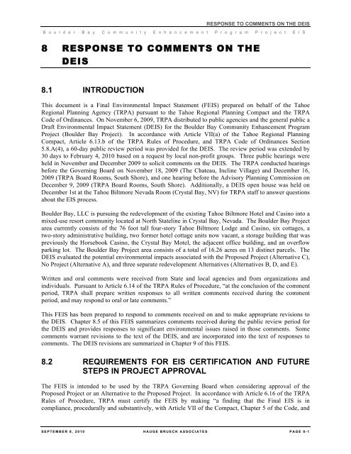
RESPONSE TO COMMENTS ON THE DEIS<br />
B o u l d e r B a y C o m m u n i t y E n h a n c e m e n t P r o g r a m P r o j e c t E I S<br />
8 RESPONSE TO COMMENTS ON THE<br />
DEIS<br />
8.1 INTRODUCTION<br />
This document is a Final Environmental Impact Statement (<strong>FEIS</strong>) prepared on behalf of the <strong>Tahoe</strong><br />
<strong>Regional</strong> <strong>Planning</strong> <strong>Agency</strong> (TRPA) pursuant to the <strong>Tahoe</strong> <strong>Regional</strong> <strong>Planning</strong> Compact and the TRPA<br />
Code of Ordinances. On November 6, 2009, TRPA distributed to public agencies and the general public a<br />
Draft Environmental Impact Statement (DEIS) for the Boulder Bay Community Enhancement Program<br />
Project (Boulder Bay Project). In accordance with Article VII(a) of the <strong>Tahoe</strong> <strong>Regional</strong> <strong>Planning</strong><br />
Compact, Article 6.13.b of the TRPA Rules of Procedure, and TRPA Code of Ordinances Section<br />
5.8.A(4), a 60-day public review period was provided for the DEIS. The review period was extended by<br />
30 days to February 4, 2010 based on a request by local non-profit groups. Three public hearings were<br />
held in November and December 2009 to solicit comments on the DEIS. The TRPA conducted hearings<br />
before the Governing Board on November 18, 2009 (The Chateau, Incline Village) and December 16,<br />
2009 (TRPA Board Rooms, South Shore), and one hearing before the Advisory <strong>Planning</strong> Commission on<br />
December 9, 2009 (TRPA Board Rooms, South Shore). Additionally, a DEIS open house was held on<br />
December 1st at the <strong>Tahoe</strong> Biltmore Nevada Room (Crystal Bay, NV) for TRPA staff to answer questions<br />
about the EIS process.<br />
Boulder Bay, LLC is pursuing the redevelopment of the existing <strong>Tahoe</strong> Biltmore Hotel and Casino into a<br />
mixed-use resort community located at North Stateline in Crystal Bay, Nevada. The Boulder Bay Project<br />
area currently consists of the 76 foot tall four-story <strong>Tahoe</strong> Biltmore Lodge and Casino, six cottages, a<br />
two-story administrative building, two former hotel cottage units now vacant, a storage building that was<br />
previously the Horsebook Casino, the Crystal Bay Motel, the adjacent office building, and an overflow<br />
parking lot. The Boulder Bay Project area consists of a total of 16.26 acres on 13 distinct parcels. The<br />
DEIS evaluated the potential environmental impacts associated with the Proposed Project (Alternative C),<br />
No Project (Alternative A), and three separate redevelopment Alternatives (Alternatives B, D, and E).<br />
Written and oral comments were received from State and local agencies and from organizations and<br />
individuals. Pursuant to Article 6.14 of the TRPA Rules of Procedure, “at the conclusion of the comment<br />
period, TRPA shall prepare written responses to all written comments received during the comment<br />
period, and may respond to oral or late comments.”<br />
This <strong>FEIS</strong> has been prepared to respond to comments received on and to make appropriate revisions to<br />
the DEIS. Chapter 8.5 of this <strong>FEIS</strong> summarizes comments received during the public review period for<br />
the DEIS and provides responses to significant environmental issues raised in those comments. Some<br />
comments warrant revisions to the text of the DEIS, and are incorporated into the text of responses to<br />
comments. The DEIS revisions are summarized in Chapter 9 of this <strong>FEIS</strong>.<br />
8.2 REQUIREMENTS FOR EIS CERTIFICATION AND FUTURE<br />
STEPS IN PROJECT APPROVAL<br />
The <strong>FEIS</strong> is intended to be used by the TRPA Governing Board when considering approval of the<br />
Proposed Project or an Alternative to the Proposed Project. In accordance with Article 6.16 of the TRPA<br />
Rules of Procedure, TRPA must certify the <strong>FEIS</strong> by making “a finding that the Final EIS is in<br />
compliance, procedurally and substantively, with Article VII of the Compact, Chapter 5 of the Code, and<br />
SEPTEMBER 8 , 2010 HAUGE BRUECK ASSOCIATES PAGE 8- 1
RESPONSE TO COMMENTS ON THE DEIS<br />
B o u l d e r B a y C o m m u n i t y E n h a n c e m e n t P r o g r a m P r o j e c t E I S<br />
these Rules of Procedure.” Before consideration of the <strong>FEIS</strong> by the TRPA Governing Board, the<br />
Advisory <strong>Planning</strong> Commission must review and make a recommendation to the Board regarding<br />
certification. The Board must provide an opportunity for comment on the <strong>FEIS</strong> and has the discretion to<br />
limit such comment to the responses to comments or other new information in the proposed <strong>FEIS</strong>. Before<br />
action by the Board on the Project, the Board shall certify the <strong>FEIS</strong>. The Board cannot approve the<br />
Project before certification of the <strong>FEIS</strong>. The TRPA Governing Board will hold a public hearing to<br />
consider certification of the <strong>FEIS</strong> and to decide whether or not to approve the Proposed Project or an<br />
Alternative to the Proposed Project.<br />
8.3 USE OF COMMENT SUMMARIES<br />
The full text of all written comments is included in Appendix Z. A comment number in the margin<br />
identifies each comment; responses use the same corresponding number system. To facilitate reading the<br />
response to comments, a summary of each comment is inserted in italics just prior to each response. This<br />
summary does not substitute for the actual comment and the reader is urged to read the full original text<br />
of all comments. The responses are prepared as an answer to the full text of the original comment, and<br />
not to the abbreviated summary.<br />
8.4 COMMENT LETTERS RECEIVED ON THE DEIS<br />
Each comment letter received on the DEIS has been numbered based upon date of receipt and is included<br />
in Appendix Z. Three Hundred and Sixty-Four (364) comment letters were received on the DEIS.<br />
Comments that state a position for or against a specific Alternative are appreciated, as this gives the<br />
<strong>Agency</strong> a sense of the public's feeling and beliefs about a proposed course of action. Such information<br />
can only be used by the decision maker(s) in arriving at a decision and not for improving the<br />
environmental analysis or documentation. The following people submitted comments that offer support<br />
for the approval of the Project but provided no comment on the merits of the DEIS. The support is noted<br />
for the project record, but no further response is necessary.<br />
Letter<br />
Number<br />
Author<br />
(Last, First)<br />
Comments in Support of the Project<br />
<strong>Agency</strong>/<br />
Organization<br />
Date Received<br />
1 Pridmore, Nancy and Clint 11/03/2009<br />
2 Adkins, Randy 11/05/2009<br />
3 Leach, M. Roger 11/05/2009<br />
4 Andrews, Richard 11/06/2009<br />
5 Bacon, Kemby 11/06/2009<br />
6 Haugland, Ron 11/06/2009<br />
7 Meiling, Dean 11/06/2009<br />
8 Merkow, Josh 11/06/2009<br />
9 Stewart, Joe 11/06/2009<br />
10 Maurer, Julie 11/09/2009<br />
11 Moore, Terry 11/10/2009<br />
12 Muller, John 11/10/2009<br />
PAGE 8- 2 HAUGE BRUECK ASSOCIATES SEPTEMBER 8 , 2010
RESPONSE TO COMMENTS ON THE DEIS<br />
B o u l d e r B a y C o m m u n i t y E n h a n c e m e n t P r o g r a m P r o j e c t E I S<br />
Letter<br />
Number<br />
Author<br />
(Last, First)<br />
Comments in Support of the Project<br />
<strong>Agency</strong>/<br />
Organization<br />
Date Received<br />
13 Armand, Debi 11/11/2009<br />
14 Basta, Robert 11/11/2009<br />
15 Beck, Tim 11/11/2009<br />
16 Twomey, Kelli 11/11/2009<br />
17 Achondo, Dan and Linda 11/12/2009<br />
18 Myers, Daniel 11/12/2009<br />
20 Burns, John 11/13/2009<br />
21 Antrim, Ron 11/15/2009<br />
22 Haugland, Nicole 11/16/2009<br />
23 Loomis, John 11/16/2009<br />
24 Martinez, Robert<br />
Nevada Division of Water<br />
Resources<br />
11/16/2009<br />
25 Merryfield, John and Carol 11/16/2009<br />
26 Blair, Connie 11/17/2009<br />
27 Buckley, Andy 11/17/2009<br />
28 Dahl, Evan 11/17/2009<br />
30 Dalton, Colleen 11/17/2009<br />
31 Lawshe, Jasone 11/17/2009<br />
32 Lontz, Shannon 11/17/2009<br />
33 McGaughey, Eric 11/17/2009<br />
34 Paulson, David 11/17/2009<br />
35 Rachuy, Paula 11/17/2009<br />
36 Stansell, Debbie 11/17/2009<br />
38 Yates, Tim 11/17/2009<br />
39 Colyer, Jan<br />
Truckee-North <strong>Tahoe</strong><br />
Transportation Management<br />
Association<br />
11/18/2009<br />
41 Meiling, Dean 11/18/2009<br />
42 Teshara, Steve<br />
43<br />
North Lake <strong>Tahoe</strong> Chamber of<br />
Commerce<br />
Northstar Environmental<br />
Action Team<br />
11/18/2009<br />
11/18/2009<br />
44 Anderson, Madeline 11/19/2009<br />
45 Cates, Matt 11/19/2009<br />
47 Lounsberry, Linda 11/19/2009<br />
48 Lounsberry, Robert 11/19/2009<br />
SEPTEMBER 8 , 2010 HAUGE BRUECK ASSOCIATES PAGE 8- 3
RESPONSE TO COMMENTS ON THE DEIS<br />
B o u l d e r B a y C o m m u n i t y E n h a n c e m e n t P r o g r a m P r o j e c t E I S<br />
Letter<br />
Number<br />
Author<br />
(Last, First)<br />
Comments in Support of the Project<br />
<strong>Agency</strong>/<br />
Organization<br />
Date Received<br />
49 Zahler, Paul 11/19/2009<br />
50 Cromwell, Wayne 11/22/2009<br />
51 Johnson, Kris 11/23/2009<br />
52 Morris, Peter 11/30/2009<br />
53 Setty, Matthew 11/30/2009<br />
55 Dowdle, Larry 12/01/2009<br />
56 Ferrari, Dave 12/01/2009<br />
57 Guassauo, Patricia 12/01/2009<br />
58 Gurowitz, Ed 12/01/2009<br />
59 Harford, Oriva 12/01/2009<br />
60 Maxson, Robert Sierra Nevada College 12/01/2009<br />
61 Schneider, Maia 12/01/2009<br />
64 Yount, Stewart 12/01/2009<br />
65 Reynolds, Paul and Ann 12/02/2009<br />
66 Dowdle, Candy 12/03/2009<br />
67 Muller, John <strong>Tahoe</strong> Biltmore 12/04/2009<br />
68 Koster, George 12/06/2009<br />
69 Vaca, Emilio<br />
North <strong>Tahoe</strong> Family Resource<br />
Center<br />
12/06/09<br />
70 Guttman, Paul 12/07/2009<br />
71 Kyler, Susan 12/07/2009<br />
72 McKibben, Steve Lake <strong>Tahoe</strong> School 12/07/2009<br />
73 Mourelatos, Alex 12/07/2009<br />
74 Peterson, James 12/07/2009<br />
75 Sprenger, Cheri<br />
North <strong>Tahoe</strong> Business<br />
Association<br />
12/07/2009<br />
76 Townsend, Bruce 12/07/2009<br />
77 Wright, Jamie<br />
Truckee North <strong>Tahoe</strong><br />
Transportation Management<br />
Association<br />
12/07/2009<br />
78 Kang, Meea Domus Development 12/08/2009<br />
80 Benka, Joyce 12/10/2009<br />
81 Cecchi, Amy 12/10/2009<br />
82 de Leon, Fran 12/10/2009<br />
84 Lowden, Chrystie 12/10/2009<br />
85 Maroney, Kimberly 12/10/2009<br />
PAGE 8- 4 HAUGE BRUECK ASSOCIATES SEPTEMBER 8 , 2010
RESPONSE TO COMMENTS ON THE DEIS<br />
B o u l d e r B a y C o m m u n i t y E n h a n c e m e n t P r o g r a m P r o j e c t E I S<br />
Letter<br />
Number<br />
Author<br />
(Last, First)<br />
86 Palmer, Rebecca<br />
Comments in Support of the Project<br />
<strong>Agency</strong>/<br />
Organization<br />
Nevada State Historic<br />
Preservation Office<br />
Date Received<br />
12/10/2009<br />
87 Patrick, Deana 12/10/2009<br />
88 Shoemaker, Dorea 12/10/2009<br />
89 Polsen, Robert 12/11/2009<br />
90 Stevenson, Luke 12/11/2009<br />
91 Wallpe, Courtenay 12/11/2009<br />
92 Kroll, Mary Jane 12/12/2009<br />
94 Gaffaney, Tyler 12/13/2009<br />
95 Chairman<br />
Incline Village/Crystal Bay<br />
Visitors Bureau<br />
12/14/2009<br />
96 Gaffaney, John 12/14/2009<br />
97 Paulson, David<br />
Northstar Environmental<br />
Action Team<br />
12/14/2009<br />
98 Polsen, Brian 12/14/2009<br />
99 Barth, Gina 12/15/2009<br />
104 Evans, Bridget 12/16/2009<br />
105 Francis, Joseph 12/16/2009<br />
106 Gaffaney, Patricia 12/14/2009<br />
107 Graeber, Anthony 12/16/2009<br />
111 Rovig, Cari 12/17/2009<br />
113 Van Lom, Keaven 12/18/2009<br />
114 Otto, Chuck 12/19/2009<br />
115 Fuetsch, Tom 12/20/2009<br />
116 Roesch, Randy 12/23/2009<br />
119 Hane, William 12/30/2009<br />
125 Kenninger, Steve Sierra Colinga, LLC 01/05/2010<br />
130 Lee, Gary 01/20/2010<br />
131 Stuver, Emily 01/21/2010<br />
132 Stuver, John 01/22/2010<br />
133 01/22/2010<br />
135 Adkins, Randall 01/25/2010<br />
136 Randolph-Wall, Ron 01/25/2010<br />
138 Brown, Randen 01/26/2010<br />
139 Carey, Karen 01/26/2010<br />
140 Geiger, Edward 01/26/2010<br />
SEPTEMBER 8 , 2010 HAUGE BRUECK ASSOCIATES PAGE 8- 5
RESPONSE TO COMMENTS ON THE DEIS<br />
B o u l d e r B a y C o m m u n i t y E n h a n c e m e n t P r o g r a m P r o j e c t E I S<br />
Letter<br />
Number<br />
Author<br />
(Last, First)<br />
Comments in Support of the Project<br />
<strong>Agency</strong>/<br />
Organization<br />
Date Received<br />
141 Leijon, Sheila 01/26/2010<br />
142 Nobles, Tim 01/26/2010<br />
143 Walsh, John 01/26/2010<br />
144 Ward, Joseph 01/26/2010<br />
145 Aronson, Ron 01/27/2010<br />
146 Hill, Elizabeth 01/27/2010<br />
147 Omundsen, Thea 01/27/2010<br />
148 Robertson, Les 01/27/2010<br />
149 Wardle, Gary 01/27/2010<br />
151 Chandler, Jacquie 01/28/2010<br />
152 Gilan Farr, Philip<br />
Gilan Farr and Associates<br />
Architecture<br />
01/28/2010<br />
153 Good, Andy 01/28/2010<br />
154 Hill, Donna 01/28/2010<br />
155 Kreling, Renton 01/28/2010<br />
156 Masters, Shahri 01/28/2010<br />
157 Rosenbloom, Zaq 01/28/2010<br />
158 Servin, Alvaro 01/28/2010<br />
159 01/28/2010<br />
160 Eldridge, David 01/29/2010<br />
161 Moore, Travis 01/29/2010<br />
163 Vince, Scott 01/29/2010<br />
164 Colyer, Jan 01/30/2010<br />
165 Devenish, Ronnie 01/30/2010<br />
166 Fabrizio, David 01/30/2010<br />
167 Matta, Meg 01/30/2010<br />
168 Schaller, Richard 01/30/2010<br />
170 Carlson, Cory 02/01/2010<br />
173 Leach, M. Roger 02/01/2010<br />
174 Lefrancois, Michael 02/01/2010<br />
175 Serpa, Joe 02/01/2010<br />
176 Tocchetti, Jody 02/01/2010<br />
177 Watson, Bill<br />
Thunderbird Lodge<br />
Preservation Society<br />
02/01/2010<br />
190 Duggan, Theresa May 02/02/2010<br />
PAGE 8- 6 HAUGE BRUECK ASSOCIATES SEPTEMBER 8 , 2010
RESPONSE TO COMMENTS ON THE DEIS<br />
B o u l d e r B a y C o m m u n i t y E n h a n c e m e n t P r o g r a m P r o j e c t E I S<br />
Letter<br />
Number<br />
Author<br />
(Last, First)<br />
Comments in Support of the Project<br />
<strong>Agency</strong>/<br />
Organization<br />
Date Received<br />
194 Fischer, Wayne 02/02/2010<br />
203 Holman, Robert 02/02/2010<br />
205 Kennedy, Suzan 02/02/2010<br />
207 Lautrup, Roberta 02/02/2010<br />
211 Mandio, Brian 02/02/2010<br />
216 Mein, Thomas 02/02/2010<br />
220 Parker, Gerry 02/02/2010<br />
221 Polomsky, Robbie 02/02/2010<br />
229 Scordy, David 02/02/2010<br />
242 Alcini, Richard 02/03/2010<br />
245 Arndt, Steven 02/03/2010<br />
247 Bandyke, Barbara 02/03/2010<br />
250 Berardo, Lynn 02/03/2010<br />
251 Berardo, Stevan 02/03/2010<br />
254 Bourdeau, Joe 02/03/2010<br />
256 Brinkley, Linda 02/03/2010<br />
260 Chamberlain, Michael 02/03/2010<br />
261 Cole, Erika 02/03/2010<br />
262 Cresta, Octavio 02/03/2010<br />
265 Flower, Rachel 02/03/2010<br />
266 Fung, Donna 02/03/2010<br />
268 Gillette, Lynn 02/03/2010<br />
271 Hancock, David 02/03/2010<br />
273 Hardie, David 02/03/2010<br />
279 Lefrancois, Pam 02/03/2010<br />
285 Mirzayan, Ara 02/03/2010<br />
288 Offerdahl, Linda 02/03/2010<br />
299 Schneider, Maia 02/03/2010<br />
302 Sharp, Heather 02/03/2010<br />
307 Stock, Ned 02/03/2010<br />
315 Weaver, Matthew 02/03/2010<br />
319 Yantis, Kristin 02/03/2010<br />
320 Young, Kristine 02/03/2010<br />
321 Yount, Geri 02/03/2010<br />
324 Berliner, Art and Marilyn 02/04/2010<br />
SEPTEMBER 8 , 2010 HAUGE BRUECK ASSOCIATES PAGE 8- 7
RESPONSE TO COMMENTS ON THE DEIS<br />
B o u l d e r B a y C o m m u n i t y E n h a n c e m e n t P r o g r a m P r o j e c t E I S<br />
Letter<br />
Number<br />
Author<br />
(Last, First)<br />
Comments in Support of the Project<br />
<strong>Agency</strong>/<br />
Organization<br />
Date Received<br />
328 Crowe, Thomas 02/04/2010<br />
330 Ellis, William 02/04/2010<br />
333 Goins, Derek 02/04/2010<br />
340 Kimbrough, Mark 02/04/2010<br />
341 Lalchandani, Margo and Atam 02/04/2010<br />
343 McClean, Wendy 02/04/2010<br />
344 McKelway, Russell 02/04/2010<br />
345 Moresi-Kellogg, Diane and Bob 02/04/2010<br />
346 Mueller, Wendy 02/04/2010<br />
347 Neary, Jason 02/04/2010<br />
348 O’Toole, Daniel 02/04/2010<br />
349 Plowman, Rick 02/04/2010<br />
351 Regan, Michael 02/04/2010<br />
353 Robinson, Tony 02/04/2010<br />
354 Rovig, Cari 02/04/2010<br />
356 Savary, Carol 02/04/2010<br />
358 Stranzl, Christie 02/04/2010<br />
359 Sussman, Dr. Norman 02/04/2010<br />
362 Weber Koch, Lee 02/04/2010<br />
364 Epstein, Don<br />
The following people submitted comments that offer general opposition to the Project but provided no<br />
comment on the content of the DEIS. The opposition is noted for the project record, but no further<br />
response is necessary.<br />
Letter<br />
Number<br />
Author<br />
(Last, First)<br />
Comments in Opposition to the Project<br />
<strong>Agency</strong>/<br />
Organization<br />
Date Received<br />
118 Cronin, Linda 12/30/2009<br />
123 Stephens, Doug and Kathleen 01/01/2010<br />
162 Pata, Jason 01/29/2010<br />
182 Brown, Robert 02/02/2010<br />
183 Carlisle, Monique 02/02/2010<br />
185 Cronklin, Ted 02/02/2010<br />
191 Enger, Sue 02/02/2010<br />
192 Fera, Thomas 02/02/2010<br />
PAGE 8- 8 HAUGE BRUECK ASSOCIATES SEPTEMBER 8 , 2010
RESPONSE TO COMMENTS ON THE DEIS<br />
B o u l d e r B a y C o m m u n i t y E n h a n c e m e n t P r o g r a m P r o j e c t E I S<br />
Letter<br />
Number<br />
Author<br />
(Last, First)<br />
Comments in Opposition to the Project<br />
<strong>Agency</strong>/<br />
Organization<br />
Date Received<br />
195 Francis, Craig 02/02/2010<br />
197 Frost, Ron 02/02/2010<br />
201 Havilan, Kathleen 02/02/2010<br />
202 Hoag, Silvija 02/02/2010<br />
214 Mealy, Nora 02/02/2010<br />
218 Morioka, Thomas 02/02/2010<br />
219 Ouilhon, John 02/02/2010<br />
223 Reid, Donna 02/02/2010<br />
226 Roth, Elaine 02/02/2010<br />
227 Saint, Mike 02/02/2010<br />
243 Anderson, Lars 02/03/2010<br />
249 Barnum, Shirley 02/03/2010<br />
290 Peterson, Madeline and Larry 02/03/2010<br />
293 Plummer, Gerald 02/03/2010<br />
298 Ryan, Dwight 02/03/2010<br />
301 Seaman, Edward and Jane 02/03/2010<br />
304 Shaw, Sara 02/03/2010<br />
314 Wagner, Rebecca 02/03/2010<br />
355 Rutledge, John 02/04/2010<br />
361 Trute, Barry 02/04/2010<br />
The following people submitted the same comment on the Project by signing (submitting) a form letter<br />
regarding adequacy of the traffic analysis, assessment of fine sediment loads, and provision of adequate<br />
BMPs. Responses to these form letter comments are provided as Master Response 1 below.<br />
Letter<br />
Number<br />
Author<br />
(Last, First)<br />
Form Letter Comments<br />
<strong>Agency</strong>/<br />
Organization<br />
Date Received<br />
178 Ballerini, Jennifer 02/02/2010<br />
179 Balsama, Connie 02/02/2010<br />
180 Becker, Jody Anne 02/02/2010<br />
181 Binger, Elaine 02/02/2010<br />
184 Case, Del 02/02/2010<br />
186 Crumpton, Thomas 02/02/2010<br />
187 Cunningham, Patricia 02/02/2010<br />
189 Drew, Jennifer 02/02/2010<br />
SEPTEMBER 8 , 2010 HAUGE BRUECK ASSOCIATES PAGE 8- 9
RESPONSE TO COMMENTS ON THE DEIS<br />
B o u l d e r B a y C o m m u n i t y E n h a n c e m e n t P r o g r a m P r o j e c t E I S<br />
Letter<br />
Number<br />
Author<br />
(Last, First)<br />
Form Letter Comments<br />
<strong>Agency</strong>/<br />
Organization<br />
Date Received<br />
193 Fidaleo, Kathleen 02/02/2010<br />
198 Garofalos, John 02/02/2010<br />
199 Gilmore, Chandra 02/02/2010<br />
200 Gregg, Ronald 02/02/2010<br />
204 Howard, Garrett 02/02/2010<br />
206 Landowne, Debroah 02/02/2010<br />
208 Lightcap, Allison 02/02/2010<br />
209 Lyman, Ann 02/02/2010<br />
210 Lyman, Robert 02/02/2010<br />
213 Matusich, Robbie 02/02/2010<br />
215 Meillier, Laurent 02/02/2010<br />
217 Mellea, Brian 02/02/2010<br />
222 Posanka, William 02/02/2010<br />
224 Rogers, Tracy 02/02/2010<br />
225 Rosser, Gwen 02/02/2010<br />
228 Scharpf, Jason 02/02/2010<br />
230 Seltzer, Rob 02/02/2010<br />
231 Stirton, Jack and Mary 02/02/2010<br />
232 Taylor, Clark 02/02/2010<br />
233 Tilton, Patti 02/02/2010<br />
238 Visbal, Jonathan 02/02/2010<br />
239 Volkmann, Billy 02/02/2010<br />
240 Werner, Suzanne 02/02/2010<br />
241 Williams, Liz 02/02/2010<br />
246 Arntz, Julie 02/03/2010<br />
248 Banfield, Charles 02/03/2010<br />
252 Blume, Mark 02/03/2010<br />
253 Boos, Kathleen 02/03/2010<br />
257 Broadfoot, Pamela 02/03/2010<br />
263 Dixon, Bob 02/03/2010<br />
267 Giffin, Robert 02/03/2010<br />
270 Giurgiulescu, Mihai 02/03/2010<br />
272 Handwerker, Elliot 02/03/2010<br />
275 Hayes, Janet Gray 02/03/2010<br />
276 Keil, Kirk 02/03/2010<br />
PAGE 8- 10 HAUGE BRUECK ASSOCIATES SEPTEMBER 8 , 2010
RESPONSE TO COMMENTS ON THE DEIS<br />
B o u l d e r B a y C o m m u n i t y E n h a n c e m e n t P r o g r a m P r o j e c t E I S<br />
Letter<br />
Number<br />
Author<br />
(Last, First)<br />
Form Letter Comments<br />
<strong>Agency</strong>/<br />
Organization<br />
Date Received<br />
277 Keyani, Judith 02/03/2010<br />
278 Lane, Thomas 02/03/2010<br />
280 Lin, Daphne 02/03/2010<br />
281 Lorenson, Ray 02/03/2010<br />
282 MacFayden, Gary 02/03/2010<br />
283 Matthews, Alan 02/03/2010<br />
287 Naes, Roxie 02/03/2010<br />
289 Oliver, Burton 02/03/2010<br />
291 Pettone, Catherine 02/03/2010<br />
292 Pitcairn, Alexandra 02/03/2010<br />
294 Postle, Robert and Susan 02/03/2010<br />
295 Randall, Brandy 02/03/2010<br />
296 Ritchey, Craig 02/03/2010<br />
297 Rowberg, Carol 02/03/2010<br />
300 Schommer, Edward 02/03/2010<br />
303 Shaw, Judith 02/03/2010<br />
305 Smetana, Janet 02/03/2010<br />
309 Sweeney, Cathi 02/03/2010<br />
310 Taylor, Linda 02/03/2010<br />
312 Vernon, Andrew 02/03/2010<br />
317 William, Siegling 02/03/2010<br />
318 Wright, Gerald and Nancy 02/03/2010<br />
323 Ball, Jane 02/04/2010<br />
325 Brooks, David 02/04/2010<br />
326 Callaway, Steve 02/04/2010<br />
327 Coglizer, David 02/04/2010<br />
329 De Luchi, Denis 02/04/2010<br />
331 George, Fred 02/04/2010<br />
334 Good, Jo 02/04/2010<br />
336 Gruber, David 02/04/2010<br />
342 Lynn, Dr. Richard 02/04/2010<br />
350 Reeves, Sandra 02/04/2010<br />
361 Waller, Peter 02/04/2010<br />
SEPTEMBER 8 , 2010 HAUGE BRUECK ASSOCIATES PAGE 8- 11
RESPONSE TO COMMENTS ON THE DEIS<br />
B o u l d e r B a y C o m m u n i t y E n h a n c e m e n t P r o g r a m P r o j e c t E I S<br />
8.5 RESPONSE TO UNIQUE WRITTEN COMMENTS<br />
Review of the comments made on the DEIS showed that a number of comments from commenting parties<br />
are similar in content. Master Responses have been prepared for those topics that were frequently raised.<br />
Where appropriate in the responses to comments of this final document, the reader is referred to the<br />
Master Responses. Responses to written comments not addressed in the Master Responses are<br />
provided following the Master Responses. The four Master Responses included in this <strong>FEIS</strong> are:<br />
1. Response to Comments included in a Form Letter (Traffic analysis, Water Quality Benefits, and<br />
BMPs)<br />
2. Traffic Baseline<br />
3. Internal/External Alternative Mode Trips, Fehr & Peers Mixed Use Development Model<br />
4. Accessory Uses in Relation to the Traffic Analysis<br />
Master Response 1 – Form Letter Response to Comments<br />
Comment Summary – The EIS needs to include an adequate traffic analysis, a quantification of water<br />
quality benefits, including fine sediment load reduction and complete and fully maintained BMPs for<br />
water quality.<br />
Traffic Analysis<br />
Comments regarding the traffic analysis baseline conditions and trip generation are discussed in<br />
Master Responses 2, 3, and 4 and referenced to Appendix AA of the <strong>FEIS</strong>, which includes the<br />
Boulder Bay Alternative Baseline Existing Conditions Traffic Volumes Technical Memorandum<br />
(Fehr & Peers, 2010).<br />
With regards to the questions regarding adequacy of the traffic analysis, TRPA has confirmed<br />
that for purposes of determining the level of environmental impact, the original study contained<br />
in the DEIS is consistent with and in compliance, procedurally and substantively with the TRPA<br />
Code of Ordinances as well all other traffic studies conducted by TRPA for recent Environmental<br />
Impact Studies. The DEIS traffic study is also consistent with the guidelines for completion of<br />
traffic impact studies published by the Community Development Departments for Washoe<br />
County, Placer County, Douglas County and El Dorado County.<br />
Given the number of questions raised during the comment period with regards to the traffic<br />
conditions, TRPA directed that Fehr & Peers prepare a Technical Memorandum (Appendix AA)<br />
to be used by the decision maker(s) and the public to improve decision-making.<br />
Water Quality Benefits and Fine Sediment Load Reduction<br />
The TRPA Code of Ordinances requires that a project capture the 20 yr-1hr storm on site and<br />
meet water quality discharge limits. There is currently no requirement for fine sediment, nitrogen<br />
or phosphorus load reduction. The proposed Storm Water Management Plan for Alternative C<br />
and D exceeds the current TRPA requirements and provides above and beyond benefits toward<br />
achieving the draft goals and objectives of the Lake <strong>Tahoe</strong> Total Maximum Daily Load Report<br />
(TMDL). See supplemental water quality analysis (titled Surface Water Quality - Quantification<br />
of Design Benefits for the Boulder Bay Community Enhancement (CEP) Project Stormwater<br />
PAGE 8- 12 HAUGE BRUECK ASSOCIATES SEPTEMBER 8 , 2010
RESPONSE TO COMMENTS ON THE DEIS<br />
B o u l d e r B a y C o m m u n i t y E n h a n c e m e n t P r o g r a m P r o j e c t E I S<br />
Treatment System) added in Appendix AB of the <strong>FEIS</strong>. This supplemental analysis utilizes preproject<br />
monitoring data (DEIS Appendix P) in combination with Desert Research Institutes (DRI)<br />
data (Brockway Project Area Stormwater Runoff and Characterizations Study, Heyvaert et al.<br />
2008) linked to daily climate data from wet and dry water years (including El Nino events) in the<br />
Load Simulation Prediction in C++ coefficients (LSPC) to provide more robust estimates of total<br />
sediment (TSS) and fine sediment (FSP) load reductions from the project area.<br />
The simulated scenarios include stormwater management programs (SWMPs) designed for the<br />
following four conditions:<br />
• Existing Conditions (EC);<br />
• Existing Conditions retrofitted to treat the TRPA 20yr/1hr design storm total runoff<br />
volume (E20);<br />
• Alternative C (Proposed Project) built to treat the TRPA 20yr/1hr design storm total<br />
runoff volume (C20); and<br />
• Alternative C (Proposed Project) built to treat the 100yr/1hr total runoff volume (C100).<br />
The supplemental analysis addresses the question: What is the benefit of implementation of<br />
SWMPs for C100 vs. C20? Boulder Bay does not claim CEP credit for reductions of C100 vs.<br />
EC. The “over and beyond” of the Project is only communicated for C100 vs. E20 and C100 vs.<br />
C20. Table 8.5-1 summarizes the predicted runoff results. For E20, C20 and C100, the SWMP<br />
contains all of the project area runoff in the event of a 20yr/1hr storm. The total runoff, including<br />
NDOT and Washoe County ROWs for the 20yr/1hr storm is 16,428 cubic feet (CF) for E20, 0 CF<br />
for C20, and 0 CF for C100. In the event of a 100yr/1hr storm event the total runoff for the<br />
project area, including ROWs, is 37,920 CF for E20, 21,488 CF for C20 and 0 CF for C100.<br />
Stormwater runoff that leaves a project area contains sediment, including fine sediment, nitrogen<br />
and phosphorus, the primary elements leading to the loss of Lake clarity in Lake <strong>Tahoe</strong>. In order<br />
to more clearly understand the potential for runoff from the project area and the conceptual<br />
design capacities of the SWMPs, a number of precipitation situations were modeled, including:<br />
multiple back-to-back storms; longer duration storms; fall, winter and spring timed storms; and<br />
the impact of periodic events such as El Nino years. The goal of the SMWP is to maximize<br />
containment and treatment of runoff volumes.<br />
SEPTEMBER 8 , 2010 HAUGE BRUECK ASSOCIATES PAGE 8- 13
RESPONSE TO COMMENTS ON THE DEIS<br />
B o u l d e r B a y C o m m u n i t y E n h a n c e m e n t P r o g r a m P r o j e c t E I S<br />
Table 8.5-1<br />
Comparison of total Runoff Volumes for Various Designs and Storms for<br />
Project Area BMP Designs<br />
Project Area BMPs/SWMP<br />
EC<br />
Existing<br />
Conditions<br />
E20<br />
Existing<br />
Conditions (20<br />
yr Design)***<br />
C20<br />
Alternative C<br />
(20 yr Design)<br />
C100<br />
Alternative C<br />
(100 yr Design)<br />
BMP Capacity (CF) 500 22,647 39,079 58,152<br />
LID elements (green roofs, pervious<br />
pavers, cisterns) (CF)** none<br />
Notes:<br />
none none 12,838<br />
Total Capacity 500 22,647 39,079 70,990<br />
20 yr - 1 hr storm Volume (CF) 39,075 39,075 39,075 39,075<br />
Storm Volume Runoff (CF) 38,575 16,428 -4* -31,915*<br />
50 yr - 1 hr storm Volume (CF) 48,844 48,844 48,844 48,844<br />
Storm Volume Runoff (CF) 48,344 26,197 9,765 -22,146*<br />
100 yr - 1 hr Storm Volume (CF) 60,566 60,567 60,567 60,567<br />
Storm Volume Runoff (CF) 60,066 37,920 21,488 -10,423*<br />
* A negative storm volume runoff represents excess design capacity for the storm event.<br />
** For C100, an estimate of capacity for the LID strategies is included for comparison purposes. The actual capacity varies for<br />
the loading calculations depending on antecedent moisture due to previous weather.<br />
*** E20 results in runoff for the 20-year storm due to the contribution of NDOT and Washoe County ROW. E20 does not<br />
include capacity for theses surfaces.<br />
Appendix AB of the <strong>FEIS</strong> provides the detailed results and conclusions from the LSPC modeling<br />
exercises. The results and conclusions are summarized in the follow bullets:<br />
• Dry Water Years (1993-1994 and 2007-2008) –<br />
o Implementation of C20 SWMP reduces loading compared to EC in both dry<br />
years by roughly 50 percent.<br />
o Implementation of C100 SWMP contains the stormwater runoff completely such<br />
that there is minimal to no discharges to down-gradient drainage and stormwater<br />
systems and ultimately Lake <strong>Tahoe</strong>.<br />
PAGE 8- 14 HAUGE BRUECK ASSOCIATES SEPTEMBER 8 , 2010
RESPONSE TO COMMENTS ON THE DEIS<br />
B o u l d e r B a y C o m m u n i t y E n h a n c e m e n t P r o g r a m P r o j e c t E I S<br />
o Stormwater runoff from the project area occurs in 6-7 days under E20 conditions<br />
and 2-6 days for C20 conditions and does not occur for C100 conditions.<br />
o Total sediment, fine sediment and nutrient loads are presented in Tables 2 and 3<br />
of Appendix AB for a variety of wet and dry water year conditions. Field<br />
monitoring of runoff from disturb soils indicates FSP load is 50 percent of TSS<br />
loads from granitic soils and JBR data (DEIS Appendix P) reported levels as high<br />
as 90%. For modeling and reporting purposes for the supplemental analysis, FSP<br />
of less than 20 microns are reported as 60 to 90 percent of the TSS load. The<br />
FSP load of less than 20 microns includes FSP loads of less than 16 microns. For<br />
E20, C20 and C100, a dry year is forecasted to contribute 4,374 lbs, 1,714 lbs<br />
and 134 lbs of FSP, respectively.<br />
o The C100 SWMP will reduce total sediment loading by 97 to 100 percent as<br />
compared to E20 SWMP.<br />
• Wet Water Years/Worst-Case Scenarios (1994-1995 and 2005-2006) –<br />
o E20 conditions result in possible discharge of approximately 17,000 to 32,000 lbs<br />
of total sediment (note that the DEIS reports approximately 34,000 lbs based on<br />
grab sample extrapolations) and 14,000 to 29,000 lbs of FSP leaving the project<br />
area.<br />
o Implementation of C20 reduces the landing compared to E20 by roughly 23 to 43<br />
percent to ranges of 13,000 to 19,000 lbs of total sediment and 8,000 to 18,000<br />
lbs of FSP.<br />
o Implementation of C100 reduces loading compared to E20 by roughly 88 to 92<br />
percent to ranges of 1,400 to 3,900 lbs total sediment and 800 to 3,500 lbs of<br />
FSP.<br />
o Stormwater runoff from the project area occurs on 34 to 42 days under E20<br />
conditions, 16 to 27 days for C20 conditions and 3 to 5 days for C100 conditions.<br />
o Stormwater runoff from the project area occurs under C100 conditions only for a<br />
substantial rain-on-snow event of 5.37 inches (New Year’s Eve 2005) and after<br />
sequential 2 inch rain-on snow events (January 2005).<br />
o Data shows that in wetter years, which represent worst-case scenarios, total<br />
sediment output from C100 SWMP is over an order of magnitude (10X) less than<br />
those produced by E20.<br />
Please see Appendix AB for supplemental analysis for additional quantification of surface water<br />
quality benefits, notably predicted load reductions for total sediment, fine sediment and nutrients.<br />
The analyses for Impacts HYDRO-1 and HYDRO-3 are presented in the format determined and<br />
reviewed by TRPA Staff. The supplemental water quality analysis does not change the analysis<br />
for HYDRO-1 and HYDRO-3 but provides additional quantified results that support the<br />
conclusions that potential impacts discussed in HYDRO-1 and HYDRO-3 are reduced to a level<br />
of less than significant.<br />
SEPTEMBER 8 , 2010 HAUGE BRUECK ASSOCIATES PAGE 8- 15
RESPONSE TO COMMENTS ON THE DEIS<br />
B o u l d e r B a y C o m m u n i t y E n h a n c e m e n t P r o g r a m P r o j e c t E I S<br />
Water Quality BMPs and BMP Maintenance<br />
Impact HYDRO-3 (page 4.3-36 through 4.2-47) details the proposed stormwater treatment<br />
systems for Alternatives A, B, C, D and E. Alternatives A, B and E will capture, convey and<br />
infiltrate the 20yr/1hr storm total runoff volume, while Alternatives C and D will capture, convey<br />
and infiltrate up to the 100yr/1hr storm total runoff volume. For Alternatives C and D, the<br />
stormwater treatment system schematic is illustrated in Figures 4.3-1, 4.3-2 and 4.3-3. For<br />
Alternatives A, B and E, the stormwater treatment system is described on pages 4.3-36 and 4.2-<br />
37. Design Plans for the BMP Retrofit for Existing Conditions (Alternatives A, B and E) was<br />
first submitted to TRPA in August 2007 and referenced in the DEIS as Appendix P. These design<br />
plans were updated and resubmitted based on comments and questions received during the DEIS<br />
comment period and are provided as supplemental information for DEIS Appendix P in Appendix<br />
AB. Under all Alternatives, runoff from the TRPA 20yr/1hr design storm (i.e. the current<br />
regulatory requirement) will not leave the project area untreated or enter into NDOT ROWs.<br />
Under Alternatives C and D, runoff volumes from up to the 100yr/1hr storm event will not leave<br />
the project area untreated or enter into NDOT ROWs except possibly under very extreme<br />
antecedent soil moisture conditions.<br />
Long-term performance of any stormwater treatment system is reliant on the operations and<br />
maintenance of the system. The loss of efficiency over time will be minimized through proper<br />
operations and maintenance as determined in the inspection, operations and maintenance plan<br />
required for permitting of the selected Alternative. The supplemental analysis does consider the<br />
loss of gallery efficiency due to antecedent moisture in the system. The Inspection, Maintenance<br />
and Monitoring Plan is a standard practice of the Project (added as SP-10 in Chapter 6). The Plan<br />
will be developed for the selected Alternative through an RFP Process that includes a third party<br />
agreement between TRPA, Boulder Bay and a consultant. This detailed plan will be based on<br />
Chapter 6 of the EIS but can be tailored to the outcome of the Governing Board hearings that will<br />
decide the final design of the Project, if approved.<br />
Because some of the facilities are subsurface, access points are built into the linear treatment<br />
system for maintenance and monitoring. The costs associated with maintenance and monitoring<br />
will be determined during project permitting because these costs are directly related to the<br />
selected Alternative. Subsurface infiltration galleries and other Low Impact Development (LID)<br />
strategies including pervious pavers and rain water harvesting are in regular use at Lake <strong>Tahoe</strong><br />
and have recently been installed in a number of public works projects including but not limited to:<br />
Lake <strong>Tahoe</strong> Unified School District (High School), City of South Lake <strong>Tahoe</strong> (Lakeview<br />
Commons), State of California (Department of General Services - <strong>Tahoe</strong> Base Center), and Placer<br />
County DPW (<strong>Tahoe</strong> City Transit Center). Although Boulder Bay will be required to properly<br />
maintain stormwater treatment systems as a condition of project permitting, the DEIS<br />
recommends mitigation measure HYDRO-1 to assure that stormwater treatment systems are<br />
operated and maintained to be effective in meeting TRPA discharge standards. The post project<br />
monitoring program will be finalized in accordance with the permitting conditions for the<br />
selected Alternative and will most likely include some level of stormwater monitoring in addition<br />
to BMP and stormwater treatment system inspections.<br />
Master Response 2 – Traffic Baseline<br />
Comment Summary – The traffic baseline used for the analysis does not accurately reflect current<br />
conditions or future vehicle miles traveled. The actual existing traffic counts should be used instead of a<br />
theoretical assumption of traffic levels when the existing facility is operating at full capacity.<br />
PAGE 8- 16 HAUGE BRUECK ASSOCIATES SEPTEMBER 8 , 2010
RESPONSE TO COMMENTS ON THE DEIS<br />
B o u l d e r B a y C o m m u n i t y E n h a n c e m e n t P r o g r a m P r o j e c t E I S<br />
The DEIS traffic study determined baseline traffic volumes by applying trip generation assumptions used<br />
for determining the impacts of the Project and Alternatives to the existing land uses that operate within<br />
the project area. TRPA has confirmed that for purposes of determining the level of environmental impact<br />
in the DEIS and <strong>FEIS</strong>, the methods used in the original study contained in the DEIS is consistent with and<br />
in compliance, procedurally and substantively with the TRPA Code of Ordinances as well as other traffic<br />
studies conducted by TRPA for recent Environmental Impact Studies. The DEIS traffic study is also<br />
consistent with the guidelines for completion of traffic impact studies to determine level of impact<br />
published by the Community Development Departments for Washoe County, Placer County, Carson<br />
City/County, Douglas County and El Dorado County.<br />
In order to respond to comments regarding the adequacy of the DEIS traffic study, TRPA asked for the<br />
preparation of an alternative baseline conditions study. The Boulder Bay Alternative Baseline Existing<br />
Conditions Traffic Volumes Technical Memorandum (Fehr & Peers, 2010) addresses concerns raised<br />
during circulation of the DEIS about the existing and baseline existing trip generation of the <strong>Tahoe</strong><br />
Biltmore. The memo is added as Appendix AA of the <strong>FEIS</strong> and presents an alternative traffic analysis<br />
using the actual 2008 traffic counts adjusted to the year 2006 to account for economic conditions that<br />
existed in 2008. The technical memorandum includes:<br />
• A detailed explanation of the traffic data collection process.<br />
• The methodology for determining PM and daily trip generation of the <strong>Tahoe</strong> Biltmore based<br />
on the collected traffic volumes, rather than the ITE and TRPA trip generation rates.<br />
• The methodology for correcting the baseline existing conditions based on operating<br />
conditions and economic fluctuations.<br />
• A comparison of each Alternative’s modeled trip generation to the existing and baseline<br />
existing trip generation of the <strong>Tahoe</strong> Biltmore and other land uses included in the project<br />
area.<br />
The overall existing trip generation of the <strong>Tahoe</strong> Biltmore project area was calculated based on the<br />
intersection traffic volumes collected in 2008, plus trip generation estimates from the Nugget Casino<br />
overflow parking lot, the Crystal Bay Motel, and the Crystal Bay office space, which were not included in<br />
the 2008 traffic counts, but are now included as part of the Boulder Bay project area.<br />
The trip generation estimates for Alternatives B, C, D and E are based upon Institute of Transportation<br />
Engineers (ITE) trip generation rates. These trip generation rates assume optimal operating conditions<br />
during the peak time of the year during a normal economic year. During the summer of 2008, Lake <strong>Tahoe</strong><br />
and the broader US economy were in the midst of the worst economic downturn since the 1930’s. At the<br />
same time, gas prices were over $4.00/gallon. Both situations led to dramatic temporary declines in<br />
visitation to Lake <strong>Tahoe</strong>. Based on an analysis of Nevada Gaming numbers for North Lake <strong>Tahoe</strong> and<br />
Biltmore audited financials, it was estimated that visitation was off by 28% in 2008 vs. normal economic<br />
conditions in 2006. (It is important to note that this does not include the decline due to the growth of<br />
tribal gaming in California. This decline, estimated at 32%, was viewed as a permanent decline and was<br />
not adjusted for in the calculation. Estimated Average Peak Daily Trips would be 5,853 if a recovery in<br />
gaming was included.) Due to the unique conditions of 2008, the baseline existing conditions analysis<br />
looks back two years previous to when the traffic counts were collected, consistent with the two-year<br />
window that TRPA considers for an “existing” use. This two-year look back provides a more consistent<br />
comparison between the existing conditions and ITE trip generation estimates for Alternatives B, C, D,<br />
and E.<br />
Table 8.5-2 shows the daily and PM peak hour trip generation of the existing <strong>Tahoe</strong> Biltmore (based on<br />
the traffic volumes collected in 2008, plus trip generation estimates from the Nugget Casino overflow<br />
parking lot, the Crystal Bay Motel, and the Crystal Bay office space), the baseline existing conditions<br />
SEPTEMBER 8 , 2010 HAUGE BRUECK ASSOCIATES PAGE 8- 17
RESPONSE TO COMMENTS ON THE DEIS<br />
B o u l d e r B a y C o m m u n i t y E n h a n c e m e n t P r o g r a m P r o j e c t E I S<br />
(adjusted based on 2006 operating conditions), and the Alternatives. The Baseline Existing Conditions<br />
adjusted to 2006 assumes a permanent reduction due to tribal gaming of approximately 32%. The ITE<br />
Daily Trip Generation Estimates for Alternatives A, B, C, D, and E assumes that the permanent reduction<br />
due to tribal gaming is eliminated for all future conditions (e.g., the numbers represent a worst case<br />
assumption for gaming).<br />
Table 8.5-2<br />
Trip Generation Summary including Alternative Baseline<br />
Scenario Daily Trip Generation PM Peak<br />
Existing Conditions (based on 2008<br />
Traffic Counts)<br />
Alternative Baseline Existing<br />
Conditions (adjusted to 2006)<br />
2,846 234<br />
3,849 315<br />
Alternative A 5,853 373<br />
Alternative B 7,870 504<br />
Alternative C 3,501 274<br />
Alternative D 3,948 302<br />
Alternative E 8,468 554<br />
Source: Fehr & Peers, 2010<br />
Please refer to the Boulder Bay Alternative Baseline Existing Conditions Traffic Volumes (Fehr & Peers,<br />
2010) in Appendix AA of the <strong>FEIS</strong> for additional information on the methodology for calculating the<br />
alternative baseline existing condition.<br />
As shown in Table 8.5-2, using the results of the alternative baseline conditions analysis, the Proposed<br />
Project (Alternative C) generates more traffic than the 2008 counts, but less daily traffic than the<br />
alternative baseline conditions. Alternatives C and D also generate less PM peak hour traffic than the<br />
alternative baseline existing conditions. The alternative baseline existing conditions traffic analysis<br />
supports the conclusions included in the DEIS that Alternative C would not increase vehicle trips.<br />
Master Response 3 – Internal/External Alternative Mode Trips, Fehr & Peers Mixed Use<br />
Development Model<br />
Comment Summary – The EIS should explain why Alternatives C and A have different internal trip<br />
capture rates. The Fehr & Peers mixed-use development trip generation model is inaccurate because it<br />
does not include interval-ownership or hotels, it fails to consider external trips by guests to recreation,<br />
retail, and services beyond the Project Area, and trips were double counted when “Alternative Mode<br />
Split” factors were applied to the total number of “raw” trips, rather than only to external trips. Trip<br />
reduction estimates based on the shuttle service are overly optimistic.<br />
PAGE 8- 18 HAUGE BRUECK ASSOCIATES SEPTEMBER 8 , 2010
RESPONSE TO COMMENTS ON THE DEIS<br />
B o u l d e r B a y C o m m u n i t y E n h a n c e m e n t P r o g r a m P r o j e c t E I S<br />
Fehr & Peers Mixed Use Development Model<br />
Methodology<br />
The Fehr & Peers mixed-use development model was developed using data from 239 mixed-use<br />
developments in six metropolitan regions (Boston, Atlanta, Houston, San Diego, Seattle, and<br />
Sacramento). While the data were collected in urban areas, the relationship between mixed uses<br />
can be applied to mixed-use projects in less urban areas. Hierarchical Linear Modeling (HLM)<br />
techniques were used to quantify relationships between characteristics of the mixed-use<br />
developments and the likelihood that trips generated by those mixed use developments will be<br />
made by means other than the private automobile. The mixed-use development model calculates<br />
the number of Alternative mode trips (trips made by walking, bicycling, transit, etc.) and<br />
determines the split between internal (walking between uses on the site) and external (walking,<br />
bicycling, or taking transit to a use off the site) Alternative mode trips.<br />
The Fehr & Peers mixed-use development model considers the following variables when<br />
analyzing mixed-use developments:<br />
• Employment<br />
• (Population + Employment) per square mile<br />
• Land Area<br />
• Total Jobs / Population Diversity<br />
• Retail Jobs / Population Diversity<br />
• Number of intersections per square mile<br />
• Employment within a mile<br />
• Employment within a 30-minute trip by transit<br />
• Average Household Size<br />
• Vehicles Owned Per Capita<br />
Many of these variables are examples of the "Ds", which are built environment variables that are<br />
known to influence travel behavior - density, diversity, development scale, design, and distance to<br />
transit.<br />
Validation<br />
A set of 16 independent mixed-use sites that were not included in the initial model was tested to<br />
help validate the model. The actual observed trip generation of the 16 test sites were compared to<br />
the trip generation estimated by the model. The model produced superior statistical performance<br />
when comparing the model results to observed data. Specifically, the trip generation estimated by<br />
the mixed-use development model better replicated the observed trip generation at the 16 test<br />
sites than trip generation estimated using the traditional ITE methods. For example, the statistical<br />
analysis comparing the observed trip generation to trip generation estimates from the traditional<br />
ITE methodology indicated an R-squared value of 0.58 (meaning the methodology explains about<br />
58 percent of the variability in trips). The statistical analysis comparing the observed trip<br />
generation to trip generation estimates using the mixed-use model indicated an R-squared value<br />
of 0.82 (meaning the methodology explains 82 percent of the trips).<br />
The mixed-use development model has been developed in cooperation with the US<br />
Environmental Protection <strong>Agency</strong> (EPA) and ITE. ITE is currently reviewing the model for<br />
potential inclusion in their updated recommended practice for evaluating mixed-use development<br />
SEPTEMBER 8 , 2010 HAUGE BRUECK ASSOCIATES PAGE 8- 19
RESPONSE TO COMMENTS ON THE DEIS<br />
B o u l d e r B a y C o m m u n i t y E n h a n c e m e n t P r o g r a m P r o j e c t E I S<br />
projects. It is anticipated that ITE will incorporate this methodology into the next update of the<br />
Trip Generation Handbook.<br />
Internal Capture/Alternative Mode Reduction Methodology<br />
The internal capture and Alternative mode reductions for the Boulder Bay project were calculated<br />
using two sources: the Fehr & Peers mixed use development model (mixed-use equations) and<br />
surveys conducted by LSC Transportation Consultants, Inc. (2007) at the existing <strong>Tahoe</strong><br />
Biltmore.<br />
The mixed-use equations calculate the number of Alternative mode trips and determine the split<br />
between internal (walking, bicycling, or taking transit between uses on the site) and external<br />
(walking, bicycling, or taking transit to a use off the site) Alternative mode trips. The overall<br />
Alternative mode reductions (internal and external) were applied to the “raw” trip generation of<br />
each land use included in the project Alternatives. LSC conducted surveys of the existing hotel<br />
and casino guests at the existing <strong>Tahoe</strong> Biltmore to determine Alternative mode and internal<br />
capture percentages for those existing uses. Local information was included in the trip generation<br />
analysis, where available.<br />
The total percentage of internal capture and Alternative mode trips provided in the “Trip<br />
Generation Spreadsheets” does not exactly match the “Overall Trip Reduction Percentage”<br />
provided in the Mixed Use Development Trip Generation Model results, provided in DEIS<br />
Appendix W, because the LSC survey data was also used in the analysis, to incorporate local data<br />
for the land use interactions available at the current site.<br />
As shown in the Trip Generation Tables in Appendix W of the DEIS, the following uses interact<br />
internally with each other for each Alternative:<br />
Alternative A<br />
Alternative B<br />
Alternative C<br />
• Casino – Hotel<br />
• Casino – Retail/Restaurant<br />
• Hotel – Retail/Restaurant<br />
• Casino – Retail/Restaurant<br />
• Casino – Residential<br />
• Residential – Retail/Restaurant<br />
• Casino – Hotel<br />
• Casino – Retail/Restaurant<br />
• Casino – Residential<br />
• Hotel – Retail/Restaurant<br />
• Residential – Retail/Restaurant<br />
Alternative D<br />
Alternative E<br />
• Casino – Hotel<br />
• Casino – Retail/Restaurant<br />
• Casino – Residential<br />
• Hotel – Retail/Restaurant<br />
• Residential – Retail/Restaurant<br />
• Casino – Hotel<br />
• Casino – Retail/Restaurant<br />
• Casino – Residential<br />
• Hotel – Retail/Restaurant<br />
• Residential – Retail/Restaurant<br />
The number of internally captured walking trips between the project land uses was calculated by<br />
balancing the trips to correspond with the capacity of the lower trip generating use. The exhibit<br />
PAGE 8- 20 HAUGE BRUECK ASSOCIATES SEPTEMBER 8 , 2010
RESPONSE TO COMMENTS ON THE DEIS<br />
B o u l d e r B a y C o m m u n i t y E n h a n c e m e n t P r o g r a m P r o j e c t E I S<br />
below provides a visual representation of how internal walking trips were estimated for<br />
Alternative C.<br />
Source: Fehr & Peers, 2010<br />
Note: Numbers may differ slightly from Trip Generation Spreadsheet due to rounding.<br />
As shown in the exhibit above, 21% of casino guests will also be staying in the hotel. To be<br />
conservative, the internalization rate between uses was always applied to the lower trip generating<br />
use. As an additional example, the retail/restaurant uses generate fewer trips than the casino, and<br />
therefore the 85% internalization was applied to the retail/restaurant trip generation number (e.g.,<br />
85% of 132 retail/restaurant trips equals 112).<br />
Please refer to the Trip Generation Spreadsheets in Appendix W of the Boulder Bay DEIS for the<br />
internal interaction between land uses for Alternatives A, B, D, and E.<br />
Different Internal Capture/Alternative Mode for Different Alternatives<br />
The internal capture percentages were determined based on the type and size of each land use<br />
included in the various Alternatives. The interaction between uses changes depending on the<br />
sizes and types of the interacting uses. For example, if you have two projects, one with 100<br />
residential units and 5,000 square feet of retail, and one with 100 residential units and 50,000<br />
square feet of retail, the project with 50,000 square feet of retail will have a higher potential for<br />
walking trips between the retail and restaurant uses than the project with 5,000 square feet of<br />
retail. The 50,000 square feet of retail use will have more product and therefore a greater<br />
opportunity of providing the needs of the customer. The 5,000 square foot retail use does not<br />
have the capacity to provide a wide variety of products and therefore customers will have to<br />
travel outside of the project area for their shopping needs.<br />
SEPTEMBER 8 , 2010 HAUGE BRUECK ASSOCIATES PAGE 8- 21
RESPONSE TO COMMENTS ON THE DEIS<br />
B o u l d e r B a y C o m m u n i t y E n h a n c e m e n t P r o g r a m P r o j e c t E I S<br />
Alternatives A and C present two different mixes of land use type and size, and therefore result in<br />
different internal capture rates.<br />
Regarding alternative mode trips, the DEIS assumes that the exact same percentage of guests will<br />
use alternative transportation for each land use category as summarized below.<br />
Alternative<br />
Land Use A B C D E<br />
Hotel 20% n/a 20% 20% 20%<br />
Residential n/a 8% 8% 8% 9%<br />
Casino 8% 8% 8% 8% 9%<br />
Restaurant 8% 8% 8% 8% 9%<br />
Retail 8% 8% 8% 8% 9%<br />
Master Response 4 – Accessory Uses in Relation to the Traffic Analysis<br />
Comment Summary – The 89,000 sf accessory space needs to be included for traffic and parking<br />
analyses. Accessory floor area uses are not adequately accounted for in the trip generation model<br />
because the model assumes no new trips would be generated; yet uses such as restaurants would generate<br />
trips. Address any changes to the trip generation calculations if the reserved gaming floor area is<br />
converted to CFA. Include the impacts on the trip calculations and parking if the wellness center and spa<br />
are categorized as CFA instead of as an "accessory use" to the hotel.<br />
The TRPA Code of Ordinances provides definitions of Accessory Space and Commercial Floor Area<br />
(CFA). These definitions are unrelated to the ITE definition of “accessory space” from a traffic analysis<br />
perspective. The CFA designation is unique to TRPA and does not influence the analysis of traffic<br />
impacts. TRPA’s CFA designation regulates the design and operating compliance of land uses; however<br />
the project characteristics for traffic analysis will not change if the TRPA-defined land use designations<br />
of the spa and meeting space are changed to CFA. Based on the project description in the DEIS, the<br />
hotel spa (wellness center) will include space for spa reception, guest locker rooms, back of house and<br />
circulation, exercise and fitness areas, massage and beauty treatments, relaxation, and wellness<br />
instruction. The spa and wellness services will be scheduled, operated and billed through the hotel<br />
operations. The hotel meeting accessory use will include space for a multipurpose room for banquets and<br />
dinners, dedicated boardroom, flexible meeting rooms that can be partitioned for versatile space design,<br />
back of house, circulation and pre-function space. The meeting and group events will be scheduled,<br />
operated and billed through the hotel operations. The spa and meeting space will be located within the<br />
main hotel buildings (B & C). To access the spa and meeting space, guests will have to enter the main<br />
hotel entrance located at the front of Building C. There is no separate entrance for the spa or meeting<br />
space, and guests will use the hotel parking lot, not separate or dedicated parking.<br />
The meeting space and spa (wellness center) are included in the traffic analysis as accessory uses to the<br />
hotel, based on the ITE Trip Generation definition of a hotel, because of the proposed operation, and that<br />
there is no separate public entrance. The ITE definition of a hotel is: “Hotels are places of lodging that<br />
provide sleeping accommodations and supporting facilities such as restaurants, cocktail lounges, meeting<br />
and banquet rooms or convention facilities, limited recreational facilities (pool, fitness room) and/or other<br />
retail and service shops.” For clarification, a service shop is any facility that provides a service, which<br />
includes uses such as salons or spas.<br />
PAGE 8- 22 HAUGE BRUECK ASSOCIATES SEPTEMBER 8 , 2010
RESPONSE TO COMMENTS ON THE DEIS<br />
B o u l d e r B a y C o m m u n i t y E n h a n c e m e n t P r o g r a m P r o j e c t E I S<br />
To understand this discussion better, it helps to understand how ITE develops its trip generation rates.<br />
Trip generation rates are based on numerous studies of the relationship between vehicle trips and land use<br />
quantities for different types of land uses. Explained very simply, ITE defines a land use type and then<br />
collects trip generation data from multiple representative properties around the country. The ITE Trip<br />
Generation Handbook suggests that evaluation of data for a minimum of three locations is necessary to<br />
establish a new trip generation estimate with sufficient statistical validity. Traffic counts are conducted<br />
over a 24-hour period at the project access points over a minimum of three days. ITE uses the traffic<br />
count data to develop a statistical regression to forecast peak trip generation rates based upon independent<br />
variables.<br />
The independent variables used to determine trip generation estimates vary depending on the land use.<br />
Independent variables can include, but are not limited to square footage, number of gas pumps, number of<br />
dwelling units, number of rooms, etc. In the case of a hotel, ITE uses the number of rooms to calculate<br />
vehicle trips. Because the trip generation rates are based on data collected at the entrances and exits of<br />
the properties, they do not break down trips associated with each use within the hotel. Therefore the trip<br />
generation rate automatically includes the external trips associated with the hotel rooms, restaurants,<br />
meeting rooms, spa, lounges, etc. Including a separate trip generation estimate for accessory uses would<br />
double count vehicle trips under ITE’s accepted methodology.<br />
Trip generation was not calculated for gaming area or other onsite CFA that would be unused for the<br />
project and banked within the project area under the various alternatives. Based on TRPA procedures, a<br />
future proposal to use banked gaming floor area or CFA would require a new application and a separate<br />
environmental review and permitting process. An analysis of the banked gaming area and CFA would be<br />
speculative.<br />
RESPONSES TO UNIQUE WRITTEN COMMENTS<br />
Each unique comment is summarized below in italics text and followed by a response to the full comment<br />
in non-italicized text. Each individual comment is identified by comment letter number and assigned an<br />
alphabetical letter corresponding to the order the comment was made. Each comment summary can be<br />
cross-walked to the original comment letter in Appendix Z.<br />
Comment Letter 19 – Weinstein, Linda, 11/12/2009<br />
Comment 19-a: Comment Summary – Against the traffic problem this new development will cause.<br />
The comment does not identify specific information on what topic or impact is<br />
inadequately addressed. Therefore, such information can only be used by the decision<br />
maker(s) in arriving at a decision and not for improving the environmental analysis or<br />
documentation.<br />
Comment Letter 29 - Dahlgren, Joy, 11/17/2009<br />
Comment 29-a: Comment Summary – Opposes project - height limits, exotic landscape limits, require<br />
preservation.<br />
The comment does not identify specific information on what topic or impact is<br />
inadequately addressed. Therefore, such information can only be used by the decision<br />
maker(s) in arriving at a decision and not for improving the environmental analysis or<br />
documentation.<br />
SEPTEMBER 8 , 2010 HAUGE BRUECK ASSOCIATES PAGE 8- 23
RESPONSE TO COMMENTS ON THE DEIS<br />
B o u l d e r B a y C o m m u n i t y E n h a n c e m e n t P r o g r a m P r o j e c t E I S<br />
Comment Letter 37 – Volkmann, Wendy, 11/17/2009<br />
Comment 37-a: Comment Summary – The existing Mariner Settlement Agreement should be<br />
enforced. Maintain current height and densities in the existing <strong>Regional</strong> Plan.<br />
The Mariner Settlement Agreement is a private agreement entered into by parties to<br />
settle litigation. The Settlement Agreement can be modified by the parties to the<br />
litigation separately from and in conjunction with project review. Because the<br />
Settlement agreement is not a TRPA <strong>Regional</strong> Plan document, it is not a threshold for<br />
determining the significance of impacts.<br />
The <strong>Regional</strong> Plan Update for the existing 1987 <strong>Regional</strong> Plan has not been<br />
completed; therefore, the existing regulations, including the Code of Ordinances,<br />
remain valid, enforceable, and applicable to currently Proposed Projects.<br />
Amendments to the Code of Ordinances may continue to occur as established in the<br />
Rules of Procedure and at the discretion of the Executive Director. Comments<br />
stating the position for or against Code amendments during the <strong>Regional</strong> Plan update<br />
process are not relevant to the content or adequacy of the environmental analysis and<br />
documentation in the DEIS, but may be used by the decision maker(s) in reaching a<br />
conclusion on the Proposed Project.<br />
At the December 17, 2008 TRPA Governing Board meeting, the TRPA Governing<br />
Board unanimously voted “to allow CEP projects to move forward concurrently with<br />
the <strong>Regional</strong> Plan Update, as originally planned.”<br />
Comment 37-b: Comment Summary – Traffic and parking analysis should be done with an<br />
understanding that Boulder Bay is retaining the right to use 29,000 plus sq. ft. of<br />
gaming.<br />
The traffic analysis was performed using the project description provided in Chapter<br />
2 of the DEIS. If the project proponent revisits the size/type of uses on the site, it<br />
would require review by TRPA and re-evaluation of transportation impacts.<br />
Comment Letter 40 – Delaney, Tim , 11/18/09<br />
Comment 40-a: Comment Summary - Opposes project until a regional plan is prepared; does not<br />
believe traffic will decrease with project.<br />
Please see response to comment 37-a.<br />
As discussed in Master Response 2, Alternative C results in fewer trips than<br />
Alternative A existing conditions and the baseline existing conditions shown on<br />
Table 8.5-2. This table indicates an increase in daily trip generation and PM peak<br />
traffic volumes when the proposed Action Alternatives are compared to existing<br />
conditions based on the 2008 traffic counts. However, as discussed in Master<br />
Response 2, comparison between the trip generation during 2008 and the ITE trip<br />
generation rates is not valid because it represents different economic conditions<br />
assumptions. Furthermore, the TRPA standard of impact significance is based on a<br />
comparison to traffic volumes calculated for the land uses included in the No Project<br />
Alternative, not on existing traffic counts.<br />
Comment Letter 46 – Delaney, Tim , 11/19/09<br />
Comment 46-a: Comment Summary - Opposes project until a regional plan is prepared.<br />
Please see response to comment 37-a.<br />
PAGE 8- 24 HAUGE BRUECK ASSOCIATES SEPTEMBER 8 , 2010
RESPONSE TO COMMENTS ON THE DEIS<br />
B o u l d e r B a y C o m m u n i t y E n h a n c e m e n t P r o g r a m P r o j e c t E I S<br />
Comment Letter 54 - Todoroff, Pete, 11/30/09<br />
Comment 54: Comment Summary - Asked questions about money.<br />
Providing details regarding project funding is outside the required scope of the DEIS<br />
and environmental documentation and analysis. The addition of financial data does<br />
not improve the environmental analysis in the DEIS; however, decision maker(s)<br />
may use financial information to arrive at a decision. Funding and financial<br />
information may be requested by the <strong>Agency</strong> separate from the DEIS for decisionmaking<br />
purposes. The project proponent has indicated full funding for the Project<br />
will be secured prior to construction to ensure completion.<br />
Comment Letter 62 – Trimble, Tom, 12/01/2009<br />
Comment 62-a: Comment Summary - Traffic light between Biltmore and Crystal Bay Club needs to<br />
be much more controlled. Favors tunnel under street with an elevator at both ends.<br />
Pedestrians currently have a protected crossing on SR 28 at the pedestrian traffic<br />
signal and would continue to have a protected crossing with the Project. Please see<br />
response to comment 93-s regarding potential cumulative impacts at this crossing<br />
location. Even with construction of a tunnel, it is likely that pedestrians would<br />
continue to cross SR 28 at the street level because pedestrians typically follow the<br />
path with the shortest distance and travel time. A grade separated crossing would not<br />
reduce travel distance or time.<br />
Comment Letter 63 – Trimble, Thomas, 12/01/2009<br />
Comment 63-a Comment Summary: Identify parking spots. How many available for residents, and<br />
how many public parking spots there are?<br />
Alternatives A and B will not change the existing parking supply or locations. The<br />
existing surface parking in the overflow parking lot on the lakeside of SR 28 will not<br />
change under any of the Alternatives and will continue to be used for employee<br />
parking. The Alternatives with residential uses will include a minimum of one<br />
reserved parking space per residential condominium. The remaining parking spaces<br />
will be open to the public for use by hotel guests and visitors to the site.<br />
The number of parking spaces documented in the DEIS are new parking spaces on<br />
the mountain-side of SR28 and are necessary for new land uses in the project area.<br />
The Proposed Project (Alternative C) will include 63 parking spaces reserved for<br />
residents. The remaining parking spaces will be flexible and public. Valet parking<br />
will be available for the hotel, however the number of spaces designated for valet will<br />
be flexible and adjusted based on peak demand for public parking. The Proposed<br />
Project will include a total of 540 parking spaces (530 in underground structures).<br />
Alternative D will include a total of 575 parking spaces (565 in underground<br />
structures), with 30 parking spaces reserved for residents, and the remainder open to<br />
the public. Alternative E will include a total of 456 parking surface and pedestal<br />
(structured) spaces, with 33 parking spaces reserved for residents, and the remainder<br />
open to the public.<br />
It should be noted that the existing overflow parking lot located on the south side of<br />
SR 28 near the Nugget Casino will remain with the project. The overflow parking lot<br />
has 55 spaces available. The spaces have no restrictions and are currently available<br />
to <strong>Tahoe</strong> Biltmore employees, and employees and patrons of other area businesses.<br />
SEPTEMBER 8 , 2010 HAUGE BRUECK ASSOCIATES PAGE 8- 25
RESPONSE TO COMMENTS ON THE DEIS<br />
B o u l d e r B a y C o m m u n i t y E n h a n c e m e n t P r o g r a m P r o j e c t E I S<br />
These parking spaces are not included in the parking space counts listed above for the<br />
Alternatives, but will continue to be open for public use.<br />
Comment 63-b: Comment Summary - Redo of traffic study - decline in traffic hard to believe.<br />
Alternative C results in fewer trips than Alternative A existing conditions and the<br />
baseline existing conditions shown on Table 8.5-2. Master Response 2 provides an<br />
alternative baseline analysis, that utilizes existing conditions, adjusted to 2006<br />
economic conditions as the baseline. This analysis indicates Alternative C decreases<br />
traffic.<br />
Comment Letter 79 – Gergans, Nicole, League to Save Lake <strong>Tahoe</strong>, 12/9/2009<br />
Comment 79-a: Comment Summary – Does not believe VMT will decrease with Project.<br />
Alternative C results in fewer trips than Alternative A existing conditions and the<br />
baseline existing conditions shown on Table 8.5-2. Master Response 2 provides<br />
information related to an Alternative existing baseline analysis. A reduction in<br />
vehicle trips corresponds to a reduction in VMT.<br />
Comment 79-b: Comment Summary – Existing VMTs based on potential full capacity uses, instead of<br />
actual existing VMTs, leads erroneous conclusions about Project VMTs.<br />
Please see response to comment 79-a.<br />
Comment 79-c: Comment Summary - Trip generation rate assumptions may be flawed because they<br />
were not based on data from the Biltmore or other casinos in Nevada, but instead on<br />
rates from casinos in Illinois, Iowa, and California.<br />
The information available for casino trip generation is limited and varied among<br />
sources. Several sources of casino trip generation were evaluated, including<br />
information on Nevada casinos, to determine the most appropriate and similar casino<br />
uses to the Proposed Project and Alternatives. The following sources contain Nevada<br />
casino trip generation information:<br />
• Trip Generation Rates for Las Vegas Area Hotel-Casinos, Ackeret, Hosea, ITE<br />
Journal, May 1992.<br />
• Recalibration of Trip Generation Model for Las Vegas Casinos, Rowe, Kaseko,<br />
Ackeret, ITE Journal, May 2002.<br />
• Hotel/Casino Trip Generation Study, Reno, Nevada, Barton-Aschman<br />
Associates, Inc., 1985.<br />
The casinos surveyed for these studies have different characteristics than the<br />
Proposed Project and Alternatives. The surveyed casinos in the Nevada studies<br />
above are larger in size, with an average of over 2,000 gaming positions, and an<br />
average number of employees over 1,600. In addition, these casinos are located in<br />
downtown settings and have trip characteristics that are different than the Proposed<br />
Project and Alternatives. It is likely that the overall trip generation estimate would<br />
have been lower if the Las Vegas Casino trip generation rate was applied to the<br />
Boulder Bay. The trip generation rates developed for the Las Vegas casinos studied<br />
are lower than a facility such as Boulder Bay because most Las Vegas casino guests<br />
park once at the casino and use other transportation to get around (e.g., take transit or<br />
walk to other casinos) and the Las Vegas casinos are larger with more amenities and<br />
can better keep guests on-site (e.g., there is also less draw to other recreation<br />
opportunities).<br />
PAGE 8- 26 HAUGE BRUECK ASSOCIATES SEPTEMBER 8 , 2010
RESPONSE TO COMMENTS ON THE DEIS<br />
B o u l d e r B a y C o m m u n i t y E n h a n c e m e n t P r o g r a m P r o j e c t E I S<br />
The trip generation characteristics at the existing <strong>Tahoe</strong> Biltmore are also not<br />
considered to be representative of a new casino development envisioned in the<br />
Boulder Bay Project. The casino trip generation rate used in the DEIS was developed<br />
using information from casino sites that are representative in size and character to the<br />
Proposed Project and Alternatives. There is not surveyed trip generation data<br />
available for every casino use. The selected survey sites used to develop trip<br />
generation rates have a gaming floor area of 85,000 square feet or less. It is common<br />
for traffic engineers/planners to use data based on national surveys to develop trip<br />
generation estimates. For example, the ITE Trip Generation Manual is a compilation<br />
of national trip generation surveys for a variety of land uses and is typically used to<br />
develop trip generation estimates for projects.<br />
Comment 79-d: Comment Summary - The Fehr & Peers mixed-use development trip generation<br />
model may be inaccurate because it does not include interval-ownership or hotels.<br />
The Fehr & Peers mixed-use development trip generation model provides a<br />
methodology for estimating the reduction in personal vehicle trips for mixed use sites<br />
that include retail, residential, office, and other uses. The ownership uses included as<br />
part of the Proposed Project and Alternatives will function as residential uses. The<br />
visitors staying in these units will have trip making characteristics to retail,<br />
recreation, and services similar to that of a resident living in a condo or apartment<br />
that is part of a mixed use site.<br />
The Fehr & Peers mixed-use development trip generation model does provide an<br />
input and information for hotel uses. Master Response 3 provides additional detail<br />
on the Fehr & Peers mixed-use development trip generation model.<br />
Comment 79-e: Comment Summary - It is not clear if the trip generation model considers new trips<br />
into the area for users attracted to project amenities.<br />
External Project traffic estimates (vehicle trips in/out of the project area) include trips<br />
to the Project that are attracted to the onsite Project amenities and trips from the<br />
proposed hotel/residential uses on the project area to other destinations (such as<br />
recreation, shopping, etc.).<br />
Comment 79-f: Comment Summary - The transportation study needs to be valid for the air quality<br />
impacts to be understood.<br />
Master Response 2 provides information related to baseline transportation<br />
conditions. Professional transportation engineers/planners prepared the transportation<br />
study in accordance with national standards and practices.<br />
Comment 79-g: Comment Summary - The EIS does not quantify the reduction in average annual fine<br />
sediment load.<br />
Master Response 1 summarizes the results and conclusions from the supplemental<br />
water quality analysis that was completed in response to public comments concerning<br />
quantification of surface water quality benefits. The supplemental analysis, titled<br />
Surface Water Quality - Quantification of Design Benefits for the Boulder Bay<br />
Community Enhancement (CEP) Project Stormwater Treatment System, is added as<br />
Appendix AB of the <strong>FEIS</strong>.<br />
Comment 79-h: Comment Summary - Questions reliability of TSS loading estimates. App. P states,<br />
“Loading estimates to be used with caution. Flows are grossly estimated."<br />
SEPTEMBER 8 , 2010 HAUGE BRUECK ASSOCIATES PAGE 8- 27
RESPONSE TO COMMENTS ON THE DEIS<br />
B o u l d e r B a y C o m m u n i t y E n h a n c e m e n t P r o g r a m P r o j e c t E I S<br />
The TSS loads calculated from the results of the pre-project monitoring program<br />
were presented in the DEIS as estimates for existing conditions. The DEIS further<br />
explains that the calculation method employed should be used with caution because<br />
of the small sample size, as is appropriate with preliminary data. The supplemental<br />
analysis using the calibrated LSPC coefficients predicts load reductions for total<br />
sediment and fine sediment. The results of the supplemental analysis (Appendix AB)<br />
further support the level of impact conclusions for HYDRO-1 of less than significant.<br />
The JBR event grab sampling data for 2008-2009 was found to be consistent with the<br />
DRI data.<br />
Using the DRI data for the <strong>Tahoe</strong> Biltmore site in the supplemental analysis,<br />
regressions between event sediment loads (kg) and nutrient loads (g) enabled<br />
computation of nutrient loads per runoff event. Nine data points were available for<br />
each regression and each data point represents the cumulative nutrient mass from<br />
multiple samples collected during the runoff hydrograph such that a total mass per<br />
event could be determined. The available data is adequate to develop a robust<br />
correlation.<br />
Comment 79-i: Comment Summary - The impact needs to distinguish between TSS and fine sediment<br />
load to understand impacts to lake clarity.<br />
Comment noted. Please see Appendix AB of the <strong>FEIS</strong>, Master Response 1, and<br />
responses to comments 79-g and 79-h.<br />
Comment Letter 83 – Henrioulle, Ann Marie, 12/10/2009<br />
Comment 83-a: Comment Summary - Proponent of electric rail.<br />
This is not a comment on the content or adequacy of the DEIS. This information is<br />
passed on to the Project proponent and decision maker(s) for consideration. No<br />
further response to this comment in relation to the DEIS is warranted.<br />
Comment Letter 93 – North <strong>Tahoe</strong> Preservation Alliance, 12/12/2009<br />
Comment 93-a: Comment Summary - LU-1: Alternative C is inconsistent with: Mariner Settlement<br />
Agreement, NSCP height maximums (requiring change to NSCP and community<br />
plan), NSCP maximum new CFA, NSCP density maximums (Chapter 21), sidewalk<br />
requirements, NSCP requirements for family destination resort, and buffering of<br />
adjacent uses.<br />
Please see response to comment 37-a.<br />
The EIS analyzed the potential impacts of amending Code Chapter 22 for additional<br />
height and concluded that the proposed amendment would not result in significant<br />
impacts. No other amendments are required for the Boulder Bay Project. As such,<br />
Alternative C is consistent with the <strong>Regional</strong> Plan, as potentially amended.<br />
The NSCP does not currently contain any Design Standards or Design Guidelines for<br />
building height. According to the NSCP, the TRPA Code of Ordinances governs any<br />
issues which are not addressed in the community plan. It has been confirmed with<br />
Washoe County Community Development and Placer County Executive Office that<br />
neither County believes that an amendment to the NSCP is required. Both counties<br />
concur that an amendment to Chapter 22 is all that is required.<br />
PAGE 8- 28 HAUGE BRUECK ASSOCIATES SEPTEMBER 8 , 2010
RESPONSE TO COMMENTS ON THE DEIS<br />
B o u l d e r B a y C o m m u n i t y E n h a n c e m e n t P r o g r a m P r o j e c t E I S<br />
None of the Alternatives exceed the NSCP density maximums or increase the amount<br />
of CFA in the NSCP. As documented in DEIS Table 3.2-2, Alternatives C & D meet<br />
the NSCP goals and objectives for sidewalk amenities, buffering and implementation<br />
of family oriented destination resort amenities.<br />
Comment 93-b: Comment Summary - LU-2: Alternative C expands/intensifies non-conforming height<br />
and massing, height amendments affect Crystal Bay Motel site, multi-family special<br />
use is proposed, and development on Mariner is intensified from 3SFR to part of 2<br />
hotels and 24 MFU.<br />
Approval of the proposed height amendment would eliminate conflicts with existing<br />
height limits. The analysis contained in the EIS concludes that additional height<br />
would not result in significant impacts for Alternative C. The land located on the<br />
lakeside of SR 28, including the Crystal Bay Motel, is not included in the proposed<br />
height amendment (see Appendix AC for a revised Chapter 22 height amendment<br />
that clarifies the applicable boundary for the additional height limits). Allowing<br />
multi-family housing as a special use would not constitute a non-confirming land use<br />
because it is an allowed use in the NSCP if required findings can be made as<br />
documented in Impact LU-1. Please see response to comment 37-a regarding the<br />
Mariner Settlement Agreement.<br />
The stated objective of the TRPA Community Design Goal #2, Policy 1.B is to<br />
ensure attractive and compatible development.<br />
1. Building height shall be limited to two stories except that provisions for<br />
additional height requirements shall be provided for unique situations such as<br />
lighting towers, ski towers, steep sites, redevelopment projects and tourist<br />
accommodation facilities.<br />
2. Building height limits shall be established to ensure that buildings do not<br />
project above the forest canopy, ridge lines, or otherwise detract from the<br />
viewshed.<br />
3. Buffer requirements shall be established for noise, snow removal, aesthetic,<br />
and environmental purposes.<br />
4. The scale of structures should be consistent with surrounding uses.<br />
5. Viewshed should be considered in all new construction. Emphasis should be<br />
placed on lake views from major transportation corridors.<br />
Consistent with this goal, the design of the proposed Boulder Bay project would<br />
allow the following objectives to be achieved:<br />
1. The proposed redevelopment would reduce the total site coverage by 15%.<br />
2. Improve the Scenic Travel Route Rating by 1.5 points.<br />
3. Protecting views of the project area from Lake <strong>Tahoe</strong><br />
4. Increase setback and buffers of the buildings by 4x from SR 28 and by +12x<br />
for the tallest buildings. Buffer along Stateline Road is increased from less<br />
than 5 ft today to over 20 ft for the proposed project.<br />
5. Locate the buildings in a stair stepped fashion so that lower buildings are in<br />
front of taller buildings, thus reducing the visibility of tall structures from SR<br />
28 and the pedestrian areas.<br />
6. Building heights are limited to less than two-thirds of the existing tree<br />
canopy.<br />
7. Provide for “old <strong>Tahoe</strong>” architectural design of the buildings types and<br />
heights, which in turn improves scenic quality and design interest.<br />
SEPTEMBER 8 , 2010 HAUGE BRUECK ASSOCIATES PAGE 8- 29
RESPONSE TO COMMENTS ON THE DEIS<br />
B o u l d e r B a y C o m m u n i t y E n h a n c e m e n t P r o g r a m P r o j e c t E I S<br />
8. Scale of structures is consistent with nearby uses within the NSCP that<br />
include the current 76-foot-tall Biltmore (to be demolished) and the 122-foottall<br />
Cal Neva (located 825 ft from the Biltmore). The seven-story Brockway<br />
Springs condominium tower (+90 ft tall) is located 2,700 ft from the<br />
Biltmore and on the shores of Lake <strong>Tahoe</strong>. The seven-story Crystal Bay<br />
Tower condominiums (+80 ft tall) is located 6,400 ft from the property and<br />
on the shores of Lake <strong>Tahoe</strong>.<br />
Comment 93-c: Comment Summary - LU-C1: Alt. C results in significant cumulative impacts 1)<br />
including Crystal Bay Motel site allows applications of increase in heights and<br />
density, 2) Gaming floor area can expand to Crystal Bay Motel site, and 3) New<br />
mariner settlement agreement calculates density using entire site not just acres<br />
within the NSCP.<br />
As stated in response to comment 93-b, the Crystal Bay Motel site will not allow<br />
additional height under the proposed Code Chapter 22 amendment. In order for<br />
gaming floor area to be expanded over the 10,000 square feet proposed in Alternative<br />
C, Boulder Bay or another future applicant would have to apply to TRPA and the<br />
Nevada TRPA (NTRPA) for a new permit, which would require additional<br />
environmental analysis. The current agreement with the NTRPA only allows gaming<br />
floor area to be moved a maximum distance of 500 feet from the location of the<br />
existing Structure Housing Gaming as measured by the shortest distance between any<br />
external wall of the existing Structure Housing Gaming and any external wall of the<br />
relocated Structure Housing Gaming. Density calculations included in Impact LU-1<br />
do not include acreage located outside of the North Stateline Community Plan for<br />
determining allowable density.<br />
Comment 93-d: Comment Summary - GEO-1: Alt. C Only 15,000 sf of onsite coverage removed<br />
(Stateline mini-park coverage). Crystal Bay Motel coverage removed in this plan, but<br />
site isn't deed restricted for further development and developer retains right to<br />
redevelop site.<br />
Table 4.2-5 identifies the onsite land coverage to be removed under each Alternative<br />
in the column titled "Land Coverage Reductions in Project Area". Alternative C<br />
removes 43,841 square feet while Alternative D removes 22,009 square feet. The<br />
total coverage removed within the NSCP is 68,317 square feet for Alternative C and<br />
41,974 square feet for Alternative D. The comment regarding 15,000 square feet of<br />
onsite land coverage to be removed (Stateline mini-park coverage) is unclear. The<br />
comment that the Crystal Bay Motel land coverage will not be deed restricted and<br />
that Boulder Bay retains the right to develop is correct. However, land coverage<br />
removed as part of the TRPA excess coverage mitigation program described in<br />
Mitigation Measure GEO-1 will be permanently retired under an irrevocable<br />
commitment that is a condition of Project permitting. Land coverage reductions on<br />
the Crystal Bay Motel parcel are accounted for in the total land coverage reductions<br />
for the project area. Given that the parcel has land coverage in excess of TRPA<br />
allowable base coverage, future projects on this parcel would be required to transfer<br />
land coverage in accordance with findings included in TRPA Code Section 20.3.C.<br />
Comment 93-e: Comment Summary - HYDRO-1: Alt. C - Since Stateline mini-park requires Placer<br />
County permit for the retention basin, CEQA should apply to the project.<br />
PAGE 8- 30 HAUGE BRUECK ASSOCIATES SEPTEMBER 8 , 2010
RESPONSE TO COMMENTS ON THE DEIS<br />
B o u l d e r B a y C o m m u n i t y E n h a n c e m e n t P r o g r a m P r o j e c t E I S<br />
The inclusion of the Stateline mini-park parcel or the proposed public-private Water<br />
Quality project is not required to achieve TRPA requirements for the Boulder Bay<br />
project onsite stormwater capture, commonly referred to as the 20yr BMP.<br />
Downhill of the Boulder Bay project site Placer County is proposing to implement<br />
the Brockway Water Quality Improvement Project (“Brockway WQIP”) to capture<br />
and treat stormwater runoff from the Brockway residential area on the north shore of<br />
Lake <strong>Tahoe</strong> in an effort to meet its storm water compliance standards affiliated with<br />
TRPA Waste Discharge Requirements and Placer County’s National Pollutant<br />
Discharge Elimination System Permit issued by the Lahontan <strong>Regional</strong> Water<br />
Quality Control Board (Lahontan). The Brockway WQIP project is a TRPA EIPidentified<br />
project designed to improve water quality along State Route 28 in the north<br />
Stateline area of the <strong>Tahoe</strong> Basin and includes the Stateline Interstate Flow<br />
Mitigation system WQIP (SIFMS) and the Placer County Brockway WQIP. The full<br />
project, including the SIFMS and the Brockway WQIP, is also referred to as EIP<br />
Project No. 732.<br />
The installation of the SIFMS by Boulder Bay on the California parcel is part of a<br />
public private partnership with Placer County, CALTRANS, NDOT, USFS and the<br />
California <strong>Tahoe</strong> Conservancy to complete TRPA Environmental Improvement<br />
Project 732 (EIP 732). Placer County is the project lead and prepared a CEQA<br />
review for the California parcel as part of the Brockway Erosion Control Project (EIP<br />
732). The project was approved under a Mitigated Negative Declaration prepared for<br />
the project by Placer County Department of Public Works on August 6, 2007<br />
pursuant to CEQA.<br />
EIP 732 addresses the long-standing issue of flooding related to the uncontrolled<br />
flow of storm water through the Brockway community during large storm events.<br />
The EIP involvement is separate from the standard regulatory BMP requirements and<br />
is an above and beyond investment in environmental improvement.<br />
Comment 93-f: Comment Summary - BIO-6: Alt. C Trees in total project number 368, 225 are to be<br />
removed = 61%.<br />
As documented in Table 4.4-6 of the DEIS, 109 of the 225 trees proposed to be<br />
removed are based on arborist recommendations associated with tree health. The<br />
project area does not provide habitat for sensitive wildlife species. As such, the<br />
removal of existing trees is not considered to be a significant impact. The TRPA<br />
required findings for the removal of trees larger than 24 inches dbh is addressed in<br />
Impact BIO-6. The analysis and findings completed for the DEIS regarding<br />
biological resources was consistent with and in compliance, procedurally and<br />
substantively with the TRPA Code of Ordinances.<br />
Comment 93-g: Comment Summary - SR-1: Alt. C is inconsistent with allowed NSCP height<br />
maximum. A massing study was requested but not supplied during NOP.<br />
Community plans do not provide substitute standards for height as they do for some<br />
other areas of the TRPA Code of Ordinances. A Community Plan does not override<br />
height standards provided in TRPA Code Chapter 22. Massing studies allow the<br />
designer to explore design ideas by using shapes to conceptualize a building model.<br />
For the Boulder Bay Project, the use of detailed scenic simulations from TRPAselected<br />
viewpoints served as the massing study/visual assessment of the proposed<br />
development changes. The analysis and findings completed for the DEIS regarding<br />
SEPTEMBER 8 , 2010 HAUGE BRUECK ASSOCIATES PAGE 8- 31
RESPONSE TO COMMENTS ON THE DEIS<br />
B o u l d e r B a y C o m m u n i t y E n h a n c e m e n t P r o g r a m P r o j e c t E I S<br />
scenic impact and visual simulations was consistent with and in compliance,<br />
procedurally and substantively with the TRPA Code of Ordinances.<br />
Comment 93-h: Comment Summary – SR-2: Alt. C. 2001 TRPA letter discusses concerns with scenic<br />
impacts of 3 SFR, so portions of 2 hotels and 24 units on Mariner site will be<br />
significant.<br />
As documented in DEIS Figures 2-4 (Alternative C site plan) and 2-11 (Alternative E<br />
site plan that includes the three single-family homes), the three single-family homes<br />
contemplated in the <strong>Tahoe</strong> Mariner Settlement Agreement are located in a different<br />
location than the structures proposed for Alternative C. The three single-family<br />
homes allowed for in the <strong>Tahoe</strong> Mariner Settlement Agreement would be located in<br />
an area with no natural tree screening and would be visible from Lake <strong>Tahoe</strong>. The<br />
proposed structures for Alternative C are located behind natural tree screening and<br />
are closer to the current <strong>Tahoe</strong> Biltmore. The visual simulations and scenic analysis<br />
have confirmed the Alternative C proposed structures are not visible from Lake<br />
<strong>Tahoe</strong>.<br />
Comment 93-i: Comment Summary - SR-3: Alt. C. Undergrounding utilities should not be applied as<br />
a benefit of the project. The project scale is not human-sized, with a 76 ft. structure<br />
and 10 buildings at 4x the sf from 45 to 75 feet high.<br />
Boulder Bay agreed to pay for the removal of above ground utilities in the project<br />
area at the time of application for the CEP. Their proposal to underground existing<br />
utilities is consistent with TRPA EIP project number 970. This EIP project is a direct<br />
benefit of the Project even though the work has already been completed with funding<br />
from Boulder Bay, LLC. Human scale design isn't related simply to the height of the<br />
proposed buildings, but the portion of the building design located at the ground level.<br />
Boulder Bay building design includes active uses on the ground floor that are<br />
consistent with human-scale design.<br />
Comment 93-j: Comment Summary - SR-C1: Alt. C. Significant new massing occurs and no massing<br />
study was performed, plus new height will be applicable to Crystal Bay Motel site.<br />
Please see response to comment 93-g.<br />
Comment 93-k: Comment Summary - REC-1: Alt. C. New population will result in the degradation<br />
of Speedboat beach. The 1800-2000 population will stress all beaches and project<br />
has no beach access.<br />
REC-1 recognizes that the Project has substantial ability to impact local beaches in<br />
the vicinity of the Project. It is unclear where the 1,800 to 2,000-person population<br />
increase numbers are derived from, as these are not the population numbers<br />
calculated and used in the DEIS (see Chapter 4.11). It is important to note that the<br />
management strategy for the NSCP is redirection. Per TRPA Code of Ordinances,<br />
Chapter 13, "the redirection of development designation is designed primarily to<br />
improve environmental quality and community character by changing the direction of<br />
development or density through relocation of facilities and rehabilitation or<br />
restoration of existing structures and uses." This means that commodities may be<br />
used in better locations than they came from to promote the overall health of the<br />
basin. While the goal of redirection is not to overburden existing recreational<br />
facilities, visitor numbers may increase on nearby public lands (e.g., area beaches)<br />
from redevelopment projects. Mitigation REC-1 states that shuttle service will not be<br />
provided to Speedboat Beach by Boulder Bay for guests.<br />
PAGE 8- 32 HAUGE BRUECK ASSOCIATES SEPTEMBER 8 , 2010
RESPONSE TO COMMENTS ON THE DEIS<br />
B o u l d e r B a y C o m m u n i t y E n h a n c e m e n t P r o g r a m P r o j e c t E I S<br />
Please see response to comment 171-d for revisions to Mitigation Measure REC-1<br />
that will further improve Boulder Bay coordination with area recreational providers.<br />
Comment 93-l: Comment Summary - REC-2: Alt. C. Kings Beach and Speedboat beach impacted by<br />
new population. IVGID beaches may be impacted if current beach access litigation<br />
settles in favor of Crystal Bay residents.<br />
Impacts to area beaches are analyzed in REC-1. IVGID beaches are only accessible<br />
to residents of Incline Village and guests of those residents. If access litigation<br />
settles in favor of Crystal Bay residents, access would still be limited to residents and<br />
not Crystal Bay or Incline Village visitors. Only people residing at the Boulder Bay<br />
resort (residents of affordable housing units, single-family residences, or possibly<br />
whole ownership units, as varies by Alternative) would be able to access IVGID<br />
beaches. These population numbers are not significant as discussed in the DEIS<br />
(Chapter 4.11).<br />
Comment 93-m: Comment Summary - CUL-1: Alt. C removes existing architecture and sign losing<br />
"Old <strong>Tahoe</strong>" identity.<br />
Please see response to comment 322-ad.<br />
Comment 93-n: Comment Summary - TRANS-1 and TRANS-2: Alt. C. 4x existing buildout increases<br />
traffic. Existing =1835 daily trips and Alt. C = 7963.<br />
See Master Response 2 related to baseline transportation conditions and a<br />
comparison with Alternative C.<br />
Comment 93-o: Comment Summary - TRANS-4: Alt. C will cause further congestion on existing<br />
transportation system and pedestrian facilities.<br />
See Master Response 2 related to baseline transportation conditions and a<br />
comparison with Alternative C.,<br />
Comment 93-p: Comment Summary - TRANS-7: Alt. C - 130,000+ cf of material will need to be<br />
removed from site. An onsite concrete batch plant may need to be installed.<br />
The project description states that excavated material will be removed from the<br />
project site and that imported material will come from offsite locations. There is no<br />
plan to include a concrete batch plant onsite during construction.<br />
Comment 93-q: Comment Summary - TRANS-8: Alt. C new street circulation inconsistent with and is<br />
revision to scheme approved by Washoe County Commissioners in 2009. Concern<br />
over evacuation routes for upper Crystal Bay. Residents and pedestrians are forced<br />
into conflict with existing roadways, cars, underground garages.<br />
The North Lake <strong>Tahoe</strong> Fire Protection Department has submitted a letter to Washoe<br />
County based on their review of the Proposed Project stating that:<br />
1. The proposed roadway alignments, widths and grades shown for both public<br />
and private drives meets the Fire District’s requirements for access and<br />
emergency response for the future Boulder Bay project site.<br />
2. Parking will not be allowed by the District’s adopted Fire Code along either<br />
side of the 20-ft wide access driveway connecting Wassou Rd. and State<br />
Route 28.<br />
3. The abandonment and proposed roadway realignment improves emergency<br />
vehicle access to the neighborhood north of the proposed Boulder Bay site.<br />
SEPTEMBER 8 , 2010 HAUGE BRUECK ASSOCIATES PAGE 8- 33
RESPONSE TO COMMENTS ON THE DEIS<br />
B o u l d e r B a y C o m m u n i t y E n h a n c e m e n t P r o g r a m P r o j e c t E I S<br />
The proposed Alternative C street circulation is consistent with the Action Order<br />
granted by the Washoe County <strong>Planning</strong> Commission in 2009 that allows:<br />
To abandon the streets, access easements and County right-of-way of the<br />
southernmost 1,060 linear feet of Wassou Road, the southernmost 113 linear<br />
feet of Lakeview Avenue, and all 418 linear feet of Reservoir Drive as<br />
authorized in Article 806 of the Washoe County Development Code. The<br />
applicant proposes to create a new street alignment connecting Lakeview<br />
Avenue to Stateline Road and connecting the southern end of Wassou Road to<br />
Lakeview Avenue. An additional private drive with a public access easement<br />
will connect Wassou Road to State Highway 28.<br />
The proposed roadway realignment and new circulation improves the existing<br />
roadway delineation to upper Crystal Bay. Currently, to access upper Crystal Bay<br />
from the SR 28/Stateline Road intersection, vehicles must travel on Wassou Road<br />
through the Biltmore site. Wassou Road through the Biltmore Site is a parking aisle<br />
with vehicles entering and exiting parking spaces on Wassou Road. Stateline Road<br />
dead-ends into the Biltmore site, and Lakeview Avenue does not connect to Stateline<br />
Road. Reservoir Road provides access north of the Biltmore site between SR 28,<br />
Wassou Road, and Lakeview Avenue.<br />
The proposed roadway alignment connects Lakeview Avenue and Wassou Road to<br />
Stateline Road providing improved access to/from the SR 28/Stateline Road<br />
intersection. Reservoir Road is replaced with Wellness Way, which provides access<br />
to SR 28 from Wassou Road and Lakeview Avenue in a similar location that<br />
Reservoir Road intersects SR 28. Proposed Wellness Way is a longer roadway than<br />
existing Reservoir Road. Table 8.5-3 displays the approximate distances and travel<br />
times to SR 28 via Reservoir Road and the proposed Wellness Way.<br />
Table 8.5-3<br />
Distance and Travel Time to SR 28 Via Reservoir Road and Wellness Way<br />
Distance/Travel Time Via Reservoir Road Wellness Way<br />
Approximate Distance to SR 28 from Lakeview Avenue 430 feet 650 feet<br />
Approximate Travel Time to SR 28 from Lakeview Avenue 1<br />
20 seconds 30 seconds<br />
Approximate Distance to SR 28 from Wassou Road 240 feet 400 feet<br />
Approximate Travel Time to SR 28 from Wassou Road 1<br />
Notes:<br />
1 Travel time assumes a speed of 15 miles per hour.<br />
Source: Fehr & Peers, 2010<br />
11 seconds 18 seconds<br />
As shown, the longer distance to SR 28 via Wellness Way results in an increased<br />
travel time of 10 seconds from Lakeview Avenue and 7 seconds from Wassou Road.<br />
The new roadways will not result in a substantial travel time increase, will have<br />
improved delineation as roadways, and will not have parking impeding travel as is<br />
the case with Wassou Road within the Biltmore site.<br />
PAGE 8- 34 HAUGE BRUECK ASSOCIATES SEPTEMBER 8 , 2010
RESPONSE TO COMMENTS ON THE DEIS<br />
B o u l d e r B a y C o m m u n i t y E n h a n c e m e n t P r o g r a m P r o j e c t E I S<br />
Comment 93-r: Comment Summary - TRANS-9: Alt C - residents of upper Crystal Bay and<br />
pedestrians are forced into conflict with existing roadways, cars, and underground<br />
parking garages.<br />
Please see response to comment 93-q. The Proposed Project has improved pedestrian<br />
circulation and facilities as compared to the existing site conditions. Alternatives C<br />
and D increase the amount of pedestrian walkways from less than 900 linear feet for<br />
the existing condition to over 5,100 linear feet. Currently, pedestrians walking<br />
through the site, walk through surface parking lots, which have numerous conflict<br />
points as vehicles are entering and exiting parking stalls. The Proposed Project has<br />
sidewalks proposed on Boulder Way and SR 28 (adjacent to the project area), as well<br />
as a pedestrian plaza that runs north-south through the site.<br />
Pedestrian traffic on Stateline Road, Wassou Road, and Lakeview Avenue will be<br />
limited to residents of upper Crystal Bay (approximately 7 homes within ¼ mile of<br />
the Proposed Project). Sidewalks do not currently exist on Stateline Road, Wassou<br />
Road, and Lakeview Avenue. There are no Project driveways on Lakeview Avenue<br />
or Wassou Road or direct access to the project area from SR 28 via Lakeview<br />
Avenue or Wassou Road; therefore, traffic volumes will be associated with residents<br />
of upper Crystal Bay. Given the low traffic volumes and low pedestrian traffic on<br />
Lakeview Avenue and Wassou Road, sidewalks are not warranted. Pedestrians on<br />
Stateline Road that are destined for the Project can enter the project area and utilize<br />
the pedestrian facilities that are internal to the site.<br />
Comment 93-s: Comment Summary - TRANS-C1: Alt. C - Stateline Rd/SR 28 intersection<br />
significantly impacted by new casino and project in general. LOS will diminish and<br />
queuing will result.<br />
The DEIS provides the following mitigation recommendation (TRANS-C1) to<br />
improve operations at the SR 28/Stateline Road intersection under Cumulative plus<br />
Alternative C conditions:<br />
Add a traffic signal to the SR 28/Stateline Road intersection, remove the existing<br />
pedestrian signal and move the pedestrian crossing to the SR 28/Stateline Road<br />
intersection.<br />
This mitigation, if necessary based on intersection warrants for future cumulative<br />
conditions, will result in an improved level of service at the SR 28/Stateline Road<br />
intersection of LOS B. Consequently, the operations at the adjacent Stateline<br />
Road/Cove Street intersection will improve to LOS A.<br />
Comment 93-t: Comment Summary - AIR-2: Alt. C increased VMTs will cause increased air<br />
pollutant emissions.<br />
Alternative C results in fewer trips/VMT than Alternative A existing conditions and<br />
the baseline existing conditions shown on Table 8.5-2. Master Response 2 provides<br />
information related to an Alternative existing baseline analysis.<br />
Comment 93-u: Comment Summary - AIR-C1: Where is the compliance analysis regarding Section<br />
91/5, Section A heat exhaust, boilers, roadway snowmelt, etc.?<br />
TRPA Code of Ordinances Chapter 91.5 refers to stationary source emissions, which<br />
were analyzed using Urbemis 2007 computer software. Urbemis accounts for<br />
stationary source emissions from the usage of natural gas, wood stoves, fireplaces,<br />
landscape maintenance equipment, and other consumer products as well as mobilesource<br />
emissions associated with vehicle trips. Wood stoves and fireplaces will not<br />
SEPTEMBER 8 , 2010 HAUGE BRUECK ASSOCIATES PAGE 8- 35
RESPONSE TO COMMENTS ON THE DEIS<br />
B o u l d e r B a y C o m m u n i t y E n h a n c e m e n t P r o g r a m P r o j e c t E I S<br />
be installed as part of the Project; therefore, they were not included in the analysis of<br />
stationary source emissions. Project related stationary source emissions will comply<br />
with the TRPA Code of Ordinances Chapter 91.3 for Combustion Appliances,<br />
including natural gas fired water heaters and central furnaces). The overall emissions<br />
summary (results from Urbemis) for both stationary and mobile emissions sources is<br />
provided in Tables 4.9-8 and 4.9-9 of the DEIS. Roadway snowmelt systems require<br />
a boiler to operate. The addition of additional boiler capacity for operation of the<br />
roadway snowmelt system would not substantially change the conclusions of the<br />
Urbemis analysis for Alternatives C and D since the majority of the emissions are<br />
generated by vehicle trips, which decline under these Alternatives. It should also be<br />
noted that the operation of the snowmelt system replaces other traditional means for<br />
snow removal, including snow plows, deicers, etc. As shown in the Chapter 4.9<br />
Tables, Alternative C would not exceed any of the emission standards of the TRPA.<br />
However Boulder Bay has commissioned an analysis for the snowmelt system which<br />
will be available for review by decision makers during the project hearings.<br />
Comment 93-v: Comment Summary - NOISE-1: Alt. C - where is the analysis?<br />
The analysis is contained within Tables 4.10-8 and 4.10-9. The Federal Highway<br />
Administration (FHWA RD77-108) traffic noise prediction model was used to<br />
evaluate the Alternative C traffic noise impacts. Direct inputs to the model were<br />
based upon traffic volumes provided by the project traffic consultant. Mitigation<br />
measures are based upon research conducted for Alternative Pavements.<br />
Comment 93-w: Comment Summary - NOISE-3: Alt. C - where is the analysis?<br />
The construction noise control program prepared for Boulder Bay by SMC<br />
Contracting, Inc. (see Chapter 2.5) proposes construction activities outside of the<br />
exempt hours of operation contained within the TRPA noise ordinance. Construction<br />
noise levels outside of the exempt hours that exceed Plan Area CNEL standards will<br />
result in significant noise impacts.<br />
During the construction phases of the Project, noise from construction activities will<br />
add to the noise environment in the immediate project vicinity. Activities involved in<br />
construction will generate maximum noise levels, as indicated in Table 4.10-16,<br />
ranging from 76 to 95 dB at distances of 50 to 100 feet. Construction activities will<br />
be temporary in nature and are anticipated to occur during normal daytime working<br />
hours.<br />
Noise will also be generated during the construction phase by increased truck traffic<br />
on area roadways. A significant project-generated noise source will be truck traffic<br />
associated with transport of heavy materials and equipment to and from construction<br />
sites. This noise increase will be of short duration, and will likely occur primarily<br />
during daytime hours. Based on predicted construction related noise levels, this<br />
impact is considered to be significant.<br />
Mitigation is based upon restricting the hours of operation within the TRPA noise<br />
ordinance hours of operation, unless the TRPA finds that some construction<br />
activities, such as concrete pours can occur between 6:30 p.m. and 8:00 a.m. qualifies<br />
as “emergency work” to minimize traffic impacts. In addition, shielding of<br />
equipment and appointing a noise complaint coordinator on the site were included to<br />
minimize the noise levels.<br />
Comment 93-x: Comment Summary - NOISE-C1: Where is the analysis? Five years of construction<br />
is more than temporary noise.<br />
PAGE 8- 36 HAUGE BRUECK ASSOCIATES SEPTEMBER 8 , 2010
RESPONSE TO COMMENTS ON THE DEIS<br />
B o u l d e r B a y C o m m u n i t y E n h a n c e m e n t P r o g r a m P r o j e c t E I S<br />
The analysis of cumulative noise focused on the increase in traffic and resulting<br />
traffic noise levels. Once again, the Federal Highway Administration (FHWA RD77-<br />
108) traffic noise prediction model was used to evaluate the cumulative traffic noise<br />
impacts. Direct inputs to the model were based upon traffic volumes provided by the<br />
project traffic consultant. Mitigation measures are based upon research conducted<br />
for Alternative Pavements.<br />
TRPA approved construction activities are considered exempt from the Chapter 24<br />
Noise Ordinance, provided that they are restricted to the hours of 8:00 a.m. to 6:30<br />
p.m. Because construction noise would not occur permanently as part of Boulder<br />
Bay operations, it was not included in the cumulative analysis of traffic and<br />
operational noise sources.<br />
The construction noise control program prepared for Boulder Bay by SMC<br />
Contracting, Inc. (see Chapter 2.5) proposes construction activities outside of the<br />
exempt hours of operation contained within the TRPA noise ordinance. Construction<br />
noise levels outside of the exempt hours that exceed Plan Area CNEL standards will<br />
result in significant noise impacts.<br />
Mitigation is proposed that would restrict the hours of operation within the TRPA<br />
noise ordinance hours of operation, unless the TRPA finds that some construction<br />
activities, such as concrete pours, can occur between 6:30 p.m. and 8:00 a.m. because<br />
they qualify as “emergency work” to minimize traffic impacts. In addition, shielding<br />
of equipment and appointing a noise complaint coordinator on the site were included<br />
to minimize the noise levels.<br />
Comment 93-y: Comment Summary - SPH-3 and SPH-C1: Alt. C population could double or triple.<br />
Applicant won't supply more population figures other than Alternative D, which is<br />
2448. Crystal Bay/Brockway contains approx. 350 homes.<br />
Chapter 4.11 provides population numbers for each Alternative. These numbers<br />
include the number of employees per Alternative, the number of guest units per<br />
Alternative, and the number of onsite residents per Alternative (worst-case). Guests<br />
and most employees are not permanent residents onsite. As stated under SPH-3 on<br />
page 4.11-13, the full time resident population of the whole-ownership units may<br />
increase by up to 149 persons under Alternative C (59 units), 53 persons under<br />
Alternative D (21 units), and 83 persons under Alternative E (33 units). This would<br />
be a worst-case scenario as most whole-ownership units would be sold to second<br />
homeowners, who are not permanent residents. In addition to the multi-family units,<br />
affordable housing units are proposed under Alternatives C (14 units) and D (9 units),<br />
adding up to 57 and 41 permanent residents, respectively. Therefore, permanent<br />
resident populations could increase by 206 persons for Alternative C and 94 persons<br />
for Alternative D. Population growth under Alternative E would not exceed 83<br />
persons.<br />
Comment Letter 100 – Siegel, Daniel L., State of California Department of Justice,<br />
12/15/2009<br />
Comment 100-a: Comment Summary- Actual observed existing traffic levels should be used (1,835<br />
trips), not theoretical "full capacity and operating conditions" (5,581 trips) as the<br />
baseline for existing conditions for comparing project-related traffic impacts.<br />
Please refer to Master Response 2, which compares the Proposed Project and<br />
Alternatives to an alternative existing baseline.<br />
SEPTEMBER 8 , 2010 HAUGE BRUECK ASSOCIATES PAGE 8- 37
RESPONSE TO COMMENTS ON THE DEIS<br />
B o u l d e r B a y C o m m u n i t y E n h a n c e m e n t P r o g r a m P r o j e c t E I S<br />
Comment 100-b: Comment Summary - The observed existing traffic levels baseline of 1,835 trips may<br />
be too high based on evidence of decreasing use of the Biltmore and neighboring<br />
casinos, perhaps due to competition from Indian gaming.<br />
Year Notes<br />
Table 8.5-4 provides a North Lake <strong>Tahoe</strong> Market Analysis from 1998 to 2008.<br />
Table 8.5-4<br />
North Lake <strong>Tahoe</strong> (NLT) Market Analysis 1999-2008<br />
NLT<br />
Gaming<br />
Win<br />
(1999 $)<br />
NLT<br />
Gaming<br />
YOY%<br />
(1999 $)<br />
Operating Indicators<br />
NLT<br />
Gaming<br />
Revenue<br />
Index<br />
(1999 $)<br />
1998 38,873,461 7% 87%<br />
1999 Cache Creek Casino adds slot<br />
machines and table games<br />
Biltmore<br />
Revenue<br />
YOY%<br />
(1999 $)<br />
Biltmore<br />
Revenue<br />
Index<br />
(1999 $)<br />
41,859,000 8% 100% 100%<br />
2000 20 year peak in NLT gaming 42,034,243 0% 100% 4% 104%<br />
2001 38,982,875 -7% 93% -4% 100%<br />
2002 Crystal Bay Club (CBC) files for<br />
bankruptcy (BK) in May<br />
20 year peak in Biltmore revenues<br />
due to CBC BK<br />
2003 Crystal Bay Club opens under new<br />
ownership in July<br />
2004 Cache Creek opens $200 million<br />
resort with 2,400 slot machines<br />
and 150 table games<br />
Thunder Valley Casino opens<br />
June 9th<br />
35,590,235 -9% 85% 10% 110%<br />
33,195,886 -7% 79% -8% 101%<br />
36,853,852 11% 88% -9% 92%<br />
2005 36,506,011 -1% 87% -10% 83%<br />
2006 35,001,809 -4% 84% -11% 75%<br />
2007 33,977,282 -3% 81% -10% 67%<br />
2008 Red Hawk Casino opens December<br />
CalNeva receives Notice of Default<br />
26,370,109 -22% 63% -20% 54%<br />
Source: Boulder Bay Resort, 2010<br />
As shown in the table, Indian gaming began providing competition to <strong>Tahoe</strong> gaming<br />
in 1999 when Cache Creek Casino added slot machines and table games. The <strong>Tahoe</strong><br />
Biltmore continued to operate at optimum conditions through 2003. In 2003, Cache<br />
Creek Casino expanded and Thunder Valley Casino opened. The Biltmore was<br />
operating at 92% of optimum conditions. The information in the table suggests that<br />
the operating conditions at the <strong>Tahoe</strong> Biltmore are not directly related to the<br />
operation of Indian casinos.<br />
PAGE 8- 38 HAUGE BRUECK ASSOCIATES SEPTEMBER 8 , 2010
RESPONSE TO COMMENTS ON THE DEIS<br />
B o u l d e r B a y C o m m u n i t y E n h a n c e m e n t P r o g r a m P r o j e c t E I S<br />
Based upon an evaluation of inflation adjusted Nevada Gaming Control Board<br />
(NGCB) reported annual revenues for the North Lake <strong>Tahoe</strong> (NLT) Market, the peak<br />
revenue year was 2000. This is consistent with NDOT and CALTRANS Average<br />
Annual Daily Trip (AADT) reports that show peak traffic volumes for the SR 28<br />
corridor between 2000 and 2002.<br />
This analysis in Table 8.5-5 demonstrates that, between 2000 and 2007, the NLT<br />
market declined by approximately 19% or about 2.4% per year over 8 years. In<br />
2008, the market declined by 22%, or over nine times the average rate of decline<br />
during normal economic conditions including the expansion of Tribal gaming.<br />
Between 2000-2008 a number of casinos were opened in California and across the<br />
country including Thunder Valley and the $200 million resort at Cache Creek, and<br />
are reflected in this 2.4% average annual decline. There is no evidence to suggest<br />
that between 2007 and 2008 the decline due solely to competition from Tribal<br />
gaming would increase from an average of 2.4%/year to over 22% in one year<br />
particularly given that no new casinos were opened during 2008 until December 17,<br />
2008. This acceleration in decline suggests that there were temporary impacts such as<br />
the recession and gasoline prices as well as a permanent decline due to Tribal<br />
gaming.<br />
Table 8.5-5<br />
Evaluation of Nevada Gaming Control Board Reported Revenues 2000-2009<br />
Year Inflation North Lake <strong>Tahoe</strong><br />
Gamin Revenues (1999 $)<br />
2000 3.38%<br />
2001 2.83% -7.3%<br />
Region II (NCAL) Tribal<br />
Gaming Revenues (1999 $)<br />
2002 1.59% -8.7% +27.2%<br />
2003 2.27% -6.7% +27.8%<br />
2004 2.68% +10.5% +23.9%<br />
2005 3.39% -0.9% +20.1%<br />
2006 3.24% -4.1% +9.8%<br />
2007 2.85% -2.9% -1.2%<br />
2008 3.85% -22.4% -9.1%<br />
2009 -0.4% -15.9% -5.0%<br />
Growth ’00-‘07 -19% +162%<br />
Avg. Annual<br />
Change<br />
2.8% (Avg.<br />
‘00-‘07)<br />
-2.4% +23.2%<br />
To explain this anomalous decline between 2007 and 2008 the Fehr & Peers<br />
alternative baseline technical memorandum assumes that the gaming and hospitality<br />
market at NLT experienced both a permanent 32% decline in revenue due to the<br />
expansion of Tribal gaming and a 28% decline in revenue due to temporary impacts<br />
SEPTEMBER 8 , 2010 HAUGE BRUECK ASSOCIATES PAGE 8- 39
RESPONSE TO COMMENTS ON THE DEIS<br />
B o u l d e r B a y C o m m u n i t y E n h a n c e m e n t P r o g r a m P r o j e c t E I S<br />
(recession, gas prices). The Fehr & Peers study included in the DEIS does not adjust<br />
for the 32% permanent decline in the proposed project conditions analysis; therefore,<br />
analyzes the maximum traffic condition.<br />
Comment 100-c: Comment Summary - The use of the theoretical baseline distorts analysis of VMTs<br />
and leads to an erroneous conclusion that VMTs would be reduced with the project,<br />
even though the project is clearly expected to generate more traffic than existing<br />
facilities.<br />
Please refer to Master Response 2, which compares the Proposed Project and<br />
Alternatives to an alternative existing baseline.<br />
Comment 100-d: Comment Summary - The understatement of VMTs and vehicle trips affects the<br />
impact analysis in other sections, such as the effect of nitrogen emissions from cars,<br />
road dust, and GHG emissions on Lake <strong>Tahoe</strong> algae growth, water quality, air<br />
quality, and global warming.<br />
Please refer to Master Response 2, which compares the Proposed Project and<br />
Alternatives to an alternative baseline condition. As shown, VMT for the Proposed<br />
Project (Alternative C) would also not exceed the baseline existing conditions using<br />
the alternative methodology. As such, impacts in other sections, such as air quality<br />
and water quality, do not require revision.<br />
Comment100-e: Comment Summary: The DEIS underestimates the number of external trips that the<br />
Project would generate; specifically, the likely trips by non-guests to the project, as<br />
well as likely trips by guests away from the project.<br />
External project traffic estimates (vehicle trips in/out of the project area) include trips<br />
to the Project that are attracted to the onsite project amenities (non-guests) and trips<br />
to/from the proposed hotel/residential/interval ownership uses on the project area to<br />
other destinations such as recreation, shopping, etc. Master Response 3 provides<br />
additional clarification on internal/external Alternative mode trips. Master<br />
Response 4 provides additional detail on project trip generation associated with<br />
accessory uses.<br />
Comment 100-f: Comment Summary - The Project may not be able to assume the use of the 12,000 sf<br />
CFA, 113,000 sf of land coverage, and 32 TAU from the <strong>Tahoe</strong> Mariner because<br />
those commodities may have expired.<br />
Paragraph 18 of the 1996 Second Amendment to the 1981 Settlement Agreement<br />
(1996 Amendment) notes the existing development on the Property consists of<br />
113,000 sf of land coverage, 12,000 sf of commercial floor area (CFA) and 32 tourist<br />
accommodation units (TAUs). Paragraph 16 of the 1996 Amendment provides that,<br />
in the event the timeshare project is not built, the Property Owners shall demolish the<br />
existing structures, remove all existing land coverage and revegetate the site.<br />
Paragraph 23 provides that if the timeshare project has not been approved by TRPA<br />
by May 1, 1996, the parties agree demolition of the existing building shall occur no<br />
later than October 15, 1997, and the deadline for banking the existing development<br />
shall be October 15, 1999. Paragraph 18 of the 1996 Amendment also states the<br />
parties agree that, to additionally insure implementation of BMP retrofit, no banking<br />
or transfers of existing development shall be permitted unless the project area is<br />
restored consistent with the provisions of Paragraph 16.<br />
PAGE 8- 40 HAUGE BRUECK ASSOCIATES SEPTEMBER 8 , 2010
RESPONSE TO COMMENTS ON THE DEIS<br />
B o u l d e r B a y C o m m u n i t y E n h a n c e m e n t P r o g r a m P r o j e c t E I S<br />
TRPA banked the existing CFA and TAUs on the Property on September 30, 1999,<br />
prior to the banking deadline prescribed in the 1996 Amendment.<br />
TRPA has continued to recognize the existence of the coverage rights associated with<br />
the property and has not treated the coverage as expired by virtue of the deadline in<br />
the 1996 Agreement. Since September 8, 2000 TRPA has approved numerous<br />
coverage transfers from the property. This is consistent with the intent of the<br />
deadline in the 1996 Agreement, which appears to have been designed to obtain<br />
timely restoration of the property, not the forfeiture of rights to existing development.<br />
Comment 100-g: Comment Summary - The assumptions of the use of <strong>Tahoe</strong> Mariner commodities<br />
affects the environmental impacts discussion, such as adding 70,000 sf of land<br />
coverage has resulting impacts on water quality.<br />
Please see response to comment 100-f. The verified existing land coverage on the<br />
former <strong>Tahoe</strong> Mariner site is documented in DEIS Appendix D containing the TRPA<br />
Land Capability, Coverage, and other Commodity Verification Files. Appendix AD<br />
is added to the <strong>FEIS</strong> to present land capability and land coverage by individual parcel<br />
within the project area to offer further documentation for land coverage calculations.<br />
The comment states that adding 70,000 sf of land coverage has impacts on water<br />
quality. The DEIS studied the impacts of changes to land coverage within the project<br />
area. For clarification, there is 70,229 square feet of LCD 1a land coverage that is<br />
banked on the Sierra Park parcels (former <strong>Tahoe</strong> Mariner site). Of this 70,229 square<br />
feet of LCD 1a banked land coverage, for Alternative C 7,600 square feet will be<br />
used for hiking trails and park uses (typically soft coverage), 54,174 square feet will<br />
be relocated to higher capability lands in LCD 2 and 4, while 8,455 square feet of<br />
LCD 1a land coverage will remain banked onsite. In total, Alternative C will result in<br />
a net reduction of 68,317 sq ft of existing and banked land coverage within the<br />
NSCP. Impact HYDRO-1 discusses the benefits of reductions in TRPA verified land<br />
coverage for surface water quality.<br />
Comment Letter 101 – Tornese, Judith, 12/15/2009<br />
Comment 101-a: Comment Summary - Too large of scale and not compatible with the neighborhood.<br />
Impact LU-2 addresses the Project's compatibility with adjacent land uses.<br />
Comment 101-b: Comment Summary - Traffic analysis seems overly optimistic.<br />
The commenter expresses an opinion. This is not a comment on the content or<br />
adequacy of the DEIS. This information is passed on to the Project proponent and<br />
decision maker(s) for consideration. No further response to this comment in relation<br />
to the DEIS is warranted.<br />
Comment 101-c: Comment Summary - Better to stage development to determine whether there is<br />
enough market demand to accept such a large project.<br />
This is not a comment on the content or adequacy of the DEIS. This information is<br />
passed on to the Project proponent and decision maker(s) for consideration. No<br />
further response to this comment in relation to the DEIS is warranted.<br />
Comment Letter 102 – Cruz, Darrel, Washoe Tribe of California and Nevada, 12/16/2009<br />
Comment 102-a: Comment Summary - The use of the past tense to describe Washoe is not accurate<br />
since Washoe are alive and in the region today. Remove the word "Currently"<br />
SEPTEMBER 8 , 2010 HAUGE BRUECK ASSOCIATES PAGE 8- 41
RESPONSE TO COMMENTS ON THE DEIS<br />
B o u l d e r B a y C o m m u n i t y E n h a n c e m e n t P r o g r a m P r o j e c t E I S<br />
starting the paragraph on p. 4-7-2. The Washoe Tribe is federally recognized and a<br />
sovereign government, with 1,600 members. Add Stewart to the list of communities<br />
and note that many members live away from tribal lands. Washoe are not "Indian<br />
Groups" but native people of Washoe ancestry.<br />
The following change will be made to page 4.7-2 of the DEIS.<br />
Ethnography<br />
The project area lies entirely within the territory of the Hokan-speaking Washoe<br />
people. While they were an informal and flexible political collectivity, Washoe<br />
ethnography hints at a level of technological specialization and social complexity for<br />
Washoe groups, non-characteristic of their surrounding neighbors in the Great Basin.<br />
Semisedentism and higher population densities, concepts of private property, and<br />
communal labor and ownership were reported and may have developed in<br />
conjunction with their residential and subsistence resource stability (d’Azevedo<br />
1986:473-476).<br />
Lake <strong>Tahoe</strong> was and remains both the spiritual and physical center of the Washoe<br />
world. The Washoe lived along its shores, and the locations of several Washoe<br />
encampments in the Lake <strong>Tahoe</strong> Basin have been reported. The project vicinity is<br />
near two important Washoe fishing campsites, ImgiwO'tha and MathOcahuwo'tha<br />
(d’Azevedo 1986:473-476).<br />
Currently, The Washoe Tribe is are a federally recognized tribe by the U.S.<br />
Government, is a sovereign government and has have maintained an established<br />
land base. Its approximately 1,200 1,600 tribal members are governed by a tribal<br />
council that consists of members of the Carson, Dresslerville, Woodfords, Stewart<br />
and Reno-Sparks communities, Indian groups, as well as a significant number of<br />
tribal members from non-reservation areas (Inter-Tribal Council of Nevada 1995<br />
and Darrel Cruz, Personal Communication, December 16, 2009).<br />
Comment 102-b: Comment Summary - On p. 4.7-11, note that inadvertent discoveries will be taken in<br />
consultation with the Washoe Tribe.<br />
Mitigation measure CUL-2: Identify and Protect Undiscovered Archaeological<br />
Resources requires consultation with the Washoe Tribe in the event that human<br />
remains or ethnographic resources are discovered during Project construction.<br />
Comment 102-c: Cultural Resources Study, page 7, last paragraph - Describe what is meant by<br />
"residual population", and clarify the Washoe are Hokan speakers, not surrounded<br />
by Numic speakers but between California and Great Basin tribes.<br />
The following change will be made to Cultural Resources Study, Page 7, paragraph<br />
3, line 7:<br />
Delete: “The Washoe are part of an ancient Hokan-speaking residual population,<br />
which has been subsequently surrounded by Numic-speaking intruders such as the<br />
Northern Paiute (Jacobsen 1966).”<br />
Insert: “The Washoe are descendants of an ancient Hokan-speaking population<br />
that was subsequently surrounded in prehistoric times by Numic-speaking<br />
incomers such as the Northern Paiute (Jacobsen 1966).”<br />
PAGE 8- 42 HAUGE BRUECK ASSOCIATES SEPTEMBER 8 , 2010
RESPONSE TO COMMENTS ON THE DEIS<br />
B o u l d e r B a y C o m m u n i t y E n h a n c e m e n t P r o g r a m P r o j e c t E I S<br />
Comment Letter 103 – Dahlgren Ph.D., Joy, 12/16/2009<br />
Comment 103-a: Comment Summary - Alt. C would increase trips and VMT because of additional<br />
workers and visitors to the site.<br />
Trip generation for Alternative C includes employees, guests, and non-guest visitors<br />
to the site. Please refer to Master Response 2, which compares the Proposed Project<br />
and Alternatives to an alternative existing baseline.<br />
Comment 103-b: Comment Summary - Alt. C trip generation estimates fail to consider external trips<br />
by guests to regional recreation, retail, and services beyond the Project Area.<br />
External project traffic estimates (vehicle trips in/out of the project area) include trips<br />
to the Project that are attracted to the onsite project amenities (non-guests) and trips<br />
to/from the proposed hotel/residential/interval ownership uses on the project area to<br />
other destinations (such as recreation, shopping, etc.). Master Response 3 provides<br />
additional clarification on internal/external Alternative mode trips. Master Response<br />
4 provides additional detail on project trip generation associated with accessory uses.<br />
Comment 103-c: Comment Summary - The EIS should disclose the base "Interacting Uses" numbers<br />
on which the "Internal Capture" numbers are based, and the interacting uses for the<br />
all "Raw Trips."<br />
Information on the interacting uses is provided in Appendix W of the DEIS. Master<br />
Response 3 provides additional clarification on internal/external Alternative mode<br />
trips including interacting uses.<br />
Comment 103-d: Comment Summary - The EIS should explain why Alt. C and A have different internal<br />
trip capture rates.<br />
Internal alternate mode rates, including on-site internal capture and off-site alternate<br />
modes, were developed specific to the type, size, and mix of the uses proposed for<br />
each Alternative. The number of internally captured walking trips between the<br />
project land uses was calculated by balancing the trips to correspond with the<br />
capacity of the lower trip generating use. Further explanation of the methodology<br />
used to calculate internal capture trips, as well as a visually representative figure, are<br />
provided in Master Response 3.<br />
Comment 103-e: Comment Summary - The trip generation numbers are incorrect. Trips were double<br />
counted when “Alternative Mode Split” factors were applied to the total number of<br />
“raw” trips, rather than only to external trips.<br />
The Alternative mode split and internal capture calculation were applied<br />
simultaneously to the raw project trips for each land use separately. There was not<br />
one percentage applied to the overall raw trip generation rate. The calculations were<br />
performed so that the internal/external alternate modes were analyzed based on<br />
specific land use type, size, and potential to interact with other on-site uses, off-site<br />
uses in close proximity, and transit opportunities. The Fehr & Peers Mixed Use<br />
Model and research looks at internally captured trips and off-site alternate mode trips<br />
as overall alternate modes because internal trips for mixed use sites are made via<br />
walking, bicycling, or transit depending on the size of the mixed use site. The model<br />
provides the overall “alternate modes” percentage for each use, which includes<br />
internal and external alternate modes, and a summary for the uses. The Fehr & Peers<br />
Mixed Use Model and research has been submitted to ITE, and will likely be<br />
included in future versions of the Trip Generation Handbook. The Fehr & Peers<br />
SEPTEMBER 8 , 2010 HAUGE BRUECK ASSOCIATES PAGE 8- 43
RESPONSE TO COMMENTS ON THE DEIS<br />
B o u l d e r B a y C o m m u n i t y E n h a n c e m e n t P r o g r a m P r o j e c t E I S<br />
Mixed Use Model is based on more studies of mixed-use developments than the<br />
current ITE methodology, which is based on three survey locations in Florida.<br />
Master Response 3 provides additional clarification on internal/external Alternative<br />
mode trips.<br />
Comment 103-f: Comment Summary - The EIS should provide the base numbers of trips on which the<br />
“Alternate Mode Split” is based. It should not include internal trips.<br />
Please see response to comment 103-e.<br />
Comment 103-g: Comment Summary: The internal trip capture and alternate mode trip numbers in<br />
App. W are internally inconsistent in the "Trip Generation Spreadsheets" resulting in<br />
inconsistent numbers of external trips calculated for Alts. A and C. Consequently,<br />
the traffic impact analysis may be flawed.<br />
The internal capture and Alternative mode reductions for the Boulder Bay Project<br />
were calculated using two data sources: the Fehr & Peers mixed use development<br />
model (mixed use equations) and surveys conducted by LSC Transportation<br />
Consultants, Inc. (2007) at the existing <strong>Tahoe</strong> Biltmore. The data source collected at<br />
the project site (LSC) was applied to Alternative A (Existing Conditions). The Fehr<br />
& Peers mixed use development model data source was used for Alternative C<br />
because the mix of uses is different than the existing conditions. Master Response 3<br />
provides additional clarification on internal/external Alternative mode trips.<br />
Comment 103-h: Comment Summary - The EIS does not adequately document why the Biltmore would<br />
generate 5,581 trips vs. the actual 1,835.<br />
Please refer to Master Response 2, which compares the Proposed Project and<br />
Alternatives to an alternative existing baseline.<br />
Comment 103-i: Comment Summary - The use of higher estimated, instead of actual, trip generation<br />
rates at the Biltmore as the existing baseline condition erroneously reduces the<br />
impact conclusions of the EIS.<br />
Please refer to Master Response 2, which compares the Proposed Project and<br />
Alternatives to an alternative existing baseline.<br />
Comment 103-j: Comment Summary: From Spreadsheet: the analysis assumes all Alt. C trips would<br />
involve interacting uses, but only 1/3 for Alt. A and 1/2 for Alt. E. This seems<br />
erroneously because some Alt. C trips would be to visit external sites and services.<br />
Please see response to comment 100-e.<br />
Comment 103-k: Comment Summary - From Spreadsheet: There appears to be double counting: the<br />
base for computing Alternative mode trips for all Alternatives includes internal<br />
capture trips. It should include only external trips.<br />
Please see response to comment 103-e.<br />
Comment 103-l: Comment Summary - From Spreadsheet: Explain why the internal capture<br />
percentages for some types of interacting trips are different for the different<br />
Alternatives. Alternative E has different mode split percentages than the other<br />
Alternatives.<br />
Please see responses to comments 103-d and 103-g.<br />
Comment 103-m: Comment Summary - From Spreadsheet: Explain why the external trips are<br />
inconsistent with other pages in Appendix W.<br />
PAGE 8- 44 HAUGE BRUECK ASSOCIATES SEPTEMBER 8 , 2010
RESPONSE TO COMMENTS ON THE DEIS<br />
B o u l d e r B a y C o m m u n i t y E n h a n c e m e n t P r o g r a m P r o j e c t E I S<br />
Please see response to comment 103-g.<br />
Comment Letter 108 – North <strong>Tahoe</strong> Preservation Alliance, 12/16/2009<br />
Comment 108-a: Comment Summary - The NSCP needs to be amended to accommodate project<br />
heights up to 75'. A plan amendment should be analyzed.<br />
Please see response to comment 93-a.<br />
Comment 108-b: Comment Summary - The EIS does not use the right density calculation: it should be<br />
Category E, not F. None of the deed restricted site zoned general forest should be<br />
used for calculations.<br />
The note below the Table in TRPA Code Subsection 21.4.B(1) states that "Any other<br />
combination of uses, including three or more uses in a project area, is assigned to<br />
Category F." The Project includes tourist accommodation, multi-family residential<br />
for sale, multi-family residential for rent (affordable) and commercial uses. The<br />
portion of the former <strong>Tahoe</strong> Mariner site located outside of the NSCP boundary is not<br />
used for density calculations.<br />
Comment 108-c: Comment Summary - The EIS needs to address changes to the Mariner settlement<br />
agreement.<br />
Please see responses to comments 37-a and 93-a. The EIS analyzes the proposed<br />
changes to land uses within the portion of the former <strong>Tahoe</strong> Mariner site proposed for<br />
development.<br />
Comment 108-d: Comment Summary - The size of the casino and the gaming and CFA assumptions in<br />
the traffic analysis needs to be clarified.<br />
The size of the casino space used in the traffic analysis is based directly on the<br />
project description for each Alternative. The Alternatives include the following<br />
casino square footages:<br />
• Alternative A – 22,400 s.f.<br />
• Alternative B – 29,744 s.f.<br />
• Alternative C – 10,000 s.f.<br />
• Alternative D – 10,000 s.f.<br />
• Alternative E – 29,744 s.f.<br />
Comment 108-e: Comment Summary - The carbon footprint analysis should include snowmelt and air<br />
conditioning.<br />
Please see response to comment 93-u. Snowmelt is evaluated as part of impact<br />
HYDRO-1 for potential impacts to surface water quality. Heated walkways and roof<br />
catchments will collect snowmelt for use as supplemental irrigation waters. The<br />
carbon footprint analysis includes evaluation of air-conditioned areas and the HVAC<br />
system. Note that the residential units do not include air conditioners<br />
(compressors/refrigerant).<br />
Comment 108-f: Comment Summary - The 89,000 sf accessory space needs to be included for traffic<br />
and parking analyses.<br />
Master Response 4 provides additional detail on project trip generation associated<br />
with accessory uses.<br />
SEPTEMBER 8 , 2010 HAUGE BRUECK ASSOCIATES PAGE 8- 45
RESPONSE TO COMMENTS ON THE DEIS<br />
B o u l d e r B a y C o m m u n i t y E n h a n c e m e n t P r o g r a m P r o j e c t E I S<br />
Comment 108-g: Comment Summary - Alts. C and D state undergrounding of utilities as a benefit.<br />
Please see response to comment 93-i.<br />
Comment Letter 109 – Breternitz, John, 12/17/2009<br />
Comment109-a: Comment Summary - Why was Boulder Bay allowed to forego its BMPs?<br />
This question was raised during the DEIS hearings and was responded to by Joanne<br />
Marchetta as follows: When the project proponent bought the property, TRPA<br />
decided to work with Boulder Bay, LLC to improve upon the future project area<br />
rather than waste resources by requiring a retrofit that was anticipated to be removed<br />
a few years later. TRPA and Boulder Bay, LLC came to the agreement: to maintain<br />
the existing BMPs and stormwater system; install site-specific temporary BMPs;<br />
design the permanent BMPs to the proposed project area; and work to create<br />
environmental gain and synergy in the NSCP area by integrating project area<br />
stormwater treatment systems with existing and proposed upslope and downslope<br />
projects to create regional stormwater management systems. The temporary BMPs<br />
constructed by the project proponent include, full drain inlet cleanouts of the existing<br />
stormwater BMPs, landscaping and mulching of exposed dirt areas on site and<br />
installation of F-rails for slope stabilization at the back of the Biltmore parking lot.<br />
Please see supplemental information for DEIS Appendix P in Appendix AB for<br />
detailed plan sets.<br />
Comment Letter 110 – Delaney, Tim, 12/17/2009<br />
Comment 110-a: Comment Summary - Supports project if there is a guarantee or insurance policy to<br />
complete project if developer goes bankrupt, a specific number of TAUs designated<br />
to the Crystal Bay/Incline Village area, and no rule changes for the East<br />
Shore/Emerald Bay.<br />
The commenter is concerned the Project will go bankrupt, leaving an unfinished<br />
project area, that TRPA Code amendments will affect other areas of the lake, and that<br />
the Project would develop more TAUs than are allowed in Crystal Bay. Boulder Bay<br />
intends to secure financing for the Project before beginning construction. TRPA does<br />
not have a mechanism to require the developer to arrange for financing of the entire<br />
approved Project, but does require the payment of a sizable security for the permit.<br />
In regard to Code amendments affecting other areas of the lake, the height<br />
amendment includes language to limit its applicability to the NSCP area only. Please<br />
see response to comment number 93-b. It should also be noted that the existing<br />
height of <strong>Tahoe</strong> Biltmore structures is 76 feet and maximum height allowed under the<br />
proposed amendment would be less than this height, but over a larger area of the<br />
Project. Future height amendment proposals for other areas around the lake are<br />
subject to TRPA review and approval. Because this Project does not affect the East<br />
Shore or Emerald Bay as alluded in the comment letter, a federal "written agreement"<br />
regarding these two areas is unrelated to this Project and outside the scope of this<br />
EIS. Finally, the number of TAUs designated for the project area is outlined in the<br />
NSCP. The limit expressed in the NSCP is only related to bonus units from the<br />
NSCP allocation pool. The ability to transfer in other special project bonus units or<br />
existing units is not subject to the NSCP limit. The Project does not exceed TAU<br />
limits or allocations per TRPA policies.<br />
PAGE 8- 46 HAUGE BRUECK ASSOCIATES SEPTEMBER 8 , 2010
RESPONSE TO COMMENTS ON THE DEIS<br />
B o u l d e r B a y C o m m u n i t y E n h a n c e m e n t P r o g r a m P r o j e c t E I S<br />
Comment Letter 112 – Nichols, Ann, North <strong>Tahoe</strong> Preservation Alliance, 12/17/2009<br />
Comment 112-a: Comment Summary - The energy use assumptions underlying the GHG analysis are<br />
considered inadequate and inaccurate, and requests an objective carbon footprint<br />
analysis.<br />
A Carbon Footprint analysis is not required as part of a TRPA EIS per the Code of<br />
Ordinances and Rules of Procedure. The analysis completed by ARUP North<br />
America, Ltd was provided by the applicant as additional information to quantify the<br />
potential benefits of LEED green building practices. The study was completed by<br />
licensed professional engineers. The design criteria were developed by comparing<br />
utility data from existing or demolished facilities (owned by Boulder Bay) with<br />
energy simulation results from the new Boulder Bay development. The new site was<br />
modeled using eQuestTM, a graphical interface used to link with the Department of<br />
Energy (DOE) 2.2 whole building simulation calculation engine. eQuestTM is<br />
accepted by both LEED and California Title-24 as acceptable software for predicting<br />
relative energy performance. eQuestTM uses hourly weather information, hourly load<br />
and control schedules, and robust HVAC system modules to approximate energy use<br />
at every hour of the year. Since the model for Boulder Bay consists of multiple<br />
buildings, only residential, casino, and fitness end uses were modeled explicitly, to<br />
reduce the size and duration of the simulation. Non-typical and non-building energy<br />
uses were estimated with spreadsheets and added to the eQuestTM results to generate<br />
overall anticipated site energy for comparison with the existing buildings.<br />
The primary source related to the green house gas analysis is mobile sources (autos)<br />
and the primary factor is vehicle miles of travel. The DEIS indicates that Alternative<br />
C will generate less traffic/VMT than Alternative A, which was used as the baseline<br />
for traffic comparisons. An alternative baseline condition is evaluated as described in<br />
Master Response 2. Alternative C generates less VMT than the alternative baseline<br />
existing condition.<br />
Comment Letter 117 – Shankle, Samantha, 12/29/2009<br />
Comment 117-a: Comment Summary - Disregard for their property - due to height amendment they<br />
will lose their view according to Viewpoint 16 Figure 4.5-15.<br />
Figure 4.5-15 depicts potential building massing under Alternative D as viewed from<br />
Lakeview Road. The impact to viewpoints from Lake <strong>Tahoe</strong> and to Lake <strong>Tahoe</strong> from<br />
the adjacent public roadways has been identified as a significant impact for<br />
Alternative D as discussed in Impact SR-2. Under Alternative C, building rooftops<br />
are lower and would not block existing views of Lake <strong>Tahoe</strong> from public roadway<br />
viewpoints (see Figure 4.5-14).<br />
Comment 117-b: Comment Summary - Noise from construction will create an impact with construction<br />
being 6 days a week from 6 am to 6 pm.<br />
Please see response to comment 93-w.<br />
Comment 117-c: Comment Summary - Traffic studies need to include increased Traffic on Lakeview<br />
and Wassou, and parking in the surrounding neighborhoods.<br />
The traffic analysis evaluates trip distribution characteristics for each project<br />
Alternative based on existing traffic volumes, the location of complementary land<br />
uses such as where a guest might travel from or where off-site amenities are located,<br />
and the location of parking and driveways to the site. Vehicle traffic on Wassou<br />
SEPTEMBER 8 , 2010 HAUGE BRUECK ASSOCIATES PAGE 8- 47
RESPONSE TO COMMENTS ON THE DEIS<br />
B o u l d e r B a y C o m m u n i t y E n h a n c e m e n t P r o g r a m P r o j e c t E I S<br />
Road and Lakeview Avenue will be limited to the residents of upper Crystal Bay<br />
(approximately 7 homes within ¼ mile of the Proposed Project). There are no project<br />
area driveways on Lakeview Avenue or Wassou Road, and there is no direct access<br />
to the project area from SR 28 via Lakeview Avenue or Wassou Road; therefore,<br />
traffic volumes will be associated with residents of upper Crystal Bay. The Project<br />
proposes adequate on-site parking for each of the Alternatives; therefore parking will<br />
not become an issue on Lakeview Avenue or Wassou Road.<br />
Comment Letter 120 – Wright, Frank, 12/30/2009<br />
Comment 120-a: Comment Summary - Cut the size of the project down.<br />
This is not a comment on the content or adequacy of the DEIS. This information is<br />
passed on to the Project proponent and decision maker(s) for consideration. No<br />
further response to this comment in relation to the DEIS is warranted.<br />
Comment Letter 122 – Ellis, Jan, 01/02/2010<br />
Comment 122-a: Comment Summary – Opposes overall scale and height increases, especially if they<br />
block anyone’s existing views.<br />
Please see response to comment 117-a.<br />
Comment 122-b: Comment Summary - How will traffic decrease when the amount of rooms and<br />
facilities increase?<br />
The Proposed Project (Alternative C) includes increased rooms and amenities. The<br />
trip generation is less than the existing site because the Proposed Project reduces the<br />
quantity of certain uses which have a high level of trip generation such as gaming.<br />
The Proposed Project also has a mix of uses that will reduce vehicle trips by keeping<br />
people on the project area, as opposed to driving to find a service or amenities<br />
elsewhere. For example, at the existing site, guests have limited dining options,<br />
which forces them to leave the site to find other dining opportunities. The Proposed<br />
Project offers several options, increasing the likelihood that a guest will eat at a<br />
restaurant on the site and not create a vehicle trip to an off-site restaurant. The<br />
Proposed Project offers a balanced mix of land uses that provides adequate<br />
recreation, retail, restaurant, and service opportunities, encouraging guests to stay on<br />
the site and day visitors to take advantage of on-site amenities. Providing a balanced<br />
land use mix is a proven way to reduce vehicle traffic associated with a mixed-use<br />
site.<br />
Comment 122-c: Comment Summary - The effects on Brockway neighborhood and Buck's Beach.<br />
People will want to go to the closest most accessible beach - creates problems for<br />
homeowners and law enforcement.<br />
Impacts to Buck's Beach, known as Speedboat Beach are discussed in REC-1. The<br />
EIS recognizes that guests will want to access the closest beaches and provides<br />
Mitigation Measure REC-1 to dissuade guests from using the beach and by providing<br />
access to other area beaches with greater amenities such as restrooms and picnic<br />
tables. Boulder Bay is also sponsoring improvements to the summer trolley service<br />
that will also make access to Kings Beach more convenient for Boulder Bay guests<br />
and other local residents. Law enforcement review of the Boulder Bay Project has<br />
not indicated a concern over increased beach populations.<br />
Please see response to comment 171-d.<br />
PAGE 8- 48 HAUGE BRUECK ASSOCIATES SEPTEMBER 8 , 2010
RESPONSE TO COMMENTS ON THE DEIS<br />
B o u l d e r B a y C o m m u n i t y E n h a n c e m e n t P r o g r a m P r o j e c t E I S<br />
Comment Letter 124 – Crooke, Steve M., State of Nevada, Department of Transportation,<br />
01/05/2010<br />
Comment 124-a: Comment Summary - A permit from NDOT is required to widen SR 28, and permit<br />
conditions may affect final project design.<br />
The Project proponent will obtain appropriate NDOT encroachment permits.<br />
Comment 124-b: Comment Summary - The current drainage system does not have capacity to handle<br />
additional runoff. The EIS needs to describe where and how the runoff would be<br />
conveyed and treated.<br />
The statement that existing infrastructure does not have the reserve capacity to treat<br />
and/or infiltrate the additional runoff is correct. Site deficiencies concerning<br />
stormwater treatment have been directly addressed by the Project design and the<br />
stormwater treatment systems proposed for each Alternative, including the No<br />
Project Alternatives A and B. Impact HYDRO-3 (page 4.3-36 through 4.2-47)<br />
details the proposed stormwater treatment systems for Alternatives A, B, C, D and E.<br />
Alternatives A, B and E will capture, convey and infiltrate the 20yr/1hr storm total<br />
runoff volume, while Alternatives C and D will capture, convey and infiltrate up to<br />
the 100yr/1hr storm total runoff volume. For Alternatives C and D, the stormwater<br />
treatment system schematic is illustrated in Figures 4.3-1, 4.3-2 and 4.3-3. For<br />
Alternatives A, B and E, the stormwater treatment system is described on pages 4.3-<br />
36 and 4.2-37. Design Plans for the BMP Retrofit for Existing Conditions<br />
(Alternatives A, B and E) was first submitted to TRPA in August 2007. These design<br />
plans were updated and resubmitted in December of 2009, are available for review in<br />
the public project file and are provided as supplemental information for DEIS<br />
Appendix P in Appendix AB. Under all Alternatives runoff from the TRPA 20yr/1hr<br />
design storm (e.g. the current regulatory requirement) will not leave the project area<br />
untreated or enter into NDOT ROWs.<br />
The Project addresses as much of the historic interstate runoff issues as possible.<br />
Any persisting runoff from NDOT ROWs will need to be coordinated directly with<br />
Caltrans since the project area will no longer be contributing to "pass through<br />
discharge" from SR 28. Furthermore, Alternatives C and D propose to capture,<br />
convey and infiltrate a significant portion of runoff from NDOT ROWs. As<br />
discussed in Impact GEO-1, land coverage within Washoe county and SR 28 ROWs<br />
will be assumed into the project area, a portion of the land coverage will be removed,<br />
and the remaining excess coverage will be mitigated by the Project. Please see<br />
responses to comments 337-a through 337-n.<br />
Comment 124-c: Comment Summary - The EIS needs to address additional pedestrian traffic crossing<br />
SR 28 generated by the project.<br />
Pedestrians were analyzed at the SR 28/Pedestrian Crossing intersection for the<br />
Alternatives. When a pedestrian (or group of pedestrians) pushes the button to<br />
actuate the signal, it sends a “call” to the signal to activate the pedestrian phase. As<br />
an exercise to further confirm the analysis results in the DEIS, the signal was<br />
analyzed assuming 60 pedestrian calls per hour (3 times the number of calls<br />
originally analyzed for existing plus project conditions). Table 8.5-6 shows the delay<br />
and queue lengths for existing plus Alternative C conditions (as presented in the<br />
DEIS), and existing plus Alternative C conditions (with an increase in pedestrian<br />
calls).<br />
SEPTEMBER 8 , 2010 HAUGE BRUECK ASSOCIATES PAGE 8- 49
RESPONSE TO COMMENTS ON THE DEIS<br />
B o u l d e r B a y C o m m u n i t y E n h a n c e m e n t P r o g r a m P r o j e c t E I S<br />
Table 8.5-6<br />
Delay and Queue Lengths at the Pedestrian Signal<br />
Scenario Delay 1 LOS Queue Length (Vehicles) 2<br />
Existing Plus Alternative C<br />
(without an increase in pedestrian calls) 6.1 A 19<br />
Existing Plus Alternative C<br />
(with an increase in pedestrian calls)<br />
Notes:<br />
Source: Fehr & Peers, 2010<br />
11.0 B 20<br />
1 Delay is reported in seconds per vehicle for the overall intersection.<br />
2 Westbound queue is longer, and therefore reported. Assumes an average of 25 feet<br />
per vehicle.<br />
As shown in the table, if the number of pedestrian calls at the SR 28/Pedestrian<br />
Crossing intersection is maximized, the maximum queue length at the intersection<br />
will increase by one vehicle. The delay at the intersection will increase by 5 seconds<br />
and operate at LOS B, which is still within the LOS standards. This exercise confirms<br />
the analysis presented in the DEIS.<br />
Note: Under Cumulative conditions, the DEIS recommends that the SR 28/Pedestrian<br />
crossing intersection be relocated to a signalized SR 28/Stateline Road intersection.<br />
Please see response to comment 93-s.<br />
Comment Letter 126 – Hall, Thomas, 01/07/2010<br />
Comment 126-a: Comment Summary - Willing to sell water rights.<br />
Comment noted that surface water rights in excess of 30 acre-feet per year are<br />
available for purchase in Douglas County, Nevada. The availability of these water<br />
rights does not change the environmental analysis presented in the DEIS.<br />
Comment Letter 127 – Jordan, Phil, 01/12/2010<br />
Comment 127-a: Comment Summary - Alternative E seems to be only option. Alternative C and D are<br />
excessive.<br />
This is not a comment on the content or adequacy of the DEIS. This information is<br />
passed on to the Project proponent and decision maker(s) for consideration. No<br />
further response to this comment in relation to the DEIS is warranted.<br />
Comment 127-b: Comment Summary - Noise and congestion on immediate neighbors needs to be<br />
addressed.<br />
Noise levels associated with traffic, construction activities, mechanical equipment<br />
and other on-site activities were addressed in Chapter 4.10 of the DEIS. Where<br />
significant impacts were identified, mitigation measures were included.<br />
Comment 127-c: Comment Summary - Project should be built in phases in order to assure<br />
expectations/commitments can be implemented.<br />
PAGE 8- 50 HAUGE BRUECK ASSOCIATES SEPTEMBER 8 , 2010
RESPONSE TO COMMENTS ON THE DEIS<br />
B o u l d e r B a y C o m m u n i t y E n h a n c e m e n t P r o g r a m P r o j e c t E I S<br />
This is not a comment on the content or adequacy of the DEIS. This information is<br />
passed on to the Project proponent and decision maker(s) for consideration. No<br />
further response to this comment in relation to the DEIS is warranted.<br />
Comment Letter 128 – Lawson, Clara, Washoe County Department of Public Works,<br />
01/14/2010<br />
Comment 128-a: Comment Summary - Traffic - Internal capture rate seems very high. Study was<br />
based on 100 people existing at Biltmore and they're operating 2.5 times below<br />
capacity. Not valid enough to drop the trip by 1/3.<br />
Two sources were used to determine the interaction of on-site land uses. Interaction<br />
between the casino and hotel and the casino and restaurants is based on survey data<br />
collected by LSC Transportation Consultants at the existing <strong>Tahoe</strong> Biltmore in 2007.<br />
The survey data provides project specific information for the casino interactions,<br />
which provides the best picture of what is happening and will happen within the<br />
project area. National data on casino internal trip making characteristics is not<br />
available. The internal interaction of the other land uses was evaluated using the<br />
Fehr & Peers Mixed Use Trip Generation Equations, which are based on data from<br />
239 mixed use developments across the country. Master Response 3 provides<br />
additional clarification on internal/external Alternative mode trips.<br />
Comment 128-b: Comment Summary - Little explanation to the traffic study about Alternative Mode<br />
trips. The reduction for Alternative trip modes should be justified.<br />
The external Alternative mode trips are based on the specific land use types,<br />
proximity to off-site destinations, and availability of transit. In addition, survey data<br />
was collected at the existing <strong>Tahoe</strong> Biltmore and included questions related to mode<br />
share that were considered in the analysis. Master Response 3 provides additional<br />
clarification on external Alternative mode trips. It should be noted that the analysis<br />
does not specifically reflect the Project’s Alternative Transportation Plan, (included<br />
in the DEIS as Appendix F). The Alternative Transportation Plan provides for the<br />
following specific measures to reduce private vehicle use:<br />
• Provide financial subsidy to increase North Lake <strong>Tahoe</strong> Express Service between<br />
Reno-<strong>Tahoe</strong> International Airport and Incline Village/Crystal Bay from 7 runs<br />
per day to 11 runs per day during peak travel seasons (summer and winter);<br />
• Reduce existing Crystal Bay to <strong>Tahoe</strong> Vista Trolley headways from 30 to 15<br />
minutes during summer daytime hours by operating an additional Trolley at no<br />
cost to users;<br />
• Operate Year-Round <strong>Tahoe</strong> Connection Service using three Alternative-fueled<br />
vans (12-15 passenger) to provide free transit service throughout the<br />
<strong>Tahoe</strong>/Truckee region to Boulder Bay guests and residents;<br />
• Encourage Alternative transportation strategies for Boulder Bay employees by<br />
offering subsidized employee transit passes, preferred carpool parking, carpool<br />
matching service, showers/lockers, and bicycle amenities;<br />
• Provide two bays for Transit buses and shuttles along SR 28 and an Alternative<br />
Transportation Center for transit, bicycle and pedestrian travelers to be protected<br />
from the elements (including a bicycle station with an air compressor and secured<br />
parking);<br />
SEPTEMBER 8 , 2010 HAUGE BRUECK ASSOCIATES PAGE 8- 51
RESPONSE TO COMMENTS ON THE DEIS<br />
B o u l d e r B a y C o m m u n i t y E n h a n c e m e n t P r o g r a m P r o j e c t E I S<br />
• Onsite Alternative-fuel car share service (up to four vehicles) for Boulder Bay<br />
guests and residents; and<br />
• Onsite bicycle-share service for Boulder Bay guests and residents, including<br />
some bicycles with “electric assist”.<br />
These measures will likely reduce private auto use and increase Alternative modes<br />
beyond the estimates made in the trip generation analysis (i.e. project trips could be<br />
less than estimated).<br />
Comment Letter 129 – Klein, Kristine R., Washoe County Department of Public Works,<br />
01/19/2010<br />
Comment 129-a: Comment Summary - The EIS labels fine sediments as
RESPONSE TO COMMENTS ON THE DEIS<br />
B o u l d e r B a y C o m m u n i t y E n h a n c e m e n t P r o g r a m P r o j e c t E I S<br />
the project area as an emergency shelter and/or staging area. Please see response to<br />
comment 93-q for additional response on emergency vehicle access and roadway<br />
adequacy.<br />
Comment 134-b: Comment Summary - Does not believe the project is economically viable.<br />
This is not a comment on the content or adequacy of the DEIS. This information is<br />
passed on to the Project proponent and decision maker(s) for consideration. No<br />
further response to this comment in relation to the DEIS is warranted.<br />
Comment Letter 137 – Bosche, John, North <strong>Tahoe</strong> Preservation Alliance, 01/26/2010<br />
Comment 137-a: Comment Summary - All comments are primarily related to Alternative C.<br />
Comment noted.<br />
Comment 137-b: Comment Summary - HYDRO-5 page 4.3-17: DEIS fails to recognize runoff from<br />
Biltmore floods properties in the neighborhood between Harbor and Speedboat<br />
Avenues.<br />
The Brockway Erosion Control Project (approved by Placer County) directly<br />
addresses existing stormwater runoff in these areas. The Boulder Bay Project has<br />
estimated the runoff volumes from the project area and proposed stormwater<br />
treatment systems designed to prohibit runoff from leaving the project area and<br />
impacting these areas down gradient. Alternatives C and D will eliminate this long<br />
standing problem by completing a public private EIP with Placer County, Washoe<br />
County, the US Forest Service, NDOT and CALTRANS. The elimination of this<br />
problem is part of the "above and beyond" benefits of the Project as defined by the<br />
CEP. The correct "benchmark" is analyzed, as denoted in the "as measured by"<br />
column in Table 4.3-4. No FEMA 100-year flood zones are mapped within the<br />
project area. The EIS evaluates the potential impact of stormwater runoff in impact<br />
HYDRO-3.<br />
Alternatives A, B and E will capture, convey and infiltrate the 20yr/1hr storm runoff<br />
volume in stormwater treatment systems designed to that capacity. Alternatives C<br />
and D will capture, convey, and infiltrate up to the 100yr/1hr stormwater runoff<br />
volume. The Project will disconnect the project area plus portions of Washoe County<br />
and NDOT ROWs from the downstream drainage structures and effectively eliminate<br />
the "pass through discharge” from the project area that has contributed to historic<br />
interstate flow and flooding issues in California. The remaining runoff volumes will<br />
be addressed by Caltrans and NDOT through current and planned projects.<br />
Comment 137-c: Comment Summary - HYDRO-5 should consider impact of storms on off-site<br />
properties.<br />
Impact HYDRO-3 considers the potential impacts from the TRPA 20yr/1hr design<br />
storm as required by TRPA codified regulations. The Project, as a TRPA CEP<br />
project, also considers the potential impacts from the 50yr/1hr and the 100yr/1hr<br />
storm events for CEP Alternatives C and D. The Project will capture, convey and<br />
infiltrate total runoff volumes from the project area and portions of Washoe County<br />
and NDOT roadways and ROWs, thus minimizing potential impacts to downstream<br />
properties. The connection between the Boulder Bay Project in Crystal Bay, Nevada<br />
and the Meyer's Landfill in South Lake <strong>Tahoe</strong>, California is unclear. Please see the<br />
supplemental water quality analysis added in Appendix AB in which sediment and<br />
nutrient loading for Existing Conditions, Existing Conditions with 20yr/1hr<br />
SEPTEMBER 8 , 2010 HAUGE BRUECK ASSOCIATES PAGE 8- 53
RESPONSE TO COMMENTS ON THE DEIS<br />
B o u l d e r B a y C o m m u n i t y E n h a n c e m e n t P r o g r a m P r o j e c t E I S<br />
stormwater treatment systems (E20), Alt C with 20yr/1hr stormwater treatment<br />
systems (C20), and Alt C with 100yr/1hr stormwater treatment systems (C100) are<br />
reported for a variety of water year conditions.<br />
Comment 137-d: Comment Summary - Alternatives C and D rely on subsurface infiltration galleries<br />
and the DEIS fails to evaluate: 1) loss of gallery efficiency over time due to trash,<br />
sediment, organic matter, 2) the cost of maintaining galleries, and 3) Visual<br />
inspection of the galleries is inadequate to determine operating efficiency. In<br />
addition, there is no comparative analysis of above-ground infiltration galleries.<br />
a) Long-term performance of any stormwater treatment system is reliant on the<br />
inspections, operations and maintenance of the system. The loss of efficiency over<br />
time will be minimized through proper operations and maintenance as determined in<br />
the Inspection, Maintenance and Monitoring Plan (SP-10) required for permitting of<br />
the selected Alternative. The supplemental analysis does consider the loss of gallery<br />
efficiency due to antecedent moisture in the system. The Inspection, Maintenance<br />
and Monitoring Plan is a standard practice of the Project (added as SP-10 in Chapter<br />
6). The Plan will be developed for the selected Alternative through an RFP Process<br />
that includes a third party agreement between TRPA, Boulder Bay and a consultant.<br />
This detailed plan will be based on Chapter 6 of the EIS but can be tailored to the<br />
outcome of the Governing Board hearings that will decide the final design of the<br />
Project, if approved. b) Because some of the facilities are subsurface, access points<br />
are built into the linear treatment system for maintenance and monitoring. The costs<br />
associated with maintenance and monitoring will be determined during project<br />
permitting because these costs are directly related to the selected Alternative.<br />
Although Boulder Bay will be committed to proper maintenance as a conditions of<br />
project permitting, the EIS recommends mitigation measure HYDRO-1 to assure that<br />
stormwater treatment systems are operated and maintained to be effective in meeting<br />
TRPA discharge standards. c) The comment that BMP inspections will only be<br />
visually based is incorrect, and the reference to DEIS Appendix G is in error.<br />
Appendix G provides the narrative explaining the stormwater treatment system<br />
design and routing along with the supporting calculations for summary tables 4.3-5 to<br />
4.3-12. The post project monitoring program will be finalized in accordance with the<br />
permitting conditions for the selected Alternative and will most likely include some<br />
level of stormwater monitoring in addition to BMP and treatment system inspections.<br />
Referencing DEIS Appendix G, the "galleries are designed linearly so that if it occurs<br />
that an upstream gallery is clogged or overburdened, the additional capacity in the<br />
downstream galleries will absorb some of the overflow". The commenter states that<br />
above-grade drainage infiltration galleries are easier to inspect and maintain but<br />
provides no supportive data or references. The commenter states that the stormwater<br />
treatment system is entirely underground, which is incorrect. The proposed<br />
stormwater treatment systems combine infiltration trenches, infiltration galleries<br />
(underground) and infiltration basins (above ground) to maximize the capture<br />
potential of the project area and increase capacity of the systems.<br />
Comment 137-e: Comment Summary - The DEIS needs to provide more information regarding the<br />
pervious pavers in Alternative C and discuss their applicability, potential for success,<br />
and ability to absorb runoff. UC Davis states they should not be used if surface<br />
grade exceeds 5%. How effective are they beyond 5% grade? How will snow<br />
removal affect pavers? Discuss where they will be used, the type to be used, and<br />
whether they are suitable. Evaluate improper maintenance of pavers.<br />
PAGE 8- 54 HAUGE BRUECK ASSOCIATES SEPTEMBER 8 , 2010
RESPONSE TO COMMENTS ON THE DEIS<br />
B o u l d e r B a y C o m m u n i t y E n h a n c e m e n t P r o g r a m P r o j e c t E I S<br />
The commenter states the opinion that plants/vegetation incorporated with pervious<br />
pavers will not withstand pedestrian or vehicular traffic and recommends the UC<br />
Davis Extension for information on pervious pavers. Pervious pavers are proposed<br />
for walkway and patio area that do not have grades exceeding 5%. Roadway areas<br />
that use pervious pavers are not expected to exceed 5% grades due to existing grades<br />
within the project area. The EIS calculations for stormwater runoff assume a<br />
conservative reduction factor of 50% for pervious pavers and not 100% as stated by<br />
the commenter. This data is included in DEIS Appendix R, TMDL Pollutant Load<br />
Reduction Plan. The comment is noted that sand cannot be used for snow and ice<br />
control on pervious asphalt and concrete. The Project proposes the use of automatic<br />
snow melting strategies throughout the pedestrian circulation and promenade and<br />
roadway interiors (page 4.3-21), however, and does not propose sand application for<br />
typical winter operations. The Project also plans for bi-annual spring maintenance of<br />
the pervious surfaces with a regenerative microfilter sweeper system to maintain<br />
infiltration rates of the pervious pavers. The EIS recognizes that improper<br />
maintenance of facilities is a potential impact to surface water quality in impact<br />
HYDRO-1. The potential impact is reduced through conformance with TRPA<br />
codified regulation (standard practices of the Project for compliance), post-project<br />
stormwater monitoring and mitigation measure HYDRO-1.<br />
Comment 137-f: Comment Summary - What is the cost of owning and maintaining a regenerative air<br />
street sweeper mentioned in the DEIS? Would inclusion street sweeping equipment<br />
and a maintenance schedule be included as conditions of project approval?<br />
Regenerative air street sweeping equipment is proposed for Alternatives C and D.<br />
Boulder Bay will be responsible to the cost of owning and maintaining such<br />
equipment. Alternative street sweeping equipment could be required by TRPA as a<br />
condition of project permitting. Submittal and execution of the Inspection,<br />
Maintenance and Monitoring Plan (SP-10), as based on the selected Alternative, will<br />
be a condition of project permitting.<br />
According to a study conducted by the Center for Urban Water Resources<br />
Management, “the use of permeable pavement systems dramatically reduces surface<br />
runoff volume and attenuates the peak discharge during storm events.” Furthermore,<br />
they go on to conclude that “A significant contribution of permeable pavements is the<br />
ability to reduce effective impervious area, which has a direct connection with<br />
downstream drainage systems. This strategy of hydrologic and hydraulic<br />
disconnectivity can be used to control runoff timing, reduce runoff volume, and<br />
provide water quality benefits.”<br />
According to a 2009 study completed by the University of New Hampshire entitled<br />
Seasonal Performance Variations for Storm-Water Management Systems in Cold<br />
Climate Conditions, the pervious pavement and bioretention systems show minimal<br />
to no degradation in either peak flow or removal efficiency performance during cold<br />
winter months.<br />
Comment 137-g: Comment Summary - The DEIS does not mention potential disadvantages of green<br />
roofs (careful design and construction) and lacks critical evaluation. Will<br />
construction of green roofs be a condition of Alternative C approval?<br />
Green roofs are proposed for Alternatives C and D. The costs for construction and<br />
upkeep of green roofs have been incorporated into cost estimates. The Project<br />
proponent will assume the responsibility of operating and maintaining the green<br />
roofs. The commenter states that there are potential disadvantages of green roofs<br />
SEPTEMBER 8 , 2010 HAUGE BRUECK ASSOCIATES PAGE 8- 55
RESPONSE TO COMMENTS ON THE DEIS<br />
B o u l d e r B a y C o m m u n i t y E n h a n c e m e n t P r o g r a m P r o j e c t E I S<br />
(careful design and construction). The disadvantages were weighed against the<br />
advantages during the planning, design and engineering phases of the Project. TRPA<br />
reserves the right to require green roofs as a condition for project permitting.<br />
Comment 137-h: Comment Summary - The conclusions in Sections 2 and 4.3 that water quality<br />
benefits result from reduced traffic due to mass transit/Alternative transportation, yet<br />
costs/sustainability of mass transit funding are not analyzed. Need to analyze<br />
funding for maintenance and monitoring of drainage improvements and analyze<br />
impacts in the absence of project funding. How is long-term funding assured?<br />
Would TRPA or other agencies be responsible if funding doesn't exist?<br />
The relationships between reductions in traffic and improvements in air quality and<br />
water quality are well documented in the scientific and regulatory communities. The<br />
analysis for impact HYDRO-1 draws upon this general understanding but does not<br />
make absolute statements about the benefits because they are difficult to measure at<br />
the project-level. Because the proposed stormwater treatment systems are regional,<br />
Boulder Bay has submitted a draft agreement to TRPA committing the Project to<br />
funding the construction of these systems and participation in EIP Project 732 and for<br />
shared cost of long-term maintenance. This agreement between Boulder Bay, LLC<br />
and Placer County will be finalized during approval and permitting of the selected<br />
Alternative. See mitigation measure HYDRO-1 for explanation of funding for<br />
upgrade of proposed systems and maintenance. TRPA and NDEP have the regulatory<br />
authorities for compliance with <strong>Regional</strong> and State discharge limits.<br />
Regarding the request to analyze funding costs and sources, TRPA is only obligated<br />
to find that mitigation measures have been required in, or incorporated into, a project<br />
which will avoid or substantially lessen identified significant impacts, and these<br />
findings must be supported by substantial evidence in the record of the agency’s<br />
proceedings (for CEQA purposes, see Title 14 of the California Code of Regulations,<br />
§15091(b)). There is no requirement that an agency must describe in the document<br />
how mitigation measures are financially feasible. Please see response to comment<br />
54.<br />
Comment 137-i: Comment Summary - Since the DEIS fails to evaluate the costs of maintenance and<br />
loss of efficiency of containment/infiltration elements, it is uncertain if these elements<br />
will be able to capture the amounts calculated. Revise the DEIS to determine if the<br />
20-year 1-hour storm can be captured if the underground galleries are clogged.<br />
The comment that proposed stormwater treatment systems will fail without proper<br />
maintenance is noted. Appropriate inspection, operation and maintenance of the<br />
systems are a condition of project permitting. The commenter requests revision to<br />
the DEIS but does not provide suggested methods for analysis. Given that the Project<br />
will be required to submit and execute the Inspection, Maintenance and Monitoring<br />
Plan (SP-10) and perform post-project stormwater monitoring, the potential for<br />
clogging of the proposed system is not significant.<br />
Comment Letter 150 – Cash, Rich, 01/28/2010<br />
Comment 150-a: Comment Summary - Kings Beach and Placer County should put four lanes with<br />
their roundabouts, rather than two in order to prevent gridlock.<br />
Comment noted. Comment appears to refer to the Kings Beach corridor<br />
improvement project which is not a part of the Boulder Bay Project.<br />
PAGE 8- 56 HAUGE BRUECK ASSOCIATES SEPTEMBER 8 , 2010
RESPONSE TO COMMENTS ON THE DEIS<br />
B o u l d e r B a y C o m m u n i t y E n h a n c e m e n t P r o g r a m P r o j e c t E I S<br />
Comment Letter 169 – Alexander Jr., Mark, 01/31/2010<br />
Comment 169-a: Comment Summary - Building height impacts on snow/ice melting on new<br />
Lakeview/Stateline road alignment.<br />
Appendix AE provides a shadow study for Boulder Bay buildings under Alternative<br />
C. The simulations document that the Stateline, Lakeview and realigned Wassou<br />
roadways will be subject to afternoon sunlight year-round.<br />
Comment Letter 171 – Clark, Loren, Placer County, Community Development Resource<br />
<strong>Agency</strong>, 02/01/2010<br />
Comment 171-a: Comment Summary - The Project will have significant, long-term impacts on<br />
affordable housing, transit, and public services in Placer County.<br />
Alternatives C and D provide a portion of affordable housing demand onsite.<br />
Although this does not provide enough housing for all new employees, it provides<br />
housing and also transit service for employees residing in more affordable areas such<br />
as Truckee and the Reno area. Communications with local public service providers<br />
that serve the Project site have not indicated significant, long-term impacts will<br />
result.<br />
Comment 171-b: Comment Summary - The EIS does not describe temporary or permanent workforce<br />
housing. The designs for Alts. B, D, and E are inadequate. The Project needs to<br />
provide housing for 50% of new employees.<br />
Chapter 4.11 of the DEIS analyzes employment and the demand for workforce<br />
housing. While Placer County maintains a requirement for project’s to provide an<br />
opportunity for housing 50% of new employees, TRPA and Washoe County do not<br />
have a similar requirement. The DEIS concludes that impacts to workforce housing<br />
demand are less than significant because of the large pool of currently unemployed<br />
workers in the leisure and hospitality section. Alternative A does not require<br />
additional employees because no changes would occur to the project area. Alternative<br />
B would increase the gaming floor area to the maximum amount of space certified by<br />
the NTRPA and would result in up to 14 new employees, which is not considered to<br />
be substantial when considering the availability of unemployed employment<br />
candidates who are local or living in a variety of nearby communities. Alternative E<br />
does not propose any onsite employee housing, but would add 54 employees.<br />
Alternative D would provide 9 affordable units able to house 41 persons, but more<br />
likely 27 employees. As a result, Alternative D would provide housing for<br />
approximately 33% of the estimated employment growth of 83 new employees.<br />
Alternative C would provide 14 affordable housing units able to house 57 persons,<br />
but more likely 38 employees. This conservative estimate would provide housing for<br />
51% of the estimated employment growth of 74 new employees.<br />
Comment 171-c: Comment Summary - The Alternative Transportation Plan in App. F is underfunded<br />
for Placer County, and a new mitigation measure should be added to address<br />
appropriate fees.<br />
Please see response to comment 137-h.<br />
Comment 171-d: Comment Summary - Speedboat Beach recreation mitigation needs to include<br />
measures for additional trash removal.<br />
SEPTEMBER 8 , 2010 HAUGE BRUECK ASSOCIATES PAGE 8- 57
RESPONSE TO COMMENTS ON THE DEIS<br />
B o u l d e r B a y C o m m u n i t y E n h a n c e m e n t P r o g r a m P r o j e c t E I S<br />
Mitigation Measure REC-1 is revised as follows (new text is Bolded and<br />
underlined):<br />
REC-1: Beach Access Shuttle Service and Beach Maintenance Funding<br />
Boulder Bay will operate their van shuttle service as follows to reduce potential<br />
impacts to Lake <strong>Tahoe</strong> beaches from increased visitation:<br />
• To reduce impacts to Speedboat Beach, Boulder Bay shall not provide guests<br />
with van service to Speedboat Beach. Although access to Speedboat Beach<br />
cannot be restricted, as it is a public beach, the resort shall not promote the use of<br />
Speedboat Beach in informational materials or provide shuttle service to the<br />
beach to avoid overcrowding and environmental degradation that may result from<br />
overuse. Furthermore, the lack of amenities and constraints at Speedboat<br />
Beach will be noted to discourage visitors. Boulder Bay will coordinate with<br />
Placer County and will provide sufficient funding to Placer County for<br />
beach maintenance staffing and trash removal.<br />
• Because the Kings Beach State Recreation Area and Lake <strong>Tahoe</strong>-Nevada State<br />
Park (Sand Harbor) beaches are the largest public beaches in the area and offer<br />
more tourist attractions (boat rentals, picnic grounds, restrooms, etc.), Boulder<br />
Bay will encourage guests to visit these beaches rather than Speedboat Beach.<br />
Coordination will occur regularly with both recreation areas prior to shuttle<br />
services to these sites.<br />
• Boulder Bay shall offer the general public (e.g., Crystal Bay and Brockway<br />
residents and guests) use of their proposed on call van service during peak<br />
summer months (e.g., Memorial Day to Labor Day) to supplement the other<br />
Boulder Bay funded improvements to existing public transit systems (e.g.,<br />
Crystal Bay to <strong>Tahoe</strong> Vista Trolley). Boulder Bay may charge non Boulder Bay<br />
guests and residents a nominal fee (e.g., similar to a taxi) to use the van service<br />
and shall market the service to local residents and visitors of other developments.<br />
The use of the Boulder Bay on call van service by non-Boulder Bay guests and<br />
residents will reduce the number of private automobiles used to access nearby<br />
recreational facilities (e.g., beaches) during peak summer months, thereby<br />
improving access for other non-Boulder Bay visitors to the Lake <strong>Tahoe</strong> Basin.<br />
To avoid overcrowding of area beaches and a reduction in the quality of the<br />
recreational experience, the Boulder Bay on call van service will coordinate<br />
with the Kings Beach State Recreation Area and Lake <strong>Tahoe</strong>-Nevada State<br />
Park on peak summer weekends to determine capacity prior to each dropoff.<br />
When visitors are dropped off, the van attendant shall discuss capacity<br />
with the parking attendant to determine if additional persons may be<br />
brought to the site and the van attendant shall note the number of people<br />
dropped off and picked up from each beach. During peak periods, van<br />
service may operate hourly or more, depending on demand. Boulder Bay<br />
shall establish a regular schedule to maintain an organized system of beach<br />
visitor accounting. If the beaches should reach parking capacity, guests will<br />
be encouraged to wait until later in the day when beach facilities typically<br />
empty out.<br />
• Boulder Bay shall help pay for trash removal operations at Speedboat Beach<br />
by working with Placer County to increase the number of trash removal<br />
visits to the Beach during peak use periods. Based on its request, Placer<br />
PAGE 8- 5 8 HAUGE BRUECK ASSOCIATES SEPTEMBER 8 , 2010
RESPONSE TO COMMENTS ON THE DEIS<br />
B o u l d e r B a y C o m m u n i t y E n h a n c e m e n t P r o g r a m P r o j e c t E I S<br />
County shall take the lead in securing an agreement with Boulder Bay to<br />
help offset the costs of the additional trash removal operations.<br />
Comment Letter 172 – Ellis, Jan, 02/01/2010<br />
Comment 172-a: Comment Summary - Scale back the project significantly.<br />
This is not a comment on the content or adequacy of the DEIS. This information is<br />
passed on to the Project proponent and decision maker(s) for consideration. No<br />
further response to this comment in relation to the DEIS is warranted..<br />
Comment 172-b: Comment Summary: How can you propose parking for 600 and not expect traffic to<br />
increase?<br />
Please see response to comment 122-b.<br />
Comment 172-c: Comment Summary: EIS does not address the narrow roads and parking.<br />
The Proposed Project will reconstruct portions of Wassou Road, Lakeview Avenue,<br />
and Stateline Road to appropriate Washoe County standards. Parking for the Project<br />
will be provided on the project area in underground parking garages and a small<br />
number of surface parking spaces. The project parking demand was evaluated using<br />
national standards for parking and shared parking demand (Urban Land Institute<br />
Shared Parking, 2nd Edition). The Project proposes adequate on-site parking to<br />
accommodate the parking demand of the proposed land uses.<br />
Please see response to comment 134-a.<br />
Comment Letter 188 – Degliantoni, Margaret, 02/02/2010<br />
Comment 188-a: Comment Summary - Form letter - traffic, fine sediment, and BMPs.<br />
See Master Responses 1, 2, 3 and 4 above.<br />
Comment 188-b: Comment Summary - Will local people be hired and lodging be affordable?<br />
New employees will be selected by Boulder Bay based on their qualifications.<br />
Locals are not discouraged from applying. Lodging fees will vary by season and unit<br />
type.<br />
Comment Letter 196 – Frankovich, John, Stillwater Cove Homeowners Association,<br />
02/02/2010<br />
The responses to the comments raised by the Stillwater Cove (SWC) Homeowners<br />
Association incorporate the relevant mutual promises and covenants set forth in the<br />
Boulder Bay-SWC Project Mitigation Agreement (PMA) signed June 4, 2010 by the<br />
Project applicant and the SWC Homeowners Association. As requested by SWC, a<br />
copy of this agreement is attached in Appendix AF and referenced in the response to<br />
comments below.<br />
Comment 196-a: Comment Summary - Construction will cause traffic, noise, and dust impacts.<br />
Operation will affect viewsheds.<br />
Potential construction impacts from noise and dust are minimized through<br />
implementation of a number of mitigation measures:<br />
• NOISE-1: Use of Alternative Pavement;<br />
SEPTEMBER 8 , 2010 HAUGE BRUECK ASSOCIATES PAGE 8- 59
RESPONSE TO COMMENTS ON THE DEIS<br />
B o u l d e r B a y C o m m u n i t y E n h a n c e m e n t P r o g r a m P r o j e c t E I S<br />
• NOISE -3A: Time of Day Construction Restrictions and Noise Barriers;<br />
• NOISE -3B: Equipment Location Guidance;<br />
• NOISE -3C: Noise Compliant Coordination and Response;<br />
• NOISE -5A: Mechanical Equipment Noise Level Specification and Sound<br />
Control;<br />
• NOISE -5B: Loading Dock and Truck Circulation Design; and<br />
• AIR-2/TRANS-1: Traffic and Air Quality Mitigation Program.<br />
See Chapter 6 of the DEIS for detailed mitigation measures and Chapters 4.9 and 4-<br />
10 for discussions of how mitigation measures reduce potential impacts from noise<br />
and to air quality to levels of less than significant.<br />
Potential traffic impacts during construction are analyzed under Impact TRANS-7<br />
(page 4.8-58 of DEIS) and the level of impact is less than significant.<br />
The potential affect of the Project to viewsheds (e.g. Scenic Corridor) is addressed<br />
under Impact SR-1. Mitigation measures SR-1A: Modify Proposed Code Chapter<br />
22.4.E Height Amendment and SR-1B: Redesign Building A are necessary to reduce<br />
impacts from Alternatives C and D to a level of less than significant. Alternatives A,<br />
B and E cannot be mitigated and impacts to scenic corridors remain significant and<br />
unavoidable.<br />
See items number 1, 2, 3, 4 and 6 of the PMA for additional information regarding<br />
the project applicant commitments to SWC.<br />
Comment 196-b: Comment Summary - Requests traffic calming mitigation measures on SR 28 near<br />
Stillwater Cove: two solar controlled speed identification panels, middle turn<br />
channelization lane, repaving to attenuate road noise, removal of parallel parking.<br />
The traffic and noise analysis impacts do suggest installation of solar controlled<br />
speed identification panels, repaving to attenuate road noise, or removal of parallel<br />
parking. The Proposed Project (Alternative C) includes an extension of the existing<br />
center left-turn lane of SR 28 from Stateline Road to Wellness Way (north of the<br />
Stillwater Cove Driveway.<br />
See item number 1 of the PMA for additional information regarding the project<br />
applicant commitments to SWC.<br />
Comment 196-c: Comment Summary - Requests noise attenuation sound wall/barrier along SR 28.<br />
No significant noise impacts were identified along SR 28. Therefore, noise<br />
mitigation measures were not included.<br />
See item number 2 of the PMA for additional information regarding the project<br />
applicant commitments to SWC.<br />
Comment 196-d: Comment Summary - Requests park should be a public park but without large<br />
gatherings, concerts<br />
At this time no outdoor concerts or events are planned for the park area associated<br />
with the Project.<br />
See item number 3 of the PMA for additional information regarding the project<br />
applicant commitments to SWC.<br />
PAGE 8- 60 HAUGE BRUECK ASSOCIATES SEPTEMBER 8 , 2010
RESPONSE TO COMMENTS ON THE DEIS<br />
B o u l d e r B a y C o m m u n i t y E n h a n c e m e n t P r o g r a m P r o j e c t E I S<br />
Comment 196-e: Comment Summary - Requests no construction staging on the Mariner property, and<br />
staging areas should have noise and light attenuation provisions, hours of operation,<br />
and limited activities to reduce noise, light impacts.<br />
This comment is noted. Specifics on staging areas have not been detailed. This<br />
comment can be considered in the construction noise control program.<br />
See item number 4 of the PMA for additional information regarding the project<br />
applicant commitments to SWC.<br />
Comment 196-f: Comment Summary - Requests the developer provide guarantees of sufficient funding<br />
to complete project and mitigation measures.<br />
Developer funding guarantees are not an EIS requirement. While this could be<br />
requested during the project approval process, it is not required documentation of an<br />
EIS and does not need to be included in the text of the document. This is a matter for<br />
TRPA to consider separately from the EIS.<br />
See item number 5 of the PMA for additional information regarding the project<br />
applicant commitments to SWC.<br />
Comment 196-g: Comment Summary - Requests full mitigation of noise and light impacts to Stillwater<br />
Cover be fully mitigated by setting back, reducing in height, and screening Building<br />
A; access road landscaping installation and maintenance.<br />
Where noise impacts have been determined, mitigation measures have been included.<br />
Mitigation measures were identified in the DEIS to increase setbacks or reduce<br />
height of Building A. Proposed landscaping to the park access roadway is shown in<br />
simulations provided in DEIS Chapter 4.5.<br />
See item number 6 of the PMA for additional information regarding the project<br />
applicant commitments to SWC.<br />
Comment 196-h: Comment Summary - Requests new landscaping at Crystal Bay Motel site that shown<br />
on p. 4.5-41.<br />
The removal of the existing Crystal Bay Motel is proposed as part of the Project.<br />
With the removal of the structure, the site will require restoration to ensure the<br />
protection of water quality. While there are no plans for redevelopment of the<br />
existing Crystal Bay Motel site in the current Project, the current proposal would not<br />
preclude future development on the former Motel parcel. However, if future<br />
development were proposed, the future Project would require a TRPA permit and<br />
associated environmental review.<br />
See item number 7 of the PMA for additional information regarding the project<br />
applicant commitments to SWC.<br />
Comment Letter 212 – Marlow, David, State of Nevada, Division of State Lands,<br />
02/02/2010<br />
Comment 212-a: Comment Summary - On p. 4.3-8, it is unclear what is meant by the statement that SR<br />
28 runoff shows the poorest water quality in the project area, since in Table 4.3-3<br />
primary roads do not show the highest loading.<br />
The Boulder Bay EMCs incorporate samples from the entire project area, including<br />
samples from monitoring sites reflecting runoff from SR 28. The table reports the<br />
EMC results from six storm events that were captured. The column for Primary<br />
SEPTEMBER 8 , 2010 HAUGE BRUECK ASSOCIATES PAGE 8- 61
RESPONSE TO COMMENTS ON THE DEIS<br />
B o u l d e r B a y C o m m u n i t y E n h a n c e m e n t P r o g r a m P r o j e c t E I S<br />
Roads Tier 2 EMCs in Table 4.3-3 identifies the EMC limits from the Lake <strong>Tahoe</strong><br />
TMDL Pollutant Reduction Opportunity Report (Praul and Sokulsky) and not the<br />
levels measured from SR 28. A clarifying reference will be added to the table notes.<br />
See supplemental information for DEIS Appendix P in Appendix AB for additional<br />
monitoring results and conclusions.<br />
Comment 212-b: Comment Summary - The preferred Alternative may improve water quality by<br />
capturing and treating the 50-year, 1-hour storm runoff, LID measures, and<br />
coverage reduction<br />
Comment noted.<br />
Comment 212-c: Comment Summary - Suggests reducing coverage instead of restoring Agate Bay<br />
Hydrozone due to limited opportunities.<br />
Comment noted. The excess land coverage mitigation program options are disclosed<br />
on page 4.2-20 through 4.2-23. TRPA has requested that the land coverage be<br />
permanently retired as part of the Project. The project applicant has agreed to<br />
permanently retire the maximum amount of land coverage available within the NSCP<br />
area consistent with GEO-1 for Alternatives C & D. The retirement of onsite land<br />
coverage will be made a condition of the TRPA permit.<br />
Comment 212-d: Comment Summary - Will coverage reductions be permanently retired?<br />
The excess land coverage mitigation program described in TRPA Code Section 20.5<br />
outlines the procedures for mitigation of impacts from existing or proposed land<br />
coverage in excess of TRPA allowable base land coverage for a project area. TRPA<br />
allowable base land coverage is calculated following the methods outlined in code<br />
Section 20.3.D. Mitigation measure GEO-1 outlines the options for reducing impacts<br />
from excess land coverage as identified in the TRPA program. Options include<br />
payment of a excess land coverage mitigation fee, permanently retiring onsite land<br />
coverage and payment of an excess coverage mitigation fee in adjustment of the<br />
remaining excess, or permanent retirement of onsite land coverage and permanent<br />
retirement of additional offsite land coverage. The project applicant has agreed to<br />
permanently retire the maximum amount of land coverage available within the NSCP<br />
area consistent with GEO-1 for Alternatives C & D. The retirement of onsite land<br />
coverage will be made a condition of the TRPA permit.<br />
Comment 212-e: Comment Summary - The land coverage retirement calculations on p. 4.2-21,<br />
"Excess Land Coverage Mitigation Comparison by Alternative," needs better<br />
explanation; unclear how the 3,389 sf value was reached.<br />
Additional onsite or offsite land coverage retirement (3,389 square feet for<br />
Alternative C, 38,314 square feet for Alternative D and 40,747 square feet for<br />
Alternative E) identified in Table 4.2-6 to negate the Total Mitigation Fee is the<br />
difference between the Excess Land Coverage Mitigation Fee and the Permanently<br />
Retired Land Coverage Credit divided by $18 (the Agate Bay Cost Factor Identified<br />
in TPRA Code Section 20.5.A.3). For example, for Alternative C, $1,290,705 -<br />
$1,229,706/$18 would be valued at 3,389 square feet of additional onsite or offsite<br />
land coverage removal.<br />
Comment 212-f: Comment Summary - The Nevada Land Bank will look for opportunities to use excess<br />
coverage mitigation funds to benefit the basin.<br />
Comment noted. The excess land coverage mitigation program options are disclosed<br />
on page 4.2-20 through 4.2-23. The project applicant has agreed to permanently retire<br />
PAGE 8- 62 HAUGE BRUECK ASSOCIATES SEPTEMBER 8 , 2010
RESPONSE TO COMMENTS ON THE DEIS<br />
B o u l d e r B a y C o m m u n i t y E n h a n c e m e n t P r o g r a m P r o j e c t E I S<br />
the maximum amount of land coverage available within the NSCP area consistent<br />
with GEO-1 for Alternatives C & D. The retirement of onsite land coverage will be<br />
made a condition of the TRPA permit.<br />
Comment Letter 234 – Trimble, Thomas, 02/02/2010<br />
Comment 234-a: Comment Summary - Form letter - traffic, fine sediment, and BMPs.<br />
See Master Responses 1, 2, 3 and 4.<br />
Comment 234-b: Comment Summary - Replace traffic light by either a tunnel or bridge for pedestrian<br />
Pedestrians currently have a protected crossing on SR 28 at the pedestrian traffic<br />
signal and would continue to have a protected crossing with the Project. Even with<br />
construction of a tunnel or bridge, it is likely that pedestrians would continue to cross<br />
SR 28 at the street level because pedestrians typically follow the path with the<br />
shortest distance and travel time. A grade separated crossing would not reduce travel<br />
distance or time.<br />
Comment Letter 235 – Tulloch, John, 02/02/2010<br />
Comment 235-a: Comment Summary - Plans attempt to put an overly large number of hotel rooms,<br />
time shares, and other housing in a space that is not suitable for it.<br />
As documented in Impacts LU-1 and LU-2, the density and land uses proposed in the<br />
Boulder Bay Project are consistent with the NSCP. No timeshare units are included<br />
within the program for the proposed project (Alternative C).<br />
Comment 235-b: Comment Summary - Traffic analysis does not adequately take into account the true<br />
effects of adding so many people to such a small space.<br />
Please refer to Master Response 2, which compares the Proposed Project and<br />
Alternatives to an alternative existing baseline.<br />
Comment Letter 236 – Uskert, Kathleen, 02/02/2010<br />
Comment 236-a: Comment Summary - Concerned about impact traffic will have.<br />
This is not a comment on the content or adequacy of the DEIS. This information is<br />
passed on to the Project proponent and decision maker(s) for consideration. No<br />
further response to this comment in relation to the DEIS is warranted.<br />
Comment Letter 237 – Vanderlaan, Justin, 02/02/2010<br />
Comment 273-a: Comment Summary: Consider increase in traffic that development will incur.<br />
Please refer to Master Response 2, which compares the Proposed Project and<br />
Alternatives to an alternative existing baseline.<br />
Comment Letter 244 – Anderson, Terri, 02/03/2010<br />
Comment 244-a: Comment Summary: EIS needs adequate traffic analysis.<br />
Please refer to Master Response 2, which compares the Proposed Project and<br />
Alternatives to an alternative existing baseline.<br />
Comment 244-b: Comment Summary - EIS needs to include meaningful quantification of water quality<br />
benefits.<br />
SEPTEMBER 8 , 2010 HAUGE BRUECK ASSOCIATES PAGE 8- 63
RESPONSE TO COMMENTS ON THE DEIS<br />
B o u l d e r B a y C o m m u n i t y E n h a n c e m e n t P r o g r a m P r o j e c t E I S<br />
See Impact HYDRO-1 for the analysis of potential impacts to surface water quality<br />
from project construction and operations. See Appendix AB for supplemental<br />
analysis for total sediment, including fine sediments and nutrient load reduction<br />
calculations.<br />
Comment 244-c: Comment Summary - Water quality in relationship to water/sediment/pesticide run<br />
off.<br />
As stated in the project description in Chapter 2 on page 2-26, the Project will use<br />
native and TRPA-approved non-native shrubs and trees within the project area<br />
because these plants are most adapted to local conditions and require less irrigation<br />
and fertilizer. TRPA requires revegetation and landscaping to protect soils and lend<br />
stability to slopes. The high traffic areas will be groomed turf areas that are designed<br />
and located to allow for controlled irrigation and fertilization. Irrigation will be<br />
installed and managed to minimize the potential for runoff, but if runoff occurs it will<br />
be drain to stormwater treatment systems as part of the project area design. Fertilizer<br />
will be managed carefully and used in dry, slow release form when applications are<br />
necessary and applied as outlined in the TRPA Fertilizer Management Plan that is a<br />
required component of the TRPA Landscaping Plan (DEIS Appendix O). Pesticide<br />
use is not proposed.<br />
Comment 244-d: Comment Summary - Does the Biltmore fall under NV or CA regulation?<br />
The Project is located within Nevada and falls under Nevada regulation as well as<br />
TRPA regulation for the <strong>Tahoe</strong> Basin region that applies to both California and<br />
Nevada.<br />
Comment Letter 255 – Boyette, Susan, 02/03/2010<br />
Comment 255-a: Comment Summary - Adding more units will not help traffic.<br />
Please see response to comment 122-b.<br />
Comment Letter 258 – Carrera, Ron, 02/03/2010<br />
Comment 258-a: Comment Summary - Will there be ongoing monitoring of water runoff to the lake?<br />
As discussed in SP-9 in Chapter 6, there will be post-construction monitoring and<br />
reporting of stormwater quality. This monitoring will continue until it can be<br />
determined that runoff from permanent stormwater treatment facilities is in<br />
compliance with TRPA discharge standards.<br />
Comment 258-b: Comment Summary - Will management be held accountable for any pollution as long<br />
as the hotel is still in operation?<br />
Boulder Bay is held accountable for pollutants and is responsible for the quality of<br />
stormwater generated at the site.<br />
Comment Letter 259 – Casey, Liza, 02/03/2010<br />
Comment 259-a: Comment Summary - Project should be downsized.<br />
This is not a comment on the content or adequacy of the DEIS. This information is<br />
passed on to the Project proponent and decision maker(s) for consideration. No<br />
further response to this comment in relation to the DEIS is warranted.<br />
PAGE 8- 64 HAUGE BRUECK ASSOCIATES SEPTEMBER 8 , 2010
RESPONSE TO COMMENTS ON THE DEIS<br />
B o u l d e r B a y C o m m u n i t y E n h a n c e m e n t P r o g r a m P r o j e c t E I S<br />
Comment Letter 264 – Elias, Bonnie, 02/03/2010<br />
Comment 264-a: Comment Summary - An impact study needs to be done. How will it effect the natural<br />
setting of the area and the traffic in Kings Beach as well as Incline?<br />
The impacts of the Boulder Bay Project have been analyzed in the DEIS. Potential<br />
effects to the natural setting are described in Chapters 4.2 - Geology, 4.3 - Hydrology<br />
and Water Quality, 4.4 - Biological Resources, and 4.5 - Scenic Resources. Potential<br />
effects to traffic in Kings Beach and Incline are described in Chapter 4.7 -<br />
Transportation.<br />
Comment Letter 269 – Giorgianni, John, 02/03/2010<br />
Comment 269-a: Comment Summary - North shore does not have the roadways to handle a large<br />
inflow of traffic.<br />
The traffic impact from the Boulder Bay Project is modeled along with traffic of<br />
other North Shore projects and communities in the cumulative traffic analysis, which<br />
is presented on pages 4.8-65 through 4.8-77. The cumulative impacts levels were<br />
determined to be less than significant after mitigation through measure TRANS-C1:<br />
Implement Intersection Improvements. Mitigation measure TRANS-C1 is detailed in<br />
Chapter 6 of the DEIS.<br />
Comment 269-b: Comment Summary - Project is too large.<br />
This is not a comment on the content or adequacy of the DEIS. This information is<br />
passed on to the Project proponent and decision maker(s) for consideration. No<br />
further response to this comment in relation to the DEIS is warranted.<br />
Comment Letter 274 – Hathaway, Wayne, 02/03/2010<br />
Comment 274-a: Comment Summary - Wants guarantees from developer.<br />
This is not a comment on the content or adequacy of the DEIS. This information has<br />
been passed on to the Project proponent and decision maker(s) for consideration.<br />
The developer will secure construction financing prior to construction. Building<br />
inspections ensure that the structures are built according to the stamped plans.<br />
TRPA, as the monitoring agency, and other agencies with jurisdiction over the<br />
particular resource, ensure that mitigation and monitoring program is complete. No<br />
further response to this comment in relation to the DEIS is warranted.<br />
Comment Letter 284 – Miller, Joyce, 02/03/2010<br />
Comment 284-a: Comment Summary - Opposes project as too big and not economically viable, and<br />
due to impacts to traffic and pollution; requests rebuilding with same number of<br />
existing units.<br />
Please refer to Chapters 4.8 and 4.9 regarding traffic and air quality. The DEIS<br />
analyzed two Alternatives (A and B) that would maintain the existing number of<br />
tourist units. This is not a comment on the content or adequacy of the DEIS. This<br />
information is passed on to the Project proponent and decision maker(s) for<br />
consideration. No further response to this comment in relation to the DEIS is<br />
warranted.<br />
SEPTEMBER 8 , 2010 HAUGE BRUECK ASSOCIATES PAGE 8- 65
RESPONSE TO COMMENTS ON THE DEIS<br />
B o u l d e r B a y C o m m u n i t y E n h a n c e m e n t P r o g r a m P r o j e c t E I S<br />
Comment Letter 286 – Morkner Brown, Christina, North <strong>Tahoe</strong> Preservation Alliance,<br />
02/03/2010<br />
Comment 286-a: Comment Summary - Alt. C will cause a significant increase in the density, mass and<br />
height of buildings. Height exceeds TRPA and NSCP limits (42 and 38 feet,<br />
respectively) and requires a code amendment. There will be a significant increase in<br />
units. Square footage increases from 110,000 to 475,000.<br />
The density of Alternative C is consistent with TRPA Code of Ordinances Chapter 21<br />
and the NSCP. Proposed building heights exceeds limits currently allowed in TRPA<br />
Code Chapter 22. The Project includes a proposed Code Chapter 22 amendment that<br />
would allow for the consideration of building height included in Alternative C.<br />
Analysis provided in DEIS Chapter 4.5 concludes that proposed building heights<br />
would not result in significant impacts. However, if the proposed Code Chapter 22<br />
amendment is not adopted, proposed building heights would have to be revised to<br />
meet existing or amended regulations. Alternative E includes building designs that<br />
meet existing limits in Code Chapter 22. There are no additional restrictions with<br />
regards to height in the NSCP.<br />
Comment 286-b: Comment Summary - What authorizes TRPA to amend the Code for one project to<br />
allow multiple buildings to exceed current TRPA height limitations?<br />
The TRPA Rules of Procedure authorize TRPA to amend the Code of Ordinances if<br />
appropriate submissions and environmental documentation are provided and a public<br />
hearing is held. Article IV Section 4.8 of the TRPA Rules of Procedure states:<br />
“Consideration of Plan and Ordinance Amendment Requests: Proposals for<br />
ordinances and amendments may be made by TRPA or other interested persons or<br />
entities, including public interest groups and government agencies. For proposals<br />
which the Executive Director deems appropriate for submission to the Board, the<br />
Executive Director shall cause the appropriate environmental documents to be<br />
prepared and public hearings, where required, to be held.”<br />
Amendments to the Code may be made through the procedure referenced above.<br />
Between August 1987 and March 2010, 271 Ordinances have been passed that amend<br />
various sections and subsections of the TRPA Code of Ordinances. Amendments to<br />
Chapter 22 Height Standards have occurred since 1998 and as recently as January<br />
2010. Many of these amendments were proposed along with a specific project.<br />
The proposed amendment to Chapter 22 of the TRPA Code of Ordinances would<br />
allow only Community Enhancement Projects within the North Stateline Community<br />
Plan to receive additional height up to 75 feet subject to specific setback<br />
requirements and finding requirements. This is an increase of 27 feet over what is<br />
currently allowable for Tourist Accommodation uses pursuant to TRPA Code Section<br />
22.4.B. An evaluation of the effect that the proposed amendments may have on the<br />
scenic thresholds was completed as part of the Draft EIS. The evaluation reports that<br />
there would be an improvement in the Scenic Travel Route Ratings of 1.5 points for<br />
the Alternative C development proposal.<br />
In context with the other Tourist Accommodation structures within the NSCP, the<br />
current <strong>Tahoe</strong> Biltmore (to be demolished) is 76 ft tall and the Cal Neva is 122 ft tall<br />
(located 825 ft from the Biltmore). The seven-story Brockway Springs condominium<br />
tower (+90 ft tall) is located 2,700 ft from the Biltmore and is located on the shores<br />
PAGE 8- 66 HAUGE BRUECK ASSOCIATES SEPTEMBER 8 , 2010
RESPONSE TO COMMENTS ON THE DEIS<br />
B o u l d e r B a y C o m m u n i t y E n h a n c e m e n t P r o g r a m P r o j e c t E I S<br />
of Lake <strong>Tahoe</strong>. The seven-story Crystal Bay Tower condominiums (+80 ft tall) is<br />
located 6,400 ft from the property and is also on the shores of Lake <strong>Tahoe</strong>.<br />
Please see response to comment 93-b for a discussion of the project’s consistency<br />
with TRPA Community Design Goal #2, Policy 1.B.<br />
Comment 286-c: Comment Summary - Is there a limit on the discretion of TRPA to amend the Code to<br />
make it comply with the requests for height proposed by project applicants on a case<br />
by case basis?<br />
Amending Code Chapter 22 to allow for the consideration of the Boulder Bay Project<br />
is within TRPA's authority because there is no project variance procedure in the<br />
TRPA Rules of Procedure. As stated above in the Rules of Procedure Section 4.8,<br />
“Proposals for ordinances and amendments may be made by TRPA or other<br />
interested persons or entities, including public interest groups and government<br />
agencies. For proposals which the Executive Director deems appropriate for<br />
submission to the Board, the Executive Director shall cause the appropriate<br />
environmental documents to be prepared and public hearings, where required, to be<br />
held.” Limits on Code amendments are at the discretion of the Executive Director.<br />
Comment 286-d: Comment Summary - Why is the allowance of additional height allowed by code<br />
amendment without an amendment to the NSCP and map? The NSCP should be<br />
amended, including a separate environmental review process.<br />
Article 4, Section 4.8 of the TRPA Rules of Procedure allows Code amendments, but<br />
does not require an amendment to Community Plans or maps. It allows the<br />
Executive Director of TRPA to determine the appropriate amendment text and scope<br />
as discussed in Response to Comment 286-b. The NSCP does not include structural<br />
height limits and defers this to TRPA Code of Ordinances Chapter 22 Height<br />
Standards. Since the NSCP does not include height standards and defers to the Code<br />
of Ordinances, the appropriate location for an amendment is therefore the Code of<br />
Ordinances. Amendments to the Code of Ordinances would then apply to the NSCP<br />
because the NSCP defers this standard to the Code. No map or NSCP amendments<br />
are required.<br />
Comment 286-e: Comment Summary - What are the potentially significant impacts of diminishing the<br />
height standards in the NSCP area?<br />
DEIS Impact SR-1 documents potential impacts associated with the proposed TRPA<br />
Code Chapter 22 height amendment for the Boulder Bay project area. With the<br />
implementation of proposed mitigation measures, no significant impacts would result<br />
with adoption of the proposed height amendment.<br />
Comment 286-f: Comment Summary - TRPA Code Subsection 22.7 states "the building is located<br />
within an approved community plan, which identified the project area as being<br />
suitable for the additional height being proposed." Where was this analyzed in the<br />
DEIS?<br />
Impact SR-3 analyzes finding 6 from TRPA Code Subsection 22.7 on page 4.5-58.<br />
NSCP Design Guideline 1 identifies an incentive for additional height for certain<br />
buildings.<br />
Comment 286-g: Comment Summary - What language in the Code amendment ensures that the<br />
amendment applies only to the Project area?<br />
SEPTEMBER 8 , 2010 HAUGE BRUECK ASSOCIATES PAGE 8- 67
RESPONSE TO COMMENTS ON THE DEIS<br />
B o u l d e r B a y C o m m u n i t y E n h a n c e m e n t P r o g r a m P r o j e c t E I S<br />
The first paragraph of the proposed Chapter 22.4.E Code amendment (DEIS<br />
Appendix U) states that "TRPA may designate additional height for special projects<br />
that are located within the TRPA approved North Stateline Community Plan, and are<br />
designated through Resolution 2008-11 to be Special Projects pursuant to TRPA<br />
Code Subsection 33.3.D(3) as specified below." The only special project within the<br />
North Stateline Community Plan designated through Resolution 2008-11 is the<br />
Boulder Bay Project. Please see response to comment number 93-b regarding the<br />
portion of the project area that would entitled to additional height.<br />
Comment 286-h: Comment Summary - Buildings in excess of the 38 ft height limit are inconsistent with<br />
a human scale design.<br />
Please see response to comment 93-i.<br />
Comment 286-i: Comment Summary - Adding the Crystal Bay Motel site to the project area means<br />
that the height allowances extend across SR 28. What are the impacts associated<br />
with extending the height allowance to this area for future development?<br />
Please see response to comment 93-b. The Crystal Bay Motel site is not included in<br />
the proposed height amendment.<br />
Comment 286-j: Comment Summary - What are the potential cumulative impacts associated with<br />
allowing additional height by a Code amendment? This sets a bad precedent for<br />
allowing special exemptions throughout the Basin, leading to a growth inducing<br />
effect.<br />
Amending Code Chapter 22 to allow for the consideration of the Boulder Bay Project<br />
is within TRPA's authority because there is no project variance procedure in the<br />
TRPA Rules of Procedure. Code Chapter 22 currently includes a provision for<br />
additional height findings for certain uses such as public service, tourist<br />
accommodation and certain recreational buildings. The proposed amendment would<br />
not apply to other areas of the Lake <strong>Tahoe</strong> Basin. Should amendments for additional<br />
height be proposed in other Basin locations, they would have to be supported with<br />
environmental analysis and findings that the additional height is warranted.<br />
Comment 286-k: Comment Summary - The DEIS should explain the potential cumulative impacts of<br />
allowing regional and Code height restrictions to be exceeded on a project-byproject<br />
basis.<br />
Please see response to comment 286-j.<br />
Comment 286-l: Comment Summary - What is the justification for not using the actual existing traffic<br />
counts as the existing baseline conditions for the daily vehicle trips analysis? The<br />
actual traffic counts should be used instead of a theoretical assumption of traffic<br />
levels when the existing facility is operating at full capacity.<br />
Please refer to Master Response 2, which compares the Proposed Project and<br />
Alternatives to an alternative existing baseline.<br />
Comment 286-m: Comment Summary - When one compares the projected daily trips under Alternative<br />
C (3,862 daily trips) to the actual number of daily trips (1,835 daily trips), it is clear<br />
that the project causes an increase in daily trips even with Alternative transportation,<br />
internal capture or pass-by trips.<br />
Please refer to Master Response 2, which compares the Proposed Project and<br />
Alternatives to an alternative baseline. Master Response 3 provides additional<br />
clarification on internal/external Alternative mode trips.<br />
PAGE 8- 68 HAUGE BRUECK ASSOCIATES SEPTEMBER 8 , 2010
RESPONSE TO COMMENTS ON THE DEIS<br />
B o u l d e r B a y C o m m u n i t y E n h a n c e m e n t P r o g r a m P r o j e c t E I S<br />
Comment 286-n: Comment Summary - The distortion of the baseline traffic conditions also distorts the<br />
air quality impact analysis, and falsely asserts that no significant impacts would<br />
occur.<br />
Please see response to comment 100-d.<br />
Alternative C results in fewer trips/VMT than Alternative A existing conditions and<br />
the alternative baseline existing conditions shown on Table 8.5-2. Master Response<br />
2 summarizes the alternative existing baseline analysis that was prepared for the<br />
<strong>FEIS</strong>.<br />
Comment 286-o: Comment Summary - The distorted baseline for VMT concludes Alt. C will generate<br />
9,955 less VMT than the existing Biltmore.<br />
Alternative C results in fewer trips/VMT than Alternative A existing conditions and<br />
the alternative baseline existing conditions shown on Table 8.5-2. Master Response<br />
2 summarizes the alternative existing baseline analysis that was prepared for the<br />
<strong>FEIS</strong>.<br />
Comment 286-p: Comment Summary - Recalculate the increase in daily vehicle trips and VMT<br />
generated by the Project based on the actual existing traffic conditions.<br />
Please see response to comment 286-n.<br />
Comment 286-q: Comment Summary - Does the reduction of square footage associated with the<br />
gaming area warrant a claim of reduced daily trips and VMT?<br />
The trip generation rate for the casino was developed based on an independent<br />
variable of square footage; therefore, if the square footage of the casino space is<br />
reduced, the trips generated by the casino will be reduced as well. The reduction in<br />
trip generation compared to the existing site also corresponds to the proposed mix of<br />
uses that will help reduce vehicle trips by keeping people on the project area, as<br />
opposed to driving to find a service or amenity elsewhere. For example, at the<br />
existing site, guests have limited dining options, which forces them to leave the site<br />
to find other dining opportunities. The Proposed Project offers several more dining<br />
options, increasing the likelihood that a guest will eat at a restaurant on the site and<br />
not create a vehicle trip to an off-site restaurant. The Proposed Project offers a<br />
greater mix of land uses than the existing condition including recreation, retail,<br />
restaurant, and service opportunities. Providing a balanced land use mix is a proven<br />
way to reduce vehicle traffic associated with a mixed-use site.<br />
Comment 286-r: Comment Summary - The reduction in gaming area will not reduce traffic trips<br />
because the existing casino area is underutilized.<br />
The existing certified gaming floor area of the <strong>Tahoe</strong> Biltmore is approved at 29,000<br />
square feet of usable space; however, the Biltmore is currently utilizing 22,400<br />
square feet of the certified gaming space. Under Alternative A, the casino was<br />
analyzed at 22,400 square feet to reflect current operating conditions. The Proposed<br />
Project includes 10,000 square feet of gaming floor area, which is less than the<br />
existing gaming floor area currently being utilized by the <strong>Tahoe</strong> Biltmore.<br />
See Master Response 2 for an alternative baseline analysis that estimates trip<br />
generation based on survey counts instead of trip generation tables. This master<br />
response provides information related to the alternative existing baseline analysis.<br />
This analysis confirms that trips are reduced without utilizing assumptions on the<br />
utilization of gaming floor area.<br />
SEPTEMBER 8 , 2010 HAUGE BRUECK ASSOCIATES PAGE 8- 69
RESPONSE TO COMMENTS ON THE DEIS<br />
B o u l d e r B a y C o m m u n i t y E n h a n c e m e n t P r o g r a m P r o j e c t E I S<br />
Please see response to comment 100-b regarding the impact on trip generation from<br />
the expansion of Indian Gaming facilities.<br />
Comment 286-s: Comment Summary: - Identify how many slots and tables will be included in the<br />
10,000 sf gaming area and explain how the inclusion of the proposed slots and tables<br />
will cause a reduction in vehicle trips compared to the existing 275 slots and 12<br />
tables.<br />
Vehicle trips were generated for the casino based on the square footage of the<br />
facility, which is a typical method for calculating trip generation. The utilization of<br />
the reduced casino floor area proposed for Alternative C will be a market-driven<br />
decision at the time of opening in an evolving marketplace.<br />
See Master Response 2 for an alternative baseline analysis that estimates trip<br />
generation based on survey counts instead of trip generation tables. This provides<br />
information related to the alternative existing baseline analysis. This analysis<br />
confirms that trips are reduced without the assumptions on the utilization of gaming<br />
floor area.<br />
Comment 286-t: Comment Summary - Can any of the banked gaming floor area from the Biltmore<br />
Hotel facility be relocated to the Mariner Site, or across the street to the Crystal Bay<br />
Motel or Crystal Bay Building? Is this consistent with the intended uses of either<br />
site?<br />
Please see response to comment 93-c.<br />
Comment 286-u: Comment Summary - What are the impacts on traffic and air quality if more casino<br />
space can be created on site?<br />
The traffic analysis was performed using the project description provided in Chapter<br />
2 of the DEIS. If the Project proponent revisits the size or type of uses on the site, it<br />
would require review by TRPA and potential re-evaluation of transportation impacts.<br />
Comment 286-v: Comment Summary - Address any changes to the trip generation calculations if the<br />
reserved gaming floor area is converted to CFA.<br />
The traffic analysis was performed using the project description provided in Chapter<br />
2 of the DEIS. The designation as GFA or CFA would not result in changes to the<br />
trip generation calculations for the proposed project. Please refer to Master<br />
Response 4 for additional information on CFA designation.<br />
Comment 286-w: Comment Summary - Address all the potential effects of Boulder Bay's reservation of<br />
gaming floor area rights including VMT, traffic and air quality impacts.<br />
Please see response to comment 286-u.<br />
Comment 286-x: Comment Summary - What are the impacts on the trip calculations if the wellness<br />
center and spa are categorized as CFA instead of as an "accessory use" to the hotel?<br />
The TRPA Code of Ordinances provides definitions of Accessory Space and<br />
Commercial Floor Area (CFA) that are not related to the ITE definition of “accessory<br />
space” from a traffic analysis perspective. The CFA designation is unique to TRPA<br />
and does not influence the analysis of traffic impacts. The trip generation<br />
calculations of the spa (wellness center) will not change if it is categorized as CFA.<br />
A change in the designation of the spa to CFA will not change the project<br />
description, and therefore will not change the analysis. Please refer to Master<br />
Response 4 for additional information on CFA designation.<br />
PAGE 8- 70 HAUGE BRUECK ASSOCIATES SEPTEMBER 8 , 2010
RESPONSE TO COMMENTS ON THE DEIS<br />
B o u l d e r B a y C o m m u n i t y E n h a n c e m e n t P r o g r a m P r o j e c t E I S<br />
Comment 286-y: Comment Summary - How can the wellness center and spa be considered accessory<br />
to the hotel if Boulder Bay promotes the spa/wellness center as a benefit to the<br />
community and not just hotel guests?<br />
Please see Master Response 4 regarding the trip generation analysis for the<br />
accessory uses.<br />
As discussed in Impact LU-1, the accessory uses proposed in the Project must be<br />
consistent with findings included in TRPA Code Subsection 33.3.A(1)(b). If TRPA<br />
determines that the accessory uses are not consistent with the applicable findings,<br />
then CFA will be required for all or a portion of the proposed accessory uses. The<br />
spa and wellness center can be considered accessory because there are no separate<br />
entrance (33.3.A.1.b.i), the size of these amenities are of comparable size ratio as<br />
other hotels in the area (33.3.A.1.b.ii), there is no separate or dedicated parking for<br />
this amenity (33.3.A.1.b.iii), it will not be separately advertised (33.3.A.1.b.iv), the<br />
primary use season corresponds to the primary use season of the hotel (33.3.A.1.b.v),<br />
and the use of this amenity does not generate a separate vehicle trip (33.3.A.1.b.vi).<br />
Comment 286-z: Comment Summary - If the TRPA Board determines the spa/wellness center is not an<br />
accessory use, the DEIS states additional CFA is available within the Project to<br />
accommodate this use. Therefore, the DEIS should include a traffic analysis for the<br />
spa/wellness center as CFA.<br />
Please see response to comment 286-x.<br />
Comment 286-aa: Comment Summary - Describe the impacts on parking if the wellness center and spa<br />
are categorized as CFA.<br />
The TRPA Code of Ordinances provides definitions of Accessory Space and<br />
Commercial Floor Area (CFA) that are not related to the ITE definition of “accessory<br />
space” from a traffic analysis perspective. The CFA designation is unique to TRPA<br />
and does not influence the analysis of traffic impacts. The parking analysis will not<br />
change if the spa (wellness center) is categorized as CFA. A change in the<br />
designation of the spa to CFA will not change the project description, and therefore<br />
will not change the analysis. Please refer to Master Response 4 for additional<br />
information on CFA designation.<br />
Comment 286-ab: Comment Summary - Would the classification of the wellness center and spa as CFA<br />
comply with the limits on total CFA set by the NSCP?<br />
Boulder Bay has TRPA verified CFA and GFA that may be used for the proposed<br />
accessory uses if TRPA determines that the accessory uses are not consistent with<br />
applicable findings. While the NSCP provides an additional CFA growth allocation<br />
of 19,616 square feet, it does not limit total CFA growth because it states "Existing<br />
and/or banked development, above and separate from the allocations, may also be<br />
transferred into the plan area, as permitted by the TRPA plan area statement (page 2-<br />
10)."<br />
Comment 286-ac: Comment Summary - The DEIS runoff and drainage analysis is inadequate and<br />
incomplete.<br />
Comment is noted. The commenter supports this statement by reference to John V<br />
Bosche's comment letter (Comment Letter 137).<br />
Comment 286-ad: Comment Summary - Consider the impact of a 100-year 1-, 6-, and 24-hour storm on<br />
offsite properties.<br />
SEPTEMBER 8 , 2010 HAUGE BRUECK ASSOCIATES PAGE 8- 71
RESPONSE TO COMMENTS ON THE DEIS<br />
B o u l d e r B a y C o m m u n i t y E n h a n c e m e n t P r o g r a m P r o j e c t E I S<br />
Please see response to comment 137-c.<br />
Comment 286-ae: Comment Summary - Evaluate the long-term performance of below grade infiltration<br />
galleries with accumulation of debris and lack of accessibility of these types of<br />
galleries.<br />
Please see response to comment 137-d.<br />
Comment 286-af: Comment Summary - Evaluate and disclose the adequacy of the performance of<br />
pervious pavers.<br />
Please see response to comment 137-e.<br />
Comment 286-ag: Comment Summary - Evaluate impacts on TMDLs if regenerative air street sweeping<br />
equipment is not conditioned as part of the project approval.<br />
Please see response to comment 137-f.<br />
Comment 286-ah: Comment Summary - Evaluate impacts on hydrology if the projected mass<br />
transit/Alternative transportation assumed for the project is not funded.<br />
Please see response to comment 137-h.<br />
Comment 286-ai: Comment Summary - Why is there no CEQA review required for the California<br />
parcel where the offsite infiltration basin will be located?<br />
Please see response to comment 93-e.<br />
Comment 286-aj: Comment Summary - Will there be any permits required from Placer County for the<br />
infiltration basin on the California Parcel?<br />
A number of permits will be required as described in the Brockway Erosion Control<br />
Project Mitigated Negative Declaration under Mitigation Measure HYDRO-1, which<br />
outlines the necessary compliance measures for permitting the project (page 5 -<br />
Mitigation Measure HYDRO-1: Obtain Water Quality Permits and Comply with<br />
Permit Requirements. This project, located in California, is subject to construction<br />
related storm water permit requirements for the Federal Clean Water Act NPDES<br />
program and required permits will be obtained through the Lahontan RWQCB, as<br />
designated by the USEPA under the Clean Water Act.)<br />
Additionally, Placer County will be required to obtain a TRPA construction permit<br />
and will be subject to all storm water quality requirements of this permit. In<br />
compliance with the requirements of the State General Construction Activity Storm<br />
Water Permit, as well as the Water Quality Control Plan for the Lahontan Region,<br />
Placer County shall prepare a Storm Water Pollution Prevention Plan (SWPPP),<br />
which describes the site, erosion and sediment controls during construction, means of<br />
waste disposal, implementation of approved local plans, control of post construction<br />
sediment and erosion control measures and maintenance responsibilities, and nonstorm<br />
water management controls. The SWPPP shall be submitted to the Lahontan<br />
for review. Placer County shall require all construction contractors to retain a copy of<br />
the approved SWPPP on the construction site. BMPs identified in the SWPPP shall<br />
be utilized in all subsequent site development activities. Water quality control shall<br />
be consistent with the Placer County grading ordinance's) and would demonstrate<br />
that the water quality controls would ensure compliance with all current requirements<br />
of the County and Lahontan. Any necessary storm water quality sampling and<br />
reporting associated with the SWPPP shall be the responsibility of Placer County.)<br />
PAGE 8- 72 HAUGE BRUECK ASSOCIATES SEPTEMBER 8 , 2010
RESPONSE TO COMMENTS ON THE DEIS<br />
B o u l d e r B a y C o m m u n i t y E n h a n c e m e n t P r o g r a m P r o j e c t E I S<br />
Comment 286-ak: Comment Summary - Why is there no CEQA review required for the impacts of the<br />
Project within California?<br />
Please see response to comment 93-e.<br />
Comment 286-al: Comment Summary - Will there be supplemental environmental review for the<br />
Brockway Project that includes the Boulder Bay Project storm water project? If not,<br />
why not?<br />
Please see response to comment 93-e for a discussion of the environmental review<br />
that was completed for the water quality improvements at the Stateline mini park site.<br />
Comment 286-am: Comment Summary - The DEIS fails to adequately analyze the Project's impacts on<br />
climate change. Include a cumulative analysis of GHG emission.<br />
The DEIS indicates that the proposed Project (Alternative C) will generate less<br />
traffic/VMT than Alternative A, which was used as the baseline for traffic<br />
comparisons. Master Response 2 provides information related to Alternative A<br />
existing conditions and the alternative baseline existing conditions analysis. As a<br />
result, the Project will reduce its contribution to cumulative GHG emissions.<br />
Comment 286-an: Comment Summary - Calculate the potential sequestration over the next 100 years<br />
that will be lost as a result of the removal of trees 3 inches or greater dbh on the site.<br />
The Proposed Project includes maintaining trees where possible and extensive<br />
landscaping that includes feature such as green roofs that decrease heat island effects<br />
and sequester carbon dioxide through vegetative uptake. The GHG analysis<br />
considers tree removal as balanced with revegetation and establishment of new<br />
vegetation throughout the project area as metrics. Chapter 4.4, Biological Resources,<br />
reports the number of trees that would be removed under each Alternative and the<br />
Project includes tree protection measures as outlined in standard practice SP-6 and a<br />
revegetation/landscaping plan as outlined in standard practice SP-7.<br />
Comment 286-ao: Comment Summary - The DEIS fails to adequately analyze impacts on local<br />
recreational sites.<br />
The DEIS analyzes impacts on local recreation sites in Chapter 4.6. Although the<br />
Project may impact existing recreation sites in the area as documented in Chapter 4.6,<br />
the DEIS also documents the proposed recreation resources included in the Project<br />
and available to the community. The proposed amendment to the <strong>Tahoe</strong> Mariner Site<br />
Agreement requires Boulder Bay to build a park on the property. This park space is<br />
proposed as part of the Project.<br />
Comment 286-ap: Comment Summary - The mitigation measure to provide shuttle service to area<br />
beaches is inadequate because Speedboat Beach is within walking distance of the<br />
Project site. There is no assurance that several hundred hotel guests will not visit<br />
Speedboat Beach.<br />
As stated in REC-1, beach going hotel guests are estimated to equal between 160<br />
(Alternative E) and 300 persons (Alternative D) during peak summer periods.<br />
Shuttle service will not prevent all guests from visiting Speedboat beach as it is a<br />
public beach within walking distance of the Project, but this beach is not visible from<br />
the Project Site or SR 28 and may not be readily known to visitors to the area.<br />
Mitigation Measure REC-1 has been modified to reflect additional measures that will<br />
help deter visitor use of Speedboat Beach and to add participation in increased<br />
maintenance as requested by Placer County. Please see response to comment 171-d.<br />
SEPTEMBER 8 , 2010 HAUGE BRUECK ASSOCIATES PAGE 8- 73
RESPONSE TO COMMENTS ON THE DEIS<br />
B o u l d e r B a y C o m m u n i t y E n h a n c e m e n t P r o g r a m P r o j e c t E I S<br />
Comment 286-aq: Comment Summary - Cumulative recreation analysis is inadequate because it relies<br />
on the shuttle mitigation and fails to analyze the cumulative impact on area beaches<br />
because of shuttling.<br />
Cumulative impacts to Basin recreational resources are also addressed in the TRPA<br />
Threshold Evaluation Reports that are prepared every 5 years. The TRPA 2006<br />
Threshold Evaluation report evaluated the status of the two R-1 Recreational<br />
threshold indicators (Quality Experience and Additional Access) and determined<br />
each to be in attainment. The Evaluation of “Quality Experience” states:<br />
“Previous survey efforts have indicated that the majority of recreation experience<br />
attributes either meet or exceed expectations. The quality of the region’s beaches<br />
and access to forest areas/trails are rated the most positive elements of the <strong>Tahoe</strong><br />
Basin recreation experience. Beach activities are the most popular summer<br />
pursuits, followed closely by walking and hiking. Seasonal traffic and crowding<br />
detract from the experience during peak periods. These attributes that detract<br />
from the quality of the recreation experience are beyond the purview of the<br />
recreation providers.”<br />
Impact REC-1 in Chapter 4.6 of the Boulder Bay DEIS states “Although Alternatives<br />
C and D will include new onsite recreational opportunities for Boulder Bay guests,<br />
and park and open space areas open to the public that include views of Lake <strong>Tahoe</strong>,<br />
increased visitation to Boulder Bay under Alternatives C, D and E will have a<br />
potentially significant impact on nearby Lake <strong>Tahoe</strong> beaches.” Mitigation measures<br />
are included in the DEIS to help reduce the Boulder Bay impacts to seasonal traffic<br />
and crowding that are referenced in the Threshold Evaluation as a problem. Please<br />
see response to comment 171-d for proposed revisions to the Mitigation Measure<br />
REC-1 that are recommended based on other comments to the DEIS.<br />
While neither of the closest beaches to Boulder Bay are operated by the USFS, they<br />
also conduct evaluations of beach facilities to determine whether the recreational<br />
experience is meeting visitor expectations. According to USFS LTBMU recreational<br />
specialist Bob Becker (personal communication, August 27, 2010), the USFS has<br />
found that parking availability regulates beach conditions and that the USFS beaches<br />
can accommodate each of the visitor’s who can park or walk into the facility. Beach<br />
visitor complaints are generally directed at congested access and parking facilities.<br />
This information is consistent with information provided by Nevada State Parks and<br />
was the basis for the development of shuttle oriented mitigation measures to reduce<br />
the reliance on the individual auto for Boulder Bay residents access to beach<br />
facilities. Therefore, the impacts of the Boulder Bay project, along with increased<br />
visitation associated with other cumulative projects are not anticipated to degrade the<br />
high quality of the recreational experience as measured by TRPA.<br />
Comment 286-ar: Comment Summary - Complete the analysis of the Project's contribution to impacts<br />
on recreational facilities and discuss possible feasible mitigation measures to<br />
address these impacts.<br />
Please see response to comment 286-aq.<br />
Comment 286-as: Comment Summary - The DEIS lacks adequate disclosure of CEP Compliance.<br />
Appendix AG includes a TRPA staff prepared analysis of Boulder Bay’s compliance<br />
with the CEP resolution adopted by the Board. As documented in the resolution<br />
compliance matrix, the Boulder Bay Project (Alternative C) is in compliance with the<br />
Resolution’s requirements for Boulder Bay’s continued participation in the CEP.<br />
PAGE 8- 74 HAUGE BRUECK ASSOCIATES SEPTEMBER 8 , 2010
RESPONSE TO COMMENTS ON THE DEIS<br />
B o u l d e r B a y C o m m u n i t y E n h a n c e m e n t P r o g r a m P r o j e c t E I S<br />
Comment 286-at: Comment Summary - The DEIS failed to include an analysis of how the Project meets<br />
the Resolution's criteria and demonstrates a net environmental gain and benefit to<br />
the community.<br />
Please see response to comment 286-as.<br />
Comment 286-au: Comment Summary - Release an analysis, such as a matrix, that measures the project<br />
against the CEP criteria for public review and comment.<br />
Please see response to comment 286-as.<br />
Comment 286-av: Comment Summary - Exhibit B from Susan Handy dated 29-Jan-10: Baseline traffic<br />
conditions are overestimated using the full capacity operation numbers, which<br />
underestimates the effect of the Proposed Project.<br />
Please refer to Master Response 2, which compares the Proposed Project and<br />
Alternatives to an alternative existing baseline.<br />
Comment 286-aw: Comment Summary - Exhibit B from Susan Handy dated 29-Jan-10: The project<br />
cannot be classified as a "destination resort" because the amenities are not extensive<br />
enough to keep guests onsite for most of their stay. In addition, there is no access to<br />
the lake, skiing, golf, tennis, or other recreational activities beyond a pool.<br />
The Project includes a variety of amenities such as a spa/wellness center, pool,<br />
casino, fitness center, conference center, entertainment, restaurants, retail, park and<br />
hiking trails, and children's club. These amenities are typical of other destination<br />
resort hotels. While there are many desirable activities offsite, not every visitor to<br />
Lake <strong>Tahoe</strong> participates in the sports activities, as listed in the comment.<br />
Comment 286-ax: Comment Summary - Exhibit B from Susan Handy dated 29-Jan-10: It is not realistic<br />
to assume hotel patrons will regularly use local transit or shuttles, especially with<br />
sparse transit service.<br />
The Alternative mode reduction included in the trip generation calculations includes<br />
bicycling, walking, carpooling, etc. trips, as well as transit and shuttle trips. Master<br />
Response 3 provides additional clarification on internal/external Alternative mode<br />
trips. The Alternative Transportation Plan provides for the following specific<br />
measures intended to reduce private vehicle use:<br />
• Provide financial subsidy to increase North Lake <strong>Tahoe</strong> Express Service between<br />
Reno-<strong>Tahoe</strong> International Airport and Incline Village/Crystal Bay from 7 runs per<br />
day to 11 runs per day during peak travel seasons (summer and winter);<br />
• Reduce existing Crystal Bay to <strong>Tahoe</strong> Vista Trolley headways from 30 to 15<br />
minutes during summer daytime hours by operating an additional Trolley at no<br />
cost to users;<br />
• Operate Year-Round <strong>Tahoe</strong> Connection Service using three Alternative-fueled<br />
vans (12-15 passenger) to provide free transit service throughout the<br />
<strong>Tahoe</strong>/Truckee region to Boulder Bay guests and residents;<br />
• Encourage Alternative transportation strategies for Boulder Bay employees by<br />
offering subsidized employee transit passes, preferred carpool parking, carpool<br />
matching service, showers/lockers, and bicycle amenities;<br />
• Provide two bays for Transit buses and shuttles along SR 28 and an Alternative<br />
Transportation Center for transit, bicycle and pedestrian travelers to be protected<br />
SEPTEMBER 8 , 2010 HAUGE BRUECK ASSOCIATES PAGE 8- 75
RESPONSE TO COMMENTS ON THE DEIS<br />
B o u l d e r B a y C o m m u n i t y E n h a n c e m e n t P r o g r a m P r o j e c t E I S<br />
from the elements (including a bicycle station with an air compressor and secured<br />
parking);<br />
• Onsite Alternative-fuel car share service (up to four vehicles) for Boulder Bay<br />
guests and residents; and<br />
• Onsite bicycle-share service for Boulder Bay guests and residents, including some<br />
bicycles with “electric assist”.<br />
These measures will likely reduce private auto use and increase Alternative modes<br />
beyond the estimates made in the trip generation analysis (i.e. project trips could be<br />
less than estimated).<br />
Comment 286-ay: Comment Summary - Exhibit B from Susan Handy dated 29-Jan-10: Smart growth<br />
strategies are unlikely to succeed in reducing VMT in this rural environment,<br />
particularly with few services within walking distance.<br />
Please see response to comment 122-b.<br />
Comment 286-az: Comment Summary - Exhibit C from Joy Dahlgren dated 24-Jan-10: The internal<br />
capture rates for Alternatives A and C are applied to two different base trips.<br />
Please see response to comment 103-d.<br />
Comment 286-ba: Comment Summary - Exhibit C from Joy Dahlgren dated 24-Jan-10: The EIS does<br />
not give the interacting uses for all raw trips and does not explain why the total<br />
number of trips with interacting uses that might be subject to internal capture is<br />
different for each Alternative.<br />
Information on the interacting uses is provided in Appendix W of the DEIS. Master<br />
Response 3 provides additional clarification on internal and external Alternative<br />
mode trips including interacting uses. Please see response to comment 103-d.<br />
Comment 286-bb: Comment Summary - Exhibit C from Joy Dahlgren dated 24-Jan-10: Provide the<br />
base interacting uses numbers on which the internal capture numbers are based.<br />
Information on the interacting uses is provided in Appendix W of the DEIS. Master<br />
Response 3 provides additional clarification on internal and external Alternative<br />
mode trips including interacting uses.<br />
Comment 286-bc: Comment Summary - Exhibit C from Joy Dahlgren dated 24-Jan-10: Explain why all<br />
Alternative C raw trips have interacting uses subject to internal capture but only a<br />
third of the Alt. A raw trips and half of Alt E raw trips do.<br />
Please see responses to comments 100-e and 103-e.<br />
Comment 286-bd: Comment Summary - Exhibit C from Joy Dahlgren dated 24-Jan-10: Provide the<br />
base numbers of trips on which the "Alternate Mode Split" is based. It should not<br />
include internal trips.<br />
Please see response to comment 103-e.<br />
Comment 286-be: Comment Summary - Exhibit C from Joy Dahlgren dated 24-Jan-10: The Alternative<br />
Transportation Plan for Alts C and D contains conflicting claims on the reduction of<br />
daily trips on summer days.<br />
Daily trip reductions were calculated by determining the internal and external<br />
alternate mode rates, including on-site internal capture and off-site alternate modes,<br />
for each Alternative based on the specific type, size, and mix of the uses proposed.<br />
PAGE 8- 76 HAUGE BRUECK ASSOCIATES SEPTEMBER 8 , 2010
RESPONSE TO COMMENTS ON THE DEIS<br />
B o u l d e r B a y C o m m u n i t y E n h a n c e m e n t P r o g r a m P r o j e c t E I S<br />
Alternatives C and D propose different mixes of land use sizes and types, and<br />
therefore have different internal and external Alternative mode reductions. Master<br />
Response 3 provides additional clarification on internal and external Alternative<br />
mode trips.<br />
Comment 286-bf: Comment Summary - Exhibit C from Joy Dahlgren dated 24-Jan-10: The number of<br />
Alternative mode trips for Alt. C seems to be obtained by applying the same<br />
Alternative mode split factors as Alt A, yet the factors applied to Alt E are higher.<br />
Internal alternate mode rates, including on-site internal capture and off-site alternate<br />
modes, were developed specific to the type, size, and mix of the uses proposed for<br />
each Alternative. The number of internally captured walking trips between the<br />
project land uses was calculated by balancing the trips to correspond with the<br />
capacity of the lower trip generating use. Further explanation of the methodology<br />
used to calculate internal capture trips, as well as a visually representative figure, are<br />
provided in Master Response 3.<br />
Comment 286-bg: Comment Summary - Exhibit C from Joy Dahlgren dated 24-Jan-10: Explain how the<br />
existing Alternative transportation opportunities and the Alternative Transportation<br />
Plan impact the Alternative mode split for each Alternative and why different factors<br />
are used for Alt F than the other Alternatives.<br />
Please see response to comment 128-b.<br />
Comment 286-bh: Comment Summary - Exhibit C from Joy Dahlgren dated 24-Jan-10: If the<br />
Alternative Transportation Plan costs $319,000, describe how funding will be<br />
assured.<br />
Please see responses to comments 54 and 137-h regarding the requirements for the<br />
project to document funding for project components and mitigation measures.<br />
Comment 286-bi: Comment Summary - Exhibit C from Joy Dahlgren dated 24-Jan-10: Why don't the<br />
numbers in the Mixed Use Development Trip Generation Model agree with the<br />
numbers in the trip generation spreadsheet?<br />
Please see response to comment 103-g.<br />
Comment 286-bj: Comment Summary - Exhibit C from Joy Dahlgren dated 24-Jan-10: Because of the<br />
different numbers presented, the internal capture trips, alternate trip mode trips and<br />
external trips are not accurate.<br />
Please see response to comment 103-g.<br />
Comment 286-bk: Comment Summary - Exhibit C from Joy Dahlgren dated 24-Jan-10: Explain why the<br />
numbers in Appendix W are not used in the traffic analysis.<br />
Please see response to comment 103-g.<br />
Comment 286-bl: Comment Summary - Exhibit C from Joy Dahlgren dated 24-Jan-10: Why are the<br />
daily trips generated by the <strong>Tahoe</strong> Biltmore inflated three times the actual number of<br />
trips. There is nothing to support analysis at full-capacity operations.<br />
Please refer to Master Response 2, which compares the Proposed Project and<br />
Alternatives to an alternative existing baseline. The analysis included in the DEIS<br />
applies the same trip generation assumptions to the existing land uses as it does to the<br />
proposed land uses in the various Alternatives.<br />
SEPTEMBER 8 , 2010 HAUGE BRUECK ASSOCIATES PAGE 8- 77
RESPONSE TO COMMENTS ON THE DEIS<br />
B o u l d e r B a y C o m m u n i t y E n h a n c e m e n t P r o g r a m P r o j e c t E I S<br />
Comment 286-bm: Comment Summary - Exhibit C from Joy Dahlgren dated 24-Jan-10: Provide an<br />
analysis of hotel occupancy, casino operations, and restaurant patronage to support<br />
the contention that the Biltmore activities generated only a third of expected trips<br />
based on land use and trip generation rates, or revise the number of baseline trips.<br />
Please refer to Master Response 2, which compares the Proposed Project and<br />
Alternatives to an alternative existing baseline. Master Response 3 provides<br />
additional clarification on internal and external Alternative mode trips.<br />
Comment 286-bn: Comment Summary - Exhibit C from Joy Dahlgren dated 24-Jan-10: How can Alt C<br />
have more sf, hotel rooms, and parking than Alt A, yet generate less external traffic?<br />
Please refer to Master Response 2, which compares the Proposed Project and<br />
Alternatives to an alternative existing baseline and response to comment 122-b.<br />
Comment 286-bo: Comment Summary - Exhibit D from William R. Eadington dated 29-Jan-10: If the<br />
minimum required sf for 275 slot machines and 12 table games (existing gaming<br />
onsite) is 8,675 sf and the upper limit is 10,650 sf, then the existing casino operates<br />
with roughly 15,000 sf of excess casino floor space. With the decline in gaming<br />
revenues, the number of gaming tables/slots will continue to decrease.<br />
The referenced memo does not take into account that the site could be used in the<br />
future for its maximum gaming potential. The existing casino is allocated 29,744<br />
square feet of certified gaming floor area and may utilize all of that space at any time<br />
pursuant to NTRPA regulations. Although the casino may not currently utilize all of<br />
the allocated gaming floor area, it can do so in the future as proposed in Alternatives<br />
A, B, and E.<br />
Comment 286-bp: Comment Summary - Exhibit D from William R. Eadington dated 29-Jan-10:<br />
Reduction in gaming sf would have no impact in the existing volume of casino<br />
customers in North Shore because of the excess existing capacity.<br />
Reducing the gaming square footage to 10,000 sf under Alternatives C and D will<br />
impact the maximum number of casino customers that can visit the site (and therefore<br />
the associated trips). Under Alternatives A, B, and E, the certified gaming area<br />
remains at 29,744 sf and may be operated to its maximum capacity in the future.<br />
Comment 286-bq: Comment Summary - Exhibit E from John Bosche dated 26-Jan-10: Comments<br />
described in original letter from Mr. Bosche above.<br />
Please see responses to comment letters 137 and 286 above.<br />
Comment Letter 306 – Starbard, Don, 02/03/2010<br />
Comment 306-a: Comment Summary - If Boulder Bay is given extra privileges then the surrounding<br />
property should be also given the same benefits.<br />
Boulder Bay is not given extra privileges. Surrounding private property owners may<br />
propose their own projects to TRPA. This Project does not prevent other projects<br />
from being proposed or other Code amendments from being proposed.<br />
This comment does not indicate an issue with the contents of the DEIS and does not<br />
result in a change to the DEIS text. The comment may be used by decision makers to<br />
arrive at a decision; however, it does not change the environmental analysis for this<br />
Project.<br />
Comment 306-b: Comment Summary - Project is over height and over dense.<br />
PAGE 8- 78 HAUGE BRUECK ASSOCIATES SEPTEMBER 8 , 2010
RESPONSE TO COMMENTS ON THE DEIS<br />
B o u l d e r B a y C o m m u n i t y E n h a n c e m e n t P r o g r a m P r o j e c t E I S<br />
The analysis in Chapter 4.5 recognizes that the Project exceeds existing height limits<br />
and has determined that with the inclusion of mitigation measures SR-1A and SR-1B,<br />
potential impacts of the Project would be reduced to a less than significant level. It<br />
should be noted that the 76-foot of legally existing non-conforming height is<br />
grandfathered. Appendix AC includes modifications to the proposed height<br />
amendment (DEIS Appendix U) to limit the additional height allowance to those<br />
parcels within the project area limits in the NSCP and north of SR 28 as shown on<br />
Figure 4.5-17. Project density is discussed in Chapter 4.1-Land Use. The proposed<br />
density of the project is in conformance with the existing TRPA Code. The transfer<br />
of TAUs and ERUs is discussed on page 4.1-27. TAU and ERU allocations are<br />
appropriate and within limits and policies established by TRPA. The limit expressed<br />
in the NSCP is only related to bonus units from the NSCP allocation pool. The<br />
ability to bring in other special project bonus units or transfer of existing units is not<br />
subject to the NSCP limit.<br />
Comment 306-c: Comment Summary - Traffic will create a burden and analysis is incorrect.<br />
Comment noted. Master Response 2 provides information related to the alternative<br />
baseline analysis.<br />
Comment Letter 308 – Storm, Rodney, 02/03/2010<br />
Comment 308-a: Comment Summary - Propose that a transportation hub, terminal be located on the<br />
CA side of the Boulder Bay project, allowing companies to provide transportation<br />
serviced legally.<br />
This is not a comment on the content or adequacy of the DEIS. This information is<br />
passed on to the Project proponent and decision maker(s) for consideration. No<br />
further response to this comment in relation to the DEIS is warranted.<br />
Comment 308-b: Comment Summary – Supports Project.<br />
Comment noted.<br />
Comment Letter 313 – Wadsworth, Ben, 02/03/2010<br />
Comment 313-a: Comment Summary - Describe traffic impacts and mitigation for SR 28 and SR 267.<br />
The DEIS provides level of service analysis for the study intersections on SR 28 and<br />
SR 267. Queuing analysis was performed at the SR 28/SR 267 intersection.<br />
Significant impacts created by the Alternatives are disclosed in the DEIS, and<br />
mitigations are recommended where necessary in Chapter 4.8.<br />
Comment 313-b: Comment Summary - How will air quality impacts be mitigated?<br />
Air Quality impacts (identified in Chapter 4.9) are mitigated through payment of<br />
appropriate air quality mitigation fee in accordance with Chapter 93 – Traffic and Air<br />
Quality Mitigation Program of the TRPA Code of Ordinances.<br />
Potential, future projects within the NSCP area that could benefit from funds<br />
contributed to the Air Quality Mitigation Program include:<br />
• Adding bicycle lanes to SR 28 through the NSCP area<br />
• Expanding existing transit services<br />
• Constructing new transit shelters and bus turnouts<br />
SEPTEMBER 8 , 2010 HAUGE BRUECK ASSOCIATES PAGE 8- 79
RESPONSE TO COMMENTS ON THE DEIS<br />
B o u l d e r B a y C o m m u n i t y E n h a n c e m e n t P r o g r a m P r o j e c t E I S<br />
• Providing connectivity between multi-use paths for bicycles and pedestrians<br />
through the NSCP area.<br />
Comment 313-c: Comment Summary - Please describe BMPs; and how the system responds to<br />
releases of nitrates, phosphates, and fine, suspended particulate matter; how added<br />
sewage is handled; and how much hardscape will be incorporated into the project<br />
and predicted runoff.<br />
BMPs are described on page 2-18 of the Project Description and further detailed in<br />
Figures 2-8 and 2-9. See Appendix AB for the supplemental analysis of storm water<br />
quality using LSPC modeled load reductions for the proposed stormwater treatment<br />
system. Sewage will be handled by IVGID's Incline Village Waste Water<br />
Reclamation Facility (see page 4.12-12). Land coverage is analyzed for Impact<br />
GEO-1 (pages 4.2-14 to 4.2-23) and stormwater runoff is analyzed in Impact<br />
HYDRO-3 (pages 4.3-36 to 4.3-47).<br />
Comment 313-d: Comment Summary - Describe the landscaping plan, including lawns, phosphate and<br />
nitrate residues from fertilization, and native species.<br />
The requirements of the TRPA landscaping plan are discussed on page 2-26 in the<br />
project descriptions and in Standard Practice (SP-7) in the mitigation and monitoring<br />
plan. The Landscaping Plan will be based on the selected Alternative and submitted<br />
to TRPA as a condition for project permitting. See response to comment 244c for<br />
discussion of irrigation, fertilizers use and native plant selection.<br />
Comment 313-e: Comment Summary - Describe how parking impacts will be mitigated.<br />
There are no significant parking impacts associated with any of the Alternatives. A<br />
Shared Parking analysis (based on the methodology presented in the Urban Land<br />
Institute’s (ULI) Shared Parking, 2 nd Edition), which accounts for internalization<br />
between uses and time of day factors, was performed to determine the minimum<br />
number of parking spaces that will be needed to adequately serve the uses included in<br />
each Alternative. The maximum number of parking spaces allowed by the NSCP<br />
was also calculated based on the land uses included in each Alternative. The number<br />
of parking spaces proposed as part of each Alternative falls between the minimum<br />
and maximum required number of parking spaces.<br />
Comment 313-f: Comment Summary - Describe the project's LEED status, and use of recyclable and<br />
renewable materials.<br />
As stated in Chapter 2-Project Description, the Project will pursue LEED<br />
certification upon completion of the selected Alternative design drawings and is<br />
currently registered with the U.S. Green Building Council (Registration number<br />
2424574999124310). Design elements that will be included for LEED silver-level<br />
certification include: green roofs and building materials, on-site water treatment and<br />
infiltration, land coverage reduction, peak VMT reduction, shuttle services,<br />
pedestrian-oriented design, onsite electric bike rentals, alternative fuel carshare and<br />
employee transit programs, green building and sustainable design, solar water heating<br />
and electricity, high efficiency recycled insulation, ultra-efficient windows and<br />
appliances, and radiant floor heating. Recyclable and renewable materials will be<br />
used within the structures such as, but not limited to, the building insulation, recycled<br />
metal or rubber roofs, and green roofs. Recycled concrete may also be used.<br />
Comment 313-g: Comment Summary - Describe mitigation measures for public services, such as trash,<br />
gas, electricity, and emergency services, and fiscal impacts.<br />
PAGE 8- 80 HAUGE BRUECK ASSOCIATES SEPTEMBER 8 , 2010
RESPONSE TO COMMENTS ON THE DEIS<br />
B o u l d e r B a y C o m m u n i t y E n h a n c e m e n t P r o g r a m P r o j e c t E I S<br />
Mitigation measures are described in Chapter 4.12-Public Services and Utilities.<br />
These measures include special event security, additional water rights dedication,<br />
construction coordination, and safety planning during design. The two latter<br />
measures are related to project design and do not affect operations. The two former<br />
mitigation measures are funded by Boulder Bay. All trash, gas, electrical, and other<br />
utility services are paid by Boulder Bay and no mitigation is needed for these<br />
services as no significant impact to utilities will occur. As stated in Chapter 4.12, the<br />
emergency service providers indicate that current staffing and equipment are<br />
sufficient to serve this Project and no mitigation is needed other than additional<br />
safety enforcement during special events (mitigation measure PSU-1A) which is<br />
funded by Boulder Bay.<br />
Comment 313-h: Comment Summary - Describe fiscal impacts of traffic, air quality, and sewage<br />
mitigation measures and impacts.<br />
As shown in Chapter 6-Mitigation and Monitoring Program, Boulder Bay, as the<br />
implementing entity, is responsible for funding identified mitigation measures.<br />
Please see response to comment 137-h regarding TRPA’s requirements for analyzing<br />
funding costs and sources.<br />
Comment 313-i: Comment Summary - Without answers to the questions above, I cannot support this<br />
development and will use the legal process to stop it. Development has already<br />
exceeded the carrying capacity of the road system around Lake <strong>Tahoe</strong>, which<br />
seriously impacts the quality of other services and the lake itself.<br />
This is not a comment on the content or adequacy of the DEIS. This information is<br />
passed on to the Project proponent and decision maker(s) for consideration. No<br />
further response to this comment in relation to the DEIS is warranted.<br />
Comment Letter 316 – Welker, Bill, 02/03/2010<br />
Comment 316-a: Comment Summary - Project should be downsized.<br />
Please refer to Chapters 4.8 and 4.9 regarding traffic and air quality. This is not a<br />
comment on the content or adequacy of the DEIS. This information is passed on to<br />
the Project proponent and decision maker(s) for consideration. No further response<br />
to this comment in relation to the DEIS is warranted.<br />
Comment Letter 322 – North <strong>Tahoe</strong> Preservation Alliance, 02/03/2010<br />
Comment 322-a: Comment Summary - The DEIS fails to address issues made during the scoping<br />
process, and failed to include building elevations, project populations, location of<br />
coverage reductions or additions, and massing volume comparisons.<br />
Comments and concerns raised during the scoping process were addressed in the EIS<br />
and helped provide a basis for the criteria and analysis. Building heights are included<br />
in Chapter 4.5 Scenic Resources; however, due to the large volume of drawings that<br />
would need to be included to show elevations of each building for each Alternative,<br />
the drawings were made available to the public at TRPA offices. Chapter 4.5 also<br />
includes visual simulations of the Alternatives to illustrate massing volume. Project<br />
populations are included in Chapter 4.11 Socioeconomics, Population, and Housing.<br />
In Chapter 4.11, Impact SPH-3 provides population numbers under each Alternative.<br />
Coverage reduction is addressed in Chapter 4.2 Geology as well as DEIS Appendix<br />
D. While a figure of coverage additions and removal is not provided, the text<br />
indicates coverage will be removed within the existing parking lots, at the site<br />
SEPTEMBER 8 , 2010 HAUGE BRUECK ASSOCIATES PAGE 8- 81
RESPONSE TO COMMENTS ON THE DEIS<br />
B o u l d e r B a y C o m m u n i t y E n h a n c e m e n t P r o g r a m P r o j e c t E I S<br />
frontage along the roadway, at the Crystal Bay Motel and Stateline parcel sites, and<br />
at more minor locations throughout the project area where pavement or structures<br />
will be removed. Coverage will occur within the areas shown on the site plans<br />
located in Chapter 2.<br />
Comment 322-b: Comment Summary - The traffic study assumes an incorrect baseline.<br />
Master Response 2 provides information related to an alternative baseline analysis.<br />
Comment 322-c: Comment Summary - The energy study uses flawed baseline assumptions, due to the<br />
inaccurate traffic study, which results in misleading conclusions of energy savings<br />
(AC and road snow melt should be included).<br />
The baseline assumptions of the energy study were developed by analyzing the<br />
existing conditions onsite. This means the baseline energy usage numbers reflect<br />
actual energy and water bills for the Biltmore and Crystal Bay Motel. The 117 bonus<br />
units allotted to Boulder Bay were not included in the baseline since they have not<br />
and do not presently exist to avoid skewing the results in favor of the Project. The<br />
baseline includes fewer units than would be developed under the Project. While the<br />
energy study includes traffic, this does not affect the analysis of water and energy<br />
consumption, rather the analysis of the overall carbon footprint. The study shows<br />
that overall electrical and natural gas consumption will decrease by 38% under<br />
Alternative D, and even more so for Alternative C. The same 38% savings also<br />
applies to water consumption. For energy and water use, the per unit use numbers<br />
are significantly less than the existing per unit use numbers, resulting in 55% use<br />
reductions per unit. The numbers are even greater when use per square foot is<br />
compared with a 74% reduction in energy and water use over existing conditions.<br />
Therefore, although the number of units and square feet increase, there is an energy<br />
and water savings. Air conditioning is included for public spaces such as the casino<br />
and wellness areas, but is not included for individual occupancy units as the building<br />
is designed to not need air conditioning. The alignment of the building in relation to<br />
the sun, use of overhangs, outdoor air ventilation systems, windows, and evaporative<br />
cooling systems eliminate the need for refrigerant cooling systems.<br />
Please see response to comment 108-e regarding the use of roadway snowmelt.<br />
Comment 322-d: Comment Summary - An objective evaluation of the Boulder Bay carbon footprint is<br />
needed.<br />
Please see response to comment number 112-a.<br />
Comment 322-e: Comment Summary - The energy goal of 50% decrease in energy use per guest is not<br />
supported by any evidence or analysis.<br />
As stated on page 4.12-14, ARUP North America Ltd. was hired to prepare a<br />
comparison of energy use between existing Boulder Bay owned and purchased<br />
structures (<strong>Tahoe</strong> Biltmore, Crystal bay Club, and TAUs) and proposed structures.<br />
This study found that even under Alternative D, which is the largest development<br />
Alternative, overall energy consumption decreased. When considering energy use, it<br />
is important to understand that older structures did not employ energy saving design<br />
or devices when constructed; therefore, they do not contain energy efficient building<br />
materials that reduce the demand for heating, cooling, and electricity and they are not<br />
designed to capture energy. Even if the guest population increases, the energy use<br />
can decrease by substantially increasing energy efficiency. Please see response to<br />
PAGE 8- 82 HAUGE BRUECK ASSOCIATES SEPTEMBER 8 , 2010
RESPONSE TO COMMENTS ON THE DEIS<br />
B o u l d e r B a y C o m m u n i t y E n h a n c e m e n t P r o g r a m P r o j e c t E I S<br />
comment 112-a for additional detail on the contents of the energy study prepared by<br />
ARUP North America Ltd.<br />
Comment 322-f: Comment Summary - There are concerns over the ARUP study because it includes<br />
191 hotel units that are currently unused and therefore not consuming energy. Also,<br />
no air conditioning is considered for the hotel rooms, which is unrealistic. Other<br />
problems are that it does not assume an increase in icemakers, and omits heated<br />
roadways. It assumes signage is the same as for the Crystal Bay Motel (why?) and<br />
includes only 50,000 sf of underground garage space, which is less than proposed.<br />
Explain.<br />
Please see response to comment number 112-a.<br />
Although each of the 191 units may not be currently used, they were in use or have<br />
the potential to consume energy as existing units. Therefore, it is appropriate to<br />
include them in the estimates of potential energy use. It should be noted that the<br />
bonus units were not included. No air conditioning is proposed for the units as the<br />
structures are designed to not need refrigerant air conditioning systems. Since the<br />
Project utilizes energy efficient design models and features including energy efficient<br />
windows, insulation, outdoor air ventilation, overhangs and shades, and other<br />
building placement and layout features that maintain comfortable indoor<br />
temperatures, refrigerant air conditioning is not needed. Additional icemakers are not<br />
proposed for multi-family units. Signage is assumed to be the same for the Crystal<br />
Bay Motel as the signage for that site reflects proposed signage energy consumption.<br />
Comment 322-g: Comment Summary - Substantiate net CEP environmental gains for Alt. C over the<br />
other Alternatives.<br />
Please see response to comment 286-as.<br />
Comment 322-h: Comment Summary - Describe the CEP "measures of Progress - Environmental<br />
Improvements Progress" for the project.<br />
Please see response to comment 286-as.<br />
Comment 322-i: Comment Summary - Alt C. is not in compliance with CEP: 1) fails to reduce energy<br />
consumption, 2) fails to address impacts of shade 3) does not incorporate reuse of<br />
existing buildings, 4) doesn't protect cultural resources, 5) does not adequately<br />
minimize noise, 6) inconsistent with NSCP, 7) doesn't provide consolidated<br />
commercial use materially different from existing conditions, 8) no additional public<br />
access to lake (shuttle service to existing does not count).<br />
Please see response to comment 286-as.<br />
Comment 322-j: Comment Summary - Alt. C results in changes to the Code with significant impacts,<br />
which is not consistent with CEP.<br />
Please see response to comment number 93-b. The Project proposes one amendment<br />
to the TRPA Code of Ordinances. The proposed amendment will not result in<br />
significant impacts as mitigated in the DEIS.<br />
Comment 322-k: Comment Summary - There is no evidence to support LEED certification.<br />
The discussion of LEED certification on pages 2-22 through 2-23 in Chapter 2-<br />
Project Description states that the Project is registered with the U.S. Green Building<br />
Council (Registration number 2424574999124310) and has completed the LEED-ND<br />
pilot project checklist with a goal of scoring greater than 40 points upon project<br />
SEPTEMBER 8 , 2010 HAUGE BRUECK ASSOCIATES PAGE 8- 83
RESPONSE TO COMMENTS ON THE DEIS<br />
B o u l d e r B a y C o m m u n i t y E n h a n c e m e n t P r o g r a m P r o j e c t E I S<br />
completion. LEED certification can only be completed once an Alternative is<br />
selected and the final project drawings and specifications completed to determine the<br />
number of points achieved, which will vary between Alternatives C and D. LEED<br />
certification is not feasible for the other Project Alternatives.<br />
Comment 322-l: Comment Summary - Accessory use vs. designated CFA needs clarification.<br />
Please see response to comment 286-y.<br />
Comment 322-m: Comment Summary - The range of Alternatives is inadequate and an "as of right"<br />
Alternative should be included.<br />
The DEIS includes five Alternatives including: "No Project" (Alternative A), minor<br />
unit changes within Code limits (Alternative B), the "Proposed Project" with a mix of<br />
uses and a Code amendment (Alternative C), a greater density mixed-use<br />
development project with a Code amendment (Alternative D), to a timeshare<br />
renovation Alternative with moderate development within Code limits (Alternative<br />
E). While Alternative A is the "No Project" Alternative, Alternatives B and E can be<br />
considered "as of right" Alternatives as no amendments to the TRPA Code of<br />
Ordinances or changes to the Settlement Agreement for the <strong>Tahoe</strong> Mariner site are<br />
required, as disclosed in the Chapter 2 description of these Alternatives. Alternative<br />
B would result in little change to the site, but does include the construction of three<br />
new single-family homes within the open space of the former <strong>Tahoe</strong> Mariner site.<br />
Alternative E would result in new structures on the site and improvements to the<br />
existing <strong>Tahoe</strong> Biltmore structure. Three single-family homes would be developed<br />
within the open space on the former <strong>Tahoe</strong> Mariner site. An ample range of<br />
Alternatives is provided and includes two "as of right" Alternatives of differing<br />
degrees of development. Without any detail from the commenter regarding an<br />
Alternative they would like analyzed in this document, no further response can be<br />
made.<br />
Comment 322-n: Comment Summary - Mitigation is applied unevenly between the Alternatives.<br />
Alternative A should include mitigation actions such as seismic retrofitting of the site,<br />
creation of an emergency response plan, reduction in the parking area,<br />
visitor/employee shuttles, and general site renovation such as landscaping and<br />
architectural upgrades.<br />
Alternative A (No Project) will maintain existing conditions within the project area<br />
as no project will be approved and therefore no mitigation required. Under existing<br />
TRPA Codes and Regulations, the only change required of the Project proponent is<br />
compliance with TRPA BMP retrofit requirements to treat stormwater runoff for the<br />
20yr/1hr storm volume. No other mitigation measures are required.<br />
Comment 322-o: Comment Summary - Mitigation is not as effective as it claims.<br />
This general comment is in regard to Mitigation Measures SR-1A, REC-1, and<br />
NOISE-1. Please see responses to comments 322-p, 322-q, and 322-r for additional<br />
response.<br />
Comment 322-p: Comment Summary - Mitigation SR-1A is unacceptable because it solves a problem<br />
by changing the governing regulations. If that is allowed you can fix any problem by<br />
just changing the regulations meant to protect the resources.<br />
Mitigation SR-1A changes the text of the proposed Chapter 22 height amendment to<br />
add a height restriction within the proposed amendment. The mitigation adds the<br />
following text to the proposed height amendment (Bold and underlined):<br />
PAGE 8- 84 HAUGE BRUECK ASSOCIATES SEPTEMBER 8 , 2010
RESPONSE TO COMMENTS ON THE DEIS<br />
B o u l d e r B a y C o m m u n i t y E n h a n c e m e n t P r o g r a m P r o j e c t E I S<br />
a. The maximum permissible height for structures with a minimum set back of<br />
40 feet from the State Route 28 edge of pavement may be increased to 58<br />
feet. Structures set back less than 60 feet from the State Route 28 edge of<br />
pavement may not exceed three stories tall.<br />
Mitigation SR-1A is added to limit the height of buildings located between 40 and 60<br />
feet from the State Route 28 edge of pavement, so that buildings closer to the road<br />
cannot exceed three stories.<br />
Comment 322-q: Comment Summary - Mitigation REC-1 is ineffective because public access rules to<br />
Speedboat Beach need to be analyzed and providing a van to another beach does not<br />
reduce the overuse potential at Speedboat Beach.<br />
REC-1 is proposed to encourage Boulder Bay guests to utilize other publicly<br />
managed beaches that are larger and more organized than Speedboat Beach.<br />
Speedboat Beach is a public beach, and Boulder Bay cannot prohibit guests from its<br />
use. However, by providing guests with a convenient van service, guests will be<br />
encouraged to access the larger beaches.<br />
Comment 322-r: Comment Summary - Mitigation NOISE-1 is inadequate because it is only applied to<br />
a one block area.<br />
A significant increase in traffic noise was only identified along the one block area<br />
along Stateline Road. Therefore, the mitigation was only for that portion of Stateline<br />
Road.<br />
Comment 322-s: Comment Summary - Undergrounding utilities is used for some Alternatives but not<br />
all, which is uneven treatment, and undergrounding has already been done and<br />
cannot apply as a project measure now.<br />
Please see response to comment 93-i. It is true that the benefits of the utility<br />
undergrounding would apply to each Alternative since the work has already been<br />
completed.<br />
Comment 322-t: Comment Summary - Assignment of impact ratings and conclusions are uneven,<br />
unsupported, or superficial.<br />
Please see responses to comments 322-u, 322-v and 322-w below for specific<br />
examples.<br />
Comment 322-u: Comment Summary - Impact LU-1 should not be SU for Alts A and B and LTS for Alt<br />
C. It isn't fair to assume A and B do not support the NSCP, but C does because C<br />
doesn't offer any different amenities than what can be currently found onsite. Alt C is<br />
not a destination resort and does not support the NSCP and should be SU.<br />
As documented in LU-1 and more clearly analyzed in Table 3.2-2, Alternatives A<br />
and B will not help achieve NSCP goals including: 1.1 - Create a more complete,<br />
family-oriented destination resort, 1.4 - Encourage land use patterns that reduce the<br />
need for travel and increased access to transit, 2.2 - Implement and enforce the NSCP<br />
Design Standards and Guidelines, 2.3 and 8.1 - Create a pedestrian friendly and safe<br />
environment, 2.4 - Reduce the visual prominence of parking lots and asphalt, 3.1 -<br />
Increase resident and visitor spending within the NSCP, 3.2 - Strengthen the area's<br />
potential as a world class, nationally renowned tourist destination resort, 4.1 -<br />
Provide housing opportunities for NSCP casino employees, 5.1 - Attain and maintain<br />
LOS at key intersections in the NSCP, 7.1- Improve transit service, 7.2 - Establish<br />
and visitor shuttle service, 10.3 - Implement environmental improvement projects,<br />
SEPTEMBER 8 , 2010 HAUGE BRUECK ASSOCIATES PAGE 8- 85
RESPONSE TO COMMENTS ON THE DEIS<br />
B o u l d e r B a y C o m m u n i t y E n h a n c e m e n t P r o g r a m P r o j e c t E I S<br />
and 11.1 - Expand bicycle paths and increase opportunities for safe bicycling.<br />
Alternative C will help achieve each of these goals.<br />
Comment 322-v: Comment Summary - Impact LU-2 should show Alt A as No Impact not LTS. This is<br />
true throughout the DEIS (LU-3, GEO-3, GEO-C1, HYDRO-3, -4, and -5, BIO-1, -8,<br />
and -C1, SR-C1, REC-1, -2, -3, and -C1, CUL-2 and -4, SPH-2 and -3, PSU-1, -2, -3,<br />
and -C1).<br />
Use of the terms No Impact and Less than Significant indicate that a significant<br />
impact does not occur and that no mitigation is warranted. Impact LU-2 describes<br />
Alternative A as Less than Significant instead of No Impact because the impact<br />
statement applies to some degree. Consistency with adjacent land uses is something<br />
that exists in this instance and existing land uses do not always comply with<br />
surrounding land uses. Since the existing land uses comply, the impact is less than<br />
significant. If no uses existed onsite, this impact would be No Impact. No Impact is<br />
used when there is no potential for any level of impact. Less than Significant is used<br />
when there may be some level of impact or when there are existing issues as in the<br />
case of HYDRO-3 where BMPs will be utilized to address existing runoff issues<br />
onsite. Since BMPs will be implemented for all Alternatives to bring the site into<br />
compliance, this impact is less than significant, but not No Impact. Another example<br />
is a case where no new impacts occur, but existing impacts persist. For HYDRO-4,<br />
no new impact occurs, but an existing alteration to groundwater persists, resulting in<br />
a less than significant impact instead of No Impact.<br />
Comment 322-w: Comment Summary - Impact LU-2 for Alt. C should not be LTS but SU, with the<br />
ERU/TAU transfers, changes to the Mariner Agreement, and changes to Code.<br />
The transfer of Boulder Bay owned TAUs and ERUs to the project area and the<br />
proposed amendment to the TRPA Code Chapter 22 (height) required for Alternative<br />
C are included as part of the description of the proposed action. In addition, the<br />
project description states that in order to obtain project approval from TRPA, the<br />
existing <strong>Tahoe</strong> Mariner Settlement Agreement must be amended by TRPA and the<br />
CA Attorney General's office. The analysis concludes that the transfer of<br />
TAUs/ERUs and amendment of Code Chapter 22 and the Mariner Settlement<br />
Agreement will not result in significant impacts under Alternative C. The comment<br />
does not specify why Impact LU-2 under Alternative C should be considered<br />
significant and unavoidable.<br />
Comment 322-x: Comment Summary - Provide architectural drawings showing the elevations and size<br />
of the buildings.<br />
Building elevations were not provided in the DEIS because the visual simulations<br />
illustrate the size and appearance of the buildings. TRPA has detailed elevations in<br />
the project file as part of the project application that are available for public review.<br />
However, building elevations are added to the <strong>FEIS</strong> in Appendix AH.<br />
Comment 322-y: Comment Summary - Impact GEO-1 does not analyze actual building use coverage.<br />
Provide the relative footprint of existing conditions as compared to the other<br />
Alternatives. Alt. C building use footprint is greater, but the ratings do not reflect<br />
this.<br />
The Impact GEO-1 analysis follows processes outlined in TRPA Code Section<br />
20.3.D. Land coverage is defined in TRPA Code Chapter 2 as a man-made structure,<br />
improvement or covering that prevents normal precipitation for directly reaching the<br />
surface of the land underlying the structure, improvement or covering. Therefore,<br />
PAGE 8- 86 HAUGE BRUECK ASSOCIATES SEPTEMBER 8 , 2010
RESPONSE TO COMMENTS ON THE DEIS<br />
B o u l d e r B a y C o m m u n i t y E n h a n c e m e n t P r o g r a m P r o j e c t E I S<br />
TRPA land coverage calculations and analysis are required to consider more than just<br />
building-use land coverage. Alternative C proposes 356,043 square feet of land<br />
coverage compared to 377,875 square feet for Alternative D. Alternative C allows<br />
for removal of more land coverage than Alternative D as identified in Table 4.2-6 and<br />
thus the overall land coverage associated with Alternative C is less than Alternative<br />
D. Building land uses are described in DEIS Chapter 2.<br />
Comment 322-z: Comment Summary - GEO-1: Allowable coverage is skewed by ROW coverage, road<br />
abandonment, which is assigned to project use and should be disallowed.<br />
The statement that allowable base coverage for the project area is skewed by public<br />
ROW coverage is not supported. Table 4.2-3 identifies "actual" (term used in<br />
comment) or verified existing land coverage (TRPA definition) versus TRPA<br />
allowable base coverage for the project area. The calculations follow the process<br />
outlined in TRPA Code Section 20.3.D, and per 20.3.D(1)(b), the calculations<br />
excludes land beneath ROWs from inclusion in the project area or the calculations for<br />
base allowable coverage. Table 4.2-6 presents the proposed or "actual" land<br />
coverage for the action Alternatives compared to the TRPA base allowable land<br />
coverage for determination of excess land coverage (per page 20-25 of TRPA Code<br />
Chapter 20, Excess Land Coverage equals the existing amount of land coverage, less<br />
the total of the following: maximum allowable amount of base coverage, the amount<br />
of coverage approved for transfer, and the amount of coverage previously mitigated)<br />
and mitigation requirements associated with excess land coverage. As approved by<br />
Washoe County in their ROW abandonment, the action Alternatives absorb ROWs<br />
into the project area in order to make improvements on these lands and to remove and<br />
restore a portion of the existing verified land coverage. In other words, the area<br />
assigned for public roadway ROW is not the same under the existing conditions and<br />
Alternatives C and D. The land coverage that will remain in the ROWs is included in<br />
the excess land coverage totals, as required by TRPA Code Section 20.3.D(2)(c),<br />
because Boulder Bay will assume ownership. In summary, land area associated with<br />
the ROWs was not included in the calculations for allowable base coverage but the<br />
land coverage from the ROWs was included in the calculations for proposed land<br />
coverage for Alternatives C, D and E and also accounted for in the calculations for<br />
excess coverage mitigations.<br />
Comment 322-aa: Comment Summary - Impact GEO-2 does not consider the impact of taller buildings<br />
in an evacuation situation. If earthquakes can collapse buildings built to code, this is<br />
magnified by the excess building height and requires mitigation that buildings should<br />
exceed County code for seismic standards.<br />
The emergency response plan (mitigation measure GEO-2B) will be prepared to<br />
reflect the emergency response needs of the selected project Alternative and will be<br />
based on the resultant site configuration and building heights. Prior to issuance of a<br />
certificate of occupancy by Washoe County Department of Building and Safety,<br />
buildings constructed for any project Alternative will be inspected by North Lake<br />
<strong>Tahoe</strong> Fire Protection District and for compliance with Washoe County Seismic<br />
Codes as well as other safety and fire codes identified in the Safety Plan (submitted<br />
to Washoe County Sheriffs Office and the Fire Protection District to comply with<br />
mitigation measure PSU-1D). Buildings of greater height will be designed and<br />
constructed to conform to codified regulations and building codes. Furthermore,<br />
mitigation measure PSU-C1 requires Boulder Bay to work with the Washoe County<br />
Emergency Management Center (EMC) for further development of emergency plans<br />
and operations protocols for evacuation, emergency shelters or staging areas.<br />
SEPTEMBER 8 , 2010 HAUGE BRUECK ASSOCIATES PAGE 8- 87
RESPONSE TO COMMENTS ON THE DEIS<br />
B o u l d e r B a y C o m m u n i t y E n h a n c e m e n t P r o g r a m P r o j e c t E I S<br />
Conformance to Washoe County seismic, building and safety codes is required for all<br />
projects in Washoe County to avoid and minimize known seismic (also termed<br />
geologic) hazards related to earthquakes, landslides, and avalanches. Washoe County<br />
reserves the right to require additional requirements for maintenance of public safety.<br />
Comment 322-ab: Comment Summary - Impact BIO-6 is rated LTS for Alt C, but this is significant with<br />
61% tree removal. Should be SU.<br />
Impact BIO-6B (Alternative C) is less than significant because the trees to be<br />
removed are allowed by TRPA Codes (24" or less) or findings have been made to<br />
allow for their removal. The statement that the removal of trees is inconsistent with<br />
the <strong>Regional</strong> Plan is incorrect as the <strong>Regional</strong> Plan allows for tree removal within<br />
Community Plans pursuant to the required findings, and limits their removal within<br />
forested non Community Plan areas.<br />
Comment 322-ac: Comment Summary - Impact SR-1 should not say that site improvements are not<br />
feasible for Alts A and B. Since utility undergrounding already occurred it can't be<br />
applied to the project.<br />
Please see response to comment number 93-i. It is correct that the improvements<br />
associated with undergrounding of utilities are also a benefit of Alternatives A and B<br />
since the work has already been completed. However, other improvements<br />
associated with the removal of the existing Biltmore facility would not occur under<br />
Alternatives A and B.<br />
Comment 322-ad: Comment Summary - Impact SR-1: NSCP calls for redevelopment not reconstruction<br />
and for "Old <strong>Tahoe</strong>" architecture, which is what the existing <strong>Tahoe</strong> Biltmore reflects.<br />
Alt A is No Impact and C is SU.<br />
The NSCP vision lists two primary community design components; architecture<br />
should reflect that of old <strong>Tahoe</strong> with a feeling of alpine elegance and the built and<br />
natural environments should complement one another. The vision states that<br />
structures should be made of wood, stone, timber and glass, a reflection of the<br />
original buildings at <strong>Tahoe</strong>. The Plan doesn't specify that the existing buildings must<br />
be preserved, but that the elements of "old <strong>Tahoe</strong>" architecture included in the<br />
original buildings should be used (e.g., wood siding, stone work, pitched roofs,<br />
dormers, etc.). Building design for Alternative C includes these design elements.<br />
Comment 322-ae: Comment Summary - Impact SR-2 Alt C should be SU. It relies on Mitigation SR-1b<br />
to reduce the height of Building A, but does not quantify the reduction.<br />
Mitigation measures SR-1a and SR-1b require that Building A be limited to no more<br />
than 3 stores, or setback further from SR 28 to reduce visibility from SR 28. The<br />
measures also require revised simulations for TRPA approval prior to final project<br />
permitting. These requirements will reduce the potential impact to a less than<br />
significant level.<br />
Comment 322-af: Comment Summary - Impact SR-2 results in massing along SR 28 and conflicts with<br />
SQIP, which recommends maintaining natural appearing landscape and commercial<br />
areas that retain a small-scale character.<br />
The only natural appearing landscape within the Boulder Bay project area is located<br />
north of the former <strong>Tahoe</strong> Mariner site. This area will be maintained as open space<br />
under all Alternatives. The proposed commercial development along SR 28 includes<br />
ground floor retail with enhanced pedestrian connection consistent with small-scale<br />
commercial character goals.<br />
PAGE 8- 88 HAUGE BRUECK ASSOCIATES SEPTEMBER 8 , 2010
RESPONSE TO COMMENTS ON THE DEIS<br />
B o u l d e r B a y C o m m u n i t y E n h a n c e m e n t P r o g r a m P r o j e c t E I S<br />
Comment 322-ag: Comment Summary - SR-2: Scenic Improvements from the Crystal Bay Motel<br />
removal can only be considered temporary since future redevelopment is not<br />
restricted under Alt. C<br />
New development of the existing Crystal Bay Motel site will depend on whether<br />
project area land coverage will be available as it is unclear whether it will be banked<br />
or permanently retired as a part of the project approval process. The outcome of<br />
parcel consolidation or project area deed restriction may also impact future<br />
development possibility at the existing Crystal Bay Motel site. However, any future<br />
development of the Crystal Bay Motel site will require a TRPA permit and associated<br />
environmental review.<br />
Comment 322-ah: Comment Summary - SR-3 uses improper justifications and analysis and it is not<br />
clear how setbacks were measured for Alternative C.<br />
Please see responses to comments 322-ac to 322-ag regarding concerns cited for the<br />
scenic analysis. Setbacks are measured from the SR 28 edge of pavement to the base<br />
of the proposed buildings.<br />
Comment 322-ai: Comment Summary - REC-1 uses ineffective mitigation for Alt. C. The analysis of<br />
access to Lookout Point does not include off-street parking impacts. Alt C is SU not<br />
LTS.<br />
Please see response to comment 286-aq.<br />
Comment 322-aj: Comment Summary - CUL-1: The Biltmore is a potentially eligible National Register<br />
property. The NV State Historical Preservation Office determined the Biltmore<br />
building eligible for listing on the National Register of Historic Places at the local<br />
and state levels of significance. Alt C is SU. This also applies to CUL-C1.<br />
As documented in the DEIS, the <strong>Tahoe</strong> Biltmore Hotel and Casino structure has been<br />
determined to be a potentially eligible property on the National Register of Historic<br />
Places by the NV SHPO and TRPA. TRPA Code Chapter 29 does not prohibit the<br />
demolition of resources determined to be potentially eligible for the Register, but<br />
requires protection or documentation to properly record the contributing elements of<br />
the identified resource. Code Subsection 29.2.D requires the implementation of an<br />
approved resource protection plan prior to demolition of identified resources. A draft<br />
plan (Mitigation Measure CUL-1A) has been prepared by the Historic Resources<br />
consultant and reviewed by TRPA staff for Nevada SHPO approval. If the plan is<br />
not approved as submitted, Boulder Bay will be required to work with the Nevada<br />
SHPO and TRPA staff to draft revisions acceptable to the Nevada SHPO office.<br />
Comment 322-ak: Comment Summary - TRANS-1 baseline numbers are not realistic. There is a VMT<br />
increase for Alt. C.<br />
The DEIS indicates that Alternative C will generate less traffic and VMT than<br />
Alternative A, which was used as the baseline for traffic comparisons. Master<br />
Response 2 provides information related to an alternative existing baseline analysis.<br />
Comment 322-al: Comment Summary - TRANS-7 is unrealistic as heavy truck traffic in the summer<br />
months will cause a SU impact.<br />
As discussed in the DEIS, the construction period of the Project will generate 200<br />
truck trips per day, which is less than the number of daily trips generated by the<br />
Alternatives. To further explore effects of truck traffic, traffic engineers estimate<br />
passenger car equivalents. A typical passenger car equivalent factor is 2.5, which<br />
SEPTEMBER 8 , 2010 HAUGE BRUECK ASSOCIATES PAGE 8- 89
RESPONSE TO COMMENTS ON THE DEIS<br />
B o u l d e r B a y C o m m u n i t y E n h a n c e m e n t P r o g r a m P r o j e c t E I S<br />
means that that one heavy vehicle has the operating characteristics and results in the<br />
same acceleration/deceleration delay as two and a half passenger cars. Assuming the<br />
passenger car equivalent factor of 2.5 (200 x 2.5 = 500 passenger cars per day), the<br />
daily trips created by the Alternatives and reported in the DEIS are still more than the<br />
worst case construction traffic numbers, further indicating that the impact is less than<br />
significant.<br />
Comment 322-am: Comment Summary - TRANS-8 does not analyze Alt C for compliance with<br />
replacement conditions for road abandonment and realignment. Concerns over road<br />
width, egress points, slope, and snow removal are significant and need to be<br />
analyzed.<br />
Please see response to comment 93-q.<br />
The roadway abandonment and new roadway alignment will conform to appropriate<br />
Washoe County standards. The proposed roadway realignment improves the<br />
roadway delineation and circulation.<br />
Comment 322-an: Comment Summary -AIR-1 is flawed due to incorrect VMT assumptions and there is<br />
no differentiation between diesel and auto emissions.<br />
See Master Response 2 related to baseline transportation conditions. Urbemis air<br />
quality emissions software was used to evaluate mobile-source emissions associated<br />
with vehicle trips (both gasoline powered autos and diesel powered trucks during the<br />
construction phase).<br />
Comment 322-ao: Comment Summary - AIR-2 is flawed due to incorrect VMT assumptions.<br />
The DEIS indicates that Alternative C will generate less traffic/VMT than Alternative<br />
A, which was used as the baseline for traffic comparisons. Master Response 2<br />
provides information related to an alternative existing baseline analysis.<br />
Comment 322-ap: Comment Summary - NOISE-1 mitigates the significant rating for Alt C through<br />
Alternative pavement treatment, but this treatment is only applied to one block.<br />
Impact is SU or mitigation should be applied to all other roadways. Also applies to<br />
NOISE-C2 and -C3.<br />
A significant increase in traffic noise was only identified along the one block area<br />
along Stateline Road. Therefore, the mitigation was only for that portion of Stateline<br />
Road.<br />
Comment 322-aq: Comment Summary - Extended hours for site grading will create objectionable early<br />
morning and evening noise levels.<br />
TRPA approved construction activities are considered exempt from the Chapter 24<br />
Noise Ordinance, provided that they are restricted to the hours of 8:00 a.m. to 6:30<br />
p.m.<br />
The construction noise control program prepared for Boulder Bay by SMC<br />
Contracting, Inc. (see Chapter 2.5) proposes construction activities outside of the<br />
exempt hours of operation contained within the TRPA noise ordinance. Construction<br />
noise levels outside of the exempt hours that exceed Plan Area CNEL standards will<br />
result in significant noise impacts.<br />
Mitigation is based upon restricting the hours of operation within the TRPA noise<br />
ordinance hours of operation, unless the TRPA finds that some construction<br />
activities, such as concrete pours can occur between 6:30 p.m. and 8:00 a.m. qualifies<br />
PAGE 8- 90 HAUGE BRUECK ASSOCIATES SEPTEMBER 8 , 2010
RESPONSE TO COMMENTS ON THE DEIS<br />
B o u l d e r B a y C o m m u n i t y E n h a n c e m e n t P r o g r a m P r o j e c t E I S<br />
as “emergency work” to minimize traffic impacts. In addition, shielding of<br />
equipment and appointing a noise complaint coordinator on the site were included to<br />
minimize the noise levels.<br />
Comment 322-ar: Comment Summary - SPH-3 dilutes the impact of population growth by expanding it<br />
to the <strong>Regional</strong> level instead of the community level. At the community level,<br />
population increases 8 times. This is significant.<br />
The impact states: "Will the Project alter the location, distribution, density, or<br />
growth rate of the human population planned for the Region?" This is taken directly<br />
from TRPA Initial Environmental Checklist (11.a). It is important to analyze<br />
population at a regional level because new permanent residents are primarily<br />
employees and employees are not confined to the Crystal Bay/Brockway community.<br />
As shown in Chapter 4.11 and discussed in the responses to comments 93-y and 171b,<br />
full time population within the NSCP could increase by up to 206 persons under<br />
Alternative C (whole ownership units and workforce housing units). This increase<br />
would be substantial if measured within the NSCP because the NSCP only includes a<br />
few existing residential units. Compared to the existing population in the Incline<br />
Lake/Kings Beach area, the potential population increase would be minimal.<br />
Comment 322-as: Comment Summary - PSU-1 Demand conclusions are inconsistent with a <strong>Tahoe</strong><br />
Bonanza article claiming IVGID needs to spend $130M to ensure facilities maintain<br />
current levels. The DEIS doesn't analyze the impacts the project will add or who will<br />
pay for it.<br />
Conversations with IVGID do not indicate the Project will jeopardize facilities or<br />
facility maintenance. Standard development fees will be collected as a result of<br />
Project development.<br />
Comment 322-at: Comment Summary - The DEIS does not analyze the overall basin capacity for<br />
additional increases permitted for residential units, TAUs, CFA , recreational uses or<br />
other impacts in the <strong>Regional</strong> Plan, and doesn't analyze the project impact against<br />
those <strong>Regional</strong> limits.<br />
The transfer of TAUs and ERUs purchased by Boulder Bay will not increase basin<br />
capacity because these units are included in the existing conditions. Bonus units<br />
proposed for use in Alternative C were analyzed as part of the environmental review<br />
of the NSCP (for the NSCP bonus TAUs) and as part of the environmental review for<br />
the <strong>Regional</strong> Plan (for the bonus TAUs from the TRPA special project pool). There<br />
is no proposed transfer of CFA to the project area as part of Alternative C. The<br />
proposed CFA will come from existing CFA or GFA banked within the project area.<br />
Comment 322-au: Comment Summary - There is no assessment of project energy consumption. There is<br />
no energy consumption baseline or numbers to support Proposed Project energy<br />
consumption.<br />
Energy consumption baseline numbers are provided in the energy study prepared by<br />
ARUP North America Ltd. The study states the baseline electricity use is<br />
approximately 28,300,000 kBtu/year and the baseline gas use is approximately<br />
34,500,000 kBtu/year. The energy use for the Project is estimated to be<br />
approximately 19,700,000 kBtu/year for electricity and 19,000,000 kBtu/year for gas.<br />
Comment 322-av: Comment Summary - How can tripling of residents and guests lead to energy<br />
consumption reductions, even with a 50% use reduction per guest?<br />
SEPTEMBER 8 , 2010 HAUGE BRUECK ASSOCIATES PAGE 8- 91
RESPONSE TO COMMENTS ON THE DEIS<br />
B o u l d e r B a y C o m m u n i t y E n h a n c e m e n t P r o g r a m P r o j e c t E I S<br />
Please see the response to comment 322-c. Although the number of residents and<br />
guests increases, the amount of energy consumption decreases due to greater use<br />
efficiency. The existing structures are old, poorly designed in comparison to modern<br />
energy efficiency models, and do not include energy efficient appliances and building<br />
materials (windows, insulation, roofing, heat transfer systems, etc.). Because the<br />
existing facilities are highly energy inefficient, replacement of the structures with<br />
more efficient units resulting in energy savings.<br />
Comment 322-aw: Comment Summary - Need to include energy consumption during construction and<br />
for the snowmelt system and analyze how the project reaches LEED certification.<br />
Please see responses to comments 93-u, 112-a, 286-as, and 313-f.<br />
Comment 322-ax: Comment Summary - What is the impact of road realignments and road<br />
abandonment under Alt. C?<br />
Please see response to comment 93-q.<br />
Comment 322-ay: Comment Summary - Analyze the proximity to services for work force and lowincome<br />
housing and the overall increased project density.<br />
The proximity of public services is shown in Chapter 4.12. Although there are not a<br />
large number of commercial services available in Crystal Bay, the NSCP indicates a<br />
need for affordable and employee housing and therefore, it is prudent to provide such<br />
housing under this Project. A transit stop is located at the Project site to improve<br />
access to other retail/commercial centers.<br />
Comment 322-az: Comment Summary - Analyze the availability of off-site work force and low-income<br />
housing and the environmental trade-offs of off-site vs. onsite options.<br />
Available off-site workforce and housing are described in the analysis of Chapter<br />
4.11 on pages 4.11-12 through 13. The impacts from onsite housing and additional<br />
employees are analyzed in SPH-2 and 3 as well as through the analysis in the other<br />
analysis Chapters (Chapters 4.1 through 4.12. Impacts from employees living offsite<br />
are also analyzed in these chapters. It is not required to analyze conditions not<br />
proposed by the Project.<br />
Comment 322-ba: Comment Summary - The DEIS considers 69 different impacts, but this isn't enough<br />
and additional impacts should be included.<br />
The DEIS considers each of the impacts listed in the TRPA Environmental Checklist.<br />
Impact topics not applicable to the Project are noted for each evaluation criteria table<br />
in Chapter 4 (see Table 4.2-4 for an example). In other comments, the commenter<br />
indicates that the analysis fails to include basin capacity for residential units, TAUs,<br />
CFA and recreational uses. These are analyzed within Chapters 4.1 and 4.6. With<br />
units existing and transferred to the site, new capacity is not created except for bonus<br />
units, which is permissible under TRPA regulations. Other comments indicate the<br />
analysis fails to include an assessment of energy consumption. Energy consumption<br />
is addressed in Chapter 4.12 (see impact PSU-1), and includes the ARUP energy<br />
consumption study (please see responses to comments 322-c, 322-e, and 322-f).<br />
LEED silver certification is feasible as indicated by the LEED pilot project checklist<br />
(please see response to comment 322-f). The commenter also indicates the DEIS<br />
fails to analyze road realignments and abandonment, proximity to services for<br />
employee housing, and the environmental trade-off of onsite vs. off-site employee<br />
housing. Road realignments and abandonments are discussed in Chapter 4.8.<br />
Changes to the roadways conform to Washoe County standards, including issues<br />
PAGE 8- 92 HAUGE BRUECK ASSOCIATES SEPTEMBER 8 , 2010
RESPONSE TO COMMENTS ON THE DEIS<br />
B o u l d e r B a y C o m m u n i t y E n h a n c e m e n t P r o g r a m P r o j e c t E I S<br />
pertaining to hazards. Employee housing is discussed in Chapter 4.11 and proximity<br />
to services is discussed in Chapter 4.12. The NSCP indicates a need for employee<br />
housing. Please see responses to comments 322-ay and 322-az for further response.<br />
Comment 322-bb: Comment Summary - Table 5.5-1 is inconsistent with the analysis as Alt. A should<br />
have far fewer SU impacts and an "as of right" Alternative should be analyzed which<br />
would have no SU impacts. Alt C should have many SU impacts (15+).<br />
Please see response to comment number 322-m. Two "as of right" Alternatives are<br />
analyzed (Alternatives B and E). As shown in Table 5.5-1, Alternative B results in<br />
four significant and unavoidable impacts and Alternative E results in two significant<br />
and unavoidable impacts. For Alternative B, these impacts are related to a lack of<br />
improvements to scenic quality and compliance with scenic guidelines and goals,<br />
land coverage, and land use goals as established in the NSCP. For Alternative E,<br />
these impacts are related to scenic quality and compliance with scenic guidelines and<br />
goals. Both of these "as of right" Alternatives result in fewer significant and<br />
unavoidable impacts than Alternative A, which results in five significant and<br />
unavoidable impacts. Although Alternative A maintains existing conditions, this<br />
does not mean that the existing conditions comply with existing standards, goals,<br />
policies, and guidelines. Alternative A does not comply with NSCP land use goals, it<br />
exceeds land coverage limits, it is subject to seismic hazard, and it does not comply<br />
with scenic resource guidelines and goals, resulting in significant and unavoidable<br />
impacts. Because Alternative A maintains existing conditions, the degree of<br />
mitigation needed to reduce the impacts to a less than significant level is not within<br />
TRPA's authority to require, and impacts remain significant and unavoidable.<br />
Alternative C does not result in significant and unavoidable impacts. Although<br />
significant impacts will occur under Alternative C, these impacts can be mitigated to<br />
a less than significant level. The comment indicates that Alternative C would result<br />
in an excess of 15 significant and unavoidable impacts; however, the comment does<br />
not indicate which impacts would be included in this category and no further<br />
response can be made.<br />
Comment 322-bc: Comment Summary - The cumulative analysis is inadequate because it should show<br />
the impact on the North Shore and <strong>Tahoe</strong> Region. The relationship to other projects<br />
and to the new <strong>Regional</strong> Plan is missing. In addition, future project phases are<br />
excluded, understating the project.<br />
Cumulative impacts are analyzed in each section of Chapter 4 of the DEIS. Traffic<br />
and Air quality analysis include potential vehicle trip generation from other<br />
reasonably foreseeable projects located on the north shore of Lake <strong>Tahoe</strong>. The<br />
resulting traffic noise impact analysis also analyzes impacts of future cumulative<br />
traffic volumes. The hydrology and water quality analysis address the Project's<br />
potential impacts within the overall Crystal Bay watershed and include runoff from<br />
adjacent public roadways. There are no future phases identified in the project<br />
description. A proposal to utilized reserved development rights would require TRPA<br />
permitting action and a separate evaluation of potential impacts.<br />
Comment 322-bd: Comment Summary - Table 5.5-1 lists 54 related projects that contribute to traffic,<br />
noise, air, recreation, and utility impacts, but there is no quantification, estimates or<br />
projection analyses for these impacts, leaving the cumulative impact unknown.<br />
Potential impacts to transportation, air quality and noise are quantified based on<br />
assumptions of vehicular traffic associated with the cumulative project list. Where<br />
cumulative impacts cannot be quantified because of a lack of information on the<br />
SEPTEMBER 8 , 2010 HAUGE BRUECK ASSOCIATES PAGE 8- 93
RESPONSE TO COMMENTS ON THE DEIS<br />
B o u l d e r B a y C o m m u n i t y E n h a n c e m e n t P r o g r a m P r o j e c t E I S<br />
specifics of the cumulative project list, qualitative analysis has been prepared to<br />
document potential cumulative impacts (e.g., recreation and public service demands).<br />
In terms of impacts to Kings Beach or other beaches within the Kings Beach area, the<br />
cumulative impact of additional area developments would lead to visitor increases.<br />
Based on the projects within the <strong>Tahoe</strong> Vista, Kings Beach, Crystal Bay and<br />
Northstar areas with known numbers of housing or hotel units, over 2,000 visitors<br />
and residents are estimated, of which over half would be from the Northstar<br />
developments. Some of these Proposed Projects include lake access, but most do not.<br />
The cumulative projects in the north <strong>Tahoe</strong> Region from <strong>Tahoe</strong> Vista to Crystal Bay<br />
to Northstar, excluding Boulder Bay, would include approximately 1,000 residential<br />
and tourist units. Many of these units would replace existing units as part of<br />
redevelopment projects, and therefore would not add new visitation to the Basin.<br />
However, using all of the potential units, the cumulative project list would increase<br />
existing residential and tourist units in the Crystal Bay/Incline, Kings Beach, <strong>Tahoe</strong><br />
Vista, and Truckee (approximately 23,000 units with 21,000 residential units and<br />
2,000 tourist units) by approximately four percent.<br />
Comment 322-be: Comment Summary - Cumulative project scheduling conflicts need to be addressed.<br />
NDOT has scheduled a water quality project on SR 28 that will result in lane<br />
closures, rerouting that would occur over an extended time frame. Will these lane<br />
closures and rerouting conflict with the construction schedule of Alternative C if<br />
approved? What is the impact of 6,050 long haul dump trucks removing site soil on<br />
SR 28 during the summer with land closures and rerouting?<br />
Project plans and mitigation measures require construction activities to be<br />
coordinated with local emergency service and transportation agencies. The exact<br />
timing for project construction is unknown at this time and therefore coordination<br />
cannot be completed until permits are finalized.<br />
Comment 322-bf: Comment Summary - The cumulative analysis cannot just state that since project<br />
impacts are LTS, then there are no cumulative impacts.<br />
The incremental contribution of the Project is considered in the context of potential<br />
impacts from other reasonably foreseeable future project in the project vicinity. If<br />
the Project will not incrementally contribute to a potential impact (i.e. there is no<br />
impact or the level of impact is measured to be less than significant), then the project<br />
does not typically contribute to a potential cumulative impact. If a potentially<br />
cumulative impact exists outside the project area and the Project could potentially<br />
contribute, although impacts within the project area are at levels of less than<br />
significant, then the analysis is expanded and mitigation measures for cumulative<br />
impacts are recommended.<br />
Comment 322-bg: Comment Summary - Attachment A is unanswered NTPA scoping questions:<br />
Comments described below.<br />
Please refer to responses to comments below for specific examples.<br />
Comment 322-bh: Comment Summary - Discuss spot zoning pros and cons.<br />
The DEIS analyzes the potential impacts associated with additional height within the<br />
project area proposed as part of the Code Chapter 22 amendment. The proposed<br />
amendment will not allow increased height for adjacent land uses.<br />
Comment 322-bi: Comment Summary - There is no analysis of true cumulative impacts.<br />
PAGE 8- 94 HAUGE BRUECK ASSOCIATES SEPTEMBER 8 , 2010
RESPONSE TO COMMENTS ON THE DEIS<br />
B o u l d e r B a y C o m m u n i t y E n h a n c e m e n t P r o g r a m P r o j e c t E I S<br />
Cumulative impacts are analyzed in each section of Chapter 4 of the DEIS. While<br />
the list of cumulative projects is provided in Chapter 5, the actual analysis per<br />
environmental topic area is within the corresponding topic section of Chapter 4.<br />
Please refer to the cumulative analysis in each section of Chapter 4.<br />
Comment 322-bj: Comment Summary - The potential destination resort mischaracterization is not<br />
discussed.<br />
Please see response to comment 286-aw.<br />
Comment 322-bk: Comment Summary - How do 10 buildings ranging from 45-75 feet qualify as humanscale<br />
design.<br />
Please see response to comment 93-i.<br />
Comment 322-bl: Comment Summary - How can you keep <strong>Tahoe</strong> a rural place with the transfer and<br />
concentration of ERU and TAUs.<br />
The densities proposed in the Project are consistent with the existing NSCP. The<br />
goals of the NSCP are evaluated in Table 3.2-2 of the DEIS. The NSCP is currently<br />
a casino and hotel tourist area. The NSCP does not include goals to return the project<br />
area to a rural place.<br />
Comment 322-bm: Comment Summary - Buffering between neighborhood uses or adequate setbacks are<br />
not addressed.<br />
General setback requirements are 20 feet from the property line, but the NSCP<br />
includes exceptions. Exceptions include a reduction to ten feet along SR 28 at the<br />
completion of main street improvements, allowances for pedestrian shelters or plazas,<br />
and casino entrance allowances within 10 feet of the property boundary as presented<br />
on page 4.5-35 of the DEIS. Setbacks are discussed in Impact SR-2 of Chapter 4.5.<br />
Buffers are addressed on pages 4.1-5 and 4.1-6 and in Impact LU-1 of the DEIS.<br />
Landscape buffers between tourist and residential uses are shown on Figure 2 of the<br />
NSCP; however, the landscape buffer is only shown south of SR 28 and not along the<br />
project area. Buffers between tourist and residential uses are discussed in the NSCP,<br />
and to a lesser degree in the <strong>Regional</strong> Plan, but no buffering depths are established.<br />
As discussed in LU-1, landscape buffers between the buildings and the property line<br />
as well as building setbacks of 40 feet or more from SR 28 are considered adequate<br />
to meet standards for the site.<br />
Comment 322-bn: Comment Summary - There is no guarantee the retired gaming sf won't be used for<br />
later expansion of CFA.<br />
Please see responses to comments 169 and 322-ag.<br />
Comment 322-bo: Comment Summary - No massing/volume comparison study to compare relinquished<br />
TAU volume to the new structures.<br />
Please see response to comment 93-g.<br />
Comment 322-bp: Comment Summary - Analysis of TAUs and traffic impacts with the NSCP not<br />
adequate.<br />
Comment noted. Professional transportation engineers/planners prepared the<br />
transportation study in accordance with the standards and practices of the governing<br />
jurisdictions.<br />
SEPTEMBER 8 , 2010 HAUGE BRUECK ASSOCIATES PAGE 8- 95
RESPONSE TO COMMENTS ON THE DEIS<br />
B o u l d e r B a y C o m m u n i t y E n h a n c e m e n t P r o g r a m P r o j e c t E I S<br />
Comment 322-bq: Comment Summary - Analyze the environmental and social impacts of transferring<br />
TAUs from South Shore to North Shore.<br />
The impacts at the north shore project area and the potential impacts from sending<br />
sites were analyzed in the DEIS. The basis of the <strong>Regional</strong> Plan is the transfer of<br />
development rights. The local jurisdiction approved the sending of TAUs out of their<br />
jurisdiction. The NSCP is a receiving area for Development Rights and TAUs.<br />
Since this was stated and analyzed in the DEIS, please refer to Chapters 2, 4.1, and 5<br />
of the DEIS.<br />
Comment 322-br: Comment Summary - Is the developer in contract to purchase adequate water rights.<br />
IVGID requires that new projects obtain and dedicate new or additional water rights<br />
to meet projected project demand and prior to construction demonstrate that<br />
sufficient water is available to serve the Project. As stated on page 4.12-13 of the<br />
DEIS, Boulder Bay has identified and is able to secure available water rights for<br />
purchase from a private land holder in addition to the existing water rights allotments<br />
owned by and supplied by IVGID for parcels 123-052-04, 123-053-04, 123-042-01<br />
and 123-042-01, which total 41.77 acre-feet (shown in table 4.12-1). Comment<br />
letter 126 documents the willingness of the private landowner to sell water rights to<br />
Boulder Bay.<br />
Comment 322-bs: Comment Summary - No comparison of land capability gains or losses due to<br />
reconfiguration of open space.<br />
Park and open space lands will be sited on the Sierra Park parcels that are comprised<br />
of 39,794 square feet of LCD 4, 63,111 square feet of LCD 2 and 163,120 square feet<br />
of LCD 1a (see DEIS Appendix D for project area calculations and Appendix AD for<br />
calculations by parcel). Verified existing land coverage on the parcels consists of<br />
70,229 square feet of LCD 1a banked with TRPA. Of this 70,229 square feet of<br />
banked land coverage, 15,561 square feet under Alternative C and 20,621 square feet<br />
under Alternative D will be used for land coverage associated with a proposed hiking<br />
trail (a portion of which will be ADA compliant) and a parking area. Remaining land<br />
coverage banked on the Sierra Park parcels will be relocated to higher LCDs 2 and 4,<br />
which is permissible according to TPRA Code Section 20.5.C, or permanently retired<br />
as detailed in mitigation measure GEO-1. Impact GEO-1 presents a detailed<br />
comparison of TRPA land coverage, which by definition is described by land<br />
capability. Impact HYDRO-1 identifies benefits associated with open space and<br />
public parks on surface water quality, while impact HYDRO-3 relates open space and<br />
land coverage reductions to decreases in stormwater runoff volumes. Impact REC-1<br />
details the existing and proposed (reconfiguration inferred) open space and park<br />
acreage by Alternative (see Table 4.6-3).<br />
Comment 322-bt: Comment Summary - Massing study on Mariner parcel is needed.<br />
Please see response to comment 93-g.<br />
Comment 322-bu: Comment Summary - Is there adequate fire storage to accommodate this project<br />
without construction of a new tank?<br />
IVGID has indicated there is sufficient capacity, even with additional water rights to<br />
be used onsite.<br />
Comment 322-bv: Comment Summary - Does IVGID meet fire flow requirements as delineated in<br />
Chapter 27.3B of the TRPA Code.<br />
PAGE 8- 96 HAUGE BRUECK ASSOCIATES SEPTEMBER 8 , 2010
RESPONSE TO COMMENTS ON THE DEIS<br />
B o u l d e r B a y C o m m u n i t y E n h a n c e m e n t P r o g r a m P r o j e c t E I S<br />
IVGID has stated that it can provide fire flow volumes necessary to serve the Project.<br />
Comment 322-bw: Comment Summary - What are demands on fire department equipment? Is a new<br />
engine required?<br />
As stated on page 4.12-12, the North Lake <strong>Tahoe</strong> Fire Protection District has stated<br />
new equipment and additional personnel are not needed as a result of this Project.<br />
Development of new structures allows for the integration of fire suppression devices<br />
and materials into the structure itself.<br />
Comment 322-bx: Comment Summary - Discuss impacts to small local beaches.<br />
Impacts to small local beaches are provided in Impact REC-1. Without direct<br />
comment on the content provided in REC-1, no further response can be made.<br />
Comment 322-by: Comment Summary - Discuss demand on IVGID recreational facilities and whether<br />
project occupants can use IVGID facilities<br />
IVGID facilities are limited to residents of Incline Village and guests of those<br />
residents. Therefore, employees residing in Incline Village may use IVGID facilities,<br />
but hotel guests at the Boulder Bay Resort would not be able to use IVGID facilities.<br />
Demand on IVGID recreational facilities will be very low. Even if access were<br />
opened to Crystal Bay residents, the Project would not substantially increase resident<br />
populations so as to cause impacts on IVGID recreational facilities.<br />
Comment 322-bz: Comment Summary - Discuss impacts to Kings Beach. What is the population of<br />
each Alternative that would impact local recreational lake access?<br />
Impacts to King's Beach are discussed under impact REC-1 and the population of<br />
each Alternative impacting beaches is provided on page 4.6-19 which states, "Peak<br />
visitation associated with the tourist and residential units would increase by<br />
approximately 560 under Alternative C, 660 under Alternative D, and 350 under<br />
Alternative E using similar capacity assumptions. Of the additional visitors expected<br />
under Alternatives C, D, and E, up to 45 percent may utilize the nearby beaches<br />
during their stay based on existing <strong>Tahoe</strong> Basin recreational survey data (NuStats,<br />
Figure 8 on page 12) for the north shore of Lake <strong>Tahoe</strong>." Guests actually utilizing<br />
area beaches for Alternatives C, D, and E are estimated to be 250, 300, and 160,<br />
respectively. The impact analysis recognizes the impact to area beaches can be<br />
significant and provides mitigation measures to reduce the significance of this<br />
impact.<br />
Comment 322-ca: Comment Summary - Discuss impacts to Crystal Bay Lookout and parking<br />
inadequacies for this resource.<br />
Stateline (Crystal Bay) Lookout is discussed on page 4.6-19 and 20, specifically, "An<br />
existing trail to Lookout Point, located on USDA Forest Service lands, was reviewed<br />
to determine whether improvements were necessary to provide public access to views<br />
of Lake <strong>Tahoe</strong>. USDA Forest Service staff determined that no improvements to the<br />
existing trail or lookout facility were warranted or required based on the available<br />
capacity at the lookout point." Guests may hike to the lookout point from the resort<br />
as the distance from the lookout to Lakeview Avenue at Reservoir Road is 1.2 miles.<br />
To improve the recreational experience related to the Crystal Bay Lookout, the<br />
following new mitigation is proposed in order to offset potential impacts relating to<br />
degradation of recreational experience (new language is Bolded and Underlined):<br />
SEPTEMBER 8 , 2010 HAUGE BRUECK ASSOCIATES PAGE 8- 97
RESPONSE TO COMMENTS ON THE DEIS<br />
B o u l d e r B a y C o m m u n i t y E n h a n c e m e n t P r o g r a m P r o j e c t E I S<br />
REC-1B: Stateline Lookout Access Improvements. Boulder Bay will work<br />
with the USDA Forest Service to identify areas where additional access<br />
signage may be placed and if access point improvements are warranted. If<br />
necessary, such improvements will be funded by Boulder Bay. Recreation<br />
access signage or information shall be provided at the resort, informing<br />
guests of trailhead locations and access routes. Boulder Bay will work with<br />
the USDA Forest Service to improve existing parking areas and signage to<br />
reduce erosion potential. Coordination shall occur prior to construction and<br />
improvements, if approved by the USDA Forest Service, will be immediately<br />
funded by Boulder Bay and implemented within the first year of resort<br />
operation.<br />
Comment 322-cb: Comment Summary - Lookout Point forces cars to park on shoulders, causing<br />
erosion.<br />
Because the Stateline lookout is located 1.2 miles from the resort and can be accessed<br />
from the resort via Lakeview Ave to the lookout fire road, guests will be encouraged<br />
to hike to the lookout. New mitigation to address potential for increased use and<br />
needed improvements in this area is provided in the response to comment 322-ca.<br />
Comment 322-cc: Comment Summary - Discuss impact on Summers Loop lake access and provide<br />
mitigation.<br />
Somers Loop lake access is not a public recreational facility and therefore not<br />
available for Boulder Bay guest use.<br />
Comment 322-cd: Comment Summary - Review existing inventory entitlements. Mariner entitlements<br />
should be listed.<br />
A detailed listing of project area entitlements, including Mariner entitlements are<br />
provided in Appendix D of the DEIS. Please see response to comment 100-g.<br />
Comment 322-ce: Comment Summary - Existing and new CFA not broken down by location and use so<br />
it can't be properly analyzed.<br />
CFA verified for the Boulder Bay project area (see DEIS Appendix D) can be used<br />
within the project area. As stated in Chapter 2, neither Alternative proposes to use all<br />
of the existing CFA (including GFA) verified on the project area.<br />
Comment 322-cf: Comment Summary - What assurances are there that the wellness center won't be<br />
advertized publically in the future?<br />
Please see response to comment 286-y. As described in the Boulder Bay Project<br />
application and DEIS project description (Chapter 2) the proposed hotel will operate<br />
spa and wellness programming as well as group meeting business to support room<br />
night demand. The size, design and operation of the spa and meeting space will<br />
conform with TRPA Chapter 18 and Chapter 33 definition of Accessory Space as<br />
documented in DEIS Chapter 4.1, Land Use.<br />
Comment 322-cg: Comment Summary - Inappropriate traffic baseline used and the population of each<br />
Alternative is not revealed.<br />
Master Response 2 provides information related to an alternative existing baseline<br />
analysis. The population of each Alternative is provided in the analysis under DEIS<br />
PAGE 8- 98 HAUGE BRUECK ASSOCIATES SEPTEMBER 8 , 2010
RESPONSE TO COMMENTS ON THE DEIS<br />
B o u l d e r B a y C o m m u n i t y E n h a n c e m e n t P r o g r a m P r o j e c t E I S<br />
Section 4.11. Please refer to the analysis in Section 4.11 and see response to<br />
comment 93-y regarding population numbers identified for each Alternative.<br />
Comment 322-ch: Comment Summary - The original CEP requirement of linkage to Kings Beach is not<br />
adequately discussed, why was the pedestrian linkage to Kings Beach eliminated?<br />
According to the CEP Resolution 2008-11, TRPA requires Boulder Bay, LLC to<br />
coordinate with Caltrans, NDOT, Washoe and Placer County to create a multi-use<br />
trail connecting Crystal Bay to Kings Beach Commercial Area. Boulder Bay<br />
completed an investigation of the proposed multi-use path during the summer of<br />
2008. At that time the coordinating agencies including Placer County confirmed that<br />
they were not interested in pursuing the construction of a multi-use path connecting<br />
Crystal Bay and Kings Beach. Subsequent to that discussion, bike lanes were<br />
installed along SR 28 during the summer of 2009 by Caltrans. In 2010, the Lake<br />
<strong>Tahoe</strong> Region Bicycle and Pedestrian Plan was completed and does not include a<br />
multi-use trail proposal in this location (Figure 11). Due to the need for both Placer<br />
County and Caltrans to be involved in the project, in addition to the requirement to<br />
secure easements on many multiple private property owners land, it has been<br />
determined that this project cannot be implemented by Boulder Bay.<br />
Comment 322-ci: Comment Summary - Traffic baseline should reflect decrease in gaming.<br />
Please refer to Master Response 2, which compares the Proposed Project and<br />
Alternatives to an alternative existing baseline.<br />
Comment 322-cj: Comment Summary - Will gaming amenities be reduced in the gaming area?<br />
Please see response to comment 286-bo.<br />
Comment 322-ck: Comment Summary - Parking requirements by use are not adequately analyzed.<br />
Pressure on parking in the neighborhood will result.<br />
Professional transportation engineers/planners prepared the transportation study and<br />
parking analysis in accordance with national standards and practices. A Shared<br />
Parking analysis (based on the methodology presented in the Urban Land Institute’s<br />
(ULI) Shared Parking), which accounts for shared parking between uses and time of<br />
day factors, was performed to determine the minimum number of parking spaces that<br />
will be needed to adequately serve the uses included in each Alternative on-site. The<br />
maximum number of parking spaces allowed by the NSCP was also calculated based<br />
on the land uses included in each Alternative. The number of parking spaces<br />
proposed as part of each Alternative falls between the minimum and maximum<br />
required number of parking spaces. The parking will be accommodated on-site.<br />
Comment 322-cl: Comment Summary - Describe square footage by use and the parking requirements<br />
per this measurement.<br />
Depending on the land use type, parking requirements are implemented based on<br />
square footage, number of dwelling units, number of rooms, employees, etc. The<br />
basis for the parking calculations for each land use are provided in Tables 4.8-17<br />
through 4.8-19 of the DEIS, as well as in DEIS Appendix W. For example, the<br />
maximum number of hotel parking spaces was calculated based on the number of<br />
rooms and employees. One parking space is required per room, and an additional<br />
one parking space is required per employee. The “Parking Calculations” section of<br />
Appendix W provides the calculations of minimum and maximum parking<br />
requirements for each Alternative.<br />
SEPTEMBER 8 , 2010 HAUGE BRUECK ASSOCIATES PAGE 8- 99
RESPONSE TO COMMENTS ON THE DEIS<br />
B o u l d e r B a y C o m m u n i t y E n h a n c e m e n t P r o g r a m P r o j e c t E I S<br />
Comment 322-cm: Comment Summary - Compare public vs. private amenities by Alternative. What is<br />
the location, use, and size of CFA available to the public.<br />
CFA is publicly accessible space. Table 2.7-1 summarizes the CFA proposed by<br />
Alternative. Private amenities would be available to guests or residents of the<br />
Boulder Bay resort and include facilities located within the hotel and residential<br />
buildings (e.g., pool areas, health and wellness center, fitness center, etc.).<br />
Comment 322-cn: Comment Summary - Provide additional pedestrian amenities along Stateline<br />
Rd/Lakeview.<br />
Pedestrian traffic on Stateline Road, Wassou Road, and Lakeview Avenue will be<br />
limited to residents of upper Crystal Bay (approximately 7 homes within ¼ mile of<br />
the Proposed Project). Sidewalks do not currently exist on Stateline Road, Wassou<br />
Road, and Lakeview Avenue. There are no project area driveways on Lakeview<br />
Avenue or Wassou Road or direct access to the project from SR 28 via Lakeview<br />
Avenue or Wassou Road; therefore, traffic volumes will be associated with residents<br />
of upper Crystal Bay. Given the low traffic volumes and low pedestrian traffic on<br />
Lakeview Avenue and Wassou Road, sidewalks are not warranted. Pedestrians on<br />
Stateline Road that are destined for the project can enter the project area and utilize<br />
the pedestrian facilities that are internal to the site.<br />
Comment 322-co: Comment Summary - What is being done to preserve the "Old <strong>Tahoe</strong>" gaming<br />
facilities and the character of the past?<br />
Mitigation measure CUL-1A requires Boulder Bay to prepare a photograph/text<br />
interpretation of the history of the <strong>Tahoe</strong> Biltmore Resort and Cottages for permanent<br />
display within a public area within the project, and to sponsor and produce a booklet<br />
regarding the history of Crystal Bay for public distribution.<br />
Comment 322-cp: Comment Summary - Alt. C doesn't reflect "Old <strong>Tahoe</strong>" as peaked roofs are a façade<br />
and pitch is 3:12.<br />
The buildings have been designed to show the components of "old <strong>Tahoe</strong>" in the<br />
visible portion of the viewpoint. The 3:12 pitch sections of the main roof do not<br />
dominate the viewpoint from the ground based vantage points.<br />
Comment 322-cq: Does affordable housing replace workforce housing? Are there negative social<br />
impacts for housing located next to a casino?<br />
Affordable housing can include housing for employees. Existing housing along SR<br />
28 in this area is near casinos. To decrease dependency on vehicles and increase<br />
pedestrian activity, housing should be located near workplaces and commercial<br />
centers. There are no identified negative social impacts in the EIS.<br />
Comment 322-cr: Comment Summary - Are there guarantees the project will be finished?<br />
Project funding is outside the required scope of the DEIS and environmental<br />
documentation and analysis. The addition of financial data does not improve the<br />
environmental analysis in the EIS; however, decision maker(s) may use financial<br />
information to arrive at a decision. Funding and financial information may be<br />
requested by the <strong>Agency</strong> separate from the EIS for decision-making purposes. The<br />
project proponent has indicated full funding for the Project will be secured prior to<br />
construction to ensure completion.<br />
Comment 322-cs: Comment Summary - What are impacts of underground cuts and is dewatering or<br />
stabilization mechanisms needed?<br />
PAGE 8- 100 HAUGE BRUECK ASSOCIATES SEPTEMBER 8 , 2010
RESPONSE TO COMMENTS ON THE DEIS<br />
B o u l d e r B a y C o m m u n i t y E n h a n c e m e n t P r o g r a m P r o j e c t E I S<br />
Potential impacts from excavations are analyzed in Impact GEO-3 (pages 4.2-27 to<br />
4.2-32) and Impact HYDRO-4 (pages4.3-48 to 4.3-50). The need for dewatering<br />
actions is not expected but a dewatering plan has been developed for the project area<br />
as required by NPDES permitting. Geologic hazards (i.e. seismicity) are analyzed in<br />
Impact GEO-2 (pages 4.2-23 to 4.2-27).<br />
Comment 322-ct: Comment Summary - Is boat parking/storage provided?<br />
There is no dedicated boat parking/storage areas included in the Boulder Bay parking<br />
design.<br />
Comment 322-cu: Comment Summary - Snow removal not adequately discussed. Are sidewalks<br />
heated? Where will snow storage occur? Can heated roads keep up with<br />
accumulation during storm? Do other roads in area use this method of snowmelt?<br />
Snow removal is discussed on page 2-18 of Chapter 2, Project Description. Snow<br />
melting systems are used throughout the pedestrian circulation system and<br />
promenade. Snowmelt will be collected, transported and treated in the stormwater<br />
management system onsite. Snow storage areas are illustrated on the civil plans and<br />
will require approval by TRPA as part of project review and permitting. Mechanical<br />
removal will be necessary. Interior heated roadways, driveways and pedestrian<br />
walkways have been implemented throughout the Lake <strong>Tahoe</strong> Basin, notably and<br />
most recently through the South Shore Redevelopment Project in South Lake <strong>Tahoe</strong>,<br />
California.<br />
Comment 322-cv: Comment Summary - Discuss impacts to adjacent properties due to massing of<br />
structures. It will block view on Lakeview Road.<br />
Please see response to comment 117-a.<br />
Comment 322-cw: Comment Summary - There are 10 buildings and not 8 under Alt C (Building A = 3<br />
structures).<br />
Building A is one structure. The bottom three floors are contiguous.<br />
Comment 322-cx: Comment Summary - Lack of access to shoreline not discussed. And 20' setbacks or<br />
less are not discussed.<br />
The lack of access to shoreline is discussed under REC-1. Setbacks are discussed in<br />
Chapter 4.5-Scenic and include a discussion of building setbacks and NSCP<br />
requirements and exemptions.<br />
Comment 322-cy: Comment Summary - Tree removal not adequately discussed. Why isn't 61% removal<br />
significant?<br />
Please see response to comment 322-ab.<br />
Comment 322-cz: Comment Summary - Shadowing conditions caused by tall buildings should be<br />
analyzed.<br />
Please see response to comment 169.<br />
Comment 322-da: Comment Summary - Light, glare, and nighttime lighting are not adequately<br />
discussed, especially with 4x the existing buildout.<br />
While the size of the project will increase compared to the existing building footprint,<br />
lighting impacts addressed in Impact SR-3 are not considered to be significant<br />
because the project will replace existing non-conforming signage and exterior<br />
SEPTEMBER 8 , 2010 HAUGE BRUECK ASSOCIATES PAGE 8- 101
RESPONSE TO COMMENTS ON THE DEIS<br />
B o u l d e r B a y C o m m u n i t y E n h a n c e m e n t P r o g r a m P r o j e c t E I S<br />
lighting with signage and exterior lighting that is consistent with TRPA exterior<br />
lighting standards and design guidelines.<br />
Comment 322-db: Comment Summary - Why is Code Chapter 21 category F used to calculate density?<br />
Please see response to comment 108-b.<br />
Comment 322-dc: Comment Summary - Provide elevations and cross-sections of roads.<br />
Figure 2-6 in the DEIS presents the proposed roadway realignments. Roadway<br />
elevations and details are provided on the civil plan sheets available for review at<br />
TRPA as part of the Boulder Bay Project file. The engineering plans are too large<br />
and detailed to be included in the DEIS.<br />
Comment 322-dd: Comment Summary - Will a batch plant be required for construction? What<br />
mitigations are proposed?<br />
Currently, an on-site batch plant is not proposed as a part of the construction<br />
activities.<br />
Comment 322-de: Comment Summary - Provide a clear comparison of the CEP net gain, and do not<br />
include utility undergrounding. Traffic and carbon footprint analysis is flawed.<br />
See response to comment 286-as.<br />
Utility undergrounding is a required TRPA EIP project (EIP # 970) and a stated goal<br />
of the NSCP. Please see responses to Master Response 2, 3 and 4, which address<br />
the traffic analysis. Please see responses to comments 108-e, 112-a, and 322-c, which<br />
address the carbon footprint analysis.<br />
Comment 322-df: Comment Summary - Attachment B New Comments on the DEIR (comments address<br />
Alt C unless otherwise stated): Comments described below.<br />
Please see responses to comments below for specific examples.<br />
Comment 322-dg: Comment Summary - 42% increase in size of a TAU and TAUs become ERUs at 1500<br />
sf.<br />
The average size of TAUs proposed for the project was considered when analyzing<br />
potential impacts of the Proposed Project and Alternatives. For example, the size of<br />
TAUs was considered in developing trip generation assumptions for the hotel units<br />
and are addressed in the scenic analysis since the size of the units impacts the<br />
proposed building size and height. The comment is correct that up to 42 of the TAUs<br />
purchased by Boulder Bay for transfer to the project area may be converted and used<br />
as ERUs. Under Alternative C, the conversion to ERUs means the average size of<br />
those TAU units converted to ERU units will increase to approximately 1,500 square<br />
feet compared to the smaller average size assumed for the proposed hotel rooms (e.g.,<br />
approximately 550 square feet). However, the impact analysis associated with the<br />
proposed ERUs utilized the proposed size and type of use when determining effects.<br />
Comment 322-dh: Comment Summary - 54% increase in employees, but affordable housing only for<br />
46% of employees (70 new employees with only 38 provided housing).<br />
Under Alternative C, affordable housing would be available onsite for 38 out of 74<br />
new employees, which is 51% of new employees.<br />
Comment 322-di: Comment Summary - 61% tree removal requires mitigation measures for vegetation<br />
loss.<br />
PAGE 8- 102 HAUGE BRUECK ASSOCIATES SEPTEMBER 8 , 2010
RESPONSE TO COMMENTS ON THE DEIS<br />
B o u l d e r B a y C o m m u n i t y E n h a n c e m e n t P r o g r a m P r o j e c t E I S<br />
Please see response to comment 322-ab.<br />
Comment 322-dj: Comment Summary - 4x increase in floor area equates to significant massing.<br />
Please see response to comment number 93-g. The floor area proposed for the<br />
project is consistent with TRPA density limits established in Code Chapter 21.<br />
Comment 322-dk: Comment Summary - All 10 buildings under Alt C exceed allowable base height.<br />
Please see response to comment 286-a.<br />
Comment 322-dl: Comment Summary - Code amendment for height accommodates Boulder Bay and<br />
future phases of boulder bay at Crystal Bay site and sets dangerous precedent.<br />
Please see response to comment 93-b. The Crystal Bay Motel site is not included in<br />
the proposed height amendment.<br />
Comment 322-dm: Comment Summary - Traffic impacts are unknown since baseline doesn't reflect<br />
existing conditions.<br />
Please refer to Master Response 2, which compares the Proposed Project and<br />
Alternatives to an alternative existing baseline.<br />
Comment 322-dn: Comment Summary - Transportation plan traffic reduction goals are insufficient.<br />
This is not a comment on the content or adequacy of the DEIS. This information is<br />
passed on to the Project proponent and decision maker(s) for consideration. No<br />
further response to this comment in relation to the DEIS is warranted.<br />
Comment 322-do: Comment Summary - Resident and visitor populations of each Alternative are not<br />
evaluated.<br />
Resident and visitor populations are evaluated in Impacts SPH-2 and SPH-3.<br />
Comment 322-dp: Comment Summary - The energy use study is flawed because it is based on the<br />
incorrect traffic baseline. Also there is no evaluation of LEED certification claims.<br />
Please see response to comment 322-c. The baseline data for the energy use study<br />
utilizes actual energy and water bills for the existing structures. The Project doesn't<br />
claim to be LEED certified, rather that it is on the registry and will seek certification<br />
when final design is complete. In order to obtain certification, the project is being<br />
designed to achieve more than 40 points on the LEED project checklist.<br />
Comment 322-dq: Comment Summary - The benefits of the proposed reduction in Gaming Floor Area<br />
are overstated because existing gaming facilities could fit in proposed casino area.<br />
Economic benefits from reducing the gaming floor area are not overstated. Reuse of<br />
an underused area with more viable and desirable commercial uses will result in an<br />
economic benefit. Since this comment did not refer to a specific statement or page of<br />
the DEIS, no further response is possible.<br />
Comment 322-dr: Comment Summary - Site currently exceeds allowable land coverage by 81% and<br />
only 11% is proposed to be removed resulting is significant over coverage.<br />
The comment is noted. Alternative C will reduce verified existing land coverage by<br />
43,841 square feet onsite and an additional 24,476 square feet off site but within the<br />
NSCP area for a total reduction of 15.8%. Table 4.2-6 details the actions for the<br />
TRPA excess land coverage mitigation program that are necessary to bring the<br />
project area into compliance with TRPA land coverage restrictions. The program<br />
addresses impacts from historic land coverage within the Lake <strong>Tahoe</strong> Basin<br />
SEPTEMBER 8 , 2010 HAUGE BRUECK ASSOCIATES PAGE 8- 103
RESPONSE TO COMMENTS ON THE DEIS<br />
B o u l d e r B a y C o m m u n i t y E n h a n c e m e n t P r o g r a m P r o j e c t E I S<br />
associated with parcels developed prior to creation of TRPA. Conformance with the<br />
excess coverage mitigation program reduces impacts associated with TRPA's land<br />
coverage program to a level of less than significant.<br />
Comment 322-ds: Comment Summary - Washoe County ROW is converted to private use and is being<br />
used to calculate density as part of the project area. Why is the abandoned ROW<br />
coverage not being banked for the benefit of the public?<br />
Based on the ROW abandonment approval issued by the County, the portion of<br />
existing Washoe County ROW abandoned for the project and located within the<br />
NSCP is available for development. There is no provision in the abandonment<br />
approvals that require the former ROW to continue use for public benefit. As such,<br />
this portion of the former ROW is available for use in the density calculations. The<br />
land coverage proposed for removal from the former ROW by Boulder Bay is<br />
included in the banked land coverage available for future use or permanent retirement<br />
to meet excess land coverage mitigation requirements.<br />
According to Washoe County Community Development, normally there is no cost to<br />
the receiving property owner for vacated land. Nevada Revised Status recognizes that<br />
property donated for a right-of-way at no cost to the County; when vacated must be<br />
returned to the property owner, or their predecessors in interest at no cost. Since the<br />
County did not originally purchase the land, they cannot sell it back to the donating<br />
entity. As a condition of approval of the ROW abandonment, Washoe County<br />
requires that the property owner create a new right-of-way and build a new section of<br />
road, and to build a secondary exit from Wassou Road to State Route 28, at the<br />
property owners expense in return for vacating the requested right-of-ways. This will<br />
result in a new road alignment for Lakeview/Stateline road and a secondary driveway<br />
exit to SR 28 that the residences from the north can use.<br />
Comment 322-dt: Comment Summary - Temporary removal of the Crystal Bay Motel is inappropriately<br />
proposed for 1 ) scenic mitigation, 2) is a source of TAU transfer, 3) is used for<br />
coverage reduction credit, 4) is included to determine project density. If this site isn't<br />
deed restricted, it could be developed in the future and this should be evaluated.<br />
Removal of the Crystal Bay Motel is not a mitigation measure, but a scenic quality<br />
improvement or benefit of project development. A deed restriction on the Crystal<br />
Bay Motel site is not currently proposed; however a variety of constraints exist for<br />
future development of the site. Constraints for future development include: 1) A<br />
TRPA permit would be required, which includes additional environmental review,<br />
and 2) Alternative C utilizes the maximum density of the project area, so only<br />
commercial uses could be proposed on the Crystal Bay Motel site, not residential or<br />
tourist units, if Alternative C is developed.<br />
Comment 322-du: Comment Summary - There is insufficient mitigation for increased demand on areawide<br />
recreational facilities.<br />
Mitigation is provided in Chapter 4.6. Additional mitigation is provided in response<br />
to comment 322ca. Without detail as to why the mitigation is considered insufficient,<br />
no further response can be provided.<br />
Comment 322-dv: Comment Summary - Land in capability classes 1 and 2 are reutilized in the project<br />
area.<br />
Comment is noted. Some verified existing land coverage in LCDs 1a and 2 is being<br />
retained; some is being relocated to high capability LCDs in accordance with TRPA<br />
PAGE 8- 104 HAUGE BRUECK ASSOCIATES SEPTEMBER 8 , 2010
RESPONSE TO COMMENTS ON THE DEIS<br />
B o u l d e r B a y C o m m u n i t y E n h a n c e m e n t P r o g r a m P r o j e c t E I S<br />
Code Section 20.5.C; and some in being removed and restored for mitigation of<br />
excess land coverage.<br />
Comment 322-dw: Comment Summary - As a CEP project, this should conform to the highest<br />
environmental standards and mitigations should be above and beyond standard<br />
expectations to qualify for extra height and other entitlements.<br />
Please see response to comment 286-as.<br />
Comment 322-dx: Comment Summary - S-1/S-4 4.5-46: There are discrepancies as to which parcels<br />
are included in the project description. Maps include Crystal Bay Motel, but the<br />
description for Alt. C doesn't discuss this. APN123-042-02 isn't discussed, and there<br />
is no coverage verification. Will it be used for parking?<br />
APN 123-042-02 is the existing Biltmore overflow parking lot located adjacent to the<br />
Crystal Bay Motel and Office complex. There are no changes proposed for this<br />
parking lot currently used by Biltmore employees and by visitors to Jim Kelley's<br />
Nugget Casino. Parking numbers provided for the Alternatives in the DEIS apply<br />
only to the portion of the project area located on the mountain side of SR 28, where<br />
changes to existing parking will occur. This APN is included in the TRPA land<br />
coverage verification in DEIS Appendix D. Land coverage by APN is presented in<br />
Appendix AD.<br />
Comment 322-dy: Comment Summary - 4.5-46 states the Crystal Bay Motel will be removed and the site<br />
restored, but this property needs to be deed restricted as open space because future<br />
site development will make mitigation and density calculations obsolete.<br />
Removal of the Crystal Bay Motel is not a mitigation measure, but a scenic quality<br />
improvement or benefit of project development. Future development would not<br />
make mitigation obsolete. A deed restriction on the Crystal Bay Motel site is not<br />
currently proposed; however a variety of constraints exist for future development of<br />
the site. Constraints for future development include: 1) A TRPA permit would be<br />
required, which includes additional environmental review, and 2) Alternative C<br />
utilizes the maximum density of the project area, so only commercial uses could be<br />
proposed on the Crystal Bay Motel site, not residential or tourist units, if Alternative<br />
C is developed. Future development is constrained by the Proposed Project density<br />
and is limited in type of development.<br />
Comment 322-dz: Comment Summary - Include a chart format breakdown of the parcels in the project<br />
area showing sf, acreage, verified land coverage, land capability, entitlements, open<br />
space, existing buildings and use sf, building improvements to remain and their use,<br />
and compare each of the Alternatives to these categories by noting their new<br />
uses/sf/footprint/coverage/ etc.<br />
Table 2.7-1 provides a comparison of other categories by Alternative. These<br />
summaries are based on the project area, but are not broken down by individual<br />
parcel. Appendix AD is added to the <strong>FEIS</strong> to land coverage/capability characteristics<br />
for the project area by parcel.<br />
Comment 322-ea: Comment Summary - Which parcels were included for the density calculations? Why<br />
is there a discrepancy between TRPAs method and Appendix M for calculating<br />
density? Why are 2 acres used for the density on the Mariner site when the<br />
agreement only allows development on one acre? Where is the density deduction for<br />
existing uses that remain?<br />
SEPTEMBER 8 , 2010 HAUGE BRUECK ASSOCIATES PAGE 8- 105
RESPONSE TO COMMENTS ON THE DEIS<br />
B o u l d e r B a y C o m m u n i t y E n h a n c e m e n t P r o g r a m P r o j e c t E I S<br />
TRPA instructed Boulder Bay to utilize only lands located within the boundary of the<br />
NSCP for the density calculations because the land uses proposed in the project (e.g.,<br />
TAUs and multi-family housing) are only allowed within the NSCP portion of the<br />
project area. While portions of the former Mariner site will not be developed with<br />
these uses, they are still located within the NSCP and are available for overall project<br />
density calculations according to TRPA ordinances.<br />
Comment 322-eb: Comment Summary - Is Washoe County ROW included in Alt C project area? Is it<br />
used to calculate density? Breakdown the numbers.<br />
Please see responses to comment 322-z and 322-ds.<br />
Comment 322-ec: Comment Summary - Is the Stateline mini-park parcel included in the 16.2 acre<br />
project area?<br />
No. The Stateline mini-park parcel is owned by Boulder Bay and two EIP projects<br />
will be implemented on the site. One EIP project is being processed as a separate<br />
project by Placer County. The second EIP project will reduce land coverage and<br />
install water quality and scenic quality improvements, which are a benefit to the<br />
Boulder Bay project area since the EIP project is being funded by Boulder Bay.<br />
Comment 322-ed: Comment Summary - Is the Crystal Bay office included in density calculations for the<br />
entitlements?<br />
Yes. The portion of the project area that includes the Crystal Bay office and motel<br />
are included in the 12.20 acres of the project area used for the density calculations.<br />
Comment 322-ee: Comment Summary - 4.1-25 states affordable units are reduced from 38 to 14 due to<br />
total site max density limits for MFU and TAUs proposed for density requirements.<br />
Since this is a CEP project, the TAUs and MFU should be reduced to allow 100% of<br />
the affordable housing demand (reduce TAUs and MFUs to accommodate more<br />
affordable housing.)<br />
This is not a comment on the content or adequacy of the DEIS. This information is<br />
passed on to the Project proponent and decision maker(s) for consideration. No<br />
further response to this comment in relation to the DEIS is warranted.<br />
Comment 322-ef: Comment Summary - Has the allowable density been inflated through the application<br />
of the incorrect mixed-use category in the density calculation?<br />
As discussed in response to comment 108-b, the correct density category (mixed-use)<br />
is used for the density calculation. The maximum allowable density described in the<br />
DEIS is correct.<br />
Comment 322-eg: Comment Summary - 4.1-12: Why does Code subsection 21.4.B Category F apply<br />
for the density calculation? Category E better applies to the project and results in a<br />
smaller density calculation. Category E was also used in the original application, so<br />
why the change now? What is the density allowance using Category E?<br />
Please see responses to comment 108-b and 322-ea.<br />
Comment 322-eh: Comment Summary - Land coverage section is confusing and misleading.<br />
Comment is noted. Please see responses to other more specific comments related to<br />
the land coverage analysis below.<br />
PAGE 8- 106 HAUGE BRUECK ASSOCIATES SEPTEMBER 8 , 2010
RESPONSE TO COMMENTS ON THE DEIS<br />
B o u l d e r B a y C o m m u n i t y E n h a n c e m e n t P r o g r a m P r o j e c t E I S<br />
Comment 322-ei: Comment Summary - 2-18: Why is there a difference between the verified coverage<br />
per TRPA in Appendix D and the larger number provided on page 4.2-12? Is this<br />
due to a different project area designation?<br />
The Verified Existing Land Coverage within the Boulder Bay project area is reported<br />
in Table 4.2-3 on page 4.2-9 of the DEIS. Table 4.2-3 breaks down existing verified<br />
land coverage by Boulder Bay owned parcels and Washoe County ROW within the<br />
project area. Prior to production of the DEIS, TRPA updated the land coverage<br />
verification tables included in DEIS Appendix D (see page 2). The update increased<br />
the verified land coverage within the Boulder Bay owned parcels to 339,331 square<br />
feet, from the 336,365 square feet reported in Table 4.2-3. The difference between<br />
the 336,365 sf reported in Table 4.2-3 and the final verified land coverage number<br />
(339,331 sf, as stated in Appendix D) is 2,966 sf in additional verified existing land<br />
coverage within the project area. The 2,966 sf of additional verified land coverage<br />
makes the DEIS land coverage calculations more conservative since they used a<br />
smaller number and does not change the results of the analysis. The final numbers<br />
will be represented in the TRPA project permit should a Project be approved. The<br />
399,884 square feet of existing land coverage reported in Table 4.2-6 on page 4.2-21<br />
also includes land coverage within the existing Washoe County ROW located within<br />
the Boulder Bay project area. Once the County abandons this ROW, TRPA will<br />
include this land coverage in the existing verified land coverage for the Boulder Bay<br />
project area.<br />
Comment 322-ej: Comment Summary - Put each parcel in the land coverage in a chart to show the<br />
exact calculations<br />
Appendix AD has been added to the <strong>FEIS</strong>. The tables in Appendix AD includes the<br />
same land coverage totals used in the DEIS, but breaks out the land coverage and<br />
land capability characteristics for each parcel included in the Boulder Bay project<br />
area plus other areas that will result in land coverage changes (e.g., Washoe County<br />
ROW, SR 28 ROW, and Stateline Mini-Park site).<br />
Comment 322-ek: Comment Summary - The land coverage reduction proposal is confusing. What<br />
parcels are included in the project area vs. the specific parcels proposed for<br />
reduction of coverage?<br />
Please see response to comment 322-ej.<br />
Comment 322-el: Comment Summary - How much coverage will be permanently removed vs. coverage<br />
merely relocated around the site vs. coverage to be banked?<br />
Relocated land coverage is detailed on page 4.2-17 for Alternative C and page 4.2-18<br />
for Alternative D in the finding for 20.4.(3). Alternatives A, B and E will not relocate<br />
land coverage. Mitigation measure GEO-1 details the options for the TRPA excess<br />
coverage mitigation program, including the permanent removal of land coverage,<br />
payment of an excess coverage mitigation fee for Banking of land coverage, and<br />
variable combinations of these two options. TRPA has requested that the land<br />
coverage be permanently retired as part of the Project. The project applicant has<br />
agreed to permanently retire the maximum amount of land coverage available within<br />
the NSCP following TRPA’s selection of an Alternative.<br />
Comment 322-em: Comment Summary - Is offsite reduction based on 15,000 sf from Stateline mini-park<br />
site and 9,476 sf from ROW?<br />
SEPTEMBER 8 , 2010 HAUGE BRUECK ASSOCIATES PAGE 8- 107
RESPONSE TO COMMENTS ON THE DEIS<br />
B o u l d e r B a y C o m m u n i t y E n h a n c e m e n t P r o g r a m P r o j e c t E I S<br />
Off-site land coverage reductions will occur within the NSCP on parcel APN 090-<br />
305-016 (15,000 square feet) and within the State Route 28 ROW (9,476 square feet)<br />
as a part of Alternative C. See Appendix AD for land coverage characteristics by<br />
parcel.<br />
Comment 322-en: Comment Summary - What is Hwy 28 ROW? Is state owned land used as a credit for<br />
coverage reduction for a private development?<br />
The State Route 28 Right-of-ways (ROWs) is the strip of land that is granted, through<br />
an easement or other mechanism, for transportation purposes such as a highway, bike<br />
lane, or utility conduits. A right of way is reserved for the purpose of maintenance or<br />
expansion of existing services with the ROW. In the case of an easement, it may<br />
revert to original owners if the facility is abandoned. For the Boulder Bay Project,<br />
portions of the ROW will be incorporated into the project area (Alternatives C and D)<br />
and land coverage will be permanently retired. See response to comment number<br />
322-z for further discussion of ROWs and TRPA land coverage calculations.<br />
Comment 322-eo: Comment Summary - Is Washoe County ROW included in the project area and will<br />
the land coverage be removed and permanently retired or banked for future use?<br />
What is the land capability of the ROW?<br />
LCDs 4 and 1a comprise the Washoe County ROW. Please see response to comment<br />
number 322-z that addresses TRPA land coverage calculations in relation to public<br />
ROWs.<br />
Comment 322-ep: Comment Summary - Excluding ROW, how much coverage is actually reduced on<br />
and off-site?<br />
See Table 4.2-6 in the DEIS. The net land coverage reduction onsite equals 43,841<br />
square feet. With reconfiguration of public ROWs and the construction of the<br />
Stateline mini park, net land coverage reduction offsite equals 24,476 square feet. Of<br />
the 24,476 square feet of offsite land coverage reduction, 15,000 is located outside of<br />
ROW lands.<br />
Comment 322-eq: Comment Summary - How can coverage be reduced with a reconfiguration of County<br />
roads? Provide a coverage breakdown including the total proposed coverage,<br />
coverage removed, and how large the project area is/what parcels are included and<br />
what is the ultimate coverage reduction.<br />
Reconfiguration of Washoe County Roads allows for removal and restoration of land<br />
coverage for a reduction in total project area land coverage for Alternatives C and D.<br />
The amount of land coverage assigned to onsite public roadways is reduced under<br />
Alternatives C and D, therefore, the land coverage associated with public ROWs is<br />
reduced under Alternatives C and D. TRPA prohibits the inclusion of land coverage<br />
in ROWs in calculations for allowable base coverage but requires the inclusion of<br />
existing land coverage in ROWs in calculations for excess land coverage. As stated<br />
in Table 4.2-6 of the DEIS, ultimate land coverage reduction including land coverage<br />
currently located in public ROWs is 68,317 square feet for Alternative C and 38,314<br />
square feet for Alternative D. Land coverage characteristics broken down by parcel<br />
are detailed in Appendix AD.<br />
Comment 322-er: Comment Summary - 4.2-16: any land coverage associated with ROW should be a<br />
credit to a land bank or to the public. Removed coverage should be permanently<br />
retired not banked or transferred.<br />
PAGE 8- 108 HAUGE BRUECK ASSOCIATES SEPTEMBER 8 , 2010
RESPONSE TO COMMENTS ON THE DEIS<br />
B o u l d e r B a y C o m m u n i t y E n h a n c e m e n t P r o g r a m P r o j e c t E I S<br />
Please see response to comment number 322-z, which addresses TRPA land coverage<br />
calculations in relation to public ROWs. Alternatives C and D propose to remove<br />
and permanently retire a portion of land coverage within the ROW. TRPA Code<br />
does not permit the use of land coverage in public ROWs for the benefit of private<br />
development. If the land coverage were banked instead of permanently retired, then<br />
the land coverage would be available for future development. According to TRPA<br />
staff, permanently retiring land coverage is preferred to payment of the excess<br />
coverage mitigation fee and banking of land coverage and assists TRPA towards<br />
achieving environmental thresholds. The project applicant has agreed to permanently<br />
retire the maximum amount of land coverage available within the NSCP following<br />
TRPA’s selection of an Alternative.<br />
Comment 322-es: Comment Summary - 4.2-16: states land coverage reduction is not directly reflected<br />
in the calculation of excess coverage - what does this mean and what does this refer<br />
to?<br />
Appendix AD provides additional details on how the land coverage calculations were<br />
made for the project area and public ROWs located within and outside of the project<br />
area. The Project includes modifications to land coverage within the project area on<br />
private property and public ROWs (Washoe County), and outside of the project area<br />
within public ROWs (SR 28) and private property (Stateline mini park parcel located<br />
outside of the project area but within the NSCP). Excess land coverage is calculated<br />
in accordance with TRPA Code Section 20.5.A. The excess land coverage<br />
calculations exclude allowable base land coverage and existing verified land<br />
coverage for the portions of the project area that are currently within public ROW.<br />
Because the size of the public ROW within the project area will be reduced under<br />
Alternatives C and D (with a corresponding reduction in land coverage within the<br />
public ROW), the calculation of excess land coverage for the DEIS represents a<br />
worst case analysis for these two alternatives.<br />
Comment 322-et: Comment Summary - Table 4.2-6: what is the adjustment for reconfiguration of the<br />
road in the table? What does this mean?<br />
Please see response to comment 322-z, which addresses TRPA land coverage<br />
calculations in relation to public ROWs. The adjustment represents the reduction in<br />
land coverage that will occur in the public ROWs under Alternatives C and D. Note:<br />
to ensure a worst case analysis, the TRPA allowable land coverage values included in<br />
Table 4.2-6 were not adjusted to represent the increase in base allowable land<br />
coverage that would occur with the abandonment of a portion of the public ROW<br />
located in the project area.<br />
Comment 322-eu: Comment Summary - DEIS indicated permanently retiring 71,706 sf of coverage in<br />
lieu of payment of an excess coverage mitigation fee would better serve the public<br />
and watershed, but Alt C only described the removal of 43,841 sf.<br />
The 71,706 square feet of land coverage referenced to mitigate the excess land<br />
coverage within the Boulder Bay project area can be partially met with the 68,317<br />
square feet of total land coverage available to permanently retire under Alternative C.<br />
The 68,317 square feet consists of land coverage removed within the project area,<br />
land coverage to be removed as a result of the project in offsite public ROW (SR 28)<br />
and land coverage to be removed as a result of the project in the offsite Stateline mini<br />
park site. To completely mitigate the excess land coverage with land coverage<br />
retirement, Boulder Bay will need to identify additional land coverage (on or off site)<br />
equal to 3,389 square feet as detailed in Table 4.2-6. The 3,389 square feet of<br />
SEPTEMBER 8 , 2010 HAUGE BRUECK ASSOCIATES PAGE 8- 109
RESPONSE TO COMMENTS ON THE DEIS<br />
B o u l d e r B a y C o m m u n i t y E n h a n c e m e n t P r o g r a m P r o j e c t E I S<br />
remaining land coverage required to completely mitigate the impacts of Alternative C<br />
will be determined as part of project approvals and permitting if this option is chosen<br />
instead of payment of a partial excess land coverage mitigation fee.<br />
Comment 322-ev: Comment Summary - Does excess coverage mitigation include the 32,575 from<br />
ROW?<br />
For Alternative C, the excess land coverage calculation does not include the<br />
referenced 32,575 square feet because that land coverage will be removed and<br />
restored as part of the Project, but does include 30,944 square feet of remaining<br />
ROW land coverage because it will remain in the project area and remain as County<br />
roadway.<br />
Comment 322-ew: Comment Summary - 4.4-1: discusses coverage in Land capability class 1 and 4<br />
areas, but Alt C mentions class 2 lands. Isn't there any existing coverage on class 2<br />
on the Mariner site and isn't relocation of coverage from class 1 to class 2 still on<br />
sensitive lands that were previously undisturbed?<br />
The land coverage that existed on the Mariner Site has been verified with TRPA as<br />
legally existing, but has been removed and banked. Relocation of land coverage will<br />
conform to requirements of TRPA Code Section 20.5.C. Findings for Alternative C<br />
are found on page 4.2-16 and for Alternative D on page 4.2-19. The relocation<br />
findings require the use of previously disturbed lands, which is not the same as<br />
previously covered. Page 31 of DEIS Appendix D identifies the TRPA land<br />
capability verification that delineates LCD 1a and 2 for the project area over the site<br />
of the former <strong>Tahoe</strong> Mariner and validates previous disturbance. See Appendix AD<br />
for land coverage presented by parcel and LCD.<br />
Comment 322-ex: Comment Summary - How is undisturbed class 2 superior to class 1 for<br />
development?<br />
Findings for Alternative C are found on DEIS page 4.2-16 and for Alternative D on<br />
page 4.2-19. The relocation findings require the use of previously disturbed lands,<br />
which is not the same as previously covered. Page 31 of DEIS Appendix D identifies<br />
the TRPA land capability verification that delineates LCD 1a and 2 for the project<br />
area over the site of the former <strong>Tahoe</strong> Mariner and validates previous disturbance<br />
(e.g. building footprints, road prisms and general use areas). See Appendix AD for<br />
land coverage tables presented by parcel and LCD.<br />
Comment 322-ey: Comment Summary - 4.2-17: DEIS states ROW is on Class 1a and that relocation<br />
would occur on 1a. If ROW 1a coverage is removed, how can it be reused to<br />
accommodate the project?<br />
Alternatives C and D will reconfigure the project area and portions of Washoe<br />
County roadways. Once the ROWs easements are rescinded, the lands become part<br />
of the project area, the land coverage becomes attributable to the owner (now<br />
Boulder Bay), and the land coverage becomes part of the calculations for the total<br />
land coverage for the project area. Land coverage removed from the rescinded<br />
ROWs is subtracted from the land coverage totals for the project area pursuant to<br />
TRPA Code Section 20.3.D.2(c).<br />
Comment 322-ez: Comment Summary - DEIS states reusing sensitive land coverage requires an<br />
amendment to the Mariner Agreement - how is this an environmental benefit?<br />
The existing <strong>Tahoe</strong> Mariner Settlement Agreement requires 4.78 acres of open space<br />
and sets aside 1.27 of the 4.78 acres for parks to be built and maintained by Washoe<br />
PAGE 8- 110 HAUGE BRUECK ASSOCIATES SEPTEMBER 8 , 2010
RESPONSE TO COMMENTS ON THE DEIS<br />
B o u l d e r B a y C o m m u n i t y E n h a n c e m e n t P r o g r a m P r o j e c t E I S<br />
County. Figure 4.1-2 shows the location of the existing deed restrictions within the<br />
project area. Under Alternative C, the location of the deed restricted open space will<br />
be relocated and enlarged, and partially developed as park uses and the unused<br />
banked land coverage will be partially relocated to other portions of the project area.<br />
The unused banked land coverage (approximately 8,455 square feet of LCD 1a) will<br />
be available for future transfer or permanently retired. The proposed amendment<br />
(DEIS Appendix M) will allow for proposed TAU and multi-family dwelling units on<br />
the southern most portion of settlement agreement area (see Figure 4.1-2), will allow<br />
for the deed restricted open space to be relocated within the Boulder Bay project area<br />
at a minimum of 4.78 acres, will allow a portion of the open space to be developed<br />
park use, and will eliminate the rights for three single-family residences on the<br />
former <strong>Tahoe</strong> Mariner Site (Area D on Figure 4.1-2). The final language in the<br />
amendment to the Settlement Agreement will be developed by TRPA staff.<br />
The environmental benefits from this reconfiguration of the project area include<br />
greater reductions in land coverage through permanent retirement of land coverage<br />
(see Impact GEO-1 analysis), preservation of open space and reestablishment of<br />
vegetation, construction and maintenance of a public park, and improvement in<br />
scenic quality ratings from SR 28. An amendment is needed to allow Boulder Bay to<br />
assume building and maintenance costs and responsibility. Alternative C will deed<br />
restrict 5.70 acres for public open space and park uses. Alternative D will deed<br />
restrict 4.99 acres for public open space and park uses. Alternative E will set aside<br />
4.78 acres of open space, including 1.27 acres for parks to be built and maintained by<br />
Washoe County. Impact HYDRO-1 discusses the positive effects of open space for<br />
surface water quality.<br />
Comment 322-fa: Comment Summary - 4.2-19: States there is 378,325 sf of coverage under Alt C, but<br />
this number is not reflected anywhere else in the document and indicates a coverage<br />
reduction of only 5% and results in significant coverage in Class 1 and 2 lands.<br />
Explain.<br />
The land coverage amount referenced on page 4.2-19 was mislabeled as Alternative<br />
C. The paragraph references Alternative D and should be labeled as such. The<br />
27,720 sq. ft. of coverage listed transposed the 2 and the 7 and should be reported as<br />
27,270 sq. ft. The paragraph has been corrected as follows: "The resultant land<br />
coverage for the project area under Alternative D will equal 32,276 square feet on<br />
LCD 1a, 27,720 27,270 square feet on LCD 2, and 318,329 square feet on LCD 4.<br />
Comment 322-fb: Comment Summary - Provide an exhibit showing the following for Alt. C: 1) existing<br />
land coverage, 2) existing land capability, 3) Proposed land coverage, 4) land<br />
coverage over existing coverage, and 5) new coverage on land not previously<br />
disturbed or covered.<br />
Figure 4.2-2 identifies for Alternative C the verified existing land coverage to<br />
remain, verified existing land coverage to be removed and new land coverage. Areas<br />
of LCD 1a, 2 and 4 are delineated on the figure. Table 4.2-3 outlines land capability<br />
and existing land coverage determinations. Table 4.2-5 outlines proposed land<br />
coverage by Alternative. See Appendix AD for land coverage characteristics broken<br />
down by parcel.<br />
Comment 322-fc: Comment Summary - 4.2-17 EIS states coverage reduction to allow for increased<br />
height. If there is only 10% coverage reduction, how can there be 95% increase in<br />
height?<br />
SEPTEMBER 8 , 2010 HAUGE BRUECK ASSOCIATES PAGE 8- 111
RESPONSE TO COMMENTS ON THE DEIS<br />
B o u l d e r B a y C o m m u n i t y E n h a n c e m e n t P r o g r a m P r o j e c t E I S<br />
TRPA's February 4, 2008 Governing Board Resolution for the Boulder Bay CEP<br />
project (item 2 on page 2 of the resolution) requires land coverage reduction for the<br />
additional height contemplated for the CEP project in item 1 of the resolution. The<br />
proposed Code Chapter 22 height amendment (DEIS Appendix U) requires the<br />
project to reduce land coverage by a minimum of 10 percent to earn additional<br />
height. The percentage reduction in land coverage does not directly correspond to a<br />
percentage increase in height. Appendix AC presents the revised language for the<br />
proposed special height amendment to clarify that the Crystal Bay Motel portion of<br />
the project area is not eligible for additional height per the proposed amendment.<br />
Comment 322-fd: Comment Summary - Crystal Bay Motel coverage removal is only temporary since<br />
the developer reserves the right for future development. This should not be counted<br />
as permanent coverage reduction.<br />
Please see response to comments 322-dt and 322-dy. Future development within the<br />
Crystal Bay Motel portion of the project area is limited by excess land coverage<br />
mitigation proposed for this Project. The project applicant has agreed to permanently<br />
retire the maximum amount of land coverage available within the NSCP following<br />
TRPA’s selection of an Alternative.<br />
Comment 322-fe: Comment Summary - The transfer of development out of South Shore to the North<br />
Shore appears to be a shell game played with entitlements and has far-reaching<br />
consequences and impacts that have not been adequately addressed in and<br />
environmental document. Where is the physical effects analysis in the EIS? How<br />
will transfer of development from South Shore to North Shore be a positive<br />
environmental benefit to the North Shore?<br />
The transfer of development from South Shore is analyzed in Chapter 4.1 (See<br />
Impact LU-2 page 4.1-25). Removal of units in the South Shore results in less over<br />
coverage and SEZ impacts in the Basin. The NSCP is a Transfer of Development<br />
Rights (TDR) receiving area. This means that the NSCP area has indicated a desire<br />
to grow through the transfer of development rights and existing development. The<br />
analysis of this transfer is found throughout the document for each environmental<br />
topic since these transferred units are part of the Proposed Project development. The<br />
environmental benefits and impacts are presented in the DEIS.<br />
Comment 322-ff: Comment Summary - 4.1-24. The proposed acquiring of TAU's is extremely<br />
confusing. Please provide a chart breakdown. How many TAU's currently existing<br />
on the project area? The DEIS says 189 TAU's will be increased within the project<br />
area?<br />
TAUs are listed in a chart on page 4.1-23 and in Table 4.1-6 on page 4.1-24. The<br />
DEIS states on page 4.1-23, "The Boulder Bay proponents currently own 150 Tourist<br />
Accommodation Units (TAUs) associated with the Biltmore Hotel (95), the Crystal<br />
Bay Motel (19), the former Baltabrin Casino (19) and 17 units banked on the Sierra<br />
Park parcels." These are all located within the project area and NSCP. In addition,<br />
Boulder Bay owns or has options for up to 148 additional TAU from seven properties<br />
located outside of the NSCP in Washoe and El Dorado Counties, which is shown on<br />
the chart on page 4.1-23. As shown in Table 4.1-6, bonus TAUs are available to<br />
Boulder Bay as a result of SEZ restoration match from the TRPA Special Project<br />
Pool (up to 40) and from the NSCP bonus Pool (up to 31). On page 4.1-12, the DEIS<br />
states that 300 hotel units are proposed under Alternative C, which is an increase of<br />
189 units over the existing number of 111 hotel units currently in use within the<br />
project area (e.g., <strong>Tahoe</strong> Biltmore and Crystal Bay Motel).<br />
PAGE 8- 112 HAUGE BRUECK ASSOCIATES SEPTEMBER 8 , 2010
RESPONSE TO COMMENTS ON THE DEIS<br />
B o u l d e r B a y C o m m u n i t y E n h a n c e m e n t P r o g r a m P r o j e c t E I S<br />
Cumulatively, when considering the proposed export of NSCP TAUs from the <strong>Tahoe</strong><br />
Inn site for the Homewood Mountain Resort Master Plan, the increase in TAUs<br />
within the NSCP as a result of the Boulder Bay Alternative C would be equal to 50<br />
units (e.g., 139 TAUs are proposed to be transferred to Homewood).<br />
Comment 322-fg: Comment Summary - 2-16 Confirm whether 17 TAU's are proposed to come from the<br />
Mariner/Sierra Park parcels. Under what circumstances can they be converted back<br />
to TAU's from CFA. How does this effect the overall entitlements allocated to<br />
Mariner site?<br />
Multi-family residential units proposed in Building A are located on the former<br />
Mariner site (24 units under Alt C and 21 units under Alt D) in addition to a portion<br />
of the proposed TAUs located in Buildings B and C. The exact numbers of TAUs<br />
located in the former Mariner site differ by Alternative C and D, but would be<br />
approximately 28 for Alternative C and 35 for Alternative D.<br />
The DEIS discusses the potential use of up to 17 TAUs from the Mariner/Sierra Park<br />
parcels for the development proposed in the former <strong>Tahoe</strong> Mariner site on page 2-16<br />
and page 4.1-23. Since the circulation of the DEIS, Boulder Bay has decided to<br />
forgo the proposed conversion of CFA into TAUs as analyzed in the DEIS in Chapter<br />
4.1. As such, Boulder Bay will be required to use 96 (up from 79 reported in the<br />
DEIS) of the 148 TAUs that are available to Boulder Bay for transfer to the project<br />
area from Washoe and El Dorado counties. Therefore, the CFA banked on the<br />
Mariner/Sierra Park parcels will remain banked as CFA. The transfer of up to 96 of<br />
the offsite TAUs to the project area will not result in significant impacts, as the<br />
analysis for Alternative D considered the possible transfer of 139 TAUs into the<br />
NSCP from Washoe and El Dorado counties and concluded that the impacts were<br />
less than significant.<br />
Comment 322-fh: Comment Summary - Provide breakdown of market rate allocations and if they are<br />
part of a bonus for being a CEP or if they were units purchased from private sources.<br />
Please see response to comment 322-ff.<br />
Comment 322-fi: Comment Summary - What is the monetary value of all the entitlements given to the<br />
developer as part of being CEP? Is project receiving bonus allocations for market<br />
rate housing?<br />
Monetary values are not required information in an EIS. Addition of this information<br />
does not alter the environmental analysis or conclusions. Under Alternative C CEP<br />
bonus allocations are used for employee housing and bonus TAUs from the NSCP<br />
Pool and TRPA Special Project Pool are applied to the hotel units. Bonus allocations<br />
would not be applied to Alternative C market rate housing. Under Alternative D,<br />
existing and purchased ERUs will be applied to the whole ownership units, CEP<br />
bonus allocations will be applied to the 8 employee housing units, and some of the<br />
bonus TAUs from the NSCP Pool or TRPA Special Project Pool may be applied to<br />
the timeshare units.<br />
Comment 322-fj: Comment Summary - Was the Colony Inn purchased by Boulder Bay or is it part of<br />
the bonus pool for the CEP?<br />
Boulder Bay purchased 42 TAUs from the owner of The Colony Inn that were<br />
located within SEZ. Boulder Bay also purchased 10 TAUs from the owner of The<br />
Colony Inn that were not located within SEZ. Each of these TAUs is available for<br />
transfer to the Boulder Bay project area. The restoration of the SEZ TAUs enables<br />
SEPTEMBER 8 , 2010 HAUGE BRUECK ASSOCIATES PAGE 8- 113
RESPONSE TO COMMENTS ON THE DEIS<br />
B o u l d e r B a y C o m m u n i t y E n h a n c e m e n t P r o g r a m P r o j e c t E I S<br />
Boulder Bay to apply for bonus TAUs from the TRPA special project pool at a one to<br />
one ratio.<br />
Comment 322-fk: Comment Summary - 4.1-27 Describe with more detail how the project proposes to<br />
meet the transfer provisions as set forth in the Code for sensitive lands. How many<br />
units are proposed to be transferred onto lands considered as environmentally<br />
sensitive? Provide analysis by each Alternative. What entitlements are proposed to<br />
be relocated or transferred onto sensitive land? Describe transfers separate from<br />
relocation of existing.<br />
Please see response to comment 322-ff. DEIS Figure 4.2-2 shows the land capability<br />
within the project area. A small portion of Building B (tourist accommodation units)<br />
and all of Building A will be located within sensitive LCD 1a and 2 lands. This<br />
portion of the project area is the location of the former <strong>Tahoe</strong> Mariner and was<br />
previously disturbed. Page 4.1-27 of the DEIS addresses the requirements for the<br />
transfer of TAUs and ERUs to the Boulder Bay project area. ERUs for Building A<br />
and TAUs for the portion of Building B located within LCD 1a will come from the<br />
SEZ (LCD 1b) restoration associated with the Boulder Bay owned units from The<br />
Colony Inn.<br />
Comment 322-fl: Comment Summary - How is neighborhood compatibility addressed, specifically to<br />
surrounding residential uses that are much smaller scale? Are neighbors supportive<br />
and how is their quality of life impacted?<br />
Neighborhood compatibility is addressed in Impact LU-2. This Project is a tourist<br />
development that replaces an existing tourist development. There are other tourist<br />
developments adjacent to and near the project area. There are also residential units in<br />
the area, which are located near casinos, hotels, and other tourist uses. The uses<br />
proposed by the Project are consistent with the Community Plan. Although there are<br />
smaller scale residential uses nearby, the land use associated with the Project is the<br />
same as the existing land use for the site.<br />
Comment 322-fm: Comment Summary - What mitigation measures are proposed to protect the<br />
neighbors? DEIS does not address blocked views, increase of traffic, cars and other<br />
vehicles parked in surrounding neighborhoods, etc.<br />
Please refer to Master Response 2, which compares the Proposed Project and<br />
Alternatives to an alternative existing baseline.<br />
A Shared Parking analysis (based on the methodology presented in the Urban Land<br />
Institute’s (ULI) Shared Parking), which accounts for internalization between uses<br />
and time of day factors, was performed to determine the minimum number of parking<br />
spaces that will be needed to adequately serve the uses included in each Alternative.<br />
The maximum number of parking spaces allowed by the NSCP was also calculated<br />
based on the land uses included in each Alternative. The number of parking spaces<br />
proposed as part of each Alternative falls between the minimum and maximum<br />
required number of parking spaces.<br />
Please see response to comment 117-a regarding impacts to views.<br />
Comment 322-fn: Comment Summary - S-31 Public gathering places and art displays are currently<br />
part of the existing Biltmore operations and are required as part of the CEP. These<br />
should be portrayed as such.<br />
The Biltmore currently has no outdoor public gathering spaces or art displays.<br />
Recommendations included in the CEP for uses such as public gathering spaces are<br />
PAGE 8- 114 HAUGE BRUECK ASSOCIATES SEPTEMBER 8 , 2010
RESPONSE TO COMMENTS ON THE DEIS<br />
B o u l d e r B a y C o m m u n i t y E n h a n c e m e n t P r o g r a m P r o j e c t E I S<br />
benefits of the EIP program and are included in the Project under Alternatives C and<br />
D (e.g., the public park on the former Mariner site, the proposed art exhibits and<br />
seating along Boulder Way, and the Stateline mini-park).<br />
Comment 322-fo: Comment Summary - S-32 What is the current useable space on the Mariner site<br />
based on site constraints such as slope, access, ease of parking, etc versus what is<br />
being proposed in terms of useable space, slope, easy of access, etc? Please provide<br />
comparison chart to clarify as of now discussion is confusing.<br />
Figure 2-3 in DEIS Chapter 2 documents the existing site conditions within the<br />
project area, including the former <strong>Tahoe</strong> Mariner site, which was located in the<br />
portion of the project area labeled APN 123-071-34 and designated as "Sierra Park".<br />
Proposed development under Alternatives C and D would be located on the southern<br />
most portions of the "Sierra Park" parcels.<br />
Comment 322-fp: Comment Summary - The North Stateline water quality basin is more of a gateway<br />
feature/greenbelt and to call it a "park" is a stretch.<br />
The name and recommended facilities for the Stateline Lake Vista mini-park is<br />
identified on page 5-2 of the NSCP.<br />
Comment 322-fq: Comment Summary - The proposed parks are non-contiguous which diminishes<br />
effectiveness of a true neighborhood park. What are the future trails and paths that<br />
DEIS discusses? What guarantee is there that these trails/paths will ever connect<br />
anywhere?<br />
The proposed park includes seating areas, footpaths, historic interpretive kiosks, and<br />
vistas and will be built and maintained by Boulder Bay. Not all parks need to include<br />
play structures, ball fields, and picnic areas. Per the previous <strong>Tahoe</strong> Mariner<br />
Settlement Agreements, the park area need not contain any of these features, nor<br />
must it be a dedicated park area as the proposed park would be. The trails can be<br />
seen in Figure 2-5, showing their location and potential connections to other trails<br />
and roadways.<br />
Comment 322-fr: Comment Summary - Is there linkage to the Crystal Bay lookout?<br />
The Crystal Bay Lookout can be accessed via Lakeview Avenue. The distance from<br />
the resort to the lookout point is approximately 1.2 miles. Please see response to<br />
comment 322-ca.<br />
Comment 322-fs: Comment Summary - Transportation mitigation is inadequate for this project as it<br />
does not consider connectors beyond the project boundary in terms of sidewalks or<br />
bike paths. Mitigation should include a requirement for construction of a sidewalk<br />
connection between the Boulder Bay project and the proposed project at the bottom<br />
of Brockway Hill.<br />
Please see responses to comments 322-ch and 322-fx.<br />
Comment 322-ft: Comment Summary - How many employees live in Kings Beach and presently<br />
commute up Brockway Hill to work at the Biltmore? How many are anticipated to<br />
make this commute with the Proposed Project?<br />
The trip generation rates for each land use take into account visitors to that land use,<br />
including guests, residents, employees, etc. The external trips, as modeled, account<br />
for employees who commute into work.<br />
SEPTEMBER 8 , 2010 HAUGE BRUECK ASSOCIATES PAGE 8- 115
RESPONSE TO COMMENTS ON THE DEIS<br />
B o u l d e r B a y C o m m u n i t y E n h a n c e m e n t P r o g r a m P r o j e c t E I S<br />
Comment 322-fu: Comment Summary - Mitigation should require a connection from Kings Beach to<br />
Stateline for the DEIS bike path connector.<br />
Please see response to comment 322-ch.<br />
Comment 322-fv: Comment Summary - There are no sidewalks on Wellness Way or Stateline/Lakeview<br />
Avenue to ensure safety while walking. Foot traffic to "Lookout" is ignored. Why<br />
are sidewalks along these roads not included in "pedestrian friendly resort"?<br />
Please see response to comment 322-cn.<br />
Comment 322-fw; Comment Summary - S-33 What is the employee shuttle program envisioned to<br />
include?<br />
The employee shuttle program is identified on pages 2-15, 4.8-21, and 4.8-56 of the<br />
DEIS. Two shuttle stops will be provided onsite; the route and frequency of the<br />
shuttle will be dependent upon the location and schedules of employees.<br />
Comment 322-fx: Comment Summary - 2-4 Describe how Project meets the objects of a multi-modal<br />
future when there are no connector paths to amenities outside the project area.<br />
The connector paths onsite connect to amenities onsite and the commercial/casino<br />
core area offsite. While the connections are primarily to tourist and retail and<br />
restaurant services, the improvements to the transit stop and the proposed shuttle<br />
services to and from the resort provide connections to amenities outside the project<br />
area. Mitigation REC-1 provides beach shuttle service to Boulder Bay guests and<br />
the public. Transit service connects the project area to various offsite locations.<br />
Boulder Bay shuttles to the airport, golf courses, beaches and ski resorts also connect<br />
guests and reduce dependence on personal vehicles. Also, bike route improvements<br />
and bike rental/sharing programs promote non-vehicular access through the site and<br />
the community. Existing bike lanes offer connection to offsite amenities in Kings<br />
Beach.<br />
Comment 322-fy: Comment Summary - No mitigation measures to lessen the impacts of increased<br />
recreational demand.<br />
Please see response to comment 171-d. Boulder Bay will be required to provide<br />
onsite signage (e.g., at bus turn out) to encourage the use of Boulder Bay sponsored<br />
shuttles to access beaches and parks. The Boulder Bay shuttles will not take visitors<br />
to nearby beaches such as Speedboat beach. The Mitigation Measure REC-1 requires<br />
Boulder Bay to coordinate with recreation providers to ensure that guests are not<br />
taken to facilities that are already over crowded. Additionally due to onsite amenities<br />
and accessory uses, more recreation needs are anticipated to be met onsite.<br />
Comment 322-fz: Comment Summary - Proper mitigation should include a requirement to purchase<br />
additional beach front property with a shuttle service to that beachfront for Boulder<br />
Bay guests in Crystal Bay as beaches in the area are already severely impacted.<br />
Saying that Speedboat beach won't be advertised is not appropriate mitigation.<br />
Please see responses to comments 171-d and 286-ap.<br />
Comment 322-ga: Comment Summary - What further community revitalization is contemplated by the<br />
references to such in DEIS? Is this reference to a specific project or set of projects?<br />
#9 - What large and small scale projects are being referred to by this reference?<br />
This is a comment regarding CEP goals and objectives listed on page 2-5 of Chapter<br />
2.0-Project Description. An objective under CEP Goal #8 is that CEP projects are<br />
PAGE 8- 116 HAUGE BRUECK ASSOCIATES SEPTEMBER 8 , 2010
RESPONSE TO COMMENTS ON THE DEIS<br />
B o u l d e r B a y C o m m u n i t y E n h a n c e m e n t P r o g r a m P r o j e c t E I S<br />
catalysts for further community revitalization. This means that the Project would<br />
lead to additional community revitalization, such as the Stateline mini-park and water<br />
quality improvements, utility undergrounding, restoration, and perhaps the<br />
motivation for other aging, poorly utilized, or non-compliant sites in the community<br />
to make improvements and revitalize the community through a healthy environment<br />
and economy. This objective is not in reference to a specific project or set of<br />
projects. Goal #9 states, "Create a model process for multi-jurisdictional review of<br />
project permits, implementation and monitoring." This is a goal of the CEP Program<br />
that is implemented through the policies listed in support of this goal, which are,<br />
"Implement on-the-ground projects in a reasonable and timely fashion and Provide an<br />
effective program designed to facilitate both large-scale and small-scale projects."<br />
The large and small-scale projects referred to by this reference are all CEP projects.<br />
Comment 322-gb: Comment Summary - Are part-time employees counted in the projected number of<br />
new employees needed for project?<br />
Although construction contractors are not included, the new employees include both<br />
full-time and part-time employees that would access the project area.<br />
Comment 322-gc: Comment Summary - S-5 The DEIS should address whether the "above and beyond"<br />
requirements to qualify for a CEP also include more affordable housing than the<br />
minimum stated.<br />
The CEP requires that 20% of housing proposed by a project include affordable units.<br />
Both Alternatives C and D meet or exceed this requirement, as discussed in Table S-2<br />
on page S-34.<br />
Comment 322-gd: Comment Summary - Please clarify by what is meant that housing will accommodate<br />
approximately 38 persons at one person per room which is approximately half of the<br />
projected increase in employees for Alt C, except for some instances in which there<br />
may be 1.5 persons per room. Why is Boulder Bay planning on shifting affordable<br />
housing to places outside of Crystal Bay?<br />
Alternative C proposes 14 affordable housing units. These 14 units contain a total of<br />
38 bedrooms (10 three bedroom units and 4 two bedroom units). With an assumption<br />
of one employee per bedroom, the affordable housing units could serve 38<br />
employees. Alternative C would result in 74 new employees. Therefore, the 38<br />
employees in the affordable housing units represent 51% of new employees. Where<br />
1.5 persons per room is assumed, this is in relation to total population, which would<br />
include children, spouses, etc. of an employee who may reside in the affordable<br />
housing unit and is meant to show overall population growth and not just the number<br />
of employees accommodated. Based on employment data, it is anticipated that a<br />
majority of the remaining employees needed for the Project will come from currently<br />
unemployed leisure and hospitality workers already living in the Region.<br />
Comment 322-ge: Comment Summary - Is the DEIS reference to 162 affordable housing units in <strong>Tahoe</strong><br />
Vista, Vista Village? This project has yet to be approved and the housing is for<br />
people employed in <strong>Tahoe</strong> Vista.<br />
The reference to 162 affordable housing units in <strong>Tahoe</strong> Vista on page 4.11-12<br />
includes, but is not limited to Vista Village, which would provide 48 units if<br />
approved and developed. The DEIS specifically states in this same paragraph.<br />
"However, based on the uncertainty that these affordable housing units will be<br />
approved and constructed, it is assumed that they will not be available for Boulder<br />
SEPTEMBER 8 , 2010 HAUGE BRUECK ASSOCIATES PAGE 8- 117
RESPONSE TO COMMENTS ON THE DEIS<br />
B o u l d e r B a y C o m m u n i t y E n h a n c e m e n t P r o g r a m P r o j e c t E I S<br />
Bay employment growth." Therefore, the uncertainty over these units has been fully<br />
disclosed in the document.<br />
Comment 322-gf: Comment Summary - Kings Beach housing projects developed by Domus are<br />
replacing existing substandard and blighted inventory, it is unclear if there will be<br />
capacity for new employees based on this replacement. DEIS needs to address issue.<br />
As stated in the response to comment 322-ge, the DEIS fully discloses that "it is<br />
assumed [these units] will not be available for Boulder Bay employment growth."<br />
Perhaps some units will be occupied by Boulder Bay employees, but the DEIS does<br />
not state that they will be occupied by Boulder Bay employees.<br />
Comment 322-gg: Comment Summary - Does traffic analysis take into consideration that 45% of<br />
employees will have to travel to work?<br />
The trip generation rates for each land use take into account visitors to that land use,<br />
including guests, residents, employees, etc. The external trips generated by each<br />
Alternative account for employees who commute into work.<br />
Comment 322-gh: Comment Summary - The DEIS should provide an updated analysis of what true<br />
impacts on housing projection are based on current economic conditions.<br />
Updates to the analysis are not required to reflect minor changes in economic<br />
conditions since the preparation of the DEIS. When the impacts were analyzed,<br />
economic conditions revealed high unemployment and recession within the area.<br />
Those conditions have not changed substantially in the last year to alter the analysis.<br />
Unemployment is still high and there is a considerable supply of potential employees<br />
seeking employment in the area. Further, many of the projects listed in the<br />
cumulative impacts section of the DEIS have been cancelled or put on hold. As such,<br />
the cumulative development assumptions certainly represent a worst case scenario.<br />
Comment 322-gi: Comment Summary - What is the true demand for employee housing based on current<br />
economic conditions?<br />
The true demand for employee housing is based on the number of new employees<br />
already residing in the area, including areas such as Truckee and Reno who will be<br />
able to use transit service promoted by Boulder Bay to travel to and from work. This<br />
is analyzed within Impact SPH-2 on DEIS pages 4.11-10 through 13.<br />
Comment 322-gj: Comment Summary - What changes have occurred since report has been prepared?<br />
What are realistic growth projections taking into consideration full build out of the<br />
CEP projects and Community Plans on the North Shore?<br />
Please see response to comment 322-gh.<br />
Comment 322-gk: Comment Summary - A cumulative impacts analysis of housing need and demand<br />
should be completed in relation to Boulder Bay.<br />
A cumulative impacts analysis regarding population growth and housing is included<br />
under Impact SPH-C1of Chapter 4.11-Socioeconomics, Population, and Housing.<br />
Comment 322-gl: Comment Summary - How many employees currently working in Crystal Bay live in<br />
CA versus NV? Where do employees currently live and commute from?<br />
The trip generation rates for each land use take into account visitors to that land use,<br />
including guests, residents, employees, etc. The external trips generated by the<br />
Alternatives account for employees who commute into work. The direction of trips<br />
was established by analyzing the trips generated by the project area and assigning<br />
PAGE 8- 118 HAUGE BRUECK ASSOCIATES SEPTEMBER 8 , 2010
RESPONSE TO COMMENTS ON THE DEIS<br />
B o u l d e r B a y C o m m u n i t y E n h a n c e m e n t P r o g r a m P r o j e c t E I S<br />
them to the local roadway network. If Boulder Bay can accommodate a greater<br />
number of employees in onsite affordable housing, then trip generation associated<br />
with employees of the resort will be less than predicted in the DEIS analysis.<br />
Comment 322-gm: Comment Summary - Does traffic analysis take into consideration the employees that<br />
currently commute to work and those who will continue to commute if not living in<br />
onsite housing?<br />
Please see response to comment 322-gl.<br />
Comment 322-gn: Comment Summary - Do Boulder Bay employees have first priority to stay in the onsite<br />
housing before it is offered to the general public?<br />
The Project proposes workforce housing that is dedicated to employees of the project<br />
area. .<br />
Comment 322-go: Comment Summary - What are the qualifications to stay in the housing?<br />
This is not a comment on the content or adequacy of the DEIS. This information is<br />
passed on to the Project proponent and decision maker(s) for consideration. No<br />
further response to this comment in relation to the DEIS is warranted.<br />
Comment 322-gp: Comment Summary - Explain differences in the housing mix per Chapter 21?<br />
Differences in the housing mix are described in Chapter 2 of the DEIS for each<br />
Alternative and analyzed in Chapter 4.1-Land Use, Impact LU-1.<br />
Comment 322-gq: Comment Summary - If the leisure sector is experiencing high unemployment rates<br />
what does it say about this industry? Is there a demand for a resort as large as<br />
Boulder Bay? Cal Neva is bankrupt and has many of the same things as Boulder Bay<br />
this needs to be addressed in the DEIS.<br />
This is not a comment on the content or adequacy of the DEIS. This information is<br />
passed on to the Project proponent and decision maker(s) for consideration. No<br />
further response to this comment in relation to the DEIS is warranted.<br />
Comment 322-gr: Comment Summary - 4.11-13 There is confusion in the analysis about "little or no<br />
projected growth in the near term" but on the next page it states there will be 2-3%<br />
projected growth and 4% growth already occurred in Crystal Bay. Does 2-3% take<br />
into a account cumulative impacts of all the future CEP projects, and build out of the<br />
Community Plans?<br />
The text on page 4.11-14 states none of the Alternatives will exceed the 2% annual<br />
growth rate for Crystal Bay/Incline Village or the 3% growth rate for Washoe<br />
County. It does not state that 2-3%-projected growth will occur as a result of the<br />
project. 4% growth is discussed on page 4.11-2 in regard to the annual growth rate<br />
for Crystal Bay/Incline Village between 1990 and 2000. The analysis in SPH-3 does<br />
not include cumulative projects, which are discussed in SPH-C1.<br />
Comment 322-gs: Comment Summary - What do growth projections mean in terms of demand for resort<br />
facilities the size and scope of Boulder Bay? Could the project be too large to<br />
support a declining population and reduced visitor base?<br />
The generation of community-wide population growth projections is not a goal or<br />
element of this project. Rather, growth projections taken from census data or other<br />
demographic databases are used to analyze this project. Growth projections are<br />
related to full-time populations and not transient tourist populations. Such<br />
projections provide little information in terms of demand for resort facilities. The<br />
SEPTEMBER 8 , 2010 HAUGE BRUECK ASSOCIATES PAGE 8- 119
RESPONSE TO COMMENTS ON THE DEIS<br />
B o u l d e r B a y C o m m u n i t y E n h a n c e m e n t P r o g r a m P r o j e c t E I S<br />
DEIS does not claim population projections indicate a demand for resort facilities,<br />
nor does this affect the environmental analysis. Project objectives would suggest that<br />
a project like Boulder Bay is needed to recapture the visitor base that is traveling<br />
elsewhere to resorts with amenities that reflect modern needs and desires.<br />
Comment 322-gt: Comment Summary - What population growth rate is needed to support a resort of<br />
this size and scope? What is the impact of increasing the visitor population as part<br />
of the Boulder Bay project on local residents? The DEIS states that homeowners are<br />
tourists. Does it mean to say they are second homeowners?<br />
Actual new population numbers needed to support the resort (employees) are<br />
discussed in SPH-1 through 3. Tourist populations are not permanent and are not<br />
reflected in area population counts or actual growth rates. The impact of increasing<br />
the visitor population is discussed throughout Chapter 4 of the DEIS as Project<br />
operations (noise, air quality, traffic, etc.). The DEIS does not state that homeowners<br />
are tourists. Under the analysis for SPH-3 on page 4.11-13, the DEIS states:<br />
"Alternatives C, D and E will include up to 59 whole ownership market rate multifamily<br />
dwelling units. Assuming 2.52 persons per household (average Washoe<br />
County household size in 2007), full time resident population may increase by up to<br />
149 persons under Alternative C, 53 persons under Alternative D, and 83 persons<br />
under Alternative E. This would be a worst-case scenario since the majority of these<br />
units will likely be sold to second homeowners not permanently residing in these<br />
units. Since 50% to 70% of the historical real estate sales for such units are to second<br />
homeowners, permanent populations in these units are more likely to be 60, 21, and<br />
40 persons, respectively."<br />
Comment 322-gu: Comment Summary - Please address that locating affordable housing adjacent to<br />
gaming does not conform to the goals of the NSCP.<br />
Figure 2 in the NSCP shows land use concepts for the area, including the <strong>Tahoe</strong><br />
Mariner site. For this site, the land use concept includes a casino/hotel and employee<br />
housing. While employee housing does differ from affordable housing, it is<br />
anticipated that resort employees that qualify as low-income will occupy the onsite<br />
housing. NSCP 1.2 states that employee housing shall be used to "buffer" the casino<br />
and commercial uses from residential uses. In effect, the project implements the<br />
goals of the NSCP by placing affordable housing between the commercial areas and<br />
other existing housing units.<br />
Comment 322-gv: Comment Summary - Building elevations should be shown.<br />
Please see response to comment 322-x.<br />
Comment 322-gw: Comment Summary - Increased building setbacks from Hwy 28 of 40' are discussed<br />
as a benefit at the site plan indicated a setback of approx. 20'. What is the setback to<br />
the property line on Hwy 28? Is the 40' reference a setback to edge of pavement?<br />
Building setbacks are calculated using the distance between the proposed SR 28 edge<br />
of pavement and the specific building. The proposed Code Chapter 22 amendment<br />
also would measure setbacks from the edge of pavement.<br />
Comment 322-gx: Comment Summary - 2-23 What is the current massing and cubic volume of the<br />
Biltmore versus the proposed massing and cubic volume of the new project?<br />
The existing structures within the project area include approximately 123,000 square<br />
feet of gross floor area. Under Alternative C, the gross floor area of buildings would<br />
increase to approximately 465,000 square feet. Under Alternative D, the gross floor<br />
PAGE 8- 120 HAUGE BRUECK ASSOCIATES SEPTEMBER 8 , 2010
RESPONSE TO COMMENTS ON THE DEIS<br />
B o u l d e r B a y C o m m u n i t y E n h a n c e m e n t P r o g r a m P r o j e c t E I S<br />
area of buildings would increase to approximately 589,000 square feet. Under<br />
Alternative E, the gross floor area of buildings would increase to approximately<br />
290,000 square feet.<br />
Comment 322-gy: Comment Summary - Why are none of the buildings conforming to height in Alt C?<br />
One of the goals of the project is to reduce building footprints and land coverage<br />
needed for the development program. Building height is extensively analyzed in<br />
Impact SR-1 in Chapter 4.5 of the DEIS. The 76 foot tall legally existing Biltmore<br />
Hotel building exceeds allowable height standards. Building heights that conform to<br />
existing height standards would be limited due to how allowable height is calculated<br />
on highly sloped areas. To meet existing height standards, Boulder Bay would have<br />
to design buildings that consume greater land coverage. A height amendment is<br />
proposed for the Boulder Bay project to address the land coverage issue. Please<br />
refer to the revised proposed special height district amendment presented in<br />
Appendix AC of the <strong>FEIS</strong>.<br />
Comment 322-gz: Comment Summary - Do the three multi-family buildings have separate entrances?<br />
They appear to be 3 separate buildings joined at the roof, why are they referred to as<br />
one building?<br />
Building A has covered walkways on each level that runs the full length of the three<br />
residential buildings.<br />
Comment 322-ha: Comment Summary - LU-1 95% height is not inconsistent with NSCP. LU-2<br />
Nonconforming height expanded in NCSP is inconsistent. Please address.<br />
Please see responses to comments 93-g and 286-j.<br />
Comment 322-hb: Comment Summary - Table 3.2-1 incorrectly states that new height is consistent with<br />
the NSCP. The proposed height code amendment requires a community plan<br />
amendment, which should be analyzed separately in advance of an actual project.<br />
Please see response to comment 93-g and 286-j. The proposed building heights are<br />
consistent with implementation of the Code of Ordinances Chapter 22 amendment.<br />
Please refer to the revised proposed special height district amendment presented in<br />
Appendix AC of the <strong>FEIS</strong>.<br />
Comment 322-hc: Comment Summary - Current structures are not visible from the Lake but proposed<br />
structures will be. Why wouldn't visibility decrease the shoreline score as viewed<br />
from the Lake? All new structures block views of mountains.<br />
Under Alternative C, the existing Crystal Bay Motel would be removed and proposed<br />
structures would be visible where the motel structure was previously located. The<br />
amount of structure visibility would not increase and therefore, the impact would be<br />
less than significant. Under Alternative D, the amount of structures visible would<br />
increase through the existing tree line based on the additional height of structures<br />
under Alternative D. Therefore, under Alternative D, the impact from Lake <strong>Tahoe</strong><br />
viewpoints is considered to be significant.<br />
Comment 322-hd: Comment Summary - How is there adequate buffering of adjacent uses and<br />
neighborhood compatibility when there is only a 20' setback from Stateline<br />
Rd./Lakeview to 65- and 75-foot high buildings?<br />
Please see response to comment 93-b. The measured height of the buildings viewed<br />
from adjacent roadways are documented in Table 8.5-7.<br />
SEPTEMBER 8 , 2010 HAUGE BRUECK ASSOCIATES PAGE 8- 121
RESPONSE TO COMMENTS ON THE DEIS<br />
B o u l d e r B a y C o m m u n i t y E n h a n c e m e n t P r o g r a m P r o j e c t E I S<br />
Table 8.5-7<br />
Building Heights Measured as Viewed from Adjacent Washoe County Roadways<br />
Building Visible from<br />
Roadway<br />
Setback to<br />
Roadway<br />
Building Height Based<br />
on TRPA Calculations<br />
Measured Building<br />
Height at Viewpoint<br />
B Wassou 45 ft 75 ft 22 ft 2<br />
B Lakeview 61 ft 35 ft 3<br />
D Lakeview 33 ft 75 ft 49.5 ft 4<br />
D Stateline 28 ft 39 ft 3<br />
E Stateline 29 ft 65 ft 55 ft 3<br />
Floors<br />
Comment 322-he: Comment Summary - What are the heights of surrounding properties in North<br />
Stateline that are within 1000 feet of the project area?<br />
Please see response to comment 93-b.<br />
Comment 322-hf: Comment Summary - What is the difference in the linear frontage of buildings<br />
proposing additional height over the existing conditions of just the one Biltmore<br />
Casino building?<br />
The linear frontage of buildings along SR 28 will increase under Alternatives C and<br />
D compared to the existing <strong>Tahoe</strong> Biltmore structure. Buildings G and H are located<br />
adjacent to the SR 28 frontage with proposed pedestrian facilities between the<br />
buildings and SR 28 edge of pavement. Under existing conditions, the linear<br />
frontage along SR 28 for the 76-foot tall <strong>Tahoe</strong> Biltmore building is approximately<br />
240 feet. Under Alternative C, the linear frontage of the 56-foot tall Building H<br />
(located in proximity to the existing <strong>Tahoe</strong> Biltmore building) increases to 320 feet.<br />
Alternative C also includes the 45-foot tall Building G along SR 28 for<br />
approximately 160 linear feet.<br />
Comment 322-hg: Comment Summary - A new height ordinance should specifically address this<br />
property. What are the impacts of this ordinance with regard to other properties<br />
within the NSCP? Have these impacts been analyzed?<br />
Please see response to comment 93-b. The Crystal Bay Motel site is not included in<br />
the proposed height amendment. In addition, NSCP areas located outside of the<br />
Boulder Bay project area are not affected by the proposed Code Chapter 22<br />
amendment.<br />
Comment 322-hh: Comment Summary - Where did a 10% land coverage reduction for increase height<br />
come from? If an accurate traffic study concludes an increase in VMTs, will the<br />
height amendment be rescinded?<br />
The 10% land coverage reduction for increased height is one of numerous findings<br />
included within the proposed height amendment, which adds a new section (22.4.E)<br />
to TRPA Code of Ordinances Chapter 22. It is language developed for the<br />
amendment to require other environmental benefits or improvements beyond just<br />
PAGE 8- 122 HAUGE BRUECK ASSOCIATES SEPTEMBER 8 , 2010
RESPONSE TO COMMENTS ON THE DEIS<br />
B o u l d e r B a y C o m m u n i t y E n h a n c e m e n t P r o g r a m P r o j e c t E I S<br />
scenic improvements. To qualify for the additional height, the Proposed Project must<br />
demonstrate reductions in land coverage, improved pedestrian/transit oriented<br />
development, improved runoff and stormwater quality, participation in EIP projects<br />
within the NSCP, and a reduction in vehicle miles traveled. If a project does not<br />
demonstrate these requirements as listed in the amendment, additional height would<br />
not be approved.<br />
Comment 322-hi: Comment Summary - What specific environmental benefits are attributed directly to<br />
the proposed increase in height versus benefits that would be required as part of any<br />
project approval? The net environmental gain should be quantified.<br />
Benefits related to scenic and community design improvement are summarized in<br />
Table S-2 and include: undergrounding existing utilities located outside of the project<br />
area, creation of gathering spaces open to the public, providing setbacks along SR 28<br />
greater than those required in the NSCP, and placing a majority of parking<br />
underground.<br />
Comment 322-hj: Comment Summary - The roof pitches for proposed buildings indicate almost flat<br />
roofs but the simulation shows more articulation and roofs that appear more steep.<br />
Are the pitched roofs mainly facades? Please explain the apparent discrepancy. An<br />
architectural rendering of each building facing Hwy 28 would be helpful.<br />
Please see response to comment 322-cp.<br />
Comment 322-hk: Comment Summary - DEIS should include shadowing study in EIS because buildings<br />
are relatively close together. There appears to be a safety concern from shadowing<br />
of Building D because it could potentially cause icy conditions on the Lakeview<br />
connector.<br />
Please see response to comment 169.<br />
Comment 322-hl: Comment Summary - What are the mitigation measures to prevent a tunnel effect<br />
from occurring to the pedestrians and travelers along the highway from Alt C<br />
showing 3 buildings close to Hwy 28?<br />
The construction of 2 and 3 story buildings setback a minimum of 40 feet from the<br />
SR 28 edge of pavement will not create a "tunnel effect" as documented in Figure<br />
4.5-6. Proposed Alternative C building heights along SR 28 are compatible with the<br />
existing Crystal Bay Club buildings located on the east side of the highway.<br />
Comment 322-hm: Comment Summary - What are the night sky impacts of this project? What are the<br />
current effects as comparison? What will prevent this project from causing<br />
increased night sky pollution?<br />
Please see response to comment 322-da.<br />
Comment 322-hn: Comment Summary - What type of new signage is proposed with this project? Does<br />
the project propose multiple reader boards?<br />
New signage will be required to comply with NSCP Guideline 4.d that states: “Signs<br />
on buildings should be integrated into the overall building design. Architectural<br />
designs should anticipate the location and size of building signs. This may require<br />
changes or modifications to a sign design to achieve a sense of fit between sign and<br />
building. Building signs should be at an appropriate height and size to be read by<br />
pedestrians. This generally means sign mounting heights of less than 10 feet and sign<br />
area of 10-20 square feet. Building signs should not be oriented toward automobiles.<br />
This is the function of freestanding signs.”<br />
SEPTEMBER 8 , 2010 HAUGE BRUECK ASSOCIATES PAGE 8- 123
RESPONSE TO COMMENTS ON THE DEIS<br />
B o u l d e r B a y C o m m u n i t y E n h a n c e m e n t P r o g r a m P r o j e c t E I S<br />
Comment 322-ho: Comment Summary - Will any of the proposed buildings obstruct Lake views from<br />
any adjacent residences? Will any houses on Lakeview or Wasou be affected?<br />
Please see response to comment 117-a.<br />
Comment 322-hp: Comment Summary - Please explain how Alt C is similar to the rustic character and<br />
feel of the fish hatchery building references in the NSCP.<br />
Please see response to comment 322-ad.<br />
Comment 322-hq: Comment Summary - S-6 How can 61% of tree removal on a site that is highly<br />
developed and impacted be considered minimal impact as stated in the DEIS with no<br />
mitigation required? Table showing the trees to be removed for each Alternatives is<br />
confusing and needs to be clarified. Site should be redesigned to preserve more of<br />
site's trees.<br />
Please see response to comment 322-ab. Findings are made for removal of trees<br />
based on TRPA Code Section 71.2.B that include discussion of redesign and<br />
relocation of buildings.<br />
Comment 322-hr: Comment Summary - What are the cumulative impacts of tree removal in<br />
consideration with other approved, pending, or future projects?<br />
DEIS Table 4.4-6 details the tree removal inventory by DBH size class for<br />
Alternatives C, D and E. Table 4.4-7 details removal of trees greater than 24 inch<br />
DBH and provides justifications for removal. Alternatives C, D and E are designed<br />
to minimize tree removal within the project area. Cumulative impacts of tree<br />
removal are discussed on page 4.4-37 of the DEIS.<br />
Comment 322-hs: Comment Summary - Simulation shows vegetation planted to screen the buildings,<br />
yet DEIS has no landscape plan. Please provide. What type of vegetation is<br />
proposed for screening? If vegetation is deciduous instead of evergreen this should<br />
be reflected in simulation.<br />
A Landscape Plan is included in the DEIS in Appendix O. The plans show the<br />
location of vegetation, the types of deciduous and evergreen trees to be used, and<br />
landscape treatments. The visual simulations reflect this plan.<br />
Comment 322-ht: Comment Summary - A landscape plan is needed to affirm the accuracy of the<br />
simulations prepared for each of the Alternatives.<br />
Please see response to comment 322-hs.<br />
Comment 322-hu: Comment Summary - There should be a phasing plan for the project in the DEIS.<br />
What assurances are being provided to the community to prevent abandonment of a<br />
partially finished project? Is there a phasing time schedule, and what time<br />
limitations are applied to each phase?<br />
This is not a comment on the content or adequacy of the DEIS. This information is<br />
passed on to the Project proponent and decision maker(s) for consideration. No<br />
further response to this comment in relation to the DEIS is warranted.<br />
Comment 322-hv: Comment Summary - Will grading, and other activities be phased? What aspects of<br />
the project will be phased as entitlements are secured, financing secured, and units<br />
sold?<br />
PAGE 8- 124 HAUGE BRUECK ASSOCIATES SEPTEMBER 8 , 2010
RESPONSE TO COMMENTS ON THE DEIS<br />
B o u l d e r B a y C o m m u n i t y E n h a n c e m e n t P r o g r a m P r o j e c t E I S<br />
This is not a comment on the content or adequacy of the DEIS. This information is<br />
passed on to the Project proponent and decision maker(s) for consideration. No<br />
further response to this comment in relation to the DEIS is warranted..<br />
Comment 322-hw: Comment Summary - What are the environmental effects of excavations up to approx.<br />
50 feet deep on Class 1 and Class 2 land?<br />
Impacts GEO-3 and HYDRO-4 analyze the potential effects from excavations. The<br />
majority of excavations will occur in portions of the project area that are LCD 4. The<br />
potential environmental effects of the excavations are measured at a level of less than<br />
significant because no groundwater was found in test pits to maximum depths of 55.5<br />
feet below ground surface (bgs). The geotechnical investigations and the<br />
soils/hydrologic reports (Lumos and Associates 2008) found no severe soil<br />
constraints that preclude grading and excavation activities in the project area, which<br />
is composed of LCD 4, 2 and 1a.<br />
Comment 322-hx: Comment Summary - DEIS does not adequately address the development rights<br />
associated with the Mariner Site and the effects of Boulder Bay's proposed changes.<br />
Please see responses to comments 37-a and 100-f.<br />
Comment 322-hy: Comment Summary - DEIS does not adequately consider the quality of the open<br />
space or specify a location or quality of the Alternative space proposed as<br />
replacement for the 0.85-acre loss of open space on the Mariner site.<br />
The existing quality of the open space is analyzed in the DEIS in the environmental<br />
analysis chapters 4.1 through 4.12. To replace open space lands proposed for<br />
development under Alternative C, the proposed Settlement Agreement amendment<br />
(DEIS Appendix M) requires a minimum of 0.85-acre of land outside of the former<br />
<strong>Tahoe</strong> Mariner area but within the NSCP to be dedicated to and preserved as open<br />
space/public park. While the amount of open space on the former <strong>Tahoe</strong> Mariner<br />
site would decrease, the total dedicated open space under the proposed amendment to<br />
the agreement would at least remain the same. The existing agreement includes 4.78<br />
acres of open space. The proposed amendment requires 3.93 acres of open space on<br />
the former <strong>Tahoe</strong> Mariner site and a minimum of 0.85-acre offsite within the NSCP.<br />
Alternative C proposes a total of 5.70 acres of deed-restricted open space.<br />
Comment 322-hz: Comment Summary - DEIS does not include the prior settlement agreements or<br />
address the nature of the agreements becoming progressively more restrictive.<br />
Please see responses to comments 37-a, 100-f and 322-ia.<br />
Comment 322-ia: Comment Summary - DEIS does not address why CA was omitted on the 2001<br />
Agreement but indicates that CA's consent will be required to the extend that Boulder<br />
Bay's Proposed Project conflicts with any of the four Mariner Agreements.<br />
The 2001 Agreement is a separate agreement between the previous land owner and<br />
the TRPA and did not include the State of California. The 2001 agreement does not<br />
affect the applicability or status of the previous settlement agreement documents<br />
(most recently amended in 1996) and an amendment of the 2001 agreement does not<br />
require the signature of the State. The DEIS indicates that the proposed amendment<br />
to the Settlement Agreement is required prior to TRPA approval of Alternative C or<br />
D and that the State of California and TRPA are signatory parties to the agreement<br />
(pages 4.1-28 and 4.1-33); however this activity is separate from the DEIS.<br />
SEPTEMBER 8 , 2010 HAUGE BRUECK ASSOCIATES PAGE 8- 125
RESPONSE TO COMMENTS ON THE DEIS<br />
B o u l d e r B a y C o m m u n i t y E n h a n c e m e n t P r o g r a m P r o j e c t E I S<br />
The DEIS does not state that California consent is required to the extent that the<br />
Proposed Project conflicts with “any” of the previous Mariner Agreements. As stated<br />
above, the State of California is not a signatory to the 2001 agreement between the<br />
former land owner and TRPA. Page 4.1-28 of the DEIS states, “The proposed<br />
amendment to the <strong>Tahoe</strong> Mariner Settlement Agreement must be approved and<br />
signed by TRPA and the State of California to reflect the change in open space deed<br />
restrictions to allow for the TRPA approval of Alternative C.” Page 4.1-33 includes<br />
the same statement for Alternative D. Discussions of the Settlement Agreement in<br />
Chapters 2 and 4.1 refer to the terms established in the existing agreement, not the<br />
previous agreements that are no longer valid. For the State of California, the most<br />
recent agreement signed by the State (1996) remains valid, not the portions of the<br />
1981 or 1984 agreements superseded by the 1996 amendment as discussed in<br />
Appendix M of the DEIS. Consent from the State of California will result in<br />
complete validity of the proposed amendment to the agreement and voids the 1996<br />
agreement, resulting in an accurate account of property owners and uses onsite.<br />
Comment 322-ib: Comment Summary - DEIS does not specify the development rights that have been<br />
transferred off the Site. The handlings of residual transfers is not addressed.<br />
DEIS Appendix D documents the remaining development rights located within the<br />
project area. The proposed transfer of ERUs and TAUs is analyzed in Chapter 4.1,<br />
Land Use.<br />
Comment 322-ic: Comment Summary - DEIS does not clearly address the transfers or the use of<br />
conversions that have occurred. Are TAUS and ERUS restricted from being<br />
transferred onto and designated less than Class 4?<br />
Please see response to comment 322-fk. The transfer of TAUs and ERUs is<br />
discussed on page 4.1-27 of the DEIS. Section 34.4 of the TRPA Code of<br />
Ordinances states that the receiving parcel be land Class 4 capability or greater unless<br />
certain provisions are met for land coverage reduction, restoration, and other actions<br />
as described on page 4.1-27 of the DEIS. Because Alternative C meets the<br />
requirements of the provisions, units can be transferred to lower capability LCD<br />
classes.<br />
Comment 322-id: Comment Summary - DEIS does not adequately address the environmental effects of<br />
the proposed development compared to the effects of the development currently<br />
allowed on the Mariner site.<br />
Please see response to comment 322-hx.<br />
Comment 322-ie: Comment Summary - "Community Center" implies many trips into and out of the<br />
project by community members. Without a guaranteed source of funding for transit<br />
operations and bike and pedestrian path maintenance, there will be no greater<br />
variety of transportation options than now.<br />
The CEP goal of creating Community Centers is to “Enhance community character in<br />
town and tourist centers”. Crystal Bay is designated as a tourist center in the NSCP.<br />
As noted in the Project description in Chapter 2 of the DEIS, Alternative C and<br />
Alternative D propose a mix of tourist uses on site. Implementation of the proposed<br />
Alternative Transportation Program outlined in TRANS-5 will become a condition of<br />
project approval in the event either of these Alternatives are approved by TRPA.<br />
Please see responses to comments 54 and 137-h regarding the requirements to<br />
describe funding for project components and mitigation measures.<br />
PAGE 8- 126 HAUGE BRUECK ASSOCIATES SEPTEMBER 8 , 2010
RESPONSE TO COMMENTS ON THE DEIS<br />
B o u l d e r B a y C o m m u n i t y E n h a n c e m e n t P r o g r a m P r o j e c t E I S<br />
Comment 322-if: Comment Summary - The Transportation portion of the EIS the baseline is not the<br />
real baseline. The baseline should be what would be the case without the project.<br />
Therefore there is an increasing use of energy.<br />
Please refer to Master Response 2, which compares the Proposed Project and<br />
Alternatives to an alternative existing baseline.<br />
Comment 322-ig: Comment Summary - The energy report does not mention energy for snow melting on<br />
roadways and paths, or snow removal and sweeping of interior streets and walkways.<br />
It does not include the increase in carbon dioxide due to removal of mature trees and<br />
replacement with smaller trees and other landscaping.<br />
Please see responses to comments 93-u, 108-e and 112-a.<br />
Comment 322-ih: Comment Summary - Unless you are a guest of the hotel the Wellness Center/spa,<br />
convention area etc are not available to you. How does this restriction of use comply<br />
with the CEP goal of "serving the local population"?<br />
Please see response to comment 286-y. Although some features of the resort may not<br />
be advertised separately from the hotel, there is no restriction in TRPA regulations<br />
that require the visitors to the spa or meeting areas to be overnight guests of the hotel.<br />
In addition to the spa and meeting spaces, the Boulder Bay project also includes other<br />
uses that will serve the local population. For example, the park site is open to the<br />
public as are the retail units, restaurants, and other commercial uses. The pedestrian<br />
village is also open to the public as are bike service facilities, transit improvements,<br />
and other transportation facilities. Landscaping and water quality improvements<br />
serve the greater community by enhancing the roadway corridor and reducing<br />
pollutants entering the lake. These are some of the Project features that "serve the<br />
local population".<br />
Comment 322-ii: Comment Summary - How does increases in traffic, congestion and noise, reduction<br />
of air quality and open space, negative impacts on beach access and mountain view<br />
benefit the CEP goal of net gain?<br />
The Project (Alternative C) will not result in an increase in traffic based on a<br />
comparison to baseline existing conditions (see Master Response 2). As such, the<br />
Project will not result in increased air quality and noise emissions related to traffic.<br />
Please see responses to comments 93-k and 171-d regarding increased demand for<br />
recreational facilities. Please see response to comment 286-as regarding compliance<br />
with CEP goals.<br />
Comment 322-ij: Comment Summary - Why isn't a Community Plan amendment required for changes<br />
in height in advance of a new high code amendment?<br />
Please see response to comment 93-g.<br />
Comment 322-ik: Comment Summary - The project doesn't quality as a "destination resort" since there<br />
are not significant onsite recreational amenities or activities. Where is the analysis<br />
of the ability to keep guests on property and out of their cars?<br />
The Project includes a variety of amenities such as a spa/wellness center, pools,<br />
casino, conference center, entertainment, restaurants, stores, park and hiking trails,<br />
and children's club. These are all amenities proposed to keep guests on the property.<br />
Visitors at various destination resorts are not confined to the property for the duration<br />
of their stay, so it is unreasonable to suggest guests must be limited to the resort at<br />
which they are staying. In a setting such as Lake <strong>Tahoe</strong>, where there is a vast array<br />
SEPTEMBER 8 , 2010 HAUGE BRUECK ASSOCIATES PAGE 8- 127
RESPONSE TO COMMENTS ON THE DEIS<br />
B o u l d e r B a y C o m m u n i t y E n h a n c e m e n t P r o g r a m P r o j e c t E I S<br />
of activities and unique vistas throughout the area, guests who will want to<br />
experience offsite resources as well as onsite amenities. To reduce a guest's<br />
dependence on automobiles for travel within the Basin, a range of Alternative<br />
transportation options are proposed. However, the traffic impact analysis recognizes<br />
that resort guests and residents will travel to and from the project area for other<br />
offsite amenities and therefore includes trip generation rates that include external<br />
trips to and from the resort for offsite activities.<br />
Comment 322-il: Comment Summary - 95% increase in allowed height is not contextual. How does<br />
increasing the NSCP population by a factor of 8 comply with the CEP goal of<br />
responding to typical neighborhood context.<br />
Please see response to comment 286-f in regard to height and response to comment<br />
322-im in regard to population.<br />
Comment 322-im: Comment Summary - Proposed Alt C increases resident population to 206, which is<br />
an increase of a factor of 8. How does the NSCP conform with the definition of an<br />
urban core?<br />
If all whole ownership units are occupied as primary residences by all owners, then<br />
the population of the whole ownership units (149 persons) plus the residents in the<br />
affordable housing units (57 persons) would equal 206 persons. This is the<br />
maximum population increase expected as many whole ownership units will likely be<br />
owned by second home owners (at rates similar to existing Crystal Bay and Incline<br />
Village units), substantially reducing the population increase estimates provided<br />
above. The NSCP area is a TRPA designated Community Plan Area. Community<br />
Plans are developed for areas with a concentration of commercial and tourist uses,<br />
and are considered urban centers.<br />
Comment 322-in: Comment Summary - Traffic increase and increase in height is not consistent with<br />
<strong>Regional</strong> Plan or Community Plan.<br />
Please see Master Response 1 regarding traffic impacts. Analysis included in the<br />
DEIS concludes that the proposed amendment to the height ordinances would not<br />
result in adverse impacts and would therefore be consistent with <strong>Regional</strong> Plan and<br />
Community Plan goals for redirection of the project area.<br />
Comment 322-io: Comment Summary - How does the project significantly benefit the 9 threshold<br />
categories of TRPA?<br />
The DEIS was prepared to disclose whether the Proposed Project or Alternatives<br />
would result in significant impacts. Significant impacts are identified based on<br />
impact evaluation criteria that include compliance with TRPA thresholds. In order to<br />
approve the Project or an Alternative, TRPA must make findings that the<br />
environmental thresholds will not be degraded.<br />
Please see response to comment 286-as regarding compliance with CEP goals.<br />
Comment 322-ip: Comment Summary - There is no scale transitions between buildings and<br />
surrounding neighborhoods.<br />
Please see response to comment 322-hd.<br />
Comment 322- iq: How is affordable and workforce housing considered the same? Is workforce<br />
housing associated with the project?<br />
PAGE 8- 128 HAUGE BRUECK ASSOCIATES SEPTEMBER 8 , 2010
RESPONSE TO COMMENTS ON THE DEIS<br />
B o u l d e r B a y C o m m u n i t y E n h a n c e m e n t P r o g r a m P r o j e c t E I S<br />
Affordable and workforce housing are similar in that their occupancy is limited to<br />
certain groups of people. Affordable housing serves very low to low-income<br />
populations (TRPA Code of Ordinances Chapter 2), while employee housing serves<br />
employees of the public or private entity owning and maintaining the housing units<br />
(TRPA Code of Ordinances Chapter 18). Employee housing is not necessarily<br />
limited to certain income levels, although they typically serve employees in the<br />
lower-income categories. It should be noted that the NSCP discusses both employee<br />
and affordable housing similarly and proposes them both within the Plan Area. As<br />
stated in the DEIS, the Project proposes affordable housing and not housing limited<br />
to resort employees.<br />
Comment 322-ir: Comment Summary - What new access to recreational amenities does the project<br />
provide that is not pre-existing? Is there an analysis of how it solves and addresses<br />
the adequacy of the onsite population requirements for recreation?<br />
The Project provides public recreational amenities in the form of the park on the<br />
<strong>Tahoe</strong> Mariner Site as well as a playground and public gathering spaces. The project<br />
proposes approximately 5,100 linear feet of pedestrian paths, 900 linear feet of hiking<br />
paths, and 2,000 linear feet of bicycle lanes. Guests of the resort will be able to use<br />
the pools, spa, and fitness facilities onsite. Currently, the only recreational amenity is<br />
a pool. Since guests of the resort do not represent a permanent population,<br />
population requirements for recreation are not applicable to the majority of persons at<br />
the resort. Permanent residents as discussed in Chapter 4.11 represent small<br />
populations and do not indicate a need for additional recreational services. This is<br />
discussed in Impact REC-3 on pages 4.6-22 and 23 of the DEIS.<br />
Comment 322-is: Comment Summary - Does the DEIS analyze the impact of not providing a sidewalk<br />
for the public to Stateline/Lakeview Rd or Wellness Way?<br />
Please see response to comment 322-cn.<br />
Comment 322-it: Comment Summary - Does DEIS analyze the proposed building volumes as they<br />
compare to the context of the residential neighborhood?<br />
Building volume or mass is analyzed in Chapter 4.5 - Scenic Resources in impact<br />
SR-2 and in the figures in Chapter 4.5, particularly 4.5-6, 7, 14, and 15. While the<br />
massing of Alternative D is significant and visually present, the layout and setback of<br />
the tallest structures under Alternative C utilizes the slope and is not overbearing in<br />
comparison to the existing structure or residential developments. The roofline is<br />
more prevalent from Lakeview Avenue, but does not interrupt views or crowd<br />
adjacent structures. Please refer to the analysis on page 4.5-47 and page 4.5-49 of the<br />
DEIS.<br />
Comment 322-iu: Comment Summary - There is no independent analysis of energy use or efficiency.<br />
ARUP study is flawed. Why doesn't DEIS require an independent energy use<br />
analysis?<br />
Please see response to comment 112-a.<br />
ARUP North America Ltd. provided an independent energy consumption study for<br />
Boulder Bay based on existing utility bills and projected use. In developing future<br />
use estimates, the analysis includes the number of proposed units, square footage, and<br />
uses as well as numbers for the energy using equipment proposed onsite.<br />
SEPTEMBER 8 , 2010 HAUGE BRUECK ASSOCIATES PAGE 8- 129
RESPONSE TO COMMENTS ON THE DEIS<br />
B o u l d e r B a y C o m m u n i t y E n h a n c e m e n t P r o g r a m P r o j e c t E I S<br />
Comment 322-iv: Comment Summary - The 19,089 sf of space for the health and wellness center should<br />
be used in the calculations for traffic and parking because it is a separate use from<br />
the Hotel Use.<br />
Master Response 3 provides additional detail on project trip generation associated<br />
with accessory uses. The spa and wellness services will be scheduled, operated and<br />
billed through the hotel operations. To access the spa, guests will have to enter the<br />
main hotel entrance located at the front of Building C. There is no separate entrance<br />
for the spa, and guests will use the hotel parking lot, not separate or dedicated<br />
parking. Therefore, it is not considered a separate use for purposes of the traffic and<br />
parking analysis.<br />
Comment 322-iw: Comment Summary - How can the wellness center and conference center be used for<br />
the community and community events without generating additional VMT or without<br />
advertising? Will facilities be truly run solely and exclusively by project operators?<br />
Please see response to comment 322-ih.<br />
Comment 322-ix: Comment Summary - DEIS does not discuss any request for transfer additional CFA<br />
to the Community Plan area. The proposed wellness center alone should require<br />
19,089 CFA. Please clarify.<br />
Please see responses to comments 286-y and 286-ab. The wellness center is<br />
considered accessory floor area, not commercial floor area. As discussed in Chapter<br />
2, the current CFA (including certified gaming area) is 56,322 square feet. Under<br />
Alternative C, total CFA will be reduced by 17,835 square feet, and 38,487 square<br />
feet of existing CFA will be utilized. There is no need to transfer additional CFA to<br />
the NSCP for this Project.<br />
Comment 322-iy: Comment Summary - DEIS is confusing and misleading as Figure 2-6 shows a<br />
"Proposed Roadway Realignment" that conforms to the County approval while<br />
Figures 2-4 and 2-5 show a combined driveway configuration.<br />
Figures 2-4 and 2-5 illustrate the Proposed Project Site Plan and the Proposed<br />
Pedestrian and Bike System, respectively. The proposed roadway alignments can be<br />
identified within these figures. Figure 2-6, however, specifically illustrates the<br />
Proposed Roadway Realignment that underlies the configurations depicted in Figures<br />
2-4 and 2-5, including driveway access easements, portions of which will serve as<br />
pedestrian gathering areas when not necessary for emergency access routes. Washoe<br />
County, at the time of a project approval by TRPA, can consider changes to the<br />
internal roadway configuration that have been modified since the time of the right-ofway<br />
abandonment hearings.<br />
Comment 322-iz: Comment Summary - If Figures 2-4 and 2-5 represent the preferred Alternative the<br />
driveway configuration should be reconsidered by the County as the County<br />
Engineer's authority to approve modifications is limited to width and entrance<br />
dimensions.<br />
Please see response to comment 93-q.<br />
Comment noted. Project roadways will be designed and constructed in accordance<br />
with appropriate Washoe County standards.<br />
Comment 322-ja: Comment Summary - Given the need for ready access in all weather and potentially<br />
during fire emergencies it appears reckless to provide a road less than what would<br />
be required for public roads.<br />
PAGE 8- 130 HAUGE BRUECK ASSOCIATES SEPTEMBER 8 , 2010
RESPONSE TO COMMENTS ON THE DEIS<br />
B o u l d e r B a y C o m m u n i t y E n h a n c e m e n t P r o g r a m P r o j e c t E I S<br />
Please see response to comment 93-q.<br />
As stated on page 4.12-12, "A January 29, 2008 letter from the NLTFPD to the<br />
Washoe County Department of Community Development states that 'the<br />
abandonment and realignment of public streets…are acceptable.' The letter further<br />
states, 'The increased slope of the proposed alignment of Lakeview Avenue is<br />
acceptable due to the south facing slope of the roadway' (personal communication,<br />
NLTFPD, 2008). Since emergency response providers indicate there is adequate<br />
access, no change is warranted.<br />
Comment Letter 332 - Gergans, Nicole, League to Save Lake <strong>Tahoe</strong>, 02/04/10<br />
Comment 332-a: Comment Summary - The impacts analyses and conclusions for traffic and air quality<br />
are flawed. The baseline for VMTs is incorrect and should be based on actual<br />
observed VMTs, not theoretical capacity. This results in an understatement of<br />
project impacts.<br />
Please refer to Master Response 2, which compares the Proposed Project and<br />
Alternatives to an alternative existing baseline.<br />
Comment 332-b: Comment Summary - Trip generation rates were not based on data from the existing<br />
site data or from other casinos in the region, but instead on casinos in Illinois, Iowa,<br />
and California. Therefore, trip generation estimates are considered inaccurate.<br />
Please see response to comment 79-c.<br />
Comment 332-c: Comment Summary - Competitive pressures indicate gaming traffic is declining at<br />
the Biltmore; therefore existing trip generation rates based on current theoretical<br />
capacity is unrealistically large, and not an appropriate baseline for the analysis.<br />
Please refer to Master Response 2, which compares the Proposed Project and<br />
Alternatives to an alternative existing baseline and response to comment 100-b<br />
regarding effects from gaming competition.<br />
Comment 332-d: Comment Summary - The F&P trip generation model for the analysis is<br />
inappropriate because it is for mixed-use development without hotel or intervalownership<br />
units.<br />
Please see response to comment 79-d.<br />
Comment 332-e: Comment Summary - The trip generation model does not account for external vehicle<br />
trips by residents and guests for recreation, retail, and services in the region. The<br />
internal trip capture rates assumptions may be flawed because it does not consider<br />
hotel uses.<br />
External project traffic estimates (vehicle trips in/out of the project area) includes<br />
trips to the project that are attracted to the onsite project amenities (non-guests) and<br />
trips to and from the proposed hotel and residential uses on the project area to other<br />
destinations (such as recreation, shopping, etc.).<br />
The Fehr & Peers mixed-use development trip generation model does provide an<br />
input and information for hotel uses. Master Response 3 provides additional detail<br />
on the Fehr & Peers mixed-use development trip generation model.<br />
Comment 332-f: Comment Summary - Accessory floor area uses are not adequately accounted for in<br />
the trip generation model because the model assumes no new trips would be<br />
generated, but uses could include restaurants or other uses that would generate trips.<br />
SEPTEMBER 8 , 2010 HAUGE BRUECK ASSOCIATES PAGE 8- 131
RESPONSE TO COMMENTS ON THE DEIS<br />
B o u l d e r B a y C o m m u n i t y E n h a n c e m e n t P r o g r a m P r o j e c t E I S<br />
Please refer to Master Response 4 for additional detail on project trip generation<br />
associated with accessory uses.<br />
Comment 332-g: Comment Summary - Trip reduction and air emission reduction estimates based on<br />
the shuttle service are overly optimistic: there's no guarantee the shuttle service<br />
would be highly utilized.<br />
The Alternative mode reduction included in the trip generation calculations includes<br />
bicycling, walking, carpooling, etc, trips, as well as transit and shuttle (Boulder Bay<br />
van service) trips. Master Response 3 provides additional clarification on<br />
internal/external Alternative mode trips. The Alternative Transportation Plan<br />
provides for the following specific measures to reduce private vehicle use:<br />
• Provide financial subsidy to increase North Lake <strong>Tahoe</strong> Express Service between<br />
Reno-<strong>Tahoe</strong> International Airport and Incline Village/Crystal Bay from 7 runs<br />
per day to 11 runs per day during peak travel seasons (summer and winter);<br />
• Reduce existing Crystal Bay to <strong>Tahoe</strong> Vista Trolley headways from 30 to 15<br />
minutes during summer daytime hours by operating an additional Trolley at no<br />
cost to users;<br />
• Operate Year-Round <strong>Tahoe</strong> Connection Shuttle Service using three Alternativefueled<br />
vans (12-15 passenger) to provide free transit service throughout the<br />
<strong>Tahoe</strong>/Truckee region to Boulder Bay guests and residents;<br />
• Encourage Alternative transportation strategies for Boulder Bay employees by<br />
offering subsidized employee transit passes, preferred carpool parking, carpool<br />
matching service, showers/lockers, and bicycle amenities;<br />
• Provide two bays for Transit buses and shuttles along SR 28 and an Alternative<br />
Transportation Center for transit, bicycle and pedestrian travelers to be protected<br />
from the elements (including a bicycle station with an air compressor and secured<br />
parking);<br />
• Onsite Alternative-fuel car share service (up to four vehicles) for Boulder Bay<br />
guests and residents; and<br />
• Onsite bicycle-share service for Boulder Bay guests and residents, including<br />
some bicycles with “electric assist”.<br />
These measures will likely reduce private auto use and increase Alternative modes<br />
beyond the estimates made in the trip generation analysis (i.e. project trips could be<br />
less than estimated).<br />
Comment 332-h: Comment Summary - The flaws in the traffic and therefore air quality impact analysis<br />
do not allow for a determination of consistency with the <strong>Tahoe</strong> Mariner Settlement<br />
Agreement, which requires no adverse impacts.<br />
Please refer to Master Response 2, which compares the Proposed Project and<br />
Alternatives to an alternative existing baseline. Please see response to comment 37-a<br />
regarding the ability to amend the Settlement Agreement.<br />
Comment 332-i: Comment Summary – The description of current and proposed uses of the site is not<br />
clear enough in terms of gaming space, CFA, and accessory uses to perform an<br />
impact analysis. Alt. A 80,000 sf, and Alt. C would be 120,000 sf: is this accurate<br />
and the EIS should clarify.<br />
PAGE 8- 132 HAUGE BRUECK ASSOCIATES SEPTEMBER 8 , 2010
RESPONSE TO COMMENTS ON THE DEIS<br />
B o u l d e r B a y C o m m u n i t y E n h a n c e m e n t P r o g r a m P r o j e c t E I S<br />
Chapter 2 of the DEIS details the current land uses within the project area in the<br />
description of Alternative A (No Project Alternative). Chapter 4.1 further details<br />
existing uses on pages 4.1-1 and 4.1-2. Proposed land uses are detailed in the<br />
descriptions for Alternatives B, C, D and E and analyzed in Chapter 4.1, Land Use.<br />
Existing gaming area, CFA and accessory uses have been verified by TRPA and are<br />
disclosed in the DEIS (Appendix D). Proposed uses are analyzed against the agreed<br />
upon evaluation criteria.<br />
Comment 332-j: Comment Summary - An accounting of existing and proposed gaming spaces needs to<br />
be calculated and shown in the EIS.<br />
The NTRPA certified 29,744 sf of the TRPA verified CFA for gaming use, of which<br />
22,400 sf is in use presently (page 4.1-12 of DEIS). The Project proposes to retain<br />
10,000 sf for gaming use (page 2.10 of the DEIS).<br />
Comment 332-k: Comment Summary - The EIS must clarify the reduction in CFA. The EIS states a<br />
17,935 sf reduction (p. 2-22) from the 19,744 sf of reduced certified gaming area, but<br />
this is not an actual reduction in gaming space, but a reduction in certified gaming<br />
area (some of which may not be a permanent reduction). Actual reduction in existing<br />
gaming is only 12,400 sf from subtracting Alt. C 10,000 sf of floor space from the<br />
current gaming floor space at the Biltmore/Alt A (22,400 sf). There is only a 12,400<br />
sf reduction of real CFA, not 17,935 sf.<br />
As stated in the comment, the amount of gaming area currently in use at the Biltmore<br />
is 22,400 sf. The difference between the certified gaming area of 29,744 sf and the<br />
gaming area currently in use (22,400 sf) is gaming area potentially available for use<br />
by Boulder Bay. In Alternatives C and D, Boulder Bay has proposed to permanently<br />
retire 9,914 sf of their certified gaming area. This area would no longer be available<br />
for use as gaming, but would still be banked onsite and available for use as CFA. As<br />
a result, 17,835 sf of banked CFA remains available in the project area for potential<br />
use in the future under Alternative C. Please see response to comment 93-c. Any<br />
application to use additional gaming area would be subject to review and approval by<br />
TRPA.<br />
Comment 332-l: Comment Summary - In regards to CFA and GFA the EIS does not make a fair<br />
comparison of Alt. A and Alt. C. On p 2-22 Alt A has 56,322 sf of CFA, which<br />
includes verified CFA and certified (some of which is not existing) GFA. But only<br />
48,978 CFA (combined CFA and GFA) is in actual use. The EIS claims a reduction<br />
of 19,744 GFA, does not state that the 19,744 will be considered verified CFA. Alt A<br />
calculations includes existing, verified, and certified CFA/GFA, but Alt. C<br />
calculations only includes what will be used on the ground and not verified/certified.<br />
This is misleading.<br />
Please see response to comment 332-k. With Alternative C, 17,835 sf of unused<br />
CFA will be banked within the project area and would be available for future use or<br />
transfer to another project. Any application to use additional gaming area would be<br />
subject to review and approval by TRPA.<br />
Comment 332-m: Comment Summary - Explain how Alts. A and B are inconsistent with stormwater<br />
treatment but include 20-year one-hour storm capture upgrades.<br />
The referenced row of Table 3-3 lists water quality, circulation and urban design<br />
features. Under Alts A and B, stormwater facilities would be required per TRPA<br />
regulations to correct existing stormwater deficiencies to treat the 20 yr/1hr storm<br />
SEPTEMBER 8 , 2010 HAUGE BRUECK ASSOCIATES PAGE 8- 133
RESPONSE TO COMMENTS ON THE DEIS<br />
B o u l d e r B a y C o m m u n i t y E n h a n c e m e n t P r o g r a m P r o j e c t E I S<br />
runoff volume, but the existing circulation and urban design deficiencies would<br />
remain.<br />
Comment 332-n: Comment Summary - In Table 3.2-1, Alt. C is not consistent with regional Plan Goal<br />
2 and policies due to height limits.<br />
Please see response to comment 322-hb.<br />
Comment 332-o: Comment Summary - As a CEP project, the EIS must provide a better quantified<br />
analysis of water quality benefits (Code of Ordinances Chapter 33.3 D (3) a).<br />
Comment is noted. Please see Appendix AB for supplemental analysis for additional<br />
quantification of surface water quality benefits, notably predicted load reductions for<br />
total sediment, fine sediment and nutrients. The analyses for HYDRO-1 and<br />
HYDRO-3 are presented in the format determined and reviewed by TRPA Staff. The<br />
supplemental water quality analysis does not change the analysis for HYDRO-1 and<br />
HYDRO-3 but provides additional quantified results that support the conclusions that<br />
potential impacts discussed in HYDRO-1 and HYDRO-3 are reduced to a level of<br />
less than significant.<br />
Comment 332-p: Comment Summary - The EIS needs to clarify relation to EIP #732, Brockway<br />
Residential Water Quality Improvement Project, and cost share.<br />
Boulder Bay committed to implementation of EIP projects in the February 4, 2008<br />
Resolution Letter for TRPA CEP participation. The Project's commitment to EIP<br />
projects is disclosed on page 2-18 of the Project Description. Boulder Bay will enter<br />
into a separate agreement with Placer County for completion of EIP project #732 (as<br />
will be required as a TRPA Permit Condition), a draft of which has been submitted to<br />
TRPA for review. Boulder Bay will construct Infiltration Basin #9 on the California<br />
Parcel and has proposed a cost share agreement with Placer County for long-term<br />
maintenance.<br />
Comment 332-q: Comment Summary - EIP # 114 (Washoe County Water Quality Improvement Project<br />
– Phase I/North Stateline Community Plan Lake Vista Mini Park) does not have a<br />
water quality component and therefore should not be listed as contributing to water<br />
quality benefits. This needs to be clarified in the EIS.<br />
Clarification concerning EIP Project #114 is added to DEIS page 4.3-26: EIP<br />
Project #114 is a recreation project that preserves open space and establishes<br />
park uses in the NSCP. The land underlying the park contributes to EIP # 732<br />
for the treatment and infiltration of stormwater runoff. EIP #114 and 732 utilize<br />
the same parcel of land. The water quality benefits on this parcel of land<br />
include: a reduction in land coverage, installation of the infiltration gallery #9<br />
and tie in with the Placer County Brockway Erosion Control Project. Bio<br />
retention systems for stormwater treatment will be installed in line with the<br />
underground infiltration galleries. The Stateline mini-park will be installed on<br />
top of the under ground infiltration galleries and will include water quality<br />
interpretive signage.<br />
Comment 332-r: Comment Summary - The EIS should quantify the different components and benefits,<br />
especially for fine sediment reduction, of the required 20-year, 1 hour runoff vs. the<br />
proposed 100-year storm capture designs.<br />
Impact HYDRO-3 details the "over and beyond" stormwater volume reductions<br />
proposed by the Project. Table 4.3-12 presents the calculations for the 100yr/1hr<br />
storm total runoff capacity of the proposed systems. The "over and beyond' is<br />
PAGE 8- 134 HAUGE BRUECK ASSOCIATES SEPTEMBER 8 , 2010
RESPONSE TO COMMENTS ON THE DEIS<br />
B o u l d e r B a y C o m m u n i t y E n h a n c e m e n t P r o g r a m P r o j e c t E I S<br />
determined by comparing this storm volume (13,201 cubic feet) to the 20yr/1hr storm<br />
total runoff volume (8,517 cubic feet - support calculations are provided in DEIS<br />
Appendix G). See Appendix AB for DEIS Appendix G supplemental information for<br />
predicted total sediment, fine sediment and nutrient load reductions.<br />
Comment 332-s: Comment Summary - The EIS should quantify fine sediment ( 50% of total sediment<br />
load for granitic soils and JBR data reported levels as high as 90%. Since<br />
Alternatives C and D aim to capture, convey and infiltrate the 100yr/1hr storm total<br />
runoff volume, then 97 - 100% of the total sediment can be captured and infiltrated<br />
for this storm volume. The EIS states a more conservative reduction estimate of<br />
90%, but modeled results for example water year 1993-1994 predict higher<br />
reductions in total sediment. See Appendix AB for supplemental analysis of<br />
predicted load reductions, including fine sediments of 20 microns and less.<br />
Please see response to comment 129-a for additional information on the definition of<br />
fine particle size.<br />
Comment 332-t: Comment Summary - Requests additional water quality monitoring data.<br />
See Appendix AB for the supplemental surface water quality analysis, which<br />
incorporates data collected for the DRI Brockway Project Area Stormwater Runoff<br />
and Characterization Study and Upper Cutthroat Infiltration Testing and Stormwater<br />
Runoff Study (Heyvaert et al. 2008) into the LSPC model to predict existing total<br />
sediment loads and proposed reductions based on the 20yr/hr and 100yr/1hr storm<br />
events.<br />
Comment 332-u: Comment Summary - Utility undergrounding listed as a benefit in Alts C and D, but<br />
not A, B and E. But the work is completed and should be listed as a benefit in all<br />
Alternatives.<br />
Please see response to comment 322-ac.<br />
Comment 332-v: Comment Summary - The EIS claims (p. 4.2-16) that coverage mitigation can use<br />
ROWs under Code 20.5; but is not allowed under 20.3B. Provide the appropriate<br />
supporting code and language, and adjust coverage calculations as needed.<br />
The reference to TRPA Code Section 20.3.B is incorrect and should have been Code<br />
Section 20.3.D. Code Section 20.3.D defines the method for calculating land<br />
coverage. Subsection 20.3.D.1(b) doesn't allow the existing Washoe County ROW<br />
lands to be used for determination of base allowable land coverage. Therefore, the<br />
existing ROW was excluded from the project area for determination of allowable<br />
base land coverage. Because the ROW will be rescinded for the project to go<br />
SEPTEMBER 8 , 2010 HAUGE BRUECK ASSOCIATES PAGE 8- 135
RESPONSE TO COMMENTS ON THE DEIS<br />
B o u l d e r B a y C o m m u n i t y E n h a n c e m e n t P r o g r a m P r o j e c t E I S<br />
forward, the removal of the existing ROW from the project area ensures the land<br />
coverage analysis represents a worst case assumption for allowable vs. proposed land<br />
coverage.<br />
Comment 332-w: Comment Summary - Coverage reduction on County and State lands should not be<br />
available to a private development.<br />
Please see response to comment 322-z.<br />
Comment 332-x: Comment Summary - The 50.3% coverage exceeds TRPA requirements for Bailey<br />
amounts and NSCP limits of 50%.<br />
It is correct that Community plans allow land coverage up to 50 percent for certain<br />
projects with land coverage transfer provisions. However, the existing Boulder Bay<br />
project area is over covered (approximately 54 percent of the project area) and<br />
therefore is subject to TRPA excess land coverage mitigation requirements. A goal<br />
of the Boulder Bay project was to reduce land coverage to less than 50 percent of the<br />
project area. With the exclusion of public ROWs within the project, the total<br />
coverage is 47.9 percent. However, there is no TRPA requirement that the existing<br />
land coverage be reduced to less than 50 percent for the project area. As stated in the<br />
DEIS (Table S-2), Alternative C exceeds NSCP (5 percent) goals for land coverage<br />
reduction within the project area.<br />
Comment 332-y: Comment Summary - The 4.78 acres of deed restricted open space at the <strong>Tahoe</strong><br />
Mariner should not be used for coverage calculations.<br />
Please see response to comment 100-g. The deed restriction doesn't preclude the use<br />
of banked land coverage on the former <strong>Tahoe</strong> Mariner site, and does not override<br />
TRPA ordinances related to relocation of banked land coverage. The analysis<br />
calculates base allowable land coverage for the project area under the provisions of<br />
TRPA Code Chapter 20. Impact GEO-1 provides the analysis of land coverage for<br />
the project and Alternatives. Appendix AD includes additional detail for the land<br />
coverage and land capability calculations within the project area.<br />
Comment 332-z: Comment Summary - Removed coverage at Crystal Bay is not being permanently<br />
removed, so the coverage reduction may only be temporary and not be counted as a<br />
benefit to the CEP project. The project should not receive any incentive unless it<br />
becomes permanently restricted.<br />
Please see response to comment 322-el.<br />
Comment 332-aa: Comment Summary - SEZ restoration should not be described as a benefit because it<br />
is required for the development to get TAUs or ERUs<br />
Although the restoration results in bonus TAUs and ERUs, restoration of a disturbed<br />
SEZ area is a benefit. It improves the overall health of the SEZ, increases healthy<br />
SEZ area, improves water quality, provides habitat, and improves the natural<br />
character of the restoration site. These are all benefits, regardless of whether bonus<br />
units are earned or not.<br />
Comment 332-ab: Comment Summary - Trails and walkways are not connected to other towns or<br />
recreational areas, so they are unlikely to decrease car trips or provide much<br />
recreation enhancement.<br />
The reduction in vehicle trips associated with Alternative modes of transportation<br />
includes internal and external Alternative mode trips. Internally people will walk<br />
PAGE 8- 136 HAUGE BRUECK ASSOCIATES SEPTEMBER 8 , 2010
RESPONSE TO COMMENTS ON THE DEIS<br />
B o u l d e r B a y C o m m u n i t y E n h a n c e m e n t P r o g r a m P r o j e c t E I S<br />
between land uses on the project area. Externally people will walk, bicycle, and use<br />
transit to get to their destinations off site.<br />
Comment 332-ac: Comment Summary - How does the TRPA quantify net benefit when comparing the<br />
project’s impacts to the project’s benefits? What is the monetary value of all the<br />
entitlements given to the developer for being a CEP project?<br />
Please see response to comment 286-as. Boulder Bay reports that the current<br />
appraised value of a TAU is $15,000 per unit or $600,000 for the 40 bonus TAUs<br />
requested by Boulder Bay. Boulder Bay estimates the cost of all of the CEP related<br />
above and beyond public contributions at more than $17,000,000 or approximately<br />
$425,000 per TAU.<br />
Comment 332-ad: Comment Summary - The project is not consistent with the <strong>Tahoe</strong> Mariner Settlement<br />
Agreement. The EIS should state how many units are on the Mariner site. Only 1.33<br />
acres of the site not deed restricted should be used for coverage calculations.<br />
Please see responses to comments 37-a, 93-a, and 100-f and 322-fg. The entirety of<br />
the Mariner Site is utilized for land coverage calculations per TRPA’s designation of<br />
the formal project area, which includes the former Mariner parcels. The Settlement<br />
Agreement does not prohibit the use of the former Mariner parcels for land coverage<br />
calculations.<br />
Comment 332-ae: Comment Summary - Disagrees with the history and legal interpretation of the <strong>Tahoe</strong><br />
Mariner Settlement Agreement in Appendix M, and its relationship to the Proposed<br />
Project.<br />
Please see responses to comments 37-a, 93-a, and 100-f.<br />
Comment 332-af: Comment Summary - The EIS needs to quantify by location the amounts of deed<br />
restricted open space on site and demonstrate compliance with the <strong>Tahoe</strong> Mariner<br />
Settlement Agreement.<br />
Deed restricted open space, by location and amount is provided in Chapter 2. Please<br />
refer to page 2-17 for open space information. As discussed on page 2-17,<br />
Alternative C will include 5.70 acres of deed restricted open space. Please see<br />
response to comment 37-a.<br />
Comment 332-ag: Comment Summary - The EIS needs to quantify by location the amounts of CFA and<br />
TAU conversions on site, and demonstrate compliance with the <strong>Tahoe</strong> Mariner<br />
Settlement Agreement.<br />
Please see responses to comments 37-a and 322-ad.<br />
Comment 332-ah: Comment Summary - The consistency analysis is incorrect because the project will<br />
exceed height requirements. The EIS needs to describe this impact, the impact of the<br />
amendment, and the NSCP amendment required.<br />
Please see responses to comments 93-a and 93-b. The existing conditions and the<br />
Boulder Bay project are not consistent with the existing Code Chapter 22 height<br />
ordinance. The project is proposing an amendment to the height ordinance that<br />
would include provisions for additional height sufficient for the buildings included in<br />
Alternative C. The EIS has evaluated the proposed amendment and the analysis<br />
concludes that the project and the proposed amendment will not result in significant<br />
impacts to scenic quality. Therefore, with the adoption of the proposed amendment,<br />
the project will be consistent with TRPA Code ordinances. If the proposed height<br />
SEPTEMBER 8 , 2010 HAUGE BRUECK ASSOCIATES PAGE 8- 137
RESPONSE TO COMMENTS ON THE DEIS<br />
B o u l d e r B a y C o m m u n i t y E n h a n c e m e n t P r o g r a m P r o j e c t E I S<br />
amendment is not adopted, Alternatives C and D would be inconsistent with building<br />
height regulations and would be considered a significant impact.<br />
Comment 332-ai: Comment Summary - Changes to the NSCP should be addressed under CEQA.<br />
Please see response to comment 286-ai. Changes to the NSCP are not proposed. An<br />
amendment to the TRPA Code of Ordinances Chapter 22 (Height) is proposed, but<br />
this will not result in an amendment to the NSCP, nor will it result in additional<br />
height on the California side of the NSCP.<br />
Comment 332-aj: Comment Summary - The EIS should clarify quantities of height, square footage,<br />
volume (massing and bulk) of the Alternatives.<br />
Building heights are provided in Table 4.5-4 of the DEIS. Please see response to<br />
comment 322-gx regarding building square footages.<br />
Comment 332-ak: Comment Summary - The shoreline score should consider visibility from the lake.<br />
Please see response to comment 322-hc.<br />
Comment 332-al: Comment Summary - The EIS should consider shadowing and night lighting impacts.<br />
Please see responses to comments 169 and 322-da.<br />
Comment 332-am: Comment Summary - Crystal Bay Motel removal should not count as scenic<br />
mitigation unless it is deed restricted to prevent new development.<br />
Removal of the Crystal Bay Motel is not a mitigation measure, but a scenic quality<br />
improvement or benefit of the proposed project development (Alternatives C and D).<br />
A deed restriction on the Crystal Bay Motel site is not currently identified as a project<br />
component or mitigation measure; however a variety of constraints exist for future<br />
development of the site. Constraints for future development under Alternative C<br />
include: 1) A TRPA permit would be required, which includes additional<br />
environmental review, 2) Alternative C utilizes the maximum density of the project<br />
area, so only commercial uses could be proposed on the Crystal Bay Motel site, and<br />
3) Boulder Bay is proposing to permanently retire banked land coverage within the<br />
project area, so any future development on the Crystal Bay Motel site would require<br />
land coverage transfer.<br />
Comment 332-an: Comment Summary - Alt. C height calculations show flat roofs, but visual<br />
simulations show steeper roofs. The EIS needs to address this discrepancy in the<br />
height and visual impact analysis.<br />
Please see response to comment 322-cp.<br />
Comment 332-ao: Comment Summary - The EIS should describe and analyze a landscape plan with<br />
visual screening.<br />
Please see response to comment 322-hs.<br />
Comment 332-ap: Comment Summary - The EIS should provide an accounting of the sources and sizes<br />
of the sending and receiving TAUs and ERUs, and CFA conversions to TAUs.<br />
Please see response to comment 322-fg. Pages 4.1-23 and 4.1-24 of the DEIS<br />
provides a description and list of the Boulder Bay owned TAUs. Exact sizes of the<br />
purchased TAUs is not available, but is assumed that they averaged approximately<br />
325 square feet per unit.<br />
PAGE 8- 138 HAUGE BRUECK ASSOCIATES SEPTEMBER 8 , 2010
RESPONSE TO COMMENTS ON THE DEIS<br />
B o u l d e r B a y C o m m u n i t y E n h a n c e m e n t P r o g r a m P r o j e c t E I S<br />
Comment 332-aq: Comment Summary - The EIS should quantify the sizes of sending and receiving<br />
TAUs and ERUs, and relate this to the analysis on energy use estimates. Energy use<br />
analysis needs to include all facility operations such as snow melting and accessory<br />
floor space uses, not just the units.<br />
The energy use analysis includes all areas and operations including outdoor<br />
fountains, underground garages, spa and wellness facilities, restaurants, food service,<br />
and non-occupancy spaces. Energy use and water consumption for sending TAUs<br />
and ERUs were based on average per unit use derived for the Biltmore and Crystal<br />
Bay Motel. Since the occupancy units are of a similar size and age, energy use per<br />
unit is similar.<br />
Comment 332-ar: Comment Summary - The EIS should consider impacts of a CFA to TAU conversion<br />
in the Basin, especially since there is a surplus of CFA and demand for TAUs.<br />
Please see response to comment 322-fg. Boulder Bay has decided to forgo the<br />
conversion of CFA into TAUs on the former <strong>Tahoe</strong> Mariner site.<br />
Comment 332-as: Comment Summary - The Project would be inconsistent with the NSCP by exceeding<br />
the TAU limit of 565 to 715 additional units.<br />
The limit expressed in the NSCP is only related to bonus units from a specific NSCP<br />
allocation pool. The ability to bring in other special project bonus units or transfer<br />
existing units is not subject to the NSCP limit. Please see response to comment 322ff.<br />
Comment 332-at: Comment Summary - The EIS needs to provide a clear, quantitative accounting in a<br />
chart and a map of the coverage calculations, parcel by parcel, of area, verified<br />
coverage, development rights, owner, Washoe County ROW.<br />
Appendix AD has been provided in the <strong>FEIS</strong> to provide land coverage calculations<br />
by parcel and public ROW area.<br />
Comment 332-au: Comment Summary - The EIS needs to clarify the discrepancy between 339,884 sf of<br />
coverage on p. 4.2-21 and App. D. 354,332 sf.<br />
Please see response to comment 322-ei.<br />
Comment 332-av: Comment Summary - Does not believe density calculations are accurate, and are<br />
based on a false interpretation of the Mariner Agreement, and use of lands outside<br />
the NSCP, Washoe County ROW, Crystal Bay Motel, and failure to use Category E.<br />
Please see responses to comments 108-b and 322-ds.<br />
Comment 332-aw: Comment Summary - The EIS summary Alternative comparison does not compare<br />
each project element for all Alternatives in the Summary Chapter. Alternative A and<br />
B should include the number of hotel units, parking spaces and gaming floor area as<br />
is included for Alternatives C, D, and E. The Summary Chapter should show the<br />
reduction in existing and certified gaming area, because the current method of<br />
reporting this information is misleading.<br />
The following text will be added to the Summary Chapter as follows (new text is<br />
Bolded and Underlined):<br />
Alternative A<br />
Alternative A consists of the following uses: 111 tourist accommodation units<br />
(hotel); 18,089 square feet of commercial floor area; 39,603 square feet of hotel<br />
SEPTEMBER 8 , 2010 HAUGE BRUECK ASSOCIATES PAGE 8- 139
RESPONSE TO COMMENTS ON THE DEIS<br />
B o u l d e r B a y C o m m u n i t y E n h a n c e m e n t P r o g r a m P r o j e c t E I S<br />
and casino accessory uses; 22,400 square feet of casino (22,400 square feet of<br />
existing casino out of 29,744 square feet of certified gaming area); 382 surface<br />
parking spaces; and 4.78 acres of open space.<br />
Alternative B<br />
Alternative B consists of the following uses: 111 tourist accommodation units<br />
(hotel); 18,089 square feet of commercial floor area; 39,603 square feet of hotel<br />
and casino accessory uses; 29,744 square feet of casino (maximum amount of<br />
certified gaming area); 382 surface parking spaces; and 4.78 acres of open<br />
space.<br />
Comment 332-ax: Comment Summary - The EIS needs to include a consistency analysis of the casino<br />
with gaming structure regulations.<br />
DEIS Appendix H documents the NTRPA approval of the relocation of the existing<br />
structure housing gaming. Under Alternatives C and D, the existing 74,375 square<br />
foot Biltmore structure (1,513,758 cubic volume) will be demolished and up to<br />
10,000 square feet of gaming will be relocated to Building E, which is proposed to<br />
have a gross floor area of approximately 44,000 square feet under Alternative C and<br />
50,000 square feet under Alternative D (754,525 cubic volume). Therefore, under<br />
both Alternatives, the structure housing gaming will be substantially reduced and is,<br />
therefore, consistent with Nevada <strong>Tahoe</strong> <strong>Regional</strong> <strong>Planning</strong> <strong>Agency</strong> regulations<br />
regarding gaming.<br />
Comment 332-ay: Comment Summary - The EIS needs to clarify if the Crystal Bay Motel is part of the<br />
project.<br />
The Crystal Bay Motel parcel is included in the project area. Under Alternatives C<br />
and D, the motel structure would be removed and the underlying site would be<br />
restored.<br />
Comment 332-az: Comment Summary - Scenic mitigation for Crystal Bay Motel removal should only be<br />
allowed if no redevelopment occurs. Since Crystal Bay Motel is used for density<br />
calculations, how can it be redeveloped?<br />
Removal of the Crystal Bay Motel is not a mitigation measure, but a scenic quality<br />
improvement or benefit of project development. A deed restriction on the Crystal<br />
Bay Motel site is not currently proposed; however a variety of constraints exist for<br />
future development of the site. Constraints for future development include: 1) A<br />
TRPA permit would be required, which includes additional environmental review,<br />
and 2) Alternative C utilizes the maximum density of the project area, so only<br />
commercial uses could be proposed on the Crystal Bay Motel site, not residential or<br />
tourist units, if Alternative C is developed.<br />
Comment 332-ba: Comment Summary - As a destination resort not on a recreation facility, the project<br />
will impact adjacent recreation areas, like Bucks beach, by increasing use and<br />
demand for services.<br />
This comment reflects statements made in the EIS under impact REC-1. The<br />
analysis indicates an impact to area beaches such as Speedboat (Buck's) Beach and<br />
provides mitigation (Mitigation Measure REC-1) to address impacts to beaches.<br />
Comment 332-bb: Comment Summary - As a destination resort not on a recreation facility, the project<br />
will impact traffic due to the external trips generated for travel to ski areas, beaches.<br />
PAGE 8- 140 HAUGE BRUECK ASSOCIATES SEPTEMBER 8 , 2010
RESPONSE TO COMMENTS ON THE DEIS<br />
B o u l d e r B a y C o m m u n i t y E n h a n c e m e n t P r o g r a m P r o j e c t E I S<br />
External project traffic estimates (vehicle trips in/out of the project area) including<br />
trips to the project that are attracted to the onsite project amenities and trips to/from<br />
the proposed hotel/residential/interval ownership uses on the project area to other<br />
destinations (such as recreation, shopping, etc.) were accounted for the in analysis.<br />
Note that the analysis is performed for summer months, in accordance with TRPA’s<br />
standard analysis procedures. Traffic volumes in the <strong>Tahoe</strong> Basin are higher in<br />
summer months than winter months.<br />
Comment332-bc: Comment Summary - The developed, urban setting does not necessarily discount the<br />
biological impact of tree removal.<br />
The biological impact of tree removal onsite is discussed and determined to be less<br />
than significant due to existing urban/developed conditions. The TRPA Code allows<br />
for removal of trees in urban non-sez lands if the necessary findings are made. The<br />
findings for the removal of trees are made in Chapter 4.4.<br />
Comment 332-bd: Comment Summary - Does the noise impact analysis consider the increase in the<br />
number and heights of buildings?<br />
Indirectly the noise analysis considers the overall size of the development through the<br />
traffic noise analysis. Direct noise impacts associated with the development of<br />
structures include the on-site mechanical equipment associated with buildings.<br />
Please reference Chapter 4.10 for the detailed noise analysis.<br />
Comment 332-be: Comment Summary - The EIS needs to quantify water demand and consistency with<br />
the TROA for each Alternative.<br />
Water demand will not change under Alternative A (existing project area water rights<br />
equal 41.77 acre feet/year) and will slightly increase for Alternative B, although<br />
considerably less so than for Alternatives C, D, and E. Water demand is listed for<br />
Alternatives C, D, and E on page 4.12-13 of the DEIS. As stated on page 4.12-13<br />
"According to IVGID, there is no requirement to review the project under the TROA<br />
regulations because of IVGID’s requirement that development purchase existing<br />
water rights (personal communication, Joseph Pomroy, IVGID, 2009)." If water<br />
rights purchased from the IVGID Service Area for Boulder Bay are considered new<br />
use, then the difference between the project need and the existing and available water<br />
rights within the project area (e.g., about 14 additional acre-feet for Alternative C)<br />
would be counted against Nevada's <strong>Tahoe</strong> Basin cap of 11,000 acre-feet (0.127%).<br />
The prospective seller of the water rights to Boulder Bay has confirmed that similar<br />
existing water rights have been transferred to IVGID previously with no permitting<br />
issues. Mitigation Measure-PSU1B requires that upon project approval the<br />
appropriate water rights shall be obtained and dedicated to IVGID prior to<br />
construction.<br />
Comment 332-bf: Comment Summary - The EIS needs to evaluate wildfire risks, fire flow and impacts<br />
to evacuation plans.<br />
The DEIS evaluates fire risk and protection and impacts to evacuation plans in<br />
Chapter 4.12 Public Services and Utilities through the discussion of impacts to fire<br />
and law enforcement services. Wildfire risk does not change with implementation of<br />
the project as the site is currently in operation and does not expand into previously<br />
undeveloped areas. Mitigation PSU-3A further requires construction contractors to<br />
enforce fire safety procedures during construction to prevent fire situations. Service<br />
providers have not indicated fire flow levels to be inadequate to serve the<br />
Alternatives. Mitigation PSU-3B requires consultation with emergency service<br />
SEPTEMBER 8 , 2010 HAUGE BRUECK ASSOCIATES PAGE 8- 141
RESPONSE TO COMMENTS ON THE DEIS<br />
B o u l d e r B a y C o m m u n i t y E n h a n c e m e n t P r o g r a m P r o j e c t E I S<br />
providers during construction to ensure roadway access. Impact PSU-C1 discusses<br />
emergency situations and evacuations. Mitigation PSU-C1will designate the project<br />
area as an emergency shelter and/or staging area. Please see response to comment<br />
322-ja for additional response on emergency vehicle access and roadway adequacy.<br />
Comment 332-bg: Comment Summary - The cumulative impacts analysis on p. 5-15 needs to consider<br />
the size and unit type differences between the sending area (TAUs, South Lake<br />
<strong>Tahoe</strong>) and receiving area (ERUs, Crystal Bay).<br />
Please see response to comment 322-dg regarding unit size. Page 5-15 of the DEIS<br />
addresses the potential growth inducement that may occur from the transfer of<br />
existing development rights from the south shore to the north shore of Lake <strong>Tahoe</strong>.<br />
Under Alternative C, Boulder Bay is proposing to transfer 73 TAUs and 56 ERUs to<br />
the project area from the south shore. The comment is correct that the project<br />
proposes to transfer 42 units previously used as TAUs in the south shore, and convert<br />
them to ERUs for use in the Boulder Bay project area under Alternative C. This<br />
transfer means units occupied by tourist in the south shore may instead be used by<br />
permanent residents on the north shore. As documented on page 4.1-25 of the DEIS,<br />
the loss of TAUs from the south shore will result in an approximate one percent<br />
reduction in the Stateline/Ski Run Community Plan TAU pool under Alternative C.<br />
The transfer of 73 TAUs to the Boulder Bay project area under Alternative C will<br />
increase existing or banked TAUs in the NSCP area by approximately 10 percent.<br />
The transfer of 56 ERUs to the Boulder Bay project area under Alternative C will<br />
increase existing ERUs in the NSCP area by over 200 percent. It should also be<br />
noted that 139 TAU located at the <strong>Tahoe</strong> Inn within the NSCP are proposed to be<br />
transferred out of the NSCP to the west shore Homewood project.<br />
Comment 332-bh: Comment Summary - The cumulative air quality impact analysis needs to consider<br />
north and west shore VMTs.<br />
The analysis indicates that Alternative C does not contribute to cumulative VMT<br />
impacts because it has reduced VMT compared to the baseline conditions. The DEIS<br />
indicates that Alternative C will generate less traffic/VMT than Alternative A and the<br />
alternative existing baseline existing condition, which was used as the baseline for<br />
traffic comparisons. Master Response 2 provides information related to the<br />
alternative baseline existing conditions analysis.<br />
Comment 332-bi: Comment Summary - The cumulative biology impact analysis needs to consider all<br />
tree removal along north and west shores.<br />
The removal of trees is not a criterion for determining significance of impacts. Loss<br />
of habitat associated with the tree removal is the criteria used to determine<br />
environmental impacts. However, there is no habitat within the Boulder Bay project<br />
area that is considered to be suitable for sensitive wildlife species. As a result, the<br />
tree removal proposed for the Boulder Bay project does not contribute to cumulative<br />
impacts to suitable habitat for sensitive species.<br />
Comment 332-bj: Comment Summary - The cumulative water supply impact analysis needs to consider<br />
water demand for all north and west shore projects.<br />
Cumulative water demand is discussed on page 4.12-19. As stated, water supplies to<br />
each site are highly monitored by the water agency with jurisdiction over the site.<br />
Each project is required to show adequate water supplies are available. For sites<br />
within IVGID's jurisdiction, each site is contracted a limited water supply that must<br />
PAGE 8- 142 HAUGE BRUECK ASSOCIATES SEPTEMBER 8 , 2010
RESPONSE TO COMMENTS ON THE DEIS<br />
B o u l d e r B a y C o m m u n i t y E n h a n c e m e n t P r o g r a m P r o j e c t E I S<br />
come from existing but unused water rights. Water use at the project area would not<br />
affect water supplies available to other water service providers.<br />
Comment Letter 335 - Grassi, Ron, <strong>Tahoe</strong> Area Sierra Group, 02/04/10<br />
Comment 335-a: Comment Summary - The TRPA cannot approve a project that increases VMTs and<br />
vehicle trips because existing impacts from traffic (road dust, NOx emissions), exceed<br />
TMDLs and other thresholds for water quality impacts.<br />
Please refer to Master Response 2, which compares the Proposed Project and<br />
Alternatives to an alternative existing baseline. The additional analysis supports the<br />
conclusions in the DEIS that vehicle trips will not be increased under Alternative C<br />
compared to the No Project Alternative.<br />
Comment 335-b: Comment Summary - The traffic impact conclusions for Alts. C and D are not<br />
accurate because they use an inappropriate baseline for existing conditions, i.e.,<br />
theoretical vs. actual existing trips and VMTs, and reduction of casino floor space<br />
based on former (and now vacant) uses instead of current uses.<br />
Please refer to Master Response 2, which compares the Proposed Project and<br />
Alternatives to an alternative existing baseline.<br />
Comment 335-c: Comment Summary - The trip generation assumptions are based on other destination<br />
resorts that are located at ski areas or other amenities. As Boulder Bay is located<br />
away from ski areas, additional trips would be generated.<br />
The trip generation analysis for the Boulder Bay Project is based on trip generation<br />
rates provided in the TRPA Trip Table, ITE Trip Generation, 8 th Edition, and casino<br />
trip generation information provided in the DEIS. The analysis is performed for<br />
summer months, in accordance with TRPA’s standard analysis procedures. Traffic<br />
volumes in the <strong>Tahoe</strong> Basin are higher in summer months than winter months.<br />
Comment 332-d: Comment Summary - The EIS needs to quantify expected numbers of residents,<br />
guests, and employees at buildout; and parking provided, housing in the vicinity to<br />
quantify impacts to traffic and parking.<br />
Table 8.5-8 summarizes the number of residents, TAU guests, employees and<br />
parking spaces provided for each project Alternative. The basis for the resident and<br />
employment information can be found in the DEIS in Chapter 4.11.<br />
SEPTEMBER 8 , 2010 HAUGE BRUECK ASSOCIATES PAGE 8- 143
RESPONSE TO COMMENTS ON THE DEIS<br />
B o u l d e r B a y C o m m u n i t y E n h a n c e m e n t P r o g r a m P r o j e c t E I S<br />
Table 8.5-8<br />
Project Alternative Resident, Guest and Employment Specifications<br />
Alternative Residents (including<br />
affordable housing units) 1<br />
Notes:<br />
TAU Guests 2 Employees Parking Spaces<br />
A 0 263 131 296<br />
B 8 263 145 296<br />
C 206 651 205 540<br />
D 94 884 214 575<br />
E 83 529 185 465<br />
Source: Boulder Bay DEIS, 2009<br />
1 Includes residents of market rate (2.52 people per unit) and affordable housing (1.5 people per bedroom) units.<br />
2 Assumes 2 persons per standard room and 3 persons per cottage/suite/timeshare unit (timeshares in Alts D and E).<br />
Professional transportation engineers/planners prepared the transportation study in<br />
accordance with national standards and practices, and the impacts to traffic and<br />
parking are presented in the DEIS.<br />
Comment 335-e: Comment Summary - The EIS must detail mitigation measures to address traffic and<br />
parking impacts.<br />
The DEIS provides mitigation recommendations for traffic related significant impacts<br />
identified in the document. There are no significant impacts associated with parking<br />
for the Alternatives. A Shared Parking analysis (based on the methodology presented<br />
in the Urban Land Institute’s (ULI) Shared Parking), which accounts for<br />
internalization between uses and time of day factors, was performed to determine the<br />
minimum number of parking spaces that will be needed to adequately serve the uses<br />
included in each Alternative. The maximum number of parking spaces allowed by<br />
the North Stateline Community Plan (NSCP) was also calculated based on the land<br />
uses included in each Alternative. The number of parking spaces proposed as part of<br />
each Alternative falls between the minimum and maximum required number of<br />
parking spaces.<br />
Please refer to Master Response 2, which compares the Proposed Project and<br />
Alternatives to a alternative existing baseline.<br />
Comment 335-f: Comment Summary - As a CEP project the EIS must quantify (not just give<br />
percentages) the fine sediment loading and reduction for existing conditions and for<br />
each Alternative for water quality, and then compare these values to regulatory<br />
requirements.<br />
See Appendix AB, which provides these calculations and comparisons in Tables 2<br />
and 3 for "wet" (worst-case scenario) and "dry" water years. Loads are presented in<br />
pounds/year (lbs/yr).<br />
Comment 335-g: Comment Summary - The EIS needs to document and support the claim of a 90%<br />
reduction of fine sediment.<br />
See Master Response 1 and Appendix AB. Supplemental surface water quality<br />
analysis using the LSPC model supports the claim of 90% reductions in fine<br />
PAGE 8- 144 HAUGE BRUECK ASSOCIATES SEPTEMBER 8 , 2010
RESPONSE TO COMMENTS ON THE DEIS<br />
B o u l d e r B a y C o m m u n i t y E n h a n c e m e n t P r o g r a m P r o j e c t E I S<br />
sediment. The total sediment load reduction predicted by the LSCP model is actually<br />
between 97-100% for Alternative C (C100), of which fine sediments are assumed to<br />
comprise between 60-90% of this total.<br />
Comment 335-h: Comment Summary - Baseline water quality studies need to describe how data relate<br />
to 20-, 50, and 100-year events, first flush events, TRPA Surface Water Discharge<br />
Limits, and a discussion of how the small sample size and non-TMDL sampling<br />
methods affect the results and interpretation.<br />
a) The storms sampled in 2008 and 2009 vary between 0.08 and 1.23 inches of total<br />
precipitin (rain, snow and rain on snow events were captured). The 20yr/1hr storm is<br />
reported at 1 inch over a unit area for the duration of one hour, the 50yr/1hr is<br />
reported at 1.25 inches, the 100yr/1hr is reported at 1.55 inches. b) The samples were<br />
taken as close to the peak as possible to correspond to a "first flush". The difficulty<br />
on measuring this first flush using grab sample methods is noted. c) TSS is Total<br />
Suspended Solids, while SSC is Suspended Sediment Concentration. Both provide a<br />
measure of the non-dissolved particles within a unit of water, the difference arises in<br />
the methods of analysis. See http://water.usgs.gov/osw/pubs/ASCEGlysson.pdf for<br />
more information. d) The DEIS was discussing compliance with TRPA discharge<br />
standards and since TSS is not a TRPA standard, concentrations are discussed instead<br />
of compliance. The results are detailed in DEIS Appendix P and are discussed by<br />
storm event. e) Comment does not require a response. f) Automated samplers were<br />
not used in the pre-project monitoring because of site constraints. Automated<br />
samplers have not been installed to date. The commenter states that TMDL methods<br />
were not followed but does not outlined the methods that should have been followed.<br />
The response assumes that the commenter is referring to sediment loading. Loading<br />
calculations are referenced to Appendix AB. g) See Appendix AB, which presents a<br />
supplemental water quality analysis incorporating DRI data collected on<br />
approximately half of the project area. The DRI studies captured complete flow and<br />
concentration measurements for 12 storm events through January 2008. Note that the<br />
JBR event grab sampling data for 2008-2009 was found to be consistent with the<br />
more complete DRI data. Please see response to comment 79-h.<br />
Comment 335-i: Comment Summary - The EIS cannot evaluate impacts if procedures to treat<br />
stormwater in the underground parking garage have not been developed.<br />
The maintenance of the underground parking garage will be determined for<br />
Alternatives C or D, if selected, and included in the Inspection, Maintenance and<br />
Monitoring Plan (SP-10) prepared for TRPA permitting of the selected Alternative.<br />
Based on communications with IVGID, the existing sewer system can adequately<br />
absorb this wash off if necessary.<br />
Comment 335-j: Comment Summary - The EIS should document the efficacy of pervious pavers and<br />
vacuum sweepers.<br />
A number of studies have been completed for LID strategies in cold weather<br />
climates. The DEIS documents the efficiency of pervious pavers and vacuum<br />
sweepers by reference. The TMDL Pollutant Load Reduction Plan included in DEIS<br />
Appendix R provides further documentation. The remaining comments will be<br />
addressed in the Inspection, Maintenance and Monitoring Plan that will be based on<br />
the selected Alternative as a condition of project permitting.<br />
Please see response to comment 137-e.<br />
SEPTEMBER 8 , 2010 HAUGE BRUECK ASSOCIATES PAGE 8- 145
RESPONSE TO COMMENTS ON THE DEIS<br />
B o u l d e r B a y C o m m u n i t y E n h a n c e m e n t P r o g r a m P r o j e c t E I S<br />
Comment 335-k: Comment Summary - The EIS needs to provide evidence that Alts. C and D, and CEP<br />
projects provide a substantial net water quality benefits. Post-project monitoring is<br />
not considered adequate.<br />
Impact HYDRO-1 is addressed on page 4.2-32 of the DEIS. Post-project monitoring<br />
will be completed to further calibrate predictive models and substantiate assumed<br />
effectiveness of the proposed stormwater treatment systems, BMPs and LID<br />
strategies. The supplemental analysis in Appendix AB for further quantification of<br />
the water quality benefits.<br />
Comment 335-l: Comment Summary - The HYDRO-1 mitigation: the security deposit fee does not<br />
guarantee that the mitigation will be accomplished for water quality.<br />
The security deposit will be determined by TRPA once an Alternative is selected for<br />
permitting. The comment is noted that the security deposit should be an amount that<br />
is adequate to "cover additional, best available control technologies that could be<br />
implemented in addition to the planned systems if post-project monitoring shows that<br />
standards are not being met".<br />
Comment 335-m: Comment Summary - The EIS should disclose landscaping and fertilizer use.<br />
The Landscaping Plan will be developed in accordance with the selected Alternative<br />
and submitted to TRPA for approval during project permitting. The Landscaping<br />
Plan for Alternative C is included in Appendix O of the DEIS. The EIS discusses<br />
proposed landscaping on pages 2-17 for open space and parks and 2-26 for the high<br />
traffic areas in the pedestrian village. The Revegetation/Landscaping Plan is<br />
identified as a standard practice (SP-7) for the Project for compliance with TRPA<br />
codified regulations and is outlined in Chapter 6, Mitigation and Monitoring<br />
Program. Chapter 4.3 further discusses the requirements of the<br />
Revegetation/Landscaping Plan for disturbed areas on pages 4.3-25.<br />
Comment 335-n: Comment Summary - Describe if the stormwater treatment train will work with snow.<br />
The statement that the calculations on pages 4.3-40 to 4.3-41 assumes that only rain<br />
will fall is incorrect. The stormwater treatment system, which is primarily composed<br />
of underground components such as infiltration trenches and galleries are properly<br />
sized and located to treat "runoff" into the systems. The runoff will occur from rain,<br />
melting snow or a combination of rain and melting snow. Snow that falls on<br />
portions of the project area will be melted through advanced snow management as<br />
described on page 4.3-28 and captured and conveyed to the stormwater treatment<br />
systems. Snow that falls in above ground infiltration basins would affect the<br />
functioning of the basins by reducing the total capacity; however, runoff that<br />
eventually enters a basin would serve to melt this snow and recapture this capacity by<br />
initiating the melting and infiltration process.<br />
Comment 335-o: Comment Summary - Verify if 100-year storm runoff will be treated.<br />
See Table 4.3-12. See Appendix AB, which includes the LID summary table (termed<br />
Green Strategies) and support calculations (Table 1).<br />
Comment 335-p: Comment Summary - Provide documentation to support the quantified benefits of<br />
green roofs, previous pavers, and stormwater catchments on the treatment system.<br />
DEIS Appendix R details the support data and references for the LID strategies. The<br />
assumptions documented for the LID strategies are based on studies for cold weather<br />
climates and are conservative. For example, the effective reduction for pervious<br />
PAGE 8- 146 HAUGE BRUECK ASSOCIATES SEPTEMBER 8 , 2010
RESPONSE TO COMMENTS ON THE DEIS<br />
B o u l d e r B a y C o m m u n i t y E n h a n c e m e n t P r o g r a m P r o j e c t E I S<br />
pavers is stated at 50% when other studies and reports assume effective reductions of<br />
70-80%. Green roofs are calculated at a 20% reduction factor. See Appendix AB,<br />
Table 1 for calculations.<br />
Comment 335-q: Comment Summary - If treatment systems are a "test", then this cannot be claimed as<br />
mitigation until monitoring results are available, unless a back up plan is in place.<br />
Comment is noted. The calculations for capture of the 100yr/1hr storm total runoff<br />
volume is reported in the DEIS and support the conclusion that the proposed<br />
stormwater treatment systems will have the capacity to capture, convey and infiltrate<br />
this volume. Post-project monitoring is proposed as part of the Project as standard<br />
practice SP-9 and will be based on the selected Alternative. If TRPA discharge limits<br />
are not met (measured during post-project monitoring), then mitigation measure<br />
HYDRO-1 will apply.<br />
Comment 335-r: Comment Summary - The cumulative impact analysis on water quality, water supply,<br />
and air quality incorrectly finds no impact because projects have to adhere to<br />
standards. Rather the analysis should consider the small, incremental contributions<br />
of all projects to determine if they are cumulative impacts.<br />
Please refer to the cumulative analysis in each section of Chapter 4 of the DEIS. For<br />
some cumulative analyses, the DEIS does conclude that a significant cumulative<br />
impact would not occur because existing regulations prevent a significant impact<br />
from occurring; however, this statement is applied only to those resources that are<br />
protected with regulations that prevent a significant cumulative impact. For example,<br />
impacts related to water supply for the project are limited to water infrastructure for<br />
those projects within IVGID's jurisdiction, which excludes most of the cumulative<br />
projects for the area. Impacts to other water districts will not affect IVGID<br />
operations. Further, water supplies must be secured by each project. A project that<br />
does not secure water supplies cannot be built, thereby eliminating the project from<br />
consideration. In the case of impacts such as water quality, the regulations<br />
established for water quality significantly limit runoff pollutant levels to ensure water<br />
quality is not affected. Often, as is the case with this Project, water quality can<br />
improve with redevelopment and implementation of best management practices and<br />
treatments that improve the existing runoff quality. Since the Project results in<br />
beneficial impacts to water quality and hydrology, it would not contribute to an<br />
adverse cumulative impact. For traffic and air quality, vehicle queuing will actually<br />
improve with Alternative C development; therefore, the Project would not contribute<br />
to a negative cumulative impact, rather, it would help to reduce a cumulative impact.<br />
These conclusions are provided in the cumulative analysis provided in each section<br />
of Chapter 4.<br />
Comment 335-s: Comment Summary - The EIS should consider impacts on lake clarity from N and P<br />
sources.<br />
See Appendix AB, which presents the supplemental water quality analysis and the<br />
predicted reductions in annual loading for Total Nitrogen and Total Phosphorus. See<br />
Tables 2 and 3 and Figures 6a and 6b, which present predicted loading during a wet<br />
water year (e.g. worst case scenario).<br />
Comment 335-t: Comment Summary - Under SP-3, what will be the qualifications required for this<br />
inspector? Given the size of the project area, is one monitor enough?<br />
NPDES permits outline the level of professional training and experience necessary to<br />
complete SWPPP inspections. TRPA can require contractor training and additional<br />
SEPTEMBER 8 , 2010 HAUGE BRUECK ASSOCIATES PAGE 8- 147
RESPONSE TO COMMENTS ON THE DEIS<br />
B o u l d e r B a y C o m m u n i t y E n h a n c e m e n t P r o g r a m P r o j e c t E I S<br />
qualifications. While one monitor is sufficient for this project area, particularly when<br />
compared to large linear projects, the mitigation language does not prevent the use of<br />
more than one monitor if determined necessary by TRPA.<br />
Comment 335-u: Comment Summary - Under SP-4, When can the SWPPP be reviewed; what analyses<br />
will be performed to ensure the Plan prevents stormwater pollution; are the listed<br />
strategies (e.g. filter fabric fences) still considered BMPs; and how do these compare<br />
to Sediment Source Control Handbook and Caltrans’ findings?<br />
The SWPPP will be prepared as a condition of the NPDES permit, as is standard for<br />
Projects that result in over 1-acre in total disturbance. The SWPPP will be reviewed<br />
and approved by NDEP. See page 4.3-13 concerning the components of a standard<br />
SWPPP. See http://ndep.nv.gov/BWPC/forms.htm for NDEP required forms and<br />
supplemental information. BMPs or other "best available control measures" (the term<br />
used in the comment) will be determined for the selected Alternative. The comment<br />
is unclear as to what strategies relate to the Sediment Control Handbook findings,<br />
which apply to ski areas, or Caltrans findings, which apply primarily to roadways.<br />
Comment 335-v: Comment Summary - Under SP-7, upon what evidence is the conclusion drawn that<br />
engineered soils shall provide water treatment similar to undeveloped areas, and<br />
what are the impacts on N and P levels?<br />
The conclusions are based on the ability of the Project to capture, convey and<br />
infiltrate the runoff volume from the project area. Bio-retention systems will mimic<br />
the infiltration capacity of project area soils while improving removal efficiencies<br />
through engineered soils and uptake of nutrients by vegetation. See response to<br />
comment 335ae for references in addition to those listed at the end of Chapter 4.3.<br />
Infiltration of project area runoff will remove the contribution of the project area to<br />
total nitrogen and total phosphorus levels in downstream drainages and ultimately<br />
Lake <strong>Tahoe</strong>.<br />
Comment 335-w: Comment Summary - For SP-8, will the fertilizer management plan prohibit<br />
fertilizers once landscaping is established? Are there types of fertilizers that can be<br />
used which contain either limited or no N and P? Have Alternative options been<br />
analyzed for fertilizer type as well as landscaping choices?<br />
Please see responses to comments 244-c, 313-d and 335-m.<br />
Comment 335-x: Comment Summary - Under SP-9, what is meant by preventing accelerated erosion<br />
vs. all erosion, is 5 years sufficient monitoring, why is TRPA contractor certification<br />
recommended and not required; if erosion occurs, what other BMPs will be used,<br />
and why are water quality parameters on p. 6-19 recommended and not required?<br />
a) The term “accelerated erosion” refers to erosion caused by site disturbance or<br />
actions of the Project. Given that erosion is defined as a natural process observed in<br />
undisturbed sites, preventing "all" erosion would mean halting natural processes in<br />
addition to site disturbance. Regardless of the term used, erosion occurring during<br />
construction or operations will not be permitted to leave the project area (NPDES and<br />
TRPA permitting requirements). b) Five- years is a monitoring requirement that is<br />
typical for permitting requirements, but TRPA will determine the appropriate<br />
duration of monitoring during permitting of the selected Alternative. Monitoring<br />
could be required for a shorter or longer period of time. c) TRPA can require<br />
contractor training and additional qualifications. NPDES permits outline the level of<br />
professional training and experience necessary to complete SWPP inspections. d)<br />
Additional BMPs will be determined based on the extent and location of erosion<br />
PAGE 8- 148 HAUGE BRUECK ASSOCIATES SEPTEMBER 8 , 2010
RESPONSE TO COMMENTS ON THE DEIS<br />
B o u l d e r B a y C o m m u n i t y E n h a n c e m e n t P r o g r a m P r o j e c t E I S<br />
should erosion occur. e) The parameters monitored will be finalized during project<br />
permitting. The parameters listed are recommended as typical water quality<br />
constituents for stormwater monitoring programs.<br />
Comment 335-y: Comment Summary - Describe storm water, TMDL, bio-retention, and fine sediment<br />
monitoring techniques, length of time, and compliance standards, adaptive strategies,<br />
and monitoring report process.<br />
a) The DEIS makes recommendations, but TRPA as the lead agency reserves the<br />
regulatory ability to amend these recommendations. Given that no codified regulation<br />
by TRPA or NDEP currently requires the monitoring of fine sediments nor are<br />
standardized protocols agreed upon at this time, the Project commits to monitoring of<br />
fine sediments as specified by TRPA or future TMDL directives for the Lake <strong>Tahoe</strong><br />
Basin. b) The duration of post-project monitoring will be determined during project<br />
permitting. The Project is required to meet TRPA discharge limits listed in Table 4.3-<br />
2. c) Alternatives C and D will be required to meet TRPA discharge standards. Net<br />
gain is determined by comparing the total volume of runoff and the associated load<br />
potentially carried by that runoff. See Appendix AB for a comparison of the project<br />
area with treatments sized to capture the 20yr/1hr storm total runoff volume as<br />
compared to the 100yr/1hr storm total runoff volume. d) In reference to Alternatives<br />
C and D, the stormwater treatment systems will capture and infiltrate up to the<br />
100yr/1hr storm total runoff volume, including the "first flush". The stormwater<br />
monitoring program will be developed based on the selected Alternative. The DEIS<br />
does not state that grab sampling is inadequate for monitoring, the DEIS clarifies that<br />
the results and conclusions are based on 6 storms, which is a small sample size. The<br />
supplemental analysis included in Appendix AB incorporates an additional 12 storm<br />
events (DRI) in addition to the 6 storms sampled during pre-project monitoring to<br />
characterize existing conditions for the project area. Automated samplers will be<br />
employed if determined by TRPA to be appropriate during project permitting. e)<br />
Boulder Bay will be responsible for implementing "adaptive strategies" if determined<br />
necessary by post-project monitoring results. f) The post-project monitoring program<br />
will be developed during permitting of the selected Alternative. Yes, monitoring will<br />
measure the success of the Project. g) The duration of post-project monitoring will be<br />
determined by TRPA, the regulatory agency, during permitting of the selected<br />
Alternative. Monitoring reports will be available for review by the public as part of<br />
public project file.<br />
Comment 335-z: Comment Summary - App. G needs to support calculations, underlying assumptions.<br />
See DEIS Appendix G and Table 1 of Appendix AB. The calculations are presented<br />
in table format with reduction assumptions clearly presented. The supplemental<br />
surface water quality analysis presented in Appendix AB models existing conditions,<br />
E20, C20 and C100 (please see response to comment 79-g for terms defined) for<br />
analysis of the project area under a variety of water year conditions.<br />
Comment 335-aa: Comment Summary - In App. G, what is meant by a BMP contributing area? Clarify<br />
table assumptions and definitions underlying the calculations.<br />
The purpose of the calculations are to disclose the total contributing area and the<br />
calculations made to reduce the volume of runoff from these contributing areas.<br />
DEIS Appendix G presents the basic components used to design the stormwater<br />
treatment systems and are presented in the DEIS as supporting calculations for the<br />
summary tables (Tables 4.3-8 through 4.3-12) presented for the impact HYDRO-3<br />
analysis. Table 1 added in Appendix AB further details these calculations for the<br />
SEPTEMBER 8 , 2010 HAUGE BRUECK ASSOCIATES PAGE 8- 149
RESPONSE TO COMMENTS ON THE DEIS<br />
B o u l d e r B a y C o m m u n i t y E n h a n c e m e n t P r o g r a m P r o j e c t E I S<br />
reader. The calculations that were performed are summarized in Tables 4.3-5 through<br />
4.3-12. DEIS Appendix G provides the supporting data. The data that were used are<br />
based on the contributing areas, impervious surface areas, and the treatment<br />
capacities proposed. These numbers and calculations vary in accordance with the<br />
characteristics of the Alternative. The LID strategy assumptions used for the<br />
calculations are outlined in DEIS Appendix R.<br />
Comment 335-ab: Comment Summary - App. P should describe the certainty of the estimates based on<br />
the limited sampling, and how the events compare to 20-, 50-, and 100-year events.<br />
DEIS Appendix P presents the results from the pre-project monitoring completed for<br />
purposes of characterizing the existing conditions of the project area and to<br />
appropriately design and size the proposed stormwater treatment systems. The storm<br />
events are summarized on pages 4.3-5 to 4.3-7 of the DEIS and detailed in Appendix<br />
P.<br />
Comment 335-ac: Comment Summary - Clarify fine sediment sampling methods and results.<br />
As stated in DEIS Appendix J and reiterated in the DEIS hydrology analysis, the<br />
loading estimates should be used with caution because of the small sample size. See<br />
Appendix AB for supplemental surface water quality analysis that further supports<br />
the level of impact conclusions for HYDRO-1 and HYDRO-3. Automated samplers<br />
are not currently installed. The range is large because the loading estimates are<br />
presented by "event basis", meaning that 253 lb/day was measured for one storm<br />
event and 9,947 lbs/day was measured for a separate event. The range provided in<br />
the DEIS states the range calculated for the 6 events. See Appendix AB for annual<br />
loading estimates. The 34,450 lbs/yr is within the predicted range of 12,245 lbs of<br />
total sediment in a dry water year (1993-94) to 52,825 lbs of total sediment in a wet<br />
water year (1994-1995). Additional estimates for other water year scenarios are listed<br />
in Tables 2 and 3. The fine sediment analysis for the events did differ slightly as<br />
explained in the JBR report. There is no codified regulation that requires analysis of<br />
fine sediment at this time. The analyses were completed voluntarily to characterize<br />
the project area and appropriately design and size stormwater treatment systems.<br />
Comment 335-ad: Comment Summary - Define the terms "effective coverage", "Minimum capacity<br />
(TRPA Coverage): 100% of 50-year/1-hr storm” and “Minimum Capacity (TMDL<br />
Reduction Coverage): 100% of 100yr/1hr storm" in relation to TRPA and other<br />
agency regulations.<br />
As stated on page 4.3-29: Effective coverage is defined as subset of total impervious<br />
area that is hydrologically-connected via sheet flow or discrete conveyance to a<br />
drainage system or receiving body of water (Washington State University 2005). This<br />
is a standard term used when discussing strategies for direct reductions in runoff<br />
contributions or attenuation of peak runoff volumes. TRPA does not regulate<br />
effective coverage. Assuming that the commenter is referring to DEIS Appendix R,<br />
Minimum Capacity (TRPA Coverage) means based on TRPA defined land coverage<br />
and Minimum Capacity (TMDL Coverage Reductions) means that LID effective<br />
coverage reductions are included. The calculations in support of the 100yr/1hr storm<br />
volume capture are summarized in Table 4.3-12.<br />
Comment 335-ae: Comment Summary - Provide data supporting the performance of pervious pavement,<br />
the sweeper plan, green roofs, and SWT bio-retention systems for reducing fine<br />
sediments and nutrients.<br />
PAGE 8- 150 HAUGE BRUECK ASSOCIATES SEPTEMBER 8 , 2010
RESPONSE TO COMMENTS ON THE DEIS<br />
B o u l d e r B a y C o m m u n i t y E n h a n c e m e n t P r o g r a m P r o j e c t E I S<br />
See DEIS Appendix R, which outlines the assumptions made for LID performance<br />
strategies (termed TMDL reduction). In all instances, calculations use the most<br />
conservative of values. The following references are incorporated as support of LID<br />
strategy performance and effectiveness:<br />
http://www.unh.edu/erg/cstev/;<br />
http://water.washington.edu/Research/stormwater.html;<br />
http://www.epa.gov/owow/nps/lid/costs07/documents/reducingstormwatercosts.pdf;<br />
http://www.lowimpactdevelopment.org/lidphase2/;<br />
http://www.nrdc.org/water/pollution/storm/chap12.asp;<br />
http://www.nrdc.org/water/pollution/storm/stoinx.asp; and<br />
http://www.dot.ca.gov/dist3/departments/envinternet/deicer/03A1295NEAT_2010Ma<br />
rch.pdf.<br />
a) Pervious pavers were calculated at 50% reductions, which is already conservative<br />
based on reported performance abilities of 70-90%. This conservative approach<br />
accounts for variable performance expected for cold weather climates.<br />
b) Maintenance will be determined by post-project monitoring results and in<br />
accordance with the Inspection, Maintenance and Monitoring Plan (SP-10) developed<br />
for the selected Alternative.<br />
c) Modeled performance for green roofs was calculated at 20% to account for cold<br />
weather climate. Effectiveness of green roofs could be greater, but calculations use a<br />
more conservative assumption. The length of monitoring will be determined during<br />
permitting of the selected Alternative. Snowfall and freeze/thaw cycles will affect<br />
green roofs performance, which is why the conservative 20% was used in the<br />
calculations.<br />
d) See Appendix AB for predicted load reductions. The supplemental water quality<br />
analysis predicts reductions of total sediment of 97-100% for Alternatives C and D.<br />
Tables 2 and 3 present the load reductions by pound for a variety of water year<br />
conditions between 1993 and the present.<br />
Comment 335-af; Comment Summary - Clarify the type of sweeper that will be used: high efficiency,<br />
vacuum, regenerative air, dustless.<br />
The type of sweeper that will be required will be determined by TRPA based on the<br />
selected Alternative. The sweeper will incorporate a vacuum fan design that delivers<br />
superior dry-dust control that meets stringent PM-10 environmental requirements<br />
consistent with the Tennant Sentinel and Tymco DST sweepers. The regenerative air<br />
street sweeper and associated effectiveness for removal of sediment is presented in<br />
DEIS Appendix R as an option for the Project. The frequency of sweeping will be<br />
determined as part of the Operations and Maintenance Plan and amended based on<br />
post-project monitoring results. The TMDL reduction parameters table is a summary<br />
of the strategies proposed.<br />
Comment 335-ag: Comment Summary - The EIS needs to quantify expected population levels and water<br />
supply needs for each Alternative, and compliance with TROA on a project-level and<br />
cumulative level; identify water supply sources and rights.<br />
Population levels per Alternative are discussed in Chapter 4.11-Socioeconomics,<br />
Population, and Housing pages 4.11-10 through 4.11-14. Water supply needs are<br />
provided on page 4.12-13 for Alternatives C, D, and E. Please see responses to<br />
comments 322-br and 332-be regarding water rights purchase and TROA.<br />
SEPTEMBER 8 , 2010 HAUGE BRUECK ASSOCIATES PAGE 8- 151
RESPONSE TO COMMENTS ON THE DEIS<br />
B o u l d e r B a y C o m m u n i t y E n h a n c e m e n t P r o g r a m P r o j e c t E I S<br />
Comment 335-ah: Comment Summary - Concerned about scenic impacts due to building heights, bulk,<br />
and width, including views from SR 28 and Lake <strong>Tahoe</strong>. Include visual simulations to<br />
assess impacts.<br />
Please see response to comment 117-a. Visual simulations were prepared for both<br />
Alternatives C and D from five viewpoints located at the periphery of the project area<br />
and from Lake <strong>Tahoe</strong>. The visual simulations are included in Chapter 4.5 of the<br />
DEIS.<br />
Comment Letter 337- Helman, Richard, California Department of Transportation District 3,<br />
02/04/10<br />
Comment 337-a: Comment Summary - Provide adequate hydrologic and hydraulic documentation to<br />
ensure Caltrans drainage concerns are addressed prior to project approval.<br />
The comment does not specify what part of the hydrologic and hydraulic<br />
documentation is inadequate. Additional hydrologic and hydraulic documentation<br />
will be prepared and submitted for project permitting once an Alternative is selected.<br />
Boulder Bay has worked to coordinate with Placer County, Washoe County, NDOT<br />
and Caltrans decision-makers throughout the planning, design and environmental<br />
review processes. The Project will address Caltrans drainage concerns through<br />
removal of project area runoff, which includes a portion of the runoff volume from<br />
up gradient Washoe County roadways and ROWs and NDOT ROWs, contributions<br />
to Caltrans and Placer County drainage systems. Alternatives A, B and E will<br />
capture, convey and infiltrate the 20yr/1hr storm volume in proposed stormwater<br />
treatment systems, while Alternatives C and D will capture, convey and infiltrate up<br />
to the 100yr/1hr storm volume.<br />
Comment 337-b: Comment Summary - Provide a hydrologic and hydraulic analysis for the entire<br />
tributary watershed impacted by the project, including watershed above of project<br />
area.<br />
The stormwater treatment system calculations, summarized in Tables 4.3-5 through<br />
4.3-12 and detailed in DEIS Appendix G, account for contributing watershed areas<br />
up gradient of the project area that comingle with runoff in the project area and<br />
includes Washoe County and NDOT ROWs.<br />
Comment 337-c: Comment Summary - Page 4.3-2 "Historic Flooding" is inadequate and needs to<br />
address issue of NDOT drainage system discharging into Caltrans westbound<br />
drainage ditch.<br />
Thank you for clarifying the ROW issues and the most recent past actions down<br />
gradient from the project area. This information can be integrated into the<br />
Environmental Settings sections of Chapter 4.2 to augment the stated inadequate<br />
description of the historic interstate flow issues at the North Stateline line. The <strong>FEIS</strong><br />
will be amended to include this account should TRPA determine the edits to be<br />
necessary. The environmental analysis for stormwater runoff is addressed in impact<br />
HYDRO-3. The analysis does not directly address existing conditions because even<br />
under the No Project Alternatives A and B, runoff from the project area will be<br />
contained as required by TRPA codified regulations and conveyed into stormwater<br />
treatment systems as detailed on pages 4.3-36 and 4.3-37 of the DEIS. The design<br />
plans for Alternatives A, B and E were resubmitted to TRPA in December 2009 and<br />
are included as DEIS Appendix P supplemental information in Appendix AB.<br />
Alternatives A, B, C, D and E minimize the project area's (including portions of the<br />
PAGE 8- 152 HAUGE BRUECK ASSOCIATES SEPTEMBER 8 , 2010
RESPONSE TO COMMENTS ON THE DEIS<br />
B o u l d e r B a y C o m m u n i t y E n h a n c e m e n t P r o g r a m P r o j e c t E I S<br />
ROWs as described in responses to comments 337a and 337b) contribution to runoff<br />
that enters Caltrans drainage systems down gradient to effectively 0 cfs for the<br />
20yr/1hr design storm. Alternatives C and D reduce contributions from the project<br />
area to effectively 0 cfs for the 100yr/1hr storm. Runoff from portions of NDOT<br />
ROWs that are not within the project area could continue to contribute to "pass<br />
through discharge" and enter Caltrans systems, however, but is outside the scope of<br />
the Project. The comment that NDOT agreed to coordinate with the Project to<br />
address interstate flow concerns during the December 5, 2008 meeting is noted.<br />
Comment 337-d: Comment Summary - The existing 18-inch drainage pipe east of Stateline is<br />
inadequate, and NDOT and Boulder Bay agreed (12/08) that it should be replaced by<br />
a larger pipe to accommodate 100-year storm runoff from the entire tributary area<br />
and not just Boulder Bay.<br />
The comment that the existing capped 18-inch pipe under SR 28 would not<br />
accommodate the anticipated 100yr/1hr discharge from the tributary watershed under<br />
existing conditions is noted and is correct. The commenter fails to recognize the<br />
effective removal of this runoff volume under Alternatives C and D, however, which<br />
could negate the need to replace the existing 18-inch pipe. Under Alternatives A, B<br />
and E, only the 20yr/1hr storm volume would be captured and removed from the total<br />
runoff volume and the replacement of the existing pipe could be necessary.<br />
Comment 337-e: Comment Summary - Collection and infiltration of impervious surface runoff does<br />
not fully address the total tributary runoff that contributes to highway drainage.<br />
The stormwater drainage systems are designed to capture, convey and infiltrate<br />
runoff from total contributing areas, including impervious and pervious areas within<br />
the project area and Washoe and NDOT roadways and ROWs included in the project<br />
area and a portion of those up gradient from the project area that contribute runoff to<br />
the project area. See Tables 4.3-5 through 4.3-12 for summaries of total contributing<br />
pervious areas and DEIS Appendix G for the detailed contributing areas. Table 1 is<br />
added in Appendix AB that provides a summary impervious areas/land coverage in<br />
combination with the LID strategies and the associated effective coverage reductions<br />
incorporated into Alternatives C and D, including green roofs, pervious pavers and<br />
bioretention for stormwater filtration systems.<br />
Comment 337-f: Comment Summary - Page 4.3-1 and 2: Project is located in a smaller watershed<br />
than "East Stateline Point watershed tributary area." Provide the actual size of this<br />
smaller watershed and quantify in DEIS.<br />
The East Stateline Watershed is a TRPA priority watershed and is discussed in the<br />
existing conditions because the DEIS is a TRPA decision document. The smaller<br />
subwatershed discussed in the comment was delineated by DRI for the Brockway<br />
Project Area Stormwater Runoff and Characterization Study (Hayvaert et al. 2008)<br />
and Lumos and Associates delineated the contributing watershed areas for the<br />
Boulder Bay project area during the planning and design of the stormwater treatment<br />
systems for the Project. The "brockway" subwatershed is approximately 167.3 acres<br />
as delineated by DRI. Note that this subwatershed area included only half (8.6<br />
acres) of the Boulder Bay project area. Given that the total project area is 16.26<br />
acres, the project area comprises less that 10% of this subwatershed.<br />
Comment 337-g: Comment Summary - Impervious surface runoff may be insignificant compared to<br />
total watershed runoff as discussed in NOP comment letter (8/8/08). Total runoff<br />
may impact highway drainage systems, not just impervious runoff.<br />
SEPTEMBER 8 , 2010 HAUGE BRUECK ASSOCIATES PAGE 8- 153
RESPONSE TO COMMENTS ON THE DEIS<br />
B o u l d e r B a y C o m m u n i t y E n h a n c e m e n t P r o g r a m P r o j e c t E I S<br />
The Project is required by TRPA to contain and treat peak runoff volumes from the<br />
20yr/1hr design storm. The Project, as a participant in TRPA's CEP Program, agreed<br />
in the February 4, 2008 Resolution "for allocations to be reserved and projects to be<br />
approved, CEP projects are required to commit to substantial environmental<br />
improvements, which must include specifically identified EIP projects. Your project<br />
proposes a number of environmental benefits/improvements; however, TRPA<br />
requires a written commitment regarding the funding, construction, and overall<br />
maintenance/monitoring for these EIP project contributions in order to ensure the<br />
projects are implemented. The EIP concerns listed in TRPA’s January 16, 2008 letter<br />
shall be addressed." In commitments to substantial environmental improvements, the<br />
Project will help fund EIP Project 732 and for CEP Alternatives C and D proposes a<br />
more regional stormwater system to maximize the capture and treatment of runoff<br />
from the contributing watershed areas beyond the immediate project area. The<br />
commenter requests quantification and documentation of hydrology beyond that<br />
affected by the project area.<br />
Comment 337-h: Comment Summary - Quantify and document the 100-year rainfall event watershed<br />
tributary area runoff.<br />
See Appendix AB for the supplemental surface water quality analysis, which details<br />
the modeled, predicted runoff volumes (including the 100yr/1hr storm) and<br />
corresponding sediment and nutrient loading from a variety of water year conditions.<br />
See responses to comments 337d-g above for discussions on contributing watershed<br />
areas. The project area and contributing watershed areas up gradient from the project<br />
area that contribute runoff to the project area will not continue to contribute to the<br />
"pass through discharge" from the greater watershed tributary area.<br />
Comment 337-i: Comment Summary - Analyze the entire watershed tributary area and hydraulic<br />
calculations for existing and proposed drainage systems in Nevada and California<br />
and document how Caltrans drainage concerns will be addressed.<br />
The request for complete hydrologic calculations for the entire watershed tributary<br />
area and hydraulic calculations for the existing and proposed drainage systems within<br />
the State of Nevada and State of California is outside the scope of the Project because<br />
the Project does not have the authority to address runoff issues outside of the project<br />
area. The Project addresses the existing and potential impacts (project area<br />
contributions to runoff) to existing and proposed Caltrans drainage systems.<br />
Comment 337-j: Comment Summary - Correct the DEIS to state the existing 18-inch drainage pipe<br />
crossing beneath SR 28 will be replaced by a larger pipe accommodating all excess<br />
100-year return event flows.<br />
The commenter requests the replacement of the 18-inch drainage pipe. See response<br />
to comment 337d.<br />
Comment 337-k: Comment Summary - Table 4.8-2: Note the peak month ADT is 44% higher than<br />
ADT near the Stateline Road intersection. While the intersection analysis was during<br />
a peak month, it did not address all the peak times.<br />
The traffic analysis was performed for the Friday PM peak hour during the summer,<br />
which is considered the peak traffic period for Lake <strong>Tahoe</strong>. Peak month traffic<br />
volumes in the Lake <strong>Tahoe</strong> region occur in July and August. Traffic volume data<br />
was collected at the study intersections in August.<br />
PAGE 8- 154 HAUGE BRUECK ASSOCIATES SEPTEMBER 8 , 2010
RESPONSE TO COMMENTS ON THE DEIS<br />
B o u l d e r B a y C o m m u n i t y E n h a n c e m e n t P r o g r a m P r o j e c t E I S<br />
Comment 337-l: Comment Summary - If long westbound queues still form on Sundays due to the<br />
pedestrian crossing, discuss this in DEIS and provide solutions. Reducing<br />
skew/length of crosswalk could reduce green time required for pedestrians.<br />
The traffic analysis was performed for the Friday PM peak hour during the summer<br />
season, which is considered the peak traffic period for Lake <strong>Tahoe</strong>. Sunday queues<br />
have reduced in recent years. Queues will be monitored and if necessary, signal<br />
timing will be modified.<br />
Comment 337-m: Comment Summary - Page 4.8-67 states Alternative C results in a significant<br />
Stateline Road intersection impact, but no mitigation is provided. The Alt. E<br />
mitigation on page 4.8-52 would address impact from Alt. C.<br />
The SR 28/Stateline Road intersection will operate at LOS A for the overall<br />
intersection, and LOS C for the worst movement with Alternative C, as shown in<br />
Table 4.8-20 of the DEIS. The level of service threshold for this project requires that<br />
intersections operate at LOS D or better, therefore there is not a significant impact at<br />
the SR 28/Stateline Road intersection under Existing plus Alternative C conditions.<br />
Comment 337-n: Comment Summary - Comments provided on NOP regarding runoff and traffic are<br />
attached, as well as background materials on the drainage issues.<br />
Comments submitted on the NOP are part of the Project Record and are included in<br />
DEIS Appendix B.<br />
Comment Letter 338 - Johnson, Royce, Brockway Home Owners Association, 02/04/10<br />
Comment 338-a: Comment Summary - The following NOP Scoping Comments were not addressed in<br />
the EIS:<br />
Please see responses to specific comments below.<br />
Comment 338-b: Comment Summary - The impact on Brockway of new construction from 10, 20, 50<br />
and 100 year storm runoff: a. How will plans be fully integrated with the Placer<br />
County’s Brockway Erosion Control Project; b. Potential for home damage from<br />
runoff.<br />
See responses to comments 137b, 137c, 286aj, 332t and 337a-n.<br />
Comment 338-c: Comment Summary - Environmental, social and scenic impact on Brockway from<br />
increased traffic in Crystal Bay.<br />
The DIES addresses significant impacts associated with applicable TRPA, state, and<br />
county standards. Please refer to Chapter 4 (Environmental Analysis) for a detailed<br />
discussion of impacts.<br />
Comment 338-d: Comment Summary - Impact on TRPA designated Sensitive Stream Areas.<br />
No TRPA delineated stream environment zones (SEZs) are mapped within the<br />
project area.<br />
Comment 338-e: Comment Summary - Estimate of additional usage of Speedboat Beach: a. Potential<br />
for environmental degradation; b. Additional traffic and parking required; c. Impact<br />
of required upgraded services and facilities; d. Survey to determine the presence of<br />
endangered species the impact of additional usage<br />
Additional use of Speedboat Beach will affect the quality of the recreational<br />
experience at this beach. Additional traffic and parking are not issues as this beach is<br />
SEPTEMBER 8 , 2010 HAUGE BRUECK ASSOCIATES PAGE 8- 155
RESPONSE TO COMMENTS ON THE DEIS<br />
B o u l d e r B a y C o m m u n i t y E n h a n c e m e n t P r o g r a m P r o j e c t E I S<br />
within walking distance from the Project site. Mitigation Measure REC-1 has been<br />
modified to provide more assistance in the maintenance of this beach (See response<br />
to comment 171-d). Upgraded facilities are not proposed or required at Speedboat<br />
Beach. The commenter does not provide information on habitat or species presence<br />
to warrant additional studies. If surveys determine endangered species are present at<br />
Speedboat Beach, use of that beach will be severely restricted for all visitors<br />
(neighborhood residents and tourists) within the habitat or species presence area<br />
throughout fencing, barriers, or seasonal use restrictions.<br />
Comment 338-f: Comment Summary - Number of incremental service workers required to maintain<br />
new facilities: a. Plans for housing workers; b. Plans for schools and emergency<br />
services for workers and their families; c. Increased traffic; d. Increased retail to<br />
support workers living needs; e. Environmental impact of the above.<br />
The number of workers required to support the Project are listed in Impact SPH-1 by<br />
Alternative. The greatest number of new employees occurs under Alternative D with<br />
83 additional employees. Employee housing is also discussed in SPH-2. Plans for<br />
schools and emergency services for workers and their families is not needed as<br />
discussed in Chapter 4.12. New populations are desired to maintain current school<br />
and emergency service funding, although it is anticipated that new employees will<br />
come from the large pool of unemployed leisure sector personnel located in a variety<br />
of communities in the North Shore area, Truckee, and Reno. These populations are<br />
already residing in the area or would add negligible change to service demands.<br />
Traffic is discussed in Chapter 4.8. To reduce employee traffic, the resort will<br />
provide for transit service for employees living outside the North Shore area. The<br />
project also includes a transit stop for employees using local transit services. While<br />
the resort provides increased retail uses, employees will be dispersed through the<br />
community and will be adequately served by existing retail services.<br />
Comment 338-g: Comment Summary - Fully disclose transportation plans for moving transient and<br />
permanent residents to and from Lake-side and mountain recreation facilities: a.<br />
Which facilities will be accessed?; b. How will people get there?<br />
The Alternative Transportation Plan (DEIS Appendix F) provides for the following<br />
specific measures to reduce private vehicle use:<br />
• Provide financial subsidy to increase North Lake <strong>Tahoe</strong> Express Service between<br />
Reno-<strong>Tahoe</strong> International Airport and Incline Village/Crystal Bay from 7 runs<br />
per day to 11 runs per day during peak travel seasons (summer and winter);<br />
• Enhanced shuttle service between Crystal Bay, Kings Beach and <strong>Tahoe</strong> Vista.<br />
On demand shuttle pick up service to recreational destinations around the lake.<br />
• Reduce existing Crystal Bay to <strong>Tahoe</strong> Vista Trolley headways from 30 to 15<br />
minutes during summer daytime hours by operating an additional Trolley at no<br />
cost to users;<br />
• Operate Year-Round <strong>Tahoe</strong> Connection Service using three Alternative-fueled<br />
vans (12-15 passenger) to provide free transit service throughout the<br />
<strong>Tahoe</strong>/Truckee region to Boulder Bay guests and residents;<br />
• Encourage Alternative transportation strategies for Boulder Bay employees by<br />
offering subsidized employee transit passes, preferred carpool parking, carpool<br />
matching service, showers/lockers, and bicycle amenities;<br />
PAGE 8- 156 HAUGE BRUECK ASSOCIATES SEPTEMBER 8 , 2010
RESPONSE TO COMMENTS ON THE DEIS<br />
B o u l d e r B a y C o m m u n i t y E n h a n c e m e n t P r o g r a m P r o j e c t E I S<br />
• Provide two bays for Transit buses and shuttles along SR 28 and an Alternative<br />
Transportation Center for transit, bicycle and pedestrian travelers to be protected<br />
from the elements (including a bicycle station with an air compressor and secured<br />
parking);<br />
• Onsite Alternative-fuel car share service (up to four vehicles) for Boulder Bay<br />
guests and residents; and<br />
• Onsite bicycle-share service for Boulder Bay guests and residents, including<br />
some bicycles with “electric assist”.<br />
These measures will likely reduce private auto use and increase Alternative modes<br />
beyond the estimates made in the trip generation analysis (i.e. project trips could be<br />
less than estimated).<br />
Comment 338-h: Comment Summary - Require coordination with CalNeva, Crystal Bay Club and<br />
Nugget for long-term cumulative impact. Communication should be required and<br />
reflected in the EIR.<br />
CalNeva, the Crystal Bay Club and the Nugget are all existing casino and lodging<br />
operations. Because they are existing, they do not currently contribute to a<br />
cumulative impact unless they propose future projects on their properties. A permit<br />
issued by TRPA for the CalNeva recently expired, which will reduce potential<br />
cumulative development identified in DEIS Chapter 5 for the NSCP area. Any future<br />
projects are required to undergo environmental analysis, including a cumulative<br />
impact assessment, before approval and construction can occur. Future projects may<br />
be driven by market demand, funding, or other reasons and it is not required that a<br />
business consult with its competitors to achieve approval of a project. In terms of<br />
event coordination during operations, each business will advertise events<br />
(entertainment, casino events, etc.) to attract patrons, but businesses are not required<br />
to obtain approval from their competitors regarding the details of their entertainment<br />
schedule. Each business should provide ample parking and safety for their guests, as<br />
will occur at the Boulder Bay Resort, but again, that is individual to each business.<br />
Comment 338-i: Comment Summary - Address impact if all Crystal Bay resorts expand commensurate<br />
with the proposed expansion of Biltmore/Mariner by Boulder Bay.<br />
An EIS is not required to analyze impacts of unforeseeable resort expansions, but to<br />
analyze a project against existing conditions and foreseeable projects within the area<br />
(cumulative projects). The cumulative project list includes resorts with pending<br />
projects, such as the approved but not constructed CalNeva redevelopment project.<br />
Expansion of resorts not included in the cumulative project table in Chapter 5 (Table<br />
5.1-1) is speculative and not based on real data. In some cases, land coverage already<br />
exceeds limits and the only option would be to expand height; however, the height<br />
amendment proposed by this Project does not include properties outside the limits of<br />
the Project boundary shown on Figure 4.5-17. It would be speculative to assume<br />
other resorts would also seek a height amendment. One can only speculate the<br />
language included in such an amendment. If other resorts choose to expand in the<br />
future, they will be required to analyze their expansion project through environmental<br />
documentation, which will include a cumulative analysis and an analysis of existing<br />
conditions, which may include an operating Boulder Bay resort if it is approved<br />
and/or developed.<br />
Comment 338-j: Comment Summary - What new Public access to the lake is the project providing that<br />
isn’t pre-existing?<br />
SEPTEMBER 8 , 2010 HAUGE BRUECK ASSOCIATES PAGE 8- 157
RESPONSE TO COMMENTS ON THE DEIS<br />
B o u l d e r B a y C o m m u n i t y E n h a n c e m e n t P r o g r a m P r o j e c t E I S<br />
As stated in REC-1 on page 4.6-19 through 20, the Project is not providing new lake<br />
access. During a process to identify potential lake access points that could be<br />
included in the Project, several public easements to Lake <strong>Tahoe</strong> shoreline owned by<br />
Washoe County were reviewed with Washoe County planning staff and determined<br />
to be inadequate to provide a new public access to Lake <strong>Tahoe</strong>.<br />
Comment 338-k: Comment Summary - How will providing a shuttle to Kings Beach and “not telling<br />
guests about Speedboat Beach” deter your onsite population from walking through<br />
our neighborhood to Speedboat Beach? How is this a “less than significant” impact<br />
on our lakefront access? Where is the analysis that justifies that conclusion? Please<br />
answer the above concerns and issues with respect to the “Lookout” hike in Crystal<br />
Bay.<br />
Please see responses to comments 93-k and 171-d.<br />
Comment 338-l: Comment Summary - What is your onsite population of each Alternative?<br />
Please see response to comment 93-y.<br />
Comment 338-m: Comment Summary - How can a project with 4 times the build-out of the existing<br />
project (110ksf vs. 475ksf) and new buildings and non-conforming heights be<br />
considered a less than significant scenic impact? The project area has increased<br />
since scoping by crossing the SR 28 and including the Crystal Bay Motel, Office<br />
building and parking lot. The 95% increase in maximum height (75’) has now<br />
jumped SR 28 and set a precedent for the balance of properties in the NSCP. Where<br />
is an analysis of the impacts of spot zoning such as this?<br />
Please see responses to comment 93-b and 286-a.<br />
Comment 338-n: Comment Summary - How can this increased use result in less traffic? The traffic<br />
study should use existing conditions, not some projected maximum potential use.<br />
What is the change in traffic if you used existing conditions as a baseline? The<br />
Casino uses 22,400 sf for gaming inefficiently. Will slots and tables be<br />
proportionately reduced in the new 10ksf facility to coincide with the claimed<br />
reduction in traffic?<br />
The Proposed Project (Alternative C) includes increased rooms and amenities. The<br />
trip generation is less than the existing site because the Proposed Project has a mix of<br />
uses that will help reduce vehicle trips by keeping people on the project area, as<br />
opposed to driving to find a service or amenity elsewhere. For example, at the<br />
existing site, guests have limited dining options, which forces them to leave the site<br />
to find other dining opportunities. The Proposed Project offers several options,<br />
increasing the likelihood that a guest will eat at a restaurant on the site and not create<br />
a vehicle trip to an off-site restaurant. The Proposed Project offers a balanced mix of<br />
land uses that provides adequate recreation, retail, restaurant, and service<br />
opportunities, encouraging guests to stay on the site and day visitors to take<br />
advantage of on-site amenities. Providing a balanced land use mix is a proven way to<br />
reduce vehicle traffic associated with a mixed-use site. The trip generation rate for<br />
the casino was developed based on an independent variable of square footage.<br />
Therefore, if the square footage of the casino space is reduced, the trips generated by<br />
the casino will be reduced as well.<br />
Please refer to Master Response 2, which compares the Proposed Project and<br />
Alternatives to an alternative existing baseline.<br />
PAGE 8- 158 HAUGE BRUECK ASSOCIATES SEPTEMBER 8 , 2010
RESPONSE TO COMMENTS ON THE DEIS<br />
B o u l d e r B a y C o m m u n i t y E n h a n c e m e n t P r o g r a m P r o j e c t E I S<br />
Comment 338-o: Comment Summary - With only 10 surface parking spaces in preferred “C” guests<br />
will park on the surface streets impacting neighborhood parking? What parking is<br />
normally required for the build-out and how much is being reduced for a mixed use?<br />
Alternative C proposes a total of 540 parking spaces (530 will be in underground<br />
structures). The North Stateline Community Plan (NSCP) provides regulations to<br />
determine the maximum number of parking spaces allowed for a project. The<br />
maximum number of parking spaces allowed for Alternative C was calculated based<br />
on the land uses included in the Alternative. The maximum number of parking<br />
spaces allowed for Alternative C is 783. A Shared Parking analysis (based on the<br />
methodology presented in the Urban Land Institute’s (ULI) Shared Parking), which<br />
accounts for internalization between uses and time of day factors, was performed to<br />
determine the minimum number of parking spaces that will be needed to adequately<br />
serve the uses included in each Alternative. Alternative C shall provide a minimum<br />
of 491 parking spaces. The number of parking spaces proposed as part of Alternative<br />
C falls between the minimum and maximum required number of parking spaces and<br />
therefore adequate onsite parking is provided and impacts to neighborhood parking<br />
are not anticipated.<br />
Comment 338-p: Comment Summary - What guarantees will be in place that the project will be<br />
adequately financed and completed? What kind of irrevocable commitments will be<br />
required?<br />
Project funding is outside the required scope of the EIS and environmental<br />
documentation and analysis. The addition of financial data does not improve the<br />
environmental analysis in the DEIS; however, decision maker(s) may use financial<br />
information to arrive at a decision. Funding and financial information may be<br />
requested by the <strong>Agency</strong> separate from the EIS for decision-making purposes. The<br />
project proponent has indicated full funding for the Project will be secured prior to<br />
construction to ensure completion.<br />
Comment 338-q: Comment Summary - How is changing the Mariner Agreement from allowing 3 SFR<br />
on 1.3 acres and the balance of 4.78 acres open space to 2 acres of portions of two<br />
hotels and 28 condos in buildings from 57-75’ high an improvement for the public?<br />
Where is the analysis?<br />
The Proposed Project is analyzed throughout the DEIS for applicable resource areas<br />
(e.g., land use, water quality, traffic, scenic resources). Under Alternative C, the<br />
project proposes to relocate existing deed restricted open space and increase the total<br />
acreage of deed restricted open space from 4.78 acres to 5.70 acres. As part of the<br />
open space commitment, the project proposes to construct and maintain 1.87 acres of<br />
park space and another 1.2 acres of informal trail area. Under the no project and non-<br />
CEP Alternatives, there would be no construction and maintenance of public park<br />
facilities. In summary, some of the benefits to the public offered under Alternative C<br />
occur within the project area, but outside of the boundary of the existing Mariner<br />
Settlement Agreement.<br />
Comment 338-r: Comment Summary - Lower Brockway is currently handling the majority of the storm<br />
water and any resultant flooding off the Biltmore site, SR 28 and upper Crystal Bay.<br />
Where is the evidence that the proposed treatment is adequate? Shouldn’t there be a<br />
CEQA assessment?<br />
Depending on the selected Alternative, the Project will capture, convey and infiltrate<br />
stormwater runoff from the project area and portions of Washoe County and NDOT<br />
SEPTEMBER 8 , 2010 HAUGE BRUECK ASSOCIATES PAGE 8- 159
RESPONSE TO COMMENTS ON THE DEIS<br />
B o u l d e r B a y C o m m u n i t y E n h a n c e m e n t P r o g r a m P r o j e c t E I S<br />
ROWs through onsite in stormwater treatment galleries, and basins and offsite on the<br />
California parcel (infiltration gallery 9). The Project will minimize stormwater<br />
contributions from the project area and effectively removing this volume of runoff<br />
from "pass through discharge". Impact HYDRO-3 details the proposed stormwater<br />
treatment systems and provides See responses to comments 337a though 337n.<br />
Please see response to comment 93-e regarding CEQA review of the Lower<br />
Brockway water quality project.<br />
Comment Letter 339 - Kientz, Richard, 02/04/10<br />
Comment 339-a: Comment Summary - Requests an adequate traffic analysis to describe impact of<br />
atmospheric deposition of particulates on Lake <strong>Tahoe</strong>. Requests a quantification of<br />
water quality benefits and fine sediment load reduction, and a description of why<br />
expansion of coverage is a benefit.<br />
Please refer to Master Response 2, which compares the Proposed Project and<br />
Alternatives to an alternative existing baseline.<br />
Please refer to Master Response 1 regarding fine sediment load reductions and water<br />
quality benefits.<br />
Comment Letter 352 - Roane, William, 02/04/10<br />
Comment 352-a: Comment Summary - Concerned about room rates with the project.<br />
Room rates are generated by the property owner in response to market demand and<br />
value and are subject to fluctuation. This is not a comment on the content or<br />
adequacy of the DEIS. This information is passed on to the Project proponent and<br />
decision maker(s) for consideration. No further response to this comment in relation<br />
to the DEIS is warranted.<br />
Comment Letter 357 - Sell, John, 02/04/10<br />
Comment 357: Comment Summary - Opposes project as too big, inconsistent with TRPA compact. A<br />
<strong>Regional</strong> Plan and public transportation system should come first.<br />
Please see response to comment 40-a.<br />
Comment Letter 363 - Kuchnicki, Jason, 02/05/10<br />
Comment 363-a: Comment Summary - Would be beneficial for EIS to provide quantitative comparison<br />
of the Alternatives so that the relative benefits of each Alternative could be discerned.<br />
Keep in mind that the no project Alternative would still be required to be retrofitted<br />
for BMPs as required by TRPA code. Would recommend using either the Load<br />
Reduction <strong>Planning</strong> Tool or Pollutant Load Reduction Model.<br />
The comment is noted that the No Project Alternatives are required to retrofit the<br />
project area to comply with TRPA codified regulations. The stormwater treatment<br />
systems and permanent BMPs proposed for Alternatives A, B and E are described on<br />
pages 4.3-36 and 4.3-37. The design plans were submitted to TRPA in December<br />
2009 and are provided as supplemental information for DEIS Appendix P in<br />
Appendix AB. These design plans illustrate the narrative approach detailed on pages<br />
4.3-36 and 4.3-37. See Appendix AB for LSPC model predicted sediment and<br />
nutrient load reductions. Alternatives A, B and C are quantified under Existing<br />
Conditions (no BMPs) and E20 (existing project area retrofitted with water quality<br />
PAGE 8- 160 HAUGE BRUECK ASSOCIATES SEPTEMBER 8 , 2010
RESPONSE TO COMMENTS ON THE DEIS<br />
B o u l d e r B a y C o m m u n i t y E n h a n c e m e n t P r o g r a m P r o j e c t E I S<br />
BMPs and stormwater treatment systems sized for the 20yr/1hr storm total runoff<br />
volume). Alternative C is quantified under C20 (Alternative C built to comply with<br />
TRPA codified regulations to treat the 20yr/1hr total runoff volume) and C100<br />
(Alternative C built with BMPs, LID strategies and stormwater treatment systems<br />
sized for the 100yr/1hr total runoff volume). Table 2 and 3 present the loads by<br />
pound (lb) for a variety of water year conditions.<br />
Comment 363-b: Comment Summary - Conceptual/preliminary water quality mitigation plan for the<br />
preferred Alternative appears quite robust. Hope that the project proponents will<br />
remain open to the possibility of conducting future monitoring studies at the site to<br />
measure the effectiveness of these improvements from LID techniques.<br />
The comment supporting the implementation of LID strategies and techniques is<br />
noted. The Project commits to conducting post-project monitoring as a standard<br />
practice of the Project. See SP-9 in Chapter 6. The monitoring program will be<br />
developed based on the selected Alternative and submitting to NDEP and TRPA for<br />
approval during project permitting. The monitoring program will be designed to<br />
measure compliance with State and <strong>Regional</strong> discharge limits, qualify and quantify<br />
performance of LID strategies and techniques and for further calibration of the LSCP<br />
model assumptions.<br />
Comment 363-c: Comment Summary - DEIS states that Project will participate in EIP project 732 but<br />
does not describe how. Please clarify what the word participate means. Will Project<br />
capture and treat offsite flows from EIP project 732 or do intend on contributing<br />
funding to help design/construct EIP project? If the latter, how much has been or<br />
will be contributed?<br />
The Project EIP commitments are outlined in the CEP Resolution Letter (February 4,<br />
2008) Environmental Improvements/ Environmental Improvement Program (EIP):<br />
For allocations to be reserved and projects to be approved, CEP projects are required<br />
to commit to substantial environmental improvements, which must include<br />
specifically identified EIP projects. Your project proposes a number of environmental<br />
benefits/improvements; however, TRPA requires a written commitment regarding the<br />
funding, construction, and overall maintenance/monitoring for these EIP project<br />
contributions in order to ensure the projects are implemented. The EIP concerns<br />
listed in TRPA’s January 16, 2008 letter shall be addressed." The EIP Projects are<br />
listed on page 2-18 of the DEIS, but are not detailed in this section.<br />
Boulder Bay's portion of EIP Project No. 732 will be located on the California Parcel<br />
and will construct underground infiltration gallery 9 of the stormwater treatment<br />
system described for Alternatives C and D. EIP Project No. 714 will also be located<br />
on the California Parcel to establish and manage the NSCP lake Vista Mini-Park on<br />
the site above the infiltration gallery. The Project will capture and treat onsite and<br />
offsite (from contributing watershed areas from Washoe County and SR 28 roadway<br />
and ROW) runoff in the proposed stormwater treatment system within the project<br />
area. Since the system is designed linearly, overflow from infiltration gallery 8 will<br />
reach gallery 9 on the California Parcel. Runoff from the NDOT portion of this area<br />
will continue to be treated by the existing treatment vault located at the corner of SR<br />
28 and Stateline Road. Runoff from Washoe County portion of this area (Stateline<br />
Road) will be treated with the use a new treatment vault with sand and oil separators<br />
prior to infiltration in galley 9. The Project will fund the construction of this project<br />
and has submitted draft agreement to TRPA concerning funding for long-term<br />
SEPTEMBER 8 , 2010 HAUGE BRUECK ASSOCIATES PAGE 8- 161
RESPONSE TO COMMENTS ON THE DEIS<br />
B o u l d e r B a y C o m m u n i t y E n h a n c e m e n t P r o g r a m P r o j e c t E I S<br />
maintenance of the system with funding responsibilities to be based on percent<br />
contribution of runoff to the site.<br />
Comment 363-d: Comment Summary - Recommend that Inspection, Operations and Maintenance Plan<br />
be referred to in the <strong>FEIS</strong>. Specific protocols with respect to onsite stormwater<br />
management are documented in a step-by-step manual. IOMP should include<br />
fertilizer management component. It would be beneficial to use phosphorous-free<br />
fertilizer once vegetation has been established. Assumption should be confirmed with<br />
a botanist/soil scientist.<br />
The Inspection, Maintenance and Monitoring Plan will be based on the selected<br />
Alternative and submitted to TRPA for review and approval during project<br />
permitting. The Inspection, Maintenance and Monitoring Plan is a compliance<br />
measure that is included as standard practice of the Project. The Plan will be<br />
developed for the selected Alternative through an RFP Process that includes a third<br />
party agreement between TRPA, Boulder Bay and a consultant. This detailed plan<br />
will be based on Chapter 6 of the DEIS but can be tailored to the outcome of the<br />
Governing Board hearings that will decide the final design of the Project, if<br />
approved. The Plan is added as SP-10 in Chapter 6 in the <strong>FEIS</strong> for clarification. The<br />
Fertilizer Plan is included in the project as SP-8 and discussed in Chapter 2 on page<br />
2-17 and 2-26. Impact HYDRO-1 discusses the fertilizer and irrigation use on pages<br />
4.3-35.<br />
Comment 363-e: Comment Summary: VMT baseline conditions are established assuming full<br />
operational capacity of the <strong>Tahoe</strong> Biltmore but there is no discussion if Biltmore is or<br />
ever has operated at full capacity. This needs be clarified because if it is not<br />
operating at full capacity the VMT analysis should then feature a comparison of<br />
Alternative with respect to both existing and baseline conditions.<br />
A discussion of the operational capacity of the <strong>Tahoe</strong> Biltmore is provided in the<br />
Environmental Setting section of Chapter 4.8 of the DEIS. Table 4.8-4 shows the<br />
operational capacity in terms revenue from 1999 to 2008. Table 4.8-20 provides a<br />
comparison of the level of service results for existing conditions (based on the traffic<br />
counts), baseline conditions (Alternative A), and existing plus project (Alternative B,<br />
C, D, and E) conditions.<br />
Please refer to Master Response 2, which compares the Proposed Project and<br />
Alternatives to an alternative existing baseline.<br />
8.6 RESPONSE TO ORAL COMMENTS RECEIVED AT DEIS<br />
HEARINGS<br />
Comments received during the public hearings on the DEIS are summarized below in italics text followed<br />
by a response to the comment in non-italicized text.<br />
NOVEMBER 18, 2009 TRPA GOVERNING BOARD HEARING<br />
Speaker 1 – Ronald (Last Name Not Recorded)<br />
Comment 1-a: Comment Summary – Wonders if there is support for all of the development density.<br />
Many other Crystal Bay projects are not successfully maintaining their sites – even<br />
the fire station. Worried about the precedence for future growth.<br />
PAGE 8- 162 HAUGE BRUECK ASSOCIATES SEPTEMBER 8 , 2010
RESPONSE TO COMMENTS ON THE DEIS<br />
B o u l d e r B a y C o m m u n i t y E n h a n c e m e n t P r o g r a m P r o j e c t E I S<br />
Speaker 2 – Ellie Waller<br />
Please see responses to comments 286-j, 322-gi, 322-gr, 322-gs and 322-gt.<br />
Comment 2-a: Comment Summary – Page 82 of packet – VMT numbers seem to be incomplete.<br />
Wants a copy of the staff briefing. Suggests that TRPA make CDs available to<br />
printers in the area.<br />
Please see Master Response 2.<br />
Speaker 3 – Ron Grassi, <strong>Tahoe</strong> Area Sierra Club Group<br />
Comment 3-a: Comment Summary – Water – hard to identify who will provide water rights for the<br />
project and how it will be provided? Is the water from Lake <strong>Tahoe</strong>? How does it<br />
relate to TROA?<br />
The TROA will be implemented through allocations to municipalities. The Project<br />
will create an estimated 56 acre-ft/yr of water demand. Of the total 34,000 acre-ft/yr<br />
of allocations, the Nevada side of the Lake <strong>Tahoe</strong> Basin will be allotted 11,000 acreft/yr.<br />
Boulder Bay has identified and is able to secure 75 to 100 acre-ft of available<br />
water rights for purchase from a private landholder. A commitment letter is on file<br />
with TRPA. If the Project is approved, water demand will be recalculated and<br />
finalized based on the final project design and the water rights will be purchased and<br />
dedicated to IVGID. According to personal communications with IVGID, there is<br />
sufficient capacity to serve the Project.<br />
Comment 3-b: Comment Summary – Traffic – See page 4.8 re: assumptions on traffic generation.<br />
Thinks traffic rates for new uses will be higher than existing – not the same rates.<br />
Please see Master Responses 2, 3, and 4.<br />
Comment 3-c: Comment Summary – Cumulative – Include all of Lake <strong>Tahoe</strong> projects in the<br />
cumulative analysis – especially for traffic.<br />
See Table 5.1-1 in the DEIS for a list of related projects in Placer and Washoe<br />
Counties that were included in the cumulative impact analysis.<br />
Comment 3-d: Comment Summary – Suggests a new Alternative be studied in the EIS made up of<br />
public thoughts on the project.<br />
The Project has been through public scoping and comment, including a 30 day<br />
extension period for public comments on the DEIS. The public has been given<br />
opportunity to provide thoughts and feedback on the Project throughout the<br />
environmental process.<br />
Comment 3-e: Comment Summary – Re: amendment of the settlement agreement. Wants more<br />
public benefit for the proposed changes to the open space areas.<br />
The existing Mariner Settlement Agreement is not a TRPA <strong>Regional</strong> Plan document.<br />
Therefore, the settlement agreement is not a threshold for determining impacts for<br />
TRPA and is not a TRPA planning document that defines allowable land uses.<br />
Changes to the settlement agreement occur separately from, but in conjunction with,<br />
the EIS process.<br />
SEPTEMBER 8 , 2010 HAUGE BRUECK ASSOCIATES PAGE 8- 163
RESPONSE TO COMMENTS ON THE DEIS<br />
B o u l d e r B a y C o m m u n i t y E n h a n c e m e n t P r o g r a m P r o j e c t E I S<br />
Speaker 4 – Robert Maxson, Sierra Nevada College<br />
Comment 4-a: Comment Summary – See comment letter number 60 for a transcript of the oral<br />
comments.<br />
Comment noted and responses are referenced to comment letter 60.<br />
Speaker 5 – Ann Nichols, North <strong>Tahoe</strong> Preservation Alliance<br />
Comment 5-a: Comment Summary – NOP did not describe whole project area – it left out the<br />
Crystal Bay Motel.<br />
The Project did not substantially change following the publication of the NOP. The<br />
Crystal Bay Motel parcel was added to the project area upon agreement that the<br />
Project would remove the hotel structure to allow for use of TAUs and to provide<br />
expansion of stormwater treatment systems per CEP participation requirements.<br />
Comment 5-b: Comment Summary – Analyze height amendment by itself separate from the project.<br />
This is not a comment on the content or adequacy of the DEIS. This information is<br />
passed on to the Project proponent and decision maker(s) for consideration. No<br />
further response to this comment in relation to the DEIS is warranted.<br />
Comment 5-c: Comment Summary – Worried about the precedence that Boulder Bay will set for the<br />
region.<br />
The commenter expresses an opinion. This is not a comment on the content or<br />
adequacy of the DEIS. This information is passed on to the Project proponent and<br />
decision maker(s) for consideration. No further response to this comment in relation<br />
to the DEIS is warranted.<br />
Comment 5-d: Comment Summary – The height amendment is not clear – it references additional<br />
height modifiers.<br />
The proposed height amendment (DEIS Appendix U) includes a list of requirements<br />
that Boulder Bay must meet in order to earn additional height. These requirements<br />
are included in Section 1.a, 1.b, 1.c, 1.e, 1.f, 1.g, and 1.h. It also lists findings that<br />
TRPA must make to approve the additional building height – these are listed in<br />
Section 1.i. The maximum building heights that can be constructed if additional<br />
height is granted is listed in Section 1.d.<br />
Comment 5-e: Comment Summary – Worried about impacts to nearby beaches.<br />
Please see responses to comments 93-k, 93-l, 122-c, 171-d, 286-ap, 286-aq, 322-ba,<br />
322-bx, 322-bz, 322-fx, 322-fz, 322-ba and 322-bb.<br />
Comment 5-f: Comment Summary – Does not think the scenic simulations are accurate.<br />
Please see responses to comments 322-hs, 332-an and 335-ah.<br />
Comment 5-g: Comment Summary – Thinks that the open space discussion is misleading – the<br />
project will result in a loss of open space.<br />
Open space is declared in Chapter 2 and analyzed in Chapters 4.1, 4.2, 4.3 and 4.6.<br />
Deed-restricting land for a stated, specific use protects this acreage from future<br />
development and changes in land uses. The project will deed-restrict acreage within<br />
the project area that is currently not designated as open space in an amount<br />
equivalent to that provided for in the Mariner Agreement.<br />
PAGE 8- 164 HAUGE BRUECK ASSOCIATES SEPTEMBER 8 , 2010
RESPONSE TO COMMENTS ON THE DEIS<br />
B o u l d e r B a y C o m m u n i t y E n h a n c e m e n t P r o g r a m P r o j e c t E I S<br />
Comment 5-h: Comment Summary – The stormwater BMPs will offset the bonus units which benefit<br />
the project.<br />
Speaker 6 – John Sell<br />
The stormwater treatment systems will benefit the project area, the NSCP, the East<br />
Stateline watershed and Placer County neighborhoods located down gradient. The<br />
commenter is unclear as to how stormwater BMPs would offset bonus units. No<br />
additional response is possible.<br />
Comment 6-a: Comment Summary – Needs clarification of the CFA for the project. How does the<br />
hotel not provide CFA for the guests?<br />
Please see responses to comments 286-ab, 286-v, 286-x, 322-l, 322-bn, 322-ce, 322em,<br />
322-ix, 332-i, 332-k and 332-l.<br />
Comment 6-b: Comment Summary – How are people going to get to the project to use accessory<br />
spaces if it isn’t considered CFA?<br />
Speaker 7 – Phil Jordan<br />
Please see responses to comments 286-x, 286-y, 286-z, 286-aw, 322-l, 322-ir, 322bn,<br />
322-ce, 322-em and 338-g.<br />
Comment 7-a: Comment Summary – Concerned that traffic numbers may be off. Many concerns<br />
have been answered.<br />
Comment noted. Please refer to Master Responses 2, 3 and 4.<br />
Speaker 8 – Peter Krass, Placer County<br />
Comment 8-a: Comment Summary – Many water quality benefits will be realized from Boulder<br />
Bay’s collaboration with the County. Private project dollars are needed to meet<br />
goals for 10-year water quality improvements.<br />
Comment noted.<br />
Speaker 9 – Bea Epstein<br />
Comment 9-a: Comment Summary – Worked on the Pathway project planning team. The Boulder<br />
Bay project meets the vision laid out by the team.<br />
Comment noted.<br />
Speaker 10 – Mia Snyder<br />
Comment 10-a: Comment Summary – Supports Boulder Bay for economic and environmental<br />
benefits.<br />
Comment noted.<br />
Speaker 11 – Margaret Martini<br />
Comment 11-a: Comment Summary – Lots of smoke and mirrors in the plan. Existing developments<br />
are all bleeding jobs right now. Why will Boulder Bay not suffer? People can’t<br />
afford to travel because they don’t have jobs either.<br />
SEPTEMBER 8 , 2010 HAUGE BRUECK ASSOCIATES PAGE 8- 165
RESPONSE TO COMMENTS ON THE DEIS<br />
B o u l d e r B a y C o m m u n i t y E n h a n c e m e n t P r o g r a m P r o j e c t E I S<br />
This is not a comment on the content or adequacy of the DEIS. This information is<br />
passed on to the Project proponent and decision maker(s) for consideration. No<br />
further response to this comment in relation to the DEIS is warranted.<br />
Comment 11-b: Comment Summary – The rules should apply to every project the same. Should not<br />
amend the Code for a project.<br />
This is not a comment on the content or adequacy of the DEIS. This information is<br />
passed on to the Project proponent and decision maker(s) for consideration. No<br />
further response to this comment in relation to the DEIS is warranted.<br />
Comment 11-c: Comment Summary – Water quality and sediment - Should have already required<br />
BMPs at the Biltmore back in 2000. The sediment loss should have already been<br />
solved.<br />
Please see response to comment 109-a.<br />
Comment 11-d: Comment Summary – Traffic can’t be met on the SR 28 narrow roadway – will cause<br />
public safety issues in emergencies.<br />
Speaker 12 – Kelly Toomey<br />
Please see responses to comments 93-s, 196-b and 322-ja and refer to Master<br />
Response 2, 3 and 4.<br />
Comment 12-a: Comment Summary – Promotes health and wellness center. Project will offer<br />
preventative care for health. Investigate the business model – will it serve<br />
community as a medical center?<br />
The Project does not include a medical center.<br />
Comment 12-b: Comment Summary – Wants to make sure project funding is in place to see<br />
construction all the way through to completion.<br />
Speaker 13 – Jackie ???<br />
Please see responses to comments 54, 137-h, 171-c, 196-f, 286-bh, 313-h, 322-cr,<br />
322-ie, 337-g, 338-f, 338-p and 363-c.<br />
Comment 13-a: Comment Summary – Wants to attract geo tourists to the Basin and thinks Boulder<br />
Bay will help the lakes Tourism model.<br />
Speaker 14 – Derrick Aaron<br />
This is not a comment on the content or adequacy of the DEIS. This information is<br />
passed on to the Project proponent and decision maker(s) for consideration. No<br />
further response to this comment in relation to the DEIS is warranted.<br />
Comment 14-a: Comment Summary – Traffic creates atmospheric nitrogen deposition into the Lake.<br />
Auto traffic increases air emissions. The Basin has been dry lately at the same time<br />
that Lake clarity has stabilized. Thinks people staying at Boulder Bay will leave the<br />
resort and increase traffic levels.<br />
Please see responses to comments 93-t, 100-d, 322-an and Master Responses 2, 3<br />
and 4.<br />
Comment 14-b: Comment Summary – Does not want development like <strong>Tahoe</strong> City or South Lake<br />
<strong>Tahoe</strong> in the north shore. Biking will suffer with increased vehicle trips.<br />
PAGE 8- 166 HAUGE BRUECK ASSOCIATES SEPTEMBER 8 , 2010
RESPONSE TO COMMENTS ON THE DEIS<br />
B o u l d e r B a y C o m m u n i t y E n h a n c e m e n t P r o g r a m P r o j e c t E I S<br />
This is not a comment on the content or adequacy of the DEIS. This information is<br />
passed on to the Project proponent and decision maker(s) for consideration. No<br />
further response to this comment in relation to the DEIS is warranted.<br />
Speaker 15 – Rochelle Nason, League to Save Lake <strong>Tahoe</strong><br />
Comment 15-a: Comment Summary – Past redevelopment projects included a tax on the project to<br />
see if it benefits the public – high standard.<br />
Unlike the California redevelopment projects that received significant tax increment<br />
financing, Washoe County has not declared Crystal Bay a redevelopment project area<br />
and, therefore, tax increment financing is not available to support the project<br />
development. Table S-2 of the DEIS outlines the “over and beyond” benefits of the<br />
Project.<br />
Comment 15-b: Comment Summary – Does Boulder Bay conform to the North Stateline Community<br />
Plan?<br />
Please see responses to comments 93-a, 93-b, 93-g, 108-b, 110-a, 235-a, 286-a, 286d,<br />
286-f, 286-ab, 306-b, 313-b, 313-e, 322-u, 322-ad, 322-at, 322-ay, 322-bb, 322-bl,<br />
322-bm, 322-cm, 322-dr, 322-fe, 322-fi, 322-gu, 322-ha, 322-hb, 322-hi, 322-hp,<br />
322-hy, 322-im, 332-x, and 332-ai.<br />
Comment 15-c: Comment Summary – Thinks the Community Plan team should relook at the CP<br />
areas and bring them back to the TRPA Governing Board.<br />
This is not a comment on the content or adequacy of the DEIS. This information is<br />
passed on to the Project proponent and decision maker(s) for consideration. No<br />
further response to this comment in relation to the DEIS is warranted.<br />
Comment 15-d: Comment Summary – Does Boulder Bay meet traffic and water quality goals?<br />
Please see Master Responses 1, 2, 3 and 4.<br />
Comment 15-e: Comment Summary – Irrevocable commitments – make sure the project benefits are<br />
really delivered.<br />
The commitments presented as part of the Project and the mitigation measures<br />
identified in the DEIS will be outlined as conditions for Project approval and<br />
permitting. TRPA monitors conformance with these conditions.<br />
Comment 15-f: Comment Summary – Hard to analyze these projects without a new <strong>Regional</strong> Plan.<br />
Speaker 16 – Margaret Eaton<br />
The existing <strong>Regional</strong> Plan remains in effect until the <strong>Regional</strong> Plan update is<br />
adopted.<br />
Comment 16-a: Comment Summary – Worked on placed based planning group. Goals of the placed<br />
based planning group are not meet by the Boulder Bay project. Not part of a mixed<br />
use commercial center. Crystal Bay is not an urban node or commercial center.<br />
Crystal Bay does not have residential neighborhood like Incline where these projects<br />
should be located. Crystal Bay is rural and the height and density is not consistent<br />
with the Crystal Bay community. Modify goals to meet placed based planning and<br />
CEP goals.<br />
SEPTEMBER 8 , 2010 HAUGE BRUECK ASSOCIATES PAGE 8- 167
RESPONSE TO COMMENTS ON THE DEIS<br />
B o u l d e r B a y C o m m u n i t y E n h a n c e m e n t P r o g r a m P r o j e c t E I S<br />
The existing <strong>Regional</strong> Plan remains in effect until the <strong>Regional</strong> Plan update is<br />
adopted. The Boulder Bay Project is located within the NSCP and meets the<br />
resolutions outlined for participation in the CEP.<br />
Speaker 17 – Scott Teache, North <strong>Tahoe</strong> Preservation Alliance<br />
Comment 17-a: Comment Summary – Project is too big. The Alternatives are not reasonable to the<br />
Alternative C project. Wants the unused gaming space to be permanently retired.<br />
Please see responses to comments 286-bo, 286-bp, 322-bn, 322-cj, 322-co, 322-dq,<br />
332-i, 332-j, 332-k, 332-aw, 332-ax and 338-n.<br />
DECEMBER 9, 2009 TRPA ADVISORY PLANNING COMMISSION<br />
HEARING<br />
Speaker 1 – Ann Nichols, North <strong>Tahoe</strong> Preservation Alliance<br />
Comment 1-a: Comment Summary – EIS does not identify significant impacts.<br />
The DEIS identifies significant impacts where the analysis indicates a significant<br />
impact has the potential to occur. Please refer to Table S-1 in the Summary Chapter<br />
of the DEIS for a quick reference to the significance of each Alternative by impact.<br />
Comment 1-b: Comment Summary – EIS uses category F for density calculations – should use<br />
category E.<br />
The note below the Table in TRPA Code Subsection 21.4.B(1) states that "Any other<br />
combination of uses, including three or more uses in a project area, is assigned to<br />
Category F." The Project includes tourist accommodation, multi-family residential<br />
for sale, multi-family residential for rent (affordable) and commercial uses.<br />
Comment 1-c: Comment Summary – No guarantee that gaming will be kept at 10,000 sf. Another<br />
9,900 sf could be used in the future.<br />
In order for gaming floor area to be expanded over the 10,000 square feet proposed in<br />
Alternative C, Boulder Bay or another future applicant would have to apply to TRPA<br />
and the Nevada TRPA for a new permit, which would require additional<br />
environmental analysis.<br />
Comment 1-d: Comment Summary – Height could be used at the Crystal Bay motel site. And also<br />
gaming space.<br />
The proposed height amendment does not apply to the Crystal Bay motel site. The<br />
text of the amendment limits the additional height to that portion of the Project Area<br />
located north of SR 28. In order for gaming floor area to be expanded over the<br />
10,000 square feet proposed in Alternative C, Boulder Bay or another future<br />
applicant would have to apply to TRPA and the Nevada TRPA for a new permit,<br />
which would require additional environmental analysis.<br />
Comment 1-e: Comment Summary – No sidewalks above the development on neighborhood streets.<br />
Sidewalks are proposed within the project area but are not proposed on neighborhood<br />
streets because of insufficient pedestrian traffic. Please see response to comment<br />
322-cn.<br />
Comment 1-f: Comment Summary – Height goes up on Stateline Road.<br />
PAGE 8- 168 HAUGE BRUECK ASSOCIATES SEPTEMBER 8 , 2010
RESPONSE TO COMMENTS ON THE DEIS<br />
B o u l d e r B a y C o m m u n i t y E n h a n c e m e n t P r o g r a m P r o j e c t E I S<br />
Please see response to comment 322-p.<br />
Comment 1-g: Comment Summary – The wellness center should not be considered an accessory use.<br />
Speaker 2 – Joy Dahlgren<br />
Please refer to Master Response 4.<br />
Comment 2-a: Comment Summary – Doesn’t see how VMT can be reduced for Alternatives C and<br />
D. EIS should better support assumption for method to identify existing traffic. Raw<br />
trip generation is similar for each Alternative. Reductions for internal trips, nonauto<br />
trips, etc. vary by Alternative. Assumptions for trip reductions need better<br />
explanation.<br />
Speaker 3 – Margaret Martini<br />
Please refer to Master Responses 2, 3, and 4.<br />
Comment 3-a: Comment Summary – Height amendment will create precedence for other areas.<br />
Please see responses to comments 322-hg and 338-i.<br />
Comment 3-b: Comment Summary – TAU transfers are significant.<br />
Please see responses to comments 322-w, 322-at, 322-ff, 322-fk, 322-ic, 332-aa, 332ag,<br />
332-as and 332-bg.<br />
Comment 3-c: Comment Summary – EIS should identify significant impacts.<br />
The DEIS identifies significant impacts where the analysis indicates a significant<br />
impact has the potential to occur. Please refer to Table S-1 in the Summary Chapter<br />
of the DEIS for a quick reference to the significance of each Alternative by impact.<br />
Comment 3-d: Comment Summary – Where are the technical studies? DEIS is subjective.<br />
Technical studies are included as references to the DEIS when necessary, submitted<br />
to TRPA as required special reports, and listed as references at the end of each<br />
resource chapter. Impact analyses bring in quantitative data and information from the<br />
reports whenever required or relevant.<br />
Comment 3-e: Comment Summary – Adding Crystal Bay Motel to project area should not be<br />
allowed.<br />
Please see responses to comments 93-d, 286-i, 332-z, 332-am, 332-ay and 332-az.<br />
Comment 3-f: Comment Summary – Why isn’t August 2008 traffic considered peak? Just because<br />
of the low numbers?<br />
Please see Master Responses 2, 3 and 4.<br />
Comment 3-g: Comment Summary – Employment growth is not substantiated.<br />
Table 4.11-16 in the DEIS presents the projected employment by alternative.<br />
Between 131 and 214 job positions (presented as number of employees) would result<br />
depending on the alternative selected.<br />
Comment 3-h: Comment Summary – BMPs should be in place already.<br />
Please see response to comment 109-a.<br />
SEPTEMBER 8 , 2010 HAUGE BRUECK ASSOCIATES PAGE 8- 169
RESPONSE TO COMMENTS ON THE DEIS<br />
B o u l d e r B a y C o m m u n i t y E n h a n c e m e n t P r o g r a m P r o j e c t E I S<br />
Comment 3-i: Comment Summary – Hyatt is not comparable to Boulder Bay site. It has more<br />
evacuation routes and is not on the highway.<br />
This is not a comment on the content or adequacy of the DEIS. This information is<br />
passed on to the Project proponent and decision maker(s) for consideration. No<br />
further response to this comment in relation to the DEIS is warranted.<br />
Speaker 4 – John Bosche, Brockway Homeowners Association<br />
Comment 4-a: Comment Summary – Ton of document is written as though prepared by the<br />
applicant. Uses the word “will include” in the project description. Uses similar<br />
language throughout.<br />
Though 'would' is sometimes described as the past tense of 'will', this is not always<br />
the case. Both of these modals are like all other modals, tenseless. The difference<br />
relates to how sure the speaker is or how sure the speaker wants to appear to be.<br />
'Would', a more theoretical modal than 'will' denotes greater uncertainty. A speaker<br />
who is very certain might use 'would' so that they don't appear to be too much of a<br />
know-it-all or it could simply reflect that they are truly less certain. The Boulder Bay<br />
EIS advocates the use of “will” for the impact discussions because determination of<br />
impacts must be made with as little uncertainty as possible. Compliance measures,<br />
standard practices, and recommended mitigation measures “shall” be identified to<br />
clearly avoid, reduce, and mitigate potential impacts. If there is an element of<br />
uncertainty then we use “could.”<br />
Comment 4-b: Comment Summary – Water quality analysis – DEIS says project will capture 100%<br />
of flow – does not believe the conclusions.<br />
Please see Master Response 1 and Appendix AB of the <strong>FEIS</strong>.<br />
Comment 4-c: Comment Summary – No evaluation of the costs of a green roof and how it will be<br />
maintained. Will pervious pavers be vacuumed over the life of the project? Requires<br />
long-term maintenance to ensure success of the project. Agencies may have to fund<br />
all of the proposed measures to maintain the proposed stormwater systems.<br />
Please see responses to comments 137-g (green roofs), 137-e, 335-j, 335-p, 335-ae<br />
and 337-e (pervious pavers). Chapter 6 details standard practice SP-10, Inspection,<br />
Maintenance and Monitoring Plan. Boulder Bay, LLC will be held accountable for<br />
maintaining onsite stormwater treatment systems. Boulder Bay and Placer County are<br />
negotiating long-term funding commitments for offsite stormwater treatment<br />
systems.<br />
Comment 4-d: Comment Summary – Existing culvert under SR 28 is undersized now and won’t<br />
allow for project flows.<br />
Please see response to comment 337-d.<br />
Comment 4-e: Comment Summary – Traffic – DEIS does not study costs of the transportation<br />
program and what would happen if Boulder Bay does not fund the programs.<br />
Speaker 5 – Paul Reynolds<br />
The transportation program and associated mitigation measures are part of the Project<br />
and are required to be funded by Boulder Bay, LLC.<br />
Comment 5-a: Comment Summary – Neighbor in favor of the project. Thinks the project will<br />
improve the area.<br />
PAGE 8- 170 HAUGE BRUECK ASSOCIATES SEPTEMBER 8 , 2010
RESPONSE TO COMMENTS ON THE DEIS<br />
B o u l d e r B a y C o m m u n i t y E n h a n c e m e n t P r o g r a m P r o j e c t E I S<br />
Comment noted.<br />
Speaker 6 – Nicole Gergins, League to Save Lake <strong>Tahoe</strong><br />
Comment 6-a: Comment Summary – There are serious flaws in the DEIS with the transportation<br />
analysis. Does not agree that the trips will be reduced. Methods use modeled trips<br />
for existing conditions.<br />
Please refer to Master Response 2.<br />
Comment 6-b: Comment Summary – Trip generation rates are based on casinos from out of the area<br />
and rates are not apples to apples.<br />
Please refer to Master Responses 3 and 4.<br />
Comment 6-c: Comment Summary – The internal trip reductions don’t look at trips that will leave<br />
the site.<br />
Please refer to Master Response 3.<br />
Comment 6-d: Comment Summary – Trips don’t include persons using the retail.<br />
Please refer to Master Response 3.<br />
Comment 6-e: Comment Summary – DEIS needs to quantify the differences of sediment reduction by<br />
Alternative. Fine sediment load reductions are most important.<br />
Please refer to Master Response 1 and review Appendix AB, which contains the<br />
supplemental water quality analysis for the <strong>FEIS</strong>.<br />
Speaker 7 – Ron Grassi, <strong>Tahoe</strong> Area Sierra Club Group<br />
Comment 7-a: Comment Summary – Traffic conclusions do not make sense. Fehr and Peers study is<br />
only tool used in the analysis – prepared for the developer.<br />
Please refer to Master Responses 2, 3, and 4. Fehr and Peers study is objectively<br />
prepared for the DEIS, in coordination with TRPA. This comment suggests the<br />
developer controls the results of the studies and analysis, which is inaccurate.<br />
Comment 7-b: Comment Summary – Water – spend more time analyzing the impacts compared to<br />
TROA. Not sure TROA allows water for Boulder Bay or other future development in<br />
Nevada. Wants to see the agreement that Boulder Bay has for water rights.<br />
The TROA will be implemented through allocations to municipalities. The Project<br />
will create an estimated 56 acre-ft/yr of water demand. Of the total 34,000 acre-ft/yr<br />
of allocations, the Nevada side of the Lake <strong>Tahoe</strong> Basin will be allotted 11,000 acreft/yr.<br />
Boulder Bay has identified and is able to secure 75 to 100 acre-ft of available<br />
water rights for purchase from a private landholder. A commitment letter is on file<br />
with TRPA. If the Project is approved, water demand will be recalculated and<br />
finalized based on the final project design and the water rights will be purchased and<br />
dedicated to IVGID. According to personal communications with IVGID, there is<br />
sufficient capacity to serve the Project.<br />
Comment 7-c: Comment Summary – If the Sierra Club cannot get documents that they request, it is<br />
difficult to comment on the DEIS.<br />
The comment does not indicate if requested documents were not provided or which<br />
documents were requested. Additional documentation is available at TRPA offices.<br />
SEPTEMBER 8 , 2010 HAUGE BRUECK ASSOCIATES PAGE 8- 171
RESPONSE TO COMMENTS ON THE DEIS<br />
B o u l d e r B a y C o m m u n i t y E n h a n c e m e n t P r o g r a m P r o j e c t E I S<br />
Comment 7-d: Comment Summary – Cumulative Impacts – Need a way to measure impact of all<br />
projects in the Basin – not just those on the north shore.<br />
This is not a comment on the content or adequacy of the DEIS. This information is<br />
passed on to the Project proponent and decision maker(s) for consideration. No<br />
further response to this comment in relation to the DEIS is warranted.<br />
Comment 7-e: Comment Summary – Settlement Agreement – why amend the agreement? Not<br />
supported in the DEIS.<br />
Speaker 8 – Phil Gilan Farr<br />
The existing Mariner Settlement Agreement is not a TRPA <strong>Regional</strong> Plan document.<br />
Therefore, the settlement agreement is not a threshold for determining impacts for<br />
TRPA and is not a TRPA planning document that defines allowable land uses.<br />
Changes to the settlement agreement occur separately from, but in conjunction with,<br />
the EIS process.<br />
Comment 8-a: Comment Summary – Supports the project. Thinks Boulder Bay meets the vision of<br />
the North Stateline Community Plan goals.<br />
Comment noted.<br />
Speaker 9 – Scott Teache, North <strong>Tahoe</strong> Preservation Alliance<br />
Comment 9-a: Comment Summary – DEIS – 1,500 pages of support for Alternative C. Proposing<br />
Alternative ways to reduce impact on the community. Too tall, big and out of<br />
proportion. Does not think Alternatives are legitimate or reasonable.<br />
Speaker 10 – Jennifer Quashnick<br />
The commenter does not state how the alternatives are illegitimate or unreasonable.<br />
Please see responses to comments 93-a, 93-b, 93-i, 117-a, 286-a, 286-b, 286-c, 286-e,<br />
286-f, 286-j, 306-b, 322-gy and 322-hi, which discuss height. As documented in<br />
Impacts LU-1 and LU-2, the density and land uses proposed in the Boulder Bay<br />
Project are consistent with the NSCP.<br />
Comment 10-a: Comment Summary – DEIS is missing available information. For example, only six<br />
samples are used in the water quality analysis. Thinks water monitoring data<br />
available for the area should be used. DEIS should be held for new data.<br />
Please see Master Response 1 and review Appendix AB, which contains the<br />
supplemental water quality analysis for the <strong>FEIS</strong>. The supplemental water quality<br />
analysis incorporates the DRI data with the JBR data.<br />
Comment 10-b: Comment Summary – Appendix says project will reduce sediment by 90%. Need to<br />
support with the evidence.<br />
Please see Master Response 1 and review Appendix AB, which contains the<br />
supplemental water quality analysis for the <strong>FEIS</strong>.<br />
Comment 10-c: Comment Summary – Mixed-use trip generation report used by Fehr and Peers is not<br />
in the EIS. Needs to be included in the document.<br />
Please refer to Master Response 3.<br />
PAGE 8- 172 HAUGE BRUECK ASSOCIATES SEPTEMBER 8 , 2010
RESPONSE TO COMMENTS ON THE DEIS<br />
B o u l d e r B a y C o m m u n i t y E n h a n c e m e n t P r o g r a m P r o j e c t E I S<br />
Speaker 11 – Joe Stewart<br />
Comment 11-a: Comment Summary – Contractor on south shore development and North Star.<br />
Boulder Bay is important to Basin for environmental and economic reasons.<br />
Comment noted.<br />
Speaker 12 – Brian McRae<br />
Comment 12-a: Comment Summary – Designed the stormwater system for Boulder Bay – pursuant to<br />
existing Codes, the system will have to be monitored and maintained to meet<br />
regulatory standards.<br />
Comment noted. Ongoing stormwater system monitoring and maintenance is<br />
included in the Project. See Chapter 6 for details on SP-10, Inspections, Maintenance<br />
and Monitoring Plan.<br />
Speaker 13 – Steve Teshara, North Lake <strong>Tahoe</strong> Chamber<br />
Comment 13-a: Comment Summary – Does not support maintaining existing conditions or putting a<br />
band-aid on past problems. Supports the Boulder Bay project.<br />
Comment noted.<br />
Speaker 14 – Mike Bradford, Lakeside Inn<br />
Comment 14-a: Comment Summary – Supports redevelopment of the site to achieve improvements in<br />
the Basin.<br />
Comment noted.<br />
Speaker 15 – Michael Hogan<br />
Comment 15-a: Comment Summary – Brought in to the project team to look at the assumptions used<br />
in the hydrology and water quality analysis. Found DRI data prepared for 2 years in<br />
the project vicinity. Using this data to relook at the effects of the proposed<br />
stormwater system. Results of the work will be provided in a supplemental report for<br />
Boulder Bay. The DEIS includes monitoring to ensure assumptions are met.<br />
Speaker 16 – Royce Johnson<br />
Comment noted. DRI data is incorporated to Appendix AB of the <strong>FEIS</strong>. This data<br />
has been analyzed and does not change the results of the analysis.<br />
Comment 16-a: Comment Summary – Speedboat beach and neighborhood access. Worried about<br />
more crime in the area with increased public use of the beach. More use is an<br />
impact to the neighbors.<br />
Please see responses to comments 93-k, 122-c, 171-d, 286-ap, 322-q, 338-e and 338k.<br />
Speaker 17 – Ron Mcintyre, APC Member, <strong>Tahoe</strong> Transportation District Rep.<br />
Comment 17-a: Comment Summary – How can the energy audit show a reduction in energy use even<br />
with the proposed snow melt system?<br />
SEPTEMBER 8 , 2010 HAUGE BRUECK ASSOCIATES PAGE 8- 173
RESPONSE TO COMMENTS ON THE DEIS<br />
B o u l d e r B a y C o m m u n i t y E n h a n c e m e n t P r o g r a m P r o j e c t E I S<br />
The ARUP study referenced in the DEIS shows how the calculations were prepared.<br />
TRPA has a copy of this study in their files.<br />
Speaker 18 – Alan Tolhurst, APC Chairman<br />
Comment 18-a: Comment Summary – Would the dustless sweeper proposed for the project be<br />
available for use by public agencies?<br />
The availability of the Boulder Bay sweeper to entities outside of the project area is<br />
not part of the Project and is unknown at this time. TRPA could make this a<br />
condition of the project permit or Boulder Bay could enter into contracts with public<br />
agencies directly.<br />
Comment 18-b: Comment Summary – Will the TAU transfer require a ratio – for example 1.5 units<br />
retired for every unit transferred to Boulder Bay?<br />
TAUs for the Boulder Bay project are transferred at a one to one ratio based on<br />
TRPA Code.<br />
Speaker 19 – Charlie Donohue, APC Vice-Chairman, NV Division of State Lands<br />
Comment 19-a: Comment Summary – Baltabrin units – where are those from? Are the units verified<br />
by TRPA?<br />
The Baltabrin units are off-site TAUs. The units are verified by TRPA in the August<br />
5, 1994 verification letter, which recognizes 19 TAUs. Table 4.1-6 of the DEIS<br />
identifies the existing and proposed tourist and residential units by alternative.<br />
Comment 19-b: Comment Summary – Has the PLRM model been run for the Boulder Bay project<br />
area?<br />
Please see Master Response 1 and Appendix AB of the <strong>FEIS</strong>. The supplemental<br />
water quality analysis utilized an LSPC based model in order to base analysis on<br />
available daily climate data instead of annualized climate data, which the PLRM<br />
model uses. The output results are the same unit, total sediment per year in Tons, but<br />
the results from the LSPC are considered more robust.<br />
Comment 19-c: Comment Summary – Coverage – will Boulder Bay do mitigation instead of paying<br />
excess land coverage mitigation fees?<br />
Please see responses to comments 212-d, 212-f and 322-z. Boulder Bay has agreed<br />
to permanently retire onsite land coverage in lieu of paying excess coverage<br />
mitigation fees.<br />
Comment 19-d: Comment Summary – Affordable housing – how will the proposed units be managed?<br />
The affordable housing units will be deed restricted as affordable based on TRPA<br />
Code requirements and will be operated (rented) by Boulder Bay.<br />
Comment 19-e: Comment Summary – TAU transfer – have the local jurisdictions approved the<br />
transfer of units out of the City of South Lake <strong>Tahoe</strong>?<br />
Section 34.4 of the TRPA Code of Ordiances outlines the process for transferring<br />
TAUs and ERUs. The City of South Lake <strong>Tahoe</strong> has approved the transfer. See<br />
section 4.1 of the DEIS, Impact analysis LU-2 for details.<br />
Comment 19-f: Comment Summary – What is the sequence of the TAU transfer for the units being<br />
removed from SEZ?<br />
PAGE 8- 174 HAUGE BRUECK ASSOCIATES SEPTEMBER 8 , 2010
RESPONSE TO COMMENTS ON THE DEIS<br />
B o u l d e r B a y C o m m u n i t y E n h a n c e m e n t P r o g r a m P r o j e c t E I S<br />
The restoration of the site of the former Colony Inn will be required before the permit<br />
is finalized.<br />
Speaker 20 – Chuck Greene, APC Member<br />
Comment 20-a: Comment Summary – Can TRPA staff respond to some of the comments on the<br />
adequacy of the transportation analysis?<br />
Please refer to Master Responses 2, 3, and 4.<br />
Speaker 21 – Mike LeFevre, APC Member, USDA Forest Service<br />
Comment 21-a: Comment Summary – What is a green roof, included in the Boulder Bay proposal?<br />
A green roof is a roof of a building that is partially or completely covered with<br />
vegetation and a growing medium, planted over a waterproofing membrane. It may<br />
also include additional layers such as a root barrier and drainage and irrigation<br />
systems (http://en.wikipedia.org/wiki/Green_roof).<br />
Speaker 22 – Martin Goldberg, APC Member<br />
Comment 22-a: Comment Summary – Would like to hear more about the traffic report updates as<br />
they are prepared.<br />
Please see Master Responses 2, 3 and 4.<br />
DECEMBER 16, 2009 TRPA GOVERNING BOARD HEARING<br />
Speaker 1 – John Albrecht<br />
Comment 1-a: Comment Summary – Supports the project<br />
Comment noted.<br />
Speaker 2 – Alex Mourlates<br />
Comment 2-a: Comment Summary – Supports the project<br />
Comment noted.<br />
Speaker 3 – George Koster<br />
Comment 3-a: Comment Summary – Supports the project<br />
Comment noted.<br />
Speaker 4 – Robert Maxton, Sierra Nevada College<br />
Comment 4-a: Comment Summary – Supports the project<br />
Comment noted.<br />
Speaker 5 – Stuart Yount<br />
Comment 5-a: Comment Summary – Supports the project<br />
Comment noted.<br />
SEPTEMBER 8 , 2010 HAUGE BRUECK ASSOCIATES PAGE 8- 175
RESPONSE TO COMMENTS ON THE DEIS<br />
B o u l d e r B a y C o m m u n i t y E n h a n c e m e n t P r o g r a m P r o j e c t E I S<br />
Speaker 6 – Steve McKibbin, Lake <strong>Tahoe</strong> School<br />
Comment 6-a: Comment Summary – Supports the project<br />
Comment noted.<br />
Speaker 7 – Jennifer Quashnick<br />
Comment 7-a: Comment Summary – Storm sampling data is not adequate for analysis. Data<br />
collected by DRI is available – why was it not included in the DEIS?<br />
Please refer to Master Response 1. DRI data is included in Appendix AB of the<br />
<strong>FEIS</strong>; however analysis of the data does not suggest a change in impact significance.<br />
Comment 7-b: Comment Summary – What is load reduction for 20 year design system vs. what is<br />
proposed for Boulder Bay? What is the net gain? Where is the monitoring plan to<br />
ensure that the proposed system will work?<br />
Please refer to Master Response 1 and Appendix AB of the <strong>FEIS</strong>. Chapter 6 details<br />
standard practice SP-9, Post-project BMP and Stormwater Management Program.<br />
Comment 7-c: Comment Summary – How was the 90% reduction of TSS or fine sediments<br />
determined? Cannot find the analysis in the DEIS. This information needs to be<br />
included in a DEIS for public review.<br />
Speaker 8 – Ellie Waller<br />
Please refer to Master Response 1 and Appendix AB of <strong>FEIS</strong>.<br />
Comment 8-a: Comment Summary – What would water quality benefit be if height and density were<br />
reduced? Too much proposed.<br />
A reduction in height could necessitate more land coverage, which would generate<br />
larger runoff volumes. A reduction in density could result in reductions in land<br />
coverage, which would result in less runoff volume.<br />
Comment 8-b: Comment Summary – Only one tall building exists now. Boulder Bay wants too much<br />
additional height.<br />
Speaker 9 – Brian McRae<br />
This is not a comment on the content or adequacy of the DEIS. This information is<br />
passed on to the Project proponent and decision maker(s) for consideration. No<br />
further response to this comment in relation to the DEIS is warranted.<br />
Comment 9-a: Comment Summary – Supports the project. Thinks the plan is cutting edge.<br />
Comment noted.<br />
Speaker 10 – Susan Gearhart<br />
Comment 10-a: Comment Summary – Increased height should not be allowed.<br />
This is not a comment on the content or adequacy of the DEIS. This information is<br />
passed on to the Project proponent and decision maker(s) for consideration. No<br />
further response to this comment in relation to the DEIS is warranted.<br />
Comment 10-a: Comment Summary – Water quality question related to rain on snow events. Can the<br />
proposed system handle these flows?<br />
PAGE 8- 176 HAUGE BRUECK ASSOCIATES SEPTEMBER 8 , 2010
RESPONSE TO COMMENTS ON THE DEIS<br />
B o u l d e r B a y C o m m u n i t y E n h a n c e m e n t P r o g r a m P r o j e c t E I S<br />
Impact HYDRO-3 addresses stormwater treatment system capacities. Table 4.3-12<br />
outlines the calculations in support of capture, conveyance and infiltration of<br />
stormwater volumes up to the 100yr/1hr storm event (Alternatives C and D).<br />
Speaker 11 – Ann Nichols, North <strong>Tahoe</strong> Preservation Alliance<br />
Comment 11-a: Comment Summary – DEIS does not adequately analyze height.<br />
Please see responses to comments 93-a, 93-b, 93-i, 117-a, 286-a, 286-b, 286-c, 286-e,<br />
286-f, 286-j, 306-b, 322-gy and 322-hi.<br />
Comment 11-b: Comment Summary – Project also needs a Community Plan amendment to recognize<br />
special areas in the CP for height (Proposed Project puts the cart before the horse).<br />
The text of the NSCP does not indicate specific height limits, rather it references<br />
TRPA Code of Ordinances Chapter 22 – Height for height limits. If Code of<br />
Ordinances Chapter 22 is amended, it is not necessary to amend the NSCP because<br />
the text of the NSCP remains accurate.<br />
Comment 11-c: Comment Summary – Density calculation has changed from category E to F. Why?<br />
The note below the Table in TRPA Code Subsection 21.4.B(1) states that "Any other<br />
combination of uses, including three or more uses in a project area, is assigned to<br />
Category F." The Project includes tourist accommodation, multi-family residential<br />
for sale, multi-family residential for rent (affordable) and commercial uses. Please<br />
see responses to comments 108-b and 322-ds.<br />
Comment 11-d: Comment Summary – Why is the amendment of the existing Settlement Agreement<br />
acceptable?<br />
The existing Mariner Settlement Agreement is not a TRPA <strong>Regional</strong> Plan document.<br />
Therefore, the settlement agreement is not a threshold for determining impacts for<br />
TRPA and is not a TRPA planning document that defines allowable land uses.<br />
Changes to the settlement agreement occur separately from, but in conjunction with,<br />
the EIS process.<br />
Comment 11-e: Comment Summary – Part of non-Community Plan area in the Settlement Agreement<br />
area is used to calculate density. Should not be allowed.<br />
Density calculations included in Impact LU-1 do not include acreage located outside<br />
of the NSCP for determining allowable density.<br />
Comment 11-f: Comment Summary – Crystal Bay Motel site is in the project area. Will it stay<br />
vacant?<br />
The Crystal Bay Motel will be demolished and land coverage relocated. Please see<br />
response to comment 93-d.<br />
Comment 11-g: Comment Summary – 10,000 square feet for gaming can expand in the future.<br />
In order for gaming floor area to be expanded over the 10,000 square feet proposed in<br />
Alternative C, Boulder Bay or another future applicant would have to apply to TRPA<br />
and the NTRPA for a new permit, which would require additional environmental<br />
analysis.<br />
Comment 11-h: Comment Summary – Accessory space increase is too much. Not correctly spelled<br />
out in the DEIS or presentation to the Governing Board.<br />
Please refer to Master Response 4.<br />
SEPTEMBER 8 , 2010 HAUGE BRUECK ASSOCIATES PAGE 8- 177
RESPONSE TO COMMENTS ON THE DEIS<br />
B o u l d e r B a y C o m m u n i t y E n h a n c e m e n t P r o g r a m P r o j e c t E I S<br />
Comment 11-i: Comment Summary – Onsite land coverage reduction is really only 15,000 square<br />
feet – less than stated in the DEIS.<br />
The comment expresses an opinion that erroneous and unsubstantiated. Land<br />
coverage for the project area is detailed in Tables 4.2-3 and 4.2-5. DEIS Appendix D<br />
includes the TRPA land capability and coverage verification letters in support of<br />
calculations in the geology section 4.2. A new Appendix AD is added to the <strong>FEIS</strong>,<br />
which documents land coverage and capability by parcel.<br />
Comment 11-j: Comment Summary – Undergrounding of utilities is done – so it is an improvement<br />
under all proposed Alternatives, including Alternative A (Existing Conditions).<br />
Speaker 12 – John Sell<br />
Utilities will be undergrounded as part of EIP Project 970 under Alternatives C and<br />
D. The project area is not substantially reconfigured under Alternatives A, B and E.<br />
Comment 12-a: Comment Summary – Carbon footprint analysis should be required in the DEIS, and<br />
should be quantified.<br />
A carbon footprint analysis was completed for the Project and the results and<br />
conclusions presented in the DEIS Section 4.9, Air Quality. Please see responses to<br />
comments 108-e, 112-a, and 322-c, which address the carbon footprint analysis. The<br />
applicant has authorized the calculation of emissions attributable to snowmelt which<br />
will be provided shortly.<br />
Comment 12-b: Comment Summary – ARUP study is referenced, but not substantiated to document<br />
the energy projections for the project.<br />
Please see responses to comments 108-e, 112-a, and 322-c, which address the carbon<br />
footprint analysis.<br />
Comment 12-c: Comment Summary – Omits the project’s heated roadways in the calculations. DEIS<br />
therefore does not analyze the project’s energy use adequately. Wants an adequate<br />
energy study included in the EIS.<br />
Speaker 13 – Joy Dahlgren<br />
Please see responses to comments 108-e, 112-a, and 322-c, which address the carbon<br />
footprint analysis.<br />
Comment 13-a: Comment Summary – Transportation analysis – external trips are off. The<br />
conclusions in the EIS fly in the face of logic based on proposed changes. Analysis<br />
assumed that 25% of current site trips could be internal trips. For Alt C, they<br />
assumed all trips could be internal and applied the capture rate to all trips.<br />
Please refer to Master Response 3.<br />
Comment 13-b: Comment Summary – In the Alternative mode of travel assumptions, they applied the<br />
rate to all trips, including those that are internal to the project.<br />
Please refer to Master Response 3.<br />
Comment 13-c: Comment Summary – Appendix shows a table for MXD that contradicts the<br />
assumptions used in the trip generation analysis. Do not think the project will reduce<br />
VMT.<br />
Please refer to Master Responses 2 and 3.<br />
PAGE 8- 178 HAUGE BRUECK ASSOCIATES SEPTEMBER 8 , 2010
RESPONSE TO COMMENTS ON THE DEIS<br />
B o u l d e r B a y C o m m u n i t y E n h a n c e m e n t P r o g r a m P r o j e c t E I S<br />
Speaker 14 – John Bosche, Brockway Homeowners Association<br />
Comment 14-a: Comment Summary – EIS fails to analyze loss of efficiency of stormwater galleries<br />
over time. EIS does not disclose the cost to maintain the proposed stormwater<br />
system. EIS does not disclose how a loss of operational efficiency could discharge<br />
sediment to the Lake.<br />
Standard practice SP-10, Inspection, Maintenance and Monitoring Plan is part of the<br />
Project. The plan will be finalized during project permitting. The costs to maintain<br />
the onsite systems will lie with Boulder Bay. Boulder Bay and Placer County are<br />
currently in negotiations to determine funding responsibilities for long-term<br />
maintenance of the off-site system.<br />
Comment 14-b: Comment Summary – Proposed use of pervious pavers with plantings probably won’t<br />
work, but are included in reductions and benefits stated in the DEIS.<br />
Please see responses to comments 137-e, 335-j, 335-p, 335-ae and 337-e (pervious<br />
pavers).<br />
Comment 14-c: Comment Summary – DEIS does not evaluate the feasibility of green roofs, proposed<br />
as part of the project.<br />
Please see response to comment 137-g (green roofs).<br />
Comment 14-d: Comment Summary – Cost and sustainability of the transportation and drainage<br />
improvements is not evaluated. What if Boulder Bay fails to fund these<br />
improvements?<br />
The transportation program and stormwater treatment systems are part of the Project.<br />
Funding of these programs and facilities will be required as conditions of project<br />
approval and permitting.<br />
Comment 14-e: Comment Summary – Other Alternatives for reduction of water quality should be<br />
considered in the EIS (e.g., less hardscape, etc.).<br />
Please see Appendix R of the DEIS, TMDL Pollutant Load Reduction Plan. This<br />
plan outlines the water quality improvement measures and low impact development<br />
strategies that have been incorporated into the Project<br />
Comment 14-f: Comment Summary – The EIS is not objective.<br />
Speaker 15 – Tim Delaney<br />
Comment noted. This comment represents opinion and no further response is<br />
required.<br />
Comment 15-a: Comment Summary – Need to consider big water events (including snow) and what<br />
that does to landslides and roadways.<br />
Please refer to Master Response 1 and Appendix AB of the <strong>FEIS</strong>. Landslides and<br />
avalanches are analyzed under Impact GEO- 2 in Chapter 4.2 of the DEIS.<br />
Comment 15-b: Comment Summary – Difficult for homeowners to voice their concerns at these<br />
hearings because many people own their <strong>Tahoe</strong> homes as second homes. A vote on<br />
the Proposed Project would allow all homeowners to participate in this process.<br />
This is not a comment on the content or adequacy of the DEIS, but rather on TRPA<br />
approval processes. This information is passed on to the Project proponent and<br />
SEPTEMBER 8 , 2010 HAUGE BRUECK ASSOCIATES PAGE 8- 179
RESPONSE TO COMMENTS ON THE DEIS<br />
B o u l d e r B a y C o m m u n i t y E n h a n c e m e n t P r o g r a m P r o j e c t E I S<br />
decision maker(s) for consideration. No further response to this comment in relation<br />
to the DEIS is warranted.<br />
Speaker 16 – Ron Grassi, <strong>Tahoe</strong> Area Sierra Club Group<br />
Comment 16-a: Comment Summary – Traffic – current study is not credible. Remodel the traffic<br />
issue and show that it will increase trips – then explain how the increase will be<br />
handled.<br />
Please refer to Master Response 2.<br />
Comment 16-b: Comment Summary – Water – Is there water for this development? This is a cap<br />
under TROA. Not just an issue for this project, but for all Basin development.<br />
The TROA will be implemented through allocations to municipalities. The Project<br />
will create an estimated 56 acre-ft/yr of water demand. Of the total 34,000 acre-ft/yr<br />
of allocations, the Nevada side of the Lake <strong>Tahoe</strong> Basin will be allotted 11,000 acreft/yr.<br />
Boulder Bay has identified and is able to secure 75 to 100 acre-ft of available<br />
water rights for purchase from a private landholder. A commitment letter is on file<br />
with TRPA. If the Project is approved, water demand will be recalculated and<br />
finalized based on the final project design and the water rights will be purchased and<br />
dedicated to IVGID. According to personal communications with IVGID, there is<br />
sufficient capacity to serve the Project.<br />
Comment 16-c: Comment Summary – Cumulative development – especially traffic issues – need to<br />
document impact of all Basin projects and show them to the public.<br />
This is not a comment on the content or adequacy of the DEIS. This information is<br />
passed on to the Project proponent and decision maker(s) for consideration. No<br />
further response to this comment in relation to the DEIS is warranted.<br />
Comment 16-d: Comment Summary – Legal Agreement in place and signed by TRPA. Why sign off<br />
on a new deal? There is an obvious benefit for the developer. What is in it for the<br />
public?<br />
The existing Mariner Settlement Agreement is not a TRPA <strong>Regional</strong> Plan document.<br />
Therefore, the settlement agreement is not a threshold for determining impacts for<br />
TRPA and is not a TRPA planning document that defines allowable land uses.<br />
Changes to the settlement agreement occur separately from, but in conjunction with,<br />
the EIS process.<br />
Speaker 17 – Nicole Gergins, League to Save Lake <strong>Tahoe</strong><br />
Comment 17-a: Comment Summary – Transportation analysis does not support conclusions.<br />
Baseline numbers are per full capacity of existing resort uses. Trip generation was<br />
based on data from other states. Should be based on local data.<br />
Please refer to Master Response 2.<br />
Comment 17-b: Comment Summary – The mixed-use model used by Fehr and Peers does not include<br />
all uses of the project – not based on a model for a hotel. Need an analysis with<br />
more applicable data for the proposed land uses and the project area.<br />
Please refer to Master Response 3 and 4.<br />
PAGE 8- 180 HAUGE BRUECK ASSOCIATES SEPTEMBER 8 , 2010
RESPONSE TO COMMENTS ON THE DEIS<br />
B o u l d e r B a y C o m m u n i t y E n h a n c e m e n t P r o g r a m P r o j e c t E I S<br />
Comment 17-c: Comment Summary – DEIS does not quantify the reduction in sediment and compare<br />
by Alternatives and different treatment scenarios. Must differentiate between TSS<br />
and fine sediments.<br />
Speaker 18 – Dave Ferrari<br />
Please refer to Master Response 1.<br />
Comment 18-a: Comment Summary – Supports the project.<br />
Comment noted.<br />
Speaker 19 – Jason Paeda<br />
Comment 19-a: Comment Summary – Lives above the project. Does not support the proposed height<br />
of the development.<br />
This is not a comment on the content or adequacy of the DEIS. This information is<br />
passed on to the Project proponent and decision maker(s) for consideration. No<br />
further response to this comment in relation to the DEIS is warranted.<br />
Comment 19-b: Comment Summary – DEIS does not analyze the project in relationship to adjacent<br />
homes. Project will block views of Lake <strong>Tahoe</strong> from his home.<br />
Please see responses to comments 117-a, 122-a, 286-a, 322-fm and 322-it.<br />
Comment 19-c: Comment Summary – Construction noise will impact adjacent homes.<br />
Please see responses to comments 93-w, 93-x and 332-aq.<br />
Comment 19-d: Comment Summary – Uphold the settlement agreement.<br />
Speaker 20 – Paul Reynolds<br />
The existing Mariner Settlement Agreement is not a TRPA <strong>Regional</strong> Plan document.<br />
Therefore, the settlement agreement is not a threshold for determining impacts for<br />
TRPA and is not a TRPA planning document that defines allowable land uses.<br />
Changes to the settlement agreement occur separately from, but in conjunction with,<br />
the EIS process.<br />
Comment 20-a: Comment Summary – Neighbor who lives above the project. Supports the project.<br />
Comment noted.<br />
Speaker 21 – Coral Amendi<br />
Comment 21-a: Comment Summary – Against the project scale. No buffering between residential<br />
uses to the west. Should be sidewalks on Wellness Way to get up the hill.<br />
Please see responses to comments 322-bm and 322-hd, which address buffering, and<br />
responses to comments 93-r, 322-cm, 322-cu, 322-fs and 322-fv, which address<br />
sidewalks.<br />
Comment 21-b: Comment Summary – Environmental impact will occur with the project (e.g., tree<br />
removal, wildlife, etc.).<br />
Environmental impacts for each Alternative are analyzed in Chapter 4 of the DEIS<br />
and mitigation measures are proposed, as feasible, where significant impacts may<br />
occur. Impacts to biological resources are analyzed in Chapter 4.04. Mitigation<br />
SEPTEMBER 8 , 2010 HAUGE BRUECK ASSOCIATES PAGE 8- 181
RESPONSE TO COMMENTS ON THE DEIS<br />
B o u l d e r B a y C o m m u n i t y E n h a n c e m e n t P r o g r a m P r o j e c t E I S<br />
Speaker 22 – Mia Snyder<br />
Measure BIO-3 is proposed to address potentially significant construction impacts to<br />
active raptor and migratory bird nests. Please refer to Chapter 4 of the DEIS for<br />
specific impact analysis and mitigation.<br />
Comment 22-a: Comment Summary – Supports the project – sees the benefits of replacing old<br />
facilities. Can’t just say do nothing – won’t solve problems.<br />
Comment noted.<br />
Speaker 23 – Bruce Townsend<br />
Comment 23-a: Comment Summary – Supports the project.<br />
Speaker 24 – Mike Burg<br />
Comment noted.<br />
Comment 24-a: Comment Summary – Supports the goals of the CEP to improve economy and<br />
sustainability of development at <strong>Tahoe</strong>. Supports local labor for construction of the<br />
project to benefit economy and reduce impacts of bringing in workers to the Region.<br />
Speaker 25 – Bill Wood<br />
Comment noted.<br />
Comment 25-a: Comment Summary – Supports the project. The north shore community needs to be<br />
revitalized to compete with other resort areas. We need tourists to fund the economy<br />
here at the Lake. The community has changed over the years. We need to revitalize<br />
the community so people can live here again.<br />
Comment noted.<br />
Speaker 26 – Doug Brim, Incline Lake/Crystal Bay Visitors Bureau<br />
Comment 26-a: Comment Summary – Board voted to support the Boulder Bay project.<br />
Comment noted.<br />
Speaker 27 – Claudia Anderson, Piersol-<strong>Tahoe</strong> Community Foundation<br />
Comment 27-a: Comment Summary – Supports the project. Thinks Boulder Bay has done an<br />
excellent job of incorporating public input into the project.<br />
Comment noted.<br />
Speaker 28 – Theresa May Duggin<br />
Comment 28-a: Comment Summary – Supports the project. Site needs to be renovated and<br />
revitalized. Thinks the project will be a catalyst for other improvement.<br />
Speaker 29 – Jan Collier<br />
Comment noted.<br />
Comment 28-a: Comment Summary – Supports the project and their transportation program.<br />
Comment noted.<br />
PAGE 8- 182 HAUGE BRUECK ASSOCIATES SEPTEMBER 8 , 2010
RESPONSE TO COMMENTS ON THE DEIS<br />
B o u l d e r B a y C o m m u n i t y E n h a n c e m e n t P r o g r a m P r o j e c t E I S<br />
Speaker 30 – Laureen Meyer<br />
Comment 28-a: Comment Summary – Supports the project and provides a place for children to play.<br />
Comment noted.<br />
Speaker 31 – Margaret Martini<br />
Comment 31-a: Comment Summary – Data not well represented in the DEIS.<br />
Because the comment represents opinion and does not provide detail to support the<br />
opinion, no further response can be made.<br />
Comment 31-b: Comment Summary – Re: Hyatt comparison. 475K square feet for Boulder Bay<br />
Project. Hyatt has 427K square feet (less). 482 units at the Hyatt – smaller than<br />
Boulder Bay. Hyatt is 19 acres (more than Boulder Bay). Hyatt is closer to other<br />
amenities/rec paths. Hyatt is bike friendly because of location. Hyatt has four<br />
ingress/egress roads and Boulder Bay only has 1 way in and out and higher density.<br />
Don’t need more hotel rooms – look at existing vacancy.<br />
Speaker 32 – Michelle Preswick<br />
This is not a comment on the content or adequacy of the DEIS. This information is<br />
passed on to the Project proponent and decision maker(s) for consideration. No<br />
further response to this comment in relation to the DEIS is warranted.<br />
Comment 32-a: Comment Summary – Supports the project.<br />
Comment noted.<br />
Speaker 33 – Steve Vasey<br />
Comment 33-a: Comment Summary – Supports the project.<br />
Comment noted.<br />
Speaker 34 – Chuck Weinberger, IVGID Trustee<br />
Comment 34-a: Comment Summary – Supports the project and thinks other traffic models will show<br />
similar results.<br />
Comment noted.<br />
Speaker 35 – John Muller<br />
Comment 35-a: Comment Summary – Supports the project. Need it to keep employees who are<br />
mostly local.<br />
Comment noted.<br />
Speaker 36 – Avaro Servin<br />
Comment 36-a: Comment Summary – Supports the project. Many workers in the north shore have<br />
had to leave their homes in the past few years. Need Boulder Bay for jobs.<br />
Comment noted.<br />
SEPTEMBER 8 , 2010 HAUGE BRUECK ASSOCIATES PAGE 8- 183
RESPONSE TO COMMENTS ON THE DEIS<br />
B o u l d e r B a y C o m m u n i t y E n h a n c e m e n t P r o g r a m P r o j e c t E I S<br />
Speaker 37 – Ted Fuller, IVGID Chairman<br />
Comment 37-a: Comment Summary – Supports the project speaking as a resident of Incline Village.<br />
Comment noted.<br />
Speaker 38 – Carol Sebrig<br />
Comment 37-a: Comment Summary – Supports the project. Specifically the stormwater plan in Alts<br />
C and D. Alt C was modified based on public input and comments on Alt D.<br />
Comment noted.<br />
Speaker 39 – Scott Teache, North <strong>Tahoe</strong> Preservation Alliance<br />
Comment 39-a: Comment Summary – Reference NTPA handout – please review the list of concerns.<br />
More work is needed to amend the project. Not recommending “do nothing” just a<br />
better project.<br />
Comment noted.<br />
Speaker 40 – Aaron Mince<br />
Comment 40-a: Comment Summary – Supports the project renovation.<br />
Comment noted.<br />
Speaker 41 – Dan Seigel, CA Attorney General’s Office<br />
Comment 41-a: Comment Summary – Party to a Settlement Agreement that must be amended.<br />
Submitted letter with comments – see comment letter 100.<br />
Please see to responses to comments 100-a through 100-g for detailed response to<br />
each comment submitted in comment letter 100.<br />
Comment 41-b: Comment Summary – Biggest issue is traffic baseline – should be actual conditions at<br />
the site per case law.<br />
Please refer to Master Response 2.<br />
Comment 41-c: Comment Summary – The numbers of cars to the site is disclosed for the site. The<br />
DEIS did not support why the existing numbers were not used. Gaming trends will<br />
probably continue downward so trips are probably going to continue to decline for<br />
existing uses.<br />
Please refer to Master Response 2.<br />
Speaker 42 – Chris Reinman, President, North Star Resort<br />
Comment 42-a: Comment Summary – Supports the project.<br />
Comment noted.<br />
Speaker 43 – Patricia Walib<br />
Comment 43-a: Comment Summary – Don’t change current Community Plan document for the North<br />
Stateline. Update the <strong>Regional</strong> Plan before you approve this project and the impacts<br />
(e.g., tree removal).<br />
PAGE 8- 184 HAUGE BRUECK ASSOCIATES SEPTEMBER 8 , 2010
RESPONSE TO COMMENTS ON THE DEIS<br />
B o u l d e r B a y C o m m u n i t y E n h a n c e m e n t P r o g r a m P r o j e c t E I S<br />
The Project does not propose and amendment to the North Stateline Community<br />
Plan. Approval of the Project is separate from approval of the <strong>Regional</strong> Plan Update.<br />
This latter comment does not address an inadequacy of the EIS and the comment is<br />
noted for TRPA consideration.<br />
Comment 43-b: Comment Summary – There is no way to put a bike trail to Incline Village from<br />
Crystal Bay.<br />
The commenter expresses an opinion. The comment is not relevant to the content or<br />
adequacy of the environmental analysis and documentation in the DEIS. No response<br />
is necessary.<br />
Comment 43-c: Comment Summary – Read the ARUP study, there are a lot of flaws.<br />
This is not a comment on the content or adequacy of the DEIS. This information is<br />
passed on to the Project proponent and decision maker(s) for consideration. No<br />
further response to this comment in relation to the DEIS is warranted.<br />
Comment 43-d: Comment Summary – DEIS is too long and unclear.<br />
Speaker 44 – Brian Paulson<br />
Comment noted. This comment represents opinion and does not specify where or<br />
how the DEIS is unclear, so no further response can be made.<br />
Comment 44-a: Comment Summary – Supports the project.<br />
Comment noted.<br />
Speaker 45 – Bryon Sher, Governing Board Member<br />
Comment 45-a: Comment Summary – Concerns with the EIR. Traffic – thinks analysis is flawed for<br />
reasons outlined by Dan Seigel and because the basis is reduction of gaming, which<br />
is in decline.<br />
Please refer to Master Response 2.<br />
Comment 45-b: Comment Summary – TMDL – Need to address this new standard which will be<br />
required in the new <strong>Regional</strong> Plan. What is the current load of fine sediments and<br />
what would be promised by the Alternatives. Will we get a 32% decrease in fine<br />
sediments outlined by Lahontan?<br />
Please see Master Response 1. The TMDL methodology has been utilized to<br />
analyze FSP contribution as noted in Appendix AB of the <strong>FEIS</strong>. Alternative C will<br />
meet and exceed the 32% decrease in FSP.<br />
Comment 45-c: Comment Summary – Height amendment – Does it apply lakeside of Highway? Is it<br />
a precedent for the whole Community Plan?<br />
The height amendment does not apply lakeside of the highway (SR 28). The area in<br />
which the proposed additional height may apply is limited to the project area on the<br />
north side of the highway and does not extend to land beyond the boundaries of the<br />
project area.<br />
Comment 45-d: Comment Summary – What is consistency with the North Stateline Community Plan?<br />
If not consistent, will the NSCP need to be amended? If so, how will the NSCP be<br />
amended and when?<br />
SEPTEMBER 8 , 2010 HAUGE BRUECK ASSOCIATES PAGE 8- 185
RESPONSE TO COMMENTS ON THE DEIS<br />
B o u l d e r B a y C o m m u n i t y E n h a n c e m e n t P r o g r a m P r o j e c t E I S<br />
Please see responses to comments 93-a, 93-b, 93-g, 108-b, 110-a, 235-a, 286-a, 286d,<br />
286-f, 286-ab, 306-b, 313-b, 313-e, 322-u, 322-ad, 322-at, 322-ay, 322-bb, 322-bl,<br />
322-bm, 322-cm, 322-dr, 322-fe, 322-fi, 322-gu, 322-ha, 322-hb, 322-hi, 322-hp,<br />
322-hy, 322-im, 332-x, and 332-ai.<br />
Speaker 46 – Steven Merrill, Governing Board Member<br />
Comment 46-a: Comment Summary – Traffic Methodology – use existing numbers.<br />
Please refer to Master Response 2.<br />
Comment 46-b: Comment Summary – Water quality baseline – should be condition with current<br />
water quality requirements in place – not what is there now.<br />
The water quality analysis presents existing conditions and proposed conditions as<br />
compared to current State and regional water quality standards. Please refer to<br />
Master Response 1 and Appendix AB of the <strong>FEIS</strong> for a review of the supplemental<br />
water quality analysis. The analysis does not change the conclusions concerning<br />
level of impact.<br />
Comment 46-c: Comment Summary – What does it mean to treat 100 year vs. 20 year storm event?<br />
What is this worth?<br />
Please see Master Response 1 and Appendix AB of the <strong>FEIS</strong>.<br />
Comment 46-d: Comment Summary – ARUP study – sounds like the comparison was not apples to<br />
apples.<br />
This is not a comment on the content or adequacy of the DEIS. This information is<br />
passed on to the Project proponent and decision maker(s) for consideration. No<br />
further response to this comment in relation to the DEIS is warranted.<br />
Comment 46-e: Comment Summary – Traffic – questionable assumptions re: generation of traffic for<br />
a project on the north shore. Not analogous to other resort areas with other<br />
recreation amenities in place. Boulder Bay will not be a destination resort like the<br />
Hyatt.<br />
Please refer to Master Responses 2, 3 and 4 concerning the supplemental traffic<br />
analysis. The latter comment expresses an opinion. The comment is not relevant to<br />
the content or adequacy of the environmental analysis and documentation in the<br />
DEIS. No response is necessary.<br />
Comment 46-f: Comment Summary – Thinks that the analysis can’t be linked to the developer<br />
because he can sell the project.<br />
This is not a comment on the content or adequacy of the DEIS. This information is<br />
passed on to the Project proponent and decision maker(s) for consideration. No<br />
further response to this comment in relation to the DEIS is warranted.<br />
Speaker 47 – Casey Beyer, Governing Board Member<br />
Comment 47-a: Comment Summary – Wants to know more about organizations that are commenting<br />
on these projects. Who do they represent?<br />
A list of each person or agency that commented on the project is provided in Section<br />
8.4 above.<br />
PAGE 8- 186 HAUGE BRUECK ASSOCIATES SEPTEMBER 8 , 2010
RESPONSE TO COMMENTS ON THE DEIS<br />
B o u l d e r B a y C o m m u n i t y E n h a n c e m e n t P r o g r a m P r o j e c t E I S<br />
Speaker 48 – John Breternitz, Governing Board Member<br />
Comment 48-a: Comment Summary – Clarified the next steps of the <strong>FEIS</strong> process?<br />
Comment was addressed orally during the December 9, 2009 TRPA Advisory<br />
<strong>Planning</strong> Commission Hearing. Please refer to the introductory sections of this<br />
section of the <strong>FEIS</strong>, Chapter 8.<br />
Speaker 49 – Larry Sevinson, Governing Board Member<br />
Comment 49-a: Comment Summary – Brockway water quality project is associated with this project<br />
and is being held up waiting for a decision. Wants a better solution to connect areas<br />
with bikes.<br />
Comment noted. This is not a comment on the content or adequacy of the DEIS.<br />
This information is passed on to the Project proponent and decision maker(s) for<br />
consideration. No further response to this comment in relation to the DEIS is<br />
warranted.<br />
Speaker 50 – Shelly Aldean, Governing Board Member<br />
Comment 50-a: Comment Summary – Mariner Settlement Agreement – if not amended, project is<br />
stuck in the water. Does the CA Attorney General plan to amend the Settlement<br />
Agreement if their impact concerns are met?<br />
Please see responses to comments 37-a, 93-a, 93-b, 322-w and 322-ia, which discuss<br />
the Mariner Settlement Agreement and required actions.<br />
Speaker 51 – Timothy Cashman, Governing Board Member<br />
Comment 51-a: Comment Summary – Asked several process questions regarding the process of the<br />
<strong>FEIS</strong> preparation.<br />
Comment was addressed orally during the December 9, 2009 TRPA Advisory<br />
<strong>Planning</strong> Commission Hearing. Please refer to the introductory sections of this<br />
section of the <strong>FEIS</strong>, Chapter 8.<br />
SEPTEMBER 8 , 2010 HAUGE BRUECK ASSOCIATES PAGE 8- 187
REVISIONS TO THE DEIS<br />
B o u l d e r B a y C o m m u n i t y E n h a n c e m e n t P r o g r a m P r o j e c t E I S<br />
9 REVISIONS TO THE DEIS<br />
9.1 INTRODUCTION<br />
This chapter contains changes to the text of the DEIS made in response to comments. Text to be added to<br />
the DEIS analysis is shown as bold and underline type (example). Text to be deleted from the DEIS is<br />
shown as strikeout type (example). These changes appear in order of their location in the DEIS.<br />
9.2 REVISIONS TO THE DEIS<br />
The alternative descriptions on Page S-3 of the DEIS Summary Chapter has been expanded as follows:<br />
Alternative A<br />
Alternative A consists of the following uses: 111 tourist accommodation units<br />
(hotel); 18,089 square feet of commercial floor area; 39,603 square feet of hotel<br />
and casino accessory uses; 22,400 square feet of casino (22,400 square feet in<br />
use out of of the 29,744 square feet of certified gaming area); 382 surface<br />
parking spaces; and 4.78 acres of open space.<br />
Alternative B<br />
Alternative B consists of the following uses: 111 tourist accommodation units<br />
(hotel); 18,089 square feet of commercial floor area; 39,603 square feet of hotel<br />
and casino accessory uses; 29,744 square feet of casino (maximum amount of<br />
certified gaming area); 382 surface parking spaces; and 4.78 acres of open<br />
space.<br />
Paragraph 3 of page 4.2-19 in DEIS Chapter 4.2 has been revised as follows:<br />
The resultant land coverage for the project area under Alternative D will equal 32,276<br />
square feet on LCD 1a, 27,720 27,270 square feet on LCD 2, and 318,329 square feet on<br />
LCD 4.<br />
Bullet number 3 of page 4.3-26 in DEIS Chapter 4.3 has been expanded to clarify that EIP Project #114 is<br />
a recreational project as follows:<br />
EIP Project #114 is a recreation project that preserves open space and<br />
establishes park uses in the NSCP. The land underlying the park contributes to<br />
EIP # 732 for the treatment and infiltration of stormwater runoff. EIP #114 and<br />
732 utilize the same parcel of land. The water quality benefits on this parcel of<br />
land include: a reduction in land coverage, installation of the infiltration gallery<br />
#9 and tie in with the Placer County Brockway Erosion Control Project. Bio<br />
retention systems for stormwater treatment will be installed in line with the<br />
underground infiltration galleries. The Stateline mini-park will be installed on<br />
SEPTEMBER 8 , 2010 HAUGE BRUECK ASSOCIATES PAGE 9- 1
REVISIONS TO THE DEIS<br />
B o u l d e r B a y C o m m u n i t y E n h a n c e m e n t P r o g r a m P r o j e c t E I S<br />
top of the under ground infiltration galleries and will include water quality<br />
interpretive signage.<br />
Mitigation Measure REC-1 in DEIS Chapter 4.6 has been revised as follows:<br />
REC-1: Beach Access Shuttle Service and Beach Maintenance Funding<br />
Boulder Bay will operate their van shuttle service as follows to reduce potential<br />
impacts to Lake <strong>Tahoe</strong> beaches from increased visitation:<br />
• To reduce impacts to Speedboat Beach, Boulder Bay shall not provide guests<br />
with van service to Speedboat Beach. Although access to Speedboat Beach<br />
cannot be restricted, as it is a public beach, the resort shall not promote the use of<br />
Speedboat Beach in informational materials or provide shuttle service to the<br />
beach to avoid overcrowding and environmental degradation that may result from<br />
overuse. Furthermore, the lack of amenities and constraints at Speedboat<br />
Beach will be noted to discourage visitors. Boulder Bay will coordinate with<br />
Placer County and will provide sufficient funding to Placer County for<br />
beach maintenance staffing and trash removal.<br />
• Because the Kings Beach State Recreation Area and Lake <strong>Tahoe</strong>-Nevada State<br />
Park (Sand Harbor) beaches are the largest public beaches in the area and offer<br />
more tourist attractions (boat rentals, picnic grounds, restrooms, etc.), Boulder<br />
Bay will encourage guests to visit these beaches rather than Speedboat Beach.<br />
Coordination will occur regularly with both recreation areas prior to shuttle<br />
services to these sites.<br />
• Boulder Bay shall offer the general public (e.g., Crystal Bay and Brockway<br />
residents and guests) use of their proposed on call van service during peak<br />
summer months (e.g., Memorial Day to Labor Day) to supplement the other<br />
Boulder Bay funded improvements to existing public transit systems (e.g.,<br />
Crystal Bay to <strong>Tahoe</strong> Vista Trolley). Boulder Bay may charge non Boulder Bay<br />
guests and residents a nominal fee (e.g., similar to a taxi) to use the van service<br />
and shall market the service to local residents and visitors of other developments.<br />
The use of the Boulder Bay on call van service by non-Boulder Bay guests and<br />
residents will reduce the number of private automobiles used to access nearby<br />
recreational facilities (e.g., beaches) during peak summer months, thereby<br />
improving access for other non-Boulder Bay visitors to the Lake <strong>Tahoe</strong> Basin.<br />
To avoid overcrowding of area beaches and a reduction in the quality of the<br />
recreational experience, the Boulder Bay on call van service will coordinate<br />
with the Kings Beach State Recreation Area and Lake <strong>Tahoe</strong>-Nevada State<br />
Park on peak summer weekends to determine capacity prior to each dropoff.<br />
When visitors are dropped off, the van attendant shall discuss capacity<br />
with the parking attendant to determine if additional persons may be<br />
brought to the site and the van attendant shall note the number of people<br />
dropped off and picked up from each beach. During peak periods, van<br />
service may operate hourly or more, depending on demand. Boulder Bay<br />
shall establish a regular schedule to maintain an organized system of beach<br />
visitor accounting. If the beaches should reach parking capacity, guests will<br />
be encouraged to wait until later in the day when beach facilities typically<br />
empty out.<br />
PAGE 9- 2 HAUGE BRUECK ASSOCIATES SEPTEMBER 8 , 2010
REVISIONS TO THE DEIS<br />
B o u l d e r B a y C o m m u n i t y E n h a n c e m e n t P r o g r a m P r o j e c t E I S<br />
• Boulder Bay shall help pay for trash removal operations at Speedboat Beach<br />
by working with Placer County to increase the number of trash removal<br />
visits to the Beach during peak use periods. Based on its request, Placer<br />
County shall take the lead in securing an agreement with Boulder Bay to<br />
help offset the costs of the additional trash removal operations.<br />
Mitigation Measure REC-1B has been added to DEIS Chapter 4.6 as follows:<br />
REC-1B: Stateline Lookout Access Improvements.<br />
Boulder Bay will work with the USDA Forest Service to identify areas where<br />
additional access signage may be placed and if access point improvements are<br />
warranted. If necessary, such improvements will be funded by Boulder Bay.<br />
Recreation access signage or information shall be provided at the resort,<br />
informing guests of trailhead locations and access routes. Boulder Bay will<br />
work with the USDA Forest Service to improve existing parking areas and<br />
signage to reduce erosion potential. Coordination shall occur prior to<br />
construction and improvements, if approved by the USDA Forest Service, will<br />
be immediately funded by Boulder Bay and implemented within the first year of<br />
resort operation.<br />
Page 4.7-2 of DEIS Chapter 4.7 has been revised as follows:<br />
Ethnography<br />
The project area lies entirely within the territory of the Hokan-speaking Washoe<br />
people. While they were an informal and flexible political collectivity, Washoe<br />
ethnography hints at a level of technological specialization and social complexity for<br />
Washoe groups, non-characteristic of their surrounding neighbors in the Great Basin.<br />
Semisedentism and higher population densities, concepts of private property, and<br />
communal labor and ownership were reported and may have developed in<br />
conjunction with their residential and subsistence resource stability (d’Azevedo<br />
1986:473-476).<br />
Lake <strong>Tahoe</strong> was and remains both the spiritual and physical center of the Washoe<br />
world. The Washoe lived along its shores, and the locations of several Washoe<br />
encampments in the Lake <strong>Tahoe</strong> Basin have been reported. The project vicinity is<br />
near two important Washoe fishing campsites, ImgiwO'tha and MathOcahuwo'tha<br />
(d’Azevedo 1986:473-476).<br />
Currently, The Washoe Tribe is are a federally recognized tribe by the U.S.<br />
Government, is a sovereign government and has have maintained an established<br />
land base. Its approximately 1,200 1,600 tribal members are governed by a tribal<br />
council that consists of members of the Carson, Dresslerville, Woodfords, Stewart<br />
and Reno-Sparks communities, Indian groups, as well as a significant number of<br />
tribal members from non-reservation areas (Inter-Tribal Council of Nevada 1995<br />
and Darrel Cruz, Personal Communication, December 16, 2009).<br />
SEPTEMBER 8 , 2010 HAUGE BRUECK ASSOCIATES PAGE 9- 3
REVISIONS TO THE DEIS<br />
B o u l d e r B a y C o m m u n i t y E n h a n c e m e n t P r o g r a m P r o j e c t E I S<br />
Page 7, paragraph 3 of DEIS Appendix V, Cultural Resources Study has been revised as follows:<br />
Delete: “The Washoe are part of an ancient Hokan-speaking residual population,<br />
which has been subsequently surrounded by Numic-speaking intruders such as the<br />
Northern Paiute (Jacobsen 1966).”<br />
Insert: “The Washoe are descendants of an ancient Hokan-speaking population<br />
that was subsequently surrounded in prehistoric times by Numic-speaking<br />
incomers such as the Northern Paiute (Jacobsen 1966).”<br />
PAGE 9- 4 HAUGE BRUECK ASSOCIATES SEPTEMBER 8 , 2010