

May 2011 - Professional Land Surveyors of Colorado
May 2011 - Professional Land Surveyors of Colorado
May 2011 - Professional Land Surveyors of Colorado

You also want an ePaper? Increase the reach of your titles
YUMPU automatically turns print PDFs into web optimized ePapers that Google loves.
Prst std<br />
U.S. Postage<br />
PAID<br />
Denver, CO<br />
Permit No. 1222<br />
<strong>May</strong> <strong>2011</strong><br />
<strong>Pr<strong>of</strong>essional</strong> <strong>Land</strong> <strong>Surveyors</strong> <strong>of</strong> <strong>Colorado</strong> Volume 42, Issue 2<br />
THEORETICAL EXCLUSIONS IN MINERAL PATENTS PAGE 8<br />
Diana Askew, PLS<br />
PLSC, Inc.<br />
PO Box 704<br />
Conifer, CO 80433
<strong>Pr<strong>of</strong>essional</strong> <strong>Land</strong> <strong>Surveyors</strong><br />
<strong>of</strong> <strong>Colorado</strong>, Inc.<br />
AFFILIATE—NATIONAL SOCIETY OF<br />
PROFESSIONAL SURVEYORS<br />
MEMBER—COLORADO ENGINEERING COUNCIL<br />
MEMBER—WESTERN FEDERATION OF<br />
PROFESSIONAL SURVEYORS<br />
OFFICERS (<strong>2011</strong>)<br />
Roger Nelson<br />
President<br />
2450 South Peoria Street, Aurora, <strong>Colorado</strong> 80014<br />
O: (303) 353-3916<br />
Micheal Bouchard<br />
Vice President<br />
4755 Forge Road, Suite 150 . <strong>Colorado</strong> Springs, CO 80907<br />
O: (719) 590-9194<br />
Terry Maw<br />
Secretary/Treasurer<br />
8055 E. Tufts Avenue, Suite 850 . Denver, CO 80237<br />
O: (719) 590-9194<br />
Diana E. Askew<br />
Executive Director<br />
PO Box 704 • Conifer, CO 80433<br />
H: (303) 838-7577 F: (303) 838-7179<br />
<strong>2011</strong> PLSC CHAPTER<br />
ORGANIZATION<br />
CENTRAL COLORADO PROFESSIONAL SURVEYORS<br />
President: James “JJ” Rihanek<br />
Vice President, Earl Henderson;<br />
Secretary, Norm Simonson; Treasurer, Aaron Willis<br />
Directors: Chris Raml, Shawn Clarke, Jim Beatty, Dave Kuxhausen,<br />
Eldon Knoll, Randy Zerr, Rob Snodgrass<br />
NORTHERN CHAPTER - PLSC, INC.<br />
President: Carl Sumpter: 970-420-5542 (O)<br />
President-elect: Kayce Wohlman; Secretary/Treasurer, Rob Hintz<br />
Directors: Paul Bacus, Bob Edmonds, Steve Varriano, Douglas Ritter<br />
President Emeritus: Ron Perkins<br />
NORTHWEST 1/4 COLORADO<br />
LAND SURVEYORS<br />
President: Gordon Dowling 970-276-3613 (O)<br />
Vice President, John C. Noonan; Secretary/Treasurer, Brian T. Kelly<br />
Directors: Thomas H. Effinger<br />
SOUTHERN COLORADO PROFESSIONAL<br />
LAND SURVEYORS<br />
President Mark Johannes: 719-633-8533 (O)<br />
Vice President: Joe Alessi; Secretary: Bill Brooks;<br />
Treasurer: Dan Hanten<br />
Directors: Nathan Lira, Steve Parker, Jon Tessin,<br />
Steve McAnally, Lyle Bissegger<br />
SOUTHWESTERN CHAPTER - PLSC, INC.<br />
President Robert L. Trudeaux: 970-247-1705 (O)<br />
Vice President, Joshua Casselberry; Secretary, Parker Newby<br />
Treasurer, Ed Young<br />
WESTERN COLORADO LAND SURVEYORS<br />
President Tom Sylvester: tomsylvester@bresnan.net<br />
Vice President: Richard Bullen; Sec’y-Treas.: Brian Bowker<br />
Directors: Leslie Doehling, Patrick Green,<br />
Jonathan Kobylarz, Dennis Shellhorn, Scott Thompson,<br />
Peter Krick, Mike Drissel<br />
COLORADO SPATIAL REFERENCE NETWORK<br />
President: Brian Dennis: 719-337-1262<br />
Vice President, Matthew Barr; Secretary, Jan Sterling; Treasurer, Todd Beers<br />
Directors: Pam Fromhertz, Eric Carson,<br />
Larry deVries, Jack Sparks, Chris Duda<br />
SIDE SHOTS<br />
<strong>May</strong> Journal <strong>2011</strong><br />
Volume 42 Number 2<br />
President’s Letter ................................................4<br />
From the Editor ...................................................5<br />
Mineral Survey Corner – Theoretical<br />
Exclusions in Mineral Patents .............................8<br />
Control Points – Angle and Direction ................11<br />
First Annual <strong>Surveyors</strong> Summit a Big Success.12<br />
State Board Update ..........................................14<br />
“Star Crossings and Stone Monuments –<br />
Field Astronomy by the Wheeler Survey in<br />
1870’s <strong>Colorado</strong>” Circular 1362<br />
by William Wilson, a review ..............................16<br />
Aurora student wins first national<br />
Trig-Star award for <strong>Colorado</strong> .............................17<br />
Jan Sterling named Surveyor <strong>of</strong> the Year ..........18<br />
WFPS Board <strong>of</strong> Directors Meeting ................19<br />
PLSC Board Meeting Minutes...........................23<br />
In Memoriam: Richard Gossett and<br />
Ardys Entsminger ..............................................25<br />
Chapter News....................................................26<br />
Grandiose Ideas...............................................30<br />
Sustaining Members..........................................31<br />
Side Shots is the <strong>of</strong>ficial publication <strong>of</strong> the <strong>Pr<strong>of</strong>essional</strong> <strong>Land</strong> <strong>Surveyors</strong> <strong>of</strong> <strong>Colorado</strong>, Inc.<br />
and is published quarterly for the betterment <strong>of</strong> the surveying pr<strong>of</strong>ession.<br />
Roger Nelson Micheal Bouchard<br />
President Vice President<br />
For Editorial Correspondence, contact:<br />
John B. Guyton<br />
Editor: Side Shots<br />
5385 Centennial Trail, Boulder, CO 80303<br />
303-443-7001 • jguyton@flatsurv.com<br />
This publication is not copyrighted and articles may be reprinted with due credit.<br />
Statements made and opinions expressed are from the contributors and do not necessarily<br />
express the <strong>of</strong>ficial views <strong>of</strong> the <strong>Pr<strong>of</strong>essional</strong> <strong>Land</strong> <strong>Surveyors</strong> <strong>of</strong> <strong>Colorado</strong>, Inc.<br />
Deadlines for editorials, articles, pictures and advertising are January 1, April 1,<br />
July 1 and October 1. All material received after the current deadline will appear<br />
in the next issue <strong>of</strong> Side Shots.<br />
We would like to invite anyone who is interested to advertise in Side Shots.<br />
Do you have something you want to sell, trade or buy? Why not use Side Shots for your<br />
next ad? We can also reproduce business cards for advertising. Ad space reservation must be<br />
arranged with Diana Askew, PO Box 704 Conifer, CO 80433; 303-838-7577. Ad copy may be<br />
sent to: diana.askew@plsc.net before the editorial deadline<br />
(January 1, April 1, July 1 and October 1).<br />
Current Advertising Rates:<br />
Business card size or less - Member $25.00; Non-member $30.00<br />
One-Half Page - Member $115.00; Non-member $150.00<br />
Full Page - Member $225.00; Non-member $300.00<br />
Color advertisements — add 33 percent<br />
SIDE SHOTS • 3
MICHEAL BOUCHARD<br />
VICE PRESIDENT<br />
O: (719) 590-9194<br />
mbouchard@f-w.com<br />
DIRECTORS (<strong>2011</strong>-2014)<br />
TODD BEERS<br />
H: (303) 470-7994<br />
GENE KOOPER<br />
H: (303) 989-5424<br />
WILLIAM BUNTROCK<br />
O: (303) 829-4047<br />
PARKER NEWBY<br />
O: (970) 247-1705<br />
DIRECTORS (2009-2012)<br />
PETER KENT<br />
O: (720) 865-3116<br />
GARY D. GABLE<br />
O: (303) 882-0161<br />
PATRICK GREEN<br />
O: (970) 245-4099<br />
STAN VERMILYEA<br />
O: (303) 796-4640<br />
WFPS DELEGATES (<strong>2011</strong>-2012)<br />
JOHN B. GUYTON<br />
O: (303) 443-7001<br />
MICHEAL BOUCHARD<br />
O: (719) 590-9194<br />
NSPS GOVERNOR (<strong>2011</strong>-2012)<br />
WARREN D. WARD<br />
O: (970) 725-3347<br />
SIDE SHOTS • 4<br />
PROFESSIONAL LAND SURVEYORS OF COLORADO, INC.<br />
P.O. Box 704 Conifer, CO. 80433<br />
AFFILIATE – NATIONAL SOCIETY OF PROFESSIONAL SURVEYORS<br />
MEMBER- WESTERN FEDERATION OF PROFESSIONAL SURVEYORS<br />
TOM ADAMS<br />
PAST PRESIDENT<br />
O: (719) 546-5454<br />
tom.adams@plsc.net<br />
OFFICERS (<strong>2011</strong>-2012)<br />
ROGER NELSON<br />
PRESIDENT<br />
O: (303) 353-3916<br />
roger.nelson@merrick.com<br />
TERRY MAW<br />
SECRETARY/<br />
TREASURER<br />
O: (719) 590-9194<br />
tmaw@f-w.com<br />
DIANA E. ASKEW<br />
EXECUTIVE DIRECTOR<br />
O: (303) 838-7577<br />
diana.askew@plsc.net<br />
Dear Fellow Members:<br />
This is my first letter in Side Shots as your newly elected President<br />
<strong>of</strong> the PLSC. I am both excited and humbled to be chosen for<br />
this important post, and hope that I will be able to make positive<br />
changes to this organization that has been so important to all <strong>of</strong> us<br />
for many years. I would like to thank outgoing President Tom<br />
Adams for his years <strong>of</strong> service, and the time and energy he devoted<br />
to the PLSC. I would also like to extend a special thanks to<br />
Diana Askew for her continued dedication and hard work as PLSC<br />
Executive Director. Additional thanks to the PLSC Board members for their time and<br />
effort over the past two years.<br />
Our annual Rocky Mountain Surveyor’s Summit conference combined the Southern,<br />
Central, and Northern Chapters with the PLSC Annual conferences for the first time.<br />
The education committee, in conjunction with respective chapter representatives, worked<br />
together to put on one <strong>of</strong> the best conferences that I have attended in recent memory.<br />
The multiple tracks <strong>of</strong>fered a broad spectrum <strong>of</strong> educational opportunity for attendees<br />
and can only be improved by your feedback. I would like to take this opportunity to<br />
thank those that attended and those that presented at the conference. I look forward to<br />
next year’s conference with excitement and hope to see all <strong>of</strong> you in attendance.<br />
One <strong>of</strong> the best decisions our Board has ever made has been to extend a year <strong>of</strong><br />
free membership to anyone who recently received their LSI or PLS from the State<br />
Board. You should have received an invitation from Diana Askew, our Executive<br />
Director, with a code to take advantage <strong>of</strong> this <strong>of</strong>fer. Your efforts toward licensure<br />
were an investment in your career and your future; this free year <strong>of</strong>fer is the PLSC’s<br />
investment in the future <strong>of</strong> this valuable organization. If you are still in your free<br />
membership year, or it has recently expired, I would urge you to consider becoming a<br />
regular member. For most people, your dues to this organization are a tax deductible<br />
contribution. You are now part <strong>of</strong> an important pr<strong>of</strong>ession, and the PLSC will play a<br />
very important role in your career within <strong>Colorado</strong> for many years. Some <strong>of</strong> the many<br />
benefits <strong>of</strong> membership include:<br />
• Networking opportunities with your peers, including the chance to meet and<br />
learn from the more experienced surveyors in <strong>Colorado</strong>;<br />
• A chance to discuss job/career opportunities;<br />
• A venue to talk about technology changes in the surveying and GIS pr<strong>of</strong>ession;<br />
• The chance to provide input on legislation that will affect your daily work activities;<br />
• An annual Summit workshop with courses that <strong>of</strong>fer continuing education and<br />
credits;<br />
• This magazine, which <strong>of</strong>fers quarterly articles written by <strong>Colorado</strong> surveyors,<br />
including news from the national organizations and all seven <strong>of</strong> our regional<br />
chapters;<br />
• The opportunity to run for a regional or statewide leadership role with the PLSC,<br />
to enhance your credentials as a pr<strong>of</strong>essional surveyor.<br />
Signing up for your annual membership is easy, either by responding to an email<br />
invitation (which is fast, and takes credit cards), by going to the website at<br />
www.plsc.net, or by completing the paper application that appears in this magazine.<br />
You are a vital part <strong>of</strong> our future, and we would love to have every one <strong>of</strong> you on board!<br />
Sincerely,<br />
Roger Nelson, PLS, CFedS<br />
DEDICATED TO THE IMPROVEMENT OF LAND SURVEYING EDUCATION AND PRACTICE.
F R O M T H E E D I T O R<br />
I am pleased to present our<br />
members with this latest issue <strong>of</strong><br />
Side Shots, packed with information,<br />
educational articles, news items from<br />
around the state <strong>of</strong> <strong>Colorado</strong>, notices<br />
<strong>of</strong> well deserved awards, and all <strong>of</strong><br />
the other content that makes this<br />
publication so useful, and so much<br />
fun to pull together.<br />
Gene Kooper has produced the<br />
latest installment <strong>of</strong> his well<br />
researched Mineral Corner series,<br />
which has received many favorable<br />
reviews in the past. Thank you<br />
Gene! I am also pleased to see<br />
Roger’s first President’s Letter in this<br />
issue, and the minutes <strong>of</strong> the last<br />
Board <strong>of</strong> Directors meeting from our<br />
capable Executive Director, Diana<br />
Askew.<br />
I also put together a short summary<br />
<strong>of</strong> our first annual Surveyor’s<br />
Summit meeting held at the Arvada<br />
This Month on<br />
WWW.PLSC.NET<br />
In the online version, click on the<br />
titles below to download the<br />
documents.<br />
Mineral Survey Corner –<br />
Additional information and the<br />
original plats concerning the<br />
1916 Dept. <strong>of</strong> Interior <strong>Land</strong><br />
Decision "The Wasatch Mines<br />
Co." (supplement to the article<br />
"Theoretical Exclusions in<br />
Mineral Patents")<br />
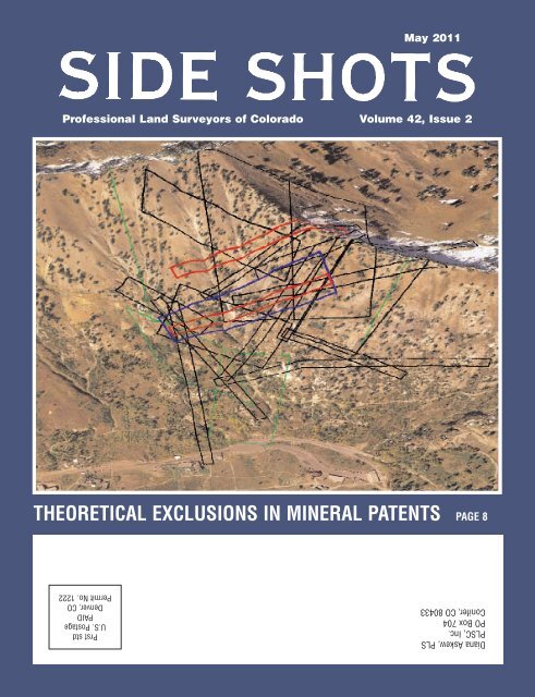
On the cover...<br />
Image is a 3-dimensional<br />
depiction <strong>of</strong> lode mining claims<br />
above Alta, Utah. Base image<br />
is a 2006 High Resolution<br />
Ortho-Photograph (HRO) 25<br />
cm resolution color aerial<br />
photography available from the<br />
Utah Automated Geographic<br />
Reference Center. Image<br />
courtesy <strong>of</strong> Gene Kooper.<br />
Center, with a few photos as well.<br />
The people who worked so hard for<br />
so many hours to make that complex<br />
event happen, and so successfully,<br />
are acknowledged there. Some<br />
emails have been received saying<br />
that it was the best conference the<br />
PLSC has ever had in its history.<br />
Thanks to all who participated, presented,<br />
organized, and <strong>of</strong> course,<br />
attended.<br />
I would also like to express my<br />
thanks to Lisa Isom, <strong>of</strong> Assurance<br />
Risk Managers in Aurora, who has<br />
been a supplier <strong>of</strong> specialized pr<strong>of</strong>essional<br />
liability and other insurance<br />
products tailored to the surveying<br />
pr<strong>of</strong>ession for many years. Lisa has<br />
generously decided to donate the<br />
space that she had been providing<br />
for our valuable PLSC library collection,<br />
until the Board can find an<br />
appropriate and affordable replacement.<br />
Thanks, Lisa.<br />
The PLSC<br />
membership numbers<br />
are down<br />
again this year,<br />
reflecting a nationwide<br />
trend due to<br />
the economy. If<br />
you have not<br />
joined or renewed<br />
for <strong>2011</strong>, please take note <strong>of</strong> Diana<br />
Askew’s message below and don’t<br />
put it <strong>of</strong>f any longer. The PLSC<br />
exists only to serve its members in<br />
their pr<strong>of</strong>essional activities, and your<br />
support is urgently needed for that<br />
support to continue. To all who<br />
renewed their memberships already,<br />
turn the page, and enjoy!<br />
WILL THIS BE YOUR LAST ISSUE OF THE<br />
AWARD WINNING PLSC SIDE SHOTS<br />
PUBLICATION?<br />
If you were a member in 2010 and have not renewed your<br />
membership for <strong>2011</strong>, this will be your last issue unless you<br />
renew soon!<br />
JB Guyton<br />
Editor<br />
The PLSC needs YOUR input and YOUR voice! We only exist<br />
because <strong>of</strong> our membership. We value every member and would<br />
hate to lose YOU!<br />
PLSC Membership begins January 1 and ends on December 31<br />
<strong>of</strong> each year. Existing members are considered delinquent on<br />
April 1 and all membership privileges end on that date each<br />
year.<br />
In order to reward members in good standing and begin<br />
production <strong>of</strong> the <strong>2011</strong> PLSC Roster, July 1st is the last day to<br />
join for <strong>2011</strong>. Please visit www.plsc.net to join or renew online,<br />
OR copy the application form in this issue and mail it today<br />
with your check.<br />
— Di Askew, Executive Director<br />
SIDE SHOTS • 5
Please Complete the Entire Application Checks only for snail mail applications <strong>2011</strong> Online Membership starts on 12/15/2010<br />
___________________________________________________________ ____________________________________________________________ ____________________________________________________________<br />
First Name Middle Name Last Name<br />
___________________________________________________________ ____________________________________________________________ ____________________________________________________________<br />
Company Primary Phone PLS or LSI Number and State<br />
___________________________________________________________ ____________________________________________________________ ____________________________________________________________<br />
Primary Address ___W ___H Primary Suite or Apt No Primary City<br />
___________________________________________________________ ____________________________________________________________ ____________________________________________________________<br />
Primary State Primary ZIP/Postal Code Primary Email address<br />
___________________________________________________________ ____________________________________________________________ ____________________________________________________________<br />
Secondary Address ___W ___H Secondary Suite or Apt No Secondary City<br />
___________________________________________________________ ____________________________________________________________ ____________________________________________________________<br />
Secondary State Secondary ZIP/Postal Code Secondary E-Mail address<br />
PLSC, Inc <strong>2011</strong> Membership Application<br />
Volunteer to participate in<br />
PLSC Standing Committees<br />
(choose one or more)<br />
Publications ■<br />
Survey Monuments and Records Standards ■<br />
Ethics and Fair Practices ■<br />
Education and Seminars ■■<br />
Legislative ■■<br />
Liaison ■<br />
Membership ■<br />
Nominations and Elections ■■<br />
Questions Default = No<br />
Newsletters and announcements via email? ___ Yes ___ No<br />
Print Primary Email in PDF/Printed Roster? ___ Yes ___ No<br />
Print Primary Contact info in Online Roster? ___ Yes ___ No<br />
Print Primary Email in Online Roster? ___ Yes ___ No<br />
Make Checks Payable to:<br />
PLSC, Inc<br />
Mail application and payments to:<br />
PLSC, Inc<br />
Diana Askew, Executive Director<br />
P O Box 704<br />
Conifer, CO 80433<br />
303-838-7577<br />
The opportunity for <strong>2011</strong> membership ends July 1.<br />
Payments by Credit Card are only available through<br />
the Online Membership application at www.PLSC.net<br />
Choose ONE<br />
Included Chapter<br />
CCPS - Included ■■<br />
CSRN - Included ■<br />
NCPLSC - Included ■■<br />
NW1/4CLS - Included ■<br />
SCPLS - Included ■■<br />
SWPLSC - Included ■<br />
WCLS - Included ■■<br />
Additional Chapter(s) $20 ea<br />
CCPS - Additional ■■<br />
CSRN - Additional ■■<br />
NCPLSC - Additional ■<br />
NW1/4CLS - Additional ■■<br />
SCPLS - Additional ■<br />
SWPLSC - Additional ■■<br />
WCLS - Additional ■<br />
PLSC Membership Level<br />
Sustaining $230 ■<br />
Voting $110 ■<br />
Associate $75 ■<br />
Student $30 ■<br />
Retired $60 ■<br />
PLSC Membership Dues include ONE Chapter<br />
Membership Level_____________________<br />
Additional Chapters ($20 ea)_____________<br />
Total Enclosed ________________________<br />
Membership Card? ___ Yes ____No
Mineral Survey Corner<br />
Theoretical Exclusions in Mineral Patents<br />
The <strong>May</strong> 2006 issue <strong>of</strong> Side<br />
Shots contains the first <strong>of</strong> a series<br />
<strong>of</strong> articles describing a misguided<br />
General <strong>Land</strong> Office policy. Beginning<br />
in June 1899, the GLO<br />
required U.S. Deputy Mineral <strong>Surveyors</strong><br />
to report the positions <strong>of</strong> any<br />
senior, conflicting claims based on<br />
their patent description rather than<br />
the found monuments. During the<br />
five years that the policy was in<br />
effect, the <strong>Surveyors</strong> General <strong>of</strong><br />
<strong>Colorado</strong> issued over 4,000 mineral<br />
survey orders. Not surprisingly,<br />
since the patent position <strong>of</strong> a prior<br />
<strong>of</strong>ficial survey was fixed by its tie to<br />
a distant rectangular survey corner,<br />
the patent position was <strong>of</strong>ten at<br />
odds with the actual, monumented<br />
position <strong>of</strong> the senior claim.<br />
One <strong>of</strong> the unintended consequences<br />
<strong>of</strong> this policy was the<br />
uncertainty that crept into mineral<br />
land titles. The “evil foisted upon the<br />
mining industry” was described in<br />
several articles published in The<br />
Mining Reporter, a weekly mining<br />
industry newspaper published in<br />
Denver, <strong>Colorado</strong>. A scathing<br />
rebuke <strong>of</strong> the GLO policy was written<br />
by Robert S. Morrison and<br />
Emilo De Soto, two prominent <strong>Colorado</strong><br />
mining attorneys. The below<br />
excerpts from their article published<br />
in the February 18, 1904 edition<br />
have eerie similarities to the modern<br />
issue <strong>of</strong> geographic information<br />
systems being erroneously regarded<br />
as equivalent to a land survey.<br />
Here the department applies its<br />
ruling <strong>of</strong> 1899, and says to the<br />
applicant: "The description in the<br />
first patent controls the locus <strong>of</strong><br />
that claim on the connected sheet,<br />
and your claim, though correctly<br />
surveyed, shows a conflict on our<br />
map with that patented claim. We<br />
know that the first patent is erroneously<br />
described, but you must<br />
exclude the conflict or compel,<br />
cajole, or persuade the first patentee<br />
to surrender his patent. We<br />
SIDE SHOTS • 8<br />
by Gene Kooper, PLS<br />
cannot change our maps to show<br />
the truth."<br />
….<br />
A lawyer does not like to confess<br />
any weakness to his <strong>of</strong>t-quoted<br />
maxim, "For every wrong the<br />
law affords a remedy." What then<br />
is the remedy? It is not in the<br />
courts, for the courts will neither<br />
enjoin nor mandamus the surveyor<br />
general. The remedy is the one<br />
suggested by the government<br />
itself, to wit: to stoop to the low<br />
ethical position <strong>of</strong> the land <strong>of</strong>fice<br />
and make the same false calls<br />
originally made in the prior patent.<br />
"You will, then," says the land<br />
<strong>of</strong>fice, "receive a patent with false<br />
calls for government corners, but<br />
with correct calls for local monuments,<br />
and you will then have as<br />
good a patent as the man has<br />
who occupies your ground on our<br />
connected sheets, for you will be<br />
relatively out <strong>of</strong> position no more<br />
than he is, but will have a patent<br />
which the courts hold good, and<br />
you will not spoil the looks <strong>of</strong> our<br />
<strong>of</strong>ficial maps."<br />
The adverse economic impact<br />
to the mining industry, especially<br />
the instability <strong>of</strong> mining titles was<br />
the catalyst that spurred Congress<br />
to legislatively halt the Executive<br />
Branch's policy. The Act <strong>of</strong> April 28,<br />
1904 (the Legislative history <strong>of</strong> this<br />
act is described in the <strong>May</strong> 2006<br />
issue <strong>of</strong> Side Shots), expressly<br />
states that whenever a conflict<br />
exists between the <strong>of</strong>ficially established<br />
monuments and the patent<br />
description, the monuments shall<br />
govern which ground is included in<br />
the patent!<br />
However, none <strong>of</strong> the mineral<br />
survey instructions issued to U.S.<br />
[Deputy] Mineral <strong>Surveyors</strong> explicitly<br />
authorized the resurvey <strong>of</strong> senior<br />
conflicting claims. If a mineral surveyor<br />
was unable to locate a corner<br />
during the retracement <strong>of</strong> the senior<br />
line(s) that defined the conflict, the<br />
mineral surveyor was instructed to<br />
return the record position <strong>of</strong> the<br />
missing corner in his field notes.<br />
Returning the record position <strong>of</strong><br />
missing senior corners began in the<br />
1870s. The Act <strong>of</strong> April 28, 1904 did<br />
not alter this policy. In fact, the “Mineral<br />
Survey Procedures Guide”,<br />
written by John V. Meldrum in 1980<br />
cautions mineral surveyors to, “not<br />
remonument a restored corner; at<br />
least, it should not be done without<br />
the full knowledge and approval <strong>of</strong><br />
the owner.”<br />
The focus <strong>of</strong> this article deals<br />
with the DOI <strong>Land</strong> Decision, “The<br />
Wasatch Mines Company” (45 L.D.<br />
10) that was decided on March 15,<br />
1916. The decision addresses theoretical<br />
exclusions in conflicting lode<br />
mining claims. The decision is less<br />
than two pages in length, but my<br />
opinion is that it is one <strong>of</strong> the most<br />
important DOI <strong>Land</strong> Decisions<br />
issued for mineral surveys. The<br />
decision summary states:<br />
Where exclusions are made<br />
from mining claims <strong>of</strong> supposed<br />
conflicts with a prior patented<br />
claim, and the position <strong>of</strong> the prior<br />
patented claim as actually<br />
marked, defined and established<br />
upon the ground is not identical<br />
with its position as represented<br />
upon the plat and described in<br />
the field notes <strong>of</strong> survey, and the<br />
supposed conflicts have no existence<br />
in fact, the areas represented<br />
by such theoretical exclusions<br />
pass under the patents to the<br />
claims and are therefore not subject<br />
to appropriation by subsequent<br />
location.<br />
The case concerns the Highland<br />
Chief and Emma Copper lode<br />
mining claims, which are located on<br />
a steep mountainside above the ski<br />
resort <strong>of</strong> Alta, Utah. At first glance,<br />
this decision is merely the last <strong>of</strong><br />
four <strong>Land</strong> Decisions that sought to<br />
remedy a specific land title conflict
caused by the prior GLO policy. The<br />
plat <strong>of</strong> the Emma Copper lode<br />
shows two positions for the patented<br />
Highland Chief lode, with the<br />
northern position labeled, “(As<br />
located on the ground)”. However,<br />
the Emma Copper lode claim was<br />
located on July 16, 1906, a full two<br />
years after the Sinnott v. Jewett DOI<br />
<strong>Land</strong> Decision (33 L.D. 91) administratively<br />
ended the policy (see the<br />
August 2009 issue <strong>of</strong> Side Shots).<br />
Figure 1 shows the approved<br />
positions <strong>of</strong> the early mineral surveys.<br />
The survey <strong>of</strong> the Emma lode<br />
(Lot 37) was completed on August<br />
14, 1871 and is the first mineral survey<br />
in the Little Cottonwood mining<br />
district. The Montezuma (Lot 128)<br />
and Savage (Lot 129) lodes were<br />
the last claims to be surveyed that<br />
are shown on Figure 1. Both claims<br />
were surveyed on June 19, 1880.<br />
The mineral survey plat for the<br />
Highland Chief (Lot 81) shows conflicts<br />
with the Hiawatha (Lot 40) and<br />
Caledonia (Lot 53) lode claims. In<br />
the course <strong>of</strong> the survey, Deputy<br />
Edward B. Wilder made an error in<br />
his tie to U.S. Mineral Monument<br />
No. 3. The true position <strong>of</strong> the Highland<br />
Chief lode is located N3°45’E,<br />
617 feet from its approved position,<br />
which lies north <strong>of</strong> the Flora Temple<br />
lode (Lot 58) as shown on Figure 2.<br />
The patent for the Highland Chief<br />
expressly excludes the theoretical<br />
conflicts with the Hiawatha and<br />
Caledonia lodes (0.361 and 0.232<br />
acres respectively), but fails to<br />
exclude the conflict with the Flora<br />
Temple lode.<br />
Believing that the tie to the mineral<br />
monument was correct, Deputy<br />
Wilder attempted to locate the corners<br />
<strong>of</strong> the Hiawatha and Caledonia<br />
lodes. Failing to find any <strong>of</strong> the corners,<br />
he duly showed their record<br />
positions on his Highland Chief plat.<br />
An examination <strong>of</strong> the plat verifies<br />
that the conflicts were calculated by<br />
Deputy Wilder rather than the conflicts<br />
being based on the found,<br />
original monuments. The courses<br />
<strong>of</strong> all three claims are reported to<br />
the nearest half-degree and distances<br />
reported to the nearest foot.<br />
The plat <strong>of</strong> the Hiawatha lode has a<br />
misclosure <strong>of</strong> nearly 10 feet. Deputy<br />
Wilder reported the eight intersections<br />
on the Highland Chief plat to<br />
the nearest hundredth <strong>of</strong> a foot! A<br />
comparison <strong>of</strong> the intersections<br />
computed by Deputy Wilder with a<br />
Figure 1 Figure 2<br />
CAD drawing where the ties to the<br />
mineral monument were held yields<br />
a difference <strong>of</strong> 0.01 feet for the four<br />
intersections with the Caledonia<br />
lode and a difference <strong>of</strong> 0.07 feet<br />
for the four intersections with the<br />
Hiawatha lode.<br />
In the course <strong>of</strong> surveying the<br />
other early claims in the area, other<br />
U.S. Deputy Mineral <strong>Surveyors</strong> were<br />
unable to locate the Highland Chief<br />
lode and returned its record position<br />
in their field notes. The patents for<br />
the South Star, North Star, Montezuma<br />
and Savage lode claims all<br />
expressly excluded the theoretical<br />
conflict with the Highland Chief. In<br />
1901, U.S. Deputy Mineral Surveyor<br />
Edward M. Le Prohan surveyed the<br />
Bonanza, et al., lodes (Mineral Survey<br />
No. 4705). This was the first<br />
survey to show the true position <strong>of</strong><br />
the Highland Chief lode. It is<br />
unknown why Deputy Le Prohan<br />
labeled the true position on the plat<br />
with “Compromise Area Highland<br />
Chief (Unsurveyed)”. The term<br />
“unsurveyed” usually indicates an<br />
unpatented claim that is senior to<br />
the claim being surveyed. Deputy<br />
Le Prohan likely borrowed the term<br />
so he could indicate the true posi-<br />
SIDE SHOTS • 9
tion <strong>of</strong> the Highland Chief, since the<br />
survey was done during the time<br />
when the patent description position<br />
was shown on mineral survey plats.<br />
The following note in his field notes<br />
states:<br />
As no corners were found<br />
standing except on Lot No. 92,<br />
Eclipse lode, Lot No. 95, South<br />
Star lode (amended) and Lot No.<br />
140, Pride <strong>of</strong> America lode, the<br />
conflicts with all other claims have<br />
been calculated through the<br />
recorded bearings and distances<br />
on file in the Surveyor General’s<br />
Office.<br />
On July 17, 1906, Deputy W.<br />
Edward Wilson commenced the survey<br />
<strong>of</strong> the Bone, et al., lode claims<br />
(MS 5549). He was the first U.S.<br />
Deputy Mineral Surveyor to state<br />
that he had located an original corner<br />
<strong>of</strong> the Highland Chief. His field<br />
notes state:<br />
Lot No. 81, Highland Chief lode.<br />
Cors. Nos. 3 and 4, are pine<br />
posts 2x4 ins., 2 ft. long, set in<br />
mound <strong>of</strong> stones scribed 3 U.S.<br />
SIDE SHOTS • 10<br />
81 and 4 U.S. 81, respectively.<br />
Cors. Nos. 1 and 2 were not<br />
found in place and were established<br />
in accordance with the <strong>of</strong>ficial<br />
courses and lengths <strong>of</strong> lines<br />
4-1, 3-2, and 1-2.<br />
Unfortunately, the record positions<br />
<strong>of</strong> Cors. Nos. 1 and 2 returned<br />
by Deputy Wilson do not match the<br />
topographic features depicted on<br />
the original plat <strong>of</strong> the Highland<br />
Chief. The plat does not show the<br />
drainage divide between Little Cottonwood<br />
and Big Cottonwood<br />
canyons. However, using the “<strong>of</strong>ficial<br />
courses and lengths <strong>of</strong> lines 4-1<br />
and 3-2”, Cors. Nos. 1 and 2 <strong>of</strong> the<br />
Highland Chief are shown to be<br />
approx. 280 feet east <strong>of</strong> the topographic<br />
divide!<br />
As stated previously, the Emma<br />
Copper lode claim was located on<br />
July 16, 1906. The claimant obviously<br />
knew that Deputy Wilson had<br />
found the original monuments marking<br />
the west end line <strong>of</strong> the Highland<br />
Chief. The claimant likely presumed<br />
that since the record position<br />
<strong>of</strong> the Highland Chief was<br />
2012 <strong>Colorado</strong><br />
Refresher Course<br />
The Central <strong>Colorado</strong> <strong>Pr<strong>of</strong>essional</strong> <strong>Surveyors</strong> and the<br />
<strong>Pr<strong>of</strong>essional</strong> <strong>Land</strong> <strong>Surveyors</strong> <strong>of</strong> <strong>Colorado</strong> are <strong>of</strong>fering a<br />
comprehensive <strong>Land</strong> Surveying Refresher Course for 2012. This<br />
course <strong>of</strong>fers a review and self-study plan for those taking the<br />
National Council <strong>of</strong> Examiners for Engineering and Surveying<br />
(NCEES) Fundamentals <strong>of</strong> Surveying (FS) and Principles and<br />
Practice <strong>of</strong> Surveying (PS) examinations. The course is<br />
designed to aid candidates in developing and expanding examtaking<br />
pr<strong>of</strong>iciencies.<br />
Registration and further information<br />
will be provided by October 1, <strong>2011</strong>.<br />
expressly excluded from the patents<br />
<strong>of</strong> the South Star, North Star, Montezuma<br />
and Savage lode claims,<br />
the theoretical position <strong>of</strong> the Highland<br />
Chief excluded in those<br />
patents was open ground that could<br />
be appropriated under the U.S. mining<br />
laws. On October 10, 1908, N.<br />
Percy Browne completed the mineral<br />
survey <strong>of</strong> the Emma Copper lode<br />
claim. Figure 2 shows the results <strong>of</strong><br />
his survey. Only three corner posts<br />
<strong>of</strong> prior <strong>of</strong>ficial surveys were found<br />
by Deputy Browne. Among the corners<br />
listed as missing was Cor. No.<br />
3 <strong>of</strong> the Highland Chief. Ironically,<br />
his field notes confess that the position<br />
<strong>of</strong> the Highland Chief labeled,<br />
“(As located on the ground)” was<br />
determined based on the tie in the<br />
prior <strong>of</strong>ficial survey <strong>of</strong> the Bone, et<br />
al., lode claims.<br />
The Department <strong>of</strong> Interior’s<br />
Office <strong>of</strong> Hearings and Appeals web<br />
site (http://www.oha.doi.gov) has a<br />
“Search Decision” function that<br />
allows one to search nine databases.<br />
A search <strong>of</strong> the term “theoretical<br />
exclusions” returns “6 hits in 1<br />
document”. That singular document<br />
is “The Wasatch Mines Co.” land<br />
decision. The full text <strong>of</strong> the decision<br />
is available for free download<br />
from the Office <strong>of</strong> Hearings and<br />
Appeals web site. While this decision<br />
is the only instance where the<br />
term “theoretical exclusion” was<br />
used by the <strong>Land</strong> Department, the<br />
logic behind the decision is based<br />
on one <strong>of</strong> the most fundamental<br />
principles <strong>of</strong> land surveying. No surprise,<br />
it is that original monuments<br />
control over course and distance!<br />
This land decision will be discussed<br />
in greater depth during my<br />
mineral survey workshop on Saturday,<br />
June 11, <strong>2011</strong> as part <strong>of</strong> the<br />
Four Corners Conference in Durango,<br />
<strong>Colorado</strong>. I hope to see you<br />
there.
Control Points – Number 13<br />
By Warren Andrews, PLS<br />
There are two things that are basic to surveying<br />
that in one way or another all surveyors are involved<br />
with, and those are distance and direction. Distance is<br />
probably simpler to solve whether you’re pacing and<br />
counting your steps, laying out rods in a line for a<br />
baseline, stretching a rope or a chain, pulling a suspended<br />
band tape, or relying on the tiny time difference<br />
it takes a high frequency beam to go out and<br />
return from a reflector. (Incidentally, did you know the<br />
Latin word mille, for 1000, is where our English word<br />
mile comes from? One thousand paces, or double<br />
steps, <strong>of</strong> a Roman soldier – averaging 5.28 feet each –<br />
equals one English statute mile. The nautical mile is<br />
different and longer.)<br />
Direction is the second basic element <strong>of</strong> surveying<br />
and there are generally five systems used today.<br />
American surveyors use the sexagesimal system or<br />
360 parts to the circle while most <strong>of</strong> the rest <strong>of</strong> the<br />
world uses the S.I. System <strong>of</strong> 400 parts or 100 to the<br />
quadrant. The third system is the artillery <strong>of</strong>ficer’s in<br />
mils which is essentially 1 yard shift angularly at 1000<br />
yards distance (6400 to a circle). The fourth system is<br />
180°<br />
Mariner’s Compass. Clipart Courtesy FCIT<br />
Angle and Direction<br />
45°<br />
unusable to a surveyor in the field and that is the<br />
mathematician’s 2 radians to a circle, which is<br />
impossible to divide easily or rationally.<br />
The fifth system is the old system used by navigators<br />
based on the directions <strong>of</strong> the compass. The<br />
compass card on the binnacle was divided into eight<br />
points to the quadrant and later into quarters <strong>of</strong> each<br />
point so 32 directions could be specified for each<br />
quadrant for a sailing direction. In other words, a command<br />
to the helmsman on the wheel <strong>of</strong> “northeast by a<br />
quarter north” is one diamond mark countercounterclockwise<br />
from the N.E. marker on the mariner’s compass,<br />
which is equal to 42° 11’ 15” azimuth from north.<br />
Bowditch’s “Practical Navigator” gives this in great<br />
detail.<br />
If the sexagesimal system is used there are several<br />
different ways to scribe or mark a circle. For example,<br />
my Ainsworth mining transit is marked with two<br />
sets <strong>of</strong> numbers on the horizontal circle, the outer ring<br />
from 0 to 360 in a clockwise direction while inside that<br />
the numbers go from 0 to 90 to 0 and continuing from<br />
that 0 to 90 and back to 0 (same as the 360 on the<br />
outer scale) for the four quadrants. This makes it easier<br />
to read, or set, azimuths or angles right or to read<br />
or set bearings directly. (The 30 minute vernier is on<br />
the inside circle). The vertical circle is end reading, not<br />
side reading for tight spots, for the four quadrants<br />
with zero being horizontal. (European instruments<br />
use zero as vertical to reduce the possible error in<br />
recording plus or minus angles).<br />
90°<br />
My C. L. Berger & Sons mining transit<br />
marks the horizontal circle differently. Clockwise<br />
it is numbered from 0 to 360 and from<br />
the same 0 counterclockwise to 360. This<br />
combination will give an angle right or an<br />
angle left – but don’t mix up the two.<br />
Before the dividing engine, such as that<br />
<strong>of</strong> Jesse Ramsden in England in the 1770’s,<br />
the horizontal and vertical circle plates had to<br />
be scribed by hand with ensuing slight inaccuracies.<br />
Ramsden’s theodolite, scribed from his<br />
dividing engine, had a 36-inch diameter horizontal<br />
plate that was readable to one second <strong>of</strong> arc<br />
and was first used in July, 1787, to connect with the<br />
French triangulation across the Channel. (See Control<br />
Points No. 10). The modern Wilde T-4 and the<br />
Kern DKM-3 could be read ten times more accurately<br />
than Ramsden’s one second.<br />
SIDE SHOTS • 11
First Annual <strong>Surveyors</strong> Summit a Big Success<br />
By JB Guyton, PLS, Editor<br />
The first ever statewide PLSC conference, called the<br />
Rocky Mountain <strong>Surveyors</strong> Summit, was held on March<br />
3rd, 4th and 5th, and by a sample <strong>of</strong> reviews received<br />
by email so far, was very well received. This Summit<br />
combined the regular PLSC workshop meeting with<br />
those <strong>of</strong> the Central, Northern and Southern Chapters<br />
for the first time. Attendance was approximately 240, the<br />
second highest ever for a PLSC conference. Held at the<br />
Arvada Center for the Arts and Humanities for the first<br />
time, the accommodations, facilities and meals were all<br />
top-notch. Some photos from the event are included<br />
here.<br />
The efforts <strong>of</strong> many PLSC members made the complex<br />
planning and execution <strong>of</strong> this event possible, and<br />
deserve recognition. First and foremost is our very<br />
capable Executive Director, Diana Askew, who coordinated,<br />
delegated, and saw to every last excruciating<br />
detail before and during the event, including publicity,<br />
preparing those impressive email notices about conference<br />
registration, and a multitude <strong>of</strong> other details. She<br />
put in 14-hour days for weeks to make it all work out<br />
well. When it got to be too much, Mike Greer, who Di<br />
Askew calls the “King <strong>of</strong> Conference Help,” came forward<br />
to assist with meeting arrangements at the Arvada<br />
Center, and in dealing with the swag and the merchandise.<br />
Todd Beers also stepped up and helped organize<br />
the efforts <strong>of</strong> many others. Di nominated him for the<br />
Distinguished Service award, which he won, and<br />
deservedly so.<br />
Lynn Patten (left), head <strong>of</strong> the surveying program at Westwood College,<br />
talks with Angie Kinnaird Linn, Program Director <strong>of</strong> the State Board <strong>of</strong><br />
Licensure.<br />
SIDE SHOTS • 12<br />
Others that deserve credit and praise, in no particular<br />
order, include:<br />
• Aaron Willis, for his help with the program and flyers;<br />
• Ian Cortez, who managed the silent auction, collected<br />
funds and deposited them;<br />
• JJ (Jim) Rihanek for food, classrooms, and being<br />
the point person for venue related items;<br />
• Earl Henderson for coordination <strong>of</strong> vendors, being<br />
the point person for vendor related needs, with help<br />
from Shawn Clarke, Mike Dlin.<br />
• Kayce Wohlman and Patrick Green, for check-in<br />
and merchandise sales;<br />
• Steve Parker for the printed name badges and<br />
signs, with help from Randy Zerr;<br />
• The Power Flushers Band, in which Mike Dlin<br />
played for free;<br />
• Jan Sterling for her Trigstar support over the years;<br />
• Larry Phipps for <strong>of</strong>fering a strategic planning session<br />
at no cost to the board;<br />
And everyone else not mentioned, and all who presented<br />
and attended.<br />
While the attendance and the quality <strong>of</strong> the programs<br />
were a success, the financial outcome for the<br />
PLSC is less certain. Costs <strong>of</strong> the venue, catering and<br />
speaker expenses were much higher than in previous<br />
years, resulting in less net gain for the organization and<br />
the chapters than the year before. I suspect that the<br />
Board will be taking a much closer look at these costs<br />
next year to insure more <strong>of</strong> a pr<strong>of</strong>it to keep the PLSC<br />
going.<br />
Todd Beers (left), PLSC Director and Past<br />
President <strong>of</strong> the Central Chapter, accepts<br />
his Distinguished Service Award from PLSC<br />
President Roger Nelson.
Mike Drissel (center), Past Chair <strong>of</strong> the State Board for <strong>Pr<strong>of</strong>essional</strong><br />
Engineers and <strong>Land</strong> <strong>Surveyors</strong> and a member <strong>of</strong> the Western Chapter,<br />
receives the Distinguished Service Award from Roger Nelson<br />
(right), President <strong>of</strong> the PLSC, and Stan Vermilyea (left), Awards<br />
Committee Chairman and PLSC Director.<br />
Donny Sosa and Katie Radke at the<br />
ESRI booth in the vendor area.<br />
(From left) Kaycee Wohlman, President-elect <strong>of</strong> the<br />
Northern Chapter; Earl Henderson, Director <strong>of</strong> the<br />
Central Chapter and Diana Askew, PLSC Executive<br />
Director, pose for a picture.<br />
Mike Greer (left), former Vice President <strong>of</strong> the PLSC and<br />
current member <strong>of</strong> the State Board <strong>of</strong> Licensure, stands<br />
with Ira Hardin, one <strong>of</strong> the original founders <strong>of</strong> the PLSC.<br />
All photos courtesy <strong>of</strong> Mike Greer.<br />
SIDE SHOTS • 13
State Board Update<br />
By Angie Kinnaird Linn, Program Director<br />
State Board <strong>of</strong> Licensure for Architects, <strong>Pr<strong>of</strong>essional</strong> Engineers, and <strong>Pr<strong>of</strong>essional</strong> <strong>Land</strong> <strong>Surveyors</strong><br />
Spring time is here and it brings<br />
new growth around us. Positive<br />
changes are happening at the AES<br />
Board and its Survey Quorum, too.<br />
Information on a few <strong>of</strong> those is in<br />
the following paragraphs.<br />
March <strong>2011</strong> AES Board<br />
Newsletter Available<br />
The newsletter is available electronically<br />
at<br />
www.dora.state.co.us/aes/newsletter.<br />
In it, you will find the latest on:<br />
• Changes in the Laws<br />
• Changes in the Board’s Rules<br />
and Policies<br />
• Changes in Application Deadlines<br />
• Requirements for <strong>Land</strong>scape<br />
Architects<br />
• Board Statistics<br />
• Renewal Information<br />
• Enforcement Activity<br />
New Monument Record<br />
Research Tool<br />
A collaboration between Don<br />
Lambert, PLS, <strong>of</strong> Frontier Surveying,<br />
Inc., and the Department <strong>of</strong> Regulatory<br />
Agencies (DORA) has produced<br />
the <strong>Colorado</strong> Monument Records<br />
Google Earth Mapping Project found<br />
at www.cp-db.com. This tool georeferences<br />
all <strong>of</strong> the <strong>Colorado</strong> monument<br />
records filed with DORA to the<br />
Bureau <strong>of</strong> <strong>Land</strong> Management’s Geographic<br />
Coordinate Database and<br />
makes that information available in a<br />
Google Earth format. (Note that<br />
DORA is not responsible for the content<br />
or the accuracy <strong>of</strong> the information<br />
<strong>of</strong> the <strong>Colorado</strong> Monument<br />
Records Google Earth Mapping Project.)<br />
Please be advised that licensed<br />
<strong>Colorado</strong> <strong>Pr<strong>of</strong>essional</strong> <strong>Land</strong> <strong>Surveyors</strong><br />
are, <strong>of</strong> course, required to conduct<br />
appropriate and thorough<br />
research that includes the <strong>Colorado</strong><br />
SIDE SHOTS • 14<br />
<strong>Land</strong> Survey Monument Records<br />
housed by the Board <strong>of</strong> Licensure for<br />
Architects, <strong>Pr<strong>of</strong>essional</strong> Engineers<br />
and <strong>Pr<strong>of</strong>essional</strong> <strong>Land</strong> <strong>Surveyors</strong><br />
and DORA.<br />
Monument Record Form and<br />
Instructions Updated<br />
The monument record form has<br />
been revised and the instructions<br />
have been updated to reflect the<br />
most recent version <strong>of</strong> the BLM Manual<br />
<strong>of</strong> Surveying and to refer to relevant<br />
Board Rules. It makes sense to<br />
read the new version <strong>of</strong> the instructions<br />
to refresh your understanding<br />
<strong>of</strong> what is required on monument<br />
records. The new monument record<br />
form is available in numerous formats<br />
to accommodate a variety <strong>of</strong><br />
licensee needs and work settings. A<br />
big thank you goes out to Merrick &<br />
Company that developed the Auto-<br />
CAD versions <strong>of</strong> the monument<br />
record for your use.<br />
Please destroy your old monument<br />
record templates and use the<br />
new ones found at<br />
www.dora.state.co.us/aes/<br />
monumentrecords. You will find the<br />
monument record instructions at the<br />
same link.<br />
Survey Quorum and Board<br />
Opinions<br />
The Survey Quorum <strong>of</strong> the AES<br />
Board meets quarterly prior to the<br />
full Board meeting to discuss land<br />
surveying issues and questions.<br />
Depending on the timing <strong>of</strong> a<br />
request, it may go to the quorum or<br />
to the full Board for consideration. In<br />
either case, consensus is reached<br />
on its position and the information is<br />
posted on the Board website at the<br />
<strong>Surveyors</strong> Corner – <strong>Surveyors</strong> Q&A.<br />
This can be found from the AES<br />
homepage at<br />
www.dora.state.co.us/aes or the<br />
direct link is<br />
www.dora.state.co.us/aes/<br />
surveyorsQA.<br />
There have been several<br />
requests and opinions worth noting<br />
over the past year.<br />
• The Board received an inquiry<br />
regarding the definition <strong>of</strong> “survey<br />
point.” It was the recommendation <strong>of</strong><br />
the Survey Quorum this is an ambiguity<br />
in the statute that should be<br />
addressed in sunset review. Until<br />
then, because <strong>of</strong> the ambiguity, the<br />
Quorum agreed that no action<br />
should be taken should a complaint<br />
be filed on the basis <strong>of</strong> a “survey<br />
point.”<br />
• The Board considered a<br />
request for a Board opinion relating<br />
to an Information Map prepared by a<br />
licensed <strong>Pr<strong>of</strong>essional</strong> <strong>Land</strong> Surveyor.<br />
There are no statutory criteria for the<br />
preparation <strong>of</strong> an “Information Map.”<br />
Since the Board was not able to<br />
determine the purpose <strong>of</strong> this document,<br />
it is unable to judge whether it<br />
is correct or not. The Board suggested<br />
that the individual meet with the<br />
land surveyor to discuss his concerns<br />
and should that effort fail, submit<br />
a complaint to the Board’s <strong>of</strong>fice<br />
including as much additional documentation<br />
as feasible to assist the<br />
Board in determining the scope <strong>of</strong><br />
work in this project, including the<br />
contract.<br />
• The Board considered a<br />
request for an opinion relating to two<br />
situations involving changing common<br />
boundary lines.<br />
The first question involved a<br />
question <strong>of</strong> changing a common<br />
boundary line between two properties<br />
and whether it is acceptable to<br />
monument only that line or if the<br />
entire perimeter <strong>of</strong> the two properties<br />
is required to be monumented. One<br />
<strong>of</strong> the properties is a metes and<br />
bounds parcel.
The second question posed<br />
was the vacation <strong>of</strong> a boundary line<br />
between two contiguous parcels<br />
and whether the entire perimeter <strong>of</strong><br />
the newly combined parcels must<br />
be monumented. The properties<br />
are metes and bounds parcels.<br />
It was the consensus <strong>of</strong> the<br />
Board that neither scenario falls<br />
within the statutory requirements for<br />
platted subdivisions. Therefore, it<br />
was the Board’s conclusion that the<br />
county requirements would govern<br />
in these situations.<br />
• The Survey Quorum reviewed<br />
a letter from a <strong>Pr<strong>of</strong>essional</strong> <strong>Land</strong><br />
Surveyor regarding the limitations <strong>of</strong><br />
the current Online Monument<br />
Record System’s search capabilities.<br />
The Program Director had<br />
recently met with the Office <strong>of</strong> Information<br />
Technology. There is a plan<br />
to transition to new s<strong>of</strong>tware and<br />
hardware by the end <strong>of</strong> the <strong>2011</strong><br />
calendar year that will improve the<br />
system substantially. However, the<br />
surveyor’s problem appears to stem<br />
from not using the wildcard function<br />
when searching the monument<br />
records.<br />
• The Survey Quorum reviewed<br />
an inquiry regarding replacing or<br />
resetting monuments after construction<br />
and tabled the discussion until<br />
Staff conducted and completed<br />
research <strong>of</strong> past Board opinions on<br />
this issue. Reviewing past minutes,<br />
it was the consensus <strong>of</strong> the Survey<br />
Quorum that its position remains<br />
virtually unchanged from what was<br />
stated in the September 2001 minutes.<br />
It is restated here for reference.<br />
It was the consensus <strong>of</strong> the<br />
Survey Quorum that if it is known<br />
which corners will be destroyed during<br />
construction, they may be referenced<br />
prior to destruction and<br />
Yourdeadlines are deadlines<br />
our<br />
Custom orders your way … when you need them.<br />
When your name is on it, our name is behind it.<br />
Berntsen delivers.<br />
The pr<strong>of</strong>essional’s choice in survey products www.berntsen.com 877.686.8561<br />
replaced after construction by a surveyor<br />
using his/her own caps. An<br />
exhibit map should be prepared<br />
showing the original monuments,<br />
how they were referenced, and<br />
what monuments and caps were<br />
used to replace the destroyed monuments.<br />
This exhibit should be<br />
deposited. In this situation the surveyor<br />
is not attesting to the accuracy<br />
<strong>of</strong> the original corners, only<br />
replacing them as found.<br />
In the event that the corners are<br />
destroyed before they can be referenced,<br />
the replacement <strong>of</strong> those<br />
corners would then necessitate the<br />
preparation <strong>of</strong> a land survey plat in<br />
accordance with state statutes.<br />
Have a super summer!<br />
SIDE SHOTS • 15
“Star Crossings and Stone Monuments –<br />
Field Astronomy by the Wheeler Survey in 1870’s<br />
<strong>Colorado</strong>,” by William E. Wilson, PhD<br />
I was very pleased to receive<br />
an autographed copy <strong>of</strong> the USGS<br />
Circular #1362 <strong>of</strong> the above title by<br />
Dr. Bill Wilson. You may recall the<br />
story <strong>of</strong> the Wheeler Monument in<br />
Georgetown, featured on the cover<br />
<strong>of</strong> the August, 2007 issue <strong>of</strong> Side<br />
Shots. The PLSC, along with Hixon<br />
Manufacturing, provided the funding<br />
for a bronze plaque and a steel<br />
shelter to minimize any further<br />
weathering <strong>of</strong> the historic marker.<br />
The PLSC donation was prominently<br />
acknowledged in the circular.<br />
Now the complete story <strong>of</strong> the<br />
six Wheeler monuments across <strong>Colorado</strong><br />
has been meticulously<br />
researched and documented in this<br />
38-page, color-illustrated book by<br />
Dr. Wilson. It is highly recommended<br />
reading for any surveyor interested<br />
in <strong>Colorado</strong> history.<br />
The Wheeler Survey, funded by<br />
the U.S. Army Corps <strong>of</strong> Engineers,<br />
was one <strong>of</strong> four competing government-sponsored<br />
surveys mapping<br />
the West during the 1870s. The<br />
Wheeler Survey was the most<br />
ambitious <strong>of</strong> these; its plan was to<br />
systematically map the entire coun-<br />
SIDE SHOTS • 16<br />
By JB Guyton, PLS, Editor,<br />
try west <strong>of</strong> the 100th meridian,<br />
which runs through western<br />
Kansas. Before Wheeler could complete<br />
his task, however, Congress<br />
disbanded all <strong>of</strong> the surveys in 1879<br />
and in their place created the U.S.<br />
Geological Survey.<br />
The report describes the<br />
activities <strong>of</strong> one <strong>of</strong> Wheeler's<br />
astronomers, Dr. F. Kampf, to determine<br />
the latitude and longitude at<br />
six locations in <strong>Colorado</strong> during<br />
1873-74. The framework <strong>of</strong> the<br />
story is based principally on Kampf's<br />
journal, or "Recording Book," which<br />
the author discovered among a collection<br />
<strong>of</strong> original Wheeler field notebooks<br />
at the archives <strong>of</strong> the Norlin<br />
Library on the CU campus. Kampf<br />
installed blocks <strong>of</strong> sandstone monuments<br />
on which to place his transit<br />
to observe the stars and use those<br />
observations to determine the coordinates<br />
<strong>of</strong> each site.<br />
Wilson augments the story with<br />
information he obtained from more<br />
than 100 references that he cites.<br />
He visited each <strong>of</strong> the six sites to<br />
look for the stone monuments; in<br />
addition to the one at Georgetown,<br />
he found only two others, at Trinidad<br />
and near Julesburg. The ones at<br />
Florence, <strong>Colorado</strong> Springs, and<br />
Brighton have apparently been<br />
either moved or destroyed.<br />
Included in the report are various<br />
sidebars that highlight some<br />
interesting aspects <strong>of</strong> the story,<br />
including, among others, details on<br />
the methods Kampf used to determine<br />
latitude and longitude, a controversy<br />
in the press over the<br />
source and lithology <strong>of</strong> the stone<br />
monuments, Wilson's research to<br />
identify who Dr. Kampf was, and the<br />
story <strong>of</strong> the Mormon observatory at<br />
Salt Lake City.<br />
Dr. Wilson, a USGS retiree, lives<br />
in Georgetown with his wife in a<br />
house that was built in 1870, three<br />
years before Dr. Kampf installed the<br />
Georgetown monument and made<br />
his observations. He has indicated<br />
that he would appreciate receiving<br />
comments, questions, and new information<br />
at wewilson@wispertel.net.<br />
You may obtain copies <strong>of</strong> this<br />
publication (USGS Circular 1362)<br />
from any one <strong>of</strong> several sources: 1)<br />
Go online at http://store.usgs.gov.<br />
You must then log on (green tab at<br />
the top). Then on the left column fill<br />
in the box labeled “Enter Search<br />
Term” with the product number,<br />
which for this publication is 244366,<br />
and then follow instructions. You<br />
may order 1-5 free copies this way,<br />
but a $5.00 handling charge is<br />
added for each shipment, regardless<br />
<strong>of</strong> the number <strong>of</strong> copies<br />
ordered. 2) Visit Building 810 (Map<br />
Sales) at the Denver Federal Center,<br />
Lakewood (use the visitor<br />
entrance <strong>of</strong>f <strong>of</strong> Kipling Ave.). At the<br />
salesroom, ask for Circular 1362; no<br />
charge. 3) Purchase at the Georgetown<br />
Gateway Visitor Center or from<br />
Historic Georgetown, Inc. ($3.95<br />
plus tax; discount for members <strong>of</strong><br />
HGI).
Aurora student earns first national Trig-Star award<br />
for state in contest’s history<br />
Trig-Star winners Dotty Dady and Jiyong Shim (second and<br />
third from left), flanked by Jiyong’s parents, at the awards<br />
presentation in Aurora City Hall, April, 2010.]<br />
For the first time in 26 years, Aurora—and the state<br />
<strong>of</strong> <strong>Colorado</strong> itself—can boast that it had the best<br />
trigonometry student in the country.<br />
Former Cherokee Trail High School senior Jiyong<br />
Shim won first place in the Richard E. Lomax National<br />
TRIG-STAR competition last July, which was co-sponsored<br />
locally by the city <strong>of</strong> Aurora’s Public Works<br />
Department.<br />
Shim competed against 33 other students nationwide<br />
in a timed exercise that involved solving a<br />
trigonometry problem incorporating the use <strong>of</strong> right triangle<br />
formulas, circle formulas, the law <strong>of</strong> sines and the<br />
law <strong>of</strong> cosines. The winner was selected based on the<br />
fastest time with the most correct answers.<br />
Since the contest began 26 years ago, the city <strong>of</strong><br />
Aurora Public Works Department has served as the<br />
local sponsor for Trig-Star, which is sponsored nationally<br />
by the National Society <strong>of</strong> <strong>Pr<strong>of</strong>essional</strong> <strong>Surveyors</strong>. Students<br />
must first compete at the local level against students<br />
within their own high school. The winner with the<br />
fastest time is the one student that goes on to compete<br />
at the national level.<br />
Shim, who is now attending the University <strong>of</strong> California<br />
at Berkeley, had been the local winner at his school<br />
for the last three years and competed nationally the last<br />
two times.<br />
By JB Guyton, PLS, Editor<br />
Jan Sterling, PLS (right), Chief Surveyor for the City <strong>of</strong> Aurora<br />
and the <strong>Colorado</strong> Trig-Star Coordinator, and Heather Lassner<br />
(left), LSI, Senior Survey Technician for Aurora and Trig-Star<br />
Program Assistant.]<br />
This was Shim’s first time to place at the national<br />
level, and with a $2,000 first prize in his pocket, he<br />
demonstrated in competition that he was the most<br />
skilled among his peers in the practical application <strong>of</strong><br />
trigonometry.<br />
“We are thrilled to have our own national winner this<br />
year,” said Jan Sterling, the city <strong>of</strong> Aurora’s chief surveyor<br />
who has coordinated the local sponsorship duties for<br />
Trig-Star since its inception. “This contest is a great way<br />
to promote careers in surveying and mapping to high<br />
school students across the country.”<br />
Each state’s local sponsor is responsible for working<br />
with participating schools to distribute test materials,<br />
host an awards ceremony and distribute awards to the<br />
local TRIG-STAR winner for each high school. In <strong>Colorado</strong>,<br />
10 high schools participated, and the local winners<br />
were awarded a plaque and $100 gift card to Micro<br />
Center Computers & Electronics in April at the Aurora<br />
Municipal Center.<br />
The National Trig-Star Committee also selects the<br />
Richard E. Lomax National Teaching Excellence Award,<br />
and Cherokee Trail High School teacher Dotty Dady<br />
won first place this year. Congratulations to both Jiyong<br />
and Dotty!<br />
For more information on the awards competition,<br />
visit www.trig-star.info.<br />
SIDE SHOTS • 17
SIDE SHOTS • 18<br />
City <strong>of</strong> Aurora’s chief surveyor named<br />
<strong>Colorado</strong>’s Surveyor <strong>of</strong> the Year<br />
Press release, March 29, 2010 by<br />
Julie Patterson, Senior Public Information<br />
Officer, City <strong>of</strong> Aurora<br />
AURORA, Colo. – The <strong>Pr<strong>of</strong>essional</strong><br />
<strong>Land</strong> <strong>Surveyors</strong> <strong>of</strong> <strong>Colorado</strong><br />
(PLSC) has named the city <strong>of</strong> Aurora’s<br />
chief surveyor as Surveyor <strong>of</strong><br />
the Year for the state.<br />
Jan Sterling, who received the<br />
award March 5 at the Arvada Center,<br />
was nominated and selected by<br />
pr<strong>of</strong>essional land surveyors<br />
throughout the state.<br />
Sterling, who has worked for<br />
the city <strong>of</strong> Aurora’s Public Works<br />
Department for 35 years, also has<br />
spent the last 26 managing the<br />
state’s TRIG-STAR program. Locally<br />
sponsored by the Public Works<br />
Department and nationally by the<br />
National Society <strong>of</strong> <strong>Pr<strong>of</strong>essional</strong><br />
<strong>Surveyors</strong>, the Richard E. Lomax<br />
National TRIG-STAR competition<br />
features both local and national<br />
trigonometry competitions annually<br />
for high school students. Last year,<br />
an Aurora high school student won<br />
first place in the national competition.<br />
“Jan is highly respected among<br />
her peers, and was given the award<br />
specifically for her dedication and<br />
hard work in working with the high<br />
schools on TRIG-STAR every year,”<br />
said Stan Vermilyea, the PLSC’s<br />
award committee chairman. “She<br />
mentors the students each year,<br />
and the fact that one <strong>of</strong> our state’s<br />
students won the national competition<br />
last year is pretty amazing.”<br />
Sterling earned the Surveyor <strong>of</strong><br />
the Year honor for both her work<br />
with TRIG-STAR as well as her<br />
work as a land surveyor for more<br />
than three decades.<br />
“The city <strong>of</strong> Aurora Survey Section<br />
is respected by land surveyors<br />
across the state, and they trust the<br />
Jan Sterling, PLS receives her Surveyor <strong>of</strong> the Year plaque from PLSC President<br />
Roger Nelson during the <strong>Surveyors</strong> Summit meeting.<br />
work that is produced by the land<br />
surveyors working for the city <strong>of</strong><br />
Aurora, one <strong>of</strong> which is me,” she<br />
said.<br />
Sterling is the third land surveyor<br />
with the city <strong>of</strong> Aurora to have<br />
received this award, with the two<br />
other now-retired employees having<br />
received the award for their stellar<br />
boundary work completed for the<br />
city when it was growing in the<br />
1970s and 1980s.<br />
Just out <strong>of</strong> college and looking<br />
for work in 1975, Sterling applied for<br />
an entry level land surveyor position<br />
after her summer temporary job as<br />
an inspector with the city <strong>of</strong> Aurora’s<br />
Public Works Department came<br />
to an end. As her passion grew for<br />
land surveying, she worked her way<br />
up the ranks and was promoted to<br />
chief surveyor in 2005.<br />
“I have loved the work outdoors<br />
in all weather conditions, and the<br />
inside work <strong>of</strong> research and math<br />
calculations to perform the tasks <strong>of</strong><br />
being a land surveyor,” Sterling<br />
said. “I know that I have provided<br />
the city with surveying work to the<br />
best <strong>of</strong> my abilities, and am proud<br />
to say that I work for the city <strong>of</strong><br />
Aurora.”
Western Federation <strong>of</strong> <strong>Pr<strong>of</strong>essional</strong> <strong>Surveyors</strong><br />
Board <strong>of</strong> Directors Meeting Report –<br />
March 5, <strong>2011</strong> in Spokane, Washington<br />
by: David C. DiFulvio, PLS, <strong>Colorado</strong> Delegate<br />
Dave DiFulvio was the only delegate<br />
from <strong>Colorado</strong> to attend this<br />
Board meeting, with J. B. Guyton<br />
attending the PLSC Conference<br />
taking place during the same time.<br />
Since this meeting was held in concurrence<br />
with WFPS’s joint conference<br />
with the Idaho and Washington<br />
societies, there were a number<br />
<strong>of</strong> guests in attendance at various<br />
times throughout the meeting.<br />
There were several changes to<br />
state delegates at this meeting.<br />
Please refer to the WFPS web site,<br />
www.wfps.org, for a listing <strong>of</strong> current<br />
<strong>of</strong>ficers and delegates, and<br />
their contact information.<br />
A significant portion <strong>of</strong> the<br />
meeting was spent discussing the<br />
status <strong>of</strong> the situation with NSPS<br />
and ACSM and the NSPS vote to<br />
initiate the process <strong>of</strong> separating<br />
from ACSM. Highlights from this<br />
topic, as well as other items <strong>of</strong> interest<br />
from State Reports are as follows:<br />
ACSM & NSPS - The WFPS<br />
Board received an update from<br />
WFPS Chairman Ray Mathe, as he<br />
has been a part <strong>of</strong> the ACSM Re-<br />
Structure Committee, and Curt<br />
Sumner, Executive Director <strong>of</strong><br />
ACSM and NSPS. It was noted that<br />
the input from the WFPS Board is<br />
regarded with high importance with<br />
both organizations in their considerations<br />
<strong>of</strong> what the future restructure<br />
<strong>of</strong> both organizations would (and<br />
should) look like. The standard<br />
agenda format for this meeting was<br />
changed to put this matter ahead <strong>of</strong><br />
state reports, as the highest priority<br />
for this meeting. The ensuing discussion<br />
consumed about half <strong>of</strong> the<br />
meeting.<br />
The initial committees that were<br />
formed by NSPS and ACSM have<br />
completed their reports, along with<br />
recommendations to their respective<br />
boards in consideration <strong>of</strong> their<br />
next action steps, as was reported<br />
in my last WFPS meeting report.<br />
Since that time, ACSM has formed<br />
a restructure subcommittee that has<br />
been meeting to work out a framework<br />
<strong>of</strong> what changes, guidelines,<br />
SIDE SHOTS • 19
and policies would be recommended<br />
for implementation that would<br />
constitute a complete re-vamp <strong>of</strong><br />
ACSM. There has been a recent<br />
press release, posted on their<br />
respective web pages, on the<br />
results <strong>of</strong> the sub-committee’s recommendations.<br />
The items <strong>of</strong> that<br />
committee’s recommendations were<br />
discussed, along with other issues<br />
brought up from delegates.<br />
Updates on this situation were<br />
provided by both Ray Mathe and<br />
Curt Sumner. Based on input from<br />
across the country from many<br />
organizations and individuals, a<br />
number <strong>of</strong> general desires and<br />
themes seemed to be consistent<br />
and common. They are:<br />
SIDE SHOTS • 20<br />
• The need for one national<br />
organization to be the leadership<br />
representing all <strong>of</strong> the interests for<br />
not only the surveying and mapping<br />
pr<strong>of</strong>essionals, but for all related<br />
geo-spatial pr<strong>of</strong>essionals;<br />
• The need for a broader<br />
approach to encompassing these<br />
pr<strong>of</strong>essionals, rather than a narrow<br />
approach focused on only licensed<br />
pr<strong>of</strong>essional surveyors;<br />
• The organization needs to be<br />
one multi-faceted, unified organization,<br />
ideally with widespread individual<br />
representation rather than the<br />
past focus on group or corporate<br />
representation; and<br />
• Local and regional groups representing<br />
the interests <strong>of</strong> surveying,<br />
mapping, and geo-spatial pr<strong>of</strong>essionals,<br />
such as WFPS, should<br />
have participatory opportunities with<br />
the single national organization.<br />
After much discussion, the<br />
WFPS Board voted to adopt a resolution<br />
that sets forth a summary <strong>of</strong><br />
the position <strong>of</strong> the WFPS Board on<br />
this issue, including specific actions<br />
and results that are recommended<br />
and desired. The resolution passed<br />
with 11 states approving, 1 absent<br />
and 1 abstaining. A copy <strong>of</strong> the<br />
Resolution, #<strong>2011</strong>-01, is shown.<br />
This resolution was presented<br />
to the NSPS senior <strong>of</strong>ficers at their<br />
annual “transition meeting” held in<br />
Las Vegas on March 6, <strong>2011</strong> at the<br />
CLSA/NALS conference. It was a<br />
part <strong>of</strong> their meeting for more than<br />
one and a half hours. The WFPS<br />
Resolution was well received and<br />
they committed to communicate<br />
their vision, as requested, and take<br />
a leadership role (if selected) on the<br />
ACSM Ad-Hoc committee.<br />
Additionally, WFPS Chairman<br />
Ray Mathe met with the NSPS Governors<br />
for California and Nevada,<br />
and the NSPS Area 10 Director in<br />
regards to the WFPS Resolution<br />
and his meeting with the NSPS<br />
senior <strong>of</strong>ficers. They agreed that<br />
clear communication, discussions,<br />
and debate are necessary to<br />
achieve the best results in this<br />
process.<br />
Selected highlights from WFPS<br />
member states’ reports:<br />
Alaska: Their 2013 Conference<br />
will be a major event commemorating<br />
the Alaska/Canada<br />
Boundary, with a series <strong>of</strong> events<br />
that will culminate with a Centennial<br />
Celebration <strong>of</strong> the setting <strong>of</strong> the last<br />
International Boundary monument<br />
<strong>of</strong> the United States…. ASPLS dues<br />
are at $200, including NSPS membership….Their<br />
State Board is considering<br />
a regulation to adopt the<br />
ASPLS Standards <strong>of</strong> Practice Manual<br />
by reference, and a regulation<br />
requiring a 4 year degree to
ecome a licensed surveyor is out<br />
for public notice and is scheduled to<br />
take effect in 2013, also a change<br />
in the number <strong>of</strong> required Continuing<br />
Education Units, from 30 to 24,<br />
is also out for public notice…. With<br />
respect to NCEES, a <strong>Pr<strong>of</strong>essional</strong><br />
Activities and Knowledge Study<br />
(PAKS) is underway. If anyone<br />
receives a questionnaire, they are<br />
strongly encouraged to respond and<br />
participate. This is a very important<br />
questionnaire that will have an<br />
impact on future licensing exams.<br />
Arizona: APLS is working with<br />
their State Board to implement a<br />
Continuing Education Program, and<br />
are also talking about a degree<br />
requirement for licensure…. They<br />
are also seeking to upgrade the<br />
minimum requirements for licensure.<br />
California: CLSA not only has<br />
one <strong>of</strong> the most useful and comprehensive<br />
websites <strong>of</strong> any society,<br />
recently adding a Google search<br />
within the website, they are also<br />
now on Facebook…. Their Voluntary<br />
<strong>Pr<strong>of</strong>essional</strong> Development Program<br />
is now a free benefit to their members,<br />
including the maintenance<br />
feature <strong>of</strong> the program, resulting in<br />
an increase on membership to this<br />
program…. Is putting together a<br />
monument conservation (preservation)<br />
brochure …. Is also developing<br />
a brochure discussing the relationship<br />
between GIS and <strong>Land</strong> Surveyor<br />
pr<strong>of</strong>essionals…. CLSA was<br />
involved with the UDC v. CH2M Hill<br />
case on “Duty to Defend”, and<br />
indemnities. It was suggested that<br />
each state look into spreading the<br />
word about this court case, so they<br />
can promote a closer look at related<br />
verbiage in contracts their members<br />
are signing. As <strong>of</strong> now, the California<br />
Supreme Court has denied the<br />
petition to hear the case, and<br />
denied the de-publishing <strong>of</strong> the ruling;<br />
however a bill was pushed<br />
through and passed in the CA legislature<br />
in 2010, with strong assistance<br />
from ACEC, that will protect<br />
the design pr<strong>of</strong>essional, which is a<br />
great accomplishment for engineers<br />
and surveyors. See the discussion<br />
board on the WFPS website for<br />
more information related to this SB<br />
972. (Personally, I feel this will have<br />
a huge impact on our liability and<br />
strongly encourage everyone to<br />
review this issue and discuss it with<br />
their liability insurance specialists)….<br />
Their education foundation<br />
awarded over $46,000 in scholarships,<br />
and has established a goal <strong>of</strong><br />
$75,000 for the year 2014.<br />
<strong>Colorado</strong>: Dave DiFulvio presented<br />
a report summarizing the<br />
activities and matters <strong>of</strong> PLSC,<br />
including newly elected <strong>of</strong>ficers.<br />
Hawaii: Their issues being<br />
addressed include legislation to<br />
define land surveying, a Hawaii<br />
coordinate system, continuing education,<br />
and right <strong>of</strong> entry. WestFed<br />
delegates have provided input and<br />
support for these issues, at the<br />
request <strong>of</strong> their delegate Kevin<br />
Kea…. Their Trig Star program, now<br />
in its 4th year, involves 29 schools,<br />
up from 20 last year. One <strong>of</strong> their<br />
students came in 8th in the national<br />
competition last year, helping to fuel<br />
very strong growth <strong>of</strong> the program.<br />
Idaho: Their <strong>2011</strong> ISPLS conference<br />
was a joint conference with<br />
WestFed and Washington, concurrent<br />
with the WFPS meeting in<br />
Spokane, WA…. The only legislation<br />
affecting surveyors in Idaho is concerning<br />
monumentation clarifications.<br />
Montana: Their <strong>2011</strong> conference<br />
was very successful, with<br />
handouts electronically copied on<br />
jump drives donated by a vendor,<br />
saving an estimated $8,000 in printing<br />
costs…. Their 2012 conference<br />
will be in Great Falls on Feb. 14-<br />
17…. A discussion was held regarding<br />
the Certified Federal Surveyor<br />
(CFedS) program and the policy <strong>of</strong><br />
the Rocky Mountain Region,<br />
Bureau <strong>of</strong> Indian Affairs regarding<br />
cadastral surveying on Federal Trust<br />
<strong>Land</strong>s.<br />
Nevada: NALS has hired a lobbyist<br />
and is tracking 45 draft bills in<br />
their legislature…. Fall enrollment at<br />
Great Basin College in Elko is half<br />
<strong>of</strong> what it was last year, and a Mining<br />
Survey course is being <strong>of</strong>fered<br />
this spring for the first time…. They<br />
are expecting that 10 high schools<br />
in Nevada participated in Trig Star<br />
this year.<br />
New Mexico: Their Engineering<br />
and Surveying Practice Act will<br />
sunset this year; HB 32 was introduced<br />
in the legislature to renew it,<br />
with few changes …. Congratulations<br />
to Earl F. Burkholder, PS, PE,<br />
FASCE on being the recipient <strong>of</strong> the<br />
ASCE 2010 Surveying and Mapping<br />
Award…. The NMSU CORS station<br />
is up and running.<br />
Oregon: The results <strong>of</strong> the<br />
Executive Office telephone survey<br />
on “how we are doing” with respect<br />
to returning value to the membership,<br />
has been published and available<br />
on their web page…. Their participation<br />
in the <strong>2011</strong> TwiST (Teaching<br />
with Spatial Technology) program<br />
was tentatively scheduled in<br />
June in Las Vegas, however the<br />
plan was dependent upon a sufficient<br />
number <strong>of</strong> WFPS state’s support<br />
to send a minimum number <strong>of</strong><br />
teachers. The commitment for support<br />
by a number <strong>of</strong> WFPS states<br />
was insufficient to meet the minimum<br />
participation level, and as<br />
such, the program was cancelled<br />
this year…. The PLSO Board is<br />
embarking on an effort to develop a<br />
501(c)3 charitable foundation in<br />
addition to its current 501(c)6 association<br />
status to enable receiving<br />
tax deductible contributions….<br />
ODOT is proposing a low distortion<br />
projection system…. Their state<br />
board <strong>of</strong> licensure is close to adopting<br />
a Standards <strong>of</strong> Practice for surveying<br />
in Oregon.<br />
Utah: UCLS has hired a new<br />
lobbyist, who has been working on<br />
changes to a bill that would change<br />
statutes on how Boundary Line<br />
Agreements are handled…. UCLS<br />
has not proposed any new legislation<br />
this year and has been able to<br />
stop any legislation that would have<br />
adverse effects on the surveying<br />
pr<strong>of</strong>ession…. Their 2012 conference<br />
will be February 9th & 10th in St.<br />
George… 2 yr. surveying degree<br />
program is <strong>of</strong>fered at Salt Lake<br />
Community College, and a 4 yr.<br />
SIDE SHOTS • 21
SIDE SHOTS • 22<br />
Extended Campus<br />
DISTANCE DELIVERY OF COURSES FOR<br />
LAND SURVEYORS<br />
Now it is possible to pursue or advance a career in land<br />
surveying via distance delivery.<br />
• Select courses individually or as part <strong>of</strong> the degree completion<br />
program.<br />
• Enroll year-around; take six months to complete a course.<br />
• Take exams close to home or work.<br />
• Communicate with your instructor by e-mail or telephone.<br />
Twelve Self-Paced DVD Lecture Courses<br />
SUR 1510-4 Surveying I<br />
SUR 2520-4 Surveying II<br />
SUR 2530-4 Route Surveying<br />
SUR 2550-3 Surveying Computations<br />
SUR 3100-3 Survey Data Adjustment/Analysis I<br />
SUR 3150-2 Astronomy for <strong>Surveyors</strong><br />
SUR 3220-2 Real Property Descriptions<br />
SUR 3300-3 Photogrammetry<br />
SUR 3540-3 Boundary Law I<br />
SUR 3700-3 Geodesy I<br />
SUR 4510-3 Map Projections and Coordinate Systems<br />
SUR 4540-3 Boundary Law II<br />
On-line Course<br />
COM 3615-3 Technical Writing for <strong>Surveyors</strong> and Engineers<br />
For more information and registration visit our web site:<br />
www.mscd.edu/surdd or send an email to mscd_surdd@mscd.edu<br />
or call Extended Campus at 303-721-1313.<br />
degree program at Utah Valley University….<br />
UCLS has hired a new<br />
Executive Secretary, Susan Merrill.<br />
Washington: The membership<br />
<strong>of</strong> LSAW is down, similar to other<br />
WFPS member states and a special,<br />
reduced membership rate has<br />
been approved for unemployed and<br />
underemployed members…. Their<br />
Dept. <strong>of</strong> Labor & Industry has<br />
established a new Prevailing Wage<br />
for Public Funded construction projects<br />
in Oregon, with most <strong>of</strong> the<br />
state using a union wage rate <strong>of</strong><br />
$50.39 /hour ….their proposed<br />
redefinition <strong>of</strong> surveying in the<br />
State <strong>of</strong> Washington, as proposed<br />
by their Board <strong>of</strong> Registration has<br />
been killed when their Governor put<br />
a moratorium on any changes to<br />
such regulations.<br />
Wyoming: The Outreach Program<br />
at U. W. is working with Sheridan<br />
College to obtain AAS and BS<br />
degrees.<br />
Other items <strong>of</strong> interest:<br />
• The FEMA Elevation Certificates<br />
were discussed, specifically<br />
with respect to benchmark problems<br />
in Arizona and other states<br />
• Curt Sumner provided a<br />
report on the activities <strong>of</strong> ACSM<br />
and NSPS, including the restructure<br />
committee. The discussion led to<br />
the Resolution attached to this<br />
report<br />
Our next meeting is tentatively<br />
scheduled for June, in Reno, NV.
PLSC Board <strong>of</strong> Directors Meeting Minutes<br />
February 17, <strong>2011</strong>; 11:00 a.m.: Conference Call<br />
Call to Order: 11:00 AM<br />
Recognition <strong>of</strong> PLSC Board<br />
Members and Officers:<br />
Present: Officers; Adams,<br />
Askew, Greer; Board: Berling,<br />
Bouchard, Green, Kent, Newby,<br />
Nelson, Vermilyea; Nonvoting; Ward,<br />
Guyton, Krick<br />
Absent: Clark, Gable, DiFulvio,<br />
Welcome <strong>of</strong> Guests:<br />
Terry Maw, Todd Beers, Bill<br />
Buntrock, Gene Kooper, Parker<br />
Newby, Rick Mason, Earl Henderson,<br />
JJ Rhianek<br />
Additions, deletions and modifications<br />
to agenda:<br />
Diana asked for a vote on the<br />
UPS program.<br />
Secretary - Treasurer; Diana Askew<br />
Approval <strong>of</strong> Minutes from Previous<br />
meeting: The minutes were<br />
published in Side Shots with the<br />
requested edits. These minutes can<br />
be approved at the annual meeting.<br />
Di presented her last Treasurer’s<br />
Report to the Board and will<br />
update that report for the Annual<br />
meeting. She will no longer be a<br />
member <strong>of</strong> the board.<br />
Election Committee; Chair- Doug<br />
Berling<br />
New <strong>of</strong>ficers and directors elect:<br />
Doug will announce the results <strong>of</strong><br />
the election at the start <strong>of</strong> the Annual<br />
Meeting. The Annual meeting is<br />
scheduled for 5:30 to 6:30 on Friday.<br />
Education Committee; Chair- Peter<br />
Kent<br />
1st Annual <strong>Surveyors</strong> Summit<br />
and PLSC Annual meeting; Di, Mike<br />
and Todd reporting:<br />
Last minute help needed<br />
The education committee will<br />
get going on next year’s conference<br />
Mike Greer and Di have<br />
ordered PLSC Logo hats and will<br />
be <strong>of</strong>fering them for sale at the conference.<br />
Di ordered the books for John<br />
Stahl’s workshop on Feb 15.<br />
Roger to prepare a short agenda<br />
for the meeting. At the Awards<br />
Dinner Roger will also introduce the<br />
new board and Stan will present the<br />
awards. Email anything that needs<br />
to be added to the agenda to Roger<br />
prior to the meeting.<br />
Todd is updating the task sheet<br />
for the conference. The southern<br />
and northern chapters will not be<br />
holding a board meeting at the conference.<br />
Awards Committee; Chair- Stan<br />
Vermilyea<br />
Stan suggested that we present<br />
Distinguished Service Awards for<br />
everyone on the list.<br />
Motion: Stan moves to honor all<br />
<strong>of</strong> the nominations on the list. Seconded.<br />
Discussion: Doug asks to<br />
add Warren and the engraver for<br />
the monuments at the Four Corners<br />
project. Christian Muller in Boulder<br />
engraved the stones and would be<br />
tickled to receive some recognition.<br />
Christian will receive a citizen surveyor<br />
award. Gene asks that Bonna<br />
Kay McComber and Sally Patterson<br />
be acknowledged as life members.<br />
Stan will contact them and order a<br />
plaque for them. Vote: Unanimous<br />
approval.<br />
Doyle Abrahamson, Bob Stollard<br />
and Chic Chichester will be<br />
honored at the Awards Ceremony.<br />
Bob Stollard’s son has never picked<br />
up the final point monument and it<br />
is still at Mike’s house. Stan may<br />
contact him and have that presented<br />
at the conference.<br />
Stan will contact everyone so<br />
they can come to the Awards Din-<br />
SIDE SHOTS • 23
ner. Warren will help with Christian.<br />
TrigStar Awards: Jan Sterling is<br />
scheduled to give a presentation on<br />
Saturday. Di has the plaques and<br />
checks from the NSPS and will give<br />
those to Jan so she can give them<br />
to the teacher and student.<br />
Action-item regarding the PLSC<br />
Library: Roger asked about the status<br />
<strong>of</strong> the Library. We voted to move<br />
the library and stop paying for<br />
library space. Gene still has all <strong>of</strong><br />
Art Hipp’s books in his garage. He<br />
was not able to get in touch with<br />
ARM to get those books added to<br />
the library. JB has a filing cabinet<br />
full <strong>of</strong> books from Art that he was<br />
given when he became president.<br />
Westwood is <strong>of</strong>fering a home<br />
for resource material from the<br />
PLSC.<br />
Legislative Committee; Chair- Roger<br />
Nelson<br />
Earl sent a suggestion for the<br />
legislative committee.<br />
SIDE SHOTS • 24<br />
President, Tom Adams<br />
Tom discussed the need to<br />
have an ex-<strong>of</strong>ficio director from<br />
every chapter.<br />
The Articles <strong>of</strong> Incorporation<br />
Tom sent out; Roger edited and<br />
Terry has asked to make one more<br />
change. Terry will update and get<br />
the bylaws and articles <strong>of</strong> incorporation<br />
onto the PLSC.net Website.<br />
The changes to the articles <strong>of</strong> incorporation<br />
need to be reported to the<br />
<strong>Colorado</strong> Secretary <strong>of</strong> State.<br />
Executive Director, Diana Askew<br />
Motion: Di moves to approve<br />
and implement the UPS Membership<br />
Discount program. Second:<br />
Roger Nelson. Discussion: None.<br />
Vote: Unanimous Approval. Di will<br />
contact Dan Hayes to implement<br />
the program.<br />
NSPS Governor: Warren Ward<br />
See attached report.<br />
WFPS Delegates Dave DiFulvio<br />
and JB Guyton<br />
Next meeting same day as<br />
PLSC Annual meeting<br />
MSCD Surveying and Mapping<br />
Advisory Council, Chair- JB Guyton<br />
AES approved the remainder <strong>of</strong><br />
the students in the Metro program<br />
through December, 2012, to have a<br />
four-year board approval for their<br />
program even though the program<br />
lost the ABET accreditation.<br />
Westwood has restructured<br />
their two year degree program to a<br />
90 hour Geomatics program.<br />
Next meeting date and location:<br />
March 4, at 5:30 p.m. at the Arvada<br />
Center following the sessions.<br />
Adjourn: 11:58 AM<br />
Respectfully submitted,<br />
Diana Askew, PLS<br />
Outgoing Secretary-Treasurer<br />
The <strong>Pr<strong>of</strong>essional</strong> <strong>Land</strong> <strong>Surveyors</strong> <strong>of</strong> <strong>Colorado</strong>, Inc.<br />
Now Offers<br />
Exclusive UPS Savings to its Membership<br />
One <strong>of</strong> the many benefits <strong>of</strong> being a part <strong>of</strong> the <strong>Pr<strong>of</strong>essional</strong> <strong>Land</strong> <strong>Surveyors</strong> <strong>of</strong> <strong>Colorado</strong> is the ability to<br />
leverage our vendor relationships to improve your business. With that in mind, the Association is proud to<br />
announce a new relationship with UPS that provides outstanding shipping discounts for our members. Through<br />
the UPS Discount Program, you can save up to 28% on international, air and ground shipping.<br />
It is always helpful to save money. By enrolling in the UPS Savings Program, you can save your company<br />
money, so I encourage you to enroll in the UPS Savings Program today.<br />
Here is what you can save with UPS:<br />
Save up to 28% on UPS Next Day Air® and UPS Worldwide Express® services<br />
Save up to 21% on UPS 2nd Day Air® and UPS Worldwide Expedited® services<br />
For more information on the UPS Savings Program, visit the <strong>Pr<strong>of</strong>essional</strong> <strong>Land</strong> <strong>Surveyors</strong> <strong>of</strong> <strong>Colorado</strong> Web Site at<br />
www.plsc.net or call (800) 325-7000 or visit www.savewithups.com/enroll. Use the PLSC, Inc. promo code<br />
WES456 to enroll. The savings on shipping, which increases the more packages or letters the user sends, will<br />
be applied once enrollment is complete.<br />
Thank you for your commitment to <strong>Pr<strong>of</strong>essional</strong> <strong>Land</strong> <strong>Surveyors</strong> <strong>of</strong> <strong>Colorado</strong> and to UPS. We believe that these<br />
member benefits combine significant savings with the unmatched capabilities and reliability <strong>of</strong> UPS.
Richard A. Gossett, PLS 7361<br />
June 17, 1941 to March 11, <strong>2011</strong><br />
Richard A. Gossett passed away<br />
at his home in Hugo, <strong>Colorado</strong>. He<br />
was born in Sheldon, Missouri, but<br />
<strong>Colorado</strong> had always been his home.<br />
Mr. Gossett’s occupation as a<br />
land surveyor began with Bell Surveying<br />
Company <strong>of</strong> Denver <strong>Colorado</strong><br />
in 1961. In 1966 he earned his <strong>Colorado</strong><br />
<strong>Land</strong> Surveyor’s license, (PLS-<br />
7361), and was, at the time, the youngest person to<br />
hold that honor in the state. Mr. Gossett became a partner<br />
in Bell Surveying Co. in 1970 and bought controlling<br />
interest <strong>of</strong> the business in 1981. After selling the business<br />
in 2004, Richard and his wife, Jane, retired to<br />
Hugo, <strong>Colorado</strong> where they enjoyed the quiet life <strong>of</strong> the<br />
country.<br />
In addition to thousands <strong>of</strong> projects in the Denver<br />
metro area, he was also instrumental in the Snowmass<br />
Ski Development, the Amax Molybdenum Mines, the<br />
Inverness Business Park, and ran a satellite <strong>of</strong>fice in<br />
Grand Junction during the oil shale boom.<br />
In Memoriam<br />
Ardys G. "Art" Entsminger<br />
<strong>May</strong> 15, 1921 to January 27, <strong>2011</strong><br />
A truly cherished Husband,<br />
Father, Grandfather and Great Grandfather,<br />
passed away in Denver, CO.<br />
He was born in Mullen, NE.<br />
A <strong>Colorado</strong> resident since 1926,<br />
Ardys served in the National Guard<br />
and then served during WWII in the<br />
US Army Air Forces and in the Air<br />
Force Reserves. He received a Civil<br />
Engineering degree from the University <strong>of</strong> Denver and<br />
made his career as a Registered <strong>Pr<strong>of</strong>essional</strong> Engineer<br />
and <strong>Land</strong> Surveyor in the Denver area. A Mass <strong>of</strong> Christian<br />
Burial was held on February 2nd at Our Lady <strong>of</strong><br />
Lourdes Catholic Church in Denver, followed by reception<br />
and interment with full military honors at Hampden<br />
Memorial Gardens. In lieu <strong>of</strong> flowers, donations may be<br />
made to the Hospice <strong>of</strong> St. John or charitable organization<br />
<strong>of</strong> donor's choice.<br />
Complete Photogrammetric Services<br />
MAP WORKS ORKS<br />
Contact: Ralph Vomaske, Certified Photogrammetist, ASPRS<br />
7625 W. 5th Ave. #203E • Lakewood, CO 80226<br />
Phone: 303-445-1856<br />
E-mail: mapworks@mho.net<br />
SIDE SHOTS • 25
C H A P T E R N E W S<br />
CCPS<br />
Surveying USA Event<br />
Well we just finished the first<br />
quarter <strong>of</strong> <strong>2011</strong> and it has been<br />
very busy thus far. At the general<br />
membership meeting on January<br />
27th we installed new <strong>of</strong>ficers and<br />
directors. Joe had this partially correct<br />
in the February Side Shots but<br />
Rob Snodgrass is not an outgoing<br />
director, he is continuing his 2 year<br />
term.<br />
In February a lot <strong>of</strong> people were<br />
preparing for the 1st Annual Rocky<br />
Mountain <strong>Surveyors</strong> Summit held at<br />
the Arvada Center on March 3, 4<br />
and 5 where a great time was had<br />
by all. March 24th was our 2nd <strong>of</strong><br />
5 General Meetings held at the<br />
DoubleTree in Aurora. We had Jim<br />
Reinbold present information about<br />
interoperability and data share<br />
capabilities <strong>of</strong> Carlson S<strong>of</strong>tware.<br />
The featured speakers were Technician<br />
TJ Waters and Trooper Lisa<br />
Middleton with the <strong>Colorado</strong> State<br />
Patrol Accident Reconstruction<br />
Team based in Castle Rock. They<br />
are responsible for the entire district<br />
which encompasses seven counties.<br />
His team only responds to<br />
serious or fatal crashes in which<br />
lives are in jeopardy or felony<br />
charges are possible. This was a<br />
great presentation!<br />
March also brought us some<br />
sadness as one <strong>of</strong> our new directors,<br />
Eldon Knoll, had a stroke. The<br />
good news is that he is doing better<br />
every day and recovering at Kindred<br />
Hospital in Denver. If you wish to<br />
send him a message or just watch<br />
how he is doing you can sign in to:<br />
http://www.carepages.com/carepag<br />
es/ekcarepage.<br />
The next General Membership<br />
meeting will be held at the Table<br />
Mountain Inn just South <strong>of</strong> Foss<br />
Drug on Washington Street in<br />
Downtown Golden with a 6:00 PM<br />
cash bar, 6:30 dinner, followed by a<br />
7:00 general meeting. Featured<br />
SIDE SHOTS • 26<br />
speakers are Kelly Mul from SKLD<br />
Information Services LLC, on document<br />
retrieval, and Don Lambert,<br />
PLS <strong>of</strong> Frontier Surveying, Inc.<br />
showing us the NEW DORA Monument<br />
Record Retrieval using<br />
Google Earth.<br />
This should get us into sunshine<br />
and rain and out <strong>of</strong> the snow,<br />
maybe. Have a good summer.<br />
CSRN<br />
James (JJ) Rihanek, PLS<br />
CCPS President<br />
Board Member Change<br />
Dan Akin resigned from the<br />
Board earlier this year as a result <strong>of</strong><br />
new employment with the BLM as a<br />
P.E. and because <strong>of</strong> his conflicting<br />
schedule. We wish Dan all the luck<br />
in his new adventure as we always<br />
enjoyed Dan and his contributions<br />
to the CSRN. The CSRN welcomes<br />
our newly appointed Director Chris<br />
Duda, PLS with LW Survey Engineering<br />
& Design Company and are<br />
looking forward to Chris’s energy<br />
and ideas for the CSRN events and<br />
activities this year.<br />
On March 19, <strong>2011</strong>, The <strong>Colorado</strong><br />
Spatial Reference Network<br />
(CSRN) represented <strong>Colorado</strong> on<br />
behalf <strong>of</strong> the <strong>Pr<strong>of</strong>essional</strong> <strong>Land</strong> <strong>Surveyors</strong><br />
<strong>of</strong> <strong>Colorado</strong> (PLSC) for the<br />
first annual National Society <strong>of</strong> <strong>Pr<strong>of</strong>essional</strong><br />
<strong>Surveyors</strong> (NSPS) “Surveying<br />
USA” event. The purpose <strong>of</strong><br />
the event was to introduce the public<br />
to the Surveying Pr<strong>of</strong>ession. The<br />
CSRN elected to capture this opportunity<br />
and incorporate GPS for the<br />
Surveyor. We held the event at the<br />
<strong>Colorado</strong> Department <strong>of</strong> Transportation<br />
(CDOT) Headquarters located<br />
at 4201 E. Arkansas Ave., Denver,<br />
CO from 10:30am to 1:30pm. We<br />
obtained GPS observations on the<br />
NGS monument “TRANSPORTA-<br />
TION”. We hosted approximately<br />
120 attendees, ranging from <strong>Surveyors</strong>,<br />
Boy Scouts, Girl Scouts, Geocachers,<br />
Westwood College, NGS,<br />
NSPS and others. Our GPS Network<br />
sponsors were Frontier Precision<br />
Inc., Hixon Mfg., Vectors Inc.,<br />
Compass Tools Inc., and Rocky<br />
Mountain Lasers. Steve Parker with<br />
Boundary Stone, PC sponsored a<br />
hand held GPS navigation course at<br />
the CDOT complex. This was very<br />
popular with the Scouts. The Scouts<br />
are now discussing becoming part<br />
Participants in the NSPS “Surveying USA” event on March 19, <strong>2011</strong>: From left: Jan<br />
Sterling, Jack Sparks, Eric Carson, Todd Beers, Chris Duda, Steve Parker,<br />
Brian Dennis & Pam Fromhertz
C H A P T E R N E W S<br />
<strong>of</strong> the event and making the GPS<br />
navigation course a requirement for<br />
the Scouts to earn their Geocaching<br />
badge. The CSRN had eight to ten<br />
<strong>Pr<strong>of</strong>essional</strong> <strong>Surveyors</strong>, identified<br />
with vests provided by CDOT, available<br />
to respond to questions and<br />
provide information about <strong>Land</strong> Surveying.<br />
In addition, each sponsor<br />
had a talking point regarding GPS<br />
for <strong>Surveyors</strong> and Pam Fromhertz<br />
had a station to introduce the public<br />
to the National Geodetic Survey<br />
(NGS). We received 100% positive<br />
feedback from the attendees and<br />
they are anxiously awaiting our next<br />
event.<br />
As part <strong>of</strong> the event NSPS<br />
requested that each state’s participants<br />
occupy and observe a monument<br />
with GPS from 11:00am to<br />
11:30am to become eligible for the<br />
World Book <strong>of</strong> Records for simultaneous<br />
GPS observations. We<br />
should know soon what the national<br />
total <strong>of</strong> participants was during that<br />
time frame and I will provide that<br />
information once available. Frontier<br />
Precision was in the process <strong>of</strong> collecting<br />
a 4 hour static observation<br />
data set during the 11:00 to 11:30<br />
time frame. This information will be<br />
submitted to the NGS On-Line Positioning<br />
User Service (OPUS) and<br />
then provided to NSPS. From 11:30<br />
to 1:30 each network sponsor<br />
observed the monument with RTK<br />
GPS capturing a total <strong>of</strong> 9 measurements<br />
each with 3 measurements<br />
each at 15 second, 60 second and<br />
180 second intervals for position<br />
comparisons to the post processed<br />
OPUS static session and the NGS<br />
data sheet since “TRANSPORTA-<br />
TION” has an adjusted horizontal<br />
value. We are evaluating the data <strong>of</strong><br />
the GPS observations and will be<br />
generating graphic representations<br />
<strong>of</strong> the results to be posted to the<br />
CSRN website at www.csrn.us<br />
under the Industry Showcase section.<br />
For information on the national<br />
effort by NSPS, visit<br />
www.nspsmo.org . Since the event<br />
was such a success the CSRN has<br />
already voted and it is unanimous<br />
to continue hosting this event annually.<br />
We hope to see you next year!<br />
NC-PLSC<br />
Brian Dennis, PLS<br />
CSRN President-<strong>2011</strong><br />
Our Chapter is proud to<br />
announce the production <strong>of</strong> <strong>Colorado</strong><br />
Bylaws, rules, and legislation<br />
changes in booklet form for our<br />
Chapter Members. Leading the production<br />
<strong>of</strong> this compilation is one <strong>of</strong><br />
our devoted Directors, Paul Bacus.<br />
Paul, for his own benefit, puts<br />
together <strong>Colorado</strong> laws associated<br />
with surveying annually so he's up<br />
to speed on all changes in legislation.<br />
He has <strong>of</strong>fered to share this<br />
booklet with the Chapter at no<br />
charge. Upon a unanimous vote at<br />
our January meeting, this booklet<br />
will be printed for all members <strong>of</strong><br />
the Northern Chapter free <strong>of</strong><br />
charge. Booklets will be printed in<br />
the near future and provided to our<br />
constituents at our monthly meetings.<br />
It is our hope to have these<br />
printed by our <strong>May</strong> meeting so<br />
please attend so you can pick up<br />
your free copy courtesy <strong>of</strong> your<br />
local Chapter.<br />
The Northern Chapter will be<br />
hosting a free technical presentation<br />
on Machine Control GPS on<br />
construction equipment Wednesday,<br />
<strong>May</strong> 4th at 6:00. The presenter<br />
presently works for Wagner Equipment<br />
and has years <strong>of</strong> experience<br />
with GPS for construction purposes.<br />
Our Chapter continues to create a<br />
platform for monthly technical sessions.<br />
If you have any ideas for<br />
presentations or a particular speaker<br />
in mind for one <strong>of</strong> our technical<br />
sessions, feel free to pass it along<br />
to our Secretary, Rob Hintz @<br />
rhintz@fcgov.com.<br />
In addition to the educational<br />
presentations our Chapter sets up,<br />
we are actively working with<br />
Larimer County to try to get<br />
unrecorded maps, recorded.<br />
Presently there are maps such as<br />
Lot Line Adjustments, Minor Subdivisions,<br />
and Exemption Plats prepared<br />
in the late 1960's to early<br />
1980's which reside in the Planning<br />
Department however are not<br />
recorded with the Clerk and<br />
Recorder's Office. These maps are<br />
<strong>of</strong> interest for any surveyor working<br />
in the County in addition to title<br />
companies, attorneys and property<br />
owners. One <strong>of</strong> our dedicated<br />
Chapter members, Laine <strong>Land</strong>au,<br />
has spearheaded the daunting task<br />
<strong>of</strong> getting these plats recorded. The<br />
NC-PLSC is convinced that recording<br />
these plats would help our constituents<br />
and would be <strong>of</strong> value to<br />
the entire community. The NC-<br />
PLSC is in the process <strong>of</strong> setting up<br />
meetings with all <strong>of</strong> the County<br />
Departments which may be affected<br />
by recording these maps and is<br />
working with County Officials to find<br />
a resolution to this problem. It is<br />
clear that this task will take time<br />
however our Chapter is committed<br />
to seeing this through. We will keep<br />
our members abreast <strong>of</strong> any breakthroughs<br />
on matter.<br />
After the <strong>May</strong> meeting, our<br />
Chapter will be taking a break from<br />
our monthly meetings for the summer<br />
and will be starting back with<br />
our monthly general meeting in<br />
September. Since this is the busy<br />
season for surveyors, this gives our<br />
chapter members a time to focus on<br />
work. There will be infrequent<br />
updates from the Chapter Officers<br />
on updates and changes to the surveying<br />
community. As always, notifications<br />
via email will be sent prior<br />
to all meetings.<br />
Kayce D. Wohlman, PLS<br />
President-Elect<br />
SIDE SHOTS • 27
C H A P T E R N E W S<br />
NW 1/4 CLS<br />
The NW1/4 met on February<br />
22, <strong>2011</strong> at the Craig Holiday Inn.<br />
Present were John Noonan, Lloyd<br />
Powers, Tom Effinger, Skidge Moon,<br />
Brian T. Kelly, Willy Whelan, Jeff<br />
Gustafson, and Presiding President<br />
Gordon Dowling. After dispensing<br />
with the Treasurer’s Report, Minutes,<br />
and Old Business, we moved<br />
on to the two topics <strong>of</strong> the evening:<br />
Updates to the rules and regulations<br />
governing land surveying and<br />
Tract 38, Section 7, T2S, R83W, 6th<br />
P.M.<br />
Dan Corcoran, formerly <strong>of</strong> the<br />
Board <strong>of</strong> Registration and current<br />
Eagle County Surveyor, had in<br />
passing brought to Brian’s attention<br />
the number <strong>of</strong> changes in the Rules<br />
and Regulations. John Noonan<br />
looked it up on the DORA website<br />
and lo and behold, there they are.<br />
The <strong>2011</strong> rules and Regulations are<br />
over 40 pages and CRS Title 38 is<br />
roughly the same length. Especially<br />
pertinent this year is declaring the<br />
length, distance above ground and<br />
size <strong>of</strong> cap found or set. It is no<br />
longer sufficient to state, “Found #5<br />
rebar and yellow plastic cap, LS<br />
Blah.” Now we will be stating,<br />
“Found #5 rebar and 1-1/4” yellow<br />
plastic cap, 4” above ground, LS<br />
Blah.” Or in the case <strong>of</strong> setting a<br />
corner, the length <strong>of</strong> the rebar must<br />
be stated. These are not the only<br />
changes, and in looking back<br />
through the rules and regulations,<br />
SIDE SHOTS • 28<br />
some <strong>of</strong> these sneak up on one<br />
over time. Geodetic Surveying and<br />
Control for Engineering Projects<br />
must be performed by a licensed<br />
surveyor and this has been a<br />
requirement for a few years now. Yet<br />
we still see architects, engineers<br />
and unlicensed individuals performing<br />
these services and others. Just<br />
something to be very aware <strong>of</strong> - get<br />
on the DORA website and review<br />
the Rules and Regulations and<br />
CRS Title 38!<br />
The second topic was another<br />
interesting survey whose underlying<br />
land literally shifted three times.<br />
Unlike Japan, we do not believe the<br />
actual land shifted, but this parcel <strong>of</strong><br />
land along the <strong>Colorado</strong> was at one<br />
time in Section 6, then the<br />
SE1/4SW1/4 <strong>of</strong> Section 7 and finally<br />
it landed in Tract 38. Given its relative<br />
remoteness, only some <strong>of</strong> the<br />
pertinent legal descriptions had<br />
been updated to reflect the land<br />
and its adjoiners were now in Tract<br />
38. Five years after the Independent<br />
survey was approved in 1938, the<br />
land even changed title under the<br />
SE1/4SW1/4 <strong>of</strong> Section 7. Those<br />
forty acres are up on the side <strong>of</strong> a<br />
mountain, far removed from the<br />
actual location along the <strong>Colorado</strong><br />
River. And then to really convolute<br />
things, the calls along the River<br />
were <strong>of</strong>f hundreds <strong>of</strong> feet, despite<br />
the fact the River is in a steep<br />
canyon at this location and obviously<br />
has not moved nearly that much.<br />
It is bounded on one side by a cliff<br />
and the other side by a well maintained<br />
railroad. But it appears<br />
through the exemption platting<br />
process and feedback from two<br />
other surveyors that seventy-five<br />
years later, the land is finally<br />
described correctly.<br />
The lesson here is never to<br />
assume it is simple. Clients always<br />
try to convince us <strong>of</strong> that fact and<br />
occasionally we fall for it! Especially<br />
on April Fools Day!<br />
Lastly, we nominated <strong>of</strong>ficers for<br />
the new decade (kidding). They are:<br />
John Noonan, President; Brian T.<br />
Kelly, V.P.; Jeff Gustafson, Sec.-<br />
Treas.; Directors: Tom Effinger,<br />
Skidge Moon, Gordon Dowling<br />
(immediate past-pres.), Lloyd Powers<br />
and Peter Epp.<br />
SWC/PLSC<br />
Brian T. Kelly, PLS<br />
Sec.-Treasurer, NW 1/4<br />
The SW Chapter had its regularly<br />
scheduled meeting on March<br />
1st, <strong>2011</strong> at Christina’s Bar and<br />
Grill at the Best Western Motel in<br />
Durango. Members in attendance<br />
were Larry Connolly, Ed Young,<br />
Dave Seiler, Josh Casselberry, Rob<br />
Trudeaux, Parker Newby, Steve<br />
McCormack, Billy Foster and<br />
Richard Harrison. The minutes<br />
from the previous meeting were<br />
read and approved.<br />
Parker Newby has been elected<br />
to the PLSC Board <strong>of</strong> Directors as a<br />
representative <strong>of</strong> the SW Chapter.<br />
The PLSC SW Chapter will be<br />
holding a <strong>2011</strong> Four Corners Survey<br />
Seminar on June 10th and<br />
11th. The speakers for the upcoming<br />
seminar are Randy Bloom,<br />
Pamela Fromhertz, Larry Phipps<br />
and Gene Kooper. Postcards will<br />
be sent out soon with seminar and<br />
registration information.
C H A P T E R N E W S<br />
Officers for <strong>2011</strong> PLSC-SW<br />
Chapter were announced as follows:<br />
Rob Trudeaux – President<br />
Josh Casselberry – Vice President<br />
Secretary – Parker Newby<br />
Treasurer – Ed Young<br />
Larry Connolly did a presentation<br />
on the <strong>Colorado</strong> State Rules<br />
and Regulations updates effective<br />
January 1, <strong>2011</strong>. He provided a<br />
handout with the pertinent items<br />
and reviewed some <strong>of</strong> the recent<br />
interpretations <strong>of</strong> the board. Larry<br />
also discussed the new monument<br />
record form and the much improved<br />
monument record data base available<br />
on line.<br />
Next meeting location and date:<br />
<strong>May</strong> 10th at 6:00 PM. Christina’s<br />
Bar and Grill, Durango.<br />
Rob Trudeaux<br />
President, PLSC SW Chapter<br />
WCLS<br />
At our January 12 meeting,<br />
Scott Thompson gave an excellent<br />
presentation concerning surveying in<br />
the City <strong>of</strong> Fruita, <strong>Colorado</strong>. In the<br />
mid 1980s, the Fruita City Council<br />
adopted a plat for street monumentation<br />
stating that all <strong>of</strong> their rights<strong>of</strong>-way<br />
were dependent on the monuments<br />
on the plat and their street<br />
rights-<strong>of</strong>-way were to be as depicted<br />
on the plat. All surveyors were<br />
directed to use these monuments.<br />
There were several critical surveying<br />
and boundary law principles that<br />
were ignored. The WCLS at that<br />
time was very active in trying to<br />
bring sanity to the City’s process.<br />
The concerns were that several <strong>of</strong><br />
the new City monuments varied from<br />
already established monuments,<br />
including certain aliquot monuments<br />
by a few feet to as much as 20 feet.<br />
Most <strong>of</strong> the surveyors that were<br />
around at that time knew <strong>of</strong> the problems<br />
and were able to work around<br />
the issues to protect bona fide private<br />
ownership rights. In recent<br />
years, more and more surveyors are<br />
not aware <strong>of</strong> the problems and some<br />
surveys are being conducted with<br />
the 1980s monuments, others in<br />
accordance with the original subdivision<br />
plats, and some with a combination<br />
<strong>of</strong> the two. Needless to say, it<br />
can get tricky in Fruita to establish<br />
the true ownership lines.<br />
At our March 9 meeting, Peter<br />
Krick presented the changes to the<br />
<strong>2011</strong> ALTA/ACSM <strong>Land</strong> Title Standards.<br />
For those <strong>of</strong> you who have<br />
reviewed them, the changes are<br />
numerous and significant. Again, it<br />
was an excellent and needed presentation.<br />
At our March meeting, we presented<br />
Jon Kobylarz with our March<br />
<strong>2011</strong> Surveyor Appreciation Award<br />
for his outstanding service with the<br />
4-H group in our community.<br />
Rich Mason has successfully<br />
gotten the WCLS involved in Trig<br />
Star, starting with Central High<br />
School in Grand Junction. We hope<br />
to expand on his success in coming<br />
years. See the separate article<br />
elsewhere in the magazine.<br />
Les Doehling and Jon Kobylarz<br />
have gotten the $1500 scholarship<br />
forms out. The winner will be<br />
announced at our <strong>May</strong> 6 Spring<br />
Seminar. Thanks to the PLSC for<br />
funding $1000 <strong>of</strong> this scholarship.<br />
And speaking <strong>of</strong> the <strong>May</strong> 6<br />
Spring Seminar, you are all invited<br />
to come see us here on the Western<br />
Slope on <strong>May</strong> 6. Mr. Dennis<br />
Mouland will be our main guest<br />
speaker and will be discussing the<br />
2009 BLM Manual <strong>of</strong> Instruction.<br />
Flyers and internet sign-up directions<br />
have already been sent out.<br />
For anyone not receiving the information,<br />
please get hold <strong>of</strong> me.<br />
Dennis Shelhorn has been doing<br />
yeoman’s duty getting everything<br />
organized and lined out.<br />
Our meetings also include discussions<br />
<strong>of</strong> AES Board Rulemaking<br />
updates, Legislative Committee<br />
report, other committee reports, and<br />
other issue <strong>of</strong> local interest.<br />
Thomas W. Sylvester<br />
P. E. & P. L. S.<br />
President, WCLS<br />
SIDE SHOTS • 29
AUGUST 26, 2010 – Turning<br />
age 62 earlier this year, now entitles<br />
this “Baby Boomer” to a “Social<br />
Security Retirement”. But I’m just<br />
not ready to call it quits. Loving the<br />
pr<strong>of</strong>ession for over 40 years, as<br />
many <strong>of</strong> us do, I’ve always intended<br />
to just keep working until my calling<br />
to the “here-after”.<br />
My original plan, back in 1991,<br />
when I first started building my own<br />
small business, was to; work hard,<br />
hire good people, and someday turn<br />
over the business to my children<br />
and younger, loyal employees. Subsequently,<br />
I intended to take on a<br />
part-time roll in the company, with<br />
my fingers still in the operation and<br />
“pr<strong>of</strong>it pie”. That idea is still in the<br />
mix, but now with zero employees,<br />
and a dismal economy, it just doesn’t<br />
seem like a reality anymore.<br />
I’m sure there are many other<br />
small land surveying businesses<br />
that started with similar “grandiose<br />
ideas”.<br />
A masterful documentation and<br />
historical perspective <strong>of</strong> each initial<br />
surveying point for federal public<br />
lands in the United States. Published<br />
in 9x12 format, Initial Points <strong>of</strong> the<br />
Rectangular Survey System features<br />
a 4-color section with more than<br />
130 photos depicting monuments<br />
and landmarks.<br />
Number <strong>of</strong> copies Price<br />
SIDE SHOTS • 30<br />
1 $89<br />
2-5 $79<br />
6-10 $69<br />
Call 303-428-9529<br />
to order<br />
Grandiose Ideas<br />
By Dean F. Glorso, PLS<br />
So now we tell ourselves, “times<br />
will get better and the economy will<br />
come back”. But the nightly news<br />
<strong>of</strong> the economic future, in these<br />
pre-election months, seems to be<br />
more gloom and doom. A ploy that<br />
my wife reassures me is only a<br />
media tactic to further their bias<br />
agendas for the up-coming elections.<br />
I hope she is right! So I pretty<br />
much leave the TV <strong>of</strong>f these<br />
days, and try to filter out the media<br />
bombardment by clinging to personal<br />
verbal conversation with the opinions<br />
<strong>of</strong> the people I respect. It is<br />
very difficult these days to be a free<br />
thinker sitting in front <strong>of</strong> a television.<br />
We’ve all been through hard<br />
times in our lives, and things usually<br />
work themselves out one way or<br />
another. It’s true, not many people<br />
still alive today, have seen this kind<br />
<strong>of</strong> economic disaster, but there are<br />
other personal traumas we’ve all<br />
been through. Many <strong>of</strong> us have<br />
experienced; divorce, death <strong>of</strong> a<br />
Now Available<br />
C.Albert White's second book,<br />
INITIAL POINTS<br />
loved one, unemployment, going <strong>of</strong>f<br />
to war, and other significant life<br />
changing events. I like to think <strong>of</strong> it<br />
as just “Living Life”. These are all<br />
experiences that build character<br />
and make us better people. Looking<br />
at the day in a positive light will<br />
keep our attitudes open for opportunities.<br />
If we drag ourselves down<br />
by focusing on the negative news <strong>of</strong><br />
the day, we become sad and<br />
depressed. No one will hire a person,<br />
or wants to be around someone<br />
who brings a storm cloud into<br />
the room.<br />
Call upon your friends, go to a<br />
social gathering, and give people<br />
you come in contact with some<br />
good news. Hug your children, and<br />
reassure them that better days are<br />
coming. Spend some time thinking<br />
up and talking about “grandiose<br />
ideas”. Plot ways <strong>of</strong> implementing<br />
your dreams and take control <strong>of</strong><br />
your own destiny.<br />
OF THE RECTANGULAR SURVEY SYSTEM<br />
Never before, in the history <strong>of</strong> surveying, has so much pertinent and<br />
interesting material been so meticulously compiled in one publication.<br />
(White personally visited EVERY Initial Point.)<br />
Mr.White's first book, A History <strong>of</strong> the Rectangular Survey System,<br />
published by the BLM in 1983, is considered the definitive work on the<br />
U.S. Public <strong>Land</strong> Survey System.Arguably the most distinguished<br />
authority on the history <strong>of</strong> nineteenth and twentieth century public<br />
lands surveying,White began his career with the General <strong>Land</strong> Office<br />
in 1946. Both as BLM and a private surveyor, he applied his zeal to a<br />
wide range <strong>of</strong> activities.White's expertise represents a bridge between<br />
the wisdom and experience <strong>of</strong> the American heritage <strong>of</strong> land<br />
settlement and the contemporary uses <strong>of</strong> surveying technology.<br />
Published by the <strong>Colorado</strong> <strong>Pr<strong>of</strong>essional</strong> <strong>Land</strong> <strong>Surveyors</strong> Educational Foundation, Inc., a non-pr<strong>of</strong>it foundation,<br />
Initial Points <strong>of</strong> the Rectangular Survey System is undertaken in the spirit <strong>of</strong>, and dedication to, Mr. White's remarkable contributions to his field.<br />
Net proceeds from its sale will be returned to the <strong>Pr<strong>of</strong>essional</strong> <strong>Land</strong> <strong>Surveyors</strong> <strong>of</strong> <strong>Colorado</strong> Inc. Scholarship Fund.
S U S T A I N I N G M E M B E R S<br />
ACCURATE CORE DRILLING, INC.<br />
15550 Hwy. 86<br />
Kiowa, CO 80117<br />
303-898-4385<br />
www.accuratecoredrilling.com<br />
AGA GEODIMETER<br />
14700 W. 66th Pl., # 10<br />
Arvada, CO 80004<br />
303-271-0077<br />
www.agageo.com<br />
ASSURANCE RISK MANAGERS<br />
2851 S. Parker Road, Suite 760<br />
Aurora, CO 80014<br />
(888) 454-9562 or (303) 454-9562<br />
www.arm-i.com<br />
BACKLUND LAND SURVEYS<br />
PO Box 614<br />
Frisco, CO 80443-0614<br />
970-668-3730<br />
www.backlundlandsurveys.com<br />
BERNTSEN INTERNATIONAL, INC.<br />
P.O. Box 8670<br />
Madison, WI 53708-8670<br />
877-686-8561<br />
www.berntsen.com<br />
CAD-1, INC.<br />
12130 Pennsylvania Street #101<br />
Thornton, CO 80241<br />
303-427-2231<br />
www.cad-1.com<br />
CARLSON SOFTWARE<br />
12161 W. Layton Avenue<br />
Morrison, CO 80465<br />
303-482-1836<br />
COLORADO STAKE HOUSE<br />
4246 Carson St. Ste. 102<br />
Denver, CO 80239<br />
303-373-9240<br />
CORNERSTONE LAND SURVEYS, INC.<br />
P.O. Box 901617<br />
Salt Lake City, UT 84090<br />
801-495-2360<br />
DEMANCHE ENTERPRISES CO. INC<br />
605 Joyce Ct<br />
Berthoud, CO 8513<br />
303-519-7933<br />
DIVERSIFIED UNDERGROUND INC<br />
2851 S. County Road 137<br />
Bennett, CO 80102<br />
303-636-9999<br />
www.diversifiedunderground.com<br />
ESRI<br />
One International Court<br />
Broomfield, CO 80021<br />
www.esri.com<br />
FLATIRONS, INC.<br />
3825 Iris Ave., Suite 395<br />
Boulder, CO 80301<br />
303-443-7001<br />
www.flatsurv.com<br />
FRONTIER PRECISION INC.<br />
5855 E. Stapleton Dr. North A-140<br />
Denver, CO 80216<br />
720-214-3500<br />
HIXON MFG & SUPPLY CO<br />
1001 Smithfield Dr<br />
Fort Collins, CO 80524<br />
970-482-0111<br />
www.hixonmfg.com<br />
NOAA<br />
Pamela Fromhertz<br />
4201 E. Arkansas Ave., 4th Floor<br />
Denver, CO 80222<br />
240-988-6363<br />
LAND SURVEYORS WORKSHOPS<br />
P.O. Box 180<br />
Jefferson, NC 28640<br />
800-533-4387<br />
NOLTE ASSOCIATES, INC<br />
8000 South Chester St, Suite 200<br />
Centennial, CO 80112<br />
www.nolte.com<br />
NORTHSTAR ENGINEERING AND<br />
SURVEYING, INC.<br />
111 E. 5th St.<br />
Pueblo, CO 81003<br />
OATLEY & DIAK LLC<br />
5299 DTC Blvd., Suite 1075<br />
Greenwood Village, CO 80111<br />
303-221-1900<br />
www.oatleydiak.com<br />
POWER SURVEYING COMPANY INC.<br />
120 W. 84th Ave.<br />
Thornton, CO 80260<br />
303-702-1617<br />
PWSI LAND SURVEYORS<br />
3545 S. Platte River Dr. #M-3<br />
Sheridan, CO 80110<br />
303-904-1345<br />
QUALITY STIX LLC<br />
P.O. Box 177<br />
Bosque, NM 87006<br />
303-775-5088<br />
GABY NEUNZERT<br />
15260 W. 48th Ave.<br />
Golden, CO 80403<br />
303-279-1700<br />
RANGE WEST, INC.<br />
P.O. Box 589<br />
Silverthorne, CO 80498<br />
970-468-6281<br />
www.rangewestinc.com<br />
SITEWISE, LLC<br />
7000 N. Broadway #3-306<br />
Denver, CO 80221<br />
303-650-8680<br />
www.sitewisellc.com<br />
SKLD INFORMATION SERVICES<br />
9540 East Jewell Ave., Suite A<br />
Denver, CO 80247<br />
303-695-3850<br />
www.skld.com<br />
SURV-KAP LLC<br />
P.O. Box 27367<br />
Tucson, AZ 85726<br />
TOTAL POSITIONING SOLUTIONS<br />
5385 Quebec Street<br />
Commerce City, CO 80022<br />
303-853-9891<br />
www.totalpositioningsolutions.com<br />
UNDERGROUND CONSULTING SOLUTIONS<br />
2701 W. Oxford Ave., Suite 6<br />
Englewood, CO 80110<br />
303-904-7422<br />
www.dontdigwithoutucs.com<br />
VAN HORN ENGINEERING & SURVEYING<br />
1043 Fish Creek Rd.<br />
Estes Park, CO 80517<br />
VECTORS, INC<br />
8811 E Hampden Ave., Suite 110<br />
Denver, CO 80231<br />
303-283-0343<br />
www.vectorsinc.com<br />
WESTWOOD COLLEGE OF TECHNOLOGY<br />
7350 North Broadway<br />
Denver, CO 80221<br />
www.westwood.edu<br />
These firms support our organization.<br />
please show them your appreciation<br />
with your patronage.
Service - Training - Support - Rentals<br />
Trimble VX Lite<br />
Upgradable Robotic Scanner<br />
Get a robot with imaging now.<br />
Upgrade it to a scanner later<br />
Frontier Precision <strong>of</strong>fers surveyors more<br />
products and services than any other<br />
<strong>Colorado</strong> instrument dealer!<br />
Surveying<br />
Scanning<br />
Construction<br />
Mapping / GIS<br />
Infrastructure<br />
Factory Service<br />
Supplies<br />
Certified Training<br />
Call us to find out how the Trimble Spatial Imagingcan<br />
increase your productivity.<br />
Serving <strong>Colorado</strong> <strong>Surveyors</strong> Since 1991<br />
5855 E. Stapleton Dr. North A-140, Denver, CO 80216<br />
800-652-1522 / 720-214-3500 / www.frontierprecision.com<br />
Technical Support Hotline 888-797-4774