
Create successful ePaper yourself
Turn your PDF publications into a flip-book with our unique Google optimized e-Paper software.
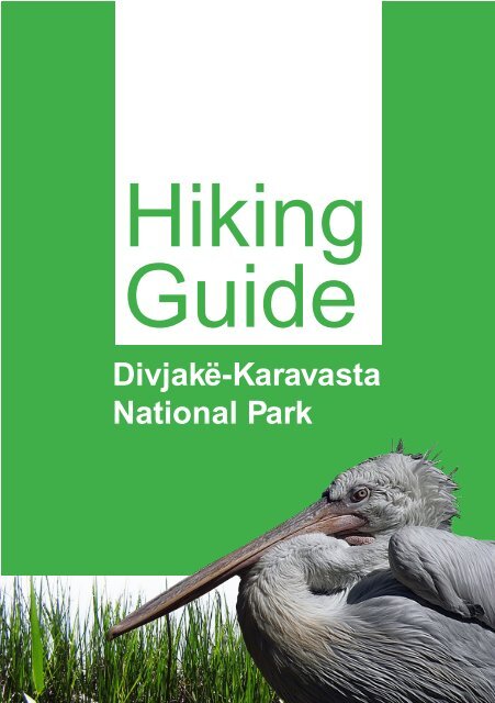
Hiking<br />
Guide<br />
<strong>Divjakë</strong>-<strong>Karavasta</strong><br />
<strong>National</strong> <strong>Park</strong><br />
1
Hiking<br />
Guide<br />
<strong>Divjakë</strong>-<strong>Karavasta</strong><br />
<strong>National</strong> <strong>Park</strong><br />
Published by EDEN center<br />
(Environmental center for Development<br />
Education and Networking)<br />
www.eden-al.org<br />
September, 2011<br />
This publication is financially<br />
supported by:<br />
The Democracy Commission Small<br />
Grants Program of the Embassy of<br />
United States of America in Tirana
4<br />
Author of the text:<br />
Endrit Shima, Program Coordinator, EDEN center<br />
Proof reading:<br />
Allan Zaretsky<br />
Pictures:<br />
The EDEN group of Nature Guides<br />
GPS mapping:<br />
Endrit Shima, Program Coordinator, EDEN center<br />
Note: The findings, conclusions and interpretation expressed in this document<br />
are those of the contracted alone and should in no way be taken to reflect the<br />
policies or opinions of the donor.
FOREWORD<br />
Through this hiking guide EDEN center has the pleasure to bring into your<br />
view and your interest the attractions of one of the Albanian most famous<br />
national parks, the Divjaka-<strong>Karavasta</strong> <strong>National</strong> park.<br />
Since our beginnings, in March 2004, we have been very active in promoting<br />
ecotourism and offering possibilities and opportunities to people to explore<br />
and feel the nature with all the senses. In this frame, a lot of work is being<br />
done from our Nature Guide group. They explore new itineraries around Alba-<br />
nia and get experienced in field trips and GPS mapping in order to offer such<br />
services for all hiking lovers.<br />
This acquired experience is very valuable in aiming at publications of hiking<br />
guides, and this enthusiasm became true in the frame of the project “Bringing<br />
<strong>Karavasta</strong> Lagoon back to life” financially supported by the Democracy<br />
Commission Small Grants Program of the Embassy of United States of<br />
America in Tirana and successfully implemented by EDEN center. In this<br />
project we aimed at enforcing the development of a sustainable development<br />
in protected areas by promoting ecotourism as well as civilized and demo-<br />
cratic behavior of local community and daily visitors. This hiking guide is one<br />
of the tools we are using in promoting ecotourism in the area and one of the<br />
most important outputs.<br />
The guide provides information for seven suggested hiking and bird watch-<br />
ing routs in the national park accompanied with pictures and GPS tracks and<br />
maps. Through the pages apart from history and culture of the area you can<br />
find interesting useful information on how to get there, accommodation and<br />
other services in and around the national park.<br />
EDEN Nature Guides group helped in defining and GPS mapping the hiking<br />
routs. With their help we went beyond the expectations of mapping trails –<br />
from five trails planed in the beginning to seven trails.<br />
5
6<br />
We have been cooperating and had the support of different institutions and<br />
individuals during this process who we take the opportunity to thank:<br />
Ministry of Environment Forest and Water Administration, Mr. Nihat Dragoti,<br />
Specialist; Divjaka Municipality, the entire administration; “Miti Zoi Zaka”<br />
high school in Divjaka; the students of Divjaka Mrs. Anxhela Shurdhaqi, Mrs.<br />
Kristi Zeqo, Mr. Vlash Bërboti, Mr. Andi Biti and Mr. Endri Gjoni for helping<br />
us with selecting interesting hiking routs; EDEN center,<br />
EDEN Nature Guides: Arlind Prifti, Daniela Memushaj, Kristina Huda, Laz-<br />
jon Petri, Marsida Taraj dhe Megi Shima; Mrs. Jonida Mamaj, Coordinator;<br />
Mr. Endrit Shima, program coordinator in EDEN center and author of the text<br />
for the patience and energy dedicated to the success of the project and this hik-<br />
ing guide and all the locals for their hospitality.<br />
A special thank goes to Democracy Commission Small Grants Program of<br />
United States of America Embassy in Tirana. This book would not have been<br />
possible without their support.<br />
In particular, we would like to thank Mrs. Ermelinda Mahmutaj, Executive<br />
Director of EDEN center and Mrs. Merita Mansaku, Founder of EDEN center,<br />
whose contribution and enthusiasm to the success of the project went far<br />
beyond from their responsibilities.<br />
EDEN team<br />
September 2011
CONTENT<br />
I.BACKGROUND<br />
Geographical position<br />
Natural importance of the park<br />
Climate<br />
History and tourism<br />
II.SUGGESTED HIKING TRAILS<br />
Getting there<br />
Accommodation and other services<br />
Points of interest<br />
Map of hiking routes in park:<br />
1. Southern forest– Vahu Canal – Dunes and Divjaka beach – <strong>Park</strong> center.<br />
2. <strong>Park</strong> center – Godulla e Pishës lagoon – Spiaxho lagoon – <strong>Park</strong> center<br />
3. <strong>Park</strong> center – Divjaka beach – Godulla lagoon – <strong>Karavasta</strong> lagoon<br />
– <strong>Park</strong> center.<br />
4. Southern forest – Ishulli i Pelikanit (pelicans island).<br />
5. Northen forest – Pisha e Egër në Oazin e <strong>Karavasta</strong>së (Old Pine)<br />
– Godulla e Pishës lagoon – <strong>Park</strong> center.<br />
6. Divjaka shore – Vahu canal – Second canal.<br />
7. Northen forest – Kular – Mouth of Shkumbini River – Ishulli i Kularit<br />
(Kulari Island) – Godulla e Pishës lagoon.<br />
III. PRACTICAL INFORMATION<br />
Equipments<br />
GPS tracks and maps<br />
IV. BIBLIOGRAPHY<br />
THE MAP OF SUGGESTED HIKES<br />
8<br />
8<br />
9<br />
9<br />
11<br />
11<br />
13<br />
16<br />
18<br />
20<br />
23<br />
25<br />
28<br />
30<br />
33<br />
33<br />
34<br />
35<br />
7
8<br />
I. BACKGROUND<br />
Geographic position<br />
The Divjaka-<strong>Karavasta</strong> <strong>National</strong> <strong>Park</strong> is the largest non-coastal complex in<br />
Albania, made of four lagoons with a total of approximately 5,000 hectares,<br />
of sand dunes and a river delta. It is situated in the central part of Western<br />
Region, between Shkumbini River in the north and Seman River in the south,<br />
40 km west of Lushnja, by the Adriatic coast.<br />
Natural importance<br />
<strong>Divjakë</strong>-<strong>Karavasta</strong> <strong>National</strong> <strong>Park</strong> is listed as Ramsar site since 1994.<br />
There is a Mediterranian Pine Forest near the <strong>Karavasta</strong> lagoon, and it contains<br />
one of the most interesting faunas of the country. <strong>Divjakë</strong>-<strong>Karavasta</strong> area pro-<br />
vides the special conditions for accommodation of a number of plant communi-<br />
ties and animal species, among which many of them are at risk of extinction in<br />
the world.<br />
<strong>Divjakë</strong>-<strong>Karavasta</strong> geographic position
We can mention here: Pelican (Pelicanus crispus Bruch).<br />
The lagoons provide living conditions and breeding sites above the 5% of the<br />
world population of this bird. The islands in the lagoon are one of the most<br />
important features of the area for the conservation of birds. Although in the<br />
past, the Dalmatian pelicans have nested in other parts of the lagoon, they now<br />
only nest on these islands, owning to disturbance elsewhere. In addition, many<br />
of the other important breeding birds of the lagoon nest on the island because<br />
they are safe from predators and human disturbance. These include Collared<br />
pratincole (Glareola pratincola) and Little tern (Sterna albifrons)<br />
Climate<br />
<strong>Divjakë</strong>-<strong>Karavasta</strong> is part of the Mediterranean climate zone’s plains’ central<br />
sub-districts. The features of this climate are mild, wet winters and hot, dry<br />
summers. During winter there are an average of 4.1 hours of sunshine per day,<br />
while in summer it increases to 10 hours of sun.<br />
Precipitation ranges from 550-1200 mm, distributed over 85-100 days per year.<br />
Two-thirds of the annual rainfall comes in November-March. Precipitation is<br />
mainly in the form of rain, while snow and hail are rare occurrences for this<br />
area. The average annual temperature is 18.8 ° C.<br />
History and tourism<br />
History Divjaka as inhabited center is very ancient. This is proved by the<br />
archaeological objects as well as the many graves. These materials were found<br />
during the opening of new lands in <strong>Divjakë</strong> at the communism time. Here was<br />
found various ceramic containers, bronze swords, spears, coins and many other<br />
objects, which date III-II century BC.<br />
To speak before the 1945 tourism development or even for its first half is very<br />
difficult. The difficult economic conditions of the country and the various wars,<br />
in which our country was involved, prevented this activity.<br />
After 1945 as a result of wrong policy and slow economic development, there<br />
9
10<br />
was a setback in this regard. Investments in this very important branch of<br />
economy were scarce. These investments were made by the state. They consist<br />
with the construction of the camp consisted of workers with a capacity of 80<br />
rooms and about 200 beds and a number of cabins with a capacity around 400<br />
beds.<br />
Democratic changes happened after 1990, opening the country to the outside<br />
world; the transition from planned economy to free market opened the<br />
perspective of tourism as one of the branches of the economy.<br />
At the moment the national park is suffering from the lack of management<br />
and the promoting of sustainable tourism activities. The only way of tourism<br />
which is happening in the park is beach tourism during the summer time.<br />
Illegal hunting is also a big problem for the area. The location of the park in<br />
the center of the Western region of Albania gives good opportunities to visit<br />
some of the most development touristic sites in Albania:<br />
Durrësi (79 km) the country’s main port, rich with ancient ruined Roman<br />
amphitheater, museum, etc.<br />
Berati (78 km), UNESCO city. The town is renowned for its historic<br />
architecture and scenic beauty and is known as the “Town of a Thousand<br />
Windows”, due to the many large windows of the old decorated houses<br />
overlooking the town.<br />
Apollonia (75 km) an ancient city in Illyria, located on the right bank of the<br />
Vjosa River. Its ruins are situated in the Fier region, near the village of Pojani,<br />
in modern-day Albania.<br />
Interesting to visit is also the Byzantine Church, XVIII century, in <strong>Karavasta</strong> e<br />
Re village (24 km) and Ardenica Monastery, XIII-XIV century, near Kolonjë<br />
village (28 km). It is declared a cultural monument of special importance.<br />
II. SUGGESTED<br />
HIKING TRAILS
II. SUGGESTED<br />
HIKING TRAILS<br />
Getting there<br />
The starting point is considered the capital, Tirana. From here, Divjaka can<br />
be reached by public transport, private car or bike. The route goes via Durrës,<br />
Rrogozhinë, <strong>Divjakë</strong> and finally <strong>Divjakë</strong>-<strong>Karavasta</strong> <strong>National</strong> <strong>Park</strong>. The route<br />
is in good condition and is approximately 100 km.<br />
To get to the park by public transport one may either take a minibus (furgon)<br />
or a bus. The minibus station is at “21 dhjetori” crossing (1.3 km from Sk-<br />
endërbeg Square). Walk south-west from Skendërbeg Square towards Kavaja<br />
Road (with the Albania Bank on your left and Opera buildng behind). Furgons<br />
running to Vlora or Fier will also bring you to Çermë village where one can<br />
find regular minbuses and buses continuing on to Divjaka.<br />
To reach the park from Divjaka one can hire a taxi which costs around 400<br />
lekë, or walk on foot (around 6 km west fom Divjaka center). The bus station<br />
is at Nishëraku (500 meters south-west from “21 dhjetori”). The bus ticket<br />
from Tirana to Çerma village costs 200 lek and the minibus ticket costs 300<br />
lek. Minibus and bus tickets from Çermë to Divjaka cost 50 lek.<br />
The entrance fee to the park is 100 lek for cars, 200 lek for minibuses and 300<br />
lek for buses. For passengers and hikers coming on foot there is no entrance<br />
fee at the moment.<br />
Accommodation and other services<br />
There are several hotels in the park. The hotels and restaurants are often run<br />
by families from Divjaka which gives the feeling of staying in a guest house<br />
rather than a normal hotel. You can find a list of these services in the table<br />
11
Points of interest in and around <strong>Divjakë</strong>-<strong>Karavasta</strong><br />
<strong>National</strong> <strong>Park</strong><br />
1. Divjaka is the nearest city of the park (approx. 6 km). Divjaka has a<br />
population of about 13,600 inhabitants, where 7300 people belong to the<br />
municipality and the rest are rural. Locals mainly work in production of<br />
vegetables, fruits, fishing and less in livestock.<br />
2. Entrance of the park is in the main road which connects Divjaka and <strong>National</strong><br />
<strong>Park</strong>. The road divide the forest in two parts (N and S part).<br />
The entrance of the park is situated 1.2 km N of the park center and the beach.<br />
The entrance fee is 100 lek for cars, 200 lek for vans and 300 for busses.<br />
3. Center of the park is located near Divjaka beach, approx. 1.2 km SW from the<br />
park entrance. The majority of services are located in the park center. Divjaka<br />
Points of interest in and around the park<br />
13
14<br />
beach is a stretch of roughly 15 kilometers of white sand lined by pine forest,<br />
and it is a popular seaside destination for thousands of tourists and day-trip-<br />
pers from south-central Albania. The sandy beach is huge (250 m wide from<br />
forest edge to water in some areas) and even in peak season, it is possible to<br />
walk further up or down and find some privacy.<br />
4. Pelican Island (Nature Monument) is located in NW of <strong>Karavasta</strong> Lagoon.<br />
This is an important place for Dalmatian Pelicans nesting. The hiking guides<br />
suggested below offers also a watching place of the island.<br />
5. The Big and / or Old Pine (in Albanian: Pisha e Egër në Oazin e Karavas-<br />
tasë) is listed as Nature Monument in Albania. It represents a 410 years old<br />
pine<br />
located in SW of the northern part of the forest.<br />
6. The <strong>Karavasta</strong> lagoon is the biggest and most important lagoon on the<br />
coastal area of the Adriatic Sea. The <strong>Karavasta</strong> lagoon has a surface of 43.3<br />
km2, with a maximal length of 10.6 km, a maximal width of 4.3 km, and a<br />
maximal depth of 1.5 m. <strong>Karavasta</strong> Lagoon) is well known for its colony of<br />
globally threatened Dalmatian pelicans.<br />
Over 200 other bird species have been observed in the area, including some<br />
EDEN Nature Guide’s group during routes
other globally threatened species, such as pygmy cormorant, white-headed<br />
duck, spotted eagle and pallid harrier. The presence of these birds is one of<br />
the main reasons that <strong>Karavasta</strong> lagoon has been designated a Ramsar Site of<br />
International Importance.<br />
7. Godulla Lagoon represents a small lagoon situated very close to <strong>Karavasta</strong><br />
lagoon. This lagoon has a surface of 8.5 km2 with a length of 5 km, a width of<br />
3.8 km and a maximum depth of 3.8 m.<br />
8. Godulla e Pishës (Nature Monument) is situated in NW of Divjaka forest.<br />
It represents a lagoon with a maximal length of 1.8 km and a maximal width<br />
of 400 m, Surrounded by pine forest and dunes with plenty of pine scrub. The<br />
Dalmatian pelicans nest here.<br />
9. Spiaxho is a small lagoon in N part of <strong>Divjakë</strong>-<strong>Karavasta</strong> system.<br />
10. Osmani lagoon is a small lagoon N of Spiaxho lagoon.<br />
11. Kulari Island (Nature Monument) is located near Shkumbini Delta, 0.5<br />
m above sea level formed by the accumulation of river. The island is covered<br />
with bushes, wild poplar hardwood, cedar,winter pasture, and grass types. You<br />
can find aquatic birds, among them most Dalmatic pelican.<br />
Divjaka Municipality center<br />
15
16<br />
1. Southern forest – Vahu Canal – Dunes and Divjaka<br />
Hike 1<br />
beach – <strong>Park</strong> center<br />
Distance 7,7 km<br />
Hiking Time 3 hours<br />
Difficulty Easy<br />
The half part of this hike is through dense forest but with an easily distinguish-<br />
able path. The second part involves Vahu Canal, which connect the Adriatik<br />
Sea with <strong>Karavasta</strong> Lagoon and a hike through sand dunes and Divjaka beach.<br />
The hike starts by one of the entrance door of the southern forest (WP 1),<br />
approx. 1.3 km NE from the entrance of the park. The road follows SW<br />
through dense forest and easy to follow the track for approx. 1.5 km when the
path divides, one follows S (left side) and the other one follows SW (WP 2).<br />
The path runs SW through dense forest until we reach the bridge of Vahu<br />
Canal (WP 3). After that we turn NW with the forest in our right and the sea<br />
in our left. The route follows N through the beach sand. We pass a big bunker<br />
near Divjaka Hotel (WP 4) and continue either near of the sea or forest until<br />
we reach the main car road which is also the center of the park (WP 5). To get<br />
back to the WP 1, you should follow the automobile road for approx. 2, 5 k.<br />
Waypoints<br />
1. 34 T 373013 / UTM 4538766, entrance of the forest<br />
2. 34 T 372709 / UTM 4537410, crossing<br />
3. 34 T 371726 / UTM 4534558, Vahu canal<br />
4. 34 T 371840 / UTM 4535809, Bunker and Divjaka <strong>Park</strong> Hotel<br />
5. 34 T 372083 / UTM 4536783, the main road, Pelikani Hotel<br />
<strong>Karavasta</strong> lagoon<br />
The path in Southern forest Vahu Canal<br />
17
18<br />
2. <strong>Park</strong> center - Godulla e Pishës lagoon - Spiaxho<br />
Hike 2<br />
lagoon - <strong>Park</strong> center<br />
Distance 4,4 km<br />
Hiking Time 2 hours<br />
Difficulty Easy<br />
The hike starts at the entrance of the park (WP 1) and follows directly SW<br />
through a rare pine forest and a visible hiking path. After approx. 250 m, we<br />
turn right (WP 2). The route follows NW for approx. 220 m and after that,<br />
near a hotel, we turn left (WP 3). We follow left and turn right (NW) when<br />
we reach the sand beach hiking path (WP 4), which is very visible and runs<br />
through rare pine forest on the left and beach bushes on the right.<br />
If you follow for approx. 100 m W on WP 4, you can see the south part of<br />
Spiaxho lagoon.
From WP 4, our path follows NW on a visible sand beach path which runs in<br />
the middle of two lagoons (Spiaxho and Godulla e Pishës lagoons) but you<br />
cannot often see them because of the forest on left side and the bushes on the<br />
right. After approx. 1.4 km we will have a very clear view of Spiaxho lagoon,<br />
Godulla e Pishës lagoon and Tërbfui canal, which runs in the middle of<br />
Spiaxho lagoon (WP 5). The path follows right with the canal on our left for<br />
approx. 200 meters and then it turns back through the forest (WP 6).<br />
The way back goes parallel with the previous path and the route is very vis-<br />
ible. On WP 7 we have a bird watching possibility. From here we have in front<br />
of us, at Godulla e Pishës lagoon, an island populated from different birds.<br />
The hiking path follows SE, through rare pine forest, for approx. 800 meters<br />
until we reach the route which connects WP 3 with WP 4 (WP 8).<br />
The hike finishes at entrance of the park (WP 1).<br />
Waypoints<br />
1. 34 T 372339 / UTM 4537954, entrance of the park<br />
2. 34 T 372121 / UTM 4537858, crossing<br />
3. 34 T 372008 / UTM 4538055, hotel<br />
4. 34 T 371864 / UTM 4538022, sand beach hiking path<br />
5. 34 T 371416 / UTM 4539254, Tërbufi canal<br />
6. 34 T 371502 / UTM 4539448, crossing<br />
7. 34 T 371729 / UTM 4538741, view point<br />
8. 34 T 371901 / UTM 4538038, crossing<br />
Fishing cabin at Godulla e Pishës Lagoon<br />
19
20<br />
3. <strong>Park</strong> center – Divjaka beach – Godulla lagoon –<br />
<strong>Karavasta</strong> lagoon – <strong>Park</strong> center<br />
This is a relatively long hike along the fishermen paths. It offers sensational<br />
views of two of the largest lagoons in the area (<strong>Karavasta</strong> lagoon and God-<br />
ulla lagoon), Divjaka beach and restaurants of the park. As long as the path<br />
remains unmarked, a local guide is suggested.<br />
Hike 3<br />
Distance 16,5 km<br />
Hiking Time 5-6 hours<br />
Difficulty Easy<br />
The hike starts at the centre of the park, near of the Argena Hotel (WP 1), from<br />
where we follow SW along the unpaved road with hotels and restaurants from<br />
both sides. After approx. 1 km, near the Divjaka <strong>Park</strong> Hotel, the unpaved ends<br />
(WP 2) and we keep following SW along the sand beach path, with the sea in<br />
our right and the pine forest very close in our left. After a while we reach the
Vahu canal, which is the only direct connection between the sea and <strong>Karavasta</strong><br />
lagoon (WP 3). Our route turns left to the canal and sea connection, where is<br />
also a small bar to buy something (WP 4). After that we turn back to WP 3,<br />
than we follow SW for few hundred meters and cross the canal through a bridge<br />
(WP 5). After crossing the bridge, the hike follows W for approx. 150 meters<br />
and then SW with the Godulla lagoon in the left and pine forest in the right.<br />
After approx. 1.5 km we turn left and our hike follows in a pine forest (WP 6).<br />
Our hike follows SW in the pine forests for approx. 2 km until we reach a<br />
view to <strong>Karavasta</strong> lagoon (WP 7). The route turns right and follows with the<br />
<strong>Karavasta</strong> lagoon in our left and Godulla lagoon in our right. Different birds<br />
are possible to see at this point. Among them, we saw a Dalmatian pelican<br />
flying.<br />
After approx. 200 meters is the first canal which connect <strong>Karavasta</strong> lagoon<br />
with Godulla lagoon. Near of the canal there is a fish manufactory (WP 8).<br />
Our route follows SW on a path located in the middle of the lagoons and after<br />
approx. 1 km we reach the second canal that connects <strong>Karavasta</strong> with Godulla<br />
lagoon (WP 9). After that we get back to WP 7 and then we follow NE near<br />
the <strong>Karavasta</strong> lagoon along an unpaved road for approx. 3,3 km where we<br />
reach the Vahu canal (WP 10). The route follows left and after a while we<br />
reach the bridge of Vahu canal (WP 5). After that we follow W and cross WP<br />
3 and turn N at WP 11. To get back to WP 1 you can either follow the same<br />
track near of the forest or near of the cost.<br />
Painter at <strong>Karavasta</strong> lagoon<br />
Fisherman<br />
in Godulla<br />
lagoon<br />
21
22<br />
Waypoints<br />
1. 34 T 372126 / UTM 4536800, Argena Hotel<br />
2. 34 T 371856 / UTM 4535849, end of unpaved road, Divjaka Hotel<br />
3. 34 T 371532 / UTM 4534711, Vahu canal<br />
4. 34 T 371109 / UTM 4535108, connection of sea with the lagoon<br />
5. 34 T 371731 / UTM 4534557, bridge<br />
6. 34 T 370867 / UTM 4533409, pine forest<br />
7. 34 T 370401 / UTM 4531486, view to <strong>Karavasta</strong> lagoon<br />
8. 34 T 370354 / UTM 4531245, first connection of Godulla-<strong>Karavasta</strong><br />
9. 34 T 369805 / UTM 4530475, second connection<br />
10. 34 T 371849 / UTM 4534423, Vahu canal<br />
11. 34 T 371341 / UTM 4534887, crossing<br />
A bar restaurant in Divjaka beach, near of the Vahu canal<br />
Fishing factory at the channel connecting<br />
<strong>Karavasta</strong> lagoon with Godulla lagoon<br />
Horses at Divjaka beach<br />
Terrapin in<br />
Divjaka beach
4. Southern forest – Ishulli i Pelikanit<br />
Hike 4<br />
(Pelican’s island)<br />
This is a short relaxing hike in the forest which gives you the opportunity to<br />
see the rare Dalmatian pelican. There was built a viewpoint sometimes ago<br />
that is not existing at the moment. Given that there is not a viewpoint with<br />
binoculars and the path is unmarked, you should have your own binoculars<br />
and a GPS device. In a absence of a GPS device, a local guide is essential.<br />
Distance 5,6 km<br />
Hiking Time 2 hours<br />
Difficulty Easy<br />
The hike starts at one of the entrances of the southern forest of the park, 1, 5<br />
km NE of the park entrance (WP 1). The entrance of the forest is a blue iron<br />
door. The hike follows SW along a visible path and after approx. 200 meters<br />
there is a deviation in the right side but we follow strait (WP 2). We follow<br />
strait (SW) for approx. 2,6 km until we reach a destroyed wooden view point<br />
23
24<br />
(WP 3). From here is a very clear view to Pelicans Island. The island is located ap-<br />
prox. 1, 3 km E of the WP 3.<br />
The hike finish at WP 1 through taking the same route we did.<br />
Waypoints<br />
1. 34 T 373205 / UTM 4538717, trail head, blue iron door<br />
2. 34 T 373170 / UTM 4538498, crossing<br />
3. 34 T 372621 / UTM 4536106, view point<br />
Young locals during the training<br />
“How to become a Hiking Guide“<br />
Dalmatian Pelicans<br />
The path
5. Northen forest – Pisha e Egër në Oazin e <strong>Karavasta</strong>së<br />
(the old pine) – Godulla e Pishës lagoon – <strong>Park</strong> center<br />
Hike 5<br />
Distance 8,2 km<br />
Hiking Time 3 hours<br />
Difficulty Easy<br />
This is a beautiful hike going through the dense pine forest of the park.<br />
By following this trail, you will have the possibility to visit two natural monu-<br />
ments of the park – the Old Pine and Godulla e Pishes Lagoon. The path is<br />
very visible but it has some crossing that might mislead you. A hiking guide or<br />
a GPS device is suggested since the track is not marked.<br />
The trail head is WP 1, a blue gate next to the main road, which enable the<br />
entrance of the forest, approx. 1, 5 km before the park entrance. The trail<br />
follows N for approx. 2 km on a very visible path in the dense pine forest till<br />
we reach a crossing point (WP 2) and we turn of W (left). We follow W for<br />
25
26<br />
about 150 m and then turn again N at the crossing (WP 3). The route follows<br />
N and for approx. 600 m we reach the Old Pine, which is located few meters<br />
left of the trail (WP 4). After visiting the Old Pine, we turn back again on the<br />
trail and follow N until we arrive at WP 5, Emisari i Terbufit canal. There are<br />
many fishing cabins along the canal. At WP 5 the track follows W with the<br />
pine forest in our left and the canal in our right, for approx. 1 km. At WP 6 the<br />
route turns of S. The forest is not any more as dense as the parallel rout we<br />
had before. At WP 7 is a very good view point over Godulla e Pishes lagoon.<br />
The viewpoint is approx. 200 m left of the main track. We get back at the main<br />
track and we follow S for few hundred meters until we see an exit gate of the<br />
forest. The hike ends at the main road, around 900 m before the park entrance<br />
(WP 8).<br />
Tërbufi canal<br />
Fishing cabin at Tërbufi canal
Waypoints<br />
1. 34 T 373215 / UTM 4538733, trail head, blue gate<br />
2. 34 T 373278 / UTM 4540556, crossing<br />
3. 34 T 373140 / UTM 4540552, crossing<br />
4. 34 T 373104 / UTM 4541112, Old Pine<br />
5. 34 T 373088 / UTM 4541768<br />
6. 34 T 372104 / UTM 4541413, crossing<br />
7. 34 T 372250 / UTM 4538982, view point<br />
8. 34 T 372552 / UTM 4538620, main road<br />
6. Divjaka shore – Vahu canal – Second canal<br />
Marsi, Fation, Vlashi and Endri at Pisha e Egër në Oazin e<br />
<strong>Karavasta</strong>së (The Old Pine) during the defining routes process<br />
27
28<br />
6. Divjaka shore - Vahu canal - Second canal<br />
Hike 6<br />
Distance 4. 4 km – one way<br />
Hiking Time 3 hours<br />
Difficulty Easy<br />
This is a nice hike along the sea shore going until it ends because the connec-<br />
tion of the sea with Godulla lagoon. Near of the connection (Second canal) is<br />
a very good view point for bird watching.<br />
The hike starts at Hotel Divjaka <strong>Park</strong> (WP 1) which is the last hotel going S<br />
from the park center along the car road. We continue the hike S along the sea<br />
shore and after approx. 1.8 km we reach the Vahu canal (WP 2). Vahu canal is<br />
normally dry so you can just cross it and hike further on S along the sea shore<br />
to approach the Second canal (WP 3). In case the Vahu canal is working, the<br />
ways to reach the second canal are either by crossing the water (max. 1/2 m
deep) or by renting a boat. Between the two canals, took place one of the most<br />
sensational stories of the communism time. Xhevdet Mustafa, a young Alba-<br />
nian fugitive in the United States came back in Albania with two other persons<br />
in September of 1982. Their mission was to toppling the regime. He was one<br />
of those youths that could not withstand with lifestyle and regime in Albania.<br />
This mission was betrayed by someone, and there they were surrounded by<br />
security forces of the Albanian state. On the way between two canals, near the<br />
lagoon, you can see memorials of two security forces that were killed during<br />
the gun fight by Xhevdet Mustafa and his companions.<br />
Waypoints<br />
1. 34 T 371836 / UTM 4535850, Divjaka <strong>Park</strong> Hotel<br />
2. 34 T 371048 / UTM 4535157, Vahu canal<br />
3. 34 T 368941 / UTM 4532784, Second canal<br />
Poultry footprints near of the channel<br />
The channel connecting the sea with Godulla lagoon<br />
29
30<br />
7. Northen forest – Kular – Mouth of Shkumbini River –<br />
Ishulli i Kularit (Kulari Island) – Godulla e Pishës lagoon<br />
Hike 7<br />
Distance 26 km<br />
Hiking Time 9 hours<br />
Difficulty Moderate<br />
This is a long hike with beautiful views and mix of forest roads, close the river<br />
and lagoon trails. The path is visible but with a lot of crossing. We suggest<br />
either hiring a guide or making sure you have a GPS device with you.<br />
The hike starts at the beginning of the Divjaka forest. Coming from Divjaka to<br />
<strong>National</strong> <strong>Park</strong> along the normal car road the trail head is the first entrance door<br />
(WP1) of the forest. It follows N along a visible trail until it reaches the WP<br />
2 (Tërbufi canal). We turn E (right) and cross the canal at the bridge (WP 3).
After crossing the bridge the trail follows N enter a small wooden area (WP<br />
4) and after crossing the wooden area the trails follows for approx. 400 meters<br />
along the Shkumbini River in our right and agriculture lands in our left. This<br />
area is called Kulari and use to be a village many years ago. Now it is banded<br />
as a result of regularly flooding from Shkumbin River.<br />
At WP 5 (crossing) we turn left and hike on broad trail in the middle of<br />
agriculture lands and enter the forest at WP 6. After walking in the forest for<br />
approx. 1 km on a broad visible trail, we exit it at WP 7 and follow W until<br />
we reach WP 8 (Mouth of Shkumbini River) with a beautiful view of Kulari<br />
Islands which is full of different birds.<br />
For getting back we follow the same trail until we reach WP 2 and then we<br />
follow W with the canal in our right and the forest in our left. At WP 9 the<br />
trails the trail follows S. During this part of the hike you will have the pos-<br />
sibility to see the Godulla e Pishes lagoon. The trail ends at the main car road,<br />
approx. 900 meters before the park entrance.<br />
Kristina, Ilir and Endri during routes defining at mouth of<br />
Shkumbini River<br />
31
32<br />
Waypoints<br />
1. 34 T 373549 / UTM 4538830, trail head, blue gate<br />
2. 34 T 373486 / UTM 4541930, Tërbufi canal<br />
3. 34 T 374300 / UTM 4542195, bridge<br />
4. 34 T 373961 / UTM 4543143, entrance of a wooden area<br />
5. 34 T 373575 / UTM 4543832, crossing<br />
6. 34 T 372876 / UTM 4543609, forest entrance<br />
7. 34 T 371919 / UTM 4543704, forest exit<br />
8. 34 T 368881 / UTM 4544316, mouth of Shkumbini River<br />
9. 34 T 372112 / UTM 4541416, crossing<br />
10. 34 T 372551 / UTM 4538618, main road<br />
Fishing methods in Tërbuni canal
III. PRACTICAL INFORMATION<br />
Equipment<br />
Appropriate hiking equipment is essential (hiking boots, waterproofs, sun<br />
protection, insect protection, backpack, food, first aid kit, GPS device, func-<br />
tioning mobile phone, etc). During the spring and winter time it is essential<br />
to have with you long waterproof boots because there are some water ponds<br />
on the trails. Regarding the first aid kits, it is crucial to have the right medical<br />
supplies with you because Divjaka doesn’t have a rescue system for the hik-<br />
ers in the forest. If traveling in a group, your tour guide should highlight the<br />
danger of poisonous snake bites and should carry a suction pump just in case.<br />
The kit should also contain treatments and bandages for less serious injuries<br />
such as bruises, cuts and so on. The insect protection is very essential from<br />
April to October because Divjaka wetland has a lot of mosquitoes during this<br />
time of the year.<br />
GPS tracks and maps<br />
The maps of the guide are Soviet military old maps. Divjaka coast has<br />
changed some since the map was produced due to erosions factors. However,<br />
the trails in the area are not difficult and the maps are good for orientation.<br />
At www.bunkertrails.com you can download topographic maps of scales 1:50<br />
000 and 1:100 000. The GPS (UTM) data provided here is two-fold: Waypoint<br />
number and UTM coordinate. Within the text the waypoint numbers (e.g.,<br />
WP1’) refer to the items listed at the end of each description. Apart of the<br />
waypoint that you can find within the text, GPS tracks with waypoints can be<br />
found at EDEN center website (www.eden-al.org)<br />
Wikiloc GPS data sharing website (www.wikiloc.com) and EveryTrail website<br />
(www.everytrail.com). At Wikiloc and EveryTrail the trails can be found<br />
through searching Endrit Shima account. Given that trails are not marked, we<br />
advise using a local guide in this region, Anxhela Shurdhaqi, group leader of<br />
divjaka hiking guides, tel. +355 695619269, email: guidanatyrore.divjake@<br />
gmail.com.If you do choose to hike alone, would be good to have a GPS<br />
device with you to avoid getting out of the trail.<br />
33
34<br />
IV. BIBLIOGRAPHY<br />
Anni (Koci) Kallfa and Taulant Bino, Reproduction Biology<br />
of Dalmatian Pelican (Pelecanus Crispus) in the Divjaka-<br />
<strong>Karavasta</strong> <strong>National</strong> <strong>Park</strong>, 2010.<br />
Ecotourism Ltd, Technital S.pA. and Tour du Valat,<br />
<strong>Karavasta</strong> lagoon eco guide, 1997.<br />
Pano, Niko and Frashëri Alfred, The coastal geomorphology<br />
of the Semani river mouth-<strong>Karavasta</strong> lagoon in the southern<br />
Adriatic Sea.<br />
Qiriazi, Perikli and Sala, Skënder, Monumentet e Natyrës<br />
së Shqipërisë.<br />
Botim elektronik, 2005.<br />
Ramsar site management plans – Albania, <strong>Karavasta</strong> Lagoon,<br />
1996.<br />
The maps of Bunkertrails:<br />
www.bunkertrails.com<br />
The Geo Consulting map<br />
of Albania: www.albinfo.al<br />
Zindel, Christan and Husammann, Barbara, Thethi and Kel-<br />
mendi: Hiking Guide of Northern Albania, 2009.
Published by EDEN center<br />
(Environmental center for Development<br />
Education and Networking)<br />
www.eden-al.org<br />
September, 2011
40<br />
Published by EDEN center<br />
(Environmental center for Development<br />
Education and Networking)<br />
www.eden-al.org<br />
September, 2011