

Tungsten brochure (PDF) - Invest Yukon
Tungsten brochure (PDF) - Invest Yukon
Tungsten brochure (PDF) - Invest Yukon

You also want an ePaper? Increase the reach of your titles
YUMPU automatically turns print PDFs into web optimized ePapers that Google loves.
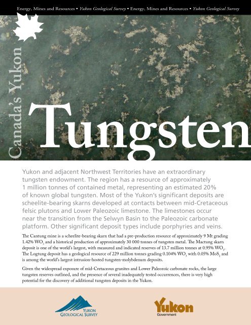
Canada’s <strong>Yukon</strong><br />
<strong>Tungsten</strong><br />
<strong>Yukon</strong> and adjacent Northwest Territories have an extraordinary<br />
tungsten endowment. The region has a resource of approximately<br />
1 million tonnes of contained metal, representing an estimated 20%<br />
of known global tungsten. Most of the <strong>Yukon</strong>’s significant deposits are<br />
scheelite-bearing skarns developed at contacts between mid-Cretaceous<br />
felsic plutons and Lower Paleozoic limestone. The limestones occur<br />
near the transition from the Selwyn Basin to the Paleozoic carbonate<br />
platform. Other significant deposit types include porphyries and veins.<br />
The Cantung mine is a scheelite-bearing skarn that had a pre-production resource of approximately 9 Mt grading<br />
1.42% WO 3 and a historical production of approximately 30 000 tonnes of tungsten metal. The Mactung skarn<br />
deposit is one of the world’s largest, with measured and indicated reserves of 13.7 million tonnes at 0.95% WO 3 .<br />
The Logtung deposit has a geological resource of 229 million tonnes grading 0.104% WO 3 with 0.05% MoS 2 and<br />
is among the world’s largest intrusion-hosted tungsten-molybdenum deposits.<br />
Given the widespread exposure of mid-Cretaceous granites and Lower Paleozoic carbonate rocks, the large<br />
tungsten reserves outlined, and the presence of several inadequately tested occurrences, there is very high<br />
potential for the discovery of additional tungsten deposits in the <strong>Yukon</strong>.<br />
Government
Skarn/replacement tungsten deposits.<br />
Deposit<br />
Owner/optioned to/contact<br />
Cantung<br />
North American <strong>Tungsten</strong><br />
Corporation Limited<br />
11-1155 Melville Street<br />
Vancouver, British Columbia<br />
Canada V6E 4C4<br />
Telephone: 604-682-1333<br />
www.northamericantungsten.<br />
com<br />
Bailey<br />
North American <strong>Tungsten</strong><br />
Corporation Limited<br />
11-1155 Melville Street<br />
Vancouver, British Columbia<br />
Canada V6E 4C4<br />
Telephone: 604-682-1333<br />
Risby<br />
Playfair Mining Ltd.<br />
Suite 520-470 Granville Street<br />
Vancouver, British Columbia<br />
Canada V6C 1V5<br />
Telephone: 604-687-7178<br />
Mactung<br />
North American <strong>Tungsten</strong><br />
Corporation Limited<br />
11-1155 Melville Street<br />
Vancouver, British Columbia<br />
Canada V6E 4C4<br />
Telephone: 604-682-1333<br />
Ray Gulch<br />
StrataGold Corporation<br />
701-475 Howe Street<br />
Vancouver, British Columbia<br />
Canada V6C 2B3<br />
Telephone: 604-682-5474<br />
Stormy<br />
E-Energy Ventures<br />
2110-1177 Hastings Street W<br />
Vancouver, British Columbia<br />
Canada V6E 2K3<br />
Telephone: 604-681-1231<br />
Zone(s)<br />
Year resource-reserve was<br />
calculated/reference<br />
Mineral resource-reserve<br />
category‡/<br />
Tonnage@ grade/commodity<br />
Cantung Pre-production resource<br />
9 Mt @ 1.42% WO 3<br />
B zone<br />
1988<br />
Assessment report #092120<br />
Risby<br />
1982<br />
Northern Miner, 08/08/1982,<br />
p. 30<br />
Lower skarn<br />
Report by Roscoe Postle<br />
Associates Inc., June/2001<br />
Upper skarn<br />
Report by Roscoe Postle<br />
Associates Inc., June/2001<br />
Garnet<br />
1980<br />
Assessment report #090614<br />
Stormy<br />
1959<br />
Assessment report #060692<br />
Townsite at the Cantung mine, on<br />
the border between the Northwest<br />
Territories and the <strong>Yukon</strong>. The Cantung<br />
deposit consists of scheelite skarn<br />
developed in Cambrian carbonate rocks<br />
above a mid-Cretaceous pluton. The<br />
mine is the western world’s largest<br />
operating tungsten mine.<br />
Historical calculation<br />
404 600 tonnes @ 1% W0 3<br />
Historical calculation<br />
2 700 000 tonnes @ 0.81% W0 3<br />
Measured and indicated<br />
5 052 000 tonnes @ 1.2% W0 3<br />
Measured and indicated<br />
8 617 000 tonnes @ 0.8% WO 3<br />
Historical calculation<br />
4 861 593 tonnes @ 0.48% W0 3<br />
Historical calculation<br />
15 628 tonnes @ 1.05% W0 3<br />
Status<br />
<strong>Yukon</strong> MINFILE no.**<br />
Active mine<br />
1954: Discovered.<br />
1962: Production started.<br />
1986: Closed.<br />
2002-2003: Reopened.<br />
2005: Reopening. Located in Northwest Territories,<br />
access to minesite from the <strong>Yukon</strong>.<br />
2006: In production.<br />
Deposit<br />
1963: Discovery. Mineralization is located in 3 zones<br />
over a strike length of 4 km.<br />
105A 017<br />
Deposit<br />
1968: Discovery. A total of over 7000 m of drilling<br />
has been completed to date.<br />
2006: Drilling (1000 m).<br />
105F 034<br />
Deposit<br />
1962: Discovery.<br />
1970: Road construction.<br />
1971-1973: Underground development, bulk<br />
sampling, metallurgical testing.<br />
1974-1977: Environmental and feasibility studies.<br />
1984-1985: Bulk sampling and road building.<br />
2005: Drilling, feasibility.<br />
2006: Baseline study.<br />
105O 002<br />
Deposit<br />
1942: Discovery. Completion to date of over<br />
20 100 m of drilling.<br />
2006: Core relogging.<br />
106D 027<br />
Deposit, active<br />
1955: Discovery.<br />
1959: Underground development.<br />
1979-1980: Underground rehabilitation, bulk<br />
sampling.<br />
1995: Road building.<br />
2005: Prospecting.<br />
105F 011<br />
Tung
<strong>Tungsten</strong> targets in <strong>Yukon</strong><br />
Dawson City<br />
Beaver Creek<br />
DENALI FAULT<br />
Burwash<br />
Landing<br />
Old Crow<br />
Pelly<br />
Crossing<br />
RAY GULCH<br />
Mayo<br />
Carmacks<br />
Haines Junction<br />
stenHaines<br />
Keno<br />
TINTINA FAULT<br />
KALZAS<br />
Whitehorse<br />
Skagway<br />
RISBY<br />
Carcross<br />
Inuvik<br />
Faro<br />
STORMY<br />
Ross River<br />
Teslin<br />
MACTUNG<br />
LOGTUNG<br />
Deposit<br />
Occurrence<br />
TOOTSEE<br />
DENALI FAULT<br />
China<br />
Beijing<br />
Korea<br />
CANTUNG<br />
Deep Water<br />
Port<br />
International<br />
Airport<br />
TINTINA FAULT<br />
Japan<br />
BAILEY<br />
Watson Lake<br />
Existing<br />
Roads<br />
Insular<br />
<strong>Yukon</strong>-Tanana Terrane<br />
Selwyn Basin<br />
Other Sedimentary Basins<br />
Cassiar Platform<br />
North American Platform<br />
<strong>Yukon</strong><br />
Alaska<br />
Whitehorse<br />
0 50 100 200<br />
kilometres<br />
Canada<br />
United<br />
States<br />
Cretaceous<br />
Intrusions<br />
Selwyn<br />
Basin
Porphyry/sheeted vein tungsten deposits.<br />
Deposit<br />
Owner/optioned to/contact<br />
Logtung<br />
Largo Resources Ltd.<br />
65 Queen Street West<br />
Suite 280, P.O. Box 71<br />
Toronto, Ontario M5H 2M5<br />
Telephone: 416-861-5895<br />
Kalzas<br />
Copper Ridge Exploration<br />
500-625 Howe Street<br />
Vancouver, British Columbia<br />
Canada V6C 2T6<br />
Telephone: 604-688-0833<br />
Tootsee<br />
Cumberland Resources Ltd.<br />
Suite 950, One Bentall Centre<br />
505 Burrard Street, Box 72<br />
Vancouver, British Columbia<br />
Canada V7X 1M4<br />
Telephone: 604-608-2557<br />
Large blades of wolframite<br />
contained in sheeted<br />
quartz veins at the Kalzas<br />
tungsten deposit. The veins<br />
cut hornfelsed sedimentary<br />
rocks surrounding an<br />
unexposed pluton. Despite<br />
widespread mineralization,<br />
there are only two<br />
historical drill holes. The<br />
deposit was actively drilled<br />
in 2005.<br />
Zone(s)<br />
Year resource-reserve was<br />
calculated/reference<br />
Logtung<br />
1984<br />
Economic Geology, Aug/84<br />
p. 848-868<br />
Kalzas<br />
Drill intersection:<br />
Drill hole KZ05-05<br />
24.4 m @ 0.304% WO 3<br />
Mineral resource-reserve<br />
category‡/<br />
Tonnage@ grade/commodity<br />
Historical calculation<br />
162 million tonnes @ 0.13% W,<br />
0.052% Mo<br />
Wolframite in sheeted veins,<br />
stockwork and breccia zones is<br />
exposed over a 1.5 km 2 . Assays of<br />
greater than 1% WO 3 over 1-6 m<br />
have been obtained in trenching.<br />
Tootsee No resource outlined. Scheelite<br />
and molybdenite developed in<br />
calc-silicate hornfels, and small<br />
prophyry intrusion.<br />
Status<br />
<strong>Yukon</strong> MINFILE no.**<br />
Deposit<br />
1976: Discovery and road construction.<br />
1977-1981: Drilling (11 628 m), underground<br />
development, bulk sampling, metallurgical and<br />
environmental studies.<br />
2001: Data compilation.<br />
2006: Drilling.<br />
105B 039<br />
Active exploration<br />
1978: Discovery.<br />
1981-1983: Trenching, 2 drill holes.<br />
2001-2002: Extensive trench sampling.<br />
2005: Drilling 5 holes, 397 m.<br />
105M 066<br />
Active exploration<br />
1979: Discovery.<br />
1983: Drilling 576 m.<br />
2006: Geological mapping, drilling.<br />
105M 066<br />
‡Mineral resource-reserve category: resource and reserve figures have been compiled from a variety of historical data sources<br />
that in most cases predate the implementation of National Instrument 43-101. Therefore, only those figures indicated by an<br />
asterisk (*) comply with National Instrument 43-101.<br />
** The <strong>Yukon</strong> MINFILE is a computerized mineral inventory system that documents the exploration history and geology of<br />
metallic, industrial mineral and coal occurrences in the <strong>Yukon</strong>. The database contains detailed descriptions of 2612 separate<br />
mineral occurrences located throughout the <strong>Yukon</strong>.<br />
<strong>Yukon</strong> Geological Survey • Department of Energy, Mines and Resources • <strong>Yukon</strong> government • www.geology.gov.yk.ca<br />
November 2006