Download - Oceana
Download - Oceana
Download - Oceana
You also want an ePaper? Increase the reach of your titles
YUMPU automatically turns print PDFs into web optimized ePapers that Google loves.
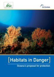
INTRODUCTION<br />
Given the diversity of possible appearances of some habitats contained in the OSPAR List of Endangered<br />
and/or Declining species and habitats across the North East Atlantic, a more precise description of the habitat<br />
as it occurs in relation to different substrates, depths and regions will need to be developed.<br />
When defining habitats, there are several very important parameters we must consider. Some of them are:<br />
Depth<br />
Type of seabed/substrate<br />
Predominant species<br />
Density at which predominant species appear<br />
Occupied extension/surface<br />
Species that are part of the community<br />
However, some of these parameters are difficult to determine in many cases, due to the existing restrictions<br />
imposed by the methods used and the time required to be spend in obtaining data. This is mainly the case with<br />
the density and the occupied extension/surface.<br />
According to the OSPAR background document “Case Report for the OSPAR List of threatened and/or<br />
declining species and habitats”, ICES attempted a first characterization of “coral garden” based on the density<br />
of stands and faunistic association in order to aid objective and comparable characterizations. They note that<br />
the quantification of the in situ density is often not possible due to technical or operational restrictions. The<br />
same happens in the case of other habitats which are the object of analysis in this workshop: “deep-sea<br />
sponge aggregations” and “sea pens and burrowing megafauna”.<br />
Therefore, qualitative or semi-qualitative approaches will in many cases be more appropriate and will lead to<br />
further refinement on this habitats definition and its inclusion in national and European habitat classifications.<br />
Some definitions have been given related to these habitats in the Northern regions of the OSPAR maritime<br />
area. However, there is a clear delay in the description of the possible appearances of these habitats in some<br />
regions, especially in IV and V OSPAR regions. In the same way, the information about the presence and<br />
appearance of these habitats in the Southern countries is not included in the classification of European<br />
habitats (EUNIS), so their description and inclusion will need to be developed.<br />
In order to collaborate in the description of the habitats that are being analysed, OCEANA presents in this<br />
report data gathering during the different expeditions carried out in region II (Kattegat area), region IV (Spain<br />
and Portugal coastal waters) and region V (Gorringe Bank). This data needs to be discussed and<br />
subsequently added to the international lists.<br />
It is important to bear in mind that this report highlights only qualitative descriptions of some of the different<br />
existing types, based only in the video clips that OCEANA has obtained in the expeditions made in recent<br />
years. Therefore it is additional information to the scientific information that already exists, which must be<br />
complemented by other scientific analyses. We must also take into account that the descriptions of the<br />
habitats and the fauna that make up the community are exclusively based on the descriptions of the<br />
macrofauna that can be directly observed and identify from the video clips obtained by means of immersions<br />
made by divers and ROV (Remotely Operated Vehicle).<br />
1


