Reclaiming Our Rural Highways - the Dorset AONB
Reclaiming Our Rural Highways - the Dorset AONB
Reclaiming Our Rural Highways - the Dorset AONB

Create successful ePaper yourself
Turn your PDF publications into a flip-book with our unique Google optimized e-Paper software.
RECLAIMING RURAL HIGHWAYS<br />
Published by <strong>the</strong><br />
<strong>Dorset</strong> <strong>AONB</strong><br />
Partnership 2005<br />
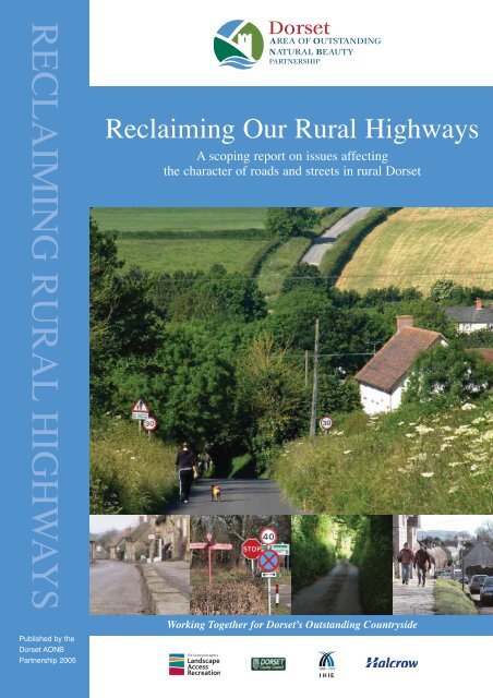
<strong>Reclaiming</strong> <strong>Our</strong> <strong>Rural</strong> <strong>Highways</strong><br />
A scoping report on issues affecting<br />
<strong>the</strong> character of roads and streets in rural <strong>Dorset</strong><br />
Working Toge<strong>the</strong>r for <strong>Dorset</strong>’s Outstanding Countryside
Acknowledgements<br />
Author: James Purkiss, Halcrow<br />
With particular assistance from: Sarah Bentley, <strong>Dorset</strong><br />
<strong>AONB</strong> Partnership, and Stephen Hardy, <strong>Dorset</strong> County<br />
Council<br />
With contributions from: Countryside Agency (Alison<br />
Rood), <strong>Dorset</strong> <strong>AONB</strong> Partnership (Doug Harman), <strong>Dorset</strong><br />
County Council (Sarah Barber, David Dawkins, Andy<br />
Elliott, John Lowe, Phil Sterling, Andy Tate & Rod Webb)<br />
English Nature (Jim White), Kate Freeman, Friends of<br />
<strong>the</strong> Lake District (Jack Ellerby) Halcrow Group<br />
(Steve Morgan, Andrew Linfoot, Clare Simmons)<br />
Gloucestershire County Council (Alexandra Luck), Kent<br />
County Council (Richard Emmett), Quantocks <strong>AONB</strong><br />
Service, Slower Speeds Initiative, Suffolk County Council<br />
(Ruth Stokes), Sustrans (Jonathan Bewley), West<br />
Berkshire Council (Jenny Noble)<br />
Thanks to all <strong>the</strong> organisations, committees and<br />
individuals who have contributed to <strong>the</strong> development<br />
of this Plan.<br />
Acknowledgements<br />
Photographs used by kind permission of:<br />
• Common Ground<br />
• <strong>Dorset</strong> <strong>AONB</strong> Partnership<br />
• <strong>Dorset</strong> County Council (Stephen Hardy, Mark Simons)<br />
• <strong>Dorset</strong> Engineering Consultancy (Julian McLaughlin)<br />
• Friends of <strong>the</strong> Lake District<br />
• Halcrow Group (James Purkiss)<br />
• Images of <strong>Dorset</strong> (John Allen)<br />
• Kent County Council (Richard Emmett)<br />
• The National Trust<br />
• North <strong>Dorset</strong> District Council<br />
• Quantock Hills <strong>AONB</strong> Service<br />
• Suffolk County Council (Ruth Stokes)<br />
• Sustrans (John Grimshaw, Steve Morgan)<br />
• Transport 2000 (Graham Smith)<br />
Designed and produced by Origin Designs Ltd.<br />
Maps are based upon Ordnance Survey material with <strong>the</strong><br />
permission of Ordnance Survey on behalf of <strong>the</strong><br />
Controller of Her Majesty's Stationery Office. (C) Crown<br />
Copyright 2001. Unauthorised reproduction infringes<br />
Crown copyright and may lead to prosecution or civil<br />
proceedings. (C) <strong>Dorset</strong> County Council. LA 076570.<br />
2001.Office. (C) Crown Copyright 2002.<br />
Acknowledgements
Contents<br />
4 4<br />
Contents<br />
Page<br />
Foreword 4<br />
Executive Summary 6<br />
1.1 Setting <strong>the</strong> scene 6<br />
1.2 The first step 6<br />
1.3 New approaches to rural roads 7<br />
1.4 Future Steps 7<br />
Section I: Overview of issues and problems 8<br />
2.1 Rationale for <strong>the</strong> study 9<br />
2.2 Aim of study 11<br />
2.3 The importance of <strong>Dorset</strong>’s environment 11<br />
2.4 The importance of <strong>Dorset</strong>’s rural roads 13<br />
2.5 The importance of design 15<br />
2.6 Insensitive design of rural roads 15<br />
2.7 Policy Context 17<br />
Section II: Evaluation of rural road management methods 21<br />
3 De-cluttering and quality design 22<br />
3.1 Introduction to chapter 22<br />
3.2 Clutter removal 24<br />
3.3 Amalgamation and multi-functionality 24<br />
3.4 Improved design 24<br />
3.5 Improved street and road boundary material design 25<br />
3.6 Improved signage design 26<br />
3.7 Improved design of o<strong>the</strong>r street features 30<br />
4 Protecting <strong>the</strong> natural and built environment 32<br />
4.1 Introduction 32<br />
4.2 Conserving ecology 32<br />
4.3 Wildlife 34<br />
4.4 Light and noise pollution 34<br />
4.5 Conserving archaeological and historic features 36<br />
4.6 Conserving <strong>the</strong> historic environment: signs 36<br />
4.7 Conserving <strong>the</strong> historic environment: o<strong>the</strong>r built features 37<br />
5 Managing traffic: traffic calming and traditional measures 38<br />
5.1 Traditional measures 38<br />
5.2 Traffic calming and environmental enhancement 39<br />
5.3 Dealing with ‘rat runs’ 40<br />
5.4 Dealing with inappropriate vehicle speeds 41<br />
5.5 Applying a structured speed limit regime 41<br />
5.6 Speed limit enforcement 44<br />
6 Managing traffic: innovative measures 46<br />
6.1 Can highway design be improved? 46<br />
6.2 Successful design: <strong>the</strong> <strong>Dorset</strong> perspective 48<br />
6.3 The application of psychology 48<br />
6.4 Changing attitudes 50<br />
6.5 Shared spaces 50<br />
6.6 Reassessing village roads 52<br />
6.7 Reassessing rural lanes 53<br />
6.8 Removal of white line markings 54<br />
6.9 Reassessing road junctions 55<br />
7 Route functions: which routes for which users? 56<br />
7.1 Introduction: functional use versus leisure use 56<br />
7.2 Strategic functions 57<br />
7.3 Direction signing 60<br />
8 Route functions: non-motorised users 62<br />
8.2 Rights of way: issues and problems 62
Contents<br />
Page<br />
8.3 Planning for rights of way 63<br />
8.4 Planning for non-motorised use of rural roads 64<br />
8.5 Planning for pedestrians 64<br />
8.6 Planning for cyclists 65<br />
8.7 Planning for equine traffic 66<br />
8.8 Comprehensive planning for non-motorised users: quiet lanes 67<br />
9 Policy, guidance and hierarchies 68<br />
9.1 Policy and guidance 68<br />
9.2 Local publications 68<br />
9.3 Categorisation and hierarchies 69<br />
9.4 Assessing areas or specific roads 70<br />
9.5 Summary 71<br />
10 Maintaining <strong>the</strong> roads 72<br />
Section III: <strong>Dorset</strong>’s distinctiveness 75<br />
Introduction: <strong>Dorset</strong>’s streetscape features 75<br />
11 Roadside surfaces and boundaries 76<br />
11.1 Surfaces 76<br />
11.2 Hedges 76<br />
11.3 Walls 77<br />
11.4 Fences and railings 77<br />
11.5 Gates 77<br />
11.6 Trees 77<br />
11.7 Verges 78<br />
11.8 Townscapes 78<br />
11.9 Bridge designs, materials and name plaques 80<br />
11.10 Fords 81<br />
12 Roadside features 82<br />
12.1 Raised footways 82<br />
12.2 Turnpike artefacts 82<br />
12.3 Public utility furniture 83<br />
12.4 Place name signs 84<br />
12.5 Street nameplates 84<br />
12.6 Fingerposts 84<br />
12.7 O<strong>the</strong>r roadside features 86<br />
13 Statutory protection and current information 88<br />
13.1 Overview 88<br />
13.2 Designations 88<br />
13.3 Information 90<br />
14 Characterising <strong>Dorset</strong>’s rural roads 92<br />
14.2 Blackmoor Vale 92<br />
14.3 <strong>Dorset</strong> Downs 93<br />
14.4 <strong>Dorset</strong> Heaths 93<br />
14.5 South Purbeck 94<br />
14.6 Weymouth Lowlands 94<br />
14.7 Marshwood and Powerstock Vales 94<br />
14.8 Yeovil Scarplands 95<br />
14.9 Blackdown Hills 95<br />
14.10 Classifying routes in <strong>Dorset</strong> according to individual road character 95<br />
Section IV: Summary and recommendations 97<br />
15 Conclusions 98<br />
15.2 Recommendations 100<br />
16 Glossary and Bibliography 102<br />
Glossary 102<br />
Bibliography 102<br />
Contents<br />
5
6<br />
Foreword<br />
"More sympa<strong>the</strong>tic management of rural roads will<br />
make a tremendously positive contribution to <strong>the</strong><br />
conservation and enhancement of <strong>the</strong> <strong>Dorset</strong> <strong>AONB</strong>.<br />
I hope this document will help to bring this about, and<br />
perhaps encourage and help o<strong>the</strong>r Partnerships and<br />
authorities to tackle this issue."<br />
Alan Swindall, Chairman,<br />
<strong>Dorset</strong> <strong>AONB</strong> Partnership<br />
"The IHIE has, for several years, been championing<br />
engineers and designers to push <strong>the</strong> boundaries when<br />
influencing <strong>the</strong> design of residential highways in new,<br />
high quality urban development settings.<br />
I am very pleased <strong>the</strong>refore that we are now also at<br />
<strong>the</strong> forefront of applying <strong>the</strong> same concepts to<br />
influencing <strong>the</strong> consideration of highways in high<br />
quality rural landscape settings.<br />
In particular I am pleased that <strong>the</strong> Institution has<br />
been involved in work that will lead, potentially, to<br />
<strong>the</strong> deurbanisation of highways across <strong>Dorset</strong>'s<br />
beautiful landscape"<br />
Gerry Harvey, President,<br />
Institute of Highway Incorporated Engineers 2004-2006<br />
"<strong>Rural</strong> roads contribute to local distinctiveness and<br />
require sensitive management in order to retain <strong>the</strong>ir<br />
distinctiveness. The Countryside Agency supports<br />
exemplary practice for all roads in designated<br />
landscapes, and endorses this publication as a<br />
positive step in preserving and enhancing <strong>the</strong> special<br />
features of <strong>the</strong> <strong>AONB</strong>."<br />
Alison Rood, Countryside Agency<br />
"English Nature welcomes this novel report<br />
since <strong>the</strong>re is a wealth of characteristic biodiversity<br />
along our rural road verges... <strong>the</strong>re are opportunities<br />
to enhance this with appropriate and sympa<strong>the</strong>tic<br />
management practices or new plantings, to benefit<br />
wildlife and to enrich our experience of using <strong>the</strong><br />
rural roads network".<br />
Jim White, <strong>Dorset</strong> Team Leader,<br />
English Nature<br />
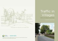
"...<strong>the</strong> environment through which people travel<br />
whe<strong>the</strong>r by car, bus, cycle, horseback or on foot is<br />
becoming more important as safety and traffic<br />
congestion issues begin to dictate how road design is<br />
altered to bring about changes in driving behaviour,<br />
removing traffic from villages and ensure that it can<br />
keep moving.<br />
I think anything that can be done to recognise <strong>the</strong><br />
historic importance of routes should be welcome and<br />
that any traffic hierarchy model should include in its<br />
criteria <strong>the</strong> importance of <strong>the</strong> history and use of routes."<br />
Jo Burgon, Travel Group Chairman,<br />
The National Trust<br />
"The historic environment can easily be eroded<br />
by a plethora of unnecessary signs. Careful use<br />
of signs and road markings, and retention of items of<br />
interest such as rural fingerposts, not only reinforces<br />
character but can form part of a successful traffic<br />
management approach."<br />
Jenny Frew, Senior Policy Officer, Transport,<br />
English Heritage
<strong>Dorset</strong>’s landscape is one of <strong>the</strong> most precious and<br />
varied in <strong>the</strong> country – with a wealth of statutory<br />
designations to prove it! These reflect not only <strong>the</strong><br />
tremendously rich natural environment, but also <strong>the</strong><br />
historical built environment as well. Inextricably linked to<br />
both are <strong>the</strong> man made routes across <strong>the</strong> county – some<br />
established thousands of years ago. Many of <strong>the</strong>se routes,<br />
along with <strong>the</strong> characteristic features that have developed<br />
alongside <strong>the</strong>m, have an intrinsic and historical value.<br />
Over recent years, traffic volume and speed has<br />
increased considerably, resulting in concerns over<br />
environmental impacts and safety. The way we manage<br />
our network of highway routes has huge implications for<br />
our communities, visitors and our environment. It is of<br />
course essential that we ensure <strong>the</strong> safety of all highway<br />
users. It is equally essential however that we minimise,<br />
or better still reduce, <strong>the</strong> detrimental engineered impact<br />
of highway management and use on our countryside. We<br />
need to keep <strong>Dorset</strong>’s landscape special for all to enjoy<br />
now and in <strong>the</strong> future.<br />
<strong>Our</strong> rural roads are being urbanised and degraded by an<br />
increasing quantity of signs, kerbs, road markings and<br />
o<strong>the</strong>r street furniture. We know that we can do better;<br />
indeed, in <strong>Dorset</strong> we have learnt much about<br />
incorporating highways into high quality urban design. It<br />
is time we translated <strong>the</strong>se skills in <strong>the</strong> rural setting. It is<br />
a policy objective of <strong>the</strong> <strong>Dorset</strong> <strong>AONB</strong> Management Plan<br />
to ensure that road design, signage and maintenance are<br />
sympa<strong>the</strong>tic to <strong>the</strong> character of rural roads in <strong>the</strong> <strong>AONB</strong>.<br />
Responding to this and through <strong>the</strong> <strong>Dorset</strong> <strong>AONB</strong><br />
Partnership, working jointly with <strong>Dorset</strong> County Council<br />
as Local Highway Authority, a commitment has been<br />
Foreword<br />
made to develop new approaches to highways. This<br />
study is <strong>the</strong> first step; it catalogues <strong>the</strong> issues and how,<br />
with flexibility of thinking, <strong>the</strong>y have been tackled<br />
elsewhere, providing a valuable evidence base. It also<br />
sets <strong>the</strong> <strong>Dorset</strong> scene, highlighting <strong>the</strong> special features<br />
we want to keep. But most of all, this study sets us a<br />
challenge - one that we must work hard to meet.<br />
During <strong>the</strong> extensive contact with o<strong>the</strong>r authorities,<br />
<strong>AONB</strong>s and National Park Authorities made in<br />
researching this study, we have received many requests<br />
for copies of <strong>the</strong> finished report. This is clearly an issue<br />
that resonates across many rural landscapes.<br />
Consequently, we hope that by publishing our findings so<br />
far, we may help encourage o<strong>the</strong>r protected landscape<br />
teams and local highway authorities to take up <strong>the</strong> challenge.<br />
I look forward to working with all <strong>the</strong> partners in <strong>the</strong><br />
ongoing work in <strong>Dorset</strong>. <strong>Our</strong> intended result is to bring<br />
forward design and management guidance that will<br />
inform <strong>the</strong> implementation of transport network<br />
improvements and development with designs that are<br />
appropriate to <strong>Dorset</strong>’s local context and reinforce local<br />
distinctiveness throughout <strong>the</strong> county.<br />
Councillor Hilary Cox<br />
Environment Portfolio Holder,<br />
<strong>Dorset</strong> County Council<br />
<strong>Dorset</strong> <strong>AONB</strong> Partnership<br />
Board Member<br />
7
Chapter 1: Executive Summary<br />
8 8<br />
1.1 Setting <strong>the</strong> scene<br />
Chapter 1: Executive Summary<br />
1.1.1 <strong>Rural</strong> <strong>Dorset</strong> has a high quality built, cultural and<br />
natural heritage envied by many, with a great<br />
diversity of landscapes. The county’s combination<br />
of countryside, villages, small towns and coastline<br />
contributes to a high quality of life for residents<br />
and visitors.<br />
1.1.2 Roads are an intrinsic part of <strong>the</strong> landscape which<br />
surrounds us. Most roads and lanes are much<br />
older than <strong>the</strong> buildings which line <strong>the</strong>m and<br />
evidence of Roman and older routes remain in <strong>the</strong><br />
county today. Which came first – <strong>the</strong> river crossing<br />
at which a village grew up, or <strong>the</strong> route to connect<br />
<strong>the</strong> existing villages?<br />
1.1.3 The county’s highly prized environment is not<br />
without significant threats to its well-being and <strong>the</strong><br />
rural roads that lace it are no exception to this.<br />
Traffic volumes continue to rise across this<br />
network, and as congestion worsens on <strong>the</strong> major<br />
roads, traffic is finding alternative, less suitable<br />
routes. The rising public awareness of new tourist<br />
destinations is resulting in new travel patterns and<br />
larger numbers of visitors to <strong>the</strong> county. This is<br />
compounded by <strong>the</strong> county’s fast population<br />
growth expanding into a largely unimproved<br />
road network.<br />
<strong>Rural</strong> <strong>Dorset</strong> is famed for <strong>the</strong> quality of its environment<br />
1.1.4 Traditional responses to <strong>the</strong> pressures of<br />
increasing traffic volumes on narrow, unimproved<br />
roads were to widen and straighten <strong>the</strong>m. These<br />
traditional ‘improvement’ approaches have led to<br />
<strong>the</strong> proliferation of signs and road markings<br />
which are not always sympa<strong>the</strong>tic to <strong>the</strong> rural<br />
environment. They have also led to <strong>the</strong> character,<br />
ecology and archaeology of rural areas being<br />
damaged. Such engineered improvements can<br />
lead to increased vehicle speeds and can deter<br />
travel by horseriders, walkers and cyclists. It is<br />
unlikely that <strong>the</strong>se outcomes were intentional<br />
but instead reflect <strong>the</strong> current incremental,<br />
engineered, crisis-response approach to rural<br />
road management.<br />
1.2 The first step<br />
1.2.1 The <strong>Dorset</strong> <strong>AONB</strong> (D<strong>AONB</strong>) Management Plan<br />
identified many of <strong>the</strong> above issues as being in<br />
conflict with <strong>the</strong> statutory duty to conserve and<br />
enhance <strong>the</strong> <strong>AONB</strong>. This led to <strong>the</strong> inclusion in <strong>the</strong><br />
Plan of an objective (policy TR4) to:<br />
‘Ensure that road design, delivery, signage<br />
and maintenance are sympa<strong>the</strong>tic to <strong>the</strong><br />
special character of rural roads and<br />
<strong>the</strong> <strong>AONB</strong>’
1.2.2 This document, <strong>Reclaiming</strong> our <strong>Rural</strong> <strong>Highways</strong>,<br />
is <strong>the</strong> first step towards ensuring that <strong>the</strong> special<br />
character of rural roads is understood and taken<br />
account of in design and management decisions.<br />
It draws toge<strong>the</strong>r information on rural road<br />
management from a wide variety of sources and<br />
outlines each of <strong>the</strong> pertinent issues using case<br />
studies from <strong>Dorset</strong> and elsewhere to identify<br />
solutions. The topics covered are often equally<br />
applicable to o<strong>the</strong>r parts of rural England, and indeed,<br />
in essence to Scotland, Nor<strong>the</strong>rn Ireland and Wales.<br />
1.2.3 <strong>Reclaiming</strong> our <strong>Rural</strong> <strong>Highways</strong> is aimed at all<br />
those with an interest in rural roads and <strong>the</strong>ir<br />
management. It acts as a significant<br />
contemporary reference for <strong>the</strong> wide range of<br />
interests and professions that are involved with<br />
<strong>the</strong> functions, management and work of rural areas.<br />
In practice, it is intended to inform future design<br />
and conservation-led decision-making by Local<br />
Planning Authorities and Local Highway Authorities.<br />
1.3 New approaches to rural roads<br />
1.3.1 Whilst <strong>the</strong> issue of looking after rural roads is a<br />
complex one, <strong>the</strong>re are many examples which<br />
illustrate that innovative and sympa<strong>the</strong>tic<br />
approaches to problem solving are possible. Of<br />
particular interest are approaches which:<br />
• create shared spaces, where <strong>the</strong> traditional<br />
distinction between space for pedestrians and<br />
space for vehicles is minimised or abolished;<br />
• use inherently rural features such as hedges,<br />
banks, walls, <strong>the</strong> position of buildings and bridges<br />
as features to naturally calm traffic;<br />
• ensure that clutter is kept to <strong>the</strong> minimum<br />
necessary for <strong>the</strong> safe operation of <strong>the</strong> road network;<br />
• ensure that whatever works are carried out conserve<br />
and enhance <strong>the</strong> local distinctiveness of <strong>the</strong> county.<br />
1.3.2 <strong>Dorset</strong> is recognised as a county in which leading<br />
examples of <strong>the</strong> design and layout of new, high<br />
quality, locally distinctive, development in rural<br />
areas can be found. It is <strong>the</strong> aspiration of <strong>the</strong><br />
<strong>Dorset</strong> <strong>AONB</strong> Partnership that <strong>Reclaiming</strong> our<br />
<strong>Rural</strong> <strong>Highways</strong> will ensure that our rural road<br />
designs are as good as <strong>the</strong>se award-winning<br />
residential and mixed-use developments.<br />
1.4 Future steps<br />
1.4.1 <strong>Reclaiming</strong> our <strong>Rural</strong> <strong>Highways</strong> is divided into<br />
four sections.<br />
1.4.2 The first section provides an overview of <strong>the</strong> key<br />
issues. It shows how roads form an important part<br />
of <strong>Dorset</strong>’s landscapes and examines how road<br />
Executive Summary<br />
design can influence and alter <strong>the</strong> landscape and<br />
streetscape. It discusses how <strong>Dorset</strong>’s recognised<br />
success in designing new residential estates with<br />
innovative highway layouts can give pointers to<br />
improve rural road design.<br />
1.4.3 The second section discusses and evaluates <strong>the</strong><br />
wide range of problems that affect rural roads,<br />
and methods which have been applied to manage<br />
<strong>the</strong>m. The sometimes significant drawbacks to<br />
adopting traditional approaches are explained.<br />
Included are case study examples from<br />
elsewhere in <strong>the</strong> country that demonstrate<br />
sympathy with rural character, such as:<br />
• The de-cluttering initiatives in <strong>the</strong> Lake District;<br />
• The alternative methods of protecting and<br />
maintaining rural lanes in West Kent;<br />
• The trial to remove white carriageway centre line<br />
markings in Wiltshire villages;<br />
• Traditional fingerpost restoration and renewal in<br />
<strong>the</strong> Quantocks; and<br />
• The streetscape enhancements pioneered in Bury<br />
St Edmunds and o<strong>the</strong>r historic towns.<br />
1.4.4 The third section discusses <strong>the</strong> distinctive<br />
character of <strong>Dorset</strong>’s roads. There is a great<br />
variation in <strong>the</strong>ir character, from those across<br />
open heathland in Purbeck to <strong>the</strong> sunken lanes of<br />
West <strong>Dorset</strong>. A great deal of <strong>the</strong> character of<br />
<strong>the</strong>se roads emanates from <strong>the</strong> locally distinctive<br />
<strong>Dorset</strong> features which bound <strong>the</strong>m such as <strong>the</strong><br />
hedges, milestones and pre-1964 fingerposts.<br />
1.4.5 The fourth and concluding section advocates a<br />
series of recommendations for future action<br />
including:<br />
• <strong>the</strong> preparation of a guidance document to<br />
promote a better public realm through improved<br />
highway design which responds to local context<br />
and embraces local distinctiveness;<br />
• <strong>the</strong> creation of a hierarchy of highways – all of<br />
which respect <strong>the</strong> rural environment – and<br />
includes heavy vehicle, coach and tourist<br />
routeing, strategic co-ordination of direction<br />
signing for all vehicles and <strong>the</strong> reassessment of<br />
speed limits;<br />
• a checklist of items to take into account when<br />
undertaking projects which will affect rural roads;<br />
• <strong>the</strong> increased involvement of parish councils as<br />
local agents for positive change; and<br />
• <strong>the</strong> inclusion of policy statements in Local<br />
Transport Plans, Local Development Frameworks<br />
and Regional Spatial Strategies to reinforce <strong>the</strong><br />
need for action.<br />
Chapter 1: Executive Summary<br />
9
Section I: Overview of issues and problems<br />
Milton Abbas: Roads form part of <strong>Dorset</strong>’s famous built and natural heritage<br />
• Rationale for <strong>the</strong> study<br />
• Aim of <strong>the</strong> study<br />
• The importance of <strong>Dorset</strong>’s environment<br />
• The importance of <strong>Dorset</strong>’s rural roads<br />
• The importance of design<br />
• Insensitive design of rural roads<br />
• Policy context<br />
Chapter 1. Introduction
“The country road was once part of <strong>the</strong> distinctive and unspoiled character of our<br />
countryside, blending into <strong>the</strong> countryside Chapter and indistinguishable 1: Introduction from it...car drivers would<br />
'feel' <strong>the</strong> road and visually 'read' <strong>the</strong> road to determine <strong>the</strong> appropriate speed to travel... in<br />
recent decades <strong>the</strong> character of many rural roads has incrementally changed - more traffic...<br />
more kerbing and additional roadside clutter” [Friends of <strong>the</strong> Lake District (FLD) 2005:2]<br />
Chapter 2: Overview of issues and problems<br />
2.1 Rationale for <strong>the</strong> study<br />
2.1.1 Local authorities, along with a series of o<strong>the</strong>r<br />
bodies, have a statutory duty of care to Areas of<br />
Outstanding Natural Beauty (<strong>AONB</strong>s). Section 85<br />
of <strong>the</strong> Countryside & Rights of Way Act 2000<br />
states that:<br />
‘In exercising or performing any functions in<br />
relation to, or so as to affect, land in an area<br />
of outstanding natural beauty, a relevant<br />
authority [Minister of <strong>the</strong> Crown, public<br />
body, statutory undertaker or person holding<br />
public office] shall have regard to <strong>the</strong><br />
purpose of conserving and enhancing <strong>the</strong><br />
natural beauty of <strong>the</strong> area of outstanding<br />
natural beauty.’<br />
2.1.2 The same Act required a Management Plan to be<br />
prepared for each <strong>AONB</strong> area by <strong>the</strong> local<br />
authorities which covered <strong>the</strong>m. These Plans both<br />
set out issues affecting <strong>the</strong> area and ways in<br />
which <strong>the</strong>se are to be tackled. The consultation on<br />
<strong>the</strong> <strong>Dorset</strong> <strong>AONB</strong> (D<strong>AONB</strong>) Draft Management<br />
Plan found that rural road management was a key<br />
concern and this led to incorporation of <strong>the</strong><br />
East Lulworth<br />
issue within <strong>the</strong> document. The vision of <strong>the</strong><br />
completed Plan notes that:<br />
‘With new approaches from practitioners<br />
and policymakers and a change in <strong>the</strong> way<br />
people use <strong>the</strong> road network, it can withstand<br />
<strong>the</strong> pressures put upon it by traffic and<br />
non-motorised users and remain a<br />
complementary element of <strong>the</strong> <strong>Dorset</strong> <strong>AONB</strong>.<br />
With a variety of travel options, <strong>the</strong> entire<br />
network of roads, footpaths, cycleways and<br />
bridleways toge<strong>the</strong>r with safe and convenient<br />
public transport provides sustainable access<br />
and movement around <strong>the</strong> <strong>AONB</strong>’ [D<strong>AONB</strong><br />
2004:42]<br />
As a result, a series of aims and policy objectives<br />
were included in <strong>the</strong> Management Plan on <strong>the</strong><br />
subject, as outlined in Table 2.1 on <strong>the</strong> next page.<br />
Chapter 2. Overview of issues and problems<br />
11
Chapter 2. Overview of issues and problems<br />
1212<br />
Section I: Overview of issues and problems<br />
The Management Plan set out <strong>the</strong> aims and<br />
objectives to improve rural road management<br />
techniques<br />
2.1.3 Table 2.1: Management Plan aims and<br />
objectives for rural roads[D<strong>AONB</strong> 2004:100]<br />
Aims<br />
• Provide sustainable travel options for residents<br />
and visitors<br />
• Reduce <strong>the</strong> impact of traffic within <strong>the</strong> <strong>AONB</strong><br />
and promote a better balance of road use<br />
• Ensure that <strong>the</strong> location and management of<br />
route and road corridors has regard to <strong>the</strong><br />
<strong>AONB</strong> primary purpose of conserving and<br />
enhancing natural beauty<br />
Objectives<br />
Policy TR1<br />
Support <strong>the</strong> development of options for greater<br />
transport choice<br />
Policy TR2<br />
Develop and promote a fully integrated transport<br />
system that fulfils <strong>the</strong> needs of residents and<br />
visitors to <strong>the</strong> <strong>AONB</strong><br />
Policy TR3<br />
Support and develop initiatives that change<br />
priorities for road use on rural roads, making <strong>the</strong>m<br />
safer for non-car users<br />
Policy TR4<br />
Ensure that road design, delivery, signage and<br />
maintenance are sympa<strong>the</strong>tic to <strong>the</strong> special<br />
character of rural roads and <strong>the</strong> <strong>AONB</strong><br />
Policy TR6<br />
Ensure that <strong>the</strong> environmental and visual impact<br />
of car parking is minimised in <strong>the</strong> <strong>AONB</strong><br />
2.1.4 Current approaches to improving road design and<br />
<strong>the</strong> need for action were reviewed at <strong>the</strong> three<br />
respective Heritage Committees for North <strong>Dorset</strong>,<br />
Purbeck and West <strong>Dorset</strong> [West <strong>Dorset</strong> DC 2004,<br />
Purbeck DC 2004, North <strong>Dorset</strong> DC 2004].<br />
Positive feedback from <strong>the</strong>se led to <strong>the</strong><br />
commissioning of this study. A senior level<br />
meeting on <strong>the</strong> design and management of rural<br />
roads was held on <strong>the</strong> 27th January 2005 at <strong>the</strong><br />
Brownsword Hall in Poundbury, Dorchester to<br />
ensure <strong>the</strong> involvement of all <strong>the</strong> major agencies.<br />
2.1.5 It is now recognised that, in order to achieve<br />
acceptable levels of highway design quality, it<br />
is necessary to abandon what is sometimes<br />
termed <strong>the</strong> ‘Scalextric’ approach to design.<br />
Traditionally this has involved taking standard<br />
designs with predetermined cross-section widths<br />
and construction depths and implementing <strong>the</strong>se<br />
according to a rigid hierarchy. Traditionally each<br />
road type in a hierarchy had three components:<br />
• Firstly, it had standardised, prescribed, surface<br />
dimensions deemed sufficient to accommodate<br />
<strong>the</strong> volume and types of users identified as<br />
appropriate to its place in <strong>the</strong> hierarchy;<br />
• Secondly, it had to be structurally strong enough<br />
to withstand <strong>the</strong> axle loads imposed on it for a<br />
determined period;<br />
• Thirdly, it had basic visual characteristics<br />
determined by its function in <strong>the</strong> hierarchy.<br />
2.1.6 In short, <strong>the</strong> three components are:<br />
1. Width (dimensions and geometry)<br />
2. Depth (construction layers)<br />
3. Visual characteristics contributing to<br />
local distinctiveness<br />
2.1.7 The drive for higher quality design has<br />
necessitated a review of <strong>the</strong> approach taken to<br />
<strong>the</strong> third of <strong>the</strong>se components – <strong>the</strong> visual<br />
characteristics of <strong>the</strong> highway. This study<br />
principally examines how this third component<br />
can be used to influence driver behaviour and<br />
ensure <strong>Dorset</strong>’s rural roads are locally distinctive.<br />
2.1.8 This study specifically examines routes available<br />
for <strong>the</strong> public’s use across <strong>the</strong> D<strong>AONB</strong>. This<br />
comprises all public roads, including unmetalled<br />
ones, toge<strong>the</strong>r with <strong>the</strong> Public Rights of Way<br />
(PROW) network of byways, bridleways and<br />
footpaths. Routes in small towns and villages are<br />
included, since <strong>the</strong>y sit within rural contexts<br />
[Roberts James, 2001]. It additionally has<br />
relevance for <strong>the</strong> A35 Trunk Road, which<br />
contains several sections of unimproved single<br />
carriageway (although rural Trunk Roads are not<br />
included in <strong>the</strong> Institute of <strong>Highways</strong> & Trunk
Section I: Overview of issues and problems<br />
Roads Transportation (IHT) definition of rural<br />
roads [Friends of <strong>the</strong> Lake District (FLD) 2005)].<br />
2.1.9 Although prepared for <strong>the</strong> D<strong>AONB</strong> Partnership,<br />
most of <strong>the</strong> principles – and solutions – examined<br />
have equal relevance for <strong>the</strong> rest of <strong>the</strong> rural<br />
county.<br />
2.2 Aim of study<br />
2.2.1 The study’s aims were as follows:<br />
(i) To collate information on methods used to<br />
manage rural routes elsewhere and assess <strong>the</strong>ir<br />
applicability to <strong>Dorset</strong>;<br />
(ii) To investigate route network hierarchies<br />
appropriate for <strong>the</strong> rural area;<br />
(iii) To characterise <strong>the</strong> rural routes in <strong>Dorset</strong><br />
according to <strong>the</strong>ir landscape character setting,<br />
historic development, or features critical to<br />
management;<br />
(iv) To identify streetscape features unique or<br />
special to <strong>Dorset</strong> requiring specific management<br />
or conservation; and<br />
(v) To recommend a way forward, including items for<br />
inclusion within a protocol or design guide document .<br />
2.3 The importance of <strong>Dorset</strong>’s<br />
environment<br />
2.3.1 In a recent survey, safeguarding <strong>Dorset</strong>’s unique<br />
environment was identified by residents as <strong>the</strong> top<br />
priority for action [<strong>Dorset</strong> Strategic Partnership<br />
2004]. <strong>Dorset</strong> is endowed with a great diversity of<br />
landscape character [Countryside Commission<br />
1999] and <strong>the</strong> county enjoys some of <strong>the</strong> highest<br />
quality rural and built environments in <strong>the</strong> country.<br />
2.3.2 This environmental quality is recognised with a<br />
range of designations to protect it. 53% of <strong>the</strong><br />
county is situated within Areas of Outstanding<br />
Natural Beauty (<strong>AONB</strong>s) – a proportion of <strong>the</strong><br />
county second only to that of East Sussex [<strong>Dorset</strong><br />
CC 2003]. 42% of <strong>the</strong> county is within <strong>the</strong> <strong>Dorset</strong><br />
<strong>AONB</strong> (D<strong>AONB</strong>) [<strong>Dorset</strong> CC 2004a] and 11% lies<br />
within <strong>the</strong> Cranborne Chase & West Wiltshire<br />
Downs <strong>AONB</strong>, which straddles <strong>the</strong> county<br />
boundary.<br />
2.3.3 The area covered by <strong>the</strong> D<strong>AONB</strong> is illustrated in<br />
Figure 2.1 overleaf. Broadly speaking, it stretches<br />
from Swanage in <strong>the</strong> east to Lyme Regis in <strong>the</strong><br />
west and from Beaminster to Blandford. This is a<br />
rich and varied landscape composed of chalk<br />
downland, heathland, coastal habitats and <strong>the</strong><br />
wetlands around Poole Harbour, giving <strong>the</strong> <strong>AONB</strong><br />
its special character. The D<strong>AONB</strong> Management<br />
Plan has an overall vision for <strong>the</strong> area to be:<br />
‘a thriving landscape of beauty, health and<br />
heritage that all can enjoy. An inspiration for<br />
today, an opportunity for tomorrow’<br />
[D<strong>AONB</strong> 2004:40]<br />
2.3.4 Much of <strong>the</strong> county has additional ecological,<br />
cultural heritage or landscape designations. The<br />
coastal fringe is a UNESCO-designated World<br />
Heritage Site; more generally <strong>the</strong> coastal areas<br />
are designated as Heritage Coasts. The county’s<br />
ecological diversity is acknowledged by <strong>the</strong><br />
designation of EU Special Areas of Conservation<br />
(SACs) and Special Protection Areas (SPAs),<br />
National Nature Reserves and Sites of Special<br />
Scientific Interest (SSSI). The built environment is<br />
protected by a significant number of listed<br />
building designations and many settlements<br />
have conservation areas. The national and<br />
international designations are a key attraction for<br />
visitors to <strong>Dorset</strong>.<br />
2.3.5 Looking after <strong>the</strong>se cherished landscapes is<br />
challenging and <strong>the</strong> importance of doing so is<br />
recognised in <strong>the</strong> <strong>Dorset</strong> Community Strategy:<br />
‘<strong>Our</strong> cultural and historic heritage is also<br />
important if we are to value and utilise our<br />
environmental resources in <strong>the</strong> widest sense.<br />
Restoration, renewal and appropriate<br />
management of <strong>the</strong> historic vernacular, built<br />
and natural environments must continue to<br />
be encouraged across all areas of<br />
<strong>Dorset</strong>….Ongoing measures must be taken to<br />
safeguard <strong>Dorset</strong>'s heritage including:<br />
research, understanding and protection of<br />
ancient monuments; maritime archaeology<br />
and listed buildings; supporting museums,<br />
managing and improving access to maps<br />
archives and records; protection of built<br />
heritage through conservation areas;<br />
appropriate development of towns and<br />
villages through enhancement schemes; and<br />
design guidance that set quality standards,<br />
respects local distinctiveness and<br />
encourages local provenance….Recognising<br />
<strong>the</strong> value of our landscapes is a beginning.<br />
However, conserving our environment both<br />
locally and globally is a serious concern that<br />
requires everyone to act responsibly.’<br />
[<strong>Dorset</strong> Strategic Partnership 2004:51]<br />
Chapter 2. Overview of issues and problems<br />
13
Chapter 2. Overview of issues and problems<br />
14 14<br />
Section I: Overview of issues and problems
Section I: Overview of issues and problems<br />
2.4 The importance of <strong>Dorset</strong>’s<br />
rural roads<br />
Chaldon Herring: Roads form part of <strong>Dorset</strong>’s<br />
protected landscapes<br />
2.4.1 The large network of rural roads reflects <strong>the</strong><br />
diversity of <strong>the</strong> landscape within which <strong>the</strong>y sit.<br />
They contribute to <strong>the</strong> special quality of <strong>Dorset</strong>’s<br />
rural environment [D<strong>AONB</strong> 2004] and are<br />
described as being ‘just as much a part of <strong>the</strong><br />
countryside as <strong>the</strong> fields and hedgerows’’<br />
[CPRE 1999]. Their manifold importance is noted<br />
in <strong>the</strong> <strong>Dorset</strong> <strong>AONB</strong> Management Plan, as follows:<br />
‘<strong>Dorset</strong>’s roads and routeways have evolved<br />
from long centuries of human use with great<br />
variations of style and character.<br />
Recognition of <strong>the</strong> importance of rural<br />
routes, <strong>the</strong> contribution <strong>the</strong>y make to<br />
people’s quality of life and <strong>the</strong>ir role in <strong>the</strong><br />
increasingly diverse rural economy is a key<br />
factor in <strong>the</strong> <strong>Dorset</strong> <strong>AONB</strong>. Roads are<br />
comfortably set within <strong>the</strong> landscape,<br />
complementing natural and cultural<br />
heritage. Many provide special habitats for<br />
plants and wildlife’ [D<strong>AONB</strong> 2004:42]<br />
2.4.2 The routes for movement in <strong>the</strong> countryside allow<br />
rural dwellers access to services and facilities and<br />
<strong>the</strong>y are used for <strong>the</strong> complete range of journey<br />
purposes [DETR & MAFF 2000]. This can be<br />
broken down into:<br />
• <strong>Rural</strong> to urban movements: functional trips<br />
including commuting<br />
• Urban to rural movements: reverse commuting<br />
and leisure visits to <strong>the</strong> countryside<br />
• Urban to urban movements: pressure on<br />
unimproved major roads and minor routes used<br />
for ‘rat running’<br />
• <strong>Rural</strong> to rural movements: functional daily travel<br />
between <strong>the</strong> local facilities [CA 2003b]<br />
They are used by a wide mix of transport modes<br />
which includes cyclists, walkers and horse riders<br />
as well as cars, motorbikes, buses and goods<br />
vehicles. The rural street or lane is a place for<br />
social interaction and a location for markets and<br />
fairs and is <strong>the</strong>refore an integral part of <strong>the</strong> rural<br />
community structure [Sustrans 2004a].<br />
South Street, Bridport: <strong>Rural</strong> streets are a location<br />
for markets and fairs<br />
2.4.3 This wide-ranging set of uses creates conflicts<br />
between users and a complex set of problems.<br />
Some attempts to deal with rural road<br />
problems, such as engineering improvements,<br />
can lead to secondary problems, such as fear and<br />
danger for non-motorised road users. The<br />
relatively poor rural public transport network<br />
implies that much long-distance travel will be<br />
achieved through personal, motorised mobility<br />
(private cars as well as, for instance, scooter<br />
schemes giving mobility to young people[CA<br />
2003a]). This affects rural road decision-making<br />
on issues such as acceptable vehicle speeds,<br />
pollution and ways in which roads can be shared<br />
between motorised and non-motorised users<br />
[D<strong>AONB</strong> 2004, CPRE 2004]. The assumption that<br />
personal mobility will remain dominant also<br />
has implications for funding. The complex web of<br />
problems which can afflict rural roads is illustrated<br />
in Figure 2.2 on page 14.<br />
Chapter 2. Overview of issues and problems<br />
15
Chapter 2. Overview of issues and problems<br />
16 16<br />
Section I: Overview of issues and problems<br />
Figure 2.2: The web of rural road problems<br />
2.4.4 In relation to o<strong>the</strong>r shire counties, <strong>Dorset</strong> is of an<br />
average size and has a small population;<br />
however, it is forecast to experience <strong>the</strong> second<br />
fastest population growth in England & Wales<br />
[<strong>Dorset</strong> CC 2003]. Reconciling <strong>the</strong> transport<br />
needs of <strong>the</strong> population with <strong>the</strong> desire to protect<br />
<strong>Dorset</strong>’s important natural and built environment<br />
is <strong>the</strong>refore one of <strong>the</strong> major issues for <strong>the</strong><br />
D<strong>AONB</strong>.<br />
2.4.5 Whilst an absence of motorways and<br />
lack of dual carriageways has reduced <strong>the</strong> large<br />
scale impacts of roads in <strong>the</strong> landscape, <strong>the</strong>re is<br />
increasing pressure on <strong>the</strong> rural road network as<br />
a whole. Proposals exist for new roads within <strong>the</strong><br />
D<strong>AONB</strong>, such as <strong>the</strong> A354 Dorchester Road<br />
Relief Road in Weymouth, and if built, this will<br />
impact on <strong>the</strong> South <strong>Dorset</strong> Ridgeway<br />
[D<strong>AONB</strong> 2004]. Despite generally low night-time<br />
light emissions across <strong>the</strong> D<strong>AONB</strong>, some of <strong>the</strong><br />
high emissions are attributable to street lighting.<br />
The prominent lighting of <strong>the</strong> Handley Cross<br />
roundabout is an o<strong>the</strong>rwise unlit area has<br />
led to it being known locally as <strong>the</strong> ‘UFO landing<br />
pad’ [Burden and Le Pard 1996].<br />
The A35 between Dorchester and Bere Regis is one<br />
of <strong>the</strong> few dual carriageways in <strong>the</strong> county, but<br />
where it ends, <strong>the</strong> trunk road reverts to unimproved<br />
single carriageway
Section I: Overview of issues and problems<br />
2.4.6 Across <strong>the</strong> county, <strong>the</strong> negative impacts of roads<br />
and traffic on rural communities and <strong>the</strong><br />
environment alike are keenly felt [<strong>Dorset</strong> <strong>AONB</strong><br />
2004]. Between 1977 and 1997 traffic volumes in<br />
<strong>Dorset</strong> have doubled [<strong>Dorset</strong> CC 1999: 40], and in<br />
similarity to <strong>the</strong> national pattern, <strong>the</strong> fastest traffic<br />
growth has taken place in rural areas [DETR &<br />
MAFF 2000, CPRE 2004]. Traffic continues to<br />
increase by 2.5% per year [D<strong>AONB</strong> 2004]. As<br />
congestion rises on <strong>the</strong> major road network,<br />
greater volumes of traffic are anticipated to ‘trickle<br />
down’ onto more minor routes [CA 2003a] and<br />
<strong>Dorset</strong>’s coastal areas in particular are already<br />
subject to great seasonal variations in traffic<br />
volume. Accident rates, too, are falling more<br />
slowly in rural areas than urban areas; those<br />
accidents that do occur are more likely to involve<br />
fatalities, regardless of <strong>the</strong> road user involved<br />
[DETR & MAFF 2000:65].<br />
A351, Sandford: traffic flows continue to rise<br />
on rural roads<br />
2.5 The importance of design<br />
Post-war residential estates have been criticised for<br />
having insufficient regard for highway design and<br />
local context<br />
2.5.1 Concern over <strong>the</strong> quality of <strong>the</strong> built and natural<br />
environment has mounted over recent years, with<br />
post-war residential estates – especially those<br />
from <strong>the</strong> 1970s and 1980s – having been<br />
particularly criticised as being anonymous,<br />
lacking in identity and inappropriate for rural<br />
settings [DTLR & CABE 2001]. Concern has also<br />
been growing regarding <strong>the</strong> deleterious effects of<br />
insensitive engineering improvements on rural<br />
roads. In both cases insufficient regard to design<br />
matters is held as <strong>the</strong> major cause.<br />
2.5.2 National guidance for local road design is<br />
currently fragmented. The Better Streets, Better<br />
Places [ODPM & DfT 2003] study, published in<br />
June 2003, investigated <strong>the</strong> connections between<br />
<strong>the</strong> application of rigid highway designs and <strong>the</strong><br />
successful development of quality, high density<br />
places. The authors found that no suitable<br />
guidance existed for ei<strong>the</strong>r dealing with existing<br />
rural roads or <strong>the</strong> design of proposed new roads<br />
for local traffic.<br />
2.6 Insensitive design of rural<br />
roads<br />
2.6.1 In <strong>the</strong> absence of o<strong>the</strong>r more suitable documents,<br />
design guidance intended for trunk roads (<strong>the</strong><br />
Design Manual for Roads and Bridges (DMRB))<br />
or residential estate roads (Design Bulletin 32<br />
(DB32)) has been inappropriately used. This was<br />
found to have compromised <strong>the</strong> quality of local<br />
roads, and in particular, <strong>the</strong>ir suitability for use by<br />
pedestrians and cyclists. Better Streets, Better<br />
Places also identified that insufficient emphasis<br />
has historically been placed on designing and<br />
managing streets which would be vibrant places<br />
in which people want to stop and spend time.<br />
There has instead been a concentration on<br />
simply designing routes for accommodating traffic<br />
movement and flow.<br />
2.6.2 The status of <strong>the</strong> various strands of guidance is<br />
often blurred. It has been noted that ‘what is<br />
frequently unclear are <strong>the</strong> circumstances in which<br />
[<strong>the</strong> installation of highway features] is required by<br />
law, is recommended in <strong>the</strong> form of official<br />
‘guidance’ or is simply highway engineers’ long<br />
established practice – or of increasing pertinence,<br />
where <strong>the</strong>ir installation might be deemed by a<br />
court of law, enjoying <strong>the</strong> benefit of hindsight after<br />
an accident, to be ‘reasonable’ [Adams 2005: 42].<br />
The latter point has risen in importance, with<br />
government recently consulting on <strong>the</strong><br />
introduction of a corporate manslaughter offence,<br />
which could lead to senior management being<br />
imprisoned for ‘conduct falling far below what can<br />
reasonably be expected of <strong>the</strong> corporation in <strong>the</strong><br />
circumstances’ [ibid: 43]<br />
2.6.3 Conflicting priorities between local highway and<br />
local planning authorities - often part of <strong>the</strong> same<br />
council – were found to lead to developments<br />
being recommended for planning approval, but<br />
being objected to by highway engineers following<br />
conventional highway design principles. The<br />
major reason behind this was that conventional<br />
Chapter 2. Overview of issues and problems<br />
17
Chapter 2. Overview of issues and problems<br />
18 18<br />
Section I: Overview of issues and problems<br />
<strong>Dorset</strong> has an extensive network of rural roads and tracks divided into a series of categories<br />
(illustrated above). However, <strong>the</strong>re is no guidance on <strong>the</strong> design and management which<br />
specifically relates to many of <strong>the</strong>se roads (see below).
Section I: Overview of issues and problems<br />
highway designs are well-established and<br />
considered easier to defend in a court of law,<br />
should a litigious claim be brought against <strong>the</strong><br />
authority. To smooth <strong>the</strong> progress of applications,<br />
house builders have often responded by avoiding<br />
innovation and bringing forward traditional layouts<br />
which tend to have lower dwelling densities and<br />
inherently higher traffic speeds [CABE & DfT 2003].<br />
2.6.4 Best practice case studies and <strong>the</strong> Better Streets,<br />
Better Places report have shown that:<br />
• Schemes should in <strong>the</strong> first instance be about<br />
creating successful places overall, not about<br />
tackling single issues;<br />
• Designers should consider all potential uses of<br />
<strong>the</strong> space;<br />
• Investment in quality and attention to detail can<br />
maximise a scheme's benefits;<br />
• Working toge<strong>the</strong>r is also fundamental to success<br />
- regardless of <strong>the</strong> professional background of <strong>the</strong><br />
contributors;<br />
• Good design can usually be achieved within<br />
existing regulations; and<br />
• Designers sometimes need to go back to first<br />
principles and look at <strong>the</strong> reasons behind<br />
guidance - ra<strong>the</strong>r than simply do things <strong>the</strong> way<br />
<strong>the</strong>y have always been done [ODPM & DfT 2003]<br />
2.7 Policy context<br />
2.7.1 This document is a timely contribution to <strong>the</strong><br />
increasing prominence being given to <strong>the</strong> subject<br />
of rural road management by policymakers.<br />
Recent years have seen a series of policy<br />
responses to <strong>the</strong> problem; at a national level, a<br />
series of research papers and guidance<br />
documents have investigated <strong>the</strong> subject of<br />
highway design. Many of <strong>the</strong>se showcased<br />
<strong>the</strong> successful developments in <strong>Dorset</strong>. Policy<br />
statements have stipulated <strong>the</strong> need to show<br />
greater regard for design in planning. Relevant<br />
documents are set out in Table 2.2 below.<br />
Table 2.2: Improving street design: major relevant policy, guidance and research documents<br />
Date Document Title Relevant aims or content of document<br />
Old-style Planning Policy Guidance Notes (PPGs) and new-style Planning Policy Statements (PPSs)<br />
2000 PPG3 Housing Design residential development which places needs of people before ease<br />
DETR of traffic movement and which creates attractive, high quality living environments<br />
2001 PPG13 Transport ‘The physical form and qualities of a place, shaped – and are shaped by – <strong>the</strong><br />
DETR way it is used and <strong>the</strong> way people and vehicles move through it…places that<br />
work well are designed to be used safely and securely by all in <strong>the</strong> community,<br />
frequently for a wide range of purposes and throughout <strong>the</strong> day and evening’<br />
2004 PPS7 Sustainable Development which respects and where possible enhances local distinctiveness<br />
development in and intrinsic qualities of <strong>the</strong> countryside<br />
rural areas ODPM<br />
2005 PPS1 Delivering Planning policies should promote high quality inclusive design in <strong>the</strong> layout of new<br />
Sustainable developments<br />
Development ODPM<br />
Guidance & Research<br />
1998 Places, Streets and Movement An companion guide to DB32 which gave examples of<br />
DETR innovative design approaches which met prescribed standards<br />
2000 By design–urban design in <strong>the</strong> planning Improving urban design quality<br />
process–towards better practice, DTLR & CABE<br />
2001 Better places to live – a companion guide Improving <strong>the</strong> quality of residential developments<br />
to PPG3, DTLR & CABE<br />
2002 Paving <strong>the</strong> way Critique of how to achieve clean, safe and attractive streets<br />
CABE & ODPM<br />
2003 Better Streets, Better Places Research project into relationship between application of<br />
ODPM & DfT highway standards and creation of well-designed places<br />
Chapter 2. Overview of issues and problems<br />
19
Chapter 2. Overview of issues and problems<br />
20 20<br />
Section I: Overview of issues and problems<br />
2.7.2 Of particular relevance to this study is Better<br />
Streets, Better Places. Its key recommendation<br />
was <strong>the</strong> production of a government-endorsed<br />
guidance document to deal comprehensively with<br />
<strong>the</strong> design, management and adoption of<br />
residential streets, to be known as <strong>the</strong> Manual for<br />
Streets (MfS) [McNulty 2004].<br />
Better Streets, Better Places recommended <strong>the</strong><br />
preparation of a Manual for Streets to raise <strong>the</strong><br />
standard of new and existing road design<br />
2.7.3 The MfS is expected to be a significant departure<br />
from many current design principles enshrined in<br />
existing guidance; it will thus supersede DB32,<br />
Places Streets and Movement and obviate <strong>the</strong><br />
need for <strong>the</strong> current plethora of local guidance.<br />
The local documents are often out-of-date and<br />
relevant sections of <strong>the</strong> existing guidance will be<br />
incorporated into <strong>the</strong> MfS. It is intended that <strong>the</strong><br />
DMRB need no longer be referred to when<br />
designing minor roads or those in residential<br />
areas. Whilst <strong>the</strong> MfS will provide a satisfactory<br />
approach to <strong>the</strong> nationwide issues of highway<br />
construction and geometry (components 1 and 2 of<br />
highway design), local distinctiveness varies from<br />
area to area and this will still require local input.<br />
2.7.4 According to a recent research document, ‘streets<br />
are essential components in <strong>the</strong> urban fabric, <strong>the</strong>y<br />
are places in <strong>the</strong>mselves, <strong>the</strong>y are <strong>the</strong> most<br />
immediate part of <strong>the</strong> public realm and we<br />
encounter <strong>the</strong>m everyday’ [CABE & ODPM 2002].<br />
Efforts to improve <strong>the</strong>m should not solely<br />
concentrate on reducing <strong>the</strong> effect of motor<br />
vehicles. The intention is for <strong>the</strong> MfS to raise <strong>the</strong><br />
quality of life through better minor road design<br />
and through a fundamental change in <strong>the</strong> way<br />
people share and enjoy <strong>the</strong> street. Its production<br />
should lead to design standards which create more<br />
people-orientated streets, community spaces and<br />
in which <strong>the</strong> needs of pedestrians and cyclists will<br />
be accorded a higher priority than present.<br />
Emphasis will be given to placemaking – creating<br />
successful places – and o<strong>the</strong>r issues, such as<br />
reducing crime and anti-social behaviour are<br />
taken into account.<br />
The Manual for Streets is intended to promote design<br />
which creates people-oriented places<br />
2.7.5 Although first envisaged as a tool for improving<br />
<strong>the</strong> design of new residential estate roads, many<br />
of <strong>the</strong> design principles which <strong>the</strong> MfS will contain<br />
will equally apply to o<strong>the</strong>r categories of road. Its<br />
application may include:<br />
• Re-design of existing roads;<br />
• Design of new roads;<br />
• Residential estate roads;<br />
• O<strong>the</strong>r residential roads;<br />
• Local distributor roads;<br />
• Roads in villages; and<br />
• Minor rural roads.<br />
2.7.6 Design codes are being considered by <strong>the</strong> Office<br />
of <strong>the</strong> Deputy Prime Minister (ODPM) as a way to<br />
both speed up <strong>the</strong> planning process and to ensure<br />
suitable forms of development are built.<br />
Adherence to good urban design principles<br />
assists in creating places where people want to<br />
live and work [CABE 2004] and design codes are<br />
seen as a technique to improve <strong>the</strong> quality of<br />
urban design [CABE 2004a, CABE 2004, Weaver<br />
2004], community engagement and speed of<br />
developments [CABE 2004]. They are described<br />
as a set of strict style rules [Weaver 2003].<br />
2.7.7 Design codes have previously been used in<br />
<strong>the</strong> United States and on some housing<br />
developments [CABE 2003, 2004]. Most famously<br />
<strong>the</strong>y have been used at Seaside, Florida (as<br />
featured in <strong>the</strong> film The Truman Show) and at<br />
Poundbury, Dorchester. Both developments<br />
adhere to strict design rules.
Section I: Overview of issues and problems<br />
2.7.8 Of particular interest for this study is that design<br />
code requirements can – amongst o<strong>the</strong>r things –<br />
stipulate street widths, distances between<br />
buildings [CABE 2003] and <strong>the</strong> design of streets<br />
and blocks, as well as sustainable urban<br />
drainage, urban design principles, building<br />
technologies, use of materials and energy<br />
efficiency [ODPM 2003]. The stipulation of local<br />
vernacular building styles in order to retain and<br />
streng<strong>the</strong>n local identities is an important<br />
component of design codes [ODPM 2003] and<br />
this has been highlighted by <strong>the</strong> government.<br />
Adopting successful schemes from o<strong>the</strong>r parts of<br />
<strong>the</strong> country will not foster local distinctiveness,<br />
concern being expressed that highlighting<br />
Poundbury as an example of design codes in<br />
action will lead to slavish copying elsewhere.<br />
This concern is reflected in comments that state it<br />
is ‘no good taking a code for Poundbury and<br />
dumping it in Hull’ [Weaver 2004].<br />
‘Poundbury is, perhaps, best described as a<br />
model urban extension for a <strong>Dorset</strong> county<br />
town. There are, of course, few of <strong>the</strong>se in<br />
England. In fact <strong>the</strong>re is just one’<br />
[Glancey 2004]<br />
Design codes can stipulate road widths and<br />
charcateristics [CABE 2005:34]<br />
2.7.9 The intention is for codes to be drawn up with<br />
stakeholders [ODPM 2004]. CABE stresses that<br />
design codes should cover <strong>the</strong> fundamentals and<br />
principles and not set rules like <strong>the</strong> ‘Poundbury<br />
pattern book’ [Weaver 2003]. To this end,<br />
information should not be ‘so prescriptive as to<br />
smo<strong>the</strong>r creativity’ [CABE 2003].<br />
2.7.10 The ODPM launched its pilot programme in May<br />
2004 of 8 pilot schemes [CABE 2004, 2004a]. The<br />
different pilots will test whe<strong>the</strong>r design codes:<br />
• Relate well to <strong>the</strong> planning system<br />
• Help in areas of multiple land ownership and with<br />
several developers<br />
• Improve <strong>the</strong> housing quality produced by national<br />
housebuilders<br />
• Work well at a large scale<br />
• Can produce new development which reflects<br />
local distinctiveness<br />
• Can improve upon existing masterplans<br />
2.7.11 Initial findings indicate that developments planned<br />
using design codes are of higher quality -<br />
although <strong>the</strong>y are also characterised by both a<br />
strong initial commitment to design from <strong>the</strong><br />
outset and strong leadership. The initial time<br />
spent on <strong>the</strong> codes brings dividends later<br />
on <strong>the</strong> planning process, with compliant planning<br />
applications having a smooth ride through <strong>the</strong><br />
permission process. This also applies to <strong>the</strong> time<br />
and effort spent involving people from different<br />
professional backgrounds.<br />
2.7.12 Formalising <strong>the</strong> design codes ei<strong>the</strong>r as Local<br />
Development Orders (where local planning<br />
authorities selectively relax permitted<br />
development rights with development quality<br />
assured through <strong>the</strong> use of codes),<br />
Supplementary Planning Documents or Area<br />
Action Plans through <strong>the</strong> new planning process<br />
are each considered to have merit [ODPM 2003,<br />
CABE 2005].<br />
2.7.13 The development of design codes is in its infancy<br />
and <strong>the</strong>ir application o<strong>the</strong>r than for <strong>the</strong> design of<br />
major housing developments has not been<br />
trialled. They do however indicate <strong>the</strong><br />
government’s approval of <strong>the</strong> use of strict<br />
guidelines for design in <strong>the</strong> statutory land use<br />
planning process. This could pave <strong>the</strong> way for<br />
similar documents covering <strong>the</strong> design of rural<br />
roads through <strong>the</strong> Supplementary Planning<br />
Documents process. The need both for local<br />
distinctiveness (both a key part of <strong>the</strong> D<strong>AONB</strong>’s<br />
attractiveness and often mentioned in rural road<br />
management documents) and community<br />
Chapter 2. Overview of issues and problems<br />
21
Section 1. Overview of issues and problems<br />
22 22<br />
Section I: Overview of issues and problems<br />
involvement is stressed in design coding<br />
documents. These concepts in particular can be<br />
applied to any rural road management documents<br />
produced for <strong>the</strong> D<strong>AONB</strong>.<br />
The CoastLinx 53 is becoming a popular method for<br />
visitors to explore <strong>the</strong> environmentally sensitive<br />
Jurassic Coast<br />
2.7.14 The subject of managing travel generally in rural<br />
areas is growing in importance in <strong>Dorset</strong> and<br />
is being recognised by <strong>Dorset</strong>’s local authorities<br />
and agencies. The recent designation of <strong>Dorset</strong>’s<br />
Jurassic Coast as a World Heritage<br />
Site by UNESCO means that visitor management<br />
and sensitive approaches to transport within <strong>the</strong><br />
coastal hinterland is of heightened importance. In<br />
parallel a recent government announcement<br />
indicated that ‘urban design and liveability will be<br />
at <strong>the</strong> heart of <strong>the</strong> next round of Local Transport<br />
Plans’ [McNulty 2004] and this too will have<br />
implications for rural roads.<br />
2.7.15 Additional focus in new Local Transport Plans on<br />
rural areas more generally – with policies to<br />
protect and enhance <strong>the</strong> countryside character of<br />
rural lanes – is viewed by some as a necessary<br />
alteration [CPRE 2004]. This would be a<br />
departure from <strong>the</strong> low prominence traditionally<br />
accorded to rural transport issues in <strong>the</strong> first<br />
round of LTPs [Headicar & Jones 2002].<br />
2.7.16 It is intended that <strong>Dorset</strong> County Council’s 2nd<br />
LTP will included strategies and policies which<br />
afford protection to and promote enhancement for<br />
<strong>the</strong> rural road network, in line with government<br />
aspirations. LTP strategy in this field is likely to<br />
concentrate on ensuring that:<br />
• Transport improvements complement <strong>Dorset</strong>’s<br />
high environmental quality and improve <strong>the</strong> public<br />
realm in a locally distinctive way<br />
• The impact of transport on <strong>the</strong> natural, built and<br />
cultural environment is reduced<br />
• Sustainable access options are provided to<br />
<strong>Dorset</strong>’s visitor attractions, especially <strong>the</strong> World<br />
Heritage Site<br />
2.7.16 The wide variety of policy responses by a series<br />
of different agencies illustrates that rural road<br />
management is more than just an issue of<br />
highway design. The problems are not solely <strong>the</strong><br />
remit of any one authority and many documents<br />
highlight <strong>the</strong> complementary roles that <strong>the</strong> local<br />
highway authority and local planning authority in<br />
particular have to play. There is interaction not<br />
only between well-designed streets and well<br />
designed places but sympa<strong>the</strong>tic rural road<br />
management and conservation, preservation and<br />
enjoyment of <strong>Dorset</strong>’s environment.
Section II: Evaluation of rural road<br />
management methods<br />
A wide range of methods have been trialled to<br />
address rural road issues and <strong>the</strong>se are examined<br />
in this section. The following responses to problems<br />
are discussed in eight chapters, as follows:<br />
• De-cluttering and quality design;<br />
• Protecting <strong>the</strong> natural and built environment;<br />
• Managing traffic: traffic calming and<br />
traditional measures;<br />
• Managing traffic: innovative measures;<br />
• Route functions: which routes for which users?<br />
• Route functions: non-motorised users;<br />
• Policy, guidance and hierarchies; and<br />
• Maintaining <strong>the</strong> roads.<br />
Each chapter examines <strong>the</strong> problems encountered and<br />
examples of potential solutions and best practice as<br />
trialled across <strong>the</strong> UK and overseas.<br />
23
“The car and commerce are both vital to <strong>the</strong> well-being of <strong>the</strong> country,<br />
but it is <strong>the</strong> junk <strong>the</strong>y trail with <strong>the</strong>m that we have to tackle”<br />
Chapter 3. De-cluttering and quality design 24<br />
Prince of Wales 1989: 94<br />
Chapter 3: De-cluttering and quality design<br />
3.1 Introduction to chapter<br />
…It's all too easy to over design for safety.<br />
It's good practice for example, to review<br />
signing periodically. One, to ensure signs are<br />
still appropriate for <strong>the</strong>ir intended purpose.<br />
And two, to take into account changes in<br />
regulatory requirements. But good design<br />
can entail minimising sign clutter or<br />
rearranging street furniture without<br />
necessarily compromising road safety. And<br />
as has been evidenced, even small<br />
changes and small schemes can have a<br />
positive impact on <strong>the</strong> local environment and<br />
on passers by…. I'm confident specialists<br />
from different fields can work toge<strong>the</strong>r to<br />
achieve broader benefits than those possible<br />
through working in isolation.”<br />
[McNulty 2004]<br />
3.1.1 Whilst large, modern roads create <strong>the</strong> most<br />
intrusive engineered impact on <strong>the</strong> landscapes<br />
generally, <strong>the</strong> cumulative impact of small changes<br />
on more minor roads can also be significant<br />
[Chilterns <strong>AONB</strong> 1997]; especially in protected<br />
landscapes where major developments are rare<br />
Red Post, Winterborne Zelston:<br />
a forest of signs degrades <strong>the</strong><br />
rural environment<br />
[North Pennines <strong>AONB</strong> 2004]. Bright colours,<br />
geometric shapes and straight lines look out of<br />
place [Chilterns <strong>AONB</strong> 1997]; alterations to road<br />
signage, kerbing, lighting and traffic calming can<br />
all contribute to <strong>the</strong> changing character of roads<br />
[D<strong>AONB</strong> 2004] and to subsequent creeping<br />
urbanisation [CPRE 2004]. It is noted that ‘each<br />
intrusion on its own may seem innocuous but<br />
overall we lose a sense of rural character’<br />
[CPRE 2004].<br />
The problem of clutter has been recognised for<br />
many years, such as in this cartoon by Osbert<br />
Lancaster [from Prince of Wales 1989]
Section II: Evaluation of rural road management methods<br />
3.1.2 Blame is attributed to slavish adherence to<br />
standards, <strong>the</strong> requirement for cost efficiency (to<br />
<strong>the</strong> detriment of quality) and litigation concerns<br />
leading to every danger being highlighted.<br />
However, over-signing in itself may dilute<br />
important road safety messages [Sustrans 2004a]<br />
and <strong>the</strong>re is little statistical evidence to prove that<br />
clutter improves safety [Adams 2005]. The House<br />
of Lords (in <strong>the</strong> 2004 case Gorringe v Calderdale<br />
Metropolitan Borough Council) recently<br />
concluded that a LHA did not owe a duty of care<br />
to a road user to place markings on <strong>the</strong> road or<br />
erect hazard signs [Wiltshire CC 2004] as this<br />
was not covered by section 41(1) of <strong>the</strong> 1980<br />
<strong>Highways</strong> Act. It has been asserted that highway<br />
standards nei<strong>the</strong>r take account of <strong>the</strong> countryside<br />
nor give sufficient priority to its statutory protection<br />
[CPRE 2004]. In addition, street furniture meant<br />
for urban areas does not often translate well into<br />
a rural setting [D<strong>AONB</strong> 2004]. There is a recent move to highlight every danger<br />
with signs<br />
3.1.3 De-cluttering, rationalisation or ‘sign culling’<br />
[Tunbridge Wells 2004: 10] refers to initiatives to<br />
reduce and get rid of intrusive features from rural<br />
areas, <strong>the</strong>reby retaining <strong>the</strong> countryside’s special<br />
qualities. Two national campaigns were launched<br />
in 2004; Save our Streets by English Heritage<br />
(EH) and <strong>the</strong> Clutter Challenge by <strong>the</strong> CPRE.<br />
Whilst <strong>the</strong> former has an urban focus and <strong>the</strong><br />
latter a rural focus, both seek to reduce <strong>the</strong><br />
negative impact of unnecessary street clutter. It<br />
appeals to both <strong>the</strong> public (concerned about <strong>the</strong>ir<br />
local environment) and local authorities (who find<br />
that maintaining less street furniture is cheaper<br />
[Thomas 2004a]).<br />
3.1.4 Wholesale de-cluttering is not currently advocated<br />
by all groups. The Institute of <strong>Highways</strong> and<br />
Transportation (IHT) warns that whilst, on one<br />
hand, removing signs may benefit visual amenity,<br />
it may, on <strong>the</strong> o<strong>the</strong>r hand, ‘cost lives’ [IHT 2004a].<br />
The Institute states that a ‘logical response’ to<br />
ensure a balance between road safety and <strong>the</strong><br />
protection of <strong>the</strong> environments is to have ‘parity of<br />
provision’ of signs [IHT 2004a].<br />
3.1.5 In similarity to many authorities, <strong>the</strong> London<br />
Borough of Richmond-upon Thames ‘found<br />
numerous locations where duplicate signs could<br />
be removed, where signs on posts could be<br />
placed on lighting columns (with <strong>the</strong> removal of<br />
<strong>the</strong> posts), or where separate signs could be<br />
combined’ [IHT 2004: 10]. Clutter can <strong>the</strong>refore<br />
be dealt with in three ways:<br />
(i) By its removal;<br />
(ii) Through amalgamation and multi-functionality;<br />
and<br />
(iii)Through improved design.<br />
These points are dealt with in turn.<br />
Chapter 3. De-cluttering and quality design 25
Chapter 3. De-cluttering and quality design<br />
26 26<br />
Section II: Evaluation of rural road management methods<br />
3.2 Clutter removal<br />
3.2.1 Removal of clutter is <strong>the</strong> most obvious and<br />
common approach to <strong>the</strong> problem and is most<br />
often applied to signs. It can however extend to<br />
include a range of types of clutter and can, for<br />
example, involve <strong>the</strong> rationalisation of overhead<br />
service cabling by statutory undertakers [Kent<br />
Downs <strong>AONB</strong> 2005].<br />
Even new schemes can suffer from street furniture<br />
clutter<br />
High Street, Wool: Excessive wirescapes can<br />
detract from <strong>the</strong> environment<br />
3.2.2 Moves are gradually being made at a national<br />
level to reduce necessary signage, with, for<br />
instance, revisions to <strong>the</strong> Traffic Signs and<br />
General Regulation Directions in 2002 making<br />
‘no waiting at any time’ signs redundant. Although<br />
DfT policy states that is ‘very much a matter for<br />
local engineering judgment what signs are<br />
provided where’ [NA<strong>AONB</strong> 2003:16] national<br />
guidance on signs does not often dwell on <strong>the</strong><br />
subject of clutter and little is written to clarify in<br />
what instances what signs are strictly necessary<br />
[Adams 2005].<br />
3.2.3 Local policy often advocates clutter removal<br />
[Suffolk CC 2000, Tunbridge Wells BC 2004] and<br />
<strong>the</strong>re are many more examples of sign<br />
decluttering in action. Audits have, for instance,<br />
been undertaken on Dartmoor [Countryside<br />
Commission 1997] and in <strong>the</strong> Chilterns leading to<br />
<strong>the</strong> removal of unnecessary signs [CPRE 2004].<br />
Dartmoor and <strong>the</strong> New Forest have successfully<br />
departed from standards to enable <strong>the</strong> installation<br />
of speed limit repeater roundels painted on <strong>the</strong><br />
road without upright signposts. Oxfordshire CC<br />
have accepted approximately half of <strong>the</strong> 170<br />
proposals suggested by <strong>the</strong> CPRE for sign<br />
reduction in <strong>the</strong> County [CPRE 2004]. A ‘No Traffic<br />
Signs’ trial is to be undertaken as a road safety<br />
scheme in Bibury, Gloucestershire, where,<br />
subject to consultation, 40 signs have been<br />
earmarked for removal [Shepherd 2005].<br />
3.3 Amalgamation and<br />
multi-functionality<br />
‘…a post can act as a bollard as well as<br />
supporting a traffic sign’<br />
[Suffolk CC 2000:14]<br />
3.3.1 Amalgamation and clustering of street furniture,<br />
particularly signs, is often advocated [Kent Downs<br />
<strong>AONB</strong> 2005, Suffolk CC 2000, Tunbridge Wells<br />
BC 2004]. For instance, policy documents often<br />
state that street lighting can be affixed with<br />
brackets on buildings or telegraph poles [Suffolk<br />
CC 2003, Norfolk CC 1997]. O<strong>the</strong>r suggestions<br />
include ensuring signs are placed on existing<br />
street furniture or, where this is not possible,<br />
consideration given to making minor modifications<br />
to Traffic Regulation Orders (TROs) to enable it<br />
[Thomas 2004a, RBKC 2004].<br />
3.4 Improved design<br />
‘The road layouts…and <strong>the</strong>ir accompanying<br />
signs, signals, barriers and road markings<br />
are not <strong>the</strong> work of any single planner; <strong>the</strong>y<br />
are <strong>the</strong> cumulative result of numbers of<br />
unco-ordinated interventions’<br />
[Adams 2005:39]
Section II: Evaluation of rural road management methods<br />
3.4.1 Some of <strong>the</strong> earliest guidance on <strong>the</strong> subject of<br />
rural roads concentrated on how to best fit new<br />
highway schemes into <strong>the</strong> landscape<br />
[Countryside Commission 1995] and information<br />
on <strong>the</strong>se subjects (such as <strong>the</strong> treatment of new<br />
bridges) still forms part of guidance documents<br />
[Suffolk CC 2003].<br />
3.4.2 Policy emphasis has however shifted towards<br />
ensuring that <strong>the</strong> characteristic uncluttered nature<br />
of unimproved rural roads remain commonplace<br />
[Suffolk CC 2000]. A common approach to this is<br />
<strong>the</strong> identification of alternatives to bad practice<br />
and highlighting good practice of rural road and<br />
streetscape treatment. As a guide, Suffolk CC’s<br />
manual states that design solutions should be:<br />
• Simple;<br />
• Designed for <strong>the</strong> location;<br />
• Accessible to all users;<br />
• Safe;<br />
• Suitable for those with special needs;<br />
• Look good;<br />
• Functional and be easily understood;<br />
• Consider traffic management as part of an overall<br />
solution; and<br />
• Consider drainage and maintenance.<br />
[Suffolk CC 2000]<br />
Local authority guidance documents highlight<br />
improved design solutions<br />
3.5 Improved street and road<br />
boundary material design<br />
3.5.1 Following on from early successful town centre<br />
schemes, a palette of non-standard paving is now<br />
widely available for highways and is thought<br />
especially suitable for town and village centres<br />
[Norfolk CC 1997]. Example materials include<br />
cobbles, paving stones, bricks, setts and surface<br />
dressings [Suffolk CC 2000].<br />
Dennington, Suffolk: Village streetscapes need not<br />
use standard paving materials.<br />
3.5.2 Guidance suggests that coloured markings on<br />
roads should be used sparingly [Kent Downs<br />
2005], since most are visually damaging [FLD<br />
2005]. Red surfacing is suggested for use solely<br />
to indicate banned traffic movements (eg one-way<br />
streets or hatched areas) [Suffolk CC 2003]. In<br />
addition, <strong>the</strong> effect of all markings is largely<br />
negated in wet wea<strong>the</strong>r and some types, such as<br />
dragon’s teeth, have only limited speed reducing<br />
effects [DfT 2004c].<br />
Many road markings are visually damaging<br />
3.5.3 Colouration to signify cycle routes may also be<br />
intrusive; a layer of crushed shingle or a simple<br />
white line may be better [Suffolk CC 2003]; in all<br />
cases a change in surface may affect cyclists’<br />
comfort. Alternatively, sympa<strong>the</strong>tic use of different<br />
surfaces can signal changes in road environment,<br />
such as with setts [Kent Downs <strong>AONB</strong> 2005].<br />
Chapter 3. De-cluttering and quality design<br />
27
Chapter 3. De-cluttering and quality design<br />
28 28<br />
Section II: Evaluation of rural road management methods<br />
3.5.4 The design of necessary markings can often be<br />
improved upon, with scope for yellow lines to<br />
be modified to, ‘be of <strong>the</strong> palest colour acceptable<br />
from a highway safety point of view’ [Suffolk CC<br />
2003:44]. Thinner, ‘conservation grade [yellow]<br />
lines’ are promoted in Suffolk [ibid] and are used<br />
elsewhere [IHT 2004, RBKC 2004].<br />
Withdrawing waiting restrictions enables clutter<br />
reduction, as <strong>the</strong> painted lines which accompany<br />
<strong>the</strong> restriction can be removed, such as on<br />
historic Richmond Bridge [IHT 2004].<br />
Emsworth, Hampshire: Parking bays can be<br />
delineated without painted road markings by <strong>the</strong><br />
careful use of different materials<br />
3.5.5 Kerbs should be avoided in rural areas for<br />
aes<strong>the</strong>tic reasons [Kent Downs 2005, Suffolk CC<br />
2000 & 2003 & Norfolk CC 1997] and this is<br />
thought especially imperative around commons or<br />
greens. Where a solution to erosion and verge<br />
over-running is necessary, non-standard<br />
approaches (including kerbs of granite, exposed<br />
aggregates or riven concrete [Suffolk CC 2003],<br />
log kerbing, timber sleepers, earth embankments<br />
or verge reinforcement [Suffolk CC 2000,<br />
Tunbridge Wells 2004] may offer a better solution<br />
(see also Chapter 6). Leaving village greens with<br />
long grass can help prevent over-running and<br />
unauthorised parking [Suffolk CC 2003]. Where<br />
kerbs are necessary, low profile, splayed units<br />
[Tunbridge Wells 2004] or kerbs laid on a batter<br />
(angle) could be considered in order to minimise<br />
<strong>the</strong>ir impact [Suffolk CC 2003]. If kerbs are<br />
provided this can obviate <strong>the</strong> need for edge white<br />
lines [North Pennines <strong>AONB</strong> 2004].<br />
Martinstown: Kerbs and tarmac surfaces should be<br />
avoided on village greens for aes<strong>the</strong>tic reasons.<br />
3.6 Improved signage design<br />
3.6.1 In 1963 <strong>the</strong> Worboys Report recommended<br />
bringing UK signs in line with international and EU<br />
standards [Marshall 2005]. This led to <strong>the</strong> current<br />
road sign design on major roads, <strong>the</strong> introduction<br />
of <strong>the</strong> Transport font and <strong>the</strong> use of symbols, not<br />
wording, for warning signs. In <strong>the</strong> early 1990s, a<br />
good practice project in Guildford led to regulatory<br />
signs (eg. width restrictions) being incorporated<br />
into direction signs (an early clutter reduction<br />
measure) and <strong>the</strong> use of junction names on<br />
direction signs [Apex Corner 2005].<br />
3.6.2 Despite <strong>the</strong>ir perceived over-proliferation, <strong>the</strong><br />
provision of some signs remains necessary and<br />
<strong>the</strong> spotlight has turned onto <strong>the</strong>ir design and<br />
location. Their intrusiveness is, for instance,<br />
exacerbated where information is combined onto<br />
overly large signs. Whilst it is acknowledged that<br />
place name signs can be used to provide<br />
‘information about local services…display<br />
information about twin towns or awards won by<br />
<strong>the</strong> community [and] incorporate information<br />
about what is of interest in a settlement’ [Suffolk<br />
CC 2003:38], it is not always acknowledged that<br />
this information, unchecked, can constitute clutter.<br />
3.6.3 DfT policy states that ‘<strong>the</strong> size of signs depends<br />
on <strong>the</strong> amount of information to be included and<br />
<strong>the</strong> speed at which traffic is approaching’<br />
[NA<strong>AONB</strong> 2003:16]. Local guidance often<br />
suggests that signs should be as small as is<br />
practicable, legal, safe and enforceable and<br />
balance information provision with its
Section II: Evaluation of rural road management methods<br />
environmental impact [Suffolk CC 2003]. Seeking<br />
departures from standards to achieve this is<br />
thought to be advantageous [Tunbridge Wells BC<br />
2004]. Information should be compiled onto<br />
composite signs unless <strong>the</strong>se would be overly<br />
large [Kent Downs <strong>AONB</strong> 2005, Norfolk CC 1997,<br />
Suffolk CC 2003], in which case two well-sited<br />
boards may lessen <strong>the</strong> bulk [Suffolk CC 2000].<br />
3.6.4 Sustrans state that cycle signage (legally agreed<br />
with and designed by <strong>the</strong> LHA) ‘needs to be<br />
appropriate for <strong>the</strong> location, for instance in an<br />
[<strong>AONB</strong>] it may be preferable to use timber posts<br />
that blend with <strong>the</strong> countryside’ [Sustrans 2004],<br />
although common practice is to use metal posts;<br />
this can result in a look of incongruity.<br />
National Cycle Network (NCN) route signage can be<br />
incongruous (left photo) but need not be (right photo)<br />
3.6.5 Sign backing plates, especially those which are<br />
highly coloured [Kent Downs <strong>AONB</strong> 2005], should<br />
be avoided, on <strong>the</strong> basis that <strong>the</strong>y are intrusive<br />
and <strong>the</strong>ir message is devalued by <strong>the</strong>ir<br />
proliferation. Guidance suggests that posts<br />
supporting signs should not project above <strong>the</strong><br />
sign itself and that <strong>the</strong> intrusiveness of sign backs<br />
can be reduced by colouring <strong>the</strong>m black in towns<br />
and grey in rural areas [Suffolk CC 2003]. Shorter<br />
signs have less visual impact [Suffolk CC 2003,<br />
Tunbridge Wells BC 2004, Norfolk CC 1997].<br />
Cases have been made for ei<strong>the</strong>r signing non-car<br />
modes with o<strong>the</strong>r directional information [Suffolk<br />
CC 2003] or separately [Suffolk CC 2000].<br />
Coloured sign backing plates can be intrusive<br />
3.6.6 The location of signs should take into account<br />
aes<strong>the</strong>tics. Affixation to existing street furniture is,<br />
for instance, always preferable to separate posts,<br />
and signs can be placed back-to-back.<br />
Minimisation of landscape impact should be<br />
considered when siting any signs; <strong>the</strong>y should not,<br />
for instance, be placed against <strong>the</strong> skyline<br />
[Suffolk CC 2003]. With regard to street name<br />
signs, <strong>the</strong> pedestrian expects <strong>the</strong>m to be located<br />
at <strong>the</strong> back of <strong>the</strong> footway, on walls or on fences<br />
[Surveyor Magazine 2005]. London boroughs<br />
have strict guidelines which state that street name<br />
signs should be located as close as possible to<br />
junctions, ideally 1 metre above <strong>the</strong> ground or<br />
above <strong>the</strong> ground floor window of buildings [ibid].<br />
Wool: Timber is widely used for sympa<strong>the</strong>tic street<br />
nameplates in Purbeck<br />
Chapter 3. De-cluttering and quality design<br />
29
Chapter 3. De-cluttering and quality design<br />
30 30<br />
Section II: Evaluation of rural road management methods<br />
3.6.7 Appropriate materials can (sometimes with higher<br />
cost) help integrate signs into <strong>the</strong> landscape.<br />
Timber is widely used for village name, speed limit<br />
and reflective posts, primarily for reasons of<br />
sustainability and appearance [Tunbridge Wells<br />
BC 2004]. Although more expensive, untreated<br />
oak or chestnut has a similar life expectancy to<br />
standard metal signs [ibid]. The use of cast metal<br />
poles, stone bollards [Suffolk CC 2000] or<br />
stainless steel hoops [RBKC 2004] offer<br />
alternatives to standard street furniture materials.<br />
The sensitivity shown to material design does not<br />
always extend to <strong>the</strong> sign itself, which may still be<br />
large or have standard ‘Transport Heavy’ font.<br />
Derbyshire County Council’s guidance includes<br />
pointers on how to sensitively site signs<br />
3.6.8 The over-use of particular signs has been<br />
highlighted and policies exist to regulate <strong>the</strong>ir use.<br />
For example, Norfolk CC stipulate that warning<br />
signs should only be used where <strong>the</strong>re is ‘a<br />
proven need based on site observations and/or<br />
accident records’, not perceived problems<br />
[Norfolk CC 1997:19]. Countdown markers have<br />
been shown to have little speed reducing effects<br />
[DfT 2004c]. Speed limit signs in <strong>the</strong>ir current form<br />
have been identified as being inappropriate for<br />
rural environments and requiring a more effective<br />
and sympa<strong>the</strong>tic design [DETR & MAFF 2000:66].<br />
3.6.9 As explained above, <strong>the</strong> 1963 Worboys Report<br />
stipulated <strong>the</strong> design of modern signposts. No<br />
styles were subsequently set for modern<br />
fingerposts in <strong>the</strong> Traffic Signs Regulations &<br />
General Directions (TSRGD) of 1964, 1975 or<br />
1981. This changed with <strong>the</strong> publication of <strong>the</strong><br />
1994 and 2002 versions of <strong>the</strong> TSGD, in which a<br />
‘direction to destination shown along minor rural<br />
roads’ sign was included and information<br />
contained within Chapter 7 of <strong>the</strong> Traffic Signs<br />
Manual [DfT 2003b] included in Table 3.1 below:<br />
Table 3.1: Information on design of modern<br />
fingerposts [DfT 2003b]<br />
Paragraph Remarks<br />
number<br />
1.5 Information applies to new and<br />
replacement signs<br />
3.3 Directions do not permit <strong>the</strong> use of<br />
modern fingerposts on trunk, principal<br />
or classified (B) roads<br />
3.34 Distances over 3 miles must be<br />
rounded to <strong>the</strong> nearest mile<br />
7.13 Modern version of traditional fingerpost<br />
should be used only on unnumbered<br />
rural roads where traffic speeds are low<br />
7.14 Transport Heavy font is to be used. Lower<br />
case lettering with an initial capital, or<br />
upper case lettering throughout, may be<br />
used so long as ‘<strong>the</strong> letters are always<br />
black on a white background’<br />
Signs using letter styles to replicate<br />
pre-1960s (ie pre-Worboys) may be<br />
specially authorised on request<br />
7.15 The fingers should be pointed or<br />
square ended<br />
The legend may be flush with <strong>the</strong> plate<br />
of raised<br />
7.16 Finials may be added<br />
7.17 ‘Ideally all fingerpost signs on minor roads<br />
in a particular area should be to <strong>the</strong><br />
same design’
Section II: Evaluation of rural road management methods<br />
The regulation-compliant fingerpost design in <strong>the</strong><br />
TSRGD<br />
Wool, <strong>Dorset</strong>: The regulation-compliant design in<br />
practice. These have replaced historic signs<br />
3.6.10 Adherence to <strong>the</strong> regulations has often inhibits<br />
<strong>the</strong> replacement of standard signs with suitably<br />
locally distinctive fingerposts of traditional<br />
appearance [Lincolnshire Wolds <strong>AONB</strong> 2004].<br />
Although a clause in <strong>the</strong> TSRGD states that<br />
‘nothing in <strong>the</strong>se regulations shall be taken to limit<br />
<strong>the</strong> powers of <strong>the</strong> Secretary of State…under<br />
section 64(1) and (2) of <strong>the</strong> 1984 Act to authorise<br />
<strong>the</strong> erection or retention of traffic signs of a<br />
character not prescribed by <strong>the</strong>se Regulations’<br />
[DfT 2002:15] departures from standards seems<br />
uncommon.<br />
3.6.11 The installation of fingerposts (of a modern<br />
design) over o<strong>the</strong>r standard designs of direction<br />
signing is policy in some locations [Norfolk CC<br />
1997, Kent Downs <strong>AONB</strong> 2005]; this ranges from<br />
‘wherever highway safety allows’ [Suffolk CC<br />
2003], to <strong>the</strong> ‘tasteful and traditional’ signs<br />
specified in <strong>the</strong> New Forest Transport Strategy<br />
[Countryways Signposts 2005] amongst o<strong>the</strong>rs.<br />
Devon has a comprehensive set of modern white<br />
fingerposts (using wood in <strong>the</strong> National Parks and<br />
plastic elsewhere [Devon CC 1992], incorporating<br />
<strong>the</strong> county logo, <strong>the</strong> junction name and with <strong>the</strong><br />
road category in <strong>the</strong> Functional Route Network<br />
(see chapter 10) specified by <strong>the</strong> finger edge colour.<br />
3.6.12 Most commonly, restoration of existing traditional<br />
posts is advocated in <strong>the</strong> first instance and where<br />
this is not possible, <strong>the</strong> traditional design should<br />
be used as a template for new signs [Tunbridge<br />
Wells 2004]. Some programmes are prompted by<br />
a desire to reduce sign clutter [FLD undated], with<br />
standard main road signs being removed and<br />
information compiled onto new-style fingerposts.<br />
Incorporation of brown tourist destination<br />
information and <strong>the</strong> acceptability or o<strong>the</strong>rwise of<br />
strategic destinations being signed on minor road<br />
fingerposts are issues which can, with thought, be<br />
addressed by <strong>the</strong>se projects (see chapter 10).<br />
Before and after in Martindale, Cumbria: expenditure<br />
on a newly designed fingerpost allowed <strong>the</strong> removal<br />
of o<strong>the</strong>r street furniture<br />
3.6.13 Street name signs are said to greatly contribute to<br />
<strong>the</strong> architectural and historic character of <strong>the</strong><br />
locality in which <strong>the</strong>y are located [Surveyor<br />
Magazine 2004], although <strong>the</strong> standard of current<br />
examples is mixed [Colley, Stops & Bright-Keay<br />
2003]. However, even <strong>the</strong> benefits of acclaimed<br />
schemes, such as Bristol’s Legible City Initiative,<br />
Chapter 3. De-cluttering and quality design<br />
31
Chapter 3. De-cluttering and quality design<br />
32 32<br />
Section II: Evaluation of rural road management methods<br />
can be diminished where new developments do<br />
not adhere to <strong>the</strong> previously developed standards.<br />
The Legible City signs provide clear waymarking and<br />
divides <strong>the</strong> city centre into differently named<br />
quarters to aid navigation<br />
3.6.14 The Quantocks <strong>AONB</strong> have begun a programme<br />
to provide high quality cast iron village name<br />
signs – in <strong>the</strong> shape of <strong>the</strong> old county boundary<br />
signs and with <strong>AONB</strong> logo and name – mounted<br />
on wooden poles [NA<strong>AONB</strong> 2004].<strong>AONB</strong><br />
boundary or gateway signs are supposed to<br />
create a favourable first impression for visitors<br />
[Kent Downs <strong>AONB</strong> 2005] or raise local<br />
awareness of <strong>the</strong> designation [N<strong>AONB</strong> 2004].<br />
However, additional (and non-statutory) signage<br />
often remains an intrusive departure from <strong>the</strong><br />
character of <strong>AONB</strong>s.<br />
Villages in <strong>the</strong> Quantocks <strong>AONB</strong> now have highquality<br />
and locally distinctive name signs at <strong>the</strong><br />
village entrances<br />
3.7 Improved design of o<strong>the</strong>r<br />
street features<br />
3.7.1 Street furniture design can act as a co-ordinating<br />
feature throughout a settlement and should be<br />
a key part of <strong>the</strong> design process, not an<br />
afterthought [Suffolk CC 2000]. Consideration can<br />
be given to all street furniture, even down<br />
to <strong>the</strong> lowly grit bin [Suffolk CC 2003]. Furniture of<br />
a simple design is usually appropriate for villages;<br />
off-<strong>the</strong> peg ‘heritage’ street furniture designs<br />
[Suffolk 2000] may not always be suitable as<br />
<strong>the</strong>se can unintentionally reduce distinctiveness<br />
and increase anonymity. They can also date<br />
quickly. Some notes on miscellaneous street<br />
furniture are considered below:<br />
• Cycle racks can be made of timber;<br />
• 'Armco' crash barrier installation should be<br />
avoided on rural lanes, since speeds are<br />
generally low and <strong>the</strong>y tend to urbanise <strong>the</strong><br />
landscape [North Pennines <strong>AONB</strong> Partnership<br />
2004]. If needed, wire rope barriers, as used<br />
widely in <strong>the</strong> Lake District, are suggested as<br />
less visually intrusive [FLD 2005]. White post<br />
and rail fencing could be used as an alternative<br />
indication of steep drops adjacent to <strong>the</strong> road<br />
[Kent Downs <strong>AONB</strong> 2005];<br />
• Informal verge markers placed by householders<br />
(such as painted stones) are unlawful, can be a<br />
safety hazard and unsightly [Tunbridge Wells<br />
BC 2004];<br />
• <strong>Rural</strong> advertisements can appear incongruous<br />
[CA & ICE 2002];<br />
• Bus shelters should ideally be sited where <strong>the</strong>re<br />
is good surveillance, and a location adjacent to<br />
a building, wall or hedgerow will minimise<br />
impact. Wood or brick shelters give a traditional<br />
look in locations where modern designs<br />
(especially advertising types) would be<br />
unsuitable [Suffolk CC 2003, FLD 2005, North<br />
Pennines <strong>AONB</strong> 2004];<br />
• Bus lay-bys should be avoided, since <strong>the</strong>y<br />
introduce large areas of hardstanding and extra<br />
road markings into <strong>the</strong> streetscape [Suffolk CC<br />
2003];<br />
• Utility company equipment should, where<br />
possible, be minimised, screened or sited<br />
underground [North Pennines <strong>AONB</strong> 2004]; and<br />
• Bridges are important landmarks and<br />
renovation should use traditional materials,<br />
even if it disguises stronger modern materials<br />
behind, such as concrete [ibid].
Section II: Evaluation of rural road management methods<br />
Even bus stop flags can be of quality design, such as<br />
here in Swyre with <strong>the</strong> Jurassic Coast ammonite logo<br />
Winterbourne Steepleton: using stone and brick can<br />
give a traditional look to bus shelters<br />
Chapter 3. De-cluttering and quality design<br />
33
Chapter 4. Protecting <strong>the</strong> Natural & Historic Environment<br />
34 34<br />
“rural lanes, with <strong>the</strong>ir rich legacy of hedgerows, verges and ditches,<br />
are an important feature for wider nature conservation objectives”<br />
4.1 Introduction<br />
4.1.1 As indicated in <strong>the</strong> overview section, conserving<br />
<strong>the</strong> environment is deemed to be of prime<br />
importance within <strong>Dorset</strong>. The Countryside<br />
Agency (CA) aspire to a situation in which<br />
transport developments are ‘planned and<br />
designed in a way that shows a net gain for <strong>the</strong><br />
social, environmental and economic interests of<br />
<strong>the</strong> area, with no significant losses to any of <strong>the</strong>m’<br />
[CA 2003a:10]. Currently, <strong>the</strong> effects of roads on<br />
ecology and wildlife as well as <strong>the</strong> negative<br />
consequences on <strong>the</strong> environment of light and<br />
noise pollution are nei<strong>the</strong>r fully understood or<br />
taken account of. This chapter examines <strong>the</strong><br />
problems and potential ways in which <strong>the</strong> situation<br />
can be improved.<br />
4.2 Conserving ecology<br />
4.2.1 As well as providing a pleasant visual backdrop to<br />
rural roads, many verges, hedgerows and junction<br />
triangles are ancient and are important ecological<br />
resources, adding to <strong>the</strong> biodiversity of <strong>the</strong><br />
countryside [Suffolk CC 2000 & 2003]. They<br />
(Tunbridge Wells BC 1998:8)<br />
Chapter 4: Protecting <strong>the</strong> natural<br />
and historic environment<br />
Red Campions line <strong>the</strong> verge of Lee Lane, Bradpole<br />
provide a wide variety of habitats due to <strong>the</strong><br />
diversity of <strong>the</strong> lanes <strong>the</strong>mselves. Roads often<br />
form part of, or are adjacent to, designated sites<br />
for <strong>the</strong> conservation of ecology, such as Sites of<br />
Special Scientific Interest (SSSIs) or National<br />
Nature Reserves. In o<strong>the</strong>r locations, <strong>the</strong>y act as<br />
wildlife corridors in what can o<strong>the</strong>rwise be hostile<br />
intensively farmed landscapes or retain downland<br />
flora where surrounding land has converted to<br />
arable cultivation [Burden and Le Pard 1996].<br />
4.2.2 Some hedges gained statutory protection with <strong>the</strong><br />
Hedgerow Regulations 1997, which require<br />
consent for <strong>the</strong>ir removal [Suffolk CC 2000]. Where<br />
mentioned, policy favours <strong>the</strong> retention of historic<br />
and ecologically important hedges, woodland<br />
banks and road verges [Kent Downs 2005].<br />
Where new boundaries have been required,<br />
Devon CC have pioneered <strong>the</strong> creation of new<br />
hedgebanks [Belsey 1993]. Hedge trees should<br />
be felled as a measure of last resort, with<br />
pollarding and crown reduction undertaken in<br />
preference [North Pennines <strong>AONB</strong> 2004].<br />
4.2.3 Maintenance of hedges (which often rests with <strong>the</strong><br />
landowner [Chilterns <strong>AONB</strong> 1997]) can be
Section II: Evaluation of rural road management methods<br />
problematic, with a major problem being overcutting<br />
[ibid.]. Suggested maintenance includes:<br />
• Cutting <strong>the</strong> top of <strong>the</strong> hedge on a two-year rotation<br />
in January or February, to avoid nesting season<br />
and enable berries to be retained during<br />
winter months;<br />
• Road side of <strong>the</strong> hedge to be cut, usually once a<br />
year between November and March;<br />
• Cutting should ideally lead to an ‘A’ shaped<br />
hedge;<br />
• Trimmings should be removed from <strong>the</strong><br />
carriageway where <strong>the</strong>y can cause a hazard,<br />
particularly to non-vehicular modes;<br />
• Trimming should not destroy hedge tunnels;<br />
• Replacement or new planting should be<br />
undertaken as necessary.<br />
4.2.4 The species composition of new planting<br />
schemes is identified as being of critical<br />
importance [Suffolk CC 2003] and <strong>the</strong> introduction<br />
of non-native species of boundary hedging is, for<br />
instance, one of <strong>the</strong> most important issues in<br />
some protected landscapes [High Weald <strong>AONB</strong><br />
2004]. Chosen species should preserve<br />
biodiversity and local distinctiveness and common<br />
prescription of species should be avoided in order<br />
that individuality is not undermined.<br />
4.2.5 The ecological value of road verges <strong>the</strong>mselves is<br />
often poorly understood and many have no<br />
statutory protection [High Weald <strong>AONB</strong> 2004].<br />
However, <strong>the</strong> designation of wildlife verges is<br />
common across <strong>the</strong> country [Suffolk CC 2000 &<br />
2003, Tunbridge Wells BC 2005, Norfolk CC<br />
1997]. These are sites, often identified in<br />
association with <strong>the</strong> county wildlife trust, where<br />
rare plants thrive and which would benefit from<br />
particular management or where plants provide<br />
habitats for particularly important species. The<br />
<strong>Dorset</strong> scheme dates back to 1983.<br />
4.2.6 Verges are managed habitats [Burden and Le<br />
Pard 1996] but suitable mowing regimes of grass<br />
verges are often poorly managed. Mowing<br />
regimes should be modified to ensure that <strong>the</strong><br />
growth of verge species are nurtured and<br />
prevented from damage. Following criticism <strong>the</strong>re<br />
has been a move away from frequent cutting,<br />
thought preferable to ‘improve biodiversity and<br />
reduce <strong>the</strong> maintenance budget’ [Tunbridge Wells<br />
BC 2004: 4]; however, this may result in mulch<br />
being deposited on <strong>the</strong> verge, reducing species<br />
diversity.<br />
<strong>Dorset</strong> has a series of wildlife verges identified for<br />
<strong>the</strong>ir ecological importance<br />
4.2.7 Mowing regimes should, though, strike a<br />
balance which on one hand prevents ‘over<br />
tidying’ [Chilterns 1997], such as on village greens<br />
and on <strong>the</strong> o<strong>the</strong>r hand keeps scrub in check<br />
[Burden Le Pard 1996]. Since most people initially<br />
experience <strong>Dorset</strong>’s landscapes from roads,<br />
preserving any historic openness on verges is<br />
important to allow viewing and appreciation of <strong>the</strong><br />
countryside [Burden and Le Pard 1996]. Salt and<br />
grit can damage plants; its storage and spreading<br />
should consider <strong>the</strong> effects on ecology [Suffolk<br />
CC 2003].<br />
4.2.8 O<strong>the</strong>r policy points include:<br />
• Heavy plant and machinery should not be stored<br />
on verges;<br />
• Surplus soil should be appropriately disposed of;<br />
• Soils for re-planting should generally be of low<br />
fertility and compatible with <strong>the</strong> local geology<br />
[English Nature 2005];<br />
• Re-seeding should be undertaken with a suitable<br />
species mix and protected where necessary by<br />
posts [Suffolk CC 2003];<br />
• Seed mixes can be stipulated for different soil<br />
types [Norfolk CC 1997]; and<br />
• The planting of bulbs outside of village boundaries<br />
is to be discouraged [North Pennines <strong>AONB</strong> 2004].<br />
Chapter 4. Protecting <strong>the</strong> Natural & Historic Environment<br />
35
Chapter 4. Protecting <strong>the</strong> Natural & Historic Environment<br />
36 36<br />
Section II: Evaluation of rural road management methods<br />
Bere Regis: Vehicles over-running <strong>the</strong> carriageway<br />
can incrementally widen roads or damage verges.<br />
4.3 Wildlife<br />
4.3.1 Wildlife is also affected by rural roads and <strong>the</strong>ir<br />
management. The verge maintenance regime<br />
dictates <strong>the</strong> degree to which <strong>the</strong>se offer a suitable<br />
habitat or feeding ground for animals. Similarly,<br />
surface runoff from roads can pollute<br />
watercourses and have consequent effects on<br />
aquatic life; drainage schemes, ditch clearing and<br />
changes in pond water quality can affect<br />
amphibians including rare Great Crested Newts<br />
[Suffolk CC 2003]. Highway works in general may<br />
disturb <strong>the</strong> habitats of protected species, such as<br />
badgers and barn owls and <strong>the</strong> presence of<br />
lighting may confuse <strong>the</strong> activity patterns of wildlife.<br />
Animal deaths are common on rural roads<br />
4.3.2 <strong>Highways</strong> present a barrier to wildlife movement<br />
and consequently animal deaths are common.<br />
Wildlife can also endanger human life and<br />
damage vehicles, with deer collisions being<br />
particularly serious. Management techniques can<br />
include <strong>the</strong> installation of ledges under bridges<br />
and culverts to ensure passage for otters and<br />
water voles [ibid], and ensuring bridges retain <strong>the</strong><br />
integrity of <strong>the</strong> aquatic habitats over which <strong>the</strong>y<br />
cross. Amphibian fencing (to ensure <strong>the</strong>y do not<br />
stray onto roads) or temporary measures to assist<br />
toad migration, including temporary signs and<br />
volunteers assisting <strong>the</strong>ir road crossings are also<br />
used [ibid.]. Tunnels for species like badgers can<br />
be incorporated into new road schemes, but are<br />
difficult to install in existing roads. The use of<br />
reflective posts to deter animals crossing roads,<br />
by creating a band of light when vehicles<br />
approach, has been trialled in some areas.<br />
Migrating toads are at risk from vehicular traffic<br />
4.3.3 The need to conserve <strong>Dorset</strong>’s rare flora and<br />
fauna has led to new management techniques<br />
being suggested. Re-introducing grazing – to<br />
maintain <strong>the</strong> plants vulnerable to scrub<br />
encroachment and <strong>the</strong> species <strong>the</strong>y support – is<br />
often promoted. This in turn is prompting a<br />
reassessment of how this can be accommodated<br />
successfully where roads cross <strong>the</strong> open land,<br />
such as Lydlinch Common in <strong>the</strong> north of <strong>the</strong><br />
county and Turner’s Puddle Heath in <strong>the</strong> south. In<br />
<strong>the</strong>se cases <strong>the</strong> necessities of conservation are<br />
prompting discussion over innovations to rural<br />
traffic management.<br />
4.4 Light and noise pollution<br />
‘Street lamps and lighting on <strong>the</strong> main traffic<br />
routes are often excessive and cast an alien<br />
sodium glow over large areas of <strong>the</strong> country’<br />
[Prince of Wales 1989:95]
Section II: Evaluation of rural road management methods<br />
Lighting dominates <strong>the</strong> landscape: <strong>the</strong> approach to<br />
Monkey’s Jump Roundabout, Dorchester<br />
4.4.1 England is <strong>the</strong> second most brightly-lit country<br />
in Europe [FLD 2005]. There are three issues<br />
relating to street lighting in <strong>the</strong> countryside,<br />
namely:<br />
• Whe<strong>the</strong>r it is necessary at all;<br />
• The intrusiveness of <strong>the</strong> light emitted; and<br />
• The visual impact of <strong>the</strong> lamp columns during<br />
daylight hours.<br />
4.4.2 National guidance suggests that lighting provision<br />
should be assessed on a case-by-case basis in<br />
accordance with <strong>the</strong> British Standard and<br />
information provided in Traffic Advisory Leaflet<br />
(TAL) 49/86 and <strong>the</strong> best practice document on<br />
<strong>the</strong> subject [DETR 1997]. Several local<br />
documents stress a presumption against lighting<br />
anywhere in <strong>the</strong> countryside [Kent Downs <strong>AONB</strong><br />
2005, Suffolk CC 2003] and it is suggested that<br />
illuminated signs should only be installed if <strong>the</strong>re<br />
is a statutory requirement [Suffolk CC 2003]. New<br />
roads can create <strong>the</strong> opportunity to remove<br />
over-specified lighting on <strong>the</strong> bypassed routes<br />
[Countryside Commission 1995].<br />
4.4.3 The number of columns and <strong>the</strong> area lit should be<br />
kept to a minimum [Countryside Commission<br />
1995, Suffolk CC 2003], with consideration given<br />
to reduce impacts by only lighting villages<br />
selectively to overcome specific problems [Suffolk<br />
CC 2003]. High pressure sodium lights lessen <strong>the</strong><br />
usual orange glow and lamp columns painted in<br />
dark matt colours reduce <strong>the</strong> intrusiveness of<br />
lighting columns <strong>the</strong>mselves [Countryside<br />
Commission 1995]. Guidance suggests that light<br />
columns should be simple in design and match<br />
existing ones where appropriate [Suffolk CC 2003].<br />
4.4.4 <strong>Dorset</strong> has adopted a street lighting policy to<br />
inform <strong>the</strong> replacement lighting programme and<br />
this divides <strong>the</strong> county into four environmental<br />
zones with different standards for light intensity<br />
[<strong>Dorset</strong> CC 2004]. Zone 1 covers <strong>the</strong> World<br />
Heritage Site, <strong>AONB</strong>s, SSSIs and ‘dark areas’ –<br />
parts of <strong>the</strong> county with very low population<br />
densities and with no or intermittent lighting. In<br />
<strong>the</strong>se areas, <strong>the</strong> policy is for villages ‘only be<br />
provided with lighting when it is requested and<br />
funded by <strong>the</strong> Town or Parish Council with support<br />
from <strong>the</strong> residents and interest groups. Such<br />
lighting will be limited to strategic locations such<br />
as telephone boxes, bus stops etc’. Outside of<br />
villages, lighting is only to be installed where<br />
‘<strong>the</strong>re is a night-time safety issue that cannot be<br />
solved by o<strong>the</strong>r means’ [<strong>Dorset</strong> CC 2004: 45].<br />
4.4.5 Recent installations have eliminated upward light<br />
spillage and glare and, where possible, are<br />
designed to be locally distinctive. The successful<br />
design of lights on Marine Parade in Lyme Regis<br />
– incorporating <strong>the</strong> outline of ammonite fossils –<br />
was recognised by <strong>the</strong> receipt of a Good Lighting<br />
Award given by <strong>the</strong> British Astronomical Society.<br />
The town’s mayor commented that, “The quality of<br />
<strong>the</strong> seafront streetlighting through our partnership<br />
with <strong>Dorset</strong> County Council is testament to <strong>the</strong><br />
uniqueness of our town."[<strong>Dorset</strong> CC 2004a]<br />
Well-designed columns in Lyme Regis protect<br />
<strong>the</strong> sky from light pollution<br />
4.4.6 Traffic noise as a pollutant has been recognised in<br />
selected documents. Emanating mainly from<br />
tyres, it can reach up to 90 decibels and disrupt<br />
birdsong for several hundred metres [CA & ICE<br />
2002]. Recently constructed concrete roads, such<br />
as <strong>the</strong> A35 Tolpuddle & Puddletown Bypass, are<br />
identified as requiring resurfacing to reduce <strong>the</strong><br />
noise currently emitted [<strong>Highways</strong> Agency 2002].<br />
Chapter 4. Protecting <strong>the</strong> Natural & Historic Environment<br />
37
Chapter 4. Protecting <strong>the</strong> Natural & Historic Environment<br />
38 38<br />
© John Allen/Images of <strong>Dorset</strong><br />
Section II: Evaluation of rural road management methods<br />
4.5 Conserving archaeological and<br />
historic features<br />
Nine Stones, Winterbourne Abbas: Trunk Road traffic<br />
disturbs <strong>the</strong> tranquillity of <strong>the</strong> ancient stone circle.<br />
The nearby Broad Stone is in more precarious<br />
position, lying flat in <strong>the</strong> verge half a metre from <strong>the</strong><br />
carriageway edge.<br />
4.5.1 Many lanes are recognised as having special<br />
archaeological or historic features [Chilterns<br />
<strong>AONB</strong> 1997]. Whilst much in <strong>the</strong> surrounding<br />
landscape may have changed, <strong>the</strong> route of <strong>the</strong><br />
lanes can be an enduring feature which were<br />
historically used as a parish or land ownership<br />
boundary. The names of <strong>the</strong> lanes and <strong>the</strong>ir<br />
junctions often give clues to past use or<br />
ownership of <strong>the</strong> routeways. Their presence often<br />
provided a key reason for settlement siting and<br />
<strong>the</strong> naming of places (e.g. Bradford = Broad ford).<br />
The route of lanes can be an enduring feature in <strong>the</strong><br />
landscape. Here at Witchampton a bridleway follows<br />
<strong>the</strong> Roman road north from Badbury Rings<br />
4.5.2 Known archaeological sites are recorded in <strong>the</strong><br />
county sites and monuments record (SMR),<br />
however many o<strong>the</strong>rs are undiscovered [Suffolk<br />
CC 2003]. Identification of rural lanes with historic<br />
or archaeological value has occasionally been<br />
undertaken as part of wider studies into rural lane<br />
management [Tunbridge Wells 1998].<br />
4.6 Conserving <strong>the</strong> historic<br />
environment: signs<br />
4.6.1 Many rural areas across <strong>the</strong> country remain<br />
characterised by <strong>the</strong> presence of fingerpost signs<br />
and many of <strong>the</strong>se date from <strong>the</strong> inter-war years.<br />
In 1921 <strong>the</strong> Ministry of Transport produced a<br />
model on which it recommended fingerposts were<br />
to be based, including <strong>the</strong> recommended<br />
incorporation of LHA name as a design<br />
concession to local distinctiveness [Apex Corner<br />
2005]. The 1933 Maybury Report stipulated that<br />
lettering should be 2.5 inches in height, although<br />
this was not adopted universally [Belsey 1993].<br />
4.6.2 Following <strong>the</strong> Worboys report on signing<br />
modernisation, <strong>the</strong> government pronounced in<br />
1975 that signs on minor roads which were not<br />
Worboys-compliant were able to be retained<br />
[Belsey 1993]. A 1987 review set a 10-year<br />
deadline for <strong>the</strong> removal of all non-compliant<br />
signs; this still excepted fingerposts on<br />
unclassified roads in <strong>the</strong> countryside, on <strong>the</strong> basis<br />
that traffic on <strong>the</strong>se moves at slower speeds and<br />
that standard, compliant signs would be intrusive<br />
and out-of-place [Apex Corner 2005]. However,<br />
as a consequence, away from <strong>the</strong> most minor<br />
routes, large volumes of historic fingerposts had<br />
already been removed. Whilst government policy<br />
now states that pre-1964 signposts ‘are saved<br />
indefinitely’ [Lovell 2005]; <strong>the</strong> maintenance and<br />
preservation of <strong>the</strong> remaining historic signs has<br />
generally been poor.<br />
Piddlehinton: where historic fingerposts remain in<br />
situ, <strong>the</strong>y are often in poor condition
Section II: Evaluation of rural road management methods<br />
4.6.3 Many authorities in protected landscapes now<br />
have systematic fingerpost restoration projects<br />
underway. Some projects have used <strong>the</strong><br />
restoration programme as an opportunity to<br />
enhance <strong>the</strong> fingerposts, with iron collars giving<br />
historic junction names [Quantocks <strong>AONB</strong> 2004],<br />
distinctive pony or buzzard logos (New Forest and<br />
Quantocks respectively) or painted cast iron<br />
crown finials in Cumbria [FLD undated]. A traffic<br />
advisory leaflet is in preparation by <strong>the</strong> DfT on <strong>the</strong><br />
subject of fingerpost preservation.<br />
Before and after signpost restoration in <strong>the</strong><br />
Quantocks <strong>AONB</strong>; note <strong>the</strong> installation of <strong>the</strong> iron<br />
collar with logo and junction name<br />
4.6.4 Finance comes from a wide variety of sources,<br />
often in combination. This can be from charity<br />
environmental grants [FLD undated], Heritage<br />
Lottery monies (such as <strong>the</strong> Local Heritage<br />
Initiative) [Quantock Hills <strong>AONB</strong> 2004] or from a<br />
selection of local authority budgets [Lincolnshire<br />
Wolds <strong>AONB</strong>]. County Councils do not<br />
always have budgets for this approach to sign<br />
repair [FLD undated]. In cases where <strong>the</strong> LHA did<br />
not contribute monies <strong>the</strong> issue of awarding<br />
grants to cover a LHA statutory duty was<br />
encountered. This tended to be overcome by<br />
emphasising <strong>the</strong> higher than legally necessary<br />
standard of sign.<br />
4.6.5 Local historians and local people have become<br />
involved to ensure sign au<strong>the</strong>nticity [Lincolnshire<br />
Wolds <strong>AONB</strong>] and identify local place names<br />
[Quantocks <strong>AONB</strong> 2004]. In some instances,<br />
volunteers have helped paint new signs<br />
[Quantocks <strong>AONB</strong> 2004] or look after existing<br />
ones locally [Chiddingly Parish Council 2000].<br />
Partnerships between local authorities and<br />
specialist interest groups are common [FLD<br />
undated, Lincolnshire Wolds <strong>AONB</strong> 2004]. Small<br />
scale schemes have prompted <strong>the</strong> adoption of<br />
countywide policies of restoration and production<br />
of replicas [Quantock Hills 2004].<br />
4.7 Conserving <strong>the</strong> historic<br />
environment: o<strong>the</strong>r built features<br />
4.7.1 Whilst <strong>the</strong> conservation of traditional signage is<br />
frequently advocated, <strong>the</strong> need to retain in <strong>the</strong>ir<br />
original location o<strong>the</strong>r historic features is also<br />
highlighted. These o<strong>the</strong>r historic features can<br />
include bollards, lights, drinking troughs, pumps,<br />
milestones, memorials, red telephone boxes and<br />
post boxes [Suffolk CC 2000]. Coverage of <strong>the</strong><br />
issue has a greater prominence in urban<br />
environments, with publications including <strong>the</strong><br />
Streets for All series [EH 2000, 2005]. The<br />
conservation of rural road features, such as fords<br />
and brick bridges [Kent Downs <strong>AONB</strong> 2005] or<br />
historic metal railings, walls and traditional paving<br />
materials merits discussion in some policy<br />
guidance documents [Suffolk CC 2003].<br />
Guidance documents<br />
highlight streetscape<br />
features worth<br />
conserving [EH 2005]<br />
4.7.2 On <strong>the</strong> o<strong>the</strong>r hand, suburbanising features such<br />
as non-native hedges, certain types of gate,<br />
grand entrances, overly tall fences [CA & ICE<br />
2002] or close boarded fences of any description<br />
should, according to guidance, be resisted<br />
[Suffolk CC 2003, Tunbridge Wells 2004]. These<br />
are felt to detract from rural character.<br />
Chapter 4. Protecting <strong>the</strong> Natural & Historic Environment<br />
39
Chapter 5. Managing traffic: traffic calming and<br />
traditional measures<br />
40 40<br />
Chapter 5: Managing traffic:<br />
traffic calming and traditional measures<br />
5.1 Traditional measures<br />
5.1.1 ‘Traffic calming’, promoted by government as part<br />
of a compendium of accident reduction solutions,<br />
became common in rural areas during <strong>the</strong> 1990s.<br />
Studies have shown that where implemented, it<br />
can reduce all injury accidents by 25% and death<br />
and injury accidents by 50% [DETR & MAFF<br />
2000:66]. Prioritisation is generally accorded to<br />
schemes on <strong>the</strong> basis of <strong>the</strong> speed reduction and<br />
accident prevention benefits <strong>the</strong>y can achieve.<br />
5.1.2 Historically, traffic calming in rural areas has<br />
concentrated on treating major roads through<br />
villages [DoT 1994] and it remains uncommon on<br />
more minor roads. In <strong>Dorset</strong>, rural traffic calming<br />
tends to be limited to road markings, gateway<br />
features and signage.<br />
5.1.3 There are concerns that traffic calming in rural<br />
areas tends to be urbanising [Thomas 2004] and<br />
that schemes are ‘often urban traffic calming with<br />
light modification’ [CA & ICE 2002:19]. Indeed,<br />
significant reductions in speed (using conventional<br />
means) are thought difficult to achieve ‘without<br />
Frampton: Signs and lines denote <strong>the</strong> traditional engineering<br />
measures employed at <strong>the</strong> entrance to villages<br />
intrusive measures’ [CA & ICE 2002:19]. This<br />
concept is difficult to reconcile with policy which<br />
highlights <strong>the</strong> need for schemes to be sensitive<br />
and appropriate for <strong>the</strong>ir surroundings [Kent<br />
Downs <strong>AONB</strong> 2005, Sustrans 2004a]: <strong>the</strong>se<br />
aspirations do not always translate into sensitive<br />
schemes on <strong>the</strong> ground.<br />
Traffic calming in rural <strong>Dorset</strong> is often restricted to<br />
gateway signage
Section II: Evaluation of rural road management methods<br />
5.1.4 Commonly used traffic calming features include:<br />
• Road humps<br />
• Speed cushions<br />
• Hatchings<br />
• Chicanes<br />
• Crossing facilities<br />
• Gateway features<br />
5.1.5 Whilst road humps often cut speeds and<br />
accidents, <strong>the</strong>y are expensive, can increase noise<br />
and emissions and cause problems for vehicle<br />
suspension, bus and ambulance access [Gadher<br />
2004]. In rural areas, road humps, toge<strong>the</strong>r with<br />
chicanes and speed cushions, are<br />
incongruous elements in <strong>the</strong> rural landscape and<br />
have largely been avoided. They also add to <strong>the</strong><br />
long-term highway maintenance liability.<br />
Sun Inn, Lower Burton: This pinch point and<br />
signalised crossing facility has greatly suburbanised<br />
<strong>the</strong> area with signs, lines and tarmac<br />
5.1.6 Gateways are common traffic calming devices<br />
and, if well-designed, can act as speed reducing<br />
measures [DfT 2004c]. Traditionally <strong>the</strong>y have<br />
included coloured surfaces, roundels and brick<br />
pillars that tend not to integrate well into <strong>the</strong>ir<br />
surroundings. They are at <strong>the</strong>ir largest upon<br />
entering National Parks, where <strong>the</strong>y have<br />
included road safety messages and tourist<br />
information [Countryside Commission 1997].<br />
5.1.7 Where gateways are deemed necessary, <strong>the</strong> use<br />
of ‘historic and cultural references’ can ensure<br />
<strong>the</strong>y are locally distinctive [Kent Downs 2005:7]<br />
and use existing features which slow traffic down<br />
[Suffolk CC 2003]. Trees, verges, hedges, walls,<br />
post and rail fencing, picket fences, cast iron<br />
railings, metal parkland railings, timber bollards,<br />
gatehouses, tollhouses and lodge buildings can<br />
form <strong>the</strong> basis of any new gateways, as can<br />
surface materials such as cobbles, setts, stone<br />
paving or bound gravel [ibid.]. Case studies from<br />
Suffolk tend to be simple and combine speed<br />
limits and place name signs on unconventional<br />
gateways.<br />
5.1.8 Best practice information is fragmented, although<br />
steps are underway to resolve this. A document<br />
with good examples in National Parks will be<br />
issued by <strong>the</strong> DfT in 2005; however, emphasis is<br />
on public transport solutions to rural transport<br />
problems. Guidance on rural road safety and<br />
traffic calming is to be issued in 2005 by <strong>the</strong><br />
Countryside Agency (CA). This handbook will<br />
contain completed submitted examples of local<br />
authority schemes which demonstrate <strong>the</strong> steps<br />
taken to balance <strong>the</strong> conflicts of achieving safe<br />
traffic movement and <strong>the</strong> protection of local<br />
character and <strong>the</strong> rural landscape. From <strong>the</strong>se<br />
examples best practice guidelines have been<br />
drawn, not exhaustively, but to help fill <strong>the</strong><br />
guidance gap which currently exists.<br />
5.2 Traffic calming and<br />
environmental enhancement<br />
5.2.1 Large-scale attempts to tailor traffic calming<br />
schemes to <strong>the</strong>ir historic surroundings and<br />
improve streetscapes are often found in historic<br />
town centres. Early examples include <strong>the</strong> Carfax<br />
scheme in Horsham, West Sussex [DoT 1992],<br />
and <strong>the</strong> Bypass Demonstration Project, in which<br />
six towns (including Petersfield and Wadebridge)<br />
had extensive post-bypass town centre<br />
enhancement works to assess how <strong>the</strong> benefits of<br />
<strong>the</strong> bypass could be ‘locked-in’. It proved that<br />
town centres can be transformed to <strong>the</strong> benefit of<br />
pedestrians, cyclists, disabled people and civic<br />
uses [Cullingworth & Nadin 2002].<br />
5.2.2 Building upon <strong>the</strong>se earlier examples, <strong>the</strong> four<br />
towns of Bury St Edmunds, Halifax, Lincoln and<br />
Shrewsbury were selected to pilot Historic Core<br />
Zones – traffic calming and streetscape<br />
improvements which respected <strong>the</strong> historic<br />
surrounding environment [DETR 1999] (see case<br />
study). TAL 1/96 summarises traffic management<br />
techniques in historic areas [DoT 1996].<br />
Chapter 5. Managing traffic: traffic calming and traditional measures<br />
41
Chapter 5. Managing traffic: traffic calming and traditional measures<br />
42 42<br />
Section II: Evaluation of rural road management methods<br />
Historic Core Zones<br />
The zones aimed to address a range of issues,<br />
including reducing through traffic, conflicts between<br />
pedestrians and vehicles, on-street parking, town<br />
centre servicing, excessive visual intrusion of signs,<br />
vehicle speeds and inadequate facilities for<br />
pedestrians and cyclists [ibid.]. In Bury St Edmunds,<br />
previous schemes had already used quality<br />
paving, carriageway narrowing and footway<br />
widening [ibid]. The projects included <strong>the</strong> use of:<br />
• The designation of restricted parking zones,<br />
eliminating need for yellow lines and signs;<br />
• Artificial stone, granite setts, York stone, fine<br />
gravel surface dressing;<br />
• 3m wide pavements;<br />
• Minimum sized give way/ no entry/ one-way<br />
street signs;<br />
• Black-posted street furniture as standard;<br />
• Tactile crossings provided with brass studs<br />
screwed onto paving;<br />
• Specially commissioned gateway feature for<br />
20mph signs; and<br />
• Specially commissioned decorative street<br />
lighting, wrought iron railings and sign mountings<br />
Conclusions from <strong>the</strong> projects were mixed. In<br />
Bury St Edmunds, for instance, whilst traffic<br />
speeds did not significantly reduce, traffic<br />
volumes fell by 16% so too did pedestrian flows,<br />
by 11%. A large majority of those surveyed felt <strong>the</strong><br />
completed scheme was a visual improvement<br />
and more than half were satisfied with <strong>the</strong> scheme.<br />
Concerns were aired regarding difficulty in<br />
parking and <strong>the</strong> discomfort of cycling on non<br />
standard road materials. Narrowed streets were<br />
‘undoubtedly <strong>the</strong> reason for <strong>the</strong> reduction in illegal<br />
parking’ but made some cyclists feel threatened<br />
when vehicles could not pass <strong>the</strong>m [DETR 1999].<br />
Above: specially comissioned sign mounts.<br />
Below: Chequer Square after repaving and<br />
enhancement<br />
Sensitive traffic calming schemes: <strong>the</strong><br />
Historic Core Zones Project
Section II: Evaluation of rural road management methods<br />
5.3 Dealing with ‘rat runs’<br />
Rat running traffic enters Dorchester on Herringston<br />
Road to avoid <strong>the</strong> congested A354<br />
5.3.1 ‘Rat runs’ – corridors with unsuitably high<br />
volumes of through traffic – pose particular<br />
problems for residents and non-car users due to<br />
<strong>the</strong> disturbance caused and traffic speed. They<br />
are, however, difficult to deal with in conventional<br />
ways.<br />
5.3.2 In some cases (such as Upper Loughrigg Lane,<br />
Ambleside, and in Artington, Surrey) access-only<br />
Traffic Regulation Orders (TROs) have been<br />
applied to limit vehicular traffic. Whilst <strong>the</strong>se are<br />
said to have significantly reduced traffic volumes<br />
[Countryside Commission 1997], <strong>the</strong>y rely on<br />
goodwill or enforcement to prevent misuse.<br />
Locals who are aware <strong>the</strong> route is not closed are<br />
likely to dilute any benefits gained from <strong>the</strong> TRO<br />
and enforcement is described as ‘notoriously<br />
difficult’ [Sustrans 2004a:3]<br />
5.3.3 The most effective way to reduce traffic volumes<br />
(and improve conditions for non-car users) is to<br />
bar <strong>the</strong> road with physical measures. This usually<br />
involves <strong>the</strong> installation of a gate or bollards. At<br />
Plym Bridge, north of Plymouth, access is<br />
afforded to car parks ei<strong>the</strong>r side of <strong>the</strong> bridge but<br />
through movements are prevented. A section of<br />
Abnalls Lane, between Lichfield and Burntwood,<br />
and King’s Head Lane, Bradpole are examples of<br />
closing lanes in conjunction with National Cycle<br />
Network (NCN) construction.<br />
Hobb's Lane, Barrow Gurney, Somerset: Physical<br />
closure to motor vehicles of a rat run<br />
5.3.4 Even situations where <strong>the</strong> gate is left open are<br />
said to be effective, since <strong>the</strong>y give <strong>the</strong><br />
impression of potential closure [Sustrans 2004a].<br />
In all cases, acceptance by local people (who<br />
may be faced with inconvenience with <strong>the</strong><br />
closure) is of key importance. Selective use of<br />
reverse measures (see Chapter 7) may reduce<br />
<strong>the</strong> attractiveness of <strong>the</strong> route for through traffic.<br />
5.4 Dealing with inappropriate<br />
vehicle speeds<br />
‘Speeding in villages is considered to be a<br />
major local issue. Many roads in <strong>Dorset</strong> are<br />
unsuitable for fast traffic with limited<br />
footways and visibility’ [<strong>Dorset</strong> CC 1999: 45]<br />
5.4.1 The above statement illustrates typical local<br />
concern regarding inappropriate speed on rural<br />
roads. A study of large <strong>Dorset</strong> villages with speed<br />
limits found that average speeds exceeded <strong>the</strong><br />
limit in five out of six cases. Repeat surveys<br />
following <strong>the</strong> installation of high visibility speed<br />
limit signs found no perceptible change in<br />
average speeds in four villages, a noticeable<br />
decrease in one village and one case of<br />
increased speeds [<strong>Dorset</strong> CC 1999].<br />
5.4.2 The national speed limit applies to <strong>the</strong> vast<br />
majority of rural roads; however <strong>the</strong> majority of<br />
drivers do not reach <strong>the</strong>se limits because it is<br />
‘often difficult to do so’ [DfT 2004d]. Despite this,<br />
drivers may travel too fast for <strong>the</strong> circumstances,<br />
even when <strong>the</strong>y do not exceed <strong>the</strong> speed limit<br />
[IHIE 2005] although little is known about actual<br />
speeds on many of <strong>the</strong>se roads [Babtie Ross<br />
Silcock 2001]. Due to matters of enforcement,<br />
speed management issues should be formulated<br />
in conjunction with <strong>the</strong> Police [IHIE 2005].<br />
Chapter 5. Managing traffic: traffic calming and traditional measures<br />
43
Chapter 5. Managing traffic: traffic calming and traditional measures<br />
44 44<br />
Section II: Evaluation of rural road management methods<br />
Speed is a particular issue in <strong>Dorset</strong> villages<br />
5.5 Applying a structured speed<br />
limit regime<br />
5.5.1 Speed limits for vehicles have been applied since<br />
1865, when a 4mph limit was introduced and a<br />
man with a red flag was required to walk in front<br />
of steam traction engines [Hindle 2001]. The<br />
30mph speed limit was introduced in 1934 for<br />
built-up areas [DfT 2004b], and its continued<br />
application in smaller villages has taken place<br />
over <strong>the</strong> last ten years. A 70mph speed limit for all<br />
o<strong>the</strong>r roads was set in 1965 with this being<br />
reduced to 60mph on single carriageway roads in<br />
1977 [DfT 2004b]. Willing compliance of speed<br />
limits is best achieved when drivers perceive<br />
<strong>the</strong>m to be reasonable, appropriate [IHIE 2005]<br />
and have an obvious purpose (eg busy locations<br />
close to schools, pubs, churches) [Suffolk CC<br />
undated].<br />
30mph limits now cover most <strong>Dorset</strong> villages. Here in<br />
Milton Abbas low wooden posts lessen <strong>the</strong> impact of<br />
signs in <strong>the</strong> conservation area<br />
5.5.2 Circular 1/93 sets out <strong>the</strong> current guidance on<br />
speed limits; Traffic Advisory Leaflet (TAL) 1/95<br />
sets out information on positioning speed limit<br />
signs [DoT 1995]. Local policy has also been<br />
developed in a few areas to supplement this<br />
information [Suffolk CC undated]. Recent reports<br />
have suggested that <strong>the</strong> use of 85th percentile<br />
speeds (as advised in Circular 1/93) to set speed<br />
limits may not be appropriate, since <strong>the</strong>se are<br />
heavily influenced by a minority of drivers<br />
travelling at excessive speeds. The use of mean<br />
speeds for speed limit determination is now<br />
supported by <strong>the</strong> DfT.<br />
5.5.3 National policy on 20mph limits is for <strong>the</strong>ir sparing<br />
use, since <strong>the</strong>y are costly, difficult to enforce and<br />
<strong>the</strong> signs have considerable environmental<br />
impact. The assumption is that <strong>the</strong>ir rarity should<br />
ensure an association with areas requiring slow<br />
speeds and especial driver care and attention.<br />
Where used, <strong>the</strong>y should be self-enforcing zones<br />
with measures to slow traffic [Suffolk CC undated].<br />
5.5.4 30mph limits are viewed as a suitable norm for<br />
built-up areas, including villages [DfT 2004c],<br />
preferably backed up with measures to slow traffic<br />
[DETR & MAFF 2000]. Criteria for 30mph limits<br />
are suggested as 20 or more houses over a<br />
minimum of 600 metres, but with importance<br />
given to <strong>the</strong> presence of key buildings [DfT<br />
2004c]. Local policy sometimes recommends <strong>the</strong><br />
introduction of speed limits ‘in all communities<br />
that want <strong>the</strong>m’ where possible [Suffolk<br />
undated:2]. Over 400 limits were introduced or<br />
extended in Suffolk between 1994 and 1996 and<br />
all schools are now set within speed limit zones.<br />
5.5.5 Area-wide 40mph speed limits have occasionally<br />
been introduced over <strong>the</strong> last 15 years [NFC<br />
2005]. These generally apply to tracts of open<br />
land, such as <strong>the</strong> New Forest and Dartmoor,<br />
where accidents involving animals are a<br />
recognised problem. These cover extensive<br />
areas, with 50 miles of road being part of <strong>the</strong><br />
Dartmoor designation. Early results indicate<br />
significant reductions in <strong>the</strong> ‘higher speed range’<br />
and fewer accidents with stock animals [New<br />
Forest Committee 2005].<br />
The New Forest has instigated an area-wide 40mph zone
Section II: Evaluation of rural road management methods<br />
5.5.6 Suffolk uses a 40mph speed limit policy to act as<br />
a buffer zone outside 30mph limits, where<br />
settlements are too sparse to justify a 30mph limit<br />
or where conflict might occur between motorised<br />
and non-motorised traffic. In many of <strong>the</strong>se cases<br />
it is remarked that <strong>the</strong> road layout does not<br />
naturally slow traffic [Suffolk undated]; of course,<br />
works to remedy this could provide an alternative<br />
to speed limit imposition. Transitional speed limits<br />
(also known as buffer limits) are also promoted by<br />
Suffolk but <strong>the</strong> DfT has found <strong>the</strong>m to have limited<br />
effectiveness [DETR 2000, DfT 2004d].<br />
5.5.7 Circular 1/93 currently advises that 50 and 60mph<br />
speed limits are appropriate on rural roads where<br />
<strong>the</strong>re are few pedestrians or where full crossing<br />
facilities are provided by bridge or subway [DoT<br />
1993]. However, few rural roads have segregated<br />
full crossing facilities and <strong>the</strong> danger roads with<br />
fast traffic pose to non-car travellers may<br />
suppress pedestrian trips in <strong>the</strong> first place.<br />
5.5.8 The White Papers on transport [DETR 1998] and<br />
<strong>the</strong> countryside [DETR & MAFF 2000] and <strong>the</strong><br />
government’s road safety document [DETR<br />
2000a] wished to see a systematic approach to<br />
speed management policy to ensure <strong>the</strong> ‘right<br />
speed limits can be imposed on <strong>the</strong> right roads’<br />
[ibid]. Formulation of this policy was intended to<br />
take into account environment and social<br />
objectives as well as road safety [DETR 1998]<br />
and incorporate adequate consultation [DETR &<br />
MAFF 2000].<br />
5.5.9 Many varying hierarchies have been suggested.<br />
The Transport Research Laboratory (TRL)<br />
research divided rural roads into four categories<br />
based largely on <strong>the</strong> highway geometry. Category<br />
1 routes are those with steep hills, tight bends,<br />
many junctions and accesses and low speeds. At<br />
<strong>the</strong> o<strong>the</strong>r extreme, category 4 routes have limited<br />
numbers of junctions and accesses and a good<br />
horizontal and vertical alignment [Babtie Ross<br />
Silcock 2001]. This categorisation assumes that<br />
category 1 roads are ‘poor quality’ and category 4<br />
roads are ‘high quality’ on <strong>the</strong> basis that <strong>the</strong><br />
objective is to ensure speedy, smooth travel for<br />
motor vehicles.<br />
5.5.10 A scoring approach is suggested for allocating<br />
roads into <strong>the</strong> 4 tiers of <strong>the</strong> speed management<br />
hierarchy, against <strong>the</strong> following criteria:<br />
• Strategic nature of <strong>the</strong> road<br />
• Traffic volume<br />
• Accident rates<br />
• Physical features (poor horizontal and vertical<br />
alignment)<br />
• Number of carriageway lanes<br />
• Frequency of accesses<br />
• Numbers of pedestrians, cyclists and equestrians<br />
[Babtie Ross Silcock 2001]<br />
5.5.11 The Transport Act 2000 required a report on <strong>the</strong><br />
subject to be submitted to parliament [ibid].<br />
This report recommended that a simple,<br />
understandable hierarchy of no more than three<br />
tiers be devised to cover existing and proposed<br />
rural roads [ibid.]. This was intended to emulate<br />
<strong>the</strong> Ne<strong>the</strong>rlands’ three-tier Sustainable Safety<br />
hierarchy, as illustrated in Table 5.1 below, in<br />
which gateway features indicate <strong>the</strong> transition<br />
points in <strong>the</strong> hierarchy.<br />
Table 5.1: Ne<strong>the</strong>rlands Road Hierarchy<br />
Hierarchy Level Notes<br />
Motorways High quality routes for through traffic<br />
100 or 120km/hr speed limits<br />
Distributor Roads Lesser quality routes for through traffic<br />
80km/hr speed limits<br />
Segregation with parallel routes<br />
for slower vehicles<br />
Access Roads Routes with access to properties<br />
Users share <strong>the</strong> space and, to<br />
indicate this, <strong>the</strong>re are no centre lines<br />
60km/hr<br />
5.5.12 The proposed UK hierarchy is shown in Table 5.2<br />
overleaf.<br />
5.5.13 It was proposed that in order to make <strong>the</strong><br />
hierarchy as simple as possible, each tier should<br />
relate to particular categories of existing road<br />
classification. This would necessitate some roads<br />
being reclassified in order to fit within <strong>the</strong><br />
hierarchy and some works to ensure that <strong>the</strong><br />
speeds are largely self-enforcing [Babtie Ross<br />
Silcock 2001].<br />
5.5.14 Following research by <strong>the</strong> Transport Research<br />
Laboratory (TRL) [Lynam et al 2004], a report,<br />
New Directions in Speed Management, was<br />
issued, concluding that a national hierarchy<br />
where speed limits were set according to <strong>the</strong><br />
Chapter 5. Managing traffic: traffic calming and traditional measures<br />
45
Chapter 5. Managing traffic: traffic calming and traditional measures<br />
46 46<br />
Section II: Evaluation of rural road management methods<br />
Table 5.2: Proposed Speed Management Hierarchy [Babtie Ross Silcock 2001]<br />
Tier Notes Proposed Speed limit Road<br />
Classification<br />
Tier 1 Through routes of national or regional 70mph dual carriageways; Motorways &<br />
importance, giving priority to efficient 60mph single carriageways A roads<br />
movement of vehicles<br />
Includes sections on poorer quality 50, 40 and 30mph<br />
roads and within towns and villages where necessary<br />
Tier 2 Mixed use roads primarily for motorised 50mph B roads<br />
traffic with limited numbers of vulnerable<br />
road users and occasional accesses<br />
Includes sections with frequent 30mph<br />
accesses and junctions<br />
In exceptional circumstances where <strong>the</strong>re are 20mph<br />
‘restricted layouts and many vulnerable users’<br />
in villages<br />
Tier 3 Local roads primarily for access, 40 or 30mph Unclassified<br />
between villages, through villages and<br />
where vulnerable road users are to be<br />
expected and not fully segregated or protected<br />
Low speed environments: (roads of 20mph<br />
restricted widths and quiet lanes)<br />
function of <strong>the</strong> road would be both financially and<br />
environmentally costly. It instead proposed that a<br />
Speed Assessment Framework be developed to<br />
assist Local Highway Authorities [DETR 2000].<br />
This proposes to divide rural roads into two<br />
categories according to <strong>the</strong>ir traffic function for<br />
speed management purposes, as shown below<br />
in Table 5.3.<br />
Table 5.3: Proposed Speed Assessment Framework<br />
Hierarchy Comments Suggested<br />
speed limits<br />
Upper Tier through routes where 50 or 60 mph<br />
mobility is important.<br />
Typically A and B roads<br />
Lower Tier local or access functions 40 or 50mph<br />
where quality of life<br />
is important<br />
Typically C and D roads<br />
5.5.15 Use of this two-tier system could enable <strong>the</strong><br />
abolition of <strong>the</strong> current system of road<br />
classification in rural areas and instead allow<br />
roads to be differentiated according to speed<br />
limits [Slower Speeds Initiative 2005]. Although<br />
<strong>the</strong>re is disagreement over <strong>the</strong> exact limits, <strong>the</strong>re<br />
is some support for this approach [CPRE 1997,<br />
1999, IHIE 2005, Slower Speeds Initiative 2005].<br />
Deviations from <strong>the</strong> speed limits suggested in <strong>the</strong><br />
framework (such as 30mph in 40mph zones,<br />
60mph in 50mph zones, for instance) could be<br />
signed with normal speed limit signs where<br />
necessary [ibid]. O<strong>the</strong>r suggestions include<br />
20mph limits for villages [CPRE 1997, 1999] and<br />
quiet lanes (with gateway speed limit signs)<br />
[Slower Speeds Initiative 2005].<br />
5.5.16 Delimitation of speed limit zones by <strong>the</strong> presence<br />
(or o<strong>the</strong>rwise) of central white lines has been<br />
suggested [Slower Speeds 2005]. This could, for<br />
instance, use white lines to signify strategic upper<br />
tier roads and <strong>the</strong>ir absence to signify lower tier<br />
routes [Slower Speeds Initiative 2005]. The<br />
adoption of a national village speed limit, using<br />
village nameplates as boundaries [IHIE 2005] is<br />
ano<strong>the</strong>r suggested approach, similar to that<br />
commonly applied in EU countries [DETR 2000].<br />
5.6 Speed limit enforcement<br />
5.6.1 The use of cameras is commonplace in rural<br />
areas for speed limit enforcement and accident<br />
reduction purposes (although fixed cameras are<br />
not widespread in <strong>Dorset</strong>). Research is<br />
inconclusive and opinion heavily divided and<br />
politicised. Arguments often concentrate on <strong>the</strong><br />
displacement of concentration from road<br />
conditions to constant vigilance for cameras and
Section II: Evaluation of rural road management methods<br />
on <strong>the</strong> speedometer and <strong>the</strong> degree to which<br />
higher speeds are inherently more dangerous or<br />
accident-prone. According to Hamilton-Baillie,<br />
<strong>the</strong>ir installation is an admission that standard<br />
traffic engineering has failed, since drivers feel<br />
safe enough to exceed <strong>the</strong> speed limit [Glaskin<br />
2004a]. Those who present <strong>the</strong> main speeding<br />
problem are found to be least respectful and least<br />
fearful of camera installation and least<br />
attitudinally influenced by <strong>the</strong>m [Corbett & Simon<br />
1999].<br />
Government advice is to use vehicle activated signs<br />
sparingly<br />
5.6.2 Vehicle activated signs are used to help enforce<br />
speed limits and warn of hazards [DfT 2003a].<br />
They have been found to reduce speeds and<br />
lower accident casualty rates [IHT 2004a]. In<br />
general, <strong>the</strong> following mean speed rates have<br />
been noted at sign locations:<br />
• 3-9mph at speed limit reminders<br />
• up to 7mph at junction and bend warning signs<br />
• up to 4 mph at safety camera warning signs<br />
[DfT 2004b]<br />
There are 200 vehicle activated signs<br />
across Norfolk; <strong>the</strong>se are attributed in causing a<br />
one-third reduction in accidents at trial sites [DfT<br />
2004b] and <strong>the</strong>y are supposed to be<br />
‘extremely popular’ with <strong>the</strong> travelling public<br />
[Thomas 2004].<br />
However, government guidance is to use <strong>the</strong>m<br />
sparingly and only where <strong>the</strong> problem cannot be<br />
remedied by fixed signing [DfT 2003a]. They are<br />
found to be most effective when mobile, which<br />
avoids drivers becoming immune to <strong>the</strong>m<br />
[Sustrans 2004a]. There are also issues relating<br />
to visual amenity.<br />
Chapter 5. Managing traffic: traffic calming and traditional measures<br />
47
Chapter 6. Managing traffic: innovative measures<br />
48 48<br />
Chapter 6: Managing traffic: innovative measures<br />
Recent development in Bradford Peverell: The new street environment and<br />
position of <strong>the</strong> walls and buildings is designed to modify driver behaviour<br />
6.1 Can highway design<br />
be improved?<br />
6.1.1 As indicated in section 2.1, highway design<br />
is comprised of three components – road width,<br />
road depth and <strong>the</strong> visual characteristics which<br />
border <strong>the</strong>m. Recent thinking suggests that <strong>the</strong><br />
visual characteristics of <strong>the</strong> road should no longer<br />
be <strong>the</strong> result (and afterthought) of designing <strong>the</strong><br />
width and depth of <strong>the</strong> highway. An alternative<br />
approach to selecting slices of standard, typical,<br />
‘off <strong>the</strong> shelf’ design is to consider how <strong>the</strong> three<br />
separate dimensional components can be<br />
brought toge<strong>the</strong>r to meet particular requirements.<br />
Each of <strong>the</strong> components can be reviewed for this<br />
task, as follows:<br />
Component 1: width (dimensions and geometry)<br />
6.1.2 Buildings should be arranged to fit <strong>the</strong> local<br />
context and subsequently roads fitted in <strong>the</strong><br />
spaces created by <strong>the</strong> buildings, as suggested in<br />
Places, Streets and Movement [DETR 1998b]. It<br />
is important to:<br />
• Remember what <strong>the</strong> highway surfaces are going<br />
to be used for and by whom. They must be<br />
suitable for <strong>the</strong> users to travel over; be wide<br />
enough for appropriate users sharing <strong>the</strong> surface<br />
to pass each o<strong>the</strong>r and be of sufficient dimension<br />
for appropriate users to manoeuvre over without<br />
undue effort or number of movements. This<br />
should be checked with swept path analysis,<br />
which examines <strong>the</strong> road widths necessary to<br />
accommodate certain vehicle types.<br />
• Ensure that <strong>the</strong> speed of travel of those highway<br />
users is restricted to <strong>the</strong> determined design speed<br />
without, wherever possible, <strong>the</strong> need for special<br />
speed reducing features that cause discomfort,<br />
undue hindrance or confusion to highway users,<br />
especially <strong>the</strong> emergency services or those with a<br />
mobility handicap<br />
• Ensure that each of <strong>the</strong> proposed highway<br />
elements within a development has a meaningful<br />
purpose, is a practical route between destinations<br />
and is easy for people to navigate through (i.e.<br />
legible)<br />
• Finally, ensure <strong>the</strong> edges of highway to follow <strong>the</strong><br />
built form or o<strong>the</strong>r design lines to enhance <strong>the</strong><br />
sense of place.
Section II: Evaluation of rural road management methods<br />
Glebe Close, Abbotsbury: In this recent development<br />
<strong>the</strong> edge of <strong>the</strong> highway follows <strong>the</strong> building lines<br />
Component 2: depth (construction layers)<br />
6.1.3 The second element relates to a construction<br />
which is sufficient for <strong>the</strong> purpose. Practical<br />
considerations mean that, typical construction<br />
layers which are ‘deemed to satisfy’ <strong>the</strong> LHA are,<br />
and will, remain <strong>the</strong> preferred choice of <strong>the</strong><br />
developers. There is a robust argument in favour<br />
of specifying <strong>the</strong>se by <strong>the</strong> numbers of dwellings<br />
served. However, a key difference of applying <strong>the</strong><br />
‘3 element’ approach is that <strong>the</strong> material used for<br />
<strong>the</strong> surface layer of <strong>the</strong> highway should vary<br />
according to where <strong>the</strong> road is located and <strong>the</strong><br />
context of <strong>the</strong> envisaged traffic.<br />
Component 3: visual characteristics contributing<br />
to local distinctiveness<br />
6.1.4 If <strong>the</strong> highway is wide enough and strong enough<br />
for purpose <strong>the</strong>n attention can turn to how<br />
highways can be integrated into <strong>the</strong> built form of<br />
<strong>the</strong> development in a way which adds to a sense<br />
of place and provides local context. This can,<br />
according to <strong>the</strong> local situation, ei<strong>the</strong>r involve very<br />
traditional solutions or <strong>the</strong> radical mixing of<br />
previously contradictory features.<br />
6.1.5 The environment can have a significant effect on<br />
driver behaviour. Traditional approaches to road<br />
design have provided for vehicles exceeding <strong>the</strong><br />
speed limit and this has often resulted in layouts<br />
that make <strong>the</strong>se speeds more likely. The wish is<br />
to explore <strong>the</strong> feasibility of turning this around by<br />
creating environments which dictate <strong>the</strong> prevailing<br />
speed of motor traffic ra<strong>the</strong>r than accommodate it,<br />
while maintaining or improving upon current levels<br />
of safety.<br />
6.1.6 Whilst <strong>the</strong> positioning of key buildings and<br />
structures (e.g. railings, street trees) is accepted<br />
as an important factor in forming a place – <strong>the</strong><br />
combination of space, form and focus – <strong>the</strong>ir<br />
positioning is also an important consideration for<br />
influencing traffic movement. This value has only<br />
been recognised recently.<br />
Buildings ahead of a t-junction can be used as a<br />
traffic calming mechanism<br />
6.1.7 The placing of <strong>the</strong>se features, by virtue of <strong>the</strong>ir<br />
bulk and form, can be used to positively influence<br />
<strong>the</strong> speed of vehicles. Placing key buildings<br />
ahead of <strong>the</strong> stem of a 'T' junction is recognised<br />
as a traffic-calming device. By placing features<br />
directly in <strong>the</strong> driver's line of sight, <strong>the</strong> route to be<br />
driven is less certain and has to be <strong>the</strong> subject of<br />
a deliberate, selective thought process. This is<br />
described as positive intimidation, since drivers<br />
are made to think more carefully about how <strong>the</strong>y<br />
navigate between buildings, hedges and o<strong>the</strong>r<br />
street features; as such it can be used to bring<br />
about a reduction in vehicle speeds. This is a key<br />
part of <strong>the</strong> recent innovative highway design and<br />
can have a significant influence on how highway<br />
users behave.<br />
6.1.8 An abundance of road markings and signs assists<br />
driver understanding of <strong>the</strong> road environment and<br />
can help drivers interpret <strong>the</strong> upcoming road<br />
direction and potential hazards. Where <strong>the</strong><br />
backdrop to <strong>the</strong> road does not distract <strong>the</strong><br />
driver, it is <strong>the</strong>se engineering features which<br />
predominately influence how <strong>the</strong> driver behaves.<br />
Removing <strong>the</strong>m requires drivers to think more<br />
carefully about <strong>the</strong>ir route and rely on o<strong>the</strong>r visual<br />
clues in <strong>the</strong> road environment to guide <strong>the</strong>m.<br />
Street trees both help to give places local identity<br />
and can act as a traffic calming device<br />
Chapter 6. Managing traffic: innovative measures<br />
49
Chapter 6. Managing traffic: innovative measures<br />
50 50<br />
Section II: Evaluation of rural road management methods<br />
Broadwindsor - Using <strong>the</strong> road environment<br />
to slow speeds<br />
Broadwindsor in <strong>Dorset</strong> was one of <strong>the</strong> first<br />
places to demonstrate a creative response to<br />
local authority highway standards. Vehicle<br />
speeds are moderated by <strong>the</strong> winding road<br />
layout and forward visibility being lessened<br />
by <strong>the</strong> careful positioning of houses. The<br />
streetscape provides a social space for play.<br />
6.2 Successful design:<br />
<strong>the</strong> <strong>Dorset</strong> perspective<br />
6.2.1 Good examples already exist where highways<br />
and transport professionals have worked<br />
successfully in partnership to raise design quality.<br />
Considerable lessons have particularly been<br />
learnt over <strong>the</strong> past 15 years in <strong>Dorset</strong> on how to<br />
fully integrate highways and high quality urban<br />
design into new residential developments. This<br />
has been achieved through close collaboratative<br />
working between <strong>the</strong> officers at <strong>the</strong> District<br />
Councils, in <strong>the</strong>ir capacity as Local Planning<br />
Authorities, and <strong>the</strong> County Council, in its capacity<br />
as Local Highway Authority.<br />
6.2.2 A range of developments across <strong>the</strong> county bear<br />
witness to <strong>the</strong> harmonious inclusion of highways<br />
into successful urban design. This local success<br />
was recognised by <strong>the</strong> national award in 2003 of<br />
Beacon Council status to West <strong>Dorset</strong> District<br />
Council for its efforts to improve <strong>the</strong> quality of <strong>the</strong><br />
built environment. Case studies includes <strong>the</strong><br />
internationally-acclaimed urban extension to<br />
Dorchester at Poundbury as well as <strong>the</strong> more<br />
modest village schemes at Abbotsbury,<br />
Broadwindsor, Bradford Peverell and Stratton,<br />
amongst o<strong>the</strong>rs. It also includes Charlton<br />
Down, <strong>the</strong> new settlement under construction at<br />
<strong>the</strong> former Herrison Hospital site. A recent update<br />
to <strong>the</strong> county’s highway design guidance<br />
incorporates <strong>the</strong> lessons learned in <strong>the</strong>se<br />
developments [<strong>Dorset</strong> CC 2002] and <strong>the</strong>se<br />
lessons are explained in <strong>the</strong> next section.<br />
6.3 The application of psychology<br />
‘It is apparent that <strong>the</strong> slavish application<br />
of highways safety standards does not<br />
inherently make <strong>the</strong> roads safer. The diversity<br />
of rural lanes is such that an individual<br />
approach is required to each situation taking<br />
into account <strong>the</strong> existing character and <strong>the</strong><br />
intended use’ [Tunbridge Wells BC 2004]<br />
‘Motorists can pick up enough clues from <strong>the</strong><br />
environment around <strong>the</strong>m to use <strong>the</strong>ir brains<br />
and drive safely… If you’re driving down a<br />
street full of shops and <strong>the</strong>re’s a sign saying<br />
‘Beware Pedestrians’, <strong>the</strong>n what it’s really<br />
telling you is you’re stupid because only an<br />
idiot would not realise that’ [Ben Hamilton<br />
Baillie in Glaskin 2004]<br />
6.3.1 The term ‘reverse measures' [Sustrans 2004a] is<br />
used to refer to projects which turn on its head <strong>the</strong><br />
perceived wisdoms of applying traditional<br />
engineering solutions [Gadher 2004]. Such<br />
traditional solutions have tried to eliminate danger<br />
by segregating road users and designing-out<br />
narrow and winding sections of roads. Provision<br />
has even been made to make ‘roads more<br />
forgiving of careless driving’ [Adams 2005:35] and<br />
ensuring <strong>the</strong> safety of vehicles exceeding <strong>the</strong><br />
speed limit. In terms of solving problems, it has<br />
been asserted that <strong>the</strong>re is a difference between<br />
a traditional ‘safety regulation culture way of doing<br />
this and …. an evidence-based way of doing this’<br />
[Thomas 2004a].<br />
6.3.2 Traditional ‘over-engineered solutions’ [Sustrans<br />
2004a] have led to negative changes in driver
Section II: Evaluation of rural road management methods<br />
behaviour, such as higher vehicle speeds and a<br />
dependency on road signs to inform drivers about<br />
<strong>the</strong> road ahead. Solutions which lead to negative<br />
driving outcomes can include <strong>the</strong> seemingly<br />
innocuous white line, which a Surrey University<br />
study found increased driving speeds [Uzzell &<br />
Leach, 2001].<br />
6.3.3 In fact, <strong>the</strong> travelling environment which<br />
surrounds <strong>the</strong> road in general can have a<br />
significant effect on driver behaviour [Thomas<br />
2004, Hardy 2004]. Research has found that<br />
more complex environments (including<br />
mountainous terrain or busy urban areas) tend to<br />
be associated with slower driving speeds<br />
[Thomas 2004, Hardy 2004]. <strong>Rural</strong> lanes tend to<br />
be effective at enforcing low speeds [Thomas<br />
2004] because <strong>the</strong> positioning of buildings, banks,<br />
hedges and trees [Hardy 2004] creates narrow<br />
and winding (and thus complex) environments.<br />
This is similar to <strong>the</strong> approach adopted in urban<br />
areas, where <strong>the</strong> positioning of buildings or<br />
structures is now used as a positive influence to<br />
reduce vehicle speeds (such as at Poundbury,<br />
in Dorchester).<br />
What bounds a rural lane will influence driver<br />
behaviour and speed: Bickfield Lane, Compton<br />
Martin, Somerset<br />
6.3.4 Some places are said to have <strong>the</strong> feel of outdoor<br />
rooms which can be linked toge<strong>the</strong>r. ‘…drivers,<br />
though travelling much faster are conscious of <strong>the</strong><br />
spaces <strong>the</strong>y go through. This awareness, and an<br />
impression of <strong>the</strong> way ahead, is derived from <strong>the</strong><br />
position of <strong>the</strong> surrounding buildings and<br />
landmarks. It affects <strong>the</strong> way <strong>the</strong>y drive and adds<br />
to <strong>the</strong> official instructions and information of traffic<br />
signs’ [Davis 1994:5].<br />
6.3.5 In urban areas, where <strong>the</strong>re are greater levels of<br />
activity and non-car users [Sustrans 2004a],<br />
uncertainty forces drivers to pay more attention to<br />
<strong>the</strong> road conditions and places more responsibility<br />
on <strong>the</strong>m for <strong>the</strong>ir actions [Gadher 2004]. In fact,<br />
<strong>the</strong> presence of people and activity alongside <strong>the</strong><br />
road has been found to be <strong>the</strong> most powerful<br />
natural deterrent to speeding [Slower Speeds<br />
Initiative 2003] and Adams notes that ‘as<br />
schooling fish trying to avoid predators and<br />
swarms of cyclists asserting <strong>the</strong>ir right to <strong>the</strong> road<br />
have learned, <strong>the</strong>re is safety in numbers’ [Adams<br />
2005:42]. The levels of driver care which result<br />
from this uncertainty does not often extend to <strong>the</strong><br />
rest of <strong>the</strong> rural road network [Sustrans 2004a].<br />
6.3.6 Different drivers react in different ways and <strong>the</strong><br />
link between ‘how people behave and how that<br />
correlates to road safety’ has come under recent<br />
review [Thomas 2004a]. The Surrey University<br />
research referred to above has, for instance,<br />
found that:<br />
• Drivers travelled faster than <strong>the</strong>y said- or thought<strong>the</strong>y<br />
did;<br />
• Drivers felt <strong>the</strong>y drove more slowly than o<strong>the</strong>r<br />
drivers; and<br />
• Different groups of drivers act in different ways –<br />
commuters look for <strong>the</strong> quickest route; visitors<br />
look for direct or signed routes.<br />
6.3.7 The results of psychological research are being<br />
used to find effective solutions to transport<br />
problems. Applying psychological and perceptual<br />
techniques which take into account driver<br />
behaviour and influence it by making <strong>the</strong> road<br />
environment seem more complex or intimidating<br />
are termed natural calming [Hardy 2004] or<br />
psychological traffic calming [Thomas 2004].<br />
There is disagreement in some circles over its<br />
scope [ibid].<br />
6.3.8 It is being recognised that alternative approaches<br />
where <strong>the</strong> environment dictates <strong>the</strong> prevailing<br />
speed of motor traffic, ra<strong>the</strong>r than accommodate<br />
it, may be possible and desirable. It is suggested<br />
that ‘<strong>the</strong> best action may be to remove highway<br />
engineering from <strong>the</strong> road altoge<strong>the</strong>r and<br />
reintroduce natural features so that <strong>the</strong> travelling<br />
landscape dictates <strong>the</strong> level and speed of traffic<br />
(and not vice versa)’ [Sustrans 2004a]. Many of<br />
<strong>the</strong>se schemes are more subtle than traditional<br />
hard engineering schemes and <strong>the</strong> travelling<br />
public may not ‘understand why it is different…it’s<br />
because of what’s not <strong>the</strong>re’ [Moylan in Thomas<br />
2004a].<br />
6.3.9 Whilst non-standard design can be more time<br />
consuming [Thomas 2004a] and higher quality<br />
materials and furniture more expensive to<br />
purchase, reverse measures often rely on simple,<br />
cheap ideas and less engineered measures.<br />
Chapter 6. Managing traffic: innovative measures<br />
51
Chapter 6. Managing traffic: innovative measures<br />
52 52<br />
Section II: Evaluation of rural road management methods<br />
6.4 Changing attitudes<br />
‘Please remember, what <strong>the</strong> signs don’t tell<br />
you is that when travelling on a minor road<br />
you will have to cope with all manner of<br />
unexpected hazards such as stray animals<br />
unaware of <strong>the</strong> green cross code, sightseers<br />
driving at <strong>the</strong> pace of a horse and trap,<br />
larger vehicles gaining access to properties,<br />
bends and hills and finally a lot of o<strong>the</strong>r<br />
cars all having to encounter <strong>the</strong> same<br />
potential hazard as you!’ [Devon CC 1992]<br />
6.4.1 The road can be a place for social interaction and<br />
thus Hamilton-Baillie advocates ‘social solutions’<br />
to rural road problems [Gadher 2004] which look<br />
to change public attitudes, as well as driver<br />
behaviour. The RAC Foundation have asserted<br />
that drivers should be conditioned ‘to rely less on<br />
<strong>the</strong> accelerator’ [Gadher 2004] and publications<br />
such as <strong>the</strong> guide to road signs quoted above<br />
[Devon CC 1992] highlight both that rural areas are<br />
different and that <strong>the</strong> unexpected cannot be<br />
signed for.<br />
© John Allen/Images of <strong>Dorset</strong><br />
The Square, Corfe Castle: streets are a space<br />
for social interaction<br />
6.4.2 Raising awareness and changing attitudes in rural<br />
areas is rarely highlighted in literature. However, it<br />
may be key to highlighting problems and ensuring<br />
public support for schemes.<br />
6.4.3 Involvement of communities in promotion and<br />
managing traffic reduction and traffic calming is<br />
considered important [Countryside Commission<br />
1997]. Certain places have used a wide array of<br />
promotional material to raise awareness of <strong>the</strong><br />
problems and solutions. This has included car<br />
stickers (Chilterns, East Sussex, New Forest,<br />
Wiltshire’s Quiet Lanes), badges, coasters and<br />
posters (East Sussex). Pledges by drivers to drive<br />
slowly or with great consideration are in<br />
existence, with people being asked to sign a<br />
commitment to slow down [East Sussex CC 2005].<br />
Collective action with<br />
drivers pledging to<br />
modify <strong>the</strong>ir speed is<br />
promoted with East<br />
Sussex’s Slower Speed<br />
Commitment<br />
6.5 Shared spaces<br />
Re-designing High Street Kensington<br />
6.5.1 The concept of shared spaces emanates from<br />
<strong>the</strong> Ne<strong>the</strong>rlands and has been pioneered by Hans<br />
Monderman, a traffic engineer in <strong>the</strong> Friesland<br />
region. According to him, ‘<strong>the</strong> principal [road]<br />
network is for traffic, <strong>the</strong> rest is public space and<br />
Kensington High Street has been redesigned by <strong>the</strong><br />
Royal Borough of Kensington & Chelsea to improve<br />
<strong>the</strong> streetscape by minimising road markings and<br />
simplifying carriageway and pedestrian crossing<br />
layouts. This received accolades from <strong>the</strong> Civic Trust,<br />
Institute of Lighting Engineers and <strong>the</strong> London Cycling<br />
Campaign [Thomas 2004a]. A streetscape manual has<br />
been published [RBKC 2004] to disseminate <strong>the</strong><br />
successful practices adopted. Following on from <strong>the</strong><br />
success of this scheme, Exhibition Road and Sloane<br />
Square are to receive more radical treatment, with<br />
minimal differentiation between footways and<br />
carriageways [Local Transport Today 2005].
Section II: Evaluation of rural road management methods<br />
Magor Home Zone<br />
Magor, in Monmouthshire, was <strong>the</strong> only rural<br />
streetscape in <strong>the</strong> UK to be part of <strong>the</strong> initial<br />
pilot scheme. Following a Planning for Real<br />
exercise, Home Zone Challenge monies have<br />
been used to upgrade <strong>the</strong> central village<br />
square and <strong>the</strong> immediately adjacent approach<br />
roads, all set in a conservation area. Although<br />
kerbs and materials differentiate pedestrian<br />
and vehicle space, <strong>the</strong>re is no change in<br />
height. Parking - of particular importance to <strong>the</strong><br />
local retailers - is indicated by paviours but no<br />
white lining. The resulting scheme provides a<br />
much improved streetscape.<br />
should be shared without excessive signs, road<br />
markings and o<strong>the</strong>r restrictions to social<br />
behaviour’ [IHT 2004a: 18]. Shared spaces relate<br />
to <strong>the</strong> reduction or removal of obvious delineation<br />
between space for motorists and non-motorised<br />
road users – traditionally divided into carriageway<br />
and footway. This can potentially involve <strong>the</strong><br />
removal of kerbs, signs, guard rails and markings.<br />
6.5.2 These techniques are used on <strong>the</strong> basis that<br />
uncertainty leads to more cautious, slower driving<br />
by motorists [Glaskin 2004a], allowing <strong>the</strong> safe<br />
passage of all traffic, be it pedestrian, cyclist or<br />
motorist. Eye contact between road users<br />
increases as a necessity [Glaskin 2004a]. A<br />
secondary advantage is that <strong>the</strong> ‘removal of signs<br />
and road markings gets rid of distractions and<br />
improves sight lines’ [IHT 2004a:18].<br />
6.5.3 The central square in Drachten is <strong>the</strong> most cited<br />
and visited example of a shared space, where a<br />
congested traffic signal junction was removed to<br />
create an open, paved plaza with no priority<br />
markings. The junction is negotiated with ease by<br />
all types of transport. Accidents rates have fallen<br />
and journey times have improved [Glaskin<br />
2004a]. Similar measures are being adopted<br />
elsewhere in <strong>the</strong> Ne<strong>the</strong>rlands, Sweden [Glaskin<br />
2004a] and Denmark [Gadher 2004]<br />
© Graham Smith<br />
The removal of signs, lines and kerbs in Oosterwolde<br />
creates a uncertain road layout where all road users<br />
must proceed with caution<br />
6.5.4 The scope for reducing, or altoge<strong>the</strong>r removing,<br />
obvious delineation between surfaces used by<br />
motor vehicles and those by non-motorised users<br />
will appear in <strong>the</strong> MfS. However, <strong>the</strong>re are<br />
projects underway in <strong>the</strong> UK which have adopted<br />
shared space ideas; some of <strong>the</strong>se are being<br />
funded through <strong>the</strong> LTP process [Suffolk CC 2004].<br />
6.5.5 Home Zones are <strong>the</strong> English version of <strong>the</strong> Dutch<br />
Woonerven (which translates literally as ‘living<br />
streets’). They are delineated, designated areas<br />
which pedestrians and vehicles share. Although<br />
mainly restricted to lightly trafficked residential<br />
parts of urban areas.<br />
6.5.6 Between 1996 and 1998, Norfolk CC trialled<br />
projects in Starston and Stiffkey to return a more<br />
natural appearance to village streets. These<br />
Chapter 6. Managing traffic: innovative measures<br />
53
Chapter 6. Managing traffic: innovative measures<br />
54 54<br />
Section II: Evaluation of rural road management methods<br />
aimed to reduce vehicle speeds through careful<br />
design, removal of heavy engineering and street<br />
clutter and by showing drivers <strong>the</strong>y are about to<br />
enter a space in which residents and non-car<br />
users would be present [CPRE 2004]. Measures<br />
included:<br />
• Narrowing, ra<strong>the</strong>r than widening, roads;<br />
• Use of natural materials for traffic calming<br />
[CPRE 2004];<br />
• Sign removal; and<br />
• Removal of white line markings [Thomas 2004].<br />
6.5.7 Whilst <strong>the</strong> street clutter removal element is now<br />
widely embraced across <strong>the</strong> county [ibid], <strong>the</strong><br />
County Council has not adopted <strong>the</strong> project<br />
elsewhere. It found <strong>the</strong> schemes to be of a limited<br />
success, achieving 1-2mph reductions in speed<br />
and instead now prefers vehicle activated signs –<br />
of which it has some 200 – which are thought to<br />
cause a 5mph speed reduction. Whilst <strong>the</strong>se are<br />
said to be ‘extremely popular’ [Thomas 2004] <strong>the</strong>y<br />
do not bring about <strong>the</strong> wider benefits which would<br />
stem from improving <strong>the</strong> physical appearance of<br />
<strong>the</strong> street.<br />
6.5.8 Adopting unconventional approaches to<br />
streetscape design often results in fears over<br />
litigation. There is however no legal obligation to<br />
make safety <strong>the</strong> paramount or only consideration<br />
in re-design. The deputy leader of <strong>the</strong> Royal<br />
Borough of Kensington & Chelsea (RBKC)<br />
suggests that ‘if that were <strong>the</strong> only consideration<br />
we’d end up closing <strong>the</strong> streets’ (see case study)<br />
[Thomas 2004a]. RBKC have addressed <strong>the</strong><br />
litigation concerns in three ways; namely by:<br />
• Using CCTV cameras to monitor accidents;<br />
• Emphasising that <strong>the</strong>re is no evidence to suggest<br />
alternative ways are any less safe; and<br />
• Ensuring that written records are kept which<br />
illustrate <strong>the</strong> thought process which led to <strong>the</strong><br />
chosen non-standard design.<br />
6.6 Reassessing village roads<br />
6.6.1 Local Authorities in Suffolk have resolved to take<br />
into account <strong>the</strong> environmental impact of traffic<br />
calming on local distinctiveness [Suffolk CC<br />
2003]. They state that, to achieve this, schemes<br />
should:<br />
• Integrate with <strong>the</strong> existing vegetation, topography,<br />
buildings and o<strong>the</strong>r structures and ensure that<br />
new features are in keeping with <strong>the</strong> existing road<br />
pattern;<br />
• Reinforce local identity by attention to detail,<br />
materials and street furniture choices;<br />
• Ensure <strong>the</strong> scheme does not increase air or noise<br />
pollution (light pollution is not mentioned);<br />
• Not use measures which rely on high visual<br />
impact;<br />
• Cater for pedestrians and cyclists;<br />
• Avoid <strong>the</strong> widespread use of bollards;<br />
• Consider <strong>the</strong> use of locally-produced materials -<br />
<strong>the</strong>y may be cheaper;<br />
• Consider that carriageway thinning can allow for<br />
planting; and<br />
• Incorporate simple surface dressed build-outs<br />
[Suffolk CC 2003].<br />
6.6.2 Existing on-street parking (such as in market<br />
squares) and <strong>the</strong> additional on-street activity it<br />
leads to can calm traffic by adding an extra<br />
dimension of complexity for drivers. Considering<br />
its use to slow traffic is suggested in some design<br />
guidance [Derbyshire CC undated, Suffolk CC<br />
2003] and research into its location to modify<br />
driver behaviour is suggested in <strong>the</strong> Manual for<br />
Streets (MfS) brief.<br />
Fore Street, Evershot: parked cars on <strong>the</strong> street can<br />
introduce an extra dimension of complexity which<br />
may be used to help slow traffic.