WETLAND DELINEATION REPORT LACKAWANNA CUT-OFF ...
WETLAND DELINEATION REPORT LACKAWANNA CUT-OFF ...
WETLAND DELINEATION REPORT LACKAWANNA CUT-OFF ...

You also want an ePaper? Increase the reach of your titles
YUMPU automatically turns print PDFs into web optimized ePapers that Google loves.
<strong>WETLAND</strong> <strong>DELINEATION</strong> <strong>REPORT</strong><br />
<strong>LACKAWANNA</strong> <strong>CUT</strong>-<strong>OFF</strong> PASSENGER RAIL SERVICE<br />
RESTORATION PROJECT<br />
Andover to Delaware River<br />
New Jersey Portion of the Non-MOS<br />
Prepared for: NJ TRANSIT<br />
Prepared by: Jacobs Engineering<br />
OCTOBER 2008
.<br />
NJ TRANSIT <strong>LACKAWANNA</strong> <strong>CUT</strong>-<strong>OFF</strong> PASSENGER RAIL SERVICE RESTORATION PROJECT<br />
TABLE OF CONTENTS<br />
1.0 INTRODUCTION 1<br />
2.0 METHODOLOGY 3<br />
2.1 Surface Waters 3<br />
2.2 Existing Soils 4<br />
3.0 <strong>WETLAND</strong> <strong>DELINEATION</strong> 5<br />
4.0 SUMMARY 6<br />
APPENDIX<br />
Wetlands Mapping<br />
Wetland Delineation Pictures<br />
Wetland Delineation Data Sheets
1.0 INTRODUCTION<br />
NJ TRANSIT is considering the restoration of passenger rail service in Northwest New<br />
Jersey and Northeast Pennsylvania along a corridor commonly referred to as the<br />
Lackawanna Cut-Off. The purpose of this project is to implement a passenger rail service<br />
that will effectively and efficiently improve travel in the Northeast Pennsylvania/<br />
Northwest New Jersey to New York City corridor. The project will utilize existing<br />
transportation rights-of-way to limit environmental impacts while benefiting the region’s<br />
economy by providing a new modal option for travelers.<br />
The 28-mile portion of the inactive corridor to be restored in New Jersey, from Port<br />
Morris to the Delaware River Bridge, is known as the Lackawanna Cut-Off. The<br />
Lackawanna Cut-Off is currently an inactive railroad alignment through Morris, Sussex<br />
and Warren Counties in New Jersey. It was purchased by the State of New Jersey in<br />
2001. In Pennsylvania, the alignment through Monroe, Wayne and Lackawanna<br />
Counties, from the Delaware River Bridge to Scranton, is approximately 60 miles in<br />
length. The majority of the Pennsylvania alignment is an active railroad with both freight<br />
service and limited recreational passenger service.<br />
This report is a summary of the wetland delineation prepared between the proposed<br />
Andover Station in Andover Township, Sussex County, New Jersey and the Delaware<br />
River Viaduct in Knowlton Twp., Warren County, a distance of approximately 21 miles.<br />
The project would traverse Andover Borough, Green Twp., Sussex County and<br />
Frelinghuysen Twp., Blairstown Twp., and Knowlton Twp., Warren County. This report<br />
is a supplement to an earlier study done on the easternmost section of the proposed<br />
project between the Port Morris Yard in Roxbury Township, Morris County and the<br />
proposed Andover Station, the Minimal Operable Segment (MOS). This report is the<br />
New Jersey portion of the non-MOS. A separate report was prepared for the<br />
Pennsylvania portion of the non-MOS.<br />
It is important to note that portions of the Andover to Knowlton alignment traverse the<br />
Highlands physiographic province of New Jersey. In August 2004, the Highlands Water<br />
Protection and Planning Act (Highlands Act) was adopted by the State of New Jersey.<br />
The Highlands Act places more stringent environmental regulations on most forms of<br />
development as a means to protect important watersheds and natural resources endemic<br />
to the Highlands region. The Lackawanna Cut-Off project, however, is exempt from the<br />
Highlands Act regulations as is stated in Section 30 Exemptions and Grandfathering,<br />
Number 12 with “the reactivation of rail lines and rail beds existing on the date of<br />
enactment of this act”.<br />
In 2003 and 2005 several freshwater wetland field reviews were performed of the entire<br />
21-mile alignment and potential station location areas. Linear isolated wetland areas were<br />
identified adjacent to and within the existing right-of-way property boundaries. These<br />
linear wetlands functioned as former railroad drainage swales during active operation<br />
generally where the right-of-way is located within an earth cut.
.<br />
NJ TRANSIT <strong>LACKAWANNA</strong> <strong>CUT</strong>-<strong>OFF</strong> PASSENGER RAIL SERVICE RESTORATION PROJECT<br />
2
.<br />
NJ TRANSIT <strong>LACKAWANNA</strong> <strong>CUT</strong>-<strong>OFF</strong> PASSENGER RAIL SERVICE RESTORATION PROJECT<br />
2.0 METHODOLOGY<br />
In September, and October 2008, environmental professionals from Jacobs Engineering<br />
performed a wetland investigation/delineation of the 21-mile inactive project corridor<br />
west of Andover Station, Sussex County, to the Delaware River Viaduct in Knowlton<br />
Twp., Warren County. Our objective was to identify, delineate, and evaluate the wetlands<br />
adjacent to or within the proposed right-of way, which may have the potential to be<br />
impacted by the proposed project. The delineation was performed in accordance with the<br />
methodology set forth in the 1989 interagency Federal Manual for Identifying and<br />
Delineating Jurisdictional Wetlands. The resultant boundaries have been located by<br />
survey for inclusion on the right-of-way plan mapping.<br />
Existing natural resource mapping and aerial photography of the project study area was<br />
reviewed prior to conducting our field investigations in 2003, 2005 and 2008. Sources<br />
included the relevant United States Geological Survey (USGS), 7.5 Minute Topographic<br />
Quadrangles, New Jersey Department of Environmental Protection (NJDEP) freshwater<br />
wetland and linear wetland mapping, Natural Resource Conservation Service (NRCS)<br />
soils information and United States Fish and Wildlife Service (USFWS) National<br />
Wetland Inventory (NWI) maps.<br />
2.1 Surface Waters<br />
Surrounding surface waters and tributaries in the vicinity of the project station locations<br />
and right-of-way include;<br />
Sussex County<br />
Lubbers Run - FW2-TM<br />
Lake Lackawanna - FW2-NT<br />
Dallis Pond - FW2-NT<br />
Wolf Lake - FW2-NT<br />
Wright Pond - FW2-NT<br />
Hemlock Lake - FW2-TM-C1<br />
Andover Junction Brook - FW2-TM-C1<br />
Warren County<br />
Pequest River - FW2-TM<br />
Bear Brook – FW2-TP-C1<br />
Bear Creek – FW1-TM<br />
East Branch Bear Brook - FW2-TP-C1<br />
Camp Wasigan Creek – FW2-NT<br />
Paulina Creek – FW2-TM<br />
Paulins Kill – FW2 -TM<br />
Delaware River - NWSR<br />
FW1 = Freshwater 1; FW2 = Freshwater 2; TP = Trout Production; TM = Trout Maintenance; NT = Non-Trout Producing; C1 =<br />
Category 1; NWSR = National Wild and Scenic River<br />
3
.<br />
NJ TRANSIT <strong>LACKAWANNA</strong> <strong>CUT</strong>-<strong>OFF</strong> PASSENGER RAIL SERVICE RESTORATION PROJECT<br />
2.2 Existing Soils<br />
General Soils<br />
In Sussex County, the general soils near the project alignment are the Rockaway Rock<br />
outcrop-Whitman association, which consists of steep and very steep, deep, well drained<br />
gravelly to very stony loamy soils, rock outcrops and nearly level deep, very poorly<br />
drained, extremely stony loamy soils.<br />
The general soils in Warren County adjacent to the rail alignment are the Bath Nassau<br />
series consisting of gently sloping to very steep, shallow and deep, well drained and<br />
somewhat excessively drained loamy soils. Hazen Hero Fredon soils are present<br />
surrounding the Paulins Kill and surrounding floodplains. This general soil unit consists<br />
of nearly level to very steep, deep, well drained and poorly drained soils, on river<br />
terraces, outwash terraces and kames.<br />
Soil sampling points were taken during field investigations in order to determine the<br />
presence or absence of hydric soils throughout the project study area and to determine<br />
their limits. Large amounts of railroad ballast were still present along and adjacent to the<br />
right-of way. In some instances this prohibited reliable soil examination. Soil samples<br />
also contained railroad ballast/cinder/ash particulate from former railroad operations. In<br />
some instances, it was difficult to obtain reliable soil samples for hydric soil examination<br />
and identification.<br />
Station Location<br />
The specific soil type at the Blairstown station is Nassau Rock outcrop complex, 25 to 45<br />
percent slope. This soil consists of very steep, somewhat excessively drained, shallow<br />
soil rock outcrop. The soil is typically found on hills that are inclined in many directions<br />
because of irregular bedrock exposure.<br />
4
.<br />
NJ TRANSIT <strong>LACKAWANNA</strong> <strong>CUT</strong>-<strong>OFF</strong> PASSENGER RAIL SERVICE RESTORATION PROJECT<br />
3.0 <strong>WETLAND</strong> <strong>DELINEATION</strong><br />
Following are descriptions of each of the delineated freshwater wetland/state open waters<br />
complexes between Andover Station and the Delaware Water Gap Viaduct:<br />
Green Twp., Sussex County<br />
Wetland Areas A/B: Linear wetland, saturated soils 6-8” (10YR 2/1 and 3/2), standing<br />
water in areas. Dominant vegetation included: Phragmites australis (common reed)<br />
FACW, Toxicodendren radicans (poison ivy). Picture 1, 2.<br />
Wetland Areas C/D: Linear wetland, saturated soils (10YR 2/1), with standing water in<br />
areas. Dominant vegetation included: Phragmites australis (common reed) FACW,<br />
Toxicodendren radicans (poison ivy). Picture 3, 4.<br />
Wetland Areas E/F: Linear wetland, inundated 6 to 8”. (10YR 1/1) Dominant vegetation<br />
included: Acer rubrum (red maple) FAC, Impatiens capensis (jewel weed) FACW,<br />
Toxicodendren radicans (poison ivy), Thelypteris noveboracensis (New York fern) FAC.<br />
Picture 5, 6.<br />
Frelinghuysen, Twp. and Blairstown Twp., Warren County.<br />
Wetland Areas G/H: Linear wetland adjacent to right-of-way; unmapped stream<br />
standing/flowing water. Dominant vegetation included: Acer rubrum (red maple) FAC,<br />
Impatiens capensis (jewel weed) FACW. Soils, 10 YR 3/2, no mottles. Pictures 7, 8.<br />
Wetland Areas I/J: Linear wetland; low chroma soils 10YR 3/2. Dominant vegetation<br />
included: Acer rubrum (red maple) FAC, Impatiens capensis (jewel weed) FACW,<br />
Toxicodendren radicans (poison ivy). Pictures 9, 10.<br />
Wetland Areas K/L: Linear wetland adjacent to right-of-way, water stained leaves,<br />
saturated soils at 6-12”, 10YR 2/2. Dominant vegetation included: Toxicodendren<br />
radicans (poison ivy), Quercus palustris (Pin oak). Pictures 11, 12.<br />
Wetland Areas M/N: Linear wetland adjacent to right-of-way. Dominant vegetation<br />
included: Acer rubrum (red maple) FAC Toxicodendren radicans (poison ivy)<br />
Parthenocissus quinquefolia (Virginia creeper) FACU, Alliaria petiolata (garlic mustard)<br />
FACU-. Saturated soils at 6-12”, 10YR 2/1. Pictures 13, 14.<br />
Wetland Areas O: Linear wetland adjacent to right-of-way; Soils 10YR 2/2 mottles 4/3.<br />
Dominant vegetation: Cornus foemina (stiff dogwood) FAC-, Acer rubrum (red maple)<br />
FAC. Pictures 15, 16.<br />
Wetland Areas P/Q: Linear wetland adjacent to right-of-way; water stained leaves; Soils 10YR<br />
2/2 mottles 3/4. Dominant vegetation included: Toxicodendren radicans (poison ivy),<br />
Parthenocissus quinquefolia (Virginia creeper) FACU; Cornus foemina (stiff dogwood) FAC-.<br />
Pictures 17, 18.<br />
5
.<br />
NJ TRANSIT <strong>LACKAWANNA</strong> <strong>CUT</strong>-<strong>OFF</strong> PASSENGER RAIL SERVICE RESTORATION PROJECT<br />
4.0 SUMMARY<br />
A total of nine (9) freshwater wetland areas were delineated along the project right-ofway<br />
in New Jersey west of the proposed Andover Station location. The wetlands<br />
delineated consisted of linear freshwater wetlands and deciduous wooded wetlands<br />
complexes. The linear wetland complexes most likely developed where former railroad<br />
drainage swales functioned during active operation, generally where the existing right-ofway<br />
is located within an earth cut.<br />
It is assumed that some of the delineated freshwater wetland areas may be classified by<br />
the New Jersey Department of Environmental Protection (NJDEP) as Intermediate or<br />
Exceptional in resource value. Exceptional resource value wetlands are designated a 150foot<br />
transition area buffer, and a 50-foot transition area buffer is designated for<br />
intermediate resource value wetlands. Wetlands that are of ordinary resource value have<br />
no transition area buffer. The resource value classification may affect the types of<br />
freshwater wetland permits that will need to be applied for in the future.<br />
The first step in the New Jersey regulatory process is to submit a Letter of Interpretation<br />
(LOI) package to the NJDEP Land Use Regulation department. The LOI will provide<br />
approved wetland limits to determine the exact amount of permanent wetland disturbance<br />
acreage. The LOI, once issued, will serve as the regulatory document verifying the<br />
wetland boundaries, and is valid for a period of five (5) years.<br />
Disturbances to freshwater wetland complexes will be minimized to the greatest extent<br />
possible throughout the design process and during project implementation.<br />
6
.<br />
NJ TRANSIT <strong>LACKAWANNA</strong> <strong>CUT</strong>-<strong>OFF</strong> PASSENGER RAIL SERVICE RESTORATION PROJECT<br />
7<br />
APPENDIX
<strong>WETLAND</strong>S LOCATION MAP<br />
<strong>LACKAWANNA</strong> <strong>CUT</strong> <strong>OFF</strong> STUDY<br />
Engineering and Surveying<br />
GREEN TOWNSHIP<br />
1 of 1
MATCH LINE - SEE BELOW<br />
MATCH LINE - SEE ABOVE<br />
<strong>WETLAND</strong>S LOCATION MAP<br />
<strong>LACKAWANNA</strong> <strong>CUT</strong> <strong>OFF</strong> STUDY<br />
Engineering and Surveying<br />
FRELINGHUYSEN TOWNSHIP<br />
1 of 1
<strong>WETLAND</strong>S LOCATION MAP<br />
<strong>LACKAWANNA</strong> <strong>CUT</strong> <strong>OFF</strong> STUDY<br />
Engineering and Surveying<br />
BLAIRSTOWN TOWNSHIP<br />
1 of 1
<strong>LACKAWANNA</strong> <strong>CUT</strong>-<strong>OFF</strong> <strong>WETLAND</strong> <strong>DELINEATION</strong> PICTURES – Sept. and Oct. 2008<br />
1. A/B line looking west<br />
2. A/B line looking east<br />
3. C/D line looking west
4. C/D line looking east<br />
5. E/F line looking west<br />
6. E/F line looking west
7. G/H line looking east<br />
8. G/H looking west<br />
9. I/J looking north
10. I/J looking west<br />
11. K/L looking east<br />
12. K/L looking west
13. M/N line looking east<br />
14. M/N line looking west<br />
15. O line looking west
16. O line looking east<br />
17. P/Q line looking east<br />
18. P/Q line looking west
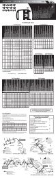
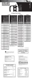
DATA FORM<br />
ROUTINE ONSITE DETERMINATION METHOD 1<br />
Field Investigator(s): Steve Ricucci / Will Kunkle Date: Sept. 29, 2008<br />
Project/Site: Lackawanna Cut-Off right of way State: NJ County: Sussex<br />
Applicant/Owner: NJ TRANSIT Sample Designation: A/B Wetland<br />
Do normal environmental conditions exist at the plant community?<br />
Yes X No (If no, explain)<br />
Has the vegetation, soils, and/or hydrology been significantly disturbed?<br />
Yes No X (If yes, explain)<br />
VEGETATION<br />
Dominant Plant Species Indicator Status Stratum<br />
Phragmites australis FACW herbaceous<br />
Toxicodendren radicans FAC herbaceous<br />
Percent of dominant species that are OBL, FACW, and/or FAC: Over 100%<br />
Is the hydrophytic vegetation criterion met?<br />
Rationale: Yes<br />
SOILS<br />
Series/Phase: Subgroup 2 :<br />
Is the soil on the hydric soil list? No<br />
Is the soil a histosol? No Is the soil mottled? No mottles were observed<br />
Matrix color: 10 YR 2/1 and 3/2 Mottle colors: none<br />
Other hydric soil indicators:<br />
Is the hydric soil criterion met?<br />
Rationale:<br />
HYDROLOGY<br />
Is the ground surface inundated? In areas Surface water depth: 3-4”<br />
Is the soil saturated? yes At what depth? 6-8”<br />
Other evidence of wetland hydrology: Standing water<br />
Is the wetland hydrology criterion met?<br />
Rationale:<br />
JURISDICTIONAL DETERMINATION AND RATIONALE<br />
Is the plant community a wetland? Yes X No<br />
Rationale for jurisdiction decision:<br />
1<br />
This data can be used for the Hydric Soil Assessment Procedure and the Plant Community Assessment<br />
Procedure.<br />
2<br />
Classification according to “Soil Taxonomy.”
DATA FORM<br />
ROUTINE ONSITE DETERMINATION METHOD 1<br />
Field Investigator(s): Steve Ricucci / Will Kunkle Date: Sept.29, 2008<br />
Project/Site: Lackawanna Cut-Off right of way State: NJ County: Sussex<br />
Applicant/Owner: NJ TRANSIT Sample Designation: C/D Wetland<br />
Do normal environmental conditions exist at the plant community?<br />
Yes No (If no, explain)<br />
Has the vegetation, soils, and/or hydrology been significantly disturbed?<br />
Yes No (If yes, explain)<br />
VEGETATION<br />
Dominant Plant Species Indicator Status Stratum<br />
Phragmites australis FACW herbaceous<br />
Toxicodendren radicans FAC herbaceous<br />
Thelypteris noveboracensis FAC herbaceous<br />
Percent of dominant species that are OBL, FACW, and/or FAC: 100%<br />
Is the hydrophytic vegetation criterion met?<br />
Rationale:<br />
SOILS<br />
Series/Phase: Subgroup 2 :<br />
Is the soil on the hydric soil list? No<br />
Is the soil a histosol? Is the soil mottled? No<br />
Matrix color: 10YR2/1 Mottle colors:<br />
Other hydric soil indicators:<br />
Is the hydric soil criterion met?<br />
Rationale: Low chroma, saturated<br />
HYDROLOGY<br />
Is the ground surface inundated? In areas Surface water depth: 2-4”<br />
Is the soil saturated? yes At what depth? 6-8”<br />
Other evidence of wetland hydrology:<br />
Is the wetland hydrology criterion met?<br />
Rationale:<br />
JURISDICTIONAL DETERMINATION AND RATIONALE<br />
Is the plant community a wetland? Yes X No<br />
Rationale for jurisdiction decision:<br />
1<br />
This data can be used for the Hydric Soil Assessment Procedure and the Plant Community Assessment<br />
Procedure.<br />
2<br />
Classification according to “Soil Taxonomy.”
DATA FORM<br />
ROUTINE ONSITE DETERMINATION METHOD 1<br />
Field Investigator(s): Steve Ricucci / Will Kunkle Date: Sept.29, 2008<br />
Project/Site: Lackawanna Cut-Off right of way State: NJ County: Sussex<br />
Applicant/Owner: NJ TRANSIT Sample Designation: Upland<br />
Do normal environmental conditions exist at the plant community?<br />
Yes No (If no, explain)<br />
Has the vegetation, soils, and/or hydrology been significantly disturbed?<br />
Yes No (If yes, explain)<br />
VEGETATION<br />
Dominant Plant Species Indicator Status Stratum<br />
Thelypteris noveboracensis FAC herbaceous<br />
Percent of dominant species that are OBL, FACW, and/or FAC:<br />
Is the hydrophytic vegetation criterion met?<br />
Rationale:<br />
SOILS<br />
Series/Phase: Subgroup 2 :<br />
Is the soil on the hydric soil list? No<br />
Is the soil a histosol? Is the soil mottled?<br />
Matrix color: Mottle colors:<br />
Other hydric soil indicators:<br />
Is the hydric soil criterion met?<br />
Rationale:<br />
HYDROLOGY<br />
Is the ground surface inundated? No Surface water depth:<br />
Is the soil saturated? At what depth?<br />
Other evidence of wetland hydrology:<br />
Is the wetland hydrology criterion met?<br />
Rationale:<br />
JURISDICTIONAL DETERMINATION AND RATIONALE<br />
Is the plant community a wetland? Yes No X<br />
Rationale for jurisdiction decision:<br />
1<br />
This data can be used for the Hydric Soil Assessment Procedure and the Plant Community Assessment<br />
Procedure.<br />
2<br />
Classification according to “Soil Taxonomy.”
DATA FORM<br />
ROUTINE ONSITE DETERMINATION METHOD 1<br />
Field Investigator(s): Steve Ricucci / Will Kunkle Date: Sept. 29, 2008<br />
Project/Site: Lackawanna Cut-Off right-of-way State: NJ County: Sussex<br />
Applicant/Owner: NJ TRANSIT Sample Designation: E/F Wetland<br />
Do normal environmental conditions exist at the plant community?<br />
Yes No (If no, explain)<br />
Has the vegetation, soils, and/or hydrology been significantly disturbed?<br />
Yes No (If yes, explain)<br />
VEGETATION<br />
Dominant Plant Species Indicator Status Stratum<br />
Impatiens capensis FACW herbaceous<br />
Acer Rubrum FAC overstory<br />
Toxicodendren radicans FAC herbaceous<br />
Thelypteris noveboracensis FAC herbaceous<br />
Percent of dominant species that are OBL, FACW, and/or FAC: 100%<br />
Is the hydrophytic vegetation criterion met?<br />
Rationale:<br />
SOILS<br />
Series/Phase: Subgroup 2 :<br />
Is the soil on the hydric soil list? No<br />
Is the soil a histosol? Is the soil mottled?<br />
Matrix color: 10 YR 1/1 Mottle colors: none<br />
Other hydric soil indicators:<br />
Is the hydric soil criterion met?<br />
Rationale:<br />
HYDROLOGY<br />
Is the ground surface inundated? Yes Surface water depth: 6-12”<br />
Is the soil saturated? Yes At what depth?<br />
Other evidence of wetland hydrology:<br />
Is the wetland hydrology criterion met?<br />
Rationale:<br />
JURISDICTIONAL DETERMINATION AND RATIONALE<br />
Is the plant community a wetland? Yes X No<br />
Rationale for jurisdiction decision:<br />
1<br />
This data can be used for the Hydric Soil Assessment Procedure and the Plant Community Assessment<br />
Procedure.<br />
2<br />
Classification according to “Soil Taxonomy.”
DATA FORM<br />
ROUTINE ONSITE DETERMINATION METHOD 1<br />
Field Investigator(s): Steve Ricucci / Will Kunkle Date: Oct. 1, 2008<br />
Project/Site: Lackawanna Cut-Off right-of-way State: County: Warren<br />
Applicant/Owner: NJ TRANSIT Sample Designation: G/H<br />
Do normal environmental conditions exist at the plant community?<br />
Yes No (If no, explain)<br />
Has the vegetation, soils, and/or hydrology been significantly disturbed?<br />
Yes No (If yes, explain)<br />
VEGETATION<br />
Dominant Plant Species Indicator Status Stratum<br />
Impatiens capensis FACW herbaceous<br />
Acer Rubrum FAC overstory<br />
Percent of dominant species that are OBL, FACW, and/or FAC: 100%<br />
Is the hydrophytic vegetation criterion met?<br />
Rationale:<br />
SOILS<br />
Series/Phase: Subgroup 2 :<br />
Is the soil on the hydric soil list?<br />
Is the soil a histosol? Is the soil mottled? no<br />
Matrix color: 10YR 3/2 Mottle colors:<br />
Other hydric soil indicators:<br />
Is the hydric soil criterion met?<br />
Rationale:<br />
HYDROLOGY<br />
Is the ground surface inundated? yes Surface water depth:<br />
Is the soil saturated? At what depth?<br />
Other evidence of wetland hydrology: Stream adjacent tot right of way<br />
Is the wetland hydrology criterion met?<br />
Rationale:<br />
JURISDICTIONAL DETERMINATION AND RATIONALE<br />
Is the plant community a wetland? Yes X No<br />
Rationale for jurisdiction decision:<br />
1<br />
This data can be used for the Hydric Soil Assessment Procedure and the Plant Community Assessment<br />
Procedure.<br />
2<br />
Classification according to “Soil Taxonomy.”
DATA FORM<br />
ROUTINE ONSITE DETERMINATION METHOD 1<br />
Field Investigator(s): Steve Ricucci / Will Kunkle Date: Oct. 1, 2008<br />
Project/Site: Lackawanna Cut-Off right-of-way State: County: Warren<br />
Applicant/Owner: NJ TRANSIT Sample Designation: I/J line<br />
Do normal environmental conditions exist at the plant community?<br />
Yes No (If no, explain)<br />
Has the vegetation, soils, and/or hydrology been significantly disturbed?<br />
Yes No (If yes, explain)<br />
VEGETATION<br />
Dominant Plant Species Indicator Status Stratum<br />
Acer rubrum FAC overstory<br />
Imapatiens capensis FACW herbaceous<br />
Toxicodendren radicans FAC herbaceous<br />
Percent of dominant species that are OBL, FACW, and/or FAC:<br />
Is the hydrophytic vegetation criterion met?<br />
Rationale:<br />
SOILS<br />
Series/Phase: Subgroup 2 :<br />
Is the soil on the hydric soil list?<br />
Is the soil a histosol? Is the soil mottled?<br />
Matrix color: 10 YR 3/2 Mottle colors:<br />
Other hydric soil indicators:<br />
Is the hydric soil criterion met?<br />
Rationale:<br />
HYDROLOGY<br />
Is the ground surface inundated? Surface water depth:<br />
Is the soil saturated? Yes At what depth? 6-8<br />
Other evidence of wetland hydrology:<br />
Is the wetland hydrology criterion met?<br />
Rationale:<br />
JURISDICTIONAL DETERMINATION AND RATIONALE<br />
Is the plant community a wetland? Yes X No<br />
Rationale for jurisdiction decision: Linear wetland<br />
1<br />
This data can be used for the Hydric Soil Assessment Procedure and the Plant Community Assessment<br />
Procedure.<br />
2<br />
Classification according to “Soil Taxonomy.”
DATA FORM<br />
ROUTINE ONSITE DETERMINATION METHOD 1<br />
Field Investigator(s): Steve Ricucci / Will Kunkle Date: Oct. 2, 2008<br />
Project/Site: Lackawanna Cut-Off right-of-way State: County: Warren<br />
Applicant/Owner: NJ TRANSIT Sample Designation: K/L<br />
Do normal environmental conditions exist at the plant community?<br />
Yes No (If no, explain)<br />
Has the vegetation, soils, and/or hydrology been significantly disturbed?<br />
Yes No (If yes, explain)<br />
VEGETATION<br />
Dominant Plant Species Indicator Status Stratum<br />
Toxicodendren radicans FAC herbaceous<br />
Quercus palustris FACW overstory<br />
Percent of dominant species that are OBL, FACW, and/or FAC:<br />
Is the hydrophytic vegetation criterion met?<br />
Rationale:<br />
SOILS<br />
Series/Phase: Subgroup 2 :<br />
Is the soil on the hydric soil list? No<br />
Is the soil a histosol? Is the soil mottled? no<br />
Matrix color: 10YR 3/2 Mottle colors:<br />
Other hydric soil indicators:<br />
Is the hydric soil criterion met?<br />
Rationale: Low chroma<br />
HYDROLOGY<br />
Is the ground surface inundated? Surface water depth:<br />
Is the soil saturated? yes At what depth? 6-12”<br />
Other evidence of wetland hydrology: Drainage pattern, water stained leaves<br />
Is the wetland hydrology criterion met?<br />
Rationale:<br />
JURISDICTIONAL DETERMINATION AND RATIONALE<br />
Is the plant community a wetland? Yes X No<br />
Rationale for jurisdiction decision:<br />
1<br />
This data can be used for the Hydric Soil Assessment Procedure and the Plant Community Assessment<br />
Procedure.<br />
2<br />
Classification according to “Soil Taxonomy.”
DATA FORM<br />
ROUTINE ONSITE DETERMINATION METHOD 1<br />
Field Investigator(s): Steve Ricucci / Will Kunkle Date: Oct. 2, 2008<br />
Project/Site: Lackawanna Cut-Off right-of-way State: County: Warren<br />
Applicant/Owner: NJ TRANSIT Sample Designation: M/N<br />
Do normal environmental conditions exist at the plant community?<br />
Yes No (If no, explain)<br />
Has the vegetation, soils, and/or hydrology been significantly disturbed?<br />
Yes No (If yes, explain)<br />
VEGETATION<br />
Dominant Plant Species Indicator Status Stratum<br />
Toxicodendren radicans FAC herbaceous<br />
Parthenocissus quinquefolia FACU herbaceous<br />
Percent of dominant species that are OBL, FACW, and/or FAC:<br />
Is the hydrophytic vegetation criterion met?<br />
Rationale:<br />
SOILS<br />
Series/Phase: Subgroup 2 :<br />
Is the soil on the hydric soil list?<br />
Is the soil a histosol? Is the soil mottled?<br />
Matrix color: 10 YR 2/1 Mottle colors: no<br />
Other hydric soil indicators:<br />
Is the hydric soil criterion met?<br />
Rationale: Low chroma<br />
HYDROLOGY<br />
Is the ground surface inundated? No Surface water depth:<br />
Is the soil saturated? yes At what depth? 6-12”<br />
Other evidence of wetland hydrology:<br />
Is the wetland hydrology criterion met?<br />
Rationale:<br />
JURISDICTIONAL DETERMINATION AND RATIONALE<br />
Is the plant community a wetland? Yes X No<br />
Rationale for jurisdiction decision:<br />
1<br />
This data can be used for the Hydric Soil Assessment Procedure and the Plant Community Assessment<br />
Procedure.<br />
2<br />
Classification according to “Soil Taxonomy.”
DATA FORM<br />
ROUTINE ONSITE DETERMINATION METHOD 1<br />
Field Investigator(s): Steve Ricucci / Will Kunkle Date: Oct. 2, 2008<br />
Project/Site: Lackawanna Cut-Off right-of-way State: County: Sussex<br />
Applicant/Owner: NJ TRANSIT Sample Designation: O<br />
Do normal environmental conditions exist at the plant community?<br />
Yes No (If no, explain)<br />
Has the vegetation, soils, and/or hydrology been significantly disturbed?<br />
Yes No (If yes, explain)<br />
VEGETATION<br />
Dominant Plant Species Indicator Status Stratum<br />
Cornus foemina FAC- shrub<br />
Acer rubrum FAC overstory<br />
Percent of dominant species that are OBL, FACW, and/or FAC:<br />
Is the hydrophytic vegetation criterion met?<br />
Rationale:<br />
SOILS<br />
Series/Phase: Subgroup 2 :<br />
Is the soil on the hydric soil list?<br />
Is the soil a histosol? Is the soil mottled?<br />
Matrix color: 10 YR 22 Mottle colors: 4/3<br />
Other hydric soil indicators:<br />
Is the hydric soil criterion met?<br />
Rationale: Low chroma, mottling, reducing conditions<br />
HYDROLOGY<br />
Is the ground surface inundated? Surface water depth:<br />
Is the soil saturated? yes At what depth? 3-6<br />
Other evidence of wetland hydrology:<br />
Is the wetland hydrology criterion met?<br />
Rationale:<br />
JURISDICTIONAL DETERMINATION AND RATIONALE<br />
Is the plant community a wetland? Yes X No<br />
Rationale for jurisdiction decision:<br />
1<br />
This data can be used for the Hydric Soil Assessment Procedure and the Plant Community Assessment<br />
Procedure.<br />
2<br />
Classification according to “Soil Taxonomy.”
DATA FORM<br />
ROUTINE ONSITE DETERMINATION METHOD 1<br />
Field Investigator(s): Steve Ricucci / Will Kunkle Date: Oct. 2, 2008<br />
Project/Site: Lackawanna Cut-Off right-of-way State: County: Sussex<br />
Applicant/Owner: NJ TRANSIT Sample Designation: P/Q<br />
Do normal environmental conditions exist at the plant community?<br />
Yes No (If no, explain)<br />
Has the vegetation, soils, and/or hydrology been significantly disturbed?<br />
Yes No (If yes, explain)<br />
VEGETATION<br />
Dominant Plant Species Indicator Status Stratum<br />
Cornus foemina FAC- shrub<br />
Toxicodendren radicans FAC herbaceous<br />
Parthenocissus quinquefolia FACU herbaceous<br />
Percent of dominant species that are OBL, FACW, and/or FAC:<br />
Is the hydrophytic vegetation criterion met?<br />
Rationale:<br />
SOILS<br />
Series/Phase: Subgroup 2 :<br />
Is the soil on the hydric soil list?<br />
Is the soil a histosol? Is the soil mottled?<br />
Matrix color: 10 YR 2/2 Mottle colors: 3/4<br />
Other hydric soil indicators:<br />
Is the hydric soil criterion met?<br />
Rationale: Low chroma<br />
HYDROLOGY<br />
Is the ground surface inundated? no Surface water depth:<br />
Is the soil saturated? No, moist At what depth?<br />
Other evidence of wetland hydrology:<br />
Is the wetland hydrology criterion met?<br />
Rationale: Drainage pattern water stained leaves debris.<br />
JURISDICTIONAL DETERMINATION AND RATIONALE<br />
Is the plant community a wetland? Yes X No<br />
Rationale for jurisdiction decision:<br />
1<br />
This data can be used for the Hydric Soil Assessment Procedure and the Plant Community Assessment<br />
Procedure.<br />
2<br />
Classification according to “Soil Taxonomy.”
<strong>WETLAND</strong> <strong>DELINEATION</strong> <strong>REPORT</strong><br />
<strong>LACKAWANNA</strong> <strong>CUT</strong>-<strong>OFF</strong> PASSENGER RAIL SERVICE<br />
RESTORATION PROJECT<br />
Upper Mt. Bethel Township to Scranton<br />
Pennsylvania Portion of the Non-MOS<br />
Prepared for: NJ TRANSIT<br />
Prepared by: Jacobs Engineering<br />
OCTOBER 2008
NJ TRANSIT <strong>LACKAWANNA</strong> <strong>CUT</strong>-<strong>OFF</strong> PASSENGER RAIL SERVICE RESTORATION PROJECT<br />
TABLE OF CONTENTS<br />
1.0 INTRODUCTION 2<br />
2.0 METHODOLOGY 4<br />
2.1 Surface Waters 4<br />
2.2 Existing Soils 5<br />
3.0 <strong>WETLAND</strong> <strong>DELINEATION</strong> 6<br />
4.0 SUMMARY 7<br />
APPENDIX<br />
Pocono Mountain and Tobyhanna Station Plans<br />
Wetlands Mapping<br />
Wetland Delineation Pictures<br />
Wetland Delineation Data Sheets<br />
1
NJ TRANSIT <strong>LACKAWANNA</strong> <strong>CUT</strong>-<strong>OFF</strong> PASSENGER RAIL SERVICE RESTORATION PROJECT<br />
1.0 INTRODUCTION<br />
NJ TRANSIT is considering the restoration of passenger rail service in Northwest New<br />
Jersey and Northeast Pennsylvania along a corridor commonly referred to as the<br />
Lackawanna Cut-Off. The purpose of this project is to implement a passenger rail service<br />
that will effectively and efficiently improve travel in the Northeast<br />
Pennsylvania/Northwest New Jersey to New York City corridor. The project will utilize<br />
existing transportation rights-of-way to limit environmental impacts while benefiting the<br />
region’s economy by providing a new modal option for travelers.<br />
The 28-mile portion of the inactive corridor would be restored in New Jersey, from Port<br />
Morris to the Delaware River Bridge is currently an inactive railroad alignment through<br />
Morris, Sussex and Warren Counties in New Jersey. In Pennsylvania, the alignment<br />
through Northampton, Monroe, Wayne, and Lackawanna Counties, from the Delaware<br />
River Viaduct to Scranton, is approximately 60 miles in length.<br />
This report is a summary of the wetland delineation prepared between the Delaware<br />
River Viaduct in Upper Mt. Bethel Twp., Northampton County to Scranton, Lackawanna<br />
County. The majority of the alignment in Pennsylvania is an active railroad with both<br />
freight service and limited recreational passenger service. The project enters<br />
Pennsylvania in Upper Mt. Bethel Twp. via the existing Delaware River Viaduct where<br />
the connection would be restored to the existing freight rail right-of-way at Slateford<br />
Junction. The project would then join with the active railroad that runs between Slateford<br />
Junction and Scranton. The project would traverse the following municipalities:<br />
Northampton: Upper Mount Bethel Township<br />
Monroe County: Coolbaugh Township, Tobyhanna Township, Mount Pocono<br />
Borough, Paradise Township, Barrett Township Pocono Township,<br />
Stroud Township, Borough of East Stroudsburg, Smithfield<br />
Township and Delaware Water Gap Borough.<br />
Wayne County: Lehigh Township.<br />
Lackawanna County: City of Scranton, Borough of Dunmore, Roaring Brook<br />
Township, Elmhurst Township, Moscow Township, Covington<br />
Township and Clifton Township.<br />
2
NJ TRANSIT <strong>LACKAWANNA</strong> <strong>CUT</strong>-<strong>OFF</strong> PASSENGER RAIL SERVICE RESTORATION PROJECT<br />
3
NJ TRANSIT <strong>LACKAWANNA</strong> <strong>CUT</strong>-<strong>OFF</strong> PASSENGER RAIL SERVICE RESTORATION PROJECT<br />
2.0 METHODOLOGY<br />
In October 2008, environmental professionals from Jacobs Engineering performed a<br />
wetland investigation/delineation of the entire alignment in Pennsylvania from the<br />
Delaware River Viaduct in Upper Mt. Bethel Twp. to the proposed Scranton Yard<br />
location. Our objective was to identify, delineate, and evaluate the wetlands adjacent to or<br />
within the proposed right-of way, as well as those that may potentially be impacted by<br />
station development. Freshwater wetland areas were confirmed and delineated in<br />
accordance with the methodology set forth in the 1987 Corps of Engineers Wetland<br />
Delineation Manual. The U.S. Army Corps of Engineers Jurisdictional Determination<br />
Form Instructional Guidebook (2007) was also used as a reference during wetland<br />
delineation field work. The resultant boundaries have been located by survey for<br />
inclusion on the right-of-way plan mapping.<br />
Existing natural resource mapping and aerial photography of the project study area was<br />
reviewed prior to conducting our field investigations. Sources included the relevant<br />
United States Geological Survey (USGS), PA, 7.5 Minute Topographic Quadrangles,<br />
Natural Resource Conservation Service (NRCS) soils information and United States Fish<br />
and Wildlife Service (USFWS) National Wetland Inventory (NWI) maps.<br />
2.1 Surface Waters<br />
Surrounding surface waters and tributaries in the vicinity of the project station location<br />
and right-of-way with watercourse classifications include:<br />
Northampton County<br />
Delaware River - NWSR<br />
Slateford Creek – CWF<br />
Monroe County<br />
Caledonia Creek - CWF<br />
Cherry Creek - CWF<br />
Broadhead Creek – HQ, CWF, MF<br />
Sambo Creek - CWF, MF<br />
Paradise Creek - HQ, CWF<br />
Cranberry Creek - HQ, CWF<br />
Devils Hole Creek - HQ, CWF<br />
Tank Creek - HQ, CWF<br />
Yankee Run - HQ, CWF<br />
Forest Hill Run - HQ, CWF<br />
Pocono Summit Lake - HQ, CWF<br />
Hawkey Run - HQ, CWF<br />
Tobyhanna Creek - HQ, CWF<br />
Hummler Run - HQ, CWF<br />
4
NJ TRANSIT <strong>LACKAWANNA</strong> <strong>CUT</strong>-<strong>OFF</strong> PASSENGER RAIL SERVICE RESTORATION PROJECT<br />
Wayne County<br />
Lehigh River - HQ, CWF<br />
Larsen Pond - HQ, CWF<br />
Lackawanna County<br />
Roaring Brook - HQ, CWF<br />
East Branch Roaring Brook - HQ, CWF<br />
Elhurst Reservoir - HQ, CWF<br />
Langan Creek - HQ, CWF<br />
Surface Water Classification: CWF = Cold Waters Fisheries; MF – Migratory Fishes; HQ CWF = High Quality Cold Water<br />
Fisheries; NWSR = National Wild and Scenic River.<br />
2.2 Existing Soils<br />
In Pennsylvania, the existing rail alignment is located within five physiographic<br />
provinces known as the Great Valley, Blue Mountain, Glaciated Low Plateau, Glaciated<br />
Pocono Plateau and Anthracite Valley sections within Northampton, Monroe, Wayne and<br />
Lackawanna Counties.<br />
The general soils in Northampton County in the vicinity of the railroad alignment consist<br />
of the Conotton-red hook-urban land association. The general soil association description<br />
includes extremely stony soils on ridges, less rocky, well-drained soils in lowland areas.<br />
In Monroe County, the Wyoming-Chenango-Pope association is found on nearly level to<br />
slightly sloping lands adjacent to the right-of-way and tend to be deep and well to<br />
excessively drained underlain by glacial outwash and alluvium. The Wellsboro-<br />
Lackawanna-Morris soil association is also adjacent to the right-of-way and is<br />
characterized by deep, well drained to somewhat poorly drained soils in level and gently<br />
sloping areas. The soils in Wayne County consist of Wellsboro-Lackawanna-Morris and<br />
Volusia-Mardin-Lordstown. These soils are in the vicinity of the proposed alignment. In<br />
Lackawanna County, the Wellsboro-Morris-Oquaga association consists of soils formed<br />
in glacial till derived from sandstone and shale on broad rolling uplands.<br />
Station Locations<br />
Specific soil descriptions located at each proposed station location are as follows:<br />
Scranton Station Area - Ur - Urban Land – urban structures cover more that 85<br />
percent of the soils. Soils are variable and require onsite investigation.<br />
Tobyhanna Station Area - Cy - Cut and Fill land – disturbed or altered land.<br />
Pocono Mountain Station Area – WxB - Wurtzboro extremely stony loam, 0 to 8<br />
percent slopes and CnB - Chippewa and Norwich extremely stony soils 0 to 8<br />
percent slopes.<br />
Analomink Station Area – Cy - Cut and Fill land - disturbed or altered land.<br />
East Stroudsburg Station Area - WyB – Wyoming gravelly sandy loam, 3 to 8<br />
percent slope.<br />
Delaware Water Gap Station Area - Cy - Cut and Fill land- disturbed or altered<br />
land.<br />
5
NJ TRANSIT <strong>LACKAWANNA</strong> <strong>CUT</strong>-<strong>OFF</strong> PASSENGER RAIL SERVICE RESTORATION PROJECT<br />
3.0 <strong>WETLAND</strong> <strong>DELINEATION</strong><br />
Following are descriptions of each of the delineated freshwater wetland/state open waters<br />
complexes between the Delaware Water Gap Viaduct and Scranton, starting with the<br />
station areas where wetlands were identified:<br />
Pocono Mountain Station Area<br />
Wetland Area PA-A - Deciduous wooded wetland complex located northeast down<br />
gradient form potential station location. Deciduous wooded wetland complex associated<br />
with Hawkey Run (RU2BH). Saturated soils in some areas, low chroma soils present<br />
(10YR 2/2 and 2/1); gleying; mottles (10YR 7/4). Vegetation: Quercus palustris (Pin<br />
oak), Thelypteris noveboracensis (New York fern) FAC, Sphagnum (peat moss) (NL),<br />
Acer rubrum (red maple). See surveyed wetlands mapping plan sheet 1. Pictures 1-3.<br />
Tobyhanna Station Area<br />
Wetland Area PA-B - Deciduous wooded wetland area located northwest of the station<br />
location. Saturated soils at surface 1-2”, low chroma soils present (10YR 2/1).<br />
Vegetation: Sphagnum (peat moss) (NL), Acer rubrum (red maple), Thelypteris<br />
noveboracensis (New York fern) FAC, Solidago sp. (golden rod); rhododendron<br />
(rhododendron) NL. See surveyed wetlands mapping plan sheet 2. Pictures 4-6.<br />
Right-of-Way Adjacent Wetland Areas between M.P. 110 and 111<br />
Wetland Area PA-C/D - State open water/herbaceous wetland adjacent to right-of-way;<br />
Identified on USGS Tobyhanna Quadrangle as Oakes Swamp and NWI mapping as<br />
PSS1F. Water flowing/standing; saturated soils -10 YR 2/1. Vegetation: Phragmites<br />
australis (common reed) FACW, Typha sp. (cat tail) FACW. See surveyed wetlands<br />
mapping plan sheet 3. Pictures 7 and 8.<br />
Wetland Area PA-E - State open water/herbaceous wetland adjacent to right-of-way;<br />
Identified on USGS Tobyhanna Quadrangle as Oakes Swamp and NWI mapping as<br />
PEM1F, PUBHh. Inundated. Vegetation: Nymphaea sp. (water lily), Carex stricta<br />
(tussock sedge) OBL Verbascum thapsus (common mullein), Solidago sp. (golden rod),<br />
Acer rubrum (red maple). See surveyed wetlands mapping plan sheet 3. Picture 9.<br />
Wetland Area PA-F - State open water/herbaceous wetland adjacent to right-of-way;<br />
Identified on USGS Tobyhanna Quadrangle as Oakes Swamp and NWI mapping as<br />
PEM1F, PUBHh and PEM1F. 10YR 1/1, inundated. Vegetation: Carex stricta (tussock<br />
sedge) OBL, Verbascum thapsus (common mullein), Acer rubrum (red maple). See<br />
surveyed wetlands mapping plan sheet 3. Pictures 10 and 11.<br />
Wetland Area PA-G - State open water/herbaceous wetland adjacent to right-of-way;<br />
Identified on USGS Tobyhanna Quadrangle as Oakes Swamp and NWI mapping as<br />
PFO2/4E PFO1/SS1E. Soils 10 YR 1/1 inundated, saturated. Vegetation: Carex stricta<br />
(tussock sedge) OBL. Acer rubrum (red maple), Lindera benzoin (spice bush). See<br />
surveyed wetlands mapping plan sheet 3. Picture 12.<br />
6
NJ TRANSIT <strong>LACKAWANNA</strong> <strong>CUT</strong>-<strong>OFF</strong> PASSENGER RAIL SERVICE RESTORATION PROJECT<br />
4.0 SUMMARY<br />
In Pennsylvania, a total of six (6) wetland complexes were delineated within the project<br />
study area along the proposed alignment. The wetland complexes were delineated near<br />
the proposed Pocono Mountain and Tobyhanna station locations in addition to wetland<br />
complexes adjacent to the existing freight right-of-way.<br />
In Pennsylvania Title 25, Chapter 105 provides wetland permitting guidance, criteria and<br />
mitigation requirements. State wetland mitigation criteria include area ratios, function<br />
and value replacement and siting criteria. Area ratio criteria states that the wetland shall<br />
be replaced at a minimum area of replacement acres to affected acres of 1:1 ratio. The<br />
Pennsylvania Department of Environmental Protection (PADEP) and United States Army<br />
Corps of Engineers (ACOE) may require the area ratio to exceed 1:1 based on the<br />
determination of the area and how the functions and values of the particular wetland that<br />
will be destroyed. A 2:1 ratio may be required based on the determination of the area<br />
affected and the wetland resources function and values. PADEP/ACOE may additionally<br />
require the area ratio to exceed 2:1 based on the determination of the affected wetlands<br />
functions and values.<br />
The wetland areas delineated and surveyed were near the potential Pocono Mountain and<br />
Tobyhanna station locations and adjacent to the existing freight right-of-way. Theses<br />
wetland complexes would most likely not be impacted during station<br />
construction/rehabilitation activities. The resultant boundaries establish wetland limits for<br />
design engineers to avoid during the final design process.<br />
No impacts are expected to occur within the existing rail alignment through<br />
Pennsylvania. Permanent disturbances to freshwater wetland complexes are not<br />
anticipated; however if project plans change, and impacts are anticipated, they will be<br />
minimized to the greatest extent possible through the design process.<br />
7
NJ TRANSIT <strong>LACKAWANNA</strong> <strong>CUT</strong>-<strong>OFF</strong> PASSENGER RAIL SERVICE RESTORATION PROJECT<br />
8<br />
APPENDIX
<strong>WETLAND</strong>S LOCATION MAP<br />
<strong>LACKAWANNA</strong> <strong>CUT</strong> <strong>OFF</strong> STUDY<br />
Engineering and Surveying<br />
COOLBAUGH TOWNSHIP<br />
1 of 3
<strong>WETLAND</strong>S LOCATION MAP<br />
<strong>LACKAWANNA</strong> <strong>CUT</strong> <strong>OFF</strong> STUDY<br />
Engineering and Surveying<br />
COOLBAUGH TOWNSHIP<br />
2 of 3
MATCH LINE - SEE BELOW<br />
MATCH LINE - SEE ABOVE<br />
<strong>WETLAND</strong>S LOCATION MAP<br />
<strong>LACKAWANNA</strong> <strong>CUT</strong> <strong>OFF</strong> STUDY<br />
Engineering and Surveying<br />
COOLBAUGH TOWNSHIP<br />
3 of 3
<strong>LACKAWANNA</strong> <strong>CUT</strong>-<strong>OFF</strong> <strong>WETLAND</strong> <strong>DELINEATION</strong> PICTURES –Oct. 2008<br />
1. Pocono Mtn. station location PA-A line looking south<br />
2. Pocono Mtn. station location PA-A line looking north<br />
3. Pocono Mtn. station location PA-A line looking north
4. Tobyhanna station location PA-B line<br />
5. Tobyhanna station location PA-B line<br />
6. Tobyhanna station location PA-B line
7. PA-C line looking west<br />
8. PA-C line looking northeast<br />
9. PA-E line looking west
10. PA-F line looking west<br />
11. PA-F line looking east<br />
12. PA-G line looking southeast
DATA FORM<br />
ROUTINE ONSITE DETERMINATION METHOD 1<br />
Field Investigator(s): Steve Ricucci / Will Kunkle Date: Oct.13, 2008<br />
Project/Site: Pocono Mtn. Station Location State: PA County: Monroe<br />
Applicant/Owner: NJ TRANSIT Sample Designation: PA-A<br />
Do normal environmental conditions exist at the plant community?<br />
Yes X No (If no, explain)<br />
Has the vegetation, soils, and/or hydrology been significantly disturbed?<br />
Yes No X (If yes, explain)<br />
VEGETATION<br />
Dominant Plant Species Indicator Status Stratum<br />
Acer rubrum FAC woody over-story<br />
Toxicodendren radicans FAC herbaceous<br />
Thelypteris noveboracensis FAC herbaceous<br />
Quercus palustris FACW Over story<br />
Cornus foemina<br />
Sphagnum moss<br />
FAC-<br />
NL<br />
Percent of dominant species that are OBL, FACW, and/or FAC: 85%<br />
Is the hydrophytic vegetation criterion met?<br />
Rationale: Yes<br />
SOILS<br />
Shrub<br />
herbaceous<br />
Series/Phase: Subgroup 2 :<br />
Is the soil on the hydric soil list?<br />
Is the soil a histosol? Is the soil mottled? No mottles were observed<br />
Matrix color: 10 YR 2/2 and 2/1 Mottle colors: 10 YR 7/4<br />
Other hydric soil indicators:<br />
Is the hydric soil criterion met?<br />
Rationale: Low chroma soils, mottling<br />
HYDROLOGY<br />
Is the ground surface inundated? Surface water depth:<br />
Is the soil saturated? yes At what depth? 6-12”<br />
Other evidence of wetland hydrology:<br />
Is the wetland hydrology criterion met?<br />
Rationale: Wetland area associated with Hawkey’s Run<br />
JURISDICTIONAL DETERMINATION AND RATIONALE<br />
Is the plant community a wetland? Yes X No<br />
Rationale for jurisdiction decision:<br />
1<br />
This data can be used for the Hydric Soil Assessment Procedure and the Plant Community Assessment<br />
Procedure.<br />
2<br />
Classification according to “Soil Taxonomy.”
DATA FORM<br />
ROUTINE ONSITE DETERMINATION METHOD 1<br />
Field Investigator(s): Steve Ricucci / Will Kunkle Date: Oct. 13, 2008<br />
Project/Site: Pocono Mtn. Station Location State: PA County: Monroe<br />
Applicant/Owner: NJ TRANSIT Sample Designation: PA-A<br />
Do normal environmental conditions exist at the plant community?<br />
Yes No (If no, explain)<br />
Has the vegetation, soils, and/or hydrology been significantly disturbed?<br />
Yes No (If yes, explain)<br />
VEGETATION<br />
Dominant Plant Species Indicator Status Stratum<br />
Acer rubrum FAC woody over-story<br />
Toxicodendren radicans FAC herbaceous<br />
Thelypteris noveboracensis FAC herbaceous<br />
Percent of dominant species that are OBL, FACW, and/or FAC: 100%<br />
Is the hydrophytic vegetation criterion met?<br />
Rationale:<br />
SOILS<br />
Series/Phase: Subgroup 2 :<br />
Is the soil on the hydric soil list? No<br />
Is the soil a histosol? Is the soil mottled?<br />
Matrix color: Mottle colors:<br />
Other hydric soil indicators:<br />
Is the hydric soil criterion met?<br />
Rationale:<br />
HYDROLOGY<br />
Is the ground surface inundated? Surface water depth:<br />
Is the soil saturated? yes At what depth? 6-12”<br />
Other evidence of wetland hydrology: Drainage patterns<br />
Is the wetland hydrology criterion met?<br />
Rationale:<br />
JURISDICTIONAL DETERMINATION AND RATIONALE<br />
Is the plant community a wetland? Yes X No<br />
Rationale for jurisdiction decision:<br />
1<br />
This data can be used for the Hydric Soil Assessment Procedure and the Plant Community Assessment<br />
Procedure.<br />
2<br />
Classification according to “Soil Taxonomy.”
DATA FORM<br />
ROUTINE ONSITE DETERMINATION METHOD 1<br />
Field Investigator(s): Steve Ricucci / Will Kunkle Date: Oct. 13, 2008<br />
Project/Site: Pocono Mtn. Station State: PA County: Monroe<br />
Applicant/Owner: NJ TRANSIT Sample Designation: Pocono Mtn.<br />
PA-A Upland<br />
Area<br />
Do normal environmental conditions exist at the plant community?<br />
Yes No (If no, explain)<br />
Has the vegetation, soils, and/or hydrology been significantly disturbed?<br />
Yes No (If yes, explain)<br />
VEGETATION<br />
Dominant Plant Species Indicator Status Stratum<br />
Pinus Stobus<br />
FACU<br />
over story<br />
Collinsonia canadensi<br />
FAC+<br />
herbaceous<br />
Solidago canadensis FACU herbaceous<br />
Percent of dominant species that are OBL, FACW, and/or FAC: 0<br />
Is the hydrophytic vegetation criterion met?<br />
Rationale:<br />
SOILS<br />
Series/Phase: Subgroup 2 :<br />
Is the soil on the hydric soil list? No<br />
Is the soil a histosol? Is the soil mottled?<br />
Matrix color: Mottle colors:<br />
Other hydric soil indicators:<br />
Is the hydric soil criterion met?<br />
Rationale:<br />
HYDROLOGY<br />
Is the ground surface inundated? No Surface water depth:<br />
Is the soil saturated? At what depth?<br />
Other evidence of wetland hydrology:<br />
Is the wetland hydrology criterion met?<br />
Rationale:<br />
JURISDICTIONAL DETERMINATION AND RATIONALE<br />
Is the plant community a wetland? Yes No X<br />
Rationale for jurisdiction decision:<br />
1<br />
This data can be used for the Hydric Soil Assessment Procedure and the Plant Community Assessment<br />
Procedure.<br />
2<br />
Classification according to “Soil Taxonomy.”
DATA FORM<br />
ROUTINE ONSITE DETERMINATION METHOD 1<br />
Field Investigator(s): Steve Ricucci / Will Kunkle Date: Oct. 13, 2008<br />
Project/Site: Tobyhanna Station State: PA County: Monroe<br />
Applicant/Owner: NJ TRANSIT Sample Designation: PA-B<br />
Do normal environmental conditions exist at the plant community?<br />
Yes No (If no, explain)<br />
Has the vegetation, soils, and/or hydrology been significantly disturbed?<br />
Yes No (If yes, explain)<br />
VEGETATION<br />
Dominant Plant Species Indicator Status Stratum<br />
Sphagnum NL Herbaceous<br />
Acer rubrum FAC over story<br />
rhododendron NL woody under story<br />
Thelypteris noveboracensis FAC herbaceous<br />
Percent of dominant species that are OBL, FACW, and/or FAC: 75 %<br />
Is the hydrophytic vegetation criterion met?<br />
Rationale:<br />
SOILS<br />
Series/Phase: Subgroup 2 :<br />
Is the soil on the hydric soil list? No<br />
Is the soil a histosol? Is the soil mottled?<br />
Matrix color: 10 YR 2/1 Mottle colors: none<br />
Other hydric soil indicators:<br />
Is the hydric soil criterion met?<br />
Rationale:<br />
HYDROLOGY<br />
Is the ground surface inundated? Surface water depth:<br />
Is the soil saturated? Yes At what depth? 1-3”<br />
Other evidence of wetland hydrology: Drainage patterns<br />
Is the wetland hydrology criterion met?<br />
Rationale:<br />
JURISDICTIONAL DETERMINATION AND RATIONALE<br />
Is the plant community a wetland? Yes X No<br />
Rationale for jurisdiction decision:<br />
1<br />
This data can be used for the Hydric Soil Assessment Procedure and the Plant Community Assessment<br />
Procedure.<br />
2<br />
Classification according to “Soil Taxonomy.”
DATA FORM<br />
ROUTINE ONSITE DETERMINATION METHOD 1<br />
Field Investigator(s): Steve Ricucci / Will Kunkle Date: Oct. 13, 2008<br />
Project/Site: Tobyhanna Station State: PA County: Monroe<br />
Applicant/Owner: NJ TRANSIT Sample Designation: PA-B<br />
Do normal environmental conditions exist at the plant community?<br />
Yes No (If no, explain)<br />
Has the vegetation, soils, and/or hydrology been significantly disturbed?<br />
Yes No (If yes, explain)<br />
VEGETATION<br />
Dominant Plant Species Indicator Status Stratum<br />
Solidago sp. FACU herbaceous<br />
Acer rubrum FAC over-story<br />
rhododendron NL woody under story<br />
Thelypteris noveboracensis FAC herbaceous<br />
Microstegium vimineum FAC herbaceous<br />
Percent of dominant species that are OBL, FACW, and/or FAC: 75<br />
Is the hydrophytic vegetation criterion met?<br />
Rationale:<br />
SOILS<br />
Series/Phase: Subgroup 2 :<br />
Is the soil on the hydric soil list?<br />
Is the soil a histosol? Is the soil mottled?<br />
Matrix color: Mottle colors:<br />
Other hydric soil indicators:<br />
Is the hydric soil criterion met?<br />
Rationale:<br />
HYDROLOGY<br />
Is the ground surface inundated? Surface water depth:<br />
Is the soil saturated? yes At what depth? 1-2 “<br />
Other evidence of wetland hydrology:<br />
Is the wetland hydrology criterion met?<br />
Rationale:<br />
JURISDICTIONAL DETERMINATION AND RATIONALE<br />
Is the plant community a wetland? Yes X No<br />
Rationale for jurisdiction decision:<br />
1<br />
This data can be used for the Hydric Soil Assessment Procedure and the Plant Community Assessment<br />
Procedure.<br />
2<br />
Classification according to “Soil Taxonomy.”
DATA FORM<br />
ROUTINE ONSITE DETERMINATION METHOD 1<br />
Field Investigator(s): Steve Ricucci / Will Kunkle Date: Oct 13, 2008<br />
Project/Site: Tobyhanna Station State: PA County: Monroe<br />
Applicant/Owner: NJ TRANSIT Sample Designation: PA-B<br />
Upland<br />
Do normal environmental conditions exist at the plant community?<br />
Yes No (If no, explain)<br />
Has the vegetation, soils, and/or hydrology been significantly disturbed?<br />
Yes No (If yes, explain)<br />
VEGETATION<br />
Dominant Plant Species Indicator Status Stratum<br />
Solidago sp. FACU herbaceous<br />
Tsuga canadensis FACU overstory<br />
Daucus carota NL herbaceous<br />
Percent of dominant species that are OBL, FACW, and/or FAC:<br />
Is the hydrophytic vegetation criterion met?<br />
Rationale:<br />
SOILS<br />
Series/Phase: Subgroup 2 :<br />
Is the soil on the hydric soil list?<br />
Is the soil a histosol? Is the soil mottled?<br />
Matrix color: 10YR 4/4 Mottle colors:<br />
Other hydric soil indicators:<br />
Is the hydric soil criterion met?<br />
Rationale:<br />
HYDROLOGY<br />
Is the ground surface inundated? No Surface water depth:<br />
Is the soil saturated? No At what depth?<br />
Other evidence of wetland hydrology:<br />
Is the wetland hydrology criterion met?<br />
Rationale:<br />
JURISDICTIONAL DETERMINATION AND RATIONALE<br />
Is the plant community a wetland? Yes No X<br />
Rationale for jurisdiction decision:<br />
1<br />
This data can be used for the Hydric Soil Assessment Procedure and the Plant Community Assessment<br />
Procedure.<br />
2<br />
Classification according to “Soil Taxonomy.”
DATA FORM<br />
ROUTINE ONSITE DETERMINATION METHOD 1<br />
Field Investigator(s): Steve Ricucci / Will Kunkle Date: Oct. 16, 2008<br />
Project/Site: Lackawanna Cut-Off right-of-way State: PA County: Monroe<br />
Applicant/Owner: NJ TRANSIT Sample Designation: PA-C/D<br />
Do normal environmental conditions exist at the plant community?<br />
Yes No (If no, explain)<br />
Has the vegetation, soils, and/or hydrology been significantly disturbed?<br />
Yes No (If yes, explain)<br />
VEGETATION<br />
Dominant Plant Species Indicator Status Stratum<br />
Carex stricta OBL herbaceous<br />
Percent of dominant species that are OBL, FACW, and/or FAC:<br />
Is the hydrophytic vegetation criterion met?<br />
Rationale:<br />
SOILS<br />
Series/Phase: Subgroup 2 :<br />
Is the soil on the hydric soil list? No<br />
Is the soil a histosol? Is the soil mottled?<br />
Matrix color: Mottle colors:<br />
Other hydric soil indicators:<br />
Is the hydric soil criterion met?<br />
Rationale:<br />
HYDROLOGY<br />
Is the ground surface inundated? Yes/partial Surface water depth: 6” in areas<br />
Is the soil saturated? At what depth?<br />
Other evidence of wetland hydrology: Drainage pattern<br />
Is the wetland hydrology criterion met?<br />
Rationale:<br />
JURISDICTIONAL DETERMINATION AND RATIONALE<br />
Is the plant community a wetland? Yes X No<br />
Rationale for jurisdiction decision:<br />
1<br />
This data can be used for the Hydric Soil Assessment Procedure and the Plant Community Assessment<br />
Procedure.<br />
2<br />
Classification according to “Soil Taxonomy.”
DATA FORM<br />
ROUTINE ONSITE DETERMINATION METHOD 1<br />
Field Investigator(s): Steve Ricucci / Will Kunkle Date: October 16, 2008<br />
Project/Site: Lackawanna Cut-Off right-of-way State: PA County: Monroe<br />
Applicant/Owner: NJ TRANSIT Sample Designation: PA-E<br />
Do normal environmental conditions exist at the plant community?<br />
Yes No (If no, explain)<br />
Has the vegetation, soils, and/or hydrology been significantly disturbed?<br />
Yes No (If yes, explain)<br />
VEGETATION<br />
Dominant Plant Species Indicator Status Stratum<br />
Carex stricta OBL herbaceous<br />
Percent of dominant species that are OBL, FACW, and/or FAC:<br />
Is the hydrophytic vegetation criterion met?<br />
Rationale:<br />
SOILS<br />
Series/Phase: Subgroup 2 :<br />
Is the soil on the hydric soil list?<br />
Is the soil a histosol? Is the soil mottled?<br />
Matrix color: Mottle colors:<br />
Other hydric soil indicators:<br />
Is the hydric soil criterion met?<br />
Rationale:<br />
HYDROLOGY<br />
Is the ground surface inundated? yes Surface water depth: 1-2’<br />
Is the soil saturated? Yes At what depth?<br />
Other evidence of wetland hydrology:<br />
Is the wetland hydrology criterion met?<br />
Rationale: State open water<br />
JURISDICTIONAL DETERMINATION AND RATIONALE<br />
Is the plant community a wetland? Yes X No<br />
Rationale for jurisdiction decision:<br />
1<br />
This data can be used for the Hydric Soil Assessment Procedure and the Plant Community Assessment<br />
Procedure.<br />
2<br />
Classification according to “Soil Taxonomy.”
DATA FORM<br />
ROUTINE ONSITE DETERMINATION METHOD 1<br />
Field Investigator(s): Steve Ricucci / Will Kunkle Date: October 16, 2008<br />
Project/Site: Lackawanna Cut-Off right-of-way State: PA County: Monroe<br />
Applicant/Owner: NJ TRANSIT Sample Designation: F<br />
Do normal environmental conditions exist at the plant community?<br />
Yes No (If no, explain)<br />
Has the vegetation, soils, and/or hydrology been significantly disturbed?<br />
Yes No (If yes, explain)<br />
VEGETATION<br />
Dominant Plant Species Indicator Status Stratum<br />
Carex stricta OBL herbaceous<br />
Percent of dominant species that are OBL, FACW, and/or FAC:<br />
Is the hydrophytic vegetation criterion met?<br />
Rationale:<br />
SOILS<br />
Series/Phase: Subgroup 2 :<br />
Is the soil on the hydric soil list?<br />
Is the soil a histosol? Is the soil mottled?<br />
Matrix color: 10 YR 1/1 Mottle colors:<br />
Other hydric soil indicators:<br />
Is the hydric soil criterion met?<br />
Rationale:<br />
HYDROLOGY<br />
Is the ground surface inundated? yes Surface water depth: 8-12”<br />
Is the soil saturated? yes At what depth?<br />
Other evidence of wetland hydrology:<br />
Is the wetland hydrology criterion met?<br />
Rationale:<br />
JURISDICTIONAL DETERMINATION AND RATIONALE<br />
Is the plant community a wetland? Yes X No<br />
Rationale for jurisdiction decision:<br />
1<br />
This data can be used for the Hydric Soil Assessment Procedure and the Plant Community Assessment<br />
Procedure.<br />
2<br />
Classification according to “Soil Taxonomy.”
DATA FORM<br />
ROUTINE ONSITE DETERMINATION METHOD 1<br />
Field Investigator(s): Steve Ricucci / Will Kunkle Date: October 16, 2008<br />
Project/Site: Lackawanna Cut-Off right-of-way State: PA County: Monroe<br />
Applicant/Owner: NJ TRANSIT Sample Designation: G<br />
Do normal environmental conditions exist at the plant community?<br />
Yes No (If no, explain)<br />
Has the vegetation, soils, and/or hydrology been significantly disturbed?<br />
Yes No (If yes, explain)<br />
VEGETATION<br />
Dominant Plant Species Indicator Status Stratum<br />
Carex stricta OBL herbaceous<br />
Lindera benzoin FACW- understory<br />
Acer rubrum FAC overstory<br />
Percent of dominant species that are OBL, FACW, and/or FAC:<br />
Is the hydrophytic vegetation criterion met?<br />
Rationale:<br />
SOILS<br />
Series/Phase: Subgroup 2 :<br />
Is the soil on the hydric soil list?<br />
Is the soil a histosol? Is the soil mottled?<br />
Matrix color: 10YR 1/1 Mottle colors:<br />
Other hydric soil indicators:<br />
Is the hydric soil criterion met?<br />
Rationale:<br />
HYDROLOGY<br />
Is the ground surface inundated? Yes Surface water depth: 2’-4’<br />
Is the soil saturated? yes At what depth?<br />
Other evidence of wetland hydrology:<br />
Is the wetland hydrology criterion met?<br />
Rationale:<br />
JURISDICTIONAL DETERMINATION AND RATIONALE<br />
Is the plant community a wetland? Yes X No<br />
Rationale for jurisdiction decision:<br />
1<br />
This data can be used for the Hydric Soil Assessment Procedure and the Plant Community Assessment<br />
Procedure.<br />
2<br />
Classification according to “Soil Taxonomy.”