Natural Resources - The Land Conservancy of New Jersey
Natural Resources - The Land Conservancy of New Jersey
Natural Resources - The Land Conservancy of New Jersey

You also want an ePaper? Increase the reach of your titles
YUMPU automatically turns print PDFs into web optimized ePapers that Google loves.
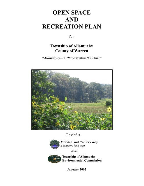
OPEN SPACE<br />
AND<br />
RECREATION PLAN<br />
for<br />
Township <strong>of</strong> Allamuchy<br />
County <strong>of</strong> Warren<br />
“Allamuchy—A Place Within the Hills”<br />
Compiled by<br />
Morris <strong>Land</strong> <strong>Conservancy</strong><br />
a nonpr<strong>of</strong>it land trust<br />
with the<br />
Township <strong>of</strong> Allamuchy<br />
Environmental Commission<br />
January 2005
Community <strong>Resources</strong><br />
“When I cross those pleasant forests which I have saved from the axe, or hear the rustling <strong>of</strong> the young trees, which<br />
I have set out with my own hands, I feel as if I had had some small share in improving the climate, and that if<br />
mankind is happy a thousand years from now I shall have been partly responsible in my small way for their<br />
happiness.”<br />
- Anton Chekhov (Uncle Vanya, 1897), A Dictionary <strong>of</strong> Environmental Quotations.<br />
<strong>The</strong> Township <strong>of</strong> Allamuchy is located in the northeastern corner <strong>of</strong> Warren County,<br />
<strong>New</strong> <strong>Jersey</strong>. Home to the Panther Valley community, residents enjoy the rural countryside<br />
nestled in the heart <strong>of</strong> the Pequest River Valley. <strong>The</strong> Township is bounded by Frelinghuysen<br />
Township to the northwest, Independence Township to the southwest, and the Town <strong>of</strong><br />
Hackettstown to the south. <strong>The</strong> Township <strong>of</strong> Mount Olive in Morris County forms Allamuchy’s<br />
southeastern border. Sussex County’s Byram and Green Townships both are located along<br />
Allamuchy Township’s northeastern border.<br />
A community is defined by its natural, recreational, and historic resources. A planned<br />
system <strong>of</strong> open space preservation and community stewardship can protect these special<br />
resources and both preserve and enhance the quality <strong>of</strong> life for Allamuchy residents.<br />
<strong>Natural</strong> <strong>Resources</strong><br />
Regional Geology and Topography<br />
<strong>The</strong> Township <strong>of</strong> Allamuchy is uniquely located within two <strong>of</strong> <strong>New</strong> <strong>Jersey</strong>’s four<br />
physiographic provinces, the (Appalachian) Valley and Ridge province and the Highlands<br />
province.<br />
<strong>The</strong> Valley and Ridge Province occupies an area <strong>of</strong> approximately 536 square miles or<br />
approximately one-fifteenth <strong>of</strong> the state. <strong>The</strong> Valley and Ridge Province comprises a large<br />
portion <strong>of</strong> Sussex and Warren Counties, and the western half <strong>of</strong> Allamuchy Township. This<br />
province, up to 17 miles wide, is characterized by steep-sided, linear ridges and broad valleys.<br />
Kittatinny Mountain, a broad even-crested ridge ranging from 1,600 to 1,800 feet in elevation,<br />
separates the upper Delaware River Valley above the Delaware Water Gap from the Kittatinny<br />
Valley. High Point, near the northern end <strong>of</strong> Kittatinny Mountain, is the highest point in <strong>New</strong><br />
<strong>Jersey</strong> at 1,803 feet. Valley floor elevations range from approximately 400 to 600 feet in the<br />
Kittatinny Valley and 300 to 600 feet in the upper Delaware River Valley. (Physiographic<br />
Provinces <strong>of</strong> <strong>New</strong> <strong>Jersey</strong>, 2003)<br />
<strong>The</strong> Appalachian Valley consists <strong>of</strong> calcareous rocks, most typically formed by the<br />
deposits <strong>of</strong> ancient oceans. <strong>The</strong> landscape is gently rolling with much less relief then the<br />
formations <strong>of</strong> the Highlands Province. <strong>The</strong>se formations tend to develop underground solution<br />
cavities and disappearing rivers, commonly referred to as sinkholes. This limestone topography,<br />
which underlays a significant portion in the northern corner <strong>of</strong> the township, has the highest<br />
propensity to form solution cavities; dolomites and other groups have a lower propensity. <strong>The</strong>se<br />
materials are generally considered unstable and should be developed with much scrutiny to<br />
drainage and foundation design and in consultation <strong>of</strong> an engineering pr<strong>of</strong>essional. <strong>The</strong>se<br />
materials can affect development in many ways including the types <strong>of</strong> foundation, use <strong>of</strong><br />
Township <strong>of</strong> Allamuchy – Open Space and Recreation Plan, January 2005 3
asements, drainage protection around structures, drainage in basins, types <strong>of</strong> usable basins,<br />
roadway design, and retaining structure design. (Township <strong>of</strong> Allamuchy <strong>Natural</strong> Resource<br />
Inventory, December 2003)<br />
<strong>The</strong> Highlands province occupies an area <strong>of</strong> approximately 980 square miles, about oneeighth<br />
<strong>of</strong> the State, and one half <strong>of</strong> Allamuchy Township. It lies within the southeastern portions<br />
<strong>of</strong> Sussex and Warren Counties, as well as major portions <strong>of</strong> Hunterdon, Morris, Passaic, and<br />
small parts <strong>of</strong> Bergen and Somerset. This mountainous belt is about ten miles wide at the<br />
Delaware River and twenty-five miles wide near the <strong>New</strong> York border. In general, its rugged<br />
topography consists <strong>of</strong> a series <strong>of</strong> discontinuous rounded ridges separated by deep, narrow<br />
valleys. In <strong>New</strong> <strong>Jersey</strong>, these younger sedimentary rocks are included as part <strong>of</strong> the Highlands.<br />
At 1,496 feet above sea level, Wawayanda Mountain in West Milford, Passaic County is the<br />
highest point in the Highlands province. <strong>The</strong> valleys range from less than 400 to over 800 feet<br />
above sea level with the lowest elevations located near the Delaware River. (Physiographic<br />
Provinces <strong>of</strong> <strong>New</strong> <strong>Jersey</strong>, 2003)<br />
<strong>The</strong> Highlands province, comprising the eastern portion <strong>of</strong> Allamuchy Township, is<br />
highly fractured and faulted with intrusional suites and tectonic faulting zones. This province is<br />
known also as the Reading Prong, a series <strong>of</strong> geologic materials that are unique to the Highlands<br />
<strong>of</strong> <strong>New</strong> <strong>Jersey</strong>, <strong>New</strong> York, and Pennsylvania, but can be cross-correlated with the South<br />
Mountain Rock formations <strong>of</strong> Pennsylvania, the Virginia’s and south. <strong>The</strong>se rocks are generally<br />
resistant to erosion and result in steep tall relief including many escarpments, shear vertical rock<br />
faces, and deeply entrenched river valleys. (Township <strong>of</strong> Allamuchy <strong>Natural</strong> Resource Inventory,<br />
December 2003)<br />
<strong>The</strong> topography <strong>of</strong> Warren County is generally described in their Environmental<br />
Resource Inventory as mountain ranges running in a northeast-southwest direction with valleys<br />
and glacial moraine between. (Warren County Environmental Resource Inventory, 1998)<br />
Similarly, the topography <strong>of</strong> Allamuchy Township consists <strong>of</strong> mountains and valleys. <strong>The</strong><br />
distinct differences in elevation and ground composition are due to the coming together <strong>of</strong> the<br />
Valley and Ridge province with the Highlands province. <strong>The</strong> topography <strong>of</strong> the Township, as<br />
described in the Master Plan: Part 1, is “flat to gently sloping with areas <strong>of</strong> steeper slopes across<br />
the center portion <strong>of</strong> the Township and at the southern periphery <strong>of</strong> the Township.” <strong>The</strong>re are<br />
two distinct topographic regions in Allamuchy Township. In the lower valley farmlands in the<br />
northern and western areas <strong>of</strong> the Township, elevations are as low as 540 feet. Elevations are<br />
higher in the more mountainous southern and eastern parts <strong>of</strong> Allamuchy, such as Panther Valley<br />
and Allamuchy Mountain State Park, where the Township’s highest peak at 1200 feet can be<br />
found. <strong>The</strong> lower farming areas <strong>of</strong> Allamuchy are considered to be a valley because <strong>of</strong> the<br />
mountains to the west <strong>of</strong> Allamuchy in Independence and Frelinghuysen Townships in the area<br />
<strong>of</strong> Jenny Jump State Park. In the majority <strong>of</strong> the Township slopes are less than 8%, however<br />
there are sections <strong>of</strong> Allamuchy where slopes will exceed 15%, effectively preventing any<br />
development upon them. <strong>The</strong> most severe slopes in Allamuchy Township can be found in<br />
Allamuchy Mountain State Park, surrounding Panther Valley, and near Jenny Jump State Park<br />
(Township <strong>of</strong> Allamuchy Master Plan, Part 1, 1991)<br />
Township <strong>of</strong> Allamuchy – Open Space and Recreation Plan, January 2005 4
Allamuchy Township Soils<br />
Soil is the reservoir on which most life on earth depends as the primary source <strong>of</strong> food<br />
and fiber. Soil plays a vital role in sustaining human welfare and assuring future agricultural<br />
productivity and environmental stability. <strong>The</strong> study <strong>of</strong> soil as a science has provided us with a<br />
basic understanding <strong>of</strong> the physical, chemical, and biological properties and processes essential<br />
to such a complex ecosystem. (Smithsonian Soils Exhibit, 2004)<br />
Soil type and quality dictate what can be grown and what can be built. Soils determine<br />
the type <strong>of</strong> vegetation that will occur in a given area and how quickly precipitation will drain to<br />
the ground. Soil is defined as having four components: rock particles, organic material, air<br />
pockets between the particles, and water. Parent material, or the source <strong>of</strong> the soil, comes from<br />
two places; either weathered bedrock from that site or from materials that were carried to their<br />
current location by running water or glacial ice.<br />
Allamuchy Township is comprised <strong>of</strong> a variety <strong>of</strong> soils including various state designated<br />
<strong>New</strong> <strong>Jersey</strong> prime farmland soil types, farmland soils <strong>of</strong> statewide importance, and <strong>New</strong> <strong>Jersey</strong><br />
hydric soils. Refer to Allamuchy Township <strong>Natural</strong> Resource Inventory – Map 5: Soils Map for<br />
locations <strong>of</strong> specific soils series.<br />
Allamuchy is home to eighteen types and over 2,700 acres, or twenty-one percent, <strong>of</strong> the<br />
Township, <strong>of</strong> <strong>New</strong> <strong>Jersey</strong> prime farmland soils. According to the <strong>Natural</strong> <strong>Resources</strong><br />
Conservation Service, prime farmland soils are designated as such for having the best<br />
combination <strong>of</strong> physical and chemical characteristics for producing food, feed, forage, fiber and<br />
oilseed crops and is also available for these uses. <strong>The</strong>y have the soil quality, growing season,<br />
and moisture supply needed to economically produce sustained high yields <strong>of</strong> crops when treated<br />
and managed according to acceptable farming methods. Prime farmlands soils are not<br />
excessively erodible or saturated with water for a long period <strong>of</strong> time, and they either do not<br />
flood frequently or are protected from flooding. <strong>The</strong> most abundant <strong>of</strong> these in Allamuchy are<br />
the Palmyra Gravelly fine sandy loam (PaA,PaB), Hero Gravelly Loam (HrA,HrB), Hero Loam<br />
(HkA,HkB), Woodstown fine sandy loam (WmB), Bartly loam (BaB), and Woodstown sandy<br />
loam, clay substratum (WkB) among others in lesser amounts. (<strong>New</strong> <strong>Jersey</strong> Important Farmlands<br />
Inventory: Prime Farmlands, 1990)<br />
Farmland soils <strong>of</strong> statewide importance are generally those that do not meet the criteria <strong>of</strong><br />
prime farmland soils, yet these soils are nearly prime farmland and economically produce high<br />
yields <strong>of</strong> crops when treated and managed according to acceptable farming methods, some may<br />
produce yields as high as prime farmland if conditions are favorable. Over 1,800 acres, or<br />
fourteen percent, in Allamuchy Township are designated as farmland soils <strong>of</strong> statewide<br />
importance. Two-thirds <strong>of</strong> this amount is made up <strong>of</strong> the Fort Mott Sand (FrA), with other<br />
abundant farmland soils <strong>of</strong> statewide importance including Bartley Gravelly loam (BbC) and<br />
Hazen Gravelly loam (HfC). In total, 4,500 acres, or over one-third <strong>of</strong> the Township’s soil, are<br />
characteristic <strong>of</strong> and suitable for agricultural production. (<strong>New</strong> <strong>Jersey</strong> Soils <strong>of</strong> Statewide<br />
Importance, 1990)<br />
Allamuchy Township is also home to four thousand acres, or almost one-third <strong>of</strong> the<br />
Township, <strong>of</strong> state designated <strong>New</strong> <strong>Jersey</strong> hydric (wetland) soils. <strong>The</strong> definition <strong>of</strong> a hydric soil<br />
Township <strong>of</strong> Allamuchy – Open Space and Recreation Plan, January 2005 5
is a soil that formed under conditions <strong>of</strong> saturation, flooding or ponding long enough during the<br />
growing season to develop anaerobic conditions in the upper part. <strong>The</strong> most abundant hydric<br />
soils types in Allamuchy Township are Fort Mott Sand (FrA), Wayland Silt loam (Wp), Halsey<br />
loam (Ha), Adrian muck (Ad), and Carlisle muck (Ck). (Warren County, <strong>New</strong> <strong>Jersey</strong><br />
Comprehensive Hydric Soils List, 1998)<br />
Watersheds<br />
Allamuchy Township is located wholly within Watershed Management Area 1, also<br />
known as the Upper Delaware River watershed. Watershed Management Area 1 (WMA 1)<br />
includes portions <strong>of</strong> Sussex, Morris, Hunterdon Counties, and all <strong>of</strong> Warren County. It contains<br />
54 municipalities, including Allamuchy Township. This area encompasses 746 square miles in<br />
the mountainous northwestern corner <strong>of</strong> the state. WMA 1 can be divided into six major<br />
drainage basins, two <strong>of</strong> which, the Musconetcong and Pequest Rivers, are located within<br />
Allamuchy Township. (Watershed Management Area 1: Upper Delaware, 2004)<br />
<strong>The</strong>re are three HUC 11 watersheds (eleven digit hydrologic unit code) in Allamuchy as<br />
designated by the <strong>New</strong> <strong>Jersey</strong> Department <strong>of</strong> Environmental Protection (NJDEP). <strong>The</strong>se areas<br />
represent larger drainage basins in the Township. <strong>The</strong>y are Bear Creek, the Pequest River, and<br />
the Musconetcong River. Bear Creek flows into the Pequest therefore it is part <strong>of</strong> its major<br />
drainage basin. <strong>The</strong> Township’s drainage can be further divided into seven HUC 14 subwatersheds<br />
(fourteen digit hydrologic unit code) in Allamuchy as designated by NJDEP. Five<br />
are part <strong>of</strong> the Pequest major drainage area and they are Bear Creek, Pequest River (Trout Brook<br />
to Brighton), Pequest River (below Bear Swamp to Trout Brook), Trout Brook/Lake Tranquility,<br />
and Pequest River (Cemetary Road to Drag Strip). <strong>The</strong> remaining two are part <strong>of</strong> the<br />
Musconetcong major drainage area and these are the Musconetcong River (Saxton Falls to<br />
Waterloo) and (Trout Brook to Saxton Falls).<br />
Rivers, Streams, and Waterbodies<br />
<strong>The</strong> Pequest River drainage basin is 158 square miles. <strong>The</strong> river is thirty-two miles long<br />
and flows from southern Sussex County southwest through Warren County to the Delaware<br />
River, downstream <strong>of</strong> Belvidere. This river is monitored for physical and chemical parameters by<br />
the U.S. Geological Survey at the village <strong>of</strong> Pequest. (Watershed Management Area 1: Upper<br />
Delaware, 2004) <strong>The</strong> Pequest River enters Allamuchy Township as it flows southwest from<br />
Green Township, Sussex County. <strong>The</strong> Pequest is a generally narrow river that briefly widens<br />
near the Township’s “Mansions <strong>of</strong> Allamuchy” preserved parkland. While in Allamuchy<br />
Township, the Pequest River is commonly surrounded by primarily preserved farmland. Refer to<br />
the <strong>Natural</strong> Features Map for the course <strong>of</strong> the Pequest River. <strong>The</strong> Pequest River in Allamuchy<br />
Township has been classified by NJDEP as an “FW2-NT” waterway. By definition, these waters<br />
are generally not suitable for trout because <strong>of</strong> their physical, chemical, or biological<br />
characteristics, but are suitable for a wide variety <strong>of</strong> other fish species. (<strong>New</strong> <strong>Jersey</strong> Department<br />
<strong>of</strong> Environmental Protection, Bureau <strong>of</strong> GIS)<br />
Many unnamed tributaries join the Pequest River throughout this agricultural area until<br />
its confluence with a major tributary, Bear Creek. Bear Creek has been designated by NJDEP as<br />
a TM or trout maintenance waterway for its ability to support trout year round. One significant<br />
named tributary, Trout Brook, has two major branches. One flows from Tranquility Lake in<br />
Township <strong>of</strong> Allamuchy – Open Space and Recreation Plan, January 2005 6
Green Township, Sussex County southwest and another from Allamuchy Pond within<br />
Allamuchy Mountain State Park north and then west. <strong>The</strong> two branches meet and together flow<br />
southwest to the Pequest River. All <strong>of</strong> Trout Brook has been recognized as a C1, or category<br />
one, waterway. Designated by NJDEP, category one waterways are protected from measurable<br />
changes in water quality characteristics determined by their clarity, color, scenic setting, other<br />
characteristics <strong>of</strong> aesthetic value, exceptional ecological significance, exceptional recreational<br />
significance, exceptional water supply significance, or exceptional fisheries resource(s). <strong>The</strong> C1<br />
classification also signifies the highest level <strong>of</strong> protection for a stream in <strong>New</strong> <strong>Jersey</strong>; among<br />
other regulations, no new development can occur within 300 feet <strong>of</strong> category one waterway. A<br />
significant unnamed tributary flows south and almost parallel to the Pequest, has been designated<br />
as a TP, or trout production waterway, as the highest quality waterway for its ability to provide a<br />
place for trout to use for spawning. Independence Creek, tributary to the Pequest, has also been<br />
designated as a category one (C1) waterway. <strong>The</strong> Pequest River exits Allamuchy Township<br />
flowing south into Independence Township, Warren County.<br />
<strong>The</strong> Musconetcong River drains a 156 square mile watershed area. <strong>The</strong> Musconetcong<br />
River is forty-two miles long with its headwaters at Lake Hopatcong all the way to the Delaware<br />
River at Riegelsville. <strong>The</strong> drainage basin <strong>of</strong> the river includes parts <strong>of</strong> Hunterdon, Morris, Sussex<br />
and Warren Counties. (Watershed Management Area 1: Upper Delaware, 2004) <strong>The</strong><br />
Musconetcong River, similarly to the Pequest River, flows on a generally southwestern course<br />
along the border <strong>of</strong> Byram Township, Sussex County and Mount Olive Township, Morris<br />
County. In Allamuchy Township the Musconetcong also forms a border, not only between<br />
Allamuchy and Mount Olive, but also the County boundaries <strong>of</strong> Warren and Morris. Here, the<br />
Musconetcong passes historic sites including Waterloo Village, the Morris Canal, and Saxton<br />
Falls eventually flowing southwest to the Town <strong>of</strong> Hackettstown, Warren County. <strong>The</strong><br />
Musconetcong River has been recognized for its quality as a trout maintenance (TM) waterway<br />
in Allamuchy Township. It has also already been partially designated a “Wild and Scenic River”<br />
by the National Parks System. One significant tributary to the Musconetcong in Allamuchy<br />
Township is the Deer Park Pond Brook. Deer Park Pond Brook flows from Deer Park Pond<br />
within Allamuchy Mountain State Park southeast to the Musconetcong. This tributary has been<br />
designated as not only trout maintenance (TM), but is also a category one (C1) water. Further to<br />
the southwest near the township boundary with Hackettstown, is an unnamed tributary to the<br />
Musconetcong River, which is another TM waterway.<br />
<strong>The</strong> major bodies <strong>of</strong> water within Allamuchy Township are Allamuchy Pond and Deer<br />
Park Pond, both <strong>of</strong> which are in Allamuchy Mountain State Park. Allamuchy Pond is a 50 acre<br />
pond located along County Road 517 at the edge <strong>of</strong> the State Park property. Deer Park Pond is<br />
46 acre and located in the higher elevations and more remote areas <strong>of</strong> Allamuchy Mountain State<br />
Park. (See <strong>Natural</strong> Features Map)<br />
Groundwater <strong>Resources</strong><br />
As are many Warren County municipalities, the residents <strong>of</strong> Allamuchy Township are<br />
dependent upon groundwater to provide their drinking water. Allamuchy Township is within the<br />
very large Northwest <strong>New</strong> <strong>Jersey</strong> Fifteen Basin system <strong>of</strong> sole source aquifers. <strong>The</strong>se aquifer<br />
systems cover an area <strong>of</strong> 1,735 square miles. Aquifer systems in Allamuchy, and northwestern<br />
<strong>New</strong> <strong>Jersey</strong> as a whole, are defined by the surface water drainage basin area; the stream flow<br />
Township <strong>of</strong> Allamuchy – Open Space and Recreation Plan, January 2005 7
source is the same as the recharge zone for each aquifer system. Sole source aquifers (SSA’s)<br />
are designated as such by the U.S. Environmental Protection Agency (EPA) for being the sole or<br />
principal source <strong>of</strong> drinking water for the residents and if it were to be contaminated, it would<br />
create a significant risk to public health, pursuant to the Safe Water Drinking Act <strong>of</strong> 1974. A<br />
June 1988 EPA study estimated the drinking water resources <strong>of</strong> the aquifers within the<br />
Northwest <strong>New</strong> <strong>Jersey</strong> Fifteen Basin Sole Source Aquifer. In Allamuchy, two aquifer basins<br />
supply drinking water, primarily the Pequest River and in part, the Musconetcong River. In<br />
1988, the Pequest River served a population <strong>of</strong> just under 30,000 with an estimated 2,444,600<br />
gallons per day <strong>of</strong> drinking water. <strong>The</strong> Pequest River basin ground water at that time supplied an<br />
estimate 83% <strong>of</strong> the aquifer service area’s (ASA) drinking water supply. <strong>The</strong> Pequest is a<br />
35%/65% combination <strong>of</strong> Highlands and Ridge and Valley physiographic types. <strong>The</strong><br />
Musconetcong River basin is 100% in the Highlands and serves a population <strong>of</strong> almost 90,000<br />
people an estimated 7,750,500 gallons <strong>of</strong> water per day. This represents 87% <strong>of</strong> that ASA’s<br />
drinking water supply. (Northwest <strong>New</strong> <strong>Jersey</strong> Fifteen Basin Sole Source Aquifer Designation<br />
Support Document, 1988)<br />
<strong>The</strong> features <strong>of</strong> the aquifers in Allamuchy Township and this SSA region are dependent<br />
upon the physiographic province in which they fall. In the Highlands area, all the formations<br />
transmit water due to secondary openings in the Kittatinny Limestone, which contain solution<br />
cavities to permit conduit flow. <strong>The</strong> aquifers in this region are quite shallow with little<br />
opportunity for filtration; therefore care should be taken in regards to the water that recharges<br />
these areas. In the Ridge and Valley province area <strong>of</strong> Allamuchy Township, the area is<br />
characterized by Kittatinny ridges and the Pequest River valley. <strong>The</strong> valleys <strong>of</strong> Allamuchy<br />
Township, part <strong>of</strong> the Ridge and Valley province, are formed by carbonate rocks that are easily<br />
penetrable. Similarly to the Highlands, all <strong>of</strong> the formation transmit water due to secondary<br />
openings, however, Ridge and Valley aquifers are even more shallow than those <strong>of</strong> the<br />
Highlands province due to fractures in Kittatinny formations. (Northwest <strong>New</strong> <strong>Jersey</strong> Fifteen<br />
Basin Sole Source Aquifer Designation Support Document, 1988)<br />
Allamuchy Township <strong>Land</strong> Use<br />
<strong>Land</strong> use and land cover types and areas in <strong>New</strong> <strong>Jersey</strong> are determined by the NJDEP’s,<br />
Bureau <strong>of</strong> Geographic Information Systems (GIS) using remote image sensing and analyzation.<br />
<strong>The</strong> current data available for land use is from the 1995 digital photography. <strong>Land</strong> use types in<br />
Allamuchy Township as <strong>of</strong> 1995 are primarily forest, wetlands, and agriculture. (See <strong>Land</strong> Use<br />
Map) Forested land use is the most prevalent at forty-six percent <strong>of</strong> the Township, followed by<br />
wetlands at twenty-five percent and agriculture at eighteen percent. Most <strong>of</strong> the forested land<br />
use is more specifically denoted as deciduous forest, thirty-seven percent <strong>of</strong> all land uses in the<br />
Township, and is located in the south and eastern parts <strong>of</strong> the Township, near Allamuchy<br />
Mountain State Park. Almost all <strong>of</strong> the agricultural lands are further categorized as cropland and<br />
pastureland, just less than eighteen percent, and located in the western farming belt <strong>of</strong> the<br />
Township. Most <strong>of</strong> the wetlands areas are deciduous shrub/scrub wetlands, eleven percent, and<br />
are located surrounding the Pequest River valley. Urban lands account for nine percent <strong>of</strong><br />
Allamuchy’s land use, most <strong>of</strong> which is residential development centralized in the Panther<br />
Valley community. (NJDEP, 1995 <strong>Land</strong> Use/<strong>Land</strong> Cover Data)<br />
Township <strong>of</strong> Allamuchy – Open Space and Recreation Plan, January 2005 8
Preserved <strong>Natural</strong> Areas in Allamuchy<br />
Allamuchy Mountain State Park is the largest preserved natural area in the Township.<br />
(See Open Space Map) <strong>The</strong> features <strong>of</strong> this park include the Musconetcong River, Kittatinny<br />
Mountains, mature forests, spectacular views from its ridgelines <strong>of</strong> the rural valleys below, and<br />
extensive trail networks to explore. Activities in this park include hiking, bicycling, horseback<br />
riding, cross-country skiing, fishing, picnicking, hunting, and canoeing.<br />
<strong>The</strong> Pequest Properties are state owned lands surrounding the Pequest River in<br />
Allamuchy Township. <strong>The</strong>y are part <strong>of</strong> a state initiative to acquire property for the protection <strong>of</strong><br />
the Pequest River Valley and expansion <strong>of</strong> the Pequest Wildlife Management Area. <strong>The</strong> water<br />
quality here has a direct impact on the health <strong>of</strong> the fish at the Pequest Trout Hatchery, just<br />
downstream from Allamuchy. Many <strong>of</strong> these lands are leased back to farmers.<br />
<strong>The</strong> “Mansions <strong>of</strong> Allamuchy” property was purchased by the Township <strong>of</strong> Allamuchy in<br />
2000. Currently half <strong>of</strong> this land is being farmed and half is in its natural state. This land<br />
provides an excellent buffer for a particularly scenic section <strong>of</strong> the Pequest River as it flows<br />
south from Green Township.<br />
<strong>The</strong> Tranquility Farms preservation area was a collaborative project <strong>of</strong> the Allamuchy<br />
Township, Nature <strong>Conservancy</strong>, the Ridge and Valley <strong>Conservancy</strong>, Warren County Agriculture<br />
Development Board, and the State Agricultural Development Committee (SADC). Half <strong>of</strong> it is<br />
currently being farmed. <strong>The</strong> Nature <strong>Conservancy</strong> also owns some land in the northern part <strong>of</strong> the<br />
Township, known as the Glovers Pond Preserve, located near Bear Creek which flows through<br />
the property.<br />
<strong>The</strong> <strong>New</strong> <strong>Jersey</strong> Audubon Society owns thirty-one acres in Allamuchy Township, known<br />
as the Catswamp Sanctuary. This is used for preservation <strong>of</strong> the wetlands habitat on the site and<br />
for the protection <strong>of</strong> a trout production tributary to the Pequest River that runs through the<br />
property.<br />
<strong>The</strong>re is a small portion <strong>of</strong> Jenny Jump State Park in the westernmost corner <strong>of</strong><br />
Allamuchy Township. <strong>The</strong> rest <strong>of</strong> the Park is in nearby Frelinghuysen and Independence<br />
Townships. Activities at this state park include camping, hiking, fishing, boating, picnicking, as<br />
well as activities at the observatory.<br />
<strong>Natural</strong> Heritage Priority Sites<br />
Allamuchy Township is home to two state designated <strong>Natural</strong> Heritage Priority Sites.<br />
<strong>The</strong> <strong>Natural</strong> Heritage Priority Sites program is part <strong>of</strong> the <strong>New</strong> <strong>Jersey</strong> Division <strong>of</strong> Parks and<br />
Forestry, Office <strong>of</strong> <strong>Natural</strong> <strong>Land</strong>s Management. <strong>The</strong> <strong>New</strong> <strong>Jersey</strong> <strong>Natural</strong> Heritage Program<br />
identifies the state's most significant natural areas through a comprehensive inventory <strong>of</strong> rare<br />
plant and animal species and representative ecological communities. From the inventory, the<br />
<strong>Natural</strong> Heritage Database compiles information on the distribution, biology, status, and<br />
preservation needs <strong>of</strong> these species and communities. <strong>Natural</strong> Heritage Priority Sites contain<br />
some <strong>of</strong> the best and most viable occurrences <strong>of</strong> endangered and threatened species and natural<br />
communities, but they do not cover all known habitat for endangered and threatened species in<br />
<strong>New</strong> <strong>Jersey</strong>. (See <strong>Natural</strong> Features Map) (NJ <strong>Natural</strong> Heritage Priority Program)<br />
Township <strong>of</strong> Allamuchy – Open Space and Recreation Plan, January 2005 9
<strong>The</strong> first, smaller, <strong>Natural</strong> Heritage Priority Site is located entirely in Allamuchy in the<br />
western corner <strong>of</strong> the Township. This site is known as the “Warren Swale” and contains a small,<br />
shrubby calcareous fen and the adjacent wooded swamp. <strong>The</strong> <strong>Natural</strong> Heritage Priority program<br />
has designated this site as having a biodiversity rank <strong>of</strong> “b3”, and contains one globally<br />
imperiled element, several state imperiled elements, and several state rare elements. <strong>The</strong><br />
biodiversity ranking system ranges from the most endangered value <strong>of</strong> “b1” decreasing to “b5”,<br />
with “b1”,”b2”,”b3” indicating sites that are <strong>of</strong> a global significance, and values <strong>of</strong> “b4” and<br />
“b5” being those that are <strong>of</strong> a state significance. For example, a value <strong>of</strong> “b1” would indicate the<br />
last occurrence <strong>of</strong> this species in the world. <strong>The</strong> second <strong>Natural</strong> Heritage Priority Site in<br />
Allamuchy Township, the “Great Meadows”, is much larger and also extends into Independence<br />
Township. It is a marshland area created by the former Glacial Lake Pequest. This site was<br />
designated for being a large wetland complex along the Pequest River in Bear Swamp. It<br />
contains swamp forest and marsh habitat and is critical habitat for two State Threatened bird<br />
species. <strong>The</strong> <strong>Natural</strong> Heritage Priority program has assigned a biodiversity rank <strong>of</strong> “b5” to this<br />
site. (NJ <strong>Natural</strong> Heritage Priority Program)<br />
Township <strong>of</strong> Allamuchy – Open Space and Recreation Plan, January 2005 10