

Apodaca Provincial Park
Apodaca Provincial Park
Apodaca Provincial Park

You also want an ePaper? Increase the reach of your titles
YUMPU automatically turns print PDFs into web optimized ePapers that Google loves.
South Coast Region<br />
<strong>Park</strong>s and Outdoor Recreation Division<br />
Ministry of Lands, <strong>Park</strong>s and Housing<br />
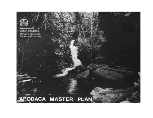
APODACA PROVINCIAL PARK<br />
MASTER PLAN<br />
November, 1983
PART I: SUMMARY AND BACKGROUND<br />
TABLE OF CONTENTS<br />
A. PLAN SUMMARY .................................................................................................................................................. 1<br />
B. REGIONAL AND PROVINCIAL CONTEXT .................................................................................................... 2<br />
C. RESOURCES ........................................................................................................................................................... 4<br />
1. Natural Resources .............................................................................................................................................. 4<br />
2. Cultural Resources .............................................................................................................................................. 8<br />
3. Visual Resources ...............................................................................................................................................10<br />
4. Analysis ............................................................................................................................................................ 10<br />
D. LAND TENURES, OCCUPANCY RIGHTS AND JURISDICTIONS ............................................................. 14<br />
1. Leases and Use Permits ....................................................................................................................................14<br />
2. Fee Simple Lands ..............................................................................................................................................14<br />
3. Other Tenures ....................................................................................................................................................14<br />
4. Trespasses ..........................................................................................................................................................14<br />
5. Mineral Claims ..................................................................................................................................................14<br />
6. Statutory Jurisdictions ......................................................................................................................................14<br />
7. Major Additions and Boundary Adjustments .................................................................................................. 15<br />
E. EXISTING FACILITIES ....................................................................................................................................... 16<br />
F. MARKET ANALYSIS ............................................................................................................................................16<br />
1. Existing Use ......................................................................................................................................................16<br />
2. Day Use ..............................................................................................................................................................16<br />
3. Supply and Demand ........................................................................................................................................ 17<br />
PAGE
PART II: THE PLAN<br />
A.. SPECIFIC OBJECTIVES FOR APODACA PARK ............................................................................................. 18<br />
B. ZONING ................................................................................................................................................................. 18<br />
C. DEVELOPMENT PLAN........................................................................................................................................ 20<br />
D. POLICIES FOR MANAGEMENT AND PLANNING ....................................................................................... 22<br />
1. Resources .......................................................................................................................................................... 22<br />
2. Public Uses ....................................................................................................................................................... 23<br />
E. MARKETING INFORMATION ........................................................................................................................... 29<br />
BIBLIOGRAPHY..............................................................................................................................................................25<br />
LIST OF FIGURES<br />
FIGURE 1: AREA MAP ...................................................................................................................................... 3<br />
FIGURE 2: LOCATION MAP ............................................................................................................................ 3<br />
FIGURE 3: EXISTING LANDSCAPE ..............................................................................................................19<br />
FIGURE 4: DEVELOPMENT ...........................................................................................................................21<br />
ii<br />
PAGE
A. PLAN SUMMARY<br />
1<br />
PART 1: SUMMARY & BACKGROUND<br />
<strong>Apodaca</strong> <strong>Provincial</strong> <strong>Park</strong>, an 8 hectare, Class 'A', Category 6 park located on Bowen Island, was established in 1954, one year after<br />
the property was donated to the Province by Major J. S. Matthews, a noted Vancouver historian, as a memorial to his son who died<br />
at age 22.<br />
Accessible only by water or trail, the park consists of cliffs and rocky knolls and represents an opportunity to provide a unique<br />
walk-in camping and picnicking experience. This scenic park offers activities such as viewing, photography, nature study and<br />
fishing (from rocks).
B. REGIONAL AND PROVINCIAL CONTEXT<br />
2<br />
<strong>Apodaca</strong> <strong>Provincial</strong> <strong>Park</strong> is located on the southwest coast of Bowen Island at the mouth of Howe Sound. The combination of<br />
topography, climate and vegetation gives the site a distinctly "Gulf Islands" character. Access to Bowen Island is via ferry (twenty<br />
minutes) from Horseshoe Bay. From the Bowen Island ferry terminal (Snug Cove), it is another forty-five minute walk by a combination<br />
of public road and trail to the park. Thus, the park provides an opportunity for visitors to recreate on a rocky island using a minimum<br />
of transportation.<br />
The flora of the park and adjacent ecological reserve is sufficiently unique to be of special interest in a regional context. The floral communities<br />
represented in the park are not well represented elsewhere in the Lower Mainland Region.<br />
<strong>Apodaca</strong> <strong>Provincial</strong> <strong>Park</strong> will serve regional recreation and tourism markets. The general park objectives are:<br />
1. Preservation - to preserve the special park features, including the unique plant communities.<br />
2. Recreation - to provide day use opportunities and walk-in overnight use.
C. RESOURCES<br />
1. NATURAL RESOURCES<br />
a) Natural and Regional Landscape<br />
<strong>Apodaca</strong> <strong>Park</strong> is located in the Coast Mountain Natural Region, at the entrance to a major fjord, Howe Sound. The park represents<br />
headlands and rocky knolls on an island.<br />
4<br />
b) Climate<br />
<strong>Apodaca</strong> has a temperate marine climate characterized by cool, dry summers and mild, rainy winters. The southern aspect of the park<br />
means that considerably more insolation is received by the park than the northern side of Bowen Island. The park also lies in a rain<br />
shadow effect created by moisture laden clouds passing over the island until they reach the Howe Sound mountains and drop their<br />
precipitation. The January mean temperature is 4 degrees Celsius. In July, the average temperature is 18 degrees Celsius.<br />
c) Physiography<br />
Steep escarpments rising out of the sea are characteristic of the park, with rocky knolls predominating most of the landscape. Bedrock<br />
geology consists of diorite, basalt and greenstone. The area was severely modified by the effects of glaciation, which ended<br />
approximately 10,000 years before the present (B.P.) There are several well-developed surge channels.
Soils tend to be shallow and of the podzol group. Soils of this type are characterized by being acidic with vegetative<br />
generation being slow, owing partly to the poor moisture retention characteristics.<br />
d) Hydrology<br />
<strong>Apodaca</strong> <strong>Park</strong> features a small stream, Optimist Creek, with a year round flow of water. Water for the creek originates in a<br />
small lake in the ecological reserve adjacent to the park (file no. 6-7-1-5).<br />
There is some downslope movement of water as reflected in seepage areas, but these are not numerous.<br />
e) Vegetation<br />
The park lies within the Coastal Western Hemlock Biogeoclimatic zone. Characteristic species include Douglas Fir<br />
(Pseudotsuga menziesii), Lodgepole Pine (Pinus contorta) and salal (Gautheria shallon). The presence of Pacific Madrone<br />
(Arbutus menziesii) indicates that the park is in a drier sub-zone.<br />
Slope, drainage and local weather patterns contribute to a "rocky knoll" vegetation more typical of the Gulf Islands and Southern<br />
Vancouver Island. Plants included here are: Sea Blush (Plectritis, congesta), Blue-eyed Mary (Collinsia, sp.) and Death Camas<br />
(Zygadenus venosus). There is a small population of Blue Camas (Camassia quamash) and this is one of the few known sites where<br />
this plant grows in the Lower Mainland region.<br />
5
In 1920, a fire swept the island, which accounts partially for the extensive lodgepole pine (Pinus contorta). Some large<br />
Douglas Fir bear fire charred bark.<br />
Rock outcroppings have well established moss/lichen communities (Rhacomitrium, Cladina). Grasses and other<br />
herbaceous plants are evident in swales where sub-surficial moisture travels downslope.<br />
f) Fauna<br />
The offshore waters support a variety of marine birds, including the Marbled Murrelet, pigeon Guillemot and Pelagic cormorant.<br />
Marine mammals include the harbour seal and killer whale. Evidence in the form of pellet groups and browse sign indicates that<br />
Coast Blacktail deer use the park extensively, feeding on the spring growth of salal. Typical forest birds in the park include the<br />
blue grouse, black-throated gray warbler, chestnut-backed chickadee and red-breasted nuthatch.<br />
Intertidal and undersea life includes anemones, Pacific octopus, rockfish and greenling. Tidepools contain populations of<br />
ochre starfish and tidepool sculpin.<br />
6
Blue Camas<br />
A very rare plant in the Lower<br />
Mainland. <strong>Apodaca</strong> is one of its few<br />
known locations.<br />
7<br />
There are a number of beautiful tidepools in<br />
the park. Here purple sea stars live crowded<br />
together under a rocky ledge.
2. CULTURAL RESOURCES<br />
a) Archaeological<br />
No archaeological sites have been found in <strong>Apodaca</strong> <strong>Park</strong>.<br />
8<br />
b) Historical<br />
<strong>Apodaca</strong> was named by Major J. S. Matthews, honouring the name given to the islands at the entrance to Howe Sound by the<br />
Spanish navigator Don Jose Marie Narvaez, who explored the Gulf of Georgia in 1791, one year before Captain Vancouver.<br />
In the early part of the century, Major Matthews' son was in a small boat which was stranded one evening. His son fought his<br />
way through the brush late at night at Snug Cove. When his son died at age 22, the Major bought this property as a memorial and<br />
in 1956, donated it to <strong>Provincial</strong> <strong>Park</strong>s.<br />
Major Matthews named the creek in the park "Optimist Creek" from the Optimist's Club, which had planned on putting a youth<br />
camp on the island.<br />
There is a mine adit just to the north of <strong>Apodaca</strong> Cove at sea level. Evidence for this is in the form of hewn timbers covered with<br />
material from the roof of the adit. No data on this feature could be found, but a considerable number of mineral claims were staked<br />
on the island before the war. This was probably a test shaft.
A mine adit - probably a test tunnel. Lumber was found under debris at bottom of tunnel.<br />
9<br />
Photo unavailable.<br />
The "Grotto" Optimist Creek provides a year round source of drinking water<br />
Photo unavailable.
10<br />
1<br />
3. VISUAL RESOURCES<br />
<strong>Apodaca</strong> <strong>Park</strong> offers visitors some spectacular views of the entrance to Howe Sound and the Strait of Georgia. From the<br />
viewpoints in the park, boats of various sizes from small pleasure craft to the B. C. Ferries ply the waters below. On a clear day,<br />
one can see the mountains of Vancouver Island and the North Shore, including Cypress <strong>Provincial</strong> <strong>Park</strong>.<br />
In spring, the knolls are carpeted with numerous wildflowers with pink and yellow dominating. The dark green pine and Douglas Fir<br />
set off the coppery bark and white flower sprays of the Pacific Madrone.<br />
4. ANALYSIS<br />
a) Major Opportunities and Constraints<br />
CLIMATIC RESOURCES<br />
OPPORTUNITIES CONSTRAINTS<br />
– moderate climate permits year round use of the park – fall and winter rains may discourage use in these seasons<br />
PHYSIOGRAPHIC RESOURCES<br />
OPPORTUNITIES CONSTRAINTS<br />
– rocky knoll topography offers high visual experiences – rocky knoll topography severely limits trail construction<br />
– cliffs may pose danger and limit development in these areas
11<br />
HYDROLOGICAL RESOURCES<br />
OPPORTUNITIES CONSTRAINTS<br />
– Optimist Creek has potable water for park visitors<br />
– a small waterfall and grotto offer visitors delightful visual<br />
experiences<br />
VEGETATION RESOURCES<br />
– water volume is affected by seasonal precipitation patterns.<br />
Summer flow may be low.<br />
OPPORTUNITIES CONSTRAINTS<br />
– spring flowers attract naturalists and photographers – knoll vegetation is unable to withstand heavy foot traffic.<br />
– moss covered rocky knolls give unimpeded views<br />
Regeneration is slow on the shallow soils<br />
– a high fire hazard in summer<br />
WILDLIFE RESOURCES<br />
OPPORTUNITIES CONSTRAINTS<br />
– good place to observe bird life<br />
– tidepools offer opportunities to observe rocky coastline<br />
fauna<br />
CULTURAL RESOURCES<br />
– no major conflicts between wildlife habitat and recreation<br />
use<br />
OPPORTUNITIES CONSTRAINTS<br />
– opportunity to include historical information in regional<br />
interpretive programs (early Spanish navigators)<br />
VISUAL RESOURCES<br />
– no major conflicts between recreation and cultural resources<br />
– safety of adit needs to be confirmed<br />
OPPORTUNITIES CONSTRAINTS<br />
– viewing of scenery and boat traffic at entrance to Howe Sound<br />
and at Strait of Georgia<br />
– spring flowers on rocky knolls provide a visual experience<br />
similar to "Alpine Meadows"<br />
– no known conflicts between recreational use and visual<br />
resources
12<br />
APODACA COVE<br />
The only sheltered bay in the park, but limited in<br />
use as an anchorage by the shingle beach. Note<br />
ferry in background. Wash from ferry also a<br />
limitation.
D. LAND TENURES, OCCUPANCY RIGHTS AND JURISDICTIONS<br />
1. LEASES AND USE PERMITS<br />
<strong>Park</strong> Use Permit No. 620 (Conditional Water License No. 36800) is held by a local resident for domestic water purposes from<br />
Optimist Creek of up to 2273 litres per day. The permit is on a 5 year basis and was renewed in 1982.<br />
2. FEE SIMPLE LANDS<br />
None.<br />
3. OTHER TENURES<br />
None.<br />
4. TRESPASSES<br />
None.<br />
5. MINERAL CLAIMS<br />
None.<br />
6. STATUTORY JURISDICTION<br />
a) Hunting Regulations<br />
Hunting, shooting and discharge of firearms prohibited in park.<br />
14
) Fishing Regulations<br />
<strong>Park</strong> visitors are subject to Federal Government fishing regulations.<br />
c) Water Licenses<br />
Conditional water license #36800 issued for domestic water use under <strong>Park</strong> Use Permit No. 620.<br />
7. MAJOR ADDITIONS AND BOUNDARY ADJUSTMENTS<br />
There is a need to secure access to the park.<br />
15
E. EXISTING FACILITIES<br />
There are no existing facilities.<br />
Access to the park is through Crown lease and private land. A trail, as such, has not been formally established and, in future, a<br />
realignment may be necessary to do so.<br />
F. MARKET ANALYSIS<br />
1. EXISTING USE<br />
The market serving the park objectives, local residents and visitors to Bowen Island includes:<br />
- day use destination (picnicking, camping)<br />
- fishing<br />
- day use touring (hiking, strolling)<br />
<strong>Apodaca</strong> would primarily satisfy a Vancouver-based day use destination market.<br />
2. DAY USE<br />
Use figures are non-existent. However, the Vancouver Natural History Society has taken numerous field trips to the park,<br />
including the spring of 1983. The park is not heavily used because access is not marked.<br />
16
17<br />
3. SUPPLY AND DEMAND<br />
The supply of parks with access to rocky shore areas is becoming scarce. These areas are often prime for housing development.<br />
With the new Greater Vancouver Regional District park on Bowen Island, the park will no doubt become better known. <strong>Apodaca</strong><br />
will provide the old-fashioned, walk-in type picnicking and camping. There is a scarcity of day use park facilities on Bowen Island.<br />
<strong>Apodaca</strong> <strong>Provincial</strong> <strong>Park</strong> primarily serves the Vancouver-based day use touring market.<br />
Data from the British Columbia Ferry Corporation are not available on the ratio of resident/tourist traffic.
18<br />
PART II: THE PLAN<br />
A. SPECIFIC OBJECTIVES FOR APODACA PARK<br />
The objectives for this park are:<br />
1. To preserve <strong>Apodaca</strong> in a natural state and to provide quality recreational use of its features.<br />
2. To provide facilities which complement the park resources and provide an opportunity to the public to enjoy and appreciate<br />
these features.<br />
3. To establish spur trails off the main trail leading to viewpoints and picnicking sites.<br />
4. To establish six walk-in campsites.<br />
B. ZONING<br />
The park is divided into two primary zones - "Natural/Preservation" and "Development." The rationale for zoning is as follows:<br />
1. Natural Zone - includes areas designated to remain in a natural state.<br />
2. Development Zone - includes all areas to be developed for picnicking, camping and trail use.
C. DEVELOPMENT PLAN<br />
20<br />
<strong>Apodaca</strong> <strong>Park</strong> will serve as a ferry ride/walk-in park for Lower Mainland visitors. Design elements will keep facilities informal in<br />
keeping with the character of the landscape.<br />
Facility development will be undertaken as funds become available in relation to regional and provincial priorities.<br />
Phasing will be generally as follows:<br />
Phase I - improve trail in park<br />
- erection of park identification signs (a) trailside at entrance to park and (b) marine portal<br />
- locate and install outhouse<br />
- secure access<br />
Phase II - installation of spur trails to viewpoints<br />
- installation of Type II sign shelter<br />
Phase III - installation of campsites<br />
- erection of interpretive signs
D. POLICIES FOR MANAGEMENT AND PLANNING<br />
1. RESOURCES<br />
a) Land<br />
- ensure protection of area next to the Ecological Reserve so that recreation use from the park will not impact on the reserve<br />
- ensure that access is secured under Section 6.le of the <strong>Park</strong> Act<br />
22<br />
b) Water<br />
- ensure that recreational developments and facility location will not affect the quality of water in Optimist Creek, the only source<br />
of potable water in the park<br />
c) Vegetation<br />
- development to avoid damage to sensitive plant communities ("knoll vegetation")<br />
d), Wildlife<br />
- no special concerns or recommendations<br />
e) Cultural<br />
- include reference to early Spanish and English exploration as part of interpretive plan
2. PUBLIC USES<br />
a) Recreation<br />
Acceptable types of recreation in the park are viewing, nature study, picnicking, photography, walk-in camping, fishing (for<br />
rock fish).<br />
b) Education<br />
The uniqueness of the flora in the Lower Mainland Region regional context provides an attraction for naturalist groups and<br />
professional botanists. Educational use should be encouraged through marketing and information programs.<br />
c) Research<br />
Non-destructive research should be permitted in the park under <strong>Park</strong> Use Permit.<br />
d) Concession<br />
No concessions should be permitted in the park.<br />
e) Leases<br />
No leases should be permitted in the park.<br />
f) Use Permits<br />
Use permits should be issued for non-destructive educational research only.<br />
23
E. MARKETING AND INFORMATION PROGRAM<br />
Following the implementation of Phase I of this plan, a marketing plan should be developed for the park. The plan should<br />
investigate the implications for <strong>Apodaca</strong> of the new (1983) Crippen Regional <strong>Park</strong> (G.V.R.D.).<br />
Marketing should include mention in brochures, maps and tourist accommodation guides.<br />
24
25<br />
BIBLIOGRAPHY<br />
Anon. Bowen Island Study, 1981. Joint study of Ministry of Lands, <strong>Park</strong>s and Housing and Greater Vancouver Regional District.<br />
R. Hankin, Chairperson.<br />
Banton, A. "<strong>Apodaca</strong> <strong>Park</strong>." Discovery, N.S. Vol. 10, No. 3 (No. 189). Vancouver Natural History Society.<br />
Harris, R. C. Personal Comment, April, 1983.<br />
Hirvonen, H. E. Bowen Island: A Landscape Analysis. 1976. Canadian Forestry Service, Victoria, Report BC-X-122.<br />
Matthews, J. S. Letters to R. C. Harris, May and June, 1966. From Vancouver City Archives.


