Final Scoping Report - CSIR
Final Scoping Report - CSIR
Final Scoping Report - CSIR

You also want an ePaper? Increase the reach of your titles
YUMPU automatically turns print PDFs into web optimized ePapers that Google loves.
<strong>Report</strong> Details and<br />
Summary
<strong>CSIR</strong> –July 2012<br />
pg 2<br />
<strong>Report</strong> Details and<br />
Summary<br />
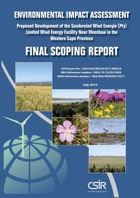
Title: Environmental Impact Assessment for the proposed Sondereind Wind<br />
Energie Pty Ltd (SWE) wind energy project near Vleesbaai, Western Cape<br />
Province: FINAL SCOPING REPORT<br />
Purpose of this report: This <strong>Final</strong> <strong>Scoping</strong> <strong>Report</strong> (FSR) forms part of a series of reports and<br />
information sources that are being provided during the Environmental Impact<br />
Assessment (EIA) process for the proposed SWE Wind Energy Project near<br />
Vleesbaai. In accordance with the EIA Regulations, the purpose of the<br />
<strong>Scoping</strong> <strong>Report</strong> is to:<br />
• Provide a description of the proposed project, including a sufficient level<br />
of detail to enable stakeholders to identify relevant issues and concerns;<br />
• Describe the local environmental and development context within which<br />
the project is proposed, to assist further in identifying issues and<br />
concerns;<br />
• Provide an overview of the process being followed in the <strong>Scoping</strong> Phase,<br />
in particular the public participation process, as well as present the draft<br />
Plan of Study for EIA that would be followed in the subsequent EIA<br />
phase;<br />
• Present the issues and concerns identified to date from the stakeholder<br />
engagement process, together with an explanation of how these issues<br />
will be addressed through the EIA process.<br />
This <strong>Final</strong> <strong>Scoping</strong> <strong>Report</strong> is being made available to all stakeholders for a<br />
21 day review period, with comments to reach <strong>CSIR</strong> by 25 July 2012.<br />
Prepared for: SWE (Pty) Ltd<br />
Contact person: Mr. Douglas Harrowsmith<br />
Published by: <strong>CSIR</strong>, P O Box 320, Stellenbosch, 7599, South Africa<br />
Tel: +27-21-888 2400<br />
Fax: +27-21-888 2693<br />
Lead Authors: Rudolph du Toit<br />
<strong>CSIR</strong> <strong>Report</strong> Number:<br />
<strong>CSIR</strong> Project Number:<br />
DEA Ref Number 12/12/20/2408<br />
<strong>CSIR</strong>/CAS/EMS/ER/2011/0030/B<br />
EMS0008<br />
Date: July 2012<br />
To be cited as: <strong>CSIR</strong>, 2011. Environmental Impact Assessment for the proposed SWE<br />
Wind Energy Facility project near Vleesbaai, Western Cape:<br />
<strong>Final</strong> <strong>Scoping</strong> <strong>Report</strong>. <strong>CSIR</strong> <strong>Report</strong> Number:<br />
<strong>CSIR</strong>/CAS/EMS/ER/2011/0030/B. Stellenbosch.
Chapter 1 Introduction<br />
Chapter 2 Project Description<br />
Chapter 3 Description of the Affected Environment<br />
Chapter 4 Approach to EIA Process and Public Participation<br />
Chapter 5 Issues and Responses Trail<br />
Chapter 6 Plan of study for EIA<br />
Chapter 7 References<br />
APPENDICES Appendix A Curriculum Vitae – Paul Lochner<br />
Appendix B NEMA-DEA Application Form<br />
Appendix C Site notices<br />
Appendix D Advertisements<br />
Appendix E I&AP database<br />
<strong>CSIR</strong> –July 2012<br />
pg 3<br />
<strong>Report</strong> Details and<br />
Summary<br />
Appendix F Correspondence to Interested & Affected Parties<br />
Appendix G Comments received
1 PROJECT BACKGROUND<br />
AND OVERVIEW<br />
The SONDEREIND WIND ENERGIE (Pty)<br />
Limited (SWE) [the company name was changed<br />
from Vleesbaai Independent Power Producer<br />
(VIPP) (Pty) Limited] is a South Africa-based<br />
renewable energy company that develops, builds,<br />
operates and maintains commercial wind powered<br />
generation facilities. SWE work in collaboration<br />
with Rübsamen Windenergie GmbH, a company<br />
based in Germany, established in 1987, that<br />
specialises in project planning, including wind<br />
measurement, energy assessment and the<br />
construction of wind energy facilities.<br />
The intention of this project is to generate<br />
additional electricity that will feed into the national<br />
grid by installing a wind farm with a maximum<br />
capacity of 140 MW near of the village of<br />
Vleesbaai. At a national level, renewable energy<br />
has the potential to play an important role in South<br />
Africa through diversifying the sources of power<br />
generation and reducing the carbon footprint from<br />
fossil fuel power generation, such as coal fired<br />
power stations. Currently, approximately 90% of<br />
South Africa’s power generation is derived from<br />
coal. The Renewable Energy Feed-In Tariffs<br />
(REFIT) released by the government in April 2009<br />
provided an important catalyst to promote interest<br />
and investment in the South African wind energy<br />
market. REFIT was however replaced by the<br />
Independent Power Producer (IPP) Procurement<br />
Programme which adjudicates the allocation of<br />
power purchase agreements (PPA) based on both<br />
price and non-price elements (e.g. environmental<br />
as well as socio-economic input and land-use<br />
consent) with a tender process, the R/kWh price<br />
quoted in REFIT acting as the upper limit of what<br />
would be paid for renewable energy.<br />
At a provincial level, the Western Cape Province is<br />
currently facing considerable constraints in the<br />
availability and stability of electricity supply. This is<br />
as a consequence of South Africa’s electricity<br />
generation and supply system being<br />
overstretched; and that the Western Cape is<br />
reliant on the import of power for the majority of its<br />
electricity needs. Accordingly, it is therefore the<br />
<strong>CSIR</strong> –July 2012<br />
pg 4<br />
<strong>Report</strong> Details and<br />
Summary<br />
intention to generate additional power in the<br />
province. The SWE project is therefore aimed at<br />
assisting in overcoming rolling blackouts<br />
anticipated by the Medium Term Risk Mitigation<br />
Plan for electricity in South Africa from 2011 to<br />
2016 if non-Eskom power generation projects are<br />
not realised. The Western Cape Province<br />
furthermore aims to change the province's current<br />
energy mix to contain 15% renewable energy<br />
sources by 2014 (White Paper on Sustainable<br />
Energy, Western Cape, 2008), which constitutes<br />
approximately 500 to 600 MW of renewable<br />
energy. The Western Cape wind regime is<br />
anticipated to provide at least a 30% capacity<br />
factor (i.e. generate sufficient wind energy 30% of<br />
the time at suitable sites). If this renewable energy<br />
target was to be met entirely through wind energy,<br />
installed capacity of approximately 1600 to<br />
2000 MW would be required. The SWE project will<br />
contribute to attaining this target.<br />
Key components of the project are:<br />
• 30 to 50 turbines of between 2.5 and<br />
5 MW capacity. Turbine hub heights of<br />
between ± 90 and 120 m, with rotor<br />
diameters of between 90 and 140 m, will<br />
be considered. Models of this size group<br />
would have a base of approximately 20 m<br />
x 20 m x 4 m depth.<br />
• Gravel access roads will be built to give<br />
access to turbine, with existing farm roads<br />
being used or upgraded wherever<br />
possible.<br />
• Construction of hard standing areas [laydowns]<br />
for use by cranes during<br />
construction and retained for possible<br />
maintenance use.<br />
A local dedicated substation [or substations with a<br />
maximum of 2] will be constructed on the property<br />
to feed into the Eskom grid via a ± 29 km<br />
distribution line to the Proteus transmission<br />
substation.<br />
Individual wind turbines will be connected to the<br />
internal substation/s via underground cables.
2 ISSUES IDENTIFIED TO DATE<br />
The Draft <strong>Scoping</strong> <strong>Report</strong> (DSR) included the<br />
issues identified to date from the scoping process<br />
as well as an environmental screening study<br />
conducted by ERM. The project and associated<br />
EIA process was advertised in three regional<br />
newspapers and letters with personal notification<br />
regarding the EIA process were mailed to all key<br />
stakeholders on the database. The I&AP register<br />
was updated continuously during the scoping<br />
phase. Comments and concerns raised by I&APs<br />
where captured and are presented in Appendix G<br />
of the DSR. A synthesis of these issues is<br />
provided in the Issues & Response Trail<br />
(Appendix G) of the DSR, which includes an<br />
explanation of how the issues will be addressed<br />
through the EIA.<br />
In summary, the following key issues have been<br />
identified to date:<br />
Ecology<br />
● As a consequence of the high level<br />
of transformation at the site, all<br />
remaining natural vegetation at the<br />
site is considered to be highly<br />
sensitive and the development<br />
should strive to avoid these areas<br />
given the large amounts of low<br />
sensitivity transformed areas<br />
available. The sensitivity of the<br />
transformed areas is low and the<br />
development of the site is not likely<br />
to generate significant ecological<br />
impact provided that standard<br />
mitigation measures are applied.<br />
Birds<br />
● Possible bird mortality from<br />
collisions with turbines or power<br />
lines, in particular for raptors and<br />
larger bird species such as cranes,<br />
bustards and Secretary Birds.<br />
<strong>CSIR</strong> –July 2012<br />
pg 5<br />
<strong>Report</strong> Details and<br />
Summary<br />
Bats<br />
● Identification of potential bat<br />
species occurring in the study area<br />
and their vulnerability to impacts<br />
from turbines.<br />
Visual<br />
● Visual impact of turbines on the<br />
sense of place and landscape<br />
character of the surrounding area.<br />
● Visibility of the turbines from<br />
surrounding areas, in particular<br />
tourism routes and game parks.<br />
Noise<br />
● Impact of noise from operation of<br />
the turbines on nearby residential<br />
areas.<br />
Freshwater ecology<br />
● Impact of the proposed project on<br />
freshwater resources, particularly<br />
wetlands and seasonal pans.<br />
Archaeology and palaeontology<br />
(heritage)<br />
● Potential impact on archaeology,<br />
e.g. stone age artefacts.<br />
● Impact of excavations during<br />
construction on palaeontology, e.g.<br />
fossils.<br />
Faunal & Flora assessment (along<br />
transmission line route and additional<br />
land parcels)<br />
● Impact on fauna and flora along the<br />
proposed transmission line route<br />
and on additional land parcels.
3 CHANGES TO THE FSR<br />
3.1 ADDITIONAL LAND PARCELS<br />
Two land parcels have been added to the original<br />
project site as published in the DSR released on 1<br />
December 2011. These land parcels are all<br />
located on the north-eastern boundary of the<br />
proposed project’s location. The two new portions<br />
added are:<br />
1. Buffelsfontein farm 250 portion 1, and<br />
2. Buffelsfontein farm 250 portion 29<br />
Both portions added are indicated in dark blue on<br />
the diagram hereunder (Figure 1).<br />
In addition to these two added portions, the<br />
diagram also shows the impact of a recent<br />
consolidation of portions of Buffelsfontein 250,<br />
with a subdivision of Grootkloof, to produce Farm<br />
381,<br />
The increased area brought into the projects outer<br />
cadastral is identified in yellow. The ravine, as with<br />
all ravines within the projects cadastral boundary,<br />
is shown in green.<br />
The addition of this added area [farm 381] does<br />
not add to the useful area of the project, and is<br />
included as no subdivision of land is required or<br />
permitted.<br />
Furthermore the diagram hereunder also identifies<br />
the position of two local quarries [marked by<br />
orange circles] which will be used to source<br />
internal road building materials.<br />
<strong>CSIR</strong> –July 2012<br />
pg 6<br />
<strong>Report</strong> Details and<br />
Summary
<strong>CSIR</strong> –July 2012<br />
pg 7
3.2 EXPLANATORY NOTE ON<br />
ADDITION OF NEW LAND<br />
PARCELS<br />
The portions of land added to the cadastral<br />
boundary through this addendum, were added to<br />
respond to, in principle, the following:<br />
• Constraints introduced by amendments<br />
to the Land Use Planning Ordinance<br />
[LUPO] regulations;<br />
• Turbine densities with respect to<br />
turbulence interference and proximity to<br />
residences within the assembled land<br />
portions, the project zone;<br />
• To provide additional options to respond<br />
to necessary, at present unknown, buffer<br />
requirements;<br />
• To provide a contiguous internal layout<br />
to facilitate underground cable layout<br />
and connection;<br />
• To optimize use of best wind zones<br />
across the project zone<br />
3.3 CHANGES TO THE PROPOSED<br />
PLAN OF STUDY<br />
Two additional studies have been added to the<br />
Plan of Study proposed in the DSR.<br />
3.3.1 Freshwater ecology<br />
A freshwater ecology study was added to the<br />
Plan of Study to address the potential impacts<br />
which might result from the addition of the new<br />
land parcels in the vicinity of the Langvlei<br />
wetland area. This study will however not focus<br />
exclusively on the Langvlei, but will also<br />
encompass all the other smaller wetlands and<br />
seasonal pans in the study area.<br />
The abbreviated Terms of reference prepared for<br />
the freshwater ecology study includes:<br />
<strong>CSIR</strong> –July 2012<br />
pg 8<br />
<strong>Report</strong> Details and<br />
Summary<br />
• A desktop aquatic biodiversity<br />
assessment of the study area. This will<br />
cover the development footprint in<br />
relation to available ecological<br />
information related to wetland and<br />
riverine ecosystems functioning within<br />
the region.<br />
• A map demarcating the relevant local<br />
drainage area of the respective<br />
wetland/s, i.e. the wetland, its respective<br />
catchment and other wetland areas<br />
within a 500 m radius of the study area.<br />
This will demonstrate, from a holistic<br />
point of view the connectivity between<br />
the site and the surrounding regions, i.e.<br />
the zone of influence.<br />
• Maps depicting demarcated wetland<br />
areas delineated to a scale of 1:10 000,<br />
following the methodology described by<br />
the DWAF (2005), together with a<br />
classification of delineated wetland<br />
areas, according to the methods<br />
contained in the Level 1 WET-Health<br />
methodology and the latest National<br />
Wetland Classification System (2010). A<br />
detailed field work methodology is<br />
supplied in the Annexure.<br />
• The determination of the ecological state<br />
of any wetland areas, estimating their<br />
biodiversity, conservation and<br />
ecosystem function importance with<br />
regard ecosystem services. SC&A is<br />
presently assessing the Present<br />
Ecological State (PES) as part of a 2<br />
year Water Research Commission<br />
funded study and is thus developing the<br />
latest PES methods in collaboration with<br />
the Department of Water. Note that this<br />
determination will not include avifaunal,<br />
herpetological or invertebrate studies;<br />
however possible habitat for species of<br />
special concern would be commented<br />
on.<br />
• Recommend buffer zones and No-go<br />
areas around any delineated wetland<br />
areas based on the relevant legislation,<br />
e.g. any bioregional plans of<br />
conservation guidelines or best practice.
• Assess the potential impacts, based on<br />
a supplied methodology.<br />
• Provide mitigations regarding project<br />
related impacts, including engineering<br />
services that could negatively affect<br />
demarcated wetland areas.<br />
• Recommend specific actions that could<br />
enhance the wetland functioning in the<br />
areas, allowing the potential for a<br />
positive contribution by the project, e.g.<br />
useful of artificial wetlands in storm<br />
water control.<br />
• Supply the client with geo-referenced<br />
GIS shape files of the wetland / riverine<br />
areas.<br />
• Provide one draft report for comment,<br />
with a maximum of two rounds of<br />
comments addressed.<br />
3.3.2 Faunal & Ecological Assessment<br />
An assessment of the plan and animal life<br />
present in the new land parcels is included in the<br />
Plan of Study. A similar study was completed for<br />
the original study site prior to the start of the<br />
<strong>Scoping</strong>/EIA process but will now be repeated<br />
for the additional land parcels. It should also be<br />
noted that the transmission line route proposed<br />
from the study site to the Eskom Proteus<br />
substation in the north will also be investigated<br />
by this study.<br />
The abbreviated Terms of Reference for the<br />
faunal and ecological assessment includes:<br />
• Carry out fieldwork to locate and<br />
describe the vegetation on the study<br />
area, key focus on the impact footprint(s)<br />
for site(s).<br />
• Determine the species present and<br />
localities within each vegetation types.<br />
• Determine whether the study area falls<br />
wholly or partially within the distribution<br />
range of species listed as Vulnerable,<br />
Endangered or Critically Endangered<br />
and Protected.<br />
• Provide a description of the current state<br />
of the vegetation on site supported by<br />
relevant photographs.<br />
<strong>CSIR</strong> –July 2012<br />
pg 9<br />
<strong>Report</strong> Details and<br />
Summary<br />
• Identify and describe the conservation<br />
value and conservation planning<br />
frameworks relevant to this site<br />
(Regional Planning) for represented<br />
vegetation units.<br />
• Describe the areas where indigenous<br />
vegetation has been transformed<br />
• Determine alien species present; their<br />
distribution within the study area and<br />
recommended management actions.<br />
• Note and record the position of<br />
unusually large specimens of trees.<br />
• Provide a detailed vegetation sensitivity<br />
map of the site, including mapping of<br />
disturbance and transformation on site.<br />
• Faunal Assessment (mammal and<br />
Reptile) will be integrated into Ecological<br />
(Biodiversity) Assessment <strong>Report</strong>.<br />
• Identify and rate potential impacts,<br />
outline mitigation measures and outline<br />
additional management guidelines.<br />
• An Environmental Management Plan<br />
(EMP), including generic rehabilitation<br />
and re-vegetation guideline will be<br />
provided in the report.<br />
The desktop faunal study will entail the following:<br />
• Establish which species may occur in<br />
the area and their relevant conservation<br />
status<br />
• Identify the potential impacts of the wind<br />
project on fauna and faunal mortality<br />
• Identify potential management plans to<br />
reduce the impact of the wind farm on<br />
the local faunal community.
<strong>CSIR</strong> July 2012<br />
pg 1-1<br />
Chapter 1: Introduction<br />
CHAPTER 1. INTRODUCTION 1-3<br />
1.1 PROJECT PROPONENT 1-3<br />
1.2 PROJECT COMPONENTS & LOCATION 1-3<br />
1.3 PROJECT AIM 1-8<br />
1.4 NEED AND DESIRABILITY OF THE PROJECT 1-9<br />
1.5 REQUIREMENTS FOR AN ENVIRONMENTAL IMPACT ASSESSMENT 1-16<br />
1.6 EIA TEAM 1-16<br />
1.7 DETAILS AND EXPERTISE OF THE ENVIRONMENTAL ASSESSMENT<br />
PRACTITIONER (EAP) 1-16<br />
1.8 OBJECTIVES OF THE FINAL SCOPING REPORT 1-17
<strong>CSIR</strong> July 2012<br />
pg 1-2<br />
Chapter 1: Introduction<br />
Table 1.1 Farm name, number and portion of properties over which the proposed project extends 1-4<br />
Table 1.2 Farm name, number and portion of properties included in the transmission line servitude 1-5<br />
Table 1.3 DEA&DP list of 14 questions to determine need and desirability including answers relevant to<br />
the proposed SSWEEW wind energy project 1-10<br />
Table 1.4 EIA Team 1-17<br />
Table 1.5 Summary of where requirements of a <strong>Scoping</strong> <strong>Report</strong> (in terms of Sections 29 and 30 of the<br />
NEMA EIA Regulations) are provided in this Draft <strong>Scoping</strong> <strong>Report</strong> 1-19<br />
Figure 1.1 Location map of the SWE Wind Energy Project (in red outline) near Vleesbaai 1-6<br />
Figure 1.2 Proposed 2 x 132kV transmission line route to Proteus substation 1-7<br />
Figure 1.3 Eden District Municipality SDF 1-14<br />
Figure 1.4 Western Cape Provincial SDF 1-15
1.1 PROJECT PROPONENT<br />
CHAPTER 1. INTRODUCTION<br />
<strong>CSIR</strong> July 2012<br />
pg 1-3<br />
Chapter 1: Introduction<br />
The Sondereind Wind Energie (Pty) Limited (SEW) (formerly known as Vleesbaai Independent<br />
Power Producer (Pty) Limited) is a South Africa-based renewable energy company that was<br />
formed to develop, build, operate and maintain the wind powered generation facility identified<br />
herein. SEW work in collaboration with Rübsamen Windenergie GmbH, a Germany based<br />
company specialising in wind measurement, energy assessment and the planning and<br />
construction of wind energy facilities established in and operational from 1989 (see Figure 1.1).<br />
1.2 PROJECT COMPONENTS & LOCATION<br />
SEW proposes to develop a Wind Energy Facility (WEF) of up to 140 MW installed capacity. The<br />
boundaries of the site are located approximately 1 km west of the town of Vleesbaai, and 2 km<br />
north of the Gouritz River Mouth (approximate centre of project site: 34°17’20’’S by 21°52’10’’E)<br />
in the Western Cape Province of South Africa. The proposed project site currently comprises 35<br />
farm portions or sections of farms (See Table 1.1 for farm details). The facility will be spread-out<br />
over an area of about 4800 ha stretching from the eastern bank of the Gouritz River, to a point<br />
approximately 10 km due north; while the transmission line servitudes encompasses 37 farms<br />
(Table 1.2).<br />
From the final substation serving the WEF connection to PROTEUS substation in the vicinity of the<br />
PetroSA GTL refinery the power lines will be aboveground. The servitude, in which the power<br />
lines to PROTUEUS will be erected, was originally approved for a single 66 kV line. Consequently,<br />
the upgrading of this servitude to a 2 x 132 kV corridor forms part of this EIA process.<br />
Rehabilitation of existing access roads as well as the construction of new access roads to the<br />
proposed turbine locations within the site is also required. No turbines are proposed to be<br />
constructed within the floodplain of the Gouritz River; within a minimum of 2 km of the coastline<br />
or within any of the ravines that are a feature of the site.
<strong>CSIR</strong> July 2012<br />
pg 1-4<br />
Chapter 1: Introduction<br />
Table 1.1 Farm name, number and portion of properties over which the proposed project extends<br />
Portion 12 of Farm 259, Brakkefontein<br />
Portion 11, being the remaining extent of the Farm Brakkefontein 259<br />
Portion 5, being the remaining extent of the Farm Vleesch Baai 251<br />
Portion 0, Farm 263, being the remaining extent of the Farm Ingang 263<br />
Remaining extent of Farm Vleesch Baai 251<br />
Portion 5 of Farm 259, Misgunst<br />
The farm Brakkefontein West 260 (portion 0)<br />
Portion 31 of the farm Brakkefontein no. 256<br />
The farm Zoutpan No. 261 (portion 0)<br />
The remaining portion 0 of the Gouritz River Farm 306, Farm Number 306<br />
Portion 1 of the Gouritz River Farm 306, Farm Number 306<br />
Portion 4 of the Gouritz River Farm 259, Farm Number 259<br />
The remaining extent of the farm Brakkefontein 258<br />
Portion 9 of the farm Brakkefontein 256<br />
Portion 6 of Farm 259, Brakkefontein<br />
Portion 29, the remaining extent of farm Brakkefontein 259<br />
Portion 14, the remaining extent of farm Brakkefontein 259<br />
Portion 7, the remaining extent of farm Brakkefontein 259<br />
Portion 6, of the farm Vleesch Baai 251<br />
Portion 7, the remaining extent of the farm Vleesch Baai 251<br />
Portion 13, the remaining extent of the farm Brakkefontein 256<br />
Portion 18, the remaining extent of the farm Brakkefontein 256<br />
Portion 19, of the farm Brakkefontein 256<br />
Portion 34, of the farm Brakkefontein 256<br />
Portion 2 (the remaining extent) of the farm Vleesch Baai 251<br />
Portion 13 of the farm Vleesch Baai 251<br />
Portion 17 of the farm Brakkefontein 256<br />
The remaining extent of Farm 262/0, Brakkefontein Oos<br />
The farm Brakkefontein 259 portion 3 (the remaining extent)<br />
The farm Vleesch Baai 251, portion 4 (the remaining extent)<br />
The farm Misgunst aan de Gouritz Rivier 257, portion 10<br />
Farm 390 Vleesch Baai<br />
Farm Lamont 393<br />
Portion 35 (a portion of portion 33) of the farm Brakkefontein 256<br />
The remaining extent of Portion 33 of the farm Brakkefontein 256<br />
Remainder of portion 37 of the farm Buffelsfontein 250<br />
Farm Buffelsfontein 381<br />
Portion 15 (a portion of portion 9) of the farm Buffelsfontein 250<br />
Remainder of portion 11 (Fairview) of the farm Buffelsfontein 250
<strong>CSIR</strong> July 2012<br />
pg 1-5<br />
Chapter 1: Introduction<br />
Table 1.2 Farm name, number and portion of properties included in the transmission line servitude<br />
Farm 207, portion 1<br />
Farm 229, portion 1<br />
Farm 229, portion 3<br />
Farm 243, portion 1<br />
Farm 269, portion 1<br />
Farm 243, portion 13<br />
Remainder of Farm 242<br />
Farm 242, portion 1<br />
Farm 241, portion 16<br />
Farm 242, portion 16<br />
Farm 217, portion10<br />
Farm Driefontein 243, portion 8<br />
Farm 243, portion 6<br />
Farm 249, portion 1<br />
Farm 249, portion 5<br />
Farm 243, portion 6<br />
Farm 249, portion 1<br />
Farm Buffelsfontein 250, portion 1<br />
Farm Buffelsfontein 250, portion 29<br />
Farm Buffelsfontein 250, portion 12<br />
Farm Buffelsfontein 250, portion 3<br />
Farm Buffelsfontein 250, portion 4<br />
Farm Witteklip 241, portion 10<br />
Farm Buffelsfontein 250, portion 11<br />
Farm Buffelsfontein 250, portion 26<br />
Farm Buffelsfontein 250, portion15<br />
Farm Buffelsfontein 250, portion 25<br />
Farm Buffelsfontein 250, portion 27<br />
Farm Buffelsfontein 250, portion 9<br />
Farm Buffelsfontein 250, portion 33<br />
Farm Vleesch Baai 251, portion 17<br />
Farm Vleesch Baai 251, portion 5<br />
Remainder of Farm 251<br />
Farm Ingang 263<br />
Farm Keerom 264<br />
Farm Vleesch Baai 251, portion 4<br />
Farm 209, portion 001
Figure 1.1 Location map of the SWE Wind Energy Project (in red outline) near Vleesbaai<br />
<strong>CSIR</strong> July 2012<br />
pg 1-6
Figure 1.2 Proposed 2 x 132kV transmission line route to Proteus substation<br />
<strong>CSIR</strong> July 2012<br />
pg 1-7
1.3 PROJECT AIM<br />
<strong>CSIR</strong> July 2012<br />
pg 1-8<br />
Chapter 1: Introduction<br />
This project intends to generate electricity that will be fed into the national, provincial or<br />
municipal electricity grid by installing a WEF with a maximum installed capacity of 140 MW.<br />
Renewable energy projects, in particular wind energy facilities, present attractive investment<br />
opportunities to potential developers while offering practical support and alternatives to the<br />
strained and fossil fuel dependent national electricity supply. The mature nature of wind energy<br />
technology assures an economy of scale which reduces unit costs of turbines, offering higher<br />
efficiencies than earlier models and delivering more reliable output. This enable developers to<br />
generate a reasonable return on their investment by supplying relatively consistent, competitively<br />
priced energy to the national grid. The renewable energy feed-in tariffs (REFIT) released by the<br />
government in April 2009 provided an important catalyst to promote interest and investment in<br />
the South African wind energy market. REFIT was however recently replaced in the Independent<br />
Power Producer (IPP) Programme by a tender process which adjudicates the allocation of power<br />
purchase agreements (PPA) on both price and non-price elements (e.g. environmental and<br />
financial robustness, BBBEE compliance and socio-economic development criteria).<br />
At a provincial level, the Western Cape Province is currently facing considerable constraints in the<br />
availability of electricity supply. This is a consequence of South Africa’s electricity generation and<br />
supply system being overstretched; and that the Western Cape is reliant on the import of power<br />
for the majority of its electricity needs. The province’s maximum electricity demand of<br />
approximately 3500 to 3900 MW cannot be met by the transmission line connecting the Western<br />
Cape to the national grid. Accordingly, pressure on local generation capacity, most notably the<br />
Koeberg Nuclear Power Station (2 units with combined maximum capacity of 1800 MW), is such<br />
that if one reactor at Koeberg is offline, the entire province experiences supply shortages.<br />
Accordingly, the need has been identified to generate additional power in the province. This<br />
project is aimed at assisting in overcoming rolling blackouts anticipated by the Medium Term Risk<br />
Mitigation Plan for electricity in South Africa from 2011 to 2016 if Eskom power generation<br />
projects are not realised.<br />
Traditional coal-based electricity generation currently contributes approximately 90% of South<br />
Africa’s supply. Generation of new power from wind is predicted to become cheaper than coal by<br />
as early as 2020. Thereafter, wind energy cost is predicted to continue to decline relative to the<br />
rising costs of coal power (NERSA, 2009). This indicates the economic need to develop wind<br />
energy facilities in South Africa.<br />
The development of wind energy is also important for South Africa reducing its overall<br />
environmental footprint, in particular CO₂ emissions from coal fired power generation (including<br />
externality costs). Coal-based power generation is one of the major global sources of CO₂<br />
emissions, which contributes to global warming. Fossil fuel emissions furthermore release<br />
harmful gasses including oxides of sulphur and nitrogen.<br />
If realized, the SWE WEF would contribute to the reduction of future carbon and noxious<br />
emissions resulting from power generation.
<strong>CSIR</strong> July 2012<br />
pg 1-9<br />
Chapter 1: Introduction<br />
Wind generation also avoids the water consumption associated with generation of electricity from<br />
coal. Given that South Africa is mainly an arid country with current and increasingly severe water<br />
constraints, this factor, too weighs in favor of a WEF.<br />
Eskom currently uses approximately 2% of South Africa’s total fresh water resources to produce<br />
power, largely from water-cooled coal power stations. These power stations typically use<br />
approximately 10 000 m³ of fresh water per MW generated, per annum (Eskom presentation,<br />
Water Security Africa, 18-20 May 2009).<br />
Accelerated climate change has the potential to impact on the availability and quantity of water in<br />
South Africa, with decreases in summer rainfall predicted in the interior with increasing instances<br />
of droughts and floods. This creates a risk for water-dependent power generation. By comparison,<br />
wind energy has no direct water consumption; reducing demand on South Africa’s already overstretched<br />
water resources.<br />
The Western Cape Province aims to change the province's current energy mix to contain 15%<br />
renewable energy sources by 2014 (White Paper on Sustainable Energy, Western Cape, 2008),<br />
approximately 500 to 600 MW of available renewable energy. The Western Cape wind regime is<br />
anticipated to provide at least a 30% capacity factor (i.e. generate sufficient wind energy 30% of<br />
the time at suitable sites). If this renewable energy target was to be met entirely by wind energy,<br />
this would therefore require an installed capacity of 1600 to 2000 MW.<br />
The SWE WEF will contribute to this target.<br />
1.4 NEED AND DESIRABILITY OF THE PROJECT<br />
The Western Cape Department of Environmental Affairs and Development Planning (DEA&DP)<br />
guideline on need and desirability (2010) states that the essential aim of investigating the need<br />
and desirability of a proposed project revolves around determining: (a) suitability, i.e. is the<br />
activity proposed in the right location for the suggested land-use/activity and (b) timing, i.e. is it<br />
the right time to develop a given activity?<br />
According to the above guideline, the question of suitability and timing can best be investigated by<br />
considering 14 questions (Table 1.3). The need and desirability of the proposed WEF is<br />
determined in the table below by answering each of the 14 questions. In each instance the<br />
questions is stated first, followed by an answer and a<br />
justification for the answer.
<strong>CSIR</strong> July 2012<br />
pg 1-10<br />
Chapter 1: Introduction<br />
Table 1.3 DEA&DP list of 14 questions to determine need and desirability including answers relevant to the<br />
proposed SEW wind energy project<br />
1. Is the land use (associated with the activity being applied for) considered within the timeframe intended by<br />
the existing approved Spatial Development Framework (SDF) agreed to by the relevant environmental<br />
authority? (i.e. is the proposed development in line with the projects and programmes identified as<br />
priorities within the credible IDP)<br />
Answer: Yes<br />
Justification: The Mossel Bay IDP (2007, page 43 & 67) identifies insufficient electricity supply and lack of<br />
employment and economic opportunity as priority issues to be addressed. The proposed wind energy<br />
facility would help to address the need for increased electricity supply while also creating temporary and<br />
limited permanent employment in the area.<br />
The Draft Eden District Municipality IDP (2012/2017, page 153) requires (under the strategic objective of<br />
executing regional bulk infrastructure planning, and implementation of projects) the consideration and<br />
monitoring of renewable energy options is included as a strategy.<br />
Objective 9 of the Western Cape’s Provincial Spatial Development Framework (SDF) (2010) aims to<br />
minimise the consumption of scarce environmental resources, particularly water, fuel, building materials,<br />
mineral resources, electricity and land. Under this objective it is stated that renewable energy sources<br />
(wind, solar thermal, biomass, and domestic hydro-electricity generation) should comprise 25% of the<br />
Province's energy generation capacity by 2020.<br />
2. Should development, or if applicable, expansion of the town/area concerned in terms of this land use<br />
(associated with the activity being applied for) occur here at this point in time?<br />
Answer: Yes<br />
Justification: Development of the proposed activity would not result in an expansion of the nearby town<br />
(Vleesbaai). Development of a diversified, renewable energy source addresses the need for greater<br />
electrical supply stated in the Mossel Bay IDP (2007, page 43) as well as addressing a provincial need to<br />
increase the share of renewable energy in the provincial energy mix by 15% by 2014 (Western Cape<br />
Provincial White Paper on Sustainable Energy, 2008). <strong>Final</strong>ly, the presence of an abundant renewable<br />
resource (wind) at this specific location adds credence to the development of the proposed wind energy<br />
facility at the proposed location.<br />
Figures 1.3 & 1.4 below illustrate the location of the proposed project relative to the Eden District<br />
Municipality SDF and the Western Province SDF. According to these maps the area in which the project is<br />
located has been designated as a mixture of ecological corridors and intensive agriculture. The<br />
environmental screening study preceding this EIA indicated that very little natural vegetation remains in<br />
the area designated for the proposed WEF; being largely transformed by agriculture. Though ecological<br />
corridors are present in the Vleesbaai area, the proposed project, at present, does not appear to impede on<br />
these.
<strong>CSIR</strong> July 2012<br />
pg 1-11<br />
Chapter 1: Introduction<br />
3. Does the community/area need the activity and the associated land use concerned (is it a societal priority)?<br />
This refers to the strategic as well as local level (e.g. development is a national priority, but within a specific<br />
local context it could be inappropriate)<br />
Answer: Yes<br />
Justification: At a National level Eskom has approximately 40 000 MW of installed capacity with an 8% –<br />
10% reserve margin. Expected demand growth will rapidly erode this margin. This necessitates the<br />
additional generation of at least 3000 MW in the shortest possible time (National Response Document,<br />
2008). As a result the proposed project addresses a national/strategic priority) At a local level, the Mossel<br />
Bay IDP (2007) identifies inadequate electrical supply as a problem facing the Municipality, as well as<br />
identifying the need for additional electrical infrastructure (specifically substations & high and medium<br />
voltage distribution infrastructure). The proposed development will make available approximately 140MW<br />
of installed capacity with associated distribution infrastructure.<br />
4. Are the necessary services with adequate capacity currently available (at the time of application), or must<br />
additional capacity be created to cater for the development?<br />
Answer: Yes<br />
Justification: The existing electrical infrastructure at Proteus is sufficient to support the proposed<br />
development. However, the feed in line from the WEF site to Proteus needs to be upgraded. Accordingly,<br />
distribution lines from the project site to Proteus are part of the proposed activity to be constructed by the<br />
applicant.<br />
5. Is this development provided for in the infrastructure planning of the municipality, and if not what will the<br />
implication be on the infrastructure planning of the municipality (priority and placement of services and<br />
opportunity costs)?<br />
Answer: No<br />
Justification: The Municipality has not heretofore been a generator of electricity; therefore they do not<br />
have an infrastructure development plan. There is no anticipated negative impact on municipal<br />
infrastructure planning (no clash of priority, and/or placement) as the infrastructure required to connect<br />
the proposed WEF will be provided by the applicant. The development is proposed on marginal agricultural<br />
land with little or no existing and/or planned infrastructure. The opportunity benefit of constructing the<br />
proposed WEF will be increased revenue flow to both landowners[resulting in the ability to maintain and<br />
improve farming activities] local community through financial assistance to deserving learners and schools<br />
facility enhancement, direct and indirect employment opportunities and local enterprise development<br />
through having turbines on identified agricultural property.<br />
The opportunity cost of not constructing the proposed facility would be the maintenance of the current<br />
status quo which is marginal agriculture.<br />
6. Is this project part of a national programme to address an issue of national concern or importance?<br />
Answer: Yes<br />
Justification: The National Integrated Resource Plan for Electricity (IRP2) (2011) sets as an objective that<br />
42% of new national energy supply be generated by renewable energy facilities by 2030.
7. Is the development the best practicable environmental option for this land/site?<br />
<strong>CSIR</strong> July 2012<br />
pg 1-12<br />
Chapter 1: Introduction<br />
Answer: Uncertain<br />
Justification: It would be premature to decide on the environmental practicability of the proposed<br />
development prior to the completion of the impact assessment phase of this EIA process. However, the<br />
long-term viability of agriculture (existing land-use) on the farms selected for the WEF site seems marginal,<br />
with some farmers more stressed than others, and subject to global economic and climatic variables. The<br />
proposed WEF will provide an economic stimulus to landowners directly and to the greater region.<br />
8. Would the approval of this application compromise the integrity of the existing approved and credible<br />
municipal IDP and SDF as agreed to by the relevant authorities?<br />
Answer: No<br />
Justification: The proposed activity supports the Mossel Bay IDP (2007, page 43) through increasing<br />
electricity generation and associated distribution infrastructure. The IDP also identifies the creation of<br />
employment and economic opportunities as a major need. The proposed WEF focuses on local job creation<br />
(identified as a need in the Mossel Bay IDP: 2007, page 67 and in central government criteria set for<br />
renewable energy facilities developments) during the construction and operation phases of the project (if<br />
approved by the Department of Environmental Affairs (DEA)). It should however be noted that<br />
employment during construction phase will be temporary and that limited employment opportunities will<br />
be created during the operational phase.<br />
However the developers of the WEF are cognisant of the need for economic development in the area and<br />
are engaging with communities to introduce both socio-economic initiatives and the fostering of local<br />
[separate from and additional to the WEF project] enterprises that will create employment for local<br />
disadvantaged persons. This improvement in economic activity /job creation accordingly addresses an<br />
expressed need in the both the municipal IDP and the governments general aims in poverty alleviation.<br />
9. Would the approval of this application compromise the integrity of the existing environmental<br />
management priorities for the area (e.g. as defined in EMFs), and if so, can it be justified in terms of<br />
sustainability considerations?<br />
Answer: No<br />
Justification: The proposed development does not require active environmental management but rather<br />
mitigation of potential negative environmental impacts during the construction phase of the project (onceoff).<br />
Accordingly the environmental management priorities of the area will not be changed. It should also be<br />
noted that existing agricultural activities can continue on the proposed project area as the footprint of each<br />
turbine is relatively small.<br />
10. Do location factors favour this land use (associated with the activity applied for) at this place? (this relates<br />
to the contextualisation of the proposed land use on this site within its broader context)<br />
Answer: Yes and no<br />
Justification: Location factors in terms of the existing renewable resource (wind) support the proposed<br />
activity at the project site, due to a very favourable wind regime. The site is also located in an area with a<br />
rural character and accordingly will have reduced visibility. On the negative side, the presence of wind<br />
turbines in a rural landscape might be perceived as visually disturbing or intrusive.
<strong>CSIR</strong> July 2012<br />
pg 1-13<br />
Chapter 1: Introduction<br />
11. How will the activity or the land use associated with the activity applied for, impact on sensitive natural<br />
and cultural areas (built and rural/natural environment)?<br />
Answer: Largely neutral in respect of natural sensitivity and potentially negative on cultural areas<br />
Justification: The activity is proposed on transformed agricultural land with very little existing<br />
natural/sensitive vegetation. All structures will be located above the 1:50 year flood line and would be<br />
located outside of the riparian and littoral zone along the eastern bank of the Gouritz River. Accordingly the<br />
impact on sensitive natural areas would be minimal (the EIA process would however need to confirm this).<br />
The impact of the proposed activity on cultural areas is difficult to predict and would potentially be<br />
ambiguous. This is due to the subjective nature of perceptions regarding the relative attraction or<br />
disturbance of wind turbines in a rural landscape. It would however be prudent to expect that some of the<br />
local residents would find the proposed activity to have a negative impact on local cultural areas.<br />
12. How will the development impact on people’s health and wellbeing (e.g. in terms of noise, odours, visual<br />
character and sense of place, etc)?<br />
Answer: Neutral and potentially negative<br />
Justification: The location of the proposed activity in a rural location causes noise impacts to be negligible<br />
(turbine noise will be inaudible at a distance of 500m from turbine base due to ambient noise masking).<br />
Furthermore, wind turbines are generally very safe structures which do not generate any odours,<br />
emissions or significant fire risks. However, as stated previously, the presence of wind turbines in a rural<br />
landscape might be perceived by some as visually intrusive or disturbing and subsequently as a negative<br />
impact on wellbeing.<br />
13. Will the proposed activity or the land use associated with the activity applied for, result in unacceptable<br />
opportunity costs?<br />
Answer: No<br />
Justification: Wind energy facilities can be dismantled and completely removed from the site and do not<br />
permanently prevent alternative land-uses on the same land parcel selected. Furthermore, WEFs are<br />
compatible with most agricultural practices, allowing concurrent use of the land.<br />
14. Will the proposed land use result in unacceptable cumulative impacts?<br />
Answer: Uncertain<br />
Justification: The potential cumulative impact connected to the proposed activity can only be objectively<br />
determined at the end of the EIA process. At present, it is prudent to view the potential cumulative impact<br />
as uncertain. However, given the location of the proposed activity, and given that at least 2 other WEF’s are<br />
proposed in the vicinity of the PetroSA LNG refinery, sufficient information is available to accurately<br />
determine cumulative impacts during the latter part of the EIA process.
Figure 1.3 Eden District Municipality SDF<br />
<strong>CSIR</strong> July 2012<br />
pg 1-14
Figure 1.4 Western Cape Provincial SDF<br />
<strong>CSIR</strong> July 2012<br />
pg 1-15
<strong>CSIR</strong> July 2012<br />
pg 1-16<br />
Chapter 1: Introduction<br />
1.5 REQUIREMENTS FOR AN ENVIRONMENTAL IMPACT ASSESSMENT<br />
Regulations for EIAs were promulgated under Chapter 5 of the National Environmental<br />
Management Act (NEMA, Act 107 of 1998) in Government Gazette 33306 on 18 June 2010. The<br />
proposed activity requires full <strong>Scoping</strong> and Environmental Impact <strong>Report</strong>ing (S&EIR) in terms of<br />
GN.R545, and includes basic assessments required for activities listed in GN.R544 and GN.R546.<br />
The listed activities that are included in the proposed activity are:<br />
1) The construction of facilities or infrastructure for the generation of electricity where<br />
the electricity output is 20 megawatts (MW) or more.<br />
Chapter 4 of the Draft <strong>Scoping</strong> <strong>Report</strong> contains a detailed list of the activities contained in GN<br />
R544 as well as GN R546 which are triggered by the various project components and form part of<br />
this <strong>Scoping</strong> and EIA Process. These listed activities require authorisation from the relevant<br />
authority, in this case the national Department of Environmental Affairs (DEA), as energy related<br />
authorisations have been assigned to national level. The environmental assessment needs to show<br />
the responsible authority (DEA) and the project proponent (SEW) what the consequences of their<br />
actions will be in terms of impacts on the biophysical and socio-economic environment; and how<br />
such impacts should be managed.<br />
1.6 EIA TEAM<br />
The <strong>CSIR</strong> has been appointed by SEW to undertake the EIA required for this project.<br />
The EIA team involved in this EIA is listed in Table 1.4. Most of the specialists are familiar with the<br />
area and have been involved in other specialist studies in the area.<br />
1.7 DETAILS AND EXPERTISE OF THE ENVIRONMENTAL ASSESSMENT<br />
PRACTITIONER (EAP)<br />
The EIA Project Team is being led by Paul Lochner, who has 15 years’ experience in<br />
environmental assessment and management studies, primarily in the leadership and integration<br />
functions (refer to Appendix A for his CV). This has included Strategic Environmental Assessments<br />
(SEA), EIAs and EMPs. He has been a certified Environmental Assessment Practitioner for South<br />
Africa (EAPSA) since July 2003; and has conducted several EIA processes both in South Africa and<br />
internationally. Examples of EIAs include the Coega Aluminium Smelter EIA, EIA for the expansion<br />
of the container terminal and construction of an administration craft harbour at the Port of<br />
Ngqura, Thesen Islands EIA at Knysna, Century City Wetlands EIA in Cape Town, EIA for a resort<br />
development on Fregate Island in the Seychelles, and ESIA for a proposed alumina refinery at<br />
Sosnogorsk in the Komi Republic of Russia. He has also prepared various EMPs, such as the EMP<br />
for the Rietvlei Wetland Reserve (Cape Town), EMP for Century City wetlands, EMP for Eskom<br />
Wind Energy Project (Klipheuwel) and the EMP for the Coega Aluminium Smelter. He has<br />
authored several Guidelines, such as the “Overview of Integrated Environmental Management”<br />
information document for DEAT in 2004; and the “Guideline for EMPs” published in 2005 by the<br />
Western Cape Government.
<strong>CSIR</strong> July 2012<br />
pg 1-17<br />
Chapter 1: Introduction<br />
Paul will be supported by a <strong>CSIR</strong> Project Manager, Rudolph du Toit. Rudolph managed the<br />
InnoWind Western Cape Wind Energy EIA project for the development of 4 commercial wind<br />
energy facilities with a combine installed capacity of 200 MW as well as 4 Basic Assessments for<br />
the erection of wind monitoring masts and infrastructure associated with the InnoWind project.<br />
He also gained international EIA experience in Cameroon through managing the Glencore (Pty)<br />
Ltd Environmental and Social Impact Assessment (ESIA) for Offshore Exploration Drilling<br />
Operations in the Matanda Block.<br />
Table 1.4 EIA Team<br />
EIA Management Team<br />
NAME ORGANISATION ROLE<br />
Paul Lochner <strong>CSIR</strong> Project Leader (EAPSA)<br />
Rudolph duToit <strong>CSIR</strong> Project Manager<br />
SPECIALIST TEAM*<br />
Chris van Rooyen, Chris van Rooyen Consulting Avifauna (birds)<br />
Kate MacEwan Natural Scientific Services cc Bats<br />
Henry Holland MapThis Visual<br />
Brett Williams SafeTech Noise<br />
Dr Jonathan Kaplan Agency for Cultural Resource Management Archaeology<br />
Dr John Almond Natura Viva Palaeontology<br />
Dr Hugo van Zyl Independent Economic Researchers Socio-economic<br />
Johan Lantz Private consultant Soil potential<br />
Dr Brian Colloty Scherman Colloty & Associates Freshwater ecology<br />
Simon Todd Simon Todd Consulting Terrestrial ecology<br />
1.8 OBJECTIVES OF THE FINAL SCOPING REPORT<br />
The <strong>Scoping</strong> Phase of the EIA refers to the process of determining the spatial and temporal<br />
boundaries for the EIA. In broad terms, this involves three important activities:<br />
Confirming the process to be followed and opportunities for stakeholder engagement;<br />
Clarifying the project scope and alternatives to be covered; and<br />
Identifying the key issues to be addressed in the impact assessment phase and the<br />
approach to be followed in addressing these issues.<br />
This is done through parallel initiatives of consulting with the lead authorities involved in the<br />
decision-making for this EIA application, consulting with the public to ensure that local issues are<br />
well understood, and consulting with the EIA specialist team to ensure that “technical” issues are<br />
identified. The scoping process is supported by a review of relevant background literature on the<br />
local area. Through this comprehensive process the environmental assessment can identify and<br />
focus on key issues requiring assessment and identify reasonable alternatives.<br />
The primary objective of the Draft <strong>Scoping</strong> <strong>Report</strong> is to present key stakeholders (including<br />
affected organs of state) with an overview of the project and key issues that require assessment in<br />
the EIA Phase, and allow the opportunity for the identification of additional issues that may
<strong>CSIR</strong> July 2012<br />
pg 1-18<br />
Chapter 1: Introduction<br />
require assessment. Issues raised in response to the Draft <strong>Scoping</strong> <strong>Report</strong> will be captured in an<br />
Issues Trail and be included in the <strong>Final</strong> <strong>Scoping</strong> <strong>Report</strong> and Plan of Study for EIA. These<br />
documents will be submitted to the competent authority, the National Department of<br />
Environmental Affairs (DEA), for approval. This approval is planned to mark the end of the<br />
<strong>Scoping</strong> phase after which the EIA process moves into the impact assessment and reporting<br />
phases.<br />
In terms of legal requirements a crucial objective of the Draft <strong>Scoping</strong> <strong>Report</strong> is to satisfy the<br />
requirements of Regulations 29 and 30 of the NEMA EIA Regulations. These sections regulate and<br />
prescribe the content of the <strong>Scoping</strong> <strong>Report</strong>s and specify the type of supporting information that<br />
must accompany the submission of the <strong>Scoping</strong> <strong>Report</strong> to the authorities. An overview of where<br />
the requirements of Sections 29 and 30 are addressed in this Draft <strong>Scoping</strong> <strong>Report</strong> is presented in<br />
Table 1.5. Furthermore, this process is designed to satisfy the requirements of Regulations 57, 58<br />
and 59 of the NEMA EIA Regulations relating to the public participation process and, specifically,<br />
the registration of and submissions from interested and affected parties.<br />
Table 1.5/…
<strong>CSIR</strong> July 2012<br />
pg 1-19<br />
Chapter 1: Introduction<br />
Table 1.5 Summary of where requirements of a <strong>Scoping</strong> <strong>Report</strong> (in terms of Sections 28 of the NEMA EIA<br />
Regulations) are provided in this <strong>Final</strong> <strong>Scoping</strong> <strong>Report</strong><br />
Section Requirement for <strong>Scoping</strong> <strong>Report</strong> Where this is provided in<br />
this Draft <strong>Scoping</strong> <strong>Report</strong><br />
28 (1)(a) Details of the EAP who prepared the report. Chapter 1 & Appendix A<br />
28 (1)(b) Description of the proposed activity Chapter 2<br />
28 (1)(c) Description of feasible and reasonable alternatives Chapter 4<br />
28 (1)(d)<br />
Description of the property and the location of the activity on the<br />
property<br />
Chapters 1, 2 & 3<br />
28 (1)(e)<br />
Description of the environment that might be affected by the Chapter 3<br />
activity and the manner in which the activity might be affected by<br />
the environment<br />
28 (1)(f)<br />
Identification of legislation and guidelines considered for the Chapter 1 & 4<br />
preparation of <strong>Scoping</strong> <strong>Report</strong><br />
28 (1)(g)<br />
Description of environmental issues and potential impacts,<br />
including cumulative impacts<br />
Chapter 6<br />
28 (1)(h)(i)<br />
Steps taken to notify potential interested and affected parties Chapter 4 & Appendix D<br />
(I&APs) of the application<br />
28 (1)(h)(ii) Proof of notice boards, advertisements and notices to I&APs Appendices C, D & G<br />
28 (1)(h)(iii)<br />
List of all persons or organizations identified and registered as Appendix E<br />
I&APs in terms of regulation 55<br />
28 (1)(h)(iv)<br />
Summary of issues raised by I&APs, date received and response by<br />
EAP<br />
Chapter 5<br />
28 (1)(i) Description of the need and desirability of the proposed activity Chapter 1<br />
28 (1)(j)<br />
Description of identified potential alternatives to the proposed Chapter 3, 4 & 6<br />
activity, including advantages and disadvantages that the proposed<br />
activity or alternatives may have on the environment and the<br />
community that may be affected by the activity<br />
28 (1)(k)<br />
Copies of representations, objections and comments received in<br />
connection with the application or <strong>Scoping</strong> <strong>Report</strong> from I&APs<br />
Appendix G<br />
28 (1)(l)<br />
Copies of the minutes of meetings held by the EAP with I&APs and<br />
other role players<br />
Appendix H<br />
28(1)(m)<br />
Any responses by the EAP to those representations, objections, Chapter 5<br />
comments and views<br />
Description of tasks undertaken as part of the EIA, including Chapter 6<br />
28 (1)(n)(i) specialists reports and the manner in which tasks will be<br />
undertaken<br />
28 (1)(n)(ii) Indication of stages at which competent authority will be consulted Chapter 4<br />
28 (1)(n)(iii)<br />
Description of proposed method for assessing environmental Chapter 6<br />
issues and alternatives, including “no project” alternative<br />
28 (1)(i)(iv) Particulars of public participation process during EIA Chapter 6<br />
28 (1)(o) Specific information required by competent authority N/A<br />
28 (2)<br />
Guidelines applicable to the kind of activity which is the subject of<br />
the application<br />
Chapter 4<br />
28 (3)<br />
Written proof of the investigation to the authority as required by<br />
Section 24(4)(b)(i) of the NEMA Act.<br />
Chapter 4, 5 & 7
<strong>CSIR</strong> – July 2012<br />
pg 2-1<br />
Chapter 2 : Project Description<br />
CHAPTER 2. PROJECT DESCRIPTION 2-2<br />
2.1 SITE SELECTION 2-2<br />
2.2 KEY COMPONENTS OF THE PROPOSED WIND ENERGY FACILITY 2-2<br />
2.3 WIND TURBINE COMPONENT & MONOPOLE TRANSMISSION LINE<br />
DESCRIPTION 2-4<br />
2.4 PROJECT ACTIVITIES 2-9<br />
2.4.1 Construction 2-12<br />
2.4.2 Operation and maintenance 2-13<br />
2.4.3 Period of operation 2-13<br />
2.4.4 Decommissioning 2-13<br />
Figure 2.1 Generic design for a horizontal axis wind turbine 2-5<br />
Figure 2.2 Typical steel monopole transmission structure proposed to transmit electricity to the Proteus<br />
substation. 2-7<br />
Figure 2.3 Steel monopole transmission structure displayed on left with steel lattice structure in the right 2-8<br />
Figure 2.4 3 MW turbine layout 2-10<br />
Figure 2.5 4.5 MW turbine layout 2-11
<strong>CSIR</strong> – July 2012<br />
pg 2-2<br />
Chapter 2 : Project Description<br />
CHAPTER 2. PROJECT DESCRIPTION<br />
This chapter is based on information provided by SWE. A description of the site location and<br />
adjacent land use is provided in Chapter 3.<br />
2.1 SITE SELECTION<br />
During the pre-feasibility phase of the project, SWE reviewed a range of potential sites in the Eden<br />
Region, including site visits to three sites that were short-listed. These sites were evaluated based<br />
on a range of criteria such as:<br />
Local wind climate (the wind regime in the area appears favourable);<br />
Local power line network, including existing grid availability, stability and capacity, local<br />
power utilisation, future developments and planned power line upgrades;<br />
Proximity to conservation areas such as national parks, nature reserves and wetlands and<br />
Important Birding Areas (IBAs);<br />
Proximity to the local registered aviation and military zones;<br />
Not within Important Birding Area;<br />
Road access for construction and operational maintenance;<br />
Engagement with landowners.<br />
Based on the above review, the Brakkefontein/Buffelsfontein/Misgunst site was selected to be<br />
taken forward (the subject of this EIA).<br />
2.2 KEY COMPONENTS OF THE PROPOSED WIND ENERGY FACILITY<br />
The facility and its associated infrastructure will comprise the following infrastructure:<br />
Wind turbines<br />
Turbine technology has not at this stage been selected but up to 50 turbines with an<br />
installed capacity of between 2.5 MW and 4.5 MW each, depending on the final design, is<br />
envisaged. Hub heights of up to 120 m and rotor diameters of between 90 m and 140 m<br />
are possible. A possible turbine considered is the 3 MW Vestas V112 with a hub height of<br />
119 m and a rotor diameter of 112 m. Turbines will be supported on reinforced concrete<br />
spread foundations (maximum 20 m x 20 m x 4 m deep). The operational life of the wind<br />
turbines is expected to be a minimum of 25 years. Turbine life can be extended beyond 25<br />
years through regular maintenance and/or technology upgrades.<br />
Gravel-surfaced [compacted hard stand areas] of approximately 2100m² adjacent to each<br />
turbine will be used by cranes during construction and retained for maintenance use<br />
throughout the life span of the project.
<strong>CSIR</strong> – July 2012<br />
pg 2-3<br />
Chapter 2 : Project Description<br />
Lay down areas of 40 m x 50 m will be utilised during assembly stage of construction.<br />
These will be firm, cleared areas on which containers, turbines; rotor blades can be<br />
unloaded (all onto timber bearers) and handled during the assembly phase.<br />
Electrical connections<br />
The SWE-WEF may install one internal substation as a collection point for energy<br />
generated by turbines in the western half of the facility, to be connected to a second<br />
substation on or near the northern boundary of the site, dependent on economic viability<br />
and generation loss calculation during final planning; alternatively one substation only<br />
will be constructed.<br />
From this latter substation connection to the Proteus transmission substation will be via 2<br />
x 132 kV distribution lines of approximately 29 kilometres to be erected along an existing<br />
distribution line corridor from the SWE-WEF site to the Proteus substation in the vicinity<br />
of the PetroSA GTL refinery (formerly known as MossGas), along the established servitude<br />
alignment.<br />
Power lines connecting each turbine to the proposed on-site substations will run<br />
underground.<br />
Other infrastructure<br />
Roads<br />
Control rooms (size 10 m x 10 m) are required for the wind farm.<br />
Fencing as required around the substation and the control room.<br />
Site security measures as may be required.<br />
Gravel surfaced access roads to the turbines will be constructed (approx. 4.5 m in general<br />
width with some sections being wider and having corner radii of 50 m). The developer<br />
has committed to use, wherever possible, existing access roads, upgrading them as<br />
required.<br />
The roads will include temporary turning circles for large trucks.<br />
Temporary activities during construction<br />
Existing borrow pits/quarries will be used as far as possible, for suitable material. The size<br />
of these pits will be dependent on the terrain and need for granular fill material for use in<br />
construction. Material from turbine foundation pits will also be used where its quality is<br />
suitable for compaction. In the provision of hardstand. At the end of construction where,<br />
necessary, pits will be backfilled using surplus excavated material from the foundations.<br />
Construction consists of three distinct components: civil construction; electrical installation and<br />
wind turbine erection; and commissioning. The construction and commissioning phase of the<br />
project will typically require 12 to 18 months. Employment across various skill levels will be
<strong>CSIR</strong> – July 2012<br />
pg 2-4<br />
Chapter 2 : Project Description<br />
created during the construction phase of the project. Additional secondary business opportunities<br />
for the local and regional economies will be provided. Though fewer people will be employed<br />
during the operational phase, it will provide opportunities for skills training and business<br />
development in the area.<br />
2.3 WIND TURBINE COMPONENT & MONOPOLE TRANSMISSION LINE<br />
DESCRIPTION<br />
Modern wind energy turbines are mounted on either a vertical or horizontal axis. Because vertical<br />
axis wind turbines are generally less efficient than horizontal axis turbines, and are not applicable<br />
to large scale generation installations, all wind turbines for primary generation are mounted on a<br />
horizontal axis, as are those proposed for the SWE-WEF. A typical horizontal-axis turbine consists<br />
of the following components, shown in Figure 2.1:<br />
When rotor blades are exposed to wind, the action of moving air on the rotor blade,<br />
which is aerodynamically shaped, causes it to move. This movement produces kinetic<br />
energy which converts to rotation of the rotor blade attached to the rotor hub. These<br />
blades are bolted to a rotor hub.<br />
The nacelle is a casing that contains the shaft, gearbox, electronic control unit, yaw<br />
controller, brakes and the generator. The shaft is connected to the centre of the rotor hub,<br />
and turns in concert with the rotor hub at speeds, of 5 – 18 rpm. The shaft is connected<br />
through a gearbox to a high speed shaft (1000-1800 rpm) that connects to a generator,<br />
which is an assembly of permanent magnets that surrounds a wire coil. When the rotor<br />
turns the shaft, the shaft in turn spins, via its gearing, the assembly of magnets. This action<br />
generates voltage in the coil. This provides alternating current for distribution through<br />
power lines<br />
The tower supports the rotor and nacelle and provides the height for the rotor blades to<br />
adequately clear the ground and operate in higher wind speeds found at elevation above<br />
ground level. With a higher tower electricity output increases.<br />
The turbine has electrical equipment to carry the electricity from the generator down<br />
through the tower. This equipment also powers the safety controls on the turbine.
<strong>CSIR</strong> – July 2012<br />
pg 2-5<br />
Chapter 2 : Project Description<br />
Figure 2.1 Generic design for a horizontal axis wind turbine<br />
(Source: Encyclopaedia of Renewable Energy and Sustainable Living)<br />
The output of a wind turbine depends on the velocity of the wind, height of the hub, length of the<br />
rotor blades and the dimension of the generator. The turbines envisaged for SWE will have a<br />
maximum hub height of 120 m, a maximum rotor blade diameter of between 90 & 140 m and<br />
maximum rotor sweep (circular area available for producing power) of up to 16,000 m 2. Each<br />
turbine will have an installed power generation capacity of between 2.5 MW and 5 MW.<br />
Wind turbines are designed to deliver peak efficiency at a specific wind speed, and manufacturers<br />
provide power curves that show how output varies with wind speed. Turbines have a start-up<br />
speed, which is the speed at which the rotor and blades start to rotate, and a cut-in speed, the<br />
minimum wind speed at which usable power is generated. This is typically about 3 - 4 metres per<br />
second. The cut-out speed is a safety feature that protects the wind turbine from mechanical<br />
damage, and is the highest wind speed at which the turbine will stop producing power. This is<br />
typically about 25 meters per second. As soon as the wind drops back to a safe level, the turbine<br />
usually resumes normal operation. The survival wind speed is about 60 m/s, this corresponds to<br />
216 km/h. The rated speed is the minimum wind speed at which the turbine delivers peak<br />
efficiency to generate its designated rated power. The rated speed of the proposed 3 MW turbines<br />
is 12 meters per second. Power output from a turbine increases as the wind speed increases, and<br />
usually levels off above the rated speed. This is the furling speed, which is the amount of wind
<strong>CSIR</strong> – July 2012<br />
pg 2-6<br />
Chapter 2 : Project Description<br />
required to produce the maximum power that a turbine is capable of generating; any wind in<br />
excess of that speed will not generate more than this maximum power generation capacity.<br />
Two primary transmission structures are generally used to deliver power in South Africa; namely:<br />
the steel monopole and steel lattice structures. Steel monopole structures will be used for the<br />
proposed 2 x 132 kV lines connecting the SEW-WEF with the Eskom Proteus substation. A typical<br />
steel monopole structure is shown in Figure 2.2 and Figure 2.3:
<strong>CSIR</strong> – July 2012<br />
pg 2-7<br />
Chapter 2 : Project Description<br />
Figure 2.2 Typical<br />
steel monopole<br />
transmission<br />
structure proposed to<br />
transmit electricity<br />
to the Proteus<br />
substation.<br />
(Source: ESKOM)
<strong>CSIR</strong> – July 2012<br />
pg 2-8<br />
Chapter 2 : Project Description<br />
Figure 2.3 Steel monopole transmission structure displayed on left with steel lattice<br />
structure in the right<br />
(Source: ESKOM)
2.4 LAYOUT ALTERNATIVES<br />
<strong>CSIR</strong> – July 2012<br />
pg 2-9<br />
Chapter 2 : Project Description<br />
At this stage of the EIA process two turbine layout alternatives are being considered, namely a<br />
3 MW (Figure 2.4) and a 4.5 MW (Figure 2.5) layout. These layouts are provisional and will be<br />
adapted based on the findings of the specialist studies during the Impact Assessment phase of this<br />
EIA process.
Figure 2.4 3 MW turbine layout<br />
<strong>CSIR</strong> – July 2012<br />
pg 2-10<br />
Chapter 2 : Project Description
Figure 2.5 Proposed 4.5 MW turbine layout<br />
<strong>CSIR</strong> – July 2012<br />
pg 2-11<br />
Chapter 2 : Project Description
2.5 PROJECT ACTIVITIES<br />
2.5.1 Construction<br />
<strong>CSIR</strong> – July 2012<br />
pg 2-12<br />
Chapter 2 : Project Description<br />
Construction is planned to start in 2013, and will take up to 18 months. A further month will be<br />
devoted to commissioning and testing each turbine.<br />
Site Preparation<br />
A geotechnical survey will be undertaken before each turbine is set out.<br />
Access roads<br />
Upgrading of existing roads and construction of new internal roads will be required to<br />
accommodate a grader, digger loader, excavator, rollers, water cart and tippers.<br />
Workforce facilities and laydown areas<br />
Facilities for a site office, first aid station, ablution and change facilities, and any other support the<br />
workforce may need, will need to be established for the construction phase. At each turbine site,<br />
vegetation will be cleared to create a laydown area for temporary storage of equipment and<br />
supplies. This will include space for parking and loading/offloading of trucks and dumpers,<br />
assembling turbine components and a hard standing pad for the crane that will erect the turbine<br />
towers.<br />
Turbines<br />
Vegetation will be cleared for excavation of foundations for the turbines. All soil removed will be<br />
stored for backfill. Geotechnical and structural engineers will assess the site conditions and design<br />
a foundation that is suited to the site. Foundations are constructed from steel, gravel and concrete.<br />
Turbines will be erected one at a time. The tower is first assembled in sections, using two cranes,<br />
the nacelle will then be lifted into position at the top of the tower. The rotor (including the blades<br />
and the hub) will be assembled on the ground and then lifted into position and secured using two<br />
cranes. Figure 2.6 to Figure 2.16 illustrates how this process is executed.
Electrical infrastructure and connections<br />
<strong>CSIR</strong> – July 2012<br />
pg 2-13<br />
Chapter 2 : Project Description<br />
All internal connections between turbines and substations will be installed below ground. Up to<br />
two substations could be installed one to serve the western half the other the eastern half and to<br />
receive the final connection from the western substation.<br />
From the Eastern substation connection to Proteus substation for connection to the transmission<br />
grid will be via an existing servitude upgraded to accept the capacity of the WEF.<br />
Site remediation<br />
Temporary work areas will be rehabilitated and restored when construction has ended and<br />
equipment removed. The goal will be to restore those portions of the site subjected to temporary<br />
use to its current land use (i.e. agriculture).<br />
2.5.2 Operation and maintenance<br />
SWE or the turbine manufacturer providing overall equipment guarantees and service<br />
supervision, will remotely monitor the operation and maintenance of the turbines. Over the<br />
lifetime of the turbines, the maintenance schedule is an initial commissioning & handover<br />
inspection, followed by semi-annual, annual and two and five year inspections, depending on the<br />
type of turbine. Maintenance requires general cleaning of all components, changing of oil and<br />
replacement of brake lining. No heavy vehicles are required to do this.<br />
2.5.3 Period of operation<br />
The operational life of the wind turbines is expected to be a minimum of 25 years. Turbine life can<br />
be extended beyond 25 years through regular maintenance and/or technology upgrades. The land<br />
on which the facility will be established is leased in its entirety by the developer with access and<br />
occupation rights ceded to each individual property owner for a period of 65 years. The<br />
appropriate land zoning as detailed in the Land Use Planning Ordinance (LUPO) of 1985, is<br />
consented use for renewable energy (For which LUPO has been amended. See Provincial Gazette<br />
Nr. 6875) will be applied for by the proponent at the Mossel Bay Local Municipality.<br />
2.5.4 Decommissioning<br />
This involves removing the turbines, and the concrete footings to allow natural vegetation growth.<br />
The costs of decommissioning will be covered by the scrap/recycle value of the turbines and by<br />
the company backed by suitable performance guarantees. Prior to the commencement of the<br />
project, and in accordance with the amended Land Use Planning Ordinance (LUPO) published in<br />
the Province of Western Cape: Provincial Gazette nr. 6894 on 29 July 2011 1, funding to cover the<br />
cost of decommissioning and rehabilitation has to be made available to the Mossel Bay<br />
1<br />
Available online at: http://www.greengazette.co.za/documents/provincial-gazette-for-western-cape-6894-of-29-jul-<br />
2011_20110729-WCP-06894. Assessed 27 June 2012
<strong>CSIR</strong> – July 2012<br />
pg 2-14<br />
Chapter 2 : Project Description<br />
Municipality. These funds will be utilised to decommission the facility if the developer would no<br />
longer be able to do so. This security can either be in the form of insurance or a fund managed by<br />
the municipality.<br />
Any other supporting infrastructure no longer in use will also be removed from the site and either<br />
disposed of or recycled.
<strong>CSIR</strong> – July 2012<br />
pg 2-15<br />
Chapter 2 : Project Description<br />
Turbine tower being transported Concrete base for the turbine<br />
Rotor blade being transported Internal access roads to turbine sites<br />
Tower section being lifted Rotor placed into position
<strong>CSIR</strong> – July 2012<br />
pg 2-16<br />
Chapter 2 : Project Description<br />
Rotor blade hub being lifted Nacelle being lifted<br />
Nacelle placed into position Tower sections placed into position
<strong>CSIR</strong> – July 2012<br />
pg 3-1<br />
Chapter 3 :<br />
Description of the<br />
Affected Environment<br />
CHAPTER 3. PROJECT DESCRIPTION 3-3<br />
3.1 INTRODUCTION 3-3<br />
3.2 LOCATION OF THE STUDY AREA 3-3<br />
3.3 ADAPHIC BASELINE 3-8<br />
3.3.1 Climate 3-8<br />
3.3.2 Topography 3-8<br />
3.3.3 Geology, Soils and Hydrology 3-8<br />
3.3.4 Agricultural Potential 3-9<br />
3.3.5 Visual Exposure 3-9<br />
3.4 BIOPHYSICAL BASELINE 3-9<br />
3.4.1 Description of Habitats and Vegetation Types 3-9<br />
3.4.2 Mammals, Reptiles and Amphibians 3-16<br />
3.5 SOCIO-ECONOMIC BASELINE 3-22<br />
3.5.1 Demographic Profile 3-22<br />
3.5.2 Economy 3-22<br />
3.5.3 Infrastructure, Services and Amenities 3-23<br />
3.5.4 Tourism Activities 3-23<br />
3.6 PLANNING CONTEXT AND SURROUNDING LAND USES 3-24<br />
3.6.1 Strategic Environmental Framework (SEF) for Wind Farms 3-24<br />
3.6.2 Western Cape Strategic Guidelines for Wind Farms 3-25<br />
3.6.3 Interpretation of Guidelines to Vleesbaai SEW-WEF Project Site 3-29
Table 3.1 Farm name and portion included in the proposed Vleesbaai wind energy<br />
project 3-4<br />
Table 3.2 Farm name, number and portion of properties included in the<br />
transmission line servitude 3-5<br />
Table 3.2 Actual Bat Species Identified in the Vleesbaai Study Area 3-17<br />
Table 3.3 Priority Avifauna Species for the Vleesbaai Wind Farm selected on the<br />
basis of South African (Barnes 2000) or global conservation status<br />
(www.iucnredlist.org or http://www.birdlife.org/datazone/species/),<br />
level of endemicity, relative abundance on site (SABAP reporting rates,<br />
direct observation), and estimated conservation or ecological significance<br />
of the local population. Red-listed endemic species are shaded in grey. 3-19<br />
Table 3.4 Access to Basic Service Delivery in the Eden District Municipality 3-23<br />
Table 3.5 Criteria Used to Inform Wind Farm Site Selection (and Buffers) (modified<br />
from DEADP/CNdV 2006) 3-27<br />
Figure 3.1 Location of the proposed wind farm near Vleesbaai 3-7<br />
Figure 3.2 Vegetation types of the study site and surrounding area as assessed during<br />
pre-feasibility (Note: 1: Turbine positions and ratings are theoretical and<br />
will be informed by scoping study. 2: The above diagram indicates the<br />
extent of the WEF as during the pre-feasibility screening phase, not the<br />
current extent, and is used to illustrated the vegetation cover present in the<br />
area). 3-12<br />
Figure 3.3: Critical Biodiversity areas (Note: 1: Turbine positions and ratings are<br />
theoretical and will be informed by scoping study. 2: The above diagram<br />
indicates the extent of the WEF as during the pre-feasibility screening<br />
phase, not the current extent, and is used to illustrated the vegetation cover<br />
present in the area). 3-15<br />
Figure 3.4 Framework for location of wind energy projects based on landscape<br />
character (Strategic Initiative to Introduce Commercial Land Based Wind<br />
Energy Development in the Western Cape, 2006) 3-31<br />
<strong>CSIR</strong> – July 2012<br />
pg 3-2<br />
Chapter 3 :<br />
Description of the<br />
Affected Environment
3.1 INTRODUCTION<br />
<strong>CSIR</strong> – July 2012<br />
pg 3-3<br />
Chapter 3 :<br />
Description of the<br />
Affected Environment<br />
CHAPTER 3. PROJECT DESCRIPTION<br />
This section of the Draft <strong>Scoping</strong> <strong>Report</strong> provides a description of the environment that may be<br />
affected by the proposed SEW-WEF near Vleesbaai in the Western Cape Province. This<br />
information is provided in order to assist the reader in understanding the possible effects of the<br />
proposed project on the environment. The information presented here has been sourced<br />
primarily from the ERM SEW Screening Study (2011). ERM was contracted by SEW in March<br />
2011 to undertake a baseline sensitivity study to identify and map key environmental constraints<br />
(social and biophysical) that would identify the existence of potential fatal flaws arising from the<br />
proposed wind farm development; or key environmental constraints which would influence the<br />
layout of the WEF development. The study was also required to define the scope of additional<br />
investigations to be undertaken in a more detailed Environmental Impact Assessment (EIA).<br />
Please note: This chapter intends to provide an overview of the affected environment and does<br />
not represent a detailed environmental study. Detailed studies focused on significant<br />
environmental aspects of this project will only be provided during the impact assessment phase<br />
of this project.<br />
3.2 LOCATION OF THE STUDY AREA<br />
The study area extends over an area of approximately 4500 ha and is located 25 km south west of<br />
Mossel Bay, 1 km west of the town of Vleesbaai and 2 km north of Gouritz River Mouth in the<br />
Western Cape Province (approximate centre of the study area is 34°17’20”S by 21°52’10”E). The<br />
N2 highway passes the study site approximately 6.5 km to the north, while the R 325 skirts the<br />
south western side of the study area across the Gouritz River and at a distance of about 4 km<br />
distance. The study area is located within the Eden District Municipality as well as the Mossel Bay<br />
Local Municipality (Figure 3.1).<br />
No statutory nature reserves are present within a 30 km radius of the site. However, two private<br />
conservancies, Fransmanshoek and Springerbaai, are located along the coastline to the south east<br />
of the study area while the Garden Route Game Lodge and Gondwana Game Reserve are situated<br />
21 km North West and 22 km north of the study area respectively. It should also be noted that the<br />
Gouritz Initiative corridor, aimed at protecting the Gouritz River catchment area through to the<br />
sea, runs past the study area.<br />
The wind energy facility is proposed on existing farmland located amongst the plains and valleys<br />
surrounding Vleesbaai. A total of 35 farms and extant subdivided portions of farms are included<br />
in the proposed location and are listed in Table 3.1 below. A transmission line and associated<br />
servitude is also proposed to connect the wind energy facility to the Eskom Proteus substation.<br />
This servitude is a linear activity and encompasses 37 farms, or sections of farms as indicated in<br />
Table 3.2 below.
<strong>CSIR</strong> – July 2012<br />
pg 3-4<br />
Chapter 3 :<br />
Description of the<br />
Affected Environment<br />
Table 3.1 Farm name and portion included in the proposed Vleesbaai wind energy project<br />
Portion 12 of Farm 259, Brakkefontein<br />
Portion 11, being the remaining extent of the Farm Brakkefontein 259<br />
Portion 5, being the remaining extent of the Farm Vleesch Baai 251<br />
Portion 0, Farm 263, being the remaining extent of the Farm Ingang 263<br />
Remaining extent of Farm Vleesch Baai 251<br />
Portion 5 of Farm 259, Misgunst<br />
The farm Brakkefontein West 260 (portion 0)<br />
Portion 31 of the farm Brakkefontein no. 256<br />
The farm Zoutpan No. 261 (portion 0)<br />
The remaining portion 0 of the Gouritz River Farm 306, Farm Number 306<br />
Portion 1 of the Gouritz River Farm 306, Farm Number 306<br />
Portion 4 of the Gouritz River Farm 259, Farm Number 259<br />
The remaining extent of the farm Brakkefontein 258<br />
Portion 9 of the farm Brakkefontein 256<br />
Portion 6 of Farm 259, Brakkefontein<br />
Portion 29, the remaining extent of farm Brakkefontein 259<br />
Portion 14, the remaining extent of farm Brakkefontein 259<br />
Portion 7, the remaining extent of farm Brakkefontein 259<br />
Portion 6, of the farm Vleesch Baai 251<br />
Portion 7, the remaining extent of the farm Vleesch Baai 251<br />
Portion 13, the remaining extent of the farm Brakkefontein 256<br />
Portion 18, the remaining extent of the farm Brakkefontein 256<br />
Portion 19, of the farm Brakkefontein 256<br />
Portion 34, of the farm Brakkefontein 256<br />
Portion 2 (the remaining extent) of the farm Vleesch Baai 251<br />
Portion 13 of the farm Vleesch Baai 251<br />
Portion 17 of the farm Brakkefontein 256<br />
The remaining extent of Farm 262/0, Brakkefontein Oos<br />
The farm Brakkefontein 259 portion 3 (the remaining extent)<br />
The farm Vleesch Baai 251, portion 4 (the remaining extent)<br />
The farm Misgunst aan de Gouritz Rivier 257, portion 10<br />
Farm 390 Vleesch Baai<br />
Farm Lamont 393<br />
Portion 35 (a portion of portion 33) of the farm Brakkefontein 256<br />
The remaining extent of Portion 33 of the farm Brakkefontein 256<br />
Remainder of portion 37 of the farm Buffelsfontein 250<br />
Farm Buffelsfontein 381<br />
Portion 15 (a portion of portion 9) of the farm Buffelsfontein 250<br />
Remainder of portion 11 (Fairview) of the farm Buffelsfontein 250
<strong>CSIR</strong> – July 2012<br />
pg 3-5<br />
Chapter 3 :<br />
Description of the<br />
Affected Environment<br />
Table 3.2 Farm name, number and portion of properties included in the transmission line servitude<br />
Farm 207, portion 1<br />
Farm 229, portion 1<br />
Farm 229, portion 3<br />
Farm 243, portion 1<br />
Farm 269, portion 1<br />
Farm 243, portion 13<br />
Remainder of Farm 242<br />
Farm 242, portion 1<br />
Farm 241, portion 16<br />
Farm 242, portion 16<br />
Farm 217, portion10<br />
Farm Driefontein 243, portion 8<br />
Farm 243, portion 6<br />
Farm 249, portion 1<br />
Farm 249, portion 5<br />
Farm 243, portion 6<br />
Farm 249, portion 1<br />
Farm Buffelsfontein 250, portion 1<br />
Farm Buffelsfontein 250, portion 29<br />
Farm Buffelsfontein 250, portion 12<br />
Farm Buffelsfontein 250, portion 3<br />
Farm Buffelsfontein 250, portion 4<br />
Farm Witteklip 241, portion 10<br />
Farm Buffelsfontein 250, portion 11<br />
Farm Buffelsfontein 250, portion 26<br />
Farm Buffelsfontein 250, portion15<br />
Farm Buffelsfontein 250, portion 25<br />
Farm Buffelsfontein 250, portion 27<br />
Farm Buffelsfontein 250, portion 9<br />
Farm Buffelsfontein 250, portion 33<br />
Farm Vleesch Baai 251, portion 17<br />
Farm Vleesch Baai 251, portion 5<br />
Remainder of Farm 251<br />
Farm Ingang 263<br />
Farm Keerom 264<br />
Farm Vleesch Baai 251, portion 4<br />
Farm 209, portion 001
<strong>CSIR</strong> – July 2012<br />
pg 3-6<br />
Chapter 3 :<br />
Description of the<br />
Affected Environment<br />
These properties are leased from the farm owners by SEW. The lease agreement allows for the<br />
development of the required WEF wind infrastructure while allowing pre-existing farming<br />
activities to continue as before.
Figure 3.1 Location of the proposed SEW wind farm near Vleesbaai<br />
<strong>CSIR</strong> – July 2012<br />
pg 3-7<br />
Chapter 3 :<br />
Description of the<br />
Affected Environment
3.3 ABIOTIC BASELINE<br />
3.3.1 Climate<br />
<strong>CSIR</strong> – July 2012<br />
pg 3-8<br />
Chapter 3 :<br />
Description of the<br />
Affected Environment<br />
The SEW-WEF site lies within the Southern Cape Region, which experiences a fairly temperate<br />
coastal climate. The area is located in the Southern Cape area of year-round rainfall with an<br />
average rainfall of 460 mm per year. The distribution of rainfall shows a tendency towards being<br />
bimodal with peaks in April and August. Average temperatures do not range widely with June,<br />
July and August being the coolest months (daily minimum ± 10 °C, daily maximum ± 15 °C) and<br />
December and January the hottest (daily minimum ± 15 °C, daily maximum ± 25 °C).<br />
In more recent years, the Southern Cape, in particular the Eden District has experienced drought<br />
and erratic rainfall conditions, with mean average rainfalls well below what has been described<br />
above.<br />
3.3.2 Topography<br />
The project site is located on an elevated plateau characterised by undulating plains intersected<br />
by well defined drainage channels, draining south – southeast towards the lower Gouritz River<br />
floodplain. The drainage channels are typified by slopes which are relatively steep and comprise<br />
thicket vegetation.<br />
The coastal zone located approximately 2 km to the east of the project site is a transition zone<br />
between a range of geological and geomorphological features, resulting in a diverse range of<br />
ecological niches. The coastline in the vicinity of Vleesbaai is characterised by semi-circular bays<br />
with rocky headlands protruding in their western and eastern regions. Sand tends to accumulate<br />
along the northern and eastern sections of these bays, often forming extensive dune fields (Lubke<br />
and de Moor, 1998). This is particularly prominent from Mossel Bay west towards<br />
Fransmanshoek, and to a lesser degree, in Voorbaai, in the vicinity of Klein Brak River and<br />
Hartenbos.<br />
3.3.3 Geology, Soils and Hydrology<br />
The project site is situated on a plateau that has been formed by limestone rock of the De<br />
Hoopvlei Formation (Bredasdorp Group) which was laid down during the Cenozoic Era. A<br />
shallow capping of alkaline to neutral sand of the Wankoe Formation (Bredasdorp Group) lies<br />
over the hard calcarenite limestone (Roberts et al, 2006 in McDonald 2010). The altitude of the<br />
plateau is 40 metres above mean sea level (mamsl). The remaining area consists of<br />
conglomerates of the Enon Formation (Uitenhage Group). The weathering conglomerates with<br />
pebbles and cobbles are exposed in places on the slopes of the shallow valley to the north and<br />
west of the plateau. Soils are typified by shallow alkaline to neutral grey regic sands and Glenrosa<br />
and Mispah forms.<br />
The Gouritz River and associated floodplain runs adjacent to the western site boundary. There<br />
are a number of well established drainage channels on the western portion of the site, which flow<br />
towards the Gouritz River and floodplain. A vlei (Voëlvlei) is located to the north west of the site,
<strong>CSIR</strong> – July 2012<br />
pg 3-9<br />
Chapter 3 :<br />
Description of the<br />
Affected Environment<br />
and a portion of the vlei is mapped as falling within the site. In addition, there are a number of salt<br />
pans located on the site.<br />
Groundwater is reportedly brackish and not suited to irrigation (F Orban pers. comm.).<br />
3.3.4 Agricultural Potential<br />
The project site is currently utilised for agricultural purposes, predominantly ostrich and sheep<br />
grazing. According to local farmers, poor soil suitability and recent drought conditions have<br />
forced them to move away from crop cultivation and focus on stock/ostrich farming. According to<br />
the Enpat Soil Potentials data available from 2001, most of the site consists of “Soils of<br />
intermediate suitability for arable agriculture where climate permits” and there are pockets of<br />
“Soils of poor suitability for arable agriculture”.<br />
A local resident (Fred Orban) who has lived in the area for many years reports that changing<br />
rainfall patterns has contributed to a reduction in commercial farming and a change in farming<br />
practices from cultivation of crops, including vegetables such as onions and peas, to ostrich<br />
farming and livestock grazing. He reports that rainfall patterns seem to be more erratic, with<br />
varying peaks and increased storm events with intervening drought. The decline in agricultural<br />
viability has resulted in a loss of jobs and the need for farmer assistance during drought periods.<br />
3.3.5 Visual Exposure<br />
The proposed WEF site is located on an exposed and gently undulating agricultural plateau above<br />
the coastal belt and is traversed by a number of secondary roads. These include the road from<br />
Mossel Bay to Boggomsbaai and Vleesbaai and southwards to join the R325 to Gouritsmond,<br />
amongst others. This site is also approximately 6.5 km from the N2 located to the north. These<br />
roads are well used by holiday makers and residents of the small coastal towns who traverse the<br />
agricultural plateau areas when accessing the coastal areas.<br />
Visual analysis shows that the site and turbine areas are visually exposed to a number of<br />
viewsheds. However, the context for the development is within an altered rural landscape and<br />
this needs to be taken into account during the visual impact assessment.<br />
3.4 BIOPHYSICAL BASELINE<br />
3.4.1 Description of Habitats and Vegetation Types<br />
3.4.1.1 General Context<br />
The site lies to the east of the Gourits River estuary, about 30 km south west of Mossel Bay. The<br />
proximity of the Gourits River has several important implications for the ecology of the site. In<br />
particular, the Gourits River valley is more arid than the adjacent sections of coastline. As a result,<br />
many species associated with more mesic coastal environments do not occur at the site. In<br />
addition, the Gourits River valley has had an impact on the biogeography of the region as it
<strong>CSIR</strong> – July 2012<br />
pg 3-10<br />
Chapter 3 :<br />
Description of the<br />
Affected Environment<br />
represents a barrier to dispersal for some species, many of which do not occur east of the Gourits<br />
River.<br />
3.4.1.2 Broad-Scale Vegetation Description<br />
The vegetation of the area has been mapped by Mucina and Rutherford (2006) as well as Vlok<br />
and Euston Brown (2002) (Figure 3.3). There are some large disparities between the two maps<br />
which warrant some discussion within the context of the site and the development.<br />
Mucina and Rutherford (2006) map four vegetation types within the study area (Figure 3.3).<br />
1. Cape Lowland Alluvial Vegetation – this occurs on the floodplain of the Gourits River in<br />
the north-western corner of the site, and is classified as Critically Endangered.<br />
2. Cape Inland Salt Pans – small portions of which occur adjacent to the Cape Lowland<br />
Alluvial Vegetation along the Gourits River. This type was classified as Vulnerable in 2005<br />
but since revised to Least Threatened.<br />
3. Southern Cape Valley Thicket - occurs on the steep slopes and valleys along the<br />
western boundary of the site, and is classified as Vulnerable in 2005 but has since been<br />
revised to a Least Threatened status. This type is equivalent to the Vlok and Euston<br />
Brown mapped type of Gourits Valley Thicket and these authors regard it as being<br />
Vulnerable. The extent of Southern Cape Valley Thicket / Gourits Valley Thicket is limited<br />
and the total original extent of this unit is only 17 700 ha (Mucina & Rutherford 2006) of<br />
which approximately 61.5% remained intact in 2008.<br />
4. Canca Limestone Fynbos (mapped as Herbertsdale Renoster Thicket by Vlok and<br />
Euston-Brown) has been mapped as the predominant vegetation type across the site (in<br />
the areas highly transformed for agriculture). It appears that the study area never had<br />
fynbos but was predominantly covered by a mix of Renosterveld and Thicket. Canca<br />
Limestone Fynbos is classified as Least Threatened while Vlok and Euston-Brown<br />
contend that Herbertsdale Renoster Thicket is Endangered with only 41% of this<br />
vegetation unit remaining compared to at least 71% for Canca Limestone Fynbos. The<br />
vegetation map of Vlok and Euston Brown is regarded as more accurate in regard to the<br />
study area.<br />
Within the local context, both Cape Inland Salt Pans and Southern Cape Valley Thicket should<br />
perhaps be assigned the Vulnerable Status to reflect more accurately the conservation value of<br />
these vegetation types. Although the salt pans themselves may not be threatened they are<br />
functionally linked to the other adjacent vegetation types such as Cape Lowland Alluvial<br />
Vegetation which is Critically Endangered. Therefore, despite the fact that the salt pans are<br />
themselves not threatened, they occur within a sensitive and endangered environment which<br />
should be protected as far as possible. Cape Inland Salt Pans have not been distinguished from<br />
Cape Alluvial Vegetation by Vlok and Euston-Brown.<br />
The most conspicuous difference between the two vegetation maps presented in Figure 3.3 is the<br />
large extent of Canca Limestone Fynbos mapped by Mucina & Rutherford and which is mapped as<br />
Herbertsdale Renoster Thicket by Vlok & Euston Brown. The discrepancy between the two maps<br />
can to some extent be attributed to the different scales at which the vegetation was mapped, the
<strong>CSIR</strong> – July 2012<br />
pg 3-11<br />
Chapter 3 :<br />
Description of the<br />
Affected Environment<br />
extent of ground-truthing, as well as the heterogeneous and variable nature of the vegetation in<br />
the area.<br />
Based on the observations of the vegetation from the site visit, the vegetation map of Vlok and<br />
Euston-Brown provides the more accurate and representative vegetation map of the site and is<br />
taken as the preferable reference for the vegetation of the area. In terms of the conservation value<br />
of the remnant vegetation patches at the site, the above discussion is to some extent moot when<br />
one considers the Critical Biodiversity Maps for the Area. The majority of remaining natural<br />
vegetation on the site has CBA status, and is therefore important from a conservation perspective.<br />
3.4.1.3 Description of Site Vegetation<br />
Within the proposed wind farm site and general area, very little natural vegetation remains intact<br />
and more than 95% of the site has been transformed for croplands or grazing. Large remnant<br />
vegetation patches are restricted to steep valley slopes and narrow gorges. Remnant patches in<br />
the flatter areas are rare, generally small and often occur in areas with shallow soils. The majority<br />
of remnant natural vegetation at the site is Gouritz Valley Thicket/Southern Cape Valley Thicket.<br />
These natural areas are mostly used for livestock grazing, largely with sheep, although some<br />
cattle, ostrich and game were also observed. The transformed areas are also used for livestock<br />
grazing and do not appear to be cultivated on a regular basis, which may be due to a general<br />
decline in cultivation or attributable to the drought period experienced in the area. Although<br />
some return of the natural vegetation onto the old lands was observed in a few localities, grazing<br />
pressure currently constrains the extent of natural vegetation recovery. The different plant<br />
communities observed at the site are described and illustrated below.
Figure 3.2 Vegetation types of the study site and surrounding area as assessed during pre-feasibility (Note: 1: Turbine positions and ratings are theoretical and will be<br />
informed by scoping study. 2: The above diagram indicates the extent of the WEF as during the pre-feasibility screening phase, not the current extent, and is used to<br />
illustrated the vegetation cover present in the area).<br />
<strong>CSIR</strong> – July 2012<br />
pg 3-12
3.4.1.4 Thicket Communities<br />
<strong>CSIR</strong> – July 2012<br />
pg 3-13<br />
Chapter 3 :<br />
Description of the<br />
Affected Environment<br />
The thicket communities at the site occupy most of the slopes and narrow valleys at the site.<br />
There is some variation in the overall composition of the thicket communities related to moisture<br />
availability which is in turn largely determined by aspect and slope.<br />
Typical and dominant species within the thicket communities included trees such as Schotia afra,<br />
Sideroxylon inerme, Tarchonanthus camphoratus, Olea europea subsp. africana, Euclea undulata,<br />
Rhus longispina and R.glauca; shrubs such as Azimia tetracantha and Carissa bispinosa subsp.<br />
bispinosa; climbers such as Fockea edulis, Pelargonium peltatum, Rhoicissus digitata and<br />
Asparagus mucronatus; and succulents including Aloe arborescens, Cotyledon orbiculata subsp.<br />
orbiculata, Sarcostemma viminale and Aloe ferox. Some of the drier slopes had an increased grass<br />
component including Themeda triandra, Ehrharta erecta and Panicum maximum.<br />
Species observed at the site which are considered by Mucina and Rutherford (2006) to be<br />
biogeographically important include Aloe arborescens, Euphorbia mammilaris and Azimia<br />
tetracantha which all reach their western limit in the area while Diospyros pallens and Gasteria<br />
carinata reach their southeastern limit in the area. The vegetation type is also host to at least two<br />
endemic species, Haworthia chloracantha and H.turgida which although not observed during the<br />
site visit have been recorded in the vicinity.<br />
The condition of the thicket communities in the area varied from good to relatively poor. Some<br />
areas had been fairly severely impacted by grazing which had greatly reduced the cover of the<br />
understorey vegetation, leaving these areas vulnerable to erosion. Most thicket patches were<br />
lightly to moderately invaded by prickly pear, Opuntia sp.<br />
Renosterveld Communities<br />
Remnant patches of renosterveld were extremely rare at the site, possibly as a result of a<br />
reduction in fire frequency in the area which has allowed the thicket communities to invade the<br />
Renosterveld.<br />
Dominant and typical species in the Renosterveld includes low trees and tall shrubs such as Rhus<br />
glauca, R.longispina and Carissa bispinosa subsp. bispinosa; low shrubs including Indigofera<br />
nigromontana, Dicerothamnus rhinocerotis, Oedera genistifolia, Asparagus mucronatus, A.capensis,<br />
Pollichia campestris, Pelargonium abrotanifolium, and Eriocephalus africanus; and succulents such<br />
as Aloe ferox, A.maculata and Bulbine praemorsa. Geophytes present at the time of sampling<br />
include Drimia altissima, Haemanthus sanguineus and Crossyne guttata. Other species observed<br />
included Kedrostis nana and Ehrharta erecta.<br />
The Renosterveld vegetation that was observed at the site was in a poor condition: the remnants<br />
were not fenced off from the old croplands with the result that they experienced very heavy<br />
grazing pressure as well as invasion by many of the weedy alien species common on the old lands.
<strong>CSIR</strong> – July 2012<br />
pg 3-14<br />
Chapter 3 :<br />
Description of the<br />
Affected Environment<br />
Old Lands<br />
The majority of old lands in the study area do not appear to be cultivated on a regular basis or<br />
were not cultivated as a result of the prevailing drought at the time of survey. Those areas which<br />
had been recently cultivated were largely bare at the time of the site visit or contained a low<br />
cover of alien grass species such as Lolium rigidum and various Bromus sp. Old lands that had not<br />
been recently cultivated had developed into grazing lawns dominated by Cynodon dactylon with<br />
other weedy and alien annual and forb species such as Atriplex semibaccata, Emex australis,<br />
Xanthium spinosum, Conyza bonariensis, Bromus japonicas and Solanum linnaeanum. In rare<br />
instances some natural regeneration of the indigenous vegetation onto the old lands was<br />
observed, particularly by Dicerothamnus rhinocerotis and Merxmeullera stricta. Overall, the old<br />
lands have very low biodiversity value and the low and open nature of the vegetation makes it an<br />
inhospitable environment for most vertebrate fauna.<br />
In some places, the old lands have not been entirely cleared and scattered trees, usually<br />
Milkwood, Sideroxylon inerme, have been left in order to provide shade for the livestock.<br />
Milkwood trees are protected under the National Forests Act (No. 84 of 1998) and require a<br />
permit from the Department of Agriculture, Forestry, and Fisheries to cut or destroy them.<br />
Some of the proposed turbine locations are in close proximity to some of these trees and<br />
therefore care should be taken during construction to ensure that these trees are not destroyed<br />
or harmed.<br />
3.4.1.5 Critical Biodiversity Areas (CBAs) and Key Habitats for Conservation<br />
The Critical Biodiversity Areas in and around the study site is depicted in Figure 3.4, as derived by<br />
Pence (2008) and fully described in The Biodiversity Sector Plan for the Hessequa and Mossel<br />
Bay Municipalities (Maree & Vromans, 2010).
<strong>CSIR</strong> – July 2012<br />
pg 3-15<br />
Chapter 3 :<br />
Description of the<br />
Affected Environment<br />
Figure 3.3: Critical Biodiversity areas<br />
(Note: 1: Turbine positions and ratings are theoretical and will be informed by scoping study. 2: The above<br />
diagram indicates the extent of the WEF as during the pre-feasibility screening phase, not the current extent,<br />
and is used to illustrated the vegetation cover present in the area).
<strong>CSIR</strong> – July 2012<br />
pg 3-16<br />
Chapter 3 :<br />
Description of the<br />
Affected Environment<br />
Broadly, there are two regions which constitute the majority of the CBAs within the study area:<br />
the coastal strip and the Gourits River corridor. These two areas have been selected as CBAs on<br />
the basis of their biodiversity value and because they constitute major movement and migration<br />
pathways for terrestrial fauna and flora. The majority of remnant vegetation patches at the site<br />
have also been classified as CBA and those that are not CBA are usually designated as Ecological<br />
Support Areas (ESAs). The inclusion of virtually all natural vegetation at the site within CBAs and<br />
ESAs stems from the high level of vegetation transformation at the site which renders all<br />
remaining fragments valuable from an ecological and biodiversity perspective.<br />
The Gourits Initiative (Lombard & Wolf 2004) mapped broad-scale ecological processes<br />
operating within its’ planning domain, which includes the study site. The western half of the site<br />
falls within the North-South Gourits Corridor, which identifies areas required in order to maintain<br />
connectivity along the Gourits River, linking the coastal ecosystem with the inland mountain<br />
ecosystems. The remnant vegetation fragments are particularly important in this regard, while<br />
the transformed areas do not play a significant role for most biota. Development within the<br />
transformed areas is therefore not likely to cause a significant disruption of this corridor for<br />
terrestrial biota. According to the Gourits Initiative, the western fringe of the site falls within a<br />
coastal corridor as well as a movement corridor for avian nectar feeders.<br />
3.4.2 Mammals, Reptiles and Amphibians<br />
3.4.2.1 Mammals<br />
Due to the extensive transformation of the site, the resident fauna is likely to represent only a<br />
subset of the species which historically occurred in the area. Thicket is a herbivore-driven<br />
ecosystem and the loss of large herbivores will have a long-term negative effect on this<br />
ecosystem. Some residents in the broader area have established private nature reserves and<br />
introduced large and medium sized herbivores such as zebra, gemsbok and springbuck. However,<br />
the extent of these so-called reserves is limited and the potential for overgrazing and degradation<br />
as a result of overstocking is high.<br />
Within the old lands there is likely to be a highly depauperate vertebrate community as a result of<br />
the low vegetation cover. Persistent species will be those that favour or can tolerate low<br />
vegetation cover such as the Cape and Hairy-Footed Gerbil (Tatera afra and Gerbillurus paeba),<br />
both of which were observed on the transformed areas of the site. Other species such as Scrub<br />
Hare Lepus saxatilis and Steenbok Raphicerus campestris will forage on the old lands at night but<br />
return to natural vegetation remnants for shelter and protection. Porcupine activity was<br />
observed in most patches, suggesting that porcupines traverse the open areas in order to forage<br />
at night. Narrow remnants of bush along fence-lines and roadsides probably provide important<br />
corridors for movement for porcupines as well as other mammals and smaller vertebrates.<br />
Most mammalian species are likely to be associated with the natural vegetation communities and<br />
their immediate surroundings. Small antelope which occur at the site include Common Duiker<br />
Sylvicapra grimmia, Steenbok Raphicerus campestris and Cape Grysbok Raphicerus melanotis.<br />
Although all of these small antelope are able to persist within agriculturally developed<br />
landscapes, the Cape Grysbok and Duiker rely more heavily on cover than the Steenbok.
<strong>CSIR</strong> – July 2012<br />
pg 3-17<br />
Chapter 3 :<br />
Description of the<br />
Affected Environment<br />
Consequently, the former two species will be more closely associated with the larger vegetation<br />
remnants within the area. Although there are some range-restricted mammal species which<br />
occur along this section of coastline, most of them are reportedly unlikely to occur at the site. This<br />
includes the Long-tailed Forest Shrew, Myosorex longicaudatus, and the Fynbos Golden Mole<br />
Amblysomus corriae, both of which are restricted to the southern-Cape but according to Smithers<br />
and Chimimba (2005) are not likely to occur within the more arid Gourits River valley.<br />
Bats<br />
Based on actual captures, sightings and sound analysis, the bat species in Table 3.2 can be<br />
confirmed for the Vleesbaai WEF<br />
Table 3.2 Actual Bat Species Identified in the Vleesbaai Study Area<br />
SPECIES COMMON NAME GLOBAL<br />
SA<br />
CONSERV. STATUS CONSERV. STATUS<br />
Miniopterus natalensis Natal long-fingered bat NT NT<br />
Tadarida aegyptiaca Egyptian free-tailed bat LC LC<br />
Rhinolophus capensis Cape horseshoe bat NT NT<br />
Neoromicia capensis Cape serotine bat LC LC<br />
Nycteris thebaica Common slit-faced bat LC LC<br />
Rhinolophus clivosus Geoffroy's horseshoe bat LC NT<br />
Myotis tricolor Temminck's myotis LC LC<br />
Observations from the above results include:<br />
The most common bat encountered was the Cape serotine. This species was mostly<br />
recorded at sites that had buildings nearby. However, sound analysis from Voëlvlei cave<br />
also indicates that this species is utilizing the crevices in the rocks.<br />
Similarly, the Common slit-faced bat and the Egyptian free-tailed bat were both most<br />
common near buildings, but also near rocky areas.<br />
Cave dwelling species such as the Natal long-fingered bat, Cape horseshoe bat and<br />
Temminck’s myotis were recorded foraging within the study area.<br />
At least five bat species were recorded for Voëlvlei Cave, with echolocation calls<br />
indicating that even more could have been present. Further research during the next<br />
phase of the project will be required to verify the species, to determine the importance of<br />
the study area as foraging ground for them, as well as to determine whether the cave is a<br />
seasonal or year round roost.<br />
Where the Meteorological Mast is situated on open agricultural land, no bats were<br />
recorded on the night of the 12 th April 2011.<br />
Three of the seven species encountered have a conservation status of Near Threatened.<br />
All three of these are cave-dwelling species.
<strong>CSIR</strong> – July 2012<br />
pg 3-18<br />
Chapter 3 :<br />
Description of the<br />
Affected Environment<br />
Birds<br />
The site is located at the extreme south-eastern corner of the Overberg Wheatbelt Important Bird<br />
Area, known particularly for containing >50% of the global population of Blue Crane<br />
Anthropoides paradiseus and comprising the eastern, core breeding area for the locally endemic<br />
Black Harrier Circus maurus, and the entire distribution of the Agulhas Long-billed Lark<br />
Certhilauda brevirostris (Barnes 1998, Young et al. 2003, Curtis et al. 2004).<br />
More than 240 species may occur on the site, including 20 red-listed species, 51 endemic or nearendemic<br />
species, and seven red-listed endemics (Knysna Woodpecker Campethera notata, Blue<br />
Crane, African Black Oystercatcher Haematopus moquini, Cape Vulture Gyps coprotheres, Black<br />
Harrier, Knysna Warbler Bradypterus sylvaticus and Agulhas Long-billed Lark). The area probably<br />
supports good numbers of Blue Crane (manifest as both breeding pairs in summer, and nonbreeding<br />
or wintering flocks), as well as smaller numbers of Denham’s Bustard (Young et al.<br />
2003). A number of red-listed raptors are likely to occur regularly, and some may be resident in<br />
the area, such as Secretarybird Bird Sagittarius serpentarius, Black Harrier and African Marsh<br />
Harrier Circus ranivorus, Martial Eagle Polemaetus bellicosus, Peregrine Falcon Falco peregrinus<br />
and Lanner Falcon Falco biarmicus (Jenkins 1994, Van Zyl et al. 1994, Young et al. 2003, Curtis et<br />
al. 2004). Agulhas Long-billed Lark is likely to frequent the croplands, and Knysna Woodpecker<br />
and Knysna Warbler might be present in the denser, more pristine thicket patches.<br />
Sixty-one species were seen in the broader impact zone during a site visit on 13-14 April 2011.<br />
This visit involved driving (and to a limited extent walking) around the development area in<br />
order to determine the avian habitats available, and to refine estimations of the birds likely to<br />
occur there, and the context in which the bird/wind farm interactions are likely to take place.<br />
Significant observations included multiple sightings of Blue Crane (totaling >50 birds located<br />
within or close to the development area, and including a pair with two half-grown chicks), a pair<br />
of Secretarybirds Sagittarius serpentarius, two sightings of Denham’s Bustard Neotis denhami<br />
(totaling only three birds), and two sightings of Black Harrier made by other members of the<br />
team. Also, Agulhas Long-billed Lark was quite abundant on croplands throughout the area.<br />
Unfortunately, the site visit was not optimally timed to independently assess the avifauna of the<br />
wetland system, which was completely dry away from the main course of the Gourits River.<br />
On the basis of these on-site observations, in combination with the available bird atlas and count<br />
data for the general area, 15 priority species are recognised as key in the assessment of avian<br />
impacts of the proposed Vleesbaai Wind Energy Facility((Table 3.3), and as suitable surrogates<br />
for impacts on other species.
<strong>CSIR</strong> – July 2012<br />
pg 3-19<br />
Chapter 3 :<br />
Description of the<br />
Affected Environment<br />
Table 3.3 Priority Avifauna Species for the Vleesbaai Wind Farm selected on the basis of South African (Barnes 2000) or global conservation status (www.iucnredlist.org<br />
or http://www.birdlife.org/datazone/species/), level of endemicity, relative abundance on site (SABAP reporting rates, direct observation), and estimated conservation or<br />
ecological significance of the local population. Red-listed endemic species are shaded in grey.<br />
Common name<br />
Knysna<br />
Woodpecker<br />
Scientific name<br />
SA conservation<br />
status/<br />
(Global conservation<br />
status)<br />
Campethera notata Near-threatened<br />
(Near-threatened)<br />
Denham’s Bustard Neotis denhami Vulnerable<br />
(Near-threatened)<br />
Blue Crane Anthropoides<br />
paradiseus<br />
Vulnerable<br />
(Vulnerable)<br />
Regional<br />
endemicity<br />
Average<br />
SABAP<br />
reporting<br />
rate<br />
(N = 161<br />
cards)<br />
Estimated<br />
importance<br />
of local<br />
population<br />
Preferred<br />
habitat<br />
Collision<br />
Risk posed by<br />
Electro-<br />
cution<br />
Disturbance /<br />
habitat loss<br />
Endemic 8.8 Moderate Thicket - - Moderate<br />
- 34.8 High Croplands,<br />
pasture<br />
Endemic 71.4 Low Croplands,<br />
wetlands<br />
High - High<br />
High - High<br />
Caspian Tern Sterna caspia Near-threatened - 5.0 Low Wetlands Moderate - -<br />
African Fish-Eagle Haliaeetus vocifer - - 52.2 Moderate Wetlands High High Moderate<br />
African Marsh<br />
Harrier<br />
Circus ranivorus Vulnerable - 14.9 Moderate Wetlands,<br />
croplands<br />
Black Harrier Circus maurus Near-threatened<br />
(Vulnerable)<br />
Endemic 8.1 Moderate Wetlands,<br />
natural<br />
vegetation,<br />
croplands<br />
Moderate - Moderate<br />
Moderate - Moderate<br />
Martial Eagle Polemaetus Vulnerable - 5.6 Moderate Natural High High -
Common name<br />
Scientific name<br />
Secretarybird Sagittarius<br />
serpentarius<br />
SA conservation<br />
status/<br />
(Global conservation<br />
status)<br />
Regional<br />
endemicity<br />
Average<br />
SABAP<br />
reporting<br />
rate<br />
(N = 161<br />
cards)<br />
<strong>CSIR</strong> – July 2012<br />
pg 3-20<br />
Estimated<br />
importance<br />
of local<br />
population<br />
Preferred<br />
habitat<br />
bellicosus (Near-threatened) vegetation,<br />
croplands<br />
Near-threatened - 9.3 Moderate Croplands,<br />
pasture, natural<br />
vegetation<br />
Lanner Falcon Falco biarmicus Near-threatened - 6.2 Moderate Croplands,<br />
pasture<br />
Peregrine Falcon Falco peregrinus Near-threatened - 1.0 Low? Croplands,<br />
pasture<br />
Greater Flamingo Phoenicopterus ruber Near-threatened - 8.7 Low? Wetlands, flying<br />
over<br />
Black Stork Ciconia nigra Near-threatened - 6.2 Low? Wetlands, flying<br />
over<br />
Knysna Warbler Bradypterus<br />
sylvaticus<br />
Agulhas Longbilled<br />
Lark<br />
Certhilauda<br />
brevisrostris<br />
Chapter 3 :<br />
Description of the<br />
Affected Environment<br />
Collision<br />
Risk posed by<br />
Electro-<br />
cution<br />
Disturbance /<br />
habitat loss<br />
High - Moderate<br />
High Moderate -<br />
High Moderate -<br />
High - -<br />
High - -<br />
Vulnerable<br />
(Vulnerable)<br />
Endemic 10.6 Moderate Thicket - - Moderate<br />
Near-threatened Endemic 44.1 High Croplands,<br />
pasture, natural<br />
vegetation<br />
- - Moderate
3.4.2.2 Reptiles<br />
<strong>CSIR</strong> – July 2012<br />
pg 3-21<br />
Chapter 3 :<br />
Description of the<br />
Affected Environment<br />
In terms of reptiles, the site is likely to be rich in snakes relative to other types of reptiles due to<br />
the nature of habitats present as well as the high relative abundance of rodents and amphibians<br />
which is likely to characterize the site. Since the distribution of snakes tends to correlate with that<br />
of their prey items, it is likely that reptile species which favour aquatic habitats will be adequately<br />
represented by the aquatic CBAs which include virtually all the natural and man-made dams and<br />
pans in the area as well as the riparian areas and their buffers. The other snake and reptile<br />
species will largely be restricted to the vicinity of the vegetation remnants. Although the only<br />
tortoise species observed at the site was the Angulate Tortoise Chersina angulata, a few other<br />
tortoise species may occur at the site including the Parrot-beaked Padloper, Homopus areolatus,<br />
which is restricted to the southern Cape. The Renosterveld fragments and thicket areas with<br />
broken cover are likely to be more important for tortoises at the site as the dense cover and steep<br />
slopes of most of the remnant thicket are not likely to favour tortoises. The thicket and fynbos<br />
communities in the area are however likely to host arboreal species such as the Boomslang and<br />
chameleons such as the Little Karoo Dwarf Chameleon, Bradypodion gutturale and the Cape<br />
Dwarf Chameleon, Bradypodion pumilum.<br />
There are no listed reptile species known from the area and since the turbines will be restricted<br />
to the old lands which are not significant in terms of reptile habitat, the development is not likely<br />
to have a significant direct impact on reptiles.<br />
3.4.2.3 Amphibians<br />
There are about a dozen frog species which are likely to occur at the site. Due to the presence of a<br />
relatively large number of dams and pans in the area as well as the moist environments<br />
associated with the Gourits River, frogs are likely to be fairly abundant in the lower lying areas of<br />
the site. Although several frog species confined to the southern and southwestern Cape are likely<br />
to occur at the site (Sand Rain Frog Breviceps rosei, Cape Sand Frog Tomopterna delalandii, Arum<br />
Lily Frog Hyperolius horstockii), none of these are highly restricted in their distribution relative to<br />
the extent of the site and the development is not likely to trigger any significant concerns<br />
regarding potential impacts on amphibians. The aquatic CBAs in the area adequately encompass<br />
both the likely pattern and process aspects of frog habitat requirements at the site and no specific<br />
recommendations beyond those inherent in the CBA maps need to be made regarding sensitive<br />
habitats for frogs at the site.<br />
3.4.3 Freshwater ecology<br />
The majority of the site falls within the estuarine portion of the Gourits River. The remainder of<br />
the site contains small coastal catchments from Vleesbaai to Mossel Bay. The proposed<br />
development thus contains small thicket dominated valleys that are connected with the Gourits<br />
Estuary, as well portions of the Buffels River and Voёlvlei wetland.<br />
Several water bodies and aquatic systems were observed on site with the preliminary<br />
delineations. Based on the 6 levels of the National Wetland Classification System, these systems
<strong>CSIR</strong> – July 2012<br />
pg 3-22<br />
Chapter 3 :<br />
Description of the<br />
Affected Environment<br />
are typical of Inland Systems (Level 1), within the Southern Coastal Belt Ecoregion (Level 2), with<br />
the majority of the river valleys being connected to the Gourits Estuary or the Voёlvlei.<br />
Wetland landscape units (Level 3) were thus valley floors (riparian / palustrine) or small<br />
plateaus, which contained depression or un-channelled valley bottom hydrogeomorphic units<br />
(Level 4). The depression or endorheic pans were a dominant feature within the study area,<br />
hosting several wetland plant species, small amphibians and groups of Blue Crane (Anthropoides<br />
paradiseus) that use the wetland areas as breeding sites.<br />
However due to the small catchments and locality of these systems, they infrequently contain any<br />
surface runoff or open water (Level 5), but would remain important habitat or refuges within a<br />
landscape that has largely been altered through agricultural practices.<br />
The agricultural impacts observed included alteration of the hydrological regime through the<br />
creation of dam walls or pan excavation to increase water storage volumes, landscape alteration<br />
for crop / fodder production or water quality impacts with regard high nutrient concentrations.<br />
High nutrient levels were possibly elevated by run-off from nearby livestock holding pens that<br />
contained large quantities of fecal matter or feed supplements.<br />
3.5 SOCIO-ECONOMIC BASELINE<br />
3.5.1 Demographic Profile<br />
The Eden District Municipality’s (DM) population accounts for 10.6 percent of the total<br />
population in the Western Cape. The population in the Eden DM has increased by 37 percent<br />
since 1996 and was estimated to be 537,421 in 2009 (Eden District IDP, 2011). The population of<br />
the Mossel Bay Local Municipality (LM) showed a significant increase between 1996 and 2007<br />
(increasing from 62,254 to 117,838 persons), however there has been a subsequent decline in<br />
population figures to 85,415 in 2009.<br />
The Eden DM contains a large working age population, with approximately 66 percent of the total<br />
population falling between the ages of 15 and 64. This number has increased between 2007 and<br />
2009 from 179 263 to 189 339. The increase economic active age group can be attributed to more<br />
people moving to Eden in pursuit of job opportunities.<br />
The racial composition of the population within the Eden DM comprises of Coloured people<br />
(52.2 percent), Indian people (0.5 percent), White people (18.3 percent) and the Black/African<br />
people (29 percent).<br />
3.5.2 Economy<br />
The primary economic activities in the Eden DM are agriculture, manufacturing, tourism, trade<br />
and business. The economy of the Eden DM grew at an average annual rate of 3.3 percent<br />
between 1995 and 2004, which is slightly higher than the Western Cape at 3 percent (IDP). The<br />
Mossel Bay LM was the second highest contributor to the Eden District’s GDP in 2004,<br />
contributing 21 percent, while George contributed 35 per cent. The Mossel Bay LM showed the
<strong>CSIR</strong> – July 2012<br />
pg 3-23<br />
Chapter 3 :<br />
Description of the<br />
Affected Environment<br />
highest economic growth rate in the District for the period 2003-2004 (6.5 percent), together<br />
with the George LM (5.6 percent) and Hessequa LM (5.5 percent) the Mossel Bay LM has made a<br />
significant contribution to the economy of the Eden DM.<br />
The global economic recession has impacted negatively on the South African economy since<br />
2009. In 2009 the provincial economic growth rate decreased to 2.5 percent per annum from a<br />
3.6 percent growth rate in 2008. While no official statistics are currently available, it can be<br />
assumed that the Eden DM and the Mossel Bay LM will show a similar decline in growth.<br />
The Southern Cape has also been affect by drought conditions which has had a negative effect on<br />
the agricultural and tourism sectors in the area. The National Department of Agriculture has<br />
allocated drought relief funds that will provide some financial assistance to farmers.<br />
3.5.3 Infrastructure, Services and Amenities<br />
Infrastructure in the Eden DM is under pressure as the demand for services have been steadily<br />
increasing due to population increase and influx into the area. There is a need to maintain (or<br />
replace) existing infrastructure which must be balanced with the demand for new infrastructure.<br />
In response to address the maintenance of existing infrastructure the Eden District partnered<br />
with the Development Bank of Southern Africa to roll-out a Sustainable Municipal Infrastructure<br />
Operations and Maintenance programme in the District. The program is currently being piloted in<br />
Hessequa, Kannaland and the District Management Area (DMA) in Eden (Eden District IDP,<br />
2011).<br />
Overall access to infrastructure and services within the Eden DM has improved between 2001<br />
and 2007 (which has also increased pressure on bulk services). Access to formal housing and<br />
piped water are an exception to this trend, and the table below shows that the number of people<br />
with access to formal housing has decreased. There has been an increase in the number informal<br />
dwellings, which explains the decrease in access to piped water and may be attributed to the<br />
influx of people into the Eden DM.<br />
Table 3.4 Access to Basic Service Delivery in the Eden District Municipality<br />
(% share of households) 2001 2007<br />
Formal dwellings 76.2% 72.2%<br />
Informal dwellings 3.0% 9.1%<br />
Electricity 82.5% 90.1%<br />
Flush toilets 71.6% 82.5%<br />
Water (piped water) 67.4% 58.9%<br />
Refuse removal (local<br />
authority/ private)<br />
82.5% 90.1%<br />
Source: Stats SA, Community survey, 2007<br />
3.5.4 Tourism Activities<br />
The natural scenic beauty of the Eden DM makes it a popular tourism destination. The small<br />
coastal towns in the Mossel Bay LM, (such as Vleesbaai, Gouritzmond, Boggomsbaai) are popular
<strong>CSIR</strong> – July 2012<br />
pg 3-24<br />
Chapter 3 :<br />
Description of the<br />
Affected Environment<br />
getaways for weekends and over the December holidays. There are a number of nature reserves<br />
in the area also attract visitors to the area. According to the Eden DM, visitors to the area are from<br />
overseas and from with South Africa alike.<br />
The greatest growth potential within the region’s tourism sector is concentrated on the leisure<br />
and ecotourism segments along the coastal areas. The Eden DM Integrated Development Plan<br />
(IDP) highlights the increased development in the Tourism sector through the “Economic and<br />
Tourism Development Cluster.” The “Eden Tourism Marketing and Development Strategy” was<br />
adopted in 2008 in order to ensure the sustainable growth of the Tourism sector.<br />
In close proximity to the Vleesbaai WEF site is a popular coastal trail – Oystercatcher Trails –<br />
which cater for options ranging from luxury to self-catering trails along the coast.<br />
3.6 PLANNING CONTEXT AND SURROUNDING LAND USES<br />
There are two primary documents that provide the environmental guidance for wind farm siting<br />
and layout planning. An overview of each of these is provided below.<br />
3.6.1 Strategic Environmental Framework (SEF) for Wind Farms<br />
In the light of the many applications for wind farm authorisation under REFIT 1, the Department<br />
of Environmental Affairs (DEA) commissioned a Strategic Environmental Framework to guide<br />
decision-making on wind farms (EnviroNomics/MetroGIS, February 2011).<br />
The SEF envisages overall suitability of wind farm applications being based on indexes of<br />
environmental and technical suitability. Environmental suitability criteria include:<br />
• Land suitability<br />
• Ecological suitability, and<br />
• Visual suitability<br />
In the SEF, these criteria were evaluated and mapped at a national level to determine which areas<br />
are suitable/unsuitable for wind farm development.<br />
3.6.1.1 Ecological Suitability<br />
Ecological suitability criteria considered the location of Critical Biodiversity Areas (CBAs) but of<br />
key importance to regional planning for wind farms, it was recognised that these had limitations<br />
at a national scale and a finer level of resolution is appropriate at a local site planning level. The<br />
location of Important Bird Areas (IBAs) and Ramsar sites were however considered and mapped<br />
as an indicator of ecological suitability.<br />
The Vleesbaai site is situated in an area peripheral to portions of land with low suitability for<br />
wind farms but based on the map these portions appear to be those associated with the Gourits<br />
River Valley and probably relate to the Gourits Valley Thicket in the riverine corridors and gullies.
3.6.1.2 Land Use Suitability<br />
<strong>CSIR</strong> – July 2012<br />
pg 3-25<br />
Chapter 3 :<br />
Description of the<br />
Affected Environment<br />
Land use suitability considered and mapped the criteria and applied buffers as follows:<br />
• National parks – 10 km buffer to allow for visual protection;<br />
• Proximity to Ramsar sites, World Heritage sites, Nature Reserves (Provincial), and<br />
Mountain Catchment Areas;<br />
• Proximity to urban areas – 1km buffer;<br />
• Cultivated and land with high agricultural potential.<br />
Wind farms within these zones were excluded and designated as land with low suitability or<br />
moderate suitability (within 10 km of a National Park) for wind farms.<br />
The SEF provides motivation for developers to submit sufficient information on arable potential<br />
of agricultural land with applications for wind farms as the document indicates the selection of<br />
wind farms under REFIT 1 will follow a risk averse approach where they are sited on cultivated<br />
land.<br />
3.6.1.3 Visual Sensitivity<br />
Criteria for assigning categories of visual sensitivity include proximity to scenic routes, important<br />
landscape features identified by DEA, taking into account steep slopes (8° and steeper), and<br />
important visual catchments between national roads and landscape features to minimise risks to<br />
aesthetic resource values.<br />
3.6.1.4 Technical Suitability<br />
Key technical criteria considered in the SEF were:<br />
• Proximity to the national grid (132 kV substations) using selection buffers of 17.5, 35 and<br />
70 km; and<br />
• Wind resource areas with high suitability rated as wind speeds > 8 m/s.<br />
The SEW-WEF site falls within the area designated as high suitability for grid connection as it is<br />
within 29 km of a 132 kV substation, but according to the SEF, outside the area of high wind<br />
resource suitability of > 8 m/s.<br />
3.6.2 Western Cape Strategic Guidelines for Wind Farms<br />
The report: "Strategic Initiative to Introduce Commercial and Land Based Wind Energy<br />
Development to the Western Cape" was drafted in 2006 (CNdV 2006) and provides a broad<br />
guiding framework for the location of wind energy development in both urban and rural areas,<br />
based on the sensitivity and capacity of landscape types and the scale of the project (Figure 3.5).<br />
The <strong>Report</strong> indicates that in the rural context where most commercial wind farms will be located,<br />
large scale ‘open’ landscapes and/or ‘disturbed’ rural landscapes are preferred for the siting of<br />
wind farms.<br />
The report further states that Commercial Wind Energy development should be excluded from:
<strong>CSIR</strong> – July 2012<br />
pg 3-26<br />
Chapter 3 :<br />
Description of the<br />
Affected Environment<br />
• Areas of high aesthetic landscape value, particularly national parks and provincial nature<br />
reserves and other wilderness areas.<br />
• Areas where technical and safety considerations apply.<br />
Wind energy should be encouraged:<br />
• At strategic locations identified in a Regional Wind Plan (RWP) to be prepared by the<br />
relevant planning authority.<br />
• Where they are well located in terms of visual impact, technical and safety criteria and<br />
landscape, environmental and planning criteria.<br />
• In large concentrated wind farms rather than small dispersed locations where the<br />
distance between large wind farms is at least 30 km, and ideally exceeding 50 km.<br />
• In appropriate urban and industrial “brownfield” sites.<br />
• Where visual disturbance to the landscape has already occurred (e.g. power transmission<br />
lines).<br />
• At the local scale where individual turbines (not exceeding 50 m in total height) could<br />
provide power to small users.<br />
These criteria have, however, not been legislated and serve as guidelines.
Table 3.5 Criteria Used to Inform Wind Farm Site Selection (and Buffers) (modified from DEADP/CNdV 2006)<br />
<strong>CSIR</strong> – July 2012<br />
pg 3-27<br />
Chapter 3 :<br />
Description of the<br />
Affected Environment<br />
CRITERIA BUFFER* NOTES<br />
1 Urban Areas 800 m This distance covers noise and flicker effects at local level<br />
2 Residential Areas (including rural dwellings) 400 m* This distance covers noise and flicker effects at local level<br />
3 Transport routes<br />
3a<br />
3b<br />
3c<br />
3d<br />
3e<br />
National Roads<br />
Local Roads<br />
Provincial Tourist Route<br />
Local Tourist Route<br />
Railway Lines<br />
4 Transmission Lines<br />
4a<br />
4b<br />
4c<br />
Major Power Lines<br />
Cell Phone Masts and Communication Towers<br />
Radio and Navigation beacons<br />
5 Key Infrastructure / Airports<br />
5a<br />
5b<br />
5c<br />
Airport with Primary Radar<br />
Local Airfield<br />
National Security Sites<br />
13 km*<br />
500 m*<br />
4 km<br />
2.5 km<br />
250 m<br />
250 m<br />
500 m*<br />
250 m*<br />
25 km<br />
2.5 km<br />
15 km<br />
6 National Parks and Provincial Nature Reserves 2 km<br />
7 Other Protected Areas<br />
7a Mountain Catchments<br />
500 m*<br />
7b Protected Natural Environments<br />
2 km<br />
7c Private Nature Reserves / Conservancies<br />
500 m*<br />
8 Coast and Rivers<br />
− depending on scenic value of route<br />
− review if high scenic value<br />
− statutory scenic drives<br />
− can be reduced depending on local importance<br />
− rail corridors usually visually disturbed<br />
− To be captured at local scale<br />
− To be captured at local scale<br />
− Should be eliminated at regional level<br />
− To be confirmed with agency<br />
− Should be eliminated at regional level<br />
− To be captured at local scale<br />
− Should be eliminated at regional level<br />
− Should be eliminated at regional level
8a<br />
8b<br />
CRITERIA BUFFER* NOTES<br />
Distance to coastlines of undisturbed scenic value<br />
Distance to rivers<br />
8c Distance to 1:100 year floodlines<br />
9 Sensitive Areas (Avian)<br />
9a Distance to Major Wetlands (Ramsar)<br />
9b Distance to local wetlands / dams<br />
9c Distance to bird habitats or migration flight paths (where<br />
known)<br />
10 Topographical<br />
10a Slope and elevation<br />
10b Distance from ridge lines / cliffs<br />
10c Geographical priority areas<br />
4km<br />
500 m*<br />
200m*<br />
2 km<br />
500 m*<br />
1 km<br />
25 m*<br />
500 m*<br />
<strong>CSIR</strong> – July 2012<br />
pg 3-28<br />
Chapter 3 :<br />
Description of the<br />
Affected Environment<br />
− Should be eliminated at regional level<br />
− Only perennial rivers mapped at regional level. Site level<br />
assessment to account for all hydrology and site<br />
geohydrology<br />
− To be mapped at local level<br />
− Should be eliminated at regional level<br />
− Map at local level<br />
− Specific breeding sites to be dealt with at EIA level<br />
11 Vegetation<br />
11a Distance to important vegetation / remnants To be mapped at local level<br />
− Key considerations at local level. See visual and site<br />
assessment criteria<br />
− Major ridge lines eliminated at regional level, local level to<br />
identify ridgelines /skyline issues<br />
Source: DEADP/CNdV 2006: Towards a Regional Methodology for Wind Energy Site Selection<br />
* Assigned buffer distances will be considered and amended where necessary on a site basis as informed by available data and expert knowledge.<br />
Note: some criteria such as sites of heritage value were not included in the DEADP/CNdV report and therefore do not have an assigned buffer distances. These will need<br />
to be assigned by the heritage specialists during the EIA.
3.6.3 Interpretation of Guidelines to Vleesbaai SEW-WEF Project Site<br />
<strong>CSIR</strong> – July 2012<br />
pg 3-29<br />
Chapter 3 :<br />
Description of the<br />
Affected Environment<br />
The following criteria are of particular relevance to the selection of the project site and may be<br />
taken into consideration by the decision making authorities:<br />
Proximity to other proposed wind farms;<br />
Distance to National and Local Roads;<br />
Proximity to Coastline of Undisturbed Scenic Value;<br />
Proximity to other private nature reserves;<br />
Distance to Rivers; and<br />
Distance to 1:100 year floodline.<br />
Proximity to Other Wind Farms<br />
The CNdV (2006) guidelines suggest a recommended distance between large farms of at least<br />
30 km and preferably 50 km. While the SEW WEFF 140 MW wind farm site is not considered a<br />
large wind farm, it is proposed to be located within 1.4 km of the proposed 200 MW Inca Energy<br />
Wind Farm (this project is currently on hold). The decision-making authorities will need to decide<br />
whether these two medium sized wind farms with a combined total of 340 MW are acceptable in<br />
the light of technical capacity and environmental considerations. The cumulative impacts of these<br />
two wind farms, together with the InnoWind 130 MW wind farm to the north, will need to be<br />
assessed in the EIA.<br />
Distance to National and Local Roads<br />
The nearest boundary of the proposed Vleesbaai wind farm site is approximately 5.11 km from<br />
the N2. While the guidelines specify a buffer of 13 km this is contingent on the scenic value of the<br />
route. The scenic value of the route in the vicinity of the N2 along which the SEW WEF would be<br />
visible is regarded as relatively low, and it is considered likely that a distance of 6.5 km from the<br />
N2 will be acceptable from a visual point of view. This will need to be assessed by a visual<br />
consultant during the EIA.<br />
Proximity to Coastline of Undisturbed Scenic Value<br />
The nearest boundary of the proposed wind farm site to the coastline is approximately 662 m<br />
while the CNdV guidelines specify 4 km. The wind farm site is however situated on a cultivated<br />
plateau and is expected to be largely hidden from view by users and the majority of residents of<br />
the coastline. Turbines are mainly likely to be visible to users of walking trails along the coastline<br />
where the trails traverse the upper contours above the sea and residents in the upper parts of the<br />
coastal towns of Boggomsbaai and Vleesbaai. However, the prevailing viewshed of coastal users is<br />
likely to be oriented towards the sea rather than up the slopes across the fields. The coastline is<br />
relatively unspoilt along many stretches (particularly the dune belt between Kanonpunt and<br />
Vleesbaai), and the entire coastline from Kanonpunt to north of Boggomsbaai is designated as<br />
conservancy. However, there are several clusters of residential areas at intervals (such as<br />
Kanonpunt, Vleesbaai and Boggomsbaai, and other housing developments are proposed (e.g.<br />
Amanzi Moya next to Vleesbaai). These factors will need to be taken into account when<br />
determining the appropriateness of siting turbines within 4 km of the coast.
<strong>CSIR</strong> – July 2012<br />
pg 3-30<br />
Chapter 3 :<br />
Description of the<br />
Affected Environment<br />
Proximity to Other Reserves<br />
The guidelines indicate a buffer requirement of 500 m from private reserves. The entire coastline<br />
to the south of the proposed site lies within the Fransmanshoek Conservancy or Springerbaai<br />
Conservancy. The wind farm site abuts the Fransmanshoek Conservancy along two boundaries<br />
comprising its eastern boundary. At this section of abutment with the conservancy, the land<br />
comprises grazing and an adherence to the 600 m noise buffer guidelines in this section<br />
combined with compliance with LUPO buffer guidelines for outer cadastral boundaries, should<br />
provide the necessary noise buffer desired in this area. A relaxation of this buffer guideline, if<br />
necessary may be acceptable to the Fransmanshoek Conservancy based on the agricultural status<br />
of this portion.<br />
Proximity to Rivers and Floodplain<br />
The Gourits River is the most significant river in the vicinity of the project site and the nearest<br />
proposed turbine locations are situated at least 1.2 km from the high-water mark in the river<br />
course and approximately 500 m from the predicted 1:100 year floodline (presumed to lie where<br />
the edge of the floodplain meets the slopes rising to the plateau). The defined edge of the study<br />
area does however extend across the floodplain but no turbines are located in this area. All<br />
turbine locations are atop a plateau and set back from the river and therefore sufficient distance<br />
is allowed to avoid any risk to the river course and floodplain or to the turbine structures.
Chapter 3 : Description of the Affected Environment<br />
Figure 3.4 Framework for location of wind energy projects based on landscape character (Strategic Initiative to Introduce Commercial Land Based Wind Energy<br />
Development in the Western Cape, 2006)<br />
<strong>CSIR</strong> – July 2012<br />
pg 3-31
<strong>CSIR</strong> – July 2012<br />
pg 4-1<br />
Chapter 4 :<br />
Approach to EIA Process<br />
and Public Participation<br />
CHAPTER 4. APPROACH TO EIA PROCESS AND PUBLIC<br />
PARTICIPATION 4-3<br />
4.1 LEGAL CONTEXT FOR THIS EIA 4-3<br />
4.2 LEGISLATION AND GUIDELINES PERTINENT TO THIS EIA 4-5<br />
4.3 PRINCIPLES FOR SCOPING AND PUBLIC PARTICIPATION 4-6<br />
4.4 OBJECTIVES OF THE SCOPING PROCESS 4-7<br />
4.5 TASKS IN THE SCOPING PHASE 4-8<br />
Task 1: I&AP identification, registration and the creation of an electronic database 4-8<br />
Task 2: Announcement of the <strong>Scoping</strong> process 4-9<br />
Task 3: Ongoing Communication and Capacity Building 4-9<br />
Task 4: Consultation with authorities 4-10<br />
Task 5: Technical <strong>Scoping</strong> with project proponent and EIA team 4-11<br />
Task 6: Consultation with I&APs (public) to identify issues and concerns 4-11<br />
Task 7: Focus Group Meetings 4-12<br />
Task 8: Identification of Issues and Concerns 4-12<br />
Task 9: Review of the Draft <strong>Scoping</strong> <strong>Report</strong> 4-12<br />
Task 10: <strong>Final</strong> <strong>Scoping</strong> <strong>Report</strong> for public comment (current stage) 4-13<br />
Task 11: <strong>Final</strong> <strong>Scoping</strong> <strong>Report</strong> 4-13<br />
4.6 APPROACH TO THE ASSESSMENT OF ALTERNATIVES 4-13<br />
4.6.1 No-go alternative 4-14<br />
4.6.2 Land-use alternatives 4-14<br />
4.6.3 Location Alternatives 4-15<br />
4.6.4 Technology and layout alternatives as part of the development 4-18<br />
4.7 SCHEDULE FOR THE EIA 4-19
Table 4.1 Listed activities that potentially form part of the proposed<br />
SWE-WEF Vleesbaai Wind Energy Project 4-4<br />
Table 4.2 DEA&DP Strategic Initiative to Introduce Commercial Land-<br />
Based Wind Energy Development to the Western Cape<br />
(2006) criteria affecting the SWE-WEF Vleesbaai site 4-16<br />
Table 4.3 EIA Schedule for the SWE-WEF Wind Energy Project 4-20<br />
Figure 4.1 Example of a VAWT with HAWT on horizon (Source:<br />
www.usasolarwind.com) 4-19<br />
<strong>CSIR</strong> – July 2012<br />
pg 4-2<br />
Chapter 4 :<br />
Approach to EIA Process<br />
and Public Participation
<strong>CSIR</strong> – July 2012<br />
pg 4-3<br />
Chapter 4 :<br />
Approach to EIA Process<br />
and Public Participation<br />
CHAPTER 4. APPROACH TO EIA PROCESS AND<br />
PUBLIC PARTICIPATION<br />
This chapter provides an overview of the approach to the <strong>Scoping</strong> Phase of the EIA, commencing<br />
with an outline of the legal context, followed by the key principles that are applied in designing<br />
the EIA process and the tasks being followed during <strong>Scoping</strong>.<br />
4.1 LEGAL CONTEXT FOR THIS EIA<br />
Section 24(1) of the National Environmental Management Act (NEMA, Act 107 of 1998) states:<br />
"In order to give effect to the general objectives of integrated environmental management laid down<br />
in this Chapter, the potential impact on the environment of listed activities must be considered,<br />
investigated, assessed and reported to the competent authority charged by this Act with granting<br />
the relevant environmental authorization."<br />
The reference to "listed activities" in section 24 of NEMA relates to the regulations promulgated<br />
respectively in Government Notices R 544, R 545 and R 546 in Government Gazette No 33306,<br />
dated 18 June 2010, which Government Notices came into effect on 2 August 2010. The relevant<br />
Government Notices published in terms of NEMA that comprise collectively the NEMA EIA<br />
Regulations list activities that require either a Basic Assessment, or <strong>Scoping</strong> and Environmental<br />
Impact Assessment (that is a “full EIA”) be conducted. The SWE-WEF Vleesbaai project requires a<br />
full EIA, in particular because it includes, inter alia, the following activity listed under Activity<br />
Number 1 in GN R 545 in Government Gazette No 33306 of June 2010:<br />
1. The construction of facilities or infrastructure for the generation of electricity where the<br />
electricity output is 20 megawatts or more.<br />
All the listed activities potentially forming part of this proposed development that require<br />
environmental authorization were included in the application form prepared and submitted to<br />
the Department of Environmental Affairs (DEA) and the Letter of Approval is attached as<br />
Appendix B of this report. The listed activities are indicated in Table 4.1 below.<br />
It should be noted that a precautionary approach was followed when identifying listed activities<br />
in the application form, i.e. if the activity potentially forms part of the project, it is listed. However,<br />
the final project proposal will be shaped by the findings of the EIA process and certain activities<br />
may be added or removed from the project proposal. The DEA will be informed in writing of such<br />
amendments and I&APS will also be informed accordingly.
RELEVANT<br />
NOTICE:<br />
GN.R544,<br />
18 June 2010<br />
(Basic<br />
Assessment)<br />
GN.R545,<br />
18 June 2010<br />
(<strong>Scoping</strong> and EIA)<br />
GN.R546,<br />
18 June 2010<br />
(Activities in<br />
identified<br />
geographical<br />
areas)<br />
Table 4.1 Listed activities that potentially form part<br />
of the proposed SWE-WEF Vleesbaai Wind Energy Project<br />
<strong>CSIR</strong> – July 2012<br />
pg 4-4<br />
Chapter 4 :<br />
Approach to EIA Process<br />
and Public Participation<br />
ACTIVITY LISTED ACTIVITY:<br />
NO (S):<br />
10 The construction of facilities or infrastructure for the transmission and<br />
distribution of electricity -<br />
(i) outside urban areas or industrial complexes with a capacity of more<br />
than 33 but less than 275 kilovolts.<br />
11 The construction of:<br />
(xi) infrastructure or structures covering 50 square metres or more<br />
where such construction occurs within a watercourse or within 32<br />
metres of a watercourse, measured from the edge of a watercourse.<br />
18 The infilling or depositing of any material of more than 5 cubic meters<br />
into, or the dredging, excavation, removal or moving of soil, sand,<br />
shells, shell grit, pebbles or rock of more than 5 cubic meters from:<br />
(i) A watercourse<br />
22 The construction of a road, outside urban areas,<br />
(i) with a reserve wider than 13.5 metres or,<br />
(ii) where no reserve exists where the road is wider than 8 metres<br />
24 The transformation of land bigger than 1000 square metres in size, to<br />
residential, retail, commercial, industrial or institutional use, where, at<br />
the time of the coming into effect of this Schedule such land was zoned<br />
open space, conservation or had an equivalent zoning.<br />
26 Any process or activity identified in terms of section 53 (1) of the<br />
National Environmental Management: Biodiversity Act, 2004 (Act No.<br />
10 of 2004).<br />
1 The construction of facilities or infrastructure for the generation of<br />
electricity where the electricity output is 20 megawatts or more.<br />
8 The construction of facilities or infrastructure for the transmission and<br />
distribution of electricity with a capacity of 275 kilovolts or more,<br />
outside an urban area or industrial complex.<br />
15 Physical alteration of undeveloped, vacant or derelict land for<br />
residential, retail, commercial, recreational, industrial or institutional<br />
use where the total area to be transformed is 20 hectares or more.<br />
4 The construction of a road wider than 4 metres with a reserve less than<br />
13.5 metres.<br />
14 The clearance of an area of 5 hectares or more of vegetation where<br />
75% or more of the vegetative cover constitutes indigenous vegetation.<br />
16 The construction of:<br />
(iii) buildings with a footprint exceeding 10 square metres in size; or<br />
(iv) infrastructure covering 10 square metres or more where such<br />
construction occurs within a watercourse or within 32 metres of a<br />
watercourse.<br />
19 The widening of a road by more than 4 meters, or the lengthening of a<br />
road by more than 1 kilometre
<strong>CSIR</strong> – July 2012<br />
pg 4-5<br />
Chapter 4 :<br />
Approach to EIA Process<br />
and Public Participation<br />
The EIA process is a planning, design and decision making tool used to demonstrate to the<br />
responsible authority, DEA, and the project proponent, Sondereind Wind Energie (Pty) Ltd, what<br />
the consequences of their choices will be in biophysical, social and economic terms. As such it<br />
identifies potential impacts (negative and positive) that the project may have on the environment.<br />
The EIA makes recommendations to mitigate negative impacts and enhance positive impacts<br />
associated with the project.<br />
4.2 LEGISLATION AND GUIDELINES PERTINENT TO THIS EIA<br />
The scope and content of this Draft <strong>Scoping</strong> <strong>Report</strong> has been informed by the following<br />
legislation, guidelines and information series documents:<br />
National Environmental Management Act (NEMA) (Act 107 of 1998);<br />
EIA Regulations published under Chapter 5 of the NEMA on 18 June 2010 (GN R543, GN<br />
R544, GN R545 and GN R546 in Government Gazette 33306);<br />
− Guidelines published in terms of the NEMA EIA Regulations, in particular:<br />
− Guideline on Transitional Arrangements (DEA&DP, August 2010)<br />
− Guideline on Alternatives (DEA&DP, August 2010)<br />
− Guideline on Public Participation (DEA&DP, August 2010)<br />
− Guideline on Need and Desirability (DEA&DP, August 2010)<br />
Information Document on Generic Terms of Reference for EAP's and Project Schedules<br />
(DEA&DP, August 2010)<br />
Integrated Environmental Management Information Series (Booklets 0 to 23) (DEAT,<br />
2002 – 2005);<br />
Guidelines for Involving Specialists in the EIA Processes Series (DEA&DP; <strong>CSIR</strong> & Tony<br />
Barbour, 2005 – 2007)<br />
Strategic Initiative to Introduce Commercial Land-Based Wind Energy Development to<br />
the Western Cape: Towards a Regional Methodology for Wind Energy Site Selection<br />
Series (Provincial Government Western Cape & CNdV, May 2006)<br />
Strategic Environmental Framework for the Optimal Location of Wind Farms in the<br />
Coastal Provinces of South Africa (Phase 1 for REFIT 1) (DEA & Environomics, February<br />
2011)<br />
National Environmental Management: Biodiversity Act (NEMBA) (Act 10 of 2004);<br />
National Heritage Resources Act (NHRA) (Act 25 of 1999);<br />
Electricity Act (Act 41 of 1987);<br />
Promotion of Administrative Justice Act (Act 2 of 2000);<br />
Civil Aviation Act (Act 13 of 2009) and Civil Aviation Regulations (CAR) of 1997; and<br />
Civil Aviation Authority Act (Act 40 of 1998)<br />
Conservation of Agricultural Resources (Act No. 43 of 1983)<br />
Land Use Planning Ordinance (LUPO) (Ordinance 15 of 1985) as amended in July 2011<br />
Mosselbay Municipality IDP (2012-2017);<br />
Draft Eden District Municipality Integrated Development Plan (2012-2017);<br />
Eden District Municipality SDF (2010); and
Western Cape Province Provincial SDF (2010).<br />
<strong>CSIR</strong> – July 2012<br />
pg 4-6<br />
Chapter 4 :<br />
Approach to EIA Process<br />
and Public Participation<br />
Other Acts, standards and/or guidelines which may also be applicable will be reviewed in more<br />
detail as part of the specialist studies to be conducted for the EIA.<br />
4.3 PRINCIPLES FOR SCOPING AND PUBLIC PARTICIPATION<br />
The public participation process for this <strong>Scoping</strong> and EIA process is being driven by a stakeholder<br />
engagement process that will include inputs from authorities, interested and affected parties<br />
(I&APs), technical specialists and the project proponent. Guideline 4 on “Public Participation in<br />
support of the EIA Regulations” published by DEAT in May 2006, states that public participation<br />
is one of the most important aspects of the environmental authorisation process. This stems from<br />
the requirement that people have a right to be informed about potential impacts that may affect<br />
them and that they must be afforded an opportunity to comment on those impacts. Effective<br />
public participation also improves the ability of the competent authority to make informed<br />
decisions and results in improved decision-making as the view of all parties are considered<br />
(DEAT, 2006: pg 9).<br />
According to The DEAT (2006) Guideline on Public Participation, an effective public participation<br />
process:<br />
• “Provides an opportunity for interested and affected parties (I&APs) to obtain clear,<br />
accurate an comprehensive information about the proposed activity, its alternatives or<br />
the decision and the environmental impacts thereof;<br />
• Provides I&APs with an opportunity to indicate their viewpoints, issues and concerns<br />
regarding the activity, alternatives and /or the decision;<br />
• Provides I&APs with the opportunity of suggesting ways of avoiding, reducing or<br />
mitigating negative impacts of an activity and for enhancing positive impacts;<br />
• Enables the applicant to incorporate the needs, preferences and values of affected parties<br />
into the activity;<br />
• Provides opportunities to avoid and resolve disputes and reconcile conflicting interests;<br />
and<br />
• Enhances transparency and accountability in decision making.”<br />
To the above, one can add the following universally recognised principles for public participation:<br />
Inclusive consultation that enables all sectors of society to participate in the consultation<br />
and assessment processes;<br />
Provision of accurate and easily accessible information in a language that is clear and<br />
sufficiently non-technical for I&APs to understand, and that is sufficient to enable<br />
meaningful participation;<br />
Active empowerment of grassroots people to understand concepts and information with<br />
a view to active and meaningful participation;
<strong>CSIR</strong> – July 2012<br />
pg 4-7<br />
Chapter 4 :<br />
Approach to EIA Process<br />
and Public Participation<br />
Use of a variety of methods for information dissemination in order to improve<br />
accessibility, for example, by way of discussion documents, meetings, workshops, focus<br />
group discussions, and the printed and broadcast media;<br />
Affording I&APs sufficient time to study material, to exchange information, and to make<br />
contributions at various stages during the assessment process;<br />
Provision of opportunities for I&APs to provide their inputs via a range of methods, for<br />
example, via briefing sessions, public meetings, written submissions or direct contact<br />
with members of the Environmental Impact Assessment (EIA) Team.<br />
Public participation is a process and vehicle to provide sufficient and accessible<br />
information to I&APs in an objective manner to assist I&APs to identify issues of concern,<br />
to identify alternatives, to suggest opportunities to reduce potentially negative or<br />
enhance potentially positive impacts, and to verify that issues and/or inputs have been<br />
captured and addressed during the assessment process.<br />
At the outset it is important to highlight two key aspects of public participation:<br />
There are practical and financial limitations to the involvement of all individuals within a<br />
public participation programme (PPP). Hence, public participation aims to generate<br />
issues that are representative of societal sectors, not each individual. Hence, the PPP will<br />
be designed to be inclusive of a broad range of sectors relevant to the proposed project.<br />
The PPP will aim to raise a diversity of perspectives and will not be designed to force<br />
consensus amongst I&APs. Indeed, diversity of opinion rather than consensus building is<br />
likely to enrich ultimate decision making. Therefore where possible, the public<br />
participation process will aim to obtain an indication of trade-offs that all stakeholders<br />
(i.e. I&APs, technical specialists, the authorities and the development proponent) are<br />
willing to accept with regard to the ecological sustainability, social equity and economic<br />
growth associated with the project.<br />
4.4 OBJECTIVES OF THE SCOPING PROCESS<br />
This <strong>Scoping</strong> process is being planned and conducted in a manner that is intended to provide<br />
sufficient information to enable the authorities to reach a decision regarding the scope of issues<br />
to be addressed in this EIA process, and in particular to convey the range of specialist studies that<br />
will be included as part of the Environmental Impact <strong>Report</strong>ing Phase of the EIA, as well as the<br />
approach to these specialist studies.<br />
Within this context, the objectives of this <strong>Scoping</strong> process are to:<br />
Identify and inform a broad range of stakeholders about the proposed development;<br />
Clarify the scope and nature of the proposed activities and the alternatives being<br />
considered;
<strong>CSIR</strong> – July 2012<br />
pg 4-8<br />
Chapter 4 :<br />
Approach to EIA Process<br />
and Public Participation<br />
Conduct an open, participatory and transparent approach and facilitate the inclusion of<br />
stakeholder concerns in the decision-making process;<br />
Identify and document the key issues to be addressed in the forthcoming Environmental<br />
Impact <strong>Report</strong>ing Phase of the EIA, through a process of broad-based consultation with<br />
stakeholders;<br />
Ensure due consideration of alternative options in regard to the proposed development,<br />
including the “No development” option.<br />
4.5 TASKS IN THE SCOPING PHASE<br />
This section provides an overview of the tasks being undertaken in the <strong>Scoping</strong> Phase, with a<br />
particular emphasis on providing a clear record of the public participation process followed.<br />
Task 1: I&AP identification, registration and<br />
the creation of an electronic database<br />
Prior to advertising the EIA process an initial database of I&APs was developed for the <strong>Scoping</strong><br />
process. This was supplemented with input from the <strong>CSIR</strong> EIA Project Manager and Leader and<br />
the Project Applicant, SWE. Appendix E contains the current I&AP database, which has been<br />
updated to include requests to register their interest in the project by I&APs.<br />
While I&APs have been encouraged to register their interest in the project from the start of the<br />
process, following the public announcements (see Task 2), the identification and registration of<br />
I&APs will be ongoing for the duration of the study. Stakeholders from a variety of sectors,<br />
geographical locations and/or interest groups can be expected to show an interest in the<br />
development proposal, for example:<br />
Provincial and Local Government Departments<br />
Local interest groups, for example, Councillors and Rate Payers associations<br />
Farmers Organisations<br />
Environmental Groups and NGO’s<br />
Grassroots communities and structures<br />
In terms of the electronic database, I&AP details are being captured and automatically updated as<br />
and when information is distributed to or received from I&APs. This ongoing and up-to-date<br />
record of communication is an important component of the public participation process.<br />
It must be noted that while not required by the regulations those I&APs proactively identified at<br />
the outset of the <strong>Scoping</strong> Process will remain on the project database through the EIA process and<br />
will be kept informed of all opportunities to comment and will only be removed from the<br />
database by request.
Task 2: Announcement of the <strong>Scoping</strong> process<br />
<strong>CSIR</strong> – July 2012<br />
pg 4-9<br />
Chapter 4 :<br />
Approach to EIA Process<br />
and Public Participation<br />
In order to notify and inform the public of the proposed project and invite members of the public<br />
to register as I&APs, the project and EIA process were advertised in the local newspaper, Die<br />
Burger on 7 October 2011. One advertisement was placed in English. A copy of the advertisement<br />
placed is contained in Appendix D of this report. .<br />
In addition to the newspaper advertisements, letters with personal notification regarding the EIA<br />
process were mailed or emailed to all pre-identified key stakeholders on the database (Letter 1).<br />
Appendix F contains copies of correspondence and information distributed to I&APs prior to the<br />
release of the Draft <strong>Scoping</strong> <strong>Report</strong>. Letter 1 to I&APs included the Background Information<br />
Document (BID) developed for the project as well as a comment form. The purpose of the BID is<br />
to inform the public of the proposed project, the EIA process and provide an overview of the<br />
opportunities and mechanisms for public participation.<br />
In line with the EIA Regulations, particularly GN R 385. 56. (a), a site notice board was placed at<br />
the location, providing information on the project and EIA process.<br />
Appendix C contains photographs of the site notice board placed.<br />
A public meeting was held on the 19th of December 2011 at 14:00 in the church hall in Vleesbaai<br />
to discuss the proposed project and to ensure enough detailed information was distributed to<br />
I&APs to enable informed and effective participation.<br />
Task 3: Ongoing Communication and Capacity<br />
Building<br />
In accordance with the principles of bodies such as the International Association for Public<br />
Participation (IAP2), the process for this EIA aims to ensure that people are involved from the<br />
outset, that we proactively solicit the involvement of stakeholders representing all three<br />
dimensions of sustainability (i.e. biophysical, social and economic dimensions), and that we<br />
provide them with sufficient and accessible information to contribute meaningfully to the<br />
process. In this manner, the public participation process aims to build the capacity of<br />
stakeholders to participate.<br />
Within the context of the EIA process, capacity building is not viewed as a “once off” event, but<br />
rather a series of events and/or information sharing which provides information on a<br />
continuous basis thereby building the capacity and knowledge of I&APs to effectively participate<br />
in the EIA process and raise issues of concern.<br />
One of the challenges facing the participation process is the diversity of South African society.<br />
Public participation by its very nature is a dynamic process with various sectors of society having
<strong>CSIR</strong> – July 2012<br />
pg 4-10<br />
Chapter 4 :<br />
Approach to EIA Process<br />
and Public Participation<br />
varying needs, values and interests. The core question for public participation is “How can I, the<br />
interested and affected party, meaningfully participate in the process?” This varies according to<br />
the needs of I&APs. The public participation process should be inclusive of all I&APs, and afford<br />
them the opportunity to raise their issues and concerns in a manner that suites them. Coupled<br />
with this South African society is characterized by varying socio-economic, literacy and language<br />
levels all of which need to be considered in the participation process. For example, certain I&APs<br />
may want to receive documentation only and not attend meetings, some I&APs may want to only<br />
attend meetings, other I&APs may not want to attend meetings and send their comments in<br />
writing, and some I&APs may want to be actively involved throughout the process.<br />
In order to accommodate the varying needs of I&APs and develop their capacity to participate in<br />
the process, information sharing forms an integral and ongoing component of the EIA process<br />
to ensure effective public participation. The following provides an overview of information<br />
sharing throughout the EIA process in order to develop the capacity of I&APs to effectively<br />
engage in the public participation process:<br />
Website – placing EIA related project information on the website www.csir.co.za/EIA/<br />
Language – encouraging I&APs to use the language of their choice at meetings and<br />
providing translations at meetings in English and Afrikaans when required. The<br />
Comment Form is available in English and Afrikaans. The newspaper advertisement was<br />
placed in English and Afrikaans.<br />
Background Information Document (October 2011) –contains information on the project,<br />
EIA and public participation process<br />
Newspaper Advertisements requesting I&APs to register their interest in the project and<br />
raise issues of concern<br />
Letters to I&APs notifying them of the various stages of the EIA process, availability of<br />
reports for comment and inviting them to attend public meetings to be held<br />
<strong>Report</strong> Distribution – providing hard copies of the <strong>Scoping</strong> and EIA reports at local<br />
libraries and on the project website for viewing by I&APs<br />
Public Meetings – where representatives of the project applicant and EIA team are<br />
present to interact and engage with members of the public<br />
Focus Group Meetings – to target key I&AP groups (Councillors, ratepayers association,<br />
surrounding landowners, affected organs of state, environmental organisations) and<br />
proactively invite them to attend a meeting where they are provided with an overview of<br />
the project and EIA process.<br />
Documents will be posted onto the <strong>CSIR</strong> website (www.csir.co.za/EIA) as and when they become<br />
available and I&APs will be notified accordingly.<br />
Task 4: Consultation with authorities<br />
All public participation documentation will reach the lead authority (National DEA) as well as<br />
other relevant authorities included on the I&AP database. Additionally, consultation with relevant
<strong>CSIR</strong> – July 2012<br />
pg 4-11<br />
Chapter 4 :<br />
Approach to EIA Process<br />
and Public Participation<br />
authorities on a one-on-one basis will be effected where necessary. The <strong>CSIR</strong> EIA project leader<br />
and manager and the client team will seek to hold meetings as necessary with the key authorities<br />
at various milestones throughout the process. Notes will be provided summarising the key<br />
outcomes from these meetings with authorities, and used to provide inputs into the EIA process.<br />
Task 5: Technical <strong>Scoping</strong> with project<br />
proponent and EIA team<br />
The <strong>Scoping</strong> process has been designed to incorporate two complementary components: a<br />
stakeholder engagement process that includes the relevant authorities and wider interested and<br />
affected parties (I&APs); and a technical process involving the EIA team and the project<br />
proponent (SWE).<br />
The purpose of the technical <strong>Scoping</strong> process is to draw on the past experience of the EIA team<br />
and the project proponent to identify environmental issues and concerns related to the proposed<br />
project upfront, and confirm that the necessary specialist studies have been identified.<br />
Consequently, an initial site visit and meeting were held with the project proponent on 7 October<br />
2011. The results from this site visit and meeting have informed the scope and Terms of<br />
Reference for the project including the specialist studies. Based on the experience of the EIA team<br />
in working on several similar projects, combined with the experience of the project proponent<br />
and their technical team (who also have extensive experience in working with similar projects<br />
locally and internationally), the specialist studies are being initiated in parallel with the <strong>Scoping</strong><br />
process. This enables the specialists to analyse baseline information and conduct field work that<br />
will assist the EIA team in understanding the key issues raised during the public <strong>Scoping</strong> phase.<br />
Task 6: Consultation with I&APs (public) to<br />
identify issues and concerns<br />
In order to accommodate the varying needs of I&APs as well as capture their views, issues and<br />
concerns regarding the project, a comment and registration period extending from 13 October<br />
2011 to 2 November 2011 was provided.<br />
The comments received from I&APs, via fax or e-mail, have been captured in the Issues and<br />
Responses Trail contained in Chapter 5 of this report. Appendix G contains copies of all the<br />
comments received.<br />
Various opportunities have been provided for I&APs to have their issues noted prior to the<br />
release of the Draft <strong>Scoping</strong> <strong>Report</strong>. These include:<br />
Letter 1 to I&APs (dated 13 th October 2011) notifying them of the initiation of the <strong>Scoping</strong><br />
process and providing them with a Background Information Document (BID) to inform<br />
them about the project and a comment form<br />
Newspaper advertisements placed
Site notice board<br />
Website information<br />
Written, faxed or email correspondence.<br />
Task 7: Focus Group Meetings<br />
<strong>CSIR</strong> – July 2012<br />
pg 4-12<br />
Chapter 4 :<br />
Approach to EIA Process<br />
and Public Participation<br />
One-on-one focus group meetings will be held with key stakeholders during the review of the<br />
Draft <strong>Scoping</strong> <strong>Report</strong> to inform them of the proposed project, the EIA process and obtain their<br />
issues and concerns for inclusion in the <strong>Final</strong> <strong>Scoping</strong> <strong>Report</strong>. The purpose of these meetings is to<br />
develop their capacity to participate in the process as well as identify issues for inclusion in the<br />
<strong>Final</strong> <strong>Scoping</strong> <strong>Report</strong> and later phases of the EIA process.<br />
Task 8: Identification of Issues and Concerns<br />
Issues and concerns raised by I&APs have been synthesized in the Issues and Responses Trail<br />
(Chapter 5). The issues and concerns were identified through the following mechanisms:<br />
written submissions in response to advertisements and communications with I&APs<br />
issues raised through written correspondence received from I&APs (fax, email and mail).<br />
The Issues Trail (Chapter 5) also includes responses from the EIA Team (and, in some cases, the<br />
project proponent) to the issues raised. In general, the responses indicate how the issues will be<br />
addressed in the EIA process. In some cases, immediate responses and clarification were<br />
provided. Where issues were raised that the EIA team considers beyond the scope and purpose of<br />
this EIA process, clear reasoning for this view is provided.<br />
Task 9: Review of the Draft <strong>Scoping</strong> <strong>Report</strong><br />
The Draft <strong>Scoping</strong> <strong>Report</strong> was released for a 40 day public review period on 1 December 2011. All<br />
I&APs on the project database have been notified in writing of the release of the Draft <strong>Scoping</strong><br />
<strong>Report</strong> for review and was invited to attend a public meeting held during the review period.<br />
The following mechanisms and opportunities have been utilised to notify I&APs of the release of<br />
the Draft <strong>Scoping</strong> <strong>Report</strong> for comment:<br />
Letter 2: to notify I&APs of the release of the Draft <strong>Scoping</strong> <strong>Report</strong>, the comment period<br />
and the public meeting, to include an executive summary of the report and comment<br />
form (Date 1 December 2011)<br />
Public Meeting (19 December 2011)<br />
Placement of Draft <strong>Scoping</strong> <strong>Report</strong> on project website (www.csir.co.za/EIA)
<strong>CSIR</strong> – July 2012<br />
pg 4-13<br />
Chapter 4 :<br />
Approach to EIA Process<br />
and Public Participation<br />
Placement of Draft <strong>Scoping</strong> <strong>Report</strong> in the Vleesbaai Dienste Kantoor and Gouritzmond<br />
Library<br />
One-on-one focus group meetings with key I&AP groups<br />
All issues and concerns identified through the review of the Draft <strong>Scoping</strong> <strong>Report</strong> have been<br />
captured in the updated Issues and Responses Trail, which is included in this <strong>Final</strong> <strong>Scoping</strong><br />
<strong>Report</strong> for submission to DEA for decision making.<br />
The <strong>Scoping</strong> process is currently at this stage, when I&APs are invited to review the <strong>Final</strong><br />
<strong>Scoping</strong> <strong>Report</strong>. This stage and the forthcoming steps in the <strong>Scoping</strong> process are presented<br />
below:<br />
Task 10: <strong>Final</strong> <strong>Scoping</strong> <strong>Report</strong> for public<br />
comment (current stage)<br />
Letter 3 to I&APs will notify I&APs that the <strong>Final</strong> <strong>Scoping</strong> <strong>Report</strong> is released for a 21 day public<br />
commenting period. All I&APs will be notified in writing of the release of the <strong>Final</strong> <strong>Scoping</strong><br />
<strong>Report</strong>.<br />
The following mechanisms and opportunities have been utilised to notify I&APs of the release of<br />
the <strong>Final</strong> <strong>Scoping</strong> <strong>Report</strong> for comment:<br />
Letter 3: to notify I&APs of the release of the <strong>Final</strong> <strong>Scoping</strong> <strong>Report</strong> and the comment<br />
period and an executive summary of the report (Date: 25 July 2012)<br />
Placement of Draft <strong>Scoping</strong> <strong>Report</strong> on project website<br />
(www.csir.co.za/EIA/vleesbaai.html)<br />
Placement of Draft <strong>Scoping</strong> <strong>Report</strong> in the Vleesbaai Dienste Kantoor and Gouritzmond<br />
Library<br />
One-on-one focus group meetings with key I&AP groups as may be required<br />
Task 11: <strong>Final</strong> <strong>Scoping</strong> <strong>Report</strong><br />
Letter 4 to I&APs will notify all I&APs in writing that the <strong>Final</strong> <strong>Scoping</strong> <strong>Report</strong> is submitted to<br />
government for decision making.<br />
This step marks the end of the public participation process for the <strong>Scoping</strong> Phase. The publication<br />
participation programme for the subsequent Environmental Impact <strong>Report</strong>ing Phase is presented<br />
in the Plan of Study for EIA (Chapter 6).<br />
4.6 APPROACH TO THE ASSESSMENT OF ALTERNATIVES<br />
As per the Western Cape Provincial Department of Environmental Affairs & Development Planning<br />
EIA Guideline Information Document Series: Guideline on Alternatives (DEA&DP, August 2010), the<br />
EIA Regulations require that alternatives to a proposed activity be considered. Alternatives are<br />
different means of meeting the general purpose and need of a proposed activity. This may include
<strong>CSIR</strong> – July 2012<br />
pg 4-14<br />
Chapter 4 :<br />
Approach to EIA Process<br />
and Public Participation<br />
the assessment of site alternatives, activity alternatives, process or technology alternatives,<br />
temporal alternatives and/or the no-go alternative.<br />
The EIA Regulations indicate that alternatives that are considered in an assessment process be<br />
reasonable and feasible. I&APs must also be provided with an opportunity of providing inputs into<br />
the process of formulating alternatives. The assessment of alternatives should, as a minimum,<br />
include the following:<br />
The consideration of the no-go alternative as a baseline scenario;<br />
A comparison of the reasonable and feasible alternatives; and<br />
Providing a methodology for the elimination of an alternative.<br />
4.6.1 No-go alternative<br />
The No Project alternative assumes that the project as proposed does not go ahead. This<br />
alternative provides the baseline against which other alternatives are compared and will be<br />
considered throughout the report. The implications of the “no project” alternative are that:<br />
The land-use remains only agricultural;<br />
There is no development of wind energy facilities at that location. However, other wind<br />
energy facilities are planned for the Mossel Bay municipal area;<br />
There is no change in the landscape and biophysical character of the study area;<br />
There is no opportunity for additional employment (albeit temporary) in an area where<br />
job creation is identified as a key priority (Mossel Bay IDP).<br />
4.6.2 Land-use alternatives<br />
4.6.2.1 Agriculture<br />
At present the proposed site is zoned for agricultural land-use, and is mainly used for ostrich<br />
grazing. Local farmers report that poor soil suitability and persistent droughts have forced them<br />
to abandon cultivation and focus their efforts on stock/ostrich farming. The Enpat Soil Potentials<br />
Data (2001) indicates that most of the site consists of “Soils of intermediate suitability for arable<br />
agriculture where climate permits” with pockets of “Soils of poor suitability for arable agriculture”.<br />
4.6.2.2 Renewable energy facilities<br />
An alternative reasonable and feasible land-use for the Vleesbaai site is a renewable energy<br />
facility other than the proposed wind energy project. The general lack of an abundant and<br />
sustainable supply of biomass and the absence of large inland and coastal water bodies precludes<br />
the possibility of renewable energy from biomass and/or small/large scale hydro generation.<br />
Solar irradiation along the south coast of the Western Cape Province is low to moderate at 6000<br />
to 7000 MJ/m² (South African Renewable Energy Resource Database; available online at:<br />
http://www.sabregen.co.za/) and compares poorly with areas of the Northern Cape Province<br />
where irradiation levels of 8501 to 9500 MJ/m² is received.
4.6.3 Location Alternatives<br />
4.6.3.1 Planning suitability<br />
<strong>CSIR</strong> – July 2012<br />
pg 4-15<br />
Chapter 4 :<br />
Approach to EIA Process<br />
and Public Participation<br />
According to the DEA&DP Strategic Initiative to Introduce Commercial Land-Based Wind Energy<br />
Development to the Western Cape (2006) the proposed Vleesbaai site appears to be a borderline<br />
between the so-called Suitable Rural (Preferred Zones) and the Unsuitable (Restricted Zones) due<br />
to its rural agricultural character (i.e. Preferred Zone) and scenic coastal location (i.e. Restricted<br />
Zone). The proposed development’s potential location in a restricted zone should not, at this early<br />
stage of the EIA process, be considered as a disqualifying factor, but should rather focus attention<br />
on careful and risk averse assessment in terms potential visual impacts. A detailed discussion on<br />
the applicable criteria (according to the DEA&DP Guideline mentioned above) affecting the<br />
proposed SWE-WEF Vleesbaai site is contained in the table below (Table 4.2).<br />
Table 4.2/…
<strong>CSIR</strong> – July 2012<br />
pg 4-16<br />
Chapter 4 :<br />
Approach to EIA Process<br />
and Public Participation<br />
Table 4.2 DEA&DP Strategic Initiative to Introduce Commercial Land-Based Wind Energy Development to<br />
the Western Cape (2006) criteria affecting the SWE-WEF Vleesbaai site<br />
DEA&DP Guideline Criteria Local context<br />
Proximity to other wind farms:<br />
A recommended distance between<br />
large wind farms of at least 30 km<br />
and preferably 50 km<br />
Distance to national & local roads:<br />
A 13 km buffer around scenic routes<br />
Proximity to coastline of<br />
undisturbed value:<br />
4 km set-back from coastline of<br />
undisturbed value<br />
Proximity to private nature<br />
reserves:<br />
500 m buffer around private<br />
reserves<br />
Distance to rivers and 1:100 year<br />
flood line: 500 m set-back from<br />
rivers and 200 m set-back<br />
from1:100 year flood line<br />
The SWE-WEF Vleesbaai 140 MW project is a medium sized WEF<br />
and is proposed to be located within 10 km of the proposed<br />
200 MW Inca Energy Wind Farm. The decision-making authorities<br />
(DEA) will need to decide whether these two medium sized wind<br />
farms with a combined total of 340 MW are acceptable given the<br />
technical capacity and environmental considerations of the area<br />
(ERM, 2011).<br />
The closest of the proposed Vleesbaai wind farm site is<br />
approximately 6.5 km from the N2. The scenic value of the section<br />
of the N2 along which the SWE-WEF would be visible is regarded<br />
as relatively low, and it is considered likely that a distance of 6.5<br />
km from the N2 will be reduce visual intrusion to acceptable<br />
levels; this assumption whoever needs to be assessed by a visual<br />
consultant during the EIA (ERM, 2011).<br />
The closest boundary of the proposed SWE-WEF site is 2.2 km<br />
from the coastline. The wind farm site is proposed on a cultivated<br />
plateau and is expected to be largely hidden from views from the<br />
coastline. The highest level of visibility would be to users of<br />
walking trails along the coastline where the trails traverse the<br />
upper contours above the sea as well as residents in the upper<br />
parts of the coastal towns of Boggomsbaai and Vleesbaai. The<br />
prevailing viewshed of coastal users is however likely to be<br />
oriented towards the sea rather than up the slopes across the<br />
fields to the west and south-west. The coastline is relatively<br />
unspoilt, but various residential developments are already<br />
established in this area. The appropriateness of the proposed<br />
development must be determined through a visual impact<br />
assessment as part of the EIA process. (ERM, 2011).<br />
The Fransmanshoek conservancy abuts the proposed SWE-WEF<br />
site along a portion of its south eastern boundary. This area of the<br />
conservancy consists of grazing land and is no longer in a pristine<br />
condition. Due to the degraded nature of this section, SWE<br />
proposes to place turbines 300 m from the cadastral boundary.<br />
The only large river present in the general area of the proposed<br />
SWE-WEF site is the Gouritz River. The closest turbine to the river<br />
is at least 2 km away and 1 km above the 1:100 year flood line<br />
(presumed to lie where the edge of the floodplain meets the<br />
slopes rising to the plateau) (ERM, 2011).
4.6.3.2 Strategic suitability<br />
<strong>CSIR</strong> – July 2012<br />
pg 4-17<br />
Chapter 4 :<br />
Approach to EIA Process<br />
and Public Participation<br />
The Strategic Environmental Framework (SEF) for the Optimal Location of WIND FARMS in the<br />
Coastal Provinces of South Africa (Phase 1 for Refit 1) (2011) identifies 4 criteria for measuring the<br />
suitability of wind farm locations in South Africa. These are:<br />
Technical suitability;<br />
Land-use suitability;<br />
Ecological suitability; and<br />
Visual suitability<br />
Technical suitability<br />
Key technical criteria considered in the SEF were proximity to the national grid (132 kV<br />
substations) using a selection buffer of 17.5 km, 35 km and 70 km; and wind resource areas with<br />
high suitability rated as wind speeds in excess of 8 m/s.<br />
The proposed SWE-WEF site falls within the area designated as being of high suitability for grid<br />
connection as it is within 17.5 km to 35 km of a 132 kV substation, but according to the SEF, it is<br />
located outside the area of high wind resource suitability of > 8 m/s. Wind resource measurement<br />
must however be confirmed by on-site measurement as national scale wind resource information<br />
is unreliable at project scale.<br />
Land-use suitability<br />
The SEF measured land-use suitability according to the following criteria:<br />
National parks (10 km buffer to allow for visual protection);<br />
Proximity to Ramsar sites, World Heritage sites, Nature Reserves (Provincial), and<br />
Mountain Catchment Areas;<br />
Proximity to urban areas (1 km buffer); and<br />
Cultivated and land with high agricultural potential.<br />
Areas within the abovementioned buffers were designated as being of low to moderate suitability<br />
for wind farm development.<br />
The proposed SWE-WEF site does not fall within any of the above mentioned buffers and appears<br />
to have high suitability in terms of land-use.<br />
Ecological suitability<br />
These criteria considered Critical Biodiversity Areas (CBA) and Important Birding Areas (IBA)<br />
considered being of key importance to local and regional planning in terms of WEF development.<br />
The SEF however recognised the limitations of CBA’s identified at national scale and calls for fine<br />
scale local level CBA identification. IBA’s can however be identified with more accuracy.<br />
The SWE-WEF site is situated peripheral to portions of land with low suitability for wind farms.<br />
These portions however appear to be associated with the Gouritz River Valley and probably<br />
relate to the Gouritz Valley Thicket found in riverine corridors and channels. During the screening<br />
phase (feasibility study) of the SWE project it was determined that the vegetation on-site is<br />
almost completely transformed and that the National Vegetation Map (by Mucina & Rutherford,
<strong>CSIR</strong> – July 2012<br />
pg 4-18<br />
Chapter 4 :<br />
Approach to EIA Process<br />
and Public Participation<br />
2006) does not accurately reflect the current vegetation units. No IBA are present on or in close<br />
proximity to the proposed Vleesbaai site.<br />
Visual suitability<br />
The suitability of the proposed site in terms of the SEF include proximity to scenic routes,<br />
important landscape features identified by DEA, consideration of steep slopes (8 ° and steeper),<br />
and important visual catchments between national roads and landscape features to minimise<br />
risks to visually sensitive areas. The largely subjective nature of visual intrusion and subsequently<br />
determining the visual suitability of the proposed Vleesbaai site necessitated a visual impact<br />
assessment which will be conducted as part of the impact assessment phase of the project.<br />
4.6.4 Technology and layout alternatives as part of the development<br />
Different spatial configurations are considered when investigating site layout alternatives. The<br />
electricity production from a wind turbine generator is simultaneously dependent on many<br />
factors. The most significant among these are the mean wind speed at the site and the<br />
characteristics of the turbine itself, especially the hub height and the cut-in, rated and furling<br />
wind speeds. The matching of turbine to site is based on identifying the optimum turbine speed<br />
parameters, known as the power curve, for a particular site. These configurations should also<br />
take account of the power curves for turbines from different manufacturers. Technology<br />
alternatives are also, therefore, an intrinsic part of this evaluation. Other opportunities and<br />
constraints that determine layout are environmental factors, e.g., vegetation sensitivities, and<br />
infrastructural factors, e.g., location of the electrical substation.<br />
The only feasible technological alternative to the horizontal axis wind turbine (HAWT), proposed<br />
by SWE, is the so-called vertical axis wind turbine (VAWT). With the VAWT system, the turbine<br />
rotor shaft is mounted vertically as opposed to the horizontal mount of the HAWT (Figure 4.1).<br />
Such a configuration affords the VAWT various advantages, most notably; easy access to the<br />
turbine gearbox, relative quiet operation and being potentially less lethal to birds and bats due to<br />
a reduced rotor diameter. SWE, however, do not consider VAWT to be a reasonable alternative<br />
technology due to the unproven nature of these turbines at a commercial or Megawatt scale as<br />
well as its reduced efficiency (due to its relative low height and subsequent lower wind speeds at<br />
ground level) compared to that of HAWT (Riegler, 2003).
Figure 4.1 Example of a VAWT with<br />
HAWT on horizon (Source:<br />
www.usasolarwind.com)<br />
<strong>CSIR</strong> – July 2012<br />
pg 4-19<br />
Chapter 4 :<br />
Approach to EIA Process<br />
and Public Participation<br />
The preliminary layout and technology for the wind facility at the SWE-WEF consist of between<br />
33 and 50 turbines with an individual capacity of between 2.5 MW and 4.5 MW each. The<br />
combined installed capacity will be no more than 140 MW. The size, amount and layout of the<br />
turbines are subject to the findings of the EIA process.<br />
4.7 SCHEDULE FOR THE EIA<br />
The proposed schedule for the EIA, based on the legislated EIA process, is presented in Table 4.3.<br />
It should be noted that this schedule could be revised during the EIA process, depending on<br />
factors such as the time required for decisions from authorities.
TASKS<br />
1 Prepare Draft <strong>Scoping</strong> <strong>Report</strong> (DSR) and Plan of Study for<br />
EIA (PSEIA)<br />
2 Public comments period (40 days) on DSR and<br />
stakeholder meetings<br />
3 Public comments period (21 days) on FSR<br />
4 Submit <strong>Final</strong> <strong>Scoping</strong> <strong>Report</strong> (FSR) and PSEIA to<br />
authorities for decision (30 days)<br />
5 Communicate authority decision to I&APs and process for<br />
next phase<br />
6 Specialist studies (including fieldwork)<br />
7 Prepare Draft EIA <strong>Report</strong> and EMP<br />
8 Public review of Draft EIA <strong>Report</strong> and EMP (40 days)<br />
9 Public comments period (21 days) on <strong>Final</strong> EIA <strong>Report</strong><br />
10 Submit <strong>Final</strong> EIA <strong>Report</strong> and Draft EMP to authorities<br />
11 Decision by authorities (115 days plus Xmas holiday<br />
closed period)<br />
12 Appeal process<br />
Key:<br />
BID: Background Information Document<br />
DEA: National Department of Environmental Affairs<br />
DEIA: Draft EIA report<br />
DSR: Draft <strong>Scoping</strong> <strong>Report</strong><br />
FSR: <strong>Final</strong> <strong>Scoping</strong> <strong>Report</strong><br />
PSEIA: Plan of Study for EIA<br />
EMP: Environmental Management Plan<br />
Table 4.3 EIA Schedule for the SWE-WEF Wind Energy Project<br />
2011<br />
Oct<br />
Nov<br />
Dec<br />
2012<br />
Jan<br />
Feb<br />
EIA SCHEDULE (MONTHS)<br />
Mar<br />
Apr<br />
May<br />
Jun<br />
Jul<br />
Aug<br />
Chapter 4 :<br />
Approach to EIA Process<br />
and Public Participation<br />
Sep<br />
Oct<br />
Nov<br />
Dec<br />
2013<br />
Jan<br />
Feb<br />
Mar<br />
<strong>CSIR</strong> – July 2012<br />
pg 4-20
<strong>CSIR</strong> – July 2012<br />
pg 5-1<br />
Chapter 5 :<br />
Issues & Responses Trail<br />
CHAPTER 5. ISSUES AND RESPONSES TRAIL 5-2<br />
5.1 IDENTIFICATION OF ISSUES 5-2<br />
5.2 ISSUES AND RESPONSES TRAIL 5-4<br />
A: COMMENTS RECEIVED PRIOR TO THE RELEASE OF THE DRAFT SCOPING REPORT ___________________ 5-4<br />
B: COMMENTS RECEIVED PRIOR TO THE RELEASE OF THE FINAL SCOPING REPORT ___________________ 5-24<br />
Figure 5.1: Decision-making framework for identification of key issues for the EIA _____________________ 5-3
<strong>CSIR</strong> – July 2012<br />
pg 5-2<br />
Chapter 5 :<br />
Issues & Responses Trail<br />
CHAPTER 5. ISSUES AND RESPONSES TRAIL<br />
5.1 IDENTIFICATION OF ISSUES<br />
An important element of the <strong>Scoping</strong> process is to evaluate the issues raised through the <strong>Scoping</strong><br />
interactions with the specialists, authorities and the public on the EIA team and the project<br />
proponent. In accordance with the philosophy of Integrated Environmental Management, it is<br />
important for the EIA to focus on the key issues.<br />
To assist in the identification of key issues, a decision-making process is applied to the issues and<br />
concerns raised, based on the following criteria (Figure 5.1):<br />
a) Whether or not the issue falls within the scope and responsibility of the SWE Wind<br />
Energy EIA; and<br />
b) Whether or not sufficient information is available to respond to the issue or concern<br />
raised without further specialist investigation.<br />
Issues were sourced by the <strong>CSIR</strong> team from the following <strong>Scoping</strong> interactions:<br />
Newspaper advertisement – In order to notify and inform the public of the proposed<br />
project and invite members of the public to register as I&APs, and to inform the EIA<br />
consultant about specific issues or interests in the proposed project, the project was<br />
advertised in the local newspaper, i.e Die Burger, 7 October 2011;<br />
Telephone – issues raised by I&APs during telephonic consultations;<br />
Letters and faxes – issues sent to <strong>CSIR</strong> via fax or posted correspondence;<br />
Email – issues sent to <strong>CSIR</strong> via email correspondence; and<br />
Comment Form – issues submitted to <strong>CSIR</strong> via the Comment Form that was provided with<br />
Letter 1 and the Background Information Document (BID) that were mailed to I&APs.<br />
Appendix G of the DSR contains the detailed correspondence received. The comments received<br />
have also been included in the Issues Trail below. The issues that were raised were grouped<br />
according to the following categories:<br />
1. Issues related to potential impact on visual impact;<br />
2. Issues related to potential impact on heritage resources;<br />
3. Issues related to potential impact on noise;<br />
4. Issues related to potential impact on bio-physical environment;<br />
5. Issues related to general comments; and<br />
6. Issues related to EIA process and policy
<strong>CSIR</strong> – July 2012<br />
pg 5-3<br />
Chapter 5 :<br />
Issues & Responses Trail<br />
Figure 5.1: Decision-making framework for identification of key issues for the EIA
5.2 ISSUES AND RESPONSES TRAIL<br />
<strong>CSIR</strong> – July 2012<br />
pg 5-4<br />
Chapter 5 :<br />
Issues & Responses Trail<br />
Issues raised to date in the <strong>Scoping</strong> process are provided below, together with a response from the EIA team. A synthesis of issues to be addressed in the<br />
Specialist Studies is provided in the Plan of Study for EIA (Chapter 6). The results of the Specialist Studies will be made available to I&APs for comment as<br />
part of the Draft EIA <strong>Report</strong>. All comments received prior to the release of the <strong>Final</strong> <strong>Scoping</strong> <strong>Report</strong>, through meetings and written correspondence are<br />
attached as Appendix G to this report.<br />
a) Visual impacts<br />
A: COMMENTS RECEIVED PRIOR TO THE RELEASE OF THE DRAFT SCOPING REPORT<br />
Issue Commentator Date Response<br />
1.1 Die effek wat hierdie onooglike windlaaiers op die<br />
omgewing en natuur aanvoeling te Vleesbaai privaat<br />
dorp sal hê?<br />
J.E.Theart 18 October 2011:<br />
Fax<br />
1.2 Die turbines gaan die see-uitsig belemmer. H. van der Watt 21 October 2011:<br />
Fax<br />
1.3 Die impak van letterlik drie tot vier dosyn turbinemaste Dr. M. Pauw<br />
11 November<br />
van byna 200 m hoog en met rotors wat ‘n deursnit van<br />
soveel as 150 m op veral Vleesbaai strandoord se<br />
horison, moet ernstig aandag kry. Die maste begin al<br />
slegs ‘n paar honderd meter vanaf die teerpad daar waar<br />
dit in die klofie net buite Vleesbaai ‘n draai maak. Die<br />
gemerkte area op die BID reik selfs bo-oor die<br />
Kanon/Vleesbaai Laerskoolpaadjie in ‘n oostelike rigting<br />
(Vleesbaai Dienste) 2011: Email<br />
1.4 a) Die vraag kan dus gevra word hoekom daar na<br />
J.E.Theart (Keerom 11 November<br />
windenergie in hierdie omgewing op hierdie skaal<br />
Beleggings<br />
2011: Email<br />
The visual impact on the local sense of place as well as<br />
visual intrusion will be considered in the visual impact<br />
assessment commissioned for the impact assessment<br />
phase of this project. This assessment will form part of<br />
the Draft EIA <strong>Report</strong>.<br />
Refer to response to 1.1<br />
A full visual impact assessment was commissioned for<br />
the EIA. Please refer to Chapter 6, sub-section 6.6.4 for<br />
a brief methodology proposed for this study.<br />
a) As mentioned above, the scale of the proposed<br />
project is a function of wind energy technology‘s
Issue Commentator Date Response<br />
gekyk word. Die voorstel is dus dat indien daar<br />
voortgegaan word dat dit afgeskaal moet word en<br />
die norm moet wees dat dit optimaal onopsigtelik<br />
moet wees vir dorpsgebiede soos Vleesbaai,<br />
Boggomsbaai en Gouritzmond.<br />
b) Behalwe vir die punt van sigbaarheid sou ons nie<br />
graag ʼn turbine nader as sewe kilometer van<br />
Vleesbaai af soek nie.<br />
1.5 Die feit is dat hierdie windenergie generators enige<br />
omgewing afskuwelik skend. Dit is ook nie iets waaraan<br />
gewoond geraak word soos in die geval van<br />
kommunikasietorings nie. Die bewegende blaaie trek<br />
deurlopend die aandag en is daarom geensens iets wat in<br />
die omgewing saamsmelt en aan gewoond geraak kan<br />
word nie. Aanvaar dit as ʼn feit wat geen<br />
omgewingsevaluasie kan verskans nie. Om daardie rede<br />
moet daar met groot sorg te werk gegaan word hoe<br />
plasing van die turbines gedoen word indien die projek<br />
<strong>CSIR</strong> – July 2012<br />
pg 5-5<br />
Chapter 5 :<br />
Issues & Responses Trail<br />
Aandeleblok) greater efficiency in terms of generation and the<br />
presence of a vast renewable resource in the form<br />
wind being present at the proposed project<br />
location. For a complete set of selection criteria,<br />
please refer to Chapter 2, section 2.1 of this Draft<br />
<strong>Scoping</strong> <strong>Report</strong>. It should be noted that reducing<br />
the visibility of the turbines would imply a<br />
reduction in turbine height. Such a reduction in<br />
high will seriously affect wind potential and<br />
subsequently the efficiency of the wind farm. The<br />
combined effect of the proposed reduction in<br />
project size and visibility proposed by the<br />
commentator will pose a serious threat to the<br />
financial viability of the project due to reduced<br />
efficiency.<br />
b) A radius of 7 km around Vleesbaai will place most<br />
turbines in sensitive locations such as: Voëlvlei,<br />
the deep river valley of the Buffels River (near<br />
Buffelsfontein Farm) to the North West of<br />
Vleesbaai and within the Gourits River valley to<br />
the south west of Vleesbaai.<br />
J.E. Theart (Keerom<br />
Belleggings<br />
Aandeleblok)<br />
11 November<br />
2011: Email<br />
Please refer to response to 1.3 above. <strong>CSIR</strong> supports<br />
the notion that an impact assessment is a valuable tool<br />
for identifying potential impacts and not a means of<br />
concealing it.<br />
Visual impact is a major consideration of this EIA and<br />
is not taken lightly. The visual impact attributed to<br />
wind turbines is however largely a function of<br />
personal preference and, as such, subjective in nature<br />
as indicated in the work of Krohn & Damborg, 1999;
<strong>CSIR</strong> – July 2012<br />
pg 5-6<br />
Chapter 5 :<br />
Issues & Responses Trail<br />
Issue Commentator Date Response<br />
sou realiseer Warren et al, 2005 and Frantal & Kunc, 2010.<br />
Accordingly, both positive and negative perceptions of<br />
wind turbines are to be expected from the local<br />
Vleesbaai community. Interestingly, the notion that<br />
local communities will not get used to the intrusion<br />
posed by the turbines is not supported by research.<br />
Warren et al (2005) indicates that local acceptance of<br />
wind energy projects tends to increase over time and<br />
with proximity to the actual wind farms (See also<br />
Redlinger et al, 2002; SEDD, 2002 and Elliot, 2003).<br />
b) Impacts on bio-physical environment<br />
Issue Commentator Date Response<br />
2.1 Erection of 56 turbines will have a devastating effect on<br />
all wild life. It is unthinkable that more indigenousness<br />
bush should be damaged or removed. Fewer turbines<br />
over a smaller area.<br />
R. Bass 25 October 2011:<br />
Email<br />
This research does not disprove the commentator’s<br />
statement, but serves to illustrate the complex nature<br />
of visual impact and the need for a robust study to<br />
inform decision making.<br />
Wind turbines generally only affect birds and bats and<br />
very little research linking wind turbines to impacts<br />
on other terrestrial animals exists. It should also be<br />
noted that the turbines are proposed on previously<br />
transformed agricultural land with very little intact<br />
natural vegetation and habitat remaining. Accordingly,<br />
impacts on terrestrial biota, apart from avifauna,<br />
appear to be minimal. It should however be stated that<br />
potential impacts on avifauna can be significant and a<br />
full bird and bat impact assessment was<br />
commissioned to determine such impacts. These
<strong>CSIR</strong> – July 2012<br />
pg 5-7<br />
Chapter 5 :<br />
Issues & Responses Trail<br />
Issue Commentator Date Response<br />
assessments will be published in the Draft EIA <strong>Report</strong>.<br />
2.2 Die turbines gaan ‘n invloed hê op die migrasie en vlieg<br />
van bye.<br />
J.E.Theart 18 October 2011:<br />
Fax<br />
The amount of turbines erected generally influences<br />
the profitability and hence the viability of wind farms.<br />
From an environmental management and planning<br />
perspective, having numerous small scale wind farms<br />
scattered throughout the countryside is less<br />
acceptable than having larger generation capacity<br />
concentrated in fewer locations. Secondly,<br />
concentrating fewer turbines in a smaller area<br />
generally increases the risk to avifauna as high density<br />
turbines cause’s an almost impenetrable flight path<br />
obstructions.<br />
Research on the impact of wind turbines on insect<br />
populations is limited. Research on insect flight<br />
characteristics however indicate that insects generally<br />
prefer to fly in low wind speed, high humidity and a<br />
temperature of above approximately 10°C (Corten &<br />
Veldkamp; 2001). Accordingly, though insect<br />
mortalities are expected, the magnitude of such<br />
mortalities is expected to be of a lower order due to<br />
the higher wind speed and steady wind regime in<br />
areas where wind turbines are erected. Wind turbines<br />
normally require a steady wind regime of above at<br />
least 4 metres/second for most of the year in order to<br />
be financially viable. Secondly, in open terrain, the<br />
highest density of insects is generally found close to<br />
ground level while in sheltered areas a greater vertical<br />
distribution is encountered (Verboom & Huitema;<br />
1997). Given that the tip of the turbine blade turns at a<br />
height of 50 metres above ground level and due to
<strong>CSIR</strong> – July 2012<br />
pg 5-8<br />
Chapter 5 :<br />
Issues & Responses Trail<br />
Issue Commentator Date Response<br />
turbine location in open terrain (for optimal wind<br />
potential), insect populations are not expected to be<br />
greatly impacted.<br />
2.3 Climate change- Change in atmospheric conditions due<br />
to wind turbines in close proximity.<br />
2.4 The Overberg holds more than 50% of the world’s<br />
population of Blue Cranes. They should be considered in<br />
the Application.<br />
2.5 a) We would like to see all power-lines, whether<br />
between turbines, to sub-stations or to Eskom’s<br />
power station, be placed underground. We<br />
understand that this is more costly to do, however<br />
Dana Bay Conservancy<br />
Chairperson<br />
31 October 2011:<br />
Fax<br />
K. Morrison 3 November 2011:<br />
Fax<br />
R. Scholtz 27 October 2011:<br />
Email<br />
The turbulence (and resultant changes in atmospheric<br />
conditions) caused by the proposed turbines is<br />
expected to be of low significance as it would correlate<br />
with turbulence caused by existing infrastructure<br />
(high tension power lines, pylons, radio masts and<br />
buildings). Research conducted on maize pollen<br />
indicates that wind speeds of 2 metre/second will<br />
result in substantial horizontal movement of pollen<br />
(up to 172.8 km/day) with little turbulent effects.<br />
Wind speeds of 10 metres/second and higher however<br />
radically increase the vertical (turbulent) movement<br />
of pollen over uneven surfaces (Emberlin, Adams-<br />
Groom & Tidmarsh; 1999). Given that the cut-in speed<br />
for the wind turbines are 4 metres/second (i.e. the<br />
wind speed at which the blades start rotating) and<br />
that it is located on sloping terrain, the turbulence<br />
caused by turbines is expected to be comparable to<br />
that caused by the wind.<br />
Comment noted.<br />
The bird impact assessment identifies Blue Cranes as a<br />
priority species and due attention is devoted to this<br />
specie. Please also refer to Chapter 3, table 3.2 of this<br />
Draft <strong>Scoping</strong> <strong>Report</strong> for a list of priority species<br />
considered in the bird impact assessment.<br />
a) Comment noted. Electrical infrastructure<br />
connecting turbines will be underground;<br />
however, other electrical infrastructure (cables)<br />
might be above ground. The value of placing such
Issue Commentator Date Response<br />
feel it is a small compromise to make. While the<br />
turbines might contribute to the loss of the ‘rural<br />
feel’ of the area, it can be argued that they will not<br />
change it drastically. However, large power-lines<br />
attached to power-line towers, will greatly increase<br />
the industrial look to the area. Furthermore, power<br />
lines are possibly even more damaging to collision<br />
prone bird species, and will increase the danger<br />
areas for collision prone bird species greatly.<br />
b) We would like the hydrology and aquatic report to<br />
take into account the many seasonal pans in and<br />
around the project area. We would like to see a<br />
respectable buffer being placed around each pan,<br />
where no turbine, road or power line is to pass<br />
through.<br />
c) We feel that no turbines, roads or power lines<br />
should be placed on or around the ‘toes’ and ravines<br />
around the Johnsons Post saltpan. The ravines and<br />
pan, although semi invaded with certain alien plants,<br />
still represent good examples of indigenous Gouritz<br />
Valley Thicket and provide important corridors for<br />
plants and animals moving through the Gouritz<br />
corridor. The salt pan also attracts large numbers of<br />
birds, including many species found on the Bird Life<br />
South Africa Priority Species List for wind turbines.<br />
2.6 a) No development should be done on naturally<br />
vegetated areas to ensure that the existing network<br />
of biological corridors is sustained.<br />
b) No fencing should be erected which would hinder<br />
W. Meyer 27 October 2011:<br />
Email<br />
<strong>CSIR</strong> – July 2012<br />
pg 5-9<br />
Chapter 5 :<br />
Issues & Responses Trail<br />
infrastructure underground must be weighed<br />
against the potential impact of<br />
removing/disturbing long stretches of vegetation<br />
(both cultivated crops and natural vegetation)<br />
and associated habitats. The results of the bird<br />
impact assessment will inform this decision.<br />
b) Comment noted.<br />
c) Comment noted.<br />
a) Comment noted. All turbines are proposed on<br />
previously transformed agricultural land.<br />
b) No fencing is proposed around turbines and<br />
supporting infrastructure. However, for safety
<strong>CSIR</strong> – July 2012<br />
pg 5-10<br />
Chapter 5 :<br />
Issues & Responses Trail<br />
Issue Commentator Date Response<br />
the movement of the natural fauna through the<br />
above-mentioned corridor system.<br />
reason, substation will be fenced.<br />
2.7 a) Bewaringskaarte moet geraadpleeg wprd oor<br />
Dr M. Pauw (Vleesbaai 11 November a) Noted. Conservation and/or biodiversity maps<br />
biofisiese impakte. Dit wissel van habitat-<br />
Dienste)<br />
2011: Email<br />
have already been considered during the preversteuring<br />
tot die effek op verskeie beboste klowe,<br />
feasibility stage of this project (please refer to the<br />
asook op dosyne vleie en panne binne die<br />
Environmental & Social Screening Study<br />
voorgestelde ontwikkelingsgebied wat vir groot<br />
conducted by ERM on the <strong>CSIR</strong> website:<br />
gedeeltes van die jaar en in sommige gevalle<br />
www.csir.co.za/eia (follow Vleesbaai links)). This<br />
permanent vol water is.<br />
study considered vegetation maps drafted by<br />
b) Van die areas is die habitat van beskermde<br />
Mucina & Rutherford (2006), Vlok & Euston<br />
kraanvoëls, ander watervoëls, ‘n verskeidenheid<br />
Brown (2002) as well as Critical Biodiversity Area<br />
soorte wilde eende, grondvoëls soos tarentale en<br />
maps by Pence (2008). The Biodiversity sector<br />
fisante, ‘n groot verskeidenheid ander voëlsoorte,<br />
Plan for the Hessequa & Mossel Bay Municipalities<br />
allerlei amfibieë, kleinwild, knaagdiere, kleiner<br />
(Maree & Vromans, 2010) was also consulted.<br />
roofdiertjies en dergelike meer.<br />
b) Noted. A full bird impact assessment was<br />
c) Die aanleg is ook in die nabyheid van die reuse<br />
commissioned for this EIA. Please refer to Chapter<br />
Voëlvlei wat beskryf word as ‘n ‘Important Bird<br />
6, sub-section 6.6.1 of this draft <strong>Scoping</strong> <strong>Report</strong><br />
Area’.<br />
for a brief methodology of this study.<br />
d) Die Biodiversiteit Sektorplan vir Hessequa en<br />
c) Please see response (b) above.<br />
Mosselbaai Munisipaliteite moet geraadpleeg en bio-<br />
d) Please see response to (a) above.<br />
sensitiewe areas in ag geneem word.<br />
e) Please see response to (a) above.<br />
e) Die potensiële verlies van habitat in kritieke<br />
f) The bird impact assessment will always consider<br />
biodiversiteitsgebiede sal dus dringend ondersoek<br />
not only bird mortality but also potential habitat<br />
moet word.<br />
sterilization caused by project infrastructure.<br />
f) Hier geld dit nie net die impak op trekvoëls en ander<br />
g) Bird flight paths will be considered in the bird<br />
veral groter voëls wat teen die turbines kan vasvlieg,<br />
impact assessment and will be confirmed by<br />
ens nie, maar ook of dit gaan maak dat sekere soorte<br />
monitoring.<br />
heeltemal uit die gebied kan padgee. Met die<br />
h) Noted. All turbines will be located on previously<br />
duisende voëls in die gebied gaan sogenoemde ‘bird<br />
transformed agricultural land with commensurate<br />
strikes’ onvermydelik voorkom.<br />
sterilized habitats. Please see comment (c) by<br />
g) Plasing van maste sal moet geskied met inagneming<br />
Cape Nature in section 2.8 below for confirmation.
Issue Commentator Date Response<br />
van vlug-verbindingsroetes tussen van die dosyne<br />
veral groter panne en vleie. Ongewenste plasing<br />
moet sover moontlik heeltemal vermy word.<br />
h) Die oppervlak van die fondament van so ‘n turbine<br />
kan tot sowat 300 vk m beloop, plus die sg ‘laydown<br />
area’ van soveel as 800 vk m waar apparate vir<br />
instandhouding neergesit word.<br />
i) Die direkte en kumulatiewe impakte van soveel<br />
strukture binne ‘n betreklik klein gebied (gemiddeld<br />
een per 100 ha) is potensieel nie gering nie.<br />
j) Daarbenewens moet die impak van ‘n kraglyn na die<br />
proteus kragstasie toe, die netwerk van<br />
toegangsroetes na die onderskeie terreine en met<br />
name spesiale paaie of roetes wat vir die vervoer<br />
van toerusting (dosyne abnormale vragte met<br />
abnormale groot voertuie na die verskillende<br />
terreine nodig sal wees) deeglik aandag kry.<br />
2.8 a) Cape Nature supports the development of<br />
renewable energy facilities, including wind turbines.<br />
However, it must be recognised that the potential<br />
impacts on biodiversity of this relatively new<br />
technology are not yet fully understood in South<br />
Africa. We are concerned that the cumulative<br />
impacts of these facilities, if not properly considered<br />
and planned for, could be quite significant. It is<br />
therefore essential that a precautionary approach is<br />
taken and that turbines are placed outside of<br />
ecologically sensitive areas. It is also vital that a<br />
clear monitoring and reporting protocol is put in<br />
place so that lessons learned from newly established<br />
A. Duffel-Canham<br />
(CapeNature)<br />
<strong>CSIR</strong> – July 2012<br />
pg 5-11<br />
20 October 2011:<br />
Email<br />
Chapter 5 :<br />
Issues & Responses Trail<br />
Infrastructure will follow existing roads and will<br />
avoid natural vegetation. Where natural<br />
vegetation cannot be avoided impacts will be<br />
determined on a case-for-case basis.<br />
i) Noted. Please refer to response (h) above. Due to<br />
the scale of the project this full <strong>Scoping</strong>/EIA<br />
process was commissioned to inform decision<br />
making.<br />
j) All specialist studies will include investigating<br />
potential impacts resulting from the proposed<br />
power line to the Proteus substation, as well as<br />
potential road widening and construction. Please<br />
note that the existing road infrastructure will be<br />
used during construction and maintenance with<br />
new road construction only being considered as a<br />
last resort.<br />
a) Noted. <strong>CSIR</strong> agrees that a precautionary<br />
approach should be adopted. No turbines or<br />
associated infrastructure will be placed in<br />
ecologically sensitive areas. Furthermore,<br />
extensive bird and bat monitoring has<br />
already started at the project location and is<br />
being conducted in accordance with the EWT<br />
& Birdlife guideline as well as the South<br />
African Good Practice Guidelines for<br />
Surveying Bats in Wind Farm Developments<br />
(Sowler & Stoffberg, 2011) and includes longterm<br />
pre-authorization and pre-construction<br />
monitoring.
Issue Commentator Date Response<br />
facilities can be shared with the wider community.<br />
b) According to the fine-scale vegetation maps for the<br />
area, the proposed development site is covered<br />
mostly by Canca Limestone Fynbos, with Groot Brak<br />
Dune Strandveld occurring near the rivers and<br />
coastal areas and Gamka Thicket vegetation<br />
occurring to the north. Groot Brak Dune Strandveld<br />
is considered to be an Endangered vegetation type.<br />
c) Most of the site has been transformed due to<br />
agricultural activities. There are however several<br />
remnant patches of natural vegetation, mostly Groot<br />
Brak Dune Strandveld. These have all been mapped<br />
as Critical Biodiversity Areas (CBAs) and must be<br />
avoided by the development, which includes not<br />
only turbines and laydown areas but also associated<br />
infrastructure such as inter alia roads, powerlines ,<br />
cables etc.<br />
d) All aquatic habitats must also be avoided by all<br />
aspects of the development.<br />
e) The proximity of the development to the Gouritz and<br />
Buffels River is concerning from both a bird and bat<br />
perspective. Both birds and bats visit rivers and<br />
other aquatic features for feeding purposes and an<br />
appropriate buffer for the development must be<br />
determined through detailed monitoring of both<br />
bird and bat activity across and near the site.<br />
Surveys should be conducted on site across several<br />
seasons (preferably preauthorisation and not just<br />
pre-construction). It must be clearly shown how<br />
these surveys influence the placing of turbines and<br />
other mitigation measures. Bird monitoring<br />
<strong>CSIR</strong> – July 2012<br />
pg 5-12<br />
Chapter 5 :<br />
Issues & Responses Trail<br />
b) Noted.<br />
c) Noted. Please refer to response (a) above.<br />
d) Noted. Aquatic habitats will be avoided.<br />
e) Detailed bird and bat impact assessments<br />
were commissioned for this EIA. Please also<br />
refer to monitoring programmes mentioned<br />
in (a) above.
Issue Commentator Date Response<br />
guidelines have been developed by EWT and Birdlife<br />
Africa and we strongly recommend that these are<br />
implemented.<br />
2.9 Wat ek hier bo genoem het maak windenergie ʼn<br />
onaanvaarbare oplossing in ʼn gebied van ons land wat<br />
grootliks toegespits is op toerisme. Dit is bekend dat<br />
hierdie voorgestelde projek saam met twee ander wat<br />
voorgestel word vir die sowat 20 kilometer radius om<br />
die Eskom kragstasie langs PetroSA te Mosselbaai.<br />
Op hierdie stadium handel ons net met ʼn paar punte wat<br />
u hopelik in die “Draft <strong>Scoping</strong> <strong>Report</strong>“ reeds sal<br />
aanspreek.<br />
a) U word daarop gewys dat hierdie voorgestelde<br />
projek ʼn besliste beduidende invloed gaan hê op die<br />
besondere aantreklikheid van die Vleesbaai<br />
omgewing en so ook die waarde van beleggings wat<br />
daar gemaak is in hoofsaaklik vakansiehuise.<br />
b) Dit is ook ʼn deel van ons land waar die voël<br />
populasie bevorder moet word in stede van om dit<br />
te belemmer met projekte soos hierdie.<br />
c) Die benutting van sonenergie en optimale benutting<br />
van lynkrag sal veel meer aanvaarbaar wees. Die<br />
hele Karoo is daar waar ons ernstig kan kyk na<br />
kragopwekking deur middel van sonenergie.<br />
d) Juis op hierdie stadium onderhandel President Zuma<br />
in die DRK om die nodige samewerking ten opsigte<br />
van die Inga hidro-elektriese kragopwekking te<br />
bewerkstellig waar meer krag opgewek kan word as<br />
J.E.Theart 11 November<br />
2011: Email<br />
<strong>CSIR</strong> – July 2012<br />
pg 5-13<br />
Chapter 5 :<br />
Issues & Responses Trail<br />
a) A socio-economic impact study was<br />
commissioned for this EIA to determine potential<br />
impacts of economic nature. Please refer to<br />
Chapter 6, subsection 6.6.7 of this Draft <strong>Scoping</strong><br />
<strong>Report</strong> for a brief methodology proposed for this<br />
study.<br />
b) Noted. A full bird impact assessment was<br />
commissioned for this EIA. Please refer to Chapter<br />
6, subsection 6.6.1 of this Draft <strong>Scoping</strong> <strong>Report</strong> for<br />
a brief methodology proposed for this study.<br />
c) <strong>CSIR</strong> agrees that various demand-side (efficiencyrelated)<br />
management (DSM) options are available<br />
to assist in meeting government energy targets.<br />
However, in terms of a supply-side management<br />
(SSM), very limited options are available. The<br />
focus of this EIA is electricity generation and<br />
accordingly falls within the realm of SSM.<br />
Furthermore, DSM strategies cannot be offered as<br />
alternatives to SSM or new generation options but<br />
should be seen as a supplementary strategy.<br />
Eskom is pursuing various DSM options, in<br />
parallel with the South African government’s<br />
efforts to promote renewable energy.<br />
A direct comparison between solar PV and wind<br />
energy is problematic. <strong>CSIR</strong> supports both solar<br />
PV and wind generation, but also recognises the
Issue Commentator Date Response<br />
wat tans in die grootste deel van Afrika opgewek<br />
word en Suid-Afrika dit grootliks kan benut terwyl<br />
ander minder ergelike bronne ontwikkel word en<br />
veral die kultuur van energie besparing ernstige<br />
aandag kry.<br />
<strong>CSIR</strong> – July 2012<br />
pg 5-14<br />
Chapter 5 :<br />
Issues & Responses Trail<br />
specific limitations of each of these technologies.<br />
Current solar PV technology does not allow for<br />
the same level of generation efficiency as wind<br />
turbines and also requires a larger footprint than<br />
wind turbines. Solar PV (crystalline silicone) has a<br />
rated capacity factor (actual amount of energy<br />
converted to electricity) of approximately 25%<br />
whereas wind turbines generally have a capacity<br />
factor of 35% to 40%. Furthermore, solar PV<br />
generally produces 700 kilowatts of electricity per<br />
hectare, compared to 2.5 to 5 megawatts<br />
(depending on turbine size) of electricity for wind<br />
turbines if as little as one turbine is erected per<br />
hectare.<br />
Accordingly, the relative environmental impact of<br />
having a similar sized (140 MW) solar PV plant in<br />
the Karoo needs to weighed against the proposed<br />
wind energy development near Vleesbaai. In<br />
order to generate 140MW, assuming a theoretical<br />
100% capacity factor, a solar PV plant in the<br />
Karoo would require an uninterrupted footprint<br />
of 200ha (140MW / 700kW per hectare = 200ha),<br />
roughly the same size as the city state of Monaco,<br />
versus the currently proposed uninterrupted<br />
footprint of 6.9ha (1124m 2 base x 56 turbines =<br />
6.9ha) for wind turbines. If a linear relationship<br />
between footprint size and potential<br />
environmental impact is assumed (which is highly<br />
likely), the relative environmental impact of a<br />
similar sized solar PV plant in the Karoo would far
<strong>CSIR</strong> – July 2012<br />
pg 5-15<br />
Chapter 5 :<br />
Issues & Responses Trail<br />
Issue Commentator Date Response<br />
outweigh the impact associated with the<br />
proposed wind energy facility near Vleesbaai as it<br />
would be 28 times larger. To this should be added<br />
that wind turbines allows normal agricultural<br />
activities to proceed, but solar PV does not. This<br />
limitation combined with a larger footprint<br />
creates a potential conflict between large-scale<br />
solar PV plants and agricultural production/food<br />
security.<br />
Furthermore, the relative isolated location of the<br />
larger Karoo area (assuming that large-scale solar<br />
PV plants should be located out of sight) results in<br />
a paucity of available and suitable electrical<br />
infrastructure as well as end-users. Generation<br />
capacity must be located close to suitable feed-in<br />
points such as large substations and transmission<br />
lines and preferably should be close to consumers<br />
as energy loss due to transmission is directly<br />
linked to the distance of transmission. The close<br />
proximity of the ESKOM Proteus substation and<br />
transmission infrastructure in the vicinity of the<br />
PetroSA GTL Refinery makes the Vleesbaai,<br />
Mossel Bay and Dana Bay area’s very attractive<br />
for renewable energy generation. Subsequently,<br />
as the commentator points out, there are<br />
currently 3 wind energy projects proposed in this<br />
area.<br />
d) Noted. As indicated above, <strong>CSIR</strong> agrees with the<br />
principle of DSM (i.e. efficient use of energy), but<br />
DSM cannot be proposed as an alternative to SSM.
<strong>CSIR</strong> – July 2012<br />
pg 5-16<br />
Chapter 5 :<br />
Issues & Responses Trail<br />
Issue Commentator Date Response<br />
The Inga Hydro-electric scheme is of great<br />
significance to South Africa; however, the aim of<br />
the VIPP project is the establishment of local (not<br />
only South African, but Western Cape-based)<br />
generation capacity to assist in achieving energy<br />
security for the Southern Cape region.<br />
c) Noise impacts<br />
Issue Commentator Date Response<br />
3.1 Die geraas van die turbines gaan die stilte verbreek. J.E.Theart 18 October 2011:<br />
Fax<br />
3.2 Dit is ʼn feit dat hierdie installasies ʼn geraas maak wat<br />
onaanvaarbaar is in ʼn vakansie omgewing soos<br />
hierdie.<br />
J.E. Theart (Keerom<br />
Beleggings<br />
Aandeleblok)<br />
11 November<br />
2011: Email<br />
Noted. Wind turbine noise is loudest at the base of the<br />
turbine and reduces in loudness with an increase in<br />
distance. At a distance of 500m from the turbine base<br />
background noise (wind noise) is expected to mask<br />
the turbine noise. A buffer zone of 500m will be<br />
maintained around all inhabited buildings and no<br />
turbine may be located in this zone. Accordingly,<br />
turbines should hardly be audible beyond the 500m<br />
buffer zone.<br />
The noise generated by the proposed wind turbines is<br />
the subject of a noise impact assessment<br />
commissioned for this EIA. Please refer to Chapter 6,<br />
subsection 6.6.3 of this Draft <strong>Scoping</strong> <strong>Report</strong> for a<br />
brief methodology proposed for this study. Please also<br />
note that no turbines will be located within 500m of<br />
an inhabited area. At this distance, turbine noise is not<br />
expected to be audible above background noise. This<br />
will however be proved or disproved by the noise<br />
impact assessment.
3.3 a) Impakstudies moet onder andere insluit die<br />
visuele steurnisse van hierdie uiters opvallende<br />
strukture, die geraas wat lemme maak wat op<br />
hulle buitenste parameter bykans met die spoed<br />
van klank kan beweeg (volgens waarnemers is<br />
dit onaards, Unheimlich) en die ‘flicker’ van<br />
turbine-skaduwees. Hierdie is almal bekende<br />
nadele van hierdie turbines. Dit moet<br />
bevredigend aangespreek word.<br />
b) Vleesbaai inwoners versoek dat minstens<br />
gedeelte 4 van Vleeschbaai 251 (item 30 op die<br />
lys van eiendomme) weggelaat word omdat dit te<br />
naby aan residensiële gebiede kom, veral as in ag<br />
geneem word dat daar moontlik verdere<br />
uitbreiding van Vleesbaai in ‘n westelike<br />
(landwaartse) rigting kan kom<br />
d) Heritage impacts<br />
Dr. M Pauw (Vleesbaai<br />
Dienste)<br />
<strong>CSIR</strong> – July 2012<br />
pg 5-17<br />
11 November<br />
2011: Email<br />
Issue Commentator Date Response<br />
4.1 a) The archaeological resources in this region,<br />
surrounding the proposed wind farm, are<br />
extremely rich and of major national and<br />
international significance<br />
b) Other reports from surrounding plots in this area<br />
document rich archaeology<br />
c) Surface survey alone cannot rule out the<br />
potential for rich sites underground<br />
d) We recommend that any earth-moving activities<br />
be monitored by an archaeologist<br />
C. Nelson (MAPCRM) 2 November 2011:<br />
Email<br />
Chapter 5 :<br />
Issues & Responses Trail<br />
a) Noted. Please see response to 3.1 above. A full<br />
noise impact assessment was commissioned for<br />
this EIA. Please refer to Chapter 6, sub-section<br />
6.6.3 for a brief methodology of this study. VIPP<br />
will draft shadow-flicker maps, indicating shadow<br />
flicker experienced in hours per year with the<br />
acceptable threshold being 30h/year. These maps<br />
will be included in the Draft EIA <strong>Report</strong>.<br />
b) Noted. This request will be forwarded to VIPP and<br />
the Planning consultant, CNdV Africa, for<br />
consideration.<br />
a) Comment noted.<br />
b) Comment noted.<br />
c) Comment noted.<br />
d) As a rule, all our EIA reports suggests that<br />
should any archaeologically sensitive<br />
material be uncovered during earthmoving,<br />
all work should stop immediately and the<br />
appointed archaeologist should be contacted<br />
to document and remove such material.
Issue Commentator Date Response<br />
4.2 Please note that as this application is submitted in<br />
terms of NEMA, but will undoubtedly affect heritage<br />
resources, HWC acts as a commenting authority to the<br />
DEA&DP. All applications that come to us in this<br />
regard must be accompanied by a Notification of<br />
Intent to Develop (NID) form (attached). HWC will not<br />
comment on any applications submitted without this<br />
document.<br />
Your application will be held in abeyance pending the<br />
submission of the NID form to our offices. In addition<br />
we require an electronic copy of all documentation<br />
relevant to the submission. This must be provided on<br />
a CD and not emailed.<br />
4.3 One of the problems that we regularly encounter is<br />
that the construction workers engaged in the<br />
earthmoving are not trained to recognize<br />
archaeology. Also, they do not have the training to<br />
discern when there has been a shift from background<br />
scatter, low density artifacts, to higher density<br />
scatters that signal an important site has been<br />
encountered. As you probably know, the region in and<br />
about Mossel Bay has one of the world’s most<br />
important records for human origins. It is so rich that<br />
the Mossel Bay Municipality has become engaged in<br />
developing a plan to conserve it, and eventually turn<br />
it to economic advantage for archaeo-tourism. They<br />
have asked our assistance, and as we have noted to<br />
them, documenting and conserving that record is the<br />
first step. Heritage Western Cape has begun to move<br />
forward on developing a World Heritage site<br />
Justin Bradfield<br />
(Heritage Western<br />
Cape)<br />
<strong>CSIR</strong> – July 2012<br />
pg 5-18<br />
19 October 2011:<br />
Email<br />
Dr C. Marean 2 November 2011:<br />
Email<br />
Chapter 5 :<br />
Issues & Responses Trail<br />
Noted. A NID will be couriered to HWC along with the<br />
Draft <strong>Scoping</strong> <strong>Report</strong>. All documentation will be<br />
provided on CD.<br />
<strong>CSIR</strong> fully appreciates the sensitivity of this site and<br />
would like to suggest that you and/or Cindy Nelson<br />
meet with our archaeologist when he is on site.<br />
This could be a very useful opportunity to share your<br />
local knowledge with him and to discuss the nature of<br />
his study in greater detail.
Issue Commentator Date Response<br />
nomination for the sites along the coast, and we are<br />
also assisting with that.<br />
Given the above, it is crucial that major earthmoving<br />
in this area be monitored by people who can<br />
recognize when important archaeology is<br />
encountered.<br />
e) General comments<br />
Issue Commentator Date Response<br />
5.1 a) The name Vleesbaai Independent Power<br />
Suppliers, is not appropriate. Most of the farmers<br />
who have signed up are sub divisions of the<br />
original farm ‘Brakkefontein’. We feel the<br />
inclusion of Vleesbaai in the name, label<br />
Vleesbaai as an industrial power supplier rather<br />
than a quiet sea side village. We request a name<br />
change in order to be more suitable to the locality<br />
of the wind farm and in consideration of<br />
Vleesbaai image.<br />
b) We request proof of the approval of the<br />
substation located 1km west of Vleesbaai. If this<br />
has not been approved, we don’t see how plans to<br />
transport the energy can be made on proposed<br />
substations? We also request proof of the<br />
associated servitudes approval.<br />
5.2 a) Voordeel wat Keerom Beleggings Aandeleblok en<br />
Vleesbaai privaat dorp uit hierdie projek kan kry?<br />
R. Scholtz 27 October 2011:<br />
Email<br />
J.E. Theart 18 October 2011:<br />
Fax<br />
<strong>CSIR</strong> – July 2012<br />
pg 5-19<br />
Chapter 5 :<br />
Issues & Responses Trail<br />
a) The naming convention of this project falls<br />
beyond the scope of this EIA. This request was<br />
however forwarded to the project proponent.<br />
b) This request was forwarded to the project<br />
proponent.<br />
a) Chapter 1, section 1.4 of this Draft <strong>Scoping</strong> <strong>Report</strong><br />
(November 2011) illustrates the potential
Issue Commentator Date Response<br />
b) Alhoewel die Propmania eieindom (Gedeelte 30<br />
van plaas Brakkefontein Nr. 256) binne die<br />
voorgestelde projek op die kaart (BID) geleë is<br />
word daar nêrens melding gemaak van die<br />
afstand wat die naaste wind turbine van<br />
genoemde eindom opgerig gaan word nie. Daar is<br />
‘n wetlike voorgeskrewe afstand wat gehandhaaf<br />
moet word.<br />
5.3 It is unacceptable that the BID, and future EIA<br />
documents/notices, are so big that many people will<br />
not be able to receive them in email or download<br />
them from the respective webpage. Public documents<br />
should be kept to under 1 MB to ensure that everyone<br />
will be able to access them.<br />
5.4 Ons as boere sien uit na die projek in ons area.<br />
Finansieël kan dit ons baie help tydens droogtes<br />
aangesien ons ‘n baie wisselvallige reënpatroon het<br />
en al groot droogtes beleef het.<br />
W. Meyer 27 October 2011:<br />
Email<br />
J. du Toit 2 November 2011:<br />
Fax<br />
<strong>CSIR</strong> – July 2012<br />
pg 5-20<br />
Chapter 5 :<br />
Issues & Responses Trail<br />
benefits resulting from this project. These<br />
benefits will accrue to the larger Mossel Bay<br />
Municipal area and not exclusively to Vleesbaai.<br />
Potential benefits to private entities falls beyond<br />
the scope of this EIA. This request was however<br />
forwarded to the project proponent.<br />
b) Page 3 of the Background Information Document<br />
(BID) states: “VIPP has not determined a final<br />
layout at this early stage of the EIA process. The<br />
proposed layout to be taken forward to the impact<br />
assessment phase will be informed by the various<br />
inputs from specialists (e.g. identification of no-go<br />
areas, critical biodiversity areas, etc.) during the<br />
scoping phase of this project.” Accordingly, no<br />
distance between the said property and closest<br />
turbine can at present be given. A minimum<br />
buffer of 1.5 turbine length (300m) will be<br />
maintained along property boundaries of<br />
neighbouring landowners who did not sign a<br />
lease agreement with SWE (Pty) Ltd.<br />
Noted. Please note that EIA reports generally<br />
comprise in excess of 200 to 600 pages and include<br />
high resolution imagery (maps & photos) to enable<br />
decision making. Consequently, a limit of 1MB for all<br />
public documents related to this EIA cannot be<br />
realistically achieved.<br />
Noted.
<strong>CSIR</strong> – July 2012<br />
pg 5-21<br />
Chapter 5 :<br />
Issues & Responses Trail<br />
Issue Commentator Date Response<br />
5.5 Almal was geskok toe die projek ook skielik die naam J.E. Theart (Keerom 11 November Please refer to response (a) in section 5.1 above.<br />
Vleesbaai in sy identifikasie dra. Dit alleen word al as<br />
Beleggings<br />
2011: Email<br />
ʼn negatiewe aspek beskou<br />
Aandeleblok)<br />
5.6 a) Daar is wydverspreide ongemak met die feit dat Dr M. Pauw (Vleesbaai 11 November a) Please refer to response (a) in section 5.1 above.<br />
die naam “Vleesbaai” voorgestel word as naam<br />
Dienste)<br />
2011: Email b) Noted. Please refer to response (a) in section 5.1<br />
vir die projek.<br />
above. It should also be noted that wind turbine<br />
development tends to strengthen the urban edge<br />
b) Die voorgestelde projek behels ‘n massiewe<br />
or outer limit of the current urban development<br />
industriële ontwikkeling en as dit via die naam<br />
and subsequently prevents uncontrolled urban<br />
aan die bestaande Vleesbaai strandoord gekoppel<br />
growth.<br />
word, gaan dit die persepsie van wat Vleesbaai is<br />
c) Please refer to response (a) in section 5.1 above.<br />
drasties kan laat verander – vanaf ‘n rustige<br />
d) As indicated on page 2 of the Background<br />
strandoord na ‘n besige industriële<br />
Information Document, VIPP works in<br />
ontwikkelingsgebied. Dit gaan die verdere<br />
collaboration with Rübsamen Windenergie GmbH<br />
persepsie tot gevolg kan hê dat dit aanvaarbaar<br />
which has extensive wind farm development<br />
word om Vleesbaai as ‘n stedelike en ‘n<br />
experience.<br />
industriële groeipunt te beskou – iets wat<br />
e) Noted. This request was communicated to the<br />
voornemende ontwikkelaars maklik sal aanwend<br />
proponent.<br />
as motivering om verdere uitbreiding van<br />
f) Please refer to response (d) above.<br />
Vleesbaai goedgekeur te kry. Dit kan die beeld<br />
g) Noted. VIPP & Eskom are in constant<br />
asook die toekoms van Vleesbaai drasties in ‘n<br />
communication. From previous experience,<br />
negatiewe rigting beinvloed<br />
project proponents will finance and construct<br />
c) Die vraag is waarom is hierdie naam gekies?<br />
substations should Eskom be unable to do so. The<br />
Byna 60% (20) van die lys van plaasgedeeltes<br />
construction of the substation, at present, falls<br />
wat gelys word, dra die naam Brakkefontein.<br />
beyond the scope of this EIA.<br />
Slegs 8 van die 35 gedeeltes is dele van die plaas<br />
h) No proposed renewable energy project proposed<br />
Vleesbaai 251. Vleesbaai Dienste, in oorleg met ‘n<br />
in South Africa can guarantee the sale of<br />
hele aantal belanghebbendes wil dringend vra dat<br />
electricity before the EIA process is concluded.<br />
die naam verander word. Iets soos “Brakkefontein”<br />
Renewable energy can only be sold following a<br />
sal veel meer aanvaarbaar wees.<br />
bidding process whereby a given national<br />
d) Daar bestaan vrae oor die (veral ekonomiese)<br />
allocation per renewable energy (x amount of
Issue Commentator Date Response<br />
lewensvatbaarheid van die voorgestelde projek,<br />
veral aangesien die applikant basies bloot ‘n<br />
Familietrust verteenwoordig.<br />
e) Belanghebbendes verlang duidelike bewyse van<br />
waarborge dat genoegsame fondse wel<br />
beskikbaar sal wees en dat die projek op ‘n<br />
verantwoordelike manier gevestig en volhoubaar<br />
bedryf sal kan word, veral in die lig van die<br />
volgehoue ekonomiese resessie, wêreldwyd en<br />
meer bepaald in Suid-Afrika.<br />
f) Dit sluit ook in die vraag of die ontwikkelaar oor<br />
die nodige kundigheid en kwalifikasies beskik om<br />
die projek van stapel te stuur en volhoubaar te<br />
bedryf. Alternatiewelik, of die ontwikkelaar<br />
genoegsame toegang tot sodanige kundigheid sal<br />
hê.<br />
g) Die AID verwys op bl 3 na Eskom se nuwe<br />
substasie (iewers wes van Vleesbaai) asof dit<br />
reeds ‘n werklikheid is. Dis nie die geval nie en<br />
kan dalk nog lank duur om te realiseer, veral in<br />
die lig van Eskom se finansiële probleme. Die<br />
proses staan al jare lank doodstil. Dit kan nie<br />
sonder meer aanvaar word dat daardie<br />
infrastruktuur al bestaan en deur die aansoeker<br />
benut sal kan word nie.<br />
h) Die aansoeker moet bewyse lewer dat Eskom wel<br />
die krag wat opgewek gaan word, sal koop en na<br />
die Proteus kragstasie sal vervoer.<br />
i) Daar moet ook seker gemaak word of die<br />
“existing servitude” vir die voorgestelde kraglyn<br />
van die voorgestelde substasie na die Proteus<br />
<strong>CSIR</strong> – July 2012<br />
pg 5-22<br />
Chapter 5 :<br />
Issues & Responses Trail<br />
megawatt per wind, solar, hydro and biomass) is<br />
divided and awarded to prospective Independent<br />
Power Producers (IPPs). The bidding process<br />
requires, at the very least, a completed EIA and a<br />
positive Environmental Authorization in order to<br />
partake in the bidding process. Accordingly, no<br />
guarantee can be given of the sale of electricity at<br />
this early stage.<br />
i) Noted.<br />
j) Yes.<br />
k) Three alternative locations were considered by<br />
VIPP.<br />
l) The selection criteria employed is indicated in<br />
Chapter 2, section 2.1 of this Draft <strong>Scoping</strong><br />
<strong>Report</strong>.
Issue Commentator Date Response<br />
kragstasie (noord-wes van PetroSA) al<br />
geregistreer is.<br />
j) Is daar na alternatiewe liggings gekyk?<br />
k) Watter?<br />
l) Waarom is hierdie spesifieke gebied, wat uit<br />
soveel bio-sensitiewe areas (met name klowe,<br />
vleie en panne) bestaan, gekies?<br />
<strong>CSIR</strong> – July 2012<br />
pg 5-23<br />
Chapter 5 :<br />
Issues & Responses Trail
<strong>CSIR</strong> – July 2012<br />
pg 5-24<br />
Chapter 5 :<br />
Issues & Responses Trail<br />
B: COMMENTS RECEIVED PRIOR TO THE RELEASE OF THE FINAL SCOPING REPORT<br />
Issue: VISUAL _______________________________________________________________________________________________ 5-24<br />
Issue: BIOPHYSICAL __________________________________________________________________________________________ 5-30<br />
Issue: GENERAL______________________________________________________________________________________________ 5-62<br />
Issue: NOISE ________________________________________________________________________________________________ 5-72<br />
Issue: AUTHORITY COMMENTS _________________________________________________________________________________ 5-74<br />
Issue: EIA PROCESS & POLICY ___________________________________________________________________________________ 5-82<br />
Issue: VISUAL Commentator Date Response<br />
1.1 a) Location of the proposed wind farm: It<br />
appeared at the public meeting of Dec. 2011<br />
that the maps now have changed. It further<br />
appears that area being now being considered<br />
has been changed to include portions to the<br />
north, directly west and north-west of<br />
Boggomsbaai. This was NOT previously given<br />
notice of. What are we thus responding to???<br />
We obviously can only respond logically on the<br />
direct impact on Boggomsbaai once we are<br />
provided with a final map.<br />
b) Visual impact: We are obviously concerned<br />
about the visual impact. The claims that are<br />
made that it will be large hidden are too vague<br />
and misleading. More clarity and factual<br />
information about localities must be provided<br />
before we can comment on this.<br />
Mr Jacob Graaf<br />
(Chairman:<br />
Boggomsbaai<br />
Ratepayers<br />
Association)<br />
28 January 2012<br />
(By email)<br />
a) Comment noted. The aim of the <strong>Scoping</strong><br />
Phase (i.e. Draft & <strong>Final</strong> <strong>Scoping</strong> <strong>Report</strong>s (DSR<br />
& FSR)) is not to assess the significance of<br />
impacts but rather to identify potential<br />
impacts and to develop a methodology to<br />
adequately measure the environmental<br />
impact that might result from it. Impact<br />
assessment is only addressed in the Draft &<br />
<strong>Final</strong> EIA <strong>Report</strong>s. The aim of the maps in the<br />
DSR & FSR is to provide the reader with an<br />
understanding of the general location,<br />
attributes, legal process and plan of study<br />
relevant to the proposed project. The desired<br />
outcome of requesting comments is<br />
accordingly aimed at identifying potential<br />
impacts, likely to result from the planning,<br />
construction & operation of the proposed
Issue: VISUAL Commentator Date Response<br />
c) Undisturbed scenic value claims are made that<br />
the Vleesbaai coastline is not a scenic coastline.<br />
We totally disagree with this and in fact wish to<br />
state this is one of the last remaining pristine<br />
and beautiful pieces of coastline which has not<br />
yet been damaged by urban or industrial<br />
development. This should receive extensive<br />
attention during the EIA.<br />
<strong>CSIR</strong> – July 2012<br />
pg 5-25<br />
Chapter 5 :<br />
Issues & Responses Trail<br />
project; not definite impacts. The impacts<br />
identified (in the DSR) for Vleesbaai is<br />
subsequently also generally applicable to<br />
Boggomsbaai. Please also note that the<br />
Background Information Document (BID)<br />
which contained the “old” maps is not a<br />
legally required document and does not<br />
constitute a binding representation of the<br />
proposed project. Rather, it serves to inform<br />
the public that a project is proposed in their<br />
area of residence and requests their<br />
participation in the EIA process. Legally, the<br />
notification period only commences through<br />
the publishing of the newspaper adverts and<br />
subsequent DSR. Even after the legal process<br />
commenced, the project footprint may still be<br />
changed, provided that the EIA Application is<br />
amended accordingly and that all affected<br />
landowners are informed.<br />
b) As stated above, the aim of the DSR is not to<br />
provide factual information on expected<br />
impacts. It should also be noted that the<br />
section to which the commentator refers also<br />
states the following: “The wind farm site is<br />
however situated on a cultivated plateau and<br />
is expected to be largely hidden from view by<br />
users and the majority of residents of the<br />
coastline. (Emphasis added)(VIPP DSR,<br />
Chapter 3, page 28). This section also<br />
concludes by saying that the appropriateness<br />
(from a visual perspective) must still be
<strong>CSIR</strong> – July 2012<br />
pg 5-26<br />
Chapter 5 :<br />
Issues & Responses Trail<br />
Issue: VISUAL Commentator Date Response<br />
determined in the EIA phase. A proposed<br />
turbine layout was not yet offered in the DSR,<br />
accordingly, the true visibility of the<br />
proposed project could not be accurately<br />
determined at that time. (Note: two proposed<br />
layout are provided in this FSR)<br />
c) Comment noted. The FSR is<br />
quoted/interpreted inaccurately. The section<br />
to which the commentator refers does not<br />
indicate that the Vleesbaai coastline is “not a<br />
scenic coastline”. Rather, it describes the<br />
physical attributes of the coastline and even<br />
refers to the scenic value by indicating that:<br />
“The coastline is relatively unspoilt along<br />
many stretches (particularly the dune belt<br />
between Kanonpunt and Vleesbaai), and the<br />
entire coastline from Kanonpunt to north of<br />
Boggomsbaai is designated as<br />
conservancy.”(VIPP DSR, Chapter 3, page 28).<br />
The presence of urban development as well<br />
as the extensively cultivated nature of the<br />
plateau on which the project is proposed can<br />
however not be ignored. As such, the DSR<br />
refrains from making a judgement on the<br />
scenic value, but merely states that: These<br />
factors will need to be taken into account when<br />
determining the appropriateness of siting<br />
turbines within 4 km of the coast. (VIPP DSR,<br />
Chapter 3, page 28).<br />
1.2 The scenic coastal location may render the area<br />
unsuitable for wind "farms". The attractiveness of the<br />
Prof Peter Buchholtz 25 January 2012 Comment noted. Visual, bird and noise impact studies<br />
were commissioned for this EIA and the results of
<strong>CSIR</strong> – July 2012<br />
pg 5-27<br />
Chapter 5 :<br />
Issues & Responses Trail<br />
Issue: VISUAL Commentator Date Response<br />
area for tourism is a fact and may be adversely affected<br />
by wind turbines in respect of e.g. bird life and<br />
noise/vibrations.<br />
these will be published in the Draft EIA <strong>Report</strong>.<br />
1.3 a) The DSR claims that the proposed site will be Dr M Pauw (Company 28 January 2012 a) The commentator fails to include the word<br />
“largely hidden from view … by the majority of Secretary: Vleesbaai (By email)<br />
“expected” in his quotation from the DSR.<br />
residents on the coastline” (pg 3-28). This is Dienste)<br />
Chapter 3, page 23 of the DSR states: “The<br />
misleading. The majority of erven (at least 60%)<br />
wind farm site is however situated on a<br />
in Vleesbaai are on an elevation where the<br />
cultivated plateau and is expected to be<br />
horizon will be dotted with turbines barely 1.5<br />
largely hidden from view by users and the<br />
km from the western extremities of Vleesbaai<br />
majority of residents of the coastline”<br />
village. Moreover, many of these Vleesbaai<br />
(emphasis added). The tentative nature of the<br />
properties face north to north-east and the<br />
this statement is due to the fact that no layout<br />
turbines will be within their lateral-front view.<br />
was proposed (at the release of the DSR) and<br />
We request the EAP to take this into careful<br />
subsequently no comment can be offered on<br />
consideration.<br />
the distance of the closest turbine to the town<br />
b) The above was one of the reasons why we<br />
of Vleesbaai, nor can any informed judgement<br />
requested the exclusion of the portion which<br />
be made regarding the relative visibility of<br />
lies closest to Vleesbaai village. We have not yet<br />
turbines. It is not clear how the commentator<br />
received feedback on whether this will be the<br />
calculated visibility in the absence of a<br />
case.<br />
turbine layout and corresponding contour<br />
height of individual turbines relative to view<br />
sheds (observation points) in Vleesbaai.<br />
This section of the DSR does not claim to offer<br />
any form of environmental impact<br />
assessment but rather provides an<br />
environmental description as denoted by the<br />
chapter title and the note conspicuously<br />
placed under section 3.1 (Chapter 3, page 3 of<br />
the DSR). It reads: “Please note: This chapter<br />
intends to provide an overview of the affected<br />
environment and does not represent a detailed
<strong>CSIR</strong> – July 2012<br />
pg 5-28<br />
Chapter 5 :<br />
Issues & Responses Trail<br />
Issue: VISUAL Commentator Date Response<br />
environmental study. Detailed studies focused<br />
on significant environmental aspects of this<br />
project will only be provided during the impact<br />
assessment phase of this project” (emphasis<br />
added).<br />
b) The inclusion of the property referred to,<br />
which we presume to be the farm Vleesch<br />
Baai 251, Portion 0; will act mainly as a buffer<br />
as required by LUPO. Reference to the<br />
constraints map will give more detail on this<br />
aspect.<br />
1.4 Ek gaan in onooglike windtorings vaskyk. Tweedens<br />
gaan die rustigheid verdwyn. In plaas van on die see te<br />
hoor gaan jy 24h uur van die dag die torings hoor<br />
beweeg. Derdens gaan dit misdaad na ons omgewing<br />
(werksgeeleenthede met gepaardgaande toename in<br />
Mr J.J.F. Joubert 15 April 2012 (By<br />
post)<br />
Response from Sondereind Wind Energie ( SWE):<br />
Preliminary planning for the 3MW turbine layout<br />
shows that the closest turbine to the main entrance to<br />
Vleesbaai will be around 1,850m from the gate.<br />
Measured from the central part of Hoekbaai this<br />
increases to a distance of 2.4km. The majority of<br />
turbines will be screened by the natural rise of land to<br />
the south west of Vleesbaai. View-sheds prepared by a<br />
specialist from various vantage points will be<br />
published in the Draft EIA <strong>Report</strong>. We will also look<br />
into the claim that 600 of the property owners in<br />
Vleesbaai will be able to see turbines from their<br />
premises<br />
A visual impact assessment and noise impact<br />
assessment was commissioned as part of this EIA<br />
process the findings of the studies will be published in<br />
the Draft EIA <strong>Report</strong>.
Issue: VISUAL Commentator Date Response<br />
misdaad). Laastens kry ek net die minusse van die stelsel<br />
en geen voordele nie.<br />
1.5 Visual impact on landscape (density of layout)? MR AC Maarschalk 22 March 2012<br />
(by post)<br />
<strong>CSIR</strong> – July 2012<br />
pg 5-29<br />
Chapter 5 :<br />
Issues & Responses Trail<br />
It is not clear how the commentator infers an increase<br />
in employment opportunities with an increase in<br />
crime. Generally, there is an inverse relationship<br />
between employment and crime, with levels of crime<br />
reducing as employment opportunities increases. This<br />
is of specific importance as local communities will be<br />
given preference for employment during the<br />
construction phase [about 18 months to 2 years] and<br />
new employment opportunities that will flow from<br />
both permanent jobs created by the management<br />
company and those enterprises that are planned for<br />
development during the construction phase of the<br />
WEF<br />
Response from SWE:<br />
We are in discussions with members of the community<br />
on addressing socio-economic issues as part of the<br />
work that we will do during the construction phase<br />
and subsequently during the operation phase will be<br />
continued by the operations company. Community<br />
based monitoring structures will be established in<br />
conjunction with advice received by and through the<br />
offices of the Mossel Bay Municipality.<br />
Please see response to 1.4 above.
Issue: BIOPHYSICAL Commentator Date Response<br />
2.1 a) We feel that using anecdotal reports from<br />
residents of changing weather patterns and<br />
farming practices over the years, should not be<br />
used in the main document of the DSR, but<br />
should rather be expressed in the comments<br />
and response table as everyone else. The<br />
rainfall data and other weather data have been<br />
well recorded for the area by the relevant<br />
departments, and should be accessed and<br />
analysed, especially seeing that this is a project<br />
relying on weather for it to be a success.<br />
Farming practices over the years should also be<br />
well documented by the Dept. Of Agriculture,<br />
and should also be analysed and added to the<br />
documents released should they be relevant.<br />
b) We feel that there is not enough mention about<br />
the temporary or ephemeral pans of water that<br />
appear after good rains. Since June 2011 for<br />
approximately 7 months after, the pans have<br />
been in existence but are now nearly completely<br />
dry. Due to the nature of the rainfall of the area,<br />
the pans may appear at any time (following<br />
good rains) attracting large numbers of water<br />
birds, some extremely rare. At the same time<br />
the pans may disappear for years at a time,<br />
however they always form in the same places.<br />
The hydrology study will have to seriously take<br />
this into account, as at the time the specialist<br />
study is done the pans might not be visible at<br />
all. These pans need to be considered as<br />
Mr Roland Scholtz<br />
(Senior Ranger<br />
Fransmanshoek<br />
Conservancy)<br />
<strong>CSIR</strong> – July 2012<br />
pg 5-30<br />
25 January 2012<br />
(By email)<br />
Chapter 5 :<br />
Issues & Responses Trail<br />
a) Comment noted. The purpose and aim of the<br />
information contained in the DSR & FSR is not<br />
to provide a final or definitive report on the<br />
state of the impacted environment, but rather<br />
to provide the reader with general<br />
information on the (in this case) physical<br />
attributes of the receiving environment. The<br />
DSR does not claim to be an authoritative<br />
reference document on the receiving<br />
environment but rather aims to identify<br />
potential environmental impacts, earmark<br />
impacts significant enough to merit<br />
assessment and propose a methodology of<br />
how to assess such impacts. Detailed<br />
environmental descriptions will only follow<br />
in the Draft and <strong>Final</strong> EIA <strong>Report</strong>s. The note<br />
conspicuously placed under section 3.1<br />
(Chapter 3, page 3 of the DSR) reads: “Please<br />
note: This chapter intends to provide an<br />
overview of the affected environment and does<br />
not represent a detailed environmental study.<br />
Detailed studies focused on significant<br />
environmental aspects of this project will only<br />
be provided during the impact assessment<br />
phase of this project” (emphasis added).<br />
It should also be noted that interviews with<br />
landowners is an accepted means of<br />
obtaining information during fieldwork, as<br />
information, such as changing farming<br />
practices, might not be accurately reflected in
Issue: BIOPHYSICAL Commentator Date Response<br />
wetlands and a respectable buffer should be<br />
placed around them.<br />
c) Lastly, we feel that no turbines should be placed<br />
anywhere near Boggomsbaai within the two<br />
new areas added to the project area. We would<br />
like clarification as soon as possible as to the<br />
buffer that has been decided around<br />
Boggomsbaai?<br />
2.2 a) Mammals: I find it strange that no mention is<br />
made of Bushbuck in the thickets!<br />
b) Birds: The importance of Voëlvlei needs to be<br />
stressed. In years with high rainfall (as was the<br />
case in 2011) Voëlvlei is home to tens of<br />
thousands of birds. In December 2011 / January<br />
2012 Langvlei became known amongst borders<br />
country wide due to the presence of a<br />
Hudsonian Godwit, at least 7 Pectoral<br />
Sandpipers and Baillon’s Crakes (which were<br />
breeding there). It also hosted many African<br />
and Greater Painted-Snipes. The close proximity<br />
of wind turbines (with the associated<br />
Mr Pieter Le Grange January 2012 (By<br />
email)<br />
<strong>CSIR</strong> – July 2012<br />
pg 5-31<br />
Chapter 5 :<br />
Issues & Responses Trail<br />
literature/databases due to the relative<br />
limited detail (at farm/erf level) and time lag<br />
of such sources. The project relies on wind,<br />
humidity and temperature measurement<br />
records to inform its viability, not weather in<br />
general, or rainfall in particular;<br />
anemometers and wind vanes, were installed<br />
on site to obtain this information.<br />
b) Comment noted. <strong>CSIR</strong> agrees with this<br />
statement and a wetland ecology study was<br />
subsequently included in this FSR. Thank you<br />
for contribution in this regard.<br />
c) Placement of turbines on the new land<br />
parcels close to Boggomsbaai will be<br />
informed by the outcome of the specialist<br />
studies. The buffer around Boggomsbaai will<br />
generally be the same as applicable to<br />
Vleesbaai.<br />
a) Comment noted. As indicated in 2.1 (a) above,<br />
the aim of the FSR is not to provide a detailed<br />
account of the affected environment but<br />
rather to identify potential impacts and<br />
proposing how to assess such impacts. The<br />
commentator will also note that the sections<br />
(VIPP DSR, Chapter 3, section 3.4) dealing<br />
with birds and bats are more detailed than<br />
those dealing with mammals, reptiles and<br />
amphibians. This is due to the more<br />
significant impact likely to influence birds<br />
and bats, given the nature of the proposed<br />
development (i.e. wind turbines). Wind
Issue: BIOPHYSICAL Commentator Date Response<br />
construction work) may have a huge impact on<br />
this very important vlei and pan. Many surveys<br />
to identify species present have been carried<br />
out in the area surrounding Vleesbaai over the<br />
past 4 years. The data have been submitted to<br />
the SABAP2 team and the data can be viewed on<br />
their web site. The Vleesbaai pentad<br />
(3415_2150) (i.e. the area bordered by -34 deg<br />
15 min and -34 deg 20 min and also 21 deg 50<br />
min & 21 deg 55 min) had been surveyed 65<br />
times and a total of 205 species have been<br />
recorded. The pentad just north of it (which<br />
includes Langvlei) has 12 cards and 143<br />
species, not including the recent rarities. The<br />
pentad to the west of the Vleesbaai pentad,<br />
which includes the middle section of Voëlvlei,<br />
has 43 cards wth 224 species.<br />
c) Reference is made to the possibility of<br />
2.3<br />
Padlopers. In December 2011 Padlopers were<br />
seen within the boundaries of Vlees Bay and<br />
one was photographed. They have also been<br />
seen (and photographed) on the road from<br />
Gouritzmond to the N2<br />
a) It is crucial that specific, geographically defined,<br />
sites are selected for impact assessment by the<br />
conclusion of the scoping process. At this stage,<br />
we simply have too little concrete detail about<br />
the alternative sites for the turbines and<br />
infrastructure, which significantly compromises<br />
one’s ability to make an informed submission<br />
on the potential impacts relating to the propose<br />
Mr Charl de Villiers 27 January 2012<br />
(By email)<br />
<strong>CSIR</strong> – July 2012<br />
pg 5-32<br />
Chapter 5 :<br />
Issues & Responses Trail<br />
turbines require a very small footprint, are<br />
generally constructed on transformed and/or<br />
degraded land and subsequently have a<br />
negligible impact on most mammals.<br />
b) Comment noted.<br />
c) Comment noted.<br />
a) There is only one selected site being a<br />
composite of a number of farm portions as<br />
listed in Chapter 1. Two alternative layouts<br />
are presented in the FSR. These layouts show<br />
alternative turbine sizes on the one<br />
composite site. Additions to the site were<br />
made recently so as to accommodate known<br />
constraints imposed by LUPO and specific s
Issue: BIOPHYSICAL Commentator Date Response<br />
facility. This lack of clarity on where, precisely,<br />
the project may be located and how it may<br />
interact with specific components of the<br />
receiving environment will also translate into<br />
reduced predictive ability and reliability of the<br />
EIA. It is therefore strongly recommended that a<br />
final scoping report be withheld for public<br />
release until the project has been narrowed<br />
down to two or more specific sites to support<br />
an informed comparative assessment of the<br />
pros and cons of each.<br />
b) I am concerned that insufficient weight is<br />
attached to the proximity of Voëlvlei which, if<br />
memory serves me well, is one of the top 10<br />
water bodies in South Africa and Namibia that<br />
are frequented by migrant waders and other<br />
water birds during the summer months. It is<br />
strongly recommended that the Animal<br />
Demography Unit at UCT be contacted for its<br />
input in this regard. Voëlvlei, as pointed out in<br />
other comment submitted on this application, is<br />
surrounded by numerous natural and artificial<br />
depression wetlands that, too, host notable<br />
numbers of migrant waders during summer.<br />
The EIA will have to consider how the<br />
movement of these and other water birds<br />
between these different water bodies may need<br />
to influence the siting of turbines and, more<br />
broadly, the desirability and appropriateness of<br />
the Vleesbaai area for a wind energy facility.<br />
c) The comments and response report refers to<br />
<strong>CSIR</strong> – July 2012<br />
pg 5-33<br />
Chapter 5 :<br />
Issues & Responses Trail<br />
drawn from experience gained by the<br />
developers in other sites. The expansion of<br />
the site’s overall area gives the developers<br />
the opportunity of optimising turbine<br />
placements, given known constraints.<br />
b) The bird impact assessment includes 4<br />
seasons of bird monitoring to identify flight<br />
paths and would inform the appropriateness<br />
of the proposed location.
Issue: BIOPHYSICAL Commentator Date Response<br />
bird habitat being ‘sterilised’ by cultivation.<br />
This is misleading. Cultivation has, in fact,<br />
contributed to habitat diversity in this area and<br />
creates niches for bird and other species that<br />
frequent grassland-type habitats. The direct and<br />
indirect impacts of large-scale cultivation have<br />
had a significantly adverse effect on biota<br />
associated with especially Renoster-thicket<br />
vegetation types, but by the same token niches<br />
have been opened up that would otherwise not<br />
be available to many species. From a lay<br />
perspective, it would seem that larger birds<br />
such as Blue Crane, European Stork, Grey and<br />
Black-Headed heron and various raptors, for<br />
example (including the Black Harrier) have<br />
been successful in establishing themselves in<br />
this transformed environment. All in all, the<br />
area between Gouritsmond, Vleesbaai and the<br />
N2 would seem to be unsuitable for a wind<br />
energy facility owing to a heightened risk of<br />
collisions and other adverse interactions<br />
between birds and these structures.<br />
d) Potential power line corridors also need to be<br />
identified through a high-level screening<br />
process that draws on inter alia the Mossel Bay<br />
Municipality biodiversity sector plan and bird<br />
sensitivity. The process of corridor selection<br />
would have to be co-ordinated with the<br />
identification distinct site alternatives on the<br />
basis of contextual limitations and<br />
environmental impacts.<br />
<strong>CSIR</strong> – July 2012<br />
pg 5-34<br />
Chapter 5 :<br />
Issues & Responses Trail<br />
c) The DSR is quoted inaccurately. The Issues &<br />
Responses Trail (Chapter 5, section 2.7 (f))<br />
states the following regarding bird habitats in<br />
particular:<br />
“The bird impact assessment will always consider not<br />
only bird mortality but also potential habitat<br />
sterilization caused by project infrastructure.”<br />
As such, reference is made to habitat<br />
sterilization caused not by cultivation, but<br />
rather by project infrastructure (i.e. the<br />
presence of turbines causing birds to avoid<br />
the area). It should also be noted that such<br />
sterilization could potentially occur and is by<br />
no means certain at this stage.<br />
d) The power line corridor linking the proposed<br />
project with the Proteus substation will<br />
follow an existing Eskom servitude which will<br />
be enlarged to cater for 2 x 132 kV lines. This<br />
power line route is included as part EIA to<br />
determine resultant environmental impacts.
Issue: BIOPHYSICAL Commentator Date Response<br />
e) Trustfully the next few months will allow the<br />
project proponent to systematically eliminate<br />
areas that, contextually, would not be suitable<br />
for a wind energy facility. The result of such a<br />
process of elimination would trustfully<br />
conclude in one or two alternative sites that can<br />
be assessed and evaluated with the requisite<br />
degree of detail and confidence in the findings<br />
which, at present, would have to be called into<br />
question due the factors outlined above.<br />
2.4 Hiermee voeg ons, die ondergetekendes, ons name by<br />
diegene wat beswaar maak teen die oprigting van<br />
windlaaiers by so ‘n sensitiewe area soos Voëlvlei,<br />
Langvlei en Vleesbaai. Verseker sal die voëllewe ‘n baie<br />
ernstige knou kry indien die windlaaiers opgerig sou<br />
word.<br />
2.5 Voëlvlei and Langvlei are regularly visited by us as<br />
birdwatchers for the variety of waders and ducks and<br />
other birds, we strongly object to the erection of any<br />
wind farm in that region as that will have a very harmful<br />
effect on the birdlife which is also a tourism attraction to<br />
foreign birders.<br />
2.6 a) Die omgewings impak van die projek t.o.v.<br />
natuurlewe<br />
b) Die bëinvloeding van die waarde van<br />
omliggende eiendomme a.g.v. die projek;<br />
c) Die invloed van die projek op toekomstige<br />
ontwikkelings ander dan<br />
nywerheidsontwikkeling;<br />
d) Die negatiewe invloed van die projek op<br />
landbou bedrywighede;<br />
Mr GJA Beetge & Mrs<br />
LC Beetge<br />
<strong>CSIR</strong> – July 2012<br />
pg 5-35<br />
25 January 2012<br />
(By email)<br />
Mr Gert Kruger 26 January 2012<br />
(By email)<br />
Mr J.J Reichert 22 February 2012<br />
(by fax)<br />
Chapter 5 :<br />
Issues & Responses Trail<br />
e) As indicated in 2.1 (a) above, the aim of the<br />
DSR & FSR is not to provide assessment<br />
findings, but merely to identify potential<br />
impacts and determining how best to assess<br />
such impacts.<br />
Comment noted.<br />
Comment noted. Please note that the impact on birds,<br />
as well as ecotourism is being investigated.<br />
a) A full Environmental Impact Assessment<br />
(EIA) is being conducted to assess the<br />
potential environmental impacts resulting<br />
from the proposed project;<br />
b) A socio-economic specialist study forms part<br />
of the above mentioned EIA process and will<br />
investigate potential impacts on property<br />
values as part of it Terms of Reference;<br />
c) The socio-economic specialist study also
Issue: BIOPHYSICAL Commentator Date Response<br />
e) Die negatiewe invloed van turbines op estetiese<br />
natuurskoon<br />
2.7 a) Damage to landscape character;<br />
b) Archaeological and built heritage impacts;<br />
c) Public rights of way;<br />
d) Risk to migratory/critically endangered species<br />
(e.g. Blue Carne and Oystercatcher);<br />
e) Direct habitat loss, habitat loss due to<br />
hydrological impact;<br />
f) Shadow/flicker and reflected light<br />
g) TV & communication reception;<br />
h) Radiation emissions from power lines;<br />
i) Aerial impact (aviation safety).<br />
Mr S.D Cox 12 April 2012 (by<br />
fax)<br />
<strong>CSIR</strong> – July 2012<br />
pg 5-36<br />
Chapter 5 :<br />
Issues & Responses Trail<br />
investigates the fit of the proposed project<br />
with anticipated future growth of the area. It<br />
should however be noted that future<br />
development of any area is difficult to<br />
determine with a high level of certainty.<br />
d) A soil and agricultural potential specialist<br />
study forms part of this EIA process and<br />
potential impacts on agriculture is being<br />
investigated as part of its Terms of Reference.<br />
Impacts are however anticipated to be low as<br />
a wind turbine has a very small footprint and<br />
allows original agricultural activities to<br />
continue underneath it.<br />
e) A visual impact assessment specialist study is<br />
being conducted as part of the EIA process.<br />
Determining potential impacts on the<br />
aesthetic of the country side forms part of<br />
this study’s Terms of Reference.<br />
a) Please see response to 2.6 (e) above.<br />
b) Archaeological, paleontological and built<br />
environment specialist studies are included<br />
in the EIA process and will investigate any<br />
potential impact resulting from the proposed<br />
project.<br />
c) Public rights of way are not expected to be<br />
impacted as turbines will not be located on<br />
public land.<br />
d) A bird impact assessment specialist study is<br />
included in this EIA process and will<br />
investigate potential impacts on migratory<br />
and critically endangered species. Please see
<strong>CSIR</strong> – July 2012<br />
pg 5-37<br />
Chapter 5 :<br />
Issues & Responses Trail<br />
Issue: BIOPHYSICAL Commentator Date Response<br />
the list of priority avifauna species presented<br />
in Chapter 3 of this <strong>Report</strong> (Table 3.3, page 3-<br />
19)<br />
e) A terrestrial ecology specialist study and<br />
wetland ecology specialist study is included<br />
in this EIA process and will investigate any<br />
potential habitat loss impact resulting from<br />
the proposed development.<br />
f) A shadow flicker study will be conducted as a<br />
additional technical study and will form part<br />
of the EIA process.<br />
g) ICT services are not expected to be impacted<br />
given the relatively small size of the proposed<br />
project.<br />
h) Additional radiation emissions from new<br />
power lines will be investigated in greater<br />
depth in the Impact Assessment phase of this<br />
EIA<br />
i) Aviation safety is being considered by the<br />
Civil Aviation Authority (CAA). Please see its<br />
interim comment in Appendix G.<br />
2.8 a) My plaas lê glo 5-37 en a aan die Gourtizrivier<br />
maar ek sien dat die turbienes so na as 32m aan<br />
waterbron kan wees;<br />
b) Wat gebeur met die voëls in daardie areas;<br />
c) Ek lees dat die grond verander gaan word na<br />
kommersieel/industrieel. Sal dit my waardasies<br />
op my plaas verhoog of nie want dit kan vir my<br />
kostes beteken aan belasting maar geen<br />
voordeel van ‘n turbiene op my grond nie;<br />
d) Wat word van die groenstrook langs die<br />
Mr B.J.C. Hanniball 28 February 2012<br />
(by fax)<br />
a) The actual wind turbines may be as close as<br />
32m from a water course. This however does<br />
not apply to the Gouritz River. The Gouritz<br />
River valley is an important migration route<br />
and flight path for avifauna (birds & bats),<br />
linking the interior (Little Karoo area) with<br />
the coast. Accordingly, placing turbines<br />
anywhere in the river valley would pose<br />
unacceptable risks to avifuana. Secondly, the<br />
1:50 year and 1:100 year flood line of the
Issue: BIOPHYSICAL Commentator Date Response<br />
Gourtizrivier of tot by die see;<br />
e) Wat gaan met die plantegroei gebeur want in<br />
sekere areas kom skaars plante voor?<br />
2.9 Investigate the impact on climate change (climate change<br />
caused by wind turbines) hence the ecological<br />
environment (see newspaper report to which this<br />
comment refers in Appendix G)<br />
Mrs J.K Cox 12 April 2012 (by<br />
fax)<br />
<strong>CSIR</strong> – July 2012<br />
pg 5-38<br />
Chapter 5 :<br />
Issues & Responses Trail<br />
Gouritz River must also be taken in<br />
consideration when placing turbines. These<br />
flood lines effectively prevents placement of<br />
turbines in the river valley.<br />
b) A bird impact assessment is included in this<br />
EIA and will investigate potential impacts,<br />
resulting from the proposed project, on birds<br />
in the entire study area.<br />
c) The zoning of the affected properties will not<br />
be changed to industrial or commercial.<br />
Under the Land Use Planning Ordinance<br />
(LUPO) Amendment (2011) the sections of<br />
agricultural property directly affected by<br />
project infrastructure (wind turbine footprint<br />
& support infrastructure) would be zoned as<br />
“consent use” for Renewable Energy<br />
Structures. Accordingly, the overall property<br />
zoning will remain agricultural use.<br />
d) As explained in (a) above, no development is<br />
proposed in the Gouritz River valley or the<br />
coastal zone.<br />
e) A terrestrial ecology specialist study is<br />
included in this EIA process and will<br />
investigate any potential impacts, resulting<br />
from the proposed project, on natural<br />
vegetation.<br />
The article provided refers to climate change or<br />
heating of the atmosphere on a sight specific scale (i.e.<br />
the area immediately surrounding the turbine or wind<br />
energy facility). Such heating is limited to night-time<br />
hours as it is caused by the mixing of warmer upper
<strong>CSIR</strong> – July 2012<br />
pg 5-39<br />
Chapter 5 :<br />
Issues & Responses Trail<br />
Issue: BIOPHYSICAL Commentator Date Response<br />
air with the cooler surface air by the movement of the<br />
turbine blades. These conditions are reversed during<br />
daylight hours as surface temperatures are higher<br />
than the upper air temperatures during the day;<br />
subsequently causing a local cooling effect.<br />
Such sight specific heating and cooling is not without<br />
effect. However, environmental effects only become<br />
significant once vast areas are covered with turbines<br />
and if these areas are in close proximity to each other.<br />
The environmental impact of the warming and cooling<br />
effect must also be considered. Localised warming<br />
during evenings is considered to be a positive impact<br />
from an agricultural perspective as it improves plant<br />
growth and reduces the risk of frost. Conversely,<br />
cooling during the day helps to reduce peak<br />
temperatures which might damage crops.<br />
More importantly, the heating effect caused by wind<br />
turbines does not add to the total heat budget of the<br />
earth. The heat budget is the difference between solar<br />
irradiation and earth radiation (the heat we get from<br />
the sun minus the heat lost from the earth’s surface).<br />
Given that the kinetic energy of the wind originates<br />
from the sun; no additional heat can be added to the<br />
earth’s heat budget through the movement of turbine<br />
blades. The observed heating effect of turbines results<br />
from the mixing of surface air and upper air, not from<br />
the heating of the atmosphere. This distinction is<br />
important as all fossil-based energy generation adds<br />
to the earth’s heat budget; thereby gradually heating
<strong>CSIR</strong> – July 2012<br />
pg 5-40<br />
Chapter 5 :<br />
Issues & Responses Trail<br />
Issue: BIOPHYSICAL Commentator Date Response<br />
the atmosphere and causing a global heating effect as<br />
opposed to wind energy’s site specific effect. This<br />
heating effect is not only as a result of CO2 emissions,<br />
but also due to the generation of “waste heat” (energy<br />
which heats-up generators, transmission lines and<br />
circuitry rather than being utilized by end users).<br />
2.10 a) The scope does not appear to include any<br />
investigation into the effect the wind<br />
turbines/power lines could have on nocturnal<br />
birds such as owls and nightjars;<br />
b) There needs to be an assessment on the impact<br />
of a reduction or increase in rodent activity as a<br />
result of the proposed development and its<br />
consequences on bird or reptile activity in the<br />
Mr S.D. Cox 12 May 2012 (by<br />
fax)<br />
Consequently, we must consider which form of energy<br />
generation offers the least impact in terms of climate<br />
change; given that additional generation is an<br />
unavoidable reality. Renewable energy, like wind<br />
turbines, clearly impacts the atmosphere less and at a<br />
smaller scale than fossil-based generation.<br />
<strong>Final</strong>ly, it should also be noted that changes in surface<br />
temperatures, both heating and cooling, is caused by<br />
other manmade structures and activities such as<br />
buildings (causing increased turbulence and air<br />
mixing), changed land surfaces (bare earth or tar gets<br />
hotter than vegetated surfaces) and changes in<br />
vegetation (agriculture changes surface temperatures<br />
by altering the naturally occurring reflectivity of<br />
indigenous vegetation).<br />
a) Please see response to 2.7 (d) above. This<br />
study includes all bird species present on site,<br />
including nocturnal and migratory species.<br />
b) Such a study presupposes a significant<br />
reduction in raptor populations as a direct<br />
result of the proposed wind energy facility, as<br />
direct impacts on rodent populations are<br />
highly unlikely due to turbine placements in
Issue: BIOPHYSICAL Commentator Date Response<br />
area. E.g. if the number of birds active in the<br />
area declines rodent activity could increase-<br />
what impact will this have on the environment<br />
and local communities;<br />
c) The proposed land parcels extend the project to<br />
boundary of the Springerbaai Coastal Eco-estate<br />
which is a private nature reserve/conservancy<br />
and part of the Vleesbaai Conservancy. No<br />
buffer is provided as the regulations require?<br />
Further there appears to be no attempt to<br />
investigate the impact the development will<br />
have on fauna in the estate;<br />
d) Damage to existing roads- is the responsibility<br />
for repairing these clear?<br />
e) Google has numerous examples of wind turbine<br />
malfunctioning resulting in fire. High winds<br />
assist with the transfer of fire to surrounding<br />
vegetation. It is common knowledge that fires in<br />
such areas can have devastating effects,<br />
spreading over vast areas fuelled by high winds<br />
and resulting loss of vegetation, potential death<br />
or injury, loss or damage to private property<br />
fauna and flora. The scope does not appear to<br />
include a study of such consequences on all<br />
levels of society, including damage to<br />
surrounding components of the project itself,<br />
e.g. substations. There is also no attempt to<br />
understand what responsibility for recompense<br />
the project developer will assume for their<br />
liability, if any? Remote monitoring is unlikely<br />
to prevent such incidents from occurring and<br />
<strong>CSIR</strong> – July 2012<br />
pg 5-41<br />
Chapter 5 :<br />
Issues & Responses Trail<br />
already transformed (ploughed) land (i.e. no<br />
rodent habitat destruction or displacement<br />
by turbine infrastructure). Should the bird<br />
impact assessment indicate a significant<br />
impact on raptor populations; such a study<br />
on rodent activity would be commissioned.<br />
c) The information and maps published to date<br />
only identifies the cadastral boundaries of the<br />
land parcels included in the project, not<br />
buffer zones and exclusion areas. No buffer<br />
zones have yet been published as such zones<br />
are calculated from the closest turbine to the<br />
cadastral boundary of the conservancy. No<br />
turbine layout was proposed in the Draft<br />
<strong>Scoping</strong> <strong>Report</strong> and Amendment to the Draft<br />
<strong>Scoping</strong> report. Accordingly, no buffer zones<br />
could be provided in these two documents.<br />
Given that the actual turbine footprint will<br />
not be located on the Springerbaai Coastal<br />
Eco-estate and given the low impact of wind<br />
turbines on terrestrial fauna; such an<br />
investigation is not deemed necessary.<br />
Response from SWE:<br />
Constraints imposed by LUPO determine that<br />
there will be a minimum buffer on outer<br />
cadastral boundaries of 1.5 times the height<br />
of the turbine and its rotor measured at the<br />
extent of the circumference it defines. In the<br />
case of the SWE-WEF where maximum<br />
relevant height could be 288 m, buffers of
Issue: BIOPHYSICAL Commentator Date Response<br />
will in all likelihood result in responses which<br />
are too late to ensure containment of the fire.<br />
<strong>CSIR</strong> – July 2012<br />
pg 5-42<br />
Chapter 5 :<br />
Issues & Responses Trail<br />
300 m are allowed by the developer in their<br />
planning of turbine positions. Thus no<br />
turbine will be closer than 300 m from an<br />
adjoining boundary.<br />
d) SWE will repair public roads, used for<br />
construction purposes, to its original<br />
condition if such damage is proven to have<br />
been caused by the transportation of the<br />
turbine assemblies and/or the construction<br />
of the wind energy facility.<br />
Response from SWE:<br />
Furthermore any contractor tendering for<br />
construction work will do so in the<br />
knowledge that SWE have set parameters for<br />
the execution of work having regard for the<br />
environment in which the WEF is sited.<br />
Clearly SWE will hold any contractor to<br />
penalties for non-compliance. The<br />
management of contracts of this magnitude<br />
will be under the supervision and control of<br />
professional and qualified persons employed<br />
by SWE and who carry professional<br />
indemnity. SWE feels that this carries<br />
sufficient protection for the liability implied.<br />
e) According to research conducted by Chou &<br />
Tu (2011), approximately 19% of turbine<br />
related accidents involves fire. In this study<br />
only a total of 715 turbine failures/accidents<br />
could be identified globally, of which only
<strong>CSIR</strong> – July 2012<br />
pg 5-43<br />
Chapter 5 :<br />
Issues & Responses Trail<br />
Issue: BIOPHYSICAL Commentator Date Response<br />
136 involved fires. It should be noted that<br />
wind farms are in operation since the 1970’s.<br />
The total number of turbine accidents since<br />
turbine inception would translate into 17.4<br />
accidents per year globally of which only 3.3<br />
would involve fire. Therefore, fire will only<br />
affect an extremely small number of the<br />
approximately 100 000 commercial wind<br />
turbines in operation globally (approximately<br />
only 0.003%). Accordingly, the fire hazard<br />
posed by wind turbines is of such a low<br />
magnitude that it does not merit assessment<br />
in this EIA. Please also refer to response 2.10<br />
(d) above.<br />
2.11 Please refer to Appendix G for the list of comments (11<br />
pages covering 33 issues/comments)<br />
Springerbaai Home<br />
Owners Association<br />
(PHJ van Vuuren)<br />
29 May 2012 (By<br />
email)<br />
Response from SWE:<br />
Comment noted. The respondent is advised<br />
that in view of the high capital outlay in such<br />
an undertaking and the country's reliance on<br />
energy production from all generations<br />
facilities, comprehensive insurance is carried<br />
to cover all incidents, especially those that<br />
result in down time. Insurance also covers<br />
public liability risk.<br />
Note: The numbering system used by the<br />
commentator is replicated by <strong>CSIR</strong> to avoid confusion<br />
1 to 10: Comment noted<br />
11: Please note that the map included in the<br />
Addendum to the Draft <strong>Scoping</strong> <strong>Report</strong> only indicates
<strong>CSIR</strong> – July 2012<br />
pg 5-44<br />
Chapter 5 :<br />
Issues & Responses Trail<br />
Issue: BIOPHYSICAL Commentator Date Response<br />
the cadastral boundary of the proposed project. The<br />
actual turbine placements cannot extend up to the<br />
cadastral boundaries indicated on the map as the Land<br />
Use Planning Ordinance (of 1985 as amended in 2012)<br />
stipulates that a buffer of at least 1.5 turbine lengths<br />
(300 m) must be maintained between the turbine<br />
footprint and a neighbouring property. Turbine<br />
placement will also be influenced by the findings and<br />
subsequent mitigation measures proposed by all the<br />
specialists involved in this EIA process. Turbines are<br />
therefore not expected to be located on cadastral<br />
boundaries. It should also be noted that properties<br />
included in the EIA will not necessarily be used for<br />
turbine erection, but may also be needed for<br />
supporting infrastructure, such as underground power<br />
lines and access roads.<br />
Impacts on property values, aesthetics as well as bird<br />
and bat mortality is currently being investigated by<br />
specialist studies commissioned for this EIA process.<br />
The results of these studies will be published in the<br />
Draft EIA <strong>Report</strong>. Please see response to 25 below for<br />
a reply to the question related to climate change.<br />
12. Comment noted. Please see response to 11 above.<br />
13. The guideline from which this distance is quoted is<br />
a decision support tool and not a legal requirement.<br />
Relaxation of or exemption from this guideline is<br />
permitted if the project proponent can offer a<br />
compelling reason for doing so. In this light, it should
<strong>CSIR</strong> – July 2012<br />
pg 5-45<br />
Chapter 5 :<br />
Issues & Responses Trail<br />
Issue: BIOPHYSICAL Commentator Date Response<br />
be noted that the Inca Energy Mossel Bay Project was<br />
placed on hold by the relevant project proponent.<br />
Furthermore, the InnoWind Mossel Bay project has<br />
not yet received Environmental Authorisation and the<br />
success of this project is subsequently uncertain. The<br />
uncertainty surrounding the abovementioned two<br />
projects lead the EAP to state that the resultant<br />
impacts of placing the VIPP project in close proximity<br />
to other projects must be assessed, but it remains the<br />
responsibility of government to decide whether it<br />
should be allowed. The Draft <strong>Scoping</strong> <strong>Report</strong> reads:<br />
“While the Vleesbaai 140 MW wind farm site is not<br />
considered a large wind farm, it is proposed to be<br />
located within 10 km of the proposed 200 MW Inca<br />
Energy Wind Farm. The decision-making authorities<br />
will need to decide whether these two medium sized<br />
wind farms with a combined total of 340 MW are<br />
acceptable in the light of technical capacity and<br />
environmental considerations. The cumulative impacts<br />
of these two wind farms, together with the InnoWind<br />
130 MW wind farm to the north, will need to be assessed<br />
in the EIA.” (Chapter 3, page 29)<br />
14. Please see response to 13 above.<br />
14.1. The Draft <strong>Scoping</strong> <strong>Report</strong> is quoted<br />
incorrectly. The Draft <strong>Scoping</strong> <strong>Report</strong><br />
(Chapter 3, page31) states that turbines are<br />
“expected to be largely hidden from view by<br />
users and the majority of residents of the<br />
coastline.” It goes on to state that: “Turbines<br />
are mainly likely to be visible to users of
<strong>CSIR</strong> – July 2012<br />
pg 5-46<br />
Chapter 5 :<br />
Issues & Responses Trail<br />
Issue: BIOPHYSICAL Commentator Date Response<br />
walking trails along the coastline where the<br />
trails traverse the upper contours above the<br />
sea and residents in the upper parts of the<br />
coastal towns of Boggomsbaai and Vleesbaai”<br />
(emphasis added). From these quotes, it is<br />
clear that no inference is made to the effect<br />
that turbines will definitely not be visible to<br />
residents along the coastline, or that the<br />
proposed facility will not be visible from the<br />
coast itself. Furthermore, it is not clear how<br />
the commentator calculates the visibility of<br />
turbines from residential areas and the<br />
coastline as no turbine positions were<br />
proposed in the Draft <strong>Scoping</strong> <strong>Report</strong>.<br />
Visibility is a product of distance, elevation<br />
and intervening land-cover. In the absence of<br />
turbine positions to inform distance,<br />
elevation and intervening land-cover; claims<br />
of clear visibility of turbines appears<br />
unsubstantiated. For this reason, the draft<br />
<strong>Scoping</strong> <strong>Report</strong> assumes a cautious approach<br />
of not making a final decision on the visibility<br />
of the turbines until such time as the Visual<br />
Impact Assessment is completed and<br />
concrete findings are available.<br />
It should also be noted that a Visual Impact<br />
Assessment was commissioned for this EIA. If<br />
the scoping report intended to brush over the<br />
said minimum distance to the coastline; such<br />
a study would not have been commissioned.
<strong>CSIR</strong> – July 2012<br />
pg 5-47<br />
Chapter 5 :<br />
Issues & Responses Trail<br />
Issue: BIOPHYSICAL Commentator Date Response<br />
14.2. The findings of the Visual Impact<br />
Assessment will inform this claim.<br />
14.3. Please see responses to 14.1 and 14.2<br />
above.<br />
15. Please see response to 11 above.<br />
16. <strong>CSIR</strong> disagrees with this statement. Firstly, the<br />
respondent does not introduce any issues which were<br />
not included in the original Draft <strong>Scoping</strong> <strong>Report</strong>.<br />
Secondly, the aim of having a draft version of any<br />
report is to allow for modifications and corrections.<br />
The responded fails to mention that additional issues<br />
resulting from the extension of the project footprint<br />
were identified by <strong>CSIR</strong> (i.e. fresh water ecology and<br />
terrestrial ecology impacts) and subsequently<br />
included in the Plan of Study for EIA published in the<br />
Addendum to the Draft <strong>Scoping</strong> <strong>Report</strong> (page 5).<br />
<strong>Final</strong>ly, the respondent refers to “additional reasons<br />
for concern which were not addressed at all” but fails to<br />
indicate what these concerns are and how <strong>CSIR</strong> failed<br />
to address it. Accordingly, this statement is seen to be<br />
invalid.<br />
17. Caution should be taken when generalising<br />
environmental impacts resulting from similar projects.<br />
Environmental impacts are area and project specific<br />
and while some bird and bat mortalities might be<br />
expected, the magnitude and significance of such<br />
mortalities cannot be generalised from similar
Issue: BIOPHYSICAL Commentator Date Response<br />
projects.<br />
<strong>CSIR</strong> – July 2012<br />
pg 5-48<br />
Chapter 5 :<br />
Issues & Responses Trail<br />
The purpose and aim of the <strong>Scoping</strong> phase of the EIA<br />
process is not to assess impacts, nor to consider<br />
mitigation measures to reduce such impacts.<br />
Accordingly, the Draft <strong>Scoping</strong> <strong>Report</strong> (Chapter 1, page<br />
16) states the following regarding the objectives of the<br />
<strong>Scoping</strong> <strong>Report</strong>:<br />
“The <strong>Scoping</strong> Phase of the EIA refers to the process of<br />
determining the spatial and temporal boundaries for the<br />
EIA. In broad terms, this involves three important<br />
activities:<br />
Confirming the process to be followed and<br />
opportunities for stakeholder engagement;<br />
Clarifying the project scope and alternatives to<br />
be covered; and<br />
Identifying the key issues to be addressed in the<br />
impact assessment phase and the approach to<br />
be followed in addressing these issues. “<br />
From the above, it is clear that investigation into<br />
movement of turbines to reduce potential avifaunal<br />
mortalities and detailed assessment of the<br />
environmental suitability of the proposed area falls<br />
beyond the scope of the <strong>Scoping</strong> phase. Such issues<br />
will be addressed in the Impact Assessment phase of<br />
the EIA process which starts once the <strong>Final</strong> <strong>Scoping</strong><br />
report is accepted by government.<br />
18. Please see response to 17 above.
<strong>CSIR</strong> – July 2012<br />
pg 5-49<br />
Chapter 5 :<br />
Issues & Responses Trail<br />
Issue: BIOPHYSICAL Commentator Date Response<br />
According to research conducted by Chou & Tu<br />
(2011), approximately 19% of turbine related<br />
accidents involves fire. In this study only a total of 715<br />
turbine failures/accidents could be identified globally,<br />
of which only 136 involved fires. It should be noted<br />
that wind farms are in operation since the 1970’s. The<br />
total number of turbine accidents since turbine<br />
inception would therefore translate into 17.4<br />
accidents per year globally of which only 3.3 would<br />
involve fire. Therefore, fire will only affect an<br />
extremely small number of the approximately 100 000<br />
commercial wind turbines in operation globally<br />
(approximately only 0.003%). Accordingly, the fire<br />
hazard posed by wind turbines is of such a low<br />
magnitude that it does not merit assessment in this<br />
EIA.<br />
It should also be noted that all turbines will have both<br />
active and passive fire prevention and control<br />
measures. Active controls include several fire<br />
detectors located in various locations within each<br />
turbines. These fire detectors are connected in a<br />
continuous circuit and if one should be triggered, the<br />
entire turbine would shutdown as well as all the<br />
cooling fans to reduce oxygen flow into the turbine.<br />
The transformer also automatically shuts down should<br />
one of the fire detectors be activated. From a passive<br />
fire control perspective; the entire tower and nacelle<br />
are constructed from steel and are fully enclosed to<br />
prevent fires. This structure subsequently also acts as<br />
a Faraday Cage which greatly reduces the potential
<strong>CSIR</strong> – July 2012<br />
pg 5-50<br />
Chapter 5 :<br />
Issues & Responses Trail<br />
Issue: BIOPHYSICAL Commentator Date Response<br />
fire risk resulting from lightning strikes. The turbine<br />
braking system is also enclosed in steel to prevent the<br />
danger of sparks. Furthermore, the turbine cooling<br />
system is fully enclosed, designed to prevent any<br />
cooling fluid to come into contact with the<br />
atmosphere. The cooling system uses a non-flammable<br />
water/glycol mixture. <strong>Final</strong>ly, the vegetation cover<br />
below the turbine is trimmed and the soil is<br />
compacted to act as a hard standing surface for crane<br />
erection and turbine blade lay down area. This area<br />
also serves in controlling the spread of fire from the<br />
turbine to the surrounding vegetation.<br />
19. As indicated in the response to 17 above, the<br />
<strong>Scoping</strong> <strong>Report</strong> will not deal with the assessment, or<br />
consequences, of potential environmental impacts, but<br />
rather aims to identify such impacts. The Draft<br />
<strong>Scoping</strong> <strong>Report</strong> (Chapter 6, page 13,14 & 15) and the<br />
subsequent Addendum to the Draft <strong>Scoping</strong> <strong>Report</strong><br />
(page 5) fulfils this aim by identifying the visual, noise<br />
and economic impacts (mentioned by the<br />
commentator) as potential environmental impacts to<br />
be considered in the Impact Assessment phase of the<br />
project. These impacts are being assessed through<br />
specialist studies which will be published in the Draft<br />
EIA <strong>Report</strong>.<br />
It is not clear how the commentator calculated the<br />
distance between residential properties in<br />
Springerbaai and the nearest turbine to these<br />
properties as no turbine layout was proposed in the
<strong>CSIR</strong> – July 2012<br />
pg 5-51<br />
Chapter 5 :<br />
Issues & Responses Trail<br />
Issue: BIOPHYSICAL Commentator Date Response<br />
Draft <strong>Scoping</strong> <strong>Report</strong>. Accordingly, the reference to<br />
turbines being situated less than the minimum<br />
required distance from residential properties appears<br />
to be premature.<br />
Acceptable noise levels are set by SANS 10103:2008<br />
and are 45 dB for rural (outdoor) areas. Perceived<br />
noise is a product of the energy of the sound wave and<br />
the distance such a sound wave travels before<br />
reaching a noise sensitive area. Given that no turbine<br />
positions were proposed in the Draft <strong>Scoping</strong> <strong>Report</strong>,<br />
and given that no anticipated dB rating was supplied<br />
for noise emitted by turbines; it is not clear how the<br />
commentator can calculate noise levels to be at<br />
unacceptable levels at houses within Springerbaai. The<br />
potential noise impact of the proposed project will be<br />
investigated through a Noise Impact Assessment<br />
commissioned for this EIA process. The findings of this<br />
assessment will be published in the Draft EIA <strong>Report</strong>.<br />
Potential impacts on property values are investigated<br />
in an Economic Impact Assessment commissioned for<br />
this EIA process. The findings of this assessment will<br />
be published in the Draft EIA <strong>Report</strong>.<br />
20. Please note that the Draft <strong>Scoping</strong> <strong>Report</strong> is not<br />
submitted to an approval process by government; only<br />
The <strong>Final</strong> <strong>Scoping</strong> <strong>Report</strong> is submitted to such a<br />
process. As indicated earlier, the reason for having a<br />
draft version of the <strong>Scoping</strong> <strong>Report</strong> is to allow for<br />
uncertainty, growth or changes in the project scope.
<strong>CSIR</strong> – July 2012<br />
pg 5-52<br />
Chapter 5 :<br />
Issues & Responses Trail<br />
Issue: BIOPHYSICAL Commentator Date Response<br />
<strong>Final</strong> turbine positions where not proposed in the<br />
Draft <strong>Scoping</strong> <strong>Report</strong> as the environmental sensitivity<br />
of the study area was still being investigated at that<br />
time. Since the release of the Draft <strong>Scoping</strong> <strong>Report</strong>,<br />
specialist studies have progressed to such a level as to<br />
have a better understanding of the environmental<br />
constraints present in the area. As such, a turbine<br />
layout is now proposed in the <strong>Final</strong> <strong>Scoping</strong> <strong>Report</strong>.<br />
21. <strong>CSIR</strong> disagrees with this statement.<br />
Chapter 4 (pages 18 to 19) of the Draft <strong>Scoping</strong> <strong>Report</strong><br />
clearly states the alternative turbine technology<br />
currently available and indicates way such a turbine<br />
design (Vertical Axis Wind Turbines) is not an option<br />
for MW-scale projects. Secondly, Chapter 2 (page 6) of<br />
the Draft <strong>Scoping</strong> <strong>Report</strong> provides a detailed<br />
description of the turbine design being proposed for<br />
this project and also provides an illustration of what<br />
this turbine design looks like. Consequently, this<br />
statement is considered to be invalid.<br />
22. Details regarding the wind resource (speed,<br />
direction, frequency, etc.) present in the area are<br />
universally considered to be privileged information.<br />
The project proponent has invested considerable<br />
resources in erecting a wind measurement mast at the<br />
project site and analysing the collected data. The<br />
resultant information obtained from this monitoring<br />
project is confidential in nature as it confers economic<br />
benefit to its holder (similar to the results of oil and<br />
gas exploration projects in the private sector).
Issue: BIOPHYSICAL Commentator Date Response<br />
<strong>CSIR</strong> – July 2012<br />
pg 5-53<br />
Chapter 5 :<br />
Issues & Responses Trail<br />
It stands to reason that the project proponent will not<br />
construct a multi-million Rand project in an area<br />
which will not provide sufficient return on investment.<br />
23. Please see response to 22 above.<br />
Please note that the EIA process does not consider the<br />
financial viability of the proposed project as an<br />
environmental impact to be considered in granting or<br />
withholding Environmental Authorisation.<br />
24. Please see response to 22 above.<br />
25.<br />
25.1 & 25.2: The commentator is correct in<br />
asserting that wind turbines can influence<br />
weather patterns. This assertion is however<br />
predicated on scale. The proposed project,<br />
combined with the potential impact of the<br />
proposed InnoWind and Inca Energy projects,<br />
would have a negligible local heating effect<br />
during evenings and a negligible cooling<br />
effect during daytime due to the mixing of<br />
upper and lower air behind the turbines.<br />
Changes to weather patterns might only<br />
become noticeable when wind energy<br />
extraction reaches a level of 2 terawatts (TW)<br />
(1 TW = 1 000 000 MW). The total global<br />
wind energy extraction capacity at the end of<br />
2011 only equalled 0.2 TW. This should be
<strong>CSIR</strong> – July 2012<br />
pg 5-54<br />
Chapter 5 :<br />
Issues & Responses Trail<br />
Issue: BIOPHYSICAL Commentator Date Response<br />
contrasted with the mere 470 MW combined<br />
generation capacity of the proposed SWE,<br />
InnoWind and Inca Energy facilities. Research<br />
suggests that extracting as much as 11.5 TW<br />
of energy from the wind at an altitude of<br />
100m would still only result in a 1% loss of<br />
wind kinetic energy. The resultant impact on<br />
temperature and rainfall would be so small as<br />
to be indistinguishable from natural<br />
variability (New Scientist: 2012).<br />
Accordingly, potential impacts resulting from<br />
changed weather patterns are so insignificant<br />
as to not merit inclusion in the EIA process.<br />
26.<br />
26.1: An Economic Impact Assessment was<br />
commissioned to investigate this issue.<br />
The commentator is referred to Chapter 6 (page<br />
15) of the Draft <strong>Scoping</strong> <strong>Report</strong> which details the<br />
Terms of Reference for the Economic Impact<br />
Assessment. The relevant section states that the<br />
study should consider:<br />
“Impacts associated with environmental impacts<br />
that cannot be mitigated and have economic<br />
implications. This would focus on potential<br />
negative impacts on neighbouring land owners<br />
should they be relevant.”<br />
26.2: A continued efficiency is supposed as a<br />
turbine maintenance regime forms part of the<br />
wind energy facility management plan. Turbine<br />
blades will be cleaned and visually inspected on
<strong>CSIR</strong> – July 2012<br />
pg 5-55<br />
Chapter 5 :<br />
Issues & Responses Trail<br />
Issue: BIOPHYSICAL Commentator Date Response<br />
regular basis to ensure optimum generation<br />
capacity.<br />
27. From a planning perspective, the proposed project is<br />
not viewed as an industrial development. Under LUPO<br />
(1985) as amended in 2011, the project is viewed as a<br />
“renewable energy structure” which does not require<br />
industrial zoning, but rather consent use zoning.<br />
27.1: Please see response to 27 above.<br />
In addition to the proposed project not being<br />
viewed as an industrial development,<br />
cognisance should also be taken of the resource<br />
dependence and land availability applicable to<br />
the proposed project. The wind energy facility<br />
needs to be erected where the wind resource is<br />
in greatest abundance and where land is<br />
available for such development. The area around<br />
the “MossGass” plant experiences wind<br />
turbulence due to the numerous tall structures<br />
already present in the area and furthermore<br />
does not offer sufficient available land for the<br />
size of the proposed project.<br />
27.2: Please see response to 27 and 27.1 above<br />
28. Please see response to 13 above.<br />
29. Comment noted.<br />
Please note that private reserves and eco-estates do not<br />
carry the same importance and privilege, from a national<br />
conservation perspective, as national parks. Accordingly,
<strong>CSIR</strong> – July 2012<br />
pg 5-56<br />
Chapter 5 :<br />
Issues & Responses Trail<br />
Issue: BIOPHYSICAL Commentator Date Response<br />
it cannot be afforded the same buffers and boundaries as<br />
national parks.<br />
30. As indicated in responses 1 to 29; no verifiable and<br />
significant inadequacies or inaccuracies have been<br />
demonstrated by the commentator. Secondly, the function<br />
of the <strong>Scoping</strong> <strong>Report</strong> appears to be misinterpreted by the<br />
commentator. The <strong>Scoping</strong> <strong>Report</strong> aspires to identify<br />
potential environmental impacts and methodologies to<br />
assess such impacts. It does not consider potential<br />
advantages or disadvantages; the severity of impacts or<br />
mitigatory actions applicable. Such considerations will be<br />
dealt with in the Impact Assessment Phase of the EIA<br />
process. Environmental impacts expected to result from<br />
the proposed project, as well as the additional areas<br />
mentioned in the Addendum to the Draft <strong>Scoping</strong> <strong>Report</strong>,<br />
were identified and are listed on page 5 of the Addendum<br />
to the Draft <strong>Scoping</strong> <strong>Report</strong>.<br />
The commentator’s statement is subsequently viewed as<br />
invalid.<br />
31. Please see response to 13 above.<br />
32. Please see response to 30 above.<br />
33. Please note that the Draft <strong>Scoping</strong> <strong>Report</strong> and the<br />
subsequent Addendum to it is not submitted for<br />
acceptation or rejection. Rather, it is placed in the public<br />
domain to be subjected to the scrutiny of all I&APs so as to<br />
ensure that all relevant environmental issues were<br />
identified and that proposed methodologies for
<strong>CSIR</strong> – July 2012<br />
pg 5-57<br />
Chapter 5 :<br />
Issues & Responses Trail<br />
Issue: BIOPHYSICAL Commentator Date Response<br />
investigating such impacts are acceptable. Subsequently,<br />
the identification of inaccuracies or inadequacies, even<br />
should it be present, is not sufficient grounds to reject the<br />
Draft <strong>Scoping</strong> <strong>Report</strong>. It should rather be seen as the aim<br />
of having a draft version of the report, as this allows for<br />
corrections in the <strong>Final</strong> version of the <strong>Scoping</strong> <strong>Report</strong><br />
which will be submitted to government for acceptance or<br />
rejection.<br />
2.12 Please Appendix G for the list of comments Springerbaai<br />
Aesthetics Committee<br />
(K. Lochner)<br />
29 May 2012 (By<br />
fax)<br />
Note: The numbering system used by the<br />
commentator will be replicated by <strong>CSIR</strong> to avoid<br />
confusion.<br />
General comments:<br />
1. Please note that the Draft <strong>Scoping</strong> <strong>Report</strong><br />
cannot be recalled. Rather, the Addendum to<br />
the Draft <strong>Scoping</strong> <strong>Report</strong> was published to<br />
display the latest project information related<br />
to project’s cadastral boundary. As such, the<br />
information contained in the Draft <strong>Scoping</strong><br />
<strong>Report</strong> will not reflect the new distances to<br />
the key areas the commentator refers to. The<br />
<strong>Final</strong> <strong>Scoping</strong> <strong>Report</strong> does however reflect<br />
the updated distances.<br />
2. The latest cadastral boundary map, included<br />
in the Addendum to the Draft <strong>Scoping</strong> <strong>Report</strong>,<br />
contains all the properties relevant to the<br />
project.<br />
Comments & queries:<br />
1. Please see response to 2.11 (13) above.
<strong>CSIR</strong> – July 2012<br />
pg 5-58<br />
Chapter 5 :<br />
Issues & Responses Trail<br />
Issue: BIOPHYSICAL Commentator Date Response<br />
2. It should be noted that the Inca energy<br />
project has been placed on hold.<br />
Furthermore, relaxation of, or exemption<br />
from the said guideline is allowed should the<br />
project proponent submit compelling reasons<br />
to do so. The very uncertain nature of the<br />
Inca Energy project supplies such grounds.<br />
3. The Visual Impact Assessment will consider<br />
the current viewsheds. It should be noted<br />
that current research (Krohn & Damborg,<br />
1999; Warren et al, 2005 and Frantal & Kunc,<br />
2010) indicates viewer perception of wind<br />
energy facilities to be very subjective, with<br />
some viewers finding such facilities attractive<br />
while other do not.<br />
4. Limited research has been conducted on<br />
animal and wind turbine interaction.<br />
Available research suggests that the major<br />
impact would result from noise emitted by<br />
the turbines. Research by Rabin, Coss &<br />
Owings (2006) indicates that such noise will<br />
impact on vocalizations aimed at animal<br />
communication. Specifically, this research<br />
identified elevated anti-predator behaviour<br />
in ground squirrels due to an inability to hear<br />
audible warnings. It is important to note that<br />
this research was conducted on a site<br />
immediately adjacent to a string of 6<br />
turbines. The impact of reduced vocalized<br />
inter-animal communication on larger<br />
mammals is uncertain. However, the turbines
<strong>CSIR</strong> – July 2012<br />
pg 5-59<br />
Chapter 5 :<br />
Issues & Responses Trail<br />
Issue: BIOPHYSICAL Commentator Date Response<br />
are not proposed on land that currently<br />
carries any game. Furthermore, turbines will<br />
be placed at least 1.5 turbine lengths (300 m)<br />
from cadastral boundaries of nonparticipating<br />
landowners. The general<br />
distance at which wind turbine noise is<br />
masked by ambient (wind) noise is<br />
approximately 500 m. The only area where<br />
vocalized communication will be significantly<br />
impacted is the area immediately<br />
surrounding the turbine base where the dB<br />
rating is the highest. Accordingly, the noise<br />
impact on game roaming on neighbouring<br />
farms is expected to be insignificant due to<br />
the noise and planning buffers applicable to<br />
the project.<br />
5. The buffer relaxation is proposed only in the<br />
area where the Fransmanshoek Conservancy<br />
abuts the proposed project and only for the<br />
area which is transformed by previous<br />
agricultural activity (i.e. not pristine<br />
vegetation). The noise buffers applicable to<br />
buildings will effectively prevent the<br />
encroachment of turbines beyond a 500 m<br />
buffer.<br />
2.13 a) Negatiewe impak op eindoms waardes in die<br />
omgewing<br />
b) ‘n Windplaas sal is besonder onaantreklik en sal<br />
die omgewing skend<br />
Christo Groenewald 27 April 2012<br />
(By email)<br />
a) An economic impact assessment was<br />
commissioned for this EIA process. The<br />
findings of this study will be published in the<br />
Draft EIA <strong>Report</strong>.
Issue: BIOPHYSICAL Commentator Date Response<br />
c) Konstante geraas- ek het by ‘n windplaas<br />
eienaar gewerk en dit was een van die grootste<br />
klagtes van bewoners in die ongewing, van hulle<br />
moes verhuis<br />
d) Impak op wild en voels-gaan daar ‘n ordentlike<br />
impak studie gedoen word?<br />
e) Wat se voordeel hou die beoogde ontwikkeling<br />
vir die omgewing in? Wind plase skep nie werk,<br />
behalwe vir ‘n paar tegniesemenseen en of twee<br />
bestuurders nie- ek weet, ek het vir een gewerk<br />
f) Hoe en waar gaan die kabels van die windplaas<br />
aansluit by die elektrisiteits “grid”? Gaan<br />
eienaars se grond beinvloed? Word bogrondse<br />
of ondergrondse kabels beplan?<br />
g) Sou die ontwikkeling voortgaan, wat se bydrae<br />
gaan VIPP (Pty) Ltd maak aan die plaaslike<br />
gemeenskap? Is daar planne vir die gemeenskap<br />
om aandele in die projek te besit?<br />
h) Het VIPP die finansieële vermoeë om die projek<br />
te voltooi? Wie gaan die projek finansier? Is<br />
daar waarborge dat daar genoeg geld is om die<br />
projek te voltooi of is daar ‘n gevaar dat ‘n half<br />
voltooide projek vir maande of jare lank die<br />
omgewing ontsier?<br />
<strong>CSIR</strong> – July 2012<br />
pg 5-60<br />
Chapter 5 :<br />
Issues & Responses Trail<br />
b) A visual impact assessment was<br />
commissioned for this EIA process. The<br />
findings of this study will be published in the<br />
Draft EIA <strong>Report</strong>.<br />
c) A noise impact assessment was<br />
commissioned for this EIA process. The<br />
findings of this study will be published in the<br />
Draft EIA <strong>Report</strong>.<br />
d) A bird & bat impact assessment was<br />
commissioned for this EIA process. The<br />
findings of this study will be published in the<br />
Draft EIA <strong>Report</strong>.<br />
e) The main direct advantage to the area is<br />
greater security of electrical supply. However,<br />
development needs in the Mossel Bay<br />
municipal area has been identified through<br />
the municipality’s Integrated Development<br />
Plan (IDP). The proposed wind energy project<br />
will supply funds to the Mossel Bay<br />
Municipality to administer accordingly.<br />
f) Please see Chapters 1 & 2 of this <strong>Final</strong><br />
<strong>Scoping</strong> <strong>Report</strong> for maps of the proposed<br />
transmission line route connecting the<br />
project to the Eskom Proteus substation. All<br />
power line connecting turbine to each other<br />
will be below ground while transmission<br />
lines will be above ground.<br />
g) Please see response to 2.13 (e) above. No<br />
shares will be made available to local<br />
communities at this stage.<br />
h) According to the Land use Planning
<strong>CSIR</strong> – July 2012<br />
pg 5-61<br />
Chapter 5 :<br />
Issues & Responses Trail<br />
Issue: BIOPHYSICAL Commentator Date Response<br />
Ordinance (LUPO) as amended in 2012, the<br />
project proponent must make financial<br />
provision, in the form of a fund administered<br />
by the Local Municipality, for rehabilitation,<br />
completion and decommissioning of the<br />
project before consent-use zoning will be<br />
approved by the competent authority.<br />
Accordingly, there is no danger of half<br />
constructed turbines spoiling the aesthetics<br />
of the area.<br />
2.14 Please see Appendix G for the list of comments. Lakes Bird Club (Chair:<br />
Pat Nurse)<br />
2.15 a) Effect on wildlife, e.g. Blue cranes<br />
b) Destruction of indigenous bush (e.g. fynbos)<br />
c) Possible changes to atmosphere/climate<br />
conditions in proximity of the wind turbines<br />
d) Noise<br />
e) Aesthetics<br />
28 May 2012<br />
(By email)<br />
Harry Graf 29 April 2012<br />
(By email)<br />
Comments noted. A full bird impact assessment and<br />
monitoring programme were commissioned for this<br />
EIA process and is currently being executed. The<br />
wetlands and seasonal pans are considered in the bird<br />
impact assessment and are also considered in the<br />
freshwater ecology impact assessment. The findings of<br />
these two studies will be published in the Draft EIA<br />
<strong>Report</strong>.<br />
a) Please see response to 2.14 above<br />
b) A terrestrial ecology impact study was<br />
commissioned for this EIA process.<br />
c) Please see response to 2.11 (25) above<br />
d) A noise impact assessment was<br />
commissioned for this EIA process<br />
e) A visual impact assessment was<br />
commissioned for this EIA process.
Issue: GENERAL Commentator Date Response<br />
3.1 We have various concerns regarding the proposed wind<br />
energy facility and would like a public information<br />
meeting to be held in Gouritsmond, or a meeting with<br />
our committee.<br />
3.2 I have read the comments of Keerom Beleggings and<br />
Vleesbaai Dienste respectively and I would gladly add<br />
my voice of support to both of these. I have nothing more<br />
to add.<br />
3.3 a) To my absolute disbelieve, I have learnt that<br />
you are proposing a wind farm on the coast in<br />
SA. I shall appreciate it if you could advise me of<br />
comparison done on any impact studies in the<br />
rest of the world, especially in Europe where<br />
they have discontinued onshore wind farms. I<br />
refer especially to the UK situation. Very<br />
interesting to take note of this! I wonder then<br />
why a forward thinking company like yours are<br />
contemplating such unsightly monstrosities at<br />
an area of natural beauty? I look forward to<br />
your self- justified reply.<br />
b) Thank you for your prompt and thoughtful<br />
reply, I am however still concerned about the<br />
visual impact such a project will bring about to<br />
the natural beauty of the area and the<br />
environmental impact which may result from<br />
the subsequent proposal. I am sure there are<br />
more secluded areas away from the public eye,<br />
if you could pardon the pun<br />
Mr N Oosthuizen<br />
(Chairman:<br />
Gouritsmond Forum)<br />
<strong>CSIR</strong> – July 2012<br />
pg 5-62<br />
15 December<br />
2012 (By fax)<br />
Mr Gerrit Olivier 23 January 2012<br />
(By email)<br />
Dr George Enslin 24 January 2012<br />
(By email)<br />
Chapter 5 :<br />
Issues & Responses Trail<br />
Comment noted. A public meeting was subsequently<br />
held on 19 December 2011 at the Vleesbaai Church<br />
Hall.<br />
Comment noted.<br />
a) <strong>CSIR</strong> is not proposing the development of this<br />
wind energy facility but is rather the<br />
appointed company responsible to determine<br />
the environmental impact which might result<br />
from the proposed development. As such,<br />
<strong>CSIR</strong> should not be confused with the<br />
physical attributes or aims of this project. The<br />
wind energy facility is being proposed by a<br />
private developer named the Sondereind<br />
Wind Energie (Pty) [SWE] Limited {formerly<br />
named Vleesbaai Independent Power<br />
Producer (Pty) Ltd (VIPP)}. Your concern<br />
relating to the development of wind energy<br />
facilities along the South African coast is<br />
however noted. The South African context<br />
does differ from that of Europe in terms of<br />
our general sea state and depth. Owing to our<br />
particularly rough seas (in the areas which<br />
hold the best wind resources) and the depth<br />
of our coastal waters, the development of<br />
offshore wind energy facilities is difficult and<br />
costly. The comparative availability of<br />
onshore space and quality of the local wind
<strong>CSIR</strong> – July 2012<br />
pg 5-63<br />
Chapter 5 :<br />
Issues & Responses Trail<br />
Issue: GENERAL Commentator Date Response<br />
resource accordingly makes onshore wind<br />
energy development a viable alternative in<br />
the South African context. The potential<br />
impacts resulting of such a development is<br />
however a reality and is the subject of an<br />
Environmental Impact Assessment (EIA).<br />
Please also note that the name of the project<br />
was changed to Sondereind Wind Energie<br />
(SWE) in order to avoid association with the<br />
coastal town of Vleesbaai.<br />
b) A full visual impact assessment is underway<br />
to determine potential visual impacts<br />
resulting from the proposed project. The<br />
findings of this study will be included in the<br />
Draft EIA <strong>Report</strong> due for release later this<br />
year. Site selection also takes into account<br />
wind speed and consistency, [best where one<br />
can use a consistent sea breeze] linked to<br />
turbulence and sudden surges in velocity<br />
[such as are experienced in mountainous<br />
areas which are detrimental to turbine<br />
durability]. These factors were been<br />
considered in selection of the site<br />
3.4 a) Die inligtingsvergadering te Vleesbaai op 19<br />
Desember 2011 is bygewoon en daar is kennis<br />
geneem van die ontwikkellaar se stellings.<br />
b) Daar is ook kennis geneem van die inhoud van<br />
Vleesbaai Dienste se terugvoer gedateer 28<br />
Januarie 2012. Dit sal geen sin maak om die<br />
inhoud te herhaal nie en daarom gaan ons<br />
Mr Etienne Theart<br />
(Chairman: Keerom<br />
Beleggings<br />
Aandeleblok<br />
(Edms.)Bpk)<br />
27 January 2012<br />
(By email)<br />
a) Comment noted.<br />
b) Comment noted.<br />
c) Comment noted. Please refer to response 3.3<br />
(b) above and comments on suitability of<br />
terrain 5 km from Vleesbaai.<br />
d) The EIA is concerned not only with assessing<br />
impact during the construction phase, but
Issue: GENERAL Commentator Date Response<br />
akkoord daarmee.<br />
c) Ons herhaal tog weereens die volgende uit ons<br />
eie kommunikasie aan u: “ Behalwe vir die punt<br />
van sigbaarheid sou ons nie graag ʼn turbine<br />
nader as SWEe kilometer van Vleesbaai af soek<br />
nie.“<br />
d) Dan wil ons graag weet hoe verseker gaan word<br />
dat toestande wat mag aanvaarbaar wees net na<br />
oprigting (veral geraas), volgehou gaan word<br />
gedurende instandhouding die toekoms in. Ook<br />
watter remedie ons as Vleesbaai inwoners het<br />
indien dit nie op ʼn aanvaarbare vlak gehou sou<br />
word nie.<br />
e) Ons stel dit weer dat eienaars van huise in die<br />
omgewing van oor die hele land kom en dat dit<br />
verwag sal word dat terugvoering in die vorm<br />
van vergaderings nie net in die Vleesbaai<br />
omgewing sal wees nie. Wat word daaraan<br />
gedoen?<br />
3.5 I wish to respond as follows on your report: I<br />
a) support the comment of the involved persons<br />
incorporated in Chapter 5: Issues and responses<br />
trail;<br />
b) question the comprehensiveness of the research<br />
and neutrality of the presentation. There is<br />
ample more explicit professional information<br />
available exposing an objective view on the<br />
merits and deficiencies of the envisaged system<br />
which was deliberately disregarded or reflects<br />
Mr Jan Pieterse 2 February 2012<br />
(By email)<br />
<strong>CSIR</strong> – July 2012<br />
pg 5-64<br />
Chapter 5 :<br />
Issues & Responses Trail<br />
also during operational and decommissioning<br />
phases of the project. The only major impact<br />
which might be exacerbated by time (during<br />
operational phase) is the potential noise<br />
emitted by turbines. Accordingly, a<br />
monitoring programme will form part of the<br />
mitigation measures proposed by the noise<br />
specialist and will also be incorporated into<br />
the Environmental Management Plan.<br />
e) Comment noted. The distribution of property<br />
owners throughout the country causes<br />
meetings in other location (apart from<br />
Vleesbaai) to be impracticable. The most<br />
practical and thorough method of<br />
communication appears to be via the existing<br />
management structures of the various<br />
homeowners associations and concentrating<br />
meetings in an area we know will be<br />
frequented by all Vleesbaai property owners<br />
at least once a year.<br />
a) Comment noted.<br />
b) Comment noted. It however remains<br />
unclear why the research is considered<br />
to be incomprehensive and why the<br />
presentation is considered to be biased<br />
as the commentator fails to provide a<br />
reasoned argument for this position. The<br />
“ample more objective professional<br />
information” referred to by the<br />
commentator is also not referenced and<br />
subsequently fails to benefit all
Issue: GENERAL Commentator Date Response<br />
superficial research<br />
c) question the efficiency of the equipment to be<br />
installed due to experience elsewhere fraught<br />
with obsolete/redundant/outmoded dumping<br />
from the first world to divert attention and<br />
masquerade promotion of green peace in Africa;<br />
d) question the financial and fiscal impact on<br />
government and the shift of responsibility to<br />
households within a depressed local and<br />
international economy without any clear<br />
positive prospects;<br />
e) question VIPP’s technical knowledge and access<br />
to professional knowledge and information to<br />
implement and maintain the project;<br />
f) question the import of material and products at<br />
a cost (a stressed fiscal base and unfavourable<br />
exchange rate), which can be produced locally<br />
with the spin-off of local capital investment,<br />
longer-term job creation and welfare<br />
distribution;<br />
g) question the share of local communities in<br />
upliftment from the initial, immediate and<br />
future remuneration of immediate<br />
beneficiaries; and<br />
h) have extreme doubts on the immediate<br />
availability of the technical capacity to assume<br />
specialized commissioned responsibilities; lack<br />
of appropriate training programs timeously can<br />
have disastrous results.<br />
i) Summarising. I support the critical search for<br />
alternate economic and ecologically beneficial<br />
<strong>CSIR</strong> – July 2012<br />
pg 5-65<br />
Chapter 5 :<br />
Issues & Responses Trail<br />
participants while also remaining<br />
unproven. The <strong>CSIR</strong> further fails to see<br />
how the commentator reaches the<br />
conclusion that information was<br />
deliberately disregarded as no proof of<br />
this is presented. <strong>CSIR</strong> urges the<br />
commentator to benefit the EIA process<br />
by supporting his views with a reasoned<br />
argument and referenced documents. It<br />
should also be understood that the aim of<br />
the EIA process is not to determine the<br />
relative merits of wind energy<br />
technology, but rather to identify and<br />
assess environmental impacts resulting<br />
from the proposed project.<br />
c) As stated above, the failure to provide a<br />
reasoned argument for questioning the<br />
integrity and efficiency of Vestas’<br />
equipment, a world leader in wind<br />
energy technology, prevents the <strong>CSIR</strong><br />
from obtaining benefit from the<br />
comment.<br />
Response from SWE:<br />
Please also note that SWE has not as yet<br />
selected a supplier. The industry is<br />
progressive and new developments are<br />
becoming available on a regular basis;<br />
SWE will make its decision on turbine<br />
selection after fully examining all the<br />
options available that give optimum
Issue: GENERAL Commentator Date Response<br />
energy sources. The search, however, demands<br />
intensive identification of alternatives, taking<br />
account of the present level of socio-economic<br />
development and supportive administrative<br />
systems, the capacity of the fiscal base and<br />
current state of financial markets, social and<br />
economic opportunity costs, economy of scale,<br />
the design of a “simple applicable functional”,<br />
viable, sustainable and affordable system that<br />
will meet the needs of society.<br />
<strong>CSIR</strong> – July 2012<br />
pg 5-66<br />
Chapter 5 :<br />
Issues & Responses Trail<br />
generation form available wind. To<br />
blanket the industry as passing off<br />
redundant or outmoded equipment<br />
designs on SA is trite and ignore the very<br />
competent abilities in assessment,<br />
negotiation and project development<br />
enjoyed in South Africa. In this we are<br />
not a third world country.<br />
d) The financial model and resultant fiscal<br />
and domestic impacts does not fall<br />
within the ambit of this EIA but is rather<br />
a result of government policy as<br />
expressed by its national renewable<br />
energy target contained in the 2003<br />
White Paper on Renewable Energy<br />
(10 000 GWh by 2013), the 2011<br />
Integrated Resource Plan (IRP 2) and the<br />
2011 Renewable Energy Independent<br />
Power Producer programme.<br />
e) As stated in the DSR (Chapter 1, Section<br />
1.1) SWE [formerly VIPP] work in<br />
collaboration with Rübsamen<br />
Windenergie GmbH, a Germany based<br />
company specialising in wind<br />
measurement, energy assessment and<br />
the construction of wind energy facilities<br />
since 1989. Accordingly, it is not clear<br />
why SWE’s [formerly VIPP’s] technical<br />
and professional knowledge is<br />
questioned.
<strong>CSIR</strong> – July 2012<br />
pg 5-67<br />
Chapter 5 :<br />
Issues & Responses Trail<br />
Issue: GENERAL Commentator Date Response<br />
f) <strong>CSIR</strong> agrees with the principle of<br />
manufacturing turbine components<br />
domestically. This ideal however has to<br />
be contrasted against the reality of<br />
limited local technical knowledge, skills<br />
and expertise and inadequate financial<br />
ability to obtain and maintain necessary<br />
manufacturing technology. The rate of<br />
renewable energy implementation, as<br />
required by government policy, does not<br />
allow the South African manufacturing<br />
sector enough time to respond to the<br />
created demand for locally produced<br />
turbine components. As such, the<br />
pressing and immediate need for<br />
increased generation capacity is in<br />
conflict with the need for local job<br />
creation and welfare creation.<br />
Unfortunately, growing the economy<br />
requires a commensurate growth in<br />
generation capacity.<br />
Response from SWE<br />
Furthermore there is a very real socioeconomic<br />
set of criteria built into the IPP<br />
PPA award process which optimised SA<br />
resident involvement to the maximum<br />
extent of its current capability with<br />
respect to local content and employment<br />
required by the development process of<br />
a WEF
3.6<br />
Issue: GENERAL Commentator Date Response<br />
a) Ek is sterk ten gunste van die optimal aanwending<br />
van natuurlike energie-opwekking.<br />
b) Ek is gekant teen hierdie spesifieke projek weens sy<br />
uiters ongewenste ligging asook die gebruik van<br />
Vestas 3 MW turbines.<br />
Mr. IT Steenkamp January 2012 (By<br />
post)<br />
3.7 Ten gunste van die projek. Mr Bertie Steyl 15 April 2012 (By<br />
post)<br />
3.8 a) We note that the maps provided with the BID differ Dr M Pauw (Company 28 January (By<br />
from the ones in the DSR and that the area being Secretary: Vleesbaai<br />
email)<br />
considered has been expanded to include portions of Dienste)<br />
<strong>CSIR</strong> – July 2012<br />
pg 5-68<br />
Chapter 5 :<br />
Issues & Responses Trail<br />
g) Beneficiaries will not be remunerated.<br />
Rather, funds will be allocated to the<br />
local municipality to invest according to<br />
the identified and agreed upon<br />
development needs as stipulated in<br />
municipality’s Integrated Development<br />
Plan (IDP). Structures for such<br />
distribution are currently the subject of<br />
discussions with authorities<br />
h) Please refer to (e & f) above.<br />
i) Comment noted. Suggest the respondent<br />
also take cognisance of the fact that<br />
government has opened energy<br />
generation, previously the sole preserve<br />
of central government control, to the<br />
private sector, tapping into substantial<br />
private capital resources that enter the<br />
country as a result, without impact on<br />
the governments IMF rating, with all the<br />
local economic benefits that DFI brings.<br />
a) Comment noted.<br />
b) Comment noted.<br />
Comment noted.<br />
a) The BID is not a legally binding document nor<br />
is its issuance required by NEMA. The aim<br />
and purpose of the BID is merely to alert the
Issue: GENERAL Commentator Date Response<br />
land to the north, directly west and north-west of<br />
Boggomsbaai. To our knowledge there was no prior<br />
notice given between the time of issuing the BID and<br />
presenting the DSR that the area had been increased.<br />
Stakeholders responding to the BID were thus not<br />
accorded an opportunity to comment on that. We<br />
request an assurance that no further expansion of<br />
the locality will take place unless proper procedures<br />
are followed by, amongst others, issuing a new BID<br />
b) Our concern over the fact that the name Vleesbaai is<br />
being attached to the proposed facility (refers our<br />
comments on the BID dated 11 November 2011).<br />
We have not received any feedback on this matter.<br />
3.9 Die plaas Buffelsfontein is nie volhoubaar vir boerdery<br />
nie a.g.v. ‘n tekort aan water. Enige ander moontlikheid<br />
Mrs. JL Marais 22 March 2012<br />
(by post)<br />
<strong>CSIR</strong> – July 2012<br />
pg 5-69<br />
Chapter 5 :<br />
Issues & Responses Trail<br />
public to the proposed development and<br />
request Interested & Affected Parties to<br />
participate in the EIA process. This is not to<br />
say that the information contained in the BID<br />
may be intentionally misleading, but rather<br />
that project details, so early in the project<br />
lifetime, is bound to change and allowance for<br />
such changes must be made. Consequently,<br />
the release of the DSR again allows all I&Aps<br />
to comment on the project. The legal EIA<br />
process starts when the project is advertised<br />
in a newspaper and the DSR is released. The<br />
proponent is then still entitled to change<br />
(expand or reduce) the project area provided<br />
that: (i) The EIA Application is updated to<br />
include the new properties; (ii) The relevant<br />
landowners are informed of the proposed EIA<br />
process and (iii) The DSR is updated to reflect<br />
and consider the new extent of the proposed<br />
project. As such the release of the Addendum<br />
to the DSR was all that was required to<br />
comply with the EIA regulations in terms of<br />
adding new land parcels.<br />
b) The developer is in the process of changing<br />
the project company name (as indicated in<br />
the Addendum to the Draft <strong>Scoping</strong> <strong>Report</strong>).<br />
The change to Sondereind Wind Energie is<br />
noted in this document.<br />
Comment noted.
Issue: GENERAL Commentator Date Response<br />
vir inkomste word oorweeg.<br />
3.10 Wat sal die impak op grondpryse wees? Dit sal ‘n groot<br />
impak op die estetiese waarde van die omgewing hê<br />
Mr Pierre Marais 22 March 2012<br />
(by email)<br />
3.11 So iets sal goed wees vir die gemeenskap. Mr RJ Taute 22 March 2012<br />
(by post)<br />
3.12 Ek dink dit sal goed wees vir die gemeenskap. Mrs Alda Cupido 22 March 2012<br />
(by post)<br />
3.13 Stel belang in tegniese werking en omgewings impak. Mr ACJ Winterbach 22 March 2012<br />
(by post)<br />
3.15 Hoop die porjek sal ‘n sukses wees. Mr JG Zietsman 22 March 2012<br />
(by post)<br />
3.16 Gaan die hele gemeenskap baat by die projek of moet Mr Louis van Rensburg 22 March 2012<br />
bure aan die projek maar ongerief, b.v. geraas, aanvaar?<br />
(by post)<br />
<strong>CSIR</strong> – July 2012<br />
pg 5-70<br />
Chapter 5 :<br />
Issues & Responses Trail<br />
The potential impact on property prices are being<br />
investigated as part of the Socio-economic specialist<br />
study commissioned for this EIA. The findings of this<br />
study will be published in the Draft EIA report.<br />
Furthermore, the aesthetic impact which might result<br />
from the proposed project is investigated by a visual<br />
impact assessment and heritage impact assessment<br />
commissioned for this EIA. The findings of this study<br />
will be published in the Draft EIA report.<br />
Comment noted.<br />
Comment noted.<br />
Technical turbine related information will be<br />
published in the Draft EIA <strong>Report</strong>. As no final turbine<br />
manufacturer has yet been decided on. A complete set<br />
of relevant environmental impact ratings and tables<br />
will also be presented in the Draft EIA <strong>Report</strong>.<br />
Comment noted.<br />
The proposed project will most likely present both<br />
benefits and impacts on neighbouring landowners.<br />
Benefits are expected to be indirect, in terms of<br />
greater energy security and stability of supply in the<br />
Southern Cape coastal area as well as a small<br />
contribution towards climate change mitigation which<br />
will benefit all. Negative impacts, on the other hand, is<br />
the subject of this EIA process and will only be clearly<br />
identified at the end of the EIA process. Mitigation<br />
measures will also be suggested by this EIA process to
<strong>CSIR</strong> – July 2012<br />
pg 5-71<br />
Chapter 5 :<br />
Issues & Responses Trail<br />
Issue: GENERAL Commentator Date Response<br />
reduce any significant negative environmental impact.<br />
3.17 Gaan die hele gemeenskap by projek baat? Gaan<br />
aangrensende grond ook by projek baat? Of moet<br />
aangrensende grond maar geraas en ‘seeroog’ net<br />
aanvaar?<br />
Mr LJF van Rensburg 22 March 2012<br />
(by post)<br />
It should however be noted that all forms of<br />
development carries both positive and negative<br />
environmental and social impacts. The presence of<br />
such impacts does not necessarily preclude the<br />
proponent from continuing with this development.<br />
Please see response to 3.16 above.
Issue: NOISE Commentator Date Response<br />
4.2 a) I consider NOISE a very serious problem for<br />
Vleesbaai and Gouritsmond, the nearby residential<br />
villages. The assertion that noise is inaudible at a<br />
distance of 500 metres, due to ambient noise<br />
masking, can only be correct for a “best case”<br />
scenario. Other views, to which I subscribe, insist on<br />
a distance of more than 2 km from the turbine, in<br />
order for the “swish and thump” of the blades to be<br />
inaudible. The position of the turbines, higher than<br />
the villages, would in addition favour a greater<br />
distance. Ambient noise for e.g. Gouritsmond at<br />
night is almost zero for most houses!<br />
b) Noise must be measured both at source and in the<br />
residential areas affected. Such measuring must<br />
include the construction phase noise, and must be<br />
repeated at regular intervals during the life of the<br />
turbines.<br />
c) The 2-km+ distance is strongly supported by<br />
medical evidence, see Dr Nina Pierpont’ s book on<br />
the “Wind Turbine Syndrome” (2009) ,dealing inter<br />
alia with the effects of low-frequency wind turbine<br />
noise on the organs of the inner ear, supported by<br />
many individual case studies. On Noise and Health<br />
Effects of Large Wind Turbines, see also<br />
http://www.wind-watch.org/ww-noise-health-p.ph.<br />
This contains more alarming cases of headache,<br />
dizziness, sleep disturbance, etc. Caused by wind<br />
turbine noise.<br />
d) I suggest that other areas for wind farms be<br />
investigated with a view to their position further<br />
away from settlements than the present proposal.<br />
<strong>CSIR</strong> – July 2012<br />
pg 5-72<br />
Chapter 5 :<br />
Issues & Responses Trail<br />
Prof Peter Buchholtz 25 January 2012 a) The 500 m masking buffer should not be<br />
considered to be an assertion, but rather a general<br />
guideline subject to local conditions. Noise<br />
impacts and subsequent buffers will not be<br />
informed merely by a 500 m buffer, but rather by<br />
actual noise measurement at noise sensitive areas<br />
and subsequent interpretation by a computer<br />
model. Noise levels at noise sensitive areas must<br />
be 45 dB or less (in rural areas) as stipulated by<br />
the SANS standard 10103:2008, this noise level<br />
and not a 500 m buffer will be used to determine<br />
the distance between turbine and noise sensitive<br />
area.<br />
b) Such measurement forms part of the noise impact<br />
assessment. Measurement will also be repeated<br />
during the operational phase of the project to<br />
ensure that noise level do not rise due to poor<br />
maintenance and/faulty equipment.<br />
c) Several studies have confirmed that there are no<br />
physiological effects from low frequency or<br />
infrasound from wind turbines (Bellhouse, 2004;<br />
Leventhall, 2003; Mackenzie, 2006; ISO 9613-2;<br />
SANS 10103, 2008; Pedersen & Halmstad, 2003;<br />
Van den Berg, 2003)<br />
d) Comment noted.
Issue: NOISE Commentator Date Response<br />
4.3 I am mostly concerned about the low frequency noise<br />
that the rotors make. The wind is blowing most of the<br />
time between South East and South West. I would<br />
therefore object strongly if the wind generators are<br />
placed on the South Eastern, Southern or South Western<br />
side of any piece of the Vleesbaai border.<br />
However, should it not be possible, and the wind energy<br />
facilities need to be placed at all cost on the mentioned<br />
sides of Vleesbaai, it need to be at least 4 km away from<br />
Vleesbaai.<br />
4.4 Ons sal graag wil weet wat die geraas impak op ons sal<br />
wees?<br />
Mr Willem van<br />
Schalkwyk<br />
<strong>CSIR</strong> – July 2012<br />
pg 5-73<br />
27 January 2012<br />
(By email)<br />
Mr Johann Menderoi 22 March 2012<br />
(by post)<br />
4.5 Noise levels of turbines? Mr AC Maarschalck 22 March (by<br />
post)<br />
Chapter 5 :<br />
Issues & Responses Trail<br />
Comment noted. Please refer to 4.2 (c) above. Also<br />
please note that the WEF site is located north east,<br />
through north to north west of Vleesbaai.<br />
A noise impact assessment was commissioned for this<br />
EIA process and its findings will be published in the<br />
Draft EIA <strong>Report</strong>. This assessment will indicate noise<br />
sensitive areas (e.g. houses) close to the proposed<br />
project and how these areas will be impacted.<br />
The noise levels of turbines changes with the distance<br />
between the noise receptor and the turbine, therefore<br />
no generally applicable decibel rating can be offered.<br />
Rather, noise levels will be determined at various<br />
noise sensitive areas to calculate expected noise, or<br />
decibel level applicable to specific sites. The noise<br />
impact assessment, as explained in 4.4 above, will<br />
provide details on such noise levels.
Issue: AUTHORITY COMMENTS Commentator Date Response<br />
5.1 Comment will only be provided after receipt of a physical<br />
copy of the Draft <strong>Scoping</strong> <strong>Report</strong>, as per our standard<br />
requirements.<br />
5.2 The South African National Roads Agency (SANRAL) has<br />
no comment with regard to the proposed VIPP Wind<br />
Energy Facility near Vleesbaai in the Western Cape<br />
Province.<br />
5.3 Since there is reason to believe that heritage resources<br />
will be impacted upon, HWC requires an HIA in terms of<br />
S. 38 (3) of the NHRA (Act 25 of 1999) assessing the<br />
impacts on the archaeological, paleontological and visual<br />
heritage resources which it has identified.<br />
5.4 A comprehensive Agricultural Impact Assessment done<br />
by an experienced and qualified agriculturalist is<br />
required. (Please see Appendix G for the full letter from<br />
the Department)<br />
5.5 a) The department does not support the<br />
application as it will impact negatively on the<br />
agricultural nature and production potential of<br />
the site.<br />
b) The site is intensively used for cultivation and a<br />
change of land use will result in the loss of<br />
agricultural land that is used for food<br />
production<br />
CapeNature<br />
(Mr B. Walton)<br />
SNARAL<br />
(Mrs. R de Kock)<br />
<strong>CSIR</strong> – July 2012<br />
pg 5-74<br />
19 December<br />
2011 (By email)<br />
30 January 2012<br />
(By post)<br />
HWC (Mr. J Bradfield) 19 December<br />
2011 (By post)<br />
Western Cape<br />
Provincial Dept of<br />
Agriculture (Mr AS<br />
Roux)<br />
National Department<br />
of Agriculture,<br />
Forestry & Fisheries<br />
10 January 2012<br />
(by post)<br />
17 April 2012 (by<br />
post)<br />
Chapter 5 :<br />
Issues & Responses Trail<br />
A hardcopy of the DSR was couriered to CapeNature<br />
on Thursday 9 February 2012.<br />
Comment noted.<br />
Comment noted.<br />
An Agricultural Impact Assessment was commissioned<br />
for this EIA process and will be completed in terms of<br />
the regulations provided by the western Cape<br />
Provincial Department of Agriculture.<br />
a) Comment noted. It is not clear how a negative<br />
impact on agriculture can at present be<br />
determined by the Department given that the<br />
Agricultural Impact Assessment (AIA) has not<br />
yet been completed and given that turbine<br />
locations have not yet been suggested.<br />
b) Interim finding from the Agricultural Impact<br />
Assessment indicates that the study site has a<br />
land capability classification of marginal<br />
potential arable land. Furthermore, the AIA<br />
indicates that there is sufficient water for<br />
stock only, but not for any form of irrigation.<br />
The Department’s statement that the area is<br />
intensively cultivated subsequently appears<br />
to be incorrect.
Issue: AUTHORITY COMMENTS Commentator Date Response<br />
5.6 a) This department reviewed you application and<br />
is of the opinion that all water related concerns<br />
are not adequately address in you submitted<br />
report.<br />
b) Kindly indicate the source of water and volume<br />
of water that will be used during the<br />
construction phase as well as during the<br />
operational phase of the project.<br />
c) Please note that the department is not in favour<br />
of any development within the 1:100 year flood<br />
line of any water course or within 500m of a<br />
wetland. Therefore flood lines related to<br />
streams/rivers in the vicinity of the proposed<br />
project must be established before any<br />
construction may commence. A report including<br />
a map indicating flood lines and all water<br />
courses must be submitted to this office for<br />
approval.<br />
d) Kindly provide this department with an<br />
indication of the proposed sewage disposal<br />
method for the proposed activity. Please note<br />
that the disposal of sewage at all times comply<br />
with the requirements of Sections 22 and 40 of<br />
the National Water Act, Act 36 of 1998.<br />
National Department<br />
of Water Affairs<br />
<strong>CSIR</strong> – July 2012<br />
pg 5-75<br />
11 May 2012<br />
(By post)<br />
Chapter 5 :<br />
Issues & Responses Trail<br />
a) Comment noted. The department is<br />
referred to Chapter 6 (pages 16 to 17) of<br />
this <strong>Final</strong> <strong>Scoping</strong> <strong>Report</strong> for the Terms<br />
of reference Prepared for the freshwater<br />
ecology impact assessment.<br />
b) Water for construction purposes as well<br />
as occasional maintenance of the<br />
proposed project will be sourced from<br />
the municipal supply. A letter confirming<br />
that such supply is available will be<br />
obtained from the Mossel Bay Local<br />
municipality and will be published in<br />
subsequent reports.<br />
c) Comment noted. This request falls beyond<br />
the scope of the <strong>Scoping</strong> Phase. Actual<br />
assessment of impacts (proximity to<br />
water courses, wetlands and flood lines)<br />
will only be established during the<br />
Impact Assessment Phase of the project<br />
and will be published in the Draft EIA<br />
<strong>Report</strong>. It should be noted that the<br />
purpose of the <strong>Scoping</strong> <strong>Report</strong> is the<br />
identification of potential environmental<br />
impacts, not the assessment thereof.<br />
Cognisance should also be taken of the<br />
Addendum to the Draft <strong>Scoping</strong> <strong>Report</strong><br />
published in April 2012. This report<br />
contained the Terms of Reference for a<br />
detailed freshwater ecology impact<br />
assessment proposed for this EIA which<br />
covers the requirements stated here.
<strong>CSIR</strong> – July 2012<br />
pg 5-76<br />
Chapter 5 :<br />
Issues & Responses Trail<br />
Issue: AUTHORITY COMMENTS Commentator Date Response<br />
d) Sewage disposal will only be necessary<br />
during the construction phase of the<br />
proposed project and will be via<br />
chemical storage which will be ultimately<br />
disposed of in the municipal sewage<br />
system. The management and disposal of<br />
sewage and other wastes are generally<br />
addressed in the Environmental<br />
Management Plan which forms an<br />
Addendum to the Draft and <strong>Final</strong> EIA<br />
<strong>Report</strong>s.<br />
5.7 a) Please ensure that that this proposal is also<br />
assessed in terms of the DEA’s “Strategic<br />
Environmental Framework for optimal location<br />
of wind farms in Coastal provinces” and the<br />
“Strategic Assessment of the Western Cape for<br />
sites suitable for Wind Energy developments”.<br />
b) This Directorate has a concern about the fact<br />
that the proposed site may be located in a<br />
Critical Biodiversity Area (CBA) according to<br />
information provided. The EIR process must<br />
assess to what extent the desired management<br />
objectives for the designated areas will be<br />
affected by the proposal. Please ensure that the<br />
relevant specialists are briefed to use these CBA<br />
maps during their assessment. Furthermore, the<br />
impacts on biodiversity (vegetation) must<br />
include the assessment of any associated<br />
activities (i.e. site specific or linear) which may<br />
lead to the degradation of the natural<br />
vegetation.<br />
Western Cape<br />
Provincial Dept of<br />
Environmental Affairs<br />
and Development<br />
Planning<br />
17 February 2012<br />
(by post)<br />
a) Comment noted.<br />
b) Relevant CBA maps (as per SANBI) were used<br />
during the screening study and will also be<br />
used during the EIR phase of the project. The<br />
information contained on the CBA maps does<br />
however not correlate with actual field<br />
observations, presumably due to changes in<br />
land use since the drafting of the maps. Field<br />
observations indicate that the majority of the<br />
study area is transformed by agriculture with<br />
only pockets of isolated natural vegetation<br />
remaining, primarily in drainage lines.<br />
(Please note: The screening study was not a<br />
desktop review, but consisted of both<br />
literature review and actual field work to<br />
establish the true nature of current natural<br />
vegetation). Biodiversity impacts resulting<br />
from all project activities will be considered<br />
in this EIA process.<br />
c) Comment noted.
Issue: AUTHORITY COMMENTS Commentator Date Response<br />
c) The onus is on the applicant to prove that the<br />
proposed development will not significantly<br />
compromise the desired management<br />
objectives for the above designated areas.<br />
Failure to supply this information will prejudice<br />
this application.<br />
d) It is noted that a visual impact assessment and<br />
heritage study will be commissioned. The<br />
heritage assessment will apparently only focus<br />
on the archaeology and palaeontology. The<br />
heritage study should also assess the impacts<br />
on landscape. The terms of reference for the<br />
visual and heritage impact assessments should<br />
integrate this aspect. Please refer to this<br />
department’s Guideline for the involvement of<br />
heritage specialists in EIA processes (2005).<br />
e) The plan of study for the EIA should make<br />
provision for specialists conducting the<br />
specialist studies and opportunity to consider<br />
the terms of reference and findings of other<br />
specialists and integrate each other’s findings<br />
into their respective reports prior to the EIR<br />
being compiled and submitted.<br />
5.8 Eskom has no objection to the proposed project<br />
provided that the following requests are adhered to:<br />
a) Eskom must at all times have unrestricted<br />
access to affected properties to enable<br />
maintenance;<br />
b) No excavations closer than 6m to any Eskom<br />
structure or structure supporting mechanism to<br />
ESKOM (Christopher<br />
Epnaar)<br />
<strong>CSIR</strong> – July 2012<br />
pg 5-77<br />
8 May 2012<br />
(By email)<br />
Chapter 5 :<br />
Issues & Responses Trail<br />
d) The heritage assessment will also consider<br />
the findings from the visual impact<br />
assessment and the paleontological<br />
assessment in order to assess the impact on<br />
landscape character. This requirement is<br />
indicated in the specialist terms of reference<br />
contained in Chapter 6 of the <strong>Final</strong> <strong>Scoping</strong><br />
<strong>Report</strong>.<br />
e) Provision for such integration will be made.<br />
Please see the specialist terms of reference in<br />
Chapter 6 of the <strong>Final</strong> <strong>Scoping</strong> <strong>Report</strong>.<br />
a) Comment noted<br />
b) Comment noted<br />
c) Comment noted<br />
d) Comment noted<br />
e) Comment noted<br />
f) Comment noted<br />
g) Comment noted<br />
h) Comment noted
<strong>CSIR</strong> – July 2012<br />
pg 5-78<br />
Chapter 5 :<br />
Issues & Responses Trail<br />
Issue: AUTHORITY COMMENTS Commentator Date Response<br />
be carried out without prior consent from<br />
Eskom<br />
i) Comment noted<br />
c) Safe working distances to be maintained at all<br />
times<br />
d) No machinery within 5.2 meter of any<br />
conductor<br />
e) Should it be necessary to move or support any<br />
of the services, at least months’ notice in writing<br />
is required and the costs will be for the account<br />
of the developer/applicant<br />
f) Eskom’s rights on the properties are not to be<br />
affected<br />
g) All services indicated on including drawing to<br />
be verified on site<br />
h) No trees or any structure to be planted or built<br />
under/close to existing Eskom overhead lines<br />
without prior consent from Eskom<br />
i) Enclosed please find a copy of the Occupational<br />
Health & Safety Act (Act no 85 of 1993).<br />
5.9 a) The Eden District Municipality are aware of the Eden District<br />
25 May 2012 a) Comment noted<br />
national target for renewable energy as Municipality (Mr G. (By Email)<br />
b) Comment noted. The lack of sufficient solar<br />
suggested by the Resource Plan for Electricity Louw: Municipal<br />
irradiation and biomass reserves in the Eden<br />
(IRP2) (2011) to reach 42% of the national Manager)<br />
District Municipal area precludes MW-scale<br />
energy supply by 2030 and in our efforts to<br />
electricity generation from these renewable<br />
adapt to climate change scenarios, our Council<br />
sources. Wind energy is however abundantly<br />
continue to explore all avenues of renewable<br />
present in the Eden area and an obvious first<br />
energy. Our Council remain concerned though<br />
choice in terms of renewable energy. The<br />
that there is presently no National Guidelines<br />
unavoidable environmental impacts resulting<br />
informing wind farm development.<br />
from the development of renewable energy<br />
b) Our avenues of preference for renewable<br />
projects needs to be weighed against the<br />
energy comprises largely of less invasive<br />
returns (in electricity) expected from such a
Issue: AUTHORITY COMMENTS Commentator Date Response<br />
interventions like solar energy and waste /<br />
biomass conversion to energy as priority<br />
approaches to dealing with our present energy<br />
crisis. This is commensurate with the<br />
environment in which Eden is situated; one of<br />
outstanding natural beauty as well as a world<br />
biodiversity hotspot which is fragile and in<br />
constant need of protection to ensure efficient<br />
ecological patterns and processes in our<br />
landscapes.<br />
c) As per the EWT / Birdlife guidelines on premonitoring<br />
of avifauna, the Eden District<br />
Council strongly recommends that these be<br />
applied to the proposed development as per<br />
CapeNature’s request in this regard. We note<br />
some anomalies between various windfarm<br />
applications with regard to bird collision<br />
mitigation measures and require that mitigation<br />
methods are site specific and based on scientific<br />
rigour. We furthermore note that only limited<br />
species of bird have been mentioned as cause<br />
for concern. Please note that Secretary birds,<br />
Black Storks, Kynsna Warblers and African<br />
Marsh Harriers also frequent this area and<br />
require the deserved attention in the premonitoring<br />
phase. Please note that the survey<br />
conducted by the assigned ornithologist only<br />
records 150 species. It must be noted that at<br />
least 260 species of birds occur in the area. Blue<br />
Cranes / Storks / Herons require sizable areas<br />
to take off and land, and also cover substantial<br />
<strong>CSIR</strong> – July 2012<br />
pg 5-79<br />
Chapter 5 :<br />
Issues & Responses Trail<br />
development. In this regard, wind is the best<br />
choice for renewable energy in the Eden area.<br />
c) The EWT/Birdlife guidelines are applied in<br />
this EIA. <strong>CSIR</strong> cannot comment on anomalies<br />
in other wind energy applications, but will<br />
ensure that all mitigation is site specific. The<br />
list of species mentioned is based on desktop<br />
studies and will be informed (during the<br />
impact assessment phase of this EIA) by field<br />
observations. Initial observation by the<br />
ornithologists will be augmented by detailed<br />
field observations in the impact assessment<br />
phase of this EIA. Turbine re-location might<br />
only be suggested as a mitigation measure<br />
once the full EIA has been completed. The<br />
EWT/Birdlife monitoring requirements<br />
enables the bird specialist to identify flight<br />
paths over 4 seasons of monitoring. Armed<br />
with this information, it might be possible to<br />
re-locate a turbine outside of a known flight<br />
path.<br />
d) Comment noted.<br />
e) A full economic impact assessment was<br />
commissioned for this EIA process. Please<br />
note that feasibility of the project is not<br />
determined on a carbon credit and electricity<br />
savings vs. capital investment basis. The<br />
project is proposed in response to a stated<br />
national need for renewable energy as<br />
stipulated in the IRP 2 (2011) and other<br />
policy documents.
Issue: AUTHORITY COMMENTS Commentator Date Response<br />
distances to forage. How will re-positioning a<br />
turbine away from a breeding colony be a<br />
mitigation measure if these structures are still<br />
located in flightpaths?<br />
d) The Gourirtz Cluster Biosphere Reserve is in the<br />
process of registration and core, buffer and<br />
transitional areas demarcating sensitive zones<br />
and in keeping with the finescale vegetation<br />
mapping have been developed for UNESCO. The<br />
Eden District Municipality request that <strong>CSIR</strong><br />
please consider the UNESCO requirements of a<br />
biosphere reserve and ensure compatibility<br />
with the biosphere mapping process.<br />
e) The Eden District Municipality recommend that<br />
a full economic feasibility study is carried out to<br />
determine the potential gain of carbon credits<br />
and electricity savings as opposed to the capital<br />
investment of this proposal.<br />
f) As a district committed to public service<br />
delivery, the Eden District Municipality have<br />
received public concerns regarding the<br />
potential impacts of the proposed development<br />
on the Vleesbaai tourism industry and property<br />
valuations, and recommend that a tourism /<br />
property impact study is included in the <strong>Final</strong><br />
EIA.<br />
g) May we kindly request that details surrounding<br />
job creation opportunities and the sustainability<br />
of employment in the area is quantified to<br />
inform the decision making process.<br />
h) In keeping with our statutory mandate on land<br />
<strong>CSIR</strong> – July 2012<br />
pg 5-80<br />
Chapter 5 :<br />
Issues & Responses Trail<br />
f) The economic impact assessment will<br />
investigate potential impacts on property<br />
values.<br />
g) The economic impact assessment will<br />
investigate and quantify the expected<br />
employment opportunities resulting from the<br />
proposed project.<br />
h) Comment noted.
Issue: AUTHORITY COMMENTS Commentator Date Response<br />
use planning and the protection of our natural<br />
resources, the Eden District Municipality await<br />
further correspondence in order to make an<br />
informed decision. We furthermore reserve the<br />
right to amend our initial comments in this<br />
regard.<br />
<strong>CSIR</strong> – July 2012<br />
pg 5-81<br />
Chapter 5 :<br />
Issues & Responses Trail
Issue: EIA PROCESS & POLICY Commentator Date Response<br />
1.1 a) The DEADP/CNdV 2006 criteria (3d) specify that<br />
turbines should be placed at least 2.5 km away from<br />
a local tourist route. The DSR argues that the road<br />
from N2 to Gouritz Bridge is not a tourist route. This<br />
is debatable. This road links Mossel Bay to Stilbaai.<br />
The portion between the N2 and the Gouritz river<br />
bridge near Voëlvlei is currently being upgraded and<br />
the tar road continues another 10 km beyond the<br />
bridge. From there a gravel road provides a<br />
convenient short cut to Stilbaai. This route is already<br />
popular with holidaymakers and other travellers<br />
who wish to commute to and from Stilbaai. Arguably<br />
the gravel portion will in due course also be<br />
upgraded which will make the link to Stilbaai a very<br />
convenient and popular tourist route. Due<br />
consideration should be given to the criterion<br />
regarding local tourist routes.<br />
b) The DEADP/CNdV 2006 criteria (8a) stipulate that<br />
turbines should be situated 4 km away from such<br />
coastlines. The DSR argues that the Vleesbaai<br />
coastline is not a scenic coastline. Yet this has been<br />
severally described as one of the last remaining<br />
pristine and beautiful pieces of coastline which has<br />
not yet been marred neither by unbridled urban<br />
sprawl nor by vast industrial eye sores. The view to<br />
the north and north-east across the bay is<br />
undeniably as scenic as can be found anywhere else.<br />
Due consideration should be given to the criterion<br />
regarding scenic coastlines.<br />
c) Reference has already been made to the<br />
Dr M Pauw (Company<br />
Secretary: Vleesbaai<br />
Dienste)<br />
<strong>CSIR</strong> – July 2012<br />
pg 5-82<br />
28 January 2012<br />
(By email)<br />
Chapter 5 :<br />
Issues & Responses Trail<br />
a) The DSR is quoted incorrectly. The section referred<br />
to in the DSR only considers the scenic value of the<br />
N2 highway; not the connection route to the Gouritz<br />
River bridge. Accordingly, it refers to the 13 km<br />
buffer proposed along national roads (as per the<br />
DEADP/CNdV guideline). The section of road the<br />
commentator refers to might be considered as a<br />
local tourist route, but this must be determined by<br />
research and confirmed by fact. The economic<br />
impact study will look into this matter. Please note<br />
that the paragraph in question (Chapter 3, page 28<br />
of the DSR) concludes by stating: “This will need to<br />
be assessed by a visual consultant during the EIA”.<br />
This gives evidence of the tentative and descriptive<br />
nature of this section of the DSR, i.e. it is not an<br />
assessment.<br />
b) The DSR is quoted incorrectly. The DSR does not<br />
indicate that the said coastline is “not a scenic<br />
coastline”; rather, it describes the coastline’s<br />
physical attributes and goes on to state that the<br />
coastline is “relatively unspoilt along many stretches”<br />
(Chapter 3, page 28 of the DSR). The presence of<br />
urban development (i.e. Vleesbaai, Boggomsbaai,<br />
Gouritz Mond, etc.) as well as the extensively<br />
cultivated nature of the plateau on which the<br />
project is proposed can however not be ignored. As<br />
such, the DSR refrains from making a judgement on<br />
scenic value but rather states that: “These factors<br />
will need to be taken into account when determining<br />
the appropriateness of siting turbines within 4 km of
1.2<br />
1.3<br />
1.4<br />
1.5<br />
Issue: EIA PROCESS & POLICY Commentator Date Response<br />
DEADP/CNdV 2006 criteria. The DSR deals rather<br />
shoddily with this, switching its vocabulary from<br />
criterion to guideline. Page 3-28 serves as an<br />
example:<br />
Par 3.6.3 deals with Interpretation of guidelines<br />
to Vleesbaai project. The very next line speaks of<br />
criteria. The rest of this section, onto the next page<br />
reverts back to using guidelines. And being mere<br />
guidelines, it becomes apparent that the EAP does<br />
not take the specific requirements very seriously.<br />
When questioned about this at the 19 December<br />
meeting the EAP went to great lengths to argue that<br />
criteria and guidelines are exactly the same thing.<br />
No dictionary will agree with this.<br />
We urgently request a clear written directive from<br />
DEADP about the status, authority and applicability<br />
of the DEADP/CNdV 2006 Guidelines.<br />
<strong>CSIR</strong> – July 2012<br />
pg 5-83<br />
Chapter 5 :<br />
Issues & Responses Trail<br />
the coast.”<br />
c) Page 10 of the Executive Summary of the<br />
DEADP/CNdV 2006 Guideline states the vision of<br />
the document as: “...to establish a policy on the<br />
implementation of regional criteria for identification<br />
of areas suitable for establishment of wind energy<br />
projects.” Accordingly, it is clear that the document<br />
in question is intended to be a policy or decision<br />
support instrument which contains various criteria.<br />
Consequently, the EAP is not wrong in referring to<br />
the document as a guideline and then continuing to<br />
unpack the various criteria contained within this<br />
guideline. The commentator’s inference that the<br />
said document’s status as a guideline causes the<br />
EAP to “not take the specific requirements very<br />
seriously” is not supported by a reasoned argument.<br />
On the contrary, if the EAP considered the guideline<br />
to be unimportant, reference would not have been<br />
made to it in the DSR (in fact 2 subsections (3.6.2 &<br />
3.6.3) is devoted to it), nor would section 3.6.3 of<br />
the DSR repeatedly state that the relative criteria<br />
applicable to the project site must be assessed in the<br />
EIA.
<strong>CSIR</strong> – July 2012<br />
pg 6-1<br />
Chapter 6 :<br />
Plan of Study for EIA<br />
CHAPTER 6. PLAN OF STUDY FOR EIA 6-3<br />
6.1 IDENTIFICATION OF ISSUES 6-3<br />
6.2 OVERVIEW OF APPROACH TO PREPARING THE EIA REPORT AND EMP 6-3<br />
6.3 PUBLIC PARTICIPATION PROCESS 6-4<br />
Task 1: Review of Draft EIA <strong>Report</strong> and EMP 6-4<br />
Task 2: Comments and Responses Trail 6-5<br />
Task 3: Compilation of <strong>Final</strong> EIA <strong>Report</strong> for public review 6-5<br />
Task 4: Compilation of <strong>Final</strong> EIA <strong>Report</strong> for submission to authorities 6-6<br />
Task 5: Environmental Authorisation and Appeal Period 6-6<br />
6.4 AUTHORITY CONSULTATION DURING THE EIA PHASE 6-6<br />
6.5 APPROACH TO SPECIALIST STUDIES AND IMPACT ASSESSMENT 6-7<br />
6.5.1 Generic Terms of Reference for the assessment of impacts 6-7<br />
6.6 PROVISIONAL TERMS OF REFERENCE FOR THE SPECIALIST STUDIES 6-12<br />
6.6.1 Avifauna 6-13<br />
6.6.2 Bats 6-13<br />
6.6.3 Noise 6-14<br />
6.6.4 Visual 6-14<br />
6.6.5 Soil 6-15<br />
6.6.6 Traffic 6-15<br />
6.6.7 Socio-economic 6-15<br />
6.6.8 Heritage (archaeology) 6-16<br />
6.6.9 Palaeontology 6-17<br />
6.6.10 Wetland and Freshwater Ecology Assessment 6-17<br />
6.6.11 Terrestrial ecology (for transmission line corridor and additional land parcels only as<br />
similar study was already completed for the project site) 6-19<br />
6.6.12 Integration of findings 6-19
<strong>CSIR</strong> – July 2012<br />
pg 6-2<br />
Chapter 6 :<br />
Plan of Study for EIA<br />
Table 6.1: Authority communication schedule 6-7<br />
Table 6.2: Table for rating of impacts 6-11
<strong>CSIR</strong> – July 2012<br />
pg 6-3<br />
Chapter 6 :<br />
Plan of Study for EIA<br />
CHAPTER 6. PLAN OF STUDY FOR EIA<br />
6.1 IDENTIFICATION OF ISSUES<br />
The DEAT General Guide to the EIA Regulations (Guideline 3, 2006) states that when the<br />
competent authority has accepted the <strong>Scoping</strong> <strong>Report</strong> and Plan of Study for EIA, the EIA phase<br />
may commence. The purpose of the EIA phase is to:<br />
Address issues that have been raised through the <strong>Scoping</strong> Process;<br />
Assess alternatives to the proposed activity in a comparative manner;<br />
Assess all identified impacts and determine the significance of each impact; and<br />
Recommend actions to avoid/mitigate negative impacts and enhance benefits.<br />
The Plan of Study for EIA (PSEIA) sets out the process to be followed in the EIA phase and is<br />
shaped by the findings of the <strong>Scoping</strong> process. The EIA phase consists of three parallel and<br />
overlapping processes:<br />
Assessment process involving the authorities where inputs are integrated and presented<br />
in documents that are submitted for approval by authorities (Sections 6.2 and 6.4);<br />
Public participation process whereby findings of the EIA phase are communicated and<br />
discussed with I&APs and responses are documented (Section 6.3); and<br />
Specialist studies that provide additional information required to address the issues<br />
raised in the <strong>Scoping</strong> phase (Sections 6.5 and 6.6).<br />
6.2 OVERVIEW OF APPROACH TO PREPARING THE EIA REPORT AND EMP<br />
The results of the specialist studies and other relevant project information will be synthesised<br />
and integrated into the Draft EIA <strong>Report</strong>. The Draft EIA <strong>Report</strong> will be released for a 40-day I&AP<br />
and authority review period, as outlined in Sections 6.3 and 6.4. All I&APs on the project database<br />
will be notified in writing of the release of the Draft EIA for review. It is proposed that during this<br />
review period a public meeting is held as well as focus group meetings with key I&APs. The<br />
purpose of these meetings will be to provide an overview of the outcome and recommendations<br />
from the specialist studies, as well as provide opportunity for comment. Comments raised<br />
through written correspondence (emails, comments forms) and at meetings (public meeting and<br />
focus group meetings) will be captured in a Comments and Responses Trail for inclusion in the<br />
<strong>Final</strong> EIA <strong>Report</strong>. Please note that the <strong>Final</strong> EIA <strong>Report</strong> will be released for an additional 21 day<br />
public review period after which it will be amended (if necessary) and submitted to government<br />
for decision-making.<br />
Comments raised will be responded to by the <strong>CSIR</strong> EIA team and/or the applicant. These<br />
responses will indicate how the issue has been dealt with in the EIA process. Should the comment<br />
received fall beyond the scope of this EIA, clear reasoning will be provided. All comments<br />
received will be attached as an appendix to the <strong>Final</strong> EIA <strong>Report</strong>.
<strong>CSIR</strong> – July 2012<br />
pg 6-4<br />
Chapter 6 :<br />
Plan of Study for EIA<br />
The Draft EIA <strong>Report</strong> will include a draft EMP, which will be prepared in compliance with the<br />
relevant regulations. This EMP will be based broadly on the environmental management<br />
philosophy presented in the ISO 14001 standard, which embodies an approach of continuous<br />
improvement. Actions in the EMP will be drawn primarily from the management actions<br />
identified in the specialist studies for the construction and operational phases of the project. If the<br />
wind farm components are decommissioned or re-developed, this will need to be done in<br />
accordance with the relevant environmental standards and clean-up/ remediation requirements<br />
applicable at the time.<br />
6.3 PUBLIC PARTICIPATION PROCESS<br />
The key steps in the public participation process for the EIA phase are described below. This<br />
approach will be confirmed with the provincial and national environmental authorities through<br />
their review of the PSEIA. The participation process for the <strong>Scoping</strong> Process is described in<br />
Section 4.3 of this report.<br />
Task 1: Review of Draft EIA <strong>Report</strong> and EMP<br />
The first stage in the process will entail the release of a Draft EIA <strong>Report</strong> for a 40-day public and<br />
authority review period. Relevant organs of state and I&APs will be informed of the review<br />
process in the following manner:<br />
Advertisements placed in one local and one regional newspaper;<br />
A letter (Letter 4) to all I&APs (including authorities), with notification of the 40-day<br />
public review period for the Draft EIA and invitation to attend the public meeting (this<br />
letter will include a summary of the Draft EIA <strong>Report</strong> and a Comment Form);<br />
Public Meeting on the Draft EIA <strong>Report</strong>, where key findings of the EIA report will be<br />
communicated and I&APs will have the opportunity to provide comments and engage<br />
with the EIA team and project proponent;<br />
Focus Group Meeting(s) with I&APs, e.g. affected and surrounding landowners; and<br />
Meeting(s) with key authorities involved in decision-making for this EIA.<br />
The Draft EIA <strong>Report</strong> and Draft EMP will be made available and distributed through the following<br />
mechanisms to ensure access to information on the project and to communicate the outcome of<br />
specialist studies:<br />
Copies of the report will be placed at the Vleesbaai Dienste Kantoor and Gouritzmond<br />
Library<br />
Relevant organs of state and key I&APs will be provided with a hard copy of the report or<br />
a CD; and<br />
<strong>Report</strong> to be placed on the project<br />
website: www.csir.co.za/EIA/ (follow the Vleesbaai links)
Task 2: Comments and Responses Trail<br />
<strong>CSIR</strong> – July 2012<br />
pg 6-5<br />
Chapter 6 :<br />
Plan of Study for EIA<br />
A key component of the EIA process is documenting and responding to the comments received<br />
from I&APs and the authorities. The following comments on the Draft EIA <strong>Report</strong> and EMP will be<br />
documented:<br />
Written and email comments (e.g. letters and completed comment forms);<br />
Comments made at public meetings;<br />
Comments made at focus group meetings;<br />
Telephonic communication with <strong>CSIR</strong> project team; and<br />
One-on-one meetings with key authorities and/or I&APs.<br />
The comments received will be compiled into a Comments and Responses Trail for inclusion in<br />
the <strong>Final</strong> EIA <strong>Report</strong>. The Comments and Responses trail will indicate the nature of the comment,<br />
when and who raised the comment. The comments received will be considered by the EIA team<br />
and appropriate responses provided by the relevant member of the team and/or specialist. The<br />
response provided will indicate how the comment received has been considered in the <strong>Final</strong> EIA<br />
<strong>Report</strong>, and in the project design or EMP for the project.<br />
Task 3: Compilation of <strong>Final</strong> EIA <strong>Report</strong> for<br />
public review<br />
The <strong>Final</strong> EIA <strong>Report</strong>, including the Comments and Responses Trail and EMP, will be made<br />
available to all registered I&APs for a 21 day review period. Letter 5 will be sent to all I&APs on<br />
the project database notifying them of the release of the <strong>Final</strong> EIA report. The <strong>Final</strong> EIA <strong>Report</strong><br />
will be distributed as follows:<br />
Copies of the report will be placed at the Vleesbaai Dienste Kantoor and Gouritzmond<br />
Library.<br />
Relevant organs of state and key I&APs will be provided with a hard copy or CD version of<br />
the report.<br />
<strong>Report</strong> to be placed on the project website: www.csir.co.za/EIA/ (follow Vleesbaai links)<br />
The following comments on the <strong>Final</strong> EIA <strong>Report</strong> and EMP will be documented:<br />
Written and email comments (e.g. letters and completed comment forms);<br />
Comments made at public meetings;<br />
Comments made at focus group meetings;<br />
Telephonic communication with <strong>CSIR</strong> project team; and<br />
One-on-one meetings with key authorities and/or I&APs.<br />
The comments received will be compiled into a Comments and Responses Trail for inclusion in<br />
the <strong>Final</strong> EIA <strong>Report</strong> for submission to the authorities. The Comments and Responses trail will
<strong>CSIR</strong> – July 2012<br />
pg 6-6<br />
Chapter 6 :<br />
Plan of Study for EIA<br />
indicate the nature of the comment, when and who raised the comment. The comments received<br />
will be considered by the EIA team and appropriate responses provided by the relevant member<br />
of the team and/or specialist. The response provided will indicate how the comment received has<br />
been considered in the <strong>Final</strong> EIA <strong>Report</strong> and in the project design or EMP for the project.<br />
Task 4: Compilation of <strong>Final</strong> EIA <strong>Report</strong> for<br />
submission to authorities<br />
The <strong>Final</strong> EIA <strong>Report</strong>, including the Comments and Responses Trail and EMP, will be submitted to<br />
the authorities for decision making. Letter 6 will be sent to all I&APs on the project database<br />
notifying them of the submission of the <strong>Final</strong> EIA report. The <strong>Final</strong> EIA <strong>Report</strong> will be distributed<br />
as follows:<br />
Copies of the report will be placed at the Vleesbaai Dienste Kantoor and Gouritzmond<br />
Library.<br />
Relevant organs of state and key I&APs will be provided with a hard copy or CD version of<br />
the report.<br />
<strong>Report</strong> to be placed on the project website: www.csir.co.za/EIA/ (follow Vleesbaai links)<br />
Task 5: Environmental Authorisation and<br />
Appeal Period<br />
All I&APs on the project database will receive notification of the issuing of the Environmental<br />
Authorisation and the appeal period. The current NEMA Regulations stipulate that I&APs need to<br />
be informed within 7 days after receipt of the environmental decision. They need to be informed<br />
about the outcome of the environmental decision and the appeal procedure and its respective<br />
timelines. I&APs have to lodge their intent to appeal within 10 days of receipt of notification of<br />
environmental decision. I&APs then have to submit their appeal within 30 days. The following<br />
process will be followed for the distribution of the Environmental Authorisation and notification<br />
of the appeal period:<br />
Copies of the Environmental Authorisation will be placed at the Vleesbaai Dienste<br />
Kantoor and Gouritzmond Library;<br />
Letter 7 to be sent to all I&APs (including organs of state), with a copy of the<br />
Environmental Authorisation and information on the Appeal Period.<br />
Environmental Authorisation to be placed on the project website: www.csir.co.za/EIA/;<br />
and<br />
All I&APs on the project database will be notified of the outcome of the appeal period, this<br />
notification will be included in Letter 8 to I&APs.<br />
6.4 AUTHORITY CONSULTATION DURING THE EIA PHASE<br />
Authority consultation is integrated into the public consultation process, with additional one-onone<br />
meetings held with the lead authorities where necessary. It is proposed that the competent<br />
authority (national DEA) as well as other lead authorities will be consulted at various stages
<strong>CSIR</strong> – July 2012<br />
pg 6-7<br />
Chapter 6 :<br />
Plan of Study for EIA<br />
during the EIA process. The authority consultation process for the <strong>Scoping</strong> Process is outlined in<br />
Chapter 4, Section 4.3 of this report. The Table below indicates the proposed consultation<br />
schedule for the EIA phase.<br />
6.5 APPROACH TO SPECIALIST STUDIES AND IMPACT ASSESSMENT<br />
This section outlines the assessment methodology and legal context for specialist studies, in<br />
accordance with Section 3: Assessment of Impacts, in DEAT Guideline 5, June 2006.<br />
Table 6.1: Authority communication schedule<br />
Stage in EIA Phase Form of Consultation<br />
During the EIA process<br />
During preparation of Draft EIA <strong>Report</strong><br />
and EMP<br />
On submission of <strong>Final</strong> EIA <strong>Report</strong> and<br />
Draft EMP<br />
6.5.1 Generic Terms of Reference for the assessment of impacts<br />
Offer a site visit for authorities, as and when required.<br />
Communicate with DEA, discussing the outcome of Specialist<br />
Studies and EMP.<br />
Meetings with dedicated departments, if requested by DEA, with<br />
jurisdiction over particular aspects of the project (e.g. Local<br />
Authority) and potentially including relevant specialists.<br />
The identification of potential impacts should include impacts that may occur during the<br />
construction and operational phases of the activity. The assessment of impacts is to include<br />
direct, indirect as well as cumulative impacts.<br />
In order to identify potential impacts (both positive and negative) it is important that the nature<br />
of the proposed activity is well understood so that the impacts associated with the activity can be<br />
assessed. The process of identification and assessment of impacts will include:<br />
Determine the current environmental conditions in sufficient detail to provide a baseline<br />
against which impacts can be identified and measured;<br />
Determine future changes to the environment that may occur if the activity does not<br />
proceed;<br />
An understanding of the activity in sufficient detail to understand its consequences; and<br />
The identification of significant impacts which are likely to occur if the activity is<br />
undertaken.<br />
As per DEAT Guideline 5: Assessment of Alternatives and Impacts the following methodology is to<br />
be applied to the predication and assessment of impacts. Potential impacts should be rated in<br />
terms of the direct, indirect and cumulative:<br />
Direct impacts are impacts that are caused directly by the activity and generally occur at<br />
the same time and at the place of the activity. These impacts are usually associated with<br />
the construction, operation or maintenance of an activity and are generally obvious and<br />
quantifiable.
<strong>CSIR</strong> – July 2012<br />
pg 6-8<br />
Chapter 6 :<br />
Plan of Study for EIA<br />
Indirect impacts of an activity are indirect or induced changes that may occur as a result<br />
of the activity. These types of impacts include all the potential impacts that do not<br />
manifest immediately when the activity is undertaken or which occur at a different place<br />
as a result of the activity.<br />
Cumulative impacts are impacts that result from the incremental impact of the<br />
proposed activity on a common resource when added to the impacts of other past,<br />
present or reasonably foreseeable future activities. The cumulative impacts will be<br />
assessed by identifying other wind project proposals in the local area (within 20km of the<br />
proposed SWE project) that are already approved (i.e. positive Environmental<br />
Authorisation issued) or with EIAs in progress in the public domain, based on an internet<br />
search. Cumulative impacts can occur from the collective impacts of individual minor<br />
actions over a period of time and can include both direct and indirect impacts.<br />
Spatial extent – The size of the area that will be affected by the impact:<br />
o Site specific<br />
o Local ( less than 2 km from site)<br />
o Regional (within 30 km of site)<br />
o National<br />
o International (important for migrant birds)<br />
Intensity –The anticipated severity of the impact:<br />
o High (severe alteration of natural systems, patterns or processes)<br />
o Medium (notable alteration of natural systems, patterns or processes)<br />
o Low (negligible alteration of natural systems, patterns or processes).<br />
Duration –The timeframe during which the impact will be experienced:<br />
o Temporary (less than 1 year)<br />
o Short term (1 to 6 years)<br />
o Medium term (6 to 15 years)<br />
o Long term (the impact will cease after the operational life of the activity)<br />
o Permanent (mitigation will not occur in such a way or in such a time span that the<br />
impact can be considered transient).<br />
Reversibility – The “reversibility” of the environmental impacts of the proposed<br />
development after project cessation or decommissioning (‘High’ representing a ‘positive’<br />
value and ‘Low’ representing a ‘negative’ value):<br />
o High (the alteration of natural systems can be reversed to an extent that represents<br />
similar or better environmental conditions, pre-development - through<br />
rehabilitation)<br />
o Medium (alteration of natural systems can be reversed to some extent)<br />
o Low (it is unlikely that the alteration of natural systems can be reversed)<br />
Irreplaceability – The “replaceability” of the of natural characteristics in the area that<br />
may be impacted upon the proposed development:<br />
o High (high irreplaceability means that the opportunity to replace or restore<br />
systems that are affected by the proposed development will be in very short supply<br />
and the site will not recover to its original state
<strong>CSIR</strong> – July 2012<br />
pg 6-9<br />
Chapter 6 :<br />
Plan of Study for EIA<br />
o Medium (alteration of natural systems, patterns or processes may be able to be<br />
replaced)<br />
o Low (the site does most likely not represent a particularly sensitive system and can<br />
be replicated or replaced).<br />
Using the criteria above, the impacts will further be assessed in terms of the following:<br />
Probability –The probability of the impact occurring:<br />
o Improbable (little or no chance of occurring)<br />
o Probable (less than 50% chance of occurring)<br />
o Highly probable (50 – 90% chance of occurring)<br />
o Definite (greater than 90% chance of occurring).<br />
Significance – Will the impact cause a notable alteration of the environment?<br />
o Low to very low (the impact may result in minor alterations of the environment<br />
and can be easily avoided by implementing appropriate mitigation measures, and<br />
will not have an influence on decision-making);<br />
o Medium (the impact will result in a moderate alteration of the environment and<br />
can be reduced or avoided by implementing the appropriate mitigation measures,<br />
and will only have an influence on the decision-making if not mitigated); and<br />
o High (the impacts will result in a major alteration to the environment even with the<br />
implementation on the appropriate mitigation measures and will have an influence<br />
on decision-making).<br />
Status - Whether the impact on the overall environment will be:<br />
o positive - environment overall will benefit from the impact<br />
o negative - environment overall will be adversely affected by the impact<br />
o neutral - environment overall not be affected.<br />
Confidence – The degree of confidence in predictions based on available information and<br />
specialist knowledge:<br />
o Low<br />
o Medium<br />
o High<br />
Management Actions and Monitoring of the Impacts (EMP)<br />
o Where negative impacts are identified, mitigatory measures will be identified to<br />
avoid or reduce negative impacts. Where no mitigatory measures are possible this<br />
will be stated;<br />
o Where positive impacts are identified, measures will be identified to potentially<br />
enhance positive impacts; and<br />
o Quantifiable standards for measuring and monitoring mitigatory measures and<br />
enhancements will be set. This will include a programme for monitoring and<br />
reviewing the recommendations to ensure their ongoing effectiveness.<br />
The Table 6.1 below is to be used by specialists for the rating of impacts.<br />
Other aspects to be taken into consideration in the assessment of impact significance are:
<strong>CSIR</strong> – July 2012<br />
pg 6-10<br />
Chapter 6 :<br />
Plan of Study for EIA<br />
Impacts will be evaluated for the construction and operation phases of the development.<br />
The assessment of impacts for the decommissioning phase will be brief, as there is limited<br />
understanding at this stage of what this might entail. The relevant rehabilitation<br />
guidelines and legal requirements applicable at the time will need to be applied;<br />
The impact evaluation will, where possible, take into consideration the cumulative effects<br />
associated with this and other facilities/projects which are either developed or in the<br />
process of being developed in the local area; and<br />
The impact assessment will attempt to quantify the magnitude of potential impacts<br />
(direct and cumulative effects) and outline the rationale used. Where appropriate,<br />
national standards are to be used as a measure of the level of impact.
Nature of<br />
impact<br />
Status<br />
(Negative<br />
or<br />
positive)<br />
Scenario 1: Vegetation loss during construction<br />
1.1<br />
Temporary<br />
loss of<br />
vegetation<br />
cover in the<br />
construction<br />
footprint<br />
and lay<br />
down areas<br />
of the wind<br />
farm<br />
1.2.<br />
1.3.<br />
Scenario …<br />
Negative Local, i.e.<br />
less than<br />
2 km of<br />
turbine<br />
Table 6.2: Example of table for rating of impacts<br />
Extent Duration Intensity Probability Significance<br />
(no mitigation)<br />
Short, i.e.<br />
within 5<br />
days of a<br />
release<br />
High, since<br />
there will be<br />
severe<br />
alteration of<br />
the natural<br />
system<br />
Construction Phase<br />
Highly<br />
probable,<br />
since<br />
construction<br />
cannot<br />
progress if<br />
vegetation is<br />
not cleared.<br />
<strong>CSIR</strong> – July 2012<br />
pg 6-11<br />
Medium, since<br />
impact could be<br />
mitigated<br />
Operational Phase<br />
Mitigation/Management<br />
Actions<br />
Demarcate the construction<br />
footprint with tape and<br />
ensure workers stay within<br />
this area, wherever practical.<br />
Educate workers on the need<br />
to stay on paths and<br />
established tracks wherever<br />
practical. If possible, establish<br />
lay down areas in degraded<br />
areas. Construction protocols<br />
will require top soil to be<br />
removed and separately<br />
stored from sub-soil.<br />
Chapter 6 :<br />
Plan of Study for EIA<br />
Significance<br />
(with mitigation)<br />
Low, since the<br />
areas will be<br />
rehabilitated after<br />
construction<br />
Confidence<br />
level<br />
High, since the<br />
prediction is<br />
made on<br />
available<br />
information
<strong>CSIR</strong> – July 2012<br />
pg 6-12<br />
Chapter 6 :<br />
Plan of Study for EIA<br />
6.6 PROVISIONAL TERMS OF REFERENCE FOR THE SPECIALIST STUDIES<br />
(Note: These will be modified after the <strong>Scoping</strong> process has been concluded to include aspects<br />
raised by I&APs. Besides the eleven studies described below additional studies, if required, may<br />
be commissioned as a result of issues raised during scoping).<br />
Based on an evaluation of issues to date, the following Specialist Studies are proposed as part of<br />
the EIA phase:<br />
Specialist Study Proposed specialist<br />
Avifauna Chris van Rooyen, Chris van Rooyen Consulting<br />
Bats Kate McEwen, Natural Scientific Services (NSS)<br />
Noise Brett Williams, SafeTech<br />
Visual Henry Holland, MapThis<br />
Soil Johan Lantz<br />
Traffic Under direction of CNdV Africa<br />
Socio-economic Dr Hugo van Zyl, Independent Economic Researchers<br />
Heritage<br />
(Archaeology)<br />
Jonathan Kaplan,<br />
Agency for Cultural Resource<br />
Management<br />
Heritage (Palaeontology) Dr John Almond, Naturaviva<br />
Freshwater ecology Dr Brian Colloty, Scherman, Colloty & Associates<br />
Terrestrial ecology Simon Todd (Simon Todd Consulting)<br />
The Terms of Reference (ToRs) for the specialist studies will essentially consist of the generic<br />
assessment requirements and the specific issues identified for each study. These issues have been<br />
identified through the baseline studies, I&AP and authority consultation, as well as input from the<br />
proposed specialists based on their experience. As part of the review of the Draft <strong>Scoping</strong> <strong>Report</strong>,<br />
specialists are to propose any additional issues for inclusion in the specialist studies. Additional<br />
issues, identified through public and authority consultation during the <strong>Scoping</strong> phase, as well as<br />
specialist inputs, will be included in the final Terms of Reference for specialists (i.e. in the PSEIA<br />
in the <strong>Final</strong> <strong>Scoping</strong> <strong>Report</strong>).<br />
Note: A terrestrial ecology study for the proposed site is not included in the in this study as SWE<br />
already commissioned a vegetation screening study prior to the scoping/EIA phase of this<br />
project. According to the findings of the vegetation study, very little natural vegetation is present<br />
on the proposed site due to extensive agricultural transformation. As a result of this finding and<br />
due to SWE’s intention not to place any turbines in areas of natural vegetation, it was decided not<br />
to include a vegetation study in the impact assessment phase of this project. A terrestrial ecology<br />
study will only be conducted for the additional land parcels added to the study site and the<br />
transmission line route from the study site to the Proteus substation in the north.
6.6.1 Avifauna<br />
6.6.2 Bats<br />
<strong>CSIR</strong> – July 2012<br />
pg 6-13<br />
Chapter 6 :<br />
Plan of Study for EIA<br />
Rapid desktop review of available information that can support and inform the specialist<br />
study, i.e. potential impacts on avifauna;<br />
Describe the receiving environment (habitat) from an avifaunal perspective and identify<br />
the bird communities that are most likely to be affected;<br />
Identify high risk species, particularly Red Data Book species that might be affected by the<br />
proposed facility;<br />
Identify potential impacts on avifauna, especially Red Data Book species, which will<br />
require further investigation;<br />
Impacts will be quantified if possible (according to the magnitude, spatial scale, timing,<br />
duration, reversibility, probability and significance) and a full description of predicted<br />
impacts (direct and indirect) will be provided;<br />
Highlight and discuss gaps in baseline data. An indication of the confidence levels will be<br />
given. The best available data sources will be used to predict the impacts, and extensive<br />
use will be made of local knowledge;<br />
Recommend and discuss practical mitigation measures;<br />
Indicate a monitoring programme; and<br />
Map bird sensitive areas in a sensitivity map for easy reference.<br />
Expected Impact:<br />
i. Potential for displacement & loss of habitat<br />
ii. Potential for death and/or injury due to being hit by turbine blades<br />
Identify the potential impacts of wind farms on bats and bat mortality;<br />
Do a desktop study to establish which species may occur in the area and their relevant<br />
conservation status;<br />
Conduct a site visit to determine the presence of any large bat roosts or breeding colonies,<br />
and areas of foraging activity close to the site;<br />
Recommend and discuss practical mitigation measures to reduce the impact of the wind<br />
farm on the local bat community; and<br />
Indicate a monitoring programme.<br />
Pre-construction phase monitoring to determine the flight height in progress<br />
Expected Impact:<br />
i. Potential for displacement & loss of habitat<br />
ii. Potential for death and/or injury due to barotrauma
6.6.3 Noise<br />
6.6.4 Visual<br />
<strong>CSIR</strong> – July 2012<br />
pg 6-14<br />
Chapter 6 :<br />
Plan of Study for EIA<br />
Conduct a desktop study of available information that can support and inform the<br />
specialist noise study;<br />
Identify all noise sensitive receptors;<br />
Identify all potential noise impacts;<br />
Conduct a noise modelling study of the future impact during construction and operation<br />
of the wind turbine generators, taking into account sensitive receptors. The modelling<br />
will be done using WindPRO 2.7;<br />
Measure the existing ambient noise at the proposed site during both the day and night<br />
time;<br />
Assess the potential impact impacts associated with the proposed project for the<br />
construction, operation and decommissioning phases; and<br />
Identify management actions to avoid or reduce negative impacts.<br />
Expected Impact:<br />
i. Noise levels must be below SANS 10103:2008 levels at noise sensitive areas<br />
ii. Possible human announce due to noise impacts<br />
Describe the proposed project;<br />
Describe the receiving environment;<br />
Identify the view catchment area and Zone of Visual Influence;<br />
Identify important view corridors, viewpoints and receptors;<br />
Determine the visual absorption capacity (VAC) of the landscape, based on topography,<br />
vegetation cover, and urban fabric/settlement pattern;<br />
Determine the relative visibility, or visual intrusion, of the proposed project and its<br />
relative compatibility or conflict with the surroundings;<br />
A comparison of the existing situation with the probable effect of the proposed project,<br />
through visual simulation, generally using photo-montages;<br />
Identify potential visual impacts and cumulative impact using established criteria; and<br />
Provide mitigation measures and monitoring programmes where appropriate.<br />
Expected Impact:<br />
i. Potential impact on visual character<br />
ii. Potential impact on sense of place<br />
iii. Potential impact in tourism and eco-tourism<br />
iv. Potential impact on property value perception<br />
v. Potential impact on visual heritage
6.6.5 Soil<br />
6.6.6 Traffic<br />
6.6.7 Socio-economic<br />
<strong>CSIR</strong> – July 2012<br />
pg 6-15<br />
Chapter 6 :<br />
Plan of Study for EIA<br />
Describe the general land uses (grazing, dry land crop production and irrigated crop<br />
production with water licenses allocated to the land).<br />
Describe the soil bodies (soil forms) and rehabilitation requirements of these bodies must<br />
be prescribed.<br />
Investigations into the agricultural potential of the soil.<br />
Undertake a detailed soil survey. This will be done to determine the inherent physical and<br />
morphological properties of the soil including soil type (form), thickness of horizons<br />
(topsoil and subsoils). Field work will be done by mechanical and/or hand auger.<br />
The compilation of a soil map with legend.<br />
The compilation of a report comprising:<br />
o A synoptic description of the soils.<br />
o Evaluation of the suitability of the various soil units for the current agricultural<br />
land use namely grazing, dry land and irrigation crop production.<br />
Assess the potential impacts of the proposed development on soils and agricultural<br />
potential for both environmental and economic aspects.<br />
Identify and rate potential impacts, outline mitigation measures and/or rehabilitation<br />
procedures and outline additional management guidelines.<br />
Provide monitoring requirements as input into the Environmental Management Plan<br />
(EMP), as well as generic rehabilitation and guidelines e.g. re-vegetation guidelines.<br />
Expected Impact:<br />
i. Determine agricultural potential of soil to prevent loss of high potential soils for<br />
food production<br />
The traffic impact assessment will be conducted under the direction of CNdV Africa, the<br />
planning consultants appointed by SWE to manage the rezoning application associated<br />
with this project. The findings of the traffic impact assessment will be incorporated into<br />
the EIA report.<br />
Expected Impact:<br />
i. Potential traffic disruption due to abnormal load transportation<br />
ii. Potential damage to road surface due to abnormal load transport<br />
While it is difficult to be sure of all relevant impacts before commencing with the assessment of<br />
the development, based on our understanding of the project, it is likely that the following impacts<br />
would need to be assessed using a cost-benefit analysis framework:
<strong>CSIR</strong> – July 2012<br />
pg 6-16<br />
Chapter 6 :<br />
Plan of Study for EIA<br />
Broad level review of the need and financial viability/risks associated with the project.<br />
This would be based primarily on information from the client. It is assumed that an<br />
adequate assessment of technical and financial feasibility of the project has been<br />
conducted to establish viability and justify further assessment of the project in the EIA<br />
phase. Feasibility considerations are assumed to include the generation of carbon credits<br />
as a potential income stream.<br />
Degree of fit with local, regional and national socio-economic development visions and<br />
plans including renewable energy plans<br />
Impacts on overall socio-economic development potential in the area including impacts<br />
on commercial enterprises nearby the site (incl. tourism, agriculture, small businesses<br />
and others).<br />
Impacts associated with project expenditure on direct and indirect employment and<br />
household incomes. These impacts would be investigated through an examination of how<br />
the project and the spending injection associated with it may impact on the local, regional<br />
and national economy. Impacts associated with upstream and downstream economic<br />
linkages and spin-offs would also be assessed taking import content and other relevant<br />
factors into consideration. Experience from other similar projects and any suitable<br />
economic models for the area would be used to assess these impacts.<br />
Impacts associated with environmental impacts that cannot be mitigated and have<br />
economic implications. This would focus on potential negative impacts on neighbouring<br />
land owners should they be relevant.<br />
6.6.8 Heritage (archaeology)<br />
Expected Impact:<br />
i. Potential impact on property values<br />
ii. Potential impact on job creation<br />
iii. Potential impact on eco-tourism<br />
Determine whether there are likely to be any important archaeological resources that<br />
may potentially be affected by the proposed project (Phase 1), including the construction<br />
of the wind turbines, proposed access roads and the proposed overhead transmission<br />
line;<br />
To assess the sensitivity and conservation significance of archaeological and heritage<br />
landscape resources potentially affected by the proposed development;<br />
To assess the significance of any impacts resulting from the proposed development; and<br />
To identify measures to protect and maintain any valuable archaeological sites that may<br />
impacted by the proposed development.<br />
Integration of heritage (archaeology & palaeontology) study findings and visual impact<br />
assessment findings in order to assess impacts on landscape character.
6.6.9 Palaeontology<br />
<strong>CSIR</strong> – July 2012<br />
pg 6-17<br />
Chapter 6 :<br />
Plan of Study for EIA<br />
Expected Impact:<br />
i. Potential impact on archaeological remains and places of heritage interest<br />
ii. Potential impact on visual heritage<br />
Desktop review of all relevant palaeontological and geological literature, including<br />
geological maps, previous reports;<br />
Location and examination of fossil collections from study area (e.g. museums);<br />
Review plans and data on proposed development provided by the developer (e.g. location<br />
of footprint, depth and volume of bedrock excavation envisaged);<br />
Fieldwork: detailed field examination of representative natural and artificial exposures of<br />
potentially fossil-bearing sediments (rock outcrops, quarries, roadcuts etc);<br />
Recording of observed fossils and associated sedimentological features of<br />
palaeontological relevance (photos, maps, aerial or satellite images, GPS co-ordinates,<br />
stratigraphic columns);<br />
Judicious sampling of fossil material, where warranted;<br />
Curation and analysis: curation of any fossil material collected in an approved respository<br />
(usually museum or geological survey collection);<br />
Photography and provisional identification of fossils;<br />
Analysis of stratigraphy, age and depositional setting of fossil-bearing units;<br />
<strong>Final</strong> report and feedback: Illustrated, fully-referenced review of palaeontological<br />
heritage within study area based on desktop study and new data from fieldwork and<br />
analysis;<br />
Identification and ranking of highlights and sensitivities to development of fossil heritage<br />
within study area;<br />
Specific recommendations for further palaeontological mitigation (if any); and<br />
Recommendations and suggestions regarding fossil heritage management on site,<br />
including conservation measures as well as promotion of local fossil heritage (e.g. for<br />
public education, schools).<br />
Expected Impact:<br />
i. Potential impact on fossil remains due to excavation and building<br />
6.6.10 Wetland and Freshwater Ecology Assessment<br />
Carry out fieldwork to locate and describe the freshwater features in the study area,<br />
with a key focus on the impact footprint for the site;<br />
Generate a map showing the sites in relation to any Critical Biodiversity Areas and<br />
links to ecological corridors and support areas;<br />
Provide a description of the current state of the wetland on site, supported by<br />
relevant photographs;
<strong>CSIR</strong> – July 2012<br />
pg 6-18<br />
Chapter 6 :<br />
Plan of Study for EIA<br />
Identify and describe the conservation value and conservation planning frameworks<br />
relevant to this site;<br />
Describe the areas where ecosystem conditions have been transformed;<br />
Determine recommended management actions to address potential impacts;<br />
Consider the risks of increased run-off from washing regimes;<br />
Provide a detailed sensitivity map of the site, including mapping of disturbance and<br />
transformation on site with respect to wetland ecosystems;<br />
Provide monitoring requirements as input into the construction and operational<br />
phase Environmental Management Plan (EMP), as well as generic rehabilitation<br />
guidelines.<br />
In addition to the triggering of an Environmental Impact Assessment Process, the<br />
proposed development would also be likely to trigger other legislation, from a<br />
freshwater ecosystems perspective. In particular, General and/or Special<br />
Authorisations may be required from the National Department of Water Affairs<br />
(DWA) if any activity of the proposed project entails:<br />
o Abstraction of water from a water resource;<br />
o Interruptions to the natural passage of water along a water course; and<br />
o Development within 500 m of a wetland.<br />
Mitigation measures would need to be developed with a detailed understanding of<br />
the proposed structures and their management on site (e.g. required washing<br />
regimes, spacing), but would be likely to require at least that:<br />
Water courses are protected by adequately sized buffer areas, sized and designed<br />
according to the actual functional requirements of the buffers, including<br />
maintenance of ecological connectivity through what would become an increasingly<br />
(ecologically) sterile site – the specific habitat requirements of key fauna would need<br />
to be considered in this regard;<br />
Water flows onto and across the site are managed so as to allow dissipation and<br />
filtration upstream of water courses;<br />
The alignment and design of all infrastructure, including roads, pylons and pipes,<br />
should take cognisance of natural drainage lines, and be designed such that they do<br />
not result in erosion as a result of concentration of flows or other causes for<br />
increased velocities;<br />
Water quality impacts are effectively mitigated;<br />
Stringent controls on the rate and volume of flow generated on the site during storm<br />
events.<br />
Expected Impact:<br />
i. Potential impact on drainage lines feeding wetlands<br />
ii. Avoidance of construction in or close to wetlands<br />
iii. Potential impact on erosion<br />
iv. Potential impact on Critical Aquatic Biodiversity Areas<br />
v. Potential water quality impacts
<strong>CSIR</strong> – July 2012<br />
pg 6-19<br />
Chapter 6 :<br />
Plan of Study for EIA<br />
6.6.11 Terrestrial ecology (for transmission line corridor and additional land parcels only as similar study was<br />
already completed for the project site)<br />
The botanical study will entail the following:<br />
Carry out fieldwork to locate and describe the vegetation on the study area, key focus on<br />
the impact footprint(s) for site(s).<br />
Determine the species present and localities within each vegetation types.<br />
Determine whether the study area falls wholly or partially within the distribution range<br />
of species listed as Vulnerable, Endangered or Critically Endangered and Protected.<br />
Provide a description of the current state of the vegetation on site supported by relevant<br />
photographs.<br />
Identify and describe the conservation value and conservation planning frameworks<br />
relevant to this site (Regional Planning) for represented vegetation units.<br />
Describe the areas where indigenous vegetation has been transformed.<br />
Determine alien species present; their distribution within the study area and<br />
recommended management actions.<br />
Note and record the position of unusually large specimens of trees.<br />
Provide a detailed vegetation sensitivity map of the site, including mapping of<br />
disturbance and transformation on site.<br />
Faunal Assessment (Mammal and reptile) will be integrated into Ecological (Biodiversity)<br />
Assessment <strong>Report</strong>.<br />
Identify and rate potential impacts, outline mitigation measures and outline additional<br />
management guidelines.<br />
An Environmental Management Plan (EMP), including generic rehabilitation and revegetation<br />
guideline will be provided in the report.<br />
The desktop faunal study will entail the following:<br />
Establish which species may occur in the area and their relevant conservation status<br />
Identify the potential impacts of the wind project on fauna and faunal mortality<br />
Identify potential management plans to reduce the impact of the wind farm on the local<br />
faunal community.<br />
6.6.12 Integration of findings<br />
Expected Impact:<br />
i. Potential impact on Critical Biodiversity Areas<br />
Once all specialist fieldwork and desktop research is completed, an opportunity for consideration<br />
and integration of findings will be allowed in order to ensure that specialist studies, contained in<br />
the Environmental Impact <strong>Report</strong> (EIR), do not contradict each other in terms of content and<br />
mitigation. Such integration also allows for a more holistic and thorough approach to<br />
environmental assessment.
<strong>CSIR</strong> – July 2012<br />
pg 7-1<br />
Chapter 7 :<br />
References<br />
CHAPTER 7. REFERENCES 7-2
CHAPTER 7. REFERENCES<br />
CHAPTER 1:<br />
National Environmental Management Act (NEMA), Act No. 107 of 1998.<br />
CHAPTER 3:<br />
<strong>CSIR</strong> – July 2012<br />
pg 7-2<br />
Chapter 7 :<br />
References<br />
NERSA. 2009. South Africa Renewable Energy Feed-in Tariff (REFIT): Regulatory Guidelines 26<br />
March 2009<br />
Barnes, K.N. (ed.) 1998. The Important Bird Areas of southern Africa. BirdLife South Africa,<br />
Johannesburg.<br />
CNdV, 2006. Strategic Initiative to Introduce Commercial Land Based Wind Energy Development<br />
to the Western Cape: <strong>Report</strong> 2 - Methodology 1: Criteria Based Assessment.<br />
Curtis, O., Simmons, R.E. & Jenkins, A.R. 2004. Black Harrier Circus maurus of the Fynbos biome,<br />
South Africa: a threatened specialist or an adaptable survivor? Bird Conservation International<br />
14: 233-245.<br />
Eden District Municipality. 2011. Integrated Development Plan (IDP)<br />
EnviroNomics/MetroGIS, February 2011. Strategic Environmental Framework for the Optimal<br />
Location of Wind Farms in the Coastal Provinces of South Africa (Phase 1 for REFIT 1). <strong>Report</strong><br />
prepared for DEA and Deutsche Gesellschaft für Internationale Zusammenarbeit (GIZ)<br />
ERM. 2011. Environmental and Social Screening Study: Vleesbaai Wind Park Development.<br />
Lombard, A.T. & Wolf, T. 2004. GIS Specialist Services, Gouritz Initiative (GI). <strong>Final</strong> <strong>Report</strong>.<br />
Western Cape Nature Conservation Board.<br />
Maree, K.S. and Vromans, D.C. 2010. The Biodiversity Sector Plan for the Hessequa and Mossel<br />
Bay Municipalities: Supporting land-use planning and decision-making in Critical Biodiversity<br />
Areas and Ecological Support Areas. Produced by CapeNature as part of the C.A.P.E. Fine-scale<br />
Biodiversity Planning Project. Kirstenbosch.<br />
Mucina. L. & Rutherford, M.C. (Eds) 2006. The vegetation of South Africa, Lesotho and Swaziland.<br />
Strelitzia 19. South African National Biodiversity Institute, Pretoria.<br />
Pence, Genevieve Q.K. 2008. C.A.P.E. Fine-Scale Systematic Conservation Planning Assessment:<br />
Technical <strong>Report</strong>. Produced for CapeNature as part of the GEF-funded C.A.P.E. Fine-Scale<br />
Biodiversity Planning Project. Cape Town, South Africa.
<strong>CSIR</strong> – July 2012<br />
pg 7-3<br />
Chapter 7 :<br />
References<br />
Van Zyl, A.J, Jenkins, A.R. & Allan, D.G. 1994. Evidence for seasonal movement by Rock Kestrels<br />
Falco tinnunculus and Lanner Falcons F. biarmicus in South Africa. Ostrich 65:111-121.<br />
Vlok, J.H.J. & Euston-Brown, D.I.W. 2002. The patterns within, and the ecological processes that<br />
sustain, the subtropical thicket vegetation in the planning domain for the Subtropical Thicket<br />
Ecosystem Planning (STEP) project. TERU <strong>Report</strong> 40: 142pp.<br />
Young, D.J., Harrison, J.A., Navarro, R.A., Anderson, M.D. & Colahan, B.D. (eds). 2003. Big birds on<br />
farms: Mazda CAR report 1993-2001. Avian Demography Unit, Cape Town.<br />
CHAPTER 4<br />
CNdV, 2006. Strategic Initiative to Introduce Commercial Land Based Wind Energy Development<br />
to the Western Cape: <strong>Report</strong> 2 - Methodology 1: Criteria Based Assessment.<br />
Department of Trade and Industry (DEAT). 2006. Guideline 3: Public Participation in support of<br />
the EIA Regulations. Pretoria<br />
Department of Trade and Industry (DEAT). 2006. Guideline 5: General Guide in support of the EIA<br />
Regulations. Pretoria<br />
Mucina. L. & Rutherford, M.C. (Eds) 2006. The vegetation of South Africa, Lesotho and Swaziland.<br />
Strelitzia 19. South African National Biodiversity Institute, Pretoria.<br />
National Environmental Management Act (NEMA), Act No. 107 of 1998.<br />
Riegler, H., 2003. HAWT versus VAWT: small VAWT’s find a clear niche. REFOCUS July/August<br />
2003, p 44 – 46.<br />
South African Renewable Energy Resource Database available at: (http://www. sabregen.co.za/)<br />
CHAPTER 5<br />
Corten, G.P. & Veldkamp, H.F.2001. Insects can half wind-turbine power. Nature, 412, (5), p 42-43.<br />
Franta´l, B. & Kunc, J., 2011. WIND TURBINES IN TOURISM LANDSCAPES: Czech Experience.<br />
Annals of Tourism Research, Vol. 38, No. 2, pp. 499–519, 2011<br />
Emberlin, J., Adams-Groom, B. & Tidmarsh, J., 1999. A <strong>Report</strong> on the Dispersal of Maize Pollen.<br />
University College, Worcester. Available at: http://www.mindfully.org/GE/Dispersal-Maize-<br />
Pollen-UK.htm (Accessed on 5 May 2011)<br />
Pedersena, E. & Pernilla, L, 2008. The impact of visual factors on noise annoyance among people<br />
living in the vicinity of wind turbines. Journal of Environmental Psychology28 379–389, 2008
<strong>CSIR</strong> – July 2012<br />
pg 7-4<br />
Chapter 7 :<br />
References<br />
Valentine, S. V., 2011. Sheltering wind power projects from tempestuous community concerns.<br />
Energy for Sustainable Development 15 (2011) 109–114<br />
Verboom, B. & Huitema, H. 1997. The Importance of linear landscape elements for the pipistrelle<br />
Pipistrellus pipistrellus and the serotine bat Eptesicus serotinus. Landscape ecology, 12, (2), p 117-<br />
125.<br />
Warren, C. R., Lumdsen, C., O’Dowd, S. & Birnie, V. R., 2005. ‘Green On Green’: Public Perceptions<br />
of Wind Power in Scotland and Ireland. Journal of Environmental Planning and Management,<br />
Vol. 48, No. 6, 853 – 875, November 2005<br />
CHAPTER 6<br />
Department of Trade and Industry (DEAT). 2006. Guideline 3: Public Participation in support of<br />
the EIA Regulations. Pretoria<br />
Department of Trade and Industry (DEAT). 2006. Guideline 5: General Guide in support of the EIA<br />
Regulations. Pretoria