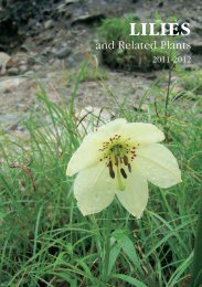
LILIES - RHS Lily Group
LILIES - RHS Lily Group
LILIES - RHS Lily Group

Create successful ePaper yourself
Turn your PDF publications into a flip-book with our unique Google optimized e-Paper software.
Geographic location<br />
The territory of the lower reaches of the Khoper River (about 250 km north-west<br />
of Volgograd) is part of the “Wild Field”. Of all the numerous rivers of the steppe<br />
the Khoper River (in English it is also known as Choper) is especially beautiful,<br />
flowing for 1,000 km through the five administrative regions of the European<br />
part of Russia with the last hundred kilometres in the Kumilzhensky distrtict of<br />
the Volgograd region, where it runs into the River Don near stanitsa (Cossack<br />
village) Bukanovskaya and there are numerous lakes with water meadows<br />
along its floodland. Geographically this territory belongs to the southern end of<br />
Khoper-Buzuluk Plain – at the left side, and the southern part of Kalach Hills – at<br />
the right side of the river. It was here that the Nizhnekhopersky Nature Park (in<br />
English – The Lower Choper Nature Park), the largest in the Volgograd region,<br />
was created in 2003: it covers an area of 231 206 hectares. The main aims of the<br />
park are to promote the conservation of biodiversity, to help protect nature and<br />
to develop scientific, touristic and ecologico-educational activity.<br />
Climate<br />
The territory is characterized by a continental, dry and warm climate, with a lack<br />
of precipitation and a lot of sunny days with semi-desert condition in the south<br />
east of the Volgograd region. The temperature of the soil surface in July may reach<br />
+70° C, especially on sands. But local plants are well adapted, and they stand such<br />
temperature. The winters can be as severe as in the middle belt of Russia, with<br />
temperatures down to -30° C, but shorter. Even in late April /beginning of May there<br />
may be late spring frosts which affect the seed productivity of plants and crops.<br />
Soil types and general landscape<br />
Soils are represented by southern black soils, that are often washed off the slopes,<br />
at times with saline soils. In the more northern areas there are plots of common<br />
black soils. Along the river valleys alluvial soils were formed, and the terraces are<br />
made of sand with poor soils. The right side of Khoper and Buzuluk rivers consist<br />
of chalk hills with denudations of pure chalk and carbonates. Khoper-Buzuluk<br />
Lowland is characterized by plain watershed, wide valleys and vast floodlands<br />
of rivers. Under the influence of water erosion the land surface is cut by many<br />
ravines and gorges which prevented the complete ploughing up of virgin steppe<br />
and ensured the survival of rare plants. In addition, these ravines protect local<br />
species from dry and hot winds in summer and cold winds in winter. Hills of pure<br />
sand (at times bare, at times overgrown) occupy a considerable part of territory.<br />
The sand stretches across the water plain for many kilometres from the rivers<br />
Kumilga and Khoper to the rivers Medveditsa and Don. Small groves of birch<br />
(Betula pubescens) occur on this land creating a specific type of landscape.<br />
105