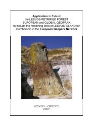
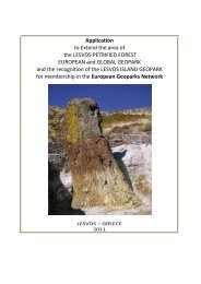
Applicatopn dossier for nomination as a European Geopark ...
Applicatopn dossier for nomination as a European Geopark ...
Applicatopn dossier for nomination as a European Geopark ...

Create successful ePaper yourself
Turn your PDF publications into a flip-book with our unique Google optimized e-Paper software.
pl<strong>as</strong>ters kungurian a circle. Pl<strong>as</strong>ters are lifted on a day<br />
surface owing to hydrochloric tectonics and make the<br />
top part Hydrochloric dome a file in which modern<br />
karstic processes intensively proceed.<br />
B 2.3. Bolshoe Bogdo mountain<br />
The height above the sea level is 149,6m. It is the<br />
highest point of Pric<strong>as</strong>pian lowland.<br />
Flank processes are observed on the most raised<br />
sections, especially in the area of Bolshoye Bogdo.<br />
Under the action of temporarily arising trickles,<br />
gravitational <strong>for</strong>ces, wind the drift of superficial rocks<br />
and <strong>for</strong>mation of delluvial aprons with the capacity up to<br />
10-15m occurs.<br />
Thus, on hollows of a drain and gullies the drift of rocks<br />
with denudation plains onto accumulative ones and<br />
directly into the lake B<strong>as</strong>kunchack occurs. As a result of<br />
Khvalynian sediments more ancient rocks frequently<br />
submitted by gypsums drift onto the surface of the<br />
mountain.<br />
The lake B<strong>as</strong>kunchack<br />
B 2.4. Forms of rocks eolation on rocky<br />
sedimentations in near vicinities of Bolshoye<br />
Bogdo and « Singing rocks»<br />
In conditions of arid climate physical eolation and eolian<br />
processes are actively shown that results the <strong>for</strong>mation<br />
of outliers of destruction, cellular <strong>for</strong>ms. In separate<br />
places dense rocks collapse even up to sandy<br />
sediments. Wind makes deflation, corrosion, it sorts<br />
sand, carries out finer particles far beyond their initial<br />
distribution.<br />
B 2.5. The lake B<strong>as</strong>kunchack<br />
B<strong>as</strong>kunchack is the salty lake having the area about<br />
115 km ². It is situated in the area of Ahtubinsk<br />
(Astrakhan region), geographical coordinates: 48°10’<br />
northern latitude, 46°53’ e<strong>as</strong>tern longitude/48,166667°<br />
northern latitude, 46,883333° e<strong>as</strong>tern longitude,<br />
approximately in 270km to the north from the C<strong>as</strong>pian<br />
sea, and in 53 km to the e<strong>as</strong>t from Volga.<br />
Shore line in the lake is 21m below the sea level. Water<br />
in the lake is replenished with a help of the small river<br />
Gorkaya, area of a reservoir of which is 11000 km ²,<br />
and with a help of 25 springs. Salinity of the lake is<br />
about 300 gram per litre. Capacity of salt superficial<br />
deposits in the lake is 10-18 m. As a result of salt<br />
6<br />
extraction craters with the depth up to 8 meters were<br />
<strong>for</strong>med. The depth of salt bedding is 6 km. In spring<br />
and in autumn the level of brine in the lake is<br />
maximal - up to 1 meter. In brine bacteria which bear<br />
salt live only.<br />
Since VIII century salt w<strong>as</strong> extracted from the lake<br />
and sent along a Silky way.<br />
For the first time the lake B<strong>as</strong>kunchack is officially<br />
mentioned in 1627 in « The Book of Big Drawing »,<br />
the first geographical description of Russia <strong>as</strong> a<br />
place, « where people extract salt pure <strong>as</strong> ice ».<br />
Today extremely pure salt of lake (99.8 % NaCl)<br />
<strong>for</strong>ms up to 80 % from the general extraction of salt in<br />
Russia. Depending on need, from 1,5 up to 5 million<br />
tons of salt in a year are extracted here. For export of<br />
salt the B<strong>as</strong>kunchack railway w<strong>as</strong> constructed.<br />
At the lake co<strong>as</strong>t there are deposits of medical caolin.<br />
B 2.6. The hole Sharbulack<br />
The section is situated on the southern co<strong>as</strong>t of the<br />
lake B<strong>as</strong>kunchack, to the e<strong>as</strong>t of mountain Bolshoye<br />
Bogdo. It is characterized by the presence of various<br />
<strong>for</strong>ms of the karstic phenomena: caves, craters,<br />
gaps, gullies, cracks, etc.<br />
B 2.7. Karstic <strong>for</strong>ms of relief<br />
The karst in the area of B<strong>as</strong>kunchack is caused by an<br />
output of sedimentary rocks позднепалеозойского<br />
age, submitted by bottom Permian gypsums of the<br />
Kungurianstage, onto the earth surface. Gypsums<br />
are lifted on a day time surface owing to hydrochloric<br />
tectonics; they represent the top part of the salt<br />
cupola m<strong>as</strong>sive in which present karstic processes<br />
intensively proceed.