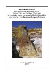
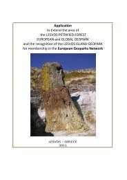
Applicatopn dossier for nomination as a European Geopark ...
Applicatopn dossier for nomination as a European Geopark ...
Applicatopn dossier for nomination as a European Geopark ...

You also want an ePaper? Increase the reach of your titles
YUMPU automatically turns print PDFs into web optimized ePapers that Google loves.
Overlapping rocks are submitted, <strong>as</strong> a rule, by sandy<br />
loams and loams of Khvalynian age. N.A.Gvozdetsky<br />
(1981) refers the karst of this area to the covered type.<br />
At the same time there are also local sections of the<br />
open karst. They b<strong>as</strong>ically are characteristic of large<br />
karstic-erosive hollows of a superficial drain (Belaja,<br />
Pezcherskaja, Sharovskaja) and natural hollow<br />
Sharbulak.<br />
For the area of lake B<strong>as</strong>kunchack G.V.Korotkevich<br />
gives the size of karst <strong>for</strong>ming activity - 3,25mm / year.<br />
The karstic relief of the area of lake vicinities develops<br />
from superficial and underground karstic <strong>for</strong>ms.<br />
To superficial <strong>for</strong>ms of karstic relief on the given area it<br />
is possible to include craters and hollows.<br />
The largest <strong>for</strong>ms of the karstic superficial relief in the<br />
given area are karst-erosive hollows of a superficial<br />
drain. They are developed b<strong>as</strong>ically on the western part<br />
of the northern gypsum field.<br />
To underground <strong>for</strong>ms of a karstic relief in the given<br />
area can be referred karstic wells and caves. To karstic<br />
wells vertical cavities connected to a zone of vertical<br />
descending circulation of karstic waters concern.<br />
The largest karstic cave of PriC<strong>as</strong>pian lowland is<br />
"B<strong>as</strong>kunchakskaya". According to the Saratov section<br />
of speleology the cave h<strong>as</strong> the extent of 1480,0m, the<br />
maximal depth is about 32,0m, its volume is about<br />
9400,0m3. It is situated on the northwest co<strong>as</strong>t of<br />
B<strong>as</strong>kunchack in top reaches of the superficial drain<br />
Pezcernaja.<br />
Cave "B<strong>as</strong>kunchakskaja" h<strong>as</strong> some inputs and<br />
concerns to the type of horizontal through (through<br />
p<strong>as</strong>sage) caves; it h<strong>as</strong> been known <strong>for</strong> more than<br />
hundred years. It is actively visited nowadays.<br />
Golovachev I.V. describes three tens caves in<br />
gypsums with the extent of more than 10,0km., but only<br />
7 of these caves are examined and there are published<br />
data about them.<br />
The accumulative plain adjoins to the lake<br />
B<strong>as</strong>kunchack. According the geomorphological<br />
expressiveness it is subdivided into two subtypes:<br />
gently-wavy which is deposited on the hypsometric<br />
level 0 - minus 10m and flat located on absolute marks<br />
from minus 10m up to minus 21,2m (isohypse, outlining<br />
the lake).<br />
The flat sinuosity of the plain of higher hypsometric<br />
level is caused by non-uni<strong>for</strong>m accumulation of<br />
deposits, drifted from peneplains and the differentiated<br />
display of hydrochloric tectogenesis.<br />
From the surface the plain is combined by early<br />
Khvalynian adjournments which are blocked from<br />
above by dealluvial ones, with the impurity of chippings,<br />
brought from the mountain and adjoining to peneplains.<br />
The flat plain is a part of the lake bottom and is<br />
combined from a surface by oozy deposits of a lake<br />
origin with the impurity of small salt crystals.<br />
The width of accumulative plain varies from 3km in the<br />
settlement Nizchny B<strong>as</strong>kunchack is up to 0,5km in the<br />
southwest part. The relief is complicated with hollows of<br />
a drain which through peneplains cross the<br />
accumulative plain.<br />
Lake B<strong>as</strong>kunchack is a unique <strong>for</strong>m of a relief - mould,<br />
filled with halogen type of deposits. Prior to the<br />
beginning of industrial development of salt the whole<br />
12<br />
surface of lake represented a dense salt layer.<br />
Geophysical investigation h<strong>as</strong> shown that salt is<br />
deposited up to the depth of 600m, but deep from the<br />
surface it alternates with sand, clay. In the plan the<br />
lake h<strong>as</strong> the wrong <strong>for</strong>m with the general orientation<br />
in a northwest direction. The extent of the lake on the<br />
big axis is 18 km, the general area is 106 км2. The<br />
significant part of the lake area (60 %) <strong>as</strong> a result of<br />
salt extraction is occupied by broken zones. These<br />
zones represent sections from which salt is taken up<br />
to the depth of 8m. Broken zones are filled with brine<br />
with a mineralization of 300 g/l. Natural process of<br />
salt accumulation is broken.