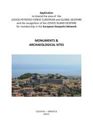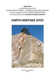
Applicatopn dossier for nomination as a European Geopark ...
Applicatopn dossier for nomination as a European Geopark ...
Applicatopn dossier for nomination as a European Geopark ...

Create successful ePaper yourself
Turn your PDF publications into a flip-book with our unique Google optimized e-Paper software.
they are expressed by clay - siltstone thickness, on the<br />
separate are<strong>as</strong> with prolayers of marl.<br />
Turonian and conjac stages. Adjournments of these<br />
stages have universal development. They are<br />
deposited with w<strong>as</strong>hout on spreading cenomanian<br />
<strong>for</strong>mations and lithologically they are expressed by<br />
white, strong pelitomorphic and organogenic -<br />
pyrocl<strong>as</strong>tic limestones.<br />
Santonian stage. Santonian adjournments have a wide<br />
circulation. The bottom sublevel is combined by<br />
limestones of light grey colour, sometimes with a<br />
greenish shade, fractured. In the west of the examined<br />
area prolayers of marls and clays are traced. In the<br />
b<strong>as</strong>is of the cut the conglomerate submitted by a<br />
pebble of phosphorites, consolidated with caebonate<br />
cement is deposited.<br />
Early santonian sublevel is submitted by silica clays of<br />
grey and dark grey colours, layered, with interlensing of<br />
siltstone. In the roof of the cut following limestones are<br />
deposited: dark grey, carbonate, with prolayers of<br />
aleurolites.<br />
Campania stage. Campanian <strong>for</strong>mations have universal<br />
distribution and deposited with w<strong>as</strong>hout on spreading<br />
adjournment. The bottom sublevel is expressed by<br />
limestones of grey, greenish-grey, clay, pelitomorphic,<br />
with prolayers one-colour marls.<br />
Early Campanian sublevel is submitted by clays of dark<br />
grey colour, calcareous, aleurite, with prolayers of<br />
marls and limestones.<br />
Cainozoic erathem<br />
Quaternary system<br />
Quaternary adjournments are submitted by alternation<br />
of layers of sand and clays with prevalence in the cut of<br />
the l<strong>as</strong>t ones and subdivided into Khvalynian and<br />
modern adjournments.<br />
The list of rocks<br />
1. Anhydrite<br />
2. Argillite<br />
3. Table salt<br />
4. Aleurolite<br />
5. Clay<br />
6. Limestone<br />
7. Sandstone quartz<br />
8. Marl<br />
9. Gypsum<br />
B. 4 Geomorphological features<br />
The area of Bogdo and B<strong>as</strong>kunchack occupies the<br />
special position in geological structure. It is located in<br />
the northe<strong>as</strong>t part of the Northwest PriC<strong>as</strong>pian in<br />
vicinities of the lake B<strong>as</strong>kunchack and mountain<br />
Bolshoye Bogdo. The special feature of a geological<br />
structure is the presence near to a day time surface of<br />
gypsums of Kungurian stage that is caused by the<br />
display of hydrochloric tectogenesis. It h<strong>as</strong> defined here<br />
the wide development of leaching processes and, <strong>as</strong> a<br />
result, specific <strong>for</strong>ms of relief (craters, hollows, caves<br />
and others). Authors paid special attention to studying<br />
of these relief <strong>for</strong>ms.<br />
In the tectonic relation the territory represents<br />
Баскунчакский hydrochloric m<strong>as</strong>sive experiencing a<br />
11<br />
modern rising, and mould, filled with the lake<br />
B<strong>as</strong>kunchack. In one of exposures of Ubo hill<br />
(vicinities of the settlement Nizchny B<strong>as</strong>kunchack a<br />
layer of early Khvalynian clay with de<strong>for</strong>mation up to<br />
1-1,5m ) is traced. For the l<strong>as</strong>t 15-20 thousand years<br />
the section h<strong>as</strong> been uplifted with a speed of up to<br />
0,04-0,06mm per year that testifies the high tectonic<br />
activity in plat<strong>for</strong>m conditions.<br />
Structural features, history of geological development<br />
and climate have defined geomorphological structure<br />
of researched area. There is a unique presence in<br />
the Northwest PriC<strong>as</strong>pian of denudation plains with<br />
the absolute mark of 149,6m. The denudation plain<br />
refers to a hydrochloric m<strong>as</strong>sive and smoothly<br />
p<strong>as</strong>ses to accumulative plain, which outlines the lake<br />
B<strong>as</strong>kunchack. The mould is occupied with the lake<br />
and earlier it w<strong>as</strong> considered <strong>as</strong> compensatory one.<br />
But during the l<strong>as</strong>t decade in connection with the<br />
active extraction of salt, the mould bowing is not<br />
compensated by salt accumulating. There<strong>for</strong>e a<br />
surface of salt in the center of lake caves in about a<br />
minus of 21,2 m. in 90th of XX century up to a minus<br />
of 22 m in 2004.<br />
The peneplain occupies a significant part of territory<br />
the around the lake. Absolute marks of it go down<br />
from periphery in the direction of lake from 149,6m.<br />
Prevailing modern relief <strong>for</strong>ming processes are<br />
fluvial, karstic and processes of physical aeration.<br />
As a result of linear erosion hollows of a drain are<br />
<strong>for</strong>med. In total more than 70 hollows run into the<br />
lake.<br />
Other remarkable <strong>for</strong>m of a relief is gullies with the<br />
extent from several up to ten and more meters.<br />
Especially quickly they develop in ruts of roads after<br />
showers.<br />
On flat slopes of low raisings sections of a plane<br />
drain with the area from several square meters up to<br />
several tens square meters are <strong>for</strong>med. On hollows<br />
of a drain and gullies drift of rocks from the peneplain<br />
to accumulative one and directly to the lake<br />
B<strong>as</strong>kunchack occur. As a result Khvalynian<br />
adjournments are drifted and more ancient rocks<br />
frequently submitted by gypsums come onto the<br />
surface.<br />
Special interest is represented by karstic <strong>for</strong>ms of a<br />
relief. The karst area of B<strong>as</strong>kunchack, according to<br />
A.G.Chikisheva and N.A.Gvozdetskogo's<br />
cl<strong>as</strong>sification concerns to PriB<strong>as</strong>kunchack karstic<br />
district of Western - PriC<strong>as</strong>pian karstic province of<br />
PriC<strong>as</strong>pian karstic area of the E<strong>as</strong>t Europe karstic<br />
country.<br />
The karst area of the lake B<strong>as</strong>kunchack is caused by<br />
the exit onto a day time surface of sedimentary rocks<br />
of late Paleozoic age, submitted by late Perm<br />
gypsums of Kungurian stage. Gypsums are lifted<br />
onto a day time surface owing to hydrochloric<br />
tectonics and make the top part of the salt dome<br />
m<strong>as</strong>sive in which modern karstic processes<br />
intensively progress and which is the most accessible<br />
to researches. Karstic gypsums border the bowl of<br />
B<strong>as</strong>kunchack non-uni<strong>for</strong>mly.<br />
Karstic gypsums are strongly dim from a surface and<br />
are blocked by a thin cover of adjournment.