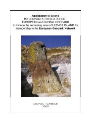
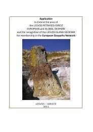
Applicatopn dossier for nomination as a European Geopark ...
Applicatopn dossier for nomination as a European Geopark ...
Applicatopn dossier for nomination as a European Geopark ...

You also want an ePaper? Increase the reach of your titles
YUMPU automatically turns print PDFs into web optimized ePapers that Google loves.
avine, in the b<strong>as</strong>is of a gypsum exposure. The cave is<br />
submitted with tailrace channel. The general extent of<br />
the cave is about 65m; its depth from the surface is<br />
about 14m. It w<strong>as</strong> found in 2001.<br />
Cave Grelka. It is situated in the central part of the<br />
northern gypsum field. The cave represents vertical,<br />
opening on the surface, crack with the depth up to 12m<br />
and width of 0,4-0,5m. At the bottom of the crack snow<br />
is kept till the summer. Among similar and accessible to<br />
p<strong>as</strong>sage cracks this cave is the deepest. It w<strong>as</strong> found in<br />
1988.<br />
Cave Krestik. The entrance is located in a gypsum<br />
exposure at the bottom of a large karst-erosive hollow.<br />
The cave begins at the bottom of superficial well. It is<br />
<strong>for</strong>med by crossing of two vertical cracks. The<br />
max.height of the arch is up to 6m. It w<strong>as</strong> found in<br />
1990.<br />
Cave Karman. The cave is located in the natural<br />
hollow Vak-Tau in the b<strong>as</strong>is of a karstic crater slope.<br />
The cave represents a low, wide, blindly coming to the<br />
end cave – manhole with the extent up to10m. It w<strong>as</strong><br />
found in autumn, 1990.<br />
Cave Deniskina. The entrance to the cave is located in<br />
the b<strong>as</strong>is of a karstic crater slope. The cave begins with<br />
a small manhole deducing to the underground chamber<br />
with the diameter of about 3m and height up to 1,4m.<br />
From it is possible to get into the cross linearly<br />
extended manhole with a height up to 2m and length of<br />
about 16m. It w<strong>as</strong> found in 1995.<br />
Cave Skladskaja. The entrance is located in the<br />
central part of the karstic hollow <strong>for</strong>med due to merge<br />
of two craters. The cavity is submitted with low<br />
chamber near the entrance with a diameter of about 2-<br />
2,5m and height of 0,8-1,0m. Further there leaves a<br />
manhole with a diameter of 0,4-0,5m which through 6m<br />
comes to the end with a small chamber with a height of<br />
1,3m and width of 1m. It w<strong>as</strong> found in autumn of 1990.<br />
B 3. The geological periods<br />
The following complexes of rocks participate in the<br />
geological structure of territory.<br />
Paleozoic erathem<br />
The Perm system<br />
The bottom division<br />
Kungurian stage. Outlets of Kungurian adjournments on<br />
a day time surface are known in a vicinity of<br />
B<strong>as</strong>kunchack along balks Sinia, Pezchernaja and in the<br />
natural hollow Spher - Bulak.<br />
In a cut three packs are precisely allocated: the bottom<br />
is sulfate - terrigenous, the average is halogen and the<br />
top is sulfate – terrigenous too. Lithologically this pack<br />
is submitted by anhydrites, argillites, sections with<br />
individual prolayers of salt and aleurolites. The capacity<br />
of this pack is 80-150m.<br />
The halogen pack is combined mainly by stone salt,<br />
sulfur, light grey, middling-and large crystal, with<br />
inclusions of anhydrite, separate large units of which<br />
have the extended <strong>for</strong>m and trans<strong>for</strong>mations of<br />
intensively expressed processes of stone salt in post<br />
sedimentational period.<br />
In halogen thickness there are prolayers and lenses of<br />
anhydrites, argillites, less often aleurolites. Argillites are<br />
dark grey, aleurolite with a big maintenance of carbided<br />
10<br />
organic chemistry. Sandstones and aleurolites are<br />
dark grey, fine-grained.<br />
Top sulfate - terrigenous pack is deposited on salt<br />
and is combined by anhydrites with subordinated<br />
layers of clays, limestone, aleurolites, stone salt. Its<br />
capacity is 40 - 80m. On this pack the crucial<br />
importance w<strong>as</strong> rendered by secondary processes,<br />
first of all by erosion.<br />
Mesozoic erathem<br />
Tri<strong>as</strong>sic system<br />
The bottom division<br />
vetluzchskaya series. On the mountain Bolshoje<br />
Bogdo vetluzchskoye adjournment consists of<br />
conglomerate-sandy and sandy-argillaceous<br />
thicknesses (from below upwards). The bottom<br />
thickness with the capacity of about 90m consists of<br />
oligomict sandstones, mainly quartz,<br />
разнозернистых sandstones, more often finegrained,<br />
red - brown, green-grey. Sandstones p<strong>as</strong>s in<br />
gravelites and finely cut conglomerates. Pebbles of<br />
conglomerates consist of quartz, red and grey - color<br />
sandstones, aleurolites, clays and limestone. On a<br />
rough surface of sandstones thickness of clays with<br />
subordinates of low-power (up to 1m) prolayers of<br />
aleurolites and sandstones is deposited.<br />
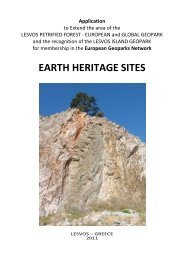
Geological cut of B.Bogdo<br />
B<strong>as</strong>kunchack series. In the section of mountain<br />
Bolshoje Bogdo the conglomerate is established. In<br />
the cut of баскунчакской series characterized by<br />
terrigenous - carbonate structure, from below three<br />
packs are allocated upwards: clay, clayey-carbonate<br />
and sandy-argillaceous. The bottom part is submitted<br />
with clays with the subordinated prolayers of<br />
sandstones, aleurolites, less often limestones. Clays<br />
are brown - red, dark brown with bluish-gray spots,<br />
aleurite, and carbonate, not clear layered, and<br />
combined with fine clay.<br />
Overlying clayey-carbonate pack is combined by<br />
alternation of clays, carbonates with rare prolayers of<br />
aleurolites and sandstones. Clays are grey, greenishand<br />
brownish-grey up to dark grey, weakly<br />
carbonate, aleurite.<br />
A sandy-argillaceous pack crowns the cut of<br />
B<strong>as</strong>kunch<strong>as</strong>k series .<br />
Cretaceous system<br />
Outputs of cretaceous adjournment on a day time<br />
surface are known in the area of the lake<br />
B<strong>as</strong>kunchack, in hollows Belaja, Sinaja, Pezchernaya<br />
and natural boundaries ShChigrety.<br />
The top division<br />
Cretaceous outcrops are known in the northwest part<br />
of the lake B<strong>as</strong>kunchack area (in hollows Belaja,<br />
Sinaja, Pezchernaya). They are deposited with<br />
w<strong>as</strong>hout on spreading early Cretaceous<br />
adjournments and are characterized mainly by<br />
carbonate structure. The capacity of late Cretaceous<br />
adjournment reaches 624m.<br />
Cenomanian stage. Cenomanian <strong>for</strong>mations, being<br />
deposited transgressivly on the spreading<br />
adjournment, have a wide circulation. Lithologically