Brigham Young University Geology Studies
Brigham Young University Geology Studies
Brigham Young University Geology Studies

You also want an ePaper? Increase the reach of your titles
YUMPU automatically turns print PDFs into web optimized ePapers that Google loves.
YOUNG<br />
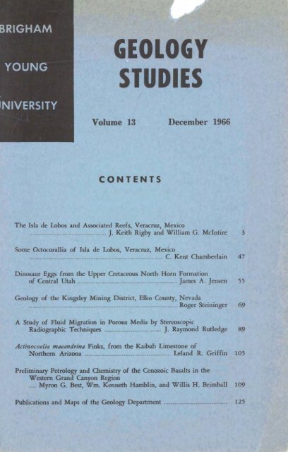
' Volume 13 December 1966<br />
I<br />
CONTENTS<br />
Thc~deLobmiadAssuciPted~s,Varw,~<br />
J. Keith Rigby and Wdri G. M c W 3
<strong>Brigham</strong> <strong>Young</strong> <strong>University</strong> <strong>Geology</strong> <strong>Studies</strong><br />
Volume 13 - December 1966<br />
Contents<br />
The Isla de Lobos and Associated Reefs, Veracruz, Mexico<br />
........................................... J. Keith Rigby and William G. McIntire 3<br />
Some Octocorallia of Isla de Labos, Veracruz, Mexico<br />
........................................................................... C. Kent Chamberlain 47<br />
Dinosaur Eggs from the Upper Cretaceous North Horn Formation<br />
of Central Utah ........................................................ James A. Jensen 55<br />
<strong>Geology</strong> of the Kingsley Mining District, Elko County, Nevada<br />
.................................................................................... Roger Steininger 69<br />
A Study of Fluid Migration in Porous Media by Stereoscopic<br />
Radiographic Techniques ................................ J. Raymond Rutledge 89<br />
Actinocoelia maeandrina Finks, from the Kaibab Limestone of<br />
Northern Arizona ........................................... Leland R. Griffin 105<br />
Preliminary Petrology and Chemistry of the Cenozoic Basalts in the<br />
Western Grand Canyon Region<br />
.... Myron G. Best, Wm. Kenneth Hamblin, and Willis H. Brimhall 109<br />
Publications and Maps of the <strong>Geology</strong> Department .................................... 125
A publication of the<br />
Department of <strong>Geology</strong><br />
<strong>Brigham</strong> <strong>Young</strong> <strong>University</strong><br />
Provo. Utah 84601<br />
Editor<br />
J. Keith Rigby<br />
Editorial Staff<br />
Lehi F. Hintze Myron G. Best<br />
Brxgham Youug <strong>University</strong> <strong>Geology</strong> <strong>Studies</strong> is published annually by the<br />
department. <strong>Geology</strong> <strong>Studies</strong> consists of graduate student and staff research<br />
in the department and occasional papers from other contributors, and is<br />
the successor to B.Y.U. Research <strong>Studies</strong>, <strong>Geology</strong> Series, published in<br />
separate numbers from 1954 to 1960.<br />
Distributed February 20, 1967<br />
Prxce $4.00
The Isla de Lobos and Associated Reefs, Veracruz, Mexico<br />
J. KEITH RIGBY AND WILLIAM G. MC~NTIRE<br />
<strong>Brigham</strong> <strong>Young</strong> <strong>University</strong>; Louisiana Slde <strong>University</strong><br />
ABSTRACT.-T~~ reef which surrounds Isla de Lobs is one of three closely associated<br />
reefs on the eastern coast of Mexico, approximately 70 miles southeast of Tampico,<br />
Tamaulipas, and is the northernmost reef with a sand cay on the western margin of the<br />
Gulf of Mexlco. It rises from a detrital plain, with a depth of approximately 120 feet,<br />
to near low tide, where the reef forms a flame-shaped lagoon approximately eight<br />
thousand feat Img, north-south, and three thousand five hundred feet wide.<br />
The island is situated in a shallow lagoon which has an average depth of less than<br />
3 feet and a reef-formed margin which is barely awash at lowest tides. Leeward and<br />
windward reefs can be differentiated topographically on fathograms and on the contour<br />
map of the reef complex and adjacent areas. Leeward development is characterized by<br />
broad, flat-bottomed, but steepwalled grooves, in contrast to more narrow V-shaped<br />
grooves in windward development. The reef toe is flanked by calcareous, reef-derived<br />
sand on all but the northeast side, where scattered data suggest a rocky floor.<br />
Several lagoonal, reef, and surrounding deepwater habitats and communities can<br />
be differentiated and were mapped, all seem closely related to substrate character.<br />
Tbala~sia and Hdimeda blanket much of the lagoon and have trapped a stable sand sub<br />
strate. These forms, along with Porites spp. and Diploria rliuosa, characterize stable<br />
sand communities. Unstable sand communities are poorly developed and only locally<br />
present, but infratidal lagmnal rocky-bottom habitats and communities are well developed,<br />
even though cif limited areal extent. A rocky-shore habitat is present on hurricane-tossed<br />
boulders and man-made structures, but rocky-shore communities are only<br />
beginning to populate the area because the habitat has been only recently opened.<br />
An algal ridge forms the crest of both windward and leeward reefs and qarates<br />
the marginal reef flat, Diploria rliuosa, and the more lagoonward, algal oncolite cornmunities<br />
from seaward reef development. Both windward and leeward reefs are characterized<br />
by an Arropora palmafa community in shallow water. In deeper water, from approximately<br />
25 feet down to 50 or 55 feet, a Diploria strigosa community forms the<br />
windward reef and a Montastrea annularis community forms the leeward reef. The<br />
Montasfrea ravernosa community forms the basal 25 to 30 feet of both windward and<br />
leeward reef development.<br />
CONTENTS<br />
TEXT<br />
page<br />
Introduction ........................................ 4<br />
Circulation ........................................ 16<br />
Turbidity ....................................... 19<br />
Tides ............................................... 20<br />
Location ........................................ 4<br />
Access ................................................ 5<br />
Personnel ......................................... 6<br />
Methods of Study ............................ 6<br />
Acknowledgments ............................ 9<br />
Topography .......................................... 9<br />
Jsla de Labs .................................... 10<br />
Submarine topography .................... 10<br />
Habitats and Communities .................. 20<br />
The Rocky Shore ............................ 22<br />
Rocky-Shore Habitat .................... 22<br />
Rocky-Shore Communities .......... 23<br />
The Sandy Shore .............................. 24<br />
Sandy-Shore Habitat and<br />
Community .............................. 24<br />
The Lagoon ............................ . ...... 24<br />
Lagoon ......................................... 11<br />
Leeward Reef ................................ 11<br />
Windward Reef ............................ 13<br />
Southern Sand Apron .................. 15<br />
Northwe;tem and Southwestern<br />
Tongues of Sand .................... 15<br />
Western Plain ............................ 16<br />
Eastern Rocky Slope .................... 16<br />
Hydrology .......................................... 16<br />
Infratidal Rock-Bottom<br />
Habitats .................................... 24<br />
Infratidal Rock-Bottom<br />
Communities ............................ 24<br />
Unstable Sand Habitat ................ 25<br />
Unstable Sand Community ........ 26<br />
Stable Sand Habitats .................... 26<br />
Stable Sand Communities ............ 26<br />
Arenirola(?) Community ........ 26
4 J. K. RIGBY & W. G. McINTIRE<br />
Thalassia-Halimeda<br />
Community .......................... 26<br />
Thalassia-Porites<br />
Community .......................... 28<br />
Thalassia-Diploria<br />
Community 29<br />
Lifhofhamniurn Gravel Habitat<br />
and Community ........................ 29<br />
The Reef .......................................... 30<br />
Red Habitats ................................ 30<br />
Reef Communities ........................ 30<br />
Diploria clioosa Community .... 30<br />
Lithothamn~um Ridge<br />
Commun~ty .......................... 32<br />
Acroporu palmafa Community.. 33<br />
Montas/rea annularis<br />
Community ............................ 34<br />
Diploria sfrigosa Community .. 35<br />
Mottfastrea ruvernosa<br />
Comnlunity .......................... 36<br />
North Channel Habitat<br />
and Community .................... 38<br />
complex at Isla de Lobos ........ 12<br />
4. Fathograms of lateral traverses<br />
in the leeward and windward<br />
reef at Isla de Lobos ................ 14<br />
5. Approximate current directions<br />
and velocities in and adjacent<br />
to the lagoon at Isla de<br />
Lobs .......................................... 18<br />
6. Substrates associated with the<br />
reef at Isla de Lobos ................ 2 t<br />
7. Topographic and community<br />
profiles within the lagoon ........ 27<br />
8. Topographic and community<br />
profiles of windward and<br />
leeward reefs at Isla de Lobos .. 31<br />
9. Diagrammatic cross section of<br />
the margin of the ship channel<br />
showing possible zonation ........ 42<br />
Plates<br />
1. Topographic map of the reef<br />
complex at Isla de Lobos<br />
Dead and Channeled Area<br />
of Reef ................................ 39<br />
Surrounding Deep-Water Habitats<br />
and Communities ........................ 41<br />
Geologic History ................................ 41<br />
Late Lagoonal History .................... 41<br />
Blanquilla Reef .................................... 43<br />
Leeward Reef .................................... 43<br />
Lagoon ......................................... 44<br />
Windward Red ................................ 45<br />
Medio Reef ........................................ 45<br />
References Cited .................................. 46<br />
ILLUSTRATIONS<br />
Text-figures<br />
1. Index map ................................ 5<br />
2. Map of fathometer traverses,<br />
........................ in envelope at back<br />
2. Community map of the reef<br />
complex at Isla de Lobos<br />
........................ in envelope at back<br />
3. Boulder ridge, Thalassia flats,<br />
and aerial views of Isla de<br />
Lobos ................ following page 32<br />
4. Underwater photographs of<br />
lagoonal environments on Irla<br />
de Lobs ........ following page 32<br />
5. Underwater photographs of<br />
lagoonal and marginal environments<br />
on Isla de Lobos<br />
........................ following page 32<br />
6. Underwater photographs of<br />
upper reef environments on<br />
Isla de Lobos .... following page 32<br />
7. Underwater photographs of reef<br />
3.<br />
sample traverses, and other<br />
control points on the Isla de<br />
Lobs reef complex .................. 7<br />
Main topographic regions<br />
associated with the reef<br />
8.<br />
environments on Isla de<br />
Lobos ................ following page 32<br />
Underwater photographs of<br />
lower reef environments on Isla<br />
de Lobos ........ following page 32<br />
INTRODUCTION<br />
Isla de Lobs is a smd sand cay which caps one of three small, but well-<br />
defined, reefs along the eastern coast of Mexico (Text-fig. 1). These three<br />
structures rise from the broad, shallow, detrital-blanketed shelf to near low<br />
tide and are the northernmost such reefs along he western shore of the Gulf<br />
of Mexico. Other smaller coralline structures are known to the north, but<br />
usually in deeper water and of relatively limited scale. It is 'because of the<br />
sand cay development and well-defined reef structure that Isla de Lobos reef<br />
was selected as a base for the present study.<br />
Location<br />
Isla de Lobos is one of three similar reefs along a northwesterly tread,<br />
southeast of Tarnpico, Tamaulipas, and southeast of Caba Rojo and Tamiahua
ISLA DE LOBOS REEF, MEXICO 5<br />
TEXT-FIGURE 1.-Index map. The reef associated with Isla de Lobos was the major area<br />
of investigation, but reconnaissance observations were also made on the associated<br />
Blanquilla and Medio reefs.<br />
Lagoon (Text-fig. 1). Isla de Lobs reef is the southeasternmost of the three<br />
and is located approximately 7 miles off the mainland coast, 35 miles northeast<br />
of Tuxpan, Veracmz, and 68 miles southeast of Tarnpico. The island on<br />
the reef is located at approximately 21" 27' 15" North Latitude, and 97O 13'<br />
45" West Longitude.<br />
The island itself is a small sand cay, approximately two thousand feet<br />
lone. one thousand feet wide. and with a maximum elevation of 11 or 12<br />
0'<br />
feet. It is, however, a most suitable base from which to study the surrounding<br />
lagoon and reef, for from the small island most of the lagoonal and upper<br />
reef regions are readily accessible even without using small boats. Development<br />
of dock facilities by Pemex has also increased the ease of studying the surrounding<br />
deeper water regions with small boats based on the island.<br />
Access<br />
Isla de Lobos is currently readily accessible via Pemex barges and tugs from<br />
Tuxpan, 35 miles to the southwest. Since considerable petroleum is produced<br />
from ehe well platform within the lagoon, daily round trips are made between<br />
the dock on Isla de Lobos and the Barra de Tuxpan petroleum facilities east<br />
of Tuxpan. Without Pemex cooperation, the only access to the island is by<br />
small boat.
6 J. K. RIGBY & W. G. McINTIRE<br />
Personnel<br />
The authors were senior scientific investigators on the study, and were<br />
ably assisted by C. Kent Chamberlain, a graduate student at <strong>Brigham</strong> <strong>Young</strong><br />
<strong>University</strong>; Rdolfo Cruz, a graduate student at the Instituto de Geologia at<br />
<strong>University</strong> of Mexico; Rodney Adams and Norwood Rector, both on the staff of<br />
Coastal <strong>Studies</strong> Institute at Louisiana State <strong>University</strong>.<br />
McIn,tire was responsible for study of the island ecology, history, sediments,<br />
etc., and Rigby was responsible for study of the reef and the lagoon.<br />
Chamberlain studied the alcyonarians of the reef com lex and will publidh his<br />
paper elsewhere. Adams and Rector were responsi le for equipment, and<br />
logistics in general, and did most of the boat work for the party. In addition,<br />
they did sediment sampling, along with Cruz, and Rector, In particular, took<br />
many of the underwater photogra hs of the reef and bordering sand apron.<br />
Marine organisms were iden,tiled by Rigby and Chamberlain, and subaerial<br />
organisms were ~dentified by McIntire. Extensive collections were made as a<br />
joint effort of all personnel and are housed at Br~gham <strong>Young</strong> <strong>University</strong> and<br />
Louisiana State <strong>University</strong>.<br />
Mapping was a joint effort of the whole crew. McIntire, Rector, and Adams<br />
ran the fathometer traverses and carried the surveying rods in the island, reef,<br />
and lagoon surveys. Rigby and Clmmberlain ran the surveying instruments,<br />
plotted the points, and contoured the maps.<br />
Methd of Study<br />
Outline of the island, ship channel spoil heap, and well platform were<br />
determined 'by plane table mapping at a scale of 500 feet per inch. Crest of the<br />
reef around the relatively shallow lagoon was walked out and mapped at the<br />
same scale from stations on the island margin, we11 platform, or within the<br />
lagoon. A single station was established in the interior of the lagoon northwest<br />
of the platform so that the northern tip of the reef was within instrumental<br />
limits.<br />
Once the outline of the reef and island was establ~shed, a series of fatho-<br />
meter traverses were completed for topographic control within the reef and<br />
adjacent deeper water. Locations of points on the fathometer trace were<br />
established using a theodolite based in the top of the lighthouse at the southern<br />
end of the island. Direction and distances were determined trigonometrically<br />
since he elevation of the instrument was established slightly over 100 feet<br />
above sea level, and orientation to known points could be established. Thus<br />
vertical and horizontal angles would give the position of the boat at each<br />
point necessary. Two-way radio allowed communication between the boat and<br />
the lighthouse. Accuracy is greatest in Ehe southern half of the map where<br />
angles were greatest, and least in the northern part where angles were lowest.<br />
Fathometer traverses and control points are shown on Text-figure 2, along<br />
with hallow-water traverses, sample stations, dredge stations, and deep dive<br />
stations.<br />
Shallow-water traverses were made using a knotted rope for distance, and<br />
paired stakes for directional control. These traverses, coupled with low altitude<br />
oblique photographs, were used in construction of the community map. Biologic<br />
samples and sediment were collected during the traverses, and tied to distance<br />
from shore.<br />
g
lSLA DE LOBOS REEF, MEXICO 7<br />
TEXT-FIGURE<br />
2.-Map of fathometer traverses, sample traverses and other control points<br />
on the Isla de Lobos reef complex. Fathometer traverses are shown as dashed lines<br />
and shallow water sample traverses as dotted lines. Individual sample points and<br />
deep dive localities are shown as numbered black circles.
8 J. K. RIGBY & W. G. McINTIRE<br />
Several traverses were made of the lower part of the reef, from near the<br />
toe upward, or from the sand apron upward. !hba gear was used with excellent<br />
results for it allowed freedom of movement and sufficient time for study of<br />
the deeper parts of the reef and surrounding sedimentary apron.<br />
Sediment samples from pints not studied during deep dives were col-<br />
lected with a clam-shell sampler. These include samples taken for living fora-<br />
minlfera, micro-mollusks, and sediments around the flank of the reef and in<br />
Che surrounding sand apron.<br />
Notes on all underwater observations were taken on frosted plastic plates<br />
with an ordinary lead pencil, transcribed at night, and then the plates were<br />
erased ready for the next day's use.<br />
Biologic collections were made using plastic buckets and inflated inner-<br />
tubes, weighted wlth 1,ine and lead weights, on shallow traverses. Small speci-<br />
mens were placed in plastic vials and larger specimens were placed in plastic<br />
bags. Deeper water collecting was done with purse-like collecting bags instead<br />
of the floating plastic buckets.<br />
A water-soluble dye, Rodamine Red, was utilized in current velocity and<br />
direction studies. The dye mixture is slightly heavier than sea water and sinks<br />
gradually below the wave zone for determination of direction and velocity of<br />
intermediate and bottom currents. Although it diffused somewhat in its course,<br />
direction and velocity of motion were easily established.<br />
Tidal information was not readily available for Isla de Lobs, although<br />
some information is available for Tuxpan, to the southwest, and Tampico, to<br />
the northwest. A tide gauge was established at the Pemex dock within the ship<br />
channel and a continuous hourly observation record was maintained for 48<br />
hours. In addition, a still-water gauge was established in the lagoon at the<br />
south end of the island, but was read at somewhat irregular intervals.<br />
The following is an approximation of crew-days spent in various types<br />
of observation or preparation, calculated on two crews per day while we were<br />
on the island.<br />
Table I<br />
Crew-days Spent in Various Activities During Observation of Isla de Lobos<br />
Plane table mapping reef and island 10 days<br />
Theodolite-fathometer mapping 4<br />
Shallow water traverses G<br />
Deep water traverses of reef 4<br />
Deep water sediment samples 2<br />
Current study and water chemistry 2<br />
Helicopter flight 1<br />
Logistics and support G<br />
Island sediments and water study in pits 3<br />
Study of spoil piles 1<br />
Review of Blanquilla and Medio Reefs 2<br />
Office work because of weather 4<br />
Moving and sample preparation 3
1SL.A DE LOBOS REEF, MEXICO 9<br />
Limited analyses of various water samples were undertaken using Hach<br />
Engineer's hboratory, Model DR-EL, a p~able kit designed specifically for<br />
water analysis. Chlorinity, salinity, F%, turbidity, hardness, and content of<br />
oxygen, iron, lead, copper, cahnates, sulfates, silica, etc., can be determined<br />
calorimetrically.<br />
Acknowledgments<br />
We are particularly grateful to Professor Guillermo P. Salas, Director of<br />
the Instituto de Geologia at the <strong>University</strong> of Mexico, Mexico, F. D. Much<br />
of the preliminary arrangements and attention to detail were accomplished<br />
by him and his staff.<br />
Assistance of personnel of Petrdeos Mexicanos is gratefully acknowledged.<br />
Sr. Ing. Antonio Gracia Rojas and Sr. Ing. Eduardo J. Guzmln in Mexico City<br />
arranged official permission to work on the island. Ing. Edmundo Cepeda and<br />
Ing. Rodolfo Suarez, Tampico, were especially helpful in solving logistic prob-<br />
lems while on the island; Sr. Alvaro Lorenzo, in charge of Pemex operations at<br />
Tuxpan, and Sr. Juan Perez aided our study in many ways, and through their<br />
kindness much of the Pemex facility was made available to us. Engineer Sr.<br />
Inocencio Cadena was in charge on Isla de hbos and supplied us with ware-<br />
house space and dock facilities, made certain that our personnel was housed,<br />
and our groceries were transported from Tuxpan. We are also grateful for the<br />
favors rendered by Capt. P. A. Carlos Mora Perez from Cerro Azul.<br />
Appreciation is expressed to Mr. L. Lee Welch, Vincent and Welch Inc.,<br />
Lake Charles, Louisiana, who allowed us to use his lodge for a base for the<br />
first four weeks of our study. His caretaker, Sr. Santos Coronado, was also very<br />
helpful and proved an excellent cook and fisherman.<br />
- officials at the lighthouse on Isla de Lobos were also most kind. The<br />
ancient keeper of the lighthouse, Sr. Papro Guzman, and his wife filled us in<br />
on background of the island and its recent history. Sr. Roberto Caye Beeks and<br />
his brother, Sr. Gregario Caye Beeks, both stationed at the lighthouse, were<br />
also of considerable help, particularly since both were proficient with both<br />
Spanish and English.<br />
Mr. Norwood Rector, of Coastal <strong>Studies</strong> Institute at Louisiana State Uni-<br />
versity, developed or modified considerable gear for the study. He was not only<br />
responsible for the initial development, but also made repairs in the field. He<br />
also supervised our somewhat amateurish diving and did much of the deep<br />
water diving, collecting, and observation.<br />
Study of the reef at Isla de Lobos was conducted through the Coastal<br />
<strong>Studies</strong> Institute, Louisiana State <strong>University</strong> and supported financially by the<br />
Geography Branch of the Office of Naval Research, contract Nonr 1575 (03),<br />
NR 388 002.<br />
TOPOGRAPHY<br />
Isla de Lobos is a small sand cay in the interior of a broad shallow lagoon,<br />
and is the northernmost sand island associated with reef development along the<br />
western margin of the Gulf of Mexico. The reef is a flat-topped structure, but<br />
with moderately intricate marginal topography, and shows the distinctive topo-<br />
graphic expression of both windward and leeward development.
10 J. K. RIGBY & W. G. McINTIHE<br />
Isla de Lobos<br />
Isla de Lobos is built by calcareous sediment derlved from the surrounding<br />
flat interior of the reef lagoon. The subaerial island is crescentic, somewhat<br />
like the main reef, and is located in the southwestern part of the lagoon (Textfigs.<br />
2, 3). It has an arcuate eastern coast and a nearly straight western one,<br />
approximately 2100 feet long. It has a maximum width of approximately one<br />
thousand feet near the mlddle of the broad arcuate eastern shoreline. The<br />
island is a low feature, rlsing only to a maxlrnum of 11 to 12 feet above low<br />
tide at the southern end of the island near the lighthouse. Elsewhere most of<br />
the island 1s only 5 or 6 feet high.<br />
A ship channel and associated spoll pile have been dredged through the leeward<br />
or western lagoon to the northwest point of the island where dock facilities<br />
have been established for Pernex operations. The ship channel, approximately<br />
22 feet deep and 75 feet wide, was dredged 1500 feet long to the tip<br />
of the ~sland, and then an additional 2400 feet northeastward through the<br />
lagoon to a well slte platform near the windward edge of the reef. A road has<br />
been constructed on top of the spoil pile on the windward edge of the shlp<br />
channel. It is approxlmately 5 feet above low tide throughout ~ts len@h.<br />
Narrow, but much hlgher heaps of spoil have been maintained on the leeward<br />
edge of the s~hlp channel opposite the dock facilities and part of the well platform,<br />
presumably as protection from the strong winds of the northwesterly<br />
wlnter storms.<br />
A concrete well platform, approximately 200 by 240 feet and 8 feet above<br />
low tlde, was constructed in the east-central part of the lagoon, behlnd the<br />
windward reef a short distance. The seven producing oil wells on the platform<br />
are the base of the local Pemex o ration.<br />
The island has been shaped r y prevailing winds from the southeast and<br />
shows internal structure suggesting gradual accretion to the southwest and<br />
northwest. Accretionary topography is particularly well developed in the<br />
vicinity of the Welch Lodge at the southwestern margin of the island. A bordering<br />
dune belt is also developed in this part of the island. The western<br />
shoreline presently has the appearance of an eroding coast, but one might<br />
anticipate development into an accreting shore wlthin the next few years since<br />
the ship channel and spoil pile protect the island from additional destruction by<br />
the strong northwestern winter storms. There is some suggestion that the area<br />
between the island and the spoil piles southwest of the dock facilities 1s now<br />
filling with fine sediment swept in from north and south. A more nearly<br />
complete discussion of island development will be presented in a subsequent<br />
Submarine Topography<br />
The reef around Isla de b s is a weakly crescentic or flame-shaped structure<br />
situated upon a gently eastward dipping platform off the main coast of<br />
Mexico. The reef rises from a gently sloplng surface, approxlmately 120 feet<br />
deep, to a relatively uniform flat-topped lagoon, now virtually at low-tide level.<br />
At low-tide level, the reef is approximately eight thousand feet long in a<br />
northerly direction from the broad, rounded, southern margin to the sharply<br />
pointed northern tip. It has a maximum width of approximately three thousand<br />
five hundred feet, one-third distance from the south. From the area of maximum<br />
w~dth, it thlns northward by both leeward and windward reefs converging with
ISLA DE LOBOS REEF, MEXICO 11<br />
a gently eastward-arched pattern. The southern margin is much more rounded,<br />
but with an abrupt southwestern termination (Plate 1; Plate 3, fig. 3).<br />
Low-tide outline of the reef is a rough approximation of the shape of the<br />
maln reef mass. The reef, as now delimited (Plate I), extends to a depth of<br />
70 or 80 feet, and at this depth is slightly over twelve thousand feet long from<br />
south to north, and is approximately six thousand feet wide normal to this, at<br />
the southern end of the island, although the outer reef boundary is somewhat<br />
irregular (Plate 2).<br />
Main topographic features associated with the reef complex which can be dif-<br />
ferentiated are: a flat lagoon; a deeply grooved leeward reef; a more complexly<br />
grooved, but somewhat more uniform windward reef; a broad fan of calcareous<br />
sand which stretches southward from the reef and island; two broad, pointed,<br />
tongue-like sand masses which extend westward and northwestward from the<br />
southwestern and northern tips of the reef; and the rocky slope east and north-<br />
east of the reef (Text-fig. 3).<br />
A shallow, weakly saucer-shaped lagmn is reef-rimmed, with the margin<br />
well defined as an algal ridge which reaches to low tide. The ridge is shown as<br />
a dashed line on Text-figures 2, 5 and 6, and Plate 1, for the exact position is<br />
difficult to map.<br />
Maximum depth within the lagoon, except for the ship channel, is approxi-<br />
mately 8 feet in the northern channel, an eroded depression in the lagoon floor<br />
at the northern end of the island (Text-fig. 3, 6). The original channel is<br />
interrupted by the ship channel and spoil heaps. Depths range up to slightly<br />
over 5 feet east of the spoil heap and up to 8 feet immediately west of the large<br />
spoil heap opposite the dock area. Elsewhere within the lagoon a more shallow<br />
channel is developed between the boulder ridge and the small spit at the south-<br />
western tip of the island (Text-figs. 3, 6), with a maximum depth of less than<br />
4 feet.<br />
The vast majority of the lagoon is within two feet of low tide, and much<br />
of the area populated by the flat turtle-grass, Thalassia, is exposed at maximum<br />
low tlde. Small irregular depressions are developed within these flats where<br />
sediments have been removed to the rock floor of the lagoon. Thqr are rarely<br />
interconnected, but do evidence the depth of the rocky substrate upon which<br />
the plants Thalassia and Halimeda have perched a trapped sediment cover.<br />
only locally is there a moat or depressed area behind the marginal rim.<br />
In some regions of the southeastern margin, a weak moat is developed behind<br />
the reef flat where depths may range up to 3 or 4 feet in limited areas. A<br />
similarly weak moat is developed at the northern end of the reef, where the<br />
Lithothamnium ridge forms a barrier near the low-tide level, but the interior<br />
behind the ridge is depressed up to two feet. Elsewhere, as in the vicinity of<br />
the wrecked liberty ship (Plate I), the reef flat slopes lagoonward and maxi-<br />
mum depth of two or three feet is reached some distance away from the lagoon<br />
margin.<br />
Leeward Reef<br />
Topographic expression of the leeward reef is characterized by deep,<br />
steep-walled but broad grooves, separated by equally broad, flat-topped spurs<br />
(Plate 1). This pattern is developed from near the entrance into the ship
12 J. K. RIGBY & W. G. McINTIE<br />
,<br />
\\<br />
1 , . ..<br />
I. , . . - . .\, . \<br />
v \<br />
\ . . \<br />
. \ \<br />
! -..'. , \<br />
\<br />
t<br />
I--- .------, ', . 5 . . .<br />
: -- : '<br />
,<br />
0,. . :<br />
.<br />
\. , '\<br />
: - . .<br />
'\<br />
. + , '<br />
' -J- . . . . ,<br />
, . *'. .,<br />
,. 0<br />
\ . 3 . , , .' Q<br />
\<br />
IP<br />
\ Q<br />
\ : r , \<br />
\ . / . : . : @ . .<br />
\ 0 ' .<br />
. A<br />
d e t r i f o l<br />
0<br />
. 0<br />
'. 1<br />
', !<br />
' I<br />
:,<br />
mi<br />
0 .<br />
ul: L<br />
-. . ', n ',,.,<br />
, . 'I t S o u t h e r n<br />
'. I<br />
i: s \<br />
, ,<br />
Eosfe-rn<br />
, t n<br />
I I \<br />
: \<br />
: I<br />
I<br />
TEXT-FIGURE<br />
3.- Main topographic regions associated with the reef complex at Isla de<br />
Lobos. The reef itself is coarsely stippled, and flanking sand regions finely stippled.<br />
Tongues from the western tips of the reef are thought to be sand swept from the<br />
reef. somewhat like the horns of a barc-han dune. Calcareous sand dominates in<br />
these tongues and in the apron of sand west and south of the reef. Terrigenous<br />
sediments are most comlnon flooring the western detrial plain.<br />
'. -.
ISLA DE LOBOS REEF, MEXICO 13<br />
channel, northward along the western margin of the reef to opposite the<br />
northern tip of the lagoon.<br />
Grooves are relatively straight, from 30 to 50 feet deep below the summits<br />
of bordering spurs, and vary from 100 to as much as 400 feet wide. They are<br />
flat-bottomed and slope gently westward. All are blanketed with sand and<br />
have steeply sloplng margins where sand has cascaded through the porous<br />
reef to form small scale alluvial cone-like features. Most have abrupt termina-<br />
tion at the base of the growing reef, but continue as minor grooves and spurs<br />
up into the livlng coral mass. Most have bottom slopes of 10 to 15 feet per hun-<br />
dred feet in their initial reefward development, but flatten abruptly so that<br />
slopes of less than 10 feet per 500 feet are characteristic of their lower courses.<br />
SIX major grooves or arroyo-like depressions cut into the leeward reef<br />
(Plate 1). These are spaced six hundred to one thousand feet apart by broad,<br />
flat-topped spurs, and are from 600 to over 1400 feet long, with longest ones<br />
in the northern and southern parts of the reef.<br />
Spurs of the leeward reef rise abruptly from a gently sloping sand apron<br />
along the western margin of the mass. Tips of spur development may extend<br />
to as deep as 75 feet, but throughout its length, the reef toe begins at approxi-<br />
mately 70 feet deep. Spurs have a nearly vertical rise of a few feet at their<br />
termini, and then a gently convex upward surface which rises relatively evenly<br />
toward the reef crest at the lagoonal margin.<br />
The leeward reef is widest off the northern and southern tips of the lagoon<br />
where it is as much as 1200 to 1400 feet from the reef toe to the lagoon mar-<br />
gin. It is narrowest opposite the northern end of the island where it is only 400<br />
feet from the toe of one of the spurs to the reef crest.<br />
W/indwavd Reef<br />
The windward reef is developed along the arcuate southeastern to north-<br />
eastern face of the topographic prom'inence (Plate 1) and is typified by<br />
numerous radiating, V-shaped grooves separated by sharp-crested spurs (Text-<br />
fig. 4). Broad, open, flat-bottomed grooves such as characterize the leeward<br />
reef are wanting. Rough channeled ground shows up from the southeast mar-<br />
gin of the reef to opposite the well platform, but to the north of that platform<br />
for approximately 1500 feet, profiles are relatively smooth. Ulanneled reefs<br />
are also developed near he northern tip of the lagoon.<br />
Narrow, but often deep, vertical-walled grooves are common in the upper<br />
surface of the reef, but show prly on fathograms, for even in shallow water,<br />
channels a few feet wide are necessary to make an impression on the record.<br />
Where examined in the water, local relief within the middle part of the reef<br />
approaches 30 to 40 feet in some areas, but in general, there is only approxi-<br />
mately 10 feet of local relief over most of the reef surface.<br />
Base of the reef is well differentiated at the southeastern margin of the<br />
lagoon for it rises aibruptly from the gently sloping sand apron and then slopes<br />
uniformly toward the reef crest. Toward the northeast, however, the base of the<br />
reef is poorly defined on fathograms for the distinctive sand apron cannot<br />
be d~fferentiated and sample attempts indicate that the reef is built upon a<br />
rocky surface.<br />
The windward reef is widest at the southeastern margin of the lagoon<br />
where it is approximately 2000 feet from the reef toe to the crest at the lagoonal
14 J. K. RIGBY & W. G. McINTIRE<br />
TEXT-FIGURE 4.-Fathograms of lateral traverses in the leeward and windward reefs at<br />
Isla de Lobos. A. Fathogram of the leeward reef from near the entrance of the ship<br />
channel northward to west of the well site platform. Deep flat-bottomed grooves<br />
and steep-sided, but flat-crested spurs are typical. Horizontal distance not to scale.<br />
B. Fathogram of the windward reef east and northeast of the well site platform. V-<br />
shaped grooves and sharp-crested spurs are typical. Horizontal distance not to scale.<br />
margin (Plate 1). It is narrowest in the vicinity of the well platform where it<br />
is approximately 1200 feet wide. It is slightly wider at the northern end where<br />
it is interpreted to be 1600 to 1700 feet wide opposite the northern tip of the<br />
lagoon.<br />
Windward reef development extends as a "horn" north of the lagoon for<br />
nearly half a mile. The extension is not a simple ridge, but appears to be two<br />
or more somewhat parallel ridges, one an extension of the present reef trend,<br />
and the other parallel to, but seaward of the first approximately 1000 feet.<br />
The latter is not as regular and appears to have several major V-shaped<br />
grooves cut into it.
ISLA DE LOBOS REEF, MEXICO 15<br />
Southern Sand Apron<br />
A broad apron of coarse to medium-grained calcareous sand extends south<br />
from the reef mass (Text-fig. 3; Plate 1). It can be subdivided into two broad<br />
areas--one with a moderately steep slope developed at the toe of the reef, and<br />
the other as a long low ridge which extends south of the reef for at least one<br />
mile, the limit of our traverses.<br />
The Inner relatively steeply sloping apron buries the toe of the reef Imdly<br />
and seems to head In an area of relatively shallow water at the old ship channel,<br />
south of the lighthouse, where the reef IS abruptly terminated. Here the sand<br />
wedge rises to within 20 feet of the surface, but gently slopes southward and<br />
southwestward at 20 to 25 feet per thousand feet (Plate 1). It has a similar<br />
slope around the southeastern margin of the reef and shows a distinctive<br />
change in slope from the steep reef and the more gently sloping outer sand<br />
bank. It is easily detectable on fathograms from directly east of the island,<br />
southwestward to oppos~te the boulder ridges, southwest of the island.<br />
The outer, more gently sloping r~dge of sand extends from the southern tip<br />
of the reef and marginal santd apron, southward into deeper water. It is a broad<br />
ridge with a length of approximately one mile and an east-west relief of 10<br />
to 20 feet, rising - from the nearly flat floor of the platform.<br />
This accumulation of sand is interpreted as reef-derived calcareous sands<br />
swept into the lee of the reef by strong currents generated during winter storms<br />
from the northwest. It is also possible that the ridge is a relict feature of a<br />
buried or thinly veneered Pleistocene topography, or even an older feature,<br />
upon which the linearly arranged reefs of Isla de Lobos, Medio, and Blanquilla<br />
have developed.<br />
Northwestern and Southwestern Sand Tongues<br />
Two well-defined ridges or tongues of sand are evident beyond the northwestern<br />
and southwestern tips of the reef (Text-fig. 3; Plate 1). These are<br />
considered to be sand accumulations based upon ~solated soundings and character<br />
of the fahograms. Both accumulations are linear ridges extending leeward<br />
from the reef mass like horns of a barchan dune and are thought to have<br />
somewhat a parallel origin. Strong bottom currents were observed to parallel<br />
the reef and are thought to be mainly responsi'ble for shaping these features.<br />
The southwestern ridge extends for at least two thousand feet from the<br />
toe of the reef and 1s at least 500 and possibly as much as 800 feet w~de. It is<br />
approximately 30 feet high near the center of its development. It is slightly<br />
higher near the toe of the reef where it rises as much as 35 or 40 feet above<br />
the general base of the platform. It is interpreted as sand swept by long shore<br />
currents from the sand apron at the base of the old ship channel south of this<br />
island.<br />
The northern tongue is adudly two long linear ridges extending northwesterly<br />
from the base of the reef toward Medio Reef, a small, mainly submerged<br />
reef northwest of Isla de Ldms (Text-fig. 1). The ridges are evident for at<br />
least 4500 feet beyond the tip of the reef, approximately 7000 feet beyond the<br />
tip of the lagoon (Plate 1). The southern ridge is most clearly defined and is<br />
approximately 2500 feet wide at midlength. It rises approximately 35 feet abve<br />
the general surface developed west of Isla de Lobos. The northern ridge is of<br />
similar proportions, though perhaps slightly longer.
16 J. K. RIGBY & W. G. McINTIRE<br />
These broad low ridges are interpreted, like the similar feature to the<br />
south, as an accumulation of sand deposited by long shore drift of currents<br />
generated by prevailing winds. Like the southern ridges, however, these too<br />
may be relict Pleistocene features, now only thinly veneered by sand.<br />
Western Plain<br />
The sea floor west of Isla de Lobos is an eastward sloping, sand-veneered<br />
plain, except within two or three thousand feet of the reef, where the sedimentary<br />
surface slopes gently westward (Plate 1). Junction of the two surfaces<br />
produces a long linear depression 120 feet deep, approximately one m~le west<br />
crf the margin of Isla de Lobos lagoon (Text-fig. 3). This depression is divided<br />
into two closed baslns 20 to 30 feet deep by the southwestern sand ridge or<br />
tongue, developed west of the boulder ridge and the southwestern tip of the<br />
lagoon.<br />
The weste,rn flank d the depress~on slopes approximately 50 fed per<br />
mile, an,d the eastern one slopes neanly five times as steeply at 50 feet per<br />
thousand feet. The eastern slope forms a broad sand apron at the base of the<br />
reef and is composed largely of reef-denved calcareous sed~ment, although<br />
some terrigenous clasti,c g~ains were noted in samples. On dhe other hand, the<br />
western slope is composed largely of land-de,rived clmtic grains. Samples contain<br />
mainly quartz fragments wibh ,same ferromagnesium minerals, volcanic<br />
rock f~agments, obsidian, and mnsiderable calcareous debris. Some samples<br />
oonltained la large propodion of silt and clay-sized clastic material. Sediments<br />
accumulating in the area are conrsidered ,qpical of drift from eitiher the R,io<br />
Tuxpan or Rio Panuco, but in the immediate vicinity of the reefs, calcareu>us<br />
sediment masks the less abundant, terrigenous, detrltal material.<br />
Eastern Rocky Slope<br />
The area beyond the reef, east and northeast of the well platform, is<br />
mainly one of rocky exposure (Plate 1; Text-fig. 3). Several attempts to obtain<br />
samples with a clamshell sampler failed, except for recovery of small d-<br />
care- rack fragments.<br />
Topgraphic expression is similar to the obviously s'and-blankeked regions<br />
to the souluh and west d the reef, and would prdably have been included wieh<br />
those areas were it not for the dvioudy rdy substrate evidenced by stuck<br />
anchors and empty samplers. It is la relatively smooth area, sloping gently sea-<br />
ward toward the northeast. Only I~ally have broad V-shaped gullies cut<br />
upslope taward the reef.<br />
Throughout most of the area where we have sufficient control, the region<br />
slap at bhe rate of 50 feat per thousand feet near the base of the reed and<br />
only 25 to 30 feet per &hown,d feet at a distance of one mile from the reef<br />
crest. The greatest depths recorded in the immediate vicinity are those in<br />
excess of 160 feet, the limit of our fathometer, northeast of Isla de Lobos<br />
(Plate 1 ) .<br />
HYDROLOGY<br />
Circulation<br />
Normal circulation wi'thin the lagoon and laround the reef is largely the<br />
result of waves driven by he prevailing muhastern winds. Periodically
ISLA DE LOBOS REEF, MEXICO 17<br />
strong winds from the nocvhwest ,interrupt bhe general pattern and may Iwal,ly<br />
reverse bhe dominant water motion.<br />
Norm1 cirmlation within he lagoon is the result of waves pilirng onto<br />
the eastern margin of the reef and spilling off the western side. This results<br />
in a gened westward dnift of water over the entire shallow surface (Text-fig.<br />
5), )but locally currents are moderately strong. Two areas wi.th channel resbridions<br />
fat the sc~ubhern end of the island have relatively strong currents, albhough<br />
not of constant velocigr or dtirection. One ims developed between the<br />
split at the southwestern tip of he island and the barrier of bouldery rubble<br />
on the reef cr&. It is rhis current which constructs the spit and the ,loose<br />
sh~fting ,sand bar in front of it. Rubble is .swept f,rom the lagoon to bhe east<br />
and deposited at the mkhweutern tip of the island on the lee of the spit.<br />
Vdlwitia of 2 to 3 knots were noted in ,the construded channel.<br />
The other channel occurs at a break in the boulder ridges on the reef crest,<br />
and )is known as the older ship channel. Before the dredged channel was constructed<br />
into the northwestern tip of the island, this break in the reef was the<br />
main entry to the island. A more consi(stent current flows through thi's break<br />
and to the southwest. Much of hhe soubhern lagoon is drained through this gap,<br />
carrying with it considerable sediment from the Halzmeda and Thalassia flats of<br />
the lagoon, onto the sand apron south of the reef. Velocities of 3 to 4 knots<br />
are not unusual in low p e s thmgh ,the break in the reef crest.<br />
One of the strongest currents noted wi'thin the lagoon is developed at the<br />
nosbhern end d the well site pl'atform. Wibh construction of the causeway and<br />
ship channel from the ~sland, northeastward to the well platform, normal circulation<br />
wi~th'in the northern 'part of the lagoon was blmked. Water which would<br />
nomlly hsve paured around the no&hern end of the island is now deflected<br />
as much as one thousand tfeet to )the north where it flows past the well platfotrm<br />
and onto the western reef (Text-fig. 5). Weak channels are now being<br />
excavated along the northeastern margin af the platfonm and will probably<br />
continue to develop as long as normal cirmlation is blocked by the spoil pile.<br />
What its considered #the normal, pre- hip channel, lagoonal cirmlation pattern<br />
is now developed only north af the well platform. Wind-driven waves<br />
pile water onto the Iapn filats neady at right angles to the reef front. This<br />
water d'rains off ,the western margin where the reef crest is slightly lower.<br />
Tihere is some southward deflection of water ismmediately norbhwest of the<br />
well site platform, but most lagoonal drainage in the northern prt is diredy<br />
westwatrd across.#he Itagoon, through the rather ill-defined Lzthothamnium red<br />
crest.<br />
Interruption of the nomnal, pre-ship channel, current pat.tern is well demonstrated<br />
at the northern end of the ivland where a coral-populated channel<br />
was excavated in the lagoonal flats. The channel is as much as 8 feet deep,<br />
~ut into flats wibh an average deph of less than two feet, and is approximately<br />
200 feet wide. These depressed areas were populated with large coral heads<br />
of species most common in outer reef communities. These channels are now<br />
sites of hegrained deposition, however, for they are abnormally deep depressions<br />
in the lagoon flats and are fil,led with quiet wter dammed by the spoil<br />
piles. Upper surfaces of tal'l coral headls within the channel are blanketed wi'th<br />
fiine ~edi~ment, and only the nearly vetrtical and overhanging margins of the<br />
heds are still alive. These abno~mal lagoonal mrnmunities are now 'king overwhelmed<br />
by ficne calcareous detnitus.
18<br />
J. K. RIGBY & W. G. McINTIRE<br />
TEXT-FIGURE<br />
5.-Approximations of current directions and velocities in and adjacent to<br />
the lagoon at lsla de Lobos. The island and spoil heaps are shown in black, the<br />
boulder ridges to the southwest as white stippled on black, and the now-blocked<br />
North Channel as finely stippled. The reef is coarsely stippled. Currents generally<br />
move westward across the lagoon, except for those deflected around the island and<br />
spoil pile. North Channel was excavated by normal drainage around the island prior<br />
to dredging of the ship channel, but both parts are now filling with sediment.
ISW DE LOBOS REEF, MEXICO 19<br />
Outside the lagoon, circulatwn around the reef is mainly from a t or<br />
souoheast toward the west (Text-fig. 5). Currents af 4 or 5 knots were o&<br />
served at ti,mes along the southern margin af the reef and were noticeable to<br />
a depth of over 50 feet. At times, even at the bare of the reef in water 65 to 75<br />
feet [deep, the curreat was strong and moving in a southwesterly direion. No<br />
deep diving was done at the northern end of the reef, but surficial drift is<br />
rapid and suggests a moderately strong current at d+ as well.<br />
A )moderate current was noted by Rector and Adams in deep dives into the<br />
sandy and ,muddy 'area west of the reef. In 120 feet of water hey noted a<br />
derately northwesterly dfiA at the Ilrattm.<br />
Major *sudace dlr,ift was from the no&hwest for approximately one week<br />
during the middle of August. Fresh-water hyacinths and other debris froan the<br />
flooding Rio Panuco moved p t the island as a con,tinuous stream. Jirge dts<br />
of flotant and individual logs were also drifted southeastward, along with mnsiderable<br />
fine sediment which prduced murky water for over one week.<br />
M a s whi& were normally clan were li'ttered with fragments af root<br />
systems of many fresh-water, aqueous plants. At the same time, the prevailing<br />
winds were weak and major winds were from the northwest, presumably<br />
blowing ,the surface water before them. This one-week storm may be a summer<br />
equivalent to the cold northern storms of the winter, termed nortes, which<br />
reverse the normal circulation patterns.<br />
No&es have a pronounced effeot on sedimentation and topography as well<br />
a do the prevailing wids. Perbps one of the most noticeable effects would be<br />
rhe loss of the small spit at the southwestern tip of the island. It was reported to<br />
have been destroyed, dter ,being breached, in a single storm. Much of this<br />
sand must have been washed to the south through the old shrp channel onto the<br />
fl,mkijng sand apron at the base of ,the reef. The reversal of circulation produced<br />
by the storms prchbly has been ,the nuin erosion force along the northwestern<br />
shore af the islland, in tabout the same manner as destruction of the spit. These<br />
areas of he island are adjusted bo the normal airculation produced by the prevailing<br />
winds and are unstable to winds and currents from the north or northwe&.<br />
Turbidity<br />
Water bathing the reef and lagoon of Isk de Ldxs is usually ~uff~iciently<br />
clear hat objects can be r~ognized in up to 20 feet of water on the windward<br />
side of the reef. Leeward, and within #ohe lagoon, 6ine sediment 'is often<br />
in suspension and increases the turbdi.ty. Most turbid waters are those within<br />
the ,ship channel where fine Iagmnd sediments, mixed with residual drilling<br />
mud, are constantly churned into suspension by movement of boats and barges.<br />
D,i8stphut8ion d turbidity may 'be a factor in differentiating windward and leeward<br />
reef communities, for with rare exceptions, windwad water is slightly<br />
less .turbid ,than leeward water, some of which has spilled across the sed,imentladen<br />
lagoon from the windward edge. In most regions, however, water is<br />
sufficiently clear that photographs can be taken to the toe of the reef; although<br />
at depths below approximately 25 feet, it is impossible to do so without a tripod<br />
or auxiliary lighting.<br />
Unmwl turbidity resulted from flood waters af the Rio Panuco which were<br />
blown southward along the coast during an atypical period when winds from<br />
the northwest were dominant. ?These 'hrrbid waters reduced visibility to only a
20 J. K. RIGBY & W. G. McINTIRE<br />
few feet and mad'e photography of all but the shallowest features nearly im-<br />
possible wlhhout some artificial light.<br />
Clearest water resulted frm a return to prevailing winds, coupled with<br />
extremely low tides. Even water 'within the ].agoon and on bhe leeward edge of<br />
the reef was clearer than the normal gulf water had been during much of<br />
our period of investigation. Such clarity is probably related to reduced turbu-<br />
lence within the lagoon and decreased water flow through the lagoon and reefs.<br />
Tides<br />
Hourly observations on tide level were made during the two-day period of<br />
August 6 and 7 at the Pemex docks on Isla de Lobos; and in addition, scattered<br />
crbservations were made at a still-water gauge set up south of the island. Tidal<br />
range at the dock durlng the observed period was 1.8 feet, and this is assumed<br />
to be an average Lower tides were observed during the latter part of August,<br />
however, when maximum low tides showed a variation of 2.7 to 2.8 feet.<br />
During average mid-cycle tides, all but the highest promontories within the<br />
lagoon remained below water. At maxlmum low tides, however, 15 to 20<br />
percent of the lagoonal floor was exposed and circulat~on across the reef complex<br />
was nil.<br />
There IS but a single tidal cycle per day, w~th the cycle advancing at the<br />
rate of approximately 1 hour per day, as is typical elsewhere. Flooding tides<br />
rise rapidly and remain at crest for as long as 6 hours before the relatively<br />
slow ebbing takes place, followed by a low still stand of 2 to 3 hours.<br />
Tidal fluctuation, athough relatively small, controls the upward growth of<br />
Thalassia. At maximum low water these plants are killed by exposure, wlth the<br />
end result of patchy development within the lagoon. Similarly, vertical reef<br />
growth 1s limm~ted to below the maximum low water stages.<br />
HABITATS AND COMMUNITIES<br />
Many earlier workers on marine ecology have recognized the marked developmenlt<br />
of associations af benbhonic organ'isms, often with mutual exclusion<br />
or at other times with forms of broad distribution. On Isla de Lobos several<br />
dfisbinct hjabitats and communities can be differentiated wilhin the reef complex<br />
(Text-fig. 6; Plate 2). Habitat in this sense is used as the combination<br />
of blcvloglcel and physical faators of the environmen,t of either the organism<br />
or of the community. A cornmunilty is wns~dmered as a distinct group of organisms<br />
living together, much as used by Newell et a1 (1959) in their study of<br />
the Aadros Pladorm In the Bahama Islands.<br />
Using the above definition, a variety of methods of differentiation of<br />
habitats is passi~ble. They may ,be wbdivlded on the basis of salinity, depth,<br />
temperaimre, turbulence, light, type of substrate, or ~nnumerable other prameters.<br />
Far the present study we have found it suitable to subdivide habitats<br />
into three broad categories: lagoon, reef, and surrounding sed~iment apron,<br />
with sullldiviuions In each, based in large part u n character of the substrate.<br />
Thorson (1957), Newell et a1 (1959), an many other workers in marine<br />
ecology have shown thlat marked differences exist babeen communities estab-<br />
licshed on various substrates, although such diiferentiation is not always defini-<br />
tive. In a reconnaissance study such as ours, however, it is often the most easily<br />
documented and mapped differentiation; for in these limited observations, sedl-<br />
r
ISLA DE LOBOS REEF. MEXICO 2 1<br />
TEXT-FIGURE<br />
6.-Substrates associated with the reef at IsIa de Lobos. 1. reef and rocky<br />
substrate; 2. pebble substrate composed largely of algal oncolites; 3. sand substrate<br />
composed of relatively large fragments of corals and Hulzmrdu plates; 4. rocky sub<br />
strates within the lagoon swept clean by normal drainage (except where the North<br />
Channel has been blocked by the construction of the ship channel); 5. unstable sand<br />
substrate and barren semi-stable sand; 6. boulder ridges.
22 J. K. RIGBY & W. G McINTIRE<br />
ment character and asmiation of organism can be quickly &served. Habitats<br />
remgnized on Isla de L b reef are: a rocky shore, a sdy shore, unstable<br />
sand, stable sand, ,and idratidal rocky bobtoms within the lagoon; gravel kttoms,<br />
and rocky 'bottoms within ithe reef; and a stable and unstable sandy<br />
bottom in the surrounding deeper water.<br />
In &his sense we differentiated habiitat comunities, as used by Newell et af,<br />
(1959, p. 197-198), rabher than organivm communities or biacwnoses (Miobius,<br />
1877). Organism cornmunitties are those defined on the basis of the organisms<br />
themselves, with l'ittle or no regard to physical or chemical factors of the habitat.<br />
Differentiation of biocoenoses is virtually impossible in a reconnaissance<br />
study, since mutual biologic relationshi~p of animals and plants could not be<br />
demonstrated. Some such relabionships are hrvable, however, and were mnsidered<br />
although the ultimate causal relationships were not investigated.<br />
Communit~es differen'biated within the lagoon include: a balanid barnacle<br />
rocky-shore community; a poorly developed, unstable sand community; a group<br />
af communit,ies charaoterized by Paditza, Caulerpa, and Penicilfus developed<br />
on a scoured, rocky, infratidal habitat; an Arenicofa (?) community, a Thalassza-<br />
Halirneda community, a Thalassia-Porites community, a Thafassza-Diploria<br />
strzgosa connnunllty, and a Lithothamnzum pebble community. An unusual coral<br />
community dominated by Montastrea annularrs 1s developed within a mured<br />
channel at the north end d the ~vland, deep within the lagoon, and is considered<br />
~sepamtely, although ~t has much in common with the leeward reef.<br />
Di\fferemtiated reef communities are: a Drpforza cfzvo~a community as the<br />
inner pavement of the reef flat; a LMotharnniunz ridge at the reef crest; an<br />
Acropora palmata community immediately in front of the crest on both leeward<br />
and windward reds; a Montastrea ann~laris communi,ty in moderately deep<br />
water on the leeward reef; and a parallel Diploria strzgosa community in the<br />
windw,amd reef. A Montartrea cavetnosa community is developed at the base of<br />
batrh leeward ad windward reefs, and is iflanked by the loose sand of the<br />
surrounding platform apron.<br />
- -<br />
Sufficien!t observations were not made of the surrounding deeper water<br />
habitats, hence community differentiation is not attempted from our isolated<br />
dredge lhauls and scattered observations on deep d,ives. Ijt is apparent, hawever,<br />
that differing conditions are present windward and leeward, and differentiation<br />
would be impossible.<br />
THE ROCKY SHOKE<br />
ROCKY-SHORE HABITAT<br />
A rwky-shore habitat is only locally developed on the reef and island of<br />
Isk de Lob, partially on man-made very recent structures, and partially on<br />
nabural accumulations of coral heads on the crest of the reef, swth of 'the<br />
island (Plate 3, figs. 3, 5). The hter area forms the oldest rocky exposures<br />
and ,the area where shore wnation is mast well developed. Elsewhere, a rocky-<br />
shore harbi,tat is formed by coarse debris in spoil piles along the ship channel<br />
(Plate 3, fig. 2) and 'by the concrete well platform and flank~ng protective<br />
ddbris.<br />
Boulder ridger.-Two long, linear ridges of t d coral heads were developd<br />
along the southern margin of the reef (Plate 1; Plate 3, figs. 1, 3, 5) during<br />
the 1951 hurricane, a storm which nearly destroyed the small1 sand island
ISLA DE LOBOS REEF, MEXICO 23<br />
wikhin tfhe lagoon. Boulders and blocks of the ridge are composed of h d of<br />
Diploria and Montastrea up to 4 or 5 feet in diameter, derived from the lower<br />
pa^ of the reef fronsting on the deeper sand apron. These heads were tossad<br />
onto the crest of the Lithothamnium ,fidge into shallow water.<br />
The 1,arger of the two ridges is approximately 1500 feet long and up to<br />
150 feet wide (Plate 3, fig. 3). It is relatively low so that waves break thm&<br />
and over mwt of the structure a't high tide. A small sand cay is developed<br />
at the widest and highest western part, but the remainder is of bauldery ruble<br />
(Flake 3, fig. 5).<br />
The smaller d ,he two is east of the old (boat channel (Text-fig. 5; Plate 1 )<br />
and is less continuous and much lower. It is only approximately 500 feet long<br />
as a cont~in.uous mass of blocks, but continues on eastwwd another 500 feet<br />
as isolated tossed heads on the crest of the reef. It is only 50 or 60 feet wide<br />
at the widest and is mainly buried at high tide. Even at low tide, however, waves<br />
commonly break over wen the highest boulders.<br />
Base of both bouldery masses is sharp on the seaward edge where bl&<br />
rest on Lithothamnium pavement, but on the protected lapnward side, sand<br />
is now blanketing the lower edge (Plate 6, fig. 5).<br />
Spozl piles atzd well p1Ftforrn.-Recent man-made stmctures provide another<br />
area where the rocky-shore habitat is developed. Coarse spoil, particularly<br />
where washed near the high-tide line, and debris surrounding the concrete<br />
wel,l platform could function as a habitat where the rocky shore community<br />
might b m e established.<br />
ROCKY-SHORE COMMUNITIES<br />
The ~b~lder ridges, spoil haps, and the well si,te plabform are the only<br />
places on the island where rocky-shore communities could become established.<br />
Such carrununities are 'poorly developed, probably because the habitats have only<br />
recently apened.<br />
Within the tidal zone and supratidal zone, only small clusters of balanoid<br />
barnacles have become established. None of the d,istinctive intertidal or low<br />
supratidol molluscan faunas common in he Bhma Islands and elsewhere in<br />
the Carri'bbean area were observed. The didindive colo&on of the lower<br />
part of a rocky mat is developed, however, for boring algae have imparted the<br />
diagnostic yellow-gray color to lower parts of exposed blocks and the dark,<br />
so~mber gray-brown to upper parts. These color zones probably correspond to<br />
si,milarly mlorpd belb developed in the Bahm Islands (Newell et d, 1951, p.<br />
17-19; Newell et al, 1959, p. 206-208); but the distinctive fauna, except for<br />
barnacles, is not developed. One of ,the hopes for a continuing study of the<br />
Isla de Lobos region is that of watrhlng a new habitat being ppulated<br />
Baal 'parts of the boulder ridges, below low tide, are now cded with<br />
wbby-lwking patches of pnk rand purple Lithothmnnjum and with brown<br />
fiIamentous algae. In a few favorably expad spots small heads of purple<br />
Siderastrea radians have developed up to 4 inches in diameter. These corals<br />
ore most common near the break in the reef at the old ship charnel.<br />
Padina and some orher bmn dgae are common on boulders at the exped<br />
emds af the boulder ridges where cuments are strong. They are often intergrown<br />
with a mat of f;ilamentous algae and d l daarerrus algal crusts, but<br />
do not extend far onto the lagmnward protected side d the ridges where<br />
currents lare weak and sediments are accumulating.
24 J. K. RIGBY & W. G. McINTIRE<br />
Numerous small gastropod6 are common on many of the 'boulders on ,the<br />
back af the boulder ridge. They are often asmiated with sm,all hermit crabs<br />
and appear to be grazing on t'he fi1,arnentous algae.<br />
THE SANDY SHORE<br />
SANDY-SHORE HABITAT AND COMMUNITY<br />
Isla de Lobos is completely surrounded by a relatively narrow, steeply slop-<br />
ing sandy beach, but little attention was given the hhitat since the only readily<br />
apparent animal inhabitants are abundant, small burrowing crabs. Characteristic<br />
plant zonation is developed, however, along the eastern and southeastern<br />
margin of the island and will be discussed in a subsequent paper dealing with<br />
island development and history.<br />
THE LAGOON<br />
INFRATIDAL ROCK-BOTTOM HABITATS<br />
Exposed, eroded, rocky surfaces are well developed in the lagoon at the<br />
southern margin of vhe (island, in the region of scour east of khe sand acmulation<br />
and sipit south of the Welch Lodge (Plate 1; Text-fig. 6). Simi,lar surf#-<br />
are now developing east of the well platform in channels related to shift<br />
in water flow from the windward to lmrd margin of the lagoon as a rebult<br />
of construotion of the hip ch'annel.<br />
The barren area at bhe southern margin of the island is limited by the<br />
wedge of moving sand on the west and patches of Thalassra on the east (Textfig.<br />
6; Plate 3, f~g. 1). It begins &mpIy dfshore at the beach ,&ep and<br />
extends southward to the crest of the reef. h e<br />
heads of coral li,tter the<br />
bottom arud are covered with la vaniety of algae. Although boundaries are some-<br />
what irregular, banren rocky substrate covers an area approximately 200 feet<br />
across, both normal and paralllel to the southern shore of the island.<br />
INFRATIDAL ROCK-BOTTOM COMMUNITIES<br />
Several distinct communities can be recognized wi,thin these smaIl areas, but<br />
are undiltferentiated on the mp (Phe 2) because of scale. Most diskindive<br />
organisms are algae which can at,tach to tohe current-swept bottom. Prtdina, an<br />
ear-like brown alga, is common in regions of barren rocks. Cdulerpa, a clustered<br />
grape-like green alga, and Penicillus, a brush-like calcareaus green alga, are<br />
distinctive of other communities where bhin veneers or patches of sand are<br />
available for population. These communities grade into one another as the<br />
substfiate character gradually changes.<br />
Padina sanctaecrucis, the distinctive plant of i(ts colmmunity, is locally com-<br />
mon where currents ,are most vigorous and sand has been &wept away so that<br />
r& protn.de (Plate 4, fig. 6). These algae farm in ear-like masses up to 3<br />
or 4 inches high and are closely packed on m5t rocky surfaces. These plants<br />
make the bottom seem brownish gray when seen underwater The Padina com-<br />
munity is well developed around the brase of the eupd part d the boulder<br />
ridges and on most barren rocky surfaces 2 few inches high, above the zone<br />
of maxllmm sand transport. The camimunity is also thriving on the newly<br />
drdged !blwks in the middle of the north side of the well platform, and is<br />
lwally common in areas east of ,bhe platform on most of the loosened blocks
ISLA DE LOBOS REEF, MEXICO 2 5<br />
and tossed coral heads. It has yet to repopulate the current-swept northeast cor-<br />
ner or the nonthwestern corner or western side of the we181 slte block, for in<br />
these areas only fine, hair-like, filamentous algae have become established.<br />
Caulerpa cupressozdes and C. sertularzordes longrseta are common in the<br />
barren region and are bhe distinchive pbnts of their community (Plate 4, fig.<br />
4). These algae grow In stolon-lsike fashion after becoming established in small<br />
sandy patches in the generally bamen rocky region. Long strings of the algae<br />
now trail with the current where loosened from the substrate, or form<br />
a close network of ~nterlacing stolons in a thin sand cover, where fixed. Eases<br />
of the colonles are commonly exposed, far the thin sand veneer is constantly<br />
in motion and only locally are their roots suff~clently dense to hold the granular<br />
substrate.<br />
Two species, C. ct4pressordes and C. .rertularzoides, occur In sandy areas in<br />
the rocky zone. The larger, more bushy C. cupressozdes is domlnant and most<br />
widespread in the sandy zones, and the smaller, b~foliate form wlth two series<br />
of branchlets, C. sertularioides, occurs in the less deeply sand-veneered areas.<br />
Both seem able to survive in the same depth water and in waters of equal agitation.<br />
Thelr major llmiting factor seems to be variation in depth of sand on the<br />
substrate.<br />
Penicillus sp. is the indicator plant of an additional algal community in<br />
which the rocky substrate 1s only thinly veneered wi'th sand (Plate 4, fig. 3).<br />
These brush-l~ke forms are common around the western margin of the island,<br />
and in the m,ore sandy regions of the rocky area south of the island. These algae<br />
have numerous, small, ha~r-like roots which stabilize sands and provide areas<br />
where they cannot only maintain themselves once esbablihed, but can form a<br />
favorable area for repopulation and for establishment of other organi,sms.<br />
UNSTABLE SAND HABITAT<br />
Loose drifting sand is accumulatrng within the lagoon only at the beach<br />
margin and at the southwestern tip of the island (Text-fig. 6; Plate 3, fig. 1).<br />
Sand-size shdl debris is accumula~ing in a rippled and shifting bar off the<br />
southwestern tip of the is1,snd. It is expressed at the surface as a small sand<br />
spit slightly over 100 feet long and rising up to 3 or 4 feet above high tide.<br />
In the lagoon it is a blanket of shiftlng sand extending southward as a triangular<br />
area 200 feet aaross. The sand is a~cumula~ing in an area of moderate<br />
current between the spi8t and tihe eastern edge of a hurricane-tossed boulder ridge<br />
on top of the reef crest. It is burying a relatively smooth rock floor and is KS<br />
much as 3 feet deep at its northwestern end near the beach. Where thicket it<br />
has developed a steep leeward slip slope, but thins gently eastward to a<br />
feather edge of rippled sand over a current-swept rocky surface. The bar is<br />
composed mainly of coarse-grained sand to granule-s~za pantlcles, worn mainly<br />
from corals and algae common in the lagoon. Much of the detrital material is<br />
readily identifiable as Halimeda fragments, altihough Porrles fragments also<br />
play an imporbant role.<br />
Upper surface of the sand wedge is in constant motion, for with both<br />
flmd~ng and ebbing tides, moderateily strong currents flow through the restriction.<br />
Dominant movement 1s from east to west and the surfxe is shaped<br />
w~bh ripples ranging up t~ 4 or 5 inches high an'd up to 1 foot from crest to<br />
crest (Pllate 4, fig. 2).
26 J. K. RIGBY & W. G. McINTIRE<br />
UNSTABLE SAND COMMUNITY<br />
N.o macro-organisms were found living in or upon the sand. The mass is<br />
apparently too unstable to be populated. In addition to its shifting character,<br />
much of the bar is exposed at maximum low tides, m&ling it a less than idd<br />
substrate for benthonic organisms.<br />
STABLE SAND HABITATS<br />
Stabi,lized sand habibitabs occur Chraughaut the lagoon on Isla de L h , and<br />
to some extent in the surrounding deeper water of the platform as well. Several<br />
facies can be differentiated within the lagoon, all oornposed 1,argely of shell<br />
sand or fragments of the calcareous alga Halrmeda. Relat,ively fine-textured<br />
sands, blanketed by a leathery algal crust, occur in quiet water immediately<br />
north and west of the island. Coatrser grained sands occur through most of the<br />
remainder of the lapn where several different communities have been differentiated.<br />
These coarser sands are l~argely fragments of Halimeda and fofim<br />
the substrate into which the flat-bladed grass, l'halarsia, has rooted and in<br />
which various sponges, corals, anemones and echinoderms also grow.<br />
STABLE SAND COMMUNITIES<br />
Arenicola( ?) Community<br />
Two areas of burrowed, mounded sand are present adjacent to the island<br />
(Plate 2). One of these is well defined In the leeward region, north of the<br />
small splt at the southwestern tip of the island; the other is adjacent to the<br />
nonthern end of the island, east of the camay. Both are in relatively shallow<br />
and sheltered areas where coarse to medium-grained sand is now accumulating<br />
and where organic refuse collects. These are probably newly developed facies,<br />
particularly the one to the north, for prior to construction of the causeway,<br />
relatively vigorous ,cumeltts swept the area. Development of the quiet envircmrnent<br />
followed causeway constructwn. Both nor8thern and southern areas are<br />
floored with filamentous algae covering a stable sand flat.<br />
The Arenicola (?) mounds are from 4 to 6 inches high and form low<br />
cones on the moderately moth surface of the sand (Plate 4, fig. 1). They we<br />
most concentrated near the low-tlde line, where they are spaced up to 20<br />
mounds per square meter in the southern development. Mound spaclng 1s progressively<br />
less dense away from the shore, until 100 feet off shore :they are<br />
spaced only 1 or 2 per square meter. The area is almost ster~le-look~ng, with<br />
only the mounds and a crust of mossy, gray-bromrn filanientous algae. These<br />
mounded sandy areas grade seaward into Perzccillus-Thala~rra blanketed sands.<br />
In the transition areas mounds are often 10 to 12 inches htigh, but are usually<br />
widely spaced.<br />
The flat-bladed turtle grass, Thalassia testudinuiunz, blankets much of the<br />
interior of the shallow lawn and occurs as scattered plants even into the<br />
Lzthothamnrum ridge laround the margin. In the interior of the I~gocm, how-<br />
ever, it forms dense growths which act as efficient sediment traps and forms<br />
a distinctive facies, particularly when combined with areas where Thalarsia and<br />
the calcareous alga Halimeda occur together (Plate 2). Halrmeda occurs be-<br />
tween the grass plants, and forms a porous substrate through which the stolan-
Sealevel<br />
30'<br />
A<br />
Porites Community<br />
Thallasia Community<br />
-r<br />
0 200 feet<br />
Lithothamnium Pebble Community Lithothamnium Ridge<br />
Seolevel -<br />
2 0'<br />
Acropora polmata<br />
Community<br />
c I Thallasia Community<br />
Thallasia Community<br />
! 0' Lithothamnium Pebble Communityf<br />
? ZOO f eet Diplorio clivosa Community<br />
Spoil Pile<br />
20, Lithothamnium Ridge Community<br />
C<br />
TEXT-FIGURE<br />
7.-Topographic and community profiles within the lagoon. A. Profile<br />
along Traverse 5, from the windward edge, across the lagoon, to near the leeward<br />
edge, north of the well platform. B. Profile along traverse 6, from the leeward mar-<br />
gin of the lagoon, east to the spoil pile opposlte the docks. C. Profile along traverse<br />
7, southeast from the island across the lagoon to the windward reef. Vertical exag-<br />
geration x 10.<br />
Sealevel
28 J. K. RIGBY & W. G. McINTIRE<br />
like roots of Tbala~sia can easily penetrate. The two plants together form a<br />
porous, spongy-textured, sand-covered lbottom.<br />
Clum,ps of Thalmsza rise above the general surfwe of rhe rocky substrate<br />
hke clumps of brush which have b~apped sand In western deserts (Plate 5, f~gs.<br />
1, 2). In some instances, clumps of grass and Halimeda r18se as much as two<br />
feet above surrounding areas. This is particularly true at the western edge of<br />
the Tbalassia banks south of the lsl'and, where the margins of the grassy clumps<br />
are 'being eroded, and have almost vefillcd sides, protected by the complex root<br />
' system of rhe gross. Some of the &rate mus,t hlave been eroded, for segments<br />
of roots trail down current some inches or feet from the clumps. In most of the<br />
region, the grass flats hlave grown to trhe level of maximum iow water, so that<br />
during this low-water stage (Plate 3, figs. 4, 6), the crests of many of the<br />
clumps are bare and the grass on them is killed. Once this happens the interlor<br />
of the clump is then eded until it can be statnlized by lateral growth of Che<br />
gsas agaln. This produces a patchy pattern in many areas and has been dif-<br />
ferentiated rn areas where sandy bottoms dom~nate over grassy bottoms. This<br />
1s particularly well shown in the murhern end of the lagoon, south and south-<br />
east of the iiland.<br />
Small mounds of grass are composed of loose sediment trapped by babh<br />
Halrmeda and Tbalassia. Halimeda pl~ates form much of the loose sediment<br />
and most apparently accumulate in place, trapped beneath the protective cover<br />
of the grming plant,s. The spongy of loose plates may reach as much<br />
as 8 inches thick, through which and Into which the living Halzmedu and the<br />
growing Tbala~sla mot. Fine sedlment is trapped w~thin the cover, but makes a<br />
small fraction of the total when compared to the larger calcareous fragments of<br />
Halimeda.<br />
Even in the dense grass flats, however, small, Isolated, rocky-floored or<br />
sanjdy-floored depressmn's exist (Plate 5, fig. 2, 3). These are generally mu- lated with various large anemones, sponges, small anemones, gastropoda, and<br />
actapi. These rocky areas form small open depressions in the general gras'sy<br />
flat, 1 to 2 feet deeper 'than the flat itselsf.<br />
Thirs pa~rticul~ar community 1s well adapted to the shallow water environmen,t<br />
of most of the shallow ],agoon, and is particularly wdl developed immedifately<br />
much and east af the ~slland (Plate 3, fig. 4, 6), as well as in the interior<br />
of the lagoon east and west of the ship ahannel north of the island. It 1s the<br />
mod extensive community wllthin the lagoon and apparently represents the<br />
climax cornmun~ty of the lagoon.<br />
Thullusiu-Porrtes Community<br />
A community of intermixed Tbalassia and Por~tes is developed along the<br />
western margin of the Ilagmn, from west of the island, northward to w~vhin<br />
2000 feet of he northern tip of ,bhe 'reef. West of the well platform, community<br />
development is from 500 to 600 feet wide, normal to the reef front, but to the<br />
south and nor;th, Porites development i,s less extensive.<br />
Toward the west, gravels of Porites porrtes pave the lagoon floor and<br />
gmss is less dense. In these areas living Porites 1s most common and forms<br />
thickets up to 6 to 8 inches dmp. In local a1rea.s living Por~tes covers over half<br />
the lagoon floor. Ait rhe inner Ilrlm~t of its development Porites porites forms<br />
sm'all heads inttergrcrwn with Halimeda as an undergrowth to the taller Tbalarsia
ISLA DE LOBOS REEF, MEXICO 29<br />
Oher organi.sms m mon in the community include a moderate variety of<br />
sponges, same echi,noid)s, and isolated heads of Diploria clzvosa and Siderartrea<br />
siderea, both of which are usually loose.<br />
This corwnuni.ty grades lagmnmrd by loss of Porites into the sandy thick<br />
growths of Thalassra and Halimeda; reefwiard, howwer, Porites plays only a<br />
minor role, where Diploria clzvosa becomes dominant and scattered in with<br />
Thalassia.<br />
Thalassia-Diploria Community<br />
Although isolated heads of Diploria occur through most of the lagoon, they<br />
become sufficiently abundant along the margin of the flats that the association<br />
is separately mapped. Corals are fairly common along !the eastern margin od<br />
the lagoon for up to 500 or 600 feet behind the reef crest, and this zone of<br />
abundance is included here in the Thalassia-Diplorla community, excluding<br />
that part of the zone where algal oncolites are the dominant substrate. The<br />
assaclation is penhaps best develaped along the western margin of the lagoon<br />
where algal pebbles are prly developed and where a Lithothamnzum ridge is<br />
111 defined, if present at all. In b th these areas, corals consist of isolated heads<br />
of Diplorza clivosa, in the main, but also Sideraslrea siderea, Montastrea annu-<br />
larzs, and Porztes bmnneri. Throughout most of the area corals comprise only<br />
20 to 25 percent of the area, and of thi,s, Diploria clivosa would account for<br />
15 to 20 percentt. Thalassra is present, but is not as densely spaced as in the<br />
more sandy interior of she lagoon.<br />
Lithothamnrum GRAVEL HABITAT AND COMMUNITY<br />
Oncolites of Lithothamnium are developed in the lee of the windward reef,<br />
ak the m~argin of the 1,apn and the Diplorza cliwosa pavement (Plate 2; Plate 5,<br />
6ig. 4). The community is typically dweloped over a wide area at the northern<br />
tilp of the reef, and fat most places abng the eastern margln of the lagoon,<br />
southward to just southeast of the island.<br />
Southeast of the ~sland, pebbles formed by encrusting Lithothamnium<br />
form a band approximately 150 feet wide behind the Drploria pavement.<br />
Lagoonward, typical sandy flats replace the pebbly base where Thalassra is<br />
present in dense growtth,s.<br />
In the vicinity of the wreck, east of the northern part of the island (Plate<br />
2), similar pebbles form the surbstrate for sparse Thalassia for approximaterly<br />
200 feet behind the coral pavemen't of the reef before grad~ng into s'and. In<br />
the immediate vicini,ty 'of the wreck, pebbles and small cobbles are well developed<br />
up to 2 feet deep.<br />
Pebbles are formed by irregular crusts of algae coating mainly fragments of<br />
Porrtes (Plsate 5, fig. 3) or mallusks, although in some pebbles there is no<br />
obvious foreign - organlc cure.<br />
In addition to the gravels of oncolites, Thalassia and Halzmeda occur as<br />
wsttered planmts or colonies. Isolated heads of most of the reef flat corals cxcur<br />
throughout the pebbly zone, but most common heads are of D. clrvosa, along<br />
wih moderately abundant Porites in local areas. Porite.r is particularly common<br />
In the northeastern part of the Itagoon. -<br />
Broadest development of the oncol~b~c Lrthothamnium community is near<br />
the northern ,tip of the reef where pebbles blanket the interior of the lapn
30<br />
J. K. RIGBY & W. G. McINTIRE<br />
over a wide area. In this region there is little grass and the pebbles are appar-<br />
enbly constantly moved. This is also the reglon d best coral development within<br />
the dominanbly pabble-f'loored facies, for here the Wer is sl~ghtly dee and<br />
waves are more vigorous. Hds of Diploria strrgosa, D. ilivosa, Slgatrea<br />
srderea, Porites branneri, P. porztes, and even Acropora palmata occur sc;r&ered<br />
bhrougbut the pebble zone, but tatal probably less than 10 percent of the arm.<br />
It is this regton which most closely paral'lels the lagoonal pattern over much of<br />
Blanquilla Reef, presumably hause ~n both areas strong waves can sweep<br />
aoross the flats.<br />
THE REEF<br />
REEF HABITATS<br />
The reef habiiat is develaped around the margin of the lagoon at Isla de<br />
Lobos and its distritbutlon has been dissussed eartier in the section on topography.<br />
The habitat, as a major subdivision, extends from the low-tide line down<br />
to at least 75 or 80 feet, b the border of the rocky bottom with the surrounding<br />
sand apron. Within this major halvi,tat, one can recognize many microhabitats,<br />
but three subd,ivisions with1:n the reef can be easlly differentiated.<br />
One of phese is typical of shallow water throughout the reef and i's characterized<br />
by vigorous currents and maximum ligh,t penetration, where algae have cemented<br />
the structure into a solid mass. An intemediste hab~tat can be separated on the<br />
kls of both reduced light and vigor of currents, in a region where pockets<br />
of sand st111 persist and where algal crusts form less of the rocky substrate. A<br />
lower habitat can be di~fferentiatd from those above by noting increase in sand<br />
areas within the reef and almost lack of algal crusts on the broad, open, cavernous<br />
sucface. The lower hbitat is ch,aractenized by markedly reduced intensity of<br />
light and currentt vel~c~ty. Ekch of these three broadly di,fferen,tiable habib&<br />
is populated by a moderately distinctive community, and certainly within each,<br />
many more narrowly defined cwmmun~ities could be separated on a micro scale.<br />
Vaniatlons ln exposure to surf, light, and sediments, to name just three parameters<br />
of the environment, produce marked variation in the micro-community<br />
within each broad zone.<br />
REEF COMMUNITIES<br />
Djplor-la clitlora Community<br />
A broad zone of ahndmt Drplorta, here considered a distinctive com-<br />
munity, is developed at the Iitgmnal margin of the reef (Plate 1; Plate 3,<br />
figs. 1, 2) behind the Lithothamnrum ridge, where it is well defined, or at the<br />
reef crest where the ridge is nlot developed. This pavement forms in shallow<br />
water, just below maximum law tide, and vanies from 100 to over 300 feet<br />
wide around the margin of the lagoon. It is also localjly develaped in front of<br />
the Lithothamnium ridge on the leeward reef in the northern part d the reef.<br />
The communi~ty IS vey well developed in lbhe leeward reef, opposi,te the<br />
nonthern end of the islland. Here the reef flat consists of an extensive develop<br />
ment of knobby, encrusting, plate-like masses of Diptora clivosa (Plate 3, figs.<br />
1, 2). The coral functions as a 'binder on the top of the reef and extends as<br />
isolated heads well into the lagoon and locally down into the upper part of<br />
the seaward reef. In many areas along the western margin of the lagmn<br />
Diploria cliz~osa covers as much as 70 to 80 percent of the area, in heads up to<br />
5 or 6 feet in diameter and on,ly a few inches high. Pockets of and, in which
ISLA DE LOBOS KEEP, MEXICO 31<br />
(IC~UPOTO poirnata<br />
Community<br />
TFXI-IIGL~R' 8 - 1'0pogr~tph1c and community profile5 ot windwart1 anti leeward reefs<br />
and the tldnk~ng sand apron at Isla cle Lob05 Large ptoftles ha~e \ 10 vertical ewaggeration,<br />
but smaller black profiles are without exaggerat~on A Leeward reef profiler,<br />
oppos~te the well platforin, ne,lr It~cality 41 R Wtndwnrcl teet profilt~ southeaqt<br />
of the island near lotaltty 38 C Mttdif~ed windward reef prc,filts \out11 nt the<br />
islanil, trppostte the sand wedge ,~ncl \ptr uett of the old \hip channel
32 J. K. RIGBY & W. G McINTlKE<br />
Halimeda, Penrcillus, ,and Caulerpa grww, make up most of the remainder,<br />
alhugh Imally some heads of Montasirea an~zularrs, Szderastrea siderea, D.<br />
strigosa, Porites porites and P furcata (?) occur scattered in low areas in bhe<br />
Davemen,t.<br />
1<br />
The Diplorra clzuosa community is also developed on the lagcmnward mar-<br />
gin of the windward reef (Plate 5, figs. 5, 6) throughout its length in water<br />
jjust below maximum low tides. In front of the wrecked ship the pavement is<br />
as much as 150 feet wide.<br />
Southeast of the isliand the Diplovra clzvosa pavement is as much as 200<br />
fed wide and with slightly more local relief bhan to the n01rt:h or in the leeward<br />
reef. It is composed mainly of flat plates of D. clivosa, only a few inches high,<br />
which appr to encrust like frmting. Other corials are present as small heads<br />
throughout, but are most wel'l developed in lightly sheltered weas. Siderartrea<br />
siderea, Porites porites, PorrtpJ furcatrt(?), and some D. strzgosa are presentt<br />
at mast localibies, although most heads are at least partially overgrown around<br />
their base with Litbothamnium. Numerous holes in coral heads and along their<br />
mangins are occupied by red and purple Echrnometra lacunter and by the slate<br />
pencil urchin. All of bhese are c omnly encrusted with algae or foraminifera.<br />
The Diploria clruosa community is prly developed along the southern<br />
mrgln of the reef an,d is not present at the reef crest between the boulder<br />
ridges on eibher margin of the old ship chiannd at the southern end of fhe<br />
. .<br />
~sliand.<br />
Lithothamntum Ridge Commun~ty<br />
A low ridge, formed or crusted wi.th Lzthotharn?~zum, is developed at the<br />
reef crest surrounding the shallow l'agoon (Plate 3, fig. 2; Plate 1). It is best<br />
developed abng the windward edge and leeward edge of the 1)agoon in the<br />
northern part of the reef. It is moderately devdoped along the arcuate eastern<br />
margin of ehe lagoon from near bhe wreck, southward, to the old ship channel<br />
and !the ridges of rock south of the ilsland. It is only poorly developed along the<br />
leewasd edge of the lagmn, from south of the en,trance to the ship channel<br />
ruofihward to west of the well phtform.<br />
In the northern regions it rises as a disttinctive barrier, as much as 3 feet<br />
above an ill-defined moat at the margin of the lagoon, and is constantly awash<br />
wish strong surf and swmh, except when locally exposed during maximum low<br />
ti,des. En bhis ,area it 1s 70 to 100 feet wide, w,ith a transition into coral-encrusted<br />
regions bo~h haponward and seaward. In this reg~on if hias a typical pink to<br />
light gray or purple, massive, but gnxsly cavernous, surface, with most open-<br />
~ngs occupied by slate pencil urchins or red and brownish purple echinoids.<br />
Locally Dlplorza clruosa forms heads as much as 3 to 5 feet in dliameter, but<br />
only 1 to 4 inches high; but in general, massive algal crusts cover as much as<br />
80 pemnt of the area. A few isolated heads of Porztes, up to 4 inches In<br />
di~me~ter, occur in protected places, along with large-bhaded Halimeda where<br />
sufficient coarse sand bas been trapped ~n low places.<br />
To the southeast, in front of the wreck and southeastward (Plate 2), the<br />
oidge i,s less well defined, a develapent typical of most of the southeastern<br />
par,t of the hgoon margin. Here the ridge is present, but as rough, channeled<br />
and plrmacled algal susfaces, curving over old coral heads and tossed boulders.<br />
It is not the re1,atively smmth sunface developed in nofihern leeward and wind-<br />
ward strwtwes. It IS awash wibh strong surge and surf and appears as a sur-
RIGBY AND McINTJRE PLATE 3<br />
FIG. 1.-Southwest tip of Isla de Lobos as FIG. 2.-Aerial view of most of Isla de<br />
seen from northwest. Lighter patchy Lobos from the northwest, across the<br />
area in foreground is Diploria clit,osu leeward lagoon. Zonation of leeward<br />
pavement in leeward reef, and darker reef shows well as Acl.opora zone,<br />
areas toward island are patches of algal ridge, and Diploria cliz~osa<br />
Tbala.r.riu. pavement.<br />
FIG. 3.-Boulder ridge at the southwest tip FIG. 4.-Windward lagoon as seen from the<br />
of the lagoon. Hurricane tossed coral lighthouse during a maximum low<br />
heads form the ridge which is capped tide. Tops of Thulas.ria hummocks are<br />
by a small sand ray. The ridge is ap- above water.<br />
proximately 1500 feet long.<br />
FIG. 5. -Crest of eastern end of largest FIG. h.-Windward lagoon at maximum low<br />
boulder ridge. Heads are largely tide with tops of Tbalussiu hummocks<br />
Monfustr,ea and Diploria, now being exposed, as seen from east side of<br />
dissolved and forming the characteris- island.<br />
tic yellow and black zones of a rocky<br />
coast.<br />
BOULDER RIDGE, THALASSIA FLATS AND AERIAL VIEWS OF ISLA DE LOBOS
PLATE 4 RIGBY AND McINTIRE<br />
FIG. 1.-Mounds cd sand tossed by burrow-<br />
ing worm. Arenirolu in sheltered area<br />
north of island and east of spoil pile.<br />
in water less than 1 foot deep.<br />
Mounds are approximately 8 inches in<br />
diameter.<br />
FIG. 3.-Penicil1u.r grove on rocky substrate<br />
in channel south of island. Water is<br />
approsi~nately 2 feet deep, and indivi-<br />
dual plants 2 to 1 inches high.<br />
FIG. 5.-Pewic11lu.r and t~lamentous red and<br />
red-brown algae on rocky substrate in<br />
channel where thin sand veneers the<br />
rocks. Water is approximately 2 feet<br />
deep. Penicillu.~ is approximately 3<br />
inches high.<br />
FIG. 2.--Rippled crest of sand wedge at<br />
southwestern margin of island. Water<br />
is murky and approximately 2 feet<br />
deep. Ripples are up to 4 inches high<br />
and 8 to 10 inches from crest to<br />
crest.<br />
FIG. 4.-Luulcrp~~ cupressoide.r on rocky<br />
substrate in channel at south of island,<br />
in water approximately 2 feet deep.<br />
Some Padir2.1 is attached to exposed<br />
rocky surface. Cuulerpcr is approxi-<br />
mately 2 inches high.<br />
FIG. 6.-Pcrd~nd and filamentous algae at-<br />
tached to tossed blocks on the sub-<br />
merged part of the boulder ridges.<br />
west of the old ship channel, south<br />
of the island. Largest masses of<br />
P~dind are 3 to 4 inches across.<br />
UNDERWATER PHOTOGRAPHS OF LAGOO INAL ENVIRONMENTS ON ISLA DE LOROS
RIGBY AND MclNTIRE PLATE 5<br />
FIG. 1.-Flat-bladed 7'halrrssiu growing in<br />
an undergrowth of Hnlinzeda opuntia.<br />
The large colony of Huliclorzu is typi-<br />
cal of development in the blocked<br />
channel. Individual grass blades ap-<br />
proximately 1 foot long.<br />
FIG. 3.-Thalu.r.ria in sparse growth in<br />
pebble substrate of fragments of Pol-<br />
ite.~ p0uite.r. Darker clumps are col-<br />
onies of Halinzedu opuntia. Individual<br />
grass blades approximately 1 foot<br />
long. Traverse 5, 300 feet.<br />
FIG. 5.-Complex head of Diplorra rlioosa<br />
at margin of pavement with Thulassia<br />
area. Thula.rsia blades approximately 1<br />
foot long. Isolated reef head in chan-<br />
nel north of the island in 4 feet of<br />
water.<br />
FIG. 2. -Border ot rocky, anemones-covered<br />
sandy flats and hummocks of the mar-<br />
ine grass Thalassra, in approximately<br />
3 feet of water. Traverse 5, 250 feet<br />
northeast of the island.<br />
FIG. 4.-Nodular pebbles of encrusting<br />
Lithotharnnium in immediate lee of<br />
windward reef, Traverse 7, 1060 feet<br />
southeast of the island in 2 feet of<br />
water. Rod is one-quarter inch in<br />
diameter.<br />
FIG. 6.-Surface of Diploria rlrvosu pave-<br />
ment in 1 foot of water. Corals, the<br />
algae Halimedu, and crusts of Litho-<br />
thumniunz form the surface. Base of<br />
photograph is approximately 2 feet.<br />
Traverse 7, 1200 feet.<br />
UNDERWATER PHOTOGRAPHS OF LAGO( INAL AND MARGINAL ENVIRONMENTS<br />
ON ISLA f )E LOBOS
PLATE 6 RIGBY AND McINTIRE<br />
FIG. 1.-Small colonies of Arropora palm-<br />
atu, Mnntasrrea rafiernusa and Diploria<br />
rlit~osa on algal-coated bedrocrk near<br />
reef crest, south of island west of<br />
old ship channel. Base of photograph<br />
approximately 2 feet across.<br />
FIG. 3.-Large Ac~oporu palmata colony<br />
nearly 8 feet in diameter in leeward<br />
reef, southwest of tip of island. Water<br />
6 feet deep.<br />
FIG. 2.-Small Arro/lot'u paln2ula head and<br />
smaller heads of D~ploria on crest of<br />
algal ridge on west side of old ship<br />
channel. Water is approximately 5<br />
feet deep. Base of colony approxi-<br />
mately 6 inches across.<br />
FIG. 4.-Tips of large colony of Arropora<br />
pal~tzutu( ?) with small irregular nodes<br />
or conical mounds on upper surface,<br />
in 4 feet of water west of old ship<br />
channel. Base of photograph approxi-<br />
mately 3 feet.<br />
FIG. 5.-Protected northeast side of western FIG. 6.-Montnstvea anwwluri~ head with<br />
boulder ridge southwest of the island. large colonies of the brownish chim-<br />
Skeletal sand partially buries tossed ney sponge, Huliclosa longleyi in<br />
blocks composed of Monrastrea and channel north of island. Base of photo-<br />
Diploria heads up to 2 feet in dia- graph approximately 4 feet across.<br />
meter in 3 feet of water.<br />
UNDERWATER PHOTOGRAPHS OF UPPER REEF ENVIRONMENTS ON ISLA DE LOBOS
RIGBY AND McINTIRE PLATE 7<br />
+%" * All - .*<br />
FIG. 1.--Ac~opora paltnata community at<br />
west edge of old ship channel south<br />
of the ~sland, in water approximately<br />
10 feet deep. Arropora forms the crest<br />
of the reef and Drploria the base. Acropora<br />
approximately 6 feet high.<br />
FIG. 3.-Alont~i.1ired ;rlzrzular~s in typical de-<br />
velop~nent in leeward reef in 10 to<br />
15 feet of water, west of the north<br />
end of the island. Base of photograph<br />
approximately 2 feet across.<br />
FIG. >.-Large colony of P.reudopterogorgi6<br />
arerosa attached to dead coral, now<br />
largely covered with Lirhotharnnium.<br />
Reef slope in front of lighthouse,<br />
south of the island, approximately 15<br />
feet water. Colony 3 to 4 feet high.<br />
FIG. 2.-Upper Acropora palmata commun-<br />
ity near the north end of the lagoon,<br />
in the leeward reef. Arropora rerui-<br />
cornis and A. palnrrrta form the upper<br />
part of the reef over Lithothamnium-<br />
crusted Mnuta.c/rea.<br />
FIG 4.-Lower Acropora pLil?tiurLi commun-<br />
~ty w~th 1-foot head of that specles<br />
capplng algal-crusted Diploria head.<br />
Drplor~a rtrrgosa and Montastrea an-<br />
nularrs forms most of the base of the<br />
reef.<br />
m--<br />
8$.<br />
FIG. 6.-Plexaur~ honr~nulla on algal-crusted<br />
coral with head of Diploria the only<br />
living stony coral. Diploriu head approximately<br />
1 foot in diameter, in<br />
water 10 to 15 feet deep on reef slope<br />
south of lighthouse.<br />
UNDERWATER PHOTOGRAPHS OF REEF ENVIRONMENTS ON ISLA DE LOBOS
PLATE 8 RIGBY AND McINTIRE<br />
FIG. 1.-Millepura sp. and Montastvea un-<br />
nu1ur.i~ in the lower D. .rtr.igosa com-<br />
munity at southeastern corner of the<br />
reef in approximately 40 feet of water.<br />
Individual Motztastre* heads are 4 to<br />
6 Inches in diameter.<br />
FIG. 3.-Montastrea raz~eurto.ru, both alive<br />
and dead, at the toe of the ref and<br />
the margin of the sand flat south of<br />
the lighthouse, east of the old ship<br />
channel, in water approximately 25<br />
feet deep.<br />
FIG. 5.-Montastrea rauernosa sheet with<br />
arms of Comatula(?) at left and<br />
Callyspongia z~uginnlis upright in cen-<br />
ter. Southeast base of reef Locality 38,<br />
approximately 60 feet of water.<br />
FIG. 2.-Mrllepr,id sp. and Monturtre~ rirz -<br />
ernor* In the lowel part of the M.<br />
rat el nos* tommun~ty southeast of the<br />
island in water approximately 60 feet<br />
deep, at the toe of the reef. Local~ty<br />
38.<br />
I I " -<br />
FIG. 4.-Burrowed sand of southern sand<br />
apron in old ship channel area, south<br />
of the island, in water approximately<br />
20 feet deep. Coarse texture of the<br />
sand and reworked surface is typical.<br />
FIG. G.-Montastreu rcrvevno.ru sheet with<br />
Corrzatala(?) and CaIly~pongiu as in<br />
Fig. 5. Same locality as Fig. 5.<br />
UNDERWATER PHOTOGRAPHS OF LOWER REEF AND SAND FLAT ENVIRONMENTS<br />
ON ISLA DE LOBOS<br />
-%
ISLA DE LOBOS REEF, MEXICO 33<br />
f,;ace being etched and at the m e ti'me ~pafiial~ly cwered with algal crusts. Cot:&<br />
are more common hare than in northern developments, perhaps amounting to<br />
40 or 50 percent of the area, and various echinoids are well distributed and<br />
common. Most common corals are Diploria clrvora, D. strigosa, Siderastrea<br />
sidered, and rare massive Porites branneri. Ldlly Millepora occurs in somewhat<br />
sheltered areas. Many soft-My .forms are present in the reef crest as well.<br />
Large anemones and brown sea-squirts are perhaps the most common and typid,<br />
amd hbh occur on the most exposed and on only slightly protected surfaces.<br />
A few colonies of alcyonarians occur locally, but they are squat, low forms.<br />
The leeward reef crest has an even less well-defined algal ridge from the<br />
west of the web1 site, southward to nar the southwestern tip of the lagoon<br />
(Plate 3, figs. 2, 3). Instead of a pronounced ridge, the western side of the<br />
lapon merely slopes gently seaward, and in this transition from the nearly<br />
Llat surfiace of the lagmn ,to the steep seaward slope of the reef front, Lilhothamnium<br />
is an impostant bi,mder and encrusting organism. Locally it forms<br />
as much as 60 to 70 percent of the area, but elsewhere within the same zone<br />
it is 5ar less extensive and most d rhe surface is covered with llving corals.<br />
Perhaps the ce l'kral pant of bhis zone, west of the northern part of the ilsland<br />
and northward for approximately 1500 feet, should not even be included in the<br />
Lithothamnium ridge, even hugh the organism is locally dominant, for the<br />
ridge-l'i~ke structu're is not developed at she reef crest.<br />
A,t tihe nonthern tip of the ilsland the Lithothamnzum crest is as mmh as<br />
300 to 400 feet across, and is a flkt-topped, massive, moderately smooth structure.<br />
Ech~inoids are common to abundant throughout the northern algal fl&,<br />
but c011als are rare. Those prexn~t, usually Dzploria clivora or Siderastrea ~iderea,<br />
form small low heads or crusts, and never compose more than 10 or 15 percent<br />
of ,the area.<br />
Acropora palmata Community<br />
The upper part of both bhe windward and leeward reefs is formed of a<br />
community distinguished by development of Acropora palmala, superimposed<br />
ulpon a base d lmsive or hemispheriaal cords (Plate 6, fig. 1-4). It is w t<br />
well developed in waiter of 15 feet or less, immediately in front of the alp1<br />
ridge or crest (Plate 2).<br />
Leeward development is traceable from south of the sh,ip channel northwad<br />
t~ rhe tip of the 1,agmn and ref. The inner limit of the community is didnguished<br />
by a few comls and cmsidemble Liihothatnnzum crust, but in addition<br />
to bhis 'by bybroad, though low, colonies of Acropora pal~nata. Individual f'ronds<br />
or branches of the colony are aligned normal to the reef trend, and often have<br />
small conid tufts, samewhat reminiscent of the tips of A. cervicornis, at the<br />
tisp of rhe branches (Plate 6, fig. 4). In (shallow water, Diploria clivosa form<br />
sheets around the bases of Acropora colonies and is associated in deeper water<br />
with low cauliflower-like or hemispherical masses of Diploria strigosa and<br />
Montastrea annularis, the latter ,two com~mon in the slightly deeper water in<br />
gmves - or down slope from hhe orest.<br />
W& of the well platfom the shallower part of the Acropora palmata<br />
mmmunlity ifs characterized by a dominance of Diploria clivosa, with minor development<br />
of D. strigosa and Montastrea ravernosa forming a pavement and<br />
undergrowth of headis, capped by heads of Acropora palmata. Acropora colonies<br />
are naaly circular gentle cones rabher then distinctly aligned branches, and some
34 J. K. RIGBY & W. G. McINTIRE<br />
af the Acropora is dead, prticulady at the tips of the branches. In addition to<br />
these dominant corals, Siderastrea siderea, Porites branneri, and broad knobby<br />
hd~s of Millepora are present as accesary organisms, dong with crusts of<br />
Lithothamnium, red and punplish echimids, bring sponges, date-pencil urchins,<br />
bright red and purple mkunicatm, brown anemones, and colonies d the algae<br />
Halimeda, Caulerpa, and Penicillus.<br />
The outer deeper part of Acropora community development is distinguished<br />
by greater relief and with larger, higher heads of most of the corals. Diploria<br />
clivosa gives way to Montastrea annularir as the dominant coral at the base to<br />
bhe reef, but is still present with others as a minor form, accessory to the main<br />
reef mass. Colonies of Acropora palmata grow as moderately large, but high,<br />
tree-like forms whose upper crest gradually lowers as the community is traced<br />
seaward, unti'l in water approxilm,tely 20 feet deep, mad Acropora growth<br />
stops. The outer limit of the cmunity war, mppd at that transition.<br />
Relief is much greater in the outer zone, for groom sepamting the coral<br />
heads are deeper and are often chwked with rolled logs of Acropora, fragmenbs<br />
of Montrutrect and other coral heads which litter the gullies like a log jam.<br />
Acropora is a relatively milnor, but distinctive, part of the outer part of the<br />
mne. It forms less than 20 percent of the area. Most of :he reef, perhaips<br />
locally as much as 60 percent af the area, is composed d large heads of Montartrea<br />
annularis, with Diploria rtrjgosa and Siderastvea siderea each forming<br />
as much as 10 percent of the area. Porjtes, Meandrina, Mussa, and Agaricia<br />
are a111 present within bhe co~uni~ty, but form a minor volume, as does<br />
Montastrea cavernosa, hhe species that forms much of the reef toe in b&h<br />
windward and leeward reefs. Millepora is present as a bladed form in the lower<br />
part of the tone, while the genus takes on a knobby massive form in the shallower<br />
part of the inner community development.<br />
~bsemations on the windward Acropora community are more limited became<br />
of the constant sunf over ~bhis part of the reef. However, the upper or<br />
inner ,part of the cornunity ms studled in three localities, and the lower or<br />
outer part in two areas. In mast respects, the windward reef fauna is sim~lar<br />
to that of the leeward mf wi,thi,n the Acropora community, with the exception<br />
,that Montartrea plays a minor rol~l (in windward reefs and i'ts place 1s taken by<br />
msive heads of Diploria strzgosa, 4 to 6 feet in diameter. The latter species<br />
mposes 50 to 60 percent of the area in both inner and outer parts of the<br />
community development. Two forms of Acropora palmata are recognizable,<br />
as in lee reefs-one form with conical mounds and an almost A. cerv*~ornzs<br />
upper surface and distal margin ho the branches, and the other form h a<br />
smooth upper surface and with blunt ends to the fronds (Plate 6, fig. 3). The<br />
farmer m r s high on the reef front and characterizes the inner zone, and the<br />
&her in water slightly deeper, down to bhe owter limit of the community.<br />
Calonies up to 8 feet in diameter and equally a high occur in water approximately<br />
25 feet deep. In 'bth forms branches are strongly aligned normal to the<br />
red front. Crusts of Lithothamnzum are significantly deeper ~n windward community<br />
development, where they are common in water up to 30 feet deep.<br />
Montrslrea annularrr Community<br />
The Montastrea annularrs comm~nii~ty<br />
is developed in the leeward reef in<br />
depths of from approximately 20 feet down to ~approximtely 50 to 5 5 feet. It
ISLA DE LOBOS REEF, MEXICO 35<br />
grades lagoonward into the Acropora palrnata community by appearance of that<br />
coral, and downward into he Montastrea cavernosa communiity where that<br />
form becomes the dominant coral in the fabric. Bt has been mapped from the<br />
old ship channel at the southern enld of the island, around the southwestern<br />
tip of the lagoon, then northward to the tip of the reef and lagoon (Plate 1).<br />
Throughout its development kt is characterized by dominance of Montastrea<br />
annularis, with other hem~spherical or massive corals present but quantitatively<br />
less mportant.<br />
In the southern development, Montastrea annularis composes as much as<br />
40 to 50 percent af tk area, wiith Drploria strrgosa, D. labyrznthrformis, and<br />
Montastrea cnuernosa less common. In water 20 to 30 feet deep, gigantic<br />
isolated coral heads up to 15 feet in dilameter and up to 20 feet high form<br />
buttresses between somewhat irregular grooves. Montastrea annularis fom<br />
yellowish green, cauliflawer-type colonies and Dzploria spp. forms massive<br />
hemispherical heads hat are cha~acte~iwtically .tan or yellow gmy-brown with<br />
color most intense in depressed pafls af tihe skeletons. Montastrea cauernosa is<br />
presen8t as sheet-like and masslve hemispherical colonies which appear medium<br />
gray-brown from above.<br />
West of the island, oppi,te the high spoil piles, Montastrea atznularis<br />
forms massive colonies that compose up to 75 percent of the reef (Plate 7,<br />
figs. 3, 4). The remainder of the reef is mainly Montastrea cavernosa and<br />
Dzplorza labyr/nthzformis (?), babh of which form sheets in addition to the<br />
normal hemimsphesical heads. Sheets are mast commonly developed along the<br />
sides of well-defined, deep grooves and broad channels. Here the whole zone<br />
is alive, with little algal enc~~hatiion. Lithothamnrum is present, but in mirmr<br />
amounts and IS not a distinctive ,binder liike it i8s higher in the reef. One gets<br />
the imprwion thsat below approxi'mately 30 feet, the fabric of the reef is much<br />
mox open. This, of course, recaches its maximum development near the toe of<br />
the reef in the Monta~trea cavernoJa communi,ty where an open cavernous<br />
fabric is typical. This is probably related to reduction in binding done by<br />
Lithothamnium, so that lower zones are more porous.<br />
Dlplorra stvigosa Community<br />
The Dzplorza stngosa community is developed along the windward margin<br />
af the reef, and is gradational 'below the Acropora palmata and hve the<br />
Monta~trea cauernosa communities. It is mappable from east of the old ship<br />
channel, south of the island, eastward and northward to the northern tip of<br />
the reef and lagoon (Plate 2). It 1s one of the broadest developed communities<br />
within the reef and is approximately the equivalent of the Montastrea com-<br />
munilty developed within the leeward reef.<br />
Only the upper part of this zone has been studied because of the vigorous<br />
sud an bhe windward side of the lagoon, but the community is distinctive. It is<br />
separable from the ,shalher Acropora zone because that distinctwe pus is<br />
want~ng in dl water deeper &,an approximately 25 feet, and separable from<br />
the lower Montartrea cauernosa community kause that form is dominant only<br />
in depths greater than approximately 55 to 60 feet.<br />
sassive hemispherical or sheet-like developmenlt of Diploria strigosa, D.<br />
cliuosa, D. labyrinthif ormrs ( ? ) , Siderastrea srderea( ? ) and Montastrea annu-<br />
/ar.is is typicall of the zone. D. .rtrigo.ta comprises as much as 50 percent of bhe
36 J. K. RIGBY & W. G. McINTlRE<br />
area, with D. rlivosa and M. a'nnularis each coverlng perhaps as much as 15<br />
percent. Szderastrea sp. and M. cavevnosa are relatively rare within the zone, as<br />
are heads of Millepova.<br />
Deep, narrow channels are developed throughout the zone and most are<br />
floored with coarse coral debris. The channels apparently broaden and become<br />
sand flood in bhe lower part of the zone in approximately 40 feet of water.<br />
The fMontastrca cavernosa mmunilty is well developed at the toe of bath<br />
windward and leeward reefs of Isla de Lobos. I,t is the lowermost cmun~i'ty<br />
stdied, akhough bhere may be d'eaper coral development In the rcxky area norrheast<br />
of the Islra de Labos reef. The community is developed in water from<br />
approximately 55 or 60 feet dawn )to the base of the reef at depths of 75 to<br />
80 feet deep at the margln of the surrounding sand apron.<br />
This community was studied in three separate localities (Text-fig. 2)--one<br />
locality along the margin of one of the large flat-bottomed grooves typ~cal of<br />
the leeward reef west of 'the well platform, and at two localities east of the<br />
old ,ship channel and southeast of the island, at the southeastern tip of the<br />
windward reef.<br />
Windward development of the communiity was stud'i~ed in 65 and 75 feet of<br />
water at the toe of the reef at the margin of the flanking sand apron. In both<br />
areas where dives were made, most of the living corals are hfonta~trea cavernosa,<br />
which forms broad, brownish gray sheets and low, hemispherical heads which<br />
cover approximately 50 percent of the area (Plate 8, figs. 2, 3, 5 and 6).<br />
In many areas ~t appears as a thin sheet whjich spreads, frosting-like, over older<br />
rds and dead had's. Diplona labyvinthzfovmr~ accounts for approximately 10<br />
percent of the area. Other conals are mlnor and cover, as a total, less than 5<br />
percent of the area. Included are a slderastnid form, Agarrcra fragzlis, Mussa<br />
cdngulosa, and Madraczs sp. The latter forms knobby rnasses on the shadowy<br />
underside of heads and sheets, but the other species form Isolated heads or<br />
colonies.<br />
Head's of corals rise from a few inhes ,to as much as 8 feet directly f m<br />
the sand apron. The enstire reef toe IS exceedingly cavernous and appears like<br />
hollow, hemispherical heads balanced on ~solated tips. It gives the impress~on<br />
af being at least half voids between and under heads. In many areas there<br />
are ,openings large enough to crawl or look in~to for 30 or 40 feet under arched<br />
heads and crusts, now gen.tly suspended on (arched f ~ngers. One can easily see<br />
how great heads could !be readily torn loose from bhe cavernous structure and<br />
tossed high on the reef. This is the part of the reef which could be sufficiently<br />
porous, even after being filled with calcareous sand, to be a significant reservoir<br />
for petroleum, particu1,afly w!hen sealed with the nearly impervious Upper<br />
part of the reef which various authors have described.<br />
The alcyonarians Eunicea (Eldnzceopsis) clavigercl and E. (E?~nzreopsis) calyculata<br />
roronata are relatively common attached to dead areas on rhe reef or to<br />
only slightly buried dead blocks out a short distance into the surrounding sand<br />
flats. They are probably at their greatesmt development whin this zone of the<br />
reef.<br />
Bcight orange crinoids, Comatula(?) sp., are distinctive organisms present<br />
only within this community (Plate 7, fig. 6). They are common In most
ISLA DE LOBOS REEF, MEXICO 37<br />
crevices or under most shadowy edges, extending only the grasping, bright<br />
orange, feathery pinnate arms for food, some reaching 8 inches above the rocks.<br />
In same areas t.here are 6 to 8 individuals per square meter, and more d d<br />
~robablv have been Dresent had more suitable. dark. ~rotective crevices devel-<br />
1 ' 1<br />
oped. In most areas, however, 2 or 3 per square meter is typical.<br />
Two species of Cdulerpa, a broad-)bladed Ikte form and a small greengraped<br />
species, and some ,brown flat-laved dge are common In the lower<br />
part of the zone, particularly wihere sand has blanketed racks a fraction d an<br />
~n& thick. Caulerpa is most comn in the slightly sandy areas.<br />
Leaward observations were made at the toe of the reef in water 75 f&<br />
deep, west of the wdml plakform, di,rer;dy out from the large marooned tree<br />
stuck on the reef crest. The reef here rises olmt vertically for the flrst few<br />
feet, and then assumes he normal gently rising @tern toward the lagoon.<br />
The most daminlaat cor.al in this lower reef community is Montastrea<br />
cavernora. Imt is the only living cod in the lower 5 or 10 feet of the reef where<br />
we saw ist, and is the dominant form in the lower 20 to 25 feet of 'the reef as<br />
a whole. It forms sheets and hemispherical heads, as in the windward reef. In<br />
addition to Montaskea, Madracis is common and forms lumpy areas several<br />
feet across, appeaoing like massive Porztes thickets. Mt~rsa angulora, Agaricia<br />
fragzlrs, Porztes bvannevi( ? ) , and Siderartrea( ?) sp. are all important, though<br />
not dominant, corals a few feet above the sand-reef interface. The latter species<br />
all increase upwards, so that at the base of the shallower Montartrea annularis<br />
zone, they are wen more common, alt'hough ytill not dominant in the reef<br />
fiabnic.<br />
Crimids are relatively rare, and alcyonlarians were not seen in leeward reef<br />
develaament. Ocul~na was col'lected onlv from here. and some cheilosbmous<br />
1<br />
bryozoms are al,w common with Madracis in shdowy areas. Oculrna is growing<br />
In shadows, expanding the colony downward.<br />
Sponges are essentialily ,the same as in windward development, but are less<br />
robust and more widely spaced.<br />
The general fabric of bhe reef is nearly as pornus or cavernous as in windward<br />
development, but here deeper openings are mainly filled with fine mlcareous<br />
debris. Coral heads are not as large, ahhough individual head,s seem<br />
to be doing well. More dead-looking, algal-crusted, coral material is present<br />
here than windward, and many of the gullies that feed into the large flatbottomed<br />
grooves are filled with sand and gravel. Fine sand and silt are burying<br />
the base af the reef tm, abviou~ly lapping around the coral heads and up onto<br />
bhe reef, tike small1 jalluvial hans. The latiter lareas slope relatively steeply away<br />
from the reef to meet the flat bottom of the gully or groove a few feet away.<br />
Most of bhe calcareous sediment has apparently been passed down through the<br />
reef structure rather than over it. The upper parts of bhe coral hds are<br />
relatively clear of debris while the lower areas are obwiously flanked by sediment<br />
oncly recently in transport, so lighdy consolidated that minor turbidity currents<br />
are generated by slight digging into the unstable slope.<br />
Ebth windward and leeward reefs in the vicinity of Isla de Lobos are<br />
apparendy composed of la lower open and cavernous structure, which may or<br />
may not be filled with calcareous sediments washed into &he structure from<br />
above, and an upper more firmly cemented tone. It is with,in the upper zone<br />
that most workers have studied in the past, and hence bhe concapt has developed<br />
:hat all reefs are solidly knit structures. In the Lhs reefs, however,
38 J. K. RIGBY & W. G. McINTIRE<br />
only the upper hLf appears to k f.irdy cemented w,irh bindimng organisms Yuch<br />
as algae. In the lower half of the structure most binding is done by lateral<br />
growth af cam1 heads, and this only sufficient for support during noml<br />
growth. During periods of intense, deep storms large heads are obviously<br />
ripped bse an'd tossed hut.<br />
North Channel Community<br />
A mderately deep channel was developed in the otherwise shallow 1,agoon<br />
mrbh of the island prior to constmction of the sh~ip ahannd and causeway. It<br />
is o b n as a distinct facies or cu>mmunity on the map (Plate 2) because it is<br />
a reef-firont assemblage, isolrtted within the shallow grass-covered lagoon.<br />
The channel extends approximately 175 feet east af the causeway and is<br />
perhaps twice that wide parallel to the spoil heap. On the three sides away from<br />
bhe causeway the chan'nel shal~lws and is floored wilbh dead coral heads a d<br />
Lithothamnium-ccrated pavement to the margin where shallow Thalassia hnks<br />
hit the coral growth. Since construction of the causeway and diversion d<br />
lagoon waters northward around bhe we181 platfom, the channel has been fillling<br />
with soft, fine-grained sediment and the earlier established coral community is<br />
mw bei,ng redwed.<br />
The aknnel is presently cut ina two segments by the spoil heap and ship<br />
channeldne west of the high protective mound opposite the docks, and the<br />
other east of the causeway and mrth of the idand. In both, large flat-tapped<br />
heads of corals have developed up to low-tide level, and are now growi,ng<br />
horizontally. Montastrea, Drplorra, Meandr~na, Porztes, and Srdera.rtrea are<br />
present in both segments and form heads up to 6 feet high and as much as 8<br />
or 10 feet in d~arneter. The upper surface of most heads 1s now crusted with<br />
Lithothamnium or blanketed wioh f ine sediment ia which Halimeda is growing.<br />
Vertid or overhanging sides d the hds are still dive, and isolated masses<br />
seem to be doing well in spite of the highly turbid, quiet water. Some hemispherical<br />
heads and remnants of older algal-crusted heads are developed in<br />
the eastern segment.<br />
Montastrea annularis is the dominant form in the deeper water, and forms<br />
the most conspicuous heads and flat-topped thles. Diplorra clivosa, Meandrina<br />
meandrina, and Porites wdnneri are all present in varying proportions and are<br />
more common than Montastrea along the northorn part af the eastern segment.<br />
Most Porites head's are on the rocky floor of the channel, but some have<br />
plimly perched on top of the flattened heads, as though they have been<br />
able to survive in an area where other corals have been killed. They are noticeably<br />
out of place.<br />
~edand black urchins occur itn the crests and along the flanks of the coral<br />
haads. Diadema occurs more rarely. In addidon to urchins, many large cl~~ps af the sponge Halzclona iongleyi .are growing on the corals. Heaps of &dl<br />
debriis occur below some coral heads at entrances to openings now occupied by<br />
octopi.<br />
The floor of the depression is blanketed by a th'ick mat of Thalasria with<br />
clumps of Halimeda spaced here and there in 'the grass. Both grass and the<br />
rocky base are now veneered with fine silty sediments, much of which is<br />
highly organic immediately beneath .the oxygenated surface. There is considerable<br />
dead Thalassza blanketing the sides of the spoil heap and in the deeper
ISLA DE LOBOS REEF, MEXICO 39<br />
areas of the channel. Construction of the causeway has obviously interrupted<br />
bhe normal sedimentary and faunal pattern of the area.<br />
Dead and Channeled Area of Reef<br />
The area west of .the island, :but sourh of the newly dredged ship channel,<br />
in the vic~nity of t'he boulder ramparts south and southwest of the island, shows<br />
marked reduction in reef development, at least in the upper part of the area<br />
where coral growth might be expected.<br />
Coral growth 1s restricted sourh of the boulder ramparts, particularly west of<br />
bhe deep break in the reef marki'ng $he old ship channel. Lithothamnzurn, a<br />
pink and light purple encrusting form, has blanketed all the upper part of the<br />
reef mass, and has welded the top of tihe reef into a solid structure which is<br />
now beisng bored by various organlisms. Worms are common and various species<br />
of echinoids, particularly brownish red and reddish purple Erh~nometra lacunter<br />
are common. In some areas they occur 20 to 25 per square meter in both<br />
exposed and sheltered slopes of the algal pavement.<br />
Millepora is present, but in limited development. It forms tan, low and<br />
encrusting masses, with bi'nger-like vertical tips as much as an inch long, often<br />
light gray-'brown at t8he terminus. It is functioning as a binder, somewhat like<br />
the algal pavement, but occupies less than 5 or 10 percent of the area.<br />
- -<br />
Acropora palnzata occurs as isolated, often stunted heads in the Lithothamnium<br />
area, locally growing in up to 8 or 10 feet of water. These are isolated<br />
heads 5 or 6 feet h,igh and of approximately tthe same diameter, and are spaced<br />
tens of feet apart in front of the boulder ridge. Irregular growth of this species<br />
characterizes a part of the reef whidh seems to have suffered by restriction of<br />
cimlation .related to the boulder ridge. The massive hemispherical heads of<br />
D~plorza strigosa, D. rlivosa, Montatrea annularzs, and Montastrea cavernosa<br />
which form the lower parts of the reef are affected only in their upper growth.<br />
They are here dead and crusted by pink masslve algae, even though eI,smhere,<br />
away from the boulder area, they grow to near the law-tide level in some profusion.<br />
West of the large boulder area, at the southwestern tip of the reef, the<br />
upper pafit of the reef is similarly mainly a dead coral region, now being<br />
crusted with calcareous algae. Remnants of the Diplorla clzcosa pavement are<br />
evident among the boulders, for D. clivosa and Montastrea alznularis form small<br />
heads, generally on the western sides of bouldery masses, for a few feet away<br />
from he base of the boulder ridge. To the north, however, even thew more<br />
hardy specles are dead and algal crusted, or are now mainly buried by sand. The<br />
ech,inoids, Echinometra lacunter, bolth red and black forms, and Diadema are<br />
common In the cavernous upper surface of this region north of the western part<br />
of the boulbder beach.<br />
Northwest of the boulder area, from a depth of approximately 3 feet outward<br />
to at least 15 fed, the upper surface of the largely dead reef ,is only a<br />
veneer of Lithothanznizrm now being bored by echinoids. Boring sponges, mainly<br />
a brick-red, coarse-textured Cliona, are common in overhanging areas along the<br />
upper dead part of the reef. Red, purple, and brown tunicates are also common<br />
in protected places.<br />
Most of the corals which are present develop relatively small heads, usually<br />
less than 1 foat in d~amater. Most prominent species, in water less than 10 feet
40 J. K. RIGBY & W. G. McINTIRE<br />
deep, are: Dzploria clivosa, which forms flat knobby heads up to 1.5 feet in<br />
diameter, Meandrina sp., Porites porites, Siderastrea siderea, D. strigosa, and<br />
Acropora palmata. Combined area covered by corals is less than 5 percent of<br />
the surface. All hemispherical forms appear to be a reppulation, for hey are<br />
growing discordantly over algal crusts which in turn have deveIoped on top<br />
of the main dead coral mass. Same Acropora palmata colonies seem to represent<br />
repopulation as well, for the species forms very small, low palmate colonies.<br />
The near "desert" conditions of the reef flat and immed~ate seaward part<br />
of the reuf was possibly produced by restriaion of circulation by the boulder<br />
rampatt to the southeast, for it cut off most wave action generated by prevailing<br />
winds. The reef crest is now ~bthed rnainIy by sedliment-laden lagoonal water<br />
that streams past the south end of the island between the spit and the boulder<br />
ridge. It is probably nutrient p r and hu reduced oxygen content as well.<br />
Killing d the upper pa^ of the reef is probably not related to dredging to the<br />
north, for reppulation seems older than that activity, judging from the limited<br />
effect on corals closer to the ship channel.<br />
Toward the north, beyond the area shadowed by the boulder ridge, cords<br />
are less seriously affected, so &hat from 500 to 600 feet north of the western<br />
end of the boulder ridge, more normal, leeward reef coral development can be<br />
seen. Icn this region Diploria clivosa covers as much as 70 to 80 percent of the<br />
surface near the reef crest, with only minor areas of Lzthothamnzum crusts.<br />
Cmal heads are large and rise as much as 2 or 3 feet above pockets af sand<br />
where Poriter porites, Siderastrea siderea, Halrmeda, and Penicillus seem to be<br />
doing well.<br />
Most serious retard'ation of the reef in th~s northern area is seen on the<br />
seaward slope, in water 10 to 15 feet deep, where as much as 90 percent of the<br />
area is now crusted by Lzthothamnium. Corals are only minor in the present<br />
community fabric, even ihough the dead rocky base consists of large heads of<br />
Diploria and Montastrea. In this area Acropora palmata, Dzplora clivo~a, and<br />
D. strzgosa are the only surviving corals. Leeward tips of Acropora fronds<br />
are dad, but wind,ward tips are still almive in many colonies, particularly where<br />
the colonies are aligned i,n a northwest-southeast direction, normal to the reef<br />
edge.<br />
Buttresses and grooves are well developed in the red mass, wen in the dead<br />
area. Diplo~za cl~vosa form the base and sides of buttresses now occasionally<br />
capped with clumps of Acropora. Montastvea and Porites are present, but as<br />
accessory to the major fabric. The ch'annels are deep, straight-walled grooves.<br />
Many have abrupt begin'nilngs and terminahons 10 to 15 feet high, but others<br />
taper near the reef crest much like subaerial streams.<br />
Immediately ~outheas~t of the boulder ridge, west of the old ship channel,<br />
deep grooves ,and channels are developed in front of the ridge crest. Many are<br />
3 to 5 feet wide and up to 20 feet deep. They deepen seaward between vertical<br />
walls of living Diploria strzgosa and dead Dzplorza and Montastrea, now<br />
Lithothamnium coated. Troughs of these channels are commonly sand-covered,<br />
often rippled, for bh~s is an area of active sediment transport.<br />
Gullies west and northwest of the wes'tern edge of the boulder bed are<br />
oriented roughly normal to the reef edge, but with an irregular, almost anastomosi,ng<br />
pattern on all but the highest part of the Lithothamnium ridge. These<br />
depressions may be Ilnear, ,irregularly circular, or irregularly arborescent around<br />
some of the now planed coral head's. The gull~es are commonly floored with
ISLA DE LOBOS REEF. MEXICO 41<br />
smooth algal crusts, but in addition, often have coarse blocks or cobbles of<br />
corals in depressions. There is little sand in the area and practically mne in the<br />
gully troughs. As individual troughs are traced westward from the red margin<br />
into deeper water )the gullies form a more regularly oriented and spaced systa.<br />
It is about at this depth that the coral growth berms more normal as well.<br />
SURROUNDING DEEP-WATER HABITATS AND COklAlUNITIES<br />
The reefs of Isla de Lobos, Medio, and Blanquilla rise from a sand-veneered<br />
plabform along @he eastern coast, and within this relatively deep-water environ-<br />
ment, many habitats a d c0mm~uni:ties could probably be differentiated. Our<br />
sampling is not sufficiently dense to al,low more than braad general,izations,<br />
such as those presented in the section on topography. Additional work is planned<br />
on this aspect of the reef complex in coming years.<br />
GEOLOGIC HISTORY<br />
LATE LAGOONAL HISTORY<br />
The spil piles and margin of the dredged ship channel give an unusual<br />
opportunity to study the upper part of the reef flat across mast of the lagoon.<br />
Much af the spoil appears to have been moved little after the initial dredging,<br />
heme any zonation in the spoil might be si,milar to that within the bedrock of<br />
the is1,and and give some clues to the development of the lagoon flats.<br />
Large fcagmen'ts of Diplorra and Montartrea, two corals common in the<br />
leeward reef, dominate #the dredged fauna in the vicinity of the flare, at h e<br />
southwestern end of the spoil pile near the entrance to the ship channel. Mont-<br />
cartrea annularis, Diploria clivosa, and D. strigosa, with minor amounts of<br />
Pontes wanneri(?), form ,the coarse material exposed on the washed channel-<br />
ward face of the spil pile from near #the flare to within 300 feet of the Pemex<br />
dacks, approximately 550 feet to the northeast.<br />
Acropora palmata logs are 6irst apparent in the spil approximately 300<br />
feet sauthwest of the dlack fiacilities and b m e more common in the spil<br />
toward the dds. Acropora iss a major element of the dredging throughout<br />
the remailnder of the spoil pile, until near the well platform where coarse debris<br />
is not ev.ident and much of the pile may have been transported.<br />
Throughout much of the spoil pile, northeast of the island and dock area,<br />
@here is a lower zone approximately 2 feet thick in which Dzploria clivosa and<br />
Montmartrea annularis are the dominant coral species present, but abve this<br />
lower zone, Acropora palmata fragments dominate. This is particularly well<br />
shown near the bend In the spoil heap, 1200 feet north of the isl'and, on the<br />
channel side of the rdway. This rehtionshi~p suggests that Diploria and<br />
Montastrea occur above Acropora in bedrock of the island.<br />
The largest dredged fragments visilble no& of the docks are of Acropora<br />
palmata and aange up to 4 or 5 ,feet in diameter, and up to 7 feet long. Most<br />
fragments of this and other species are smaller, usually only half this size. All<br />
fragments af Acropora are coated with Lithothamnium crusts, so that in some<br />
specimens an algal crust as much as 3 inches thick had developed. In addibim<br />
to being enlarged by calcareous algal crusts, some Acropora masses are over-<br />
grown with Agaricra fragilis fronds, then covered w,ith algae. There is nothing
42 J. K. RIGBY & W. G. McINTIRE<br />
Ship Channel<br />
TEXT-FIGURE 9.-Diagramatic cross section of the margin of the ship channel showing<br />
possible zonation. 1. Halimeda sand in which Thalassia acts as a sediment trap; 2.<br />
P0rite.r poriles gravels associated with algal oncolites; 3. Arropora palmda and<br />
associated hemispherical corals; 4. Montas~rea and Diploria. Vertical zonation is<br />
based upon an inferred relationship interpreted from sequences in spoil from the<br />
ship channel and observations of the upper part in the cut edge of the channel.<br />
Not to scale.<br />
evident within the spil heap suggesbive of a unninunity older than an Acropo~a<br />
one in the gross - pattern of reef development.<br />
Fine sediment and ruble, mainly Poriies fragments and mollusk shells mixed<br />
with drilling mud, have been cleaned from the dredged channel and heaped in a<br />
pile approximately 6 feat high on top of a graded surface southwest of he<br />
docks. This accumulation is unquestionably not related to original dredging<br />
but represents fine pble and cobble-sized material swept into the channel<br />
later. The association is typical of Thalassia grass flats developed at present to<br />
the northwest, suggesting that bhe debris was washed in during severe winter<br />
storms that sweep in from the northwest, driving waves in over the lagoonal<br />
flats into the ship channel from bhe normally leeward side of the lagoon.<br />
It is unfortunate that walls af the ship chanlnel are now thickly veneered<br />
with sediment derived from the lagoon, mixed with drilling mud. One can then<br />
only ilnfer a stratigraphic relationship based upon an inverted sequence in the<br />
spoil and u p limited observations of the upper part af bhe breached grass<br />
flats at the margin - of the channel.<br />
Using this type of evidence, one can observe that the present-day ThaIassia<br />
fliats are developed upon a surface of Porites fragments in walls of the channel<br />
near the well site. Ln several cuts, north and west af the platform, a gravel<br />
layer up to one-foot thick of Porites fragments is developed below the Thalassia
ISLA DE LOBOS REEF, MEXICO 43<br />
cover and obviously antedates the grass in an ecologic succession (Text-fig. 9).<br />
One can infer from the spoil heaps that the Poriles gravels are built upon<br />
a sequence of Diplorra clivosa and Montastrea annulavis (Text-fig. 9), whioh<br />
in tulrn is built upon a sequence in which Acropora palmata is the dominant<br />
species. Thickness of hex latter sequences cannot be determined with the in-<br />
formtion at hand. Judging from abundance at any point, however, the<br />
Diploria association seems to be thickest toward the leeward edge of the lagoon,<br />
and probably thins to only a few feet in the Interior of the lagoon.<br />
BLANQUILLA REEF<br />
Blanquilla Reef is the northwesternmost of the three associated reefs south-<br />
west of Cabo Rojo and Tamiahua Lagcyon (Text-fig. I), and is the inkr-<br />
mediate one in size. It is an elliptical reef, approximately 3000 feet long in<br />
a northwest-southwest direction, and approximately half that wide. It is a flat-<br />
topped reef, with a shallow lagoon corn letely rimmed by active growing reef<br />
communities. Unlike lsla de Labs reet there is no island above high bide,<br />
but two small areas of coarse, rounded gravels are developed in the lagoon. One<br />
is a compound spit-like accumul~ation in the south central part of the lagoon,<br />
in approximately t,he position of Isla de L ab within the reef flat there, and<br />
bhe other in a more cent,ral position and much lower. The central gravel bank<br />
is not exposed at low tide, but the larger south-centaal one is approximately 2<br />
feet h,igher and is exped d,urimng extreme low water.<br />
LEEWARD REEF<br />
Reef development is similar to that at Isla de Lobes. The leeward reef har<br />
an outer Montastrea-dominated community hat extends down to at least 20<br />
feet, the lower limit of our observation. A camunity dominated by Acropora<br />
palmata is developed in front of the reef crest in shallower water, where large<br />
smooth margined, circular colonies, up to 6 feet tall, grow to near the low-tide<br />
limit. At bhe outer margin of the Acropora community, the surface is approxi-<br />
mately 80 percent live coral, either Acropora palmata or Montmtrea with minor<br />
areas of Dzplorra clz~osa. Such development conkinues to near the Litholham-<br />
nium crest where most coral growth stops abruptly and all but approximately<br />
20 percent of the area is crusted with algae. As one approaches the algal-<br />
crusted area from the lee s~de, Acropora palmda colonies are much shorter and<br />
commonly dead, particularly at the tips of fronds. A few small colonies of<br />
Acropora cervjcornis are present in the upper shallows in front of the algal<br />
ridge, but are not present on the ridge or in deeper water. Hemispherical corals,<br />
like Dzplona strzgosa, become low, plate-like crusts and many have dead interiors<br />
so that they form small micro-atolls, and finally disappear from the community.<br />
Diploria cliz~osa forms irregular sheets intersprsed with major areas of algl<br />
crusts in water from one foot to only a few iruches deep at low tide. As the<br />
ridge is approached, corals become rare and the entire surface is covered with<br />
ptnk crusts of Lithotbamnrum.<br />
There are some weak, irregular, radial grooves on rhe seaward crest at the<br />
base of the algal ridge, but most grooves are larger and more definitely defined<br />
in slightly deeper water. Straight-walled, narrow, cavernous openings up to 30<br />
feet deep occur as seaward extensions of the grooves in the ridge and the<br />
meandering, ditch-like grooves in the Acropora palmda zone. In some instances
the gmves have been b~idged w,ith corals toyproduce an intricate, very narrow<br />
depression, inches across but feet deep, or an open, cavernous reef mass. Where<br />
the grooves are wide they are floored wi'th coarse coral debris. Sand is rare,<br />
even in he i,ntedior of bhe lagoon, an,d must be swept off the reef into deeper<br />
water or hi~dden withi'n the open porous rmf at depth.<br />
The Lithothamnium ridge is a strong, well-defined feature along the west<br />
side, up to 200 yardls moss, broken only at the southwestern part where it<br />
kames irregular and weak, somewhat Ifike the leeward ridge on L b . Here<br />
coral heads lap far onto the flat-topped reef, and shallow grooves cut in,to the<br />
rnargi~n of the lapon. Isolated heads of Diploria clzuosa cxcur in low SF,<br />
along wlrh many redd,ish brown and purple echinoids, and are the main orgsn-<br />
ism of the fl,at other than the algal cmst. Even in areas of maximum cod<br />
development, however, they cover less than 15 percent of the area. Many isolated,<br />
tossed, dark gray-brown heads of corals have accumulated on the crest of the<br />
reef, particularly at the nofihern and western margin of hhe flats. Most are<br />
Iudged on the bordering algal ridge.<br />
LAGOON<br />
Algal crusts grade lagoonward from the masslve, sheet-l~ke surface of the<br />
reef crest into rounded knobby pebtrles immediately behind the reef. This<br />
pebbly development covers twethirds of the flat lagoon bottom around the<br />
outer margin. Pebbles are formal of algal crusts over Porztes porites fragmenks,<br />
snail a d pelecypod shells, and some are compound oncolikes of algal masses.<br />
Pebbly algal oncolites grade into intermixed, arborescent, algal structures<br />
and pebbly masses in the inner third of the lagoon. Locally arborescent masses<br />
cover as muah as 20 percent of bhe area, and are interm~xed wi.th oncoli,tes, a<br />
few conal heads, and patches or thickets of a weed-like tan algae. The associab~on<br />
1s developed within trhe lagoon interior, parhicularly away from the pebble<br />
bans, where the water 1s up to three feet deep even at very low t~des.<br />
Iisolated heads of conals are developed within this pebbly facies, but never<br />
cover more than 10 or 15 percent of the immed,iate area. Sideratpea radians<br />
and Porites porztes dominate as heads only a few inches high or in diameter.<br />
They form fragmenks around which many of bhe algal pebbles grow, and are<br />
most abundant 300 to 400 feet in from the leeward edge, where the water<br />
deepens to as much as 3 feet at low tide. Corals are also moderately common<br />
east of the medial gravel bar, where heads up to two feet were notated. Most<br />
heads in the eatern part of the lagoon are Diplorza rliuo~a, but a few herads of<br />
D. strigosa, Meandrina, and a mmai~ve Porites also occur.<br />
Diadema and okher echinoids are common across bhe lagoon flat, associated<br />
wi,th nearly every head or irregular Lithothamnzum crusted root of a had. A<br />
few, large, white echinoids, noted only in the Thalassza flats on Lobos, also occur<br />
in some of the quieter water. Tjhe llight-gray forms are rare, however, particularly<br />
when compared with the black, long spined Diadenza, or the reddish<br />
brown and purple-black Echznometra lacunter, forms which occur not only within<br />
the lagoon, but throughout the algal ridge and seaward slopes or the reef as<br />
well.<br />
P&bles are the secbiement af the lagoon. The lagoon is swept free of fine<br />
sedfiments, except in bhe immediate lee of m e of the broader coral heads and<br />
of same of the gravel accumulations, where bidastic sand is acmulafiing. In
ISLA DE LOBOS REEF, MEXICO 45<br />
sevenal of these protected areas, sandy patches are forming up to 2 feet across<br />
and in some of these, a light tan, knobby holothurian is very common. In one<br />
area of maximum development 70 holothlunians were counted per one meter<br />
square, but most sandy areas are more thinly populated. These edhinderms<br />
were grating upon fragments of a tan weed-like algae, fragments of which<br />
form m t<br />
of the sand in the area. Holothutrims were not seen outside the<br />
smll sandy patches.<br />
Small gravel bars in bhe intefiior are composed of rolled algal pebbles, now<br />
rounded and with packi'ng suffiiciently loose that walking across the bars is<br />
difficult. They form with a moderately steep western or leeward margin and a<br />
more gentle eastern margin, preisdly because of shaping by waves, driven<br />
across the windward reef flat by prevailing winds. These i,nterior bars are<br />
estimated to be from 50 to 200 feet wide and as much as 400 to 500 feet long.<br />
They separate shallow water of the western part of the lagoon from slightly<br />
deeper water of the eastern flabs.<br />
WINDWARD REEF<br />
The wlndward Lzthothamnzum-coated reef flat is as brd as the leeward<br />
one. It has a diut~inct inner margin two to three feet high, shaped like the lee<br />
of a dune, although it is now ~Lidly bud by encrust~ng algae. The flat was<br />
constructed of tossed pebbles, welded toge+her to form a wave-swept platform<br />
now buried by only a few inches of water. It is withlin a slightly deeper moat<br />
behind the algal flat that most of the observed sand is accumulating.<br />
The windward reef was not observed in any detail because of rough surf,<br />
but it appeared, in huruied travenses, to be formed in the upper part mainly of<br />
Dzploria stngosa and Acropolv palmata, like the windward reef of Isla de<br />
Lobs. Lower zones were not observed.<br />
Thalassia and its associated fauna are not present on the Blanquilla Reef,<br />
presumably because a suitiable surbstwte its l'ackimg. Development of a Thalassia<br />
cover seems the next step, however, if sufficient sand an accumulate.<br />
At the time of our bnief visit, Pemex hmd placed a dredge new the Whesn<br />
margin of the gravel bars in the interior of bhe lagoon, presumably in preprab~on<br />
for dredging a sh,ip channel to serve a planned well site.<br />
MEDIO REEF<br />
Mdio, or M~ddle, Reef ims &e cent,rd reef af the three closely associated<br />
with Isla de Lobos. It is also the smallest of the three. Medio Reef is approximately<br />
2 miles northwest of Isla de Lobas reef, and 2 miles southeast of Blanquilla<br />
Reef. Like Blanquilla it lacks a cay, although now Petr6leos Mexicanos has<br />
const'nxted a large concrete well plabform on tihe structure. Little time was<br />
spent on Medios, and no time in the water investigabi'ng reef and lagoonal development.<br />
However, from limited observations one can recognize a well-defined<br />
Lithothamnium ridge and windward a d leeward reef development around a<br />
shallow lagoon. The lagmn is now breached wi& a aship channel dug to serve<br />
the well platform. The channel extends nearly khrough the I'agoon f m<br />
leeward side to wi,thin a few tens of feet of the reef crest on bhe windward<br />
side. The channel cuts the larger part of the reef structure on the east from<br />
the smaller pointed part of the reef on the west, the side where the well site<br />
i's s i,~ed.<br />
the
The reef at Mdio has much more in common with that at Blanquih<br />
than with the larger one on Ish de Labs, for on both these smaller reds<br />
strong waves surge completdy across bhe lagoon. On neither is there a sandy<br />
lagoon capped by Thalcassia, but on both, isolated coral heads grow attached to<br />
a rdy substrate in water a few feet deep. Acropora and Montastrea colonies<br />
are recognizable thmughout the 1,agoon and in bordening reef tracts near low<br />
tide. Litde else was differentiated from the very superficial look at the reef.<br />
REFERENCES CITED<br />
Klovan, J. E., 1964, Facies analysis of Redwater reef complex, Alberta; Bull. Canad.<br />
Petrol. Geol., v. 12, p. 1-100, pls. 1-9, 20 text-figs.<br />
Korn~cker, L. S., and Boyd, D. W., 1962, Shallow-water geology and environments of<br />
Alacran reef complex, Carnpeche Bank, Mexico; Bull. Amer. Assoc. Petrol. Geol.,<br />
v. 46, p. 640-673, 34 text-figs.<br />
Mobius, Karl, 1877, Die Auster und die Austervlrtschaft; Berlin (Translat~on, 1880,<br />
The oyster and oyster culture; Rept. U.S. Flsh. Cornmisslon, 1880, p. 683-751).<br />
Murray, J W., 1966, An oil produc~ng reef-fringed carbonate bank in the Upper<br />
Devonian Swan Hills Member, Judy Creek, Alberta; Bull. Canad. Petrol. Geol., v.<br />
14, p. 1-103, 23 pls., 12 text-figs.<br />
Newell, N. D., Imbrie, John, Purdy, E. G., and Thurber, D. L., 1959, Organism com-<br />
munlties and bottom facies, Great Bahama Bank; Bull. Amer. Mus. Nat. H~st., v.<br />
117, art. 4, p. 177-228, pls. 58-69, text-figs. 1-17.<br />
---- , Rigby, J. K., Whiteman, A. J., and Bradley, J. S., 1951, Shoal-water geology<br />
and environments, eastern Andros Island, Bahamas; Bull. Arner. Mus. Nat H~st., v.<br />
97, art. 1, p. 1-29, pls. 1-8.<br />
Thorson, Gunnar, 1957, Bottom communltles; rn Treatise on marlne ecology and<br />
paleoecology, Volume 1, Ecology; Mem. Geol. Soc. Arner. 67, p. 461-534, 20 text-figs.<br />
Wells, J. W., 1957, Coral reefs, in Treatise on marine ecology and palmecology,<br />
Volume 1, Ecology; Mem. Geol. Soc. Amer. 67, p. 609-632, 9 pls., 2 text-figs.<br />
Yonge, C. M., 1940, The biology of reef-building corals, in The Great Barrler expedi-<br />
tion 1928-1929, Scientific Reports; London, British Mus. Nat. Hist., v. 1, no. 14,<br />
p. 353-391.<br />
Manuscript received November 15, 1966
Veracruz, h~lesico<br />
.I. Keith lZighy and William G. Mrlntire<br />
I'nrtable sand Coelmunxty<br />
Awnrinb( i) Communsry<br />
7hu1ai,ia-Hiiiinre*da Cnrna~u~~~ty<br />
?'hrlaiiiir.Porr~ei Cinnmun8ty<br />
Th~l,r,i,~-i)zplori~ Community<br />
f,riiiethan?wr~,,2 gravel C
Some .Octocorallia of Isla de Lobos,<br />
Veracruz, Mexico<br />
~~s~R~c~.--Eunlcea (Eunireopsir) rlauigera Bayer, E. (E.) ralyculara (Ellis & Solander)<br />
forma roronara Bayer, Murirea atlanrira (Kiikenthal), Plexaura honzornalla (Esper),<br />
P. flexuora Lamouroux, P/exaurella dirhotoma (Esper) and Pseudoplero~orgia arerosa<br />
(Pallas) were collected from the lsla de Labos reef, Veracruz, Mexico, during a study<br />
made in August, 1965, by the Coastal <strong>Studies</strong> Institute of Louisiana State <strong>University</strong>.<br />
Size, color, zonation, and shape of spiculation is diagnostic; in addition, size, color, and<br />
shape of the colonies is equally important.<br />
TEXT<br />
Page<br />
Introduction and Acknowledgments .... 47<br />
Systematic Zoology .............................. 49<br />
Plexauridae ...................................... 49<br />
Eunirea ......................................... 49<br />
Muricea ........................................ 50<br />
Plexaura ........................................<br />
PIexaurella ....................................<br />
5 1<br />
5 2<br />
Gorgoniidae ...................................... 52<br />
P.reudopferogor.+ ........................ 52<br />
CONTENTS<br />
References Cited ................................ 53<br />
ILLUSTRATIONS<br />
Plates Page<br />
1. Alcyonarians of Isla de<br />
Lobos ................ following page 48<br />
2. Alcyonarians of Isla de<br />
Lobos ................ following page 48<br />
Text-figure<br />
1. Index map ................................ 48<br />
INTRODUCTION AND ACKNOWLEDGMENTS<br />
lsla de Labcrs is located in the western portion of the Gulf of Mexico about<br />
65 miles southwest of Tampico, Tamaulipas, about 35 miles north-northeast of<br />
Tuxpan, Veracruz, and about 8 mlla south-southeast of Cab Rojo, latitude<br />
atrout 21" 27' N and longitude about 97" 14' W (See locality map, Text-fig.<br />
I<br />
-1<br />
Material on hand represents part of the inventebrate collection made during<br />
a five week biologic and sediment study of the reef. Isla de Lobos was selected<br />
for this study by the Coastal <strong>Studies</strong> InsQiitute at Louisiana State <strong>University</strong>, Baton<br />
Rouge, Louisiana, because it is the most northern reef in bhe wstern portion<br />
of the Gulf of Mexico which has a sand cay.<br />
Alrhough Octocorallia occur at depths from 75 feet to the reef crest, and<br />
7 species are known, t'hey make up a ainor portion of the invertebrate ppula-<br />
bion on the island.<br />
Dr. Wilkiam G. McInbire originated the study and thanks are accorded him<br />
for his assistance as project administrator. Thanks are also expressed to Dr.<br />
J. Ka~rh Rigby for d ing it plble for bhe writer to participate in borh fidd<br />
and laboratory investigations related to the project. The study is a by-product<br />
of research of the Coastal <strong>Studies</strong> Institute, Louisiana State <strong>University</strong>, under<br />
sponsorship of the Geography Branch of the Office of Naval Research, Con-<br />
tract Nonr 1575 (03) NR 388 002.
48 C. KENT CHAMBERLAIN<br />
TEXT-FIGURE 1.-Index map. The reef associated with Isla de Lobos was the major area<br />
of investigat~on, but reconnaissance observations were also made on the associated<br />
Rlanquilla and Medio reefs.<br />
ALCYONARIANS OF ISLA DE LOBOS<br />
FIGS. I-5.-Plexaura flexuosa Lamouroux, 1821. 1. partial colony. 2. enlargement of<br />
branch showing calycae with retracted anthocodia, x3.5. 3. club of outer layer<br />
x107. 4. rod and radiate of inner layer, x92. 5. ovoid and spindmle of middle layer,<br />
x14.<br />
FIGS. 6-9.-Plexaurella dichotoma (Esper), 1791. 6. partial branches. 7. enlargement of<br />
branch showing calycae and dimorphism of zooids, x3.5. 8. quadriradiate of outer<br />
layer, x46. 9. quadriradiate with complex warts from middle and inner layer, x46.<br />
FIGS. 10-16.-Muricea atlantica (Kiikenthal), 1919. 10. large spindle of outer and<br />
middle layer, x14. 11. spined spindle of anthocodial neck, x46. 12. complete<br />
colony. 13-14. rods of inner layer of spiculation, x92. 15. enlargement of branch<br />
showing long, spiny calycae and anthocodia, x3.5. 16. opercular spindles, x107.<br />
FIGS. 17-2 1 .-Eunicea (Euniceopsis) calyculara (Ellsis & Solander), 1786, forma coronafa<br />
Bayer, 1961. 17. colonial view. 18. enlargement of single branch, x3.5. 19. ir-<br />
regular rods and spindles of inner layer, x92. 20. spindle of middle layer, x14. 21.<br />
clubs of outer layer, x107.
CHAMBERLAIN PLATE 1<br />
ALCYONARIANS OF ISLA DE LOBOS
PLATE 2 CHAMBERLAIN<br />
ALCYONARIANS OF ISLA DE LOROS
ISLA DE LOBOS ALCYONARIANS<br />
SYSTEMATIC ZOOLOGY<br />
Fam~ly PLEXAURIDAE Gray, 1859<br />
Genus EUNICEA Lamouroux, 1816<br />
Kevzark~.-See Bayer (1955, 1956, 1961) and Deichmann (1936) for a definition of the<br />
genus and keys to the speues.<br />
EUNICEA (EUNZCEOPSIS) CLAVIGERA Bayer, 1961<br />
Plate 2, figs. 12 to 19<br />
?Eunirea furgrda Ehrenberg, 1834, p. 364.<br />
?Plexaura turgzda Verrrll, 1864, p. 35.<br />
Eunrrea (Eunireopsi~) rlavigera Bayer, 1961, p. 147.<br />
Desrnpiron.-A few branches only of Eunicea (Eunzreopsis) rlacigera Bayer were collected.<br />
Longest branch 21 cm. long and 7 mm. wide, branchlets 3 mm. wide, propottionally<br />
long' and slender. Colony shows lateral branching; seldom, if ever, dichotomous.<br />
Colony as a whole is bushy, branching roughly In the same plane. Dry color light yellowbrown.<br />
Numerous zooids, randomly disposed over the branches and branchlets. In a state<br />
of dry preservation, zooids are raised on the lower lip.<br />
Chestnut brown gorgonian core has soft, chambered axis strung irregularly through<br />
center Cortex made of gorgonian laid down in tight, concentric layers.<br />
There are three distinct layers of spiculahon. Innermost layer forms a sheath of<br />
small purple sclerites around core. These are mostly thick spindles displaying numerous<br />
compcund tubercules but also slender spindles displaying sparse conical projections and<br />
occas~onally small capstans, rods and radials. Size ranges from 0.08 to 0.30 mm. Middle<br />
layer mostly occupied by large spindles which are toxoid, sigmoid, arcuate or straight;<br />
they are colorless w~th an occasional purple hue or purple core. Length ranges up to 3.4<br />
nim , and averages between 2 to 3 mm., 4.5 to 8.4 times as long as wide. Sclerites adjacent<br />
to purple sheath frequently pale purple, nat always simple spindles, but may be compound<br />
spindles and double clubs. Outer layer of spiculation composed of colorless<br />
foliate and wart clubs ranglng from 0.1 to 0.26 mm., but averaging about 0.18 mm. in<br />
length. Opercular sclerites are small irregular rods, 0.06 to 0.20 mm. in length.<br />
Remarks.-Four branches were collected south of the reef crest (field locality #38) at<br />
a depth of 60'. This is close to the base of the reef and is a zone essentially of Montasfrea<br />
(Scleractinian) with intervening sand aprons.<br />
The material on hand varies from the three specimens described by Bayer (1961) in<br />
that the clubs at the outer layer are double the size given by him.<br />
ALCYONARIANS OF ISLA DE LOBOS<br />
FIGS. 1-5.-Pseudopterogorgra arerosa (Pallas), 1766. 1. single pinnate branch. 2. enlarge-<br />
ment of pinnules, x3.5. 3. scaphoid of outer layer, x107. 4. colorless spindle of<br />
inner layer, x107. 5. violet spindle of inner layer, x107.<br />
FIGS. 6-11.-Plexaura hornomalla (Esper), 1792. 6. enlargement of branch, x3.5. 7.<br />
partial colony. 8. spindle of m~ddle layer, x14. 9. rad~ate and spindle-rod of inner<br />
layer, x92. 10-11. clubs of outer layer, x107.<br />
FIGS. 12-19.-Eutzicea (Eunireopsis) rlavigera Bayer, 1961. 12. club of outer layer, x107.<br />
13. complex "warts" of large spindles, x214. 14. opercular rod, x214. 15. micm<br />
scleres, relation undetermined (common to several of the species on hand), x214.<br />
16. patt~al colony. 17. enlargemeM of branch, x3.5. 18. spindle of middle layer,<br />
x14. 19. rods, and spindles of imer layer, x92.
50 C. KENT CHAMBERLAIN<br />
EUNICEA (EUNICEOPSIS) CALYCULATA (Ellis & Solander),<br />
1786, forma CORONATA Bayer, 1961<br />
Plate 1, figs. 17 to 21<br />
Eunicea (Eunrreopsis) calyculda (Ellis and Solander), 1786, forma coronda Bayer, 1961,<br />
p. 158.<br />
Desrrrption.-Glon~es 10-18 cm. high. Main stem short or nonexistent, major branches<br />
begin almost immediately and show lateral branching with branchlets, usually, but not<br />
always, located all on same side of branch. Branches about 7 mm. and branchlets about<br />
4 mm. in diameter. Medium to dark brown, almost black.<br />
Verrucae highest on lower side. Infolded anthocodia occasionally visible from<br />
exterior.<br />
Inner layer of coenenchyme tight, concentric layers of chestnut brown gorgonian<br />
with a soft, chambered axis. Colorless or pale violet spindles and rods with some<br />
radiates and clubs form a sheath about the core; range from 0.08 to 0.24 mm. in<br />
length. Arranged w~thin organic sheath as rows of sclerites running parallel to axis.<br />
M~ddle layer of spiculatlon of colorless slender sp~ndles with a few clubs and fat<br />
spindles, range from 1.4 to 2.0 mm. long, 3.5 to 6.1 times longer than wide. Spicules<br />
adjacent to violet sheath often pale violet and small. Outer layer contams small wart<br />
clubs 0.09 to 0.14 mm. long. Opercular sclerites slender rods or clubs with small,<br />
irregular, knobby warts, range from 0.05 to 0.17 mm. long.<br />
Remarks.-Several colonies were collected from 60 feet deep, in an area composed<br />
principally of Montastrea with Intervening sand aprons.<br />
Genus MURICEA Larnouroux, 182 1<br />
Remarks.-See Deichmann (1936)' and Bayer (1961) for a definition of the genus<br />
and keys to the specles.<br />
MURICEA ATLANTlCA (Kiikenthal), 1919<br />
Plate 1, figs. 10 to 16<br />
Gorgonla muricata Lamarck, 1815, p. 163; not Gorgonia murrcata Pallas, 1766, p. 198.<br />
Murrcea murrcata Verrill, 1907, p. 301. f~gs. 144-145, pl. 33B, fig. 2a, pl. 33C, f~g. 2d,<br />
pl. 36, fig. 2(7); Deichmann, 1936, p. 100, pl. 6, f~g. 1, pl. 9, figs. 1-3, Stiasny,<br />
1941a, p. 262, figs. 9-10; Aurivillius, 1931, p. 105, fig. 20.<br />
Eumuricea atlantica Kiikenthal, 1919, p. 907; Ries, 1929, p. 399, pl. 8, fig. 4.<br />
Eun~rensis dentata Dubrowsky, 1934, p. 11, figs. 11-15, 21-22, 24-48; pl. 1.<br />
Murired atlantira Bayer, 1961, p. 184, fig. 56, pl. 5, fig. 4.<br />
Descrrptron.-Slngle colony collected, now dry, is 20 cm. high and 10 cm. wide. Present<br />
dry and or~ginal wet color white to straw yellow. Some branches, broken from another<br />
colony, are 22 cm. long. Main stem of complete colony splits almost immed~ately above<br />
base Into two horizontal branches about 6 cm. long which give rlse to abut six vertical<br />
branches. Vertical branches have 3 to 4 lateral or d~chotomous branches; some fusion<br />
occurs at convergences Branches 1 cm w~de, branchlets 5 mm. w~de. Branches and<br />
branchlets show a slight tendency to remaln in same plane, but colony has bushy nature<br />
Verrucae numerous, crowded over root area, stem, branches and branchlets. Verrucae<br />
remaln extended, about 3 mm. long, inclined upward.<br />
Core soft chambered and unjointed axis surrounded by loculated, chestnut brown<br />
and concentric-layered gorgonia, flattened in same general plane of branching.<br />
Spiculat~on in three layers as in Eunirea though such zonation not quite as dlstinct~ve.<br />
Inner layer or sheath adjacent to core made up of small spindles, ovoids, and<br />
octaradiate capstans, 0.12 to 0.54 mm. long. iMiddle layer made of small, slender<br />
spindles whlch bear only a moderation of s~mple conical projections. Large spindles,<br />
less than 2.0 mm. long, make up base of lower 11p of calyces; similar spindles continue<br />
en echelon out to crown, becoming smaller and more spinose on outside, and develop-<br />
Ing term~nal spines, part~cularly on the near crown spindles. On the ~ns~de they are<br />
covered w~th complex warts. Upper lip of calyces pr~ncipally a flexible tissue wall,<br />
but bear slender spindles about 0.4 mm. long and moderately covered with conical<br />
projections. Opercular scler~tes small spindles or scaphoids, 0.1 to 0.3 mm. long and<br />
covered with cuspate processes. All spicules colorless.
ISLA DE LOBOS ALCYONARIANS 5 1<br />
Remarks.-This specles was collected on the southwest side of Isla de Lobos m 10-15<br />
feet of water. Thls 1s field locality #43 and is about 100 feet from the reef crest<br />
In an area predominantly of dead Diplorra and Monrartveu covered with a mat of<br />
brown and green algae.<br />
Genus PLEXAURA Lamouroux, 1812<br />
Remarkr.-See Bayer (1961) for a definition and key to the genus.<br />
PLEXAURA HOMOMALLA (Esper), 1792<br />
Plate 2, figs 6 to 11<br />
? Gorgonia humosa Esper, 1791, v. 2, p. 36, pl 6.<br />
Gorgon~a homomalla Esper, 1792, p. 104, pl. 29.<br />
Plexuu,a homomalla Verr~ll, 1907, p. 304, fig. 147, pl. 35A, flg. 3; Kiikenthal, 1924, p.<br />
117; St~asny. 1935a, p. 66; Bayer, 1956, p. F210; Bayer, 1961. p. 95.<br />
Plexauropsis tricolor Stiasny, 1935b , p. 69, fig. R, pl. 3, flg. 12.<br />
Plexaura flexuora Stiasny, 1941b, p 105.<br />
Desrrrption.-Some variety exists in the external appearance of two specimens on hand<br />
identified as Plexau~a homonzalla (Esper). Branch from west side of lsla de Lobos is<br />
26 cm long, and termlnal branches are 4 mm. In diameter, proportionally long and<br />
slender. Branch from Arrec~fe Blanquilla 1s 6 cm. long, and terminal branches are 2.5<br />
mm. wlde. Branchlets are all on one slde of main branch rlsing vertically and zoolds<br />
absent on lower side. Verrucae numerous with ra~sed lower lip tiltlng upward.<br />
Central core composed of concentric layers of gorgonia with a soft, chambered<br />
Irregular center. Inner sheath composed of stubby violet capstans, splndles and radials.<br />
0 05 to 0.24 mm. long. Scler~tes of mlddle layer colorless, violet cored, or v~olet<br />
splndles, less than 2.0 mm. In length and 3.0 to 6 5 t~rnes as long as wide, curved,<br />
toxoid or stra~ght Outer layer of spiculat~on made of foliate clubs and unilateral<br />
sp~ndles, colorless and 0 14 to 0.58 mm long. Anthocodla1 sclerites Irregular rods and<br />
sp~ndles 0.09 to 0.26 mm. long, acutely slender.<br />
Rernarbr.-The partral colony from lsla de Lobos was collected from 10-15 feet of<br />
water In the lee reef, about 100 feet from the west reef crest (field station #42). This<br />
1s a region mostly covered with an algae mat on dead coral. The smaller specimen collected<br />
from Arrecife Blanquilla had apparently been washed about the tidal flat ~udging<br />
from the worn condition of the specimen.<br />
PLEXAURA FLEXUOSA Lamouroux, 1821<br />
Plate 1, figs. 1 to 5<br />
Plexaura flexuosa Lamouroux, 1821, p. 135, p. 70, figs. 1-2; Gordon, 1925, p. 19, pl. 4,<br />
f~g. 4a-c; Stlasny, 1935b, p. 57, pl. 4, fig. 18, pl. 7, figs. 35-36; Bayer, 1961, p. 104,<br />
flg. 23, pl. 4, f~g. 4, pl. 16-17, not P1exaur.a flexuos~ Stiasny, 1941b, p. 105.<br />
Plexaura flexuosula Kukenthal, 1924, p. 118.<br />
Plexaura salicordnoides Milne, Edwards and Haimes, 1857, I, p. 153, pl. B2, fig. 2.<br />
Plexaura murica Duchassaing and Michelotti, 1860, p. 28, p. 3, figs. 9-10; Gordon, 1925,<br />
p. 17, pl. 3, figs. 1, 8, pl. 4, fig. 1.<br />
Plexaura edu~ardsr St~asny, 1935, p. 51, fig. 10, pl. 4, figs. 19-20, pl. 7, fig. 34.<br />
Eunrrella marquesarum Kiikenthal, 1919, p. 906, Stiasny, 1938, p. 27, pl. 3, figs. 9-10;<br />
pl. 8, f~gs. 30, 33.<br />
Eunirea humilrs Stiasny, 1935b, p. 74, fig. T; pl. 3, fig. 14; pl. 7, fig. 32.<br />
Eunrrea hicksonr Stiasny, 1935a, p. 115.<br />
Descripiron.-Spec~men, identified as Plexaura flexuosa Lamouroux, is ody a partial<br />
colony. Yellow branch in dry state. Main branch 7 cm long and 6 mm. wide, and cons~dered<br />
to have lain horizontally near the bottom since branchlets are all on one side,<br />
perpendicular to branch, and lower s~de is void of zoolds. Longest branchlet 4 cm long<br />
and 6 cm. wide, branching dichotomously and sometimes laterally.<br />
Verrucae prominent, numerous and seemingly randomly arranged. Eight points of<br />
the anthocodiae easily visible on exterior, only sli htly recessed below rim.<br />
Gorgonian core has the usual soft, chamfered axis while gorgonian itself is<br />
the usual chestnut brown in tight, concentric layers.
5 2 C. KENT CHAMBERLAIN<br />
Inner layer of spiculation purple sheath of short, squatty spindles and rods, 0.05<br />
to 0.20 mm. long Middle layer of spiculat~on shows gradation in color as well as in<br />
form of sclentes; from Inward out, deep purple to colorless, and large scler~tes slgmold,<br />
toxold, arcuate or stralght spindles, maxlmum size noted 1.85 mm., ovoids, radiates and<br />
clubs nearly as large. Smaller spindles, radlals, ovoids and clubs occur as well, average<br />
length 0.9 mm. Forms of the sclerltes show no preference in color, but are randomly<br />
mixed and colorless, violet hued or deep violet. Outer layer composed exclusively of<br />
colorless leaf clubs, 0.14 to 0.19 mm. long. Sclerites of anthocodial polnts slender, irregular<br />
sp~ndles and rods, 0 09 to 0.22 mm. long.<br />
RemarRr.-Th~s specimen was collected as a loose sample ~n the littoral zone of the northwest<br />
port~on of the reef in 2 to 4 feet of water on the leeside of the tidal flat (traverse<br />
#5).<br />
Genus PLEXAURELLA Kolliker, 1865<br />
Revz~rkr-See Bayer (1956, 1961) for summary of the genus and a key to the species.<br />
PLEXAURELLA DICHOTOMA (Esper), 1791<br />
Plate 1, figs. 6 to 9<br />
Gorgonra Lrhotonza Esper, 1791, p. 59, pl. 14.<br />
Euniretr anreps Duchassang and Mlchelotti, 1860, p. 25, pl. 3, figs. 1-2.<br />
Plexaul.ella dichototna Hargitt and Rogers, 1901, p. 285; Vernll, 1907, p. 310, figs 156-<br />
157, pl. 33B, flg. lb, pl. 36A, fig. 2, pl. 36A, flg. 1; Kunze, 1916, p. 569, flgs<br />
N-P, pl. 28, 61g. 5, Bayer, 1956, p. F212; Bayer, 1961, p. 170, fig. 50, pl. 6, flgs.<br />
6-7, PI. 23, 24, 25.<br />
Plexaurella c~irndrica Verr~ll, 1912, p 384, pl. 32, fig. 7, pl. 34, fig. 4, pl. 35, f~gs. 4, 14<br />
Plexaurella brazrlrnna Vetrill, 1912, p. 385, pl 34, flgs. 3-3a, pl. 35, flgs 12-12a, 15<br />
Plexaur'ella obesa Verrrll, 1912, p. 383, pl. 31, flg. 3, pl. 32, flg. 9; pl. 34, fig. 6.<br />
Plexaurella heteropora Kunze, 1916, p. 567, flgs K-M, pl. 27, fig. 4<br />
Plexaurella rurrata Kunze, 1916, p. 582, figs B'-E', pl. 27, flg. 9.<br />
Description.-Plexaurella much like saguaro cactus in appearance with thick stalk and<br />
lateral branches. Branches on hand 8 to 12 cm. long and 1 to 1.4 cm. wlde Verrucae<br />
small rlms about zooid, numerous and randomly arranged. In present dry, and perhaps<br />
~n origlnal wet condition, apertures are narrow sl~ts 0.8 to 1.2 mm. long. Several small<br />
clrcular zoolds probably represent d,lmorphlsm (see Plate 1, fig 7). Colony pale brown<br />
when dry.<br />
Central cortex composed of gorgonia with a soft, chambered, irregular axis Gorgonia<br />
portion mostly composed of lenticular calcite rods wlth thln gorgonla layers separating<br />
them. In cross section, SIX canals vlslble running parallel and adjacent to axls, smaller<br />
canals run through splculated coenenchyme connecting zooids<br />
Sp~culation 1s rather un~form w~th colorless quadrlradiates predom~nating, but<br />
with some spindles, tr~radlates, and sexradiate capstans. Slze varies from less than 0.20<br />
to 0.47 mm. Anthocoidal rods are approximately 0.06 mm. long<br />
Remarks.-Branches of Plexautella drrhotoma were collected from 10 to 15 feet deep<br />
on the lee of Isla de Lobos, about 100 feet from the seaward slde of the red crest<br />
(f~eld locality #42) as well as from the south s~de on the windward edge.<br />
Famlly GORGONIIDAE Lamouroux, 18 12<br />
Genus PSEUDOPTEROGORGIA Kukenthal, 1919<br />
Remarks.-See Bayer (1961) for a definlt~on of the genus and a key to the species.<br />
PSEUDOPTEROGORGIA ACEROSA (Pallas), 1766<br />
Plate 2, figs. 1 to 5<br />
Gorgonra arerosa Pallas, 1776, p 172, Esper, 1792, v. 2, p. 106, pl. 31.<br />
Gorgonia setosa Esper, 1791, v. 2, p. 66, pl. 17.<br />
Plerogorgia pinn~ta Milne-Edwards and Haime, 1857, v I, p 168, not Gorgonra pznnata<br />
Linnaeus, 1758, p. 802.
ISLA DE LOBOS ALCYONARIANS 5 3<br />
Pterogorgia biprnnata B~elschowsky, 1929, p. 213, fig. 37, pl. 4, fig. 21, not Pterogorgia<br />
hrprnnata Verr~ll, 1864, p 31.<br />
Pterogorgra arerosa, forma typrca and forma avbusrula B~elschowsky, 1929, p. 209, figs.<br />
12-34, pl. 4, figs. 18-20, not Pterogorgia arerosa, var. elastira Bielschowsky, 1929,<br />
p. 210, flg. 35, pl. 5, fig. 23, not Pterogorgia arevosa, var. rr~ida Bielschowsky,<br />
1929, p. 212, fig. 36, pl. 5, fig. 24.<br />
Pterogorgra arevosa Delchmann, 1936, p. 198, pl. 21, figs. 17-20.<br />
Pterogorg~a ellr.rrana Deichmann, 1936, p. 199, pl. 21, figs 21-24, not Pterogorgta<br />
ellr.nuna Milne-Edwards and Haime, 1857, v. 1, p. 169.<br />
Pterogorgra arerosa, var. elasfrra, Stiasny, 1941b, p 112.<br />
Antrllogorg~a arerosa Bayer, 1951, p. 91-102; Bayer. 1956, p. F212.<br />
Pteudopterogorgia arerosa Bayer, 1961, p. 240, flg. 76, pl. 9, fig. 3.<br />
Desrrrptjon.-Colony somewhat bushy, about 1.3 mm. high and 1 mm. wide, stands<br />
erect, and colored wh~te, pale yellow-brown or pale violet. Two main stems and<br />
numerous branches, heavily pinnate. Single branch collected 1s 28 cm. long; pinnules<br />
range from 12 cm. near stem to 3 cm. at tip of branch. Branches and pinnules generally,<br />
but not strictly, arranged ln same plane Both branches and plnnules round in cross<br />
sectlon but may tend to be compressed ~n plane of alignment<br />
Zooids not observed on stems, but where present on branches, they are on upper<br />
surface toward stem and form small clusters. Zooids arranged en echelon or in parallel<br />
rows on lateral edges of plnnules, occasionally cross from one edge to the other.<br />
Branches about 7 mm. at thickest parts and pinnules 3 mm. Plnnules occasionally show<br />
dichotomous branching.<br />
Central chord soft, chambered and unjolnted thread 0.04 mm. in d~ameter, sur-<br />
rounded by concentric layers of red-brown, horny gorgonia wh~ch makes up about a<br />
quarter of the d~ameter of a pinnule. Some lenticular layers of calcite occas~onally in-<br />
cluded w~thln gorgonla layer. Zooids imbedded in coenenchyme wlthout verrucae.<br />
Spiculation consists of two layers Outer layer made of colorless scaphoids, spindles<br />
and rods while Inner layer made of colorless and violet spindles or rods Scaphoids<br />
smooth on convex side with 4 to 8 sets of processes on concave side. Size ranges from<br />
0.14 to 0.18 mm. in length. Most sp~ndles are smooth in the middle with four sets of<br />
warts clustered on each end. Anthocodial sclerites small irregular rods, 0.06 to 0.10<br />
mm. long.<br />
Remarks.-Collected from the southwest side (leeside, field station #43) of Isla de<br />
Lobos in 10 to 15 feet of water and about 100 feet seaward from the reef crest. In<br />
general, the area consists of dead Drploria and Monta.rtiea covered with a mat of brown<br />
and green algae.<br />
This species is common throughout the greater part of the western Atlantic<br />
REFERENCES CITED<br />
Aurivillius, M., 1931, The Gorgonians from Dr. Sixten Bock's Expedition to Japan<br />
and Bonin Islands, 1914; Kungl. Svenska Vetensk. Akad. Handl., Ser 3, v. 9, no. 4,<br />
p 1-337, 6 pls., 65 text-flgs.<br />
Bayer, F. M., 1951, A revision of the nomenclature of the Gorgoniidae (Coelenterata:<br />
Octocorallia), with an illustrated key to the genera; Jour. Wash. Acad. Sci., v. 41,<br />
no. 3, p. 91-102, 3 figs.<br />
---- , 1955, Contributions to the nomenclature systematics and morphology of the<br />
Octocorallia; Proc. U. S. Nat. Mus., v. 105, p. 207-220, pls. 1-8.<br />
---- , 1956, Octocorall~a, in Moore, R. C. el al., Treatise of invertebrate paleomtology,<br />
Part F, Coelenterata; Geol. Soc. Amer. and Univ. Kansas Press, p. F166-F231, figs.<br />
134-162.<br />
---- , 1961, <strong>Studies</strong> on the fauna of Curacae and other Carribbean Islands: No. 55.<br />
The Shallow-water octocorallia of West Indian Region; Natuurvet Stud. Surimane,<br />
v. 12, no. 23, 373 p., 27 pls., 101 text-figs.<br />
Bielschowsky, E., 1929, Die Gorgonarlen Westindiens. Kap. 6, Die Familie Gorgoniidae<br />
zugleich eine Revis~on; Zool. Jahrb., Supplement 16, Heft 1, p. 63-234,<br />
pls. 2-5, 40 text-figs.<br />
De~chmann, E., 1936, The Algonaria of the western part of the Atlantic Ocean;<br />
Mon. Mus. Comp. Zool. Harvard, v. 53, 317 p., 37 pls.
54 C. KENT CHAMBERLAIN<br />
Dubrowsky, S., 1934, Studien uber Westindische Gorgonarien; Natationes Biologicae.<br />
Bucuresti, v. 2, no. 1, p. 1-1 5, 3 figs.<br />
Duchassaing, de F. P. and Michelotti, H., 1860, MPmoire sur les Coralliaires des<br />
Antilles; Mem. Roy. Acad. Sci. Torino, set. 2, v. 19, p. 279-365, pls. 1-10.<br />
Ehrenberg, C. G., 1834, Die Corallenthriere des Rothen Meeres physiologisch untersucht<br />
and systematisch verzeichnet; K. Acad. Wissensch. Abh., Berlin, 1833-1834,<br />
11. 1-152.<br />
Ellis. J., and Solander, D., 1786, The Natural History of many curious and uncommon<br />
Zocn~hytes collected from various parts of the globe; p. i-xii, 1-208, pls. 1-63, London.<br />
Esper, E. J. C., 1791, Die Planzenthiere in Abbildungen nach der Nature mit Farben<br />
erleuchtet nebst Beschreibunden; Niirnberg, v. 2, p. 1-96; 1792, v. 2, p. 97-180.<br />
Gordon, I.. 1925, Gorgonaids from Curacao Island; Het Koninklijk Zool. Genotschab<br />
Leyden, Bijddrag tot de Dierkunde, 24 Aflevering, p. 15-24, pls. 3-4.<br />
Hargitt, C. W., and Rogers, C. G., 1901, The Alcyonaria of Porto Rico; Bull. U.S.<br />
Fish Commission, v. 20, pt. 2, p. 265-287, 4 pls.<br />
Kolliker, R. A,, 1865, Die Bindesubstanz der Coelenteraten; Icones hist. oder Atlas der<br />
vergleich. Gewebelehre, v. 2, Leipzig, p. 87-181, figs. 16-28, A, B, pls. 10-19.<br />
Kukenthal, W., 1919, Gorgonaria; Wissmsch. Ergebnisse der deutschen Tiefsee-<br />
Expedition auf dem Dampfer Valdivia, 1898-99; v. 13, no. 2, p. 1-946, 138 figs.,<br />
pls. 30-89.<br />
---- , 1924, Gelenterata, Gorgonaria; Das Tierreich, v. 4, p. i-xxviii, 1-478, 209 figs.<br />
Kunze, G., 1916, Die Gorgonarien Westindiens. Kap. 425, die Gattung Eunicea, die<br />
Gattung Plexaul-ella; 2601. Jahrb., Suppl. 11, pt. 4, p. 505-586, pls. 24-28.<br />
Lamarck, J. B., 1815, Suite des polypiers corticifkres; Mem. Mus. Nat. Hist. Nat. Paris,<br />
v. 2, p. 74-84, 157-164, 227-240.<br />
Lamouroux, J. F. V., 1812, Sur la classification des Polypiers coralligenes non entiCrement<br />
pierreux: Nov. Bull. Sci. Soc. Philom., v. 3, p. 161-188.<br />
---- , 1816, Histories des polypiers coralligenes flexibles, vulgairernent nomines<br />
zoophytes; p. i-xxiv. 1-560, pls. 1-19.<br />
---- , 1821, Exposition methodique des genres de I'Ordre des Polypiers; p. i-viii,<br />
1-115, 184 pls.<br />
Linnaeus, C., 1758, Systema naturae per regna tria naturae. . . Edition 10, reformata.<br />
(Holmiae) Stockholm.<br />
Milne-Edwards, H., and Haime, J., 1857, Historire naturelle des coralliaires ou<br />
polypes proprement dits; 3 v., p. i-xxxiv, 1-326, 1-633, 1-560, atlas of 36 pls.,<br />
Paris.<br />
Pallas, P. S., 1766, Elenchus zoophytorum sistens generum adumbrationes generaliores<br />
et specierum cognitarum succinctas descriptiones cum selectis auctorum synonymis; p.<br />
i-xvi, 1-45 1, ~Gae-corniturn.<br />
Riess, M., 1929, West Indian Muriceidae; Zool. Jahrb., Abt. Syst., Suppl. 16 Heft 2,<br />
p. 377-420, pl. 8, 4 text-figs.<br />
Stiasny, G., 1935a, Uber Plexauropsis humilis (Milne-Edw.) und Unicea hicksoni nov.<br />
spec. (Gorgonaria, Plexauridae); Zool. Anz. 112, p. 107-116, 3 figs.<br />
---- , 1935b, Die Gorgonacea der Siboga-Expedition. Supplement I. Revision der<br />
Plexauridae; Siboga Exped. Monogr. 13b7, 106 p., 27 figs., 7 pls.<br />
---- , 1938, Revision des Plexauriden Genus Eu~zicella Verrill (Versuch einer Synthese);<br />
Kon. Ned. Akad. Wet., Verh., 2nd ser., v. 37, p. 1-37, 8 pls.<br />
---- 1941b, Gorgonaria von Venzuela (Inseln Blanquilla und 10s Frailes); Arch.<br />
~ierl. Zool., v. 6, p. 101-116, 4 figs., 2 pls.<br />
Verrill, A. E., 1864, List of the polyps and corals sent by the Museum of Comp. Zool.<br />
. . . , with annotations; Bull. Mus. Comp. Zool., vol. 1, p. 29-60.<br />
---- , 1907, The Bermuda Islands, pt. 5; Trans. Conn. Acad. Arts & Sci., New<br />
Haven, v. 12, Art. 2, p. 45-418, 41 pls.<br />
---- , 1912, The Gorgonians of the Brazilian Coast; Jour. Acad. Nat. Sci. Philadelphia,<br />
ser. 2, v. 15, p. 373-404, pls. 29-35, text-fig. 1.<br />
Manuscript received May 24, 1966
Dinosaur Eggs from the Upper Cretaceous North Horn<br />
Formation of Central Utah<br />
ABSTRACT.-The discovery of fossil egg materials in the Upper Cretaceous North Horn<br />
Formation in the Wasatch Plateau of central Utah includes the first fossil eggs found<br />
in the western hemisphere which may be attributed to dinosaurs. Previous discoveries<br />
of a few scattered fragments in various regions have not provided enough material for a<br />
significant study of Mesozoic reptilian eggs.<br />
Preliminary studies show this new material represents, from one area, various types<br />
of eggs described from widely separated regions of the world. It may now be possible<br />
to establish a more realistic distinction between the fossil eggs of reptiles and birds than<br />
has been done in the past. Some of the shell fragments bear an ~nteresting resemblance<br />
to those belonging to certain fossil birds and may have a bearing on studies of problems<br />
involved in the origin of birds from their reptilian ancestry.<br />
This material represents the greatest variety of fossil egg materials, although not<br />
the greatest volume, to be found in sediments of the Mesozoic Era. Three broad classes<br />
of egg types can be recognizd on the basis of their external appearance. These have<br />
been designated as Clas~ A, eggshells with a smooth exterior surface, Class B, those with<br />
a nodose or nodular surface and Cla.rs C, fragments having a sculptured exterior surface.<br />
CONTENTS<br />
TEXT<br />
page<br />
Discussion ...........................................<br />
References Cited ..................................<br />
63<br />
67<br />
Introduction .......................................... 55<br />
Acknowledgments ............................<br />
Occurrence .........................................<br />
Description ...........................................<br />
57<br />
57<br />
59<br />
ILLUSTRATIONS<br />
Text-figures<br />
1. Index map of dinosaur<br />
Page<br />
Class A .......................................... 60<br />
External appearance .................... 60<br />
Pores ........................................ 61<br />
egg locality ................................ 56<br />
2. Generalized stratigraphic<br />
section of egg locality ............ 58<br />
Internal appearance ......................<br />
Discussion ....................................<br />
61<br />
62<br />
Plates<br />
1. Individual eggs and weathered<br />
Class B ........................................ 62 cross section .... following page 64<br />
External appearance .................... 62<br />
Pores .......................................... 62<br />
2. Exterior shell structures<br />
.......................... following page 64<br />
Internal appearance .................... 62 3. Exterior-Interior views of<br />
Class C ............................................ 63<br />
External appearance .................... 63<br />
Pores ........................................ 63<br />
Internal appearance ...................... 63<br />
4.<br />
three fragments<br />
.......................... following page 64<br />
Radial and tangential<br />
cross sections .... following page 64<br />
INTRODUCTION<br />
Dinosaur skeletons have been found on every continent and subcontinent,<br />
and yet discoveries of dinosaur eggs, if in fact they did all lay eggs, are quite rare.<br />
Recent discoveries of numerous fossil reptilian eggs in South China (Qzumg-<br />
Chein, 1965), together wih earlier discoveries in Mongolia (V. van Straelen,<br />
1925), and in various localities in France (Thaler, 1965), have provided in-<br />
vestigators with most of the material studied in the Fast. An empirical study<br />
by Chung-Chien (1965) of the excellent material from South China does not<br />
include studies of the shell microstructure, so it is not possible, at this time, to<br />
make any detailed comparisons of that material with the Mongolian or French<br />
eggs.
JAMES A. JENSEN<br />
TEXT-FIGURE 1.-Index map of dinosaur egg locality.<br />
The search for fossil Mesozoic eggs in the western hemisphere has not<br />
been carried out in a systematic fashion, but rather, discoveries have been the<br />
fortunate result of other collecting. Egg fragments are known from very few<br />
discoveries such as those of Brazil (Thaler, 1965), Montana (Jepsen, 1931),<br />
and Utah (Gazin, 1964, personal communication). These localities of chance<br />
discovery have simply told us egg-laying reptiles were present and very little<br />
else.<br />
The first relatively complete dinosaur eggs to be found in the western<br />
hemisphere were collected by the author in July, 1966, from the Upper Cre-<br />
taceous North Horn Formation in the Wasatch Plateau of Central Utah. (Text-<br />
figs. I, 2). Later in the same season additional fossil egg materials were col-<br />
lected from the same area by Mr. Donald Busge d the College of Eastern Utah.<br />
This material will be figured in a future study by the author.<br />
The vertebrate fauna of bhe North Horn Formation was reviewed by C. W.<br />
Gilmore (1946) as a result of discovery of vertebrate remains in that forma-<br />
tion by E. M. Spieker in 1934. Spieker again visited the area in 1935 and
CRETACEOUS DINOSAUR EGGS 57<br />
collected materials pertaining to hadrosaurian and ceratopsian dinosaurs. He<br />
subsequently differentiated the North Horn Formation largely on the basis of<br />
these Upper Cretaceous fossils in its lower member.<br />
- -<br />
The Smithsonian Institution sent an expedition to investigate the region in<br />
1937 under the direction of C. W. Gilmore. Subsequent expeditions were<br />
carried out in the years 1938, 1939, and 1940, under the direction of C. L.<br />
Gauin, also of the Smithsonilan In~ti~tut~ion. These field parties collected skeletal<br />
materials from five different reptilian orders, although none of the individual<br />
skeletal remains, except the saurians, were very complete. Important ~nformation<br />
was obtained, however, regarding the distribution and variety of Upper<br />
Cretaceous vertebrates in Utah, as noted by Gilmore (1916) in his review of<br />
the known fauna of the formation.<br />
Acknowledgments<br />
The author wishes to express appreciation to various lndiv~duals who have<br />
extended assistance in the preparation of the manuscript and materials, -with<br />
special appreciation being extended to Dr. J. Keith Rigby of the geology staff<br />
for his enthusiastic encouragement of the project and for his talented and<br />
patient assistance ln all of the physical as well as the technical problems encountered<br />
by the author. Thanks is also expressed to Dr. Morris S. Petersen<br />
for X-ray diffraction tests made of shell specimens and for his assistance in<br />
collecting additional materials for study. Affectionate appreciation is expressed<br />
to Marie M. Jensen for extensive revisionary efforts at the typewriter. Recogn'ition<br />
must be made of the value of the amateurs' role i,n exploratory f,ield work<br />
as demonstrated by Mr. Louis Jones, who assisted in the discovery of the firs,t<br />
c~mplete eggs, and Mr. Carlyle Jones, whose growing knowledge of the regions<br />
surrounding hmis home and his helpful cooperation as well have been imprhnt<br />
factors in making this paper poss~ble.<br />
- - -<br />
The materials were collected from the Manti-LaSal National Forest under<br />
the authori.ty of bhe Antiquitties Aot of 1906 by a permit issued for the calendar<br />
year of 1966 to the <strong>Geology</strong> Department of the <strong>Brigham</strong> <strong>Young</strong> <strong>University</strong> at<br />
Provo, Utah.<br />
OCCURRENCE<br />
In his review Gilmore (1946) notes that all of the vertebrates collected<br />
by the Smithsonian expeditions occured in the lower 850 feet of the North<br />
Horn Formation, dhich consists of variegated shales and sandstones which are<br />
conglomeratic in places. The egg materials collected by the author in July,<br />
1966, were in these same beds, (Text-fig. 2) with the most complete eggs<br />
occurring approximately ten feet above the horizon where a partial skeleton<br />
of a large sauropod, Alamosaurus sanjuanensis, was collected by Gilmore in<br />
-<br />
1937.<br />
The vertebrate faunal assemblage of the North Horn Formation will be of<br />
pointed interest in following studies since it is assumed that the variety of<br />
reptiles present in that region during the Upper Cretaceous was equal, at least<br />
in number, to the different species represented by the various eggs and shell<br />
fragments collected. This paper will not attempt a reconciliation of the<br />
various eggs with their parents since no means are available for the positive<br />
identification of fossil eggs with the skeletal remains of the animals which<br />
produced them. Mere association of eggs and bones in a sedimentary deposit
58 JAMES A. JENSEN<br />
North Horn<br />
Formation<br />
---<br />
---<br />
Zone Ill shell fragments<br />
~ H O ~ ~ O femur S O U ~<br />
one If shell fragments<br />
-abraded bone fragments<br />
Zone I whole eggs<br />
TEXT-FIGURE<br />
2.-Generalized stratigraphic section of the lower North Horn Formation<br />
at the dinosaur egg locality showing the relationship of the three egg horizons to<br />
other vertebrate fossil occurrences. Vertical scale 1 inch equals 20 feet.
CRETACEOUS DINOSAUR EGGS 59<br />
is incomlus~ve evidence of their family relationship. The only fact available<br />
is that they were buried together. Further, no precise method has yet been<br />
discovered to enable a spfic differentiation between one fossil egg and<br />
another.<br />
The eggshell deposits of Utah are of particular interest because the variety<br />
of animals represented by these remains appears, at this time, to exceed that of<br />
any majar fossil egg locality of bhe world.<br />
Three distinct zones containing fossil eggs or eggshell fragments are<br />
present in the area studied by the author in the North Horn Formation. These<br />
are provisionally designated as Zone I, 11, and 111, beginning at the lowest<br />
occurrence in the section. (Text-fig. 2). Four partially complete eggs, two<br />
crushed and two in reasonably normal ovoid shape, were collected from a very<br />
fine-grained, soft, white sandstone in Zone I. This white sandstone is overlain<br />
by 10 feet of deeply weathered, variegated shale followed by 2 feet of light<br />
tan, friable sandstone. 'Ilhis sandstone is overlain by 15 feet of variegated<br />
shale containing numerous broken and abraded bone fragments in the upper<br />
regions. Identifiable fragmen,ts represent turtles, had'rosaurians, ceratopsians and<br />
possibly other dinosaurs and are accompanied by rare fragments of eggshell.<br />
This shale is overlain by two feet of light tan, friable sandstone which is fol-<br />
lowed by 4 feet of variegated shale containing egg Zone II ~n its upper part.<br />
No joined or related fragments of eggshell were observed in this zone and<br />
although the abundant remains show great variation wlthin one pattern of<br />
sudace ornamenbabion, they may yet pentain to a single species. The fragments<br />
occur in a grey-green, deeply weathered shale, unlike the white sandstone of<br />
Zotzc I, and may be the outwash of hatched eggshells from the "laying<br />
beds" rather than the site of the original nest.<br />
Zone II is overlain by a friable sandstone which interfingers with channel<br />
sandstones to the west and terminates upward in a cliff which forms the top<br />
of a ridge, approximately 38 feet above the zone. From this point one must<br />
offset approximately 200 feet in a northwesterly direction to where the section<br />
continues upward an additional 80 feet to the crest of another ridge.<br />
This portion of the section is also composed of alternating friable sand-<br />
stone and deeply weathered shale with some of the sandstone beds being slightly<br />
conglomeratic. Zone 111 (Text-fig. 2) occurs in a deeply weathered shale at<br />
the top of the ridge. Here the eggshell fragments appear as transported<br />
materials rather than those of an original nesting area since no eggs were<br />
found in situ but only fragmentary remains of variously atterned shells. This<br />
zone is approx~makly 153 feet above Zone I and 165 eet above the lowest<br />
occurrence of shell fragments observed in the area.<br />
DESCRIPTION<br />
In the past when distinct, definable fossil eggs have been found it has<br />
been the custom to give them specific names as a matter of convenience. These<br />
names seldom relate the egg to its parentage since this is not possible unless<br />
embryonic remains are present for study. The names, therefore, are based<br />
largely upon the physical characteristics of the egg itself, localities, or personal<br />
memorials.<br />
No names for the Utah egg materials will be proposed in thls paper but<br />
several preliminary classes of eggs will be established simply upon the basis<br />
P
60 JAMES A. JENSEN<br />
of their external appearance witlh brief reference to thelr microstructure. Future<br />
studies by the author will pursue a positive means for specif~c differentiation,<br />
a goal sought by V. von Nathusius as early as 1868. Modern techn~ques and<br />
Instruments may now provide a more exacting treatment of the problem.<br />
On the same basts of differentlat~on as used by Thaler (1965) in h~s<br />
description of fossil eggs from France, at least ten drfferent species could be<br />
defined from the Utah mater~al. However, slnce the Utah specrmens appear k~<br />
be more dlverse and somewhat different than those d~scussed by Thaler, hls<br />
methods will not be used here, and only broad classes will be distinguished<br />
Dendine further studv.<br />
1 "<br />
Three gross classes of external shell structure are apparent in the North<br />
Horn eggs. We shall deflne them for the present as Class A-Eggs w~th a<br />
smooth exter~or surface; Class B-Eggs wlth a nodose, or nodular surface<br />
wherein the structures are expressed above the c~rcumference of the shell; and<br />
Class C-Eggs w~th a sculptured surface wherein a dlverse pattern of prts,<br />
cones and errat~c channels is developed below bhe clrcumference of the shell<br />
in such a manner that the traverse of an arc around the egg's exterior surface<br />
would not be interrupted by the pattern.<br />
An almost inflnite number of subdivisions are to be found withln these<br />
three classes of shell structure. In areas of extreme simplification of erther<br />
Clas B or C ~t IS diff~cult to separate them from a rough variety of Class A.<br />
<strong>Studies</strong> of the mrcrostru~ture has then proven necessary to make a dist~nct~on.<br />
Class A<br />
Materials collected which fall into this class by reason of the~r smooth<br />
external surface ekhiblt an interesting variety of internal structures. Some are<br />
remarkably well stratifred w~th as many as twenty vrsable layers whlle others<br />
may be slmply div~ded into two or three peripheral zones differentiated by color<br />
and cleavage. In this latter group the zones appear to coincide with those<br />
described In the avlan egg by Romanoff & Romanoff (1949).<br />
The part~ally complete eggs discovered in Utah are of Class A. Two of<br />
the best specimens were found imbedded in soft sandstone, standing on their<br />
small ends with their long axes vertically disposed. This is in the same position,<br />
relative to the mother, as were those described from South China by Chung-<br />
Chien (1965). This probably indicates the~r locat~on as the same, or approxlmately<br />
so, as that of their orig~nal deposition.<br />
External APPeardvzre.-These eggs have a major equatorla1 diameter of<br />
75 mm. and a calculated or restored total length of 160 mm. These dimensions<br />
are necessarily approximate due to deformation of the shell. The shell thickness<br />
is variable from 0.80 mm. et the equator to 1.70 mm. at the poles. Such<br />
thickness var~at~cn In reptillan eggs of a non-spheroidal shape was noticed by<br />
V. van Straelen in 1928 when he was concerned with varlous methods of<br />
fossll egg identification.<br />
Some Class A fragments collected exh~bit falnt color mosalc on the~r<br />
external surfaces. Th~s pattern is delicate In Intensity and IS composed of two<br />
or more sh~ades of h~gh,t tan end may penetrate the shdl to a depth of 0.25 mm.<br />
It exists as a di'stinct periphenal zone in the outer shell and this layer may<br />
separate from the remainder of the shdl by weatherrng. An eroded surface<br />
of this zone ind~cates the mosaic is related to a crystalline structure
CRETACEOUS DINOSAUR EGGS 61<br />
Pores.-Respiratory pores piercing the external surface of Class A shells<br />
are distinct from those of the other two classes. The mouth of each pore is<br />
somewhat depressed intto he shell surface and is elongate in a manner parallel<br />
to the length of the egg. Some varieties of this class display only single<br />
moukhed pores whi'le others may exhibrt twin pores as wel,l. Depressed edges<br />
of these double openlngs may be in contact, or very neat each other, or may<br />
be separated by a distan,ce equal ko the major diameter of one pore opening.<br />
Both elongate openings In each pair have a common axls which is parallel<br />
to the length of the egg. Surface distribution of pores In all three classes<br />
appears to be random with their occurrence ranging-from 3 to 35 per square<br />
cm. (In bhe case of the avian egg, Romanoff and Romanoff (1949) olbse~ed<br />
that pores are generally $bundant on the blunt end omf the egg, near the air<br />
chamber, and sparse on trhe polated end.)<br />
Pore tubes, or ducts, penetrating from the surface of Class A shells do not<br />
generally pass entirely through the shell without severe restriction at the can-<br />
pact inner surface of the mammillary layer. On some Class A speclmens pores<br />
may form in the exterlor layers but end abruptly about m~dway through the<br />
shell at an intermediate zone. Such pores where observed are straight cylindrical<br />
tubes. C h B shel'ls exhibit some simllar tubes of fairly constant dlameter<br />
passing entirely t'hrough the shell.<br />
Internal Appearance.-The general appearance of the mammillary or inner<br />
surface is one of compact units with mammillae of various lengths and conical<br />
in shape. Each mammrllae is compressed against its neighbor with their contacts<br />
forming a reticulate pattern. The avecage diameter of the marnrnrllae is 0.12<br />
mm. with the range bei,ng from 0.06 mm. to a maximum dbarneter of 0.18 mm.<br />
The ratiform pattern of the mammlllae walls in eroded specimens is broken<br />
occasionally by internal openings of pore tubes leading from the exterior of<br />
the shell. These openings, usually sub-circular in outlrne, vary a good deal in<br />
shape and may even resemble a trhree or four pointed star. Diameters of these<br />
internal openings vary according to the different shapes they assume but<br />
average from 0.06 to 0.12 mm. There appear to be no spaces between the<br />
mamrnillae to provide for an ~ntermarnmillary ventllatlon system such as that<br />
of Class C shells or of certaln fossil birds, as for example in the Struthionidae<br />
(Sauer, 1966).<br />
The mammillae of Clars A shells do not represent the beg~nnings of single<br />
spheroliths rising to the surface but instead appear as a distinct lower zone.<br />
The weathered edges of some speclmens dlsplay a high degree of stratification.<br />
On one example (Plate 4, fig. I), the mammillary layer IS 0 52 mm. thlck and<br />
is overlam by a succession of twenty or more alternating soft and resistant<br />
layers of variable thickness. Several of these outer layers have separated from<br />
the shell revealing the exposed, more Interior surfaces to be similar In appear-<br />
ame to the outermost one. No color mosaic is present in thrs specimen. 1:ts<br />
total thickness is 1 47 mm.<br />
These peripheral layers origintated wlth deposition of differential amounts<br />
of mineral and organic matrix during shell formation. These distlnct strata<br />
therefore represent a tlme dimension in the production of the shell as con-<br />
secutive layers of calcareous minerals were applied to the shell by the oviduct.<br />
Environmental factors affecting the physiological stability and well-being
62 JAMES A. JENSEN<br />
of the mother may account for the alternate hard and soft layers in this outer<br />
portion of the shell.<br />
Discussion.-All Class A material examined shows greater affinity with<br />
that of fossil avian eggs than with eggs of dinosaurs as differentiated by L.<br />
Thaler (1965), in his definition of the fundamental difference between eggs<br />
of birds and di.nosaurs. He separates them upon the basis of the microcrystalline<br />
structure of the shell. In the case of dinosaurs he asserts the existence<br />
of single acicular ~pherolith~ic structures compr~sing the total thickness of the<br />
shell. In bird eggs he accepts the customary definition of a rnarnmillary<br />
spherolithic zone distinct from an upper arched or spongy layer. Judging from<br />
the Utah materials we may assume he erred in this definition of dinosaur<br />
eggshells simply because his study materials did not adequately represent a<br />
wide enough range of dinosaurian eggshell structures.<br />
The smooth-shelled eggs from the North Horn Formation are assumed to<br />
be reptilian because of their size and late Cretaceous age but the interating<br />
similarity between them and c6rt.ain fossil bird eggs cannot be denied. The<br />
eggs of the extinct Tehary bird Aepyornis (von Nathusius, 1879) exhibit<br />
strong similarities to some of the Class A materials described herein.<br />
Class B<br />
External appearance.-This group includes all specimens which exhibit a<br />
nodose, or nodular surface expressed above the spheroidal surface of the shell.<br />
(Plate 2, figs. 1, 7, 8; and Plate 3, figs. 2, 6).<br />
Variation in this class ranges from those shells having simple independently<br />
situated spherical nodes to those with elongate, extended nodes which wander<br />
together to form ridges. One ~peaimen (Plate 3, fig. 2) dissplays simple<br />
spherical nodes rising from a delicately sculptured surface having sparse and<br />
indistinct pore openings. Another variety (Plate 3, fig. 6), with numerous<br />
distinct pores, has elongate nodes merging to form meandering ridges with<br />
individual spherical to sub-spherical nodes variously arranged in their midst.<br />
Pores.-External pores of Class B shdls are not depressed Into the surface<br />
as is common in Class A but rather the edge of each orifice is e~ther d~stindly<br />
fllat or has a low rlng or collar remineiscent of a low crater surrounding the<br />
opening. These openings are genemlly circular but may be subcircular with the<br />
deviations being arcuate expansions of a circle rather than subc~rcular restrictions.<br />
The average diameter of bhese circular orifices is 0.24 mm. with an<br />
&served range of from 0.16 to 0.28 mm. The tubes leading directly from the<br />
pores to the internal face of the mammillary layer are quite uniform in diameter<br />
ranging from 0.10 to 0.20 mm.<br />
Internal appeara~zce.-The surface of the mammillary layer has a coarse,<br />
loose appearance when compared with Clan A specimens. The mamrnillae vary<br />
in length and diameter from points to well-rounded cones of 0.24 rnm. diameter.<br />
In some eroded specimens the cap of richly organic material is lost, leaving<br />
ends of the mammillae with a concave surface. Examination under polarized<br />
light indicates that the mammillae occupy a zone distinct from the spherolithic<br />
peripheral zone and are from 0.10 to 0.18 mm. in length.
CRETACEOUS DINOSAUR EGGS 63<br />
Class C<br />
External appearance.-This class includes those specimens having a sculp<br />
turd shell surface wherein the pattern is developed wisohin the peripheral<br />
surface of the shell (Pl,ate 2, figs. 2, 5; Plate 3, fig. 4) rather than being<br />
raised above it as in the case of Class B.<br />
The external shell patterns of this class are varied in appearance and are<br />
produced by indentations ranging from single inverted cones or pits to elongate<br />
sub-spherical basins which may combine with other depressions to produce a<br />
deeply stippled effect. The areas between the pits, slots and channels are<br />
always convex-to-ridged leaving no evidence of the pheripheral arc as is the<br />
case of Clms B. The bottoms of the pits and cones are not always uniformly<br />
depressed on a radial hine but may sink i,n an irregular fashion to depths halfway<br />
through the shell.<br />
Pores.-The pore tubes enter between the spheroliths and thus penetrate<br />
the shell on a line discordant with a radial line through the egg. Some of the<br />
pits, which appear to be the equivalent of pores in the other classes, expand<br />
Into tear-drop chambers midway through the shell. These internal chambers<br />
are very common in this cl,ass and open through small ducts into the intermmiml,lary<br />
ventilation system below. The shell has gross spherolithic crystal-<br />
11,ne structures whlch appear to rlse from the points of the mam~llae to the<br />
exterior surface of the shell resembling the "fundamental units" of Thaler<br />
(1965) in his differentiation of dinosaur and bird eggshell structures.<br />
Internal appemance.-The mammillae normally appear as truncated cones,<br />
ranglng in diameter from 0.08 to 0.22 mm., and are loosely associated, allowing<br />
for an inter-mammillary ventilation system. In some specimens (Plate 3, fig. 3),<br />
caps or pinIts of the mammihe appear to have been eroded away leaving a<br />
shallow depression In the end of each mammillae. In some fragments an oca-<br />
sional inter-mammillary chamber rises to join variously with the mld-shell<br />
cavities or pore tubes from the surface. The entire shell structure is much less<br />
compact than that of either of the other two classes.<br />
DISCUSSION<br />
One very interesting aspect of rhe study of dinosaur eggs is the possibility<br />
of so1~1,ng a,t least part of the mystery obscuning the rapid world-wide dlisappearance<br />
of such a large group of diversely adapted an~mals. Var~ous authors<br />
have speculated on the fate of the egg as posslbly representing a key to the<br />
end of these domlnatlng rept~les of the Mesozoic, largely because of development<br />
of unfavorable environmental factors which would increase their prehatching<br />
mortality rate. After all, an egg cannot seek shelter or instinctively<br />
retreat from its predators or in any way adjust itself physically to its surroundings<br />
once It has been deposited In the ground by the mother. On rhe<br />
other hand the possibility of environmental factors affect~ng the mother in an<br />
unfavorable way so as to curtail successful egg production has not been overlooked.<br />
L. Thaler ( 1965 ) postulates that sharply fluctuating temperatures,<br />
which produced temporary but crit~cal cold waves, were a factor In reptilian<br />
extinct~on slnce he assumes that the~r metabol~sm and egg production would<br />
be adversely affected by such all environment. Other authors, as cited by Jepsen<br />
(1964), 'have s~ . gested that destruct~c,n of the great reptile eggs by developing
64 JAMES A. JENSEN<br />
mammals may have sounded their death knell. In any event, the egg, slnce ~t<br />
symbolically at least represents the propagation of the race, will contlnue to<br />
fascinate serious students, as well as an endmless cham of speculators, as belng<br />
an Important factor in all studies of dinosaur extinction. Fut'hermors, ~t fol-<br />
lows that future dlscover~es of eggs and continued detalled studies of them are<br />
Imperative .f we are to completely understand the sudden departure of one of<br />
the greatest ruling anlmal groups in earth history.<br />
INDIVIDUAL EGGS AND WEATHERED CROSS SECTlOh<br />
FIG. 1 -Weathered edge of Class A speclmen d~splaylng the lower speroltth~c mamm~llaq<br />
zone and the upper stratifled zone, x 15.<br />
FIG. 2.-Upper portion of an egg removed from ~ts matrix. The major equator~al d~arneter<br />
is 75 mm. with the length of a complete egg belng approximately 160 mm Flgure<br />
nat. slze.<br />
FIG. 3 -Sect~on of soft sandstone matrix contalnlng the egg (f~g I), on the r~ght of<br />
the f~gure, and a crushed egg ~n a hor~zontal pos~t~on tn the foreground A third egg,<br />
w~th ~ts lnterlor excavated, on the left of the f~gure. Base of photograph 1s approxlmately<br />
15 inches across.<br />
EXTERIOR SHELL STRUCTURES<br />
All photographs x 15<br />
FIG I -Class B, nodose or nodular surface The pores are sparse and indlst~nct w~th<br />
the surface belng roughened by eros~on.<br />
FIG. 2.-Class C, sculptured surface. The pore tubes penetrate downward from the depths<br />
of the ~rregular pits and cavities<br />
FIG. 3 -Class A, smooth surface. Closely assoc~ated tw~n pores are vtsible, with two<br />
single pores v~s~ble at the upper and left edges of the flgure, displaying the~r oval<br />
shape.<br />
FIG. 4.-Class A, smooth surface. The tw~n pores v~s~ble are spaced at a greater d~stance<br />
than those ~n f~g. 3. Slngle pores are also v~s~ble.<br />
FIG. 5 -Clas.s C, sculptured surface. This speclmen exh~blts a tar~ously p~tted surface in<br />
contrast to ret~form surface pattern of the Class C specimen in f~g. 2. The pores<br />
cannot be d~sb~ngu~shed from the small p~ts slnce the pores open downward from<br />
the bottoms of the larger cavit~es.<br />
FIG. 6 -Clu.fs A, smooth surface The surface is obscured by a th~n calcareous coatlng<br />
FIG. 7.-Class B, nodose, or nodular surface The pores are very d~st~nct w~th several<br />
rlslng directly through a node A general alignment of the nodes IS apparent.<br />
FIG. 8.-Class B, nodose surface. Some of the pores exh~b~t<br />
a low rlng or collar around<br />
the orifice. The arcuate extension of the pore d~ameter IS present ln several open-<br />
ings. The nodes are aligned ~n a general way
JENSEN PLATE 1<br />
DINOSAUR EGGS
PLATE 2 JENSEN<br />
EXTERNAL VIEWS OF DINOSAUR EGGSHELLS
JENSEN PLATE 3<br />
EXTERNAL AND INTERNAL VIEWS OF DINOSAUR EGGSHELLS
PLATE 4 JENSEN<br />
CROSS-SECTIONS OF DINOSAUR EGGSHELLS
CRETACEOUS DINOSAUR EGGS<br />
EXTERIOR-INTERIOR VIEWS OF THREE FRAGMENTS<br />
All photographs x 15<br />
FIG. 1.-Class B. Mammillary or internal surface of specimen In figure 2. A chamber is<br />
vis~ble in the upper left region of the figure. The mammillae appear as a more<br />
or less compact mass.<br />
FIG. 2.-External surface of f,~gure 1. Simple spherical nodes appear on a delicately<br />
sculptured surface with few pores vis~ble.<br />
FIG. 3.-C1a.r.r C. A low relief, sculptured surface in contrast to figures 2 and 5 of Plate<br />
2 Some of the darker cav~ties descend into the Interior structure of the shell.<br />
FIG. 4.-External surface of f~gure 3. The richly organic caps of the mammillae have<br />
been eroded away leaving a shallow depression at the internal or prox~mal ends of<br />
the mamm~llae. The mammillae are loosely assoc~ated with angular cav~ties and<br />
chambers in their m~dst allowlng for inter-mammillary ventilation<br />
FIG. 5.-Class B. Nodular surface. Internal surface displaying well-preserved mammillae<br />
which are cone shaped and of irregular lengths. Small spaces are present between<br />
them, but they are more compact than those of Clars C in figure 3.<br />
FIG. (,.-External surface of f~gure 5. Nodes have elongated and are jo~ned In some areas<br />
to form r~dges, with the pores of various diameters randomly disposed amongst<br />
them Upper left border of specimen has been fractured by eroslon showing three<br />
d~stinct layers.<br />
EXPLANATION OF PLATE 4<br />
RADIAL AND TANGENTIAL CROSS SECTIONS<br />
FIG. I -Ch A, smwth surface. Pore tube is V J S J ~ at ~ right end of section where it<br />
penetrates from the surface to a dark zone slightly less than midway through the<br />
shell. Examinat~on under polar~zed light reveals this shell to be composed of two<br />
rather distinct zones of crystallization similar to that of birds. The zone below the<br />
pore tube 1s composed of a dark and a light band, the difference being the result<br />
of the presence of different~al amounts of organic materials. Strat~fication is visable<br />
In the upper zone but not In the lower one x 15.<br />
FIG. 2.-Class A, smooth surface. The comparatrvely simple structure of th~s type demonstrates<br />
the variation within Clmr A materials. x 15.<br />
FIG. 3.-Class B, nodose or nodular surface. A polarlted rnicroscop~c examination defines<br />
a simple spherolith~c structure. Stratification is due to organic materials. x15.<br />
FIG. 4.-Class C, sculptured surface. The spheroliths rislng from the mammillae to the<br />
surface of the shell are visible in thls class. A pore tube can be seen to expand<br />
continually from the surface to the mammillary region near the right end of the<br />
figure. A well-developed inter-mammillary ventilation system is apparent. x 15.<br />
FIG. >.-Tangential section through a Class C speamen, 0.05 mm below the peripheral<br />
surface. The black areas are the deep pits and cones which penetrate, in some speci-<br />
mens of this class, to a depth of one-third the shell thickness. x 20.<br />
FIG. 6.-Clars B, nodular surface. Tangentla1 section on a slight angle to the periphery<br />
of the shell The left area of the figure d~splays the uncut surface of the mamm~llae<br />
while the right area shows a cut through the manlmillae on an angle beginning in<br />
the middle of the figure and reaching a maximum depth of 0.05 mm. in the upper<br />
right hand corner. Inter-mamrnillaq chambers are visible at the beginninn of the<br />
cut in m~d-figure but have disappeared before the maximum depth is reached. x 20.<br />
FIG. 7.-Class A, smooth surface. Same type cut as figure 6 The compact mammillae of<br />
thls class are very shalloxv, as can be observed In the right area of the figure,<br />
wherein they disappear almost immediately as the angular cut begins. The deepest<br />
point of the cut 1s in the upper right hand corner of the figure. No rnter-rnammrllary<br />
ventilat~on system is vls~ble. x 20.
66 JAMES A. JENSEN<br />
One of the reasons fossil egg deposits are seldom found, compared wlth<br />
the frequency of skeletal remalns, may be that the mother was probably very<br />
discr~m~nat~ng ~n her Choice of a "laying" spot. The fossil eggs from South<br />
Ch~na (Chung-Chien, 1965) demonstrate a highly developed technique of<br />
depos~tion by the mother. Various nests were found with the eggs d~splayed<br />
in a rather interesting geometr~c arrangement. They are radially arranged with<br />
the axes of the central eggs dlsposed In a vertical fashion. If the central eggs<br />
were deposited first then each sucsesslve addlitlon was made In a circular<br />
fashron with the axes of the eggs oriented toward an imaginary point somewhat<br />
above the top of the nest.<br />
The fossll eggs of Provence, France (L. Thaler, 1965), seem to ~nd~cate<br />
a different and simpler method of deposition. Thaler reports these deposlts<br />
were made with the eggs ly~ng In an interrupted linear series, w~th each egg<br />
in a horizontal positlon relative to its long axis, rather than a single circular<br />
radiating nest as was found in South China.<br />
The locality for egg laying in each case appears to have been carefully<br />
chosen and the event Itself was no doubt an exercise of great care. Modern<br />
reptiles likew~se make a careful chaice of a "lay~ng" area and In both recent<br />
and fossil cases such lay~ng grounds pro'bably are, or were, not plent~ful or<br />
extensive In any one reglon. It must be thls factor then, whlch partially explains<br />
the rar~ty of foss~l egg beds In eroded, or mountainous reglons, as such desirable<br />
spots will now be less ev~dent than the rdatively continuous flood-plain or<br />
channel deposits which contain abundant skeletal remains.<br />
Another factor In the rarlty of fossil egg beds 1s the frag~le nature of the<br />
eggs themselves If redepositlon of the egg-bed sediments occurred prior to<br />
final burial, the eggs would be largely destroyed by fragmentahon and<br />
abrasion, whereas skeletal remains, because of their more massive strength and<br />
durable bony structure, would be preferenhally preserved in reworked sedlments.<br />
Eggs are never structurally connected to the skeletons from which we<br />
der~ve our phylogeny so it appears that accurate assignment of an egg to a<br />
speciflc skeleton cannot be safely made unless definable embryon~c remains are<br />
preserved within the shell.<br />
In all comparisons of fossll birds and reptiles, and thelr eggs, we must<br />
bear in mind the physiological differences between the~r modern representatives,<br />
particularly In their varying rates of metabolism, and assume there was some<br />
similar difference separating the extinct forms. In this assumption, however,<br />
we must be careful for ~f birds developed from reptillan ancestors, which is<br />
the generally accepted no'tion, then there must ex~st a broad zone of functional<br />
adaptation in the line of descent wherein the transition was made from the<br />
sluggish, low metabolic rate of reptiles to that of birds-the highest rate of all<br />
animals. If birds were in fact derived from an egg-laying reptillan ancestry,<br />
khey may have produced eggs in their earller stages of divergence very much<br />
like those of their reptili,an neighlbors. Also, ~f a fundamental difference d'oes<br />
exst between eggs of fossil birds and rept~les, such as the dinosaur, where in<br />
the metabolic transition will this difference become evident?<br />
The or~gin of birds, and certainly the history of their development, IS yet<br />
qulte obscure so we must be cautious in sett~ng up any means of identifying<br />
eggs w~th skeletal remalns found in Mesozoic sediments.
CRETACEOUS DINOSAUR EGGS 67<br />
It is hoped that further investigation of the Upper Cretaceous sediments of<br />
Utah may provide additional materials for study relating to the story of fossil<br />
eggs.<br />
REFERENCES CITED<br />
Chung-Chien, <strong>Young</strong>, 1965, Fossil Eggs from Nanhsiung, Kwangtung and Kanchou,<br />
Kiangsi; Peking, China, Contrib. Vert. Paleont. Peking Nat. Hlst. Mus., no. 2, p.<br />
141-170, 19 pl. (Chinese & English).<br />
Straelen, Victor van, 1925, Les oefs de Reptiles foss~les; Bruxelles, Palaeobiologica,<br />
p. 295-312, 3 pl.<br />
Thaler, LOUIS, 1965, Les oeufs des Dinosaures du Midi de la France livrent le<br />
secret de leur extinction; Paris, F. Dunod, Science Progress-La Nature, Feb., p. 41-48,<br />
11 figs.<br />
Jepsen, G. L., 1931, Dinosaur Egg Shell Fragments from Montana; Science, v. 73, no.<br />
1879, Jan. 2, 1931, p. 12-13.<br />
G~llnore. C. W.. 1946, Reptilian Fauna of the North Horn Formation of Central<br />
Utah; U. S. Geol. Survey Prof Paper 210-C, p. 29-53, 14 pl.<br />
Nathus~us, W. von, 1868, Uber die Hullen, welche den Dotter des Vogeleies umgeben;<br />
Zeitschr. fur wissensch. Zaologie, Bd. 18, p. 225-270, pl. 13-17.<br />
---- 1879, Betrechungen uber die Selektionstheorie vom Standpunkt der Oologie;<br />
J. 'F. Ornith, v. 27, p. 225-261.<br />
Romanoff, L. A,, and Romanoff, A. J., 1949, The Avian Egg; John Wiley & Sons Inc.,<br />
New York, 918 p.<br />
Sauer, E. G. F., 1966, Fossil Eggshell Fragments of a Giant Struthlous Blrd<br />
(Strurhio orhanai, sp. nov.) from Etosha Pan, South West Africa; Clmbebasia,<br />
Publ. Admin. S.W.A., no. 14, 52 p., 28 figs.<br />
Manuscript received November 28, 1966
<strong>Geology</strong> of the Kingsley Mining District,<br />
Elko County, Nevada*<br />
ROGER STEININGER<br />
Pennsylvania State <strong>University</strong><br />
aes~~ac~.-The Kingsley Mining District is located in Elko County, in northeastern<br />
Nevada. The present study is an examination of the geology of the district, along with<br />
an evaluation of the future mineral economics of the area.<br />
A Tertiary stock of quartz monzonite has ~ntruded limestones of the Upper Garden<br />
City Formation, producing a contact aureole of marble. The stock is cut by numerous<br />
dikes of varying composition from leucorhyolite to quartz monzonite, but only a few<br />
dikes extend into the country rock. A dominate joint pattern has resulted from cooling<br />
of the intrusive, and has controlled emplacement of both dikes and hydrothermal veins.<br />
Extrusive felsite porphyries form a large hill southeast of the district. Field and<br />
microscopic evidence indicate that these are flow rocks.<br />
The Kingsley Mining District has produced small quantities of copper, lead, silver,<br />
gold, molybdenum, and marble, mainly during the late 1880's. Additional economic<br />
development in the area seems doubtful, unless certain of the marbles can be marketed.<br />
TEXT<br />
Paw<br />
Introduction ......................................... 69<br />
Purpose and scope ............................ 69<br />
Location and accessibility ................ 70<br />
Geologic setting .............................. 70<br />
Previous work .................................. 70<br />
Present work ....................................<br />
Acknowledgments ............................<br />
71<br />
71<br />
Structure ............................................... 73<br />
Gross pattern .................................... 73<br />
Contacts ............................................ 73<br />
Internal structure ............................ 74<br />
Sedimentary structure ...................... 74<br />
Sedimentary Rocks ................................<br />
Ordovician System ............................<br />
Quaternary System ............................<br />
75<br />
75<br />
76<br />
Igneous Rocks ......................................<br />
General Statement ............................<br />
76<br />
76<br />
Kingsley Stock ................................ 76<br />
Dikes .......................................... 78<br />
Extrusive Rocks ....................................<br />
Field Relations ................................<br />
80<br />
80<br />
Composition ...................................... 80<br />
Texture ........................................ 8 1<br />
CONTENTS<br />
INTRODUCTION<br />
Purpose and Scope<br />
Conclusions ...................................... 8 1<br />
Summary of Igneous History ............ 82<br />
Metamorphic Rocks ............................ 82<br />
General features .............................. 82<br />
Metamorphic aureole ........................ 83<br />
Causes of metamorphism ................ 84<br />
Economic <strong>Geology</strong> ................................ 84<br />
History of development ................ 84<br />
Ore deposits .................................... 85<br />
Properties .......................................... 85<br />
Future of the district .................... 86<br />
References Cited .................................. 88<br />
ILLUSTRATIONS<br />
Text-figures page<br />
1. Index Map ................................ 71<br />
2. Geologic Map ............................ 72<br />
3. Structure Sections .................... 73<br />
4.<br />
5.<br />
Rose Diagrams .......................... 75<br />
Thin sections of igneous rocks.. 77<br />
Plates<br />
1-4 Surface features of the Kingsley<br />
Mining District<br />
.......................... following page 81<br />
Until recently the only attention given to the Kingsley Mountains was<br />
related to the Kingsley Mining District. The intrusive and related areas have<br />
*A thesis submitted to the faculty of the Department of <strong>Geology</strong>, <strong>Brigham</strong> <strong>Young</strong> Uni-<br />
versity, in partial fulfillment of the requirements for the degree Master of Science, May<br />
23, 1966.
70 ROGER STEINlNGER<br />
remained unmapped, and the geology was only superficially known. The pur-<br />
pses of this report are to produce a geologic map of the intrusive and related<br />
areas, to describe the geology of the ara, and t~ evaluate the economic Fen-<br />
tial of the district in light of past mini,ng ventures.<br />
Location and Accessibility<br />
The Kingsley Mining District (Text-fig. 1) is located In the southeast<br />
corner of Elko County, Nevada (Secs. 13 and 14, T. 26 N., R. 67 E., and<br />
Secs. 18 and 19, T. 26 N., R. 68 E.), in the southern end of the Kmlngsley<br />
Mountains. The area is accessible via U.S. Alternate Highway 50 from Wend-<br />
over, Utah, or from Ely, Nevada. A maintained dirt road extends 14 miles<br />
southeast through Antelope Valley, to the Kingsley Mining Distrlct (Text-fig.<br />
I), from the Southern mine turnoff on U. S. Highway 50, 40 miles south<br />
of Wendover, or 80 miles north of Ely.<br />
Geologic Setting<br />
The Klngsley Mountains form a north-south trending physiographic unrt<br />
about eight miles long, and one and a half miles wide, lying in the northern<br />
part of the Basin and Range Province. The mountains consist of Lower<br />
Paleozoic sedimentary rocks, mostly limestone, but w~th some shales, all with<br />
a gentle northeast dlp. During the Tertiary Period a mass of quartz monzonite<br />
intruded the southern end of the range. An aureole of contact metamorphism,<br />
and minor metals~zakion hlas developed assodilated wlth the i'ntruslon. Antelope<br />
Valley (Text-fig. 1) is a graben which is filled wlth a thick serles of Cenozolc<br />
alluvium. In the late Tertiary Period a thick sequence of volcanic rocks<br />
covered parts of the valley and the southern end of Kingsley Mountains.<br />
Subsequent erosion has removed most of these flows, leavlng only a few isolated<br />
outcrops.<br />
Prev~ous Work<br />
The first geologic report that included the Kingsley Mining Dlstrlct was<br />
Clarence King's United States Geologic Exploration of the Fortleth Parallel<br />
(1887, V. I, p. 61, & V. 11, p. 483). HIS geologic map shows the western<br />
half of the range consisting of "Lower Coal Measures" limestones, and the<br />
eastern half consisting of interbedded white crystalline dolomites and broad<br />
tabular masses of granitic porphyry of Archaean age. Both sedimentary units<br />
are shown w~th a north strike, and a dip of 25" to the east.<br />
A brief investigatison of the K~ngsley District, whlch included a limllted descript~on<br />
of the geology of the ~'ntrusive, was publ~shed by J. M. Hill In 1916.<br />
In 1957, B. F. Stringham presented a paper, which included description of<br />
the Klngsley Stock, resulting from research on the porphyries In the Basin and<br />
Range Province. R. L. Armstrong (1963) obtalned a potassium-argon date<br />
for the intrusive, and Granger, et a/. (1957, p. 102-104, and Plate 1) gave<br />
a br~ef description of the area, referring Po it as the Klngsley D~strict; most of<br />
thelr information was apparently taken from Hill's 1916 paper. On thelr<br />
geologic map (Plate 1) the limestones were indicated as undifferentiated<br />
Paleozoic, and Precambrian rocks were shown at the north end of the mountains.<br />
Three separate northwest-trend~ng Jurassic-Cretaceous lntrusives were<br />
also mapped in the Klngsley Mountains. Work by the writer failed to sub-
KINGSLEY MINING DISTRICT. NEVADA<br />
TEXT-FIGURE 1.-Index map of Nevada and of northeastern Nevada, showing location of<br />
the Kingsley Mining District in Flko County.<br />
Present Work<br />
Field work was carried out during the fall and winter of 1965. Geologic<br />
data were plotted on aerial photographs having a scale of 1:20,000. This<br />
information was later transferred to a base map of the same scale.<br />
Preparation and examination of thin-sections of samples comprised the<br />
major portion of laboratory work. Descriptions of thin-sections were made<br />
using a petrographic microscope and universal stage. Identification of the ore<br />
minerals was made by means of microchemical tests and a metallographic<br />
microscope.<br />
Acknowledgments<br />
The writer expresses appreciation to Dr. K. C. Bullock w'ho served as<br />
thesis chairman, and offered helpful criticism throughout the whole study.
72 ROGER STEININGER<br />
Oal Alluvium<br />
Ogc Garden City Formation<br />
Tv Tertiary volcan~c rocks<br />
Tiqm Tertiory quartz monzonif e<br />
Tiqmp Tertiary quartz monzonite porphyry<br />
MQM Melanocratic quartz monzonite<br />
-- - Quartz monzonite<br />
Metamorphic Rocks<br />
M Marble<br />
T Tact~te<br />
r Quarry -. Adit<br />
Inferred cor~toct<br />
TEXT-FIGLIRE '.-Geologic- rna1.l of the Kingsley Mining District. Elko County. Nevada.
KINGSLEY MINING DISTRICT, NEVADA 73<br />
TEXT-FIGURE 3.-Structure sections through the stock of the Kingsley Mining District.<br />
M, marble; Ogc, Ordovician Garden Clty Formation; Tiqm, Tertiary quartz monzonite.<br />
Scale same as geologic map (Text-fig. 2).<br />
Thanks are also due to Dr. W. R. Phillips who assisted with the petrographic<br />
work. Dr. H. J. Bissell spent several hours in the field explaining the strati-<br />
graphic sequence.<br />
Acknowledgments are accorded Shell Oil Company who supplied the<br />
aerial photographs.<br />
STRUCTURE<br />
Gross Pattern<br />
The Kingsley Stock is a nearly homogeneous unit of quartz monzonite<br />
(Text-fig. 2). The only deviation from this homogeneity is in the north-<br />
western corner of the intrusive, where a knob of porphyry about 20 feet in<br />
diameter was mapped. Conrad been the two rock types is ,expressed by<br />
appearance of phenocrysts up to two inches long, lying in a ground mass<br />
similar in composition to the main intrusive body.<br />
Contacts<br />
The contact with the country rock along the eastern side of the Kingsley<br />
St& is covered by alluvium. In rhe Marble Hill area a gradational contact<br />
exists between the stack and the country rock. Here the stock grades into a<br />
zone of tactite, which in tur,n grades into a marble zone, and then into un-<br />
altered limestone. The tactite zone varies from a few inches to a maximum<br />
of 39 feet wide. Around the rest of the intrusive, contact between the stock<br />
and marble is sharp, and does not contain a tactite zone.<br />
FieI'd relations along the west side of the stock indicate that the contact<br />
dips steeply. Quartz monzonite forms a nearly vertical cliff, with the country<br />
rack contact near the base of the cliff (Text-fig. 3). In one adit along this<br />
side of the intrusive, the contact dips 74" to the west. The contact along the<br />
north and south sides of the intrusive appears to be moderately dipping. A<br />
dip of 30" to the north was observed in mine #3 (Text-fig. 3).<br />
Several saddles exist on Marble Ridge and Marble Hill, and i,n each of<br />
these a body of quartz rnonzonite occurs, with a texture and composition
74 ROGER STEININGER<br />
similar to the stock. These bodies can be traced into the main ~ntrusive, sug-<br />
gesting that they are kongues of the stock. The term tongue IS preferred be-<br />
cause they are actual extensions of the intrus~ve. Elongation of the lntruslve<br />
is further supported by the joint pattern.<br />
Internal Structures<br />
loznt/ng.-Bo:h exfoliat~on and tenslonal joints occur in the intrus~ve.<br />
Throughout the K~ngsley Stock the exfoliation type 1s prominent, probably<br />
related to release of the overlying load. . -<br />
A dominant tenslonal joint set IS apparent in all the exposures (Plate 2,<br />
Frg. 1). This pattern becomes more striking when the att~tudes are plotted<br />
on a rose d~agram (Text-flg. 4-A). A dominant dlrect'ion of N. 40" E., with a<br />
secondary set of N. 30" E., 1s typ~cal in the lntruslve. DIPS of both sets are<br />
nearly vertical, wlth an extreme variance from 75" W to 75" E. These sets<br />
are approximately parallel to the elongat~on of the stock. Emmons (1939,<br />
p. 23) relates this type of fracture pattern to a pluton elongated In one of<br />
two horrzontal dlrnenslons. Thls fits well with the observed relationships between<br />
the ~ntrusive and country rocks in the Klngsley area.<br />
Dlk1e.r and ore zw1~2s.-Rose dlagrams B and C of Text-flgure 4 represent the<br />
general orientatton of d~kes and ore verns in the Kingsley District Both<br />
features are roughly parallel to the domlnant fracture patterns, suggesting that<br />
thelr emplacement was controlled by earher jointlng As the dlkes and velns<br />
pass from the intrus~ve Into the marble, they malntain the11 orlentation,<br />
parallel to a prominent jo~nt set In the mrrble (Text-flg. 4-D). Such a sltua-<br />
tion would be expected ~f the quartz monzonite was close to the surface under<br />
the metamorphic areas, for the jolnt~ng system developed in the Intrusive<br />
would be transmitted upward into the cover rock (Emmons 1939, p 23).<br />
This effect would decrease with dlstance from the lntruslon. Plate 1, flgure<br />
1, shows strong jolntlng in the marble, suggesting nearness to the sto-k be-<br />
neath the exposed marble.<br />
lnclurzotz~.-Inclus~ons of melanocrat~c quartz monzonite are relatively abund-<br />
ant wlthin the western half of the stock. They appear as dark colored ellip-<br />
soidal lumps weathering out of the quartz monzonite. The ~nclusions are as<br />
large as one foot long and six Inches wide, but occur as small as to one inch<br />
In dlameter (Plate 1, fig. 2). Generally they occur In maximum numbers<br />
along the extreme western boundary, and decrease In abundance toward the<br />
center of the intrusion. They are completely lacking from the center to the<br />
eastern margin.<br />
Fcdult~.-Although field relat~ons strongly suggest the lack of faulting rn the<br />
Kingsley Mln~ng Distr~ct, such structures cannot be completely discounted<br />
because of the large area of the in'trusive now covered by wearhered quartz<br />
monzan~te debris.<br />
Sed~mentary Structure<br />
Regionally tbe limestone of the district strikes N. 32"W., and dips 11"<br />
to the northeast. This general attitude persists around the intrusive except for<br />
the eastern side of Marble Hill, where folding has produced a small west-<br />
ward plunging a,nticl~ne. Rocks of the northern limb dip about 13" to the
KINGSLEY MINING DISTRICT, NEVADA<br />
TEXT-FIGURE 4.-Structural trends within the Kingsley Mining District. A, joints in<br />
stock; B, dikes; C, hydrothermal vnins; D, joints in the contact zone of the intrusive<br />
with country rock.<br />
northwest, and those of the southern limb as much as 50" to the southwest.<br />
This structure is completely lost in the altered zone of Marble Hill. The<br />
structure could have resulted from doming during Intrusion of the quartz<br />
monzonite. The marble zone can be traced around the intrusive, so that<br />
Marble Hill is not a xenolithic body, but outside the Kingsley Stock.<br />
SEDIMENTARY ROCKS<br />
An incomplete section of Lower Ordovician rocks, consisting of a thin<br />
sequence of the Upper Garden City Formation (H. J. Bissell, personal com-<br />
munication, 1966), comprise the only exposed sedimentary units in the mapped<br />
area.<br />
The writer was primarily concerned with the igneous and metamorphic<br />
rocks, and economic geology of the district. The only sedimentary rocks<br />
studied are those which occur in close association with the intrusive.<br />
Ordovician System<br />
Garden Clty Formatiot2.-Approximately 500 feet of the Upper Garden City<br />
Formation crops out around the eastern and southern base of Marble Hill, and<br />
along the nokh s~de of Marble Ridge. In the proxim~ty of the Kingsley<br />
Stock the formation has been altered to a pure marble.<br />
The format~on consists of a calcarenite within the mapped area, in beds<br />
three to five feet thick. These units are medium- to dark-gray, weathering to<br />
a gray-brown with patches of red-brown chert. As a result of weatheping, thlin<br />
shale partings stand out as wavey ribs. Thinly-bedded calcarenite, from one<br />
inch to six inches thlck, occurs between beds. In the region of the contact
76 ROGER STEININGER<br />
aureole the formation grades into a marble, characterized by an increase<br />
in grain size, and bleaching of the limestone.<br />
Petrographically th,is formation is rather simple. The limestone consists of<br />
grains of sparry calcite ranging from 0.1 to 1 rnrn. in size. Small areas of<br />
organic material, possibly dead oil, are scattered throughout the calcite. Each<br />
gmin is unstrarined, suggesting recrystalllzation has occurred at some t~me<br />
during its geologic history. A cloudy appearance to the grains can be related<br />
to recrystallization of micrite to sparry calcite. Presence of organic material<br />
indicated that this recrystallization was not related to the intrusion. Recrystal-<br />
lization due to thermal metamorphism would produce bleaching, driving out<br />
organic material.<br />
Quaternary System<br />
Antelope Valley contains a sequence of sediments derived from the sur-<br />
rounding mountain ranges. These consis! of unconsolidated alluvium and<br />
bajada deposits.<br />
IGNEOUS ROCKS<br />
General Statement<br />
Several types of igneous rocks are found within the mapped area. Intrusive<br />
rocks consist of quartz monzonitte, quartz monsonite porphyry, and dike rocks,<br />
ranging from leuco~hyal'ite to quartz monwnite, all of which appear to be<br />
genetically related to the Kingsley Stock. Extrusive igneous rocks in the area<br />
consist of felsite porphyries. The Kingsley Stock is composed of a homogeneous<br />
body of quartz monzoni'te. The only exception is a small zone of quartz mon-<br />
zonite porphyry characterized by large phenocrysts of white orthoclase. Most of<br />
the dikes in the district are composed of quartz monzonite porphyry, and these<br />
are the only ones hhat intrude the country rocks. Numerous small leucorhyolite<br />
dikes and a few melanocratic quartz monzonite dikes are also found within the<br />
stock. A large outcrop of extrusive felvite porphyry occurs about one-half mlle<br />
southeast of the Klngsley Stock. It forms a hill about 400 feet high, 2850 feet<br />
wide, and 8000 feet long.<br />
Kingsley Stock<br />
The Kingsley Stock cmps out in a rough square, about one mile acm. The<br />
intrusive generally forms a topographic low, relative to the adjacent limes,bne.<br />
Relative ease of erosion is expressed along the contact between the stock and<br />
the country rocks, ai~d in parts of the stock that have been intruded by dikes, for<br />
in most places the contact is in a valley. Most of the dikes are found on the bps<br />
of smil hills in the inltrusive because of thir relative resistance to emion.<br />
Weathefling of the quartz monwnite turns the light-colored rock to a rust-brown.<br />
Mmy inclusions of melanocracic quartz monzonite throughout the western half<br />
of the i,ntrusion stand out as elli,psoidal nobs as a result of differen~tial weathering.<br />
Evi,dence of bhe magmatic origin of the intrusive is readily seen in the field.<br />
Except for a small area on Marble Hill, the contact is sharp and discordant.<br />
Lack of xenoliths similar to country rock suggest the present exposure of quartz<br />
rnonzonite represents a moderately deep level of the intrusive.<br />
-<br />
Ouavtz Monzonite.-A white to llighlt gray quartz monzonite is the dominant<br />
rock type in the Kingsley Stock. Serrated grains from 0.5 to 4.0 mm. across have
KINGSLEY MINING DISTRICT, NEVADA 77<br />
TEXT-FIGURE 5.-Line drawings of bleached photomicrographs of intrusive igneous rocks<br />
in the Kingsley District. All are x 135. A, Quartz monzonite stork; B, Autoliths<br />
within the stock; C, Quartz monzonite dike. Minerals labeled ~nclude: Q, Quartz;<br />
B, biotite; P, plagioclase; H, hornblende and other dark minerals. Area between<br />
phenocrysts is groundmass.<br />
a hypidiomorphic-granular relationship. Generally the largest crystals are biotite<br />
and plagioclase, with smaller sobhdral grains of hornblende and still smaller<br />
euhedral quaatz, orthwl~ase, and opque minerals.<br />
Essenbial minerals, determined by microscopic exminabion, are oehoclase,<br />
andesine, and quartz (Text-fig. 5-A). Andesine grains are the most euhedral<br />
and range in size from 1 to 4 mm. An average composition of An,, was determined<br />
from he analysis of twenty-three thi'n-sections comprising a representative<br />
sampling of the stock. Oscillatory zoning is common wimth a core of An,, and<br />
a rim of An,,, thus representing a normal zonation for the crystal as a whole.<br />
A11 plagioclase shows albite winning with subdinate Carlsbad and pericline<br />
twins. A few crystals are saussuritized, but no general relationship can be drawn<br />
regarding their position in the stock.<br />
Accessory minerals include biotite, anphsibole, apatite, sphene, zircon, and<br />
magnetite, the latter four comprimse about 1% of the total rock, and are listed as<br />
"athers" in the following tables. B,i&ite occurs as subhedral grains up to 4 mm.<br />
in diameter and is pleochroic with Z-dark brown and X-light brown. A few<br />
crystals are sl'ightly altered to chlorite along the cleavage plan-. Hornblende<br />
forms sufbhedral grains from 0.5 to 1.5 rnm. in length which are strongly<br />
pldroic, from dark green (Z) to light green (X), and have 2V, = 79",<br />
and CAZ = 18". A few cryds have a18tered to bidite in their centers.<br />
The folIowing percentage of minerals represents an average composition<br />
of the main rock type in the stock.<br />
Orthoclase<br />
Andesine<br />
Quartz<br />
Hornblende<br />
Biotite<br />
Others
78 ROGER STElNlNGER<br />
Quartz Monzonrtr Porphyry.-(Plate 2, fig. 2)-The groundmass has essentially<br />
the same compsibion and relationsh,ips as the rest of the stock. The difference<br />
between these two zones IS the orcurrence of euhedral orthoclase in<br />
the form of phenocrysts up to two Inches in length. 'Th~is zone has the follow~ng<br />
composrtion :<br />
Orthoclase 44y;<br />
Andes~ne (An,,,) 25%<br />
Quartz<br />
Hornblende<br />
24yh<br />
(2V, = 84O, CAZ = 26")<br />
B~otite<br />
5%<br />
1 yh<br />
Others 1" /O<br />
Il.lafrc 1ncluston.c.-(Plate 1, f~g. 2, and Plate 3, fig. 1)--Dark gray to black<br />
ell~psoidal mafic inclusions are abundant throughou't the wetern half of the<br />
stock. They occur singly or in swarms where the major~ty of the outcrop IS<br />
cornpr~sed of the ~nclus~ons. In the field they appear to be homogeneous In<br />
composiltion; contacts wlth the surrounding rock are sharp, the quartz monzonite<br />
showlng no apparent ch,ange up to the contact. Pabst (1928) described<br />
similar inclusions in the plutonic rocks of the Sierra Nevad'a, wh~ch he called<br />
autoliths (= cognate xenblihhs) .<br />
Microscopically (Tex-fig. 5-B) the mineralogy is the same as that of the<br />
quartz monzonite. The dlifference lies in the grain size and compositional percenltage.<br />
Mineral grams are between 0.1 and 0.5 mm. across, biotite, hornblende,<br />
and plagioclase being the largest. The following average composition shows<br />
the greater abundance of ferrormagnesiium minerals cjompred to the host<br />
monzonite.<br />
Hornblende (2V, 74", CAZ 12") 3570<br />
Quartz 17%<br />
Andesine (An,
KINGSLEY MINING DISTRICT, NEVADA 79<br />
comprlse 53% of the rock; the remaining aphanltic portion is compr~sed of<br />
quartz, crthoclase, and minor plagioclase, magnet~te, apatite, zircon, and sphene.<br />
The average composibion of these dikes is as follows:<br />
Orthoclase 347;<br />
Quartz 31%<br />
Andesine (An,,,) 27%<br />
Biot~te 5%<br />
Hornblende 25%<br />
Others 1%<br />
Alteration is very extenswe within these rocks. Most of the phencxrystic<br />
and'eslne has been saussuriltized. Horniblcnde and biotite show all gradations<br />
from fresh minerals to a mixture of chlor~te and opaque oxides.<br />
Leucorhyo1rte.-This rock is composed of hypidiomorphic-granular orthoclase<br />
and quartz, with mlnor amounts of ol~goclase, hornblende, biotite, and rnag-<br />
netite. These minerals occur as gralns not greater th'an 0.1 mm. in slze. The fol-<br />
lowing table shows the proportions of minerals present in these dikes:<br />
Orthoclase 467&<br />
Quartz 41 %<br />
Okigwlase (An,,) 9%<br />
Others* 27%<br />
Hornblende<br />
(2V, = 76", CAZ 14") 1%<br />
Biotite 1%<br />
*Mainly magnetite<br />
Quartz and orthocl'ase are the largest minerals present, abut 0.1 mm. In<br />
d,iameter, and have an anhedral shape. Oligoclase, hornblende, and bioltite are<br />
smaller In slze, and dfisplay subhedral forms. Crystal shape Indicates that all the<br />
minerals crystallized at approximately the same time.<br />
Melarzocratrc Quarlz Monzonzte.-D~kes s~milar in composition to the autoli~hs<br />
are found within the stock, but the~r occurrences are very limited. They differ<br />
from the autoliths in having a porphyritic texture, and a flner grain size.<br />
Phenocrysts of subhedral andesine, 1 and 4 mm. long, comprlse 10% of the<br />
rock. The groundmass is composed of subhedral b~ot~te, hornblende, anhedral<br />
orthoclase, and quartz 0.1 mm. In diameter. The average comps~t~on of these<br />
dikes is:<br />
Biotite 39%<br />
Hornblende 24 c/,<br />
Orthoclase 21%<br />
Quartz 14%<br />
Andesine (An,,) 10%<br />
Others 2%<br />
Owing to its larger size the andesine IS considered as havlng crystall~zed<br />
first, followed by the biotite and hornblende, and lastly the rest of the minerals.<br />
The only alteration observed within these dikes was mlnor saussuri'bization<br />
around the edges of the plagioclase phenocrysts.
80 ROGER STEININGER<br />
EXTRUSIVE ROCKS<br />
Field Relations<br />
Tentiary volcanic rocks are restricted to a h,ill approximmtely 400 feet<br />
high, 8000 feet long, and 2850 feet w~de near the southeastern corner of the<br />
Kingsley Mountains (Text-fig. 1). The outcrops appear outwardly to be composed<br />
of a single flow, but upon close examtination three separate flows can be<br />
disst~nguished. Each flow has the same general appearance, but at the base of<br />
each of the upper two is a layer of v01can~1c rubble derived from the underly~ng<br />
weathered volcan~cs. All three flows have a s~milar attitude, strlking N. 15'<br />
W. and dipplng 21" E. Field relations suggest that they were draped over the<br />
soubhern end of the Kineslev ", Mountains. Subseauent erosion has removed most<br />
1<br />
of the flows from the range, leaving only a few areas containing rocks similar<br />
to bhose found In Antelope Valley and around the southern end of the Kingsley<br />
Mountains. This theory is substantiated by mapping of the volcanics on the west<br />
side of the K~nglsey Mountains by geologists of Shell 011 Company (personal<br />
communications, 196>), where the extrusive d s have a westward dip.<br />
Megascopically, the volcanic racks are aphanit~c, porphyritic and light gray<br />
on a fresh surface, weathering to a red-brown. Most of the volcanics are slightly<br />
vesicular, with the cawsties about 1 mm. in diameter.<br />
Composition<br />
Thin-sect~ons indicate a homogeneity of rock type throughout the whole<br />
sequence. The average modal composition of the porphyritic felsite flows, as<br />
compiled from ten representative thin-sections, is:<br />
Andesine (average An,,) 11%<br />
B~otite 1%<br />
T~idymlite 2%<br />
Opaque oxides* 2%<br />
Hemti te 5 yh<br />
Groundmass 79%<br />
"Presen~t as grains larger than the groundmss<br />
Andesine occurs as phenq* ranging from 0.5 to 1.5 mm. (Plate 4, fig.<br />
1). Mmt are twinned, wilth the Carlstvad law being dominant over the albite<br />
law. Oscillatory zoning is obvious in nearly every phenocryst, in addibion to<br />
normal zoning with a are that is more calcic than the margimn.<br />
The groundmass consists of a microcrystalline aggregate of sanidine and<br />
opaque oxides. Plate 4, flg. 1 represents a typical groundmass containing an<br />
average of 30% opaque oxides and 70% sanidine. Sanidine forms euhedral to<br />
subhedral grains with opaque oxides fill~ng in interstitial spaces There is a<br />
noticeable variation in groia size ranging from just above the microli,te stage in<br />
a maximum of about 0.1 mm. There is a slight ofiientation of minerals of two of<br />
the samples. Study of the elongation in or~ented thin-sections Indicated a flowage<br />
in either a northeastern or southwatern diirection. Presence of tr~dymilte<br />
indicates that the mks formed at a relatively high temperature, above 870' C.<br />
The tridymite occurs as wedge-lhaped twins within the groundmass. These<br />
crystals are among the largest whhin the size range of the groundmass. Biotite<br />
under hsighly oxidizing condiltions has altered to a more stable mineral assemblage.<br />
The alteration product is primarily hematite. Pl'ate 4, fig. 2 shows a re-
STEININGER PLATE 1<br />
FIG. 1.-Jointing in the contact metamorphic zone.<br />
FIG. 2.-Autolith in the stock.<br />
OUTCROPS OF THE KINGSLEY STOCK
PLATE 2 STEININGER<br />
FIG. I .-Jointing in a quartz monzonite dike that cuts the stock.<br />
FIG. 2.-Porphyry zone within the stock<br />
JOINTING AND PORPHYRY WITHIN THE KINGSLEY STOCK<br />
ff
STEININGER PLATE 3<br />
FIG. 1.-Leucorhyolite dike swarm in the stock with autoliths present.<br />
FIG. 2.-Marble quarry on the south side of Marble Ridge.<br />
DIKES AND MINES IN THE KINGSLEY DISTRICT
PLATE 4 STEININGER<br />
FIG. I.-Felsite porphyry showing groundmass, and plagioclase phenocryst X 120.<br />
FIG. 2.-Altered biotite wuth a biotite core remaining X 120.<br />
PHOTOMICROGRAPHS, KINGSLEY nW"ICT
KINGSLEY MINING DISTRICT, NEVADA 8 1<br />
action rim of hemat~te around a core of biotite. In all bhe thin-sections examined<br />
not one biotite phenocryst was found that did nat show at least a partial reaction<br />
rim of hematite. Only the larger phenocrysts have a core of unaltered biotite.<br />
Texture<br />
The most striklng aspect of the texture is its porphyritic nature. Phenocrysts<br />
of plagiwlase, and altered b~otike in bhe general size range of 0.5 to 1.5 mrn.<br />
occur in a groundmass of 0.1 m. or less. Phenocrystic minerals are subhedral<br />
to anhedral in shape. The hematilte aggregates show only an approximation of<br />
the origlnal biotite. Using textuwl terms as defined by Johannsen (1931, p. 49)<br />
the groundmass is classified as p~lotaxitic-tra~hytic.<br />
Conclusions<br />
Recent work in the acidic extrusive igneous rocks of western Utah and<br />
Nevada by many geologists has resulted in the wide use of the term ignimbri~te.<br />
'lhk has led to loose applicabion of the term to many extrusive rocks in this<br />
part of the ccuntry. Such was @he case at the onset of this study. After a field<br />
and petrographic study of the fels~tes In Antelope Valley, the author concluded<br />
ehat they are flows rather than welded tuffs. One wonders just how many of<br />
the acidic extrusive rocks of western Utah and Nevada really are ignimbrites.<br />
Reasons for calling the felslte a flow rock can be summarized in a table<br />
comparing the characteriaics of igniimbni
82 ROGER STEININGER<br />
Welding, distortion<br />
and stretching<br />
Pyroclastic orlgln rarely destroyed.<br />
Foliat~on resulting from<br />
stretching. Y & U shapes<br />
around phenocryyts.<br />
No pyroclastic texture, or<br />
stretch~ng Slight flow structure.<br />
Phenocrysts Feldspar, quartz, blot~te, hornblende,<br />
and auglte.<br />
Plagroclase, blotite, opaque ox-<br />
~da. and hematite.<br />
SUMMARY OF IGNEOUS HISTORY<br />
The first ignecus event in the area was the intrus~on of the Kingsley Stock<br />
during the middle Tertiary. Armstrong (1963) has determined a potasslumargon<br />
date of 35 (-2, + 5 ) mlllion years for the stock. He has also obtained<br />
a lead-alpha date of 41 million years, wh~ich puts the two dates In close approxrmation.<br />
This would pl,ace the tlme of Intrus.ron In elther the late Eocene or<br />
early Oligocene. From hlis work he suggests that the depth of intrusron was<br />
10-15 thousand feet below the then emsting surface.<br />
Lack of fault~ng In the immediate ccuntry rocks indicates that the lntruslion<br />
was not controlled by faults dur~ng emplacement. The most probable mode of<br />
emplacement was that of piecemeal stoplng and asslrnrlat~on.<br />
During cml'~ng gravrtat~onal settllng of the early formlng ferromagnesium<br />
and plagi,oslase mrnerals probably occurred, and produced a mafrc zone w~th~n<br />
the stock. The maf~c dikes were likely formed by tapp~ng such a ferromagnesium-rlch<br />
zone. Convection currents could conceivably exlst as the melt lost<br />
heat, and could posvibly move parts of the maflc zone up to hlgher levels wlthln<br />
the stock, thus produc~ng the autol~iths. An alternate hypthes~s for the formtion<br />
of these inclus~ons relates to the~r small gram size and rich maflc comps~ticn.<br />
A chill zone around the magma would be expected to conslst of an<br />
aggregate of small s~zed, early formed minerals. Later Igneous activ~ty could have<br />
caused a breakup of th~s chill zone, suppl~ng the material for the aubliths.<br />
As the mdt began to solid~if~, a fracture pattern probably developed as a<br />
result of tension due to contracti'on with coolrng. If the intrusive body IS<br />
elongated, as suggested above, one would expect the domlnant joint set to be<br />
the longitud~n~al pabtern that ex~sts. It was along these fractures that the majority<br />
of the d'ikes were emplaced as the result of a later magma surge.<br />
The last event that can be rel,ated to igneous intrusion IS formahon of<br />
hydrothermal velns, the majoristy of which were emplaced along the dominant<br />
joint set.<br />
Some time after emplacement of the stock, a serles of three felslte porphyry<br />
flows were extruded over the area. Neither the so'urce nor the age of these<br />
flcws can be determ~ned ~11th the present information.<br />
METAMORPHIC ROCKS<br />
General Features<br />
The sedimentary rocks around the Kingsley Stock have been subjected to<br />
contact metasomatlsm and mrnor thermal metamorphism. A distlnct metamcrph~c<br />
aureole has been devebped on the north and south s~des of the Intrusive.<br />
The east side of the stock is covered by alluvium so that the extent of<br />
mebamorphism IS undeterminable. Along th'e western margin of the intruslive the<br />
auresole is a maximum of five feet w~de, and a minlmum of a few inches where
KINGSLEY MINING DISTRICT, NEVADA 8 3<br />
limestone 1s in contact wilth the stock. The intensity of metamorphism decreases<br />
away from the stock.<br />
Three types of metamorph~c rocks cxcur wi@hin the contact aureole; they<br />
are: dolomi~tic marble, marble, and tactite. A small zone of tactite exists along<br />
the nor>hea.st side of Marble Hill, dolomitic marble is restricted to Marble Hill<br />
and Mlarble Ridge, and the marble is located along the western side of the intrusive.<br />
The greatest extent of metamorphism has developed in the Marble Hill area,<br />
and a smaller yet significanlt zone along the sooth s~de of Marble Ridge. The<br />
western contact has been affected by only a minor amount of metamorphism.<br />
Metamorphic Aureole<br />
Thermal metamorphism produced a rather impure, fine-grained marble, with<br />
relics of unaltered limestone, along the western contact of the stock. The marble<br />
is composed of a finely-crystal~line aggregate of calcite. The only change from<br />
the calcarenlite is a slight bleachling and removal of organlc material.<br />
MebmmCism has been active in product~on d a dolomitic rnarble in the<br />
Marble Hill and lMarble Ridge areas. The parent rock probably was a pure<br />
calcarenite, hence, the only source for bhe dolomitizing sclutlons was the<br />
Kingley Stock. Calcite within the limestone has been completely changed to<br />
dolomite. This would be expected during dolomitization, and Ramberg (1952,<br />
p. 225) attributes this feature to the following:<br />
The fact that dolomitization tends strongly to create rather purr dolomite<br />
marbles with but minor amounts of calcite may be due to the interfacial energy<br />
conditions between calcite and dolomite. It is likely that a dolomite nucleus does<br />
not form so easily in contact with calcite grains as it does in contact with other<br />
dolomite grains. Therefore, the dolomitization will most likely proceed in<br />
such a manner that a pure dolomite rock develops rather than intermixtures of<br />
calcite and dolomite marbles.<br />
Dolomi,tic marbles in the area consist of an aggregate of dolomlite and about<br />
5% pyrite. Dolomite graimns range in size from 0.5 to 2 mm., while the py~ite<br />
is about 0.1 mm. acres's. The 1,atet;al change from dolomitic marble to calcarenire<br />
is gnadahional, being expressed by increase in bhe amount of relsiat limestone.<br />
On the outer limits of dolomitization only a vein or two extends into the limestone.<br />
The pyri'te is di,ssemin.ated throughout the m'arble with no apparent<br />
orienkabion.<br />
A small zone of tacfiite exists along the northeast slop of Marble Hill,<br />
and represents the highest grade of metamorphism attributed to the Kingsley<br />
Stock. The tactite is chsaracterized by xtinol'ifte, and a complete lack of carbonate<br />
minerals. The coatact between the hactite and bhe dolomitic marble is graddional<br />
and expressed by a narrow zone of mixed dobmiste and actinolite. A gradlational<br />
contact also exists between the tadi~te and the stock.<br />
Megascopically, the tactite is light green, spotted by numerous white grains<br />
of quartz. A typiJcal speaimen from rhis area has a modal cornpieion:<br />
The actinoli(te is from 0.1 to 2 mm. in size, whereas the quartz ranges from 0.1<br />
to 0.5 ntm. The actinolke occurs as radiating c~ystalline masses, witlh the quartz<br />
fjilling the interstibia1 areas.
84 ROGER STEININGER<br />
Causes of Metamorphism<br />
Two disbinct types of mebmrphism appear to have been active in the<br />
rocks around the Kingsley Stock. They are thermal metamorphism and contact<br />
metasomatism. Structural control seems to have played a dominant role in<br />
determining each type developed in the contact aureole.<br />
. -<br />
The jointing pattern in both the st~k and country rocks and the general<br />
shape of the intrusive body seem to be the controlling factors in producing the<br />
differenlt types of metamorphism. Areas where the dominant nontheast joints<br />
(Text-fig. 4 A and D) extend outward into the country rocks also coincide<br />
wibh areas of contact metasomatism. A general relationship exists between the<br />
size of the aureole and the extent of the fracture pattern. Where the joints<br />
die out, a metamorphic-limestone contact is found. It is felt that these joints<br />
served as channelways for the metasomatic solutions. The projected elongation<br />
of the stock places the country rock-igneous rock con.tact closer to the surface<br />
in these areas. As would be exwed, the closer to the intrusive body, the<br />
greater the amount of metamorphism. Sedimentary rocks around the eastern side<br />
of Marble Hill dip directly into the st~k. This would allow additional paths<br />
of ion m~igration, causing the h,igher degree of alteration.<br />
Along the western boundary of the stock these structural relationships do<br />
not ex~st, so that the rocks were relatively impermeable to ~onlc movement.<br />
Thus, the only metamorphism that occurred was thermal metamorphism,<br />
causing a bleaching of the rocks.<br />
ECONOMIC GEOLOGY<br />
History of Development<br />
The Kingsley (originrally Kinsley) Mining District was first discovered by<br />
Felix O'Neil in December, 1862, who named it the "An8tdope District." After<br />
he was driven out by local people, @he district was rediscovered by George<br />
Ki'nsley in 1865. By 1867 some 30 claims had been worked, with a Mexican<br />
fwnsce in operation to process the ore. Ore running $64 to $93 a ton in silver,<br />
and 0.5 ounces of gold was repocted during this period, but this mining activity<br />
was short lived, and in 1872 the area was abandoned. In 1909 the Kinsley<br />
Deve!opmentt Company reopened the area by starting a relatively large operation,<br />
including a concentrating mill. This development apparently was not succm-<br />
ful, and the operations were soon cu~tailed. Since then only sporadic activity<br />
has been carried out in the distrid, with a Mr. Southam being the latest entry<br />
into the mining ventures of the Kingsley District. The preceding description of<br />
the Kingley District has been taken, for the most part, from Hill (1916), and<br />
Granger et al. (1957).<br />
Mr. J. H. Schilbing (Nevada Bureau of Mines, personal communication,<br />
1966) states that production of the &strict as a whole has been: 102 ounces<br />
of gold, 2336 ounces of silver, 31,711 pounds of copper, and 21,014 pounds of<br />
lead. He says that this d'ata comes from a variety of sources, but is believed to<br />
be essenltially complete. The present invesdgation of the district showed rhas<br />
the only addition to bhis is a small amount of molybdenum and maable shipped<br />
from the Southam properties. Recent production figures are difficult to obtain,<br />
so much ok the production data is incomplete.
KINGSLEY MINING DISTRICT, NEVADA 85<br />
Ore Daposits<br />
Contact Deposits.-Replacement bodies containing scheelite are the only metallic<br />
contact deposits in he area. Tungsten ore Mia lie in the d~lmitic marble,<br />
near bhe contact with the intwive, in hhe Muble Hill area. Scheel'ite occurs as<br />
a dissemination in hliized arm of the metamorphosed country rodcs. The de-<br />
pits are all low grade and do not appear to have a large potential. It is doubt-<br />
ful if these deposits could be worked profitably, even with reenactment of<br />
federal government price supprt.<br />
Vernr in Igneous Rocks.-A few veins of white bull quartz occur within the<br />
inbmive. They are less than a foot wide, and never appear to be mre than ~ix<br />
feet long, and contain pyrite, dhlalcopyrite, and small amounts of galena.<br />
Prospectors have developed workings on all the exposed quartz veins. A<br />
close investigztion of these indricated no increase in tenor with depth. Unless<br />
they lead b some longer subsurface deposit, which is doub~ful, these veins will<br />
never be large producers of ore.<br />
Small amounts of copper mineralization have developed along the contact<br />
been bhe st~k and several of bhe qurtz mnmnite dikes. Copper is present<br />
in khe form of chryslocolla, probably forming from alteration of chalcopyrite.<br />
Alil of these depits have been pmpectd with little or no success. It is doubtful<br />
bhat these deposits undergo any increase in tenor with depth.<br />
Veins in Metamorphosed Rocks.-The most important deposits of the district<br />
ar- found in hydrothermal vei'ns in the metamorphosed rocks. Tension joints<br />
wu~h small mnts of breccia have served as a host for emplacement by hydro<br />
bhermal ~olutions. Siliceous soluriom containing copper, iron, lead, silver, gold,<br />
and molpbdenum minerals were deposited in a gangue of quartz. rdpper is rhe<br />
dornimn.t metal and was original.1~ chalcopyrite that has altered to malachite,<br />
azurite, and chrysocolla in the ox~dized zones. Iron in the form of pyrite, witrh<br />
minor hemabite, has alkred to limonite, forming gwans that cap all the veins.<br />
Galena is present in the unoxid~ized mnes, wiihh ceruss~te being the oxidlizd<br />
pduct. Cerargyri,te, native silver, and native gold have also been reported i'n<br />
bhe district (Hill, 1916). Molybdenite is the mineral m,ined mmt recently in<br />
the diutrict. The mineral assembl~age suggests that the ores are characteristic of<br />
metothermal deposits. Of all the metals mentioned, the most important is<br />
copper, with lead of secondary importance. Gold, silver, and molybdenum produation<br />
has been small, wi'th silver the largest of the rhree.<br />
All of these veins have been capped with a pssan making their Idion no<br />
pmblem to the prospeator. Each of the veins has F, tested or exploited.<br />
The future of bhe Kingsley Miming Dilutrict is held in these veins.<br />
Nonmetallic Productr.--Marble, from the south side of Marble Ridge, recently<br />
has been quarried for use as a building stone. Owing to ib highly fmctured<br />
nature, the r d has been crushed to about one-half inch in size, and used as<br />
buildling facing.<br />
Properties<br />
There has been little mining adivity iln the Kingsley Mining District in<br />
recent years. Many of the older wu>rki,ngs are prtly or totally caved, and wee<br />
not acmwiibk to the writer. Dm~ipions of such workings are largely taken from<br />
Hilhl (1916).
86 ROGER STEININGER<br />
Kingsley Cotzsolidated Mines Co. clrurnr (see Text-fig. 2, Loc. I).-The main<br />
workings are about Q mile nor& of the mntact between the igneous and meta-<br />
morphic rocks. A shaft 100 feet deep, and four adits comprise the major por-<br />
bions of the mine. A vein striking N. 21° E. and dipping 55" to 60' E. was<br />
worked, and consisted of a tight, barren fracture that had several openlngs up to<br />
2 feet wide. The swells contained oxidlzed copper and iron minerals. Ghryso-<br />
colla, malachite, and chalcocite were mined and milled on the property.<br />
Morning Star Shaft (Text-fig. 2, Loc. 2).-Originally owned by the G. A.<br />
Lowe estate, it was last worked by leasees, E. C. Rowland and John Fasano, In<br />
1913. A 375-foot shaft in a vein that strikes N. 86" E. and dips 50" N., produced<br />
mbachite, azur~te, and chrysocolla, with a little cerarbyrite and gold. The<br />
Last min~ing venture was to ship the dump that carried $25 a ton ore in silver,<br />
lead and copper.<br />
Kzngsley Mnze (Text-f~g. 2, Loc. 3).-Caved at the t~me of Hlll's reprt;<br />
he states that a deep shaft was sunk as ~ndlcated by the large dump. Only<br />
mlinerals of economlc lmprtiance were capper carbonates.<br />
Southam Mo/ybde)zr~nz Mule (Text-fig. 2, Loc. 4).-A no~theast striking vein<br />
bhat dips 55O W. occurs within the metamorphosed rocks. The major cre<br />
mineral is malybdenite, camping up to 35% of the vein. Capper minerals<br />
scheelite, and galena are also present. At present this property is no: being<br />
worked due to small tonnage.<br />
Southam Marble Quarry (Text-fig. 2, Loc. 5, and Text-fig. 4-B).-A very<br />
pure, hlighly fractured dulomitic mlarblc was recently quarried from two open<br />
piits on the sourh side of Mavble Ridge. The material was crushed at the site,<br />
and bagged for shipment. Several tons were shipped to Denver, Colorado, for<br />
use as a facing cn Denver Federal Center buildings.<br />
Other Prospects<br />
The preceding is a sketchy dcscript.ion of mining activity of bhe district, but<br />
it represents all the information available to the writer. The res: of the district<br />
is dotted by many small prospect pits, adits, and shafts. None of these have pro-<br />
dwed ore.<br />
Future of the District<br />
Ore bodies discovered to date in the Kingsley Mining District have been<br />
sml~l, and generally, of low grade. Allkhough bhe region has been prospected<br />
iNtavrnittently for over a hundred years, i8t has yielded less than $10,000<br />
(Granger and c~khers, 1957); mostly in copper and lead, with minor gold and<br />
silver. All past exploraticns have been on a small scale and guided solely by<br />
surface exposures. At prcsent surface exposures aFpear to be mined out, and<br />
h'ave nat led to dliscovery cf large ore bodies.<br />
Occurrence of a large variety of metals within the dis,trict suggests that the<br />
magma my have been relatively high in metal contenst. Thus, the only pcmible<br />
future mineral devele~pment wculd be at depyh. Shcet of an extensive drilling<br />
program, there is no dlirect method of datermlining the extent of subsurface<br />
deposits, if any. As an indirect method cf determining extent of metallization<br />
in tlhe veins; the writer undertook a detaileld study of ~heii gcssans, for gzsssns<br />
should indicate their size and original mineralogy.
KINGSLEY MINING DISTRICT, NEVADA 87<br />
All of the ore veins are steeply dipping so that oxidization has produced<br />
a gossan with a mlnimum of "mushrooming," while length of the vein should be<br />
faifihfully reproduced. None of the psans studied were over seven feet in<br />
length, although several "trains" of cap rocks were c8bserved ~n the fleld. This<br />
suggests that several veins of conviderarble length eximvt in the d,istrict but they<br />
undergo considerable pinching and swelling, and oxidization has produced a<br />
aapping gossan over the swells. Distances between swells are usually tens o'f<br />
feet, sugge~t'ing the velns are narrow along much cf the~r lengkh. The wides:<br />
gossan ln the Kingsley Drstrict IS about 11 feet x rm, but the majority are only<br />
two or three feet wide. Slnce these cap rocks have undergone some "mush-<br />
rooming," most underlying ore veins must not be more than a foot or two<br />
wi'de. In areas that have been mined out under the gwans, slze of khe ore vein<br />
can be determined. The widest vein seen was 4 feet wide, but the average width<br />
of all veins is from 1 to 2 feet. Unless there IS extensive widening with depth,<br />
liimle hope is held for larger subsurface depos,it.s related to these hydrothermal<br />
veins.<br />
In an effort to determine the original m~neralogy of the veins, a detailed<br />
hdy of the limon~te boxworks was undertaken, as summarized in Bateman<br />
(1950, pp. 258-259). The gcssans are composed dominantly of limonite, with<br />
sulwordlnate wad, quantz, hematite, and secondary copper minerals. As a means<br />
of checking the method, several adits in the unoxidized zone of the veins were<br />
sampled and compared w~th informd~on obtained from overlying gossans. A<br />
very close correliation was found. Motst of the larger gossans and several of the<br />
smaller ones were studlied, and in these the dominant leached mineral was<br />
chalcopyrite, wifth smaller amounts of bornite and galena.<br />
A.<br />
Development of supergene enrichment hinges on the ability of the leached<br />
minerals to leave the oxidized zone and be deposited in the zone below. The<br />
fullowing react~ons are involved in the leachlng of those ore mlnerals present in<br />
the ore veins of the Kingsley Distaict.<br />
The leaching of pyrite will produce the needed solvents (Fern.,, H,SO,, and<br />
Fe(OH),) for leaching the other minerals. Chalcopyrite, bornite, and galena<br />
will be leached according to the fol~lowing reactions.<br />
chalcopyr~fte-CuFeS, + 2Fe,(SO,) = 5FeSO, -+ CuS<br />
CuS + Fe(SO,), = CuSO, + 2FeSO, + S<br />
galena-PbS + Fe,(SO,), + H,O + 30= PbSO, + 2FeS0, +<br />
H,SO,<br />
bornite-Cu,FeS, + Fe,(SO,), = CuSO, -k 3FeS0, + CuS<br />
CuS + Fe(SO,), = CuSO, + 2FeS0, + S<br />
Precipation will occur in the presence of dolomitic marble almost as soon as<br />
the sulfate is formed. Such minerals as azuri,te, malachite, chrysocolla, and<br />
cerussite will form. Thus one would nat expect to fi'nd a major supergene en-<br />
nched zone below the oxldized zone. The above end products have been<br />
observed within +he oxidized zone, adding weight to the conclus~on that an<br />
extensive supergene enriched zone is pmtmbly lacking.
88 ROGER STEINlNGER<br />
REFERENCES CITED<br />
Armstrong, R. L., 1963, Geochronology and geology of the eastern Great Basin in<br />
Nevada and Utah; Unpublished Ph.D. d~ssertation, Yale Univ., 241 p.<br />
Bateman, Alan hl., 1950, Economic mineral deposits; John Wiley and Sons, Inc., New<br />
York, 916 p.<br />
Emmons, W. H., 1938, Gold deposbts of the world; McGraw Hill, New York, 562 p.<br />
Granger, A. E, Mendell, M. G., Simmons, G. C., and Lee, Florance, 1957, <strong>Geology</strong><br />
and mineral resources of Elko County, Nevada; Nevada Bureau of Mines Bull. 54,<br />
190 p.<br />
HIII, J. M., 1916, Notes on some mining d~str~cts in eastern Nevada; U S. Geol. Survey<br />
Bull. 648, p. 88-95.<br />
Johannsen, Albert, 1931, A descriptive petrography of the igneous rocks, vols. 1-11];<br />
Univ. Chicago Press, Chicago, Ill., 1506 p.<br />
King, Clarence, 1878, United States geological exploration of the fortieth parallel,<br />
vols. 1-11; Government Printing Office, Wash~ngton, D C., 1693 p.<br />
Pabst, Adolf, 1928. Observations on inclusions In the gran~t~c rocks of the Sierra<br />
Nevada; Univ. Calif. Pub., Bull. Dept Geol. Sci, vol. 17, No. 10, p. 325-386.<br />
Ramberg, Hans, 1952, The origin of metamorph~c and metaso~nat~c rocks; Univ. Chicago<br />
Press, Chicago, Ill., 317 p.<br />
Ross, C. S , and Smith, R. L , 1961, Ash-flow tuffs: their orig~n, geologic relations<br />
and identification; U.S. Geol. Survey Prof. Paper 336, 80 p.<br />
Stringham, B. F., 1957, <strong>Geology</strong> of the Kingsley quartz monzonite stock, Antelope<br />
Range. Eastern Nevada (Abs.); Geol. Soc. Amer. Bull.. vol. 68, No. 12, Pt. 2, p.<br />
1873.<br />
---- , 1958, Relationsh~p of ore to porphyry in the Basin and Range Province,<br />
U.S.A.; Econ. Geol., vol. 53, No. 7, p. 806-822.<br />
Turner, F J., and Verhoogen, J., 1960, Igneous and metamorphic petrology, McGraw-<br />
Hill Book Co., Inc., New York, 694 p.<br />
Manuscript rece~ved May 23, 1966
A Study of Fluid Migration in Porous Media<br />
by Stereoscopic Radiographic Techniques*<br />
J. RAYMOND RUTLEDGE<br />
Phillips Petroleum Company<br />
ABSTRACT.-Stereoscopic radiography provides an effective method of studying small-scale<br />
fluid migration in porous medlia in that it permits visual observation in three dimen-<br />
sions of the fluid front and its relation to sedimentary structures. The technique con-<br />
sists of imbibing or forcing an opaque radiographic solution into a rock specimen from<br />
a centralized point source while procuring a series of stereo paired radiographs. The<br />
thickness of sample in which this process can be adequately viewed by radiography is<br />
limited to about three centimeters.<br />
Viswlly obscure "cryptostmctures" commonly develop pronounced control on fluid<br />
movement. Thirty percent of all the homogeneous sandstones used in this study de-<br />
veloped anisotropic flow patterns resulting from such structures. This represented,<br />
however, controlled flow patterns in 80 percent of the homogeneous samples in which<br />
cryptostruaures had been detected by radiagraphy. In contrast, little or no control was<br />
effected by cryptostruaures in 22 percent of all the sandstone samples including both<br />
visibly stratified and homogeneous types. It is concluded that cryptostmctures, like<br />
visible structures, affect fluid movement only to the extent that they represent aggregate<br />
differences in effective porosity. In seemingly homogeneous sandstones they may reduce<br />
or even prevent fluid transmission.<br />
CONTENTS<br />
TEXT<br />
page<br />
Introduction ......................................... 90<br />
Scope and - purpose - ............................ 90<br />
Previous work ................................ 90<br />
Acknowledgments ................................ 91<br />
Procedures and Techniques ................ 91<br />
Experimental equipment ................ 91<br />
Fluids ................................................ 92<br />
ILLUSTRATIONS<br />
Text-f igure Page<br />
1. Experimental apparatus ............ 93<br />
- ,.<br />
1 able<br />
1. Visual and radiographic<br />
comparisons of samples ............ 95<br />
Plates<br />
1. Fluid flow patterns .... after page 96<br />
Sample preparation .......................... 92<br />
Imbibition and injection<br />
procedures .................................... 93<br />
2.<br />
3.<br />
Miscellaneous patterns<br />
.................................... after page 96<br />
Cryptostructural control in the<br />
Radiographic techniques .................. 94 Illipah Sandstone .... after page 96<br />
Nature and Distribution 4. Cryptostructural control in a<br />
of Samples .................................... 94 Tertiary Sandstone from the<br />
Cryptostructures Revealed Ventura Basin ........ after page 96<br />
by Radiography ............................ 94 5. Structural control in the<br />
Fluid Front Patterns in a Variety Berea Sandstone .... before page 97<br />
of Sandstones ................................ 98 6. Ineffective structures in visibly<br />
Effects of Cryptostructures on stratified Weber Sandstone<br />
Fluid Flow .................................... 99 ................................ before page 97<br />
Observations of Fluid Patterns 7. Ineffective structures in seem-<br />
in Prewetted Samples ................ 102 ingly homogeneous Frontier<br />
Comparison of Flood Front Sandstone ................ before page 97<br />
Patterns to Fabric ........................ 102 8. Controlled pattern in the<br />
Conclusions .......................................... 102 Englevale Sandstone Member<br />
Sample Localities .................................. 102 of the Labette Shale<br />
References Cited .................................. 103 ................................ before page 97<br />
*A thesis submitted to the faculty of the Department of <strong>Geology</strong>, <strong>Brigham</strong> <strong>Young</strong> Uni-<br />
versity, in partial fulfillment of the requirements for the degree Master of Science, July<br />
28, 1966.
J. RAYMOND RUTLEDGE<br />
INTRODUCTION<br />
Purpose and Scope of Study<br />
Fluid migration has been extensively studied and most physical properties<br />
of porous materials and percolating fluids have been analysed o'r mathemtically<br />
pred~icted. Allthough 'the nature of the fluid fronts has been studied in varlous<br />
ways, it is difficult to v~sually analyze thls phenomena In three dimensions<br />
especially In naturally llthifled sedimenlts. Most of our present knowledge is<br />
'the resul't of indirect observations oa artificial materials Flow patterns In 11thihed<br />
sediments, however, commonly defy theoretical predictions because of<br />
i,ncidental ~rregular~t~es in sorting, cementing, fabric, and sedimentary structures.<br />
Hamblin (1965) recently demonstrated that s'tructures commonly exlst in<br />
bhe majority of seemingly homogeneous sandstones. Such features provlde a<br />
plosslble explanatimon to anisotropic fluid migrsti,on and unexpected configurabion<br />
of fluld interfaces especially In khe hcntogenmus type sandstones. The<br />
purpose of thls ytudy is t.0 evaluate such pssi,b~l~ties. The flrst cons~deration<br />
was to explore the use d stermcoplc rad'iography as a means of wisually<br />
analyz~ng the ccnfiguration of an advancing flutid front in three drmensions.<br />
Inasmuch as sedlmentary structures, whether hldden or visi'ble, are readlily detected<br />
~18th rad~ography, both the locatieon of such features and the development<br />
of the fluid front can be related. A prel~minary evaluation of the effect<br />
of cryptostructures on fluid flow was therefore a second consideration in this<br />
study.<br />
Prevlous Work<br />
Basic principles governing fluid flow condltlons and rates were no:ably<br />
advanced by the early work of King (1899) and Sl~chter (1899). The an'alytlc-<br />
a1 and mathematical treatments of fluid motion and reservoir properties were ex-<br />
ttensively added to by Muskat (1937). Hubbert (1940) developed an advanced<br />
theory of fluid flow whih related thermodynamlc principles for the flrs't time.<br />
Meinzer and Wenzel (1942) extended knowledge of the relations~h~ps between<br />
permeabils~.ty, hydraullic pressures and reservoir storage. Most of these contributions<br />
were advanced In the areas of hydrology. Subsequent contrlbut~ons resuliblng<br />
from an expl~os~ve interest In this area by the petroleum, hydrology,<br />
and engineenng ~ndusknes are too numerous to ment~on. Scheidegger (1960)<br />
produced an rmportan't compilation of the dynamlc, chemical, and mathematical<br />
relationslh~ps whlch have been establ~shed and has also made frequent contrlbuelons<br />
in- the same frelds.<br />
Stud'ies relatrng porosity and permeability to the structural framework of<br />
porous medla are comparatively few. Newell (clted by Klng, 1899, p 126)<br />
and Fettke (1938) noted bhe anisotrop~c character of perrneabil~t~ in sandstones<br />
Correlmations between grain packlng, poroslilty and permeabils~ty were studied by<br />
Fraser (1935) and Cotton and Fraser (1935). Grlffi,ths (1949) and Grlffiths<br />
and Rosenfeld (1953) lnvestlga'ted the relatlon between fabrlc 2nd veLcbr~al<br />
permeaibility. Others who explored fabric and permeabll'ity relatlonshlps Include<br />
Hubta (1956) and Potter and Mast (1963). They were unable to esta.bli,sh any<br />
strong relationshmips between the orientahon of dimensional fabrlc and maximlum<br />
permeability. Lrhr (1961) conducted one of the few experiments ubiliz~ng<br />
consolid~a.ted materials to compare flow patterns wlth graln-size dlstributinn<br />
The rnicrcscopic study of fluid phenomena in an art~ficial systelm by Chatenever
RADIOGRAPHIC TECHNIQUES IN FLUID MIGRATION 91<br />
(1951) provided a demonstrabion of basic fluid frcnt patterns produced when<br />
an immiscible fluid invades a prewetted system.<br />
X-ray techniques obillized by Laird and Putnam (1951) enabled them to<br />
~nstrumenbally deduce the extent of fluid saturab~on in a porous sample. Hamb-<br />
lin (1962, 1965) extended the use of radiography to study the internal nature<br />
of sandstones and also demonstrated the extensive occurrences of structures in<br />
seemingly homogeneous units.<br />
ACKNOWLEDGMENTS<br />
Thmis investigabion is part of a more extensive project exploring bhe use of<br />
radiographic techniques for geologic studies. It was largely supported by the<br />
National Science Foundsabion rhmugh grant GP-1980, to Dr. William Ken-<br />
ndh H,amblin.<br />
The author wishes to express grateful appreciakion to Dr. Wrn. Kennetth<br />
Hamblin who suggested this problem, provided constant suggestions and super-<br />
vision, and offered constructive criticimsm of the manuscript. Dr. Harold J.<br />
&issell collected and idendfiied many sandstones used in this study and offered<br />
many importaat suggegbions. The assivtance and encouragement of my wife,<br />
Kaye, is al'so sincerely appreciated.<br />
PROCEDURES AND TECHNIQUES<br />
Stereoradiography util~izes h e same basic principle of procuring a stereo<br />
scopic image as stereo photography. The major di'fference, however, is that radi-<br />
ography mtilizes the abuorben,t contrasts of d,i,fferent chemical and mineral<br />
composikions to produce a relntzble, internal imlage on the film. Such a mehod<br />
enables one to look ink0 a rock as if ict were transparent, viewing in effect the<br />
positions and structural relationships of the various constituenlts in three di-<br />
mensions. If fluids, which are opaque to x-mays, are injected or imbibed into<br />
a specimen the configurabion of bhe fluid front inside the rock will also be<br />
seen. By making a series of stereoscopic x-ray pictures a progressive record of<br />
fluid emplacement and advance can be preserved and studied. The radiographic<br />
fluids, as well as the highly absorbent m,inerals like m~agn&ite, hematite, biotite,<br />
zircon, and calcite, will appear as dark images on the psistive prin'ts taken from<br />
the radiographs.<br />
Experimental Equipment<br />
Equipment used in experimental work consi,sted of an x-ray unit, an exposure<br />
box, and a fluid pressure system as illustrated in text-figure 1. The x-ray unit<br />
was of a medical type rated with a 150 kilovoltage (KvP), 200 milliamp (Ma)<br />
potential. R,apid exposures used in procuring time-lapse sequences commonly<br />
necessi'tated khe use of the "hard" type x-my exposures. When much softer<br />
radiation was desirable, a smaller industrial unit with a beryllium window was<br />
employed. Kodak indusltrial film types "M" and "R" were utilized because d<br />
heir h,igh con~trast and fine grained quali~ies. To econom~ically facilitate rapid<br />
time-lapse exposures of injection and irnbilbitlion patlterns in verkically positioned<br />
samples, a lead-lined exposure box was constructed to permit approximately<br />
one-eigh~th of an 8x10 film sheet to be exposed at a time while the other part<br />
was pmtected from exposure.<br />
Pressurized fluid injections were conducted with the use of a modified<br />
hydraulic brake-bleeder tank marketed by K-D Tool Company. A 2-60 psi.
92 J. RAYMOND RUTLEDGE<br />
pressure gauge and a md~ified rapid-coupling hose system were added to the<br />
basic unit. The hose system of the fluid tank was secured by a screw type clamp<br />
to the bases of standard mcd,iaal hypdermic needles used to conduct rhe fluid<br />
to the center of the sample. Needles wlth interior diameters of 0.7 to 0.9 mrn.<br />
(sizes 14 to 18) provi'ded devlrable resu1.t~.<br />
Several hlghly absorbenlt or opaque radiographic flu'ids were found to be<br />
useful in delimiking interconnected pore sysltems during ~njention and gravity<br />
flow procedures. They included:<br />
(a) "Dltriokon"-an angiocardiograph~c solutlon formed from sodlum<br />
dlprotirizoate and distrimate and produced by Mallinckrodt Inc.<br />
This medium is extremely opaque to x-rays and produces an excellent<br />
conltrast on radiographs. Its low viscosity (45s~ at 76 F.) and h~gh<br />
contrast made it the most useful of the fluids for thls study.<br />
(b) "Baridol"-a commercially prepared opaque medium containing<br />
colloidally stabilized barium sulphate. Th,its product is marketed by<br />
Pac~f~c Chemicals. Because of its high viscosifty (621ssu at 76 F.), moderately<br />
high con'tr& and low cost it was found to be most useful for<br />
imbi,bi,tion tests on poorly indurated sandstones.<br />
(c) Sodium Iodide solutron-a mixture of 40 gms. of sod!ium iodide<br />
(U.B.P.) to 100 ml. water was found to produce contrasts sufficient to<br />
be used in rnoder~tely indurated sandstones. This concentration provided<br />
only fair contrasts, a near maximum for the solution, and a very low<br />
viscosity (28ssu at 78.6 F.).<br />
(d j Mixtures-mixtures of Barldol and NaI solution (as above) en-<br />
hanced the desirable prope~ties of each--low viscosity and moderate to<br />
high contpasks. Three mixtures were used : (1) 15% Barldol, 85% NaI;<br />
(2) 30% Baridol, 70% NaI; and (3) 50% Bsaridol, 50% NaI.<br />
(e) Potassium Iodide wlu~ion-a mixed solution wi~h similar properties<br />
as NaI solution.<br />
There are many other g d radiocardiographic solutions on the market<br />
which could have been used but generally their costs were pmhibitive to th~s<br />
type of study.<br />
Sample Preparation<br />
Rock samples were sl:iced Into rectangular specimens which would fit into<br />
the window of bhe exposure box. The thickness of each specimen type vapid<br />
according b its apparent degree of induration and permeability; the more<br />
poorly indurated, highly porous sandstones being cut hick&. The most useful<br />
range of thickness vaned between one and three centimeters. Specirnenls were<br />
generally sliced perpendicuhar to bhe apparent stratification planes and or~ented<br />
so that these planes would be situated in a horizontal position during lnjec-<br />
tlons or gravity flow. Each sample was also dried in an attempt to remove<br />
interstitial fluids. The maln requirement, aslde from limiting thicknesses, was<br />
the necessity of havlng samples void of open fissures.
RADIOGRAPHIC TECHNIQUES 1N FLUID MIGRATION 93<br />
Needle<br />
Pressure<br />
&<br />
Regulator . . I,: ._ \Ill/<br />
. .. : '!!!I<br />
.. . .<br />
! ! X-Ray<br />
Fluid System . . . . . .<br />
Specimen Tube<br />
1 EXT-FIGURE 1 .-Experimental Apparatus<br />
(A) Injection System<br />
(B) Exposure System<br />
B.<br />
TOP VIEW<br />
Samples were t'hen prepared for vapious fluid flow experiments whlich in-<br />
oluded both irhhitian, and injeion of dry and prewetted systems. The more<br />
f~iable sandstone types were prepared for imbibition tests by simply djrilling<br />
an open hole or "well" about half way bhrough the cut specimens with a one<br />
cenbimeter diameter masonry bit. The remaining sandstone types had much<br />
smaller holes drilled inho them to accomodate the hypodermic needles used<br />
for injtwtions. Hot Canadian balsam was then used to seal the needles in place.<br />
Special efforts were made to prevent clogging of rhe pore openings in bhe<br />
immedimate vicinity of the needle bip and b seal all other areas of the dri~lled<br />
hole. The desired effect was to provide a centralized pint-source for the<br />
injected fluids. Prewetted systems were additionally prepared either by soaking<br />
the specimens in kerosene for several days prior to being injected or by pre-<br />
injecting the specimen with a light-comtrast med'ium, then conducting the<br />
expeaiment with a high-contrast med,ium. Occasionally flow conditions of both<br />
system's were controlled by sealing certain sides af the specimens wisth wax.<br />
Selected samples, which had previously been injected and which had de-<br />
veloped patterns seemingly little af fected by their inherent structural features,<br />
were cut into four or five wafer-thin sl~ices and x-rayed with rhe soft rays of<br />
the industrial unit in an effort to detect grain fabric and to determine its rela-<br />
tion with the emplaced opaque media.<br />
Imbibition and Injection Procedures<br />
hth continuous and periodic imbibition and injection procedures were used<br />
depending on the type of radiograph,ic record desired. True time-lapse sequences<br />
were possi'ble only when single radiographs were hken but when stereo paired<br />
radiographs (stereoradiographs) were desired a staggered series of exposures<br />
were made. This involved releasing fluid pressures for periods of one to four<br />
minutes in order to prevent vokurne changes in the fluid front between exp-<br />
ures of the stereo pairs and to allow the x-ray cathode to cool. Comparisons<br />
made between patterns developed under conltinuous and period,ic injections in<br />
the same sandstone had so little variance that the methods were considered<br />
comparable for this study. The Frontier Sandstone provided a partial exception
94 J. RAYMOND RUTLEDGE<br />
to the normal. Both pressures and the types of fluids used depznded upon<br />
the compactness of the sand'stone samples. Generally, pressures had to be increased<br />
in steps as the fluid front expanded farther from the po. ~nt source.<br />
These increases were inriltiated when it became apparent that the fluid front<br />
b d stabilized as a resulmt of surface attraction and other fluid interactions.<br />
OcGasionally a single pressure plateau was all that was necessary during a<br />
complete injedtion.<br />
The more viscous fluids used in imbibition runs were conducted into the<br />
werbl from a separation funnel wi~th a regulatory 3topcock. Imb8ibi'tions were likewise<br />
continuous when single radiographs were taken and periodic when stereoradliographs<br />
were desired. Longer time intervals were needed to prevent movment<br />
between exposures as a resul't of increased capillary action.<br />
Radiographic Techniques<br />
Radliographs were taken on the medical unit from a 26 inch focal-film<br />
distance. Exposures on this unilt were commonly made using the small 1.0 mm.<br />
focal spot at 60 KvP and 100 Ma. Stereoradmiographs were produced by shifting<br />
the x-ray tube verbically a total of 7.6 cm. and inclining it toward the<br />
specimen about fcur degrees from the horizontal in both top and bottom positions.<br />
The stereoshift was made perpendicular iw the ~tratifica~tion planes so as<br />
to increase the possibili.ties of aligning the emitted x-rays parallel to internal<br />
structural planes thereby increasing possible density contrasts on the x-ray film<br />
denoted by such struotures. Tilting the x-ray tube is reported to enhance the<br />
stereo im'age. Films were processed in Kodak developer and fixer. For a more<br />
concise treatment of various radiographic techniques and principles cne should<br />
refer to publications by Clauser, 1952, p. 65-10>; Eastman-Kodak, 1957; or<br />
Hamblin and Salotti, 1964, p. 19-21.<br />
NATURE AND DISTRIBUTION OF SAMPLES<br />
The 44 sandstone b~mples utilized in this study were obtained from 35<br />
formations representing a wide variety cf sedimentary types and environments,<br />
ages and post-depositional conditions. They include samples from nine states<br />
located chmiefly in the Midcontinent, Colorado Plateau and Great Basin areas.<br />
As b&h bhe presence and the apparenlt absence cf visually detectable internal<br />
structures were imp0fitan.t considerations in this study, equally representative<br />
groups of such types were included in the sands'tones selected. Radiographs<br />
revealed the true extent to which the apparently homogeneous sandstones were<br />
void of sltructures and commonly enhanced deltails of visible structures. A ccm-<br />
parison of the resulting differences is included in Table 1.<br />
It should be noted that the term "sandstone" is herein used only with a<br />
grain size connotation ccncurrent with the Wentworth scale. Also the sand-<br />
stones used in this study represent bclth selective and random choices and any<br />
inferred results extend'ing outside bhe area of this study have limited merit.<br />
CRYPTOSTRUCTURES REVEALED BY RADIOGRAPHY<br />
Visual examination of the sandstone surfaces revealed that one-half were<br />
void of any evidences of stratification. Very thin bedded units (1 to 5 cm.)<br />
and laminations (less than 1 cm.) were prominently or vaguely suggested in<br />
about two-thirds of the other samples and cross-laminations and cross-bedding,
Internal features<br />
RADIOGRAPHIC TECHNIQUES IN FLUID MIGRATION 9 5<br />
TABLE 1<br />
Visual and radiographic comparisons of samples<br />
Homogeneous* 2 2 50.0<br />
Laminated or bedded 16 36.3<br />
Cross-lammated or cross-bedded 4 9.1<br />
Both lammated and<br />
cross-lammated 0 0.0<br />
Graded bedding 1 2.3<br />
Disturbed bedding I 2.3<br />
*Complete absence of any distinct or obscure stratification<br />
**All samples contamed other strat~fication<br />
Visual appearance Radiograph appearance<br />
No. samples 9% samples No. samples % samples<br />
graded bedding and disturbed or reworked features were evlden,t in the remainder.<br />
A conclse breakdown of these figures can be noted in Table 1.<br />
Rad~iographs exposed hidden internal structures, referred to as cryptostructures,<br />
in 37 percent of the seemingly homogeneous unlts and considerably<br />
enhanced the vague details o'f visual structures in many other samples. In most<br />
cases these structures consisted of such bas,lc primary features as del' lcate crosslamlnae<br />
and horizontal lamlnae occurring alone or in various combinations The<br />
structural framework of visually s~tratlfled units was somet~imes strikingly dlfferent<br />
than expressed to the naked eye. Freshly cut surfaces of a cored sample<br />
of the Berea Sandstone from central Illinois, for example, displayed prominent<br />
RADIOGRAPHS OF FLUID FRONT PATTERNS IN A<br />
VARIETY OF SANDSTONES<br />
FIG. 1.-Smooth, ~sotroplc front ln seemingly homogeneous Weber Sandstone from local-<br />
~ty (10). Spec~men thickness 17 cm., cumulative ~njection 7 mln. at 10 psi., fluid<br />
D~triokon. Exposure at 60 Kv, 100 Ma for 10 secs. xl.<br />
FIG. 2.-F~nger~ng or dendr~t~c front in seemingly homogeneous Englwale Sandstone<br />
Member from locality (3). Specimen thickness 1 5 cnl.; cumulat~ve injection 16<br />
min. at 5 psi.; fluid D~tr~okon Sample prewetted with Kerosene. Exposure at 60<br />
Kv, 100 Ma for 9.5 sec. xl.<br />
FIG. 3.-Lobate front in well lammated Tonganoxie Sandstone from local~ty (7). Specl-<br />
men th~ckness 1 3 cm., cumulative Injectlon 5 mln at 4 ps,i.. flu~d D~tr~okon.<br />
Sample waxed. Exposure 50 Kv, 100 Ma for 12 sec xl.<br />
FIG. 4 -Tongued front ln cross-bedded Dakota Sandstone from local~ty (4). Specimen<br />
thickness 2.8 cm., cumulative ~mb~bition 6 mln., fluid 50'7;<br />
solution Exposure at 60 Kv, 100 Ma for 12.5 sec xl<br />
Bar~dol, 50% NaI<br />
FIG. 5.-Lateral front ~n highly laminated Cretaceous sandstone from local~ty (8). Con-<br />
tams shaly partings. Specmen thickness 1.5 cm.; cumulat~ve injection 7 min. at 20
96 J. RAYMOND RUTLXDGE<br />
psi + 30 min. at 30 psi + 30 min. at 40 psi + 5 min. at 50 psi; fluid Ditriokon<br />
Exposure 60 Kv, 100 Ma for 10 sec. xl.<br />
FIG. 6.-Irregular front in homogeneous Baseline Sandstone from locality (1). Speci-<br />
men thrckness 3.2 cm ; cumulative rmbibition 46 mln.; fluid Bandol. Exposure 70<br />
Kv, 100 Ma for 1 1 sec. xl.<br />
EXPLANATION OF PLATE 2<br />
MISCELLANEOUS FLUID FLOW PATTERNS<br />
FIG. 1.-Photograph of "isochromatic absorbtion rings" formed on surface of Frontier<br />
Sandstone from locality (5). Dark rings are wetted by injected fluids, light colored<br />
rings are dry surfaces. x1.3.<br />
FIG. 2.-Radiograph of a d~ffused lobate front formed In prewetted specimen of Tonganoxie<br />
Sandstone from locality (7). Compare w~th "dry" specimen of figure 3,<br />
plate 1. Specimen thickness 2 cm.; cumulative Injection 3 mrn at approximately 8<br />
PSI.; flu~d Ditr~okon. Exposure 80 Kv, 85 Ma, 4 secs. xl.<br />
FIG. 3.-Radiograph of secondary tongued front formed in preimbibed specimen of<br />
Dakota Sandstone from locality (4). Compare w~th exposure of preceding imbibition<br />
Plate 1, (fig. 4). Cumulat~ve ~mblbrt~on (secondary only) 3 min.; flurd<br />
Ditriokon. Exposure 60 Kv, 100 Ma, 12.5 secs. XI.<br />
STEREORADIOGRAPHS OF A CONTROLLED FLUID FRONT IN A<br />
HOMOGEXEOUS SAMPLE OF ILLIPAH SANDSTONE FROM<br />
HAMILTON, NEVADA<br />
General explanation-shortened sequence of exposures revealing cryptostructural control<br />
of injected fluid. All exposures made at 60 Kv, 100 Ma for 7 secs. Specimen thickness<br />
1.7 cm, fluld D~triokon. Specimen Injected from uprlght position with needle end at top.<br />
FIG. 1.-Flu~d pattern after cumulative injection of 7 mln. at 3 psi. + 3 mln. at 5 psi.<br />
FIG. 2.-Fluid pattern after curnulat~ve Injection of 7 min. at 3 psi. + 7 min. at 5 psi.<br />
FIG. 3.-Fluid pattern after cumulative injection of 7 min. at 3 PSI. + 14 min. at 5<br />
psi. + 7 min. at 10 psi.<br />
FIG. 4.-Flurd pattern after curnulatlve ~njection of 7 min. at 3 psi. + 14 min. at 5 psi.<br />
+ 13 min. at 10 psi.<br />
STEREORADIOGRAPHS OF A CONTROLLED FLUID FRONT<br />
IN A HOMOGENEOUS TERTIARY UNIT CORED IN THE VENTURA BASIN<br />
General explanation-shortened sequence of exposures revealing moderate cryptostmdural<br />
control of injected fluid. All exposures made at 60 Kv, 100 Ma for 10 sec. Speclmen<br />
thickness 1.5 cm.; fluid Ditriokon. Specimen injected from upright position with needle<br />
end at top.<br />
FIG. 1.-Fluid pattern after cumulative injection of 4 min. at 10 psi.<br />
FIG. 2.-Fluid pattern after cumulative Injection of 4 min. at 10 psi. + 3 min. at 15 psi.<br />
FIG. 3.-Fluid pattern after cumulative injection of 4 mrn. at 10 psi. + 9 min. at 15<br />
psi. + 3 min. at 20 psi.<br />
FIG. 4.-Fluid pattern after cumulative injection of 4 min. at 10 psi + 9 mln. at 15<br />
psi. + 9 min. at 20 psi.
RUTLEDGE<br />
MF6<br />
FLUID FRONTS IN VARIOUS SANDSTONES<br />
-<br />
PLATE 1
PLATE 2 RUTLEDGE<br />
2 3<br />
MISCELLANEOUS FLUID FLOW PATERNS
RUTLEDGE PLATE 3<br />
I"'<br />
4<br />
FLUID FRONTS IN ILLIPAH SANDSTONE
PLATE 4 RUTLEDGE<br />
4.<br />
FLUID FRONTS IN HOMOGENEOUS TERTIARY SANDSTONE
PLATE 6 RUTLEDGE<br />
4<br />
FLUID FRONTS IN WEBER SANDSTONE
RUTLEDGE PLATE 7<br />
4 8<br />
FLUID FRONTS IN FRONTIER SANDSTONE
PLATE 8 RUTLEDGE<br />
-<br />
a m *<br />
FLUID FRONTS IN ENGLEVALE SANDSTONE
RADIOGRAPHIC TECHNIQUES IN FLUID MIGRATION<br />
STEREORADIOGRAPHS OF CRYPTOSTRUCTURAL CONTROL IN A<br />
STRATIFIED CORE OF BEREA SANDSTONE FROM ILLINOIS<br />
General explanation--shortened sequence of exposures revealing unexpressed cross-stratifi-<br />
cation and structural influence on fluid migration. All exposures made at 45 Kv, 100 Ma<br />
for 20 sec. Specimen thickness 1.3 cm., fluid Ditriokon. Specimen injected from upright<br />
position with needle at top. xl.<br />
FIG. 1.-Fluid pattern after cumulative injection of 3 min. at 15 psi. + 3 min. at 20 psi.<br />
FIG. 2.-Fluid pattern after cumulative injection of 3 min. at 15 psi. + 7 min. at 20 psi.<br />
FIG. 3.-Fluid pattern after cumulative injection of 3 min. at 15 psi. + 12 min. at 20 psi.<br />
FIG. 4.-Fluid pattern after cumulative injection of 3 min. at 15 psi. + 18 min. at 20 psi.<br />
STEREORADIOGRAPHS OF INEFFECTIVE STRUCTURAL CONTROL OF<br />
FLUID MOVEMENT IN A STRATIFIED SAMPLE OF WEBER SANDSTONE<br />
FROM BLUE MOUNTAIN. COLORADO<br />
General explanation-shortened sequence of exposures revealing- seemingly isotropic<br />
permeability in a visibly stratified sandstone. All exposures made at 60 Kv, 100 Ma for<br />
9 secs. Specimen thickness 1.8 cm; fluid Ditniokon. Specimen injected from upright<br />
position with needle end at top. xl.<br />
FIG. 1.-Fluid pattern after cumulative injection of 1 min. at 5 psi.<br />
FIG. 2.-Fluid pattern after cumulative injection of 4 min. at 5 psi.<br />
FIG. 3.-Fluid pattern after cumulative injection of 10 min. at 5 psi. + 1 min. at 10 psi.<br />
FIG. 4.-Fluid pattern after cumulative injection of 10 min. at 5 psi + 2 min. at 10<br />
psi + 1 min. at 20 psi. Sample waxed on front and back surfaces just prior to<br />
making 1 min. injection at 20 psi.<br />
RADIOGRAPHS OF INEFFECTIVE STRUCTURAL CONTROL OF<br />
FLUID MOVEMENT IN A HOMOGENEOUS SAMPLE OF FRONTIER<br />
SAKDSTONE FROM THE VICINITY OF VERNAL, UTAH<br />
General explanation-condensed sequence of exposures revealing isotropic fluid flow<br />
across laminated cryptostructures. All exposures made at 60 Kv, 100 Ma for 8 sec.<br />
Specimen thickness 1.8 cm, fluid Ditriokon. Specimen injected from upright position<br />
with needle end at top. xl.<br />
FIGS. 1-3.-Fluid pattern after cumulative injections of 1, 3, and 6 min. at 5 psi.<br />
FIG. 4.-Fluid pattern after cumulative injection of 9 min. at 5 psi. + 2 min. at 15 psi.<br />
FIG. 5.-Fluid pattern after cumulative injection of 9 min. at 5 psi. + 7 min. at 15<br />
psi. + 5 min. at 25 psi.<br />
FIG. 6.-Fluid pattern after cumulative injection of 9 min. at 5 psi. + 7 min. at 15<br />
psi. + 15 min. at 25 psi.<br />
FIG. 7.-Fluid pattern after cumulative injection of 9 min. at 5 psi. + 7 min. at 15<br />
psi. + 20 min. at 25 psi. + 5 min. at 30 psi.<br />
FIG. 8.-Fluid pattern after cumulative injection of 9 min. at 5 psi. + 7 min. at 15 psi.<br />
+ 20 min. at 25 psi. + 30 min. at 30 psi.
98 J. RAYMOND RUTLEDGE<br />
STEREORADIOGRAPHS OF OBSCURE STRUCTURAL CONTROL OF FLUID<br />
MOVEMENT IN THE ENGLEVALE SANDSTONE MEMBER OF THE<br />
LABEITE SHALE OF EAST KANSAS<br />
General explanation-shortened sequence of an obscurely controlled anisotropic pattern<br />
advancing along a fingening front. All exposures made at 60 Kv, 100 Ma for 10 secs.<br />
Specimen thickness 1.5 cm; fluid Ditriokon. Specimen injected from upright position<br />
with needle at top. XI.<br />
FIG. I.-Fluid pattern after cumulative injection of 1 min. at 5 psi<br />
FIG. 2.-Fluid pattern after cumulative injection of 5 rnin. at 5 psi. + 1 min. at 10 psi.<br />
FIG. 3.-Fluid pattern after cumulative injection of 5 rnin. at 5 psi. 3- 7 min. at 10 psi.<br />
FIG. 4.-Fluid pattern after cumulative injection of 5 min. at 5 psi. + 27 min. at 10 psi.<br />
horizontal planes 0.5 to 4 cm. apart; however, when x-rayed, a profusion of<br />
deiicate micro-cross-lam,inobions was eviden~t-comprising in effect the dominant<br />
type of internal feature present in the ~tructural framework of the specimen.<br />
1.t is commonly known that rhe expression of stratification is a result of<br />
prominent depsijtional changes in texture, composition, cementation or pc~simbly<br />
fabric and that it is often enhanced by post-depositional conditions such as<br />
dliagenesis, differential weathering, and oxidation. When, however, primary<br />
struotural units are delim,ited by surfaces constain'ing concentrat.ions of accessory<br />
minerals, sim,ilar in color and texture to the surrounding grains or even by<br />
differently colored accessory minerals sparcely distributed along the interfaces,<br />
stratification will seldom be detecte'd by the eye. On the other hand, any subtle<br />
variations in the forementioned propepties will resubt in densi'ty differences<br />
read,ily detected by rad'iographic methods. These density differences, ho~wever,<br />
are rapidly modified or reduced as increasingly thicker samples are used and<br />
when the inherent structural planes are oriented toward a pition perpendicular<br />
tu the x-rays.<br />
FLUID FRONT PATTERNS IN A VARIETY OF SANDSTONES<br />
As the radiographic contrast solutions were injected and imbibed into the<br />
sand,stone samples, zones and channel-networks of greatest permeability were<br />
dlishinctly outlined on the radiograph sequences. The degree to which the samples<br />
were anisotropic were reflected in the spherical, el1,iptical or irregular configurations<br />
of the emplaced fluid interfaces. Homogeneous sands characterisbicdy<br />
develop basic isotropic or spherical forms such as illustrated in figure 1,<br />
Plate 1. Sands wirth a preferred direction of permebilfity developed an eccentric<br />
anisotropic form (see Plate 3), and sands reflecting inhomogeneous condifbions<br />
developed an irregular form (see Plate 1, fig. 6).<br />
The advances of t,he f'ld front e~tremi~kies in the basic forms were characterized<br />
by a variety omf fronts. Four types of fluid fmn.ts were recognized and<br />
are illuukra.ted on Plate 1. They are herein referred to as:
RADIOGRAPHIC TECHNIQUES IN FLUID MIGRATION 99<br />
(1) Smooth front-a sharply defiined front which develops in sand-<br />
stones in whfich cementing materials are of relatively liwle importance;<br />
pore systems are dependent on grain packing and seemingly intercon-<br />
nect around every grain. They are most commonly developed in homo-<br />
geneous uni'ts. A typical example of bhi,s front is illuutrajted in a mas-<br />
sive sample of the Weber kndwtone (Plate 1, fig. 1).<br />
(2) Fingering or dend~ibic front-a branching front whlch advances<br />
along a selective network of hairlike channels because of signiflcant<br />
amounts of cementing material betwee'n grains and because of increased<br />
cap~llary act~on. This type of front was noted with various degrees<br />
of prominence in all but the well-stratified sandstones used in this<br />
ytudy. Dendrit~c fronts appear to be the most basic form of frontal advance;<br />
however, they are seldom developed sufficiently to be noted apart<br />
from the smooth type of fron't. Well developed examples of this front<br />
formed ln samples of the Englevale Sandstone Member of the Labette<br />
Shsale of east Kansas (Plate 1, fig. 2).<br />
(3) Lobate, tongued, and lateral fronts-types of lobed, wedged and<br />
elongated fronts whlich derive their dmistinct forms from zones of differing<br />
permeabili'ty mincidenlt w'ith stratification. Mate forms were<br />
most common to well-laminated units and tongued fronts to cross<br />
dratified units. Sandstones possesui7ng shale-like m~crolaminations or<br />
except~onally variable porosity normal to bedding planes, such as in<br />
graded turbidite sands, developed highly restricted flow zones. Examples<br />
of these types are noted in Plate 1, figures 3, 4, and 5.<br />
(4) Irregular front-fronts exhibitting extensive abnormalities re-<br />
flecting eimther inhomogeniety or minute structures which were not de-<br />
tected by the type of rad.iabion used (Plate 1, fig. 6).<br />
Extraneous patterns were repeatedly developed in two relatively homogeneous<br />
sandstone types. Plate 2, figure 1 is a photo of the surface appearance<br />
of one such pattern on the Fronbier Sandstone. The darker rings are wet surfxes<br />
and the l~ghter ones dry surfaces. X-rays reveal the con'tinuation of these<br />
ring-like structures within the sample, often in greater numbers than expressed<br />
on the exterior surface. The number of rings appears to coincide w~fh the<br />
number of ~nterm~btent injections that were introduced. Thfis 1s borne out by<br />
the fact that such rings did not form duging continuous injection procedures.<br />
fist rings formed on the back surface of the sample which was in contact<br />
with the film plate during injections and exposures, but vari,abions showing m e<br />
rings on the fron't surface and tthe remainder on the back were also noted. Ir<br />
has been tentatively suggested that his phenomenon represents isochromatic<br />
absorption resulting from a reaction been the clay and silt constituen'ts and<br />
the fbid. Verifictikion of such a suggestion was not pursued as these incidents<br />
represenlted only anomalous sidelights to the in'tent of this study.<br />
EFFECTS OF CRYPTOSTRUCTURES ON FLUID FLOW<br />
Flow conditions were prd,uced in 34 of the 44 sandstone samples by<br />
utill~izing pressures un,der 58 psi. The remainder of samples were impervious to<br />
fluid movement under the Ilmitations of these conditions. Flood front advances<br />
in prn~able samples were variously affected by structural interfaces; in some a
100 J. RAYMOND RUTLEDGE<br />
strong con~t;rollr,ng influence was noted while In others the complete lack of such<br />
influence was inversely evident. About two-th~rds of the samples were rerun,<br />
some as many as five times, in order to ensure the repeatab'ilrty of the phenomen~a<br />
observed.<br />
The results of observations made on seemingly homogeneous sandstones<br />
containlimng cryptostructures proved most interesting. Out of five samples ava1.1able<br />
for fluid flow tests, four of them developed flood front patterns reflecting<br />
control by cryptostructures. The massive Illi'pah Sandstone (Plate 3) 1s an<br />
example which exhibtts a strong degree of control. One notes in this shoatend<br />
sequence of pictures how the axis of elongation of the flooding front al~gns<br />
itself parallel to the poorly developed stratification. Incl~natlon of the anisotrop~c<br />
IC axis noted In the last radiograph of the sequence may posv~bly reflect an<br />
Inherent im,bricated fabric wh,ich became more evldent under slow capillary<br />
movement. The extrem~ties of the anisotro~ic form are also seen to advance in<br />
1<br />
a weak fingering manner. The more prominent frontal edge of the bottom<br />
photo resulted from crystalliza~tion of the fluid which remalned In the sample<br />
overnight prior to taking the last radiographs.<br />
Plate four illustrates moderate cryptcstructural control on a f~ne-gra~ned,<br />
homogeneous Tertiary sand cored In the Ventura Basin. The faint discont,inuous<br />
1,aminae revealed by x-rays are undoubtedly responsible for the Iobate fo~m developed by the fluid as matchlng indentat~ons on either s~de of the pattern<br />
parallel the laminae. Encroachment of fluid across cerbain of the lm~nae IS, of<br />
course, retarded by reduced permeabil'ity. A more controlled front would undoubtedly<br />
have resulted if the laminae had been more continuous. Note also<br />
bhe smooth front which is conbinuously expressed.<br />
The results of relatable, observable cofitrol in a calculated 30 percent of all<br />
the homogeneous sandstones in these experiments are significant. Many massive<br />
appearing sandvtones wilth good porosity may fail to be good aquifers or reservoirs<br />
for this reason rather than erratic cement distr~bution, et cetera.<br />
It is also noted that similar occurrences of f l d front cont'rol by unexpressed<br />
cryptmbrudures are evident, though to a lesser degree, in sandstones which<br />
express only a part of their stratlf~ication to bhe eye. Laminar planes viewed on<br />
he cut surfaces of a cored sect~on of Berea Sandstone for example, are delicately<br />
diupLayed on radiographs as highsly developed micro-cross-laminations interbedded<br />
wibh less prominen~t horizontal microlaminations (Plate 5). Upon injdion,<br />
a degree of struotural control by even the more del~cate structures is<br />
mbiced. Hair-like extensions of the flood front are seen to favor a planar<br />
oaientation parallel to structures. Note also how the thin threads of fluid curl<br />
over to parallel the laminae on bhe lef't side in the vicinrty of the needle In<br />
laater exposures. Most rapid advances of he fluid faont occur along particular<br />
structural interfaces in bhe micro-cross-lam~nated sectlon and a tmrt~on of the<br />
microlaminated sect~on as can be nolted particularly in the top stereo pairs. The<br />
front continuously reveals a notable parallelism w~th the m~crolam~nations of<br />
the left side while on the right side and bottom it abuts against a near impervious<br />
barrier formed by he interface of one of the micro-cross-lam~nae. In<br />
effe~t the nestled form developed by the emplaced fluid would hardly be expected<br />
if one were to approximate the configuration of such a front by considering<br />
onlv the visible laminae.<br />
0;the Ather hand, both hidden and visible structures were noted to impart<br />
little or no effect upon advancing flood fronts in a number of other samples
RADIOGRAPHIC TECHNIQUES IN FLUID MIGRATION 1101<br />
In these cases flood fronts developed essenltially spherical, isotropic-like forms.<br />
Such occurrences were noted in 23 perrenlt of the visibly stratified sandstones<br />
and 20 percient of the cryptostructured "homogeneous" unik. A promlinently<br />
strat~fied hand sample of Weber Sandstone, for example, developed little<br />
struotural control on the fluid front unltil late in the sequence (see Plate 6). A<br />
spherical form is mainhained by the front while crossing a number of horrzontal<br />
laminae. Upon reaching the upper cross-laminated unit increased permeability<br />
results in a bulge in the sphecical form ('bottom exposure). Other minor fluctuabions<br />
in permeability are noted at this point but do not greatly affed bhe<br />
genecal spherici'ty of the pattern.<br />
A seemingly homogeneous sample of Fronbier Sandstone provides even a<br />
more sbrrking example of ,this phenomena (see Plate 7). One immediately notes<br />
the total indfffibiveness of bhe th~in laminae in deflectrng the isotropic form. In<br />
repeated experiments on this un~t the effect was always the same. As the sample<br />
is so nearly void of any indicat'ions of stratification when viewed with the<br />
eye, one w6uld hardly exped obher than this type of result, but as it has been<br />
demonstrated such expecrtakions are often unrewarded.<br />
It should be noted rhat all the structural interfaces which exhibi,t controls<br />
on rhe flood fronlt pa'ttern may not be expressed on the rad'iographs because of<br />
the intensky of radi,ation used. Smimilarly, poorly developed structures wi,th little<br />
contrast may not be noted if they are not perfedly aligned with the incoming<br />
x-rays. Al'w anlobher control seldom deteded on radiographs is that of an isotropic<br />
fabric. When such a fabric is strongly ~nfluenltial in vertical sections cut<br />
parallel to the fabric man, then the major axis of an introduced fluid partern<br />
will generally be inclrned to the stratification. In sections cut perpendicular<br />
to the fabric mean, this incl'inaffion may be occasionalfy noticed but only in<br />
stereo or dherwise it would appear parallel to the s,tratification planes.<br />
An example approach,ing the non-deteated presence of a permeability control<br />
is illust~ated rn a specimen of the Englevale Sandskone (Plate 8). As one<br />
examines khe exposed area which is later accupled by the flooding fmnt, it<br />
appears to be quitte homogeneous. The advancing finge,ring front, however,<br />
quickly denotes a preferred drrection of advance which IS noted to sub-<br />
parallel the distinct cross-lam~na~ions at the bottom of the sample. Thrs effect<br />
bhen draws attention to the very faint trend's of stratification with'in the flmding<br />
area seen in the right hand sets of the stereo pairs. Had the exposure pos~ition<br />
of the right hand set been slightly different then the reasons for a preferred<br />
direation of permeability would not have been so easily deduced. Nevertheless,<br />
"hidden" stratification is again noted to develop a distinct control on flu~d<br />
migration.<br />
Cryptostructures are sum,marrly seen to act as barriers or condurts simlilar<br />
bo many visrble structures when, and if, differences In effectrve porosrty exist<br />
across them. If, however, no aggregate difference exists, fluid flow wrll not be<br />
affected. There are several reasoas why structural rnterfaces may not affect fluid<br />
flow :<br />
(1) the accessory minerals, common consk~tuents of structural interfaces,<br />
may have textures relat~vely close to the surrounding particles.<br />
(2) if much smaller s~zed<br />
clasts of accessory minerals are involved<br />
then their increased angularity may counteract the effeobive-poros'ity re-<br />
duckion expected from mixing grain srzes alo'ng the contact.
102 J. RAYMOND RUTLEDGE<br />
(3) accessory minerals dended by x-rays m3ay be tco scattered along<br />
structural planes and the immediate area of decreased permeability may<br />
be surrounded and bypassed by the fluid and the effect go unnct~ced.<br />
OBSERVATIONS OF FLUID PATTERNS IN PREWET'TED SAMPLES<br />
Flow conditions were initiated in a number of prewetted specimens to<br />
simulate more closely condlt~ons fcund In nature. The saturant fluid and the<br />
Induced opaque fluid were In each case ml~scible. When prewetted fluid patterns<br />
were compared to patterns produced In equivalent "dry" specimens, essentiallv<br />
no differences were nclted in the manner of advance in three out of four<br />
sandstone types. Note, for example, rhc similar~'ty of the tongued advance In<br />
the dry and re-imbibed sample of Dakota Sandbstone of Plate 1, f~gure 4 and<br />
Plate 2, figure 3. Low contrasts between the fluids are responsible for the poor<br />
seprodu&~on of the picture on Plate 2 denoting - the prewetted front.<br />
The prominemtly labated fronlt typica1,ly developed in dry specimens of the<br />
well-laminated Tonganoxie Sandstone, howeve~r, was smoothed cut into a<br />
diffused spher~cal shape during one series of Injections conduoted on a prewdted<br />
sample (Plate 2, flg. 2). Durlng a rerun of th'is exper~ment on a new<br />
speclmen of the same unit, relat'ively no dmiffusion occurred even bhough the<br />
sample was shown to be well saturated. Because of these inconsistencies, it<br />
would be prem,atuse to draw any definilte conclus~ons about these I~rnited otservations<br />
without addit~onal work being conduoted in t,his area.<br />
COMPARISON OF FLOOD FRONT PATTERNS TO FABRIC<br />
A,ttempts to determine the aggregate fabric of previously injected specimens<br />
with stemrad~ography were unsuccessful. Thmln slices three to four millimeters<br />
in thickness were made from the specimens but proved to be too thick to<br />
diisbinguish one individu'al grain from the superimposed Images of other grams<br />
lying wiltlhln the same pllane. By makring much thinner slices the aggregate<br />
fa4ric wculd not be evident and thin-section procedmures would have to be<br />
instistuted. To be useful In fabric stud'ies radiography must be able to supplant<br />
the tedious task of making numerous thin sect,ion, grain coun~ts and orientations.<br />
CONCLUSIONS<br />
Stereoradiography provides an excellent mahd to v~sually study natural<br />
fluid flow condlil~ions on a small scale. The major advantage is tbat ilt offers<br />
a bee-dimensional view of fluid interfaces within the structural framework of<br />
a rock. This method is I~mited, however, by the small sample site suitable for<br />
d i n g good radiograph's.<br />
The effect of cryptostn~ctures of fluid movement appears to be largely de-<br />
pendent upon effecjtive porosity. Like visible skructures, they act as hrriers or<br />
ohannels when differences of permaability exist across them and exhibict<br />
essentially no effect when the differences are insign~ficant or dispersed. Un-<br />
expressed structural conlbrcl may therefore have a profound effect upon the<br />
permeable potential of a sandstone unit.<br />
ShMPLE LOCALITIES<br />
(1) Baseline Sandstone--outcrop sample from vicinity south of Glendale Junction, Clark<br />
Co.. Nevada.
RADIOGRAPHIC TECHNIQUES IN FLUID MIGRATION 103<br />
(2) Beria Sandstone-cored sample from well in Illinois.<br />
(3) Englevale Sandstone member of the Labette Shale-outcrop sample from T 26 S,<br />
R 25 E, Bourbon Co., Kansas.<br />
(4) Dakota Sandstone-outcrop sample 20 miles west of Salina, Saline Co., Kansas, on<br />
Highway 40.<br />
(5) Frontier Sandstone--outcrop sample three miles north of Vernal, Uintah Co., Utah,<br />
on Highway 44.<br />
(6) Illipah Sandstone-outcrop sample from Mt. Hamilton, White Pine Co., Nevada.<br />
(7) Tonganoxie Sandstone--outcrop sample from Dietman Crossing, Douglas Co.,<br />
Kansas.<br />
(8) Unidentified Cretaceous Sandstone-outcrop sample from vicinity north of Judith<br />
Mountains, Judith Basin Co., Montana.<br />
(9) Unidentified Tertiary Sandstone--cored sample from Ventura Basin, California.<br />
(10) Weber Sandstone--outcrop from Blue Mountain, Moffat Co., Colorado.<br />
REFERENCES CITED<br />
Chatenever, Alfred, 1951, Microscopic behavior of fluids in porous systems: Funda-<br />
mental Research on Occurrence and Recovery of Petroleum 1950-51, American Petr.<br />
Inst., Lord Baltimore Press, Baltimore, Md., p. 250-253.<br />
Clauser, H. R., 1952, Practical Radiography for Industry: Reinhold Publishing Corp.,<br />
New York, 301 p.<br />
Eastman Kodak Company, X-Ray Division, 1957, Radiography in Modern Industry:<br />
Rochester, N. Y., 122 p.<br />
Fettke, C. R., 1938, The Bradford oil field: Pennsylvania Geol. Survey Bull. M-21, p.<br />
211-228.<br />
Fraser, H. J., 1935, Experimental study of the porosity and permeability of clastic<br />
sediments: Jour. Geol., vol. 34, p. 910-980.<br />
Gatton, L. C. and Fraser, H. J., 1935, Systematic packing of spheres with particular<br />
relation to porosity and permeability: Jour. Geol., vol. 34, p. 980-1010.<br />
Griffiths, J. C., 1949, Directional permeability and dimensional orientation in the<br />
Bradford sand: Pennsylvania State College Mineral Industries Exp. Sta. Bull. 54,<br />
p. 138-163.<br />
---- and Rosenfeld, M.A., 1953, A further test of dimensional orientation of q u ~ z<br />
grains in Bradford sand: Am. Jour. Science, vol. 251, p. 192-214.<br />
Hamblin, W. K., 1962, X-ray radiography in the study of structures in homogeneous<br />
sediments: Jour. Sed. Petrology, vol. 32, p. 201-210.<br />
---- , 1965, Internal structures of "homogeneous" sandstones: Kansas State Geol.<br />
Surv. Bull., 175, part I, p. 1-37.<br />
---- and Salotti, C. A,, 1964, Stereoscopic radiography in the study of ore textures:<br />
Am. Mineralogist, vol. 49, p. 17-29.<br />
Hubbert, M. K., 1940, The theory of ground water motion: Jour. Geol., vol. 48, p.<br />
785-944.<br />
Hutta, J. J., 1956, Relation of dimensional orientation of quartz grains to directional<br />
permeability in sandstones: unpub. M.S. thesis Pennsylvania State <strong>University</strong>.<br />
King, F. H., 1899, Principles and conditions of the movements of ground water: U. S.<br />
Geol. Surv. 19th Ann. Rept., p. 59-294.<br />
Laird, A. D. K. and Putnam, J. A., 1951, Fluid saturation in porous media by x-ray<br />
technique: Fundamental Research on Occurrence and Recovery of Petroleum 1950-51,<br />
Am. Petroleum Inst., Lord Baltimore Press, Baltimore, Md., p. 240-249.<br />
Lehr, J. G., 1961, Emperical studies of laminar flow in porous consolidated media:<br />
Geol. Soc. America Abstracts, p. 93A.<br />
Meinzer, 0. E. and Wenzel, L. K., 1942, Movement of ground water and its rela-<br />
tion to head, permeability and storage: Hydrology, McGraw-Hill Book Co., New<br />
York, 77 1 p.
104 J. RAYMOND RUTLEDGE<br />
Muskat, Morris, 1937, The Flow of Homogeneous Fluids in Porous Media: McGraw-<br />
Hill Book Co., New York, 763 p.<br />
Potter, P. E. and Mast, R. F., 1963, Sedimentary structures, sand shape fabrics, and<br />
permeability: Jour. Geol., vol. 71, part I, p. 441-471; part 11, p. 548-565.<br />
Scheidegger, A. E., 1960, The physics of flow through porous media: Univ. of<br />
Toronto Press, Toronto, Can., 313 p.<br />
Slichter, C. S., 1899, Theoretical investigation of the motion of ground water: U. S.<br />
Geol. Survey 19th Ann. Rept., part 11, p. 295-384.<br />
Manuscript received July 28, 1966
Actinocoelia maeandrina Finks, from the Kaibab Limestone<br />
of Northern Arizona<br />
<strong>Brigham</strong> <strong>Young</strong> <strong>University</strong><br />
~es~~~c~.-Numerous sponges of the species, Arfinoroelia maeandrina Finks, are found<br />
in cherty concretions of the Beta Member of the Kaibab Limestone. They were collected<br />
from 8 sections in an east-west traverse, from the Kaibab Plateau on the east, to near<br />
Las Vegas, on the west.<br />
Although the sponges are numerous and occur over a wide area, only one species<br />
was found in the member.<br />
Associated fossils include brachiopods, pelecypods, crinoid stems, corals and bryozoa.<br />
'IEXT<br />
Page<br />
Introduction ....................................... .I05<br />
Acknowledgments ............................ 106<br />
Description .......................................... 106<br />
Available material ............................ 108<br />
Repository ........................................ 108<br />
References Cited .................................. 108<br />
CONTENTS<br />
INTRODUCTION<br />
1LLUSTP.ATIONS<br />
Plate page<br />
1. Artinoroelia maeandrina<br />
Finks ............ following page 108<br />
Text-f igures<br />
1. Index map of collecting<br />
localities .................................... 106<br />
2. Generalized stratigraphic<br />
sections of collecting<br />
localities .................................... I07<br />
The Kaibab Formation, from which all fossils for hhis stuciy were oollected,<br />
covers an area of many thousand s q u miles in northern Arizona, southern<br />
Utah and southern Nevada. It extends from Snowflake, Arizona, in the southeast<br />
to Spring Mountain, Nevada, on the west. To the north, it has been found<br />
as far as the San Rafael Swell and bhe Confusion Range in Utah. Fmsils for this<br />
work were not obtained from all extremifiies of the formahion, but were collected<br />
from an eastward tnaverse from the Kaibab Plateau in north-central Anizona,<br />
on ehe east, to an area near La Vegas on the west (Text-figure 1). McKe<br />
(1938, p. 155) reported sponges from sectrons to the north and they have also<br />
been reported by Finks (1960, p. 71-72) from the formatron.<br />
The Kaibab Formation varies In th~cknm from place to place, but averages<br />
approximately 400 feet in the Kailhb Plateau.<br />
Because of the high structural posirt~on of the Kaibab Formation and h-<br />
oause of ilts resistance to erosion, many areas have been expsed within the unit<br />
fmm which sponges can be easllly collwted. Road cuts which pass through the<br />
formation proved to be good areas.<br />
McKee (1938, p. 45-54) divided the Kaibab Formation into two members.<br />
The upper Alphla Member is composed of cherty beds of limestone, fine clastir<br />
material, thin-bedded impure limestone, and gypstone, and the lower Beta Member<br />
is composed of massive, cherty, fosuiliferous, normal marlne Ilmestone<br />
(khleh, 1960, p. 1). The Beta Member oonta~ns the fossils described here. The<br />
fossil sponges appear In bhe center of cheat concretions and nodules which are
abundant in the upper Beta beds, and have been referred to as the "cannon-<br />
ball chert" (Schleh 1960, p. 44). These nodules are abundant and range in<br />
diameter from two to ten inches, but average six inches. The size averages<br />
somewhat larger in sou~hern Nevada bhan in northern Arizona.<br />
The Alpha Member in many areas has been almost compl&ely erded away<br />
m &at the Beta Mem'ber, and mnsequenltly the fossil sponge beds, is found on<br />
or near bhe 'top i,n most exposures.<br />
The Betia Member sbands as a resistant ledge and the less resistant overlying<br />
Alpha Member, when present, camonly forms genitle slopes above.<br />
Because of the resi-nt nature of the chert nodules and concretions, indivi-<br />
dual fossil sponges are rarely weathered free of the matrix. Only in lhhe ZBS<br />
Vegas area were fossil sponges found which were not entirely encased in this<br />
cherty, limestone mterilal (Plate 1, fig. 3).<br />
Acknowledgments<br />
Financial support for collecting the sponges and for their laboratory study<br />
was provided by an Undergraduate Research Pa&icipa+ion grant by rhe Natfiod<br />
Science Foundabion to the Depantanent of hlogy, B~igham <strong>Young</strong> <strong>University</strong>.<br />
Page charges were also covered by the grant. Dr. J. Keith Rigby made initial<br />
aollections at two of ,the Imlities and aided he author in preparation of mate-<br />
rials and the manuscript.<br />
Description<br />
These sponges occur as massive spheroidal forms which are generally flat-<br />
tened on one side. Finks (1960, p. 72) attributes this flattening to the effect of
8<br />
LAS<br />
VEGAS<br />
I I<br />
KAIBAB LIMESTONE SPONGES 107<br />
TOROWEAP<br />
VALLEY<br />
I I<br />
4 1<br />
HACKS<br />
CANYON<br />
KAlBAB<br />
PLATEAU<br />
I I I I<br />
Limestone Shale Sandstone Chert Gypsum<br />
0 100 200 300 Feet<br />
1 1 1 1 1 I J<br />
TEXT-FIGURE 2.-Generalized stratigraphic sections of collecting localities (modified from<br />
McKee, 1938).<br />
pout-bugid compa&ion. On those rare speolmens where weathering has left the<br />
exterior exposed the sponge resembles a common household sponge. In most<br />
oases the chertified interior can be observed only after cutting the spherical<br />
nodules in which the sponges were encad.<br />
The diameter of individual sponges ranges from 25 to 95 mrn. in eastern<br />
collections (locations 1, 2, and 3, Text-fig. 1) but from 55 to 190 mm. in the<br />
west (location 8). The thickness or height likewise Increases from 10 to 65 mm.<br />
in eastern locations (locations 1, 2, and 3) to 35 to 135 mm. in western ones<br />
(location 8). Although external measurements show an increase in size firom
108 LELAND R. GRIFFIN<br />
east to west, there appears to be no noticeable change in the size of the internal<br />
gtruatures In bhe same speci , lmens.<br />
The canal system, which forms a rad~ating pattern throughout the sponge,<br />
has ilts or~gin near the base. As @he cands are traced toward the surface Hhey are<br />
usually straigh,t, but meandering and branching of the canals does appear at<br />
vanious intervals. In cross section the canals may be oval ar round, but many<br />
have ,irregular shapes. They emerge at bhe surface with ovt~a about the same<br />
size as the associated canalls. Bemuse of bhe meandeming nature of the canals and<br />
interventing trabeculae the surfiwe has a grooved appearance.<br />
Width of canals ranges from 0.4 to 2.5 m., with 1.3 mm. king khe<br />
average slze. Width of the canals stays approximately the same from their or~gin<br />
unbil term~nabion at the surface.<br />
The trabeculae are massive and form a radial pattern throughout the sponge<br />
and are somewhat narrower bhan the associated canals. They have a thickness of<br />
from 0.3 to 2.0 mm., with 1.0 mrn. being the average slze. The skeletal network<br />
al'so has horizontal elements whah laterally connect the radiating major structures.<br />
Presence of lateral trnberulae gives the network a meander~ng appearance.<br />
Because of bhe chenb~fied nature of the sponges, the skeletal material has<br />
been preserved to various degrees. In the Kaibab Plateau area (locations 1 and<br />
2), spicules are best preserved but in hd~bies to the west only spicule fragments<br />
are preserved or are ldi'ng all together.<br />
Where present, bhe sp~cnles are irregularly arranged tetraclones, 0.2 to 0.3<br />
rnm. long. The axes are 0.03 to 0.05 mm. thick, and the rays, which have<br />
icregular &apes, are 0.02 to 0.04 rnm. tblck and 0.04 to 0.13 mm. long.<br />
Most spimens have approximately khew same canal measurement, however,<br />
trhere are individuals wh~h have a smaller than average size. These few<br />
forms my mpresenlt a new species when the genus has been intently studied and<br />
varitiabiilfity evaluated.<br />
Avarlable Material.-Approximately 170 specimens were collected for the<br />
~nvestlgabion, bat numerous &her examples were sstudsied in the field. Seveml<br />
thousand sponges could be calleatd at each loca181ty with little difficulty had<br />
vaniation warranted such exten~sive mte~li'al. Since only a s~ngle, moderately<br />
variable species was d~iscovered, col~lmtions were not enlarged.<br />
Repository.-The collmtion iss housed by the Department of <strong>Geology</strong>, <strong>Brigham</strong><br />
<strong>Young</strong> <strong>University</strong>. Figured specimens are numbers 1098, 1099, 1100; the<br />
rernairrder are ca'hloped under the coller~ing locality numbers.<br />
REFERENCES CITED<br />
McKee, E. D., 1938, Environment and history of the Toroweap and Kaibab forma-<br />
tions of Northern Arizona and Southern Utah; Carnegie Inst. Wash., Publ. 492,<br />
Washington D.C., 268 p.<br />
Shimer, H. W., 1919, Permo-Triassic of Northwestern Arizona; Bull. Geol. Soc.<br />
Amer., v. 30, p. 476-478.<br />
Reeside, J. B., Jr., and H. Bassler, 1922, Stratigraphic sections in Southwestern Utah<br />
and Northwestern Arizona; U.S. Geol. SUN. Prof. Paper 129, 69 p.<br />
Finks, R. M., 1960, Late Paleozoic Sponge Faunas of the Texas Region; Bull Amer.<br />
Mus. Nat. Hist. v. 120, Article 1, New York, 160 p., 50 pls.<br />
Schleh Edward E., 1960, (ms), Toroweap and Ka~bab Format~ons in a part of<br />
Parashant Canyon, Mohave County, Arizona; unpublished master's thesis, <strong>University</strong><br />
of Kansas.<br />
Manuscript rece~ved November 1, 1966
EXPLANATION OF PLATE 1<br />
ACTINOCOELIA MAEANDRZNA FINKS<br />
FIG. 1, 2.-Photomicrographs of tetraclonal spicules in coarse textured chalcedony; BYU,<br />
1098, x85.<br />
FIG. 3.-External view of weathered sponge; BYU, 1100, xl.<br />
FIG. 4.-Polished transverse section through a lobate speclmen showing canals and<br />
trabecular patterns; BYU, 1099, xl.
GRIFFIN PLATE 1<br />
Actinocoelia maeandrina PINKS FROM THE KAIRAB LIMESTONE
Preliminary Petrology and Chemistry of Late<br />
Cenozoic Basalts in the Western Grand<br />
Canyon Region<br />
<strong>Brigham</strong> <strong>Young</strong> <strong>University</strong><br />
ABSTRACT: Late Cenozoic basaltic volcanism in the western Grand Canyon region of<br />
northwestern Arizona and adjoining Utah affords an opportunity to investigate the<br />
interrelations of volcanism and concurrent vertical tectonic movements, the origin and<br />
evolution of basaltic magmas, and the character of the upper mantle beneath an wolv-<br />
ing plateau province. This paper presents preliminary data gained from a long-range<br />
petrographic and chemical study of the basalts, the puropse of which is to provide some<br />
answers to these fundamental geologic problems.<br />
Although the lavas are all essentially alkali olivine basalts, considerable and<br />
significant variations occur in their mineral and chemical composition, allowing dis-<br />
crimination of at least six basalt-types. These types range from a mafic basalt rich in olivine<br />
and clinopyroxene and having 45 wt. O/o silica to basalts carrying xenwrysts of com-<br />
plexly zoned plagioclase and quartz with 52 wt. TO silica. Gamma-ray spectrometry dis-<br />
closes certain types, including the most mafic basalts, contain as much as 1.5% K,<br />
11 ppm Th, and 3 ppm U, whereas other types have much lower concentrations of<br />
these heat-producing elements, near values for average worldwide alkali olivine basalts.<br />
Ultramafic inclusions containing partially decomposed orthopyroxenes, as well as<br />
clioopyroxine and olivine, are unique to the youngest basalt flows in the southeastern<br />
part of the region. The lack of systematic chemical variations in the basalts as a func-<br />
tion of time, together with basalt-types of similar age but greatly different compositions<br />
adjacent to one another, indicates several primitive or parental magmas were involved.<br />
CONTENTS<br />
TEXT<br />
page<br />
Introduction .......................................... 1 10<br />
Acknowledgments ................................ 11 1<br />
Classification ....................................... .ll I<br />
4. Th and K concentrations in<br />
some basalts from the western<br />
Grand Canyon region ................ 120<br />
Plates<br />
Petrography .......................................... 113<br />
Segmiller Mountain type ................ 1 13<br />
Middle flows above Cane Springs ..I13<br />
1.<br />
2.<br />
Photomicrographs of basalts<br />
........................ following page 112<br />
Photomicrographs and com-<br />
Poverty Mountain type .................... 11 5<br />
Middleton type ................................ 11 5<br />
Washington type ............................ 115<br />
Cralg's Knoll type ............................ 1 17<br />
<strong>Young</strong> Stage 111 flows .................... 117<br />
Th, U, and K in the basalts ................ 118<br />
Discussions and some tentative<br />
conclusions ........................................ 12 1<br />
References Cited .................................. 122<br />
positional variations of plagioclase<br />
xenocrysts in the Middleton<br />
flow ........ following page 112<br />
3. Photomicrographs of basalt<br />
and untramafic inclusions<br />
........................ following page 112<br />
Tables<br />
1. Optical and compositional data<br />
on minerals in some basalts<br />
ILLUSTRATIONS from the western Grand<br />
Text-figures<br />
1. The area of this report ............ 110<br />
2. Distribution of basalts in the<br />
western Grand Canyon region..ll2<br />
2.<br />
Canyon region ............................ 114<br />
Chemical and normative compositions<br />
of some basaltic rocks<br />
from the western Grand<br />
3. Th and U concentrations in<br />
some basalts from the western<br />
Grand Canyon region ................ 119<br />
3.<br />
Canyon region ............................ 116<br />
Composition of clinopyroxene<br />
from sample 8 ............................ 117
M. G. BEST, W. K. HAMBLIN, & W. H. BRIMHALL<br />
TEXT-FIGURE I.-Stippled pattern covers the area of this report.<br />
INTRODUCTION<br />
Late Cenozoic basaltic volcanism in the western Colorado Plateaus was<br />
recognized by Powell (1875) and Dutton (1882) in their surveys of the<br />
region some 90 years ago. In su~bsequent investigations of the volcanic history<br />
of southern Utah by Gregory (1950) and of northwestern Arizona by Colton<br />
(1937) and Koons (1945) the basalts were considered in a geomorphic<br />
context, serving perhaps as means to a better understanding of regional<br />
geologic history. Current investigation by Hamblin (1963, and mr) indicates<br />
at least 16 periods of extrusion, during which recurrent movement developed<br />
along the major north-south normal faults marking the western margin of the<br />
Colorado Plateaus province. The basalts, therefore, serve as valuable keys in<br />
elucidating the history of tectonic movements and erosional processes in this<br />
region during the Late Cenozoic.<br />
In all these earlier investigations only slight passing attention has been<br />
given to the mineralogy and chemistry of the basalts themselves, it being<br />
thought that they are all of uniform dharacter, lacking any significant varia-<br />
tions. In a preliminary petrographic examination of samples from the western<br />
margin of the Colorado Plateaus (hereafter referred to as the western Grand<br />
Canyon region, Text-fig. 1) it was indeed found that there is a uniformity<br />
in mineralogy; all are essentially alkali olivine basalts, being composed simply<br />
of plagioclase, Ca-rich clino-pyroxene, olivine, and Fe-Ti oxide. However,<br />
conspicuous and fundamental variations appear in the compositions of each of<br />
these minerals and as well in their modal proportions. Although less thman 100<br />
samples have been examined thus far from the entire region, petrographic<br />
types can be recognized having limits in both space and time.
CENOZOIC BASALTS 11 1<br />
Chem~cal analysis for major elements in 3 samples and for Th, U, and K<br />
in 40 others conflrms that the chemical variations suggested by petrographic<br />
study are real and significant. For example, silica ranges frilm slightly under<br />
45 wt. YO to slightly over 52 wt. 70. Th, U, and K concentrations range<br />
from values below those for average, - worldwide alkali olivine basalt to<br />
values among the highest known.<br />
This paper 1s a progress report on a long-range petrological and chemical<br />
investigation of the Late Cenozoic basalts in the western Grand Canyon region<br />
wlth the intended aim of casting light on the related problems of tectonic<br />
history and geophysical processes in the crust and upper mantle.<br />
ACKNOWLEDGMENTS<br />
Appreciation 1s expressed to J. A. S. Adam5 and Rice <strong>University</strong> for<br />
their cooperatiion In @he determilnation of Th, U, and K in the samples while<br />
W. H. Brimhall was on leave from <strong>Brigham</strong> <strong>Young</strong> <strong>University</strong>. J. Keith Rigby<br />
provided helpful assistance on the project and criticism of the manuscript.<br />
Expenses for f~eld work, thin sect~ons, and the four major element dhemical<br />
analysis were defrayed by a Natronal Sc~ence Foundation grant GP-3923 to<br />
W. K. Harnblin.<br />
CLASSIFICATION<br />
Hambl~in (1963, and ms) has established a chronol~grc grouping of<br />
basaltic flows in the region based prirnariIy on the nature of the surface on<br />
whidh they were deposited. The oldest lavas*, Stage I, were extruded onto<br />
eroslon surfaces bearing no relation to the present dralnage system. They now<br />
cap high level mesas. Lavas of intermediate age, Stage 11, were deposited on<br />
surfaces which can be demonstrated to be ancestral to the present drainage<br />
system. They occur on pediments, stream terraces, and on moderately 'high<br />
mesas in the region. Classic Stage I1 lavas near St. George, Utah, have caused<br />
development of inverted valleys; i.e., sinuous lava-capped mesas produced by<br />
erosion of soft rock from around lava-frlled stream channels. Stage 111 lavas<br />
are defined as those whrch have been extruded on erosion surfaces of the<br />
present erosional system. Cinder cones are commonly associated with these<br />
young flows. The generalized distrrbution of the basalts, arranged by stages,<br />
IS shown in Text-fig. 2, together with pertinent geographrc names mentioned<br />
in this paper.<br />
Petrographic basalt-types recognized in this preliminary rnvestlgation on<br />
the basis of mineralogical composition and certain textural features do not,<br />
in every case, correspond to the grouping by stages explained above. In this<br />
paper the basalts will be descrrbed in a petrographic context, rather than by<br />
stages. Each basalt-type will bring together basalts having common petro-<br />
graphic character~stics, the name for the type being drawn from a prominent<br />
occurrence exemplifying the type, as follows:<br />
Segm~ller Mountain Type<br />
Middle flows above Cane Springs<br />
Poverty Mountain Type<br />
Middleton Type<br />
*Although radiometric age dates on the basalts are pending, it is reasonable to expect<br />
an early Pliocene or perhaps late Miocene age for the oldest lavas
112 M. G. BEST, W. K. HAMBLIN. & W. H. BRIMHALL<br />
TEXT-FIGURE<br />
2.-Distribution of basalts in the western Grand Canyon region, after<br />
Hamblin (rns). SC, Santa Clara flow; MF, Middleton flow; BRP, Black Rock<br />
Pass; SM, Segmiller Mountain; CS, Cane Springs; TH, The Hat; PM, Poverty<br />
Mountain; MT, Mount Trumbull; ML, Mount Logan; VT, Vulcan's Throne; MD.<br />
Mount Dellenbaugh.
PHOTOMICROGRAPHS OF BASALTS<br />
FIG. 1.-Poverty Mountain type of basalt. Groundmass consists of minute granules of<br />
colorless clinopyroxene and slightly larger olivines jacketed by dark hematitic<br />
borders. The glomeroporphyritic clot (1.2 mm. in diameter) includes an<br />
olivine wlth a dark alterat~on border, a fresh, pale green clinopyroxene, and<br />
rather homogeneous bytownite subhedra.<br />
FIG. 2.-Washington type of basalt. Slightly vesicular rock comprised of abundant<br />
ol~vine, zoned, pale brown clinopyroxene, and equant Fe-Ti oxides with minor<br />
amount of lathllke plagioclase. ol=olivine; cp=clinopyroxene. Photomicm-<br />
graph is 1 mm. in length.<br />
FIG. 3.-Segmlller Mountain type of basalt. Fine granules of ollvine and colorless<br />
clinopyroxene crowd between laths of plagioclase. Fe-Ti oxide grains are<br />
somewhat larger. Phenocrysts of olivlne (longer length of one in photo is<br />
0 6 mm.) are scattered throughout the basalt.<br />
FIG. 4.-Middleton type of basalt. Laths of plagioclase, barbed Fe-TI oxide, and<br />
Irregular colorless clinopyroxene make up the groundmass. Microphenocrysts<br />
of olivine occur elsewhere in the rock. Characteristic of this type of basalt<br />
are xenocrysts of quartz, with reaction rims of fibrous pyroxene and brown<br />
glass, and large, complexly zoned and ~nclusion-filled, probably xenocrystic,<br />
grains of plagioclase Quartz xenocryst is 2 mm. long<br />
PHOTOMICROGRAPHS AND COMPOSITIONAL VARIATIONS OF PLAGIOCLASE<br />
XENOCRYSTS IN THE MIDDLETON FLOW<br />
FIG. 1.-Variation of An content in an east-west traverse across the larger phenocryst.<br />
Dotted portion of diagram Indicates extent of ~nclusion-rich zone in plagie<br />
clase. Crossed nicols.<br />
FIG. 2.-The outer margin of an anhedral xenocryst 5 mm. in diameter. Traverse indi-<br />
cating varlatlon in An content runs east-west through twin lamellae (nearly<br />
extinguished) from left-hand margin of photo. Crossed nicols<br />
PHOTOMICROGRAPHS OF BASALT AND ULTRAMAFIC INCLUSION<br />
FIG. 1.-Peridotlte inclusion from the Vulcan's Throne flow. Large olivine (ol),<br />
clinopyroxene (cp) and orthopyroxene (op) grains are surrounded by a<br />
flner aggregate of olivine, clinopyroxene, oxlde, and plagioclase. The dark<br />
material around the orthopyroxenes was presumably formed by decomposition<br />
of the orthopyroxene, which is unstable at atmospheric pressure in magmas of<br />
the composition represented by the Vulcan's Throne flow. The photo is 5<br />
mm. In length.<br />
FIG. 2.-Santa Clara flow. Vesicular basalt containing fresh ollvlne phenocrysts set<br />
in a matrix of plagioclase laths with granules of olivine, clinopyroxene, and<br />
Fe-TI oxide. Some dark turbid glass is present; Photo is 2 mm. long.<br />
FIG. 3 -Enlarged vlew of decomposition rim on orthopyroxene (near extinct~on posi-<br />
tlon under crossed nlcols). Length of photo is 0.9 mm. The rim is a parallel<br />
Intergrowth, parts of which are in optical continuity wlth one another and wlth<br />
either the planar lamellae or the "granule" lamellae in the adjacent orthopyrox-<br />
ene Optlcal identification of the phases in the intergrowth is difficult, but<br />
clinopyroxene appears to be dominant.
PLATE 1<br />
PHOTOMlCROGRAPHS OF BASALT<br />
4<br />
BEST, HAMBLIN, AND BRIMHALL
BEST, HAMBLIN, AND BRIMHALL PLATE 2<br />
PLAGIOCLASE PHOTOMICROGRAPHS AND COMPOSITIONAL VARIATIONS<br />
IN THE MWDLETON FLOW
PLATE 3 BEST, HAMBLIN, AND BRIMHAU<br />
2 3<br />
PHOTOMICROGRAPHS OF BASALT AND ULTRAMAFIC INCLUSION
Washington Type<br />
Craig's Knoll Type<br />
CENOZOIC BASALTS 113<br />
In addition to these reiatlvely widespread basalt-types, there are samples of<br />
rather unique Stage I11 lava flows not yet asv~gned to any type and which<br />
w~ll be described separately. These flows are the Santa Clara and the Vulcan's<br />
Throne. Further work now in progress may necessitate revision of the basalttypes<br />
as conceived in this paper.<br />
PETROGRAPHY<br />
Segmdler Mounta~n type.-The most widspread basalt-type in the region<br />
occurs as flows of Stage I west of the Grand Wash fault, in the northern part<br />
of the Shivwits Plateau at Moqui Mtn. and Segmiller Mtn., and in the<br />
Uinkaret Plateau at Mt. Trumbull and Mt. Logan. In hand specimen, this<br />
rock type, here called the Segmiller Mountain type, is medium gray with conspicuous<br />
small phenocrysts of olivine, generally showing marginal alteration to<br />
red-brown Fe-oxide. In th>ln section, the texture is intergranular, less commonly<br />
pilotaxitic. The principal constituent 1s slightly zoned andesine-labradorite.<br />
A smoky green clinopymxene occurs as small aggregated granules between<br />
the plagioclase laths and only very rarely as phenocrysts. Olivine occurs bath<br />
as phenocrysts and as a groundmass constituent. Every sample has rndividual<br />
and aggregated magnetite grains containing a small amount of (exsolved ?)<br />
~lmenite. Apatite is present in mlnute amounts. A typical sample, 58, havlng<br />
an average grain size IS shown in Plate 1, flg. 3. Optical data on constituent<br />
minerals of the same sample are shown In Table 1.<br />
1<br />
~iddh jLbw.r &d~e Cane Spu~rzg~.-These flows consist of a thick sequence<br />
of gray diabases of Skage I. Abundant fresh plagioclase, together with lesser<br />
amounts of dark pyroxene and ollvine, the latter jacketed by orange-brown<br />
oxide, can be seen in hand specimen. Angular vesicles comprise a few percent<br />
by volume of samples from central portions of the flaws, whereas samples<br />
from the exposed bases are scoriaceous and strongly oxidized. Aligned plagioclase<br />
laths characterize many parts of the flows. Laced through the flows are<br />
planar dikelets, 1-3 inches in width, superficially resembling the diabase but<br />
consisting - of finer basaltic material with abundant rounded vesicles.<br />
In thin section, rhe plagioclase in the diabase is found to be quite homogeneous<br />
with only slight peripheral normal zoning. Dotted throughout the<br />
mosaic of aligned plagioclase laths are large, pale brown anhedra of clinopyroxene<br />
and a lesser quantity of peripherally oxidized olivlne. Some clinopyroxene<br />
anhedra are aggregated together into clots 2-3 mm. in diameter.<br />
Smaller clinopyroxenes, Interstitial to the laths of plagioclase as well as the<br />
rims of large clinopyroxenes, are darker brown and have a lllac tint, indicating<br />
enrichment in TiO,. Fe-TI oxides in the d~iabases are typically barbed rods<br />
but some are irregular in outline, still fewer are cubic.<br />
The basaltlc dikelets contain no olivine, the mafic minerals being a dark,<br />
lilac-brown clinopyroxene, an oxide (approximately 15 modal %), and several<br />
percent of acicular, very pale green amphi~bole of undetermlined character. The<br />
plagioclase is An,,. It would appear that these dikelets represent late differentiated<br />
liquids derived, perhaps by filter pressing, from the enclosing<br />
diabase and injected along planes of weakness in the just crystallized parts
TABLE I<br />
Optical & Compositional Data on Minerals in the Grand Canyon Basalts<br />
Plagioclase' Clinopyroxene2 Olivine'<br />
Sample mole % An 2v, mole % FO Location of Sample<br />
Segmiller Mtn. Type<br />
15A 5 3 52 74 middle flows (dlabase) Cane Springs<br />
72<br />
5 4<br />
58<br />
40 m 5 2<br />
48 m 5 2<br />
60 m<br />
48 5 1<br />
Poverty Mtn. Type<br />
7 2<br />
middle flows (basaltic dikelets) Cane Sprlngs<br />
Mt. Logan<br />
west base of Mt. Trumbull<br />
west of Hurricane fault and Mt. Logan<br />
25<br />
24<br />
73, 76, 79 p<br />
45 m<br />
53<br />
79<br />
west Poverty Mtn.<br />
east central Shlvwlts Plateau<br />
26 37 m 54 east central Shivw~ts Plateau<br />
58-70 p<br />
63 52 m<br />
58-63 p<br />
Middleton Type<br />
54 Black Rock Pass<br />
3<br />
42<br />
46 m<br />
49 m<br />
32-58 p<br />
8 3<br />
3 rn~les northwest of St. George<br />
Middleton flow along highway east of St George<br />
Washinglon Type<br />
8 51-GO4<br />
Crarg's Knoll Type<br />
8 6' east central Moqui Mtn.<br />
north Moqui Mtn.<br />
68 45 m<br />
Santa Clara Flow<br />
875<br />
4 825 head of Santa Clara flow along Highway<br />
5 48 m absent<br />
<strong>Young</strong> Stage 111 flow on Uinkaret Plateau<br />
78 toe of Santa Clara flow south of Highway 91<br />
30 85' flow beneath Vulcan's Throne<br />
3 7<br />
57<br />
42<br />
47<br />
m<br />
m<br />
50 85<br />
78'<br />
east of Hurricane fault, 8 miles north of state line.<br />
cascade (?) on southeast s~de of Mt. Trumbull<br />
'The number indicated for microlltes (m) was derived from the maxlmum extlnctlon angle in sections I to (010) using the high tempera-<br />
ture curve of Troger (1959, p. 111); that for phenocrysts (p) was obtained by the bisectrix method using the high temperature<br />
curves of Troger (1959, p. 101) or by the universal stage using curves of Slemmans (1962).<br />
'2V, was measured by direct rotation between two axes oa the universal stage; precision lo.<br />
3Measured by the X-ray method of Yoder and Sahama (1957); precision < 1%.<br />
'Rims have values in the low SO'S, the cores in the high 50's. Analyzed sample was concentrate of core material.
CENOZOIC BASALTS 115<br />
of the flows. Kuno (1965) reached similar conclusions on other basaltic<br />
dikelets.<br />
Poverty Mountain type.-Available samples from the southern part of the<br />
Shivwits Plateau plus samples from the flows at Black Rock Pass and at<br />
"The Hat" are of a type resemb1,ing the Segmiller Mountain type. They are<br />
called the Poverty Mountain type and occur as both Stage I and I1 flows. The<br />
groundmass is similar to the Segmiller type but in addition to ubiquitous<br />
phenocrysts of marginally decomposed olivine there are scattered phenocrysts of<br />
euhedral to subhedral labradori'te-bytowniIte and Ca-rich clinopyroxene, (Plate<br />
1, fig. 1). Weak oscillatory zoning is evident in some plagioclases; the<br />
pyroxenes are pale green, some very weakly zoned to darker rims, and com-<br />
monly seived with groundmass material. Glorneroporphyr~tic clots up to 2.5<br />
mm. i,n diameter of pyroxenes and plagioclases are characteristic of this rock<br />
type<br />
Middleton type.-Cerbain classic Sage I1 flows occurring as invetted valleys in<br />
the St. George Basin, plus the Stage I1 Pintura flows northeast of Hurricane,<br />
may be designated as the Middleton type. These flows are characterized by<br />
phenocrysts of complexly zoned plagioclase as much as 1 cm. long and con-<br />
stituting up to abut 10% of the rock. The euhedral to subhedral crystals<br />
have a clear but narrow calcic rim enclosing an extensive area, quite sodic in<br />
composition, generally rounded in outline, and pervasively riddled with dusty<br />
opaque particles or matrix material in a crude mesh pattern. Inside this zone<br />
of inclusions there is, in some phenocrysts, a clear core of similar composition<br />
or one zoned towards more calcir compositions. The nature of this complex<br />
zoning is portrayed by the universal-stage data in Plate 2. These phenocrysts<br />
are remarkably similar to those from lavas of the San Juan Mountains illus-<br />
trated by Larsen et aJ. (1938, especially figs. 15b, 16a, b) which were inter-<br />
preted by them as xenocrystic. It is certain that at least some time during the<br />
magmatic history of the Middleton-type flows, these complex phenocrysts<br />
experienced resorption in the melt. Following partial resorption, magmatic<br />
conditions shifted, possibly upon extrusion of the lava, and the thin dear<br />
rim formed on the partially resorbed grains. In add'ition to xenocrystic plagio-<br />
clase, some samples include 1 to 2% of glassy quartz xenocrysts--embayed<br />
and jacketed by brown glass and aggregated acicular cl~nopyroxene. Olivine is<br />
sparse. Pale green to brown clinopyroxene occurs mainly in the groundmass,<br />
although phenocrysts are common; a few have seived cores and one instance<br />
was found where such grains were clustered around an embayed xenocryst of<br />
hypersthene.<br />
A chemical analysis of the sample from the Middleton flow, Table 2<br />
(see also Plate 1, fig. 4) discloses the presence of considerable silica such that<br />
quartz is abundant in the norm. Fe is abundant compared to Mg. The felds-<br />
pathic character of the rock is attested by the presence of 63% feldspar in<br />
ihe norm.<br />
Washzjzgton type.-Unusually mafic basalts constitute the Washington flow<br />
(a classic Stage I1 inverted valley flow), a dike and associated small flow<br />
remnant 8 m~les due south of Hurricane, and a flow on a small flanking<br />
terrace on the east side of Moqui Mountain. The latter two occurrences are<br />
possibly Stage I1 but accurate geomorphic classification is difficult. In hand
SiOr<br />
TiOI<br />
AI,O:,<br />
FeO,<br />
FeO<br />
MnO<br />
MgO<br />
CaO<br />
BaO<br />
SrO<br />
NarO<br />
K,O<br />
H20'<br />
P,o5<br />
TOTAL<br />
S.I.*<br />
D.I.<br />
M. G. BEST, W. K. HAMBLIN, & W. H. BRIMHALL<br />
TABLE 2<br />
Chemical & Normative Compositions of Some Basaltic Rocks<br />
from the western Grand Canyon region (A. G. Loomis, analyst)<br />
8 4 2 4<br />
Stage 11 (2) Stage I1 Stage 111<br />
Washington type Middleton type Santa Clara flow<br />
MgO x 100<br />
*s.I. = -- wt. yo; D. I. - 2: normative kalsilite,<br />
MgO + FeO + FerOl + NarO + KzO<br />
nepheline, leucite, albite, orthoclase, quartz in wt. CJo<br />
specimen, the rock, designated as the Washington type, is a dense black<br />
aphanite dotted with small dark phenocrysts. Locally, the rock disintegrates<br />
into polyhedrons one or two centimeters in diameter.<br />
Under the rnicroscc~pe it is found that clinopyroxene and olivine comprise<br />
more than half the rock, the olivine occurring as euhedral phenocrysts up to<br />
2 mm. long and the pyroxene as somewhat smaller and less abundant pheno-<br />
crysts and as an important groundmass constituent. The pyroxene is prismatic,<br />
having moderate dispersion and a stronger brown color on the margins than<br />
the cores. Chemical analysis of a concenkrate of khe lighter colored cores dis-<br />
closes (Table 3) the pyroxene is an augite with a high content of MgO and<br />
A120,. The remainder of the groundmass of this rock consists of a turbid<br />
material containing obvious cubic magnetite, some of rather large site, and<br />
minute laths of plagioc-lase, too small for optical determination of their<br />
composition (Plate 1, fig. 2).
Fez03<br />
FeO<br />
MnO<br />
MRO<br />
CaO<br />
Na20<br />
K2O<br />
P205<br />
CENOZOIC BASALTS<br />
TABLE 3<br />
Composition of Cl~nopyroxene from sample 8 (A. G. Loomis, analyst).<br />
wt. % numbers of atoms per 6 0<br />
TOTAL 100.38 Ca 36.5%; Mg 52.9%, Fetz + Fe+3 + M n 10 6%<br />
A chemical analysis and a normative calculation of the sample from Moqui<br />
Mountain (Table 2) reveal the mafic character of this rock type; abundant<br />
aikal~es and low silica being reflected in the appearance of over 7% orthoclase<br />
and 6% nepheline in the norm.<br />
Craig's K12011 ~ype.-These basaks, named from a hill 5 miles north of Mt.<br />
Trurnbnll, are essentially plag~oclase-rich variants of the Washington type,<br />
the textures and optical properties of other constituents being similar. It is<br />
found as the earher Sbage I11 flows on the Uinbaret Plateau, the "A" and<br />
"B" flows of McKee and Schenk (1942) in ancestral Toroweap Valley, the<br />
basal flow at Prospect Point across the Colorado River from Toroweap Valley,<br />
most of the ~ntra-canyon flow remnants in the canyon of the Colorado River<br />
from Prospect Point to Lake Mead, at Volcano Mountain west of Hurricane,<br />
and in the northern part of Moqu~ Mountain.<br />
<strong>Young</strong> Stuge III flows.-Available samples of the young Stage 111 basalts in<br />
the region are generally hypocrystall~ne, the glass be~ng pradlcally opaque<br />
because of abundant Fe-ox~de part~cles. Glassy, l~ght green olivine 1s common,<br />
bath as phenocrysts and in the groundmass. Pyroxenes, restricted to khe<br />
groundmass, are pale brown and pr~smatic.<br />
One of the youngest Stage 111 flows-the Santa Clara northwest of St.<br />
George-has been ~hemically analyzed (see Table 2); it has a moderate<br />
amount of SIO,, high FeO and A1,0,, but K,O is low compared to the other<br />
basalts in the region (see also data in the next sect~on). A photomicrograph of<br />
this basalt is shown in Plate 3, fig. 2.<br />
<strong>Young</strong> Stage 111 flows on the Uinkaret Plateau-the lava cascade associated<br />
with the cinder cone d Mt. Trumbull md the Vulcan's Throne flows-are
118 M G. BEST, W. K. HAMBLIN, & W. H. BRIMHALL<br />
unlque basalts in the entlre western Grand Canyon region because they contain<br />
rather abundant clots or inclusions of aggregated olrvine and pyroxene. Blocks<br />
of similar aggregates lie scattered upon the slopes of Vulcan's 'I'hrone. Most<br />
inclusions are olivine-rich peridotite In which the olivines are coated with<br />
brick-red Fe-oxide. Dark green, olivine-bearing pyroxenites are less abundant,<br />
as are single, isolated anhedral crystals of jet black clinopyroxene up to 3 cm.<br />
~n drameter (in the Vulcan's Throne flows). The texture ln the peridotltes and<br />
pyroxenites is typrcally xenomorphic, veinlets of basaltic material commonly<br />
permeate the pyroxenites along gram margins. Olivines are rich in the forsterite<br />
end-member (95% for inclusions in Vulcan's Throne flows and 97% for a<br />
blwk from the cone). Clinopyroxene (2V, 55") and orthopyroxene seem<br />
about equally abundant In the pyroxenite lncluslons but orthopyroxene IS<br />
-.<br />
domlnanst or exclusrve in perrd&i,te.<br />
Exsolution lamellae parallel to (100) are very weak in orthopyroxene of<br />
peridot~te but strong In both pyroxenes of pyroxen~iltes. Clinopyroxene grains<br />
tend to be smaller than the amoeba-like ortho~vroxenes. some of which ranee<br />
~ ~<br />
I I '7<br />
up to 2 cm. and enclose the smaller olivines and clinopyroxenes. Orthopyroxenes<br />
show weak to strong pleochroism. Deep brown splnel was noted in<br />
mridotites. The network of basaltic mater~al rn the inclusions is no: entrrelv<br />
related to physical entrance of host magma into a disintegrating rnclusion.<br />
Much IS related to chemlcal breakdown of the orthopyroxesne, for these<br />
grarns have conspicuous reaction rims of granular or aggregated acicular<br />
clinopyroxene (?) (Plate 3, figs. 1 & 3). Plagioclase and olivine may also<br />
be a by-product of this reaction but further work is necessary before its exact<br />
nature is known.<br />
'I%, U, AND K IN THE BASALTS<br />
Forty samples of basalt representing ehe major types of the regron have<br />
been analyzed for Th, U, and K by Willis Brimhall using a gamma-ray<br />
spectrometer at Rice Unlverslty. Variance of these elements, horizontally and<br />
laterally, within a single flow was not investigated in detail in thls prelrminary<br />
survey; however, analysis of 13 samples from 4 localities in rhe Santa Clara<br />
flow ylelded standard deviations of 0.32 ppm, 0.11 ppm, and 0.05 ppm<br />
(207'0, 25%, and 11%) for Th, U, and K, respectively.<br />
Four replicate analyses on a single sample of the Craig's Knoll type<br />
showed the analytrcal precision (as standard deviations) is 0.22 ppm, 0.23<br />
ppm, 0.03 ppm (376, 12%, and 3%) for Th, U, and K, respectively. If the<br />
"within-flow" variance and the analytical precision are compared to analyses<br />
on 28 other basalt flows, based on single analysis on a single sample, it rs<br />
apparent (Text-figs. 3 & 4) that substantial variations in Th, U, and K occur<br />
on the scale of the region. Assuming rhat the Individual analyses of flows<br />
plotted in Text-Figs. 3 & 4 are representative, one may make the following<br />
conclusions :<br />
(1) There is a fairly consistent grouping of flows of a particular petro-<br />
graphic rock type, the major exception being the Craig's Knoll type,<br />
3 analyses of which are widely scattered.<br />
(2) All of the analyzed samples from the Grand Canyon region are<br />
richer in Th, U, and K than the worldwide average of tholeiitic basalts<br />
and most are richer than average alkali olivine basalts (averages from
I PM M pr2i~<br />
CENOZOIC BASALTS<br />
SC Sonto Cloro<br />
VT ~ulcon's Throne<br />
A'<br />
SM<br />
CK<br />
W<br />
Craig's Knoll<br />
Washington<br />
M Middleton<br />
PM Poverty Mountoin<br />
SM Segrniller Mountain<br />
A average alkali<br />
olivrne bosalt<br />
T overoge tholeiite<br />
TEXT-FIGURE<br />
3.-Th and U concentrat~ons In some basalts from the western Grand<br />
Canyon region. The line represents the mean U/Th ratio for Hawaiian basaltic<br />
rocks (after Heier et al., 1964, Fig. 3). Data for average (worldwide) basalts are<br />
from Tatsumoto et al., (1965).
-<br />
-<br />
-<br />
M. G. BEST. W. K. HAMBLIN. & W. H BRIMHALL<br />
G K<br />
SC Santa Clara<br />
VT Vulcan's Throne<br />
Gl' Gra~g's Knoll<br />
W Washington<br />
M Middleton<br />
VT PM Poverty Mountain<br />
SM Segmiller Mountam<br />
A average alkali<br />
W olivine basalt<br />
W<br />
W T average thole~~te<br />
W<br />
I I<br />
TEXT-FIGURE<br />
4.-Th and K concentrations In some basalts from the western Grand<br />
Canyon region. The line represents the mean K/Th ratlo for Hawallan basalt~c<br />
rocks (after Heier et al., 1964, Fig. 1). Data for average (worldwide) basalts are<br />
from Tatsumoto PI al. (1965)
CENOZOIC BASALTS 121<br />
Tatsurnoto et al., 1965). The Santa Clara flow is particularly low in<br />
these heat-producing elements, whereas other late Stage I11 flows in the<br />
sou~hern part of the region have very haigh concentrahons of Th and U.<br />
The relatively mafic, silica-poor Washington type also has high concentrations<br />
of Th and U.<br />
(3) The coherence of Th, U, and K, noted by Heier et al. (1964) in<br />
Hawaiian and other basalts holds true for Th-U but not for Th-K or<br />
U-K in the Grand Canyon basalts. Larger values of Th or U do not<br />
correspond with larger values of K in ehe Washington and Craig's<br />
Knoll types and Vulcan's Throne flow. (If ~t were not for the mafic<br />
basalbs, mostly of &age I but al'w the Washington flow (11) , and m e<br />
of Stage I11 near Mt. Tmmbull, the coherence would be much better.)<br />
The coherence in the Th-U (i.e., the Th/U ratio) for the Grand Canyon<br />
basal'bs is displaced on,ly slightmly (0.5 ppm) toward higher U values, compared<br />
to the Japanese and Hawaiian values (Heier et al., 1964), shown<br />
by the diagonal line in Text-figs. 3 & 4.<br />
(4) Heier et dl. (1964, p. 256) conclude that "the concentrations of<br />
thorium, uranium and potassium increase with petrogenic evolution,<br />
and the relative enrichment is rhoriurn>uranium>potassium." Taking<br />
the three Grand Canyon basalts analyzed for major elements (Table 2)<br />
as an example, the sequence of evolving magmas would be according to<br />
samples 4, 42, and 8. Yet, the age relations are the reverse of th~is<br />
sequence. Consideration of other criteria, the differentiation index<br />
- (D. I. Z normative quartz, albite, orthoclase, leucite, kalsilite, and<br />
nepheline; Thornton and Tuttle, 1960) and the solidification index<br />
(S.I. = MgO X 100 / MgO + FeO + Fe,O, + Na,O + K20 in<br />
wt. %; Kuno, 1965) i,ndicates the sequence of evolution from primitive<br />
to differentiated magma should be 8, 4, and 42. Here, again, the age<br />
relations are scrambled. The only conclusion which can be drawn from<br />
the meager data at th~s pint is that the Grand Canyon lavas d ~d not all<br />
evolve from some single, primitive parent, nor is there necessarily a<br />
genetic relationship between many of the lavas. A more extended program<br />
of sampling and analyses is clearly needed.<br />
DISCUSSION & SOME TENTATIVE CONCLUSIONS<br />
Basalt is the sole igneous rock-type exposed in the western Grand Canyon<br />
region; only to the north are other types-the sllicic volcanlcs of the Great<br />
Basin and High Plateaus of Utah-found along with basalt. Mineralogically<br />
the basalts are fairly uniform, l.e., ubiquitous olivine, plagioclase, Fe-Ti oxide<br />
and Ca-r~ch clinopyroxene and lack of Ca-poor pyroxene, yet rhe proportions<br />
of the mineral cons.tituents are variable and the chem~cal compositions of<br />
bulk basalt range from just ultrabasic (sample 8) to just ~ntermediate (sample<br />
42). Sample 8 has nephellne and sample 42 quartz in the norms. These<br />
mineralogical and chemical variat~ons appear to occur relative to both space<br />
and time in the region.<br />
It is apparent from the httle data now available that differentiation of a<br />
single parent magma cannot explain all the observed co~mpositional variations.<br />
It 1s more logical to consider the existence of several types of parent magmas<br />
from which the observed lavas were derived and likely differentiated to some
122 M G. BEST, W. K. HAMBLIN, & W. H. BRIMHALL<br />
extent. One might, for example, postulate that the Washington type of lava<br />
was such a pr~mitlve magma, yielding, perhaps the Craig's KnolI type. The<br />
Segmiller type migh,t have yielded differentiates of the Poverty Mountain type.<br />
The Santa Clara flow w~th ~ts remarkably low concentrations of Th, U, and<br />
K would appear to represent st111 another prim~tlve magma.<br />
The actual development of these parent and primit~ve magmas must 11e<br />
within the upper mantle and ~t IS an intriguing problem of fundamental con-<br />
cern to petrology as to how comps~tionally different magmas are produced<br />
TWO especially Interesting problems concern the orlgln of the inclusions<br />
of peridotite and pyroxenlte in bhe Vulcan's Throne flow and xenocrysts of<br />
quartz and plagioclase in Middleton type flows.<br />
It m~ght be supposed that the inclusions represent accumulations of phenocrysts<br />
In the coollng lava. However, the flow lacks phenocrysts of any type<br />
of pyroxene, thus implylng some other mode of ongln. The presence of<br />
partially resorbed orthopyroxenes in the ~nclus~ons suggests that at least that<br />
phase was unstable in the magmatlc environment just prior to sulid~flcat~on of<br />
the lava. Ultramafic ~nclusions have convembionally been Interpreted as fragments<br />
from the upper mantle, caught up in the ascending magma. However,<br />
recent invest~gations (see for example, Kushiro, 1965; Kuno, 1964; Talbot,<br />
et dl., 1963) have suggested the alternate possibility that at h~gh pressures,<br />
such as prevailing in the upper mantle and deep crust, phases prec~p~tating from<br />
basaltic magma are of a d~fferent nature than those precipltatlng near surface<br />
In simple basalt systems, Ne-Fo-SiO, and Di-Fo-En, increasing pressure causes<br />
the lrquidus boundary between Fo and En to sh~ft toward Si0,-poor compositions.<br />
Thus, an alkali ollvine basalt In which, at atmospheric pressure, Capoor<br />
pyroxene is unstable, could, at high pressure, crystallize it stably Such<br />
Ca-poor onth~p~mxenes brought from depth could exh,~bbt resorption relations<br />
In surface lavas If this argument is to be applied to the ~nclus~ons at Vulcan's<br />
Throne, one must also account for the presence of abundant Ca-rich clinopyroxene<br />
along with the resorbed orthopyroxene. Another unexplained point<br />
concerns the black cllnopyroxenes occurring as single large crystals In the lava,<br />
which are different from the green ones In the inclus~ons.<br />
It mlgh't seem reasonable to suppose that the xenocrysts In the M~ddleton<br />
flows were der~ved from crustal rock bordering the volcan~c condu~t and Incorporated<br />
Into the ascendllng m,agma. The fact that other nearby basalts (VIZ.<br />
hhe Santa Clara), or for that mlatter, the basallts throughout the reglon, lack<br />
xenocrysts could be explained, possibly, on the basis of a hlgher vrscos'ity of<br />
the feldspaih~c magmas, retarding the rate at which forelgn material was completely<br />
assimilated. Or, special cclnditions, such as very rap~d ascent to the surface<br />
af,ter picking up the xenocrysts might have prevailed for these lavas and<br />
none others. The nearby Plne Valley Mountaln body, along the marglns of<br />
which the Mid'dleton type flows emanated, and prox~mate silic~c ashflow tuffs<br />
may have supplied the pl~agimlase, quartz, and orthopyroxene occurring as xenocrysts.<br />
Alternately, the xenocrysts rnl~ght have originated at high pressures where<br />
a sh~ft in liquidus boundar~es allowed orthopyroxene, a sodlc plagioclase, and<br />
possibly even quartz to precipitate.<br />
REFERENCES CITED<br />
Colton, H. S. 1937, The basaltic cinder cones and lava flows of the San Francisco<br />
Mountam volcanic fleld, Arizona: Mus. North. Ar~z Bull., no 10. 49 p.
CENOZOIC BASALTS 123<br />
Dutton, E., 1882, Tertlary history of the Grand Canyon district U.S. Geol. Surv.<br />
Mon. 2, 264 p.<br />
Gregory, H. E., 1950, <strong>Geology</strong> and geography of the Zion Park region, Utah and<br />
Arizona: U.S. Geol. Surv. Prof. Paper 220, 200 p.<br />
Hamblin, W. K, 1963, Late Cenozoic basalts of the St. George Basin, Utah: Interm.<br />
Asscx. Petrol. Geol. 12th AM. Field Conf., p. 84-89.<br />
---- , ms., Late Cenozo~c tectonic and volcanic history of the western Grand Canyon<br />
region manuscript ln preparation.<br />
Heier, K. S., McDougall, I., and Adams, J. A. S., 1964, Thorium, uranium, and<br />
potassium concentratlorn in Hawaiian lavas. Nature, v. 201, p. 254-256.<br />
Koons. E. D., 1945, <strong>Geology</strong> of the Uinkaret Plateau, northern Arizona: Geol. Soc.<br />
Amer. Bull., v. 56, p. 151-180<br />
Kuno, H., 1964, Alurn~nian augite and bronzite in alkall olivine basalt from Takasima,<br />
North Kyusyu, Japan: In Advancing Frontiers in <strong>Geology</strong> and Geophysics<br />
(Krishnan Vol.), Indian Geophys. Union, p. 205-220.<br />
---- , 1965, Fractionation trends of basalt magmas in lava flows: Jour Petrol., v.<br />
6, p 302-321.<br />
Kushiro, I., 1965, The liquidus relations ~n the systems forsterite - CaA1,SiOe -<br />
silica and forsterlte - nepheline - silica at hlgh pressures: Ann. Rpt. Geophys.<br />
Lab., Carn. Inst. Wash. Yrb. 64, p. 103-109.<br />
Larsen, E. S., Irving, J., Gonyer, F. A,, and Larsen, E. S., 3rd, 1938, Petrologic results<br />
of a study of the minerals from the Tertiary volcanic rocks of the San Juan region,<br />
Colorado; plagioclases. Arner. Min., v. 23, p. 227-257.<br />
McKee, E. D., and Schenk, E. T., 1942, The Lower Canyon lavas and related features<br />
at Toroweap in Grand Canyon: Jour Geomorph., v. 5, p. 243-273.<br />
Powell, J. W., 1875, Exploration of the Colorado Rlver of the West: Washington,<br />
D. C., Govt. Printing Office, 291 p.<br />
Slemmorn, D. B., 1962, Determination of volcanic and plutonic plagioclases using a<br />
three-or four-axis universal stage: Geol. Soc. Amer. Spec. Pap. 69, 64 p.<br />
Talbot, J. L., Hobbs, B. E., Wilshire, H.G., and Sweatman, T. R., 1963, Xenoliths<br />
and xenocrysts from lavas of the Kerguelen Archipelago: Amer. Min., v. 48, p.<br />
159-179.<br />
Tatsumoto, M., Hedge, C. E., and Engel, A. E. J., 1965, Potassium, rubidium, strontium,<br />
thorium, uranium, and the ratio of strontium-87 to strontium-86 in oceamic<br />
tholeiitic basalt: Sci , v. 150, p. 886-888.<br />
Thornton, C. P., and Tuttle, 0. F., 1960, Chemistry of igneous rocks I, d~fferentiation<br />
index: Amer. Jour. Sci., v. 258, p. 664-684.<br />
Troger, W. E., 1959, Optixhe Bestimmung der gesteinbildenden Minerale, Teil I:<br />
Stuttgart, E. Schwlezerbart'sche Verlagsbuchhandlung, 147 p.<br />
Yoder, H. S., Jr., and Sahama, T., 1957, Olivine X-ray determinative curve: Amer.<br />
Min., v. 42, p. 475-591.<br />
Manuscript received November 4, 1966
PUBLICATIONS AND MAPS OF THE GEOLOGY DEPARTMENT<br />
<strong>Brigham</strong> <strong>Young</strong> <strong>University</strong>, Research <strong>Studies</strong>,<br />
<strong>Geology</strong> Serzes<br />
Available numbers at $2.00 each<br />
VOLUME 1, 1954<br />
*Clark, Davld L., Stratigraphy and sedimentation of the Gardner Formation in Central<br />
Utah, No. 1, 60 p.<br />
*Hamblin, William Kenneth, <strong>Geology</strong> -. and ground - water of northern Davis County. - - Utah.<br />
No. 2, 51 p., map.<br />
*Murphy, Don R., Fauna of the Morrowan rocks of Central Utah, No. 3, 64 p.<br />
*Knight, Lester L., A preliminary heavy mlneral study of the Ferron Sandstone. No. 4,<br />
31 p.<br />
*Dearden, Melvin O., <strong>Geology</strong> of the Central Boulter Mountains area, Utah. No. 5, 85 p.,<br />
map.<br />
VOLUME 2, 1955<br />
*Perkins, Richard F., Structure and stratigraphy of the lower American Fork Canyon-<br />
Mahogany Mountain area, Utah County, Utah. No. 1, 38 p., map.<br />
*Olsen, Ben L., <strong>Geology</strong> of Baldy area, west slope of Mount Timpanogos, Utah County,<br />
Utah. No. 2, 30 p., map.<br />
*McFarland, Carl R., <strong>Geology</strong> of the West Canyon area, northwestern Utah County,<br />
Utah. No. 3, 21 p., map.<br />
*Rhodes, James A., Stratigraphy and structural geology of the Buckley Mountain area,<br />
south-central Wasatch Mountains, Utah. No. 4, 57 p., map.<br />
*McFarlane, James J., Silurian strata of the eastern Great Basin, No. 5, 53 p.<br />
*Livingstone, Vaughn E., Jr., Sedimentation and stratigraphy of the Humbug Formation<br />
in Central Utah. No. 6, 60 p.<br />
VOLUME 3, 1956<br />
*Croft, Mack G.. <strong>Geology</strong> -. of the northern Onaqui Mountains, Tooele County. . Utah. No.<br />
I,' 44 p., map.<br />
*Demars, Lorenzo C., <strong>Geology</strong> of the northern part of Dry Mountain, southern Wasatch<br />
Mountains, Utah. No. 2, 49 p., map.<br />
*Petersen, Morris S., Devonian strata of central Utah. No. 3, 37 p.<br />
*Peterson, Deverl J., Stratigraphy and structure of the West Loafer Mountain, upper<br />
Payson Canyon area, Utah Coun , Utah. No. 4, 40 p., map.<br />
*Davis, Del E., A taxonomic study orthe Mississippian corals of central Utah. No. 5, 49<br />
P.<br />
*Stewart, Donald G., General geology, channeling, and uranium mineralization, Triassic<br />
Shinarump Conglomerate, Circle Cliffs, Utah. No. 6, 38 p., map.<br />
*Smith, Cleon V., <strong>Geology</strong> of the North Canyon area, Southern Wasatch Mountains,<br />
Utah. No. 7, 32 p., map.<br />
VOLUME 4, 1957<br />
*Maxfield, E. Blair, Sedimentation and stratigraphy of the Morrowan Series In Central<br />
Utah. No. 1, 46 p.<br />
*Rawson, Richard R., <strong>Geology</strong> of the southern part of the Spanish Fork Peak Quad-<br />
rangle, Utah. No. 2, 33 p., map.<br />
*Cline, Charles W., Stratigraphy of Douglas Creek Member, Green River Formation,<br />
Piceance Creek Basin, Colorado. No. 3, 46 p.<br />
*P~tcher, Grant G., <strong>Geology</strong> of the Jordan Narrows Quadrangle. No. 4, 46 p., map.<br />
*Erickson, Einar C., <strong>Geology</strong> and uranium mineralization in the East Gas Hills, Wye<br />
ming. No. 5, 50 p., map.<br />
*Rhodes, Howard S., The Mississippian System of Southern Alberta, Canada. No. 6, 67 p.<br />
*Out of print but available on microfilm for $2.50 per number or $5 00 per volume.
VOLUME 5, 1958<br />
*Harris, DeVerle, The geology of Dutch Peak area, Sheeprock Range, Tooele County,<br />
Utah. No. 1, 82 p., map.<br />
*Prescott, Max W., <strong>Geology</strong> of the northwest quarter of the Soldier Summit Quadrangle,<br />
Utah. No. 2, 44 p., map.<br />
*Bullock, Reuben L., The geology of the Lehi Quadrangle, Utah. No 3, 59 p., map<br />
*Thomas, Glenn H., The geology of Ind~an Springs Quadrangle, Tooele and Juab<br />
counties, Utah. No. 4, 35 p., map.<br />
*Henderson, Gerald V., <strong>Geology</strong> of the northeast quarter of Soldier Summit Quadrangle,<br />
Utah. No. 5, 40 p., map.<br />
*Bentley, Craig B., Upper Cambr~an stratigraphy of Western Utah No. 6, 70 p<br />
*Moyle, Richard W., Paleoecology -. of the Manning Canyon Shale In Central Utah. No<br />
7, 86 p.<br />
*Zeller, Ronald P., Paleoecology of the Long Trail Shale Member of the Great Blue<br />
Limestone Oqu~rrh Range, Utah. No.8, 36 p.<br />
VOLUME 6. 1959<br />
*Powell, D. Keith, The geology of southern House Range, M~llard County, Utah. No.<br />
1, 49 p., map.<br />
*Davis, Briant L. Petrology and petrography of the Igneous rocks of the Stansbury<br />
Mountains, Tooele County, Utah. No. 2, 56 p.<br />
*Crosby, Gary W., <strong>Geology</strong> of the South Pavant Range, Mrllard and Sevier counties,<br />
Utah. No. 3, 59 p., map.<br />
*Foster, John M., <strong>Geology</strong> of the Bismark Peak area, North Tintic D~str~ct, Utah County.<br />
Utah. No 4, 95 p.; -map.<br />
*Gould, Wilburn J., <strong>Geology</strong> of the northern Needle Range, M~llard County, Utah.<br />
No. 5, 47 p., map.<br />
*Johnson, Kenneth D., Structure and stratigraphy of the Mount Nebo-Salt Creek area,<br />
Utah, No. 6, 49 p., map.<br />
*Berge, Donald L., Intrusive and metamorphic rocks of the Silver Lake Flat area, American<br />
Fork Canyon, Utah No. 7, 46 p, map.<br />
VOLUME 7, I960<br />
*Larsen, Norbert W., <strong>Geology</strong> and ground water resources of Northern Cedar Valley.<br />
Utah County, Utah. No. 1, 42 p., map.<br />
*Foutz, Dell R., <strong>Geology</strong> of the Wash Canyon area, southern Wasatch Mounta~ns, Utah.<br />
No. 2, 37 p., map.<br />
*Robinson, R~chard A.. Some Dresbachian and Franconian trilobites of western Utah.<br />
No. 3, 59 P.<br />
*Kennedy, Richard R, <strong>Geology</strong> between Prne (Bullion) Creek and Tennirle Creek, eastern<br />
Tushar Range, P~ute County, Utah. No. 4, 58 p., map.<br />
*Berge, John S., Stratigraphy of the Ferguson Mountain Area. Elko County, Nevada. No.<br />
5. 63 P.. map.<br />
*Berg, Charles W, Heavy mineral study of the intrus~ve bod~es of the central Wasatch<br />
Range, Utah. No. 6, 31 p., map.<br />
*P~tcher, Max G., Fusul~n~ds of the Cache Creek Group, St~kine R~ver area. Cassiar<br />
District, British Columbia, Canada. No. 7, 64 p.<br />
<strong>Brigham</strong> <strong>Young</strong> <strong>University</strong> <strong>Geology</strong> <strong>Studies</strong><br />
VOLUME 8, 1961<br />
$3.50<br />
Mollazal, Yazdan, Petrology and petrography of Ely limestone in part of Eastern Great<br />
Basin, p. 3-35, 4 pls.<br />
Beach, Gary A., Late Devonian and Early Mississippian biostratigraphy of Central Utah,<br />
p. 37-54, 2 pls.<br />
Slade, M. Lyle, Pennsylvanian and Permian fusulinids of the Ferguson Mountain area.<br />
Elko County, Nevada, p. 55-92, 10 pls.<br />
*Out of print but available on microfilm for $2.50 per number or $5 00 per volume.
Robinson, Gerald B., Jr., Stratigraphy and Leonardlan fusulinid paleontology in central<br />
Pequop Mountains, Elko County, Nevada, p. 93-145,4 pls.<br />
Wright, Richard E., Strahgraphic and tectonic interpretation of Oquirrh Formation, Stans-<br />
bury Mountains, Utah, p. 147-166.<br />
Hodgkinson, Kenneth A,, Permian Stratigraphy of northeastern Nwada and northwestern<br />
Utah, p. 167-196.<br />
VOLUME 9, 1962<br />
Part 1<br />
$2.00<br />
<strong>Geology</strong> of the Southelti Wasatch Mounrarns and V~cinity, Utah. A Symposium.<br />
Hintze, Lehi F., Precambrian and Lower Paleozoic Rocks of North Central Utah, p. 8-16.<br />
Rigby, J. Keith and Clark, David L, Devonian and Mississippian Systems in Central<br />
Utah. p. 17-25.<br />
Blssell, Harold J., Pennsylvanian-Permian Oquirrh Basin of Utah, p. 26-49.<br />
Hardy, Clyde T., Mesozoic and Cenozoic Stratigraphy of North-central Utah, p. 50-64.<br />
Phillips, Wllliam R., Igneous Rocks of North-central Utah, p. 65-69.<br />
Hintze, Lehi F., Structure of the Southern Wasatch Mountains and Vicinity, Utah, p. 70-<br />
79, 1 PI.<br />
Rigby, J. Keith, Some Geornorphic Features of the Southern Wasatch Mountalns and<br />
Adjacent Areas, p. 80-84, 1 pl.<br />
Bullock, Kenneth C., Economic <strong>Geology</strong> of North-central Utah, p. 85-94.<br />
Hintze, Lehl F., Geologic map of area (two color, 20" x 32").<br />
Part 2<br />
$4.00<br />
Willes, S. B, The mineral alteration products of the Keetley-Kamas area, Utah, p. 3-28,<br />
map.<br />
Baer, J. L., <strong>Geology</strong> of the Star Range, Beaver County, Utah, p. 29-52, map.<br />
Swensen, A. J., Anisoceratidae and Harnitidae (Ammonoidea) from the Cretaceous of<br />
Texas and Utah, p. 53-82.<br />
Tidwell, W. D., An Early Pennsylvanian flora from the Manning Canyon Shale, Utah, p.<br />
83-101.<br />
Clark, D. L., and Ethington, R. L., Survey of Permian conodonts in western North America,<br />
p. 102-114.<br />
Hanks, K. L., <strong>Geology</strong> of the central House Range area, Millard County, Utah, p. 115-<br />
136, map.<br />
Hanks, T. L., <strong>Geology</strong> and coal deposits, Ragged-Chair Mountain area, Pitkin and<br />
Gunnison counties, Colorado, p. 137-160, map.<br />
Rigby, J. Kelth, Current research in the Department of <strong>Geology</strong>, <strong>Brigham</strong> <strong>Young</strong> Uni-<br />
versity, p. 161-162.<br />
VOLUME 10, 1963<br />
$4.00<br />
Ash, S. R., Bibliography and index of Conodonts, 1959-1963, p. 3-50.<br />
Wells, R B., Orthoquartzites of the Oquirrh Formation, p. 51-81.<br />
Prince, D., Mlsslsslppian coal cyclothems In the Mannlng Canyon Shale of Central<br />
Utah, p. 83-103.<br />
Brimhall, W. H., Progress report on Selenium in the Manning Canyon Shale, Central<br />
Utah, p. 104-120.<br />
Kaufmann, H., Some monocllnlc Amph~boles and relation of their physical properties<br />
to chemical composition and crystal structure, p. 121-158.<br />
VOLUME 11, 1964<br />
$3 00<br />
Elake, J. W., <strong>Geology</strong> of the Bald Mountains intrusive, Ruby Mountains, Nevada, p. 3-35.<br />
Markland, T. R., Subsurface water geology of Spanish Fork Quadrangle, Utah County,<br />
Utah, p 37-65.<br />
John, E. C., Petrology and petrography of the Intrusive igneous rocks of the Levan area,<br />
Juab County, Utah, D. 67-96.
Fowkes, E. J., Pegmatites of Granite Peak Mountain, Tooele County, Utah, p. 97-127.<br />
Schneider, M. C., <strong>Geology</strong> of the Pavant Mountains west of Richfield, Sevier County,<br />
Utah, 129-1 39<br />
VOLUME 12, 1965<br />
$4.00<br />
Brady, M. J., Thrusting in the Southern Wasatch Mountains, Utah, p. 3-54.<br />
Black, B. A., Nebo Overthrust, Southern Wasatch Mountains, Utah, p. 55-90.<br />
Bordlne, B. W., Paleoecologic implications of Strontium, Calcium, and Magnesium in<br />
Jurassic rocks near Thistle, Utah, p. 91-120.<br />
Bullock, L. R., Paleoecology of the Twin Creek Limestone in the Thistle, Utah area, p.<br />
121-148<br />
Lufkin, J. L., <strong>Geology</strong> of the Stockton stock and related intrusives, Tooele County, Utah,<br />
p. 149-164.<br />
Rigby, J. K., Stratigraphy and Porifera of Ordovician rocks near Columbia Icefields, Jasper<br />
National Park, Alberta, Canada, p. 165-184.<br />
Ethington, R. L., and Clark, D. L., Lower Ordovlc~an conodonts and other m~crofossils<br />
from the Columbia Icefields section, Alberta, Canada, p. 185-206.<br />
VOLUME 13, 1966<br />
$4.00<br />
Rigby, J. K., and McIntlre, W.G., The Isla de Lobos and assoc~ated reefs, Veracruz,<br />
Mex~co, p. 3-46, 8 pls., 9 text-figs.<br />
Chamberlalo, C. K., Some Octocorallia of Isla de Lobos, Veracruz, Mex~co, p 47-54, 2<br />
pls., 1 text-fig.<br />
Jensen, J. A., Dinosaur eggs from the Upper Cretaceous North Horn Formation of<br />
Central Utah, p 55-67, 4 pls., 2 text-f~gs<br />
Stelninger, R., <strong>Geology</strong> of the Kingsley Mlning Dlstrlct, Elko County, Nevada, p. 69-88.<br />
4 pls , 5 text-f~gs.<br />
Rutledge, J. R., A study of fluid migration In porous medla by stereoscopic radlograph~c<br />
techn~ques, p. 89-104, 8 pls., 1 text-f~g.<br />
Gnffin, L. R., Artrnocoelza mrreandrina Finks, from the Ka~bab Limestone of northern<br />
Arlzona, p. 105-108, 1 pl.. 2 text-figs.<br />
Best, M. G., Hamblln, W. K., and Brimhall, W H., Preliminary petrology and chemistry<br />
of Late Cenozoic basalts In the western Grand Canyon region, p. 109-123, 3 pls.,<br />
4 text-flgs.<br />
Maps<br />
Physiographic map of Utah by J. K. Rlgby, Black and wh~te, 8#" x 11" ............ $ .lo<br />
Geolog~c map of Utah by L. F. Hintze, 1959, 8%" x 11" ........................................ .15<br />
Preliminary geologic map of the House Range, Millard County, Utah, by L F.<br />
Hintze, 1959, scale 1" equals 3,850 ft., ozalid print IS 36" x 48" ................ 2.00<br />
Preliminary geologic map of the Cr~cket Mountains, Millard County, Utah, by<br />
L. F. Hintze, 1959, scale 1" equals 4,000 ft., ozalid print 36" x 48" ............ 2.00<br />
Preliminary geologic map of the Northern Wah Wah Range, Millard County,<br />
Utah, by L. F. Hintze, 1960, scale 1" equals 4,000 ft., ozalid print is 32"<br />
x 40" ...................................................................................................................... 2 00<br />
l'rellminary geologic map of the Burbank Hills and Northern Needle Range,<br />
Millard County, Utah, by L. F. Hintze, 1960, scale 1" equals 4,000 ft.,<br />
ozalid print .......................................................................................................... 2 00<br />
Cieology of the southern Wasatch Mountains and v~cinity, by L. F Hintze<br />
(from Vol. 9, Pt. 1) two colors 20" x 32" .................................................... 100