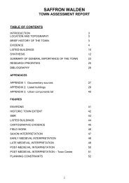
TOWN ASSESSMENT REPORT BOCKING - Internet Archaeology ...
TOWN ASSESSMENT REPORT BOCKING - Internet Archaeology ...
TOWN ASSESSMENT REPORT BOCKING - Internet Archaeology ...

You also want an ePaper? Increase the reach of your titles
YUMPU automatically turns print PDFs into web optimized ePapers that Google loves.
<strong>TOWN</strong> <strong>ASSESSMENT</strong> <strong>REPORT</strong><br />
<strong>BOCKING</strong><br />
TABLE OF CONTENTS<br />
INTRODUCTION 3<br />
LOCATION AND TOPOGRAPHY 3<br />
BRIEF HISTORY OF THE <strong>TOWN</strong> 3<br />
EVIDENCE 4<br />
LISTED BUILDINGS 6<br />
SYNTHESIS 7<br />
SUMMARY OF GENERAL IMPORTANCE OF THE <strong>TOWN</strong> 12<br />
RESEARCH PRIORITIES 13<br />
BIBLIOGRAPHY 14<br />
APPENDICES<br />
APPENDIX 1: Documentary sources 15<br />
APPENDIX 2: Listed buildings 16<br />
APPENDIX 3: Urban components list 20<br />
FIGURES<br />
ENVIRONS 21<br />
HISTORIC <strong>TOWN</strong> EXTENT 22<br />
SMR - BRADFORD ST 23<br />
SMR - CHURCH ST 24<br />
LISTED BUILDINGS - BRADFORD ST 25<br />
LISTED BUILDINGS - CHURCH ST 26<br />
FIELD WORK 27<br />
MEDIEVAL INTERPRETATION - GENERAL 28<br />
MEDIEVAL INTERPRETATION - BRADFORD ST 29<br />
MEDIEVAL INTERPRETATION – CHURCH ST 30<br />
POST-MEDIEVAL INTERPRETATION- GENERAL 31<br />
POST-MEDIEVAL INTERPRETATION- BRADFORD ST 32<br />
POST-MEDIEVAL INTERPRETATION- CHURCH ST 33<br />
DISTURBANCE AND FLOODING 34<br />
PLANNING CONSTRAINTS 35<br />
2
INTRODUCTION<br />
<strong>BOCKING</strong><br />
HISTORIC <strong>TOWN</strong> <strong>ASSESSMENT</strong> <strong>REPORT</strong><br />
This report is an archaeological and historical assessment of Bocking and forms part<br />
of the Essex Historic Towns Survey. This is an extensive urban survey as defined by<br />
English Heritage (1992) of 32 historic settlements in Essex. This project, funded by<br />
English Heritage, forms part of a nationwide reassessment of the management of the<br />
urban archaeological resource. The project is being carried out by Essex County<br />
Council’s Planning Department and takes as its basis a survey carried out by the<br />
County Council in the early 1980’s. This was published as Historic Towns in Essex<br />
(Eddy and Petchey 1983) and adopted as Supplementary Planning Guidance by the<br />
County and District Councils.<br />
This report has been compiled using a number of sources, including the Essex Sites<br />
and Monuments Record (ESMR), the List of Buildings of Architectural and Historical<br />
Interest, records held by the County Planning Department’s Historic Buildings Section,<br />
and various cartographic and documentary records (following an assessment of such<br />
records by Dr Chris Thornton of the Victoria County History, Essex). The preparation<br />
of this report has involved the addition of information to the ESMR database and the<br />
digitising of spatial data onto a Geographic Information System (GIS).<br />
For the purposes of this study the Roman period is the time-span between 43-410, the<br />
Saxon period is 410-1066, the medieval period is 1066-1536, the post-medieval period<br />
is 1536-1900 and the modern period is 1900 to the present day. This corresponds to<br />
the period divisions used by the ESMR.<br />
LOCATION AND TOPOGRAPHY<br />
Bocking is a bi-focal settlement sited within Braintree District, and immediately to the<br />
north of Braintree town. Both settlement foci are located on the River Pant/Blackwater.<br />
Bocking Churchstreet is the most northerly focal point, and probably the oldest as it<br />
contains the parish church. Bocking Bradford Street is situated approximately 1km to<br />
the south of Churchstreet immediately adjoining Braintree town. Braintree and Bocking<br />
now form a single Urban District within Braintree District.<br />
BRIEF HISTORY OF THE <strong>TOWN</strong><br />
There is some evidence for settlement of the Bocking area in the prehistoric and<br />
Roman period, concentrated in the Bradford Street area, Bradford Street itself follows<br />
the route of the Roman road from Chelmsford to Long Melford and Braintree itself was<br />
a Roman town. In the late tenth century Bocking belonged to the Saxon thegn<br />
Aetheric who bequeathed it to Christchurch at some date immediately prior to 999,<br />
Canterbury held Bocking until the Reformation and still has the right to grant the<br />
Deanery. Medieval Bocking was a bi-focal settlement, based on Church Street and<br />
Bradford Street, linked by Church Lane and the River Pant/Blackwater. The original<br />
focus of settlement was around the existing Late Saxon church and manorhouse in<br />
Bocking Churchstreet, with Bradford Street developing later in response to its position<br />
on the main road and proximity to Braintree market. In 1304 Flemish weavers arrived in<br />
3
Bocking, an event that maybe directly linked with the construction of the new fulling mill<br />
by the Abbot of Canterbury in 1303. By the later medieval and early post-medieval<br />
period Bocking was an important cloth town, by the early sixteenth century specialising<br />
in the manufacture of bays and says. This period of prosperity is reflected by the<br />
development of Bocking Bradford Street. The woollen cloth industry went into terminal<br />
decline in the eighteenth century but the early nineteenth century saw the rise of the<br />
silk industry, with the opening of the Courtauld factory at Bocking Church Street. In<br />
1939 the parishes of Bocking and Braintree were united to form a single Urban District,<br />
and the two towns are no longer physically separated.<br />
EVIDENCE<br />
DOCUMENTARY<br />
Summary assessment of the documentary and cartographic evidence<br />
by Chris Thornton (Victoria County History)<br />
Bocking is reasonably well documented for its size, although the sources appear rather<br />
fragmentary in nature. The chief manor was possessed by the Christchurch Cathedral<br />
Priory, Canterbury, in the medieval period, and a series of medieval extents, surveys<br />
and rentals survive in the Cathedral archive. There are also large collections of<br />
medieval and later deeds in the ERO, BL etc., some late medieval and early modern<br />
court rolls, and seventeenth and eighteenth century rentals for other properties. The<br />
surviving maps and plans in the ERO do show some detail of built-up area and<br />
buildings, but only cover a chronologically narrow time-span from the mid-eighteenth<br />
century onwards.<br />
Modern development for both Braintree and Bocking is covered by business and local<br />
government records. For the modern industrial history see ‘An account of the textile<br />
industry in Bocking to 1839’ (ERO T/Z 27) and Coleman, D.C., (1969, 1980),<br />
Courtaulds: an economic and social history. See also a thesis on the mills of Samuel<br />
Courtauld and Co. (ERO T/Z 75/11), Blake, D.J. and Crittall, A., (1989), Window<br />
Vision and Quin, W.F. (1981) A history of Bocking and Braintree.<br />
Assessment of the place-name and documentary evidence<br />
The place-name Bocking (Boccinge) is first mentioned in an Anglo-Saxon will dating to<br />
c.995 (Reaney, 1935, 413) and the earliest reference to Bradford Street is from the<br />
Court Rolls of 1384.<br />
The Domesday Book records Braintree in 1066 and 1086 (Rumble, 1983). Bocking<br />
was held by the monks of Christ Church and Holy Trinity, Canterbury:-<br />
Holy Trinity has always held Bocking as a manor, for 4½ hides. 2 ploughs in lordship.<br />
Then 35 men’s ploughs, now 29.<br />
Then 19 villagers, now 18; then 25 smallholders, now 44; then 4 slaves, now 2.<br />
Woodland, 300 pigs; pasture for 60 sheep; meadow, 22 acres; 1 mill. 6 cattle, 100<br />
sheep and 54 pigs.<br />
To this manor have always belonged 2 hides in (West) Mersea ...<br />
In total, value then £24; now 28.<br />
Canterbury still holds the right to nominate the Dean of Bocking.<br />
4
ARCHAEOLOGICAL<br />
Above ground remains<br />
The above ground remains consist of the medieval and post-medieval built<br />
environment, including the Parish Church of St Mary the Virgin, the late medieval<br />
merchants houses and wool halls along Bradford Street, Bocking windmill and<br />
Bradford Street watermill and the public buildings and worker’s cottages erected by the<br />
Courtauld family.<br />
Excavations<br />
Only a few excavations and watching-briefs have been undertaken in Bocking and<br />
these have only been small-scale. However the trial-pit at 190-210 Church Lane<br />
(published as 178-196 Church Street) did establish the presence of archaeological<br />
deposits to a depth of about 1m, largely as a consequence of the need to raise the<br />
ground-level because of persistent river flooding.<br />
Table 1: Fieldwork undertaken in Bocking<br />
ESMR DATE SITE ARCHIVE<br />
LOCATION<br />
6545 1986 114 Bradford Street Finds: None,<br />
Archive: ESMR<br />
16397 1992 ‘Coach house’, next to Archive: ESMR,<br />
89 Bradford Street Finds: None<br />
16346 1990 3 Canterbury Grange, Archive: ESMR,<br />
Church Street<br />
16820-3 1996 Former Bradford Street<br />
Garage Site (BKBS96)<br />
16310 1986 190-210 Church Lane,<br />
BK86 (published as 178-<br />
196 Church Street)<br />
Finds: None<br />
Archive and finds:<br />
Howard Brooks<br />
Archaeological<br />
Services<br />
Archive: ESMR,<br />
Finds: Montrose<br />
Road<br />
PUBLICATION<br />
Andrews, D., 1986, ‘114 Bradford Street,<br />
Bocking’, ESMR<br />
Havis, R. , ‘Coach house’, next to 89<br />
Bradford Street, Bocking’, ESMR<br />
Havis, R., 1990, ‘3 Canterbury grane,<br />
Bocking Churchstreet, W/B’, ESMR<br />
Brooks, H., 1996, ‘Excavations on the<br />
former Bradford Street Garage Site,<br />
Bocking: Archaeological Evaluation’<br />
ESMR<br />
Andrews, D. and Watkin, B., 1988, 'A<br />
timber-framed building at Bocking (nos.<br />
178-196 Church Street)', Essex Archaeol.<br />
Hist. 19, 215-222<br />
Finds<br />
Medieval and post-medieval pottery by Helen Walker (Essex County Council Field<br />
<strong>Archaeology</strong> Group)<br />
The geographical location of Bocking is of particular interest in the studies of ceramic<br />
distributions. There is the question of the relationship between Hedingham ware and<br />
Bocking, which was one of the nearest consumer sites. The presence of the Mill End<br />
bowl from the Colchester area is also of interest as the Hedingham kilns, which also<br />
produced coarse wares, would have been a much closer source for this form of pottery.<br />
This may be evidence of extended distribution along Stane Street, which ran east-west<br />
from St Albans to Colchester.<br />
Medieval<br />
A sherd probably from a large 13th century Mill End-type bowl (a production site<br />
outside Colchester) was found at Bradford Street, Bocking (Drury 1976, 103). A small<br />
amount of pottery was found during excavation of a timber-framed building at Church<br />
5
Street, Bocking (Andrews and Watkin 1988), comprising a handful of small late<br />
medieval sandy orange ware sherds dating between the 14th and 16th centuries.<br />
There is also a sherd of tin-glazed earthenware from a flatware showing a turquoise<br />
internal glaze which may have a Mediterranean origin. Excavations at Bocking Hall<br />
produced two sherds of medieval coarse ware (Andrews 1988, unpublished).<br />
Post-medieval<br />
Two sherds of unglazed post-medieval red earthenware dating from the late 15th/16th<br />
century onwards were found at Bocking Hall (Andrews 1988 unpublished).<br />
LISTED BUILDINGS<br />
in consultation with Anne Holden and Dave Stenning (Listed Buildings)<br />
The schedule of listed buildings provided in this report is derived from the List of<br />
Buildings of Special Architectural and Historical Interest. This List has been compiled<br />
over many years through the work of many inspectors and, as a result, the reliability of<br />
the List varies from District to District. Time was extremely limited and very few<br />
interiors were looked at, or even the rear wings of buildings. Where further research<br />
has been carried out on individual buildings, this has often shown the limitations of the<br />
List descriptions. The List for Bocking was originally compiled in 1973, it can be<br />
considered to be of fair reliability. It has been possible to supplement the information<br />
provided in the List through the knowledge and records of the County Historic<br />
Buildings and Design Section. Bocking has 98 Listed Buildings, of which 17 are<br />
Grade II*, the remainder are Grade II. The following table shows the buildings<br />
grouped by their construction date as attributed in the List, however it must be treated<br />
with caution as further research has demonstrated that some of the buildings have<br />
earlier antecedents.<br />
Table 2: Listed Buildings by century of origin<br />
CENTURY NUMBER<br />
14 1<br />
15 1<br />
16 20<br />
17 33<br />
18 29<br />
19 12<br />
Amongst the buildings of particular interest are:-<br />
• 98 Bradford Street which has a cross-wing with service doors of probable mid<br />
fourteenth century date.<br />
• 67/69 Bradford Street is an early fourteenth century public-building, jettied on its<br />
northern side.<br />
• The Dragon House, Bradford Street is a mid-sixteenth century long-wall jetty house.<br />
• Wentworth House, Bradford Street has builds of many periods, the southern<br />
fourteenth century cross-wing is probably a shop or workshop.<br />
• 75 Bradford Street is an early fourteenth century, probably non-domestic crosswing,<br />
with a remarkable two light window, visible to the flank.<br />
General information derived from the Listed Buildings evidence is incorporated in the<br />
period syntheses below.<br />
6
SYNTHESIS<br />
PRE-URBAN SYNTHESIS<br />
Prehistoric<br />
The excavations at the Bradford Street Garage Site (ESMR 16820) revealed a large pit<br />
containing a flint core and a few flakes. Further flint tools and flakes have been found<br />
in and around the Bocking area.<br />
Roman<br />
Bradford Street follows the route of the Roman road from Chelmsford to Long Melford.<br />
The excavations at the Bradford Street Garage Site (ESMR 16821) revealed a single<br />
Roman ditch that might be the western roadside ditch. A number of Roman burials<br />
were found about 300m to the south-west of Bradford Street. The only evidence for<br />
Roman activity in the vicinity of Churchstreet is the stray find of a coin on the site of<br />
Courtauld’s Mill.<br />
Saxon<br />
The evidence for the Saxon period in Bocking is entirely documentary. In the late tenth<br />
century it belonged to the Saxon thegn Aetheric who bequeathed it to the monks of<br />
Christchurch, Canterbury (later Holy Trinity Cathedral), at some date prior to 999. The<br />
Domesday Book (Rumble, 1983) records that in 1066 it was still held by the monks of<br />
Holy Trinity, at which time it had 48 households and 1 mill. It is known that a church<br />
was already in existence by the late tenth century, probably on the site of the later<br />
medieval church, as Aetheric specified in his will that ‘one hide I will give to the church<br />
for the priest who serve God there’ (Hoffmann, 1976). The Saxon church was<br />
destroyed by fire in the early eleventh century.<br />
URBAN SYNTHESIS<br />
Medieval synthesis and components<br />
Medieval Bocking was a bi-focal settlement linked by Church Lane and the River<br />
Pant/Blackwater. The original focus of settlement was around the existing Late Saxon<br />
church and manorhouse in Bocking Churchstreet with Bradford Street developing later<br />
in response to its position on the main road and proximity to Braintree market. In 1304<br />
Flemish weavers arrived in Bocking, an event which maybe directly linked with the<br />
construction of the new fulling mill by the Abbot of Canterbury in 1303. An Extent of<br />
Bocking dating to 1309 (Quin, 1981) records that it had an adult male population of 86.<br />
The medieval urban components are:-<br />
Built-up area<br />
Medieval Bocking was a bi-focal settlement, consisting of Church Street and Bradford<br />
Street, linked by Church Lane and the River Pant/Blackwater. The original focus of<br />
settlement was around the church and manorhouse in Bocking Churchstreet (TL 75860<br />
25755), where the Saxon settlement is presumed to have been located. Bradford<br />
Street (TL 76094 24171) probably developed originally to service the travellers and<br />
pilgrims using the road, and the Woolpack on Bradford Street was reputedly built as a<br />
Pilgrim’s Inn (Brisley, 1992). The growth of the wool trade saw a shift in emphasis from<br />
7
Church Street to Bradford Street, where the houses and wool-halls of the<br />
manufacturers and merchants were concentrated because of its proximity to Braintree<br />
market and its position on the main road.<br />
The excavations at the Bradford Street Garage Site (ESMR 16822) revealed a<br />
medieval ditch which maybe the rear property of a medieval frontage plot on Bradford<br />
Street.<br />
Parisb Church of St Mary the Virgin (TL 75692 25679)<br />
The original Saxon church was destroyed by fire in the early eleventh century, and<br />
appears to have been rebuilt in stone at about the date of the Norman Conquest.<br />
There are a few fragments of this eleventh century church, consisting of the capital<br />
and base of a column incorporated into the north aisle of the late medieval church<br />
(Quin, 1981). The present flint and rubble structure is fourteenth century in origin<br />
(1385-1422). In the early fifteenth century the west tower was added and there was<br />
further re-building in the mid-fifteenth century. From 1490-1520 the church was again<br />
substantially rebuilt, with the addition of the north and south aisles and their chapels.<br />
Chapel of St James (TL 76065 24188)<br />
Bequests in 1510 and 1517 mention the Chapel of St James which stood in Bradford<br />
Street. This building is perhaps the same as the Hospital of St James which Henry III<br />
made a grant of protection for in 1229. It has been suggested (Quin, 1981) that the<br />
Chapel stood close to the junction of Bradford Street with Church Lane next to the Six<br />
Bells Inn.<br />
Bocking Hall manorhouse (TL 75692 25744)<br />
Bocking Hall was the manorhouse for the Manor of Christchurch Canterbury. In an<br />
Extent of 1309 it was described as ‘well and sufficiently built’, on a five acre site with a<br />
courtyard, garden, meadow, dovecote and two mills, one of which was for fulling<br />
(Hoffmann, 1976). The manorhouse itself was rebuilt in the second half of the<br />
sixteenth century, but is thought to occupy much the same site as its predecessor.<br />
Thirty metres to the east of the Hall is an early fourteenth century single aisled building<br />
(ESMR 5140) with a fifteenth century extension, that originally formed part of the hall<br />
complex.<br />
Deanery (TL 75621 25449)<br />
The land for the Deanery had been granted as part of the terms of Aetheric’s will in the<br />
late tenth century (Hoffmann, 1976). The Old Deanery is sited on the western side of<br />
the river, opposite to the Parish Church and is thought to have occupied the same site<br />
since the late Saxon period. The present building incorporates some early fourteenth<br />
century elements in the north wing, but was substantially extended and altered in the<br />
Tudor period.<br />
Doreward’s Hall (TL 76270 25359)<br />
The present building at Doreward’s Hall was built in 1579, however it is thought to be<br />
on the same site as the medieval manorhouse of Doreward’s which had its origins in<br />
the late Saxon period.<br />
Public Buildings<br />
67/69 Bradford Street (TL 7603 2400) is an early fourteenth century public building.<br />
75 Bradford Street (TL 76015 24015) appears to have had a first floor with no internal<br />
divisions, suggesting a public building function. The rear wing of 89 Bradford Street<br />
(TL 76010 24088) may also have been a Wool Hall. 40 Bradford Street (TL 76065<br />
23930) dates to c. 1400, with a possible commercial hall or wool hall on the first floor.<br />
8
190-210 Church Lane (TL 75758 25421, ESMR 16310, misnamed 178-196 Church<br />
Street in Andrews and Watkins 1988) is an early sixteenth century timber-framed<br />
building of very high quality and has been interpreted as a merchants house<br />
incorporating a possible Wool Hall. The majority of the public buildings are along<br />
Bradford Street, and it has been suggested that many of these were Wool Halls,<br />
associated with the cloth trade.<br />
Church Alehouse (TL 76125/24209)<br />
There is a strong local tradition that the Six Bells, Bradford Street originally was a<br />
Church Alehouse. Brisley (1992, pl.5) has published a photograph of the original Six<br />
Bells, which certainly appears to have its origins as a late medieval public building,<br />
with Victorian modifications. The carved wooden figure ‘Old Harkilees’ was re-used as<br />
a decorative feature on the facade, it is now in Braintree Museum. The original Six<br />
Bells was demolished in the 1930’s when the road was widened.<br />
Schoolhouse<br />
A schoolhouse is documented as being in existence in 1399 (Quin, 1981), it was<br />
founded as part of the Doreward’s Chantry bequest. Its location is not known, but it<br />
was probably in the vicinity of the parish church.<br />
Priest’s house (TL 75685 25705)<br />
The Doreward family founded two chantries in 1362 and 1397 respectively (Quin,<br />
1981), each apparently with its own chantry priest and each priest had a house and<br />
garden. In 1445 it was recorded that the priest who served the Doreward’s Chantry<br />
had a house and garden in ‘that part of the churchyard which lies on the far side of the<br />
church’.<br />
Maison de Dieu/Royal Almshouses (TL 75755 25570)<br />
In 1440 a royal license was granted for a ‘Maison de Dieu’ for the relief and reception<br />
of seven poor people of Bocking. This later became the Royal Almshouses, but these<br />
were demolished and replaced in 1869.<br />
Guild-hall (Approximately TL 75862 25729)<br />
There is a tradition that a guild-hall stood in Bocking Church Street, next to the ‘King<br />
William’ (Quin, 1981).<br />
Mills<br />
The Domesday Book records the existence of one mill in Bocking in 1086. In 1303 the<br />
Abbot of Canterbury paid for the construction of a new fulling mill, possibly to replace<br />
the Domesday structure, and in 1308 a further sum was paid for a new gate (floodgate?)<br />
for the mill. The Domesday mill and the Abbot’s mill were probably located on<br />
the River Pant/Blackwater (TL 75593 25645) close to the parish church. By the late<br />
medieval period there was a total of three water-powered fulling mills in Bocking and<br />
three wind-mills for corn. The fulling mills were located at Bradford Street (TL 76243<br />
24338), Church Street (TL 75593 25645) and Straits Mill (TL 76997 24331).<br />
Pillory, whipping-post and ducking-stool (Approximately TL 75759 25635)<br />
The pillory, whipping-post and ducking-stool were first mentioned in the Extent of 1309<br />
(Quin, 1981). The pillory and whipping-post stood at the gates of the manor, whilst the<br />
ducking-stool was located on the river by the bridge.<br />
9
Post-medieval and modern synthesis and components<br />
Bocking was still an important cloth towns at the beginning of the post-medieval<br />
period, having by the early sixteenth century specialised in the manufacture of bays<br />
and says. The principal market for the Bocking bays and says was abroad,<br />
particularly Spain and Portugal (Baker, 1981). The cloth trade was however prone to<br />
peaks and troughs, dependent on the communications and relationships with its<br />
overseas markets. In 1557 Bocking had 800 people over the age of 14, but by 1575<br />
this had increased to 1500. However, between 1665-7 441 people died of the plague,<br />
nearly one-third of the town’s population. In Bocking at the end of the seventeenth<br />
century 148 out of 158 apprenticeships were in the wool trade. This period of<br />
prosperity is reflected by the development of Bocking Bradford Street. The woollen<br />
cloth industry went into terminal decline in the eighteenth century but the early<br />
nineteenth century saw the rise of the silk industry, with the opening of the Courtauld<br />
factory at Bocking Church Street. In 1939 the parishes of Bocking and Braintree were<br />
united to form a single Urban District.<br />
Built-up area<br />
Post-medieval Bocking was based on the original medieval foci of Church Street<br />
(centred TL 75860) and Bradford Street (centred TL 76094 24171), with some ribbon<br />
development along Church Lane. The quality of the early post-medieval buildings in<br />
Bradford Street, in particular the number of public buildings (probably wool-halls)<br />
reflects the prosperity of this area due to the wool-trade. The role of silk manufacturing<br />
and the Courtauld family in Bocking in the ninteenth and early twentieth centuries is<br />
recorded by a number of public buildings in Church Street and 121-139 Church Street<br />
which were built in 1872 by Samuel Courtauld as high quality housing for the workers<br />
in Bocking Mill. In the late twentieth century the building of large-scale housing<br />
estates on the western side of Church Lane has effectively linked Bradford Street to<br />
Church Street, and Bocking to Braintree.<br />
Parish Church of St Mary the Virgin (TL 75692 25679)<br />
The churchyard wall is of flint and rubble construction of sixteenth century date, it is<br />
embattled with moulded stone copings and two seventeenth century arquebus rests. It<br />
was patched with brick in the seventeenth century. The church was extensively<br />
restored in the nineteenth and twentieth centuries.<br />
United Reformed Church (Congregational) (TL 76166 26051)<br />
The United Reformed Church (Congregational), Church Street was built in 1862 and is<br />
still in use.<br />
Franciscan Convent and the Chapel of the Immaculate Conception (TL 76300<br />
24340)<br />
The Franciscan Convent and the Chapel of the Immaculate Conception, Broad Street,<br />
Bocking, is an irregular group of red brick buildings, designed by J.F. Bentley in 1898.<br />
The Convent included an orphanage and school. It is now a residential home for the<br />
elderly.<br />
Bocking Hall (TL 75692 25747)<br />
The present Bocking Hall is a timber-framed and plastered house built in the second<br />
half of the sixteenth century, added to in the seventeenth century and altered in the<br />
10
eighteenth. It stands on the site of the medieval manorhouse of Christchurch<br />
Canterbury.<br />
Doreward’s Hall (TL 76270 25359)<br />
The present Doreward’s Hall is said to have been built by Edward Thursby in 1579.<br />
Further additons were made in the seventeenth and eighteenth centuries. It is partly of<br />
brick construction and partly timber-framed and plastered.<br />
Deanery (TL 75621 25449)<br />
The Deanery is a largely early seventeenth century timber-framed and plastered<br />
building, incorporating a few older elements, with an eighteenth century plastered brick<br />
south-east front. There is a late seventeenth century dovehouse with wattle and daub<br />
nesting boxes for 130 doves in the Deanery grounds.<br />
Workhouse (TL 75758 25421)<br />
Bocking Parish Workhouse was located on Church Lane (Nos. 190-210). It is an early<br />
sixteenth century timber-framed building, that was used as the parish workhouse in the<br />
eighteenth and nineteenth centuries (ESMR 16310). The gambrel-roofed addition<br />
dates to this phase. It was replaced in 1838 by the Poor Law Union workhouse, on<br />
Rayne Road, Braintree.<br />
The Workmans Hall (TL 75739 25623)<br />
The Workmans Hall, Church Street was built by the Courtauld family as a place of<br />
recreation for the mill employess in 1889. It was designed by George Sherrin who<br />
designed many other of the Courtauld buildings.<br />
Village Hall and United Services Club (TL 75990 25949)<br />
The Village Hall and United Services Club buildings at the junction of Church Street<br />
and Fennes Road were built in 1912 by Mr S. Augustine Courtauld.<br />
Braintree and Bocking Cottage Hospital (TL 76464 24690)<br />
Mrs G. Courtauld founded a Cottage Hospital in Broad Road, Bocking in 1871, but in<br />
1921 it was replaced by the William Julian Courtauld Hospital on London Road,<br />
Braintree.<br />
Almshouses (TL 75755 25570)<br />
The medieval almshouses at the southern end of Church Street were demolished and<br />
rebuilt in red brick in 1869.<br />
Courtauld’s Mill (TL 75593 25645)<br />
In Samuel Courtauld 1819 purchased the old fulling mill at Bocking Church Street and<br />
converted it to silk manufacture, subsequently adding a steam factory in 1826 and a<br />
finishing factory. It specialised in the production of black mourning crêpe. By the<br />
1880s more than 1,300 workers were employed by the firm in Braintree and Bocking,<br />
out of a total population of 8,500, and more than 90% of the workforce were women. In<br />
1904 Courtaulds bought the British rights to the ‘viscose’ process of making rayon and<br />
developed the world’s first commercially successful man-made fibre. Courtauld Mill<br />
announced its closure in 1981, and the buildings have been demolished.<br />
Bradford Mill (TL 76243 24338)<br />
Bradford mill (also known as Fulling Bridge or Cane’s Mill) is a timber-framed and<br />
weather-boarded mill on the River Blackwater at the north-eastern end of Bradford<br />
Street, Bocking. It is Listed as being of eighteenth century date, but may incorporate<br />
parts of the 1580 mill built by the Nottage family who were clothiers..<br />
11
Straits Mill (TL 76997 24331)<br />
Straits or Hobb’s Mill was a water-powered wool fulling mill, with its origins in the late<br />
medieval period, but was rebuilt in 1576. In the eighteenth century it was again rebuilt<br />
as a corn mill, of weatherboarding and brick construction. It was derelict by the early<br />
twentieth century and demolished in the last few years (Brisley, 1992).<br />
Bocking Windmill (TL 76302 25694)<br />
Bocking windmill (ESMR 6231) was first recorded in 1680. It is a weatherboarded,<br />
post mill with sails, tail poles and sack hoist. In 1829 it was sold and in 1830 it was<br />
moved approximately 400m eastwards to its present site. The brick built two-storied<br />
round house being added at this date. It has been renovated and is in local authority<br />
hands.<br />
Breweries, oasthouses and maltings<br />
The early fourteenth century outbuilding 30m to the east of Bocking Hall was converted<br />
to form a maltings or oasthouse in the eighteenth century (ESMR 5140, TL75740<br />
25745). The nineteenth century Bocking Brewery (ESMR 15296, TL76070 24140)<br />
was located on Bradford Street, but only the malthouse of the the brewery complex still<br />
survives and it has been converted into a shop. The Oast, Church Lane (ESMR<br />
15297, TL75960 24410) is a nineteenth century weatherboarded oasthouse now<br />
converted to residential use, the conical kiln is still intact. Peatlings, Bradford Street<br />
and the barn at Resting Seat House, Church Lane are both probable maltings.<br />
SUMMARY OF GENERAL IMPORTANCE OF THE <strong>TOWN</strong><br />
HISTORICAL AND ARCHAEOLOGICAL SUMMARY<br />
Bocking is of importance archaeologically and historically, comprising a late Saxon<br />
settlement and a small medieval and post-medieval cloth-manufacturing town. There is<br />
some evidence for settlement of the Bocking area in the prehistoric and Roman period,<br />
concentrated in the Bradford Street area. Bradford Street itself follows the route of the<br />
Roman road from Chelmsford to Long Melford. In the late tenth century Bocking<br />
belonged to the Saxon thegn Aetheric who bequeathed it to Christchurch at some date<br />
immediately prior to 999, Canterbury held Bocking until the Reformation and still has<br />
the right to grant the Deanery. Medieval Bocking was a bi-focal settlement, based on<br />
Church Street and Bradford Street, linked by Church Lane and the River<br />
Pant/Blackwater. The original focus of settlement was around the existing Late Saxon<br />
church and manorhouse in Bocking Church Street, with Bradford Street developing<br />
later in response to its position on the main road and proximity to Braintree market. In<br />
1304 Flemish weavers arrived in Bocking, this event maybe directly linked with the<br />
construction of the new fulling mill by the Abbot of Canterbury in 1303. By the later<br />
medieval and early post-medieval period Bocking was an important cloth town, by the<br />
early sixteenth century specialising in the manufacture of bays and says. This period<br />
of prosperity is reflected by the development of Bocking Bradford Street. The woollen<br />
cloth industry went into terminal decline in the eighteenth century but the early<br />
nineteenth century saw the rise of the silk industry, with the opening of the Courtauld<br />
factory at Bocking Church Street. In 1939 the parishes of Bocking and Braintree were<br />
united to form a single Urban District.<br />
12
SURVIVAL<br />
There has been only limited fieldwork in Bocking. However the excavated evidence<br />
has revealed that there is surviving cut features and in some areas there is a build-up<br />
of stratigraphy, at its deepest up to 1m. There has been some haphazard localised<br />
quarrying within the urban area, largely dating to the post-medieval period, but these<br />
are small-scale in nature. Waterlogged deposits are known to survive in deeper<br />
features such as wells and cess-pits, and there is a reasonable potential of<br />
waterlogged alluvial deposits close to the River Pant/Blackwater. Soil-conditions are<br />
conducive to the preservation of faunal remains and artefacts such as ceramics,<br />
building materials and metal. Bocking has a reasonable range of medieval and postmedieval<br />
documentary source material for a town of its size and importance. Both<br />
Church Street and Bradford Street retain the appearance of historic streets of<br />
medieval origin, and Bradford Street in particular has very fine examples of late<br />
medieval and early post-medieval urban architecture. Unfortunately the nineteenth<br />
and early twentieth century industrial buildings of the Courtauld Mills complex have<br />
been demolished.<br />
CURRENT PLANNING CONSTRAINTS<br />
Bocking windmill is a Scheduled Ancient Monument (SAM 87). The medieval town and<br />
the majority of the post-medieval town is located within the current Conservation<br />
Areas. There are 98 Buildings Listed as being of Architectural or Historical Importance,<br />
of which 17 are Grade II* and the remainder Grade II.<br />
RESEARCH PRIORITIES<br />
The understanding of the development and function of the small medieval and postmedieval<br />
town and the testing of theories on social action, economy, politics etc. have<br />
been highlighted as an important area of study at the national level (English Heritage,<br />
1997; Ayres in Brown and Glazebrook, forthcoming).<br />
The immediate research priorities for the medieval and post-medieval period are:-<br />
• Fieldwork undertaken within Bocking has to date added little to our knowledge of<br />
the medieval town, partly because of lack of development within the historic<br />
area and partly because what development has been undertaken has largely<br />
been in the backlands rather than on the street frontage. Subsequent fieldwork<br />
should need to be targeted to correct this imbalance.<br />
• The period of transition from the late Saxon settlement to the medieval town needs<br />
to be examined.<br />
• Further excavation will be needed before the medieval and post-medieval pottery<br />
evidence can reveal anything about dating, trade and distribution networks and<br />
socio-economic factors. The relationship between Hedingham ware and the<br />
town needs to be examined, as Bocking was one of the nearest consumer sites<br />
for the Hedingham kilns and the evidence for an extended east-west distribution<br />
of pottery types along Stane Street needs to be examined.<br />
• The role of the cloth trade in the development of the town and how it is represented<br />
in the archaeological and historical record is an important area of research and vital<br />
to our understanding of the morphology, economy and social history of Bocking.<br />
13
BIBLIOGRAPHY<br />
Andrews, D. and 1988 'A timber-framed building at Bocking (nos. 178-196<br />
Watkin, B.,<br />
Church Street)', Essex Archaeol. Hist. 19, 215-222<br />
Brisley, D. 1992 Braintree and Bocking in old picture postcards, Volume<br />
3, European Library - Zaltbommel/Netherlands<br />
Brown, N. and forthcoming Research and <strong>Archaeology</strong>: A framework for the<br />
Glazebrook, J.<br />
(eds.)<br />
Eastern Counties, 2 research agenda.<br />
Eddy, M.R. and 1983 Historic Towns in Essex: An Archaeological Survey of<br />
Petchey, M.R.<br />
Saxon and Medieval towns, with guidance for their future<br />
planning , Essex County Council<br />
English Heritage 1992 Managing the Urban Archaeological Resource, English<br />
Heritage limited circulation document<br />
English Heritage 1997 English Heritage, <strong>Archaeology</strong> Division: Research<br />
Agenda (draft) English Heritage limited circulation<br />
document<br />
Hoffmann, A. 1976 Bocking Deanery: The story of an Essex Peculiar,<br />
Phillimore:London and Chichester<br />
Quin, W.F. 1981 A history of Braintree and Bocking, Lavenham Press<br />
Ltd.<br />
Reaney, P.H. 1935 Place-names of Essex, Cambridge<br />
Rumble, A. (ed.) 1983 Domesday Book - Essex, Phillimore:Chichester<br />
14
APPENDICES<br />
APPENDIX 1: Documentary sources<br />
Bocking E.R.O. T/A 172 medieval Catalogue of deeds in Westminster abbey<br />
muniments<br />
Bocking E.R.O. T/A 733 medieval Deeds in Huntingdon Library, California.<br />
Bocking P.R.O. E142 46 12 John Extent or Valor of the lands and stock of<br />
Canterbury Cathedral Priory in Bocking<br />
Middleton.<br />
Bocking E.R.O. T/A 262 1300-1485 Transcripts of surveys and rentals and<br />
transcripts of deeds of property of Prior of<br />
Christ Church, Canterbury.<br />
Bocking E.R.O. T/P 116/1/2 1309 Extent of manor of Bocking.<br />
Bocking P.R.O. SC2 123-125 Edw. II - Geo. Books of reliefs and fines for Clare Honor,<br />
III<br />
including Bocking. See P.R.O. List and Index<br />
VI (1896) for full listing.<br />
Bocking E.R.O. T/A 262/9 1382-1417 Extracts from court rolls, manor of Bocking.<br />
Bocking B.L. Add. Ch. 13596 15th cent. Rental of manors.<br />
Bocking B.L. Add. Ch. 64913-65653 1417-1757 Large collection of deeds.<br />
Bocking B.L. Add. Ch. 13551 1455 Foundation of a hospital.<br />
Bocking E.R.O. D/DB M180 1638 Rental of Bocking Hall.<br />
Bocking E.R.O. D/DDw M33-37 1680-1726 Court rolls and rentals, manor of Bocking.<br />
Bocking E.R.O. D/DHh P3 1736 Estate map of Bocking, showing lands E and<br />
NE of 'Bocking street'. Buildings shown<br />
include Doreward's Hall, Bradford's and Gt.<br />
Bradford's, the watermill on the river and 2<br />
arched bridges, drawn in perspective<br />
view.Scale: 20 in. to 1m.<br />
Bocking E.R.O. D/DE M4 1772 Rental of manors of Denwards, Bradford's<br />
Herries.<br />
Bocking E.R.O. D/DO P2A 1803 Book of reference to estate map of Bocking.<br />
Bocking E.R.O. D/DO P2 1803 Estate map of Bocking.(See book of<br />
reference)<br />
Bocking E.R.O. D/F 3/2/1-160. 1809-1947 Records of Bocking factory of Sam.<br />
Courtaulds and Co.<br />
Bocking E.R.O. D/DTa P3 1814 West of parish. Shows Tan office and<br />
Wheelers Yard in Church Street.<br />
Bocking E.R.O. D/CT 39 1838-39 Tithe map. Shows silk-mill. Scale: 26.6 in. to<br />
1m.<br />
Bocking E.R.O. D/DHh M24 1848-1921 Court book, manor of Bocking.<br />
Bocking E.R.O. D/DTa P4 1849 Farms in Bocking (prob. not town).<br />
Bocking E.R.O. D/RBr 1894-1934 Braintree rural district records.<br />
Bocking E.R.O. D/UBb 1934-1974 Braintree and Bocking Urban District records.<br />
Bocking B.L. Harl. 1006 2,13. Manorial extent and customs.<br />
Bocking B.L. Add. MS. 6159, ff. 51,<br />
187b.<br />
n.d. Manorial extent.<br />
Bocking B.L. Add. MS. 6159, ff. 48,<br />
183; 6160,<br />
f.68b.<br />
n.d. Rents of assize and customs.<br />
15
APPENDIX 2: Listed buildings<br />
Serial No. Date Street No. Name Building Type GV Grade Material<br />
2/166 Bradford Street Bawn Cottage N II<br />
5/63 14 Bocking Church Street Church of St Mary the Virgin Parish church Y B Flint & rubble<br />
10/300 15 The Chase Barn at Dorewards Hall Barn N II Timber framed, weatherboarded<br />
5/65 16 Bocking Church Street 47-51 [odd] House Y II Timber framed, plastered<br />
5/83 16 Bocking Church Street Bocking Hall House Y II* Timber framed, plastered<br />
5/187 16 Bocking Church Street Wall to Church of St. Mary the Virgin Wall Y B Flint & rubble, brick<br />
2/4 16 Bradford Street House Y II Timber framed, plastered<br />
3/33 16 Bradford Street 89 Maysent House House Y II* Timber framed, plastered<br />
2/11 16 Bradford Street 40, 42 House Y II Timber framed, plastered<br />
3/18 16 Bradford Street 84-90 [even] House Y II Timber framed, plastered<br />
3/35 16 Bradford Street 85, 85a House Y II Timber framed, plastered, brick<br />
plinth<br />
2/48 16 Bradford Street 11 House Y II* Timber framed, plastered<br />
3/23 16 Bradford Street 106 House Y II Timber framed, plastered<br />
2/46 16 Bradford Street 19, 21, 23 House Y II Timber framed, plastered<br />
3/26 16 Bradford Street 114-118<br />
House Y II* Timber framed, plastered<br />
[even]<br />
2/40 16 Bradford Street 41 Dragon House House Y II Timber framed, plastered<br />
3/36 16 Bradford Street 77-81 [odd] House Y II* Timber framed, plastered<br />
4/56 16 Church Lane 35-39 [odd] House N II* Timber framed, plastered<br />
10/84 16 The Chase, Bocking<br />
Doreward's Hall House N II* Timber framed, plastered<br />
Church Street<br />
2/16 16-17 Bradford Street 54, 56, 56a House Y II Timber framed, plastered<br />
3/17 16-17 Bradford Street 68, 68b House Y II Timber framed, plastered<br />
2/6 16-17 Bradford Street 10-14 [even] Y II Timber framed, plastered<br />
5/185 16-17 Church Lane 212 House Y II Timber framed, plastered<br />
5/59 17 Bocking Church Street 84, 86 Shop Y II Timber framed, plastered<br />
5/188 17 Bocking Church Street Wall to Bocking Hall Wall Y II Flint, rubble, brick<br />
5/83A 17 Bocking Church Street Farm Buildings to Bocking Hall Farm building Y II Timber framed<br />
10/62 17 Bocking Church Street Windmill Post mill N II Weatherboarded, brick base<br />
16
5/60 17 Bocking Church Street 122-126<br />
[even]<br />
House Y II Timber framed, plastered<br />
5/64 17 Bocking Church Street 43, 45 House Y II Timber framed, plastered<br />
Pebble-dash<br />
5/66 17 Bocking Church Street 53-57[odd] Y II Timber framed, plastered<br />
5/58 17 Bocking Church Street 80, 82 King William Inn Y II Timber framed, plastered<br />
3/29 17 Bradford Street 173 Dial House Inn House Y II* Timber framed, plastered<br />
2/42 17 Bradford Street 37 The Bawn House Y II Timber framed, plastered<br />
2/43 17 Bradford Street 31 Old Court Hotel House Y II Timber framed, plastered<br />
3/21 17 Bradford Street 102, 104 House Y II Timber framed, plastered<br />
2/231 17 Bradford Street 29 Clinton Villa House Y II Timber framed, plastered<br />
2/51 17 Bradford Street 3 House Y II Timber framed, plastered<br />
2/49 17 Bradford Street 7, 9 House Y II Timber framed, plastered<br />
3/34 17 Bradford Street 87 Wentworth House House Y II* Timber framed, plastered<br />
2/45 17 Bradford Street 25 Georgian House House Y II* Timber framed<br />
2/44 17 Bradford Street 27 Beechcroft House Y II Timber framed, plastered<br />
3/37 17 Bradford Street 75 House Y II Timber framed, plastered<br />
3/19 17 Bradford Street 92, 92a, 92b,<br />
92c<br />
Y II Timber framed, plastered<br />
3/172 17 Bradford Street 98, 100 Y II Timber framed, plastered<br />
2/7 17 Bradford Street 16-20 [even] House Y II Timber framed, plastered<br />
2/15 17 Bradford Street 52 King's Head Inn Public house Y II Timber framed, plastered<br />
3/54 17 Church Lane Boleyns House N II* Timber framed, plastered<br />
4/184 17 Church Lane 120 The White Cottage House N II Timber framed, plastered<br />
3/179 17 Church Lane 1, 3 House Y II Timber framed, plastered<br />
7/156 17 Coggeshall Road Mark's Farmhouse Farmhouse N II Timber framed, plastered<br />
5/52 17 Deanery Hill The Deanery House N II Timber framed, plastered, brick,<br />
plastered<br />
4/162 17-18 Church Lane 125 Resting Seat House House N II* Timber framed<br />
Brick, pebble-dashed<br />
4/160 17-18 Church Lane 31 The Cottage House N II Timber framed, plastered<br />
2/50 17/18 Bradford Street 5 House Y II Timber framed, plastered<br />
3/181 17/18 Church Lane 9 House Y II Timber framed, plastered,<br />
weatherboarded<br />
2/166 18 Bawn Close Bawn Cottage House Y II Timber framed, weatherboarded<br />
5/58A 18 Bocking Church Street Cottages at the rear of King William Inn House Y II Timber framed, plastered<br />
17
1/2 18 Bocking End 2 House Y II Brick<br />
3/27 18 Bradford Street Bradford Mill Mill Y II* Timber framed, weatherboarded<br />
3/28 18 Bradford Street Bradford Mill House Mill house Y II Timber framed, plastered<br />
2/41 18 Bradford Street 39 Gresham House House Y II Timber framed, plastered,<br />
pebble-dashed<br />
2/5 18 Bradford Street 4 House Y II* Timber framed, plastered<br />
3/176 18 Bradford Street Outbuildings to Bradford Mill Outbuilding Y II Timber framed, brick,<br />
weatherboarded<br />
2/38 18 Bradford Street 63 - 73 [odd] House Y II Timber framed, plastered<br />
2/9 18 Bradford Street Angel Inn House Y II Brick, plastered<br />
3/24 18 Bradford Street 108 House Y II Timber framed, plastered<br />
2/12 18 Bradford Street 44 Stanford House House Y II Gault brick<br />
2/13 18 Bradford Street 48 House Y II Timber framed, plastered<br />
2/10 18 Bradford Street 38 House Y II Timber framed, plastered,<br />
pebble dashed<br />
2/14 18 Bradford Street 50 House Y II Brick<br />
2/47 18 Bradford Street 13 Bradford House House Y II* Timber framed, plastered<br />
4/183 18 Church Lane 56 House N II Timber framed, plastered<br />
4/161 18 Church Lane Hill Malthouse Malt house N II* Timber framed, weatherboarded<br />
1/75 18 Rayne Road 6, 8 House Y II Timber frame, plastered<br />
10/165 18 The Chase, Bocking<br />
Serpentine Wall to Doreward's Hall Serpentine wall N II Brick<br />
Church Street<br />
5/195 18-19 Bocking Church Street 94 Rose and Crown Public House Public house Y II Brick<br />
2/8 18-19 Bradford Street 24 House Y II Timber framed, plastered<br />
2/170 18/19 Bradford Street 6, 8 House Y II Timber framed, plastered<br />
3/180 18/19 Church Lane 5 House Y II Brick<br />
5/53 18/19 Church Lane 190-210<br />
Workhouse Y II Timber framed, plastered<br />
[even]<br />
3/182 18/19 Church Lane Stable Block + outbuilding to Boleyns Stable N II Brick<br />
5/186 19 Bocking Church Street 7-17 [odd] Almshouse Y II Brick<br />
10/200 19 Bocking Church Street 178 Hill House House N II Brick<br />
10/191 19 Bocking Church Street 257 Harriets Farmhouse Farmhouse N II<br />
1/3 19 Bocking End Congregational Church Church N II Gault brick<br />
1/169 19 Bocking End The Institute & Museum Museum N II Gault brick<br />
2/12 19 Bradford Street 46 House Y II Brick, plastered<br />
18
3/174 19 Bradford Street 83 House Y II* Brick, plastered<br />
3/178 19 Broad Road Chapel of the Immaculate Conception, Chapel Y II Brick, stone dressing<br />
3/177 19 Broad Road Franciscan Convent House Y II Timber framed, plastered<br />
3/159 19 Church Lane Bishop Cauden's Hall Y II Brick<br />
10/301 19 Church Street 121-139 [odd] House N II Brick<br />
19
APPENDIX 3: Urban components list<br />
ID DESCRIPTION<br />
MEDIEVAL<br />
955 BUILT-UP AREA<br />
956 PARISH CHURCH OF ST MARY THE VIRGIN<br />
957 CHAPEL OF ST JAMES<br />
958 <strong>BOCKING</strong> HALL MANORHOUSE<br />
959 DOREWARD'S HALL<br />
960 PUBLIC BUILDINGS<br />
961 CHURCH ALE HOUSE<br />
962 SCHOOL HOUSE<br />
963 PRIEST'S HOUSE<br />
964 DEANERY<br />
965 MAISON DE DIEU/ROYAL ALMSHOUSES<br />
966 GUILD-HALL<br />
967 MILLS<br />
968 PILLORY, WHIPPING-POST AND DUCKING-STOOL<br />
POST-MEDIEVAL<br />
969 BUILT-UP AREA<br />
970 PARISH CHURCH OF ST MARY THE VIRGIN<br />
971 UNITED REFORMED CHURCH (CONGREGATIONAL)<br />
938 FRANCISCAN CONVENT AND CHAPEL OF THE IMMACULATE CONCEPTION<br />
972 <strong>BOCKING</strong> HALL<br />
973 DOREWARD'S HALL<br />
974 DEANERY<br />
975 WORKHOUSE<br />
976 WORKMAN'S HALL<br />
977 VILLAGE HALL AND UNITED SERVCES CLUB<br />
978 BRAINTREE AND <strong>BOCKING</strong> COTTAGE HOSPITAL<br />
979 ALMSHOUSES<br />
980 COURTAULD'S MILL<br />
981 BRADFORD MILL<br />
982 STRAIT'S MILL<br />
983 <strong>BOCKING</strong> WINDMILL<br />
984 BREWERIES, OASTHOUSES AND MALTINGS<br />
20